santa maría líquenes, hepáticas y musgos - Facultad de Ciencias ...
santa maría líquenes, hepáticas y musgos - Facultad de Ciencias ...
santa maría líquenes, hepáticas y musgos - Facultad de Ciencias ...

You also want an ePaper? Increase the reach of your titles
YUMPU automatically turns print PDFs into web optimized ePapers that Google loves.
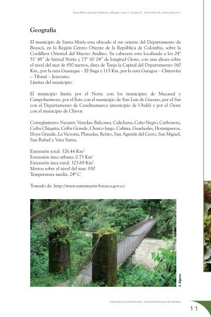
Geografía<br />
Santa María Líquenes, Hepáticas y Musgos - Laura V. Campos-S. , Jaime Uribe-M. y Jaime Aguirre-C.<br />
El municipio <strong>de</strong> Santa María esta ubicado al sur oriente <strong>de</strong>l Departamento <strong>de</strong><br />
Boyacá, en la Región Centro Oriente <strong>de</strong> la República <strong>de</strong> Colombia, sobre la<br />
Cordillera Oriental <strong>de</strong>l Macizo Andino. Su cabecera esta localizada a los 04°<br />
51’ 48’’ <strong>de</strong> latitud Norte y 73° 16’ 04’’ <strong>de</strong> longitud Oeste, con una altura sobre<br />
el nivel <strong>de</strong>l mar <strong>de</strong> 850 metros, dista <strong>de</strong> Tunja la Capital <strong>de</strong>l Departamento 160<br />
Km., por la ruta Guateque – El Sisga y 115 Km. por la ruta Garagoa – Chinavita<br />
– Tibaná – Jenesano.<br />
Límites <strong>de</strong>l municipio:<br />
El municipio limita por el Norte con los municipios <strong>de</strong> Macanal y<br />
Campohermoso, por el Este con el municipio <strong>de</strong> San Luis <strong>de</strong> Gaceno, por el Sur<br />
con el Departamento <strong>de</strong> Cundinamarca (municipio <strong>de</strong> Ubalá) y por el Oeste<br />
con el municipio <strong>de</strong> Chivor.<br />
Corregimiento: Nazaret; Veredas: Balcones, Calichana, Caño Negro, Carbonera,<br />
Ceiba Chiquita, Ceiba Gran<strong>de</strong>, Charco largo, Culima, Guaduales, Hormigueros,<br />
Hoya Gran<strong>de</strong>, La Victoria, Planadas, Retiro, San Agustín <strong>de</strong>l Cerro, San Miguel,<br />
San Rafael y Vara Santa.<br />
Extensión total: 326.44 Km 2<br />
Extensión área urbana: 0.75 Km 2<br />
Extensión área rural: 325.69 Km 2<br />
Metros sobre el nivel <strong>de</strong>l mar: 850<br />
Temperatura media: 24º C<br />
Tomado <strong>de</strong>: http://www.<strong>santa</strong>maria-boyaca.gov.co<br />
E. Algarra<br />
Instituto <strong>de</strong> <strong>Ciencias</strong> Naturales - Universidad Nacional <strong>de</strong> Colombia<br />
11