Cadastral web services in Spain: case of success of the cartography ...
Cadastral web services in Spain: case of success of the cartography ...
Cadastral web services in Spain: case of success of the cartography ...

You also want an ePaper? Increase the reach of your titles
YUMPU automatically turns print PDFs into web optimized ePapers that Google loves.
• <strong>Cadastral</strong> Information Query - both alphanumeric and graphic (maps). This<br />
service allows <strong>the</strong> user to access <strong>the</strong> physical and economic features <strong>of</strong><br />
properties as well as <strong>the</strong>ir owner. The data can be obta<strong>in</strong>ed from <strong>the</strong> address,<br />
from <strong>the</strong> <strong>Cadastral</strong> reference or code, or from a list <strong>of</strong> <strong>the</strong> properties owned by<br />
an <strong>in</strong>dividual.<br />
• Multiple Query Service. Instead <strong>of</strong> mak<strong>in</strong>g <strong>in</strong>dividual queries, it is possible to<br />
send a file <strong>in</strong> a pre-def<strong>in</strong>ed format with necessary data, and this service replies<br />
with all <strong>the</strong> requested <strong>in</strong>formation <strong>in</strong> a file.<br />
• Certificate <strong>of</strong> <strong>Cadastral</strong> Data (<strong>of</strong>ficial document with <strong>the</strong> data obta<strong>in</strong>ed from a<br />
previous query). This document is obta<strong>in</strong>ed immediately and at no cost. The<br />
Certificate bears a 16-digit code which allows <strong>the</strong> document to be recovered as<br />
orig<strong>in</strong>ally issued.<br />
• Exchange <strong>of</strong> <strong>in</strong>formation. Allow<strong>in</strong>g <strong>the</strong> exchange <strong>of</strong> files, <strong>in</strong> a pre-def<strong>in</strong>ed<br />
format, between <strong>the</strong> Cadastre and <strong>the</strong> different Adm<strong>in</strong>istrations as well as with<br />
o<strong>the</strong>r collaborat<strong>in</strong>g organizations, for different purposes: coord<strong>in</strong>ation <strong>of</strong> data<br />
bases, updat<strong>in</strong>g <strong>of</strong> <strong>Cadastral</strong> <strong>in</strong>formation, legal effects, taxation, etc.<br />
• Web <strong>services</strong> and specially, standard Web Map Services, that served cadastral<br />
maps and allow external geographical systems to overlay <strong>Cadastral</strong> <strong>in</strong>formation<br />
onto <strong>the</strong>ir own cartographies, orthophotographies, and even for Google Earth.<br />
The ma<strong>in</strong> content <strong>of</strong> <strong>the</strong> <strong>case</strong><br />
At <strong>the</strong> end <strong>of</strong> <strong>the</strong> 80 <strong>the</strong> Spanish Cadastre is computerized and begun to obta<strong>in</strong> cadastral<br />
<strong>cartography</strong> <strong>in</strong> vectorial format, to load it <strong>in</strong> a GIS. This cadastral GIS was exclusively<br />
oriented <strong>the</strong> <strong>in</strong>ternal user, <strong>of</strong> <strong>the</strong> cadastre.<br />
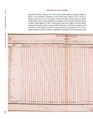
La Cartografía Catastral georreferenciada y en formato vectorial cuenta con las<br />
siguientes características:<br />
Proyección: U.T.M. en los husos 27, 28, 29, 30 y 31<br />
Sistema Geodésico: ED50 para península y Baleares (husos 29, 30 y 31) y WSG84 para<br />
Canarias (husos 27 y 28) .<br />
Ámbito de unidades de proceso: Térm<strong>in</strong>o municipal, dividido en:<br />
-Cartografía Catastral de Urbana: Escalas de captura 1:500 y 1:1.000<br />
-Cartografía Catastral de Rústica: Escalas de captura 1:2.000 y 1:5.000<br />
Breve descripción de SIGCA<br />
La cartografía en OVC :Servicio de mapas Catastrales, y servicios Web de cartografía<br />
catastral. Es posible acceder a toda la cartografía catastral en Internet, para identificar<br />
bienes <strong>in</strong>muebles rústicos y urbanos y sus características, navegar por ella y acceder a<br />
los servicios Web desde navegadores SIG estándar y pág<strong>in</strong>as Web, a f<strong>in</strong> de utilizar<br />
directamente la capa catastral como una capa de <strong>in</strong>formación más.<br />
WMS Catastral. Las características técnicas del servicio son las siguientes:<br />
• Admite las versiones 1.0.0, 1.1.0, y 1.1.1 de WMS def<strong>in</strong>idas en OGC:<br />
o Admite los siguientes sistemas de referencia de coordenadas:<br />
o Para coordenadas geográficas:<br />
EPSG:4230 ED50 EPSG:4326 WGS 84<br />
o Para coordenadas UTM