Presentations. - Permanent Committee on Cadastre in the European ...
Presentations. - Permanent Committee on Cadastre in the European ...
Presentations. - Permanent Committee on Cadastre in the European ...

You also want an ePaper? Increase the reach of your titles
YUMPU automatically turns print PDFs into web optimized ePapers that Google loves.
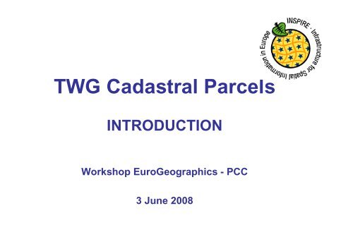
TWG Cadastral Parcels<br />
INTRODUCTION<br />
Workshop EuroGeographics - PCC<br />
3 June 2008
INSPIRE TWG
Data specificati<strong>on</strong>s: a two steps<br />
approach<br />
• 2005 – 2008:<br />
– comm<strong>on</strong> framework for data specificati<strong>on</strong>s<br />
– by DT DS (Draft<strong>in</strong>g Team Data Specificati<strong>on</strong>s)<br />
• 2008 – 2011<br />
– Harm<strong>on</strong>ised specificati<strong>on</strong>s for <strong>the</strong> 34 Annexes<br />
<strong>the</strong>mes<br />
• for Annex I <strong>the</strong>mes: dur<strong>in</strong>g 2008 -2009<br />
• for Annexes II and III: from 2009 to 2011
Possible scenarios<br />
• Scenario 1 : already harm<strong>on</strong>ised specificati<strong>on</strong>s =><br />
SDIC/LMO<br />
• Scenario 2 : no harm<strong>on</strong>ised specificati<strong>on</strong>s but raw<br />
Reference Material =>TWG with experts from<br />
SDIC/LMO<br />
• Scenario 3 : noth<strong>in</strong>g => TWG with experts paid by<br />
<strong>the</strong> Commissi<strong>on</strong><br />
All <strong>the</strong>mes <strong>in</strong> annex I are under scenario 2
General pr<strong>in</strong>ciples<br />
INSPIRE must be based <strong>on</strong> exist<strong>in</strong>g data<br />
Harm<strong>on</strong>isati<strong>on</strong> <strong>in</strong> INSPIRE must be d<strong>on</strong>e <strong>on</strong>ly if<br />
<strong>the</strong>re are user requirements:<br />
- pan-european use cases<br />
- cross-border use cases<br />
- l<strong>in</strong>ked with envir<strong>on</strong>ment<br />
Harm<strong>on</strong>isati<strong>on</strong> has to be feasible and cost-benefits<br />
have to be analysed.
INSPIRE stakeholders<br />
• Thematic Work<strong>in</strong>g Groups: TWG<br />
• Pilot<strong>in</strong>g actors:<br />
– CT/JRC<br />
– DT DS (compliance to DT DS documents)<br />
– EIONET (user requirements)<br />
• Support<strong>in</strong>g actors<br />
– SDIC/LMO<br />
– Projects (e.g. eC<strong>on</strong>tent + projects)
Role of INSPIRE TWGs<br />
• C<strong>on</strong>tribute to <strong>the</strong> elaborati<strong>on</strong> of Implement<strong>in</strong>g Rules for<br />
data specificati<strong>on</strong>s<br />
• TWGs have to def<strong>in</strong>e DPS (Data Product Specificati<strong>on</strong>s)<br />
• DPS will be c<strong>on</strong>verted <strong>in</strong>:<br />
– B<strong>in</strong>d<strong>in</strong>g Implement<strong>in</strong>g Rules<br />
– N<strong>on</strong>-b<strong>in</strong>d<strong>in</strong>g guidel<strong>in</strong>es<br />
– Document <strong>on</strong> this topic to be prepared so<strong>on</strong> by CT + DT DS
General Methodology<br />
Requirements<br />
Requirements<br />
As - is analysis<br />
Gap analysis<br />
(for all TWGs)<br />
Use Use Case<br />
Case<br />
Development<br />
Development<br />
Requirements<br />
Requirements<br />
and and Feature Sp.Object Feature Types<br />
Types<br />
Identificati<strong>on</strong><br />
Identificati<strong>on</strong><br />
Data Data Product<br />
Specificati<strong>on</strong><br />
App App Schema<br />
Schema<br />
Development<br />
Development<br />
Development<br />
Implementati<strong>on</strong> Implementati<strong>on</strong> ,<br />
,<br />
test<strong>in</strong>g test<strong>in</strong>g and<br />
and<br />
validati<strong>on</strong> validati<strong>on</strong><br />
validati<strong>on</strong><br />
validati<strong>on</strong> ( us<strong>in</strong>g WFS)
• Kick-off meet<strong>in</strong>g: 14-15/02/08<br />
Roadmap<br />
• Evaluati<strong>on</strong> of user requirements: June 2008<br />
• As-it analysis and gap analysis: August 2008<br />
• First draft of data product specificati<strong>on</strong>: September 2008<br />
• Internal review of first draft (DT DS, CT, EIONET): October 2008<br />
• Sec<strong>on</strong>d draft of data product specificati<strong>on</strong>: November 2008<br />
• Review by SDIC/LMO: January 2009<br />
• Test<strong>in</strong>g, revised DPS: March 2009<br />
• Submissi<strong>on</strong> to <strong>the</strong> INSPIRE <str<strong>on</strong>g>Committee</str<strong>on</strong>g>: May 2009
TWGs Reference Material<br />
• Framework prepared by DT DS:<br />
– D2.3: descripti<strong>on</strong> of <strong>the</strong>mes and scope<br />
– D2.5: Generic C<strong>on</strong>ceptual Model<br />
– D2.6 : Methodology<br />
– D2.7: Data exchange, encod<strong>in</strong>g<br />
• Reference Material provided by SDIC/LMO<br />
• Results of <strong>the</strong> user requirement survey launched<br />
by JRC <strong>in</strong> February 2008.
TWGs compositi<strong>on</strong><br />
• Facilitator<br />
– Chairpers<strong>on</strong><br />
– Work based <strong>on</strong> INSPIRE methodology<br />
• Editor<br />
– UML modell<strong>in</strong>g, ISO standards<br />
– Work based <strong>on</strong> INSPIRE Generic C<strong>on</strong>ceptual Model<br />
• Thematic experts<br />
– Doma<strong>in</strong> expertise<br />
• JRC c<strong>on</strong>tact po<strong>in</strong>t
TWGs organisati<strong>on</strong><br />
• Some comm<strong>on</strong> physical meet<strong>in</strong>gs or telec<strong>on</strong><br />
– Kick-off meet<strong>in</strong>g (14-15/02/2008) – Ispra<br />
– Tra<strong>in</strong><strong>in</strong>g sessi<strong>on</strong> for editors (02/04/08)<br />
– Telec<strong>on</strong> editors-facilitators- JRC (02/04/08)<br />
– Jo<strong>in</strong>t meet<strong>in</strong>g facilitators- editors – DT DS<br />
• 20/05/08 (Warsaw)<br />
• 24/06/08 (Maribor)<br />
– Comment Resoluti<strong>on</strong> Workshop (February 2009) – Ispra<br />
• For each TWG<br />
– Physical meet<strong>in</strong>gs to be decided by TWG<br />
– Telec<strong>on</strong> every 2 weeks
TWG CADASTRAL<br />
PARCELS ACTIONS
Team members<br />
• Dom<strong>in</strong>ique Laurent (IGN France) Facilitator<br />
• André Bernath (Switzerland) Editor<br />
• Gyula Ivan (NMA – Hungary)<br />
• Tarja Myllymäki (NLS – F<strong>in</strong>land)<br />
• Amalia Velasco (<strong>Cadastre</strong>- Spa<strong>in</strong>)<br />
• Olav Jenssen (NMA - Norway)<br />
• Peter van Oosterom (TUD/Kadaster Ne<strong>the</strong>rlands)<br />
• Soren Riff Alexandersen (NMCA – Denmark)<br />
• Wim Devos (JRC)<br />
Thematic<br />
experts
Team members
TWG ma<strong>in</strong> events<br />
• Kick-off meet<strong>in</strong>g : 14-15/02/08 (Ispra)<br />
• Meet<strong>in</strong>g 14-15/04/08 (Palma)<br />
• Workshop with EuroGeographics and PCC<br />
(03/06/08)
Kick-off meet<strong>in</strong>g<br />
- First c<strong>on</strong>tact between TWG members<br />
- Identificati<strong>on</strong> of ma<strong>in</strong> stakeholders:<br />
– PCC<br />
– EuroGeographics Expert Group <strong>on</strong> <strong>Cadastre</strong><br />
– FIG<br />
– UN WPLA<br />
– EURODIN (eC<strong>on</strong>tent + project)<br />
• Identificati<strong>on</strong> of relevant standards : LADM a new work<br />
item proposal to ISO/TC 211 (by FIG)
Kick-off meet<strong>in</strong>g<br />
• Discussi<strong>on</strong> about <strong>the</strong> l<strong>in</strong>ks with o<strong>the</strong>r<br />
INSPIRE <strong>the</strong>mes ; <strong>the</strong> ma<strong>in</strong> <strong>on</strong>e be<strong>in</strong>g<br />
probably with adm<strong>in</strong>istrative units<br />
• Presentati<strong>on</strong> and discussi<strong>on</strong> about <strong>the</strong><br />
descripti<strong>on</strong> of cadastral parcels <strong>in</strong> D2.3
Kick-off meet<strong>in</strong>g<br />
• Identificati<strong>on</strong> of ma<strong>in</strong> Reference Material:<br />
<strong>the</strong> survey c<strong>on</strong>ducted by WG-CPI about<br />
cadastral parcels <strong>in</strong> INSPIRE (and NSDI)<br />
– Identificati<strong>on</strong> of 5 key elements:<br />
• Identifier<br />
• Boundaries<br />
• Surface<br />
• Georeferencement<br />
• Orig<strong>in</strong>/history<br />
– Widely available am<strong>on</strong>g <strong>European</strong> countries<br />
– Probably required by users
Kick-off meet<strong>in</strong>g<br />
• Few Reference Material (e.g. nati<strong>on</strong>al<br />
specificati<strong>on</strong>s) <strong>on</strong> cadastral parcels; official<br />
list not yet available<br />
• Results of <strong>the</strong> user requirement survey<br />
c<strong>on</strong>ducted by JRC expected at <strong>the</strong><br />
beg<strong>in</strong>n<strong>in</strong>g of March
Kick-off meet<strong>in</strong>g<br />
• Establish work plan<br />
– Beg<strong>in</strong> with what is available<br />
– Use <strong>the</strong> survey d<strong>on</strong>e by WG-CPI as start<strong>in</strong>g<br />
po<strong>in</strong>t<br />
– Decided acti<strong>on</strong>s<br />
• As-it analysis (countries <strong>in</strong>volved <strong>in</strong> TWG CP)<br />
• Descripti<strong>on</strong> of CAP (Comm<strong>on</strong> Agriculture Policy)<br />
use case<br />
• With focus <strong>on</strong> <strong>the</strong> 5 key elements identified by this<br />
survey (+ metadata/quality + delivery)
Then …<br />
• Preparati<strong>on</strong> of discussi<strong>on</strong> papers <strong>on</strong> each<br />
element<br />
– Results from <strong>the</strong> as-it analysis<br />
– User requirements (ma<strong>in</strong>ly CAP use case)<br />
– LADM standard + DT DS documents<br />
– Ma<strong>in</strong> c<strong>on</strong>clusi<strong>on</strong>s<br />
• More detailed state-of-play<br />
• Identify harm<strong>on</strong>isati<strong>on</strong> issues and possible<br />
soluti<strong>on</strong>s
• Requirements<br />
– Agriculture use case<br />
– INSPIRE (D2.5)<br />
– TWG CP members expertise<br />
• As-it analysis<br />
Ma<strong>in</strong> sources<br />
– General overview (from WG-CPI survey <strong>in</strong> 2005)<br />
– More detailed <strong>in</strong>formati<strong>on</strong> <strong>on</strong> 11 countries<br />
• Ne<strong>the</strong>rlands - Denmark<br />
• Norway - F<strong>in</strong>land<br />
• France - Spa<strong>in</strong><br />
• Hungary - Belgium<br />
• Switzerland - Austria<br />
• Czech Republic
First loop<br />
The iterative approach proposed by <strong>the</strong> RISE project<br />
=> TWG CP decided to make a first loop (requirements, as-it,<br />
gap analysis)
• Objectives - Agenda<br />
April meet<strong>in</strong>g<br />
– Discussi<strong>on</strong> based <strong>on</strong> <strong>the</strong> results of previous<br />
steps<br />
– Initiate <strong>the</strong> use case development
April meet<strong>in</strong>g<br />
A first c<strong>on</strong>clusi<strong>on</strong><br />
• A ma<strong>in</strong> issue: vector/raster data<br />
– Vector data better for users<br />
– But some countries have <strong>on</strong>ly raster data<br />
• Acti<strong>on</strong>s:<br />
– Investigate which countries will still have (<strong>on</strong>ly) raster<br />
data <strong>in</strong> 2016 (INSPIRE deadl<strong>in</strong>e for cadastral parcels)<br />
– If any, ask <strong>the</strong>m how <strong>the</strong>ir raster data looks like<br />
– Questi<strong>on</strong>naire sent to c<strong>on</strong>cerned countries<br />
• which declared to have raster data dur<strong>in</strong>g <strong>the</strong> WG-CPI survey<br />
• which did no answer to this survey
April meet<strong>in</strong>g<br />
Use case development<br />
• First selecti<strong>on</strong> of relevant use cases:<br />
– 6 <strong>European</strong> <strong>on</strong>es<br />
– 9 nati<strong>on</strong>al (but potentially <strong>European</strong> or cross-border)<br />
<strong>on</strong>es<br />
– From user requirement survey and from TWG CP<br />
members<br />
• How to analyse <strong>the</strong>m<br />
– Identify requirements (by fill<strong>in</strong>g <strong>the</strong> check-list adapted<br />
from <strong>the</strong> DT DS methodology)
Sec<strong>on</strong>d loop<br />
=> TWG CP decided to make a sec<strong>on</strong>d loop (requirements,<br />
as-it, gap analysis)
Then …<br />
• User requirement capture<br />
– Get more <strong>in</strong>formati<strong>on</strong> about <strong>the</strong> use case<br />
– C<strong>on</strong>tact users<br />
– Fill <strong>the</strong> check-list<br />
• Need for<br />
• us<strong>in</strong>g Reference Material, if any<br />
• by <strong>the</strong> user himself<br />
• with help from TWG CP (e.g. ph<strong>on</strong>e <strong>in</strong>terview)<br />
– Additi<strong>on</strong>al use cases<br />
– Classificati<strong>on</strong> of use cases
Use case development status<br />
Ma<strong>in</strong> issues<br />
• Use cases are more or less <strong>in</strong>terest<strong>in</strong>g for INSPIRE<br />
– <strong>European</strong>/cross-border or just nati<strong>on</strong>al examples<br />
• How to deal with nati<strong>on</strong>al examples?<br />
• => try to have several examples to make comparis<strong>on</strong><br />
– Legal framework (e.g. envir<strong>on</strong>mental Directives)<br />
– L<strong>in</strong>k with o<strong>the</strong>r Annex <strong>the</strong>mes<br />
– Input from CT expected<br />
• General issues<br />
– Users difficult to identify and to c<strong>on</strong>tact<br />
– Unclear answers, <strong>in</strong>complete answers<br />
– Users expla<strong>in</strong><strong>in</strong>g current situati<strong>on</strong> ra<strong>the</strong>r than requirements
Use case development status<br />
• Use a classificati<strong>on</strong> based <strong>on</strong> <strong>the</strong> <strong>on</strong>e provided<br />
by WG -CPI survey<br />
– Land market - Agriculture<br />
– Envir<strong>on</strong>ment - Spatial plann<strong>in</strong>g<br />
– Infrastructures - Public adm<strong>in</strong>istrati<strong>on</strong><br />
– Public safety - Socio-ec<strong>on</strong>omic analysis
Use case development status<br />
• Land market<br />
– Not an INSPIRE use case<br />
– But possible l<strong>in</strong>k with EULIS would be f<strong>in</strong>e<br />
• Agriculture<br />
– <strong>European</strong> LPIS (Land Parcel Identificati<strong>on</strong><br />
system)<br />
– Nati<strong>on</strong>al v<strong>in</strong>eyard cadastre (Spa<strong>in</strong>-Hungary)<br />
– Ragweed m<strong>on</strong>itor<strong>in</strong>g (Hungary)
Use case development status<br />
• Envir<strong>on</strong>ment<br />
– Soil Protecti<strong>on</strong><br />
- Directive <strong>European</strong> level<br />
- Public law restricti<strong>on</strong>s, Nati<strong>on</strong>al implementati<strong>on</strong><br />
(Ne<strong>the</strong>rlands)<br />
– Protected sites<br />
• TWG PS?<br />
• Nature GIS?
Use case development status<br />
• Spatial plann<strong>in</strong>g<br />
– Urban plann<strong>in</strong>g (France – Spa<strong>in</strong>)<br />
– Data producti<strong>on</strong> (land use) for GMES?<br />
– Indicators <strong>on</strong> land use (Belgium)<br />
• Infrastructures<br />
– Road database (Belgium)<br />
– Nati<strong>on</strong>al examples (Spa<strong>in</strong>-France-<br />
Ne<strong>the</strong>rlands)
Use case development status<br />
• Public adm<strong>in</strong>istrati<strong>on</strong><br />
– Public land management<br />
• General use case (FIG workshop <strong>on</strong> this topic <strong>in</strong> September<br />
2008)<br />
• Nati<strong>on</strong>al example (France)<br />
• Public safety<br />
– Flood Directive?<br />
• Socio-ec<strong>on</strong>omic analysis<br />
– Nati<strong>on</strong>al example (Spa<strong>in</strong>)
Next events<br />
• TWG meet<strong>in</strong>g <strong>in</strong> Brussels <strong>on</strong> 04/06/08<br />
• Presentati<strong>on</strong> dur<strong>in</strong>g EuroGeographics Interproject meet<strong>in</strong>g<br />
(12/06/08)<br />
• Panel presentati<strong>on</strong>/discussi<strong>on</strong> of TWG dur<strong>in</strong>g <strong>the</strong> INSPIRE<br />
c<strong>on</strong>ference (23/06/08) <strong>in</strong> Maribor-Slovenia<br />
• Jo<strong>in</strong>t meet<strong>in</strong>g (editors-facilitators-DT DS) dur<strong>in</strong>g <strong>the</strong><br />
INSPIRE c<strong>on</strong>ference (24/06/08)<br />
• Presentati<strong>on</strong> dur<strong>in</strong>g PCC meet<strong>in</strong>g (26/06/08)<br />
• TWG meet<strong>in</strong>g <strong>in</strong> September
TWG Cadastral Parcels<br />
FIRST RESULTS<br />
Workshop EuroGeographics - PCC<br />
3 June 2008
Sources<br />
• Temporary state-of-play based <strong>on</strong> previous steps<br />
– Requirements<br />
• INSPIRE (D2.5)<br />
• Available check-lists<br />
• TWG CP members expertise<br />
– As-is analysis<br />
• General overview (from WG-CPI survey <strong>in</strong> 2005)<br />
• More detailed <strong>in</strong>formati<strong>on</strong> <strong>on</strong> 11 countries<br />
• First results of <strong>the</strong> raster questi<strong>on</strong>naire<br />
– Gap analysis/first proposals<br />
• Discussi<strong>on</strong> papers<br />
• Discussi<strong>on</strong> dur<strong>in</strong>g TWG CP meet<strong>in</strong>g <strong>in</strong> April 2008
Ma<strong>in</strong> first c<strong>on</strong>clusi<strong>on</strong>s<br />
• Scope of INSPIRE cadastral parcels<br />
– Core elements<br />
– Geometry - Surface<br />
– Identifier - Georeferencement<br />
– Temporal <strong>in</strong>formati<strong>on</strong><br />
– Possible additi<strong>on</strong>al elements<br />
– ParcelSet (e.g. municipalities, secti<strong>on</strong>s): name, code, level,<br />
metadata <strong>in</strong>fo<br />
– L<strong>in</strong>k with addresses<br />
– L<strong>in</strong>k with rights/owners<br />
– O<strong>the</strong>r attributes <strong>on</strong> parcels (e.g. rural/urban, land value,<br />
public/private )<br />
– Boundary l<strong>in</strong>es<br />
– Survey po<strong>in</strong>ts<br />
– Sub-parcels, “over-parcels” (e.g. real estate)
First ma<strong>in</strong> c<strong>on</strong>clusi<strong>on</strong>s<br />
The raster issue<br />
• A ma<strong>in</strong> issue: vector/raster data<br />
– Vector data better for users<br />
– But some countries have <strong>on</strong>ly raster data<br />
• However, vectorisati<strong>on</strong> is l<strong>on</strong>g and costly<br />
⇒ difficult to impose it to MS<br />
⇒ TWG CP envisaged to propose <strong>the</strong> 2 opti<strong>on</strong>s vector/raster<br />
• Questi<strong>on</strong>naire launched by TWG CP about cadastral<br />
raster data
First ma<strong>in</strong> c<strong>on</strong>clusi<strong>on</strong>s<br />
The raster issue<br />
• WG-CPI results :<br />
– Raster data <strong>in</strong> England, Italy, Portugal, France, Czech<br />
Republic, Croatia, Ireland<br />
– No <strong>in</strong>formati<strong>on</strong> for Malta, Poland, Bulgaria<br />
• TWG CP questi<strong>on</strong>naire/work results<br />
– Full vector data now or before 2016: Italy, England,<br />
Czech Republic, Malta, Cyprus, Poland (?)<br />
– Vectorisati<strong>on</strong> <strong>in</strong> progress but may be still raster data<br />
<strong>in</strong> 2016: France<br />
– No answer: Croatia, Portugal, Bulgaria, Ireland
First ma<strong>in</strong> c<strong>on</strong>clusi<strong>on</strong>s<br />
The raster issue<br />
• Decisi<strong>on</strong> from Commissi<strong>on</strong> (dur<strong>in</strong>g workshop <strong>on</strong><br />
<strong>the</strong> transpositi<strong>on</strong>)<br />
– Vectorisati<strong>on</strong> is c<strong>on</strong>sidered as new data capture<br />
– MS (with raster data) d<strong>on</strong>’t have to vectorise before<br />
2016<br />
• To be discussed <strong>in</strong> TWG CP: is it worth to<br />
propose <strong>the</strong> raster opti<strong>on</strong>?
First ma<strong>in</strong> c<strong>on</strong>clusi<strong>on</strong>s<br />
Def<strong>in</strong>iti<strong>on</strong> of parcel<br />
• In <strong>the</strong> INSPIRE Directive:<br />
– “areas def<strong>in</strong>ed by cadastral registers or equivalent”<br />
– not very explicit (specially for MS hav<strong>in</strong>g sub-parcels<br />
or “over-parcels”)<br />
• TWG CP explanati<strong>on</strong><br />
– “a s<strong>in</strong>gle part of <strong>the</strong> earth surface under<br />
homogeneous real property rights and ownership »
• closed polyg<strong>on</strong>s<br />
PARCEL GEOMETRY<br />
REQUIREMENTS<br />
• clean topology (gaps and overlaps are an issue)<br />
• currently, general use of 2D data<br />
• <strong>in</strong> future, <strong>in</strong>terest to comb<strong>in</strong>e parcels with Digital<br />
Terra<strong>in</strong> Model ⇒ 2,5 D parcels better<br />
• curves/breakl<strong>in</strong>es:<br />
– Generally just breakl<strong>in</strong>es (l<strong>in</strong>ear <strong>in</strong>terpolati<strong>on</strong>)<br />
– Depends <strong>on</strong> exist<strong>in</strong>g data (e.g. Ne<strong>the</strong>rlands)
PARCEL GEOMETRY<br />
AS-IS-ANALYSIS<br />
• Provided <strong>in</strong> different ways<br />
– Vector/raster data<br />
– For vector data :<br />
• Topological structure or not<br />
o Public doma<strong>in</strong> (e.g. roads)<br />
o Gaps and overlaps<br />
• Ma<strong>in</strong>ly 2D data, some 2,5 D or even 3D data<br />
• Curves/breakl<strong>in</strong>es:<br />
– Generally just breakl<strong>in</strong>es<br />
– Some countries have o<strong>the</strong>r k<strong>in</strong>ds of curves
PARCEL IDENTIFIER<br />
REQUIREMENTS<br />
• INSPIRE Generic C<strong>on</strong>ceptual model<br />
– Unique and persistent identifiers<br />
– Composed of:<br />
• Namespace: beg<strong>in</strong>n<strong>in</strong>g by country code, up to each MS<br />
• Local identifier<br />
– Lexical rules: limited set of characters<br />
• Users requirements<br />
– L<strong>in</strong>k with nati<strong>on</strong>al cadastral register (rights/owners)<br />
– L<strong>in</strong>k with EULIS
PARCEL IDENTIFIER<br />
AS-IS-ANALYSIS<br />
• Available <strong>in</strong> all <strong>European</strong> countries (except Iceland)<br />
• In a very heterogeneous way:<br />
– Structured identifiers/UUID<br />
– If structured, different k<strong>in</strong>ds of structure<br />
- Hieratical cadastral divisi<strong>on</strong><br />
- Some l<strong>in</strong>eage<br />
- Indicati<strong>on</strong> of type of parcel<br />
- Fixed/variable length, separators (‘,’, ‘/’, ‘-’, ‘ ’, …),
PARCEL IDENTIFIER<br />
FIRST CONCLUSIONS<br />
• namespace to be def<strong>in</strong>ed by MS<br />
– country code (as recommended by WG-CPI) generally may be<br />
enough<br />
– Possible excepti<strong>on</strong> if same identifier used for o<strong>the</strong>r feature types<br />
(e.g. build<strong>in</strong>gs)<br />
• possible issue with separators (“/” not allowed by GCM)<br />
• Interest of “short name” (last part of identifier) for portrayal<br />
purposes
PARCEL SURFACE<br />
FIRST CONCLUSIONS<br />
• Official/registered surface (likely) to be provided <strong>in</strong> m 2<br />
• Calculated surface depends <strong>on</strong> <strong>the</strong> CRS and <strong>on</strong> <strong>the</strong> tool<br />
(GIS): probably better to let <strong>the</strong> calculati<strong>on</strong> <strong>on</strong> <strong>the</strong> user side<br />
• Surface accuracy<br />
– Str<strong>on</strong>g requirement about <strong>the</strong> from CAP use case<br />
– Recommended also by WG-CPI<br />
– But may be not so easy to provide (e.g. depends <strong>on</strong> <strong>the</strong> parcel<br />
form)
• Users<br />
GEOREFERENCEMENT<br />
REQUIREMENTS<br />
– Current use of cadastral data <strong>in</strong> nati<strong>on</strong>al CRS<br />
– To work with distances or surfaces, need for a projecti<strong>on</strong> offer<strong>in</strong>g<br />
few l<strong>in</strong>ear alterati<strong>on</strong><br />
• INSPIRE TWG “Reference Systems”<br />
– ETRS89 for countries <strong>on</strong> <strong>the</strong> <strong>European</strong> tect<strong>on</strong>ic plaque<br />
– Noth<strong>in</strong>g yet about projecti<strong>on</strong>s
GEOREFERENCEMENT<br />
AS-IT-ANALYSIS<br />
• Widely available (except Iceland, part of Romania, miss<strong>in</strong>g<br />
<strong>in</strong>formati<strong>on</strong> for Est<strong>on</strong>ia)<br />
• Generally <strong>in</strong> nati<strong>on</strong>al CRS<br />
• Transformati<strong>on</strong> between nati<strong>on</strong>al CRS and ETRS89<br />
generally well-def<strong>in</strong>ed and of good quality (exact or better<br />
than 1 m)<br />
The CRS transformati<strong>on</strong>s may have impact <strong>on</strong> <strong>the</strong> positi<strong>on</strong>al<br />
accuracy of parcels (as large scale data)
TEMPORAL INFORMATION<br />
• User requirements:<br />
– Date of last update<br />
– “Parent-parcel”<br />
• As-is analysis<br />
FIRST CONCLUSIONS<br />
– Different update frequency<br />
– Different life-cycle rules (but generally well-def<strong>in</strong>ed)<br />
• TWG CP proposal: ma<strong>in</strong> relevant <strong>in</strong>formati<strong>on</strong><br />
• Date of last update (parcel level)<br />
• Date of publicati<strong>on</strong> <strong>in</strong> INSPIRE (data set level)
• Requirements<br />
– By some use cases<br />
PARCEL SET<br />
FIRST CONCLUSIONS<br />
– For data query<strong>in</strong>g/search<strong>in</strong>g<br />
– For carry<strong>in</strong>g metadata<br />
• As-is analysis<br />
– Widely available<br />
– But <strong>in</strong> heterogeneous way<br />
• TWG CP proposal<br />
– Based <strong>on</strong> <strong>the</strong> LADM method<br />
– ParcelSet with code, name, level
• Requirements<br />
QUALITY<br />
FIRST CONCLUSIONS<br />
– Str<strong>on</strong>g requirements <strong>on</strong> positi<strong>on</strong>al accuracy by use case<br />
“agriculture”<br />
– O<strong>the</strong>r quality elements also quoted (up-to-dateness, semantic<br />
accuracy, completeness)<br />
• As-is analysis<br />
– Heterogeneous (positi<strong>on</strong>al accuracy, up-to-dateness)<br />
– No <strong>in</strong>formati<strong>on</strong> about semantic accuracy and completeness<br />
• INSPIRE recommendati<strong>on</strong><br />
– D<strong>on</strong>’t ask for m<strong>in</strong>imum quality levels<br />
– Just make recommendati<strong>on</strong>s
• Requirements<br />
– Not yet analysed<br />
• As-is analysis<br />
METADATA<br />
FIRST CONCLUSIONS<br />
– 3 elements widely available:<br />
• Orig<strong>in</strong>al Map scale<br />
• Positi<strong>on</strong>al accuracy<br />
• Producti<strong>on</strong> mode
• Requirements<br />
– Users : not yet analysed<br />
DATA TRANSFER<br />
FIRST CONCLUSIONS<br />
– INSPIRE D2.7 : GML (+ additi<strong>on</strong>al formats, if required)<br />
• As-is analysis<br />
– Nati<strong>on</strong>al formats<br />
– GIS formats (shape, MIF/MID, DXF/DWG, …)<br />
– Classical media (file, paper) and Web services <strong>in</strong> some countries
PORTRAYAL<br />
FIRST CONCLUSIONS<br />
• INSPIRE requirements: for view services<br />
• Users current practice<br />
– Parcels displayed as background data<br />
• Discrete symbology<br />
– Parcels c<strong>on</strong>tours <strong>in</strong> black or grey<br />
– Parcel numbers <strong>in</strong> black or grey<br />
– Parcels displayed with orthophoto as background<br />
• Need for brighter colours
• TWG CP<br />
INSPIRE AND LADM<br />
– Use LADM as a tool<br />
• For modell<strong>in</strong>g (e.g. for “ParcelSet”)<br />
• As glossary<br />
– Use <strong>on</strong>ly a subset of LADM<br />
• LADM<br />
– Good will<strong>in</strong>g to take TWG CP results <strong>in</strong>to account<br />
• Some modificati<strong>on</strong>s already proposed<br />
• Align <strong>the</strong>ir roadmap with <strong>the</strong> TWG CP <strong>on</strong>e<br />
• Jo<strong>in</strong>t meet<strong>in</strong>g <strong>in</strong> September?
INSPIRE AND EuroGeographics-<br />
• Communicati<strong>on</strong> TWG CP<br />
PCC<br />
– Workshop (Brussels) <strong>on</strong> 03/06/08<br />
– Interproject meet<strong>in</strong>g (12/06/08)<br />
– PCC meet<strong>in</strong>g (26/06/08)<br />
• Help from EuroGeographics – PCC<br />
– Discussi<strong>on</strong> and comments<br />
• dur<strong>in</strong>g today workshop<br />
• or later (dom<strong>in</strong>ique.laurent@ign.fr)<br />
– Enlarge <strong>the</strong> as-is-analysis (by fill<strong>in</strong>g <strong>the</strong> check-list)<br />
– Possible <strong>in</strong>volvement of EURADIN and/or ESDIN projects for<br />
test<strong>in</strong>g
INSPIRE AND EuroGeographics-<br />
PCC<br />
DISCUSSION ON FEASIBILITY ISSUES<br />
• Some m<strong>in</strong>imum requirements (to be c<strong>on</strong>form to<br />
INSPIRE)<br />
– (probably) vector data<br />
– Georeferencement <strong>in</strong> ETRS89<br />
– Identifier<br />
– GML as exchange formats
INSPIRE AND EuroGeographics-<br />
PCC<br />
DISCUSSION ON FEASIBILITY ISSUES<br />
• Quality improvements<br />
- Positi<strong>on</strong>al accuracy<br />
- improvement<br />
- have it <strong>on</strong> a c<strong>on</strong>venient way (directly <strong>on</strong> parcels ra<strong>the</strong>r than <strong>on</strong> survey<br />
po<strong>in</strong>ts)<br />
- Accurate CRS transformati<strong>on</strong> from nati<strong>on</strong>al CRS to ETRS89<br />
- Update frequency<br />
- Topology (no gaps nor overlaps)
INSPIRE AND EuroGeographics-<br />
PCC<br />
DISCUSSION ON FEASIBILITY ISSUES<br />
• Quality <strong>in</strong>formati<strong>on</strong> (metadata)<br />
– Positi<strong>on</strong>al accuracy<br />
• For parcel boundaries<br />
• For parcel surface<br />
– Temporal <strong>in</strong>formati<strong>on</strong><br />
• Date of last update (at parcel level)<br />
– Nati<strong>on</strong>al profile of DPS (e.g. chosen opti<strong>on</strong>s, populated<br />
attributes, nati<strong>on</strong>al specificities)<br />
• 2,5 D parcels (later)
GLOSSARY<br />
CAP: Comm<strong>on</strong> Agriculture Policy<br />
CRS : Coord<strong>in</strong>ate Reference System<br />
DPS: Data Product Specificati<strong>on</strong><br />
GCM : Generic C<strong>on</strong>ceptual Model (D2.5)<br />
GIS : Geographic Informati<strong>on</strong> System<br />
GML: Geographic Markup Language<br />
LADM: Land Adm<strong>in</strong>istrati<strong>on</strong> Doma<strong>in</strong> Model<br />
MS: Member State<br />
PCC: <str<strong>on</strong>g>Permanent</str<strong>on</strong>g> <str<strong>on</strong>g>Committee</str<strong>on</strong>g> <strong>on</strong> <strong>Cadastre</strong><br />
TWG CP : Thematic Work<strong>in</strong>g Group Cadastral Parcel<br />
UUID : Unique Universal IDentifier<br />
WG-CPI : Work<strong>in</strong>g Group <strong>on</strong> Cadastral Parcel <strong>in</strong> INSPIRE
Agriculture<br />
1. Council Regulati<strong>on</strong> EC 2003R1782<br />
2. Commissi<strong>on</strong> Regulati<strong>on</strong> EC 2004R0796<br />
3 June 2008
C<strong>on</strong>text<br />
• Comm<strong>on</strong> Agricultural Policy Aid to <strong>the</strong> farmer’s is<br />
decoupled from producti<strong>on</strong> but area based<br />
• To manage aid, MS have to set up an Integrated<br />
Adm<strong>in</strong>istrati<strong>on</strong> and C<strong>on</strong>trol System (IACS) with:<br />
– (a) a computerised data base,<br />
– (b) an identificati<strong>on</strong> system for agricultural parcels<br />
(LPIS),<br />
– (c) a system for <strong>the</strong> identificati<strong>on</strong> and registrati<strong>on</strong> of<br />
payment entitlements,<br />
– (d) aid applicati<strong>on</strong>s,<br />
– (e) an <strong>in</strong>tegrated c<strong>on</strong>trol system,<br />
– (f) a s<strong>in</strong>gle system to record <strong>the</strong> identity of each farmer<br />
who submits an aid applicati<strong>on</strong>
C<strong>on</strong>text 2<br />
• 2004R0796 6: 1. The identificati<strong>on</strong> system for<br />
agricultural parcels shall operate at reference<br />
parcel level such as cadastral parcel, or<br />
producti<strong>on</strong> block<br />
• 2003R1782 44. Use of payment entitlements<br />
– 1 Any payment entitlement accompanied by an eligible<br />
hectare shall give right to <strong>the</strong> payment of <strong>the</strong> amount<br />
fixed by <strong>the</strong> payment entitlement.<br />
– 2. ‘Eligible hectare’ shall mean any agricultural area of<br />
<strong>the</strong> hold<strong>in</strong>g taken up by arable land and permanent<br />
pasture except areas under permanent crops, forests or<br />
used for n<strong>on</strong> agricultural activities
Spatial Elements<br />
key spatial objects and <strong>the</strong>ir properties<br />
Stable over<br />
time<br />
Area officially<br />
known<br />
Reference Parcel (RP)<br />
LPIS custodian<br />
Locates<br />
[claimed] land<br />
123xyz<br />
1.23ha<br />
Eligibility (cover)<br />
recorded officially<br />
Prevents<br />
Double<br />
Declarati<strong>on</strong><br />
unique<br />
identifier<br />
Boundary<br />
<strong>in</strong> GIS<br />
Agricultural Parcel (AP)<br />
farmer and <strong>in</strong>spectors<br />
May be<br />
unstable over<br />
time<br />
Area<br />
claimed<br />
by farmer<br />
“C<strong>on</strong>tracted<br />
” area <strong>in</strong><br />
applicati<strong>on</strong><br />
123xyz<br />
1.10ha<br />
1.23ha<br />
Payment<br />
calculati<strong>on</strong><br />
Use<br />
declared by<br />
farmer<br />
123xyzA:<br />
locati<strong>on</strong> <strong>in</strong><br />
applicati<strong>on</strong><br />
C<strong>on</strong>trolled<br />
object
Nati<strong>on</strong>al implementati<strong>on</strong>s<br />
LPIS type (2006) An example<br />
PT<br />
ES<br />
IE<br />
UK<br />
FR<br />
BEf<br />
BEw<br />
LU<br />
NL<br />
DE<br />
IT<br />
DK<br />
MT<br />
AT<br />
SI<br />
CZ<br />
5 agriculture parcel<br />
3 cadastral parcel + 1<br />
4 farmer block<br />
8 physical block + 1<br />
1 varies by Laender<br />
2 MS <strong>in</strong> accessi<strong>on</strong><br />
4 MS have recently switched<br />
type of reference parcel<br />
SE<br />
HU<br />
PL<br />
SK<br />
GR<br />
LT<br />
LV<br />
EE<br />
FI<br />
CY
Interest for INSPIRE<br />
• 2003R1782 3 Ma<strong>in</strong> requirements: a farmer<br />
receiv<strong>in</strong>g direct payments shall respect <strong>the</strong><br />
statutory management requirements …, and <strong>the</strong><br />
good agricultural and envir<strong>on</strong>mental c<strong>on</strong>diti<strong>on</strong>...<br />
– Statutory Management Requirements (SMRs): 18<br />
Community legislative acts <strong>in</strong> <strong>the</strong> areas of envir<strong>on</strong>ment,<br />
public, animal and plant health and animal welfare<br />
– Good Agricultural and Envir<strong>on</strong>mental C<strong>on</strong>diti<strong>on</strong>s<br />
(GAECs): def<strong>in</strong>ed by MS <strong>in</strong> a comm<strong>on</strong> framework<br />
cover<strong>in</strong>g<br />
• soil erosi<strong>on</strong><br />
• soil organic matter<br />
• soil structure<br />
• m<strong>in</strong>imum level of ma<strong>in</strong>tenance<br />
• Ma<strong>in</strong>tenance of land under permanent pasture
Users<br />
• Farmers: annual declarati<strong>on</strong> of land use<br />
– Identify agricultural parcel (AP) by reference parcel (RP)<br />
– Quantify area of agricultural parcel<br />
• Inspectors:<br />
– 100% adm<strong>in</strong>strative checks<br />
– 5% of <strong>the</strong> farms eligibilty and area<br />
– 1% of <strong>the</strong> hold<strong>in</strong>gs for SMR and GAEC<br />
• Adm<strong>in</strong>istrati<strong>on</strong>s (LPIS custodians)<br />
– Provide prepr<strong>in</strong>ted forms with cartographic references<br />
– Collect and process “correcti<strong>on</strong>s” <strong>on</strong> AP area and<br />
boundary changes of RP
ud LPIS Use Cases 1<br />
Name:<br />
Package:<br />
Versi<strong>on</strong>:<br />
Author:<br />
Farmer<br />
LPIS Use Cases 1<br />
Use Cases<br />
1.a<br />
JRC GeoCAP<br />
IACS<br />
Aid applicati<strong>on</strong> use case<br />
UC400<br />
Calculate<br />
payment<br />
UC201<br />
Furnish<strong>in</strong>g<br />
of farmer's<br />
applicati<strong>on</strong><br />
«<strong>in</strong>clude»<br />
«fragment»<br />
UC103 Provide<br />
spatial refernce<br />
<strong>on</strong> CC<br />
UC200 Lodge<br />
aid<br />
applicati<strong>on</strong><br />
LPIS (Technical View)<br />
LPIS (Functi<strong>on</strong>al View)<br />
«<strong>in</strong>clude»<br />
«<strong>in</strong>clude»<br />
«fragment»<br />
UC102 Determ<strong>in</strong>e<br />
eligible area<br />
«<strong>in</strong>clude»<br />
«<strong>in</strong>clude»<br />
UC302 OTSC,<br />
CwRS, CC<br />
«<strong>in</strong>clude»<br />
«<strong>in</strong>clude»<br />
UC300<br />
Process aid<br />
applicati<strong>on</strong>s<br />
«fragment»<br />
UC101 Identify<br />
and localize AgrP<br />
«<strong>in</strong>clude»<br />
«<strong>in</strong>clude»<br />
«<strong>in</strong>clude»<br />
UC301<br />
Adm<strong>in</strong>istrative<br />
cross-checks<br />
LPIS custodian<br />
Pay<strong>in</strong>g Agency
Aid to farmers (area based)<br />
EU budget of €35 billi<strong>on</strong> to 8.7 milli<strong>on</strong> aid applicati<strong>on</strong>s (2007)<br />
adm<strong>in</strong>istrati<strong>on</strong>s<br />
field <strong>in</strong>spectors<br />
farmers<br />
custodian<br />
EC DG. ENV DG SANCO<br />
DG AGRI / CAP<br />
Envir<strong>on</strong>ment<br />
directives<br />
Overview<br />
Public/Animal<br />
health&welfar<br />
e<br />
1st PILLAR<br />
SPS / SAPS + direct aid<br />
Statutory Management Requirements Good Agricultural & Envir<strong>on</strong>mental C<strong>on</strong>diti<strong>on</strong><br />
Cross-Compliance<br />
Land Parcel Identificati<strong>on</strong> System<br />
2nd PILLAR<br />
Rural Development<br />
Eligibility Land use/ area checks<br />
yearly declarati<strong>on</strong> 5 year commitment<br />
IACS
Requirements towards<br />
• Applicati<strong>on</strong> schema:<br />
cadastral parcels<br />
- Cadastral parcels (ra<strong>the</strong>r Reference Parcels)<br />
- Identifier (parcel number)<br />
- Official/polyg<strong>on</strong>/gross area<br />
- Maximum Eligible/net area<br />
• Term<strong>in</strong>ology<br />
- Terms def<strong>in</strong>ed <strong>in</strong> Regulati<strong>on</strong>s (multil<strong>in</strong>gual)
Requirements towards<br />
• Geometry/topology<br />
cadastral parcels<br />
– 3 RP subtypes accord<strong>in</strong>g to boundary/orig<strong>in</strong>:<br />
• cadastral block: ownership/cadastre<br />
• physical block: topographic feature/adm<strong>in</strong>istrati<strong>on</strong><br />
• farmer’s block: land user/farmer<br />
– Planar vector boundaries<br />
• scale: > 1/10.000<br />
• <strong>in</strong>eligibility <strong>in</strong>clusi<strong>on</strong>s ≤ 100 m2
Requirements towards<br />
cadastral parcels<br />
- Temporal <strong>in</strong>formati<strong>on</strong><br />
- Annual campaign, modificati<strong>on</strong>s should be<br />
validated before payment<br />
- <str<strong>on</strong>g>Permanent</str<strong>on</strong>g> features last 5 years<br />
- Eligibility (land cover) +/- 5 years<br />
- For SAPS: land under GAEC <strong>on</strong> 30/6/2003
Requirements towards<br />
cadastral parcels<br />
• Identifier management<br />
- Unique and persistent identifier<br />
- To make <strong>the</strong> n<strong>on</strong>-coterm<strong>in</strong>ous l<strong>in</strong>k with<br />
agricultural parcel <strong>in</strong> <strong>the</strong> aid applicati<strong>on</strong><br />
- Indicated <strong>on</strong> <strong>the</strong> “prepr<strong>in</strong>ted” form
Requirements towards<br />
cadastral parcels<br />
• Coord<strong>in</strong>ate Reference System<br />
– planar coord<strong>in</strong>ates are c<strong>on</strong>sidered, required to<br />
be <strong>in</strong> "nati<strong>on</strong>al geodetic system", <strong>in</strong>terpreted as<br />
a Nati<strong>on</strong>al CRS<br />
• Units of measurement<br />
– hectare (0.00ha)<br />
• Metadata<br />
- not addressed at EU level,<br />
- often implemented at MS level,<br />
- periodic audit questi<strong>on</strong>naires descripti<strong>on</strong> of data
Requirements towards<br />
cadastral parcels<br />
• Quality<br />
- Positi<strong>on</strong>al accuracy: 2.5m RMS<br />
- Area accuracy: better than 1.5 x perimeter<br />
- Thematic accuracy (of areas): <strong>in</strong>eligibilty<br />
<strong>in</strong>clusi<strong>on</strong>s 100m2 + 75%/90% rule<br />
- Temporal accuracy: synchr<strong>on</strong>ised with<br />
campaign<br />
- Completeness: 100% of submitted AP must<br />
have RP,<br />
• Data transfer: digital systems<br />
– Pre-pr<strong>in</strong>ted form with cartographic material<br />
– E-services allowed
Requirements towards<br />
cadastral parcels<br />
• Portrayal<br />
– simplicity expected for <strong>the</strong> pre-pr<strong>in</strong>ted form: RP<br />
boundaries and identificati<strong>on</strong> required<br />
– aerial photographs (less <strong>the</strong> 5 years old)<br />
recommended<br />
• C<strong>on</strong>sistency between data (o<strong>the</strong>r <strong>the</strong>mes)<br />
- Auditors expect:<br />
- match RP boundary with eligibility (exclude build<strong>in</strong>gs,<br />
roads, forest, water)<br />
- match RP boundary with orthoimagery (1.5 pixel)
c<strong>on</strong>clud<strong>in</strong>g c<strong>on</strong>siderati<strong>on</strong>s<br />
• <strong>Cadastre</strong> is an explicit opti<strong>on</strong><br />
• Focus is <strong>on</strong> accurate area data (detail 0.01 ha)<br />
as this accounts for <strong>the</strong> f<strong>in</strong>ancial value of <strong>the</strong> aid<br />
– farmer must be facilitated to create a true aid<br />
applicati<strong>on</strong> (locati<strong>on</strong> and size of agricultural parcel),<br />
and provide <strong>in</strong>fo <strong>on</strong> change<br />
– <strong>in</strong>spector must be able to identify and measure <strong>the</strong><br />
agricultural parcel <strong>in</strong> <strong>the</strong> field or <strong>on</strong> RS imagery<br />
• DG Agri audits IACS<br />
• significant <strong>in</strong>teracti<strong>on</strong>s with many (large scale)<br />
INSPIRE <strong>the</strong>mes
Soil Protecti<strong>on</strong><br />
1. EC, Soil Protecti<strong>on</strong> Directive,<br />
2. The Ne<strong>the</strong>rlands, Wkpb (public law restricti<strong>on</strong>s)˫<br />
Bruxels, 3 June 2008
1. EC, Soil Protecti<strong>on</strong> Directive<br />
(based <strong>on</strong> slides Amalia Velasco, Spa<strong>in</strong>)˫
The role of cadastral parcels <strong>in</strong><br />
<strong>the</strong> applicati<strong>on</strong> of <strong>the</strong> <strong>European</strong><br />
Envir<strong>on</strong>mental Policies<br />
One of <strong>the</strong> ma<strong>in</strong> objectives of <strong>the</strong> <strong>European</strong> Uni<strong>on</strong> Policy<br />
is to promote measures at <strong>in</strong>ternati<strong>on</strong>al level to deal with<br />
envir<strong>on</strong>mental problems.<br />
The Community <strong>in</strong>stituti<strong>on</strong>s are now obliged to take<br />
account of envir<strong>on</strong>mental c<strong>on</strong>siderati<strong>on</strong>s <strong>in</strong> all <strong>the</strong>ir<br />
o<strong>the</strong>r policies.<br />
– How cadastral <strong>in</strong>formati<strong>on</strong> can be used for<br />
manag<strong>in</strong>g envir<strong>on</strong>mental problems?
Proposal for a Directive<br />
of <strong>the</strong> EU Parliament & Council<br />
establish<strong>in</strong>g a framework for <strong>the</strong> protecti<strong>on</strong> of soil<br />
and amend<strong>in</strong>g Directive 2004/35/EC<br />
• establish<strong>in</strong>g a system that allows <strong>the</strong> identificati<strong>on</strong> of<br />
precise risk z<strong>on</strong>es,<br />
• with <strong>the</strong> purpose of easily <strong>in</strong>terven<strong>in</strong>g over <strong>the</strong> same with<br />
preventi<strong>on</strong> and mitigati<strong>on</strong> acti<strong>on</strong>s, and if necessary,<br />
restorati<strong>on</strong> of <strong>the</strong> soils that have been c<strong>on</strong>tam<strong>in</strong>ated.<br />
• Member States will establish an “<strong>in</strong>ventory of<br />
c<strong>on</strong>tam<strong>in</strong>ated soils”
The <strong>in</strong>ventory shall be made public and reviewed at least<br />
every five years<br />
This <strong>in</strong>ventory will give place to several public acti<strong>on</strong>s,<br />
accord<strong>in</strong>g to what is established <strong>in</strong> <strong>the</strong> Proposal.
The most significant effects that will<br />
derive from this Directive are:<br />
• when <strong>the</strong>re is an <strong>in</strong>tenti<strong>on</strong> of sell<strong>in</strong>g a parcel of land<br />
where <strong>on</strong>e of <strong>the</strong> potentially c<strong>on</strong>tam<strong>in</strong>at<strong>in</strong>g activities<br />
is tak<strong>in</strong>g or has taken place<br />
• <strong>the</strong> member States will ensure that <strong>the</strong> possible<br />
buyer receives a report regard<strong>in</strong>g <strong>the</strong> situati<strong>on</strong> of <strong>the</strong><br />
soil, issued by an authorised pers<strong>on</strong> or public<br />
organisati<strong>on</strong> that will def<strong>in</strong>e <strong>the</strong> situati<strong>on</strong> regard<strong>in</strong>g<br />
its alleged c<strong>on</strong>tam<strong>in</strong>ati<strong>on</strong>.
C<strong>on</strong>siderati<strong>on</strong> 25<br />
“In order to assist <strong>in</strong> <strong>the</strong> rapid identificati<strong>on</strong> of<br />
c<strong>on</strong>tam<strong>in</strong>ated sites, <strong>the</strong> owner of a site where,<br />
accord<strong>in</strong>g to official records such as nati<strong>on</strong>al<br />
registers or cadastres, a soil pollut<strong>in</strong>g activity has<br />
taken or is tak<strong>in</strong>g place, or <strong>the</strong> prospective buyer<br />
should, prior to complet<strong>in</strong>g <strong>the</strong> land transacti<strong>on</strong>,<br />
provide relevant <strong>in</strong>formati<strong>on</strong> <strong>on</strong> <strong>the</strong> status of <strong>the</strong><br />
soil to <strong>the</strong> competent authority and to <strong>the</strong> o<strong>the</strong>r<br />
party <strong>in</strong> <strong>the</strong> transacti<strong>on</strong>...”.<br />
The importance of <strong>the</strong> effects this Directive will<br />
have over <strong>the</strong> real-estate market act<strong>in</strong>g <strong>in</strong> this<br />
type of soils is evident
General Adm<strong>in</strong>istrati<strong>on</strong> of <strong>the</strong> State is resp<strong>on</strong>sible<br />
of establish<strong>in</strong>g <strong>the</strong> opportune criteri<strong>on</strong> and<br />
procedures <strong>in</strong> order for <strong>the</strong> M<strong>in</strong>istry of Envir<strong>on</strong>ment<br />
to create <strong>the</strong> <strong>in</strong>ventory of potentially c<strong>on</strong>tam<strong>in</strong>ated soils<br />
def<strong>in</strong>ed by <strong>the</strong> Directive proposal,<br />
us<strong>in</strong>g for this and toge<strong>the</strong>r with <strong>the</strong> envir<strong>on</strong>mental data<br />
that is def<strong>in</strong>ed, <strong>the</strong> cadastral <strong>in</strong>formati<strong>on</strong> that is esteemed<br />
necessary.
Result<br />
The cadastral <strong>in</strong>formati<strong>on</strong> must be <strong>the</strong> support of<br />
<strong>the</strong> envir<strong>on</strong>mental <strong>in</strong>formati<strong>on</strong> because <strong>the</strong><br />
mesh of property distributi<strong>on</strong> and o<strong>the</strong>r<br />
cadastral data are needed. (<strong>in</strong>teroperability)˫
Cadastral maps are served us<strong>in</strong>g standard WMS<br />
that allow external geographical systems to overlay<br />
Cadastral <strong>in</strong>formati<strong>on</strong> <strong>on</strong>to <strong>the</strong>ir own cartographies,<br />
add<strong>in</strong>g to <strong>the</strong> <strong>in</strong>formati<strong>on</strong> about polluti<strong>on</strong> (or fires or ..) all<br />
<strong>the</strong> current associated cadastral <strong>in</strong>formati<strong>on</strong>: owner, rights,<br />
surface, land uses, land cover, value …
Besides, it would be possible to <strong>in</strong>corporate<br />
this <strong>in</strong>formati<strong>on</strong> <strong>in</strong>to <strong>the</strong> certificati<strong>on</strong> or to<br />
elaborate ano<strong>the</strong>r type of report availably by<br />
<strong>in</strong>ternet.<br />
BORRADOR<br />
DATOS DEL INMUEBLE<br />
D O MIC IL IO T R IB U T A R IO<br />
P o líg o n o 6 P ar ce la 2 0<br />
REFERENCIA CATASTRAL DEL INMUEBLE<br />
08020 A0 06000200000O O<br />
M A S T RA BA L . BEG UES ( BA RC EL O NA )<br />
U S O L OC A L P R IN C IPA L<br />
V A L O R S U E L O (E u r)<br />
26 .80 0,84<br />
A g r ar io<br />
C OE F IC IE N T E D E P A R T IC IPA C I ÓN<br />
100 ,0 000 00<br />
DATOS DE TITULARIDAD<br />
A P E L L ID O S Y N O MB R E/ R A ZÓ N S OC IA L<br />
A Y UNT A M IEN TO DE BA RC EL O NA<br />
D O MIC IL IO F IS C A L<br />
P Z S A NT JAU M E<br />
BA RC EL ON A 0 8 00 2-BA RC EL O NA<br />
D E R E C H O<br />
1 00,00% d e P r o pie d ad<br />
V A L OR C ON ST R U CC IÓN (E u r)<br />
0,00<br />
A Ñ O C O N S T R U C C IÓ N<br />
- -<br />
S U P E R FI C IE C ON S T R U ID A (m ²)<br />
- -<br />
V AL OR CA T A S T R A L (E u r)<br />
26 .8 00,84<br />
DATOS DE LA FINCA A LA QUE PERTENECE EL INMUEBLE<br />
S IT U A C IÓ N<br />
P o líg o n o 6 P ar ce la 2 0<br />
M A S T RA BA L . BEG UES ( BA RC EL O NA )<br />
S U P E R FIC IE C ON S T R U IDA (m ²)<br />
--<br />
SU P ER FIC IE S U E L O (m ²)<br />
1.878.39 2<br />
T IP O D E FI N CA<br />
- -<br />
A Ñ O V A L OR<br />
20 07<br />
N IF<br />
P 080 190 0B<br />
CERTIFICACIÓN CATASTRAL DESCRIPTIVA Y GRÁFICA<br />
BIENES INMUEBLES RÚSTICOS<br />
Municipio de BEGUES Prov<strong>in</strong>cia de BARCELONA<br />
IN F O R M A C IÓ N GR Á F IC A E : 1/ 30 000<br />
4.575.000<br />
4.574.000<br />
4.573.000<br />
4.572.000<br />
9<br />
6<br />
7<br />
2 1<br />
d<br />
8<br />
b<br />
a<br />
006<br />
20<br />
3<br />
e f<br />
i<br />
g<br />
n q p<br />
408.000 409.000 410.000<br />
L a p r e s e n te c e r ti fi c a c i ón se e x p id e a l o s s o lo s e fe c to s d e l u s o s o l ic ita d o , y re fle ja l os d a to s<br />
i n c o r p o r a d o s a l c a ta s tro d e e s ta G e r e n c i a , e n la fe c h a d e s u e x p e d i c i ón .<br />
410.000 C oor denadas U T M , en metr os .<br />
L ím ite Z <strong>on</strong>a V er de<br />
Ac er as<br />
M obiliar io<br />
j<br />
h<br />
c<br />
k<br />
4<br />
ml<br />
En B a rc e l<strong>on</strong>a , a miérc oles , 25 de abr il de 20 07<br />
2r8 5
2. Wet kenbaarheid publiekrechtelijke<br />
beperk<strong>in</strong>gen (Wkpb, law access to public<br />
law restricti<strong>on</strong>s), The Ne<strong>the</strong>rlands
C<strong>on</strong>text<br />
• Use case proposed by Dutch M<strong>in</strong>istry of<br />
Hous<strong>in</strong>g, Spatial Plann<strong>in</strong>g and Envir<strong>on</strong>ment<br />
(VROM)˫<br />
• Uniform access to all <strong>the</strong> registered public<br />
restricti<strong>on</strong>s (limitati<strong>on</strong>s <strong>on</strong> <strong>the</strong> use of<br />
property imposed by government) by<br />
owners or buyers of properties<br />
• Registrati<strong>on</strong> of state, prov<strong>in</strong>cial, water board<br />
imposed restricti<strong>on</strong>s by cadastre, but<br />
municipalities must have own registrati<strong>on</strong>
Spatial aspects restricti<strong>on</strong>s<br />
• Two opti<strong>on</strong>s:<br />
– Have own geometry (<strong>the</strong>n it would become<br />
close to situati<strong>on</strong> as <strong>in</strong> protected sides), opti<strong>on</strong><br />
<strong>in</strong> <strong>the</strong> 2 nd phase of <strong>the</strong> law<br />
– Use cadastral parcels (this is <strong>the</strong> more comm<strong>on</strong><br />
situati<strong>on</strong>)<br />
• Us<strong>in</strong>g cadastral parcels is scope of this use<br />
case<br />
• Nati<strong>on</strong>wide coverage with detail as <strong>in</strong> Dutch<br />
cadastral map (1:1,000)˫
Interest for INSPIRE<br />
• All types of restricti<strong>on</strong>s are <strong>in</strong>cluded (some<br />
are envir<strong>on</strong>mental; e.g. soil protecti<strong>on</strong>)˫<br />
• Nati<strong>on</strong>al use case based <strong>on</strong> nati<strong>on</strong>al laws,<br />
but <strong>in</strong> future perhaps also <strong>the</strong> related to <strong>the</strong><br />
EC directive for soil protecti<strong>on</strong> (which is<br />
currently blocked by a m<strong>in</strong>ority oppositi<strong>on</strong> <strong>in</strong><br />
EU parliament)˫<br />
• L<strong>in</strong>ks o<strong>the</strong>r <strong>the</strong>mes<br />
• Addresses<br />
• Adm<strong>in</strong>istrative units (municipalities)˫<br />
• Land use (restricti<strong>on</strong>s due to spatial plann<strong>in</strong>g)˫
Users<br />
• Governmental organizati<strong>on</strong>s:<br />
– Enter<strong>in</strong>g restricti<strong>on</strong>s <strong>in</strong> <strong>the</strong> system us<strong>in</strong>g<br />
cadastral parcels as basis and add specifics:<br />
type of restricti<strong>on</strong>, legal source, durati<strong>on</strong>, etc.<br />
(perhaps after overlay with own geometry to<br />
select <strong>the</strong> right set of parcel)˫<br />
– Gett<strong>in</strong>g notificati<strong>on</strong>s <strong>on</strong> parcel changes (to<br />
potentially update ‘attached’ restricti<strong>on</strong>s)˫<br />
• Owners, buyers of properties: want<strong>in</strong>g to<br />
obta<strong>in</strong> <strong>in</strong>formati<strong>on</strong> <strong>on</strong> public restricti<strong>on</strong>s from<br />
<strong>the</strong> system before transacti<strong>on</strong> takes place
Municipality<br />
User<br />
UML Use case diagrams<br />
new PR <strong>in</strong>fo<br />
provide<br />
publ. restricti<strong>on</strong>s<br />
specify<br />
request<br />
process new<br />
parcels<br />
Register new<br />
publ. restricti<strong>on</strong><br />
Manage<br />
parcel changes<br />
Publish public<br />
restricti<strong>on</strong>s<br />
parcel updates<br />
provide parcels<br />
provide parcels and<br />
publ. restricti<strong>on</strong>s<br />
<strong>Cadastre</strong>
Requirements towards<br />
• Applicati<strong>on</strong> schema:<br />
- Cadastral parcels<br />
cadastral parcels<br />
- Identifier (parcel number)˫<br />
- Cadastral boundary<br />
- L<strong>in</strong>e geometry<br />
- ParcelSet (municipalities)˫<br />
- Name<br />
- Code<br />
• Term<strong>in</strong>ology<br />
- Public restricti<strong>on</strong>s (limitati<strong>on</strong>s) def<strong>in</strong>ed <strong>in</strong> list with codes<br />
- Use of cadastral terms as def<strong>in</strong>ed by <strong>the</strong> cadastral data<br />
providers
Requirements towards<br />
• Geometry/topology<br />
cadastral parcels<br />
– As <strong>in</strong> Dutch cadastral map (topology based)˫<br />
– Circular arcs and straight l<strong>in</strong>e segments<br />
– Use of 2D data<br />
– No gaps and overlaps between parcels<br />
– Use of raster data is not acceptable
Requirements towards<br />
cadastral parcels<br />
- Temporal <strong>in</strong>formati<strong>on</strong><br />
- With<strong>in</strong> a day, attached restricti<strong>on</strong> should be<br />
available to users (buyers)˫<br />
- Parcel geometry changes should be make<br />
available as so<strong>on</strong> as possible (typically 1-2<br />
m<strong>on</strong>ths after change)˫<br />
- Keep adm<strong>in</strong>istrati<strong>on</strong> of public law restricti<strong>on</strong>s<br />
c<strong>on</strong>sistent with <strong>the</strong> cadastral parcels<br />
need for update delivery
Requirements towards<br />
cadastral parcels<br />
• Identifier management<br />
- Unique and persistent identifier<br />
- To make <strong>the</strong> l<strong>in</strong>k with rights/owners <strong>in</strong> <strong>the</strong><br />
cadastral register<br />
Users access <strong>the</strong> system via parcel<br />
identifier, or address or map (coord<strong>in</strong>ates)<br />
via ‘Kadaster Onl<strong>in</strong>e’
Requirements towards<br />
cadastral parcels<br />
• Coord<strong>in</strong>ate Reference System<br />
– RD (Dutch nati<strong>on</strong>al reference system)˫<br />
• Dates<br />
– expressed <strong>in</strong> days (2 nd phase hours, m<strong>in</strong>utes)˫<br />
• Metadata<br />
- No o<strong>the</strong>r than attached to Dutch cadastral map
- Quality<br />
Requirements towards<br />
cadastral parcels<br />
- Accuracy 10-50 cm, typically: urban area’s 20<br />
cm, rural area’s 40 cm)˫<br />
- Completeness and up-to-dateness very<br />
important<br />
• Data transfer<br />
– XML/SOAP based, Dutch standard StUF2<br />
www.vrom.nl/Docs/publicaties/w863.pdf<br />
– Both synchr<strong>on</strong>ous (questi<strong>on</strong>/answer) and<br />
asynchr<strong>on</strong>ous (change notificati<strong>on</strong>s)<br />
communicati<strong>on</strong>
Requirements towards<br />
cadastral parcels<br />
• Portrayal<br />
– At least cadastral boundaries (black l<strong>in</strong>es) and<br />
parcel numbers (black text, can be rotated and<br />
‘offset’ with stick)˫<br />
– O<strong>the</strong>r reference <strong>in</strong>formati<strong>on</strong> <strong>on</strong> cadastral maps<br />
<strong>in</strong>cludes: build<strong>in</strong>gs (red l<strong>in</strong>es) and house<br />
numbers and street names (black text can be<br />
rotated)˫<br />
• C<strong>on</strong>sistency between data (o<strong>the</strong>r <strong>the</strong>mes)˫<br />
- Addresses<br />
- Adm<strong>in</strong>istrative areas (municipalities)˫
Spatial Plann<strong>in</strong>g<br />
GéoPLU – GéoSUP - GéoADS<br />
France<br />
3 June 2008
GéoPLU – GéoSUP - GéoADS<br />
France
C<strong>on</strong>text<br />
• Use case proposed by DGUHC based <strong>on</strong> results<br />
French Work<strong>in</strong>g Group - urban plann<strong>in</strong>g<br />
• Objective<br />
To def<strong>in</strong>e guidel<strong>in</strong>es to help local authorities and/or<br />
governmental agencies to provide urbanism documents<br />
as digital data for <strong>the</strong> delivery of c<strong>on</strong>structi<strong>on</strong> permits<br />
• Legal framework<br />
– New nati<strong>on</strong>al law <strong>on</strong> urbanism (13/12/2000)<br />
• Better balance between social and private habitat<br />
• New urbanism documents
Interest for INSPIRE<br />
• Nati<strong>on</strong>al use cases based <strong>on</strong> nati<strong>on</strong>al laws<br />
• But:<br />
– Str<strong>on</strong>g l<strong>in</strong>ks with annex III <strong>the</strong>mes<br />
• Land use<br />
• probably Regulated areas<br />
– Potential cross-border applicati<strong>on</strong>s
Use case descripti<strong>on</strong>
Cadastral data<br />
Topographic data,<br />
orthophotography<br />
C<strong>on</strong>text<br />
GéoPLU<br />
L<strong>in</strong>k with land use (Annex III)<br />
Spatial<br />
Plann<strong>in</strong>g<br />
Maps
Legal def<strong>in</strong>iti<strong>on</strong><br />
of public<br />
easements<br />
Reference data<br />
(cadastre,<br />
orthophoto,<br />
topography)<br />
C<strong>on</strong>text<br />
GéoSUP<br />
L<strong>in</strong>k with regulated areas <strong>in</strong> Annex III<br />
Public<br />
easement<br />
maps
Request for<br />
c<strong>on</strong>structi<strong>on</strong><br />
permit<br />
Urbanism maps<br />
Use case descripti<strong>on</strong><br />
GéoADS<br />
Decisi<strong>on</strong> <strong>on</strong><br />
request for<br />
c<strong>on</strong>structi<strong>on</strong><br />
permit
Requirements towards cadastral<br />
• Applicati<strong>on</strong> schema:<br />
- Cadastral parcels<br />
- Identifier<br />
- Official surface<br />
parcels<br />
- ParcelSet (municipalities, secti<strong>on</strong>s)<br />
- Name<br />
- Code<br />
• Term<strong>in</strong>ology<br />
- Use of cadastral terms as def<strong>in</strong>ed by <strong>the</strong> cadastral data providers
Requirements towards cadastral<br />
• Geometry/topology<br />
– Closed polyg<strong>on</strong>s<br />
– Only l<strong>in</strong>ear <strong>in</strong>terpolati<strong>on</strong><br />
– Now, use of 2D data<br />
parcels<br />
– But 2,5D parcels comb<strong>in</strong>ed with 3D build<strong>in</strong>gs may be of <strong>in</strong>terest <strong>in</strong><br />
future (for visibility easements)<br />
– Gaps and overlaps between parcels may occur; it is an issue <strong>in</strong> a<br />
very weak % of cases<br />
– Use of raster data<br />
• May work as parcels have centroid po<strong>in</strong>t carry<strong>in</strong>g <strong>the</strong> parcel identifier<br />
• Black and white radiometry well adapted<br />
• Less c<strong>on</strong>venient (<strong>on</strong>ly for view<strong>in</strong>g)
Requirements towards cadastral<br />
- Temporal <strong>in</strong>formati<strong>on</strong><br />
parcels<br />
- Need to keep <strong>the</strong> l<strong>in</strong>k between c<strong>on</strong>structi<strong>on</strong> permit<br />
dossier and <strong>the</strong> parcel(s) it applies<br />
- Identifier (but may change)<br />
- Geometry<br />
- We can work with yearly updates as provided now or<br />
so<strong>on</strong> by cadastral data providers<br />
- Ma<strong>in</strong> issues <strong>on</strong> areas with big changes (e.g. urbanism<br />
projects)<br />
- Ideally, direct access to c<strong>on</strong>t<strong>in</strong>uously updated cadastral<br />
database
Requirements towards cadastral<br />
parcels<br />
• Identifier management<br />
- Unique and persistent identifier<br />
- To make <strong>the</strong> l<strong>in</strong>k with rights/owners <strong>in</strong> <strong>the</strong><br />
cadastral register<br />
- For INSPIRE, would be better to have<br />
separators between <strong>the</strong> different parts of <strong>the</strong><br />
identifier (municipality code, secti<strong>on</strong> code, …)
Requirements towards cadastral<br />
parcels<br />
• Coord<strong>in</strong>ate Reference System<br />
– RGF93 (part of ETRS89) for metropolitan area<br />
– O<strong>the</strong>r official CRS for over-sea territories<br />
– Work with surfaces and distances => need for<br />
projecti<strong>on</strong>s with few l<strong>in</strong>ear alterati<strong>on</strong><br />
• Measure units<br />
– Meter for distances<br />
– Hectare and are for surfaces
Requirements towards cadastral<br />
parcels<br />
• Metadata<br />
- Use of adm<strong>in</strong>istrative units to search data<br />
- Need for temporal <strong>in</strong>formati<strong>on</strong><br />
- At least, date of publicati<strong>on</strong> (+ data provider)<br />
- Date of last update for each parcel would be useful<br />
- Specificati<strong>on</strong> of cadastral data<br />
- Quality<br />
- Need for metric positi<strong>on</strong>al accuracy<br />
- Accuracy <strong>on</strong> surface also important, c<strong>on</strong>flicts between official<br />
surface and surface measured by GPS<br />
- Completeness required (and available)<br />
- Topological correctness would be better<br />
- Data currency is important
Requirements towards cadastral<br />
• Data transfer<br />
– For vector data<br />
parcels<br />
• use of GIS formats (MIF/MID or shapefile) more<br />
c<strong>on</strong>venient<br />
• No experience with GML<br />
– For raster data<br />
• TIF + georeferencement files, tiles 1km x 1 km :<br />
current use<br />
• Only <strong>on</strong>e tile <strong>in</strong> ECW would be more c<strong>on</strong>venient
Requirements towards cadastral<br />
parcels<br />
• Portrayal<br />
– Discrete symbology<br />
• C<strong>on</strong>tour of parcels <strong>in</strong> th<strong>in</strong> grey or black l<strong>in</strong>e<br />
• Parcel number as a grey or black label<br />
• C<strong>on</strong>sistency between data<br />
- Inc<strong>on</strong>sistencies with adm<strong>in</strong>istrative areas due to<br />
different validity dates<br />
+ C<strong>on</strong>sistency is ensured between roads and<br />
parcels