tema 3 identificación y movimiento de animales. gis - Sanidad Animal
tema 3 identificación y movimiento de animales. gis - Sanidad Animal
tema 3 identificación y movimiento de animales. gis - Sanidad Animal

You also want an ePaper? Increase the reach of your titles
YUMPU automatically turns print PDFs into web optimized ePapers that Google loves.
09/10/2012<br />
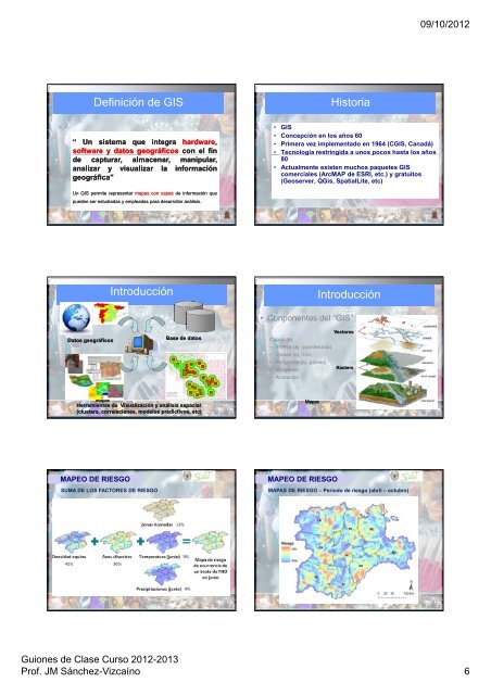
Definición <strong>de</strong> GIS<br />
Historia<br />
“ Un<br />
sis<strong>tema</strong> que<br />
integra<br />
hardware,<br />
software y datos geográficos g<br />
con el fin<br />
<strong>de</strong> capturar,<br />
almacenar,<br />
manipular,<br />
analizar y visualizar<br />
la información<br />
geográfica”<br />
• GIS<br />
• Concepción en los años 60<br />
• Primera vez implementado en 1964 (CGIS, Canadá)<br />
• Tecnología restringida a unos pocos hasta los años<br />
80<br />
• Actualmente existen muchos paquetes GIS<br />
comerciales (ArcMAP <strong>de</strong> ESRI, etc.) y gratuitos<br />
(Geoserver, QGis, SpatialLite, etc)<br />
Un GIS permite representar mapas con capas <strong>de</strong> información que<br />
pue<strong>de</strong>n ser estudiadas y empleadas para <strong>de</strong>sarrollar análisis.<br />
Introducción<br />
Introducción<br />
Datos geográficos<br />
Base <strong>de</strong> datos<br />
• Conponentes <strong>de</strong>l “GIS”<br />
Capas <strong>de</strong>:<br />
– Puntos (ej. coor<strong>de</strong>nada)<br />
– Líneas (ej. ríos)<br />
– Polígonos (ej. países)<br />
– Imágenes<br />
– Anotación<br />
Vectores<br />
Rasters<br />
Mapas<br />
Herramientas <strong>de</strong> Visualización y análisis espacial<br />
(clusters, correlaciones, mo<strong>de</strong>los predictivos, etc)<br />
Mapas<br />
MAPEO DE RIESGO<br />
SUMA DE LOS FACTORES DE RIESGO<br />
MAPEO DE RIESGO<br />
MAPAS DE RIESGO – Periodo <strong>de</strong> riesgo (abril – octubre)<br />
Guiones <strong>de</strong> Clase Curso 2012-2013<br />
Prof. JM Sánchez-Vizcaíno 6