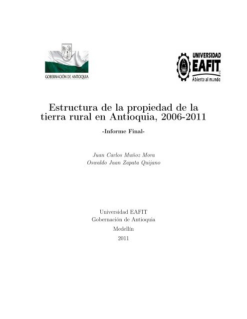
Estructura de la propiedad de la tierra rural en Antioquia, 2006-2011
Estructura de la propiedad de la tierra rural en Antioquia, 2006-2011
Estructura de la propiedad de la tierra rural en Antioquia, 2006-2011

You also want an ePaper? Increase the reach of your titles
YUMPU automatically turns print PDFs into web optimized ePapers that Google loves.
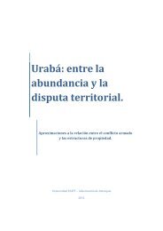
<strong>Estructura</strong> <strong>de</strong> <strong>la</strong> <strong>propiedad</strong> <strong>de</strong> <strong>la</strong><br />
<strong>tierra</strong> <strong>rural</strong> <strong>en</strong> <strong>Antioquia</strong>, <strong>2006</strong>-<strong>2011</strong><br />
-Informe Final-<br />
Juan Carlos Muñoz Mora<br />
Oswaldo Juan Zapata Quijano<br />
Universidad EAFIT<br />
Gobernación <strong>de</strong> <strong>Antioquia</strong><br />
Me<strong>de</strong>llín<br />
<strong>2011</strong>
Resum<strong>en</strong> Ejecutivo<br />
La pres<strong>en</strong>te investigación realiza una aproximación a <strong>la</strong>s estructuras <strong>de</strong> <strong>propiedad</strong><br />
<strong>rural</strong> <strong>en</strong> <strong>Antioquia</strong>, utilizando por primera vez <strong>la</strong> información completa <strong>de</strong>l Sistema<br />
<strong>de</strong> Información y Catastro para todo el <strong>de</strong>partam<strong>en</strong>to <strong>en</strong> los años <strong>2006</strong> a <strong>2011</strong>. Aquí<br />
se <strong>en</strong>fatiza <strong>en</strong> <strong>la</strong> t<strong>en</strong><strong>en</strong>cia <strong>de</strong> <strong>la</strong> <strong>propiedad</strong> privada <strong>rural</strong> agropecuaria a través <strong>de</strong> <strong>la</strong><br />
construcción <strong>de</strong> difer<strong>en</strong>tes índices <strong>de</strong> conc<strong>en</strong>tración <strong>de</strong> <strong>la</strong> <strong>tierra</strong>. El pres<strong>en</strong>te estudio<br />
es fruto <strong>de</strong>l esfuerzo mancomunado <strong>de</strong> <strong>la</strong> Universidad EAFIT y <strong>la</strong> Gobernación <strong>de</strong><br />
<strong>Antioquia</strong> por fortalecer <strong>la</strong> calidad <strong>de</strong> <strong>la</strong> información estadística sobre <strong>la</strong>s estructuras<br />
<strong>de</strong> <strong>propiedad</strong> y t<strong>en</strong><strong>en</strong>cia <strong>de</strong> <strong>la</strong> <strong>tierra</strong>. A nivel metodológico, se inicia adaptando a <strong>la</strong><br />
estructura <strong>de</strong> información <strong>de</strong>l Catastro Antioqueño <strong>la</strong> metodología diseñada por el<br />
C<strong>en</strong>tro <strong>de</strong> Estudios sobre Desarrollo Económico (CEDE) <strong>de</strong> <strong>la</strong> Universidad <strong>de</strong> los<br />
An<strong>de</strong>s y el Instituto Geográfico Agustín Codazzi (IGAC) <strong>en</strong> el proyecto Gran At<strong>la</strong>s<br />
<strong>de</strong> <strong>la</strong> Propiedad <strong>de</strong> <strong>la</strong> Tierra. Sin embargo, aunque se conserva el grueso <strong>de</strong> <strong>la</strong> propuesta<br />
metodológica, <strong>la</strong> pres<strong>en</strong>te investigación aporta a este nivel <strong>en</strong> <strong>la</strong> consolidación<br />
<strong>de</strong> los Filtros y <strong>la</strong> aplicación <strong>de</strong> unos Índices <strong>de</strong> Gini adicionales. Esto hace que tanto<br />
los filtros como el análisis <strong>de</strong> <strong>la</strong> estructura <strong>de</strong> <strong>propiedad</strong> sean comparables para todo<br />
el país. De esta forma, <strong>la</strong> pres<strong>en</strong>te investigación contribuye a completar el panorama<br />
<strong>de</strong> conocimi<strong>en</strong>tos sobre <strong>la</strong> distribución <strong>de</strong> <strong>la</strong> <strong>tierra</strong> a nivel nacional. Entre los principales<br />
hal<strong>la</strong>zgos, se pue<strong>de</strong> seña<strong>la</strong>r el hecho <strong>de</strong> que <strong>la</strong> estructura <strong>de</strong> <strong>la</strong> <strong>propiedad</strong> <strong>rural</strong><br />
<strong>en</strong> <strong>Antioquia</strong> se caracteriza por el predominio <strong>de</strong> los predios privados con <strong>de</strong>stino<br />
económico agropecuario, pues conc<strong>en</strong>tran el 77.97 % <strong>de</strong>l área <strong>de</strong> terr<strong>en</strong>o. Se <strong>en</strong>contró<br />
que este tipo <strong>de</strong> unidad predial se caracteriza por el predominio <strong>de</strong> <strong>la</strong> mediana y gran<br />
<strong>propiedad</strong>, a pesar <strong>de</strong> que el 57.42 % <strong>de</strong> los propietarios son microfundistas y el 19.5 %<br />
minifundistas. Y, finalm<strong>en</strong>te, se confirma <strong>la</strong> exist<strong>en</strong>cia <strong>de</strong> una alta <strong>de</strong>sigualdad <strong>en</strong> <strong>la</strong><br />
distribución <strong>de</strong> <strong>la</strong> <strong>propiedad</strong> <strong>de</strong> <strong>la</strong> <strong>tierra</strong> <strong>en</strong> el <strong>de</strong>partam<strong>en</strong>to, con un coefici<strong>en</strong>te <strong>de</strong><br />
Gini <strong>de</strong> <strong>tierra</strong>s <strong>de</strong> 0.808 y uno <strong>de</strong> propietarios <strong>de</strong> 0.815, que al ajustarlos por calidad<br />
<strong>de</strong> <strong>la</strong> <strong>tierra</strong> tan sólo ca<strong>en</strong> hasta 0.775 y 0.812, respectivam<strong>en</strong>te.
Agra<strong>de</strong>cimi<strong>en</strong>tos<br />
Queremos agra<strong>de</strong>cer a <strong>la</strong> Universidad EAFIT y <strong>la</strong> Gobernación <strong>de</strong> <strong>Antioquia</strong>,<br />
por brindar el soporte económico e institucional para <strong>la</strong> realización <strong>de</strong> este trabajo<br />
y por permitir consolidar una línea <strong>de</strong> investigación <strong>en</strong> estudios catastrales y <strong>de</strong> <strong>la</strong><br />
<strong>tierra</strong> <strong>en</strong> <strong>Antioquia</strong>. En particu<strong>la</strong>r, al doctor Jorge Giraldo Decano <strong>de</strong> <strong>la</strong> Escue<strong>la</strong> <strong>de</strong><br />
Ci<strong>en</strong>cias y Humanida<strong>de</strong>s y a <strong>la</strong> Doctora Ana Cristina Mor<strong>en</strong>o Pa<strong>la</strong>cios Directora <strong>de</strong>l<br />
Departam<strong>en</strong>to Administrativo <strong>de</strong> P<strong>la</strong>neación.<br />
A Alba Luz Rodríguez Cruz, <strong>de</strong> <strong>la</strong> Dirección <strong>de</strong> Sistemas <strong>de</strong> Información y Catastro<br />
<strong>de</strong> <strong>la</strong> Gobernación <strong>de</strong> <strong>Antioquia</strong>, qui<strong>en</strong> compartió con absoluta g<strong>en</strong>erosidad su pasión,<br />
experi<strong>en</strong>cia y amplio conocimi<strong>en</strong>to <strong>de</strong> <strong>la</strong> información catastral <strong>de</strong> <strong>Antioquia</strong>. Sin su<br />
iniciativa y paci<strong>en</strong>te compromiso por el mejorami<strong>en</strong>to <strong>de</strong> los sistemas <strong>de</strong> información<br />
catastral <strong>en</strong> el <strong>de</strong>partam<strong>en</strong>to, no hubiera sido posible este trabajo. Estamos seguros<br />
que <strong>la</strong>s nuevas g<strong>en</strong>eraciones siempre agra<strong>de</strong>cerán su invaluable papel <strong>en</strong> <strong>la</strong> historia<br />
catastral <strong>de</strong> <strong>Antioquia</strong>.<br />
Al doctor Santiago Tobón Zapata, anterior Director <strong>de</strong> Sistemas <strong>de</strong> Información<br />
y Catastro, cuya visión y constante co<strong>la</strong>boración hicieron posible este trabajo.<br />
Al doctor Juan Rodrigo Higuera Agui<strong>la</strong>r, cuyo respaldo perman<strong>en</strong>te a través <strong>de</strong><br />
su gestión como interv<strong>en</strong>tor y finalm<strong>en</strong>te Director <strong>de</strong> Sistemas <strong>de</strong> Información y<br />
Catastro (Sep.-Dic. <strong>2011</strong>) fue siempre tan facilitador <strong>de</strong> los procesos.<br />
A <strong>la</strong> ing<strong>en</strong>iera Nancy Dávi<strong>la</strong> Vi<strong>de</strong>s por <strong>la</strong>s suger<strong>en</strong>cias y perman<strong>en</strong>te disposición<br />
para <strong>la</strong> retroalim<strong>en</strong>tación.<br />
A todos los técnicos y funcionarios <strong>de</strong> <strong>la</strong> Dirección <strong>de</strong> Sistemas <strong>de</strong> Información<br />
y Catastro <strong>de</strong> <strong>la</strong> Secretaría <strong>de</strong> P<strong>la</strong>neación <strong>de</strong> <strong>la</strong> Gobernación <strong>de</strong> <strong>Antioquia</strong>, por sus<br />
1
com<strong>en</strong>tarios, retroalim<strong>en</strong>tación, co<strong>la</strong>boración y paci<strong>en</strong>cia <strong>en</strong> el día a día.<br />
A los asist<strong>en</strong>tes al Panel <strong>de</strong> Expertos realizado <strong>en</strong> <strong>la</strong> Universidad EAFIT. Los profesores<br />
e investigadores: Jorge Lotero (Universidad <strong>de</strong> <strong>Antioquia</strong>), Ana María Iregui<br />
(Banco <strong>de</strong> <strong>la</strong> República), Margarita Gáfaro (Universidad <strong>de</strong> los An<strong>de</strong>s), Juanita Vil<strong>la</strong>veces<br />
(Universidad <strong>de</strong>l Rosario), Isaac Beltrán (Naciones Unidas), Veronica Muñoz<br />
(Naciones Unidas), Carlos Felipe Gaviria (Universidad <strong>de</strong> <strong>Antioquia</strong>), Ever Álvarez<br />
(Colegio Mayor <strong>de</strong> <strong>Antioquia</strong>) y Sebastián Aparicio (ECSIM).<br />
La responsabilidad <strong>de</strong> este trabajo es exclusiva <strong>de</strong> sus autores.<br />
2
Cont<strong>en</strong>ido<br />
Introducción 13<br />
1. La distribución <strong>de</strong> <strong>la</strong> <strong>propiedad</strong> <strong>de</strong> <strong>la</strong> <strong>tierra</strong>: una revisión <strong>de</strong> los<br />
principales indicadores. 16<br />
1.1. Los indicadores <strong>de</strong> <strong>de</strong>sigualdad y sus propieda<strong>de</strong>s <strong>de</strong>seables . . . . . . 17<br />
1.2. El coefici<strong>en</strong>te <strong>de</strong> Gini (CG): <strong>en</strong> busca <strong>de</strong> su compresión. . . . . . . . . 19<br />
1.2.1. Métodos tradicionales para <strong>la</strong> medición <strong>de</strong>l CG . . . . . . . . 20<br />
1.2.2. La g<strong>en</strong>eralización y <strong>de</strong>scomposición <strong>de</strong>l Gini . . . . . . . . . . 23<br />
1.2.3. Dificulta<strong>de</strong>s y precauciones <strong>en</strong> <strong>la</strong> interpretación . . . . . . . . 25<br />
1.3. Más allá <strong>de</strong>l Gini: otros indicadores <strong>de</strong> <strong>de</strong>sigualdad . . . . . . . . . . 26<br />
1.4. El Gini <strong>de</strong> <strong>tierra</strong>s como aproximación a <strong>la</strong> <strong>de</strong>sigualdad: una revisión<br />
empírica para Colombia y <strong>Antioquia</strong>. . . . . . . . . . . . . . . . . . . 28<br />
2. <strong>Estructura</strong> <strong>de</strong> <strong>la</strong> <strong>propiedad</strong> <strong>de</strong> <strong>la</strong> <strong>tierra</strong> <strong>rural</strong> <strong>en</strong> <strong>Antioquia</strong>: apuntes<br />
metodológicos 33<br />
2.1. Las bases <strong>de</strong> datos y los procesos <strong>de</strong> actualización . . . . . . . . . . . 34<br />
2.2. Depuración inicial <strong>de</strong> los datos . . . . . . . . . . . . . . . . . . . . . . 35<br />
2.3. Filtros: i<strong>de</strong>ntificando <strong>la</strong> estructura <strong>de</strong> <strong>propiedad</strong>. . . . . . . . . . . . . 36<br />
2.4. Coefici<strong>en</strong>tes <strong>de</strong> Gini calcu<strong>la</strong>dos . . . . . . . . . . . . . . . . . . . . . . 38<br />
2.4.1. Gini <strong>de</strong>s<strong>de</strong> una perspectiva predial . . . . . . . . . . . . . . . 39<br />
2.4.2. Gini <strong>de</strong>s<strong>de</strong> una perspectiva <strong>de</strong> propietarios . . . . . . . . . . . 40<br />
2.4.3. Gini <strong>de</strong>s<strong>de</strong> una perspectiva <strong>de</strong> hogares. . . . . . . . . . . . . . 41<br />
3
2.5. Rangos <strong>de</strong> distribución . . . . . . . . . . . . . . . . . . . . . . . . . . 42<br />
3. Análisis <strong>de</strong> <strong>la</strong> estructura <strong>de</strong> <strong>propiedad</strong> <strong>rural</strong> <strong>en</strong> <strong>Antioquia</strong> y sus<br />
Subregiones 44<br />
3.1. La estructura <strong>de</strong> <strong>propiedad</strong> <strong>en</strong> <strong>Antioquia</strong> . . . . . . . . . . . . . . . . 45<br />
3.1.1. <strong>Estructura</strong> <strong>de</strong> <strong>la</strong> <strong>propiedad</strong> <strong>rural</strong> . . . . . . . . . . . . . . . . . 45<br />
3.1.2. <strong>Estructura</strong> y distribución <strong>de</strong> <strong>la</strong> <strong>propiedad</strong> privada <strong>rural</strong> agropecuaria<br />
. . . . . . . . . . . . . . . . . . . . . . . . . . . . . . 48<br />
3.2. La estructura <strong>de</strong> <strong>propiedad</strong> <strong>en</strong> <strong>la</strong>s Subregiones Antioqueñas . . . . . . 56<br />
3.2.1. Bajo Cauca . . . . . . . . . . . . . . . . . . . . . . . . . . . . 56<br />
3.2.2. Magdal<strong>en</strong>a Medio . . . . . . . . . . . . . . . . . . . . . . . . . 64<br />
3.2.3. Nor<strong>de</strong>ste . . . . . . . . . . . . . . . . . . . . . . . . . . . . . . 72<br />
3.2.4. Norte . . . . . . . . . . . . . . . . . . . . . . . . . . . . . . . 80<br />
3.2.5. Occi<strong>de</strong>nte . . . . . . . . . . . . . . . . . . . . . . . . . . . . . 88<br />
3.2.6. Ori<strong>en</strong>te . . . . . . . . . . . . . . . . . . . . . . . . . . . . . . . 96<br />
3.2.7. Suroeste . . . . . . . . . . . . . . . . . . . . . . . . . . . . . . 104<br />
3.2.8. Urabá . . . . . . . . . . . . . . . . . . . . . . . . . . . . . . . 112<br />
3.2.9. Valle <strong>de</strong> Aburrá . . . . . . . . . . . . . . . . . . . . . . . . . . 120<br />
4. Com<strong>en</strong>tarios finales: A manera <strong>de</strong> conclusión. 129<br />
Bibliografía 132<br />
A. <strong>Antioquia</strong> y Subregiones. Todos los Ginis calcu<strong>la</strong>dos: <strong>tierra</strong>s, avalúo,<br />
propietarios y hogares , <strong>2006</strong>-<strong>2011</strong> 136<br />
4
Índice <strong>de</strong> Gráficos<br />
1.1. Curva <strong>de</strong> Lor<strong>en</strong>z . . . . . . . . . . . . . . . . . . . . . . . . . . . . . 20<br />
3.1. <strong>Antioquia</strong>. Evolución <strong>de</strong> área <strong>de</strong>l terr<strong>en</strong>o, propietarios, avalúo, área<br />
construida y fichas prediales <strong>en</strong> el sector <strong>rural</strong>. <strong>2006</strong>-<strong>2011</strong> . . . . . . . 46<br />
3.2. <strong>Antioquia</strong>. Composición <strong>de</strong> <strong>la</strong> <strong>propiedad</strong> <strong>rural</strong>, <strong>2006</strong>-<strong>2011</strong> . . . . . . . 47<br />
3.3. <strong>Antioquia</strong>. Evolución <strong>de</strong>l número <strong>de</strong> propietarios, propieda<strong>de</strong>s por propietario,<br />
hectáreas por propietario y Ginis asociados a <strong>la</strong> <strong>propiedad</strong><br />
privada <strong>rural</strong> agropecuaria. <strong>2006</strong>-<strong>2011</strong> . . . . . . . . . . . . . . . . . . 49<br />
3.4. <strong>Antioquia</strong>. Mapas <strong>de</strong> los índices <strong>de</strong> Ginis <strong>de</strong> <strong>tierra</strong>s, <strong>tierra</strong>s(corregido<br />
por calidad), propietarios y hogares(sin repetición y corregidos por<br />
calidad) por subregiones. <strong>2011</strong> . . . . . . . . . . . . . . . . . . . . . . 52<br />
3.5. Bajo Cauca. Evolución <strong>de</strong> área <strong>de</strong>l terr<strong>en</strong>o, propietarios, avalúo, área<br />
construida y fichas prediales <strong>en</strong> el sector <strong>rural</strong>. <strong>2006</strong>-<strong>2011</strong> . . . . . . . 57<br />
3.6. Bajo Cauca. Composición <strong>de</strong> <strong>la</strong> <strong>propiedad</strong> <strong>rural</strong>, <strong>2006</strong>-<strong>2011</strong> . . . . . . 58<br />
3.7. Bajo Cauca. Evolución <strong>de</strong>l número <strong>de</strong> propietarios, propieda<strong>de</strong>s por<br />
propietario, hectáreas por propietario y Ginis asociados a <strong>la</strong> <strong>propiedad</strong><br />
privada <strong>rural</strong> agropecuaria. <strong>2006</strong>-<strong>2011</strong> . . . . . . . . . . . . . . . . . . 59<br />
3.8. Bajo Cauca. Mapas <strong>de</strong> los índices <strong>de</strong> Ginis <strong>de</strong> <strong>tierra</strong>s(corregido por calidad),<br />
propietarios y hogares (sin repetición y corregidos por calidad)<br />
por municipios . <strong>2011</strong> . . . . . . . . . . . . . . . . . . . . . . . . . . . 61<br />
3.9. Magdal<strong>en</strong>a Medio. Evolución <strong>de</strong> área <strong>de</strong>l terr<strong>en</strong>o, propietarios, avalúo,<br />
área construida y fichas prediales <strong>en</strong> el sector <strong>rural</strong>. <strong>2006</strong>-<strong>2011</strong> . . . . 65<br />
5
3.10. Magdal<strong>en</strong>a Medio. Composición <strong>de</strong> <strong>la</strong> <strong>propiedad</strong> <strong>rural</strong>, <strong>2006</strong>-<strong>2011</strong> . . . 66<br />
3.11. Magdal<strong>en</strong>a Medio. Evolución <strong>de</strong>l número <strong>de</strong> propietarios, propieda<strong>de</strong>s<br />
por propietario, hectáreas por propietario y Ginis asociados a <strong>la</strong><br />
<strong>propiedad</strong> privada <strong>rural</strong> agropecuaria. <strong>2006</strong>-<strong>2011</strong> . . . . . . . . . . . . 67<br />
3.12. Magdal<strong>en</strong>a Medio. Mapas <strong>de</strong> los índices <strong>de</strong> Ginis <strong>de</strong> <strong>tierra</strong>s(corregido<br />
por calidad), propietarios y hogares (sin repetición y corregidos por<br />
calidad) por municipios . <strong>2011</strong> . . . . . . . . . . . . . . . . . . . . . . 69<br />
3.13. Nor<strong>de</strong>ste. Evolución <strong>de</strong> área <strong>de</strong>l terr<strong>en</strong>o, propietarios, avalúo, área<br />
construida y fichas prediales <strong>en</strong> el sector <strong>rural</strong>. <strong>2006</strong>-<strong>2011</strong> . . . . . . . 73<br />
3.14. Nor<strong>de</strong>ste. Composición <strong>de</strong> <strong>la</strong> <strong>propiedad</strong> <strong>rural</strong>, <strong>2006</strong>-<strong>2011</strong> . . . . . . . . 74<br />
3.15. Nor<strong>de</strong>ste. Evolución <strong>de</strong>l número <strong>de</strong> propietarios, propieda<strong>de</strong>s por propietario,<br />
hectáreas por propietario y Ginis asociados a <strong>la</strong> <strong>propiedad</strong><br />
privada <strong>rural</strong> agropecuaria. <strong>2006</strong>-<strong>2011</strong> . . . . . . . . . . . . . . . . . . 75<br />
3.16. Nor<strong>de</strong>ste. Mapas <strong>de</strong> los índices <strong>de</strong> Ginis <strong>de</strong> <strong>tierra</strong>s(corregido por calidad),<br />
propietarios y hogares (sin repetición y corregidos por calidad)<br />
por municipios . <strong>2011</strong> . . . . . . . . . . . . . . . . . . . . . . . . . . . 77<br />
3.17. Norte. Evolución <strong>de</strong> área <strong>de</strong>l terr<strong>en</strong>o, propietarios, avalúo, área construida<br />
y fichas prediales <strong>en</strong> el sector <strong>rural</strong>. <strong>2006</strong>-<strong>2011</strong> . . . . . . . . . 81<br />
3.18. Norte. Composición <strong>de</strong> <strong>la</strong> <strong>propiedad</strong> <strong>rural</strong>, <strong>2006</strong>-<strong>2011</strong> . . . . . . . . . 82<br />
3.19. Norte. Evolución <strong>de</strong>l número <strong>de</strong> propietarios, propieda<strong>de</strong>s por propietario,<br />
hectáreas por propietario y Ginis asociados a <strong>la</strong> <strong>propiedad</strong><br />
privada <strong>rural</strong> agropecuaria. <strong>2006</strong>-<strong>2011</strong> . . . . . . . . . . . . . . . . . . 83<br />
3.20. Norte. Mapas <strong>de</strong> los índices <strong>de</strong> Ginis <strong>de</strong> <strong>tierra</strong>s(corregido por calidad),<br />
propietarios y hogares (sin repetición y corregidos por calidad) por<br />
municipios . <strong>2011</strong> . . . . . . . . . . . . . . . . . . . . . . . . . . . . . 85<br />
3.21. Occi<strong>de</strong>nte. Evolución <strong>de</strong> área <strong>de</strong>l terr<strong>en</strong>o, propietarios, avalúo, área<br />
construida y fichas prediales <strong>en</strong> el sector <strong>rural</strong>. <strong>2006</strong>-<strong>2011</strong> . . . . . . . 89<br />
3.22. Occi<strong>de</strong>nte. Composición <strong>de</strong> <strong>la</strong> <strong>propiedad</strong> <strong>rural</strong>, <strong>2006</strong>-<strong>2011</strong> . . . . . . . 90<br />
6
3.23. Occi<strong>de</strong>nte. Evolución <strong>de</strong>l número <strong>de</strong> propietarios, propieda<strong>de</strong>s por propietario,<br />
hectáreas por propietario y Ginis asociados a <strong>la</strong> <strong>propiedad</strong><br />
privada <strong>rural</strong> agropecuaria. <strong>2006</strong>-<strong>2011</strong> . . . . . . . . . . . . . . . . . . 91<br />
3.24. Occi<strong>de</strong>nte. Mapas <strong>de</strong> los índices <strong>de</strong> Ginis <strong>de</strong> <strong>tierra</strong>s(corregido por calidad),<br />
propietarios y hogares (sin repetición y corregidos por calidad)<br />
por municipios . <strong>2011</strong> . . . . . . . . . . . . . . . . . . . . . . . . . . . 93<br />
3.25. Ori<strong>en</strong>te. Evolución <strong>de</strong> área <strong>de</strong>l terr<strong>en</strong>o, propietarios, avalúo, área construida<br />
y fichas prediales <strong>en</strong> el sector <strong>rural</strong>. <strong>2006</strong>-<strong>2011</strong> . . . . . . . . . 97<br />
3.26. Ori<strong>en</strong>te. Composición <strong>de</strong> <strong>la</strong> <strong>propiedad</strong> <strong>rural</strong>, <strong>2006</strong>-<strong>2011</strong> . . . . . . . . 98<br />
3.27. Ori<strong>en</strong>te. Evolución <strong>de</strong>l número <strong>de</strong> propietarios, propieda<strong>de</strong>s por propietario,<br />
hectáreas por propietario y Ginis asociados a <strong>la</strong> <strong>propiedad</strong><br />
privada <strong>rural</strong> agropecuaria. <strong>2006</strong>-<strong>2011</strong> . . . . . . . . . . . . . . . . . . 99<br />
3.28. Ori<strong>en</strong>te. Mapas <strong>de</strong> los índices <strong>de</strong> Ginis <strong>de</strong> <strong>tierra</strong>s(corregido por calidad),<br />
propietarios y hogares (sin repetición y corregidos por calidad)<br />
por municipios . <strong>2011</strong> . . . . . . . . . . . . . . . . . . . . . . . . . . . 101<br />
3.29. Suroeste. Evolución <strong>de</strong> área <strong>de</strong>l terr<strong>en</strong>o, propietarios, avalúo, área<br />
construida y fichas prediales <strong>en</strong> el sector <strong>rural</strong>. <strong>2006</strong>-<strong>2011</strong> . . . . . . . 105<br />
3.30. Suroeste.Composición <strong>de</strong> <strong>la</strong> <strong>propiedad</strong> <strong>rural</strong>, <strong>2006</strong>-<strong>2011</strong> . . . . . . . . 106<br />
3.31. Suroeste. Evolución <strong>de</strong>l número <strong>de</strong> propietarios, propieda<strong>de</strong>s por propietario,<br />
hectáreas por propietario y Ginis asociados a <strong>la</strong> <strong>propiedad</strong><br />
privada <strong>rural</strong> agropecuaria. <strong>2006</strong>-<strong>2011</strong> . . . . . . . . . . . . . . . . . . 107<br />
3.32. Suroeste. Mapas <strong>de</strong> los índices <strong>de</strong> Ginis <strong>de</strong> <strong>tierra</strong>s(corregido por calidad),<br />
propietarios y hogares (sin repetición y corregidos por calidad)<br />
por municipios . <strong>2011</strong> . . . . . . . . . . . . . . . . . . . . . . . . . . . 109<br />
3.33. Uraba. Evolución <strong>de</strong> área <strong>de</strong>l terr<strong>en</strong>o, propietarios, avalúo, área construida<br />
y fichas prediales <strong>en</strong> el sector <strong>rural</strong>. <strong>2006</strong>-<strong>2011</strong> . . . . . . . . . 113<br />
3.34. Urabá. Composición <strong>de</strong> <strong>la</strong> <strong>propiedad</strong> <strong>rural</strong>, <strong>2006</strong>-<strong>2011</strong> . . . . . . . . . 114<br />
7
3.35. Urabá. Evolución <strong>de</strong>l número <strong>de</strong> propietarios, propieda<strong>de</strong>s por propietario,<br />
hectáreas por propietario y Ginis asociados a <strong>la</strong> <strong>propiedad</strong><br />
privada <strong>rural</strong> agropecuaria. <strong>2006</strong>-<strong>2011</strong> . . . . . . . . . . . . . . . . . . 115<br />
3.36. Urabá. Mapas <strong>de</strong> los índices <strong>de</strong> Ginis <strong>de</strong> <strong>tierra</strong>s(corregido por calidad),<br />
propietarios y hogares (sin repetición y corregidos por calidad) por<br />
municipios . <strong>2011</strong> . . . . . . . . . . . . . . . . . . . . . . . . . . . . . 117<br />
3.37. Valle <strong>de</strong> Aburrá. Evolución <strong>de</strong> área <strong>de</strong>l terr<strong>en</strong>o, propietarios, avalúo,<br />
área construida y fichas prediales <strong>en</strong> el sector <strong>rural</strong>. <strong>2006</strong>-<strong>2011</strong> . . . . 121<br />
3.38. Valle <strong>de</strong> Aburrá. Composición <strong>de</strong> <strong>la</strong> <strong>propiedad</strong> <strong>rural</strong>, <strong>2006</strong>-<strong>2011</strong> . . . . 122<br />
3.39. Valle <strong>de</strong> Aburrá. Evolución <strong>de</strong>l número <strong>de</strong> propietarios, propieda<strong>de</strong>s<br />
por propietario, hectáreas por propietario y Ginis asociados a <strong>la</strong> <strong>propiedad</strong><br />
privada <strong>rural</strong> agropecuaria. <strong>2006</strong>-<strong>2011</strong> . . . . . . . . . . . . . . 123<br />
3.40. Valle <strong>de</strong> Aburrá. Mapas <strong>de</strong> los índices <strong>de</strong> Ginis <strong>de</strong> <strong>tierra</strong>s(corregido<br />
por calidad), propietarios y hogares (sin repetición y corregidos por<br />
calidad) por municipios . <strong>2011</strong> . . . . . . . . . . . . . . . . . . . . . . 125<br />
8
Índice <strong>de</strong> Tab<strong>la</strong>s<br />
3.1. <strong>Antioquia</strong>. <strong>Estructura</strong> <strong>de</strong> <strong>la</strong> <strong>propiedad</strong> <strong>en</strong> el sector <strong>rural</strong>, <strong>2006</strong> y <strong>2011</strong> 47<br />
3.2. <strong>Antioquia</strong>. Ginis <strong>de</strong> <strong>tierra</strong>s, <strong>tierra</strong>s(corregido por calidad), propietarios<br />
(sin repetición), propietarios (sin repetición y corregido por calidad),<br />
hogares (sin repetición) y hogares (sin repetición y corregido por calidad).<br />
<strong>2006</strong>-<strong>2011</strong> . . . . . . . . . . . . . . . . . . . . . . . . . . . . . . 50<br />
3.3. Subregiones. Lugar que ocupan <strong>la</strong>s subregiones <strong>de</strong> acuerdo con sus<br />
niveles <strong>de</strong> <strong>de</strong>sigualdad medido por el gini <strong>de</strong> <strong>tierra</strong>s(sin y con corrección<br />
por calidad), propietarios y hogares (sin repetición y corregidos por<br />
calidad). <strong>2011</strong> . . . . . . . . . . . . . . . . . . . . . . . . . . . . . . . 51<br />
3.4. <strong>Antioquia</strong>. Distribución <strong>de</strong> <strong>la</strong> <strong>propiedad</strong> privada <strong>rural</strong> agropecuaria<br />
por fichas prediales. <strong>2006</strong> y <strong>2011</strong> . . . . . . . . . . . . . . . . . . . 54<br />
3.5. <strong>Antioquia</strong>. Distribución <strong>de</strong> <strong>la</strong> <strong>propiedad</strong> privada <strong>rural</strong> agropecuaria<br />
<strong>en</strong>tre propietarios. <strong>2006</strong> y <strong>2011</strong> . . . . . . . . . . . . . . . . . . . . 55<br />
3.6. Bajo Cauca. <strong>Estructura</strong> <strong>de</strong> <strong>la</strong> <strong>propiedad</strong> <strong>rural</strong>, <strong>2006</strong> y <strong>2011</strong> . . . . . . 57<br />
3.7. Bajo Cauca. Ginis <strong>de</strong> <strong>tierra</strong>s, <strong>tierra</strong>s(corregido por calidad), propietarios<br />
(sin repetición), propietarios (sin repetición y corregido por calidad),<br />
hogares (sin repetición) y hogares (sin repetición y corregido<br />
por calidad). <strong>2006</strong>-<strong>2011</strong> . . . . . . . . . . . . . . . . . . . . . . . . . . 60<br />
3.8. Bajo Cauca. Distribución <strong>de</strong> <strong>la</strong> <strong>propiedad</strong> privada <strong>rural</strong> agropecuaria<br />
por fichas prediales. <strong>2006</strong> y <strong>2011</strong> . . . . . . . . . . . . . . . . . . . 63<br />
3.9. Bajo Cauca. Distribución <strong>de</strong> <strong>la</strong> <strong>propiedad</strong> privada <strong>rural</strong> agropecuaria<br />
<strong>en</strong>tre propietarios. <strong>2006</strong> y <strong>2011</strong> . . . . . . . . . . . . . . . . . . . . 64<br />
9
3.10. Magdal<strong>en</strong>a Medio. <strong>Estructura</strong> <strong>de</strong> <strong>la</strong> <strong>propiedad</strong> <strong>rural</strong>, <strong>2006</strong> y <strong>2011</strong> . . . 66<br />
3.11. Magdal<strong>en</strong>a Medio. Ginis <strong>de</strong> <strong>tierra</strong>s, <strong>tierra</strong>s(corregido por calidad), propietarios<br />
(sin repetición), propietarios (sin repetición y corregido por<br />
calidad), hogares (sin repetición) y hogares (sin repetición y corregido<br />
por calidad). <strong>2006</strong>-<strong>2011</strong> . . . . . . . . . . . . . . . . . . . . . . . . . . 68<br />
3.12. Magdal<strong>en</strong>a Medio. Distribución <strong>de</strong> <strong>la</strong> <strong>propiedad</strong> privada <strong>rural</strong> agropecuaria<br />
por fichas prediales. <strong>2006</strong> y <strong>2011</strong> . . . . . . . . . . . . . . . 71<br />
3.13. Magdal<strong>en</strong>a Medio. Distribución <strong>de</strong> <strong>la</strong> <strong>propiedad</strong> privada <strong>rural</strong> agropecuaria<br />
<strong>en</strong>tre propietarios. <strong>2006</strong> y <strong>2011</strong> . . . . . . . . . . . . . . . . 72<br />
3.14. Nor<strong>de</strong>ste. <strong>Estructura</strong> <strong>de</strong> <strong>la</strong> <strong>propiedad</strong> <strong>rural</strong>, <strong>2006</strong> y <strong>2011</strong> . . . . . . . . 73<br />
3.15. Nor<strong>de</strong>ste. Ginis <strong>de</strong> <strong>tierra</strong>s, <strong>tierra</strong>s(corregido por calidad), propietarios<br />
(sin repetición), propietarios (sin repetición y corregido por calidad),<br />
hogares (sin repetición) y hogares (sin repetición y corregido por calidad).<br />
<strong>2006</strong>-<strong>2011</strong> . . . . . . . . . . . . . . . . . . . . . . . . . . . . . . 76<br />
3.16. Nor<strong>de</strong>ste. Distribución <strong>de</strong> <strong>la</strong> <strong>propiedad</strong> privada <strong>rural</strong> agropecuaria por<br />
fichas prediales. <strong>2006</strong> y <strong>2011</strong> . . . . . . . . . . . . . . . . . . . . . . 79<br />
3.17. Nor<strong>de</strong>ste. Distribución <strong>de</strong> <strong>la</strong> <strong>propiedad</strong> privada <strong>rural</strong> agropecuaria <strong>en</strong>tre<br />
propietarios. <strong>2006</strong> y <strong>2011</strong> . . . . . . . . . . . . . . . . . . . . . 80<br />
3.18. Norte. <strong>Estructura</strong> <strong>de</strong> <strong>la</strong> <strong>propiedad</strong> <strong>rural</strong>, <strong>2006</strong> y <strong>2011</strong> . . . . . . . . . 82<br />
3.19. Norte. Ginis <strong>de</strong> <strong>tierra</strong>s, <strong>tierra</strong>s(corregido por calidad), propietarios (sin<br />
repetición), propietarios (sin repetición y corregido por calidad), hogares<br />
(sin repetición) y hogares (sin repetición y corregido por calidad).<br />
<strong>2006</strong>-<strong>2011</strong> . . . . . . . . . . . . . . . . . . . . . . . . . . . . . . . . . 84<br />
3.20. Norte. Distribución <strong>de</strong> <strong>la</strong> <strong>propiedad</strong> privada <strong>rural</strong> agropecuaria por<br />
fichas prediales. <strong>2006</strong> y <strong>2011</strong> . . . . . . . . . . . . . . . . . . . . . . 87<br />
3.21. Norte. Distribución <strong>de</strong> <strong>la</strong> <strong>propiedad</strong> privada <strong>rural</strong> agropecuaria <strong>en</strong>tre<br />
propietarios. <strong>2006</strong> y <strong>2011</strong> . . . . . . . . . . . . . . . . . . . . . . . . 88<br />
3.22. Occi<strong>de</strong>nte. <strong>Estructura</strong> <strong>de</strong> <strong>la</strong> <strong>propiedad</strong> <strong>rural</strong>, <strong>2006</strong> y <strong>2011</strong> . . . . . . . 90<br />
10
3.23. Occi<strong>de</strong>nte. Ginis <strong>de</strong> <strong>tierra</strong>s, <strong>tierra</strong>s(corregido por calidad), propietarios<br />
(sin repetición), propietarios (sin repetición y corregido por calidad),<br />
hogares (sin repetición) y hogares (sin repetición y corregido por calidad).<br />
<strong>2006</strong>-<strong>2011</strong> . . . . . . . . . . . . . . . . . . . . . . . . . . . . . . 92<br />
3.24. Occi<strong>de</strong>nte. Distribución <strong>de</strong> <strong>la</strong> <strong>propiedad</strong> privada <strong>rural</strong> agropecuaria<br />
por fichas prediales. <strong>2006</strong> y <strong>2011</strong> . . . . . . . . . . . . . . . . . . . 95<br />
3.25. Occi<strong>de</strong>nte. Distribución <strong>de</strong> <strong>la</strong> <strong>propiedad</strong> privada <strong>rural</strong> agropecuaria<br />
<strong>en</strong>tre propietarios. <strong>2006</strong> y <strong>2011</strong> . . . . . . . . . . . . . . . . . . . . 96<br />
3.26. Ori<strong>en</strong>te. <strong>Estructura</strong> <strong>de</strong> <strong>la</strong> <strong>propiedad</strong> <strong>rural</strong>, <strong>2006</strong> y <strong>2011</strong> . . . . . . . . 98<br />
3.27. Ori<strong>en</strong>te. Ginis <strong>de</strong> <strong>tierra</strong>s, <strong>tierra</strong>s(corregido por calidad), propietarios<br />
(sin repetición), propietarios (sin repetición y corregido por calidad),<br />
hogares (sin repetición) y hogares (sin repetición y corregido por calidad).<br />
<strong>2006</strong>-<strong>2011</strong> . . . . . . . . . . . . . . . . . . . . . . . . . . . . . . 100<br />
3.28. Ori<strong>en</strong>te. Distribución <strong>de</strong> <strong>la</strong> <strong>propiedad</strong> privada <strong>rural</strong> agropecuaria por<br />
fichas prediales. <strong>2006</strong> y <strong>2011</strong> . . . . . . . . . . . . . . . . . . . . . . 103<br />
3.29. Ori<strong>en</strong>te. Distribución <strong>de</strong> <strong>la</strong> <strong>propiedad</strong> privada <strong>rural</strong> agropecuaria <strong>en</strong>tre<br />
propietarios. <strong>2006</strong> y <strong>2011</strong> . . . . . . . . . . . . . . . . . . . . . 104<br />
3.30. Suroeste. <strong>Estructura</strong> <strong>de</strong> <strong>la</strong> <strong>propiedad</strong> <strong>rural</strong>, <strong>2006</strong> y <strong>2011</strong> . . . . . . . . 106<br />
3.31. Suroeste. Ginis <strong>de</strong> <strong>tierra</strong>s, <strong>tierra</strong>s(corregido por calidad), propietarios<br />
(sin repetición), propietarios (sin repetición y corregido por calidad),<br />
hogares (sin repetición) y hogares (sin repetición y corregido por calidad).<br />
<strong>2006</strong>-<strong>2011</strong> . . . . . . . . . . . . . . . . . . . . . . . . . . . . . . 108<br />
3.32. Suroeste. Distribución <strong>de</strong> <strong>la</strong> <strong>propiedad</strong> privada <strong>rural</strong> agropecuaria por<br />
fichas prediales. <strong>2006</strong> y <strong>2011</strong> . . . . . . . . . . . . . . . . . . . . . . 111<br />
3.33. Suroeste. Distribución <strong>de</strong> <strong>la</strong> <strong>propiedad</strong> privada <strong>rural</strong> agropecuaria <strong>en</strong>tre<br />
propietarios. <strong>2006</strong> y <strong>2011</strong> . . . . . . . . . . . . . . . . . . . . . 112<br />
3.34. Urabá. <strong>Estructura</strong> <strong>de</strong> <strong>la</strong> <strong>propiedad</strong> <strong>rural</strong>, <strong>2006</strong> y <strong>2011</strong> . . . . . . . . . 114<br />
11
3.35. Urabá. Ginis <strong>de</strong> <strong>tierra</strong>s, <strong>tierra</strong>s(corregido por calidad), propietarios<br />
(sin repetición), propietarios (sin repetición y corregido por calidad),<br />
hogares (sin repetición) y hogares (sin repetición y corregido por calidad).<br />
<strong>2006</strong>-<strong>2011</strong> . . . . . . . . . . . . . . . . . . . . . . . . . . . . . . 116<br />
3.36. Urabá. Distribución <strong>de</strong> <strong>la</strong> <strong>propiedad</strong> privada <strong>rural</strong> agropecuaria por<br />
fichas prediales. <strong>2006</strong> y <strong>2011</strong> . . . . . . . . . . . . . . . . . . . . . . 119<br />
3.37. Urabá. Distribución <strong>de</strong> <strong>la</strong> <strong>propiedad</strong> privada <strong>rural</strong> agropecuaria <strong>en</strong>tre<br />
propietarios. <strong>2006</strong> y <strong>2011</strong> . . . . . . . . . . . . . . . . . . . . . . . . 120<br />
3.38. Valle <strong>de</strong> Aburrá. <strong>Estructura</strong> <strong>de</strong> <strong>la</strong> <strong>propiedad</strong> <strong>rural</strong>, <strong>2006</strong> y <strong>2011</strong> . . . . 122<br />
3.39. Valle <strong>de</strong> Aburrá. Ginis <strong>de</strong> <strong>tierra</strong>s, <strong>tierra</strong>s(corregido por calidad), propietarios<br />
(sin repetición), propietarios (sin repetición y corregido por<br />
calidad), hogares (sin repetición) y hogares (sin repetición y corregido<br />
por calidad). <strong>2006</strong>-<strong>2011</strong> . . . . . . . . . . . . . . . . . . . . . . . . . . 124<br />
3.40. Valle <strong>de</strong> Aburrá. Distribución <strong>de</strong> <strong>la</strong> <strong>propiedad</strong> privada <strong>rural</strong> agropecuaria<br />
por fichas prediales. <strong>2006</strong> y <strong>2011</strong> . . . . . . . . . . . . . . . 127<br />
3.41. Valle <strong>de</strong> Aburrá. Distribución <strong>de</strong> <strong>la</strong> <strong>propiedad</strong> privada <strong>rural</strong> agropecuaria<br />
<strong>en</strong>tre propietarios. <strong>2006</strong> y <strong>2011</strong> . . . . . . . . . . . . . . . . 128<br />
A.1. <strong>Antioquia</strong>, Bajo Cauca y Magdal<strong>en</strong>a Medio. Índices <strong>de</strong> Gini <strong>de</strong> <strong>tierra</strong>s,<br />
avalúo, propietarios y hogares para <strong>la</strong> <strong>propiedad</strong> privada agropecuaria,<br />
<strong>2006</strong>-<strong>2011</strong> . . . . . . . . . . . . . . . . . . . . . . . . . . . . . . . . . 137<br />
A.2. Nor<strong>de</strong>ste, Norte y Occi<strong>de</strong>nte. Índices <strong>de</strong> Gini <strong>de</strong> <strong>tierra</strong>s, avalúo, propietarios<br />
y hogares para <strong>la</strong> <strong>propiedad</strong> privada agropecuaria, <strong>2006</strong>-<strong>2011</strong> 138<br />
A.3. Ori<strong>en</strong>te, Suroeste, Urabá y Valle <strong>de</strong> Aburrá. Índices <strong>de</strong> Gini <strong>de</strong> <strong>tierra</strong>s,<br />
avalúo, propietarios y hogares para <strong>la</strong> <strong>propiedad</strong> privada agropecuaria,<br />
<strong>2006</strong>-<strong>2011</strong> . . . . . . . . . . . . . . . . . . . . . . . . . . . . . . . . . 139<br />
12
Introducción<br />
La persist<strong>en</strong>cia <strong>de</strong> <strong>la</strong>s <strong>de</strong>sigualdad <strong>en</strong> <strong>la</strong> t<strong>en</strong><strong>en</strong>cia <strong>de</strong> <strong>la</strong> <strong>tierra</strong> <strong>en</strong> Colombia, se ha<br />
convertido <strong>en</strong> uno <strong>de</strong> los principales obstáculos para el <strong>de</strong>sarrollo <strong>de</strong>l país (Ibánez<br />
y Muñoz, 2010; Deininger y Fe<strong>de</strong>r, 1998). Las estructuras <strong>de</strong> <strong>propiedad</strong>, resultado<br />
<strong>de</strong> condiciones iniciales <strong>de</strong>siguales, retrasan el crecimi<strong>en</strong>to y <strong>de</strong>bilitan <strong>la</strong>s instituciones,<br />
increm<strong>en</strong>tando <strong>la</strong> probabilida<strong>de</strong>s <strong>de</strong> crear círculos <strong>de</strong> pobreza y sub<strong>de</strong>sarrollo<br />
(Acemoglu, Johnson, y Robinson, 2004). A<strong>de</strong>más, evi<strong>de</strong>ncia empírica sugiere un posible<br />
vínculo <strong>en</strong>tre <strong>la</strong> <strong>de</strong>sigualdad <strong>en</strong> <strong>la</strong> t<strong>en</strong><strong>en</strong>cia <strong>de</strong> <strong>la</strong> <strong>tierra</strong> y varias <strong>de</strong> <strong>la</strong>s principales<br />
dim<strong>en</strong>siones <strong>de</strong>l bi<strong>en</strong>estar social como, por ejemplo, los niveles <strong>de</strong> crecimi<strong>en</strong>to y pobreza,<br />
<strong>la</strong> formación <strong>de</strong> capital humano, el acceso al crédito, <strong>la</strong> inversión, <strong>la</strong> viol<strong>en</strong>cia,<br />
<strong>la</strong>s dinámicas <strong>de</strong> conc<strong>en</strong>tración <strong>de</strong> po<strong>de</strong>r político, <strong>en</strong>tre otros (Acemoglu y cols., 2004;<br />
J<strong>en</strong>kis, 1991; Offstein y Hillón, 2003).<br />
En este s<strong>en</strong>tido, el estudio <strong>de</strong> <strong>la</strong>s estructuras <strong>de</strong> <strong>propiedad</strong> <strong>de</strong> <strong>la</strong> <strong>tierra</strong> constituye<br />
un elem<strong>en</strong>to c<strong>la</strong>ve para <strong>la</strong>s políticas <strong>de</strong> p<strong>la</strong>neación <strong>de</strong> <strong>la</strong>rgo p<strong>la</strong>zo <strong>de</strong> <strong>la</strong>s regiones.<br />
Aunque se <strong>en</strong>cu<strong>en</strong>tra una serie <strong>de</strong> trabajos sobre <strong>la</strong> <strong>tierra</strong> y su distribución, sólo<br />
hasta hace poco se han empezado a superar una serie <strong>de</strong> restricciones al acceso <strong>de</strong><br />
<strong>la</strong> información catastral que habían obstaculizado históricam<strong>en</strong>te <strong>la</strong> e<strong>la</strong>boración <strong>de</strong><br />
estudios precisos acerca <strong>de</strong> <strong>la</strong>s estructuras <strong>de</strong> <strong>propiedad</strong> <strong>de</strong> <strong>la</strong> <strong>tierra</strong> <strong>en</strong> el país. Trabajos<br />
como Offstein (2005), Kalmanovitz y López (<strong>2006</strong>), y el más reci<strong>en</strong>te realizado<br />
por <strong>la</strong> Universidad <strong>de</strong> los An<strong>de</strong>s y el Instituto Geográfico Agustín Codazzi han construido<br />
una aproximación consist<strong>en</strong>te sobre <strong>la</strong> estructura <strong>de</strong> <strong>propiedad</strong> a partir <strong>de</strong> <strong>la</strong><br />
construcción y aplicación <strong>de</strong> filtros y el cálculo <strong>de</strong> difer<strong>en</strong>tes índices <strong>de</strong> <strong>de</strong>sigualdad<br />
<strong>de</strong> Gini a <strong>la</strong> información catastral <strong>de</strong> Colombia.<br />
13
<strong>Antioquia</strong>, que cu<strong>en</strong>ta con un Sistema <strong>de</strong> Información Catastral in<strong>de</strong>p<strong>en</strong>di<strong>en</strong>te,<br />
ha sido históricam<strong>en</strong>te excluida <strong>de</strong>l análisis <strong>en</strong> estudios nacionales. Esta aus<strong>en</strong>cia <strong>de</strong><br />
trabajos sobre el <strong>de</strong>partam<strong>en</strong>to, com<strong>en</strong>zó a superarse con trabajos como los <strong>de</strong> Wolff<br />
(2005), Muñoz y Gaviria (2007) y Muñoz y Mora (2008) que construyeron aproximaciones<br />
cuantitativa agregadas a <strong>la</strong> <strong>propiedad</strong> <strong>de</strong> <strong>la</strong> <strong>tierra</strong> que sin bi<strong>en</strong> no son precisas<br />
permitieron t<strong>en</strong>er una primera aproximación a <strong>la</strong>s estructuras <strong>de</strong> <strong>propiedad</strong>. Reci<strong>en</strong>tem<strong>en</strong>te,<br />
<strong>la</strong> Universidad <strong>de</strong> los An<strong>de</strong>s y el Instituto Geográfico Agustín Codazzi <strong>en</strong> el<br />
proyecto Gran At<strong>la</strong>s <strong>de</strong> <strong>la</strong> Propiedad <strong>de</strong> <strong>la</strong> Tierra, con participación <strong>de</strong> <strong>la</strong> Universidad<br />
<strong>de</strong> <strong>Antioquia</strong>, incluyeron por primera vez cálculos sobre estructuras <strong>de</strong> <strong>propiedad</strong> y<br />
Gini <strong>de</strong> <strong>tierra</strong>s con base <strong>en</strong> información catastral básica <strong>de</strong> <strong>Antioquia</strong> para un estudio<br />
nacional. No obstante, aquel trabajo pudo lograr sólo una aplicación parcial <strong>de</strong><br />
<strong>la</strong> metodología que se ha v<strong>en</strong>ido <strong>de</strong>sarrol<strong>la</strong>ndo y consolidando <strong>de</strong>s<strong>de</strong> <strong>en</strong>tonces.<br />
Por su parte, <strong>la</strong> pres<strong>en</strong>te investigación realiza una aproximación a <strong>la</strong>s estructuras<br />
<strong>de</strong> <strong>propiedad</strong> <strong>rural</strong> <strong>en</strong> <strong>Antioquia</strong>, utilizando por primera vez <strong>la</strong>s bases con información<br />
catastral completa durante los años <strong>2006</strong> a <strong>2011</strong>. Aquí se <strong>en</strong>fatiza <strong>en</strong> <strong>la</strong> t<strong>en</strong><strong>en</strong>cia <strong>de</strong><br />
<strong>la</strong> <strong>propiedad</strong> privada agropecuaria <strong>en</strong> el <strong>de</strong>partam<strong>en</strong>to a través <strong>de</strong> <strong>la</strong> construcción<br />
<strong>de</strong> difer<strong>en</strong>tes índices <strong>de</strong> conc<strong>en</strong>tración <strong>de</strong> <strong>la</strong> <strong>tierra</strong>. El pres<strong>en</strong>te estudio es fruto <strong>de</strong>l<br />
esfuerzo mancomunado <strong>de</strong> <strong>la</strong> Universidad EAFIT y <strong>la</strong> Gobernación <strong>de</strong> <strong>Antioquia</strong> por<br />
fortalecer <strong>la</strong> calidad <strong>de</strong> <strong>la</strong> información estadística sobre <strong>la</strong>s estructuras <strong>de</strong> <strong>propiedad</strong><br />
y t<strong>en</strong><strong>en</strong>cia <strong>de</strong> <strong>la</strong> <strong>tierra</strong>.<br />
A nivel metodológico, se inicia adaptando a <strong>la</strong> estructura <strong>de</strong> información <strong>de</strong>l<br />
Catastro Antioqueño <strong>la</strong> metodología diseñada por el C<strong>en</strong>tro <strong>de</strong> Estudios sobre Desarrollo<br />
Económico (CEDE) <strong>de</strong> <strong>la</strong> Universidad <strong>de</strong> los An<strong>de</strong>s y el Instituto Geográfico<br />
Agustín Codazzi (IGAC) <strong>en</strong> el proyecto Gran At<strong>la</strong>s <strong>de</strong> <strong>la</strong> Propiedad <strong>de</strong> <strong>la</strong> Tierra.<br />
Sin embargo, aunque se conserva el grueso <strong>de</strong> <strong>la</strong> propuesta metodológica, <strong>la</strong> pres<strong>en</strong>te<br />
investigación aporta a este nivel <strong>en</strong> <strong>la</strong> consolidación <strong>de</strong> los filtros y <strong>la</strong> aplicación <strong>de</strong><br />
unos Índices <strong>de</strong> Gini adicionales. Esto hace que tanto los filtros como el análisis <strong>de</strong><br />
<strong>la</strong> estructura <strong>de</strong> <strong>propiedad</strong> sean comparables para todo el país 1 .<br />
1 Se l<strong>la</strong>ma <strong>la</strong> at<strong>en</strong>ción, sin embargo, sobre un par <strong>de</strong> precauciones marginales que es necesario<br />
t<strong>en</strong>er <strong>en</strong> cu<strong>en</strong>ta al comparar los cálculos <strong>de</strong> los dos trabajos y que se seña<strong>la</strong>n <strong>en</strong> <strong>la</strong> página 34,<br />
14
De esta forma, <strong>la</strong> pres<strong>en</strong>te investigación contribuye a completar el panorama <strong>de</strong><br />
conocimi<strong>en</strong>tos sobre <strong>la</strong> distribución <strong>de</strong> <strong>la</strong> <strong>tierra</strong> a nivel nacional. Entre los principales<br />
hal<strong>la</strong>zgos, se pue<strong>de</strong> seña<strong>la</strong>r el hecho <strong>de</strong> que <strong>la</strong> estructura <strong>de</strong> <strong>la</strong> <strong>propiedad</strong> <strong>rural</strong><br />
<strong>en</strong> <strong>Antioquia</strong> se caracteriza por el predominio <strong>de</strong> los predios privados con <strong>de</strong>stino<br />
económico agropecuario, pues conc<strong>en</strong>tran el 77.97 % <strong>de</strong>l área <strong>de</strong> terr<strong>en</strong>o. Se <strong>en</strong>contró<br />
que este tipo <strong>de</strong> unidad predial se caracteriza por el predominio <strong>de</strong> <strong>la</strong> mediana y<br />
gran <strong>propiedad</strong>, a pesar <strong>de</strong> que el 57.42 % <strong>de</strong> los propietarios son microfundistas y<br />
el 19.5 % minifundistas. Y, finalm<strong>en</strong>te, se confirma que los niveles <strong>de</strong> <strong>de</strong>sigualdad <strong>de</strong><br />
<strong>la</strong> <strong>propiedad</strong> sobre <strong>la</strong> <strong>tierra</strong> son altos, con un coefici<strong>en</strong>te <strong>de</strong> Gini <strong>de</strong> <strong>tierra</strong>s <strong>de</strong> 0.808<br />
y uno <strong>de</strong> propietarios <strong>de</strong> 0.815, y que al ajustarlos por calidad <strong>de</strong> <strong>la</strong> <strong>tierra</strong> tan sólo<br />
ca<strong>en</strong> hasta 0.775 y 0.812, respectivam<strong>en</strong>te.<br />
Este trabajo está constituido por tres capítulos. En el primero, se pres<strong>en</strong>ta una<br />
revisión <strong>de</strong> literatura acerca <strong>de</strong> los principales indicadores para <strong>la</strong> medición <strong>de</strong> <strong>la</strong><br />
<strong>de</strong>sigualdad. Allí, se <strong>de</strong>sarrol<strong>la</strong> una discusión teórica sobre los difer<strong>en</strong>tes índices <strong>de</strong><br />
<strong>de</strong>sigualdad económica, haci<strong>en</strong>do énfasis <strong>en</strong> el Coefici<strong>en</strong>te <strong>de</strong> Gini usualm<strong>en</strong>te utilizado<br />
para el estudio <strong>de</strong> <strong>tierra</strong>s. El capitulo termina con una revisión <strong>de</strong>l estado<br />
<strong>de</strong>l arte <strong>de</strong> los difer<strong>en</strong>tes trabajos sobre <strong>la</strong> <strong>tierra</strong> para Colombia y <strong>Antioquia</strong>, haci<strong>en</strong>do<br />
especial énfasis <strong>en</strong> sus metodologías y hal<strong>la</strong>zgos. El segundo capitulo, realiza<br />
una exposición <strong>de</strong>tal<strong>la</strong>da <strong>de</strong> los difer<strong>en</strong>tes pasos metodológicos realizados para <strong>la</strong><br />
construcción <strong>de</strong>l análisis <strong>de</strong> <strong>la</strong> estructura <strong>de</strong> <strong>propiedad</strong> <strong>de</strong> <strong>la</strong> <strong>tierra</strong> para <strong>Antioquia</strong>.<br />
Finalm<strong>en</strong>te, <strong>en</strong> el tercero, se expon<strong>en</strong> los resultados para <strong>Antioquia</strong> y cada una <strong>de</strong><br />
<strong>la</strong>s subregiones, haci<strong>en</strong>do énfasis <strong>en</strong> <strong>la</strong>s estructuras <strong>de</strong> <strong>propiedad</strong> y los principales<br />
índices <strong>de</strong> Gini.<br />
capítulo 2<br />
15
Capítulo 1<br />
La distribución <strong>de</strong> <strong>la</strong> <strong>propiedad</strong> <strong>de</strong> <strong>la</strong><br />
<strong>tierra</strong>: una revisión <strong>de</strong> los principales<br />
indicadores.<br />
La medición <strong>de</strong> <strong>la</strong> <strong>de</strong>sigualdad económica ha sido <strong>de</strong> interés para <strong>la</strong> compresión<br />
<strong>de</strong> <strong>la</strong>s dinámicas <strong>de</strong> <strong>de</strong>sarrollo <strong>de</strong> <strong>la</strong>s socieda<strong>de</strong>s. Para ello, se han creado diversos<br />
indicadores que permit<strong>en</strong> un cálculo <strong>de</strong> su magnitud y composición, <strong>en</strong>tre los que<br />
el índice <strong>de</strong> Gini <strong>de</strong>staca por ser el más ampliam<strong>en</strong>te utilizado(S<strong>en</strong> y Foster, 1997).<br />
Aunque <strong>en</strong> su mayoría esos índices fueron p<strong>en</strong>sados originalm<strong>en</strong>te para medir <strong>la</strong> distribución<br />
<strong>de</strong>l ingreso, con el tiempo también se han convertido <strong>en</strong> herrami<strong>en</strong>tas c<strong>la</strong>ve<br />
para el estudio <strong>de</strong> <strong>la</strong> <strong>de</strong>sigualdad <strong>en</strong> <strong>la</strong> t<strong>en</strong><strong>en</strong>cia <strong>de</strong> <strong>la</strong> <strong>tierra</strong>, pues permit<strong>en</strong> obt<strong>en</strong>er<br />
una aproximación <strong>de</strong> re<strong>la</strong>tiva s<strong>en</strong>cillez y po<strong>de</strong>r interpretativo (Ibánez y Muñoz,<br />
2010).<br />
En este primer capítulo se pret<strong>en</strong><strong>de</strong> pres<strong>en</strong>tar una breve revisión <strong>de</strong> los principales<br />
indicadores para <strong>la</strong> medición <strong>de</strong> <strong>la</strong> <strong>de</strong>sigualdad económica, con énfasis <strong>en</strong> los más<br />
utilizados para el estudio <strong>de</strong> <strong>la</strong> distribución <strong>de</strong> <strong>la</strong> <strong>tierra</strong>. A lo <strong>la</strong>rgo <strong>de</strong> cuatro secciones<br />
se pres<strong>en</strong>ta, primero, <strong>la</strong> tipología g<strong>en</strong>eral <strong>de</strong> dichos indicadores y sus propieda<strong>de</strong>s<br />
<strong>de</strong>seables; segundo, los aspectos g<strong>en</strong>erales <strong>de</strong> cálculo e interpretación <strong>de</strong>l coefici<strong>en</strong>te<br />
16
<strong>de</strong> Gini (CG); tercero, <strong>la</strong>s formas <strong>de</strong> cálculo <strong>de</strong> medidas asociadas a <strong>la</strong> <strong>de</strong> <strong>en</strong>tropía<br />
g<strong>en</strong>eralizada, así como <strong>la</strong> refer<strong>en</strong>cia <strong>de</strong> una reci<strong>en</strong>te aproximación <strong>de</strong>s<strong>de</strong> <strong>la</strong> econometría<br />
espacial. Y, para finalizar, una cuarta sección don<strong>de</strong> se revisa brevem<strong>en</strong>te <strong>la</strong><br />
literatura sobre mediciones <strong>de</strong> <strong>la</strong> <strong>de</strong>sigualdad <strong>de</strong> <strong>la</strong> t<strong>en</strong><strong>en</strong>cia <strong>de</strong> <strong>la</strong> <strong>tierra</strong> <strong>en</strong> Colombia<br />
y <strong>Antioquia</strong>.<br />
1.1. Los indicadores <strong>de</strong> <strong>de</strong>sigualdad y sus propieda<strong>de</strong>s<br />
<strong>de</strong>seables<br />
Las aproximaciones cuantitativas <strong>de</strong> <strong>la</strong> <strong>de</strong>sigualdad económica se pue<strong>de</strong>n dividir<br />
<strong>en</strong> dos gran<strong>de</strong>s categorías: positivas y normativas. La primera agrupa un conjunto <strong>de</strong><br />
indicadores estadísticos inspirados <strong>en</strong> una noción objetiva <strong>de</strong> <strong>la</strong> <strong>de</strong>sigualdad, valorando<br />
con frecu<strong>en</strong>cia <strong>la</strong> distribución re<strong>la</strong>tiva <strong>de</strong> <strong>la</strong> variable económica (como el ingreso<br />
o <strong>la</strong> <strong>tierra</strong>) al interior <strong>de</strong> una pob<strong>la</strong>ción. En contraste, <strong>la</strong>s medidas normativas pret<strong>en</strong><strong>de</strong>n<br />
una aproximación mediada por una valoración ética <strong>de</strong> <strong>la</strong> <strong>de</strong>sigualdad, pues<br />
se calcu<strong>la</strong> consi<strong>de</strong>rando explícitam<strong>en</strong>te algún tipo <strong>de</strong> función <strong>de</strong> bi<strong>en</strong>estar social(S<strong>en</strong><br />
y Foster, 1997) 1 . La pres<strong>en</strong>te investigación se conc<strong>en</strong>tra <strong>en</strong> <strong>la</strong>s medidas positivas.<br />
Las medidas <strong>de</strong> <strong>en</strong>foque positivo se caracterizan por el uso <strong>de</strong> estadísticas <strong>de</strong>scriptivas<br />
2 y <strong>la</strong> construcción <strong>de</strong> índices que permit<strong>en</strong> t<strong>en</strong>er una aproximación resumida<br />
1 Los indicadores <strong>de</strong> <strong>en</strong>foque normativo más relevantes <strong>en</strong> <strong>la</strong> literatura son los propuestos por<br />
Dalton (1920) y Atkinson (1970). Aunque ambos <strong>de</strong>p<strong>en</strong><strong>de</strong>n <strong>de</strong> una función <strong>de</strong> utilidad implícita,<br />
pue<strong>de</strong>n ser expresados <strong>en</strong> términos <strong>de</strong>l número <strong>de</strong> observaciones n, el valor <strong>de</strong> <strong>la</strong> variable (<strong>tierra</strong>) por<br />
individuo (propietario) y i , <strong>la</strong> media µ y un factor <strong>de</strong> aversión a <strong>la</strong> <strong>de</strong>sigualdad ε (Cowell, <strong>2011</strong>);así:<br />
el índice <strong>de</strong> Dalton se <strong>de</strong>fine como<br />
∑<br />
1 n<br />
[<br />
n i=1 y<br />
1−ε<br />
i − 1 ]<br />
D ε = 1 −<br />
µ 1−ε − 1<br />
mi<strong>en</strong>tras, el <strong>de</strong> Atkinson pue<strong>de</strong> ser expresado como<br />
A ε = 1 −<br />
[<br />
1<br />
n<br />
n∑<br />
i=1<br />
[ ] ] 1<br />
1−ε 1−ε<br />
yi<br />
µ<br />
2 Entre otros: índices estadísticos <strong>de</strong> dispersión como el rango re<strong>la</strong>tivo (o “alcance”), <strong>de</strong>sviación<br />
17
sobre <strong>la</strong> <strong>de</strong>sigualdad. Entre estos últimos, se <strong>de</strong>stacan el Coefici<strong>en</strong>te <strong>de</strong> Gini propuesto<br />
por Gini (1936) y otros basados <strong>en</strong> <strong>la</strong> teoría <strong>de</strong> <strong>la</strong> información con el índice <strong>de</strong> <strong>la</strong><br />
<strong>en</strong>tropía <strong>de</strong> Theil (Theil, 1967).<br />
Aunque todos ellos ofrec<strong>en</strong> una aproximación cuantitativa <strong>de</strong> <strong>la</strong> <strong>de</strong>sigualdad, pose<strong>en</strong><br />
distintas propieda<strong>de</strong>s, por lo que <strong>la</strong> aplicación <strong>de</strong> uno u otro <strong>de</strong>p<strong>en</strong><strong>de</strong> <strong>de</strong> <strong>la</strong><br />
situación particu<strong>la</strong>r <strong>de</strong> <strong>la</strong> información y los intereses <strong>de</strong>l análisis. En efecto, todo el<br />
<strong>de</strong>bate <strong>en</strong> torno a <strong>la</strong> <strong>de</strong>finición <strong>de</strong> un bu<strong>en</strong> indicador ti<strong>en</strong>e que ver <strong>en</strong> gran medida<br />
con qué tan bi<strong>en</strong> se ajusta, o no, a un conjunto <strong>de</strong> parámetros que se estiman para<br />
<strong>en</strong>t<strong>en</strong><strong>de</strong>r y explicar <strong>la</strong>s dinámicas <strong>de</strong> <strong>la</strong> <strong>de</strong>sigualdad, conocidos como <strong>la</strong>s “propieda<strong>de</strong>s<br />
<strong>de</strong>seables” <strong>de</strong> los indicadores <strong>de</strong> <strong>de</strong>sigualdad (S<strong>en</strong> y Foster, 1997; Medina, 2001) 3 .<br />
media re<strong>la</strong>tiva, varianza, <strong>de</strong>sviación estándar, coefici<strong>en</strong>te <strong>de</strong> variación, <strong>de</strong>sviación estándar <strong>de</strong> los<br />
logaritmos y <strong>la</strong> difer<strong>en</strong>cia media re<strong>la</strong>tiva.<br />
3 En g<strong>en</strong>eral, un índice <strong>de</strong> <strong>de</strong>sigualdad económica <strong>de</strong>bería cumplir <strong>la</strong>s sigui<strong>en</strong>tes propieda<strong>de</strong>s<br />
<strong>de</strong>seables: 1) In<strong>de</strong>p<strong>en</strong><strong>de</strong>ncia <strong>de</strong> esca<strong>la</strong>. Esto es, el indicador no cambia ante transformaciones<br />
proporcionales o cambios <strong>de</strong> esca<strong>la</strong> <strong>de</strong> <strong>la</strong> variable. 2) Condición Pigou-Dalton.Esta condición<br />
exige que <strong>la</strong> medida <strong>de</strong> <strong>de</strong>sigualdad aum<strong>en</strong>te o disminuya conforme haya una transfer<strong>en</strong>cia regresiva<br />
o progresiva, respectivam<strong>en</strong>te. 3) simetría o inmutabilidad <strong>de</strong>l indicador ante mediciones<br />
<strong>en</strong> un mismo nivel <strong>de</strong> <strong>la</strong> variable. Esto exige que el indicador permanezca constante bajo permutaciones<br />
<strong>de</strong>l or<strong>de</strong>n <strong>de</strong> los individuos (o propietarios, o predios), que sin embargo manti<strong>en</strong><strong>en</strong> <strong>la</strong><br />
misma magnitud asociada <strong>de</strong> <strong>la</strong> variable (ingresos o <strong>tierra</strong>). 4) Condición <strong>de</strong> cambio re<strong>la</strong>tivo.<br />
Ésta propone que se cump<strong>la</strong> <strong>la</strong> condición <strong>de</strong> Pigou-Dalton y a<strong>de</strong>más que el efecto <strong>de</strong> <strong>la</strong>s transfer<strong>en</strong>cias<br />
sobre el indicador no sea lineal. 5) In<strong>de</strong>p<strong>en</strong><strong>de</strong>ncia <strong>de</strong> tamaño. Esta <strong>propiedad</strong> propone<br />
que el valor <strong>de</strong>l indicador sea igual para cualquier par <strong>de</strong> pob<strong>la</strong>ciones que t<strong>en</strong>gan una misma curva<br />
<strong>de</strong> Lor<strong>en</strong>z asociada, in<strong>de</strong>p<strong>en</strong>di<strong>en</strong>tem<strong>en</strong>te <strong>de</strong> su tamaño. 6) Consist<strong>en</strong>cia con <strong>la</strong> or<strong>de</strong>nación <strong>de</strong><br />
<strong>la</strong> curva <strong>de</strong> Lor<strong>en</strong>z o “dominancia estocástica”. Cuando al comparar dos curvas <strong>de</strong> Lor<strong>en</strong>z se<br />
<strong>en</strong>cu<strong>en</strong>tra que una es superior a <strong>la</strong> otra <strong>en</strong> cada punto <strong>de</strong> <strong>la</strong> distribución, excepto <strong>en</strong> los extremos,<br />
se dice que es “dominante” <strong>en</strong> re<strong>la</strong>ción con <strong>la</strong> “dominada” que distribuye con valores inferiores para<br />
cada porc<strong>en</strong>taje <strong>de</strong> pob<strong>la</strong>ción. El indicador siempre arrojaría un valor inferior para una distribución<br />
con curva <strong>de</strong> Lor<strong>en</strong>z dominante con respecto al arrojado para una con curva dominada. 7) Decrecimi<strong>en</strong>to<br />
<strong>de</strong>l efecto ante transfer<strong>en</strong>cias. Esta <strong>propiedad</strong> seña<strong>la</strong> que ante iguales transfer<strong>en</strong>cias<br />
<strong>en</strong>tre individuos (o propietarios o predios) equidistantes <strong>en</strong> <strong>la</strong> distribución, el valor <strong>de</strong>l indicador<br />
<strong>de</strong>bería cambiar más y más <strong>en</strong> <strong>la</strong> medida que aquellos se <strong>en</strong>cu<strong>en</strong>tr<strong>en</strong> <strong>en</strong> estratos pob<strong>la</strong>cionales más<br />
y más bajos (con cada vez m<strong>en</strong>ores ingresos, o cantida<strong>de</strong>s <strong>de</strong> <strong>tierra</strong>), <strong>en</strong> el s<strong>en</strong>tido seña<strong>la</strong>do por<br />
<strong>la</strong> condición Pigou-Dalton. 8) Decrecimi<strong>en</strong>to re<strong>la</strong>tivo <strong>de</strong>l efecto ante transfer<strong>en</strong>cias. Esta<br />
condición exige <strong>la</strong> anterior, pero a<strong>de</strong>más advierte que el cambio ante <strong>la</strong> transfer<strong>en</strong>cia <strong>de</strong>be ser re<strong>la</strong>tivam<strong>en</strong>te<br />
más alto <strong>en</strong> estratos inferiores aún cuando <strong>la</strong> brecha absoluta <strong>en</strong>tre los ingresos o área <strong>de</strong><br />
<strong>tierra</strong> <strong>de</strong> los dos individuos o propietarios involucrados <strong>en</strong> <strong>la</strong> transfer<strong>en</strong>cia sea consi<strong>de</strong>rablem<strong>en</strong>te<br />
m<strong>en</strong>or.9) Descomposición aditiva. Un indicador cumple con esta <strong>propiedad</strong> si pue<strong>de</strong> ser calcu<strong>la</strong>do<br />
para subgrupos <strong>de</strong> <strong>la</strong> pob<strong>la</strong>ción, <strong>de</strong> tal manera que se pueda <strong>en</strong>contrar el aporte re<strong>la</strong>tivo <strong>de</strong><br />
cada uno <strong>de</strong> ellos <strong>en</strong> <strong>la</strong> <strong>de</strong>sigualdad total.<br />
18
No obstante, parece haber un cons<strong>en</strong>so sobre el uso <strong>de</strong>l coefici<strong>en</strong>te <strong>de</strong> Gini como<br />
<strong>la</strong> medida <strong>de</strong>scriptiva más aceptada, <strong>de</strong>bido a su fácil implem<strong>en</strong>tación <strong>en</strong> estudios<br />
aplicados y el pot<strong>en</strong>cial explicativo que brinda <strong>la</strong> simplicidad <strong>de</strong> su lectura (Lambert<br />
y Decoster, 2004; S<strong>en</strong> y Foster, 1997). Por eso, <strong>en</strong> <strong>la</strong> sigui<strong>en</strong>te sección se pres<strong>en</strong>ta<br />
un panorama <strong>de</strong> los difer<strong>en</strong>tes métodos <strong>de</strong> cálculo y propieda<strong>de</strong>s <strong>de</strong>l índice <strong>de</strong> Gini.<br />
Luego, se introducirán brevem<strong>en</strong>te otros indicadores. Y para terminar, se revisa el<br />
estado y los alcances <strong>de</strong> <strong>la</strong> medición <strong>de</strong> <strong>la</strong> <strong>de</strong>sigualdad <strong>de</strong> <strong>la</strong> t<strong>en</strong><strong>en</strong>cia <strong>de</strong> <strong>la</strong> <strong>tierra</strong><br />
<strong>en</strong> Colombia y <strong>Antioquia</strong>, don<strong>de</strong> se hará evi<strong>de</strong>nte <strong>la</strong> predominancia <strong>de</strong>l uso <strong>de</strong>l Gini<br />
para estos estudios.<br />
1.2. El coefici<strong>en</strong>te <strong>de</strong> Gini (CG): <strong>en</strong> busca <strong>de</strong> su compresión.<br />
La forma conv<strong>en</strong>cional y más intuitiva <strong>de</strong> compr<strong>en</strong><strong>de</strong>r el coefici<strong>en</strong>te <strong>de</strong> Gini es a<br />
través <strong>de</strong>l cálculo <strong>de</strong> <strong>la</strong> distancia <strong>en</strong>tre dos esc<strong>en</strong>arios <strong>de</strong> distribución: <strong>la</strong> realidad y<br />
un estado <strong>de</strong> completa equi-distribución. Para esto, se utiliza <strong>la</strong> aproximación gráfica<br />
<strong>de</strong> <strong>la</strong> <strong>de</strong>sigualdad propuesta por Lor<strong>en</strong>z (1905), <strong>la</strong> cual re<strong>la</strong>ciona una proporción<br />
acumu<strong>la</strong>da <strong>de</strong> <strong>tierra</strong> ( % y) con el porc<strong>en</strong>taje <strong>de</strong> propietarios que es dueño <strong>de</strong> el<strong>la</strong><br />
( % x), estos porc<strong>en</strong>tajes se acumu<strong>la</strong>n <strong>en</strong> forma creci<strong>en</strong>te <strong>de</strong> acuerdo con <strong>la</strong> cantidad<br />
<strong>de</strong> <strong>tierra</strong> que posee cada propietario hasta llegar al 100 por ci<strong>en</strong>to <strong>de</strong> <strong>la</strong> <strong>tierra</strong> y al<br />
100 por ci<strong>en</strong>to <strong>de</strong> los propietarios. La gráfica 1.1 ilustra esta re<strong>la</strong>ción, con dos ejes<br />
completam<strong>en</strong>te proporcionales, don<strong>de</strong> sobresal<strong>en</strong> dos líneas: una recta <strong>de</strong> 45 grados<br />
que da cu<strong>en</strong>ta <strong>de</strong>l esc<strong>en</strong>ario <strong>de</strong> equidistribución don<strong>de</strong> cada porc<strong>en</strong>taje <strong>de</strong> <strong>la</strong> pob<strong>la</strong>ción<br />
ti<strong>en</strong>e exactam<strong>en</strong>te <strong>la</strong> misma proporción <strong>de</strong> <strong>la</strong> <strong>tierra</strong> (ver punto A, n % = n %); y, una<br />
curva que ti<strong>en</strong>e p<strong>en</strong>di<strong>en</strong>te creci<strong>en</strong>te y está por <strong>de</strong>bajo <strong>de</strong> <strong>la</strong> diagonal, conocida como<br />
Curva <strong>de</strong> Lor<strong>en</strong>z, que repres<strong>en</strong>ta una situación <strong>de</strong> <strong>de</strong>sigualdad, ya que <strong>en</strong> comparación<br />
con <strong>la</strong> recta anterior aquí existe algún porc<strong>en</strong>taje <strong>de</strong> <strong>la</strong> pob<strong>la</strong>ción que ti<strong>en</strong>e mayor<br />
proporción <strong>de</strong> <strong>tierra</strong> que los <strong>de</strong>más (ver punto B, don<strong>de</strong> n % < (n + m) % y el<br />
100 − (n + m) % <strong>de</strong> los propietarios ti<strong>en</strong><strong>en</strong> el (100 − n) % <strong>de</strong> <strong>la</strong> <strong>tierra</strong>).<br />
19
Gráfico 1.1: Curva <strong>de</strong> Lor<strong>en</strong>z<br />
El CG está <strong>de</strong>finido como el coci<strong>en</strong>te <strong>en</strong>tre el valor <strong>de</strong>l área α <strong>de</strong>limitada <strong>en</strong>tre <strong>la</strong><br />
diagonal y <strong>la</strong> curva <strong>de</strong> Lor<strong>en</strong>z, <strong>de</strong> un <strong>la</strong>do, y el área α + β <strong>de</strong>l triángulo <strong>de</strong>finido por<br />
X = 100 %, Y = 0 % y X = Y , <strong>de</strong>l otro. Esto es, CG =<br />
α . Así, sus valores osci<strong>la</strong>n<br />
α+β<br />
<strong>en</strong>tre 0 y 1, si<strong>en</strong>do éstos situaciones extremas <strong>de</strong> igualdad perfecta <strong>en</strong>tre propietarios<br />
(0) o conc<strong>en</strong>tración absoluta (1). En <strong>la</strong> literatura, es posible i<strong>de</strong>ntificar dos formas<br />
para <strong>la</strong> medición <strong>de</strong> este indicador: una, <strong>la</strong> <strong>de</strong> los métodos tradicionales, y otra, <strong>la</strong><br />
<strong>de</strong> los g<strong>en</strong>eralizados y <strong>de</strong>sagregados 4 .<br />
1.2.1. Métodos tradicionales para <strong>la</strong> medición <strong>de</strong>l CG<br />
Una <strong>de</strong> <strong>la</strong>s principales v<strong>en</strong>tajas <strong>de</strong>l coefici<strong>en</strong>te <strong>de</strong> Gini es <strong>la</strong> flexibilidad <strong>de</strong> su<br />
cálculo fr<strong>en</strong>te a distintas estructuras <strong>de</strong> información. Así, es posible medir este índice<br />
<strong>de</strong> dos maneras difer<strong>en</strong>tes sin que se afect<strong>en</strong> su consist<strong>en</strong>cia y po<strong>de</strong>r explicativo 5 .<br />
En el caso que se t<strong>en</strong>ga información <strong>de</strong>sagregada para cada individuo (predio o<br />
propietario) se realiza una aproximación directa; <strong>en</strong> contraste, cuando se dispone <strong>de</strong><br />
4 Los tradicionales cumpl<strong>en</strong> seis <strong>de</strong> <strong>la</strong>s nueve propieda<strong>de</strong>s <strong>de</strong>seables seña<strong>la</strong>das <strong>en</strong> un pie <strong>de</strong> página<br />
anterior, mi<strong>en</strong>tras los otros pret<strong>en</strong><strong>de</strong>n cubrir <strong>la</strong>s <strong>de</strong>más.<br />
5 En particu<strong>la</strong>r se cumple <strong>la</strong>s sigui<strong>en</strong>tes propieda<strong>de</strong>s <strong>de</strong>seables: in<strong>de</strong>p<strong>en</strong><strong>de</strong>ncia <strong>de</strong> esca<strong>la</strong>, tamaño<br />
y permutaciones, cumplimi<strong>en</strong>to <strong>de</strong> <strong>la</strong> condiciones <strong>de</strong> Pigou-Dalton y <strong>de</strong> cambio re<strong>la</strong>tivo y <strong>la</strong> l<strong>la</strong>mada<br />
“dominancia estocástica”.<br />
20
datos agregados por rangos o cuantiles se utiliza un método indirecto 6 .<br />
Aunque es posible <strong>en</strong>contrar <strong>en</strong> <strong>la</strong> literatura difer<strong>en</strong>tes formas funcionales para el<br />
cálculo <strong>de</strong>l CG a través <strong>de</strong>l método directo, <strong>la</strong> más utilizada <strong>en</strong> estudios empíricos es<br />
1<br />
n∑ n∑<br />
CG = (<br />
2n 2 µ ) | y i − y j | (1.1)<br />
i=1<br />
don<strong>de</strong> n es el número total <strong>de</strong> propietarios, y i correspon<strong>de</strong> al área <strong>de</strong> terr<strong>en</strong>o <strong>de</strong>l<br />
propietario i, µ indica el nivel medio <strong>de</strong> área por propietario 7 . Este procedimi<strong>en</strong>to<br />
permite observar <strong>la</strong> re<strong>la</strong>ción directa <strong>en</strong>tre <strong>la</strong> difer<strong>en</strong>cia media re<strong>la</strong>tiva (DMR) y el<br />
coefici<strong>en</strong>te <strong>de</strong> Gini; esto es, CG = DMR/2, don<strong>de</strong> DMR está <strong>de</strong>finido como el<br />
promedio aritmético <strong>de</strong> los valores absolutos <strong>de</strong> <strong>la</strong>s difer<strong>en</strong>cias <strong>en</strong>tre todos los pares<br />
<strong>de</strong> áreas <strong>de</strong> <strong>tierra</strong> por propietario 8 .<br />
En cuanto al método indirecto, se recurre comúnm<strong>en</strong>te a una <strong>de</strong> <strong>la</strong>s sigui<strong>en</strong>tes<br />
dos formas funcionales, <strong>la</strong>s cuales exig<strong>en</strong> el cálculo <strong>de</strong>l área por <strong>de</strong>bajo <strong>de</strong> <strong>la</strong> curva<br />
<strong>de</strong> Lor<strong>en</strong>z:<br />
j=1<br />
6 Esta sección está basada <strong>en</strong> los trabajos <strong>de</strong> S<strong>en</strong> y Foster (1997) y Medina (2001)<br />
7 Entre otras formas funcionales, sobresal<strong>en</strong>:<br />
CG = 1 − (1/n 2 µ)<br />
n∑<br />
i=1 j=1<br />
n∑<br />
Min(y i , y j )<br />
CG = 1 + (1/n) − (2/n 2 µ)[y 1 + 2y 2 + . . . + ny n ]<br />
con y 1 ≥ y 2 ≥ . . . ≥ y n<br />
CG =<br />
∑ n−1<br />
i=1 (X i − Y i )<br />
∑ n−1<br />
i=1 X i<br />
don<strong>de</strong> X i y Y i repres<strong>en</strong>tan <strong>la</strong> proporción o porc<strong>en</strong>taje acumu<strong>la</strong>do <strong>de</strong> propietarios y <strong>tierra</strong> por<br />
propietario, respectivam<strong>en</strong>te.<br />
8 Este análisis correspon<strong>de</strong> al <strong>de</strong> un índice conocido como Gini por propietarios, que mi<strong>de</strong> <strong>la</strong><br />
<strong>de</strong>sigualdad <strong>en</strong> <strong>la</strong> t<strong>en</strong><strong>en</strong>cia <strong>de</strong> <strong>tierra</strong> <strong>en</strong>tre propietarios, y que se pres<strong>en</strong>ta más a<strong>de</strong><strong>la</strong>nte <strong>en</strong> el capítulo<br />
2 <strong>de</strong> este docum<strong>en</strong>to. No obstante, si lo que se pret<strong>en</strong><strong>de</strong> conocer es <strong>la</strong> <strong>de</strong>sigualdad <strong>en</strong>tre predios,<br />
<strong>en</strong>tonces n <strong>de</strong>be ser el número <strong>de</strong> unida<strong>de</strong>s prediales, y i el área <strong>de</strong> terr<strong>en</strong>o <strong>de</strong>l predio i, µ <strong>la</strong> media<br />
<strong>de</strong> área por predio y X i y Y i el porc<strong>en</strong>taje acumu<strong>la</strong>do <strong>de</strong> predios y área <strong>de</strong> terr<strong>en</strong>o por predio,<br />
respectivam<strong>en</strong>te, que es lo que luego se pres<strong>en</strong>tará como Gini <strong>de</strong> <strong>tierra</strong>.<br />
21
CG = 2(1/2 − T ) = 1 − 2T (1.2)<br />
n∑<br />
CG = 1 − (X i+1 − X i )(Y i + Y i+1 ) (1.3)<br />
i=1<br />
don<strong>de</strong> T repres<strong>en</strong>ta el área bajo <strong>la</strong> curva <strong>de</strong> Lor<strong>en</strong>z.<br />
En efecto, recurri<strong>en</strong>do al análisis <strong>de</strong> equival<strong>en</strong>cias geométricas, se <strong>de</strong>duc<strong>en</strong> primero<br />
(1.2) y luego (1.3). Sin embargo, y pese a que (1.3) es frecu<strong>en</strong>tem<strong>en</strong>te utilizada para<br />
trabajar con datos agrupados, exist<strong>en</strong> todavía otras dos expresiones que no requier<strong>en</strong><br />
ese cálculo y resultan ev<strong>en</strong>tualm<strong>en</strong>te útiles para <strong>la</strong> medición <strong>de</strong>l CG <strong>en</strong> estos casos<br />
don<strong>de</strong> los datos están agregados:<br />
CG = 1 −<br />
n∑<br />
x i (Y i + Y i+1 ) (1.4)<br />
i=1<br />
[ n∑<br />
]<br />
CG = 1 (X i Y i+1 − X i+1 Y i )<br />
10000<br />
i=1<br />
don<strong>de</strong> x i es <strong>la</strong> proporción (no acumu<strong>la</strong>da) <strong>de</strong> propietarios <strong>en</strong> el grupo i 9 .<br />
(1.5)<br />
Ambas aproximaciones, <strong>en</strong> teoría, converg<strong>en</strong> a resultados simi<strong>la</strong>res siempre y<br />
cuando <strong>la</strong> información <strong>de</strong> base sea <strong>la</strong> misma. No obstante, <strong>la</strong> poca s<strong>en</strong>sibilidad <strong>de</strong>l<br />
Gini ante transfer<strong>en</strong>cias <strong>en</strong>tre difer<strong>en</strong>tes segm<strong>en</strong>tos <strong>de</strong> <strong>la</strong> pob<strong>la</strong>ción, <strong>la</strong> rigi<strong>de</strong>z <strong>en</strong> su<br />
respuesta ante políticas <strong>de</strong> distribución y <strong>la</strong> poca flexibilidad <strong>en</strong> <strong>la</strong> <strong>de</strong>scomposición<br />
9 Los pasos para el cálculo <strong>de</strong> estos CG con datos agrupados, son los sigui<strong>en</strong>tes:<br />
1. Or<strong>de</strong>nar los propietarios <strong>en</strong> s<strong>en</strong>tido asc<strong>en</strong><strong>de</strong>nte <strong>de</strong> acuerdo con el área <strong>de</strong> los predios,<br />
2. Establecer el número <strong>de</strong> rangos,<br />
3. Calcu<strong>la</strong>r <strong>la</strong>s frecu<strong>en</strong>cias acumu<strong>la</strong>das <strong>de</strong>l número <strong>de</strong> hectáreas y <strong>de</strong>l número <strong>de</strong> propietarios,<br />
<strong>de</strong> acuerdo con los rangos establecidos, y finalm<strong>en</strong>te,<br />
4. Calcu<strong>la</strong>r el CG <strong>de</strong> acuerdo con alguna <strong>de</strong> <strong>la</strong>s medidas para datos agrupados, <strong>en</strong>tre <strong>la</strong>s que se<br />
<strong>en</strong>cu<strong>en</strong>tran (1.3), (1.4) y (1.5).<br />
22
<strong>de</strong> los tipos <strong>de</strong> <strong>de</strong>sigualdad <strong>en</strong>tre y <strong>de</strong>ntro <strong>de</strong> <strong>la</strong> pob<strong>la</strong>ción, ha <strong>de</strong>spertado el interés<br />
por crear metodologías que lo mejoran a través <strong>de</strong> transformaciones y ajustes a <strong>la</strong>s<br />
aproximaciones tradicionales 10 . Precisam<strong>en</strong>te, <strong>la</strong> construcción <strong>de</strong> un Gini g<strong>en</strong>eralizado<br />
y <strong>la</strong> formu<strong>la</strong>ción <strong>de</strong> coefici<strong>en</strong>tes <strong>de</strong>scompuestos han sido propuestas que van <strong>en</strong> <strong>la</strong><br />
dirección <strong>de</strong> solucionar <strong>la</strong>s principales críticas (Giorgi, 1990).<br />
1.2.2. La g<strong>en</strong>eralización y <strong>de</strong>scomposición <strong>de</strong>l Gini<br />
Algunos <strong>de</strong> los problemas <strong>en</strong> <strong>la</strong> medición <strong>de</strong>l Gini pue<strong>de</strong> ser solucionados agregando<br />
difer<strong>en</strong>tes tipos <strong>de</strong> pon<strong>de</strong>ración a cada nivel <strong>de</strong> ingresos o hectáreas <strong>de</strong> <strong>tierra</strong>.<br />
En consecu<strong>en</strong>cia, se podría superar <strong>la</strong> neutralidad <strong>de</strong>l efecto <strong>de</strong> <strong>la</strong> posición ante <strong>la</strong>s<br />
transfer<strong>en</strong>cias 11 , introduci<strong>en</strong>do mayor o m<strong>en</strong>or s<strong>en</strong>sibilidad ante <strong>la</strong>s modificaciones<br />
<strong>de</strong> <strong>la</strong>s estructuras <strong>de</strong> distribución <strong>de</strong>ntro <strong>de</strong> <strong>la</strong> pob<strong>la</strong>ción, e incluso pudi<strong>en</strong>do <strong>en</strong>fatizar<br />
el efecto para segm<strong>en</strong>tos difer<strong>en</strong>ciados (por ejemplo, más pobres o con m<strong>en</strong>os <strong>tierra</strong>),<br />
incorporando más propieda<strong>de</strong>s <strong>de</strong>seables sobre <strong>la</strong>s transfer<strong>en</strong>cias <strong>en</strong> el CG 12 .<br />
En este s<strong>en</strong>tido, A. Shorrocks y Slottje (1995) propon<strong>en</strong> <strong>la</strong> sigui<strong>en</strong>te formu<strong>la</strong>ción<br />
para g<strong>en</strong>eralizar el índice <strong>de</strong> Gini:<br />
G Θ (x) =<br />
∫ 1<br />
0 [p − L x(p)]Θ(p)dp<br />
∫ 1<br />
0 pΘ(p)dp (1.6)<br />
10 Esto se explica por que los índices <strong>de</strong> Gini calcu<strong>la</strong>dos con estos métodos tradicionales no cumpl<strong>en</strong><br />
<strong>la</strong>s sigui<strong>en</strong>tes propieda<strong>de</strong>s: <strong>de</strong>crecimi<strong>en</strong>to <strong>de</strong>l efecto ante transfer<strong>en</strong>cias, <strong>de</strong>crecimi<strong>en</strong>to re<strong>la</strong>tivo<br />
<strong>de</strong>l efecto ante transfer<strong>en</strong>cias y <strong>la</strong> <strong>de</strong>scomponibilidad aditiva, lo que ha provocado s<strong>en</strong>dos <strong>de</strong>bates<br />
sobre su pertin<strong>en</strong>cia y utilidad.<br />
11 Siempre que <strong>la</strong> nueva pon<strong>de</strong>ración no sea <strong>la</strong> multiplicación por una constante.<br />
12 Es necesario precisar que el efecto <strong>de</strong> <strong>la</strong>s transfer<strong>en</strong>cias <strong>en</strong> el cálculo <strong>de</strong>l Gini sin modificación<br />
sólo <strong>de</strong>p<strong>en</strong><strong>de</strong> <strong>de</strong> <strong>la</strong> brecha <strong>en</strong>tre <strong>la</strong>s posiciones que ocupan los individuos implicados <strong>en</strong> <strong>la</strong> transfer<strong>en</strong>cia<br />
(o mejor, <strong>de</strong> <strong>la</strong> cantidad <strong>de</strong> individuos <strong>en</strong>tre ellos) <strong>de</strong>ntro <strong>la</strong> distribución, pero no <strong>de</strong> los<br />
ingresos o áreas <strong>de</strong> <strong>tierra</strong> correspondi<strong>en</strong>tes a cada uno. Esto queda más c<strong>la</strong>ro al revisar <strong>de</strong> nuevo <strong>la</strong><br />
ecuación<br />
CG = 1 + (1/n) − (2/n 2 µ)[y 1 + 2y 2 + . . . + ny n ]<br />
con y 1 ≥ y 2 ≥ . . . ≥ y n<br />
don<strong>de</strong>, por ejemplo, <strong>la</strong> magnitud y s<strong>en</strong>tido <strong>de</strong>l efecto <strong>de</strong> una transfer<strong>en</strong>cia dada será el mismo si<br />
ésta se realiza <strong>de</strong> y 0 a y 100 o <strong>de</strong> y n−100 a y n .<br />
23
don<strong>de</strong> tanto <strong>la</strong> distancia <strong>de</strong> Lor<strong>en</strong>z [p − L x (p)] como los niveles p <strong>de</strong> igualdad <strong>en</strong><br />
<strong>la</strong> distribución son pon<strong>de</strong>rados por <strong>la</strong> función Θ(p). En <strong>la</strong> forma funcional G Θ (x),<br />
el numerador repres<strong>en</strong>ta el área pon<strong>de</strong>rada <strong>de</strong> conc<strong>en</strong>tración (que se forma <strong>en</strong>tre <strong>la</strong><br />
curva <strong>de</strong> Lor<strong>en</strong>z y <strong>la</strong> línea <strong>de</strong> 45 o ), mi<strong>en</strong>tras el <strong>de</strong>nominador el área pon<strong>de</strong>rada bajo<br />
<strong>la</strong> diagonal. Se pue<strong>de</strong> <strong>en</strong>tonces contro<strong>la</strong>r cuanto se quiera <strong>la</strong>s s<strong>en</strong>sibilida<strong>de</strong>s a <strong>la</strong>s<br />
transfer<strong>en</strong>cias a través <strong>de</strong> <strong>la</strong> función <strong>de</strong> pon<strong>de</strong>ración Θ(p); por ejemplo, cuando el<strong>la</strong><br />
es una constante se obti<strong>en</strong>e el CG normal, pero al hacer<strong>la</strong> una función <strong>de</strong>creci<strong>en</strong>te,<br />
<strong>en</strong>tonces se logra una medida <strong>de</strong> Gini con efectos más <strong>de</strong>stacados ante transfer<strong>en</strong>cias<br />
<strong>en</strong>tre individuos pert<strong>en</strong>eci<strong>en</strong>tes a capas <strong>de</strong> m<strong>en</strong>or ingreso o hectáreas <strong>de</strong> <strong>tierra</strong><br />
acumu<strong>la</strong>das.<br />
La segunda estrategia, <strong>la</strong> <strong>de</strong> <strong>la</strong> <strong>de</strong>sagregación <strong>de</strong>l índice <strong>de</strong> Gini, consiste <strong>en</strong> lograr<br />
su cálculo luego <strong>de</strong> segm<strong>en</strong>tar <strong>la</strong> pob<strong>la</strong>ción por subgrupos <strong>de</strong> acuerdo con algún<br />
criterio analítico (geográfico, <strong>de</strong>mográfico, social, cultural, político o económico),<br />
or<strong>de</strong>nando <strong>la</strong>s nuevas distribuciones asociadas a dicha segm<strong>en</strong>tación y sumando luego<br />
<strong>la</strong>s <strong>de</strong>sigualda<strong>de</strong>s pon<strong>de</strong>radas <strong>de</strong>ntro y <strong>en</strong>tre los subgrupos junto con un residuo, <strong>de</strong><br />
<strong>la</strong> sigui<strong>en</strong>te manera<br />
G(x) = G(x 1 , x 2 , . . . , x g ) = [W ] + [B] + [R] =<br />
[ ∑ g<br />
k=1 w kG(x k )] + [B] + [R] (1.7)<br />
don<strong>de</strong> x 1 , x 2 , . . . , x g son subgrupos in<strong>de</strong>p<strong>en</strong>di<strong>en</strong>tes y exclusivos <strong>de</strong> <strong>la</strong> pob<strong>la</strong>ción<br />
total X tal que ∑ g<br />
i=1 x i = X 13 , W es el promedio pon<strong>de</strong>rado <strong>de</strong> los coefici<strong>en</strong>tes<br />
<strong>de</strong> Gini <strong>de</strong> los subgrupos <strong>de</strong> acuerdo con una pon<strong>de</strong>ración w g = (µ g n 2 g)/(µn 2 ), 14<br />
B es el Gini aplicado a <strong>la</strong> distribución suavizada tradicional (reemp<strong>la</strong>zando cada<br />
nivel efectivo <strong>de</strong> ingresos –o <strong>tierra</strong>- por <strong>la</strong> media µ g <strong>de</strong>l subgrupo al que pert<strong>en</strong>ece el<br />
13 Cuando existe algún tipo <strong>de</strong> inter<strong>de</strong>p<strong>en</strong><strong>de</strong>ncia <strong>en</strong>tre grupos, como <strong>en</strong> el caso <strong>de</strong> <strong>la</strong> partición<br />
por fu<strong>en</strong>tes <strong>de</strong> ingresos (se esperarían difer<strong>en</strong>tes fu<strong>en</strong>tes por individuo), se <strong>de</strong>be t<strong>en</strong>er <strong>en</strong> cu<strong>en</strong>ta <strong>la</strong><br />
corre<strong>la</strong>ción <strong>en</strong>tre grupos <strong>en</strong> (1.7). Para profundizar, ver A. F. Shorrocks (1982)<br />
14 Don<strong>de</strong> w g , µ g y n g son <strong>la</strong> pon<strong>de</strong>ración, <strong>la</strong> media y el tamaño pob<strong>la</strong>cional <strong>de</strong>l subgrupo x g ,<br />
mi<strong>en</strong>tras µ y n repres<strong>en</strong>tan <strong>la</strong> media y tamaño <strong>de</strong> <strong>la</strong> pob<strong>la</strong>ción total.<br />
24
individuo o <strong>la</strong> familia), y R es un término residual no negativo que permite ba<strong>la</strong>ncear<br />
<strong>la</strong> ecuación. En otras pa<strong>la</strong>bras, W y B repres<strong>en</strong>tan <strong>la</strong> <strong>de</strong>sigualdad intragrupos e<br />
intergrupos, respectivam<strong>en</strong>te, mi<strong>en</strong>tras R permite rescatar <strong>la</strong> información sobre <strong>la</strong>s<br />
posiciones <strong>de</strong> <strong>la</strong>s personas <strong>en</strong> <strong>la</strong> distribución que se pier<strong>de</strong> al <strong>de</strong>finir los subgrupos 15 .<br />
En s<strong>en</strong>tido estricto, esta <strong>de</strong>sagregación resulta “artificial” <strong>en</strong> tanto, al t<strong>en</strong>er que<br />
introducir R, no pue<strong>de</strong> cumplir <strong>la</strong> exig<strong>en</strong>cia “<strong>de</strong>seable” <strong>de</strong> pres<strong>en</strong>tar el índice sólo<br />
como <strong>la</strong> sumatoria <strong>de</strong> dos compon<strong>en</strong>tes: uno asociado a <strong>la</strong> <strong>de</strong>sigualdad <strong>de</strong>ntro <strong>de</strong><br />
los grupos y el otro a <strong>la</strong> resultante <strong>en</strong>tre ellos, que básicam<strong>en</strong>te se p<strong>la</strong>ntearía como:<br />
I(x) = I <strong>de</strong>ntro + I <strong>en</strong>tre = [ ∑ g<br />
k=1 w kI(x k )] + I <strong>en</strong>tre (A. Shorrocks, 1980).<br />
1.2.3. Dificulta<strong>de</strong>s y precauciones <strong>en</strong> <strong>la</strong> interpretación<br />
En ocasiones, <strong>la</strong> pot<strong>en</strong>cia analítica y explicativa <strong>de</strong>l coefici<strong>en</strong>te <strong>de</strong> Gini se vi<strong>en</strong>e a<br />
m<strong>en</strong>os por un tratami<strong>en</strong>to técnico <strong>de</strong>scuidado o una infer<strong>en</strong>cia incorrecta, que finalm<strong>en</strong>te<br />
conduc<strong>en</strong> a ma<strong>la</strong>s interpretaciones <strong>de</strong> <strong>la</strong> realidad <strong>de</strong> <strong>la</strong> <strong>de</strong>sigualdad. Debido a<br />
<strong>la</strong> facilidad <strong>de</strong>l cálculo ante difer<strong>en</strong>tes tipos <strong>de</strong> pob<strong>la</strong>ción, se suele realizar comparaciones<br />
<strong>en</strong>tre índices que si bi<strong>en</strong> provi<strong>en</strong><strong>en</strong> <strong>de</strong>l mismo grupo <strong>de</strong> refer<strong>en</strong>cia, pue<strong>de</strong>n ser<br />
incomparables cuando part<strong>en</strong> <strong>de</strong> estructuras <strong>de</strong> información difer<strong>en</strong>te, <strong>en</strong> particu<strong>la</strong>r,<br />
cuando se comparan mediciones realizadas bajo métodos indirectos con otras <strong>de</strong>s<strong>de</strong><br />
métodos directos y viceversa.<br />
Para el caso <strong>de</strong> <strong>la</strong> <strong>tierra</strong>, los Ginis calcu<strong>la</strong>dos con base <strong>en</strong> métodos indirectos g<strong>en</strong>eralm<strong>en</strong>te<br />
se aplican a una información que no permite excluir con precisión predios<br />
que no constituy<strong>en</strong> <strong>propiedad</strong> privada, y por tanto, resultan incomparables con otros<br />
construidos con métodos directos que sí lo hac<strong>en</strong>, puesto que si bi<strong>en</strong> es <strong>la</strong> misma<br />
pob<strong>la</strong>ción <strong>de</strong> refer<strong>en</strong>cia, los datos para el cálculo son difer<strong>en</strong>tes. Así, cualquier modificación<br />
<strong>en</strong> el orig<strong>en</strong> <strong>de</strong> los datos, su organización, or<strong>de</strong>n, tipo <strong>de</strong> agregación e incluso<br />
<strong>la</strong> forma como se <strong>de</strong>fine <strong>la</strong> variable <strong>en</strong> consi<strong>de</strong>ración, podrían hacer incomparables<br />
dos resultados para una misma pob<strong>la</strong>ción o para difer<strong>en</strong>tes grupos. En este s<strong>en</strong>tido,<br />
15 La interpretación g<strong>en</strong>érica <strong>de</strong> R podría ser <strong>la</strong> <strong>de</strong> <strong>la</strong> ext<strong>en</strong>sión <strong>en</strong> que se superpon<strong>en</strong> <strong>la</strong>s diversas<br />
distribuciones subgrupales. Para otras aproximaciones al <strong>en</strong>t<strong>en</strong>dimi<strong>en</strong>to <strong>de</strong> esta variable, ver Pyatt<br />
(1976) y Lambert y Aronson (1993).<br />
25
alcanzar niveles <strong>de</strong> comparabilidad absoluta exige un estándar <strong>de</strong> cálculo común y<br />
un manejo cuidadoso <strong>de</strong> <strong>la</strong> información estadística.<br />
Otro tipo frecu<strong>en</strong>te <strong>de</strong> confusión ti<strong>en</strong>e que ver con infer<strong>en</strong>cias incorrectas <strong>de</strong>l<br />
Coefici<strong>en</strong>te <strong>de</strong>l Gini. Resulta conv<strong>en</strong>i<strong>en</strong>te no per<strong>de</strong>r <strong>de</strong> vista que su cálculo se basa <strong>en</strong><br />
una visión particu<strong>la</strong>r sobre el significado <strong>de</strong> igualdad y <strong>de</strong>sigualdad; esto es, volvi<strong>en</strong>do<br />
a <strong>la</strong> gráfica 1.1, es c<strong>la</strong>ro que <strong>la</strong> absoluta igualdad está <strong>de</strong>finida como una distribución<br />
don<strong>de</strong> todos los individuos conc<strong>en</strong>tran <strong>la</strong> misma cantidad <strong>de</strong>l activo y don<strong>de</strong>, <strong>en</strong><br />
consecu<strong>en</strong>cia, cada cuantil <strong>de</strong> pob<strong>la</strong>ción posee <strong>la</strong> misma proporción <strong>de</strong>l bi<strong>en</strong>. Así, <strong>la</strong><br />
<strong>de</strong>sigualdad es <strong>de</strong>finida como cualquier otra distribución (distinta <strong>de</strong> <strong>la</strong> diagonal <strong>de</strong><br />
45 o ) y su magnitud se mi<strong>de</strong> por <strong>la</strong> distancia <strong>en</strong> re<strong>la</strong>ción con el esc<strong>en</strong>ario <strong>de</strong> igualdad<br />
absoluta 16 . Por tanto, <strong>la</strong> infer<strong>en</strong>cia se hace siempre como <strong>la</strong> distancia a <strong>la</strong> igualdad<br />
absoluta lo cual podría, <strong>en</strong> ocasiones, no ser el esc<strong>en</strong>ario <strong>de</strong>seado según <strong>la</strong>s difer<strong>en</strong>tes<br />
preguntas <strong>de</strong> investigación.<br />
1.3. Más allá <strong>de</strong>l Gini: otros indicadores <strong>de</strong> <strong>de</strong>sigualdad<br />
Algunos <strong>de</strong> los métodos alternativos <strong>de</strong> aproximación a <strong>la</strong> <strong>de</strong>sigualdad son los<br />
índices <strong>de</strong> <strong>en</strong>tropía g<strong>en</strong>eralizada que a<strong>de</strong>más <strong>de</strong> ser in<strong>de</strong>p<strong>en</strong>di<strong>en</strong>tes <strong>de</strong> <strong>la</strong> media y<br />
el tamaño <strong>de</strong> <strong>la</strong> pob<strong>la</strong>ción, satisface <strong>la</strong> <strong>propiedad</strong> <strong>de</strong> <strong>de</strong>scomponibilidad aditiva que,<br />
como se mostró anteriorm<strong>en</strong>te, no cumple <strong>de</strong> manera estricta el CG 17 . Esta última<br />
circunstancia <strong>la</strong>s hace particu<strong>la</strong>rm<strong>en</strong>te atractivas <strong>en</strong> re<strong>la</strong>ción con muchas <strong>de</strong> los otros<br />
indicadores comúnm<strong>en</strong>te usados, pues resulta analíticam<strong>en</strong>te v<strong>en</strong>tajoso conocer el<br />
16 Es importante seña<strong>la</strong>r que esta característica <strong>de</strong> “lectura <strong>en</strong> re<strong>la</strong>ción con un esc<strong>en</strong>ario <strong>de</strong> igualdad<br />
absoluta” no es exclusiva <strong>de</strong>l CG.En efecto, ocurre algo simi<strong>la</strong>r con <strong>la</strong>s otras medidas que se<br />
re<strong>la</strong>cionan <strong>en</strong> este capítulo, con excepción <strong>de</strong> los indicadores estadísticos <strong>de</strong> <strong>en</strong>foque positivo cuyos<br />
análisis <strong>de</strong>b<strong>en</strong> hacerse comparando con <strong>la</strong> media (µ) <strong>de</strong> <strong>la</strong> variable para <strong>la</strong> que se calcu<strong>la</strong> <strong>la</strong><br />
<strong>de</strong>sigualdad.<br />
17 No obstante, exist<strong>en</strong> otras aproximaciones alternativas a <strong>la</strong> <strong>de</strong>sigualdad, por ejemplo, un estudio<br />
reci<strong>en</strong>te <strong>de</strong> Rodriguez (2010) propone <strong>la</strong> implem<strong>en</strong>tación <strong>de</strong> <strong>en</strong>foque bayesiano para mo<strong>de</strong><strong>la</strong>r y<br />
estimar <strong>la</strong> distribución <strong>de</strong> <strong>la</strong> <strong>tierra</strong> <strong>en</strong> Colombia, usando métodos <strong>de</strong> simu<strong>la</strong>ción con ca<strong>de</strong>nas <strong>de</strong><br />
Markov conocidos como MCMC.<br />
26
impacto re<strong>la</strong>tivo <strong>de</strong> <strong>la</strong>s fu<strong>en</strong>tes <strong>de</strong> <strong>de</strong>sigualdad <strong>en</strong> <strong>la</strong> distribución; esto es, <strong>la</strong> pon<strong>de</strong>ración<br />
<strong>de</strong> los efectos intra e intergrupos, así como el peso <strong>de</strong> un <strong>de</strong>terminado criterio<br />
sobre el que se efectúa <strong>la</strong> selección subgrupal.<br />
La fórmu<strong>la</strong> <strong>de</strong>l índice <strong>de</strong> <strong>en</strong>tropía g<strong>en</strong>eralizada <strong>de</strong>finida para valores <strong>de</strong> α ≠ 0 y<br />
α ≠ 1 está dada por<br />
I α (x) =<br />
1 1<br />
α(1 − α) n<br />
n∑<br />
i=1<br />
[<br />
1 −<br />
( ) α ]<br />
xi<br />
µ<br />
(1.8)<br />
Las medidas con α < 1 se conoc<strong>en</strong> como índices <strong>de</strong> Dalton, es <strong>de</strong>cir, que mi<strong>de</strong>n<br />
el porc<strong>en</strong>taje <strong>de</strong> <strong>la</strong> pérdida <strong>de</strong> bi<strong>en</strong>estar social <strong>de</strong>bido a <strong>la</strong> <strong>de</strong>sigualdad cuando el<br />
bi<strong>en</strong>estar social es utilitarista y <strong>la</strong> función <strong>de</strong> bi<strong>en</strong>estar individual ti<strong>en</strong>e una aversión<br />
al riesgo constante. En este intervalo, α pue<strong>de</strong> ser interpretado como <strong>la</strong> aversión a <strong>la</strong><br />
<strong>de</strong>sigualdad, si<strong>en</strong>do más averso cuanto más disminuye, o incluso como <strong>la</strong> s<strong>en</strong>sibilidad<br />
<strong>de</strong>l indicador a <strong>la</strong> posición fr<strong>en</strong>te a <strong>la</strong>s transfer<strong>en</strong>cias.<br />
I 1 es más conocida como <strong>la</strong> medida <strong>de</strong> Theil:<br />
I 1 (x) = T (x) = 1 n<br />
n∑<br />
i=1<br />
x i<br />
µ ln x i<br />
µ<br />
e I 0 <strong>la</strong> “<strong>de</strong>sviación media logarítmica” o “segunda medida <strong>de</strong> Theil”<br />
(1.9)<br />
I 0 (x) = D(x) = 1 n∑<br />
ln µ (1.10)<br />
n x i<br />
Cuando α = 2, el índice <strong>de</strong> <strong>en</strong>tropía no es otra cosa que un múltiplo <strong>de</strong>l coefici<strong>en</strong>te<br />
<strong>de</strong> variación, con lo que se pier<strong>de</strong> <strong>la</strong> mayor s<strong>en</strong>sibilidad <strong>de</strong>l indicador cuando hay<br />
transfer<strong>en</strong>cias <strong>en</strong> <strong>la</strong> parte baja <strong>de</strong> <strong>la</strong> distribución, que muestra <strong>en</strong> g<strong>en</strong>eral cuando se<br />
cumple que α < 2.<br />
i=1<br />
27
1.4. El Gini <strong>de</strong> <strong>tierra</strong>s como aproximación a <strong>la</strong> <strong>de</strong>sigualdad:<br />
una revisión empírica para Colombia<br />
y <strong>Antioquia</strong>.<br />
Existe un conjunto <strong>de</strong> aproximaciones empíricas que recurr<strong>en</strong> al cálculo <strong>de</strong>l índice<br />
<strong>de</strong> Gini para medir <strong>la</strong> <strong>de</strong>sigualdad <strong>en</strong> <strong>la</strong> t<strong>en</strong><strong>en</strong>cia <strong>de</strong> <strong>la</strong> <strong>tierra</strong> <strong>en</strong> Colombia. Entre<br />
estos estudios, exist<strong>en</strong> tres factores que a gran<strong>de</strong>s rasgos podrían difer<strong>en</strong>ciar <strong>la</strong>s estrategias<br />
<strong>de</strong> cálculo empleadas: el tipo <strong>de</strong> datos utilizados, <strong>la</strong> implem<strong>en</strong>tación <strong>de</strong><br />
filtros a <strong>la</strong> información catastral y los índices calcu<strong>la</strong>dos. En primer lugar, <strong>en</strong> cuanto<br />
a <strong>la</strong> información utilizada, tradicionalm<strong>en</strong>te <strong>la</strong> medición <strong>de</strong>l Gini para Colombia se<br />
ha realizado a partir <strong>de</strong> datos agrupados por rangos <strong>de</strong> áreas usando métodos indirectos.<br />
Para reducir <strong>la</strong> pérdida <strong>de</strong> información que se <strong>de</strong>riva <strong>de</strong> este procedimi<strong>en</strong>to,<br />
algunos autores han introducido otros niveles <strong>de</strong> agregación distintos <strong>de</strong>l nacional,<br />
usando rangos a esca<strong>la</strong> <strong>de</strong>partam<strong>en</strong>tal como Castaño Mesa (1999) o municipal como<br />
lo hace Rodriguez (2010). Más reci<strong>en</strong>tem<strong>en</strong>te, sin embargo, han aparecido estudios<br />
con información catastral <strong>de</strong>sagregada predio por predio, lo que ha permitido superar<br />
<strong>de</strong>finitivam<strong>en</strong>te esa dificultad y calcu<strong>la</strong>r directam<strong>en</strong>te el coefici<strong>en</strong>te a través <strong>de</strong><br />
métodos directos, como <strong>en</strong> Offstein y cols. (2003), Mundial (2004), Offstein (2005),<br />
Kalmanovitz y López (<strong>2006</strong>) e Ibánez y Muñoz (2010). Cabe anotar que estos trabajos<br />
no cubrieron al <strong>de</strong>partam<strong>en</strong>to <strong>de</strong> <strong>Antioquia</strong>, pues sólo dispusieron <strong>de</strong> información<br />
suministrada por el IGAC, y no por <strong>la</strong> Dirección <strong>de</strong> Sistemas <strong>de</strong> Información y Catastro<br />
<strong>de</strong> <strong>la</strong> Gobernación <strong>de</strong> <strong>Antioquia</strong>. Para <strong>Antioquia</strong>, por su parte, están los trabajos<br />
<strong>de</strong> Wolff (2005), Muñoz y Gaviria (2007) y Muñoz y Mora (2008) que avanzaron<br />
<strong>en</strong> <strong>la</strong> superación <strong>de</strong> dicho vacío obt<strong>en</strong>i<strong>en</strong>do información sobre <strong>la</strong> distribución <strong>de</strong> <strong>la</strong><br />
<strong>propiedad</strong> <strong>de</strong> <strong>la</strong> <strong>tierra</strong> <strong>en</strong> <strong>Antioquia</strong> agregada por rangos y realizando con el<strong>la</strong> un<br />
cálculo indirecto <strong>de</strong>l CG para los niveles <strong>de</strong>partam<strong>en</strong>tal y subregional.<br />
En segundo lugar, dado que los registros catastrales conti<strong>en</strong><strong>en</strong> toda <strong>la</strong> información<br />
predial <strong>de</strong>l territorio, es indisp<strong>en</strong>sable diseñar una estrategia para <strong>de</strong>scartar aquel<strong>la</strong>s<br />
propieda<strong>de</strong>s no privadas, que podrían distorsionar los niveles reales <strong>de</strong> <strong>de</strong>sigualdad,<br />
28
<strong>de</strong> manera que su cálculo se conc<strong>en</strong>tre sólo <strong>en</strong> <strong>la</strong> <strong>propiedad</strong> privada <strong>rural</strong> <strong>de</strong>stinada<br />
a activida<strong>de</strong>s agropecuarias 18 . Mi<strong>en</strong>tras hay trabajos don<strong>de</strong> no existe ningún filtro,<br />
hay otros que sólo se permit<strong>en</strong> utilizar uno o dos criterios, como el <strong>de</strong> Wolff (2005) que<br />
sólo elimina los resguardos indíg<strong>en</strong>as <strong>de</strong> <strong>la</strong> base <strong>de</strong> datos 19 . Empero, <strong>en</strong> <strong>la</strong> medida que<br />
se superan los obstáculos <strong>de</strong>l acceso a <strong>la</strong> información catastral, aparec<strong>en</strong> filtros mucho<br />
más precisos que permit<strong>en</strong> t<strong>en</strong>er información <strong>de</strong>purada don<strong>de</strong> se estima realm<strong>en</strong>te<br />
<strong>la</strong> magnitud <strong>de</strong> <strong>de</strong>sigualdad <strong>en</strong> t<strong>en</strong><strong>en</strong>cia <strong>de</strong> <strong>tierra</strong>s <strong>de</strong> <strong>propiedad</strong> privada. Offstein<br />
(2005) propone <strong>la</strong> <strong>de</strong>puración <strong>de</strong> tres tipos <strong>de</strong> predios: los no-<strong>rural</strong>es (urbanos), los <strong>de</strong><br />
<strong>propiedad</strong> <strong>de</strong>l Estado y los correspondi<strong>en</strong>tes a reservas indíg<strong>en</strong>as. Luego, Kalmanovitz<br />
y López (<strong>2006</strong>) agregan a<strong>de</strong>más filtros para <strong>de</strong>scartar parques nacionales, reservas <strong>de</strong><br />
afrocolombianos, empresas <strong>de</strong> servicios públicos y predios <strong>de</strong> actividad distinta a <strong>la</strong><br />
agríco<strong>la</strong>. Estos dos trabajos pres<strong>en</strong>tan todos sus cálculos <strong>de</strong>l CG antes y <strong>de</strong>spués <strong>de</strong><br />
aplicar filtros para <strong>de</strong>stacar los cambios que se operan <strong>en</strong> los valores <strong>de</strong>l indicador<br />
y <strong>la</strong> pérdida contrafactual <strong>de</strong> información <strong>en</strong> caso <strong>de</strong> no aplicarlos. Por último, y<br />
más reci<strong>en</strong>tem<strong>en</strong>te, <strong>la</strong> Universidad <strong>de</strong> los An<strong>de</strong>s y el Instituto Geográfico Agustín<br />
Codazzi, con <strong>la</strong> realización <strong>de</strong>l Gran At<strong>la</strong>s <strong>de</strong> <strong>la</strong> Propiedad <strong>de</strong> <strong>la</strong> Tierra, adicionan<br />
una revisión a cada uno <strong>de</strong> los filtros p<strong>la</strong>nteados y agregan otros tipos <strong>de</strong> propieda<strong>de</strong>s<br />
no privadas 20 .<br />
En tercer lugar, <strong>la</strong>s investigaciones que se sirv<strong>en</strong> <strong>de</strong>l CG para medir <strong>de</strong>sigualdad<br />
<strong>en</strong> <strong>la</strong> distribución <strong>de</strong> <strong>la</strong> <strong>tierra</strong> <strong>en</strong> Colombia, se difer<strong>en</strong>cian por <strong>la</strong> variable para <strong>la</strong> que<br />
mi<strong>de</strong>n <strong>la</strong> <strong>de</strong>sigualdad re<strong>la</strong>tiva. En efecto, para aproximarse al problema <strong>de</strong> <strong>la</strong> <strong>de</strong>sigual<br />
t<strong>en</strong><strong>en</strong>cia <strong>de</strong> <strong>tierra</strong>s, los estudiosos han calcu<strong>la</strong>do índices <strong>de</strong> Gini para al m<strong>en</strong>os nueve<br />
18 Esto ti<strong>en</strong>e que ver con <strong>la</strong> manera como se concibe, <strong>en</strong> g<strong>en</strong>eral, el problema agrario, pero también<br />
con los objetivos específicos que persigue el investigador.<br />
19 Puesto que los datos con los que trabaja este autor se <strong>en</strong>cu<strong>en</strong>tran agregados, parece que <strong>la</strong><br />
fórmu<strong>la</strong> con que hace el filtro consiste simplem<strong>en</strong>te <strong>en</strong> <strong>la</strong> eliminación <strong>de</strong>l catastro <strong>de</strong> Amazonas,<br />
Vaupés, Guainía, Guaviare, Chocó y Vichada. Aunque el autor pret<strong>en</strong><strong>de</strong> “po<strong>de</strong>r revisar el <strong>la</strong>tifundio<br />
real <strong>en</strong> manos privadas” a través <strong>de</strong> este mecanismo, <strong>la</strong>s limitaciones <strong>en</strong> <strong>la</strong> estructura <strong>de</strong> <strong>la</strong> información<br />
impi<strong>de</strong>n lograr pl<strong>en</strong>am<strong>en</strong>te este objetivo, no sólo porque no pue<strong>de</strong> eliminar estrictam<strong>en</strong>te<br />
los resguardos <strong>de</strong> otros <strong>de</strong>partam<strong>en</strong>tos, sino tampoco otros tipos <strong>de</strong> predios que escapan <strong>de</strong> los<br />
mercados <strong>de</strong> <strong>tierra</strong>s como los estatales y <strong>de</strong> <strong>la</strong>s minorías afrocolombianas.<br />
20 Es importante m<strong>en</strong>cionar que los tres estudios son explícitos <strong>en</strong> que eliminan valores atípicos<br />
y errores <strong>en</strong> <strong>la</strong>s bases <strong>de</strong> datos.<br />
29
difer<strong>en</strong>tes variables.<br />
Área <strong>de</strong>l terr<strong>en</strong>o por predio: Gini <strong>de</strong> <strong>tierra</strong><br />
Área <strong>de</strong>l terr<strong>en</strong>o por familia (con y sin <strong>tierra</strong>s): Overall Gini<br />
Suma <strong>de</strong>l área <strong>de</strong>l terr<strong>en</strong>o <strong>de</strong> los predios por propietario (se repit<strong>en</strong> áreas <strong>de</strong><br />
predios multi-propietario): Gini por propietarios repetidos<br />
Suma <strong>de</strong>l área proporcional <strong>de</strong>l terr<strong>en</strong>o <strong>de</strong> los predios por propietario (no se<br />
repit<strong>en</strong> áreas): Gini por propietarios<br />
Avalúo catastral por predio: Gini por avalúo<br />
Valor <strong>de</strong>l terr<strong>en</strong>o (con base <strong>en</strong> precios hedónicos) por predio: Gini hedónico<br />
Suma <strong>de</strong>l número <strong>de</strong> UAFs <strong>de</strong> los predios por propietario (se repit<strong>en</strong> UAFs <strong>de</strong><br />
predios multi-propietario): Gini propietarios repetidos UAF<br />
Suma <strong>de</strong>l número <strong>de</strong> UAFs proporcionales <strong>de</strong> los predios por propietario (no se<br />
repit<strong>en</strong> UAFs): Gini propietarios UAF<br />
UAFs por predio: Gini <strong>de</strong> <strong>tierra</strong> UAF<br />
El cálculo más tradicional ha sido el Gini <strong>de</strong> <strong>tierra</strong>, que mi<strong>de</strong> <strong>la</strong> <strong>de</strong>sigualdad<br />
<strong>en</strong> <strong>la</strong> distribución <strong>de</strong>l área por predio. Con frecu<strong>en</strong>cia, cuando se interpretaban los<br />
resultados <strong>de</strong> esta medida, y para efectos <strong>de</strong> pres<strong>en</strong>tación e intuición, se suponía<br />
explícita o implícitam<strong>en</strong>te que <strong>la</strong> re<strong>la</strong>ción propietarios-predios era uno-a-uno, lo que<br />
negaba el hecho <strong>de</strong> que <strong>en</strong> <strong>la</strong> práctica exist<strong>en</strong> predios multi-propietario o que un<br />
mismo propietario podría t<strong>en</strong>er difer<strong>en</strong>tes predios. Para superar este problema, se<br />
propuso el cálculo <strong>de</strong> Gini por propietarios que calcu<strong>la</strong> efectivam<strong>en</strong>te <strong>la</strong> <strong>de</strong>sigualdad<br />
<strong>de</strong> <strong>la</strong> variable suma <strong>de</strong>l área proporcional <strong>de</strong>l terr<strong>en</strong>o <strong>de</strong> los predios por propietario<br />
<strong>en</strong> todo el país.<br />
Por su parte, Acemoglu y cols. (2007) propone el cálculo <strong>de</strong> un Gini <strong>de</strong>nominado<br />
Overall Gini que pret<strong>en</strong><strong>de</strong> superar <strong>la</strong> limitación <strong>de</strong>l Gini <strong>de</strong> <strong>tierra</strong>s asociada al hecho<br />
30
<strong>de</strong> que no incluye a los sin-<strong>tierra</strong> <strong>en</strong> <strong>la</strong> medida <strong>de</strong> <strong>de</strong>sigualdad. El autor propone<br />
<strong>en</strong>tonces un índice <strong>de</strong> Gini por familias don<strong>de</strong> incluye a aquel<strong>la</strong>s que no pose<strong>en</strong> <strong>tierra</strong>,<br />
a qui<strong>en</strong>es asigna un valor <strong>de</strong> 0 hectáreas. Y, para estimar <strong>la</strong> cantidad <strong>de</strong> familias sin<strong>tierra</strong>,<br />
supone que cada predio ti<strong>en</strong>e un solo propietario y que no hay más que un<br />
propietario por familia.<br />
Otra aproximación, es <strong>la</strong> que se ha <strong>de</strong>sarrol<strong>la</strong>do <strong>en</strong> respuesta a una crítica p<strong>la</strong>nteada<br />
<strong>de</strong>s<strong>de</strong> el trabajo <strong>de</strong> (Binswanger y cols., 1995) al respecto <strong>de</strong> una posible<br />
sobrevaloración <strong>de</strong>l Gini cuando no se ti<strong>en</strong>e <strong>en</strong> cu<strong>en</strong>ta <strong>la</strong> calidad <strong>de</strong> <strong>la</strong> <strong>tierra</strong>. Para resolver<br />
esto, se han p<strong>la</strong>nteado tres alternativas excluy<strong>en</strong>tes: calcu<strong>la</strong>ndo por avalúo, por<br />
número <strong>de</strong> Unida<strong>de</strong>s Agríco<strong>la</strong>s Familiares (UAFs) 21 , o por valor con base <strong>en</strong> precios<br />
hedónicos <strong>de</strong> los predios. El Gini por avalúo 22 mi<strong>de</strong> <strong>la</strong> ext<strong>en</strong>sión <strong>de</strong> <strong>la</strong> <strong>de</strong>sigualdad<br />
<strong>en</strong> <strong>la</strong> distribución <strong>de</strong> los avalúos por predio, con lo que se pret<strong>en</strong><strong>de</strong> contro<strong>la</strong>r tanto<br />
por calidad <strong>de</strong> <strong>la</strong> <strong>tierra</strong> como por mejoras introducidas <strong>en</strong> el predio 23 . El control por<br />
calidad usando UAFs se logra dividi<strong>en</strong>do <strong>la</strong>s áreas correspondi<strong>en</strong>tes a predios (Gini<br />
<strong>de</strong> <strong>tierra</strong> UAF ) o propietarios (Gini propietarios UAF ) por el número <strong>de</strong> hectáreas<br />
por UAF a nivel municipal 24 .<br />
Reci<strong>en</strong>tem<strong>en</strong>te, se ha <strong>en</strong>contrado evi<strong>de</strong>ncia empírica que <strong>de</strong>muestra que <strong>en</strong> Colombia<br />
<strong>la</strong> pequeña <strong>propiedad</strong> está avaluada <strong>en</strong> promedio más cerca <strong>de</strong> su valor comercial<br />
que el <strong>la</strong>tifundio. En efecto, <strong>en</strong> el año 2009 una hectárea <strong>de</strong> gran <strong>propiedad</strong> estaba<br />
avaluada siete veces m<strong>en</strong>os que su equival<strong>en</strong>te <strong>en</strong> un microfundio, tres veces m<strong>en</strong>os<br />
que una hectárea <strong>en</strong> pequeña <strong>propiedad</strong> y 3,3 veces m<strong>en</strong>os que una <strong>en</strong> mediana<br />
<strong>propiedad</strong> (Posso y Kalmanovitz, 2010, p.28) . Esta so<strong>la</strong> circunstancia sugeriría <strong>la</strong><br />
revisión <strong>de</strong>l Gini por avalúo como medida confiable <strong>de</strong> <strong>la</strong> <strong>de</strong>sigualdad, pues <strong>en</strong> <strong>la</strong><br />
21 De acuerdo con el artículo 38 <strong>de</strong> <strong>la</strong> Ley 190 <strong>de</strong> 1994, “[se] <strong>en</strong>ti<strong>en</strong><strong>de</strong> por Unidad Agríco<strong>la</strong> Familiar<br />
(UAF), <strong>la</strong> empresa básica <strong>de</strong> producción agríco<strong>la</strong>, pecuaria, acuíco<strong>la</strong> o forestal cuya ext<strong>en</strong>sión,<br />
conforme a <strong>la</strong>s condiciones agroecológicas <strong>de</strong> <strong>la</strong> zona y con tecnología a<strong>de</strong>cuada, permite a <strong>la</strong> familia<br />
remunerar su trabajo y disponer <strong>de</strong> un exce<strong>de</strong>nte capitalizable que coadyuve a <strong>la</strong> formación <strong>de</strong> su<br />
patrimonio”.<br />
22 Ver Castaño Mesa (1999), Mundial (2004), Offstein (2005) y Kalmanovitz y López (<strong>2006</strong>).<br />
23 De acuerdo con el artículo 62 <strong>de</strong> <strong>la</strong> resolución 2555 <strong>de</strong> 1988 "por <strong>la</strong> cual se reg<strong>la</strong>m<strong>en</strong>ta <strong>la</strong><br />
formación, actualización <strong>de</strong> <strong>la</strong> formación y conservación <strong>de</strong>l catastro nacional", los elem<strong>en</strong>tos <strong>de</strong>l<br />
avalúo catastral son dos: el valor <strong>de</strong> los terr<strong>en</strong>os y el valor <strong>de</strong> <strong>la</strong>s edificaciones.<br />
24 Ver Rincon (1997)) e Ibánez y Muñoz (2010).<br />
31
práctica <strong>la</strong>s presiones <strong>de</strong> los <strong>la</strong>tifundistas introducirían distorsiones <strong>en</strong> el cálculo que<br />
hac<strong>en</strong> los funcionarios <strong>de</strong> los avalúos <strong>de</strong> sus propieda<strong>de</strong>s <strong>en</strong> re<strong>la</strong>ción con los <strong>de</strong> los<br />
pequeños y medianos propietarios con el propósito <strong>de</strong> pagar m<strong>en</strong>os impuestos.<br />
Por su parte, el Gini hedónico se calcu<strong>la</strong> con base <strong>en</strong> <strong>la</strong>s características <strong>de</strong> <strong>la</strong><br />
<strong>tierra</strong> y usando técnicas hedónicas para valorar el precio <strong>de</strong> los predios 25 . Una forma<br />
<strong>de</strong> expresarlo, es “g<strong>en</strong>eralizando” un poco <strong>la</strong> ecuación (1.3), así:<br />
n∑<br />
CG = 1 − (X i+1 − X i )(P i Y i + P i+1 Y i+1 ) (1.11)<br />
i=1<br />
don<strong>de</strong> P i repres<strong>en</strong>ta el precio hedónico correspondi<strong>en</strong>te al porc<strong>en</strong>taje acumu<strong>la</strong>do<br />
<strong>de</strong> <strong>la</strong>s áreas <strong>de</strong>l terr<strong>en</strong>o para cada rango i.<br />
25 Ver Kalmanovitz y López (<strong>2006</strong>) y Caballero (<strong>2006</strong>)<br />
32
Capítulo 2<br />
<strong>Estructura</strong> <strong>de</strong> <strong>la</strong> <strong>propiedad</strong> <strong>de</strong> <strong>la</strong><br />
<strong>tierra</strong> <strong>rural</strong> <strong>en</strong> <strong>Antioquia</strong>: apuntes<br />
metodológicos<br />
La propuesta <strong>de</strong>l pres<strong>en</strong>te trabajo para el estudio <strong>de</strong> <strong>la</strong> estructura <strong>de</strong> <strong>la</strong> <strong>propiedad</strong><br />
<strong>de</strong> <strong>la</strong> <strong>tierra</strong> <strong>rural</strong> <strong>en</strong> <strong>Antioquia</strong> repres<strong>en</strong>ta un importante avance <strong>en</strong> los estudios <strong>de</strong><br />
<strong>tierra</strong>s <strong>de</strong>l Departam<strong>en</strong>to. En particu<strong>la</strong>r, se inicia adaptando a <strong>la</strong> estructura <strong>de</strong> información<br />
<strong>de</strong>l Catastro Antioqueño <strong>la</strong> metodología diseñada por el C<strong>en</strong>tro <strong>de</strong> Estudios<br />
sobre Desarrollo Económico (CEDE) <strong>de</strong> <strong>la</strong> Universidad <strong>de</strong> los An<strong>de</strong>s y el Instituto<br />
Geográfico Agustín Codazzi (IGAC) <strong>en</strong> el proyecto Gran At<strong>la</strong>s <strong>de</strong> <strong>la</strong> Propiedad <strong>de</strong> <strong>la</strong><br />
Tierra. En efecto, se dispuso <strong>de</strong> información catastral <strong>de</strong>sagregada a <strong>la</strong> cual se aplicó<br />
un proceso inicial <strong>de</strong> <strong>de</strong>puración, seguido por <strong>la</strong> implem<strong>en</strong>tación <strong>de</strong> unos filtros que<br />
facilitaron <strong>la</strong> i<strong>de</strong>ntificación <strong>de</strong> los difer<strong>en</strong>tes tipos <strong>de</strong> <strong>propiedad</strong> <strong>rural</strong>, con base <strong>en</strong> lo<br />
cual se propone un análisis <strong>de</strong> su estructura y se logra por último el estudio <strong>de</strong> <strong>la</strong><br />
<strong>de</strong>sigualdad <strong>en</strong> <strong>la</strong> distribución <strong>de</strong> <strong>la</strong> <strong>propiedad</strong> privada <strong>rural</strong> agropecuaria. Esto hace<br />
que tanto los filtros como el análisis <strong>de</strong> <strong>la</strong> estructura <strong>de</strong> <strong>propiedad</strong> sean comparables<br />
para todo el país 1 . Pero, aunque se conserva el grueso <strong>de</strong> <strong>la</strong> propuesta metodológi-<br />
1 Se l<strong>la</strong>ma <strong>la</strong> at<strong>en</strong>ción, sin embargo, sobre un par <strong>de</strong> precauciones marginales que habría que<br />
t<strong>en</strong>er <strong>en</strong> cu<strong>en</strong>ta al comparar los datos <strong>de</strong>l pres<strong>en</strong>te estudio con los <strong>de</strong>l resto <strong>de</strong>l país calcu<strong>la</strong>dos por<br />
33
ca, <strong>la</strong> pres<strong>en</strong>te investigación aporta con <strong>la</strong> consolidación <strong>de</strong> los Filtros y el cálculo<br />
adicional <strong>de</strong> un CG que incluye familias sin-<strong>tierra</strong>, sigui<strong>en</strong>do <strong>en</strong> parte <strong>la</strong> propuesta<br />
<strong>de</strong> Acemoglu y cols. (2007).<br />
A continuación, se pres<strong>en</strong>tan algunas características importantes <strong>de</strong> <strong>la</strong> información<br />
y <strong>la</strong>s etapas metodológicas que se a<strong>de</strong><strong>la</strong>ntaron para <strong>la</strong> construcción <strong>de</strong> <strong>la</strong> base <strong>de</strong><br />
información catastral con <strong>la</strong> que se e<strong>la</strong>boró el análisis <strong>de</strong> <strong>la</strong> estructura <strong>de</strong> <strong>propiedad</strong><br />
que se pres<strong>en</strong>ta <strong>en</strong> el capítulo <strong>de</strong> resultados.<br />
2.1. Las bases <strong>de</strong> datos y los procesos <strong>de</strong> actualización<br />
La fu<strong>en</strong>te <strong>de</strong> información primaria para el pres<strong>en</strong>te estudio correspon<strong>de</strong> a <strong>la</strong>s bases<br />
<strong>de</strong> datos anuales <strong>de</strong>l Sistema <strong>de</strong> Información y Catastro (SIC) <strong>de</strong> <strong>la</strong> Gobernación <strong>de</strong><br />
<strong>Antioquia</strong> para el período <strong>2006</strong>-<strong>2011</strong>. Estas bases conti<strong>en</strong><strong>en</strong> información <strong>de</strong> todos los<br />
municipios <strong>de</strong>l Departam<strong>en</strong>to, con excepción <strong>de</strong> Me<strong>de</strong>llín que cu<strong>en</strong>ta con autoridad<br />
catastral in<strong>de</strong>p<strong>en</strong>di<strong>en</strong>te. Estas bases se han construido a través <strong>de</strong> los sigui<strong>en</strong>tes<br />
tres mecanismos <strong>de</strong> recolección y actualización <strong>de</strong> información: i) c<strong>en</strong>sos catastrales<br />
municipales, ii)catastros fiscales, y iii) mutaciones y conservación.<br />
Los c<strong>en</strong>sos catastrales que a<strong>de</strong><strong>la</strong>ntan los municipios se <strong>de</strong>nominan “formaciones”<br />
cuando se realizan por primera vez o “actualizaciones” cuando ya se había hecho una<br />
formación catastral inicial. Estos c<strong>en</strong>sos son el mecanismo que más impacto cuantitativo<br />
ti<strong>en</strong>e sobre <strong>la</strong> estructura <strong>de</strong> <strong>la</strong>s bases <strong>de</strong> datos 2 . Aunque <strong>en</strong> <strong>la</strong> última década <strong>en</strong><br />
el CEDE-IGAC <strong>en</strong> el Gran At<strong>la</strong>s. La primera, que para <strong>Antioquia</strong> se aplicaron filtros adaptados a<br />
<strong>la</strong> estructura <strong>de</strong> <strong>la</strong> información Antioqueña, lo que permitió mejorar los resultados. Y <strong>la</strong> segunda,<br />
<strong>en</strong> <strong>la</strong> estimación <strong>de</strong> los Ginis <strong>de</strong> <strong>tierra</strong>s, se re<strong>la</strong>ja el supuesto <strong>de</strong> tratar <strong>de</strong> manera difer<strong>en</strong>ciada<br />
los predios con más propietarios, lo que a pesar <strong>de</strong> reducir -marginalm<strong>en</strong>te- <strong>la</strong> magnitud <strong>de</strong> <strong>la</strong>s<br />
estimaciones, manti<strong>en</strong>e los índices <strong>en</strong> los mismos rangos <strong>de</strong>l Gran At<strong>la</strong>s. Es importante notar que<br />
este cambio se realizó <strong>de</strong>bido a que, ante muestras pequeñas, al tratar <strong>de</strong> t<strong>en</strong>er <strong>en</strong> cu<strong>en</strong>ta el número<br />
<strong>de</strong> propietarios <strong>de</strong>ntro <strong>de</strong>l predio, se aproxima conceptualm<strong>en</strong>te al Gini <strong>de</strong> propietarios. Así, para el<br />
caso colombiano, don<strong>de</strong> se ti<strong>en</strong>e un mayor número <strong>de</strong> predios, esta afirmación no es necesariam<strong>en</strong>te<br />
cierta, y por tanto el supuesto sobre <strong>la</strong> pon<strong>de</strong>ración <strong>de</strong> los propietarios cobra más s<strong>en</strong>tido.<br />
2 El artículo 5 o <strong>de</strong> <strong>la</strong> Ley 14 <strong>de</strong> 1983 establece que los c<strong>en</strong>sos catastrales <strong>de</strong>b<strong>en</strong> ser realizados al<br />
34
los municipios <strong>de</strong> <strong>Antioquia</strong> realizaron difer<strong>en</strong>tes actualizaciones <strong>rural</strong>es y urbanas,<br />
todavía hay dos municipios cuyo sector <strong>rural</strong> aún no ha sido formado: Murindó y Vigía<br />
<strong>de</strong>l Fuerte. Para estos municipios se cu<strong>en</strong>ta con una serie <strong>de</strong> registros catastrales<br />
conocidos como “catastro fiscal” construidos a partir <strong>de</strong> <strong>la</strong>s <strong>de</strong>c<strong>la</strong>raciones personales<br />
y voluntarias que hac<strong>en</strong> algunos propietarios ante <strong>la</strong>s autorida<strong>de</strong>s municipales.<br />
Por último, los cambios rutinarios <strong>en</strong> <strong>la</strong> base <strong>de</strong> datos por cu<strong>en</strong>ta <strong>de</strong> movimi<strong>en</strong>tos<br />
<strong>de</strong> compra-v<strong>en</strong>ta, cambio <strong>de</strong> régim<strong>en</strong> u otro tipo <strong>de</strong> procedimi<strong>en</strong>to que modifique <strong>la</strong><br />
refer<strong>en</strong>cia catastral <strong>de</strong> un predio se conoc<strong>en</strong> como mutaciones y el proceso <strong>de</strong> actualización<br />
que se a<strong>de</strong><strong>la</strong>nta con base <strong>en</strong> esas mutaciones se <strong>de</strong>nomina conservación.<br />
Debido a que <strong>la</strong>s actualizaciones y formaciones tra<strong>en</strong> consigo cambios muy importantes<br />
<strong>en</strong> los registros <strong>de</strong> <strong>la</strong> base <strong>de</strong> datos, ev<strong>en</strong>tualm<strong>en</strong>te se podrían pres<strong>en</strong>tar<br />
cambios bruscos <strong>en</strong> los resultados sobre estructura <strong>de</strong> distribución y <strong>de</strong>sigualdad <strong>de</strong><br />
<strong>la</strong> t<strong>en</strong><strong>en</strong>cia <strong>de</strong> <strong>la</strong> <strong>tierra</strong>. Por esta razón se ha introducido información <strong>de</strong> control al<br />
comi<strong>en</strong>zo <strong>de</strong> <strong>la</strong>s secciones <strong>de</strong>dicadas a <strong>Antioquia</strong> y cada subregión dando cu<strong>en</strong>ta <strong>de</strong><br />
los c<strong>en</strong>sos que allí tuvieron lugar durante el período <strong>de</strong> estudio.<br />
2.2. Depuración inicial <strong>de</strong> los datos<br />
Los constantes procesos <strong>de</strong> actualización y mo<strong>de</strong>rnización li<strong>de</strong>rados por <strong>la</strong> Dirección<br />
<strong>de</strong> Sistemas <strong>de</strong> Información y Catastro <strong>de</strong>l Departam<strong>en</strong>to Administrativo <strong>de</strong><br />
P<strong>la</strong>neación <strong>de</strong> <strong>la</strong> Gobernación <strong>de</strong> <strong>Antioquia</strong> <strong>en</strong> los últimos años han hecho que, <strong>en</strong><br />
g<strong>en</strong>eral, se t<strong>en</strong>ga información <strong>de</strong> muy bu<strong>en</strong>a calidad. No obstante, <strong>en</strong> los procesos <strong>de</strong><br />
validación <strong>de</strong> los campos <strong>de</strong> <strong>la</strong>s bases <strong>de</strong> datos y su posterior empalme, se <strong>de</strong>tectaron<br />
algunas inconsist<strong>en</strong>cias. En primer lugar, había registros con información imprecisa<br />
<strong>en</strong> campos como: género, calidad y gravabilidad <strong>de</strong>l propietario, y características<br />
y adquisición <strong>de</strong>l predio. Y, <strong>en</strong> segundo lugar, se evi<strong>de</strong>nció información faltante al<br />
mom<strong>en</strong>to <strong>de</strong> unir bases; por ejemplo, algunos predios sin datos sobre <strong>de</strong>stino, propietarios<br />
o municipio.<br />
m<strong>en</strong>os cada 5 años, pero <strong>la</strong> realidad <strong>de</strong> los municipios no siempre resulta favorable al cumplimi<strong>en</strong>to<br />
<strong>de</strong> ese mandato.<br />
35
Estas inconsist<strong>en</strong>cias fueron todas reportadas y discutidas con los responsables<br />
técnicos <strong>de</strong> <strong>la</strong> Oficina <strong>de</strong> Información y Catastro. Luego, con base <strong>en</strong> esas discusiones,<br />
se recuperó parte <strong>de</strong> <strong>la</strong> información con imprecisiones, mi<strong>en</strong>tras otra simplem<strong>en</strong>te se<br />
i<strong>de</strong>ntificó como “ND”(No Disponible). Hay que seña<strong>la</strong>r, sin embargo, dos aspectos<br />
importantes: el primero, que <strong>la</strong> cantidad <strong>de</strong> inconsist<strong>en</strong>cias era insignificante <strong>en</strong> re<strong>la</strong>ción<br />
con los registros totales y, segundo, algunos <strong>de</strong> <strong>la</strong>s inconsist<strong>en</strong>cias <strong>en</strong>contradas<br />
ya había sido i<strong>de</strong>ntificadas y solucionadas como resultado <strong>de</strong> importantes procesos<br />
a<strong>de</strong><strong>la</strong>ntados por <strong>la</strong> Oficina <strong>de</strong> Información y Catastro <strong>en</strong> los últimos años para el<br />
mejorami<strong>en</strong>to <strong>de</strong> <strong>la</strong> calidad <strong>de</strong> <strong>la</strong> información 3 .<br />
2.3. Filtros: i<strong>de</strong>ntificando <strong>la</strong> estructura <strong>de</strong> <strong>propiedad</strong>.<br />
Como se discutió <strong>en</strong> <strong>la</strong> sección 1.4, uno <strong>de</strong> los retos <strong>de</strong> los métodos directos <strong>de</strong>l<br />
cálculo <strong>de</strong> Gini para medir conc<strong>en</strong>tración <strong>de</strong> <strong>la</strong> <strong>tierra</strong> es i<strong>de</strong>ntificar pl<strong>en</strong>am<strong>en</strong>te los<br />
predios privados <strong>de</strong>stinados a <strong>la</strong>bores agropecuarias <strong>de</strong>bido a que permite aproximar<br />
un <strong>en</strong>t<strong>en</strong>dimi<strong>en</strong>to <strong>de</strong> <strong>la</strong> interacción <strong>de</strong> los ag<strong>en</strong>tes privados <strong>en</strong> el mercado <strong>de</strong> <strong>la</strong>s <strong>tierra</strong>s<br />
<strong>de</strong>dicadas a <strong>la</strong> producción, así que es necesario <strong>de</strong>scartar <strong>de</strong>l análisis los predios<br />
que no pue<strong>de</strong>n ser librem<strong>en</strong>te comprados y v<strong>en</strong>didos. Adicionalm<strong>en</strong>te, una <strong>de</strong>puración<br />
confiable y precisa <strong>de</strong> los predios que no correspondan a esa categoría evita<br />
sobreestimaciones <strong>en</strong> el cálculo <strong>de</strong> los indicadores <strong>de</strong> <strong>de</strong>sigualdad. Así, para conformar<br />
unas bases <strong>de</strong> datos <strong>de</strong> <strong>propiedad</strong> privada <strong>rural</strong> agropecuaria <strong>en</strong> este trabajo, se<br />
c<strong>la</strong>sificaron primero los tipos <strong>de</strong> <strong>propiedad</strong> <strong>en</strong> <strong>la</strong>s sigui<strong>en</strong>tes categorías:<br />
Propiedad privada agropecuaria<br />
3 Cabe resaltar, a<strong>de</strong>más, que parale<strong>la</strong>m<strong>en</strong>te con el <strong>de</strong>sarrollo <strong>de</strong> este trabajo, se ha a<strong>de</strong><strong>la</strong>ntado<br />
todo un proceso <strong>de</strong> montaje <strong>de</strong> una nueva p<strong>la</strong>taforma para <strong>la</strong> gestión <strong>de</strong> <strong>la</strong> información catastral<br />
<strong>de</strong> <strong>Antioquia</strong>, que ha sido <strong>de</strong>nominada Oficina Virtual <strong>de</strong> Catastro (OVC). Este proceso ha t<strong>en</strong>ido<br />
un compon<strong>en</strong>te muy fuerte <strong>de</strong> i<strong>de</strong>ntificación y corrección <strong>de</strong> inconsist<strong>en</strong>cias <strong>de</strong> todo tipo <strong>en</strong> <strong>la</strong>s<br />
bases <strong>de</strong> datos alfa-numéricas, por lo que se podrá contar <strong>de</strong>s<strong>de</strong> 2012 con información todavía más<br />
consist<strong>en</strong>te.<br />
36
Minorías (Comunida<strong>de</strong>s indíg<strong>en</strong>as y negritu<strong>de</strong>s)<br />
Parques<br />
Comunida<strong>de</strong>s religiosas<br />
Estado e instituciones<br />
Otras comunida<strong>de</strong>s<br />
Fichas con <strong>de</strong>stino no agropecuario<br />
Fichas con avalúo igual a cero ($0 ) o con área <strong>de</strong> terr<strong>en</strong>o m<strong>en</strong>or a 1 m 2<br />
Fichas con errores <strong>en</strong> <strong>la</strong> base <strong>de</strong> datos<br />
Para esto, se diseñó un proceso <strong>en</strong> dos etapas. En <strong>la</strong> primera, se asociaron los<br />
predios con alguna <strong>de</strong> estas categorías usando <strong>la</strong> información cont<strong>en</strong>ida <strong>en</strong> los campos<br />
“tipo <strong>de</strong> propietario”, “<strong>de</strong>stino económico”, “área <strong>de</strong>l terr<strong>en</strong>o” y “avalúo”. Los predios<br />
c<strong>la</strong>sificados como fichas con errores <strong>en</strong> <strong>la</strong> base <strong>de</strong> datos correspon<strong>de</strong> a aquellos para<br />
los que no hay datos sobre <strong>de</strong>stino económico o propietarios, que como se verá <strong>en</strong> los<br />
resultados, son muy pocos. En <strong>la</strong> segunda, se refinó y ajustó más <strong>la</strong> i<strong>de</strong>ntificación por<br />
medio <strong>de</strong> un barrido programado registro a registro sobre los campos “nombre <strong>de</strong>l<br />
propietario” y “dirección <strong>de</strong>l predio”, int<strong>en</strong>tando capturar <strong>la</strong> naturaleza <strong>de</strong>l propietario<br />
directam<strong>en</strong>te por su nombre o una versión incorrecta <strong>de</strong>l mismo. Esta segunda etapa<br />
implica un filtro mucho más fino que el <strong>de</strong> <strong>la</strong> primera, puesto que int<strong>en</strong>ta precisam<strong>en</strong>te<br />
superar errores cometidos <strong>en</strong> algún mom<strong>en</strong>to <strong>de</strong>l ingreso <strong>de</strong> los datos al Sistema <strong>de</strong><br />
Información 4 . Ambas etapas <strong>de</strong> los filtros se implem<strong>en</strong>taron sigui<strong>en</strong>do un proceso <strong>de</strong><br />
4 Para t<strong>en</strong>er una i<strong>de</strong>a <strong>de</strong> cómo funciona este filtro, veamos un par <strong>de</strong> ejemplos <strong>de</strong> qué se buscaba<br />
<strong>en</strong> los campos nombre <strong>de</strong>l propietario y dirección <strong>de</strong>l predio para <strong>en</strong>contrar predios <strong>de</strong> minorías<br />
indig<strong>en</strong>as: RESGUARDO INDIGENA, REGUARDO, RESGUADO INDIGENA, RESGUARDFO<br />
INDIGENA, CABILDO INDIGENA, CABILDO MENOR, CABILDO MAYOR, RESERVA INDI-<br />
GENA, etc. etc.<br />
O <strong>de</strong> comunida<strong>de</strong>s religiosas: COMUNIDAD CRISTIANA, COMUNIDAD CRISTO, COMUNI-<br />
DAD DE HERMANAS, COMUNIDAD DE HERMANOS, COMUNIDAD DE HIJAS, COMUNI-<br />
DAD DE LAS HERMANAS, COMUNIDAD DE LAS HERMANITAS, etc. etc.<br />
37
asignación escalonada <strong>de</strong> <strong>la</strong>s categorías, <strong>en</strong> el or<strong>de</strong>n <strong>en</strong> que fueron pres<strong>en</strong>tadas arriba.<br />
Finalm<strong>en</strong>te, esto posibilitó analizar <strong>la</strong> estructura <strong>de</strong> <strong>la</strong> <strong>propiedad</strong> <strong>de</strong> <strong>la</strong> <strong>tierra</strong> <strong>rural</strong><br />
por categoría y construir una base <strong>de</strong> datos exclusiva para <strong>propiedad</strong> privada <strong>rural</strong><br />
con uso agropecuario con <strong>la</strong> cual a<strong>de</strong><strong>la</strong>ntar análisis <strong>de</strong> distribución y conc<strong>en</strong>tración.<br />
2.4. Coefici<strong>en</strong>tes <strong>de</strong> Gini calcu<strong>la</strong>dos<br />
Para el pres<strong>en</strong>te estudio, se utiliza un método directo para el cálculo <strong>de</strong>l Coefici<strong>en</strong>te<br />
<strong>de</strong>l Gini; <strong>en</strong> particu<strong>la</strong>r, el índice calcu<strong>la</strong>do fue:<br />
CG = 1 + (1/n) − (2/n 2 µ)[y 1 + 2y 2 + . . . + ny n ]<br />
con y 1 ≥ y 2 ≥ . . . ≥ y n<br />
don<strong>de</strong> n repres<strong>en</strong>ta el tamaño <strong>de</strong> <strong>la</strong> pob<strong>la</strong>ción, y i el valor <strong>de</strong> <strong>la</strong> variable consi<strong>de</strong>rada<br />
y para el individuo i y µ el promedio <strong>de</strong> y <strong>en</strong>tre n.<br />
De hecho, como se explica a continuación, se consi<strong>de</strong>raron distintas variables para<br />
medir <strong>la</strong> <strong>de</strong>sigualdad <strong>en</strong> <strong>la</strong> t<strong>en</strong><strong>en</strong>cia <strong>de</strong> <strong>la</strong> <strong>tierra</strong>, por lo que n, y i y µ se le<strong>en</strong> difer<strong>en</strong>te<br />
según <strong>la</strong> <strong>de</strong>finición <strong>de</strong> <strong>la</strong> variable que se esté refiri<strong>en</strong>do. Se calcu<strong>la</strong>ron difer<strong>en</strong>tes<br />
CG, que permit<strong>en</strong> distintas aproximaciones al problema <strong>de</strong> <strong>la</strong> <strong>de</strong>sigualdad <strong>en</strong> <strong>la</strong><br />
distribución <strong>de</strong> <strong>la</strong> <strong>tierra</strong>. Ellos pue<strong>de</strong>n ser agrupados <strong>en</strong> tres gran<strong>de</strong>s perspectivas:<br />
predial, propietarios y hogares. En resum<strong>en</strong>, se calcu<strong>la</strong>ron once coefici<strong>en</strong>tes <strong>de</strong> Gini<br />
para analizar <strong>la</strong> <strong>de</strong>sigualdad <strong>en</strong> <strong>la</strong> distribución <strong>de</strong> <strong>la</strong>s sigui<strong>en</strong>tes once variables 5 :<br />
1. Perspectiva predial<br />
Área <strong>de</strong>l terr<strong>en</strong>o por predio: Gini <strong>de</strong> <strong>tierra</strong>s<br />
5 En los gráficos y tab<strong>la</strong>s <strong>de</strong> <strong>la</strong>s secciones 3 y 3.2 sólo se pres<strong>en</strong>tan seis <strong>de</strong> estos Ginis: Gini<br />
<strong>tierra</strong>s, Gini <strong>tierra</strong>s (calidad), Gini propietarios (sin repetición), Gini propietarios (sin repetición y<br />
calidad), Gini hogares (sin repetición) y Gini hogares (sin repetición y calidad), por que son los <strong>de</strong><br />
mayor pot<strong>en</strong>cia explicativa, como se argum<strong>en</strong>taba a<strong>de</strong><strong>la</strong>nte. Sin embargo, <strong>en</strong> el Anexo A se expon<strong>en</strong><br />
los resultados <strong>de</strong> los once Ginis calcu<strong>la</strong>dos.<br />
38
UAF por predio: Gini <strong>de</strong> <strong>tierra</strong>s (calidad)<br />
Avalúo catastral por predio: Gini avalúo<br />
2. Perspectiva propietarios<br />
Suma <strong>de</strong>l área proporcional <strong>de</strong>l terr<strong>en</strong>o <strong>de</strong> los predios por propietario (no<br />
se repit<strong>en</strong> áreas): Gini por propietarios (sin repetición)<br />
Suma <strong>de</strong>l número <strong>de</strong> UAFs proporcionales <strong>de</strong> los predios por propietario<br />
(no se repit<strong>en</strong> UAFs): Gini propietarios (sin repetición y calidad)<br />
Suma <strong>de</strong>l área <strong>de</strong>l terr<strong>en</strong>o <strong>de</strong> los predios por propietario (se repit<strong>en</strong> áreas<br />
<strong>de</strong> predios multi-propietario): Gini por propietarios (repetición)<br />
Suma <strong>de</strong>l número <strong>de</strong> UAF <strong>de</strong> los predios por propietario (se repit<strong>en</strong> UAFs<br />
<strong>de</strong> predios multi-propietario): Gini propietarios (repetición y calidad<br />
3. Perspectiva Hogares<br />
Área <strong>de</strong>l terr<strong>en</strong>o por hogar (sin repetición): Gini hogares (sin repetición)<br />
UAF por hogar (sin repetición): Gini hogares (sin repetición y calidad)<br />
Área <strong>de</strong>l terr<strong>en</strong>o por hogar (con repetición): Gini hogares (repetición)<br />
UAF por hogar (con repetición): Gini hogares (repetición y calidad)<br />
A continuación se explican los rasgos particu<strong>la</strong>res <strong>de</strong> cada una.<br />
2.4.1. Gini <strong>de</strong>s<strong>de</strong> una perspectiva predial<br />
La base <strong>de</strong> datos catastral permite calcu<strong>la</strong>r dos tipos <strong>de</strong> Gini usando como análisis<br />
el predio: avalúo y <strong>tierra</strong>s 6 . En el primero <strong>la</strong> variable sobre <strong>la</strong> que se calcu<strong>la</strong> el<br />
CG es el avalúo por predio y es el m<strong>en</strong>os utilizado <strong>en</strong> <strong>la</strong> literatura <strong>de</strong>bido a <strong>la</strong> baja<br />
6 El supuesto básico <strong>de</strong> esta perspectiva, es que cada predio ti<strong>en</strong>e un solo propietario el cual, a su<br />
vez, ti<strong>en</strong>e una so<strong>la</strong> <strong>propiedad</strong>. Este supuesto difiere <strong>de</strong>l utilizado <strong>en</strong> el Gran At<strong>la</strong>s <strong>de</strong> <strong>la</strong> Propiedad <strong>de</strong><br />
<strong>la</strong> Tierra don<strong>de</strong> un predio es difer<strong>en</strong>ciado por el número <strong>de</strong> propietarios aunque, se sigue suponi<strong>en</strong>do<br />
que cada uno <strong>de</strong> ellos solo pue<strong>de</strong> t<strong>en</strong>er una so<strong>la</strong> <strong>propiedad</strong>. Este cambio se realizó <strong>de</strong>bido a que al<br />
39
confiabilidad <strong>de</strong> los datos, que pres<strong>en</strong>tan sesgos <strong>de</strong>rivados <strong>de</strong> <strong>la</strong> metodología utilizada<br />
para realizar avalúos catastrales <strong>rural</strong>es y no refleja, por tanto, <strong>de</strong> manera a<strong>de</strong>cuada<br />
<strong>la</strong> variabilidad y <strong>la</strong> comparabilidad <strong>de</strong>l valor <strong>de</strong> <strong>la</strong> <strong>tierra</strong>. Hay evi<strong>de</strong>ncia empírica<br />
reci<strong>en</strong>te para Colombia que parece reforzar esta afirmación 7 . De este modo, aunque<br />
se calcu<strong>la</strong>, no se incluye <strong>en</strong> el análisis.<br />
Por su parte, el Gini <strong>tierra</strong>s, que se calcu<strong>la</strong> para <strong>la</strong> variable área <strong>de</strong> terr<strong>en</strong>o por<br />
predio, es el más tradicional <strong>en</strong> <strong>la</strong> literatura puesto que el área <strong>de</strong>l terr<strong>en</strong>o <strong>de</strong> los<br />
predios provee <strong>la</strong> información básica <strong>de</strong> <strong>de</strong>sigualdad <strong>en</strong> <strong>la</strong> t<strong>en</strong><strong>en</strong>cia <strong>de</strong> <strong>la</strong> <strong>tierra</strong>. De este<br />
modo, se realiza un cálculo a nivel municipal, subregional y <strong>de</strong>partam<strong>en</strong>tal. A<strong>de</strong>más,<br />
con <strong>la</strong> int<strong>en</strong>ción <strong>de</strong> t<strong>en</strong>er una aproximación a <strong>la</strong> <strong>de</strong>sigualdad <strong>de</strong>s<strong>de</strong> <strong>la</strong> calidad <strong>de</strong> <strong>la</strong><br />
<strong>tierra</strong>, se convierte el área <strong>de</strong> terr<strong>en</strong>o <strong>en</strong> número <strong>de</strong> UAF para cada predio según el<br />
valor promedio <strong>de</strong> hectáreas por UAF calcu<strong>la</strong>do por el Departam<strong>en</strong>to Administrativo<br />
Nacional <strong>de</strong> Estadística (DANE) para cada municipio, con lo cual se calcu<strong>la</strong> otro<br />
índice <strong>de</strong>nominado “Gini <strong>tierra</strong>s (calidad)”, que bi<strong>en</strong> pue<strong>de</strong> ser leído como “Gini <strong>de</strong><br />
<strong>tierra</strong>s corregido por calidad”.<br />
2.4.2. Gini <strong>de</strong>s<strong>de</strong> una perspectiva <strong>de</strong> propietarios<br />
Ahora bi<strong>en</strong>, cuando se pi<strong>en</strong>sa que un propietario pue<strong>de</strong> t<strong>en</strong>er más <strong>de</strong> una <strong>propiedad</strong><br />
<strong>en</strong> el <strong>de</strong>partam<strong>en</strong>to, el análisis sobre el tamaño <strong>de</strong> un predio <strong>de</strong>terminado ya<br />
no es sufici<strong>en</strong>te, y se <strong>de</strong>be p<strong>en</strong>sar <strong>en</strong> el número <strong>de</strong> hectáreas que ti<strong>en</strong>e un mismo<br />
propietario, que sea persona natural o jurídica, <strong>en</strong> <strong>la</strong> región. Al respecto, el CEDE-<br />
IGAC <strong>en</strong> el Gran At<strong>la</strong>s <strong>de</strong> <strong>la</strong> Propiedad <strong>de</strong> <strong>la</strong> Tierra, afirma: “El Gini <strong>de</strong> <strong>tierra</strong>s no<br />
captura todas <strong>la</strong>s dim<strong>en</strong>siones <strong>de</strong> <strong>la</strong> conc<strong>en</strong>tración <strong>de</strong> <strong>la</strong> <strong>propiedad</strong> <strong>en</strong> Colombia [y<br />
<strong>Antioquia</strong>]. Si bi<strong>en</strong> un alto porc<strong>en</strong>taje <strong>de</strong> <strong>la</strong> conc<strong>en</strong>tración provi<strong>en</strong>e <strong>de</strong> <strong>la</strong> posesión<br />
tratar <strong>de</strong> t<strong>en</strong>er <strong>en</strong> cu<strong>en</strong>ta el número <strong>de</strong> propietarios <strong>de</strong>ntro <strong>de</strong>l predio, se aproxima conceptualm<strong>en</strong>te<br />
al Gini <strong>de</strong> propietarios, por lo que ante muestras pequeñas los resultados ti<strong>en</strong><strong>de</strong>n a comportarse<br />
<strong>en</strong> valores muy simi<strong>la</strong>res. Mi<strong>en</strong>tras, para el caso colombiano, don<strong>de</strong> se ti<strong>en</strong>e un mayor número <strong>de</strong><br />
predios, esta afirmación no es necesariam<strong>en</strong>te cierta, y por tanto el supuesto sobre <strong>la</strong> pon<strong>de</strong>ración<br />
<strong>de</strong> los propietarios cobra más s<strong>en</strong>tido.<br />
7 Sobre este punto, ver p.31 don<strong>de</strong> se refer<strong>en</strong>cia el reci<strong>en</strong>te estudio <strong>de</strong> Posso y Kalmanovitz<br />
(2010).<br />
40
<strong>de</strong> gran<strong>de</strong>s ext<strong>en</strong>siones <strong>de</strong> <strong>tierra</strong> por parte <strong>de</strong> pocos propietarios, es posible que unos<br />
cuantos propietarios posean más <strong>de</strong> un predio y esto es también un mecanismo <strong>de</strong><br />
conc<strong>en</strong>tración <strong>de</strong> <strong>la</strong> <strong>propiedad</strong>. Con el fin <strong>de</strong> capturar este segundo mecanismo <strong>de</strong><br />
conc<strong>en</strong>tración, se calculó un Gini alternativo: Gini <strong>de</strong> propietarios”.<br />
Dado que exist<strong>en</strong> predios con varios propietarios, se hicieron dos aproximaciones<br />
para este Gini: sin repetición y con repetición. En <strong>la</strong> primera, para el cálculo <strong>de</strong>l<br />
área por propietario se sumaron <strong>la</strong>s áreas correspondi<strong>en</strong>tes al porc<strong>en</strong>taje sobre el<br />
<strong>de</strong>recho <strong>de</strong> <strong>propiedad</strong> asignado por predio para cada propietario. En <strong>la</strong> segunda,<br />
“con repetición”, se sumaba el área correspondi<strong>en</strong>te <strong>de</strong> todo el predio aún cuando<br />
pudiera ser compartido; <strong>en</strong> consecu<strong>en</strong>cia, este cálculo supone una cantidad <strong>de</strong> predios<br />
y un área catastral mayor <strong>de</strong> <strong>la</strong> realm<strong>en</strong>te exist<strong>en</strong>te. En este s<strong>en</strong>tido, el cálculo más<br />
ajustado al propósito <strong>de</strong> este indicador es el “Gini <strong>de</strong> propietarios (sin repetición)”<br />
porque da una i<strong>de</strong>a exacta <strong>de</strong>l monto <strong>de</strong> <strong>tierra</strong>s que correspon<strong>de</strong> a cada propietario.<br />
Así como con el Gini <strong>de</strong> <strong>tierra</strong>s, aquí también se corrige por calidad transformando<br />
el área <strong>de</strong> cada propietario <strong>en</strong> número <strong>de</strong> UAFs. Esto se hizo tanto para el “Gini <strong>de</strong><br />
propietarios (sin repetición)” como para el “Gini <strong>de</strong> propietarios (con repetición)”.<br />
2.4.3. Gini <strong>de</strong>s<strong>de</strong> una perspectiva <strong>de</strong> hogares.<br />
Una <strong>de</strong> <strong>la</strong>s críticas más comúnes al Gini <strong>de</strong>s<strong>de</strong> <strong>la</strong> perspectiva predial y <strong>de</strong> propietarios,<br />
es que están basados sólo <strong>en</strong> <strong>la</strong> pob<strong>la</strong>ción que posee al m<strong>en</strong>os una porción <strong>de</strong><br />
<strong>de</strong>rechos <strong>de</strong> <strong>propiedad</strong> sobre un predio <strong>de</strong>terminado, olvidando aquellos hogares que<br />
no están registrados <strong>en</strong> <strong>la</strong> base catastral como propietarios. Es <strong>de</strong>cir, estas propuestas<br />
estudian <strong>la</strong> <strong>de</strong>sigualdad <strong>en</strong>tre propietarios sin incluir a <strong>la</strong> pob<strong>la</strong>ción no propietaria.<br />
De esta manera, bi<strong>en</strong> pudieran arrojar un valor bajo o incluso cercano a cero <strong>en</strong> zonas<br />
don<strong>de</strong> al tiempo que predomina <strong>la</strong> mediana y gran <strong>propiedad</strong> exist<strong>en</strong> importantes<br />
cantida<strong>de</strong>s <strong>de</strong> hogares sin <strong>tierra</strong> 8 . Así, <strong>la</strong> propuesta <strong>de</strong>l Gini <strong>de</strong> Hogares busca superar<br />
esta limitación incluy<strong>en</strong>do a aquellos hogares que no pose<strong>en</strong> el bi<strong>en</strong>.<br />
8 Si, por ejemplo, toda <strong>la</strong> <strong>tierra</strong> <strong>de</strong> un municipio estuviera distribuida <strong>en</strong> partes iguales <strong>en</strong>tre<br />
dos o tres propietarios, los CG <strong>de</strong> <strong>tierra</strong>s y propietarios darían cero.<br />
41
Esta propuesta ti<strong>en</strong>e limitaciones, pero pret<strong>en</strong><strong>de</strong> abrir nuevos esc<strong>en</strong>arios para <strong>la</strong><br />
discusión. Su <strong>de</strong>bilidad más importante resi<strong>de</strong> <strong>en</strong> el hecho <strong>de</strong> que <strong>la</strong> información <strong>de</strong><br />
<strong>tierra</strong> por hogar es realm<strong>en</strong>te una estimación que se basa <strong>en</strong> dos gran<strong>de</strong>s supuestos:<br />
i) los propietarios pert<strong>en</strong>ec<strong>en</strong> a un hogar <strong>de</strong> <strong>la</strong> zona <strong>rural</strong> <strong>de</strong>l municipio don<strong>de</strong> ti<strong>en</strong><strong>en</strong><br />
su <strong>propiedad</strong>, lo que implica que allí resi<strong>de</strong>n; y, ii) cada hogar ti<strong>en</strong>e máximo un solo<br />
propietario. Sin embargo, al salirse <strong>de</strong> <strong>la</strong> tradición <strong>en</strong> <strong>la</strong> literatura, esta aproximación<br />
pret<strong>en</strong><strong>de</strong> g<strong>en</strong>erar discusión acerca <strong>de</strong> los alcances y limitaciones explicativas <strong>de</strong> los<br />
<strong>en</strong>foques clásicos para <strong>la</strong> medición <strong>de</strong> <strong>la</strong> <strong>de</strong>sigualdad <strong>de</strong> <strong>la</strong> <strong>tierra</strong>, más aún cuando<br />
para el caso particu<strong>la</strong>r <strong>de</strong> <strong>Antioquia</strong> ha permitido matizar algunas afirmaciones que,<br />
<strong>de</strong> sólo contar con los otros indicadores, difícilm<strong>en</strong>te se hubiera podido hacer 9 .<br />
Para construir <strong>la</strong> variable al nivel municipal se parte <strong>de</strong> <strong>la</strong> información <strong>de</strong> hogares<br />
<strong>rural</strong>es por municipio que ofrece el C<strong>en</strong>so G<strong>en</strong>eral <strong>de</strong>l 2005 <strong>de</strong>l DANE. Se asigna<br />
primero a cada hogar <strong>rural</strong> un propietario <strong>rural</strong> y sus hectáreas correspondi<strong>en</strong>tes y<br />
se calcu<strong>la</strong>n luego los hogares con 0 ha (sin <strong>tierra</strong>) que serían igual a <strong>la</strong> difer<strong>en</strong>cia<br />
<strong>en</strong>tre el número <strong>de</strong> hogares y propietarios <strong>rural</strong>es <strong>en</strong> el municipio. Las bases <strong>de</strong> datos<br />
a los niveles subregional y <strong>de</strong>partam<strong>en</strong>tal <strong>de</strong> hogares con y sin <strong>tierra</strong> se construy<strong>en</strong><br />
como una agregación <strong>de</strong> <strong>la</strong>s bases <strong>de</strong> datos municipales, y los cambios anuales <strong>de</strong>l<br />
número <strong>de</strong> hogares se estiman aplicando una tasa <strong>de</strong> crecimi<strong>en</strong>to pob<strong>la</strong>cional. En<br />
total, también se calcu<strong>la</strong>ron con repetición y sin repetición y con y sin corrección por<br />
calidad.<br />
2.5. Rangos <strong>de</strong> distribución<br />
Los rangos <strong>de</strong> <strong>propiedad</strong> constituy<strong>en</strong> una herrami<strong>en</strong>ta complem<strong>en</strong>taria a los indicadores<br />
para <strong>la</strong> compr<strong>en</strong>sión <strong>de</strong> <strong>la</strong> distribución <strong>de</strong> <strong>la</strong> <strong>propiedad</strong> privada <strong>rural</strong> agropecuaria.<br />
En particu<strong>la</strong>r, aquí se <strong>de</strong>sarrol<strong>la</strong>n tres aproximaciones con rangos <strong>de</strong> distribución:<br />
<strong>la</strong> primera re<strong>la</strong>ciona área <strong>de</strong> terr<strong>en</strong>o predial con número <strong>de</strong> predios (o fichas<br />
prediales); <strong>la</strong> segunda, número <strong>de</strong> UAF prediales con número <strong>de</strong> predios; y, <strong>la</strong> tercera,<br />
9 La refer<strong>en</strong>cia más cercana es quizá el Overall Gini calcu<strong>la</strong>do por (Acemoglu y cols., 2007) para<br />
el <strong>de</strong>partam<strong>en</strong>to <strong>de</strong> Cundinamarca <strong>de</strong> <strong>la</strong>s postrimerías <strong>de</strong>l siglo XIX.<br />
42
área <strong>de</strong> terr<strong>en</strong>o por propietario con número <strong>de</strong> propietarios. Esta última correspon<strong>de</strong><br />
al análisis que se hacía arriba <strong>de</strong> “propietarios (sin repetición)”.<br />
Las tab<strong>la</strong>s con áreas proporcionan información sobre un total <strong>de</strong> 13 rangos distintos<br />
con el objetivo <strong>de</strong> permitir <strong>la</strong> libre lectura y manipu<strong>la</strong>ción por parte <strong>de</strong>l público<br />
lector 10 . Sin embargo, <strong>en</strong> el análisis escrito que se pres<strong>en</strong>ta <strong>de</strong> <strong>la</strong> información cuantitativa<br />
<strong>de</strong> <strong>la</strong>s tab<strong>la</strong>s se emplean unas categorías <strong>de</strong>finidas sobre tipos y tamaños <strong>de</strong><br />
<strong>propiedad</strong>, así:<br />
Microfundio: predios m<strong>en</strong>ores <strong>de</strong> 3 hectáreas.<br />
Minifundio: predios <strong>en</strong>tre 3 y 10 hectáreas.<br />
Pequeña <strong>propiedad</strong>: predios <strong>en</strong>tre 10 y 20 hectáreas.<br />
Mediana <strong>propiedad</strong>: predios <strong>en</strong>tre 20 y 200 hectáreas.<br />
Gran <strong>propiedad</strong>: predios con una ext<strong>en</strong>sión mayor a 200 hectáreas.<br />
A continuación se pres<strong>en</strong>tan los principales resultados para <strong>Antioquia</strong> y sus Subregiones.<br />
10 Es <strong>de</strong>cir, para que se pueda agrupar y analizar <strong>la</strong> información <strong>de</strong> acuerdo con distintos <strong>en</strong>foques<br />
conceptuales sobre cómo <strong>de</strong>finir los diversos tipos <strong>de</strong> <strong>propiedad</strong> según su ext<strong>en</strong>sión.<br />
43
Capítulo 3<br />
Análisis <strong>de</strong> <strong>la</strong> estructura <strong>de</strong><br />
<strong>propiedad</strong> <strong>rural</strong> <strong>en</strong> <strong>Antioquia</strong> y sus<br />
Subregiones<br />
El propósito fundam<strong>en</strong>tal <strong>de</strong> este capítulo es pres<strong>en</strong>tar los hal<strong>la</strong>zgos <strong>de</strong>l análisis<br />
<strong>de</strong> <strong>la</strong> estructura <strong>de</strong> <strong>la</strong> <strong>propiedad</strong> <strong>de</strong> <strong>la</strong> <strong>tierra</strong> <strong>rural</strong> <strong>en</strong> el Departam<strong>en</strong>to. La primera<br />
sección está <strong>de</strong>dicada a <strong>Antioquia</strong> como un todo y al análisis comparativo <strong>en</strong>tre subregiones.<br />
Por su parte, <strong>la</strong> segunda sección, se <strong>en</strong>foca <strong>en</strong> cada una <strong>de</strong> <strong>la</strong>s subregiones<br />
<strong>en</strong> particu<strong>la</strong>r. Para cada nivel territorial el análisis se <strong>de</strong>sarrol<strong>la</strong> <strong>en</strong> dos partes: primero,<br />
el estudio <strong>de</strong> <strong>la</strong> estructura <strong>de</strong> <strong>la</strong> <strong>propiedad</strong> <strong>rural</strong> <strong>en</strong> su conjunto, y luego, el<br />
<strong>de</strong> <strong>la</strong> distribución y conc<strong>en</strong>tración <strong>de</strong> <strong>la</strong> <strong>propiedad</strong> privada <strong>rural</strong> <strong>de</strong>stinada a <strong>la</strong>bores<br />
agropecuarias.<br />
44
3.1. La estructura <strong>de</strong> <strong>propiedad</strong> <strong>en</strong> <strong>Antioquia</strong><br />
3.1.1. <strong>Estructura</strong> <strong>de</strong> <strong>la</strong> <strong>propiedad</strong> <strong>rural</strong><br />
El área geográfica total <strong>de</strong> <strong>Antioquia</strong> es <strong>de</strong> 6,291,629.88 ha 1 . Mi<strong>en</strong>tras el área<br />
catastral <strong>de</strong>l terr<strong>en</strong>o <strong>en</strong> el sector <strong>rural</strong> 2 es <strong>de</strong> 6,269,469 ha, el 99.6 % <strong>de</strong>l total, que<br />
está distribuida <strong>en</strong>tre 423,375 propietarios y 463,487 fichas que, a su vez conforman<br />
el 37.94 % y el 37.96 % <strong>de</strong> los propietarios y fichas totales, respectivam<strong>en</strong>te. Por su<br />
parte, el área <strong>rural</strong> construida suma 42,152,857.96 m 2 , el 38.09 % <strong>de</strong>l total, mi<strong>en</strong>tras<br />
el avalúo catastral <strong>de</strong> los predios que allí se <strong>en</strong>cu<strong>en</strong>tran llega a los $9,798,510,342,055<br />
, esto es, al 33.01 % <strong>de</strong>l total.<br />
El ba<strong>la</strong>nce positivo <strong>de</strong>l comportami<strong>en</strong>to <strong>de</strong> todas estas variables <strong>en</strong> el período<br />
<strong>2006</strong>-<strong>2011</strong> respon<strong>de</strong> tanto a su crecimi<strong>en</strong>to natural como al importante número <strong>de</strong><br />
actualizaciones catastrales (ver gráfica 3.1) que se realizaron <strong>en</strong> los municipios. En<br />
efecto, <strong>en</strong>tre actualizaciones y formaciones catastrales <strong>rural</strong>es, <strong>en</strong> 2005 sumaron 10<br />
municipios 3 , <strong>en</strong> <strong>2006</strong> 12, <strong>en</strong> 2007 30, <strong>en</strong> 2008 16 y <strong>en</strong> 2009 7. Más aún, <strong>la</strong>s correcciones<br />
a <strong>la</strong> baja que se pres<strong>en</strong>taron <strong>en</strong> 2010 para el área <strong>de</strong> terr<strong>en</strong>o, el avalúo y el área<br />
construida se <strong>de</strong>b<strong>en</strong> a <strong>la</strong> mejor calidad <strong>de</strong> <strong>la</strong> información disponible por cu<strong>en</strong>ta <strong>de</strong><br />
estas actualizaciones 4 .<br />
1 En este cálculo se excluye <strong>la</strong> superficie que ocupa Me<strong>de</strong>llín, cuya área geográfica es <strong>de</strong> 37,243.71<br />
ha.<br />
2 Aquí, como se señaló <strong>en</strong> <strong>la</strong> sección sobre metodología, se excluye el municipio <strong>de</strong> Me<strong>de</strong>llín.<br />
3 El año 2005 es relevante <strong>en</strong> tanto, por reg<strong>la</strong> g<strong>en</strong>eral, <strong>la</strong>s actualizaciones no <strong>en</strong>tran <strong>en</strong> vig<strong>en</strong>cia<br />
el mismo año <strong>de</strong> su ejecución.<br />
4 Este efecto no fue muy significativo, el cambio se <strong>de</strong>be a <strong>la</strong> esca<strong>la</strong> <strong>en</strong> que se pres<strong>en</strong>tan <strong>la</strong>s<br />
gráficas.<br />
45
(a) Área <strong>de</strong>l Terr<strong>en</strong>o(ha) (b) Propietarios (c) Avalúo (miles <strong>de</strong> pesos)<br />
(d) Área Construida (m2)<br />
(e) Fichas prediales<br />
Gráfico 3.1: <strong>Antioquia</strong>. Evolución <strong>de</strong> área <strong>de</strong>l terr<strong>en</strong>o, propietarios, avalúo, área construida<br />
y fichas prediales <strong>en</strong> el sector <strong>rural</strong>. <strong>2006</strong>-<strong>2011</strong><br />
La estructura <strong>de</strong> <strong>la</strong> <strong>propiedad</strong> <strong>rural</strong> <strong>en</strong> <strong>Antioquia</strong> se caracteriza por el predominio<br />
<strong>de</strong> los predios privados con <strong>de</strong>stino económico agropecuario. Éstos conc<strong>en</strong>tran el<br />
77.97 % <strong>de</strong>l área <strong>de</strong> terr<strong>en</strong>o, el 62.14 % <strong>de</strong>l área construida, el 61.94 % <strong>de</strong>l avalúo y<br />
el 65.30 % <strong>de</strong> <strong>la</strong>s fichas <strong>de</strong> todo el sector <strong>rural</strong>. Después <strong>de</strong> este tipo <strong>de</strong> <strong>propiedad</strong>, <strong>la</strong><br />
que más conc<strong>en</strong>tra área <strong>de</strong> terr<strong>en</strong>o es <strong>la</strong> <strong>de</strong>l Estado e Instituciones con el 14.21 % <strong>de</strong>l<br />
total, distribuida <strong>en</strong> tan sólo el 3.48 % <strong>de</strong> <strong>la</strong>s fichas catastrales. Mi<strong>en</strong>tras, <strong>la</strong> <strong>tierra</strong> <strong>en</strong><br />
<strong>propiedad</strong> <strong>de</strong> Minorías alcanza el 5.82 % <strong>de</strong>l total y <strong>la</strong> que está distribuida <strong>en</strong> predios<br />
con <strong>de</strong>stino no agropecuario el 1.45 %; sin embargo, por conc<strong>en</strong>trar <strong>en</strong>tre otras a<br />
<strong>la</strong>s unida<strong>de</strong>s prediales con <strong>de</strong>stino económico habitacional, estos últimos abarcan el<br />
25.1 % <strong>de</strong>l área construida y el 23.23 % <strong>de</strong> <strong>la</strong>s fichas (ver <strong>la</strong> tab<strong>la</strong> 3.1 y el gráfico 3.2) 5 .<br />
5 Algo que resalta <strong>en</strong> <strong>la</strong> tab<strong>la</strong> 3.1 es <strong>la</strong> poca importancia <strong>de</strong> <strong>la</strong>s fichas con errores <strong>en</strong> <strong>la</strong> base <strong>de</strong><br />
datos y <strong>la</strong> notable reducción <strong>de</strong> los mismos al finalizar el período <strong>de</strong> estudio, al pasar <strong>de</strong> 375 <strong>en</strong><br />
<strong>2006</strong> a tan sólo 10 <strong>en</strong> <strong>2011</strong>. Todo el proceso que se ha a<strong>de</strong><strong>la</strong>ntado <strong>en</strong> <strong>2011</strong> con re<strong>la</strong>ción al montaje<br />
<strong>de</strong> <strong>la</strong> Oficina Virtual <strong>de</strong> Catastro (OVC) y <strong>la</strong> respectiva migración <strong>de</strong> <strong>la</strong> información <strong>de</strong> <strong>la</strong>s bases<br />
<strong>de</strong>l SIC ha incluido también <strong>la</strong> corrección <strong>de</strong> <strong>la</strong>s <strong>de</strong>fici<strong>en</strong>cias que quedaban <strong>en</strong> este s<strong>en</strong>tido.<br />
46
Tab<strong>la</strong> 3.1: <strong>Antioquia</strong>. <strong>Estructura</strong> <strong>de</strong> <strong>la</strong> <strong>propiedad</strong> <strong>en</strong> el sector <strong>rural</strong>, <strong>2006</strong> y <strong>2011</strong><br />
Gráfico 3.2: <strong>Antioquia</strong>. Composición <strong>de</strong> <strong>la</strong> <strong>propiedad</strong> <strong>rural</strong>, <strong>2006</strong>-<strong>2011</strong><br />
Una vez i<strong>de</strong>ntificados los predios correspondi<strong>en</strong>tes a <strong>propiedad</strong> privada <strong>de</strong>stinada<br />
a <strong>la</strong> producción agropecuaria, se construyó una base <strong>de</strong> datos exclusiva para éstos<br />
con <strong>la</strong> cual se <strong>de</strong>sarrol<strong>la</strong> lo que a continuación es un análisis <strong>de</strong> <strong>la</strong> distribución <strong>de</strong><br />
estas <strong>tierra</strong>s. Para ello, se calcu<strong>la</strong>n rangos <strong>de</strong> distribución y coefici<strong>en</strong>tes <strong>de</strong> Gini,<br />
47
se interpretan para <strong>Antioquia</strong> y se realiza a<strong>de</strong>más un ba<strong>la</strong>nce comparativo <strong>de</strong> los<br />
indicadores <strong>en</strong>tre subregiones.<br />
3.1.2. <strong>Estructura</strong> y distribución <strong>de</strong> <strong>la</strong> <strong>propiedad</strong> privada <strong>rural</strong><br />
agropecuaria<br />
En <strong>2011</strong>, <strong>la</strong> <strong>propiedad</strong> privada <strong>rural</strong> agropecuaria <strong>en</strong> el Departam<strong>en</strong>to está distribuida<br />
<strong>en</strong>tre 298,469 propietarios. Entre <strong>2006</strong> y <strong>2011</strong>, el número promedio <strong>de</strong> propieda<strong>de</strong>s<br />
por propietario fue <strong>de</strong> 1.44 con una <strong>de</strong>sviación estándar media <strong>de</strong> 1.38; <strong>en</strong><br />
contraste, el promedio <strong>de</strong> hectáreas por propietario fue <strong>de</strong> 16.5 con una muy alta<br />
dispersión media, <strong>de</strong> 103.33, <strong>en</strong> <strong>la</strong> que mucho ti<strong>en</strong>e que ver <strong>la</strong> situación <strong>en</strong> el Magdal<strong>en</strong>a<br />
Medio, el Bajo Cauca y el Nor<strong>de</strong>ste don<strong>de</strong> ésta llega a 443.25, 198.15 y 109.98,<br />
respectivam<strong>en</strong>te 6 .<br />
6 Un importante cambio <strong>la</strong> <strong>de</strong>sviación estándar <strong>de</strong> <strong>la</strong> gráfica <strong>de</strong> Hectáreas por propietarios, se<br />
<strong>de</strong>be a los procesos <strong>de</strong> actualización que se llevaron <strong>en</strong> el período<br />
48
(a) Propietarios<br />
(b) Propieda<strong>de</strong>s por propietario<br />
(c) Hectáreas por propietario<br />
(d) Ginis<br />
Gráfico 3.3: <strong>Antioquia</strong>. Evolución <strong>de</strong>l número <strong>de</strong> propietarios, propieda<strong>de</strong>s por propietario,<br />
hectáreas por propietario y Ginis asociados a <strong>la</strong> <strong>propiedad</strong> privada <strong>rural</strong><br />
agropecuaria. <strong>2006</strong>-<strong>2011</strong><br />
De acuerdo con el gráfico 3.3d y <strong>la</strong> tab<strong>la</strong> 3.2, los niveles <strong>de</strong> <strong>de</strong>sigualdad <strong>de</strong> <strong>la</strong><br />
<strong>propiedad</strong> sobre <strong>la</strong> <strong>tierra</strong> son altos y han t<strong>en</strong>dido a mant<strong>en</strong>erse durante los últimos<br />
cinco años. A pesar <strong>de</strong> que los Ginis <strong>de</strong>sci<strong>en</strong><strong>de</strong>n al ser corregidos por calidad, los<br />
niveles sigu<strong>en</strong> si<strong>en</strong>do consi<strong>de</strong>rables. El efecto <strong>de</strong> <strong>la</strong>s difer<strong>en</strong>cias <strong>en</strong>tre propietarios es<br />
superior al que existe <strong>en</strong>tre predios. Y a su vez, al consi<strong>de</strong>rar <strong>de</strong> manera aproximada<br />
el efecto <strong>de</strong> <strong>la</strong> medición con hogares sin <strong>tierra</strong>, se <strong>en</strong>cu<strong>en</strong>tran mayores niveles <strong>de</strong><br />
<strong>de</strong>sigualdad. Esta lógica <strong>en</strong> que el Gini <strong>de</strong> <strong>tierra</strong>s es inferior al <strong>de</strong> propietarios y<br />
éste al <strong>de</strong> hogares, se repite <strong>en</strong> g<strong>en</strong>eral para todas <strong>la</strong>s subregiones, aún cuando <strong>la</strong><br />
difer<strong>en</strong>cia <strong>en</strong>tre el <strong>de</strong> propietarios y el <strong>de</strong> hogares sea insignificante <strong>en</strong> unas y muy<br />
importante <strong>en</strong> otras.<br />
49
Por su parte, el ba<strong>la</strong>nce <strong>de</strong>l período exige cierta precaución, pues si bi<strong>en</strong> los<br />
Ginis <strong>de</strong> <strong>tierra</strong>s y hogares muestran una leve reducción, el <strong>de</strong> propietarios aum<strong>en</strong>tó<br />
ligeram<strong>en</strong>te. Esto significa que los increm<strong>en</strong>tos <strong>en</strong> el número <strong>de</strong> propietarios, por una<br />
parte, y <strong>de</strong> propieda<strong>de</strong>s y hectáreas por propietario, por otra, durante el período<br />
<strong>2006</strong>-<strong>2011</strong>, se ha traducido <strong>en</strong> una ampliación <strong>de</strong> <strong>la</strong>s difer<strong>en</strong>cias <strong>en</strong>tre <strong>la</strong>s hectáreas<br />
por propietario (Gini propietarios aum<strong>en</strong>ta), pero <strong>en</strong> una reducción <strong>de</strong> <strong>la</strong>s difer<strong>en</strong>cias<br />
<strong>en</strong>tre los tamaños <strong>de</strong> <strong>la</strong>s unida<strong>de</strong>s prediales (Gini <strong>de</strong> <strong>tierra</strong>s disminuye).<br />
Tab<strong>la</strong> 3.2: <strong>Antioquia</strong>. Ginis <strong>de</strong> <strong>tierra</strong>s, <strong>tierra</strong>s(corregido por calidad), propietarios<br />
(sin repetición), propietarios (sin repetición y corregido por calidad), hogares (sin<br />
repetición) y hogares (sin repetición y corregido por calidad). <strong>2006</strong>-<strong>2011</strong><br />
Al comparar <strong>la</strong> situación <strong>de</strong> conc<strong>en</strong>tración <strong>en</strong>tre subregiones <strong>en</strong> <strong>la</strong> tab<strong>la</strong> 3.3 y<br />
el gráfico 3.4, es posible i<strong>de</strong>ntificar algunos hechos relevantes. Primero, que con excepción<br />
<strong>de</strong>l cálculo <strong>de</strong>l Gini por hogares, <strong>la</strong> mayoría <strong>de</strong> <strong>la</strong>s subregiones ti<strong>en</strong><strong>en</strong> unos<br />
niveles <strong>de</strong> <strong>de</strong>sigualdad inferior al <strong>de</strong>partam<strong>en</strong>tal. Segundo, que salvo el Magdal<strong>en</strong>a<br />
Medio (y, <strong>en</strong> cierto rango, el Norte y el Suroeste) <strong>la</strong>s subregiones no manti<strong>en</strong><strong>en</strong> sus<br />
posiciones re<strong>la</strong>tivas cuando se consi<strong>de</strong>ra <strong>la</strong> inequidad <strong>en</strong> <strong>la</strong> distribución <strong>de</strong> <strong>la</strong> <strong>tierra</strong><br />
<strong>de</strong>s<strong>de</strong> distintos ángulos.<br />
Los casos <strong>de</strong>l Urabá y el Bajo Cauca son quizá <strong>la</strong>s expresiones más interesantes<br />
<strong>de</strong> éste último f<strong>en</strong>óm<strong>en</strong>o. En efecto, si se calcu<strong>la</strong> el índice para <strong>la</strong> <strong>de</strong>sigualdad <strong>de</strong><br />
<strong>la</strong>s áreas <strong>de</strong> terr<strong>en</strong>o <strong>en</strong>tre unida<strong>de</strong>s prediales (Ginis <strong>de</strong> <strong>tierra</strong>), estas subregiones<br />
ocupan el octavo y nov<strong>en</strong>o lugar, respectivam<strong>en</strong>te; <strong>en</strong> otras pa<strong>la</strong>bras, son <strong>la</strong>s m<strong>en</strong>os<br />
50
conc<strong>en</strong>tradas. Ahora bi<strong>en</strong>, <strong>la</strong> situación cambia, primero, al comparar <strong>la</strong>s difer<strong>en</strong>cias<br />
<strong>en</strong>tre <strong>tierra</strong>s por propietario, pues Urabá pasa a ser <strong>la</strong> más inequitativa; y, segundo,<br />
cuando <strong>en</strong> <strong>la</strong> ecuación se introduce una estimación <strong>de</strong> los hogares sin <strong>tierra</strong>, don<strong>de</strong><br />
resulta que Urabá se sosti<strong>en</strong>e con <strong>la</strong> <strong>de</strong>sigualdad más alta, al tiempo que el Bajo<br />
Cauca pasa a ocupar el cuarto lugar <strong>en</strong>tre los que pres<strong>en</strong>tan mayor conc<strong>en</strong>tración.<br />
Este comportami<strong>en</strong>to <strong>de</strong> Urabá y Bajo Cauca se explica <strong>en</strong> forma importante por<br />
<strong>la</strong> estructura <strong>de</strong> distribución <strong>de</strong> <strong>la</strong> <strong>propiedad</strong>. Como se pue<strong>de</strong> apreciar más a<strong>de</strong><strong>la</strong>nte<br />
<strong>en</strong> <strong>la</strong>s secciones correspondi<strong>en</strong>tes a estas subregiones, <strong>la</strong> mayoría <strong>de</strong> propietarios <strong>en</strong><br />
Urabá no se conc<strong>en</strong>tran <strong>en</strong> un rango específico <strong>de</strong> hectáreas, mi<strong>en</strong>tras <strong>en</strong> el Bajo<br />
Cauca más <strong>de</strong>l 50 % <strong>de</strong> los propietarios ti<strong>en</strong><strong>en</strong> <strong>en</strong>tre 20 y 200 ha. Así, el Gini <strong>de</strong><br />
propietarios reflejará <strong>la</strong> gran dispersión <strong>de</strong> <strong>la</strong>s hectáreas por propietario <strong>en</strong> el caso <strong>de</strong><br />
Urabá, pero <strong>la</strong>s re<strong>la</strong>tivam<strong>en</strong>te pequeñas difer<strong>en</strong>cias <strong>en</strong>tre áreas predominantem<strong>en</strong>te<br />
correspondi<strong>en</strong>tes a mediana <strong>propiedad</strong> <strong>en</strong> el Bajo Cauca.<br />
Tab<strong>la</strong> 3.3: Subregiones. Lugar que ocupan <strong>la</strong>s subregiones <strong>de</strong> acuerdo con sus niveles<br />
<strong>de</strong> <strong>de</strong>sigualdad medido por el gini <strong>de</strong> <strong>tierra</strong>s(sin y con corrección por calidad),<br />
propietarios y hogares (sin repetición y corregidos por calidad). <strong>2011</strong><br />
51
(a) Gini <strong>de</strong> <strong>tierra</strong>s<br />
(b) Gini <strong>de</strong> <strong>tierra</strong>s (corregido por calidad)<br />
(c) Gini <strong>de</strong> propietarios (sin repetición y corregido(d) Gini <strong>de</strong> hogares (sin repetición y corregido por<br />
por calidad)<br />
52<br />
calidad)<br />
Gráfico 3.4: <strong>Antioquia</strong>. Mapas <strong>de</strong> los índices <strong>de</strong> Ginis <strong>de</strong> <strong>tierra</strong>s, <strong>tierra</strong>s(corregido por<br />
calidad), propietarios y hogares(sin repetición y corregidos por calidad) por subregiones.<br />
<strong>2011</strong>
La estructura <strong>de</strong> <strong>la</strong> <strong>propiedad</strong> privada <strong>rural</strong> agropecuaria <strong>en</strong> <strong>Antioquia</strong>, que no<br />
tuvo cambios importantes <strong>en</strong>tre <strong>2006</strong> y <strong>2011</strong>, se caracteriza por el predominio <strong>de</strong> <strong>la</strong><br />
mediana y gran <strong>propiedad</strong>, tanto <strong>de</strong>s<strong>de</strong> el punto <strong>de</strong> vista <strong>de</strong>l tamaño <strong>de</strong> los predios<br />
(tab<strong>la</strong> 3.4a), como <strong>de</strong>l área por propietario (tab<strong>la</strong> 3.5). Así es, <strong>la</strong> mediana y <strong>la</strong> gran<br />
<strong>propiedad</strong> ocupan el 52.92 % y el 28.26 % <strong>de</strong> <strong>la</strong> <strong>tierra</strong>, distribuidas <strong>en</strong>tre el 15.12 %<br />
y el 1.12 % <strong>de</strong> <strong>la</strong>s unida<strong>de</strong>s prediales, respectivam<strong>en</strong>te. Y, a<strong>de</strong>más, el 46.83 % y el<br />
34.73 % <strong>de</strong> <strong>la</strong> <strong>tierra</strong> está distribuida <strong>en</strong>tre el 13.42 % y el 1.23 % <strong>de</strong> los propietarios,<br />
respectivam<strong>en</strong>te, cuyas propieda<strong>de</strong>s <strong>en</strong> el <strong>de</strong>partam<strong>en</strong>to suman áreas <strong>en</strong> rangos correspondi<strong>en</strong>tes<br />
a <strong>la</strong> mediana y gran <strong>propiedad</strong>. No obstante, el 57.42 % y el 19.5 %<br />
<strong>de</strong> los propietarios son micro y minifundistas, respectivam<strong>en</strong>te 7 .<br />
7 Las categorías <strong>de</strong> rangos han sido explicadas <strong>en</strong> <strong>la</strong> página 42.<br />
53
(a) Hectáreas<br />
(b) UAFs<br />
Tab<strong>la</strong> 3.4: <strong>Antioquia</strong>. Distribución <strong>de</strong> <strong>la</strong> <strong>propiedad</strong> privada <strong>rural</strong> agropecuaria por<br />
fichas prediales. <strong>2006</strong> y <strong>2011</strong><br />
54
Tab<strong>la</strong> 3.5: <strong>Antioquia</strong>. Distribución <strong>de</strong> <strong>la</strong> <strong>propiedad</strong> privada <strong>rural</strong> agropecuaria <strong>en</strong>tre<br />
propietarios. <strong>2006</strong> y <strong>2011</strong><br />
Los análisis <strong>de</strong> <strong>la</strong>s estadísticas agregadas que han sido pres<strong>en</strong>tadas hasta aquí para<br />
<strong>Antioquia</strong> pue<strong>de</strong>n ser todavía más matizados y difer<strong>en</strong>ciados comprobando su comportami<strong>en</strong>to<br />
para unida<strong>de</strong>s constitutivas más pequeñas. Por eso, lo que se propone a<br />
continuación es un estudio <strong>en</strong> <strong>de</strong>talle <strong>de</strong> <strong>la</strong> situación <strong>en</strong> <strong>la</strong>s subregiones antioqueñas.<br />
55
3.2. La estructura <strong>de</strong> <strong>propiedad</strong> <strong>en</strong> <strong>la</strong>s Subregiones<br />
Antioqueñas<br />
En esta sección se pres<strong>en</strong>ta un análisis <strong>de</strong> <strong>la</strong> estructura <strong>de</strong> <strong>la</strong> <strong>propiedad</strong> <strong>rural</strong> y<br />
<strong>la</strong> distribución y niveles <strong>de</strong> conc<strong>en</strong>tración <strong>de</strong> <strong>la</strong> <strong>propiedad</strong> privada <strong>rural</strong> <strong>de</strong>stinada a<br />
<strong>la</strong> producción agropecuaria para cada una <strong>de</strong> <strong>la</strong>s nueve subregiones antioqueñas, que<br />
son: Bajo Cauca, Magdal<strong>en</strong>a Medio, Nor<strong>de</strong>ste, Norte, Occi<strong>de</strong>nte, Ori<strong>en</strong>te, Suroeste,<br />
Urabá y Valle <strong>de</strong> Aburrá.<br />
3.2.1. Bajo Cauca<br />
<strong>Estructura</strong> <strong>de</strong> <strong>la</strong> <strong>propiedad</strong> <strong>rural</strong><br />
El área geográfica <strong>de</strong>l Bajo Cauca es <strong>de</strong> 857,245.78 ha, mi<strong>en</strong>tras el área catastral<br />
<strong>de</strong>l sector <strong>rural</strong> es <strong>de</strong> 816,695.91 ha 8 . Los predios <strong>de</strong>l sector <strong>rural</strong> <strong>en</strong> <strong>la</strong> subregión<br />
ocupan el 99.6 % <strong>de</strong>l área <strong>de</strong> terr<strong>en</strong>o, el 19.08 % <strong>de</strong>l área construida y el 30.4 % <strong>de</strong>l<br />
avalúo catastral, que están <strong>en</strong> manos <strong>de</strong>l 21.02 % <strong>de</strong> los propietarios y el 20.92 % <strong>de</strong><br />
<strong>la</strong>s fichas totales <strong>de</strong> <strong>la</strong> subregión.<br />
La gráfica 3.5 pres<strong>en</strong>ta <strong>la</strong>s t<strong>en</strong><strong>de</strong>ncias <strong>de</strong> los principales agregados catastrales<br />
asociados a <strong>la</strong> <strong>propiedad</strong> <strong>rural</strong> <strong>de</strong>l Bajo Cauca, cuyo comportami<strong>en</strong>to obe<strong>de</strong>ce más a<br />
procesos <strong>de</strong> conservación que <strong>de</strong> actualización. De hecho, sólo dos municipios pres<strong>en</strong>taron<br />
actualizaciones <strong>de</strong>l catastro <strong>rural</strong> durante el período <strong>de</strong> estudio: Caucasia <strong>en</strong><br />
<strong>2006</strong> y Tarazá <strong>en</strong> 2010. En su sector <strong>rural</strong>, el Bajo Cauca es <strong>la</strong> subregión con m<strong>en</strong>or<br />
área construida y avalúo, así como <strong>la</strong> segunda con m<strong>en</strong>or cantidad <strong>de</strong> propietarios y<br />
unida<strong>de</strong>s prediales, a pesar <strong>de</strong> ocupar el cuarto lugar con mayor área <strong>de</strong> terr<strong>en</strong>o.<br />
8 Existe dos elem<strong>en</strong>tos importantes <strong>en</strong> esta difer<strong>en</strong>cia, primero, <strong>la</strong> pres<strong>en</strong>cia <strong>de</strong> informalidad<br />
y, segundo, <strong>la</strong> aparición <strong>de</strong> un f<strong>en</strong>óm<strong>en</strong>o <strong>de</strong> propietarios que pasaron el registro <strong>de</strong> sus predios a<br />
Córdoba.<br />
56
(a) Área <strong>de</strong>l Terr<strong>en</strong>o(ha) (b) Propietarios (c) Avalúo (miles <strong>de</strong> pesos)<br />
(d) Área Construida (m2)<br />
(e) Fichas prediales<br />
Gráfico 3.5: Bajo Cauca. Evolución <strong>de</strong> área <strong>de</strong>l terr<strong>en</strong>o, propietarios, avalúo, área<br />
construida y fichas prediales <strong>en</strong> el sector <strong>rural</strong>. <strong>2006</strong>-<strong>2011</strong><br />
La tab<strong>la</strong> 3.6 indica que el área <strong>de</strong> terr<strong>en</strong>o <strong>en</strong> el sector <strong>rural</strong> <strong>en</strong> Bajo Cauca está<br />
principalm<strong>en</strong>te distribuida <strong>en</strong>tre <strong>propiedad</strong> privada <strong>rural</strong> agropecuaria con un 77.75 %<br />
y predios <strong>de</strong>l Estado e Instituciones que ocupan el 19.74 % <strong>de</strong> <strong>la</strong> misma. Aquellos<br />
conforman el 57.02 % y éstos el 4.82 % <strong>de</strong> los predios <strong>de</strong> todo el sector.<br />
Tab<strong>la</strong> 3.6: Bajo Cauca. <strong>Estructura</strong> <strong>de</strong> <strong>la</strong> <strong>propiedad</strong> <strong>rural</strong>, <strong>2006</strong> y <strong>2011</strong><br />
57
Gráfico 3.6: Bajo Cauca. Composición <strong>de</strong> <strong>la</strong> <strong>propiedad</strong> <strong>rural</strong>, <strong>2006</strong>-<strong>2011</strong><br />
<strong>Estructura</strong> y distribución <strong>de</strong> <strong>la</strong> <strong>propiedad</strong> privada <strong>rural</strong> agropecuaria<br />
El número <strong>de</strong> propietarios privados <strong>de</strong> predios con <strong>de</strong>stino económico agropecuario<br />
pasó <strong>de</strong> 7,114 <strong>en</strong> <strong>2006</strong> a 7,296 <strong>en</strong> <strong>2011</strong>. Entre <strong>2006</strong> y <strong>2011</strong>, cada propietario t<strong>en</strong>ía<br />
<strong>en</strong> promedio 1.35 propieda<strong>de</strong>s y 87.68 hectáreas, <strong>la</strong> mayor cantidad <strong>de</strong> <strong>tierra</strong> por<br />
propietario <strong>en</strong> todo el <strong>de</strong>partam<strong>en</strong>to. Más aún, <strong>la</strong> subregión es <strong>la</strong> tercera y segunda<br />
con mayor dispersión media <strong>de</strong> propieda<strong>de</strong>s por propietario (1.39) y hectáreas por<br />
propietario (198.15) <strong>en</strong> <strong>Antioquia</strong>, respectivam<strong>en</strong>te.<br />
58
(a) Propietarios<br />
(b) Propieda<strong>de</strong>s por propietario<br />
(c) Hectáreas por propietario<br />
(d) Ginis<br />
Gráfico 3.7: Bajo Cauca. Evolución <strong>de</strong>l número <strong>de</strong> propietarios, propieda<strong>de</strong>s por<br />
propietario, hectáreas por propietario y Ginis asociados a <strong>la</strong> <strong>propiedad</strong> privada <strong>rural</strong><br />
agropecuaria. <strong>2006</strong>-<strong>2011</strong><br />
El ba<strong>la</strong>nce <strong>de</strong> <strong>la</strong> <strong>de</strong>sigualdad durante el período fue consist<strong>en</strong>tem<strong>en</strong>te negativo al<br />
consi<strong>de</strong>rar todas <strong>la</strong>s mediciones, tal como se pue<strong>de</strong> apreciar <strong>en</strong> el gráfico 3.7d y <strong>la</strong><br />
tab<strong>la</strong> 3.7. Sin embargo, ello no implicó un cambio <strong>en</strong> el hecho <strong>de</strong> que los Ginis <strong>de</strong><br />
<strong>tierra</strong>s y <strong>de</strong> propietarios <strong>de</strong> esta subregión resultan ser el primero y el segundo más<br />
bajos <strong>de</strong> <strong>Antioquia</strong>, respectivam<strong>en</strong>te.<br />
Es posible i<strong>de</strong>ntificar una marcada difer<strong>en</strong>cia <strong>en</strong>tre los Ginis <strong>de</strong> propietarios y <strong>de</strong><br />
<strong>tierra</strong>s, que resulta <strong>de</strong> <strong>la</strong> gran dispersión <strong>de</strong>l número <strong>de</strong> propieda<strong>de</strong>s por propietario.<br />
Pero hay a<strong>de</strong>más una gran brecha <strong>en</strong>tre esos índices y el Gini <strong>de</strong> hogares, que sugeriría<br />
una presión <strong>de</strong>mográfica importante sobre <strong>la</strong>s <strong>tierra</strong>s <strong>rural</strong>es <strong>de</strong>dicadas a <strong>la</strong><br />
explotación agropecuaria <strong>en</strong> <strong>la</strong> subregión. Encima, el increm<strong>en</strong>to <strong>de</strong> los indicadores<br />
59
como resultado <strong>de</strong> <strong>la</strong> corrección por UAFs, lo que estaría seña<strong>la</strong>ndo es que <strong>la</strong>s <strong>tierra</strong>s<br />
más conc<strong>en</strong>tradas <strong>en</strong> pocos predios, propietarios y hogares serían justam<strong>en</strong>te <strong>la</strong>s <strong>de</strong><br />
mayor calidad re<strong>la</strong>tiva.<br />
Tab<strong>la</strong> 3.7: Bajo Cauca. Ginis <strong>de</strong> <strong>tierra</strong>s, <strong>tierra</strong>s(corregido por calidad), propietarios<br />
(sin repetición), propietarios (sin repetición y corregido por calidad), hogares (sin<br />
repetición) y hogares (sin repetición y corregido por calidad). <strong>2006</strong>-<strong>2011</strong><br />
60
Gráfico 3.8: Bajo Cauca. Mapas <strong>de</strong> los índices <strong>de</strong> Ginis <strong>de</strong> <strong>tierra</strong>s(corregido por calidad),<br />
propietarios y hogares (sin repetición y corregidos por calidad) por municipios<br />
. <strong>2011</strong><br />
(a) Gini <strong>de</strong> <strong>tierra</strong>s (corregido por calidad)<br />
(b) Gini <strong>de</strong> propietarios (sin repetición y corregido<br />
por calidad)<br />
61<br />
(c) Gini <strong>de</strong> hogares (sin repetición y corregido por<br />
calidad)
La estructura <strong>de</strong> <strong>la</strong> <strong>propiedad</strong> privada <strong>rural</strong> agropecuaria <strong>en</strong> el Bajo Cauca se<br />
caracteriza por el predominio <strong>de</strong> <strong>la</strong> mediana y gran <strong>propiedad</strong> 9 . Actualm<strong>en</strong>te, <strong>la</strong><br />
mediana <strong>propiedad</strong> constituye el 64.37 % <strong>de</strong> <strong>la</strong>s unida<strong>de</strong>s prediales y reúne el 53.56 %<br />
<strong>de</strong> <strong>la</strong> <strong>tierra</strong>; mi<strong>en</strong>tras <strong>la</strong> gran <strong>propiedad</strong> conforma el 8.64 % <strong>de</strong> los predios pero conc<strong>en</strong>tra<br />
el 43.68 % <strong>de</strong>l área <strong>de</strong> terr<strong>en</strong>o (ver tab<strong>la</strong> 3.8a). Ahora bi<strong>en</strong>, <strong>de</strong>s<strong>de</strong> el punto<br />
<strong>de</strong> vista <strong>de</strong> <strong>la</strong>s hectáreas por propietario <strong>en</strong> <strong>la</strong> subregión (tab<strong>la</strong> 3.9), <strong>la</strong> situación no<br />
es muy distinta, el 58.22 % <strong>de</strong> los propietarios conc<strong>en</strong>tran el 45.34 % <strong>de</strong> <strong>la</strong> <strong>tierra</strong> <strong>en</strong><br />
propieda<strong>de</strong>s totales <strong>de</strong> <strong>en</strong>tre 20 y 200 ha, mi<strong>en</strong>tras el 9.11 % <strong>de</strong> los propietarios que<br />
ti<strong>en</strong><strong>en</strong> más <strong>de</strong> 200 ha cada uno conc<strong>en</strong>tran <strong>en</strong> total el 51.51 % <strong>de</strong>l área <strong>de</strong> terr<strong>en</strong>o.<br />
9 Las categorías <strong>de</strong> rangos han sido explicadas <strong>en</strong> <strong>la</strong> página 42.<br />
62
(a) Hectáreas<br />
(b) UAFs<br />
Tab<strong>la</strong> 3.8: Bajo Cauca. Distribución <strong>de</strong> <strong>la</strong> <strong>propiedad</strong> privada <strong>rural</strong> agropecuaria por<br />
fichas prediales. <strong>2006</strong> y <strong>2011</strong><br />
63
Tab<strong>la</strong> 3.9: Bajo Cauca. Distribución <strong>de</strong> <strong>la</strong> <strong>propiedad</strong> privada <strong>rural</strong> agropecuaria <strong>en</strong>tre<br />
propietarios. <strong>2006</strong> y <strong>2011</strong><br />
3.2.2. Magdal<strong>en</strong>a Medio<br />
<strong>Estructura</strong> <strong>de</strong> <strong>la</strong> <strong>propiedad</strong> <strong>rural</strong><br />
El área geográfica total <strong>de</strong>l Magdal<strong>en</strong>a Medio es <strong>de</strong> 482,977.43 ha, mi<strong>en</strong>tras el<br />
área catastral <strong>de</strong> su sector <strong>rural</strong> alcanza <strong>la</strong>s 456,754.54 ha. En este sector <strong>de</strong> <strong>la</strong><br />
subregión se conc<strong>en</strong>tra el 99,78 % y el 33,21 % <strong>de</strong> <strong>la</strong>s áreas catastrales <strong>de</strong> terr<strong>en</strong>o y<br />
construida, respectivam<strong>en</strong>te, así como el 54,45 % <strong>de</strong>l avalúo catastral total. A<strong>de</strong>más,<br />
los propietarios y fichas <strong>de</strong>l sector correspon<strong>de</strong>n al 30,49 % y 33,63 % <strong>de</strong> los totales<br />
subregionales, respectivam<strong>en</strong>te.<br />
Algunas variables catastrales relevantes <strong>de</strong>l sector <strong>rural</strong> <strong>de</strong>l Magdal<strong>en</strong>a Medio se<br />
resum<strong>en</strong> <strong>en</strong> <strong>la</strong>s series que se pres<strong>en</strong>tan <strong>en</strong> <strong>la</strong> gráfica 3.9. Allí se aprecia una t<strong>en</strong><strong>de</strong>ncia<br />
positiva <strong>de</strong>l avalúo algo pronunciada. Esto se <strong>de</strong>be <strong>en</strong> gran medida a <strong>la</strong>s actualizaciones<br />
catastrales <strong>de</strong>l sector <strong>rural</strong> a<strong>de</strong><strong>la</strong>ntadas <strong>en</strong> 2007 por los municipios <strong>de</strong> Maceo,<br />
Puerto Berrío y Yondó, así como a <strong>la</strong>s <strong>de</strong> 2008 <strong>en</strong> Puerto Triunfo y <strong>la</strong> <strong>de</strong> 2010 <strong>en</strong><br />
64
Puerto Nare. El Magdal<strong>en</strong>a Medio es <strong>la</strong> subregión con m<strong>en</strong>or número <strong>de</strong> propietarios<br />
y unida<strong>de</strong>s prediales <strong>rural</strong>es; asimismo, ocupa el segundo y tercer lugar con <strong>la</strong> m<strong>en</strong>or<br />
área construida y m<strong>en</strong>or avalúo, respectivam<strong>en</strong>te. No obstante, es <strong>la</strong> subregión con<br />
m<strong>en</strong>or área <strong>de</strong> terr<strong>en</strong>o <strong>rural</strong> <strong>de</strong>spués <strong>de</strong>l Valle <strong>de</strong> Aburrá.<br />
(a) Área <strong>de</strong>l Terr<strong>en</strong>o(ha) (b) Propietarios (c) Avalúo (miles <strong>de</strong> pesos)<br />
(d) Área Construida (m2)<br />
(e) Fichas prediales<br />
Gráfico 3.9: Magdal<strong>en</strong>a Medio. Evolución <strong>de</strong> área <strong>de</strong>l terr<strong>en</strong>o, propietarios, avalúo,<br />
área construida y fichas prediales <strong>en</strong> el sector <strong>rural</strong>. <strong>2006</strong>-<strong>2011</strong><br />
El sector <strong>rural</strong> <strong>de</strong> <strong>la</strong> subregión se caracteriza por el predominio casi absoluto <strong>de</strong> <strong>la</strong><br />
<strong>propiedad</strong> privada agropecuaria, con el 95.09 % <strong>de</strong> <strong>la</strong>s <strong>tierra</strong>s y el 88.43 % <strong>de</strong>l avalúo,<br />
repartidas <strong>en</strong>tre el 59.62 % <strong>de</strong> <strong>la</strong>s unida<strong>de</strong>s prediales. Los predios <strong>de</strong>l Estado y otras<br />
Instituciones repres<strong>en</strong>tan el 5.18 % y conc<strong>en</strong>tran el 3.92 % <strong>de</strong> <strong>la</strong>s <strong>tierra</strong>s, mi<strong>en</strong>tras<br />
los privados con <strong>de</strong>stino no agropecuario ocupan el 0.95 % <strong>de</strong>l área <strong>de</strong> terr<strong>en</strong>o pero<br />
constituy<strong>en</strong> el 25.17 % <strong>de</strong> los predios.<br />
65
Tab<strong>la</strong> 3.10: Magdal<strong>en</strong>a Medio. <strong>Estructura</strong> <strong>de</strong> <strong>la</strong> <strong>propiedad</strong> <strong>rural</strong>, <strong>2006</strong> y <strong>2011</strong><br />
Gráfico 3.10: Magdal<strong>en</strong>a Medio. Composición <strong>de</strong> <strong>la</strong> <strong>propiedad</strong> <strong>rural</strong>, <strong>2006</strong>-<strong>2011</strong><br />
<strong>Estructura</strong> y distribución <strong>de</strong> <strong>la</strong> <strong>propiedad</strong> privada <strong>rural</strong> agropecuaria<br />
El número <strong>de</strong> propietarios <strong>de</strong> predios privados <strong>de</strong> uso agropecuario <strong>en</strong> el Magdal<strong>en</strong>a<br />
Medio es el inferior <strong>en</strong>tre todas <strong>la</strong>s subregiones y, a<strong>de</strong>más, cayó ligeram<strong>en</strong>te<br />
66
al pasar <strong>de</strong> 6,094 <strong>en</strong> <strong>2006</strong> a 6,048 <strong>en</strong> <strong>2011</strong>. En promedio <strong>en</strong>tre <strong>2006</strong> y <strong>2011</strong>, esta<br />
subregión exhibió a<strong>de</strong>más <strong>la</strong> segunda mayor cantidad <strong>de</strong> hectáreas promedio por<br />
propietario (75.43) acompañada <strong>de</strong> <strong>la</strong> mayor <strong>de</strong>sviación estándar media <strong>de</strong>l período<br />
(443.25). Las propieda<strong>de</strong>s promedio por propietario se increm<strong>en</strong>taron <strong>de</strong> manera<br />
sost<strong>en</strong>ida, pasando <strong>de</strong> 1.32 <strong>en</strong> <strong>2006</strong> a 1.43 <strong>en</strong> <strong>2011</strong>.<br />
(a) Propietarios<br />
(b) Propieda<strong>de</strong>s por propietario<br />
(c) Hectáreas por propietario<br />
(d) Ginis<br />
Gráfico 3.11: Magdal<strong>en</strong>a Medio. Evolución <strong>de</strong>l número <strong>de</strong> propietarios, propieda<strong>de</strong>s<br />
por propietario, hectáreas por propietario y Ginis asociados a <strong>la</strong> <strong>propiedad</strong> privada<br />
<strong>rural</strong> agropecuaria. <strong>2006</strong>-<strong>2011</strong><br />
El ba<strong>la</strong>nce <strong>de</strong>l comportami<strong>en</strong>to <strong>de</strong> <strong>la</strong> <strong>de</strong>sigualdad <strong>en</strong> el Magdal<strong>en</strong>a Medio para<br />
todo el período fue dispar, según se consi<strong>de</strong>re uno u otro cálculo <strong>de</strong>l Gini. Como se<br />
pue<strong>de</strong> apreciar <strong>en</strong> <strong>la</strong> tab<strong>la</strong> 3.11, los <strong>de</strong> <strong>tierra</strong>s y hogares arrojan resultados positivos,<br />
mi<strong>en</strong>tras los <strong>de</strong> propietarios, negativos. El significativo crecimi<strong>en</strong>to <strong>de</strong> <strong>la</strong> dispersión<br />
<strong>de</strong> <strong>la</strong>s hectáreas promedio por propietario durante 2007-2009 que seña<strong>la</strong> el gráfico<br />
3.11c explica <strong>en</strong> parte el crecimi<strong>en</strong>to <strong>de</strong>l Gini <strong>de</strong> propietarios.<br />
Los cálculos <strong>de</strong> <strong>de</strong>sigualdad <strong>en</strong> esta subregión pres<strong>en</strong>tan asimismo <strong>la</strong> particu<strong>la</strong>-<br />
67
idad <strong>de</strong> que <strong>la</strong>s brechas <strong>en</strong>tre los ginis resulta comparativam<strong>en</strong>te pequeña. Esto<br />
ubica al Magdal<strong>en</strong>a Medio como <strong>la</strong> tercera subregión m<strong>en</strong>os conc<strong>en</strong>trada <strong>en</strong> <strong>2011</strong>.<br />
Sin embargo, dado que los índices aum<strong>en</strong>tan <strong>en</strong> algunos años como resultado <strong>de</strong> <strong>la</strong><br />
corrección por calidad, es posible advertir que muy probablem<strong>en</strong>te <strong>la</strong>s <strong>tierra</strong>s más<br />
conc<strong>en</strong>tradas sean <strong>la</strong>s <strong>de</strong> mayor calidad re<strong>la</strong>tiva.<br />
Tab<strong>la</strong> 3.11: Magdal<strong>en</strong>a Medio. Ginis <strong>de</strong> <strong>tierra</strong>s, <strong>tierra</strong>s(corregido por calidad), propietarios<br />
(sin repetición), propietarios (sin repetición y corregido por calidad), hogares<br />
(sin repetición) y hogares (sin repetición y corregido por calidad). <strong>2006</strong>-<strong>2011</strong><br />
68
Gráfico 3.12: Magdal<strong>en</strong>a Medio. Mapas <strong>de</strong> los índices <strong>de</strong> Ginis <strong>de</strong> <strong>tierra</strong>s(corregido<br />
por calidad), propietarios y hogares (sin repetición y corregidos por calidad) por<br />
municipios . <strong>2011</strong><br />
(a) Gini <strong>de</strong> <strong>tierra</strong>s (corregido por calidad)<br />
(b) Gini <strong>de</strong> propietarios (sin repetición y corregido<br />
por calidad)<br />
69<br />
(c) Gini <strong>de</strong> hogares (sin repetición y corregido por<br />
calidad)
La estructura <strong>de</strong> <strong>la</strong> <strong>propiedad</strong> privada <strong>rural</strong> agropecuaria <strong>en</strong> <strong>la</strong> subregión se caracteriza<br />
por el predominio <strong>de</strong> <strong>la</strong> mediana y gran <strong>propiedad</strong> 10 . Actualm<strong>en</strong>te, <strong>la</strong> mediana<br />
<strong>propiedad</strong> constituye el 45.52 % <strong>de</strong> los predios y conc<strong>en</strong>tra el 46.67 % <strong>de</strong> <strong>la</strong> <strong>tierra</strong>;<br />
mi<strong>en</strong>tras <strong>la</strong> gran <strong>propiedad</strong> conforma el 7.45 % <strong>de</strong> los predios pero reúne el 48.71 %<br />
<strong>de</strong>l área <strong>de</strong> terr<strong>en</strong>o (ver tab<strong>la</strong> 3.12a). Ahora bi<strong>en</strong>, <strong>de</strong>s<strong>de</strong> el punto <strong>de</strong> vista <strong>de</strong> <strong>la</strong>s<br />
hectáreas <strong>de</strong> cada propietario <strong>en</strong> el Magdal<strong>en</strong>a Medio (tab<strong>la</strong> 3.13), se ti<strong>en</strong>e que el<br />
42.59 % <strong>de</strong> los propietarios conc<strong>en</strong>tran el 39.61 % <strong>de</strong>l área <strong>de</strong> terr<strong>en</strong>o <strong>en</strong> propieda<strong>de</strong>s<br />
totales <strong>de</strong> <strong>en</strong>tre 20 y 200 ha, mi<strong>en</strong>tras el 7.67 % <strong>de</strong> los propietarios que ti<strong>en</strong><strong>en</strong> más<br />
<strong>de</strong> 200 ha cada uno conc<strong>en</strong>tran el 55.98 % <strong>de</strong> <strong>la</strong> <strong>tierra</strong>.<br />
10 Las categorías <strong>de</strong> rangos han sido explicadas <strong>en</strong> <strong>la</strong> página 42.<br />
70
(a) Hectáreas<br />
(b) UAFs<br />
Tab<strong>la</strong> 3.12: Magdal<strong>en</strong>a Medio. Distribución <strong>de</strong> <strong>la</strong> <strong>propiedad</strong> privada <strong>rural</strong> agropecuaria<br />
por fichas prediales. <strong>2006</strong> y <strong>2011</strong><br />
71
Tab<strong>la</strong> 3.13: Magdal<strong>en</strong>a Medio. Distribución <strong>de</strong> <strong>la</strong> <strong>propiedad</strong> privada <strong>rural</strong> agropecuaria<br />
<strong>en</strong>tre propietarios. <strong>2006</strong> y <strong>2011</strong><br />
3.2.3. Nor<strong>de</strong>ste<br />
<strong>Estructura</strong> <strong>de</strong> <strong>la</strong> <strong>propiedad</strong> <strong>rural</strong><br />
El área geográfica total <strong>de</strong>l Nor<strong>de</strong>ste antioqueño es <strong>de</strong> 847,805.96 ha, mi<strong>en</strong>tras<br />
el área <strong>de</strong> terr<strong>en</strong>o, construida y el avalúo predial <strong>en</strong> el sector <strong>rural</strong> compr<strong>en</strong><strong>de</strong>n el<br />
99,78 %, el 43,66 % y el 46,60 % <strong>de</strong> los totales subregionales, respectivam<strong>en</strong>te. A su<br />
vez, los propietarios y fichas <strong>de</strong> este sector consolidan el 45,33 % y el 45,85 %.<br />
El gráfico 3.13 <strong>en</strong>seña <strong>la</strong> evolución <strong>de</strong> esas variables durante el período <strong>de</strong> estudio.<br />
Los importantes movimi<strong>en</strong>tos al alza <strong>en</strong> todas el<strong>la</strong>s ti<strong>en</strong><strong>en</strong> mucho que ver con <strong>la</strong>s nueve<br />
actualizaciones <strong>de</strong>l catastro <strong>rural</strong> que se realizaron <strong>en</strong>tonces: <strong>en</strong> Amalfi <strong>en</strong> <strong>2006</strong>, <strong>en</strong><br />
Anorí, San Roque, Santo Domingo, Vegachí y Yolombó <strong>en</strong> 2007, <strong>en</strong> Cisneros y Segovia<br />
<strong>en</strong> 2008 y <strong>en</strong> Yalí <strong>en</strong> <strong>2011</strong>. El Nor<strong>de</strong>ste es <strong>la</strong> segunda subregión, <strong>de</strong>spués <strong>de</strong> Urabá,<br />
con mayor área <strong>de</strong> terr<strong>en</strong>o <strong>rural</strong>, pero <strong>la</strong> segunda con m<strong>en</strong>or avalúo y <strong>la</strong> tercera con<br />
m<strong>en</strong>or número <strong>de</strong> propietarios y fichas.<br />
72
(a) Área <strong>de</strong>l Terr<strong>en</strong>o(ha) (b) Propietarios (c) Avalúo (miles <strong>de</strong> pesos)<br />
(d) Área Construida (m2)<br />
(e) Fichas prediales<br />
Gráfico 3.13: Nor<strong>de</strong>ste. Evolución <strong>de</strong> área <strong>de</strong>l terr<strong>en</strong>o, propietarios, avalúo, área construida<br />
y fichas prediales <strong>en</strong> el sector <strong>rural</strong>. <strong>2006</strong>-<strong>2011</strong><br />
La estructura <strong>de</strong>l sector <strong>rural</strong> <strong>de</strong>l Nor<strong>de</strong>ste se resume <strong>en</strong> <strong>la</strong> tab<strong>la</strong> 3.14 y el gráfico<br />
3.14. El 81.52 % <strong>de</strong> <strong>la</strong> <strong>tierra</strong> está distribuida <strong>en</strong>tre propieda<strong>de</strong>s privadas con <strong>de</strong>stino<br />
económico agropecuario que constituy<strong>en</strong> el 69.89 % <strong>de</strong> <strong>la</strong>s fichas catastrales. Los <strong>de</strong><br />
<strong>propiedad</strong> <strong>de</strong>l Estado y otras Instituciones suman el 17.84 % <strong>de</strong>l área <strong>de</strong> terr<strong>en</strong>o, el<br />
11.72 % <strong>de</strong>l avalúo y conforman el 13.6 % <strong>de</strong> <strong>la</strong>s unida<strong>de</strong>s prediales <strong>de</strong>l sector <strong>rural</strong>.<br />
Tab<strong>la</strong> 3.14: Nor<strong>de</strong>ste. <strong>Estructura</strong> <strong>de</strong> <strong>la</strong> <strong>propiedad</strong> <strong>rural</strong>, <strong>2006</strong> y <strong>2011</strong><br />
73
Gráfico 3.14: Nor<strong>de</strong>ste. Composición <strong>de</strong> <strong>la</strong> <strong>propiedad</strong> <strong>rural</strong>, <strong>2006</strong>-<strong>2011</strong><br />
<strong>Estructura</strong> y distribución <strong>de</strong> <strong>la</strong> <strong>propiedad</strong> privada <strong>rural</strong> agropecuaria<br />
Los propietarios <strong>de</strong> predios privados <strong>de</strong> uso agropecuario <strong>en</strong> el Nor<strong>de</strong>ste pres<strong>en</strong>taron<br />
un crecimi<strong>en</strong>to cercano al 10 % durante el período al pasar <strong>de</strong> 17,729 <strong>en</strong> <strong>2006</strong><br />
a 19,380 <strong>en</strong> 2010. Las propieda<strong>de</strong>s promedio por propietario y su dispersión fueron<br />
creci<strong>en</strong>tes durante el período; sin embargo, son <strong>la</strong>s más bajas <strong>de</strong>l <strong>de</strong>partam<strong>en</strong>to.<br />
Mi<strong>en</strong>tras, el número <strong>de</strong> hectáreas promedio por propietario se mantuvo g<strong>en</strong>eralm<strong>en</strong>te<br />
estable, a pesar <strong>de</strong> que su dispersión ha v<strong>en</strong>ido aum<strong>en</strong>tando perman<strong>en</strong>tem<strong>en</strong>te.<br />
74
(a) Propietarios<br />
(b) Propieda<strong>de</strong>s por propietario<br />
(c) Hectáreas por propietario<br />
(d) Ginis<br />
Gráfico 3.15: Nor<strong>de</strong>ste. Evolución <strong>de</strong>l número <strong>de</strong> propietarios, propieda<strong>de</strong>s por propietario,<br />
hectáreas por propietario y Ginis asociados a <strong>la</strong> <strong>propiedad</strong> privada <strong>rural</strong><br />
agropecuaria. <strong>2006</strong>-<strong>2011</strong><br />
La <strong>de</strong>sigualdad <strong>en</strong> <strong>la</strong> distribución <strong>de</strong> <strong>la</strong> <strong>tierra</strong> <strong>en</strong> <strong>la</strong> subregión <strong>de</strong>l Nor<strong>de</strong>ste mejoró<br />
<strong>de</strong> acuerdo con los cálculos <strong>de</strong>l Gini <strong>de</strong> propietarios y hogares, pero empeoró según<br />
el <strong>de</strong> <strong>tierra</strong>s. Esto indica que el aum<strong>en</strong>to <strong>de</strong>l número <strong>de</strong> propieda<strong>de</strong>s por propietario<br />
y <strong>la</strong> creci<strong>en</strong>te dispersión <strong>de</strong> <strong>la</strong>s hectáreas por propietario configuraron una situación<br />
<strong>en</strong> que <strong>la</strong>s difer<strong>en</strong>cias <strong>de</strong> <strong>la</strong>s áreas <strong>en</strong>tre predios t<strong>en</strong>dieron a ac<strong>en</strong>tuarse, mi<strong>en</strong>tras <strong>la</strong><br />
brecha <strong>en</strong>tre propietarios t<strong>en</strong>dió a cerrarse. A<strong>de</strong>más, el notable crecimi<strong>en</strong>to <strong>de</strong> los<br />
propietarios condujo a que <strong>la</strong> difer<strong>en</strong>cia <strong>en</strong>tre el Gini <strong>de</strong> hogares y el <strong>de</strong> propietarios<br />
fuera muy chica.<br />
75
Tab<strong>la</strong> 3.15: Nor<strong>de</strong>ste. Ginis <strong>de</strong> <strong>tierra</strong>s, <strong>tierra</strong>s(corregido por calidad), propietarios<br />
(sin repetición), propietarios (sin repetición y corregido por calidad), hogares (sin<br />
repetición) y hogares (sin repetición y corregido por calidad). <strong>2006</strong>-<strong>2011</strong><br />
76
Gráfico 3.16: Nor<strong>de</strong>ste. Mapas <strong>de</strong> los índices <strong>de</strong> Ginis <strong>de</strong> <strong>tierra</strong>s(corregido por calidad),<br />
propietarios y hogares (sin repetición y corregidos por calidad) por municipios<br />
. <strong>2011</strong><br />
(a) Gini <strong>de</strong> <strong>tierra</strong>s (corregido por calidad)<br />
(b) Gini <strong>de</strong> propietarios (sin repetición y corregido<br />
por calidad)<br />
77<br />
(c) Gini <strong>de</strong> hogares (sin repetición y corregido por<br />
calidad)
La estructura <strong>de</strong> <strong>la</strong> <strong>propiedad</strong> privada <strong>rural</strong> agropecuaria <strong>en</strong> el Nor<strong>de</strong>ste se caracteriza<br />
por el predominio <strong>de</strong> <strong>la</strong> mediana y gran <strong>propiedad</strong> 11 . Actualm<strong>en</strong>te, <strong>la</strong> mediana<br />
<strong>propiedad</strong> constituye el 33.62 % <strong>de</strong> <strong>la</strong>s unida<strong>de</strong>s prediales y conc<strong>en</strong>tra el 56.28 % <strong>de</strong>l<br />
área <strong>de</strong> terr<strong>en</strong>o; mi<strong>en</strong>tras, <strong>la</strong> gran <strong>propiedad</strong> conforma el 3.28 % <strong>de</strong> los predios pero<br />
suma el 33.58 % <strong>de</strong> <strong>la</strong> <strong>tierra</strong> (ver tab<strong>la</strong> 3.16a). Ahora bi<strong>en</strong>, <strong>de</strong>s<strong>de</strong> el punto <strong>de</strong> vista<br />
<strong>de</strong> <strong>la</strong>s hectáreas <strong>de</strong> cada propietario <strong>en</strong> <strong>la</strong> subregión (tab<strong>la</strong> 3.17), se ti<strong>en</strong>e que el<br />
29.83 % <strong>de</strong> los propietarios conc<strong>en</strong>tran el 52.58 % <strong>de</strong>l área <strong>de</strong> terr<strong>en</strong>o <strong>en</strong> propieda<strong>de</strong>s<br />
que suman <strong>en</strong>tre 20 y 200 ha, mi<strong>en</strong>tras el 3.12 % <strong>de</strong> los propietarios que ti<strong>en</strong><strong>en</strong> más<br />
<strong>de</strong> 200 ha cada uno conc<strong>en</strong>tran el 37.19 % <strong>de</strong> <strong>la</strong> <strong>tierra</strong>.<br />
11 Las categorías <strong>de</strong> rangos han sido explicadas <strong>en</strong> <strong>la</strong> página 42.<br />
78
(a) Hectáreas<br />
(b) UAFs<br />
Tab<strong>la</strong> 3.16: Nor<strong>de</strong>ste. Distribución <strong>de</strong> <strong>la</strong> <strong>propiedad</strong> privada <strong>rural</strong> agropecuaria por<br />
fichas prediales. <strong>2006</strong> y <strong>2011</strong><br />
79
Tab<strong>la</strong> 3.17: Nor<strong>de</strong>ste. Distribución <strong>de</strong> <strong>la</strong> <strong>propiedad</strong> privada <strong>rural</strong> agropecuaria <strong>en</strong>tre<br />
propietarios. <strong>2006</strong> y <strong>2011</strong><br />
3.2.4. Norte<br />
<strong>Estructura</strong> <strong>de</strong> <strong>la</strong> <strong>propiedad</strong> <strong>rural</strong><br />
El área geográfica <strong>de</strong>l Norte <strong>de</strong> <strong>Antioquia</strong> es <strong>de</strong> 728,947.89 ha. Su sector <strong>rural</strong><br />
correspon<strong>de</strong> al 99.75 % <strong>de</strong>l área catastral <strong>de</strong> terr<strong>en</strong>o, al 53.54 % <strong>de</strong>l área construida y<br />
al 39.62 % <strong>de</strong>l avalúo predial total. Los predios <strong>rural</strong>es conc<strong>en</strong>tran a su vez el 55.99 %<br />
<strong>de</strong> los propietarios y el 56.37 % <strong>de</strong> <strong>la</strong>s fichas.<br />
La gráfica 3.17 exhibe <strong>la</strong> evolución <strong>de</strong> <strong>la</strong>s variables catastrales más relevantes<br />
<strong>de</strong>l sector <strong>rural</strong> <strong>de</strong>l Norte antioqueño durante el período <strong>de</strong> análisis. Con excepción<br />
<strong>de</strong>l área <strong>de</strong> terr<strong>en</strong>o, los agregados catastrales pres<strong>en</strong>tan importantes aum<strong>en</strong>tos. Es<br />
probable que <strong>la</strong> formación <strong>de</strong>l catastro <strong>rural</strong> <strong>de</strong> Valdivia <strong>en</strong> <strong>2006</strong>, así como <strong>la</strong>s actualizaciones<br />
<strong>de</strong> Gomez P<strong>la</strong>ta y San José <strong>de</strong> <strong>la</strong> Montaña el mismo año, <strong>la</strong>s <strong>de</strong> Guadalupe<br />
y San Pedro <strong>de</strong> los Mi<strong>la</strong>gros <strong>en</strong> 2007, <strong>la</strong>s <strong>de</strong> Angostura y Donmatías <strong>en</strong> 2009 y <strong>la</strong> <strong>de</strong><br />
Santa Rosa <strong>de</strong> Osos <strong>en</strong> 2010, hayan influ<strong>en</strong>ciado <strong>de</strong> manera positiva a estos indica-<br />
80
dores, especialm<strong>en</strong>te <strong>en</strong> lo que toca con el aum<strong>en</strong>to <strong>de</strong>l avalúo catastral agregado. En<br />
términos comparativos, el área <strong>de</strong> terr<strong>en</strong>o <strong>de</strong> esta subregión es <strong>la</strong> tercera más gran<strong>de</strong><br />
<strong>de</strong>l <strong>de</strong>partam<strong>en</strong>to, mi<strong>en</strong>tras su avalúo es el cuarto más bajo.<br />
(a) Área <strong>de</strong>l Terr<strong>en</strong>o(ha) (b) Propietarios (c) Avalúo (miles <strong>de</strong> pesos)<br />
(d) Área Construida (m2)<br />
(e) Fichas prediales<br />
Gráfico 3.17: Norte. Evolución <strong>de</strong> área <strong>de</strong>l terr<strong>en</strong>o, propietarios, avalúo, área construida<br />
y fichas prediales <strong>en</strong> el sector <strong>rural</strong>. <strong>2006</strong>-<strong>2011</strong><br />
La estructura <strong>de</strong> <strong>la</strong> <strong>propiedad</strong> <strong>rural</strong> <strong>en</strong> <strong>la</strong> subregión se pres<strong>en</strong>ta <strong>en</strong> <strong>la</strong> tab<strong>la</strong> 3.18 y<br />
el gráfico 3.18. El área <strong>de</strong> terr<strong>en</strong>o está distribuida mayoritariam<strong>en</strong>te <strong>en</strong>tre los predios<br />
privados con <strong>de</strong>stino agropecuario (72.5 %) y los <strong>de</strong> <strong>propiedad</strong> <strong>de</strong>l Estado (24 %). Los<br />
primeros conc<strong>en</strong>tran, a<strong>de</strong>más, el 77.66 % <strong>de</strong>l área construida, el 81.97 % <strong>de</strong>l avalúo y el<br />
76.51 % <strong>de</strong> <strong>la</strong>s fichas catastrales <strong>de</strong>l sector <strong>rural</strong>. Cabe resaltar también <strong>la</strong> <strong>propiedad</strong><br />
<strong>de</strong> Minorías, que ocupa el 3.38 % <strong>de</strong> <strong>la</strong> <strong>tierra</strong> distribuida <strong>en</strong> dos unida<strong>de</strong>s prediales.<br />
81
Tab<strong>la</strong> 3.18: Norte. <strong>Estructura</strong> <strong>de</strong> <strong>la</strong> <strong>propiedad</strong> <strong>rural</strong>, <strong>2006</strong> y <strong>2011</strong><br />
Gráfico 3.18: Norte. Composición <strong>de</strong> <strong>la</strong> <strong>propiedad</strong> <strong>rural</strong>, <strong>2006</strong>-<strong>2011</strong><br />
<strong>Estructura</strong> y distribución <strong>de</strong> <strong>la</strong> <strong>propiedad</strong> privada <strong>rural</strong> agropecuaria<br />
Los propietarios <strong>de</strong> predios privados <strong>de</strong>stinados a activida<strong>de</strong>s agropecuarias <strong>en</strong><br />
el Norte antiqueño aum<strong>en</strong>taron su número <strong>en</strong> un 5.56 % <strong>en</strong>tre <strong>2006</strong> y <strong>2011</strong>, al pasar<br />
82
<strong>de</strong> 33,371 a 35,225. Las hectáreas promedio por propietario cayeron <strong>de</strong> 18.35 a 17.36<br />
mi<strong>en</strong>tras <strong>la</strong>s propieda<strong>de</strong>s promedio por propietario aum<strong>en</strong>taron <strong>de</strong> 1.37 a 1.45 durante<br />
el mismo período.<br />
(a) Propietarios<br />
(b) Propieda<strong>de</strong>s por propietario<br />
(c) Hectáreas por propietario<br />
(d) Ginis<br />
Gráfico 3.19: Norte. Evolución <strong>de</strong>l número <strong>de</strong> propietarios, propieda<strong>de</strong>s por propietario,<br />
hectáreas por propietario y Ginis asociados a <strong>la</strong> <strong>propiedad</strong> privada <strong>rural</strong><br />
agropecuaria. <strong>2006</strong>-<strong>2011</strong><br />
La situación <strong>de</strong> <strong>la</strong> <strong>de</strong>sigualdad sobre <strong>la</strong> distribución <strong>de</strong> <strong>la</strong> <strong>tierra</strong> <strong>en</strong> el Norte ha<br />
mejorado <strong>en</strong> los últimos cinco años <strong>de</strong> acuerdo con <strong>la</strong>s difer<strong>en</strong>tes mediciones. La<br />
pequeña difer<strong>en</strong>cia que hay <strong>en</strong>tre los ginis <strong>de</strong> propietarios y <strong>de</strong> hogares sugiere <strong>la</strong><br />
inexist<strong>en</strong>cia, o muy reducida pres<strong>en</strong>cia, <strong>de</strong> presión <strong>de</strong>mográfica sobre <strong>la</strong> <strong>tierra</strong> para<br />
<strong>la</strong>bores agropecuarias <strong>en</strong> <strong>la</strong>s zonas <strong>rural</strong>es.<br />
83
Tab<strong>la</strong> 3.19: Norte. Ginis <strong>de</strong> <strong>tierra</strong>s, <strong>tierra</strong>s(corregido por calidad), propietarios (sin<br />
repetición), propietarios (sin repetición y corregido por calidad), hogares (sin repetición)<br />
y hogares (sin repetición y corregido por calidad). <strong>2006</strong>-<strong>2011</strong><br />
84
(a) Gini <strong>de</strong> <strong>tierra</strong>s (corregido por calidad)<br />
(b) Gini <strong>de</strong> propietarios (sin repetición y corregido<br />
por calidad)<br />
85<br />
(c) Gini <strong>de</strong> hogares (sin repetición y corregido por<br />
calidad)<br />
Gráfico 3.20: Norte. Mapas <strong>de</strong> los índices <strong>de</strong> Ginis <strong>de</strong> <strong>tierra</strong>s(corregido por calidad),<br />
propietarios y hogares (sin repetición y corregidos por calidad) por municipios . <strong>2011</strong>
La estructura <strong>de</strong> <strong>la</strong> <strong>propiedad</strong> privada <strong>rural</strong> agropecuaria <strong>en</strong> <strong>la</strong> subregión se caracteriza<br />
por el predominio <strong>de</strong> <strong>la</strong> mediana y gran <strong>propiedad</strong> 12 . Actualm<strong>en</strong>te, <strong>la</strong> mediana<br />
<strong>propiedad</strong> constituye el 17.58 % <strong>de</strong> <strong>la</strong>s unida<strong>de</strong>s prediales y conc<strong>en</strong>tra el 54.06 % <strong>de</strong>l<br />
área <strong>de</strong> terr<strong>en</strong>o; mi<strong>en</strong>tras, <strong>la</strong> gran <strong>propiedad</strong> conforma el 1 % <strong>de</strong> los predios y reúne<br />
el 23.1 % <strong>de</strong> <strong>la</strong> <strong>tierra</strong> (ver tab<strong>la</strong> 3.20a). Ahora bi<strong>en</strong>, <strong>de</strong>s<strong>de</strong> el punto <strong>de</strong> vista <strong>de</strong> <strong>la</strong>s<br />
hectáreas <strong>de</strong> cada propietario <strong>en</strong> <strong>la</strong> subregión (tab<strong>la</strong> 3.21), se ti<strong>en</strong>e que el 16.83 %<br />
<strong>de</strong> los propietarios conc<strong>en</strong>tran el 51.99 % <strong>de</strong>l área <strong>de</strong> terr<strong>en</strong>o <strong>en</strong>tre propieda<strong>de</strong>s que<br />
suman <strong>en</strong>tre 20 y 200 ha, mi<strong>en</strong>tras el 1.08 % <strong>de</strong> los propietarios que ti<strong>en</strong><strong>en</strong> más <strong>de</strong><br />
200 ha cada uno, conc<strong>en</strong>tran el 27.02 % <strong>de</strong> <strong>la</strong> <strong>tierra</strong>. Por su parte, el microfundio y<br />
el minifundio constituy<strong>en</strong> el 41.01 % y el 27.38 % <strong>de</strong> los predios así como el 44.59 %<br />
y el 25.55 % <strong>de</strong> los propietarios, respectivam<strong>en</strong>te.<br />
12 Las categorías <strong>de</strong> rangos han sido explicadas <strong>en</strong> <strong>la</strong> página 42.<br />
86
(a) Hectáreas<br />
(b) UAFs<br />
Tab<strong>la</strong> 3.20: Norte. Distribución <strong>de</strong> <strong>la</strong> <strong>propiedad</strong> privada <strong>rural</strong> agropecuaria por fichas<br />
prediales. <strong>2006</strong> y <strong>2011</strong><br />
87
Tab<strong>la</strong> 3.21: Norte. Distribución <strong>de</strong> <strong>la</strong> <strong>propiedad</strong> privada <strong>rural</strong> agropecuaria <strong>en</strong>tre<br />
propietarios. <strong>2006</strong> y <strong>2011</strong><br />
3.2.5. Occi<strong>de</strong>nte<br />
<strong>Estructura</strong> <strong>de</strong> <strong>la</strong> <strong>propiedad</strong> <strong>rural</strong><br />
El Occi<strong>de</strong>nte ti<strong>en</strong>e un área geográfica <strong>de</strong> 731,276.55 ha. El área <strong>de</strong> terr<strong>en</strong>o catastral<br />
<strong>de</strong> su sector <strong>rural</strong> ocupa el 99.78 % <strong>de</strong>l total. Mi<strong>en</strong>tras, el área construida y el<br />
avalúo <strong>de</strong> los predios <strong>rural</strong>es conforman el 56.74 % y el 66.95 % <strong>de</strong> los totales subregionales,<br />
respectivam<strong>en</strong>te, que están distribuidos <strong>en</strong>tre el 67.85 % <strong>de</strong> los propietarios<br />
que pose<strong>en</strong> el 69.43 % <strong>de</strong> <strong>la</strong>s fichas prediales.<br />
La evolución <strong>de</strong> estos agregados <strong>en</strong>tre <strong>2006</strong> y <strong>2011</strong> refleja un crecimi<strong>en</strong>to g<strong>en</strong>eralizado<br />
<strong>de</strong> los mismos (ver gráfica 3.21). Sin embargo, se advierte un cambio negativo<br />
importante <strong>de</strong>l avalúo <strong>en</strong> 2008, a pesar que <strong>la</strong> t<strong>en</strong><strong>de</strong>ncia es creci<strong>en</strong>te durante el resto<br />
<strong>de</strong> <strong>la</strong> muestra. Entre 2005 y 2008 hubo una formación catastral <strong>rural</strong> -Buriticá,<br />
2007- y doce actualizaciones <strong>rural</strong>es <strong>en</strong> otros municipios. La razón <strong>de</strong> aquel cambio<br />
<strong>en</strong> 2008 está re<strong>la</strong>cionada con una corrección <strong>de</strong> <strong>la</strong> información como resultado <strong>de</strong><br />
88
estos procesos.<br />
(a) Área <strong>de</strong>l Terr<strong>en</strong>o(ha) (b) Propietarios (c) Avalúo (miles <strong>de</strong> pesos)<br />
(d) Área Construida (m2)<br />
(e) Fichas prediales<br />
Gráfico 3.21: Occi<strong>de</strong>nte. Evolución <strong>de</strong> área <strong>de</strong>l terr<strong>en</strong>o, propietarios, avalúo, área<br />
construida y fichas prediales <strong>en</strong> el sector <strong>rural</strong>. <strong>2006</strong>-<strong>2011</strong><br />
La estructura <strong>de</strong> <strong>la</strong> <strong>propiedad</strong> <strong>rural</strong> <strong>en</strong> <strong>la</strong> subregión se caracteriza, como <strong>en</strong> <strong>la</strong>s<br />
otras, por el predominio <strong>de</strong> <strong>la</strong> <strong>propiedad</strong> privada con <strong>de</strong>stino económico agropecuario,<br />
que conforma el 65.37 % <strong>de</strong> los predios y ocupa el 75.46 % <strong>de</strong>l área <strong>de</strong> terr<strong>en</strong>o. Sin<br />
embargo, a difer<strong>en</strong>cia <strong>de</strong> otras subregiones, <strong>la</strong> <strong>propiedad</strong> <strong>de</strong> Minorías ocupa aquí el<br />
segundo lugar con el 12.46 % y <strong>la</strong> <strong>de</strong>l Estado el tercero con el 11.16 % <strong>de</strong> <strong>la</strong> <strong>tierra</strong>.<br />
89
Tab<strong>la</strong> 3.22: Occi<strong>de</strong>nte. <strong>Estructura</strong> <strong>de</strong> <strong>la</strong> <strong>propiedad</strong> <strong>rural</strong>, <strong>2006</strong> y <strong>2011</strong><br />
Gráfico 3.22: Occi<strong>de</strong>nte. Composición <strong>de</strong> <strong>la</strong> <strong>propiedad</strong> <strong>rural</strong>, <strong>2006</strong>-<strong>2011</strong><br />
<strong>Estructura</strong> y distribución <strong>de</strong> <strong>la</strong> <strong>propiedad</strong> privada <strong>rural</strong> agropecuaria<br />
La cantidad <strong>de</strong> propietarios <strong>en</strong> manos <strong>de</strong> unida<strong>de</strong>s prediales con <strong>de</strong>stinación económica<br />
agropecuaria pasó <strong>de</strong> 37,115 <strong>en</strong> <strong>2006</strong> a 37,910 <strong>en</strong> <strong>2011</strong>, lo que implicó un<br />
90
aum<strong>en</strong>to <strong>de</strong>l 2.14 %. Las propieda<strong>de</strong>s y hectáreas promedio por propietario aum<strong>en</strong>taron<br />
durante el período, así como <strong>la</strong> dispersión <strong>de</strong> esta última. En promedio <strong>en</strong>tre<br />
<strong>2006</strong> y <strong>2011</strong>, el número <strong>de</strong> propieda<strong>de</strong>s por propietario <strong>en</strong> Occi<strong>de</strong>nte fue <strong>de</strong> 1.46,<br />
el segundo más alto <strong>de</strong>spués <strong>de</strong>l Suroeste, mi<strong>en</strong>tras que cada propietario tuvo <strong>en</strong><br />
promedio 15.59 ha.<br />
(a) Propietarios<br />
(b) Propieda<strong>de</strong>s por propietario<br />
(c) Hectáreas por propietario<br />
(d) Ginis<br />
Gráfico 3.23: Occi<strong>de</strong>nte. Evolución <strong>de</strong>l número <strong>de</strong> propietarios, propieda<strong>de</strong>s por propietario,<br />
hectáreas por propietario y Ginis asociados a <strong>la</strong> <strong>propiedad</strong> privada <strong>rural</strong><br />
agropecuaria. <strong>2006</strong>-<strong>2011</strong><br />
Para hacer un ba<strong>la</strong>nce <strong>de</strong> <strong>la</strong> situación <strong>de</strong> <strong>de</strong>sigualdad <strong>en</strong> <strong>la</strong> distribución <strong>de</strong> <strong>la</strong><br />
<strong>tierra</strong> <strong>en</strong> el Occi<strong>de</strong>nte a partir <strong>de</strong> los indicadores que se pres<strong>en</strong>tan <strong>en</strong> <strong>la</strong> tab<strong>la</strong> 3.23<br />
es necesario t<strong>en</strong>er <strong>en</strong> cu<strong>en</strong>ta varios aspectos. De un <strong>la</strong>do, <strong>la</strong> situación ha empeorado<br />
<strong>de</strong>s<strong>de</strong> el punto <strong>de</strong> vista <strong>de</strong> <strong>la</strong> distribución <strong>de</strong> <strong>la</strong>s áreas prediales (Ginis <strong>de</strong> <strong>tierra</strong>s) aún<br />
corrigi<strong>en</strong>do por calidad, así como <strong>de</strong>s<strong>de</strong> <strong>la</strong> distribución <strong>de</strong> <strong>la</strong> <strong>tierra</strong> por propietarios<br />
91
y hogares (Ginis propietarios (sr) y hogares (sr)). Pero, <strong>de</strong> otro <strong>la</strong>do, <strong>la</strong> situación<br />
ha mejorado si se consi<strong>de</strong>ra <strong>la</strong> distribución <strong>de</strong> <strong>la</strong>s Unida<strong>de</strong>s Agríco<strong>la</strong>s Familiares por<br />
propietario y hogar. A<strong>de</strong>más, obsérvese que el Gini <strong>de</strong> <strong>tierra</strong>s corregido por calidad es<br />
siempre superior a los ginis <strong>de</strong> propietarios y hogares corregidos por calidad. Haci<strong>en</strong>do<br />
una lectura <strong>de</strong> conjunto, se podría sugerir que los cambios <strong>en</strong> <strong>la</strong>s estructuras <strong>de</strong><br />
apropiación que han t<strong>en</strong>ido lugar <strong>en</strong> el Occi<strong>de</strong>nte reflejan mayor conc<strong>en</strong>tración <strong>de</strong><br />
áreas <strong>de</strong> <strong>tierra</strong>s <strong>en</strong> g<strong>en</strong>eral, pero <strong>de</strong>sconc<strong>en</strong>tración al mismo tiempo <strong>de</strong> <strong>la</strong>s mejores<br />
<strong>tierra</strong>s <strong>en</strong> particu<strong>la</strong>r. Esto podría estar asociado con características muy particu<strong>la</strong>res<br />
<strong>en</strong> <strong>la</strong> distribución <strong>de</strong> los tamaños promedios <strong>de</strong> hectáreas por UAF <strong>en</strong> <strong>la</strong> subregión.<br />
Tab<strong>la</strong> 3.23: Occi<strong>de</strong>nte. Ginis <strong>de</strong> <strong>tierra</strong>s, <strong>tierra</strong>s(corregido por calidad), propietarios<br />
(sin repetición), propietarios (sin repetición y corregido por calidad), hogares (sin<br />
repetición) y hogares (sin repetición y corregido por calidad). <strong>2006</strong>-<strong>2011</strong><br />
92
Gráfico 3.24: Occi<strong>de</strong>nte. Mapas <strong>de</strong> los índices <strong>de</strong> Ginis <strong>de</strong> <strong>tierra</strong>s(corregido por calidad),<br />
propietarios y hogares (sin repetición y corregidos por calidad) por municipios<br />
. <strong>2011</strong><br />
(a) Gini <strong>de</strong> <strong>tierra</strong>s (corregido por calidad)<br />
(b) Gini <strong>de</strong> propietarios (sin repetición y corregido<br />
por calidad)<br />
93<br />
(c) Gini <strong>de</strong> hogares (sin repetición y corregido por<br />
calidad)
La estructura <strong>de</strong> <strong>la</strong> <strong>propiedad</strong> privada <strong>rural</strong> agropecuaria <strong>en</strong> el Occi<strong>de</strong>nte se caracteriza<br />
por el predominio <strong>de</strong> <strong>la</strong> mediana y gran <strong>propiedad</strong> 13 . Actualm<strong>en</strong>te, <strong>la</strong> mediana<br />
<strong>propiedad</strong> constituye el 13.03 % <strong>de</strong> <strong>la</strong>s unida<strong>de</strong>s prediales y conc<strong>en</strong>tra el 49 % <strong>de</strong>l área<br />
<strong>de</strong> terr<strong>en</strong>o; mi<strong>en</strong>tras, <strong>la</strong> gran <strong>propiedad</strong> conforma el 1.08 % <strong>de</strong> los predios pero suma<br />
el 29.52 % <strong>de</strong> <strong>la</strong> <strong>tierra</strong> (ver tab<strong>la</strong> 3.24a). Ahora bi<strong>en</strong>, <strong>de</strong>s<strong>de</strong> el punto <strong>de</strong> vista <strong>de</strong> <strong>la</strong>s<br />
hectáreas <strong>de</strong> cada propietario <strong>en</strong> <strong>la</strong> subregión (tab<strong>la</strong> 3.25), se ti<strong>en</strong>e que el 13.25 % <strong>de</strong><br />
los propietarios conc<strong>en</strong>tran el 47.57 % <strong>de</strong>l área <strong>de</strong> terr<strong>en</strong>o <strong>en</strong> propieda<strong>de</strong>s que suman<br />
<strong>en</strong>tre 20 y 200 ha, mi<strong>en</strong>tras el 1.18 % <strong>de</strong> los propietarios que ti<strong>en</strong><strong>en</strong> más <strong>de</strong> 200 ha<br />
cada uno, conc<strong>en</strong>tran el 32.54 % <strong>de</strong> <strong>la</strong> <strong>tierra</strong>.<br />
Por otra parte, el microfundio y el minifundio constituy<strong>en</strong> el 53.8 % y el 22.78 %<br />
<strong>de</strong> los predios así como el 54.03 % y el 22.22 % <strong>de</strong> los propietarios, respectivam<strong>en</strong>te.<br />
13 Las categorías <strong>de</strong> rangos han sido explicadas <strong>en</strong> <strong>la</strong> página 42.<br />
94
(a) Hectáreas<br />
(b) UAFs<br />
Tab<strong>la</strong> 3.24: Occi<strong>de</strong>nte. Distribución <strong>de</strong> <strong>la</strong> <strong>propiedad</strong> privada <strong>rural</strong> agropecuaria por<br />
fichas prediales. <strong>2006</strong> y <strong>2011</strong><br />
95
Tab<strong>la</strong> 3.25: Occi<strong>de</strong>nte. Distribución <strong>de</strong> <strong>la</strong> <strong>propiedad</strong> privada <strong>rural</strong> agropecuaria <strong>en</strong>tre<br />
propietarios. <strong>2006</strong> y <strong>2011</strong><br />
3.2.6. Ori<strong>en</strong>te<br />
<strong>Estructura</strong> <strong>de</strong> <strong>la</strong> <strong>propiedad</strong> <strong>rural</strong><br />
El Ori<strong>en</strong>te antioqueño ocupa una área geográfica <strong>de</strong> 705,647.52 ha. A su vez, el<br />
99.53 % <strong>de</strong>l área catastral <strong>de</strong> terr<strong>en</strong>o y el 57.58 % <strong>de</strong>l área construida <strong>en</strong> <strong>la</strong> subregión<br />
está conc<strong>en</strong>trada <strong>en</strong> el sector <strong>rural</strong>. El avalúo catastral <strong>en</strong> este mismo sector suma el<br />
55.12 % <strong>de</strong>l total, mi<strong>en</strong>tras los propietarios <strong>de</strong> los predios allí ubicados alcanzan el<br />
54.45 % <strong>de</strong>l total subregional con el 55.47 % <strong>de</strong> <strong>la</strong>s fichas.<br />
La gráfica 3.25 reúne <strong>la</strong>s t<strong>en</strong><strong>de</strong>ncias <strong>de</strong> <strong>la</strong>s principales variables catastrales <strong>de</strong>l<br />
sector <strong>rural</strong> <strong>en</strong> el Ori<strong>en</strong>te. En esta subregión hubo diez actualizaciones y una formación<br />
-Argelia, 2007- <strong>de</strong>l catastro <strong>rural</strong> <strong>en</strong> distintos municipios <strong>en</strong>tre 2005 y 2010.<br />
Estos procesos explicarían tanto el ba<strong>la</strong>nce negativo <strong>de</strong>l área construida registrada<br />
como el positivo <strong>de</strong>l resto <strong>de</strong> variables. Es importante seña<strong>la</strong>r que esta subregión es<br />
<strong>la</strong> que exhibe los mayores niveles <strong>de</strong> avalúo catastral, área contruida, propietarios y<br />
96
fichas <strong>en</strong>tre todas <strong>la</strong>s subregiones <strong>de</strong>l Departam<strong>en</strong>to.<br />
(a) Área <strong>de</strong>l Terr<strong>en</strong>o(ha) (b) Propietarios (c) Avalúo (miles <strong>de</strong> pesos)<br />
(d) Área Construida (m2)<br />
(e) Fichas prediales<br />
Gráfico 3.25: Ori<strong>en</strong>te. Evolución <strong>de</strong> área <strong>de</strong>l terr<strong>en</strong>o, propietarios, avalúo, área construida<br />
y fichas prediales <strong>en</strong> el sector <strong>rural</strong>. <strong>2006</strong>-<strong>2011</strong><br />
El 71.59 % <strong>de</strong> <strong>la</strong>s unida<strong>de</strong>s prediales <strong>de</strong>l sector <strong>rural</strong> <strong>en</strong> el Ori<strong>en</strong>te son <strong>propiedad</strong><br />
privada <strong>rural</strong> con <strong>de</strong>stinación económica agropecuaria. Éstas conc<strong>en</strong>tran a<strong>de</strong>más el<br />
91.57 % <strong>de</strong> <strong>la</strong> <strong>tierra</strong> <strong>de</strong>l sector y el 58.47 % <strong>de</strong>l avalúo. El resto <strong>de</strong> <strong>la</strong> <strong>tierra</strong> se distribuye<br />
principalm<strong>en</strong>te <strong>en</strong>tre propieda<strong>de</strong>s <strong>de</strong>l Estado (el 3.53 %) que suman el 5.61 % <strong>de</strong>l área<br />
<strong>de</strong> terr<strong>en</strong>o y <strong>la</strong>s privadas con <strong>de</strong>stino no agropecuario (el 20.67 %) que ocupan el<br />
2.62 % <strong>de</strong> <strong>la</strong> misma (ver tab<strong>la</strong> 3.26).<br />
97
Tab<strong>la</strong> 3.26: Ori<strong>en</strong>te. <strong>Estructura</strong> <strong>de</strong> <strong>la</strong> <strong>propiedad</strong> <strong>rural</strong>, <strong>2006</strong> y <strong>2011</strong><br />
Gráfico 3.26: Ori<strong>en</strong>te. Composición <strong>de</strong> <strong>la</strong> <strong>propiedad</strong> <strong>rural</strong>, <strong>2006</strong>-<strong>2011</strong><br />
<strong>Estructura</strong> y distribución <strong>de</strong> <strong>la</strong> <strong>propiedad</strong> privada <strong>rural</strong> agropecuaria<br />
La <strong>propiedad</strong> privada <strong>rural</strong> agropecuaria <strong>de</strong>l Ori<strong>en</strong>te está distribuida <strong>en</strong>tre <strong>la</strong><br />
mayor cantidad <strong>de</strong> propietarios <strong>de</strong> este tipo <strong>de</strong> predios <strong>en</strong> todo el <strong>de</strong>partam<strong>en</strong>to. En<br />
98
<strong>2006</strong> había 94,297 propietarios <strong>de</strong> este género y <strong>en</strong> <strong>2011</strong> asc<strong>en</strong>dieron a 97,513. Las<br />
propieda<strong>de</strong>s promedio por propietario están <strong>en</strong>tre <strong>la</strong>s más altas <strong>de</strong>l <strong>de</strong>partam<strong>en</strong>to<br />
y pasaron <strong>de</strong> 1.38 <strong>en</strong> <strong>2006</strong> a 1.41 <strong>en</strong> <strong>2011</strong>. Las hectáreas promedio por propietario,<br />
<strong>en</strong> cambio, son <strong>la</strong>s más bajas <strong>en</strong>tre subregiones y cayeron continuam<strong>en</strong>te durante el<br />
período <strong>de</strong> estudio, pasando <strong>de</strong> 7 a 6.68.<br />
(a) Propietarios<br />
(b) Propieda<strong>de</strong>s por propietario<br />
(c) Hectáreas por propietario<br />
(d) Ginis<br />
Gráfico 3.27: Ori<strong>en</strong>te. Evolución <strong>de</strong>l número <strong>de</strong> propietarios, propieda<strong>de</strong>s por propietario,<br />
hectáreas por propietario y Ginis asociados a <strong>la</strong> <strong>propiedad</strong> privada <strong>rural</strong><br />
agropecuaria. <strong>2006</strong>-<strong>2011</strong><br />
El comportami<strong>en</strong>to <strong>de</strong> los índices <strong>de</strong> Gini pres<strong>en</strong>ta una leve mejora <strong>de</strong> <strong>la</strong> situación<br />
al final <strong>de</strong>l período, con excepción <strong>de</strong>l Gini <strong>de</strong> propietarios sin corregir por calidad que<br />
empeora, tal como se pue<strong>de</strong> apreciar <strong>en</strong> <strong>la</strong> tab<strong>la</strong> 3.27. Las muy pequeñas difer<strong>en</strong>cias<br />
exist<strong>en</strong>tes <strong>en</strong>tre el Gini <strong>de</strong> propietarios y el <strong>de</strong> hogares (que se expresa también<br />
<strong>en</strong> el so<strong>la</strong>pami<strong>en</strong>to <strong>de</strong> <strong>la</strong>s líneas correspondi<strong>en</strong>tes <strong>de</strong>l gráfico 3.27d), sugeriría una<br />
99
escaza presión sobre <strong>la</strong> <strong>tierra</strong> <strong>en</strong> zonas <strong>rural</strong>es. Sin embargo, el alto nivel <strong>de</strong>l Gini,<br />
<strong>la</strong> estructura predominantem<strong>en</strong>te microfundista y el bajo número <strong>de</strong> hectáreas por<br />
propietario estarían indicando una t<strong>en</strong><strong>de</strong>ncia contraria a eso.<br />
Tab<strong>la</strong> 3.27: Ori<strong>en</strong>te. Ginis <strong>de</strong> <strong>tierra</strong>s, <strong>tierra</strong>s(corregido por calidad), propietarios (sin<br />
repetición), propietarios (sin repetición y corregido por calidad), hogares (sin repetición)<br />
y hogares (sin repetición y corregido por calidad). <strong>2006</strong>-<strong>2011</strong><br />
100
(a) Gini <strong>de</strong> <strong>tierra</strong>s (corregido por calidad)<br />
(b) Gini <strong>de</strong> propietarios (sin repetición y corregido<br />
por calidad)<br />
101<br />
(c) Gini <strong>de</strong> hogares (sin repetición y corregido por<br />
calidad)<br />
Gráfico 3.28: Ori<strong>en</strong>te. Mapas <strong>de</strong> los índices <strong>de</strong> Ginis <strong>de</strong> <strong>tierra</strong>s(corregido por calidad),<br />
propietarios y hogares (sin repetición y corregidos por calidad) por municipios . <strong>2011</strong>
La estructura <strong>de</strong> <strong>la</strong> <strong>propiedad</strong> privada <strong>rural</strong> agropecuaria <strong>en</strong> <strong>la</strong> subregión se caracteriza<br />
por el predominio <strong>de</strong> <strong>la</strong> mediana <strong>propiedad</strong> 14 . Actualm<strong>en</strong>te, <strong>la</strong> mediana<br />
<strong>propiedad</strong> constituye el 6.33 % <strong>de</strong> <strong>la</strong>s unida<strong>de</strong>s prediales pero conc<strong>en</strong>tra el 45.62 %<br />
<strong>de</strong>l área <strong>de</strong> terr<strong>en</strong>o (ver tab<strong>la</strong> 3.28a). Ahora bi<strong>en</strong>, <strong>de</strong>s<strong>de</strong> el punto <strong>de</strong> vista <strong>de</strong> <strong>la</strong>s<br />
hectáreas por propietario <strong>en</strong> el Ori<strong>en</strong>te (tab<strong>la</strong> 3.29), se ti<strong>en</strong>e que el 6.42 % <strong>de</strong> los propietarios<br />
conc<strong>en</strong>tran el 47.52 % <strong>de</strong>l área <strong>de</strong> terr<strong>en</strong>o <strong>en</strong> propieda<strong>de</strong>s que suman <strong>en</strong>tre<br />
20 y 200 ha. Por su parte, el microfundio y el minifundio constituy<strong>en</strong> el 65.88 % y el<br />
20.99 % <strong>de</strong> los predios que a su vez conc<strong>en</strong>tran el 10.19 % y el 17.38 % <strong>de</strong> <strong>la</strong> <strong>tierra</strong>,<br />
respectivam<strong>en</strong>te.<br />
14 Las categorías <strong>de</strong> rangos han sido explicadas <strong>en</strong> <strong>la</strong> página 42.<br />
102
(a) Hectáreas<br />
(b) UAFs<br />
Tab<strong>la</strong> 3.28: Ori<strong>en</strong>te. Distribución <strong>de</strong> <strong>la</strong> <strong>propiedad</strong> privada <strong>rural</strong> agropecuaria por<br />
fichas prediales. <strong>2006</strong> y <strong>2011</strong><br />
103
Tab<strong>la</strong> 3.29: Ori<strong>en</strong>te. Distribución <strong>de</strong> <strong>la</strong> <strong>propiedad</strong> privada <strong>rural</strong> agropecuaria <strong>en</strong>tre<br />
propietarios. <strong>2006</strong> y <strong>2011</strong><br />
3.2.7. Suroeste<br />
<strong>Estructura</strong> <strong>de</strong> <strong>la</strong> <strong>propiedad</strong> <strong>rural</strong><br />
La subregión <strong>de</strong>l Suroeste ocupa una superficie geográfica <strong>de</strong> 682,063.85 ha, y<br />
alcanza una área catastral <strong>rural</strong> <strong>de</strong> 671,617.87 ha. Su sector <strong>rural</strong> constituye <strong>de</strong><br />
hecho el 99.71 % <strong>de</strong>l área catastral <strong>de</strong> terr<strong>en</strong>o, el 55.55 % <strong>de</strong>l área construida y el<br />
60.84 % <strong>de</strong>l avalúo catastral total subregional. Este sector reúne el 57.42 % <strong>de</strong> los<br />
propietarios <strong>de</strong> <strong>la</strong> Subregión y el 58.53 % <strong>de</strong> <strong>la</strong>s fichas.<br />
El 83 % <strong>de</strong> los municipios <strong>de</strong>l Suroeste a<strong>de</strong><strong>la</strong>ntaron actualizaciones <strong>de</strong> su información<br />
catastral <strong>rural</strong> <strong>en</strong>tre 2005 y <strong>2011</strong>; esto es, 19 <strong>en</strong> total: 2 <strong>en</strong> 2005, 4 <strong>en</strong> <strong>2006</strong>,<br />
6 <strong>en</strong> 2007, 3 <strong>en</strong> 2008, 1 <strong>en</strong> 2009, 1 <strong>en</strong> 2010 y 2 <strong>en</strong> <strong>2011</strong>. El ba<strong>la</strong>nce <strong>de</strong> <strong>la</strong> información<br />
relevante que se resume <strong>en</strong> los gráficos <strong>de</strong> <strong>la</strong> gráfica 3.29 es positivo y a<strong>de</strong>más incluye<br />
aum<strong>en</strong>tos importantes con re<strong>la</strong>ción al período que se está consi<strong>de</strong>rando. El Suroeste<br />
ocupa, a<strong>de</strong>más, el segundo lugar con mayor área construida y mayor número <strong>de</strong><br />
104
propietarios y fichas <strong>en</strong> el sector <strong>rural</strong>, así como el tercer lugar con mayor avalúo<br />
catastral.<br />
(a) Área <strong>de</strong>l Terr<strong>en</strong>o(ha) (b) Propietarios (c) Avalúo (miles <strong>de</strong> pesos)<br />
(d) Área Construida (m2)<br />
(e) Fichas prediales<br />
Gráfico 3.29: Suroeste. Evolución <strong>de</strong> área <strong>de</strong>l terr<strong>en</strong>o, propietarios, avalúo, área construida<br />
y fichas prediales <strong>en</strong> el sector <strong>rural</strong>. <strong>2006</strong>-<strong>2011</strong><br />
La estructura <strong>de</strong> <strong>la</strong> <strong>propiedad</strong> <strong>rural</strong> <strong>en</strong> <strong>la</strong> subregión se caracteriza por el predominio<br />
<strong>de</strong> los predios privados con <strong>de</strong>stinación agropecuaria, que correspon<strong>de</strong>n al 66.71 %<br />
<strong>de</strong> <strong>la</strong>s fichas y conc<strong>en</strong>tran el 72.58 % <strong>de</strong> <strong>la</strong> <strong>tierra</strong>, el 70.95 % <strong>de</strong>l área construida y<br />
el 76.77 % <strong>de</strong>l avalúo <strong>de</strong>l sector. La <strong>propiedad</strong> privada no agropecuaria constituye, a<br />
su vez, el 22.12 % <strong>de</strong> <strong>la</strong>s propieda<strong>de</strong>s que acumu<strong>la</strong>n el 3.3 % <strong>de</strong> <strong>la</strong> <strong>tierra</strong>. El segundo<br />
mayor propietario <strong>de</strong> <strong>tierra</strong> es el Estado y <strong>la</strong>s Instituciones públicas que acumu<strong>la</strong>n el<br />
15.37 % <strong>de</strong>l área <strong>de</strong> terr<strong>en</strong>o. (ver tab<strong>la</strong> 3.30<br />
105
Tab<strong>la</strong> 3.30: Suroeste. <strong>Estructura</strong> <strong>de</strong> <strong>la</strong> <strong>propiedad</strong> <strong>rural</strong>, <strong>2006</strong> y <strong>2011</strong><br />
Gráfico 3.30: Suroeste.Composición <strong>de</strong> <strong>la</strong> <strong>propiedad</strong> <strong>rural</strong>, <strong>2006</strong>-<strong>2011</strong><br />
<strong>Estructura</strong> y distribución <strong>de</strong> <strong>la</strong> <strong>propiedad</strong> privada <strong>rural</strong> agropecuaria<br />
Los propietarios <strong>de</strong> predios privados <strong>de</strong>stinados a <strong>la</strong> explotación agropecuaria<br />
<strong>en</strong> el Suroeste disminuyeron durante el período <strong>de</strong> estudio; <strong>en</strong> efecto, <strong>de</strong> 54,861 <strong>en</strong><br />
106
<strong>2006</strong> pasaron a 53,235 <strong>en</strong> <strong>2011</strong>, esto es, una reducción <strong>de</strong>l 2.96 %. Tanto el número<br />
<strong>de</strong> propieda<strong>de</strong>s como el <strong>de</strong> hectáreas promedio por propietario aum<strong>en</strong>taron <strong>en</strong> estos<br />
años. Esta es <strong>la</strong> subregión con el mayor número <strong>de</strong> propieda<strong>de</strong>s por propietario <strong>en</strong> el<br />
<strong>de</strong>partam<strong>en</strong>to; el promedio durante el período fue <strong>de</strong> 1.54 con una <strong>de</strong>sviación media<br />
<strong>de</strong> 1.5. Y al mismo tiempo, el Suroeste ha t<strong>en</strong>ido el tercer número más bajo <strong>de</strong><br />
hectáreas promedio por propietario durante el período (9.06).<br />
(a) Propietarios<br />
(b) Propieda<strong>de</strong>s por propietario<br />
(c) Hectáreas por propietario<br />
(d) Ginis<br />
Gráfico 3.31: Suroeste. Evolución <strong>de</strong>l número <strong>de</strong> propietarios, propieda<strong>de</strong>s por propietario,<br />
hectáreas por propietario y Ginis asociados a <strong>la</strong> <strong>propiedad</strong> privada <strong>rural</strong><br />
agropecuaria. <strong>2006</strong>-<strong>2011</strong><br />
El ba<strong>la</strong>nce <strong>de</strong> <strong>la</strong> situación <strong>de</strong> <strong>de</strong>sigualdad <strong>en</strong> <strong>la</strong> distribución <strong>de</strong> <strong>la</strong> <strong>propiedad</strong> <strong>de</strong> <strong>la</strong><br />
<strong>tierra</strong> <strong>rural</strong> agropecuaria <strong>en</strong> el Suroeste es positivo si se consi<strong>de</strong>ra el comportami<strong>en</strong>to<br />
<strong>de</strong> los Ginis <strong>de</strong> <strong>tierra</strong>, pero negativo si se contemp<strong>la</strong>n los ginis <strong>de</strong> propietarios y<br />
hogares (ver tab<strong>la</strong> 3.31). El gini <strong>de</strong> <strong>tierra</strong>s directo <strong>de</strong> esta subregión es el más alto<br />
107
<strong>de</strong>l <strong>de</strong>partam<strong>en</strong>to, y el tercero luego <strong>de</strong> corregir por calidad. A<strong>de</strong>más, es el cuarto y<br />
el tercero más alto al tomar el Gini <strong>de</strong> propietarios y el <strong>de</strong> hogares, respectivam<strong>en</strong>te.<br />
A<strong>de</strong>más, el hecho <strong>de</strong> que <strong>la</strong> corrección por calidad <strong>de</strong>l gini <strong>de</strong> propietarios arroje uno<br />
más alto para todos los años es una señal <strong>de</strong> que muy probablem<strong>en</strong>te los propietarios<br />
que más <strong>tierra</strong> conc<strong>en</strong>tran se han apropiado precisam<strong>en</strong>te <strong>de</strong> <strong>la</strong>s <strong>de</strong> mejor calidad <strong>en</strong><br />
términos <strong>de</strong> UAF.<br />
Tab<strong>la</strong> 3.31: Suroeste. Ginis <strong>de</strong> <strong>tierra</strong>s, <strong>tierra</strong>s(corregido por calidad), propietarios<br />
(sin repetición), propietarios (sin repetición y corregido por calidad), hogares (sin<br />
repetición) y hogares (sin repetición y corregido por calidad). <strong>2006</strong>-<strong>2011</strong><br />
108
(a) Gini <strong>de</strong> <strong>tierra</strong>s (corregido por calidad)<br />
(b) Gini <strong>de</strong> propietarios (sin repetición y corregido<br />
por calidad)<br />
109<br />
(c) Gini <strong>de</strong> hogares (sin repetición y corregido por<br />
calidad)<br />
Gráfico 3.32: Suroeste. Mapas <strong>de</strong> los índices <strong>de</strong> Ginis <strong>de</strong> <strong>tierra</strong>s(corregido por calidad),<br />
propietarios y hogares (sin repetición y corregidos por calidad) por municipios . <strong>2011</strong>
La estructura <strong>de</strong> <strong>la</strong> <strong>propiedad</strong> privada <strong>rural</strong> agropecuaria <strong>en</strong> el Suroeste se caracteriza<br />
por el predominio <strong>de</strong> <strong>la</strong> mediana y gran <strong>propiedad</strong> 15 . Actualm<strong>en</strong>te, <strong>la</strong> mediana<br />
<strong>propiedad</strong> constituye el 8.14 % <strong>de</strong> <strong>la</strong>s unida<strong>de</strong>s prediales y conc<strong>en</strong>tra el 45.67 % <strong>de</strong>l<br />
área <strong>de</strong> terr<strong>en</strong>o; mi<strong>en</strong>tras, <strong>la</strong> gran <strong>propiedad</strong> conforma el 0.55 % <strong>de</strong> los predios pero<br />
suma el 26.28 % <strong>de</strong> <strong>la</strong> <strong>tierra</strong> (ver tab<strong>la</strong> 3.32a). Ahora bi<strong>en</strong>, <strong>de</strong>s<strong>de</strong> el punto <strong>de</strong> vista<br />
<strong>de</strong> <strong>la</strong>s hectáreas <strong>de</strong> cada propietario <strong>en</strong> <strong>la</strong> subregión (tab<strong>la</strong> 3.33), se ti<strong>en</strong>e que el<br />
6.93 % <strong>de</strong> los propietarios conc<strong>en</strong>tran el 41.91 % <strong>de</strong>l área <strong>de</strong> terr<strong>en</strong>o <strong>en</strong> propieda<strong>de</strong>s<br />
que suman <strong>en</strong>tre 20 y 200 ha, mi<strong>en</strong>tras el 0.66 % <strong>de</strong> los propietarios que ti<strong>en</strong><strong>en</strong> más<br />
<strong>de</strong> 200 ha cada uno, conc<strong>en</strong>tran el 32.66 % <strong>de</strong> <strong>la</strong> <strong>tierra</strong>. Por su parte, el microfundio<br />
y el minifundio constituy<strong>en</strong> el 64.52 % y el 20.21 % <strong>de</strong> los predios así como el 69.5 %<br />
y el 17.22 % <strong>de</strong> los propietarios, respectivam<strong>en</strong>te.<br />
15 Las categorías <strong>de</strong> rangos han sido explicadas <strong>en</strong> <strong>la</strong> página 42.<br />
110
(a) Hectáreas<br />
(b) UAFs<br />
Tab<strong>la</strong> 3.32: Suroeste. Distribución <strong>de</strong> <strong>la</strong> <strong>propiedad</strong> privada <strong>rural</strong> agropecuaria por<br />
fichas prediales. <strong>2006</strong> y <strong>2011</strong><br />
111
Tab<strong>la</strong> 3.33: Suroeste. Distribución <strong>de</strong> <strong>la</strong> <strong>propiedad</strong> privada <strong>rural</strong> agropecuaria <strong>en</strong>tre<br />
propietarios. <strong>2006</strong> y <strong>2011</strong><br />
3.2.8. Urabá<br />
<strong>Estructura</strong> <strong>de</strong> <strong>la</strong> <strong>propiedad</strong> <strong>rural</strong><br />
El área geográfica que ocupa el Urabá antioqueño es <strong>de</strong> 1,177,578 ha, mi<strong>en</strong>tras<br />
el área catastral <strong>rural</strong> alcanza unas 1,055,552 ha. De hecho, <strong>en</strong> el sector <strong>rural</strong> se<br />
<strong>en</strong>cu<strong>en</strong>tra el 99.62 % <strong>de</strong>l área catastral <strong>de</strong> terr<strong>en</strong>o, el 37.22 % <strong>de</strong>l área construida<br />
y el 51.49 % <strong>de</strong>l avalúo catastral total <strong>en</strong> <strong>la</strong> subregión. Esta <strong>tierra</strong>, construcción y<br />
avalúo están distribuidos <strong>en</strong>tre el 34.84 % <strong>de</strong> los propietarios y el 34.07 % <strong>de</strong> <strong>la</strong>s fichas<br />
prediales totales.<br />
Urabá es <strong>la</strong> subregión con mayor área <strong>de</strong> terr<strong>en</strong>o y <strong>la</strong> cuarta con mayor área<br />
construida. El avalúo catastral se ha elevado consi<strong>de</strong>rablem<strong>en</strong>te durante el período<br />
<strong>de</strong> estudio, tal como se pue<strong>de</strong> verificar <strong>en</strong> <strong>la</strong> gráfica 3.33. Esta situación se explica<br />
<strong>de</strong> manera importante por <strong>la</strong>s actualizaciones <strong>de</strong>l catastro <strong>rural</strong> que tuvieron lugar<br />
112
<strong>en</strong>tre 2005 y <strong>2011</strong> <strong>en</strong> ocho <strong>de</strong> los once municipios <strong>de</strong> <strong>la</strong> Subregión 16 .<br />
(a) Área <strong>de</strong>l Terr<strong>en</strong>o(ha) (b) Propietarios (c) Avalúo (miles <strong>de</strong> pesos)<br />
(d) Área Construida (m2)<br />
(e) Fichas prediales<br />
Gráfico 3.33: Uraba. Evolución <strong>de</strong> área <strong>de</strong>l terr<strong>en</strong>o, propietarios, avalúo, área construida<br />
y fichas prediales <strong>en</strong> el sector <strong>rural</strong>. <strong>2006</strong>-<strong>2011</strong><br />
La estructura <strong>de</strong> <strong>la</strong> <strong>propiedad</strong> <strong>rural</strong> <strong>en</strong> Urabá está caracterizada por el predominio<br />
<strong>de</strong> los predios <strong>de</strong> <strong>propiedad</strong> privada con <strong>de</strong>stino económico agropecuario, como todas<br />
<strong>la</strong>s subregiones. Sin embargo, esta es <strong>la</strong> subregión con el m<strong>en</strong>or peso re<strong>la</strong>tivo <strong>de</strong>l área<br />
<strong>de</strong> terr<strong>en</strong>o ocupada por este tipo <strong>de</strong> <strong>propiedad</strong> (68.16 %) y <strong>en</strong> <strong>la</strong> que mayor porc<strong>en</strong>taje<br />
<strong>de</strong> <strong>la</strong> <strong>tierra</strong> está distribuido <strong>en</strong>tre predios <strong>de</strong> Minorías (18.46 %). Las propieda<strong>de</strong>s <strong>de</strong>l<br />
Estado conforman <strong>la</strong> tercera categoría con más <strong>tierra</strong>, con el 11.51 % <strong>de</strong> <strong>la</strong> misma.<br />
16 Las actualizaciones fueron así: Necoclí <strong>en</strong> 2005, San Juan <strong>de</strong> Urabá <strong>en</strong> <strong>2006</strong>, Apartadó, Carepa<br />
y Mutatá <strong>en</strong> 2007, Chigorodó y San Pedro <strong>de</strong> Urabá <strong>en</strong> 2008 y Arboletes <strong>en</strong> 2009. Los catastros<br />
<strong>rural</strong>es <strong>de</strong> los Municipios <strong>de</strong> Murindó y Vigía <strong>de</strong>l Fuerte no han sido formados aún, como se m<strong>en</strong>cionó<br />
más arriba antes.<br />
113
Tab<strong>la</strong> 3.34: Urabá. <strong>Estructura</strong> <strong>de</strong> <strong>la</strong> <strong>propiedad</strong> <strong>rural</strong>, <strong>2006</strong> y <strong>2011</strong><br />
Gráfico 3.34: Urabá. Composición <strong>de</strong> <strong>la</strong> <strong>propiedad</strong> <strong>rural</strong>, <strong>2006</strong>-<strong>2011</strong><br />
<strong>Estructura</strong> y distribución <strong>de</strong> <strong>la</strong> <strong>propiedad</strong> privada <strong>rural</strong> agropecuaria<br />
Los propietarios <strong>de</strong> predios privados <strong>de</strong> uso agropecuario <strong>en</strong> Urabá se increm<strong>en</strong>taron<br />
<strong>en</strong> un 3.76 % durante <strong>2006</strong>-<strong>2011</strong>; así es, <strong>de</strong> 23,629 <strong>en</strong> <strong>2006</strong> pasaron a 24,517 <strong>en</strong><br />
<strong>2011</strong>. Las propieda<strong>de</strong>s promedio por propietario aum<strong>en</strong>taron ligeram<strong>en</strong>te, pero pres<strong>en</strong>taron<br />
<strong>la</strong> mayor dispersión promedio <strong>de</strong>l <strong>de</strong>partam<strong>en</strong>to durante <strong>2006</strong>-<strong>2011</strong> (2.12).<br />
114
Por su parte, <strong>la</strong>s hectáreas promedio por propietario cayeron levem<strong>en</strong>te pero alcanzaron<br />
el tercer mayor nivel <strong>de</strong> dispersión media durante el mismo período(120.76).<br />
(a) Propietarios<br />
(b) Propieda<strong>de</strong>s por propietario<br />
(c) Hectáreas por propietario<br />
(d) Ginis<br />
Gráfico 3.35: Urabá. Evolución <strong>de</strong>l número <strong>de</strong> propietarios, propieda<strong>de</strong>s por propietario,<br />
hectáreas por propietario y Ginis asociados a <strong>la</strong> <strong>propiedad</strong> privada <strong>rural</strong><br />
agropecuaria. <strong>2006</strong>-<strong>2011</strong><br />
A pesar <strong>de</strong> un aum<strong>en</strong>to insignificante <strong>de</strong>l Gini <strong>de</strong> <strong>tierra</strong>s corregido por calidad,<br />
el comportami<strong>en</strong>to <strong>de</strong> todos los indicadores <strong>de</strong> <strong>de</strong>sigualdad que se pres<strong>en</strong>tan <strong>en</strong> <strong>la</strong><br />
tab<strong>la</strong> 3.35 refleja una pequeña mejoría <strong>en</strong> <strong>la</strong> situación. La difer<strong>en</strong>cia <strong>en</strong>tre el gini<br />
<strong>de</strong> propietarios y el <strong>de</strong> <strong>tierra</strong>s es positiva y muy marcada. Esto obe<strong>de</strong>ce a <strong>la</strong> alta<br />
dispersión exist<strong>en</strong>te tanto <strong>en</strong> el número <strong>de</strong> hectáreas como <strong>de</strong> propieda<strong>de</strong>s por propietario,<br />
tal como se indicaba arriba. A<strong>de</strong>más, <strong>la</strong> superioridad <strong>de</strong> <strong>la</strong> magnitud <strong>de</strong> los<br />
ginis cuando se incluye el efecto <strong>de</strong> <strong>la</strong> calidad vía conversión <strong>de</strong> <strong>la</strong>s magnitu<strong>de</strong>s <strong>de</strong> <strong>la</strong>s<br />
áreas <strong>en</strong> <strong>la</strong>s UAF correspondi<strong>en</strong>tes, estaría indicando una situación <strong>en</strong> que <strong>la</strong>s <strong>tierra</strong>s<br />
115
más conc<strong>en</strong>tradas (<strong>en</strong> predios, propietarios u hogares) son <strong>la</strong>s <strong>de</strong> mejor calidad.<br />
Tab<strong>la</strong> 3.35: Urabá. Ginis <strong>de</strong> <strong>tierra</strong>s, <strong>tierra</strong>s(corregido por calidad), propietarios (sin<br />
repetición), propietarios (sin repetición y corregido por calidad), hogares (sin repetición)<br />
y hogares (sin repetición y corregido por calidad). <strong>2006</strong>-<strong>2011</strong><br />
116
(a) Gini <strong>de</strong> <strong>tierra</strong>s (corregido por calidad)<br />
(b) Gini <strong>de</strong> propietarios (sin repetición y corregido<br />
por calidad)<br />
117<br />
(c) Gini <strong>de</strong> hogares (sin repetición y corregido por<br />
calidad)<br />
Gráfico 3.36: Urabá. Mapas <strong>de</strong> los índices <strong>de</strong> Ginis <strong>de</strong> <strong>tierra</strong>s(corregido por calidad),<br />
propietarios y hogares (sin repetición y corregidos por calidad) por municipios . <strong>2011</strong>
La estructura <strong>de</strong> <strong>la</strong> <strong>propiedad</strong> privada <strong>rural</strong> agropecuaria <strong>en</strong> Urabá se caracteriza<br />
por el predominio <strong>de</strong> <strong>la</strong> mediana y <strong>la</strong> gran <strong>propiedad</strong> 17 . Actualm<strong>en</strong>te, <strong>la</strong> mediana<br />
<strong>propiedad</strong> constituye el 33.84 % <strong>de</strong> <strong>la</strong>s unida<strong>de</strong>s prediales y conc<strong>en</strong>tra el 67.67 % <strong>de</strong>l<br />
área <strong>de</strong> terr<strong>en</strong>o; mi<strong>en</strong>tras, <strong>la</strong> gran <strong>propiedad</strong> conforma el 1.21 % <strong>de</strong> los predios pero<br />
suma el 17.79 % <strong>de</strong> <strong>la</strong> <strong>tierra</strong> (ver tab<strong>la</strong> 3.36a). Ahora bi<strong>en</strong>, <strong>de</strong>s<strong>de</strong> el punto <strong>de</strong> vista<br />
<strong>de</strong> <strong>la</strong>s hectáreas <strong>de</strong> cada propietario <strong>en</strong> <strong>la</strong> subregión (tab<strong>la</strong> 3.37), se ti<strong>en</strong>e que el<br />
26.82 % <strong>de</strong> los propietarios conc<strong>en</strong>tran el 49.35 % <strong>de</strong>l área <strong>de</strong> terr<strong>en</strong>o <strong>en</strong> propieda<strong>de</strong>s<br />
que suman <strong>en</strong>tre 20 y 200 ha, mi<strong>en</strong>tras el 2.02 % <strong>de</strong> los propietarios que ti<strong>en</strong><strong>en</strong> más<br />
<strong>de</strong> 200 ha cada uno, conc<strong>en</strong>tran el 37.32 % <strong>de</strong> <strong>la</strong> <strong>tierra</strong>. Por su parte, el microfundio<br />
y el minifundio constituy<strong>en</strong> el 27.34 % y el 22.8 % <strong>de</strong> los predios así como el 31.74 %<br />
y el 25.3 % <strong>de</strong> los propietarios, respectivam<strong>en</strong>te.<br />
17 Las categorías <strong>de</strong> rangos han sido explicadas <strong>en</strong> <strong>la</strong> página 42.<br />
118
(a) Hectáreas<br />
(b) UAFs<br />
Tab<strong>la</strong> 3.36: Urabá. Distribución <strong>de</strong> <strong>la</strong> <strong>propiedad</strong> privada <strong>rural</strong> agropecuaria por<br />
fichas prediales. <strong>2006</strong> y <strong>2011</strong><br />
119
Tab<strong>la</strong> 3.37: Urabá. Distribución <strong>de</strong> <strong>la</strong> <strong>propiedad</strong> privada <strong>rural</strong> agropecuaria <strong>en</strong>tre<br />
propietarios. <strong>2006</strong> y <strong>2011</strong><br />
3.2.9. Valle <strong>de</strong> Aburrá<br />
<strong>Estructura</strong> <strong>de</strong> <strong>la</strong> <strong>propiedad</strong> <strong>rural</strong><br />
El Valle <strong>de</strong> Aburrá 18 ocupa una superficie geográfica <strong>de</strong> 78,086.09 ha, mi<strong>en</strong>tras<br />
su área catastral <strong>rural</strong> alcanza <strong>la</strong>s 71,032.01 ha. El sector <strong>rural</strong> <strong>de</strong> esta subregión<br />
correspon<strong>de</strong> al 92.09 % <strong>de</strong>l área total <strong>de</strong> terr<strong>en</strong>o, que conc<strong>en</strong>tra el 15.9 % <strong>de</strong>l área<br />
construida y el 13.44 % <strong>de</strong>l avalúo catastral, así como el 13.11 % <strong>de</strong> los propietarios<br />
y el 12.02 % <strong>de</strong> <strong>la</strong>s fichas prediales.<br />
La evolución <strong>de</strong> <strong>la</strong>s variables catastrales más relevantes <strong>en</strong> el sector <strong>rural</strong> <strong>de</strong>l<br />
Valle <strong>de</strong> Aburrá se pres<strong>en</strong>ta <strong>en</strong> <strong>la</strong> gráfica 3.37. El cambio más significativo fue el<br />
aum<strong>en</strong>to súbito <strong>de</strong>l avalúo <strong>en</strong> 2008, al que siguió una poco significativa corrección a<br />
<strong>la</strong> baja <strong>en</strong> 2009, pero que finalm<strong>en</strong>te se tradujo <strong>en</strong> un increm<strong>en</strong>to <strong>de</strong>l avalúo catastral<br />
<strong>rural</strong> <strong>de</strong>l 115.62 % <strong>en</strong>tre <strong>2006</strong> y <strong>2011</strong>. La causa <strong>de</strong> esta circunstancia, así como <strong>de</strong><br />
18 No se incluye Me<strong>de</strong>llín, que posee un sistema <strong>de</strong> información catastral in<strong>de</strong>p<strong>en</strong>di<strong>en</strong>te.<br />
120
<strong>la</strong> mayor parte <strong>de</strong>l cambio <strong>en</strong> los otros agregados, radica <strong>en</strong> que durante el período<br />
2005-2009 se a<strong>de</strong><strong>la</strong>ntaron actualizaciones <strong>rural</strong>es <strong>en</strong> siete <strong>de</strong> los nueve municipios <strong>de</strong><br />
<strong>la</strong> subregión: Barbosa y Envigado <strong>en</strong> 2005, Itagüí y Sabaneta <strong>en</strong> 2007, Envigado <strong>en</strong><br />
2008 y Girardota y La Estrel<strong>la</strong> <strong>en</strong> 2009.<br />
(a) Área <strong>de</strong>l Terr<strong>en</strong>o(ha) (b) Propietarios (c) Avalúo (miles <strong>de</strong> pesos)<br />
(d) Área Construida (m2)<br />
(e) Fichas prediales<br />
Gráfico 3.37: Valle <strong>de</strong> Aburrá. Evolución <strong>de</strong> área <strong>de</strong>l terr<strong>en</strong>o, propietarios, avalúo,<br />
área construida y fichas prediales <strong>en</strong> el sector <strong>rural</strong>. <strong>2006</strong>-<strong>2011</strong><br />
En <strong>la</strong> estructura <strong>de</strong> <strong>la</strong> <strong>propiedad</strong> <strong>en</strong> el sector <strong>rural</strong> <strong>de</strong> <strong>la</strong> subregión predominan<br />
<strong>la</strong>s propieda<strong>de</strong>s privadas con <strong>de</strong>stino económico agropecuario <strong>de</strong>s<strong>de</strong> el punto <strong>de</strong> vista<br />
<strong>de</strong>l área <strong>de</strong> terr<strong>en</strong>o, pues ocupan el 86.27 % <strong>de</strong>l mismo. Pero, <strong>de</strong>s<strong>de</strong> el punto <strong>de</strong><br />
vista <strong>la</strong>s otras variables catastrales relevantes, son más importantes <strong>la</strong>s propieda<strong>de</strong>s<br />
privadas con <strong>de</strong>stinación no agropecuaria. En efecto, éstas conc<strong>en</strong>tran el 50.75 % <strong>de</strong>l<br />
área construida, el 46.54 % <strong>de</strong>l avalúo y constituy<strong>en</strong> el 52.1 % <strong>de</strong> todas <strong>la</strong>s unida<strong>de</strong>s<br />
prediales, a pesar <strong>de</strong> que tan sólo reún<strong>en</strong> el 7.79 % <strong>de</strong> <strong>la</strong> <strong>tierra</strong> (ver tab<strong>la</strong> 3.38).<br />
121
Tab<strong>la</strong> 3.38: Valle <strong>de</strong> Aburrá. <strong>Estructura</strong> <strong>de</strong> <strong>la</strong> <strong>propiedad</strong> <strong>rural</strong>, <strong>2006</strong> y <strong>2011</strong><br />
Gráfico 3.38: Valle <strong>de</strong> Aburrá. Composición <strong>de</strong> <strong>la</strong> <strong>propiedad</strong> <strong>rural</strong>, <strong>2006</strong>-<strong>2011</strong><br />
<strong>Estructura</strong> y distribución <strong>de</strong> <strong>la</strong> <strong>propiedad</strong> privada <strong>rural</strong> agropecuaria<br />
El número <strong>de</strong> propietarios <strong>de</strong> predios <strong>rural</strong>es privados con <strong>de</strong>stino económico<br />
agropecuario <strong>en</strong> el Valle <strong>de</strong> Aburrá no cambió mucho <strong>en</strong>tre <strong>2006</strong> y <strong>2011</strong>. De hecho,<br />
122
al finalizar el período habían 22,100, sólo 37 m<strong>en</strong>os que <strong>en</strong> <strong>2006</strong>. Esta subregión<br />
pres<strong>en</strong>tó el m<strong>en</strong>or número <strong>de</strong> hectáreas promedio por propietario durante todo el<br />
período (2.83) y <strong>la</strong> m<strong>en</strong>or <strong>de</strong>sviación estándar promedio <strong>de</strong> esa variable (22.64).<br />
A<strong>de</strong>más, se caracterizó por t<strong>en</strong>er el tercer m<strong>en</strong>or nivel <strong>de</strong> propieda<strong>de</strong>s promedio por<br />
propietario (1.35).<br />
(a) Propietarios<br />
(b) Propieda<strong>de</strong>s por propietario<br />
(c) Hectáreas por propietario<br />
(d) Ginis<br />
Gráfico 3.39: Valle <strong>de</strong> Aburrá. Evolución <strong>de</strong>l número <strong>de</strong> propietarios, propieda<strong>de</strong>s<br />
por propietario, hectáreas por propietario y Ginis asociados a <strong>la</strong> <strong>propiedad</strong> privada<br />
<strong>rural</strong> agropecuaria. <strong>2006</strong>-<strong>2011</strong><br />
El comportami<strong>en</strong>to global <strong>de</strong> los ginis <strong>de</strong> <strong>tierra</strong>s permitiría hacer un ba<strong>la</strong>nce positivo<br />
<strong>de</strong>l quinqu<strong>en</strong>io, mi<strong>en</strong>tras los ginis <strong>de</strong> propietarios indicarían un ba<strong>la</strong>nce <strong>en</strong><br />
s<strong>en</strong>tido contrario (ver tab<strong>la</strong> 3.39). La brecha <strong>en</strong>tre este par <strong>de</strong> indicadores es tan<br />
amplia que, <strong>de</strong> hecho, el gini <strong>de</strong> <strong>tierra</strong>s (corregido por calidad) y el <strong>de</strong> propietarios<br />
(sin repetición y también corregido por calidad) <strong>de</strong>l Valle <strong>de</strong> Aburrá han sido, res-<br />
123
pectivam<strong>en</strong>te, el más alto y el más bajo <strong>de</strong>l <strong>de</strong>partam<strong>en</strong>to <strong>en</strong> <strong>2011</strong>. El re<strong>la</strong>tivam<strong>en</strong>te<br />
pequeño valor que toma el Gini <strong>de</strong> propietarios <strong>en</strong> esta subregión se <strong>de</strong>be a <strong>la</strong> baja<br />
dispersión <strong>de</strong> <strong>la</strong>s hectáreas por propietario.<br />
Nótese que los cálculos con corrección por calidad aum<strong>en</strong>tan <strong>en</strong> vez <strong>de</strong> disminuir.<br />
Esta circunstancia estaría sugiri<strong>en</strong>do que bu<strong>en</strong>a parte <strong>de</strong> <strong>la</strong>s <strong>tierra</strong>s más conc<strong>en</strong>tradas<br />
serían precisam<strong>en</strong>te <strong>tierra</strong>s <strong>de</strong> mayor calidad re<strong>la</strong>tiva.<br />
Tab<strong>la</strong> 3.39: Valle <strong>de</strong> Aburrá. Ginis <strong>de</strong> <strong>tierra</strong>s, <strong>tierra</strong>s(corregido por calidad), propietarios<br />
(sin repetición), propietarios (sin repetición y corregido por calidad), hogares<br />
(sin repetición) y hogares (sin repetición y corregido por calidad). <strong>2006</strong>-<strong>2011</strong><br />
124
Gráfico 3.40: Valle <strong>de</strong> Aburrá. Mapas <strong>de</strong> los índices <strong>de</strong> Ginis <strong>de</strong> <strong>tierra</strong>s(corregido<br />
por calidad), propietarios y hogares (sin repetición y corregidos por calidad) por<br />
municipios . <strong>2011</strong><br />
(a) Gini <strong>de</strong> <strong>tierra</strong>s (corregido por calidad)<br />
(b) Gini <strong>de</strong> propietarios (sin repetición y corregido<br />
por calidad)<br />
125<br />
(c) Gini <strong>de</strong> hogares (sin repetición y corregido por<br />
calidad)
La estructura <strong>de</strong> <strong>la</strong> <strong>propiedad</strong> privada <strong>rural</strong> agropecuaria <strong>en</strong> el Valle <strong>de</strong> Aburrá<br />
se caracteriza por el predominio <strong>de</strong> <strong>la</strong> mediana <strong>propiedad</strong>, a <strong>la</strong> que sigue <strong>en</strong> or<strong>de</strong>n <strong>de</strong><br />
importancia el minifundio y el microfundio 19 . Actualm<strong>en</strong>te, <strong>la</strong> mediana <strong>propiedad</strong><br />
constituye el 2.95 % <strong>de</strong> <strong>la</strong>s unida<strong>de</strong>s prediales y conc<strong>en</strong>tra el 41.14 % <strong>de</strong>l área <strong>de</strong><br />
terr<strong>en</strong>o; el minifundio conforma el 12.93 % <strong>de</strong> los predios y reúne el 20.31 % <strong>de</strong> <strong>la</strong><br />
<strong>tierra</strong>, mi<strong>en</strong>tras el microfundio repres<strong>en</strong>ta el 80.92 % <strong>de</strong> los predios que conc<strong>en</strong>tra el<br />
20.09 % <strong>de</strong>l área <strong>de</strong> terr<strong>en</strong>o (ver tab<strong>la</strong> 3.40a). Ahora bi<strong>en</strong>, <strong>de</strong>s<strong>de</strong> el punto <strong>de</strong> vista <strong>de</strong><br />
<strong>la</strong>s hectáreas <strong>de</strong> cada propietario <strong>en</strong> <strong>la</strong> subregión (tab<strong>la</strong> 3.41), se ti<strong>en</strong>e que el 2.09 %<br />
<strong>de</strong> los propietarios conc<strong>en</strong>tran el 36.65 % <strong>de</strong>l área <strong>de</strong> terr<strong>en</strong>o <strong>en</strong>tre propieda<strong>de</strong>s que<br />
suman <strong>en</strong>tre 20 y 200 ha, mi<strong>en</strong>tras el 95.39 % <strong>de</strong> los propietarios que ti<strong>en</strong><strong>en</strong> m<strong>en</strong>os<br />
<strong>de</strong> 10 ha cada uno, conc<strong>en</strong>tran el 38.38 % <strong>de</strong> <strong>la</strong> <strong>tierra</strong>.<br />
19 Las categorías <strong>de</strong> rangos han sido explicadas <strong>en</strong> <strong>la</strong> página 42.<br />
126
(a) Hectáreas<br />
(b) UAFs<br />
Tab<strong>la</strong> 3.40: Valle <strong>de</strong> Aburrá. Distribución <strong>de</strong> <strong>la</strong> <strong>propiedad</strong> privada <strong>rural</strong> agropecuaria<br />
por fichas prediales. <strong>2006</strong> y <strong>2011</strong><br />
127
Tab<strong>la</strong> 3.41: Valle <strong>de</strong> Aburrá. Distribución <strong>de</strong> <strong>la</strong> <strong>propiedad</strong> privada <strong>rural</strong> agropecuaria<br />
<strong>en</strong>tre propietarios. <strong>2006</strong> y <strong>2011</strong><br />
128
Capítulo 4<br />
Com<strong>en</strong>tarios finales: A manera <strong>de</strong><br />
conclusión.<br />
El estudio y conocimi<strong>en</strong>to <strong>de</strong>l estado <strong>de</strong> <strong>la</strong>s principales dim<strong>en</strong>siones <strong>de</strong> <strong>la</strong> <strong>propiedad</strong><br />
<strong>de</strong> <strong>la</strong> <strong>tierra</strong> <strong>en</strong> una región <strong>de</strong>be ser un elem<strong>en</strong>to transversal <strong>en</strong> <strong>la</strong>s políticas <strong>de</strong><br />
p<strong>la</strong>neación. En este s<strong>en</strong>tido, el principal reto para <strong>la</strong>s autorida<strong>de</strong>s catastrales es crear<br />
y mant<strong>en</strong>er Sistemas <strong>de</strong> Información Catastral multipropósito que posibilit<strong>en</strong> el diseño<br />
<strong>de</strong> políticas consci<strong>en</strong>tes <strong>de</strong>l espacio y <strong>la</strong>s estructuras <strong>de</strong> <strong>propiedad</strong> y distribución<br />
<strong>de</strong> <strong>la</strong> <strong>tierra</strong> y otros activos inmobiliarios con refer<strong>en</strong>cia catastral <strong>en</strong> el territorio.<br />
El pres<strong>en</strong>te estudio hace una contribución a los estudios catastrales <strong>de</strong> <strong>Antioquia</strong><br />
continuando con <strong>la</strong> propuesta realizada <strong>en</strong> el Gran At<strong>la</strong>s <strong>de</strong> <strong>la</strong> Propiedad <strong>de</strong> <strong>la</strong> Tierra<br />
para el estudio <strong>de</strong> <strong>la</strong> situación a nivel nacional. Más aún, aunque este trabajo sigue<br />
los lineami<strong>en</strong>tos g<strong>en</strong>erales <strong>de</strong>l Gran At<strong>la</strong>s, aquí se introduc<strong>en</strong> modificaciones importantes<br />
que mejoran los resultados y su pertin<strong>en</strong>cia para <strong>la</strong> realidad específica <strong>de</strong><br />
<strong>Antioquia</strong>. Se realiza revisión <strong>de</strong>tal<strong>la</strong>da al Sistema <strong>de</strong> Información y Catastro (SIC)<br />
<strong>en</strong> el periodo <strong>2006</strong>-<strong>2011</strong>, a través <strong>de</strong> <strong>la</strong> <strong>de</strong>puración y ejecución <strong>de</strong> filtros que abr<strong>en</strong><br />
una nueva posibilidad <strong>de</strong> análisis a <strong>la</strong> información <strong>de</strong>partam<strong>en</strong>tal. Esto contribuye al<br />
<strong>de</strong>sarrollo <strong>de</strong> los proyectos <strong>de</strong> mejorami<strong>en</strong>to y mo<strong>de</strong>rnización <strong>de</strong> <strong>la</strong> Dirección <strong>de</strong> Sistemas<br />
<strong>de</strong> Información y Catastro <strong>de</strong>l Departam<strong>en</strong>to Administrativo <strong>de</strong> P<strong>la</strong>neación <strong>de</strong><br />
129
<strong>la</strong> Gobernación <strong>de</strong> <strong>Antioquia</strong> qui<strong>en</strong> actualm<strong>en</strong>te li<strong>de</strong>ra procesos <strong>de</strong> georefer<strong>en</strong>ciación<br />
y actualización catastral <strong>en</strong> el país.<br />
Los principales resultados muestran que <strong>Antioquia</strong> se caracteriza por una estructura<br />
<strong>de</strong> <strong>la</strong> <strong>propiedad</strong> <strong>rural</strong> don<strong>de</strong> predominan los predios privados con <strong>de</strong>stino<br />
económico agropecuario. Para el <strong>2011</strong>, éstos conc<strong>en</strong>tran el 77.97 % <strong>de</strong>l área <strong>de</strong> terr<strong>en</strong>o,<br />
seguidos por los <strong>de</strong>l Estado e Instituciones con el 14.21 %, Minorías con el<br />
5.82 % y los predios con <strong>de</strong>stino no agropecuario que ocupan el 1.45 %. Ahora bi<strong>en</strong>,<br />
<strong>en</strong> cuanto a <strong>la</strong> distribución <strong>de</strong> <strong>la</strong> <strong>propiedad</strong> privada agropecuaria, se <strong>en</strong>cu<strong>en</strong>tra que<br />
no tuvo cambios importantes <strong>en</strong>tre <strong>2006</strong> y <strong>2011</strong>, se caracteriza por el predominio <strong>de</strong><br />
<strong>la</strong> mediana y gran <strong>propiedad</strong>, tanto <strong>de</strong>s<strong>de</strong> el punto <strong>de</strong> vista <strong>de</strong>l tamaño <strong>de</strong> los predios<br />
como <strong>de</strong>l área por propietario. Así es, <strong>la</strong> mediana y <strong>la</strong> gran <strong>propiedad</strong> ocupan<br />
el 52.92 % y el 28.26 % <strong>de</strong> <strong>la</strong> <strong>tierra</strong>, distribuidas <strong>en</strong>tre el 15.12 % y el 1.12 % <strong>de</strong> <strong>la</strong>s<br />
unida<strong>de</strong>s prediales, respectivam<strong>en</strong>te. Por su parte, el 46.83 % y el 34.73 % <strong>de</strong> <strong>la</strong> <strong>tierra</strong><br />
está distribuida <strong>en</strong>tre el 13.42 % y el 1.23 % <strong>de</strong> los propietarios, cuyas propieda<strong>de</strong>s<br />
<strong>en</strong> el <strong>de</strong>partam<strong>en</strong>to suman áreas correspondi<strong>en</strong>tes a mediana y gran <strong>propiedad</strong>, respectivam<strong>en</strong>te.<br />
No obstante, el 57.42 % y el 19.5 % <strong>de</strong> los propietarios son micro y<br />
minifundistas.<br />
Esta estructura <strong>de</strong>sigual se refleja <strong>en</strong> los índices <strong>de</strong> Gini, que muestran unos niveles<br />
altos <strong>de</strong> inequidad <strong>de</strong> <strong>la</strong> <strong>propiedad</strong> sobre <strong>la</strong> <strong>tierra</strong> que han t<strong>en</strong>dido a mant<strong>en</strong>erse<br />
durante los últimos cinco años. A pesar <strong>de</strong> que los Ginis <strong>de</strong>sci<strong>en</strong><strong>de</strong>n al ser corregidos<br />
por calidad, los niveles sigu<strong>en</strong> si<strong>en</strong>do consi<strong>de</strong>rables y g<strong>en</strong>eralm<strong>en</strong>te el efecto <strong>de</strong><br />
<strong>la</strong>s difer<strong>en</strong>cias <strong>en</strong>tre propietarios es superior al que existe <strong>en</strong>tre predios. Encima, al<br />
consi<strong>de</strong>rar <strong>de</strong> manera aproximada el efecto <strong>de</strong> <strong>la</strong> medición con hogares sin <strong>tierra</strong>, se<br />
<strong>en</strong>cu<strong>en</strong>tra un esc<strong>en</strong>ario todavía más <strong>de</strong>sigual.<br />
Aunque estos resultados dan cu<strong>en</strong>ta <strong>de</strong>l estado actual <strong>de</strong> <strong>la</strong>s estructuras <strong>de</strong> <strong>propiedad</strong><br />
<strong>de</strong>l <strong>de</strong>partam<strong>en</strong>to, el período <strong>de</strong> estudio disponible es corto para compr<strong>en</strong><strong>de</strong>r<br />
t<strong>en</strong><strong>de</strong>ncias estructurales sobre los difer<strong>en</strong>tes mecanismos <strong>de</strong> transfer<strong>en</strong>cia <strong>de</strong> <strong>tierra</strong>,<br />
legales o ilegales, operados <strong>en</strong> el <strong>de</strong>partam<strong>en</strong>to. En este s<strong>en</strong>tido, es necesario seguir<br />
haci<strong>en</strong>do esfuerzos por <strong>la</strong> recuperación <strong>de</strong> <strong>la</strong> información histórica <strong>de</strong>l catastro antio-<br />
130
queño, haci<strong>en</strong>do especial énfasis <strong>en</strong> <strong>la</strong> <strong>de</strong> <strong>la</strong>s zonas don<strong>de</strong> se han pres<strong>en</strong>tado mayores<br />
modificaciones <strong>en</strong> <strong>la</strong> estructura socioeconómica local como resultado <strong>de</strong> ev<strong>en</strong>tos viol<strong>en</strong>tos<br />
u otro tipo <strong>de</strong> f<strong>en</strong>óm<strong>en</strong>os trastornadores <strong>de</strong>l <strong>de</strong>sarrollo regional.<br />
Más aún, <strong>la</strong> actual política <strong>de</strong> restitución <strong>de</strong> <strong>tierra</strong>s exige un conocimi<strong>en</strong>to preciso<br />
<strong>de</strong> <strong>la</strong> información catastral histórica, al tiempo que <strong>de</strong>manda mayores conocimi<strong>en</strong>tos<br />
sobre los procesos <strong>de</strong> más <strong>la</strong>rgo ali<strong>en</strong>to que han <strong>de</strong>terminado <strong>la</strong>s actuales estructuras<br />
<strong>de</strong> <strong>propiedad</strong> <strong>de</strong> <strong>la</strong> <strong>tierra</strong>. Es preciso a<strong>de</strong><strong>la</strong>ntar estudios <strong>de</strong> alta calidad, basados <strong>en</strong><br />
información catastral primaria, sobre los principales cambios <strong>en</strong> <strong>la</strong>s regiones don<strong>de</strong> se<br />
pres<strong>en</strong>taron hechos viol<strong>en</strong>tos y don<strong>de</strong> <strong>la</strong> <strong>tierra</strong> ha <strong>de</strong>sempeñado un papel importante<br />
<strong>en</strong> ello.<br />
Esta investigación abre el camino para que los investigadores empiec<strong>en</strong> nuevam<strong>en</strong>te<br />
a incluir los estudios sobre <strong>la</strong> <strong>tierra</strong> como un elem<strong>en</strong>to c<strong>la</strong>ve para consolidar<br />
estrategias <strong>de</strong> <strong>de</strong>sarrollo que elev<strong>en</strong> el bi<strong>en</strong>estar <strong>de</strong> <strong>la</strong> pob<strong>la</strong>ción y permitan establecer<br />
políticas sost<strong>en</strong>ibles <strong>de</strong> crecimi<strong>en</strong>to.<br />
131
Bibliografía<br />
Acemoglu, D., Bautista, M. A., Querubín, P., y Robinson, J. A. (2007, June). Economic<br />
and political inequality in <strong>de</strong>velopm<strong>en</strong>t: The case of cundinamarca, colombia<br />
(Working Paper n. o 13208). National Bureau of Economic Research.<br />
Disponible <strong>en</strong> http://www.nber.org/papers/w13208<br />
Acemoglu, D., Johnson, S., y Robinson, J. (2004, mayo). Institutions as the fundam<strong>en</strong>tal<br />
cause of Long-Run growth (Working Paper Series n. o 10481). National<br />
Bureau of Economic Research. Disponible <strong>en</strong> http://www.nber.org/papers/<br />
w10481 (published as Aghion, Philippe and Steph<strong>en</strong> Dur<strong>la</strong>uf (eds.) Handbook<br />
of Economic Growth. North Pole: 2005.)<br />
Atkinson, A. B. (1970). On the measurem<strong>en</strong>t of inequality. Journal of Economic<br />
Theory, 2 , 244-263.<br />
Binswanger, H. P., Deininger, K., y Fe<strong>de</strong>r, G. (1995, January). Power, distortions,<br />
revolt and reform in agricultural <strong>la</strong>nd re<strong>la</strong>tions. En H. Ch<strong>en</strong>ery y T. Srinivasan<br />
(Eds.), Handbook of <strong>de</strong>velopm<strong>en</strong>t economics (Vol. 3, p. 2659-2772). Elsevier.<br />
Caballero, Y. (<strong>2006</strong>, June). Valorización <strong>de</strong> <strong>la</strong> <strong>tierra</strong> <strong>rural</strong> <strong>en</strong> colombia. Civilizar(10).<br />
Disponible <strong>en</strong> http://www.usergioarboleda.edu.co/civilizar/<br />
revista10/valorizacion_<strong>tierra</strong>.pdf (Revista electrónica)<br />
Castaño Mesa, L. M. (1999). La distribución <strong>de</strong> <strong>la</strong> <strong>tierra</strong> <strong>rural</strong> <strong>en</strong> colombia y su re<strong>la</strong>ción<br />
con el crecimi<strong>en</strong>to y <strong>la</strong> viol<strong>en</strong>cia. Tesis <strong>de</strong> Master no publicada, Facultad<br />
<strong>de</strong> Economía. Universidad <strong>de</strong> los An<strong>de</strong>s. (Master’s thesis)<br />
Cowell, F. (<strong>2011</strong>). Measuring inequality (O. U. Press, Ed.). Oxford University Press.<br />
Dalton, H. (1920). Measurem<strong>en</strong>t of the inequality of incomes. The Economic Journal,<br />
132
30 , 348-361.<br />
Deininger, K., y Fe<strong>de</strong>r, G. (1998). Land institutions and <strong>la</strong>nd markets (Inf. Téc.).<br />
World Bank.<br />
Gini, C. (1936). On the measure of conc<strong>en</strong>tration with special refer<strong>en</strong>ce to income<br />
and statistics. Colorado College Publication(208).<br />
Giorgi, G. M. (1990). Bibliographic protrait of the gini conc<strong>en</strong>tration ratio. International<br />
Journal of Statistics, XLVIII (1-4), 183-221.<br />
Ibánez, A. M., y Muñoz, J. C. (2010, August). The persist<strong>en</strong>ce of <strong>la</strong>nd conc<strong>en</strong>tration<br />
in colombia: What happ<strong>en</strong>ed betwe<strong>en</strong> 2000 and 2010 [FICHL Publication<br />
Series]. En P. K. Mort<strong>en</strong> Bergsmo César Rodríguez-Garavito y M. P. Saffon<br />
(Eds.), Distributive justice in transitions (First ed., p. 279-307). Oslo: Torkel<br />
Opsahl Aca<strong>de</strong>mic E Publisher. Disponible <strong>en</strong> http://www.fichl.org/<br />
fileadmin/fichl/docum<strong>en</strong>ts/FICHL_6_web.pdf<br />
J<strong>en</strong>kis, S. (1991). Economic inequality and poverty: international perspectives. En<br />
L. Osberg (Ed.), (cap. The measurm<strong>en</strong>t of income inequality). USA: M.E.<br />
Sharpe.<br />
Kalmanovitz, S., y López, E. (<strong>2006</strong>). La agricultura colombiana <strong>en</strong> el siglo xx (Primera<br />
ed.; F. <strong>de</strong> Cultura Económica y B. <strong>de</strong> <strong>la</strong> República (Colombia)., Eds.).<br />
Lambert, P. J., y Aronson, J. R. (1993, September). Inequality <strong>de</strong>composition<br />
analysis and the gini coeffici<strong>en</strong>t revisited. The Economic Journal, 103 (420),<br />
1221-1227. Disponible <strong>en</strong> http://www.jstor.org/stable/2234247<br />
Lambert, P. J., y Decoster, A. (2004, diciembre). The gini coeffici<strong>en</strong>t reveals more<br />
(Inf. Téc.). University of Oregon Economics Departm<strong>en</strong>t. Disponible <strong>en</strong><br />
http://i<strong>de</strong>as.repec.org/p/ore/uoecwp/2004-18.html<br />
Lor<strong>en</strong>z, M. O. (1905). Methods for measuring conc<strong>en</strong>tration of wealth. Journal of<br />
the American Statistical Association, 9 , 209–219.<br />
Medina, F. (2001, Marzo). Consi<strong>de</strong>raciones sobre el índice <strong>de</strong> gini para medir <strong>la</strong> conc<strong>en</strong>tración<br />
<strong>de</strong>l ingreso (Inf. Téc. n. o 09). Comisión Económica Para América<br />
Latina y el Caribe (CEPAL). (De <strong>la</strong> Serie ’Estudios Estadísticos y Prospecti-<br />
133
vos’)<br />
Mundial, B. (2004, August). Colombia: una política <strong>de</strong> <strong>tierra</strong>s <strong>en</strong> transición<br />
(DOCUMENTOS CEDE n. o 2004-29). Universidad <strong>de</strong> los An<strong>de</strong>s - CE-<br />
DE. Disponible <strong>en</strong> http://economia.unian<strong>de</strong>s.edu.co/cont<strong>en</strong>t/download/<br />
1965/11382/file/d2004-29.pdf<br />
Muñoz, J. C., y Gaviria, C. F. (2007, Enero-Junio). Desp<strong>la</strong>zami<strong>en</strong>to forzado y<br />
<strong>propiedad</strong> <strong>de</strong> <strong>la</strong> <strong>tierra</strong> <strong>en</strong> antioquia, 1996-2004. Lecturas <strong>de</strong> Economía(66),<br />
9-46. Disponible <strong>en</strong> ftp://ftp.drivehq.com/cavasco/lecturas/numero66/<br />
n66a1.pdf<br />
Muñoz, J. C., y Mora, T. (2008, April). Conc<strong>en</strong>tración <strong>de</strong> <strong>la</strong> <strong>propiedad</strong> <strong>de</strong> <strong>la</strong> <strong>tierra</strong> y<br />
producto agríco<strong>la</strong> <strong>en</strong> antioquia. 1995-2004. Revista Ecos <strong>de</strong> Economía(26), 71-<br />
108. Disponible <strong>en</strong> http://www.eafit.edu.co/revistas/ecos-economia/<br />
Docum<strong>en</strong>ts/ecos_26.pdf<br />
Offstein, N. (2005, June). National, <strong>de</strong>partm<strong>en</strong>tal and municipal <strong>rural</strong> agricultural<br />
<strong>la</strong>nd distribution in colombia: Analyzing the web of inequality, poverty<br />
and viol<strong>en</strong>ce (DOCUMENTOS CEDE n. o 2005-37). Universidad <strong>de</strong> los<br />
An<strong>de</strong>s-CEDE. Disponible <strong>en</strong> http://economia.unian<strong>de</strong>s.edu.co/cont<strong>en</strong>t/<br />
download/2157/12915/file/d2005-37.pdf<br />
Offstein, N., Hillón, L., y Caballero, Y. (2003). Análisis <strong>de</strong> acceso a <strong>la</strong> <strong>tierra</strong>, impuesto<br />
predial y <strong>la</strong> estructura <strong>de</strong> gastos y bi<strong>en</strong>estar <strong>rural</strong> <strong>en</strong> colombia. (Informe Final).<br />
Banco Mundial.<br />
Offstein, N., y Hillón, L. C. (2003). La distrbución <strong>de</strong> <strong>la</strong> <strong>tierra</strong> <strong>rural</strong> <strong>en</strong> colombia<br />
y su re<strong>la</strong>ción con variables socioeconómicas. P<strong>la</strong>neación y Desarrollo, 34 (2),<br />
307-335.<br />
Posso, C. G., y Kalmanovitz, S. (2010, Diciembre). Unida<strong>de</strong>s agríco<strong>la</strong>s familiares,<br />
t<strong>en</strong><strong>en</strong>cia y abandono forzado <strong>de</strong> <strong>tierra</strong>s <strong>en</strong> colombia (Inf. Téc.). Bogotá: Acción<br />
Social.<br />
Pyatt, G. (1976, June). On the interpretation and disaggregation of gini coeffici<strong>en</strong>ts.<br />
The Economic Journal, 86 (342), 243-255. Disponible <strong>en</strong> http://www.jstor<br />
134
.org/stable/2230745<br />
Rincon, C. (1997). <strong>Estructura</strong> <strong>de</strong> <strong>la</strong> <strong>propiedad</strong> <strong>rural</strong> y mercado <strong>de</strong> <strong>tierra</strong>s. Tesis <strong>de</strong><br />
Master no publicada, Universidad Nacional, Facultad <strong>de</strong> Economia. (Tesis <strong>de</strong><br />
Maestria. Bogotá)<br />
Rodriguez, D. J. (2010). Mo<strong>de</strong><strong>la</strong>r <strong>la</strong> conc<strong>en</strong>tración <strong>de</strong> <strong>la</strong> <strong>tierra</strong> <strong>en</strong> colombia mediante<br />
mo<strong>de</strong>los econométricos espaciales. Masters thesis for msc. statistics, Universidad<br />
Nacional <strong>de</strong> Colombia. Disponible <strong>en</strong> http://www.bdigital.unal.edu<br />
.co/2801/1/832174.2010.pdf<br />
S<strong>en</strong>, A., y Foster, J. (1997). On economic inequality (O. U. Press, Ed.). Oxford<br />
University Press Inc.<br />
Shorrocks, A. (1980, April). The c<strong>la</strong>ss of additively <strong>de</strong>composable inequality measures.<br />
Econometrica, 48 (3), 613-25.<br />
Shorrocks, A., y Slottje, D. (1995). Approximating unanimity or<strong>de</strong>rings: An application<br />
to lor<strong>en</strong>z dominance (Inf. Téc.). Universidad <strong>de</strong> Essex.<br />
Shorrocks, A. F. (1982, January). Inequality <strong>de</strong>composition by factor compon<strong>en</strong>ts.<br />
Econometrica, 50 (1), 193-211. Disponible <strong>en</strong> http://www.jstor.org/stable/<br />
1912537<br />
Theil, H. (1967). Economics and information theory. North-Hol<strong>la</strong>nd Pub. Co.<br />
Wolff, L. F. (2005, December). La inequidad <strong>en</strong> <strong>la</strong> distribución <strong>de</strong> <strong>la</strong> <strong>tierra</strong><br />
<strong>en</strong> antioquía. Ensayos <strong>de</strong> economía, 15 (27), 95-126. Disponible<br />
<strong>en</strong> http://nemesis.unalmed.edu.co/sites/<strong>de</strong>fault/files/e<strong>de</strong>/pdf/<br />
e<strong>de</strong>_27/wolff_luis__e<strong>de</strong>no_27_<strong>la</strong>_inequidad_<strong>de</strong>_<strong>la</strong>_distribucion_<strong>de</strong><br />
_<strong>la</strong>_<strong>tierra</strong>_<strong>en</strong>_antioquia.pdf<br />
135
Apéndice A<br />
<strong>Antioquia</strong> y Subregiones. Todos los<br />
Ginis calcu<strong>la</strong>dos: <strong>tierra</strong>s, avalúo,<br />
propietarios y hogares , <strong>2006</strong>-<strong>2011</strong><br />
136
(a) <strong>Antioquia</strong> (b) Bajo Cauca (c) Magdal<strong>en</strong>a Medio<br />
Tab<strong>la</strong> A.1: <strong>Antioquia</strong>, Bajo Cauca y Magdal<strong>en</strong>a Medio. Índices <strong>de</strong> Gini <strong>de</strong> <strong>tierra</strong>s,<br />
avalúo, propietarios y hogares para <strong>la</strong> <strong>propiedad</strong> privada agropecuaria, <strong>2006</strong>-<strong>2011</strong>
(a) Nor<strong>de</strong>ste (b) Norte (c) Occi<strong>de</strong>nte<br />
Tab<strong>la</strong> A.2: Nor<strong>de</strong>ste, Norte y Occi<strong>de</strong>nte. Índices <strong>de</strong> Gini <strong>de</strong> <strong>tierra</strong>s, avalúo, propietarios<br />
y hogares para <strong>la</strong> <strong>propiedad</strong> privada agropecuaria, <strong>2006</strong>-<strong>2011</strong>
(a) Ori<strong>en</strong>te (b) Suroeste (c) Urabá (d) Valle <strong>de</strong> Aburrá<br />
Tab<strong>la</strong> A.3: Ori<strong>en</strong>te, Suroeste, Urabá y Valle <strong>de</strong> Aburrá. Índices <strong>de</strong> Gini <strong>de</strong> <strong>tierra</strong>s,<br />
avalúo, propietarios y hogares para <strong>la</strong> <strong>propiedad</strong> privada agropecuaria, <strong>2006</strong>-<strong>2011</strong>