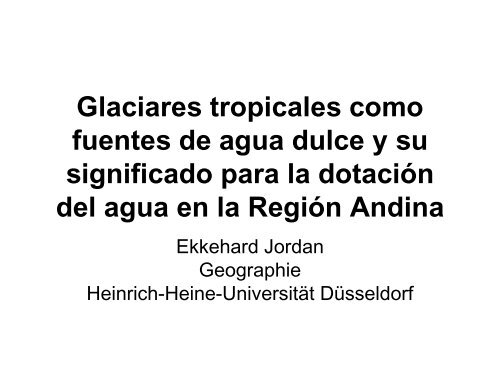
Glaciares tropicales como fuentes de agua dulce y su significado ...
Glaciares tropicales como fuentes de agua dulce y su significado ...
Glaciares tropicales como fuentes de agua dulce y su significado ...

You also want an ePaper? Increase the reach of your titles
YUMPU automatically turns print PDFs into web optimized ePapers that Google loves.
<strong>Glaciares</strong> <strong>tropicales</strong> <strong>como</strong><br />
<strong>fuentes</strong> <strong>de</strong> <strong>agua</strong> <strong>dulce</strong> y <strong>su</strong><br />
<strong>significado</strong> para la dotación<br />
<strong>de</strong>l <strong>agua</strong> en la Región Andina<br />
Ekkehard Jordan<br />
Geographie<br />
Heinrich-Heine-Universität Düsseldorf
Diagramas <strong>de</strong> Clima
TABLA DE DISTRIBUCIÓN DE ÁREAS APROXIMADAS DE<br />
GLACIARES EN LOS ANDES TROPICALES (KM²)<br />
Año<br />
Pais 1975 2005 aprox. %<br />
Peru 2.000 1400 70<br />
Bolivia 560 500 20<br />
Ecuador 115 80 5<br />
Colombia 115 80 5<br />
Venezuela 10 5<br />
Total 2.800 2.065 100%<br />
Pue<strong>de</strong> observarse que el 90 % se encuentra en zonas con pronunciadas sequias<br />
y 10 % restante en zonas húmedas <strong>tropicales</strong> andinos.<br />
Esto correspon<strong>de</strong> aprox. 1 % <strong>de</strong>l area glaciar <strong>de</strong> montañas <strong>de</strong>l mundo y menos<br />
que 0,1% <strong>de</strong>l área glaciar total (polos y montañas)
Nevado Santa Isabel (Colombia)<br />
1959<br />
1987<br />
1987<br />
2005<br />
2005<br />
2005
Cambio en Lenguas Seleccionadas en el Glaciar Nevado <strong>de</strong>l Ruiz / Colombia<br />
Nereidas<br />
726,3<br />
m 462,7<br />
400 30,0<br />
300<br />
200<br />
30,0<br />
89,0<br />
65,8<br />
9,7<br />
cm/Tag<br />
280<br />
Stand: 18.9.1992<br />
Alfombrales<br />
119,5<br />
99,6 316,1<br />
142,2<br />
m 7,7<br />
50<br />
100 100 52,6<br />
57,3<br />
40<br />
16,1 30 14,7<br />
3,9<br />
22,8 20 13,9<br />
18.3.1988 6,7 12,1<br />
18,5<br />
9,9 10<br />
15,5<br />
20,1<br />
21,8<br />
27,1<br />
3,7<br />
3,1<br />
5 31,1<br />
1,7<br />
(3,8)<br />
80,9<br />
100<br />
136,6<br />
100<br />
m<br />
Refugio<br />
cm/Tag<br />
90<br />
80<br />
608,4<br />
70 164,7<br />
m<br />
60<br />
Recio<br />
cm/Tag<br />
30<br />
20<br />
19.1.1987 4,7<br />
20<br />
19.1.1987<br />
163,7<br />
200<br />
99,9<br />
18.9.1992<br />
14.12.1991<br />
21.8.1991<br />
5.12.1990<br />
14.8.1990<br />
14.6.1990<br />
14.2.1990<br />
24.2.1989<br />
13.9.1987<br />
6.3.1987<br />
4.1.1975<br />
10.2.1959<br />
24,0<br />
28,2<br />
10,8<br />
26,1<br />
34,4<br />
58,2<br />
15,9<br />
270<br />
260<br />
250<br />
240<br />
230<br />
220<br />
210<br />
160<br />
150<br />
140<br />
130<br />
61,9<br />
18.9.1992<br />
4.3.1992<br />
2.12.1990<br />
9.8.1990<br />
12.2.1990<br />
23.2.1989<br />
19.3.1988<br />
18.9.1987<br />
11.12.1985<br />
263,3 Entwurf: Jordan / Kleindin<br />
10.2.1959<br />
4.11.1975<br />
433,9<br />
271,6<br />
66,0<br />
200<br />
26,5<br />
6,0 cm/ 29,5<br />
6,9 Tag<br />
3,9<br />
50<br />
11,5<br />
51,2<br />
40 100<br />
12,8<br />
52,8<br />
2,2<br />
3,9<br />
3,5<br />
8,5<br />
10 45,6<br />
9,0<br />
7,7<br />
10 2,0 38,9<br />
3,6<br />
1,1<br />
30<br />
90,7<br />
100<br />
32,7<br />
18.9.1992<br />
21.8.1991<br />
14.2.1990<br />
25.2.1989<br />
18.3.1988<br />
14.9.1987<br />
11.12.1985<br />
11,3<br />
14,8<br />
12,5<br />
4,8<br />
8,3<br />
14,9<br />
50 75,4<br />
100<br />
40<br />
28,4<br />
20,0<br />
30<br />
20<br />
162,3<br />
173,9<br />
Quelle: Jordan, IGAC-Kolumbien (Feldmes<strong>su</strong>ngen)<br />
Lin<strong>de</strong>r (1991, Bildmes<strong>su</strong>ngen)<br />
Kartographie: Kleindin; digitale Form: Heck<br />
10.2.1959<br />
4.11.1975<br />
10<br />
9,6<br />
10<br />
50<br />
2,2<br />
0,6<br />
400<br />
443,7<br />
18.9.1992<br />
3.12.1990<br />
7,4<br />
8,2<br />
9,4<br />
12,7 11,5<br />
11.8.1990<br />
12.2.1990<br />
62,7 8,2<br />
7,1<br />
6,0<br />
10.2.1959<br />
10<br />
5<br />
4,3
Cotopaxi<br />
1997
Pérdida o ganancia <strong>de</strong><br />
hielo y nieve en las<br />
diferentes lenguas <strong>de</strong>l<br />
cono glaciar <strong>de</strong>l<br />
Cotopaxi
c<br />
Glacier volume<br />
loss between<br />
1976 and 1997<br />
(m³)<br />
1 15.926.006<br />
2 11.503.316<br />
3 18.286.264<br />
4 16.015.989<br />
5 22.278.865<br />
6 23.109.458<br />
7 28.390.121<br />
8 21.412.548<br />
9 17.464.549<br />
10 24.343.703<br />
11 15.322.455<br />
12 8.397.658<br />
13 14.349.405<br />
14 9.101.657<br />
15 2.775.140<br />
16 4.600.280<br />
17 7.867.118<br />
18 11.745.324<br />
19 17.567.352<br />
N flank (19, 1-4) 75.028.262<br />
E flank (5-8) 89.794.433<br />
S flank (9-13) 86.940.913<br />
W flank (14-18) 38.693.600<br />
All zones (1-19) 290.457.208<br />
30000000<br />
25000000<br />
20000000<br />
15000000<br />
10000000<br />
5000000<br />
0<br />
Ice volume loss of the individual tounges<br />
15.926.006<br />
11.503.316<br />
18.286.264<br />
16.015.989<br />
22.278.865<br />
23.109.458<br />
28.390.121<br />
21.412.548<br />
c<br />
17.464.549<br />
24.343.703<br />
15.322.455<br />
8.397.658<br />
14.349.405<br />
9.101.657<br />
2.775.140<br />
4.600.280<br />
7.867.118<br />
11.745.324<br />
17.567.352<br />
1 2 3 4 5 6 7 8 9 10 11 12 13 14 15 16 17 18 19
Aerotriangulación multitemporal