
Create successful ePaper yourself
Turn your PDF publications into a flip-book with our unique Google optimized e-Paper software.
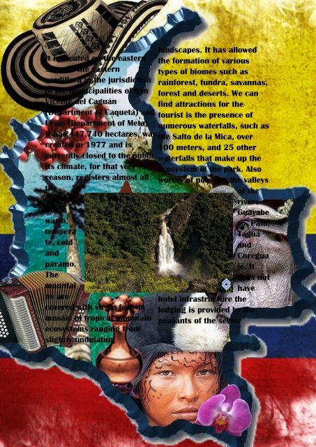
It is located on the eastern<br />
slope of the eastern<br />
cordillera in the jurisdiction<br />
of the municipalities of San<br />
Vicente del Caguán<br />
(Department of Caquetá) and<br />
Uribe (Department of Meta).<br />
It has 447,740 hectares, was<br />
created in 1977 and is<br />
currently closed to the public.<br />
Its climate, for that very<br />
reason, registers almost all<br />
the<br />
thermal<br />
floors<br />
warm,<br />
tempera<br />
te, cold<br />
and<br />
páramo.<br />
The<br />
mountai<br />
ns are<br />
covered with virgin forests<br />
mosaic of tropical mountain<br />
ecosystems ranging from<br />
slightly undulating<br />
landscapes. It has allowed<br />
the formation of various<br />
types of biomes such as<br />
rainforest, tundra, savannas,<br />
forest and deserts. We can<br />
find attractions for the<br />
tourist is the presence of<br />
numerous waterfalls, such as<br />
the Salto de la Mica, over<br />
100 meters, and 25 other<br />
waterfalls that make up the<br />
ecosystem of the park. Also<br />
worthy of note are the valleys<br />
of the<br />
rivers<br />
Guayabe<br />
ro, Pato,<br />
Tagua<br />
and<br />
Coregua<br />
je. It<br />
does not<br />
have<br />
hotel infrastructure the<br />
lodging is provided by the<br />
peasants of the sector