


You also want an ePaper? Increase the reach of your titles
YUMPU automatically turns print PDFs into web optimized ePapers that Google loves.
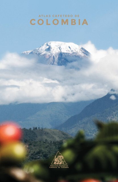
A T L A S C A F E T E R O D E<br />
C O L O M B IA
<strong>1927</strong>-<strong>2017</strong>
978-958-8323-89-3<br />
<br />
<br />
<br />
<br />
© Fe<strong>de</strong>ración Nacional <strong>de</strong> <strong>Cafetero</strong>s <strong>de</strong> <strong>Colombia</strong><br />
© Instituto Geográfico Agustín Codazzi<br />
www.fe<strong>de</strong>racion<strong>de</strong>cafeteros.org<br />
www.igac.gov.co<br />
Este <strong>Atlas</strong> <strong>Cafetero</strong> <strong>de</strong> <strong>Colombia</strong> se publica en el marco<br />
<strong>de</strong> las celebraciones <strong>de</strong> los 90 años <strong>de</strong> la FNC.<br />
Oficina Central <strong>de</strong> FNC<br />
Dirección: Calle 73 No. 8-13, Bogotá, <strong>Colombia</strong><br />
Teléfono (+57) 3136600<br />
Primera edición: noviembre <strong>de</strong> <strong>2017</strong>.<br />
Revisión, corrección y traducción <strong>de</strong> textos: Octavio Pineda.<br />
Diseño y diagramación: Vilma Pérez y Johnnatan López.<br />
Cubierta: Juan Pablo Castro, Nevado <strong>de</strong>l Tolima, 2015, fotografía.<br />
ISBN: 978-958-8323-89-3<br />
Impresión: Imprenta Nacional <strong>de</strong> <strong>Colombia</strong>.<br />
Todos los <strong>de</strong>rechos reservados.<br />
Ninguna parte <strong>de</strong> esta publicación pue<strong>de</strong> ser reproducida, almacenada en sistema recuperable o transmitida en<br />
forma alguna o por ningún medio electrónico, mecánico, fotocopia, grabación u otros, sin el previo permiso<br />
escrito <strong>de</strong> la Fe<strong>de</strong>ración Nacional <strong>de</strong> <strong>Cafetero</strong>s y <strong>de</strong>l Instituto Geográfico Agustín Codazzi.
FEDERACIÓN NACIONAL DE CAFETEROS DE COLOMBIA<br />
en su condición <strong>de</strong> administradora <strong>de</strong>l Fondo Nacional <strong>de</strong>l Café<br />
Gerente General<br />
Roberto Vélez Vallejo<br />
Gerente Administrativo<br />
Carlos Alberto González Arboleda<br />
Gerente Financiero<br />
Juan Camilo Becerra Botero<br />
Gerente Comercial<br />
Mario Eduardo Vega Roa (e)<br />
Gerente Técnico<br />
Hernando Duque Orrego<br />
Secretaria General<br />
María Aparicio Cammaert<br />
Representante por el Comité <strong>de</strong>l Huila<br />
Roberto Achicué Ome<br />
Representante por el Comité <strong>de</strong>l Magdalena<br />
Ricardo Arturo Hernán<strong>de</strong>z Rubio<br />
Representante por el Comité <strong>de</strong> Nariño<br />
Jesús Armando Benavi<strong>de</strong>s Portilla<br />
Representante por el Comité <strong>de</strong> Norte <strong>de</strong> Santan<strong>de</strong>r<br />
Alfredo Yáñez Carvajal<br />
Representante por el Comité <strong>de</strong>l Quindío<br />
Carlos Alberto Cardona Cardona<br />
Representante por el Comité <strong>de</strong> Risaralda<br />
Germán Parra Correa<br />
Representante por el Comité <strong>de</strong> Santan<strong>de</strong>r<br />
Jorge Julián Santos Orduña<br />
Comité Nacional y Directivo<br />
Ministro <strong>de</strong> Hacienda y Crédito Público<br />
Mauricio Cár<strong>de</strong>nas Santamaría<br />
Representante por el Comité <strong>de</strong>l Tolima<br />
Luis Javier Trujillo Buitrago<br />
Representante por el Comité <strong>de</strong>l Valle <strong>de</strong>l Cauca<br />
Camilo Restrepo Osorio<br />
Ministro <strong>de</strong> Agricultura y Desarrollo Rural<br />
Juan Guillermo Zuluaga Cardona<br />
Ministra <strong>de</strong> Comercio, Industria y Turismo<br />
María Lorena Gutiérrez Botero<br />
Director Departamento Nacional <strong>de</strong> Planeación<br />
Luis Fernando Mejía Álzate<br />
Representante por el Comité <strong>de</strong> Antioquia<br />
José Fernando Montoya Ortega<br />
Representante por el Comité <strong>de</strong> Boyacá<br />
José Alirio Barreto Buitrago<br />
Representante por el Comité <strong>de</strong> Caldas<br />
Eugenio Vélez Uribe<br />
Representante por el Comité <strong>de</strong>l Cauca<br />
Danilo Reinaldo Vivas Ramos<br />
Representante por el Comité <strong>de</strong> Cesar-Guajira<br />
Pedro Gonzalo Carrillo Urariyu<br />
Representante por el Comité <strong>de</strong> Cundinamarca<br />
Javier Bohórquez Bohórquez<br />
Directores Ejecutivos<br />
Comité <strong>de</strong> <strong>Cafetero</strong>s <strong>de</strong> Antioquia<br />
Álvaro Jaramillo Guzmán<br />
Comité <strong>de</strong> <strong>Cafetero</strong>s <strong>de</strong> Boyacá<br />
Carlos Roberto Restrepo Rodríguez<br />
Comité <strong>de</strong> <strong>Cafetero</strong>s <strong>de</strong> Caldas<br />
Jorge Hernán López Jaramillo<br />
Comité <strong>de</strong> <strong>Cafetero</strong>s <strong>de</strong>l Cauca<br />
Gerardo Montenegro Paz<br />
Comité <strong>de</strong> <strong>Cafetero</strong>s <strong>de</strong> Cesar-Guajira<br />
Álvaro Osorio Cuenca<br />
Comité <strong>de</strong> <strong>Cafetero</strong>s <strong>de</strong> Cundinamarca<br />
Marcos Alberto Barreto García<br />
Comité <strong>de</strong> <strong>Cafetero</strong>s <strong>de</strong>l Huila<br />
Jorge Enrique Montenegro Polanía<br />
Comité <strong>de</strong> <strong>Cafetero</strong>s <strong>de</strong>l Magdalena<br />
Édgar Ramírez Perdomo
Comité <strong>de</strong> <strong>Cafetero</strong>s <strong>de</strong> Nariño<br />
Hernando Delgado Gómez<br />
Coordinador Programa Yarumo<br />
Daniel Fernando Chica Díaz<br />
Comité <strong>de</strong> <strong>Cafetero</strong>s <strong>de</strong> Norte <strong>de</strong> Santan<strong>de</strong>r<br />
Ricardo Mendoza Valero<br />
Director Programa Gestión Inteligente <strong>de</strong>l Agua (GIA)<br />
Rodrigo Cal<strong>de</strong>rón Correa<br />
Comité <strong>de</strong> <strong>Cafetero</strong>s <strong>de</strong>l Quindío (e)<br />
Mauricio Medina Aguirre<br />
Comité <strong>de</strong> <strong>Cafetero</strong>s <strong>de</strong> Risaralda<br />
Jorge Humberto Echeverri Marulanda<br />
Comité <strong>de</strong> <strong>Cafetero</strong>s <strong>de</strong> Santan<strong>de</strong>r<br />
Néstor Serrano Capacho<br />
Comité <strong>de</strong> <strong>Cafetero</strong>s <strong>de</strong>l Tolima<br />
Gildardo Monroy Guerrero<br />
Comité <strong>de</strong> <strong>Cafetero</strong>s <strong>de</strong>l Valle <strong>de</strong>l Cauca<br />
Héctor Fabio Cuéllar López<br />
Director <strong>de</strong> Asuntos Gremiales<br />
Carlos Armando Uribe Fandiño<br />
Director Desarrollo Cooperativo<br />
Javier Sanín Trujillo<br />
Gerente Almacafé<br />
Octavio Castilla Gutiérrez<br />
Agra<strong>de</strong>cimientos<br />
Gerencia Técnica<br />
Centro Nacional <strong>de</strong> Investigaciones <strong>de</strong> Café (Cenicafé)<br />
Director<br />
Álvaro León Gaitán Bustamante<br />
Investigador Senior<br />
Álvaro Jaramillo Robledo<br />
Investigador Científico II<br />
Juan Carlos García López<br />
Especialista SIG-Gestión Inteligente <strong>de</strong>l Agua (GIA)<br />
Felipe Al<strong>de</strong>mar Carvajal Monroy<br />
Coordinador Laboratorio Central (Almacafé)<br />
Rodrigo Alarcón Suárez<br />
Gerencia Administrativa<br />
Directora Desarrollo Organizacional (e)<br />
Gineth Alba Reyes<br />
Directora Comunicaciones Corporativas<br />
Martha Sánchez Sarmiento<br />
Coordinador Comunicación al Caficultor<br />
Juan Pablo Castro Chávez<br />
Coordinadora Programa Equidad <strong>de</strong> Género<br />
Claudia <strong>de</strong>l Pilar Rodríguez Mejía<br />
Coordinadora Programa Paisaje Cultural <strong>Cafetero</strong> <strong>de</strong> <strong>Colombia</strong> (PCCC)<br />
Lina María Rivas Velásquez<br />
Gerencia Comercial<br />
Planeación<br />
María Fernanda Vera Guzmán<br />
Agra<strong>de</strong>cimientos Especiales<br />
Servicio <strong>de</strong> Extensión<br />
Gerencia Técnica-Programa Sistema <strong>de</strong> Información Cafetera (SICA)<br />
Coordinador Nacional Programa SICA<br />
Juan Pablo Becerra Henríquez<br />
Lí<strong>de</strong>r Disciplina <strong>de</strong> Suelos<br />
Siavosh Sa<strong>de</strong>ghian Khalajabadi<br />
Coordinador TIC<br />
Luis Ignacio Estrada<br />
Especialistas SIG<br />
Martha Leonor Córdoba Salamanca<br />
Víctor Manuel Balceros Garzón<br />
Juan Carlos Vásquez Barrera<br />
Camilo Alexan<strong>de</strong>r León Sánchez<br />
Oficina Central<br />
Lí<strong>de</strong>r Nacional <strong>de</strong> Extensión Rural (e)<br />
Carlos Mario Jaramillo Cardona<br />
Director Oficinas Coordinadoras y otros territorios (e)<br />
Huver Elías Posada Suárez<br />
Analista SICA<br />
Luis Fernando Quintero Castañeda<br />
Investigaciones Económicas<br />
Director<br />
José Leibovich Gol<strong>de</strong>nberg<br />
Coordinadores <strong>de</strong> Programa Nacional<br />
José Jaramillo Valencia<br />
Jaime Cár<strong>de</strong>nas López<br />
Raúl Jaime Hernán<strong>de</strong>z Restrepo<br />
Rodolfo Suárez Rubio<br />
Especialista<br />
Óscar Mauricio Bernal Vargas<br />
Asistente<br />
Nancy González Sanguino
INSTITUTO GEOGRÁFICO AGUSTÍN CODAZZI<br />
Comité Directivo<br />
Director<br />
Juan Antonio Nieto Escalante, Director General IGAC<br />
Mauricio Perfetti Del Corral<br />
Director General<br />
Departamento Administrativo Nacional <strong>de</strong> Estadística (DANE)<br />
Presi<strong>de</strong>nte Consejo Directivo IGAC<br />
Comité Editorial<br />
Juan Antonio Nieto Escalante, Director Comité Editorial;<br />
Diana Patricia Ríos García, Secretaria General;<br />
Andrea <strong>de</strong>l Pilar Moreno Hernán<strong>de</strong>z, Jefe Oficina Asesora <strong>de</strong> Planeación;<br />
Héctor Mauricio Ramírez Daza, Jefe Oficina Centro <strong>de</strong> Investigación y<br />
Desarrollo <strong>de</strong> Información Geográfica (CIAF);<br />
Fredy De la Ossa, Jefe Oficina <strong>de</strong> Informática y Telecomunicaciones;<br />
Paola Mén<strong>de</strong>z Hernán<strong>de</strong>z, Jefe Oficina <strong>de</strong> Difusión y Merca<strong>de</strong>o <strong>de</strong> Información;<br />
Marco Tulio Herrera Sánchez, Subdirector <strong>de</strong> Geografía y Cartografía; (e)<br />
Germán Darío Álvarez Lucero, Subdirector <strong>de</strong> Agrología;<br />
Ingrid Zoraya Tenjo, Subdirectora <strong>de</strong> Catastro (e).<br />
Omar Ariel Guevara Mancera<br />
Delegado por parte <strong>de</strong>l Ministerio <strong>de</strong> Ambiente y Desarrollo Sostenible<br />
Felipe Fonseca Fino<br />
Director General <strong>de</strong> la Unidad <strong>de</strong> Planificación Rural Agropecuaria (UPRA)<br />
Delegado por parte <strong>de</strong>l Ministerio <strong>de</strong> Agricultura y Desarrollo Rural<br />
Javier Pérez Burgos<br />
Director <strong>de</strong> Desarrollo Territorial Sostenible <strong>de</strong>l Departamento Nacional<br />
<strong>de</strong> Planeación (DNP)<br />
Mayor General Rodrigo Alejandro Valencia Hurtado<br />
Representante <strong>de</strong>l Ministerio <strong>de</strong> Defensa Nacional<br />
Édgar Moncayo Jiménez<br />
Representante <strong>de</strong>l Presi<strong>de</strong>nte <strong>de</strong> la República<br />
Marco Tulio Herrera Sánchez<br />
Subdirector <strong>de</strong> Geografía y Cartografía<br />
Judith Alicia Salas Miranda<br />
Dirección y Revisión Técnica<br />
Coordinación y Producción<br />
Ana Victoria Rincón Martínez<br />
Adriana Emilcen Casas Fajardo<br />
Coordinación Cartográfica<br />
Adriana Esperanza Becerra Bautista<br />
Producción <strong>de</strong> Cartografía Básica y Temática en Multiescala<br />
Adriana Esperanza Becerra Bautista<br />
Luz Kelly García Con<strong>de</strong><br />
Apoyo Técnico<br />
Natalia Lorena Montoya Páez<br />
Arlenson Peláez Contreras<br />
Hugo Albeiro Garay Soto<br />
Colaboración<br />
Manuel Guillermo Beltrán Quecán<br />
Luz Ángela Castro Ñungo<br />
Diseño y Diagramación<br />
Vilma Lucía Inés Pérez Valencia
C O N T E N I D O<br />
PRÓLOGO<br />
<strong>Colombia</strong>, país privilegiado para producir el mejor café <strong>de</strong>l mundo 12<br />
Roberto Vélez Vallejo<br />
INTRODUCCIÓN<br />
<br />
Hernando Duque Orrego<br />
<br />
GENERALIDADES<br />
Producción mundial <strong>de</strong> café 19<br />
<br />
<br />
COLOMBIA CAFETERA<br />
El censo cafetero <strong>de</strong> 1932 23<br />
<br />
<br />
El café en <strong>Colombia</strong> 26<br />
Antonio Herrón Ortiz<br />
<br />
<br />
Sistemas <strong>de</strong> producción <strong>de</strong> café en <strong>Colombia</strong> 30<br />
Cafés especiales 36<br />
Una óptima red <strong>de</strong> comercialización 38<br />
<br />
<br />
Claudia Rodríguez<br />
<br />
<br />
<br />
<br />
Carlos Armando Uribe F.<br />
EL CLIMA Y SU RELACIÓN CON EL CULTIVO DEL CAFÉ<br />
<br />
<br />
Temperatura 52<br />
Brillo solar 56<br />
La broca <strong>de</strong>l café 58<br />
COMITÉS DE CAFETEROS<br />
<br />
<br />
<br />
<br />
Caldas 86<br />
Cauca 98<br />
Cesar-La Guajira y Bolívar 110<br />
<br />
<br />
Huila 156<br />
Magdalena 168<br />
Nariño 180<br />
ATLAS CAFETERO DE COLOMBIA <br />
7
Norte <strong>de</strong> Santan<strong>de</strong>r 192<br />
<br />
<br />
Risaralda 216<br />
Santan<strong>de</strong>r 228<br />
<br />
<br />
Valle <strong>de</strong>l Cauca 252<br />
<br />
<br />
<br />
PROYECTOS ESPECIALES<br />
Paisaje Cultural <strong>Cafetero</strong> <strong>de</strong> <strong>Colombia</strong> (PCCC) 318<br />
Gestión Inteligente <strong>de</strong>l Agua - Manos al Agua 320<br />
<br />
<br />
GLOSARIO 333<br />
BIBLIOGRAFÍA 337<br />
ANEXOS<br />
<br />
<br />
Totales <strong>de</strong>partamentales 3<strong>62</strong><br />
Comités Municipales <strong>de</strong> <strong>Cafetero</strong>s 363<br />
8
Í N D I C E DE MAPA S<br />
Mapa cafetero 1932 22<br />
Mapa cafetero <strong>2017</strong> 25<br />
Mapa físico 31<br />
Regiones cafeteras 32<br />
Épocas <strong>de</strong> cosecha cafetera 33<br />
Concentración <strong>de</strong>l uso <strong>de</strong> suelo en el cultivo <strong>de</strong>l café 34<br />
Cafés especiales: categoría sostenibles 37<br />
Cobertura institucional <strong>de</strong> la garantía <strong>de</strong> compra 39<br />
Productores <strong>de</strong> café 41<br />
División administrativa FNC 43<br />
Organización gremial cafetera 45<br />
Precipitación acumulada anual zona cafetera, promedio histórico 49<br />
Precipitación acumulada anual zona cafetera, escenario<br />
El Niño 1997-1998 50<br />
Precipitación acumulada anual zona cafetera, escenario<br />
La Niña 1999 51<br />
Temperatura promedio anual zona cafetera, promedio histórico 53<br />
Temperatura mínima anual zona cafetera, promedio histórico 54<br />
Temperatura máxima anual zona cafetera, promedio histórico 55<br />
Brillo solar anual acumulado zona cafetera, promedio histórico 57<br />
Vulnerabilidad <strong>de</strong> broca <strong>de</strong>l café, zona cafetera, promedio histórico 59<br />
Departamento <strong>de</strong> Antioquia<br />
Mapa físico-político 63<br />
Subregiones cafeteras 65<br />
Suelos 66<br />
Tipo <strong>de</strong> caficultura por lote cafetero 67<br />
Exposición solar <strong>de</strong> la caficultura por lote cafetero 68<br />
Varieda<strong>de</strong>s <strong>de</strong> café según su resistencia a la roya 69<br />
Densidad <strong>de</strong> siembra en zona cafetera por municipio 70<br />
Edad <strong>de</strong> los lotes cafeteros 71<br />
Concentración <strong>de</strong>l uso <strong>de</strong>l suelo en el cultivo <strong>de</strong>l café 72<br />
Área en café <strong>de</strong>l productor por municipio 73<br />
Departamento <strong>de</strong> Boyacá<br />
Mapa físico-político 75<br />
Subregiones cafeteras 77<br />
Suelos 78<br />
Tipo <strong>de</strong> caficultura por lote cafetero 79<br />
Exposición solar <strong>de</strong> la caficultura por lote cafetero 80<br />
Varieda<strong>de</strong>s <strong>de</strong> café según su resistencia a la roya 81<br />
Densidad <strong>de</strong> siembra en zona cafetera por municipio 82<br />
Edad <strong>de</strong> los lotes cafeteros 83<br />
Concentración <strong>de</strong>l uso <strong>de</strong>l suelo en el cultivo <strong>de</strong>l café 84<br />
Área en café <strong>de</strong>l productor por municipio 85<br />
Departamento <strong>de</strong> Caldas<br />
Mapa físico-político 87<br />
Subregiones cafeteras 89<br />
Suelos 90<br />
Tipo <strong>de</strong> caficultura por lote cafetero 91<br />
Exposición solar <strong>de</strong> la caficultura por lote cafetero 92<br />
Varieda<strong>de</strong>s <strong>de</strong> café según su resistencia a la roya 93<br />
Densidad <strong>de</strong> siembra en zona cafetera por municipio 94<br />
Edad <strong>de</strong> los lotes cafeteros 95<br />
Concentración <strong>de</strong>l uso <strong>de</strong>l suelo en el cultivo <strong>de</strong>l café 96<br />
Área en café <strong>de</strong>l productor por municipio 97<br />
Departamento <strong>de</strong>l Cauca<br />
Mapa físico-político 99<br />
Subregiones cafeteras 101<br />
Suelos 102<br />
Tipo <strong>de</strong> caficultura por lote cafetero 103<br />
Exposición solar <strong>de</strong> la caficultura por lote cafetero 104<br />
Varieda<strong>de</strong>s <strong>de</strong> café según su resistencia a la roya 105<br />
Densidad <strong>de</strong> siembra en zona cafetera por municipio 106<br />
Edad <strong>de</strong> los lotes cafeteros 107<br />
Concentración <strong>de</strong>l uso <strong>de</strong>l suelo en el cultivo <strong>de</strong>l café 108<br />
Área en café <strong>de</strong>l productor por municipio 109<br />
Departamento <strong>de</strong>l Cesar<br />
Mapa físico-político 111<br />
Departamento <strong>de</strong> La Guajira<br />
Mapa físico-político 112<br />
Departamento <strong>de</strong> Bolívar<br />
Mapa físico-político 113<br />
Departamento <strong>de</strong>l Cesar<br />
Subregiones cafeteras 115<br />
Suelos 116<br />
Tipo <strong>de</strong> caficultura por lote cafetero 117<br />
Exposición solar <strong>de</strong> la caficultura por lote cafetero 118<br />
Varieda<strong>de</strong>s <strong>de</strong> café según su resistencia a la roya 119<br />
Densidad <strong>de</strong> siembra en zona cafetera por municipio 120<br />
Edad <strong>de</strong> los lotes cafeteros 121<br />
Concentración <strong>de</strong>l uso <strong>de</strong>l suelo en el cultivo <strong>de</strong>l café 122<br />
Área en café <strong>de</strong>l productor por municipio 123<br />
Departamento <strong>de</strong> La Guajira<br />
Subregiones cafeteras 125<br />
Suelos 126<br />
Tipo <strong>de</strong> caficultura por lote cafetero 127<br />
Exposición solar <strong>de</strong> la caficultura por lote cafetero 128<br />
Varieda<strong>de</strong>s <strong>de</strong> café según su resistencia a la roya 129<br />
Densidad <strong>de</strong> siembra en zona cafetera por municipio 130<br />
Edad <strong>de</strong> los lotes cafeteros 131<br />
Concentración <strong>de</strong>l uso <strong>de</strong>l suelo en el cultivo <strong>de</strong>l café 132<br />
Área en café <strong>de</strong>l productor por municipio 133<br />
Departamento <strong>de</strong> Bolívar<br />
Subregiones cafeteras 135<br />
Suelos 136<br />
Tipo <strong>de</strong> caficultura por lote cafetero 137<br />
Exposición solar <strong>de</strong> la caficultura por lote cafetero 138<br />
Varieda<strong>de</strong>s <strong>de</strong> café según su resistencia a la roya 139<br />
Densidad <strong>de</strong> siembra en zona cafetera por municipio 140<br />
Edad <strong>de</strong> los lotes cafeteros 141<br />
Concentración <strong>de</strong>l uso <strong>de</strong>l suelo en el cultivo <strong>de</strong>l café 142<br />
Área en café <strong>de</strong>l productor por municipio 143<br />
Departamento <strong>de</strong> Cundinamarca<br />
Mapa físico-político 145<br />
Subregiones cafeteras 147<br />
Suelos 148<br />
Tipo <strong>de</strong> caficultura por lote cafetero 149<br />
Exposición solar <strong>de</strong> la caficultura por lote cafetero 150<br />
Varieda<strong>de</strong>s <strong>de</strong> café según su resistencia a la roya 151<br />
Densidad <strong>de</strong> siembra en zona cafetera por municipio 152<br />
Edad <strong>de</strong> los lotes cafeteros 153<br />
Concentración <strong>de</strong>l uso <strong>de</strong>l suelo en el cultivo <strong>de</strong>l café 154<br />
Área en café <strong>de</strong>l productor por municipio 155<br />
Departamento <strong>de</strong>l Huila<br />
Mapa físico-político 157<br />
Subregiones cafeteras 159<br />
Suelos 160<br />
Tipo <strong>de</strong> caficultura por lote cafetero 161<br />
Exposición solar <strong>de</strong> la caficultura por lote cafetero 1<strong>62</strong><br />
Varieda<strong>de</strong>s <strong>de</strong> café según su resistencia a la roya 163<br />
Densidad <strong>de</strong> siembra en zona cafetera por municipio 164<br />
Edad <strong>de</strong> los lotes cafeteros 165<br />
Concentración <strong>de</strong>l uso <strong>de</strong>l suelo en el cultivo <strong>de</strong>l café 166<br />
Área en café <strong>de</strong>l productor por municipio 167<br />
Departamento <strong>de</strong>l Magdalena<br />
Mapa físico-político 169<br />
Subregiones cafeteras 171<br />
Suelos 172<br />
Tipo <strong>de</strong> caficultura por lote cafetero 173<br />
Exposición solar <strong>de</strong> la caficultura por lote cafetero 174<br />
Varieda<strong>de</strong>s <strong>de</strong> café según su resistencia a la roya 175<br />
Densidad <strong>de</strong> siembra en zona cafetera por municipio 176<br />
Edad <strong>de</strong> los lotes cafeteros 177<br />
Concentración <strong>de</strong>l uso <strong>de</strong>l suelo en el cultivo <strong>de</strong>l café 178<br />
Área en café <strong>de</strong>l productor por municipio 179<br />
Departamento <strong>de</strong> Nariño<br />
Mapa físico-político 181<br />
Subregiones cafeteras 183<br />
ATLAS CAFETERO DE COLOMBIA <br />
9
Suelos 184<br />
Tipo <strong>de</strong> caficultura por lote cafetero 185<br />
Exposición solar <strong>de</strong> la caficultura por lote cafetero 186<br />
Varieda<strong>de</strong>s <strong>de</strong> café según su resistencia a la roya 187<br />
Densidad <strong>de</strong> siembra en zona cafetera por municipio 188<br />
Edad <strong>de</strong> los lotes cafeteros 189<br />
Concentración <strong>de</strong>l uso <strong>de</strong>l suelo en el cultivo <strong>de</strong>l café 190<br />
Área en café <strong>de</strong>l productor por municipio 191<br />
Departamento <strong>de</strong> Norte <strong>de</strong> Santan<strong>de</strong>r<br />
Mapa físico-político 193<br />
Subregiones cafeteras 195<br />
Suelos 196<br />
Tipo <strong>de</strong> caficultura por lote cafetero 197<br />
Exposición solar <strong>de</strong> la caficultura por lote cafetero 198<br />
Varieda<strong>de</strong>s <strong>de</strong> café según su resistencia a la roya 199<br />
Densidad <strong>de</strong> siembra en zona cafetera por municipio 200<br />
Edad <strong>de</strong> los lotes cafeteros 201<br />
Concentración <strong>de</strong>l uso <strong>de</strong>l suelo en el cultivo <strong>de</strong>l café 202<br />
Área en café <strong>de</strong>l productor por municipio 203<br />
Departamento <strong>de</strong>l Quindío<br />
Mapa físico-político 205<br />
Subregiones cafeteras 207<br />
Suelos 208<br />
Tipo <strong>de</strong> caficultura por lote cafetero 209<br />
Exposición solar <strong>de</strong> la caficultura por lote cafetero 210<br />
Varieda<strong>de</strong>s <strong>de</strong> café según su resistencia a la roya 211<br />
Densidad <strong>de</strong> siembra en zona cafetera por municipio 212<br />
Edad <strong>de</strong> los lotes cafeteros 213<br />
Concentración <strong>de</strong>l uso <strong>de</strong>l suelo en el cultivo <strong>de</strong>l café 214<br />
Área en café <strong>de</strong>l productor por municipio 215<br />
Departamento <strong>de</strong> Risaralda<br />
Mapa físico-político 217<br />
Subregiones cafeteras 219<br />
Suelos 220<br />
Tipo <strong>de</strong> caficultura por lote cafetero 221<br />
Exposición solar <strong>de</strong> la caficultura por lote cafetero 222<br />
Varieda<strong>de</strong>s <strong>de</strong> café según su resistencia a la roya 223<br />
Densidad <strong>de</strong> siembra en zona cafetera por municipio 224<br />
Edad <strong>de</strong> los lotes cafeteros 225<br />
Concentración <strong>de</strong>l uso <strong>de</strong>l suelo en el cultivo <strong>de</strong>l café 226<br />
Área en café <strong>de</strong>l productor por municipio 227<br />
Departamento <strong>de</strong> Santan<strong>de</strong>r<br />
Mapa físico-político 229<br />
Subregiones cafeteras 231<br />
Suelos 232<br />
Tipo <strong>de</strong> caficultura por lote cafetero 233<br />
Exposición solar <strong>de</strong> la caficultura por lote cafetero 234<br />
Varieda<strong>de</strong>s <strong>de</strong> café según su resistencia a la roya 235<br />
Densidad <strong>de</strong> siembra en zona cafetera por municipio 236<br />
Edad <strong>de</strong> los lotes cafeteros 237<br />
Concentración <strong>de</strong>l uso <strong>de</strong>l suelo en el cultivo <strong>de</strong>l café 238<br />
Área en café <strong>de</strong>l productor por municipio 239<br />
Departamento <strong>de</strong>l Tolima<br />
Mapa físico-político 241<br />
Subregiones cafeteras 243<br />
Suelos 244<br />
Tipo <strong>de</strong> caficultura por lote cafetero 245<br />
Exposición solar <strong>de</strong> la caficultura por lote cafetero 246<br />
Varieda<strong>de</strong>s <strong>de</strong> café según su resistencia a la roya 247<br />
Densidad <strong>de</strong> siembra en zona cafetera por municipio 248<br />
Edad <strong>de</strong> los lotes cafeteros 249<br />
Concentración <strong>de</strong>l uso <strong>de</strong>l suelo en el cultivo <strong>de</strong>l café 250<br />
Área en café <strong>de</strong>l productor por municipio 251<br />
Departamento <strong>de</strong>l Valle <strong>de</strong>l Cauca<br />
Mapa físico-político 253<br />
Subregiones cafeteras 255<br />
Suelos 256<br />
Tipo <strong>de</strong> caficultura por lote cafetero 257<br />
Exposición solar <strong>de</strong> la caficultura por lote cafetero 258<br />
Varieda<strong>de</strong>s <strong>de</strong> café según su resistencia a la roya 259<br />
Densidad <strong>de</strong> siembra en zona cafetera por municipio 260<br />
Edad <strong>de</strong> los lotes cafeteros 261<br />
Concentración <strong>de</strong>l uso <strong>de</strong>l suelo en el cultivo <strong>de</strong>l café 2<strong>62</strong><br />
Área en café <strong>de</strong>l productor por municipio 263<br />
Departamento <strong>de</strong> Casanare<br />
Mapa físico-político 265<br />
Departamento <strong>de</strong>l Meta<br />
Mapa físico-político 266<br />
Departamento <strong>de</strong>l Caquetá<br />
Mapa físico-político 267<br />
Departamento <strong>de</strong>l Putumayo<br />
Mapa físico-político 268<br />
Departamento <strong>de</strong>l Chocó<br />
Mapa físico-político 269<br />
Departamento <strong>de</strong> Casanare<br />
Subregiones cafeteras 271<br />
Suelos 272<br />
Tipo <strong>de</strong> caficultura por lote cafetero 273<br />
Exposición solar <strong>de</strong> la caficultura por lote cafetero 274<br />
Varieda<strong>de</strong>s <strong>de</strong> café según su resistencia a la roya 275<br />
Densidad <strong>de</strong> siembra en zona cafetera por municipio 276<br />
Edad <strong>de</strong> los lotes cafeteros 277<br />
Concentración <strong>de</strong>l uso <strong>de</strong>l suelo en el cultivo <strong>de</strong>l café 278<br />
Área en café <strong>de</strong>l productor por municipio 279<br />
Departamento <strong>de</strong>l Meta<br />
Subregiones cafeteras 280<br />
Suelos 281<br />
Tipo <strong>de</strong> caficultura por lote cafetero 282<br />
Exposición solar <strong>de</strong> la caficultura por lote cafetero 283<br />
Varieda<strong>de</strong>s <strong>de</strong> café según su resistencia a la roya 284<br />
Densidad <strong>de</strong> siembra en zona cafetera por municipio 285<br />
Edad <strong>de</strong> los lotes cafeteros 286<br />
Concentración <strong>de</strong>l uso <strong>de</strong>l suelo en el cultivo <strong>de</strong>l café 287<br />
Área en café <strong>de</strong>l productor por municipio 288<br />
Departamento <strong>de</strong>l Caquetá<br />
Subregiones cafeteras 289<br />
Suelos 290<br />
Tipo <strong>de</strong> caficultura por lote cafetero 291<br />
Exposición solar <strong>de</strong> la caficultura por lote cafetero 292<br />
Varieda<strong>de</strong>s <strong>de</strong> café según su resistencia a la roya 293<br />
Densidad <strong>de</strong> siembra en zona cafetera por municipio 294<br />
Edad <strong>de</strong> los lotes cafeteros 295<br />
Concentración <strong>de</strong>l uso <strong>de</strong>l suelo en el cultivo <strong>de</strong>l café 296<br />
Área en café <strong>de</strong>l productor por municipio 297<br />
Departamento <strong>de</strong>l Putumayo<br />
Subregiones cafeteras 298<br />
Suelos 299<br />
Tipo <strong>de</strong> caficultura por lote cafetero 300<br />
Exposición solar <strong>de</strong> la caficultura por lote cafetero 301<br />
Varieda<strong>de</strong>s <strong>de</strong> café según su resistencia a la roya 302<br />
Densidad <strong>de</strong> siembra en zona cafetera por municipio 303<br />
Edad <strong>de</strong> los lotes cafeteros 304<br />
Concentración <strong>de</strong>l uso <strong>de</strong>l suelo en el cultivo <strong>de</strong>l café 305<br />
Área en café <strong>de</strong>l productor por municipio 306<br />
Departamento <strong>de</strong>l Chocó<br />
Suelos 308<br />
Tipo <strong>de</strong> caficultura por lote cafetero 309<br />
Exposición solar <strong>de</strong> la caficultura por lote cafetero 310<br />
Varieda<strong>de</strong>s <strong>de</strong> café según su resistencia a la roya 311<br />
Densidad <strong>de</strong> siembra en zona cafetera por municipio 312<br />
Edad <strong>de</strong> los lotes cafeteros 313<br />
Concentración <strong>de</strong>l uso <strong>de</strong>l suelo en el cultivo <strong>de</strong>l café 314<br />
Área en café <strong>de</strong>l productor por municipio 315<br />
Paisaje Cultural <strong>Cafetero</strong> <strong>de</strong> <strong>Colombia</strong> (PCCC) 319<br />
Ubicación general Proyecto “Manos al Agua” 321<br />
Implementaciones en soluciones <strong>de</strong> agua-Proyecto “Manos al Agua” 322<br />
Implementaciones complementarias-Proyecto “Manos al Agua” 323<br />
Intervenciones programa forestal 1993-<strong>2017</strong> 325<br />
Intervenciones programa forestal 2007-<strong>2017</strong> 327<br />
Herramientas <strong>de</strong> manejo <strong>de</strong> paisaje como estrategia <strong>de</strong><br />
mejoramiento <strong>de</strong> la conectividad biológica 329
P R Ó LO G O<br />
<strong>Colombia</strong>, país privilegiado para producir<br />
el mejor café <strong>de</strong>l mundo<br />
¿Por qué <strong>Colombia</strong> sigue siendo <strong>de</strong>spués <strong>de</strong> siglo y medio el principal exportador <strong>de</strong> cafés suaves <strong>de</strong>l mundo?<br />
En buena medida por su oferta ambiental proveniente <strong>de</strong> su ubicación geográfica, su clima, sus suelos, su<br />
altura y sus aguas. La otra parte, no menos importante tiene que ver con su institucionalidad y las personas<br />
que con gran amor y tenacidad se han <strong>de</strong>dicado al cultivo y comercialización <strong>de</strong>l café más suave <strong>de</strong>l mundo<br />
y así han construido un modo <strong>de</strong> vida digno generando riqueza y capital social.<br />
Entre los diversos países sudamericanos que la cordillera <strong>de</strong> los An<strong>de</strong>s atraviesa, es justamente en <strong>Colombia</strong><br />
don<strong>de</strong> ésta más se amplía: tres ramales que generosamente abrazan la mitad <strong>de</strong>l territorio nacional y don<strong>de</strong><br />
se asienta la mayor parte <strong>de</strong> la población, y cuya diversidad en flora y fauna domina el paisaje. Qué mejor<br />
emblema <strong>de</strong> esta riqueza orográfica que el Cerro Tusa, hermosa e imponente pirámi<strong>de</strong> natural, ubicada en<br />
el suroeste antioqueño, que inspiró el logo <strong>de</strong> Café <strong>de</strong> <strong>Colombia</strong> y nos i<strong>de</strong>ntifica ante el mundo.<br />
A esta riqueza topográfica se suma la ubicación <strong>de</strong>l territorio colombiano, atravesado por la línea <strong>de</strong>l<br />
Ecuador en su región amazónica. La zona cafetera colombiana, que es <strong>de</strong> montaña, abarca <strong>de</strong>s<strong>de</strong> los sureños<br />
<strong>de</strong>partamentos <strong>de</strong> Nariño y Putumayo, por <strong>de</strong>bajo <strong>de</strong> los 3° <strong>de</strong> latitud norte, hasta más allá <strong>de</strong> los 7° latitud<br />
norte en las estribaciones <strong>de</strong> la Sierra Nevada <strong>de</strong> Santa Marta o <strong>de</strong> la serranía <strong>de</strong>l Perijá.<br />
Esta ubicación tropical se traduce en abundante agua que fluye por la macrocuenca hidrográfica conformada<br />
por los ríos Cauca y Magdalena con todos sus afluentes, en muchas horas <strong>de</strong> brillo solar y temperaturas<br />
relativamente estables a lo largo <strong>de</strong>l año. Complementa lo anterior la gran diversidad y riqueza <strong>de</strong> sus suelos.<br />
Esta ventaja <strong>de</strong>l territorio influye en los atributos finales <strong>de</strong> taza <strong>de</strong>l café que produce <strong>Colombia</strong>, el país con<br />
mayor diversidad <strong>de</strong> sabores y el mayor proveedor <strong>de</strong> cafés especiales. Mientras los cafés <strong>de</strong> la Sierra Nevada<br />
<strong>de</strong> Santa Marta tien<strong>de</strong>n a ser suaves y <strong>de</strong>licados, los <strong>de</strong>l sur <strong>de</strong>l país, en <strong>de</strong>partamentos como Cauca y Nariño,<br />
tien<strong>de</strong>n a ser <strong>de</strong> aci<strong>de</strong>z más alta.<br />
<strong>Colombia</strong> es el mayor proveedor mundial <strong>de</strong> café suave lavado gracias a la abundante agua con que la<br />
naturaleza dotó a su territorio. Los caficultores colombianos apostaron <strong>de</strong>s<strong>de</strong> sus inicios por el beneficio<br />
húmedo <strong>de</strong>l grano, es <strong>de</strong>cir, <strong>de</strong>spulparlo, fermentarlo, lavarlo y secarlo con gran cuidado en cada etapa, para<br />
así preservar y potenciar sus atributos <strong>de</strong> calidad intrínsecos.<br />
El presente <strong>Atlas</strong> <strong>Cafetero</strong> es la radiografía más actualizada y completa <strong>de</strong> la caficultura colombiana.<br />
Describe las principales características técnicas y variables estratégicas <strong>de</strong> los sistemas <strong>de</strong> producción en<br />
los 22 <strong>de</strong>partamentos cafeteros <strong>de</strong>l país, lo que incluye su localización geográfica, el número <strong>de</strong> hectáreas<br />
y municipios cafeteros, el rango <strong>de</strong> altitud en el cual se ubican, la temperatura media, el régimen <strong>de</strong><br />
precipitación anual, las horas <strong>de</strong> brillo solar, el tipo <strong>de</strong> suelos, así como los diversos grados <strong>de</strong> tecnificación<br />
y manejo <strong>de</strong> sombríos.<br />
Todas estas variables <strong>de</strong>terminan si en cada región cafetera la cosecha se recoge <strong>de</strong> manera concentrada o se<br />
reparte entre una cosecha principal y una “mitaca” o “traviesa”, lo que permite tener café fresco todo el año.<br />
Especial atención merece la <strong>de</strong>nsidad, la edad <strong>de</strong> los cafetales y el uso <strong>de</strong> varieda<strong>de</strong>s resistentes a<br />
enfermeda<strong>de</strong>s como la roya (Hemileia vastatrix), <strong>de</strong>sarrolladas por el Centro Nacional <strong>de</strong> Investigaciones<br />
<strong>de</strong> Café (Cenicafé). En este atlas se pue<strong>de</strong> observar la importante y positiva dinámica <strong>de</strong> estas tres últimas<br />
variables, <strong>de</strong>finitivas para continuar buscando la rentabilidad <strong>de</strong> la caficultura colombiana.<br />
12
Para hoy tener este importante logro que permite observar integralmente nuestra caficultura, quiero<br />
<strong>de</strong>stacar la labor cotidiana y responsable <strong>de</strong>l Servicio <strong>de</strong> Extensión, cuyos profesionales actualizan un<br />
número importante <strong>de</strong> variables que nos permiten tomar las más acertadas y confiables <strong>de</strong>cisiones.<br />
El <strong>Atlas</strong> <strong>Cafetero</strong> hace también un breve recuento histórico <strong>de</strong> la llegada <strong>de</strong>l café al territorio <strong>de</strong> los actuales<br />
<strong>de</strong>partamentos productores y <strong>de</strong> cómo se gestó y creó la institucionalidad cafetera en cada uno <strong>de</strong> ellos. Con<br />
unidad <strong>de</strong> propósito <strong>de</strong>s<strong>de</strong> la creación <strong>de</strong> la Fe<strong>de</strong>ración Nacional <strong>de</strong> <strong>Cafetero</strong>s (FNC) el 27 <strong>de</strong> junio <strong>de</strong> <strong>1927</strong>,<br />
es por medio <strong>de</strong> los Comités Departamentales, y sus respectivos Comités Municipales, que el gremio ha<br />
puesto en práctica su misión <strong>de</strong> velar por el bienestar <strong>de</strong> los productores y sus familias.<br />
Bienes y servicios públicos proveídos por la FNC al conjunto <strong>de</strong> los productores, como la garantía <strong>de</strong><br />
compra, la investigación científica y el <strong>de</strong>sarrollo tecnológico por parte <strong>de</strong> Cenicafé, la asistencia técnica <strong>de</strong>l<br />
Servicio <strong>de</strong> Extensión, la comercialización <strong>de</strong> cafés <strong>de</strong> valor agregado, y labores <strong>de</strong> promoción y publicidad,<br />
representan importantes ventajas competitivas para el Café <strong>de</strong> <strong>Colombia</strong> en la industria global.<br />
En estas páginas se <strong>de</strong>stacan también algunos <strong>de</strong> los principales atributos <strong>de</strong> calidad, tales como aroma,<br />
sabor, aci<strong>de</strong>z, cuerpo o balance, que caracterizan a los diversos orígenes <strong>de</strong> café colombiano, con su rico<br />
espectro <strong>de</strong> notas, matices y sensaciones. De hecho mucha <strong>de</strong> la apuesta comercial <strong>de</strong> <strong>Colombia</strong> se centra<br />
en ofrecer cafés diferenciados <strong>de</strong> la más alta calidad, obras <strong>de</strong> arte <strong>de</strong> nuestra caficultura, que a<strong>de</strong>más se<br />
traducen en mejores ingresos para los productores.<br />
Complementan este <strong>Atlas</strong> <strong>Cafetero</strong> los aportes más relevantes <strong>de</strong> algunos programas implementados por<br />
la FNC, como Gestión Inteligente <strong>de</strong>l Agua (GIA), centrado en el mejor manejo <strong>de</strong>l recurso hídrico en 25<br />
microcuencas cafeteras, y el programa KfW <strong>de</strong> reforestación en las cuencas <strong>de</strong> los ríos en zona cafetera.<br />
Más allá <strong>de</strong> su claro componente ambiental, estos proyectos apuestan por la sostenibilidad integral <strong>de</strong> los<br />
productores, lo que incluye los componentes económico, social e institucional.<br />
El Sistema <strong>de</strong> Información Cafetera (SICA), herramienta fundamental <strong>de</strong> nuestra institución, ha sido el<br />
proveedor fundamental <strong>de</strong> información <strong>de</strong> este <strong>Atlas</strong>, pues está conformado por una base <strong>de</strong> datos dinámica<br />
y georreferenciada que nos ha permitido tomar <strong>de</strong>terminaciones para planear y ejecutar programas que<br />
a<strong>de</strong>lanta la Fe<strong>de</strong>ración en beneficio <strong>de</strong> los productores cafeteros.<br />
No me resta sino agra<strong>de</strong>cer a todas las personas que, ardua y comprometidamente, trabajaron en la<br />
elaboración y publicación <strong>de</strong> este <strong>Atlas</strong> <strong>Cafetero</strong>, <strong>de</strong>s<strong>de</strong> la recopilación y consolidación <strong>de</strong> información,<br />
incluidos mapas temáticos, pasando por la elaboración y revisión <strong>de</strong> textos y el diseño, hasta la bella<br />
impresión y encua<strong>de</strong>rnación, e invito a todos a a<strong>de</strong>ntrarse en el maravilloso mundo <strong>de</strong>l café, que tanto<br />
orgullo y renombre ha dado a <strong>Colombia</strong>.<br />
<br />
Gerente General<br />
Fe<strong>de</strong>ración Nacional <strong>de</strong> <strong>Cafetero</strong>s<br />
ATLAS CAFETERO DE COLOMBIA <br />
13
I N T R O D U C C I Ó N<br />
Una actualizada y completa mirada<br />
a la caficultura colombiana<br />
En el marco <strong>de</strong> la celebración <strong>de</strong> sus 90 años, la Fe<strong>de</strong>ración Nacional <strong>de</strong> <strong>Cafetero</strong>s (FNC) pone a disposición<br />
<strong>de</strong>l público en general el presente <strong>Atlas</strong> <strong>Cafetero</strong> <strong>de</strong> <strong>Colombia</strong>, elaborado conjuntamente con el Instituto<br />
Geográfico Agustín Codazzi (IGAC), el cual constituye una mirada actualizada y completa a la caficultura<br />
<strong>de</strong>l país.<br />
Esta obra es también una forma <strong>de</strong> resaltar la casi milimétrica cartografía <strong>de</strong> la zona cafetera <strong>de</strong> la cual<br />
dispone la FNC, cuya Gerencia Técnica es la encargada <strong>de</strong> administrar el Sistema <strong>de</strong> Información Cafetera<br />
(SICA), base <strong>de</strong> datos georreferenciada única en su tipo, que permite caracterizar, actualizar y conocer con<br />
<strong>de</strong>talle los datos más relevantes <strong>de</strong> cada finca cafetera, por más pequeña y remota que sea.<br />
Variables importantes como las coor<strong>de</strong>nadas geográficas, la altitud, el número <strong>de</strong> productores, fincas y<br />
áreas, y atributos <strong>de</strong> los lotes cafeteros –tecnificado joven, envejecido o tradicional–, la predominancia <strong>de</strong><br />
las varieda<strong>de</strong>s cultivadas -bien sean resistentes o susceptibles a enfermeda<strong>de</strong>s como la <strong>de</strong> la cereza <strong>de</strong>l café<br />
(CBD) o la roya–, la <strong>de</strong>nsidad <strong>de</strong> árboles <strong>de</strong> café por hectárea cultivada y edad promedio <strong>de</strong> cafetales,<br />
que pue<strong>de</strong>n estar a libre exposición solar, bajo sombra o semisombra, aportan información clave <strong>de</strong>l vasto<br />
universo <strong>de</strong> unida<strong>de</strong>s productivas a nivel individual, municipal, regional, <strong>de</strong>partamental y nacional.<br />
Y es precisamente esta información georreferenciada, actualizada en el terreno por los extensionistas <strong>de</strong><br />
la FNC, la que ha permitido elaborar e ilustrar con imágenes satelitales y aerofotografías a color <strong>de</strong> alta<br />
resolución, este <strong>Atlas</strong> <strong>Cafetero</strong>, enriquecido con la cartografía básica <strong>de</strong>l IGAC.<br />
Textos explicativos y mapas complementarios sobre temperatura, brillo solar, lluvias, suelos, distribución<br />
<strong>de</strong> la cosecha en las diferentes regiones y plagas como la broca <strong>de</strong>l café, elaborados con el valioso aporte <strong>de</strong><br />
investigadores <strong>de</strong>l Centro Nacional <strong>de</strong> Investigaciones <strong>de</strong> Café (Cenicafé, adscrito a la Gerencia Técnica <strong>de</strong><br />
la FNC), ayudan a tener una comprensión más amplia <strong>de</strong> toda esta información, para observar el <strong>de</strong>sempeño<br />
<strong>de</strong> la caficultura.<br />
Pero más allá <strong>de</strong> los rigurosos datos técnicos, este <strong>Atlas</strong> <strong>Cafetero</strong> también incluye un breve recuento histórico<br />
<strong>de</strong> cómo y cuándo llegó el café al territorio <strong>de</strong> los actuales <strong>de</strong>partamentos productores y <strong>de</strong> la gestación <strong>de</strong><br />
la institucionalidad cafetera en cada uno.<br />
Des<strong>de</strong> la creación <strong>de</strong> la FNC el 27 <strong>de</strong> junio <strong>de</strong> <strong>1927</strong>, por iniciativa <strong>de</strong> lí<strong>de</strong>res cafeteros visionarios que tuvieron<br />
clara la necesidad <strong>de</strong> contar con un gremio unido que velara por el bienestar <strong>de</strong> los productores y sus familias,<br />
les ayudara a producir y comercializar el grano, y los representara nacional e internacionalmente, esa semilla<br />
inspiradora encontró terreno fértil y eco en lí<strong>de</strong>res cafeteros <strong>de</strong> las más diversas regiones, quienes poco a<br />
poco fueron promoviendo y creando los distintos Comités Departamentales (y sus respectivos Comités<br />
Municipales), actores fundamentales en el <strong>de</strong>sarrollo rural <strong>de</strong> buena parte <strong>de</strong>l país cuyas acciones, obras <strong>de</strong><br />
infraestructura y legado trascien<strong>de</strong>n lo puramente cafetero.<br />
Conformados por lí<strong>de</strong>res cafeteros <strong>de</strong> cada región, sensibilizados con las realida<strong>de</strong>s y necesida<strong>de</strong>s específicas <strong>de</strong><br />
sus representados, estos Comités se han encargado <strong>de</strong> proponer e implementar directrices, políticas y proyectos<br />
emanados <strong>de</strong> la máxima autoridad e instancia <strong>de</strong> <strong>de</strong>cisión <strong>de</strong>l gremio, el Congreso Nacional <strong>de</strong> <strong>Cafetero</strong>s.<br />
Teniendo en cuenta la importancia <strong>de</strong> adquirir las cosechas <strong>de</strong> café y el bien público <strong>de</strong> la garantía <strong>de</strong><br />
compra, se dio un espacio en este <strong>Atlas</strong> al esquema <strong>de</strong> comercialización implementado con ayuda <strong>de</strong> aliados<br />
estratégicos como las Cooperativas <strong>de</strong> Caficultores y los almacenes <strong>de</strong> Almacafé, brazo logístico <strong>de</strong> la FNC.<br />
14
Como mayor productor mundial <strong>de</strong> café arábigo suave lavado, <strong>Colombia</strong> es también un productor relevante<br />
<strong>de</strong> cafés especiales altamente diferenciados, con gran diversidad <strong>de</strong> perfiles <strong>de</strong> taza únicos y excepcionales.<br />
Y entre ese rico universo <strong>de</strong> cafés, cada <strong>de</strong>partamento, cada subregión, cada municipio, cada vereda, cada<br />
finca e incluso cada lote pue<strong>de</strong> producir un café distinto. Por tanto, los perfiles <strong>de</strong> taza regionales que aquí<br />
se presentan son apenas una pequeña aproximación a ese amplio abanico <strong>de</strong> atributos sensoriales que<br />
caracterizan a nuestros cafés.<br />
Es evi<strong>de</strong>nte que esta amplia gama <strong>de</strong> orígenes se ve enriquecida por aspectos culturales y paisajísticos <strong>de</strong><br />
acentuada raigambre y tradición, como ocurre con el Paisaje Cultural <strong>Cafetero</strong> <strong>de</strong> <strong>Colombia</strong> (PCCC, <strong>de</strong>l<br />
cual forman parte los <strong>de</strong>partamentos <strong>de</strong> Caldas, Quindío, Risaralda y Valle <strong>de</strong>l Cauca). Por ello es lógico<br />
que también el PCCC, inscrito <strong>de</strong>s<strong>de</strong> 2011 en la Lista <strong>de</strong> Patrimonio Mundial, ocupe un lugar en este <strong>Atlas</strong>.<br />
Debe reconocerse que los antece<strong>de</strong>ntes <strong>de</strong> esta publicación se remontan a 1932, cuando la FNC llevó a<br />
cabo el primer censo nacional cafetero y cuyos resultados dio a conocer en 1933 en diversas publicaciones<br />
que incluían tablas, gráficas y estaban ilustradas con los mapas cafeteros <strong>de</strong> los distintos <strong>de</strong>partamentos<br />
productores y el mapa cafetero <strong>de</strong> la República, reproducido en este <strong>Atlas</strong>.<br />
Toda esa información sirvió <strong>de</strong> base para que, <strong>de</strong>s<strong>de</strong> entonces, la institucionalidad cafetera pudiera hacer<br />
diagnósticos precisos, i<strong>de</strong>ar estrategias, trazar directrices y medir resultados; ese primer censo cafetero fue<br />
<strong>de</strong> hecho el insumo original, la base sobre la cual se construiría más a<strong>de</strong>lante, junto con otras mediciones, el<br />
actual SICA, que es uno <strong>de</strong> los activos más valiosos <strong>de</strong> los caficultores colombianos.<br />
Buscando ir a la par <strong>de</strong> los avances tecnológicos, la FNC implementó recientemente el aplicativo SICA<br />
móvil, que permite a los extensionistas registrar y actualizar información directamente en las fincas sin<br />
<strong>de</strong>pen<strong>de</strong>r <strong>de</strong> acceso a internet, y una vez llegan a un sitio con conectividad, sincronizan las noveda<strong>de</strong>s<br />
registradas y así queda actualizada la información <strong>de</strong>l SICA.<br />
Esta tarea aparentemente sencilla requiere un gran compromiso y esfuerzo por parte <strong>de</strong> la FNC: el <strong>de</strong> hacer<br />
presencia en los más apartados rincones cafeteros <strong>de</strong> la muy difícil geografía nacional, pero al mismo tiempo<br />
contar con información robusta y fi<strong>de</strong>digna para compren<strong>de</strong>r la caficultura, a los caficultores y las dinámicas<br />
correspondientes. Esta es una <strong>de</strong> las muchas labores que realiza el Servicio <strong>de</strong> Extensión, reconocido como<br />
uno <strong>de</strong> los mejores <strong>de</strong>l mundo por su integralidad, adaptabilidad regional, compromiso, cercanía con el<br />
productor, y por su invaluable aporte a la construcción <strong>de</strong> tejido social en la caficultura; trabajo que va<br />
más allá <strong>de</strong> la pura asistencia técnica, pero que simultáneamente tiene el propósito <strong>de</strong> mantener cafetales<br />
sanos y productivos, representados en sólidos sistemas <strong>de</strong> producción, que <strong>de</strong>berán conducir a elevar la<br />
rentabilidad <strong>de</strong> los productores <strong>de</strong> forma sostenible y en armonía con el medio ambiente.<br />
Con el soporte <strong>de</strong> las tecnologías actuales, el presente <strong>Atlas</strong> <strong>Cafetero</strong> es también la continuación <strong>de</strong> ese primer<br />
esfuerzo realizado en 1932 por la FNC para recopilar y dar a conocer al público información relevante y <strong>de</strong><br />
primera mano sobre la caficultura colombiana.<br />
<br />
Gerente Técnico<br />
Fe<strong>de</strong>ración Nacional <strong>de</strong> <strong>Cafetero</strong>s<br />
ATLAS CAFETERO DE COLOMBIA <br />
15
Generalida<strong>de</strong>s<br />
• FNC, articuladora <strong>de</strong> la geografía cafetera colombiana<br />
• Producción mundial <strong>de</strong> café<br />
16
17<br />
ATLAS CAFETERO DE COLOMBIA 17<br />
17<br />
17<br />
17<br />
17<br />
17<br />
17<br />
17<br />
17<br />
17<br />
17<br />
17<br />
17<br />
17<br />
17<br />
17<br />
17<br />
17<br />
17<br />
17<br />
17<br />
17<br />
17<br />
17<br />
17<br />
17<br />
17<br />
17<br />
17<br />
17<br />
17<br />
17<br />
17<br />
17<br />
17<br />
17<br />
17<br />
17<br />
17<br />
17<br />
17<br />
17<br />
17<br />
17<br />
17<br />
17<br />
17<br />
17<br />
17<br />
17<br />
17<br />
17<br />
17<br />
17<br />
17<br />
17<br />
17<br />
17<br />
17<br />
17<br />
17<br />
17<br />
17<br />
17<br />
17<br />
17<br />
17<br />
17<br />
ATL<br />
ATL<br />
ATL<br />
ATL<br />
ATL<br />
ATL<br />
ATL<br />
ATL<br />
ATL<br />
ATL<br />
ATL<br />
ATL<br />
ATL<br />
ATL<br />
ATL<br />
ATLAS<br />
AS<br />
AS<br />
AS<br />
AS<br />
AS<br />
AS<br />
AS<br />
AS<br />
AS<br />
AS<br />
AS<br />
AS<br />
AS<br />
AS<br />
AS CAF<br />
CAF<br />
CAF<br />
CAF<br />
CAF<br />
CAF<br />
CAF<br />
CAF<br />
CAF<br />
CAF<br />
CAF<br />
CAF<br />
CAF<br />
CAF<br />
CAF<br />
CAF<br />
CAF<br />
CAF<br />
CAF<br />
CAF<br />
CAF<br />
CAF<br />
CAF<br />
CAF<br />
CAF<br />
CAF<br />
CAF<br />
CAF<br />
CAF<br />
CAF<br />
CAF<br />
CAF<br />
CAF<br />
CAF<br />
CAF<br />
CAF<br />
CAF<br />
CAF<br />
CAF<br />
CAF<br />
CAF<br />
CAF<br />
CAF<br />
CAF<br />
CAF<br />
CAF<br />
CAF<br />
CAF<br />
CAF<br />
CAF<br />
CAF<br />
CAF<br />
CAF<br />
CAF<br />
CAF<br />
CAF<br />
CAF<br />
CAF<br />
CAF<br />
CAF<br />
CAF<br />
CAF<br />
CAFETE<br />
ETE<br />
ETE<br />
ETE<br />
ETE<br />
ETE<br />
ETE<br />
ETE<br />
ETE<br />
ETE<br />
ETE<br />
ETE<br />
ETE<br />
ETE<br />
ETE<br />
ETE<br />
ETE<br />
ETE<br />
ETE<br />
ETE<br />
ETE<br />
ETE<br />
ETE<br />
ETE<br />
ETE<br />
ETE<br />
ETE<br />
ETE<br />
ETE<br />
ETE<br />
ETE<br />
ETE<br />
ETE<br />
ETE<br />
ETE<br />
ETE<br />
ETE<br />
ETE<br />
ETE<br />
ETE<br />
ETE<br />
ETE<br />
ETE<br />
ETE<br />
ETE<br />
ETE<br />
ETE<br />
ETERO<br />
RO<br />
RO<br />
RO<br />
RO<br />
RO<br />
RO<br />
RO<br />
RO<br />
RO<br />
RO<br />
RO<br />
RO<br />
RO<br />
RO<br />
RO<br />
RO<br />
RO<br />
RO<br />
RO<br />
RO<br />
RO<br />
RO<br />
RO<br />
RO<br />
RO<br />
RO<br />
RO<br />
RO<br />
RO<br />
RO<br />
RO<br />
RO<br />
RO<br />
RO<br />
RO<br />
RO<br />
RO<br />
RO<br />
RO<br />
RO<br />
RO<br />
RO<br />
RO<br />
RO<br />
RO<br />
RO<br />
RO<br />
RO<br />
RO<br />
RO<br />
RO<br />
RO<br />
RO<br />
RO<br />
RO<br />
RO<br />
RO<br />
RO<br />
RO<br />
RO<br />
RO<br />
RO<br />
RO<br />
RO<br />
RO<br />
RO<br />
RO<br />
RO<br />
RO<br />
RO<br />
RO<br />
RO<br />
RO<br />
RO<br />
RO<br />
RO<br />
RO<br />
RO<br />
RO<br />
RO<br />
RO<br />
RO<br />
RO<br />
RO<br />
RO<br />
RO<br />
RO<br />
RO<br />
RO<br />
RO<br />
RO<br />
RO<br />
RO<br />
RO<br />
RO<br />
RO<br />
RO<br />
RO<br />
RO<br />
RO<br />
RO<br />
RO<br />
RO<br />
RO<br />
RO<br />
RO<br />
RO<br />
RO<br />
RO<br />
RO<br />
RO<br />
RO<br />
RO<br />
RO<br />
RO DE<br />
DE<br />
DE<br />
DE<br />
DE<br />
DE<br />
DE<br />
DE<br />
DE<br />
DE<br />
DE<br />
DE<br />
DE<br />
DE<br />
DE<br />
DE<br />
DE<br />
DE<br />
DE<br />
DE<br />
DE<br />
DE<br />
DE<br />
DE<br />
DE<br />
DE<br />
DE<br />
DE<br />
DE<br />
DE<br />
DE<br />
DE<br />
DE<br />
DE<br />
DE<br />
DE<br />
DE<br />
DE<br />
DE<br />
DE<br />
DE<br />
DE<br />
DE<br />
DE<br />
DE<br />
DE<br />
DE<br />
DE<br />
DE<br />
DE<br />
DE<br />
DE<br />
DE<br />
DE<br />
DE<br />
DE<br />
DE<br />
DE<br />
DE<br />
DE<br />
DE<br />
DE<br />
DE<br />
DE<br />
DE<br />
DE<br />
DE<br />
DE<br />
DE<br />
DE<br />
DE<br />
DE<br />
DE<br />
DE<br />
DE<br />
DE<br />
DE<br />
DE<br />
DE<br />
DE<br />
DE<br />
DE<br />
DE<br />
DE<br />
DE<br />
DE<br />
DE<br />
DE<br />
DE<br />
DE<br />
DE<br />
DE<br />
DE<br />
DE<br />
DE<br />
DE<br />
DE<br />
DE<br />
DE<br />
DE<br />
DE<br />
DE<br />
DE<br />
DE<br />
DE<br />
DE<br />
DE<br />
DE<br />
DE<br />
DE<br />
DE COL<br />
COL<br />
COL<br />
COL<br />
COL<br />
COL<br />
COL<br />
COL<br />
COL<br />
COL<br />
COL<br />
COL<br />
COL<br />
COL<br />
COL<br />
COL<br />
COL<br />
COL<br />
COL<br />
COL<br />
COL<br />
COL<br />
COL<br />
COL<br />
COL<br />
COL<br />
COL<br />
COL<br />
COL<br />
COL<br />
COL<br />
COL<br />
COL<br />
COL<br />
COL<br />
COL<br />
COL<br />
COL<br />
COL<br />
COL<br />
COL<br />
COL<br />
COL<br />
COL<br />
COL<br />
COL<br />
COL<br />
COL<br />
COL<br />
COL<br />
COL<br />
COL<br />
COL<br />
COL<br />
COL<br />
COL<br />
COL<br />
COL<br />
COL<br />
COL<br />
COL<br />
COL<br />
COL<br />
COL<br />
COL<br />
COL<br />
COL<br />
COL<br />
COL<br />
COL<br />
COL<br />
COL<br />
COL<br />
COL<br />
COL<br />
COL<br />
COL<br />
COL<br />
COL<br />
COL<br />
COL<br />
COL<br />
COL<br />
COL<br />
COL<br />
COL<br />
COL<br />
COL<br />
COL<br />
COL<br />
COL<br />
COL<br />
COL<br />
COL<br />
COL<br />
COL<br />
COL<br />
COL<br />
COL<br />
COL<br />
COL<br />
COL<br />
COL<br />
COL<br />
COL<br />
COL<br />
COL<br />
COL<br />
COL<br />
COL<br />
COL<br />
COL<br />
COL<br />
COL<br />
COL<br />
COLOMB<br />
OMB<br />
OMB<br />
OMB<br />
OMB<br />
OMB<br />
OMB<br />
OMB<br />
OMB<br />
OMB<br />
OMB<br />
OMB<br />
OMB<br />
OMB<br />
OMB<br />
OMB<br />
OMB<br />
OMB<br />
OMB<br />
OMB<br />
OMB<br />
OMB<br />
OMB<br />
OMB<br />
OMB<br />
OMB<br />
OMB<br />
OMB<br />
OMB<br />
OMB<br />
OMB<br />
OMB<br />
OMB<br />
OMB<br />
OMB<br />
OMB<br />
OMB<br />
OMB<br />
OMB<br />
OMB<br />
OMB<br />
OMB<br />
OMB<br />
OMB<br />
OMB<br />
OMB<br />
OMB<br />
OMB<br />
OMB<br />
OMB<br />
OMB<br />
OMB<br />
OMB<br />
OMB<br />
OMB<br />
OMB<br />
OMB<br />
OMB<br />
OMB<br />
OMB<br />
OMB<br />
OMB<br />
OMB<br />
OMB<br />
OMB<br />
OMB<br />
OMB<br />
OMB<br />
OMB<br />
OMB<br />
OMB<br />
OMB<br />
OMB<br />
OMB<br />
OMB<br />
OMB<br />
OMB<br />
OMB<br />
OMB<br />
OMB<br />
OMB<br />
OMB<br />
OMB<br />
OMB<br />
OMB<br />
OMB<br />
OMB<br />
OMB<br />
OMB<br />
OMB<br />
OMB<br />
OMB<br />
OMB<br />
OMB<br />
OMB<br />
OMB<br />
OMB<br />
OMB<br />
OMB<br />
OMB<br />
OMB<br />
OMB<br />
OMB<br />
OMB<br />
OMB<br />
OMB<br />
OMB<br />
OMB<br />
OMB<br />
OMB<br />
OMB<br />
OMB<br />
OMB<br />
OMB<br />
OMB<br />
OMB<br />
OMB<br />
OMB<br />
OMB<br />
OMB<br />
OMB<br />
OMB<br />
OMB<br />
OMB<br />
OMB<br />
OMB<br />
OMB<br />
OMB<br />
OMB<br />
OMB<br />
OMB<br />
OMB<br />
OMB<br />
OMB<br />
OMB<br />
OMB<br />
OMB<br />
OMB<br />
OMB<br />
OMB<br />
OMB<br />
OMB<br />
OMB<br />
OMB<br />
OMB<br />
OMBIA<br />
IA<br />
IA<br />
IA<br />
IA<br />
IA<br />
IA<br />
IA<br />
IA<br />
IA<br />
IA<br />
IA<br />
IA<br />
IA<br />
IA<br />
IA<br />
IA<br />
IA<br />
IA<br />
IA<br />
IA<br />
IA<br />
IA<br />
IA<br />
IA<br />
IA<br />
IA<br />
IA<br />
IA
18<br />
La garantía <strong>de</strong> compra es el bien público cafetero más valorado por los productores, pues les permite comercializar su café al mejor precio base posible, con pago <strong>de</strong>
la geografía cafetera colombiana<br />
La geografía colombiana es en buena medida una geografía cafetera. Es el<br />
café el que le da gran parte <strong>de</strong> su i<strong>de</strong>ntidad.<br />
De los muchos países <strong>de</strong> Sudamérica que la imponente cordillera <strong>de</strong> los<br />
An<strong>de</strong>s atraviesa, es en <strong>Colombia</strong> don<strong>de</strong> ésta más se ramifica: son tres<br />
ramales que abrazan generosamente su territorio. De ahí que <strong>Colombia</strong> sea<br />
un país tan montañoso.<br />
Y esta riqueza orográfica, sumada a la ubicación <strong>de</strong> privilegio <strong>de</strong>l territorio<br />
–prácticamente en el Ecuador, lo que a su vez se traduce en brillo solar<br />
y temperaturas relativamente estables todo el año–, ha permitido que la<br />
caficultura florezca con ímpetu.<br />
La caficultura colombiana es una <strong>de</strong> montaña. Y al ser el agua un<br />
recurso natural tan abundante (que <strong>de</strong>be cuidarse cada vez más), esta<br />
caficultura apostó <strong>de</strong>s<strong>de</strong> sus inicios por el beneficio húmedo <strong>de</strong>l grano, es<br />
<strong>de</strong>cir, <strong>de</strong>spulparlo, fermentarlo, lavarlo y secarlo, con el fin <strong>de</strong> potenciar<br />
los atributos <strong>de</strong> calidad intrínsecos <strong>de</strong>l café arábigo que se cultiva<br />
en <strong>Colombia</strong>.<br />
La riqueza <strong>de</strong> suelos también influye en los atributos finales <strong>de</strong> nuestro<br />
café. Mientras los cafés <strong>de</strong> la Sierra Nevada <strong>de</strong> Santa Marta tien<strong>de</strong>n a ser<br />
más suaves, los <strong>de</strong>l sur <strong>de</strong>l país, en <strong>de</strong>partamentos como Cauca y Nariño,<br />
tien<strong>de</strong>n a ser <strong>de</strong> aci<strong>de</strong>z más alta por los suelos volcánicos en que se cultivan.<br />
Gracias a toda esta riqueza y diversidad <strong>de</strong> factores geográficos, ambientales,<br />
agrícolas y humanos, el café colombiano ha conquistado su renombre y<br />
lugar <strong>de</strong> privilegio en la industria global como un grano <strong>de</strong> la más alta<br />
calidad.<br />
Pero todos estos privilegios con que la naturaleza dotó al territorio<br />
colombiano en general y a la geografía cafetera en particular han sido<br />
bien aprovechados y potenciados por los caficultores mismos, quienes<br />
a finales <strong>de</strong> los años 20 <strong>de</strong>l siglo pasado tuvieron la gran<strong>de</strong>za <strong>de</strong> miras<br />
suficiente para unirse y crear una organización que los representara<br />
nacional e internacionalmente, les ayudara a potenciar la producción y<br />
comercialización <strong>de</strong>l grano, y contribuyera a elevar su bienestar y el <strong>de</strong> sus<br />
familias.<br />
El 27 <strong>de</strong> junio <strong>de</strong> <strong>1927</strong>, en el Segundo Congreso <strong>Cafetero</strong> celebrado en<br />
Me<strong>de</strong>llín, se creó la Fe<strong>de</strong>ración Nacional <strong>de</strong> <strong>Cafetero</strong>s (FNC) con la misión<br />
<strong>de</strong> velar por el bienestar <strong>de</strong> los productores por medio <strong>de</strong> una efectiva<br />
organización gremial, <strong>de</strong>mocrática y representativa, misión que <strong>de</strong>s<strong>de</strong><br />
entonces se ha mantenido como una brújula que ha dado un rumbo claro<br />
a la caficultura colombiana y a toda su institucionalidad.<br />
Otro <strong>de</strong> los gran<strong>de</strong>s aciertos <strong>de</strong> los fundadores <strong>de</strong> la FNC fue que<br />
prácticamente <strong>de</strong>s<strong>de</strong> el nacimiento <strong>de</strong> la institución pensaron en cómo<br />
financiar todo el esfuerzo conjunto que requeriría potenciar esta caficultura.<br />
Por ello sus dirigentes <strong>de</strong> la época presentaron un proyecto <strong>de</strong> ley que<br />
fijara un impuesto al café exportado, gravamen que sería <strong>de</strong>stinado<br />
exclusivamente a impulsar la producción y comercialización <strong>de</strong>l café<br />
colombiano, es <strong>de</strong>cir, un impuesto <strong>de</strong> los cafeteros para los cafeteros.<br />
Tareas como propaganda científica, mejores prácticas <strong>de</strong> cultivo, beneficio<br />
y comercialización, protección contra enfermeda<strong>de</strong>s, almacenes generales<br />
<strong>de</strong> <strong>de</strong>pósito y consolidación <strong>de</strong> estadísticas ya figuraban <strong>de</strong>s<strong>de</strong> <strong>1927</strong> entre<br />
las obligaciones que la Fe<strong>de</strong>ración asumió <strong>de</strong> cara a la gestión <strong>de</strong> este<br />
impuesto <strong>de</strong> los cafeteros para los cafeteros.<br />
Con el paso <strong>de</strong> los años, estos bienes y servicios públicos proveídos por la<br />
FNC al conjunto <strong>de</strong> los productores fueron puliéndose y perfeccionándose.<br />
La garantía <strong>de</strong> compra, la investigación científica y el <strong>de</strong>sarrollo tecnológico<br />
por parte <strong>de</strong>l Centro Nacional <strong>de</strong> Investigaciones <strong>de</strong> Café (Cenicafé), la<br />
asistencia técnica <strong>de</strong>l Servicio <strong>de</strong> Extensión, la comercialización <strong>de</strong> cafés<br />
<strong>de</strong> valor agregado, y la promoción y publicidad <strong>de</strong>l Café <strong>de</strong> <strong>Colombia</strong><br />
han representado gran<strong>de</strong>s ventajas competitivas para los caficultores<br />
colombianos en la industria global.<br />
Los 90 años que la FNC cumplió en <strong>2017</strong> le permitieron echar un<br />
vistazo a su propia historia como institución, y muchos coinci<strong>de</strong>n<br />
en que la constancia <strong>de</strong> su misión, sabiéndose adaptar a los nuevos<br />
tiempos (un equilibrio que se dice fácil), le ha permitido mantenerse<br />
sólida, vigente y relevante para las cerca <strong>de</strong> 550.000 familias cafeteras<br />
que representa hoy en día.<br />
Mirando a futuro, <strong>de</strong> cara al 2027, en su visión la FNC aspira a ser un gremio<br />
unido, próspero y efectivo que trabaje por un caficultor empo<strong>de</strong>rado<br />
que tome las mejores <strong>de</strong>cisiones para su <strong>de</strong>sarrollo económico y social,<br />
respetando el medio ambiente. En este sentido, trabajar por una caficultura<br />
cada vez más sostenible, que se traduzca en una mejor rentabilidad para los<br />
productores con el compromiso corresponsable <strong>de</strong> todos los actores <strong>de</strong> la<br />
ca<strong>de</strong>na, es una prioridad.<br />
Los <strong>de</strong>safíos por <strong>de</strong>lante no son pocos. El cambio climático es uno muy<br />
po<strong>de</strong>roso. Y para que nuestra privilegiada caficultura, cobijada por bellas<br />
montañas, siga prosperando, se requiere <strong>de</strong>l compromiso y la conciencia<br />
<strong>de</strong> todos para una relación más armónica con el medio ambiente, <strong>de</strong><br />
modo que la geografía colombiana pueda seguir siendo una geografía<br />
eminentemente cafetera, pues el café está en el corazón mismo <strong>de</strong> nuestra<br />
i<strong>de</strong>ntidad como nación.<br />
Mirando a futuro, <strong>de</strong> cara al 2027, en su visión la FNC<br />
aspira a ser un gremio unido, próspero y efectivo que<br />
trabaje por un caficultor empo<strong>de</strong>rado que tome las<br />
mejores <strong>de</strong>cisiones para su <strong>de</strong>sarrollo económico y social,<br />
respetando el medio ambiente.<br />
ATLAS CAFETERO DE COLOMBIA <br />
19
<strong>Colombia</strong> cafetera<br />
• El censo cafetero <strong>de</strong> 1932<br />
• El mapa cafetero actual<br />
• El café en <strong>Colombia</strong><br />
<br />
• Sistemas <strong>de</strong> producción <strong>de</strong> café en <strong>Colombia</strong><br />
• Cafés especiales<br />
• Una óptima red <strong>de</strong> comercialización<br />
<br />
• Estructura administrativa <strong>de</strong> la FNC<br />
• Los Comités Municipales <strong>de</strong> <strong>Cafetero</strong>s<br />
20
21<br />
ATLAS CAFETERO DE COLOMBIA 21<br />
21<br />
21<br />
21<br />
21<br />
21<br />
21<br />
21<br />
21<br />
21<br />
21<br />
21<br />
21<br />
21<br />
21<br />
21<br />
21<br />
21<br />
21<br />
21<br />
21<br />
21<br />
21<br />
21<br />
21<br />
21<br />
21<br />
21<br />
21<br />
21<br />
ATL<br />
ATL<br />
ATL<br />
ATL<br />
ATL<br />
ATL<br />
ATL<br />
ATL<br />
ATL<br />
ATL<br />
ATL<br />
ATL<br />
ATL<br />
ATL<br />
ATL<br />
ATL<br />
ATL<br />
ATLAS<br />
AS<br />
AS<br />
AS<br />
AS<br />
AS<br />
AS<br />
AS<br />
AS<br />
AS<br />
AS<br />
AS<br />
AS<br />
AS<br />
AS<br />
AS<br />
AS<br />
AS CAF<br />
CAF<br />
CAF<br />
CAF<br />
CAF<br />
CAF<br />
CAF<br />
CAF<br />
CAF<br />
CAF<br />
CAF<br />
CAF<br />
CAF<br />
CAF<br />
CAF<br />
CAF<br />
CAF<br />
CAF<br />
CAF<br />
CAF<br />
CAF<br />
CAF<br />
CAFETE<br />
ETE<br />
ETE<br />
ETE<br />
ETE<br />
ETE<br />
ETE<br />
ETE<br />
ETE<br />
ETE<br />
ETE<br />
ETE<br />
ETE<br />
ETE<br />
ETE<br />
ETE<br />
ETERO<br />
RO<br />
RO<br />
RO<br />
RO<br />
RO<br />
RO<br />
RO<br />
RO<br />
RO<br />
RO<br />
RO<br />
RO<br />
RO<br />
RO<br />
RO<br />
RO<br />
RO<br />
RO<br />
RO<br />
RO DE<br />
DE<br />
DE<br />
DE<br />
DE<br />
DE<br />
DE<br />
DE<br />
DE<br />
DE<br />
DE<br />
DE<br />
DE<br />
DE<br />
DE<br />
DE COL<br />
COL<br />
COL<br />
COL<br />
COL<br />
COL<br />
COL<br />
COL<br />
COL<br />
COL<br />
COL<br />
COL<br />
COL<br />
COL<br />
COL<br />
COL<br />
COL<br />
COL<br />
COL<br />
COL<br />
COL<br />
COL<br />
COL<br />
COL<br />
COL<br />
COL<br />
COL<br />
COL<br />
COL<br />
COL<br />
COL<br />
COL<br />
COL<br />
COL<br />
COL<br />
COL<br />
COL<br />
COL<br />
COL<br />
COL<br />
COL<br />
COL<br />
COL<br />
COL<br />
COL<br />
COL<br />
COL<br />
COL<br />
COL<br />
COL<br />
COL<br />
COL<br />
COL<br />
COL<br />
COL<br />
COL<br />
COL<br />
COL<br />
COL<br />
COL<br />
COL<br />
COL<br />
COL<br />
COL<br />
COL<br />
COL<br />
COL<br />
COL<br />
COLOMB<br />
OMB<br />
OMB<br />
OMB<br />
OMB<br />
OMB<br />
OMB<br />
OMB<br />
OMB<br />
OMB<br />
OMB<br />
OMB<br />
OMB<br />
OMB<br />
OMB<br />
OMB<br />
OMB<br />
OMB<br />
OMB<br />
OMB<br />
OMB<br />
OMB<br />
OMB<br />
OMB<br />
OMB<br />
OMB<br />
OMB<br />
OMB<br />
OMB<br />
OMB<br />
OMB<br />
OMB<br />
OMB<br />
OMB<br />
OMB<br />
OMB<br />
OMB<br />
OMB<br />
OMB<br />
OMB<br />
OMB<br />
OMB<br />
OMB<br />
OMB<br />
OMB<br />
OMB<br />
OMB<br />
OMB<br />
OMB<br />
OMB<br />
OMB<br />
OMB<br />
OMB<br />
OMB<br />
OMB<br />
OMB<br />
OMB<br />
OMB<br />
OMB<br />
OMB<br />
OMB<br />
OMB<br />
OMB<br />
OMB<br />
OMB<br />
OMB<br />
OMB<br />
OMB<br />
OMB<br />
OMB<br />
OMB<br />
OMB<br />
OMB<br />
OMB<br />
OMB<br />
OMB<br />
OMB<br />
OMB<br />
OMB<br />
OMB<br />
OMB<br />
OMB<br />
OMB<br />
OMB<br />
OMB<br />
OMB<br />
OMB<br />
OMB<br />
OMB<br />
OMB<br />
OMB<br />
OMB<br />
OMB<br />
OMB<br />
OMB<br />
OMB<br />
OMB<br />
OMBIA<br />
IA<br />
IA<br />
IA<br />
IA<br />
IA<br />
IA<br />
IA<br />
IA<br />
IA<br />
IA<br />
IA<br />
IA<br />
IA<br />
IA<br />
IA<br />
IA<br />
IA<br />
IA<br />
IA<br />
IA<br />
IA<br />
IA<br />
IA<br />
IA<br />
IA<br />
IA<br />
IA<br />
IA<br />
IA<br />
IA<br />
IA<br />
IA<br />
IA<br />
IA
22
El censo cafetero <strong>de</strong> 1932<br />
En 1932, el café representaba 61% <strong>de</strong>l valor <strong>de</strong> las exportaciones <strong>de</strong> <strong>Colombia</strong>, lo que<br />
prácticamente triplicaba el valor <strong>de</strong> las <strong>de</strong> petróleo y era siete veces el <strong>de</strong> las <strong>de</strong> banano.<br />
Estas cifras daban ya una i<strong>de</strong>a, <strong>de</strong>s<strong>de</strong> entonces, <strong>de</strong>l peso <strong>de</strong>l café en la economía y el <strong>de</strong>sarrollo<br />
<strong>de</strong>l país. Por ello, y para formarse una clara i<strong>de</strong>a <strong>de</strong>l estado <strong>de</strong> la entonces principal industria,<br />
la Fe<strong>de</strong>ración Nacional <strong>de</strong> <strong>Cafetero</strong>s (FNC), creada en <strong>1927</strong>, acometió con todo empeño la<br />
elaboración <strong>de</strong>l censo nacional cafetero.<br />
Muchas fueron las dificulta<strong>de</strong>s por vencer, según se lee en algunas <strong>de</strong> las publicaciones mediante<br />
las cuales la institucionalidad cafetera dio a conocer, en 1933, los resultados <strong>de</strong>l censo cafetero,<br />
publicaciones que incluían tablas, gráficas y estaban ilustradas con los mapas cafeteros <strong>de</strong> los<br />
distintos <strong>de</strong>partamentos productores y el mapa cafetero <strong>de</strong> la República, incluido en estas<br />
páginas.<br />
El censo también arrojó datos relevantes sobre la división <strong>de</strong> la propiedad. De modo que el<br />
mundo pudo conocer que en el país había 149.348 fincas cafeteras, <strong>de</strong> las cuales 129.556 (87%)<br />
tenían menos <strong>de</strong> 5.000 árboles.<br />
La información arrojada por el censo también <strong>de</strong>mostró –algo que sigue vigente hoy en día–<br />
que la industria cafetera no sólo es factor fundamental <strong>de</strong> la economía nacional, sino que<br />
constituye un elemento <strong>de</strong> equilibrio social.<br />
Toda esta valiosa información serviría <strong>de</strong> base para el direccionamiento <strong>de</strong> las labores <strong>de</strong> la<br />
institucionalidad cafetera, que ya <strong>de</strong>s<strong>de</strong> entonces incluía cooperativas, centrales <strong>de</strong> beneficio,<br />
almacenes <strong>de</strong> <strong>de</strong>pósito y <strong>de</strong> provisión <strong>de</strong> herramientas, abonos e insecticidas; campañas <strong>de</strong><br />
extinción <strong>de</strong> plagas y enfermeda<strong>de</strong>s; granjas <strong>de</strong> <strong>de</strong>mostración y crédito agrario.<br />
Después <strong>de</strong>l censo cafetero <strong>de</strong> 1932 vinieron otros cuatro levantamientos <strong>de</strong> información:<br />
el estudio <strong>de</strong> 1958 (con la CEPAL y la FAO), en 1970 finca a finca, en 1980 a partir <strong>de</strong><br />
aerofotografías, y por último la Encuesta Nacional Cafetera, realizada entre 1993 y 1997, en la<br />
cual se visitó cada una <strong>de</strong> las fincas <strong>de</strong>l país y se registraron los sistemas <strong>de</strong> producción <strong>de</strong> café,<br />
así como la información socioeconómica <strong>de</strong> los productores.<br />
El gran esfuerzo que todo esto requirió en la difícil geografía nacional fue la base sobre la cual<br />
se construyó uno <strong>de</strong> los activos más valiosos <strong>de</strong> los caficultores colombianos, el Sistema <strong>de</strong><br />
Información Cafetera (SICA), actual base <strong>de</strong> datos georreferenciada única en su tipo.<br />
Datos relevantes, que se actualizan constantemente en el terreno, sobre sistema productivo<br />
(tecnificado joven o envejecido, o tradicional), varieda<strong>de</strong>s <strong>de</strong> café sembradas (resistentes a<br />
enfermeda<strong>de</strong>s o susceptibles), <strong>de</strong>nsidad y edad promedio <strong>de</strong> los cafetales, así como datos<br />
socioeconómicos <strong>de</strong>l productor, permiten caracterizar el vasto universo <strong>de</strong> fincas cafeteras a<br />
<strong>de</strong>talle y monitorear su <strong>de</strong>sempeño.<br />
Y como el avance <strong>de</strong> la tecnología no se <strong>de</strong>tiene, la FNC implementó recientemente el aplicativo<br />
SICA móvil, que permite a los extensionistas registrar y actualizar información directamente<br />
en las fincas sin <strong>de</strong>pen<strong>de</strong>r <strong>de</strong> acceso a internet: una vez llegan a un sitio con conectividad,<br />
sincronizan las noveda<strong>de</strong>s registradas y así queda actualizada la información <strong>de</strong>l SICA.<br />
De modo que el presente <strong>Atlas</strong> <strong>Cafetero</strong>, la radiografía más actualizada y completa <strong>de</strong> la<br />
caficultura colombiana (mucha <strong>de</strong> cuya información está basada en el SICA), es también la<br />
continuación <strong>de</strong> ese primer esfuerzo realizado en 1932 por la FNC para reunir y dar a conocer<br />
al público información relevante y <strong>de</strong> primera mano sobre la caficultura colombiana.<br />
ATLAS CAFETERO DE COLOMBIA <br />
23
El mapa cafetero actual<br />
En <strong>Colombia</strong> más <strong>de</strong> 2,2 millones <strong>de</strong> personas <strong>de</strong>pen<strong>de</strong>n económicamente,<br />
y <strong>de</strong> manera directa, <strong>de</strong> la caficultura, es <strong>de</strong>cir, cerca <strong>de</strong> 25% <strong>de</strong> la población<br />
rural en 22 <strong>de</strong> los 32 <strong>de</strong>partamentos <strong>de</strong>l país y en 600 municipios (53% <strong>de</strong>l<br />
total). Pero el café, a<strong>de</strong>más <strong>de</strong> ser un elemento dinamizador <strong>de</strong> la economía<br />
regional, sigue teniendo un importante peso en la economía colombiana,<br />
pues representa más <strong>de</strong>l 8% <strong>de</strong> las exportaciones totales y aporta cerca<br />
<strong>de</strong> 12% <strong>de</strong>l Producto Interno Bruto Agropecuario. Todo esto basado en<br />
una economía <strong>de</strong> explotaciones agrícolas familiares, en las que 96% <strong>de</strong> los<br />
productores tienen menos <strong>de</strong> 5 hectáreas sembradas en café.<br />
Entre 2006 y 2016 la Fe<strong>de</strong>ración, con el apoyo <strong>de</strong>l Gobierno nacional,<br />
invirtió el equivalente a más <strong>de</strong> 754 millones <strong>de</strong> dólares en un ambicioso<br />
programa <strong>de</strong> transformación productiva, que consistió en fortalecer<br />
la competitividad <strong>de</strong> la caficultura mediante renovaciones <strong>de</strong> cultivos,<br />
incrementando la productividad y los ingresos <strong>de</strong> las familias cafeteras y<br />
disminuyendo los costos <strong>de</strong> producción. Esto fue posible en gran medida<br />
gracias a la información registrada en el Sistema <strong>de</strong> Información Cafetera<br />
(SICA).<br />
aplicación SICA como su herramienta tecnológica <strong>de</strong> trabajo en campo<br />
para geo-referenciar las noveda<strong>de</strong>s <strong>de</strong> las áreas sembradas en café y<br />
registrar las activida<strong>de</strong>s <strong>de</strong> formación, acompañamiento, asesoría y<br />
capacitación por parte <strong>de</strong>l extensionista a los productores cafeteros.<br />
Actualmente el SICA sirve <strong>de</strong> soporte para la planeación y ejecución <strong>de</strong><br />
programas dirigidos a los productores y sus familias, lo que contribuye a<br />
una eficiente y oportuna toma <strong>de</strong> <strong>de</strong>cisiones a nivel nacional, regional y<br />
local. Al 30 <strong>de</strong> septiembre <strong>de</strong> <strong>2017</strong>, están registrados en la base <strong>de</strong> datos<br />
<strong>de</strong>l SICA 541.518 1 productores que tienen 665.950 fincas con 1.899.665<br />
lotes cafeteros georreferenciados, con un área total sembrada <strong>de</strong> 911.238<br />
hectáreas.<br />
Como la radiografía más actualizada y completa <strong>de</strong> la caficultura<br />
colombiana, este <strong>Atlas</strong> <strong>Cafetero</strong> es a su vez la continuación <strong>de</strong>l esfuerzo<br />
realizado con el primer censo cafetero <strong>de</strong> 1932, cuando el café ya era el<br />
principal producto <strong>de</strong> exportación <strong>de</strong> <strong>Colombia</strong>, por encima <strong>de</strong>l petróleo,<br />
cuyo valor prácticamente triplicaba.<br />
Aunque sus antece<strong>de</strong>ntes se remontan al primer censo cafetero <strong>de</strong> 1932, el<br />
SICA fue <strong>de</strong>sarrollado a partir <strong>de</strong> la información recolectada en el último<br />
censo cafetero realizado entre 1993 y 1997, la <strong>de</strong>nominada “Encuesta<br />
Nacional Cafetera”.<br />
A partir <strong>de</strong> entonces el Servicio <strong>de</strong> Extensión ha sido fundamental en<br />
la actualización permanente <strong>de</strong> la información <strong>de</strong> los caficultores y los<br />
sistemas <strong>de</strong> producción <strong>de</strong> café a lo largo y ancho <strong>de</strong>l país, utilizando la<br />
tores<br />
a nivel <strong>de</strong> <strong>de</strong>partamento, esta cifra es <strong>de</strong> 542.743 productores y a nivel <strong>de</strong> municipio <strong>de</strong> 547.634<br />
<br />
<br />
Departamento<br />
Total <strong>de</strong> área sembrada<br />
en café (ha)<br />
<br />
dos años (ha)<br />
Número <strong>de</strong><br />
<br />
Número <strong>de</strong><br />
<br />
Número <strong>de</strong> cafetos<br />
<br />
Antioquia 123.668 23.286,49 79.657 103.567 696.760.320<br />
Bolívar 1.197 56,53 6<strong>62</strong> 675 4.719.063<br />
Boyacá 10.714 840,75 10.442 12.009 46.193.944<br />
69.272 17.251,97 33.288 42.022 385.653.342<br />
4.050 559,53 2.005 2.185 17.514.358<br />
2.964 426,28 1.914 2.268 14.181.233<br />
93.<strong>62</strong>7 12.<strong>62</strong>4,22 89.713 114.493 471.346.300<br />
28.121 2.600,54 8.307 8.720 127.166.297<br />
170 45,29 207 229 689.355<br />
35.711 4.197,11 29.909 34.116 167.300.400<br />
Huila 149.466 23.380,42 82.213 100.497 790.475.381<br />
La Guajira 5.931 492,06 1.805 1.884 23.086.886<br />
20.261 2.120,05 4.733 4.978 88.032.868<br />
Meta 3.547 450,51 1.817 1.885 14.523.764<br />
Nariño 38.328 4.195,20 39.542 54.825 206.106.414<br />
Norte <strong>de</strong> Santan<strong>de</strong>r 23.861 2.353,64 15.396 16.834 117.906.807<br />
Putumayo 132 2,28 201 203 507.464<br />
Quindío 24.160 6.207,72 5.323 5.917 131.100.178<br />
Risaralda 49.328 10.844,30 19.396 24.910 264.002.370<br />
Santan<strong>de</strong>r 49.941 7.683,23 31.581 36.933 265.045.871<br />
Tolima 115.335 15.873,83 61.411 70.985 580.000.055<br />
61.455 9.660,33 23.221 25.815 292.5<strong>62</strong>.460<br />
Total general 911.238 145.152,28 542.743 665.950 4.704.875.130<br />
Fuente: SICA, al 30 <strong>de</strong> septiembre <strong>de</strong> <strong>2017</strong>.<br />
24
Callos <strong>de</strong> Serrani la Cayos <strong>de</strong> Bajo<br />
(<strong>Colombia</strong>) Nuevo<br />
(<strong>Colombia</strong>)<br />
<br />
<br />
<br />
<br />
<br />
<br />
<br />
<br />
Cayos <strong>de</strong> Quitasueño<br />
(<strong>Colombia</strong>) Cayos <strong>de</strong> Serrana<br />
(<strong>Colombia</strong>)<br />
<br />
Low Cay<br />
<br />
<br />
<br />
<br />
<br />
Cayo Quitasueño Sur<br />
(<strong>Colombia</strong>)<br />
Cayos <strong>de</strong> Roncador<br />
Isla Santa (<strong>Colombia</strong>)<br />
Catalina (<strong>Colombia</strong>)<br />
Isla <strong>de</strong> Provi<strong>de</strong>ncia<br />
(<strong>Colombia</strong>)<br />
Johnny Cay<br />
Isla <strong>de</strong> San Andrés (<strong>Colombia</strong>)<br />
Cayos <strong>de</strong>l E.S.E (<strong>Colombia</strong>)<br />
Cayos <strong>de</strong> Albuquerque (<strong>Colombia</strong>)<br />
<br />
<br />
<br />
<br />
<br />
M A<br />
<br />
<br />
<br />
<br />
R C<br />
<br />
<br />
A R<br />
I B E<br />
<br />
<br />
<br />
<br />
<br />
<br />
<br />
<br />
<br />
<br />
<br />
<br />
<br />
<br />
<br />
<br />
<br />
<br />
<br />
<br />
<br />
<br />
<br />
<br />
<br />
<br />
<br />
<br />
<br />
<br />
<br />
Í F I C O<br />
<br />
<br />
<br />
<br />
<br />
<br />
<br />
<br />
O C É A<br />
P A C<br />
O<br />
N<br />
<br />
<br />
<br />
<br />
<br />
<br />
<br />
<br />
<br />
<br />
<br />
<br />
<br />
<br />
<br />
<br />
<br />
<br />
<br />
<br />
<br />
<br />
<br />
<br />
<br />
<br />
<br />
<br />
<br />
<br />
<br />
<br />
<br />
<br />
<br />
<br />
<br />
<br />
<br />
<br />
<br />
<br />
<br />
<br />
<br />
<br />
<br />
<br />
<br />
<br />
<br />
<br />
<br />
<br />
<br />
<br />
<br />
<br />
<br />
<br />
<br />
<br />
<br />
<br />
<br />
<br />
<br />
<br />
<br />
<br />
<br />
<br />
<br />
<br />
<br />
<br />
Date Saved: 30/10/<strong>2017</strong> 03:41:25 p.m.<br />
Document Path: E:\luz.garcia\3060.24-74_<strong>Atlas</strong>_FNCC\GDB\<strong>Colombia</strong>\Base_<strong>Colombia</strong>\MXD\<strong>Colombia</strong>_Cafetera\2_Mapa_cafetero_<strong>2017</strong>.mxd<br />
ATLAS CAFETERO DE COLOMBIA <br />
25
Hablar <strong>de</strong> café en <strong>Colombia</strong> es relativamente fácil o extremadamente difícil<br />
<strong>de</strong>pendiendo <strong>de</strong>l ángulo y el lente con que se mire. Esta breve introducción<br />
aborda, con un enfoque distinto, ese café sobre el cual han escrito<br />
ya centenares <strong>de</strong> personas: <strong>de</strong>s<strong>de</strong> connotados presi<strong>de</strong>ntes, aguerridos<br />
senadores, renombrados economistas, politólogos, humanistas, historiadores,<br />
periodistas y una amplia gama <strong>de</strong> intelectuales. Por fortuna, esos<br />
escritos, estudios o pronósticos han coincidido en que el café fue, es y<br />
será un motor irremplazable <strong>de</strong> crecimiento económico, <strong>de</strong>sarrollo social,<br />
redistribución <strong>de</strong> ingresos, generación <strong>de</strong> empleo y política <strong>de</strong> concertación,<br />
atributos todos ellos que redundan en el beneficio, tanto <strong>de</strong><br />
productores como <strong>de</strong> consumidores, <strong>de</strong> po<strong>de</strong>r <strong>de</strong>gustar la mejor bebida<br />
<strong>de</strong>l mundo: el suave café <strong>de</strong> <strong>Colombia</strong>.<br />
Un excelente resumen histórico <strong>de</strong>l café en el país y sus connotaciones<br />
humanísticas, económicas, reglamentarias y constitutivas gremiales<br />
pue<strong>de</strong> hallarse en el libro 90 años, Vivir el Café y Sembrar Futuro, editado<br />
por la Universidad EAFIT <strong>de</strong> Me<strong>de</strong>llín, para conmemorar los 90 años<br />
<strong>de</strong> la institucionalidad cafetera que encarna la Fe<strong>de</strong>ración Nacional <strong>de</strong><br />
<strong>Cafetero</strong>s (FNC).<br />
Un espíritu ávido <strong>de</strong> información cafetera también pue<strong>de</strong> consultarla en<br />
los maravillosos estudios publicados por el Banco <strong>de</strong> la República, las<br />
universida<strong>de</strong>s colombianas, la CEPAL y la misma Fe<strong>de</strong>ración <strong>de</strong> <strong>Cafetero</strong>s,<br />
suscritos, entre otros autores, por Luis E. Nieto Arteta, Álvaro Tirado,<br />
José Antonio Ocampo, Roberto Junguito, presi<strong>de</strong>ntes <strong>de</strong> la República,<br />
Gerentes Generales <strong>de</strong> la Fe<strong>de</strong>ración y directores <strong>de</strong> Planeación Nacional.<br />
Estas líneas introductorias al <strong>Atlas</strong> <strong>Cafetero</strong> <strong>de</strong> <strong>Colombia</strong> son también un<br />
reconocimiento <strong>de</strong>l gremio cafetero a los miles <strong>de</strong> profesionales <strong>de</strong>l sector<br />
agrícola que han estado a la altura <strong>de</strong> las circunstancias, permanentemente<br />
modificadas por los entornos ambientales, económicos y sociales,<br />
y quienes han i<strong>de</strong>ado soluciones científicamente comprobadas y<br />
exitosamente extendidas en la geografía cafetera para que los agricultores<br />
y sus familias las adopten en procura <strong>de</strong> resultados económicos que les<br />
permitan tener una vida <strong>de</strong>corosa.<br />
Estas palabras se enfocan en <strong>de</strong>jar trazos <strong>de</strong>l espacio físico ocupado por<br />
una especie botánica, Coffea arabica, en interacción con un ecotopo<br />
<strong>de</strong>terminado, antiguamente llamado oferta ambiental o zona cafetera<br />
andina. Aunque en estas líneas no figura mucho la palabra caficultor,<br />
ellos son y serán siempre los protagonistas <strong>de</strong> este proceso productivo. Al<br />
hablar <strong>de</strong> café en <strong>Colombia</strong> uno <strong>de</strong>be empezar por reconocer que éste nace<br />
en las manos curtidas <strong>de</strong> un productor colombiano y su familia, quienes,<br />
con su entramado <strong>de</strong> felicida<strong>de</strong>s, esperanzas y angustias –motivadas por<br />
los vaivenes <strong>de</strong> la economía, el clima, las oportunida<strong>de</strong>s, las instituciones<br />
y el Gobierno mismo–, no existirían sin el acervo <strong>de</strong> conocimiento<br />
agronómico generado por Cenicafé y eficazmente transmitido por el<br />
Servicio <strong>de</strong> Extensión <strong>de</strong> la Fe<strong>de</strong>ración.<br />
En este campo técnico-agronómico vale la pena hacer un pequeño<br />
recuento histórico:<br />
1. Des<strong>de</strong> la llegada misma <strong>de</strong>l café a <strong>Colombia</strong>, la siembra <strong>de</strong> cafetos<br />
se expandió con el conocimiento transmitido por los pioneros, que<br />
no era nada distinto a relatar éxitos y fracasos. En esta pre-etapa<br />
productiva no intervino nada distinto al ingenio <strong>de</strong> los colonos.<br />
2. Todo el conocimiento acumulado por los “pioneros” fue or<strong>de</strong>nado<br />
y publicado por Francisco Ospina en 1871, y complementado por<br />
Mario Ospina Rodríguez en 1880 y por Nicolás Sáenz en 1895. En ese<br />
periodo el sabor y conocimiento cafetero se expandió por medio <strong>de</strong><br />
la fe católica, es <strong>de</strong>cir, <strong>de</strong>s<strong>de</strong> el púlpito.<br />
3. La creación <strong>de</strong> la Fe<strong>de</strong>ración Nacional <strong>de</strong> <strong>Cafetero</strong>s en junio<br />
<strong>de</strong> <strong>1927</strong> sentó las bases firmes para la generación <strong>de</strong>l conocimiento<br />
agrícola y social y sus resultados, que serían aplicados en las nacientes<br />
áreas cafeteras organizadas <strong>de</strong>l país. Aunque las primeras acciones<br />
<strong>de</strong> la Fe<strong>de</strong>ración estuvieron orientadas a estrategias comerciales y<br />
<strong>de</strong> exportación, esto se complementó en 1928 con la creación <strong>de</strong>l<br />
Servicio <strong>de</strong> Asistencia Técnica mediante agrónomos ambulantes y <strong>de</strong><br />
la Granja Escuela Central <strong>de</strong>l Café; y en 1930, durante la gerencia <strong>de</strong><br />
Mariano Ospina Pérez (1930-1934), fueron nombrados los primeros<br />
Prácticos <strong>Cafetero</strong>s. En esta misma gerencia la Fe<strong>de</strong>ración <strong>de</strong>finió<br />
políticas que dieran respuesta a paradigmas tales como: “No hay<br />
porvenir rentable <strong>de</strong> la producción <strong>de</strong> café si no hay conocimiento<br />
agronómico aplicable en los cultivos”.<br />
4. En 1932 se publicó el primer Manual <strong>de</strong>l <strong>Cafetero</strong> <strong>Colombia</strong>no y<br />
las palabras <strong>de</strong>l Gerente <strong>de</strong> esa época fueron: “Al poner este Manual<br />
en manos <strong>de</strong>l cultivador colombiano, la Fe<strong>de</strong>ración Nacional <strong>de</strong><br />
<strong>Cafetero</strong>s cree sembrar la mejor semilla en el mejor suelo”. En ese<br />
manual se enunciaban los inicios <strong>de</strong> las investigaciones a<strong>de</strong>lantadas<br />
en la Granja La Esperanza, información que se complementaba con<br />
resultados pertinentes encontrados en otros países.<br />
5. En 1958, casi al final <strong>de</strong> la gerencia <strong>de</strong> don Manuel Mejía,<br />
se publicó la segunda edición <strong>de</strong>l Manual <strong>Cafetero</strong> <strong>Colombia</strong>no,<br />
documento que ya traía resultados <strong>de</strong> las investigaciones obtenidas<br />
en las coor<strong>de</strong>nadas <strong>de</strong> la zona andina colombiana.<br />
6. En 1969 y 1979, respectivamente, la Fe<strong>de</strong>ración publicó las<br />
ediciones tercera y cuarta <strong>de</strong>l Manual <strong>Cafetero</strong>, en las que la<br />
institución no solamente informaba sobre los resultados agronómicos<br />
encaminados a obtener producciones rentables, sino que mostraban<br />
una combinación armónica entre el medio ambiente y la explotación<br />
cafetera. Adicionalmente se hablaba <strong>de</strong> plagas, enfermeda<strong>de</strong>s como la<br />
roya y el mejoramiento genético para obtener cafetales con excelentes<br />
perfiles <strong>de</strong> bebida.<br />
Finalmente en 2013 se publicó la quinta edición <strong>de</strong>l Manual <strong>Cafetero</strong> (tres<br />
tomos) con ocasión <strong>de</strong> los 75 años <strong>de</strong> la creación <strong>de</strong>l Centro Nacional<br />
<strong>de</strong> Investigaciones <strong>de</strong> Café (Cenicafé), edición cuyo subtítulo expresa<br />
y resume los temas abordados: “Investigación y tecnología para la<br />
sostenibilidad <strong>de</strong> la caficultura”.<br />
Hecho este recuento histórico <strong>de</strong> “generación <strong>de</strong> tecnología” –<strong>de</strong>s<strong>de</strong> lo<br />
local– por técnicos colombianos orientados, principalmente, a generar<br />
conocimiento para los caficultores como base <strong>de</strong> expansión y soporte <strong>de</strong><br />
sus cultivos, <strong>de</strong>be hacerse también un reconocimiento a todos aquellos<br />
técnicos (ingenieros agrónomos y prácticos agrícolas) que han sido el<br />
enlace entre el conocimiento generado en la investigación y la adopción<br />
<strong>de</strong> esas tecnologías por parte <strong>de</strong> las familias cafeteras <strong>de</strong>l país. Este servicio<br />
nació en 1928 como un acompañamiento técnico al cafetero y evolucionó<br />
con los años, con campañas <strong>de</strong> sanidad vegetal, conservación <strong>de</strong> suelos,<br />
uso <strong>de</strong> fertilizantes, granjas <strong>de</strong>mostrativas, capacitación a mayordomos,<br />
saneamiento rural, investigación social, manejo <strong>de</strong>l Fondo Rotativo <strong>de</strong><br />
Crédito, trabajo con grupos <strong>de</strong> cafeteros, trabajo con lí<strong>de</strong>res, Grupos <strong>de</strong><br />
Amistad, renovación <strong>de</strong> cafetales, adopción <strong>de</strong> varieda<strong>de</strong>s resistentes a la<br />
roya, a<strong>de</strong>cuado beneficio <strong>de</strong>l café, etc.<br />
El extensionista ha sido fundamental en todos los programas <strong>de</strong>sarrollados<br />
en zonas cafeteras por la Fe<strong>de</strong>ración, llamado por el productor el “técnico<br />
<strong>de</strong>l Comité” y punto <strong>de</strong> contacto directo entre el cafetero y la Fe<strong>de</strong>ración,<br />
un facilitador <strong>de</strong> procesos <strong>de</strong> <strong>de</strong>sarrollo gremial, técnico, social y<br />
económico.<br />
Cabe mencionar que el café en <strong>Colombia</strong> <strong>de</strong>be en gran parte su expansión<br />
y mejor tecnología al hecho <strong>de</strong> haber sido introducida la variedad<br />
Caturra <strong>de</strong>s<strong>de</strong> Brasil y sirvió para que en la década <strong>de</strong> los 70 aumentara<br />
sensiblemente la producción, a<strong>de</strong>más <strong>de</strong> facilitar la tecnificación y<br />
<strong>de</strong>nsificación <strong>de</strong> los cultivos, hechos que se reflejaron en los censos<br />
cafeteros <strong>de</strong> 1970 y siguientes.<br />
También contribuyeron <strong>de</strong>cididamente a los gran<strong>de</strong>s números <strong>de</strong> la<br />
caficultura en <strong>Colombia</strong> las orientaciones, pensadas por profesionales <strong>de</strong>l<br />
26
agro, <strong>de</strong> la Gerencia Técnica <strong>de</strong> la Fe<strong>de</strong>ración y que, por aprobación <strong>de</strong><br />
los Comités Nacionales <strong>de</strong> <strong>Cafetero</strong>s <strong>de</strong> la época, se llevaron al campo y<br />
se evaluaron positivamente en los censos cafeteros.<br />
<strong>Colombia</strong>, hacia una Caficultura más Productiva. (Edad y <strong>de</strong>nsidad).<br />
Un Nuevo Instrumento <strong>de</strong> Política <strong>de</strong> Producción Cafetera. (Plan <strong>de</strong><br />
renovación).<br />
Análisis Económico <strong>de</strong> la Respuesta <strong>de</strong>l Café a la Fertilización.<br />
(Productividad).<br />
Estrategia para salir <strong>de</strong> la Crisis Cafetera. Una Crisis <strong>de</strong> Rentabilidad.<br />
(Optimización <strong>de</strong> recursos).<br />
Ahora bien, <strong>Colombia</strong> es el único país con cifras consolidadas <strong>de</strong> su<br />
caficultura <strong>de</strong>s<strong>de</strong> 1932, o sea que a los cinco años <strong>de</strong> creada, la Fe<strong>de</strong>ración<br />
ya consi<strong>de</strong>raba esa información como un importante activo gremial:<br />
“Nadie sabe para dón<strong>de</strong> va si no conoce dón<strong>de</strong> está” es la frase que<br />
resume la filosofía <strong>de</strong>trás. Los censos cafeteros se llevaron a cabo en 1932,<br />
1958, 1970, 1980 y entre 1993 y 1997. En todos se utilizó la tecnología<br />
disponible, que iba <strong>de</strong>s<strong>de</strong> la medición <strong>de</strong> las fincas con el esquema “cabuya<br />
pisada”, pasando por teodolitos, fotografías aéreas, fotointerpretación <strong>de</strong><br />
imágenes fotográficas y más recientemente imágenes satelitales.<br />
Pero el gran cambio <strong>de</strong> los censos cafeteros inició con el <strong>de</strong> 1993<br />
(terminado en 1997). En ese estudio se cambió el concepto <strong>de</strong> censo<br />
por el <strong>de</strong> “Sistema <strong>de</strong> Información Cafetera” (SICA), ya que con él se<br />
logró tener una información <strong>de</strong> base que seguiría siendo actualizada<br />
permanentemente con el registro <strong>de</strong> todas las labores ejecutadas por<br />
los caficultores e informadas por el Servicio <strong>de</strong> Extensión mediante<br />
metodologías <strong>de</strong> georreferenciación. En la presentación <strong>de</strong>l informe <strong>de</strong><br />
este Sistema, la Gerencia General <strong>de</strong> la Fe<strong>de</strong>ración dijo: “El Sistema <strong>de</strong><br />
Información SICA es un sistema <strong>de</strong> información gerencial que, dado<br />
su proceso <strong>de</strong> actualización permanente, permitirá a las autorida<strong>de</strong>s<br />
cafeteras, a los Comités <strong>de</strong> <strong>Cafetero</strong>s y a los productores contar con una<br />
valiosa herramienta para la acertada toma <strong>de</strong> <strong>de</strong>cisiones”.<br />
Con el censo <strong>de</strong> 1993-97, a<strong>de</strong>más <strong>de</strong> obtener la estructura cafetera <strong>de</strong>l<br />
país, se conoció información e indicadores <strong>de</strong> bienestar y calidad <strong>de</strong> vida<br />
<strong>de</strong> las familias cafeteras, eje <strong>de</strong> la misión <strong>de</strong> la Fe<strong>de</strong>ración. La primera<br />
prueba <strong>de</strong> fuego <strong>de</strong> este Sistema <strong>de</strong> Información Cafetera se dio con el<br />
terremoto ocurrido en la zona cafetera central en 1999. Al día siguiente,<br />
el SICA permitió tener la información georreferenciada <strong>de</strong> los cafeteros y<br />
vecinos afectados por el evento telúrico. Esta información fue usada por<br />
el Gobierno nacional para focalizar los planes <strong>de</strong> ayuda.<br />
Hoy se pone en manos <strong>de</strong> los dirigentes cafeteros y <strong>de</strong> los estudiosos <strong>de</strong><br />
estos temas apasionantes una radiografía clara <strong>de</strong> las principales cifras,<br />
reflejo <strong>de</strong> la actual realidad <strong>de</strong>l sector; indicadores que no solamente<br />
sirven para evaluar los resultados <strong>de</strong> los programas cafeteros ejecutados,<br />
sino también como punto <strong>de</strong> partida <strong>de</strong> nuevas activida<strong>de</strong>s para lograr<br />
una caficultura sostenible, rentable y con gran respeto por el medio<br />
ambiente.<br />
En este minucioso <strong>Atlas</strong> que hoy ve la luz, se pue<strong>de</strong> observar hasta<br />
dón<strong>de</strong> ha llegado la industria cafetera nacional en cifras y mapas que<br />
muestran <strong>de</strong>talladamente dón<strong>de</strong> estamos y servirán a la institucionalidad<br />
cafetera en la toma <strong>de</strong> <strong>de</strong>cisiones que apunten al cumplimiento <strong>de</strong> los<br />
objetivos gremiales. A los estudiosos <strong>de</strong> los temas <strong>de</strong> <strong>de</strong>sarrollo agrícola<br />
les permitirá enten<strong>de</strong>r la gran realidad cafetera, que ha sido motor<br />
fundamental <strong>de</strong>l <strong>de</strong>sarrollo económico y agrícola <strong>de</strong>l país y <strong>de</strong> la gran<br />
redistribución <strong>de</strong>l ingreso.<br />
Antonio Herrón Ortiz<br />
ATLAS CAFETERO DE COLOMBIA <br />
27
28
Área en café (ha)<br />
300.000<br />
250.000<br />
200.000<br />
150.000<br />
100.000<br />
255.279<br />
235.598<br />
218.551<br />
204.682<br />
195.011<br />
185.229<br />
169.264<br />
154.608<br />
136.640<br />
133.848 133.461<br />
Área en café (ha)<br />
900.000<br />
800.000<br />
700.000<br />
600.000<br />
500.000<br />
400.000<br />
300.000<br />
774.417<br />
777.172 777.965<br />
772.075<br />
708.669<br />
653.579<br />
567.374 611.034<br />
469.858 504.661 533.923<br />
50.000<br />
200.000<br />
100.000<br />
0<br />
2006 2007 2008 2009 2010 2011 2012 2013 2014 2015 2016<br />
0<br />
2006 2007 2008 2009 2010 2011 2012 2013 2014 2015 2016<br />
La disminución <strong>de</strong>l área envejecida en el periodo 2006-2016 (áreas<br />
al sol mayores o iguales a 9 años y sombras o semisombras mayores<br />
o iguales a 12 años) ha sido <strong>de</strong> 47,72%, pasando <strong>de</strong>l 29% al<br />
14% <strong>de</strong>l total <strong>de</strong> la caficultura.<br />
El aumento <strong>de</strong>l área tecnificada joven en el periodo 2006-2016 (áreas<br />
al sol menores a 9 años y sombras o semisombras menores a 12 años)<br />
ha sido <strong>de</strong> 64,32%, pasando <strong>de</strong>l 54% al 83% <strong>de</strong>l total <strong>de</strong> la caficultura.<br />
<br />
<br />
800.000<br />
250.000<br />
235.746<br />
Área en café (ha)<br />
700.000<br />
600.000<br />
500.000<br />
400.000<br />
300.000<br />
200.000<br />
688.891<br />
665.766<br />
<strong>62</strong>0.340 <strong>62</strong>1.747 618.229 614.558<br />
<strong>62</strong>9.657<br />
596.531<br />
589.819<br />
512.372<br />
501.594<br />
430.175<br />
408.696<br />
384.192<br />
317.899<br />
318.876<br />
273.103<br />
253.343 255.966 260.418<br />
242.856<br />
275.154<br />
Área en café (ha)<br />
200.000<br />
150.000<br />
100.000<br />
91.008<br />
106.658<br />
131.420<br />
120.152 124.200<br />
197.147<br />
202.283<br />
152.928 153.384<br />
139.801<br />
100.000<br />
50.000<br />
0<br />
2006 2007 2008 2009 2010 2011 2012 2013 2014 2015 2016<br />
0<br />
2006 2007 2008 2009 2010 2011 2012 2013 2014 2015 2016<br />
<br />
<br />
Con base en los programas <strong>de</strong> renovación en varieda<strong>de</strong>s resistentes<br />
emprendidos por la Fe<strong>de</strong>ración el área se ha incrementando en<br />
171,92%, pasando <strong>de</strong>l 29% en 2006 al 74% <strong>de</strong>l total <strong>de</strong> la caficultura<br />
en 2016.<br />
Con los programas <strong>de</strong> renovación emprendidos por la Fe<strong>de</strong>ración se<br />
ha mantenido en promedio el 16% <strong>de</strong>l total <strong>de</strong> la caficultura en renovación,<br />
con un cambio porcentual <strong>de</strong>l 68,54% <strong>de</strong> 2006 a 2016.<br />
<br />
<br />
<br />
15<br />
10<br />
5<br />
13,42<br />
12,85<br />
12,20<br />
11,49<br />
10,82<br />
9,47<br />
8,17<br />
7,58<br />
7,16<br />
7,08 7,13<br />
<br />
5.200<br />
5.100<br />
5.000<br />
4.900<br />
4.800<br />
4.700<br />
4.600<br />
4.500<br />
4.400<br />
4.543<br />
4.598<br />
4.658<br />
4.718<br />
4.789<br />
4.887<br />
5.006<br />
5.095<br />
5.132 5.139 5.145<br />
4.300<br />
0<br />
2006 2007 2008 2009 2010 2011 2012 2013 2014 2015 2016<br />
4.200<br />
2006 2007 2008 2009 2010 2011 2012 2013 2014 2015 2016<br />
La edad promedio <strong>de</strong> los cafetales disminuyó 6,29 años entre 2006<br />
y 2016, lo que representa una reducción <strong>de</strong> 46,87%.<br />
El cambio también se ve reflejado en el aumento <strong>de</strong> la <strong>de</strong>nsidad en<br />
602 árboles <strong>de</strong> café por hectárea, lo que significa una variación porcentual<br />
<strong>de</strong> 13,25%.<br />
ATLAS CAFETERO DE COLOMBIA <br />
29
Los sistemas <strong>de</strong> producción <strong>de</strong> café son el resultado <strong>de</strong> la interacción entre<br />
la planta y la oferta ambiental, la cual se <strong>de</strong>fine por las condiciones<br />
<strong>de</strong> clima junto con las características físicas y químicas <strong>de</strong> los suelos. Un<br />
correcto entendimiento <strong>de</strong> esta interacción permite, primero, maximizar<br />
el potencial productivo <strong>de</strong> los diversos sistemas <strong>de</strong> producción que<br />
se <strong>de</strong>scriben para las diferentes zonas agroecológicas <strong>de</strong> país, y segundo,<br />
reducir el riesgo y aportar a la sostenibilidad y viabilidad económica <strong>de</strong> la<br />
caficultura. Un sistema <strong>de</strong> producción sólido se basa en la implementación<br />
<strong>de</strong> las buenas prácticas agronómicas, como son la variedad, la edad,<br />
el máximo número potencial <strong>de</strong> plantas por hectárea (<strong>de</strong>nsidad), la a<strong>de</strong>cuada<br />
y oportuna fertilización, el control <strong>de</strong> las amenazas fitosanitarias<br />
(plagas y enfermeda<strong>de</strong>s), la regulación <strong>de</strong> la luminosidad, el manejo a<strong>de</strong>cuado<br />
<strong>de</strong> arvenses, el correcto beneficio… en resumen, toda la agronomía<br />
<strong>de</strong>be estar alineada para alcanzar la mejor producción posible.<br />
En <strong>Colombia</strong>, la región con potencial cafetero es <strong>de</strong> 7.337.392 hectáreas<br />
y está representada por los siguientes ór<strong>de</strong>nes <strong>de</strong> suelo, <strong>de</strong> acuerdo con<br />
la clasificación <strong>de</strong>l Departamento <strong>de</strong> Agricultura <strong>de</strong> Estados Unidos<br />
(USDA): Inceptisol 60,1%, Andisol 17,4%, Entisol 10,4%, Molisol 7,9%,<br />
Alfisol 1,3%, Vertisol 0,9%, Ultisol 0,5%, Oxisol en 0,4%, misceláneos rocosos<br />
0,9% y misceláneos erosionados 0,1%.<br />
El comportamiento general <strong>de</strong> la distribución anual <strong>de</strong> la precipitación<br />
en la región andina <strong>de</strong> <strong>Colombia</strong>, y en ella la zona cafetera, se caracteriza<br />
por la ocurrencia <strong>de</strong> dos periodos secos y dos lluviosos, explicados<br />
principalmente por el movimiento latitudinal <strong>de</strong> la Zona <strong>de</strong> Confluencia<br />
Intertropical, la cual origina a su paso condiciones <strong>de</strong> alta nubosidad y<br />
aumento en la cantidad <strong>de</strong> lluvia.<br />
En la zona cafetera Norte (mayor a 7° <strong>de</strong> latitud norte) y en la vertiente<br />
oriental <strong>de</strong> la cordillera Oriental se presenta un periodo seco pronunciado<br />
<strong>de</strong> diciembre a marzo (o abril) y un periodo húmedo <strong>de</strong> mayo a noviembre,<br />
con una ligera disminución en julio; esta situación se registra en<br />
los <strong>de</strong>partamentos <strong>de</strong> Cesar, Magdalena, Santan<strong>de</strong>r, Norte <strong>de</strong> Santan<strong>de</strong>r,<br />
Arauca, Casanare, Meta, Caquetá y Putumayo.<br />
En cuanto a los volúmenes <strong>de</strong> cosecha <strong>de</strong> café durante el año, en la zona<br />
Norte y en la vertiente oriental <strong>de</strong> la cordillera Oriental la cosecha <strong>de</strong> café<br />
se recoge en un 90% entre noviembre y enero.<br />
En la regiones cafeteras Centro-Norte y Centro-Sur (entre 3° y 7° latitud<br />
norte) ocurren dos periodos lluviosos: marzo-junio y septiembre-diciembre,<br />
y dos periodos menos lluviosos: enero-febrero y julio-agosto;<br />
esta condición se pue<strong>de</strong> observar en Caldas, Risaralda y Quindío. En latitu<strong>de</strong>s<br />
entre 4° y 7° norte, por ser una zona más húmeda, entre 75% y 85%<br />
<strong>de</strong> la cosecha <strong>de</strong> café se recoge entre septiembre y diciembre, y <strong>de</strong> 15% a<br />
25% entre abril y junio. En la zona cafetera ubicada entre 3° y 4° latitud<br />
norte, menos húmeda, la recolección <strong>de</strong> la cosecha es <strong>de</strong> 40% entre abril<br />
y junio, y 60% entre septiembre y diciembre.<br />
La región cafetera Sur (latitu<strong>de</strong>s inferiores a 3° norte) presenta un periodo<br />
seco muy <strong>de</strong>finido <strong>de</strong> mediados <strong>de</strong> junio a mediados <strong>de</strong> septiembre, y<br />
un periodo húmedo <strong>de</strong> octubre a junio; como ejemplos se tienen Cauca y<br />
Nariño, don<strong>de</strong> 90% <strong>de</strong> la cosecha se recolecta entre abril y junio.<br />
La región Oriente, también llamada pie<strong>de</strong>monte llanero, compren<strong>de</strong> las<br />
fincas cafeteras ubicadas en la vertiente oriental <strong>de</strong> la cordillera Oriental<br />
en los <strong>de</strong>partamentos <strong>de</strong> Casanare, Meta, Caquetá y Putumayo. Se extien<strong>de</strong><br />
entre los 0° 42’ 08” <strong>de</strong> latitud sur y los 6° 20’ 45” <strong>de</strong> latitud norte, y<br />
entre los 69° 50’ 22” y los 77° 04’ 58” <strong>de</strong> longitud oeste. Esta zona presenta<br />
un periodo seco <strong>de</strong> enero a marzo y uno húmedo entre abril y diciembre<br />
(este comportamiento es similar a la región norte <strong>de</strong>l país). La cosecha<br />
en esta región está totalmente concentrada entre septiembre y diciembre.<br />
La distribución <strong>de</strong> los periodos secos y húmedos <strong>de</strong>termina, en la zona<br />
cafetera, la ocurrencia y concentración o dispersión <strong>de</strong> las épocas <strong>de</strong> floración<br />
y cosecha. Después <strong>de</strong> un periodo seco y al inicio <strong>de</strong>l periodo húmedo<br />
se presentan las floraciones en el café.<br />
Para la zona cafetera <strong>de</strong> <strong>Colombia</strong>, una forma práctica <strong>de</strong> conocer la distribución<br />
<strong>de</strong> la floración y la cosecha es consi<strong>de</strong>rar que las floraciones <strong>de</strong><br />
mayo a octubre correspon<strong>de</strong>n a la cosecha <strong>de</strong>l primer semestre (enero a<br />
junio), y las floraciones entre noviembre y abril correspon<strong>de</strong>n a la cosecha<br />
<strong>de</strong>l segundo semestre <strong>de</strong>l año (julio a diciembre). Esta consi<strong>de</strong>ración<br />
se basa en el tiempo transcurrido entre la floración y la maduración <strong>de</strong>l<br />
fruto, que es aproximadamente <strong>de</strong> 32 semanas (224 días).<br />
En las zonas cafeteras <strong>de</strong> mayor altitud, por encima <strong>de</strong> 1.700 metros, la<br />
cosecha <strong>de</strong> café se distribuye en ambos semestres y tien<strong>de</strong> a generar floraciones<br />
y cosechas más dispersas.<br />
Estos patrones en la distribución <strong>de</strong> la floración y la cosecha <strong>de</strong>l café se<br />
pue<strong>de</strong>n a<strong>de</strong>lantar o retrasar en los años <strong>de</strong> ocurrencia <strong>de</strong>l evento cálido<br />
<strong>de</strong> El Niño o el evento frío <strong>de</strong> La Niña.<br />
La distribución anual <strong>de</strong> la cosecha es <strong>de</strong> interés económico en el cultivo<br />
<strong>de</strong>l café. Una producción concentrada reduce los costos <strong>de</strong> recolección y<br />
procesamiento <strong>de</strong>l grano, al permitir un uso más intenso y eficiente <strong>de</strong> la<br />
mano <strong>de</strong> obra y los equipos.<br />
Se observa que para la zona cafetera <strong>de</strong> <strong>Colombia</strong> las condiciones <strong>de</strong> distribución<br />
<strong>de</strong> la cosecha permiten tener disponibilidad <strong>de</strong> café ver<strong>de</strong> para<br />
exportación durante todo el año.<br />
La información georreferenciada <strong>de</strong> los sistemas <strong>de</strong> producción <strong>de</strong> café<br />
registrada en el SICA permite visualizar la concentración <strong>de</strong>l uso <strong>de</strong>l suelo<br />
en el cultivo <strong>de</strong>l café; en general se tienen i<strong>de</strong>ntificadas, <strong>de</strong> manera<br />
general, algunas zonas con mayor concentración en cada una <strong>de</strong> las regiones<br />
cafeteras:<br />
Región Norte: al occi<strong>de</strong>nte <strong>de</strong> la Sierra Nevada <strong>de</strong> Santa Marta y en<br />
el <strong>de</strong>partamento <strong>de</strong>l Cesar, en el flanco occi<strong>de</strong>ntal <strong>de</strong> la serranía <strong>de</strong>l<br />
Perijá.<br />
Región Centro-Norte: se focaliza en el suroeste <strong>de</strong> Antioquia, la<br />
vertiente <strong>de</strong>l río Cauca entre Risaralda y Caldas, y en el centro <strong>de</strong>l<br />
<strong>de</strong>partamento <strong>de</strong> Santan<strong>de</strong>r.<br />
Región Centro-Sur: se concentra al norte <strong>de</strong>l Valle <strong>de</strong>l Cauca, en<br />
el <strong>de</strong>partamento <strong>de</strong>l Quindío, en la parte alta <strong>de</strong> la cordillera Central<br />
flanco occi<strong>de</strong>ntal y al sur <strong>de</strong>l <strong>de</strong>partamento <strong>de</strong>l Tolima.<br />
Región Sur: la mayor concentración está ubicada al sur <strong>de</strong>l <strong>de</strong>partamento<br />
<strong>de</strong>l Huila, en el <strong>de</strong>partamento <strong>de</strong>l Cauca (en la meseta <strong>de</strong><br />
Popayán) y en el <strong>de</strong>partamento <strong>de</strong> Nariño, en la zona nororiental.<br />
Región Oriente: se concentra en la región <strong>de</strong>l pie<strong>de</strong>monte llanero<br />
<strong>de</strong> los <strong>de</strong>partamentos <strong>de</strong> Casanare, Meta, Caquetá y Putumayo.<br />
30
RÍO<br />
<br />
<br />
<br />
<br />
<br />
<br />
<br />
<br />
Callos <strong>de</strong> Serrani la Cayos <strong>de</strong> Bajo<br />
(<strong>Colombia</strong>) Nuevo<br />
(<strong>Colombia</strong>)<br />
<br />
<br />
<br />
<br />
<br />
<br />
<br />
<br />
Cayos <strong>de</strong> Quitasueño<br />
(<strong>Colombia</strong>) Cayos <strong>de</strong> Serrana<br />
(<strong>Colombia</strong>)<br />
<br />
Low Cay<br />
Cayo Quitasueño Sur<br />
(<strong>Colombia</strong>)<br />
Cayos <strong>de</strong> Roncador<br />
Isla Santa (<strong>Colombia</strong>)<br />
Catalina (<strong>Colombia</strong>)<br />
Isla <strong>de</strong> Provi<strong>de</strong>ncia<br />
(<strong>Colombia</strong>)<br />
Johnny Cay<br />
Isla <strong>de</strong> San Andrés (<strong>Colombia</strong>)<br />
Cayos <strong>de</strong>l E.S.E (<strong>Colombia</strong>)<br />
Cayos <strong>de</strong> Albuquerque (<strong>Colombia</strong>)<br />
M A<br />
R C<br />
A R<br />
I B E<br />
<br />
<br />
<br />
<br />
<br />
<br />
<br />
<br />
<br />
<br />
<br />
Sierra Nevada<br />
<strong>de</strong> Santa Marta<br />
<br />
<br />
<br />
<br />
<br />
<br />
<br />
<br />
<br />
<br />
RÍO SINÚ<br />
SAN<br />
RÍO<br />
<br />
<br />
JORGE<br />
<br />
<br />
<br />
<br />
RÍO ATRATO<br />
RÍO CAUCA<br />
<br />
<br />
RÍO MAGDALENA<br />
<br />
<br />
RÍO ARAUCA<br />
<br />
<br />
RÍO CASANARE<br />
<br />
<br />
<br />
<br />
<br />
<br />
<br />
<br />
Í F I C O<br />
O C É A<br />
P A C<br />
O<br />
N<br />
RÍO PATÍA<br />
RÍO<br />
<br />
SAN JUAN<br />
C O R D I L L E R A O C C I D E N TA L<br />
<br />
<br />
<br />
C O R<br />
<br />
<br />
V. Nevado El Ruiz<br />
<br />
Nev. Santa Isabel<br />
Nev. <strong>de</strong> Tolima<br />
<br />
<br />
<br />
<br />
<br />
<br />
D I L L E<br />
R A C E<br />
Volcán Puracé<br />
V. <strong>de</strong> Sotará<br />
N T R A L<br />
Nevado<br />
<strong>de</strong>l Huila<br />
<br />
<br />
C O R D I L L E R A<br />
O R I E N T A L<br />
<br />
<br />
<br />
<br />
<br />
<br />
<br />
<br />
<br />
RÍO META<br />
RÍO IN<br />
RÍO VICHADA<br />
RÍO GUAVIARE<br />
ÍRIDA<br />
RÍO TOMO<br />
RÍO GUAINÍA<br />
<br />
<br />
RÍO ORINOCO<br />
<br />
<br />
<br />
V. Galeras <br />
V. Azufral <br />
V. Nevado<br />
Cumbal<br />
V. Petacas<br />
V. <strong>de</strong> Doña Juana<br />
<br />
<br />
<br />
<br />
RÍO VAUPÉS<br />
<br />
<br />
<br />
APAPORIS<br />
RÍO PUTUMAYO<br />
RÍO CAQUETÁ<br />
<br />
<br />
<br />
<br />
<br />
<br />
<br />
<br />
<br />
<br />
<br />
<br />
RÍO AMAZONAS<br />
<br />
<br />
<br />
<br />
<br />
<br />
<br />
<br />
<br />
<br />
<br />
<br />
<br />
Date Saved: 17/11/<strong>2017</strong> 10:50:43 a.m.<br />
Document Path: E:\luz.garcia\3060.24-74_<strong>Atlas</strong>_FNCC\GDB\<strong>Colombia</strong>\Base_<strong>Colombia</strong>\MXD\<strong>Colombia</strong>_Cafetera\4_Mapa_Físico.mxd<br />
ATLAS CAFETERO DE COLOMBIA <br />
31
Callos <strong>de</strong> Serrani la Cayos <strong>de</strong> Bajo<br />
(<strong>Colombia</strong>) Nuevo<br />
(<strong>Colombia</strong>)<br />
<br />
<br />
<br />
<br />
<br />
<br />
<br />
<br />
Cayos <strong>de</strong> Quitasueño<br />
(<strong>Colombia</strong>) Cayos <strong>de</strong> Serrana<br />
(<strong>Colombia</strong>)<br />
<br />
Low Cay<br />
<br />
<br />
<br />
<br />
<br />
Cayo Quitasueño Sur<br />
(<strong>Colombia</strong>)<br />
Cayos <strong>de</strong> Roncador<br />
Isla Santa (<strong>Colombia</strong>)<br />
Catalina (<strong>Colombia</strong>)<br />
Isla <strong>de</strong> Provi<strong>de</strong>ncia<br />
(<strong>Colombia</strong>)<br />
Johnny Cay<br />
Isla <strong>de</strong> San Andrés (<strong>Colombia</strong>)<br />
Cayos <strong>de</strong>l E.S.E (<strong>Colombia</strong>)<br />
Cayos <strong>de</strong> Albuquerque (<strong>Colombia</strong>)<br />
<br />
<br />
<br />
<br />
<br />
M A<br />
<br />
<br />
<br />
<br />
R C<br />
<br />
<br />
A R<br />
I B E<br />
<br />
<br />
<br />
<br />
<br />
<br />
<br />
<br />
<br />
<br />
<br />
RÍO SINÚ<br />
SAN<br />
RÍO<br />
<br />
<br />
<br />
JORGE<br />
<br />
<br />
<br />
<br />
<br />
<br />
<br />
<br />
RÍO ATRATO<br />
RÍO CAUCA<br />
<br />
<br />
<br />
RÍO MAGDALENA<br />
<br />
<br />
<br />
RÍO ARAUCA<br />
<br />
<br />
<br />
RÍO CASANARE<br />
<br />
<br />
<br />
<br />
<br />
<br />
<br />
Í F I C O<br />
O C É A<br />
P A C<br />
O<br />
N<br />
RÍO<br />
<br />
<br />
SAN JUAN<br />
<br />
<br />
<br />
<br />
<br />
<br />
<br />
<br />
<br />
<br />
<br />
<br />
<br />
<br />
<br />
<br />
<br />
<br />
<br />
<br />
<br />
<br />
<br />
<br />
RÍO META<br />
RÍO VICHADA<br />
RÍO GUAVIARE<br />
<br />
RÍO TOMO<br />
<br />
<br />
RÍO ORINOCO<br />
<br />
<br />
<br />
<br />
<br />
<br />
<br />
<br />
<br />
<br />
<br />
<br />
<br />
RÍO IN<br />
ÍRIDA<br />
RÍO GUAINÍA<br />
<br />
RÍO PATÍA<br />
<br />
<br />
<br />
<br />
<br />
<br />
<br />
<br />
RÍO VAUPÉS<br />
<br />
<br />
<br />
<br />
RÍO<br />
<br />
<br />
APAPORIS<br />
RÍO PUTUMAYO<br />
RÍO CAQUETÁ<br />
<br />
<br />
<br />
<br />
<br />
<br />
<br />
<br />
<br />
<br />
<br />
<br />
<br />
<br />
RÍO AMAZONAS<br />
<br />
<br />
<br />
<br />
<br />
<br />
<br />
<br />
<br />
<br />
<br />
<br />
<br />
Date Saved: 31/10/<strong>2017</strong> 11:44:16 a.m.<br />
Document Path: E:\luz.garcia\3060.24-74_<strong>Atlas</strong>_FNCC\GDB\<strong>Colombia</strong>\Base_<strong>Colombia</strong>\MXD\<strong>Colombia</strong>_Cafetera\5_Regiones_Cafeteras.mxd<br />
32
Callos <strong>de</strong> Serrani la Cayos <strong>de</strong> Bajo<br />
(<strong>Colombia</strong>) Nuevo<br />
(<strong>Colombia</strong>)<br />
<br />
<br />
<br />
<br />
<br />
<br />
<br />
<br />
Cayos <strong>de</strong> Quitasueño<br />
(<strong>Colombia</strong>) Cayos <strong>de</strong> Serrana<br />
(<strong>Colombia</strong>)<br />
<br />
Low Cay<br />
<br />
<br />
<br />
<br />
<br />
Cayo Quitasueño Sur<br />
(<strong>Colombia</strong>)<br />
Cayos <strong>de</strong> Roncador<br />
Isla Santa (<strong>Colombia</strong>)<br />
Catalina (<strong>Colombia</strong>)<br />
Isla <strong>de</strong> Provi<strong>de</strong>ncia<br />
(<strong>Colombia</strong>)<br />
Johnny Cay<br />
Isla <strong>de</strong> San Andrés (<strong>Colombia</strong>)<br />
Cayos <strong>de</strong>l E.S.E (<strong>Colombia</strong>)<br />
Cayos <strong>de</strong> Albuquerque (<strong>Colombia</strong>)<br />
<br />
<br />
<br />
<br />
<br />
M A<br />
<br />
<br />
<br />
<br />
R C<br />
<br />
<br />
A R<br />
I B E<br />
<br />
<br />
<br />
<br />
<br />
<br />
<br />
<br />
<br />
<br />
<br />
RÍO SINÚ<br />
SAN<br />
RÍO<br />
<br />
<br />
<br />
JORGE<br />
<br />
<br />
<br />
<br />
<br />
<br />
<br />
<br />
<br />
RÍO ATRATO<br />
RÍO CAUCA<br />
<br />
<br />
<br />
RÍO MAGDALENA<br />
<br />
<br />
<br />
RÍO ARAUCA<br />
<br />
<br />
<br />
RÍO CASANARE<br />
<br />
<br />
<br />
<br />
<br />
<br />
<br />
Í F I C O<br />
O C É A<br />
P A C<br />
O<br />
N<br />
RÍO<br />
<br />
<br />
SAN JUAN<br />
<br />
<br />
<br />
<br />
<br />
<br />
<br />
<br />
<br />
<br />
<br />
<br />
<br />
<br />
<br />
<br />
<br />
<br />
<br />
<br />
<br />
<br />
<br />
<br />
RÍO META<br />
RÍO VICHADA<br />
RÍO GUAVIARE<br />
<br />
RÍO TOMO<br />
<br />
<br />
RÍO ORINOCO<br />
<br />
<br />
<br />
<br />
<br />
<br />
<br />
<br />
<br />
<br />
<br />
<br />
<br />
RÍO IN<br />
ÍRIDA<br />
RÍO GUAINÍA<br />
<br />
RÍO PATÍA<br />
<br />
<br />
<br />
<br />
<br />
<br />
<br />
<br />
RÍO VAUPÉS<br />
<br />
<br />
<br />
<br />
RÍO<br />
<br />
<br />
APAPORIS<br />
RÍO PUTUMAYO<br />
RÍO CAQUETÁ<br />
<br />
<br />
<br />
<br />
<br />
<br />
<br />
<br />
<br />
<br />
<br />
RÍO AMAZONAS<br />
<br />
<br />
<br />
<br />
<br />
<br />
<br />
<br />
<br />
<br />
<br />
<br />
Date Saved: 15/11/<strong>2017</strong> 04:13:09 p.m.<br />
Document Path: E:\luz.garcia\3060.24-74_<strong>Atlas</strong>_FNCC\GDB\<strong>Colombia</strong>\Base_<strong>Colombia</strong>\MXD\<strong>Colombia</strong>_Cafetera\6_Épocas_<strong>de</strong>_Cosechas_Cafetera.mxd<br />
ATLAS CAFETERO DE COLOMBIA <br />
33
Callos <strong>de</strong> Serrani la Cayos <strong>de</strong> Bajo<br />
(<strong>Colombia</strong>) Nuevo<br />
(<strong>Colombia</strong>)<br />
<br />
<br />
<br />
<br />
<br />
<br />
<br />
<br />
Cayos <strong>de</strong> Quitasueño<br />
(<strong>Colombia</strong>) Cayos <strong>de</strong> Serrana<br />
(<strong>Colombia</strong>)<br />
<br />
Low Cay<br />
<br />
<br />
<br />
<br />
<br />
Cayo Quitasueño Sur<br />
(<strong>Colombia</strong>)<br />
Cayos <strong>de</strong> Roncador<br />
Isla Santa (<strong>Colombia</strong>)<br />
Catalina (<strong>Colombia</strong>)<br />
Isla <strong>de</strong> Provi<strong>de</strong>ncia<br />
(<strong>Colombia</strong>)<br />
Johnny Cay<br />
Isla <strong>de</strong> San Andrés (<strong>Colombia</strong>)<br />
Cayos <strong>de</strong>l E.S.E (<strong>Colombia</strong>)<br />
Cayos <strong>de</strong> Albuquerque (<strong>Colombia</strong>)<br />
<br />
<br />
<br />
<br />
<br />
M A<br />
<br />
<br />
<br />
<br />
R C<br />
<br />
<br />
A R<br />
I B E<br />
<br />
<br />
<br />
<br />
<br />
<br />
<br />
<br />
<br />
<br />
<br />
<br />
RÍO ATRATO<br />
RÍO SINÚ<br />
SAN<br />
RÍO<br />
<br />
<br />
<br />
JORGE<br />
RÍO CAUCA<br />
<br />
<br />
<br />
<br />
RÍO MAGDALENA<br />
<br />
<br />
<br />
<br />
<br />
<br />
<br />
<br />
<br />
<br />
<br />
RÍO ARAUCA<br />
<br />
<br />
<br />
RÍO CASANARE<br />
<br />
<br />
<br />
<br />
<br />
<br />
<br />
Í F I C O<br />
O C É A<br />
P A C<br />
O<br />
N<br />
RÍO<br />
<br />
<br />
SAN JUAN<br />
<br />
<br />
<br />
<br />
<br />
<br />
<br />
<br />
<br />
<br />
<br />
<br />
<br />
<br />
<br />
<br />
<br />
<br />
<br />
<br />
<br />
<br />
<br />
<br />
RÍO META<br />
RÍO VICHADA<br />
RÍO GUAVIARE<br />
<br />
RÍO TOMO<br />
<br />
<br />
RÍO ORINOCO<br />
<br />
<br />
<br />
<br />
<br />
<br />
<br />
<br />
<br />
<br />
<br />
<br />
<br />
RÍO IN<br />
ÍRIDA<br />
RÍO GUAINÍA<br />
<br />
RÍO PATÍA<br />
<br />
<br />
<br />
<br />
<br />
<br />
<br />
<br />
RÍO VAUPÉS<br />
<br />
<br />
<br />
<br />
RÍO<br />
<br />
<br />
APAPORIS<br />
RÍO PUTUMAYO<br />
RÍO CAQUETÁ<br />
<br />
<br />
<br />
<br />
<br />
<br />
<br />
<br />
<br />
<br />
<br />
<br />
RÍO AMAZONAS<br />
<br />
<br />
<br />
<br />
<br />
<br />
<br />
<br />
<br />
<br />
<br />
<br />
Date Saved: 26/10/<strong>2017</strong> 03:45:09 p.m.<br />
Document Path: E:\luz.garcia\3060.24-74_<strong>Atlas</strong>_FNCC\GDB\<strong>Colombia</strong>\Base_<strong>Colombia</strong>\MXD\<strong>Colombia</strong>_Cafetera\7_Concentración_<strong>de</strong>l_uso_<strong>de</strong>l_suelo_en_el_cultivo_<strong>de</strong>l_c<br />
34
ATLAS CAFETERO DE COLOMBIA <br />
35
A<strong>de</strong>más <strong>de</strong> mejorar el ingreso <strong>de</strong> los productores, los cafés especiales permiten relaciones más estrechas con los compradores. (Foto: FNC, <strong>2017</strong>).<br />
Cafés especiales<br />
Para la FNC, los cafés especiales son aquellos valorados por los consumidores<br />
por alguna característica que los diferencia <strong>de</strong> los <strong>de</strong>más, por<br />
los cuales están dispuestos a pagar precios superiores que redun<strong>de</strong>n<br />
en un mejor ingreso y mayor bienestar <strong>de</strong> los productores, y que a<strong>de</strong>más<br />
sean un estímulo para seguir produciéndolos. Permiten construir<br />
relaciones <strong>de</strong> largo plazo entre productores, clientes y consumidores.<br />
Existen tres gran<strong>de</strong>s categorías <strong>de</strong> cafés especiales, combinables entre<br />
sí: <strong>de</strong> origen, <strong>de</strong> preparación y sostenibles. Los primeros privilegian<br />
el origen único <strong>de</strong>l grano, sea a nivel <strong>de</strong> finca o regional; no<br />
se mezclan con otros orígenes. Los cafés <strong>de</strong> preparación tienen una<br />
apariencia consistente <strong>de</strong> tamaño y forma <strong>de</strong>l grano, lo que facilita,<br />
por ejemplo, una tostión homogénea.<br />
Los cafés sostenibles conjugan en su producción un a<strong>de</strong>cuado equilibrio,<br />
en diversos grados, entre la rentabilidad económica, el <strong>de</strong>sarrollo<br />
social y el respeto al medio ambiente, con el fin <strong>de</strong> garantizar<br />
el futuro <strong>de</strong> las personas y comunida<strong>de</strong>s que los cultivan. Estos cafés<br />
se producen conforme a estándares <strong>de</strong> sostenibilidad claramente <strong>de</strong>finidos,<br />
que involucran procesos <strong>de</strong> certificación y/o verificación.<br />
Una vez se elige el estándar más a<strong>de</strong>cuado a los productores <strong>de</strong> cada<br />
región también en función <strong>de</strong> la oferta y <strong>de</strong>manda esperadas, el Servicio<br />
<strong>de</strong> Extensión ayuda en su implementación y cumplimiento.<br />
Dentro <strong>de</strong> los cafés sostenibles, la FNC ha i<strong>de</strong>ntificado tres grupos<br />
principales:<br />
1. Los <strong>de</strong>l primer grupo privilegian el <strong>de</strong>sarrollo social <strong>de</strong> las<br />
comunida<strong>de</strong>s y el comercio justo. Quienes los producen se certifican<br />
bajo Fairtra<strong>de</strong> Labelling Organizations International (FLO) o<br />
Fair Tra<strong>de</strong> USA (ver en mapa cafés sociales).<br />
2. Los <strong>de</strong>l segundo grupo promueven la aplicación en las fincas<br />
<strong>de</strong> buenas prácticas agronómicas y <strong>de</strong> beneficio para preservar la<br />
sostenibilidad <strong>de</strong> las zonas cafeteras. Sus productores son verificados<br />
o certificados bajo 4C, Nespresso, CAFE Practices y UTZ (en<br />
mapa, códigos <strong>de</strong> conducta).<br />
3. Los <strong>de</strong>l tercer grupo promueven entre los productores la aplicación<br />
<strong>de</strong> normas y estándares voluntarios <strong>de</strong> sostenibilidad que<br />
privilegian la protección y conservación <strong>de</strong>l medio ambiente <strong>de</strong><br />
las regiones cafeteras. Hacen parte <strong>de</strong> ellos quienes se certifican<br />
bajo Rainforest Alliance y como Orgánicos (en mapa, estándares<br />
<strong>de</strong> sostenibilidad).<br />
Según información <strong>de</strong>l Sistema <strong>de</strong> Información Cafetera (SICA) y el<br />
mapa elaborado para este <strong>Atlas</strong>, el Código <strong>de</strong> Conducta 4C es el <strong>de</strong><br />
mayor aceptación entre los caficultores <strong>de</strong>l país: 113.609 productores<br />
con igual número <strong>de</strong> fincas verificadas, con 271.416 hectáreas <strong>de</strong> café.<br />
En segundo lugar están 45.418 productores que hacen parte <strong>de</strong>l primer<br />
grupo, con 60.687 fincas y 135.039 hectáreas en café. Y en tercer<br />
lugar están cerca <strong>de</strong> 25.800 caficultores verificados en Nespresso, con<br />
cerca <strong>de</strong> 41.000 fincas y 43.120 hectáreas sembradas en café.<br />
Una misma finca pue<strong>de</strong> tener una o más certificaciones. En muchas<br />
regiones hay fincas certificadas como FLO + orgánico, Rainforest +<br />
FLO, e incluso como Rainforest +FLO+ Orgánico + UTZ.<br />
36
Callos <strong>de</strong> Serrani la Cayos <strong>de</strong> Bajo<br />
(<strong>Colombia</strong>) Nuevo<br />
(<strong>Colombia</strong>)<br />
<br />
<br />
<br />
<br />
<br />
<br />
<br />
<br />
Cayos <strong>de</strong> Quitasueño<br />
(<strong>Colombia</strong>) Cayos <strong>de</strong> Serrana<br />
(<strong>Colombia</strong>)<br />
<br />
Low Cay<br />
<br />
<br />
<br />
<br />
<br />
Cayo Quitasueño Sur<br />
(<strong>Colombia</strong>)<br />
Cayos <strong>de</strong> Roncador<br />
Isla Santa (<strong>Colombia</strong>)<br />
Catalina (<strong>Colombia</strong>)<br />
Isla <strong>de</strong> Provi<strong>de</strong>ncia<br />
(<strong>Colombia</strong>)<br />
Johnny Cay<br />
Isla <strong>de</strong> San Andrés (<strong>Colombia</strong>)<br />
Cayos <strong>de</strong>l E.S.E (<strong>Colombia</strong>)<br />
Cayos <strong>de</strong> Albuquerque (<strong>Colombia</strong>)<br />
<br />
<br />
<br />
<br />
<br />
M A<br />
<br />
<br />
<br />
<br />
R C<br />
<br />
<br />
A R<br />
I B E<br />
<br />
<br />
<br />
<br />
<br />
<br />
<br />
<br />
<br />
<br />
RÍO SINÚ<br />
SAN<br />
RÍO<br />
<br />
<br />
<br />
JORGE<br />
<br />
<br />
<br />
<br />
<br />
<br />
<br />
<br />
<br />
<br />
RÍO ATRATO<br />
RÍO CAUCA<br />
<br />
<br />
<br />
RÍO MAGDALENA<br />
<br />
<br />
<br />
RÍO ARAUCA<br />
<br />
<br />
<br />
RÍO CASANARE<br />
<br />
<br />
<br />
<br />
<br />
<br />
<br />
Í F I C O<br />
O C É A<br />
P A C<br />
O<br />
N<br />
RÍO<br />
<br />
<br />
SAN JUAN<br />
<br />
<br />
<br />
<br />
<br />
<br />
<br />
<br />
<br />
<br />
<br />
<br />
<br />
<br />
<br />
<br />
<br />
<br />
<br />
<br />
<br />
<br />
<br />
<br />
RÍO META<br />
RÍO VICHADA<br />
RÍO GUAVIARE<br />
<br />
RÍO TOMO<br />
<br />
<br />
RÍO ORINOCO<br />
<br />
<br />
<br />
<br />
<br />
<br />
<br />
<br />
<br />
<br />
<br />
<br />
<br />
RÍO IN<br />
ÍRIDA<br />
RÍO GUAINÍA<br />
<br />
RÍO PATÍA<br />
<br />
<br />
<br />
<br />
<br />
<br />
<br />
<br />
RÍO VAUPÉS<br />
<br />
<br />
<br />
<br />
RÍO<br />
<br />
<br />
APAPORIS<br />
RÍO PUTUMAYO<br />
RÍO CAQUETÁ<br />
<br />
<br />
<br />
<br />
<br />
<br />
<br />
<br />
<br />
<br />
<br />
<br />
<br />
RÍO AMAZONAS<br />
<br />
<br />
<br />
<br />
<br />
<br />
<br />
<br />
<br />
<br />
<br />
<br />
Date Saved: 27/10/<strong>2017</strong> 04:38:24 p.m.<br />
Document Path: E:\luz.garcia\3060.24-74_<strong>Atlas</strong>_FNCC\GDB\<strong>Colombia</strong>\Base_<strong>Colombia</strong>\MXD\<strong>Colombia</strong>_Cafetera\8_Cafes_especiales_categoría_sostenibles.mxd<br />
ATLAS CAFETERO DE COLOMBIA <br />
37
Apenas dos años <strong>de</strong>spués <strong>de</strong> la creación <strong>de</strong> la Fe<strong>de</strong>ración Nacional <strong>de</strong><br />
<strong>Cafetero</strong>s (FNC), en 1929 se conformaron los primeros almacenes<br />
generales <strong>de</strong> <strong>de</strong>pósito <strong>de</strong> café en Me<strong>de</strong>llín, Manizales y Girardot, que<br />
sentaron las bases <strong>de</strong> lo que en 1965 sería Almacafé, empresa creada<br />
como operador logístico integral y almacén general <strong>de</strong> <strong>de</strong>pósito <strong>de</strong> café.<br />
La otra pieza clave <strong>de</strong>l engranaje y ca<strong>de</strong>na <strong>de</strong> comercialización <strong>de</strong>l café<br />
colombiano son las Cooperativas <strong>de</strong> Caficultores, la primera <strong>de</strong> las cuales<br />
fue creada en 1959.<br />
Ambas piezas son las encargadas <strong>de</strong> aplicar el que es consi<strong>de</strong>rado el<br />
servicio público más valorado por los caficultores, la garantía <strong>de</strong> compra,<br />
mecanismo aplicado <strong>de</strong>s<strong>de</strong> 1958 y que garantiza a los productores<br />
la compra <strong>de</strong> su café al mejor precio base posible, calculado <strong>de</strong> forma<br />
transparente, con pago <strong>de</strong> contado y en lugares cercanos a sus fincas.<br />
<br />
Los Almacenes Generales <strong>de</strong> Depósito <strong>de</strong> Café (Almacafé) son mucho<br />
más que un operador logístico. La empresa es un operador logístico<br />
integral 4PL (Fourth Party Logistics) que brinda un amplio abanico<br />
<strong>de</strong> servicios a los caficultores para contribuir al logro <strong>de</strong> los gran<strong>de</strong>s<br />
propósitos <strong>de</strong> la Fe<strong>de</strong>ración, cuya misión es procurar el bienestar <strong>de</strong> los<br />
productores y sus familias.<br />
Las funciones <strong>de</strong> Almacafé incluyen el apoyo a la garantía <strong>de</strong> compra,<br />
apoyo logístico a la comercialización, trilla y empaque <strong>de</strong>l grano –<br />
optimizando la materia prima y elevando la productividad industrial–,<br />
control <strong>de</strong> calidad a todas las exportaciones <strong>de</strong> café y apoyo logístico<br />
a la estrategia <strong>de</strong> valor agregado <strong>de</strong> la FNC, mediante la producción<br />
y suministro <strong>de</strong> café tostado, molido y empacado a las tiendas Juan<br />
Val<strong>de</strong>z.<br />
A<strong>de</strong>más, el Laboratorio <strong>de</strong> Calida<strong>de</strong>s <strong>de</strong> Almacafé se ha constituido en<br />
una autoridad en la industria en materia <strong>de</strong> control <strong>de</strong> calidad, análisis<br />
sensorial y perfilación <strong>de</strong> taza.<br />
Almacafé geográficamente se encuentra distribuida <strong>de</strong> la siguiente<br />
manera:<br />
Cartagena<br />
Santa Marta<br />
Me<strong>de</strong>llín<br />
Cúcuta<br />
Pereira<br />
Armenia<br />
Buenaventura<br />
Bucaramanga<br />
Manizales<br />
Principal Bogotá<br />
Torrefactora<br />
Buga<br />
Popayán<br />
Pasto<br />
Bogotá-Soacha<br />
Ibagué<br />
Neiva<br />
<br />
<br />
En la década <strong>de</strong> los 50, la Fe<strong>de</strong>ración <strong>de</strong> <strong>Cafetero</strong>s consi<strong>de</strong>ró importante<br />
promover la creación <strong>de</strong> organizaciones regionales <strong>de</strong> productores que<br />
se encargaran <strong>de</strong> la comercialización interna <strong>de</strong>l café pergamino bajo<br />
control <strong>de</strong> los propios caficultores.<br />
Así empiezan a crearse las Cooperativas <strong>de</strong> Caficultores y la Fe<strong>de</strong>ración<br />
se vincula a ellas como socio patrocinador. En 1959 se funda la primera,<br />
la actual Cooperativa Departamental <strong>de</strong> Caficultores <strong>de</strong> Risaralda.<br />
Actualmente operan 33 cooperativas patrocinadas por la FNC, las cuales<br />
cuentan con una red <strong>de</strong> más <strong>de</strong> 500 puntos <strong>de</strong> compra <strong>de</strong> café, ubicados<br />
en toda la geografía nacional y al servicio <strong>de</strong> los caficultores.<br />
En los últimos 10 años las Cooperativas <strong>de</strong> Caficultores han comprado<br />
en promedio 37,65% <strong>de</strong> la cosecha cafetera <strong>de</strong>l país y son el principal<br />
proveedor <strong>de</strong> café con <strong>de</strong>stino al Fondo Nacional <strong>de</strong>l Café (FoNC).<br />
Las Cooperativas <strong>de</strong> Caficultores son aliadas estratégicas <strong>de</strong> la Fe<strong>de</strong>ración<br />
en la aplicación <strong>de</strong> la garantía <strong>de</strong> compra, que asegura a los productores el<br />
mejor precio base posible, transparente, con pago <strong>de</strong> contado y en lugares<br />
cercanos a sus fincas.<br />
<br />
<br />
38
Callos <strong>de</strong> Serrani la Cayos <strong>de</strong> Bajo<br />
(<strong>Colombia</strong>) Nuevo<br />
(<strong>Colombia</strong>)<br />
<br />
<br />
<br />
<br />
<br />
<br />
<br />
<br />
Cayos <strong>de</strong> Quitasueño<br />
(<strong>Colombia</strong>) Cayos <strong>de</strong> Serrana<br />
(<strong>Colombia</strong>)<br />
<br />
Low Cay<br />
<br />
<br />
<br />
<br />
<br />
<br />
Cayo Quitasueño Sur<br />
(<strong>Colombia</strong>)<br />
Cayos <strong>de</strong> Roncador<br />
Isla Santa (<strong>Colombia</strong>)<br />
Catalina (<strong>Colombia</strong>)<br />
Isla <strong>de</strong> Provi<strong>de</strong>ncia<br />
(<strong>Colombia</strong>)<br />
Johnny Cay<br />
Isla <strong>de</strong> San Andrés (<strong>Colombia</strong>)<br />
Cayos <strong>de</strong>l E.S.E (<strong>Colombia</strong>)<br />
Cayos <strong>de</strong> Albuquerque (<strong>Colombia</strong>)<br />
<br />
<br />
<br />
<br />
<br />
<br />
<br />
<br />
<br />
<br />
<br />
M A<br />
<br />
<br />
<br />
<br />
<br />
R C<br />
<br />
<br />
<br />
<br />
<br />
<br />
<br />
<br />
<br />
<br />
A R<br />
<br />
I B E<br />
<br />
<br />
<br />
<br />
<br />
<br />
<br />
<br />
<br />
<br />
<br />
<br />
<br />
Í F I C O<br />
O C É A<br />
P A C<br />
O<br />
N<br />
<br />
<br />
<br />
<br />
<br />
<br />
<br />
<br />
<br />
<br />
<br />
<br />
<br />
<br />
<br />
<br />
<br />
<br />
<br />
<br />
<br />
<br />
<br />
<br />
<br />
<br />
<br />
<br />
<br />
<br />
<br />
<br />
<br />
<br />
<br />
<br />
<br />
<br />
<br />
<br />
<br />
<br />
<br />
<br />
<br />
<br />
<br />
<br />
<br />
<br />
<br />
<br />
<br />
<br />
<br />
<br />
<br />
<br />
<br />
<br />
<br />
<br />
<br />
<br />
<br />
<br />
<br />
<br />
<br />
<br />
<br />
<br />
<br />
<br />
<br />
<br />
<br />
<br />
<br />
<br />
<br />
<br />
<br />
<br />
<br />
<br />
<br />
<br />
<br />
<br />
<br />
<br />
<br />
<br />
<br />
<br />
<br />
<br />
<br />
<br />
<br />
<br />
<br />
<br />
<br />
<br />
<br />
<br />
<br />
<br />
<br />
<br />
<br />
<br />
<br />
<br />
<br />
<br />
<br />
<br />
<br />
<br />
<br />
<br />
<br />
<br />
<br />
<br />
<br />
<br />
<br />
<br />
<br />
<br />
<br />
<br />
<br />
<br />
<br />
<br />
<br />
<br />
<br />
<br />
<br />
<br />
<br />
<br />
<br />
<br />
<br />
<br />
<br />
<br />
<br />
<br />
<br />
<br />
<br />
<br />
<br />
<br />
<br />
<br />
<br />
<br />
<br />
Buenaventura <br />
<br />
<br />
<br />
<br />
<br />
<br />
<br />
<br />
<br />
<br />
<br />
<br />
<br />
<br />
<br />
<br />
<br />
<br />
<br />
<br />
<br />
<br />
<br />
<br />
<br />
<br />
<br />
<br />
<br />
<br />
<br />
<br />
<br />
<br />
<br />
<br />
<br />
<br />
<br />
<br />
<br />
<br />
<br />
<br />
<br />
<br />
<br />
<br />
<br />
<br />
<br />
<br />
<br />
<br />
<br />
<br />
<br />
<br />
<br />
<br />
<br />
<br />
<br />
<br />
<br />
<br />
<br />
<br />
<br />
<br />
<br />
<br />
<br />
<br />
<br />
<br />
<br />
<br />
<br />
<br />
<br />
<br />
<br />
<br />
<br />
<br />
<br />
<br />
<br />
<br />
<br />
<br />
<br />
<br />
<br />
<br />
<br />
<br />
<br />
<br />
<br />
<br />
<br />
<br />
<br />
<br />
<br />
<br />
<br />
<br />
<br />
<br />
<br />
<br />
<br />
<br />
<br />
<br />
<br />
<br />
<br />
<br />
<br />
<br />
<br />
<br />
<br />
<br />
<br />
<br />
<br />
<br />
<br />
<br />
<br />
<br />
<br />
<br />
<br />
<br />
<br />
<br />
<br />
<br />
<br />
<br />
<br />
<br />
<br />
<br />
<br />
<br />
<br />
<br />
<br />
<br />
<br />
<br />
ECUEADOR<br />
<br />
<br />
<br />
<br />
<br />
<br />
<br />
<br />
<br />
<br />
<br />
<br />
<br />
<br />
<br />
<br />
<br />
<br />
<br />
<br />
<br />
<br />
<br />
<br />
<br />
<br />
<br />
<br />
<br />
<br />
<br />
<br />
<br />
<br />
<br />
<br />
<br />
<br />
<br />
<br />
<br />
<br />
<br />
<br />
<br />
<br />
<br />
<br />
<br />
<br />
<br />
<br />
<br />
<br />
<br />
<br />
<br />
<br />
<br />
<br />
<br />
<br />
<br />
<br />
<br />
<br />
PERÚ<br />
<br />
<br />
<br />
<br />
<br />
<br />
<br />
<br />
<br />
<br />
<br />
<br />
<br />
<br />
<br />
<br />
<br />
<br />
<br />
<br />
<br />
<br />
<br />
Date Saved: 06/12/<strong>2017</strong> 04:34:09 p.m.<br />
Document Path: E:\luz.garcia\3060.24-74_<strong>Atlas</strong>_FNCC\GDB\<strong>Colombia</strong>\Base_<strong>Colombia</strong>\MXD\<strong>Colombia</strong>_Cafetera\9_Cobertura_instituciona_<strong>de</strong>_la_garantía_<strong>de</strong>_compra.mxd<br />
ATLAS CAFETERO DE COLOMBIA <br />
39
Una mirada a la caficultura<br />
<br />
Cuando se recorre la <strong>Colombia</strong> cafetera, se encuentran rostros <strong>de</strong> mujeres y<br />
hombres que, con <strong>de</strong>dicación, cultivan y benefician el grano, eje <strong>de</strong> su ingreso<br />
económico y <strong>de</strong>l bienestar <strong>de</strong> sus familias, uno que motiva la creación <strong>de</strong><br />
organizaciones comunitarias y es símbolo <strong>de</strong> una cultura <strong>de</strong> gran arraigo e<br />
i<strong>de</strong>ntidad. En esta amalgama <strong>de</strong> etnias y eda<strong>de</strong>s, <strong>de</strong> tradiciones y dinámicas<br />
sociales, se hace notoria la presencia femenina en todas las regiones <strong>de</strong>l<br />
país. Y es que las mujeres, sean madres cabeza <strong>de</strong> hogar, empo<strong>de</strong>radas,<br />
empren<strong>de</strong>doras o que, como socias <strong>de</strong>l negocio cafetero, <strong>de</strong>stacan por<br />
trabajar hombro a hombro en la finca con sus maridos o compañeros, en un<br />
balance <strong>de</strong> roles y un equilibrio <strong>de</strong> responsabilida<strong>de</strong>s que no compiten sino<br />
que se complementan, o como trabajadoras silenciosas pero fundamentales<br />
en las labores <strong>de</strong> la finca –al dar el toque final al grano cuidando los tiempos<br />
<strong>de</strong>l <strong>de</strong>spulpado o removiéndolo para el secado–, son todas ellas agentes<br />
claves en la caficultura actual.<br />
Una mirada a la población cafetera <strong>de</strong>sagregada por sexo, más allá <strong>de</strong> ser<br />
interesante, resulta útil y necesaria para el trabajo que se <strong>de</strong>sarrolla en la<br />
Fe<strong>de</strong>ración Nacional <strong>de</strong> <strong>Cafetero</strong>s (FNC), una institución comprometida<br />
con la equidad <strong>de</strong> género. Hace una década la FNC creó el Programa <strong>de</strong><br />
Mujeres Cafeteras, hoy Programa <strong>de</strong> Equidad <strong>de</strong> Género, el cual simboliza<br />
su genuino interés por brindar oportunida<strong>de</strong>s, servicios y beneficios<br />
equitativos a sus agremiados, <strong>de</strong> acuerdo con sus necesida<strong>de</strong>s. Cerrar toda<br />
brecha que produzca inequida<strong>de</strong>s representa un fin para la Fe<strong>de</strong>ración;<br />
por ello mirar el mapa cafetero por sexo es fuente <strong>de</strong> información valiosa<br />
para los programas y proyectos que la institución <strong>de</strong>sarrolla en el ámbito<br />
productivo, económico, social y gremial.<br />
Según el Sistema <strong>de</strong> Información Cafetera (SICA, al 30 <strong>de</strong> septiembre <strong>de</strong><br />
<strong>2017</strong>), en <strong>Colombia</strong> las mujeres representan 30% <strong>de</strong>l total <strong>de</strong> la población<br />
caficultora <strong>de</strong>l país. Por su tamaño y la población cafetera que albergan, los<br />
<strong>de</strong>partamentos <strong>de</strong> Antioquia, Cauca, Huila y Tolima representan en conjunto<br />
56% <strong>de</strong> la población <strong>de</strong> mujeres caficultoras y cerca <strong>de</strong> 60% <strong>de</strong> la <strong>de</strong> hombres.<br />
Antioquia tiene el mayor número <strong>de</strong> hombres caficultores, que representan<br />
casi 17% <strong>de</strong>l total <strong>de</strong> cafeteros hombres, y en Cauca está el mayor número <strong>de</strong><br />
caficultoras: el 19% <strong>de</strong> todas las mujeres cafeteras <strong>de</strong>l país.<br />
Los <strong>de</strong>partamentos con menor porcentaje <strong>de</strong> mujeres <strong>de</strong>l total <strong>de</strong> sus<br />
caficultores son Antioquia, Bolívar, Chocó (cada uno con 21%) y Caquetá,<br />
con 20%. El <strong>de</strong>partamento con mayor porcentaje <strong>de</strong> mujeres es Quindío,<br />
con casi 37% frente al total <strong>de</strong> su población cafetera.<br />
La proporción <strong>de</strong>l área <strong>de</strong> cafetales en manos <strong>de</strong> mujeres es 26% y en<br />
manos <strong>de</strong> hombres, 74%. Tanto para hombres como para mujeres estos<br />
cafetales son en un 83% tecnificados jóvenes, 14% tecnificados envejecidos<br />
y el restante 3% tradicionales.<br />
En otra muestra <strong>de</strong> equidad en el acceso a una caficultura altamente<br />
tecnificada, hombres y mujeres cuentan con 76,4% <strong>de</strong> cafetales sembrados<br />
en varieda<strong>de</strong>s resistentes a enfermeda<strong>de</strong>s como la roya, mientras que<br />
apenas 23,6% <strong>de</strong>l área está sembrada con varieda<strong>de</strong>s susceptibles.<br />
Otra forma <strong>de</strong> ver el mapa cafetero con lentes <strong>de</strong> equidad <strong>de</strong> género es<br />
en el ámbito gremial o <strong>de</strong> li<strong>de</strong>razgo. Consi<strong>de</strong>rada como institución<br />
representativa, <strong>de</strong>mocrática y legítima <strong>de</strong> los caficultores <strong>de</strong> <strong>Colombia</strong>, la<br />
FNC cuenta con órganos <strong>de</strong> <strong>de</strong>cisión gremial –Comités Departamentales<br />
y Municipales <strong>de</strong> <strong>Cafetero</strong>s– cuyos miembros se eligen <strong>de</strong>mocráticamente<br />
y <strong>de</strong>finen los <strong>de</strong>stinos <strong>de</strong> la caficultura <strong>de</strong>l país. En 2014, en las últimas<br />
elecciones cafeteras, 4.<strong>62</strong>0 dirigentes municipales y <strong>de</strong>partamentales<br />
fueron elegidos con una votación presencial <strong>de</strong> más <strong>de</strong> 245.000 cafeteros<br />
cedulados <strong>de</strong> una base electoral <strong>de</strong> 374.540 que podían votar. De esta<br />
manera, la participación en esas elecciones se elevó a 65,5%, cifra récord<br />
para las elecciones gremiales en toda su historia, superando incluso las<br />
elecciones parlamentarias <strong>de</strong> Canadá, Japón o Suiza. Al analizar en <strong>de</strong>talle<br />
estas elecciones cafeteras se observa que, pese a que 28% <strong>de</strong>l total <strong>de</strong> la base<br />
electoral eran mujeres (104.871) con <strong>de</strong>recho a elegir y ser elegidas, solo<br />
8% <strong>de</strong>l total <strong>de</strong> representantes a Comités Departamentales elegidos fueron<br />
mujeres (14 <strong>de</strong> 180) y 16% en Comités Municipales (696 <strong>de</strong> 4.440), lo que<br />
evi<strong>de</strong>ncia una brecha en la participación <strong>de</strong> la mujer en las instancias <strong>de</strong><br />
<strong>de</strong>cisión. Esta dinámica participativa refleja una realidad para la mujer que<br />
no es exclusiva <strong>de</strong>l gremio ni <strong>de</strong> la mujer rural. Es propia <strong>de</strong>l género. La<br />
importancia <strong>de</strong> la participación <strong>de</strong>mocrática <strong>de</strong> las mujeres en un gremio<br />
como la FNC radica en que, <strong>de</strong> esta manera, se refuerza el principio <strong>de</strong><br />
<strong>de</strong>mocracia representativa, inclusiva y <strong>de</strong> confianza. Si las mujeres hacen<br />
parte <strong>de</strong> la institución cafetera, sus intereses y necesida<strong>de</strong>s, que pue<strong>de</strong>n ser<br />
distintas a las <strong>de</strong> los hombres por el rol que ellas juegan <strong>de</strong>ntro <strong>de</strong> la unidad<br />
familiar y productiva, <strong>de</strong>ben estar representadas a través <strong>de</strong> sus elegidas.<br />
A esto se suma que la participación <strong>de</strong> las mujeres en instancias <strong>de</strong> <strong>de</strong>cisión<br />
es una condición para el <strong>de</strong>sarrollo y buen gobierno. La <strong>de</strong>claración <strong>de</strong> los<br />
Objetivos <strong>de</strong> Desarrollo Sostenible <strong>de</strong> 2016 incluye la igualdad <strong>de</strong> género<br />
como una <strong>de</strong> las condiciones indispensables para superar la pobreza en<br />
2030. Las mujeres aportan una mirada diferente y complementaria a la <strong>de</strong><br />
los hombres, enriqueciendo la toma <strong>de</strong> <strong>de</strong>cisiones. Usualmente la mujer<br />
ejerce un rol <strong>de</strong> cuidadora <strong>de</strong>l hogar, pero también <strong>de</strong>l medio ambiente, con<br />
una perspectiva que suma en los análisis y la planeación <strong>de</strong> acciones que<br />
benefician a la comunidad que ella representa. Por último, la participación<br />
<strong>de</strong> mujeres en las esferas <strong>de</strong> li<strong>de</strong>razgo tiene un efecto multiplicador positivo<br />
como ejemplo <strong>de</strong> empo<strong>de</strong>ramiento para otras mujeres, jóvenes y niñas<br />
en ámbitos personales, comunitarios, locales y regionales, al trascen<strong>de</strong>r<br />
el ámbito gremial y brindar un nuevo estatus al papel <strong>de</strong> la mujer como<br />
transformadora <strong>de</strong> la sociedad, modificando preconceptos que inci<strong>de</strong>n en<br />
las relaciones <strong>de</strong> po<strong>de</strong>r.<br />
Como pue<strong>de</strong> verse, este reto <strong>de</strong> fomentar la participación <strong>de</strong> las mujeres<br />
en el li<strong>de</strong>razgo cafetero es, a su vez, una gran oportunidad para la FNC,<br />
una organización que quiere ser referente <strong>de</strong> equidad <strong>de</strong> género en la<br />
construcción <strong>de</strong>l futuro y el <strong>de</strong>sarrollo <strong>de</strong>l sector cafetero y rural colombiano.<br />
Claudia Rodríguez<br />
Coordinadora<br />
Programa Equidad <strong>de</strong> Género<br />
40
Callos <strong>de</strong> Serrani la Cayos <strong>de</strong> Bajo<br />
(<strong>Colombia</strong>) Nuevo<br />
(<strong>Colombia</strong>)<br />
<br />
<br />
<br />
<br />
<br />
<br />
<br />
<br />
Cayos <strong>de</strong> Quitasueño<br />
(<strong>Colombia</strong>) Cayos <strong>de</strong> Serrana<br />
(<strong>Colombia</strong>)<br />
<br />
Low Cay<br />
<br />
<br />
<br />
<br />
<br />
Cayo Quitasueño Sur<br />
(<strong>Colombia</strong>)<br />
Cayos <strong>de</strong> Roncador<br />
Isla Santa (<strong>Colombia</strong>)<br />
Catalina (<strong>Colombia</strong>)<br />
Isla <strong>de</strong> Provi<strong>de</strong>ncia<br />
(<strong>Colombia</strong>)<br />
Johnny Cay<br />
Isla <strong>de</strong> San Andrés (<strong>Colombia</strong>)<br />
Cayos <strong>de</strong>l E.S.E (<strong>Colombia</strong>)<br />
Cayos <strong>de</strong> Albuquerque (<strong>Colombia</strong>)<br />
<br />
<br />
<br />
<br />
<br />
M A<br />
<br />
<br />
<br />
<br />
R C<br />
<br />
<br />
A R<br />
I B E<br />
<br />
<br />
<br />
<br />
<br />
<br />
<br />
<br />
<br />
<br />
<br />
<br />
<br />
<br />
<br />
<br />
<br />
<br />
<br />
<br />
<br />
<br />
<br />
<br />
<br />
<br />
<br />
<br />
<br />
<br />
Í F I C O<br />
<br />
<br />
<br />
<br />
<br />
<br />
<br />
<br />
O C É A<br />
P A C<br />
O<br />
N<br />
<br />
<br />
<br />
<br />
<br />
<br />
<br />
<br />
<br />
<br />
<br />
<br />
<br />
<br />
<br />
<br />
<br />
<br />
<br />
<br />
<br />
<br />
<br />
<br />
<br />
<br />
<br />
<br />
<br />
<br />
<br />
<br />
<br />
<br />
<br />
<br />
<br />
<br />
<br />
<br />
<br />
<br />
<br />
<br />
<br />
<br />
<br />
<br />
<br />
<br />
<br />
<br />
<br />
<br />
<br />
<br />
<br />
<br />
<br />
<br />
<br />
Productores por<br />
<strong>de</strong>partamento<br />
<br />
<br />
(número)<br />
<br />
<br />
<br />
<br />
<br />
<br />
<br />
<br />
<br />
<br />
<br />
<br />
<br />
<br />
<br />
<br />
<br />
<br />
<br />
<br />
<br />
<br />
<br />
<br />
<br />
<br />
Date Saved: 31/10/<strong>2017</strong> 12:07:16 p.m.<br />
Document Path: E:\luz.garcia\3060.24-74_<strong>Atlas</strong>_FNCC\GDB\<strong>Colombia</strong>\Base_<strong>Colombia</strong>\MXD\<strong>Colombia</strong>_Cafetera\10_Productores_<strong>de</strong>_café.mxd<br />
ATLAS CAFETERO DE COLOMBIA <br />
41
Como entidad gremial en la que sus representantes son elegidos<br />
<strong>de</strong>mocráticamente, la Fe<strong>de</strong>ración Nacional <strong>de</strong> <strong>Cafetero</strong>s (FNC) tiene<br />
una estructura administrativa claramente <strong>de</strong>finida a partir <strong>de</strong> sus<br />
propios estatutos.<br />
El Congreso Nacional <strong>de</strong> <strong>Cafetero</strong>s es la máxima autoridad e instancia<br />
<strong>de</strong> <strong>de</strong>cisión <strong>de</strong>l gremio. Cada año, 90 representantes <strong>de</strong> los 15 Comités<br />
Departamentales <strong>de</strong> la FNC (seis por Comité) se reúnen para analizar<br />
los resultados <strong>de</strong> gestión <strong>de</strong> la institución, i<strong>de</strong>ntificar priorida<strong>de</strong>s y<br />
trazar la hoja <strong>de</strong> ruta para los años veni<strong>de</strong>ros.<br />
El Congreso <strong>Cafetero</strong> es también el encargado <strong>de</strong> elegir al Gerente<br />
General <strong>de</strong> la FNC, cuyo cargo equivale al <strong>de</strong> Director Ejecutivo en<br />
otras corporaciones. Es el capitán <strong>de</strong>l barco y como tal dispone <strong>de</strong> todo<br />
un equipo <strong>de</strong> trabajo que lo acompaña en ese rumbo trazado por los<br />
propios caficultores, que él mismo pue<strong>de</strong> enriquecer con sus i<strong>de</strong>as,<br />
propuestas y estrategias.<br />
En la actual estructura <strong>de</strong> la FNC, como coequiperas <strong>de</strong>l Gerente General<br />
existen cuatro gerencias <strong>de</strong> área subordinadas: la Gerencia Comercial, la<br />
Gerencia Administrativa, la Gerencia Financiera y la Gerencia Técnica,<br />
esta última responsable <strong>de</strong> la publicación <strong>de</strong> este <strong>Atlas</strong> <strong>Cafetero</strong> como<br />
una forma <strong>de</strong> resaltar la casi milimétrica cartografía <strong>de</strong> la caficultura<br />
<strong>de</strong>l país.<br />
La Gerencia Técnica es la encargada <strong>de</strong> administrar el Sistema <strong>de</strong><br />
Información Cafetera (SICA), esa base <strong>de</strong> datos georreferenciada única<br />
en su tipo que permite caracterizar, actualizar y conocer a <strong>de</strong>talle<br />
los datos más relevantes <strong>de</strong> las fincas cafeteras <strong>de</strong>l país con el fin <strong>de</strong><br />
monitorear su <strong>de</strong>sempeño y ayudar a mejorarlo. El SICA constituye uno<br />
<strong>de</strong> los activos más valiosos <strong>de</strong> los caficultores colombianos.<br />
De la Gerencia Técnica <strong>de</strong>pen<strong>de</strong>n también dos <strong>de</strong> los bienes públicos<br />
más apreciados por los productores:<br />
El Centro Nacional <strong>de</strong> Investigaciones <strong>de</strong> Café (Cenicafé, creado en<br />
1938), brazo científico <strong>de</strong> la FNC, realiza investigación, <strong>de</strong>sarrolla<br />
nuevas tecnologías y –mediante boletines, avances técnicos y otras<br />
publicaciones– difun<strong>de</strong> conocimiento, todo ello orientado a la<br />
sostenibilidad económica, social y ambiental <strong>de</strong> los productores, lo<br />
que incluye el <strong>de</strong>sarrollo <strong>de</strong> varieda<strong>de</strong>s resistentes a enfermeda<strong>de</strong>s,<br />
promoción <strong>de</strong> buenas prácticas agrícolas y <strong>de</strong> beneficio <strong>de</strong>l café,<br />
recopilación y difusión <strong>de</strong> información agroclimática mediante<br />
una mo<strong>de</strong>rna red meteorológica, perfeccionamiento <strong>de</strong> tecnologías<br />
cada vez más amigables con el medio ambiente, entre muchas otras<br />
labores.<br />
El Servicio <strong>de</strong> Extensión, que brinda asistencia técnica en el terreno<br />
y a<strong>de</strong>más se encarga <strong>de</strong> mantener actualizado el SICA. Por su<br />
integralidad, adaptabilidad regional, compromiso, cercanía con<br />
el productor, la confianza que inspira y la construcción <strong>de</strong> tejido<br />
social, más allá <strong>de</strong> la pura asistencia técnica, este grupo multitarea<br />
<strong>de</strong> camisetas amarillas ha sido reconocido como uno <strong>de</strong> los mejores<br />
<strong>de</strong>l mundo. Es el encargado <strong>de</strong> transmitir a los caficultores todo el<br />
conocimiento nuevo y útil generado por Cenicafé para mejorar la<br />
productividad <strong>de</strong> los cultivos y elevar la rentabilidad <strong>de</strong>l productor.<br />
Sus antece<strong>de</strong>ntes se remontan a 1928, cuando la FNC empezó a<br />
ofrecer el servicio <strong>de</strong> asistencia técnica.<br />
Este es apenas un vistazo a parte <strong>de</strong> la estructura administrativa <strong>de</strong> la<br />
FNC, que en años recientes, y con los más altos estándares en materia<br />
<strong>de</strong> gestión, ha buscado optimizar su <strong>de</strong>sempeño con un enfoque <strong>de</strong><br />
gestión <strong>de</strong> proyectos, sin per<strong>de</strong>r <strong>de</strong> vista esa brújula que representa su<br />
misión: velar por el bienestar <strong>de</strong> los productores y sus familias.<br />
Otros escalafones <strong>de</strong> la pirámi<strong>de</strong><br />
Otras instancias directivas <strong>de</strong> peso en el seno <strong>de</strong> la FNC y <strong>de</strong>l sector<br />
cafetero son el Comité Directivo, conformado por un representante<br />
<strong>de</strong> cada uno <strong>de</strong> los 15 Comités Departamentales (cuyos 12 miembros<br />
titulares y suplentes son elegidos por los productores por voto directo).<br />
Es el encargado <strong>de</strong> tramitar los asuntos cruciales <strong>de</strong> la FNC y trazar<br />
directrices, cuya ejecución <strong>de</strong>lega precisamente en la administración<br />
<strong>de</strong> la FNC. Se reúne cada dos semanas en procura <strong>de</strong>l <strong>de</strong>sarrollo y la<br />
<strong>de</strong>fensa <strong>de</strong> la caficultura y <strong>de</strong> su industria.<br />
Más arriba en la pirámi<strong>de</strong> está el Comité Nacional <strong>de</strong> <strong>Cafetero</strong>s,<br />
conformado por representantes <strong>de</strong>l Gobierno nacional y <strong>de</strong> los<br />
<strong>de</strong>partamentos cafeteros. Actúa como un órgano <strong>de</strong> concertación <strong>de</strong><br />
la política cafetera <strong>de</strong>l país. También <strong>de</strong>fine en conjunto las políticas y<br />
programas financiados con recursos <strong>de</strong>l Fondo Nacional <strong>de</strong>l Café, ese<br />
músculo financiero <strong>de</strong>l sector alimentado por la llamada contribución<br />
cafetera, impuesto a la exportación <strong>de</strong>l grano que se reinvierte<br />
exclusivamente en el sector.<br />
Un poco <strong>de</strong> historia<br />
En la actualidad, la gestión administrativa <strong>de</strong> la Fe<strong>de</strong>ración está li<strong>de</strong>rada<br />
por el Gerente General y su equipo <strong>de</strong> Alta Dirección (incluidos sus<br />
asesores), conformado por la Secretaría General, los Gerentes <strong>de</strong> área y<br />
los Directores Ejecutivos <strong>de</strong> los 15 Comités Departamentales.<br />
Pero en la base <strong>de</strong> toda la estructura organizacional están los caficultores<br />
mismos, origen y razón <strong>de</strong> ser <strong>de</strong> la institucionalidad cafetera, y quienes,<br />
con la sabiduría acumulada en 90 años <strong>de</strong> existencia como gremio, son<br />
los encargados <strong>de</strong> trazar el rumbo <strong>de</strong>l barco.<br />
La creación <strong>de</strong> la FNC el 27 <strong>de</strong> junio <strong>de</strong> <strong>1927</strong> marcó también el punto <strong>de</strong><br />
partida para el diseño <strong>de</strong> la estructura <strong>de</strong> la organización. El primer paso<br />
se dio el 24 <strong>de</strong> noviembre <strong>de</strong> <strong>1927</strong>, cuando se eligió por unanimidad a Alfredo<br />
Cortázar Toledo como Director <strong>de</strong> la Fe<strong>de</strong>ración, quien ejerció su<br />
cargo ad honorem por cerca <strong>de</strong> un año. En abril <strong>de</strong> 1928, Cortázar presentó<br />
al Comité Nacional <strong>de</strong> <strong>Cafetero</strong>s el proyecto <strong>de</strong> organización interna y<br />
la forma propuesta <strong>de</strong> <strong>de</strong>sarrollar sus principales objetivos: organización<br />
gremial, propaganda exterior, abonamiento y fabricación e importación<br />
<strong>de</strong> abonos, fundación <strong>de</strong> Granjas Cafeteras, tostadoras <strong>de</strong> café en países<br />
europeos, planeamiento <strong>de</strong> programas y organización presupuestal.<br />
En la estructura organizacional <strong>de</strong> la FNC en 1934 ya se hablaba <strong>de</strong> la<br />
Gerencia como cargo principal <strong>de</strong> la administración y una Secretaría;<br />
adicionalmente se enunciaban seis secciones principales: <strong>de</strong> Estadística,<br />
<strong>de</strong> Fomento Comercial, <strong>de</strong> Almacenes (Superinten<strong>de</strong>ncia), <strong>de</strong><br />
Contabilidad, Técnica y <strong>de</strong> Divulgación.<br />
Otras piezas clave <strong>de</strong>l engranaje institucional<br />
En los inicios <strong>de</strong> la Fe<strong>de</strong>ración, los Almacenes Generales <strong>de</strong> Depósito<br />
fueron una <strong>de</strong> las áreas que hicieron parte integral <strong>de</strong> la estructura <strong>de</strong><br />
la Fe<strong>de</strong>ración. En 1965 se formalizaría la creación <strong>de</strong> Almacafé como<br />
brazo responsable <strong>de</strong>l almacenamiento, el apoyo logístico y el control<br />
<strong>de</strong> calidad.<br />
Como parte <strong>de</strong>l <strong>de</strong>sarrollo <strong>de</strong> productos y el avance en la ca<strong>de</strong>na <strong>de</strong><br />
valor con la industrialización <strong>de</strong>l grano, en 1973 abrió sus puertas la<br />
fábrica <strong>de</strong> café liofilizado Buencafé, cuyos productos llegan a más <strong>de</strong><br />
63 países. Y en 2002 vendría a sumarse la marca y ca<strong>de</strong>na <strong>de</strong> tiendas<br />
Juan Val<strong>de</strong>z Café, hoy con cafeterías en más <strong>de</strong> 16 países, como parte <strong>de</strong><br />
esa apuesta por agregar valor al café <strong>de</strong> los productores colombianos y<br />
mejorar sus ingresos.<br />
42
Callos <strong>de</strong> Serrani la Cayos <strong>de</strong> Bajo<br />
(<strong>Colombia</strong>) Nuevo<br />
(<strong>Colombia</strong>)<br />
<br />
<br />
<br />
<br />
<br />
<br />
<br />
<br />
Cayos <strong>de</strong> Quitasueño<br />
(<strong>Colombia</strong>) Cayos <strong>de</strong> Serrana<br />
(<strong>Colombia</strong>)<br />
<br />
Low Cay<br />
<br />
<br />
<br />
<br />
<br />
<br />
Cayo Quitasueño Sur<br />
(<strong>Colombia</strong>)<br />
Cayos <strong>de</strong> Roncador<br />
Isla Santa (<strong>Colombia</strong>)<br />
Catalina (<strong>Colombia</strong>)<br />
Isla <strong>de</strong> Provi<strong>de</strong>ncia<br />
(<strong>Colombia</strong>)<br />
Johnny Cay<br />
Isla <strong>de</strong> San Andrés (<strong>Colombia</strong>)<br />
Cayos <strong>de</strong>l E.S.E (<strong>Colombia</strong>)<br />
Cayos <strong>de</strong> Albuquerque (<strong>Colombia</strong>)<br />
<br />
<br />
<br />
<br />
<br />
<br />
M A<br />
<br />
<br />
<br />
<br />
R C<br />
<br />
<br />
A R<br />
I B E<br />
<br />
<br />
<br />
<br />
<br />
<br />
<br />
<br />
<br />
<br />
<br />
<br />
<br />
<br />
<br />
<br />
<br />
<br />
<br />
<br />
<br />
<br />
<br />
<br />
<br />
<br />
<br />
<br />
<br />
<br />
<br />
Í F I C O<br />
<br />
<br />
<br />
<br />
<br />
<br />
<br />
<br />
O C É A<br />
P A C<br />
O<br />
N<br />
<br />
Buenaventura<br />
<br />
<br />
<br />
<br />
<br />
<br />
<br />
<br />
<br />
<br />
<br />
<br />
<br />
<br />
<br />
<br />
<br />
<br />
<br />
<br />
<br />
<br />
<br />
<br />
<br />
<br />
<br />
<br />
<br />
<br />
<br />
<br />
<br />
<br />
<br />
<br />
<br />
<br />
<br />
<br />
<br />
<br />
<br />
<br />
<br />
<br />
<br />
<br />
<br />
<br />
<br />
<br />
<br />
<br />
<br />
<br />
<br />
<br />
ECUADOR<br />
<br />
<br />
<br />
<br />
<br />
<br />
<br />
<br />
<br />
<br />
<br />
<br />
<br />
<br />
<br />
<br />
Cesar-Guajira-<br />
Bolívar<br />
<br />
<br />
<br />
<br />
<br />
<br />
<br />
<br />
<br />
<br />
<br />
<br />
<br />
<br />
<br />
<br />
<br />
<br />
<br />
<br />
<br />
<br />
<br />
<br />
<br />
<br />
<br />
<br />
<br />
Date Saved: 31/10/<strong>2017</strong> 11:13:15 a.m.<br />
Document Path: E:\luz.garcia\3060.24-74_<strong>Atlas</strong>_FNCC\GDB\<strong>Colombia</strong>\Base_<strong>Colombia</strong>\MXD\<strong>Colombia</strong>_Cafetera\11_División_administrativa_FNC.mxd<br />
ATLAS CAFETERO DE COLOMBIA <br />
43
El significado integral, en una región, <strong>de</strong> un Comité Municipal <strong>de</strong> <strong>Cafetero</strong>s<br />
es inmensamente gran<strong>de</strong>. <strong>Colombia</strong> hoy posee 600 municipios cafeteros,<br />
<strong>de</strong> los cuales 374 tienen su respectivo Comité. La pregunta es obligada: ¿Y<br />
qué se requiere para que un municipio pueda tener un Comité Municipal<br />
<strong>de</strong> <strong>Cafetero</strong>s? La respuesta está en el artículo 40 <strong>de</strong> los actuales estatutos<br />
<strong>de</strong> la Fe<strong>de</strong>ración <strong>de</strong> <strong>Cafetero</strong>s: “En el municipio productor <strong>de</strong> café que<br />
cuente por lo menos con 400 productores <strong>de</strong> café cedulados, <strong>de</strong> acuerdo<br />
con el reporte anual presentado por la Gerencia Técnica <strong>de</strong> conformidad<br />
con el Sistema <strong>de</strong> Información Cafetera (SICA), funcionará un Comité<br />
Municipal compuesto por seis miembros principales, con sus respectivos<br />
suplentes personales, elegidos por voto directo <strong>de</strong> los productores <strong>de</strong> café<br />
fe<strong>de</strong>rados”.<br />
Un Comité Municipal <strong>de</strong> <strong>Cafetero</strong>s es un equipo que contribuye a la<br />
presencia institucional en la comunidad. Un Comité genera participación,<br />
li<strong>de</strong>ra programas <strong>de</strong> diferente índole, legitima o prueba la verdad frente<br />
a la normas, es <strong>de</strong>cir, es el organismo que representa a los cafeteros en el<br />
municipio y genera arraigo o afecto por unas costumbres, unos valores,<br />
unas tradiciones y en general una cultura.<br />
Un Comité forja elementos <strong>de</strong> competitividad cafetera en el municipio,<br />
pues una <strong>de</strong> sus funciones es trabajar por la productividad y rentabilidad<br />
en su territorio. También es un integrador, pues busca alianzas, convenios<br />
y programas con las administraciones municipales, las Juntas <strong>de</strong> Acción<br />
Comunal, los establecimientos educativos y las organizaciones <strong>de</strong> la<br />
comunidad. Un lí<strong>de</strong>r cafetero lo expresó con un ejemplo: “El Comité<br />
Municipal es el segundo concejo <strong>de</strong>l municipio”, por ello la palabra concejo<br />
la escribo con c, pues el mencionado Comité es casi otra corporación.<br />
Un Comité Municipal <strong>de</strong> <strong>Cafetero</strong>s es un formador <strong>de</strong> lí<strong>de</strong>res y un<br />
catalizador <strong>de</strong>l empalme generacional, al fin y al cabo facilita el <strong>de</strong>sarrollo<br />
porque es un grupo organizado. El calificativo para la Fe<strong>de</strong>ración <strong>de</strong><br />
<strong>Cafetero</strong>s, cuando había importantes recursos, <strong>de</strong> que era un Estado<br />
<strong>de</strong>ntro <strong>de</strong>l Estado, sigue teniendo vali<strong>de</strong>z en términos <strong>de</strong> participación.<br />
Un Comité <strong>de</strong> <strong>Cafetero</strong>s dinamiza la participación en el municipio <strong>de</strong><br />
manera notable, es un activo que produce beneficios tangibles, porque<br />
en la colaboración sistemática pue<strong>de</strong> haber soluciones innovadoras.<br />
Porque los cafeteros toman parte en unas <strong>de</strong>cisiones y se comprometen<br />
con ellas. Porque la unidad hace ver a un gremio fuerte para generar, en<br />
diferentes proveedores <strong>de</strong> recursos, confianza para invertir. Porque con la<br />
participación y la <strong>de</strong>mocracia se concilian multiplicidad <strong>de</strong> intereses con<br />
el objeto <strong>de</strong> contribuir a la solución <strong>de</strong> problemas, y porque a futuro se<br />
crea en la cooperación el objetivo <strong>de</strong> la rentabilidad institucional.<br />
Me ha llamado po<strong>de</strong>rosamente la atención que históricamente las<br />
<strong>de</strong>cisiones en un Comité Municipal <strong>de</strong> <strong>Cafetero</strong>s, don<strong>de</strong> hay seis<br />
principales, sean tomadas por consenso, y ello significa traer a la<br />
memoria y al presente lo que ha significado el consenso para la historia<br />
<strong>de</strong> la organización cafetera; consenso expresa madurez gremial, pensar<br />
en la comunidad para llegar a acuerdos y trabajo en equipo. No hay duda,<br />
los Comités Municipales <strong>de</strong> <strong>Cafetero</strong>s seguirán siendo una herramienta<br />
fundamental en el <strong>de</strong>sarrollo rural <strong>de</strong>l territorio.<br />
Carlos Armando Uribe F.<br />
Director <strong>de</strong> Asuntos Gremiales<br />
Fe<strong>de</strong>ración Nacional <strong>de</strong> <strong>Cafetero</strong>s<br />
<br />
44
Callos <strong>de</strong> Serrani la Cayos <strong>de</strong> Bajo<br />
(<strong>Colombia</strong>) Nuevo<br />
(<strong>Colombia</strong>)<br />
<br />
<br />
<br />
<br />
<br />
<br />
<br />
<br />
Cayos <strong>de</strong> Quitasueño<br />
(<strong>Colombia</strong>) Cayos <strong>de</strong> Serrana<br />
(<strong>Colombia</strong>)<br />
<br />
Low Cay<br />
<br />
<br />
<br />
<br />
<br />
Cayo Quitasueño Sur<br />
(<strong>Colombia</strong>)<br />
Cayos <strong>de</strong> Roncador<br />
Isla Santa (<strong>Colombia</strong>)<br />
Catalina (<strong>Colombia</strong>)<br />
Isla <strong>de</strong> Provi<strong>de</strong>ncia<br />
(<strong>Colombia</strong>)<br />
Johnny Cay<br />
Isla <strong>de</strong> San Andrés (<strong>Colombia</strong>)<br />
Cayos <strong>de</strong>l E.S.E (<strong>Colombia</strong>)<br />
Cayos <strong>de</strong> Albuquerque (<strong>Colombia</strong>)<br />
<br />
<br />
<br />
<br />
<br />
M A<br />
<br />
<br />
<br />
<br />
<br />
<br />
<br />
<br />
R C<br />
<br />
<br />
<br />
<br />
<br />
<br />
<br />
A R<br />
I B E<br />
<br />
<br />
<br />
<br />
<br />
<br />
<br />
<br />
<br />
<br />
<br />
<br />
<br />
<br />
<br />
<br />
<br />
Í F I C O<br />
O C É A<br />
P A C<br />
O<br />
N<br />
<br />
<br />
<br />
<br />
<br />
<br />
<br />
<br />
<br />
<br />
<br />
<br />
<br />
<br />
<br />
<br />
<br />
<br />
<br />
<br />
<br />
<br />
<br />
<br />
<br />
<br />
<br />
<br />
<br />
<br />
<br />
<br />
<br />
<br />
<br />
<br />
<br />
<br />
<br />
<br />
<br />
<br />
<br />
<br />
<br />
<br />
<br />
<br />
<br />
<br />
<br />
<br />
<br />
<br />
<br />
<br />
<br />
<br />
<br />
<br />
<br />
<br />
<br />
<br />
<br />
<br />
<br />
<br />
<br />
<br />
<br />
<br />
<br />
<br />
<br />
<br />
<br />
<br />
<br />
<br />
<br />
<br />
<br />
<br />
<br />
<br />
<br />
<br />
<br />
<br />
<br />
<br />
<br />
<br />
<br />
<br />
<br />
<br />
<br />
<br />
<br />
<br />
<br />
<br />
<br />
<br />
<br />
<br />
<br />
<br />
<br />
<br />
<br />
<br />
<br />
<br />
<br />
<br />
<br />
<br />
<br />
<br />
<br />
<br />
<br />
<br />
<br />
<br />
<br />
<br />
<br />
<br />
<br />
<br />
<br />
<br />
<br />
<br />
<br />
<br />
<br />
<br />
<br />
<br />
<br />
<br />
<br />
<br />
<br />
<br />
<br />
<br />
<br />
<br />
<br />
<br />
<br />
<br />
<br />
<br />
<br />
<br />
<br />
<br />
<br />
<br />
<br />
<br />
<br />
<br />
<br />
<br />
<br />
<br />
<br />
<br />
<br />
<br />
<br />
<br />
<br />
<br />
<br />
<br />
<br />
<br />
<br />
<br />
<br />
<br />
<br />
<br />
<br />
<br />
<br />
<br />
<br />
<br />
<br />
<br />
<br />
<br />
<br />
<br />
<br />
<br />
<br />
<br />
<br />
<br />
<br />
<br />
<br />
<br />
<br />
<br />
<br />
<br />
<br />
<br />
<br />
<br />
<br />
<br />
<br />
<br />
<br />
<br />
<br />
<br />
<br />
<br />
<br />
<br />
<br />
<br />
<br />
<br />
<br />
<br />
<br />
<br />
<br />
<br />
<br />
<br />
<br />
<br />
<br />
<br />
<br />
<br />
<br />
<br />
<br />
<br />
<br />
<br />
<br />
<br />
<br />
<br />
<br />
<br />
<br />
<br />
<br />
<br />
<br />
<br />
<br />
<br />
<br />
<br />
<br />
<br />
<br />
<br />
<br />
<br />
<br />
<br />
<br />
<br />
<br />
<br />
<br />
<br />
<br />
<br />
<br />
<br />
<br />
<br />
<br />
<br />
<br />
<br />
<br />
<br />
<br />
<br />
<br />
<br />
<br />
<br />
<br />
<br />
<br />
<br />
<br />
<br />
<br />
<br />
<br />
<br />
<br />
<br />
<br />
<br />
<br />
<br />
<br />
<br />
<br />
<br />
<br />
<br />
<br />
<br />
<br />
<br />
<br />
<br />
<br />
<br />
<br />
<br />
<br />
<br />
<br />
<br />
<br />
<br />
<br />
<br />
<br />
<br />
<br />
<br />
<br />
<br />
<br />
<br />
<br />
<br />
<br />
<br />
<br />
<br />
<br />
<br />
<br />
<br />
<br />
<br />
<br />
<br />
<br />
<br />
<br />
<br />
<br />
<br />
<br />
ECUADOR<br />
<br />
<br />
<br />
<br />
<br />
<br />
<br />
<br />
<br />
<br />
<br />
<br />
<br />
<br />
<br />
<br />
<br />
<br />
<br />
<br />
<br />
<br />
<br />
<br />
<br />
<br />
<br />
<br />
<br />
<br />
<br />
<br />
<br />
Date Saved: 06/12/<strong>2017</strong> 12:07:00 p.m.<br />
Document Path: E:\luz.garcia\3060.24-74_<strong>Atlas</strong>_FNCC\GDB\<strong>Colombia</strong>\Base_<strong>Colombia</strong>\MXD\<strong>Colombia</strong>_Cafetera\12_Organización_gremial_cafetera.mxd<br />
ATLAS CAFETERO DE COLOMBIA <br />
45
El clima y su relación<br />
con el cultivo <strong>de</strong>l café<br />
• Precipitación<br />
• Temperatura<br />
• Brillo solar<br />
• La broca <strong>de</strong>l café<br />
46
ATLAS CAFETERO DE COLOMBIA <br />
47
Figura 1. Estación meteorológica<br />
convencional <strong>de</strong> la red climática<br />
cafetera. Pueblo Bello, Cesar. (Foto:<br />
Archivo Cenicafé).<br />
Figura 2. Evento <strong>de</strong> lluvia en zona central<br />
cafetera. (Foto: Archivo Cenicafé).<br />
Precipitación<br />
Los mapas se elaboraron a partir <strong>de</strong> las series climáticas <strong>de</strong>l Instituto<br />
<strong>de</strong> Hidrología, Meteorología y Estudios Ambientales (IDEAM) y la<br />
Fe<strong>de</strong>ración Nacional <strong>de</strong> <strong>Cafetero</strong>s (Figura 1), las cuales fueron <strong>de</strong>puradas<br />
con base en los criterios <strong>de</strong> calidad <strong>de</strong>finidos a priori, <strong>de</strong> acuerdo con las<br />
recomendaciones <strong>de</strong> la Organización Meteorológica Mundial. En total, se<br />
seleccionaron 1.461 estaciones con información <strong>de</strong> lluvia.<br />
La interpolación espacial se realizó a una resolución <strong>de</strong> 1 km 2 para las<br />
gran<strong>de</strong>s cuencas hidrográficas <strong>de</strong> <strong>Colombia</strong>: Atlántica, Pacífica, Cauca,<br />
Magdalena y Orinoquía-Amazonía, y posteriormente se ensambló y<br />
<strong>de</strong>limitó la zona cafetera colombiana.<br />
Se consolidaron los escenarios <strong>de</strong>l promedio multianual, así como El Niño<br />
y La Niña. Para el año promedio multianual se utilizó el percentil 70, El<br />
Niño se consolidó con la serie enero-abril <strong>de</strong> 1998 y mayo-diciembre <strong>de</strong><br />
1997, y La Niña correspondió al año 1999.<br />
En los mapas temáticos <strong>de</strong> las siguientes tres páginas se muestra el<br />
comportamiento <strong>de</strong> la lluvia en las zonas cafeteras <strong>de</strong> <strong>Colombia</strong>.<br />
En la condición promedio multianual (ver Mapa precipitación acumulada<br />
anual zona cafetera, promedio histórico), las regiones con menor oferta <strong>de</strong><br />
lluvia, con menos <strong>de</strong> 1.300 mm por año, están ubicadas en regiones <strong>de</strong> los<br />
<strong>de</strong>partamentos <strong>de</strong> Santan<strong>de</strong>r, Norte <strong>de</strong> Santan<strong>de</strong>r, Cundinamarca, Tolima,<br />
Huila, Cauca y Valle <strong>de</strong>l Cauca. Otras regiones superhúmedas (Figura 2),<br />
con precipitaciones mayores a 3.000 mm, se presentan en el suroriente <strong>de</strong><br />
Antioquia y oriente <strong>de</strong> Caldas, norte <strong>de</strong>l Tolima, suroriente <strong>de</strong> Norte <strong>de</strong><br />
Santan<strong>de</strong>r, oriente <strong>de</strong> Boyacá y Cundinamarca, surocci<strong>de</strong>nte <strong>de</strong>l Cauca,<br />
norocci<strong>de</strong>nte <strong>de</strong> Nariño y en la la<strong>de</strong>ra oriental <strong>de</strong> la cordillera Oriental en<br />
los <strong>de</strong>partamentos <strong>de</strong> Putumayo y Caquetá en la región Amazónica, y en<br />
Meta, Casanare y Arauca en la cuenca <strong>de</strong>l Orinoco.<br />
En la condición El Niño (ver mapa escenario El Niño), el efecto <strong>de</strong><br />
disminución <strong>de</strong> oferta <strong>de</strong> lluvia, que pue<strong>de</strong> afectar el <strong>de</strong>sarrollo <strong>de</strong>l cultivo,<br />
no ocurre <strong>de</strong> manera general en la zona cafetera; se acentúa en regiones<br />
como la Sierra Nevada <strong>de</strong> Santa Marta, serranía <strong>de</strong>l Perijá, la zona central<br />
andina en los <strong>de</strong>partamentos <strong>de</strong> Caldas, Risaralda y Quindío, suroriente <strong>de</strong><br />
Cundinamarca, centro-sur y oriente <strong>de</strong>l Tolima, centro y norte <strong>de</strong>l Huila,<br />
centro <strong>de</strong>l Valle <strong>de</strong>l Cauca y oriente <strong>de</strong> Nariño. En las regiones surorientales<br />
<strong>de</strong> Boyacá y Norte <strong>de</strong> Santan<strong>de</strong>r, pie<strong>de</strong>monte llanero (Casanare y Caquetá)<br />
y oriente <strong>de</strong> Antioquia y Caldas, la condición El Niño, aunque repercute en<br />
disminución, no limita la oferta hídrica.<br />
En la condición La Niña (ver mapa escenario La Niña), las regiones <strong>de</strong> la<br />
zona cafetera que más se afectan son las <strong>de</strong> Antioquia, Caldas, Risaralda,<br />
Quindío, Norte <strong>de</strong>l Valle, Tolima y sur <strong>de</strong>l Cauca. Sin embargo, otras zonas<br />
se benefician, como las ubicadas en la Sierra Nevada <strong>de</strong> Santa Marta,<br />
serranía <strong>de</strong>l Perijá, Catatumbo en Norte <strong>de</strong> Santan<strong>de</strong>r, surocci<strong>de</strong>nte <strong>de</strong>l<br />
Valle y en el centro y surocci<strong>de</strong>nte <strong>de</strong> Tolima. En otras zonas, regularmente<br />
con sobreoferta hídrica como Caquetá, Meta, Casanare y suroriente <strong>de</strong><br />
Norte <strong>de</strong> Santan<strong>de</strong>r, se presenta disminución en la cantidad <strong>de</strong> lluvia anual,<br />
aunque ésta sigue siendo alta para las necesida<strong>de</strong>s <strong>de</strong>l cultivo.<br />
Los mapas muestran el comportamiento <strong>de</strong>l acumulado, pero no se refleja<br />
el efecto <strong>de</strong> la distribución <strong>de</strong> la lluvia, situación <strong>de</strong> importancia porque<br />
los periodos secos y húmedos, <strong>de</strong> acuerdo con la condición fisiológica,<br />
favorecen o benefician al cultivo y <strong>de</strong>terminan, junto con la oferta <strong>de</strong> suelo<br />
y la pendiente <strong>de</strong>l terreno, los sistemas <strong>de</strong> producción y su manejo.<br />
48
Callos <strong>de</strong> Serrani la Cayos <strong>de</strong> Bajo<br />
(<strong>Colombia</strong>) Nuevo<br />
(<strong>Colombia</strong>)<br />
<br />
<br />
<br />
<br />
<br />
<br />
<br />
<br />
Cayos <strong>de</strong> Quitasueño<br />
(<strong>Colombia</strong>) Cayos <strong>de</strong> Serrana<br />
(<strong>Colombia</strong>)<br />
<br />
Low Cay<br />
<br />
<br />
<br />
<br />
<br />
Cayo Quitasueño Sur<br />
(<strong>Colombia</strong>)<br />
Cayos <strong>de</strong> Roncador<br />
Isla Santa (<strong>Colombia</strong>)<br />
Catalina (<strong>Colombia</strong>)<br />
Isla <strong>de</strong> Provi<strong>de</strong>ncia<br />
(<strong>Colombia</strong>)<br />
Johnny Cay<br />
Isla <strong>de</strong> San Andrés (<strong>Colombia</strong>)<br />
Cayos <strong>de</strong>l E.S.E (<strong>Colombia</strong>)<br />
Cayos <strong>de</strong> Albuquerque (<strong>Colombia</strong>)<br />
<br />
<br />
<br />
<br />
<br />
M A<br />
<br />
<br />
<br />
<br />
R C<br />
<br />
<br />
A R<br />
I B E<br />
<br />
<br />
<br />
<br />
<br />
<br />
<br />
<br />
<br />
<br />
<br />
<br />
RÍO ATRATO<br />
RÍO SINÚ<br />
SAN<br />
RÍO<br />
<br />
<br />
<br />
JORGE<br />
RÍO CAUCA<br />
<br />
<br />
<br />
<br />
RÍO MAGDALENA<br />
<br />
<br />
<br />
<br />
<br />
<br />
<br />
<br />
<br />
<br />
<br />
RÍO ARAUCA<br />
<br />
<br />
<br />
RÍO CASANARE<br />
<br />
<br />
<br />
<br />
<br />
<br />
<br />
Í F I C O<br />
O C É A<br />
P A C<br />
O<br />
N<br />
RÍO<br />
<br />
<br />
SAN JUAN<br />
<br />
<br />
<br />
<br />
<br />
<br />
<br />
<br />
<br />
<br />
<br />
<br />
<br />
<br />
<br />
<br />
<br />
<br />
<br />
<br />
<br />
<br />
<br />
<br />
RÍO META<br />
RÍO VICHADA<br />
RÍO GUAVIARE<br />
<br />
RÍO TOMO<br />
<br />
<br />
RÍO ORINOCO<br />
<br />
<br />
<br />
<br />
<br />
<br />
<br />
<br />
<br />
<br />
<br />
<br />
<br />
RÍO IN<br />
ÍRIDA<br />
RÍO GUAINÍA<br />
<br />
RÍO PATÍA<br />
<br />
<br />
<br />
<br />
<br />
<br />
<br />
<br />
RÍO VAUPÉS<br />
<br />
<br />
<br />
<br />
RÍO<br />
<br />
<br />
APAPORIS<br />
RÍO PUTUMAYO<br />
RÍO CAQUETÁ<br />
<br />
<br />
<br />
<br />
<br />
<br />
<br />
<br />
<br />
<br />
<br />
<br />
<br />
<br />
RÍO AMAZONAS<br />
<br />
<br />
<br />
<br />
<br />
<br />
<br />
<br />
<br />
<br />
<br />
<br />
<br />
Date Saved: 24/11/<strong>2017</strong> 06:34:03 p.m.<br />
Document Path: E:\luz.garcia\3060.24-74_<strong>Atlas</strong>_FNCC\GDB\<strong>Colombia</strong>\Base_<strong>Colombia</strong>\MXD\El_clima_y_su_relación_con_el_cultivo_<strong>de</strong>_café\2_Precipitación_promedio.mxd<br />
ATLAS CAFETERO DE COLOMBIA <br />
49
Callos <strong>de</strong> Serrani la Cayos <strong>de</strong> Bajo<br />
(<strong>Colombia</strong>) Nuevo<br />
(<strong>Colombia</strong>)<br />
<br />
<br />
<br />
<br />
<br />
<br />
<br />
<br />
Cayos <strong>de</strong> Quitasueño<br />
(<strong>Colombia</strong>) Cayos <strong>de</strong> Serrana<br />
(<strong>Colombia</strong>)<br />
<br />
Low Cay<br />
<br />
<br />
<br />
<br />
<br />
Cayo Quitasueño Sur<br />
(<strong>Colombia</strong>)<br />
Cayos <strong>de</strong> Roncador<br />
Isla Santa (<strong>Colombia</strong>)<br />
Catalina (<strong>Colombia</strong>)<br />
Isla <strong>de</strong> Provi<strong>de</strong>ncia<br />
(<strong>Colombia</strong>)<br />
Johnny Cay<br />
Isla <strong>de</strong> San Andrés (<strong>Colombia</strong>)<br />
Cayos <strong>de</strong>l E.S.E (<strong>Colombia</strong>)<br />
Cayos <strong>de</strong> Albuquerque (<strong>Colombia</strong>)<br />
<br />
<br />
<br />
<br />
<br />
M A<br />
<br />
<br />
<br />
<br />
R C<br />
<br />
<br />
A R<br />
I B E<br />
<br />
<br />
<br />
<br />
<br />
<br />
<br />
<br />
<br />
<br />
<br />
<br />
RÍO ATRATO<br />
RÍO SINÚ<br />
SAN<br />
RÍO<br />
<br />
<br />
<br />
JORGE<br />
RÍO CAUCA<br />
<br />
<br />
<br />
<br />
RÍO MAGDALENA<br />
<br />
<br />
<br />
<br />
<br />
<br />
<br />
<br />
<br />
<br />
<br />
RÍO ARAUCA<br />
<br />
<br />
<br />
RÍO CASANARE<br />
<br />
<br />
<br />
<br />
<br />
<br />
<br />
Í F I C O<br />
O C É A<br />
P A C<br />
O<br />
N<br />
RÍO<br />
<br />
<br />
SAN JUAN<br />
<br />
<br />
<br />
<br />
<br />
<br />
<br />
<br />
<br />
<br />
<br />
<br />
<br />
<br />
<br />
<br />
<br />
<br />
<br />
<br />
<br />
<br />
<br />
<br />
RÍO META<br />
RÍO VICHADA<br />
RÍO GUAVIARE<br />
<br />
RÍO TOMO<br />
<br />
<br />
RÍO ORINOCO<br />
<br />
<br />
<br />
<br />
<br />
<br />
<br />
<br />
<br />
<br />
<br />
<br />
<br />
RÍO IN<br />
ÍRIDA<br />
RÍO GUAINÍA<br />
<br />
RÍO PATÍA<br />
<br />
<br />
<br />
<br />
<br />
<br />
<br />
<br />
RÍO VAUPÉS<br />
<br />
<br />
<br />
<br />
RÍO<br />
<br />
<br />
APAPORIS<br />
RÍO PUTUMAYO<br />
RÍO CAQUETÁ<br />
<br />
<br />
<br />
<br />
<br />
<br />
<br />
<br />
<br />
<br />
<br />
<br />
<br />
<br />
RÍO AMAZONAS<br />
<br />
<br />
<br />
<br />
<br />
<br />
<br />
<br />
<br />
<br />
<br />
<br />
<br />
Date Saved: 24/11/<strong>2017</strong> 05:32:04 p.m.<br />
Document Path: E:\luz.garcia\3060.24-74_<strong>Atlas</strong>_FNCC\GDB\<strong>Colombia</strong>\Base_<strong>Colombia</strong>\MXD\El_clima_y_su_relación_con_el_cultivo_<strong>de</strong>_café\1_Precipitacion_niño.mxd<br />
50
Callos <strong>de</strong> Serrani la Cayos <strong>de</strong> Bajo<br />
(<strong>Colombia</strong>) Nuevo<br />
(<strong>Colombia</strong>)<br />
<br />
<br />
<br />
<br />
<br />
<br />
<br />
<br />
Cayos <strong>de</strong> Quitasueño<br />
(<strong>Colombia</strong>) Cayos <strong>de</strong> Serrana<br />
(<strong>Colombia</strong>)<br />
<br />
Low Cay<br />
<br />
<br />
<br />
<br />
<br />
Cayo Quitasueño Sur<br />
(<strong>Colombia</strong>)<br />
Cayos <strong>de</strong> Roncador<br />
Isla Santa (<strong>Colombia</strong>)<br />
Catalina (<strong>Colombia</strong>)<br />
Isla <strong>de</strong> Provi<strong>de</strong>ncia<br />
(<strong>Colombia</strong>)<br />
Johnny Cay<br />
Isla <strong>de</strong> San Andrés (<strong>Colombia</strong>)<br />
Cayos <strong>de</strong>l E.S.E (<strong>Colombia</strong>)<br />
Cayos <strong>de</strong> Albuquerque (<strong>Colombia</strong>)<br />
<br />
<br />
<br />
<br />
<br />
M A<br />
<br />
<br />
<br />
<br />
R C<br />
<br />
<br />
A R<br />
I B E<br />
<br />
<br />
<br />
<br />
<br />
<br />
<br />
<br />
<br />
<br />
<br />
<br />
RÍO ATRATO<br />
RÍO SINÚ<br />
SAN<br />
RÍO<br />
<br />
<br />
<br />
JORGE<br />
RÍO CAUCA<br />
<br />
<br />
<br />
<br />
RÍO MAGDALENA<br />
<br />
<br />
<br />
<br />
<br />
<br />
<br />
<br />
<br />
<br />
<br />
RÍO ARAUCA<br />
<br />
<br />
<br />
RÍO CASANARE<br />
<br />
<br />
<br />
<br />
<br />
<br />
<br />
Í F I C O<br />
O C É A<br />
P A C<br />
O<br />
N<br />
RÍO<br />
<br />
<br />
SAN JUAN<br />
<br />
<br />
<br />
<br />
<br />
<br />
<br />
<br />
<br />
<br />
<br />
<br />
<br />
<br />
<br />
<br />
<br />
<br />
<br />
<br />
<br />
<br />
<br />
<br />
RÍO META<br />
RÍO VICHADA<br />
RÍO GUAVIARE<br />
<br />
RÍO TOMO<br />
<br />
<br />
RÍO ORINOCO<br />
<br />
<br />
<br />
<br />
<br />
<br />
<br />
<br />
<br />
<br />
<br />
<br />
<br />
RÍO IN<br />
ÍRIDA<br />
RÍO GUAINÍA<br />
<br />
RÍO PATÍA<br />
<br />
<br />
<br />
<br />
<br />
<br />
<br />
<br />
RÍO VAUPÉS<br />
<br />
<br />
<br />
<br />
RÍO<br />
<br />
<br />
APAPORIS<br />
RÍO PUTUMAYO<br />
RÍO CAQUETÁ<br />
<br />
<br />
<br />
<br />
<br />
<br />
<br />
<br />
<br />
<br />
<br />
<br />
<br />
<br />
RÍO AMAZONAS<br />
<br />
<br />
<br />
<br />
<br />
<br />
<br />
<br />
<br />
<br />
<br />
<br />
<br />
Date Saved: 24/11/<strong>2017</strong> 05:39:01 p.m.<br />
Document Path: E:\luz.garcia\3060.24-74_<strong>Atlas</strong>_FNCC\GDB\<strong>Colombia</strong>\Base_<strong>Colombia</strong>\MXD\El_clima_y_su_relación_con_el_cultivo_<strong>de</strong>_café\3_Precipitación_niña.mxd<br />
ATLAS CAFETERO DE COLOMBIA <br />
51
(a)<br />
(b)<br />
Figura 3. Termohigrógrafo (a) y termómetros (b), ubicados <strong>de</strong>ntro <strong>de</strong> una caseta meteorológica. (Foto: Archivo Cenicafé).<br />
Temperatura<br />
Los mapas se elaboraron a partir <strong>de</strong> las series climáticas <strong>de</strong>l Instituto<br />
<strong>de</strong> Hidrología, Meteorología y Estudios Ambientales (IDEAM) y la<br />
Fe<strong>de</strong>ración Nacional <strong>de</strong> <strong>Cafetero</strong>s, las cuales fueron <strong>de</strong>puradas con<br />
base en los criterios <strong>de</strong> calidad <strong>de</strong>finidos a priori, <strong>de</strong> acuerdo con las<br />
recomendaciones <strong>de</strong> la Organización Meteorológica Mundial.<br />
Después <strong>de</strong> realizada la <strong>de</strong>puración <strong>de</strong> los datos, se habilitaron 352<br />
estaciones <strong>de</strong> temperatura media <strong>de</strong>l aire (Figura 3). La interpolación<br />
espacial se realizó a una resolución <strong>de</strong> 1 km 2 para las gran<strong>de</strong>s cuencas<br />
hidrográficas <strong>de</strong> <strong>Colombia</strong>: Atlántica, Pacífica, Cauca, Magdalena,<br />
Orinoquía-Amazonía, y posteriormente, se unió y <strong>de</strong>limitó la zona<br />
cafetera colombiana.<br />
El comportamiento <strong>de</strong> la temperatura promedio multianual sigue un<br />
patrón fisiográfico, asociado a la altitud. Se ha establecido una disminución<br />
<strong>de</strong> 0,6 °C por ascenso en 100 metros <strong>de</strong> altitud en las cuencas Atlántica,<br />
Cauca y Magdalena, mientras que en las cuencas Pacífica y Orinoquía-<br />
Amazonía correspon<strong>de</strong>n a 0,51 y 0,54 °C, respectivamente. Los valles<br />
interandinos <strong>de</strong> Cauca y Magdalena presentan mayores temperaturas<br />
respecto a las <strong>de</strong>más cuencas para una misma altitud; con relación a la<br />
cuenca Pacífica la diferencia es <strong>de</strong> 0,18 °C, con Orinoquía-Amazonía <strong>de</strong><br />
0,98 °C y con Atlántica <strong>de</strong> 0,88 °C.<br />
Las condiciones <strong>de</strong> El Niño y La Niña alteran la oferta térmica (mapas<br />
<strong>de</strong> temperatura mínima y máxima). Algunas zonas con baja temperatura<br />
se favorecen en El Niño, como son la meseta <strong>de</strong> Popayán, nororiente <strong>de</strong><br />
Nariño, sur <strong>de</strong>l Huila sobre el Macizo <strong>Colombia</strong>no, regiones <strong>de</strong>l oriente<br />
tolimense y cundiboyacense, surocci<strong>de</strong>nte <strong>de</strong> Santan<strong>de</strong>r y, en general,<br />
zonas altas por encima <strong>de</strong> 1.700 m <strong>de</strong> altitud, <strong>de</strong> las tres cordilleras,<br />
serranía <strong>de</strong>l Perijá y Sierra Nevada <strong>de</strong> Santa Marta. En una condición La<br />
Niña, el efecto <strong>de</strong> disminución <strong>de</strong> la temperatura se presenta por encima<br />
<strong>de</strong> 1.600 m <strong>de</strong> altitud, en las zonas norte, oriente y central andina, en<br />
regiones don<strong>de</strong> a<strong>de</strong>más se presenta elevada precipitación y disminución<br />
<strong>de</strong>l brillo solar.<br />
El comportamiento <strong>de</strong> la temperatura promedio multianual<br />
sigue un patrón fisiográfico asociado a la altitud.<br />
52
Callos <strong>de</strong> Serrani la Cayos <strong>de</strong> Bajo<br />
(<strong>Colombia</strong>) Nuevo<br />
(<strong>Colombia</strong>)<br />
<br />
<br />
<br />
<br />
<br />
<br />
<br />
<br />
Cayos <strong>de</strong> Quitasueño<br />
(<strong>Colombia</strong>) Cayos <strong>de</strong> Serrana<br />
(<strong>Colombia</strong>)<br />
<br />
Low Cay<br />
<br />
<br />
<br />
<br />
<br />
Cayo Quitasueño Sur<br />
(<strong>Colombia</strong>)<br />
Cayos <strong>de</strong> Roncador<br />
Isla Santa (<strong>Colombia</strong>)<br />
Catalina (<strong>Colombia</strong>)<br />
Isla <strong>de</strong> Provi<strong>de</strong>ncia<br />
(<strong>Colombia</strong>)<br />
Johnny Cay<br />
Isla <strong>de</strong> San Andrés (<strong>Colombia</strong>)<br />
Cayos <strong>de</strong>l E.S.E (<strong>Colombia</strong>)<br />
Cayos <strong>de</strong> Albuquerque (<strong>Colombia</strong>)<br />
<br />
<br />
<br />
<br />
<br />
M A<br />
<br />
<br />
<br />
<br />
R C<br />
<br />
<br />
A R<br />
I B E<br />
<br />
<br />
<br />
<br />
<br />
<br />
<br />
<br />
<br />
<br />
<br />
<br />
RÍO ATRATO<br />
RÍO SINÚ<br />
SAN<br />
RÍO<br />
<br />
<br />
<br />
JORGE<br />
RÍO CAUCA<br />
<br />
<br />
<br />
<br />
RÍO MAGDALENA<br />
<br />
<br />
<br />
<br />
<br />
<br />
<br />
<br />
<br />
<br />
<br />
RÍO ARAUCA<br />
<br />
<br />
<br />
RÍO CASANARE<br />
<br />
<br />
<br />
<br />
<br />
<br />
<br />
Í F I C O<br />
O C É A<br />
P A C<br />
O<br />
N<br />
RÍO<br />
<br />
<br />
SAN JUAN<br />
<br />
<br />
<br />
<br />
<br />
<br />
<br />
<br />
<br />
<br />
<br />
<br />
<br />
<br />
<br />
<br />
<br />
<br />
<br />
<br />
<br />
<br />
<br />
<br />
RÍO META<br />
RÍO VICHADA<br />
RÍO GUAVIARE<br />
<br />
RÍO TOMO<br />
<br />
<br />
RÍO ORINOCO<br />
<br />
<br />
<br />
<br />
<br />
<br />
<br />
<br />
<br />
<br />
<br />
<br />
<br />
RÍO IN<br />
ÍRIDA<br />
RÍO GUAINÍA<br />
<br />
RÍO PATÍA<br />
<br />
<br />
<br />
<br />
<br />
<br />
<br />
<br />
RÍO VAUPÉS<br />
<br />
<br />
<br />
<br />
RÍO<br />
<br />
<br />
APAPORIS<br />
RÍO PUTUMAYO<br />
RÍO CAQUETÁ<br />
<br />
<br />
<br />
<br />
Temperatura<br />
(grados Celsius)<br />
<br />
<br />
<br />
<br />
<br />
<br />
<br />
<br />
<br />
<br />
RÍO AMAZONAS<br />
<br />
<br />
<br />
<br />
<br />
<br />
<br />
<br />
<br />
<br />
<br />
<br />
<br />
Date Saved: 24/11/<strong>2017</strong> 05:59:01 p.m.<br />
Document Path: E:\luz.garcia\3060.24-74_<strong>Atlas</strong>_FNCC\GDB\<strong>Colombia</strong>\Base_<strong>Colombia</strong>\MXD\El_clima_y_su_relación_con_el_cultivo_<strong>de</strong>_café\5_Temperatura_promedio.mxd<br />
ATLAS CAFETERO DE COLOMBIA <br />
53
Callos <strong>de</strong> Serrani la Cayos <strong>de</strong> Bajo<br />
(<strong>Colombia</strong>) Nuevo<br />
(<strong>Colombia</strong>)<br />
<br />
<br />
<br />
<br />
<br />
<br />
<br />
<br />
Cayos <strong>de</strong> Quitasueño<br />
(<strong>Colombia</strong>) Cayos <strong>de</strong> Serrana<br />
(<strong>Colombia</strong>)<br />
<br />
Low Cay<br />
<br />
<br />
<br />
<br />
<br />
Cayo Quitasueño Sur<br />
(<strong>Colombia</strong>)<br />
Cayos <strong>de</strong> Roncador<br />
Isla Santa (<strong>Colombia</strong>)<br />
Catalina (<strong>Colombia</strong>)<br />
Isla <strong>de</strong> Provi<strong>de</strong>ncia<br />
(<strong>Colombia</strong>)<br />
Johnny Cay<br />
Isla <strong>de</strong> San Andrés (<strong>Colombia</strong>)<br />
Cayos <strong>de</strong>l E.S.E (<strong>Colombia</strong>)<br />
Cayos <strong>de</strong> Albuquerque (<strong>Colombia</strong>)<br />
<br />
<br />
<br />
<br />
<br />
M A<br />
<br />
<br />
<br />
<br />
R C<br />
<br />
<br />
A R<br />
I B E<br />
<br />
<br />
<br />
<br />
<br />
<br />
<br />
<br />
<br />
<br />
<br />
<br />
RÍO ATRATO<br />
RÍO SINÚ<br />
SAN<br />
RÍO<br />
<br />
<br />
<br />
JORGE<br />
RÍO CAUCA<br />
<br />
<br />
<br />
<br />
RÍO MAGDALENA<br />
<br />
<br />
<br />
<br />
<br />
<br />
<br />
<br />
<br />
<br />
<br />
RÍO ARAUCA<br />
<br />
<br />
<br />
RÍO CASANARE<br />
<br />
<br />
<br />
<br />
<br />
<br />
<br />
Í F I C O<br />
O C É A<br />
P A C<br />
O<br />
N<br />
RÍO<br />
<br />
<br />
SAN JUAN<br />
<br />
<br />
<br />
<br />
<br />
<br />
<br />
<br />
<br />
<br />
<br />
<br />
<br />
<br />
<br />
<br />
<br />
<br />
<br />
<br />
<br />
<br />
<br />
<br />
RÍO META<br />
RÍO VICHADA<br />
RÍO GUAVIARE<br />
<br />
RÍO TOMO<br />
<br />
<br />
RÍO ORINOCO<br />
<br />
<br />
<br />
<br />
<br />
<br />
<br />
<br />
<br />
<br />
<br />
<br />
<br />
RÍO IN<br />
ÍRIDA<br />
RÍO GUAINÍA<br />
<br />
RÍO PATÍA<br />
<br />
<br />
<br />
<br />
<br />
<br />
<br />
<br />
RÍO VAUPÉS<br />
<br />
<br />
<br />
<br />
RÍO<br />
<br />
<br />
APAPORIS<br />
RÍO PUTUMAYO<br />
RÍO CAQUETÁ<br />
<br />
<br />
<br />
Temperatura <br />
(grados Celsius)<br />
<br />
<br />
<br />
<br />
<br />
<br />
<br />
<br />
<br />
<br />
RÍO AMAZONAS<br />
<br />
<br />
<br />
<br />
<br />
<br />
<br />
<br />
<br />
<br />
<br />
<br />
<br />
Date Saved: 24/11/<strong>2017</strong> 06:06:54 p.m.<br />
Document Path: E:\luz.garcia\3060.24-74_<strong>Atlas</strong>_FNCC\GDB\<strong>Colombia</strong>\Base_<strong>Colombia</strong>\MXD\El_clima_y_su_relación_con_el_cultivo_<strong>de</strong>_café\6_Temperatura_mínima.mxd<br />
54
Callos <strong>de</strong> Serrani la Cayos <strong>de</strong> Bajo<br />
(<strong>Colombia</strong>) Nuevo<br />
(<strong>Colombia</strong>)<br />
<br />
<br />
<br />
<br />
<br />
<br />
<br />
<br />
Cayos <strong>de</strong> Quitasueño<br />
(<strong>Colombia</strong>) Cayos <strong>de</strong> Serrana<br />
(<strong>Colombia</strong>)<br />
<br />
Low Cay<br />
<br />
<br />
<br />
<br />
<br />
Cayo Quitasueño Sur<br />
(<strong>Colombia</strong>)<br />
Cayos <strong>de</strong> Roncador<br />
Isla Santa (<strong>Colombia</strong>)<br />
Catalina (<strong>Colombia</strong>)<br />
Isla <strong>de</strong> Provi<strong>de</strong>ncia<br />
(<strong>Colombia</strong>)<br />
Johnny Cay<br />
Isla <strong>de</strong> San Andrés (<strong>Colombia</strong>)<br />
Cayos <strong>de</strong>l E.S.E (<strong>Colombia</strong>)<br />
Cayos <strong>de</strong> Albuquerque (<strong>Colombia</strong>)<br />
<br />
<br />
<br />
<br />
<br />
M A<br />
<br />
<br />
<br />
<br />
R C<br />
<br />
<br />
A R<br />
I B E<br />
<br />
<br />
<br />
<br />
<br />
<br />
<br />
<br />
<br />
<br />
<br />
<br />
RÍO ATRATO<br />
RÍO SINÚ<br />
SAN<br />
RÍO<br />
<br />
<br />
<br />
JORGE<br />
RÍO CAUCA<br />
<br />
<br />
<br />
<br />
RÍO MAGDALENA<br />
<br />
<br />
<br />
<br />
<br />
<br />
<br />
<br />
<br />
<br />
<br />
RÍO ARAUCA<br />
<br />
<br />
<br />
RÍO CASANARE<br />
<br />
<br />
<br />
<br />
<br />
<br />
<br />
Í F I C O<br />
O C É A<br />
P A C<br />
O<br />
N<br />
RÍO<br />
<br />
<br />
SAN JUAN<br />
<br />
<br />
<br />
<br />
<br />
<br />
<br />
<br />
<br />
<br />
<br />
<br />
<br />
<br />
<br />
<br />
<br />
<br />
<br />
<br />
<br />
<br />
<br />
<br />
RÍO META<br />
RÍO VICHADA<br />
RÍO GUAVIARE<br />
<br />
RÍO TOMO<br />
<br />
<br />
RÍO ORINOCO<br />
<br />
<br />
<br />
<br />
<br />
<br />
<br />
<br />
<br />
<br />
<br />
<br />
<br />
RÍO IN<br />
ÍRIDA<br />
RÍO GUAINÍA<br />
<br />
RÍO PATÍA<br />
<br />
<br />
<br />
<br />
<br />
<br />
<br />
<br />
RÍO VAUPÉS<br />
<br />
<br />
<br />
<br />
RÍO<br />
<br />
<br />
APAPORIS<br />
RÍO PUTUMAYO<br />
RÍO CAQUETÁ<br />
<br />
<br />
<br />
Temperatura<br />
<br />
(grados Celsius)<br />
<br />
<br />
<br />
<br />
<br />
<br />
<br />
<br />
<br />
<br />
<br />
<br />
<br />
RÍO AMAZONAS<br />
<br />
<br />
<br />
<br />
<br />
<br />
<br />
<br />
<br />
<br />
<br />
<br />
<br />
Date Saved: 24/11/<strong>2017</strong> 06:11:03 p.m.<br />
Document Path: E:\luz.garcia\3060.24-74_<strong>Atlas</strong>_FNCC\GDB\<strong>Colombia</strong>\Base_<strong>Colombia</strong>\MXD\El_clima_y_su_relación_con_el_cultivo_<strong>de</strong>_café\7_Temperatura_máximo.mxd<br />
ATLAS CAFETERO DE COLOMBIA <br />
55
Figura 4. Heliógrafo <strong>de</strong> la red climática cafetera. (Foto: Archivo Cenicafé).<br />
Figura 5. Sistema agroforestal con café en la Zona Norte cafetera. (Foto: Archivo Cenicafé).<br />
Figura 6. Sistema <strong>de</strong> café a libre<br />
exposición solar en la Zona Central<br />
cafetera. (Foto: Archivo Cenicafé).<br />
Brillo solar<br />
Los mapas se elaboraron a partir <strong>de</strong> las series climáticas <strong>de</strong>l Instituto<br />
<strong>de</strong> Hidrología, Meteorología y Estudios Ambientales (IDEAM) y la<br />
Fe<strong>de</strong>ración Nacional <strong>de</strong> <strong>Cafetero</strong>s, las cuales fueron <strong>de</strong>puradas con<br />
base en los criterios <strong>de</strong> calidad <strong>de</strong>finidos a priori, <strong>de</strong> acuerdo con las<br />
recomendaciones <strong>de</strong> la Organización Meteorológica Mundial.<br />
Después <strong>de</strong> realizada la <strong>de</strong>puración, se habilitaron 2<strong>62</strong> estaciones <strong>de</strong> brillo<br />
solar (Figura 4). La interpolación espacial se realizó a una resolución <strong>de</strong><br />
1 km 2 para las gran<strong>de</strong>s cuencas hidrográficas <strong>de</strong> <strong>Colombia</strong>: Atlántica,<br />
Pacífica, Cauca, Magdalena, Orinoquía-Amazonía, y posteriormente, se<br />
unió y <strong>de</strong>limitó la zona cafetera colombiana.<br />
En el mapa <strong>de</strong> la siguiente página se diferencian las zonas con mayor<br />
oferta <strong>de</strong> brillo solar, por encima <strong>de</strong> 1.800 horas al año, ubicadas en las<br />
altitu<strong>de</strong>s medias y bajas <strong>de</strong> la Sierra Nevada <strong>de</strong> Santa Marta, serranía <strong>de</strong>l<br />
Perijá, la cuenca media <strong>de</strong>l río Cauca, en los <strong>de</strong>partamentos <strong>de</strong> Antioquia<br />
y Caldas, y partes bajas sobre la cuenca <strong>de</strong> los ríos Sogamoso y Lebrija, en<br />
Santan<strong>de</strong>r (Figura 5).<br />
También se presentan zonas con baja oferta <strong>de</strong> brillo solar anual, por<br />
<strong>de</strong>bajo <strong>de</strong> 1.300 horas, hacia las partes altas <strong>de</strong> las tres cordilleras, serranía<br />
<strong>de</strong>l Perijá y Sierra Nevada <strong>de</strong> Santa Marta, en una amplia extensión <strong>de</strong>l<br />
<strong>de</strong>partamento <strong>de</strong>l Huila, sobre la zona oriental <strong>de</strong> los <strong>de</strong>partamentos<br />
<strong>de</strong> Boyacá y Cundinamarca, en el nororiente <strong>de</strong> Antioquia, Caquetá y<br />
Meta, sobre el Nudo <strong>de</strong> los Pastos y en toda la extensión <strong>de</strong> la vertiente<br />
occi<strong>de</strong>ntal <strong>de</strong> la Cordillera Occi<strong>de</strong>ntal (Figura 6).<br />
Existen zonas con particularida<strong>de</strong>s que, si bien se i<strong>de</strong>ntificaron por su<br />
alta pluviosidad, presentan buena oferta <strong>de</strong> brillo solar, caso especial <strong>de</strong>l<br />
occi<strong>de</strong>nte antioqueño y cal<strong>de</strong>nse, surocci<strong>de</strong>nte <strong>de</strong> Antioquia, centro-sur<br />
y oriente <strong>de</strong> Santan<strong>de</strong>r, norocci<strong>de</strong>nte <strong>de</strong> Cundinamarca y occi<strong>de</strong>nte <strong>de</strong><br />
Boyacá.<br />
56
Callos <strong>de</strong> Serrani la Cayos <strong>de</strong> Bajo<br />
(<strong>Colombia</strong>) Nuevo<br />
(<strong>Colombia</strong>)<br />
<br />
<br />
<br />
<br />
<br />
<br />
<br />
<br />
Cayos <strong>de</strong> Quitasueño<br />
(<strong>Colombia</strong>) Cayos <strong>de</strong> Serrana<br />
(<strong>Colombia</strong>)<br />
<br />
Low Cay<br />
<br />
<br />
<br />
<br />
<br />
Cayo Quitasueño Sur<br />
(<strong>Colombia</strong>)<br />
Cayos <strong>de</strong> Roncador<br />
Isla Santa (<strong>Colombia</strong>)<br />
Catalina (<strong>Colombia</strong>)<br />
Isla <strong>de</strong> Provi<strong>de</strong>ncia<br />
(<strong>Colombia</strong>)<br />
Johnny Cay<br />
Isla <strong>de</strong> San Andrés (<strong>Colombia</strong>)<br />
Cayos <strong>de</strong>l E.S.E (<strong>Colombia</strong>)<br />
Cayos <strong>de</strong> Albuquerque (<strong>Colombia</strong>)<br />
<br />
<br />
<br />
<br />
<br />
M A<br />
<br />
<br />
<br />
<br />
R C<br />
<br />
<br />
A R<br />
I B E<br />
<br />
<br />
<br />
<br />
<br />
<br />
<br />
<br />
<br />
<br />
<br />
<br />
RÍO ATRATO<br />
RÍO SINÚ<br />
SAN<br />
RÍO<br />
<br />
<br />
<br />
JORGE<br />
RÍO CAUCA<br />
<br />
<br />
<br />
<br />
RÍO MAGDALENA<br />
<br />
<br />
<br />
<br />
<br />
<br />
<br />
<br />
<br />
<br />
<br />
RÍO ARAUCA<br />
<br />
<br />
<br />
RÍO CASANARE<br />
<br />
<br />
<br />
<br />
<br />
<br />
<br />
Í F I C O<br />
O C É A<br />
P A C<br />
O<br />
N<br />
RÍO<br />
<br />
<br />
SAN JUAN<br />
<br />
<br />
<br />
<br />
<br />
<br />
<br />
<br />
<br />
<br />
<br />
<br />
<br />
<br />
<br />
<br />
<br />
<br />
<br />
<br />
<br />
<br />
<br />
<br />
RÍO META<br />
RÍO VICHADA<br />
RÍO GUAVIARE<br />
<br />
RÍO TOMO<br />
<br />
<br />
RÍO ORINOCO<br />
<br />
<br />
<br />
<br />
<br />
<br />
<br />
<br />
<br />
<br />
<br />
<br />
<br />
RÍO IN<br />
ÍRIDA<br />
RÍO GUAINÍA<br />
<br />
RÍO PATÍA<br />
<br />
<br />
<br />
<br />
<br />
<br />
<br />
<br />
RÍO VAUPÉS<br />
<br />
<br />
<br />
<br />
RÍO<br />
<br />
<br />
APAPORIS<br />
RÍO PUTUMAYO<br />
RÍO CAQUETÁ<br />
<br />
<br />
<br />
<br />
<br />
<br />
<br />
<br />
<br />
<br />
<br />
<br />
<br />
<br />
<br />
<br />
<br />
<br />
<br />
RÍO AMAZONAS<br />
<br />
<br />
<br />
<br />
<br />
<br />
<br />
<br />
<br />
<br />
<br />
<br />
<br />
Date Saved: 24/11/<strong>2017</strong> 05:55:45 p.m.<br />
Document Path: E:\luz.garcia\3060.24-74_<strong>Atlas</strong>_FNCC\GDB\<strong>Colombia</strong>\Base_<strong>Colombia</strong>\MXD\El_clima_y_su_relación_con_el_cultivo_<strong>de</strong>_café\4_Brillo_solar.mxd<br />
ATLAS CAFETERO DE COLOMBIA <br />
57
Figura 7. Huevos <strong>de</strong> broca (Hypothenemus hampei). (Foto: Archivo Cenicafé).<br />
Figura 8. Broca (Hypothenemus hampei) penetrando fruto <strong>de</strong> café. (Foto: Archivo<br />
Cenicafé).<br />
La broca <strong>de</strong>l café<br />
La broca <strong>de</strong>l café es un insecto <strong>de</strong>l or<strong>de</strong>n Coleoptera, consi<strong>de</strong>rada<br />
la principal plaga <strong>de</strong>l cultivo <strong>de</strong>l café a nivel mundial. Los daños se<br />
generan por atacar directamente el grano, lo que ocasiona pérdida<br />
<strong>de</strong> peso, <strong>de</strong>preciación <strong>de</strong>l grano y problemas <strong>de</strong> calidad <strong>de</strong> la bebida,<br />
reduciendo significativamente el ingreso <strong>de</strong> los productores (Vega et al.,<br />
2008; Bustillo, 2002).<br />
La caficultura colombiana presenta en su mayoría escenarios favorables<br />
para la colonización y ataque <strong>de</strong> la broca, ya que gran parte <strong>de</strong>l área<br />
plantada presenta dos periodos <strong>de</strong> floración (Arcila y Jaramillo, 2003),<br />
lo cual genera presencia <strong>de</strong> frutos <strong>de</strong> diferentes eda<strong>de</strong>s simultáneamente<br />
y beneficia a la broca <strong>de</strong>l café para su establecimiento y reproducción<br />
(Rodríguez et al., 2011).<br />
La broca <strong>de</strong>l café presenta una tolerancia térmica amplia, entre 18 y 32<br />
°C, con una temperatura óptima entre 22 y 28 °C (Giraldo, 2016), lo<br />
que indica que zonas cafeteras con temperaturas anuales superiores a<br />
22 °C y épocas prolongadas <strong>de</strong> déficit hídrico favorecen los incrementos<br />
poblacionales <strong>de</strong> este insecto.<br />
De esta forma, las localida<strong>de</strong>s <strong>de</strong> la zona cafetera colombiana por <strong>de</strong>bajo<br />
<strong>de</strong> 1.200 m <strong>de</strong> altitud, con temperaturas superiores a 21 °C, presentan<br />
situaciones <strong>de</strong> riesgo crítico <strong>de</strong> ataque <strong>de</strong> broca. Aquellas zonas entre<br />
1.300 y 1.500 m <strong>de</strong> altitud y temperaturas medias entre 20 y 21 °C,<br />
presentan una situación <strong>de</strong> riesgo mo<strong>de</strong>rada. Las zonas entre 1.500 y<br />
1.600 m <strong>de</strong> altitud y temperaturas medias entre 19 y 20 °C presentan<br />
una situación <strong>de</strong> riesgo bajo. Mientras que localida<strong>de</strong>s por encima <strong>de</strong><br />
1.700 m <strong>de</strong> altitud y temperaturas menores <strong>de</strong> 19 °C no presentan una<br />
situación <strong>de</strong> riesgo significativo (ver mapa).<br />
La duración <strong>de</strong>l ciclo <strong>de</strong> vida <strong>de</strong>l insecto, <strong>de</strong> huevo a adulto, es<br />
directamente afectada por la temperatura: a mayor temperatura<br />
menor duración <strong>de</strong>l ciclo, pero a partir <strong>de</strong> 30 °C la duración <strong>de</strong>l ciclo<br />
se prolonga <strong>de</strong> nuevo, indicador <strong>de</strong> que a partir <strong>de</strong> este valor las<br />
poblaciones <strong>de</strong>saceleran su crecimiento, impactando negativamente su<br />
dinámica. En la Figura 9 pue<strong>de</strong> observarse la duración <strong>de</strong>l ciclo <strong>de</strong> la<br />
broca en diferentes temperaturas.<br />
Ante un evento El Niño, las hectáreas <strong>de</strong> café en <strong>Colombia</strong><br />
amenazadas por la broca aumentan consi<strong>de</strong>rablemente por el<br />
incremento térmico que se presenta durante este evento climático,<br />
y por lo tanto las acciones <strong>de</strong> manejo integrado <strong>de</strong> la broca <strong>de</strong>ben<br />
intensificarse (Ramírez et al., 2014).<br />
Duración (días)<br />
80<br />
60<br />
40<br />
20<br />
18°C 22°C 25°C 30°C 32°C<br />
0<br />
Temperatura °C<br />
Figura 9. Duración media en días <strong>de</strong>l ciclo total (huevo-adulto) (±DEP) <strong>de</strong> Hypothenemus hampei, en cuatro<br />
temperaturas constantes, humedad relativa 65% ±10% y 24 horas <strong>de</strong> oscuridad.<br />
58
Callos <strong>de</strong> Serrani la Cayos <strong>de</strong> Bajo<br />
(<strong>Colombia</strong>) Nuevo<br />
(<strong>Colombia</strong>)<br />
<br />
<br />
<br />
<br />
<br />
<br />
<br />
<br />
Cayos <strong>de</strong> Quitasueño<br />
(<strong>Colombia</strong>) Cayos <strong>de</strong> Serrana<br />
(<strong>Colombia</strong>)<br />
<br />
Low Cay<br />
<br />
<br />
<br />
<br />
<br />
Cayo Quitasueño Sur<br />
(<strong>Colombia</strong>)<br />
Cayos <strong>de</strong> Roncador<br />
Isla Santa (<strong>Colombia</strong>)<br />
Catalina (<strong>Colombia</strong>)<br />
Isla <strong>de</strong> Provi<strong>de</strong>ncia<br />
(<strong>Colombia</strong>)<br />
Johnny Cay<br />
Isla <strong>de</strong> San Andrés (<strong>Colombia</strong>)<br />
Cayos <strong>de</strong>l E.S.E (<strong>Colombia</strong>)<br />
Cayos <strong>de</strong> Albuquerque (<strong>Colombia</strong>)<br />
<br />
<br />
<br />
<br />
<br />
M A<br />
<br />
<br />
<br />
<br />
R C<br />
<br />
<br />
A R<br />
I B E<br />
<br />
<br />
<br />
<br />
<br />
<br />
<br />
<br />
<br />
<br />
<br />
<br />
RÍO ATRATO<br />
RÍO SINÚ<br />
SAN<br />
RÍO<br />
<br />
<br />
<br />
JORGE<br />
RÍO CAUCA<br />
<br />
<br />
<br />
<br />
RÍO MAGDALENA<br />
<br />
<br />
<br />
<br />
<br />
<br />
<br />
<br />
<br />
<br />
<br />
RÍO ARAUCA<br />
<br />
<br />
<br />
RÍO CASANARE<br />
<br />
<br />
<br />
<br />
<br />
<br />
<br />
Í F I C O<br />
O C É A<br />
P A C<br />
O<br />
N<br />
RÍO<br />
<br />
<br />
SAN JUAN<br />
<br />
<br />
<br />
<br />
<br />
<br />
<br />
<br />
<br />
<br />
<br />
<br />
<br />
<br />
<br />
<br />
<br />
<br />
<br />
<br />
<br />
<br />
<br />
<br />
RÍO META<br />
RÍO VICHADA<br />
RÍO GUAVIARE<br />
<br />
RÍO TOMO<br />
<br />
<br />
RÍO ORINOCO<br />
<br />
<br />
<br />
<br />
<br />
<br />
<br />
<br />
<br />
<br />
<br />
<br />
<br />
RÍO IN<br />
ÍRIDA<br />
RÍO GUAINÍA<br />
<br />
RÍO PATÍA<br />
<br />
<br />
<br />
<br />
<br />
<br />
<br />
<br />
RÍO VAUPÉS<br />
<br />
<br />
<br />
<br />
RÍO<br />
<br />
<br />
APAPORIS<br />
RÍO PUTUMAYO<br />
RÍO CAQUETÁ<br />
<br />
<br />
<br />
<br />
<br />
<br />
<br />
<br />
<br />
<br />
<br />
RÍO AMAZONAS<br />
<br />
<br />
<br />
<br />
<br />
<br />
<br />
<br />
<br />
<br />
<br />
<br />
<br />
Date Saved: 24/11/<strong>2017</strong> 06:19:15 p.m.<br />
Document Path: E:\luz.garcia\3060.24-74_<strong>Atlas</strong>_FNCC\GDB\<strong>Colombia</strong>\Base_<strong>Colombia</strong>\MXD\El_clima_y_su_relación_con_el_cultivo_<strong>de</strong>_café\8_Vulnerabilidad_<strong>de</strong>_broca.mxd<br />
ATLAS CAFETERO DE COLOMBIA <br />
59
Comités<br />
<strong>de</strong> <strong>Cafetero</strong>s<br />
• Antioquia • Boyacá • Caldas • Cauca • Cesar-La Guajira y Bolívar<br />
• Cundinamarca • Huila • Magdalena • Nariño • Norte <strong>de</strong> Santan<strong>de</strong>r<br />
• Quindío • Risaralda • Santan<strong>de</strong>r • Tolima • Valle <strong>de</strong>l Cauca<br />
• Oficinas Coordinadoras y otros territorios (Casanare, Meta, Caquetá,<br />
Putumayo y Chocó)