Diseno del Nuevo Puente Carare y Consideraciones Geomorfologicas Fluviales, 1996
El nuevo puente sobre el rio Carare (Santander) se localiza a 700m aguas arriba de la cabecera de Puerto Araujo, en un tramo recto y estable del rio. El puente consiste de una estructura de arco atirantado con una luz total de 225m (luz central de 145m y dos "aproches" elevados de 40m cada uno). Este nuevo puente se diseno para reemplazar el existente, cuya localizacion con el tiempo puede ser incierta ya que se encuentra localizado en la curva externa de un meandro activo; este puente ya tuvo un colapso en una de sus pilas centrales en mayo de 1994. Para el diseno del nuevo puente se realizaron investigaciones geologicas, geomorfologicas y geotecnicas y se llevo a cabo un estudio pormenorizado del comportamiento del cause del rio con el tiempo (dinamico fluvial), este ultimo de especial importancia para poder seleccionar el sitio para el nuevo puente; se resumen en este articulo las anteriores consideraciones. The new bridge to be constructed over the Carare river (Santander), is located 700m (2,296ft) upstream of the little town Puerto Araujo, along a stable and straight sector of the river. The bridge will replace the old one that partially failed due to pile scouring and erosion, mainly because the bridge was located on a meandering curve of the river. A deeply study was carried out to investigate the geological, geomorphological and geotechnical characteristics of river zone to determine several location alternatives for the new bridge. A detail and thoughtfully study of river flow behavior during the last 50 years (pluvial dynamic) was performed, mainly to determine the most convenient and safe location of the new bridge to prevent erosion and scouring; several aerial photos were used to carry out this study. The new bridge is to be a steel arch structure 225m (738ft) long, with a central span of 145m (475.6ft) long to avoid constructing piles on the river, and two bridge approaches 40m (131.2ft) long each one, to allow flooding to flow freely. The article discusses all the five bridge location alternatives analyzed, and presents also all the site investigations done, as well as the results obtained; the soil profile of the river is depicted and the scouring study is presented, among others geotechnical and river aspects.
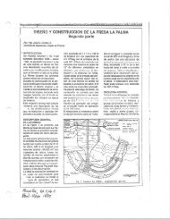
El nuevo puente sobre el rio Carare (Santander) se localiza a 700m aguas arriba de la cabecera de Puerto Araujo, en un tramo recto y estable del rio. El puente consiste de una estructura de arco atirantado con una luz total de 225m (luz central de 145m y dos "aproches" elevados de 40m cada uno). Este nuevo puente se diseno para reemplazar el existente, cuya localizacion con el tiempo puede ser incierta ya que se encuentra localizado en la curva externa de un meandro activo; este puente ya tuvo un colapso en una de sus pilas centrales en mayo de 1994. Para el diseno del nuevo puente se realizaron investigaciones geologicas, geomorfologicas y geotecnicas y se llevo a cabo un estudio pormenorizado del comportamiento del cause del rio con el tiempo (dinamico fluvial), este ultimo de especial importancia para poder seleccionar el sitio para el nuevo puente; se resumen en este articulo las anteriores consideraciones.
The new bridge to be constructed over the Carare river (Santander), is located 700m (2,296ft) upstream of the little town Puerto Araujo, along a stable and straight sector of the river. The bridge will replace the old one that partially failed due to pile scouring and erosion, mainly because the bridge was located on a meandering curve of the river.
A deeply study was carried out to investigate the geological, geomorphological and geotechnical characteristics of river zone to determine several location alternatives for the new bridge. A detail and thoughtfully study of river flow behavior during the last 50 years (pluvial dynamic) was performed, mainly to determine the most convenient and safe location of the new bridge to prevent erosion and scouring; several aerial photos were used to carry out this study.
The new bridge is to be a steel arch structure 225m (738ft) long, with a central span of 145m (475.6ft) long to avoid constructing piles on the river, and two bridge approaches 40m (131.2ft) long each one, to allow flooding to flow freely.
The article discusses all the five bridge location alternatives analyzed, and presents also all the site investigations done, as well as the results obtained; the soil profile of the river is depicted and the scouring study is presented, among others geotechnical and river aspects.

Create successful ePaper yourself
Turn your PDF publications into a flip-book with our unique Google optimized e-Paper software.