Introduction - Remerciements - Plan - liste des personnes ayant une ...
Introduction - Remerciements - Plan - liste des personnes ayant une ...
Introduction - Remerciements - Plan - liste des personnes ayant une ...

You also want an ePaper? Increase the reach of your titles
YUMPU automatically turns print PDFs into web optimized ePapers that Google loves.
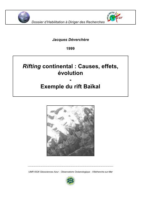
Dossier d’Habilitation à Diriger <strong>des</strong> Recherches<br />
Jacques Déverchère<br />
1999<br />
Rifting continental : Causes, effets,<br />
évolution<br />
-<br />
Exemple du rift Baïkal<br />
⎯⎯⎯⎯⎯⎯⎯⎯⎯⎯⎯⎯⎯⎯⎯⎯⎯⎯⎯⎯⎯⎯⎯⎯⎯⎯⎯⎯⎯⎯⎯⎯⎯⎯⎯⎯⎯<br />
UMR 6526 Géosciences Azur - Observatoire Océanologique - Villefranche-sur-Mer
Dossier d’Habilitation à Diriger <strong>des</strong> Recherches<br />
Jacques Déverchère<br />
1999<br />
Une synthèse de l'activité scientifique sur:<br />
Rifting continental: Causes,<br />
effets, évolution<br />
-<br />
Exemple du rift Baïkal<br />
Présentée le 20 octobre 1999 devant le Jury composé de:<br />
Jean-Philippe AVOUAC CEA/LdG, Bruyères-le-Châtel,<br />
rapporteur<br />
Gilbert BOILLOT Université Pierre et Marie Curie,<br />
Villefranche/Mer<br />
Jean-Pierre BRUN Université de Rennes 1, rapporteur<br />
Michel DIAMENT Institut de Physique de Globe,<br />
Paris<br />
Cynthia EBINGER Université Royal Holloway de<br />
Londres, rapporteur<br />
Laurent JOLIVET Université Pierre et Marie Curie,<br />
Paris, rapporteur<br />
⎯⎯⎯⎯⎯⎯⎯⎯⎯⎯⎯⎯⎯⎯⎯⎯⎯⎯⎯⎯⎯⎯⎯⎯⎯⎯⎯⎯⎯⎯⎯⎯⎯⎯⎯⎯⎯<br />
UMR 6526 Géosciences Azur - Observatoire Océanologique - Villefranche-sur-Mer
<strong>Plan</strong>, Résumé, <strong>Introduction</strong><br />
Dossier HDR Jacques Deverchère<br />
Rifting continental: causes, effets, évolution<br />
-<br />
Exemple du rift Baïkal<br />
PLAN<br />
Préambule<br />
Résumé étendu en anglais<br />
<strong>Introduction</strong><br />
I. PROBLEMATIQUE ET DEMARCHE SCIENTIFIQUE<br />
A. PROBLEMATIQUE : Signification et importance <strong>des</strong> rifts continentaux<br />
1. Place <strong>des</strong> rifts dans la tectonique « interplaque » et « intraplaque »<br />
1-A. Qu’attendre de la <strong>des</strong>cription <strong>des</strong> mouvements relatifs <strong>des</strong> gran<strong>des</strong> plaques <br />
1-B. Sur l’importance <strong>des</strong> forces responsables de la déformation intraplaque et leur modélisation<br />
2. Manifestations majeures associées aux rifts : quelle logique <br />
3. Echelle globale : Convection du manteau, héritage continental et rupture lithosphérique<br />
4. Echelle régionale : Géométrie et mo<strong>des</strong> d’évolution <strong>des</strong> rifts dans le temps et l’espace<br />
B. DEMARCHE: de la "sismo-géologie" à l'analyse <strong>des</strong> causes et effets de la déformation<br />
lithosphérique en extension<br />
1. Les séismes comme marqueurs de la déformation active<br />
1-A. Qu’attendre de la microsismicité <br />
1-B. Stratégies d’analyse <strong>des</strong> mécanismes aux foyer<br />
1-C. Principales limites dans l’interprétation de la microsismicité<br />
2. L’intégration de la « sismo -géologie » dans un ensemble d’observations géophysiques et géologiques<br />
3. Les propriétés intrinsèques de la lithosphère continentale à considérer<br />
3-A. Importance <strong>des</strong> hétérogénéités et de la stratification rhéologique<br />
• Hétérogénéités rhéologiques et anisotropie mécanique<br />
• Fluage de la lithosphère inférieure<br />
• Degré de couplage croûte supérieure-inférieure-manteau<br />
3-B. Effets de la rigidité lithosphérique et comportement thermo-mécanique de la lithosphère<br />
• L’épaisseur élastique équivalente (EEE) : quel apport <br />
• Les épaulements de rift et les modèles thermo -mécaniques en extension<br />
• Les instabilités périodiques (flambage et boudinage)<br />
1
II. LE RIFT BAIKAL DANS LA COLLISION INDE-ASIE<br />
<strong>Plan</strong>, Résumé, <strong>Introduction</strong><br />
• 1. Le laboratoire de la « tectonique intra-plaque » : l’Asie<br />
• 2. Bilans cinématiques et de masse<br />
• 3. Les modèles de déformation basés sur les expériences analogiques<br />
• Le modèle initial : le poinçon rigide<br />
• Les modèles dimensionnés intégrant les forces de volume<br />
• 4. Les modèles utilisant <strong>des</strong> mesures de déformation quaternaires sur failles<br />
• Les modèles en blocs quasi-rigi<strong>des</strong><br />
• Les modèles en blocs peu ou non rigi<strong>des</strong><br />
• 5. Les modèles simulant un champ de déplacement fini depuis 50 Ma<br />
• Les modèles numériques de déformation continue<br />
• Modèle cinématique par reconstruction<br />
• 6. Les modèles utilisant <strong>des</strong> mesures de déformation instantanée<br />
• Les modèles basés sur la sismicité du siècle<br />
• Les modèles basés sur les mesures VLBI et GPS<br />
• 7. Conclusions : distribution et évolution de la déformation en Asie<br />
III. LE RIFT BAIKAL ET LA DEFORMATION LITHOSPHERIQUE<br />
A. Disposition géométrique et évolution tectonique du rift Baïkal<br />
• 1. Morphologie régionale<br />
• 2. Histoire géologique<br />
• Accrétion de blocs au craton archéen et collisions<br />
• Naissance et évolution <strong>des</strong> bassins du rift<br />
• Volcanisme Cénozoïque et flux de chaleur<br />
• 3. Sismicité et failles actives<br />
• 4. Champ de contraintes actuels et déplacements récents<br />
• 5. Modèles cinématiques à l’échelles régionale<br />
• modèle régional de rotations de blocs rigi<strong>des</strong><br />
• modèles en pull-apart<br />
• modèles en rifting oblique<br />
• modèle plan en éléments finis<br />
B. Mécanismes de l’ouverture et structures profon<strong>des</strong> du rift Baïkal<br />
• 1. Segmentation <strong>des</strong> failles et épaisseur sismogène<br />
• 2. Tomographie sismologique, vitesses de phase et dispersion <strong>des</strong> on<strong>des</strong> sous la zone de rift<br />
• 3. Gravimétrie et modélisations thermo -mécaniques<br />
• 4. Modélisations expérimentales et numériques en coupe<br />
2
<strong>Plan</strong>, Résumé, <strong>Introduction</strong><br />
IV. PERSPECTIVES DE RECHERCHE<br />
• 1. Evolution biphasée et modèle de rifting passif dominant<br />
• Le problème <strong>des</strong> causes du biphasage<br />
• Le problème de la direction d’extension récente<br />
• Le problème du dispositif géométrique plan<br />
• 2. Rhéologie, panaches, et convection<br />
• Le problème du rôle de la rhéologie et <strong>des</strong> instabilités<br />
• Le problème de la dimension et de l’importance de la remontée asthénosphérique sous le rift<br />
• Le problème de « Raft tectonics » et de convection : le rôle de la subduction lointaine<br />
• 3. Projets à court et moyen termes<br />
• En Asie<br />
• En domaine Ligure<br />
ANNEXE 1<br />
Activités de formation, recherche et enseignement<br />
1. Activités de Formation à la Recherche<br />
2. Responsabilités administratives d’animation de la Recherche<br />
3. Curriculum Vitae<br />
4. Liste <strong>des</strong> publications et communications<br />
ANNEXE 2<br />
(dossier séparé)<br />
Publications sélectionnées<br />
(concernant uniquement le dossier d’habilitation)<br />
Les travaux sont numérotés dans l’ordre chronologique de parution ou de préparation. Les publications 2, 5, 7,<br />
8, 10, servent de support au texte de synthèse essentiellement dans le Chapitre III-A (Disposition géométrique et<br />
évolution tectonique du rift Baïkal), et les publications 1, 3, 4, 6, 9, 11, dans le Chapitre III-B (Mécanismes de<br />
l’ouverture et structures profon<strong>des</strong> du rift Baïkal).Les autres publications concernant les recherches dans les An<strong>des</strong>, le<br />
domaine Ligure et l’Indonésie, ne sont pas reproduites ici. Elles sont mentionnées en Annexe 1.<br />
3
<strong>Plan</strong>, Résumé, <strong>Introduction</strong><br />
Rifting continental: Causes, effets, évolution -<br />
Exemple du rift Baïkal<br />
Préambule<br />
L’activité présentée ici n’a un sens que par le travail collectif au quotidien qu’elle a permis. En tout premier lieu,<br />
je pense aux étudiants en thèse, et particulièrement Frédérique Houdry et Carole Petit, mes deux plus proches<br />
collaboratrices, qui, par leurs talents multiples et leurs qualités scientifiques et humaines, ont rendu les missions<br />
sibériennes passionnantes et ont enrichi considérablement ce travail. Que Carole puisse trouver rapidement un poste à la<br />
mesure de ses gran<strong>des</strong> possibilités. Je n’oublie pas Christine Fontaine, Nadège Rollet et Olivia Lesne, qui ont su relever<br />
le défi d’un travail parfois fastidieux, chac<strong>une</strong> dans leur domaine. Merci encore aux étudiants de D.E.A. (Eric Chaumillon,<br />
Florence Dambricourt, Frédéric Bartoli, Hélène Le Fur, Lies Loncke) et de maîtrise dont l’apport et l’implication ont<br />
également été très importants.<br />
Etre enseignant-chercheur c’est aussi un équilibre parfois difficile à trouver dans sa double fonction. J’ai connu<br />
à Villefranche-sur-Mer <strong>des</strong> conditions d’enseignement en Géophysique marine, certes perfectibles, mais surtout très<br />
stimulantes, et qui ont apporté de gran<strong>des</strong> satisfactions mutuelles, tant les étudiants ont besoin d’un enseignement basé<br />
sur l’expérimentation directe, la mise en application de connaissances théoriques, et finalement <strong>une</strong> géophysique<br />
concrète : je veux simplement témoigner ici de l’intérêt évident qu’ont manifesté l’immense majorité <strong>des</strong> étudiants en<br />
visite à l’Observatoire pour cette forme d’enseignement, et redire comme au moment de mon recrutement la grande<br />
chance que ce métier représente.<br />
Parmi les chercheurs qui ont compté dans ces années entre la région Ligure, la Russie sibérienne et l’Indonésie,<br />
je tiens à remercier particulièrement quatre <strong>personnes</strong> : Eric Calais, dont la passion pour la science est communicative, et<br />
qui a rendu possible un ‘changement de vitesse’ essentiel dans le chantier d’Asie, par son talent, sa disponibilité, son<br />
efficacité ; Michel Diament, qui m’a donné l’impulsion initiale vers la Russie, et a su procurer à nombre de ses ‘anciens’<br />
étudiants dont moi-même la confiance nécessaire pour continuer leur chemin ; Vladimir San’kov, avec qui nous avons<br />
appris peu à peu à faire tomber les barrières culturelles entre nos deux communautés, et qui a assuré la continuité de cette<br />
coopération après la tragique disparition d’Alexandre Solonenko, le premier et inoubliable compagnon de route ; et<br />
Marie-Odile Beslier, avec qui nous avons partagé les angoisses de la campagne MALIS, et qui a l’exigence et la patience<br />
qui me font si souvent défaut.<br />
Je remercie également les <strong>personnes</strong> qui m’ont manifesté leur confiance dans <strong>des</strong> moments importants,<br />
particulièrement Gilbert Boillot, Georges Mascle, Jean Mascle, Marc Tardy, Jean Virieux, et Hervé Chamley, que ce soit au<br />
moment de mon recrutement, au sein du laboratoire devenu Géosciences Azur en 1996, et lors de mes participations dans<br />
<strong>des</strong> commissions, conseils, groupes ou comités. Je veux aussi mentionner ici la présence ‘collective’ d’autres <strong>personnes</strong>,<br />
sans qui la vie d’enseignant-chercheur perd beaucoup d’intérêt, et à qui je dois de sincères remerciements : Françoise<br />
Sage (avec mention spéciale pour le ‘supplément’ enseignement, si souvent oublié), Guy Ouillon, Françoise Courboulex,<br />
Jocelyne Gosselin, Francine Calcagno, David Graindorge, Philippe Charvis. Je veux encore remercier quelques<br />
compagnons (parfois d’infort<strong>une</strong> !) lors de campagnes en mer (Laurent Royer, Nicole Béthoux, Stéphane Gaffet, Alain<br />
Moreau, Jean-Pierre Réhault, Marc Sosson, Pol Guennoc, Jean-François Stéphan, Yann Hello, Bruno Savoye, et tout<br />
récemment Alain Anglade) et sur le ‘terrain’ parfois ingrat <strong>des</strong> sites du Laboratoire (Yves Descatoire, Jean-Jacques<br />
Pangrazi, Reine Saighi, Caroline Ramel, Véronique Gourbaud, Suzanne Vella, Véronique Pisot). Enfin je tiens à rendre<br />
hommage à l'action de MM. Va ssiliev et Baskévitch à l'Ambassade de France à Moscou, qui a rendu possible les<br />
nécessaires échanges entre nos deux pays.<br />
J’ai finalement le plaisir de dire mes remerciements aux membres du jury qui ont accepté d’examiner mon activité<br />
sans réticence : d’abord aux quatre rapporteurs, Cindy Ebinger, Jean-Philippe Avouac, Jean-Pierre Brun, Laurent Jolivet,<br />
et à Gilbert Boillot et Michel Diament. Deux derniers messages : que les ‘Liguriens’, et notamment Nicole Béthoux, la<br />
‘première’ sismologue de la région, et Marie-Odile Beslier, me pardonnent de laisser ici de côté la Méditerranée : elle reste<br />
cependant présente en filigrane à travers cet examen de l’extension continentale, et ce n’est que partie remise ; et que<br />
Cindy me pardonne d’avoir quelque peu sacrifié la comparaison avec ‘son’ rift ! Mais je sais que le travail commun avec<br />
Carole comble déjà cette lac<strong>une</strong>.<br />
4
<strong>Plan</strong>, Résumé, <strong>Introduction</strong><br />
Résumé étendu en anglais<br />
Continental Rifting: causes, effects, evolution -<br />
Example of the Baikal rift<br />
This report for ‘Habilitation à Diriger <strong>des</strong> Recherches’ presents a summary of my research activity about the<br />
Baikal rift which has began ten years ago, when I obtained my present position as Assistant Professor at Villefranchesur-Mer<br />
Observatory (UPMC). Activities concerning the geodynamics of the Ligurian Sea and previous studies in the<br />
An<strong>des</strong> (Ph. Thesis) are not developped in this report. During the last 10 years I have trained 4 Ph.D. students (2 in full<br />
responsability), 6 ‘DEA’ students, and 8 students in ‘Maîtrise’. I was also involved in regular teaching tasks in the<br />
Observatory, organization of a European Summer School, national evaluations of grants and Universitary activities,<br />
CNRS Committees, and in several proposals for scientific fundings (see Annex 1 for details). This activity has also<br />
implied several field trips and sea cruises. I have participated to 15 publications in International Journals (level ‘A’), plus<br />
3 recently submitted, and to 63 scientific meetings. I was the first author in 4 ‘A’ publications, and second author in 4<br />
others after one of my students (see Annex 1 for a full list and Annex 2 where 11 publications concerning the Baikal rift<br />
are reproduced).<br />
Chapter I gives a brief review of the problems that are currently debated about continental rifts and the way I<br />
have used and complemented ‘seismo -geology’ for the analysis of causes and effects of continental deformation under<br />
extension. Chapter II is a critical review of the deformation pattern in Asia during Tertiary, which aims at situating the<br />
Baikal rift in this important tectonic context. Chapter III is an overview of the main results obtained concerning the<br />
structure, evolution and dynamics of the Baikal rift, and puts in perspective the 11 publications reproduced in Annex 2.<br />
Finally, Chapter IV briefly opens some perspectives of work.<br />
What I have tried to perform, together with several colleagues, is a multidisciplinary study of the Baikal rift<br />
system. This was done in the framework of a collaboration between the Institute of the Earth’s Crust (Irkutsk) and<br />
Géosciences Azur (CNRS-UPMC, Nice, France). We attempt to gather several geophysical and geological data (either<br />
revised or new) and to interpret them with some caution, in order to determine a realistic picture of the on-going<br />
deformation pattern in the Baikal area, and more widely, to better understand the dynamics of the lithospheric<br />
deformation in an intracontinental setting. Our main objectives were the following : (1) <strong>des</strong>cribe the geometry and rate of<br />
active faulting using satellite imagery, field investigations, and seismicity, (2) directly measure crustal deformation and<br />
fault motion using GPS geo<strong>des</strong>y, (3) determine the stress field using earthquake source data, and (4) understand the<br />
physical mechanisms at work through numerical modeling. A number of funding agencies made this project possible :<br />
INTAS, NATO, the Siberian Branch of the Russian Academy of Science, the Mongolian Academy of Science, the French<br />
Ministry for Foreign Affairs, the French National Center for Scientific Research (CNRS), and University Pierre and Marie<br />
Curie.<br />
1. Geometry, style and rate of faulting<br />
We have first focused our efforts on the northern Baikal rift because active faults are easier to <strong>des</strong>cribe there<br />
than below Lake Baikal. We have performed a detailed morphotectonic analysis of late Quaternary faulting in this region<br />
characterized by ranges and basins distributed over more than 800 km along strike. Remote sensing techniques (SPOT,<br />
METEOR scenes, aerial photographs) were used to map the active fault network which displays a general en échelon<br />
distribution from the northern Lake Baikal to the easternmost basin, with ~30 km-spaced overstepping segments of 10-80<br />
km in length [1, 2]. Most faults have a dominant dip-slip component over their Cenozoic history. The inherited crustal<br />
fabric strongly influences the overall geometry of the rifted basins. We use 54 14 C ages of post-glacial terraces near the<br />
footscarps of the Muya basin to date offsets measured inside alluvial fans [3]. The last main post-glacial event in this<br />
area appears to be the early Holocene optimum dated at ~10 ± 2 ka, following the onset of deglaciation at ~13 ka.<br />
Therefore, a detailed levelling across two terraces offset by the Taksimo fault (West Muya basin) shows consistent<br />
minimum vertical slip rates of 1.6±0.6 mm yr -1 . Using 30 other active scarps analyzed in the field, we found a lower bound<br />
for horizontal velocity of 3.2±0.5 mm yr -1 across the Northern rift. We then compared directions of slip vectors from<br />
Holocene field data and slip directions from earthquake fault plane solutions : although local discrepancies appear, the<br />
mean directions of stress inverted (~N130E and ~N155E, respectively) are comparable within uncertainties and favor a<br />
rifting obliquity of about 30-40°. Extrapolating our Holocene rates, we estimate basin ages younger than generally<br />
believed (less than 7 Ma) and propose a spatial and temporal evolution of rifted basins consistent with experimental<br />
models of oblique rifting. Total amounts of extension and vertical throw (~7 km and ~12 km, respectively) across major<br />
faults appear rather constant from the central to the northern rift. These results favor a progressive development of<br />
asymmetric grabens in this part of the rift zone through time and indicate a strong rheological control on deformation<br />
which seems enhanced by other contributions than the far-field effect of the India-Eurasia collision.<br />
A preliminary analysis of a new set of satellite images (SPOT, Landsat Thematic mapper and ERS radar image)<br />
5
<strong>Plan</strong>, Résumé, <strong>Introduction</strong><br />
covering the Tunka-Baikal area provi<strong>des</strong> insights on some active faults : (1) the Sayan fault, a continous system along<br />
130 km, depicts at 3 points river offsets which attest for a recent sinistral strike-slip movement, which magnitude is still<br />
undetermined ; (2) the north-Tunka (West) presents discontinous, en-échelon segments with a variable size from 3 km to<br />
10 km and a probable compressional component; (3) the south-Tunka fault vanishes inside the basin from west to east :<br />
although different small segments are obvious, no clear, recent offsets are detected along them, suggesting a transfer of<br />
motion to the north on the Sayan and north-Tunka faults.<br />
2. GPS measurements and long term prediction of earthquakes<br />
Four campaigns of Global Positioning System measurements were performed between 1994 and 1998 in the<br />
southern and western Baikal region. Our results [4] show a total extension of 4.5+/-1.2mm/yr in a NW-SE direction in the<br />
southern part of the Baikal rift zone and a velocity gradient perpendicular to the major active faults, indicating elastic<br />
strain accumulation. This velocity rate is in good agreement with results of Holocene horizontal displacements on faults<br />
of the SBR [2, 3] but is at least two times greater than the prediction of most deformation models of Asia [5,6]. The strain<br />
is localized on a narrow (50 to 100 km wide) rift structure which appears to be concentrating the present-day deformation<br />
between Eurasia and East China. A comparison between the GPS results and the seismic moment released by historical<br />
earthquakes suggests that elastic strain is currently accumulating in the Baikal rift zone along active faults that have the<br />
potential for a M = 7.5 earthquake if that elastic strain were to be released in a single event today. If aseismic slip is<br />
neglected, we hypothesize recurrence intervals of 150-350 years for large (M~7.5-7.7) events along the lake shoreline,<br />
which could imply the occurrence of a strong shock in the near future. In the South and Central Baikal region, field<br />
<strong>des</strong>cription of more than 40 paleoscarps, and radiocarbon datings of seismogenic deformations have provided<br />
recurrences of less than 2000 years [7], a value similar to the one found in the North [3]. We are currently extending our<br />
GPS network to Mongolia, where 20 sites covering the western half of the country have been measured for in 1997 and<br />
1998. First results favor an eastward movement of the Mongolian block. These results could reflect the dynamic effect of<br />
the Pacific-Eurasia subduction in addition to the well-kown effect of the the India-Eurasia collision. Other causes could<br />
be a "ridge push" effect below the rift, or a buckling of the lithosphere in response to collisional tectonics along the<br />
Siberian Craton. We need additional GPS measurements and tests of dynamic deformation models to discriminate<br />
between these possible effects.<br />
3. Deviatoric stress changes<br />
The problem of the forces responsible for the opening of the Baikal rift is still enigmatic. Analyses of individual<br />
strain directions provided by focal mechanisms of earthquakes is a classical way to determine the consistency of fault<br />
kinematics. We have considered useful to proceed to local deviatoric stress inversions as often as possible, and then to<br />
use these tensors to predict slip directions along main faults. More than 300 focal mechanisms located along the whole<br />
Baikal rift were first used [8]. The stress field is varying at different scales of observation: when looking at central Asia,<br />
the maximum horizontal stress Shmax directions remain rather constant (with a fan-shape geometry) when the tectonic<br />
regime goes from transpressional (Mongolian Altai) to extensional (Baikal). At the scale of the Baikal rift, clear variations<br />
of the stress regime are observed, from an extensional regime in the central part of the rift to wrench ones in its northern<br />
and southern ends. Finally, at the scale of 100 km, systematic Shmax reorientations occur close to major rift faults. We<br />
thus infer that the interaction between collisional processes and inherited structures may have a strong influence on rift<br />
dynamics. Predicted slips show two distinct parts of the rift: the South Baikal Rift is characterized by a constant trend<br />
(around N100°E), meanwhile the North Baikal Rift exhibits rotations involving at least three crustal blocks. These surficial<br />
structures and motions can be easily explained by an interaction between the regional compression linked to the India-<br />
Asia collision and the geometry of the hardly deformable Siberian platform. This suggests a large-scale cracking<br />
(releasing bend) of the lithosphere in the Baikal region. A plane, simple finite element model of deformation confirms this<br />
pattern at broader scale [9].<br />
Recently, we have analyzed stress changes from Lake Baikal up to the Bolnai fault in Mongolia thanks to a new<br />
database of reliable focal solutions of earthquakes (110 all-size mechanisms). There is a smooth, progressive change of<br />
Shmax from South to North, with a trend parallel to the N-S faults of the grabens of Busingol and Khubsugul. Only the<br />
Tunka basin region shows a quick change to a E-W strike. Elsewhere, the general strike is in agreement with a fanshaped,<br />
large-scale distribution of Shmax, consistent with the compressive stress field imposed by the India-Eurasia<br />
collision. Extensional regimes observed are explained by: (i) the position of Busingol, Darkhat and Khubsugul basins<br />
inside a block between two large strike-slip faults, suggesting a pull-apart or a tension gash mechanism within a<br />
transpressional regime ; (ii) the position of Lake Baikal against a major suture zone, which strike favors an opening<br />
controlled by the main Sayan fault linked to the eastward escape of the Mongolian block.<br />
6
4. Mechanical behaviour of the lithosphere and deep structures of the rift<br />
7<br />
<strong>Plan</strong>, Résumé, <strong>Introduction</strong><br />
We have examined the crustal structure and lithospheric flexure of the BRZ by means of gravity modeling. We<br />
modelled the Bouguer Anomaly (BA) along six 1200-km-long gravity profiles [10, 11]. We first evidenced that continuous<br />
elastic plate flexure due to surface loading cannot explain the observed BA. Then we introduced plate discontinuities<br />
coupled with a realistic brittle-elasto-ductile plate rheology to model external tectonic forces acting on the plates and to<br />
determine the Moho geometry. The clearest expression of extensional processes occurs in the central part of the rift,<br />
which exhibits the highest crustal thinning and depicts rift shoulders that have been explained in the southern-central<br />
Lake by mechanical (flexural) unloading [12]. It evolves southwards to a rapidly increasing compression, resulting in an<br />
overthickening of the southern plate's crust and in the long-wavelength flexure of the Siberian plate. North of the central<br />
rift, crustal thinning (which is always less than 7 km) gives way to a more diffuse zone of deformation inside the Sayan-<br />
Baikal folded belt. Based on plate flexure modellings, we find that the rift shoulders surrounding the Central and North<br />
Baikal basins are not supported by upward bending plate, but have a deep crustal root caused by a downward flexure.<br />
The other parts of the rift depict two adjacent plates with antithetic flexures. We also observe that the axial mantle<br />
material, although affected by velocity reductions from place to place, is not related to a large-scale asthenospheric<br />
upwelling, since the lithosphere rheological interfaces are not significantly disturbed. It seems to us that a major<br />
asthenospheric upwelling reaching the Moho (suggested by [13, 14, 15]) would produce much stronger thermal effects<br />
and mechanical weakening. Instead, we favor the role of horizontal forces and motions resulting from the India-Asia<br />
collision, combined with the effect of inherited tectonic structures (and especially the Paleozoic suture bounding the<br />
Siberian craton), and leading to the intrusion of partially melted material inside the weakened lithosphere, as previously<br />
suggested from petrological constraints [16]. New results from a two-dimensional numerical deformation modelling<br />
across the northern rift [17] reveals that these conditions are sufficient to produce rifting and basin subsidence, and that<br />
the surface deformation style is strongly controlled by horizontal shear of a ductile layer inside the crust and by lateral<br />
flows towards the regions of crustal and mantle thinning.<br />
Using a combination of teleseismic and local delay-time tomography, we have tried to obtain a more reliable<br />
picture on the velocity structure below and around the Baikal rift. We use 36000 traveltimes of P-refracted waves from<br />
the ISC catalogue and Pg and Pn traveltimes of 578 earthquakes recorded by the Russian regional network to determine a<br />
velocity model by the use of local and teleseismic inversion procedures [18, 19, 20]. The models are rather reliable<br />
laterally because they closely gather local and global ray path informations. At depth, tests of accuracy in inversion<br />
reveal a stable picture down to at least 400 km. A narrow negative anomaly goes through Mongolia and follows the<br />
southern and eastern margins of the Siberian craton: this structure is interpreted as a thin mantle plume (‘wall’) reaching<br />
the southern rift axis. This anomaly seems to us the best constrained one, in good agreement with the occurrence of<br />
volcanic activity across Mongolia along ~1200 km since Miocene time. Again, our results do not evidence any strong<br />
asthenospheric perturbation exactly below the rift axis : we only observe velocity anomalies near the surface which are<br />
not deeply rooted. In particular, a negative anomaly is observed at shallow levels (48 km) beneath the northern third of<br />
lake Baikal, which is disconnected from deeper structures. It may be explained by the existence of underplated magmatic<br />
material at the bottom of the crust and agrees with the anomalous velocities reported from seismic explorations [21, 22].<br />
By comparing the geometry of deep-rooted anomalies to the present-day stress field patterns, the regional heat flow and<br />
the Tertiary volcanic activity, it seems to us that the sub-lithospheric mantle dynamics is not the main factor controlling<br />
extensional processes in the Baikal rift. However, it does contribute to a thermal weakening of the lithosphere along a<br />
mechanical discontinuity bounding the Siberian craton. This view agrees well with the depth distribution of earthquakes,<br />
which commonly concerns the range 15-25 km, and sometimes even 40 km [1, 23], confirming significant strength of the<br />
lithosphere under extension, even close to the rift axis. Nevertheless, whether the asthenospheric wedge below the rift<br />
axis is narrow or not remains a debated point (see e.g. the controversial interpretations of shear wave splitting beneath<br />
continental rifts [24, 25]) that is not resolved at this stage and is beyond the scope of our present studies.<br />
5. Conclusions<br />
Although preliminary, our 10-year studies in the Baikal rift have led us to several evidences : (1) the major role<br />
of lithospheric inheritance in the Baikal rift genesis; (2) the close spatial relationships between the India-Asia collision<br />
and the development of the rift ; (3) the major effect of the high strength of the Siberian Craton during rift evolution; (4)<br />
the probable weakening effect of the asthenosphere, as narrow mantle plumes following the lithospheric fabric, in an<br />
apparently passive way ; (5) the relatively high velocities of extension measured by GPS geo<strong>des</strong>y (in the southern rift) or<br />
by field studies on scarps (in the whole rift) of about 3-5 mm/yr ; (6) the oblique rifting geometry in the northern tip and<br />
the ‘transpressive pull-apart’ mechanism in the southern tip ; and (7) the possibility to model the topography,<br />
deformation pattern, gravity anomaly and age of formation of the northern Baikal rift zone without invoking a dynamic<br />
contribution of an asthenospheric plume, at least in the recent phase of its evolution (« fast rift stage », since 3.5 My).<br />
We have found a good consistency between Holocene and present-day strain rates, a rather constant displacement field<br />
from Lake Baikal (dip-slip rifting) to the northern rift (oblique-type rifting), higher rates than predicted by all deformation<br />
models of Asia, and recurrence intervals for large earthquakes of about 300 years or less in the South and of about 2000
<strong>Plan</strong>, Résumé, <strong>Introduction</strong><br />
years in the North. Some goals in the future may be to : (1) Extend GPS measurements to Mongolia (first performed in<br />
1997) and to the northern rift; (2) Develop a permanent GPS network; (3) Describe fault mechanics, by determining the<br />
amount of aseismic deformation, the time stability of the velocity field, the locked and unlocked behaviour of faults,<br />
which will allow reliable seismic hazard assessments; (4) Favor methodological developments and training in earthquake<br />
relocation procedures and instantaneous strain field analyses to be used by Russian and Mongolian scientists; (5)<br />
Enhance the development of a modern (i.e., broadband) seismograph network; (6) Improve earthquake locations thanks<br />
to the installation of an experimental array around (and inside with OBS) Southern Lake Baikal for instance.<br />
We finally conclude that three favorable conditions explain ‘local’ extension in the Baikal area : far-field<br />
compressional stress field, mechanical inherited lithospheric weakness and some heat supply. This latter input is still<br />
unclear, but probably strongly influences the flow properties and the mechanical behaviour of the deforming lithosphere.<br />
Anyway, far stress-field sources (India-Eurasia collision and possibly, Pacific subduction) impose boundary conditions<br />
that played a significant role in the evolution of the Baikal system through time. Several possible consequences (first<br />
‘pre-rift’ stage of increasing potential energy in relief by thrusting Extensional collapse Lateral escape and ductile<br />
flow at depth ) should be clarified in the future.<br />
References<br />
[1] Déverchère, J., F. Houdry, N.V. Solonenko, A.V. Solonenko, and V.A. Sankov, Seismicity, active faults and stress field of the North<br />
Muya region, Baikal rift: new insights on the rheology of extended continental lithosphere, J. Geophys. Res., 98, 19,895-19,912,<br />
1993.<br />
[2] Houdry, F., Mécanismes de l'extension continentale dans le rift nord-Baïkal, Sibérie: contraintes <strong>des</strong> données d'imagerie SPOT, de<br />
terrain, de sismologie et de gravimétrie, Ph.D. Thesis, Université Pierre et Marie Curie, Paris VI, 356 pp., 1994.<br />
[3] San’kov, V.A., J. Déverchère, Y. Gaudemer, F. Houdry, and A. Filippov, Geometry and rate of faulting in the North Baikal rift, Siberia,<br />
Tectonics, in press, 2000.<br />
[4] Calais, E., O. Lesne, J. Déverchère, V.A. Sankov, A.V. Lukhnev, A.I. Miroshnichenko, and K.G. Levi, Crustal deformation in the<br />
Baikal rift from GPS measurements, Geophys. Res. Lett., 25 (21), 4003-4006, 1998.<br />
[5] Peltzer, G., and F. Saucier, Present-day kinematics of Asia derived from geologic fault rates, J. Geophys. Res., 101, 27,943-27,956,<br />
1996.<br />
[6] England, P., and P. Molnar, The field of crustal velocity in Asia calculated from Quaternary rates of slip on faults, Geophys. J. Int.,<br />
130, 551-582, 1997.<br />
[7] Levi, K.G., S.M. Babushkin, A.A. Badardinov, V.Y. Buddo, G.V. Larkin, A.I. Miroshnichenko, V.A. San’kov, V.V. Ruzhich, H.K. Wong,<br />
D. Delvaux, and S. Colman, Active Baikal tectonics, Russian Geology and Geophysics, 36(10), 143-154, 1995.<br />
[8] Petit, C., J. Déverchère, F. Houdry, V.A. Sankov, V.I. Melnikova, and D. Delvaux, Present-day stress field changes along the Baikal rift<br />
and tectonic implications, Tectonics, 15(6), 1171-1191, 1996.<br />
[9] Lesne, O., E. Calais, and J. Déverchère, Finite element modeling of crustal deformation in the Baikal rift zone: new insights into the<br />
active-passive debate, Tectonophysics, 289, 327-430, 1998.<br />
[10] Burov, E. B., F. Houdry, M. Diament, and J. Déverchère, A broken plate beneath the North Baikal rift zone revealed by gravity<br />
modelling, Geophys. Res. Lett., 21, 129-132, 1994.<br />
[11] Petit, C., E.B. Burov, and J. Déverchère, On the structure and mechanical behavior of the extending lithosphere in the Baikal rift<br />
from gravity modeling, Earth <strong>Plan</strong>et. Sci. Lett., 149, 29-42, 1997.<br />
[12] Van der Beek, P.A., Flank uplift and topography at the Central Baikal Rift (SE Siberia): A test of kinematic models for continental<br />
extension, Tectonics, 16, 122-136, 1997.<br />
[13] Gao, S., P.M. Davis, H. Liu, P.D. Slack, Y.A. Zorin, N.A. Logatchev, M.G. Kogan, P.D. Burkholder, and R.P. Meyer, Asymmetric<br />
upwarp of the asthenosphere beneath the Baikal rift zone, Siberia, J. Geophys. Res., 99, 15,319-15,330, 1994.<br />
[14] Gao, S., P.M. Davis, H. Liu, P.D. Slack, Y.A. Zorin, V.V. Mordvinova, V.M. Kozhevnikov, and N.A. Logatchev, Seismic anisotropy<br />
and mantle flow beneath the Baikal rift zone, Nature, 371, 149-151, 1994.<br />
[15] Zorin, Y.A., V.M. Kozhevnikov, M.R. Novoselova, and E.K. Turutanov, Thickness of the lithosphere beneath the Baikal rift and<br />
adjacent regions, Tectonophysics, 168, 327-337, 1989.<br />
[16] Kiselev, A.I., and A.M. Popov, Asthenospheric diapir beneath the Baikal rift: Petrological constraints, Tectonophysics, 208, 287-<br />
295, 1992.<br />
[17] Lesne, O., E. Calais, J. Déverchère, R. Hassani, and J. Chéry, Dynamics of intracontinental extension in the North Baikal Rift from<br />
two-dimensional numerical deformation modeling, J. Geophys. Res., in press, 1999.<br />
[18] Petit, C., and J. Déverchère, Velocity structure of the northern Baikal rift, Siberia, from local and regional earthquake travel times,<br />
Geophys. Res. Lett., 22(13), 1677-1680, 1995.<br />
[19] Koulakov, I., Three-dimensional seismic structure of the upper mantle beneath the central part of the Eurasian continent, Geophys. J.<br />
Int., 133, 467-489, 1998.<br />
[20] Petit, C., I.Yu. Koulakov, and J. Déverchère, Velocity structure around the Baikal rift zone from teleseismic and local earthquake<br />
traveltimes and geodynamic implications, Tectonophysics, 296, 125-144, 1998.<br />
[21] Puzyrev, N.N., M.M. Mandelbaum, S.V. Krylov, B.P. Mishenkin, G.V. Petrik, and G. V. Krupskaya, Deep structure of the Baikal and<br />
other continental rift zones from seismic data, Tectonophysics, 45, 15-22, 1978.<br />
[22] Krylov, S. V., B. P. Mishenkin, and A. V. Bryskin, Deep structure of the Baïkal rift from multiwave seismic explorations, J. Geodyn.,<br />
13, 87-96, 1991.<br />
[23] Déverchère, J., F. Houdry, M. Diament, N.V. Solonenko, and A.V. Solonenko, Evidence for a seismogenic upper mantle and lower<br />
crust in the Baikal rift, Geophys. Res. Lett., 18, 1099-1102, 1991.<br />
[24] Vauchez, A., G. Barruol, and A. Nicolas, Comment on « SKS splitting beneath continental rift zones », J. Geophys. Res., 104, 10,787-<br />
10,789, 1999.<br />
[25] Gao, S., P.M. Davis, H. Liu, P.D. Slack, A.W. Rigor, Y.A. Zorin, V.V. Mordvinova, V.M. Kozhevnikov, and N.A. Logatchev, Reply<br />
to Comment from Vauchez et al., J. Geophys. Res., 104, 10,791-10,794, 1999.<br />
8
<strong>Plan</strong>, Résumé, <strong>Introduction</strong><br />
<strong>Introduction</strong><br />
Ce rapport d’Habilitation à Diriger <strong>des</strong> Recherches présente, outre un compte-rendu détaillé d’activité, un<br />
résumé de mon activité de recherche sur le rift Baïkal qui a commencé il y a 10 ans, lors de ma nomination comme Maître<br />
de Conférence de l’Université Pierre et Marie Curie à l’Observatoire de Villefranche-sur-Mer. Comme pendant ma thèse,<br />
un fil directeur thématique a relié mes différentes activités de recherches : l’extension continentale et ses effets, qu’elle se<br />
produise au sein d’<strong>une</strong> chaîne de montagne liminaire (la Cordillère Blanche au Pérou), dans un paléorift maintenant<br />
immergé, le bassin Ligure et ses marges, en contexte d’arrière-arc, ou au cœur d’un continent, le rift Baïkal. Si j’ai choisi<br />
de ne présenter que ce dernier, c’est à la fois pour <strong>des</strong> raisons de temps, et pour éviter <strong>une</strong> ‘gymnastique’ intellectuelle<br />
un peu artificielle : la comparaison entre ces deux derniers objets, par la différence de contexte tectonique et de métho<strong>des</strong><br />
d’investigation qu’elle implique, ne me paraît pour l’instant pas assez fructueuse. J’ai voulu plutôt tirer parti du fait qu’un<br />
cycle d’étude s’achevait en domaine intracontinental asiatique, avec <strong>une</strong> confrontation utile entre plusieurs résultats<br />
récents (modélisations gravimétriques, mesures GPS et modélisations numériques) et l’analyse plus spécifiquement<br />
‘sismo -géologique’ que j’ai menée. Enfin <strong>une</strong> autre circonstance m’a incité à agir de la sorte : la soutenance proche de la<br />
thèse de doctorat de Nadège Rollet sur le bassin Ligure.<br />
Avant de détailler le contenu de ce mémoire, je résume en quelques lignes le travail de recherche effectué en<br />
dehors du chantier Baïkal depuis mon arrivée à Villefranche-sur-Mer. L’essentiel a été consacré à :<br />
(1) <strong>une</strong> expertise, également indispensable pour mon enseignement, dans l’acquisition et l’interprétation de<br />
profils de sismique-réflexion monotrace en mer Ligure. Ce travail a permis d’identifier <strong>des</strong> marqueurs importants du<br />
soulèvement de la marge depuis le Messinien, de proposer <strong>une</strong> évaluation de la longueur et de l’importance <strong>des</strong> failles<br />
normales bordières de pied de pente, et de caractériser <strong>des</strong> milieux diffractants correspondant aux dépôts détritiques de<br />
bas niveau marin, qui sont probablement à relier à la crise de salinité Messinienne. Il a fait l’objet d’<strong>une</strong> partie du travail<br />
de Nadège Rollet, d’<strong>une</strong> publication de rang A (Chaumillon et al., 1994), de 2 rapports de DEA (E. Chaumillon, 1992, et H.<br />
Le Fur, 1998), de 2 rapports de stage ERASMUS, de 2 rapports de Maîtrise, et de plusieurs publications de rang B ou C<br />
avec les collègues italiens de Gênes (voir Annexe 1) ;<br />
(2) l’acquisition, le traitement et l’interprétation de données de sismologie acquises conjointement en domaine<br />
sous-marin et terrestre, essentiellement lors de 3 campagnes successives d’acquisition, entre 1990 et 1997. La principale,<br />
SISBALIG2, s’est effectué en collaboration avec l’Institut de Géophysique de Hambourg (Allemagne). Elles ont permis<br />
d’établir un modèle de vitesse jusque dans le manteau le long du pied de la marge nord-Ligure, de calibrer<br />
technologiquement notre réseau de sismographes sous-marins (OBS) dédiés à l’activité d’observation, de mieux localiser<br />
en profondeur <strong>des</strong> événements sous la marge et dans le bassin, et de réunir <strong>une</strong> base de données plus complète de<br />
mécanismes au foyer qui permet de caractériser un régime essentiellement compressif dont la direction de contrainte<br />
maximum change rapidement à l’approche de la chaîne alpine. Ce travail a fait l’objet d’<strong>une</strong> thèse (C. Fontaine, 1996) dont<br />
j’ai partagé la co-responsabilité avec Anne Deschamps, d’un article de rang A (Déverchère et al., 1991) et d’un rapport<br />
de maîtrise (voir Annexe 1) ;<br />
(3) l’acquisition, le traitement et l’interprétation de données de sismique-réflexion multitrace (campagne MALIS),<br />
en collaboration avec Marie-Odile Beslier. Elle a permis de redéfinir la structure et le degré d’asymétrie <strong>des</strong> marges<br />
conjuguées Corse et Ligure, de préciser la structure du socle dans le bassin profond, de cartographier la distribution du<br />
volcanisme Miocène, largement méconnu jusqu’alors, de proposer <strong>une</strong> nouvelle interprétation de l’évolution tectonosédimentaire<br />
du bassin par un premier modèle thermo -mécanique 2-D, et d’avancer <strong>des</strong> hypothèses sur les modalités de<br />
la réactivation en compression de la marge nord-Ligure et du bassin profond par combinaison <strong>des</strong> informations<br />
sismotectoniques, magnétiques, gravimétriques, de sismique-réflexion, et de sismique grand-angle. Les recoupements<br />
avec d’autres campagnes (CYLICE’97, plongées ; MARCO’95, dragages ; MALIGU’92,93, SIBONI’94, monotrace) furent<br />
déterminantes pour l’interprétation de cette nouvelle base de données sismiques. Mon imp lication personnelle a été dans<br />
l’acquisition et l’interprétation <strong>des</strong> profils multitrace MALIS, <strong>des</strong> campagnes monotrace, et dans la corrélation avec la<br />
sismicité (malheureusement encore incomplète). Ce travail a fait l’objet d’<strong>une</strong> thèse (N. Rollet, 1999) et d’un rapport de<br />
D.E.A. (F. Dambricourt, 1995) dont j’ai partagé la co-responsabilité avec Marie-Odile Beslier (voir Annexe 1). La<br />
soutenance de Nadège Rollet (septembre 1999) a donné l’occasion de discuter en détail les résultats de ce travail, à mon<br />
sens importants, même si de nombreux problèmes d’interprétation demeurent (nature exacte <strong>des</strong> faciès sous les marges,<br />
identification de la croûte océanique, séparation <strong>des</strong> phases multiples de déformation depuis l’Eocène) en raison de<br />
l’absence de forages en mer Ligure ;<br />
9
<strong>Plan</strong>, Résumé, <strong>Introduction</strong><br />
(4) la participation à d’autres campagnes en mer (sismique multitrace en Galice et en Côte d’Ivoire, sismologie et<br />
sismique grand-angle par OBS et/ou stations terrestres en mer Ligure et en baie de Naples) ou à terre (sismologie de<br />
terrain en Indonésie, avant et après un grand séisme). Ces activités ‘occasionelles’ se sont justifiées soit pour <strong>des</strong><br />
raisons d’initiation à de nouvelles approches méthodologiques (la multitrace à mon arrivée à Villefranche), soit par les<br />
nécessités d’intervention suite à <strong>des</strong> séismes importants dans <strong>des</strong> régions au préalable étudiées par nos équipes (Liwa,<br />
1994, M=6.8, et Vintimille, 1995, M=4.7). Ces travaux ont fait l’objet de 2 articles de rang A (Widiwij<strong>ayant</strong>i et al., 1996, et<br />
Courboulex et al., 1998, voir Annexe 1).<br />
Je présente maintenant le plan de ce rapport. Le chapitre I fournit un bref aperçu <strong>des</strong> problèmes couramment<br />
débattus à propos <strong>des</strong> rifts continentaux actuels, et justifie la démarche générale que j’ai choisie afin de mieux<br />
comprendre les causes et les effets de la déformation active en extension en domaine intracontinental : l’utilisation de la<br />
« sismo -géologie », au cœur de mon domaine de compétence, dans un cadre élargi par l’apport d’autres approches<br />
complémentaires (gravimétrie, géodésie, modélisations numériques). Le Chapitre II est un examen critique du<br />
comportement de la lithosphère asiatique au cours du Tertaire, d’après la bibliographie. Cette partie peut surprendre le<br />
lecteur dans le cadre de cette Habilitation : elle m’a paru nécessaire pour renforcer la compréhension <strong>des</strong> processus de<br />
déformation observée à l’échelle du rift Baïkal, car le contexte de la collision Inde-Asie et <strong>des</strong> subductions le long de<br />
l’océan Pacifique y joue à l’évidence un rôle primordial. Le Chapitre III donne et discute les principaux résultats obtenus<br />
concernant la structure, le comportement thermo -mécanique, l’évolution et la dynamique actuelle du rift Baïkal, en se<br />
référant aux 11 publications reproduites en Annexe 2. Finalement, le Chapitre IV ouvre brièvement quelques perspectives<br />
d’étude à la suite de ces travaux.<br />
Enfin je mentionne en Annexe 1 les principaux éléments de la démarche d’enseignement que j’ai eu à assurer à<br />
Villefranche-sur-Mer dans le cadre de mon service statutaire, ainsi qu’un Curriculum Vitae, la <strong>liste</strong> complète de mes<br />
publications et communications, et un bilan détaillé <strong>des</strong> activités de recherche, <strong>des</strong> tâches administratives, et <strong>des</strong><br />
contrats dans lesquels j’ai été impliqué.<br />
10