Metodi di campionamento flora e macroinvertebrati - Laboratorio di ...
Metodi di campionamento flora e macroinvertebrati - Laboratorio di ...
Metodi di campionamento flora e macroinvertebrati - Laboratorio di ...

You also want an ePaper? Increase the reach of your titles
YUMPU automatically turns print PDFs into web optimized ePapers that Google loves.
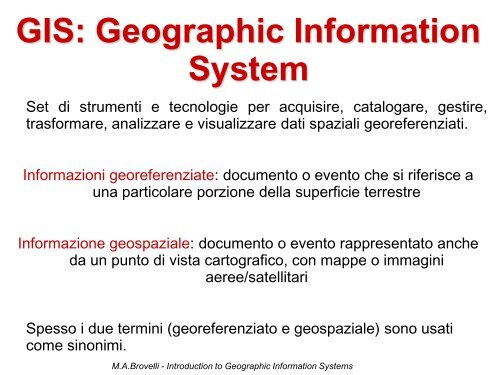
GIS: Geographic Information<br />
System<br />
Set <strong>di</strong> strumenti e tecnologie per acquisire, catalogare, gestire,<br />
trasformare, analizzare e visualizzare dati spaziali georeferenziati.<br />
Informazioni georeferenziate: documento o evento che si riferisce a<br />
una particolare porzione della superficie terrestre<br />
Informazione geospaziale: documento o evento rappresentato anche<br />
da un punto <strong>di</strong> vista cartografico, con mappe o immagini<br />
aeree/satellitari<br />
Spesso i due termini (georeferenziato e geospaziale) sono usati<br />
come sinonimi.<br />
M.A.Brovelli - Introduction to Geographic Information Systems