

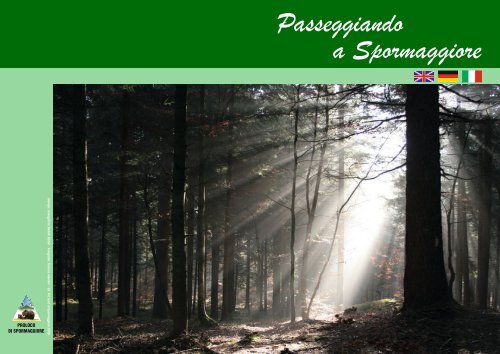
Passeggiando a Spormaggiore - Proloco
Passeggiando a Spormaggiore - Proloco
Passeggiando a Spormaggiore - Proloco

You also want an ePaper? Increase the reach of your titles
YUMPU automatically turns print PDFs into web optimized ePapers that Google loves.
PROLOCO<br />
DI SPORMAGGIORE<br />
Stampa: Lineagrafi ca Bertelli Editori - Fotografi e: Thomas Albertini - Ed. Pro Loco di <strong>Spormaggiore</strong> 2009<br />
<strong>Passeggiando</strong><br />
a <strong>Spormaggiore</strong><br />
© DiskArt 1988<br />
© DiskArt 1988
INDICE<br />
Malga Spora 3<br />
Percorso Sentiero Vita 6<br />
Area Orsi - Castel Belfort - Le Seghe 8<br />
<strong>Spormaggiore</strong> - Grotta Lovara - Malga Val dei Brenzi 10<br />
Percorsi per Mountain Bike 11<br />
Visita della Frazione di Maurina 12<br />
<strong>Spormaggiore</strong> - Strada Romana - Castel Rovina - Tracciolino 13<br />
Palestra di Roccia 15<br />
Arcieri 17<br />
Area Faunistica 18<br />
Mappa Sentieri 19<br />
2 Itinerari di <strong>Spormaggiore</strong><br />
Partendo dalla piazza di SPORMAGGIORE, si può accedere con fuoristrada, alla località<br />
“BRENZATI” attraverso la strada forestale (SEGNAVIA SAT N° 302); si seguono all’inizio<br />
le indicazioni per la località “SELVAPIANA” (circa 20 minuti dalla piazza di <strong>Spormaggiore</strong>),<br />
poi la strada sale repentinamente seguendo le indicazioni per MALGA SPORA.<br />
Arrivati al termine della strada forestale si parcheggia l’automezzo e si inizia la camminata. Ricordiamo<br />
che per il transito con fuoristrada sulla strada forestale è necessario un permesso di transito concesso<br />
dal Comune di <strong>Spormaggiore</strong>.<br />
Percorrendo sempre l’itinerario SAT N° 302 si arriva ad un bivio denominato “TABELLE” dove incontriamo<br />
il sentiero SAT N° 301 che giunge da ANDALO. Proseguendo in breve tempo si arriva a MALGA<br />
SPORA (1872 metri) impiegando circa 1 ora e trenta da dove abbiamo lasciato il fuoristrada.<br />
Nel periodo estivo MALGA SPORA offre la possibilità di vedere uno dei pochi alpeggi non raggiungibili<br />
da strade di accesso; sul posto ci sono circa 30 mucche da latte e a giorni alternati si può assistere alla<br />
produzione del formaggio e del burro con metodi tradizionali.<br />
A MALGA SPORA è anche possibile pernottare e mangiare prenotando anticipatamente.<br />
Maestose e importanti sono le montagne che la circondano: CIMA PIZ GALIN, CIMA SANTA MARIA,<br />
CIMA FIBBION, CROZZON DEL BRENTA ecc. Tutte queste cime e tante altre sono raggiungibili in<br />
giornata per chi possiede un minimo di allenamento.<br />
Facciamo presente che MALGA SPORA si trova al centro di una zona molto importante del Gruppo<br />
Brenta, infatti da qui partono diversi itinerari che raggiungono i più rinomati rifugi (PEDROTTI, GROSTE’,<br />
TUCKETT, ecc..).Per le persone che arrivate a MALGA SPORA si sentono soddisfatte consigliamo oltre<br />
alla visita all’alpeggio, di osservare in silenzio le marmotte, vere padrone dei pascoli adiacenti( se ne<br />
contano anche 20/25 esemplari).<br />
L’itinerario per il ritorno al paese di SPORMAGGIORE è uguale a quello usato per la salita.<br />
Itinerari di <strong>Spormaggiore</strong><br />
3<br />
Malga Spora
From the town square of <strong>Spormaggiore</strong><br />
© DiskArt 1988<br />
you can reach “Brenzati” by four-wheel<br />
© DiskArt 1988<br />
drive vehicles along the Forestry<br />
Commission road (Sat sign No. 302);<br />
initially follow the signs for “Selvapiana” (about 20<br />
minutes from <strong>Spormaggiore</strong> town square), then for<br />
“Malga Spora”, where the road climbs steeply.<br />
At the end of the Forestry Commission road park your<br />
vehicle and start walking.<br />
Remember that you need permission issued by the<br />
<strong>Spormaggiore</strong> Local Authority to use a four-wheel<br />
drive vehicle on Forestry Commission roads. Follow<br />
the Sat itinerary No. 302 to a junction called “Tabelle”<br />
where you meet up with Sat path No. 301 from<br />
Andalo.<br />
A walk of about an hour and a half from the car park<br />
takes you to Malga Spora (1872 metres).<br />
At Malga Spora in summer you can see one of the<br />
few alpine pastures that cannot be reached by road;<br />
there are about 30 milking cows and on alternate<br />
days you can watch cheese and butter being made<br />
by traditional methods.<br />
If you book in advance you can also spend the night<br />
here and have a meal. The surrounding mountains<br />
are majestic and important: Cima Piz Galin, Cima<br />
Santa Maria, Cima Fibbion, Crozzon del Brenta, etc.<br />
All these peaks, and many more, can be climbed in a<br />
day by anyone with minimum physical preparation.<br />
Malga Spora is in the<br />
centre of an extremely important<br />
area of the Brenta<br />
Group; there are a number<br />
of itineraries from here to<br />
well-known mountain huts<br />
(rifugi) (Pedrotti, Grostè,<br />
Tuckett, etc). Use the same<br />
itinerary to get back to<br />
<strong>Spormaggiore</strong>.<br />
4 Itinerari di <strong>Spormaggiore</strong><br />
Wir beginnen am Hauptplatz von<br />
<strong>Spormaggiore</strong> und fahren mit dem<br />
Geländewagen zu Loc. Brenzati über<br />
die Forststraße Sat. Nr. 302; anfänglich<br />
folgen wir dem Hinweis nach Selvapiana (etwa 20<br />
Minuten ab Hauptplatz <strong>Spormaggiore</strong>), danach dem<br />
Hinweis “Malga Spora”, wo die Straße jäh ansteigt.<br />
Wir parken das Auto am Ende der Forststraße.<br />
Für die Befahrung des Forstwegs ist eine Genehmigung<br />
der Gemeinde <strong>Spormaggiore</strong> erforderlich.<br />
Zu Fuß folgen wir weiter dem Pfad Sat. 302 und<br />
kommen zu einer Abzweigung mit dem Namen<br />
„Tabelle“, wo wir auf den Sat-Pfad Nr. 301 von Andalo<br />
her stoßen.<br />
In kurzer Zeit erreichen wir Malga Spora (1872 m) – ab<br />
Parkplatz sind es etwa 1,5 Stunden.<br />
Malga Spora ist eine der wenigen Almen ohne<br />
Zufahrtsstraße.<br />
Im Sommer weiden hier etwa 30 Milchkühe und jeden<br />
zweiten Tag wird auf traditionelle Weise Butter und<br />
Käse produziert. Bei frühzeitiger Anmeldung kann<br />
man auch übernachten und essen.<br />
Majestätische Gipfel umgeben die Almwiese: Cima<br />
Piz Galin, Cima Santa Maria, Cima Fibbion, Crozzon<br />
del Brenta... Wer etwas trainiert ist, kann diese Berge –<br />
und viele andere - in Tageswanderungen besteigen.<br />
Malga Spora liegt sehr strategisch inmitten der Brenta<br />
Gruppe: von hier starten<br />
verschiedene Bergrouten<br />
zu den bekanntesten<br />
Schutzhütten wie Pedrotti,<br />
Grostè und Tuckett.<br />
Der Rückweg nach <strong>Spormaggiore</strong><br />
ist gleich wie<br />
der Hinweg.<br />
ormation<br />
Informazioni Utili / Useful information / Nützliche Informationen<br />
Diffi coltà / Diffi culty / Schwierigkeit: MEDIA / MIDDLE / MIDDLERE<br />
Durata / Duration / Dauer: andata e ritorno circa 4 ore / 4 hours / 4 Stunde<br />
Dislivello / Unevenness / Unevenness: 400 m loc. Brenzati<br />
Passeggino / Perambulator / Kinder wagen: no / no /Nein<br />
Itinerari di <strong>Spormaggiore</strong><br />
5
Percorso Sentiero Vita<br />
Partendo dalla piazza, attraversiamo<br />
l’abitato di <strong>Spormaggiore</strong>,<br />
percorrendo dapprima via S.<br />
Vigilio e successivamente via Fontanele; appena<br />
usciti dal paese giriamo a destra seguendo<br />
le indicazioni PERCORSO VITA ed<br />
imbocchiamo un sentiero che si inerpica nel<br />
bosco…<br />
Fortunatamente la salita è breve ed in 20<br />
minuti circa arriviamo in località “Nisclaia”.<br />
Approfi ttiamo delle panchine per riposarci<br />
e per goderci fi nalmente in silenzio e tranquillità<br />
le suggestioni avvolgenti del bosco<br />
incontaminato che ci circonda…con i suoi<br />
suoni…i suoi profumi... .<br />
Proseguendo, il tracciato sale in modo più<br />
graduale e per i più volenterosi c’è la possibilità<br />
di effettuare una serie di esercizi fi sici<br />
utilizzando le apposite attrezzature con le<br />
relative illustrazioni predisposte lungo il tragitto.<br />
Dopo 30 minuti circa raggiungiamo la località<br />
“Primi Laresi”, dove possiamo ammirare<br />
l’incantevole panorama offerto dalla Valle<br />
di Non, con i suoi numerosissimi paesi circondati<br />
dal verde dei boschi e dei frutteti…<br />
e dallo sfondo imponente della Catena montuosa<br />
delle Maddalene. Dopo una breve e<br />
graduale discesa nel bosco incrociamo una<br />
strada asfaltata; qui abbiamo la possibilità,<br />
scendendo a destra, di terminare la nostra<br />
escursione, oppure, salendo a sinistra, possiamo<br />
fare una breve visita all’Area faunistica<br />
dell’Orso Bruno.<br />
Informazioni Utili / Useful information / Nützliche Informationen<br />
Diffi coltà / Diffi culty / Schwierigkeit: FACILE / EASY / EINFACH<br />
Durata / Duration / Dauer: 2 ore circa / 2 hours / 2 Stunde<br />
Dislivello / Unevenness / Unevenness: 100 metri circa / 100 meters /100 meter<br />
Passeggino / Perambulator / Kinder wagen: no / no /Nein<br />
6 Itinerari di <strong>Spormaggiore</strong><br />
From the town square cross <strong>Spormaggiore</strong>, fi rst taking via S. Vigilio then via Fontanele; just<br />
© DiskArt 1988<br />
outside the town turn right, follow the signs for the Natural Fitness Trail (Percorso Vita) and<br />
© DiskArt 1988<br />
take the path that goes up into the woods.<br />
After a short uphill stretch of about 20 minutes you reach Nisclaia.<br />
Here there are some benches where you can rest and quietly enjoy the sounds and smells of the<br />
uncontaminated woods around you. Going on the path rises more gently and if you’re feeling energetic you<br />
can do the physical exercises on the apparatus (complete with illustrated instructions) along the trail.<br />
After about 30 minutes you reach Primi Laresi, where you can admire the enchanting panorama of the<br />
Valle di Non, with its villages surrounded by green woods and orchards against a backdrop of the imposing<br />
Maddalene mountain chain.<br />
After a short gradual descent through the woods you meet a tarmac road; here you can take the right and<br />
end your excursion, or you can go up to the left to pay a short visit to the Brown Bear fauna area.<br />
Wir beginnen am Hauptplatz<br />
von <strong>Spormaggiore</strong>, durchqueren<br />
die Ortschaft auf der Via<br />
S. Vigilio und dann auf der Via<br />
Fontanele und folgen am Ausgang des Dorfes<br />
sofort rechts dem Hinweis Percorso Vita<br />
(Fitnesspfad).<br />
Wir schlagen einen Pfad ein, der aufwärts<br />
in den Wald führt. Nach etwa 20 Minuten<br />
erreichen wir Loc. Nisclaia. Die Bänke laden<br />
zu einer kurzen Rast ein – wir lauschen den<br />
Geräuschen des Waldes und atmen genussvoll<br />
seine Düfte.<br />
Stufenweise steigt die Trasse an und die ganz<br />
Eifrigen können sich an den Geräten entlang<br />
des Pfades üben. Nach etwa 30 Minuten<br />
erreichen wir Loc. Primi Laresi mit Blick auf<br />
das zauberhafte Nonstal mit den von Wäldern<br />
umringten Dörfern, den Obstwiesen und im<br />
Hintergrund die Bergkette der Maddelene.<br />
Hier führt der Weg abwärts durch den<br />
Wald und wir kreuzen nach kurzer Zeit eine<br />
Asphaltstraße.<br />
Hier können wir dem Weg rechts nach unten<br />
folgen und die Wanderung beenden oder<br />
noch – links aufwärts - einen Besuch an den<br />
Faunapark des Braunbären machen.<br />
Itinerari di <strong>Spormaggiore</strong><br />
7
Area Orsi - Castel Belfort - Le Seghe<br />
Partendo dalla piazza di <strong>Spormaggiore</strong> seguiamo<br />
le indicazioni “AREA ORSI”.<br />
La strada inizialmente sale con una pendenza piuttosto<br />
accentuata… nemmeno il tempo di riscaldarsi, che in 5<br />
minuti siamo già arrivati in località “Albarè”.<br />
Qui possiamo osservare ed ammirare in un area di ben 7.000<br />
mq., alcuni esemplari orso bruno in stato libero nel loro habitat<br />
naturale.<br />
Terminata la visita proseguiamo il nostro itinerario percorrendo<br />
una strada bianca quasi pianeggiante che in 15 minuti circa ci<br />
conduce ai piedi del “Castel Belfort”, imponente maniero, ormai<br />
ridotto in rovina, che domina tutta la valle dello Sporeggio e che<br />
con i suoi ruderi e le sue immense mura provoca ancora grandi<br />
emozioni. Giriamo attorno al castello, dove è stato recentemente<br />
allestito in modo permanente un percorso attrezzato per il tiro<br />
con l’arco “Hunter Field”. La possibilità di incontrare degli arceri<br />
“all’opera”, rende ancora più suggestivo il nostro passaggio nel<br />
bosco sottostante.<br />
Successivamente, lungo la discesa, costeggiamo un affl uente del torrente dello Sporeggio e dopo<br />
ampie svolte raggiungiamo la località denominata “Le Seghe”, dove ha termine la nostra escursione.<br />
Per rientrare nell’abitato di <strong>Spormaggiore</strong> giriamo sulla destra e percorriamo la strada asfaltata (20<br />
minuti circa).<br />
Informazioni Utili / Useful information / Nützliche Informationen<br />
Diffi coltà / Diffi culty / Schwierigkeit: FACILE / EASY / EINFACH<br />
Durata / Duration / Dauer: andata e ritorno circa 2 ore circa / 2 hours / 2 Stunde<br />
Dislivello / Unevenness / Unevenness: 100 metri circa / 100 meters / 100 meter<br />
Passeggino / Perambulator / Kinder wagen: no / no /Nein<br />
8 Itinerari di <strong>Spormaggiore</strong><br />
From <strong>Spormaggiore</strong> town square<br />
© DiskArt 1988 follow the signs for “Area Orsi”.<br />
© DiskArt 1988<br />
Initially the road goes uphill quite<br />
steeply, but it quickly reaches<br />
“Albarè”. Here there is an area of 7,000 sq. m,<br />
where you can watch some beautiful brown bears<br />
living free in their natural habitat.<br />
After watching them, continue the itinerary along<br />
an almost fl at white road that in about 15 minutes<br />
takes you to the foot of “Castel Belfort”, an imposing<br />
manor, now in ruins, that dominates the<br />
entire Sporeggio Valley and still gives us a thrill<br />
with its ruins and huge walls.<br />
Go round the castle, where there is a recently<br />
opened “Hunter Field” trail equipped for archery.<br />
The chance of meeting archers at work makes<br />
this walk through the woods even more interesting.<br />
The downhill stretch follows a tributary of the<br />
Sporeggio torrent and after some wide bends<br />
takes us to “Le Seghe”, where the excursion<br />
ends.<br />
Return to <strong>Spormaggiore</strong> by taking the tarmac<br />
road on the right (about 20 minutes).<br />
Wir beginnen am Hauptplatz von<br />
<strong>Spormaggiore</strong> und folgen dem Hinweis<br />
“Area Orsi ”.<br />
Die Straße steigt anfänglich steil an,<br />
aber es ist nicht weit bis Loc. “Albarè”. Auf einem<br />
Gebiet von 7.000 m2 leben einige Braunbären in<br />
Freiheit, die sich zwischendurch auch mal sehen<br />
lassen.<br />
Nach dem Besuch an das Bärengebiet geht es<br />
weiter auf einem fast ebenen Schotterweg, auf<br />
dem wir in etwa 15 Minuten “Castel Belfort” erreichen.<br />
Von der Burg sind heute nur noch Ruinen geblieben,<br />
doch hinterlässt sie - hoch über dem Tal<br />
des Sporeggio - noch immer einen gewaltigen<br />
Eindruck.<br />
Wir gehen um das Schloss herum und kommen<br />
zu einem Platz - Hunter Field - der zum<br />
Bogenschießen eingerichtet ist. Mit etwas Glück<br />
sehen wir die Schützen „am Werk“.<br />
Danach geht es abwärts entlang einem Zufl uss<br />
zum Sporeggio-Bach und nach einigen weiten<br />
Kurven erreichen wir Loc. Le Seghe, Endpunkt<br />
der Route.<br />
Wir kehren auf der Asphaltstraße rechts in etwa 20<br />
Minuten nach <strong>Spormaggiore</strong> zurück.<br />
Itinerari di <strong>Spormaggiore</strong><br />
9
<strong>Spormaggiore</strong> - Grotta Lovara<br />
Malga Val dei Brenzi<br />
Partendo dalla località “Nisclaia”,<br />
nei pressi dell’abitato di<br />
<strong>Spormaggiore</strong>, si segue l’itinerario,<br />
adeguatamente segnato, che sale sul<br />
monte Fausior.<br />
Dopo circa 1h e mezzo si arriva su uno spinale<br />
a quota 1200 metri circa.<br />
Seguendo una traccia di sentiero si discende<br />
per una ripida scarpata che conduce in<br />
breve tempo all’imbocco della Grotta di<br />
Lovara. L’entrata e la visita della stessa sono<br />
consigliati ad alpinisti abbastanza esperti.<br />
Proseguendo il nostro percorso, sempre seguendo<br />
le indicazioni , si arriva in breve tempo alla Malga Val dei Brenzi a circa 1200 mt.d’altezza.<br />
Il ritorno al punto di partenza può essere effettuato tramite la strada bianca che in 1 ora conduce all’abitato<br />
di <strong>Spormaggiore</strong>.<br />
Prima del termine dell’itinerario è vivamente consigliata la visita all’Area Faunistica dell’orso bruno<br />
dove si possono osservare in uno stato di semi-libertà alcuni esemplari di plantigrado.<br />
Leaving from locality “Nisclaia”,<br />
© DiskArt 1988<br />
by the land <strong>Spormaggiore</strong>, oneself<br />
© DiskArt 1988<br />
follow the itinerary, adequately indicated,<br />
that goes up to the mountain<br />
Fausior. After about 1h and a half comes oneself<br />
to a spinal (about 1200 m).<br />
Following a path oneself goes down for an steep<br />
slope, that brings in a short time at the cave<br />
Lovara. The entrance and the visit are advised at<br />
mountaineers expert.<br />
Continuing our journey, always following the indications,<br />
oneself comes in a short time to malga<br />
val dei brenzi (about 1200 m). The return at the<br />
starting point can come across the white road,<br />
that in 1 hour brings to <strong>Spormaggiore</strong>. Before the<br />
end of itinerary is advised the visit at the equiped<br />
area of brown bear, where we can to watch<br />
some specimen in half - freedom.<br />
10 Itinerari di <strong>Spormaggiore</strong><br />
Reisend von Gegend “Nisclaia”<br />
ab, bei <strong>Spormaggiore</strong>, folgt man<br />
den Weg, angemessen gezeichnet,<br />
der auf dem Berg Fausior steigt.<br />
Dann etwa 1h und halb kommt man auf einem<br />
Rückgrat (etwa 1200 m).<br />
Folgend einen Pfad, hinuntergeht man für eine<br />
steihe Böschung, die in kurze Zeit in die Grotte<br />
Lovara trägt. Die Eintritt und die Besuchung sind<br />
an die kundigen Bergsteigeren geraten.<br />
Forsetztend unseren Fahrt, immer folgend die<br />
Bildungen, kommt man in kurze Zeit an die<br />
Sennerei val dei brenzi (etwa 1200 m).<br />
Die Rückkehr an das Punkt des Anfang kann entlang<br />
die weisse Strasse kommen, die in 1 Stunde<br />
in <strong>Spormaggiore</strong> trägt. Früher das Ende des Weg<br />
raten wir die Besuchung an die ausgestattet Area<br />
des Braunbär, wo kann man in Halbfreiheit einige<br />
Exemplaren beobachten.<br />
Informazioni Utili / Useful information / Nützliche Informationen<br />
Diffi coltà / Diffi culty / Schwierigkeit: MEDIA / MIDDLE / MIDDLERE<br />
Durata / Duration / Dauer: 4 ore / 4 hours / 4 Stunde<br />
Caratteristiche / Characteristics / Eigenschaften: La visita alla Grotta Lovara è consigliata ad alpinisti con<br />
un minimo di esperienza e muniti di attrezzatura idonea. /The visit to Cave Lovara is suggested to the<br />
mountaineer more expert and they must have the equipment suitable. / Die Besuch zur Grotte Lovara ist an<br />
die kundige Bergsteigeren und sie müssen eine fähige Einrichtung haben.<br />
Percorsi consigliati adatti a passeggiate, anche in rampichino,<br />
che permettono d’immergersi nel Parco Adamello<br />
Brenta:<br />
1. Partendo dall’abitato di <strong>Spormaggiore</strong>, proseguendo verso località<br />
“Sasedei”, è possibile raggiungere il Castel Belfort. Da qui,<br />
riscendendo verso il paese, è possibile giungere all’area attrezzata<br />
dell’orso bruno, in località Albarè.<br />
2. Per appassionati scalatori, scendendo dall’area pic-nic nei pressi<br />
di Castel Belfort, è possibile raggiungere una falesia attrezzata<br />
con 4 - 5 vie d’arrampicata del 3° - 4° livello di diffi coltà.<br />
3. All’area faunistica dell’orso si può arrivare seguendo l’indicazione<br />
sulla sinistra all’uscita dell’abitato di <strong>Spormaggiore</strong> e salendo<br />
alla località Albarè.<br />
4. Una volta raggiunta la vicina frazione di Maurina, incantevole culla<br />
di tradizione dove il tempo sembra essersi fermato, seguendo il<br />
corso del torrente Sporeggio, è possibile giungere in località Maso Milano.<br />
5. Percorso guidato “Valle dello Sporeggio- Cavedago” parte dall’abitato di <strong>Spormaggiore</strong> e segue<br />
la vecchia strada per i piani di Cavedago costeggiando il torrente Sporeggio e successivamente il<br />
Rio dei Molini fi no a raggiungere Cavedago.<br />
© DiskArt 1988<br />
© DiskArt 1988<br />
Suggest Journey for walks, too with<br />
rampichino, that allow to plunge in<br />
the Park Adamello Brenta:<br />
1. Leaving from <strong>Spormaggiore</strong> , following to<br />
locality “Sasedei”, is possible to reach the<br />
Castle Belfort. From here, going to the<br />
land, is possible to come the equiped area’s<br />
brown bear, in locality Albarè.<br />
2. For climbers passionate, descending to<br />
area pic- nic near Castle Belfort, is possible<br />
to reach a falesia equiped with 4-5 routes of<br />
climbing with 3° - 4° level’s diffi cult.<br />
3. Oneself comes to area faunistica of brown<br />
bear, following the indication on the left to<br />
exit from <strong>Spormaggiore</strong> and climbing to the<br />
locality Albarè.<br />
4. Reached the near hamlet Maurina, charming<br />
cradle of tradition, where the time appears<br />
still, following the course of the torrent<br />
Sporeggio, is possible to reach locality<br />
Maso Milano.<br />
5. Guided journey “Valle dello Sporeggio-<br />
Cavedago” leaves from <strong>Spormaggiore</strong><br />
and follows the old road for the plains of<br />
Cavedago, coasting the torrent Sporeggio<br />
and after il Rio dei Molini till to reach<br />
Cavedago.<br />
Die geraten Fährte passend<br />
für Spazieren, auch mit Gartenbaumläufer,<br />
die in das Park<br />
Adamello Brenta tauchen erlauben:<br />
1. Stammend von dem Land <strong>Spormaggiore</strong>,<br />
fortsetztend gegen Gegend “Sasedei”, ist<br />
möglich das Schloss Belfort erreichen. Von<br />
hier, zurückkerend gegen das Land, ist möglich<br />
in die ausgestattet Zone des Braunbär,<br />
in Gegend Albarè, kommen.<br />
2. Für die leidenschaftliche Besteigeren, herunterkommend<br />
von pic- nic Zone in der<br />
Nähe des Schloss Belfort, ist möglich ein<br />
ausgestattet Kliff mit 4 - 5 Wege des Klettern<br />
der 3° - 4° Stufe der Schwierigkeit.<br />
3. Man kann zu faunistische Zone des<br />
Braunbär kommen, folgend das Zeigen<br />
links zum Ausgang des Land <strong>Spormaggiore</strong><br />
und steigend zur Gegend Albarè.<br />
4. Erreicht die nahe Fraktion Maurina, bezaubernd<br />
Wiege der Tradition, wo der Zeit<br />
stillstehend sieht aus, folgend der Lauf<br />
des Sturzbach Sporeggio, ist möglich zur<br />
Gegend Maso Milano kommen.<br />
5. Gesteuert Fahrt “Valle dello Sporeggio-<br />
Cavedago” reist von <strong>Spormaggiore</strong> ab<br />
und folgt die alte Strasse für die Flächen<br />
Cavedago, entlang fahrend das Sturzbach<br />
Sporeggio und dann il Rio dei Molini bis zu<br />
erreichen Cavedago.<br />
Itinerari di <strong>Spormaggiore</strong> 11<br />
Percorsi per Mountain-bike
Visita della Frazione di Maurina<br />
Partendo dalla piazza di <strong>Spormaggiore</strong>, imbocchiamo via D. Giuseppe Maurina ed al primo<br />
bivio scendiamo a destra, due ampie svolte, attraversiamo l’abitato di Meano, proseguiamo<br />
la nostra discesa ed in breve ci accingiamo ad attraversare il torrente Sporeggio,<br />
ancora pochi passi, ora in salita, ed eccoci arrivati a Maurina.<br />
La tranquillità e la semplicità dei luoghi, unita alla cordialità dei suoi abitanti ci fanno sentire subito come<br />
a casa nostra… La visita alla chiesetta dedicata alla Madonna di Lourdes e l’attraversamento, sotto<br />
i portici, dell’intero centro abitato rappresentano sicuramente i momenti più suggestivi ed emozionanti<br />
del nostro itinerario. Per rientrare a <strong>Spormaggiore</strong> ripercorriamo a ritroso la stessa via dell’andata.<br />
From the town square of Spor-<br />
© DiskArt 1988<br />
maggiore take via D. Giuseppe<br />
© DiskArt 1988<br />
Maurina and at the fi rst junction go<br />
down to the right.<br />
After two wide bends, go through the village of<br />
Meano and continue downhill. You then reach<br />
and cross the Sporeggio torrent, a few more steps<br />
uphill take you to Maurina. These places will<br />
greet you with quietness, simplicity, and a warm<br />
welcome from the people.<br />
A visit to the church dedicated to Our Lady of<br />
Lourdes and a stroll under the archways of the<br />
town are the best and most uplifting of the itinerary.<br />
Return to <strong>Spormaggiore</strong> along the same itinerary,<br />
in reverse order.<br />
12 Itinerari di <strong>Spormaggiore</strong><br />
Wir beginnen am Hauptplatz von<br />
<strong>Spormaggiore</strong>, schlagen die Via D.<br />
Giuseppe Maurina ein und biegen<br />
an der ersten Abzweigung rechts<br />
ab; der Weg führt nach unten.<br />
Nach zwei weiten Kurven durchqueren wir den<br />
Ort Meano . Es geht weiter abwärts zum Bach<br />
Soreggio, wir überqueren ihn und dann sind<br />
es nur noch wenige Schritte hinauf zum Dorf<br />
Maurina.<br />
In der Ruhe und der Einfachheit des Ortes, und<br />
durch die Herzlichkeit der Bewohner fühlen wir<br />
uns sofort wie zu Hause.<br />
Wir besuchen die kleine Kirche, die der Maria<br />
von Lourdes geweiht ist, wir bummeln durch<br />
den Dorfkern mit seinen Lauben – sicher der<br />
Höhepunkt des Ausfl uges.<br />
Der Rückweg nach Spomaggiore ist gleich wie<br />
der Hinweg.<br />
Informazioni Utili / Useful information / Nützliche Informationen<br />
Diffi coltà / Diffi culty / Schwierigkeit: FACILE / EASY / EINFACH<br />
Durata / Duration / Dauer: andata e ritorno circa 4 ore circa / 4 hours / 4 Stunde<br />
Dislivello / Unevenness / Unevenness: 100 metri circa / abaut 100 mt / ungefähr 100 m<br />
Passeggino / Perambulator / Kinder wagen: sconsigliato / discouraged / Keine Kinderwagen ist ratsam<br />
Caratteristiche / Characteristics / Eigenschaften: La strada del itinerario è tutta asfaltata, generalmente poco<br />
traffi cata, adatta ad una tranquilla passeggiata con la famiglia; tuttavia nella prima parte del tragitto la pendenza è<br />
abbastanza sostenuta ed è sconsigliato l’uso del passeggino. / The road to maurina is Asphalt and without traffi c. This<br />
way is an ideal easy-walk for family, in the fi rst is steep and inappropriate for Strollers. Die Strasse der Strecke ist völlig<br />
asphaltiert und normalerweise sehr wenig verkehrsreich. Sie ist ideal für eine ruhigen Spazierengang mit die Familie.<br />
Trotzdem, ist der erste Teil der Strecke ein bischen steil und kinderwagen ist nicht ratsam.<br />
Partendo dalla piazza di <strong>Spormaggiore</strong> seguiamo le indicazioni per località Selvapiana;<br />
proseguendo sempre diritti al termine della strada asfaltata (subito dopo aver attraversato<br />
con un ponte il torrente Sporeggio) giriamo a destra seguendo le indicazioni SULLE<br />
TRACCE DELL’ORSO (è un itinerario didattico realizzato dal Parco Naturale Adamello Brenta).<br />
Al termine di una breve salita arriviamo all’inizio del nostro sentiero (indicazione STRADA ROMANA).<br />
Seguendo questo sentiero, sempre in quota e senza nessun dislivello, dopo essere transitati sopra il<br />
caratteristico abitato di Maurina ci immettiamo su una strada forestale.<br />
In breve arriviamo ai ruderi del Castel Rovina.<br />
Per il rientro, invece di ripercorrere l’itinerario dell’andata, lasciato il castello alle nostre spalle risaliamo<br />
la strada forestale per circa 15 minuti.<br />
Arrivati all’incrocio con un sentiero (indicazione TRACCIOLINO)lo imbocchiamo e ritorniamo verso il<br />
punto di partenza. Questo sentiero prosegue completamente in piano parallelo all’itinerario di andata<br />
con una quota leggermente superiore.<br />
Quando il sentiero attraversa una strada forestale la percorriamo in discesa ritornando al punto di<br />
partenza.<br />
From <strong>Spormaggiore</strong> town square follow the signs for Selvapiana; go straight on to the end<br />
© DiskArt 1988<br />
of the tarmac road (immediately after crossing the bridge over the Sporeggio torrent) then<br />
© DiskArt 1988<br />
turn right and follow the signs Sulle Tracce dell’Orso (educational itinerary by the Adamello<br />
Brenta Natural Park).<br />
At the end of a short uphill stretch you reach the beginning of the path (signposted Strada Romana).<br />
Follow this path, which remains at the same altitude and is more or less fl at, you come to a group of characteristic<br />
houses at Maurina then take the Forestry Commission road.<br />
You quickly reach the ruins of Castel Rovina.<br />
To get back, instead of taking the<br />
same itinerary, turn your back on<br />
the castle and go up the Forestry<br />
Commission road for about 15<br />
minutes.<br />
Take the path (signposted Tracciolino)<br />
that crosses your tracks<br />
to return to your starting point.<br />
This path continues on the fl at<br />
and is parallel to the one taken in<br />
the other direction but is slightly<br />
higher up. Get onto the path that<br />
crosses a Forestry Commission<br />
road and follow it downhill to your<br />
starting point.<br />
FOTO LUIGI MOTTES.<br />
Itinerari di <strong>Spormaggiore</strong> 13<br />
<strong>Spormaggiore</strong> - Strada Romana<br />
Castel Rovina - Tracciolino
Wir beginnen am Hauptplatz von <strong>Spormaggiore</strong> und folgen dem Hinweis zum Ort<br />
Selvapiana.<br />
Am Ende der Asphaltstraße nach der Brücke über den Wildbach Sporeggio biegen wir rechts<br />
ab und folgen dem Hinweis Sulle Tracce dell’ Orso (Auf den Spuren des Bären – Lehrpfad des Naturparks<br />
Adamello Brenta).<br />
Am Ende einer kurzen Steigung erreichen wir die Strada Romana (Hinweis).<br />
Dieser Pfad verläuft ohne nennenswerten Höhenunterschied und passiert die auffallende Siedlung<br />
Maurina. Nach Maurina schlagen wir die Forststraße ein und erreichen in kurzer Zeit die Ruinen des Castel<br />
Rovina.<br />
Auf dem Rückweg nehmen wir eine andere Route: nach Castel Rovina nehmen wir den Forstweg aufwärts,<br />
der nach etwa 15 Minuten einen Pfad kreuzt – Hinweis Tacciolino. Wir schlagen diesen Pfad ein, der<br />
parallel, aber etwas höher, zur Route auf dem Hinweg verläuft.<br />
Wo der Pfad auf einen Forstweg stößt, folgen wir diesem Weg abwärts und erreichen so den<br />
Ausgangspunkt.<br />
Informazioni Utili / Useful information / Nützliche Informationen<br />
Diffi coltà / Diffi culty / Schwierigkeit: FACILE / EASY / EINFACH<br />
Durata / Duration / Dauer: 3 ore circa / 3 hours / 3 Stunde<br />
Passeggino / Perambulator / Kinder wagen: no / no /Nein<br />
Caratteristiche / Characteristics / Eigenschaften: Questo itinerario permette di compiere un giro circolare partendo<br />
e arrivando allo stesso punto; interessante anche la visita a Castel Rovina , vecchio maniero del XI secolo che il comune<br />
di Sporminore sta recuperando agli antichi splendori; possibilità di varianti seguendo le indicazioni che consentono di<br />
percorrere il Sentiero dell’Orso; itinerario molto panoramico che permette di osservare la valle dello Sporeggio verso<br />
l’abitato di Maurina. / This route can make a circular tour starting and arriving at the same point; Interesting also visited<br />
Castle Ruins, the old manor XI century that the town of Sporminore is recovering to its former splendor; Variations<br />
possibility of following directions That permit to travel “Sentiero dell’Orso”; Very scenic route that allows Observe<br />
Sporeggio valley towards the village of Maurina. / Eigenschaften: diese Route erlaubt einen Rundspazierengang,<br />
der zu der selben Hinfahrtstrecke bringt, zu machen. Auch die Besichtigung von Castel Rovina ist sehr<br />
interessant; es ist ein altes Schloss des XI Jahrhunderts, das die Gemeinde von Sporminore seine alten<br />
Schönheit zurück zu bringen wollte.<br />
“Il sentiero dell’Orso” erlaubt viele Änderungen Möglichkeiten; es ist eine Aussichtsroute, die das Tal<br />
Sporeggio und das Wohngebiet Maurina beobachten erlaubt.<br />
14 Itinerari di <strong>Spormaggiore</strong><br />
I Sasedei, piccoli sassi cosparsi nel bosco da qualche folletto, fi no a pochi anni fa coperti da bellissima<br />
edera, sono stati da poco attrezzati e rivalutati per il gioco dell’arrampicata.<br />
Questa falesia, nata a pochi metri dai resti del Castel Belfort, ha tutte le caratteristiche per essere un<br />
luogo di scalata per principianti e nel contempo un piacevole balcone sui bellissimi boschi del gruppo di Brenta.<br />
Di comodissimo accesso lungo un sentiero che cozza proprio contro la base della parete, è un luogo ideale per<br />
coloro che non desiderano fare fatica più di tanto, gli amanti dell’arrampicata rilassante con qualche movimento<br />
di forza. Una parete di calcare grigio per apprendere i segreti del movimento, i rudimenti della tecnica, senza però<br />
esagerare troppo!<br />
Il praticello, i tavolini e le panchine alla base della parete invitano ad abbondanti merende con gli amici, a trasferirvi<br />
tutta la famiglia per fare un “tiro di corda”, e perché no un barbecue!<br />
La parete non è molto alta, raggiunge al massimo i 15/20 metri d’altezza, ed è preferibile la sua frequentazione in<br />
estate, o nelle mezze stagioni al pomeriggio, quando è toccata dal sole, e non dopo abbondanti precipitazioni.<br />
.... e voltate le spalle alla roccia dolci declivi, boschi infi niti si impennano verso il cuore del gruppo di Brenta, e come in<br />
tutti i paesi di montagna che si rispettano, la leggenda narra che i pochi orsi rimasti vaghino proprio in questi labirinti<br />
di foglie, larici e abeti! Vedere per credere, e se vi imbattete in qualche strano essere umano o animale niente paura,<br />
quattro agili balzi sulla roccia dei Sasedei e sarete al sicuro da tutto, tranne che da voi stessi!<br />
Accesso: dall’abitato di <strong>Spormaggiore</strong> proseguire lungo la Provinciale fi no ad incontrare sulla destra una grande area<br />
di sosta dopo una casa isolata. Parcheggiare e seguire le indicazioni “palestra di roccia” che in circa 10 minuti in<br />
leggera discesa vi condurranno ai Sasedei.<br />
Per ulteriori informazioni rivolgersi all’associazione liberamente di <strong>Spormaggiore</strong><br />
Tenaglia Claudio Cell. 3287498430 - e-mail: libera.mente@hotmail.it<br />
Itinerari di <strong>Spormaggiore</strong> 15<br />
Palestra di Roccia
I Sasedei, small stones scattered in the<br />
© DiskArt 1988<br />
woods by some elves, until a few years<br />
© DiskArt 1988<br />
ago covered by beautiful ivy, now have<br />
been recently equipped and re-evaluated<br />
for the sport of climbing.<br />
This cliff, formed a few metres away from the ruins of<br />
Castel Belfort, has all the characteristics of a perfect<br />
place for beginners to climb and at the same time is a<br />
delightful balcony over the wonderful woods of the Brenta<br />
Mountains.<br />
It is easily accessible along a path which follows the<br />
base of the cliff face, it is an ideal place for those who<br />
don’t want to put too much effort in, for lovers of relaxing<br />
climbs with only a little exertion required. A grey calcareous<br />
wall for learning secret moves, basic techniques, without<br />
going over the top!<br />
The small green area, tables and benches at the foot of<br />
the climbing wall invite you to have picnics with friends, to<br />
bring the whole family along to have a game of “tug of war”<br />
or even a barbecue!<br />
The wall is not very high, maximum 15/20 metres, and is<br />
suitable for climbing during summer, or spring-autumn in<br />
the afternoon when it is touched by the sun, but not after<br />
heavy rainfall.<br />
... turn your back to the gently sloping rock, never-ending<br />
woods lead towards the heart of Brenta, and as with all<br />
respected mountain villages, legend says that the few<br />
bears remaining wander around this labyrinth of leaves,<br />
larches and pine-woods! It has to be seen to be believed,<br />
and if you meet some strange person or animal, don’t<br />
worry, four agile jumps on the Sasedei rock and you will be<br />
safe from anything, apart from yourself!<br />
Access: from the village of <strong>Spormaggiore</strong> please follow<br />
the Provincial road until you meet a large waiting area on<br />
the right just after an isolated house. Park here and follow<br />
the sign for “palestra di roccia”; little more than a 10 minute<br />
light downhill walk before you arrive at “I Sasedei”.<br />
For further information please don’t hesitate to contact the<br />
<strong>Spormaggiore</strong> Association:<br />
Tenaglia Claudio Cell. 3287498430<br />
e-mail: libera.mente@hotmail.it<br />
FALESIA: I Sasedei<br />
QUOTA/ HEIGHT / DER BEITRAG : 600 m<br />
16 Itinerari di <strong>Spormaggiore</strong><br />
Informazioni Utili / Useful information / Nützliche Informationen<br />
CHIODATURA / RIVETING / DIE VARNAGELUNG: fi ttoni inox resinati / Taproots inox resinous / Hauptwurzel inox mit<br />
Harz versetzt<br />
LUNGHEZZA ITINERARI / LENGTH ITINERARIES / DIE LÄNGE DES WEGS: 15 m<br />
NUMERO ITINERARI / NUMBER ITINERARIES/ DAS ZAHL DES WEGS: 10<br />
DIFFICOLTA’/ DIFFICULTY / SCHWIERIGKEIT: dal 5° al 6c. Prevalenza / Prevalence 5c / von 5° bis 6c Vorwiegen 5c<br />
AVVICINAMENTO / APPROACH / DIE ANNÄHERUNG: 10 minuti / minutes / minuten<br />
Die Sasedei, kleine Felsen, die von irgendeinem<br />
Kobold im Wald verstreut wurden, waren bis<br />
vor einigen Jahren noch mit wundervollem Efeu<br />
bedeckt. Vor kurzem wurden sie für das Klettern<br />
ausgerüstet und hergerichtet.<br />
Dieser Fels, nur wenige Meter von den Überresten des Castel Belfort<br />
entfernt, hat alle Eigenschaften für einen Ort zum Klettern für Anfänger<br />
und ist gleichzeitig ein schöner Balkon über den wunderbaren<br />
Wäldern der Brentagruppe..<br />
Einfach zu erreichen, entlang eines Wegs, der am Fuße der<br />
Wand endet. Ein Idealer Ort für alle, die sich nicht allzu sehr<br />
anstrengen möchten, die Freunde des erholsamen Kletterns mit<br />
einigen fordernden Elementen. Eine graue Kalksteinwand, um<br />
die Geheimnisse der Bewegung zu erlernen, die Grundlagen der<br />
Technik, jedoch ohne zu übertreiben!<br />
Die Wiese, die Tische und Bänke am Fuß der Wand laden ein zu<br />
üppigen Mahlzeiten mit Freunden, dort kann die ganze Familie einige<br />
“Seillängen” absolvieren und - warum nicht - auch grillen.<br />
Die Wand ist nicht sehr hoch, sie erreicht höchsten 15-20 Meter<br />
Höhe. Sie sollte vorzugsweise im Sommer oder an den Nachmittagen<br />
der Zwischensaison genutzt werden, wenn sie von der Sonne<br />
beschienen wird, und nicht nach schweren Niederschlägen.<br />
... und dann, wenn Sie der Wand den Rücken kehren, sanfte Abhänge,<br />
nicht endende Wälder, die das Herz der Brentagruppe bedecken.<br />
Wie in allen Berggegenden, die etwas auf sich halten, erzählt die<br />
Legende, dass die wenigen noch vorhandenen Bären genau hier<br />
herumstreifen, in diesem Labyrinth aus Blättern, Lärchen und<br />
Tannen! Sie müssen es selbst sehen, um es zu glauben. Wenn Sie<br />
einem seltsamen menschlichen Wesen oder einem Tier begegnen,<br />
nur keine Angst: vier gekonnte Sprünge auf den Felsen der Sasedei<br />
und Sie sind vor allem sicher - nur nicht vor sich selbst!<br />
Zustieg: Vom Ort <strong>Spormaggiore</strong> aus entlang der Landstraße bis<br />
rechts ein Parkplatz nach einem frei stehenden Haus erscheint. Dort<br />
parken und den Wegweisern “Palestra di Roccia” folgen, durch die<br />
Sie nach ungefähr 10 Minuten bei leichter Steigung zu den Sasedei<br />
gelangen.<br />
Für weitere Informationen wenden Sie sich bitte an den Verband<br />
Liberamente von <strong>Spormaggiore</strong><br />
Tenaglia Claudio Cell. 3287498430<br />
e-mail: libera.mente@hotmail.it<br />
TRACCIATORI / WHO TRACES/ DIE ABSTECKERN: Guida Alpina Danilo Cavosi, Guida Alpina Simone Elmi / the guide<br />
alpine Danilo Cavosi, the guide alpine Simone Elmi / Alpenführer Danilo Cavosi, Alpenführer Simone Elmi<br />
La Valle dello Sporeggio<br />
offre molti scenari affascinanti<br />
sia di tipo paesaggistico,<br />
sia di tipo storico,<br />
ove domina l’antica Torre del Castel<br />
Belfort.<br />
FOTO ARCHIVIO ARCIERI VAL DI NON E SOLE<br />
È qui che si intreccia uno splendido<br />
percorso arcieristico stabile, unico<br />
nel Trentino, tale da far immergere il<br />
visitatore nel fascino del passato medioevo.<br />
Gli arcieri vi troveranno le condizioni<br />
ideali per il tiro di campagna,<br />
bersagli disseminati nel tipico bosco<br />
alpino e alcune piazzole arboree rendono<br />
alquanto diffi coltosa la vita a tutti<br />
gli arcieri, anche i più preparati.<br />
Gli aspiranti arcieri e quelli già esperti, ad esempio, vi troveranno istruttori per organizzare corsi di<br />
rapido apprendimento e capaci di offrire alla clientela fi n dai primi giorni gli elementi utili per entrare in<br />
confi denza con la disciplina scelta.<br />
Per ulteriori informazioni rivolgersi alla Società Arcieri Valli di Non e di Sole Sez. di <strong>Spormaggiore</strong>.<br />
Referente Zeni Mauro tel. 0461/653391 e-mail: mauro.zeni@alice.it<br />
The Sporeggio Valley, dominated by the Tower of Castel Belfort, offers many fascinating<br />
© DiskArt 1988<br />
viewpoints, both in terms of landscape and of history.<br />
© DiskArt 1988<br />
Here winds a splendid fi xed archery course, unique in Trentino, immersing the visitor in<br />
the enchantment of the medieval past. The archers fi nd ideal conditions for shooting in the<br />
countryside, with targets spread throughout the typical Alpine forest, and some tree emplacements, posing a<br />
challenge to all archers, even the best-trained.<br />
Aspiring archers and those who are already experts, for example, fi nd instructors to organize courses for<br />
learning quickly, able to offer students useful elements from the fi rst day to practice their chosen discipline<br />
with confi dence.<br />
The archery course is fi xed with targets placed at various distances (50 m is the maximum distance).<br />
For more information, contact:<br />
Società Arcieri Valli di Non e di Sole Sez. di <strong>Spormaggiore</strong> Tel: +39 0461 653391 (Zeni Mauro) - email:<br />
mauro.zeni@alice.it<br />
Das Tal Valle dello Sporeggio bietet viele faszinierenden Landschaften, sowohl was die<br />
Umgebung betrifft, als auch aus geschichtlicher Sicht, vor allem durch den alten Turm des<br />
Castel Belfort.<br />
Hier liegt ein wundervolles ständiges Bogenschießgelände, einzigartig im Trentino, bei<br />
dem jeder Besucher eintaucht in die faszinierende mittelalterliche Vergangenheit. Die Bogenschützen fi nden<br />
hier ideale Bedingungen für Feldbogenschießen, mit Zielscheiben, die in einem typischen Gebirgswald<br />
verteilt sind und einige Scheiben an Bäumen machen es auch den erfahrensten Schützen sehr schwer.<br />
Angehende Bogenschützen - und auch bereits erfahrene - fi nden hier Lehrer für Schnellkurse, die<br />
ihren Kunden bereits in den ersten Tagen die wichtigsten Elemente beibringen, um mit der gewählten<br />
Disziplin vertraut zu werden.<br />
Die Strecke ist festgelegt, mit Zielscheiben in unterschiedlichen Entfernungen (maximale Entfernung 50 m).<br />
Weitere Informationen unter:<br />
Società Arcieri Valli di Non e di Sole Sez. di <strong>Spormaggiore</strong> Tel: +39 0461 653391 (Zeni Mauro) - email:<br />
mauro.zeni@alice.it<br />
Itinerari di <strong>Spormaggiore</strong> 17<br />
Arcieri
Area Faunistica<br />
<strong>Spormaggiore</strong> offre anche un’area faunistica dove il<br />
visitatore ha la possibilità di poter osservare da vicino<br />
alcuni esemplari di orso bruno, animale diffi cile da<br />
vedere in natura.<br />
L’area faunistica si trova alla periferia di <strong>Spormaggiore</strong> in località<br />
Albarè Plan della Fontana ed è stata realizzata delimitando con<br />
una recinzione, sia in muratura che in rete metallica, parte del<br />
bosco preesistente. Questa ospita alcuni esemplari di orso bruno<br />
provenienti da giardini zoologici, che qui hanno trovato condizioni<br />
di vita più vicine a quelle naturali. Il complesso si estende per circa<br />
7000 metri quadrati in una zona tranquilla e naturalmente boscata<br />
che ben rappresenta l’habitat tipico dell’orso. Al suo interno sono<br />
presenti piante di grandi dimensioni come faggi, abeti rossi e larici,<br />
zone cespugliate alternate a zone aperte e un piccolo ruscello con<br />
pozze e cascatelle.<br />
Il complesso è dotato anche di quattro tane artifi ciali utilizzate dagli<br />
orsi soprattutto per il letargo.<br />
<strong>Spormaggiore</strong> offers a Natural Area where the visitor can closely observe some specimens of<br />
© DiskArt 1988<br />
brown bear, that is quite diffi cult to encounter it in nature. The Natural Area lies on the edge of<br />
© DiskArt 1988<br />
<strong>Spormaggiore</strong>, in the hamlet called “Albarè-Plan della Fontana” and was realized enclosing part<br />
of the preexistent wood with a special walling or metallic fence. This fence keeps in captivity a few<br />
specimens of brown bear coming from some zoological gardens: here the bears have a living condition which<br />
is closer to the natural environment. The complex extends over an area of about 7.000 mq in a peaceful and<br />
naturally forested zone representing the typical habitat of the bear. Inside you can fi nd big trees like beeches,<br />
red fi rs and larches, bushy and open areas and a stream that forms loops and little waterfalls.<br />
The complex has been provided with four artifi cial dens, ultimately used by the bears during hibernation.<br />
<strong>Spormaggiore</strong> bietet einen faunistischen Bereich, in dem<br />
der Besucher die Möglichkeit hat, einige Exemplare des<br />
Braunbäres von nahem zu beobachten; der Braunbär ist ein<br />
Tier sehr selten, ihm zu begegnen.<br />
Der faunistische Bereich befi ndet sich am Rande von <strong>Spormaggiore</strong><br />
im Ortsteil „Albarè Plan della Fontana“: die Einzäunung des vorher<br />
bestehenden Waldes wurde teilweise durch einenen Stacheldrahtzaun<br />
und teilweise durch eine Einfriedungsmauer realisiert. Drinnen leben<br />
einige Exemplare des Braunbäres, die aus einigen zoologischen Garten<br />
herkommen und die hier günstigere Lebensbedingungen gefunden haben.<br />
Das Gebiet erstreckt sich über eine Fläche von 7.000 Quadratmetern<br />
in einer ruhigen Lage mit natürlich gewachsenem Waldbestand, die das<br />
Naturhabitat des Braunbäres vortreffl ich berücksichtigt. Innerhalb des<br />
Gebiets sind grosse Bäume, -wie Buchen, Tannenbäume und Lärche-,<br />
buschige und freie Zonen, die einander abwechseln, und ein kleiner Bach<br />
mit Lachen und Wasserfällen.<br />
Das Gebiet verfügt überdies über vier künstlichen Höhlen, in die sich die<br />
Bären meistens während des Winterschlafs zurückziehen.<br />
18 Itinerari di <strong>Spormaggiore</strong><br />
Come Arrivare / How to reach Us / Wir Sind Hier<br />
<strong>Proloco</strong> di <strong>Spormaggiore</strong><br />
38010 <strong>Spormaggiore</strong> - Piazza Fiera 1 - tel. e fax 0461 653637<br />
e-mail: info@prolocospormaggiore.tn.it<br />
www. prolocospormaggiore.tn.it
Mappa Sentieri<br />
19