Scarica la pubblicazione - Provincia di Novara
Scarica la pubblicazione - Provincia di Novara
Scarica la pubblicazione - Provincia di Novara

Create successful ePaper yourself
Turn your PDF publications into a flip-book with our unique Google optimized e-Paper software.
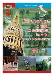
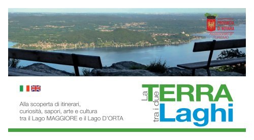
Assessorato alTURISMOAl<strong>la</strong> scoperta <strong>di</strong> itinerari,curiosità, sapori, arte e culturatra il Lago MAGGIORE e il Lago D’ORTATERRALatra i dueLaghi
TERRALatra i dueLaghiuna terra tutta da scoprirewww.provincia.novara.it
4 Lago Maggiore e Lago d’Orta8 Le Riserve Naturali Speciali10 La via delle Azalee12 Itinerario del<strong>la</strong> buona cucina14 Ameno18 Armeno22 Arona30 Bolzano Novarese34 Co<strong>la</strong>zza38 Gozzano44 Invorio48 Lesa54 Massino Visconti58 Meina62 Miasino66 Nebbiuno70 Orta San Giulio78 Pettenasco84 Pisano88 In<strong>di</strong>rizzi utili© <strong>Provincia</strong> <strong>di</strong> <strong>Novara</strong>TERRALatra i dueLaghi
Luoghi unici e tutti da scoprire tra il <strong>la</strong>go Maggiore e il <strong>la</strong>go d’Orta: una fitta rete <strong>di</strong> sentieri costel<strong>la</strong>ta da antiche testimonianze del<strong>la</strong>gente che nei secoli ha abitato queste zone, che ha percorso queste vie con il bestiame, per commerciare i prodotti del<strong>la</strong> propria faticao, a causa <strong>di</strong> guerre e battaglie, gente che ha saputo anche model<strong>la</strong>re l’ambiente in modo rispettoso e saggio. Scorci in<strong>di</strong>menticabiliche fanno riscoprire il naturale rapporto tra l’uomo e il territorio. La guida aggiornata è uno strumento davvero prezioso per chivuole vivere e conoscere questo straor<strong>di</strong>nario territorio che, per essere gustato fino in fondo, va scoperto nei suoi molteplici contestie nelle infinite opportunità che offre: una passeggiata a pie<strong>di</strong>, a cavallo o in bici è “benessere dello spirito” al<strong>la</strong> scoperta <strong>di</strong> panoramiincomparabili, <strong>di</strong> una natura intatta, dei massi coppel<strong>la</strong>ti testimoni <strong>di</strong> un’antichissima storia e dei molti paesi che con <strong>la</strong> propria offertaculturale, sportiva ed eno-gastronomica rendono ancora più accoglienti le nostre colline tra i <strong>la</strong>ghi.Luca BonaAssessore al Turismo del<strong>la</strong> <strong>Provincia</strong> <strong>di</strong> <strong>Novara</strong>Unique and worth visiting sites occupy the <strong>la</strong>nds between the Lakes Maggiore and Orta. A thick network of paths rich in ancient testimoniesinherited from the people who have inhabited such <strong>la</strong>nds, who have strolled along them together with their animals, who have used themto trade their goods produced with great fatigue, or even to escape from the numerous wars and battles the territory has gone through; thesame people who have also succeeded in modelling their environment in a respectful and wise way. Unforgettable sights which reveal thenatural bond between man and the territory. This “updated” guide is a precious instrument for whoever desires to experience and get to nowthese extraor<strong>di</strong>nary <strong>la</strong>nds which must be <strong>di</strong>scovered in all their aspects and opportunities offered in order to best savour them: a walk on foot,a horse ride, a bicycle ride provide “wellness to one’s spirit” while one <strong>di</strong>scovers the breathtaking aspects of an uncontaminated nature, of thechiselled rocks testifying the ancient times and the numerous vil<strong>la</strong>ges which have maintained their own cultural, sport and culinary tra<strong>di</strong>tions,contributing to increase the natural appeal of the <strong>la</strong>nds stretching between the hills and the <strong>la</strong>kes.
Arona: Navigazione Lago Maggiore
LAGO MAGGIORE E LAGO D’ORTAMAGGIORE AND ORTA LAKESDal punto <strong>di</strong> vista geo-morfologico “<strong>la</strong> terra tra i due <strong>la</strong>ghi” si presenta come un’area <strong>di</strong>bassa montagna comprendente i rilievi dei monti Zucchero (1230 m), Mottarone (1491m) e Falò (1081 m), caratterizzata dal<strong>la</strong> presenza <strong>di</strong> importanti superfici forestali epartico<strong>la</strong>rmente ricca <strong>di</strong> risorse idriche (i <strong>la</strong>ghi Maggiore e d’Orta, i torrenti Agogna, Erno,Tiasca, Vevera). I corsi d’acqua Agogna e Terdoppio (più a sud), senza riversarsi nei <strong>la</strong>ghi,arrivano correndo paralleli fino a <strong>Novara</strong> e al fiume Po: da ciò <strong>di</strong>scende <strong>la</strong> partico<strong>la</strong>redenominazione <strong>di</strong> “valli sospese” per i loro bacini. Dal punto <strong>di</strong> vista geologico l’ambienteè caratterizzato dal<strong>la</strong> presenza <strong>di</strong> depositi incoerenti <strong>di</strong> origine morenica e/o fluviog<strong>la</strong>ciale<strong>di</strong> spessore rilevantissimo. Il substrato roccioso a essi sottostante affiora in una morfologiamovimentata, con forme collinari talora interrotte da bruschi cambi <strong>di</strong> pendenza o a volteprofondamente incise dai rivi presenti. Il <strong>la</strong>go d’Orta e il <strong>la</strong>go Maggiore secondo recentistu<strong>di</strong> geologici hanno avuto origine dall’azione dei paleofiumi del Messiniano (circa 5 - 6milioni <strong>di</strong> anni fa) che hanno scavato delle profonde valli a V poi trasformate in valli ad U piùridotte per il parziale riempimento dei detriti g<strong>la</strong>ciali quaternari. La presenza del substratoroccioso a debole profon<strong>di</strong>tà ha con<strong>di</strong>zionato <strong>la</strong> morfologia piuttosto movimentata delterritorio. L’azione g<strong>la</strong>ciale ha rimodel<strong>la</strong>to i <strong>di</strong>slivelli altimetrici, conferendo un aspetto piùdolce ai rilievi. Successivamente sono intervenute a conferire l’attuale assetto morfologicol’azione mo<strong>di</strong>ficatrice dei corsi d’acqua e, non meno importante, l’azione antropica conle urbanizzazioni e le utilizzazioni agrarie delle varie aree. La piovosità abbondante e letemperature mitigate dall’azione dei <strong>la</strong>ghi fanno sì che il territorio sia caratterizzato da unanotevole copertura forestale (circa il 60% del<strong>la</strong> superficie totale), <strong>di</strong>versificata a secondadelle fasce fitoclimatiche. Partico<strong>la</strong>rmente vasti i castagneti (Castanea sativa) nelle zoneelevate, spesso associati a piccole stazioni <strong>di</strong> betul<strong>la</strong> (Betu<strong>la</strong> alba).
Panorama: il Lago Maggiore e le Isole BorromeeFrom a geographical perspective the “territory of the two <strong>la</strong>kes” consists of a low-mountainregion, which includes the peaks of mounts Zucchero (1230 m), Mottarone (1491 m) andFalò (1080 m), extensively covered by forests and with a high density of bo<strong>di</strong>es of water(Lake Maggiore and d’Orta, and the Agogna, Emo, Tiasca, Vevera streams). These streams,Agogna and Terdoppio, run on roughly parallel courses from the area around <strong>Novara</strong> tothe river Po. The name “valli sospese” (suspended valleys) derives from this particu<strong>la</strong>rgeographical conformation. Geologically, the environment is characterised by the extendedpresence of incoherent deposits of moiranal or g<strong>la</strong>cial origin. The rocky substratum emergesirregu<strong>la</strong>rly as hills, sometimes characterised by sudden changes in incline and at timesdeeply furrowed by rivers. Orta Lake and Lake Maggiore, on the basis of upto- dategeological stu<strong>di</strong>es, originated from rivers the Messinian period (around 5-6 millions yearsago) that have eroded V valleys before and <strong>la</strong>ter smaller U valleys, due to the filling upTERRA5 Laghi
Alto Vergante: bosco <strong>di</strong> betulle (Betu<strong>la</strong> Alba)La superficie forestale fornisce nutrimento e protezione per una consistente popo<strong>la</strong>zionefaunistica. Notevole è <strong>la</strong> presenza <strong>di</strong> uccelli stanziali: fagiano, starna e colino del<strong>la</strong> Virginia emigratori: germano reale, gallinel<strong>la</strong> d’acqua, fo<strong>la</strong>ga, pavoncel<strong>la</strong>, quaglia, tortora e allodo<strong>la</strong>.I rapaci <strong>di</strong>urni sono rappresentati da: poiana, falco pescatore, falco pellegrino, gheppio esparviere. La gazza e <strong>la</strong> cornacchia grigia sono, invece, le presenze più significative tra icorvi<strong>di</strong>. Per quanto riguarda i mammiferi, i boschi, le radure, le aree ver<strong>di</strong> lungo fiumi eruscelli costituiscono l’habitat ideale per lepre, silvi<strong>la</strong>go (o minilepre), coniglio selvatico,volpe, tasso, nutria, cinghiale, capriolo, cervo e daino.Il <strong>la</strong>go d’Orta (anticamente “Cusius” e “<strong>la</strong>go <strong>di</strong> S. Giulio” nel Me<strong>di</strong>oevo) si estende a un’altitu<strong>di</strong>ne<strong>di</strong> 290 metri sul livello del mare, tra <strong>la</strong> Valsesia e il <strong>la</strong>go Maggiore, poco a sud dell’imbocco del<strong>la</strong>Val d’Osso<strong>la</strong>. Ha un perimetro <strong>di</strong> 33,5 km e una profon<strong>di</strong>tà me<strong>di</strong>a <strong>di</strong> 71,3 metri.È alimentato dalle acque <strong>di</strong> numerosi torrenti e da forti sorgenti sotterranee, con un unicoemissario a nord che confluisce nel fiume Strona, il quale si <strong>di</strong>vide poi in due rami, l’unoverso il fiume Toce, l’altro verso il <strong>la</strong>go Maggiore. La riva nord-occidentale è ripida e scoscesa,mentre quel<strong>la</strong> orientale è delineata dai dolci rilievi collinari che scendono verso sud dalMottarone, separando il Cusio dal <strong>la</strong>go Maggiore. In mezzo allo specchio d’acqua, <strong>di</strong> fronteal promontorio boscoso su cui sorgono il pittoresco e rinomato borgo <strong>di</strong> Orta e il santuariodel Sacro Monte, è situata l’incantevole Iso<strong>la</strong> <strong>di</strong> San Giulio (circa 3 ettari <strong>di</strong> superficie), con lesue antiche case cinte da giar<strong>di</strong>ni e dominate dal campanile del<strong>la</strong> basilica.Il <strong>la</strong>go Maggiore (o “Verbanus” secondo l’antica denominazione <strong>la</strong>tina) situato a un livello me<strong>di</strong>o<strong>di</strong> 193 metri sul livello del mare, si apre nel vasto solco vallivo allo sbocco del<strong>la</strong> valle del Ticino.Con una superficie <strong>di</strong> 212 kmq, è, dopo quello <strong>di</strong> Garda, il <strong>la</strong>go più grande d’Italia. Si estendeper circa 66 km <strong>di</strong> lunghezza con un perimetro <strong>di</strong> 170 km e una profon<strong>di</strong>tà me<strong>di</strong>a <strong>di</strong> 175 metri.Il fiume Ticino è il principale immissario del <strong>la</strong>go. Il clima mite consente - specie nelle zonemeglio riparate, che vanno da Stresa e Lesa a Meina e Arona - <strong>la</strong> coltivazione dei famosi fioridel <strong>la</strong>go Maggiore e <strong>la</strong> presenza dei magnifici giar<strong>di</strong>ni delle ville storiche che si affacciano sullesponde del <strong>la</strong>go. Nei centri del<strong>la</strong> costa sono evidenti i segni del dominio visconteo e sforzesco(secoli XIII - inizi XVI) in partico<strong>la</strong>re del<strong>la</strong> famiglia Borromeo (affermatasi nel 1439), il cui feudoera esteso da Arona ad Angera, a Lesa, a Stresa e a Cannobio, e sopravvisse anche sotto <strong>la</strong>successiva dominazione spagno<strong>la</strong>. I numerosi e assai variegati motivi <strong>di</strong> interesse naturalistico,paesaggistico e storico-artistico rendono partico<strong>la</strong>rmente florido il turismo in questa zona,specialmente nelle principali località rivierasche.
of Quaternary g<strong>la</strong>cial drifts. The presence of a low depth rocky substratum has been afactor in the highly irregu<strong>la</strong>r <strong>la</strong>y of the <strong>la</strong>nd, while the action of g<strong>la</strong>ciers has modelled thehills and mountains into softer forms. The action of rivers and finally human intervention,through urbanization and agriculture, are the other major factors that have shaped thepresent territory. The abundant rainfall and milder temperatures due to the <strong>la</strong>kes supportthe forests (60% of total territory), whose characteristics vary with the various microclimates.Chestnut trees (Castanea sativa) are particu<strong>la</strong>rly common, often accompanied bybirch trees (Betu<strong>la</strong> alba). Forests support an extensive animal popu<strong>la</strong>tion. There is a greatnumber of non-migratory birds (pheasants, partridges, bobwhites) and migratory ones(wild ducks, moorhens, coots, <strong>la</strong>pwings, doves, b<strong>la</strong>ckbirds, sky<strong>la</strong>rks). Birds of prey includebuzzards, ospreys, peregrine falcons, kestrels, sparrow-hawks. Birds of the family corvidae,like magpies and the hooded crows, are also present. Mammals include hares, cottontailrabbits (Sylvi<strong>la</strong>gus), wild rabbits, foxes, badgers, nutrias, wildboars, roedeer, red deer andfallow deer.Orta Lake (called “Cusius” in the Roman period and “Lago <strong>di</strong> S. Giulio” in the middle-ages)is located at an altitude of 290 m between Valsesia and Lake Maggiore, just south of theentrance to Val d’Osso<strong>la</strong>. It has a perimeter of 33.5 km and an average depth of 71.3 m. Itswater comes from several underground streams and springs, whereas its only effluent is theStrona stream, which then <strong>di</strong>vides into two branches, one going east to the Toce stream andthe other to Lake Maggiore. Its north-western bank has a steep incline, whereas its easternbank is marked by gently sloped hills that continue south towards Mount Mottarone,constituting a natural boundary between Orta Lake and Lake Maggiore. In the middle ofthe <strong>la</strong>ke, opposite the picturesque vil<strong>la</strong>ge of Orta and the sanctuary of Sacro Monte, there isthe lovely is<strong>la</strong>nd of S. Giulio (approximately 3 hectares) with its ancient houses surroundedby gardens and dominated by the tower-bell of the basilica.Lake Maggiore (also called Lake Verbano following the ancient Roman name) is locatedat an altitude of 193 meters. It has a surface of 212 square kilometres and is the second<strong>la</strong>rgest <strong>la</strong>ke in Italy, after Lake Garda. It has a <strong>di</strong>ameter of 66 kilometres, a perimeter of170 kilometres and an average depth of 175 meters. Its main affluent is the Ticino river.Especially in the more protected areas exten<strong>di</strong>ng from Stresa and Lesa to Meina and Arona,the mild climate makes it possible to cultivate the celebrated flowers of Lake Maggioreand enhances the beauty of the magnificent gardens of the historical vil<strong>la</strong>s on the <strong>la</strong>ke.The towns along the <strong>la</strong>ke show signs of domination by the Mi<strong>la</strong>nese Visconti and Sforzafamilies, who held the Duchy of Mi<strong>la</strong>n in the XIII century and <strong>la</strong>ter, and especially of theBorromeo family, who became the local feudatories in 1439, exercising power over aterritory from Arona to Angera, Lesa, Stresa and Cannobio, and remained in power alsounder the Spanish domination. Thanks to the natural and cultural variety of the area,tourism flourishes in all <strong>la</strong>ke resorts during spring and summer.TERRA7 Laghi
LE RISERVE NATURALI SPECIALISPECIAL NATURAL PARKSSACRO MONTE D’ORTALa Riserva del Sacro Monte si estende per 13 ettari, a circa 400 metri <strong>di</strong> altitu<strong>di</strong>ne, sul colleboschivo che si eleva sul promontorio <strong>di</strong> Orta San Giulio. È stata istituita dal<strong>la</strong> Regione Piemontenel 1980 per salvaguardare e valorizzare il patrimonio ambientale e storico-artistico del SacroMonte. La riserva offre una sintesi suggestiva <strong>di</strong> natura e paesaggio, lo spettacolo del <strong>la</strong>god’Orta, l’architettura religiosa e <strong>la</strong> spiritualità <strong>di</strong> cui è intrisa tutta l’area. L’altura è posta in unafelicissima posizione paesaggistica, con i pen<strong>di</strong>i terrazzati, tenuti un tempo a prato e frutteto,che <strong>di</strong>gradano verso il <strong>la</strong>go d’Orta. Il clima favorisce <strong>la</strong> presenza <strong>di</strong> faggi, tassi, agrifogli e,nelle zone più esposte, cresce il bago<strong>la</strong>ro, <strong>la</strong> cui presenza conferma le temperature moderateanche durante l’inverno, grazie agli influssi <strong>la</strong>custri. Nel 2003 il Sacro Monte è stato <strong>di</strong>chiarato“Patrimonio Mon<strong>di</strong>ale dell’Umanità” ed è tute<strong>la</strong>to dall’UNESCO.The Sacro Monte Park extends over 13 hectares at an altitude of 400 m, on the wooded hill onthe promontory of Orta San Giulio. Instituted by the Piemonte Region in 1980 to preserve andpromote the environmental and historical-artistic heritage of the hill of Sacro Monte, the parkoffers a fascinating mix of nature and culture, ranging from the magnificent view of Orta Laketo the beautiful examples of religious architecture. The hill offers also other beautiful views andSacro Monte <strong>di</strong> OrtaIl significativo connubio <strong>di</strong> natura e cultura che rende assai interessante l’area “tra i due<strong>la</strong>ghi” trova le sue punte <strong>di</strong> eccellenza nelle tre Riserve Naturali Speciali istituite sul territorio.The mix of nature and culture that makes the “area of the two <strong>la</strong>kes” so fascinating has itspeak in the three Special Natural Parksits slopes are marked by terraces, no longer cultivated, gradually descen<strong>di</strong>ng towards Orta Lake.The main trees of the hill are beeches, yews, holly and, in the sunny areas, the hackberry. In 2003the Sacro Monte d’Orta was inscribed in the “World Heritage List” and is protected by UNESCO.
MONTE MESMAIstituita dal<strong>la</strong> Regione Piemonte nel 1993 per tute<strong>la</strong>re e valorizzare le risorse naturali dell’area eper conservare il complesso storico-religioso del<strong>la</strong> chiesa e del convento secenteschi del MonteMesma, <strong>la</strong> riserva si estende per 50 ettari su un colle a quasi 600 metri <strong>di</strong> altitu<strong>di</strong>ne ed è situatanel Comune <strong>di</strong> Ameno. Coltivata un tempo soprattutto con fi<strong>la</strong>ri <strong>di</strong> vite, oggi <strong>la</strong> collina <strong>di</strong> Mesmaè ricoperta quasi interamente da boschi <strong>di</strong> castagno, tranne <strong>la</strong> parte a<strong>di</strong>acente al convento, dovei frati francescani coltivano ancora con cura prati e orti. La chiesa e il convento francescano siaffacciano su una piazzetta panoramica, con vista suggestiva sul <strong>la</strong>go e sul Monte Rosa.Like the one above, the Park tries to protect the natural environment and the historical-religiouscomplex of Mount Mesma. The park extends for about 50 hectares on a hill at 600 m in theterritory of Ameno. Chestnuts and big oaks are the main trees of the wood around the Franciscancomplex, that opens on a square with a lovely view of Orta Lake and of Mount Rosa.COLLE DELLA TORRE DI BUCCIONELa riserva è stata istituita dal<strong>la</strong> Regione Piemonte nel 1993 al fine <strong>di</strong> tute<strong>la</strong>re e salvaguardare <strong>la</strong>Torre <strong>di</strong> Buccione e ripristinare i lineamenti del paesaggio circostante. Si estende sul<strong>la</strong> sponda <strong>di</strong>levante del <strong>la</strong>go d’Orta, nel territorio tra Gozzano e Corconio, sul colle boschivo dominato dal<strong>la</strong>maestosa Torre <strong>di</strong> Buccione, <strong>di</strong> partico<strong>la</strong>re pregio storico e architettonico. Il colle, in passato sede<strong>di</strong> attività estrattiva per <strong>la</strong> presenza <strong>di</strong> porfido, si presenta oggi ricoperto da un fitto bosco <strong>di</strong>castagno e querce che ha colonizzato i ripi<strong>di</strong> versanti del<strong>la</strong> Riserva che si estende per 51 ettari.Monte MesmaTorre <strong>di</strong> BuccioneInstituted to protect and preserve the Buccione Tower, the park extends for about 51 hectares onthe eastern bank of Orta Lake, between Gozzano and Corconio, on the wooded hill (chestnuts andoaks) crowned by the majestic Buccione Tower, of special historical interest.TERRA9 Laghi
LA VIA DELLE AZALEETHE PATH OF AZALEASNel<strong>la</strong> stagione primaverile, sulle sponde del <strong>la</strong>goMaggiore e nelle zone circostanti, ogni luogo èabbellito dal<strong>la</strong> gioiosa presenza <strong>di</strong> azalee e camelie <strong>di</strong>ogni forma e colore, <strong>di</strong> rododendri, pieris, leucothoe,skimmie, hydrangee (ortensie). Ogni angolo è untripu<strong>di</strong>o <strong>di</strong> colori. I giar<strong>di</strong>ni sono in fiore, balconie terrazzi sembrano tavolozze <strong>di</strong> pittori, suggestive composizioni floreali adornanopiazze e vie. Tanta floridezza è certamente il frutto del sapiente <strong>la</strong>voro degli abitanti delluogo, che del<strong>la</strong> floricoltura hanno fatto un’arte, ma anche delle eccellenti con<strong>di</strong>zioniclimatiche <strong>di</strong> quest’area. Un clima mite e un terreno con <strong>la</strong> giusta aci<strong>di</strong>tà sono, infatti,gli ingre<strong>di</strong>enti che hanno reso i fiori prodotti sul <strong>la</strong>go Maggiore tra i più pregiati d’Italia.Il marchio “Fiori Tipici del Lago Maggiore”, nato nel 1992, garantisce l’elevato standardqualitativo del<strong>la</strong> produzione florico<strong>la</strong> e rappresenta <strong>la</strong> consapevole evoluzione <strong>di</strong> unaAzaleatra<strong>di</strong>zione che, da vocazione spontanea, si è trasformata in un’attività ad alto livello <strong>di</strong>specializzazione, rendendo questa zona un vero e proprio <strong>di</strong>stretto floricolo. Per i turistiche non si accontentano <strong>di</strong> guardare, ma vogliono anche visitare i luoghi dove vengonoprodotti questi incantevoli fiori, curiosi magari <strong>di</strong> sapere qualcosa <strong>di</strong> più sulle tecniche<strong>di</strong> coltivazione e (perché no?) desiderosi <strong>di</strong> comprare anche qualche esemp<strong>la</strong>re, sonopresenti numerose aziende dove è possibile effettuare visite guidate e in alcuni casicomprare anche piante e fiori a prezzi agevo<strong>la</strong>ti.
RododendroCamellia japonicaDuring the spring, the banks of Lake Maggiore and the surroun<strong>di</strong>ng areas are flooded withthe intense smell of azaleas, camellias of all shapes and colours, and a variety of other flowers(Rododenri, Pieris, Leucothoes, Skimmie, Hydrangeas). Every corner becomes a feast ofcolours. Gardens bloom, balconies and terraces are transformed into painters’ palettes, whilecharming flower arrangements adorn streets and squares. All this comes from the experthands of local inhabitants, who have turned floriculture into an art, but also of the specialclimate of the area. The mild climate and the right aci<strong>di</strong>ty of the soil have made the flowers ofLake Maggiore the most valued of all Italy. The brand name “Fiori Tipici del Lago Maggiore,”instituted in 1992, guarantees the high quality of flowers and is the final result of a tra<strong>di</strong>tionthat gradually turned from spontaneous interest into a highly specialized activity, typical ofthis <strong>di</strong>strict. Tourists who are not satisfied with merely admiring the flowers but wish to see theareas where they are produced to learn more about them and perhaps purchase a few, mayvisit a number of greenhouses offering guided tours and often special prices on the purchasingof beautiful trees and flowers.TERRA11 Laghi
ITINERARIO DELLA BUONA CUCINATHE GOOD-CUISINE ROUTEL’in<strong>di</strong>scussa bellezza dei paesaggi <strong>la</strong>custri, <strong>la</strong> natura rigogliosa e incontaminata che il territoriotra i due <strong>la</strong>ghi offre generosamente ai suoi visitatori, <strong>la</strong> storia del luogo incarnata nelle pregiateville storiche, nelle chiesette e castelli, nei borghi antichi, rappresentano il binomio <strong>di</strong> naturae cultura messo a <strong>di</strong>sposizione del turista che soggiorna in questi luoghi. Questo straor<strong>di</strong>narioscenario si completa con un’ulteriore risorsa del territorio, ossia un’originale tra<strong>di</strong>zioneenogastronomica. Il turista attento alle tipicità dei luoghi visitati, infatti, non mancherà certo<strong>di</strong> conoscere e degustare vini, piatti e produzioni tra<strong>di</strong>zionali del territorio. Tra i formaggi tipicidel luogo è famosa <strong>la</strong> toma, formaggio <strong>di</strong> <strong>di</strong>versa stagionatura, dal caratteristico colore giallopaglierino dovuto alle erbe e ai fiori alpini dei pascoli sulle pen<strong>di</strong>ci del Mottarone. Questoformaggio è prodotto nel caseificio biologico <strong>di</strong> Coiromonte del<strong>la</strong> locale Comunità Montanadei Due Laghi e in altri caseifici locali. Tra i salumi si consiglia <strong>di</strong> assaggiare <strong>la</strong> fi<strong>di</strong>ghina,saporita mortadel<strong>la</strong> <strong>di</strong> fegato <strong>di</strong> maiale, unito a carne <strong>di</strong> manzo e spezie, confezionata a forma<strong>di</strong> ciambel<strong>la</strong> e cotta in pento<strong>la</strong>. Può essere servita su un letto <strong>di</strong> polenta e gustata con unbuon vino locale. Tipico è anche il graton d’oca, pelle dell’oca tagliata a da<strong>di</strong>ni con il grasso,bollita, strizzata e servita fredda. Oppure il marzapane, sanguinaccio <strong>di</strong> maiale preparato conpane grattugiato, spezie, aglio e un goccio <strong>di</strong> vino, il sa<strong>la</strong>m d’<strong>la</strong> duja, sa<strong>la</strong>me <strong>di</strong> puro suinoLa paniscia, e<strong>la</strong>borato risotto a base <strong>di</strong> verdura, <strong>la</strong>rdo, sa<strong>la</strong>m d’<strong>la</strong> duja e vinostagionato nel grasso <strong>di</strong> maiale in recipienti <strong>di</strong> terracotta, le duje, e infine il sa<strong>la</strong>m d’oca, carned’oca <strong>la</strong>vorata con pancetta <strong>di</strong> maiale e vino bianco, insaccata nel<strong>la</strong> pelle del collo dell’oca. Varie gustosi sono anche i piatti tipici serviti nei ristoranti del<strong>la</strong> zona, a base <strong>di</strong> funghi, lumache,anatra, pesci e molluschi <strong>di</strong> <strong>la</strong>go e fiume. Caratteristico <strong>di</strong> quest’area, ad esempio, è il Tapulòn,stracotto <strong>di</strong> carne d’asino (o <strong>di</strong> cavallo) tritata e ben speziata con aglio, alloro, chio<strong>di</strong> <strong>di</strong> garofanoe rosmarino, ammorbi<strong>di</strong>ta con verza roso<strong>la</strong>ta e cotta lentamente con l’aggiunta <strong>di</strong> vino rossolocale. Non va <strong>di</strong>menticata <strong>la</strong> paniscia, piatto tipico a base <strong>di</strong> riso, con verze, fagioli, cotiche <strong>di</strong>maiale, <strong>la</strong>rdo, sa<strong>la</strong>m d’<strong>la</strong> duja e vino rosso. Si può consumare anche al salto, cioè abbrustolitada una breve ricottura in una padel<strong>la</strong> <strong>di</strong> ferro. L’itinerario del<strong>la</strong> buona cucina è, quin<strong>di</strong>, unospunto fornito al turista che desideri integrare gli itinerari culturali e naturalistici con un“gustoso” percorso enogastronomico. Numerosi ristoranti propongono menù tipici del<strong>la</strong> zona,altri offrono <strong>la</strong> possibilità <strong>di</strong> degustare cibi e vini locali.
Tome e gorgonzo<strong>la</strong>The beauty of the <strong>la</strong>ndscape, the exuberant and uncontaminated nature, the historical heritage visiblein the many historical vil<strong>la</strong>s, churches, castles, old vil<strong>la</strong>ges, make up the mix of nature and culture thatattracts tourists to these <strong>di</strong>stricts. Another important attraction, however, is the gastronomic tra<strong>di</strong>tionof the area. Tourists interested in what makes the p<strong>la</strong>ce special will not fail to enjoy the typical winesand local food. One famous product for example is the “toma,” a variously aged cheese, with a typicalyellow colour, the result of the herbs and flowers found on the slopes of Mount Mottarone. This cheese isbiologically produced in the dairy of Coiromonte, owned by the “Comunità Montana dei Due Laghi”, theinstitution that gathers all the towns of the area and in other local dairies. Among the many sa<strong>la</strong>mi andmeats, we suggest you to try the “fi<strong>di</strong>ghina”, a tasty bologna made of pork liver, coupled with beef meatand spices, shaped like ring and prepared in a pot. It can be served over polenta and must necessarilybe accompanied by local wine. Another typical product is the “graton d’oca”, which is goose skin cut insmall pieces along with the fat, boiled, squeezed and served cold. Other products are the “marzapane”,Sa<strong>la</strong>m d’<strong>la</strong> dujathe “sanguinaccio”, a pud<strong>di</strong>ng of pork meat cooked along with grated bread, spices, garlic and a drop ofwine; the “sa<strong>la</strong>m d’<strong>la</strong> duja”, a sa<strong>la</strong>mi of pork meat seasoned in terracotta pots (the “duje”) along withpork <strong>la</strong>rd, and, finally, the “sa<strong>la</strong>m d’oca”, goose meat mixed with pork and white wine and made intosausages using the skin from the goose’s neck. Local restaurants also serve many interesting <strong>di</strong>shes basedon mushrooms, snails, duck, fish, molluscs and other products of the <strong>la</strong>ke <strong>di</strong>strict. A typical <strong>di</strong>sh is the“Tapulòn”, a stew prepared from minced donkey or horse meat, spiced with garlic, <strong>la</strong>urel, cloves androsemary, and accompanied by savoy, after the meat is browned and then slowly cooked in red wine.We should not omit to mention the paniscia, tra<strong>di</strong>tional <strong>di</strong>sh prepared with rice, savoy, beans, pork skin,<strong>la</strong>rdo, sa<strong>la</strong>m d’<strong>la</strong> duja and red wine. It can be also tasted sautéed, browned inside a metal pan. The Good-Cuisine Route is therefore an itinerary for the tourist who wishes to combine his interest in culture andnature with a “tasteful” gastronomic experience. Among the restaurants named in the itinerary, somepropose typical menus, while others offer the possibility of enjoying local food and wine.TERRA13 Laghi
AMENOLago d’OrtaPettenascoMiasinoOrta San GiulioArmenoBolzano NovareseGozzanoAmenoAgognaMassino ViscontiInvorioCo<strong>la</strong>zzaNebbiunoPisanoAbitanti: 897Superficie: 10 KmqAltitu<strong>di</strong>ne sul mare: 517 mtFesta Patronale: Assunta (15/08)Altre Feste: Festa del Santo Rosario(1° domenica <strong>di</strong> settembre)Santuario del<strong>la</strong> Boccio<strong>la</strong> - Vacciago(1° domenica <strong>di</strong> settembre)Sant’Antonio in Loc. Vacciago (17/01)Prefisso telefonico: 0322CAP: 28011Municipio: 0322 998103www.comune.ameno.novara.itLago MaggioreMeinaLesaAronaAMENOAmeno è terra <strong>di</strong> antiche origini(Me<strong>di</strong>a età del Bronzo). Dagli scavieffettuati in piccole necropoli del<strong>la</strong>frazione <strong>di</strong> Lortallo si desume chequesta fosse già abitata durante<strong>la</strong> prima Età del Ferro, tra il IX e Vsecolo a.C. A questi primi abitanti,probabilmente Celti, si sovrapposero iGalli e successivamente i Romani. Dalpunto <strong>di</strong> vista geologico, il territorio <strong>di</strong> Ameno è contrassegnatonel<strong>la</strong> zona meri<strong>di</strong>onale da scisti e porfi<strong>di</strong>. Prima del secolo XIil paese subì <strong>la</strong> dominazione dei Goti, dei Longobar<strong>di</strong> e deiFranchi; quin<strong>di</strong>, nel periodo feudale, fu <strong>di</strong> proprietà dei Vescovi<strong>di</strong> <strong>Novara</strong>, dei Visconti e degli Sforza. Una meta <strong>di</strong> grandeinteresse è il Monte Mesma dal<strong>la</strong> ricchissima vegetazione, sul<strong>la</strong>cui cima sorge un complesso monumentale costituito da unconvento, una chiesa francescana e venti cappelle ubicate lungoun percorso processionale.Monte Mesma: porticato del ConventoDigs in the two little necropoli in Lortallo show that Ameno is quite anold town, already inhabited in the first Iron Age, between the 9th andthe 5th century B.C. They were Celts; afterwards Gallic and Romanscame. Geologically analysed, the area is marked by schists andporphyries at south, where rocks of the Pliocene can be found. Gothic,Longobards and Franks ruled the town before the 11th century, whilethe bishops of <strong>Novara</strong>, the Visconti and the Sforza <strong>di</strong>d it during theMiddle Ages. On Monte Mesma hill an imposing Franciscan conventwith its twenty chapels on a single file walk is to be admired.
CHIESA PARROCCHIALESANTA MARIA ASSUNTALa parrocchiale, de<strong>di</strong>cata a Santa Maria Assunta, è <strong>di</strong> origineme<strong>di</strong>evale e ha una struttura a tre navate affiancata da uncampanile tardoromanico del 1505, costruito con massigranitici squadrati e caratterizzato da una cel<strong>la</strong> campanariacon monofore, bifore e trifore.The parish church of Santa Maria Assunta with its three-aisledstructure of me<strong>di</strong>eval origin is f<strong>la</strong>nked by a <strong>la</strong>te Romanesquebell tower of 1505, built with granite blocks and with single,double and triple light windows in the belfry.CONVENTO DEL MONTE MESMAIn bel<strong>la</strong> posizione panoramica sorge il Monte Mesma.È qui collocato l’omonimo convento francescano, <strong>la</strong>cui costruzione risale al 1619. La struttura presentadue chiostri barocchi dai quali si accede al<strong>la</strong> chiesa acapanna, che accoglie al suo interno alcuni interessanti<strong>di</strong>pinti. Partono dal<strong>la</strong> strada, appena fuori dagli abitati<strong>di</strong> Bolzano e <strong>di</strong> Lortallo, due mu<strong>la</strong>ttiere in salita conLa Parrocchiale dell’Assuntacappellette che illustrano <strong>la</strong> Via Crucis e conducono alConvento.Mount Mesma is 576 m high and stands in a scenic position.Here is situated the Franciscan convent, whose constructiondates from 1619. The complex has two Baroque cloisterslea<strong>di</strong>ng to the gable-roofed church, whose interior containsinteresting paintings. Two mule paths starting from the roadjust outside Bolzano and Lortallo lead to the convent.Vacciago: Oratorio <strong>di</strong> Sant’AnnaPALAZZO TORNIELLIDI BORGOLAVEZZAROPa<strong>la</strong>zzo Tornielli - sede del Comune - rie<strong>di</strong>ficato nell’Ottocento,presenta il soffitto del vano dello scalone decorato da uninteressante affresco mitologico.Re-built during the 19th century, Pa<strong>la</strong>zzo Tornielli showsthe ceiling of the big stairwell decorated by an interestingmythological fresco.TERRA15 Laghi
Casa CalderaraPALAZZO SOLAROLIE<strong>di</strong>ficio dell’800 <strong>di</strong> tre piani, dal severo portale <strong>di</strong> granito,sormontato da un balcone con il parapetto in ghisa.Interessante il grande parco.Three floors historical pa<strong>la</strong>ce built in ‘800 with a severe granitemain entrance and a cast iron railing balcony on top. Valuablethe the fabolous park surran<strong>di</strong>ng the pa<strong>la</strong>ceORATORIO DEL CROCIFISSOPosto sul<strong>la</strong> strada vecchia che da Miasino conduce adArmeno, il settecentesco oratorio del Crocifisso rappresentauno dei nuclei <strong>di</strong> un itinerario devozionale, scan<strong>di</strong>to dal<strong>la</strong>presenza <strong>di</strong> tre cappellette. All’interno, sul fondo dell’unicanavata, si segna<strong>la</strong> <strong>la</strong> presenza <strong>di</strong> un altare in legno e <strong>di</strong> unquadro attribuito al Morazzone.Located in the old road which goes from Miasino toArmeno, the 18th century oratory of the Crucifix is one ofthe focal points of a devotional itinerary with three smallchapels.VILLA MONTE OROGran<strong>di</strong>osa costruzione, <strong>di</strong>segnata da Carlo Nigra nel 1926in stile liberty, <strong>la</strong> vil<strong>la</strong> presenta più corpi <strong>di</strong> fabbrica a dueo tre piani; proprio queste <strong>di</strong>verse altimetrie e <strong>la</strong> torretta abelvedere danno un elegante movimento al<strong>la</strong> costruzioneche rimanda imme<strong>di</strong>atamente allo stile del famosoarchitetto. Degno <strong>di</strong> nota il vasto parco che occupa l’interacollina sul<strong>la</strong> cui sommità sorge <strong>la</strong> vil<strong>la</strong>.Impressive buil<strong>di</strong>ng designed by C. Nigra in 1926 in libertystyle. The vil<strong>la</strong> consists of varying components on two or threestoreys: these <strong>di</strong>ffering heights and the belvedere turret lendelegant movement to the buil<strong>di</strong>ng, <strong>di</strong>rectly in the style of thefamous architect. A <strong>la</strong>rge park covering the entire hill.FONDAZIONE CALDERARACasa Calderara, situata nel centro <strong>di</strong> Vacciago, èun pregevole esempio <strong>di</strong> architettura borgheserinascimentale; <strong>la</strong> sua costruzione, del<strong>la</strong> fine del ’500,presenta un triplice loggiato su colonne in granito. Nel’900 il pa<strong>la</strong>zzo ha assunto <strong>la</strong> funzione <strong>di</strong> casa-stu<strong>di</strong>o, oveil pittore Calderara (1903- 1978) ha allestito una mostra<strong>di</strong> sculture e <strong>di</strong>pinti.Casa Calderara, in the centre of Vacciago, is an example ofbourgeois architecture of the Renaissance period; it was builtin 16th century and has a triple loggia on granite columns. Inthe 20th century the buil<strong>di</strong>ng acted as a house-stu<strong>di</strong>o, wherethe painter Calderara (1903-1978) set up an interestingexhibition of paintings.
ORATORIO DI SANT’ANNAIn località Vacciaghetto ha sede l’oratorio <strong>di</strong> Sant’Anna,anch’esso in stile barocco. L’interno è preceduto da unporticato ba<strong>la</strong>ustrato.In the area of Vacciaghetto the Oratory of Sant’Anna can befound, in Baroque-style too. The interior formed by adjoiningcircu<strong>la</strong>r shapes is preceded by a portico with balustrade.SANTUARIO DELLA BOCCIOLASituato in posizione panoramica sul<strong>la</strong> strada che collegaVacciago ad Ameno, il Santuario sorse sui resti <strong>di</strong> unapicco<strong>la</strong> chiesa che nel XVI secolo fu e<strong>di</strong>ficata in ricordo<strong>di</strong> un’apparizione del<strong>la</strong> Vergine a una giovane conta<strong>di</strong>na.L’attuale e<strong>di</strong>ficio, iniziato nel 1754 e terminato negli anni1834-43, presenta una struttura tipicamente neoc<strong>la</strong>ssica;l’interno è a pianta quadrilobata, con coro e altare maggiorein marmo bianco.In a scenic position on the road from Vacciago to Ameno, theSanctuary stands on the remains of a small church which wasSantuario del<strong>la</strong> Boccio<strong>la</strong> a Vacciagobuilt in the 16th century in memory of an apparition of theVirgin. The present buil<strong>di</strong>ng, started in 1754 and finished in1834- 43, has a typically neoc<strong>la</strong>ssic structure: the interior is ona quatrefoil p<strong>la</strong>n with a choir and an imposing white marblehigh altar can be admired.AMENO strutture ricettive, receptive structuresHotelBattle of Britain Via Boccio<strong>la</strong>, 17Tel. 0322.998200Fax 0322.998200info@hotelbattleofbritain.comMonte Rosa Via A. Diaz, 7Tel. 0322.998174Fax 0322.998005albergomonterosa@libero.itBed&BreakfastB&B Raffo Ernestina Loc. Lanciano, 3Tel. 0322.998626ernestinaraffo@teletu.itCasa Mari Via F.lli Strigini, 15Tel. 0322.998703albafri@libero.itIl Glicine e <strong>la</strong> Rosa Loc. Pecorino, 12Tel. 0322.998004Fax 0322.998004ilglicine.<strong>la</strong>rosa@libero.itAffittacamereRooms for rentVil<strong>la</strong> PastoriViale Matteotti, 1Tel. 0322.998495Fax 0322.998495Casa/Appartamentoper vacanzeHouse/Apartmentfor vacationsHoliday Orta Casa <strong>di</strong> VacanzaVia Fratelli Frey, 1Cell. 333.2057969info@holidayorta.comIstituto Suore S. GiuseppeVia So<strong>la</strong>roli, 1Tel. 0322.998105Fax 0322.998105TERRA17Laghi
ARMENOLago d’OrtaPettenascoMiasinoOrta San GiulioArmenoAmenoBolzano NovareseGozzanoAgognaMassino ViscontiInvorioPisanoCo<strong>la</strong>zzaNebbiunoAbitanti: 2232Superficie: 31,58 KmqAltitu<strong>di</strong>ne sul mare: 523 mtFesta Patronale: Maria VergineAssunta (15/08)Prefisso telefonico: 0322CAP: 28011Municipio: 0322 900106www.comune.armeno.no.itLago MaggioreMeinaLesaAronaARMENO“I <strong>la</strong>vatoi <strong>di</strong> Armeno sono tutti<strong>di</strong> granito; solo quello delMulinaccio è <strong>di</strong> cemento. Letettoie sono <strong>di</strong> tegole, eccettoquel<strong>la</strong> del Borghetto che è <strong>di</strong>cemento”. “Ad Armeno c’è solouna cava <strong>di</strong> terra e appartieneal Comune. Si trova ad est delpaese lungo <strong>la</strong> strada <strong>di</strong> Coiro, è <strong>la</strong>rga 15 metri e alta10 metri. Sulle montagne <strong>di</strong> Coiro si trovano mineraliche contengono piombo, ferro e qualche picco<strong>la</strong> strisciad’oro. Verso il Mottarone abbonda il granito”. “Il clima èda zona prealpina, rigido in inverno e piuttosto freddoanche d’estate. Le frazioni <strong>di</strong> Armeno sono Coiromontecon 210 abitanti, Sovazza con 320 abitanti, e poi leborgate <strong>di</strong> Basso<strong>la</strong> e <strong>di</strong> Cheggino”. “La strada più anticaè <strong>la</strong> Novarese, <strong>la</strong> strada che da Bolzano va a MiasinoVeduta Frazione Coiromontee ad Armeno e prosegue per Omegna. Segue <strong>la</strong> stradadel<strong>la</strong> Due Riviere, quel<strong>la</strong> per Coiromonte e quel<strong>la</strong> <strong>di</strong>retta anord che conduce al Mottarone. Ci sono poi le mu<strong>la</strong>ttiereche passano per i numerosi alpeggi, e ponti sul percorsoOmegna-Armeno, <strong>di</strong> Basso<strong>la</strong>, <strong>di</strong> Pescone del<strong>la</strong> Val<strong>la</strong>ccia, eun ponticello presso <strong>la</strong> trattoria Campagno<strong>la</strong>”. (Descrizionetratta dai quaderni <strong>di</strong> scuo<strong>la</strong> <strong>di</strong> un bambino <strong>di</strong> Armeno -1958, in O. Rinal<strong>di</strong>, Armeno: il suo Novecento, ComunitàMontana dei Due <strong>la</strong>ghi, 1997).
“There are only granite wash-houses in Armeno but one, thatof Mulinaccio, made of cement. Every roofing is made of tiles,apart from the one of the Borghetto, made of cement”. “Ownedby the Municipality, the only earth quarry in Armeno is in theeastern part of the town, on the way to Coiro; it is 15 meters wideand roughly 10 meters high. In the mountains of Coiro mineralscontaining lead, iron and some little golden strips can be found.Near the Mottarone there is a lot of granite”. “Harsh in Winterand rather cool even in Summer, this is the typical climate offoothill Alps. The hamlets of Armeno are Coiromonte with 210inhabitants, Sovazza with 320 inhabitants and the vil<strong>la</strong>ges ofBasso<strong>la</strong> and Cheggino”. “The oldest street is the Novarese, thestreet that from Bolzano goes to Miasino and Armeno andonwards to Omegna. The Road of the Two Riviere, the onetowards Coiromonte and the one northbound lea<strong>di</strong>ng to theMottarone follow. Then there are the mule paths passing throughthe manifold pastures, and the bridges of Basso<strong>la</strong>, of Pesconedel<strong>la</strong> Val<strong>la</strong>ccia, and the small one near the trattoria Campagno<strong>la</strong>on the route Omegna-Armeno.” (These descriptions are takenfrom the school notebook written by a child of Armeno - 1958,in O. Rinal<strong>di</strong>, Armeno: il suo Novecento, Comunità Montana deiDue Laghi, 1997).CHIESA PARROCCHIALE DI SANTA MARIA ASSUNTANei pressi del Cimitero, ai margini meri<strong>di</strong>onali dell’abitato, sorge<strong>la</strong> bellissima chiesa romanica <strong>di</strong> Santa Maria Assunta, citatacome appartenente al<strong>la</strong> pieve <strong>di</strong> San Giulio in un documentoche risale al 1217 e che <strong>la</strong> tra<strong>di</strong>zione vuole fondata dal Santogreco, evangelizzatore del Cusio. La splen<strong>di</strong>da facciata, dalle lineeessenziali, è costruita in blocchi squadrati <strong>di</strong> sasso e arricchitada un portale decorato da capitelli e colonne, le cui decorazionirimandano al<strong>la</strong> più c<strong>la</strong>ssica simbologia me<strong>di</strong>evale. Rimane benSanta Maria Assuntavisibile l’impianto romanico delle tre navate, mentre ilpresbiterio, più alto, è del XVII secolo. Il campanile al<strong>la</strong> sinistradel<strong>la</strong> facciata è riconducibile al<strong>la</strong> prima metà del XII secolo.La chiesa contiene interessanti affreschi del XV secolo, oltre auna “Deposizione dal<strong>la</strong> Croce” <strong>di</strong> Fermo Stel<strong>la</strong> da Caravaggio(1548). Suggestiva, nel<strong>la</strong> sua impressionante simbologia,è <strong>la</strong> celebre Trinità tricefa<strong>la</strong>; si tratta <strong>di</strong> un raro esempio<strong>di</strong> raffigurazione antropomorfa del mistero del<strong>la</strong> Trinità,sopravvissuto ai <strong>di</strong>vieti del Concilio <strong>di</strong> Trento.TERRA19 Laghi
Luciago: Oratorio <strong>di</strong> Santa MariaNear the cemetery, on the southern edge of town, standsthe beautiful Romanesque church of Santa Maria Assunta,mentioned in a document of 1217 as belonging to the parishof San Giulio. Accor<strong>di</strong>ng to tra<strong>di</strong>tion it was founded by the Greeksaint, preacher of the Gospel in the Cusio area. The wonderfulfacade, essential in its style, is built with squared stone blocksand has a portal ornamented with capitals and columns,whose decorations recall the most tra<strong>di</strong>tional me<strong>di</strong>evalsymbolism. The three naves are Romanesque while thepresbytery, which is higher up, is from the 17th century. The belltower to the left of the facade dates back to the first half of the12th century. The interior contains interesting frescoes from the15th century, as well as a “Depostion from the Cross” by FermoStel<strong>la</strong> da Caravaggio (1548). The famous threeheaded Trinityis interesting for its striking symbology and is a rare exampleof an anthropomorphic portrayal of the mystery of the Trinity,one to have survived the prohibitions of the Council of Trento.ORATORIO DI SANTA MARIAPicco<strong>la</strong> e graziosa, a metà strada tra Armeno e il Mottarone,nel<strong>la</strong> frazione <strong>di</strong> Luciago, <strong>la</strong> picco<strong>la</strong> chiesa è per tra<strong>di</strong>zioneluogo <strong>di</strong> culto popo<strong>la</strong>re; originariamente esisteva soltantouna picco<strong>la</strong> e<strong>di</strong>co<strong>la</strong> con un affresco (il Crocifisso con <strong>la</strong> VergineAddolorata e San Giovanni) che risale molto probabilmenteal 1523 e che poi fu trasferito nell’o<strong>di</strong>erna chiesetta costruitaper i valligiani, accanto a un punto <strong>di</strong> ristoro ancor oggi assaifrequentato. Rispetto ad altri oratori <strong>di</strong> questi luoghi, l’oratorio<strong>di</strong> Santa Maria presenta una struttura singo<strong>la</strong>re, grazie allesue due navate (architravata quel<strong>la</strong> minore e coperta a voltaquel<strong>la</strong> maggiore).This little church halfway between Armeno and Mottarone, inthe vil<strong>la</strong>ge of Luciago, is a p<strong>la</strong>ce of popu<strong>la</strong>r worship; originallythere was only a small niche with a fresco (the Crucifix withthe Virgin), probably dating from 1523 and then transferred tothe present church, which was built for the inhabitants of thevalley, next to an inn still much frequented today. The Oratory ofSanta Maria has an unusual structure consisting of two naves.ORATORIO DI SANTA LUCIAÈ <strong>la</strong> frazione <strong>di</strong> Basso<strong>la</strong> ad offrirci, con l’oratorio <strong>di</strong> SantaLucia, un ulteriore esempio <strong>di</strong> architettura religiosa “minore”del territorio cusiano. A <strong>di</strong>fferenziarlo da altri e<strong>di</strong>fici dellostesso tipo sono il porticato e l’entrata principale, che, persemplici ragioni <strong>di</strong> spazio, furono collocati sul<strong>la</strong> parte <strong>la</strong>teraledell’unica navata.The oratory of Santa Lucia in the vil<strong>la</strong>ge of Basso<strong>la</strong> providesus with a further example of “minor” religious architecture inthe Cusio region. It <strong>di</strong>ffers from the other buil<strong>di</strong>ngs of the samekind in its portal and main entrance, which for reasons of spacewere p<strong>la</strong>ced on the side of the single nave.
GLI ALPEGGIImportante risorsa <strong>di</strong> Armeno furono gli alpeggi e numeroseancor oggi sono le “Alpi” presenti nel territorio. Citiamol’Alpe Vaulunga, Lovaga, Corteno, Valpiana e Vermenasca.Composte da fabbricati a varia destinazione, erano abitateda famiglie intere durante il periodo estivo: da maggio asettembre. A ognuno il proprio compito: le donne de<strong>di</strong>teal<strong>la</strong> casa, i bambini e i ragazzi al<strong>la</strong> vigi<strong>la</strong>nza delle bestie alpascolo, gli uomini ai <strong>la</strong>vori pesanti. Non mancavano i vecchie gli anziani, <strong>la</strong> cui col<strong>la</strong>borazione preziosa consisteva nellosvolgimento <strong>di</strong> piccoli <strong>la</strong>voretti.Across the years an important resource for Armenovil<strong>la</strong>ge were mountain pasture called “Alpi”. Some ofthem are still present and useful in the area: Vaulunga,Lovaga, Corteno, Valpiana e Vermenasca. Familiesand animals spended the summer period from May toSeptember up hills. The community lived and workedthere with <strong>di</strong>fferrent rules: <strong>la</strong><strong>di</strong>es in house works, kidslooking after animals, men <strong>di</strong>d hard works, old peaplehelped in small activities.Oratorio Santa LuciaSanta Maria Assunta affrescoARMENO strutture ricettive, receptive structuresHotelOmni<strong>di</strong>et Via Monte Falo, 8Tel. 0322.999009Fax 0322.999129omni<strong>di</strong>et@mirapuri-enterprises.comMadonna <strong>di</strong> Luciago Via Mottarone, 62Tel. 0322.999006Fax 0322.999006Hotel CorteseVia Due Riviere, 24Tel. 0322.999081Fax 0322.999067info@cortesehotel.itBed&BreakfastB&B Morgan Via Giasso, 18Cell. 3473710668info@morganbb.itB&B La corte <strong>di</strong> Farfareno Via Montegrappa, 2cell. 349.3232740Casale Baltera Via Baltera, SNcell. 349.3980727casalebaltera@libero.itB&B Rusall’s Cottage Via Omegna, 33Tel. 0322.900377rusalls@libero.itCasa/Appartamentoper vacanzeHouse/Apartmentfor vacationsCasa per Ferie ForesteriaVia Sappa, 14Tel. 0322.900136Maria Can<strong>di</strong>daCentro <strong>di</strong> SpiritualitàViale Cadorna, 19Tel. 0322.900231Fax 0322.900232centrospiritualita@libero.itTERRA21Laghi
ARONALago d’OrtaPettenascoMiasinoOrta San GiulioAmenoBolzano NovareseGozzanoArmenoInvorioAgognaMassino ViscontiPisanoCo<strong>la</strong>zzaNebbiunoLago MaggioreMeinaAbitanti: 14186Superficie: 14,90 KmqAltitu<strong>di</strong>ne sul mare: 212 mtFesta Patronale:Santi Martiri <strong>di</strong> Arona (13/03)Natività <strong>di</strong> Maria Vergine (08/09)Altre Feste: Tre<strong>di</strong>cino (13/03)Prefisso telefonico: 0322CAP: 28041Municipio: 0322 231111www.comune.arona.no.itLesaAronaARONASituata fra <strong>la</strong> riva sud-occidentaledel <strong>la</strong>go Maggiore e le colline delVergante, <strong>di</strong> fronte al<strong>la</strong> Rocca <strong>di</strong>Angera, Arona è un importantecentro turistico e stazione climatica.Vanta ritrovamenti antichissimi,dal Neolitico all’età romana,quando nel sito sorgevano <strong>di</strong>versiabitati <strong>di</strong>stinti. Fece parte nell’AltoMe<strong>di</strong>oevo del Comitato <strong>di</strong> Stazzona,prima <strong>di</strong> passare in proprietà dell’Arcivescovo <strong>di</strong> Mi<strong>la</strong>nonell’XI secolo. Inglobata nei domini viscontei nel Duecento, successivamente<strong>di</strong>venne feudo dei Borromeo dal 1439 al 1797.Nuovamente unita a Mi<strong>la</strong>no nel periodo napoleonico, Aronatornò ai Savoia con <strong>la</strong> Restaurazione. Divenne città nel 1838 enel 1817 venne posta da Pio VII sotto <strong>la</strong> <strong>di</strong>ocesi <strong>di</strong> <strong>Novara</strong>.Situated between the southwestern shore of Lake Maggioreand the Vergante hills, in front of Rocca <strong>di</strong> Angera, Arona isan important tourist destination and climatic resort. SeveralFontana sul lungo<strong>la</strong>go aroneseare the archaeological finds, from Neolithic period to roman age,recovered in the area; belonged to the Stazzona Committee duringthe me<strong>di</strong>eval period, before becoming property of the Archibishopof Mi<strong>la</strong>n in the 11th century. After falling under the control of theVisconti family in 1277, Arona became the feudo of the Borromeofamily from 1439 until 1797. Once again united to Mi<strong>la</strong>n during theNapoleonic period, Arona went back to being ruled by the Savoiafamily during the Restauration. Arona became a town in 1838 andwas put under the <strong>di</strong>ocese of <strong>Novara</strong> by Pio VII in 1817.
COLLEGIATA DI SANTA MARIANASCENTE E CANONICASita all’interno del nucleo me<strong>di</strong>evale del<strong>la</strong> città, a fianco delcampanile romanico (sec. XI) del<strong>la</strong> precedente parrocchiale,fu costruita e consacrata nel 1488. Pregevole, al suo interno,il Polittico del<strong>la</strong> Natività eseguito da Gaudenzio Ferrari. Sonoinoltre da segna<strong>la</strong>re due affreschi tardoquattrocenteschi,eseguiti da pittori novaresi, posti sul<strong>la</strong> parete <strong>di</strong> fondo del<strong>la</strong>cappel<strong>la</strong> degli Innocenti. Di Morazzone sono le sei teleraffiguranti gli Episo<strong>di</strong> del<strong>la</strong> vita del<strong>la</strong> Vergine. Sul <strong>la</strong>to sinistrodel<strong>la</strong> collegiata si estende <strong>la</strong> canonica, voluta dal car<strong>di</strong>naleFederico e terminata nel 1612, ornata da una collezione<strong>la</strong>pidaria locale.Situated in the me<strong>di</strong>eval nucleus of the town, near theRomanesque steeple (11th century), the Collegiate church wasbuilt in 1488. The “Polittico del<strong>la</strong> Natività” by Gaudenzio Ferrariis an impressive piece of work. Worth noting are two <strong>la</strong>te 15thcentury frescos by artists from <strong>Novara</strong>, situated on the far endchapel of the Cappel<strong>la</strong> degli Innocenti. The six tapestries byMorazzone reproduce the <strong>di</strong>fferent episodes of the life of thePiazza del Popolo e chiesa <strong>di</strong> Santa Maria <strong>di</strong> LoretoVirgin. On the left side of the Collegiate church, the Canonicaordered by car<strong>di</strong>nal Federico and finished in 1612 is still visiblewith a beautiful local <strong>la</strong>pidary collection.CHIESA DI SANTA MARIA DI LORETORisale al 1592 <strong>la</strong> costruzione <strong>di</strong> questa chiesa, voluta daMargherita Trivulzio Borromeo e dal figlio Federico. Èopera <strong>di</strong> Francesco Maria Richini l’elegante scalinata a duerampe con pronao su colonne. L’interno è ad au<strong>la</strong> unica,con soffitto a botte con lunetta. Entrando, imme<strong>di</strong>ataè <strong>la</strong> vista del maestoso altar maggiore, barocco <strong>di</strong>marmi bianchi e neri, sovrastato dal<strong>la</strong> pregevole statuamarmorea dell’Assunta, opera <strong>di</strong> Marcantonio Prestinari.Degni <strong>di</strong> nota il Crocifisso ligneo e una storia del<strong>la</strong>Passione <strong>di</strong> scuo<strong>la</strong> lombarda, risalente al Cinquecento.Bartolomeo Tiberino è l’autore del<strong>la</strong> bel<strong>la</strong> ancona ligneasecentesca, che raffigura <strong>la</strong> santissima Trinità in Gloria fraun volo <strong>di</strong> cherubini.TERRA23 Laghi
Chiesa dei Santi MartiriThis church was built in 1592 on initiative of MargheritaTrivulzio Borromeo and her son Federico. Francesco MariaRichini is the autor of a pronaos on columns and an elegant twolevelstaircase. The interior is single-roomed with barrel vaultedceiling with lunette. From the entrance, one can imme<strong>di</strong>atelysee the gorgeous Baroque main altar, made of white and b<strong>la</strong>ckBrolettomarble and dominated by the valuable marble statue of theAssunta by Marcantonio Prestinari. Worth noting are a woodenCross and a story of the Passion by artists from the Lombardschool going back to the 16th century. Bartolomeo Tiberinois the author of the beautiful 17th century wooden altarpieceshowing the Saint Trinity in Glory in a flight of cherubines.CHIESA DEI SANTI MARTIRISi accede al<strong>la</strong> chiesa, sita nel<strong>la</strong> parte alta del<strong>la</strong> città, da unascalinata panoramica. Le sue origini sono molto antiche: giàmenzionata nel X secolo come chiesa annessa al<strong>la</strong> coevaabbazia benedettina, fu oggetto <strong>di</strong> rie<strong>di</strong>ficazioni avvenutenel corso dei secoli. Le più importanti sono riconducibili al<strong>la</strong>fine del Quattrocento e del Cinquecento. Ha facciata baroccae interno neogotico a navata unica, con quattro cappelledecorate. Di pregio <strong>la</strong> te<strong>la</strong> del Bergognone (1489) cheraffigura <strong>la</strong> Madonna in trono con i Santi.The church, situated on the high part of town, can be accessedby picturesque stairs. It is very ancient and was alreadymentioned in the tenth century as a church tied to theBene<strong>di</strong>ctin abbey of the same period. The church was rebuiltseveral times over the centuries, with the most importantchanges going back to the end of the 15th and 16th centuries.The church is characterized by a Baroque facade and Neo-Gothic aisleless interior featuring four decorated chapels. Thetapestry by Bergognone (1489) showing the Virgin on thethrone with the Saints is very valuable.
PALAZZO DI GIUSTIZIA: BROLETTOE<strong>di</strong>ficio in stile gotico lombardo, era l’antica sede del pa<strong>la</strong>zzo <strong>di</strong> Giustizia, piùcomunemente denominato Broletto. Lungo il porticato, in corrispondenza degli archia sesto acuto, si può ammirare quel che resta dei medaglioni in cotto raffigurantiignoti personaggi illustri.The commonly named Broletto is a buil<strong>di</strong>ng in Ghotic Lombard style and in the past wasthe site of the courthouse. Along the portico, in correspondence of the ogival arches, it ispossible to admire the remains of medallions representing some <strong>di</strong>stinguished people.LA ROCCAArona è sorta ai pie<strong>di</strong> del baluardo naturale del<strong>la</strong> Rocca, che insieme al<strong>la</strong>gemel<strong>la</strong> Rocca d’Angera control<strong>la</strong>va militarmente il basso Verbano. Fu abitata findall’antichità: infatti vi si sono trovati reperti neolitici e del<strong>la</strong> Tarda Età del Bronzo.Almeno dal X secolo fu fortificata e sempre più potenziata nei secoli successivi finoall’inizio dell’Ottocento, quando Napoleone decise <strong>la</strong> <strong>di</strong>struzione totale del<strong>la</strong> Rocca,perché poteva offrire al nemico un vantaggio per ostaco<strong>la</strong>re il ritorno in Francia dellesue truppe. A partire dal 1970 fu trasformata in parco pubblico, aperto a tutti coloroche vi salgono, non soltanto per visitare i ruderi del castello, ma anche per godere <strong>la</strong>splen<strong>di</strong>da vista che il luogo panoramico offre sul <strong>la</strong>go e sul<strong>la</strong> sottostante Arona. Oggiè in attesa <strong>di</strong> ristrutturazioni e del ri<strong>la</strong>ncio turistico.Partico<strong>la</strong>ri del<strong>la</strong> RoccaArona rose at the foot of the natural bastion of the Rocca, that together with the Angera Rocca military checkedthe southern Verbano <strong>la</strong>ke. Since ancient times was inhabited; there have been <strong>di</strong>scovered Neolithic finds goingback to the fifth millennium B.C. and the <strong>la</strong>te Bronze Age. The several transformations that took p<strong>la</strong>ce over thecenturies were interrupted at the beginning of the 1800’s, when Napoleon decided the total destruction of theRocca. Starting from 1970, it was transformed in public park, open to all those who not only go up to visit thesmall tower and the traces of the apartments of the Borromeos, but also want to enjoy the splen<strong>di</strong>d view of the<strong>la</strong>ke and Arona below. Today is still waiting an important renovation and a tourism revival.TERRA25 Laghi
LA STATUA DI SAN CARLO E IL SACRO MONTEMeta d’obbligo <strong>di</strong> escursioni e pellegrinaggi sul <strong>la</strong>go Maggioresono certamente il Sacro Monte <strong>di</strong> San Carlo e <strong>la</strong> statua dettadel “San Carlone”. Situato sul<strong>la</strong> strada che collega Arona conDagnente e il Vergante, il colosso model<strong>la</strong>to in <strong>la</strong>stre <strong>di</strong> rame,si erge in altezza per 23 metri e poggia su un basamento ingranito alto 12 m. Progettato da Giovan Battista Crespi dettoil Cerano, fu portato a termine verso <strong>la</strong> fine del Seicento daSiro Zanel<strong>la</strong> e Bernardo Falconi. Il Santo è rappresentatonel<strong>la</strong> sua monumentalità nell’atto <strong>di</strong> bene<strong>di</strong>re <strong>la</strong> città con <strong>la</strong>mano destra, mentre il braccio sinistro tiene serrato al corpoil breviario. Il visitatore può salire sino al<strong>la</strong> sommità grazie auna sca<strong>la</strong> interna per godere, attraverso le aperture ocu<strong>la</strong>ri, <strong>di</strong>un’ineguagliabile vista sul <strong>la</strong>go.The Sacro Monte of San Carlo and the statue called: “SanCarlone” are two of the main destinations for trips andpilgrimages on Lake Maggiore. Situated on the road thatconnects Arona with Dagnente and Vergante, the colossalstatue, modelled with copper and bronze s<strong>la</strong>bs, is 23 meterhigh and rests on a 12-meter high granite base. It wasdesigned by Giovan Battista Crespi called the Cerano and wasfinished towards the end of the 1600’s by Siro Zanel<strong>la</strong> andBernardo Falconi. The monument represents the Saint in theaction to bless the city with the right hand, while the left armholds the breviario attached to the body. The visitor can walk tothe top thanks to an indoor staircase, admiring the <strong>di</strong>mensionsand the proportions of the colossus and enjoying a unique viewof the <strong>la</strong>ke through the ocu<strong>la</strong>r openings.Arona: Sacro MonteI MUSEI ARCHEOLOGICO E MINERALOGICONel<strong>la</strong> centrale piazza S. Graziano sono ospitate le due collezionimuseali aronesi. Quel<strong>la</strong> archeologica documenta le presenze sulterritorio del basso <strong>la</strong>go dal Neolitico (VI millennio a.C.) all’etàdel Bronzo dei Lagoni <strong>di</strong> Mercurago, all’età del Ferro (Cultura<strong>di</strong> Go<strong>la</strong>secca) e infine alle età galloromana e romana. Repertoemblematico è il calco del<strong>la</strong> ruota <strong>di</strong> Mercurago. Il museo
Parco dei Lagoni <strong>di</strong> MercuragoStatua <strong>di</strong> San Carlomineralogico espone campioni del <strong>di</strong>stretto osso<strong>la</strong>no e bavenese secondo un percorso<strong>di</strong>dattico integrato da campioni estetici, da esemp<strong>la</strong>ri <strong>di</strong> fossili e da una postazionevideo - microscopica per l’osservazione dei cristalli più minuti.In the main square San Graziano of Arona there are the two interesting museums ofthe town. The archaeological collection vouches for the settlements on the area of thesouthern <strong>la</strong>ke from the Neolithic period (fourth millennium B.C.) to the Bronze Age in thearea of Lagoni <strong>di</strong> Mercurago, to the Iron Age (Cultura <strong>di</strong> Go<strong>la</strong>secca)and finally to the Gallo-Roman and Roman ages. Very importantand emblematic find is the mould of the Mercurago wheel. Themineralogical museum show to the visitor samples of stones ofthe Osso<strong>la</strong> Valley and Baveno following a teaching method thatuses aesthetic samples, fossil specimens and visualmicroscopiclocation to observe the smallest crystals.Ruota ritrovata ai LagoniTERRA27 Laghi
Vista del Castello <strong>di</strong> Angera dal lungo<strong>la</strong>go aronese
ARONA strutture ricettive, receptive structuresHotelSan Carlo Arca <strong>di</strong> Noè Via Verbano, 4Via Galeazzi, 22Tel. 0322.45315Tel. 0322.65015Fax 0322.242357danie<strong>la</strong>cristina@tiscali.ithotelristsancarlo@libero.itTrattoria da Pino con Alloggio Via Torino, 19Tel. 0322.45084Fax 0322.45084stefano.cf@hotmail.itSpagna Via S. Carlo, 8Tel. 0322.243052Fax 02.89950187albergospagna@gmail.comGiar<strong>di</strong>no Corso Repubblica, 1Tel. 0322.45994Fax 0322.249401hotel@giar<strong>di</strong>noarona.comFlorida Piazza del Popolo, 32Tel. 0322.46212Fax 0322.46213Antares Via Gramsci, 9Tel. 0322.243438Fax 0322.249252info@antaresarona.comAt<strong>la</strong>ntic Corso Repubblica, 124Tel. 0322.46521Fax 0322.48358hotel@at<strong>la</strong>nticarona.comConcorde Via Verbano, 1Tel. 0322.249321Fax 0322.249372hotel@concordearona.comBed&BreakfastB&B Castagna Via Don Cerutti, 1Tel. 0322.57201Fax 0322.57201bbcastagna@gmail.comB&B La Coccinel<strong>la</strong> Via G.G. Ponti, 4Tel. 0322.248864cell. 340.5112063<strong>la</strong>.coccinel<strong>la</strong>.bb@gmail.comDel Lago Mercurago, SNTel. 0322.241079Fax 0322.241079bb<strong>la</strong>go@libero.itFossati Via Marconi, 19Tel. 0322.45381Fax 0322.45381contatto@terra.comB&B Il Risveglio Corso Repubblica, 50Tel. 0322.44481giuspicon@libero.itIl Rododendro Via Go<strong>di</strong>o e Pirovano, 7Tel. 0322.46264cell. 349.3307075il_rododendro@hotmail.itB&B La Terrazza sul Lago Via ai boschi, 13 (fraz. Daniente)Tel. 0322.65868<strong>la</strong>terrazzasul<strong>la</strong>go@libero.itIl Giar<strong>di</strong>no <strong>di</strong> Alice Via Motto Mirabello, 51Tel. 0322.57212Fax 0322.57212info@ilgiar<strong>di</strong>no<strong>di</strong>alice.comResidenceMiche<strong>la</strong>ngelo Viale Baracca, 18Tel. 0322.248686Fax 0322.46509info@miche<strong>la</strong>ngelo-restaurant.itAgriturismoAgriturismo CasalmarzioRegione Cantarana, 19Tel. 0322.248767Fax 0322.248767Hedges MarjorieRegione Cocco, 1Tel. 0322.230023Fax 0322.230023info@incocco.comCasa/Appartamento per vacanzeHouse/Apartment for vacationsSoggiorno S. MarcellinaCorso Repubblica, 2Tel. 0322.243645Fax 0322.242503marcellinearona@hotmail.itAffittacamere con ristoranteRooms for rent with RestaurantTre PontiVia Mi<strong>la</strong>no, 152Tel. 0322.241319Fax 0322.241319TERRA29Laghi
BOLZANO NOV.Lago d’OrtaPettenascoMiasinoOrta San GiulioGozzanoArmenoAmenoBolzano NovareseInvorioAgognaMassino ViscontiPisanoCo<strong>la</strong>zzaNebbiunoLago MaggioreMeinaAbitanti: 1051Superficie: 3,27 KmqAltitu<strong>di</strong>ne sul mare: 420 mtFesta Patronale: San GiovanniBattista (24/06)Altre Feste: Festa dei Santini(1° domenica <strong>di</strong> settembre)Prefisso telefonico: 0322CAP: 28010Municipio: 0322 982080LesaAronawww.comune.bolzanonovarese.no.itBOLZANONOVARESEBolzano Novarese ha origini almeno romane peralcuni ritrovamenti funerari dell’epoca. Inoltre ilnome del fiume Agogna, che attraversa il territorioper circa due chilometri, si fa risalire al<strong>la</strong> popo<strong>la</strong>zionegallica degli Agoni. Dopo <strong>la</strong> caduta dell’ImperoRomano d’Occidente, avvenuta nel 476 d.C., lenotizie del territorio restano avvolte nell’oscurità. Lasua posizione geografica è partico<strong>la</strong>rmente felice.Situato a 420 metri sul livello del mare, gode del<strong>la</strong>vista <strong>di</strong> colline e montagne ad ovest e a nord: <strong>la</strong> spondaoccidentale del <strong>la</strong>go d’Orta, il Monte Avigno, <strong>la</strong> torre <strong>di</strong> Buccione,il Monte Mesma, il Monte Barro, sino a intravedere i più <strong>di</strong>stantied elevati Monte Massone, il Mottarone e <strong>la</strong> sagoma del MonteRosa. La vegetazione, ricca <strong>di</strong> alberi spontanei (tra cui roveri ecastagni), ma anche <strong>di</strong> alberi introdotti dall’uomo (faggi, abeti,frassini e querce americane), è estremamente rigogliosa grazieVicoli del centro <strong>di</strong> Bolzano Novareseal<strong>la</strong> ricchezza <strong>di</strong> corsi d’acqua che scorrono su tutto il territorio (tra cuiil fiume Agogna, il Naga, il Lagone, il ruscello del<strong>la</strong> Fuscinasca e delFoss Camor). Non mancano anche ampie aree ver<strong>di</strong>, dal Montebelloal Fungera, dal Monticello a Pio<strong>la</strong> e all’Artogno.Bolzano Novarese, already inhabited during Roman times, hasold origins, testified also by the same name of the river Agogna,
flowing in this territory for more or less two km; this in factdates from the time of the Agoni, who were Gallic people.After the fall of the Roman Empire in 476 A.D. no news onthe area for an important period. Beautifully p<strong>la</strong>ced at 420 mabove the sea, it benefits by the sight of hills and mountainswest and northward, by the vision of the western shore of theOrta Lake until Mount Avigno, by the sight of Tower Buccioneup to Mounts Mesma and Barro. Besides, the further MountsMassone and Mottarone together with the profile of MountRosa can be glimpsed. The quite luxuriant vegetation, rich involunteer trees, is due to the richness in water supplies. Evenwide green areas do not miss: Montebello in the Fungera area,Monticello in the Pio<strong>la</strong> area and Artogno.CHIESA PARROCCHIALE DI SAN GIOVANNIIniziata nel 1545 e consacrata dal vescovo Bascapè nel1559, <strong>la</strong> chiesa a due navate è de<strong>di</strong>cata a San Giovanni;merita una visita per gli splen<strong>di</strong><strong>di</strong> intagli lignei (risalential XVII e XVIII secolo) del coro e del pulpito. Pregevolel’organo a canne costruito nel 1705 dal Gavinelli, conl’imponente cantoria in noce finemente intarsiata. Degni<strong>di</strong> nota gli affreschi: il più antico (1614) riguarda ilBattistero e raffigura quattro scene del<strong>la</strong> vita <strong>di</strong> SanGiovanni Battista; i più recenti (1896), da attribuirea Francesco Colombo, abbelliscono <strong>la</strong> volta del<strong>la</strong>navata centrale e raffigurano San Giuseppe, <strong>la</strong>Vergine e San Giovanni Battista.This church, begun in 1545 and consecrated bybishop Bascapè in 1559, has two naves and isde<strong>di</strong>cated to St John. It is worth a visit for itsmagnificent wood carvings (from the 17th and 18thcenturies) in the choir and the pulpit, and the gildedframe of the altarpiece and the reliquary. There isa handsome pipe organ built in 1705 by Gavinelli,with an impressive choir in delicate walnut intarsia.Noteworthy are the frescoes: the oldest is from 1614in the Baptistery, showing four scenes of the life ofSt John the Baptist; the <strong>la</strong>ter ones (1896) attributedto Francesco Colombo, adorn the vault of the centralnave and depict St Joseph, the Virgin and St Johnthe Baptist.Parrocchiale <strong>di</strong> San GiovanniTERRA31 Laghi
Chiesa <strong>di</strong> San Martino.CHIESA DI SAN MARTINO DI “ENGREVO”La prima costruzione del<strong>la</strong> chiesa, che sorge presso ilcimitero, risale probabilmente al XII secolo. Si trattavadell’antica parrocchiale <strong>di</strong> Engrevo (nome <strong>di</strong> un vil<strong>la</strong>ggiooggi estinto, ma riportato in documenti che vanno dalX al XII secolo). Ha una semplice facciata a capanna eun’unica navata; costituisce un esemp<strong>la</strong>re del romanicocampestre. Al suo interno sono conservati affreschi del XVe XVI secolo. Inoltre opera <strong>di</strong> Francesco Cagno<strong>la</strong> è il “SanMartino a cavallo”, sul<strong>la</strong> facciata esterna. All’interno, sul<strong>la</strong>parete sinistra, si possono ammirare il “San Martino e ilpovero” e un “Compianto sul Cristo”, firmati da TommasoCagno<strong>la</strong>, padre <strong>di</strong> Francesco. Sul<strong>la</strong> parete destra sitrovano due “Crocifissioni” del 1403 e del 1482. L’absideè decorata con affreschi raffiguranti i “Do<strong>di</strong>ci Apostoli” el’“Annunciazione”; nel<strong>la</strong> mandor<strong>la</strong> è rappresentato “CristoPantocratore con i Simboli degli Evangelisti” <strong>di</strong> FrancescoCagno<strong>la</strong>, del 1507.The earliest construction of the church, which stands nearthe cemetery, dates probably from the 12th century. Thiswould have been the old parish church of Engrevo (thename of an extinct vil<strong>la</strong>ge, recorded in documents fromthe 10th to the 12th centuries which bear witness tosettlements by people following Frankish, Lombard andRoman <strong>la</strong>w). It has a simple gabled facade and a singlenave, and is an example of rural Romanesque. The interiorcontains 15th and 16th century frescoes, futhermore isthe “St Martin on horseback” by Francesco Cagno<strong>la</strong>, onthe external facade. Inside on the left wall can be seen“St Martin and the Pauper” and a “Lamentation of Christ”by Tommaso Cagno<strong>la</strong>, father of Francesco. On the rightwall are two Crucifixions of 1403 and 1482. The apse isdecorated with frescoes showing the “Twelve Apostles”and the “Annunciation,” while in the mandor<strong>la</strong> is “ChristPantocrator with the symbols of the Evangelists”, paintedby Francesco Cagno<strong>la</strong> in 1507.LA TORREL’e<strong>di</strong>ficio, già citato in alcuni documenti risalenti al1642, si presenta a pianta quadrata e oggi fa parte<strong>di</strong> una proprietà privata. Subì nel corso dei secoli vari
imaneggiamenti. Circa <strong>la</strong> destinazione originarial’ipotesi più verosimile è che fosse un magazzino nel<strong>la</strong>parte inferiore e un’abitazione nel<strong>la</strong> parte superiore.This buil<strong>di</strong>ng, already mentioned in documents datingfrom 1642, is on a square p<strong>la</strong>n and today is privatelyowned. Over the centuries it underwent several alterations.CHIESA DI SAN CARLO BORROMEOL’oratorio venne e<strong>di</strong>ficato a cavallo delle due grossepestilenze (quel<strong>la</strong> del ’500 e quel<strong>la</strong> del 1630) pervolontà del bolzanese Antonio Bona, che mise a<strong>di</strong>sposizione il terreno, fece costruire <strong>la</strong> chiesa e <strong>la</strong>arredò. Bolzano, infatti, de<strong>di</strong>cò al santo una chiesaproprio per ringraziarlo del suo impegno nei confronti<strong>di</strong> quanti furono colpiti dal<strong>la</strong> peste.The oratory was built between the two big p<strong>la</strong>gues on thewill of Antonio Bona, born in Bolzano, who gave the <strong>la</strong>nd,gave order to build the church and then furnished it.CAPPELLE E AFFRESCHI DEVOZIONALIBolzano come altri paesi del Cusio è ricco <strong>di</strong> cappelle eaffreschi devozionali legati al culto mariano e dei santi.Da segna<strong>la</strong>re <strong>la</strong> cappelletta denominata “Gesiöl”, decoratacon un affresco che raffigura <strong>la</strong> Madonna, situataall’incrocio <strong>di</strong> via Gozzano e via Colonico. Inoltre, del1956, è <strong>la</strong> cappel<strong>la</strong> de<strong>di</strong>cata al<strong>la</strong> “Madonna dei Poveri”.Una cappelletta <strong>di</strong> Bolzano Novarese. Sullo sfondo <strong>la</strong> Torre <strong>di</strong> BuccioneBolzano Novarese, as many other small towns is CusioArea, has many chapels and wall paintings de<strong>di</strong>cated tothe Saints and Marian Cult. In evidence the fresco paintingof Holy Mary located in the small chapel named “Gesiöl” inGozzano (cross road via Gozzano and via Colonico).Also to appreciate the chapel built in 1956 de<strong>di</strong>cated to“Holy Mary of poor”.TERRA33 Laghi
COLAZZALago d’OrtaPettenascoMiasinoOrta San GiulioAmenoBolzano NovareseGozzanoArmenoInvorioAgognaMassino ViscontiNebbiunoPisanoCo<strong>la</strong>zzaLago MaggioreMeinaLesaAronaAbitanti: 473Superficie: 3,09 KmqAltitu<strong>di</strong>ne sul mare: 517 mtFesta Patronale: Immaco<strong>la</strong>ta (08/12)Prefisso telefonico: 0322CAP: 28010Municipio: 0322 218102www.comune.co<strong>la</strong>zza.no.itCOLAZZACo<strong>la</strong>zza sorge a 517 metri soprail livello del mare, alle ra<strong>di</strong>ci delMotto dell’Arbujera. I montiCassinario (712 m), Tessera (759)e La Guar<strong>di</strong>a (830), che chiudono<strong>la</strong> valletta del Tiasca, offrono alpaese un grande contributo <strong>di</strong>acque, <strong>di</strong> buoni pascoli e <strong>di</strong> alpeggi. Il ritrovamento <strong>di</strong> duemonete romane testimonia le antiche origini del paese.Si presume che esso prenda il nome da “col<strong>la</strong>”, cioè valico,perché dallo stesso abitato passava <strong>la</strong> via che valicava icolli in <strong>di</strong>rezione <strong>di</strong> Ameno e del<strong>la</strong> Riviera d’Orta. Le attivitàproduttive del territorio sono da sempre legate alle risorseforestali. Fino a pochi anni fa, ad esempio, era rinomata <strong>la</strong>produzione <strong>di</strong> “sciük par i macelàr”, ossia ceppi per macel<strong>la</strong>i.Una caratteristica tipica del paese è l’elevato numero <strong>di</strong>Veduta <strong>di</strong> Co<strong>la</strong>zzafontane e cappellette, de<strong>di</strong>cate a Cristo, al<strong>la</strong> Madonna e ai santi,sparse in tutte le stra<strong>di</strong>ne, che descrivono una sorta <strong>di</strong> via crucisattraverso il centro storico.Co<strong>la</strong>zza stands at 517 m above the sea, at the foot of Mottodell’Arbujera. Mounts Cassinario (712 m), Tessera (759 m) and LaGuar<strong>di</strong>a (830 m), closing the little Tiasca Valley, supply the townwith water, good pastures and mountain grazings.The find of twoRoman coins witnesses the old origins of the town. It is assumed
that the same root “col” of the word Co<strong>la</strong>zza could be referredto the old word “col<strong>la</strong>” (mountain crossing). Since ever arethe productive activities linked to forest resources. Until fewyears ago, in fact, Co<strong>la</strong>zza was famous for the productionof “sciük par i macelàr”, chopping blocks used by butchers.There are many fountains and small chapels spread alongevery path or <strong>la</strong>ne: these are de<strong>di</strong>cated to Christ, to the Virginand to the Saints, tracing a sort of Via Crucis through thehistorical centre.CHIESA DI SAN BERNARDOLa chiesa de<strong>di</strong>cata a San Bernardo, patrono dei montanari,sorge in una picco<strong>la</strong> piazza al centro del paese:probabilmente <strong>la</strong> sua e<strong>di</strong>ficazione è ascrivibile ai primianni del Trecento. La facciata è preceduta da un porticosopra il quale, posto in una lunetta, si può ammirareun affresco raffigurante San Bernardo in cammino sulleAlpi. Grazioso il campanile a guglie coperto dalle tipiche“piode” (<strong>la</strong>stre <strong>di</strong> roccia), molto usate nelle localitàmontane per <strong>la</strong> copertura degli e<strong>di</strong>fici. All’interno,<strong>di</strong>etro l’altare, è collocato un quadro raffigurante <strong>la</strong>Madonna con il Bambino, San Bernardo e San Carlo; ai<strong>la</strong>ti, le quattro tele da poco restaurate che raffiguranogli Evangelisti.The church of San Bernardo, patron saint of mountain dwellers,is in a little square in the centre of town; its construction canprobably be dated from the early 14th century. In front of thefacade is a portico above which, in a lunette, a fresco depictingSt Bernard walking in the Alps can be seen. The bell tower witha steeple is covered with the typical “piode,” or s<strong>la</strong>bs of rock,frequently used in mountain <strong>di</strong>stricts for roofing buil<strong>di</strong>ngs.Inside, behind the altar, is a picture showing the Madonna andChild with St Bernard and St Charles.CHIESA PARROCCHIALELa chiesa parrocchiale de<strong>di</strong>cata all’Immaco<strong>la</strong>ta sorge inposizione panoramica: dal sagrato si può godere una del<strong>la</strong>viste più ampie <strong>di</strong> tutto il Vergante sul <strong>la</strong>go e sul<strong>la</strong> pianura.E<strong>di</strong>ficata nel XVII secolo e ampiamente rimaneggiata nelXIX secolo, <strong>la</strong> chiesa conserva nel coro un bell’affrescoraffigurante <strong>la</strong> Beata Vergine Maria, San Grato e il Bambino,Vicolo del centro storicoTERRA35 Laghi
attribuito al<strong>la</strong> scuo<strong>la</strong> <strong>di</strong> Gaudenzio Ferrari e trasferito nel<strong>la</strong>parrocchiale da una cappelletta posta un poco più a monte.Andrea Francinetti e figli, pittori in Gignese, <strong>di</strong>pinsero intornoal 1850 il portico e le volte.The parish church of the Immaco<strong>la</strong>ta stands on a beautifulspot: one of the best views in the whole of the VerganteLe caratteristiche fontaneregion over the <strong>la</strong>ke and the p<strong>la</strong>in can be enjoyed fromits grounds. It was built in the 17th century and heavilyaltered in the 19th; the choir contains a handsome frescoshowing the Blessed Virgin Mary, San Grato and theChild, attributed to the school of Gaudenzio Ferrari andmoved to the parish church from a chapel a little furtherup the hill.FONTANE E CAPPELLE DEVOZIONALICo<strong>la</strong>zza è un paese ricco d’acqua. Percorrendo i viottoli ele strade del paese è facile e consueto incontrare fontane<strong>di</strong> pietra con zampillo: <strong>la</strong> partico<strong>la</strong>rità interessante sta nelfatto che nei pressi <strong>di</strong> una fontana c’è sempre una cappel<strong>la</strong>devozionale. Si può incontrare una <strong>di</strong> queste in piazzaSan Bernardo; un’altra, con <strong>la</strong> rappresentazione del<strong>la</strong>Crocifissione, è situata al bivio con via Regina Margherita:l’affiancano una fontana e un <strong>la</strong>vatoio in pietra. Nel<strong>la</strong> partepiù alta del paese, nei pressi <strong>di</strong> “Casa Mazzo<strong>la</strong>” (che sipresenta con curiosi affreschi raffiguranti scorci <strong>di</strong> paesaggid’Oltralpe, frequentati nel passato da uno dei componentidel<strong>la</strong> famiglia dei Mazzo<strong>la</strong>, appassionato camminatoree alpinista), si incontra un’altra fonte con a<strong>di</strong>acente unacappelletta de<strong>di</strong>cata al<strong>la</strong> Madonna.Co<strong>la</strong>zza is a town with plenty of water. Along its streetsand alleys the visitor comes across stone fountains withrunning water; it is interesting to note that near thefountains there is always a devotional chapel. One ofthese can be seen in San Bernardo square; another, witha picture of the Crucifixion, is at the crossroads with Via
Cappelletta <strong>di</strong> Via per FossenoVisione primaverile <strong>di</strong> un sentiero del VerganteCOLAZZAstrutture ricettive, receptive structuresHotelCo<strong>la</strong>zza Via per Invorio, 14Tel. 0322.218154Fax 0322.218526Bed&BreakfastB&B Casa del Sole Vicolo Chiuso Riboni, 0Cell. 347.5585486Fax 0322.218270casadelsole09@libero.itRegina Margherita, with a stone fountain and sinknext to it. In the highest part of town is anotherfountain with a chapel next to it. It is also near “CasaMazzo<strong>la</strong>,” which has some original frescoes showingviews of the countryside over the Alps, where in thepast one of the Mazzo<strong>la</strong> family, an enthusiastic hikerand mountaineer, often went.I SENTIERI DEL VERGANTECon il nome Vergante i topografi in<strong>di</strong>cano il fianco orientale dellecolline che fiancheggiano a ovest il bacino inferiore del <strong>la</strong>goMaggiore, tra Arona e Feriolo; l’area è nota per i suoi fitti boschi e peril clima partico<strong>la</strong>rmente mite. I numerosi sentieri, che attraversano iboschi, sono ben segna<strong>la</strong>ti e <strong>di</strong> facile percorrenza e sono frequentatiperché inseriti in un ambiente che ispira serenità e pace.The name Vergante in<strong>di</strong>cates the geographical area coveringthe eastern f<strong>la</strong>nk of the hills which are along the west of thelower part of Lake Maggiore between Arona and Feriolo. Thearea is well-known for its dense woods and exceptionallymild climate. The numerous paths through the woods are wellmarked and easy to follow; they are popu<strong>la</strong>r because of thequiet and peaceful environmentTERRA37 Laghi
Lago d’OrtaArmenoPettenascoMiasinoOrta San GiulioAmenoBolzano NovareseAgognaNebbiunoPisanoCo<strong>la</strong>zza MeinaLago MaggioreLesaMassino ViscontiGOZZANOGOZZANOGozzanoInvorioAronaAbitanti: 5800Superficie: 12,54 KmqAltitu<strong>di</strong>ne sul mare: 367 mtFesta Patronale: S. Giuliano (07/01)Altre Feste: Santa Maria Maddalena(domenica dopo il 22 luglio - RioneBaraggia); San Biagio in fraz. Auzate ePurificazione in fraz. Bugnate (primi <strong>di</strong>febbraio); Mostra del<strong>la</strong> Camelia(1° fine settimana <strong>di</strong> aprile)Prefisso telefonico: 0322CAP: 28024 - Municipio: 0322 955677www.comune.gozzano.no.itGià abitato in epoca romana,come testimonia l’antico toponimo“Gau<strong>di</strong>anum”, successivamenteil centro fu uno dei piùimportanti all’interno del Ducatolongobardo dell’Iso<strong>la</strong> <strong>di</strong> San Giulio.Fu dominio locale del vescovo<strong>di</strong> <strong>Novara</strong> e - a seguito delle ingerenzedei Duchi <strong>di</strong> Mi<strong>la</strong>no, Visconti e Sforza, conclusesi con gliaccor<strong>di</strong> del 1507 e del 1516 - si stabilì che le due comunità<strong>di</strong> Orta e Gozzano fossero soggette al dominio spirituale etemporale dei vescovi, che si concluse definitivamente nel1805, dopo l’occupazione napoleonica, quando fu assegnatoal Dipartimento dell’Agogna. Passò poi ai Savoia il 7 ottobredel 1817.Gozzano was already inhabited during the Romanperiod, as the ancient toponimo “Gau<strong>di</strong>anum” testifies.Subsequently, the center became one of the mostimportant ones in the Longobard Ducato of the Isle ofSan Giulio. It was local dominion of the bishop of <strong>Novara</strong>.After the ingerences of the dukes of Mi<strong>la</strong>n, Visconti andSforza - which were settled with the agreements of 1507
Lido <strong>di</strong> Gozzanoand 1516 - it was decided that the two communities ofOrta and Gozzano had to be subject to the spiritual andtemporal dominion of the bishops, which finished in 1805with the Naoleonic occupation, when it was assigned tothe Department of the Agogna. It then went to the Savoiason October 7, 1817.CHIESA DI SANTA MARIA DI LUZZARALungo <strong>la</strong> strada che conduce a San Maurizio d’Opaglio,sorge <strong>la</strong> picco<strong>la</strong> chiesa de<strong>di</strong>cata al<strong>la</strong> Natività del<strong>la</strong> Madonna.L’e<strong>di</strong>ficio, ad au<strong>la</strong> unica, con tre absi<strong>di</strong> orientate, risale all’XIsecolo. La facciata è a capanna e sul tetto si erge un curiosocampanile a ve<strong>la</strong>. Splen<strong>di</strong><strong>di</strong> gli affreschi che decorano lepareti interne ed esterne; il più suggestivo è quello che ricopre<strong>la</strong> parete <strong>di</strong> fondo, sopra le absi<strong>di</strong>: una Crocifissione attribuitaa Francesco Cagno<strong>la</strong>. Ancora al Cagno<strong>la</strong> o al<strong>la</strong> sua scuo<strong>la</strong>sono stati attribuiti gli affreschi che ricoprono <strong>la</strong> facciata:un maestoso San Cristoforo e poi San Giuliano, Sant’AntonioAbate, San Rocco, un “Ecce Homo” e, nel<strong>la</strong> lunetta sovrastanteil portale d’ingresso, un’Annunciazione e una Madonna inTrono con Bambino.The small church de<strong>di</strong>cated to the Nativity of the Virginrises along the road that leads to San Maurizio d’Opaglio.The single-roomed buil<strong>di</strong>ng with three oriented apsesdates back to the 11th century. The facade is V-shapedand a curious sail-shaped bell tower emerges on the roof.The frescoes on the inner and outer walls are beautiful.Santa Maria <strong>di</strong> LuzzaraThe most evocative one is the one that covers thebottom wall above the apses: a Crucifixion attributed toFrancesco Cagno<strong>la</strong>. The frescoes that cover the façade arealso attributed to Cagno<strong>la</strong> or his school: a majestic SanCristoforo, San Giuliano, Sant’Antonio Abate, San Rocco, a“Ecce Homo”, an Annunciation and a Virgin in Throne withChild in the lunette overhanging the entrance portal.TERRA39 Laghi
Campanile Basilica <strong>di</strong> San GiulianoBASILICA DI SAN GIULIANOL’attuale basilica <strong>di</strong> San Giuliano venne e<strong>di</strong>ficata tra il 1712e il 1723 nel luogo dove, fin dal IX secolo, sorgeva <strong>la</strong> chiesapievana <strong>di</strong> Gozzano. A navata unica, presenta un’absidesemicirco<strong>la</strong>re e cappelle che si aprono nelle pareti <strong>la</strong>terali;è coperta con volta a botte e presenta un interno compattoe luminoso. Delle antiche strutture rimangono solo alcuniframmenti <strong>di</strong> capitelli dei secoli IX e X, murati nel<strong>la</strong> nuovacostruzione. Il maestoso campanile risalente all’XI secolo ècollocato nel<strong>la</strong> parte più elevata del colle, è scan<strong>di</strong>to da seispecchiature ed è decorato da <strong>la</strong>rghi archetti pensili a gruppi<strong>di</strong> tre, <strong>di</strong>visi al centro da lesene. All’interno, gli affreschi chedecorano <strong>la</strong> cappel<strong>la</strong> del<strong>la</strong> Madonna del Rosario, opera <strong>di</strong>Lorenzo Peracino, raffiguranti i quin<strong>di</strong>ci misteri del Rosario e isanti Domenico e Caterina.The basilica of San Giuliano was built between 1712and 1723 in the same p<strong>la</strong>ce where the pievan church ofGozzano used to be since ninth century. The aislelessbasilica exhibits a semicircu<strong>la</strong>r apse and chapels alongthe sidewalls, has barrel vaulted ceilings, and is compactand bright. The only ancient things remaining are somefragments of capitals of the ninth and tenth century,which are walled in the new construction. The majesticbell tower going back to 11th century is located on thehighest part of the hill and is decorated with wide hangingarches in groups of three <strong>di</strong>vided by pi<strong>la</strong>sters in the center.The interior exhibits frescoes that decorate the chapel ofthe Madonna Del Rosario, made by Lorenzo Peracino. Thefrescos represent the fifteen mysteries of the Rosary and thesaints Domenico and Caterina.CHIESA DI SAN LORENZOGià citata in un documento del 1141, con <strong>la</strong> denominazione“de muris”, <strong>la</strong> chiesa de<strong>di</strong>cata a San Lorenzo è situata fuoridall’abitato in una zona boscosa. Di impianto romanico, fuampiamente rimaneggiata nei secoli XVII e XVIII; risalgonoa quest’epoca, infatti, <strong>la</strong> sacrestia, il campanile, il porticatodel<strong>la</strong> facciata. L’e<strong>di</strong>ficio, a navata unica, presenta un’absidesemicirco<strong>la</strong>re; all’interno, quattro gran<strong>di</strong> archi a tuttosesto sud<strong>di</strong>vidono <strong>la</strong> navata in campate su cui poggia <strong>la</strong>copertura a capriate; il presbiterio, coperto da volta a botte,
sembra proteggere l’altare, <strong>di</strong> costruzione barocca, che nascondeil tumulo a forma <strong>di</strong> arca sepolcrale che, secondo <strong>la</strong> tra<strong>di</strong>zionepopo<strong>la</strong>re, avrebbe accolto le spoglie <strong>di</strong> San Giuliano, fondatoredel<strong>la</strong> chiesa. All’interno dell’e<strong>di</strong>ficio va segna<strong>la</strong>ta una bellissimaserie <strong>di</strong> affreschi collocabili tra i secoli XIV e XVI. Recenti scaviarcheologici hanno rimesso in luce una serie <strong>di</strong> tombe cheoccupano tutta l’au<strong>la</strong>, da cui emergono reperti gallici, romanie altome<strong>di</strong>evali.Already cited in a document of 1141 with the denomination “demuris”, the church de<strong>di</strong>cated to San Lorenzo is situated outsidetown in a wooded zone. It was constructed in 12th century, butwas substantially mo<strong>di</strong>fied in 17th and 18th centuries. In fact, thesacrestia, the bell tower and the arcade of the façade date backto this period. The aisleless buil<strong>di</strong>ng exhibits a semicircu<strong>la</strong>r apse.Inside, four <strong>la</strong>rge semicircu<strong>la</strong>r arches sub<strong>di</strong>vide the nave in spanswith trussed roof. The barrel vaulted presbiterio seems to protectthe Baroque altar that hides the grave shaped like a tombstonelikely containing the remains of San Giuliano. In the buil<strong>di</strong>ng thereis a beautiful series of frescoes made between the 14th and the16th century.Basilica <strong>di</strong> San GiulianoTERRA41 Laghi
PALAZZO FERRARI-ARDICINIOggi sede del Municipio, è una costruzione ottocentesca chepresenta un impianto a U, le cui ali <strong>la</strong>terali, più basse, si prolunganoverso il giar<strong>di</strong>no retrostante. Al suo interno, il pa<strong>la</strong>zzoconserva affreschi <strong>di</strong> pregevole fattura, realizzati dal Gambinoe pavimenti in seminato veneziano. Sul<strong>la</strong> facciata, moltosingo<strong>la</strong>re è <strong>la</strong> fascia che incornicia lefinestre dell’ultimo piano, arricchitadal<strong>la</strong> presenza <strong>di</strong> decorazioni floreali eda colonnette sostenute da mensole,in corrispondenza delle lesene accoppiate.Il giar<strong>di</strong>no ospita alberi pregevoliquali magnolie, camelie, cedri delLibano e una seco<strong>la</strong>re Ginkgo biloba.The U-shaped nineteenth-centuryconstruction, whose bottom <strong>la</strong>teralwings point towards the rear garden,now hosts the Town hall. The pa<strong>la</strong>cehas valuable frescoes made byPa<strong>la</strong>zzo Ferrari-Ar<strong>di</strong>ciniGambino and floors in “seminatoVeneziano”. The very unique part of the façade that containsthe windows of the upper floor is enriched by the presence offloral decorations and small columns supported by consoles incorrespondence of the coupled pi<strong>la</strong>sters. In the garden there arevaluable magnolias, camelias, Lebanese cedars and a secu<strong>la</strong>rGinkgo biloba.PALAZZO VESCOVILECostruzione duecentesca eretta per volontà del vescovoPietro IV sui ruderi <strong>di</strong> un antico castello, ampliato,restaurato e abbellito nel tempo dai successivi vescovi,l’e<strong>di</strong>ficio si presenta oggi a pianta quadrata; sul<strong>la</strong> facciata,molto bello un balconcino loggiato.The construction dates back to the 1200’s. Erected on willof the bishop Pietro IV on the ruins of an ancient castle -which was widened, restored and embellished at the timeof the successive bishops - today the buil<strong>di</strong>ng is squarefootedand has a beautiful and elegant small balcony onthe façade.LA PREJA BATIZÀASul<strong>la</strong> strada che da Bugnate conduce a Pogno, in unfitto bosco <strong>di</strong> castagni, sul<strong>la</strong> sommità <strong>di</strong> un dosso chedomina il Lago d’Orta, vi è un grosso masso denominatoPreja Batizàa, sul quale sono visibili una cinquantina <strong>di</strong>“coppelle” incise risalenti al periodo protostorico.
In a dense bush between Bugnate and Pogno on a hill top with a extraor<strong>di</strong>naryLake view is located an big stone called “Preja Batizàa”. Nearly 50 drowings fromprotohistoric age are still visibile on this stone.IL TRAMPOLINO E LA VIA DEI CANNETIPresso il Lido <strong>di</strong> Buccione è situato un trampolino olimpionico progettatodall’architetto Mario Galvagni nel 1954, restaurato nel 2009. La struttura, conl’e<strong>di</strong>ficio dell’ex-colonia ristrutturato che verrà a<strong>di</strong>bito a centro remiero e unaspiaggia attrezzata, offrono <strong>la</strong> possibilità <strong>di</strong> praticare <strong>di</strong>versi sport acquatici.Partendo dal Lido e costeggiando il <strong>la</strong>go verso Pel<strong>la</strong>, vi è un nuovo percorso ciclopedonalecon piazzole attrezzate, <strong>la</strong> via dei Canneti. Tutta l’area offre una suggestivaveduta del <strong>la</strong>go, dell’iso<strong>la</strong> e dei monti circostanti. Trattandosi <strong>di</strong> una “zona umida”<strong>la</strong> stessa è un’oasi per <strong>la</strong> ni<strong>di</strong>ficazione e quin<strong>di</strong> per l’avvistamento <strong>di</strong> fauna <strong>la</strong>cuale.In 50’s Architect Mario Galvagni projected the Olympian Diving P<strong>la</strong>tform inLido Buccione recently restored in 2009. The whole area of ex colony will berestored to become a rowing center with in an equipped beach for water sports.Tourists can move from Lido to Pel<strong>la</strong> through the new route “Via dei Canneti” forbicycling and walking with special fitted arers. Via dei Canneti offers a beautifullprospective of the Lake Orta, San Giulio Isle and is not rare to find local <strong>la</strong>kefauna thanks to climate of the area.Il trampolinoGOZZANOstrutture ricettive, receptive structuresAffittacamere con ristoranteRooms for rent with RestaurantHotel Ristorante Cà LazzaroniCorso XXV Aprile, 1Tel. 0322.912050 - Fax 0322.912559info@ca<strong>la</strong>zzaroni.itHotelValsesiana Corso XXV Aprile, 37Tel. 0322.94394 - Fax 0322.94228info@albergovalsesiana.itHobbit’s House Via Marangoni, 10 - cell. 320.5652720hobbit.princess@virgilio.itNuova Italia Via Beltrami, 19 - Tel. 0322.94393Fax 0322.953154 - info@hotelnuovaitalia.itBed&BreakfastB&B Casa FransiscaWellness Beach Via Marangoni, 14 - cell. 347.2787904casafransisca@yahoo.itTERRA43Laghi
INVORIOLago d’OrtaPettenascoMiasinoOrta San GiulioAmenoBolzano NovareseGozzanoArmenoAgognaMassino ViscontiPisanoCo<strong>la</strong>zzaInvorioNebbiunoLago MaggioreMeinaAbitanti: 4023Superficie: 17,4 KmqAltitu<strong>di</strong>ne sul mare: 416 mtFesta Patronale: SS Pietro e Paolo(29/06)Altre Feste: Madonna del Rosario(1° domenica <strong>di</strong> ottobre)Prefisso telefonico: 0322CAP: 28045Municipio: 0322 259241www.comune.invorio.no.itLesaAronaINVORIOInvorio sorge al centro del<strong>la</strong> zonacollinare tra il <strong>la</strong>go Maggiore e il<strong>la</strong>go d’Orta, a 416 metri sul livellodel mare, su un terrazzo del<strong>la</strong> valledel Terzago e del Vevera. A nord e anord-ovest il paese è circondato daalcuni alti colli: il Motto Comune,il Motto Alto, il Motto del<strong>la</strong> Rocchetta,mentre a sud, con le frazioni <strong>di</strong> Talonno e Barquedo, siapre verso <strong>la</strong> pianura, fiancheggiato da bassi rilievi morenici.Numerosi reperti archeologici testimoniano le antiche origini<strong>di</strong> Invorio, tra cui un’urna cineraria proveniente dal Motto delDuno e datata al<strong>la</strong> fine del II millennio a.C., alcune tombe <strong>di</strong>pietra probabilmente <strong>di</strong> epoca romana, delle urne romane,un tesoretto <strong>di</strong> monete imperiali del I-III secolo d.C., e infinel’epigrafe romana <strong>di</strong> Marzia Arabionil<strong>la</strong> agli Dei Mani. A InvorioInferiore si ergeva fino al<strong>la</strong> metà del ‘300 anche un castello cheInvorio Superiore veduta dal Santuario del<strong>la</strong> Madonna del Castellofu <strong>di</strong> grande importanza strategica, in quanto, consentiva <strong>di</strong> control<strong>la</strong>rel’importante crocevia del Vergante. Un secondo castello sulcolle <strong>di</strong> Invorio Superiore è pure andato <strong>di</strong>strutto da secoli.Between Maggiore and Orta Lakes, Invorio lies at 416 m above thesea, on a terrace of Terzago and Vevara Valleys. Its northern andnorth-western part is surrounded by high hills: Motto Comune,Motto Alto, Motto del<strong>la</strong> Rocchetta; southward, f<strong>la</strong>nked by lowmorainal hills left by g<strong>la</strong>ciers, near Talonno and Barchedo, the town
opens towards the f<strong>la</strong>t country. Many archaeological findstestify the old origins of Invorio: among them a cinerary urn ofthe 2nd millennium B.C. found on Motto del Duno, some stonygraves of the Roman period, some Roman urns, a little treasureof Imperial coins dated from I - III centuries A.D. and the Romanepitaph of Marzia Arabionil<strong>la</strong> to the Dei Mani.CHIESA PARROCCHIALELa parrocchiale <strong>di</strong> Invorio de<strong>di</strong>cata ai SS. Pietro e Paoloaffonda le origini in un’antica chiesa esistente fin dal1200, ma <strong>la</strong> sua forma attuale è dovuta a profon<strong>di</strong>rimaneggiamenti, realizzati dapprima nel XVIII secolo eripresi poi tra il 1870 e il 1872 su <strong>di</strong>segno <strong>di</strong> GiovanniCurioni. Tra le cappelle (originarie del XVII secolo) chesi aprono nelle navate <strong>la</strong>terali, si citano quelle <strong>di</strong> SanVincenzo, con le spoglie del Santo e del Santo Rosario,<strong>la</strong> più antica.The parish church of Invorio, de<strong>di</strong>cated to St Peter and StPaul, is built on the remains of a 13th-century church.What you see today is the result of ra<strong>di</strong>cal alterationscarried out during the 18th centuryand over the years 1870-1872 todesigns by Giovanni Curioni. Thechapels looking onto the aisles (fromthe 17th century), include the notablechapel of St Vincent and the Chapel ofthe Holy Rosary, the most ancient.CASTELLO VISCONTEOCome testimoniato da un documentodel 1039, il castello <strong>di</strong> Invorioesisteva già attorno al Mille. Possessodapprima dei conti <strong>di</strong> Pombia, poidei conti <strong>di</strong> Biandrate, pervenne infine, nel corso del XIIIsecolo, ai Visconti (dei quali Invorio contende a MassinoVisconti i natali). Distrutto da Galeazzo Visconti tra il 1356e il 1358 per impe<strong>di</strong>re che cadesse nelle mani nemichedei marchesi del Monferrato, non venne in seguito piùricostruito. Rimane tuttavia ben conservata e degna <strong>di</strong>nota, una torre, alta 17 m e contornata al<strong>la</strong> sommità dauna mer<strong>la</strong>tura a coda <strong>di</strong> ron<strong>di</strong>ne.Invorio Inferiore: il Castello VisconteoThe castle of Invorio, documented as far back as 1039, waserected around the year 1000. The castle was originally aproperty of the Counts of Pombia; <strong>la</strong>ter, it passed to the Countsof Biandrate. During the 13th century the castle was taken overby the Viscontis. The castle was destroyed by Galeazzo Viscontiin the years 1356-1358, to prevent its fall into the hands ofhis enemy, the Marquis of Monferrato. The remarkable tower,17m-tall and crenel<strong>la</strong>ted at the top, is still well preserved.TERRA45 Laghi
Santuario del<strong>la</strong> Madonna del CastelloSANTUARIO DELLA MADONNA DEL CASTELLOLa chiesa <strong>di</strong> Santa Maria Elisabetta o Madonna del Castello sorge suun monte sovrastante il paese <strong>di</strong> Invorio Superiore. L’oratorio, a navataunica, fu e<strong>di</strong>ficato dopo il 1450 sui resti <strong>di</strong> una fortezza viscontea e vennede<strong>di</strong>cato al<strong>la</strong> Beata Vergine del<strong>la</strong> Cintura, al<strong>la</strong> cui immagine, ritenutamiracolosa, si raccomandava chi avesse dovuto partire per <strong>la</strong> guerra.The church of St Mary Elisabeth or Madonna del Castello stands ona hilltop dominating Invorio Superiore. This single-nave oratory wasbuilt after 1450 on the remains of a fortress of the Viscontis; it wasconsecrated to the Virgin of the Sacred Girdle, whose image wasbelieved to protect the sol<strong>di</strong>ers leaving for the war.MADONNA DEL CARMINELa chiesa del<strong>la</strong> Beata Vergine del Carmine venne e<strong>di</strong>ficata nel XVIIsecolo per volere dei Visconti, nei pressi del luogo ove anticamentesorgeva l’oratorio del<strong>la</strong> Beata Vergine del Ponte. La facciata, in stilebarocchetto, presenta un’elegante serliana (finestra a tre luci),mentre all’interno è notevole una composizione in stucchi barocchipolicromi (1642), al cui centro si trova una nicchia con <strong>la</strong> statua del<strong>la</strong>Vergine, risalente al 1723.The church of the Virgin of the Carmen was built in the 17thcentury at the behest of the Viscontis, near the p<strong>la</strong>ce wherethe oratory of the Virgin of the Bridge stood in ancient times.The facade, in the <strong>la</strong>te-Baroque style, features an exquisitewindow; the interior contains a remarkable series of Baroquepolychrome stuccoes from 1642 and a niche with the statue ofthe Virgin, dating from 1723.SANTA MARIA DEL BARROL’antico e minuscolo borgo del Barro, attualmente ristrutturato,è posto sul<strong>la</strong> sommità <strong>di</strong> un colle a 581 metri, a cavallo fra i<strong>la</strong>ghi d’Orta e Maggiore, ed è formato da un agglomerato<strong>di</strong> case strette attorno al<strong>la</strong> chiesa de<strong>di</strong>cata a Santa MariaAnnunziata; tale chiesa è a navata unica affiancata dal<strong>la</strong>picco<strong>la</strong> cappel<strong>la</strong> <strong>di</strong> Santa Lucia. Parte idealmente da qui ilsentiero del<strong>la</strong> dorsale del Vergante con gli splen<strong>di</strong><strong>di</strong> panoramisui due <strong>la</strong>ghi.The ancient and small vil<strong>la</strong>ge of Barro, now restored, standson top of a high hill. It consists of a group of houses gatheredaround the church de<strong>di</strong>cated to the Annunciation.
CHIESA DI SANTA MARTAE<strong>di</strong>ficata, secondo <strong>la</strong> tra<strong>di</strong>zione, prima dell’anno 1000, <strong>la</strong> chiesa <strong>di</strong> Santa Martarivestì in passato il ruolo <strong>di</strong> chiesa parrocchiale. L’interno, a navata unica, presentasul<strong>la</strong> parete <strong>di</strong> sinistra una cappel<strong>la</strong> de<strong>di</strong>cata al Nome <strong>di</strong> Maria, in cui risaltaun’immagine cinquecentesca del<strong>la</strong> Madonna Incoronata e, <strong>di</strong>etro l’altare, unpregevole affresco, rappresentante <strong>la</strong> Resurrezione <strong>di</strong> Lazzaro, attribuibile, secondoalcuni, al<strong>la</strong> scuo<strong>la</strong> del Morazzone. Interessanti, all’esterno, due meri<strong>di</strong>ane, <strong>di</strong> cuiuna lunare.Accor<strong>di</strong>ng to tra<strong>di</strong>tion, the church of St Martha was built before the year 1000. Inpast centuries it had been a parish church. The single-nave interior features, tothe left, a chapel de<strong>di</strong>cated to the Name of Mary, with a Coronated Virgin from the16th century. Behind the altar, note the fresco depicting the Resurrection of Lazarus,attributed to the Morazzone school.CASCINA CEVOLAIl complesso <strong>di</strong> e<strong>di</strong>fici costituenti <strong>la</strong> Cascina Cevo<strong>la</strong>, attualmente <strong>di</strong>sabitata,comprende un antico oratorio, de<strong>di</strong>cato a San Pietro, risalente al<strong>la</strong> metà delXII secolo, ma abbandonato dal culto già nel 1500. Comunque, sono tuttoravisibili, sul<strong>la</strong> parete sud esterna, due affreschi affiancati, uno rappresentantel’Annunciazione, l’altro <strong>la</strong> Crocifissione.Chiesa ParrocchialeINVORIOstrutture ricettive, receptive structuresHotelSciaraneViale Europa, 21Tel. 0322.254014Fax 0322.254655info@hotelsciarane.itTenuta Montezeglio Loc. Monticelli, 4Tel. 0322.259284info@tenutamontezeglio.comBed&BreakfastB&B La Casa del Bosco Via per Orio, 49Tel. 0322.092402info@<strong>la</strong>casanelbosco.euCascina Cevo<strong>la</strong> is an uninhabitad country farm complex. Visitors will find St. Peter Oratory from the mid of XIIthcentury no more used from Catholic activities since 1500. Anyhow on south external wall two frescos paintingare still visibile representing the Annunciation and the Crucifixion.TERRA47 Laghi
LESALago d’OrtaPettenascoMiasinoOrta San GiulioAmenoBolzano NovareseGozzanoArmenoInvorioAgognaMassino ViscontiPisanoCo<strong>la</strong>zzaNebbiunoLago MaggioreMeinaLesaAronaAbitanti: 2336Superficie: 12,47 KmqAltitu<strong>di</strong>ne sul mare: 198 mtAbitanti: 2336Superficie: 12,47Festa patronale: San Martino 11/11 LesaSan Giovanni Battista 24/6 Vil<strong>la</strong> Lesa, SanGiulio 31/1 Comnago, San Bartolomeo 24/8Calogna, San Rocco 16/8 SolcioAltre feste: Vergante in Fiore (aprile/maggio), Mercatini pasquali, Agosto Lesiano- Festival musicale nelle chiese del territorio,Mostra-mercato internazionale delle orchidee(ottobre), Mercatini <strong>di</strong> Natale (<strong>di</strong>cembre)Prefisso telefonico: 0322CAP: 28040Municipio: 0322 76421www.comune.lesa.no.itLESAIl comune <strong>di</strong> Lesa è situato sul<strong>la</strong>sponda occidentale del <strong>la</strong>goMaggiore a 198 metri sul livellodel mare, alle pen<strong>di</strong>ci del<strong>la</strong> MottaRossa, sul<strong>la</strong> piattaforma originatadai detriti accumu<strong>la</strong>ti nei millennidall’Erno. Le antiche origini delcentro abitato sono testimoniatedai reperti archeologici rinvenutinell’800 e dai toponimi <strong>di</strong> chiaramatrice celtica e romana. Inoltre nelle frazioni <strong>di</strong> Calogna eComnago e negli altri paesi del<strong>la</strong> Motta Rossa sono numerosii massi con cuppelle (incisioni rupestri minori) che rive<strong>la</strong>noantichi riti per ottenere <strong>la</strong> fertilità, risalenti al II - I millennioa.C. Del periodo me<strong>di</strong>evale rimangono molti documentied è abbastanza certa l’esistenza <strong>di</strong> una curtis. Di indubbiaimportanza per lo sviluppo del paese era <strong>la</strong> presenza <strong>di</strong> un portocommerciale già nel XIII secolo. Nei secoli successivi si affermò <strong>la</strong>dominazione dei Visconti, sotto i quali il paese era capoluogo del<strong>di</strong>stretto del Vergante. Di partico<strong>la</strong>re interesse sono i numerosi,suggestivi monumenti romanici conservati a Lesa e nelle frazionicircostanti, come il campanile <strong>di</strong> San Martino a Lesa, <strong>di</strong> San Giorgioa Vil<strong>la</strong> Lesa e <strong>di</strong> San Giulio a Comnago, l’oratorio <strong>di</strong> San Sebastianoa Solcio, l’abside del<strong>la</strong> chiesa <strong>di</strong> Santa Cristina a Calogna.
Lungo<strong>la</strong>go <strong>di</strong> Lesa in un giorno <strong>di</strong> mercatoLesa lies on the western shore of Lake Maggiore at 198m above the sea, at the foot of Motta Rossa, on theshelf formed, by the river Erno, during millennia. Thearchaeological finds of the 19th century and the Celtic andRoman toponyms witness the old origins of the town. In thearea of Calogna and Comnago and in the other settlementsof Motta Rossa, many are the rocks with “cuppelle” (minorrocks engravings) of the first and second millennium B.C.Even if many me<strong>di</strong>eval documents remain, the presence ofa “curtis” is almost sure. The presence of a trade harbour inthe 13th century was important for the development of thetown, ruled, afterwards, by the Viscontis, when Lesa was thechieftown of Vergante.The Roman monuments in Lesa an<strong>di</strong>ts surroun<strong>di</strong>ngs are particu<strong>la</strong>rly interesting, such as the belltowers of San Martino in Lesa, of San Giorgio in Vil<strong>la</strong> Lesa etc.CHIESA PARROCCHIALE DI SAN MARTINOLa parrocchiale de<strong>di</strong>cata a San Martino si affaccia sul lungo<strong>la</strong>goe <strong>la</strong> sua esistenza è già documentata nel 1224. L’e<strong>di</strong>ficio sipresenta oggi a tre navate e intuisce <strong>la</strong> struttura romanica delcampanile seppur restaurato agli inizi del XX secolo. Un’anticatestina in pietra è stata murata in una panca e un piccoloframmento architettonico posto sopra un’acquasantiera. Pregevoliarre<strong>di</strong> sono raccolti all’interno del<strong>la</strong> chiesa.The parish church de<strong>di</strong>cated to St Martin overlooks the <strong>la</strong>ke. Thechurch is mentioned in a document from 1224. he interior hasthree naves; the bell tower is Romanesque though renovated inthe early XX century. An old head stone was walled in a benchand a small architectural fragment is p<strong>la</strong>ced over a stoup.Valuable furnitures are collected inside the church.IL CASTELLACCIOI ruderi <strong>di</strong> questo antico e<strong>di</strong>ficio fortificato sorgono sul<strong>la</strong> rivadel <strong>la</strong>go e sono notoriamente conosciuti come “Castel<strong>la</strong>ccio”.Non si hanno notizie precise sul<strong>la</strong> sua e<strong>di</strong>ficazione; tuttaviagià dai tempi dell’arcivescovo mi<strong>la</strong>nese Giovanni Visconti(metà del Trecento) qui si control<strong>la</strong>va il traffico commerciale,sia <strong>la</strong>cuale che terrestre, con il re<strong>la</strong>tivo pagamento dei dazi.Tutto ciò che resta è una struttura a pianta quadrata con unmoncone <strong>di</strong> torre ango<strong>la</strong>re.The ruins of this ancient fortified buil<strong>di</strong>ng lie along the shoreof the <strong>la</strong>ke and are commonly named the “Castel<strong>la</strong>ccio”.Few and uncertain are the documents on the origins of thecastle. Due to its location, since the period of the archbishopGiovanni Visconti, the castle is supposed to have been used asa watchtower and for the control of the the trades. The remainsare a square buil<strong>di</strong>ng with a corner tower stump.TERRA49 Laghi
La chiesa parrocchiale <strong>di</strong> Vil<strong>la</strong> Lesa de<strong>di</strong>cata a San Giovanni BattistaCHIESA PARROCCHIALE DI VILLA LESALa parrocchiale <strong>di</strong> Vil<strong>la</strong> Lesa de<strong>di</strong>cata a San GiovanniBattista, e<strong>di</strong>ficata tra il 1764 e il 1774, sorge a ridossodell’antica chiesa <strong>di</strong> San Giorgio. È un maestoso e<strong>di</strong>ficiobarocco a navata unica. Di bel<strong>la</strong> fattura sono l’altaresormontato da una cupoletta con <strong>la</strong> statua <strong>di</strong> San Giovannie <strong>la</strong> ba<strong>la</strong>ustra. Di maggiore interesse è ciò che restadell’antica costruzione: il campanile romanico risalenteal<strong>la</strong> prima metà dell’XI secolo che si eleva su cinque pianied è decorato da archetti pensili, monofore e bifore oltrea un portale d’accesso che introduce nell’antica cappel<strong>la</strong>,sormontato da una lunetta scolpita. Sul<strong>la</strong> parete <strong>di</strong>fondo si può ammirare una Crocifissione datata 1553,recentemente restaurata.The parish church of Vil<strong>la</strong> Lesa, de<strong>di</strong>cated to St John theBaptist, built from 1764 to 1774 is set near the ancientChurch of St. George. The imposing Baroque buil<strong>di</strong>ng hasa single nave. The beautiful altar is ornamented by abalustrade and by a small dome with the statue of St John.The remains of the ancient church are remarkable an<strong>di</strong>nclude the Romanesque bell tower, dating from the first halfof the 11th century; it has five stories decorated with blindarches, arched windows and gemel windows.VILLA STAMPASituata sul lungo<strong>la</strong>go verso nord, oggi è sede <strong>di</strong> una banca.Sorta al<strong>la</strong> fine del XVIII secolo, è una costruzione in stileneoc<strong>la</strong>ssico. Originariamente l’e<strong>di</strong>ficio si presentava con unimpianto a U: le due ali <strong>la</strong>terali furono demolite nel 1806per permettere <strong>la</strong> costruzione del<strong>la</strong> statale del Sempione.L’elegante <strong>di</strong>mora ospitò per molte stagioni AlessandroManzoni che in seconde nozze aveva sposato Teresa Borri,vedova Stampa. Nell’interno del pa<strong>la</strong>zzo è stata allestita, inricordo dell’illustre personaggio, <strong>la</strong> Sa<strong>la</strong> Manzoniana, ovesono raccolti <strong>di</strong>segni, oggetti, manoscritti appartenuti alloscrittore, al suo grande amico Antonio Rosmini e a GiulioCarcano, letterato lesiano <strong>di</strong> adozione.This vil<strong>la</strong>, stan<strong>di</strong>ng along the northern part of the <strong>la</strong>kesidepromenade, houses today the offices of a bank. Built in the<strong>la</strong>te 18th century in the Neoc<strong>la</strong>ssical style, the vil<strong>la</strong> was
originally <strong>la</strong>id on a U p<strong>la</strong>n: in 1806 the two <strong>la</strong>teral wingswere demolished to allow the construction of the road to theSempione. Alessandro Manzoni used to stay in this elegantresidence, after his second marriage to Teresa Borri, widowedStampa. The writer is celebrated in the Sa<strong>la</strong> Manzonianaon the interior, where are <strong>di</strong>sp<strong>la</strong>yed drawings, objects, andmanuscripts which belonged to Manzoni and his friends:Antonio Rosmini and Giulio Carcano, from Lesa.SANTUARIO DELLA MADONNA DI CAMPAGNAIl piccolo oratorio, costruito nei secoli XVII , è unacostruzione ad au<strong>la</strong> unica, <strong>la</strong> cui facciata presenta unportico sorretto da 4 colonne. Il piccolo campanile èsormontato da una cel<strong>la</strong> campanaria. Un cenno agliaffreschi barocchi al suo interno.Between XVII century was built the small oratory characterizedby a unique hall within Baroque fresco paintings. The externalfacade has a portico supported by four columns and smallsteeple has a bellfry on top.Lesa: “Antico Maniero”CHIESA DI SAN SEBASTIANOLa picco<strong>la</strong> chiesa de<strong>di</strong>cata a San Sebastiano sorge inposizione dominante fuori dall’abitato, lungo <strong>la</strong> stradache conduce a Massino Visconti. La sua costruzione èriconducibile al 1100-1125. È a navata unica con absidesemicirco<strong>la</strong>re, orientata. Molto partico<strong>la</strong>re <strong>la</strong> struttura delcampanile: inglobato nel<strong>la</strong> chiesa, poggia su due pi<strong>la</strong>striniposti all’interno dell’e<strong>di</strong>ficio e si presenta con tre or<strong>di</strong>niLa chiesa <strong>di</strong> San Sebastiano<strong>di</strong> specchiature decorate da archetti pensili. L’abside èanch’essa decorata da archetti pensili irrego<strong>la</strong>ri, a gruppi <strong>di</strong>cinque, e <strong>di</strong>visa da tre lesene. Originale l’apertura a croceposta sul<strong>la</strong> parete sopra l’abside.The small church de<strong>di</strong>cated to St Sebastian can be dated fromthe period 1100- 1125. The church has a single nave withsemicircu<strong>la</strong>r apse and a gabled facade.TERRA51 Laghi
Tramonto a Lesa
Portone tra i vicoli <strong>di</strong> LesaLESA strutture ricettive, receptive structuresHotelAries Via Sempione, 37Tel. 0322.77137Fax 0322.77976info@arieshotel.netHotel Capri S.S. 33, 131Tel. 0322.77104Fax 0322.76470info@hotelcaprisolcio.comLago Maggiore Via Vittorio Veneto, 27Tel. 0322.7259Fax 0322.77976info@<strong>la</strong>gomaggiorehotel.comBed&BreakfastB&B La Luna sul Lago Via Alto Vergante, 10Tel. 0322.76486cell. 328.0965793<strong>la</strong>lunasul<strong>la</strong>go@libero.itB&B Casabel<strong>la</strong> Via Rosmini, 35Tel. 0322.76957Fax 0322.76957info@bbcasabel<strong>la</strong>.comB&B Zerbi Laura Via per Comnago, 61Cell. 338.7740528micantico@virgilio.itB&B Vil<strong>la</strong> Margherita Via Davicini, 8Tel. 0322.7392r.visentini@tiscali.italfredovisentini@hotmail.comB&B Vil<strong>la</strong> San Antonio Vil<strong>la</strong> San Antonio, 55Tel. 0322 76974info@thevil<strong>la</strong>sanantonio.comCampingSolcio Via al Campeggio, SNCTel. 0322.7497Fax 0322.7566info@campingsolcio.comAffittacamere con ristoranteRooms for rent with RestaurantVil<strong>la</strong> Li<strong>di</strong>aVia Ferrari, 7/9Tel. 0322.7095sisa.arrighi@tiscali.itTERRA53Laghi
MASSINOLago d’OrtaPettenascoMiasinoOrta San GiulioAmenoBolzano NovareseGozzanoArmenoInvorioAgognaMassino ViscontiPisanoCo<strong>la</strong>zzaNebbiunoLago MaggioreMeinaLesaAronaAbitanti: 1126Superficie: 6,77 KmqAltitu<strong>di</strong>ne sul mare: 465 mtFesta Patronale: B.V. del<strong>la</strong> Purificazione(02/02)Altre Feste: Festa al Monte San Salvatore(penultima dom. <strong>di</strong> agosto); Giro enogastronomicodei cortili (1 a domenica <strong>di</strong> agosto),Festa Country (ultima domenica <strong>di</strong> maggio),Festa dell’ombrel<strong>la</strong>io (2 a dom. <strong>di</strong> settembre),Sagra del<strong>la</strong> Castagna (1 a domenica <strong>di</strong> ottobre);Prefisso telefonico: 0322CAP: 28040Municipio: 0322 219120www.comune.massinovisconti.no.itMASSINO VISCONTIMassino Visconti, a 465 metri sopra il livello del mare, è situatosul pen<strong>di</strong>o me<strong>di</strong>ano del monte San Salvatore (794 mt). Di probabileorigine romana, il nome “Massino” deriverebbe da “massa”,nel significato <strong>di</strong> podere, picco<strong>la</strong> proprietà agraria. Nel<strong>la</strong> primametà del ’900, al nome del paese fu aggiunto “Visconti” perricordare lo storico passato. Incamminandosi lungo le strettevie del borgo se ne può cogliere l’originaria impronta rurale neicortili, nei portali e nei muri in pietra che recano spesso vecchi<strong>di</strong>pinti votivi, testimonianze, come pure le numerose e<strong>di</strong>coleposte sul ciglio <strong>di</strong> sentieri e strade campestri, <strong>di</strong> un’antica devozionepopo<strong>la</strong>re. I versanti del Monte San Salvatore - nel passatoimportante risorsa <strong>di</strong> boschi, pascoli, alpeggi e prati con alberida frutto - offrono oggi gradevoli percorsi immersi nel verde eincantevoli panorami.Massino Visconti, at 465 m above the sea level, lies on theme<strong>di</strong>an slope of the Mount San Salvatore (749 m). It’s nameMassino, probably of roman origin, comes from the word “mass”Vista <strong>di</strong> Massinointended as homestead, estate, small farm property. In the first halfof the XX century, the original name of the vil<strong>la</strong>ge was changed into“Massino Visconti” in order to recall its historical past. Walking alongthe narrow streets of the vil<strong>la</strong>ge, you can see the original rural markof the courtyards, the doorways and stone walls, often decoratedwith old votive paintings, demonstration, as well as the severalchapels located on the edge of rural paths and country roads, of anancient folk devotion. The slopes of Mount San Salvatore – in thepast important source of forests, mountain pastures and fruit treefields - nowadays offer pleasant walks in the green and stunning<strong>la</strong>ndscapes.
CHIESA PARROCCHIALEDe<strong>di</strong>cata al<strong>la</strong> Beata Vergine del<strong>la</strong> Purificazione, è citata in undocumento dell’anno 887 come chiesa <strong>di</strong> una picco<strong>la</strong> abbazia“fertile <strong>di</strong> olio e <strong>di</strong> vino” che l’imperatrice Angelberga legò almonastero <strong>di</strong> San Sisto in Piacenza con il vincolo <strong>di</strong> mantenervi<strong>di</strong>eci monaci o canonici. Dopo vari passaggi, l’abbazia pervenneprima al monastero svizzero <strong>di</strong> San Gallo e poi ai Viscontiche, attraverso le varie vicende dei numerosi rami famigliari,conservarono le prerogative feudali sul paese fin verso <strong>la</strong> finedel XVIII secolo. L’e<strong>di</strong>ficio fu ricostruito al<strong>la</strong> fine del Cinquecentoe <strong>di</strong>venne parrocchiale nel 1585. Agli inizi del secolo scorsoil campanile romanico fu demolito e sostituito da quelloo<strong>di</strong>erno. Tra gli altari lignei e marmorei <strong>di</strong> epoca barocca, <strong>di</strong>partico<strong>la</strong>re pregio scultoreo è quello presso il fonte battesimale.La cappel<strong>la</strong> in capo al<strong>la</strong> navata destra, decorata con affreschicinquecenteschi, era dei Visconti e conteneva i loro sepolcri lecui <strong>la</strong>pi<strong>di</strong> sono ora murate all’esterno del<strong>la</strong> chiesa.The church, de<strong>di</strong>cated to the Blessed Vergin of Purification, ismentioned in a document dated 887 as a small abbey church“fertile of oil and wine” that the Empress Angelberga boundto the monastery of San Sisto in Piacenza with the constraintto keep ten monks or canons. After several steps, the abbeyfirst came to the Swiss monastry of San Gallo and then to theVisconti, who through the various up and downs of their manyfamily branches, kept their feudal power till the end of the XVIIIcentury. The buil<strong>di</strong>ng was rebuilt at the end of the XV century andbecame parish in 1585. At the beginning of the <strong>la</strong>st century theRomanesque bell tower was demolished and rep<strong>la</strong>ced with thecurrent one. Among the baroque wooden and marble altars ofthe Baroque Age, the one next to the baptesimal font stands outfor its high sculptural value. The chapel at the head of the rightaisle, decorated with sixteenth-century frescoes, belonged to theVisconti and contained their graves whose tombstones are nowwalled up outside the church.CASTELLO VISCONTEOIn posizione elevata all’estremità Sud dell’abitato, nellea<strong>di</strong>acenze del<strong>la</strong> chiesa parrocchiale, è un vasto complesso cheaggrega pa<strong>la</strong>zzi, torre e giar<strong>di</strong>ni con ampia veduta sul <strong>la</strong>go. Diun primo castello si hanno notizie sin dal ’200, ma nel ’500 <strong>la</strong>fortificazione si trasformò in residenza padronale ove conservarei proventi in natura che i Visconti riscuotevano dai sud<strong>di</strong>ti. Nel1721, vi nacque Filippo Maria Visconti poi arcivescovo <strong>di</strong> Mi<strong>la</strong>no.Castello VisconteoOggi proprietà degli ere<strong>di</strong> dei Visconti <strong>di</strong> San Vito, il castello è ingrado <strong>di</strong> ospitare eventi e ricevimenti in un suggestivo scenario.The castle, situated in an elevated position at the southern edge ofthe town, close to the parish church, is a wide complex inclu<strong>di</strong>ngpa<strong>la</strong>ces, a tower and gardens with a wide view on the <strong>la</strong>ke. Abouta first castle we have news since 1200, but in the XVI century thefortification became a manor where the Visconti used to collectthe incomes gathered from the subjects. Filippo Maria Visconti,who became archbishop of Mi<strong>la</strong>n, was born there in 1721. Todaythe castle is owned by the heirs of Visconti of San Vito and it canhost events and parties in a suggestive scenery.TERRA55 Laghi
Chiesa <strong>di</strong> San MicheleMONUMENTO ALL’OMBRELLAIONel corso dell’Ottocento e nel primo Novecento, moltiabitanti del Vergante, praticarono il duro mestieredell’ombrel<strong>la</strong>io ambu<strong>la</strong>nte girando nel<strong>la</strong> buona stagioneper riparare e vendere ombrelli e parasole. Questi intrepi<strong>di</strong>pionieri, detti “lusciatt” nel loro tipico gergo, sin dal<strong>la</strong> piùtenera età <strong>la</strong>sciavano <strong>la</strong> famiglia ed erano ingaggiati periniziare l’appren<strong>di</strong>stato. Alcuni fecero fortuna aprendo negozie botteghe artigianali in varie località, in Italia e all’estero.Massino Visconti li ricorda con il monumento all’ombrel<strong>la</strong>iod’Italia, realizzato nel 1972 dallo scultore Luigi Canuto.During the XIX century and the beginning of the XX, many inhabitantsof Vergante practiced the hard work of umbrel<strong>la</strong> seller, wanderingaround the area during the warm seasons to repair and sell umbrel<strong>la</strong>sand parasol. These fearless pioneers, called “lusciatt” in their own s<strong>la</strong>ng,used to leave the family since their early ages and were engaged tostart the apprenticeship. Some of them made a fortune opening storesand workshops in various p<strong>la</strong>ces, in Italy and abroad. Massino Viscontiremembers them with a monument to the Italian umbrel<strong>la</strong> maker,realized in 1972 by the sculptor Luigi Canuto.CHIESA DI SAN MICHELESituata al centro del paese, del<strong>la</strong> costruzione originaria rimane oggi ilcampanile romanico a pianta quadrata e a sei ripiani, datato agli annitra il 1025 e il 1050. Sui suoi <strong>la</strong>ti si aprono monofore <strong>di</strong> varia grandezzae una bifora con picco<strong>la</strong> colonna e capitello a stampel<strong>la</strong> decorato daun viso scolpito. La chiesa fu parrocchiale fino all’aprile del 1585quando fu danneggiata da una frana che provocò l’inclinazione delcampanile. Fu poi consolidata e in parte ricostruita nel ’700. L’absidequadrata racchiude pregevoli affreschi quattrocenteschi del<strong>la</strong> bottega<strong>di</strong> Giovanni de Campo. Merita un accenno anche <strong>la</strong> chiesetta del XVsecolo de<strong>di</strong>cata al<strong>la</strong> Madonna <strong>di</strong> Loreto che tra i vari affreschi nepresenta alcuni del ’500 attribuiti a Sperin<strong>di</strong>o Cagnoli.The beautiful St Michele church lies in the town centre. From its originalstructure remains today the Romanesque square bell tower with sixlevels, built approximately between 1025 and 1050. There are on itssides single windows of various sizes and a double window with a smallcolumn and a capital crutch decorated with a carved face. It was a parishchurch until 1585 when a <strong>la</strong>ndslide damaged it, causing the leaning ofthe bell tower. Later on it was strengthened and partially reconstructe<strong>di</strong>n the XVIII century. The square apse contains valuable frescos from theXV century from Giovanni de Campo’s workshop. Also the little church ofthe XV century de<strong>di</strong>cated to Holy Mary of Loreto is worth a hint, whichamong the various frescos, includes some attributed to Sperin<strong>di</strong>o Cagnolidated back to the XVI century.CHIESA E COMPLESSO DI SAN SALVATORESorge al culmine <strong>di</strong> una strada panoramica <strong>di</strong> quattro chilometri chedal<strong>la</strong> provinciale <strong>di</strong> ingresso a Massino Visconti porta ad un piazzaleda cui si domina <strong>la</strong> parte meri<strong>di</strong>onale del Lago Maggiore. Su questocolle i religiosi dell’abbazia <strong>di</strong> Massino avviarono, intorno al 1000, <strong>la</strong>costruzione <strong>di</strong> una chiesa de<strong>di</strong>cata al Salvatore cui si aggiunsero poi,a un livello inferiore, altre tre cappelle. Nell’abside originaria, oggicappel<strong>la</strong> <strong>la</strong>terale del<strong>la</strong> chiesa mo<strong>di</strong>ficata nel tempo, i restauri hannomesso in luce <strong>la</strong> decorazione pittorica quattrocentesca fatta realizzare
MASSINO VISCONTIstrutture ricettive, receptive structuresHotelBed&BreakfastLa Capannina B&B La MadegaVia alle Crose, 37Via alle Crose, 6Tel. 0322.219302Tel. 0322.219144Fax 0322.210963Fax 0322.219144info@hotel<strong>la</strong>capannina.net <strong>la</strong>.madega@alice.itPartico<strong>la</strong>ri del complesso <strong>di</strong> San Salvatoreda Lancillotto Visconti. Sul piazzale sorgono due cappelle devozionali;una barocca circo<strong>la</strong>re e l’altra, più antica, a capanna con affreschi delQuattrocento. Verso <strong>la</strong> fine del XV secolo giunsero sul San Salvatore i monaciEremitani <strong>di</strong> S. Agostino che ampliarono il complesso rimanendovi fino al1660. Essi vi fecero arrivare preziose reliquie e introdussero <strong>la</strong> devozioneal<strong>la</strong> Madonna del<strong>la</strong> Cintura. In seguito subentrarono gli “eremiti” chevivevano delle offerte e delle elemosine dei fedeli.It is situated on the top of a 4 Km long panoramic road, which from theprovincial road entering in Massino Visconti takes to the square whichdominates the southern part of Lake Maggiore. On this hill the religious ofthe abbey of Massino started, towards the year 1000, the construction of achurch de<strong>di</strong>cated to the Saviour, where <strong>la</strong>ter on a lower level three chapelswere added. In the original apse, nowadays the side chapel of the church, therefurbishments highlighted the fifteenth-century paintings commissioned byLancillotto Visconti. Two devotion chapels rise on the square facing the church:a baroque circu<strong>la</strong>r one and a gabled one, more ancient, with frescoes of thefifteenth century. Towards the end of the fifteenth century, the Hermit monksof S. Augustine arrived in San Salvatore and en<strong>la</strong>rged the complex, living thereuntil 1660. They enirched the complex with precious relics and introduced thedevotion to Holy Mary of the Cintura. Later on, common “Hermits”, who livedon the alms and offerings of the faithful, took over.Lo Scoiattolo Via per Nebbiuno, 8Tel. 0322.219184Fax 0322.219113info@hotelloscoiattolo.comAffittacamerecon ristoranteRooms for rentwith RestaurantLe Petit EcureuilVia Roma, 14Cell. 338.3891669Fax 0322.93725lepetitecureuil@alice.itCasa Mariuccia Via Lesa, 2Tel. 0322.219531Fax 0322.82528info@casamariuccia.comTERRA57Laghi
Parrocchiale GhevioPARROCCHIALE DI GHEVIOLa parrocchiale del<strong>la</strong> frazione, de<strong>di</strong>cata a Maria Assunta, sorge in posizione panoramicalungo <strong>la</strong> strada che conduce a Silvera. Venne già citata nel<strong>la</strong> bol<strong>la</strong> <strong>di</strong> Innocenzo II del1132 come chiesa soggetta al<strong>la</strong> pieve <strong>di</strong> Gozzano.The parish church de<strong>di</strong>cated to the Assumption of the Virgin stands in a charmingposition along the road lea<strong>di</strong>ng to Silvera. The church is of very ancient origin: in a bullfrom 1132, Pope Innocent II mentions the church as belonging to the pieve of Gozzano.MEINA strutture ricettive, receptive structuresHotelLa Locanda dei Fiori Via Roma, 29Tel. 0322.3722026Fax 0322.372026info@<strong>la</strong>locandadeifiori.itParma Via Sempione, 103Tel. 0322.660494Fax 0322.669907Aparthotel Antico VerbanoVia Sempione, 60/62Tel. 0322.669608Fax 0322.669608info@e-residence.infoHotel Bel Sit Via Sempione, 76Tel. 0322.660880Fax 0322.669607info@bel-sit.itVil<strong>la</strong> Para<strong>di</strong>so Via Sempione, 125Tel. 0322.660488Fax 0322.660544info@hotelvil<strong>la</strong>para<strong>di</strong>so.comBed&BreakfastB&B Vil<strong>la</strong>nuvo<strong>la</strong> Via Giuseppe Mazzini, 43Cell. 349.4466063info@vil<strong>la</strong>nuvo<strong>la</strong>.itB&B La Casa Blu Via Corciago, 17Tel. 0322.660825barbara@tiscali.itI CastagniVia Ghevio Dagnente, 28Tel. 0322.65275icastagnimeina@virgilio.itLa Darsena S.S. Sempione, 14Cell. 366.3308410info@bb<strong>la</strong>darsena.itCasa/Appartamento per vacanzeHouse/Apartment for vacationsVil<strong>la</strong> GretaS.S. 33 del Sempione, 30Tel. 0322.669608Fax 0322.669608e.residence@email.itAffittacamere con ristoranteRooms for rent with RestaurantBel<strong>la</strong> VistaVia Sempione, 130Tel. 0322.660472Fax 0322.669098info@ristorante-bel<strong>la</strong>vista.itTERRA61Laghi
MIASINOLago d’OrtaPettenascoOrta San GiulioAmenoBolzano NovareseGozzanoArmenoMiasinoInvorioAgognaMassino ViscontiPisanoCo<strong>la</strong>zzaNebbiunoLago MaggioreMeinaLesaAronaAbitanti: 936Superficie: 5,34 KmqAltitu<strong>di</strong>ne sul mare: 479 mtFesta Patronale: San Rocco (16/08)Altre Feste: SS Pietro e Paolo aCarcegna (29/06)San Gottardo a Pisogno (04/05)Prefisso telefonico: 0322CAP: 28010Municipio: 0322 980012www.comune.miasino.no.itMIASINOIl comune <strong>di</strong> Miasino, con i suoisuggestivi punti panoramici, è situatosul <strong>la</strong>go d’Orta, in un verde falsopiano fra<strong>la</strong> Motta <strong>di</strong> Carcegna e i monti Formica eLa Guar<strong>di</strong>a. I primi inse<strong>di</strong>amenti abitativirisalgono almeno all’Età del Ferro. Diquest’epoca è un cinerario ritrovato nel<strong>la</strong>frazione <strong>di</strong> Carcegna. Scavi successivihanno portato al<strong>la</strong> luce epigrafi etruschee una necropoli <strong>di</strong> età galloromana eromana risalente al I secolo a.C. e utilizzata fino al III secolo d.C.Nel<strong>la</strong> località Castello, presso Carcegna, sono ancora visibili i resti<strong>di</strong> una fortificazione presumibilmente me<strong>di</strong>evale. Nel paese sitrovano pregevoli esempi <strong>di</strong> architettura: tra le costruzioni piùbelle merita <strong>di</strong> essere citata Vil<strong>la</strong> Nigra, esempio <strong>di</strong> residenzaaristocratica, mentre tra gli e<strong>di</strong>fici a carattere religioso spiccaper maestosità <strong>la</strong> Parrocchiale <strong>di</strong> San Rocco.Miasino Veduta PanoramicaWith its panoramic views, Miasino lies on the shore of the LakeOrta, in a green f<strong>la</strong>t ground between Motta <strong>di</strong> Carcegna and MountsFormica and La Guar<strong>di</strong>a. The first settlements date from the IronAge, such as a cinerary found in Carcegna. Following <strong>di</strong>gs <strong>di</strong>scoveredEtruscan epigraphs and a Gallo-roman necropolis of the 1st centuryB.C. but exploited until the 3rd century A.D. In Castello, nearCarcegna, the ruins of fortification probably me<strong>di</strong>eval are still visible.
Remarkable examples of architecture are to be seen intown. Among them Vil<strong>la</strong> Nigra is worth mentioning; thisis a wonderful example of noble house. Among religiousconstructions the Parish of San Rocco stands out for its loftiness.CHIESA PARROCCHIALEDe<strong>di</strong>cata a San Rocco, fu e<strong>di</strong>ficata nel 1566, quando <strong>di</strong>venneautonoma da Carcegna; ricostruita nel 1627, ha un interno acroce <strong>la</strong>tina, a una navata, con numerose cappelle. Belli e <strong>di</strong>pregio i <strong>la</strong>vori in legno e in ferro battuto, il marmoreo altareseicentesco e i numerosi quadri e affreschi <strong>di</strong> Procaccini,Nuvolone, Bono<strong>la</strong> e Cantalupi, che danno a chi entra unimme<strong>di</strong>ato effetto <strong>di</strong> ricchezza e sontuosità. Notevoli esempidell’arte minore tipica del<strong>la</strong> zona cusiana sono il coro in legnoscolpito e alcune cancel<strong>la</strong>te in ferro battuto.The church consecrated to St Rocco was built in 1566, afterthe parish of Miasino became independent from Carcegna;the church, reconstructed in 1627, has a Latin-cross p<strong>la</strong>n,with a single nave and several chapels. The outstan<strong>di</strong>ngfeatures are some beautiful wooden and wroughtironworks, the 17th-century marble altar anda number of paintings and frescoes byProcaccini, Nuvolone, Bono<strong>la</strong> e Cantalupi,giving an overall effect of wealth andsumptuousness.ORATORIO DI SANTA MARIAL’oratorio <strong>di</strong> Santa Maria, situato nel centro<strong>di</strong> Miasino, fu realizzato all’inizio del XVIIIsecolo. Degne <strong>di</strong> nota sono le decorazioninovecentesche del Rinal<strong>di</strong>, pittore <strong>di</strong>Ameno. Si segna<strong>la</strong> all’interno una pregevoleNatività del<strong>la</strong> Madonna, attribuita a CamilloProcaccini.The oratory of St Mary stands in the center ofMiasino; it was built in the early 18th century.Notable are the 20th-century decorations byRinal<strong>di</strong>, a painter from Ameno. On the interiorthere is a lovely Birth of the Virgin Maryattributed to Camillo Procaccin.Chiesa ParrocchialeTERRA63 Laghi
CHIESA DEL CROCEFISSOIn una posizione panoramica, lungo <strong>la</strong> strada che conducead Ameno, si trova <strong>la</strong> chiesetta del Crocefisso, a cui si accededa una successiva scalinata contornata dalle cappelle <strong>di</strong> unainteressante Via Crucis settecentesca.On the road to Ameno, in a panoramic position we find thesmall church of Crocifisso. The entrance staircase is surroundedby Via Crucis 700th chapels.Vil<strong>la</strong> NigraVILLA NIGRAPosta al centro del paese, è ritenuta una delle più eleganticase <strong>di</strong> campagna del <strong>la</strong>go d’Orta. Si compone <strong>di</strong> trecorpi <strong>di</strong> fabbrica, realizzati nel XVI, XVII e XVIII secolo, checostituiscono un insieme armonioso, <strong>di</strong> singo<strong>la</strong>re eleganza evivacità. All’originario corpo <strong>di</strong> fabbrica, con il prospetto sul<strong>la</strong>piazza, vennero aggiunti nel XVII secolo i loggiati e i porticatidel cortile, costruiti da colonne in granito, sormontate daarchi a tutto sesto o a sesto ribassato, con volte a crocieraVil<strong>la</strong> Nigra: partico<strong>la</strong>re del cortile internoe architravati. Il terzo corpo <strong>di</strong> fabbrica, del XVIII secolo,presenta una parte sporgente che culmina in una balconata;questa nuova aggiunta fece sì che il cortile risultassechiuso da tre <strong>la</strong>ti. Notevole è l’armonia fra l’architettura e ledecorazioni a fresco che ornano le pareti esterne del<strong>la</strong> vil<strong>la</strong>con simu<strong>la</strong>zioni dell’architettura o, come avviene soprattuttonel terzo corpo, con più fantasiosi soggetti. Il suggestivogiar<strong>di</strong>no è ricco <strong>di</strong> piante seco<strong>la</strong>ri e fiori rari. La vil<strong>la</strong> è oggi <strong>di</strong>proprietà comunale.
Located in the town center, this vil<strong>la</strong> is considered to be among the mostelegant manor houses of the Lake Orta. It consists of three buil<strong>di</strong>ngs, datingrespectively from the 16th, the 17th and the 18th centuries, and forminga beautiful house, outstan<strong>di</strong>ng for its elegance and vivacity. The originalhouse, overlooking the square, was en<strong>la</strong>rged in the 17th century with thead<strong>di</strong>tion of loggias and porticoes in the courtyard. The granite columnssustain round or depressed arches, cross vaults and architrave. The 18thcenturybuil<strong>di</strong>ng features a projection en<strong>di</strong>ng with a balcony, lining thecourtyard on the third side. The architectural elements harmonize nicelywith the well-preserved fresco decorations on the exterior; they depictarchitectural motifs and other ornamental subjects.ORATORIO DI SAN CARLORealizzato all’inizio del XVII secolo, l’oratorio ha una piantaquadrango<strong>la</strong>re a navata unica, con porticato a colonne e archi sul<strong>la</strong>facciata. Le decorazioni <strong>di</strong> Leopoldo Rinal<strong>di</strong> sono successive (fineOttocento), così come <strong>la</strong> ba<strong>la</strong>ustra in marmo (1910) aggiunta fra ilpresbiterio e <strong>la</strong> navata.Erected in the early 17th century, this oratory is built to a square p<strong>la</strong>n andhas a single nave; the facade features a portico with columns and arches.CHIESA DI SAN PIETROImponente, per chi sale da Orta, si presenta <strong>la</strong> chiesa parrocchiale <strong>di</strong> Carcegna;fu rie<strong>di</strong>ficata in stile rinascimentale dal Biffi (1683) su una precedente chiesaromanica, le cui tracce sono visibili nel basamento del campanile (inclinato)e nell’abside semicirco<strong>la</strong>re. Gli affreschi interni sono <strong>di</strong> epoca barocca.Visitors arriving from Orta are struck by the imposing parish church ofCarcegna. The church was reconstructed in the Renaissance style to p<strong>la</strong>ns bythe architect Biffi (1683), on the remains of an existing Romanesque church.Fragments of the ancient buil<strong>di</strong>ng are still visible in the base of the campanileand in the semicircu<strong>la</strong>r apse.CHIESA DI SAN GOTTARDO DI PISOGNOLa chiesa parrocchiale de<strong>di</strong>cata a San Gottardo, e<strong>di</strong>ficata in stile barocconel ’500, era all’epoca una semplice cappel<strong>la</strong> che venne completamentetrasformata su progetto dell’architetto Biffi nel secolo successivo. Dinotevole pregio sul<strong>la</strong> parete del coro l’affresco raffigurante una “galleria <strong>di</strong>Santi” dovuto a Fermo Stel<strong>la</strong> da Caravaggio.The parish church de<strong>di</strong>cated to St Gottardo was built in the Baroque style inthe 16th century. Originally a simple chapel, it was completely altered in the17th century, to designs by the architect Biffi.MIASINOstrutture ricettive, receptive structuresHotelLa Genzianel<strong>la</strong> Via per Armeno, 10 - Tel. 0322.980051Fax 0322.980863 - albergo<strong>la</strong>genzianel<strong>la</strong>@libero.itBed&BreakfastB&B Elios Via per Orta, 6 - Tel. 0322.980037cell. 347.4323327donatel<strong>la</strong>panza@tiscali.itLa Fattoria del Pino Regione Brascino, SNCTel. 0322.980050 - Fax 0322.980050martinelli-nigro@libero.itB&B Tempi Lontani Via Re Umberto I, 3 - Tel. 0322.915997info@tempilontani.comLa Casa <strong>di</strong> Elios B&B Via alle Scuole, 10 - Tel. 0322.980037Fax 0322.980037 - donatel<strong>la</strong>panza@tiscali.itCasa/Appartamento per vacanzeHouse/Apartment for vacationsVil<strong>la</strong> AllegraVia Allegra, 8 - Tel. 0322.910743info@vil<strong>la</strong>allegra.itTERRA65Laghi
NEBBIUNOLago d’OrtaPettenascoMiasinoOrta San GiulioAmenoBolzano NovareseGozzanoArmenoInvorioAgognaMassino ViscontiNebbiunoPisanoCo<strong>la</strong>zzaLago MaggioreMeinaAbitanti: 1734Superficie: 8,24 KmqAltitu<strong>di</strong>ne sul mare: 430 mtFesta Patronale: San Giorgio(1° domenica <strong>di</strong> maggio)Altre Feste: Festa del<strong>la</strong> Frago<strong>la</strong>Prefisso telefonico: 0322CAP: 28010Municipio: 0322 58001www.comune.nebbiuno.no.itLesaAronaNEBBIUNOIl territorio <strong>di</strong> Nebbiuno, in prevalenzacollinare, sorge su un ampio terrazzomorenico. Alle sue spalle si erge unapittoresca catena montuosa, le cui cime piùelevate sono il Monte Cornaggia (922 m), ilMonte Turiggia (912 m) e il Sasso del Pizzo(750 m). Nebbiuno è famoso per essereil paese dei fiori e dei frutti, che cresconoabbondanti fino all’altezza <strong>di</strong> Fosseno,a circa 600 metri. Più in alto si trovanorigogliosi boschi misti. Il territorio è altresìricchissimo <strong>di</strong> acqua. Il torrente Strolo, che scorre tra i boschidando forma a una pittoresca cascata, non è l’unica importanterisorsa idrica del territorio. I numerosi ruscelli e le sorgentihanno infatti favorito nel corso del tempo l’inse<strong>di</strong>amento <strong>di</strong>alpeggi, mulini, magli e cartiere. La zona era abitata da tempoimmemore, visto il ritrovamento <strong>di</strong> un’ascia neolitica e dei massicuppel<strong>la</strong>ti del Sasso del Pizzo e del Cornaggia, che segna<strong>la</strong>noantichi culti pagani del<strong>la</strong> fertilità. Risalgono poi al<strong>la</strong> I e II età delferro vasi da corredo funerario scoperti nei primi decenni del ’900.Durante l’800 e i primi del’900, l’economia <strong>di</strong> Nebbiuno, basataprincipalmente sull’agricoltura, si sviluppa anche nell’ambito delleproduzioni industriali. Oggi le più importanti risorse del territorioderivano dal<strong>la</strong> coltivazioni dei fiori in serra, dal<strong>la</strong> frutticoltura, daattività artigianali, dall’allevamento del bestiame e dal turismo.
PanoramicaOn a wide hilly morainal terrace, Nebbiuno lies behindpicturesque mountains, whose highest peaks are MountCornaggia, Mount Turiggia and Sasso del Pizzo. It is famousfor its flowers and its fruits, growing up until 600 m, nearFosseno. Higher luxuriant mixed woods can be found(chestnuts and oaks). The area is also rich in water supplies.Flowing among woods and shaping a colourful waterfall,stream Strolo is not the only important river here: manifoldbrooks and fountainheads aided in fact, as time passed by,the setting of mills, paper mills and hammers. Implementsdated from the first Iron Age and important finds as an axeof the Neolithic period and rocks engraved of Sasso del Pizzoand Cornaggia; some vases of the first and second Iron Agehave been <strong>di</strong>scovered in the first 1900s and testify that thearea was inhabited since long time. Hothouse flower growthand tourism are the most important actual resources.CHIESA DEI SANTI NAZARO E CELSOLa picco<strong>la</strong> chiesa de<strong>di</strong>cata ai Santi Nazaro e Celso sorgea Corciago, frazione <strong>di</strong> Nebbiuno, e pare abbia originimolto antiche. Si narra che questa sia una delle centochiese fatte e<strong>di</strong>ficare da San Giulio nel IV secolo.La ricostruzione settecentesca ha inglobato partedell’antica struttura romanica, attribuibile al<strong>la</strong> primametà del XII secolo, visibile nell’abside interna con unframmento <strong>di</strong> affresco raffigurante <strong>la</strong> testa <strong>di</strong> un Santoe parte <strong>di</strong> muratura esterna, ove è collocata una picco<strong>la</strong>finestra con voltino monolitico.The small church de<strong>di</strong>cated to St Nazaro and St Celso stands inthe vil<strong>la</strong>ge of Corciago. The church is probably of very ancientorigins, and is said to be one of the hundred churches built bySt Jules in the 4th century. The 18th-century reconstructionencloses parts of an ancient Romanesque structure, possiblydating from the first half of the 12th century. Some remains arestill visible on the interior of the apse: they consist of a fragmentof a fresco depicting the head of a Saint and parts of an exteriorwall featuring a small arched window.MADONNA DELLA NEVELa chiesetta del<strong>la</strong> Madonna del<strong>la</strong> Neve si trova a circa unchilometro dal<strong>la</strong> chiesa dei Santi Nazaro e Celso, presso<strong>la</strong> strada che scende a Meina. Una leggenda popo<strong>la</strong>reracconta che gli abitanti volevano <strong>la</strong> costruzione sul<strong>la</strong>collina accanto e là portarono il materiale, ma al mattino,lo trovarono nel luogo attuale. Il fatto si ripeté più volte equi si costruì. La costruzione pare risalga al 1638; l’e<strong>di</strong>ficioè a una navata <strong>di</strong> stile c<strong>la</strong>ssico, all’esterno il portale è ingranito rosa, decorato e <strong>la</strong>vorato; sopra è posta <strong>la</strong> figuradel<strong>la</strong> Madonna.TERRA67 Laghi
Chiesa ParrocchialeDriving down hill to Meina, 1Km from St.s Nazaro and Celso, islocated the small church of “Madonna del<strong>la</strong> Neve”. An ancientlegend re<strong>la</strong>tes that locals decided to build the church on topside hill and all construction materials were carried there, butthe morning after all the things were moved in other p<strong>la</strong>ce. Thissuper natural event happened many times, so people decidedto construct the church exactly in that point in 1638. The aislesschurch in c<strong>la</strong>ssic style has main entrance in pink granite finelycarved and decorated with the figure of Holy Mary above.CHIESA PARROCCHIALE DI SAN GIORGIOLa parrocchiale de<strong>di</strong>cata a San Giorgio è situata nel<strong>la</strong> piazzaantistante il pa<strong>la</strong>zzo comunale. Si ha notizia del<strong>la</strong> chiesa per<strong>la</strong> prima volta nel 1380, ma è molto probabile che <strong>la</strong> suacostruzione sia <strong>di</strong> epoca anteriore perché è risaputo che SanGiorgio era partico<strong>la</strong>rmente venerato dai Longobar<strong>di</strong> e perchédue reperti archeologici ascrivibili a tale popolo, confermano<strong>la</strong> presenza longobarda. Originariamente a una navata, <strong>la</strong>chiesa fu successivamente ampliata; nel XVIII secolo furonoaggiunte le navate <strong>la</strong>terali e nel 1775 fu e<strong>di</strong>ficato l’attualecampanile. Sopra il portale d’ingresso, nel<strong>la</strong> lunetta, si puòammirare un affresco raffigurante San Giorgio che uccideil drago. All’interno, sono da segna<strong>la</strong>re, nel<strong>la</strong> cappel<strong>la</strong> delCrocifisso, l’altare barocco in marmo e nel<strong>la</strong> cappel<strong>la</strong> de<strong>di</strong>cataal<strong>la</strong> Madonna del Rosario una statua lignea che risaleprobabilmente al XVI secolo.The parish church de<strong>di</strong>cated to St George stands on the squareof the pa<strong>la</strong>zzo comunale. The church is documented as earlyas 1380, but its construction probably dates from earlier times.Originally a single-nave structure, the church was subsequentlyen<strong>la</strong>rged; in the 18th century the aisles were added, and in1775 the existing bell tower was built. The entrance portalencloses a lunette with a fresco of St George killing the dragon.On the interior, noteworthy are the chapel of the Crucifixion,the marble altar in the Baroque style and the wooden sculpturein the chapel de<strong>di</strong>cated to the Virgin of the Rosary, probablydating from the 16th century.CAMPIGLIAFuori dall’abitato, in <strong>di</strong>rezione Massino Visconti, si incontra<strong>la</strong> località Campiglia, già denominata “Frazione Torre”.
È un originario agglomerato<strong>di</strong> e<strong>di</strong>fici tardome<strong>di</strong>evaliattraversato da stretti etortuosi viottoli menzionatocome “castello”. Vi si ergevainfatti una torre le cui muraturesono inglobate nel<strong>la</strong>pa<strong>la</strong>zzina padronale. Untempo Campiglia e Nebbiunoerano feudo dei ViscontiCampigliae quin<strong>di</strong> parte del Ducato<strong>di</strong> Mi<strong>la</strong>no; Campiglia passòpoi, nel 1630, ai signori Innocenti <strong>di</strong> Pal<strong>la</strong>nza. Oggi, tutt’attorno al<strong>la</strong>Campiglia, si è formato progressivamente un nucleo <strong>di</strong> case in sasso emasserie che hanno trasformato l’antico borgo in una tenuta agrico<strong>la</strong>.A short <strong>di</strong>stance from town, along the road lea<strong>di</strong>ng to Massino Visconti,stands the vil<strong>la</strong>ge of Campiglia, once named “Frazione Torre”, aninteresting me<strong>di</strong>eval hamlet crossed by narrow and tortuous alleys.Only a fragment remains of the ancient buil<strong>di</strong>ng, enclosed in a newe<strong>di</strong>fice. This small me<strong>di</strong>eval vil<strong>la</strong>ge is today a farming estate.Monte del<strong>la</strong> CroceMONTE DELLA CROCE FOSSENODal<strong>la</strong> frazione Fosseno è possibile salire al “Monte del<strong>la</strong> Croce”: una collinasu cui è posta un’alta croce <strong>di</strong> cemento e da cui si gode uno splen<strong>di</strong>dopanorama dei <strong>la</strong>ghi Maggiore e Varese, dei rilievi alpini e delle pianurelombarde e novaresi.From Fossero visitors can reach “Monte del<strong>la</strong> Croce” a hill with a cross ontop from were we have the panoramic view of Lake Maggiore, Lake VareseAlps, Lombardy and <strong>Novara</strong>’s area p<strong>la</strong>ins.NEBBIUNOstrutture ricettive,receptive structuresHotelColli Fioriti Piazza Bonetti, 1Tel. 0322.58037Fax 0322.58788hotelcollifioriti@katamail.comTre Laghi Via G. Marconi, 3Tel. 0322.58025Fax 0322.58703info@tre<strong>la</strong>ghihotel.itAffittacamereRooms for rentLe TorretteVia Cavour, 12Tel. 0322.58291info@letorrettenebbiuno.itTERRA69Laghi
ORTALago d’OrtaPettenascoMiasinoAmenoBolzano NovareseGozzanoArmenoOrta San GiulioInvorioAgognaMassino ViscontiPisanoCo<strong>la</strong>zzaNebbiunoLago MaggioreMeinaLesaAronaAbitanti: 1160Superficie: 6,81 KmqAltitu<strong>di</strong>ne sul mare: 294 mtFesta Patronale: San Giulio (31/01)Natività <strong>di</strong> Maria Vergine (08/09)Altre Feste: Santa Maria Assunta(15/08); San Francesco (01/10)Prefisso telefonico: 0322CAP: 28016Municipio: Nr. Verde 800-905222www.comune.ortasangiulio.no.itORTASAN GIULIOOrta San Giulio è situata sul versanteoccidentale del<strong>la</strong> peniso<strong>la</strong> del SacroMonte, <strong>di</strong> fronte all’Iso<strong>la</strong> <strong>di</strong> San Giulio.La felicissima posizione panoramica, leantiche residenze, i pa<strong>la</strong>zzetti barocchi, legraziose vie strette e tortuose del centrorendono il paese un luogo <strong>di</strong> grandeinteresse turistico, tra i più pittoreschi emeglio conservati del<strong>la</strong> zona. Si ritieneche i primi abitanti del<strong>la</strong> riviera d’Orta allostato delle conoscenze attuali, risalgano all’età Neolitica e delRame. In tempi successivi si <strong>di</strong>ffuse nel territorio <strong>la</strong> presenzagallica. Il nome Orta si fa derivare dal <strong>la</strong>tino horta, in<strong>di</strong>canteomonime aree agrarie. Il centro più animato e caratteristico delpaese è <strong>la</strong> famosa piazza Motta, che si apre sul <strong>la</strong>go, da doveè possibile imbarcarsi per raggiungere <strong>la</strong> suggestiva Iso<strong>la</strong> <strong>di</strong>San Giulio. Dall’altro <strong>la</strong>to del<strong>la</strong> piazza si sale a pie<strong>di</strong> per <strong>la</strong> salitadel<strong>la</strong> Motta, lungo <strong>la</strong> quale si incontrano e<strong>di</strong>fici <strong>di</strong> grande interessearchitettonico. Proseguendo poco oltre si arriva al Sacro Monte,luogo <strong>di</strong> culto e<strong>di</strong>ficato sul promontorio prospiciente il <strong>la</strong>go d’Orta,dove è possibile ammirare circa 900 affreschi, 376 sculture e le 20cappelle con <strong>la</strong> vita <strong>di</strong> San Francesco. Nel 2003 il Sacro Monte èstato <strong>di</strong>chiarato “Patrimonio Mon<strong>di</strong>ale dell’Umanità” ed è tute<strong>la</strong>todall’UNESCO.
BASILICA DI SAN GIULIODi antichissima origine, con resti archeologici paleocristiani, pareche <strong>la</strong> prima chiesa sia stata qui voluta da San Giulio nel IV secolo.La basilica è un e<strong>di</strong>ficio <strong>di</strong> chiaro impianto romanico, con piantaa croce <strong>la</strong>tina, a tre navate absidate. Il presbiterio è coperto dauna cupo<strong>la</strong> poggiante su tamburo ottagonale. Interessanti sonogli affreschi, risalenti a epoche <strong>di</strong>verse. A partire dai primi anniSettanta, una comunità <strong>di</strong> monache benedettine è giunta araccogliere l’ere<strong>di</strong>tà spirituale dell’Iso<strong>la</strong> <strong>di</strong> San Giulio.Of very ancient origin, thebasilica probably standson the site where St Jules issupposed to have erected achurch in the 4th century. Thebasilica, of clear Romanesquestructure, is built to a Latincrossp<strong>la</strong>n, and has a naveand two aisles with apses. Thepresbytery is surmounted by adome, resting on an octagonaldrum. Note the colorfulfrescoes dating from <strong>di</strong>fferent periods. Since the early 1970s, acommunity of Bene<strong>di</strong>ctine nuns has settled on the is<strong>la</strong>nd.Iso<strong>la</strong> <strong>di</strong> San Giulio e il campanile del MonasteroITINERARIO DEI SIMBOLI ARCAICIOrta è un inse<strong>di</strong>amento eccezionale sui cui e<strong>di</strong>fici si ce<strong>la</strong> unlessico simbolico tanto antico quanto singo<strong>la</strong>re: una sorta <strong>di</strong>memoria collettiva tramandata attraverso simboli incisi susemplici pietre o su architravi <strong>di</strong> età me<strong>di</strong>oevale. È una verafortuna che queste testimonianze siano giunte sino a noi,a partire dai pugnali risalenti al 2500-2200 a.C. Il percorsoinizia in piazza San Bernar<strong>di</strong>no e prosegue per l’attuale Strettadel Lupo; dal<strong>la</strong> Salita del<strong>la</strong> Motta, si raggiunge <strong>la</strong> Parrocchiale<strong>di</strong> Santa Maria Assunta e, percorrendo via Gemelli, si arrivaal Cimitero da cui si continua per via San Quirico. Tornatial<strong>la</strong> Parrocchiale si scende <strong>la</strong> coreografica Salita del<strong>la</strong> Mottaper raggiungere l’area dell’antico mercato, percorrendo poivia Bersani fino a giungere all’Oratorio <strong>di</strong> San Bernar<strong>di</strong>no.Tornando in<strong>di</strong>etro si raggiunge piazza Motta affacciata sul<strong>la</strong>go e da qui si continua o verso sud, in via Giovanetti overso nord, in via Olina. Dopo che via Olina <strong>di</strong>venta via Bossi,si <strong>di</strong>partono sul<strong>la</strong> destra due traverse successive: prima, <strong>la</strong>Contrada dei Monti, poi <strong>la</strong> Stretta del Bolzano. Al terminedel lungo, antico budello si erge l’Oratorio <strong>di</strong> San Rocco.Proseguendo per via Poli possiamo infine scorgere altreinteressanti incisioni.Orta’s houses are full of Middle Age particu<strong>la</strong>r symbolism carvedon stones or lintels. The evidence of the Orta’s old history startedwith some doggers dated 2500-2200 BC. The vil<strong>la</strong>ge visitstarts in Piazza San Bernar<strong>di</strong>no going trough Stretta del Lupo.
Casa BossiPartico<strong>la</strong>re del giar<strong>di</strong>no del MunicipioUp hill Salita del<strong>la</strong> Motta we find The Parrocchiale <strong>di</strong> SantaMaria Assunta and walkig trough via Gemelli we reach the oldCemetery and via San Quirico. Walking down from Parrochhialethe old market p<strong>la</strong>ce and at the end of via Bersani the Oratoryof San Bernar<strong>di</strong>no. Going back we arrive in the heart of Orta:the fabolous Piazza Motta <strong>di</strong>rectly on the <strong>la</strong>ke side. Some othercarved stones and symbols are visible in via Olina, Stretta delBolzano Contrada dei Monti and San Rocco Oratory.CASA BOSSIOggi sede del Municipio, <strong>la</strong> vil<strong>la</strong> possiede un bel giar<strong>di</strong>noprospiciente il <strong>la</strong>go. La costruzione, recentemente opera<strong>di</strong> un interessante restauro, si compone, <strong>di</strong> un corpo <strong>di</strong>fabbrica a forma <strong>di</strong> L, su tre piani. La facciata guarda versoil <strong>la</strong>go, consentendo una splen<strong>di</strong>da vista verso Pel<strong>la</strong>, Roncoe il Santuario del<strong>la</strong> Madonna del Sasso. Al suo ingresso, sul<strong>la</strong>destra, ha sede l’Ufficio Turistico <strong>di</strong> Orta.This vil<strong>la</strong> is today the Town Hall (there is also the tourist office).It has a beautiful garden overlooking the <strong>la</strong>ke. The three-storyhouse has an L shaped structure.CASA DEI NANIPosta sul<strong>la</strong> Salita del<strong>la</strong> Motta, è questa <strong>la</strong> più antica casa <strong>di</strong>Orta, dato che sembra risalire ad<strong>di</strong>rittura al<strong>la</strong> fine del XIVsecolo. Un aspetto del tutto partico<strong>la</strong>re e gradevole le èTERRA73 Laghi
conferito dalle colonnette in granito delportico, che sostengono un architravein legno, e dalle sue quattro finestrepiccolissime.Stan<strong>di</strong>ng along the Salita del<strong>la</strong> Motta, thisis the most ancient house of Orta, probablydating from the end of the 14th century.CHIESA PARROCCHIALEIn cima al<strong>la</strong> salita del<strong>la</strong> Motta (“collina”,in lombardo) si erge <strong>la</strong> chiesa <strong>di</strong> SantaMaria Assunta, e<strong>di</strong>ficata nel 1485 ericostruita nel<strong>la</strong> seconda metà del XVIII secolo. L’originarioimpianto tardoromanico fu arricchito con <strong>di</strong>pinti del XVII eXVIII secolo, ad opera del Rossetti, del Cantalupi e dell’Orgiazzi.Nel<strong>la</strong> cappel<strong>la</strong> Gemelli si può ammirare una te<strong>la</strong> del Procaccini.Atop the salita del<strong>la</strong> Motta, is set the church of Santa MariaAssunta, built in 1485 and reconstructed in the secondhalf of the 18th century. The original Late-Romanesquestructure is adorned with 17th- and 18thcentury paintingsChiesa ParrocchialeIl Pa<strong>la</strong>zzo del<strong>la</strong> Comunitàby Rossetti, Cantalupi, and Orgiazzi. In the Gemelli chapelhangs a noteworthy canvas by Procaccini, depicting St CharlesBorromeo at the Procession for the P<strong>la</strong>gue of Mi<strong>la</strong>n.PALAZZO DELLA COMUNITÀSituato in Piazza Motta, cuore dell’abitato <strong>di</strong> Orta, è sortonel 1582. Una scaletta esterna collega l’ampio porticatoal<strong>la</strong> grande unica sa<strong>la</strong> del primo piano. Le pareti esternedell’e<strong>di</strong>ficio sono decorate con gli stemmi <strong>di</strong> alcuni vescovi<strong>di</strong> <strong>Novara</strong> che si succedettero nel governo del<strong>la</strong> regione; <strong>la</strong>facciata a destra dell’ingresso riporta lo stemma <strong>di</strong> Orta.The pa<strong>la</strong>zzo, stan<strong>di</strong>ng on Piazza Motta, at the heart of town,was built in 1582. A small external staircase leads from theportico to the <strong>la</strong>rge hall on the first floor. The exterior of thebuil<strong>di</strong>ng is decorated with the coats of arms of the families ofthe bishops of <strong>Novara</strong>.
IL SACRO MONTEFu costruito a partire dal 1590 sopra Orta, dove sorgeval’antica chiesa <strong>di</strong> San Nico<strong>la</strong>o. Il Sacro Monte d’Orta fue<strong>di</strong>ficato per volere <strong>di</strong> Amico Canobio con l’intento <strong>di</strong> narrare<strong>la</strong> vita <strong>di</strong> San Francesco ed è situato su <strong>di</strong> un colle che sieleva sul<strong>la</strong> peniso<strong>la</strong> che ospita il nucleo <strong>di</strong> Orta. Di grandepeso nel<strong>la</strong> sua e<strong>di</strong>ficazione fu il contributo <strong>di</strong> Carlo Bascapè,vescovo <strong>di</strong> <strong>Novara</strong> e principe feudatario del<strong>la</strong> Riviera d’Orta; alui spettò anche <strong>di</strong> definire e precisare le linee del progetto daun punto <strong>di</strong> vista religioso. La visita alle cappelle permette <strong>la</strong>lettura dei vari modelli architettonici e artistici succedutisi neltempo e legati ai mutamenti del gusto.Partico<strong>la</strong>ri del Sacro MonteSacro Monte of Orta was builded from 1590 on Orta hilltop were the ancient church of St Nico<strong>la</strong>o were located,by will of Amico Canobio to narrate St. Francesco’s life.Bishop of <strong>Novara</strong> Carlo Bescapè had a fundamental rule insupervising the project and the construction from religiouspoint of view. Visiting the chapels are in evidence the manyarchitectonichal changements trough the years, followingthe style of periods.TERRA75 Laghi
I tetti <strong>di</strong> Orta
ORTA SAN GIULIO strutture ricettive, receptive structuresHotelPiccolo Hotel Olina Via Olina, 40Tel. 0322.905656Fax 0322.905656<strong>la</strong>ke@ortainfo.comAracoeli Piazza Motta, 34Tel. 0322.905173Fax 0322.90377portrait@email.itFontaine Bleue Via <strong>Novara</strong>, 67Tel. 0322.998049hotelfb@libero.itLa Busso<strong>la</strong> Via Panoramica, 24Tel. 0322.911913Fax 0322.911934hotelbusso<strong>la</strong>@yahoo.itLa Contrada dei Monti Via Contrada dei Monti, 10Tel. 0322.905114Fax 0322.905863info@<strong>la</strong>contradadeimonti.itLeon d’Oro Piazza Motta, 42Tel. 0322.911991Fax 0322.90303info@albergoleondoro.itSanta Caterina Via Marconi, 10Tel. 0322.915865Fax 0322.90377see@ortainfo.comVil<strong>la</strong> San Francesco Via Priscio<strong>la</strong>, 6Tel. 0322.90258Fax 0322.905914info@hotelvil<strong>la</strong>sanfrancesco.itSan Rocco Via Gippini, 11Tel. 0322.911977Fax 0322.911964info@hotelsanrocco.itVil<strong>la</strong> Crespi Via Fava, 18Tel. 0322.911902Fax 0322.911919info@vil<strong>la</strong>crespi.itBed&BreakfastB&B La Florida Via Valle, 13Cell. 338.9897589Fax 0322.998134info@<strong>la</strong>-florida.itCampingMiami Via <strong>Novara</strong>, 69Tel. 0322.998444Fax 0322.998444Cusio Via Don Bosco, 5Tel. 0322.90290Fax 0322.90290cusio@tin.itOrta Via Domodosso<strong>la</strong>, 28Tel. 0322.90267Fax 0322.90267info@campingorta.itAffittacamereRooms for rentVil<strong>la</strong> PininVia Fava, 12Tel. 0322.905505vil<strong>la</strong>pinin@yahoo.itCasa/Appartamentoper vacanzeHouse/Apartment for vacationsCasa sul LagoVia Fava, 7Tel. 0322.905532Fax 0322.90377<strong>la</strong>keside@hotmail.comCasa Vacanze OlinaVia Olina, 40Tel. 0322.905656Fax 0322.90377apartment@ortainfo.comCase Vacanza OrtaVia Giovanetti, 34Cell. 338.3667403info@orta<strong>la</strong>kef<strong>la</strong>ts.comCamera Dolce NottePiazza Motta, 11Cell. 338.3667403info@orta<strong>la</strong>kef<strong>la</strong>ts.comTERRA77Laghi
PETTENASCOLago d’OrtaPettenascoMiasinoOrta San GiulioAmenoBolzano NovareseGozzanoArmenoInvorioAgognaMassino ViscontiPisanoCo<strong>la</strong>zzaNebbiunoLago MaggioreMeinaLesaAronaAbitanti: 1331Superficie: 7,12 KmqAltitu<strong>di</strong>ne sul mare: 299 mtFesta Patronale: Santa Caterina (2°dom. <strong>di</strong> settembre); SS Audenzio eCaterina (dom. più vicina al 25/11)Altre Feste: Sagra del<strong>la</strong> Madonna del<strong>la</strong>Neve in fraz. Pratolungo (1° dom-lun<strong>di</strong> agosto); Sagra del pesce in piazza(15/08); Sagra del<strong>la</strong> Madonna delRosario (3° sab-dom-lun <strong>di</strong> settembre);San Martino in fraz. Crabbia (11/11)Prefisso telefonico: 0323CAP: 28028 Municipio: 0323 89115www.comune.pettenasco.no.itPETTENASCO“Il territorio coltivato <strong>di</strong> Pettenasco(Pitinasci, Pitenascum e Peltinascum) èpiano, per <strong>la</strong> maggior parte su <strong>la</strong> spiaggiadel <strong>la</strong>go, ferace <strong>di</strong> generose bevande; ilsilvestre è montuoso et abondante <strong>di</strong> castagne e pascoli,rinchiuso dai territori <strong>di</strong> Carcegna, Armeno, Pratolongoe Crabbia e dal <strong>la</strong>go”. “Questo territorio s’aggira insemiteatro, in mezzo al quale sorge <strong>la</strong> Terra, et al fiancomeri<strong>di</strong>onale si apre bassa <strong>la</strong> foce, per cui dai montisuperiori sbocca nel <strong>la</strong>go il fiume Pescone, l’acque delquale girano anco i molini e servono alle fucine da ferro.La pescagione al<strong>la</strong> sboccatura <strong>di</strong> questo fiume è propria <strong>di</strong>questa Terra col antico jus proibitivo <strong>la</strong>sciatogli intattoanco da Vescovi Conti più accurati, per <strong>la</strong> quale pagansial<strong>la</strong> mensa vescovile lire cinque annue”. “La parrochialede<strong>di</strong>cata a santi Audenzio e Caterina è lunga passi 25,<strong>la</strong>rga 10, con due altari”.Descrizione tratta dal Brogliaccio <strong>di</strong> Lazaro AgostinoCotta (1645-1719), Corografia del<strong>la</strong> Riviera <strong>di</strong> SanGiulio: Pettenasco (trascrizione <strong>di</strong> Andrea Zanetta).
Veduta <strong>di</strong> Pettenasco“The area of Pettenasco (Pitinasci, Pitenascum andPeltinascum), f<strong>la</strong>t and located on the shore of the <strong>la</strong>ke, is rich indrinkable supplies. Wood<strong>la</strong>nds, full of chestnuts and pastures,stretch into the <strong>la</strong>nds of Carcegna, Armeno, Pratolongo, Crabbaand the <strong>la</strong>ke”. “This area is half-circu<strong>la</strong>r, with Earth in itsmiddle; on its southern part lies the low outlet of the Pescone:flowing down from upper mountains, this river enters into the<strong>la</strong>ke giving impulse to water mills and iron forges. Thanks tothe old “jus proibitivo” (a prohibition right), fish own to thetown; this was left intact even by Count Bishops, but costs fivelire a year that the town had to pay to the bishop’s revenue”.“The Parish of Sts Audenzio e Caterina is 25 feet long, 10 wideand has two altars”. Description taken from Brogliaccio by L.A. Cotta (1645-1719), Corografia del<strong>la</strong> Riviera <strong>di</strong> San Giulio:Pettenasco (transcription by Andrea Zanetta).MUSEO DELL’ARTEDELLA TORNITURA DEL LEGNOLa produzione <strong>di</strong> oggetti <strong>di</strong> legno tornito è stata unacaratteristica dell’artigianato cusiano fino agli anni Cinquantae ancora oggi a Pettenasco alcune <strong>di</strong>tte propongono prodottiche derivano da tale tra<strong>di</strong>zione. Il Museo dell’Arte e del<strong>la</strong>Tornitura del Legno, ha trovato recentemente sede nell’anticatorneria posta sul<strong>la</strong> Roggia Molinara. Dopo un accuratoe originale intervento <strong>di</strong> restauro, offre al pubblico unapregevole mostra <strong>di</strong> attrezzi, utensili, macchinari e oggettiprovenienti da vecchie “fabbriche” e <strong>la</strong>boratori artigianalilocali. Il museo è parte dell’Ecomuseo del Lago d’Orta eMottarone al quale ci si dovrà rivolgere per <strong>la</strong> visita.Partico<strong>la</strong>re del centro storicoTERRA79 Laghi
The manufacture of wooden objects isanother tra<strong>di</strong>tional activity of the Rivieradel Cusio. The Museum of Wood Art andHan<strong>di</strong>craft has recently opened in anancient wood-turning workshop alongthe Roggia Molinara, accurately andbeautifully restored. The museum <strong>di</strong>sp<strong>la</strong>ys arich collection of tools, utensils, machineryand other objects from old “fabbriche”(factories) and from local workshops. Thismuseum is a department of the Ecomuseodel Lago d’Orta e Mottarone (they organizevisits on request).Chiesa <strong>di</strong> Sant’Audenzio e CaterinaCHIESA DI SANT’AUDENZIOE CATERINACostruita nel 1778, ai limiti dell’abitato e su un’antica cappel<strong>la</strong>romanica del XII secolo, venne de<strong>di</strong>cata a Sant’Audenzio (prefettodel territorio e amico <strong>di</strong> San Giulio, santo evangelizzatoredel<strong>la</strong> Riviera, proveniente nel IV secolo dal<strong>la</strong> greca iso<strong>la</strong> <strong>di</strong>Egina per combattere l’eresia ariana). La chiesa conserva, sul<strong>la</strong>to settentrionale, il me<strong>di</strong>evale e molto primitivo campanileromanico, uno fra i più antichi dell’intera Riviera. E<strong>di</strong>ficato conciottoli <strong>di</strong>sposti in modo irrego<strong>la</strong>re, il campanile presenta spigolirinforzati da blocchi squadrati, feritoie negli or<strong>di</strong>ni inferiorie bifore in quelli superiori. La chiesa è affiancata da un altrocampanile del 1792. L’interno a una navata è ricco <strong>di</strong> interessanti<strong>di</strong>pinti, tra cui l’Adorazione dei Pastori <strong>di</strong> G. Cesare Procaccini.Located on the outskirts of town, the church was built in1778 on the remains of an ancient Romanesque chapeldating from the 12th century. The church was de<strong>di</strong>cated to StAudenzio, prefect of the area and a friend to St Jules, the saintwho evangelized the Riviera. To the north side of the churchstands the Romanesque bell tower, of a primitive and me<strong>di</strong>evaldesign; it is among the oldest facing the shores of the <strong>la</strong>ke. The
ell tower is of rubble masonry with quoins at the corners,and features narrow windows in the lower stories andgemel windows in the upper stories. The church is f<strong>la</strong>nkedby another bell tower, from 1792. The singlenave interiorcontains interesting paintings, notably an Adoration of theShepherds by G. Cesare Procaccini.CASA MEDIOEVALESituata sul<strong>la</strong> piazza del Municipio, è sede dell’Associazionepro loco “Pettenasco Nostra” - organizzatrice del<strong>la</strong> maggiorparte delle manifestazioni turistiche e culturali del paese- e dell’ufficio IAT. Le sale sovrastanti ospitano mostre edesposizioni perio<strong>di</strong>che. La corte del<strong>la</strong> Casa Me<strong>di</strong>oevaleviene utilizzata occasionalmente come “sa<strong>la</strong> concerti”.Located on the piazza del Municipio, this house it is todaythe headquarter of the local Association “PettenascoNostra”, organizing many tourist and cultural events, andthe headquarter of the IAT (Tourist Office). Some of therooms house temporary exhibitions. The courtyard of thehouse is occasionally used as a “concert hall”.Pettenasco ponte sul fiume PesconeTERRA81 Laghi
Partico<strong>la</strong>re del<strong>la</strong> passeggiata sul lungo<strong>la</strong>go
PETTENASCO strutture ricettive, receptive structuresHotelOsteria Madonna del<strong>la</strong> Neve Via Principale, 1Tel. 0323.89122Fax 0323.89214info@madonnadel<strong>la</strong>neve.netLa Sibil<strong>la</strong> Cusiana Via <strong>Provincia</strong>le, 48Tel. 0323.888030Fax 0323.888598info@<strong>la</strong>sibil<strong>la</strong>cusiana.comRiviera Via Legro, 35Tel. 0323.89182Fax 0323.888528info@albergoriviera.itL’Approdo Via Roma, 80Tel. 0323.89345Fax 0323.89338info@approdohotelorta.itBed&BreakfastB&B Aurora Via ai Monti, 8Tel. 0323.888846vil<strong>la</strong>pulido@libero.itB&B Il Barsot Via Pe<strong>la</strong>, 7Tel. 0323.89385Fax 0323.89312info@ilbarsot.comBel<strong>la</strong>vista Via Pratolungo, 20Tel. 0323.89424Fax 0323.89424bel<strong>la</strong>vista2006@libero.itL’Arcobaleno Via Luneglio, 6Tel. 0323.89600alfredoemariarosa@tiscali.itCampingAllegro Via Legro, 29Tel. 0323.89324Fax 0323.89324info@campeggioallegro.itPunta <strong>di</strong> Crabbia Via Crabbia, 2/ATel. 0323.89117Fax 0323.89117infotiscali@campingpuntacrabbia.itRoyal Via Pratolungo, 32/34Tel. 0323.888945Fax 0323.888100info@campingroyal.comVerde Lago Corso Roma, 76Tel. 0323.89257Fax 0323.888654campingverde<strong>la</strong>go@campingverde<strong>la</strong>go.itCasa/Appartamento per vacanzeHouse/Apartment for vacationsAppartamenti <strong>di</strong>Primatesta ClementinaVia <strong>Provincia</strong>le, 2Cell. 347.4226967ginochiesa@vodafone.itL’Antica Colonia ResidenceVia Primatesta, 7Cell. 328.2694342info@anticacolonia.comRoccetta FioritaVicolo Chiuso, 8Tel. 0323.1975177info@roccettafiorita.comCentro d’OmpioVia Pratolungo, 47Tel. 0323.888967Fax 0323.888980centro@ompio.orgResidenceGiar<strong>di</strong>netto Via <strong>Provincia</strong>le, 1Tel. 0323.89118Fax 0323.89219info@giar<strong>di</strong>nettohotel.comAgriturismoRusso PieraVia dei Castagni, 4Tel. 0323.888950Fax 0323.888950carlopicozzi@virgilio.itTERRA83Laghi
Lago d’OrtaArmenoPettenascoMiasinoOrta San GiulioAmenoBolzano NovareseAgognaNebbiunoCo<strong>la</strong>zza MeinaLago MaggioreLesaMassino ViscontiPisanoPISANOPISANOGozzanoInvorioAbitanti: 820Superficie: 2,77 KmqAltitu<strong>di</strong>ne sul mare: 390 mtFesta Patronale: Sant’Eusebio(1° domenica <strong>di</strong> agosto)Prefisso telefonico: 0322CAP: 28010Municipio: 0322 58033www.comune.pisano.novara.itAronaIl territorio <strong>di</strong> Pisano, situato a circa390 metri <strong>di</strong> altezza, scende dal MonteLa Guar<strong>di</strong>a fino al<strong>la</strong> valle del Tiasca,<strong>di</strong>stendendosi su un’area piana esoleggiata. Le origini del centro abitatosi fanno risalire all’epoca galloromanae romana. Di questo periodo sonodue piccole necropoli alle estremitàopposte del paese. Inoltre un masso inciso - Sass Priatécia oSasso del Diavolo - nei boschi più alti sopra l’abitato testimoniaantichi culti preromani. Nel centro storico <strong>di</strong> Pisano è possibileammirare resti <strong>di</strong> portali me<strong>di</strong>evali tipici. Di epoca me<strong>di</strong>evale èanche <strong>la</strong> configurazione del<strong>la</strong> via centrale e dei piccoli vicoli delpaese, lungo i quali si possono ammirare numerose cappellettevotive e testimonianze <strong>di</strong> pittori e artigiani locali. Le coltivazioniortofrutticole <strong>di</strong> un tempo hanno in gran parte ceduto il posto a unfiorente mercato florovivaistico, conosciuto in tutto il mondo per <strong>la</strong>qualità delle azalee.At ca. 390 m above the sea, coming down from Mount La Guar<strong>di</strong>auntil the valley of Tiasca, Pisano lies on a f<strong>la</strong>t, sunny and rich inwatercourses area. The town has Gallo-Roman and Roman origins.
Vista dall’alto delle serre <strong>di</strong> PisanoTwo small necropolis <strong>di</strong>scovered at the end of the town datefrom this period. Furthermore an engraved rock, Sass Priatéciaor Sasso del Diavolo, in the woods above the town evidenceancient pre-Roman veneration cults. In the heart of Pisano areremarkable rests of me<strong>di</strong>eval portals. From this period date alsothe main street and the small <strong>la</strong>nes, along which many votivelittle chapels and works of local painters and craftsmen can beadmired. Nowadays fruit and vegetable cultivation left for athriving nursery-gardening market, world-wide known aboveall for the quality of its azaleas.CHIESA PARROCCHIALELa parrocchiale de<strong>di</strong>cata a Sant’Eusebio e ai Santi Maccabeisorge nel centro dell’abitato. Originariamente <strong>di</strong> piccole<strong>di</strong>mensioni, <strong>la</strong> chiesa subì continui ampliamenti, il primo nel1567, quando ottenne il permesso da San Carlo Borromeo<strong>di</strong> rendersi in<strong>di</strong>pendente da Nebbiuno. La parrocchiale ora sipresenta in forme secentesche. La facciata è preceduta da unpiccolo pronao aggiunto nel 1767, con vano nel<strong>la</strong> parte alta,ove è collocato l’organo, e recentemente è stato recuperato unaffresco secentesco raffigurante le tre Virtù Teologali. L’internoè a croce <strong>la</strong>tina, a navata unica con tre cappelle. Ultimamente,in occasione <strong>di</strong> scavi, sono venuti al<strong>la</strong> luce i resti dell’anticooratorio sotto l’androne del campanile.The parish church de<strong>di</strong>cated to St Eusebio and to the MaccabeeSaints stands in the town center. The original small buil<strong>di</strong>ngwas repeatedly en<strong>la</strong>rged; the first and substantial en<strong>la</strong>rgementChiesa Parrocchialewas carried out in 1567, after the church became independentfrom Nebbiuno. Today the buil<strong>di</strong>ng has 17th-century features.The facade is preceded by a small pronaos; a 17th-centuryfresco depicting the three Theological Virtues has been recentlyrestored. The interior has a Latin-cross p<strong>la</strong>n, with a single naveand three chapels. Some recent excavations have <strong>di</strong>scovered theremains of an ancient oratory under the atrium of the bell tower.TERRA85 Laghi
Cappel<strong>la</strong> devozionale nel centro storicoORATORIO DELLA MADONNAL’oratorio de<strong>di</strong>cato al<strong>la</strong> Madonna delle Sette Allegrezzesorge fuori dall’abitato lungo <strong>la</strong> strada per Ghevio. Del<strong>la</strong>originaria struttura cinquecentesca è rimasto solo poco più<strong>di</strong> un frammento <strong>di</strong> affresco, risalente al 1511, posto sul<strong>la</strong>parete <strong>di</strong> fondo raffigurante <strong>la</strong> Vergine in trono con Bambino,nel<strong>la</strong> cui mano è posato un uccellino. In seguito ai <strong>la</strong>vori <strong>di</strong>ampliamento, eseguiti nel 1656 e nel 1904, <strong>la</strong> cappel<strong>la</strong> sipresenta in forme barocche e settecentesche. Bel<strong>la</strong> <strong>la</strong> volta,affrescata nel 1657 e raffigurante un coro <strong>di</strong> angeli con cartiglisui quali sono espressi temi re<strong>la</strong>tivi ai dolori e alle allegrezze;al centro è <strong>la</strong> figura del<strong>la</strong> Madonna.The oratory de<strong>di</strong>cated to the Madonna delle Sette Allegrezzestands along the road lea<strong>di</strong>ng to Ghevio. From the original16th-century buil<strong>di</strong>ng only a fragment of a fresco on theback wall survives; this dates from 1511 and represents theVirgin Enthroned with the Child, with a tiny bird resting on hishand. En<strong>la</strong>rgements and alterations carried out in 1656 and in1904 have resulted in the Baroque appearance of the church.The beautiful vault is decorated with a fresco (from 1657)representing a Madonna encircled by a choir of angels hol<strong>di</strong>ngscrolls with inscriptions on joys and sorrows.CAPPELLE DEVOZIONALIPisano è ricca <strong>di</strong> cappelle devozionali. Fra le più antichesi segna<strong>la</strong> quel<strong>la</strong> situata in un’antica cascina lungo <strong>la</strong>provinciale del Vergante: interessante l’affresco al suointerno, raffigurante <strong>la</strong> Madonna con Bambino bene<strong>di</strong>cente,incoronata da due angeli. Un’altra, risalente al XVII secolo,è collocata in centro, all’angolo <strong>di</strong> Via del<strong>la</strong> Fontana con ViaUmberto I, e in essa è collocata <strong>la</strong> sfera, simbolo <strong>di</strong> dominio esupremazia del<strong>la</strong> Chiesa.Pisano has many devotional chapels. The most ancientand notable is the chapel stan<strong>di</strong>ng inside an old farmingestate, along the main road to the Vergante: this chapelhas a fresco depicting a Madonna with Blessing Child,crowened by two angels. At the intersection of Via del<strong>la</strong>Fontana and Via Umberto I stands another chapel (17thcentury), with a sphere, the symbol of the power andsupremacy of the Church.
L’ECOMUSEO DEL LAGO D’ORTA E MOTTARONEL’Ecomuseo del Lago d’Orta e Mottarone nasce nel 1997 con loscopo preciso <strong>di</strong> essere “una proposta culturale multip<strong>la</strong>” su unterritorio che già ha una forte valenza turistica come il bacinodel <strong>la</strong>go d’Orta e <strong>la</strong> Terra tra i due Laghi. In Piemonte è stata <strong>la</strong>prima esperienza e ancora pochi sono gli esempi presenti sulterritorio nazionale. Numerose sono le raccolte che hanno aderitoe fanno parte dell’Ecomuseo, ma in prospettiva si pensa <strong>di</strong>coinvolgere anche altri musei, espressione del<strong>la</strong> cultura materiale<strong>di</strong> località inserite nel bacino. È inoltre in progetto <strong>la</strong> catalogazioneinformatica del cospicuo patrimonio dell’area.The Ecomuseum of the Lake Orta and of the Mottarone was create<strong>di</strong>n 1997. It aims to offer a “varied cultural survey” of the territoryaround the Lake Orta and of the “Land between two <strong>la</strong>kes” (Terratra i due <strong>la</strong>ghi), an area of strong tourist interest. The Ecomuseo isthe first experiment of the kind in Piedmont and few are the simi<strong>la</strong>rexperiences on the entire national territory. Presently, the Ecomuseois formed by several collections re<strong>la</strong>ted to the history and the materialculture of the area. The Ecomuseo is also creating a computerizedcatalogue of the patrimony of the area.Il Lago d’Orta visto dal MottaroneTERRA87 Laghi
INDIRIZZI UTILI USEFUL ADDRESSESINFORMAZIONI ACCOGLIENZATURISTICA (I.A.T.)ARONALargo Duca d’Aosta - 28041 AronaTel. +39 0322 243601 - Fax +39 0322 243601arona@<strong>di</strong>stretto<strong>la</strong>ghi.itturismo.arona@comune.arona.no.itLESAVia Vittorio Veneto, 21 - 28040 LesaTel. +39 0322 772078 - Fax +39 0322 772078lesa@<strong>di</strong>stretto<strong>la</strong>ghi.itMASSINO VISCONTIVia Ing. Viotti, 2 - 28040 Massino ViscontiTel. +39 0322 219713 - Fax +39 0322 219713massino@<strong>di</strong>stretto<strong>la</strong>ghi.itORTA SAN GIULIOVia Panoramica - 28016 Orta San GiulioTel. +39 0322 905163 - Fax +39 0322 905273inforta@<strong>di</strong>stretto<strong>la</strong>ghi.itPETTENASCOPiazza Unità d’Italia, 3 - 28028 PettenascoTel. +39 0323 89593 - Fax +39 0323 89593pettenasco@<strong>di</strong>stretto<strong>la</strong>ghi.itDISTRETTO TURISTICO DEI LAGHICorso Italia 18 - 28838 Stresa (VB)Tel. +39 0323 30416 - Fax +39 0323 934335infoturismo@<strong>di</strong>stretto<strong>la</strong>ghi.itPRO LOCO ARONALargo Vidale, 1 - 28041 Aronainfo@prolocoarona.it