Análise temporal do uso da terra e cobertura vegetal do alto ... - Inpe
Análise temporal do uso da terra e cobertura vegetal do alto ... - Inpe
Análise temporal do uso da terra e cobertura vegetal do alto ... - Inpe

You also want an ePaper? Increase the reach of your titles
YUMPU automatically turns print PDFs into web optimized ePapers that Google loves.
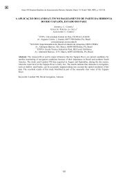
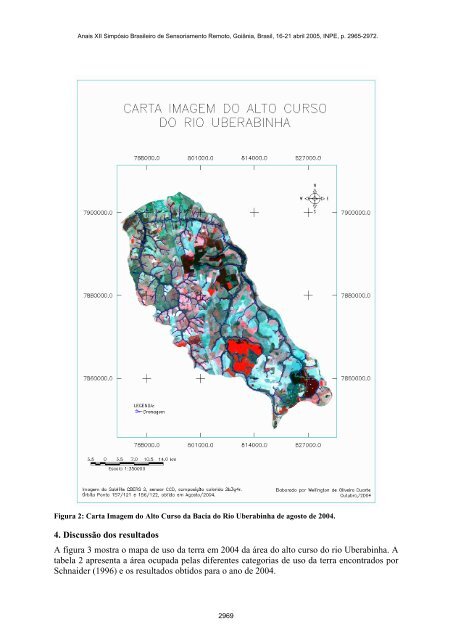
Figura 2: Carta Imagem <strong>do</strong> Alto Curso <strong>da</strong> Bacia <strong>do</strong> Rio Uberabinha de agosto de 2004.<br />
4. Discussão <strong>do</strong>s resulta<strong>do</strong>s<br />
A figura 3 mostra o mapa de <strong>uso</strong> <strong>da</strong> <strong>terra</strong> em 2004 <strong>da</strong> área <strong>do</strong> <strong>alto</strong> curso <strong>do</strong> rio Uberabinha. A<br />
tabela 2 apresenta a área ocupa<strong>da</strong> pelas diferentes categorias de <strong>uso</strong> <strong>da</strong> <strong>terra</strong> encontra<strong>do</strong>s por<br />
Schnaider (1996) e os resulta<strong>do</strong>s obti<strong>do</strong>s para o ano de 2004.<br />
2969