
You also want an ePaper? Increase the reach of your titles
YUMPU automatically turns print PDFs into web optimized ePapers that Google loves.
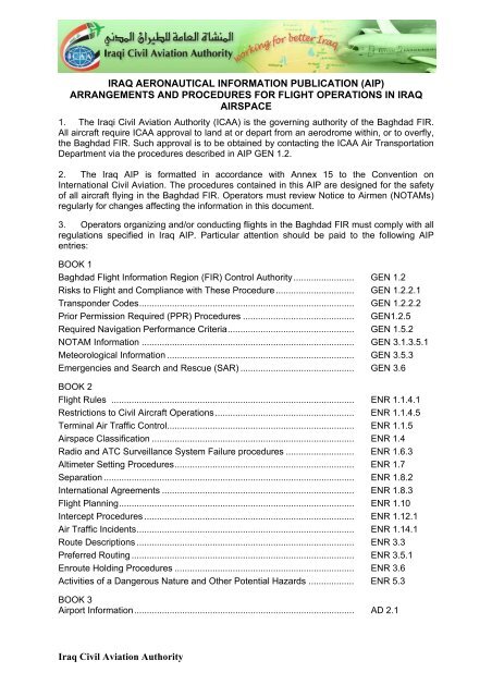
IRAQ AERONAUTICAL INFORMATION PUBLICATION (AIP)<br />
ARRANGEMENTS AND PROCEDURES FOR FLIGHT OPERATIONS IN IRAQ<br />
AIRSPACE<br />
1. The <strong>Iraq</strong>i <strong>Civil</strong> <strong>Aviation</strong> <strong>Authority</strong> (ICAA) is the governing authority of the Baghdad FIR.<br />
All aircraft require ICAA approval to land at or depart from an aerodrome within, or to overfly,<br />
the Baghdad FIR. Such approval is to be obtained by contacting the ICAA Air Transportation<br />
Department via the procedures described in AIP GEN 1.2.<br />
2. The <strong>Iraq</strong> AIP is formatted in accordance with Annex 15 to the Convention on<br />
International <strong>Civil</strong> <strong>Aviation</strong>. The procedures contained in this AIP are designed for the safety<br />
of all aircraft flying in the Baghdad FIR. Operators must review Notice to Airmen (NOTAMs)<br />
regularly for changes affecting the information in this document.<br />
3. Operators organizing and/or conducting flights in the Baghdad FIR must comply with all<br />
regulations specified in <strong>Iraq</strong> AIP. Particular attention should be paid to the following AIP<br />
entries:<br />
BOOK 1<br />
Baghdad Flight Information Region (FIR) Control <strong>Authority</strong>........................ GEN 1.2<br />
Risks to Flight and Compliance with These Procedure............................... GEN 1.2.2.1<br />
Transponder Codes..................................................................................... GEN 1.2.2.2<br />
Prior Permission Required (PPR) Procedures ............................................ GEN1.2.5<br />
Required Navigation Performance Criteria.................................................. GEN 1.5.2<br />
NOTAM Information .................................................................................... GEN 3.1.3.5.1<br />
Meteorological Information .......................................................................... GEN 3.5.3<br />
Emergencies and Search and Rescue (SAR) ............................................. GEN 3.6<br />
BOOK 2<br />
Flight Rules ................................................................................................ ENR 1.1.4.1<br />
Restrictions to <strong>Civil</strong> Aircraft Operations....................................................... ENR 1.1.4.5<br />
Terminal Air Traffic Control.......................................................................... ENR 1.1.5<br />
Airspace Classification ................................................................................ ENR 1.4<br />
Radio and ATC Surveillance System Failure procedures ........................... ENR 1.6.3<br />
Altimeter Setting Procedures....................................................................... ENR 1.7<br />
Separation ................................................................................................... ENR 1.8.2<br />
International Agreements ............................................................................ ENR 1.8.3<br />
Flight Planning............................................................................................. ENR 1.10<br />
Intercept Procedures ................................................................................... ENR 1.12.1<br />
Air Traffic Incidents...................................................................................... ENR 1.14.1<br />
Route Descriptions ...................................................................................... ENR 3.3<br />
Preferred Routing ........................................................................................ ENR 3.5.1<br />
Enroute Holding Procedures ....................................................................... ENR 3.6<br />
Activities of a Dangerous Nature and Other Potential Hazards .................. ENR 5.3<br />
BOOK 3<br />
Airport Information....................................................................................... AD 2.1<br />
<strong>Iraq</strong> <strong>Civil</strong> <strong>Aviation</strong> <strong>Authority</strong>
IRAQ AERONAUTICAL INFORMATION PUBLICATION (AIP)<br />
SUMMARY OF CHANGES<br />
1. The following document provides a summary of notable or significant changes.<br />
Changes to correct spelling mistakes, syntax errors and formatting errors are not listed.<br />
Or without reference to the AIP. Moreover, this Summary of Changes is provided only to<br />
assist with the effective use and maintenance of the <strong>Iraq</strong> AIP and is not an authoritative<br />
document in its own right.<br />
GEN<br />
ENR<br />
2.1-1<br />
2.1-3<br />
1.10-2<br />
3.3-6<br />
4.3-1<br />
SUMMARY OF CHANGES – EFFECTIVE DATE: 28 June 2012<br />
AREA CONTROL CENTERS (ACC)<br />
PASIP WAYPOINT – NEW COORDINATE<br />
5.1-4 RESTRICTED AREA – OR/R401 – OR/R501<br />
AD<br />
2.1-2 (ORNI) AL NAJAF AIRPORT - AERODROME GEOGRAPHICAL AND ADMINISTRATIVE<br />
DATA/AFS ADDRESS<br />
2.1-24<br />
(ORNI) AL NAJAF AIRPORT -INSTRUMENT APPROACH CHART<br />
2.1-25<br />
2.1-49 (ORBI) BAGHDAD AIRPORT- ATS COMMUNICATION FACILITIES<br />
2.1-64 (ORMM) BASRAH AIRPORT- AIR TRAFFIC SERVICES COMMUNICATION FACILITIES<br />
2.1-50 (ORSU) SULAYMANIA AIRPORT-HANDLING SERVICES AND FACILITIES
LIST OF NOTAMS INCORPORATED INTO THIS EDITION<br />
A0023/12 A0033/12 A0034/12 A0037/12 A0040/12 A0055/12 A0056/12<br />
A0068/12
قارـــعلا ةــــيروھمج<br />
يـــقارعلا نارـــيطلا لـــيلد<br />
REPUBLIC OF IRAQ<br />
AERONAUTICAL INFORMATION PUBLICATION (AIP)<br />
Fifty Eight EDITION<br />
Effective 28 June 2012<br />
DIRECTORATE GENERAL IRAQ CIVIL AVIATION AUTHORITY<br />
AERONAUTICAL INFORMATION SERVICE (AIS)<br />
BAGHDAD INTERNATIONAL AIRPORT<br />
PO BOX 55103<br />
BAGHDAD, IRAQ<br />
CAPT. NASSER HUSSAIN BANDER<br />
DIRECTOR GENERAL<br />
IRAQI CIVIL AVATION AUTHORITY<br />
CONSULT NOTAMs FOR LATEST INFORMATION<br />
Changes and Amendments in Red<br />
Deletions by bolded D in side bar
AIP GEN 0.1�1<br />
IRAQ 28 June 12<br />
BOOK 1 – GENERAL (GEN)<br />
GEN 0.1 PREFACE<br />
0.1.1 Name of publishing authority. The <strong>Iraq</strong> AIP is published by the <strong>Iraq</strong> <strong>Civil</strong><br />
<strong>Aviation</strong> <strong>Authority</strong> (ICAA).<br />
0.1.2 Applicable ICAO documents. The AIP is prepared in accordance with the<br />
Standards and Recommended Practices (SARPS) of Annex 15 to the Convention on<br />
International <strong>Civil</strong> <strong>Aviation</strong> and the Aeronautical Information Services Manual (ICAO<br />
Doc 8126) and Annex 14 to the Convention on International <strong>Civil</strong> <strong>Aviation</strong>. Charts<br />
contained in the AIP are produced in accordance with Annex 4 to the Convention on<br />
International <strong>Civil</strong> <strong>Aviation</strong> and the Aeronautical Chart Manual (ICAO Doc 8697).<br />
Differences from ICAO Standards, Recommended Practices and Procedures are<br />
detailed in subsection GEN 1.7.<br />
0.1.3 The AIP structure and amendment interval.<br />
0.1.3.1The AIP forms part of the integrated Aeronautical Information Package, details<br />
of which are given in Subsection GEN 3.1. The principal AIP structure is shown in<br />
graphic form on page GEN 0.1-4. The AIP consists of one volume comprising of three<br />
books. Book 1 - General (GEN), Book 2 - En-route (ENR) and Book 3 - Aerodromes<br />
AD). Each book is divided into sections and subsections, as applicable.<br />
Book 1 – General (GEN)<br />
GEN consists of five sections containing information as briefly described below.<br />
GEN 0 Preface; Record of AIP Amendments; Record of AIP Supplements;<br />
Checklist of AIP Pages; List of Hand Amendments to the AIP; and Table of Contents<br />
to Book 1.<br />
GEN 1 National Regulations and Requirements - Designated authorities; Entry;<br />
Transit and Departure of Aircraft; Transit and Departure of Passengers and Crew;<br />
Entry, Transit and Departure of Cargo; Aircraft Instruments, Equipment and Flight<br />
Documents; Summary of National Regulations and International<br />
Agreements/Conventions; and Differences from ICAO Standards, Recommended<br />
Practices and Procedures.<br />
GEN 2 Tables and Codes - Measuring System, Aircraft Markings and Holidays;<br />
Abbreviations used in AIP; Chart Symbols; Location Indicators; List of Radio<br />
Navigation Aids; Conversion Tables; and Sunrise/Sunset Tables.<br />
GEN 3 Services – Aeronautical Information Services; Aeronautical Charts; Air<br />
Traffic Services; Communication Services; Meteorological Services; and Search and<br />
Rescue.<br />
GEN 4 Fees and Charges.<br />
<strong>Iraq</strong> <strong>Civil</strong> <strong>Aviation</strong> <strong>Authority</strong> 1
AIP GEN 0.1�2<br />
IRAQ 28 June 12<br />
Book 2 – En-route (ENR)<br />
ENR consists of seven sections containing information as briefly describe below.<br />
ENR 0 Preface; Record of AIP Amendment; Record of AIP Supplements;<br />
Checklist of AIP Pages; List of Hand Amendments to the AIP; and the Table of<br />
Contents to Part 2.<br />
ENR 1 General Rules and Procedures - General Rules; Instrument Flight Rules;<br />
ATS Airspace Classification; Holding; Approach and Departure Procedures; ATC<br />
Surveillance Services and Procedures; Altimeter Setting Procedure; Regional<br />
Supplementary Procedures; Air Traffic Flow Management; Flight Planning;<br />
Addressing Of Flight Plan Message; Interception Of <strong>Civil</strong> Aircraft; Unlawful<br />
Interference and Air Traffic Incidents.<br />
ENR 2 Air Traffic Services (ATS) Airspace - Detailed Description of Flight<br />
Information Regions (FIR) and Terminal Control Areas (TMA).<br />
ENR 3 ATS Routes.<br />
ENR 4 Radio Navigation Routes Aids/Systems - Radio Navigation Aids - En-<br />
Route; Name-Code Designators for Significant Points; and Aeronautical Ground<br />
Lights - En-Route.<br />
ENR 5 Navigation Warnings - Prohibited, Restricted and Danger Areas.<br />
ENR 6 En-Route Charts - En-Route Chart – ICAO and Index Charts.<br />
Book 3 – Aerodromes (AD)<br />
AD consists of three sections containing information as briefly described below.<br />
AD 0 Preface; Record of AIP Amendments; Record of AIP Supplements;<br />
Checklist of AIP Pages; List of Hand Amendments to the AIP; and the table of<br />
Contents to Book 3.<br />
AD 1 Introduction - Aerodrome Availability; Rescue and Fire Fighting Services;<br />
and Index to Aerodromes.<br />
AD 2 Detailed Information about Aerodromes.<br />
0.1.3.2 Amendment Interval. Regular amendments to the AIP will be issued every<br />
56 days, providing 28 days notice before the re-issue of a full AIP.<br />
<strong>Iraq</strong> <strong>Civil</strong> <strong>Aviation</strong> <strong>Authority</strong> 2
AIP GEN 0.1�3<br />
IRAQ 28 June 12<br />
0.1.3.3 Advice of AIP errors or omissions. The information in <strong>Iraq</strong> AIS publications<br />
is collected from a number of varied sources and is considered to be as reliable as<br />
possible at the time of publication. Airport Management is required to review each<br />
release of the AIP within 5 days of release. Inaccuracies that affect safety of flight<br />
must be updated immediately through NOTAM. Airport Management is responsible<br />
for providing corrected/updated information for the aerodrome under their<br />
responsibility. Updates must be submitted no later than 15 days prior to the next<br />
publication date to the following responsible authority annotated below:<br />
Airspace and Aerodromes — <strong>Iraq</strong> AIP Development and <strong>Iraq</strong> AIS on e-mails:<br />
ICAA/ AIS HQ: icaa_ais@yahoo.com<br />
ais_hq@iraqcaa.com<br />
NOTAM Issue: icaaaim@yahoo.com<br />
AIP Issue: Aip.icaa@gmail.com<br />
Aerodromes — <strong>Iraq</strong> <strong>Civil</strong> <strong>Aviation</strong> <strong>Authority</strong> (ICAA):<br />
mail: dg@iraqcaa.com<br />
Fax: + 964 1533-0764<br />
P.O. Box: 55103<br />
Mobile: + 964 790-1775-664<br />
AFTN address: ORBIYDYX<br />
Combined Military/<strong>Civil</strong> Aerodromes — <strong>Iraq</strong> AIP Development and <strong>Iraq</strong> <strong>Civil</strong><br />
<strong>Aviation</strong> <strong>Authority</strong> (ICAA) on the e-mail addresses above.<br />
0.1.3.4 Requests for additions or variations. In order to ensure that the information<br />
contained in the AIP is as accurate as possible, and that all procedures, facilities and<br />
services are duly certified and/or authorized, requests for amendments to the AIP will<br />
not be accepted directly from service providers or airport representatives. Requests<br />
for additions or variations should be forwarded to the appropriate address/es as per<br />
advice of errors and omissions. Service providers should make all requests through<br />
the relevant airport management.<br />
0.1.3.5 Calling DSN phone numbers listed in the AIP. To call a military airfield that<br />
has a DSN number listed in the AD section call commercial +974-458-9555. You will<br />
hear “You have reached Al Udeid Airbase, at the tone, please enter the 7 digit<br />
extension of the party you wish to reach or 0.” You will hear a dial tone. At the dial<br />
tone, enter the seven digit number as listed in the AIP.<br />
<strong>Iraq</strong> <strong>Civil</strong> <strong>Aviation</strong> <strong>Authority</strong> 3
AIP GEN 0.1�4<br />
IRAQ 28 June 12<br />
THE INTEGRATED AERONAUTICAL INFORMATION PACKAGE<br />
NOTAM<br />
AND PIB<br />
BOOK 1<br />
GENERAL<br />
(GEN)<br />
GEN 0<br />
GEN 1<br />
NATIONAL REGULATION<br />
AND REQUIREMENT<br />
GEN 2<br />
TABLES AND CODES<br />
GEN 3<br />
SERVICES<br />
GEN 4<br />
CHARGES FOR<br />
AERODROMES AND AIR<br />
NAVIGATION SERVICES<br />
AIP INCLUDING<br />
AMENDMENTS<br />
AND SUMMARIES<br />
BOOK 2<br />
EN-ROUTE<br />
(ENR<br />
ENR 0<br />
ENR 1<br />
GENERAL RULES<br />
AND PROCEDURES<br />
ENR 2<br />
ATS AIRSPACE<br />
ENR 3<br />
ATS ROUTES<br />
ENR 4<br />
RADIO NAVIGATION<br />
AIDS / SYSTEM<br />
ENR 5<br />
NAVIGATION<br />
ENR 6<br />
EN-ROUTE CHARTS<br />
AIC CHECKLISTS<br />
AND SUMMARIES<br />
BOOK 3<br />
AERODROMES<br />
(AD)<br />
AD 0<br />
AD 1<br />
AERODROMES<br />
INTRODUCTION<br />
AD 2<br />
AERODROMES<br />
AD 3<br />
HELIPORTS<br />
<strong>Iraq</strong> <strong>Civil</strong> <strong>Aviation</strong> <strong>Authority</strong> 4
AIP GEN 0.2�1<br />
IRAQ 28 June 12<br />
GEN 0.2 RECORD OF AIP AMENDMENTS<br />
N o /Year Publication Date Effective Date Inserted by<br />
<strong>Iraq</strong> <strong>Civil</strong> <strong>Aviation</strong> <strong>Authority</strong> 1
AIP GEN 0.3�1<br />
IRAQ 28 June 12<br />
Serial N o Subject<br />
GEN 0.3 RECORD OF AIP SUPPLEMENTS<br />
Section(s)<br />
affected<br />
Period of validity Cancellation<br />
record<br />
<strong>Iraq</strong> <strong>Civil</strong> <strong>Aviation</strong> <strong>Authority</strong> 1
AIP GEN 0.4�1<br />
IRAQ 28 June 12<br />
PAGE DATE<br />
BOOK 1: GENERAL<br />
(GEN)<br />
GEN 0<br />
0.1-1 28 June 12<br />
0.1-2 28 June 12<br />
0.1-3 28 June 12<br />
0.1-4 28 June 12<br />
0.2-1 28 June 12<br />
0.3-1 28 June 12<br />
0.4-1 28 June 12<br />
0.4-2 28 June 12<br />
0.4-3 28 June 12<br />
0.4-4 28 June 12<br />
0.5-1 28 June 12<br />
0.6-1 28 June 12<br />
0.6-2 28 June 12<br />
0.6-3 28 June 12<br />
GEN 1<br />
1.1-1 28 June 12<br />
1.1-2 28 June 12<br />
1.2-1 28 June 12<br />
1.2-2 28 June 12<br />
1.2-3 28 June 12<br />
1.2-4 28 June 12<br />
1.2-5 28 June 12<br />
1.2-6 28 June 12<br />
1.2-7 28 June 12<br />
1.2-8 28 June 12<br />
1.2-9 28 June 12<br />
1.3-1 28 June 12<br />
1.4-1 28 June 12<br />
1.4-2 28 June 12<br />
1.5-1 28 June 12<br />
1.6-1 28 June 12<br />
1.7-1 28 June 12<br />
1.7-2 28 June 12<br />
GEN 0.4 PAGE CHECKLIST<br />
PAGE<br />
GEN 2<br />
DATE<br />
2.1-1 28 June 12<br />
2.1-2 28 June 12<br />
2.2-1 28 June 12<br />
2.2-2 28 June 12<br />
2.2-3 28 June 12<br />
2.2-4 28 June 12<br />
2.2-5 28 June 12<br />
2.2-6 28 June 12<br />
2.2-7 28 June 12<br />
2.2-8 28 June 12<br />
2.2-9 28 June 12<br />
2.2-10 28 June 12<br />
2.2-11 28 June 12<br />
2.2-12 28 June 12<br />
2.2-13 28 June 12<br />
2.2-14 28 June 12<br />
2.2-15 28 June 12<br />
2.2-16 28 June 12<br />
2.2-17 28 June 12<br />
2.2-18 28 June 12<br />
2.2-19 28 June 12<br />
2.2-20 28 June 12<br />
2.2-21 28 June 12<br />
2.2-22 28 June 12<br />
2.2-23 28 June 12<br />
2.2-24 28 June 12<br />
2.2-25 28 June 12<br />
2.2-26 28 June 12<br />
2.2-27 28 June 12<br />
2.2-28 28 June 12<br />
2.2-29 28 June 12<br />
2.2-30 28 June 12<br />
2.2-31 28 June 12<br />
2.2-32 28 June 12<br />
2.2-33 28 June 12<br />
2.2-34 28 June 12<br />
2.2-35 28 June 12<br />
2.2-36 28 June 12<br />
2.2-37 28 June 12<br />
2.2-38 28 June 12<br />
2.3-1 28 June 12<br />
2.3- 2 28 June 12<br />
2.5- 1 28 June 12<br />
2.5- 2 28 June 12<br />
2.5- 3 28 June 12<br />
2.5- 4 28 June 12<br />
2.6- 1 28 June 12<br />
2.7- 1 28 June 12<br />
2.7- 2 28 June 12<br />
2.7- 3 28 June 12<br />
2.7- 4 28 June 12<br />
2.7- 5 28 June 12<br />
GEN 3<br />
3.1-2 28 June 12<br />
3.1-3 28 June 12<br />
3.1-4 28 June 12<br />
3.2-1 28 June 12<br />
3.2-2 28 June 12<br />
3.2-3 28 June 12<br />
3.2-4 28 June 12<br />
3.2-5 28 June 12<br />
3.2-6 28 June 12<br />
3.2-7 28 June 12<br />
3.2-8 28 June 12<br />
3.3-1 28 June 12<br />
3.3-2 28 June 12<br />
3.3-3 28 June 12<br />
3.4-1 28 June 12<br />
3.4-2 28 June 12<br />
3.4-3 28 June 12<br />
3.5-1 28 June 12<br />
3.6-1 28 June 12<br />
3.6-2 28 June 12<br />
3.6-3 28 June 12<br />
GEN 4<br />
4.1- 1 28 June 12<br />
4.1- 2 28 June 12<br />
4.1- 3 28 June 12<br />
4.2- 1 28 June 12<br />
<strong>Iraq</strong> <strong>Civil</strong> <strong>Aviation</strong> <strong>Authority</strong> 1
AIP GEN 0.4�2<br />
IRAQ 28 June 12<br />
BOOK 2: ENROUTE<br />
(ENR)<br />
ENR 0<br />
0.6-1 28 June 12<br />
0.6-2 28 June 12<br />
0.6-3 28 June 12<br />
0.6-4 28 June 12<br />
ENR 1<br />
1.1-1 28 June 12<br />
1.1-2 28 June 12<br />
1.2-1 28 June 12<br />
1.2-2 28 June 12<br />
1.2-3 28 June 12<br />
1.3-1 28 June 12<br />
1.3-2 28 June 12<br />
1.4-1 28 June 12<br />
1.4-2 28 June 12<br />
1.4-3 28 June 12<br />
1.4-4 28 June 12<br />
1.4-5 28 June 12<br />
1.5-1 28 June 12<br />
1.5-2 28 June 12<br />
1.5-3 28 June 12<br />
1.5-4 28 June 12<br />
1.6-1 28 June 12<br />
1.6-2 28 June 12<br />
1.6-3 28 June 12<br />
1.7-1 28 June 12<br />
1.7-2 28 June 12<br />
1.8-1 28 June 12<br />
1.8-2 28 June 12<br />
1.8-3 28 June 12<br />
1.8-4 28 June 12<br />
1.8-5 28 June 12<br />
1.8-6 28 June 12<br />
1.8-7 28 June 12<br />
1.8-8 28 June 12<br />
1.8-9 28 June 12<br />
1.8-10 28 June 12<br />
1.8-11 28 June 12<br />
1.9-1 28 June 12<br />
1.10-1 28 June 12<br />
1.10-2 28 June 12<br />
1.11-1 28 June 12<br />
1.12-1 28 June 12<br />
1.12-2 28 June 12<br />
1.12-3 28 June 12<br />
1.12-4 28 June 12<br />
1.13-1 28 June 12<br />
1.14-1 28 June 12<br />
1.14-2 28 June 12<br />
1.14-3 28 June 12<br />
1.14-4 28 June 12<br />
1.14-5 28 June 12<br />
ENR 2<br />
2.1-1 28 June 12<br />
2.1-2 28 June 12<br />
2.1-3 28 June 12<br />
2.1-4 28 June 12<br />
2.1-5 28 June 12<br />
2.1-6 28 June 12<br />
2.1-7 28 June 12<br />
2.1-8 28 June 12<br />
2.1-9 28 June 12<br />
2.1-10 28 June 12<br />
2.1-11 28 June 12<br />
2.1-12 28 June 12<br />
2.1-13 28 June 12<br />
2.1-14 28 June 12<br />
ENR 3<br />
3.1-1 28 June 12<br />
3.2-1 28 June 12<br />
3.3-1 28 June 12<br />
3.3-2 28 June 12<br />
3.3-3 28 June 12<br />
3.3-4 28 June 12<br />
3.3-5 28 June 12<br />
3.3-6 28 June 12<br />
3.3-7 28 June 12<br />
3.3-8 28 June 12<br />
3.3-9 28 June 12<br />
3.3-10 28 June 12<br />
3.3-11 28 June 12<br />
3.3-12 28 June 12<br />
3.3-13 28 June 12<br />
3.3-14 28 June 12<br />
3.4-1 28 June 12<br />
3.5-1 28 June 12<br />
3.5-2 28 June 12<br />
3.5-3 28 June 12<br />
3.5-4 28 June 12<br />
3.5-5 28 June 12<br />
3.5-6 28 June 12<br />
3.5-7 28 June 12<br />
3.6-1 28 June 12<br />
ENR 4<br />
4.1-1 28 June 12<br />
4.2-1 28 June 12<br />
4.3-1 28 June 12<br />
4.3-2 28 June 12<br />
4.4-1 28 June 12<br />
ENR 5<br />
5.1-1 28 June 12<br />
5.1-2 28 June 12<br />
5.1-3 28 June 12<br />
5.1-4 28 June 12<br />
5.1-5 28 June 12<br />
5.1-6 28 June 12<br />
5.1-7 28 June 12<br />
5.1-8 28 June 12<br />
5.1-9 28 June 12<br />
5.2-1 28 June 12<br />
5.2-2 28 June 12<br />
5.3-1 28 June 12<br />
5.4-1 28 June 12<br />
5.5-1 28 June 12<br />
5.6-1 28 June 12<br />
ENR 6<br />
6.1-1 28 June 12<br />
BOOK 3: AERODROMES<br />
(AD)<br />
<strong>Iraq</strong> <strong>Civil</strong> <strong>Aviation</strong> <strong>Authority</strong> 2
AIP GEN 0.4�3<br />
IRAQ 28 June 12<br />
AD 0<br />
0.6-1 28 June 12<br />
0.6-2 28 June 12<br />
AD 1<br />
1.1-1 28 June 12<br />
1.2-1 28 June 12<br />
1.3-1 28 June 12<br />
1.3-2 28 June 12<br />
1.3-3 28 June 12<br />
1.3-4 28 June 12<br />
AD 2<br />
2.1-1 28 June 12<br />
2.1-2 28 June 12<br />
2.1-3 28 June 12<br />
2.1-4 28 June 12<br />
2.1-5 28 June 12<br />
2.1-6 28 June 12<br />
2.1-7 28 June 12<br />
2.1-8 28 June 12<br />
2.1-9 28 June 12<br />
2.1-10 28 June 12<br />
2.1-11 28 June 12<br />
2.1-12 28 June 12<br />
2.1-13 28 June 12<br />
2.1-14 28 June 12<br />
2.1-15 28 June 12<br />
2.1-16 28 June 12<br />
2.1-17 28 June 12<br />
2.1-18 28 June 12<br />
2.1-19 28 June 12<br />
2.1-20 28 June 12<br />
2.1-21 28 June 12<br />
2.1-22 28 June 12<br />
2.1-23 28 June 12<br />
2.1-24 28 June 12<br />
2.1-25 28 June 12<br />
2.1-26 28 June 12<br />
2.1-27 28 June 12<br />
2.1-28 28 June 12<br />
2.1-29 28 June 12<br />
2.1-30 28 June 12<br />
2.1-31 28 June 12<br />
2.1-32 28 June 12<br />
2.1-33 28 June 12<br />
2.1-34 28 June 12<br />
2.1-35 28 June 12<br />
2.1-36 28 June 12<br />
2.1-37 28 June 12<br />
2.1-38 28 June 12<br />
2.1-39 28 June 12<br />
2.1-40 28 June 12<br />
2.1-41 28 June 12<br />
2.1-42 28 June 12<br />
2.1-43 28 June 12<br />
2.1-44 28 June 12<br />
2.1-45 28 June 12<br />
2.1-46 28 June 12<br />
2.1-47 28 June 12<br />
2.1-48 28 June 12<br />
2.1-49 28 June 12<br />
2.1-50 28 June 12<br />
2.1-51 28 June 12<br />
2.1-52 28 June 12<br />
2.1-53 28 June 12<br />
2.1-54 28 June 12<br />
2.1-55 28 June 12<br />
2.1-56 28 June 12<br />
2.1-57 28 June 12<br />
2.1-58 28 June 12<br />
2.1-59 28 June 12<br />
2.1-60 28 June 12<br />
2.1-61 28 June 12<br />
2.1-62 28 June 12<br />
2.1-63 28 June 12<br />
2.1-64 28 June 12<br />
2.1-65 28 June 12<br />
2.1-66 28 June 12<br />
2.1-67 28 June 12<br />
2.1-68 28 June 12<br />
2.1-69 28 June 12<br />
2.1-70 28 June 12<br />
2.1-71 28 June 12<br />
2.1-72 28 June 12<br />
2.1-73 28 June 12<br />
2.1-74 28 June 12<br />
2.1-75 28 June 12<br />
2.1-76 28 June 12<br />
2.1-77 28 June 12<br />
2.1-78 28 June 12<br />
2.1-79 28 June 12<br />
2.1-80 28 June 12<br />
2.1-81 28 June 12<br />
2.1-82 28 June 12<br />
2.1-83 28 June 12<br />
2.1-84 28 June 12<br />
2.1-85 28 June 12<br />
2.1-86 28 June 12<br />
2.1-87 28 June 12<br />
2.1-88 28 June 12<br />
2.1-89 28 June 12<br />
2.1-90 28 June 12<br />
2.1-91 28 June 12<br />
2.1-92 28 June 12<br />
2.1-93 28 June 12<br />
2.1-94 28 June 12<br />
2.1-95 28 June 12<br />
2.1-96 28 June 12<br />
2.1-97 28 June 12<br />
2.1-98 28 June 12<br />
2.1-99 28 June 12<br />
2.1-100 28 June 12<br />
2.1-101 28 June 12<br />
2.1-102 28 June 12<br />
2.1-103 28 June 12<br />
2.1-104 28 June 12<br />
2.1-105 28 June 12<br />
2.1-106 28 June 12<br />
2.1-107 28 June 12<br />
2.1-108 28 June 12<br />
2.1-109 28 June 12<br />
2.1-110 28 June 12<br />
2.1-111 28 June 12<br />
2.1-112 28 June 12<br />
2.1-113 28 June 12<br />
2.1-114 28 June 12<br />
2.1-115 28 June 12<br />
2.1-116 28 June 12<br />
2.1-117 28 June 12<br />
2.1-118 28 June 12<br />
<strong>Iraq</strong> <strong>Civil</strong> <strong>Aviation</strong> <strong>Authority</strong> 3
AIP GEN 0.4�4<br />
IRAQ 28 June 12<br />
2.1-119 28 June 12<br />
2.1-120 28 June 12<br />
2.1-121 28 June 12<br />
2.1-122 28 June 12<br />
2.1-123 28 June 12<br />
2.1-124 28 June 12<br />
2.1-125 28 June 12<br />
2.1-126 28 June 12<br />
2.1-127 28 June 12<br />
2.1-128 28 June 12<br />
2.1-129 28 June 12<br />
2.1-130 28 June 12<br />
2.1-131 28 June 12<br />
2.1-132 28 June 12<br />
2.1-133 28 June 12<br />
2.1-134 28 June 12<br />
2.1-135 28 June 12<br />
2.1-136 28 June 12<br />
2.1-137 28 June 12<br />
2.1-138 28 June 12<br />
2.1-139 28 June 12<br />
2.1-140 28 June 12<br />
2.1-141 28 June 12<br />
2.1-142 28 June 12<br />
2.1-143 28 June 12<br />
2.1-144 28 June 12<br />
2.1-145 28 June 12<br />
2.1-146 28 June 12<br />
2.1-147 28 June 12<br />
2.1-148 28 June 12<br />
2.1-149 28 June 12<br />
2.1-150 28 June 12<br />
2.1-151 28 June 12<br />
2.1-152 28 June 12<br />
2.1-153 28 June 12<br />
2.1-154 28 June 12<br />
2.1-155 28 June 12<br />
2.1-156 28 June 12<br />
2.1-157 28 June 12<br />
2.1-158 28 June 12<br />
2.1-159 28 June 12<br />
2.1-160 28 June 12<br />
2.1-161 28 June 12<br />
2.1-162 28 June 12<br />
2.1-163 28 June 12<br />
2.1-164 28 June 12<br />
2.1-165 28 June 12<br />
2.1-166 28 June 12<br />
2.1-167 28 June 12<br />
2.1-168 28 June 12<br />
2.1-169 28 June 12<br />
2.1-170 28 June 12<br />
2.1-171 28 June 12<br />
2.1-172 28 June 12<br />
2.1-173 28 June 12<br />
2.1-174 28 June 12<br />
2.1-175 28 June 12<br />
2.1-176 28 June 12<br />
2.1-177 28 June 12<br />
2.1-178 28 June 12<br />
2.1-179 28 June 12<br />
2.1-180 28 June 12<br />
2.1-181 28 June 12<br />
2.1-182 28 June 12<br />
2.1-183 28 June 12<br />
2.1-184 28 June 12<br />
2.1-185 28 June 12<br />
2.1-186 28 June 12<br />
2.1-187 28 June 12<br />
AD 3<br />
3.1-1 28 June 12<br />
3.1-2 28 June 12<br />
3.1-3 28 June 12<br />
3.1-4 28 June 12<br />
<strong>Iraq</strong> <strong>Civil</strong> <strong>Aviation</strong> <strong>Authority</strong> 4
AIP GEN 0.5�1<br />
IRAQ 28 June 12<br />
Section or<br />
page<br />
affected<br />
GEN 0.5 LIST OF HAND AMENDMENTS TO THE AIP<br />
Amendment Text<br />
Introduced by<br />
AIP AMDT<br />
Serial N o .<br />
<strong>Iraq</strong> <strong>Civil</strong> <strong>Aviation</strong> <strong>Authority</strong> 1
AIP GEN 0.6�1<br />
IRAQ 28 June 12<br />
GEN 0<br />
GEN 0.6 TABLE OF CONTENTS TO BOOK 1<br />
Page<br />
GEN 0.1 Preface.......................................................................... GEN 0.1-1<br />
GEN 0.2 Record of AIP Amendments.......................................... GEN 0.2-1<br />
GEN 0.3 Record of AIP Supplements .......................................... GEN 0.3-1<br />
GEN 0.4 List of Effective AIP Pages ............................................ GEN 0.4-1<br />
GEN 0.5 List of Hand Amendments to the AIP ............................ GEN 0.5-1<br />
GEN 0.6 Table of Contents.......................................................... GEN 0.6-1<br />
GEN 1 NATIONAL REGULATIONS AND REQUIREMENTS<br />
GEN 1.1 Designated authorities................................................... GEN 1.1-1<br />
GEN 1.2 Entry, Transit and Departure of Aircraft......................... GEN 1.2-1<br />
GEN 1.2.1 General............................................................... GEN 1.2-1<br />
GEN 1.2.2 Risks to Flight and Compliance with AIP Procedures GEN 1.2-2<br />
GEN 1.2.3 General <strong>Civil</strong> Flight Procedures.......................... GEN 1.2-2<br />
GEN 1.2.4 Landings and Departures ................................... GEN 1.2-4<br />
GEN 1.2.5 Prior Permission Required (PPR) Procedures.... GEN 1.2-4<br />
GEN 1.2.6 Scheduled Flights ............................................... GEN 1.2-7<br />
GEN 1.2.7 Non-Scheduled Flights ....................................... GEN 1.2-8<br />
GEN 1.2.8 Private Flights..................................................... GEN1.2-10<br />
GEN 1.2.9 Public Health Measures Applied to all Aircraft.... GEN1.2-10<br />
GEN 1.3 Entry, Transit and Departure of Passengers and Crew. GEN 1.3-1<br />
GEN 1.3.1 Customs Requirements ...................................... GEN 1.3-1<br />
GEN 1.3.2 Immigration Requirements ................................. GEN 1.3-1<br />
GEN 1.3.3 Public Health Requirements ............................... GEN 1.3-1<br />
GEN 1.4 Entry, Transit and Departure of Cargo .......................... GEN 1.4-1<br />
GEN 1.4.1 Customs Requirements Concerning Cargo and<br />
other Articles....................................................... GEN 1.4-1<br />
GEN 1.4.2 Agricultural Quarantine Requirements................ GEN 1.4-1<br />
GEN 1.5 Aircraft Instruments, Equipment and Flight Documents GEN 1.5-1<br />
GEN 1.5.1 General............................................................... GEN 1.5-1<br />
GEN 1.5.2 Special Equipment to be Carried........................ GEN 1.5-1<br />
GEN 1.5.3 Miscellaneous Information.................................. GEN 1.5-1<br />
GEN 1.6 Summary of National Regulation and International<br />
Agreements/Conventions .............................................. GEN 1.6-1<br />
GEN 1.7 Differences from ICAO Standards, Recommended<br />
Practices and Procedures (SARPS).............................. GEN 1.7-1<br />
<strong>Iraq</strong> <strong>Civil</strong> <strong>Aviation</strong> <strong>Authority</strong> 1
AIP GEN 0.6�2<br />
IRAQ 28 June 12<br />
GEN 2 TABLES AND CODES<br />
GEN 2.1 Measuring System, Aircraft Marking, Holidays.............. GEN 2.1-1<br />
GEN 2.1.1 Units of Measurement ........................................ GEN 2.1-1<br />
GEN 2.1.2 Time System....................................................... GEN 2.1-1<br />
GEN 2.1.3 Geodetic Reference Datum ................................ GEN 2.1-1<br />
GEN 2.1.4 Aircraft Nationality and Registration Marks......... GEN 2.1-2<br />
GEN 2.1.5 Public Holidays……………………………………..GEN 2.1-2<br />
GEN 2.2 Abbreviations used in AIS Publications......................... GEN 2.2-1<br />
GEN 2.2.1 Encode ............................................................... GEN 2.2-10<br />
GEN 2.2.2 Decode ............................................................... GEN 2.2-25<br />
GEN 2.3 Chart Symbols............................................................... GEN 2.3-1<br />
GEN 2.3.1 Aerodromes........................................................ GEN 2.3-1<br />
GEN 2.3.2 Approach Charts................................................. GEN 2.3-1<br />
GEN 2.3.3 Aerodrome Charts .............................................. GEN 2.3-1<br />
GEN 2.3.4 Aerodrome Installations and Lights .................... GEN 2.3-2<br />
GEN 2.3.5 Miscellaneous..................................................... GEN 2.3-2<br />
GEN 2.4 Location Indicators ........................................................ GEN 2.4-1<br />
GEN 2.4.1 Code Allocation .................................................. GEN 2.4-1<br />
GEN 2.4.2 List of Location Codes ........................................ GEN 2.4-1<br />
GEN 2.5 List of Radio Navigation Aids ........................................ GEN 2.5-1<br />
GEN 2.6 Conversion Tables ........................................................ GEN 2.6-1<br />
GEN 2.7 Sunrise/Sunset Tables .................................................. GEN 2.7-1<br />
GEN 2.7.1 General............................................................... GEN 2.7-1<br />
GEN 2.7.2 Baghdad International (ORBI) ............................ GEN 2.7-2<br />
GEN 2.7.3 Basrah (ORMM) ................................................. GEN 2.7-3<br />
GEN 2.7.4 Kirkuk (ORKK).................................................... GEN 2.7-4<br />
GEN 3 SERVICES<br />
GEN 3.1 Aeronautical Information Services................................. GEN 3.1-1<br />
GEN 3.1.1 Responsible Service........................................... GEN 3.1-1<br />
GEN 3.1.2 Area of Responsibility......................................... GEN 3.1-1<br />
GEN 3.1.3 Aeronautical Publications ................................... GEN 3.1-1<br />
GEN 3.1.4 AIRAC System.................................................... GEN 3.1-3<br />
GEN 3.1.5 Pre-Flight Information Service at Aerodrome ..... GEN 3.1-4<br />
GEN 3.2 Aeronautical Charts....................................................... GEN 3.2-1<br />
GEN 3.3 Air traffic Services ......................................................... GEN 3.3-1<br />
GEN 3.3.1 Responsible Service........................................... GEN 3.3-1<br />
GEN 3.3.2 Area of Responsibility......................................... GEN 3.3-1<br />
GEN 3.3.3 Types of Services ............................................... GEN 3.3-1<br />
GEN 3.3.4 Co-ordination Between the Operator and ATS ... GEN 3.3-3<br />
GEN 3.3.5 Minimum Flight Altitude ...................................... GEN 3.3-3<br />
<strong>Iraq</strong> <strong>Civil</strong> <strong>Aviation</strong> <strong>Authority</strong> 2
AIP GEN 0.6�3<br />
IRAQ 28 June 12<br />
GEN 3.3.6 ATS Units Address List....................................... GEN 3.3-3<br />
GEN 3.4 Communication Services............................................... GEN 3.4-1<br />
GEN 3.4.1 Responsible Service........................................... GEN 3.4-1<br />
GEN 3.4.2 Area of Responsibility......................................... GEN 3.4-1<br />
GEN 3.4.3 Types of Service................................................. GEN 3.4-1<br />
GEN 3.5 Meteorological Services ................................................ GEN 3.5-1<br />
GEN 3.5.1 Responsible Service........................................... GEN 3.5-1<br />
GEN 3.5.2 Area of Responsibility......................................... GEN 3.5-1<br />
GEN 3.6 Search and Rescue....................................................... GEN 3.6-1<br />
GEN 3.6.1 Responsible Service........................................... GEN 3.6-1<br />
GEN 3.6.2 Area of Responsibility......................................... GEN 3.6-1<br />
GEN 3.6.3 Types of Service................................................. GEN 3.6-1<br />
GEN 3.6.4 SAR Agreements................................................ GEN 3.6-1<br />
GEN 3.6.5 Search and Rescue Facilities ............................. GEN 3.6-1<br />
GEN 3.6.6 Procedures and/or signals Employed by Rescue Aircraft<br />
........................................................................... GEN 3.6-1<br />
GEN 3.6.7 Ground-air visual signal code ............................. GEN 3.6-2<br />
GEN 3.6.8 Air-to-ground signals .......................................... GEN 3.6-3<br />
GEN 4 FEES AND CHARGES<br />
GEN 4.1 Aerodrome Charges...................................................... GEN 4.1-1<br />
GEN 4.1.1 General............................................................... GEN 4.1-1<br />
GEN 4.1.2 Landing Charges ................................................ GEN 4.1-1<br />
GEN 4.1.3 Fees for Additional Ground Handling.................. GEN 4.1-1<br />
GEN 4.1.4 Miscellaneous Charges ...................................... GEN 4.1-2<br />
GEN 4.1.5 Overflight Fees ................................................... GEN 4.1-2<br />
GEN 4.1-6 Evening Operations ............................................ GEN 4.1-2<br />
GEN 4.1-7 Exemptions/Reductions...................................... GEN 4.1-3<br />
GEN 4.1.8 Payment of Fees and Charges........................... GEN 4.1-3<br />
GEN 4.2 Air Navigation Charges ................................................. GEN 4.2-1<br />
GEN 4.2.1 General............................................................... GEN 4.2-1<br />
<strong>Iraq</strong> <strong>Civil</strong> <strong>Aviation</strong> <strong>Authority</strong> 3
AIP GEN 1.1�1<br />
IRAQ 28 June 12<br />
GEN 1 NATIONAL REGULATIONS AND REQUIREMENTS<br />
GEN 1.1 DESIGNATED AUTHORITIES<br />
1.1.1 Introduction<br />
1.1.1.1 The requirement, for entry, transit and departure of aircraft engaged in<br />
international flights and the procedures for clearance of these aircraft at designated<br />
airports in <strong>Iraq</strong> is given for the information and guidance of operators conducting<br />
international flights.<br />
1.1.1.2 The <strong>Iraq</strong> <strong>Civil</strong> <strong>Aviation</strong> <strong>Authority</strong> (ICAA) is the agency responsible for<br />
<strong>Iraq</strong>’s obligations under the provisions of Annex 9 (Facilitation) of the Chicago<br />
Convention. The ICAA is responsible for coordinating with other <strong>Iraq</strong> agencies for the<br />
development and implementation of policy and coordination of ICAO matters.<br />
1.1.1.3 The addresses of the designated authorities concerned with facilitation<br />
of international air navigation are as follows:<br />
a. <strong>Iraq</strong> <strong>Civil</strong> <strong>Aviation</strong> <strong>Authority</strong>:<br />
Director General<br />
<strong>Iraq</strong> <strong>Civil</strong> <strong>Aviation</strong> <strong>Authority</strong><br />
Baghdad International Airport<br />
P.O. Box 55103<br />
Baghdad – Republic of IRAQ<br />
Mail: dg@iraqcaa.com<br />
Fax: 00964 15430764<br />
Land line: 00964 813 2256<br />
AFTN address: ORBIYDYX<br />
b. Meteorology:<br />
The <strong>Iraq</strong>i Meteorological Organization<br />
Meteorological Office Section<br />
Baghdad International Airport<br />
P.O Box 6078<br />
Baghdad – Republic of IRAQ<br />
Mail: mh_a58@yahoo.com<br />
Mobile: +964 7712 236468<br />
+964 7901 415989<br />
c. Agricultural and Quarantine:<br />
Ministry of Agriculture<br />
ANDULUS Square<br />
Near ALSADEER HOTEL<br />
Baghdad – Republic of IRAQ<br />
Telephone, Telex and P.O. Box will be provided via NOTAM once available<br />
<strong>Iraq</strong> <strong>Civil</strong> <strong>Aviation</strong> <strong>Authority</strong> 1
AIP GEN 1.1�2<br />
IRAQ 28 June 12<br />
Note: Addresses, phone numbers, and contact information of related authorities<br />
within AIP are yet to be determined. All aviation related enquiries should be<br />
addressed to ICAA staff at Baghdad International Airport until further notice.<br />
<strong>Iraq</strong> <strong>Civil</strong> <strong>Aviation</strong> <strong>Authority</strong> 2
AIP GEN 1.2�1<br />
IRAQ 28 June 12<br />
GEN 1.2 ENTRY, TRANSIT AND DEPARTURE OF AIRCRAFT<br />
1.2.1 General<br />
1.2.1.1 The procedures for flight operations detailed here are mandatory for all<br />
aircraft operators authorized to fly in the Baghdad FIR.<br />
1.2.1.2 The ICAA has responsibility for all operational and safety matters<br />
relating to civil aviation into, within and from <strong>Iraq</strong>i territory. International flights into,<br />
from or over <strong>Iraq</strong>i territory shall be subject to the current <strong>Iraq</strong>i regulations relating to<br />
civil aviation. These regulations correspond in all essentials to the Standards and<br />
Recommended Practices (SARP) contained in ICAO Annexes to the Convention on<br />
International <strong>Civil</strong> <strong>Aviation</strong>. Under no circumstances should an aircraft attempt to<br />
overfly or enter <strong>Iraq</strong> without first having obtained the necessary permission except in<br />
the case of an aircraft emergency.<br />
1.2.1.3 The ICAA is the approving authority for flights intending to operate<br />
within the Baghdad FIR. All aircraft require ICAA approval to land, depart, and overfly<br />
<strong>Iraq</strong>. To accomplish this, all carriers will contact the ICAA directly providing any<br />
documentation required by the ICAA. All company information shall be submitted to<br />
the ICAA at least seven days prior to the commencement of the first intended flight,<br />
or at least 15 days when such a request is submitted through diplomatic channels.<br />
1.2.1.3.1 Request to overfly or operate inside <strong>Iraq</strong> is accomplished by submitting<br />
the proper form. There are two forms: Daily Overflight Request Form and Landing<br />
Slot Request Form. They can be found on the ICAA website: http://www.iraqcaa.com/.<br />
Requests for civil flights operating in the Baghdad FIR shall be submitted to ICAA no<br />
later than 1500Z on the day prior to flight giving details of the proposed flight, and if<br />
required will provide written proof of ICAA approval when submitting Overflight or Slot<br />
Request Forms.<br />
1.2.1.3.2 Mode 3/A transponder codes are issued to aircraft by ATC.<br />
1.2.1.3.3 As of 25 Aug 09, RAMCC is officially closed and all correspondence will be<br />
accomplished thru ICAA.<br />
1.2.1.4 ICAA operates 24 hours a day. The ICAA will resolve all questions that<br />
may arise as to whether or not an operator is approved to operate in the Baghdad<br />
FIR. The contact numbers for ICAA representatives are:<br />
ICAA Air Trans Dept (Landline) +964 1 813 2467<br />
ICAA Air Trans Dept (cell 1) +964 790 531 9779<br />
ICAA Air Trans Dept (cell 2) +964 771 134 3263<br />
Fax +964 543 0689<br />
E-mail (civil landing slots) ops@iraqcaa.com<br />
Email (civil overflight requests) ops.overflight@iraqcaa.com<br />
1.2.1.5 Coalition military aircraft and US TRANSCOM contracted aircraft flying<br />
on active legs contained in the Air Tasking Order (ATO) are exempt from ICAA<br />
requirements.<br />
<strong>Iraq</strong> <strong>Civil</strong> <strong>Aviation</strong> <strong>Authority</strong> 1
AIP GEN 1.2�2<br />
IRAQ 28 June 12<br />
1.2.2 Risks to Flight and Compliance with These Procedures.<br />
1.2.2.1 All aircraft operators shall comply strictly with the provisions of the<br />
permission granted for their aircraft and shall adhere to the international designated<br />
air routes. Failure to comply with the procedures in this AIP may result in interception<br />
by armed coalition fighter aircraft. Aircraft operators must be familiar with, and follow,<br />
international intercept procedures contained in Annex 2, Rules of the Air, to the<br />
Chicago Convention, paragraph 3.8 and Appendix 2, Sections 2 and 3. Pilots are to<br />
continuously monitor the VHF emergency FREQ (121.5 MHz) and operate their<br />
transponder at all times during flight. It is imperative that all civilian aircraft follow ATC<br />
instructions for mode 3 squawk immediately upon entering the Baghdad FIR. Aircraft<br />
within the Baghdad FIR may also be instructed to deviate from their flight planned<br />
route due to temporary flight restrictions imposed by military requirements.<br />
1.2.3 General <strong>Civil</strong> Flight Procedures.<br />
Note: Aircraft types B732, B721, B722, R721, R722, AN26, AN24,<br />
AN12, T154 are not allowed to operate in Baghdad FIR<br />
1.2.3.1 Overflights<br />
1.2.3.1.1 Only flights approved by the ICAA are authorized to overfly <strong>Iraq</strong>i<br />
airspace. The Daily Overflight Request Form can be found on the ICAA web site at<br />
http://www.iraqcaa.com<br />
1.2.3.1.2 All companies must have ICAA approval to operate within <strong>Iraq</strong>i airspace<br />
prior to submitting an overflight request. All Daily overflight requests must be<br />
submitted to ICAA by 1500Z the day prior to the planned flight. Earlier submission is<br />
encouraged; however requests should not be submitted any earlier than 30 days prior<br />
to the planned overflight. Carriers will receive an approval email from ICAA that<br />
provides authorization for flight in the Baghdad FIR.<br />
1.2.3.1.3. Carriers operating under the scheduled overflight procedures detailed in<br />
<strong>Iraq</strong> AIP GEN 1.2.6.-1.2.8 are to submit summer/winter schedules according to<br />
published instructions on the ICAA website.<br />
1.2.3.1.4 Changes to overflight requests. Significant changes to a daily overflight<br />
request may be made at any time up to 1500Z the day prior to the planned flight by<br />
submitting an updated request form to ICAA by email. Changes received after 1500Z<br />
may not be accepted due to processing requirements. A significant change is defined<br />
as any changes to the following:<br />
UTC date of flight,<br />
Aircraft type,<br />
Call sign,<br />
Aircraft Registration, and<br />
Departure and/or Arrival locations<br />
1.2.3.1.5 Overflight Fee Generation. At 2100Z each evening, the ICAA will<br />
generate a final overflight list of the approved overflights of <strong>Iraq</strong> for the next UTC day.<br />
This list will be emailed to Baghdad, Kirkuk and Balad ACC each evening. Baghdad,<br />
Kirkuk and Balad ACC will use this list to document actual overflights of <strong>Iraq</strong>i airspace<br />
<strong>Iraq</strong> <strong>Civil</strong> <strong>Aviation</strong> <strong>Authority</strong> 2
AIP GEN 1.2�3<br />
IRAQ 28 June 12<br />
and will forward the annotated list to the ICAA at ops@iraqcaa.com<br />
suzan_alljaf@yahoo.com, and fin_biap@geca.gov.iq by 1700Z the next day.<br />
1.2.3.2 Landings and Departures (Slots)<br />
1.2.3.2.1 Slot requests and changes must be submitted to ICAA no later than<br />
1500Z the day prior to flight and no earlier than 24 hrs prior to the day of operation.<br />
Requests received after 1500Z may not be accepted. The Slot Request Form may be<br />
found on the ICAA website at http://www.iraqcaa.com. <strong>Civil</strong> carriers must annotate<br />
the correct Category of flight in order to be approved. Carriers will be notified via<br />
email from ICAA of approval to operate.<br />
1.2.3.2.2 Changes to takeoff/landing slot time requests. Significant changes to a<br />
slot request may be made at any time up to 1500Z the day prior to the planned flight<br />
by submitting an updated request form to ICAA by email. Changes received after<br />
1500Z may not be accepted. A significant change is defined as any changes to the<br />
following:<br />
UTC date of flight,<br />
Aircraft type,<br />
Call sign,<br />
Aircraft Registration, and<br />
Departure and/or Arrival locations<br />
1.2.3.2.3 <strong>Civil</strong> aircraft will need to coordinate any and all ground servicing,<br />
handling, other aircrew requirements, weather avoidance, air traffic control<br />
separation, or enroute and landing threat assessment. All civil aircrew must review all<br />
NOTAMS for respective airfields prior to flight. Aircrews should also consider<br />
adequate fuel for potential ground or air delays due to unforeseen events. ICAA<br />
approval to operate DOES NOT imply approval for any of these items.<br />
1.2.4 Landings and Departures (Reserved)<br />
1.2.5 Prior Permission Required (PPR) Procedures<br />
1.2.5.1 In general, PPRs are required for transient military and civil aircraft<br />
including those on ATO’s operating at designated airfields. It is the responsibility of<br />
the operating agency to ensure PPR requirements are met prior to landing at the<br />
intended airfield. Aircraft that land without an approved PPR may be turned away or<br />
met by security forces. PPRs must be obtained before submitting a landing request<br />
to ICAA.<br />
1.2.5.2 PPR times must be met +/- 30 (+/- 15 for ORMM) minutes from the<br />
approved time. Any changes to an arrival or departure time at an airfield that requires<br />
a PPR must be coordinated with the Senior Airfield <strong>Authority</strong>. Operators that do not<br />
coordinate changes to their PPR times may face delays and/or be prohibited from<br />
downloading their cargo or passengers. PPR’s issued with less than 6 hours<br />
notification will not be guaranteed priority handling and may be delayed. The Senior<br />
Airfield <strong>Authority</strong> is the arbiter for final approval of PPR’s.<br />
1.2.5.3 All civil aircraft requiring flights to PPR designated airfields must contact<br />
the Senior Airfield <strong>Authority</strong> and receive a PPR prior to landing at that airfield.<br />
<strong>Iraq</strong> <strong>Civil</strong> <strong>Aviation</strong> <strong>Authority</strong> 3
AIP GEN 1.2�4<br />
IRAQ 28 June 12<br />
Requirements for PPRs are defined with the respective airfield entry in BOOK 3:<br />
AERODROMES (AD). <strong>Civil</strong> carriers are also reminded to check current NOTAMS for<br />
changes/updates in PPR requirements.<br />
1.2.5.4 <strong>Civil</strong>ian aircraft flying into or departing from <strong>Iraq</strong>i territory shall:<br />
a. Only be permitted to make their first landing and final departure from an<br />
approved International Airport in order to complete required Customs and<br />
Immigration clearance. The current ICAA approved International Airports are<br />
Baghdad International, Mosul International, Erbil International, Sulaymaniyah<br />
International, Basrah International and Al Najaf Al-Ashraf International.<br />
b. Fly preferred routings and altitudes as described in sections ENR 1.8<br />
and ENR 3.5 or as designated by ATC. If authorization has been obtained to<br />
land at airfields where no preferred routing has been specified, aircraft are to<br />
comply with the preferred routing of the nearest airport (where the routing is<br />
provided) and then indicate the airport of intended landing. In such cases,<br />
expect air traffic control to amend routings as required.<br />
1.2.5.5 Fuel and other services may not be available at most airports. If fuel,<br />
ground handling or other services are required it must be coordinated through the<br />
airport.<br />
(ORBI) For information on ground handling agencies including fuel:<br />
Fuel:<br />
Tel: + (964) 7901 983 453<br />
Handling: ground.handling@iraqiairways46.com<br />
Tel: + (964) 813-2012<br />
(ORMM) For information on ground handling agencies including fuel; or email:<br />
Fuel: skylink-basrah@skylinkarabia.com<br />
Tel: + (964) 7901-909871<br />
Handling basrahhandling@skylinkarabia.com<br />
Tel: + (964) 7801-000628<br />
(ORER) For information on ground handling agencies including fuel; or email: skylinkerbil@skylinkarabia.com<br />
1.2.5.6 All operators are to consult BOOK 3 AERODROMES (AD), for the specific<br />
airfield, and NOTAMs for updated information and contact numbers.<br />
Contact information:<br />
AL NAJAF AL-ASHRAF (ORNI)<br />
Email: Flightoperations.njf@gmail.com<br />
Airfield Manager +964 770 802 4606<br />
BASRAH (ORMM)<br />
Email: basrahairops@hotmail.com<br />
<strong>Iraq</strong> <strong>Civil</strong> <strong>Aviation</strong> <strong>Authority</strong> 4
AIP GEN 1.2�5<br />
IRAQ 28 June 12<br />
Airfield Manager DSN 011-965-911-4553<br />
ERBIL (ORER)<br />
Email: ats.dep@erbilairport.net<br />
Telephone: +964-66-281-0051<br />
KIRKUK (ORKK)<br />
Email: 506eossamops@krab.centaf.af.mil<br />
Airfield Manager DSN 318-444-2456<br />
MOSUL (ORBM)<br />
Email: mosul.airport.miap@gmail.com<br />
Airfield Manager + (964) 077 0160 5448<br />
SULAYMANIYAH (ORSU)<br />
E-mail: tahirjul55@yahoo.com<br />
Telephone + (964) 077 0153 0273<br />
+ (964) 077 0150 5186<br />
TALL AFAR (ORTF)<br />
Email: ppr.talafar@gmail.com<br />
Telephone DSN 318-250-8094 / 8065<br />
UBAYDAH BIN AL JARRAH/AL KUT (ORUB)<br />
E-mail: alkut.twr@gmail.com<br />
Telephone DSN 318-844-2820<br />
THURAYA 0087 17 6363 0620<br />
1.2.5.7 Aircraft operations at other airports may be permitted with ICAA<br />
approval. If approval is granted, operators shall comply with the preferred routings<br />
and procedures contained in ENR 3. Changes to an airport’s status will be<br />
disseminated by NOTAM, as will the notification of any additional airports cleared by<br />
ICAA for slot time operations.<br />
1.2.6 Scheduled Flights<br />
1.2.6.1 Regular international scheduled flights, operated by foreign airlines, into<br />
or transiting the Baghdad FIR, must comply with the following:<br />
a. The State of the airline must be a party to the International Air Services<br />
Transit Agreement and/or the International Air Transport Agreement to which<br />
both the State of the airline and <strong>Iraq</strong> are contracting parties.<br />
b. The airline must be eligible to make the flights under the provisions of a<br />
bilateral or multilateral agreement, provided that the State of the airline and <strong>Iraq</strong><br />
are contracting parties, and must have a permit to operate into or in transit<br />
<strong>Iraq</strong> <strong>Civil</strong> <strong>Aviation</strong> <strong>Authority</strong> 5
AIP GEN 1.2�6<br />
IRAQ 28 June 12<br />
across <strong>Iraq</strong>. Applications for such permits shall be submitted to ICAA until<br />
further notice.<br />
1.2.6.2 Applications for permission for aircraft engaged in scheduled International Air<br />
Services requesting to overfly <strong>Iraq</strong>i territory or land for non-traffic purposes shall be<br />
submitted with full details to ICAA at least seven days prior to the commencement of<br />
the flight.<br />
1.2.6.3 Applications for timetable approval of scheduled International Air Services to<br />
operate into <strong>Iraq</strong> for commercial purposes, shall be submitted at least two months<br />
prior to the proposed date of the commencement of operation. For additional and<br />
non-scheduled flights, see GEN 1.2.7<br />
1.2.6.4 Documentary Requirements for Clearance of Aircraft.<br />
1.2.6.4.1 It is necessary that the under mentioned aircraft documents be submitted by<br />
airline operators for clearance on entry and departure of their aircraft to and from<br />
<strong>Iraq</strong>. All documents listed below must follow the ICAO standard format as set in the<br />
relevant appendices to ICAO Annex 9, completed in English and completed in legible<br />
handwriting. Visas are not required to accompany these documents.<br />
<strong>Iraq</strong> <strong>Civil</strong> <strong>Aviation</strong> <strong>Authority</strong> 6
AIP GEN 1.2�7<br />
IRAQ 28 June 12<br />
1.2.6.4.2 Aircraft documents required (arrival/departure)<br />
Required By General<br />
Declaration<br />
Passenger<br />
Manifest<br />
Airport <strong>Authority</strong> 1 1 1<br />
Customs 1 1 1<br />
Immigration 1 1 1<br />
Public Health 1 1 1<br />
Cargo Manifest<br />
1.2.7 Non-Scheduled Flights<br />
1.2.7.1 Aircraft registered in States that are parties to Chicago International <strong>Civil</strong><br />
<strong>Aviation</strong> Convention (1944) and not engaged in scheduled International Air Services<br />
are permitted to overfly <strong>Iraq</strong>i territory or make stops for non-traffic purposes, provided<br />
that applications for clearance are forwarded at least 48 hours prior to the<br />
commencement of the flight, incorporating the following details:<br />
a. Name and address of aircraft operator;<br />
b. Type of aircraft and registration mark;<br />
c. Date of overflying or date and estimated time of arrival at and departure<br />
from <strong>Iraq</strong>i territory;<br />
d. Route of flight; and<br />
e. Purpose of flight and nature of freight on-board.<br />
1.2.7.2 The ICAA will not consider any request without the above information.<br />
1.2.7.3 Aircraft registered in other foreign countries require special permission to<br />
exercise the above rights after submitting applications to ICAA at least 72 hours prior<br />
to the commencement of flights incorporating the details mentioned in 1.2.7.1.<br />
1.2.7.4 Applications for permission to transport passengers and cargo to and from<br />
<strong>Iraq</strong> for commercial purposes shall be submitted directly to ICAA seven days before<br />
the commencement of the first intended flight, or at least 15 days when such a<br />
request is submitted through diplomatic channels, incorporating the following:<br />
1.2.7.4.1 Cargo flights:<br />
a. Name and address of the carrier and operator;<br />
b. Type of aircraft and registration marks;<br />
c. Name and address of the consigner and consignee;<br />
d. Type and amount of cargo, with specific indication of any material subject<br />
to special restrictions or authorization such as explosives, arms, and munitions,<br />
nuclear objects and radioactive materials and any other objects related thereto,<br />
poisonous gases, germs and dangerous objects and any other objects the<br />
carriage of which is prohibited by the competent authority;<br />
<strong>Iraq</strong> <strong>Civil</strong> <strong>Aviation</strong> <strong>Authority</strong> 7
AIP GEN 1.2�8<br />
IRAQ 28 June 12<br />
e. Name and address of the designated agent in <strong>Iraq</strong> through whom landing<br />
and air navigation facilities charges are to be paid in respect of airlines which do<br />
not have offices or accredited agents in <strong>Iraq</strong>.<br />
f. Place of embarkation or disembarkation abroad, with date and estimated<br />
time of arrival at and departure from <strong>Iraq</strong>i aerodromes.<br />
1.2.7.4.2 Passenger flights:<br />
a. As mentioned in 1.2.7.4.1 sub-paragraphs a, b, e and f above; and<br />
b. Purpose of the flight.<br />
1.2.7.5 Application for permission for aircraft equipped with air photographic<br />
apparatus to fly over or land within <strong>Iraq</strong>i territory should be submitted with full details<br />
at least 10 days before the intended day of operation.<br />
1.2.7.6 Application for permission for foreign military aircraft to operate over or into<br />
<strong>Iraq</strong>i territory should be submitted through diplomatic channels at least 15 days prior<br />
to the commencement of flight. The application must include the items mentioned in<br />
paragraph GEN 1.2.7.1.<br />
1.2.7.7 Non-scheduled flights delaying into the next UTC day must coordinate with<br />
the ICAA to confirm permission for flight.<br />
1.2.7.8 Documentary Requirements for Clearance of Aircraft.<br />
1.2.7.8.1 Those requirements defined at GEN 1.2.6.4 also apply to Non-scheduled<br />
flights.<br />
1.2.8 Private Flights<br />
1.2.8.1 Advance Notification of Arrival or Entry.<br />
1.2.8.1.1 Prior permission shall be obtained for private aircraft overflying or landing at<br />
<strong>Iraq</strong>i aerodromes. The request must be submitted to ICAA at least 48 hours prior to<br />
the departure of the aircraft, or far enough in advance to ensure that the request can<br />
be approved by the ICAA, and a reply sent and received prior to scheduled<br />
departure. The application must contain information as stated in paragraph<br />
GEN1.2.7.1.<br />
1.2.8.1.2 Private flights must submit a flight plan sufficiently early to ensure that the<br />
information will be received at least two hours in advance of the aircraft entering the<br />
Baghdad FIR. If landing in <strong>Iraq</strong>, the landing must be carried out at a designated<br />
international aerodrome as defined in GEN 1.2.5.4.<br />
1.2.8.1.3 Private flights delaying into the next UTC day must recoordinate with the<br />
ICAA to confirm permission for flight.<br />
1.2.8.2 Documentary Requirements for Clearance of Aircraft. Those requirements<br />
defined at GEN 1.2.6.6.1 and 1.2.6.6.3 apply to Private flights.<br />
<strong>Iraq</strong> <strong>Civil</strong> <strong>Aviation</strong> <strong>Authority</strong> 8
AIP GEN 1.2�9<br />
IRAQ 28 June 12<br />
1.2.9 Public Health Measures Applied to all Aircraft<br />
1.2.9.1 Evidence of protection against cholera, yellow fever or smallpox is required<br />
from crew and passengers coming from infected countries.<br />
1.2.9.2 Airline operators, or the pilot for Non-scheduled and Private flights, must<br />
ascertain whether the point of departure of any flight to <strong>Iraq</strong> is contained in an area<br />
that has been declared an epidemic area for the purpose of the <strong>Iraq</strong>i Health<br />
Regulation and Orders. The airline or pilot, as applicable, should similarly acquaint<br />
themselves as to the status of any area through which the aircraft may transit prior to<br />
entering <strong>Iraq</strong>.<br />
1.2.9.3 No health formalities are required on departure.<br />
<strong>Iraq</strong> <strong>Civil</strong> <strong>Aviation</strong> <strong>Authority</strong> 9
AIP GEN 1.3�1<br />
IRAQ 28 June 12<br />
GEN 1.3 ENTRY, TRANSIT AND DEPARTURE OF PASSENGERS AND CREW<br />
1.3.1 Customs Requirements<br />
1.3.1.1 Baggage or articles belonging to disembarking passengers and crew are<br />
immediately released except for those selected by the customs authorities for<br />
inspection. Such baggage will be cleared on the basis of oral declaration.<br />
1.3.1.2 For customs inspection, presentation of baggage is required from passengers<br />
departing <strong>Iraq</strong>.<br />
1.3.2 Immigration Requirements<br />
1.3.2.1 All foreign passengers must be in possession of a valid passport.<br />
1.3.2.2 All foreign passengers entering <strong>Iraq</strong> must possess an entry visa.<br />
1.3.2.3 All passengers remaining in <strong>Iraq</strong> for longer than 30 days and embarking to<br />
any point outside <strong>Iraq</strong> must be in possession of an exit visa.<br />
1.3.2.4 All foreign transit passengers embarking in <strong>Iraq</strong> for 30 days or less, other than<br />
those proceeding on the same flight, must be in possession of a transit visa. No<br />
foreign passenger will be permitted to leave the confines of the airport without such a<br />
visa.<br />
1.3.2.5 Entry visa is valid for three months from the date of issue, with the<br />
understanding that the duration of stay in <strong>Iraq</strong> is for a maximum of 30 days only.<br />
1.3.2.6 A crew member travelling by service route must be in possession of a valid<br />
passport and obtain the necessary authorization.<br />
1.3.2.7 Coalition military and their civilian components are exempt from the above<br />
requirements. All contractors are subject to the above requirements and must route<br />
through an international airport upon entry and exit to <strong>Iraq</strong>.<br />
1.3.3 Public Health Requirements<br />
1.3.3.1 Disembarking passengers are not required to present vaccination certificates<br />
unless arriving from an area infected with cholera, yellow fever or smallpox.<br />
1.3.3.2 For crew and passengers intending to enter <strong>Iraq</strong> or in transit, see GEN 1.2.5.<br />
to 1.2.9.<br />
<strong>Iraq</strong> <strong>Civil</strong> <strong>Aviation</strong> <strong>Authority</strong> 1
AIP GEN 1.4�1<br />
IRAQ 28 June 12<br />
GEN 1.4 ENTRY, TRANSIT AND DEPARTURE OF CARGO<br />
1.4.1 Customs requirements concerning cargo and other articles<br />
1.4.1.1 Application for permission to transport cargo to and from <strong>Iraq</strong> for commercial<br />
purposes shall be submitted directly to ICAA at least 7 days before commencement<br />
of the first intended flight, or at least 15 days when such request is submitted through<br />
diplomatic channels. Requests shall incorporate the following:<br />
a. Name and address of the carrier and operator;<br />
b. Type of aircraft and registration marks;<br />
c. Name and address of consigner and consignee;<br />
d. Type and amount of cargo, with specific indication of any material subject<br />
to special restrictions or authorization, such as explosives, arms and munitions,<br />
nuclear objects and radioactive materials, poisonous gases, germs and<br />
dangerous goods;<br />
e. Name and address of the designated agent in <strong>Iraq</strong> through which landing<br />
and air navigation facilities charges are to be paid in respect of airlines which do<br />
not have offices or accredited agents in <strong>Iraq</strong>;<br />
f. Place of embarkation or disembarkation abroad with date and estimated<br />
time of arrival at, and departure from, <strong>Iraq</strong>i aerodromes.<br />
1.4.2 Agricultural Quarantine Requirements<br />
1.4.2.1 Agricultural quarantine requirements are comprised of the following:<br />
1.4.2.1.1 Passenger Inspection<br />
1.4.2.1.1.1 Certain plants and plant materials are prohibited by law from entering<br />
<strong>Iraq</strong> such as:<br />
a. Fruits: Mangoes, citrus, etc;<br />
b. Plants: Palm, all green plants, plant cuttings, etc;<br />
c. Others: Culture of bacteria and fungi;<br />
d. Seeds: A permit must be obtained in advance from the Ministry of<br />
Agriculture in <strong>Iraq</strong>. A photo-sanitary certificate from the country of origin is also<br />
required. Seeds must pass laboratory inspection before they are released.<br />
1.4.2.2 Imports<br />
1.4.2.2.1 All regulations mentioned above must be observed. All airlines or<br />
representatives must present the required documentations and prepare the shipment<br />
for inspection.<br />
1.4.2.3 Exports<br />
1.4.2.3.1 The shipment must be examined by an official from the Agricultural<br />
Quarantine Administration. A certificate will be granted if the shipment passes<br />
<strong>Iraq</strong> <strong>Civil</strong> <strong>Aviation</strong> <strong>Authority</strong> 1
AIP GEN 1.4�2<br />
IRAQ 28 June 12<br />
inspection. The certificate must accompany the shipment. Detailed information and<br />
the required forms are available from the Ministry of Agriculture at the address below:<br />
MINISTRY OF AGRICULTURE<br />
ANDULUS Square<br />
Near ALSADER HOTEL<br />
Baghdad – Republic of IRAQ<br />
Fax and telephone numbers will be published via NOTAM when available.<br />
<strong>Iraq</strong> <strong>Civil</strong> <strong>Aviation</strong> <strong>Authority</strong> 2
AIP GEN 1.5�1<br />
IRAQ 28 June 12<br />
GEN 1.5 AIRCRAFT INSTRUMENTS, EQUIPMENT AND FLIGHT DOCUMENTS<br />
1.5.1 General:<br />
1.5.1.1 Commercial air transport aircraft operating in <strong>Iraq</strong> must adhere to the<br />
provisions of ICAO Annex 6 – Operation of Aircraft, Part 1 – International Commercial<br />
Air Transport – Aeroplanes, Chapter 6 (Aeroplanes Instruments, Equipment and<br />
Flight Documents) and Chapter 7 (Aeroplane Communication and Navigation<br />
Equipment).<br />
1.5.2 Special Equipment to be carried<br />
1.5.2.1 All aircraft operating within the Baghdad FIR must be approved by the State<br />
of the operator or the State of Registry for RNAV5. RNAV5 Approved aircraft shall<br />
have the capability to maintain enroute lateral navigation accuracy along track<br />
position fixing of +/- 5NM or better, for 95% of the flight time in <strong>Iraq</strong>i airspace. Any<br />
aircraft unable to meet the navigation criteria will not be authorized to fly within <strong>Iraq</strong>i<br />
airspace.<br />
1.5.2.2 Pilots of aircraft meeting RNAV5 standards must indicate R in field 10 of the<br />
ICAO flight plan. Operators are to ensure that all relevant procedures, publications<br />
and training are in accordance with RNAV5 standards. Pilots must advise ATC of any<br />
deterioration or failure of their navigation system by stating “Unable RNAV due to<br />
equipment”. ATC will then attempt to provide alternative separation standards and/or<br />
routings.<br />
1.5.2.3 There may be insufficient ground-based navigation aids (NAVAIDs) suitable<br />
for RNAV or Inertial Navigation System updating along the <strong>Iraq</strong>i air routes. Therefore,<br />
operators whose aircraft navigation systems depend upon ground-based NAVAID<br />
updating to meet RNAV5 criteria shall conduct an analysis of the routes to be flown to<br />
ensure suitable NAVAID reception.<br />
1.5.2.4 All aircraft operating in the Baghdad FIR shall be equipped with an operable<br />
Mode 3/A transponder.<br />
1.5.3 Miscellaneous Information<br />
1.5.3.1 Subject to the observance of the applicable rules, conditions and limitations<br />
set forth in this document and in legislation listed in GEN 1.6 and GEN 1.7, foreign<br />
civil aircraft registered in any foreign country that is a member of the ICAO may be<br />
navigated over <strong>Iraq</strong>.<br />
1.5.3.2 Aircraft registered under the laws of foreign countries, that are not members<br />
of the ICAO, and which grant reciprocal treatment to <strong>Iraq</strong>i aircraft and airmen, may be<br />
navigated over <strong>Iraq</strong> subject to the observance of the same rules, conditions and<br />
limitations applicable as in the case of aircraft of ICAO member States.<br />
1.5.3.3 Radiotelephony procedures and phraseology shall be in accordance with the<br />
ICAO Manual of Radiotelephony, Doc 9432 AN/925 and supporting sections of the<br />
current ICAO Doc 4444 ATM /501 Procedures for Air Navigation Services – Air Traffic<br />
Management.<br />
<strong>Iraq</strong> <strong>Civil</strong> <strong>Aviation</strong> <strong>Authority</strong> 1
AIP GEN 1.6�1<br />
IRAQ 28 June 12<br />
GEN 1.6 SUMMARY OF NATIONAL REGULATIONS AND INTERNATIONAL<br />
AGREEMENTS/CONVENTIONS<br />
1.6.1 It is essential that personnel engaged in air operations comply with the<br />
relevant laws and regulations. Copies of the relevant documents may be obtained<br />
from the Ministry of Justice, the address of which is stated below. The following is a<br />
list of civil aviation legislation and air navigation regulations, etc. in force in <strong>Iraq</strong>:<br />
1.6.1.1 <strong>Civil</strong> <strong>Aviation</strong> Law No.148 of 1974 (modified issue), (attention is drawn to<br />
section 15 of the law, concerning the executive actions taken against persons and<br />
airline companies deviating from the articles of the law and incorporated instructions).<br />
1.6.1.2 Regulation No.4 of 1975 concerning the Rules of the Air.<br />
1.6.1.3 Regulation No.27 of 1940 for the control of aerial navigation.<br />
1.6.1.4 Regulation No.26 of 1987 governing the fees and charges for using <strong>Iraq</strong>i<br />
Airports.<br />
1.6.1.5 Laws of Agricultural Quarantine and Instructions 1973/1974.<br />
MINISTRY OF JUSTICE<br />
Salihiya<br />
Baghdad – Republic of IRAQ<br />
Telephone numbers and P.O. Box to be published via NOTAM once available<br />
<strong>Iraq</strong> <strong>Civil</strong> <strong>Aviation</strong> <strong>Authority</strong> 1
AIP GEN 1.7�1<br />
IRAQ 28 June 12<br />
GEN 1.7 DIFFERENCES FROM ICAO STANDARDS RECOMMENDED<br />
PRACTICES AND PROCEDURES<br />
ANNEX 1 PERSONNEL LICENSING, 10 th edition: Nil<br />
ANNEX 2 RULES OF THE AIR, 10 th edition: Nil<br />
ANNEX 3 METEOROLOGY, 16 th edition: The <strong>Iraq</strong> AIP is at variance with<br />
Chapter 8, Section 8.3., airport climatological summaries for <strong>Iraq</strong><br />
are not available<br />
ANNEX 4 AERONAUTICAL CHARTS, 10 th edition: The <strong>Iraq</strong> AIP is at<br />
variance with Chapter 4 Section 4.2. Aerodrome Obstacle Chart –<br />
ICAO Type B is not available for airports in <strong>Iraq</strong>.<br />
ANNEX 5 UNITS OF MEASUREMENT TO BE USED IN AIR AND<br />
GROUND OPERATIONS, 4 th edition:<br />
ANNEX 6 OPERATION OF AIRCRAFT<br />
Part I 8 th edition:<br />
Part II 6 th edition<br />
Part III 5 th edition<br />
ANNEX 7 AIRCRAFT NATIONALITY AND REGISTRATION MARKS, 5 th<br />
edition:<br />
ANNEX 8 AIRWORTHINESS OF AIRCRAFT, 9 th edition: Nil<br />
ANNEX 9 FACILITATION, 12 th edition: Nil<br />
ANNEX 10 AERONAUTICAL TELECOMMUNICATIONS<br />
Volume I 6 th edition<br />
Volume II 6 th edition<br />
Volume III Part I 2 nd edition<br />
Part II 2 nd edition<br />
Volume IV 4 th edition<br />
Volume V 2 nd edition<br />
ANNEX 11 AIR TRAFFIC SERVICES, 13 th edition: Air traffic services within<br />
<strong>Iraq</strong> are being primarily provided by coalition air traffic controllers.<br />
Whilst services are in accordance with ICAO classifications of<br />
airspace, certain phraseology or procedures may vary at different<br />
locations. Class E airspace is non-standard in that VFR aircraft<br />
require a clearance and two way communications.<br />
ANNEX 12 SEARCH AND RESCUE, 8 th edition: Nil<br />
ANNEX 13 AIRCRAFT ACCIDENT INVESTIGATION, 9 th edition: Nil<br />
ANNEX 14 AERODROMES: Some of the facilities and procedures described<br />
in AD 2 may not comply with Annex 14.<br />
Volume I 4 th edition<br />
Volume II 2 nd edition<br />
<strong>Iraq</strong> <strong>Civil</strong> <strong>Aviation</strong> <strong>Authority</strong> 1<br />
Nil<br />
Nil<br />
Nil<br />
Nil
AIP GEN 1.7�2<br />
IRAQ 28 June 12<br />
ANNEX 15 AERONAUTICAL INFORMATION SERVICES, 12 th edition: The<br />
<strong>Iraq</strong> AIP is at variance with Chapter 4, paragraph 4.1.3. Precision<br />
Approach Terrain Charts are not produced yet. Additionally, <strong>Iraq</strong><br />
AIP is at a variance with Chapter 6 in that a mature Aeronautical<br />
Information Regulation and Control system has not been<br />
implemented in <strong>Iraq</strong>.<br />
ANNEX 16 ENVIRONMENTAL PROTECTION:<br />
Volume I 4 th edition<br />
Volume II 2 nd edition<br />
ANNEX 17 SECURITY – SAFEGUARDING INTERNATIONAL CIVIL<br />
AVIATION AGAINST ACTS OF UNLAWFUL INTERFERENCE,<br />
8 th edition:<br />
ANNEX 18 THE SAFE TRANSPORT OF DANGEROUS GOODS BY AIR,<br />
3 rd edition:<br />
<strong>Iraq</strong> <strong>Civil</strong> <strong>Aviation</strong> <strong>Authority</strong> 2<br />
Nil<br />
Nil<br />
Nil
AIP GEN 2.1�1<br />
IRAQ 28 June 12<br />
GEN 2 TABLES AND CODES<br />
GEN 2.1 MEASURING SYSTEM, AIRCRAFT MARKINGS, HOLIDAYS<br />
2.1.1 Units of Measurement. Aeronautical stations within Baghdad FIR shall use<br />
the following table of units of measurement.<br />
For Measurement of Units Used<br />
Distance used in navigation, position<br />
reporting, etc. generally in excess of 2<br />
nautical miles<br />
Relatively short distances such as those<br />
relating to aerodromes (e.g. RWY lengths)<br />
Nautical Miles and tenths<br />
Meters<br />
Altitudes, Elevations and Heights Feet<br />
Horizontal speed including wind speed Knots<br />
Vertical speed Feet per minute<br />
Wind direction for landing and take off Degrees Magnetic<br />
Wind direction except for landing and take<br />
off<br />
Degrees True<br />
Visibility including RWY visual range Kilometres or Meters<br />
Altimeter setting (barometric pressure) Hectopascals<br />
Temperature Degrees Celsius<br />
Weight Metric Tonnes or Kilograms<br />
Time<br />
Hours and Minutes beginning at<br />
midnight UTC<br />
2.1.2 Time system<br />
2.1.2.1 Coordinated Universal Time (UTC) is used by air navigation services and in<br />
publications issued by the Aeronautical Information Service. Reporting of time is<br />
expressed to the nearest minute, e.g. 12:40:35: is reported as 1241.<br />
2.1.2.2 Daylight Saving Time (DST) is not observed in <strong>Iraq</strong>.<br />
2.1.3 Geodetic Reference Datum. All published geographical coordinates indicating<br />
latitude and longitude are expressed in World Geodetic System 1984 (WGS84).<br />
WGS84 is applicable within the area of responsibility of the Aeronautical Information<br />
Service; i.e. the entire territory of <strong>Iraq</strong> as well as the airspace over the high seas<br />
encompassed by the Baghdad Flight Information Region in accordance with the<br />
regional agreement.<br />
<strong>Iraq</strong> <strong>Civil</strong> <strong>Aviation</strong> <strong>Authority</strong> 1
AIP GEN 2.1�2<br />
IRAQ 28 June 12<br />
2.1.4 Aircraft Nationality and Registration Marks. The nationality mark for aircraft<br />
registered in <strong>Iraq</strong> is the letters ‘YI’. The nationality mark is followed by a hyphen and a<br />
registration mark consisting of three letters, e.g. YI-ABC.<br />
2.1.5 Public Holidays<br />
2.1.5.1 The following is a list of the national public holidays for 2012 (1433-1434) with<br />
dates corresponding to the Gregorian calendar.<br />
Name Gregorian Date Hijri Date<br />
New year's Day<br />
Army Day<br />
Mouloud (Birth of the Prophet<br />
Mohammad)<br />
Eid - Nawroze<br />
Labor Day<br />
National Day<br />
Eid al-Fitr (End of Ramadan)<br />
Eid al-Fitr (End of Ramadan)<br />
Eid al-Fitr (End of Ramadan)<br />
Eid al-Adha (Feast of Sacrifice)<br />
Eid al-Adha (Feast of Sacrifice)<br />
Eid al-Adha (Feast of Sacrifice)<br />
Eid al-Adha (Feast of Sacrifice)<br />
Islamic New Year<br />
Ashura<br />
1 January<br />
6 January<br />
6 February<br />
21 March<br />
1 May<br />
14 July<br />
24 August<br />
25 August<br />
26 August<br />
2 November<br />
3 November<br />
4 November<br />
5 November<br />
21 November<br />
1 December<br />
6 Safar<br />
11 Safar<br />
12 Raby’al-awal<br />
26 Raby’al- Thanny<br />
5 Jamady AL-Thanny<br />
19 Sha’baan<br />
1 Shawwal<br />
2 Shawwal<br />
3 Shawwal<br />
10 Thw al-Hijjah<br />
11 Thw al-Hijjah<br />
12 Thw al-Hijjah<br />
13 Thw al-Hijjah<br />
1 Muharram (1434)<br />
10 Muharram (1434)<br />
2.1.5.2 While every effort has been made to present an accurate list of 2012 holidays<br />
for <strong>Iraq</strong>, no responsibility is accepted for any error or omission in the data presented<br />
above. Some of these holidays are based on calendars whose determination is<br />
inherently approximate. Before using any of these dates for planning purposes they<br />
should be verified with the ICAA.<br />
2.1.5.3 <strong>Iraq</strong> applies a five working day week, with Fridays and Saturdays as official<br />
days off. Working hours commence at 0800 (local) and end at 1500.<br />
<strong>Iraq</strong> <strong>Civil</strong> <strong>Aviation</strong> <strong>Authority</strong> 2
AIP GEN 2.2-1<br />
IRAQ 28 June 12<br />
GEN 2.2 DEFINITIONS AND ABBREVIATIONS USED IN AIS PUBLICATIONS<br />
2.2.1 Definitions<br />
Aerodrome: A defined area of land or water (including any buildings,<br />
installations and equipment) intended to be used either wholly or in part for the<br />
arrival, departure and movement of aircraft.<br />
Aerodrome Beacon: An aeronautical beacon, used to indicate the location of<br />
an aerodrome from the air.<br />
Aerodrome Control Service: ATC service for aerodrome traffic.<br />
Aerodrome Control Tower: A unit established to provide ATC service to<br />
aerodrome traffic.<br />
Aerodrome Elevation: The elevation of the highest point of the landing area.<br />
Aerodrome Reference Point (ARP): The designated geographical location<br />
of an aerodrome.<br />
Aerodrome Traffic: All traffic on the manoeuvring area of an aerodrome and<br />
all aircraft flying in, entering, or leaving the traffic circuit.<br />
Aeronautical Beacon: An aeronautical ground light visible at all azimuths,<br />
either continuously or intermittently, to designate a particular point on the<br />
surface of the earth.<br />
Aeronautical Information Publication (AIP): A publication issued by or with<br />
the authority of a State and containing aeronautical information of a lasting<br />
character essential to air navigation.<br />
AIP Supplement (SUP): Temporary changes to the information contained in<br />
the AIP which are published by means of special pages.<br />
Air Tasking Order (ATO):, military aircraft movement approval generated by the coalition.<br />
Air Taxiing: Movement of a helicopter / VTOL above the surface of an<br />
aerodrome, normally in ground effect and at a speed normally less that 20KT.<br />
Air Traffic Control Clearance: Authorisation for aircraft to proceed under<br />
conditions specified by an Air Traffic Control unit.<br />
Note: For convenience, the term “Air Traffic Control Clearance” is normally<br />
abbreviated to “Clearance” when used in appropriate context.<br />
Air Traffic Control Instructions: Directives issued by air traffic control for the<br />
purpose of requiring a pilot to take a specific action.<br />
b. at or below 100FT above the surface; and<br />
c. at speeds greater than those used in air taxiing.<br />
Air Traffic Control Service: A service provided for the purpose of:<br />
a. preventing collisions:<br />
1. between aircraft; and<br />
2. on the manoeuvering area between aircraft and obstructions; and<br />
b. expediting and maintaining an orderly flow of air traffic.<br />
Air Traffic Service (ATS): A generic term meaning variously, flight<br />
information service, alerting service, air traffic advisory service, air traffic<br />
control service (area control service, approach control service, or aerodrome<br />
control service).<br />
Air Transit: The airborne movement of a helicopter that is:<br />
a. for the expeditious transit from one place within an aerodrome to<br />
another place within the aerodrome;<br />
Airways Clearance: A clearance, issued by ATC, to operate in controlled<br />
airspace along a designated track or route at a specified level to a specified<br />
point or flight planned destination.<br />
Alternate Aerodrome: An aerodrome to which an aircraft may proceed when<br />
it becomes either impossible or inadvisable to proceed to or to land at the<br />
aerodrome of intended landing.<br />
Altimeter Setting: A pressure datum which when set on the sub-scale of a<br />
sensitive altimeter causes the altimeter to indicate vertical displacement from<br />
that datum. A pressure-type altimeter calibrated in accordance with Standard<br />
Atmosphere may be used to indicate altitude, height or flight levels, as follows:<br />
a. when set to QNH or Area QNH it will indicate altitude;<br />
b. when set to Standard Pressure (1013.2 HPA) it may be used to<br />
indicate flight levels.<br />
<strong>Iraq</strong> <strong>Civil</strong> <strong>Aviation</strong> <strong>Authority</strong> 1
AIP GEN 2.2-2<br />
IRAQ 28 June 12<br />
Altitude: The vertical distance of a level, a point or an object, considered as a<br />
point, measured from mean sea level.<br />
Approach Control Service: ATC service for arriving or departing flights.<br />
Apron: A defined area on a land aerodrome, intended to accommodate<br />
aircraft for purposes of loading or unloading passengers, mail, cargo, fuelling,<br />
parking or maintenance.<br />
Area Control Service: Air traffic control service for controlled flights in control<br />
areas.<br />
Area Navigation (RNAV): A method of navigation which permits aircraft<br />
operation on any desired flight path within the coverage of ground or<br />
space−based navigation aids, or within the limits of the capability of<br />
self-contained aids, or a combination of these.<br />
Area Navigation (RNAV) Route: An ATS route established for the use of<br />
aircraft capable of employing area navigation.<br />
Area QNH: A forecast altimeter setting which is representative of the QNH of<br />
any location within a particular area.<br />
ATS Route: A specified route designed for channelling the flow of traffic as<br />
necessary for the provision of air traffic services.<br />
Automatic Terminal Information Service (ATIS): The provision of current,<br />
routine information to arriving and departing aircraft by means of continuous<br />
and repetitive broadcasts during the hours when the unit responsible for the<br />
service is in operation.<br />
Briefing: The act of giving in advance, specific pre-flight instructions or<br />
information to aircrew.<br />
Broadcast: A transmission of information relating to air navigation for which<br />
an acknowledgement is not expected.<br />
Ceiling: The height above the ground or water of the base of the lowest layer<br />
of cloud below 20,000FT covering more than one-half of the sky.<br />
Center: A generic call-sign used in the en route and area environment which<br />
can include Air Traffic Control, Advisory, Flight Information and Alerting<br />
services, depending on the classification of airspace in which the service is<br />
provided.<br />
Collocated (Navigation) Aids: En route way-points or navigation aids that<br />
are within 600M of each other.<br />
Control Area (CTA): A controlled airspace extending upwards from a<br />
specified limit above the earth.<br />
Controlled Aerodrome: An aerodrome at which air traffic control service is<br />
provided to aerodrome traffic.<br />
Controlled Airspace: Airspace of defined dimensions within which air traffic<br />
control service is provided in accordance with the airspace classification.<br />
Controller: An air traffic controller, operating within an organisation approved<br />
under CASR Part 172 and qualified in accordance with CASR Part 65.<br />
Control Zone (CTR): A controlled airspace extending upwards from the<br />
surface of the earth to a specified upper limit.<br />
Danger Area: An airspace of defined dimensions within which activities<br />
dangerous to the flight of aircraft may exist at specified times.<br />
Day: That period of time from the beginning of morning civil twilight to the end<br />
of evening civil twilight.<br />
Dead Reckoning (DR) Navigation: The estimating or determining of position<br />
by advancing an earlier known position by the application of direction, time and<br />
speed data.<br />
Decision Altitude/Height (DA/H): A specified altitude or height in the<br />
precision approach at which a missed approach must be initiated if the<br />
required visual reference to continue the approach has not been established.<br />
Note 1: “Decision altitude (DA)” is referenced to mean sea level (MSL) and<br />
“decision height (DH)” is referenced to the threshold elevation.<br />
Distance Measuring Equipment (DME): Equipment which measures in<br />
nautical miles, the slant range of an aircraft from the selected DME ground<br />
station<br />
DME Distance: The slant range from the source of a DME signal to the<br />
<strong>Iraq</strong> <strong>Civil</strong> <strong>Aviation</strong> <strong>Authority</strong> 2
AIP GEN 2.2-3<br />
IRAQ 28 June 12<br />
receiving antenna.<br />
Elevation: The vertical distance of a point or a level, on or affixed to the<br />
surface of the earth, measured from mean sea level.<br />
Emergency Phases:<br />
a. Uncertainty Phase: A situation wherein uncertainty exists as to the<br />
safety of an aircraft and its occupants.<br />
b. Alert Phase: A situation wherein apprehension exists as to the safety of<br />
an aircraft and its occupants.<br />
c. Distress Phase: A situation wherein there Is reasonable certainty that<br />
an aircraft and its occupants are threatened by grave and imminent<br />
danger or require immediate assistance.<br />
Estimate: The time at which it is estimated that an aircraft will be over a<br />
position reporting point or over the destination.<br />
Estimated Elapsed Time (EET): The estimated time required to proceed<br />
from one significant point to another.<br />
Estimated Off Block Time: The estimated time at which the aircraft will<br />
commence movement associated with departure.<br />
Estimated Time of Arrival (ETA): For IFR flights, the time at which it is<br />
estimated that the aircraft will arrive over that designated point, defined by<br />
reference to navigation aids, from which it is intended that an instrument<br />
approach procedure will be commenced, or, if no navigation aid is associated<br />
with the aerodrome, the time at which the aircraft will arrive over the<br />
aerodrome. For VFR flights, the time at which it is estimated that the aircraft<br />
will arrive over the aerodrome.<br />
Final Approach: That part of an instrument approach procedure which<br />
commences at the specified final approach fix or point, or where such a fix or<br />
point is not specified:<br />
a. at the end of the last procedure turn, base turn or inbound turn of a<br />
racetrack procedure, if specified; or<br />
b. at the point of interception of the last track specified in the approach<br />
procedure; and<br />
c. ends at a point in the vicinity of an aerodrome from which a landing can<br />
be made, or a missed approach is initiated.<br />
Final Approach Altitude: The specified altitude at which final approach is<br />
commenced.<br />
Final Approach Fix (FAF): A specified point on a non-precision instrument<br />
approach which identifies the commencement of the final segment.<br />
Final Approach Point (FAP): A specified point on the glide path of a precision<br />
instrument approach which identifies the commencement of the final segment.<br />
Note: The FAP is co-incident with the FAF of a localizer based non-precision<br />
approach.<br />
Final Approach Segment: That segment of an instrument approach<br />
procedure in which alignment and descent for landing are accomplished.<br />
Final Leg: The path of an aircraft in a straight line immediately preceding the<br />
landing (alighting) of the aircraft.<br />
Fix: A geographical position of an aircraft at a specific time determined by<br />
visual reference to the surface, or by navigational aids.<br />
Flight Information: Information useful for the safe and efficient conduct of<br />
flight, including information on air traffic, meteorological conditions,<br />
aerodrome conditions and airways facilities.<br />
Flight Information Region (FIR): An airspace of defined dimensions within<br />
which flight information service and SAR alerting service are provided.<br />
Flight Information Service (FIS): A service provided for the purpose of<br />
giving advice and information useful for the safe and efficient conduct of flights.<br />
Flight Level (FL): A surface of constant atmospheric pressure which is<br />
related to a specific pressure datum, 1013.2HPA, and is separated from other<br />
such surfaces by specific pressure intervals.<br />
Flight Visibility: The visibility forward from the cockpit of an aircraft in flight.<br />
Forecast: A statement of expected meteorological conditions for a specified<br />
period, and for a specified area or portion of airspace.<br />
<strong>Iraq</strong> <strong>Civil</strong> <strong>Aviation</strong> <strong>Authority</strong> 3
AIP GEN 2.2-4<br />
IRAQ 28 June 12<br />
Formation: Two or more aircraft flown in close proximity to each other and<br />
operating as a single aircraft with regard to navigation, position reporting and<br />
control.<br />
Note: Refer to CAR 163AA for conditions under which formation flight may<br />
be undertaken.<br />
Glide Path (GP): A descent profile determined for vertical guidance during a<br />
final approach.<br />
Global Navigation Satellite System (GNSS): A satellite-based radio<br />
navigation system that uses signals from orbiting satellites to determine<br />
precise position and time.<br />
Global Positioning System (GPS): A GNSS constellation operated by the<br />
United States Government.<br />
Gross Weight: The weight of the aircraft together with the weight of all<br />
persons and goods (including fuel) on board the aircraft at that time.<br />
Ground Based Navigation Aid means NDB, VOR, DME.<br />
Ground Taxiing: The movement of a helicopter under its own power and on<br />
its undercarriage wheels.<br />
Ground Visibility: The visibility at an aerodrome, as reported by an<br />
accredited observer.<br />
Hazardous Conditions: Meteorological conditions which may endanger<br />
aircraft or adversely affect their safe operation, particularly those phenomena<br />
associated with volcanic ash cloud and thunderstorms − icing, hail and<br />
turbulence.<br />
Heading (HDG): The direction in which the longitudinal axis of an aircraft is<br />
pointed, usually expressed in degrees from North (true, magnetic, compass or<br />
grid).<br />
Height: The vertical distance of a level, a point or an object considered as a<br />
point measured from a specified datum.<br />
Height Above Aerodrome (non-precision approach or circling) (HAA):<br />
The height of the Minimum Descent Altitude above the published aerodrome<br />
elevation.<br />
Height Above Threshold (precision approach) (HAT): The height of the<br />
Decision Altitude above the threshold elevation.<br />
Helicopter Landing Site (HLS): A place that is used as an aerodrome for the<br />
purposes of the landing and taking-off of helicopters.<br />
Helicopter Lane: A lane, outside controlled airspace, designed for use by<br />
helicopters to facilitate traffic flow.<br />
Holding Bay: A defined area where aircraft can be held, or bypassed, to<br />
facilitate efficient surface movement of aircraft.<br />
Holding Fix: A specified location identified by visual or other means in the<br />
vicinity of which the position of an aircraft in flight is maintained in accordance<br />
with ATC Instructions.<br />
Holding Procedure: A predetermined manoeuvre which keeps an aircraft<br />
within a specified airspace whilst awaiting further clearance.<br />
Hospital Aircraft: A priority category for use by international aircraft when<br />
medical priority Is required (see also Medical).<br />
IFR Pick−up: A pilot procedure whereby a flight operating to the IFR in Class<br />
G airspace changes to VFR upon entering Class E airspace whilst awaiting an<br />
airways clearance. IFR Pick-up is limited to FL180 and below.<br />
Identification: The situation which exists when the position indication of a<br />
particular aircraft is seen on a situation display and positively identified by ATC.<br />
Inertial Navigation / Reference System (INS/IRS): A self-contained<br />
navigation system that continually measures the accelerations acting upon the<br />
vehicle of which it is part. Suitably integrated, these forces provide velocity<br />
and thence position information.<br />
Instrument Approach and Landing Operations: Instrument approach and<br />
landing operations are classified as follows:<br />
a. Non-precision Approach and Landing Operations: Instrument<br />
approaches and landings which do not utilise electronic glide path<br />
guidance.<br />
<strong>Iraq</strong> <strong>Civil</strong> <strong>Aviation</strong> <strong>Authority</strong> 4
AIP GEN 2.2-5<br />
IRAQ 28 June 12<br />
b. Precision Approach and Landing Operations: Instrument<br />
approaches and landings using precision azimuth and glide path<br />
guidance with minima as determined by the category of operation.<br />
Categories of Precision Approach and Landing Operations are:<br />
(i) Category I (CAT I) operation. A precision instrument approach<br />
and landing with a decision height not lower than 200FT and a<br />
visibility not less than 800M, or a RVR not less than 550M.<br />
(ii) Category II (CAT II) operation: A precision instrument approach<br />
and landing with a decision height lower than 200FT but not lower<br />
than 100FT, and a runway visual range not less than 350M.<br />
(iii) Category IIIA (CAT IIIA) operation: A precision instrument<br />
approach and landing with a decision height lower than 100FT, or<br />
no decision height and a runway visual range not less than 200M.<br />
Instrument Approach Procedure: A series of predetermined manoeuvres<br />
by reference to flight instruments with specified protection from obstacles from<br />
the initial approach fix or where applicable, from the beginning of a defined<br />
arrival route to a point from which a landing can be completed and thereafter, if<br />
a landing is not completed, to a position at which holding or en route obstacle<br />
clearance criteria apply.<br />
Intermediate Fix (IF): A fix on an RNAV approach that marks the end of an<br />
initial segment and the beginning of the intermediate segment.<br />
In the Vicinity: An aircraft is in the vicinity of a non−towered aerodrome if it is<br />
within a horizontal distance of 10 miles; and within a height above the<br />
aerodrome reference point that could result in conflict with operations at the<br />
aerodrome.<br />
Initial Approach Fix (IAF): The fix at the commencement of an instrument<br />
approach.<br />
Initial Approach Segment: That segment of an instrument approach<br />
procedure between the initial approach fix and the intermediate approach fix<br />
or, where applicable, the final approach fix or point.<br />
Instrument Landing System (ILS): A precision instrument approach system<br />
which normally consists of the following electronic components: VHF<br />
Localiser, UHF Glideslope, VHF Marker Beacons.<br />
Instrument Runway: One of the following types of runways intended for the<br />
operation of aircraft using instrument approach procedures:<br />
a. Non-precision approach runway. An instrument runway served by<br />
visual aids and a non-visual aid providing at least directional guidance<br />
adequate for a straight-in approach.<br />
b. Precision approach runway, CAT I. An instrument runway served by lLS<br />
and visual aids intended for operations with a decision height not lower<br />
than 200FT and either a visibility not less than 800M, or a RVR not less<br />
than 550M.<br />
c. Precision approach runway, CAT Il. An instrument runway served by<br />
lLS and visual aids intended for operations with a decision height lower<br />
than 200FT, but not lower than 100FT and a RVR not less than 350M.<br />
d. Precision approach runway, CAT Ill. An instrument runway served by<br />
ILS to and along the surface of the runway and:<br />
(i) for CAT IIIA − intended for operations with a decision height lower<br />
than 100FT, or no decision height and a RVR not less than 200M;<br />
(ii) for CAT IIIB − intended for operations with a decision height lower<br />
than 50FT, or no decision height and a RVR less than 200M, but<br />
not less than 50M;<br />
(iii) for CAT IIIC − intended for operations with no decision height and<br />
no RVR limitations.<br />
Integrity: That quality which relates to the trust which can be placed in the<br />
correctness of information supplied by a system. It includes the ability of a<br />
system to provide timely warnings to users when the system should not be<br />
used for navigation.<br />
Landing Area: That part of the movement area intended for the landing or<br />
take-off of aircraft.<br />
<strong>Iraq</strong> <strong>Civil</strong> <strong>Aviation</strong> <strong>Authority</strong> 5
AIP GEN 2.2-6<br />
IRAQ 28 June 12<br />
Level: A generic term relating to the vertical position of an aircraft in flight and<br />
meaning variously, height, altitude or flight level.<br />
Localizer (LOC): The component of an ILS which provides azimuth guidance<br />
to a runway. It may be used as part of an ILS or independently.<br />
Lowest Safe Altitude (LSALT): The lowest altitude which will provide safe<br />
terrain clearance at a given place.<br />
Manoeuvring Area: That part of an aerodrome to be used for the take-off,<br />
landing and taxiing of aircraft, excluding aprons.<br />
Maximum Take-off Weight (MTOW): The maximum take-off weight of an<br />
aircraft as specified in its Certificate of Airworthiness.<br />
Meteorological Information: Meteorological report, analysis, forecast, and<br />
any other statement relating to existing or expected meteorological conditions.<br />
Minimum Altitude: The minimum altitude for a particular instrument<br />
approach procedure is the altitude specified by AIP DAP at which an aircraft<br />
shall discontinue an instrument approach unless continual visual reference to<br />
the ground or water has been established and ground visibility is equal to or<br />
greater than that specified by the DAP for landing.<br />
Note: Applies to “old” type instrument approach charts.<br />
Minimum Descent Altitude (MDA): A specified altitude in a non-precision<br />
runway or circling approach below which descent may not be made without<br />
visual reference.<br />
Note: Applies to “new” type instrument approach charts.<br />
Minimum Fuel: The term used to describe a situation in which an aircraft’s fuel<br />
supply has reached a state where little or no delay can be accepted.<br />
Note: This is not an emergency situation but merely indicates that an<br />
emergency situation is possible, should any undue delay occur.<br />
Minimum Sector Altitude (MSA): The lowest altitude which may be used<br />
which will provide a minimum clearance of 1,000FT above all objects located<br />
in an area contained within a sector of a circle of 25NM or 10NM radius centred<br />
on a radio aid to navigation or, where there is no radio navigation aid, the<br />
Aerodrome Reference Point.<br />
Missed Approach Holding Fix (MAHF): A fix on an RNAV approach that<br />
marks the end of the missed approach segment and the point for the missed<br />
approach holding (where applicable).<br />
Missed Approach Point (MAPT): That point in an instrument approach<br />
procedure at or before which the prescribed missed approach procedure must<br />
be initiated in order to ensure that the minimum obstacle clearance is not<br />
infringed.<br />
Missed Approach Procedure (MAP): The procedure to be followed if the<br />
approach cannot be continued.<br />
Missed Approach Turning Fix (MATF): A fix on an RNAV approach that<br />
marks a turning point during the missed approach segment.<br />
Movement Area: That part of an aerodrome to be used for the take-off,<br />
landing and taxiing of aircraft, consisting of the manoeuvring area and the<br />
apron(s).<br />
Navigation Specification. A set of aircraft and flight crew requirements<br />
needed to support performance based navigation operations within a defined<br />
airspace. There are two kinds of navigation specifications:<br />
RNP Specification. A navigation specification based on area<br />
navigation that includes the requirement for performance<br />
monitoring and alerting, designated by the prefix RNP, e.g. RNP 4,<br />
RNP APCH.<br />
RNAV Specification. A navigation specification based on area<br />
navigation that does not include the requirement for performance<br />
monitoring and alerting, designated by the prefix RNAV, e.g. RNAV<br />
5, RNAV 1.<br />
Note: The Performance−based Navigation Manual (Doc 9613), Volume II,<br />
contains detailed guidance on navigation specifications.<br />
Night: That period of time between the end of evening civil twilight and the<br />
beginning of morning civil twilight.<br />
<strong>Iraq</strong> <strong>Civil</strong> <strong>Aviation</strong> <strong>Authority</strong> 6
AIP GEN 2.2-7<br />
IRAQ 28 June 12<br />
Non-Directional Beacon (NDB): A special radio station, the emissions of<br />
which are intended to enable a mobile station to determine its radio bearing or<br />
direction with reference to that special radio station.<br />
NOTAM: A notice distributed by means of telecommunication containing<br />
information concerning the establishment, condition or change in any<br />
aeronautical facility, service, procedure or hazard, the timely knowledge of<br />
which is essential to personnel concerned with flight operations.<br />
Operator: A person, organisation or enterprise engaged in or offering to<br />
engage in aircraft operation.<br />
Operations Manual: A manual provided by an operator for the use and<br />
guidance of its operations staff, containing instructions as to the conduct of<br />
flight operations, including the responsibilities of its operations staff (refer CAR<br />
215).<br />
Overshoot Shear: A wind shear occurrence which produces an INITIAL<br />
effect of overshooting the desired approach path and/or increasing airspeed.<br />
Parking Area: A specially prepared or selected part of an aerodrome within<br />
which aircraft may be parked.<br />
Pavement Classification Number (PCN): A number expressing the bearing<br />
strength of a pavement for unrestricted operations.<br />
Preferred Runway: A runway nominated by ATC or listed in the AIP as the<br />
most suitable for the prevailing wind, surface conditions or noise sensitive<br />
areas in the proximity of the aerodrome.<br />
Primary Means Navigation System: A navigation system that, for a given<br />
operation or phase of flight, must meet accuracy and integrity requirements,<br />
but need not meet full availability and continuity of service requirements.<br />
Safety is achieved by either limiting flights to specific time periods, or through<br />
appropriate procedural restrictions and operational requirements.<br />
Procedural Service: Term used to indicate that information derived from an<br />
ATS surveillance system is not required for the provision of ATS.<br />
Procedure Altitude/Height: A specified altitude/height flown at or above the<br />
minimum altitude/height, and established to accommodate a stabilised<br />
descent at a prescribed descent gradient/angle in the intermediate/final<br />
approach segment.<br />
Prohibited Area: An airspace of defined dimensions, above the land areas or<br />
territorial waters of a State, within which the flight of aircraft is prohibited.<br />
Designation is appropriate only for reasons of defence.<br />
QNH Altimeter Setting: That pressure setting which, when placed on the<br />
pressure setting sub-scale of a sensitive altimeter of an aircraft located at the<br />
reference point of an aerodrome, will cause the altimeter to indicate the vertical<br />
displacement of the reference point above mean sea level.<br />
Reduced Vertical Separation Minimum (RVSM): The vertical separation<br />
minimum of 1000FT between FL 290 and FL 410 inclusive.<br />
Reporting Point: A specified geographical location in relation to which the<br />
position of an aircraft can be reported.<br />
Required Navigation Performance (RNP): A statement of the navigation<br />
performance necessary for operation within a defined airspace.<br />
RNP Type: A containment value expressed as a distance in nautical miles<br />
from the intended position within which flights would be for at least 95 per cent<br />
of the total flying time.<br />
Restricted Area: An airspace of defined dimensions above the land areas or<br />
territorial waters of a State, within which the flight of aircraft is restricted in<br />
accordance with certain specified conditions.<br />
Route: A way to be taken in flying from a departure to a destination<br />
aerodrome, specified in terms of track and distance for each route segment.<br />
Runway (RWY): A defined rectangular area on a land aerodrome prepared<br />
for the landing and take-off of aircraft.<br />
Runway-Holding Position: A designated position intended to protect a<br />
runway, an obstacle limitation surface, or an ILS critical/sensitive area at which<br />
taxiing aircraft and vehicles must stop and hold, unless otherwise authorised<br />
by the aerodrome control tower.<br />
<strong>Iraq</strong> <strong>Civil</strong> <strong>Aviation</strong> <strong>Authority</strong> 7
AIP GEN 2.2-8<br />
IRAQ 28 June 12<br />
Note: In radiotelephony phraseologies, the expression “holding point” is<br />
used to designate the runway−holding position.<br />
Runway Number: The runway identification associated with the runway<br />
direction end.<br />
Runway Strip: The defined area, including the runway (and stopway if<br />
provided), intended both to reduce the risk of damage to aircraft inadvertently<br />
running off the runway and to protect aircraft flying over it during take-off,<br />
landing or missed approach.<br />
Search and Rescue (SAR): The act of finding and returning to safety, aircraft<br />
and persons involved in an emergency phase.<br />
Segment Minimum Safe Altitude: The lowest altitude at which the minimum<br />
obstacle clearance is provided.<br />
Significant Weather: Any weather phenomenon which might affect flight<br />
visibility or present a hazard to an aircraft.<br />
Sole Means Navigation System: A navigation system that, for a given phase<br />
of flight, must allow the aircraft to meet all four navigation system performance<br />
requirements − accuracy, integrity, availability and continuity of service.<br />
SSR Code: The number assigned to a particular multiple-pulse reply signal<br />
transmitted by a transponder in Mode A or Mode C.<br />
Standard Instrument Departure (SID): A designated IFR departure route<br />
linking the aerodrome or a specified runway of the aerodrome with a specified<br />
significant point, normally on a designated ATS route, at which the en route<br />
phase of a flight commences.<br />
Standard Pressure: The pressure of 1013.2 Hectopascals which, if set upon<br />
the pressure sub-scale of a sensitive altimeter, will cause the latter to read zero<br />
when at mean sea level in a standard atmosphere.<br />
Stopway: A defined rectangular area on the ground at the end of the take-off<br />
run available prepared as a suitable area in which an aircraft can be stopped in<br />
the case of an abandoned take-off.<br />
Tactical Air Navigation (TACAN): An ultra-high frequency navigation aid<br />
which provides a continuous indication of bearing and slant range, in nautical<br />
miles, to the selected ground station.<br />
Taxiway (TWY): A defined path on a land aerodrome established for the<br />
taxiing of aircraft and intended to provide a link between one part of the<br />
aerodrome and another.<br />
Terrain Clearance: The vertical displacement of an aircraft’s flight path from<br />
the terrain.<br />
Threshold: The beginning of that portion of the runway usable for landing.<br />
Threshold Crossing Height: The height of the ILS glide path at the threshold.<br />
Track: The projection on the earth’s surface of the path of an aircraft, the<br />
direction of which path at any point is usually expressed in degrees from North<br />
(true, magnetic or grid).<br />
Transition Altitude: The altitude at or below which the vertical position of an<br />
aircraft is controlled by reference to altitudes.<br />
Transition Layer: The airspace between the transition altitude and the<br />
transition level.<br />
Transition Level: The lowest flight level available for use above the transition<br />
altitude.<br />
Transitional Surface: An inclined plane associated with the runway strip and<br />
the approach surfaces.<br />
Transponder: A receiver/transmitter which will generate a reply signal upon<br />
proper interrogation; the interrogation and reply being on different<br />
frequencies.<br />
Undershoot Shear: A wind shear occurrence which produces an INITIAL<br />
effect of undershooting the desired approach path and/or decreasing air<br />
speed.<br />
Unserviceable Area: A portion of the movement area not available for use by<br />
aircraft because of the physical condition of the surface, or because of any<br />
obstruction on the area.<br />
Vectoring: Provision of navigational guidance to aircraft in the form of specific<br />
<strong>Iraq</strong> <strong>Civil</strong> <strong>Aviation</strong> <strong>Authority</strong> 8
AIP GEN 2.2-9<br />
IRAQ 28 June 12<br />
headings, based on the use of an ATS surveillance system.<br />
VHF Omni-directional Radio Range (VOR): A VHF radio navigational aid<br />
which provides a continuous indication of bearing from the selected VOR<br />
ground station.<br />
Visibility: Visibility for aeronautical purposes is the greater of:<br />
a. the greatest distance at which a black object of suitable dimensions,<br />
situated near the ground, can be seen and recognised when observed<br />
against a bright background; or<br />
b. the greatest distance at which lights in the vicinity of 1,000 candelas can<br />
be seen and identified against an unlit background.<br />
Visual (ATC usage): Used by ATC to instruct a pilot to see and avoid<br />
obstacles while conducting flight below the MVA or MSA/LSALT.<br />
Visual (Pilot usage): Used by a pilot to indicate acceptance of responsibility<br />
to see and avoid obstacles while operating below the MVA or MSA/LSALT.<br />
Visual Approach Slope Indicator System (VASIS): A system of lights so<br />
arranged as to provide visual information to pilots on approach of their position<br />
in relation to the optimum approach slope for a particular runway.<br />
Vs1g means the one-g stall speed at which the aeroplane can develop a lift<br />
force (normal to the flight path) equal to its weight.<br />
Way-point: A specified geographical location used to define an area<br />
navigation route or the flight path of an aircraft employing area navigation.<br />
Way-points are identified as either:<br />
a. Fly-by Way-point: A way-point which requires turn<br />
anticipation to allow tangential interception of the next<br />
segment of a route or procedure, or<br />
b. Flyover Way-point: A way-point at which a turn is<br />
initiated in order to join the next segment of a route or<br />
procedure.<br />
<strong>Iraq</strong> <strong>Civil</strong> <strong>Aviation</strong> <strong>Authority</strong> 9
A<br />
AIP GEN 2.2-10<br />
IRAQ 28 June 12<br />
2.2.2 National and ICAO abbreviations - Encode<br />
† When radiotelephony is used, the abbreviations and terms are transmitted as<br />
spoken words.<br />
‡ When radiotelephony, is used, the abbreviations and terms are transmitted using<br />
the individual letters in non-phonetic form.<br />
* Signal is also available for use in communicating with stations of the maritime<br />
mobile service.<br />
# Signal for use in the teletypewriter service only.<br />
± Variations from ICAO Doc<br />
A Amber<br />
A (A0-A5)± Amplitude modulation (AM)<br />
AAA (or AAB, AAC . . . etc., in sequence)<br />
Amended meteorological message<br />
A/A<br />
(message type designator)<br />
Air-to-air<br />
AAD Assigned altitude deviation<br />
AAIM Aircraft<br />
monitoring<br />
autonomous integrity<br />
AAL Above aerodrome level<br />
ABI Advance boundary information<br />
ABM Abeam<br />
ABN Aerodrome beacon<br />
ABT About<br />
ABV Above<br />
AC Altocumulus<br />
ACARS† (pronounced “AY-CARS”) Aircraft<br />
communication addressing and<br />
ACAS†<br />
reporting system<br />
Airborne collision avoidance system<br />
ACC‡ Area control centre or area control<br />
ACCID Notification of an aircraft accident<br />
ACFT Aircraft<br />
ACK Acknowledge<br />
ACL Altimeter check location<br />
ACN Aircraft classification number<br />
ACP Acceptance<br />
designator)<br />
(message type<br />
ACPT Accept or accepted<br />
ACT Active or activated or activity<br />
AD Aerodrome<br />
ADA Advisory area<br />
ADC Aerodrome chart<br />
ADDN Addition or additional<br />
ADF‡ Automatic direction-finding equipment<br />
ADIZ† (pronounced “AY-DIZ”) Air defence<br />
identification zone<br />
ADJ Adjacent<br />
ADO Aerodrome office (specify service)<br />
ADR Advisory route<br />
ADS* The address (when this abbreviation<br />
is used to request a repetition, the<br />
question mark (IMI) precedes the<br />
abbreviation, e.g. IMI ADS) (to be<br />
used in AFS as a procedure signal)<br />
ADS-B‡ Automatic dependent surveillance —<br />
broadcast<br />
ADS-C‡ Automatic dependent surveillance —<br />
contract<br />
ADSU Automatic dependent surveillance unit<br />
ADVS Advisory service<br />
ADZ Advise<br />
AES Aircraft earth station<br />
AFIL Flight plan filed in the air<br />
AFIS Aerodrome flight information service<br />
AFM Yes or affirm or affirmative or that is<br />
correct<br />
AFS Aeronautical fixed service<br />
AFT After . . . (time or place)<br />
AFTN‡ Aeronautical fixed telecommunication<br />
network<br />
A/G Air-to-ground<br />
AGA Aerodromes, air routes and ground<br />
aids<br />
AGL Above ground level<br />
AGN Again<br />
AIC Aeronautical information circular<br />
AIDC Air traffic services interfacility data<br />
communications<br />
AIP Aeronautical information publication<br />
AIRAC Aeronautical<br />
and control<br />
information regulation<br />
AIREP† Air-report<br />
AIRMET† Information concerning en-route<br />
weather phenomena which may affect<br />
the safety of low-level aircraft<br />
AIS<br />
operations<br />
Aeronautical information services<br />
<strong>Iraq</strong> <strong>Civil</strong> <strong>Aviation</strong> <strong>Authority</strong> 10
AIP GEN 2.2-11<br />
IRAQ 28 June 12<br />
ALA Alighting area<br />
ALERFA† Alert phase<br />
ALR Alerting (message type designator)<br />
ALRS Alerting service<br />
ALS Approach lighting system<br />
ALT Altitude<br />
ALTN Alternate or alternating (light<br />
ALTN<br />
alternates in colour)<br />
Alternate (aerodrome)<br />
AMA Area minimum altitude<br />
AMD Amend or amended (used to indicate<br />
amended meteorological message;<br />
AMDT<br />
message type designator)<br />
Amendment (AIP Amendment)<br />
AMS Aeronautical mobile service<br />
AMSL Above mean sea level<br />
AMSS Aeronautical mobile satellite service<br />
ANC Aeronautical chart — 1:500 000<br />
ANCS<br />
(followed by name/title)<br />
Aeronautical navigation chart — small<br />
scale (followed by name/title and<br />
scale)<br />
ANP± Air navigation plan<br />
ANS Answer<br />
AOC Aerodrome obstacle chart (followed<br />
by type and name/title)<br />
AP Airport<br />
APAPI† (to be pronounced “AY-PAPI”)<br />
APCH<br />
Abbreviated precision approach path<br />
indicator<br />
Approach<br />
APDC Aircraft parking/docking chart<br />
APN<br />
(followed by name/title)<br />
Apron<br />
APP Approach control office or approach<br />
control or approach control service<br />
APR April<br />
APRX Approximate or approximately<br />
APSG After passing<br />
APU± Auxiliary power unit<br />
APV Approve or approved or approval<br />
ARC Area chart<br />
ARNG Arrange<br />
ARO Air traffic services reporting office<br />
ARP Aerodrome reference point<br />
ARP Air-report (message type designator)<br />
ARQ Automatic error correction<br />
ARR Arrival (message type designator)<br />
ARR Arrive or arrival<br />
ARS Special air-report (message type<br />
ARST<br />
designator)<br />
Arresting (specify (part of) aircraft<br />
arresting equipment)<br />
AS Altostratus<br />
ASC Ascend to or ascending to<br />
ASDA Accelerate-stop distance available<br />
ASE Altimetry system error<br />
ASHTAM Special series NOTAM notifying, by<br />
means of a specific format, change in<br />
activity of a volcano, a volcanic<br />
eruption and/or volcanic ash cloud<br />
that is of significance to aircraft<br />
operations<br />
ASPEEDG Airspeed gain<br />
ASPEEDL Airspeed loss<br />
ASPH Asphalt<br />
ASR± Air Surveillance Radar<br />
AT At (followed by time at which weather<br />
change is forecast to occur)<br />
ATA‡ Actual time of arrival<br />
ATC‡ Air traffic control (in general)<br />
ATCSMAC Air traffic control surveillance<br />
ATD‡<br />
minimum altitude chart (followed by<br />
name/title)<br />
Actual time of departure<br />
ATFM Air traffic flow management<br />
ATIS† Automatic terminal information service<br />
ATM Air traffic management<br />
ATN Aeronautical<br />
network<br />
telecommunication<br />
ATP At . . . (time or place)<br />
ATS Air traffic services<br />
ATTN Attention<br />
AT-VASIS† (to be pronounced “AY-TEE-VASIS”)<br />
Abbreviated T visual approach slope<br />
indicator system<br />
ATZ Aerodrome traffic zone<br />
AUG August<br />
AUTH Authorized or authorization<br />
AUW All up weight<br />
AUX Auxiliary<br />
AVBL Available or availability<br />
AVG Average<br />
AVGAS† <strong>Aviation</strong> gasoline<br />
AWTA Advise at what time able<br />
AWY Airway<br />
AZM Azimuth<br />
<strong>Iraq</strong> <strong>Civil</strong> <strong>Aviation</strong> <strong>Authority</strong> 11<br />
B<br />
B Blue<br />
BA Braking action<br />
BARO-VNAV† (to be pronounced “BAA-RO-VEE-<br />
NAV”) Barometric vertical navigation<br />
BASE† Cloud base<br />
BCFG Fog patches
AIP GEN 2.2-12<br />
IRAQ 28 June 12<br />
BCN Beacon (aeronautical ground light)<br />
BCST Broadcast<br />
BDRY Boundary<br />
BECMG Becoming<br />
BFR Before<br />
BKN Broken<br />
BL Blowing (followed by DU = dust, SA =<br />
sand or SN = snow)<br />
BLDG Building<br />
BLO Below clouds<br />
BLW Below<br />
BOMB Bombing<br />
BR Mist<br />
BRF Short (used to indicate the type of<br />
approach desired or required)<br />
BRG Bearing<br />
BRKG Braking<br />
BS Commercial broadcasting station<br />
BTL Between layers<br />
BTN Between<br />
C<br />
C Centre (preceded by runway<br />
designation number to identify a<br />
C<br />
parallel runway)<br />
Degrees Celsius (Centigrade)<br />
CA Course to an altitude<br />
CAT Category<br />
CAT Clear air turbulence<br />
CAVOK† (to be pronounced “KAV-OH-KAY”)<br />
Visibility, cloud and present weather<br />
better than prescribed values or<br />
conditions<br />
CB‡ (to be pronounced “CEE BEE”)<br />
CC<br />
Cumulonimbus<br />
Cirrocumulus<br />
CCA (or CCB, CCC . . . etc., in sequence)<br />
Corrected meteorological message<br />
CD<br />
(message type designator)<br />
Candela<br />
CDN Coordination<br />
designator)<br />
(message type<br />
CF Change frequency to . . .<br />
CF Course to a fix<br />
CFM* Confirm or I confirm (to be used in<br />
AFS as a procedure signal)<br />
CGL Circling guidance light(s)<br />
CH Channel<br />
CH# This is a channel-continuity-check of<br />
transmission to permit comparison of<br />
your record of channel-sequence<br />
numbers of messages received on the<br />
channel (to be used in AFS as a<br />
CHG±<br />
procedure signal) CHG Modification<br />
(message type designator)<br />
Change or changed<br />
CI Cirrus<br />
CIDIN† Common<br />
network<br />
ICAO data interchange<br />
CIT Near or over large towns<br />
CIV <strong>Civil</strong><br />
CK Check<br />
CL Centre line<br />
CLA Clear type of ice formation<br />
CLBR Calibration<br />
CLD Cloud<br />
CLG Calling<br />
CLIMB-OUT Climb-out area<br />
CLR Clear(s) or cleared to . . . or clearance<br />
CLRD Runway(s) cleared (used in<br />
CLSD<br />
METAR/SPECI)<br />
Close or closed or closing<br />
CM Centimetre<br />
CMB Climb to or climbing to<br />
CMPL Completion or completed or complete<br />
CNL Cancel or cancelled<br />
CNL Flight plan cancellation (message type<br />
designator)<br />
CNS Communications,<br />
surveillance<br />
navigation and<br />
COM Communications<br />
CONC Concrete<br />
COND Condition<br />
CONS Continuous<br />
CONST Construction or constructed<br />
CONT Continue(s) or continued<br />
COOR Coordinate or coordination<br />
COORD Coordinates<br />
COP Change-over point<br />
COR Correct or correction or corrected<br />
(used to indicate corrected<br />
meteorological<br />
type designator)<br />
message; message<br />
COT At the coast<br />
COV Cover or covered or covering<br />
CPDLC‡ Controller-pilot<br />
communications<br />
data link<br />
CPL Current flight plan (message type<br />
designator)<br />
CRC Cyclic redundancy check<br />
CRM Collision risk model<br />
CRZ Cruise<br />
CS Call sign<br />
CS Cirrostratus<br />
CTA Control area<br />
<strong>Iraq</strong> <strong>Civil</strong> <strong>Aviation</strong> <strong>Authority</strong> 12
AIP GEN 2.2-13<br />
IRAQ 28 June 12<br />
CTAM Climb to and maintain<br />
CTC Contact<br />
CTL Control<br />
CTN Caution<br />
CTR Control zone<br />
CU Cumulus<br />
CUF Cumuliform<br />
CUST Customs<br />
CVR Cockpit voice recorder<br />
CW Continuous wave<br />
CWY Clearway<br />
D<br />
D Downward (tendency in RVR during<br />
previous 10 minutes)<br />
D Danger area (followed by<br />
DA<br />
identification)<br />
Decision altitude<br />
D-ATIS† (to be pronounced “DEE-ATIS”) Data<br />
link automatic terminal information<br />
service<br />
DB± Decibel (noise level)<br />
DCA± Director of <strong>Civil</strong> <strong>Aviation</strong> or<br />
DCD<br />
Department of <strong>Civil</strong> <strong>Aviation</strong><br />
Double channel duplex<br />
DCKG Docking<br />
DCP Datum crossing point<br />
DCPC Direct controller-pilot communications<br />
DCS Double channel simplex<br />
DCT Direct (in relation to flight plan<br />
DE*<br />
clearances and type of approach)<br />
From (used to precede the call sign of<br />
the calling station) (to be used in AFS<br />
as a procedure signal)<br />
DEC December<br />
DEG Degrees<br />
DEP Depart or departure<br />
DEP Departure (message type designator)<br />
DER Departure end of the runway<br />
DES Descend to or descending to<br />
DEST Destination<br />
DETRESFA† Distress phase<br />
DEV Deviation or deviating<br />
DF Direction finding<br />
DFDR Digital flight data recorder<br />
DFTI Distance from touchdown indicator<br />
DH Decision height<br />
DIF Diffuse<br />
DIST Distance<br />
DIV Divert or diverting<br />
DLA Delay or delayed<br />
DLA Delay (message type designator)<br />
DLIC Data link initiation capability<br />
DLY Daily<br />
DME‡ Distance measuring equipment<br />
DNG Danger or dangerous<br />
DOM Domestic<br />
DP Dew point temperature<br />
DPT Depth<br />
DR Dead reckoning<br />
DR Low drifting (followed by DU = dust,<br />
SA = sand or SN = snow)<br />
DRG During<br />
DS Duststorm<br />
DSB Double sideband<br />
DTAM Descend to and maintain<br />
DTG Date-time group<br />
DTHR Displaced runway threshold<br />
DTRT Deteriorate or deteriorating<br />
DTW Dual tandem wheels<br />
DU Dust<br />
DUC Dense upper cloud<br />
DUPE# This is a duplicate message (to be<br />
used in AFS as a procedure signal)<br />
DUR Duration<br />
D-VOLMET Data link VOLMET<br />
DVOR Doppler VOR<br />
DW Dual wheels<br />
DX± Duplex operation<br />
DZ Drizzle<br />
<strong>Iraq</strong> <strong>Civil</strong> <strong>Aviation</strong> <strong>Authority</strong> 13<br />
E<br />
E East or eastern longitude<br />
EAT Expected approach time<br />
EB Eastbound<br />
EDA Elevation differential area<br />
EEE# Error (to be used in AFS as a<br />
procedure signal)<br />
EET Estimated elapsed time<br />
EFC Expect further clearance<br />
EFIS† (to be pronounced “EE-FIS”)<br />
Electronic flight instrument system<br />
EGNOS† (to be pronounced “EGG-NOS”)<br />
European geostationary navigation<br />
EHF<br />
overlay service<br />
Extremely high frequency [30 000 to<br />
300 000 MHz]<br />
ELBA† Emergency location beacon — aircraft<br />
ELEV Elevation<br />
ELR Extra long range<br />
ELT Emergency locator transmitter<br />
EM Emission
AIP GEN 2.2-14<br />
IRAQ 28 June 12<br />
EMBD Embedded in a layer (to indicate<br />
cumulonimbus embedded in layers of<br />
other clouds)<br />
EMERG Emergency<br />
END Stop-end (related to RVR)<br />
ENE East-north-east<br />
ENG Engine<br />
ENR En route<br />
ENRC . . . En-route chart (followed by<br />
name/title)<br />
EOBT Estimated off-block time<br />
EQPT Equipment<br />
ER* Here . . . or herewith<br />
ESE East-south-east<br />
EST Estimate or estimated or estimation<br />
(message type designator)<br />
ETA*‡ Estimated time of arrival or estimating<br />
arrival<br />
ETD‡ Estimated time of departure or<br />
ETO<br />
estimating departure<br />
Estimated time over significant point<br />
EV Every<br />
EXC Except<br />
EXER Exercises or exercising or to exercise<br />
EXP Expect or expected or expecting<br />
EXTD Extend or extending<br />
F<br />
F Fixed<br />
FA Course from a fix to an altitude<br />
FAC Facilities<br />
FAF Final approach fix<br />
FAL Facilitation<br />
transport<br />
of international air<br />
FAP Final approach point<br />
FAS Final approach segment<br />
FATO Final approach and take-off area<br />
FAX Facsimile transmission<br />
FBL Light (used to indicate the intensity of<br />
weather phenomena, interference or<br />
static reports, e.g. FBL RA = light rain)<br />
FC Funnel cloud (tornado or water spout)<br />
FCST Forecast<br />
FCT Friction coefficient<br />
FDPS Flight data processing system<br />
FEB February<br />
FEW Few<br />
FG Fog<br />
FIC Flight information centre<br />
FIR‡ Flight information region<br />
FIS Flight information service<br />
FISA Automated flight information service<br />
FL Flight level<br />
FLD Field<br />
FLG Flashing<br />
FLR Flares<br />
FLT Flight<br />
FLTCK Flight check<br />
FLUC Fluctuating or fluctuation or fluctuated<br />
FLW Follow(s) or following<br />
FLY Fly or flying<br />
FM Course from a fix to manual<br />
termination (used in navigation<br />
FM<br />
database coding)<br />
From<br />
FM . . . From (followed by time weather<br />
change is forecast to begin)<br />
FMC Flight management computer<br />
FMS‡ Flight management system<br />
FMU Flow management unit<br />
FNA Final approach<br />
FPAP Flight path alignment point<br />
FPL Filed flight plan (message type<br />
FPM<br />
designator)<br />
Feet per minute<br />
FPR Flight plan route<br />
FR Fuel remaining<br />
FREQ Frequency<br />
FRI Friday<br />
FRNG Firing<br />
FRONT† Front (relating to weather)<br />
FROST† Frost (used in aerodrome warnings)<br />
FRQ Frequent<br />
FSL Full stop landing<br />
FSS Flight service station<br />
FST First<br />
FT Feet (dimensional unit)<br />
FTE Flight technical error<br />
FTP Fictitious threshold point<br />
FTT Flight technical tolerance<br />
FU Smoke<br />
FZ Freezing<br />
FZDZ Freezing drizzle<br />
FZFG Freezing fog<br />
FZRA Freezing rain<br />
<strong>Iraq</strong> <strong>Civil</strong> <strong>Aviation</strong> <strong>Authority</strong> 14<br />
G<br />
G Green<br />
G . . . Variations from the mean wind<br />
speed (gusts) (followed by figures in<br />
METAR/SPECI and TAF)<br />
GA Go ahead, resume sending (to be<br />
used in AFS as a procedure signal)
AIP GEN 2.2-15<br />
IRAQ 28 June 12<br />
G/A Ground-to-air<br />
G/A/G Ground-to-air and air-to-ground<br />
GAGAN† GPS and geostationary earth orbit<br />
augmented navigation<br />
GAMET Area forecast for low-level flights<br />
GARP GBAS azimuth reference point<br />
GBAS† (to be pronounced “GEE-BAS”)<br />
GCA‡<br />
Ground-based augmentation system<br />
Ground controlled approach system or<br />
ground controlled approach<br />
GEN General<br />
GEO Geographic or true<br />
GES Ground earth station<br />
GLD Glider<br />
GLONASS† (to be pronounced “GLO-NAS”)<br />
GMC<br />
Global orbiting navigation satellite<br />
system<br />
. . . Ground movement chart (followed<br />
by name/title)<br />
GND Ground<br />
GNDCK Ground check<br />
GNSS‡ Global navigation satellite system<br />
GP Glide path<br />
GPA Glide path angle<br />
GPIP Glide path intercept point<br />
GPS‡ Global positioning system<br />
GPWS‡ Ground proximity warning system<br />
GR Hail<br />
GRAS† (to be pronounced “GRASS”) Groundbased<br />
regional augmentation system<br />
GRASS Grass landing area<br />
GRIB Processed meteorological data in the<br />
form of grid point values expressed in<br />
binary form (meteorological code)<br />
GRVL Gravel<br />
GS Ground speed<br />
GS Small hail and/or snow pellets<br />
GUND Geoid undulation<br />
H<br />
H High pressure area or the centre of<br />
high pressure<br />
H24 Continuous day and night service<br />
HA Holding/racetrack to an altitude<br />
HAPI Helicopter approach path indicator<br />
HBN Hazard beacon<br />
HDF High<br />
station<br />
frequency direction-finding<br />
HDG Heading<br />
HEL Helicopter<br />
HF‡ High frequency [3 000 to 30 000 kHz]<br />
HF Holding/racetrack to a fix<br />
HGT Height or height above<br />
HJ Sunrise to sunset<br />
HLDG Holding<br />
HM Holding/racetrack<br />
termination<br />
to a manual<br />
HN Sunset to sunrise<br />
HO Service available to meet operational<br />
requirements<br />
HOL Holiday<br />
HOSP Hospital aircraft<br />
HPA Hectopascal<br />
HR Hours<br />
HS Service available during hours of<br />
scheduled operations<br />
HURCN Hurricane<br />
HVDF High and very high frequency<br />
HVY<br />
direction finding stations (at the same<br />
location)<br />
Heavy<br />
HVY<br />
rain)<br />
Heavy (used to indicate the intensity<br />
of weather phenomena, e.g. HVY RA<br />
= heavy<br />
HX No specific working hours<br />
HYR Higher<br />
HZ Haze<br />
HZ Hertz (cycle per second)<br />
<strong>Iraq</strong> <strong>Civil</strong> <strong>Aviation</strong> <strong>Authority</strong> 15<br />
I<br />
IAC . . . Instrument approach chart<br />
IAF<br />
(followed by name/title)<br />
Initial approach fix<br />
IAO In and out of clouds<br />
IAP Instrument approach procedure<br />
IAR Intersection of air routes<br />
IAS Indicated airspeed<br />
IBN Identification beacon<br />
IC Ice crystals (very small ice crystals in<br />
suspension, also known as diamond<br />
dust)<br />
ICAA± <strong>Iraq</strong> <strong>Civil</strong> <strong>Aviation</strong> <strong>Authority</strong><br />
ICE Icing<br />
ID Identifier or identify<br />
IDENT† Identification<br />
IF Intermediate approach fix<br />
IFF Identification friend/foe<br />
IFR‡ Instrument flight rules<br />
IGA International general aviation<br />
ILS‡ Instrument landing system<br />
IM Inner marker<br />
IMC‡ Instrument meteorological conditions<br />
IMG Immigration
AIP GEN 2.2-16<br />
IRAQ 28 June 12<br />
IMI* Interrogation sign (question mark) (to<br />
be used in AFS as a procedure signal)<br />
IMPR Improve or improving<br />
IMT Immediate or immediately<br />
INA Initial approach<br />
INBD Inbound<br />
INC In cloud<br />
INCERFA† Uncertainty phase<br />
INFO† Information<br />
INOP Inoperative<br />
INP If not possible<br />
INPR In progress<br />
INS Inertial navigation system<br />
INSTL Install or installed or installation<br />
INSTR Instrument<br />
INT Intersection<br />
INTL International<br />
INTRG Interrogator<br />
INTRP Interrupt or interruption or interrupted<br />
INTSF Intensify or intensifying<br />
INTST Intensity<br />
IR Ice on runway<br />
IRS Inertial reference system<br />
ISA International standard atmosphere<br />
ISB Independent sideband<br />
ISOL Isolated<br />
I/V± Instrument/visual<br />
IWI± Illuminated wind indicator<br />
J<br />
JAN January<br />
JTST Jet stream<br />
JUL July<br />
JUN June<br />
K<br />
KG Kilograms<br />
KHZ Kilohertz<br />
KIAS Knots indicated airspeed<br />
KM Kilometres<br />
KMH Kilometres per hour<br />
KPA Kilopascal<br />
KT Knots<br />
KW Kilowatts<br />
L<br />
. . L Left (preceded by runway designation<br />
number to identify a parallel runway)<br />
L Locator (see LM, LO)<br />
L Low pressure area or the centre of<br />
low pressure<br />
LAM Logical acknowledgement (message<br />
type designator)<br />
LAN Inland<br />
LAT Latitude<br />
LCA Local or locally or location or located<br />
LDA Landing distance available<br />
LDAH Landing distance available, helicopter<br />
LDG Landing<br />
LDI Landing direction indicator<br />
LEN Length<br />
LF Low frequency [30 to 300 kHz]<br />
LGT Light or lighting<br />
LGTD Lighted<br />
LIH Light intensity high<br />
LIL Light intensity low<br />
LIM Light intensity medium<br />
LINE Line (used in SIGMET)<br />
LM Locator, middle<br />
LMT Local mean time<br />
LNAV† (to be pronounced “EL-NAV”) Lateral<br />
navigation<br />
LNG Long (used to indicate the type of<br />
approach desired or required)<br />
LO Locator, outer<br />
LOC Localizer<br />
LONG Longitude<br />
LORAN† LORAN (long range air navigation<br />
system)<br />
LPV Localizer performance with vertical<br />
guidance<br />
LR The last message received by me was<br />
. . . (to be used in AFS as a procedure<br />
signal)<br />
LRG Long range<br />
LS The last message sent by me was . . .<br />
or Last message was . . . (to be used<br />
in AFS as a procedure signal)<br />
LTD Limited<br />
LTP Landing threshold point<br />
LTT Landline teletypewriter<br />
LV Light and variable (relating to wind)<br />
LVE Leave or leaving<br />
LVL Level<br />
LVP Low visibility procedures<br />
LYR Layer or layered<br />
<strong>Iraq</strong> <strong>Civil</strong> <strong>Aviation</strong> <strong>Authority</strong> 16<br />
M<br />
M Metres (preceded by figures)<br />
M . . . Mach number (followed by figures)
AIP GEN 2.2-17<br />
IRAQ 28 June 12<br />
M . . . Minimum value of runway visual<br />
range (followed by figures in<br />
METAR/SPECI)<br />
MAA Maximum authorized altitude<br />
MAG Magnetic<br />
MAHF Missed approach holding fix<br />
MAINT Maintenance<br />
MAP Aeronautical maps and charts<br />
MAPT Missed approach point<br />
MAR At sea<br />
MAR March<br />
MAS Manual Al simplex<br />
MATF Missed approach turning fix<br />
MAX Maximum<br />
MAY May<br />
MBST Microburst<br />
MCA Minimum crossing altitude<br />
MCFI± Multinational Coalition Forces <strong>Iraq</strong><br />
MCW Modulated continuous wave<br />
MDA Minimum descent altitude<br />
MDF Medium<br />
station<br />
frequency direction-finding<br />
MDH Minimum descent height<br />
MEA Minimum en-route altitude<br />
MEHT Minimum eye height over threshold<br />
(for visual approach slope indicator<br />
systems)<br />
MET† Meteorological or meteorology<br />
METAR† Aerodrome routine meteorological<br />
report (in meteorological code)<br />
MET REPORT Local routine meteorological report (in<br />
abbreviated plain language)<br />
MF Medium frequency [300 to 3 000 kHz]<br />
MHDF Medium and high frequency directionfinding<br />
stations (at the same location)<br />
MHVDF Medium, high and very high frequency<br />
direction-finding stations (at the same<br />
location)<br />
MHZ Megahertz<br />
MID Mid-point (related to RVR)<br />
MIFG Shallow fog<br />
MIL Military<br />
MIN* Minutes<br />
MIS Missing . . . (transmission<br />
MKR<br />
identification) (to be used in AFS as a<br />
procedure signal)<br />
Marker radio beacon<br />
MLS‡ Microwave landing system<br />
MM Middle marker<br />
MNM Minimum<br />
MNPS Minimum navigation performance<br />
MNT<br />
specifications<br />
Monitor or monitoring or monitored<br />
MNTN Maintain<br />
MOA Military operating area<br />
MOC Minimum<br />
(required)<br />
obstacle clearance<br />
MOCA Minimum obstacle clearance altitude<br />
MOD Moderate (used to indicate the<br />
intensity of weather phenomena,<br />
MON<br />
interference or static reports, e.g.<br />
MODRA = moderate rain)<br />
Above mountains<br />
MON Monday<br />
MOPS† Minimum<br />
standards<br />
operational performance<br />
MOTNE Meteorological Operational<br />
MOV<br />
Telecommunications Network Europe<br />
Move or moving or movement<br />
MPS Metres per second<br />
MRA Minimum reception altitude<br />
MRG Medium range<br />
MRP ATS/MET reporting point<br />
MS Minus<br />
MSA Minimum sector altitude<br />
MSAS† (to be pronounced “EM-SAS”)<br />
Multifunctional transport satellite<br />
(MTSAT)<br />
augmentation system<br />
satellite-based<br />
MSAW Minimum safe altitude warning<br />
MSG Message<br />
MSL Mean sea level<br />
MSR# Message . . . (transmission<br />
identification) has been misrouted (to<br />
be used in AFS as a procedure signal)<br />
MSSR Monopulse<br />
radar<br />
secondary surveillance<br />
MT Mountain<br />
MTU Metric units<br />
MTW Mountain waves<br />
MVDF Medium and very high frequency<br />
direction finding stations (at the same<br />
location)<br />
MWO Meteorological watch office<br />
MX Mixed type of ice formation (white and<br />
clear)<br />
<strong>Iraq</strong> <strong>Civil</strong> <strong>Aviation</strong> <strong>Authority</strong> 17<br />
N<br />
N No distinct tendency (in RVR during<br />
previous 10 minutes)<br />
N North or northern latitude<br />
N/A± Not applicable<br />
NADP Noise abatement departure procedure<br />
NASC† National AIS system centre<br />
NAT North Atlantic<br />
NAV Navigation
AIP GEN 2.2-18<br />
IRAQ 28 June 12<br />
NB Northbound<br />
NBFR Not before<br />
NC No change<br />
NCD No cloud detected (used in automated<br />
METAR/SPECI)<br />
NDB‡ Non-directional radio beacon<br />
NDV No directional variations available<br />
NE<br />
(used in automated METAR/SPECI)<br />
North-east<br />
NEB North-eastbound<br />
NEG No or negative or permission not<br />
granted or that is not correct<br />
NGO± Non-governmental organizations<br />
NGT Night<br />
NIL*† None or I have nothing to send to you<br />
NM Nautical miles<br />
NML Normal<br />
NNE North-north-east<br />
NNW North-north-west<br />
NO No (negative) (to be used in AFS as a<br />
procedure signal)<br />
NOF International NOTAM office<br />
NOSIG† No significant change (used in trendtype<br />
landing forecasts)<br />
NOTAM† A notice distributed by means of<br />
telecommunication containing<br />
information concerning the<br />
establishment, condition or change in<br />
any aeronautical facility, service,<br />
procedure or hazard, the timely<br />
knowledge of which is essential to<br />
personnel<br />
operations<br />
concerned with flight<br />
NOV November<br />
NOZ‡ Normal operating zone<br />
NPA Non-precision approach<br />
NR Number<br />
NRH No reply heard<br />
NS Nimbostratus<br />
NSC Nil significant cloud<br />
NSE Navigation system error<br />
NSW Nil significant weather<br />
NTL National<br />
NTZ‡ No transgression zone<br />
NW North-west<br />
NWB North-westbound<br />
NXT Next<br />
O<br />
OAC Oceanic area control centre<br />
OAS Obstacle assessment surface<br />
OBS Observe or observed or observation<br />
OBSC Obscure or obscured or obscuring<br />
OBST Obstacle<br />
OCA Obstacle clearance altitude<br />
OCA Oceanic control area<br />
OCC Occulting (light)<br />
OCH Obstacle clearance height<br />
OCNL Occasional or occasionally<br />
OCS Obstacle clearance surface<br />
OCT October<br />
OFZ Obstacle free zone<br />
OGN Originate (to be used in AFS as a<br />
procedure signal)<br />
OHD Overhead<br />
OIS Obstacle identification surface<br />
OK* We agree or It is correct (to be used in<br />
AFS as a procedure signal)<br />
OLDI† On-line data interchange<br />
OM Outer marker<br />
OPA Opaque, white type of ice formation<br />
OPC Control indicated is operational control<br />
OPMET† Operational<br />
(information)<br />
meteorological<br />
OPN Open or opening or opened<br />
OPR Operator or operate or operative or<br />
operating or operational<br />
OPS† Operations<br />
O/R On request<br />
ORD Order<br />
OSV Ocean station vessel<br />
OTLK Outlook (used in SIGMET messages<br />
for volcanic ash and tropical cyclones)<br />
OTP On top<br />
OTS Organized track system<br />
OUBD Outbound<br />
OVC Overcast<br />
<strong>Iraq</strong> <strong>Civil</strong> <strong>Aviation</strong> <strong>Authority</strong> 18<br />
P<br />
P . . . Maximum value of wind speed or<br />
runway visual range (followed by<br />
figures in METAR/SPECI and TAF)<br />
P . . . Prohibited area (followed by<br />
identification)<br />
PA Precision approach<br />
PALS Precision approach lighting system<br />
(specify category)<br />
PANS Procedures for air navigation services<br />
PAPI† Precision approach path indicator<br />
PAR‡ Precision approach radar<br />
PARL Parallel<br />
PATC . . . Precision approach terrain chart<br />
(followed by name/title)<br />
PAX Passenger(s)
AIP GEN 2.2-19<br />
IRAQ 28 June 12<br />
PCD Proceed or proceeding<br />
PCL Pilot-controlled lighting<br />
PCN Pavement classification number<br />
PDC‡ Pre-departure clearance<br />
PDG Procedure design gradient<br />
PER Performance<br />
PERM Permanent<br />
PIB Pre-flight information bulletin<br />
PJE Parachute jumping exercise<br />
PL Ice pellets<br />
PLA Practice low approach<br />
PLN Flight plan<br />
PLVL Present level<br />
PMI± Preventive Maintenance Interval<br />
PN Prior notice required<br />
PNR Point of no return<br />
PO Dust/sand whirls (dust devils)<br />
POB Persons on board<br />
POSS Possible<br />
PPI Plan position indicator<br />
PPR Prior permission required<br />
PPSN Present position<br />
PRFG Aerodrome partially covered by fog<br />
PRI Primary<br />
PRKG Parking<br />
PROB† Probability<br />
PROC Procedure<br />
PROV Provisional<br />
PRP Point-in-space reference point<br />
PS Plus<br />
PSG Passing<br />
PSN Position<br />
PSP Pierced steel plank<br />
PSR‡ Primary surveillance radar<br />
PSYS Pressure system(s)<br />
PTN Procedure turn<br />
PTS Polar track structure<br />
PWR Power<br />
Q<br />
QDL Do you intend to ask me for a series<br />
of bearings? or I intend to ask you for<br />
a series of bearings (to be used in<br />
radiotelegraphy as a Q Code)<br />
QDM‡ Magnetic heading (zero wind)<br />
QDR Magnetic bearing<br />
QFE‡ Atmospheric pressure at aerodrome<br />
elevation (or at runway threshold)<br />
QFU Magnetic orientation of runway<br />
QGE What is my distance to your station?<br />
or Your distance to my station is<br />
(distance figures and units) (to be<br />
used in radiotelegraphy as a Q Code)<br />
QJH Shall I run my test tape/a test<br />
sentence? or Run your test tape/a test<br />
sentence (to be used in AFS as a Q<br />
Code)<br />
QNH‡ Altimeter sub-scale setting to obtain<br />
elevation when on the ground<br />
QSP Will you relay to . . . free of charge? or<br />
I will relay to . . . free of charge (to be<br />
used in AFS as a Q Code)<br />
QTA Shall I cancel telegram number . . .?<br />
or Cancel telegram number . . . (to be<br />
used in AFS as a Q Code)<br />
QTE True bearing<br />
QTF Will you give me the position of my<br />
station according to the bearings<br />
taken by the D/F stations which you<br />
control? or The position of your station<br />
according to the bearings taken by the<br />
D/F stations that I control was . . .<br />
latitude . . . longitude (or other<br />
indication of position), class . . . at . . .<br />
hours (to be used in radiotelegraphy<br />
as a Q Code)<br />
QUAD Quadrant<br />
QUJ Will you indicate the TRUE track to<br />
reach you? or The TRUE track to<br />
reach me is . . . degrees at . . . hours<br />
(to be used in radiotelegraphy as a Q<br />
Code)<br />
<strong>Iraq</strong> <strong>Civil</strong> <strong>Aviation</strong> <strong>Authority</strong> 19<br />
R<br />
.. . R Right (preceded by runway<br />
designation number to identify a<br />
R<br />
parallel runway)<br />
Rate of turn<br />
R Red<br />
R . . . Restricted area (followed by<br />
identification)<br />
R . . . Runway (followed by figures in<br />
METAR/SPECI)<br />
R* Received (acknowledgement of<br />
RA<br />
receipt) (to be used in AFS as a<br />
procedure signal)<br />
Rain<br />
RA Resolution advisory<br />
RAC Rules of the air and air traffic services<br />
RAG Ragged<br />
RAG Runway arresting gear<br />
RAI Runway alignment indicator<br />
RAIM† Receiver<br />
monitoring<br />
autonomous integrity<br />
RASC† Regional AIS system centre<br />
RASS Remote altimeter setting source<br />
RB Rescue boat
AIP GEN 2.2-20<br />
IRAQ 28 June 12<br />
RCA Reach cruising altitude<br />
RCC Rescue coordination centre<br />
RCF Radio communication failure<br />
(message type designator)<br />
RCH Reach or reaching<br />
RCL Runway centre line<br />
RCLL Runway centre line light(s)<br />
RCLR Recleared<br />
RCP‡ Required communication performance<br />
RDH Reference datum height<br />
RDL Radial<br />
RDO Radio<br />
RE Recent (used to qualify weather<br />
REC<br />
phenomena, e.g. RERA = recent rain)<br />
Receive or receiver<br />
REDL Runway edge light(s)<br />
REF Reference to . . . or refer to . . .<br />
REG Registration<br />
RENL Runway end light(s)<br />
REP Report or reporting or reporting point<br />
REQ Request or requested<br />
RERTE Re-route<br />
RESA Runway end safety area<br />
RF Constant radius arc to a fix<br />
RG Range (lights)<br />
RHC Right-hand circuit<br />
RIF Reclearance in flight<br />
RIME† Rime (used in aerodrome warnings)<br />
RITE Right (direction of turn)<br />
RL Report leaving<br />
RLA Relay to<br />
RLCE Request level change en route<br />
RLLS Runway lead-in lighting system<br />
RLNA Request level not available<br />
RMK Remark<br />
RNAV† (to be pronounced “AR-NAV”) Area<br />
navigation<br />
RNG Radio range<br />
RNP‡ Required navigation performance<br />
ROBEX† Regional OPMET bulletin exchange<br />
(scheme)<br />
ROC Rate of climb<br />
ROD Rate of descent<br />
ROFOR Route<br />
code)<br />
forecast (in meteorological<br />
RON Receiving only<br />
RPDS Reference path data selector<br />
RPI‡ Radar position indicator<br />
RPL Repetitive flight plan<br />
RPLC Replace or replaced<br />
RPS Radar position symbol<br />
RPT* Repeat or I repeat (to be used in AFS<br />
as a procedure signal)<br />
RPT± Regular Public Transport (aircraft)<br />
RQ* Request (to be used in AFS as a<br />
procedure signal)<br />
RQMNTS Requirements<br />
RQP Request flight plan (message type<br />
designator)<br />
RQS Request supplementary flight plan<br />
(message type designator)<br />
RR Report reaching<br />
RRA (or RRB, RRC . . . etc., in sequence)<br />
Delayed meteorological message<br />
RSC<br />
(message type designator)<br />
Rescue sub-centre<br />
RSCD Runway surface condition<br />
RSP Responder beacon<br />
RSR En-route surveillance radar<br />
RSS Root sum square<br />
RTD Delayed (used to indicate delayed<br />
meteorological<br />
type designator)<br />
message; message<br />
RTE Route<br />
RTF Radiotelephone<br />
RTG Radiotelegraph<br />
RTHL Runway threshold light(s)<br />
RTN Return or returned or returning<br />
RTODAH Rejected take-off distance available,<br />
helicopter<br />
RTS Return to service<br />
RTT Radioteletypewriter<br />
RTZL Runway touchdown zone light(s)<br />
RUT Standard regional route transmitting<br />
frequencies<br />
RV Rescue vessel<br />
RVR‡ Runway visual range<br />
RVSM‡ Reduced vertical separation minimum<br />
(300 m (1 000 ft)) between FL 290<br />
and FL 410<br />
RWY Runway<br />
<strong>Iraq</strong> <strong>Civil</strong> <strong>Aviation</strong> <strong>Authority</strong> 20<br />
S<br />
S South or southern latitude<br />
S . . . State of the sea (followed by<br />
figures in METAR/SPECI)<br />
SA Sand<br />
SAA± Senior Airfield <strong>Authority</strong><br />
SALS Simple approach lighting system<br />
SAN Sanitary<br />
SAP As soon as possible<br />
SAR Search and rescue<br />
SARPS Standards and Recommended<br />
Practices [ICAO]
AIP GEN 2.2-21<br />
IRAQ 28 June 12<br />
SAT Saturday<br />
SATCOM† Satellite communication<br />
SB Southbound<br />
SBAS† (to be pronounced “ESS-BAS”)<br />
SC<br />
Satellite-based augmentation system<br />
Stratocumulus<br />
SCT Scattered<br />
SD Standard deviation<br />
SDBY Stand by<br />
SDF Step down fix<br />
SE South-east<br />
SEA Sea (used in connection with seasurface<br />
temperature and state of the<br />
sea)<br />
SEB South-eastbound<br />
SEC Seconds<br />
SECN Section<br />
SECT Sector<br />
SELCAL† Selective calling system<br />
SEP September<br />
SER Service or servicing or served<br />
SEV Severe (used e.g. to qualify icing and<br />
turbulence reports)<br />
SFC Surface<br />
SG Snow grains<br />
SGL Signal<br />
SH . . . Shower (followed by RA = rain,<br />
SN = snow, PL = ice pellets, GR =<br />
hail, GS = small hail and/or snow<br />
pellets or combinations thereof, e.g.<br />
SHRASN = showers of rain and snow)<br />
SHF Super high frequency [3 000 to 30 000<br />
MHz]<br />
SI International system of units<br />
SID† Standard instrument departure<br />
SIF Selective identification feature<br />
SIG Significant<br />
SIGMET† Information concerning en-route<br />
SIMUL<br />
weather phenomena which may affect<br />
the safety of aircraft operations<br />
Simultaneous or simultaneously<br />
SIWL Single isolated wheel load<br />
SKC Sky clear<br />
SKED Schedule or scheduled<br />
SLP Speed limiting point<br />
SLW Slow<br />
SMC Surface movement control<br />
SMR Surface movement radar<br />
SN Snow<br />
SNOCLO Aerodrome closed due to snow (used<br />
in METAR/SPECI)<br />
SNOWTAM† Special series NOTAM notifying the<br />
presence or removal of hazardous<br />
SOC<br />
conditions due to snow, ice, slush or<br />
standing water associated with snow,<br />
slush and ice on the movement area,<br />
by means of a specific format<br />
Start of climb<br />
SPECI† Aerodrome special meteorological<br />
SPECIAL†<br />
report (in meteorological code)<br />
Local special meteorological report (in<br />
abbreviated plain language)<br />
SPI Special position indicator<br />
SPL Supplementary flight plan (message<br />
type designator)<br />
SPOC SAR point of contact<br />
SPOT† Spot wind<br />
SQ Squall<br />
SQL Squall line<br />
SR Sunrise<br />
SRA Surveillance radar approach<br />
SRE Surveillance radar element of<br />
SRG<br />
precision approach radar system<br />
Short range<br />
SRR Search and rescue region<br />
SRY Secondary<br />
SS Sandstorm<br />
SS Sunset<br />
SSB Single sideband<br />
SSE South-south-east<br />
SSR‡ Secondary surveillance radar<br />
SST Supersonic transport<br />
SSW South-south-west<br />
ST Stratus<br />
STA Straight-in approach<br />
STAR† Standard instrument arrival<br />
STD Standard<br />
STF Stratiform<br />
STN Station<br />
STNR Stationary<br />
STOL Short take-off and landing<br />
STS Status<br />
STWL Stopway light(s)<br />
SUBJ Subject to<br />
SUN Sunday<br />
SUP Supplement (AIP Supplement)<br />
SUPPS Regional supplementary procedures<br />
SVC Service message<br />
SVCBL Serviceable<br />
SW South-west<br />
SWB South-westbound<br />
SWY Stopway<br />
<strong>Iraq</strong> <strong>Civil</strong> <strong>Aviation</strong> <strong>Authority</strong> 21<br />
T
AIP GEN 2.2-22<br />
IRAQ 28 June 12<br />
T Temperature<br />
TA Traffic advisory<br />
TA Transition altitude<br />
TAA Terminal arrival altitude<br />
TACAN† UHF tactical air navigation aid<br />
TAF† Aerodrome forecast (in meteorological<br />
code)<br />
TA/H Turn at an altitude/height<br />
TAIL† Tail wind<br />
TAR Terminal area surveillance radar<br />
TAS True airspeed<br />
TAX Taxiing or taxi<br />
TC Tropical cyclone<br />
TCAC Tropical cyclone advisory centre<br />
TCAS RA† (to be pronounced “TEE-CAS-AR-<br />
AY”) Traffic alert and collision<br />
TCH<br />
avoidance system resolution advisory<br />
Threshold crossing height<br />
TCU Towering cumulus<br />
TDO Tornado<br />
TDZ Touchdown zone<br />
TECR Technical reason<br />
TEL Telephone<br />
TEMPO† Temporary or temporarily<br />
TF Track to fix<br />
TFC Traffic<br />
TGL Touch-and-go landing<br />
TGS Taxiing guidance system<br />
THR Threshold<br />
THRU Through<br />
THU Thursday<br />
TIBA† Traffic<br />
aircraft<br />
information broadcast by<br />
TIL† Until<br />
TIP Until past . . . (place)<br />
TKOF Take-off<br />
TL . . . Till (followed by time by which<br />
weather change is forecast to end)<br />
TLOF Touchdown and lift-off area<br />
TMA‡ Terminal control area<br />
TN . . . Minimum temperature (followed by<br />
figures in TAF)<br />
TNA Turn altitude<br />
TNH Turn height<br />
TO . . . To . . . (place)<br />
TOC Top of climb<br />
TODA Take-off distance available<br />
TODAH Take-off distance available, helicopter<br />
TOP† Cloud top<br />
TORA Take-off run available<br />
TP Turning point<br />
TR Track<br />
TRA Temporary reserved airspace<br />
TRANS Transmits or transmitter<br />
TREND† Trend forecast<br />
TRL Transition level<br />
TROP Tropopause<br />
TS Thunderstorm (in aerodrome reports<br />
and forecasts, TS used alone means<br />
thunder heard but no precipitation at<br />
the aerodrome)<br />
TS . . . Thunderstorm (followed by RA =<br />
rain, SN = snow, PL = ice pellets, GR<br />
= hail, GS = small hail and/or snow<br />
pellets or combinations thereof, e.g.<br />
TSRASN = thunderstorm with rain and<br />
snow)<br />
TSUNAMI† Tsunami<br />
warnings)<br />
(used in aerodrome<br />
TT Teletypewriter<br />
TUE Tuesday<br />
TURB Turbulence<br />
T-VASIS† (to be pronounced “TEE-VASIS”) T<br />
visual<br />
system<br />
approach slope indicator<br />
TVOR Terminal VOR<br />
TWR Aerodrome control tower or<br />
TWY<br />
aerodrome control<br />
Taxiway<br />
TWYL Taxiway-link<br />
TX . . . Maximum temperature (followed<br />
by figures in TAF)<br />
TXT* Text (when the abbreviation is used to<br />
request a repetition, the question<br />
mark (IMI) precedes the abbreviation,<br />
e.g. IMI TXT) (to be used in AFS as a<br />
procedure signal)<br />
TYP Type of aircraft<br />
TYPH Typhoon<br />
<strong>Iraq</strong> <strong>Civil</strong> <strong>Aviation</strong> <strong>Authority</strong> 22<br />
U<br />
U Upward (tendency in RVR during<br />
previous 10 minutes)<br />
UAB . . . Until advised by . . .<br />
UAC Upper area control centre<br />
UAR Upper air route<br />
UDF Ultra high frequency direction-finding<br />
station<br />
UFN Until further notice<br />
UHDT Unable higher due traffic<br />
UHF‡ Ultra high frequency [300 to 3 000<br />
MHz]<br />
UIC Upper information centre<br />
UIR‡ Upper flight information region<br />
ULR Ultra long range
AIP GEN 2.2-23<br />
IRAQ 28 June 12<br />
UNA Unable<br />
UNAP Unable to approve<br />
UNL Unlimited<br />
UNREL Unreliable<br />
UP Unidentified precipitation (used in<br />
U/S<br />
automated METAR/SPECI)<br />
Unserviceable<br />
UTA Upper control area<br />
UTC‡ Coordinated Universal Time<br />
V<br />
. . . V . . . Variations from the mean wind<br />
direction (preceded and followed by<br />
figures in METAR/SPECI, e.g.<br />
VA<br />
350V070)<br />
Heading to an altitude<br />
VA Volcanic ash<br />
VAAC Volcanic ash advisory centre<br />
VAC . . . Visual approach chart (followed by<br />
name/title)<br />
VAL In valleys<br />
VAN Runway control van<br />
VAR Magnetic variation<br />
VAR Visual-aural radio range<br />
VASIS Visual<br />
systems<br />
approach slope indicator<br />
VC . . . Vicinity of the aerodrome (followed<br />
by FG = fog, FC = funnel cloud, SH =<br />
shower, PO = dust/sand whirls, BLDU<br />
= blowing dust, BLSA = blowing sand,<br />
BLSN = blowing snow, DS =<br />
VCY<br />
duststorm, SS = sandstorm, TS =<br />
thunderstorm or VA = volcanic ash,<br />
e.g. VCFG = vicinity fog)<br />
Vicinity<br />
VDF Very high frequency direction-finding<br />
station<br />
VER Vertical<br />
VFR‡ Visual flight rules<br />
VHF‡ Very high frequency [30 to 300 MHz]<br />
VI Heading to an intercept<br />
VIP‡ Very important person<br />
VIS Visibility<br />
VLF Very low frequency [3 to 30 kHz]<br />
VLR Very long range<br />
VM Heading to a manual termination<br />
VMC‡ Visual meteorological conditions<br />
VNAV† (to be pronounced “VEE-NAV”)<br />
VOLMET†<br />
Vertical navigation<br />
Meteorological information for aircraft<br />
in flight<br />
VOR‡ VHF omnidirectional radio range<br />
VORTAC† VOR and TACAN combination<br />
VOT VOR airborne equipment test facility<br />
VPA Vertical path angle<br />
VRB Variable<br />
VSA By visual reference to the ground<br />
VSP Vertical speed<br />
VTF Vector to final<br />
VTOL Vertical take-off and landing<br />
VV . . . Vertical visibility (followed by<br />
figures in METAR/SPECI and TAF)<br />
<strong>Iraq</strong> <strong>Civil</strong> <strong>Aviation</strong> <strong>Authority</strong> 23<br />
W<br />
W West or western longitude<br />
W White<br />
W . . . Sea-surface temperature (followed<br />
by figures in METAR/SPECI)<br />
WAAS† Wide area augmentation system<br />
WAC . . . World Aeronautical Chart — ICAO<br />
1:1 000 000 (followed by name/title)<br />
WAFC World area forecast centre<br />
WB Westbound<br />
WBAR Wing bar lights<br />
WDI Wind direction indicator<br />
WDSPR Widespread<br />
WED Wednesday<br />
WEF With effect from or effective from<br />
WGS-84 World Geodetic System — 1984<br />
WI Within<br />
WID Width or wide<br />
WIE With immediate effect or effective<br />
immediately<br />
WILCO† Will comply<br />
WIND Wind<br />
WINTEM Forecast upper wind and temperature<br />
for aviation<br />
WIP Work in progress<br />
WKN Weaken or weakening<br />
WNW West-north-west<br />
WO Without<br />
WPT Way-point<br />
WRNG Warning<br />
WS Wind shear<br />
WSPD Wind speed<br />
WSW West-south-west<br />
WT Weight<br />
WT± Wireless telegraphy<br />
WTSPT Waterspout<br />
WWW Worldwide web<br />
WX Weather<br />
X
AIP GEN 2.2-24<br />
IRAQ 28 June 12<br />
X Cross<br />
XBAR Crossbar<br />
system)<br />
(of approach lighting<br />
XNG Crossing<br />
XS Atmospherics<br />
Y<br />
Y Yellow<br />
2.2.3 National and ICAO abbreviations -<br />
Decode<br />
† When radiotelephony is used, the<br />
abbreviations and terms are transmitted<br />
as spoken words.<br />
‡ When radiotelephony, is used, the<br />
abbreviations and terms are transmitted<br />
using the individual letters in non-phonetic<br />
form.<br />
* Signal is also available for use in<br />
communicating with stations of the<br />
maritime mobile service.<br />
# Signal for use in the teletypewriter<br />
service only.<br />
± Variations from ICAO Doc 8400<br />
A<br />
Abbreviated precision approach<br />
path indicator (to be pronounced<br />
“AY-PAPI”) APAPI†<br />
Abbreviated T visual approach<br />
slope indicator system (to be<br />
pronounced “AY-TEE-VASIS”) AT-VASIS†<br />
Abeam ABM<br />
About ABT<br />
Above ABV<br />
Above aerodrome level AAL<br />
Above ground level AGL<br />
Above mean sea level AMSL<br />
Above mountains MON<br />
Accelerate-stop distance available ASDA<br />
Accept or accepted ACPT<br />
Acceptance (message type<br />
designator) ACP<br />
Acknowledge ACK<br />
Active or activated or activity ACT<br />
Actual time of arrival ATA‡<br />
Actual time of departure ATD‡<br />
Addition or additional ADDN<br />
Adjacent ADJ<br />
YCZ Yellow caution zone (runway lighting)<br />
YES* Yes (affirmative) (to be used in AFS<br />
as a procedure signal)<br />
YR Your<br />
<strong>Iraq</strong> <strong>Civil</strong> <strong>Aviation</strong> <strong>Authority</strong> 24<br />
Z<br />
Z Coordinated Universal Time (in<br />
meteorological messages)<br />
Advance boundary information ABI<br />
Advise ADZ<br />
Advise at what time able AWTA<br />
Advisory area ADA<br />
Advisory route ADR<br />
Advisory service ADVS<br />
Aerodrome AD<br />
Aerodrome beacon ABN<br />
Aerodrome chart<br />
Aerodrome closed due to snow (used<br />
ADC<br />
in METAR/SPECI) SNOCLO<br />
Aerodrome control tower or<br />
aerodrome control TWR<br />
Aerodrome flight information service<br />
Aerodrome forecast (in meteorological<br />
AFIS<br />
code)<br />
Aerodrome obstacle chart (followed<br />
TAF†<br />
by type and name/title) AOC . . .<br />
Aerodrome office (specify service) ADO<br />
Aerodrome partially covered by fog PRFG<br />
Aerodrome reference point ARP<br />
Aerodrome routine meteorological<br />
report (in meteorological code) METAR†<br />
Aerodrome special meteorological<br />
report (in meteorological code)<br />
Aerodromes, air routes and ground<br />
SPECI†<br />
aids AGA<br />
Aerodrome traffic zone ATZ<br />
Aeronautical chart — 1:500 000<br />
(followed by name/title) ANC . . .<br />
Aeronautical fixed service<br />
Aeronautical fixed telecommunication<br />
AFS<br />
network AFTN‡<br />
Aeronautical information circular AIC<br />
Aeronautical information publication AIP<br />
Aeronautical information regulation<br />
and control AIRAC<br />
Aeronautical information services AIS<br />
Aeronautical maps and charts MAP<br />
Aeronautical mobile satellite service AMSS<br />
Aeronautical mobile service<br />
Aeronautical navigation chart — small<br />
scale (followed by name/title and<br />
AMS<br />
scale) ANCS . . .
AIP GEN 2.2-25<br />
IRAQ 28 June 12<br />
Aeronautical telecommunication<br />
network ATN<br />
After . . . (time or place) AFT . . .<br />
After passing APSG<br />
Again AGN<br />
Airborne collision avoidance system ACAS†<br />
Aircraft ACFT<br />
Aircraft accident, notification of ACCID<br />
Aircraft autonomous integrity<br />
monitoring AAIM<br />
Aircraft classification number<br />
Aircraft communication addressing<br />
ACN<br />
and reporting system (to be<br />
pronounced “AY-CARS”) ACARS†<br />
Aircraft earth station AES<br />
Aircraft parking/docking chart<br />
(followed by name/title)<br />
Air defence identification zone (to<br />
be<br />
APDC . . .<br />
pronounced “AY-DIZ”) ADIZ†<br />
Air navigation plan ANP±<br />
Airport AP<br />
Air-report AIREP†<br />
Air-report (message type<br />
designator) ARP<br />
Airspeed gain ASPEEDG<br />
Airspeed loss ASPEEDL<br />
Air Surveillance Radar ASR±<br />
Air-to-air A/A<br />
Air-to-ground A/G<br />
Air traffic control (in general) ATC‡<br />
Air traffic control surveillance<br />
minimum altitude chart (followed<br />
by name/title) ATCSMAC . . .<br />
Air traffic flow management ATFM<br />
Air traffic management ATM<br />
Air traffic services<br />
Air traffic services interfacility data<br />
ATS<br />
communications AIDC<br />
Air traffic services reporting office ARO<br />
Airway AWY<br />
Alerting (message type designator) ALR<br />
Alerting service ALRS<br />
Alert phase ALERFA†<br />
Alighting area ALA<br />
All up weight AUW<br />
Alternate or alternating (light<br />
alternates in colour) ALTN<br />
Alternate (aerodrome) ALTN<br />
Altimeter check location<br />
Altimeter sub-scale setting to obtain<br />
ACL<br />
elevation when on the ground QNH‡<br />
Altimetry system error ASE<br />
Altitude ALT<br />
Altocumulus AC<br />
Altostratus AS<br />
Amber<br />
Amend or amended (used to indicate<br />
amended meteorological message;<br />
A<br />
message type designator) AMD<br />
Amended meteorological message<br />
(message type designator)<br />
in sequence)<br />
AAA (or<br />
AAB,<br />
AAC . . . etc.,<br />
Amendment (AIP Amendment) AMDT<br />
Amplitude modulation (AM) A (A0-A5)±<br />
Answer ANS<br />
Approach<br />
Approach control office or approach<br />
APCH<br />
control or approach control service APP<br />
Approach lighting system ALS<br />
Approve or approved or approval APV<br />
Approximate or approximately APRX<br />
April APR<br />
Apron APN<br />
Area chart ARC<br />
Area control centre or area control ACC‡<br />
Area forecast for low-level flights GAMET<br />
Area minimum altitude<br />
Area navigation (to be pronounced<br />
AMA<br />
“AR-NAV”) RNAV†<br />
Arrange<br />
Arresting (specify (part of) aircraft<br />
ARNG<br />
arresting equipment) ARST<br />
Arrival (message type designator) ARR<br />
Arrive or arrival ARR<br />
Ascend to or ascending to ASC<br />
Asphalt ASPH<br />
Assigned altitude deviation AAD<br />
As soon as possible<br />
At (followed by time at which weather<br />
SAP<br />
change is forecast to occur) AT . . .<br />
At . . . (time or place)<br />
Atmospheric pressure at aerodrome<br />
ATP . . .<br />
elevation (or at runway threshold) QFE‡<br />
Atmospherics XS<br />
At sea MAR<br />
ATS/MET reporting point MRP<br />
Attention ATTN<br />
At the coast COT<br />
August AUG<br />
Authorized or authorization AUTH<br />
Automated flight information service FISA<br />
<strong>Iraq</strong> <strong>Civil</strong> <strong>Aviation</strong> <strong>Authority</strong> 25
AIP GEN 2.2-26<br />
IRAQ 28 June 12<br />
Automatic dependent surveillance<br />
— broadcast ADS-B‡<br />
Automatic dependent surveillance<br />
— contract ADS-C‡<br />
Automatic dependent surveillance<br />
unit ADSU<br />
Automatic direction-finding<br />
equipment ADF‡<br />
Automatic error correction ARQ<br />
Automatic terminal information<br />
service ATIS†<br />
Auxiliary AUX<br />
Available or availability AVBL<br />
Average AVG<br />
<strong>Aviation</strong> gasoline<br />
Aerodrome meteorological report (in<br />
AVGAS†<br />
meteorological code)<br />
Aerodrome special meteorological<br />
METAR†<br />
report (in meteorological code) SPECI†<br />
Azimuth AZM<br />
B<br />
Barometric vertical navigation (to be<br />
pronounced “BAA-RO-VEE-NAV”) BARO-VNAV†<br />
Beacon (aeronautical ground light) BCN<br />
Bearing BRG<br />
Becoming BECMG<br />
Before BFR<br />
Below . . . BLW . . .<br />
Below clouds BLO<br />
Between BTN<br />
Between layers<br />
Blowing (followed by DU = dust, SA<br />
BTL<br />
= sand or SN = snow) BL . . .<br />
Blue B<br />
Bombing BOMB<br />
Boundary BDRY<br />
Braking BRKG<br />
Braking action BA<br />
Broadcast BCST<br />
Broadcasting station, commercial BS<br />
Broken BKN<br />
Building BLDG<br />
By visual reference to the ground VSA<br />
C<br />
Calibration CLBR<br />
Call sign CS<br />
Calling CLG<br />
Cancel or cancelled CNL<br />
Candela CD<br />
Category CAT<br />
Caution CTN<br />
Celsius (Centigrade), Degrees C<br />
Centimetre CM<br />
Center (preceded by runway<br />
designation number to identify a<br />
parallel runway) . . . C<br />
Centre line CL<br />
Change or changed CHG±<br />
Change frequency to . . . CF<br />
Change-over point COP<br />
Channel CH<br />
Check CK<br />
Circling guidance light(s) CGL<br />
Cirrocumulus CC<br />
Cirrostratus CS<br />
Cirrus CI<br />
<strong>Civil</strong> CIV<br />
Clear air turbulence CAT<br />
Clear(s) or cleared to . . . or clearance CLR<br />
Clear type of ice formation CLA<br />
Clearway CWY<br />
Climb-out area CLIMB-OUT<br />
Climb to or climbing to CMB<br />
Climb to and maintain CTAM<br />
Close or closed or closing CLSD<br />
Cloud CLD<br />
Cloud base BASE†<br />
Cloud top TOP†<br />
Cockpit voice recorder CVR<br />
Collision risk model CRM<br />
Completion or completed or complete CMPL<br />
Commercial broadcasting station BS<br />
Common ICAO data interchange<br />
network CIDIN†<br />
Communications COM<br />
Communications, navigation and<br />
surveillance CNS<br />
Concrete CONC<br />
Condition<br />
Confirm or I confirm (to be used in<br />
COND<br />
AFS as a procedure signal) CFM*<br />
Constant radius arc to a fix RF<br />
Construction or constructed CONST<br />
Contact CTC<br />
Continue(s) or continued CONT<br />
Continuous CONS<br />
Continuous day and night service H24<br />
Continuous wave CW<br />
Control CTL<br />
Control area CTA<br />
<strong>Iraq</strong> <strong>Civil</strong> <strong>Aviation</strong> <strong>Authority</strong> 26
AIP GEN 2.2-27<br />
IRAQ 28 June 12<br />
Control indicated is operational<br />
control OPC<br />
Controller-pilot data link<br />
combamunications CPDLC‡<br />
Control zone CTR<br />
Coordinate or coordination COOR<br />
Coordinated Universal Time UTC‡<br />
Coordinated Universal Time (in<br />
meteorological messages) Z<br />
Coordinates COORD<br />
Coordination (message type<br />
designator)<br />
Correct or correction or corrected<br />
CDN<br />
(used to indicate corrected<br />
meteorological message;<br />
message type designator)<br />
Corrected meteorological message<br />
COR<br />
(message type designator)<br />
sequence)<br />
CCA (or<br />
CCB,<br />
CCC . . . etc.,<br />
in<br />
Course from a fix to an altitude FA<br />
Course from a fix to manual<br />
termination (used in navigation<br />
database coding) FM<br />
Course to a fix CF<br />
Course to an altitude CA<br />
Cover or covered or covering COV<br />
Cross X<br />
Crossbar (of approach lighting<br />
system) XBAR<br />
Crossing XNG<br />
Cruise CRZ<br />
Cumuliform<br />
Cumulonimbus (to be pronounced<br />
CUF<br />
“CEE BEE”) CB‡<br />
Cumulus<br />
Current flight plan (message type<br />
CU<br />
designator) CPL<br />
Customs CUST<br />
Cyclic redundancy check CRC<br />
D<br />
Daily DLY<br />
Danger or dangerous DNG<br />
Danger area (followed by<br />
identification) D . . .<br />
Data link automatic terminal<br />
information<br />
service (to be pronounced “DEE-<br />
ATIS”) D-ATIS†<br />
Data link initiation capability DLIC<br />
Data link VOLMET D-VOLMET<br />
Date-time group DTG<br />
Datum crossing point DCP<br />
Dead reckoning DR<br />
December DEC<br />
Decibel (noise level) DB±<br />
Decision altitude DA<br />
Decision height DH<br />
Degrees DEG<br />
Degrees Celsius (Centigrade) C<br />
Delay (message type designator) LA<br />
Delay or delayed<br />
Delayed (used to indicate delayed<br />
meteorological message; message<br />
DLA<br />
type designator) RTD<br />
Delayed meteorological message<br />
(message type designator) RRA<br />
(or RRB,<br />
RRC . . . etc.,<br />
in sequence)<br />
Dense upper cloud DUC<br />
Depart or departure DEP<br />
Departure (message type designator) DEP<br />
Departure end of the runway DER<br />
Depth DPT<br />
Descend to or descending to DES<br />
Descend to and maintain DTAM<br />
Destination DEST<br />
Deteriorate or deteriorating DTRT<br />
Deviation or deviating DEV<br />
Dew point temperature DP<br />
Diffuse DIF<br />
Digital flight data recorder DFDR<br />
Direct (in relation to flight plan<br />
clearances and type of approach) DCT<br />
Direct controller-pilot communications DCPC<br />
Direction finding DF<br />
Director of <strong>Civil</strong> <strong>Aviation</strong> or<br />
Department of <strong>Civil</strong> <strong>Aviation</strong> DCA±<br />
Displaced runway threshold DTHR<br />
Distance DIST<br />
Distance from touchdown indicator DFTI<br />
Distance measuring equipment DME‡<br />
Distress phase DETRESFA†<br />
Divert or diverting DIV<br />
Docking DCKG<br />
Domestic DOM<br />
Doppler VOR DVOR<br />
Double channel duplex DCD<br />
Double channel simplex DCS<br />
Double sideband DSB<br />
<strong>Iraq</strong> <strong>Civil</strong> <strong>Aviation</strong> <strong>Authority</strong> 27
AIP GEN 2.2-28<br />
IRAQ 28 June 12<br />
Downward (tendency in RVR during<br />
previous 10 minutes) D<br />
Do you intend to ask me for a series<br />
of bearings? or I intend to ask you<br />
for a series of bearings (to be<br />
used in radiotelegraphy as a Q<br />
Code) QDL<br />
Drizzle DZ<br />
Dual tandem wheels DTW<br />
Dual wheels DW<br />
Duplex operation DX±<br />
Duration DUR<br />
During DRG<br />
Dust DU<br />
Dust/sand whirls (dust devils) PO<br />
Duststorm DS<br />
E<br />
East or eastern longitude E<br />
Eastbound EB<br />
East-north-east ENE<br />
East-south-east ESE<br />
Effective from or with effect from WEF<br />
Effective immediately or with<br />
immediate effect<br />
Electronic flight instrument system<br />
WIE<br />
(to be pronounced “EE-FIS”) EFIS†<br />
Elevation ELEV<br />
Elevation differential area<br />
Embedded in a layer (to indicate<br />
EDA<br />
cumulonimbus embedded in<br />
layers of other clouds) EMBD<br />
Emergency EMERG<br />
Emergency location beacon —<br />
aircraft ELBA†<br />
Emergency locator transmitter ELT<br />
Emission EM<br />
Engine ENG<br />
En-route ENR<br />
En-route chart (followed by<br />
name/title) ENRC . . .<br />
En-route surveillance radar RSR<br />
Equipment<br />
Error (to be used in AFS as a<br />
EQPT<br />
procedure signal)<br />
Estimate or estimated or estimation<br />
EEE#<br />
(message type designator) EST<br />
Estimated elapsed time EET<br />
Estimated off-block time EOBT<br />
Estimated time of arrival or<br />
estimating arrival<br />
Estimated time of departure or<br />
ETA*‡<br />
estimating departure ETD‡<br />
Estimated time over significant point ETO<br />
European geostationary navigation<br />
overlay service (to be pronounced<br />
“EGG-NOS”) EGNOS†<br />
Every EV<br />
Except EXC<br />
Exercises or exercising or to exercise EXER<br />
Expect or expected or expecting EXP<br />
Expect further clearance EFC<br />
Expected approach time EAT<br />
Extend or extending EXTD<br />
Extra long range<br />
Extremely high frequency [30 000 to<br />
ELR<br />
300 000 MHz] EHF<br />
<strong>Iraq</strong> <strong>Civil</strong> <strong>Aviation</strong> <strong>Authority</strong> 28<br />
F<br />
Facilitation of international air<br />
transport FAL<br />
Facilities FAC<br />
Facsimile transmission FAX<br />
February FEB<br />
Feet (dimensional unit) FT<br />
Feet per minute FPM<br />
Few FEW<br />
Fictitious threshold point FTP<br />
Field FLD<br />
Filed flight plan (message type<br />
designator) FPL<br />
Final approach FNA<br />
Final approach and take-off area FATO<br />
Final approach fix FAF<br />
Final approach point FAP<br />
Final approach segment FAS<br />
Firing FRNG<br />
First FST<br />
Fixed F<br />
Flares FLR<br />
Flashing FLG<br />
Flight FLT<br />
Flight check FLTCK<br />
Flight data processing system FDPS<br />
Flight information centre FIC<br />
Flight information region FIR‡<br />
Flight information service FIS<br />
Flight level FL<br />
Flight management computer FMC<br />
Flight management system FMS‡<br />
Flight path alignment point FPAP<br />
Flight plan<br />
Flight plan cancellation (message type<br />
PLN<br />
designator) CNL
AIP GEN 2.2-29<br />
IRAQ 28 June 12<br />
Flight plan filed in the air AFIL<br />
Flight plan route FPR<br />
Flight service station FSS<br />
Flight technical error FTE<br />
Flight technical tolerance FTT<br />
Flow management unit FMU<br />
Fluctuating or fluctuation or<br />
fluctuated FLUC<br />
Fly or flying FLY<br />
Fog FG<br />
Fog patches BCFG<br />
Follow(s) or following FLW<br />
Forecast FCST<br />
Forecast upper wind and<br />
temperature for aviation WINTEM<br />
Freezing FZ<br />
Freezing drizzle FZDZ<br />
Freezing fog FZFG<br />
Freezing rain FZRA<br />
Frequency FREQ<br />
Frequent FRQ<br />
Friction coefficient FCT<br />
Friday FRI<br />
From<br />
From (followed by time weather<br />
FM<br />
change is forecast to begin)<br />
From (used to precede the call sign<br />
of the calling station) (to be used<br />
FM . . .<br />
in AFS as a procedure signal) DE*<br />
Front (relating to weather) FRONT†<br />
Frost (used in aerodrome warnings) FROST†<br />
Fuel remaining FR<br />
Full stop landing<br />
Funnel cloud (tornado or water<br />
FSL<br />
spout) FC<br />
G<br />
GBAS azimuth reference point GARP<br />
General GEN<br />
Geographic or true GEO<br />
Geoid undulation GUND<br />
Glide path GP<br />
Glide path angle GPA<br />
Glide path intercept point GPIP<br />
Glider GLD<br />
Global navigation satellite system<br />
Global orbiting navigation satellite<br />
system (to be pronounced “GLO-<br />
GNSS‡<br />
NAS”) GLONASS†<br />
Global positioning system GPS‡<br />
Go ahead, resume sending (to be<br />
used in AFS as a procedure signal)<br />
GPS and geostationary earth orbit<br />
GA<br />
augmented navigation GAGAN†<br />
Grass landing area GRASS<br />
Gravel GRVL<br />
Green G<br />
Ground<br />
Ground-based augmentation system<br />
GND<br />
(to be pronounced “GEE-BAS”)<br />
Ground-based regional augmentation<br />
GBAS†<br />
system (to be pronounced<br />
“GRASS”) GRAS†<br />
Ground — by visual reference to the VSA<br />
Ground check<br />
Ground controlled approach system or<br />
GNDCK<br />
ground controlled approach GCA‡<br />
Ground earth station<br />
Ground movement chart (followed by<br />
GES<br />
name/title) GMC . . .<br />
Ground proximity warning system GPWS‡<br />
Ground speed GS<br />
Ground-to-air G/A<br />
Ground-to-air and air-to-ground G/A/G<br />
<strong>Iraq</strong> <strong>Civil</strong> <strong>Aviation</strong> <strong>Authority</strong> 29<br />
H<br />
Hail GR<br />
Hazard beacon HBN<br />
Haze HZ<br />
Heading HDG<br />
Heading to a manual termination VM<br />
Heading to an altitude VA<br />
Heading to an intercept VI<br />
Heavy<br />
Heavy (used to indicate the intensity<br />
of weather phenomena, e.g. heavy<br />
HVY<br />
rain = HVY RA) HVY<br />
Hectopascal HPA<br />
Height or height above HGT<br />
Helicopter HEL<br />
Helicopter approach path indicator HAPI<br />
Here . . . or herewith ER*<br />
Hertz (cycle per second) HZ<br />
High and very high frequency<br />
direction finding stations (at the<br />
same location) HVDF<br />
High frequency [3 000 to 30 000 kHz] HF‡<br />
High frequency direction-finding<br />
station<br />
High pressure area or the centre of<br />
HDF<br />
high pressure H<br />
Higher HYR
AIP GEN 2.2-30<br />
IRAQ 28 June 12<br />
Holding HLDG<br />
Holding/racetrack to a fix HF<br />
Holding/racetrack to a manual<br />
termination HM<br />
Holding/racetrack to an altitude HA<br />
Holiday HOL<br />
Hospital aircraft HOSP<br />
Hours HR<br />
Hurricane HURCN<br />
I<br />
I have nothing to send to you or<br />
none<br />
Ice crystals (very small ice crystals<br />
in suspension, also known as<br />
NIL*†<br />
diamond dust) IC<br />
Ice on runway IR<br />
Ice pellets PL<br />
Icing ICE<br />
Identification IDENT†<br />
Identification beacon IBN<br />
Identification friend/foe IFF<br />
Identifier or identify ID<br />
If not possible INP<br />
Illuminated wind indicator IWI±<br />
Immediate or immediately IMT<br />
Immigration IMG<br />
Improve or improving IMPR<br />
In and out of clouds IAO<br />
In cloud INC<br />
Inbound INBD<br />
Independent sideband ISB<br />
Indicated airspeed<br />
Indicator for maximum temperature<br />
IAS<br />
(used in the TAF code form) TX<br />
Inertial navigation system INS<br />
Inertial reference system IRS<br />
Information INFO†<br />
Information concerning en-route<br />
weather phenomena which may<br />
affect the safety of aircraft<br />
operations SIGMET†<br />
Information concerning en-route<br />
weather phenomena which may<br />
affect the safety of low-level<br />
aircraft operations AIRMET†<br />
Initial approach INA<br />
Initial approach fix IAF<br />
Inland LAN<br />
Inner marker IM<br />
Inoperative INOP<br />
In progress INPR<br />
Install or installed or installation INSTL<br />
Instrument<br />
Instrument approach chart (followed<br />
INSTR<br />
by name/title) IAC . . .<br />
Instrument approach procedure IAP<br />
Instrument flight rules IFR‡<br />
Instrument landing system ILS‡<br />
Instrument meteorological conditions IMC‡<br />
Instrument/visual I/V±<br />
Intensify or intensifying INTSF<br />
Intensity INTST<br />
Intermediate approach fix IF<br />
International INTL<br />
International general aviation IGA<br />
International NOTAM office NOF<br />
International standard atmosphere ISA<br />
International system of units<br />
Interrogation sign (question mark) (to<br />
be used in AFS as a procedure<br />
SI<br />
signal) IMI*<br />
Interrogator INTRG<br />
Interrupt or interruption or interrupted INTRP<br />
Intersection INT<br />
Intersection of air routes IAR<br />
In valleys VAL<br />
<strong>Iraq</strong> <strong>Civil</strong> <strong>Aviation</strong> <strong>Authority</strong> ICAA±<br />
Isolated ISOL<br />
<strong>Iraq</strong> <strong>Civil</strong> <strong>Aviation</strong> <strong>Authority</strong> 30<br />
J<br />
January JAN<br />
Jet stream JTST<br />
July JUL<br />
June JUN<br />
K<br />
Kilograms KG<br />
Kilohertz KHZ<br />
Kilometres KM<br />
Kilometres per hour KMH<br />
Kilopascal KPA<br />
Kilowatts KW<br />
Knots KT<br />
Knots indicated airspeed KIAS<br />
L<br />
Landing LDG<br />
Landing direction indicator LDI<br />
Landing distance available LDA<br />
Landing distance available, helicopter LDAH<br />
Landing threshold point LTP
AIP GEN 2.2-31<br />
IRAQ 28 June 12<br />
Landline teletypewriter LTT<br />
Lateral navigation (to be<br />
pronounced “EL-NAV”) LNAV†<br />
Latitude LAT<br />
Layer or layered LYR<br />
Leave or leaving LVE<br />
Left (preceded by runway<br />
designation number to identify a<br />
parallel runway) . . . L<br />
Length LEN<br />
Level<br />
Light (used to indicate the intensity<br />
LVL<br />
of weather phenomena,<br />
interference or static reports, e.g.<br />
light rain = FBL RA) FBL<br />
Light or lighting LGT<br />
Light and variable (relating to wind) LV<br />
Light intensity high LIH<br />
Light intensity low LIL<br />
Light intensity medium LIM<br />
Lighted LGTD<br />
Limited LTD<br />
Line (used in SIGMET)<br />
Local or locally or location or<br />
LINE<br />
located LCA<br />
Local mean time<br />
Local routine meteorological report<br />
LMT<br />
(in abbreviated plain language)<br />
Local special meteorological report<br />
MET REPORT<br />
(in abbreviated plain language) SPECIAL†<br />
Localizer<br />
Localizer performance with vertical<br />
LOC<br />
guidance LPV<br />
Locator L<br />
Locator, middle LM<br />
Locator, outer LO<br />
Logical acknowledgement<br />
(message type designator)<br />
Long (used to indicate the type of<br />
LAM<br />
approach desired or required) LNG<br />
Longitude LONG<br />
Long range<br />
LORAN (long range air navigation<br />
LRG<br />
system)<br />
Low drifting (followed by DU = dust,<br />
LORAN†<br />
SA = sand or SN = snow) DR . . .<br />
Low frequency [30 to 300 kHz]<br />
Low pressure area or the centre of<br />
LF<br />
low pressure L<br />
Low visibility procedures LVP<br />
M<br />
Mach number (followed by figures) M . . .<br />
Magnetic MAG<br />
Magnetic bearing QDR<br />
Magnetic heading (zero wind) QDM‡<br />
Magnetic orientation of runway QFU<br />
Magnetic variation VAR<br />
Maintain MNTN<br />
Maintenance MAINT<br />
Manual A1 simplex MAS<br />
March MAR<br />
Marker radio beacon MKR<br />
Maximum MAX<br />
Maximum authorized altitude<br />
Maximum temperature (followed by<br />
MAA<br />
figures in TAF)<br />
Maximum value of wind speed or<br />
runway visual range (followed by<br />
TX . . .<br />
figures in METAR/SPECI and TAF) P . . .<br />
May MAY<br />
Mean sea level<br />
Medium and high frequency direction<br />
MSL<br />
finding stations (at the same<br />
location)<br />
Medium and very high frequency<br />
direction finding stations (at the<br />
MHDF<br />
same location) MVDF<br />
Medium frequency [300 to 3 000 kHz] MF<br />
Medium frequency direction-finding<br />
station<br />
Medium, high and very high frequency<br />
MDF<br />
direction-finding stations (at the<br />
same location) MHVDF<br />
Medium range MRG<br />
Megahertz MHZ<br />
Message MSG<br />
Message . . . (transmission<br />
identification) has been misrouted<br />
(to be used in AFS as a procedure<br />
signal) MSR#<br />
Meteorological or meteorology<br />
Meteorological information for aircraft<br />
MET†<br />
in flight VOLMET†<br />
Meteorological Operational<br />
Telecommunications Network<br />
Europe MOTNE<br />
Meteorological watch office MWO<br />
Metres (preceded by figures) . . . M<br />
Metres per second MPS<br />
Metric units MTU<br />
Microburst MBST<br />
Microwave landing system MLS‡<br />
Middle marker MM<br />
Mid-point (related to RVR) MID<br />
Military MIL<br />
<strong>Iraq</strong> <strong>Civil</strong> <strong>Aviation</strong> <strong>Authority</strong> 31
AIP GEN 2.2-32<br />
IRAQ 28 June 12<br />
Military operating area MOA<br />
Minimum MNM<br />
Minimum crossing altitude MCA<br />
Minimum descent altitude MDA<br />
Minimum descent height MDH<br />
Minimum en-route altitude<br />
Minimum eye height over threshold<br />
MEA<br />
(for visual approach slope<br />
indicator systems)<br />
Minimum navigation performance<br />
MEHT<br />
specifications MNPS<br />
Minimum obstacle clearance<br />
(required) MOC<br />
Minimum obstacle clearance<br />
altitude<br />
Minimum operational performance<br />
MOCA<br />
standards MOPS†<br />
Minimum reception altitude MRA<br />
Minimum safe altitude warning MSAW<br />
Minimum sector altitude<br />
Minimum temperature (followed by<br />
MSA<br />
figures in TAF)<br />
Minimum value of runway visual<br />
range (followed by figures in<br />
TN . . .<br />
METAR/SPECI) M . . .<br />
Minus MS<br />
Minutes MIN*<br />
Missed approach holding fix MAHF<br />
Missed approach point MAPT<br />
Missed approach turning fix MATF<br />
Missing . . . (transmission<br />
identification) (to be used in AFS<br />
as a procedure signal) MIS<br />
Mist<br />
Mixed type of ice formation (white<br />
BR<br />
and clear)<br />
Moderate (used to indicate the<br />
intensity of weather phenomena,<br />
interference or static reports, e.g.<br />
MX<br />
moderate rain = MODRA) MOD<br />
Modification (message type<br />
designator) CHG<br />
Modulated continuous wave MCW<br />
Monday MON<br />
Monitor or monitoring or monitored<br />
Monopulse secondary surveillance<br />
MNT<br />
radar MSSR<br />
Mountain MT<br />
Mountain waves MTW<br />
Move or moving or movement MOV<br />
Multi-functional transport satellite<br />
(MTSAT) satellite-based<br />
augmentation system (to be<br />
pronounced “EM-SAS”) MSAS†<br />
Multinational Coalition Forces <strong>Iraq</strong> MCFI±<br />
<strong>Iraq</strong> <strong>Civil</strong> <strong>Aviation</strong> <strong>Authority</strong> 32<br />
N<br />
National NTL<br />
National AIS system centre NASC†<br />
Nautical miles NM<br />
Navigation NAV<br />
Navigation system error NSE<br />
Near or over large towns CIT<br />
Next NXT<br />
Night NGT<br />
Nil significant cloud NSC<br />
Nil significant weather NSW<br />
Nimbostratus<br />
No or negative or permission not<br />
NS<br />
granted or that is not correct NEG<br />
No change<br />
No cloud detected (used in automated<br />
NC<br />
METAR/SPECI) NCD<br />
No directional variations available<br />
(used in automated METAR/SPECI)<br />
No distinct tendency (in RVR during<br />
NDV<br />
previous 10 minutes)<br />
No (negative) (to be used in AFS as a<br />
N<br />
procedure signal) NO<br />
No reply heard<br />
No significant change (used in trend-<br />
NRH<br />
type landing forecasts) NOSIG†<br />
No specific working hours HX<br />
No transgression zone NTZ‡<br />
Noise abatement departure procedure NADP<br />
Non-directional radio beacon NDB‡<br />
Non-governmental organizations NGO±<br />
Non-precision approach NPA<br />
None or I have nothing to send to you NIL*†<br />
Normal NML<br />
Normal operating zone NOZ‡<br />
North or northern latitude N<br />
North Atlantic NAT<br />
Northbound NB<br />
North-east NE<br />
North-eastbound NEB<br />
North-north-east NNE<br />
North-north-west NNW<br />
North-west NW<br />
North-westbound NWB<br />
Not applicable N/A±<br />
Not before NBFR<br />
Notice distributed by means of<br />
telecommunication containing<br />
information concerning the<br />
establishment, condition or change
AIP GEN 2.2-33<br />
IRAQ 28 June 12<br />
in any aeronautical facility,<br />
service, procedure or hazard, the<br />
timely knowledge of which is<br />
essential to personnel concerned<br />
with flight operations NOTAM†<br />
Notification of an aircraft accident ACCID<br />
November NOV<br />
Number NR<br />
O<br />
Obscure or obscured or obscuring OBSC<br />
Observe or observed or observation OBS<br />
Obstacle OBST<br />
Obstacle assessment surface OAS<br />
Obstacle clearance altitude OCA<br />
Obstacle clearance height OCH<br />
Obstacle clearance surface OCS<br />
Obstacle free zone OFZ<br />
Obstacle identification surface OIS<br />
Occasional or occasionally OCNL<br />
Occulting (light) OCC<br />
Ocean station vessel OSV<br />
Oceanic area control centre OAC<br />
Oceanic control area OCA<br />
October OCT<br />
On-line data interchange OLDI†<br />
On request O/R<br />
On top OTP<br />
Opaque, white type of ice formation OPA<br />
Open or opening or opened OPN<br />
Operations<br />
Operator or operate or operative or<br />
OPS†<br />
operating or operational<br />
Operational control is the control<br />
OPR<br />
indicated OPC<br />
Operational meteorological<br />
(information) OPMET†<br />
Order ORD<br />
Organized track system<br />
Originate (to be used in AFS as a<br />
OTS<br />
procedure signal) OGN<br />
Outbound OUBD<br />
Outer marker OM<br />
Outlook (used in SIGMET<br />
messages for volcanic ash and<br />
tropical cyclones) OTLK<br />
Overcast OVC<br />
Overhead OHD<br />
P<br />
Parachute jumping exercise PJE<br />
Parallel PARL<br />
Parking PRKG<br />
Passenger(s) PAX<br />
Passing PSG<br />
Pavement classification number PCN<br />
Performance PER<br />
Permanent PERM<br />
Persons on board POB<br />
Pierced steel plank PSP<br />
Pilot-controlled lighting PCL<br />
Plan position indicator PPI<br />
Plus PS<br />
Point-in-space reference point PRP<br />
Point of no return PNR<br />
Polar track structure PTS<br />
Position PSN<br />
Possible POSS<br />
Power PWR<br />
Practice low approach PLA<br />
Precision approach<br />
Precision approach lighting system<br />
PA<br />
(specify category) PALS<br />
Precision approach path indicator PAPI†<br />
Precision approach radar PAR‡<br />
Precision approach terrain chart<br />
(followed by name/title) PATC . . .<br />
Pre-departure clearance PDC‡<br />
Preflight information bulletin PIB<br />
Present level PLVL<br />
Present position PPSN<br />
Pressure system(s) PSYS<br />
Preventive Maintenance Interval PMI±<br />
Primary PRI<br />
Primary surveillance radar PSR‡<br />
Prior notice required PN<br />
Prior permission required PPR<br />
Probability PROB†<br />
Procedure PROC<br />
Procedure design gradient PDG<br />
Procedure turn PTN<br />
Procedures for air navigation services PANS<br />
Proceed or proceeding<br />
Processed meteorological data in the<br />
form of grid point values expressed<br />
PCD<br />
in binary form (meteorological code) GRIB<br />
Prohibited area (followed by<br />
identification) P . . .<br />
Provisional PROV<br />
<strong>Iraq</strong> <strong>Civil</strong> <strong>Aviation</strong> <strong>Authority</strong> 33<br />
Q<br />
Quadrant QUAD
AIP GEN 2.2-34<br />
IRAQ 28 June 12<br />
R<br />
Radar position indicator RPI‡<br />
Radar position symbol RPS<br />
Radial RDL<br />
Radio RDO<br />
Radio range RNG<br />
Radiocommunication failure<br />
(message type designator) RCF<br />
Radiotelegraph RTG<br />
Radiotelephone RTF<br />
Radioteletypewriter RTT<br />
Ragged RAG<br />
Rain RA<br />
Range (lights) RG<br />
Rate of climb ROC<br />
Rate of descent ROD<br />
Rate of turn R<br />
Reach or reaching RCH<br />
Reach cruising altitude RCA<br />
Receive or receiver REC<br />
Received (acknowledgement of<br />
receipt) (to be used in AFS as a<br />
procedure signal) R*<br />
Receiver autonomous integrity<br />
monitoring RAIM†<br />
Receiving only<br />
Recent (used to qualify weather<br />
phenomena, e.g. recent rain =<br />
RON<br />
RERA) RE<br />
Reclearance in flight RIF<br />
Recleared RCLR<br />
Red R<br />
Reduced vertical separation<br />
minimum (300 m (1 000 ft))<br />
between FL 290 and FL 410 RVSM‡<br />
Reference datum height RDH<br />
Reference path data selector RPDS<br />
Reference to . . . or refer to . . . REF<br />
Regional AIS system centre<br />
Regional OPMET bulletin exchange<br />
RASC†<br />
(scheme) ROBEX†<br />
Regional supplementary procedures SUPPS<br />
Registration REG<br />
Regular Public Transport (aircraft)<br />
Rejected take-off distance available,<br />
RPT±<br />
helicopter RTODAH<br />
Relay to RLA<br />
Remark RMK<br />
Remote altimeter setting source<br />
Repeat or I repeat (to be used in<br />
RASS<br />
AFS as a procedure signal) RPT*<br />
Repetitive flight plan RPL<br />
Replace or replaced RPLC<br />
Report or reporting or reporting point REP<br />
Report leaving RL<br />
Report reaching RR<br />
Request or requested<br />
Request (to be used in AFS as a<br />
REQ<br />
procedure signal)<br />
Request flight plan (message type<br />
RQ*<br />
designator) RQP<br />
Request level change en route<br />
Request supplementary flight plan<br />
RLCE<br />
(message type designator) RQS<br />
Requested level not available RLNA<br />
Required communication performance RCP‡<br />
Required navigation performance RNP‡<br />
Requirements RQMNTS<br />
Re-route RERTE<br />
Rescue boat RB<br />
Rescue coordination centre RCC<br />
Rescue sub-centre RSC<br />
Rescue vessel RV<br />
Resolution advisory RA<br />
Responder beacon RSP<br />
Restricted area (followed by<br />
identification) R . . .<br />
Return or returned or returning RTN<br />
Return to service RTS<br />
Right (direction of turn) RITE<br />
Right (preceded by runway<br />
designation number to identify a<br />
parallel runway) . . . R<br />
Right-hand circuit RHC<br />
Rime (used in aerodrome warnings) RIME†<br />
Root sum square RSS<br />
Route RTE<br />
Route forecast (in meteorological<br />
code) ROFOR<br />
Rules of the air and air traffic services RAC<br />
Runway RWY<br />
Runway (followed by figures in<br />
METAR/SPECI) R . . .<br />
Runway alignment indicator RAI<br />
Runway arresting gear RAG<br />
Runway centre line RCL<br />
Runway centre line light(s) RCLL<br />
Runway(s) cleared (used in<br />
METAR/SPECI) CLRD<br />
Runway control van VAN<br />
Runway edge light(s) REDL<br />
Runway end light(s) RENL<br />
Runway end safety area RESA<br />
Runway lead-in lighting system RLLS<br />
<strong>Iraq</strong> <strong>Civil</strong> <strong>Aviation</strong> <strong>Authority</strong> 34
AIP GEN 2.2-35<br />
IRAQ 28 June 12<br />
Runway surface condition RSCD<br />
Runway threshold light(s) RTHL<br />
Runway touchdown zone light(s) RTZL<br />
Runway visual range RVR‡<br />
S<br />
Sand SA<br />
Sandstorm SS<br />
Sanitary SAN<br />
SAR point of contact SPOC<br />
Satellite-based augmentation<br />
system (to be pronounced “ESS-<br />
BAS”) SBAS†<br />
Satellite communication SATCOM†<br />
Saturday SAT<br />
Scattered SCT<br />
Schedule or scheduled<br />
Sea (used in connection with seasurface<br />
temperature and state of<br />
SKED<br />
sea)<br />
Sea-surface temperature (followed<br />
SEA<br />
by figures in METAR/SPECI) W . . .<br />
Search and rescue SAR<br />
Search and rescue region SRR<br />
Secondary SRY<br />
Secondary surveillance radar SSR‡<br />
Seconds SEC<br />
Section SECN<br />
Sector SECT<br />
Selective calling system SELCAL†<br />
Selective identification feature SIF<br />
Senior Airfield <strong>Authority</strong> SAA±<br />
September SEP<br />
Service or servicing or served<br />
Service available during hours of<br />
SER<br />
scheduled operation HS<br />
Service available to meet<br />
operational requirements HO<br />
Service message SVC<br />
Serviceable<br />
Severe (e.g. used to qualify icing<br />
SVCBL<br />
and turbulence reports)<br />
Shall I cancel telegram number . . .?<br />
or Cancel telegram number . . .<br />
SEV<br />
(to be used in AFS as a Q Code)<br />
Shall I run my test tape/a test<br />
QTA<br />
sentence? Or Run your test<br />
tape/a test sentence (to be used<br />
in AFS as a Q Code) QJH<br />
Shallow fog<br />
Short (used to indicate the type of<br />
MIFG<br />
approach desired or required) BRF<br />
Short range SRG<br />
Short take-off and landing<br />
Shower (followed by RA = rain, SN =<br />
snow, PL = ice pellets, GR = hail,<br />
GS = small hail and/or snow pellets<br />
STOL<br />
or combinations thereof, e.g.<br />
SHRASN = showers of rain and<br />
snow) SH . . .<br />
Signal S GL<br />
Significant SIG<br />
Simple approach lighting system SALS<br />
Simultaneous or simultaneously SIMUL<br />
Single isolated wheel load SIWL<br />
Single sideband SSB<br />
Sky clear SKC<br />
Slow SLW<br />
Small hail and/or snow pellets GS<br />
Smoke FU<br />
Snow SN<br />
Snow grains SG<br />
South or southern latitude S<br />
Southbound SB<br />
South-east SE<br />
South-eastbound SEB<br />
South-south-east SSE<br />
South-south-west SSW<br />
South-west SW<br />
South-westbound SWB<br />
Special air-report (message type<br />
designator) ARS<br />
Special position indicator<br />
Special series of NOTAM notifying, by<br />
means of a specific format, change<br />
in activity of a volcano, a volcanic<br />
eruption and/or volcanic ash cloud<br />
that is of significance to aircraft<br />
SPI<br />
operations<br />
Special series NOTAM notifying the<br />
presence or removal of hazardous<br />
conditions due to snow, ice, slush or<br />
ASHTAM<br />
standing water associated with<br />
snow, slush and ice on the<br />
movement area, by means of a<br />
specific format SNOWTAM†<br />
Speed limiting point SLP<br />
Spot wind SPOT†<br />
Squall SQ<br />
Squall line SQL<br />
Stand by SDBY<br />
Standard STD<br />
Standard deviation SD<br />
Standard instrument arrival STAR†<br />
Standard instrument departure<br />
Standard regional route transmitting<br />
SID†<br />
frequencies RUT<br />
<strong>Iraq</strong> <strong>Civil</strong> <strong>Aviation</strong> <strong>Authority</strong> 35
AIP GEN 2.2-36<br />
IRAQ 28 June 12<br />
Standards and Recommended<br />
Practices [ICAO] SARPS<br />
Start of climb<br />
State of the sea (followed by figures<br />
SOC<br />
in METAR/SPECI) S . . .<br />
Station STN<br />
Stationary STNR<br />
Status STS<br />
Step down fix SDF<br />
Stop-end (related to RVR) END<br />
Stopway SWY<br />
Stopway light(s) STWL<br />
Straight-in approach STA<br />
Stratiform STF<br />
Stratocumulus SC<br />
Stratus ST<br />
Subject to SUBJ<br />
Sunday SUN<br />
Sunrise SR<br />
Sunrise to sunset HJ<br />
Sunset SS<br />
Sunset to sunrise<br />
Super high frequency [3 000 to 30<br />
HN<br />
000 MHz] SHF<br />
Supersonic transport SST<br />
Supplement (AIP Supplement)<br />
Supplementary flight plan (message<br />
SUP<br />
type designator) SPL<br />
Surface SFC<br />
Surface movement control SMC<br />
Surface movement radar SMR<br />
Surveillance radar approach SRA<br />
Surveillance radar element of<br />
precision approach radar system SRE<br />
T<br />
Tail wind TAIL†<br />
Take-off TKOF<br />
Take-off distance available TODA<br />
Take-off distance available,<br />
helicopter TODAH<br />
Take-off run available TORA<br />
Taxiing or taxi TAX<br />
Taxiing guidance system TGS<br />
Taxiway TWY<br />
Taxiway-link TWYL<br />
Technical reason TECR<br />
Telephone TEL<br />
Teletypewriter TT<br />
Temperature T<br />
Temporary or temporarily TEMPO†<br />
Temporary reserved airspace TRA<br />
Terminal area surveillance radar TAR<br />
Terminal arrival altitude TAA<br />
Terminal control area TMA‡<br />
Terminal VOR<br />
Text (when the abbreviation is used to<br />
request a repetition, the question<br />
TVOR<br />
mark (IMI) precedes the<br />
abbreviation, e.g. IMI TXT) (to be<br />
used in AFS as a procedure signal)<br />
The address (when this abbreviation<br />
is used to request a repetition, the<br />
question mark (IMI) precedes the<br />
abbreviation, e.g. IMI ADS) (to be<br />
TXT*<br />
used in AFS as a procedure signal)<br />
The last message received by me was<br />
. . . (to be used in AFS as a<br />
ADS*<br />
procedure signal)<br />
The last message sent by me was . . .<br />
or Last message was . . . (to be<br />
LR<br />
used in AFS as a procedure signal)<br />
This is a channel-continuity-check of<br />
transmission to permit comparison<br />
of your record of channel-sequence<br />
numbers of messages received on<br />
the channel (to be used in AFS as a<br />
LS<br />
procedure signal)<br />
This is a duplicate message (to be<br />
CH#<br />
used in AFS as a procedure signal) DUPE#<br />
Threshold THR<br />
Threshold crossing height TCH<br />
Through<br />
Thunderstorm (in aerodrome reports<br />
THRU<br />
and forecasts, TS used alone<br />
means thunder heard but no<br />
precipitation at the aerodrome)<br />
Thunderstorm (followed by RA = rain,<br />
SN = snow, PL = ice pellets, GR =<br />
hail, GS = small hail and/or snow<br />
pellets or combinations thereof, e.g.<br />
TSRASN = thunderstorm with rain<br />
TS<br />
and snow) TS . . .<br />
Thursday THU<br />
Till (followed by time by which<br />
weather change is forecast to end) TL . . .<br />
To . . . (place) TO . . .<br />
Top of climb TOC<br />
Tornado TDO<br />
Touch-and-go landing TGL<br />
Touchdown and lift-off area TLOF<br />
Touchdown zone TDZ<br />
Towering cumulus TCU<br />
Track TR<br />
Track to fix TF<br />
Traffic TFC<br />
Traffic advisory TA<br />
<strong>Iraq</strong> <strong>Civil</strong> <strong>Aviation</strong> <strong>Authority</strong> 36
AIP GEN 2.2-37<br />
IRAQ 28 June 12<br />
Traffic alert and collision avoidance<br />
system resolution advisory (to be<br />
pronounced “TEE-CAS-AR-AY”) TCAS RA†<br />
Traffic information broadcast by<br />
aircraft TIBA†<br />
Transition altitude TA<br />
Transition level TRL<br />
Transmits or transmitter TRANS<br />
Trend forecast TREND†<br />
Tropical cyclone TC<br />
Tropical cyclone advisory centre TCAC<br />
Tropopause TROP<br />
True airspeed TAS<br />
True bearing QTE<br />
Tsunami (used in aerodrome<br />
warnings) TSUNAMI†<br />
Tuesday TUE<br />
Turbulence TURB<br />
Turn altitude TNA<br />
Turn at an altitude/height TA/H<br />
Turn height TNH<br />
Turning point<br />
T visual approach slope indicator<br />
system (to be pronounced “TEE-<br />
TP<br />
VASIS”) T-VASIS†<br />
Type of aircraft TYP<br />
Typhoon TYPH<br />
U<br />
UHF tactical air navigation aid<br />
Ultra high frequency [300 to 3 000<br />
TACAN†<br />
MHz] UHF‡<br />
Ultra high frequency directionfinding<br />
station UDF<br />
Ultra long range ULR<br />
Unable UNA<br />
Unable higher due traffic UHDT<br />
Unable to approve UNAP<br />
Uncertainty phase<br />
Unidentified precipitation (used in<br />
INCERFA†<br />
automated METAR/SPECI) UP<br />
Unlimited UNL<br />
Unreliable UNREL<br />
Unserviceable U/S<br />
Until TIL†<br />
Until advised by . . . UAB . . .<br />
Until further notice UFN<br />
Until past . . . (place) TIP<br />
Upper air route UAR<br />
Upper area control centre UAC<br />
Upper control area UTA<br />
Upper flight information region UIR‡<br />
Upper information centre<br />
Upward (tendency in RVR during<br />
UIC<br />
previous 10 minutes) U<br />
<strong>Iraq</strong> <strong>Civil</strong> <strong>Aviation</strong> <strong>Authority</strong> 37<br />
V<br />
Variable VRB<br />
Variations from the mean wind<br />
direction (preceded and followed by<br />
figures in METAR/SPECI, e.g.<br />
350V070) . . .<br />
Variations from the mean wind speed<br />
V . . .<br />
(gusts) (followed by figures in<br />
METAR/SPECI and TAF) G . . .<br />
Vector to final VTF<br />
Vertical<br />
Vertical navigation (to be pronounced<br />
VER<br />
“VEE-NAV”) VNAV†<br />
Vertical path angle VPA<br />
Vertical speed VSP<br />
Vertical take-off and landing<br />
Vertical visibility (followed by figures in<br />
VTOL<br />
METAR/SPECI and TAF) VV . . .<br />
Very high frequency [30 to 300 MHz]<br />
Very high frequency direction-finding<br />
VHF‡<br />
station VDF<br />
Very important person VIP‡<br />
Very long range VLR<br />
Very low frequency [3 to 30 kHz] VLF<br />
VHF omnidirectional radio range VOR‡<br />
Vicinity<br />
Vicinity of the aerodrome (followed by<br />
FG = fog, FC = funnel cloud, SH =<br />
shower, PO = dust/sand whirls,<br />
BLDU = blowing dust, BLSA =<br />
blowing sand, BLSN = blowing<br />
snow, DS = duststorm, SS =<br />
sandstorm, TS = thunderstorm or<br />
VA = volcanic ash, e.g. VCFG =<br />
VCY<br />
vicinity) VC . . .<br />
Visibility<br />
Visibility, cloud and present weather<br />
better than prescribed values or<br />
conditions (to be pronounced “KAV-<br />
VIS<br />
OH-KAY”)<br />
Visual approach chart (followed by<br />
CAVOK†<br />
name/title) VAC . . .<br />
Visual approach slope indicator<br />
systems VASIS<br />
Visual-aural radio range VAR<br />
Visual flight rules VFR‡<br />
Visual meteorological conditions VMC‡<br />
Visual reference to the ground, by VSA<br />
Volcanic ash VA<br />
Volcanic ash advisory centre VAAC
AIP GEN 2.2-38<br />
IRAQ 28 June 12<br />
VOR airborne equipment test facility VOT<br />
VOR and TACAN combination VORTAC†<br />
W<br />
Warning WRNG<br />
Waterspout WTSPT<br />
Way-point<br />
We agree or It is correct (to be used<br />
WPT<br />
in AFS as a procedure signal) OK*<br />
Weaken or weakening WKN<br />
Weather WX<br />
Wednesday WED<br />
Weight WT<br />
West or western longitude W<br />
Westbound WB<br />
West-north-west WNW<br />
West-south-west<br />
What is my distance to your station?<br />
Or Your distance to my station is<br />
(distance figures and units) (to be<br />
used in radiotelegraphy as a Q<br />
WSW<br />
Code) QGE<br />
White W<br />
White type of ice formation, opaque OPA<br />
Wide area augmentation system WAAS†<br />
Widespread WDSPR<br />
Width or wide WID<br />
Will comply<br />
Will you give me the position of my<br />
station according to the bearings<br />
taken by the D/F stations which<br />
you control? or The position of<br />
your station according to the<br />
WILCO†<br />
bearings taken by the D/F<br />
stations that I control was . . .<br />
latitude . . . longitude (or other<br />
indication of position), class . . . at<br />
. . . hours (to be used in<br />
radiotelegraphy as a Q Code)<br />
Will you indicate the TRUE track to<br />
reach you? or The TRUE track to<br />
reach me is . . . degrees at . . .<br />
QTF<br />
hours (to be used in<br />
radiotelegraphy as a Q Code)<br />
Will you relay to . . . free of charge?<br />
or I will relay to . . . free of charge<br />
QUJ<br />
(to be used in AFS as a Q Code) QSP<br />
Wind WIND<br />
Wind direction indicator WDI<br />
Wind shear WS<br />
Wind speed WSPD<br />
Wing bar lights WBAR<br />
Wireless telegraphy WT±<br />
With effect from or effective from WEF<br />
With immediate effect or effective<br />
immediately WIE<br />
Within WI<br />
Without WO<br />
Work in progress<br />
World Aeronautical Chart — ICAO 1:1<br />
WIP<br />
000 000 (followed by name/title) WAC . . .<br />
World area forecast centre WAFC<br />
World Geodetic System — 1984 WGS-84<br />
Worldwide web WWW<br />
<strong>Iraq</strong> <strong>Civil</strong> <strong>Aviation</strong> <strong>Authority</strong> 38<br />
X<br />
Y<br />
Yellow Y<br />
Yellow caution zone (runway lighting)<br />
Yes or affirm or affirmative or that is<br />
YCZ<br />
correct<br />
Yes (affirmative) (to be used in AFS<br />
AFM<br />
as a procedure signal) YES*<br />
Your YR<br />
Z
AIP GEN 2.3-1<br />
IRAQ 28 June 12<br />
GEN 2.3 CHART SYMBOLS<br />
See ICAO Annex 4 Appendix 2 for full list of symbols.<br />
2.3.1 Charts other than approach charts<br />
<strong>Civil</strong> (land)<br />
<strong>Civil</strong> (water)<br />
Joint civil and military (land)<br />
Joint civil and military (water)<br />
Military (land)<br />
Military (water)<br />
Emergency aerodrome or aerodrome with no facilities<br />
Sheltered anchorage<br />
Heliport<br />
2.3.2 Approach Charts<br />
The aerodrome on which the procedure is based<br />
Aerodrome affecting the traffic pattern on the aerodrome on<br />
which the procedure is based<br />
2.3.3 Aerodrome Charts<br />
Hard surface runway<br />
Unpaved runway<br />
Stop way<br />
<strong>Iraq</strong> <strong>Civil</strong> <strong>Aviation</strong> <strong>Authority</strong> 1
AIP GEN 2.3-2<br />
IRAQ 28 June 12<br />
2.3.4 Aerodrome Installations and Lights<br />
Aerodrome reference point (ARP)<br />
Taxiways and parking areas<br />
Control Tower<br />
Point light<br />
Barrette<br />
Marine light<br />
Obstacle light<br />
Aeronautical ground light<br />
Wind direction indicator (lighted)<br />
Wind direction indicator (unlighted)<br />
Landing direction indicator (lighted)<br />
Landing direction indicator (unlighted)<br />
2.3.5 Miscellaneous<br />
Highest elevation on chart<br />
Obstacle<br />
Group obstacles<br />
Note A: Numerals in italics indicate elevation of top obstacle<br />
above sea level.<br />
Note B: Upright numerals in parentheses indicate height above<br />
specified datum.<br />
Restricted airspace (prohibited, restricted or danger areas)<br />
Common boundary of two areas<br />
Transmission line or overhead cable<br />
Isogonal<br />
To be<br />
determined<br />
To be<br />
determined<br />
To be<br />
determined<br />
To be<br />
determined<br />
<strong>Iraq</strong> <strong>Civil</strong> <strong>Aviation</strong> <strong>Authority</strong> 2<br />
A<br />
B
AIP GEN 2.5�1<br />
IRAQ 28 June 12<br />
GEN 2.4 LOCATION INDICATORS<br />
2.4.1 Code Allocation. <strong>Iraq</strong> follows international conventions in the allocation of<br />
codes. The first letter is an ‘O’ to designate Middle East region. The second letter is<br />
‘R’ designating locations in <strong>Iraq</strong>. The remaining two letters designate the landing<br />
area/location, and may not necessarily correlate with the English name of the<br />
location. Locations other than those given the ‘OR’ prefix are designated by three,<br />
four or five letter codes. To avoid confusion with location indicators, waypoints do not<br />
begin with the letters ‘OR’. The following table summarizes code allocation:<br />
Type Code Example<br />
Licensed aerodrome, aircraft<br />
landing area, helicopter landing<br />
site<br />
Four letters (ORxx) Kirkuk – (ORKK)<br />
Navigation Aid Two or three letters Basrah VOR (BSR)<br />
Visual Waypoint Four letters Not yet allocated<br />
IFR Waypoint Five letters MODIK<br />
2.4.2 List of Location Codes<br />
2.4.2.1 Encode<br />
Location ICAO Indicator Weather Code<br />
Al Iskandarariyah ORAI<br />
Al Najaf ORNI<br />
Al Qaim ORAQ KQVO<br />
Al Taji ORTI KQAQ<br />
An Numaniyah ORAN<br />
Baghdad/Baghdad FIR ORBB<br />
Baghdad INTL Airport ORBI KQTZ<br />
Baghdad ICAA ORBC<br />
Bashur ORBR<br />
Basrah INTL Airport ORMM<br />
Camp Echo, Al Diwaniyah ORCE<br />
Camp Liberty ORCL<br />
Camp Victory ORCV<br />
Erbil INTL Airport ORER<br />
Forward Operating Base Marez ORFM<br />
Jalibah Southeast ORJA<br />
Kirkuk ORKK KQTX<br />
<strong>Iraq</strong> <strong>Civil</strong> <strong>Aviation</strong> <strong>Authority</strong> 1
AIP GEN 2.5�2<br />
IRAQ 28 June 12<br />
Mosul INTL Airport ORBM KQTU<br />
Qasr Tall Mihl ORQT<br />
Sulaymaniyah INTL Airport ORSU<br />
Tall Afar ORTF KQTI<br />
Ubaydah Bin Al Jarrah/Al Kut ORUB<br />
Umm Qasr ORUQ<br />
2.4.2.2 Decode<br />
ICAO Indicator Location Weather Code<br />
ORAI Al Iskandarariyah<br />
ORAN An Numaniyah<br />
ORAQ Al Qaim KQVO<br />
ORBB Baghdad/Baghdad FIR<br />
ORBC Baghdad ICAA<br />
ORBI Baghdad INTL Airport KQTZ<br />
ORBM Mosul INTL Airport KQTU<br />
ORBR Bashur<br />
ORCE Camp Echo, Al Diwaniyah<br />
ORCL Camp Liberty<br />
ORCV Camp Victory<br />
ORER Erbil INTL Airport<br />
ORFM Forward Operating Base Marez<br />
ORJA Jalibah Southeast<br />
ORKK Kirkuk KQTX<br />
ORMM Basrah INTL Airport<br />
ORNI Al Najaf<br />
ORQT Qasr Tall Mihl<br />
ORSU Sulaymaniyah INTL Airport<br />
ORTF Tall Afar KQTI<br />
ORTI Al Taji KQAQ<br />
ORUB Ubaydah Bin Al Jarrah/Al Kut<br />
ORUQ Umm Qasr<br />
<strong>Iraq</strong> <strong>Civil</strong> <strong>Aviation</strong> <strong>Authority</strong> 2
AIP GEN 2.5�3<br />
IRAQ 28 June 12<br />
GEN 2.5 LIST OF RADIO NAVIGATION AIDS<br />
2.5.1 The radio navigational aids in <strong>Iraq</strong> are as follows:<br />
Aid Ident FREQ Lat/Long Remarks<br />
Alqush VOR NOT<br />
ACTIVE<br />
Al-Ramadi<br />
VOR<br />
NOT<br />
ACTIVE<br />
113.0 Mhz Colocated DME<br />
within ILS 116.4<br />
Mhz<br />
112.7 Mhz Colocated DME<br />
within ILS 115.7<br />
Mhz<br />
Al Najaf VOR ALI 114.7 Mhz N31º59.17'<br />
E044º24.54'<br />
Available<br />
Al Najaf NDB ALI 275 Khz Available<br />
Al Najaf ILS INJF 108.9 MHz<br />
(LOC)/ 329.3<br />
Mhz G/P Freq<br />
Baghdad<br />
TACAN<br />
Baghdad<br />
RNAV<br />
Baghdad<br />
D-VOR<br />
Baghdad DME<br />
(located within<br />
VOR)<br />
Baghdad ILS<br />
R15L PA2<br />
Baghdad ILS<br />
R33R PA2<br />
Baghdad ILS<br />
R15R (NINST)<br />
Baghdad ILS<br />
R33L (NINST)<br />
Basrah<br />
VOR-DME<br />
Basrah ILS<br />
R32<br />
BAP CH64X N33º15'36 60"<br />
E044º14'58.10"<br />
N/A N/A N33º15'38.60"<br />
E044º14'57.29"<br />
BGD 112.9 MHz N33º17'31.00"<br />
E044º13'31.00"<br />
BGD 116.3 Mhz N33º17'31.00"<br />
E044º13'31.00"<br />
YDB 110.7 Mhz<br />
(LOC) / 330.2<br />
Mhz G/S Freq.<br />
YCA 110.10 Mhz<br />
(LOC) / 334.4<br />
Mhz G/S Freq.<br />
110.9 Mhz<br />
(LOC) / 330.8<br />
Mhz G/S Freq.<br />
110.30 Mhz<br />
(LOC) / 335.0<br />
Mhz G/S Freq.<br />
BSR 112.3 MHz<br />
CH 70-X<br />
BIA 111.7MHz<br />
Erbil ILS R15 109.3 Mhz<br />
(LOC)/332.0<br />
N30º31'32.33"<br />
E047º41'12.10"<br />
VAR 4º E<br />
VAR 4º E<br />
VAR 4º E<br />
DME located<br />
within ILS 106.8<br />
Mhz<br />
DME located<br />
within ILS 106.2<br />
Mhz<br />
DME located<br />
within ILS 107.0<br />
Mhz<br />
DME located<br />
within ILS 106.4<br />
Mhz<br />
VAR 3º0.0' E<br />
Colocated DME<br />
<strong>Iraq</strong> <strong>Civil</strong> <strong>Aviation</strong> <strong>Authority</strong> 3
AIP GEN 2.5�4<br />
IRAQ 28 June 12<br />
PA2 Mhz G/S Freq 105.4Mhz<br />
Erbil ILS R33<br />
NINST<br />
Erbil ILS R18<br />
PA2<br />
Erbil ILS R36<br />
PA2<br />
109.9 Mhz<br />
(LOC)/330.8<br />
Mhz G/S Freq<br />
109.1 Mhz<br />
(LOC) / 331.4<br />
Mhz G/S Freq<br />
109.7 Mhz<br />
(LOC)/333.2<br />
Mhz G/S Freq<br />
Colocated DME<br />
with ILS<br />
106.0Mhz<br />
Colocated DME<br />
with ILS<br />
105.2Mhz<br />
Erbil VOR RER 116.3 Mhz Colocated DME<br />
109.3 Mhz.<br />
Hawija VOR<br />
Coverage<br />
200/45<br />
NOT<br />
ACTIVE<br />
113.2 Mhz Colocated DME<br />
116.8 Mhz<br />
Kirkuk TACAN KRK CH86X N35º28'16.26"<br />
E044º20'52.14"<br />
Kut NDB<br />
Mandaly VOR NOT<br />
ACTIVE<br />
Mosul ILS R33 NOT<br />
ACTIVE<br />
VAR 4º01.4' E<br />
113.8 Mhz DME located with<br />
VOR 117.2 Mhz<br />
109.1 MHz<br />
(LOC)/331.4<br />
Mhz G/S Freq<br />
Mosul ILS R15 NINST 108.1 Mhz<br />
(LOC)/334.7<br />
Mhz G/S Freq<br />
Mosul NDB<br />
Mosul PAR<br />
Sulaimaniyah<br />
D-VOR<br />
Tal Afar<br />
NDB<br />
SUL 117.0 MHz<br />
DME located with<br />
ILS 105.2 Mhz<br />
DME located with<br />
ILS 104.2 Mhz<br />
<strong>Iraq</strong> <strong>Civil</strong> <strong>Aviation</strong> <strong>Authority</strong> 4
AIP GEN 2.6�1<br />
IRAQ 28 June 12<br />
NM to KM<br />
1 NM = 1.852KM<br />
GEN 2.6 CONVERSION TABLES<br />
KM to NM<br />
1 KM = 0.54 NM<br />
FT to M<br />
1 FT = 0.3048 M<br />
M to FT<br />
1 M = 3.281FT<br />
NM KM KM NM FT M M FT<br />
0.1 0.185 0.1 0.05 1 0.305 1 3.28<br />
0.2 0.370 0.2 0.11 2 0.610 2 6.56<br />
0.3 0.556 0.3 0.16 3 0.914 3 9.84<br />
0.4 0.741 0.4 0.22 4 1.219 4 13.12<br />
0.5 0.926 0.5 0.27 5 1.524 5 16.40<br />
0.6 1.111 0.6 0.32 6 1.829 6 19.69<br />
0.7 1.296 0.7 0.38 7 2.134 7 22.97<br />
0.8 1.482 0.8 0.43 8 2.438 8 26.25<br />
0.9 1.667 0.9 0.49 9 2.743 9 29.53<br />
1 1.852 1 0.54 10 3.048 10 32.81<br />
2 3.704 2 1.08 20 6.096 20 65.62<br />
3 5.556 3 1.62 30 9.144 30 98.43<br />
4 7.408 4 2.16 40 12.192 40 131.23<br />
5 9.260 5 2.70 50 15.240 50 164.04<br />
6 11.112 6 3.24 60 18.288 60 196.85<br />
7 12.964 7 3.78 70 21.336 70 229.66<br />
8 14.816 8 4.32 80 24.384 80 262.47<br />
9 16.668 9 4.86 90 27.432 90 295.28<br />
10 18.520 10 5.40 100 30.480 100 328.08<br />
20 37.040 20 10.80 200 60.960 200 656.17<br />
30 55.560 30 16.20 300 91.440 300 984.25<br />
40 74.080 40 21.60 400 121.920 400 1312.34<br />
50 92.600 50 27.00 500 152.400 500 1640.48<br />
60 111.120 60 32.40 600 182.880 600 1968.50<br />
70 129.640 70 37.80 700 213.360 700 2296.59<br />
80 148.160 80 43.20 800 243.840 800 2624.67<br />
90 166.680 90 48.60 900 274.320 900 2952.76<br />
100 185.200 100 54.00 1000 304.800 1000 3280.84<br />
200 370.400 200 107.99 2000 609.600 2000 6561.68<br />
300 555.600 300 161.99 3000 914.400 3000 9842.52<br />
400 740.800 400 215.98 4000 1219.200 4000 13123.36<br />
500 926.000 500 269.98 5000 1524.000 5000 16404.20<br />
6000 1828.800<br />
7000 2133.600<br />
8000 2438.400<br />
9000 2743.200<br />
10000 3048.000<br />
<strong>Iraq</strong> <strong>Civil</strong> <strong>Aviation</strong> <strong>Authority</strong> 1
AIP GEN 2.7�1<br />
IRAQ 28 June 12<br />
GEN 2.7 SUNRISE/SUNSET TABLES<br />
2.7.1. General<br />
2.7.1.1. The tables on the following pages have been prepared using data from the<br />
United States Naval Observatory website. The tables provide data for selected<br />
airports. Data on other locations, or accurate times for dates falling between those<br />
listed below, may be obtained from: http://www.usno.navy.mil/<br />
Select ‘Data Services’ and enter appropriate year, latitude and longitude.<br />
2.7.1.2. The times in the tables below are given in UTC for the beginning of the civil<br />
morning twilight (TWIL FM), sunrise (SR), sunset (SS), and the end of the civil<br />
evening twilight (TWIL TO).<br />
<strong>Iraq</strong> <strong>Civil</strong> <strong>Aviation</strong> <strong>Authority</strong> 1
AIP GEN 2.7�2<br />
IRAQ 28 June 12<br />
2.7.2 Sunrise-Sunset Table for Baghdad International Airport (ORBI) (2012).<br />
Based on the ARP (N33�15'45.140" E044�14'04.476") the official times are as follows<br />
(GMT):<br />
MTH Day TWIL<br />
FM<br />
SR SS TWIL<br />
TO<br />
MTH Day TWIL<br />
FM<br />
SR SS TWIL<br />
TO<br />
Jan 5 0406 1409 Jul 5 0159 1615<br />
10 0407 1413 10 0201 1614<br />
15 0407 1417 15 0204 1612<br />
20 0405 1422 20 0207 1610<br />
25 0403 1427 25 0211 1607<br />
30 0400 1432 30 0214 1603<br />
0406 1409<br />
Feb 5 0356 1437 Aug 5 0218 1558<br />
10 0352 1442 10 0222 1553<br />
15 0347 1447 15 0226 1548<br />
20 0342 1451 20 0229 1542<br />
25 0336 1455 25 0232 1536<br />
29 0332 1459 30 0236 1529<br />
Mar 1 0331 1500<br />
5 0326 1503 Sep 5 0240 1522<br />
10 0319 1507 10 0243 1515<br />
15 0313 1511 15 0246 1509<br />
20 0306 1514 20 0250 1500<br />
25 0259 1518 25 0253 1455<br />
30 0253 1522 30 0256 1448<br />
Apr 5 0245 1526 Oct 5 0300 1442<br />
10 0238 1530 10 0303 1435<br />
15 0232 1534 15 0307 1429<br />
20 0226 1537 20 0311 1423<br />
25 0221 1541 25 0315 1418<br />
30 0216 1544 30 0319 1413<br />
May 5 0211 1548 Nov 5 0325 1407<br />
10 0206 1552 10 0329 1403<br />
15 0203 1556 15 0334 1400<br />
20 0159 1559 20 0338 1358<br />
25 0157 1603 25 0343 1356<br />
30 0155 1606 30 0347 1356<br />
Jun 5 0153 1609 Dec 5 0351 1355<br />
10 0153 1612 10 0355 1356<br />
15 0153 1614 15 0359 1357<br />
20 0154 1615 20 0402 1359<br />
25 0155 1616 25 0404 1402<br />
30 0157 1617 30 0406 1405<br />
<strong>Iraq</strong> <strong>Civil</strong> <strong>Aviation</strong> <strong>Authority</strong> 2
AIP GEN 2.7�3<br />
IRAQ 28 June 12<br />
2.7.3 Sunrise – Sunset Table for Basrah International Airport (ORMM) (2012).<br />
Based on the ARP (N30º32'56.646" E047º39'43.712") the official times are as<br />
follows:<br />
MTH Day TWIL<br />
FM<br />
SR SS TWIL<br />
TO<br />
MTH Day TWIL<br />
FM<br />
SR SS TWIL<br />
TO<br />
Jan 5 0346 1401 Jul 5 0152 1555<br />
10 0347 1405 10 0154 1554<br />
15 0347 1409 15 0157 1552<br />
20 0346 1414 20 0200 1550<br />
25 0344 1418 25 0203 1548<br />
30 0341 1423 30 0206 1544<br />
Feb 5 0338 1424 Aug 5 0209 1540<br />
10 0334 1432 10 0212 1535<br />
15 0330 1436 15 0216 1530<br />
20 0325 1440 20 0218 1525<br />
25 0320 1444 25 0221 1520<br />
30 0225 1513<br />
Mar 1 0315 1448<br />
5 0310 1450 Sep 5 0228 1507<br />
10 0305 1454 10 0230 1502<br />
15 0300 1457 15 0233 1454<br />
20 0252 1500 20 0236 1448<br />
25 0246 1503 25 0239 1441<br />
30 0240 1507 30 0242 1435<br />
Apr 5 0233 1510 Oct 5 0245 1429<br />
10 0227 1513 10 0248 1423<br />
15 0221 1517 15 0251 1419<br />
20 0216 1520 20 0255 1412<br />
25 0211 1523 25 0258 1407<br />
30 0206 1526 30 0302 1403<br />
May 5 0202 1530 Nov 5 0307 1358<br />
10 0158 1533 10 0311 1354<br />
15 0154 1536 15 0315 1352<br />
20 0151 1540 20 0319 1350<br />
25 0149 1543 25 0323 1348<br />
30 0147 1546 30 0327 1347<br />
Jun 5 0146 1549 Dec 5 0331 1347<br />
10 0146 1551 10 0335 1389<br />
15 0146 1553 15 0338 1350<br />
20 0147 1554 20 0341 1352<br />
25 0148 1555 25 0344 1354<br />
30 0150 1555 30 0345 1358<br />
<strong>Iraq</strong> <strong>Civil</strong> <strong>Aviation</strong> <strong>Authority</strong> 3
AIP GEN 2.7�4<br />
IRAQ 28 June 12<br />
2.7.4 Sunrise – Sunset Table for Mosul Airport (ORBM) (2012). Based on the<br />
ARP (N36º18'35" E043º08'84") the official times are as follows:<br />
MTH Day TWIL<br />
FM<br />
SR SS TWIL<br />
TO<br />
MTH Day TWIL<br />
FM<br />
SR SS TWIL<br />
TO<br />
Jan 5 0419 1406 Jul 5 0155 1629<br />
10 0419 1410 10 0158 1627<br />
15 0418 1415 15 0102 1625<br />
20 0417 1420 20 0205 1622<br />
25 0414 1425 25 0209 1619<br />
30 0411 1431 30 0213 1615<br />
Feb 5 0406 1437 Aug 5 0217 1609<br />
10 0301 1442 10 0221 1504<br />
15 0356 1448 15 0225 1558<br />
20 0350 1453 20 0230 1551<br />
25 0344 1458 25 0233 1545<br />
30 0237 1538<br />
Mar 1 0338 1402<br />
5 0332 1506 Sep 5 0242 1529<br />
10 0325 1511 10 0246 1522<br />
15 0318 1515 15 0245 1511<br />
20 0311 1519 20 0254 1507<br />
25 0304 1524 25 0258 1400<br />
30 0256 1528 30 0202 1452<br />
Apr 5 0248 1533 Oct 5 0306 1445<br />
10 0241 1537 10 0310 1438<br />
15 0234 1542 15 0315 1431<br />
20 0227 1546 20 0319 1425<br />
25 0221 1550 25 0224 1419<br />
30 0215 1555 30 0329 1413<br />
May 5 0210 1559 Nov 5 0335 1407<br />
10 0205 1503 10 0340 1403<br />
15 0101 1607 15 0345 1359<br />
20 0157 1611 20 0350 1356<br />
25 0154 1615 25 0355 1354<br />
30 0152 1619 30 0300 1303<br />
Jun 5 0150 1622 Dec 5 0304 1352<br />
10 0149 1625 10 0408 1353<br />
15 0149 1627 15 0412 1354<br />
20 0150 1628 20 0415 1356<br />
25 0151 1629 25 0417 1358<br />
30 0153 1629 30 0419 1303<br />
<strong>Iraq</strong> <strong>Civil</strong> <strong>Aviation</strong> <strong>Authority</strong> 4
AIP GEN 2.7�5<br />
IRAQ 28 June 12<br />
GEN 3 SERVICES<br />
GEN 3.1 AERONAUTICAL INFORMATION SERVICES<br />
3.1.1 Responsible Service<br />
3.1.1.1 The Aeronautical Information Service (AIS), which forms part of the ICAA,<br />
ensures the flow of information necessary for the safety and regularity of international<br />
and domestic air navigation within the area of its responsibility as indicated under<br />
GEN 3.1.2 below. It consists of AIS Department, International NOTAM Office (NOF)<br />
and AIS units established at the aerodromes as listed under GEN 3.1.5 below. The<br />
service is provided in accordance with the provisions contained in ICAO Annex 15 –<br />
Aeronautical Information Services.<br />
3.1.1.2 <strong>Iraq</strong> AIS Headquarters:<br />
Postal Address:<br />
Aeronautical Information Services Department<br />
<strong>Iraq</strong> <strong>Civil</strong> <strong>Aviation</strong> <strong>Authority</strong><br />
Baghdad International Airport<br />
PO Box 55103<br />
Baghdad-IRAQ<br />
AFS: ORBIYOYX<br />
Telephone: (+9641) 8132122<br />
(+9641) 8132419<br />
Email: icaa_ais@yahoo.com;<br />
3.1.1.3 International NOTAM Officer:<br />
Postal Address:<br />
Aeronautical Information Services Headquarters<br />
<strong>Iraq</strong> <strong>Civil</strong> <strong>Aviation</strong> <strong>Authority</strong><br />
Baghdad International Airport<br />
PO Box 55103<br />
Baghdad-IRAQ<br />
AFS: ORBIYOYX<br />
Telephone: (+9641) 8132122<br />
(+9641) 8132419<br />
Email: icaaaim@yahoo.com;<br />
3.1.2 Area of Responsibility. The Aeronautical Information Service is responsible<br />
for the collection and dissemination of information for <strong>Iraq</strong> and for the airspace over<br />
the high seas encompassed by the Baghdad FIR.<br />
3.1.3 Aeronautical Publications<br />
3.1.3.1 The aeronautical information is provided in the form of the Integrated<br />
Information Package consisting of the following elements:<br />
3.1.3.1.1 Aeronautical Information Publication (AIP)<br />
3.1.3.1.2 Supplement to the AIP (AIP SUP);<br />
<strong>Iraq</strong> <strong>Civil</strong> <strong>Aviation</strong> <strong>Authority</strong> 5
AIP GEN 3.1�2<br />
IRAQ 28 June 12<br />
3.1.3.1.3 Aeronautical Information Circular (AIC):<br />
3.1.3.1.4 NOTAM and Pre-flight Information Bulletin (PIB); and<br />
3.1.3.1.5 Checklists and summaries.<br />
3.1.3.2 Aeronautical Information Publication (AIP)<br />
3.1.3.2.1 The AIP is the overarching aviation document intended primarily to satisfy<br />
international requirements for the exchange of permanent aeronautical information<br />
and long duration temporary changes essential for safe and efficient air navigation.<br />
The <strong>Iraq</strong> AIP is published in one volume, comprising of 3 books. The AIP is published<br />
in an electronic format as a portable document format (.pdf) file, in English only, for<br />
use in international and domestic operation, whether the flight is a commercial,<br />
military or private one.<br />
3.1.3.2.2 Amendments to the AIP are published every 56 days, providing 28 days<br />
notification before the re-publication of the full, updated AIP. The timelines for<br />
amendments and AIP publication and effective dates are in accordance with the 56<br />
day AIRAC cycle. A checklist of AIP pages containing page number/chart title and<br />
the publication or effective date (day, month by name, and year) of the information is<br />
reissued with each edition.<br />
3.1.3.3 Supplement to the AIP (AIP SUP)<br />
3.1.3.3.1 Temporary changes of long duration and information of short duration<br />
that consists of extensive text and/or text supplementing the permanent information<br />
contained in the AIP are published as AIP Supplements (AIP SUP). Due to the newly<br />
established AIP and AIP AMDT cycle it is unlikely that the use of AIP SUP will be<br />
common. However, the following paragraph describes their use.<br />
3.1.3.3.2 AIP SUP is separated by information subject (General – GEN, En-route<br />
– ENR and Aerodromes – AD) and, when issued, are to be placed at the beginning of<br />
each relevant AIP part. Each AIP Supplement is allocated a consecutive serial<br />
number, based on the calendar year, e.g. AIP SUP 01/06. Each AIP SUP is to remain<br />
in the AIP as long as all or some of its contents remain valid. The period of validity of<br />
the information contained in the AIP SUP will normally be given in the supplement<br />
itself. Alternatively, a NOTAM may be used to indicate changes to the period of<br />
validity or cancellation of the AIP SUP. Any AIP SUP will, for the short term, be<br />
published on the ICAA <strong>Iraq</strong> webpage co-located with the full edition AIP. Notification<br />
of AIP SUP release will be via a Baghdad FIR NOTAM.<br />
3.1.3.4 Aeronautical Information Circular (AIC)<br />
3.1.3.4.1 Aeronautical Information Circulars (AIC) contain information on the longterm<br />
forecast of any major change in legislation, regulation, procedures or facilities.<br />
The information contained within the AIC is to be considered advance notice. While<br />
unlikely to change significantly information within the AIC is provided as advisory only<br />
until formally promulgated within the AIP, AIP AMDT, and AIP SUP or via NOTAM.<br />
Information likely to be contained in an AIC may include:<br />
3.1.3.4.1.1 Information of a purely explanatory or advisory nature liable to affect flight<br />
safety; and,<br />
<strong>Iraq</strong> <strong>Civil</strong> <strong>Aviation</strong> <strong>Authority</strong> 2
AIP GEN 3.1�3<br />
IRAQ 28 June 12<br />
3.1.3.4.1.2 Information or notification of an explanatory or advisory nature concerning<br />
technical, legislative or purely administrative matters.<br />
3.1.3.4.2 Each AIC is allocated a consecutive serial number, based on the calendar<br />
year, e.g. AIC 01/06. Any AIC released will be published on the ICAA webpage colocated<br />
with the full edition AIP. Notification of AIC release will be via a Baghdad FIR<br />
NOTAM. Notification of AIC cancellation will be via NOTAM.<br />
3.1.3.5 NOTAM and Pre-flight Information Bulletins (PIB)<br />
3 1.3.5.1 NOTAMs contain information concerning the establishment, condition or<br />
change in any aeronautical facility, service, procedure or hazard, the timely<br />
knowledge of which is essential for personnel concerned with flight operations. The<br />
text of each NOTAM contains the information in the order shown in the ICAO NOTAM<br />
Format and is composed of the significations/uniform abbreviated phraseology<br />
assigned to the ICAO NOTAM Code. This is complemented by ICAO abbreviations,<br />
indicators, identifiers, designators, callsigns, frequencies, figures and plain language.<br />
NOTAMs are issued and published via several means. Each pilot in command, <strong>Civil</strong><br />
Air Carrier/Operator is responsible for ensuring current NOTAMs are reviewed.<br />
3.1.3.6 Sale of Publications. (Printed copy not available at this time) AIP is available<br />
for free online at ICAA web site.<br />
Publication<br />
Price for a complete copy<br />
AIP – IRAQ Not currently available<br />
ANNUAL subscription including<br />
NOTAM/AIC services<br />
In <strong>Iraq</strong> Outside <strong>Iraq</strong><br />
Not currently available<br />
AIP ring binder Not currently available<br />
<strong>Iraq</strong> <strong>Civil</strong> <strong>Aviation</strong> <strong>Authority</strong> 3
AIP GEN 3.1�4<br />
IRAQ 28 June 12<br />
3.1.4 Aeronautical Information Regulation and Control (AIRAC) system. A<br />
complete AIRAC system is partially implemented in <strong>Iraq</strong>. However, in order to publish<br />
the operationally significant changes requiring amendments to charts, routes<br />
manuals, etc. such changes, whenever possible, will be issued as a NOTAM to allow<br />
early delivered to recipients before the date(s) of applicability. If possible the effective<br />
date of operationally significant changes will be set such to allow timely advice.<br />
3.1.4.1 The following table describes Aeronautical Information Regulation And Control<br />
(AIRAC) effective dates and reference numbers (in parenthesis) for the <strong>Iraq</strong> AIP and<br />
Amendments.<br />
Publication Date<br />
AIRAC Effective Date<br />
17 Nov 11 (1112) 12 Jan 12 (1201)<br />
15 Dec 11 (1113) 09 Feb 12 (1202)<br />
12 Jan 12 (1201) 08 Mar 12 (1203)<br />
09 Feb 12 (1202) 05 Apr 12 (1204)<br />
08 Mar 12 (1203) 03 May 12 (1205)<br />
05 Apr 12 (1204) 31 May 12 (1206)<br />
03 May 12 (1205) 28 Jun 12 (1207)<br />
31 May 12 (1206) 26 Jul 12 (1208)<br />
28 Jun 12 (1207) 23 Aug 12 (1209)<br />
26 Jul 12 (1208) 20 Sep 12 (1210)<br />
23 Aug 12 (1209) 18 Oct 12 (1211)<br />
20 Sep 12 (1210) 15 Nov 12 (1212)<br />
18 Oct 12 (1211) 13 Dec 12 (1213)<br />
3.1.4.2 Changes/deletions/additions to the <strong>Iraq</strong> AIP are to be submitted at least 14<br />
days prior to the publish date.<br />
3.1.5 Pre-flight Information Service at Aerodromes. Pre-flight Information Service<br />
is provided at both Baghdad, Basrah, Sulaymaniah, Al Najaf and Erbil International<br />
aerodromes through self-briefing at the AIS units (Briefing Office) which is located at<br />
the terminal building and connected to the AIS Headquarters.<br />
<strong>Iraq</strong> <strong>Civil</strong> <strong>Aviation</strong> <strong>Authority</strong> 4
AIP GEN 3.2�1<br />
IRAQ 28 June 12<br />
1. RESPONSIBLE SERVICES<br />
GEN 3.2 AERONAUTICAL CHARTS<br />
1.1 The civil aviation authority in <strong>Iraq</strong> provides ring of Aeronautical charts for use by<br />
all types of civil aviation. The Aeronautical Information Services produces the charts<br />
which are part of the AIP.<br />
Charts can be obtain from the charts are produced in accordance with the provisions<br />
contained in annex 4 – Aeronautical.<br />
2. MAINTENANCE OF CHARTS<br />
2.1 The Aeronautical charts included in the AIP are kept up to date by<br />
amendment by AIP. Information concerning the planning for or issuance of new maps<br />
and charts are notified by Aeronautical Information Circular.<br />
2.2 Incorrect information detected on published charts are corrected by<br />
NOTAM if they are of operational significance.<br />
2.3 The authority responsible for the charts maintenance is Aeronautical<br />
Information Services in coordination with Jeppesen Company.<br />
3. PURCHASE ARRANGEMENTS<br />
3.1 The charts listed under point 5 of this section may be obtained from this address:<br />
Postal Address REPUBLIC OF IRAQ<br />
<strong>Iraq</strong> <strong>Civil</strong> <strong>Aviation</strong> <strong>Authority</strong><br />
AIS – Headquarters<br />
P.O.Box : 55103 – BAGHDAD<br />
AFS : ORBIYJYX<br />
Telephone Number : ++964 8132419<br />
Fax : Nil<br />
e-mail : icaa_ais@yahoo.com<br />
4. AERONAUTICAL CHART SERIES AVAILABLE<br />
4.1 The following series or aeronautical charts are produced:<br />
a. Aerodrome Chart - ICAO<br />
b. Aerodrome lay out chart<br />
c. Aerodrome Ground Movement Chart - ICAO<br />
d. Aircraft Parking Docking Chart -ICAO<br />
e. Aerodrome Obstacle Chart – ICAO type (A)<br />
f. Aerodrome Obstacle Chart – ICAO Type (B)<br />
<strong>Iraq</strong> <strong>Civil</strong> <strong>Aviation</strong> <strong>Authority</strong> 1
AIP GEN 3.2�2<br />
IRAQ 28 June 12<br />
g. Instrument Approach Chart - ICAO<br />
h. Visual Approach Chart - ICAO<br />
i. Precision Approach Terrain Chart - ICAO<br />
j. Standard Departure Chart Instrument (SID) - ICAO<br />
k. Standard Arrival Chart Instrument (STAR) - ICAO<br />
l. En-Route Chart – ICAO<br />
<strong>Iraq</strong> <strong>Civil</strong> <strong>Aviation</strong> <strong>Authority</strong> 2
AIP GEN 3.2�3<br />
IRAQ 28 June 12<br />
4.2 General Description of each series:<br />
a) Aerodrome Chart - ICAO is available for: BAGHDAD/Baghdad Intl,<br />
BASRAH/Basrah Intl, ERBIL/Erbil Intl and SULAIMANIYAH/Sulaimaniyah Intl,<br />
and are included in AD section. The charts provide flight crews with<br />
information that will facilitate ground movement to and from the runway and<br />
apron and portrays the major flight operation facilities at the Aerodrome.<br />
b) Aerodrome Lay Out Chart is available for: AL-NAJAF/Al-najaf Intl and<br />
SULAIMANIYAH/Sulaimaniyah Intl.<br />
c) Aerodrome Ground Movement Chart - ICAO: These charts are available for<br />
BAGHDAD/Baghdad Intl, BASRAH/Basrah Intl and ERBIL/Erbil Intl.<br />
d) Aircraft Parking / Docking Chart – ICAO: This chart is available for<br />
BAGHDAD/Baghdad Intl, BASRAH/Basrah Intl and ERBIL/Erbil Intl.<br />
e) Aerodrome obstacle Chart - ICAO Type A: Aerodrome obstacle Chart<br />
ICAO-Type A (operating limitation) are available AL-NAJAF/Al-najaf Intl<br />
,ERBIL/Erbil Intl and SULAIMANIYAH/Sulaimaniyah Intl, and are included in<br />
AD section.<br />
f) Aerodrome obstacle Chart - ICAO Type B: Aerodrome obstacle Chart<br />
ICAO-Type B are available for ERBIL/Erbil Intl, and are included in AD section.<br />
g) Instrument Approach Chart: Instrument Approach Charts conforming to the<br />
specifications of Annex 4 are available for BAGHDAD/Baghdad Intl,<br />
BASRAH/Basrah Intl, AL-NAJAF/Al-najaf Intl, ERBIL/Erbil Intl and<br />
SULAIMANIYAH/Sulaimaniyah Intl Aerodromes where instrument approach<br />
procedures have been established. Separate charts are available for each<br />
procedure established for the aerodrome. These charts are included in<br />
Aerodrome section.<br />
h) Visual Approach Chart: Visual Approach Chart is available for<br />
SULAIMANIYAH/Sulaimaniyah Intl and is included in AD section. The chart<br />
provides a graphic presentation of the approach to the aerodrome by visual<br />
reference.<br />
i) Precision Approach Terrain Chart – ICAO. This chart is available for<br />
ERBIL/Erbil Intl. this chart provides detailed terrain profile information within a<br />
defined portion of the final approach so as to enable aircraft operating<br />
agencies to assess the effect of the terrain on decision height determination by<br />
the use of radio altimeters.<br />
j) Standard Departure Chart (SID): These charts are available for<br />
BAGHDAD/Baghdad Intl, ERBIL/Erbil Intl and SULAIMANIYAH/Sulaimaniyah<br />
Intl.<br />
k) Standard Arrival Chart (STAR): These charts are available for ERBIL/Erbil<br />
Intl and SULAIMANIYAH/Sulaimaniyah Intl.<br />
l) En-route Chart – ICAO: This chart is produced for the entire AMMAN FIR.<br />
Provide information on radio navigation aids with appropriate symbols<br />
<strong>Iraq</strong> <strong>Civil</strong> <strong>Aviation</strong> <strong>Authority</strong> 3
AIP GEN 3.2�4<br />
IRAQ 28 June 12<br />
identification, FREQ, and geographical coordinates, and an indication of all<br />
designated airspace, including lateral and vertical limits, and the appropriate<br />
class of airspace.<br />
<strong>Iraq</strong> <strong>Civil</strong> <strong>Aviation</strong> <strong>Authority</strong> 4
AIP GEN 3.2�5<br />
IRAQ 28 June 12<br />
5. LIST OF AERONAUTICAL CHARTS AVAILABLE<br />
The following Aeronautical charts available and part of the AIP :<br />
Title of series scale Chart name and or number Price (ID)<br />
OUTSIDE<br />
/INSIDE<br />
IRAQ<br />
En-Route<br />
Chart ICAO<br />
(ERC)<br />
Aerodrome<br />
Chart ICAO<br />
(ADC)<br />
AERODROME<br />
LAY OUT<br />
CHART<br />
Aerodrome<br />
Ground<br />
Movement<br />
Chart<br />
(GMC)<br />
Aircraft<br />
Parking<br />
Docking Chart<br />
Aerodrome<br />
obstacle chart<br />
–ICAO type<br />
(A)<br />
Not to scale<br />
1:30 000<br />
1:20 000<br />
1:25 000<br />
1:20 000<br />
1:12 000<br />
Not to Scale<br />
1:11 100<br />
1:11 100<br />
1:25 000<br />
1:10 700<br />
1:13 400<br />
1:10 000<br />
Not to Scale<br />
1:20 000<br />
1:20 000<br />
1:20 000<br />
BAGHDAD/Baghdad Intl<br />
BASRAH/Basrah Intl<br />
ERBIL/Erbil Intl<br />
SULAIMANIYAH/Sulaimaniyah<br />
Intl<br />
AL-NAJAF/Al-Najaf Intl<br />
SULAIMANIYAH/Sulaimaniyah<br />
Intl<br />
BAGHDAD/Baghdad Intl<br />
BASRAH/Basrah Intl<br />
ERBIL/Erbil Intl<br />
BAGHDAD/Baghdad Intl<br />
BAGHDAD/Baghdad Intl<br />
BASRAH/Basrah Intl<br />
ERBIL/Erbil Intl<br />
AL-NAJAF /Al-Najaf Intl<br />
RWY 10<br />
RWY 28<br />
ERBIL/Erbil Intl<br />
RWY18<br />
ERBIL/Erbil Intl<br />
date<br />
1 July 2011<br />
28 July 2011<br />
28 July 2011<br />
6 May 2010<br />
7 April 2007<br />
1 April 2007<br />
28 July 2011<br />
6 May 2010<br />
28 July 2011<br />
28 July 2011<br />
28 July 2011<br />
6 May 2010<br />
6 May 2010<br />
6 May 2010<br />
<strong>Iraq</strong> <strong>Civil</strong> <strong>Aviation</strong> <strong>Authority</strong> 5
AIP GEN 3.2�6<br />
IRAQ 28 June 12<br />
Aerodrome<br />
Obstacle<br />
Chart – ICAO<br />
Type (B)<br />
Instrument<br />
Approach<br />
Chart (IAC)<br />
1:20 000<br />
1:50 000<br />
1:40 000<br />
1:250 000<br />
1:250 000<br />
1:250 000<br />
1:250 000<br />
1:300 000<br />
1:300 000<br />
1:250 000<br />
1:625 000<br />
1:625 000<br />
1:500 000<br />
1:500 000<br />
RWY36<br />
ERBIL/Erbil Intl<br />
RWY15/33<br />
SULAIMANIYAH/Sulaimaniyah<br />
Intl<br />
RWY 13/31<br />
ERBIL/Erbil Intl<br />
AL-NAJAF /Al-Najaf Intl<br />
VOR RWY 28<br />
BAGHDAD/Baghdad Intl<br />
ILS or LOC/DME<br />
RWY 15L<br />
BAGHDAD/Baghdad Intl<br />
ILS or LOC/DME<br />
RWY 33R<br />
BAGHDAD/Baghdad Intl<br />
VOR/DME<br />
RWY 33R<br />
BAGHDAD/Baghdad Intl<br />
VOR/DME<br />
RWY 15L<br />
BASRAH/Basrah Intl<br />
ILS or LOC/DME<br />
RWY 32<br />
BASRAH/Basrah Intl<br />
VOR/DME RWY 32<br />
BASRAH/Basrah Intl<br />
VOR/DME RWY 14<br />
ERBIL/Erbil Intl<br />
ILS/DME Z RWY18<br />
ERBIL/Erbil Intl<br />
ILS/DME Z RWY36<br />
ERBIL/Erbil Intl<br />
ILS/DME Y RWY18<br />
ERBIL/Erbil Intl<br />
ILS/DME Y RWY36<br />
SULAIMANIYAH/Sulaimaniyah<br />
Intl<br />
ILS/DME–RWY 13<br />
SULAIMANIYAH/Sulaimaniyah<br />
Intl<br />
ILS/DME–RWY 31<br />
6 May 2010<br />
1 NOV 2007<br />
6 May 2010<br />
17 Dec 2009<br />
17 Dec 2009<br />
17 Dec 2009<br />
17 Dec 2009<br />
5 Mar 2009<br />
5 Mar 2009<br />
5 Mar 2009<br />
6 May 2010<br />
6 May 2010<br />
6 May 2010<br />
6 May 2010<br />
1 April 2007<br />
1 April 2007<br />
<strong>Iraq</strong> <strong>Civil</strong> <strong>Aviation</strong> <strong>Authority</strong> 6
AIP GEN 3.2�7<br />
IRAQ 28 June 12<br />
Visual<br />
Approach<br />
Chart (VAC)<br />
Precision<br />
Approach<br />
Terrain Chart<br />
Standard<br />
Departure<br />
Chart<br />
Instrument<br />
(SID)<br />
Standard<br />
Arrival Chart<br />
Instrument<br />
1:2 500<br />
1:2 000 000<br />
1:400 000<br />
1:400 000<br />
1:500 000<br />
1:400 000<br />
1:400 000<br />
1:500 000<br />
Not to scale<br />
Not to scale<br />
1:500 000<br />
SULAIMANIYAH/Sulaimaniyah<br />
Intl<br />
VOR RWY 13<br />
SULAIMANIYAH/Sulaimaniyah<br />
Intl<br />
VOR RWY 31<br />
SULAIMANIYAH/Sulaimaniyah<br />
Intl<br />
RWY 13/31<br />
ERBIL/Erbil Intl<br />
RWY18<br />
BAGHDAD/Baghdad Intl<br />
BAGHDAD ONE DEPARTURE<br />
PROCEDURE<br />
ERBIL/Erbil Intl<br />
RWY18<br />
UMESA IA<br />
ERBIL/Erbil Intl<br />
RWY36<br />
UMESA 2B<br />
ERBIL/Erbil Intl<br />
RWY18<br />
SEVKO 1A<br />
ERBIL/Erbil Intl<br />
RWY18<br />
OTALO 1A<br />
ERBIL/Erbil Intl<br />
RWY36<br />
OTALO 2B<br />
ERBIL/Erbil Intl<br />
RWY36<br />
EMIDO 1A<br />
SULAIMANIYAH/Sulaimaniyah<br />
Intl<br />
RWY 13<br />
SULAIMANIYAH/Sulaimaniyah<br />
Intl<br />
RWY 31<br />
ERBIL/Erbil Intl<br />
RWY18<br />
LAVEN 2B<br />
1 April 2007<br />
1 April 2007<br />
1 April 2007<br />
6 May 2010<br />
26<br />
August 2010<br />
6 May 2010<br />
6 May 2010<br />
6 May 2010<br />
6 May 2010<br />
6 May 2010<br />
6 May 2010<br />
1 Nov 2007<br />
1 Nov 2007<br />
6 May 2010<br />
<strong>Iraq</strong> <strong>Civil</strong> <strong>Aviation</strong> <strong>Authority</strong> 7
AIP GEN 3.2�8<br />
IRAQ 28 June 12<br />
(STAR) 1:500 000<br />
1:500 000<br />
1:400 000<br />
1:400 000<br />
1:400 000<br />
Not to scale<br />
Not to scale<br />
ERBIL/Erbil Intl<br />
RWY36<br />
LAVEN 3C<br />
ERBIL/Erbil Intl<br />
RWY36<br />
GAWAN 1A<br />
ERBIL/Erbil Intl<br />
RWY18<br />
GAZNA 1A<br />
ERBIL/Erbil Intl<br />
RWY18<br />
GAZNA 2B<br />
ERBIL/Erbil Intl<br />
RWY36<br />
LAVEN 1A<br />
SULAIMANIYAH/Sulaimaniyah<br />
Intl<br />
RWY 13<br />
SULAIMANIYAH/Sulaimaniyah<br />
Intl<br />
RWY 31<br />
6. INDEX TO THE WORLD AERONAUTICAL CHART (WAC) 1:1 000 000<br />
NIL<br />
6 May 2010<br />
6 May 2010<br />
6 May 2010<br />
6 May 2010<br />
6 May 2010<br />
1 Nov 2007<br />
1 Nov 2007<br />
<strong>Iraq</strong> <strong>Civil</strong> <strong>Aviation</strong> <strong>Authority</strong> 8
AIP GEN 3.3�1<br />
IRAQ 28 June 12<br />
GEN 3.3 AIR TRAFFIC SERVICES<br />
3.3.1 Responsible Service<br />
3.3.1.1 The Department of Air Traffic Services with the ICAA is the responsible<br />
authority for the provision of air traffic services within the area indicated under GEN<br />
3.3.2. Contact details are at GEN 0.1.4.<br />
3.3.1.2 Air traffic services are provided in accordance with the provision contained in<br />
the following ICAO documents:<br />
Annex 2 Rules of the Air<br />
Annex 11 Air Traffic Services<br />
Doc 4444 Procedures for Air Navigation Services – Air Traffic Management<br />
Doc 8168 Procedures for Air Navigation Services – Aircraft Operations<br />
(PANS-OPS)<br />
Doc 7030 Regional Supplementary Procedures<br />
3.3.1.3 Differences to these provisions are detailed at GEN 1.7.<br />
3.3.2 Air Traffic Services: Provided for the entire Baghdad FIR H24. This<br />
includes the territory of <strong>Iraq</strong> and its territorial waters.<br />
3.3.3 Types of Air Traffic Services<br />
3.3.3.1 A combined military and civilian air traffic service workforce provides the<br />
following types of air traffic services in <strong>Iraq</strong>:<br />
3.3.3.1.1 Aerodrome Control Service is provided to aerodrome traffic within 5 NM<br />
below approximately 3000 ft AGL at aerodromes at which a control tower is<br />
operating, unless otherwise specified. The control function in respect of aerodrome<br />
and other traffic operating on the surface outside the landing area in use may be<br />
provided separately and is termed Surface Movement Control. See specific<br />
aerodromes for hours of operation.<br />
3.3.3.1.2 Apron Service is provided to aircraft (under tow or power) operating on the<br />
apron area of an airport by air traffic control or another agency.<br />
3.3.3.1.3 Approach/Departure Control Service is provided to flights within TMAs<br />
defined in ENR 2.1-5 Para 2.1.2. Approach/Departure control service will be provided<br />
jointly with aerodrome control service, unless specified otherwise in AIP Book 3 -<br />
Aerodromes.<br />
3.3.3.1.4 Air Traffic Service (ATS) Surveillance Service is the predominant means<br />
of control at Baghdad, Basrah and, when activated by military authorities, Kirkuk, and<br />
Mosul . ATC surveillance service may include the following:<br />
3.3.3.1.4.1 ATC Surveillance Service provides positive traffic separation (except<br />
between VFR flights in VMC in Class C, D and E airspace) and the monitoring of<br />
aircraft navigation, to identified traffic in controlled airspace.<br />
3.3.3.1.4.2 ATC Surveillance Information Service is a service provided by ATC<br />
within ATS Surveillance System coverage. It provides traffic, position and navigation<br />
information to flights not receiving a separation service and is available to improve<br />
<strong>Iraq</strong> <strong>Civil</strong> <strong>Aviation</strong> <strong>Authority</strong> 1
AIP GEN 3.3�2<br />
IRAQ 28 June 12<br />
situational awareness and assist pilots in avoiding collisions with other aircraft. At<br />
pilot request, and, if possible, a controller providing ATC surveillance services will<br />
suggest a course of action to avoid other aircraft. Ultimate responsibility for aircraft<br />
and terrain avoidance rests with the pilot in command. This service may be provided<br />
in Class G airspace to IFR flights in relation to other IFR flights and, unless<br />
impracticable, in relation to observed VFR flights. It may also be provided to VFR<br />
flights in Class E and G airspace.<br />
3.3.3.1.4.3 Final Approach Service provides a precision or surveillance radar<br />
service for final approach.<br />
3.3.3.1.4.4 Emergency Service provides navigation assistance to aircraft in distress<br />
or experiencing navigational difficulties.<br />
3.3.3.1.5 Flight Information and SAR Alerting Services are provided concurrently<br />
with the services shown above. In areas where air traffic control services are not<br />
provided, flight information and SAR alerting services are not provided by ATS units.<br />
3.3.3.2 In some circumstances a number of services may operate under a common<br />
callsign and can be on a common or separate frequency:<br />
3.3.3.2.1 Clearance Delivery: used by the Airways Clearance Delivery (ACD)<br />
service when established on a discrete frequency.<br />
3.3.3.2.2 Ground: used by Surface Movement Control and Apron Service (if provided<br />
by ATC) when established on a discrete frequency. At some locations, this service<br />
also provides the Airways Clearance Delivery service on the same frequency.<br />
3.3.3.2.3 Tower: used by Aerodrome Control and occasionally Aerodrome/Approach<br />
Control when these services are combined and provided by one agency.<br />
3.3.3.2.4 Approach: used by Approach Control (APP) service when established on a<br />
discrete frequency and Approach/Departure Control when combined on the same<br />
frequency.<br />
3.3.3.2.5 Departure: used by Departure Control (DEP) service when established on<br />
a discrete frequency.<br />
3.3.3.2.6 Center: used for Area Control Center (ACC) service.<br />
<strong>Iraq</strong> <strong>Civil</strong> <strong>Aviation</strong> <strong>Authority</strong> 2
AIP GEN 3.3�3<br />
IRAQ 28 June 12<br />
3.3.4 Coordination Between the Operator and Air Traffic Services. Coordination<br />
between the operator and traffic services is affected in accordance with 2.15 of ICAO<br />
Annex 11 and 11.2.1.1.4 and 11.2.1.1.5 of Chapter 11 of the Procedures for Air<br />
Navigation Services - Air Traffic Management (Doc 4444 ATM/501).<br />
3.3.5 Minimum Flight Altitude. The minimum flight altitudes on the ATS routes<br />
published for the Baghdad FIR have been determined so as to ensure at least 1 000<br />
ft (300 m) vertical clearance above the highest obstacle within 5 NM either side of the<br />
centreline of the route.<br />
3.3.6 ATS Units Address List<br />
Unit name Postal<br />
address<br />
BASRAH<br />
TWR<br />
BAGHDAD<br />
TWR<br />
BAGHDAD<br />
ACC (or<br />
APP,or<br />
RADIO)<br />
NAJAF<br />
TWR<br />
NAJAF<br />
OPS<br />
Department<br />
of Air Traffic<br />
Services,<br />
Basrah Int’l<br />
Airport,<br />
Basrah, <strong>Iraq</strong><br />
Department<br />
of Air Traffic<br />
Services,<br />
BAGHDAD<br />
Int’l Airport,<br />
Baghdad,<br />
<strong>Iraq</strong><br />
Department<br />
of Air Traffic<br />
Services,<br />
BAGHDAD<br />
Int’l Airport,<br />
Baghdad,<br />
<strong>Iraq</strong><br />
Department<br />
of Air Traffic<br />
Services,<br />
Al-Najaf Al-<br />
Ashraf<br />
Int'l Airport<br />
Al-Najaf Al-<br />
Ashraf<br />
<strong>Iraq</strong><br />
Telephone<br />
NR<br />
+964(0)7801<br />
277511<br />
+964 (0) 780<br />
996 6715<br />
+964 (0) 790<br />
165 5461<br />
+964 (0) 790<br />
165 5461<br />
Telefax<br />
NR<br />
To be<br />
determined<br />
To be<br />
determined<br />
To be<br />
determined<br />
Telex<br />
NR<br />
207023<br />
BIA IK<br />
212500<br />
YIA IK<br />
212500<br />
YIA IK<br />
AFS/AFTN<br />
Address<br />
ORMMZQZX<br />
ORBIZQZX<br />
ORBIZGZX<br />
ORNIZTZX<br />
ORNIYNYX<br />
<strong>Iraq</strong> <strong>Civil</strong> <strong>Aviation</strong> <strong>Authority</strong> 3
AIP GEN 3.4�1<br />
IRAQ 28 June 12<br />
GEN 3.4 COMMUNICATION SERVICES<br />
3.4.1 Responsible Service<br />
3.4.1.1 The responsible service for the provision of telecommunication and navigation<br />
facility services in <strong>Iraq</strong> is The ICAA The address and contact details are listed at GEN<br />
0.1.4.<br />
3.4.1.2 The service is provided in accordance with provisions contained in the<br />
following ICAO documents:<br />
Annex 10 - Aeronautical Telecommunications<br />
Doc 8400- Procedures for Air Navigation Services – ICAO Abbreviations<br />
and Codes (PANS-ABC)<br />
Doc8585- Designators for Aircraft Operating Agencies, Aeronautical<br />
Authorities and Services<br />
Doc7030- Regional Supplementary Procedures<br />
Doc7910- Location Indicators<br />
3.4.2 Area of Responsibility. Communication services are provided for the entire<br />
Baghdad FIR. Arrangements for such services on a continuing basis should be made<br />
with the Director of Communication Services. Responsibility for the day-to-day<br />
operation of these services is vested in Station Communication Officers located at<br />
Basrah and Baghdad International Aerodromes. Inquiries, suggestions or complaints<br />
regarding any telecommunication service should be referred to the relevant<br />
communication officer or to the Director of Communication Services, as appropriate.<br />
3.4.3 Types of Services<br />
3.4.3.1 Radio Navigation Services.<br />
The following types of radio aids to navigation are available:<br />
VHF Omni-directional Radio Range (VOR)<br />
Distance Measuring Equipment (DME)<br />
Tactical Air Navigation (TACAN)<br />
Non Directional Radio Beacons (NDB)<br />
Instrument Landing System (ILS)<br />
3.4.3.2 Mobile Service. The aeronautical stations maintain a continuous watch on<br />
their stated frequencies during the published hours of service unless otherwise<br />
notified. An aircraft should normally communicate with the air-ground agency that<br />
exercises control in the area in which the aircraft is flying. Aircraft should maintain a<br />
continuous watch on the appropriate frequency of the control station and should not<br />
abandon watch, except in an emergency, without informing the control station.<br />
3.4.3.3 Fixed Service. The messages to be transmitted over the Aeronautical Fixed<br />
Service/Aeronautical Fixed Telecommunication Network (AFS/AFTN) are accepted<br />
only if they satisfy the requirements of ICAO Annex 10, Vol. II Chapter 3.3; they are<br />
prepared in the form specified in ICAO Annex 10; and the text on an individual<br />
message does not exceed 200 groups. General aircraft operating agency messages<br />
<strong>Iraq</strong> <strong>Civil</strong> <strong>Aviation</strong> <strong>Authority</strong> 1
AIP GEN 3.4�2<br />
IRAQ 28 June 12<br />
are only accepted for transmission to countries that have agreed to a accept Class B<br />
traffic.<br />
<strong>Iraq</strong> <strong>Civil</strong> <strong>Aviation</strong> <strong>Authority</strong> 2
AIP GEN 3.4�3<br />
IRAQ 28 June 12<br />
3.4.3.4 Broadcasting Services<br />
3.4.3.4.1 Sub-area meteorological broadcasts (VOLMET radio telegraphy<br />
broadcasts) are available for the use by aircraft in flight. Full details are given at GEN<br />
3.5.<br />
3.4.3.4.2 Automatic Broadcast Services in the form of Automatic Terminal<br />
Information Service (ATIS) is established at select airports. The normal operational<br />
information required by aircraft prior to take-off or landing is broadcast automatically<br />
and continuously either on a discrete frequency or on the voice channel of one or<br />
more radio-navigation aids. The broadcast may be pre-recorded or computerized.<br />
3.4.3.4.3 The following information is transmitted on the ATIS:<br />
Any available information on significant meteorological phenomena in the<br />
approach and climb-out areas including wind shear, and information on recent<br />
weather of operational significance;<br />
ON FIRST CONTACT WITH [TERMINAL CONTROL FUNCTION] [GROUND,<br />
TOWER OR APPROACH], NOTIFY RECEIPT OF ATIS INFORMATION CODE<br />
3.4.3.5 Language used is English.<br />
3.4.3.6 Communication facilities are under reconstruction. Details of the various<br />
communication agencies available for enroute traffic can be found at ENR 2.1 and<br />
ENR 3.3.1. Details of the facilities available at individual aerodromes can be found in<br />
the relevant sections of Book 3 (AD). In the case where a facility is serving both the<br />
enroute traffic and the aerodromes, details are given in the relevant sections of Book<br />
2 (ENR) and Book 3 (AD).<br />
<strong>Iraq</strong> <strong>Civil</strong> <strong>Aviation</strong> <strong>Authority</strong> 3
AIP GEN 3.5�1<br />
IRAQ 28 June 12<br />
GEN 3.5 METEOROLOGICAL SERVICES<br />
3.5.1 Responsible Service. Aircraft operators are responsible for obtaining<br />
meteorological information from available airport authorities, where available or via<br />
commercial services as specified by the operating company or individual. Site<br />
specific weather information is available to civil operators from the following websites:<br />
http://adds.aviationweather.noaa.gov/ or http://www.baseops.net/metro.html. Military<br />
organizations may derive information from the following websites:<br />
https://weather.afwa.af.mil or https://ows.shaw.af.mil/. The appropriate weather<br />
station identifier/designator is listed in the relevant AERODROME entry at AD 2.1.<br />
Meteorological Service obtained from United States military sources is provided for<br />
the entire Baghdad FIR and may be obtained by those organizations authorized<br />
military access to electronic media, those operators with access to the World Wide<br />
Web or at airports where limited meteorological services are provided.<br />
<strong>Iraq</strong> <strong>Civil</strong> <strong>Aviation</strong> <strong>Authority</strong> 1
AIP GEN 3.6�1<br />
IRAQ 28 June 12<br />
GEN 3.6 SEARCH AND RESCUE (SAR)<br />
3.6.1 Responsible Service(s)<br />
3.6.1.1 Search and rescue service (SAR) will be established to provide an early help<br />
and rescue to passengers and aircrafts’ crews, which have found themselves in a<br />
state of emergency on territory of <strong>Iraq</strong> and in Baghdad FIR.<br />
3.6.1.2 There is currently no national SAR capability in <strong>Iraq</strong>.<br />
3.6.1.3 The CFACC can provide limited SAR capability by re-tasking available aircraft<br />
or helicopters.<br />
3.6.1.4 The Joint Personnel Recovery Center (JPRC) in the Combined Air Operations<br />
Center (CAOC) has the responsibility for co-ordination of SAR provision.<br />
3.6.1.5 The search and rescue service will be provided in accordance with respective<br />
military publications.<br />
3.6.2 Area of Responsibility<br />
3.6.2.1 The search and rescue service is carried out on territory and airspace<br />
covered by CFACC and their subordinate units.<br />
3.6.2.2 If a state of emergency of an aircraft controlled by ATS unit arises, the ATS<br />
unit shall notify JPRC immediately.<br />
3.6.3 Types of Services<br />
3.6.3.1 The service execution in the JPRC is continuous H24.<br />
3.6.4 Search and Rescue Agreements<br />
3.6.4.1 An agreement is established between the Search and Rescue service of <strong>Iraq</strong><br />
and the search and rescue services of neighbouring Arabian States regarding the<br />
provision of assistance upon receipt by the former of letter requesting aid. This<br />
agreement provides for facilitation of the overflight and landing of search and rescue<br />
aircraft on prior permission and after dispatch of a flight plan (with the exception of<br />
the prohibited areas), for similar facilitation of the entry of SAR surface vessels and<br />
their operation in border areas, for notification of entry to the authorities controlling<br />
entry, for defraying the costs of stop-over’s, accommodation and transportation of<br />
crew members, and for direct communication between the various SAR services on<br />
all common search and rescue matters.<br />
3.6.4.2 Requests for the entry of aircraft, equipment and personnel from other States<br />
to engage in search for aircraft in distress or to rescue survivors of aircraft accidents<br />
should be transmitted to the Rescue Coordination Centre. Instructions as to the<br />
control which will be exercised on entry of such aircraft and/or personnel will be given<br />
by the Rescue Coordination Centre in accordance with a standing plan for the<br />
conduct of search and rescue in its area.<br />
3.6.5 Search and Rescue Facilities<br />
3.6.5.1 The Government of <strong>Iraq</strong> is in the process of developing a SAR capability. In<br />
the interim, in the event SAR action is deemed necessary, airport/aircraft authorities<br />
<strong>Iraq</strong> <strong>Civil</strong> <strong>Aviation</strong> <strong>Authority</strong> 1
AIP GEN 3.6�2<br />
IRAQ 28 June 12<br />
are to contact the Baghdad ACC on 0790-165-4653 and state the nature of<br />
occurrence. Baghdad ACC will inform the appropriate agency.<br />
3.6.6 Procedures and/or Signals Employed by Rescue Aircraft<br />
3.6.6.1 Procedures. Procedures for pilots-in-command observing an accident or<br />
intercepting a distress call/and or message are outlined in Annex 12, chapter 5 to the<br />
Convention on International <strong>Civil</strong> <strong>Aviation</strong>.<br />
3.6.6.2 Communications<br />
3.6.6.2.1 Transmission and reception of distress message within the Baghdad FIR<br />
are handled in accordance with 5.3 Chapter 5, volume II of Annex 10 to the<br />
Convention on International <strong>Civil</strong> <strong>Aviation</strong>.<br />
3.6.6.2.2 For communication during search and rescue operation, use the codes and<br />
abbreviations in ICAO codes and abbreviation (Doc 8400).<br />
3.6.6.2.3 Information concerning positions, callsigns, frequencies and hours of<br />
operation of <strong>Iraq</strong>i aeronautical stations and navigation aids is published in GEN 3.4.<br />
3.6.6.2.4 Aeronautical stations will, on request, guard the international emergency<br />
frequency 121.5 MHz. All coast stations will guard the international distress<br />
frequencies.<br />
3.6.6.2.5 Rescue aircraft belonging to permanent Search and Rescue units use the<br />
callsign RESCUE and additional identification marks (ALFA, BRAVO, CHARLE, etc.).<br />
3.6.6.3 Search and Rescue Signals<br />
3.6.6.3.1 The search and rescue signals to be used are those prescribed in ICAO<br />
Appendix to Annex 12 to the Convention on International <strong>Civil</strong> <strong>Aviation</strong> — Search and<br />
Rescue.<br />
3.6.7 Ground–air visual signal code<br />
3.6.7.1 Ground–air visual signal code for use by survivors<br />
N o MESSAGE CODE SYMBOL<br />
1 Require assistance<br />
2 Require medical assistance<br />
3 No or Negative<br />
4 Yes or Affirmative<br />
5 Proceeding in this direction<br />
<strong>Iraq</strong> <strong>Civil</strong> <strong>Aviation</strong> <strong>Authority</strong> 2<br />
V<br />
X<br />
N<br />
Y
AIP GEN 3.6�3<br />
IRAQ 28 June 12<br />
3.6.7.2 Ground–air visual signal code for use by rescue units<br />
N o MESSAGE CODE<br />
SYMBOL<br />
1 Operation completed<br />
2 We have found all Personnel<br />
3 We have found only some personnel<br />
4 We are not able to continue, returning to base<br />
5 Have divided into two groups each proceeding in direction<br />
indicated<br />
6 Information received that aircraft is in this direction<br />
7 Nothing found, will continue to search<br />
LLL<br />
L L<br />
��<br />
��<br />
N N<br />
3.6.7.3 Symbols shall be at least 2.5 meters (8 ft) long and shall be made as<br />
conspicuous as possible.<br />
NOTE 1.— Symbols may be formed by any means such as: strips of fabric, parachute<br />
material, pieces of wood, stones or such like material; marking the surface by tramping, or<br />
staining with oil.<br />
NOTE 2.— Attention to the above signals may be attracted by other means such as radio,<br />
flares, smoke and reflected light.<br />
3.6.8 Air–to–ground signals<br />
3.6.8.1 The following signals by aircraft mean that the ground signals have been<br />
understood:<br />
a. during the hours of daylight:<br />
— by rocking the aircraft's wings;<br />
b. during the hours of darkness:<br />
— flashing on and off twice the aircraft's landing lights or, if not so<br />
equipped, by switching on and off twice its navigation lights<br />
3.6.8.2 Lack of the above signal indicates that the ground signal is not understood.<br />
<strong>Iraq</strong> <strong>Civil</strong> <strong>Aviation</strong> <strong>Authority</strong> 3
AIP GEN 4.1�1<br />
IRAQ 28 June 12<br />
GEN 4 FEES AND CHARGES<br />
GEN 4.1 AERODROME CHARGES<br />
4.1.1 General The charges set out hereunder apply to all government aerodromes<br />
administrated by the <strong>Iraq</strong> <strong>Civil</strong> <strong>Aviation</strong> <strong>Authority</strong>. Unless an alternative arrangement<br />
has been made, all charges for use of the aerodrome are payable by the pilot of the<br />
aircraft before the aircraft departs from the aerodrome.<br />
4.1.2 Landing Fees and Charges ($US)<br />
4.1.2.1 Landing fees and charges are based on aircraft types grouped according to<br />
GEN 4.1.2.2 below. Fees shall be paid to the Department of Accountancy through the<br />
ICAA. Landing fees for fixed wing aircraft will not be less than $350.<br />
4.1.2.2 Fees are structured as follows:<br />
4.1.2.2.1 C560, Learjet, Jetstream, DH6 will be levied $350;<br />
4.1.2.2.2 CL60, C750, F50, F27, ATR42, HS748, HS125, DA90, and YAK40 will be<br />
levied $450;<br />
4.1.2.2.3 G2, G3, G4, G5, BE2, TU124, TU134, F28, CRJ, EM4, CV580, ATR72, and<br />
BAC111 will be levied $500;<br />
4.1.2.2.4 AN8, B717, B737 (series 100, 200, 500, 600), DC9, IL18, MD82, F70, F100,<br />
YAK42 will be levied $900;<br />
4.1.2.2.5 A320, A321, B727, B737 (series 300, 400, 700, 800), C130,<br />
MD83/87/88/90, TU104, TU154 will be levied $1150;<br />
4.1.2.2.6 B757, TU204 will be levied $1500;<br />
4.1.2.2.7 B707, C160 will be levied $1900;<br />
4.1.2.2.8 A310, B767, IL62, IL76, DC8 will be levied $2200;<br />
4.1.2.2.9 A300, A330, A340, B777, DC10, IL86, IL96, MD11, and L1011 will be levied<br />
$2500;<br />
4.1.2.2.10 AN124, B747 will be levied $3150.<br />
4.1.2.2.11. Aircraft larger than those listed above will be levied $3350.<br />
4.1.2.2.12. Helicopters will be levied $175.<br />
4.1.3 Fees for Additional Ground Handling. Additional fees for services will be<br />
levied as follows:<br />
4.1.3.1 Wheelchair service will be levied at $35 per wheelchair passenger;<br />
4.1.3.2 Meet and assist service will be levied $28 per passenger per hour or part<br />
thereof;<br />
4.1.3.3 Ground power (100KVA) service will be levied at $155 per hour of part<br />
thereof;<br />
4.1.3.4 Air starter unit service will be levied at $190 per start cycle per unit;<br />
<strong>Iraq</strong> <strong>Civil</strong> <strong>Aviation</strong> <strong>Authority</strong> 1
AIP GEN 4.1�2<br />
IRAQ 28 June 12<br />
4.1.3.5 Pushback service will be levied at $160 per service;<br />
4.1.3.6 Towing service will be levied at $310 per hour;<br />
4.1.3.7 Air-conditioning unit (106 cooling tons) service will be levied at $150 per hour<br />
or part thereof.<br />
4.1.3.8. Waiting fees apply upon shutdown of aircraft engines.<br />
4.1.3.8.1. No charge for first two hours.<br />
4.1.3.8.2. Two hours and one minute to four hours, additional surcharge of 15% of<br />
applicable landing fee in accordance with section 4.1.2.<br />
4.1.3.8.3. Four hours and one minute to six hours, additional surcharge of 25% of<br />
applicable landing fee in accordance with section 4.1.2.<br />
4.1.3.8.4. Six hours and one minute to eight hours, additional surcharge of 35% of<br />
applicable landing fee in accordance with section 4.1.2.<br />
4.1.3.8.5. In excess of eight hours to 24 hours, additional surcharge of 50% of<br />
applicable landing fee in accordance with section 4.1.2.<br />
4.1.3.8.6. Additional surcharge of 30% of the waiting fee from 2400 to 0600 local<br />
time.<br />
4.1.3.8.7. Additional towing premium. A $200 surcharge will be levied in those cases<br />
in which towing services are required from the runway to the parking area.<br />
4.1.4. Miscellaneous Charges.<br />
4.1.4.1. Security/guarding of aircraft. An additional surcharge of $100 will be levied<br />
for the first three hours following aircraft engine shutdown. An additional surcharge of<br />
$10 per hour will apply after the first three hours.<br />
4.1.4.2. Security X-ray fee. In those cases in which screening of baggage and/or<br />
cargo is required, a 10% surcharge based on the landing fee identified in 4.1.2 will be<br />
applied.<br />
4.1.5. Overflight fees.<br />
4.1.5.1. A fee of $375 will be levied for overflying <strong>Iraq</strong>i territory.<br />
4.1.6. Evening Operations. Evening operations are those hours that fall within the<br />
hours of legal sunset and sunrise.<br />
4.1.6.1. Evening landing fee premium. In addition to Landing Fees in section 4.1.2.,<br />
an additional surcharge of $200 will apply.<br />
4.1.6.2. Additional evening parking surcharge of 30% of applicable landing fee in<br />
accordance with section 4.1.2.<br />
4.1.7 Exemptions/Reductions. According to Regulation No. 26 of 1987, the<br />
following aircraft are exempt from the levy of the fees and charges:<br />
4.1.7.1. Aircraft belonging to the United Nations and its specialized agencies and the<br />
aircraft belonging to the Red Crescent and Red Cross societies.<br />
<strong>Iraq</strong> <strong>Civil</strong> <strong>Aviation</strong> <strong>Authority</strong> 2
AIP GEN 4.1�3<br />
IRAQ 28 June 12<br />
4.1.7.2. Non-commercial <strong>Iraq</strong>i government aircraft including aircraft belonging to the<br />
Youth Training Organizations.<br />
4.1.7.3. Aircraft belonging to the Arab League and its specialized agencies.<br />
4.1.7.4. Aircraft on official delegations to <strong>Iraq</strong> provided that the exemption is made<br />
either on a reciprocal basis, or by prior approval/recommendation of the Ministry of<br />
Foreign Affairs or concerned <strong>Iraq</strong>i Minster.<br />
4.1.7.5. Aircraft engaged in search and rescue operations free of charge.<br />
4.1.7.6. Aircraft on test flights will be exempted, provided that the relevant air traffic<br />
control agency is informed in advance.<br />
4.1.7.7. Aircraft conducting an emergency landing at the aerodrome of departure<br />
provided that it will not land thereafter at an aerodrome other than the planned<br />
destination aerodrome.<br />
4.1.7.8. Aircraft transporting, free of charge, catering materials for disaster relief<br />
and/or humanitarian aid.<br />
4.1.8 Payment of Fees and Charges. Landing fees and charges will be levied<br />
directly to the pilot in command of the aircraft or whoever represents him/her (in the<br />
case of airlines with offices in <strong>Iraq</strong>). Operators without representatives in <strong>Iraq</strong> must<br />
pay all fees and charges prior to departure of each flight. Where operators are<br />
invoiced, the payment for charges, services and landing fees should be made within<br />
30 days of the date the fees and charges were incurred. Otherwise, an additional fee<br />
for ‘delay interest’ shall be charged at the rate of 7% of the total invoice per day until<br />
the entire debt is paid.<br />
4.1.9 Airport Tax Fee should be as follows:<br />
4.1.9.1 For Passengers on International Fligt (15000) <strong>Iraq</strong>i Dinars.<br />
4.1.9.2 For Passengers on Domestic Flight (1000) <strong>Iraq</strong>i Dinars.<br />
<strong>Iraq</strong> <strong>Civil</strong> <strong>Aviation</strong> <strong>Authority</strong> 3
AIP GEN 4.2–1<br />
IRAQ 28 June 12<br />
GEN 4.2 AIR NAVIGATION SERVICES CHARGES<br />
4.2.1. General. Aircraft that transit the Baghdad FIR without landing will be levied<br />
$375. All air navigation charges of <strong>Iraq</strong> will be billed and collected by the International<br />
Air Transport Association (IATA) on behalf of the State of <strong>Iraq</strong> as represented by the<br />
ICAA. IATA can be contacted via:<br />
International Air Transport Association<br />
Route De L’Aeroport 33<br />
P.O. Box 416<br />
CH-1215 Geneva 15 Airport<br />
Switzerland<br />
AFTN address: LSGGIATA<br />
SITA address: GVALDXB<br />
Commercial Fax: +41 (22) 770 2654<br />
Commercial Phone (Mr. Bo Bleeg) +41 (22) 770 2644<br />
Overflight approval must be granted by ICAA before overflying the Baghdad<br />
FIR. See procedures in GEN 1.2.3. to receive approval<br />
Approvals are managed by the MoT on behalf of ICAA.<br />
<strong>Iraq</strong> <strong>Civil</strong> <strong>Aviation</strong> <strong>Authority</strong> 4
AIP ENR 0.6�1<br />
IRAQ 28 June 12<br />
ENR 0<br />
BOOK 2 – EN-ROUTE (ENR)<br />
ENR 0.6 TABLE OF CONTENTS TO BOOK 2<br />
Page<br />
ENR 0.1 PREFACE……………………………………………….... Not applicable<br />
ENR 0.2 RECORD OF AIR AMENDMENT………………………. Not applicable<br />
ENR 0.3 RECORD OF AIR SUPPLEMENTS……………………. Not applicable<br />
ENR 0.4 CHECKIST OF AIP……………………………………... . Not applicable<br />
ENR 0.5 LIST OF HAND AMENDMENT TO THE AIP………..... Not applicable<br />
ENR 0.6 TABLE OF CONTENTS TO BOOK 2…………………...<br />
ENR 0.6-1<br />
ENR 1 GENERAL RULES AND PROCEDURES<br />
ENR 1.1 General Rules………………………………………......... ENR 1.1-1<br />
ENR 1.1.1 Minimum Safe Height…………………………..... ENR 1.1-1<br />
ENR 1.1.2 Flight Restrictions..………………………………… ENR 1.1-1<br />
ENR 1.1.3 Flight Rules – General……………………………... ENR 1.1-1<br />
ENR 1.1.4 Terminal Areas and Non-Controlled Aerodromes... ENR 1.1-2<br />
ENR 1.1.5 Restrictions to <strong>Civil</strong> Aircraft Operations .......... ENR 1.1-2<br />
ENR 1.2 Visual Flight Rules………………………………………... ENR 1.2-1<br />
ENR 1.2.1 Visual Meteorological Conditions………………... ENR 1.2-1<br />
ENR 1.2.2 Altitude and Airspace Restrictions………………... ENR 1.2-1<br />
ENR 1.2.3 Air Traffic Services……….................................. ENR 1.2-2<br />
ENR 1.2.4 VFR Flights at Night .......................................... ENR 1.2-2<br />
ENR 1.2.5 Special VFR..……………………………………... ENR 1.2-2<br />
ENR 1.2.6 Change to Instrument Flight Rules…………….. ENR 1.2-3<br />
ENR 1.3 Instrument Flight Rules…………………………………… ENR 1.3-1<br />
ENR 1.3.1 IFR Departure… ................................................ ENR 1.3-1<br />
ENR 1.3.2 Rules Applicable to all IFR Flights………………. ENR 1.3-1<br />
ENR 1.3.3 Rules Applicable to IFR Flights in Controlled<br />
Airspace ............................................................ ENR 1.3-1<br />
ENR 1.3.4 Rules Applicable to IFR Flights Outside Controlled<br />
Airspace…………………………………………… ENR 1.3-1<br />
ENR 1.3.5 Change From IFR Flight to VFR Flight………… ENR 1.3-2<br />
ENR 1.4 ATS Airspace Classification…...................................... ENR 1.4-1<br />
ENR 1.4.1 Description of Airspace in Baghdad FIR..………… ENR 1.4-1<br />
ENR 1.4.2 ATS Airspace Classes, Services Provided and Flight<br />
Requirements…………………………………….. ENR 1.4-2<br />
ENR 1.4.3 Depiction of Airspace Structure Within Baghdad FIR ENR 1.4-4<br />
ENR 1.4.4 Division of Responsibility Between ATS units and<br />
Class E TMA……………………………………… ENR 1.4-5<br />
<strong>Iraq</strong> <strong>Civil</strong> <strong>Aviation</strong> <strong>Authority</strong> 1
AIP ENR 0.6�2<br />
IRAQ 28 June 12<br />
ENR 1.5 Holding, Approach and Departure Procedures… ......... ENR 1.5-1<br />
ENR 1.5.1 General.…………………………………….……... ENR 1.5-1<br />
ENR 1.5.2 Arriving Flights… ............................................... ENR 1.5-1<br />
ENR 1.5.3 Departing Flights……………………….…….…… ENR 1.5-3<br />
ENR 1.5.4 Night/ Low Light Military Airlift Operations…………………………<br />
.......................................................................... ENR 1.5-3<br />
ENR 1.5.5 Signals to Aircraft……………………….………... ENR 1.5-4<br />
ENR 1.6 ATC Surveillance Services and Procedures …… ........ ENR 1.6-1<br />
ENR 1.6.1 Services and Coverage ………………….……… ENR 1.6-1<br />
ENR 1.6.2 Application of ATC Surveillance Service………… ENR 1.6-1<br />
ENR 1.6.3 ATC Surveillance System and Radio Failure<br />
Procedures…..……………................................. ENR 1.6-1<br />
ENR 1.6.4 Diagram of ATC Radar<br />
Coverage…….………...………. ......................... ENR 1.6-2<br />
ENR 1.7 Altimeter Setting Procedures........................................ ENR 1.7-1<br />
ENR 1.7.1 General….………………………………………… ENR 1.7-1<br />
ENR 1.7.2 Provision of Altimeter Setting Information………. ENR 1.7-1<br />
ENR 1.7.3 Cruising levels Within the Baghdad FIR. ........... ENR 1.7-2<br />
ENR 1.8 Regional Supplementary Procedures…………..……… ENR 1.8-1<br />
ENR 1.8.1 Overflights………………………………………… ENR 1.8-1<br />
ENR 1.8.2 Separation………………………………………….. ENR 1.8-1<br />
ENR 1.8.3 International Agreements………………………….. ENR 1.8-1<br />
ENR 1.8.3.1 Baghdad/Ankara FIR Boundary Procedures ENR 1.8-1<br />
ENR 1.8.3.2 Baghdad/Amman FIR Boundary Procedures ENR 1.8-2<br />
ENR 1.8.3.3 Baghdad/Damascus FIR Boundary Procedures ENR 1.8-2<br />
ENR 1.8.3.4 Baghdad/Kuwait FIR Boundary Procedures ENR 1.8-3<br />
ENR 1.8.3.5 Baghdad/Jeddah FIR Boundary Procedures ENR 1.8-4<br />
ENR 1.8.3.6 Baghdad/Tehran FIR Boundary Procedures ENR 1.8-5<br />
ENR 1.9 Air Traffic Flow Management (ATFM)…………………... ENR 1.9-1<br />
ENR 1.10 Flight Planning…………………………………………….. ENR1.10-1<br />
ENR.1.10.1 General…………………………………………….. ENR1.10-1<br />
ENR 1.10.2 Mandatory Timings for Flight Plans………………. ENR1.10-1<br />
ENR 1.10.3 Flight Plan Messages……………………………… ENR1.10-1<br />
ENR 1.10.4 Procedures Applicable to Operators (Including Pilots) ENR1.10-1<br />
ENR 1.11 Addressing of Flight Plan Messages ……………………… ENR1.11-1<br />
ENR.1.11.1 General…………………………………………….. ENR1.11-1<br />
ENR.1.11.2 Addressee Indicators for Messages within Baghdad<br />
FIR..................................................................... ENR1.11-1<br />
ENR 1.12 Interception of <strong>Civil</strong> Aircraft …………………………….. ENR1.12-1<br />
ENR 1.12.1 Interception Procedures…………………………… ENR1.12-1<br />
ENR 1.12.2 Phraseology During Interception………………….. ENR1.12-1<br />
ENR 1.12.3 Signals for use in the Event of Interception……….. ENR1.12-2<br />
<strong>Iraq</strong> <strong>Civil</strong> <strong>Aviation</strong> <strong>Authority</strong> 2
AIP ENR 0.6�3<br />
IRAQ 28 June 12<br />
ENR 1.13 Unlawful Interference ……………………………………. ENR1.13-1<br />
ENR 1.13.1 General……………………………………………. ENR1.13-1<br />
ENR 1.13.2 Procedures………………………………………… ENR1.13-1<br />
ENR 1.14 Air Traffic Incidents ……………………………………… ENR1.14-1<br />
ENR 1.14.1 Definitions for Aircraft Proximity (AIRPROX)…… ENR1.14-1<br />
ENR 1.14.2 Definition of Air Traffic Incidents………………… ENR1.14-1<br />
ENR 1.14.3 Designation of Air Traffic Incidents………………. ENR1.14-1<br />
ENR 1.14.4 Use of the Air Traffic Incident Report Form……… ENR1.14-2<br />
ENR 1.14.5 Reporting Procedures (Including In-Flight<br />
Procedures)....................................................... ENR1.14-2<br />
ENR 1.14.6 Purpose of Reporting and Handling of the Form… ENR1.14-3<br />
ENR 1.14.7 Air Traffic Incident Report Form…………………. ENR1.14-3<br />
ENR 2 AIR TRAFFIC SERVICES AIRSPACE<br />
ENR 2.1 Flight Information Regions (FIR) and Terminal Control<br />
Areas (TMA)………………………………………………. ENR 2.1-1<br />
ENR 2.1.1 Area Control Centers (ACC)……………………… ENR 2.1-1<br />
ENR 2.1.2 Terminal Control Areas (TMA)………………….. ENR 2.1-4<br />
ENR 2.1.3 Control Zones……………………………………… ENR2.1-12<br />
ENR 3 ATS ROUTES<br />
ENR 3.1 Lower ATS Routes.……………………….……………… ENR 3.1-1<br />
ENR 3.2 Upper ATS Routes.………………………………………. ENR 3.2-1<br />
ENR 3.3 Area Navigation Routes..………………………………… ENR 3.3-1<br />
ENR 3.3.1 Rules applicable to air routes in Baghdad FIR…….. ENR 3.3-1<br />
ENR 3.3.2 Approved ATS routes entry/exit points for Baghdad<br />
FIR .................................................................... ENR 3.3-9<br />
ENR 3.4 Helicopter Routes.………………………………….…….. ENR 3.4-1<br />
ENR 3.5 Other Routes… ............................................................ ENR 3.5-1<br />
ENR 3.5.1 Preferred Routing..……………………….……................ ENR 3.5-1<br />
ENR 3.6 Enroute Holding..…………………………………….…… ENR 3.6-1<br />
ENR 4 RADIO NAVIGATION AIDS/SYSTEMS<br />
ENR 4.1 Radio Navigation Aids- Enroute………………….……… ENR 4.1-1<br />
ENR 4.2 Special Navigation Systems……………………….……… ENR 4.2-1<br />
ENR 4.3 Name – Code Designators for Significant Points……..….. ENR 4.3-1<br />
ENR 4.4 Aeronautical Ground Lights – Enroute ………….………... ENR 4.4-1<br />
ENR 5 NAVIGATION WARNINGS<br />
ENR 5.1 Prohibited, Restricted and Danger Areas………………… ENR 5.1-1<br />
ENR 5.1.1 Introduction……....……………………….………. ENR 5.1-1<br />
ENR 5.1.2 Definitions..……....……………………….………. ENR 5.1-1<br />
<strong>Iraq</strong> <strong>Civil</strong> <strong>Aviation</strong> <strong>Authority</strong> 3
AIP ENR 0.6�4<br />
IRAQ 28 June 12<br />
ENR 5.1.3 Designations……....……………………….……… ENR 5.1-1<br />
ENR 5.1.4 Prohibited Areas……....……………………….…. ENR 5.1-2<br />
ENR 5.1.5 Restricted Areas…....……………………….……. ENR 5.1-2<br />
ENR 5.1.6 Danger Areas…....…………………………….…. ENR 5.1-3<br />
ENR 5.2 Military Exercise and Training Areas and ADIZ……….. ENR 5.2-1<br />
ENR 5.2.1 Military Operations Areas…………………….…… ENR 5.2-1<br />
ENR 5.3 Other Activities of a Dangerous Nature and Other Potential<br />
Hazards…………………………………………………… ENR 5.3-1<br />
ENR 5.4 Air Navigation Obstacles – Enroute…………………….. ENR 5.4-1<br />
ENR 5.5 Aerial Sporting and Recreational Activities……………… ENR 5.5-1<br />
ENR 5.6 Bird Migration and Areas with Sensitive Fauna…………. ENR 5.6-1<br />
ENR 6 ENROUTE CHART – ICAO<br />
ENR 6.1 Enroute Chart……………………………………………… ENR 6.1-1<br />
<strong>Iraq</strong> <strong>Civil</strong> <strong>Aviation</strong> <strong>Authority</strong> 4
AIP ENR 1.1�1<br />
IRAQ 28 June 12<br />
ENR 1 GENERAL RULES AND PROCEDURES<br />
ENR 1.1 GENERAL RULES<br />
The rules and procedures applicable to air traffic control in the Baghdad FIR conform<br />
to Annexes 2 and 11 to the Convention on International <strong>Civil</strong> <strong>Aviation</strong> and to those<br />
portions of the ICAO Doc 4444 Procedures for Air Navigation Services – Rules of the<br />
Air and Air Traffic Services applicable to aircraft and of the Letters of Agreement.<br />
1.1.1 Minimum Safe Height<br />
1.1.1.1 <strong>Civil</strong>ian aircraft shall not be flown below the minimum safe height except when<br />
necessary for take-off and landing. The minimum safe height is the height at which<br />
neither an unnecessary noise disturbance nor unnecessary hazards to persons and<br />
property in the event of an emergency landing are to be feared. However, over cities,<br />
other densely populated areas and assemblies of persons, this height shall be at<br />
least 1 000 ft (300 m) above the highest obstacle within a radius of 600 m of the<br />
aircraft. Elsewhere, this height shall be at least 500 ft (150 m) above ground or water.<br />
1.1.1.2 Gliders and balloons may be operated below a height of 500 ft (150 m) if<br />
necessary for the kind of operation and if danger to persons and property is not to be<br />
feared. Aircraft shall not be flown below bridges and similar constructions nor below<br />
overhead lines and antennas. For flights conducted for special purposes, the local<br />
aeronautical authority may grant exemptions.<br />
1.1.2 Flight Restrictions. All aircraft flying in <strong>Iraq</strong>i airspace are required to<br />
communicate with ATC unless authorized under a letter of agreement with the ICAA.<br />
1.1.3 Flight Rules – General<br />
1.1.3.1 Within Class A airspace all civil aircraft must operate in accordance with<br />
Instrument Flight Rules (IFR) and be in two-way communication with the appropriate<br />
air traffic service unit at all times.<br />
1.1.3.2 Within Class E airspace all civil aircraft must plan to and operate IFR within<br />
the Baghdad FIR, including the requirement to carry IFR fuel reserves. However, civil<br />
aircraft are required to operate VFR below 12 000 ft AMSL whenever possible. <strong>Civil</strong><br />
aircraft must notify ATC if unable to operate VFR, i.e. VMC does not exist, when<br />
below 12 000 ft using the phrase “UNABLE VFR”. <strong>Civil</strong> aircraft are to adopt VFR<br />
operations as soon as they do obtain VMC using the phrase “callsign CANCELLING<br />
MY IFR FLIGHT”.<br />
1.1.3.2.1 Effective June 8, 2010: <strong>Civil</strong> aircraft are required to operate VFR below<br />
12,000 ft AMSL, except for arrivals and departures on IFR flight plans into and out of<br />
the following airports: ORBI, ORMM, ORER, ORKK,and ORSU.<br />
1.1.3.3 Except as specified above, in airspace where VFR operations are approved,<br />
flights should be carried out in accordance with VFR as specified in ICAO Annexes 2<br />
and 11. Compliance with these procedures does not relieve pilots of their<br />
responsibility to see and avoid other aircraft, or to maintain safe terrain/obstacle<br />
clearance at all times when operating VFR.<br />
1.1.3.4 <strong>Civil</strong> aircraft are advised that military aircraft may cross and/or temporarily<br />
enter Class A airspace, with an ATC clearance to do so, but shall monitor the<br />
appropriate frequencies.<br />
<strong>Iraq</strong> <strong>Civil</strong> <strong>Aviation</strong> <strong>Authority</strong> 1
AIP ENR 1.1�2<br />
IRAQ 28 June 12<br />
1.1.4 Terminal Areas and Non-Controlled Aerodromes<br />
.<br />
1.1.4.1 Radio contact with ATC on the designated frequency is mandatory within<br />
terminal airspace. If unable to maintain contact with Approach Control, or in case of<br />
communications failure, arrivals shall attempt to contact Tower prior to entering Class<br />
D airspace. Departing aircraft shall squawk the appropriate Mode 3/A prior to<br />
departure. For airports without an approach control service, contact relevant ATC<br />
facility as soon as possible.<br />
1.1.5 Restrictions to <strong>Civil</strong> Aircraft Operations.<br />
1.1.5.1 <strong>Civil</strong> aircraft are approved in general to operate 24 hours a day but are to<br />
receive approval from the airport prior to doing so.<br />
<strong>Iraq</strong> <strong>Civil</strong> <strong>Aviation</strong> <strong>Authority</strong> 2
AIP ENR 1.2�1<br />
IRAQ 28 June 12<br />
ENR 1.2 VISUAL FLIGHT RULES<br />
1.2.1 Visual Meteorological Conditions<br />
1.2.1.1 Limitations of weather service preclude civil VFR flight plans or flights<br />
conducted entirely in VMC. Pilots must be qualified and capable of conducting flight<br />
under IFR. Except when operating as a special VFR flight in Class D airspace, VFR<br />
flights within Terminal Control Areas shall be conducted so that the aircraft is flown in<br />
conditions of visibility and distance from cloud equal to or greater than those specified<br />
in the following table:<br />
Distance<br />
from cloud<br />
* VFR flight not permitted in Class A airspace.<br />
1.2.1.2 Except when a clearance for Special VFR flight is obtained from an air traffic<br />
control unit, VFR flights shall not take off or land at an aerodrome within a control<br />
zone, or enter the aerodrome traffic zone or traffic pattern:<br />
a. When the cloud ceiling is less than 1 500 ft (450 m); and/or<br />
b. When the ground visibility is less than 5 km.<br />
1.2.2 Altitude and Airspace Restrictions<br />
1.2.2.1 Unless authorized by the appropriate ATS authority, VFR flights shall not be<br />
operated:<br />
a. Within Class A airspace;<br />
Airspace Classification<br />
A*, C, D, E G<br />
Above 3 000 ft AMSL<br />
or 1 000 ft AGL<br />
whichever is higher<br />
1 500 m horizontal<br />
1 000 ft vertical<br />
Visibility 8 km above 10 000 ft AMSL<br />
5 km at and below 10 000 ft AMSL<br />
b. At transonic and supersonic speeds.<br />
At and below 3 000<br />
ft or 1 000 ft AGL<br />
whichever is higher<br />
Clear of cloud and in<br />
sight of ground or<br />
water<br />
5 km<br />
1.2.2.2 Except when necessary for take-off or landing, or by permission from the<br />
appropriate authority, a VFR flight shall not be flown:<br />
a. Over the congested areas of cities, towns or settlements or over an openair<br />
assembly of persons at a height less than 1 000 ft (300 m) above the highest<br />
obstacle within a radius of 600 m of the aircraft;<br />
b. Elsewhere, at a height less than 500 ft (150 m) above the ground or water.<br />
<strong>Iraq</strong> <strong>Civil</strong> <strong>Aviation</strong> <strong>Authority</strong> 1
AIP ENR 1.2�2<br />
IRAQ 28 June 12<br />
1.2.2.3 Except when otherwise instructed in air traffic control clearances VFR flights<br />
in level cruising flight when operated above 3 000 ft (900 m) from the ground or water<br />
shall be conducted at a flight level appropriate to the track as specified in the Tables<br />
of Cruising Levels in Appendix 3 to Annex 2 to the Convention on International <strong>Civil</strong><br />
<strong>Aviation</strong>.<br />
1.2.3 Air Traffic Services<br />
1.2.3.1 VFR flights shall comply with the provisions of air traffic control instructions:<br />
a. When operating within Class C and D airspace;<br />
b. When forming part of aerodrome traffic at controlled aerodromes; or<br />
c. When operated as Special VFR flights.<br />
1.2.3.2 A VFR flight operating within or into designated controlled airspace, shall<br />
maintain continuous air-ground voice communication watch on the appropriate<br />
communication channel of, and report its position as necessary to, the air traffic<br />
services unit providing air traffic services.<br />
1.2.3.3 In accordance with Annex 11 to the Convention on International <strong>Civil</strong> <strong>Aviation</strong>,<br />
VFR flights transiting Class E or G airspace are not compelled to maintain continuous<br />
communications with the air traffic services unit (<strong>Iraq</strong> exception crossing a Class E air<br />
route (see ENR 1.4-2).<br />
1.2.3.4 Instrument flight rules flights arriving at all Airports that have notified the air<br />
traffic services unit “callsign CANCELLING MY IFR FLIGHT” in accordance with ENR<br />
1.3.5 (ENR 1.1.3.2), shall maintain continuous air-ground voice communication watch<br />
on the appropriate channels, throughout the flight.<br />
1.2.4 VFR Flights at Night. In addition to previously stated rules for VFR, VFR flights<br />
at night must be conducted at or above an altitude that ensures at least 1 000 ft (300<br />
m) vertical clearance above the highest obstacle with 10 NM either side of the<br />
aircraft’s track, except:<br />
a. During takeoff and landing;<br />
b. When operating in the immediate vicinity of the departure or destination<br />
aerodrome while climbing to or descending from the minimum safe altitude; and<br />
c. For military operations requiring low level VFR flight at night<br />
1.2.5 Special VFR. At pilot request, when visual meteorological conditions do not<br />
exist, ATC may issue a clearance for special VFR flights to enter a control zone for<br />
the purpose of landing, take off and departure from a control zone, to cross a control<br />
zone, or to operate locally within a control zone, provided:<br />
1.2.5.1 The special VFR flight will not unduly delay an IFR flight;<br />
1.2.5.2 Special VFR flight remains clear of cloud;<br />
1.2.5.3 In-flight visibility:<br />
For all aircraft is not less than 1 500 m, and<br />
<strong>Iraq</strong> <strong>Civil</strong> <strong>Aviation</strong> <strong>Authority</strong> 2
AIP ENR 1.2�3<br />
IRAQ 28 June 12<br />
Military Rotary Wing aircraft may operate with a flight and ground visibility less than 1<br />
500 m with strict adherence to para 1.2.5.4 and 1.2.5.5.<br />
1.2.5.4 The Special VFR flight is operated at speeds that, in the prevailing visibility,<br />
will give adequate opportunity to observe other traffic or any obstacles in time to<br />
avoid collision.<br />
1.2.5.5 When operating Special VFR, it is the responsibility of the aircraft captain to<br />
ensure the safety of the aircraft and its occupants are not jeopardized under any<br />
circumstances. If any doubt exists, the Special VFR flight will not be undertaken.<br />
1.2.5.6 In accordance with ICAO Doc 4444 PANS ATM Chapter 5 paragraph 5.2.1,<br />
IFR aircraft shall be separated from Special VFR aircraft, using the separation<br />
standards prescribed in Chapters 5 and 6. ATS Surveillance System separation may<br />
be applied between IFR and Special VFR aircraft, however, Special VFR flights shall<br />
not be radar vectored unless special circumstances, such as emergencies, dictate<br />
otherwise. Special VFR aircraft shall receive traffic information on other Special VFR<br />
aircraft in Class C and D airspace and, unless it is impracticable, a suggested course<br />
of avoiding action. If practicable and requested by the pilot, Special VFR may be<br />
separated from other Special VFR aircraft by the application of the standards<br />
described in ICAO Doc 4444 PANS ATM Chapter 5 and 6.<br />
Note: Special VFR at night should only be requested by aircraft on operationally<br />
critical flights.<br />
1.2.6 Change to Instrument Flight Rules<br />
1.2.6.1 An aircraft operated in accordance with the visual flight rules that wishes to<br />
change to compliance with the instrument flight rules shall:<br />
a. If a flight plan was submitted, communicate the necessary changes to be<br />
effected to its current flight plan, or<br />
b. Submit a flight plan to the appropriate air traffic services unit and obtain a<br />
clearance prior to proceeding IFR when in controlled airspace.<br />
1.2.6.2 Aircraft departing satellite airports are VFR and will remain VFR until air traffic<br />
control issues a clearance. If air traffic control is unable to issue a clearance<br />
immediately, the controller will advise the pilot when or where to expect a clearance.<br />
<strong>Iraq</strong> <strong>Civil</strong> <strong>Aviation</strong> <strong>Authority</strong> 3
AIP ENR 1.3�1<br />
IRAQ 28 June 12<br />
ENR 1.3 INSTRUMENT FLIGHT RULES (IFR)<br />
1.3.1 IFR Departure: Traffic departing all <strong>Iraq</strong>i airports for air route flights shall follow<br />
the normal Standard Instrument Departure (SID) procedure or, otherwise, follow ATC<br />
instructions.<br />
1.3.2 Rules Applicable to all IFR flights<br />
1.3.2.1 All civil aircraft operating in the Baghdad FIR shall operate IFR in Class A<br />
airspace. Aircraft shall be equipped with suitable instruments and navigation<br />
equipment appropriate to the route to be flown. Aircraft intending to operate on <strong>Iraq</strong>’s<br />
air routes shall be suitably equipped to comply with RNAV5 as detailed at GEN 1.5.2.<br />
1.3.2.2 Except when necessary for take-off or landing, or when specifically authorized<br />
by the appropriate authority, an IFR flight shall be flown at or above the minimum<br />
flight altitude established by the state whose territory is overflown, or, where no such<br />
minimum flight altitude is established:<br />
a. Over high terrain or in mountainous areas, at a level which is at least 2 000<br />
ft (600 m) above the highest obstacle located within 5 NM of the estimated<br />
position of the aircraft; otherwise,<br />
b. At a level which is at least 1 000 ft (300 m) above the highest obstacle<br />
located within 5 NM of the estimated position of the aircraft.<br />
1.3.2.3 An IFR flight operating in cruising flight shall be flown at a cruising level, or, if<br />
authorized to employ cruise climb techniques, between two levels or above a level,<br />
selected from the Table of Cruising Levels in Appendix C to Annex 2 to the<br />
Convention on International <strong>Civil</strong> <strong>Aviation</strong>. However, IFR flights may cruise at a level<br />
other than that described in the table of cruising levels, when otherwise instructed by<br />
air traffic control or when operating outside controlled airspace and cruising at or<br />
below 3 000 ft (900 m) AMSL.<br />
1.3.2.4 Unless an ATS surveillance service is provided an IFR flight shall report, to<br />
the appropriate air traffic services unit, as soon as possible, the time and level of<br />
passing each designated compulsory reporting point. Position reports shall similarly<br />
be made in relation to additional points when requested by the appropriate air traffic<br />
services unit.<br />
1.3.3 Rules Applicable to IFR Flights in Controlled Airspace. IFR flights shall<br />
comply with the provision of sub-section 3.6 of Annex 2 to the Convention of<br />
International <strong>Civil</strong> <strong>Aviation</strong> when operated in controlled airspace. This refers to the<br />
requirements for flights to submit and adhere to a flight plan, to comply with air traffic<br />
control instructions, and to maintain listening watch on the appropriate radio<br />
frequency.<br />
1.3.4 Rules Applicable to IFR Flights Outside Controlled Airspace. IFR flights<br />
operating outside controlled airspace within the Baghdad FIR shall maintain a<br />
listening watch on the appropriate radio frequency and establish two-way<br />
communication, as necessary, with the air traffic services unit providing flight<br />
information service.<br />
<strong>Iraq</strong> <strong>Civil</strong> <strong>Aviation</strong> <strong>Authority</strong> 1
AIP ENR 1.3�2<br />
IRAQ 28 June 12<br />
1.3.5 Change from IFR Flight to VFR Flight<br />
1.3.5.1 <strong>Civil</strong> aircraft may request VFR operations between 12 000 ft AMSL and FL<br />
240 provided it is anticipated, and intended, that the remainder of the flight to the<br />
destination aerodrome will be conducted in uninterrupted visual meteorological<br />
conditions. In this case, the pilot shall report to the appropriate air traffic service unit<br />
“callsign CANCELLING MY IFR FLIGHT”.<br />
1.3.5.2 Military aircraft that are IFR and established on the airway or established<br />
within Class E airspace and are requesting to land at airports that are outside of<br />
these areas shall, if applicable, advise and receive acknowledgement from air traffic<br />
control when able to proceed tactical. Air traffic control shall acknowledge and<br />
terminate ATC surveillance services. Aircraft that are tactical shall cancel IFR and<br />
comply with applicable military directives. Aircraft that cannot proceed tactical will not<br />
be descended below the airway’s minimum enroute altitude or be permitted to exit the<br />
ATS route or Class E airspace.<br />
<strong>Iraq</strong> <strong>Civil</strong> <strong>Aviation</strong> <strong>Authority</strong> 2
AIP ENR 1.4�1<br />
IRAQ 28 June 12<br />
ENR 1.4 ATS AIRSPACE CLASSIFICATION<br />
1.4.1 Description of airspace in Baghdad FIR<br />
1.4.1.1 The Baghdad FIR is classified into Class A, C, D, E and G airspace. Class B<br />
and F airspace is not used in the Baghdad FIR. A diagram of the airspace structure is<br />
at ENR 1.4-3. Air traffic services are provided in all controlled airspace, by the<br />
controlling ATC Unit, based on an ATS Surveillance System (supplemented by<br />
procedural non-ATS Surveilllance System procedures) or MRU where authorized<br />
based on Procedural (non- ATC Surveillance System) procedures and supplemented<br />
by ATC Surveillance System where possible. A diagram of the divisions of<br />
responsibility between ATC facilities is at ENR 1.4-3.<br />
1.4.1.2 Class A airspace in the Baghdad FIR is established from FL240 – FL460<br />
throughout the whole Baghdad FIR. Refer to ENR 3.3 and current ORBB NOTAMs<br />
for updated airspace information.<br />
1.4.1.3 Class C The only Class C airspace in the Baghdad FIR is established at Al<br />
Asad. Refer to ENR 2.1.2.<br />
1.4.1.4 Class D airspace in the Baghdad FIR is established in conjunction with<br />
airports that have operating control towers. Class D airspace is a normally a 5 NM<br />
radius (13 NM for ORER) from the aerodrome reference point (ARP), from SFC to 3<br />
000 ft AMSL but does change for specific aerodromes (for a full description refer to<br />
AIP ENR 2.1.3).<br />
1.4.1.5 Class E airspace in the Baghdad FIR is established at Baghdad, Basrah,<br />
Kirkuk, and Mosul TMAs. Refer to ENR 2.1.2. Class E airspace is also established<br />
along the air route structure. Refer to ENR 3.3 for full details.<br />
1.4.1.6 Class G airspace is established for all areas that are not classified as A, D or<br />
E. This airspace is primarily used by military VFR aircraft. A Common Traffic Advisory<br />
Frequency (CTAF) is established for aircraft self deconfliction. Aircraft operating in<br />
Class G airspace should broadcast intentions on CTAF VHF 122.0.<br />
1.4.1.7 ATS Provision of Service. ATS services across the Baghdad FIR are<br />
provided by a composite of <strong>Iraq</strong>i <strong>Civil</strong>ian and US military assets.<br />
<strong>Iraq</strong> <strong>Civil</strong> <strong>Aviation</strong> <strong>Authority</strong> 1
AIP ENR 1.4�2<br />
IRAQ 28 June 12<br />
1.4.2 ATS Airspace Classes, Services Provided and Flight Requirements<br />
Class Type Of<br />
Flight<br />
A<br />
Separation<br />
Provided<br />
Service Provided Radio Comm<br />
Requirement<br />
IFR IFR/IFR ATC Service Continuous<br />
two-way<br />
B Not applicable in Baghdad FIR<br />
C<br />
IFR<br />
VFR<br />
IFR/IFR<br />
IFR/VFR<br />
VFR/IFR<br />
IFR IFR/IFR<br />
IFR/Specia<br />
l VFR<br />
ATC Service.<br />
1. ATCS for separation<br />
from IFR; 2. VFR/VFR<br />
traffic information (and<br />
traffic avoidance<br />
advice on request)<br />
ATC service, traffic<br />
information about VFR<br />
flights (and traffic<br />
avoidance advice on<br />
request)<br />
D VFR Nil IFR/VFR, VFR/VFR<br />
and Special<br />
VFR/Special VFR<br />
traffic information<br />
(traffic avoidance<br />
advice on request)<br />
E<br />
AIR<br />
IFR IFR/IFR ATC service and, as<br />
far as practicable traffic<br />
information about VFR<br />
flights.<br />
WAY VFR Nil Traffic Information as<br />
far as practical<br />
Continuous<br />
two-way<br />
Continuous<br />
two-way<br />
Continuous<br />
two-way<br />
Continuous<br />
two-way<br />
Continuous<br />
two-way<br />
Continuous<br />
two-way<br />
IFR IFR/IFR ATC service and, as Continuous Yes<br />
E<br />
far as practicable traffic two-way<br />
TMA<br />
VFR Nil<br />
information about VFR<br />
flights.<br />
No* No<br />
F Not applicable in Baghdad FIR<br />
G<br />
IFR Nil Flight information No No<br />
VFR Nil<br />
service<br />
No No<br />
Subject to<br />
ATC<br />
Clearance<br />
* VFR arrivals and departures must remain in two-way communications with ATC<br />
whilst in Class E.<br />
<strong>Iraq</strong> <strong>Civil</strong> <strong>Aviation</strong> <strong>Authority</strong> 2<br />
Yes<br />
Yes<br />
Yes<br />
Yes<br />
Yes<br />
Yes<br />
Yes
AIP ENR 1.4�3<br />
IRAQ 28 June 12<br />
1.4.3: Depiction of airspace structure within Baghdad FIR<br />
<strong>Iraq</strong> <strong>Civil</strong> <strong>Aviation</strong> <strong>Authority</strong> 3
AIP ENR 1.4�4<br />
IRAQ 28 June 12<br />
Refer to AIP ENR 1.4.1 and current Baghdad FIR (ORBB) NOTAMs for actual airspace<br />
descriptions.<br />
NOTES:<br />
1. As per ICAO Doc 4444, Annex 2, where ATS airspaces adjoin vertically, flights at<br />
a common level would comply with, and be given services applicable to, the less<br />
restrictive class of airspace. In applying these criteria Class E airspace is therefore<br />
considered less restrictive than Class A airspace.<br />
2. Due to equipment limitations, two-way communications may not be available in<br />
western <strong>Iraq</strong>. In the event of an emergency requiring descent in an area of poor radio<br />
coverage, pilots are to attempt to contact any air traffic agency via emergency frequencies.<br />
<strong>Iraq</strong> <strong>Civil</strong> <strong>Aviation</strong> <strong>Authority</strong> 4
AIP ENR 1.4�5<br />
IRAQ 28 June 12<br />
1.4.4: Division of responsibility between ATS units and Class E TMA<br />
<strong>Iraq</strong> <strong>Civil</strong> <strong>Aviation</strong> <strong>Authority</strong> 5
AIP ENR 1.5�1<br />
IRAQ 28 June 12<br />
ENR 1.5 HOLDING, APPROACH AND DEPARTURE PROCEDURES<br />
1.5.1 General<br />
1.5.1.1 The holding, approach and departure procedures published in this AIP are<br />
based on ICAO PANS-OPS.<br />
1.5.1.2 The holding, approach and departure procedures in the Baghdad FIR are<br />
based on Part III and IV of Vol.1 of the PANS-OPS or United States Terminal<br />
Instrument Procedures (TERPS). The holding patterns shall be entered and flown as<br />
indicated below.<br />
1.5.1.3 If necessary, such as, in case of congestion, inbound aircraft may be<br />
instructed to hold at one of the designated En-route reporting points. Additional<br />
holding points may be specified by ATC depending on traffic density and conditions.<br />
The holding procedures shall be a standard 180 degree right turn to fly outbound on<br />
the reciprocal track for one minute then conduct a standard 180 degree right turn to<br />
intercept the inbound track to overhead the holding point. ICAO Doc 8168-PAN-OPS<br />
refers.<br />
1.5.1.4 Due to limited airspace available, it is imperative that the approaches to the<br />
holding patterns and procedures are carried out as exactly as possible. Pilots should<br />
inform ATC if the approach and/or holding procedures cannot be performed as<br />
required.<br />
1.5.2 Arriving Flights<br />
1.5.2.1 IFR flights entering and landing within a terminal control area shall be cleared<br />
to the specified holding point and instructed to contact approach control at a specified<br />
time, level or position. The terms of this clearance shall be adhered to until further<br />
instructions are received from approach control. If the clearance limit is reached<br />
before further instructions have been received, holding procedures shall be carried<br />
out at the level last authorized. Holding is unnecessary provided the aircraft is in<br />
receipt of onwards clearance.<br />
1.5.2.2 <strong>Civil</strong> aircraft are to expect instructions from ATC for approaches into airfields<br />
within the Baghdad FIR.<br />
1.5.2.3 No manoeuvres involving flight to the east of the circuit of Baghdad<br />
International Airport should be made unless specifically cleared by ATC units.<br />
1.5.2.4 Except when complying with the requirements for a visual approach, when<br />
conforming to a published GPS arrival procedure, or when in receipt of an ATC<br />
surveillance service, an IFR aircraft approaching an aerodrome must not descend<br />
below the lowest safe altitude (LSALT) or the MSA for the route segment being flown<br />
until it has arrived over the IAF or facility.<br />
1.5.2.5 25 NM and 10 NM MSA provide at least 1 000 ft obstacle clearance. In<br />
instances where the 25 NM MSA has been divided into sectors, and the appropriate<br />
Sector MSA is lower than the 10 NM MSA, the Sector MSA may be used for tracking<br />
to the aid provided aircraft tracking can be maintained within the sector.<br />
<strong>Iraq</strong> <strong>Civil</strong> <strong>Aviation</strong> <strong>Authority</strong> 1
AIP ENR 1.5�2<br />
IRAQ 28 June 12<br />
1.5.2.6 Visual Approach<br />
1.5.2.6.1 An arriving flight may be cleared by ATC to execute a visual approach<br />
provided:<br />
a. The pilot has established, and can continue flight to the aerodrome with,<br />
continuous visual reference to the ground or water; and<br />
b. At night, the pilot reports the aerodrome in sight; and<br />
c. Visual meteorological conditions exist at the destination aerodrome; or<br />
(i) The pilot reports at the initial approach level or at any time during the<br />
instrument approach procedure that the meteorological conditions are such<br />
that a visual approach and landing can be completed.<br />
NOTE: Local weather phenomena sometimes cause surface visibility to appear<br />
greater from the air than it is at the airfield. In these conditions ATC may deny<br />
clearance for Visual Approach.<br />
1.5.2.6.2 Unless otherwise instructed by ATC, aircraft cleared to execute a visual<br />
approach shall maintain the assigned track until within five nautical miles of the<br />
destination aerodrome, or by night within the prescribed circling area, and then<br />
manoeuvre via the shortest route to base or final for the assigned RWY.<br />
1.5.2.6.3 An aircraft executing a visual approach may descend when ready from its<br />
previously assigned level and must remain at least 500 ft above the base of the<br />
control area and, by day, shall comply with ENR 1.2.2 regarding altitude restrictions<br />
above terrain and built up areas. An aircraft executing a visual approach at night shall<br />
comply with these instructions and maintain the last assigned altitude or minimum<br />
safe altitude if lower, until established within the circling area, then remain within the<br />
circling area and manoeuvre via the shortest route to base or final for the assigned<br />
RWY.<br />
1.5.2.6.4 At night, international HEAVY wake turbulence category aircraft shall be<br />
processed via a straight-in instrument approach, such as ILS or VOR/DME approach.<br />
When a straight-in instrument approach is not available or is unsuitable in prevailing<br />
conditions, international HEAVY aircraft are to conduct a straight-in visual approach<br />
via 10 NM final.<br />
1.5.2.6.5 Separation shall be provided between IFR aircraft cleared to execute a<br />
visual approach and other IFR aircraft.<br />
1.5.2.6.6 For successive visual approaches by IFR aircraft, ATC Surveillance System<br />
or Procedural (non- ATC surveillance system) separation shall be maintained until the<br />
pilot of a succeeding aircraft reports having the preceding aircraft in sight. The aircraft<br />
shall then be instructed to follow and maintain own separation from the preceding<br />
aircraft. When the preceding aircraft is a heavier wake turbulence category than the<br />
following, and the distance between the aircraft is less than the appropriate wake<br />
turbulence minimum, the controller shall issue a caution of possible wake turbulence.<br />
The pilot-in-command of the aircraft concerned shall be responsible for ensuring that<br />
the spacing from a preceding aircraft of a heavier wake turbulence category is<br />
<strong>Iraq</strong> <strong>Civil</strong> <strong>Aviation</strong> <strong>Authority</strong> 2
AIP ENR 1.5�3<br />
IRAQ 28 June 12<br />
acceptable. If it is determined that additional spacing is required, the flight crew shall<br />
inform the ATC unit accordingly, stating their requirements.<br />
1.5.3 Departing Flights<br />
1.5.3.1 IFR flights departing from controlled aerodromes shall receive an ATC<br />
clearance from the control tower. The clearance limit will normally be the aerodrome<br />
of destination. IFR flights departing from non-controlled aerodromes must make<br />
arrangements with the appropriate ATC facility prior to take-off.<br />
1.5.3.2 Detailed instructions with regard to routes, turns, etc. will be issued after takeoff<br />
as required.<br />
1.5.3.3 Standard Instrument Departure (SID) Routes<br />
1.5.3.3.1 When it is necessary to issue clearances that do not conform to SID routes,<br />
the clearances will be prefixed by the phrase “CANCEL SID”. ATC shall not cancel a<br />
SID whilst the aircraft is below minimum safe altitude except, by day in visual<br />
meteorological conditions, when the aircraft is instructed to maintain visual terrain<br />
clearance by ATC appending “VISUAL” to the track/level instruction.<br />
1.5.3.3.2 When considered necessary by ATC or when requested by the pilot-incommand<br />
the SID will be described in full.<br />
1.5.3.3.3 Each SID indicates by its name the waypoint via which the aircraft will exit<br />
the terminal area.<br />
1.5.3.3.4 Each SID route will be supplemented by an altitude or flight level instruction.<br />
Such altitude instructions shall not restrict an aircraft to a level below the minimum<br />
safe altitude. In that case, the SID should be cancelled and the aircraft shall be<br />
instructed to “REMAIN VISUAL UNTIL ABOVE MSA”.<br />
1.5.3.3.5 No manoeuvres involving flight to the east of the circuit of Baghdad<br />
International Airport should be made unless specifically cleared by ATC units.<br />
1.5.4 Night / Low Light Military Airlift Operations<br />
1.5.4.1 Military & <strong>Civil</strong> aircraft will operate with all lights and strobes on when at or<br />
above FL150 in Baghdad FIR.<br />
1.5.4.2 Military airlift aircraft may turn off all external lighting when descending below<br />
FL150 and <strong>Civil</strong> aircraft with approval may operate with positioning lights only below<br />
FL150.<br />
Note: Locally defined rules may stipulate alternative practice which must be adhered<br />
to.<br />
<strong>Iraq</strong> <strong>Civil</strong> <strong>Aviation</strong> <strong>Authority</strong> 3
AIP ENR 1.5�4<br />
IRAQ 28 June 12<br />
1.5.5 Signals to Aircraft. ATC light signals to aircraft have the following meaning<br />
and pilots of aircraft observing such light signals shall take action accordingly:<br />
SIGNALS MEANING<br />
To Aircraft in Flight To Aircraft on the Ground<br />
Steady Green Cleared to land Cleared for take-off<br />
Steady Red<br />
Series of Green<br />
Flashes<br />
Series of Red Flashes<br />
Series of White<br />
Flashes<br />
Red Pyrotechnic<br />
Give way to other aircraft<br />
continue circling<br />
Stop<br />
Return for landing Cleared to Taxi<br />
Aerodrome unsafe do not<br />
land<br />
Land at this aerodrome<br />
and proceed to apron<br />
Notwithstanding any<br />
previous instructions DO<br />
NOT LAND for the time<br />
being<br />
Taxi clear of landing area in<br />
use<br />
Return to starting point on<br />
aerodrome<br />
Nil meaning<br />
<strong>Iraq</strong> <strong>Civil</strong> <strong>Aviation</strong> <strong>Authority</strong> 4
AIP ENR 1.6�1<br />
IRAQ 28 June 12<br />
ENR 1.6 ATC SURVEILLANCE SYSTEM SERVICES AND PROCEDURES<br />
1.6.1 Services and Coverage. ATC Radar Units operate as integral part of the<br />
system and provide ATS Surveillance Services for the Baghdad FIR. However, due to<br />
gaps in radar coverage, particularly near the boundaries of the Baghdad FIR, air<br />
traffic control applies procedural (non- ATS surveillance system) separation<br />
standards, supplemented by ATS Surveillance System, to en-route aircraft. The<br />
diagram on page ENR 1.6-3 depicts approximate radar coverage and the division of<br />
responsibility between air traffic control units in <strong>Iraq</strong>. Pilots are to continuously<br />
monitor the VHF emergency FREQ (121.5 MHz) and operate their transponder at all<br />
times during flight. Pilots will ensure that the transponder is set on the correct<br />
discrete code assigned by ATC. Failure to operate transponder correctly may result in<br />
a delay.<br />
1.6.2 Application of ATS Surveillance Control Service<br />
1.6.2.1 ATS surveillance system is used for the provision of Air Traffic Services in<br />
accordance with ICAO Doc 4444 – Procedures for Air Navigation Services- Air Traffic<br />
Management.<br />
1.6.2.2 An aircraft may consider that ATC is providing an ATS Surveillance Service<br />
from the time ATC advises the aircraft that identification is established until the time<br />
when ATC advises the aircraft that identification is lost and or that ATS Surveillance<br />
Service is terminated. Unless otherwise requested by ATC, aircraft position reporting<br />
may be omitted when receiving an ATS Surveillance Service.<br />
1.6.2.3 The minimum horizontal ATS surveillance separation standard within the<br />
Baghdad FIR, prescribed for use at locations where ATS Surveillance Services are<br />
provided is 5 NM.<br />
1.6.2.4 Levels assigned by the ATS Surveillance System controller shall ensure<br />
terrain clearance in accordance with minimum vector altitude, minimum safe altitude<br />
or lowest safe altitude, as appropriate to the phase of flight.<br />
1.6.3 ATS Surveillance System and Radio Failure Procedures<br />
1.6.3.1 In the event of ATS surveillance system failure, the radar controller shall take<br />
all steps necessary to ensure terrain clearance and establish procedural (non- ATS<br />
surveillance system) separation standards as soon as possible. Aircraft subject to<br />
ATS Surveillance Services shall be advised of an ATS surveillance system failure as<br />
soon as possible.<br />
1.6.3.2 If two-way communication is lost with an aircraft, the radar controller shall<br />
attempt to determine whether or not the aircraft’s receiver is functioning by:<br />
1.6.3.2.1 Instructing the aircraft to “SQUAWK IDENT” or change transponder<br />
mode/code; or<br />
1.6.3.2.2 Instructing the aircraft to acknowledge by executing a turn or series of turns<br />
and by observing the movements of the aircraft’s ATC surveillance system track.<br />
1.6.3.3 If the action prescribed in paragraph ENR 1.6.3.2.1/2 is unsuccessful, air<br />
traffic control shall attempt to contact the aircraft in the same manner on alternative<br />
frequencies and, when available, on voice monitored navigation aids.<br />
<strong>Iraq</strong> <strong>Civil</strong> <strong>Aviation</strong> <strong>Authority</strong> 1
AIP ENR 1.6�2<br />
IRAQ 28 June 12<br />
1.6.3.4 Air traffic control shall ensure such instructions maintain terrain clearance, do<br />
not inadvertently carry the aircraft beyond ATC surveillance system coverage and are<br />
such that the aircraft can regain its cleared track after having complied with the<br />
instructions. ATC surveillance system separation may continue to be applied<br />
provided ATC surveillance system identification is maintained.<br />
1.6.3.5 Pilots shall continue to attempt to acknowledge instructions and broadcast<br />
intentions on normal air-ground radio frequencies.<br />
1.6.3.6 Complete Aircraft Communication Failure. Aircraft experiencing radio<br />
failure in the departure phase within the terminal area will climb to the level specified<br />
in the clearance, or to the minimum safe altitude, whichever is higher. If no time or<br />
geographical limit was included in the clearance, maintain assigned level for seven<br />
minutes then continue climb to the flight level specified in the current flight plan. If<br />
assigned a radar heading, maintain the vector for two minutes, and then proceed in<br />
the most direct manner possible to rejoin the flight planed route. Continue to make<br />
routine reports.<br />
1.6.3.7 When a controlled aircraft experiencing complete communication failure is<br />
operating or expected to operate in an area and at flight levels where ATC<br />
surveillance system separation is applied, such separation may continue to be used.<br />
However, if the aircraft experiencing radio failure is not identified, ATC surveillance<br />
system separation shall be applied between aircraft in receipt of an ATC surveillance<br />
service and the procedural (non-ATC surveillance system) navigation tolerances of<br />
the unidentified radio fail aircraft.<br />
1.6.4 Diagram of ATC Surveillance System Coverage. Aircraft will be advised<br />
"RADAR CONTACT" when operating in areas where sufficient ATC surveillance<br />
system capabilities are available. The level of services shall be in accordance with<br />
the AIP. ATC surveillance system coverage in <strong>Iraq</strong> is presently provided using a<br />
combination of fixed <strong>Iraq</strong>i radar systems and fixed/deployable US military systems.<br />
US military systems may be relocated/removed on short-notice. Consequently, pilotsin-command<br />
are responsible for reviewing applicable NOTAM information on the<br />
availability of ATC surveillance.<br />
<strong>Iraq</strong> <strong>Civil</strong> <strong>Aviation</strong> <strong>Authority</strong> 2
AIP ENR 1.6�3<br />
IRAQ 28 June 12<br />
40ºE<br />
T U R K E Y<br />
ANKARA FIR<br />
42ºE 44ºE 46ºE 48ºE<br />
36ºN 36ºN<br />
S Y R I A<br />
DAMASCUS FIR<br />
34ºN<br />
32ºN<br />
J O R D A N<br />
AMMAN FIR<br />
30ºN<br />
ORAQ<br />
BAGHDAD<br />
CENTRE<br />
(North)<br />
ORRW<br />
BALAD<br />
ACC<br />
S A U D I A R A B I A<br />
JEDDAH FIR<br />
BAGHDAD FIR – RADAR COVERAGE<br />
ORTF<br />
KIRKUK<br />
ACC<br />
ORAA<br />
INDICATIVE ONLY<br />
ORQW<br />
ORBM<br />
ORSH<br />
BALAD (Ali<br />
Sector)<br />
BAGHDAD<br />
CENTRE<br />
(South)<br />
TEHRAN FIR<br />
KUWAIT FIR<br />
40ºE 42ºE<br />
44ºE 46ºE<br />
K U W A I T<br />
48ºE<br />
ORBI SSR COVERAGE INDICATES MAXIMUM RANGE AT HIGH LEVEL<br />
BAGHDAD FIR HIGH SECTORS<br />
BAGHDAD FIR LOW SECTORS<br />
ORTS<br />
ORAT<br />
PSR COVERAGE<br />
SSR COVERAGE<br />
I R A N<br />
<strong>Iraq</strong> <strong>Civil</strong> <strong>Aviation</strong> <strong>Authority</strong> 3<br />
ORER<br />
ORKK<br />
ORBD<br />
ORTI<br />
ORWH<br />
ORBI<br />
ORAI<br />
ORAN<br />
ORSU<br />
ORTL<br />
ORUB<br />
ORJA<br />
ORMM<br />
ORUQ<br />
34ºN<br />
32ºN<br />
30ºN
AIP ENR 1.7�1<br />
IRAQ 28 June 12<br />
ENR 1.7 ALTIMETER SETTING PROCEDURES<br />
1.7.1 General<br />
1.7.1.1 The altimeter setting procedures in use generally conform to those contained<br />
in ICAO Doc 8168-OPS/611 and are given in full below. Transition altitude for all<br />
aerodromes in the Baghdad FIR is described below and detailed in the tabulation in<br />
AD 2. In addition, transition altitudes are given on instrument approach charts.<br />
1.7.1.2 QNH reports for use in determining adequate terrain clearance is provided in<br />
meteorological broadcasts and is available on request from air traffic service units.<br />
QNH values are given in whole Hectopascals (fractions are rounded down) or, on<br />
request, in inches of mercury.<br />
1.7.1.3 The following standard definitions shall apply in the Baghdad FIR:<br />
1.7.1.3.1 Transition Altitude. The altitude at or below which the vertical position of<br />
an aircraft is controlled by reference to altitudes. The transition altitude for Baghdad<br />
FIR is 14 000 ft AMSL.<br />
1.7.1.3.2 Transition Layer. The airspace between the transition altitude and the<br />
transition level. Aircraft shall not cruise within the transition layer.<br />
1.7.1.3.3 Transition Level. The lowest flight level available for use above the<br />
transition altitude. The transition level for Baghdad FIR is established at FL 150.<br />
1.7.1.4 The altimeter pressure setting at and above the transition level is the<br />
international standard altimeter pressure setting of 1013 Hectopascals or 29.92<br />
inches. The altimeter setting at and below the transition altitude shall be the relevant<br />
QNH.<br />
1.7.1.5 Vertical positioning of aircraft at or below the transition altitude is expressed in<br />
terms of altitude, whereas levels at or above the transition level are expressed in<br />
terms of flight level. Aircraft shall set standard pressure when passing through the<br />
transition altitude on climb, and regional QNH when passing through the transition<br />
level on descent. While passing through the transition layer, vertical position shall be<br />
expressed in terms of flight levels when climbing and in terms of altitudes when<br />
descending.<br />
1.7.1.6 To retain a minimum buffer of 1 000 ft above the transition altitude, FL 150<br />
must not be used for cruising when the QNH is less than 1013 Hectopascals (29.92<br />
inches). With a progressive decrease in the value of the QNH, FL 155 must not be<br />
used when the QNH is below 997 Hectopascals (29.42 inches) and FL 160 must not<br />
be used when the Area QNH is below 980 Hectopascals (28.94 inches).<br />
1.7.2 Provision of Altimeter Setting Information<br />
1.7.2.1 ATC units shall have current QNH available for transmission to aircraft on<br />
request, both for their own and adjacent areas of responsibility. For arriving and<br />
enroute aircraft, the QNH altimeter setting shall be included in the first assignment of<br />
an altitude below the transition level. Unless the aircraft notifies receipt of the ATIS or<br />
the QNH is passed as part of a previous transmission, QNH shall be appended to the<br />
airways clearance for aircraft intending to cruise below the transition level, approach<br />
<strong>Iraq</strong> <strong>Civil</strong> <strong>Aviation</strong> <strong>Authority</strong> 1
AIP ENR 1.7�2<br />
IRAQ 28 June 12<br />
clearances or clearances to enter the traffic pattern, and with the taxi clearance for<br />
departing aircraft. ATC shall advise aircraft of subsequent QNH changes.<br />
<strong>Iraq</strong> <strong>Civil</strong> <strong>Aviation</strong> <strong>Authority</strong> 2
AIP ENR 1.8�1<br />
IRAQ 28 June 12<br />
ENR 1.8 REGIONAL SUPPLEMENTARY PROCEDURES<br />
1.8.1 Overflight Levels. Overflights of <strong>Iraq</strong> must be conducted above FL 200, except<br />
when lower levels are issued by ATC to comply with FIR boundary crossing<br />
procedures as per ENR1.8.3.<br />
1.8.2 RVSM application<br />
1.8.2.1 Identification Of RVSM airspace<br />
1.8.2.1.1 RVSM shall be applicable in that volume of airspace between FL290 and<br />
FL410 inclusive in the Baghdad FIR and this volume of airspace shall be<br />
referred to as the Baghdad FIR RVSM airspace. The Baghdad FIR RVSM<br />
airspace shall be exclusionary, only aircraft approved for RVSM and<br />
appropriately trained crews shall be authorized to operate in RVSM<br />
airspace.<br />
1.8.2.1.2 Aircraft transiting through the Baghdad FIR can expect to be assigned<br />
RVSM levels subject to traffic, by 0030 UTC.<br />
1.8.2.2 Airworthiness and operational approval and monitoring<br />
1.8.2.2.1 Approval process.( source document : <strong>Iraq</strong> CAA <strong>Civil</strong> <strong>Aviation</strong> Publication<br />
1, RVSM) operators must obtain airworthiness and operational approval<br />
from the state of registry or state of operator, as appropriate, to conduct<br />
RVSM operations. All <strong>Iraq</strong>i registered aircraft planning to operate in RVSM<br />
airspace shall be required to obtain an approval from the <strong>Iraq</strong>i CAA before<br />
the commencement of operations.<br />
1.8.2.2.2 Aircraft monitoring. Once the aircraft has successfully conducted an over<br />
flight assessment, there is no requirement for further assessment<br />
assessments unless there is a change to the required aircraft equipment. A<br />
successful over flight assessment conducted by a Regional Monitoring<br />
Agency (RMA) is acceptable for all RMAs. An over flight assessment may<br />
not be a prerequisite for “group aircraft” but it is for”non group aircraft”<br />
(refer to notes 1 and 2). After the <strong>Iraq</strong>i CAA has granted airworthiness<br />
approval, operators of non group aircraft should take steps to overfly the<br />
Height Monitoring Unit (HMU) near the following locations:<br />
(a) Stumble, UK<br />
(b) Linz, Austria<br />
(c) Nattenheim, Germany<br />
(d) Geneva, Switzerland<br />
1.8.2.2.3 Alternatively, operators may arrange for the carriage of a global positioning<br />
system (GPS) Monitoring unit (GMU). If monitoring occurs before the <strong>Iraq</strong>i<br />
CAA has informed the appropriate RMA, the accrued data may still be used<br />
provided that it is dated after the modification/ inspection was completed. In<br />
this case of aircraft added to an operators fleet of the same type, after<br />
initial application for RVSM operating authority, the appropriate<br />
RMA will determine whether any further monitoring is required and will<br />
inform the <strong>Iraq</strong>i CAA, which in turn will inform the operator. Any monitoring<br />
conducted by a RMA is acceptable to the <strong>Iraq</strong>i CAA and to other RMAs.<br />
<strong>Iraq</strong> <strong>Civil</strong> <strong>Aviation</strong> <strong>Authority</strong> 1
AIP ENR 1.8�2<br />
IRAQ 28 June 12<br />
Operators can consult the MID RMA to ascertain if its aircraft have been<br />
monitored and acceptable performance has been demonstrated.<br />
Note: “Non-group aircraft” operators of these aircraft (e.g GIV, LR 60,etc)<br />
must apply on an individual aircraft basis, and monitoring by an HMU or GMU<br />
is a prerequisite to obtain RVSM (operational) approval unless flight test<br />
evidence can be provided to the <strong>Iraq</strong>i CAA to show that each airframe is<br />
compliant with Altimetry System Error (ASE) targets.<br />
1.8.2.3 Exceptions to RVSM exclusivity<br />
1.8.2.3.1 State aircraft (those aircraft used in military, custom and police services) for<br />
whom there is no RVSM equipment upgrade, but yet for mission still<br />
requires access to RVSM airspace, shall be afforded an exception to<br />
RVAM exclusionary rule.<br />
1.8.2.3.2 Aircraft operating on Humanitarian Missions or Lifeguard Flights may at<br />
the controllers discretion be afforded an exception to the RVSM<br />
exclusionary rule.<br />
1.8.2.3.3 Manufacturer aircraft and aircraft in a maintenance status may require<br />
access to RVSM altitudes without a current RVSM approval. Aircraft<br />
operators must make their request for this exclusion at least 12 hours in<br />
advance of flight plan filing with the Baghdad ACC ATS Director.<br />
1.8.2.3.4 Non-approved RVSM aircraft capable of flying at FL430 and above may be<br />
allowed to transition through and over fly RVSM airspace .while<br />
transitioning through RVSM airspace, 2000 ft vertical separation shall be<br />
provided between this aircraft and all other aircraft .During the transition,<br />
the non-approved aircraft may only level off in RVSM airspace if required<br />
by air traffic control ( ATC ) for separation purposes . The non-approved<br />
RVSM aircraft must be able to climb through the RVSM airspace without<br />
leveling off for needs other than those directed by ATC.<br />
1.8.2.3.5 All of these exceptions shall be handled on an individual basis and shall be<br />
accommodated based on controller workload. These aircraft shall be<br />
separated by 2000 ft from all other aircraft within RVSM airspace.<br />
1.8.2.4 ACAS II equipage<br />
1.8.2.4.1 ACAS Version II (TCAS VERSION 7.0) has improved compatibility with<br />
RVSM and ICAO Annex 6 has implemented the carriage of ACAS in<br />
turbine-engine aero planes above 15,000 kg and certified for more than 30<br />
passengers as a Standard from 01 January, 2003. The ICAO Standard will<br />
apply for all turbine engine aero planes above 5700 kg or certified for more<br />
than 19 passengers. It is expected that RVSM operations throughout the<br />
MID region will require ACAS II.<br />
1.8.2.4.2 Before entering RVSM airspace, the pilot should review the status of<br />
required equipment. The following equipment should be operating<br />
normally:<br />
(a) Two primary altitude measurement systems;<br />
(b) One automatic altitude-control system;<br />
(c) One altitude-alerting device;<br />
(d) Operating transponder.<br />
<strong>Iraq</strong> <strong>Civil</strong> <strong>Aviation</strong> <strong>Authority</strong> 2
AIP ENR 1.8�3<br />
IRAQ 28 June 12<br />
Note: Should any of the required equipment fail prior to the aircraft entering<br />
RVSM airspace, the pilot should request a new clearance to avoid<br />
entering this airspace.<br />
1.8.2.5 Procedures prior to RVSM airspace entry<br />
1.8.2.5.1 Flight crews are expected to be familiar with the following prior to operation<br />
in RVSM airspace.<br />
(a) Standard ATC phraseology used in each area of operations.<br />
(b) Importance of crew members cross checking to ensure that ATC clearances<br />
are promptly and correctly complied with;<br />
(c) Use and limitations in terms of accuracy of standby altimeters in<br />
contingencies. Where applicable, the pilot should review the application of<br />
static source error and pressure error correction through the use of<br />
correction cards;<br />
(d) Problems of visual perception of other aircraft at 1,000 ft (300m) planned<br />
separation during darkness, when encountering local phenomena such as<br />
northern lights, for opposite and same direction traffic, and during turns;<br />
(e) Characteristics of aircraft altitude capture systems, which may lead to flight<br />
level overshoots;<br />
(f) The relationship between the aircraft's altimetry, automatic altitude control<br />
and transponder systems in normal and abnormal conditions;<br />
(g) Any airframe operating restrictions, if required for the specific aircraft group,<br />
related to RVSM airworthiness approval;<br />
(h) Use of TCAS in RVSM airspace; and<br />
(i) The effect of wake turbulence.<br />
1.8.2.6 In-flight procedures for flight crews<br />
1.8.2.6.1 Flight crews must comply with any aircraft operating restrictions, if required<br />
for the specific aircraft group, given in the RVSM airworthiness approval.<br />
1.8.2.6.2 Emphasis should be placed on promptly setting the sub-scale on all primary<br />
and standby altimeters to 1013.2 (hPa) when passing the transition<br />
altitude, and rechecking for proper altimeter setting when reaching the<br />
initial cleared flight level.<br />
1.8.2.6.3 In level cruise it is essential that the aircraft is flown at the cleared flight<br />
level. This requires that particular care is taken to ensure that ATC<br />
clearances are fully understood and followed. The aircraft should not<br />
intentionally depart from the cleared flight level without a positive clearance<br />
from ATC unless the crew is conducting contingency or emergency<br />
maneuvers.<br />
1.8.2.6.4 When changing levels, the aircraft should not be allowed to overshoot or<br />
undershoot the cleared flight level by more than 150 ft (45 m).<br />
<strong>Iraq</strong> <strong>Civil</strong> <strong>Aviation</strong> <strong>Authority</strong> 3
AIP ENR 1.8�4<br />
IRAQ 28 June 12<br />
Note: It is recommended that the level off be accomplished using the altitude<br />
capture feature of the automatic altitude-control system, if installed.<br />
1.8.2.6.5 An automatic altitude-control system should be operative and engaged<br />
during level cruise, except when circumstances such as the need to re-trim<br />
the aircraft or turbulence require disengagement. In any event, adherence<br />
to cruise altitude should be done by reference to one of the two primary<br />
altimeters.<br />
1.8.2.6.6 Ensure that the altitude-alerting system is operative.<br />
1.8.2.6.7 At intervals of approximately one hour, cross-checks between the primary<br />
altimeters should be made. A minimum of two must agree within +_200 ft<br />
(+_60m). Failure to meet this condition will require that the altimetry<br />
system be reported as defective and notified to ATC.<br />
(a) The usual scan of flight deck instruments should suffice for altimeter crosschecking<br />
on most flights.<br />
(b) Before entering oceanic RVSM airspace, the initial altimeter cross check of<br />
primary and standby altimeters should be recorded.<br />
Note: Future systems may make use of automatic altimeter omparators.<br />
1.8.2.6.8 In normal operations, the altimetry system being used to control the aircraft<br />
should be selected for the input altitude reporting transponder transmitting<br />
information to ATC.<br />
1.8.2.6.9 If the pilot is advised in real time that the aircraft has been identified by a<br />
height-monitoring system as exhibiting a total vertical error (TVE) greater<br />
than +_ 300 ft (+_90m) and/or an altimetry system error (ASE) greater than<br />
+_245 ft (+_75m) then the pilot should follow established regional<br />
procedures to protect the safe operation of the aircraft. This assumes that<br />
the monitoring system will identify the TVE or ASE within the set limits for<br />
accuracy.<br />
1.8.2.6.10 If the pilot notified by ATC of an assigned altitude deviation (AAD) error<br />
which exceeds +_300 ft (+_90m) then the pilot should take action to return<br />
to the cleared flight level as quickly as possible.<br />
1.8.2.7 Contingency procedures after entering RVSM airspace<br />
1.8.2.7.1 An in-flight contingency in RVSM airspace pertains to unforeseen<br />
circumstances which directly impact the ability of one or more aircraft to<br />
operate in accordance with the vertical navigation performance<br />
requirements of RVSM.<br />
1.8.2.7.2 The pilot should notify ATC of contingencies, such as equipment failure,<br />
system inaccuracies and sever turbulence, which affect the ability to<br />
maintain the cleared flight level and co-ordinate a plan of action. If unable<br />
to contact ATC and obtain an ATC clearance prior to deviating form the<br />
<strong>Iraq</strong> <strong>Civil</strong> <strong>Aviation</strong> <strong>Authority</strong> 4
AIP ENR 1.8�5<br />
IRAQ 28 June 12<br />
cleared flight level, the pilot should follow established contingency<br />
procedures as defined by the region of operation and obtain ATC<br />
clearance as soon as possible.<br />
1.8.2.7.3 The typed of equipment failures which should be notified to ATC are:<br />
(a) Failure of all automatic altitude-keeping devices;<br />
(b) Loss of redundancy of all, or part of, altimetry systems;<br />
(c) Failure of all altitude reporting transponders;<br />
(d) Loss of thrust on an engine necessitating descent; or<br />
(e) Any other equipment failure affecting the ability to maintain the cleared flight<br />
level.<br />
1.8.2.7.4 Degradation of aircraft equipment or turbulent atmospheric conditions could<br />
impact an aircrafts ability to maintain the strict vertical navigation<br />
performance requirements of RVSM.<br />
1.8.2.7.5 The pilot shall inform ATC as soon as possible of any circumstances where<br />
the aircraft can no longer maintain RVSM vertical navigation performance.<br />
In such cases, the pilot shall obtain a revised ATC clearance prior to<br />
deviating from the cleared route and/or flight level. Where a revised ATC<br />
clearance could not be obtained prior to such deviation, the pilot shall<br />
obtain a revised clearance as soon as possible thereafter.<br />
1.8.2.7.6 ATC shall provide all possible assistance to a pilot experience an in-flight<br />
contingency. Subsequent ATC actions will be based on pilot intentions, the<br />
overall air traffic situation and real time dynamics of the contingency.<br />
1.8.2.7.7 If the aircraft will be unable to meet RVSM vertical navigation performance,<br />
the aircraft will be required to descent below RVSM altitudes until such time<br />
as it can meet RVSM requirements.<br />
1.8.2.8 Severe Turbulence or Greater in RVSM Airspace<br />
1.8.2.8.1 When a pilot reports "unable to maintain RVSM due turbulence", ATC shall<br />
establish either an appropriate horizontal separation minimum or an<br />
increased vertical separation minimum of at least 2000 feet. To the extent<br />
possible, ATC shall accommodate pilot requests for flight level and/or route<br />
changes.<br />
1.8.2.8.2 ATC shall solicit reports from other aircraft in the vicinity to determine<br />
whether RVSM should be suspended, either entirely or within a specific<br />
<strong>Iraq</strong> <strong>Civil</strong> <strong>Aviation</strong> <strong>Authority</strong> 5
AIP ENR 1.8�6<br />
IRAQ 28 June 12<br />
flight level band and/or area. The specific actions to be taken by ATC will<br />
be dictated by the actual weather related circumstances and the traffic<br />
situation existing at the time. ATC is expected to use best judgment to<br />
safeguard separation between aircraft in such circumstances. An aircraft<br />
experiencing severe turbulence while operating within RVSM airspace<br />
need not be cleared out of RVSM airspace.<br />
1.8.2.8.3 When ATC receives multiple pilot reports of severe turbulence which could<br />
impact multiple aircraft with regards to their ability to maintain cleared flight<br />
level within RVSM airspace, ATC shall provide an increased vertical<br />
separation minimum or an appropriate horizontal separation minimum.<br />
1.8.2.8.4 Where meteorological forecasts is predicting severe turbulence, ATC shall<br />
determine whether RVSM should be suspended, and, if so, the period of<br />
time, and specific flight level(s) and/or area.<br />
<strong>Iraq</strong> <strong>Civil</strong> <strong>Aviation</strong> <strong>Authority</strong> 6
AIP ENR 1.8�7<br />
IRAQ 28 June 12<br />
1.8.3 Separation. Separation will be applied as provided by ICAO Doc 4444procedures<br />
for Air navigation or as defined by LOA<br />
1.8.4 International Agreements. There are six Letters of Agreement (LOAs)<br />
finalized between <strong>Iraq</strong> and adjacent countries – Turkey, Jordan, Syria, Kuwait, Saudi<br />
Arabia and Iran. These LOAs authorize <strong>Iraq</strong> <strong>Civil</strong> <strong>Aviation</strong> <strong>Authority</strong> approved aircraft<br />
to travel between aforementioned countries (through the Baghdad FIR) in accordance<br />
with agreed procedures. The pertinent points from each LOA are detailed in ENR<br />
1.8.3.1 to ENR 1.8.3.5.<br />
1.8.4.1 Baghdad/Ankara FIR Boundary Procedures<br />
1.8.4.1.1 All northbound aircraft shall track between the Baghdad and Ankara FIRs<br />
via KABAN, on UM860/UR21/UT37/R21/T37. All aircraft shall be maintaining level<br />
flight prior to reaching KABAN for northbound flights. All southbound aircraft shall<br />
track between Baghdad and Ankara FIRs via NINVA on UM688. All aircraft shall be<br />
maintaining level flight prior to reaching NINVA for southbound flights.<br />
1.8.4.1.2 All aircraft shall operate in accordance with the following transit levels:<br />
Exiting the Baghdad FIR<br />
Tracking Flight Levels<br />
Northbound<br />
Entering the Baghdad FIR<br />
FL160, FL180, FL200, FL220, FL240,<br />
FL260, FL280, FL300, FL320, FL340,<br />
FL360, FL380, FL400, FL430<br />
Tracking Flight Levels<br />
Southbound<br />
FL250, FL270, FL290, FL310, FL330,<br />
FL350, FL 370, FL390, FL410, FL450<br />
1.8.4.1.3 Aircraft operating at the same altitude shall anticipate a minimum 20NM<br />
radar separation using Mach number technique or 10 minutes spacing from other<br />
aircraft.<br />
1.8.4.1.4 All aircraft should be prepared to provide their estimated time (in minutes) to<br />
KABAN and NINVA upon ATC request.<br />
1.8.4.2 Baghdad/Amman FIR Boundary Procedures<br />
1.8.4.2.1 The only entry/exit route for aircraft between the Amman and Baghdad FIRs<br />
is PASIP on L200. All aircraft shall maintain assigned flight level, at least 10 NM prior<br />
to PASIP unless verbally coordinated otherwise.<br />
1.8.4.2.2 All aircraft shall operate in accordance with the following transit levels:<br />
Exiting the Baghdad FIR<br />
Tracking Flight Levels<br />
Aircraft tracking via L200 FL160, FL180, FL200, FL220<br />
<strong>Iraq</strong> <strong>Civil</strong> <strong>Aviation</strong> <strong>Authority</strong> 7
AIP ENR 1.8�8<br />
IRAQ 28 June 12<br />
Entering the Baghdad FIR<br />
Tracking Flight Levels<br />
Aircraft tracking via L200 for landing<br />
within the Baghdad FIR<br />
Aircraft tracking via L200 for Overflying<br />
the Baghdad FIR<br />
FL170, FL190, FL210, FL230<br />
FL330, FL350, FL390, FL410, FL430,<br />
FL450<br />
1.8.4.2.3 Aircraft are advised that radio coverage is limited along the western edge of<br />
<strong>Iraq</strong> on L200.<br />
1.8.4.2.3.1 Aircraft transiting westbound on L200 are to establish communications<br />
with Amman ACC on 128.5 at least 10 minutes flying time east of PASIP. Once<br />
contact with Amman ACC is established, aircraft are to advise the previous<br />
controlling authority and continue with Amman ACC.<br />
1.8.4.2.3.2 Aircraft transiting eastbound should not expect radio contact with<br />
Baghdad ACC until approximately GIBUX.<br />
1.8.4.2.3.3 In the event of an emergency requiring descent in an area of poor radio<br />
coverage, aircraft are to attempt contact with any ATC unit on a published frequency<br />
and/or emergency frequencies.<br />
1.8.4.2.4 Aircraft operating at the same altitude on the same route shall anticipate a<br />
minimum of 10 minutes spacing from other aircraft.<br />
1.8.4.2.5 All aircraft should be prepared to provide their estimated time (in minutes) to<br />
PASIP upon ATC request, in either direction of flight.<br />
1.8.4.2.6 West bound traffic Entering Amman FIR FL 220.<br />
FL240 via prior co-ordination.<br />
1.8.4.2.7 East bound traffic Entering Baghdad FIR FL 210, and FL230 to contact<br />
Baghdad low at freq. 122.4<br />
FL250 via prior co-ordination, to contact Baghdad high of freq. 129.1<br />
1.8.4.3 Baghdad/Damascus FIR Boundary Procedures<br />
1.8.4.3.1 All aircraft shall track between the Baghdad and Damascus FIRs via ELEXI<br />
on UL602 (Suspended), SIDNA on UP975 or MODIK on G202. All aircraft shall be<br />
maintaining level flight prior to reaching ELEXI, SIDNA or MODIK unless cleared<br />
otherwise by ATC.<br />
1.8.4.3.2 Traffic Proceeds via UP975 will be vectored from TUBEN Direct UKMUG by<br />
follow:<br />
SIDNA – TUBEN – UKMUG – PAPUS – KATUT – ILMAP<br />
– PEBAD – SIDAD.<br />
<strong>Iraq</strong> <strong>Civil</strong> <strong>Aviation</strong> <strong>Authority</strong> 8
AIP ENR 1.8�9<br />
IRAQ 28 June 12<br />
1.8.4.3.3 All aircraft shall operate in accordance with the following transit levels:<br />
Exiting the Baghdad FIR<br />
Tracking Flight Levels<br />
Aircraft tracking via G202 for landing<br />
within the Damascus FIR<br />
Aircraft tracking via G202 for Overflying<br />
the Damascus FIR<br />
Aircraft tracking via UL602 (Suspended)<br />
Entering the Baghdad FIR<br />
FL260, FL280<br />
FL240, FL260, FL280, FL360, FL380,<br />
FL400<br />
FL300, FL320, FL340, FL360, FL380,<br />
FL400<br />
Tracking Flight Levels<br />
Aircraft tracking via G202 for landing<br />
within the Baghdad FIR<br />
Aircraft tracking via UP975 for Overflying<br />
the Baghdad FIR<br />
FL250, FL270<br />
FL330, FL350, FL390, FL410, FL430,<br />
FL450<br />
1.8.4.3.4 Aircraft are advised that radio coverage is limited along the western edge of<br />
<strong>Iraq</strong> on G202.<br />
1.8.4.3.4.1 Aircraft transiting eastbound should not expect radio contact with<br />
Baghdad ACC until approximately RAPLU.<br />
1.8.4.3.4.2 In the event of an emergency requiring descent in an area of poor radio<br />
coverage, aircraft are to attempt contact with any ATC unit on a published frequency<br />
and/or emergency frequencies.<br />
1.8.4.3.5 Aircraft operating at the same altitude shall anticipate a minimum of 10<br />
minutes spacing from other aircraft.<br />
1.8.4.4 Baghdad/Kuwait FIR Boundary Procedures<br />
1.8.4.4.1 Entry/exit between Baghdad and Kuwait FIRs shall be via UP975/P975 and<br />
UL602/L602. ACFT shall be established on the Air Routes in level flight prior to<br />
TASMI/SIDAD (as appropriate for the respective air routes).<br />
1.8.4.4.2 FL310 is not available for aircraft entering the Kuwait FIR due traffic<br />
crossing P975.<br />
1.8.4.4.3 Aircraft shall cross the Kuwait/Baghdad FIR boundaries in accordance with<br />
the following tables:<br />
Departing the Baghdad FIR<br />
Aircraft Tracking Flight Level/Altitude<br />
Aircraft departing Basrah for the Kuwait<br />
FIR via P975/UP975/UM688 SIDAD<br />
FL150<br />
<strong>Iraq</strong> <strong>Civil</strong> <strong>Aviation</strong> <strong>Authority</strong> 9
AIP ENR 1.8�10<br />
IRAQ 28 June 12<br />
Aircraft departing Basrah for the Kuwait<br />
FIR via G795 TASMI<br />
Aircraft landing within the Kuwait FIR, not<br />
originating from Basrah, shall track via<br />
P975/UP975/UM688 SIDAD<br />
Aircraft overflying the Kuwait FIR via<br />
P975/UP975/UM688<br />
Entering the Baghdad FIR<br />
9000ft, 11000ft, 13000ft<br />
FL170, FL190, FL210<br />
FL210, FL230, FL250,FL270, FL290,<br />
FL330, FL350, FL370, FL390, FL410,<br />
FL450<br />
Aircraft Tracking Flight Level/Altitude<br />
Aircraft originating within the Kuwait FIR<br />
shall track via L602/UL602<br />
Aircraft landing at Basrah shall enter<br />
Baghdad FIR via G795 TASMI<br />
Aircraft entering the Baghdad FIR will be<br />
in level flight.<br />
at or above FL160<br />
8000ft, 10000ft,12000ft, FL160<br />
FL160, FL180, FL200,FL220, FL240,<br />
FL260, FL280, FL300, FL320, FL340,<br />
FL360, FL380, FL400, FL430<br />
1.8.4.4.4 Aircraft entering the Basrah TMA below FL150 shall contact Basrah<br />
Approach 30 NM before TASMI. Departing aircraft will be instructed to contact Kuwait<br />
ACC on frequency 125.3MHz (P), 132.1 MHz(S) or 253.2. All aircraft are subject to<br />
ATC coordination and are to maintain their cleared altitude until two-way<br />
communications has been established with the relevant ATC agency.<br />
Note: Special procedures are in place for military aircraft routing to / from OKAS.<br />
1.8.4.5 Baghdad/Jeddah FIR Boundary Procedures<br />
1.8.4.5.1 Entry/exit between Baghdad and Jeddah FIRs shall be via MURIB on B411.<br />
ACFT shall be established in level flight prior to MURIB, unless cleared otherwise by<br />
ATC.<br />
1.8.4.5.2 Aircraft shall cross the Baghdad/Jeddah FIR boundaries in accordance with<br />
the following tables:<br />
Departing the Baghdad FIR<br />
Aircraft Tracking Flight Level/Altitude<br />
Aircraft tracking via B411<br />
FL160, FL180, FL200, FL220, FL240,<br />
FL260, FL280<br />
Entering the Baghdad FIR<br />
Aircraft Tracking Flight Level/Altitude<br />
Aircraft landing within the Baghdad FIR,<br />
tracking via B411<br />
FL170, FL190, FL210, FL230<br />
<strong>Iraq</strong> <strong>Civil</strong> <strong>Aviation</strong> <strong>Authority</strong> 10
AIP ENR 1.8�11<br />
IRAQ 28 June 12<br />
Aircraft overflying the Baghdad FIR,<br />
tracking via B411<br />
FL250, FL270, FL290, FL330<br />
1.8.4.5.3 Aircraft are advised that radio coverage is limited along the western edge of<br />
<strong>Iraq</strong> on B411.<br />
1.8.4.5.3.1 Aircraft transiting eastbound should not expect radio contact with<br />
Baghdad ACC until approximately RALTI.<br />
1.8.4.5.3.2 In the event of an emergency requiring descent in an area of poor radio<br />
coverage, aircraft are to attempt contact with any ATC unit on a published frequency<br />
and/or emergency frequencies.<br />
1.8.4.5.4 In the event that ATC surveillance services are not available, aircraft can<br />
expect a minimum of 10min separation between aircraft at the same level.<br />
1.8.4.6 Baghdad/Tehran FIR Boundary Procedures<br />
1.8.4.6.1 Entry/exit between Baghdad and Tehran FIRs shall be via PAXAT on B411.<br />
ACFT shall be established in level flight prior to PAXAT, unless cleared otherwise by<br />
ATC.<br />
1.8.4.6.2 Tehran and Baghdad ACC will instruct aircraft to change SSR code on entry<br />
to their respective FIRs<br />
1.8.4.6.3 Aircraft shall cross the Baghdad/Tehran FIR boundaries in accordance with<br />
the following tables:<br />
Departing the Baghdad FIR<br />
Aircraft Tracking Flight Level/Altitude<br />
Aircraft tracking via B411 (authorised<br />
carriers only)<br />
Entering the Baghdad FIR<br />
FL170, FL230, FL290, FL410<br />
Aircraft Tracking Flight Level/Altitude<br />
Aircraft landing within the Baghdad FIR,<br />
tracking via B411(authorised carriers<br />
only)<br />
FL160, FL180, FL200, FL220<br />
1.8.4.6.4 In the event that ATC surveillance services are not available, aircraft can<br />
expect a minimum of 10min separation between aircraft at the same level.<br />
<strong>Iraq</strong> <strong>Civil</strong> <strong>Aviation</strong> <strong>Authority</strong> 11
AIP ENR 1.9�1<br />
IRAQ 28 June 12<br />
ENR 1.9 AIR TRAFFIC FLOW MANAGEMENT (ATFM)<br />
1.9.1 Slot time allocation procedures for civil overflight and landing aircraft.<br />
Aircraft overflights and landings at designated airports in the Baghdad FIR are<br />
controlled by a slot time allocation scheme. Refer to section GEN 1.2 for civil aircraft<br />
slot procedures.<br />
<strong>Iraq</strong> <strong>Civil</strong> <strong>Aviation</strong> <strong>Authority</strong> 1
AIP ENR 1.10�1<br />
IRAQ 28 June 12<br />
ENR 1.10 FLIGHT PLANNING<br />
1.10.1 General. The air traffic rules and procedures applicable to air traffic in the<br />
Baghdad FIR conform with Annexes 2 and 11 to the Convention on International <strong>Civil</strong><br />
<strong>Aviation</strong> and to those portions applicable to aircraft of ICAO Doc 4444 Procedures for<br />
Air Navigation Services – Air Traffic Management, and Regional Supplementary<br />
Procedures applicable to the EUR/MID/ASIA region.<br />
1.10.2 Mandatory Timings for Flight Plans<br />
1.10.2.1 The Baghdad Air Traffic Services Reporting Office is open. However, as a<br />
backup operators are advised to submit flight plan details through other means.<br />
Operators of flights originating outside, but landing at an aerodrome within, the<br />
Baghdad FIR are to submit flight plans for the round trip. Flight plans shall be<br />
submitted sufficiently early to ensure it is received by the relevant Air Traffic Control<br />
agencies at least 60 minutes prior to estimated off block time (EOBT) for departures<br />
from within <strong>Iraq</strong>, or at least 60 minutes prior to the aircraft reaching the Baghdad FIR<br />
boundary for inbound or over flight aircraft.<br />
1.10.3 Flight Plan Messages.<br />
1.10.3.1. Aircraft operating within the <strong>Iraq</strong> FIR shall use the ICAO model flight plan<br />
contained in PANS ATM DOC 4444/ATM501. Complete all entries including<br />
registration/type of aircraft, boundary estimates to/from the Baghdad FIR, and airport<br />
of intended landing.<br />
1.10.4 Procedures Applicable to Operators (Including Pilots)<br />
1.10.4.1 The levels at which a flight is to be conducted shall be specified in a flight<br />
plan as follows:<br />
1.10.4.1.1 In terms of flight levels if the flight is to be conducted at or above the<br />
transition level, and<br />
1.10.4.1.2 In terms of altitudes if the flight is to be conducted at or below the transition<br />
altitude.<br />
1.10.4.2 Flight levels and altitudes selected for a flight shall ensure adequate terrain<br />
clearance along the route to be flown. Flight levels are specified in a flight plan by<br />
number and not in terms of feet or meters as in the case with altitudes. Selected flight<br />
levels shall be compatible with Appendix 3 Annex 2 to the Convention on<br />
International <strong>Civil</strong> <strong>Aviation</strong>, Table of Cruising Levels and comply with the cruising<br />
levels specified in ENR 1.8.3.<br />
<strong>Iraq</strong> <strong>Civil</strong> <strong>Aviation</strong> <strong>Authority</strong> 1
AIP ENR 1.10�2<br />
IRAQ 28 June 12<br />
1.10.4.3 Aircraft may enter and exit the Baghdad FIR, only via the following points,<br />
and must flight plan accordingly:<br />
COUNTRY FIX LAT/LONG<br />
Kuwait (entry) TASMI N30º01'20.00" E047º55'05.00"<br />
Kuwait (exit) SIDAD N29º52'31.00" E048º29'44. 00"<br />
Turkey KABAN N37º14'56.00" E042º38'59.00"<br />
Syria MODIK N33º28'06.00" E039º01'00.00"<br />
Jordan PASIP N33º06'00.00" E038º56'00.00"<br />
Saudi Arabia MURIB N31º12'37.00" E041º50'36.00"<br />
Iran PAXAT N33º20'52.34" E046º05'18.00"<br />
Note: The following Baghdad FIR entry/exit points are not currently in effect. When<br />
the applicable air routes linking the Baghdad FIR with adjacent FIRs are activated,<br />
the following will be added to the list of Baghdad FIR entry/exit points:<br />
COUNTRY FIX LAT / LONG<br />
Syria (exit) ELEXI N34º41'30.00" E041º09'00.00"<br />
Syria (exit) GITNU N35º17'24.00" E041º15'53.24"<br />
Syria (entry) SIDNA N36º33'58.00" E041º40'59.38"<br />
Turkey (entry) NINVA N37º21'00.00" E043º13'00.00"<br />
Iran RIBAK N35º49'25.77" E046º18'07.93"<br />
Iran (entry) BOXIX N35º17'24.00" E046º09'21.43"<br />
Iran MIGMI N33º45'54.00" E045º27'24.00"<br />
Iran RAGET N33º30'48.00" E045º53'48.00"<br />
<strong>Iraq</strong> <strong>Civil</strong> <strong>Aviation</strong> <strong>Authority</strong> 2
AIP ENR 1.11�1<br />
IRAQ 28 June 12<br />
ENR 1.11 ADDRESSING OF FLIGHT PLAN MESSAGES<br />
1.11.1 General. Flights intending to land in, depart, or overfly <strong>Iraq</strong> should file a<br />
roundtrip flight plan using the address ORBIZQZX.<br />
1.11.2 Addressee indicators for messages within Baghdad FIR. The ATS<br />
messages within Baghdad FIR should be addressed as follows:<br />
Landing/Departing Aerodrome Message Addressee<br />
Traffic overflying Baghdad ORBIZQZX<br />
Traffic landing or departing from Baghdad Int’l<br />
Aerodrome<br />
Traffic landing or departing from Basrah Int’l<br />
Aerodrome<br />
ORBIZQZX<br />
ORBIZQZX ORMMZQZX<br />
The following AFTN addresses indicators are used in the AFTN messages as follows:<br />
Message Addressee Addressee Indicators/Locations<br />
ORBIZQZX Air traffic control centre-Baghdad Int. Airport<br />
ORMMZQZX Air traffic control centre-Basrah Int. Airport<br />
ORNIZTZX Air traffic control centre- Al- Najaf Al ashraf Int. Airport<br />
<strong>Iraq</strong> <strong>Civil</strong> <strong>Aviation</strong> <strong>Authority</strong> 1
AIP ENR 1.12�1<br />
IRAQ 28 June 12<br />
ENR 1.12 INTERCEPTION OF CIVIL AICRAFT<br />
1.12.1 Interception Procedures The following procedures and visual signals apply<br />
throughout the Baghdad FIR in the event of interception of an aircraft. An aircraft that<br />
is intercepted by another aircraft shall immediately:<br />
1.12.1.1 Follow the instructions given by the intercepting aircraft, interpreting and<br />
responding to visual signals in accordance with the specifications in Appendix 1 of<br />
ICAO Annex 2;<br />
1.12.1.2 Notify, if possible the appropriate air traffic services unit;<br />
1.12.1.3 Attempt to establish radio-communication with the intercepting aircraft or<br />
with the appropriate intercept control unit, by making a general call on the emergency<br />
frequency 121.5 MHZ, giving the identity of the intercepted aircraft and the nature of<br />
the flight; if no contact has been established and if practicable, repeat this call on the<br />
emergency frequency 243.0 MHZ;<br />
1.12.1.4 If equipped with SSR transponder, select Mode A Code 7700, unless<br />
otherwise instructed by the appropriate air traffic services unit.<br />
1.12.2 Phraseology During Interception<br />
1.12.2.1 If radio contact is established during interception but communication in a<br />
common language is not possible, attempts shall be made to convey instructions,<br />
acknowledgement of instructions and essential information by using the phrases and<br />
pronunciation in the following , transmitting each phrase twice.<br />
Phrase Pronunciation Meaning<br />
CALL SIGN<br />
WILCO<br />
CAN NOT<br />
REPEAT<br />
AM LOST<br />
MAYDAY<br />
HIJACK<br />
LAND<br />
DESCEND<br />
KOL SA-IN<br />
VILL-KO<br />
KANN NOTT<br />
REE-PEET<br />
AM LOSST<br />
MAYDAY<br />
HI-JACK<br />
LAAND<br />
DEE-SEND<br />
My call sign is (call sign)<br />
Understood. Will comply<br />
Unable to comply<br />
Repeat your instruction<br />
Position unknown<br />
I am in distress<br />
I have been hijacked<br />
I request to land at (Place name)<br />
I require descent<br />
1.12.2.2 The phrases shown in the table below shall be used by the intercepting<br />
aircraft and transmitted twice in the circumstances described in the preceding<br />
paragraph.<br />
1.12.2.3 If any instructions received by radio from any sources conflict with those<br />
given by the intercepting aircraft by visual signals and/or by radio, the intercepted<br />
aircraft shall request immediate clarification while continuing to comply with the visual<br />
and/or radio instructions given by the intercepting aircraft.<br />
<strong>Iraq</strong> <strong>Civil</strong> <strong>Aviation</strong> <strong>Authority</strong> 1
AIP ENR 1.12�2<br />
IRAQ 28 June 12<br />
1.12.2.4 The visual signals for use while intercepting are detailed on page ENR 1.12-<br />
3 to ENR 1.12-5.<br />
Phrase Pronunciation Meaning<br />
CALL SIGN<br />
FOLLOW<br />
DESCEND<br />
YOU LAND<br />
PROCEED<br />
KOL SA-IN<br />
FOL-LO<br />
DEE-SEND<br />
YOU LAAND<br />
PRO-SEED<br />
What is your call sign?<br />
Follow me<br />
Descend for landing<br />
Land at this aerodrome<br />
You may proceed<br />
1.12.3 Signals for use in the Event of Interception<br />
1.12.3.1 Signals initiated by intercepting aircraft and responses by intercepted<br />
aircraft:<br />
Serie<br />
s<br />
INTERCEPTING Aircraft<br />
Signals<br />
1 DAY or NIGHT - Rocking<br />
aircraft and flashing<br />
navigational lights at<br />
irregular intervals (and<br />
landing lights in case of a<br />
helicopter) from a position<br />
slightly above and ahead<br />
of, and normally to the left<br />
of, the intercepted aircraft<br />
(or to the right if the<br />
intercepted aircraft is a<br />
helicopter) and, after<br />
acknowledgement, a slow<br />
level turn, normally to the<br />
left, (or to the right in the<br />
case of a helicopter) on<br />
the desired heading.<br />
Note 1 Meteorological<br />
conditions or terrain may<br />
required the intercepting<br />
aircraft to reverse the<br />
positions and direction of<br />
turn given above in Series<br />
1.<br />
Note 2.-If the intercepted<br />
aircraft is not able to keep<br />
pace with the intercepting<br />
aircraft, the latter is<br />
expected to fly a series of<br />
race-track patterns and to<br />
Meaning INTERCEPTED<br />
Aircraft Responds<br />
You have<br />
been<br />
intercepte<br />
d. Follow<br />
me.<br />
DAY or NIGHT -<br />
Rocking aircraft,<br />
flashing navigational<br />
lights at irregular<br />
intervals and<br />
following.<br />
Note.-Additional<br />
action required to be<br />
taken by intercepted<br />
aircraft is prescribed<br />
in Annex 2. Chapter<br />
3, 3.8.<br />
Meaning<br />
Understood<br />
, will<br />
comply.<br />
<strong>Iraq</strong> <strong>Civil</strong> <strong>Aviation</strong> <strong>Authority</strong> 2
AIP ENR 1.12�3<br />
IRAQ 28 June 12<br />
rock the aircraft each time<br />
it passes the intercepted<br />
aircraft.<br />
2 DAY or NIGHT – An<br />
abrupt break away<br />
manoeuvre from the<br />
intercepted aircraft<br />
consisting of a climbing<br />
turn of 90 degrees or more<br />
without crossing the line of<br />
flight of the intercepted<br />
aircraft.<br />
3 DAY or NIGHT- Lowering<br />
landing gear (if fitted),<br />
showing steady landing<br />
lights and over flying RWY<br />
in use or, if the intercepted<br />
aircraft is a helicopter,<br />
overflying the helicopter<br />
landing area. In the case<br />
of helicopters, the<br />
intercepting helicopter<br />
makes a landing<br />
approach, coming to hover<br />
near to the landing area.<br />
You may<br />
proceed.<br />
Land at<br />
this<br />
aerodrom<br />
e.<br />
DAY or NIGHT-<br />
Rocking the aircraft.<br />
DAY or NIGHT-<br />
Lowering landing<br />
gear (if fitted),<br />
showing steady<br />
landing lights and<br />
following the<br />
intercepting aircraft<br />
and, if after<br />
overflying the RWY<br />
in use or helicopter<br />
landing area,<br />
landing is<br />
considered safe,<br />
proceeding to land.<br />
Understood<br />
will comply.<br />
Understood<br />
will comply.<br />
<strong>Iraq</strong> <strong>Civil</strong> <strong>Aviation</strong> <strong>Authority</strong> 3
AIP ENR 1.12�4<br />
IRAQ 28 June 12<br />
1.12.3.2 Signals initiated by intercepted aircraft and responses by intercepting aircraft<br />
Series INTERCEPTED<br />
Aircraft Signals<br />
4 DAY or NIGHT-Raising<br />
landing gear (if fitted)<br />
and flashing landing<br />
lights while passing<br />
over RWY in use or<br />
helicopter landing area<br />
at a height exceeding 1<br />
000 ft (300 m) but not<br />
exceeding 2 000 ft (600<br />
m) (in the case of a<br />
helicopter, at a height<br />
exceeding 170 ft (50 m)<br />
but not exceeding 330 ft<br />
(100 m) above the<br />
aerodrome level, and<br />
continuing to circle<br />
RWY in use or<br />
helicopter landing area.<br />
If unable to flash<br />
landing lights, flash any<br />
other lights available.<br />
5 DAY or NIGHT –<br />
Regular switching on<br />
and off all available<br />
lights but in such a<br />
manner as to be distinct<br />
from flashing lights.<br />
6 DAY or NIGHT –<br />
Irregular flashing of all<br />
available lights.<br />
Meaning INTERCEPTING<br />
Aircraft Responds<br />
Aerodrome<br />
you have<br />
designated<br />
is<br />
inadequate.<br />
Cannot<br />
Comply.<br />
DAY or NIGHT- If it<br />
is desired that the<br />
intercepted aircraft<br />
follow the<br />
intercepting aircraft<br />
to an alternate<br />
aerodrome, the<br />
intercepting aircraft<br />
raises its landing<br />
gear (if fitted) and<br />
use the Series 1<br />
signals prescribed<br />
for intercepting<br />
aircraft.<br />
If it is decided to<br />
release the<br />
intercepted aircraft,<br />
the intercepting<br />
aircraft uses the<br />
Series 2 signals<br />
prescribed for<br />
intercepting aircraft.<br />
DAY or NIGHT –<br />
Use Series 2 signals<br />
prescribed for<br />
intercepting aircraft.<br />
In distress. DAY or NIGHT- Use<br />
Series 2 signals<br />
prescribed for<br />
intercepting aircraft.<br />
Meaning<br />
Understood<br />
follow me.<br />
Understood<br />
you may<br />
proceed<br />
Understood.<br />
Understood.<br />
<strong>Iraq</strong> <strong>Civil</strong> <strong>Aviation</strong> <strong>Authority</strong> 4
AIP ENR 1.13�1<br />
IRAQ 28 June 12<br />
ENR 1.13 UNLAWFUL INTERFERENCE<br />
1.13.1 General<br />
1.13.1.1 An aircraft which is being subjected to unlawful interference shall endeavour<br />
to notify the appropriate ATS unit of this fact, any significant circumstances<br />
associated therewith and any deviation from the current flight plan necessitated by<br />
the circumstances, in order to enable the ATS unit to give priority to the aircraft and to<br />
minimize conflict with other aircraft.<br />
1.13.1.2 The following procedures are intended for use by aircraft when unlawful<br />
interference occurs and the aircraft is unable to notify an ATS unit of this fact via<br />
normal air-ground voice communications.<br />
1.13.2 Procedures<br />
1.13.2.1 Unless considerations aboard the aircraft dictate otherwise, the pilot-incommand<br />
should attempt to continue flying on the assigned track and at the assigned<br />
cruising level at least until notification to an ATS unit is possible or the aircraft is<br />
within ATC surveillance system coverage.<br />
1.13.2.2 When an aircraft subjected to an act of unlawful interference must depart<br />
from its assigned track or its assigned cruising level without being able to make<br />
radiotelephony contact with ATS, the pilot-in-command should, whenever possible:<br />
1.13.2.2.1 Attempt to broadcast warnings on the VHF emergency frequency and<br />
other appropriate frequencies, unless considerations aboard the aircraft dictate<br />
otherwise. Other equipment such as onboard transponders, data links, etc. should<br />
also be used when it is advantageous to do so and circumstances permit; and<br />
1.13.2.2.2 Proceed in accordance with applicable special procedures for in-flight<br />
contingencies, where such procedures have been established and promulgated in<br />
Doc 7030 – Regional Supplementary Procedures; or<br />
1.13.2.2.3 If no applicable regional procedures have been established, proceed at a<br />
level which differs from the cruising levels normally used for IFR flight in the area by 2<br />
000 ft (600 m) if above FL 290 or by 1 000 ft (300 m) if below FL 290.<br />
1.13.2.3 An aircraft equipped with an SSR transponder is expected to operate the<br />
transponder on Mode A Code 7500 to indicate specifically that it is the subject of<br />
unlawful interference. The aircraft may operate the transponder on Mode A Code<br />
7700, to indicate that it is threatened by grave and imminent danger, and requires<br />
immediate assistance.<br />
1.13.2.4 Action to be taken by SSR-equipped aircraft which are being subjected to<br />
unlawful interference is contained in Annex 11, the PANS-ATM (Doc 4444) and the<br />
PANS-OPS (Doc 8168). Action to be taken by CPDLC-equipped aircraft which are<br />
being subjected to unlawful interference is contained in Annex 11, the PANS-ATM<br />
(Doc 4444), and guidance material on the subject is contained in the Manual of Air<br />
Traffic Services Data Link Applications (Doc 9694).<br />
<strong>Iraq</strong> <strong>Civil</strong> <strong>Aviation</strong> <strong>Authority</strong> 1
AIP ENR 1.14�1<br />
IRAQ 28 June 12<br />
ENR 1.14 AIR TRAFFIC INCIDENTS<br />
The Air Traffic Incident procedures described below are derived from Appendix 4 to<br />
ICAO Doc 4444 Procedures for Air Navigation Services – Air Traffic Management.<br />
1.14.1 Definitions for Aircraft Proximity (AIRPROX).<br />
1.14.1.1 Aircraft proximity. A situation in which, in the opinion of the pilot or the air<br />
traffic services personnel, the distance between aircraft, as well as relative positions<br />
and speed, has been such that the safety of the aircraft involved may have been<br />
compromised. Aircraft proximity is classified as follows:<br />
a. Risk of collision. The risk classification of aircraft proximity in which<br />
serious risk of collision has existed.<br />
b. Safety not assured. The risk classification of aircraft proximity in which<br />
serious of the aircraft may have been compromised.<br />
c. No risk of collision. The risk classification of aircraft proximity in which no<br />
risk of collision has existed.<br />
d. Risk not determined. The risk classification of aircraft proximity in which<br />
insufficient information was available to determine the risk involved, or<br />
inconclusive or conflicting evidence precluded such determination.<br />
1.14.1.2 AIRPROX. The code word used in an air traffic incident report to designate<br />
aircraft proximity.<br />
1.14.2 Definition of Air Traffic Incidents<br />
1.14.2.1 ‘Air traffic incident’ is used to mean a serious occurrence related to the<br />
provision of air traffic services, such as:<br />
a. Aircraft proximity (AIRPROX),<br />
b. Serious difficulty resulting in a hazard to aircraft caused, for example, by:<br />
i) Faulty procedures;<br />
ii) Non-compliance with procedures; or<br />
iii) Failure of ground facilities.<br />
1.14.3 Designation of Air Traffic Incidents: Air traffic incidents are designated and<br />
identified in reports as follows:<br />
Type Designation<br />
Air traffic incident Incident<br />
as 1.14.2.1 a above AIRPROX (aircraft proximity)<br />
as 1.14.2.1.b i & ii above Procedure<br />
as 1.14.2.1 b iii above Facility<br />
1.14.4 Use of the Air Traffic Incident Report Form (See page 1.14-4 to 1.14-5)<br />
1.14.4.1 The Air Traffic Incident Report Form is intended for use:<br />
<strong>Iraq</strong> <strong>Civil</strong> <strong>Aviation</strong> <strong>Authority</strong> 1
AIP ENR 1.14�2<br />
IRAQ 28 June 12<br />
a. By a pilot for filing a report on an air traffic incident after arrival or for<br />
confirming a report made initially by radio during flight.<br />
Note: The form, if available on board, may also be of use in providing a template<br />
for making the initial report in flight.<br />
b. By an ATS unit for recording an air traffic incident report received by radio,<br />
telephone or teleprinter.<br />
c. By an ATS Unit for reporting an air traffic incident,<br />
Note: The form may be used as a template for the text of a message to be<br />
transmitted over the AFS network.<br />
1.14.5 Reporting Procedures (Including In-Flight Procedures)<br />
1.14.5.1 The following are the procedures to be followed by a pilot who is or has been<br />
involved in an incident:<br />
1.14.5.1.1 During flight, use the appropriate air/ground frequency for reporting an<br />
incident of major significance, particularly if it involves other aircraft, so as to permit<br />
the facts to be ascertained immediately. Inform air traffic control immediately of<br />
intentions to file a report to facilitate a timely investigation.<br />
1.14.5.1.2 As promptly as possible after landing, submit a completed Air Traffic<br />
Incident Report Form:<br />
1.14.5.1.2.1 For confirming a report of an incident made initially as in 1.14.5.1.1<br />
above, or for making the initial report on such an incident if it had not been possible to<br />
report it by radio; or<br />
1.14.5.1.2.2 For reporting an incident which did not require immediate notification at<br />
the time of occurrence.<br />
1.14.5.2 An initial report made by radio should contain the following information;<br />
1.14.5.2.1 Aircraft identification;<br />
1.14.5.2.2 Type of incident, e.g. aircraft proximity; and<br />
1.14.5.2.3 The incident details of A, F, I. J, K, L, M, N and O.<br />
1.14.5.3 The confirmatory report on an incident of major significance initially reported<br />
by radio or the initial report on any other incident should be submitted to:<br />
Director, Flight Safety, ICAA, E-mail: fsd@iraqcaa.com<br />
Director, Air Traffic Services, ICAA, E-mail: atcs@iraqcaa.com<br />
Director General, ICAA, E-mail: dg@iraqcaa.com<br />
<strong>Iraq</strong> <strong>Civil</strong> <strong>Aviation</strong> <strong>Authority</strong> 2
AIP ENR 1.14�3<br />
IRAQ 28 June 12<br />
1.14.6 Purpose of Reporting and Handling of the Form<br />
1.14.6.1 The purpose of the reporting of aircraft proximity incidents and their<br />
investigation is to promote the safety of aircraft. The degree of risk involved in an<br />
aircraft proximity incident should be determined in the incident investigation and<br />
classified as ‘risk of collision’, ‘safety not assured’, ‘no risk of collision’ or ‘risk not<br />
determined’.<br />
1.14.6.2 The purpose of the form is to provide investigation authorities with as<br />
complete information on an air traffic incident as soon as possible and to enable them<br />
to report back, with the least possible delay to the pilot, operator concerned or ATS<br />
Unit, the result of the investigation of the incident and, if appropriate, the remedial<br />
action taken.<br />
1.14.7 Air Traffic Incident Report Form.<br />
1.14.7.1 The Air Traffic Incident Report form (ATIRF) is to be used when submitting<br />
or receiving a report on an incident involving a civilian aircraft. Shaded boxes contain<br />
items to be included in an initial report. The ATIRF number will be assigned by the<br />
ICAA Flight Safety agency. Incidents involving military ATC procedures and<br />
separation, airfield operations or facilities will be internally reported, investigated and<br />
resolved using established Coalition Forces reporting programs. Final report shall be<br />
copied to addresses in 1.14.5.3.<br />
<strong>Iraq</strong> <strong>Civil</strong> <strong>Aviation</strong> <strong>Authority</strong> 3
AIP ENR 1.14�4<br />
IRAQ 28 June 12<br />
REPUBLIC OF IRAQ<br />
AIR TRAFFIC INCIDENT REPORT FORM<br />
Shaded boxes contain items to be included in initial report.<br />
For detailed completion instructions refer to the <strong>Iraq</strong> AIP.<br />
Completed form is to be e-mailed to:<br />
Director, Flight Safety, ICAA: Email: fsd@iraqcaa.com<br />
Director, Air Traffic Services, ICAA: E-mail: atcs@iraqcaa.com<br />
Director General, ICAA: E-mail: dg@iraqcaa.com<br />
Section 1 – GENERAL INFORMATION<br />
ATIRF#<br />
TYPE OF INCIDENT* A<br />
INCIDENT<br />
AIRPROX<br />
PROCEDURE<br />
FACILITY<br />
Name of Pilot in Command B<br />
Operator at Time of Incident C<br />
Identification Marking of Aircraft D<br />
Aircraft Type E<br />
Radio Call Sign and Radio<br />
Frequency at Time of Incident<br />
Aerodrome of Departure G<br />
Aerodrome of First Intended<br />
Landing/Destination, if Different<br />
F<br />
H<br />
Radio Call Sign:<br />
Radio Frequency:<br />
Type of Flight Plan I IFR / VFR / NONE<br />
Position (Latitude, Longitude,<br />
Fix, Heading, Route, True<br />
Airspeed)<br />
Altitude (Flight Level or Height),<br />
Altimeter Setting, Attitude<br />
Flight Weather Conditions at<br />
Time of Incident<br />
J<br />
K<br />
L<br />
Altitude: Altimeter Setting:<br />
Level / Climbing / Descending / Turning*<br />
IMC / VMC<br />
Above/Below: Cloud / Fog / Haze*<br />
Horizontally from / Between Cloud Layers*<br />
Flying In: Cloud / Rain / Snow / Sleet / Fog / Haze*<br />
Flying into / out of sun*<br />
Flight visibility:<br />
Reported by Radio to:<br />
Date and Time of Incident in M<br />
UTC<br />
AFIS / TWR / ACC / FIC*<br />
At……………………………….(date/time)<br />
* Delete or Line Out items that are not applicable.<br />
ATIRF, 19 DEC 2005 Previous editions are obsolete.<br />
<strong>Iraq</strong> <strong>Civil</strong> <strong>Aviation</strong> <strong>Authority</strong> 4
AIP ENR 1.14�5<br />
IRAQ 28 June 12<br />
Section 2 – DETAILED INFORMATION<br />
Description of other aircraft if<br />
relevant (type, high/low wing,<br />
number of engines, radio call sign<br />
N<br />
registration marking, color, lighting,<br />
other available details)<br />
Description of incident.<br />
If desired, add comments or<br />
suggestions (including your opinion)<br />
on the probable cause of the<br />
incident. In the case of nearcollision,<br />
give information on<br />
respective flight paths, estimated<br />
vertical and horizontal sighting and<br />
miss distances between aircraft, and<br />
avoiding action taken by either<br />
aircraft.<br />
Date Form Completed<br />
Time:<br />
Place:<br />
O<br />
Function and Signature of Person<br />
Receiving Report<br />
X……………………...…………..<br />
Function and Signature of Person<br />
Submitting Report<br />
X……...………………………….…<br />
Section 3 - SUPPLEMENTARY INFORMATION BY ATS UNIT CONCERNED<br />
How was this report received? P<br />
Radio / Telephone / Teleprinter* at<br />
ARO / AFIS / TWR / APP / ACC / FIC*<br />
Details of ATS action: clearance,<br />
incident observed on ATC<br />
surveillance system, warning<br />
giving result of local inquiry, etc.<br />
Printed Name of ATS Officer………………………………..<br />
Signature..………………………………………………….…<br />
* Delete or Line Out items that are not applicable.<br />
Q<br />
Date/time UTC…………..………<br />
ATIRF, 19 DEC 2005 (REVERSE) Previous editions are obsolete.<br />
<strong>Iraq</strong> <strong>Civil</strong> <strong>Aviation</strong> <strong>Authority</strong> 5
AIP ENR 2.1�1<br />
IRAQ 28 June 12<br />
ENR 2 AIR TRAFFIC SERVICES AIRSPACE<br />
ENR 2.1 FLIGHT INFORMATION REGIONS AND TERMINAL CONTROL AREAS<br />
The following tables detail dimensions of the Baghdad FIR. Aircraft operating within<br />
the Baghdad FIR must maintain continuous air-ground communications with the<br />
relevant Air Traffic Services unit and continuously monitor the international distress<br />
frequency 121.5 MHz or 243.0 MHz.<br />
2.1.1 Area Control Centers (ACC)<br />
2.1.1.1 Class A airspace, FL240 and above. Remain on airway unless approved by<br />
ATC.<br />
Sector Name And Coordinates(clockwise)<br />
North Sector<br />
332610N 0460200E<br />
Thence along <strong>Iraq</strong>i boundaries with Saudi Arabia, Jordan,<br />
Syria, Turkey, and Iran to point 330211N 0434413E,<br />
312033N 0412041E, 332610N 0460200E.<br />
Class A<br />
FL460<br />
FL235<br />
South Sector<br />
312033N 0412041E, 330211N 0434413E, 332610N<br />
0460200E<br />
Thence along <strong>Iraq</strong>i boundaries with Iran, Kuwait and Saudi<br />
Arabia to point 312033N 0412041E.<br />
Class A<br />
FL460<br />
FL235<br />
Frequency<br />
129.1 MHz<br />
123.0 MHz<br />
Station identifier<br />
Baghdad Control<br />
Baghdad control<br />
<strong>Iraq</strong> <strong>Civil</strong> <strong>Aviation</strong> <strong>Authority</strong> 1
AIP ENR 2.1�2<br />
IRAQ 28 June 12<br />
Baghdad FIR – High-Altitude Sectors (FL 235-FL460)<br />
<strong>Iraq</strong> <strong>Civil</strong> <strong>Aviation</strong> <strong>Authority</strong> 2
AIP ENR 2.1�3<br />
IRAQ 28 June 12<br />
2.1.1.2 AGL-FL235. Remain on airway unless approved by ATC.<br />
Kirkuk Sector<br />
342936N 0453144E, 343054N 0414705E, 344655N 0411325E,<br />
Thence along <strong>Iraq</strong>i boundaries with Syria, Turkey and Iran to<br />
point 342936N 0453144E. Excluding<br />
FL235<br />
AGL<br />
Class D-E-G<br />
Baghdad Sector<br />
344655N 0411325E, 343054N 0414705E, 342936N 0453144E<br />
Thence along <strong>Iraq</strong>i boundaries with Iran, to point<br />
331015N 0461135E, 321420N 0444816E, 310518N 0415948E,<br />
Thence along <strong>Iraq</strong>i boundaries with Saudi Arabia, Jordan and<br />
Syria to point 344655N 0411325E.<br />
FL235<br />
AGL<br />
Class D-E-G<br />
Ali Sector<br />
310518N 0415948E, 321420N 0444816E, 331015N 0461135E<br />
Thence along <strong>Iraq</strong>i boundaries with Iran, Kuwait and Saudi<br />
Arabia to point 310518N 0415948E.<br />
FL235<br />
AGL<br />
Class D-E-G<br />
127.7 MHz<br />
125.3 MHz<br />
122.4 MHz<br />
128.2 MHz<br />
120.2 MHz<br />
124.0 MHz<br />
Baghdad<br />
Approach<br />
Baghdad<br />
Approach<br />
Baghdad<br />
Approach<br />
<strong>Iraq</strong> <strong>Civil</strong> <strong>Aviation</strong> <strong>Authority</strong> 3
AIP ENR 2.1�4<br />
IRAQ 28 June 12<br />
Baghdad FIR – Low Level Sectors AGL- FL 235<br />
<strong>Iraq</strong> <strong>Civil</strong> <strong>Aviation</strong> <strong>Authority</strong> 4
AIP ENR 2.1�5<br />
IRAQ 28 June 12<br />
2.1.2 Terminal Control Areas (TMA):<br />
All TMA’s listed exclude Class D Control Zones associated with airfields.<br />
Name and Lateral Limits<br />
Baghdad TMA:<br />
Sector A:<br />
N33º30'36.73" E044º11'34.59"<br />
THENCE TO A POINT<br />
N33º07'00.30" E044º27'45.40"<br />
THENCE TO A POINT<br />
N33º01'23.96" E044º16'12.66"<br />
THENCE TO A POINT<br />
N33º25'00.41" E043º59'58.73"<br />
THENCE TO THE POINT OF<br />
BEGINNING.<br />
Sector B:<br />
N33º50'00" E043º44'00" to<br />
N33º50'00" E043º50'00" to<br />
N33º40'00" E043º50'00" to<br />
N33º40'00" E044º00'00" to<br />
N33º30'00" E044º00'00" to<br />
N33º30'00" E044º53'00" to<br />
N33º08'52" E044º48'55"<br />
then along the major arc of a circle of 30<br />
NM radius centered on N33º15'45.14"<br />
E044º14'04.48" (ORBI ARP) to<br />
N33º20'52" E043º38'45" to<br />
N33º50'00" E043º44'00" to<br />
Upper Limit<br />
Lower Limit<br />
Class<br />
3 000 ft MSL<br />
1 200 ft MSL<br />
Class E<br />
10 000 ft MSL<br />
5 000 ft MSL<br />
Class E<br />
Unit<br />
Providing<br />
ATS<br />
Balad<br />
ACC<br />
Radio<br />
Callsign,<br />
FREQ,<br />
Language<br />
Baghdad<br />
Approach<br />
128.2 MHz<br />
242.5MHz<br />
English<br />
<strong>Iraq</strong> <strong>Civil</strong> <strong>Aviation</strong> <strong>Authority</strong> 5
AIP ENR 2.1�6<br />
IRAQ 28 June 12<br />
Name and Lateral Limits<br />
Baghdad TMA:<br />
Sector C:<br />
N33º50'00" E043º15'00" to<br />
N33º50'00" E043º50'00" to<br />
N33º40'00" E043º50'00" to<br />
N33º40'00" E044º00'00" to<br />
N33º30'00" E044º00'00" to<br />
N33º30'00" E045º23'47"<br />
then along the major arc of a circle of 60<br />
NM radius centered on N33º15'45.14"<br />
E044º14'04.48" (ORBI ARP) to<br />
N33º50'00"E043º15'00"<br />
Excluding that portion of Al Asad TMA(E)<br />
airspace that overlaps with and lies<br />
beneath Baghdad TMA(E).<br />
Upper Limit<br />
Lower Limit<br />
Class<br />
FL 180<br />
10 000 ft MSL<br />
Class E<br />
Unit<br />
Providing<br />
ATS<br />
Balad<br />
ACC<br />
Radio<br />
Callsign,<br />
FREQ,<br />
Language<br />
Baghdad<br />
Approach<br />
128.2 MHz<br />
242.5 MHz<br />
English<br />
<strong>Iraq</strong> <strong>Civil</strong> <strong>Aviation</strong> <strong>Authority</strong> 6
AIP ENR 2.1�7<br />
IRAQ 28 June 12<br />
Basrah TMA:<br />
Sector A:<br />
Name and Lateral Limits<br />
15 NM radius centered on<br />
N30º32'56.4" E047º39'43.8"<br />
Sector B:<br />
25 NM radius centered on<br />
N30º32'56.4" E047º39'43.8".<br />
(Limited to the east by national border<br />
of <strong>Iraq</strong>).<br />
Sector C:<br />
N31º27'57" E047º43'06.6" CCW along<br />
the arc of a circle of 55 NM radius<br />
centered on N30º32'56.4"<br />
E047º39'43.8" to N31º18'33.6"<br />
E047º03'51.6", N30º10'50.4"<br />
E046º41'14.4", CCW along the arc of a<br />
circle of 55 NM radius centered on<br />
N30º32'56.4" E047º39'43.8" to<br />
N29º47'54.6" E047º04'17.4", along the<br />
national border of <strong>Iraq</strong> and Kuwait to<br />
N29º52'00" E048º23'00", N29º57'00"<br />
E048º35'00" along the national border<br />
of <strong>Iraq</strong> and Iran back to origin.<br />
Upper Limit<br />
Lower Limit<br />
Class<br />
FL240<br />
1500 ft MSL<br />
Class E<br />
FL240<br />
4000 ft MSL<br />
Class E<br />
FL240<br />
7000 ft MSL<br />
Class E<br />
Unit<br />
Providing<br />
ATS<br />
Baghdad<br />
ACC<br />
Radio<br />
Callsign,<br />
FREQ,<br />
Language<br />
Ali Radar<br />
120.200 MHz<br />
English<br />
<strong>Iraq</strong> <strong>Civil</strong> <strong>Aviation</strong> <strong>Authority</strong> 7
AIP ENR 2.1�8<br />
IRAQ 28 June 12<br />
Kirkuk TMA:<br />
Name and Lateral Limits<br />
Sector A:<br />
15 NM radius centered on N35º28'10.2"<br />
E044º20'56.4" (ORKK ARP).<br />
Sector B:<br />
N36º17'00.83'' E043º49'41.10'' to<br />
N36º34'45.69'' E043º40'17.25'' to<br />
N36º38'24.60'' E043º51'03.00'' to<br />
N36º20'39.42'' E044º00'24.58''<br />
then along the major arc of a circle 55 NM<br />
radius centered on N35º28'10.2”<br />
E044º20'56.4" (ORKK ARP) to<br />
N34º36'53.67'' E043º56'26.76''<br />
then along the minor arc of a circle 20 NM<br />
radius centered on N34º40'23.63"<br />
E043º32'34.78" (ORSH ARP) to<br />
N34º59'06.31'' E043º23'54.34' to<br />
N36º17'00.83'' E043º49'41.10''<br />
Upper Limit<br />
Lower Limit<br />
Class<br />
4 000 ft MSL<br />
2 000 ft MSL<br />
Class E<br />
FL 150<br />
4 000 ft MSL<br />
Class E<br />
Unit<br />
Providing<br />
ATS<br />
Kirkuk<br />
ACC<br />
Radio<br />
Callsign,<br />
FREQ,<br />
Language<br />
Kirkuk<br />
Approach<br />
129.75 MHz<br />
264.2 MHz<br />
English<br />
<strong>Iraq</strong> <strong>Civil</strong> <strong>Aviation</strong> <strong>Authority</strong> 8
AIP ENR 2.1�9<br />
IRAQ 28 June 12<br />
Mosul TMA:<br />
Sector A:<br />
Name and Lateral Limits<br />
15 NM radius centered on N36º18'20.74"<br />
E043º08'50.63" (ORBM ARP)<br />
Sector B:<br />
N36º15'10.8" E043º45'51.6"<br />
then along the minor arc of a circle of 55<br />
NM radius centered on N35º28'10.2"<br />
E044º20'56.4" (ORKK ARP) to<br />
N35º49'15.6" E043º18'39.6" then<br />
along the major arc of a circle of 30 NM<br />
radius centered on N36º18'20.74"<br />
E043º08'50.63" (ORBM ARP) to<br />
N36º15'10.8" E043º45'51.6"<br />
Upper Limit<br />
Lower Limit<br />
Class<br />
12 000 ft MSL<br />
2 000 ft MSL<br />
Class E<br />
12 000 ft MSL<br />
4 000 ft MSL<br />
Class E<br />
Unit<br />
Providing<br />
ATS<br />
Mosul<br />
Approach<br />
Radio<br />
Callsign,<br />
FREQ,<br />
Language<br />
Mosul<br />
Approach<br />
119.45 MHz<br />
259.125 MHz<br />
English<br />
<strong>Iraq</strong> <strong>Civil</strong> <strong>Aviation</strong> <strong>Authority</strong> 9
AIP ENR 2.1�10<br />
IRAQ 28 June 12<br />
Baghdad FIR – Terminal Control Areas (TMA)<br />
<strong>Iraq</strong> <strong>Civil</strong> <strong>Aviation</strong> <strong>Authority</strong> 10
AIP ENR 2.1�11<br />
IRAQ 28 June 12<br />
2.1.3 Control Zones<br />
Name and Lateral Limits<br />
Al Qaim Control Zone: Established<br />
within 5 NM radius of position<br />
N34º15'58.57" E041º09'44.05" (ARP)<br />
Al Najaf Al-Ashraf Control Zone:<br />
5nm radius of N31°59’40” E044° 24’20”<br />
(ARP)<br />
Al Taji Control Zone: 5 NM radius of<br />
N33º31'22.1" E044º15'25.9" (ARP)<br />
Baghdad Control Zone: N33º20'27.6"<br />
E044º12'10.2" to N33º11'51"<br />
E044º17'46.2" thence via the<br />
westbound arc of a circle 5 NM<br />
centered on N33º15'45.140"<br />
E044º14'04.476" (BIAP ARP) to<br />
N33º20'27.6" E044º12'10.2"<br />
Additionally, N33º20’27.6”<br />
E044º12’10.2” to N33º11’51”<br />
E044º17’46.2” thence via the<br />
eastbound arc of a circle 5NM centered<br />
on N33º15’45.140” E044º14’04.476”<br />
(BIAP ARP to N33º20’27.6”<br />
E044º12’10.2”<br />
Basrah Control Zone: 5 NM radius of<br />
N30º32'56.65" E047º39'43.71" (ARP)<br />
Upper limit<br />
Lower limit<br />
Class<br />
3 000 ft<br />
AMSL<br />
Surface<br />
Class D<br />
4 000 ft<br />
AMSL<br />
Surface<br />
Class D<br />
3 000 ft<br />
AMSL<br />
Surface<br />
Class D<br />
3 000 ft<br />
AMSL<br />
Surface<br />
Class D<br />
3 000 ft<br />
AMSL<br />
1 000 ft<br />
AMSL<br />
Class D<br />
3 000 ft<br />
AMSL<br />
Surface<br />
Class D<br />
Unit<br />
providing<br />
ATS<br />
Radio<br />
callsign,<br />
FREQ,<br />
language<br />
Qaim TWR Old School<br />
Tower<br />
255.8 MHz<br />
139.55 MHz*<br />
*(on<br />
Request)<br />
English<br />
Al Najaf<br />
TWR<br />
Taji<br />
TWR<br />
Baghdad<br />
TWR<br />
Basrah<br />
TWR<br />
Erbil Control Zone: 13 NM radius of 6 000 ft Erbil Tower<br />
Al Najaf<br />
Tower<br />
119.1 Mhz<br />
119.9 Mhz<br />
English<br />
Taji Tower<br />
40.85 HF<br />
126.0 MHz<br />
265.0 MHz<br />
English<br />
Baghdad<br />
Tower<br />
118.7 MHz<br />
or<br />
275.8 MHz<br />
English<br />
Basrah<br />
Tower<br />
118.7MHz or<br />
241.175MHz<br />
English<br />
Erbil Tower<br />
<strong>Iraq</strong> <strong>Civil</strong> <strong>Aviation</strong> <strong>Authority</strong> 11
AIP ENR 2.1�12<br />
IRAQ 28 June 12<br />
Name and Lateral Limits<br />
N36º14'15.6" E043º57'47.4" (ARP)<br />
Kirkuk Control Zone: 5 NM radius of<br />
N35º28'10.12" E044º20'56.16" (ARP)<br />
Mosul Control Zone: 5 NM radius of<br />
N36º18'20.74" E043º08'50.63" (ARP)<br />
Sulaymaniyah Control Zone: 5 NM<br />
radius of N35º33'38.88"E045º18'52.98"<br />
(ARP)<br />
Tall Afar Control Zone: 5 NM radius<br />
of N36º16'59" E042º24'11" (ARP)<br />
Ubaydah Bin Al Jarrah/Al Kut<br />
Control Zone: 5 NM radius of<br />
N32º28'54.00" E045º45'24.00" (ARP)<br />
Washington Army Heliport Control<br />
Zone: 3 NM radius of<br />
Upper limit<br />
Lower limit<br />
Class<br />
AMSL<br />
Surface<br />
Class D<br />
4 000 ft<br />
AMSL<br />
Surface<br />
Class D<br />
4 000 ft<br />
AMSL<br />
Surface<br />
Class D<br />
6 000 ft<br />
AMSL<br />
Surface<br />
Class D<br />
4 000 ft<br />
AMSL<br />
Surface<br />
Class D<br />
3000 ft<br />
AMSL<br />
Surface<br />
Class D<br />
1 000 ft<br />
AMSL<br />
Unit<br />
providing<br />
ATS<br />
Kirkuk<br />
TWR<br />
Mosul<br />
TWR<br />
Sulaymani<br />
yah Tower<br />
Tall Afar<br />
TWR<br />
Blair Tower<br />
Washingto<br />
n<br />
Radio<br />
callsign,<br />
FREQ,<br />
language<br />
128.8 MHz<br />
(P)<br />
127.1 MHZ<br />
(S)<br />
English<br />
Kirkuk Tower<br />
125.55MHz<br />
or 327.8MHz<br />
English<br />
Mosul Tower<br />
120.2 MHz<br />
or<br />
250.025 MHz<br />
English<br />
Sulaymaniya<br />
h Tower<br />
118.3 MHz<br />
(P)<br />
121.7 MHz<br />
(S)<br />
English<br />
Tall Afar<br />
Tower<br />
118.7 MHz<br />
(P)<br />
380.05 MHz<br />
(S)<br />
English<br />
Blair<br />
Tower<br />
135.5 MHz<br />
(P)<br />
244.05 MHz<br />
(S)<br />
English<br />
Washington<br />
Tower<br />
<strong>Iraq</strong> <strong>Civil</strong> <strong>Aviation</strong> <strong>Authority</strong> 12
AIP ENR 2.1�13<br />
IRAQ 28 June 12<br />
Name and Lateral Limits<br />
Upper limit<br />
Lower limit<br />
Class<br />
N33º18'16.20"E044º24'12.60" (ARP) Surface<br />
Class D<br />
Unit<br />
providing<br />
ATS<br />
Radio<br />
callsign,<br />
FREQ,<br />
language<br />
TWR 125.100 MHz<br />
or<br />
330.750MHz<br />
English<br />
<strong>Iraq</strong> <strong>Civil</strong> <strong>Aviation</strong> <strong>Authority</strong> 13
AIP ENR 2.1�14<br />
IRAQ 28 June 12<br />
Baghdad FIR – Control Zones<br />
<strong>Iraq</strong> <strong>Civil</strong> <strong>Aviation</strong> <strong>Authority</strong> 14
AIP ENR 3.1�1<br />
IRAQ 28 June 12<br />
<strong>Iraq</strong> <strong>Civil</strong> <strong>Aviation</strong> <strong>Authority</strong><br />
ENR 3 ATS ROUTES<br />
ENR 3.1 LOWER ATS ROUTES<br />
Baghdad FIR does not have a separate lower ATS route structure. See descriptions<br />
at ENR 3.3.1 and map at ENR 3.3.2.
AIP ENR 3.2-1<br />
IRAQ 28 June 12<br />
ENR 3.2 UPPER ATS ROUTES<br />
Baghdad FIR does not have a separate upper ATS route structure. See descriptions<br />
at ENR 3.3.1 and map at ENR 3.3.2<br />
<strong>Iraq</strong> <strong>Civil</strong> <strong>Aviation</strong> <strong>Authority</strong>
AIP ENR 3.3�1<br />
IRAQ 28 June 12<br />
ENR 3.3 AREA NAVIGATION ROUTES<br />
3.3.1 Rules Applicable to Air Routes in Baghdad FIR<br />
3.3.1.1 A diagram of the ATS routes within the Baghdad FIR is at ENR 3.3.2. All ATS<br />
routes in the Baghdad FIR are area navigation routes (RNAV) designated for aircraft<br />
approved for RNAV5 operations. Aircraft must be capable of maintaining RNAV5<br />
without reliance on ground based navigation aid updates in the Baghdad FIR.<br />
3.3.1.2 The communications procedures for entering Baghdad FIR are as follows:<br />
3.3.1.2.1 Entering from Turkey:<br />
a. At or below FL 230 and prior to entering the Baghdad FIR contact Kirkuk<br />
Center on 127.7 VHF or 237.325 UHF. If no response, proceed on last assigned<br />
routing and altitude while attempting contact every 10 NM.<br />
b. At or above FL 240 and prior to entering the Baghdad FIR contact<br />
Baghdad Center (North) on 129.1 MHz VHF. If no response, proceed on last<br />
assigned routing and altitude while attempting contact every 10 NM.<br />
3.3.1.2.2 Entering from Jordan or Syria:<br />
a. At or below FL 230 and prior to entering the Baghdad FIR contact Balad<br />
Center 128.2 VHF or 242.5 UHF. If no response, proceed on last assigned<br />
routing and altitude while attempting contact every 10 NM.<br />
b. At or above FL 240 and prior to entering the Baghdad FIR contact<br />
Baghdad Center (North) 129.1 MHz VHF. If no response, proceed on last<br />
assigned routing and altitude while attempting contact every 10 NM.<br />
3.3.1.2.3 Entering from Saudi Arabia or Iran:<br />
a. At or below FL 230 and prior to entering the Baghdad FIR contact Balad<br />
Center 128.2 VHF or 274.575 UHF. If no response, proceed on last assigned<br />
routing and altitude while attempting contact every 10 NM.<br />
b. At or above FL 240 and prior to entering the Baghdad FIR contact<br />
Baghdad Center (South) 123.0 or 127.1 MHz VHF. If no response, proceed on<br />
last assigned routing and altitude while attempting contact every 10 NM.<br />
3.3.1.2.4 Entering from Kuwait:<br />
a. FL230 and below: Prior to entering Baghdad FIR contact Ali Radar on 120.2 MHz.<br />
If radio contact can not be established successfully, proceed on last assigned routing<br />
and altitude while attempting contact every 10 NM.<br />
b. FL240 and above: Prior to entering Baghdad FIR contact Baghdad Control on<br />
123.0 MHz. If radio contact can not be established successfully, proceed on last<br />
assigned routing and altitude while attempting contact every 10 NM.<br />
Note: Eastbound flights should not expect radio contact with Baghdad ACC until<br />
passing RAPLU, GIBUX or RALTI unless above FL 180. In the event of an<br />
emergency requiring descent in an area of poor radio coverage, pilots are to attempt<br />
<strong>Iraq</strong> <strong>Civil</strong> <strong>Aviation</strong> <strong>Authority</strong> 1
AIP ENR 3.3�2<br />
IRAQ 28 June 12<br />
to contact any air traffic unit on a published frequency and/or the emergency<br />
frequencies.<br />
3.3.1.3 Area Navigation Route descriptions.<br />
Reporting/ Waypoint ID/ Coordinates Magnetic<br />
� Compulsory<br />
Track<br />
� As Requested<br />
(↑/↓)<br />
ATS Route G795<br />
Distance<br />
(NM)<br />
Levels Airspace Route<br />
MAA Class Width<br />
MEA<br />
MOCA’s<br />
(NM)<br />
�TASMI N30º01'20.00" E047º55'05.00" 14000 ft<br />
335 32<br />
8000 ft<br />
1600 ft<br />
8000 ft<br />
�BSR N30º31'32.40" E047º41'12.00" 8000 ft<br />
ATS Route M203<br />
�PUSTO N33º21'00.00" E042º45'00.00"<br />
�SILBO N32º59'00.00" E043º29'00.00"<br />
�LOVEK N32º22'08.40" E044º40'01.20"<br />
�SETSA N31º45'00.00" E046º04'00.00"<br />
�ILMAP N31º21'33.00" E046º57'02.00"<br />
117 43<br />
118 70<br />
114 80.3<br />
114 50.9<br />
Reporting/ Waypoint ID/ Magnetic Distance<br />
Coordinates<br />
Track (NM)<br />
� Compulsory<br />
� As Requested<br />
(↑/↓)<br />
15000 ft<br />
1700 ft<br />
15000 ft<br />
1700 ft<br />
15000 ft<br />
1500 ft<br />
15000 ft<br />
1500 ft<br />
below<br />
Class A<br />
FL 460<br />
FL 240<br />
Class E<br />
Below FL<br />
240<br />
FL 150<br />
Levels Airspace<br />
MAA Class<br />
MEA<br />
MOCA’s<br />
Remarks<br />
Entire Airway<br />
Uni-Directional<br />
(Northbound)<br />
Ali Radar<br />
120.200 MHz<br />
Entire Airway<br />
Uni-Directional<br />
(East bound)<br />
Baghdad<br />
Center<br />
129.1 MHz<br />
123.0 MHz<br />
<strong>Iraq</strong> <strong>Civil</strong> <strong>Aviation</strong> <strong>Authority</strong> 2<br />
10<br />
Route<br />
Width<br />
(NM)<br />
Ali Radar<br />
120.200 MHz<br />
Remarks
AIP ENR 3.3�3<br />
IRAQ 28 June 12<br />
ATS Route B411<br />
�MURIB N31º12'37.00" E041º50'36.00" 15000 ft<br />
�RALTI N31º42'08.40" E043º00'00.60<br />
�ELODI N32º02'56.28" E043º51'25.96<br />
�LOVEK N32º22'08.40" E044º40'01.20"<br />
�LONOR N32º38'38.63" E045º04'58.48"<br />
�NOLDO N32º49'32.40" E045º21'29.40"<br />
�PAPUS N32º53'34.06" E045º27'06.55"<br />
�PAXAT N33º20'52.34" E046º05'18.00"<br />
Reporting/ Waypoint ID/<br />
Coordinates<br />
Track<br />
� Compulsory<br />
� As Requested<br />
(↑/↓)<br />
240/60 66.2<br />
Class A/E Entire Airway Bi-<br />
Directional<br />
2500 ft Class A<br />
FL460 to<br />
FL240<br />
15000 ft<br />
241/61 48.4 2100 ft<br />
15000 ft<br />
242/62 45.4 2100 ft<br />
15000 ft<br />
229/49 26.7 2300 ft<br />
229/49 17.7 15000 ft Class E<br />
226/46 6.2<br />
226/46 42.1<br />
Magnetic<br />
Distance<br />
(NM)<br />
2300 ft Below<br />
FL 240<br />
FL 150<br />
New<br />
Segment<br />
New<br />
Segment<br />
Baghdad Center<br />
123.0 MHz<br />
<strong>Iraq</strong> <strong>Civil</strong> <strong>Aviation</strong> <strong>Authority</strong> 3<br />
10<br />
Levels Airspace Route<br />
MAA Class Width<br />
MEA<br />
MOCA’s<br />
(NM)<br />
ATS Route UM860 Class A<br />
�KABAN N37º14'56.00" E042º38'59.00"<br />
�EMIDO N36º46'12.29" E042º54'53.53"<br />
�SEVKU N36º05'48.02" E043º17'15.84"<br />
151/331 31.4<br />
151/331 44.2<br />
152/332 52.5<br />
15000ft<br />
8000 ft<br />
15000ft<br />
8000 ft<br />
15000ft<br />
3900 ft<br />
FL 460<br />
FL 240<br />
10<br />
Remarks<br />
Uni-Directional<br />
(Northbound)<br />
Uni –Directional<br />
(Northbound)<br />
Uni-Directional<br />
(Northbound)
AIP ENR 3.3�4<br />
IRAQ 28 June 12<br />
�UMESA N35º17'41.49" E043º43'06.89"<br />
�TAGRU N34º29'58.95" E044º08'16.67"<br />
�PUTSI N33º32'00.00" E044º37'00.00"<br />
�ITOVA N33º19'50.91" E044º41'28.97"<br />
�SEPTU N33º13'.00" E044º44'00.00"<br />
�LONOR N32º38'38.63" E045º04'58.48"<br />
�ULIMA N32º15'00.00" E045º16'00.00"<br />
�ITBIT N31º47'35.20" E045º29'16.57"<br />
�RUGIR N30º32'19.06" E046º06'18.20"<br />
332<br />
52.0<br />
334 62.7<br />
338 12.7<br />
339 7.2<br />
329 38.6<br />
15000ft<br />
2200 ft<br />
15000ft<br />
2200 ft<br />
15000ft<br />
2300 ft<br />
15000ft<br />
2300 ft<br />
15000ft<br />
1500 ft<br />
335 25.4 15000 ft<br />
334 29.6 15000 ft Class E<br />
153/333 81.5<br />
New<br />
Segment<br />
Below<br />
FL 240<br />
FL 150<br />
ATS Route L126 Class E<br />
�ILM N33º34'42.30" E046º24'55.40"<br />
�MIGMI N33º45'54.00" E045º27'24.00"<br />
�SIGNI N34º00'07.80" E044º42'01.20"<br />
280/100 48.9 13000 ft<br />
287/107 40.3<br />
284/104 40.8<br />
New<br />
Segment<br />
15000 ft<br />
1 600 ft<br />
Class E<br />
Below<br />
FL240 to<br />
FL 150<br />
Uni-Directional<br />
(Northbound)<br />
Uni-Directional<br />
(Northbound)<br />
Uni-Directional<br />
(Northbound)<br />
Uni-Directional<br />
(Northbound)<br />
Uni-Directional<br />
(Northbound)<br />
Uni-Directional<br />
(Northbound)<br />
Uni-Directional<br />
(Northbound)<br />
Bi-Directional<br />
Entire Airway Bi-<br />
Directional<br />
Balad Center<br />
123.525 MHz<br />
<strong>Iraq</strong> <strong>Civil</strong> <strong>Aviation</strong> <strong>Authority</strong> 4<br />
10<br />
.
AIP ENR 3.3�5<br />
IRAQ 28 June 12<br />
�SOGUM N34º12'12.00" E043º54'54.00"<br />
�PUSTO N33º21'00.00" E042º45'00.00"<br />
225/045 77.4<br />
15000ft<br />
1 700 ft<br />
ATS Route L417 Class A<br />
�VUSEB N36º16'36.94" E043º48'00.00<br />
�DAXOG N35º46'12.22" E043º45'27.98<br />
�UMESA N35º17'41.49" E043º43'06.89"<br />
�MUTAG N34º30'03.45" E043º38'34.38"<br />
�LAGLO N33º15'38.60" E044º14'57.29"<br />
�ELOSI N33º08'00.00" E044º18'00.00"<br />
�LOVEK N32º22'08.40" E044º40'01.20"<br />
�ELIBA N32º09'14.92" E044º46'44.63"<br />
�NADOX N31º05'04.73" E045º18'51.30"<br />
179/359<br />
30.4<br />
179/359 28.5<br />
181/001 47.8<br />
334/154 80.3<br />
337/157 8.1<br />
334/154 49.4<br />
332/152 14.1<br />
333/153 69.7<br />
Reporting/ Waypoint ID/ Magnetic Distance<br />
Coordinates<br />
Track (NM)<br />
� Compulsory<br />
� As Requested<br />
(↑/↓)<br />
15000ft<br />
2800 ft<br />
15000ft<br />
2800 ft<br />
15000ft<br />
2800 ft<br />
15000ft<br />
2200 ft<br />
15000ft<br />
2200 ft<br />
15000ft<br />
2200 ft<br />
15000ft<br />
2200 ft<br />
15000ft<br />
2200 ft<br />
Levels<br />
MAA<br />
FL460<br />
FL240<br />
Class E<br />
Below<br />
FL 240<br />
FL 150<br />
Entire Airway Bi-<br />
Directional<br />
Baghdad Center<br />
123.0 MHz<br />
129.1 MHz<br />
<strong>Iraq</strong> <strong>Civil</strong> <strong>Aviation</strong> <strong>Authority</strong> 5<br />
MEA<br />
MOCA’s<br />
Airspace<br />
Class<br />
ATS Route G202 Class A<br />
�MODIK N33º28'06.00" E039º01'00.00" 15000ft FL 460<br />
10<br />
Route<br />
Width<br />
(NM)<br />
10<br />
Remarks<br />
Entire Airway Bi-<br />
Directional<br />
Baghdad Center
AIP ENR 3.3�6<br />
IRAQ 28 June 12<br />
�RAPLU N33º23'00.00" E041º45'30.00"<br />
�PUSTO N33º21'00.00" E042º45'00.00"<br />
�DELMI N33º19'18.31" E043º13'27.59"<br />
�LAGLO N33º15'38.60" E044º14'57.29"<br />
�ITOVA N33º19'50.91" E044º41'28.97"<br />
�SINKA N33º21'37.31" E044º47'52.55"<br />
�RAGET N33º30'48.00" E045º53'48.00"<br />
�ILM N33º34'42.30" E046�24'55.40"<br />
ATS Route L200<br />
�PASIP N33º06'00.00" E038º56'00.00"<br />
�GIBUX N33º05'00.00" E041º11'00.00"<br />
�SIGBI N32º02'00.00" E042º20'00.00"<br />
�SILBO N32º59'00.00" E043º29'00.00"<br />
268/88 137.4 3500 ft FL 240<br />
269/089 49.7<br />
271/091 23.8<br />
270/090 50.8<br />
255/075 22.6<br />
248/068 5.6<br />
256/076 61.5<br />
15000 ft<br />
2600 ft<br />
New<br />
Segment<br />
New<br />
Segment<br />
15000ft<br />
2200 ft<br />
15000ft<br />
4400 ft<br />
257/077 26.1 13000 ft<br />
265/85 114<br />
267/87 58<br />
267/87 58<br />
15000ft<br />
4300 ft<br />
15000ft<br />
2600 ft<br />
15000ft<br />
1700 ft<br />
Class E<br />
Below<br />
FL 240<br />
FL 150<br />
Class A<br />
FL460 to<br />
FL240<br />
Class E<br />
Below<br />
FL 240<br />
FL 150<br />
132.1 MHz<br />
129.1 MHz<br />
Balad Center<br />
123.525 MHz<br />
Entire Airway Bi-<br />
Directional<br />
Baghdad Center<br />
132.1 MHz<br />
129.1 MHz<br />
<strong>Iraq</strong> <strong>Civil</strong> <strong>Aviation</strong> <strong>Authority</strong> 6<br />
10
AIP ENR 3.3�7<br />
IRAQ 28 June 12<br />
Reporting/ Waypoint ID/ Magnetic Distance<br />
Coordinates<br />
Track (NM)<br />
� Compulsory<br />
� As Requested<br />
(↑/↓)<br />
ATS Route L602<br />
�TASMI N30º01'20.00" E047º55'05.00"<br />
�GADSI N30º33'58.08" E047º11'15.73"<br />
�ALPET N31º12'19.00" E046º18'44.00"<br />
�ITBIT N31º47'35.20" E045º29'16.57"<br />
�MUTLO N32º10'18.98" E044º57'02.83"<br />
�LOVEK N32º22'08.40" E044º40'01.20"<br />
308 50 15000 ft<br />
Levels Airspace<br />
MAA Class<br />
MEA<br />
MOCA’s<br />
308 59.2<br />
Class E<br />
15000 ft<br />
Below<br />
FL 240<br />
307 55 15000 ft FL 150<br />
307 35.6 15000 ft<br />
306 18.7 15000 ft<br />
Route<br />
Width<br />
(NM)<br />
Reporting/ Waypoint ID/ Magnetic Distance Levels Airspace Route<br />
Coordinates<br />
Track (NM) MAA Class Width<br />
� Compulsory<br />
(↑/↓)<br />
MEA<br />
(NM)<br />
� As Requested<br />
MOCA’<br />
s<br />
ATS Route UL602<br />
�TASMI N30º01'20.00" E047º55'05.00"<br />
�GADSI N30º33'58.08" E047º11'15.73"<br />
�ALPET N31º12'19.00" E046º18'44.00"<br />
�ITBIT N31º47'35.20" E045º29'16.57"<br />
308 50<br />
308 59.2<br />
307 55<br />
307 35.6<br />
�MUTLO N32º10'18.98" E044º57'02.83"<br />
�LOVEK N32º22'08.40" E044º40'01.20"<br />
306 18.7<br />
24000ft<br />
1300 ft<br />
24000ft<br />
1700 ft<br />
24000ft<br />
2300 ft<br />
24000ft<br />
2300 ft<br />
24000ft<br />
2300 ft<br />
Class A<br />
FL460<br />
FL240<br />
to 10<br />
Remarks<br />
Entire Airway Uni-<br />
Directional<br />
(Westbound only)<br />
Balad Center<br />
120.2 MHz<br />
<strong>Iraq</strong> <strong>Civil</strong> <strong>Aviation</strong> <strong>Authority</strong> 7<br />
10<br />
.<br />
Remarks<br />
Entire Airway Uni-<br />
Directional<br />
(Westbound)<br />
Baghdad Center<br />
123.0 MHz<br />
129.1 MHz
AIP ENR 3.3�8<br />
IRAQ 28 June 12<br />
�DELMI N33º19'18.31" E043º13'27.59"<br />
�ASNOT N33º29'59.55" E042º57'16.62"<br />
�GEPAP N33º49'05.80" E042º28'50.64"<br />
TEMPORARILY SUSPENDED<br />
�ELEXI N34º41'30.00" E041º09'00.00"<br />
305 92.5<br />
305 17.2<br />
306 30.4<br />
305 84.3<br />
Reporting/ Waypoint ID/ Magnetic Distance<br />
Coordinates<br />
Track (NM)<br />
� Compulsory<br />
� As Requested<br />
(↑/↓)<br />
ATS Route P975<br />
�NOLDO N32º49'32.40" E045º21'29.40"<br />
�KATUT N32º37'37.33" E045º34'39.37"<br />
�DENKI N32º22'28.46" E045º51'21.58"<br />
�ILMAP N31º21'33.00" E046º57'02.00"<br />
�PEBAD N30º50'23.09" E047º29'58.49"<br />
�SIDAD N29º52'31.00" E048º29'44.00"<br />
134 16.3<br />
134 20.7<br />
134 82.6<br />
135 42.0<br />
135 77.5<br />
24000ft<br />
1700 ft<br />
24000ft<br />
1800 ft<br />
24000 ft<br />
2300 ft<br />
24000ft<br />
2300 ft<br />
Levels Airspace<br />
MAA Class<br />
MEA<br />
MOCA’s<br />
Below<br />
FL240 to<br />
FL150<br />
15000ft<br />
1800 ft<br />
15000ft<br />
1800 ft<br />
15000ft<br />
1800 ft<br />
15000ft<br />
1500 ft<br />
15000ft<br />
1500 ft<br />
Class E<br />
Below<br />
FL240 to<br />
FL150<br />
Route<br />
Width<br />
(NM)<br />
GEPAP to ELEXI<br />
NOT AVBL. Refer to<br />
NOTAMs for current<br />
status.<br />
Remarks<br />
Entire Airway Uni-<br />
Directional<br />
(Southbound)<br />
Balad Center<br />
120.2 MHz<br />
<strong>Iraq</strong> <strong>Civil</strong> <strong>Aviation</strong> <strong>Authority</strong> 8<br />
10
AIP ENR 3.3�9<br />
IRAQ 28 June 12<br />
ATS Route UP975<br />
� SIDNA N36º33'58.00" E041º40'59.38"<br />
�TUBEN N35º17'24.00" E042º54'34.30"<br />
�MUTAG N34º30'03.45" E043º38'34.38"<br />
�SOGUM N34º12'12.00" E043º54'54.00"<br />
�PUTSI N33º32'00.00" E044º37'00.00"<br />
�SINKA N33º21'37.31" E044º47'52.55"<br />
�NOLDO N32º49'32.40" E045º21'29.40"<br />
�KATUT N32º37'37.33" E045º34'39.37"<br />
�DENKI N32º22'28.46" E045º51'21.58"<br />
�ILMAP N31º21'33.00" E046º57'02.00"<br />
�PEBAD N30º50'23.09" E047º29'58.49"<br />
�SIDAD N29º52'31.00" E048º29'44.00"<br />
138 97<br />
139 59.5<br />
139 22.4<br />
135 53.3<br />
135 13.8<br />
135 42.7<br />
134 16.3<br />
134 20.7<br />
134 82.6<br />
135 42<br />
135 77.5<br />
24000ft<br />
5700 ft<br />
24000ft<br />
5700 ft<br />
24000ft<br />
5700 ft<br />
24000ft<br />
2300 ft<br />
24000ft<br />
2300 ft<br />
24000ft<br />
1500 ft<br />
24000ft<br />
1800 ft<br />
24000ft<br />
1800 ft<br />
24000ft<br />
1800 ft<br />
24000ft<br />
1500 ft<br />
24000 ft<br />
1500 ft<br />
Class A<br />
FL 460<br />
FL 240<br />
Entire Airway Uni-<br />
Directional<br />
(Southbound)<br />
Baghdad Center<br />
129.1 MHz North<br />
123.0 MHz South<br />
<strong>Iraq</strong> <strong>Civil</strong> <strong>Aviation</strong> <strong>Authority</strong> 9<br />
10
AIP ENR 3.3�10<br />
IRAQ 28 June 12<br />
Reporting/ Waypoint ID/ Magnetic Distance<br />
Coordinates<br />
Track (NM)<br />
� Compulsory<br />
� As Requested<br />
(↑/↓)<br />
Levels<br />
MAA<br />
<strong>Iraq</strong> <strong>Civil</strong> <strong>Aviation</strong> <strong>Authority</strong> 10<br />
MEA<br />
MOCA’s<br />
Airspace<br />
Class<br />
ATS Route Y886 Class A<br />
�UMESA N35º17'41.49" E043º43'06.89"<br />
�DASUR N34º30'05.62" E044º24'17.35"<br />
�UKMUG N33º43'00.35" E045º03'28.80"<br />
�VAXEN N33º18'00.00" E045º15'00.00"<br />
�PAPUS N32º53'34.06" E045º27'06.55"<br />
�KATUT N32º37'37.33" E045º34'39.37"<br />
�SETSA N31º45'00.00" E046º04'00.00"<br />
�ALPET N31º12'19.00" E046�18'44.00"<br />
321/141 58.4<br />
322/142 57.2<br />
335/155 26.8<br />
333/153 26.4<br />
335/155 17.2<br />
15000ft<br />
2200 ft<br />
15000ft<br />
2200 ft<br />
15000ft<br />
2200 ft<br />
15000ft<br />
2300 ft<br />
15000ft<br />
1800 ft<br />
331/151 58.2 15000 ft<br />
336/156 35.0 15000 ft<br />
Reporting/ Waypoint ID/ Magnetic Distance<br />
Coordinates<br />
Track (NM)<br />
� Compulsory<br />
� As Requested<br />
(↑/↓)<br />
ATS Route T887<br />
�OTALO N35º17'00.00" E044º19'00.00"<br />
�DASUR N34º30'05.62" E044º24'17.35"<br />
�PUTSI N33º32'00.00" E044º37'00.00"<br />
351/171 47.1<br />
346/166 59.0<br />
FL 460<br />
FL 240<br />
Levels Airspace<br />
MAA Class<br />
MEA<br />
MOCA’s<br />
Route<br />
Width<br />
(NM)<br />
10<br />
Route<br />
Width<br />
(NM)<br />
Class A<br />
Below<br />
FL460<br />
FL240<br />
10<br />
to<br />
Remarks<br />
Entire Airway Bi-<br />
Directional<br />
Baghdad Center<br />
129.1 MHz<br />
123.0 MHz<br />
Remarks<br />
Entire Airway Bi-<br />
Directional<br />
Baghdad Center<br />
129.1 MHz<br />
Waypoints<br />
OTALO and<br />
PUTSI not flight<br />
checked for<br />
position<br />
confirmation.
AIP ENR 3.3�11<br />
IRAQ 28 June 12<br />
Reporting/ Waypoint ID/ Magnetic Distance Levels<br />
Coordinates<br />
Track (NM) MAA<br />
� Compulsory<br />
(↑/↓)<br />
MEA<br />
� As Requested<br />
MOCA’s<br />
ATS Route UM688<br />
�NINVA N37º21'00.00" E043º13'00.00"<br />
�ROXOP N36º44'45.47" E043º33'22.18"<br />
�VUSEB N36º16'36.94" E043º48'00.00"<br />
�TOMSI N35º48'57.60" E044º02'29.32"<br />
�OTALO N35º17'00.00" E044º19'00.00"<br />
�RIDIP N34º30'12.09" E044º40'27.24"<br />
�UKMUG N33º43'00.35" E045º03'28.80"<br />
�VAXEN N33º18'00.00" E045º15'00.00"<br />
�PAPUS N32º53'34.06" E045º27'06.55"<br />
�KATUT N32º37'37.33" E045º34'39.37"<br />
152 39.7<br />
152 30.5<br />
152<br />
30<br />
152 34.6<br />
156 50<br />
154 50.9<br />
155 26.8<br />
Airspa<br />
ce<br />
Class<br />
Class A<br />
FL460<br />
to<br />
FL240<br />
153 26.4 10<br />
155 17.2<br />
134 20.7<br />
15000ft<br />
1800 ft<br />
Route<br />
Width<br />
(NM)<br />
�DENKI N32º22'28.46" E045º51'21.58" .<br />
�ILMAP N31º21'33.00" E046º57'02.00"<br />
134 82.6<br />
135 42.0<br />
15000ft<br />
1800 ft<br />
15000ft<br />
1500 ft<br />
Remarks<br />
Entire Airway Uni-<br />
Directional<br />
(Southbound)<br />
<strong>Iraq</strong> <strong>Civil</strong> <strong>Aviation</strong> <strong>Authority</strong> 11
AIP ENR 3.3�12<br />
IRAQ 28 June 12<br />
�PEBAD N30º50'23.09" E047º29'58.49"<br />
�SIDAD N29º52'31.00" E048º29'44.00"<br />
� Compulsory<br />
� As Requested<br />
135 77.5<br />
Reporting/ Waypoint ID/ Magnetic Distance<br />
Coordinates<br />
Track (NM)<br />
(↑/↓)<br />
15000ft<br />
1500 ft<br />
Levels<br />
MAA<br />
<strong>Iraq</strong> <strong>Civil</strong> <strong>Aviation</strong> <strong>Authority</strong> 12<br />
MEA<br />
MOCA’s<br />
Airspace<br />
Class<br />
ATS Route R652 Class A<br />
�DAXAN N32º05'12.16" E039º37'19.13"<br />
TEMPORARILY SUSPENDED 230/50 99.0<br />
�GIBUX N33º05'00.00" E041º11'00.00"<br />
�RAPLU N33º23'00.00" E041º45'30.00"<br />
�GEPAP N33º49'05.80" E042º28'50.64"<br />
�MUTAG N34º30'03.45" E043º38'34.38"<br />
�IVANO N35º17'24.00" E045º12'34.66"<br />
234/54 34.0<br />
231/51 44.5<br />
231/51 70.8<br />
234/54 90.5<br />
TEMPORARILY SUSPENDED 235/55 62.2<br />
�RIBAK N35º49'25.77" E046º18'07.93"<br />
New FL 460<br />
Segment FL 240<br />
New<br />
Segment<br />
New<br />
Segment<br />
New<br />
Segment<br />
New<br />
Segment<br />
New<br />
Segment<br />
Route<br />
Width<br />
(NM)<br />
10<br />
Remarks<br />
Entire Airway Bi-<br />
Directional<br />
Baghdad Center<br />
129.1 MHz<br />
132.1 MHz<br />
Waypoints<br />
DAXAN, GIBUX,<br />
GEPAP, IVANO,<br />
and RIBAX not<br />
flight checked for<br />
position<br />
confirmation.<br />
DAXAN to<br />
GIBUX and<br />
IVANO to RIBAX<br />
NOT AVBL.<br />
Refer to<br />
NOTAMs for<br />
current status
AIP ENR 3.3�13<br />
IRAQ 28 June 12<br />
Reporting/ Waypoint ID/ Magnetic Distance<br />
Coordinates<br />
Track (NM)<br />
� Compulsory<br />
� As Requested<br />
(↑/↓)<br />
Levels<br />
MAA<br />
<strong>Iraq</strong> <strong>Civil</strong> <strong>Aviation</strong> <strong>Authority</strong> 13<br />
MEA<br />
MOCA’s<br />
Airspace<br />
Class<br />
ATS Route M320 Class A<br />
� GADSI N30º33'58.08" E047º11'15.73"<br />
TEMPORARILY SUSPENDED 264/84 56<br />
�RUGIR N30º32'19.06" E046º06'18.20"<br />
�NADOX N31º05'04.73" E045º18'51.30"<br />
�ELODI N32º02'56.28" E043º51'25.96"<br />
�LOPAM N32º37'57.19" E042º58'05.98"<br />
�SIGBI N33º02'00.00" E042º20'00.00"<br />
�RAPLU N33º23'00.00" E041º45'30.00"<br />
305/125 52.3<br />
305/125 94.3<br />
305/125 57.1<br />
304/124 40<br />
303/123 36<br />
Reporting/ Waypoint ID/ Magnetic Distance<br />
Coordinates<br />
Track (NM)<br />
� Compulsory<br />
� As Requested<br />
(↑/↓)<br />
*MOCA is only used for VFR charts<br />
New FL 460<br />
Segment FL 240<br />
New<br />
Segment<br />
New<br />
Segment<br />
New<br />
Segment<br />
New<br />
Segment<br />
New<br />
Segment<br />
Levels Airspace<br />
MAA Class<br />
MEA<br />
MOCA’s<br />
Route<br />
Width<br />
(NM)<br />
10<br />
Route<br />
Width<br />
(NM)<br />
Remarks<br />
Entire Airway Bi-<br />
Directional<br />
Baghdad Center<br />
129.1 MHz<br />
123.0 MHz<br />
Waypoint RUGIR,<br />
not flight checked<br />
for position<br />
confirmation.<br />
Remarks
AIP ENR 3.3�14<br />
IRAQ 28 June 12<br />
3.3.2 Approved ATS routes and Entry/Exit Points for Baghdad FIR<br />
<strong>Iraq</strong> <strong>Civil</strong> <strong>Aviation</strong> <strong>Authority</strong> 14
AIP ENR 3.4�1<br />
IRAQ 28 June 12<br />
ENR 3.4 HELICOPTER ROUTES<br />
3.4.1 There are no designated helicopter routes in the Baghdad FIR.<br />
<strong>Iraq</strong> <strong>Civil</strong> <strong>Aviation</strong> <strong>Authority</strong> 1
AIP ENR 3.5�1<br />
IRAQ 28 June 12<br />
ENR 3.5 OTHER ROUTES<br />
3.5.1 Preferred Routing:<br />
3.5.1.1. Flights originating and landing within the Baghdad FIR will plan their routing<br />
based on the current ATS route structure advising ATC of their intended clearance.<br />
ATC will approve or amend these clearances as required. Aircraft operators intending<br />
to land in <strong>Iraq</strong> are to flight plan to and from the airports via the preferred routes listed<br />
below. All aircraft shall navigate on the route centerline. No offset tracking is allowed.<br />
Deviations shall not be made without the prior approval of the controlling ATC facility.<br />
Levels shall be as instructed by ATC.<br />
3.5.2 The preferred routings are as detailed below:<br />
3.5.2.1 Preferred Departure routes (for Latitudes/Longitudes see ENR 4.3):<br />
From Baghdad (ORBI) to:<br />
To Ankara FIR: ORBI TAGRU UMESA SEVKU EMIDO KABAN<br />
To Damascus FIR: ORBI PUSTO RAPLU MODIK<br />
To Amman FIR: ORBI SIGBI GIBUX PASIP<br />
To Jeddah FIR: ORBI DIRECT RALTI MURIB<br />
To Kuwait FIR: ORBI NOLDO KATUT DENKI ILMAP PEBAD SIDAD<br />
IMDOX<br />
To Tehran FIR: ORBI NOLDO PAPUS PAXAT<br />
From Sulaymaniyah (ORSU) to:<br />
To Ankara FIR: ORSU IVANO OTALO UMESA SEVKU EMIDO<br />
KABAN<br />
To Damascus FIR: ORSU IVANO MUTAG GEPAP RAPLU MODIK<br />
To Amman FIR: ORSU IVANO MUTAG GEPAP GIBUX PASIP<br />
To Jeddah FIR: ORSU IVANO MUTAG ELODI RALTI MURIB<br />
To Kuwait FIR: ORSU IVANO RIDIP UKMUG VAXEN PAPUS<br />
KATUT DENKI ILMAP PEBAD SIDAD<br />
To Tehran FIR: ORSU IVANO RIDIP UKMUG VAXEN PAPUS<br />
PAXAT<br />
<strong>Iraq</strong> <strong>Civil</strong> <strong>Aviation</strong> <strong>Authority</strong> 1
AIP ENR 3.5�2<br />
IRAQ 28 June 12<br />
From Erbil (ORER) to:<br />
To Ankara FIR: ORER SEVKU EMIDO KABAN<br />
To Damascus FIR: ORER UMESA GEPAP RAPLU MODIK<br />
To Amman FIR: ORER UMESA GEPAP GIBUX PASIP<br />
To Jeddah FIR: ORER UMESA ELODI RALTI MURIB<br />
To Kuwait FIR: ORER OTALO RIDIP UKMUG VAXEN PAPUS<br />
KATUT DENKI ILMAP PEBAD SIDAD<br />
To Tehran FIR: ORER OTALO RIDIP UKMUG VAXEN PAPUS<br />
PAXAT<br />
From Al Taji (ORTI) to:<br />
To Ankara FIR: ORTI TAGRU UMESA SEVKU EMIDO KABAN<br />
To Damascus FIR: ORTI PUSTO RAPLU MODIK<br />
To Amman FIR: ORTI SILBO SIGBI GIBUX PASIP<br />
To Jeddah FIR: ORTI ELOSI ELODI RALTI MURIB<br />
To Kuwait FIR: ORTI KATUT DENKI ILMAP PEBAD SIDAD<br />
To Tehran FIR: ORTI NOLDO PAPUS PAXAT<br />
From Kirkuk (ORKK) to:<br />
To Ankara FIR: ORKK UMESA SEVKU EMIDO KABAN<br />
To Damascus FIR: ORKK UMESA GEPAP RAPLU MODIK<br />
To Amman FIR: ORKK UMESA GEPAP RAPLU GIBUX PASIP<br />
To Jeddah FIR: ORKK UMESA ELODI RALTI MURIB<br />
To Kuwait FIR: ORKK OTALO RIDIP UKMUG VAXEN PAPUS<br />
KATUT DENKI ILMAP PEBAD SIDAD<br />
To Tehran FIR: ORKK OTALO RIDIP UKMUG VAXEN PAPUS<br />
PAXAT<br />
From Mosul (ORBM) to:<br />
From Mosul (ORBM) to:<br />
To Ankara FIR: ORBM SEVKU EMIDO KABAN<br />
To Damascus FIR: ORBM SEVKU UMESA GEPAP RAPLU MODIK<br />
To Amman FIR: ORBM SEVKU UMESA GEPAP RAPLU GIBUX<br />
PASIP<br />
To Jeddah FIR: ORBM SEVKU UMESA ELODI RALTI MURIB<br />
To Kuwait FIR: ORBM OTALO RIDIP UKMUG VAXEN PAPUS<br />
KATUT DENKI ILMAP PEBAD SIDAD<br />
To Tehran FIR: ORBM OTALO RIDIP UKMUG VAXEN PAPUS<br />
PAXAT<br />
<strong>Iraq</strong> <strong>Civil</strong> <strong>Aviation</strong> <strong>Authority</strong> 2
AIP ENR 3.5�3<br />
IRAQ 28 June 12<br />
From Tall Afar (ORTF) to:<br />
To Ankara FIR: ORTF SEVKU EMIDO KABAN<br />
To Damascus FIR: ORTF SEVKU UMESA GEPAP RAPLU MODIK<br />
To Amman FIR: ORTF SEVKU UMESA GEPAP RAPLU GIBUX<br />
PASIP<br />
To Jeddah FIR: ORTF SEVKU UMESA ELODI RALTI MURIB<br />
To Kuwait FIR: ORTF OTALO RIDIP UKMUG VAXEN PAPUS KATUT<br />
DENKI ILMAP PEBAD SIDAD<br />
To Tehran FIR: ORTF OTALO RIDIP UKMUG VAXEN PAPUS<br />
PAXAT<br />
From Ubaydah Bin Al Jarrah/Al Kut (ORUB) to:<br />
To Ankara FIR: ORUB KATUT NOLDO SINKA PUTSI TAGRU UMESA<br />
SEVKU EMIDO KABAN<br />
To Damascus FIR: ORUB LOVEK SILBO PUSTO RAPLU MODIK<br />
To Amman FIR: ORUB LOVEK SILBO SIGBI GIBUX PASIP<br />
To Jeddah FIR: ORUB LOVEK ELODI RALTI MURIB<br />
To Kuwait FIR: ORUB DENKI ILMAP PEBAD SIDAD<br />
To Tehran FIR: ORUB KATUT PAPUS PAXAT<br />
From Basrah (ORMM) to:<br />
To Ankara FIR: ORMM GADSI ALPET ITBIT ULIMA LONOR<br />
SEPTU ITOVA PUTSI TAGRU UMESA SEVKU<br />
EMIDO KABAN<br />
To Damascus FIR: ORMM GADSI ALPET ITBIT LOVEK SILBO PUSTO<br />
RAPLU MODIK<br />
To Amman FIR: ORMM GADSI DIRECT NADOX DIRECT GIBUX<br />
PASIP<br />
To Jeddah FIR: ORMM GADSI DIRECT NADOX DIRECT RALTI<br />
MURIB<br />
To Kuwait FIR: ORMM SIDAD<br />
To Tehran FIR: ORMM GADSI ALPET SETSA KATUT PAPUS<br />
PAXAT<br />
From Al Najaf (ORNI) to:<br />
To Ankara FIR: ORNI LOVEK LONOR SEPTU ITOVA PUTSI TAGRU<br />
UMESA SEVKU EMIDO KABAN<br />
To Damascus FIR: ORNI ELODI LOPAM SIGBI RAPLU MODIK<br />
To Amman FIR: ORNI ELODI LOPAM SIGBI GIBUX PASIP<br />
To Jeddah FIR: ORNI ELODI RALTI MURIB<br />
To Kuwait FIR: ORNI SETSA ILMAP PEBAD SIDAD<br />
To Tehran FIR: ORNI LOVEK LONOR NOLDO PAPUS PAXAT<br />
<strong>Iraq</strong> <strong>Civil</strong> <strong>Aviation</strong> <strong>Authority</strong> 3
AIP ENR 3.5�4<br />
IRAQ 28 June 12<br />
3.5.2.2 Preferred Arrival routes (for Latitudes/Longitudes see ENR 4.3):<br />
From Ankara FIR:<br />
TO ORBI: NINVA ROXOP VUSEB OTALO RIPID UKMUG VAXEN DIRECT<br />
TO ORNI: NINVA ROXOP VUSEB OTALO RIDIP UKMUG VAXEN PAPUS<br />
NOLDO LONOR LOVEK DIRECT<br />
TO ORBM: NINVA ROXOP VUSEB DIRECT<br />
TO ORSU: NINVA ROXOP VUSEB OTALO DIRECT<br />
TO ORKK: NINVA ROXOP VUSEB DIRECT<br />
TO ORER: NINVA ROXOP DIRECT<br />
TO ORMM: NINVA ROXOP VUSEB OTALO RIDIP UKMUG<br />
VAXEN PAPUS KATUT DENKI ILMAP PEBAD DIRECT<br />
TO ORTI: NINVA ROXOP VUSEB DAXOG UMESA MUTAG<br />
DIRECT<br />
TO ORTF: NINVA ROXOP VUSEB DIRECT<br />
TO ORUB: NINVA ROXOP VUSEB OTALO RIDIP UKMUG<br />
VAXEN PAPUS DIRECT<br />
From Tehran FIR:<br />
TO ORBI: PAXAT PAPUS NOLDO LONOR DIRECT<br />
TO ORNI: PAXAT PAPUS NOLDO LONOR LOVEK DIRECT<br />
TO ORBM: PAXAT PAPUS NOLDO LONOR SEPTU ITOVA PUTSI<br />
TAGRU UMESA DIRECT<br />
TO ORSU: PAXAT PAPUS NOLDO LONOR SEPTU ITOVA PUTSI DASUR<br />
OTALO DIRECT<br />
TO ORKK: PAXAT PAPUS NOLDO LONOR SEPTU ITOVA PUTSI DASUR<br />
OTALO DIRECT<br />
TO ORER: PAXAT PAPUS NOLDO LONOR SEPTU ITOVA PUTSI TAGRU<br />
UMESA DAXOG VUSEB DIRECT<br />
TO ORMM: PAXAT PAPUS KATUT DENKI ILMAP PEBAD DIRECT<br />
TO ORTI: PAXAT PAPUS NOLDO LONOR SEPTU ITOVA PUTSI TAGRU<br />
DIRECT<br />
TO ORTF: PAXAT PAPUS NOLDO LONOR SEPTU ITOVA PUTSI TAGRU<br />
UMESA SEVKU DIRECT<br />
TO ORUB: PAXAT PAPUS KATUT DIRECT<br />
<strong>Iraq</strong> <strong>Civil</strong> <strong>Aviation</strong> <strong>Authority</strong> 4
AIP ENR 3.5�5<br />
IRAQ 28 June 12<br />
From Kuwait FIR:<br />
TO ORBM: TASMI GADSI ALPET ITBIT ULIMA LONOR SEPTU<br />
ITOVA PUTSI TAGRU UMESA SEVKU DIRECT<br />
TO ORNI: TASMI GADSI ALPET ITBIT DIRECT<br />
TO ORBI: TASMI GADSI ALPET ITBIT LONOR DIRECT<br />
TO ORER: TASMI GADSI ALPET ITBIT ULIMA LONOR SEPTU<br />
ITOVA PUTSI TAGRU UMESA DAXOG VUSEB DIRECT<br />
TO ORMM: TASMI DIRECT<br />
TO ORSU: TASMI GADSI ALPET ITBIT ULIMA LONOR SEPTU<br />
ITOVA PUTSI DASUR DIRECT<br />
TO ORKK: TASMI GADSI ALPET ITBIT ULIMA LONOR<br />
SEPTU ITOVA PUTSI DASUR DIRECT<br />
TO ORTI: TASMI GADSI ALPET ITBIT ULIMA LONOR<br />
SEPTU ITOVA PUTSI TAGRU DIRECT<br />
TO ORTF: TASMI GADSI ALPET ITBIT ULIMA LONOR<br />
SEPTU ITOVA PUTSI TAGRU UMESA SEVKU DIRECT<br />
TO ORUB: TASMI GADSI ALPET SETSA KATUT DIRECT<br />
From Amman FIR:<br />
TO ORBI: PASIP GIBUX SIGBI SILBO DIRECT<br />
TO ORNI: PASIP GIBUX SIGBI LOPAM ELODI DIRECT<br />
TO ORBM: PASIP GIBUX RAPLU GEPAP MUTAG UMESA SEVKU DIRECT<br />
TO ORSU: PASIP GIBUX RAPLU GEPAP MUTAG IVANO DIRECT<br />
TO ORKK: PASIP GIBUX RAPLU GEPAP MUTAG DIRECT<br />
TO ORER: PASIP GIBUX RAPLU GEPAP MUTAG UMESA DAXOG VUSEB<br />
DIRECT<br />
TO ORMM: PASIP GIBUX DIRECT NADOX DIRECT<br />
TO ORTI: PASIP GIBUX SIGBI SILBO DIRECT<br />
TO ORTF: PASIP GIBUX RAPLU GEPAP MUTAG UMESA SEVKU<br />
DIRECT<br />
TO ORUB: PASIP GIBUX SIGBI SILBO DIRECT ELOSI DIRECT NOLDO KATUT<br />
DIRECT<br />
<strong>Iraq</strong> <strong>Civil</strong> <strong>Aviation</strong> <strong>Authority</strong> 5
AIP ENR 3.5�6<br />
IRAQ 28 June 12<br />
From Damascus FIR:<br />
TO ORBI: MODIK RAPLU PUSTO DIRECT<br />
TO ORNI: MODIK RAPLU SIGBI LOPAM ELODI DIRECT<br />
TO ORBM: MODIK RAPLU GEPAP MUTAG UMESA SEVKU DIRECT<br />
TO ORSU: MODIK RAPLU GEPAP MUTAG IVANO DIRECT<br />
TO ORKK: MODIK RAPLU GEPAP MUTAG DIRECT<br />
TO ORER: MODIK RAPLU GEPAP MUTAG UMESA DAXOG DIRECT<br />
TO ORMM: MODIK RAPLU DIRECT RALTI DIRECT NADOX DIRECT<br />
TO ORTI: MODIK RAPLU PUSTO DIRECT<br />
TO ORTF: MODIK RAPLU GEPAP MUTAG UMESA SEVKU DIRECT<br />
TO ORUB: MODIK RAPLU PUSTO SILBO DIRECT ELOSI NOLDO KATUT<br />
DIRECT<br />
From Jeddah FIR:<br />
TO ORBI: MURIB DIRECT LOPAM DIRECT SILBO DIRECT<br />
TO ORNI: MURIB RALTI ELODI DIRECT<br />
TO ORBM: MURIB RALTI ELODI LOVEK LONOR SEPTU ITOVA PUTSI<br />
TAGRU UMESA SEVKU DIRECT<br />
TO ORSU: MURIB RALTI ELODI LOVEK LONOR SEPTU ITOVA PUTSI<br />
DASUR DIRECT<br />
TO ORKK: MURIB RALTI ELODI LOVEK LONOR SEPTU ITOVA PUTSI<br />
DASUR OTALO DIRECT<br />
TO ORER: MURIB RALTI ELODI LOVEK LONOR SEPTU ITOVA PUTSI<br />
TAGRU UMESA DAXOG DIRECT<br />
TO ORMM: MURIB RALTI DIRECT NADOX DIRECT<br />
TO ORTI: MURIB RALTI DIRECT SILBO DIRECT<br />
TO ORTF: MURIB RALTI ELODI LOVEK LONOR SEPTU ITOVA PUTSI<br />
TAGRU UMESA SEVKU DIRECT<br />
TO ORUB: MURIB RALTI DIRECT NOLDO KATUT DIRECT<br />
<strong>Iraq</strong> <strong>Civil</strong> <strong>Aviation</strong> <strong>Authority</strong> 6
AIP ENR 3.5�7<br />
IRAQ 28 June 12<br />
3.5.2.3 Preferred Overflight Routes (for Latitudes/Longitudes see ENR 4.3):<br />
Northbound Overflights:<br />
TASMI GADSI ALPET ITBIT ULIMA LONOR SEPTU ITOVA PUTSI<br />
TAGRU UMESA SEVKU EMIDO KABAN<br />
RUGIR ITBIT ULIMA LONOR SEPTU ITOVA PUTSI TAGRU<br />
UMESA SEVKU EMIDO KABAN<br />
(TEMPORARILY SUSPENDED)<br />
TASMI GADSI ALPET ITBIT LOVEK SILBO PUSTO RAPLU<br />
MODIK<br />
Southbound Overflights:<br />
NINVA ROXOP VUSEB OTALO RIDIP UKMUG VAXEN PAPUS<br />
KATUT DENKI ILMAP PEBAD SIDAD<br />
MODIK RAPLU PUSTO SILBO LOVEK SETSA ILMAP PEBAD<br />
SIDAD<br />
Westbound Overflights:<br />
TO JEDDAH: PAXAT PAPUS NOLDO LONOR LOVEK ELODI<br />
RALTI MURIB<br />
TO AMMAN: PAXAT PAPUS NOLDO LONOR LOVEK SILBO<br />
SIGBI GIBUX PASIP<br />
TO DAMASCUS: PAXAT PAPUS NOLDO LONOR LOVEK<br />
SILBO PUSTO RAPLU MODIK<br />
Jeddah Eastbound Overflight:<br />
MURIB RALTI ELODI LOVEK LONOR NOLDO PAPUS PAXAT<br />
Amman Eastbound Overflight:<br />
PASIP GIBUX SIGBI SILBO LOVEK LONOR NOLDO PAPUS<br />
PAXAT<br />
Damascus Eastbound Overflight:<br />
MODIK RAPLU PUSTO SILBO LOVEK LONOR NOLDO PAPUS<br />
PAXAT<br />
<strong>Iraq</strong> <strong>Civil</strong> <strong>Aviation</strong> <strong>Authority</strong> 7
AIP ENR 3.6�1<br />
IRAQ 28 June 12<br />
ENR 3.6 ENROUTE HOLDING<br />
There are no enroute holding patterns published in the Baghdad FIR. However, if<br />
necessary, such as to establish the required longitudinal separation standard,<br />
enroute aircraft may be instructed to hold at one of the designated enroute reporting<br />
points. The holding procedures shall be a standard 180 degree right turn to fly<br />
outbound on the reciprocal track for one minute then conduct a standard 180 degree<br />
right turn to intercept the inbound track to overhead the holding point. ICAO Doc<br />
8168-PAN-OPS refers.<br />
<strong>Iraq</strong> <strong>Civil</strong> <strong>Aviation</strong> <strong>Authority</strong> 1
AIP ENR 4.1�1<br />
IRAQ 28 June 12<br />
Name of<br />
station<br />
Baghdad<br />
TACAN<br />
Baghdad<br />
D-VOR<br />
Basrah<br />
VOR-DME<br />
Kirkuk<br />
TACAN<br />
ENR 4 RADIO NAVIGATION AIDS/ SYSTEMS<br />
ENR 4.1 RADIO NAVIGATION AIDS - EN-ROUTE<br />
ID FREQ and<br />
Channel<br />
Hours of<br />
operation<br />
BAP CH64X H24<br />
BGD<br />
BSR<br />
112.9 MHz<br />
CH 76<br />
112.3 MHz<br />
CH 70X<br />
Coordinates Remarks<br />
N33º16'00.23"<br />
E044º13'21.34"<br />
Military use<br />
only<br />
<strong>Iraq</strong> <strong>Civil</strong> <strong>Aviation</strong> <strong>Authority</strong> 1<br />
H24<br />
H24<br />
KRK CH 86X H24<br />
N33º17'31.00"<br />
E044º13'31.00"<br />
N30º31'32.33"<br />
E047º41'12.10"<br />
N35º28'16.26<br />
E044º20'52.14"<br />
VAR 4ºE<br />
VAR 3º E<br />
VAR 4º E
AIP ENR 4.2�1<br />
IRAQ 28 June 12<br />
ENR 4.2 SPECIAL NAVIGATION SYSTEM<br />
4.2.1 There are no special navigation system facilities established in the Baghdad<br />
FIR. Note the RNAV5 requirements described at GEN 1.5.2.<br />
<strong>Iraq</strong> <strong>Civil</strong> <strong>Aviation</strong> <strong>Authority</strong> 1
AIP ENR 4.3�1<br />
IRAQ 28 June 12<br />
ENR 4.3 NAME – CODE DESIGNATORS FOR SIGNIFICANT POINTS<br />
4.3.1 Significant points for the Baghdad FIR are listed at ENR 3.3 in the table<br />
describing Air Navigation Routes.<br />
NAME LATITUDE LONGITUDE AIRWAY<br />
ALPET N311219.00 E0461844.00 L/UL602, Y886<br />
ASNOT N332959.55 E0425716.62 UL602<br />
DASUR N343005.62 E0442417.35 T887, Y886<br />
DAXAN N320512.16 E0393719.13 R652<br />
DAXOG N354612.22 E0434527.98 L417<br />
DELMI N331918.31 E0431327.59 G202, UL602<br />
P/UP975,<br />
DENKI N322228.46 E0455121.58<br />
UM688<br />
ELEXI N344130.00 E0410900.00 UL602<br />
ELIBA N320914.92 E0444644.63 L417<br />
ELODI N320256.28 E0435125.96 B411, M320<br />
ELOSI N330800.00 E0441800.00 L417<br />
EMIDO N364612.29 E0425453.53 UM860<br />
GADSI N303358.08 E0471115.73 L/UL602<br />
GEPAP N334905.80 E0422850.64 R652, UL602<br />
GIBUX N330500.00 E0411100.00 L200, R652<br />
M203, P/UP975,<br />
ILMAP N312133.00 E0465702.00<br />
UM688<br />
ITBIT N314735.20 E0452916.57 L/UL602, UM860<br />
ITOVA N331950.91 E0444128.97 G202, UM860<br />
IVANO N351724.00 E0451234.66 R652<br />
KABAN N371456.00 E0423859.00 UM860<br />
SIDNA N363358.00 E0414059.38 UP975<br />
P/UP975,<br />
KATUT N323737.33 E0453439.37<br />
UM688, Y886<br />
LAGLO N331538.60 E0441457.29 G202, L417<br />
LONOR N323838.63 E0450458.48 B411, UM860<br />
LOPAM N323757.19 E0425805.98 M320<br />
B411, L417,<br />
LOVEK N322208.40 E0444001.20<br />
L/UL602, M203<br />
MIGMI N334554.00 E0452724.00 L126<br />
MODIK N332806.00 E0390100.00 G202<br />
MURIB N311237.00 E0415036.00 B411<br />
L417, R652,<br />
MUTAG N343003.45 E0433834.38<br />
UP975<br />
MUTLO N321018.98 E0445702.83 L/UL602<br />
NADOX N310504.73 E0451851.30 L417, M320<br />
NINVA N372100.00 E0431300.00 UM688<br />
NOLDO N324932.40 E0452129.40 B411, P/UP975<br />
OTALO N351700.00 E0441900.00 T887, UM688<br />
B411,<br />
PAPUS N325334.06 E0452706.55<br />
UM688,Y866<br />
PASIP N330600.00 E0385600.00 L200<br />
PAXAT N332052.34 E0460518.00 B411<br />
P/UP975,<br />
PEBAD N305023.09 E0472958.49<br />
UM688<br />
G202, L126,<br />
PUSTO N332100.00 E0424500.00<br />
M203<br />
PUTSI N333200.00 E0443700.00 UM860, T887,<br />
<strong>Iraq</strong> <strong>Civil</strong> <strong>Aviation</strong> <strong>Authority</strong> 1
AIP ENR 4.3�2<br />
IRAQ 28 June 12<br />
RAGET N333048.00 E0455348.00<br />
UP975<br />
G202<br />
RALTI N314208.40 E0430000.60 B411<br />
G202, M320,<br />
RAPLU N332300.00 E0414530.00<br />
R652<br />
RIBAK N354925.77 E0461807.93 R652<br />
RIDIP N343012.09 E0444027.24 UM688<br />
ROXOP N364445.47 E0433322.18 UM688<br />
RUGIR N303219.06 E0460618.20 M320, UM860<br />
SEPTU N331300.00 E0444400.00 UM860<br />
SETSA N314500.00 E0460400.00 M203, Y886<br />
SEVKU N360548.02 E0431715.84 UM860<br />
P/UP975,<br />
SIDAD N295231.00 E0482944.00<br />
UM688<br />
SIGNI N340007.80 E0444201.20 L126<br />
SILBO N325900.00 E0432900.00 L200, M203<br />
SINKA N332137.31 E0444752.55 UP975<br />
SOGUM N341212.00 E0435454.00 L126, UP975<br />
SIGBI N330200.00 E0422000.00 L200, M320<br />
TAGRU N342958.95 E0440816.67 UM860<br />
TASMI N300120.00 E0475505.00 G795, L/UL602<br />
TOMSI N354857.60 E0440229.32 UM688<br />
TUBEN N351724.00 E0425434.30 UP975<br />
UKMUG N334300.35 E0450328.80 UM688, Y886<br />
ULIMA N321500.00 E0451600.00 UM860<br />
L417, UM860,<br />
UMESA N351741.49 E0434306.89<br />
Y886<br />
VAXEN N331800.00 E0451500.00 UM688, Y886<br />
VUSEB N361636.94 E0434800.00 L417, UM688<br />
<strong>Iraq</strong> <strong>Civil</strong> <strong>Aviation</strong> <strong>Authority</strong> 2
AIP ENR 4.4�1<br />
IRAQ 28 June 12<br />
ENR 4.4 AERONAUTICAL GROUND LIGHTS—ENROUTE<br />
4.4.1 There are no aeronautical ground lights - en-route in the Baghdad FIR.<br />
<strong>Iraq</strong> <strong>Civil</strong> <strong>Aviation</strong> <strong>Authority</strong> 1
AIP ENR 5.1�1<br />
IRAQ 28 June 12<br />
ENR 5 NAVIGATION WARNINGS<br />
ENR 5.1 PROHIBITED, RESTRICTED AND DANGER AREAS<br />
5.1.1 Introduction<br />
5.1.1.1 All airspace in which a potential hazard to aircraft operations may exist and all<br />
areas over which the operation of civil aircraft may, for one reason or another, be<br />
restricted either temporarily or permanently, are classified according to the following<br />
three types of areas as defined by ICAO.<br />
5.1.2 Definitions<br />
5.1.2.1 Prohibited Area. An airspace of defined dimensions, above the land areas or<br />
territorial waters of the State of <strong>Iraq</strong>, within which the flight of aircraft is prohibited.<br />
This term is used only when the flight of civil aircraft within the designated airspace is<br />
not permitted at any time under any circumstances.<br />
5.1.2.2 Restricted Area. An airspace of defined dimensions, above the land areas or<br />
territorial waters of the State of <strong>Iraq</strong>, within which the flight of aircraft is restricted in<br />
accordance with certain specified conditions. This term is used whenever the flight of<br />
civil aircraft within the designated airspace is not absolutely prohibited but may be<br />
made only if specified conditions are complied with. Thus, prohibition of flight, except<br />
at certain specified times, leads to the designation of the airspace as a restricted area<br />
as would prohibition except in certain meteorological conditions. Similarly, prohibition<br />
of flight, unless special permission had been obtained, leads to the designation of a<br />
restricted area. However, conditions of flight imposed as a result of application of<br />
rules of the air or air traffic service practices or procedures (for example, compliance<br />
with minimum safe heights or with rules stemming from the establishment of<br />
controlled airspace) do not constitute conditions calling for designation as a restricted<br />
area.<br />
5.1.2.3 Danger Area. An airspace of defined dimensions within which activities<br />
dangerous to the flight of aircraft may exist at specified times. This term is used only<br />
when the potential danger to aircraft has not led to the designation of the airspace as<br />
restricted or prohibited. The effect of the creation of the danger area is to caution<br />
operators or pilots of aircraft that it is necessary for them to assess the dangers in<br />
relation to their responsibility for the safety of their aircraft.<br />
5.1.3 Designations<br />
5.1.3.1 The type of area involved is indicated by the nationality letters OR, then a<br />
slash (/), followed by the letter -P- for Prohibited, -R- for Restricted and -D- for<br />
Danger. Each area is numbered and a single series of numbers is used for all areas,<br />
regardless to type, to ensure that a number is never duplicated. Each number has<br />
three digits, the first digit indicates the last digit of the area’s latitude, from 29° N to<br />
38° N, the remaining two being a sequence number.<br />
For example, areas are assigned letter and numbers in the following manner – OR/P<br />
401, OR/R 402, OR/D 403, OR/D 404, OR/R 405, OR/D 406, etc are all in the band<br />
of 34° N. OR/R 912 would be the 12 th area established in the band of 29° N.<br />
5.1.3.2 General. All airspace outside the air routes and terminal areas described in<br />
this AIP are to be regarded as restricted areas. Failure to comply with the procedures<br />
in this AIP may result in interception by armed coalition fighter aircraft.<br />
<strong>Iraq</strong> <strong>Civil</strong> <strong>Aviation</strong> <strong>Authority</strong> 1
AIP ENR 5.1�2<br />
IRAQ 28 June 12<br />
5.1.4 Prohibited Areas.<br />
5.1.4.1 OR/P 101:<br />
LATERAL LIMITS: 12.5 NM radius centered on N31°59’46’’ E044°18’02’’<br />
VERTICAL LIMITS: SFC — unlimited<br />
ACTIVITY TIMES: H24<br />
REMARKS: Aircraft arriving or departing NAJAF International Airport will comply<br />
with IRAQ paragraph ORNI AD 2.20.2<br />
5.1.4.2 OR/P 201:<br />
LATERAL LIMITS: 12.5NM radius centered on N32°36’59’’ E044°01’56.8’’<br />
VERTICAL LIMITS: SFC —Unlimited<br />
ACTIVITY TIMES: H24<br />
REMARKS: Nil<br />
5.1.4.3 OR/P 401:<br />
LATERAL LIMITS: 12.5NM radius centered on N34°11’55.36’’ E043°52’24.1’’<br />
VERTICAL LIMITS: SFC — Unlimited.<br />
ACTIVITY TIMES: H24<br />
REMARKS: Nil<br />
5.1.4.4 OR/P 501:<br />
LATERAL LIMITS: 2NM radius centered on N35°57’29’’ E044°58’32’’<br />
VERTICAL LIMITS: SFC — 15 000 ft AMSL<br />
ACTIVITY TIMES: H24<br />
REMARKS: Nil<br />
5.1.4.5 OR/P 502:<br />
LATERAL LIMITS: 2NM radius centered on N35°35’18’’ E045°27’21’’<br />
VERTICAL LIMITS: SFC — 15 000 ft AMSL<br />
ACTIVITY TIMES: H24<br />
REMARKS: Nil<br />
5.1.4.6 OR/P 503:<br />
LATERAL LIMITS: 2NM radius centered on N35°42’23’’ E045°31’58’’<br />
VERTICAL LIMITS: SFC — 15 000 ft AMSL<br />
ACTIVITY TIMES: H24<br />
<strong>Iraq</strong> <strong>Civil</strong> <strong>Aviation</strong> <strong>Authority</strong> 2
AIP ENR 5.1�3<br />
IRAQ 28 June 12<br />
REMARKS: Nil<br />
5.1.4.7 OR/P 601:<br />
LATERAL LIMITS: 2NM radius centered on N36°54’25’’ E044°08’22’’<br />
VERTICAL LIMITS: SFC — 15 000 ft AMSL<br />
ACTIVITY TIMES: H24<br />
REMARKS: Nil<br />
5.1.4.8 OR/P 602:<br />
LATERAL LIMITS: 2NM radius centered on N36°20’26’’ E044°14’20’’<br />
VERTICAL LIMITS: SFC — 15 000 ft AMSL<br />
ACTIVITY TIMES: H24<br />
REMARKS: Nil<br />
5.1.4.9 OR/P 603:<br />
LATERAL LIMITS: 0.5NM radius centered on N36°13’32’’ E044°02’23’’<br />
VERTICAL LIMITS: SFC — 15 000 ft AMSL<br />
ACTIVITY TIMES: H24<br />
REMARKS: Nil<br />
<strong>Iraq</strong> <strong>Civil</strong> <strong>Aviation</strong> <strong>Authority</strong> 3
AIP ENR 5.1�4<br />
IRAQ 28 June 12<br />
5.1.5. Restricted Areas.<br />
5.1.5.1 OR/R 301 BESMAYA RANGE:<br />
LATERAL LIMITS: N33°21'59" E044°52'12" — N33°21'23" E044°54'31" —<br />
N33°19'13" E044°56'43" — N33°15'23" E044°57'52" — N33°14'57" E044°54'55"<br />
— N33°15'29" E044°51'45" — N33°15'19" E044°47'42" — N33°16'27"<br />
E044°46'17" — N33°19'12" E044°44'39" — N33°22'17" E044°45'33" —<br />
N33°21'26" E044°46'39" — N33°21'23" E044°52'04" — N33°21'59" E044°52'12"<br />
VERTICAL LIMITS: SFC — 14 000 ft AMSL<br />
ACTIVITY TIMES: H24<br />
REMARKS: Nil<br />
5.1.5.3 OR/R 302 MARKAB RANGE:<br />
LATERAL LIMITS: N33°17'35" E 043°39'26" — N33°17'07" E 043°39'08" —<br />
N33°16'21" E 043°39'41" — N33°15'05" E 043°38'11", — N33°14'45" E<br />
043°37'18" — N33°15'03" E 043°35'45" — N33°16'28" E 043°35'25" —<br />
N33°18'03" E 043°37'30" — N33°17'35" E 043°39'26"<br />
VERTICAL LIMITS: SFC — 3 000 ft AMSL<br />
ACTIVITY TIMES: See remarks<br />
REMARKS: Contact Taqaddum TWR on 135.775 MHz or 275.275 MHz for<br />
status<br />
5.1.5.2 OR/R 303:<br />
LATERL LIMITS BEGINNING: N33°31'21" E044°11'01" —TO N33°36'15"<br />
E044°24'38" —TO N33°27'05" E044°32'44" —TO N33°13'32" E044°35'56" —<br />
TO N33°11'18" E044°24'53"<br />
VERTICAL LIMITE: SFC — 12 000 Ft AMSL<br />
ACTIVITY TIMES: H24<br />
REMARIKS: THIS RESTRICTED AREA IS IN ADDITION TO AND DOES NOT<br />
REPLACE ANY OTHER FLIGHT RESTRIVTION AS PUBLISHED IN THE AIP<br />
PARAGRAPH ORBI 2.21<br />
5.1.5.4. OR/R 401 AKED SOUTH:<br />
LATERAL LIMITS: N34°30'00" E041°44'00" — N34°32'00" E043°22'00" —<br />
N34°01'00" E042°29'00" — N34°30'00" E041°44'00"<br />
VERTICAL LIMITS: SFC- FL 250<br />
ACTIVITY TIMES: H24<br />
REMARKS: Nil<br />
<strong>Iraq</strong> <strong>Civil</strong> <strong>Aviation</strong> <strong>Authority</strong> 4
AIP ENR 5.1�5<br />
IRAQ 28 June 12<br />
5.1.5.5. OR/R 501 AKED NORTH:<br />
LATERAL LIMITS: N35°08'00" E041°45'00" — N35°08'00" E042°48'00" —<br />
N34°32'00" E043°22'00" — N34°30'00" E041°44'00" — N35°08'00"<br />
E041°45'00"<br />
VERTICAL LIMITS: SFC- FL 250<br />
ACTIVITY TIMES: H24<br />
REMARKS:Nil.<br />
5.1.5.6. OR/R 502 WARRIOR RANGE:<br />
LATERAL LIMITS: N35°27'28" E044°27'36" — N35°24'50" E044°33'36" —<br />
N35°22'37" E044°28'12" — N35°27'46" E044°30'36" — N35°22'37"<br />
E044°28'48" — N35°25'51" E044°27'10"<br />
VERTICAL LIMITS: SFC — 7 000 ft AMSL<br />
ACTIVITY TIMES: H24<br />
REMARKS: Contact Kirkuk Approach Control for status.<br />
5.1.5.7. OR/R 503 SABER RANGE<br />
LATERAL LIMITS: N35°28'22" E044°00'35" — N35°30'18" E044°03'36" —<br />
N35°26'31" E044°03'36" — N35°27'54" E044°06'05"<br />
VERTICAL LIMITS: SFC — 7 000 ft AMSL<br />
ACTIVITY TIMES: H24<br />
REMARKS: Contact Kirkuk Approach Control for status.<br />
<strong>Iraq</strong> <strong>Civil</strong> <strong>Aviation</strong> <strong>Authority</strong> 5
AIP ENR 5.1�6<br />
IRAQ 28 June 12<br />
5.1.6. Danger Areas.<br />
5.1.6.1 OR/D 001 BASRAH: TETHERED BALLOON (lit at night)<br />
LATERAL LIMITS: A circle radius .2 NM centered on N30°33’42" E047°40'22"<br />
VERTICAL LIMITS: SFC to 2 000 ft AMSL<br />
ACTIVITY TIMES: H24<br />
REMARKS: The balloon is lit with white flashing lights; blue lights and red<br />
flags are<br />
attached to the tether and cable. The balloon does not remain aloft in IMC<br />
5.1.6.2. OR/D 002 TALLIL: TETHERED BALLOON<br />
LATERAL LIMITS: A circle radius of .1 NM centered on N30°56’42”<br />
E046°06’23”<br />
VERTICAL LIMITS: SFC to 2000 AGL<br />
ACTIVITY TIMES: H24<br />
REMARKS: Lit at night<br />
5.1.6.3. OR/D 101 AL AMARAH: TETHERED BALLOON<br />
LATERAL LIMITS: A circle radius of .1 NM centered on N31°49’57”<br />
E047°04’23”<br />
VERTICAL LIMITS: SFC to 2 000 AGL<br />
ACTIVITY TIMES: H24<br />
REMARKS: Lit at night<br />
5.1.6.4. OR/D 102 AL DIWANIYAH: TETHERED BALLOON<br />
LATERAL LIMITS: A circle radius of .2 NM centered on N31°58’09”<br />
E044°54’54”<br />
VERTICAL LIMITS: SFC to 2 000 AGL<br />
ACTIVITY TIMES: H24<br />
REMARKS: Lit at night<br />
5.1.6.5. OR/D 201 AL KUT: TETHERED BALLOON<br />
LATERAL LIMITS: A circle radius .2 NM centered on N32°29’45”<br />
E045°46’05”<br />
VERTICAL LIMITS: SFC to 2 000 AGL<br />
ACTIVITY TIMES: H24<br />
REMARKS: Lit at night<br />
5.1.6.6. OR/D 202 AL MUSAYYIB: TETHERED BALLOON<br />
LATERAL LIMITS: A circle radius .2 NM centered on N32°47’53”<br />
E044°27’50”<br />
VERTICAL LIMITS: SFC to 2 000 AGL<br />
<strong>Iraq</strong> <strong>Civil</strong> <strong>Aviation</strong> <strong>Authority</strong> 6
AIP ENR 5.1�7<br />
IRAQ 28 June 12<br />
ACTIVITY TIMES: H24<br />
REMARKS: Lit at night<br />
5.1.6.7. OR/D 301 BAGHDAD 1: TETHERED BALLOON<br />
LATERAL LIMITS: A circle radius .2 NM centered on N33°12’21”<br />
E044°22’06”<br />
VERTICAL LIMITS: SFC to 2 000 AGL<br />
ACTIVITY TIMES: H24<br />
REMARKS: Lit at night<br />
5.1.6.8. OR/D 302 BAGHDAD 3: TETHERED BALLOON (lit at night).<br />
LATERAL LIMITS: A circle radius 0.5 NM centered on N33°17'12"<br />
E044°16'27" NNE of BIAP RWY 33R threshold<br />
VERTICAL LIMITS: SFC — 3000 ft AGL<br />
ACTIVITY TIMES: H24<br />
REMARKS: The balloon is lit (white flashing lights), but the tether is neither<br />
flagged<br />
nor lit. Check with Baghdad Tower for status.<br />
5.1.6.9. OR/D 303 BAGHDAD 2 : TETHERED BALLOON (lit at night).<br />
LATERAL LIMITS: A circle radius 0.5 NM centered on N33°19'43"<br />
E044°28'55"<br />
VERTICAL LIMITS: SFC to 3000 ft AGL<br />
ACTIVITY TIMES: H24<br />
REMARKS: Lit at night<br />
5.1.7.0. OR/D 304 BAGHDAD 5: TETHERED BALLOON (lit at night).<br />
LATERAL LIMITS: A circle radius .2 NM centered on N33°20’32”<br />
E044°20’37”<br />
VERTICAL LIMITS: SFC to 1 000 ft AGL<br />
ACTIVITY TIMES: H24<br />
REMARKS: Lit at night<br />
5.1.7.1. OR/D 305 BAGDHAD 4 : TETHERED BALLOON<br />
LATERAL LIMITS: A circle radius .5 NM centered on N33°22'59"<br />
E044°21'27"<br />
VERTICAL LIMITS: SFC to 3 000 ft AGL<br />
ACTIVITY TIMES: H24<br />
REMARKS: Lit at night<br />
<strong>Iraq</strong> <strong>Civil</strong> <strong>Aviation</strong> <strong>Authority</strong> 7
AIP ENR 5.1�8<br />
IRAQ 28 June 12<br />
5.1.7.2. OR/D 306 RAMADI: TETHERED BALLOON<br />
LATERAL LIMITS: A circle radius of .2 NM centered on N33°26’04”<br />
E043°14’29”<br />
VERTICAL LIMITS: SFC to 2 000 AGL<br />
ACTIVITY TIMES: H24<br />
REMARKS: Lit at night<br />
5.1.7.3. OR/D 307 AL TAJI: TETHERED BALLOON<br />
LATERAL LIMITS: A circle radius of .2 NM centered on N33°31’50”<br />
E044°14’10”<br />
VERTICAL LIMITS: SFC to 2 000 AGL<br />
ACTIVITY TIMES: H24<br />
REMARKS: Lit at night<br />
5.1.7.4. OR/D 401 AS SA’ DIYAH: TETHERED BALLOON<br />
LATERAL LIMITS: A circle radius of .2 NM centered on N34°13’44”<br />
E045°08’55”<br />
VERTICAL LIMITS: SFC to 2 000 AGL<br />
ACTIVITY TIMES: H24<br />
REMARKS: Lit at night<br />
5.1.7.5. OR/D 402 TIKRIT 1 : TETHERED BALLOON<br />
LATERAL LIMITS: A circle radius of .2 NM centered on N34°41’57”<br />
E043°33’52”<br />
VERTICAL LIMITS: SFC to 1 000 AGL<br />
ACTIVITY TIMES: H24<br />
REMARKS: Lit at night<br />
5.1.7.6. OR/D 501 KIRKUK: TETHERED BALLOON<br />
LATERAL LIMITS: A circle radius of .1 NM centered on N35°28’08”<br />
E044°21’58”<br />
VERTICAL LIMITS: SFC to 2 000 AGL<br />
ACTIVITY TIMES: H24<br />
REMARKS: Lit at night<br />
5.1.7.7. OR/D 601 MOSUL 1: TETHERED BALLOON<br />
LATERAL LIMITS: A circle radius of .2 NM centered on N36°16’28”<br />
E043°06’39”<br />
VERTICAL LIMITS: SFC to 2 000 AGL<br />
ACTIVITY TIMES: H24<br />
REMARKS: Lit at night<br />
5.1.7.8. OR/D 602 MOSUL 2: TETHERED BALLOON<br />
<strong>Iraq</strong> <strong>Civil</strong> <strong>Aviation</strong> <strong>Authority</strong> 8
AIP ENR 5.1�9<br />
IRAQ 28 June 12<br />
LATERAL LIMITS: A circle radius of .2 NM centered on N36°18’45”<br />
E043°09’16”<br />
VERTICAL LIMITS: SFC to 2 000 AGL<br />
ACTIVITY TIMES: H24<br />
REMARKS: Lit at night<br />
5.1.7.9. OR/D 603 MOSUL 3: TETHERED BALLOON<br />
LATERAL LIMITS: A circle radius of .2 NM centered on N36°24’20”<br />
E043°07’51”<br />
VERTICAL LIMITS: SFC to 2 000 AGL<br />
ACTIVITY TIMES: H24<br />
REMARKS: Lit at night<br />
<strong>Iraq</strong> <strong>Civil</strong> <strong>Aviation</strong> <strong>Authority</strong> 9
AIP ENR 5.2�1<br />
IRAQ 28 June 12<br />
ENR 5.2 MILITARY EXERCISE AND TRAINING AREAS AND AIR DEFENCE<br />
IDENTIFICATION ZONE<br />
5.2.1.1. <strong>Iraq</strong> AF MOA AL SALAM:<br />
5.2.1 Military Operating Areas (MOA).<br />
LATERAL LIMITS: N35°52'08.00" E044°16'32.00" — N35°57'27.13" E044°24'19.70"<br />
— N35°45'55.94" E044°44'07.10" — N35°24'48.29" E044°58'26.71" —<br />
N35°18'22.00" E044°49'02.00" — N35°39'29.94" E044°34'39.63" — N35°52'08.00"<br />
— E044°16'32.00<br />
VERTICAL LIMITS: SFC – FL210<br />
ACTIVITY TIMES: Sunrise-Sunset; Other times via NOTAM<br />
REMARKS: Airspace is for <strong>Iraq</strong>i Air Force training. Airborne, contact Kirkuk CERAP<br />
for current status. For use of airspace normal lead time is 10 days to coordinate with<br />
Coalition Forces and the <strong>Iraq</strong>i Government. Coalition and <strong>Iraq</strong>i military airspace use<br />
is in accordance with the Coalition Air Operations Center Airspace Control Order and<br />
Air Tasking Order through 31 Dec 2011 coordinated with the <strong>Iraq</strong>i Master Air Tasking<br />
Order with immediate effect until further notice. Contact the <strong>Iraq</strong>i Air Operations<br />
Center at IDN: 549-0330/0347, commercial: 01-549-0330/0347 or e-mail:<br />
<strong>Iraq</strong>i.AOC@<strong>Iraq</strong>iAF.org; if unable IAOC, attempt the <strong>Iraq</strong>i AOC Advisors (USAF) at<br />
DSN: 318-485-4930 or e-mail: cafttvbcaocadvisor@iraq.centcom.mil.<br />
5.2.1.2. <strong>Iraq</strong> AF MOA KIRKUK SOUTH:<br />
LATERAL LIMITS: N35º13'08.80" E044º20'56.40", then along the minor arc of a<br />
circle of 15 NM radius centered on N35º28'10.2" E044º20'56.4" (ORKK ARP) to<br />
N35º28'08.80" E044º02'34.55" to N35º28'10.04" E044º14'49.12", then along the<br />
minor arc of a circle of 5 NM radius centered on N35º28'10.2" E044º20'56.4" (ORKK<br />
ARP) to N35º23'09.74" E044º20'56.40" to N35º13'08.80" E044º20'56.40".<br />
VERTICAL LIMITS: LOW 5 000 – 7 000 ft AMSL; HIGH 8 000 – 10 000 ft AMSL<br />
ACTIVITY TIMES: Sunrise-Sunset; Other times via NOTAM<br />
REMARKS: Airspace is for <strong>Iraq</strong>i Air Force training. Airborne, contact Kirkuk CERAP<br />
for current status. For use of airspace normal lead time is 10 days to coordinate with<br />
Coalition Forces and the <strong>Iraq</strong>i Government. Coalition and <strong>Iraq</strong>i military airspace use<br />
is in accordance with the Coalition Air Operations Center Airspace Control Order and<br />
Air Tasking Order through 31 Dec 2011 coordinated with the <strong>Iraq</strong>i Master Air Tasking<br />
Order with immediate effect until further notice. Contact the <strong>Iraq</strong>i Air Operations<br />
Center at IDN: 549-0330/0347, commercial: 01-549-0330/0347 or e-mail:<br />
<strong>Iraq</strong>i.AOC@<strong>Iraq</strong>iAF.org; if unable IAOC, attempt the <strong>Iraq</strong>i AOC Advisors (USAF) at<br />
DSN: 318-485-4930 or e-mail: cafttvbcaocadvisor@iraq.centcom.mil.<br />
<strong>Iraq</strong> <strong>Civil</strong> <strong>Aviation</strong> <strong>Authority</strong> 1
AIP ENR 5.2�2<br />
IRAQ 28 June 12<br />
5.2.1.3. <strong>Iraq</strong> AF MOA KIRKUK NORTH:<br />
LATERAL LIMITS: N35º43'11.57" E044º20'56.40", then along the minor arc of a<br />
circle of 15 NM radius centered on N35º28'10.2" E044º20'56.4" (ORKK ARP) to<br />
N35º28'08.80" E044º39'18.25" to N35º28'10.04" E044º27'03.68", then along the<br />
minor arc of a circle of 5 NM radius centered on N35º28'10.2" E044º20'56.4" (ORKK<br />
ARP) to N35º33'10.66" E044º20'56.40" to N35º43'11.57" E044º20'56.40".<br />
VERTICAL LIMITS: LOW 5 000 – 7 000 ft AMSL; HIGH 8 000 – 10 000 ft AMSL<br />
ACTIVITY TIMES: Sunrise-Sunset; Other times via NOTAM<br />
REMARKS: Airspace is for <strong>Iraq</strong>i Air Force training. Airborne, contact Kirkuk CERAP<br />
for current status. For use of airspace normal lead time is 10 days to coordinate with<br />
Coalition Forces and the <strong>Iraq</strong>i Government. Coalition and <strong>Iraq</strong>i military airspace use<br />
is in accordance with the Coalition Air Operations Center Airspace Control Order and<br />
Air Tasking Order through 31 Dec 2011 coordinated with the <strong>Iraq</strong>i Master Air Tasking<br />
Order with immediate effect until further notice. Contact the <strong>Iraq</strong>i Air Operations<br />
Center at IDN: 549-0330/0347, commercial: 01-549-0330/0347 or e-mail:<br />
<strong>Iraq</strong>i.AOC@<strong>Iraq</strong>iAF.org; if unable IAOC, attempt the <strong>Iraq</strong>i AOC Advisors (USAF) at<br />
DSN: 318-485-4930 or e-mail: cafttvbcaocadvisor@iraq.centcom.mil.<br />
5.2.1.4. <strong>Iraq</strong> AF MOA SUMER:<br />
LATERAL LIMITS: N35°08'00" E042°48'00" — N35°08'00" E043°33'00" —<br />
N34°34'00" E043°52'00" — N34°32'00" E043°22'00" — N35°08'00" E042°48'00"<br />
VERTICAL LIMITS: 4 000 – 13 000 ft AMSL<br />
ACTIVITY TIMES: Sunrise-Sunset; Other times via NOTAM<br />
REMARKS: Airspace is for <strong>Iraq</strong>i Air Force training. Airborne, contact Kirkuk CERAP<br />
or Speicher Approach Control for current status. For use of airspace normal lead time<br />
is 10 days to coordinate with Coalition Forces and the <strong>Iraq</strong>i Government. Coalition<br />
and <strong>Iraq</strong>i military airspace use is in accordance with the Coalition Air Operations<br />
Center Airspace Control Order and Air Tasking Order through 31 Dec 2011<br />
coordinated with the <strong>Iraq</strong>i Master Air Tasking Order with immediate effect until further<br />
notice. Contact the <strong>Iraq</strong>i Air Operations Center at IDN: 549-0330/0347, commercial:<br />
01-549-0330/0347 or e-mail: <strong>Iraq</strong>i.AOC@<strong>Iraq</strong>iAF.org; if unable IAOC, attempt the<br />
<strong>Iraq</strong>i AOC Advisors (USAF) at DSN: 318-485-4930 or e-mail:<br />
cafttvbcaocadvisor@iraq.centcom.mil.<br />
<strong>Iraq</strong> <strong>Civil</strong> <strong>Aviation</strong> <strong>Authority</strong> 2
AIP ENR 5.3�1<br />
IRAQ 28 June 12<br />
ENR 5.3 OTHER ACTIVITIES OF A DANGEROUS NATURE AND OTHER<br />
POTENTIAL HAZARDS<br />
5.3.1 All operators are advised that military operations continue to be conducted in<br />
<strong>Iraq</strong>. Compliance with AIP procedures is mandatory; safety of aircraft operating in the<br />
Baghdad FIR requires strict adherence to AIP procedures.<br />
5.3.2 Caution: Many airfields still have tethered aerostats within their Control Zones.<br />
<strong>Iraq</strong> <strong>Civil</strong> <strong>Aviation</strong> <strong>Authority</strong> 1
AIP ENR 5.4�1<br />
IRAQ 28 June 12<br />
ENR 5.4 AIR NAVIGATION OBSTACLES - ENROUTE<br />
5.4.1 Air navigational obstacles – Obstruction owners are responsible for lighting<br />
obstacles with the appropriate air navigation obstruction lighting.<br />
<strong>Iraq</strong> <strong>Civil</strong> <strong>Aviation</strong> <strong>Authority</strong> 1
AIP ENR 5.5�1<br />
IRAQ 28 June 12<br />
ENR 5.5 AERIAL SPORTING AND RECREATIONAL ACTIVITIES<br />
There are no known aerial sporting or recreational activities affecting the Baghdad<br />
FIR.<br />
<strong>Iraq</strong> <strong>Civil</strong> <strong>Aviation</strong> <strong>Authority</strong> 1
AIP ENR 5.6�1<br />
IRAQ 28 June 12<br />
ENR 5.6 BIRD MIGRATION AND AREAS WITH SENSITIVE FAUNA<br />
5.6.1 Historical bird/wildlife activity and migration data is not available. However, an<br />
increase in bird and wildlife activity has been observed near RWYs at Baghdad<br />
(ORBI), Kirkuk (ORKK), Mosul (ORBM), and Sulaymaniyah (ORSU) within +/- one<br />
hour of sunrise and sunset. Exercise caution when arriving and departing during<br />
these periods.<br />
<strong>Iraq</strong> <strong>Civil</strong> <strong>Aviation</strong> <strong>Authority</strong> 1
AIP ENR 6.1�1<br />
IRAQ 28 June 12<br />
ENR 6 ENROUTE CHART – ICAO<br />
6.1. Enroute Chart – ICAO is not yet established for the Baghdad FIR. Operators<br />
should refer to the airspace dimensions described at ENR 2.1 and the routes<br />
described at ENR 3.3 and ENR 3.5 for guidance.<br />
<strong>Iraq</strong> <strong>Civil</strong> <strong>Aviation</strong> <strong>Authority</strong> 1
AIP AD 0.6-1<br />
IRAQ 28 June 12<br />
BOOK 3 – AERODROMES (AD)<br />
<strong>Civil</strong> airfield information contained in this AIP is reviewed and certified by the ICAA.<br />
Please direct any questions or updates directly to ICAA AIS at:<br />
AD 0<br />
Telephone: + 964 813 2122<br />
E-mail: icaa_ais@yahoo.com<br />
AD 0.6 TABLE OF CONTENTS TO BOOK 3<br />
AD 0.1 PREFACE .................................................................... Not applicable<br />
AD 0.2 RECORD OF AIP AMENDMENT................................. Not applicable<br />
AD 0.3 RECORD OF SUPPLEMENTS .................................... Not applicable<br />
AD 0.4 CHECKLIST OF AIP PAGES ....................................... Not applicable<br />
AD 0.5 LIST OF HAND AMENDMENT TO THE AIP................ Not applicable<br />
AD 0.6 TABLE OF CONTENTS TO AERODROMES .............. AD 0.6-1<br />
AD 1 AERODROMES – INTRODUCTION<br />
Page<br />
AD 1.1 Aerodrome/Heliport Availability .................................... AD 1.1-1<br />
AD 1.2 Rescue and Fire Fighting Service ................................ AD 1.2-1<br />
AD 1.3 Index to Aerodromes and Heliports.............................. AD 1.3-1<br />
AD 1.3.1 Index to Airports ................................................ AD 1.3-1<br />
AD 1.3.2 Index to Heliports............................................... AD 1.3-3<br />
AD 2 AERODROMES<br />
ORAI Al Iskandarariyah Airport......................................... AD 2.1-12<br />
ORNI Al Najaf Al-Ashraf International Airport ................... AD 2.1-13<br />
ORTI Al Taji Airport .......................................................... AD 2.1-22<br />
ORAN An Numaniyah Airport............................................. AD 2.1-31<br />
ORBI Baghdad International Airport ................................. AD 2.1-32<br />
ORBR Bashur Airport......................................................... AD 2.1-70<br />
ORMM Basrah International Airport .................................... AD 2.1-71<br />
ORER Erbil International Airport ........................................ AD 2.1-87<br />
ORJA Jalibah Southeast Airport........................................ AD 2.1-140<br />
ORKK Kirkuk Airport .......................................................... AD 2.1-141<br />
ORBM Mosul International Airport ...................................... AD2.1-154<br />
ORQT Qasr Tall Mihl Airport .............................................. AD 2.1-164<br />
ORSU Sulaymaniyah International Airport ......................... AD 2.1-175<br />
ORTF Tall Afar Airport....................................................... AD 2.1-200<br />
ORUB Ubaydah Bin Al Jarrah/Al Kut Airport ...................... AD 2.1-222<br />
<strong>Iraq</strong> <strong>Civil</strong> <strong>Aviation</strong> <strong>Authority</strong> 1
AIP AD 0.6-2<br />
IRAQ 28 June 12<br />
ORUQ Umm Qasr Airport................................................... AD 2.1-225<br />
AD 3 HELIPORTS<br />
ORAQ Al Qaim Landing Zone ............................................ AD 3.1-1<br />
ORWH Washington Army Heliport ...................................... AD 3.1-3<br />
<strong>Iraq</strong> <strong>Civil</strong> <strong>Aviation</strong> <strong>Authority</strong> 2
AIP AD 1.1-1<br />
IRAQ 28 June 12<br />
AD 1 AERODROMES - INTRODUCTION<br />
AD 1.1 AERODROME/HELIPORT AVAILABILITY<br />
1.1.1 The <strong>Iraq</strong> Ministry of Transportation is responsible for the administration of civil<br />
aerodromes within <strong>Iraq</strong>. Except in an emergency, civil aircraft are only permitted to<br />
use those aerodromes designated for civil use. Other aerodromes may be used only<br />
after prior permission has been obtained from the ICAA and local airport authorities.<br />
1.1.2 The services described herein are based on Annex 14 to the Convention on<br />
International <strong>Civil</strong> <strong>Aviation</strong>.<br />
<strong>Iraq</strong> <strong>Civil</strong> <strong>Aviation</strong> <strong>Authority</strong> 1
AIP AD 1.2-1<br />
IRAQ 28 June 12<br />
AD 1.2 RESCUE AND FIRE FIGHTING SERVICES<br />
1.2.1 Availability of rescue and fire fighting services at airports are listed within the<br />
relevant Aerodrome entry.<br />
<strong>Iraq</strong> <strong>Civil</strong> <strong>Aviation</strong> <strong>Authority</strong> 1
AIP AD 1.3-1<br />
IRAQ 28 June 12<br />
1.3.1 Index to Aerodromes<br />
Aerodrome<br />
Name and<br />
Location<br />
Indicator<br />
Al Iskandarariyah<br />
(ORAI)<br />
AD 1.3 INDEX TO AERODROMES AND HELIPORTS<br />
Type of traffic permitted to use the<br />
aerodrome<br />
NTL VFR-IFR NS-M<br />
Al Taji (ORTI) NTL VFR-IFR NS-M<br />
Al Najaf Al-Ashraf<br />
International<br />
Airport (ORNI)<br />
An Numaniyah<br />
(ORAN)<br />
Baghdad<br />
International<br />
Airport (ORBI)<br />
INTL-NTL VFR NS-S-P<br />
NTL VFR-IFR NS-M<br />
INTL-NTL VFR-IFR NS-M-S-P<br />
Bashur (ORBR) NTL VFR-IFR NS-M<br />
Basrah<br />
International<br />
Airport (ORMM)<br />
Erbil International<br />
Airport (ORER)<br />
INTL-NTL VFR-IFR NS-M-S-P<br />
INTL-NTL VFR-IFR NS-M-S-P<br />
Reference to<br />
Aerodrome<br />
Section and<br />
Remarks<br />
ORAI AD 2.1 lists<br />
airfield data. ICAA<br />
permission required<br />
for civil aircraft<br />
ORTI AD 2.1 lists<br />
airfield data. ICAA<br />
permission required<br />
for civil aircraft<br />
ORNI AD 2.1 lists<br />
airfield data. ICAA<br />
permission required<br />
for civil aircraft<br />
ORAN AD 2.1 lists<br />
airfield data. ICAA<br />
permission required<br />
for civil aircraft<br />
ORBI AD 2.1 lists<br />
airfield data.<br />
ORMM to be used<br />
as alternate.<br />
ORBR AD 2.1 lists<br />
airfield data. ICAA<br />
permission required<br />
for civil aircraft<br />
ORMM AD 2.1 lists<br />
airfield data. ORBI<br />
to be used as<br />
alternate.<br />
ORER AD 2.1 lists<br />
airfield data.Can be<br />
used as night<br />
diversion<br />
destination if<br />
required.<br />
<strong>Iraq</strong> <strong>Civil</strong> <strong>Aviation</strong> <strong>Authority</strong> 1
AIP AD 1.3-2<br />
IRAQ 28 June 12<br />
Aerodrome<br />
Name and<br />
Location<br />
Indicator<br />
Jalibah Southeast<br />
(ORJA)<br />
Type of traffic permitted to use the<br />
aerodrome<br />
NTL VFR-IFR NS-M<br />
Kirkuk (ORKK) NTL VFR-IFR NS-M<br />
Mosul<br />
International<br />
Airport (ORBM)<br />
Qasr Tall Mihl<br />
(ORQT)<br />
Sulaimaniyah<br />
International<br />
Airport (ORSU)<br />
INTL-NTL VFR-IFR NS-M-S<br />
NTL VFR-IFR NS-M<br />
INTL-NTL VFR-IFR NS-M-S-P<br />
Tall Afar (ORTF) NTL VFR-IFR NS-M<br />
Ubaydah Bin Al<br />
Jarrah/Al Kut<br />
(ORUB)<br />
Umm Qasr<br />
(ORUQ)<br />
NTL VFR-IFR NS-M<br />
NTL VFR-IFR NS-M<br />
Legend:<br />
INTL International<br />
NTL National/Domestic<br />
S Scheduled<br />
NS Non-scheduled<br />
M Military<br />
P Private<br />
Reference to<br />
Aerodrome<br />
Section and<br />
Remarks<br />
ORJA AD 2.1 lists<br />
airfield data. ICAA<br />
permission required<br />
for civil aircraft<br />
ORKK AD 2.1 lists<br />
airfield data. ICAA<br />
permission required<br />
for civil aircraft<br />
ORBM AD 2.1 lists<br />
airfield data. ICAA<br />
permission required<br />
for civil aircraft<br />
ORQT AD 2.1 lists<br />
airfield data. ICAA<br />
permission required<br />
for civil aircraft<br />
ORSU AD 2.1 lists<br />
airfield data. Can<br />
be used as night<br />
diversion<br />
destination if<br />
required.<br />
ORTF AD 2.1 lists<br />
airfield data. ICAA<br />
permission required<br />
for civil aircraft<br />
ORUB AD 2.1 lists<br />
airfield data. ICAA<br />
permission required<br />
for civil aircraft<br />
ORUQ AD 2.1 lists<br />
airfield data. ICAA<br />
permission required<br />
for civil aircraft<br />
<strong>Iraq</strong> <strong>Civil</strong> <strong>Aviation</strong> <strong>Authority</strong> 2
AIP AD 1.3-3<br />
IRAQ 28 June 12<br />
<strong>Iraq</strong> <strong>Civil</strong> <strong>Aviation</strong> <strong>Authority</strong> 3
AIP AD 1.3-4<br />
IRAQ 28 June 12<br />
1.3.2 Index to Heliports<br />
Heliport Name and<br />
Location Indicator<br />
Type of traffic permitted to use<br />
the heliport<br />
Al Qaim (ORAQ) NTL VFR-IFR NS-M<br />
Washington Army<br />
(ORWH)<br />
NTL VFR-IFR NS-M<br />
Legend:<br />
INTL International<br />
NTL National/Domestic<br />
S Scheduled<br />
NS Non-scheduled<br />
M Military<br />
P Private – temporarily suspended<br />
Reference to<br />
Aerodrome<br />
Section and<br />
Remarks<br />
ORAQ AD 2.1 lists<br />
airfield data. ICAA<br />
permission required<br />
for civil aircraft<br />
ORWH AD 2.1 lists<br />
airfield data. ICAA<br />
permission required<br />
for civil aircraft<br />
<strong>Iraq</strong> <strong>Civil</strong> <strong>Aviation</strong> <strong>Authority</strong> 4
AIP AD 2.1-1<br />
IRAQ 28 June 12<br />
AD 2 AERODROMES<br />
ORAI — AL ISKANDARARIYAH<br />
ORAI AD 2.1 AERODROME LOCATION INDICATOR AND NAME<br />
ORAI 2.1.1 ORAI – Al Iskandarariyah Airport<br />
ORAI AD 2.2 AERODROME GEOGRAPHICAL AND ADMINISTRATIVE DATA<br />
1 Aerodrome Reference Point<br />
coordinates and site<br />
2 Elevation and Reference<br />
Temperature<br />
N32º58'12.00" E044º16'12.00"<br />
The geographic centre of the airfield<br />
135 ft (41.1 m) / 43.1º C<br />
ORAI AD 2.3 RUNWAY PHYSICAL CHARACTERISTICS<br />
1 RWY 14 32<br />
2 BRG True<br />
and Mag<br />
3 RWY<br />
Dimensions<br />
To be determined To be determined<br />
10 249 ft x 98 ft<br />
3 124 m x 30 m<br />
10 249 ft x 98 ft<br />
3 124 m x 30 m<br />
4 PCN LCN 39 LCN 39<br />
5 THR<br />
Coordinates<br />
6 THR<br />
Elevation<br />
To be determined To be determined<br />
To be determined To be determined<br />
<strong>Iraq</strong> <strong>Civil</strong> <strong>Aviation</strong> <strong>Authority</strong> 1
AIP AD 2.1-2<br />
IRAQ 28 June 12<br />
ORNI – AL NAJAF<br />
ORNI AD 2.1 AERODROME LOCATION INDICATOR AND NAME<br />
ORNI 2.1.1 ORNI – Al Najaf Al-Ashraf International Airport<br />
ORNI AD 2.2 AERODROME GEOGRAPHICAL AND ADMINISTRATIVE DATA<br />
ORNI 2.2.1 is licensed for civilian operations, approval can be sought through .<br />
1 Aerodrome Reference Point coordinates and<br />
site<br />
N 31º59'23.47" E 044 º 24'15.54"<br />
2 Direction and distance from city 6KM South East of Al Najaf City<br />
3 Elevation and Reference Temperature 32.9 M (103 ft), 43.8 ºC<br />
4 Geoids undulation Not determined<br />
5 Magnetic variation / Annual change 03° 44’/04’ east (Nov. 2007)<br />
6 Aerodrome Administration address<br />
Najaf<br />
building<br />
Airport administration<br />
Telephone +964 33334937<br />
Telefax Nil<br />
Telex Nil<br />
E-mail ops@najafap.com<br />
najafops@yahoo.com<br />
AFS Address ORNIYNYX<br />
7 Types of traffic permitted IFR Flight / VFR for landing<br />
ORNI AD 2.3 OPERATIONAL HOURS<br />
1 Aerodrome Administration 24 hours<br />
2 Customs and Immigration 24 hours<br />
3 Health and Sanitisation 24 hours<br />
4 Briefing Office 24 hours<br />
5 Met Office 24 hours<br />
6 Air Traffic Services 24 hours<br />
7 Fuel 24 hours<br />
8 Handling 24 hours<br />
9 Security 24 hours<br />
10 De-icing Not available<br />
11 Remarks Nil<br />
ORNI 2.3.1 All aircraft are to apply for PPR number from Al Najaf Air Ops .<br />
ORNI 2.3.2 Limited operations by civil registered aircraft are permitted into Al Najaf<br />
International Airport provided the proposed operations will be confirmed later.<br />
<strong>Iraq</strong> <strong>Civil</strong> <strong>Aviation</strong> <strong>Authority</strong> 2
AIP AD 2.1-3<br />
IRAQ 28 June 12<br />
ORNI AD 2.4 HANDLING SERVICES AND FACILITIES<br />
1 Cargo handling facilities Yes (all)<br />
2 Fuel and oil types Jet A1<br />
3 Fuelling facilities and capacity Available<br />
4 De-icing facilities Not available<br />
5 Hangar space for visiting aircraft Not available<br />
6 Repair facilities for visiting aircraft Not available<br />
7 Remarks Nil<br />
ORNI AD 2.5 PASSENGER FACILITIES<br />
1 Hotels near airport in Al Najaf City<br />
2 Restaurants In passenger terminal<br />
3 Transportation Available (airport taxi and buses )<br />
4 Medical facilities Available airport clinic<br />
5 Bank and Post Office Yes, in passenger terminal<br />
6 Tourist Office Yes, in passenger terminal<br />
7 Remarks<br />
ORNI AD 2.6 RESCUE AND FIRE FIGHTING SERVICES<br />
1 Aerodrome category for fire fighting Category 10<br />
2 Rescue equipment available<br />
3 Capability for removal of disabled aircraft Capable<br />
4 Remarks<br />
ORNI 2.6.1 When an aircraft is disabled on a RWY, it is the duty of the owner or user<br />
of the aircraft to have it removed as soon as possible. If a disabled aircraft is not<br />
removed from the RWY as quickly as possible, the aircraft will be removed by the<br />
aerodrome authority at the owner’s or user’s expense.<br />
ORNI AD 2.7 SEASONAL AVAILABILITY<br />
1 Type(s) of clearing equipment Nil<br />
2 Clearance priorities Nil<br />
3 Remarks Nil<br />
ORNI AD 2.8 APRONS, TAXIWAYS AND CHECK LOCATIONS/POSITIONS DATA<br />
1 Surface and strength of aprons Main Apron: Concrete PCN-<br />
43/f/c/w/t<br />
2 Width, surface and strength of TWYs Width 23m<br />
3 Location and elevation of altimeter<br />
unavailable<br />
checkpoint<br />
4 VOR and INS checkpoint Nil<br />
5 Remarks<br />
<strong>Iraq</strong> <strong>Civil</strong> <strong>Aviation</strong> <strong>Authority</strong> 3
AIP AD 2.1-4<br />
IRAQ 28 June 12<br />
ORNI AD 2.9 SURFACE MOVEMENT GUIDANCE AND CONTROL SYSTEM<br />
MARKINGS<br />
1 Use of aircraft stands ID signs, TWY guide<br />
lines and visual docking/parking guidance<br />
system at aircraft stands<br />
Available<br />
2 RWY and TWY markings and light Available<br />
3 Stop bars Available<br />
4 Remarks<br />
ORNI AD 2.10 AERODROME OBSTACLES<br />
1 RWY 10<br />
2 RWY 28 Nil<br />
3 Tethered Balloon Nil<br />
4 Tethered Balloon Nil<br />
ORNI AD 2.11 METEOROLOGICAL INFORMATION PROVIDED<br />
ORNI 2.11.1 weather information, using the ICAO airfield designator, is Available on<br />
VHF frequency 123.9 and by phone (+964 3333 4931)<br />
Web site: www.najafap.com<br />
1 Associated MET Office<br />
2 Hours of service<br />
MET Office outside hours<br />
3 Office responsible for TAF preparation<br />
Periods of validity<br />
4 Trend forecast<br />
Interval of issuance<br />
5 Briefing/consultation provided<br />
6 Flight documentation<br />
language(s) used<br />
7 Charts and other information<br />
available for briefing or consultation<br />
8 Supplementary equipment available<br />
for providing information<br />
9 ATS units provided with information<br />
10 Additional information<br />
(Limitation of service, etc.)<br />
Trend Type forecast (METAR)<br />
reported<br />
<strong>Iraq</strong> <strong>Civil</strong> <strong>Aviation</strong> <strong>Authority</strong> 4
AIP AD 2.1-5<br />
IRAQ 28 June 12<br />
ORNI AD 2.12 RUNWAY PHYSICAL CHARACTERISTICS<br />
1 RWY 10 28<br />
2 BRG True and Mag 101T / 96 º-16’M 281T / 276 º -16’M<br />
3 RWY dimensions 9.842 ft x 147.6 ft<br />
9.842 ft x 147.6 ft<br />
3000m x 45m<br />
3000m x 45m<br />
4 PCN 57 F/C/W/U 57 F/C/W/U<br />
5 THR Coordinates N 31 º 59’35’’,<br />
N31 º 59’11’’<br />
E 044 º 23’20’’<br />
E 044 º 25’10’’<br />
6 THR Elevation 115.932 ft 89.986 ft<br />
7 Highest elevation of<br />
TDZ of precision<br />
APP RWY (300m)<br />
113.342 ft / 34 m 92.579 ft / 27.77 m<br />
8 Slope of RWY/SWY -016 º +016 º<br />
9 SWY Dimensions 60m× 60m 60m× 60m<br />
10 CWY Dimensions 75m× 75m 75m× 75m<br />
11 Strip Dimensions 75m wide 75m wide<br />
12 Obstacle free zone As in obstacle chart As in obstacle chart<br />
13 Remarks Nil Nil<br />
ORNI AD 2.13 DECLARED DISTANCES<br />
1 RWY 10 28<br />
2 TORA 9.842 ft (3,000 m) 9.842 ft (3,000 m)<br />
3 TODA 9.842 ft (3,000 m) 9.842 ft (3,000 m)<br />
4 ASDA 9.842 ft (3,000 m) 9.842 ft (3,000 m)<br />
5 LDA 9.842 ft (3,000 m) 9.842 ft (3,000 m)<br />
6 Remarks Nil Nil<br />
ORNI AD 2.14 APPROACH AND RUNWAY LIGHTING<br />
1 RWY 10 28<br />
2 Type, length and Low intensity uni-directional CAT 1<br />
intensity of app centreline with single<br />
lighting<br />
crossbar<br />
3 Threshold lights, 2-light green wing bars 2-light green wing bars<br />
colours and wing adjacent to operating adjacent to operating<br />
bars<br />
surface<br />
surface<br />
4 Type of visual PAPI display on left had PAPI display on left had<br />
approach slope side of RWY, set to 3 side of RWY, set to 3<br />
indicator system degrees<br />
degrees<br />
5 Length of RWY<br />
touchdown zone<br />
indicator lights<br />
Not available Not available<br />
6 Length of spacing<br />
colour and intensity<br />
of RWY centreline<br />
lights<br />
Not available Not available<br />
7 Length of spacing Single white low intensity Single white low intensity<br />
<strong>Iraq</strong> <strong>Civil</strong> <strong>Aviation</strong> <strong>Authority</strong> 5
AIP AD 2.1-6<br />
IRAQ 28 June 12<br />
colour and intensity Omni-directional light every Omni-directional light every<br />
of RWY edge lights 300ft (100M) on both sides. 300ft (100M) on both sides.<br />
8 Colour of RWY end 2-light wing bars adjacent to 2-light wing bars adjacent<br />
lights and wing bars operating surfaces. to operating surfaces.<br />
9 Length and colour of Low intensity 8 red color Unidirectional 8 red color<br />
stopway lights lights<br />
10 Remarks Nil Nil<br />
ORNI AD 2.15 OTHER LIGHTING, SECONDARY POWER SUPPLY<br />
1 Aerodrome Beacon Available white flashing 25 per minutes<br />
2 Location and lighting of anemometer<br />
and LDG direction indicator<br />
Wind sock location middle of the RWY<br />
signed by white circle 15 m diameter with<br />
red color light<br />
3 TWY edge and centreline lighting TWY blue edge-light<br />
4 Secondary power supply including Secondary power to all airfield,<br />
switch-over time<br />
switchover time: 6 seconds<br />
5 Remarks Nil<br />
ORNI AD 2.16 HELICOPTER LANDING AREA<br />
1 Coordination of touchdown and lift-off<br />
point (TLOF) threshold of final<br />
approach and take-off (FATO)<br />
Available (left hand side RWY 28<br />
approach)<br />
2 TLOF and/or FATO area elevation Unknown<br />
3 TLOF and FATO area dimensions, Radius 5 M 3 circles, Asphalt, PCN 50,<br />
surface, strength, marking<br />
Yellow colour<br />
4 True and MAG BRG of FATO 180T/176M<br />
5 Declared distance available 1,000M<br />
6 Approach and FATO lighting To be determined<br />
7 Remarks Nil<br />
<strong>Iraq</strong> <strong>Civil</strong> <strong>Aviation</strong> <strong>Authority</strong> 6
AIP AD 2.1-7<br />
IRAQ 28 June 12<br />
ORNI AD 2.17 AIR TRAFFIC SERVICES AIRSPACE<br />
1 Airspace designation and lateral<br />
limits<br />
See ENR 2.1.3.<br />
2 Vertical limits See ENR 2.1.3.<br />
3 Airspace classification See ENR 2.1.3.<br />
4 Callsign and languages “Al Najaf Tower” English<br />
5 Transition altitude 14000’ amsl<br />
6 Remarks<br />
ORNI AD 2.18 AIR TRAFFIC SERVICES COMMUNICATION FACILITIES<br />
Service Callsign FREQ Hours of Remarks<br />
designation<br />
Operation<br />
TWR Al Najaf Tower 119.1 MHz H24 Primary<br />
119.9 MHz<br />
Secondary<br />
GND Najaf ground 121.7 MHz H24<br />
ATIS<br />
Remarks<br />
None 123.9 MHz H24<br />
ORNI AD 2.19 RADIO NAVIGATION AND LANDING AIDS<br />
Type of Aid Ident Freq Hours of Elevation of Remark<br />
operation DME<br />
ILS INJF LOC: 108.9 MHz<br />
GP : 329.3 MHz<br />
H24 Available<br />
NDB ALI 275.000 KHz H24 102.8 ft Available<br />
VOR/DME ALI 114.700 KHz H24 95.175 ft Available<br />
<strong>Iraq</strong> <strong>Civil</strong> <strong>Aviation</strong> <strong>Authority</strong> 7
AIP AD 2.1-8<br />
IRAQ 28 June 12<br />
ORNI AD 2.20 LOCAL TRAFFIC REGULATIONS<br />
ORNI 2.20.1 For operational reasons:<br />
ORNI 2.20.1.1 Preferential runway for landing is RWY 28 unless tail wind conditions<br />
exist during the landing phase.<br />
ORNI 2.20.1.2 Preferential runway for take-off is RWY 10 unless tail wind conditions<br />
exist during the departure phase.<br />
ORNI 2.20.2 Flying over the Holy Shrine in Al-Najaf International Airport is<br />
prohibited. When landing RW10, aircraft on right downwind shall make a short<br />
approach and keep clear of Prohibited Area (Holy Shrine) at least 2nm. If unable,<br />
pilot shall extend downwind; do not turn right before 8nm DME (ALI VOR/DME) and<br />
keep clear of Prohibited Area at least 2nm. When departing RW28, aircraft shall<br />
immediately turn left passing 500ft and before 1000ft to avoid Prohibited Area, right<br />
turn out is normal operation; Keep clear of prohibited area at least 2nm<br />
ORNI AD 2.21 NOISE ABATEMENT PROCEDURES<br />
ORNI 2.21.1 Departures: aircraft departing RWY 28 shall execute an immediate left<br />
turn out, not less than 500ft AGL and not later than 1000ft AGL.<br />
ORNI 2.21.2 Arrivals: Not required<br />
To be confirmed<br />
ORNI AD 2.22 FLIGHT PROCEDURES<br />
ORNI AD 2.23 ADDITIONAL INFORMATION<br />
<strong>Iraq</strong> <strong>Civil</strong> <strong>Aviation</strong> <strong>Authority</strong> 8
AIP AD 2.1-9<br />
IRAQ 28 June 12<br />
ORNI AD 2.24 CHARTS RELATED TO AN AERODROME<br />
1 Aerodrome Chart – ICAO ORNI AD 2.24.1<br />
2 Aerodrome Lay-Out Chart – ICAO ORNI AD 2.24.2<br />
3 Aerodrome Obctacle Chart ICAO Type A– ICAO ORNI AD 2.24.3<br />
4 VOR RWY 28 ORNI AD 2.24.4<br />
5 Instrument Approach Chart – ICAO (ILS OR LOC Y<br />
RWY 28)<br />
6 Instrument Approach Chart – ICAO (ILS OR LOC Z<br />
RWY 28)<br />
ORNI AD 2.24.5<br />
ORNI AD 2.24.6<br />
<strong>Iraq</strong> <strong>Civil</strong> <strong>Aviation</strong> <strong>Authority</strong> 9
AIP AD 2.1-10<br />
IRAQ 28 June 12<br />
ORNI AD 2.24.1 Aerodrome Chart – ICAO<br />
<strong>Iraq</strong> <strong>Civil</strong> <strong>Aviation</strong> <strong>Authority</strong> 10
AIP AD 2.1-11<br />
IRAQ 28 June 12<br />
ORNI AD 2.24.2 Aerodrome Lay-Out Chart – ICAO<br />
<strong>Iraq</strong> <strong>Civil</strong> <strong>Aviation</strong> <strong>Authority</strong> 11
AIP AD 2.1-12<br />
IRAQ 28 June 12<br />
ORNI AD 2.24.3 Aerodrome Obstacle Chart ICAO Type A– ICAO<br />
<strong>Iraq</strong> <strong>Civil</strong> <strong>Aviation</strong> <strong>Authority</strong> 12
AIP AD 2.1-13<br />
IRAQ 28 June 12<br />
ORNI AD 2.24.4 VOR RWY 28<br />
<strong>Iraq</strong> <strong>Civil</strong> <strong>Aviation</strong> <strong>Authority</strong> 13
AIP AD 2.1-14<br />
IRAQ 28 June 12<br />
ORNI AD 2.24.5 Instrument Approach Chart – ICAO (ILS OR LOC Y RWY 28)<br />
<strong>Iraq</strong> <strong>Civil</strong> <strong>Aviation</strong> <strong>Authority</strong> 14
AIP AD 2.1-15<br />
IRAQ 28 June 12<br />
ORNI AD 2.24.6 Instrument Approach Chart – ICAO (ILS OR LOC Z RWY 28)<br />
<strong>Iraq</strong> <strong>Civil</strong> <strong>Aviation</strong> <strong>Authority</strong> 15
AIP AD 2.1-16<br />
IRAQ 28 June 12<br />
ORTI — AL TAJI<br />
ORTI AD 2.1 AERODROME LOCATION INDICATOR AND NAME<br />
ORTI 2.1.1 ORTI – Al Taji Airfield<br />
ORTI AD 2.2 AERODROME GEOGRAPHICAL AND ADMINISTRATIVE DATA<br />
ORTI 2.2.1 The facilities and procedures listed below do not necessarily comply with,<br />
or adhere to, the requirements of ICAO Annex 14.<br />
1 Aerodrome Reference Point<br />
coordinates and site<br />
N33º31'22.1" E044º15'25.9"<br />
Located at centre of RWY<br />
2 Direction and distance from city Generally N/NW, approx. 14 NM<br />
3 Elevation and Reference<br />
Temperature<br />
121 ft, 44º C<br />
4 Geoid undulation Not determined<br />
5 Magnetic variation/Annual<br />
change<br />
6<br />
Aerodrome Administration<br />
Address<br />
4º7'43.8"<br />
F Co 7/101st<br />
Unit 6070<br />
APO AE 09378<br />
Telephone DSN: 318-834-3199<br />
Telefax Nil<br />
Telex Nil<br />
E-mail Nil<br />
AFS Address Nil<br />
7 Types of traffic permitted IFR and VFR<br />
8 Transition altitude and level 14 000 ft<br />
ORTI AD 2.3 OPERATIONAL HOURS<br />
1 Aerodrome Administration 24 hours<br />
2 Customs and Immigration Nil<br />
3 Health and Sanitization Nil<br />
4 AIS Briefing Office Nil<br />
5 ATS Reporting Office Nil<br />
6 Met Office 24 hrs<br />
<strong>Iraq</strong> <strong>Civil</strong> <strong>Aviation</strong> <strong>Authority</strong> 16
AIP AD 2.1-17<br />
IRAQ 28 June 12<br />
7 Air Traffic Services TWR (24 hours); GCA (1800-0600) 7<br />
days/wk; any time Wx is less than:<br />
Cloud base: 1 000 ft; or<br />
Visibility: 5 000 m<br />
8 Fueling H24 (PPR required)<br />
Taji FARP H24<br />
9 Handling Nil<br />
10 Security 24 hours<br />
11 De-icing Nil<br />
12 Remarks<br />
Prior Permission Required (PPR). PPRs<br />
must be obtained 48 hours prior and before<br />
submitting a landing request to the ICAA.<br />
Permission to operate in the Baghdad FIR is<br />
coordinated through ICAA. Refer to GEN 1.2<br />
for current procedures, requirements and<br />
contact information.<br />
ORTI AD 2.4 HANDLING SERVICES AND FACILITIES<br />
1 Cargo handling facilities Nil<br />
2 Fuel and oil types Nil<br />
3 Fueling facilities and capacity 24 hour cold refuel PPR required for transient<br />
aircraft. Taji FARP located N33º31'43"<br />
E044º15'40" (38S MC 3195 1117). Taji FARP<br />
FREQ 40.85.<br />
See remarks under operational hours<br />
4 De-icing facilities Nil<br />
5 Hanger space for visiting<br />
aircraft<br />
6 Repair facilities for visiting<br />
aircraft<br />
7 Remarks Contact 12 th CAB AS3 for assistance:<br />
VOIP: 242-6253<br />
DSN: 318-834-5363<br />
Nil<br />
Nil<br />
1 Hotels at/near aerodrome Nil<br />
2 Restaurants Nil<br />
ORTI AD 2.5 PASSENGER FACILITIES<br />
3 Transportation Taji passenger terminal<br />
VOIP: 242-6995.<br />
4 Medical facilities Nil<br />
<strong>Iraq</strong> <strong>Civil</strong> <strong>Aviation</strong> <strong>Authority</strong> 17
AIP AD 2.1-18<br />
IRAQ 28 June 12<br />
5 Bank and Post Office Nil<br />
6 Tourist Office Nil<br />
7 Remarks Nil<br />
ORTI AD 2.6 RESCUE AND FIRE FIGHTING SERVICES<br />
1 Aerodrome category for fire<br />
fighting<br />
CAT 5<br />
2 Rescue Equipment Heavy rescue extraction tools<br />
3 Capability for removal of<br />
disabled aircraft<br />
4 Remarks 2 x T3000 (11 300 L) crash trucks,<br />
water/foam<br />
DSN: 318-834-1000<br />
Radio contact through Taji tower.<br />
Nil<br />
ORTI AD 2.7 SEASONAL AVAILABILITY<br />
1 Type(s) of clearing equipment FOD sweeper<br />
2 Clearance priorities Runway then parking ramps.<br />
3 Remarks Nil<br />
ORTI AD 2.8 APRONS, TAXIWAYS AND CHECK LOCATIONS/POSITIONS DATA<br />
1 Surface and strength of aprons N/A<br />
2 Width, surface and strength of<br />
TWYs<br />
3 Location and elevation of<br />
altimeter checkpoints<br />
Width: To be determined<br />
Surface: Concrete<br />
Strength: To be determined<br />
N/A<br />
4 VOR and INS checkpoints N/A<br />
5 Remarks 8 TWYs<br />
<strong>Iraq</strong> <strong>Civil</strong> <strong>Aviation</strong> <strong>Authority</strong> 18
AIP AD 2.1-19<br />
IRAQ 28 June 12<br />
ORTI AD 2.9 SURFACE MOVEMENT GUIDANCE AND CONTROL SYSTEM AND<br />
MARKINGS<br />
1 Use of aircraft stand ID signs,<br />
TWY guide lines and visual<br />
docking/parking guidance<br />
system at aircraft stands<br />
2 RWY and TWY markings and<br />
lights<br />
3 Stop bars Nil<br />
4 Remarks Nil<br />
See ORTI AD 2-24<br />
RWY lights are in place for the approach to<br />
RWY 34/16 and the length of the RWY.<br />
Amber parking lights for Taji FARP are in<br />
place. TWY lighting exists for TWYs Alpha,<br />
Bravo, Charlie and Delta. Pilot-controlled<br />
intensity lighting is not available.<br />
ORTI AD 2.10 AERODROME OBSTACLES<br />
1 RWY16 ORTI Obstacle Chart N/A<br />
2 RWY34 ORTI Obstacle Chart N/A<br />
3 Remarks Nil<br />
ORTI AD 2.11 METEOROLOGICAL INFORMATION PROVIDED<br />
ORTI 2.11.1 Limited weather information, using the location designator of KQAQ vice<br />
the ICAO airfield designator, is available from the following websites:<br />
Open access website: http://adds.aviationweather.noaa.gov/ or<br />
http://www.baseops.net/metro.html<br />
Military only websites: https://weather.afwa.af.mil or<br />
https://ows.shaw.af.mil/<br />
<strong>Iraq</strong> <strong>Civil</strong> <strong>Aviation</strong> <strong>Authority</strong> 19
AIP AD 2.1-20<br />
IRAQ 28 June 12<br />
ORTI AD 2.12 RUNWAY PHYSICAL CHARACTERISTICS<br />
1 RWY 16 34<br />
2 BRG True<br />
and Mag<br />
3 RWY<br />
Dimensions<br />
161º T / 157º M 341º T / 337º M<br />
5790 ft x 164 ft<br />
(1764 m x 50 m)<br />
5790 ft x 164 ft<br />
(1754 m x 50 m)<br />
4 PCN To be determined To be determined<br />
5 THR<br />
Coordinates<br />
6 THR<br />
Elevation<br />
7 Slope of<br />
RWY/SWY<br />
8 SWY<br />
Dimensions<br />
9 CWY<br />
Dimensions<br />
10 Strip<br />
Dimensions<br />
11 Obstacle<br />
free zone<br />
MGRS 38SMC3072010485<br />
N33º31'52.96" E044º15'13.14"<br />
MGRS 38SMC3126008810<br />
N33º30'58.86" E044º15'35.45"<br />
121 ft 121 ft<br />
To be determined To be determined<br />
To be determined To be determined<br />
Not calculated Not calculated<br />
Not calculated Not calculated<br />
Not calculated Not calculated<br />
12 Remarks Nil Nil<br />
ORTI AD 2.13 DECLARED DISTANCES<br />
1 RWY 16 34<br />
2 TORA 5 755 ft (1 755 m) 5 755 ft (1 755 m)<br />
3 TODA 5 755 ft (1 755 m) 5 755 ft (1 755 m)<br />
4 ASDA 5 755 ft (1 755 m) 5 755 ft (1 755 m)<br />
5 LDA 5 755 ft (1 755 m) 5 755 ft (1 755 m)<br />
6 Remarks Nil Nil<br />
<strong>Iraq</strong> <strong>Civil</strong> <strong>Aviation</strong> <strong>Authority</strong> 20
AIP AD 2.1-21<br />
IRAQ 28 June 12<br />
ORTI AD 2.14 APPROACH AND RUNWAY LIGHTING<br />
1 RWY 16 34<br />
2 Type, length and<br />
intensity of approach<br />
lighting<br />
3 Threshold lights,<br />
colours and wing<br />
bars<br />
4 Type of visual<br />
approach slope<br />
indicator system<br />
5 Length of RWY<br />
touchdown zone<br />
indicator lights<br />
6 Length spacing<br />
colour and intensity<br />
of RWY centreline<br />
lights<br />
7 Length spacing<br />
colour and intensity<br />
of RWY edge lights<br />
8 Colour of RWY end<br />
lights and wingbars<br />
9 Length and colour of<br />
stopway lights<br />
N/A N/A<br />
Red lights on final<br />
approach end, red at<br />
departure end<br />
Red lights on final<br />
approach end, red at<br />
departure end<br />
N/A N/A<br />
N/A N/A<br />
N/A N/A<br />
Amber, solar powered<br />
lights. Spacing distance<br />
unknown<br />
Red lights at<br />
approach/departure end<br />
Amber, solar powered<br />
lights. Spacing distance<br />
unknown.<br />
Red lights at<br />
approach/departure end<br />
N/A N/A<br />
10 Remarks Nil Nil<br />
ORTI AD 2.15 OTHER LIGHTING, SECONDARY POWER SUPPLY<br />
1 Aerodrome Beacon Nil<br />
2 Location and lighting of<br />
anemometer and LDG direction<br />
indicator<br />
3 TWY edge and centreline<br />
lighting<br />
4 Secondary power supply<br />
including switch-over time<br />
Nil<br />
Nil<br />
5 Remarks Nil<br />
N/A; RWY lights are solar-powered<br />
<strong>Iraq</strong> <strong>Civil</strong> <strong>Aviation</strong> <strong>Authority</strong> 21
AIP AD 2.1-22<br />
IRAQ 28 June 12<br />
ORTI AD 2.16 HELICOPTER LANDING AREA<br />
1 Coordinates of touchdown and<br />
lift-off point (TLOF) threshold of<br />
final approach and take-off<br />
(FATO)<br />
2 TLOF and/or FATO area<br />
elevation<br />
3 TLOF and FATO area<br />
dimensions, surface, strength,<br />
marking<br />
To be determined<br />
To be determined<br />
To be determined<br />
4 True and MAG BRG of FATO To be determined<br />
5 Declared distance available To be determined<br />
6 Approach and FATO lighting To be determined<br />
7 Remarks Nil<br />
ORTI AD 2.17 AIR TRAFFIC SERVICES AIRSPACE<br />
1 Airspace designation and<br />
lateral limits<br />
See ENR 2.1.3.<br />
2 Vertical limits See ENR 2.1.3.<br />
3 Airspace classification See ENR 2.1.3.<br />
4 Callsign and Languages Taji Tower (English)<br />
5 Transition altitude<br />
6 Remarks Nil<br />
ORTI AD 2.18 AIR TRAFFIC SERVICES COMMUNICATION FACILITIES<br />
Service<br />
designation<br />
TWR Taji<br />
Tower<br />
Callsign FREQ Hours of operation Remarks<br />
126.0 MHz<br />
40.850 MHz<br />
265.0 MHz<br />
GCA Feeder Taji GCA 138.600<br />
MHz<br />
GCA Final Taji GCA 143.125<br />
MHz<br />
311.000<br />
MHz<br />
H24 Primary<br />
Secondary<br />
1800-0600 or Wx<br />
less than:<br />
Cloud base: 1 000 ft;<br />
or Visibility: 5 000 m<br />
1800-0600 or Wx<br />
less than:<br />
Cloud base: 1 000 ft;<br />
or Visibility: 5 000 m<br />
Primary<br />
Primary<br />
Secondary<br />
<strong>Iraq</strong> <strong>Civil</strong> <strong>Aviation</strong> <strong>Authority</strong> 22
AIP AD 2.1-23<br />
IRAQ 28 June 12<br />
Type of<br />
Aid<br />
PAR<br />
ORTI AD 2.19 RADIO NAVIGATION AND LANDING AIDS<br />
Ident FREQ Hours of<br />
operation<br />
Position<br />
of antenna<br />
Elevation<br />
of DME<br />
ORTI AD 2.20 LOCAL TRAFFIC REGULATIONS<br />
Remarks<br />
ORTI 2.20.1 Inbound altitude day and night is at or above 500 ft AGL inside 5 NM.<br />
ORTI 2.20.2 Outbound altitude day and night is at or below 300 ft AGL until 5 NM.<br />
ORTI 2.20.3 Maximum speed 100 kt inside 5 NM.<br />
ORTI AD 2.21 NOISE ABATEMENT PROCEDURES<br />
ORTI 2.21.1 Departures. Avoid overflight of Life Support Area (LSA) west of the<br />
airfield on departure.<br />
ORTI 2.21.2 Arrivals. Avoid overflight of Life Support Area (LSA) west of airfield.<br />
To be Confirmed.<br />
To be confirmed.<br />
ORTI AD 2.22 FLIGHT PROCEDURES<br />
ORTI AD 2.23 ADDITIONAL INFORMATION<br />
<strong>Iraq</strong> <strong>Civil</strong> <strong>Aviation</strong> <strong>Authority</strong> 23
AIP AD 2.1-24<br />
IRAQ 28 June 12<br />
ORTI AD 2.24 CHARTS RELATED TO AN AERODROME<br />
ICAO Charts for Al Taji Airfield<br />
1 Aerodrome Chart - ICAO Not produced<br />
2 Aircraft Parking/Docking Chart – ICAO Not produced<br />
3 Aerodrome Ground Movement Chart – ICAO Not produced<br />
4 Precision Approach Terrain Chart – ICAO Not produced<br />
5 Aerodrome Obstacle Chart – ICAO Type A Not produced<br />
6 Area Chart – ICAO (departure and transit<br />
routes)<br />
7 Standard Departure Chart – Instrument –<br />
ICAO<br />
Not produced<br />
Not produced<br />
8 Area Chart – ICAO (arrival and transit routes) Not produced<br />
9 Standard Arrival Chart – Instrument - ICAO Not produced<br />
10 Instrument Approach Chart – ICAO Not produced<br />
11 Visual Approach Chart Not produced<br />
12 Bird concentration in the vicinity of the<br />
aerodrome<br />
Not produced<br />
<strong>Iraq</strong> <strong>Civil</strong> <strong>Aviation</strong> <strong>Authority</strong> 24
AIP AD 2.1-25<br />
IRAQ 28 June 12<br />
ORAN — AN NUMANIYAH<br />
ORAN AD 2.1 AERODROME LOCATION INDICATOR AND NAME<br />
ORAN 2.1.1 ORAN – An Numaniyah Airport<br />
ORAN AD 2.2 AERODROME GEOGRAPHICAL AND ADMINISTRATIVE DATA<br />
1 Aerodrome Reference Point<br />
coordinates and site<br />
2 Elevation and Reference<br />
Temperature<br />
N32º30'12.00" E045º19'54.00"<br />
The geographic centre of the airfield<br />
43 ft / 43.1º C<br />
3 Remarks Airfield not operational<br />
ORAN AD 2.3 RUNWAY PHYSICAL CHARACTERISTICS<br />
1 RWY 12 30<br />
2 BRG True and<br />
Mag<br />
3 RWY<br />
Dimensions<br />
To be determined To be determined<br />
9 843 ft x 148 ft<br />
3 000 m x 45 m<br />
9 843 ft x 148 ft<br />
3 000 m x 45 m<br />
4 PCN To be determined To be determined<br />
5 THR<br />
Coordinates<br />
To be determined To be determined<br />
6 THR Elevation To be determined To be determined<br />
<strong>Iraq</strong> <strong>Civil</strong> <strong>Aviation</strong> <strong>Authority</strong> 25
AIP AD 2.1-26<br />
IRAQ 28 June 12<br />
ORBI — BAGHDAD<br />
ORBI AD 2.1 AERODROME LOCATION INDICATOR AND NAME<br />
ORBI 2.1.1 ORBI – Baghdad International Airport<br />
ORBI AD 2.2 AERODROME GEOGRAPHICAL AND ADMINISTRATIVE DATA<br />
1 Aerodrome Reference Point<br />
coordinates and site<br />
N33º15'45.140" E044º14'04.476" WGS-84<br />
The geographic centre of the airfield<br />
2 Direction and distance from city Bearing 235º at 8 NM<br />
3 Elevation and Reference<br />
Temperature<br />
113.60 ft (34.6 m) and 43.1º C<br />
4 Geoid undulation Not determined<br />
5 Magnetic variation/Annual<br />
change<br />
6<br />
<strong>Civil</strong> Aerodrome<br />
Administration<br />
4° E (2010) / 2’ increasing<br />
<strong>Iraq</strong> <strong>Civil</strong> <strong>Aviation</strong> <strong>Authority</strong><br />
Baghdad International Airport<br />
Baghdad, <strong>Iraq</strong><br />
Telephone +964 0790 140 3537<br />
Telefax 964-543-0689<br />
Telex 21 2500 YIAIK<br />
E-mail bagair_biap@geca.gov.iq<br />
AFS Address ORBIYAYX<br />
7 Types of flights permitted IFR/VFR<br />
8 Transition altitude and level TA 14 000 ft AMSL, TL FL150<br />
9 Remarks All administrative matters are to be referred to<br />
the airport director. Landing and parking<br />
charges will be IAW published rates at GEN<br />
4.1 and GEN 4.2. Charges MUST be paid in<br />
full in cash ($US) prior to departure.<br />
<strong>Iraq</strong> <strong>Civil</strong> <strong>Aviation</strong> <strong>Authority</strong> 26
AIP AD 2.1-27<br />
IRAQ 28 June 12<br />
ORBI AD 2.3 OPERATIONAL HOURS<br />
1 Aerodrome Administration Sunday to Thursday 0800 – 1500, Fri/Sat –<br />
Closed<br />
2 Customs and Immigration HJ (H24 on request to ICAA)<br />
3 Health and Sanitation HJ (H24 on request to ICAA)<br />
4 AIS Briefing Office H24<br />
5 ATS Reporting Office H24<br />
6 Met Office H24<br />
7 Air Traffic Services H24<br />
8 Fuelling HJ (<strong>Iraq</strong>i Airways)<br />
9 Handling HJ (H24 on request to ICAA)<br />
<strong>Civil</strong> <strong>Aviation</strong> must pre-arrange. See 1.2.5.6<br />
10 Security H24<br />
11 De-icing Not available<br />
12 Remarks Limited instrument approaches and<br />
departures for civil aircraft.<br />
ICAA Cargo Warehouse and substantial<br />
Storage Capacity available for non-military<br />
freight.<br />
ORBI 2.3.1 (PPRs): For <strong>Civil</strong>ian aircraft, ORBI requires a PPR for all military ramps<br />
(Sather AB). No PPR is required for the civil passenger terminal and Kilo ramp.<br />
Carriers desiring to use the Kilo ramp must coordinate parking with local civilian<br />
ground handling agents. Refer to GEN 1.2 for current procedures, requirements and<br />
contact information. Operators must check the latest ORBI NOTAMS for the most<br />
current PPR requirements.<br />
ORBI 2.3.2 For Military aircraft, Sather AB requires a PPR for all military portions of<br />
aerodrome. Fixed wing ATO assigned aircraft requesting military PPRs should<br />
contact airfield management as far in advance as possible. Due to working<br />
MOG/flight schedules, PPRs will not be issued until 48 HRS prior to arrival time.<br />
PPRs issued within six hours of arrival will not be guaranteed priority handling and<br />
may be delayed. Aircraft more than 30 minutes early are given lower priority than<br />
those arriving on time. For military side call airfield management at:<br />
DSN: 318-446-2900;<br />
E-mail: 447AEG.OSAA@BDAB.AFCENT.AF.MIL<br />
Request PPR number no earlier than 72 hr but no later than 24 hr prior to movement.<br />
Unauthorized aircraft will be denied landing or detained. PPRs are valid +/- 30 Min<br />
from ETA.<br />
<strong>Iraq</strong> <strong>Civil</strong> <strong>Aviation</strong> <strong>Authority</strong> 27
AIP AD 2.1-28<br />
IRAQ 28 June 12<br />
ORBI AD 2.4 HANDLING SERVICES AND FACILITIES<br />
1 Cargo handling facilities Military Hazardous Cargo DSN 318-446-3064<br />
ATOC DSN 318 446 3056 minimum 48 hrs<br />
PPR or Commercial contact +914 360 4793<br />
Military coordinated through Baghdad<br />
Command Post. Capability for main deck<br />
wide-body freighter. No storage for freight or<br />
passengers<br />
<strong>Civil</strong> aircraft must pre-arrange with MoT and<br />
coordinate with ground personnel upon<br />
arrival.<br />
<strong>Civil</strong>/Commercial: Coordinate with <strong>Iraq</strong>i<br />
Ministry of Transportation or pre-arrange with<br />
a local ground/freight handler. See ICAA<br />
website.<br />
2 Fuel and oil types JET A-1 available. Limited JP-8 available.<br />
Military aircraft requesting in excess of 5 500<br />
US Gal (40 000 Lbs) fuel from military<br />
terminal must coordinate with 447<br />
ELRS/LGRF (POL) RCC AT DSN 318-446-<br />
2319/2321. Failure to coordinate with POL<br />
prior to arrival may result in failure to service<br />
the request. PPR approval does not<br />
constitute fuel request approval. Limited<br />
supply of AVTUR. Nil oil.<br />
3 Fueling facilities and capacity Services available (H24)<br />
4 De-icing facilities Nil<br />
5 Hanger space for visiting<br />
aircraft<br />
6 Repair facilities for visiting<br />
aircraft<br />
Nil<br />
Nil<br />
<strong>Iraq</strong> <strong>Civil</strong> <strong>Aviation</strong> <strong>Authority</strong> 28
AIP AD 2.1-29<br />
IRAQ 28 June 12<br />
7 Remarks <strong>Civil</strong>ian Side: Full capacity for passenger<br />
operations. Handling services during daylight<br />
hours only or by arrangement with MoT and<br />
ICAA<br />
Military aircraft contact command post<br />
‘Kingfish Hotel’ on 229.625 or 133.5 MHz<br />
20 minutes prior to ETA.<br />
DSN 318-446-2442<br />
<strong>Civil</strong> aircraft - Phone + 964 0790 380 6974<br />
Military FARP operates H24, available on<br />
33.775MHz.<br />
Catering, potable water, toilet conditioning<br />
and fleet service not available. Aircraft<br />
operators should expect to provide tow bar.<br />
Liquid Oxygen not available on the military or<br />
civilian side.<br />
ORBI AD 2.5 PASSENGER FACILITIES<br />
1 Hotels at/near aerodrome Available<br />
2 Restaurants 5 star in administration building adjoining<br />
terminal, one café in departure lounge<br />
3 Transportation Scheduled Coaches Services. From 0300 to<br />
1500 UTC everyday from Baghdad<br />
International Airport to Baghdad city and vice<br />
versa.<br />
4 Medical facilities Clinic medical treatment available from the<br />
Baghdad International Airport Medical Centre.<br />
Two male and female wards, four heavy duty<br />
ambulances each with two bed stretchers.<br />
Full medical treatment in the city.<br />
5 Bank and Post Office In administration building adjoining terminal,<br />
open AD administration hours<br />
6 Tourist Office Nil<br />
7 Remarks Nil<br />
ORBI AD 2.6 RESCUE AND FIRE FIGHTING SERVICES<br />
1 Aerodrome category for fire<br />
fighting<br />
RFF Cat 8<br />
2 Rescue Equipment To be determined<br />
3 Capability for removal of<br />
disabled aircraft<br />
4 Remarks Nil<br />
Limited assistance using military assets<br />
<strong>Iraq</strong> <strong>Civil</strong> <strong>Aviation</strong> <strong>Authority</strong> 29
AIP AD 2.1-30<br />
IRAQ 28 June 12<br />
ORBI 2.6.1 Removal of disabled aircraft from RWY. When an aircraft is disabled<br />
on a RWY, it is the duty of owner or user of such aircraft to have it removed as soon<br />
as possible. If a disabled aircraft is not removed from the RWY as quickly as possible<br />
by the owner or user, the aircraft will be removed by the aerodrome authority at the<br />
owner’s or user’s expense.<br />
ORBI AD 2.7 SEASONAL AVAILABILITY<br />
1 Type(s) of clearing equipment Nil<br />
2 Clearance priorities Nil<br />
3 Remarks Nil<br />
ORBI AD 2.8 APRONS, TAXIWAYS AND CHECK LOCATIONS/POSITIONS DATA<br />
1 Surface and<br />
strength of aprons<br />
2 Width, surface and<br />
strength of TWYs<br />
Military Side: Three concrete surfaced aprons for military<br />
and civil aircraft:<br />
AMC Ramp (Z-1) North.................. PCN-61/R/C/W/T<br />
South .................PCN-57/R/C/W/T<br />
Al Muthana (Z-2, Z-3) ..................... PCN-56/R/C/W/T<br />
JMMT Ramp (Z-4) .......................... PCN-59/R/B/W/T<br />
<strong>Civil</strong> Side: Five concrete surfaced aprons for civil aircraft:<br />
Echo Ramp..................................... PCN-55/R/C/W/T<br />
Alpha Ramp.................................... PCN-61/R/B/W/T<br />
Delta Ramp & Terminal B & C Apron.. PCN-66/R/C/W/T<br />
Six gates each for B747 or smaller aircraft<br />
(Kilo Ramp) ........................................PCN-63/R/C/W/T<br />
Space available for one parking spot for An-124, two<br />
parking spots for IL-76/A-300, and three parking spots<br />
available for all other smaller aircraft. All aircraft are<br />
directed to park at the Cargo Terminal "nose-in."<br />
Victor Ramp (VVIP) ........................ PCN-66/R/C/W/T<br />
Military Side: Nine concrete surfaced TWYs for<br />
military/civil aircraft:<br />
Width: 23 m (75 ft)<br />
M-North .......................................... PCN-55/R/C/W/T<br />
M-South.......................................... PCN-61/R/C/W/T<br />
P2 .................................................. PCN-77/R/C/W/T<br />
P3 .................................................. PCN-82/R/C/W/T<br />
P4 .................................................. PCN: 77/R/C/W/T<br />
P5 .................................................. PCN-79/R/C/W/T<br />
Width: 30 m (98 ft)<br />
M (Apron Strip) ............................... PCN-55/R/C/W/T<br />
Width: 90 m (295 ft)<br />
<strong>Iraq</strong> <strong>Civil</strong> <strong>Aviation</strong> <strong>Authority</strong> 30
AIP AD 2.1-31<br />
IRAQ 28 June 12<br />
3 Location and<br />
elevation of<br />
altimeter<br />
checkpoints<br />
4 VOR and INS<br />
checkpoints<br />
P1 South Hammerhead ................. PCN-59/R/C/W/T<br />
P6 North Hammerhead .................. PCN-53/R/C/W/T<br />
<strong>Civil</strong> Side: Nineteen concrete surfaced TWYs for civil<br />
aircraft:<br />
Width: 23 m (75 ft)<br />
G..................................................... PCN-72/R/B/W/T<br />
N..................................................... PCN-79/R/B/W/T<br />
O..................................................... PCN-68/R/C/W/T<br />
P..................................................... PCN-63/R/B/W/T<br />
R..................................................... PCN-79/R/B/W/T<br />
S5..................................................... PCN-85/R/C/W/T<br />
S6................................................... PCN-64/R/C/W/T<br />
Width: 30 m (98 ft)<br />
A..................................................... PCN-68/R/C/W/T<br />
S..................................................... PCN-58/R/C/W/T<br />
S1................................................... PCN-58/R/C/W/T<br />
S2................................................... PCN-81/R/C/W/T<br />
S3................................................... PCN-81/R/C/W/T<br />
S4................................................... PCN-81/R/C/W/T<br />
T ..................................................... PCN-68/R/C/W/T<br />
W.................................................... PCN-81/R/C/W/T<br />
Width: 40 m (131 ft)<br />
Y..................................................... PCN-110/R/C/W/T<br />
Width: 55 m (180 ft)<br />
Apron Access B.............................. PCN-58/R/C/W/T<br />
Apron Access C.............................. PCN-58/R/C/W/T<br />
Width: 60 m (197 ft)<br />
Apron Access D.............................. PCN-58/R/C/W/T<br />
Not available<br />
Not available<br />
5 Remarks Use caution on TWY M, AMC Ramp, JMMT Ramp and Al<br />
Muthana, due to moderate and severe spalling and<br />
deteriorated joints. Aircraft must coordinate parking with<br />
tower/ Command Post/ Airfield Management.<br />
Aerobridges not AVBL.<br />
Taxiway lights not available on taxiway A, G, N, R, T, S,<br />
S1-S6. Due to light ramp lighting all aircraft turn on<br />
position light and/or formation light upon exit of active<br />
<strong>Iraq</strong> <strong>Civil</strong> <strong>Aviation</strong> <strong>Authority</strong> 31
AIP AD 2.1-32<br />
IRAQ 28 June 12<br />
runway to show other aircraft on ground their position<br />
and maintain safe clearance. Light required for taxiing<br />
online and may be turned off upon entering runway for<br />
departure.<br />
All aircraft use inboard engines only due to FOD when<br />
taxiing on/off Runway 15R/33L/Taxiway surface.<br />
Note: All aircraft are to be directed by a marshaller to<br />
parking and must use “Follow Me” assistance. All<br />
transient helicopter traffic must hold on taxiway M and<br />
wait for a marshaller for parking.<br />
Caution: Numerous unmarked and unlighted obstacles<br />
within apron lateral clearance zones.<br />
Caution: All aircraft use extreme caution due to<br />
deteriorating airfield surfaces.<br />
ORBI AD 2.9 SURFACE MOVEMENT GUIDANCE AND CONTROL SYSTEM AND<br />
MARKINGS<br />
1 Use of aircraft stand ID signs,<br />
TWY guide lines and visual<br />
docking/parking guidance<br />
system at aircraft stands<br />
2 RWY and TWY markings and<br />
lights<br />
See ORBI AD 2-24 charts<br />
Standard markings, lights under<br />
reconstruction. Military aircraft refer to DINS<br />
NOTAMs at https://www.notams.jcs.mil<br />
RWY 15R/33L Solar powered lights in use,<br />
non-standard lighting<br />
3 Stop bars Stop bars where appropriate<br />
4 Remarks<br />
ORBI AD 2.10 AERODROME OBSTACLES<br />
1 RWY33R ORBI Obstacle Chart not published<br />
2 RWY15L ORBI Obstacle Chart not published<br />
3 RWY33L ORBI Obstacle Chart not published<br />
4 RWY15R ORBI Obstacle Chart not published<br />
5 Remarks: Control TWR 240 ft (73 m) AGL / 371 ft (112.78 m) AMSL/<br />
location N33º16'21.65"/E044º13'35.15". North of civil terminal between<br />
threshold RWY15L and RWY15R (no obst ltg). Communication masts<br />
approximately 1 180 ft loc 3 NM NNE of airfield (no obst ltg).<br />
6<br />
Tethered Balloon at N331713.06/E0441626.93, SFC to 3,000<br />
AGL/3,147AMSL. Lit with white flashing lights, however tether is neither<br />
flagged nor lit. No fly zone established 0.25 NM radius around coordinates<br />
up to 3,000 AGL.The following additional obstructions have been identified:<br />
<strong>Iraq</strong> <strong>Civil</strong> <strong>Aviation</strong> <strong>Authority</strong> 32
AIP AD 2.1-33<br />
IRAQ 28 June 12<br />
DESCRIPTION LAT LONG HGT AMSL<br />
(M/FT)<br />
ANT ANTENNA 15L SIDE N33º17'10.33" E044º13'46.34<br />
"<br />
ANT2 ANTENNA N33º16'43.56" E044º14'22.38<br />
"<br />
ANT3 ANTENNA N33º16'43.59" E044º14'20.95<br />
"<br />
ANT4 ANTENNA 33R SIDE N33º15'00.66" E044º15'15.32<br />
"<br />
ANT5 ANTENNA N33º17'05.00" E044º14'35.00<br />
"<br />
ANT6 ANTENNA N33º16'48.97" E044º12'07.94<br />
"<br />
ANT7 ANTENNA N33º17'05.49" E044º14'34.73<br />
"<br />
ANT8 ANTENNA N33º17'09.39" E044º14'31.12<br />
"<br />
ANT9 ANTENNA N33º14'19.18" E044º14'53.24<br />
"<br />
ANT10 ANTENNA N33º14'33.29" E044º14'50.54<br />
"<br />
ANT11 ANTENNA N33º15'02.01" E044º12'52.60<br />
"<br />
ANT12 ANTENNA N33º16'35.80 E044º13'55.96<br />
"<br />
ASRA SURV RADAR N33º15'49.38" E044º13'33.82<br />
"<br />
COM2 COMMS TWR N33º15'21.80" E044º12'58.20<br />
"<br />
COM3 COMMS TWR N33º13'29.52" E044º13'39.54<br />
"<br />
COM4 COMMS TWR N33º13'08.30" E044º13'01.09<br />
"<br />
COM7 COMMS TWR N33º14'11.30" E044º14'34.20<br />
"<br />
COM8 COMMS TWR N33º17'10.70" E044º13'10.20<br />
"<br />
GSA1A GLD SLP 33R END N33º15'20.58" E044º15'07.76<br />
"<br />
33.81/110.94<br />
54.89/180.10<br />
58.62/192.33<br />
33.03/108.36<br />
79.86/262<br />
54.56/179<br />
81.990/269<br />
83.21/273<br />
69.49/228<br />
57.3/188<br />
74.98/246<br />
54.86/180<br />
70.68/231.89<br />
71.32/234<br />
59.44/195<br />
93.27/306<br />
56.08/184<br />
77.42/254<br />
46.95/154.02<br />
GSA2A GLD SLP 15L END N33º16'54.84" E044º14'03.09 47.8/156.84<br />
<strong>Iraq</strong> <strong>Civil</strong> <strong>Aviation</strong> <strong>Authority</strong> 33
AIP AD 2.1-34<br />
IRAQ 28 June 12<br />
LT1 LIGHT POLE N33º14'43.36" E044º13'36.71<br />
"<br />
LT2 LIGHT POLE N33º14'49.95" E044º13'32.19<br />
"<br />
LT3 LIGHT POLE N33º15'30.43" E044º13'45.08<br />
"<br />
LT4 LIGHT POLE N33º15'14.03" E044º13'56.42<br />
"<br />
LT5 LIGHT POLE N33º15'04.78" E044º14'03.44<br />
"<br />
LT6 LIGHT POLE N33º15'33.88" E044º13'02.14<br />
"<br />
LT7 LIGHT POLE N33º16'39.50" E044º13'54.48<br />
"<br />
LT8 LIGHT POLE N33º15'24.21" E044º13'56.89<br />
"<br />
LT9 LIGHT POLE N33º15'15.18" E044º14'03.85<br />
"<br />
LT10 LIGHT POLE N33º15'09.08" E044º14'13.69<br />
"<br />
LT11 LIGHT POLE N33º16'38.79" E044º13'48.59<br />
"<br />
LT12-<br />
21<br />
<strong>Iraq</strong> <strong>Civil</strong> <strong>Aviation</strong> <strong>Authority</strong> 34<br />
"<br />
55.660/82.61<br />
54.4/178.48<br />
74.13/243.21<br />
74.42/244.17<br />
70.04/229.78<br />
54.98/180.38<br />
71.32/234<br />
78.94/259<br />
68.58/225<br />
73.15/240<br />
91.14/299<br />
10 light poles lined up on west side of the 15R/33L taxiway. Approximately<br />
50 ft AGL and spaced 100 ft apart.<br />
MOS1 MOSQUE 1 N33º14'18.49" E044º15'42.01<br />
"<br />
MOS2 MOSQUE 2 N33º14'18.46" E044º14'58.74<br />
"<br />
RDT1 RADIO TOWER N33º15'37.64" E044º14'20.91<br />
"<br />
RDT2 RADIO TOWER N33º16'44.80" E044º14'24.54<br />
"<br />
RDT3 RADIO TOWER N33º17'04.54" E044º13'07.95<br />
"<br />
RDT4 RADIO TOWER N33º15'40.67" E044º14'16.92<br />
"<br />
RDT5 RADIO TOWER N33º15'38.67" E044º14'19.67<br />
"<br />
WAT1 WATER TOWER N33º16'31.30" E044º11'50.55<br />
"<br />
61.63/202.2<br />
64.27/210.86<br />
94.9/311.34<br />
83.61/274.32<br />
84.034/275.7<br />
101.5/333<br />
103.02/338<br />
71.32/234
AIP AD 2.1-35<br />
IRAQ 28 June 12<br />
ORBI AD 2.11 METEOROLOGICAL INFORMATION PROVIDED<br />
1 Associated MET office Forcasting dep.<br />
2 Hours of service<br />
MET office outside hours<br />
H24<br />
3 Office responsible for TAF preparation<br />
Periods of validity<br />
H24<br />
4 Trend forecast<br />
Interval of issuance<br />
H24<br />
5 Briefing/consultation provided Available<br />
6 Flight documentation<br />
Language(s) used<br />
English<br />
7 Charts and other information available for briefing<br />
or<br />
consultation<br />
on request<br />
8 Supplementary equipment available for providing<br />
information<br />
Available<br />
9 ATS units provided with information Control Tower<br />
10 Additional information Nil<br />
ORBI 2.11.1 Weather forecasting available – forecaster available H24 on DSN (318)<br />
446-2906, SUN to SAT. Weather radar data is not available.<br />
ORBI 2.11.2 Remote weather brief for military operators available H24 through<br />
AFCENT Operational Weather Squadron (OWS) on DSN (312) 965-0907; Comm +1<br />
(803) 895-0907; METRO/PMSV UHF 246.4 MHz or through Command Post, callsign<br />
Kingfish Hotel, UHF 229.625MHz.<br />
ORBI 2.11.3 Limited weather information, using the location designator of KQTZ vice<br />
the ICAO airfield designator, is available from the following websites:<br />
Open access website: http://adds.aviationweather.noaa.gov/ or<br />
http://www.baseops.net/metro.html<br />
Military only websites: https://weather.afwa.af.mil or<br />
https://ows.shaw.af.mil/<br />
ORBI 2.11.4 CAUTION: Weather balloon with attached transmitter released at 1200<br />
UTC daily.<br />
<strong>Iraq</strong> <strong>Civil</strong> <strong>Aviation</strong> <strong>Authority</strong> 35
AIP AD 2.1-36<br />
IRAQ 28 June 12<br />
ORBI AD 2.12 RUNWAY PHYSICAL CHARACTERISTICS<br />
1 RWY 15L 33R 15R 33L<br />
2 BRG True<br />
and Mag<br />
3 RWY<br />
Dimensions<br />
150º T, 146º<br />
M<br />
(4 000 m x 60<br />
m)<br />
4 PCN Concrete<br />
56 R/C/W/T<br />
5 THR<br />
Coordinate<br />
s<br />
6 THR<br />
Elevation<br />
7 highest<br />
elevation of<br />
TDZ of<br />
precision<br />
APP<br />
RWY<br />
8 Slope of<br />
RWY/SWY<br />
9 SWY<br />
Dimensions<br />
10 CWY<br />
Dimensions<br />
11 Strip<br />
Dimensions<br />
12 Obstacle<br />
free zone<br />
N33º17'01.761<br />
E044º13'52.22<br />
5"<br />
330º T, 326º M<br />
(4 000 m x 60<br />
m)<br />
Concrete<br />
56 R/C/W/T<br />
N33�15'09.273"<br />
E044�15'09.412<br />
"<br />
150º T, 146 º<br />
M<br />
(3 301 m x 45<br />
m)<br />
Concrete<br />
54 R/C/W/T<br />
N33�16'06.860"<br />
E044�13'00.701<br />
"<br />
330º T, 326º M<br />
(3 301 m x 45<br />
m)<br />
Concrete<br />
54 R/C/W/T<br />
N33�14'34.037"<br />
E044�14'04.410<br />
"<br />
113 ft (34.5m) 110 ft (33.5m) 114 ft (34.5m) 111 ft (34.0m)<br />
TDZ 113 ft /<br />
34.5m<br />
TDZ 114 ft /<br />
34.5m<br />
TDZ 114 ft /<br />
34.5 m<br />
TDZ 112 ft /<br />
34.0 m<br />
0.025% down 0.025% up 0.009% down 0.009% up<br />
Nil Nil Nil Nil<br />
Nil Nil Nil Nil<br />
4120 x 300 4120 x 300 3421 x 300 3421 x 300<br />
Nil Nil Nil Nil<br />
13 Remarks Unmarked 6 inch concrete<br />
slabs with 6 ft deep manholes<br />
along E and W shoulder edges<br />
for Runway 15L/33R.<br />
<strong>Civil</strong> use in emergency only 6in<br />
dip in surface, due crater repair<br />
settling, abeam TWY P-5.<br />
ORBI AD 2.12.1 Excessive rubber build up on RWY 33R/15L has obscured the<br />
centreline and may cause reduced braking capability during runway surface condition<br />
wet.<br />
ORBI AD 2.12.2 RWY 33R/15L is closed every Tuesday between 0300 – 0600 UTC<br />
for routine maintenance. RWY 33L/15R will remain open for traffic.<br />
ORBI AD 2.12.3 RWY 33L/15R is closed every Friday between 1800 – 0100 UTC for<br />
routine maintenance. RWY 33R/15L will remain open for traffic.<br />
<strong>Iraq</strong> <strong>Civil</strong> <strong>Aviation</strong> <strong>Authority</strong> 36
RWY<br />
designator<br />
1<br />
15L<br />
33R<br />
15R<br />
33L<br />
AIP AD 2.1-37<br />
IRAQ 28 June 12<br />
ORBI AD 2.12.4 CAUTION: Non-standard over run lengths RWY 15R/33L of 200 ft.<br />
ORBI AD 2.13 DECLARED DISTANCES<br />
1 RWY 15L 33R 15R 33L<br />
2 TORA (M) 4000 4000 3301 3301<br />
3 TODA (M) 4000 4000 3301 3301<br />
4 ASDA (M) 4000 4000 3301 3301<br />
5 LDA (M) 4000 4000 3301 3301<br />
6 Remarks Nil Nil<br />
Approach<br />
Lights<br />
Type,<br />
Length,<br />
Intensity 2<br />
CALVERT<br />
CAT I 900<br />
m<br />
CALVERT<br />
CAT I 900<br />
m<br />
Yes Lights<br />
unserviceable<br />
Yes Lights<br />
unserviceable<br />
ORBI AD 2.14 APPROACH AND RUNWAY LIGHTING<br />
Threshold<br />
Lights<br />
Colour,<br />
WBAR<br />
3<br />
Yes<br />
Yes<br />
Yes Lights<br />
unserviceable<br />
Yes Lights<br />
unserviceable<br />
VASIS<br />
(MEHT)<br />
PAPI<br />
4<br />
PAPI-L<br />
3.0°<br />
PAPI-B<br />
3.0°<br />
PAPI-L<br />
3.0°<br />
PAPI-L<br />
3.0°<br />
TDZ<br />
Lights<br />
Length<br />
5<br />
RWY CL<br />
Lights<br />
Spacing,<br />
Colour,<br />
Intensity<br />
6<br />
RWY Edge<br />
Lights<br />
Spacing,<br />
Colour,<br />
Intensity 7<br />
RWY End<br />
Lights<br />
Colour,<br />
WBAR<br />
8<br />
Yes Yes HI Yes<br />
Yes Yes HI Yes<br />
Nil Nil<br />
Nil Nil<br />
Yes<br />
Lights<br />
unservice-<br />
SWY<br />
Lights<br />
Length,<br />
Colour Remarks<br />
9<br />
10<br />
Nil Nil<br />
Nil Nil<br />
<strong>Iraq</strong> <strong>Civil</strong> <strong>Aviation</strong> <strong>Authority</strong> 37<br />
able<br />
Yes<br />
Lights<br />
unserviceable<br />
Yes<br />
Lights<br />
unservice-<br />
able<br />
Yes<br />
Lights<br />
unserviceable<br />
Nil Nil<br />
Nil Nil<br />
ORBI 2.14.1 Any changes to Baghdad’s approach and runway lighting may be found<br />
on the following military website:<br />
https://www.notams.jcs.mil
AIP AD 2.1-38<br />
IRAQ 28 June 12<br />
ORBI AD 2.15 OTHER LIGHTING, SECONDARY POWER SUPPLY<br />
1 Aerodrome Beacon Aerodrome beacon OTS<br />
2 Location and lighting of<br />
anemometer and LDG direction<br />
indicator<br />
3 TWY edge and centreline<br />
lighting<br />
4 Secondary power supply<br />
including switch-over time<br />
Not fitted<br />
Military side: Solar powered lights in use. No<br />
centreline lights installed.<br />
<strong>Civil</strong>ian side: Secondary power to all airfield<br />
lighting, switch-over time:1 minute<br />
Military side: No secondary power<br />
5 Remarks Portable THLD/RWY END lights in use.<br />
ORBI AD 2.16 HELICOPTER LANDING AREA<br />
1 Coordinates of touchdown and<br />
lift-off point (TLOF) threshold of<br />
final approach and take-off<br />
(FATO)<br />
2 TLOF and/or FATO area<br />
elevation<br />
3 TLOF and FATO area<br />
dimensions, surface, strength,<br />
marking<br />
4 True and MAG BRG of FATO To be determined<br />
5 Declared distance available To be determined<br />
6 Approach and FATO lighting To be determined<br />
South Mike Helipad N33º14.550'<br />
E044º13.838'<br />
North Mike Helipad N33º15.910'<br />
E044º12.920'<br />
Rifle Stock Landing Area N33º14.848'<br />
E044º13.848'<br />
Mid Mike Helipad N33º15.322'<br />
E044º13.310'<br />
CSH Helipad N33° 15.556’ E044° 13.148’<br />
South Mike Helipad 84 ft MSL<br />
North Mike Helipad 89 ft MSL<br />
Rifle Stock Landing Area 76 ft MSL<br />
Mid Mike Helipad 95 ft MSL<br />
CSH Helipad 114 ft MSL<br />
All landing surfaces are 100 ft x100 ft and<br />
marked with a white “H”<br />
7 Remarks Except Rifle Stock landing area, all other<br />
landing areas are within the CMA.<br />
<strong>Iraq</strong> <strong>Civil</strong> <strong>Aviation</strong> <strong>Authority</strong> 38
AIP AD 2.1-39<br />
IRAQ 28 June 12<br />
ORBI AD 2.17 AIR TRAFFIC SERVICES AIRSPACE<br />
1 Airspace designation and<br />
lateral limits<br />
2 Vertical limits<br />
3 Airspace classification<br />
See ENR 2.1.3.<br />
4 Callsign and Languages Baghdad…(Tower) English<br />
5 Transition altitude/Transition<br />
level<br />
6 Remarks Nil<br />
14000 FT / FL 150<br />
ORBI AD 2.18 AIR TRAFFIC SERVICES COMMUNICATION FACILITIES<br />
Service<br />
designation<br />
APP Baghdad<br />
Approach<br />
DEP Baghdad<br />
departure<br />
TWR Baghdad<br />
Tower<br />
GROUND Baghdad<br />
Ground<br />
Callsign FREQ Hours of<br />
operation<br />
128.200 MHz<br />
242.500 MHz<br />
Remarks<br />
H24 Primary<br />
Secondary<br />
128.200 MHz H24 Primary<br />
118.900 MHz<br />
118.400 MHz<br />
121.900 MHz<br />
121.700 MHz<br />
H24 Primary<br />
Secondary<br />
<strong>Iraq</strong> <strong>Civil</strong> <strong>Aviation</strong> <strong>Authority</strong> 39<br />
H24<br />
Primary<br />
Secondary<br />
ATIS None 122.900 MHz H24 Primary<br />
REMARKS Due to radio coverage limitations there is limited low level<br />
coverage with Baghdad Approach below 3 000 ft AMSL in<br />
vicinity of ORBI.
AIP AD 2.1-40<br />
IRAQ 28 June 12<br />
Type of<br />
Aid<br />
ORBI AD 2.19 RADIO NAVIGATION AND LANDING AIDS<br />
Ident FREQ Hours of<br />
operatio<br />
n<br />
D-VOR BGD 112.9 MHz<br />
CH76<br />
Position of<br />
antenna<br />
H24 N33º17'31.00"<br />
E044º13'31.00"<br />
TACAN BAP CH 64X H24 N33º16'00.23"<br />
E044º13'21.34"<br />
ILS RWY 33R CAT I (4º E/2010)<br />
LOC I-YCA 110.1 MHz<br />
CH 38<br />
GS 334.4 KHz<br />
CH 38<br />
ILS RWY 15L CAT I (4º E/2005)<br />
LOC I-YDB 110.7 MHz<br />
CH44<br />
GS 330.2 KHz<br />
CH44<br />
Remark<br />
s<br />
H24 N33º17'12.60"<br />
E044º13'44.90"<br />
H24 N33º15'20.70"<br />
E044º15'07.70"<br />
H24 N33º14'58.70"<br />
E044º15'16.8"<br />
H24 N33º16'54.70"<br />
E044º14'03.10"<br />
D-VOR maintenance MON and THU 0400-0600 UTC<br />
ORBI AD 2.20 LOCAL TRAFFIC REGULATIONS<br />
Elevatio<br />
n of DME<br />
Remarks<br />
130 ft VAR 4ºE<br />
124 ft Military<br />
Use Only<br />
VAR 4ºE<br />
156 ft 3º, TCH<br />
59.4ft<br />
153 ft 3º TCH<br />
54.4 FT<br />
ORBI 2.20.1 Fixed wing departures from RWY 15 will make no right turns prior to<br />
departure end of runway. After departure end of runway, aircraft may initiate a right<br />
turn after reaching 800 ft AGL unless cleared sooner by Baghdad Tower. Aircraft<br />
shall climb to be above 450 ft AGL by 1.25 NM south of the departure end of runway<br />
due to helicopter operations.<br />
ORBI 2.20.2 Fixed wing departures from RWY 33 via left downwind departure will<br />
initiate crosswind turn no earlier departure end of runway and at or above 450 ft AGL,<br />
unless cleared sooner by Baghdad Tower. All aircraft shall climb to be above 800 ft<br />
AGL by mid-field downwind or 450 ft AGL by 1.25 NM north of the departure end of<br />
runway due to helicopter operations.<br />
ORBI 2.20.3 Circling east of RWY 33R/15L is prohibited. Restricted areas located 1.3<br />
NM east of RWY 33R threshold 0.3 NM radius centred at N33º15'26.00"<br />
E044º16'52.80" and 2.0 NM east-northeast of RWY15L threshold 0.3 NM radius<br />
centred at N33º20'42.00" E044º20'50.00" SFC to 1 500 ft AMSL.<br />
ORBI 2.20.4 Rotary wing operations are prohibited from over flight of tent city area,<br />
civil terminal, fuel storage and hardened aircraft shelter areas below 1 000 ft AGL<br />
(West side of RWY 33L/15R).<br />
<strong>Iraq</strong> <strong>Civil</strong> <strong>Aviation</strong> <strong>Authority</strong> 40
AIP AD 2.1-41<br />
IRAQ 28 June 12<br />
ORBI 2.20.5 Rotary wing aircraft must use extreme caution landing and transitioning<br />
South Mike taxiway due to unlit obstructions.<br />
ORBI 2.20.6 Rotary wing aircraft must land North helipad, South helipad, CSH<br />
helipad or Mid Mike Helipad unless otherwise directed by ATC.<br />
ORBI 2.20.7 Rotary wing aircraft intending to shut down at BIAP must report landing<br />
assured to Baghdad Radio or home unit.<br />
ORBI 2.20.8 Marshaller assistance on the military ramp is required and further<br />
information can be obtained from the TWR or “Kingfish”. When a local regulation is of<br />
importance for the safe operation of aircraft on the apron, the information shall be<br />
given to each aircraft by the TWR or broadcast on the ATIS.<br />
ORBI 2.20.9 Local Traffic Regulations may be requested, in writing, from the <strong>Iraq</strong><br />
<strong>Civil</strong> <strong>Aviation</strong> <strong>Authority</strong> at the address detailed in GEN 0.1.<br />
ORBI 2.20.10 Except during emergency situations, aerodrome not available for<br />
fighter aircraft use.<br />
ORBI 2.20.11 Use caution when advised of weather balloon launch. Balloon has<br />
transmitter attached.<br />
ORBI 2.20.12 All fixed wing aircraft shall display covert lighting within Baghdad<br />
airspace. All aircraft shall display overt lighting whilst over runways, on taxiways and<br />
the ramp area.<br />
ORBI 2.20.13 All rotary wing aircraft shall display overt lighting whilst travelling to and<br />
from ORBI from Austin, Dakota, Tusk and Warthog fixes.<br />
ORBI 2.20.14 <strong>Civil</strong>ian Night Operations for RWY 15L/33R: All aircraft<br />
arrivals/departures after sunset are authorised with the following stipulations:<br />
1. Arrivals/departures may be delayed due to military operations in the vicinity<br />
of Baghdad International Airport.<br />
2. Departures must confirm slot time with TWR prior to taxi.<br />
ORBI AD 2.21 NOISE ABATEMENT PROCEDURES<br />
ORBI 2.21.1 Departures<br />
To be determined<br />
ORBI 2.21.2 Arrivals<br />
To be determined<br />
ORBI 2.21.3 General Limit engine run up operations to a minimum unless mission<br />
requires. Must be coordinated 15 min prior to arrival. Command Post DSN 318-446-<br />
2442.<br />
ORBI AD 2.22 FLIGHT PROCEDURES<br />
ORBI 2.22.1 General<br />
<strong>Iraq</strong> <strong>Civil</strong> <strong>Aviation</strong> <strong>Authority</strong> 41
AIP AD 2.1-42<br />
IRAQ 28 June 12<br />
ORBI 2.22.1.1 IFR and VFR flight are permitted in ORBI class (D) control zone.<br />
ORBI 2.22.1.2 Where VFR operations are mandated, flights should be carried out in<br />
accordance with VFR as specified in ENR 1.2 and ICAO Annexes 2 and 11<br />
(particularly regarding visibility and clearance from cloud). Compliance with these<br />
procedures does not relieve pilots of their responsibility to see and avoid other<br />
aircraft, or to maintain safe terrain/obstacle clearance at all times when operating<br />
VFR.<br />
ORBI 2.22.1.3 <strong>Civil</strong> aircraft are not permitted to arrive or depart when the cloud base<br />
is less than 200 feet and/or visibility is less than 800 meters.<br />
ORBI 2.22.1.4 Due to high volume of helicopter traffic in the area around ORBI<br />
(BIAP), fixed wing aircraft operating within 10NM of BIAP should maintain 1000 feet<br />
AGL or above until required for landing. Departures should climb to 1000 feet AGL or<br />
above as soon as practical.<br />
ORBI 2.22.2 Procedures within Baghdad TMA. Practice approaches are subject to<br />
approval by ATC.<br />
ORBI 2.22.2.1 The inbound, transit and out bound routes on charts may be varied at<br />
the direction of ATS. If necessary, in case of congestion, inbound aircraft may also be<br />
instructed to hold at one of the designated airways reporting points.<br />
ORBI AD 2.23 ADDITIONAL INFORMATION<br />
ORBI 2.23.1 Any aircraft reporting first to the civil side will be searched by USAF<br />
Security Forces prior to repositioning to the military side.<br />
ORBI 2.23.2 All Distance remaining markers are not reflective.<br />
ORBI 2.23.3 Engine run offload for fix wing aircraft: C-17 and C-130 only.<br />
ORBI 2.23.4 Nose-in parking procedures for civilian terminal.<br />
<strong>Iraq</strong> <strong>Civil</strong> <strong>Aviation</strong> <strong>Authority</strong> 42
AIP AD 2.1-43<br />
IRAQ 28 June 12<br />
ORBI AD 2.24 CHARTS RELATED TO AN AERODROME<br />
ICAO Charts for Baghdad International Airport<br />
1 Aerodrome Chart – ICAO ORBI AD 2.1-49<br />
2 Aerodrome Ground Movement Chart – ICAO ORBI AD 2.1-50<br />
3 Aircraft Parking/Docking Chart – ICAO ORBI AD 2.1-51<br />
4 Aircraft Parking/Docking Chart – ICAO ORBI AD 2.1-52<br />
5 ILS or LOC/DME RWY 15L ORBI AD 2.1-53<br />
6 ILS or LOC/DME RWY 33R ORBI AD 2.1-54<br />
7 VOR/DME RWY 33R ORBI AD 2.1-55<br />
8 VOR/DME RWY 15L ORBI AD 2.1-56<br />
9 BAGHDAD ONE DEPARTURE PROCEDURE ORBI AD 2.1-57<br />
10 TAKEOFF MINIMUMS/OBSTACLE DEPARTURE<br />
PROCEDURES<br />
ORBI AD 2.1-58<br />
11 Not produced<br />
12 Precision Approach Terrain Chart – ICAO Not produced<br />
13 Aerodrome Obstacle Chart – ICAO Type A Not produced<br />
14 Area Chart – ICAO (departure and transit routes) Not produced<br />
15 Standard Departure Chart – Instrument – ICAO Not produced<br />
16 Area Chart – ICAO (arrival and transit routes) Not produced<br />
17 Standard Arrival Chart – Instrument - ICAO Not produced<br />
18 Instrument Approach Charts – (FAA)<br />
19 Visual Approach Chart Not produced<br />
20 Bird concentration in the vicinity of the aerodrome Not produced<br />
21 Instrument Departure Procedures (Jeppesen)<br />
<strong>Iraq</strong> <strong>Civil</strong> <strong>Aviation</strong> <strong>Authority</strong> 43
AIP AD 2.1-44<br />
IRAQ 28 June 12<br />
ORBI AD 2.24.1 Aerodrome Chart – ICAO<br />
<strong>Iraq</strong> <strong>Civil</strong> <strong>Aviation</strong> <strong>Authority</strong> 44
AIP AD 2.1-45<br />
IRAQ 28 June 12<br />
ORBI AD 2.24.2 Aerodrome Ground Movement - ICAO<br />
<strong>Iraq</strong> <strong>Civil</strong> <strong>Aviation</strong> <strong>Authority</strong> 45
AIP AD 2.1-46<br />
IRAQ 28 June 12<br />
ORBI AD 2.24.3 Aircraft Parking Docking Chart – ICAO<br />
<strong>Iraq</strong> <strong>Civil</strong> <strong>Aviation</strong> <strong>Authority</strong> 46
AIP AD 2.1-47<br />
IRAQ 28 June 12<br />
ORBI AD 2.24.4 Aircraft Parking Docking Chart – ICAO<br />
<strong>Iraq</strong> <strong>Civil</strong> <strong>Aviation</strong> <strong>Authority</strong> 47
AIP AD 2.1-48<br />
IRAQ 28 June 12<br />
ORBI AD 2.24.5 ILS or LOC/DME RWY 15L<br />
<strong>Iraq</strong> <strong>Civil</strong> <strong>Aviation</strong> <strong>Authority</strong> 48
AIP AD 2.1-49<br />
IRAQ 28 June 12<br />
ORBI AD 2.24.6 ILS or LOC/DME RWY 33R<br />
<strong>Iraq</strong> <strong>Civil</strong> <strong>Aviation</strong> <strong>Authority</strong> 49
AIP AD 2.1-50<br />
IRAQ 28 June 12<br />
ORBI AD 2.24.7 VOR/DME RWY 33R<br />
<strong>Iraq</strong> <strong>Civil</strong> <strong>Aviation</strong> <strong>Authority</strong> 50
AIP AD 2.1-51<br />
IRAQ 28 June 12<br />
ORBI AD 2.24.8 VOR/DME RWY 15L<br />
<strong>Iraq</strong> <strong>Civil</strong> <strong>Aviation</strong> <strong>Authority</strong> 51
AIP AD 2.1-52<br />
IRAQ 28 June 12<br />
ORBI AD 2.24.9 BAGHDAD ONE DEPARTURE PROCEDURE<br />
<strong>Iraq</strong> <strong>Civil</strong> <strong>Aviation</strong> <strong>Authority</strong> 52
AIP AD 2.1-53<br />
IRAQ 28 June 12<br />
ORBI AD 2.24.10 TAKEOFF MINIMUMS/OBSTACLE DEPARTURE<br />
PROCEDURES<br />
<strong>Iraq</strong> <strong>Civil</strong> <strong>Aviation</strong> <strong>Authority</strong> 53
AIP AD 2.1-54<br />
IRAQ 28 June 12<br />
ORBR — BASHUR<br />
ORBR AD 2.1 AERODROME LOCATION INDICATOR AND NAME<br />
Note: Information on Bashur is limited. Therefore the facilities and procedures listed<br />
below do not comply with the requirements of ICAO Annex 14.<br />
ORBR 2.1.1 ORBR – Bashur Airport<br />
ORBR AD 2.2 AERODROME GEOGRAPHICAL AND ADMINISTRATIVE DATA<br />
Facility Detail Comment<br />
RWY Direction RWY 13/31 RWY damage<br />
Airport Elevation 2 079 ft AMSL<br />
Obstruction Information Nil information<br />
Frequency Primary – 131.27 MHz No secondary notified<br />
Restrictions Day VFR only Inadequate lighting<br />
Parking Details In accordance with ATC<br />
instructions (when AVBL)<br />
ORBR AD 2.3 DECLARED DISTANCES<br />
1 RWY 13 31<br />
2 TODA 4 500 ft x 150 ft<br />
1 372 m x 46 m<br />
3 LDA 7 333 ft x 150 ft<br />
2 235 m x 46 m<br />
7 333 x 150 ft<br />
2 235 m x 46 m<br />
4 500 ft x 150 ft<br />
1 372 m x 46 m<br />
<strong>Iraq</strong> <strong>Civil</strong> <strong>Aviation</strong> <strong>Authority</strong> 54
AIP AD 2.1-55<br />
IRAQ 28 June 12<br />
ORMM — BASRAH<br />
ORMM AD 2.1 AERODROME LOCATION INDICATOR AND NAME<br />
ORMM 2.1.1 ORMM – Basrah International Airport<br />
ORMM AD 2.2 AERODROME GEOGRAPHICAL AND ADMINISTRATIVE DATA<br />
ORMM 2.2.1 The facilities and procedures listed below do not necessarily comply<br />
with, or adhere to, the requirements of ICAO Annex 14.<br />
1 Aerodrome Reference Point<br />
coordinates and site at AD<br />
2 Direction and distance from<br />
city<br />
3 Elevation and Reference<br />
Temperature<br />
N30º32'56.646" E047º39'43.712" WGS-84<br />
Located at the centre of the RWY<br />
BRG 280º at 8 NM from city to airport<br />
BRG 100 ºat 8 NM from airport to city<br />
11ft (3.4 m), 44º C<br />
4 Geoid undulation Not determined<br />
5 Magnetic variation/Annual<br />
change<br />
Aerodrome Administration<br />
Address<br />
3º E (2010) / 0.97 increasing<br />
Basrah International Airport<br />
Airport Director- senior chief engineer<br />
Abdulameer Ghanim Abdullah<br />
Operation Manager/ICAA<br />
E-mail: basrah_airoperation@yahoo.ca<br />
ATC E-mail: Batc11@yahoo.com<br />
Fax: Nil<br />
Telex: Nil<br />
7 Types of traffic permitted IFR and VFR<br />
AFTN: ORMMYFYX<br />
8 Transition altitude and level TA 14 000 ft AMSL, TL FL150<br />
<strong>Iraq</strong> <strong>Civil</strong> <strong>Aviation</strong> <strong>Authority</strong> 55
AIP AD 2.1-56<br />
IRAQ 28 June 12<br />
1 Aerodrome Administration H24<br />
2 Customs and Immigration H24<br />
3 Health and Sanitization H24<br />
ORMM AD 2.3 OPERATIONAL HOURS<br />
4 AIS Briefing Office To be determined<br />
5 ATS Reporting Office To be determined<br />
6 Met Office H24 (<strong>Iraq</strong>i staff MET office) Provides full<br />
observations, forcast.PMSV service available<br />
H24 Sun_Sat. Request MIL TAF and METAR<br />
observation using: ATC/ORMM identification<br />
airmetbasrah3@yahoo.com,<br />
saediqzen@yahoo.com, Mobile 07805020798.<br />
07705565951, L.L 8221082 and the internet site<br />
http://adds.aviationweather.gov/tafs . Wind and<br />
altimeter setting data estimated. Pressures are<br />
estimated due to pressure sensors being<br />
accurate within only +/-0.05 inches into their<br />
decision making process for flying ops. Winds<br />
are estimated due to sensor proximity to<br />
runway. Weather information relayed from<br />
ATC/ORMM is from ICAA information. Surface<br />
visibility limited (N-SE). Weather radar<br />
unavailable. Remote weather brief available for<br />
ATC and OPS of ORMM H24.<br />
7 Air Traffic Services H24<br />
8 Fueling Military movement via skylink, civil movement<br />
via IAW<br />
9 Handling Military movement via skylink, civil movement<br />
via IAW<br />
10 Security H24<br />
11 De-icing Not available<br />
12 Remarks Prior Permission Required (PPR). All military<br />
aircraft are to apply for PPR number from<br />
Basrah Base OPS and all civilian aircraft to<br />
apply for PPR number from basrah international<br />
airport OPS/Dept.<br />
basrah_airoperatio@yahoo.ca at least 48 hours<br />
in advance of any intended movement and<br />
before submitting a landing request to the ICAA.<br />
Slot times (+/- 15 min) are to be strictly adhered<br />
to. Refer to GEN 1.2.5. Permission to operate in<br />
the Baghdad FIR is coordinated through ICAA.<br />
Refer to GEN 1.2 for current procedures,<br />
<strong>Iraq</strong> <strong>Civil</strong> <strong>Aviation</strong> <strong>Authority</strong> 56
AIP AD 2.1-57<br />
IRAQ 28 June 12<br />
requirements and contact information.<br />
ORMM 2.3.1 Limited operations by civil registered aircraft are permitted into Basrah<br />
International Airport provided the proposed operations have been approved by the<br />
<strong>Iraq</strong> Ministry of Transport MOT.<br />
ORMM 2.3.2 All civilian PPR requests are to be sent through the BIA Operations<br />
Manager via:<br />
e-mail: Basrah_airoperation@yahoo.ca;<br />
Telephone: Mobile: +964 780 8120 740<br />
+964 780 4171 301<br />
Landline: +964 4082 21125<br />
+964 4082 21140<br />
ORMM 2.3.3 All visiting helicopter movements into Basrah International Airport are to<br />
book into ‘Base OPS’ either via the e-mail address listed above in ORMM 2.3.2<br />
ORMM AD 2.4 HANDLING SERVICES AND FACILITIES<br />
1 Cargo handling facilities Available by IAW<br />
2 Fuel and oil types Jet A1 available control and managed by fuel<br />
farm/ Ministry of oil.<br />
<strong>Civil</strong> users are to make advance bookings<br />
with IAW<br />
3 Fueling facilities and capacity Available with one big story tank capacity<br />
5 000 litters<br />
4 De-icing facilities Nil<br />
5 Hanger space for visiting<br />
aircraft<br />
6 Repair facilities for visiting<br />
aircraft<br />
Apron only available.<br />
Nil<br />
7 Remarks Handling services during daylight hours only<br />
or by arrangement with IAW.<br />
Basrah Airfield is strictly PPR. Aircraft arriving<br />
outside of PPR slot can expect to hold until<br />
Ramp space is available.<br />
<strong>Iraq</strong> <strong>Civil</strong> <strong>Aviation</strong> <strong>Authority</strong> 57
AIP AD 2.1-58<br />
IRAQ 28 June 12<br />
ORMM AD 2.5 PASSENGER FACILITIES<br />
1 Hotels at/near aerodrome available in Basrah city<br />
2 Restaurants available<br />
3 Transportation H24<br />
4 Medical facilities H24<br />
5 Bank and Post Office In Terminal<br />
6 Tourist Office Nil<br />
7 Remarks Nil<br />
ORMM AD 2.6 RESCUE AND FIRE FIGHTING SERVICES<br />
1 Aerodrome category for fire<br />
fighting<br />
RFF cat 8<br />
2 Rescue Equipment 3 crash fire trucks Major Foam Vehicles and 2<br />
Rosen baur Rapid Intervention vehicle<br />
3 Capability for removal of<br />
disabled aircraft<br />
4 Remarks Nil<br />
Limited assistance using military assets and<br />
IAW for civilian flight<br />
ORMM 2.6.1 Removal of disabled aircraft from RWY(civil A/C). when an aircraft is<br />
disabled on a RWY, the A/C to be removed immediately by <strong>Iraq</strong>i airways according to<br />
authority of the airport director and the expences of the owner’ s or user’s.<br />
ORMM AD 2.7 SEASONAL AVAILABILITY – CLEARING<br />
1 Type(s) of clearing equipment Nil<br />
2 Clearance priorities Nil<br />
3 Remarks Nil<br />
ORMM AD 2.8 APRONS, TAXIWAYS AND CHECK LOCATIONS/POSITIONS<br />
DATA<br />
1 Surface and strength of aprons Main Apron: Concrete ...... PCN 100/R/B/W/T<br />
Hunger Apron: concrete , PCN 100/R/B/W/T<br />
General <strong>Aviation</strong> Apron, PCN 23/R/B/W/T<br />
2 Width, surface and strength of 23 m – Concrete .............. PCN 100/R/B/W/T<br />
TWYs<br />
3 Location and elevation of<br />
altimeter checkpoints<br />
On apron at N30º32'47" E047º39'55" 10 ft<br />
<strong>Iraq</strong> <strong>Civil</strong> <strong>Aviation</strong> <strong>Authority</strong> 58
AIP AD 2.1-59<br />
IRAQ 28 June 12<br />
4 VOR and INS checkpoints Not available<br />
5 Remarks 8 TWYs, 3 Aprons<br />
ORMM AD 2.9 SURFACE MOVEMENT GUIDANCE AND CONTROL SYSTEM AND<br />
MARKINGS<br />
1 Use of aircraft stand ID signs,<br />
TWY guide lines and visual<br />
docking/parking guidance<br />
system at aircraft stands<br />
2 RWY and TWY markings and<br />
lights<br />
See ORMM AD 2.24.4<br />
Blue edge-lights at fast turn-offs (TWY B and<br />
C) only.<br />
3 Stop bars Stop bars where appropriate<br />
4 Remarks Nil<br />
ORMM AD 2.10 AERODROME OBSTACLES<br />
1 RWY 14 ORMM Obstacle Chart not available<br />
2 RWY 32 ORMM Obstacle Chart not available<br />
3 Tethered Balloon Position N30�33�39��E047�40�32,��SFC to<br />
3000’ AGL.White flashing lights on balloon<br />
blue lights and red flag on tether. No-fly zone<br />
established 1500 ft radius around coordinates<br />
up to 3011’ AMSL<br />
ORMM AD 2.11 METEOROLOGICAL INFORMATION PROVIDED<br />
1 Associated MET office Forecasting Dep.<br />
2 Hours of service MET office<br />
outside hours<br />
H24<br />
3 Office responsible for TAF<br />
preparation of periods of<br />
validity<br />
TAF H24<br />
4 Trend forcast interval of<br />
issuance<br />
All METARs for H24<br />
5 Briefing/consultation provided Available<br />
6 Flight documentaions<br />
language(s) used<br />
English<br />
7 Charts and other information<br />
available for briefing<br />
consultation<br />
Available on request<br />
8 Supplementary equipment<br />
available for providing<br />
information<br />
Available<br />
9 ATS units provided with<br />
information<br />
Control tower<br />
10 Additional information Nil<br />
<strong>Iraq</strong> <strong>Civil</strong> <strong>Aviation</strong> <strong>Authority</strong> 59
AIP AD 2.1-60<br />
IRAQ 28 June 12<br />
ORMM 2.11.1 Limited weather information, using the ICAO airfield designator, is<br />
available from the following websites:<br />
Open access website: NIL, <strong>Iraq</strong> staff met.org<br />
E-mail: sadiqzen@yahoo.com<br />
ORMM AD 2.12 RUNWAY PHYSICAL CHARACTERISTICS<br />
1 RWY 14 32<br />
2 BRG True and<br />
Mag<br />
3 RWY<br />
Dimensions<br />
138º T / 135º M 318º T / 315º M<br />
4 007 m x 45 m 4 007 m x 45 m<br />
4 PCN Concrete 72/R/C/W/T Concrete 72/R/C/W/T<br />
5 THR<br />
Coordinates<br />
6 THR Elevation<br />
and highest<br />
elevation of<br />
TDZ of<br />
precision APP<br />
RWY<br />
7 Slope of<br />
RWY/SWY<br />
8 SWY<br />
Dimensions<br />
9 CWY<br />
Dimensions<br />
10 Strip<br />
Dimensions<br />
11 Obstacle free<br />
zone<br />
N30º33'43.70"<br />
E047º38'54.20"<br />
THR 10 ft /3.0 m<br />
TDZ 10 ft/3.0 m<br />
N30º32'07.50"<br />
E047º40'53.40"<br />
THR 10 ft/3.0 m<br />
TDZ 10 ft/3.0 m<br />
0,0 % 0,0 %<br />
Nil Nil<br />
Nil Nil<br />
4127m x 300m 4127m x 300m<br />
Nil Nil<br />
12 Remarks Nil Nil<br />
<strong>Iraq</strong> <strong>Civil</strong> <strong>Aviation</strong> <strong>Authority</strong> 60
AIP AD 2.1-61<br />
IRAQ 28 June 12<br />
ORMM AD 2.13 DECLARED DISTANCES<br />
RWY<br />
designator<br />
TORA (M) TODA (M) ASDA (M) LDA (M) Remarks<br />
1 2 3 4 5 6<br />
14<br />
32<br />
4007 4007 4007 4007 Nil<br />
ORMM AD 2.14 APPROACH AND RUNWAY LIGHTING<br />
1 RWY 14 32<br />
2 Type,<br />
length and<br />
intensity of<br />
approach<br />
lighting<br />
3 Threshold<br />
lights,<br />
colours and<br />
wing bars<br />
4 Type of<br />
visual<br />
approach<br />
slope<br />
indicator<br />
system<br />
5 Length of<br />
RWY<br />
touchdown<br />
zone<br />
indicator<br />
lights<br />
6 Length<br />
spacing<br />
colour and<br />
intensity of<br />
RWY<br />
centreline<br />
lights<br />
HIAL uni-directional centerline<br />
with five crossbar intensity<br />
approach lighe<br />
2-light green wing bars<br />
adjacent to operating surface.<br />
HIAL uni-directional centerline<br />
with five crossbar intensity<br />
approach lighe<br />
2-light green wing bars<br />
adjacent to operating surface.<br />
Abbreviated PAPI-L 3,0º Abbreviated PAPI-L 3,0º<br />
Touch down zone lighting<br />
spaced at 60m intervals<br />
extending 900m along the<br />
threshold<br />
RWY center lights spaced at<br />
30m interval along the full<br />
length of RWY<br />
White/red<br />
Touch down zone lighting<br />
spaced at 60m intervals<br />
extending 900m along the<br />
threshold<br />
RWY center lights spaced at<br />
30m interval along the full<br />
length of RWY<br />
White/red<br />
<strong>Iraq</strong> <strong>Civil</strong> <strong>Aviation</strong> <strong>Authority</strong> 61
AIP AD 2.1-62<br />
IRAQ 28 June 12<br />
7 Length<br />
spacing<br />
colour and<br />
intensity of<br />
RWY edge<br />
lights<br />
8 Colour of<br />
RWY end<br />
lights and<br />
wingbars<br />
9 Length and<br />
colour of<br />
stopway<br />
lights<br />
Single white LIL Omnidirectional<br />
lights every 330 ft<br />
(100 m) on both sides.<br />
2-light wing bars adjacent to<br />
operating surfaces<br />
Not available Not available<br />
10 Remarks Nil Nil<br />
Single white LIL Omnidirectional<br />
lights every 330 ft<br />
(100 m) on both sides.<br />
2-light wing bars adjacent to<br />
operating surfaces<br />
ORMM 2.14.1 Further information on Basrah’s approach and RWY lighting is<br />
available at the following military website:<br />
www.iraqcaa.com/<strong>aip</strong><br />
ORMM AD 2.15 OTHER LIGHTING, SECONDARY POWER SUPPLY<br />
1 Aerodrome Beacon Available<br />
2 Location and lighting of<br />
anemometer and LDG direction<br />
indicator<br />
3 TWY edge and centreline<br />
lighting<br />
4 Secondary power supply<br />
including switch-over time<br />
Not available<br />
Out of order<br />
Secondary power to all airfield lighting,<br />
switch-over time:1 minute<br />
5 Remarks No obstruction lights<br />
No serviceable RWY holding point lights<br />
Main Apron floodlight available<br />
Signal lamps in Tower<br />
Aerodrome signs not lit<br />
<strong>Iraq</strong> <strong>Civil</strong> <strong>Aviation</strong> <strong>Authority</strong> 62
AIP AD 2.1-63<br />
IRAQ 28 June 12<br />
ORMM AD 2.16 HELICOPTER LANDING AREA<br />
1 Coordinates of touchdown and<br />
lift-off point (TLOF) threshold of<br />
final approach and take-off<br />
(FATO)<br />
2 TLOF and/or FATO area<br />
elevation<br />
3 TLOF and FATO area<br />
dimensions, surface, strength,<br />
marking<br />
To be determined<br />
To be determined<br />
To be determined<br />
4 True and MAG BRG of FATO To be determined<br />
5 Declared distance available To be determined<br />
6 Approach and FATO lighting To be determined<br />
7 Remarks Nil<br />
ORMM AD 2.17 AIR TRAFFIC SERVICES AIRSPACE<br />
1 Airspace designation and<br />
lateral limits<br />
2 Vertical limits<br />
3 Airspace classification<br />
Detailed ENR 1.4<br />
4 Callsign and Languages Basrah (Tower) Ali (Control).English<br />
5 Transition altitude/ Level 14 000 ft / FL 150<br />
6 Remarks Aircraft inbound LDG Basrah from Kuwait FIR<br />
are to call Ali approach 120.2 MHz by TASMI.<br />
<strong>Iraq</strong> <strong>Civil</strong> <strong>Aviation</strong> <strong>Authority</strong> 63
Type<br />
AIP AD 2.1-64<br />
IRAQ 28 June 12<br />
ORMM AD 2.18 AIR TRAFFIC SERVICES COMMUNICATION FACILITIES<br />
Service<br />
designation<br />
Callsign FREQ Hours of<br />
operation<br />
APP Ali Radar 120.200 MHz H24<br />
TWR Basrah<br />
Tower<br />
GND Basrah<br />
Ground<br />
118.700 MHz<br />
119.400 MHz<br />
121.700 MHz<br />
118.000 MHz<br />
Remarks<br />
H24 Primary<br />
Secondary<br />
H24 Primary<br />
Secondary<br />
MILITARY OPS Nil Nil Nil Nil<br />
Remarks All Basrah ATS provided by <strong>Iraq</strong>i civil aviation / basrah<br />
international airport staffs.<br />
Ident<br />
ORMM AD 2.19 RADIO NAVIGATION AND LANDING AIDS<br />
Frequency<br />
(ch)<br />
Hours of<br />
operations<br />
Position of<br />
transmitting<br />
antenna<br />
coordinates<br />
Elevation of<br />
DME<br />
transmitting<br />
antenna<br />
Remarks<br />
1 2 3 4 5 6 7<br />
VOR/DME BSR 112.3 MHz<br />
(CH 70X)<br />
H24 N30 ْ◌ 31’32.33.”<br />
E047 ْ◌ 41’12.10”<br />
ILS RWY 32 CAT I (3 ْ◌ E/2010)<br />
LOC I-BIA 111.7 MHz<br />
(Ch54)<br />
H24 N30 ْ◌ 33’53.10”<br />
E047 ْ◌<br />
38’44.40"<br />
GP 333.5 MHz H24 N30 ْ◌ 32’12.30”<br />
E047 ْ◌<br />
40’23.30"<br />
ASR/PAR Basrah<br />
final<br />
H 24 N30 ْ◌ 32’51.65”<br />
E047 ْ◌<br />
39’28.27"<br />
63 ft RWY<br />
14/32<br />
RWY 32<br />
17 ft RWY 32<br />
RWY<br />
14/32<br />
<strong>Iraq</strong> <strong>Civil</strong> <strong>Aviation</strong> <strong>Authority</strong> 64
AIP AD 2.1-65<br />
IRAQ 28 June 12<br />
ORMM AD 2.20 LOCAL TRAFFIC REGULATIONS<br />
ORMM 2.20.1 For operational reasons ATC may require approach to RWY 14 for<br />
LDG RWY 32.<br />
ORMM 2.20.2 Circuit Heights:<br />
Light Aircraft circuit height: 1 000 ft<br />
Normal circuit height: 1 500 ft<br />
ORMM 2.20.3 Home-based rotary aircraft will be instructed to contact monitor ctaf<br />
122.0 VHF and to maintain situational awareness of air traffic. All Aircraft shall remain<br />
outside the class D airspace until transferred to Basrah Tower.<br />
ORMM 2.20.4 Aircraft wishing to fly within the class G airspace, under the Basrah<br />
TMA, beyond 25NM from the airfield will monitor CTAF 122.0 MHz.<br />
ORMM AD 2.21 NOISE ABATEMENT PROCEDURES<br />
ORMM 2.21.1 Omni Directional Departures<br />
Take –Off Minimums: RWY 14/32 Standard<br />
RWY 14:<br />
Climb Gradient 3.3%<br />
Climb on Track 134.68 to 600’ before proceeding on course.<br />
RWY 32:<br />
Climb Gradient 3.3%<br />
Climb on Track 314.69 to 600’ before proceeding on course.<br />
ORMM 2.21.2 Arrivals<br />
To be determined<br />
ORMM AD 2.22 FLIGHT PROCEDURES<br />
ORMM 2.22.1 Traffic Information. Pass to Aircraft according with ICAO procedures.<br />
ORMM 2.22.2 Spiral climbs and descents not permitted.<br />
ORMM 2.22.3 No more aerostat available.<br />
ORMM AD 2.23 ADDITIONAL INFORMATION<br />
ORMM 2.23.1 Radios/balloons released for met observation purposes at four hour<br />
intervals throughout the day. There are no set times, however Basrah Tower will<br />
broadcast a traffic warning prior to release. Balloons ascend to 30 000 ft AMSL<br />
ORMM 2.23.2 Light Signals: Lamp Signal issued to a/c at ORMM will be in<br />
accordance with ICAO 4444.<br />
<strong>Iraq</strong> <strong>Civil</strong> <strong>Aviation</strong> <strong>Authority</strong> 65
AIP AD 2.1-66<br />
IRAQ 28 June 12<br />
ORMM AD 2.24 CHARTS RELATED TO AN AERODROME<br />
AD 2.24.1 Remove all references to "Basrah Approach", replace with "Ali Radar"<br />
120.200 MHz which is included in the following charts<br />
AD 2.24.2<br />
2.24.2.4/ 2.24.2.5/ 2.24.2.6<br />
ICAO Charts<br />
1 Aerodrome Chart – ICAO ORMM AD 2.1-88<br />
2 Aerodrome Ground Movement Chart - ICAO ORMM AD 2.1-89<br />
3 Aircraft Parking Docking Chart - ICAO ORMM AD 2.1-90<br />
4 ILS or LOC/DME RWY 32 ORMM AD 2.1-91<br />
5 VOR/DME RWY32 ORMM AD 2.1-92<br />
6 VOR/DME RWY 14 ORMM AD 2.1-93<br />
<strong>Iraq</strong> <strong>Civil</strong> <strong>Aviation</strong> <strong>Authority</strong> 66
AIP AD 2.1-67<br />
IRAQ 28 June 12<br />
ORMM 2.24.2.1 AERODROME CHART<br />
<strong>Iraq</strong> <strong>Civil</strong> <strong>Aviation</strong> <strong>Authority</strong> 67
AIP AD 2.1-68<br />
IRAQ 28 June 12<br />
ORMM 2.24.2.2 Aerodrome Ground Movement Chart - ICAO<br />
<strong>Iraq</strong> <strong>Civil</strong> <strong>Aviation</strong> <strong>Authority</strong> 68
AIP AD 2.1-69<br />
IRAQ 28 June 12<br />
ORMM 2.24.2.3 A/C Parking Docking Chart - ICAO<br />
<strong>Iraq</strong> <strong>Civil</strong> <strong>Aviation</strong> <strong>Authority</strong> 69
AIP AD 2.1-70<br />
IRAQ 28 June 12<br />
ORMM 2.24.2.4 ILS or LOC/DME RWY 32<br />
<strong>Iraq</strong> <strong>Civil</strong> <strong>Aviation</strong> <strong>Authority</strong> 70
AIP AD 2.1-71<br />
IRAQ 28 June 12<br />
ORMM 2.24.2.5 VOR/DME RWY 32<br />
<strong>Iraq</strong> <strong>Civil</strong> <strong>Aviation</strong> <strong>Authority</strong> 71
AIP AD 2.1-72<br />
IRAQ 28 June 12<br />
ORMM 2.24.2.6 VOR/DME RWY 14<br />
<strong>Iraq</strong> <strong>Civil</strong> <strong>Aviation</strong> <strong>Authority</strong> 72
AIP AD 2.1-73<br />
IRAQ 28 June 12<br />
ORER — ERBIL<br />
ORER AD 2.1 AERODROME LOCATION INDICATOR AND NAME<br />
ORER 2.1.1 ORER – Erbil International Airport (EIA).<br />
ORER AD 2.2 AERODROME GEOGRAPHICAL AND ADMINISTRATIVE DATA<br />
1 ARP coordinates and site at AD<br />
361417N 0435648E<br />
Mid Point of RWY18/36<br />
2 Direction and distance from city 7.0 Km North-west of ERBIL city<br />
3 Elevation/Reference<br />
temperature<br />
4 Geoid undulation at AD ELEVE<br />
PSN<br />
415.3 m (1 363ft)/ 43.0°C<br />
5 Magnetic VAR/Annual change 4.6°E (2009) / 0°4’<br />
6 AD Administration, Address,<br />
Telephone, Fax,<br />
Landline<br />
Mobile<br />
Fax<br />
E-mail<br />
7 Types of traffic permitted<br />
(IFR/VFR)<br />
-<br />
Kurdistan Regional Government(KRG)<br />
ERBIL International Airport<br />
B.O. Box No.8<br />
+964-66-281-0031<br />
+964-750-413-0044<br />
Nil<br />
gd.office@erbilairport.net<br />
IFR/VFR<br />
8 Remarks Briefing Office<br />
- E-mail: ats.dep@erbilairport.net<br />
- Tel : +964-66-281-0051<br />
- AFTN :ORERYNYX<br />
ORER AD 2.3 OPERATIONAL HOURS<br />
1 AD Administration HJ(Sunrise–Sunset) Except FRI and SAT.<br />
2 Customs and Immigration H24<br />
3 Health and Sanitation HJ, Health Centre, Passenger Terminal<br />
Mobile: 964-750-484-9044<br />
4 AIS Briefing Office H24<br />
5 ATS Reporting Office(ARO) H24<br />
6 MET Office H24<br />
7 Air Traffic Control H24<br />
8 Fuelling H24<br />
9 Handling H24<br />
10 Security H24<br />
<strong>Iraq</strong> <strong>Civil</strong> <strong>Aviation</strong> <strong>Authority</strong> 73
AIP AD 2.1-74<br />
IRAQ 28 June 12<br />
11 De-icing Available<br />
12 Remarks Prior Permission Required(PPR).<br />
All aircraft must have PPR. Operators must<br />
contact Briefing Office for a PPR before<br />
submitting a landing request to the ICAA.<br />
Refer to GEN1.2.5.<br />
ORER AD 2.4 HANDLING SERVICES AND FACILITIES<br />
1 Cargo handling facilities All modern facilities handling weights up to<br />
10 000 kg<br />
2 Fuel/oil types Fuel : Jet A-1<br />
Oil : Nil<br />
3 Fuelling facilities/capacity a. Jet A-1 available by hydrant refueling on<br />
air-bridge gates. 6 aircraft can be fueled<br />
simultaneously, total amount of storage is<br />
3 000 000 liters<br />
b.Tank lorries are available 24H<br />
4 De-icing facilities Available : Every aircraft stand<br />
5 Hanger space for visiting<br />
aircraft<br />
6 Repair facilities for visiting<br />
aircraft<br />
7 Remarks Nil<br />
Not Available<br />
Minor repairs without hangar<br />
ORER AD 2.5 PASSENGER FACILITIES<br />
1 Hotels In ERBIL city<br />
2 Restaurants At AD and in the city<br />
3 Transportation Buses, Taxis and Rental cars<br />
4<br />
Medical facilities<br />
a. First aid emergency medical center in<br />
airport.<br />
b. Ambulance service available.<br />
c. Hospitals in ERBIL city, 7.0 km away.<br />
5 Bank and Post Office Available at airport and ERBIL city<br />
6 Tourist Office Available at airport and ERBIL city<br />
7 Remarks Nil<br />
ORER AD 2.6 RESCUE AND FIRE FIGHTING SERVICES<br />
1 AD Category for fire<br />
fighting<br />
AD Category for fire fighting : CAT 9<br />
<strong>Iraq</strong> <strong>Civil</strong> <strong>Aviation</strong> <strong>Authority</strong> 74
AIP AD 2.1-75<br />
IRAQ 28 June 12<br />
2 Rescue equipment<br />
3 Capability for removal of<br />
disabled aircraft<br />
a. 1 ARFF<br />
vehicles<br />
b. 1 ARFF<br />
vehicle<br />
c. 3 ARFF<br />
vehicles<br />
d. 1 ARFF<br />
vehicle<br />
e. 2 Rescue truck<br />
f. 1 Aerial Ladder<br />
Nil<br />
4 Remarks Nil<br />
ORER AD 2.7 SEASONAL AVAILABILITY<br />
1 Type of clearing equipment 1 Snow removal sweeper<br />
2 Clearance priorities a. RWY<br />
b. TWY<br />
c. Aprons and other area<br />
3 Remarks Nil<br />
12 500 liter water(each), 1 500 liter<br />
foam(each), Foam discharge rate<br />
6 000 l/min(each), Dry chemical<br />
powders 225 kg (each).<br />
12 000 liter water, 1 500 liter foam,<br />
Foam discharge rate 6 000 l/min,<br />
Dry chemical powders 225kg.<br />
9 000 liter water(each), 1 200 liter<br />
foam(each), Foam discharge rate 6<br />
000 l/min, Dry chemical powders<br />
500 kg (each).<br />
10 000 liter water, 1 000 liter foam<br />
ORER AD 2.8 APRONS, TAXIWAYS AND CHECK LOCATIONS/POSITIONS<br />
DATA<br />
1 Apron(Ramp) surface and<br />
strength:<br />
2 Taxiway width, surface and<br />
strength:<br />
a. Surface: Concrete<br />
b. Strength: PCN 80/R/B/W/T<br />
Taxiway (A,B,C,D,E,A1~A5) width, surface<br />
and strength:<br />
a. Width : 25 m<br />
- Shoulder of TWY : 17.5 m<br />
b. Surface : Asphalt<br />
c. Strength : PCN 79/F/B/X/T<br />
d. T1: Width 21 m (69 ft) – Asphalt: PCN 65<br />
e. T2: Width 21 m (69 ft) – Asphalt: PCN 65<br />
f. T3: Width 24 m (78 ft) – Concrete: PCN 76<br />
g. T4: Width 23 m (75 ft) – Concrete: PCN 76<br />
h. T5: Width 23 m (75 ft) – Asphalt: PCN 76<br />
<strong>Iraq</strong> <strong>Civil</strong> <strong>Aviation</strong> <strong>Authority</strong> 75
AIP AD 2.1-76<br />
IRAQ 28 June 12<br />
3 Altimeter check location and<br />
elevation:<br />
4 VOR check point Nil<br />
Every specified stands<br />
(Refer to Aircraft Parking & Docking Chart)<br />
5 INS check points INS Checkpoints : Every specified stand<br />
(Refer to Aircraft Parking & Docking Chart)<br />
6 Remarks Nil<br />
ORER AD 2.9 SURFACE MOVEMENT GUIDANCE AND CONTROL SYSTEM AND<br />
MARKINGS<br />
1 Use of aircraft stand ID<br />
signs, TWY guide lines<br />
and visual docking/<br />
parking guidance system<br />
of aircraft stands<br />
2 RWY and TWY marking<br />
and LGT<br />
a. Guide lines at apron.<br />
b. Visual docking guidance system at air-bridge<br />
gates on passenger apron.<br />
a. Runway<br />
1) Lights<br />
- Edge lights are installed at 60 m intervals on<br />
RWY 18/36<br />
- Centerline lights are installed at 15 m intervals<br />
on 18/36<br />
2) Markings<br />
Runway Edges, Touchdown Zones, Aiming<br />
Points and Center line.<br />
b. Taxiway<br />
1) Lights<br />
- Edge lights are installed at 45 m intervals on only<br />
apron areas<br />
- Centerline Lights are installed at 7.5 m~15 m<br />
intervals on all TWY curved areas and 30 m<br />
intervals in the rest of areas.<br />
2) Markings<br />
- TWY & taxilane centerline markings are marked<br />
with a yellow solid line on the black base on all<br />
specified taxiways designated as the LVP (Low<br />
Visibility Procedure) taxiway routes<br />
- Intermediate holding position markings are<br />
displayed all intersection of TWY.<br />
- RWY holding position markings are marked to<br />
protect ILS sensitive area in the form of trapezoid<br />
as recommended by ICAO(Annex 14) on taxiway<br />
A1, A2, A3, A4, and A5.<br />
15/33 is marked with yellow X and is permanently<br />
closed<br />
<strong>Iraq</strong> <strong>Civil</strong> <strong>Aviation</strong> <strong>Authority</strong> 76
AIP AD 2.1-77<br />
IRAQ 28 June 12<br />
3) Signs<br />
- ILS Taxi-Holding Position Signs are displayed as<br />
"CAT II”<br />
- Runway designation and category II holding<br />
position Signs are installed on taxiways A1, A2,<br />
A3, A4, A5 substitute for the ILS sensitive area<br />
taxi-holding position.<br />
3 Stop Bars : a. Stop Bar Lights are installed at the runway<br />
holding positions.<br />
b. Stop Bar Lights consist of in-pavement red<br />
unidirectional fixtures and are installed at 3m<br />
intervals.<br />
c. Stop Bars are controlled by ATC and include a<br />
system of in-pavement green taxiway<br />
centerline lights, lead-on/off lights at the<br />
locations where aircraft enter runway.<br />
4 Intermediate Holding<br />
Position Lights:<br />
Nil<br />
5 VDGS VDGS installed air-bridge gates at passenger<br />
apron.<br />
6 Remarks Runway side strip marking does not meet criteria in<br />
ANNEX 14.<br />
- 34.5 m From RWY centerline<br />
Taxiway T1~T5 : No Taxiway Centerline Lights<br />
Taxiway T5 : No position sign<br />
ORER AD 2.10 AERODROME OBSTACLES<br />
In approach/TKOF area In circling area and at AD Remarks<br />
RWY/area<br />
affected<br />
Obstacle type<br />
Elevation<br />
Markings/LGT<br />
1 2 3<br />
Coordinates<br />
Obstacles type<br />
Elevation<br />
Markings/LGT<br />
Coordinates<br />
a b c a b<br />
<strong>Iraq</strong> <strong>Civil</strong> <strong>Aviation</strong> <strong>Authority</strong> 77
AIP AD 2.1-78<br />
IRAQ 28 June 12<br />
18/36<br />
APCH/<br />
TKOF<br />
- - Control Tower<br />
456.93 m<br />
LGTD<br />
Mast<br />
446.51 m<br />
LGTD<br />
Pylon<br />
445.2 m<br />
LGTD<br />
Control Tower<br />
456.93 m<br />
LGTD<br />
Mast<br />
446.51 m<br />
LGTD<br />
Pylon<br />
445.2 m<br />
LGTD<br />
Pylon<br />
468.5 m<br />
LGTD<br />
Pylon<br />
457.1 m<br />
LGTD<br />
Pylon<br />
476.7 m<br />
LGTD<br />
Pylon<br />
463.6 m<br />
LGTD<br />
Mountain<br />
544.0 m<br />
Mountain<br />
558.0 m<br />
361427.2N<br />
0435717.2E<br />
361204.0N<br />
0435629.0E<br />
361246.2N<br />
0435600.8E<br />
361427.2N<br />
0435717.2E<br />
361204.0N<br />
0435629.0E<br />
361246.2N<br />
0435600.8E<br />
361247.9N<br />
0435451.1E<br />
361438.1N<br />
0435824.1E<br />
361459.3N<br />
0435936.1E<br />
361354.2N<br />
0435851.4E<br />
362807.8N<br />
0435705.8E<br />
362630.3N<br />
0435946.0E<br />
<strong>Iraq</strong> <strong>Civil</strong> <strong>Aviation</strong> <strong>Authority</strong> 78
AIP AD 2.1-79<br />
IRAQ 28 June 12<br />
15/33<br />
APCH/<br />
TKOF<br />
- - Pylon<br />
455.8<br />
Pylon<br />
455.8<br />
Pylon<br />
455.5<br />
Pylon<br />
448.6<br />
Pylon<br />
450.3<br />
Pylon<br />
445.8<br />
Pylon<br />
446.1<br />
Pylon<br />
444.3<br />
Pylon<br />
447.3<br />
Pylon<br />
445.1<br />
Pylon<br />
452.1<br />
Pylon<br />
458.2<br />
Pylon<br />
461.0<br />
Pylon<br />
460.95<br />
Pylon<br />
464.79<br />
Pylon<br />
465.83<br />
361336.5N<br />
0435902.3E<br />
361336.5N<br />
0435902.3E<br />
361255.4N<br />
0435818.9E<br />
361250.5N<br />
0435757.4E<br />
361245.5N<br />
0435810.5E<br />
361243.7N<br />
0435751.8E<br />
361230.2N<br />
0435740.3E<br />
361213.8N<br />
0435710.3E<br />
361246.6N<br />
0435545.5E<br />
361246.8N<br />
0435537.1E<br />
361246.9N<br />
0435532.0E<br />
361247.1N<br />
0435525.1E<br />
361247.2N<br />
0435518.3E<br />
361247.4N<br />
0435509.6E<br />
361247.6N<br />
0435504.8E<br />
361247.7N<br />
0435457.8E<br />
<strong>Iraq</strong> <strong>Civil</strong> <strong>Aviation</strong> <strong>Authority</strong> 79
AIP AD 2.1-80<br />
IRAQ 28 June 12<br />
Crane<br />
451.43<br />
Building<br />
471.57<br />
Mast<br />
465.98<br />
Mast(L)<br />
527.19<br />
Tower(L)<br />
458.06<br />
Pylon<br />
476.06<br />
Pylon<br />
476.73<br />
Tower(L)<br />
457.8<br />
Pylon<br />
473.46<br />
Pylon<br />
472.32<br />
Pylon(L)<br />
467.91<br />
Pylon(L)<br />
456.79<br />
Pylon(L)<br />
465.47<br />
Building(L)<br />
505.36<br />
Pylon(L)<br />
457.48<br />
Pylon(L)<br />
463.64<br />
361115.4N<br />
0435825.6E<br />
361142.6N<br />
0435832.9E<br />
361245.2N<br />
0435923.8E<br />
361141.8N<br />
0435429.8E<br />
361553.9N<br />
0435936.8E<br />
361458.6N<br />
0435945.6E<br />
361459.3N<br />
0435936.1E<br />
361415.1N<br />
0435926.9E<br />
361500.0N<br />
0435926.1E<br />
361459.1N<br />
0435912.9E<br />
361458.0N<br />
0435858.9E<br />
361450.8N<br />
0435839.7E<br />
361457.2N<br />
0435847.6E<br />
361149.1N<br />
0435838.3E<br />
361344.8N<br />
0435857.1E<br />
361354.2N<br />
0435851.4E<br />
<strong>Iraq</strong> <strong>Civil</strong> <strong>Aviation</strong> <strong>Authority</strong> 80
AIP AD 2.1-81<br />
IRAQ 28 June 12<br />
Pylon(L)<br />
462.89<br />
Pylon(L)<br />
456.19<br />
Pylon(L)<br />
453.9<br />
Pylon(L)<br />
455.43<br />
361403.6N<br />
0435845.5E<br />
361412.3N<br />
0435840.1E<br />
361429.4N<br />
0435829.5E<br />
361444.6N<br />
0435832.1E<br />
ORER AD 2.11 METEOROLOGICAL INFORMATION PROVIDED<br />
1 Associated MET Office EIA/MET office<br />
·TEL : +964-66-281-0054<br />
·FAX : None<br />
2 Hours of service<br />
MET Office outside hours<br />
3 Office responsible for TAF<br />
preparation<br />
Periods of validity<br />
4 Trend forecast<br />
Interval of issuance<br />
24 hours<br />
-<br />
EIA MET office in co-operation with Baghdad<br />
MET office.<br />
24 hours<br />
Trend Type forecast<br />
1H (METAR) reported.<br />
<strong>Iraq</strong> <strong>Civil</strong> <strong>Aviation</strong> <strong>Authority</strong> 81
AIP AD 2.1-82<br />
IRAQ 28 June 12<br />
5 Briefing/consultation provided Available at the Office for 24 hours.<br />
6 Flight documentation<br />
language(s) used<br />
7 Charts and other information<br />
available for briefing or<br />
consultation<br />
8 Supplementary equipment<br />
available<br />
for providing information<br />
9 ATS units provided with<br />
information<br />
10 Additional information<br />
(limitation of service, etc.)<br />
Designa<br />
tions<br />
Runway<br />
NR<br />
Aerodrome forecasts (TAF code form),<br />
SIGMET information in English<br />
Available.<br />
Nil<br />
TWR<br />
All observation data, model outputs and<br />
forecasts produced by EIA MET are available<br />
at the office through Internet link.<br />
ORER AD 2.12 RUNWAY PHYSICAL CHARACTERISTICS<br />
TRUE<br />
BRG<br />
Dimension<br />
of RWY(m)<br />
Strength(PCN)<br />
and surface of<br />
RWY and SWY<br />
THR<br />
coordinates<br />
RWY end<br />
coordinates<br />
THR geoid<br />
undulation<br />
THR elevation<br />
and highest<br />
elevation of<br />
TDZ of<br />
precision<br />
APP RWY<br />
1 2 3 4 5 6<br />
18<br />
36<br />
15<br />
33<br />
180.36°<br />
360.36°<br />
152.00°<br />
332.00°<br />
4800 × 75<br />
2800 × 30<br />
PCN 80/R/B/W/T<br />
Concrete<br />
PCN 65/F/A/W/T<br />
Concrete<br />
361535.07N<br />
0435648.62E<br />
-<br />
361259.30N<br />
0435647.41E<br />
-<br />
361455.54N<br />
0435720.53E<br />
361335.53N<br />
0435813.78E<br />
THR 399.0 m/<br />
1 309ft<br />
TDZ 401.4 m/<br />
1 317 ft<br />
THR 411.1 m/<br />
1 349 ft<br />
TDZ 413.2 m/<br />
1 356 ft<br />
THR 395.8 m/<br />
1 299ft<br />
THR 398.0 m/<br />
1 306 ft<br />
<strong>Iraq</strong> <strong>Civil</strong> <strong>Aviation</strong> <strong>Authority</strong> 82
AIP AD 2.1-83<br />
IRAQ 28 June 12<br />
7. Slope of RWY-SWY<br />
400.3<br />
399.0 400.6<br />
0.44<br />
0.26<br />
403.0<br />
404.0<br />
<strong>Iraq</strong> <strong>Civil</strong> <strong>Aviation</strong> <strong>Authority</strong> 83<br />
413.3<br />
415.3<br />
414.7<br />
413.9<br />
411.1 410.5<br />
410.2 411.1<br />
RWY18 RWY36<br />
300 180<br />
0.16<br />
0.66<br />
1.04<br />
1260 900<br />
470<br />
180 340 180<br />
0.58 -0.12 -0.45 -0.79 -0.34 0.19 0.33<br />
360<br />
160<br />
270 200<br />
SWY dimensions(m) CWY dimensions(m) Strip dimensions(m) OFZ<br />
8 9 10 11<br />
Nil Nil 4 920 × 300 Nil<br />
12. Remarks<br />
a. Sight distance of RWY 18/36 does not meet criteria in ANNEX 14.<br />
- Location (unable sight distance of 2 400 m):<br />
THR of RWY 18, from 1 150 m to 4 800 m<br />
THR of RWY 36, from 0 m to 1 385 m<br />
b. Rate and Distance of slop changes of RWY 18/36 does not meet criteria in<br />
ANNEX 14 partially.<br />
c. Preventive Maintenance Time by the NOTAM.<br />
d. RWY 15/33 does not use for take-off and landing.<br />
RWY<br />
Designator<br />
TORA<br />
(m)<br />
ORER AD 2.13 DECLARED DISTANCES<br />
TODA<br />
(m)<br />
ASDA<br />
(m)<br />
LDA<br />
(m) Remarks<br />
1 2 3 4 5 6<br />
18 4 800 4 800 4 800 4 800 NIL<br />
36 4 800 4 800 4 800 4 800 NIL<br />
TWY A5* 3 990 3 990 3 990 3 990<br />
TWY A4* 3 250 3 250 3 250 3 250<br />
* Point for intersection departure<br />
- Entry Point for intersection departure<br />
is available only when cleared by<br />
ATC. Pilot shall hold on the parallel<br />
TWY unless cleared to enter RWY
AIP AD 2.1-84<br />
IRAQ 28 June 12<br />
RWY<br />
Desig<br />
nator<br />
APCH<br />
LGT<br />
type<br />
LEN<br />
INTST<br />
for intersection departure<br />
- Intersection departure may be<br />
initiated by a pilot or ATC and<br />
approved by ATC considering traffic.<br />
ORER AD 2.14 APPROACH AND RUNWAY LIGHTING<br />
THR LGT<br />
Color<br />
WBAR<br />
VASIS<br />
(MEHT)<br />
PAPI<br />
TDZ<br />
LGT<br />
LEN<br />
RWY<br />
Center<br />
line LGT<br />
LEN<br />
Spacing<br />
Color<br />
INTST<br />
RWY<br />
edge<br />
LGT<br />
LEN<br />
Spacing<br />
Color<br />
INTST<br />
RWY<br />
End<br />
LGT<br />
Color<br />
WBAR<br />
SWY<br />
LGT<br />
LEN(m)<br />
Color<br />
1 2 3 4 5 6 7 8 9<br />
18 ALS-II<br />
900m<br />
LIH<br />
36 ALS-I<br />
900m<br />
LIH<br />
Green<br />
Green<br />
Green<br />
Green<br />
PAPI<br />
Left / 3°<br />
(60.04ft)<br />
PAPI<br />
Left / 3°<br />
(60.04ft)<br />
900m 4800m<br />
15m<br />
white<br />
LIH<br />
4800m<br />
15m<br />
white<br />
LIH<br />
4800m<br />
60m<br />
white<br />
LIH<br />
4800m<br />
60m<br />
white<br />
LIH<br />
<strong>Iraq</strong> <strong>Civil</strong> <strong>Aviation</strong> <strong>Authority</strong> 84<br />
Red<br />
-<br />
Red<br />
-<br />
10. Remarks: Runway edge light position does not meet criteria in ANNEX 14.<br />
- 7.5 m between RWY side strip marking and RWY edge Light<br />
All of Runway 15/33 lights were closed except RWY Center line<br />
LGT, RWY edge LGT.<br />
1<br />
ORER AD 2.15 OTHER LIGHTING, SECONDARY POWER SUPPLY<br />
ABN/IBN location,<br />
characteristics and hours of<br />
operation<br />
2 LDI location and lighting<br />
Anemometer location and<br />
lighting<br />
3 TWY edge and center line<br />
lighting<br />
Nil<br />
Nil<br />
ABN: At the top of ATCT, FLG W/G EV 2 SEC<br />
/ IBN: NIL<br />
H24<br />
Nil<br />
Anemometer: 270 m from THR 18/36 and<br />
lighted<br />
Edge : Only curve side<br />
Centre line : All taxiway and taxilain except<br />
taxiway T1~T5
AIP AD 2.1-85<br />
IRAQ 28 June 12<br />
4 Secondary power<br />
supply/swithch-over<br />
time<br />
Secondary power supply to all lighting at AD.<br />
Switch-over time: 1 sec or 15 sec.<br />
5 Remarks Medium intensity obstacle light (red) at TWR<br />
is being operated by day.<br />
1 Coordinates TLOF or THR of<br />
FATO<br />
Geoid undulation<br />
2 TLOF and/or FATO elevation<br />
M/FT<br />
ORER AD 2.16 HELICOPTER LANDING AREA<br />
3 TLOF and FATO area<br />
dimesions,<br />
surface, strength and marking<br />
H2 : 361347.61N 435750.51E<br />
H3 : 361347.49N 435745.95E<br />
H4 : 361344.47N 435743.29E<br />
H2 & H3 & H4 : 412 m / 1 352 ft<br />
H2 & H3 & H4 : Rectangle 40 x 40 m, asphalt,<br />
white edges and white letter H.<br />
4 True BRG of FATO H2 : 150.94°/330.94°<br />
H3 : 153.30°/333.30°<br />
H4 : 150.11°/330.11°<br />
Direction of TLOF zones: 150°GEO,<br />
330°GEO<br />
5 Declared distance available Nil<br />
6 APP and FATO lighting Nil<br />
7 Remarks Nil<br />
ORER AD 2.17 AIR TRAFFIC SERVICES AIRSPACE<br />
1 Designation and lateral limit See ENR 2.1.3.<br />
2 Vertical limits See ENR 2.1.3.<br />
3 Airspace classification See ENR 2.1.3.<br />
4 ATS unit call sign<br />
Languages<br />
ERBIL Tower<br />
English<br />
5 Transition altitude 14 000 ft MSL<br />
6 Remarks Nil<br />
<strong>Iraq</strong> <strong>Civil</strong> <strong>Aviation</strong> <strong>Authority</strong> 85
AIP AD 2.1-86<br />
IRAQ 28 June 12<br />
ORER AD 2.18 AIR TRAFFIC SERVICES COMMUNICATION FACILITIES<br />
Service<br />
designation Call sign Frequency(Mhz)<br />
Hours of<br />
operation Remarks<br />
1 2 3 4 5<br />
TWR ERBIL Tower 128.8 Mhz H24<br />
APP/DEP ERBIL Approach 126.5 MHz H24 Suspended<br />
until further<br />
notice<br />
ATIS ERBIL<br />
International<br />
Airport<br />
ACC Baghdad center<br />
Kirkuk approach<br />
130.4 Mhz H24 Suspended<br />
until further<br />
notice<br />
127.70 Mhz<br />
129.75 Mhz,<br />
<strong>Iraq</strong> <strong>Civil</strong> <strong>Aviation</strong> <strong>Authority</strong> 86<br />
H24<br />
EMERG 121.5 Mhz H24 Emergency<br />
frequency<br />
ORER AD 2.19 RADIO NAVIGATION AND LANDING AIDS<br />
Type of<br />
aid, CAT<br />
of<br />
ILS/MLS ID Frequency<br />
DVOR/<br />
DME<br />
(4.6°E/<br />
2009)<br />
Hours<br />
of<br />
operat<br />
ion<br />
Site of<br />
transmitting<br />
antenna<br />
coordinates<br />
Elevation of<br />
DME<br />
transmitting<br />
antenna Remarks<br />
1 2 3 4 5 6 7<br />
LLZ 18<br />
(4.6°E/<br />
2009)<br />
ILS CAT II<br />
RER<br />
116.300 Mhz<br />
(CH110X)<br />
IREA 109.100 Mhz<br />
(CH 28X)<br />
DME 18 IREA 1 052 MHz<br />
(INTERROG<br />
ATION)<br />
989MHz<br />
(REPLY)<br />
H24<br />
361435.3N<br />
0435758.9E<br />
H24 361250.0N<br />
0435647.3E<br />
H24 361525.9N<br />
0435643.5E<br />
GP 18 - 331.400 Mhz H24 361525.9N<br />
0435643.5E<br />
1 330 ft Scheduled<br />
Inspection time<br />
:<br />
Every 4th<br />
Wednesday<br />
(2000-2300UTC)<br />
of the month<br />
1 399 ft<br />
Scheduled<br />
Inspection time<br />
:<br />
Every 1st<br />
Wednesday<br />
(2000-2300UTC)<br />
of the month
AIP AD 2.1-87<br />
IRAQ 28 June 12<br />
LLZ 36<br />
(4.6°E/<br />
2009)<br />
ILS CAT I<br />
IREB 109.700 Mhz<br />
(CH 34X)<br />
DME 36 IREB 1 058 Mhz<br />
(INTERROG<br />
ATION)<br />
995Mhz<br />
(REPLY)<br />
H24 361544.5N<br />
0435648.7E<br />
H24 361310.0N<br />
0435642.5E<br />
GP 36 - 333.200 Mhz H24 361310.0N<br />
0435642.5E<br />
1 369 ft<br />
ORER AD 2.20 LOCAL TRAFFIC REGULATIONS<br />
ORER 2.20.1 Airport regulations<br />
Scheduled<br />
Inspection time<br />
:<br />
Every 2th<br />
Wednesday<br />
(2000-2300UTC)<br />
of the month<br />
ORER 2.20.1.1 Pilots are required to monitor VHF 121.5Mhz when flying within<br />
ERBIL CTR.<br />
ORER 2.20.1.2 Pilots shall exercise extreme caution to avoid penetrating Prohibited<br />
Area (P602, P603).<br />
ORER 2.20.1.3 Pilot should always make sure that microphones are stuck in the<br />
transmitting position before transmission in order to prevent frequency blockage<br />
(stuck mike) from impairing ATC.<br />
ORER 2.20.1.4 Preferential RWY System. The runway 18 is recommended to be in<br />
use to the extent of 8 kts tailwind.<br />
ORER 2.20.1.5 Aircrafts to Inbound Cargo Terminal 2 are required to advise Erbil<br />
Tower when vacated on runway 18/36.<br />
ORER 2.20.1.6 All aircraft will use full intensity strobe lights if so equipped.<br />
ORER 2.20.1.7 All aircraft will use normal night light configuration. Blacked out<br />
operations are not permitted within the Erbil CTR<br />
ORER 2.20.1.8 All aircraft use caution during approach and departure phase of<br />
flight due military flight activity, including small UAVs.<br />
ORER 2.20.1.9. RWY 15/33 will be used to taxiing aircraft for Cargo Terminal 2.<br />
RWY 15/33 does not use for take-off and landing.<br />
ORER 2.20.2 Departure procedures<br />
2.20.2.1 ATC clearance<br />
Aircraft shall contact ERBIL Tower at least 5 minutes prior to requesting pushback.<br />
or engine start-up. While taxiing, ERBIL Tower will issue ATC Clearance to the pilot<br />
if it is necessary to expedite traffic movement.<br />
<strong>Iraq</strong> <strong>Civil</strong> <strong>Aviation</strong> <strong>Authority</strong> 87
AIP AD 2.1-88<br />
IRAQ 28 June 12<br />
2.20.2.2 Procedures for start-up and push back<br />
a. When the pilot is ready for start-up and pushback, the pilot shall contact ERBIL<br />
Tower and provide the following:<br />
(1) Call sign<br />
(2) Gate/Stand number<br />
(3) Request flight level<br />
b. Ground crews (Ground handler, aircraft maintenance) must ensure that the area<br />
behind the aircraft shall be clear of vehicles, equipment and other obstructions prior<br />
to engine start-up or aircraft push back for smooth and safe aircraft movements.<br />
c. A pilot shall confirm with ground crews (Ground handler, aircraft maintenance)<br />
whether there is no hazard to the aircraft starting up. The pilot shall not ask ERBIL<br />
Tower for engine start-up and push back until its safety check-up is fully confirmed. If<br />
there is any elements posing a potential failure, the pilot shall ask ERBIL Tower for<br />
push back only. After moving and standing the aircraft at a safety area, the pilot can<br />
ask for engine start-up.<br />
d. All aircraft to be taxied within the Apron shall fix their engine thrusts in an Idle<br />
mode. In case of using breakaway thrust, it should be used to a minimum.<br />
e. The push back procedures of the aircraft within the Apron are as follows. As with<br />
most, these procedures shall be kept. However, if any modification of the procedures<br />
is required as the case may be, ERBIL Tower Controller may give the pilot specific<br />
instructions suited for the safety of aircraft movement.<br />
f. In the cargo terminal 2, Category E aircrafts shall pushback onto runway 33 due<br />
to condition of the taxiway shoulders.<br />
g. The following table describes the procedures for pushback of aircraft from gates<br />
with air-bridges and stands. ERBIL Tower will issue specific instructions to the pilot if<br />
it is necessary to expedite traffic movement.<br />
h. Pushback procedures as follows;<br />
Aircraft<br />
Stands<br />
Pushback Procedures Phraseology<br />
Passenger Terminal<br />
1<br />
2<br />
3~11<br />
The aircraft shall be pushed back onto R taxilane<br />
to face south<br />
The aircraft shall be pushed back onto R taxilane<br />
to face south abeam behind stand 1<br />
The aircraft shall be pushed back onto R taxilane<br />
to face north abeam behind stand 3<br />
Pushback approved to<br />
face south<br />
Pushback approved to<br />
face south<br />
Pushback approved to<br />
face north<br />
The aircraft shall be pushed back onto R taxilane Pushback approved to<br />
<strong>Iraq</strong> <strong>Civil</strong> <strong>Aviation</strong> <strong>Authority</strong> 88
AIP AD 2.1-89<br />
IRAQ 28 June 12<br />
VIP Terminal<br />
12~13<br />
Cargo Terminal 1<br />
31~33<br />
34~35<br />
Cargo Terminal 2<br />
to face south face south<br />
The aircraft shall be pushed back onto R taxilane<br />
to face north<br />
The aircraft shall be pushed back onto R taxilane<br />
to face south abeam behind stand 11<br />
The aircraft shall be pushed back onto taxilane R<br />
to face north abeam behind stand 34<br />
The aircraft shall be pushed back onto taxilane R<br />
to face north<br />
Pushback approved to<br />
face north<br />
Pushback approved to<br />
face south<br />
Pushback approved to<br />
face north<br />
Pushback approved to<br />
face north<br />
The aircraft shall be start engines on the stand Start-up approved<br />
B1~B4<br />
The aircraft (Category E) shall be towed on runway Pushback approved<br />
33 to face northwest<br />
onto to runway 33<br />
ORER 2.20.2.3 Departure taxi routes<br />
ORER 2.20.2.3.1 Unless otherwise instructed, aircraft should use the following<br />
routes;<br />
Terminal Tower<br />
FREQ<br />
Route Gate/Stand<br />
Passenger Terminal 128.8 MHz R – D/E – A 1 to 11<br />
VIP Terminal 128.8 MHz R – D/E – A 12 to 13<br />
Cargo Terminal 1 128.8 MHz R – C – A 31 to 35<br />
Cargo Terminal 2 128.8 MHz T4/T5 – RWY 33 – B – A B1 to B4<br />
ORER 2.20.2.4 In case of the CAT-II operation departure aircraft shall be hold at the<br />
CAT-II Holding position marking.<br />
ORER 2.20.3 Deicing procedures<br />
2.20.3.1 De-icing and Anti-icing are available at all stands.<br />
2.20.3.2 For de-icing and anti-icing, aircraft should report to ERBIL Tower and make<br />
a request to ground assistant for de-icing and anti-icing<br />
ORER 2.20.4 Arrival procedures<br />
2.20.4.1 Arrival routes<br />
Unless otherwise instructed, aircraft should use the following routes;<br />
Terminal Tower<br />
FREQ<br />
Route Gate/Stand<br />
<strong>Iraq</strong> <strong>Civil</strong> <strong>Aviation</strong> <strong>Authority</strong> 89
AIP AD 2.1-90<br />
IRAQ 28 June 12<br />
Passenger<br />
Terminal<br />
128.8 Mhz A – D/E – R 1 to 11<br />
VIP Terminal 128.8 Mhz A – D/E – R 12 to 13<br />
Cargo Terminal 1 128.8 Mhz A – C – R 31 to 35<br />
Cargo Terminal 2 128.8 Mhz A – B – RWY 15 – T4/T5<br />
A – B – RWY 15 – Tow<br />
B1 to B4<br />
2.20.4.2. Follow-me car service<br />
a. Follow-me service is available to arriving aircraft. Pilots should make the request to<br />
ERBIL Tower.<br />
b. Aircraft shall monitor the appropriate ERBIL Tower frequencies while taxiing.<br />
ORER 2.20.5 Ground engine check procedures<br />
Pilots or authorized engineers requiring engine ground runs shall contact ERBIL<br />
Tower and provide the following:<br />
a. Call sign or registration number<br />
b. Gate/Stand number<br />
c. Type of ground engine run, engine start or performance check<br />
ERBIL Tower should sbe advised on its completion.<br />
2.20.5.1 Engine starts<br />
Engine starts are permitted in the apron areas. However, the power setting(s) shall<br />
not exceed idle thrust.<br />
2.20.5.2 Engine performance check<br />
Engine performance checks are permitted at a designated position by ERBIL Tower<br />
depending on wind condition. The frequency of ERBIL Tower shall be monitored.<br />
ORER 2.20.6 Taxiing Limitation<br />
ORER 2.20.6.1 Taxiway T1~ T5 is unable to taxi aircrafts of Category E. Only<br />
tow is approved.<br />
ORER 2.20.7 CAT II Operations<br />
2.20.7.1 General<br />
ERBIL International Airport RWY 18 has ILS CAT II equipment.<br />
Low Visibility Procedures are established for operation in a visibility of less than RVR<br />
550m or a cloud ceiling of less than 60 m(200 ft).<br />
a. Low visibility operations will be initiated by broadcasting "ATC LOW VISIBILITY<br />
PROCEDURES ARE IN OPERATION" via ATIS and/or appropriate radio<br />
frequencies.<br />
b. Low visibility operations will be terminated by deleting the above mentioned<br />
message from ATIS and/or broadcasting "ATC LOW VISIBILITY OPERATIONS ARE<br />
TERMINATED" via appropriate frequencies.<br />
<strong>Iraq</strong> <strong>Civil</strong> <strong>Aviation</strong> <strong>Authority</strong> 90
AIP AD 2.1-91<br />
IRAQ 28 June 12<br />
2.20.7.2 Aircraft operators must obtain approval from ICAA prior to conducting any<br />
low visibility operations at ERBIL International Airport.<br />
a. Aircraft operators and pilots who wish to conduct ILS CAT II operations at ERBIL<br />
International Airport shall conform with certain requirements.<br />
b. Foreign operators may obtain the approval from ICAA by providing the following<br />
information to ICAA.<br />
1) Aircraft type and register number<br />
2) The CAT II minima to which they intend to operate<br />
3) A copy of the CAT II certification issued by their own category authority.<br />
2.20.7.3 Pilots shall be informed when<br />
a. Meteorological reports preclude ILS CAT I operations<br />
b. Low Visibility Procedures are in operation<br />
c. There is any unserviceable in a promulgated facility so that they may<br />
amend their minima<br />
2.20.7.4 Pilots who wish to carry out an ILS CAT II approach shall inform to<br />
Approach control on initial contact.<br />
2.20.7.5 Special Procedures and Safeguards<br />
Special procedures and ground safeguards will be applied during CAT II operations<br />
to protect aircraft from abnormal operation in low visibility and to avoid interference<br />
with the ILS signals in accordance with the provisions of ICAO Doc. 9365 - Manual of<br />
All Weather Operations<br />
2.20.7.5.1 During low visibility operations, taxiway centerline lights will be used in<br />
conjunction with the stop bar lights as follows<br />
a. If the stop bar lights are turned on, the centerline lights beyond the stop bar will be<br />
turned off.<br />
b. If the stop bar lights are turned off, the centerline lights beyond the stop bar will be<br />
turned on.<br />
2.20.7.5.2 Aircraft shall hold at CAT-II holding positions signs and marking of the<br />
TWY A1<br />
2.20.7.5.3 Arriving Aircraft<br />
a. Aircraft shall vacate the runway via the designated exit taxiways as follows ; Other<br />
exit taxiways will not be lit RWY 18 - A3 or A4 or A5 TWY – A TWY- C or D TWY<br />
Refer to ORER 2.1-106 Pages.<br />
b. When long distance is required for landing, aircraft can maneuver by the end of<br />
runway, and shall vacate the runway via A5 exit taxiway after a 180-degree turn<br />
at the end of runway 18.<br />
<strong>Iraq</strong> <strong>Civil</strong> <strong>Aviation</strong> <strong>Authority</strong> 91
AIP AD 2.1-92<br />
IRAQ 28 June 12<br />
c. All runway exits have taxiway center-line lead off lights ( color coded :<br />
green/yellow) to indicate that portions of the taxiway are within the ILS sensitive area.<br />
d. Pilots are required to make a 'runway vacated' call giving due allowance for the<br />
size of the aircraft to ensure that the entire aircraft have vacated the ILS critical<br />
sensitive area.<br />
2.20.7.5.4 Departing Aircraft<br />
Departing aircraft shall normally enter the runway via the designated taxiways as<br />
follows;<br />
C or E TWY – A TWY- A1 - RWY 18<br />
Refer to ORER 2.20.2.3 Departure taxi routes.<br />
2.20.7.6 Practice Approaches<br />
Pilots may carry out a practice ILS CAT II approach at any time with a<br />
prior approval of ATC, but the full safeguarding ground procedures shall not be<br />
applied, and pilots should foretell the possibility of ILS signal interference.<br />
ORER 2.20.8 Apron Safety Management<br />
2.20.8.1 All GSE (Ground Service Equipment) vehicle roadways crossing taxiways<br />
or taxilanes are marked in the form of zipper.<br />
2.20.8.2 Pilots shall pay special caution to vehicles while taxiing in apron areas.<br />
<strong>Iraq</strong> <strong>Civil</strong> <strong>Aviation</strong> <strong>Authority</strong> 92
AIP AD 2.1-93<br />
IRAQ 28 June 12<br />
<strong>Iraq</strong> <strong>Civil</strong> <strong>Aviation</strong> <strong>Authority</strong> 93
AIP AD 2.1-94<br />
IRAQ 28 June 12<br />
<strong>Iraq</strong> <strong>Civil</strong> <strong>Aviation</strong> <strong>Authority</strong> 94
AIP AD 2.1-95<br />
IRAQ 28 June 12<br />
ORER AD 2.21 NOISE ABATEMENT PROCEDURES<br />
ORER 2.21.1 Aircraft are to avoid over flying the airport buildings, construction sites,<br />
other aircraft, or fuel point/trucks below 1 000 ft AGL whenever possible.<br />
ORER AD 2.22.1. IFR Procedure<br />
ORER AD 2.22 FLIGHT PROCEDURES<br />
2.22.1.1 IFR ATC Clearance<br />
The following procedures are established for all departures from ERBIL<br />
International Airport.<br />
a. Aircraft shall contact ERBIL Tower and provide the following information 5<br />
minutes prior to startup or push-back.<br />
1) Aircraft Identification<br />
2) Type of aircraft<br />
3) Destination<br />
4) Proposed and alternate flight level<br />
5) Gate or stand number<br />
6) ATIS code<br />
b. ATC clearance issued by ERBIL Tower may be cancelled without<br />
notification to pilot if aircraft fails to push back or taxi within 10 minutes<br />
after receipt, and other aircraft are requesting the same altitude/route<br />
assignment with push-back or start-up ready. And after 10minutes of<br />
receipt of ATC clearance, pilot shall contact ERBIL Tower to verify the<br />
status of clearance prior to calling for start-up or push-back except when<br />
1) Start-up or push-back is delayed due to traffic on the ground; or<br />
2) Aircraft departure is restricted by means of release time.<br />
2.22.1.2 Speed control<br />
There is no speed control restriction for now.<br />
2.22.1.3 Visual approach and separation<br />
a. Visual approach may be initiated by ATC or approved upon pilot’s request<br />
on a traffic permitting basis when the weather condition is as follows;<br />
1) Ceiling : at or above 3 000 ft<br />
2) Visibility : not less than 5 km<br />
b. Visual separation may be applied as follows;<br />
1) Traffic between arrivals or departures or arrival and departure on the<br />
runway or near the airport.<br />
2) Weather condition<br />
- Ceiling : at or above 3 000 ft<br />
- Visibility : not less than 5 km<br />
2.22.1.4 Assignment of STAR or SID<br />
The following tables are to help aircraft get STAR or SID information to be<br />
used by aircraft for preflight planning purposes.<br />
<strong>Iraq</strong> <strong>Civil</strong> <strong>Aviation</strong> <strong>Authority</strong> 95
AIP AD 2.1-96<br />
IRAQ 28 June 12<br />
a. Assignment of Standard Terminal Arrival(STAR)<br />
Unless otherwise instructed by ATC, expected arrival procedures are as follows;<br />
Runway in use Airway STAR Remarks<br />
18 L417(UMESA) LAVEN 2B Via DAXOG<br />
36<br />
UM860(EMIDO) GAZNA 1A<br />
UM688(ROXOP) GAZNA 2B<br />
L417 (UMESA) GAWAN 1A Via DAXOG<br />
UM860 (SEVKU) LAVEN 3C<br />
UM688(ROXOP) LAVEN 1A<br />
b. Assignment of Standard Instrument Departure(SID)<br />
Unless otherwise instructed by ATC, expected departure procedures are as<br />
follows:<br />
Runway in use Airway SID Remarks<br />
18 L417 (UMESA) UMESA 1A Via DOXOG<br />
UM860 (SEVKU) SEVKU 1A<br />
36<br />
UM688 (TOMSI) OTALO 1A<br />
L417(UMESA) UMESA 2B Via DOXOG<br />
UM860 (EMIDO) EMIDO 1A<br />
UM688 (TOMSI) OTALO 2B<br />
c. Pilots shall be cautious about the following things.<br />
1) If an aircraft is unable to follow any instrument flight procedure after considering<br />
requirements for aircraft equipments, restrictions (climb rate, altitude restrictions and<br />
so on) on STAR or SID, pilot shall request alternative procedures (before departure<br />
for SID) to ATC.<br />
2) Altitude restrictions are established based on obstacle clearance, airspace, letter<br />
of agreement between air traffic control facilities including ones in adjacent FIRs. If<br />
pilots report it can not follow some restrictions after airborne, it may create a<br />
significantly negative impact on aviation safety. In case that aircraft can not meet any<br />
requirement or follow restrictions after airborne, it may be considered to be violation<br />
of regulations.<br />
3) Compliance with level/altitude restrictions on SID or STAR includes level/altitude<br />
restrictions<br />
- Pilot must always comply with the level/altitude restrictions as<br />
published unless such restrictions are explicitly cancelled by ATC.<br />
- After ATC clears intermediate level/altitude with SID or STAR<br />
designator and ATC re-clears higher or lower than initially cleared<br />
level/altitude, pilots must comply with all level/altitude restrictions on<br />
SID or STAR (including minimum altitudes based on terrain<br />
<strong>Iraq</strong> <strong>Civil</strong> <strong>Aviation</strong> <strong>Authority</strong> 96
AIP AD 2.1-97<br />
IRAQ 28 June 12<br />
clearance) unless ATC cancels such restrictions explicitly.<br />
2.22.1.5 Read-back of ATC clearance<br />
Pilots shall always read back to ATC safety-related parts of ATC clearances<br />
for at least the following items;<br />
a. ATC route clearances<br />
b. Clearances and instructions to enter, land on, take off from, hold short of,<br />
cross, taxi and backtrack on any runway<br />
c. Runway-in-use, altimeter settings, SSR codes, level instructions, heading<br />
and speed instructions<br />
ORER AD 2.22.2. VFR Procedure<br />
2.22.2.1 VFR PROCEDURE<br />
a. VFR Weather minimum : VFR flight will be permitted under the condition as<br />
below<br />
1) Ground Visibility : Not less than 5 km(3 SM)<br />
2) Ceiling : at or above 900 m(3 000 ft)<br />
b. VFR Reporting points : Refer to Page ORER AD 2.1-122 .<br />
c. VFR Traffic circuits : Refer to Page ORER AD 2.1-121 .<br />
d. VFR Pattern Altitude<br />
1) Helicopter : 2000 ft MSL<br />
2) Fixed wing : 3000 ft MSL<br />
e. VFR Flight procedure<br />
1) VFR aircraft shall maintain two-way radio communications and get<br />
permission to enter Class D airspace<br />
- When landing and departing within ERBIL Control Zone via VFR<br />
reporting points.<br />
- to transit through ERBIL Control Zone.<br />
2) When landing on or taking off from H2, H3, H4 helicopter shall use<br />
caution for separation from IFR traffic.<br />
3) Helicopter shall contact ERBIL Tower prior to departure, and delay may<br />
be possible for separation between IFR and VFR traffic.<br />
4) As practical as possible, pilot should avoid congested areas, hospital,<br />
school, institute and so on.<br />
ORER AD 2.22.3. RADIO COMMUNICATION FAILURE PROCEDURE<br />
2.22.3.1 IFR<br />
a. General<br />
1) No aircraft may take off unless two-way radio communications can be<br />
maintained with the Air Traffic Control.<br />
2) On recognition of communication failure during flight, squawk 7600 and if<br />
necessary to ensure safe altitude, pilots shall climb to Minimum Safe<br />
<strong>Iraq</strong> <strong>Civil</strong> <strong>Aviation</strong> <strong>Authority</strong> 97
AIP AD 2.1-98<br />
IRAQ 28 June 12<br />
Altitude or above to maintain obstacle clearance, then comply with<br />
following procedure.<br />
b. VFR condition<br />
If the failure occurs in VFR conditions, or if VFR conditions are encountered<br />
after the failure, each pilot shall continue the flight under VFR and land as<br />
soon as practicable.<br />
c. IFR condition<br />
If the failure occurs in IFR conditions, or if paragraph 3.1.b of this section<br />
cannot be complied with, each pilot shall continue the flight according to the<br />
following :<br />
A. DEPARTURE<br />
a. Under Pilot Navigation<br />
1) Runway 18 in use<br />
- UMESA 1 A<br />
Climb on track 176 until RER D6,then turn right direct to DAXOG at 11000ft<br />
Then direct to UMESA and as directed by ATC<br />
- SEVKU 1A<br />
Climb on track 176 until RER D6,then turn right direct to SEVKU at or<br />
above FL150, Cross RER D18 at or below 7000ft<br />
- OTALO 1A<br />
Climb on track 176 until RER D6,then turn left direct to TOMSI at 10,000ft<br />
Then direct to OTALO and as directed by ATC.<br />
2) Runway 36 in use<br />
- UMESA 2 B<br />
Climb on track 356 until RER D6, then turn left direct to DAXOG at or above<br />
FL150. Cross RER R235 at or above 9000ft. Then direct to UMESA and as<br />
directed by ATC<br />
- OTALO 2B<br />
Climb on track 356 until RER D6, then turn left direct to TOMSI at FL150.<br />
Then direct to OTALO and as directed by ATC.<br />
- EMIDO 1A<br />
Climb on track 356 until RER D6, then turn left direct to EMIDO at or above<br />
FL150. Cross RER D30 at or below 10,000ft.<br />
b. Under Radar vectoring (KIRKUK ACC)<br />
1) Proceed by the direct route from the point of radio failure to the fix, route,<br />
or airway specified in the vector clearance;<br />
2) In the absence of an assigned route, proceed by the route that ATC has<br />
advised may be expected in a further clearance; or<br />
3) In the absence of an assigned route or a route that ATC has advised<br />
may be expected in a further clearance, proceed by the route filed in the<br />
flight plan; and<br />
<strong>Iraq</strong> <strong>Civil</strong> <strong>Aviation</strong> <strong>Authority</strong> 98
AIP AD 2.1-99<br />
IRAQ 28 June 12<br />
4) Maintain minimum en-route altitude(MEA) or the altitude/flight level<br />
cleared in the last ATC clearance received, whichever is higher, for 5<br />
minutes<br />
5) Continue the flight with altitude/flight level filed in the flight plan.<br />
B. ARRIVAL<br />
Unless received information of runway-in-use by ATC,<br />
a. Runway 18 in use<br />
1) Proceed to GAZNA IAF(ILS/DME Runway 18) or LAVEN IAF(ILS/DME<br />
Runway 36) as advised or instructed by ATC and commence descent<br />
and approach as close as possible to the expected further clearance<br />
time(EFC) issued by ATC or estimated time of arrival(ETA) filed in the<br />
flight plan; and<br />
2) Land, if possible, within 30 minutes after ETA or the last acknowledged<br />
EFC or ETA, whichever is later.<br />
b. Runway 36 in use<br />
1) Proceed to GAWAN IAF(ILS/DME Runway 36) or LAVEN IAF(ILS/DME<br />
Runway 36) as advised or instructed by ATC and commence descent<br />
and approach as close as possible to the expected further clearance<br />
time(EFC) issued by ATC or estimated time of arrival(ETA) filed in the<br />
flight plan; and<br />
2) Land, if possible, within 30 minutes after ETA or the last acknowledged<br />
EFC or ETA, whichever is later.<br />
2.22.3.2 VFR<br />
VFR flight which has experienced radio communication failure shall follow the<br />
procedures<br />
a. Helicopter<br />
1) Squawk 7600, and<br />
2) When able to see light gun signal of control tower, follow that instruction<br />
3) If unable to see light gun signal of control tower, hold over downwind<br />
until ETA or for 10 minutes, whichever is longer, then<br />
4) land on runway in use or H2, H3, H4 as appropriate and as filed, and<br />
pilot shall use caution traffic landing and departing from/to runways or<br />
H2, H3,H4.<br />
b. Conventional flight<br />
1) Squawk 7600, and<br />
2) When able to see light gun signal of ERBIL Tower, follow that instruction<br />
3) If unable to see light gun signal of ERBIL Tower, hold on downwind until<br />
ETA or for 10 minutes, whichever is longer, then<br />
4) Aircraft on west pattern should land on runway 18/36, whichever is in<br />
use<br />
5) Pilot shall use caution traffic landing and takeoff from/to runways.<br />
<strong>Iraq</strong> <strong>Civil</strong> <strong>Aviation</strong> <strong>Authority</strong> 99
AIP AD 2.1-100<br />
IRAQ 28 June 12<br />
ORER AD 2.22.4. Take-off Weather Minima<br />
HIRL, RCLL, RCL &<br />
3 RVR REQ<br />
2 or more 350m<br />
ENG<br />
ALL RWY<br />
STD<br />
HIRL & RCLL<br />
or RCL<br />
RVR/VIS<br />
500m<br />
1 or 2 ENG<br />
3 or 4 ENG<br />
Others<br />
1 600 m<br />
800 m<br />
<strong>Iraq</strong> <strong>Civil</strong> <strong>Aviation</strong> <strong>Authority</strong> 100
AIP AD 2.1-101<br />
IRAQ 28 June 12<br />
VFR Traffic Circuits – ERBIL INTL Airport<br />
N E<br />
LEGEND<br />
Fixed Wing<br />
D<br />
3000ft 3000ft<br />
TWR<br />
Helicopter<br />
Note:<br />
1. For information about H2, H3, H4, refer to AD 2.16 Helicopter Landing Area<br />
2. All VFR traffic do not approach and fly over North and South bound of ERBIL<br />
without ATC approval.<br />
3. Aircraft/helicopter flying via North of runway 36 should use caution for VFR traffic<br />
around ZAITUN Unit Helipad.<br />
4. If runway 18 is in use, VFR should fly via reporting point A or E at or below 500 ft<br />
AGL along northern fence when crossing over the north of airport.<br />
5. If runway 36 is in use, VFR should fly via reporting point C or D at or below 500 ft<br />
AGL along southern fence when crossing over the south of airport.<br />
6. When crossing end of runway, Use caution.<br />
7. All VFR traffic shall continuously monitor ERBIL TWR frequency while operating<br />
within all ERBIL CTR.<br />
<strong>Iraq</strong> <strong>Civil</strong> <strong>Aviation</strong> <strong>Authority</strong> 101<br />
2000ft<br />
2000ft<br />
A<br />
B ㅠ<br />
C
AIP AD 2.1-102<br />
IRAQ 28 June 12<br />
Nil<br />
E<br />
D<br />
Reporting Point Position Coordinates(WGS-84)<br />
A RER R010/D2.0 36°16'17"N 043°58'37"E<br />
B RER R067/D1.5 36°15'06"N 043°59'47"E<br />
C RER R107/D2.7 36°13'36"N 044°01'06"E<br />
D RER R224/D4.3 36°11'43"N 043°54'02"E<br />
E RER R310/D4.5 36°17'42"N 043°54'01"E<br />
ORER AD 2.23 ADDITIONAL INFORMATION<br />
<strong>Iraq</strong> <strong>Civil</strong> <strong>Aviation</strong> <strong>Authority</strong> 102<br />
A<br />
B ㅠ<br />
C
AIP AD 2.1-103<br />
IRAQ 28 June 12<br />
ORER AD 2.24 CHARTS RELATED TO AN AERODROME<br />
Aerodrome Chart – ICAO ························································ORER AD 2.24.1<br />
Aircraft Parking/Docking Chart – ICAO ·······································ORER AD 2.24.2<br />
Aerodrome Ground Movement Chart–ICAO ································ORER AD 2.24.3<br />
Aerodrome Obstacle Chart – ICAO Type A (RWY18) ····················ORER AD 2.24.4<br />
Aerodrome Obstacle Chart – ICAO Type A (RWY36) ····················ORER AD 2.24.5<br />
Aerodrome Obstacle Chart – ICAO Type B ·································ORER AD 2.24.6<br />
Precision Approach Terrain Chart – ICAO (RWY 18) ·····················ORER AD 2.24.7<br />
Standard Departure Chart Instrument – ICAO·······························ORER AD 2.24.8<br />
Standard Departure Chart Instrument – ICAO ······························ORER AD 2.24.9<br />
Standard Departure Chart Instrument – ICAO ···························ORER AD 2.24.10<br />
Standard Departure Chart Instrument – ICAO····························ORER AD 2.24.11<br />
Standard Departure Chart Instrument – ICAO·····························ORER AD 2.24.12<br />
Standard Departure Chart Instrument – ICAO·····························ORER AD 2.24.13<br />
Standard Arrival Chart Instrument – ICAO ·································ORER AD 2.24.14<br />
Standard Arrival Chart Instrument – ICAO ·································ORER AD 2.24.15<br />
Standard Arrival Chart Instrument – ICAO ·································ORER AD 2.24.16<br />
Standard Arrival Chart Instrument – ICAO ·································ORER AD 2.24.17<br />
Standard Arrival Chart Instrument – ICAO ·································ORER AD 2.24.18<br />
Standard Arrival Chart Instrument – ICAO ·································ORER AD 2.24.19<br />
Instrument Approach Chart – ICAO (ILS/DME Z RWY 18) ············ORER AD 2.24.20<br />
Instrument Approach Chart – ICAO (ILS/DME Z RWY 36) ············ORER AD 2.24.21<br />
Instrument Approach Chart – ICAO (ILS/DME Y RWY 18) ············ORER AD 2.24.22<br />
Instrument Approach Chart – ICAO (ILS/DME Y RWY 36) ············ORER AD 2.24.23<br />
<strong>Iraq</strong> <strong>Civil</strong> <strong>Aviation</strong> <strong>Authority</strong> 103
AIP AD 2.1-104<br />
IRAQ 28 June 12<br />
ORER 2.24.1 Aerodrome Chart – ICAO<br />
<strong>Iraq</strong> <strong>Civil</strong> <strong>Aviation</strong> <strong>Authority</strong> 104
AIP AD 2.1-105<br />
IRAQ 28 June 12<br />
ORER 2.24.2 Aircraft Parking/Docking Chart<br />
<strong>Iraq</strong> <strong>Civil</strong> <strong>Aviation</strong> <strong>Authority</strong> 105
AIP AD 2.1-106<br />
IRAQ 28 June 12<br />
ORER 2.24.3 Aerodrome Ground Movement Chart<br />
<strong>Iraq</strong> <strong>Civil</strong> <strong>Aviation</strong> <strong>Authority</strong> 106
AIP AD 2.1-107<br />
IRAQ 28 June 12<br />
ORER 2.24.4 Aerodrome Obstacle Chart – ICAO Type A (RWY18)<br />
<strong>Iraq</strong> <strong>Civil</strong> <strong>Aviation</strong> <strong>Authority</strong> 107
AIP AD 2.1-108<br />
IRAQ 28 June 12<br />
ORER 2.24.5 Aerodrome Obstacle Chart – ICAO Type A (RWY36)<br />
<strong>Iraq</strong> <strong>Civil</strong> <strong>Aviation</strong> <strong>Authority</strong> 108
AIP AD 2.1-109<br />
IRAQ 28 June 12<br />
2.24.6 Aerodrome Obstacle Chart – ICAO Type B<br />
<strong>Iraq</strong> <strong>Civil</strong> <strong>Aviation</strong> <strong>Authority</strong> 109
AIP AD 2.1-110<br />
IRAQ 28 June 12<br />
ORER 2.24.7 Precision Approach Terrain Chart – ICAO (RWY 18)<br />
<strong>Iraq</strong> <strong>Civil</strong> <strong>Aviation</strong> <strong>Authority</strong> 110
AIP AD 2.1-111<br />
IRAQ 28 June 12<br />
ORER 2.24.8 Standard Departure Chart Instrument RWY 18<br />
<strong>Iraq</strong> <strong>Civil</strong> <strong>Aviation</strong> <strong>Authority</strong> 111
AIP AD 2.1-112<br />
IRAQ 28 June 12<br />
ORER 2.24.9 Standard Departure Chart Instrument RWY 36<br />
<strong>Iraq</strong> <strong>Civil</strong> <strong>Aviation</strong> <strong>Authority</strong> 112
AIP AD 2.1-113<br />
IRAQ 28 June 12<br />
ORER 2.24.10 Standard Departure Chart Instrument RWY 18<br />
<strong>Iraq</strong> <strong>Civil</strong> <strong>Aviation</strong> <strong>Authority</strong> 113
AIP AD 2.1-114<br />
IRAQ 28 June 12<br />
ORER 2.24.11 Standard Departure Chart Instrument RWY 18<br />
<strong>Iraq</strong> <strong>Civil</strong> <strong>Aviation</strong> <strong>Authority</strong> 114
AIP AD 2.1-115<br />
IRAQ 28 June 12<br />
ORER 2.24.12 Standard Departure Chart Instrument RWY 36<br />
<strong>Iraq</strong> <strong>Civil</strong> <strong>Aviation</strong> <strong>Authority</strong> 115
AIP AD 2.1-116<br />
IRAQ 28 June 12<br />
ORER 2.24.13 Standard Departure Chart Instrument RWY36<br />
<strong>Iraq</strong> <strong>Civil</strong> <strong>Aviation</strong> <strong>Authority</strong> 116
AIP AD 2.1-117<br />
IRAQ 28 June 12<br />
ORER 2.24.14 Standard Arrival Chart Instrument RWY 18<br />
<strong>Iraq</strong> <strong>Civil</strong> <strong>Aviation</strong> <strong>Authority</strong> 117
AIP AD 2.1-118<br />
IRAQ 28 June 12<br />
ORER 2.24.15 Standard Arrival Chart Instrument RWY 36<br />
<strong>Iraq</strong> <strong>Civil</strong> <strong>Aviation</strong> <strong>Authority</strong> 118
AIP AD 2.1-119<br />
IRAQ 28 June 12<br />
ORER 2.24.16 Standard Arrival Chart Instrument RWY 36<br />
<strong>Iraq</strong> <strong>Civil</strong> <strong>Aviation</strong> <strong>Authority</strong> 119
AIP AD 2.1-120<br />
IRAQ 28 June 12<br />
ORER 2.24.17 Standard Arrival Chart Instrument RWY 18<br />
<strong>Iraq</strong> <strong>Civil</strong> <strong>Aviation</strong> <strong>Authority</strong> 120
AIP AD 2.1-121<br />
IRAQ 28 June 12<br />
ORER 2.24.18 Standard Arrival Chart Instrument RWY 18<br />
<strong>Iraq</strong> <strong>Civil</strong> <strong>Aviation</strong> <strong>Authority</strong> 121
AIP AD 2.1-122<br />
IRAQ 28 June 12<br />
ORER 2.24.19 Standard Arrival Chart Instrument RWY 36<br />
<strong>Iraq</strong> <strong>Civil</strong> <strong>Aviation</strong> <strong>Authority</strong> 122
AIP AD 2.1-123<br />
IRAQ 28 June 12<br />
ORER 2.24.20 Instrument Approach Chart RWY 18<br />
<strong>Iraq</strong> <strong>Civil</strong> <strong>Aviation</strong> <strong>Authority</strong> 123
AIP AD 2.1-124<br />
IRAQ 28 June 12<br />
ORER 2.24.21 Instrument Approach Chart RWY 36<br />
<strong>Iraq</strong> <strong>Civil</strong> <strong>Aviation</strong> <strong>Authority</strong> 124
AIP AD 2.1-125<br />
IRAQ 28 June 12<br />
ORER 2.24.22 Instrument Approach Chart RWY 18<br />
<strong>Iraq</strong> <strong>Civil</strong> <strong>Aviation</strong> <strong>Authority</strong> 125
AIP AD 2.1-126<br />
IRAQ 28 June 12<br />
ORER 2.24.23 Instrument Approach Chart RWY 36<br />
<strong>Iraq</strong> <strong>Civil</strong> <strong>Aviation</strong> <strong>Authority</strong> 126
AIP AD 2.1-127<br />
IRAQ 28 June 12<br />
ORJA — JALIBAH SOUTHEAST<br />
ORJA AD 2.1 AERODROME LOCATION INDICATOR AND NAME<br />
ORJA 2.1.1 ORJA – Jalibah Southeast Airport<br />
ORJA AD 2.2 AERODROME GEOGRAPHICAL AND ADMINISTRATIVE DATA<br />
1 Aerodrome Reference Point<br />
coordinates and site<br />
2 Elevation and Reference<br />
Temperature<br />
N30º32'42.00" E046º36'12.00"<br />
The geographic centre of the airfield<br />
105 ft (32 m) / 43.1ºC<br />
ORJA AD 2.3 RUNWAY PHYSICAL CHARACTERISTICS<br />
1 RWY 12L/30R 12R/30L 12C/30C<br />
2 BRG True<br />
and Mag<br />
3 RWY<br />
Dimensions<br />
To be determined To be determined To be determined<br />
DELETED PRIOR TO EDITION 30 PUBLICATION DUE TO<br />
INACCURATE AND UNVERIFIED INFORMATION<br />
4 PCN To be determined To be determined To be determined<br />
5 THR<br />
Coordinates<br />
6 THR<br />
Elevation<br />
To be determined To be determined To be determined<br />
To be determined To be determined To be determined<br />
<strong>Iraq</strong> <strong>Civil</strong> <strong>Aviation</strong> <strong>Authority</strong> 127
AIP AD 2.1-128<br />
IRAQ 28 June 12<br />
ORKK — KIRKUK<br />
ORKK AD 2.1 AERODROME LOCATION INDICATOR AND NAME<br />
ORKK 2.1.1 ORKK – Kirkuk Regional Air Base<br />
ORKK AD 2.2 AERODROME GEOGRAPHICAL AND ADMINISTRATIVE DATA<br />
1 Aerodrome Reference Point<br />
coordinates and site<br />
N35º28'10.12" E044º20'56.16"<br />
The geographic centre of the airfield<br />
2 Direction and distance from city Bearing 277º at 2 NM<br />
3 Elevation and Reference<br />
Temperature<br />
4 Magnetic variation/Annual<br />
change<br />
5<br />
Aerodrome Administration<br />
Address<br />
1 061 ft (323.4 m) / 43.1º C<br />
4º E as of Jan 2004<br />
Annual change E000º01'22.16"<br />
<strong>Iraq</strong> <strong>Civil</strong> <strong>Aviation</strong> <strong>Authority</strong><br />
Baghdad International Airport<br />
Baghdad<br />
Telephone DSN: 318 444 2456<br />
318 444 2457<br />
Telefax Nil<br />
Telex Nil<br />
E-mail 506EOSS/OSAM@krab.centaf.af.mil<br />
AFS Address Nil<br />
6 Types of traffic permitted IFR, VFR and SVFR (civil and RW only)<br />
7 Transition altitude and level TA 14 000 ft AMSL, TL FL 150<br />
8 Remarks Abandoned Airfield (K-1) at KRK R307/004<br />
located in close proximity to ORKK.<br />
Helicopter training in progress at/in vicinity of<br />
K-1 using FM frequency 32.7 as UNICOM,<br />
contact for de-confliction; all aircraft must still<br />
contact and monitor ORKK tower in ORKK’s<br />
class delta airspace.<br />
All administrative matters are to be referred to<br />
the airport director. LDG, parking and fuel<br />
charges will be IAW published rates at GEN<br />
4.1 and GEN 4.2. Charges MUST be paid in<br />
full in cash ($US) prior to departure.<br />
ORKK AD 2.3 OPERATIONAL HOURS<br />
1 Aerodrome Administration H24<br />
<strong>Iraq</strong> <strong>Civil</strong> <strong>Aviation</strong> <strong>Authority</strong> 128
AIP AD 2.1-129<br />
IRAQ 28 June 12<br />
2 Customs and Immigration Nil<br />
3 Health and Sanitation Nil<br />
4 ATS Reporting Office H24<br />
5 Met Office DSN: 318 444 2460<br />
6 Air Traffic Services H24<br />
7 Fueling H24<br />
8 Handling H24<br />
9 Security H24<br />
0 De-icing Nil<br />
11 Remarks<br />
ORKK 2.3.1 Aircraft must have Prior Permission Required (PPR) for Kirkuk except<br />
for military rotary wing aircraft landing at the FARP. No PPRs 0300 – 0900 zulu. DV6<br />
and higher are excempt. Transient arrivals/departures must avoid these times due to<br />
local training. <strong>Civil</strong> operators must receive a PPR before submitting a landing request<br />
to the ICAA. Permission to operate in the<br />
Baghdad FIR is coordinated through ICAA. Refer GEN 1.2 for current procedures,<br />
requirements and contact information.<br />
ORKK 2.3.2 <strong>Civil</strong>ian/contract aircraft are restricted from landing and taking off during<br />
hours of darkness. Mission critical aircraft must coordinate a PPR with Airfield<br />
Management Operations at least 24 hours prior to arrival.<br />
ORKK 2.3.3 Approval is required from MNC-I for all Humanitarian Aid flights, except<br />
for military, ICRC and UN sponsored flights.<br />
ORKK AD 2.4 HANDLING SERVICES AND FACILITIES<br />
1 Cargo handling facilities Military coordinated through Kirkuk Command<br />
Post. Capability for main deck wide-body<br />
freighter. No storage for freight or<br />
passengers. <strong>Civil</strong> acft must pre-arrange with<br />
MOT and coord with ground personnel upon<br />
arrival.<br />
2 Fuel and oil types JP8<br />
3 Fueling facilities and capacity Limited. Plan flight without fuel from ORKK<br />
Use of position lights is mandatory for all<br />
helicopters using the North ramp FARP from<br />
sunset to sunrise.<br />
4 De-icing facilities Nil<br />
5 Hanger space for visiting<br />
aircraft<br />
Nil<br />
<strong>Iraq</strong> <strong>Civil</strong> <strong>Aviation</strong> <strong>Authority</strong> 129
AIP AD 2.1-130<br />
IRAQ 28 June 12<br />
6 Repair<br />
aircraft<br />
facilities for visiting Nil<br />
7 Remarks Limited capacity for passenger operations.<br />
Handling services during daylight hours only<br />
or by arrangement with MOT and ICAA.<br />
Military aircraft contact command post ‘Stone<br />
KRAB’ on 128.1MHz, 245.6MHz 10 minutes<br />
prior to ETA. No catering, potable water, or<br />
toilet conditioning available. Aircraft operators<br />
should expect to provide towing arm.<br />
ORKK AD 2.5 PASSENGER FACILITIES<br />
1 Hotels at/near aerodrome Military billeting AVBL on limited basis.<br />
2 Restaurants AVBL<br />
3 Transportation AVBL<br />
4 Medical facilities AVBL<br />
5 Bank and Post Office Postal Services AVBL<br />
6 Tourist Office Nil<br />
7 Remarks Nil<br />
ORKK AD 2.6 RESCUE AND FIRE FIGHTING SERVICES<br />
1 Aerodrome category for fire<br />
fighting<br />
Airport Category 8<br />
2 Rescue Equipment T-3000 x 2 P-10 x 1<br />
P-19 x 3 P-22 x 1<br />
P-18 x 1 P-27 x 1<br />
3 Capability for removal of<br />
disabled aircraft<br />
4 Remarks Nil<br />
Limited assistance using military assets<br />
ORKK 2.6.1 Removal of disabled aircraft from RWY. When an aircraft is disabled<br />
on a RWY, it is the duty of owner or user of such aircraft to have it removed as soon<br />
as possible. If a disabled aircraft is not removed from the RWY, by the owner or user,<br />
as quickly as possible, the aircraft will be removed by the aerodrome authority at the<br />
owner’s or user’s expense.<br />
ORKK AD 2.7 SEASONAL AVAILABILITY<br />
1 Type(s) of clearing equipment Nil<br />
2 Clearance priorities Nil<br />
3 Remarks Nil<br />
<strong>Iraq</strong> <strong>Civil</strong> <strong>Aviation</strong> <strong>Authority</strong> 130
AIP AD 2.1-131<br />
IRAQ 28 June 12<br />
ORKK AD 2.8 APRONS, TAXIWAYS AND CHECK LOCATIONS/POSITIONS<br />
DATA<br />
1 Surface and strength of<br />
aprons<br />
2 Width, surface and strength<br />
of TWYs<br />
3 Location and elevation of<br />
altimeter checkpoints<br />
Per the JUN 08 ORKK Pavement Eval, the PCI<br />
of the apron are as follows: 82 percent are in<br />
GOOD condition, 16 percent are in FAIR<br />
condition, and 2 percent are in POOR condition.<br />
A potential FOD hazard exists for all due to<br />
weathered joint seals.<br />
All TWYs are asphalt. Widths, PCI condition<br />
and PCN are as follows:<br />
TWY A: ....................65ft FAIR PCN 77FBW<br />
TWY B EAST:...........60ft FAIR PCN 71FCW<br />
TWY B WEST:.........50ft FAIR PCN 35FCW<br />
TWY C:.....................50ft FAIR PCN 66FCW<br />
TWY D:.....................65ft GOOD PCN 25RCW<br />
TWY E:.....................65ft FAIR PCN 74FBW<br />
TWY F:.....................50ft FAIR PCN 59FBW<br />
Note: 50 ft immediately west of RWY 14/32;<br />
increasing to 66 ft intersecting RWY 13/31<br />
TWY G:.....................50ft FAIR PCN 46FCW<br />
TWY H:.....................50ft FAIR PCN 18RCW<br />
TWY J:......................50ft GOOD PCN 73FBW<br />
TWY K:..................... 50ft FAIR PCN 11FCW<br />
TWY L:......................50ft GOOD PCN 97FBW<br />
TWY M(mil use only):.50ft GOOD PCN 79FCW<br />
TWY N(mil use only):.50ft GOOD PCN 83FBW<br />
TWY O(mil use only):.50ft GOOD PCN 83FBW<br />
TWY P(mil use only):..50ft GOOD PCN 83FBW<br />
TWY Q(mil use only):.50ft GOOD PCN 83FBW<br />
TWY R(mil use only):.50ft GOOD PCN 83FBW<br />
TWY S(mil use only):.50ft GOOD PCN 83FBW<br />
TWY T(mil use only):.50ft GOOD PCN 83FBW<br />
TWY U(mil use only):.50ft GOOD PCN 83FBW<br />
TWY V(mil use only):.50ft GOOD PCN 83FBW<br />
TWY Z:......................50ft GOOD PCN 83FBW<br />
Not available at this time.<br />
4 VOR and INS checkpoints Not available<br />
5 Remarks .<br />
Follow me van will be provided.<br />
Note: All aircraft are to be directed by a<br />
marshaller to parking.<br />
<strong>Iraq</strong> <strong>Civil</strong> <strong>Aviation</strong> <strong>Authority</strong> 131
AIP AD 2.1-132<br />
IRAQ 28 June 12<br />
ORKK AD 2.9 SURFACE MOVEMENT GUIDANCE AND CONTROL SYSTEM AND<br />
MARKINGS<br />
1 Use of aircraft stand ID signs,<br />
TWY guide lines and visual<br />
docking/parking guidance<br />
system at aircraft stands<br />
2 RWY and TWY markings and<br />
lights<br />
See ORKK AD 2-24 charts<br />
Rwy 13/31 and 14/32 have Precision<br />
Approach Type 1 Lighting, a nonstandard<br />
ALSF-1 system, and precision approach path<br />
indicators (PAPI). Runway markings are<br />
standard Precision Runway Markings with<br />
thresholds, centerlines, side stripes, fixed<br />
distance markers and touchdown zone<br />
markings. Taxiway markings are depicted as<br />
yellow 6 inch centerline markings and double<br />
yellow 6 inch edge stripes. Illuminated<br />
guidance signs and distance markers on<br />
runways and taxiways.<br />
3 Stop bars Stop bars where appropriate (VFR hold lines)<br />
4 Remarks Use caution when taxiing from RWY 13 to<br />
TWY ALPHA. Raised threshold lights on<br />
approach end RWY 32 approximately 33 ft<br />
from RWY 13/31 extended centreline.<br />
Category I airfield lighting system installed.<br />
Mobile Aircraft Arresting System (MAAS)<br />
located at following distances: RWY 13 cable:<br />
1918 ft from APP end. RWY 31 cable: 2036<br />
ft from APP end. MAAS are unlit. Normal<br />
operating position is for all cables unstrung.<br />
They can be raised within thirty minutes for<br />
aircraft diverts.<br />
ORKK AD 2.10 AERODROME OBSTACLES<br />
1 RWY 13 ORKK Obstacle Chart not published<br />
2 RWY 14 ORKK Obstacle Chart not published<br />
3 RWY 31 ORKK Obstacle Chart not published<br />
4 RWY 32 ORKK Obstacle Chart not published<br />
5 Remarks: numerous obstructions are unlit.<br />
The following additional obstructions have been identified:<br />
CTWR Control Tower N35º28'02.89" E44º21'27.96"1 147.1 ft /<br />
349.64 m<br />
WT1 Water Tower N35º27'10.47" E44º22'18.02" 1 175.7 ft /<br />
358.36 m<br />
<strong>Iraq</strong> <strong>Civil</strong> <strong>Aviation</strong> <strong>Authority</strong> 132
AIP AD 2.1-133<br />
IRAQ 28 June 12<br />
ORKK AD 2.11 METEOROLOGICAL INFORMATION PROVIDED<br />
ORKK 2.11.1 Weather warnings, watches and advisories, Pilot to Metro Service,<br />
observations and Terminal Area Forecasts. Other services are available upon<br />
request. For more information contact the Met Office on DSN (318) 444 2690.<br />
ORKK 2.11.2 Limited weather information, using the location designator of KQTX<br />
vice the ICAO airfield designator, is available from the following websites:<br />
Open access website: http://adds.aviationweather.noaa.gov/ or<br />
http://www.baseops.net/metro.html<br />
Military only websites: https://weather.afwa.af.mil<br />
ORKK AD 2.12 RUNWAY PHYSICAL CHARACTERISTICS<br />
1 RWY 13 14 31 32<br />
2 BRG True<br />
and Mag<br />
3 RWY<br />
Dimensions<br />
133.26º T<br />
129.26º M<br />
9 809 ft x 148<br />
ft 2 990 m x<br />
45 m<br />
145.31º T<br />
141.31º M<br />
8 535 ft x<br />
160 ft 2 601<br />
m x 49 m<br />
313.27º T<br />
309.27º M<br />
9 809 ft x 148<br />
ft 2 990 m x 45<br />
m<br />
325.32º T<br />
321.32º M<br />
8 535 ft x 160<br />
ft 2 601 m x<br />
49 m<br />
4 PCN 37/R/B/W/T 85/F/C/W/T 37/R/B/W/T 85/R/C/W/T<br />
5 THR<br />
Coordinates N35º28'44.12"<br />
E044º20'04.07<br />
"<br />
6 THR<br />
Elevation<br />
7 Slope of<br />
RWY/SWY<br />
8 SWY<br />
Dimensions<br />
9 CWY<br />
Dimensions<br />
10 Strip<br />
Dimensions<br />
11 Obstacle<br />
free zone<br />
12 Remarks<br />
N35º28'43.9<br />
7"<br />
E044º20'37.0<br />
3"<br />
N35º27'37.63"<br />
E044º21'30.43<br />
"<br />
N35º27'34.55<br />
"<br />
E044º21'35.7<br />
5"<br />
1 033 ft 1 050 ft 1 059 ft 1 061 ft<br />
.26% .12% .26% .12%<br />
N/A N/A N/A N/A<br />
N/A N/A N/A N/A<br />
N/A N/A N/A N/A<br />
3000x1000 ft 3000x1000 ft 3000x1000 ft 3000x1000 ft<br />
Mobile<br />
arresting gear<br />
1918 ft fm<br />
approach end.<br />
<strong>Iraq</strong> <strong>Civil</strong> <strong>Aviation</strong> <strong>Authority</strong> 133<br />
Nil<br />
Mobile<br />
arresting gear<br />
2 036 ft fm<br />
approach end<br />
MAAS cables available for Rwy 13/31. Contact tower at least<br />
30 minutes prior to arrival for cable configuration.<br />
Nil
AIP AD 2.1-134<br />
IRAQ 28 June 12<br />
ORKK AD 2.13 DECLARED DISTANCES<br />
1 RWY 13 14 31 32<br />
2 TORA 9 809 ft<br />
(2 990 m)<br />
3 TODA 9 809 ft<br />
(2 990 m)<br />
4 ASDA 9 809 ft<br />
(2 990 m)<br />
5 LDA 9 809 ft<br />
(2 990 m)<br />
8 535 ft<br />
(2 601 m)<br />
8 535 ft<br />
(2 601 m)<br />
8 535 ft<br />
(2 601 m)<br />
8 535 ft<br />
(2 601 m)<br />
9 809 ft<br />
(2 990 m)<br />
9 809 ft<br />
(2 990 m)<br />
9 809 ft<br />
(2 990 m)<br />
9 809 ft<br />
(2 990 m)<br />
6 Remarks Nil Nil Nil Nil<br />
ORKK AD 2.14 APPROACH AND RUNWAY LIGHTING<br />
8 535 ft<br />
(2 601 m)<br />
8 535 ft<br />
(2 601 m)<br />
8 535 ft<br />
(2 601 m)<br />
8 535 ft<br />
(2 601 m)<br />
1 RWY 13 14 31 32<br />
2 Type, length and<br />
intensity of<br />
approach lighting<br />
3 Threshold lights,<br />
colours and wing<br />
bars<br />
4 Type of visual<br />
approach slope<br />
indicator system<br />
5 Length of RWY<br />
touchdown zone<br />
indicator lights<br />
6 Length spacing<br />
colour and<br />
intensity of RWY<br />
centreline lights<br />
7 Length spacing<br />
colour and<br />
intensity of RWY<br />
edge lights<br />
8 Colour of RWY<br />
end lights and<br />
wingbars<br />
Precision<br />
Type 1,<br />
290m, Level<br />
5 intensity.<br />
Modified SFL<br />
Inset, green<br />
lighting,<br />
EALS raised<br />
Precision<br />
Type 1,<br />
804m, Level<br />
5 intensity.<br />
Modified SFL<br />
Inset, green<br />
lighting,<br />
EALS raised<br />
Precision<br />
Type 1,<br />
688m, Level<br />
5 intensity.<br />
Modified SFL<br />
Inset, green<br />
lighting,<br />
EALS raised<br />
Precision<br />
Type 1,<br />
533.5m,<br />
Level 5<br />
intensity.<br />
Modified SFL<br />
Inset, green<br />
lighting,<br />
EALS raised<br />
PAPI PAPI PAPI PAPI<br />
NONE NONE NONE NONE<br />
NONE NONE NONE NONE<br />
White, level<br />
5 intensity<br />
every 60m,<br />
last 600m<br />
yellow” for all<br />
runways<br />
Red every<br />
6m<br />
White, level<br />
5 intensity<br />
every 60m,<br />
last 600m<br />
yellow” for all<br />
runways<br />
Red every<br />
6m<br />
White, level<br />
5 intensity<br />
every 60m,<br />
last 600m<br />
yellow” for all<br />
runways<br />
Red every<br />
6m<br />
White, level<br />
5 intensity<br />
every 60m,<br />
last 600m<br />
yellow” for all<br />
runways<br />
Red every<br />
6m<br />
<strong>Iraq</strong> <strong>Civil</strong> <strong>Aviation</strong> <strong>Authority</strong> 134
AIP AD 2.1-135<br />
IRAQ 28 June 12<br />
9 Length and<br />
colour of<br />
stopway lights<br />
10 Remarks<br />
Red every<br />
60m<br />
Red every<br />
60m<br />
Red every<br />
60m<br />
ORKK AD 2.15 OTHER LIGHTING, SECONDARY POWER SUPPLY<br />
1 Aerodrome Beacon Nil<br />
2 Location and lighting of<br />
anemometer and LDG direction<br />
indicator<br />
3 TWY edge and centreline<br />
lighting<br />
4 Secondary power supply<br />
including switch-over time<br />
5 Remarks Nil<br />
Not fitted<br />
Red every<br />
60m<br />
EALS/solar powered lights installed.<br />
Blue/elevated TWY edge lighting, max 60m<br />
apart.<br />
No secondary power supply for solar TWY<br />
lights. Lights are replaced as needed.<br />
Generator and emergency generator, switch<br />
over time approximately one second.<br />
ORKK AD 2.16 HELICOPTER LANDING AREA<br />
1 Coordinates of touchdown and<br />
lift-off point (TLOF) threshold of<br />
final approach and take-off<br />
(FATO)<br />
2 TLOF and/or FATO area<br />
elevation<br />
3 TLOF and FATO area<br />
dimensions, surface, strength,<br />
marking<br />
To be determined<br />
To be determined<br />
To be determined<br />
4 True and MAG BRG of FATO To be determined<br />
5 Declared distance available To be determined<br />
6 Approach and FATO lighting To be determined<br />
7 Remarks Nil<br />
ORKK AD 2.17 AIR TRAFFIC SERVICES AIRSPACE<br />
1 Airspace designation and<br />
lateral limits<br />
2 Vertical limits<br />
3 Airspace classification<br />
See ENR 2.1.2 and ENR 2.1.3.<br />
4 Callsign and Languages Kirkuk …(Tower, Approach),<br />
<strong>Iraq</strong> <strong>Civil</strong> <strong>Aviation</strong> <strong>Authority</strong> 135
AIP AD 2.1-136<br />
IRAQ 28 June 12<br />
5 Transition altitude 14 000 ft<br />
Kirkuk (Centre). – English<br />
6 Remarks ATS provided by military controllers operating<br />
IAW USAF/FAA Standards.<br />
All aircraft (fixed wind and rotary)<br />
approaching Kirkuk should contact ATC as<br />
soon as possible for airfield update and threat<br />
status.<br />
ORKK AD 2.18 AIR TRAFFIC SERVICES COMMUNICATION FACILITIES<br />
Service<br />
designation<br />
ACC Kirkuk<br />
Centre<br />
APP Kirkuk<br />
Approach<br />
FINAL Kirkuk<br />
Final<br />
TWR Kirkuk<br />
Tower<br />
GROUND Kirkuk<br />
Ground<br />
Callsign FREQ Hours of<br />
operation<br />
127.7MHz<br />
237.325MHz<br />
129.75 MHz<br />
264.2 MHz<br />
125.3 MHz<br />
277.1 MHz<br />
125.55 MHz<br />
327.8 MHz<br />
127.375 MHz<br />
256.45 MHz<br />
Remarks<br />
H24 Primary<br />
Secondary<br />
H24 Primary<br />
Secondary<br />
H24 Primary<br />
Secondary<br />
H24 Primary<br />
Secondary<br />
H24 Primary<br />
Secondary<br />
ATIS N/A N/A H24 Nil<br />
Type of<br />
Aid<br />
TACAN<br />
4º E<br />
PAR<br />
3º<br />
ASR<br />
4ºE<br />
ORKK AD 2.19 RADIO NAVIGATION AND LANDING AIDS<br />
Ident FREQ Hours of<br />
operatio<br />
n<br />
Position of<br />
antenna<br />
KRK CH86X H24 N35º28'16.26"<br />
E044º20'52.14"<br />
N/A As<br />
directe<br />
d by<br />
APP<br />
N/A As<br />
directe<br />
H24<br />
(subject<br />
to<br />
staffing)<br />
H24<br />
(subject<br />
N35º28'10.12"<br />
E044º20'56.98"<br />
N35º28'11.69"<br />
E044º20'58.03"<br />
Elevati<br />
on of<br />
DME<br />
Remarks<br />
1056 ft Military Use<br />
Only. PMI WED<br />
0400Z-0600Z<br />
N/A RWY 13.<br />
Military Use<br />
Only.<br />
PMI SAT – TUE<br />
& THU<br />
0400Z – 0600Z<br />
WED 0600Z<br />
FRI<br />
0400Z – 0800Z<br />
N/A PMI SAT-TUE &<br />
THU<br />
<strong>Iraq</strong> <strong>Civil</strong> <strong>Aviation</strong> <strong>Authority</strong> 136
AIP AD 2.1-137<br />
IRAQ 28 June 12<br />
Remark<br />
s<br />
d by<br />
APP<br />
to<br />
staffing)<br />
Approach, Departure and Aerodrome information available from:<br />
https://www.geointel.nga.mil/products/aero/<br />
Then under Terminal Instrument Procedure select Europe/North<br />
Africa/Middle East, then select Kirkuk and add ORKK<br />
ORKK AD 2.20 LOCAL TRAFFIC REGULATIONS<br />
1900Z – 2059Z<br />
ORKK 2.20.1 Local Traffic Regulations may be requested, in writing, from the <strong>Iraq</strong><br />
<strong>Civil</strong> <strong>Aviation</strong> <strong>Authority</strong> at the address detailed in GEN 0.1.<br />
ORKK 2.20.2 Marshaller assistance may be requested and further information can be<br />
obtained from the TWR. When a local regulation is of importance for the safe<br />
operation of aircraft on the apron, the information shall be given to each aircraft by<br />
the TWR or SMC or broadcast on ATIS.<br />
ORKK 2.20.3 Rotary wing aircraft repositioning from the FARP to AMC or DV ramp<br />
must coordinate with ATS on 125.55 MHz or 327.8 MHz before departing the FARP.<br />
ORKK 2.20.4 Kirkuk Instrument Procedures are marked for use by military crews or<br />
authorised civil contract aircraft only.<br />
ORKK AD 2.21 NOISE ABATEMENT PROCEDURES<br />
ORKK 2.21.1 Departures Do not over fly the AMC ramp. South ramp, North ramp,<br />
FARP, RAPCON, TACAN, or tent city below 1 000 ft AGL.<br />
ORKK 2.21.2 Arrivals Do not over fly the AMC ramp, fuel farm, CERAP, TACAN, or<br />
tent city below 1000’ amsl.<br />
ORKK 2.22.1.General<br />
ORKK AD 2.22 FLIGHT PROCEDURES<br />
ORKK 2.22.1.1 <strong>Civil</strong> aircraft must notify ATC if unable to operate VFR when below 12<br />
000 ft using the phrase “UNABLE VFR”. The use of VFR does not negate the<br />
requirement for aircraft to carry IFR fuel reserves.<br />
ORKK 2.22.1.2 In airspace where VFR operations are approved, flights should be<br />
carried out in accordance with VFR as specified in ENR 1.2 and ICAO Annexes 2 and<br />
11. Compliance with these procedures does not relieve pilots of their responsibility to<br />
see and avoid other aircraft, or to maintain safe terrain/obstacle clearance at all times<br />
when operating VFR.<br />
ORKK 2.22.2 Procedures within Kirkuk TMA<br />
The inbound, transit and out bound routes on the charts may be varied at the<br />
direction of ATS. If necessary, in case of congestion, inbound aircraft may also be<br />
instructed to hold at one of the designated airways, reporting points.<br />
ORKK 2.22.3 Aerostat aloft 090 degrees for .6nm from ORKK Tower.coordinates:<br />
N352808.40 E442158.45. Altitude: 600 ft AGL. no fly zone established 1,000 ft radius<br />
<strong>Iraq</strong> <strong>Civil</strong> <strong>Aviation</strong> <strong>Authority</strong> 137
AIP AD 2.1-138<br />
IRAQ 28 June 12<br />
around coordinates, up to 2,000 agl. Instrument approaches must be flown under<br />
VFR if aerostat is aloft<br />
ORKK 2.23.1 To be determined.<br />
ORKK AD 2.23 ADDITIONAL INFORMATION<br />
ORKK AD 2.24 CHARTS RELATED TO AN AERODROME<br />
ICAO Charts for Kirkuk Charts are under development for Kirkuk.<br />
1 Aerodrome Chart – ICAO Hi/Low Europe, North<br />
Africa, and Middle<br />
East, Vol. 7<br />
2 Aircraft Parking/Docking Chart – ICAO Not produced<br />
3 Aerodrome Ground Movement Chart – ICAO Not produced<br />
4 Precision Approach Terrain Chart – ICAO Not produced<br />
5 Aerodrome Obstacle Chart – ICAO Type A Not produced<br />
6 Area Chart – ICAO (departure and transit routes) Not produced<br />
7 Standard Departure Chart – Instrument – ICAO Not produced<br />
8 Area Chart – ICAO (arrival and transit routes) Not produced<br />
9 Standard Arrival Chart – Instrument - ICAO Not produced<br />
10 Instrument Approach Chart – ICAO Hi/Low Europe, North<br />
Africa, and Middle<br />
East, Vol. 7<br />
11 Visual Approach Chart Not produced<br />
12 Bird concentration in the vicinity of the aerodrome Not produced<br />
<strong>Iraq</strong> <strong>Civil</strong> <strong>Aviation</strong> <strong>Authority</strong> 138
AIP AD 2.1-139<br />
IRAQ 28 June 12<br />
ORBM — MOSUL<br />
ORBM AD 2.1 AERODROME LOCATION INDICATOR AND NAME<br />
ORBM 2.1.1 ORBM – Mosul International Airport<br />
ORBM AD 2.2 AERODROME GEOGRAPHICAL AND ADMINISTRATIVE DATA<br />
1 Aerodrome Reference Point<br />
coordinates and site<br />
N36º18'20.74" E043º08'50.63"<br />
The geographic centre of the airfield<br />
2 Direction and distance from city Bearing 142º at 2 NM<br />
3 Elevation and Reference<br />
Temperature<br />
709 ft (216.1 m) / 43.1º C<br />
4 Geoid undulation To be determined<br />
5 Magnetic variation/Annual<br />
change<br />
6<br />
Aerodrome Administration<br />
Address<br />
4º E as at Sep 2003, annual change not<br />
determined<br />
<strong>Iraq</strong> <strong>Civil</strong> <strong>Aviation</strong> <strong>Authority</strong><br />
Telephone 00964 7701605448<br />
Telefax Nil<br />
Telex Nil<br />
E-mail mosul.airport.miap@gmail.com<br />
AFS Address Nil<br />
ATC TOWER<br />
Telephone 07481722881<br />
7 Types of traffic permitted VFR/Limited IFR capability<br />
8 Transition altitude and level TA 14 000 ft AMSL, TL FL 150<br />
9 Remarks For all aircraft using the South Ramp (Mosul<br />
INTL <strong>Iraq</strong>i Terminal). LDG, parking and fuel<br />
charges will be IAW published rates at GEN<br />
4.1 and GEN 4.2. Charges MUST be paid in<br />
full in cash ($US) prior to departure.<br />
ORBM AD 2.3 OPERATIONAL HOURS<br />
1 Aerodrome Administration 8H/ 5 Day Week<br />
2 Customs and Immigration 24 H / 7day week<br />
3 Health and Sanitation 24 H / 7 day week<br />
4 AIS Briefing Office To be determined<br />
5 ATS Reporting Office To be determined<br />
<strong>Iraq</strong> <strong>Civil</strong> <strong>Aviation</strong> <strong>Authority</strong> 139
AIP AD 2.1-140<br />
IRAQ 28 June 12<br />
6 Met Office 24/H<br />
7 Air Traffic Services 24 H<br />
8 Fueling 24 H<br />
9 Handling 24 H<br />
h Security 24 H<br />
11 De-icing Not available<br />
ORBM AD 2.4 HANDLING SERVICES AND FACILITIES<br />
1 Cargo handling facilities Nil<br />
2 Fuel and oil types Limited supply of jet-a- 1. Nil oil<br />
3 Fueling facilities and capacity None, 221271L<br />
4 De-icing facilities Nil<br />
5 Hanger space for visiting<br />
aircraft<br />
6 Repair facilities for visiting<br />
aircraft<br />
Nil<br />
Nil<br />
7 Remarks No catering, potable water or toilet<br />
conditioning available. Aircraft operators<br />
should expect to provide towing arm.<br />
ORBM AD 2.5 PASSENGER FACILITIES<br />
1 Hotels at/near aerodrome In the city<br />
2 Restaurants Nil<br />
3 Transportation buses<br />
4 Medical facilities Mobile unit<br />
5 Bank and Post Office Nil<br />
6 Tourist Office Nil<br />
7 Remarks Nil<br />
ORBM AD 2.6 RESCUE AND FIRE FIGHTING SERVICES<br />
1 Aerodrome category for fire<br />
fighting<br />
To be determined<br />
2 Rescue Equipment To be determined<br />
3 Capability for removal of<br />
disabled aircraft<br />
When an aircraft is disabled on a RWY, it is<br />
the duty of owner or user of such aircraft to<br />
<strong>Iraq</strong> <strong>Civil</strong> <strong>Aviation</strong> <strong>Authority</strong> 140
AIP AD 2.1-141<br />
IRAQ 28 June 12<br />
4 Remarks Nil<br />
have it removed as soon as possible. If a<br />
disabled aircraft is not removed from the<br />
RWY, by the owner or user, as quickly as<br />
possible, the aircraft will be removed by the<br />
aerodrome authority at the owner’s or user’s<br />
expense.<br />
ORBM AD 2.7 SEASONAL AVAILABILITY<br />
1 Type(s) of clearing equipment Nil<br />
2 Clearance priorities Nil<br />
3 Remarks Nil<br />
ORBM AD 2.8 APRONS, TAXIWAYS AND CHECK LOCATIONS/POSITIONS<br />
DATA<br />
1 Surface and strength of aprons North Ramp: fair condition, PCN/47<br />
2 Width, surface and strength of<br />
TWYs<br />
3 Location and elevation of<br />
altimeter checkpoints<br />
4 VOR and INS checkpoints Not AVBL<br />
TWY A: Width/63ft, poor condition,<br />
PCN 47/R/B/W/T<br />
TWY C: Width/66 ft, poor condition,<br />
PCN Not Calculated<br />
TWY D: Width/63ft, poor condition,<br />
PCN Not Calculated<br />
TWY F: Width/102ft, good condition,<br />
PCN 32/R/B/W/T<br />
Not AVBL<br />
5 Remarks Hover OPS not permitted on the north ramp,<br />
ground taxi only. Exercise caution for fixed<br />
wing aircraft.<br />
FOD hazard, no ground taxi via TWY Alpha<br />
between TWY Delta and TWY Echo.<br />
ACFT must COOR PRKG with TWR.<br />
Note: All aircraft are to be directed by a<br />
marshaller to parking.<br />
ORBM AD 2.9 SURFACE MOVEMENT GUIDANCE AND CONTROL SYSTEM AND<br />
MARKINGS<br />
1 Use of aircraft stand ID signs,<br />
TWY guide lines and visual<br />
docking/parking guidance<br />
system at aircraft stands<br />
Nil<br />
<strong>Iraq</strong> <strong>Civil</strong> <strong>Aviation</strong> <strong>Authority</strong> 141
AIP AD 2.1-142<br />
IRAQ 28 June 12<br />
2 RWY and TWY markings and<br />
lights<br />
3 Stop bars<br />
4 Remarks Nil<br />
Markings are not retro-reflective.<br />
ORBM AD 2.10 AERODROME OBSTACLES<br />
1 RWY15 ORBM Obstacle Chart not published<br />
2 RWY33 ORBM Obstacle Chart not published<br />
3 Remarks: The following additional obstructions have been identified:<br />
COMTW Control Tower N36º18'33.87" E043º08'56.20" 769.8 ft/234.63 m<br />
BLDG Building N36º17'05.37" E043º09'11.99" 800.8 ft/244.08 m<br />
BLUET2 Tower N36º17'38.91" E043º08'45.65" 841.3 ft/256.43 m<br />
HNGR Hanger N36º18'59.11" E043º08'48.59" 760.4 ft/231.77 m<br />
WT4 Water Tower N36º18'59.71" E043º08'08.23" 832.9 ft/253.86 m<br />
Radio Tower N36º21'13.00" E043º13'53.40" 1000ft/304.8 m<br />
Tower N36º19'51.35" E043º07'24.5" 949ft/289 m<br />
ORBM AD 2.11 METEOROLOGICAL INFORMATION PROVIDED<br />
1 Associated MET office Nil<br />
2 Hours of service<br />
MET office outside hours<br />
H24<br />
3 Office responsible for TAF preparation<br />
Periods of validity<br />
To be determined<br />
4 Trend forecast<br />
Interval of issuance<br />
Nil<br />
5 Briefing/consultation provided Nil<br />
6 Flight documentation<br />
Language(s) used<br />
Nil<br />
7 Charts and other information available for briefing<br />
or<br />
consultation<br />
Nil<br />
8 Supplementary equipment available for providing<br />
information<br />
To be determined<br />
9 ATS units provided with information Available<br />
10 Additional information Nil<br />
<strong>Iraq</strong> <strong>Civil</strong> <strong>Aviation</strong> <strong>Authority</strong> 142
AIP AD 2.1-143<br />
IRAQ 28 June 12<br />
ORBM AD 2.12 RUNWAY PHYSICAL CHARACTERISTICS<br />
1 RWY 15 33<br />
2 BRG True and<br />
Mag<br />
3 RWY<br />
Dimensions<br />
157.35º T / 152.51º M 337.35 º T / 332.52 º M<br />
8 695 ft x 148 ft<br />
2 650 m x 45 m<br />
8 695 ft x 148 ft<br />
2 650 m x 45 m<br />
4 PCN 46/R/B/W/T 46/R/B/W/T<br />
5 THR<br />
Coordinates<br />
N36º19'00.48"<br />
E043º08'30.39"<br />
N36º17'41.00"<br />
E043º09'10.88"<br />
6 THR Elevation 709 ft 705 ft<br />
7 Slope of<br />
RWY/SWY<br />
8 SWY<br />
Dimensions<br />
9 CWY<br />
Dimensions<br />
10 Strip<br />
Dimensions<br />
11 Obstacle free<br />
zone<br />
Unknown Unknown<br />
Nil Nil<br />
Not calculated Not calculated<br />
Not calculated Not calculated<br />
Not calculated Not calculated<br />
12 Remarks RWY widens at end to 350 RWY widens at end to 350<br />
ORBM AD 2.13 DECLARED DISTANCES<br />
1 RWY 15 33<br />
2 TORA 8 695 ft (2 650 m) 8 695 ft (2 650 m)<br />
3 TODA 8 695 ft (2 650 m) 8 695 ft (2 650 m)<br />
4 ASDA 8 695 ft (2 650 m) 8 695 ft (2 650 m)<br />
5 LDA 8 695 ft (2 650 m) 8 695 ft (2 650 m)<br />
6 Remarks Nil Nil<br />
<strong>Iraq</strong> <strong>Civil</strong> <strong>Aviation</strong> <strong>Authority</strong> 143
AIP AD 2.1-144<br />
IRAQ 28 June 12<br />
ORBM 2.14.1<br />
ORBM AD 2.14 APPROACH AND RUNWAY LIGHTING<br />
1 RWY 15 33<br />
2 Type, length and<br />
intensity of approach<br />
lighting<br />
3 Threshold lights, colours<br />
and wing bars<br />
4 Type of visual approach<br />
slope indicator system<br />
5 Length of RWY<br />
touchdown zone<br />
indicator lights<br />
6 Length spacing colour<br />
and intensity of RWY<br />
centreline lights<br />
7 Length spacing colour<br />
and intensity of RWY<br />
edge lights<br />
8 Colour of RWY end lights<br />
and wingbars<br />
9 Length and colour of<br />
stopway lights<br />
Nil Nil<br />
Threshold lights installed<br />
10 ft prior to RWY<br />
surface.<br />
Threshold lights installed<br />
10 ft prior to RWY<br />
surface.<br />
PAPI PAPI<br />
N/A N/A<br />
N/A N/A<br />
Apx 200 apart step<br />
intensity.<br />
Apx 200 apart step<br />
Intensity<br />
AMBER/ RED<br />
AMBER/ WHITE<br />
BIDIRECTIONAL<br />
Red Red<br />
N/A N/A<br />
10 Remarks Airfield has RWY edge, threshold, RWY end and<br />
TWY LGT, unable to change intensity.<br />
ORBM AD 2.15 OTHER LIGHTING, SECONDARY POWER SUPPLY<br />
1 Aerodrome Beacon Nil<br />
2 Location and lighting of<br />
anemometer and LDG<br />
direction indicator<br />
3 TWY edge and centreline<br />
lighting<br />
4 Secondary power supply<br />
including switch-over time<br />
5 Remarks Nil<br />
Not fitted<br />
Step Intensity Hardwired<br />
Generator/ 30 Seconds<br />
<strong>Iraq</strong> <strong>Civil</strong> <strong>Aviation</strong> <strong>Authority</strong> 144
AIP AD 2.1-145<br />
IRAQ 28 June 12<br />
1 Coordinates of<br />
touchdown and lift-off<br />
point (TLOF) threshold of<br />
final approach and takeoff<br />
(FATO)<br />
2 TLOF and/or FATO area<br />
elevation<br />
3 TLOF and FATO area<br />
dimensions, surface,<br />
strength, marking<br />
4 True and MAG BRG of<br />
FATO<br />
5 Declared distance<br />
available<br />
6 Approach and FATO<br />
lighting<br />
ORBM AD 2.16 HELICOPTER LANDING AREA<br />
7 Remarks Nil<br />
To be determined<br />
To be determined<br />
To be determined<br />
To be determined<br />
To be determined<br />
To be determined<br />
ORBM AD 2.17 AIR TRAFFIC SERVICES AIRSPACE<br />
1 Airspace designation and lateral<br />
limits<br />
2 Vertical limits<br />
3 Airspace classification<br />
See ENR 2.1.3.<br />
4 Callsign and Languages Mosul …(Tower)<br />
5 Transition altitude 14 000 ft<br />
6 Remarks<br />
ORBM AD 2.18 AIR TRAFFIC SERVICES COMMUNICATION FACILITIES<br />
Service<br />
designation<br />
TWR Mosul<br />
Tower<br />
GROUND Mosul<br />
Ground<br />
Callsign FREQ Hours of<br />
operation<br />
120.200 MHz<br />
136.700 MHz<br />
126.700 MHz<br />
262.125 MHz<br />
Military 250.025 MHz H24<br />
Remarks<br />
H24 Primary<br />
Secondary<br />
unserviceable<br />
ATIS 127.250 MHz unserviceable<br />
EMERG (<strong>Civil</strong>) 121.500 MHz H24<br />
<strong>Iraq</strong> <strong>Civil</strong> <strong>Aviation</strong> <strong>Authority</strong> 145
AIP AD 2.1-146<br />
IRAQ 28 June 12<br />
EMERG (Military) 243.000 MHz H24<br />
Remarks Nil<br />
Type of<br />
Aid<br />
ORBM AD 2.19 RADIO NAVIGATION AND LANDING AIDS<br />
Ident FREQ Hours of<br />
operation<br />
Position<br />
of antenna<br />
ORBM AD 2.20 LOCAL TRAFFIC REGULATIONS<br />
Elevation<br />
of DME<br />
ORBM 2.20.1 Local Traffic Regulations may be requested, in writing, from ICAA at<br />
the address detailed in GEN 0.1.<br />
ORBM 2.20.2 Marshaller assistance may be requested and further information can<br />
be obtained from the TWR or SMC. When a local regulation is of importance for the<br />
safe operation of aircraft on the apron, the information shall be given to each aircraft<br />
by the TWR or SMC or broadcast on the ATIS.<br />
ORBM 2.21.1 Departures<br />
To be determined<br />
ORBM 2.21.2 Arrivals<br />
To be determined<br />
ORBM 2.22.1.General<br />
ORBM AD 2.21 NOISE ABATEMENT PROCEDURES<br />
ORBM AD 2.22 FLIGHT PROCEDURES<br />
ORBM 2.22.1.1 <strong>Civil</strong> aircraft must notify ATC if unable to operate VFR when below<br />
12,000FT using the phrase “UNABLE VFR”. The use of VFR does not negate the<br />
requirement for aircraft to carry IFR fuel reserves.<br />
ORBM 2.22.1.2 In airspace where VFR operations are approved, flights should be<br />
carried out in accordance with VFR as specified in ENR 1.2 and ICAO Annexes 2 and<br />
11 (particularly regarding visibility and clearance from cloud). Compliance with these<br />
procedures does not relieve pilots of their responsibility to see and avoid other<br />
aircraft, or to maintain safe terrain/obstacle clearance at all times when operating<br />
VFR.<br />
ORBM 2.22.2 Procedures within Mosul TMA<br />
<strong>Iraq</strong> <strong>Civil</strong> <strong>Aviation</strong> <strong>Authority</strong> 146<br />
Remarks
AIP AD 2.1-147<br />
IRAQ 28 June 12<br />
ORBM 2.22.2.1 The inbound, transit and out bound routes on the charts may be<br />
varied at the direction of ATS. If necessary, in case of congestion, inbound aircraft<br />
may also be instructed to hold at one of the designated airways reporting points.<br />
ORBM AD 2.23 ADDITIONAL INFORMATION<br />
ORBM 2.23.1 All aircraft arriving and departing ORBM shall operate VFR unless IMC<br />
ORBM AD 2.24 CHARTS RELATED TO AN AERODROME<br />
ICAO Charts for Mosul. Charts are under development for Mosul<br />
1 Aerodrome Chart – ICAO Not produced<br />
2 Aircraft Parking/Docking Chart – ICAO Not produced<br />
3 Aerodrome Ground Movement Chart – ICAO Not produced<br />
4 Precision Approach Terrain Chart – ICAO Not produced<br />
5 Aerodrome Obstacle Chart – ICAO Type A Not produced<br />
6 Area Chart – ICAO (departure and transit routes) Not produced<br />
7 Standard Departure Chart – Instrument – ICAO Not produced<br />
8 Area Chart – ICAO (arrival and transit routes) Not produced<br />
9 Standard Arrival Chart – Instrument - ICAO Not produced<br />
10 Instrument Approach Chart – ICAO Not produced<br />
11 Visual Approach Chart Not produced<br />
12 Bird concentration in the vicinity of the aerodrome Not produced<br />
<strong>Iraq</strong> <strong>Civil</strong> <strong>Aviation</strong> <strong>Authority</strong> 147
AIP AD 2.1-148<br />
IRAQ 28 June 12<br />
ORQT — QASR TALL MIHL<br />
ORQT AD 2.1 AERODROME LOCATION INDICATOR AND NAME<br />
ORQT 2.1.1 ORQT – Qasr Tall Mihl Airport<br />
ORQT AD 2.2 AERODROME GEOGRAPHICAL AND ADMINISTRATIVE DATA<br />
1 Aerodrome Reference Point<br />
coordinates and site<br />
2 Elevation and Reference<br />
Temperature<br />
N33º18'24.00" E044º14'30.00"<br />
The geographic centre of the airfield<br />
114 ft (34.7 m) and 43.1º C<br />
<strong>Iraq</strong> <strong>Civil</strong> <strong>Aviation</strong> <strong>Authority</strong> 148
AIP AD 2.1-149<br />
IRAQ 28 June 12<br />
ORSU — SULAIMANIYAH<br />
ORSU AD 2.1 AERODROME LOCATION INDICATOR AND NAME<br />
ORSU 2.1.1 ORSU – Sulimaniyah International Airport<br />
ORSU AD 2.2 AERODROME GEOGRAPHICAL AND ADMINISTRATIVE DATA<br />
The facilities and procedures listed in ORSU's entry do not necessarily comply with,<br />
or adhere to, the requirements of ICAO Annex 3, 9, 11, 14, 15, 17 and 18.<br />
1 Aerodrome Reference Point<br />
coordinates and site<br />
N35º33'38.88" E045º18'52.98"<br />
2 Direction and distance from city 272º MAG @ 6.48 NM<br />
3 Elevation and Reference<br />
Temperature<br />
4<br />
Aerodrome Administration<br />
Address<br />
2 492 ft AMSL / 43.3º Celsius<br />
Kurdistan Regional Government (KRG)<br />
Sulimaniyah International Airport<br />
Telephone + 964 (0) 7701530273 or<br />
+ 964 (0) 7701505186<br />
Telefax Nil<br />
Telex Nil<br />
E-mail sulairport@yahoo.com<br />
AFS Address Nil<br />
Website www.sul-airport.com<br />
5 Magnetic variation 4�E as of Jan 2004.<br />
Annual change 000º01'22.16"<br />
6 Types of traffic permitted VFR & IFR<br />
7 Transition altitude and level TA 14 000 ft AMSL, TL FL 150<br />
8 Remarks All administrative matters are to be referred to<br />
the Airport Administrator. LDG and parking<br />
charges will be IAW published rates at GEN<br />
4.1 and GEN 4.2.<br />
ORSU AD 2.3 OPERATIONAL HOURS<br />
1 Aerodrome Administration H24<br />
2 Customs and Immigration H24<br />
3 Health and Sanitation Medical Centre Available<br />
4 AIS Briefing Office H24<br />
5 ATS Reporting Office H24<br />
6 Met Office H24<br />
<strong>Iraq</strong> <strong>Civil</strong> <strong>Aviation</strong> <strong>Authority</strong> 149
AIP AD 2.1-150<br />
IRAQ 28 June 12<br />
7 Air Traffic Services H24 - Air Traffic Control.<br />
8 Fueling H24<br />
9 Handling H24 through Azmar Airline<br />
10 Security H24<br />
11 De-icing Available<br />
12 Remarks Prior Permission Required (PPR). All aircraft<br />
must have PPR Operators must contact the<br />
Airfield Administration for a PPR before<br />
submitting a landing request to the ICAA.<br />
Refer to GEN 1.2.5. Permission to operate in<br />
the Baghdad FIR is coordinated through<br />
ICAA. Refer GEN 1.2 for current procedures,<br />
requirements and contact information.<br />
<strong>Civil</strong> aircraft, not requiring compliance with<br />
ICAO Annexes 14, 15 or 17, may be<br />
authorized to operate 24 hours a day.<br />
ORSU AD 2.4 HANDLING SERVICES AND FACILITIES<br />
1 Cargo handling facilities Available<br />
2 Fuel and oil types JET A1 avbl. Oil – To be determined<br />
3 Fueling facilities and capacity H24<br />
4 De-icing facilities Friction Measuring Device - Skiddometer<br />
BV11.<br />
5 Hanger space for visiting<br />
aircraft<br />
6 Repair facilities for visiting<br />
aircraft<br />
7 Remarks Nil<br />
To be determined<br />
To be determined<br />
<strong>Iraq</strong> <strong>Civil</strong> <strong>Aviation</strong> <strong>Authority</strong> 150
AIP AD 2.1-151<br />
IRAQ 28 June 12<br />
ORSU AD 2.5 PASSENGER FACILITIES<br />
1 Hotels at/near aerodrome In Sulaimaniyah City<br />
2 Restaurants Available at terminal<br />
3 Transportation Buses and taxis<br />
4 Medical facilities a. First aid emergency medical center in<br />
airport.<br />
b. First Aid and treatment unit in<br />
passengers terminal.<br />
c. Ambulance service available.<br />
d. Hospitals in Sulaymaniyah City 11 km<br />
away.<br />
5 Bank and Post Office Available<br />
6 Tourist Office Available<br />
7 Remarks Nil<br />
ORSU AD 2.6 RESCUE AND FIRE FIGHTING SERVICES<br />
1 Aerodrome category for fire<br />
fighting<br />
RFF Cat 9<br />
2 Rescue Equipment Available<br />
a.1<br />
ARFF<br />
vehicle<br />
b.2<br />
ARFF<br />
vehicles<br />
c.1<br />
ARFF<br />
vehicle<br />
d.1<br />
Command<br />
post<br />
vehicle<br />
e.1<br />
Rescue<br />
truck<br />
f. 1 Nil<br />
12 000 liter water, 1 500 liter foam,<br />
Foam discharge rate 6 000 l/min,<br />
Dry chemical powders 500 kg.<br />
9 000 liter water (each), 1 200 liter<br />
foam (each), Foam discharge rate<br />
6 000 l/min (each), Dry chemical<br />
powders 500 kg (each), Co2 120<br />
kg.<br />
8 000 liter water, 800 liter foam,<br />
Foam discharge rate 6 000 l/min,<br />
Dry chemical powders 500 kg),<br />
Co2 120 kg.<br />
( Rosenbauer )<br />
Small - Rosenbauer<br />
<strong>Iraq</strong> <strong>Civil</strong> <strong>Aviation</strong> <strong>Authority</strong> 151
AIP AD 2.1-152<br />
IRAQ 28 June 12<br />
3 Capability for removal of<br />
disabled aircraft<br />
g. 2 Ambulances<br />
h. 1 lighting vehicle<br />
Nil<br />
4 Remarks Nil<br />
ORSU AD 2.7 SEASONAL AVAILABILITY<br />
1 Type(s) of clearing equipment Nil<br />
2 Clearance priorities Nil<br />
3 Remarks Nil<br />
ORSU AD 2.8 APRONS, TAXIWAYS AND CHECK LOCATIONS/POSITIONS<br />
DATA<br />
1 Surface and strength of aprons Concrete .............................PCN 85/R/B/X/T<br />
Dimensions: 304 m x 165 m<br />
2 Width, surface and strength of<br />
TWYs<br />
3 Location and elevation of<br />
altimeter checkpoints<br />
Main Taxiway – parallel to RWY<br />
3 500 m x 30 m plus 3 m shoulders on each<br />
side<br />
Concrete .............................PCN 85/R/B/X/T<br />
Rapid Exit TWYs 27 m wide<br />
Concrete .............................PCN: 85/R/B/X/T<br />
Not available<br />
4 VOR and INS checkpoints Not available<br />
5 INS Checkpoints North Apron:<br />
N35º33'29.70″ E045º19′33.68″<br />
ELEV 747.7819 m (2 452.7 ft)<br />
Centre Apron:<br />
N35º33′31.79″ E045º19′30.94″<br />
ELEV 747.96 m (2 453.3 ft)<br />
South Apron:<br />
N35º33′33.89″ E045º19′28.21″<br />
ELEV 748.14 m (2 453.9 ft)<br />
6 Remarks Nil<br />
<strong>Iraq</strong> <strong>Civil</strong> <strong>Aviation</strong> <strong>Authority</strong> 152
AIP AD 2.1-153<br />
IRAQ 28 June 12<br />
ORSU AD 2.9 SURFACE MOVEMENT GUIDANCE AND CONTROL SYSTEM AND<br />
MARKINGS<br />
1 Use of aircraft stand ID signs,<br />
TWY guide lines and visual<br />
docking/parking guidance<br />
system at aircraft stands<br />
2 RWY and TWY markings and<br />
lights<br />
Day and Night: TWY sign boards<br />
Day: Finger sign boards<br />
3 Stop bars To be determined<br />
RWY markings: Threshold, centreline,<br />
touchdown, edge.<br />
RWY lighting: threshold and edges<br />
TWY markings: Centreline<br />
TWY lighting: edge<br />
ORSU AD 2.10 AERODROME OBSTACLES<br />
1 RWY13 / 31 ORSU Obstacle Chart available<br />
2 Remarks Nil<br />
ORSU 2.11.1<br />
ORSU AD 2.11 METEOROLOGICAL INFORMATION PROVIDED<br />
1 Associated MET Office ORSU MET Office<br />
TEL: +964-53-317-4202<br />
E-Mail: orsusul@yahoo.com<br />
2 Hours of services 24 hours<br />
3 Office responsible for TAF ORSU MET Office<br />
preparation Period of validity<br />
4<br />
24 hours<br />
Office responsible for preparation of ORSU MET Office<br />
Actual report and Routine report Actual - half hour reported<br />
Routine - one hour reported<br />
5 Office responsible for preparing ORSU MET Office<br />
6<br />
aerodrome warnings and wind shear<br />
warnings<br />
Briefing consultation provided Available on request<br />
7 Flight documentation language (s) Aerodrome forecasts ( TAF code form),<br />
used<br />
SIGMET information in English<br />
8 Charts and other information Available on request<br />
9<br />
available for briefing or consultation<br />
ATS units provided with information TWR<br />
10 Additional information (limitation of All information data, model outputs and<br />
service, etc.)<br />
forecasts produced by ORSU MET<br />
office are available at the office through<br />
internet link.<br />
<strong>Iraq</strong> <strong>Civil</strong> <strong>Aviation</strong> <strong>Authority</strong> 153
AIP AD 2.1-154<br />
IRAQ 28 June 12<br />
ORSU 2.11.2 Limited weather information, using the ICAO airfield designator, is<br />
available from the following websites:<br />
Open access website: http://sul-airport.com<br />
http://adds.aviationweather.noaa.gov/ or<br />
http://www.baseops.net/metro.html<br />
ORSU AD 2.12 RUNWAY PHYSICAL CHARACTERISTICS<br />
1 RWY 13 31<br />
2 BRG True and<br />
Mag<br />
3 RWY<br />
Dimensions<br />
133.35º T / 130º M 313.35º T / 310º M<br />
11 483 ft x 148 ft<br />
3500 m x 45 m<br />
11 483 ft x 148 ft<br />
3500 m x 45 m<br />
4 PCN 85/R/B/X/T 85/R/B/X/T<br />
5 THR Coordinates N35º34´17.73˝<br />
E045º18´01.90˝<br />
N35º33´00.43˝<br />
E045º19´43.68˝<br />
6 THR Elevation 2 492 ft (759.76 m) 2 440 ft (743.74 m)<br />
7 Slope of RWY 0.6% 0.6%<br />
ORSU AD 2.13 DECLARED DISTANCES<br />
1 RWY 13 31<br />
2 TORA 3 500 m (11 482 ft) 3 500 m (11 482 ft)<br />
3 TODA 3 800 m (12 467 ft) 3 800 m (12 467 ft)<br />
4 ASDA 3 560 m (11 680 ft) 3 560 m (11 680 ft)<br />
5 LDA 3 500 m (11 482 ft) 3 500 m (11 482 ft)<br />
<strong>Iraq</strong> <strong>Civil</strong> <strong>Aviation</strong> <strong>Authority</strong> 154
AIP AD 2.1-155<br />
IRAQ 28 June 12<br />
ORSU AD 2.14 APPROACH AND RUNWAY LIGHTING<br />
1 RWY 13 31<br />
2 Type, length and<br />
intensity of approach<br />
lighting<br />
3 Threshold lights,<br />
colours and wing bars<br />
4 Type of visual<br />
approach slope<br />
indicator system<br />
5 Length of RWY<br />
touchdown zone<br />
indicator lights<br />
6 Length spacing<br />
colour and intensity of<br />
RWY centreline lights<br />
7 Length spacing<br />
colour and intensity of<br />
RWY edge lights<br />
8 Colour of RWY end<br />
lights and wing bars<br />
9 Length and colour of<br />
stopway lights<br />
CAT 1 Barrette<br />
Length 900 m<br />
Variable intensity<br />
CAT 1 Barrette<br />
Length 900 m<br />
Variable intensity<br />
Green Wing Bars Green Wing Bars<br />
PAPI<br />
4 units on each side<br />
3º approach slope 400 m<br />
from THR<br />
PAPI<br />
4 units on each side<br />
3º approach slope 400 m<br />
from THR<br />
600 m 600 m<br />
To be determined To be determined<br />
60 m White 60 m White<br />
Red Wing Bar<br />
REIL avbl<br />
Red Wing Bar<br />
REIL avbl<br />
To be determined To be determined<br />
10 Remarks Nil Nil<br />
ORSU AD 2.15 OTHER LIGHTING, SECONDARY POWER SUPPLY<br />
1 Aerodrome Beacon Available<br />
2 Location and lighting of<br />
anemometer and LDG direction<br />
indicator<br />
3 TWY edge and centreline<br />
lighting<br />
4 Secondary power supply<br />
including switch-over time<br />
WDI<br />
5 Remarks Nil<br />
Blue edge lights only<br />
Available with 16 second switch-over time<br />
<strong>Iraq</strong> <strong>Civil</strong> <strong>Aviation</strong> <strong>Authority</strong> 155
AIP AD 2.1-156<br />
IRAQ 28 June 12<br />
ORSU AD 2.16 HELICOPTER LANDING AREA<br />
1 Coordinates of touchdown and<br />
lift-off point (TLOF) threshold of<br />
final approach and take-off<br />
(FATO)<br />
2 TLOF and/or FATO area<br />
elevation<br />
3 TLOF and FATO area<br />
dimensions, surface, strength,<br />
marking<br />
To be determined<br />
To be determined<br />
To be determined<br />
4 True and MAG BRG of FATO To be determined<br />
5 Declared distance available To be determined<br />
6 Approach and FATO lighting To be determined<br />
7 Remarks Nil<br />
ORSU AD 2.17 AIR TRAFFIC SERVICES AIRSPACE<br />
1 Airspace designation and<br />
lateral limits<br />
See ENR 2.1.3.<br />
2 Vertical limits See ENR 2.1.3.<br />
3 Airspace classification See ENR 2.1.3.<br />
4 Callsign and Languages Sulaimaniyah Tower/English<br />
5 Transition altitude 14 000 ft<br />
6 Remarks See ORSU 2.18.<br />
ORSU AD 2.18 AIR TRAFFIC SERVICES COMMUNICATION FACILITIES<br />
Service<br />
designation<br />
Callsign FREQ Hours of<br />
operation<br />
ACC Kirkuk Centre 125.30 MHz (P)<br />
237.325 MHz (S)<br />
Tower Sulaymaniyah<br />
Tower<br />
118.3 MHz (P)<br />
121.7 MHz (S)<br />
Remarks<br />
<strong>Iraq</strong> <strong>Civil</strong> <strong>Aviation</strong> <strong>Authority</strong> 156<br />
H24<br />
H24<br />
REMARKS Kirkuk Centre will provide an enroute service to the top of<br />
Sulaymaniyah Tower Class D (6 000 ft AMSL).
AIP AD 2.1-157<br />
IRAQ 28 June 12<br />
Type of<br />
Aid<br />
D/VOR/<br />
DME<br />
ORSU AD 2.19 RADIO NAVIGATION AND LANDING AIDS<br />
Ident FREQ OP<br />
Hours<br />
SUL 117.0 MHz<br />
CH 117X<br />
DME/P 111.7Mhz<br />
CH54X<br />
ILS 31 RNJ<br />
Position of<br />
antenna<br />
H24 N35˚34′46.49″<br />
E045º17′24.24″<br />
H24 N 35º33'02.92"<br />
E 045º19 30.46"<br />
GP 333.5 MHz N 35º33'03.23"<br />
E 045º19'31.26"<br />
LLZ 111.7 MHz<br />
DME/P 111.1 MHz<br />
CH48X<br />
ILS 13 NGA<br />
Elevation<br />
767.2494 m<br />
743.8151 m<br />
743.8149 m<br />
<strong>Iraq</strong> <strong>Civil</strong> <strong>Aviation</strong> <strong>Authority</strong> 157<br />
H24<br />
N 35º34'26.48"<br />
E 045º17'50.37"<br />
N 35º34'06.92"<br />
E 045º18'07.68"<br />
GP 331.7 MHz N35º34'06.92"<br />
E045º18'07.68"<br />
LLZ 111.1 MHz<br />
Remarks Nil<br />
H24<br />
N35º32'53.52"<br />
E045º19'52.62"<br />
ORSU AD 2.20 LOCAL TRAFFIC REGULATIONS<br />
763.6537 m<br />
761.5 m<br />
741.4 m<br />
ORSU 2.20.1 Local Traffic Regulations may be requested, in writing, from the<br />
Sulimaniyah International Airport <strong>Authority</strong> at the address detailed in ORSU AD 2.2.<br />
ORSU 2.20.2 All arriving and transiting aircraft are to contact Sulimaniyah Tower on<br />
118.3 prior to entry and announce position and intentions. All departures, contact<br />
Sulaymaniyah Tower on 118.3 prior to movement on the airfield.<br />
ORSU 2.20.3 All aircraft use caution during approach and departure phases of flight<br />
due helicopter, small UAV and commercial jet activity.<br />
ORSU 2.20.4 Departure Procedures<br />
2.20.4.1 Flight Plan<br />
2.20.4.1.1 All departing aircraft shall submit a flight plan before departure.<br />
2.20.4.1.2 Flight plan shall be submitted to Air Traffic Services Reporting Office<br />
(Briefing Office) at least sixty minutes before departure.<br />
2.20.4.1.3 Military aircraft performing domestic flights are exempted from this<br />
procedure.<br />
2.20.4.2 Start – Up Procedures
AIP AD 2.1-158<br />
IRAQ 28 June 12<br />
2.20.4.2.1 For safe aircraft movement, ground crews (Ground handler, aircraft<br />
maintenance) shall ensure that area around the aircraft is clear of persons,<br />
vehicles, equipment and other obstructions prior to engine start.<br />
2.20.4.2.2 Before requesting start-up clearance, pilot shall confirm with ground crews<br />
(Ground handler, aircraft maintenance) whether there is no hazard to the<br />
aircraft starting –up.<br />
2.20.4.2.3 Pilot shall not request start-up from Sulaymaniyah Tower until he is sure<br />
that safety check-up is fully confirmed.<br />
2.20.4.2.4 When aircraft is ready for start-up, pilot shall contact Sulaymaniyah Tower<br />
and request start-up clearance.<br />
2.20.4.2.5 Delay may be expected due to traffic and/or weather conditions.<br />
2.20.4.3 Follow-Me car Service<br />
2.20.4.3.1 Follow-Me service is available for departing aircraft.<br />
2.20.4.3.2 Pilot shall keep listing watch on Sulaymaniyah Tower frequency while<br />
taxiing.<br />
2.20.4.4 ATC Clearance<br />
ATC clearance (En-route and Departure Clearance) shall be received and<br />
acknowledged by IFR departing aircraft before issuing take-off clearance.<br />
ORSU 2.20.5 Arrival Procedures<br />
2.20.5.1 Follow-Me car Service<br />
2.20.4.5.1.1 Follow-Me service is available for arriving aircraft.<br />
2.20.4.5.1.2 Pilot shall keep listing watch on Sulaymaniyah Tower frequency while<br />
taxiing.<br />
Nil.<br />
ORSU AD 2.21 NOISE ABATEMENT PROCEDURES<br />
ORSU 2.22.1 Departure Procedures<br />
ORSU AD 2.22 FLIGHT PROCEDURES<br />
2.22.1.1 Standard Instrument Departure Routes (SIDs)<br />
2.22.1.1.1 Unless otherwise instructed by Sulaymaniyah Tower, all IFR departing<br />
aircraft using Runway 31 shall follow SID Kirkuk One ( Kirkuk One<br />
Departure), except aircraft proceeding to Erbil International Airport shall<br />
follow SID Erbil One ( Erbil One Departure).<br />
2.22.1.1.2 Unless otherwise instructed by Sulaymaniyah Tower, all IFR departing<br />
aircraft using Runway 13 shall follow SID Kirkuk Two ( Kirkuk Two<br />
Departure), except aircraft proceeding to Erbil International Airport shall<br />
follow SID Erbil Two ( Erbil Two Departure).<br />
<strong>Iraq</strong> <strong>Civil</strong> <strong>Aviation</strong> <strong>Authority</strong> 158
AIP AD 2.1-159<br />
IRAQ 28 June 12<br />
2.22.1.2 Flying east of Runway 31/13 is prohibited.<br />
2.22.1.3 Air-Ground Radio Communication Failure Procedures<br />
2.22.1.3.1 Departing aircraft experiencing radio communication failure immediately<br />
after departure shall maintain last assigned altitude for a period of 20<br />
minutes and thereafter adjust level and speed in accordance with the field<br />
flight plan.<br />
2.22.1.3.2 Sulaymaniyah Tower shall inform Kirkuk approach and aircraft operator, or<br />
their designated representative about the situation and action taken.<br />
ORSU 2.22.2 Arrival Procedures<br />
2.22.2.1 Standard Arrival Routes (STARs)<br />
2.22.2.1.1 Unless otherwise instructed by Kirkuk Approach, all IFR arriving aircraft<br />
using Runway 31 shall follow STAR Kirkuk One ( Kirkuk One Arrival),<br />
except aircraft from Erbil International Airport shall follow STAR Erbil One (<br />
Erbil One Arrival).<br />
2.22.2.1.2 Unless otherwise instructed by Kirkuk Approach, all IFR arriving aircraft<br />
using Runway 13 shall follow STAR Kirkuk Two ( Kirkuk Two Arrival),<br />
except aircraft from Erbil International Airport shall follow STAR Erbil Two (<br />
Erbil Two Arrival).<br />
2.22.2.2 Minimum Altitudes<br />
a. Minimum En-Route altitude is 11 000 Feet. Aircraft shall not descend<br />
bellow this altitude before reaching 10NM from SUL VOR.<br />
b. Minimum Sector Altitude is 8000 Feet.<br />
c. Minimum Holding Altitude is 8000 Feet.<br />
d. Minimum Circuit Altitude is 6500 Feet.<br />
2.22.2.3 Instrument Approach Procedures<br />
2.22.2.3.1 Only one aircraft shall be cleared for ILS/DME or VOR approach.<br />
2.22.2.3.2 Succeeding aircraft may be cleared for approach when:<br />
a. the preceding aircraft has reported that it is able to complete its<br />
approach without encountering Instrument Meteorological Conditions; or<br />
b. the preceding aircraft is in communication with and sighted by Tower<br />
Controller and reasonable assurance exists that a normal landing can be<br />
accomplished; or<br />
c. the preceding aircraft has landed.<br />
2.22.2.4 Missed Approach Procedures<br />
2.22.2.4.1 Aircraft making Instrument Approach or Visual Approach executing a<br />
missed approach for any reason may be cleared for another approach for<br />
landing.<br />
2.22.2.4.2 Aircraft making ILS/DME approach or VOR approach executing a missed<br />
approach shall follow the following Missed Approach Procedures:<br />
<strong>Iraq</strong> <strong>Civil</strong> <strong>Aviation</strong> <strong>Authority</strong> 159
AIP AD 2.1-160<br />
IRAQ 28 June 12<br />
a. Runway 31: Maintain runway heading until passing 6500 Feet altitude,<br />
then turn LEFT to rejoin SUL VOR 8000 Feet Altitude.<br />
b. Runway 13: Maintain runway heading until passing 6500 Feet altitude,<br />
then turn RIGHT to rejoin SUL VOR 8000 Feet Altitude.<br />
2.22.2.5 Flying east of Runway 31/13 is prohibited.<br />
2.22.2.6 Air-Ground Radio Communication Failure Procedures<br />
2.22.2.6.1 Arriving aircraft experiencing radio communication failure shall comply<br />
with the following procedures :<br />
a. Continue VFR, IFR and complete approach for landing; and<br />
b. Proceed according to the current flight plan route to SUL VOR; and<br />
c. Maintain the last assigned altitude until reaching SUL VOR and<br />
complete approach according to the weather conditions and published<br />
procedures; and<br />
d. Land within 30 minutes after the Estimated Time of Arrival or Last<br />
Acknowledged Expected Approach Time, whichever is later.<br />
2.22.2.6.2 If the aircraft experiencing radio communication failure has not reported<br />
within thirty minutes after :<br />
a. the estimated time of arrival reported by the pilot; or<br />
b. the estimated time of arrival calculated by Control Tower; or<br />
c. the last acknowledged Expected Approach Time.<br />
Whichever is latest, normal control may be resumed if so<br />
desired.<br />
ORSU 2.22.3 Aerodrome and Weather<br />
2.22.3.1 Sulaymaniyah Control Zone is considered IMC when<br />
a. ground visibility is less than 5 Km; and/or<br />
b. the ceiling is less than 3 000 Feet (900 Meters) above aerodrome<br />
elevation.<br />
2.22.3.2 The minimum RVR and ground visibility required for landing and take-off at<br />
Sulaymaniyah International Airport for all aircraft categories are :<br />
a. RVR 400 Meters<br />
b. Ground visibility 1000 Meters<br />
2.22.3.3 VFR Operation<br />
Except when a clearance for Special VFR is obtained from an Air Traffic<br />
Control Unit, VFR flights shall not take-off or land at Sulaymaniyah<br />
International Airport, or enter the aerodrome traffic zone or traffic pattern<br />
a. when the cloud ceiling is less than 3 000 Feet ( 900 Meters) above<br />
aerodrome elevation; and/or<br />
b. when ground visibility is less that 5 Km.<br />
c. at night, if a civil aircraft.<br />
<strong>Iraq</strong> <strong>Civil</strong> <strong>Aviation</strong> <strong>Authority</strong> 160
AIP AD 2.1-161<br />
IRAQ 28 June 12<br />
2.22.3.4 Special VFR<br />
2.22.3.4.1 All VFR flights shall operate as S.VFR in Sulaymaniyah Control Zone<br />
when the prevailing weather is IMC.<br />
2.22.3.4.2 S.VFR flights shall not be operated in Sulaymaniyah Control Zone when<br />
ground visibility is less than 1500 Meters .<br />
2.22.3.4.3 Only one departing S.VFR aircraft or one arriving S.VFR aircraft is<br />
permitted at a time.<br />
2.22.3.5 Procedures For Low Visibility Operations<br />
2.22.3.5.1 Low visibility Operations shall be applied when:<br />
a. Ground visibility is less than 1500 Meters; and/or<br />
b. RVR is less than 550 Meters.<br />
2.22.3.5.2 The initiation and cancellation of Low Visibility Operations is the<br />
responsibility of the controller at Control Tower.<br />
2.22.3.5.3 When the Ground Visibility is less than 1500m and/or the RVR is less than<br />
550m, the following Low Visibility Procedures shall be applied :<br />
2.22.3.5.3.1 At the intersection of taxiways, an aircraft or vehicle on a<br />
taxiway shall not be permitted to hold closer to the other taxiway than the<br />
holding position limit defined by a taxiway intersection marking according to<br />
the specifications in ICAO Annex 14, Volume I, Chapter 5.<br />
2.22.3.5.3.2 Minimum intervals between taxiing aircraft shall not be<br />
less than THREE minutes.<br />
2.22.3.5.3.3 Opposite direction for take-offs, landings or take-off and<br />
landing shall not be used for any reason except in case of emergency.<br />
2.22.3.5.3.4 Minimum Separation on final approach shall not be<br />
less than 15 NM.<br />
2.22.3.5.3.5 No clearance shall be issued to departing aircraft to use<br />
Runway Intersection for take-off.<br />
2.22.3.5.3.6 All traffic operating on the manoeuvring area shall be<br />
monitored and close coordination shall be kept between Tower Controller and<br />
Ground Operations.<br />
2.22.3.5.3.7 All departing and arriving aircraft shall be guided by<br />
Follow Me Car.<br />
2.22.3.5.3.8 All aircraft and Vehicles shall be requested to report<br />
Runway Vacated.<br />
2.22.3.5.3.9 When an aircraft is landing or taking off, vehicles shall not<br />
be permitted to hold closer to the runway-in - use than:<br />
a. at a taxiway/runway intersection — at a runway holding<br />
position; and<br />
b. at a location other than a taxiway/runway intersection — at a<br />
distance equal to the separation distance of the runwayholding<br />
position.<br />
<strong>Iraq</strong> <strong>Civil</strong> <strong>Aviation</strong> <strong>Authority</strong> 161
AIP AD 2.1-162<br />
IRAQ 28 June 12<br />
Nil.<br />
ORSU AD 2.23 ADDITIONAL INFORMATION<br />
ORSU AD 2.24 CHARTS RELATED TO AN AERODROME<br />
Aerodrome Chart – ICAO ··········································· ORSU AD 2.24.1<br />
Aerodrome Layout and Signs – ICAO ··························· ORSU AD 2.24.2<br />
Aerodrome Obstacle Chart – ICAO Type A ···················· ORSU AD2.24.3<br />
Standard Departure Chart Instrument – ICAO (RWY 13) ··· ORSU AD2.24.4<br />
Standard Departure Chart Instrument – ICAO (RWY 31) ··· ORSU AD 2.24.5<br />
Standard Arrival Chart Instrument – ICAO (RWY 13) ········ ORSU AD 2.24.6<br />
Standard Arrival Chart Instrument – ICAO (RWY 31) ········ ORSU AD 2.24.7<br />
Instrument Approach Chart – ICAO RWY 13 ILS/DME ····· ORSU AD 2.24.8<br />
Instrument Approach Chart – ICAO RWY 31 ILS/DME ····· ORSU AD 2.24.9<br />
Instrument Approach Chart – ICAO RWY 13 VOR ··········· ORSU AD2.24.10<br />
Instrument Approach Chart – ICAO RWY 31 VOR ··········· ORSU AD 2.24.11<br />
Visual Approach Chart –ICAO RWY 13/31 ····················· ORSU AD 2.24.12<br />
<strong>Iraq</strong> <strong>Civil</strong> <strong>Aviation</strong> <strong>Authority</strong> 162
AIP AD 2.1-163<br />
IRAQ 28 June 12<br />
ORSU AD 2.24.1 Aerodrome Chart<br />
<strong>Iraq</strong> <strong>Civil</strong> <strong>Aviation</strong> <strong>Authority</strong> 163
AIP AD 2.1-164<br />
IRAQ 28 June 12<br />
ORSU AD 2.24.2 Aerodrome Layout and signs<br />
<strong>Iraq</strong> <strong>Civil</strong> <strong>Aviation</strong> <strong>Authority</strong> 164
AIP AD 2.1-165<br />
IRAQ 28 June 12<br />
ORSU AD 2.24.3 Obstacle Chart Type 'A'<br />
<strong>Iraq</strong> <strong>Civil</strong> <strong>Aviation</strong> <strong>Authority</strong> 165
AIP AD 2.1-166<br />
IRAQ 28 June 12<br />
ORSU AD 2.24.4 Standard Departure Chart – Instrument –RWY 13<br />
<strong>Iraq</strong> <strong>Civil</strong> <strong>Aviation</strong> <strong>Authority</strong> 166
AIP AD 2.1-167<br />
IRAQ 28 June 12<br />
ORSU AD 2.24.5 Standard Departure Chart – Instrument –RWY 31<br />
<strong>Iraq</strong> <strong>Civil</strong> <strong>Aviation</strong> <strong>Authority</strong> 167
AIP AD 2.1-168<br />
IRAQ 28 June 12<br />
ORSU AD 2.24.6 Standard Arrival Chart – Instrument –RWY 13<br />
<strong>Iraq</strong> <strong>Civil</strong> <strong>Aviation</strong> <strong>Authority</strong> 168
AIP AD 2.1-169<br />
IRAQ 28 June 12<br />
ORSU AD 2.24.7 Standard Arrival Chart – Instrument –RWY 31<br />
<strong>Iraq</strong> <strong>Civil</strong> <strong>Aviation</strong> <strong>Authority</strong> 169
AIP AD 2.1-170<br />
IRAQ 28 June 12<br />
ORSU AD 2.24.8 Instrument Approach Chart ILS/DME–RWY 13<br />
<strong>Iraq</strong> <strong>Civil</strong> <strong>Aviation</strong> <strong>Authority</strong> 170
AIP AD 2.1-171<br />
IRAQ 28 June 12<br />
ORSU AD 2.24.9 Instrument Approach Chart ILS/DME–RWY 31<br />
<strong>Iraq</strong> <strong>Civil</strong> <strong>Aviation</strong> <strong>Authority</strong> 171
AIP AD 2.1-172<br />
IRAQ 28 June 12<br />
ORSU AD 2.24.10 Instrument Approach Chart VOR–RWY 13<br />
<strong>Iraq</strong> <strong>Civil</strong> <strong>Aviation</strong> <strong>Authority</strong> 172
AIP AD 2.1-173<br />
IRAQ 28 June 12<br />
ORSU AD 2.24.11 Instrument Approach Chart VOR–RWY 31<br />
<strong>Iraq</strong> <strong>Civil</strong> <strong>Aviation</strong> <strong>Authority</strong> 173
AIP AD 2.1-174<br />
IRAQ 28 June 12<br />
ORSU AD 2.24.12 Visual Approach Chart –RWY 13/31<br />
<strong>Iraq</strong> <strong>Civil</strong> <strong>Aviation</strong> <strong>Authority</strong> 174
AIP AD 2.1-175<br />
IRAQ 28 June 12<br />
ORTF — TALL AFAR<br />
ORTF AD 2.1 AERODROME LOCATION INDICATOR AND NAME<br />
ORTF 2.1.1 ORTF – Tall Afar Airfield<br />
ORTF AD 2.2 AERODROME GEOGRAPHICAL AND ADMINISTRATIVE DATA<br />
The facilities and procedures listed below do not necessarily comply with, or adhere<br />
to, the requirements of ICAO Annex 14.<br />
1 Aerodrome Reference Point<br />
coordinates and site<br />
2 Direction and distance from city 015 deg @ 6 NM<br />
3 Elevation and Reference<br />
Temperature<br />
N36º16'59" E042º24'11"<br />
Located at the centre of the runway<br />
996 ft<br />
4 Geoid undulation To be determined<br />
5 Magnetic variation/Annual<br />
change<br />
6<br />
Aerodrome Administration<br />
Address<br />
Telephone Nil<br />
Telefax Nil<br />
Telex Nil<br />
E-mail Nil<br />
AFS Address Nil<br />
3º E as of Jan 2004, Annual change<br />
E000º00'58.36"<br />
US ARMY<br />
All administrative matters to Air Operations.<br />
AD Manager<br />
Telephone DSN: 318-485-1604<br />
SVOIP 318-243-3851<br />
Airport Safety<br />
Telephone<br />
7 Types of traffic permitted VFR<br />
8 Transition altitude and level TA 14 000 ft AMSL, TL FL 150<br />
<strong>Iraq</strong> <strong>Civil</strong> <strong>Aviation</strong> <strong>Authority</strong> 175
AIP AD 2.1-176<br />
IRAQ 28 June 12<br />
ORTF AD 2.3 OPERATIONAL HOURS<br />
1 Aerodrome Administration H24<br />
2 Customs and Immigration NA<br />
3 Health and Sanitization NA<br />
4 AIS Briefing Office To be determined<br />
5 ATS Reporting Office H24<br />
6 Met Office H24<br />
7 Air Traffic Services H24<br />
8 Fueling H24 (not avbl to fixed wing aircraft)<br />
9 Handling H24 limited MHE<br />
10 Security H24<br />
11 De-icing Not available<br />
12 Remarks<br />
Prior Permission Required (PPR). All<br />
aircraft must have PPR except C130 and<br />
C17. Operators must contact the airfield<br />
management for a PPR before submitting a<br />
landing request to the ICAA.<br />
Refer to GEN 1.2.5. Permission to operate in<br />
the Baghdad FIR is coordinated through<br />
ICAA. Refer to GEN 1.2 for current<br />
procedures, requirements and contact<br />
information. <strong>Civil</strong> aircraft in VMC by day only.<br />
ORTF AD 2.4 HANDLING SERVICES AND FACILITIES<br />
1 Cargo handling facilities Limited MHE on site.<br />
2 Fuel and oil types JP8<br />
Limited Mil oil.<br />
3 Fueling facilities and capacity Four point FARP for Rotary Wing aircraft<br />
Fuel, maintenance and AGE not available for<br />
fixed wing aircraft, except C-23 Sherpa.<br />
Fixed wing aircraft must carry round-trip fuel.<br />
4 De-icing facilities Nil<br />
5 Hanger space for visiting<br />
aircraft<br />
6 Repair facilities for visiting<br />
aircraft<br />
Nil<br />
Nil<br />
7 Remarks Handling services only for Rotary Wing.<br />
<strong>Iraq</strong> <strong>Civil</strong> <strong>Aviation</strong> <strong>Authority</strong> 176
AIP AD 2.1-177<br />
IRAQ 28 June 12<br />
ORTF AD 2.5 PASSENGER FACILITIES<br />
1 Hotels at/near aerodrome Nil.<br />
2 Restaurants Nil.<br />
3 Transportation Nil<br />
4 Medical facilities Emergency cover for military only<br />
5 Bank and Post Office Limited<br />
6 Tourist Office Nil<br />
7 Remarks Nil<br />
ORTF AD 2.6 RESCUE AND FIRE FIGHTING SERVICES<br />
1 Aerodrome category for fire<br />
fighting<br />
USAF Equivalent 2, FAA equivalent C/D<br />
2 Rescue Equipment Listed at Airfield Safety<br />
3 Capability for removal of<br />
disabled aircraft<br />
Limited assistance using military and<br />
contractor assets<br />
4 Remarks Contractor services. In extreme<br />
circumstances or dictated by military<br />
necessity, disabled aircraft may be pushed to<br />
clear manoeuvring areas.<br />
ORTF 2.6.1 Removal of disabled aircraft from RWY. When an aircraft is disabled<br />
on a RWY, it is the duty of owner or user of such aircraft to have it removed as soon<br />
as possible. If a disabled aircraft is not removed from the RWY, by the owner or user,<br />
as quickly as possible, the aircraft will be removed by the aerodrome authority at the<br />
owner’s or user’s expense.<br />
ORTF AD 2.7 SEASONAL AVAILABILITY<br />
1 Type(s) of clearing equipment Nil<br />
2 Clearance priorities Nil<br />
3 Remarks Nil<br />
<strong>Iraq</strong> <strong>Civil</strong> <strong>Aviation</strong> <strong>Authority</strong> 177
AIP AD 2.1-178<br />
IRAQ 28 June 12<br />
ORTF AD 2.8 APRONS, TAXIWAYS AND CHECK LOCATIONS/POSITIONS DATA<br />
1 Surface and strength of aprons N/A<br />
2 Width, surface and strength of<br />
taxiways<br />
3 Location and elevation of<br />
altimeter checkpoints<br />
100 ft; Asphalt<br />
G: 91ft wide…………………. PCN 50F/A/W/T<br />
E: 51 ft wide………………… PCN 50F/A/W/T<br />
F: 49 ft wide…………………PCN 50 F/A/W/T<br />
N/A<br />
4 VOR and INS checkpoints N/A<br />
5 Remarks 8 Taxiways, 3 useable, 0 aprons. Twy-H<br />
limited to fixed and rotary wing aircraft.<br />
Taxiways E, F and G are used for cargo and<br />
passenger operations. Drainage ditch located<br />
along edges of Twy-E and F, approximately<br />
6FT drop exceeding recommended slope.<br />
ORTF AD 2.9 SURFACE MOVEMENT GUIDANCE AND CONTROL SYSTEM AND<br />
MARKINGS<br />
1 TWY guide lines Incomplete at this time.<br />
2 Runway and Taxiway markings<br />
and lights<br />
Paint Markings<br />
Solar Lighting mark RWY edge and taxiways.<br />
3 Stop bars Stop bars to be installed<br />
4 Remarks Wind Indicator, unlit, located 246 ft east of<br />
RWY 31 centreline.<br />
ORTF AD 2.10 AERODROME OBSTACLES<br />
1 RWY13 ORTF Obstacle Chart not available<br />
2 RWY31 ORTF Obstacle Chart not available<br />
12 ft Unlit obstruction located 295 ft from the<br />
RWY centreline, SE end of RWY 31. Violates<br />
transitional surface.<br />
4 ft unlit obstruction located within 150 ft of<br />
Helipad One.<br />
3 Remarks<br />
<strong>Iraq</strong> <strong>Civil</strong> <strong>Aviation</strong> <strong>Authority</strong> 178
AIP AD 2.1-179<br />
IRAQ 28 June 12<br />
ORTF AD 2.11 METEOROLOGICAL INFORMATION PROVIDED<br />
ORTF 2.11.1 Limited weather information, using the location designator of KQTI vice<br />
the ICAO airfield designator, is available from the following websites:<br />
Open access website: http://adds.aviationweather.noaa.gov/ or<br />
http://www.baseops.net/metro.html<br />
Military only websites: https://weather.afwa.af.mil or<br />
https://ows.shaw.af.mil/<br />
ORTF AD 2.12 RUNWAY PHYSICAL CHARACTERISTICS<br />
1 RWY 13 31<br />
2 BRG 130 310<br />
3 RWY<br />
Dimensions<br />
9848 ft x 145 ft<br />
9848 ft x 145 ft<br />
4 PCN 31F/A/W/T 31F/A/W/T<br />
5 THR<br />
Coordinates<br />
6 THR<br />
Elevation<br />
7 Slope of<br />
RWY/SWY<br />
8 SWY<br />
Dimensions<br />
9 CWY<br />
Dimensions<br />
10 Strip<br />
Dimensions<br />
11 Obstacle free<br />
zone<br />
To be determined To be determined<br />
996 ft 996 ft<br />
To be determined To be determined<br />
233 ft 233 ft<br />
Not calculated Not calculated<br />
Not calculated Not calculated<br />
Standard ICAO Standard ICAO<br />
12 Remarks Nil Nil<br />
ORTF AD 2.13 DECLARED DISTANCES<br />
1 RWY 13 31<br />
2 TORA 9 848 ft (3 000 m) 9 848 ft (3 000 m)<br />
3 TODA 9 848 ft (3 000 m) 9 848 ft (3 000 m)<br />
4 ASDA 9 848 ft (3 000 m) 9 848 ft (3 000 m)<br />
5 LDA 9 848 ft (3 000 m) 9 848 ft (3 000 m)<br />
6 Remarks Nil Nil<br />
<strong>Iraq</strong> <strong>Civil</strong> <strong>Aviation</strong> <strong>Authority</strong> 179
AIP AD 2.1-180<br />
IRAQ 28 June 12<br />
ORTF AD 2.14 APPROACH AND RUNWAY LIGHTING<br />
1 RWY 13 31<br />
2 Type, length and<br />
intensity of approach<br />
lighting<br />
3 Threshold lights,<br />
colours and wing<br />
bars<br />
4 Type of visual<br />
approach slope<br />
indicator system<br />
5 Length of RWY<br />
touchdown zone<br />
indicator lights<br />
6 Length spacing<br />
colour and intensity<br />
of RWY centreline<br />
lights<br />
7 Length spacing<br />
colour and intensity<br />
of RWY edge lights<br />
8 Colour of RWY end<br />
lights and wingbars<br />
9 Length and colour of<br />
stop way lights<br />
NA NA<br />
NA NA<br />
NA NA<br />
NA NA<br />
NA NA<br />
NA NA<br />
NA NA<br />
NA NA<br />
10 Remarks Nil Nil<br />
ORTF AD 2.15 OTHER LIGHTING, SECONDARY POWER SUPPLY<br />
1 Aerodrome Beacon NA<br />
2 Location and lighting of<br />
anemometer and LDG direction<br />
indicator<br />
3 Taxiway edge and centreline<br />
lighting<br />
4 Secondary power supply<br />
including switch-over time<br />
NA<br />
NA<br />
NA<br />
5 Remarks Obstruction lights, various HESCOs and<br />
Hangars are unlit. Serviceable solar runway<br />
lights, serviceable solar taxiway lights.<br />
Aerodrome signs not lit.<br />
<strong>Iraq</strong> <strong>Civil</strong> <strong>Aviation</strong> <strong>Authority</strong> 180
AIP AD 2.1-181<br />
IRAQ 28 June 12<br />
1 Coordinates of North Helipad<br />
(PAX TERM)<br />
2 Coordinates of Transient<br />
parking<br />
ORTF AD 2.16 HELICOPTER LANDING AREA<br />
38S-KF-6755-1792<br />
38S-KF-6685-1875<br />
3 Lighting Solar Lighting<br />
4 Remarks All rotary wing passenger aircraft will use<br />
PAX terminal pad as directed by ATC. No<br />
engine shutdown on PAX pad.<br />
ORTF AD 2.17 AIR TRAFFIC SERVICES AIRSPACE<br />
1 Airspace designation and<br />
lateral limits<br />
See ENR 2.1.3.<br />
2 Vertical limits See ENR 2.1.3.<br />
3 Airspace classification See ENR 2.1.3.<br />
4 Call sign and Languages Tall Afar Traffic. English<br />
5 Transition altitude 14 000 ft<br />
6 Remarks<br />
ORTF AD 2.18 AIR TRAFFIC SERVICES COMMUNICATION FACILITIES<br />
Service<br />
designation<br />
CTAF Tall Afar<br />
Traffic<br />
Callsign FREQ Hours of<br />
operation<br />
118.700MHz<br />
H24 Primary<br />
Remarks<br />
Remarks Tall Afar Tower is not operational, make all calls and<br />
transitions on CTAF Frequency VHF118.7<br />
Type of<br />
Aid<br />
ORTF AD 2.19 RADIO NAVIGATION AND LANDING AIDS<br />
Ident FREQ Hours of<br />
operation<br />
Position of<br />
antenna<br />
NDB ORTF 280 KHz H24 N36º17'05.89"<br />
E042º24'21.80"<br />
Elevatio<br />
n of DME<br />
Remarks<br />
<strong>Iraq</strong> <strong>Civil</strong> <strong>Aviation</strong> <strong>Authority</strong> 181
AIP AD 2.1-182<br />
IRAQ 28 June 12<br />
ORTF AD 2.20 LOCAL TRAFFIC REGULATIONS<br />
ORTF 2.20.1 For operational reasons ATC may require approach to RWY 31 for LDG<br />
and RWY 13 for departures.<br />
ORTF 2.20.2 Arriving aircraft shall make CTAF transition calls starting at 5 NM.<br />
ORTF 2.20.3 VFR approaches from irregular, randomised approach points are<br />
encouraged utilizing available approach/departure procedures. Aircraft operators are<br />
to avoid over flight of the city of Tall Afar. Aircraft are encouraged to make nonstandard<br />
VFR departures onto random initial departures tracks utilizing available<br />
arrival/departure procedures. Aircraft MUST depart VFR.<br />
ORTF 2.20.4 IL76 aircraft are not authorized, C-17 aircraft must remain on the<br />
runway.<br />
ORTF 2.20.5 For C17 and IL76 aircraft, taxi inboard engines only on E, F and G<br />
TWYs.<br />
ORTF 2.20.6 Use rolling reduced take-offs only, No TRT take-offs without Airfield<br />
Manager approval.<br />
ORTF 2.20.7 The following PCN and C-17 acft weight limitations are RW 13/31, PCN<br />
31F/C/W/T for Operations to be conducted up to 324k lbs. note: acft may exceed<br />
limitations up to 450k lbs however, only afld mgr/afld safety officer may approve<br />
heavier weights for mission essential/critical situations.<br />
ORTF AD 2.22 FLIGHT PROCEDURES<br />
ORTF 2.22.1 Flight procedures for Tall Afar are under construction.<br />
ORTF AD 2.23 ADDITIONAL INFORMATION<br />
ORTF 2.23.1 Additional information is available at https://www.afd.scott.af.mil<br />
<strong>Iraq</strong> <strong>Civil</strong> <strong>Aviation</strong> <strong>Authority</strong> 182
AIP AD 2.1-183<br />
IRAQ 28 June 12<br />
ORTF AD 2.24 CHARTS RELATED TO AN AERODROME<br />
ORTF 2.24.1 Approach, Aerodrome and Taxi Charts for Tall Afar are under<br />
construction.<br />
ICAO Charts for Tall Afar Airfield<br />
1 Aerodrome Chart – ICAO MIL<br />
2 Aircraft Parking/Docking Chart – ICAO NA<br />
3 Aerodrome Ground Movement Chart – ICAO NA<br />
4 Precision Approach Terrain Chart – ICAO NA<br />
5 Aerodrome Obstacle Chart – ICAO Type A NA<br />
6 Area Chart – ICAO (arrival and transit routes) NA<br />
7 Standard Departure Chart – Instrument –<br />
ICAO<br />
<strong>Iraq</strong> <strong>Civil</strong> <strong>Aviation</strong> <strong>Authority</strong> 183<br />
NA<br />
8 Area Chart – ICAO (arrival and transit routes) NA<br />
9 Standard Arrival Chart – Instrument - ICAO NA<br />
10 Instrument Approach Chart – ICAO NA<br />
11 Visual Approach Chart MIL<br />
12 Bird concentration in the vicinity of the<br />
aerodrome<br />
NA
AIP AD 2.1-184<br />
IRAQ 28 June 12<br />
ORUB — UBAYDAH BIN AL JARRAH<br />
ORUB AD 2.1 AERODROME LOCATION INDICATOR AND NAME<br />
ORUB 2.1.1 ORUB – Ubaydah Bin Al Jarrah/Al Kut Airfield<br />
ORUB AD 2.2 AERODROME GEOGRAPHICAL AND ADMINISTRATIVE DATA<br />
1 Aerodrome Reference Point<br />
coordinates and site<br />
2 Direction and distance from city To be determined<br />
3 Elevation and Reference<br />
Temperature<br />
N32º28'54.00" E045º45'24.00"<br />
The geographic centre of the airfield<br />
68 ft<br />
4 Geoid undulation To be determined<br />
5 Magnetic variation/Annual<br />
change<br />
6<br />
Aerodrome Administration<br />
Address<br />
UNK<br />
Not advised<br />
Telephone DSN: 318-844-2843<br />
318-844-2971<br />
318-844-2820<br />
Telefax Nil<br />
Telex Nil<br />
E-mail alkut.twr@gmail.com<br />
AFS Address Nil<br />
7 Types of traffic permitted IFR and VFR<br />
8 Transition altitude and level 14 000 ft<br />
ORUB AD 2.3 OPERATIONAL HOURS<br />
1 Aerodrome Administration To be determined<br />
2 Customs and Immigration Nil<br />
3 Health and Sanitization Nil<br />
4 AIS Briefing Office Nil<br />
5 ATS Reporting Office Nil<br />
6 Met Office To be determined<br />
7 Air Traffic Services H24<br />
8 Fueling To be determined<br />
9 Handling To be determined<br />
10 Security 24 hours<br />
<strong>Iraq</strong> <strong>Civil</strong> <strong>Aviation</strong> <strong>Authority</strong> 184
AIP AD 2.1-185<br />
IRAQ 28 June 12<br />
11 De-icing Nil<br />
12 Remarks<br />
Prior Permission Required (PPR). All<br />
aircraft must have PPR.Operators must<br />
contact the airfield management for a PPR<br />
before submitting a landing request to the<br />
ICAA. Refer to GEN 1.2.5.<br />
Permission to operate in the Baghdad FIR is<br />
coordinated through ICAA. Refer to GEN 1.2<br />
for current procedures, requirements and<br />
contact information.<br />
ORUB AD 2.4 RUNWAY PHYSICAL CHARACTERISTICS<br />
1 RWY 11L 29R 11R 29L<br />
2 BRG To be<br />
determined<br />
3 RWY<br />
Dimensions<br />
10 180 ft x 150<br />
ft<br />
3 102 m x 45 m<br />
To be<br />
determined<br />
10 180 ft x 150<br />
ft<br />
3 103 m x 45 m<br />
To be<br />
determined<br />
11 680 ft x 150<br />
ft<br />
3 560 m x 45 m<br />
12 Remarks Nil Nil Nil Nil<br />
ORUB AD 2.5 DECLARED DISTANCES<br />
To be<br />
determined<br />
11 680 ft x 150<br />
ft<br />
3 560 m x 45 m<br />
1 RWY 11L 29R 11R 29L<br />
2 TORA 10180 ft 10180 ft 11680 ft 11680 ft<br />
3102 m 3102 m 3560 m 3560 m<br />
3 TODA 10180 ft 10180 ft 11680 ft 11680 ft<br />
3102 m 3102 m 3560 m 3560 m<br />
6 Remarks<br />
Nil Nil Nil Nil<br />
ORUB AD 2.6 AIR TRAFFIC SERVICES COMMUNICATION FACILITIES<br />
Service<br />
designation<br />
Callsign FREQ Hours of<br />
operation<br />
CTAF Al Kut Traffic 122.0 MHz H24 NA<br />
Remarks<br />
Remarks Al Kut Tower (Blair Tower) not operational. Make all calls on<br />
CTAF frequency VHF 122.0 MHz.<br />
<strong>Iraq</strong> <strong>Civil</strong> <strong>Aviation</strong> <strong>Authority</strong> 185
AIP AD 2.1-186<br />
IRAQ 28 June 12<br />
ORUB AD 2.7 ADDITIONAL INFORMATION<br />
ORUB 2.7.1 Additional information is available at https://www.afd.scott.af.mil<br />
ORUB 2.7.2 Until further notice all rotary wing aircraft with skids will follow the same<br />
procedures as the UH-60s and AH-64s except that all aircraft with skids will land on<br />
the 40' X 15' refueling point concrete extensions instead of the asphalt<br />
ORUB 2.7.3 Use caution for a medium-sized pothole located on runway 29L located<br />
between approach end and midfield and a small pothole located between midfield<br />
and departure end<br />
ORUB 2.7.4 Displaced threshold on Runway 29L. First 2100 feet closed due to<br />
large holes.<br />
ORUB 2.7.5 Restricted operating zone (ROZ) 1000ft radius and 2000ft AGL located<br />
at 38s NA 72154 95645 approximately 0.9nm NE of the airfield. Exercise caution<br />
around this area. Self-announce your intentions on CTAF 122.0.<br />
ORUB 2.7.6 Dirt areas between runways and taxiways are off limits due to unknown<br />
debris and vegetation. Unsafe to drive or operate aircraft within these areas.<br />
ORUB 2.7.7 Aircraft are approved to operate on all movement surfaces (runways,<br />
taxiways, and parking aprons) at this airfield at up to 50 percent above GDSS / giant<br />
report published gross weights IAW AMCI 1-1208.<br />
<strong>Iraq</strong> <strong>Civil</strong> <strong>Aviation</strong> <strong>Authority</strong> 186
AIP AD 2.1-187<br />
IRAQ 28 June 12<br />
ORUQ — UMM QASR<br />
ORUQ AD 2.1 AERODROME LOCATION INDICATOR AND NAME<br />
ORUQ 2.1.1 ORUQ – Umm Qasr Airport<br />
ORUQ AD 2.2 AERODROME GEOGRAPHICAL AND ADMINISTRATIVE DATA<br />
1 Aerodrome Reference Point<br />
coordinates and site<br />
2 Elevation and Reference<br />
Temperature<br />
N30º01'12.00" E047º55'24.00"<br />
The geographic centre of the airfield<br />
33 ft (10.1 m) and 43.1º C<br />
<strong>Iraq</strong> <strong>Civil</strong> <strong>Aviation</strong> <strong>Authority</strong> 187
AIP AD 3.1-1<br />
IRAQ 28 June 12<br />
AD 3 HELIPORTS<br />
ORAQ — AL QAIM<br />
ORAQ AD 3.1 HELIPORT LOCATION INDICATOR AND NAME<br />
ORAQ 3.1.1 ORAQ – Al Qaim Landing Zone<br />
ORAQ AD 3.2 HELIPORT GEOGRAPHICAL AND ADMINISTRATIVE DATA<br />
1 Aerodrome Reference Point<br />
coordinates and site<br />
2 Direction and distance from city Not Applicable<br />
3 Elevation and Reference<br />
Temperature<br />
N34º15'58.57" E041º09'44.05"<br />
The geographic centre of the airfield<br />
797 ft (242.9 m) and 43.1º C<br />
4 Geoid undulation To be determined<br />
5 Magnetic variation/Annual<br />
change<br />
6<br />
Aerodrome Administration<br />
Address<br />
4º E as at APR 2004, annual change not<br />
determined<br />
United States Marine Corps<br />
Telephone DSN: 302 3635 171<br />
Telefax Nil<br />
Telex Nil<br />
E-mail Nil<br />
AFS Address Nil<br />
7 Types of traffic permitted Not advised<br />
8 Transition altitude and level 14 000 ft<br />
ORAQ AD 3.3 OPERATIONAL HOURS<br />
1 Aerodrome Administration H24<br />
2 Customs and Immigration Not Available<br />
3 Health and Sanitation Not Available<br />
4 AIS Briefing Office To be determined<br />
5 ATS Reporting Office To be determined<br />
6 Met Office H24<br />
7 Air Traffic Services H24<br />
8 Fueling H24<br />
10 Security H24<br />
12 Remarks Nil<br />
<strong>Iraq</strong> <strong>Civil</strong> <strong>Aviation</strong> <strong>Authority</strong> 1
AIP AD 3.1-2<br />
IRAQ 28 June 12<br />
ORAQ AD 3.4 HANDLING SERVICES AND FACILITIES<br />
1 Cargo handling facilities To be determined<br />
2 Fuel and oil types To be determined<br />
3 Fueling facilities and capacity To be determined<br />
4 De-icing facilities To be determined<br />
5 Hanger space for visiting<br />
aircraft<br />
6 Repair facilities for visiting<br />
aircraft<br />
7 Remarks Nil<br />
To be determined<br />
To be determined<br />
ORAQ AD 3.5 HELICOPTER LANDING AREA<br />
1 Coordinates of touchdown and<br />
lift-off point (TLOF) threshold of<br />
final approach and take-off<br />
(FATO)<br />
2 TLOF and/or FATO area<br />
elevation<br />
3 TLOF and FATO area<br />
dimensions, surface, strength,<br />
marking<br />
To be determined<br />
To be determined<br />
To be determined<br />
4 True and MAG BRG of FATO To be determined<br />
5 Declared distance available To be determined<br />
6 Approach and FATO lighting To be determined<br />
7 Remarks To be determined<br />
ORAQ AD 3.6 AIR TRAFFIC SERVICES COMMUNICATION FACILITIES<br />
Service<br />
designation<br />
TWR Old School<br />
Tower<br />
Callsign FREQ Hours of<br />
operation<br />
255.80 MHz<br />
139.55 MHz<br />
ORAQ AD 3.7 LOCAL TRAFFFIC REGULATIONS<br />
Remarks<br />
H24 VHF by<br />
request only<br />
ORAQ 3.7.1 Overflight of buildings, fuelling spots, fuel tanks and parked aircraft<br />
prohibited.<br />
ORAQ AD 3.8 OBSTACLES<br />
ORAQ 3.8.1 Tower 200 ft AGL at N34º16'07.24" E041º09'17.22" marked with red<br />
flashing beacon.<br />
<strong>Iraq</strong> <strong>Civil</strong> <strong>Aviation</strong> <strong>Authority</strong> 2
AIP AD 3.1-3<br />
IRAQ 28 June 12<br />
ORWH — WASHINGTON ARMY<br />
ORWH AD 3.1 HELIPORT LOCATION INDICATOR AND NAME<br />
ORWH 3.1.1 ORWH – Washington Army Heliport<br />
ORWH AD 3.2 HELIPORT GEOGRAPHICAL AND ADMINISTRATIVE DATA<br />
1 Aerodrome Reference Point<br />
coordinates and site<br />
2 Direction and distance from city Not Applicable<br />
3 Elevation and Reference<br />
Temperature<br />
N33º18'16.20"E044º24'12.60"<br />
The geographic centre of the airfield<br />
127 ft (38.7 m) / To be determined<br />
4 Geoid undulation To be determined<br />
5 Magnetic variation/Annual<br />
change<br />
6<br />
Aerodrome Administration<br />
Address<br />
4º E as at APR 2004, annual change not<br />
determined<br />
United States Army<br />
Telephone DSN: 318-239-7982<br />
318-239-7985<br />
Telefax Nil<br />
Telex Nil<br />
E-mail ross.scherer@iraq.centcom.mil<br />
AFS Address Nil<br />
7 Types of traffic permitted VFR<br />
8 Transition altitude and level TA 14 000 ft AMSL, TL FL 150<br />
ORWH AD 3.3 OPERATIONAL HOURS<br />
1 Aerodrome Administration 0500 – 1600 Z<br />
2 Customs and Immigration Nil<br />
3 Health and Sanitation Nil<br />
4 AIS Briefing Office H24<br />
5 ATS Reporting Office H24<br />
6 Met Office Nil.<br />
7 Air Traffic Services 0400Z-2000Z<br />
8 Fueling By prior arrangement<br />
10 Security H24<br />
12 Remarks Nil<br />
<strong>Iraq</strong> <strong>Civil</strong> <strong>Aviation</strong> <strong>Authority</strong> 3
AIP AD 3.1-4<br />
IRAQ 28 June 12<br />
ORWH AD 3.4 HANDLING SERVICES AND FACILITIES<br />
1 Cargo handling facilities Nil<br />
2 Fuel and oil types JP8 (Limited quantities)<br />
3 Fueling facilities and capacity To be determined<br />
4 De-icing facilities Nil<br />
5 Hanger space for visiting<br />
aircraft<br />
6 Repair facilities for visiting<br />
aircraft<br />
Nil<br />
Nil<br />
7 Remarks Prior permission required for shutdown and<br />
fuel - Contact Heliport Management<br />
ORWH AD 3.5 HELICOPTER LANDING AREA<br />
1 Coordinates of touchdown and<br />
lift-off point (TLOF) threshold of<br />
final approach and take-off<br />
(FATO)<br />
2 TLOF and/or FATO area<br />
elevation<br />
3 TLOF and FATO area<br />
dimensions, surface, strength,<br />
marking<br />
To be determined<br />
To be determined<br />
657 ft x 327 ft, concrete<br />
4 True and MAG BRG of FATO To be determined<br />
5 Declared distance available To be determined<br />
6 Approach and FATO lighting H lighting centre of pad<br />
7 Remarks LDG direction 33/15<br />
ORWH AD 3.6 AIR TRAFFIC SERVICES COMMUNICATION FACILITIES<br />
Service<br />
designation<br />
TWR Washington<br />
Tower<br />
Callsign FREQ Hours of<br />
operation<br />
125.100 MHz<br />
330.750 MHz<br />
0400 – 2000Z<br />
DAILY<br />
ORWH AD 3.7 LOCAL TRAFFIC REGULATIONS<br />
Remarks<br />
Primary<br />
Secondary<br />
ORWH 3.7.1 Over flight of hanger and helo ramp at south end of heliport prohibited.<br />
ORWH 3.7.2 Obstruction: 71 foot antenna mast on top of Freedom Rest. Grid<br />
coordinates are (38s MP 44335 84558). Please avoid over flying this area<br />
<strong>Iraq</strong> <strong>Civil</strong> <strong>Aviation</strong> <strong>Authority</strong> 4