A B A - ESA
A B A - ESA
A B A - ESA

You also want an ePaper? Increase the reach of your titles
YUMPU automatically turns print PDFs into web optimized ePapers that Google loves.
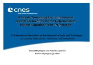
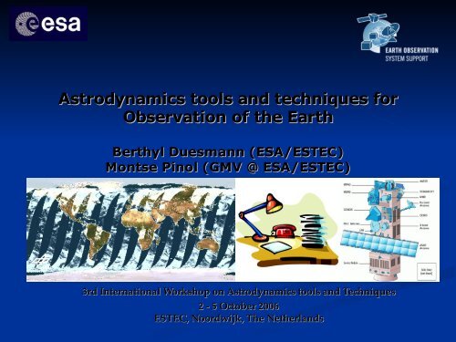
Astrodynamics tools and techniques for<br />
Observation of the Earth<br />
Berthyl Duesmann (<strong>ESA</strong>/ESTEC)<br />
Montse Pinol (GMV @ <strong>ESA</strong>/ESTEC)<br />
3rd International Workshop on Astrodynamics tools and Techniques<br />
2 - 5 October 2006<br />
ESTEC, Noordwijk, The Netherlands
Purpose<br />
� To provide all partners<br />
within <strong>ESA</strong> Earth-observation with identical<br />
� Orbit model,<br />
� Attitude model,<br />
� Time model, (orbit number, time since ANX)<br />
with identical geometry models<br />
(Earth, Sun, Moon).<br />
� The purpose is to eliminate the effect of<br />
differences in the orbit, attitude or<br />
geometrical models in the input / output for
History<br />
� The first version of the Mission Software was<br />
conceived and implemented for ERS-1 in the<br />
late ‘80s of the last century by <strong>ESA</strong> / ESTEC.<br />
This version was re-used for ERS-2.<br />
� Later the mission software was<br />
industrialised,<br />
� For METOP by GMV<br />
� For ENVISAT by Deimos<br />
� For Earth-Explorer’s by Deimos
Applications<br />
� Geolocation of the Level 1 products<br />
� Calculation of other geometric parameters<br />
� Mission analysis,<br />
� Mission planning<br />
� Time segment calculation when sensor sees an<br />
area<br />
� Time segment calculation when a station sees the<br />
s/c<br />
� Visualisation tools
� Direction to Sun<br />
Applications<br />
� ENVISAT / MERIS Observation / Calibration<br />
scenario<br />
� Direction to Sun for Sentinel-1 (MLST ANX @<br />
18:00)
Applications<br />
� Geolocation of the Level 1 products,<br />
calculation of other geometric parameters<br />
� Mission analysis,<br />
� Mission planning<br />
� Time segment calculation when sensor sees an<br />
area<br />
� Time segment calculation when a station sees the<br />
s/c<br />
� Visualisation tools
Applications<br />
� METOP / Windscat Swath over Atlantic
Applications<br />
� SMOS (Asc.) Visibility over VILSPA station<br />
� Including the X-band Tilt Angle constraint (red)
Applications<br />
� Geolocation of the Level 1 products,<br />
calculation of other geometric parameters<br />
� Mission analysis,<br />
� Mission planning<br />
� Time segment calculation when sensor sees an<br />
area<br />
� Time segment calculation when a station sees the<br />
s/c<br />
� Visualisation tools
A<br />
A<br />
Function<br />
B<br />
Inverse<br />
Function<br />
B Function A<br />
Consistency<br />
� Consistency<br />
� Identical input (time) gives identical results,<br />
independent of calling sequence history<br />
� Avoid integrators<br />
X,Y,Z �� h �� X,Y,Z<br />
X,Y,Z j2000 ��X,Y,Z X,Y,Z earth-fixed ��X,Y,Z<br />
� X,Y,Z<br />
� X,Y,Z<br />
Continuity<br />
� Continuity<br />
X,Y,Z j2000<br />
� All resulting parameters and their rates are<br />
continuous<br />
Precision<br />
� Precision<br />
Inverse<br />
Function<br />
A<br />
Model Philosophy<br />
� Important for product processing
A<br />
A<br />
Function<br />
B<br />
Inverse<br />
Function B Function A<br />
Inverse<br />
Function<br />
A<br />
� Continuity example<br />
Model Philosophy<br />
� ENVISAT / MIPAS scientific community discovered a real<br />
ENVISAT attitude discontinuity, whenever the onboard orbit<br />
model was updated (2x per day)<br />
� If the Mission Software would have contained discontinuities<br />
then detection would have been impossible / more difficult<br />
• Orbit Model Update procedure<br />
updated<br />
(December 2003)<br />
� discontinuity drastically reduced<br />
• Attitude File introduced in Mission<br />
Software (2004)<br />
• Attitude File introduced in processing<br />
�Attitude noise down to 4 mdeg<br />
(rms)
Achitecture<br />
� Software is delivered as object library,<br />
�� to guarantee an identical model<br />
Period Driven<br />
(Orbit Range, Time Range)<br />
Epoch Driven<br />
(UTC, Orbit Number + ANX<br />
time)<br />
File Driven<br />
(Orbit Event File, Predicted<br />
Orbit File, all XML)
Envisat<br />
� Envisat<br />
Supported Computer Platforms<br />
� Sun Solaris: 7 or higher, 32<br />
bits<br />
8 or higher, 64 bits<br />
� MacOSX: 10.2 or higher, 32<br />
bits<br />
� Windows: 95 or higher<br />
� Linux: Suse 9.2<br />
� SGI: IRIX 6.5<br />
� IBM: AIX 4.3<br />
Download from:<br />
Helpdesk:<br />
� Earth Explorer<br />
� Sun Solaris: 7 or higher, 32<br />
bits<br />
9 or higher, 64 bits<br />
� MacOSX: 10.2 or higher, 32<br />
bits<br />
bits<br />
10.4 or higher, 64<br />
� Windows: 95 or higher<br />
� Linux: RedHat 8 32 bits<br />
RedHat Linux<br />
Enterprise 4.0 64 bits<br />
EOP System Support Division Web Server: http://eop-cfi.esa.int/<br />
Montse Pinol cfi@jw.estec.esa.nl
Mission Analysis<br />
� Zero Doppler<br />
For the coming Sentinel-1 & EarthCare<br />
mission,<br />
a specific attitude model has been proposed:
Mission Analysis<br />
Attitude model has already been built into the<br />
software<br />
The proposed attitude has been analysed<br />
with respect to the classical local normal pointing<br />
� Range Rate (with respect to target rotating with earth) ��<br />
Doppler<br />
� Elevation with respect to Local Nadir<br />
Please note that the final Zero-Doppler Attitude is identical<br />
to the Attitudes for Terrasar-X and Aeolus.<br />
However the proposed algorithm to achieve this attitude is
Earth Fixed Range Rate
Earth Fixed Range Rate<br />
Zero-Doppler Attitude
Elevation to Nadir<br />
Zero-Doppler Attitude
Conclusions<br />
� <strong>ESA</strong> Earth Observation Missions are<br />
supported by dedicated mission software,<br />
since ERS-1<br />
� Software Philosophy:<br />
� Consistency of transformations<br />
� Continuity in results<br />
� Precision for processing<br />
� Identical results across platforms / projects<br />
� Proven Concept:<br />
� Analysis, Planning & Processing<br />
� ERS-1, ERS-2, EnviSat