engineering
35_attachement_catalogue
35_attachement_catalogue

Create successful ePaper yourself
Turn your PDF publications into a flip-book with our unique Google optimized e-Paper software.
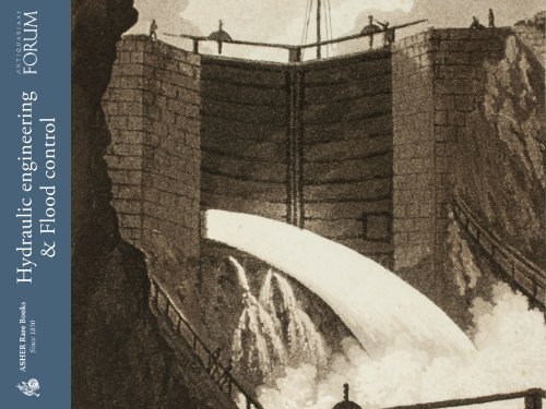
Hydraulic <strong>engineering</strong><br />
& Flood control
Hydraulic <strong>engineering</strong> & Flood control<br />
e-catalogue<br />
Jointly offered for sale by:<br />
Extensive descriptions and images available on request<br />
All offers are without engagement and subject to prior sale.<br />
All items in this list are complete and in good condition unless stated otherwise.<br />
Any item not agreeing with the description may be returned within one week after receipt.<br />
Prices are EURO (€). Postage and insurance are not included. VAT is charged at the standard rate to all<br />
EU customers. EU customers: please quote your VAT number when placing orders. Preferred mode of payment:<br />
in advance, wire transfer or bankcheck. Arrangements can be made for MasterCard and VisaCard.<br />
Ownership of goods does not pass to the purchaser until the price has been paid in full.<br />
General conditions of sale are those laid down in the ILAB Code of Usages and Customs,<br />
which can be viewed at: <br />
New customers are requested to provide references when ordering.<br />
Orders can be sent to either firm.<br />
Antiquariaat FORUM BV<br />
Tuurdijk 16<br />
3997 ms ‘t Goy – Houten<br />
The Netherlands<br />
Phone: +31 (0)30 6011955<br />
Fax: +31 (0)30 6011813<br />
E–mail: info@forumrarebooks.com<br />
Web: www.forumrarebooks.com<br />
www.forumislamicworld.com<br />
ASHER Rare Books<br />
Tuurdijk 16<br />
3997 ms ‘t Goy – Houten<br />
The Netherlands<br />
Phone: +31 (0)30 6011955<br />
Fax: +31 (0)30 6011813<br />
E–mail: info@asherbooks.com<br />
Web: www.asherbooks.com<br />
cover image: no. 19<br />
v 1.0 · 03 Nov 2016
Two masterpieces of Dutch hydraulic <strong>engineering</strong><br />
1. BA R NA R D, John Gross. Report on<br />
the North Sea Canal of Holland; and on the<br />
improvement of navigation from Rotterdam<br />
to the sea; to the chief of engineers, United<br />
States army. (Professional papers of the corps<br />
of engineers, U.S. army. No. 22).<br />
Washington D.C., U.S. Government Printing<br />
Office, 1872. 4º. With 12 plates numbered as<br />
11 (all but 1 folding and 1 printed in red and<br />
black). Further with a half title, title-page,<br />
preface, and list of plates. Contemporary<br />
brown half morocco, reddish-brown cloth<br />
sides gold-blocked with the title and the coat<br />
of arms of the United States Army Corps of<br />
Engineers. € 875<br />
A detailed and neatly arranged overview of the<br />
construction works of the Nieuwe Waterweg and<br />
the North Sea Canal, compiled by Brevet Major<br />
General John Gross Barnard. Barnard´s report, no.<br />
22 in the series of professional papers published by<br />
the U.S. army corps of engineers, clearly presents<br />
all technical details of these two major shipping<br />
canals, whose construction was then nearing<br />
completion.<br />
With some tears in the plates (serious in plate 1)<br />
but otherwise in good condition. A thorough and<br />
well-illustrated report on two significant examples<br />
of 19th-century Dutch hydraulic <strong>engineering</strong>.
Richly illustrated lectures on applied physics, by the Royal Society’s de facto curator of experiments<br />
2. DE SAGU LIERS, John Theophilus. De natuurkunde uit ondervindingen opgemaakt... Uit het Engels vertaald door een liefhebber der<br />
natuurkunde.<br />
Amsterdam Isaak Tirion, 1751. 3 volumes. 4º. With 114 folding engraved plates. Contemporary half-calf. € 1925<br />
Second edition in Dutch of a syllabus of lectures by a British natural philosopher,<br />
reprinting the first two volumes and adding a third volume, appearing<br />
here in translation for the first time. The son of Huguenot refugees, Desaguliers<br />
(1683–1744) studied at Christ Church, Oxford and succeeded James Keill as<br />
lecturer in experimental philosophy at Hart Hall. “Desaguliers’ practical<br />
abilities aroused the Royal Society’s interest soon after his arrival in London…<br />
at Newton’s suggestion, he was invited to repeat some of Newton’s experiments<br />
on heat; before long he had become a de facto curator of experiments” (DSB).<br />
Desaguliers was highly skilled in practical mechanics, improving numerous<br />
devices, and described and demonstrated a great number of experiments. For<br />
the benefit of his auditors, Desaguliers published a number of his lectures in<br />
1717 and in 1719 other lectures were published in an unauthorized edition<br />
which Desaguliers denounced. Only in 1734 did the first official volume of<br />
lectures appear, including a simple treatment of Newton’s system of the world<br />
and a description and a description of Ralph Allen’s railway in Bath. The<br />
second volume appeared in 1746. “Desaguliers attributed the ten-year delay<br />
before the appearance of his second tome to his desire to improve the treatment<br />
of machines, especially waterwheels… Continuing with mechanics, in seven<br />
lectures, he discussed impact and elasticity, vis viva and momentum, heat,<br />
hydrostatics and hydraulics, pneumatics, meteorology, and more machines.<br />
This second volume… entitles Desaguliers to be considered a forerunner of<br />
the more advanced knowledge of machinery that characterized the Industrial<br />
Revolution” (DSB).<br />
Dutch translations appeared in 1737 (volume 1) and 1746 (volume 2). Both<br />
volumes were reprinted in 1751, together with a third volume containing a<br />
single lecture on hydraulics and a treatise on optics.<br />
With some spotting throughout and the bindings rubbed. The privilige of volume 1 is bound after instead of before the contents; volume 2 with a small<br />
wormhole in the lower margin not affecting the text and a hole in the lower margin on pp. 279–301. A good copy of this interesting work on applied physics<br />
with attractive engravings.<br />
Bierens de Haan 1178–1180; DSB IV, pp. 43–46; STCN (12 copies, 6 incomplete).
Finely engraved wall map of the Rijnland water district, coloured by a contemporary hand<br />
3. [DOU, Jan Jansz., Steven van BROECK HU YSEN<br />
and Melchior BOL STR A]. ‘T Hooge Heemraedschap van<br />
Rhynland.<br />
[Amsterdam, Isaak Tirion], 1746. Very large engraved wall map<br />
of the Rijnland water district in 12 map sheets and 1 title-sheet,<br />
the title-sheet divided into 3 strips, the whole mounted on cloth<br />
(measuring 185 × 169 cm as assembled). Coloured and shellacked<br />
by a contemporary hand, with gold for the lettering of the title<br />
and the coat of arms. With the water board’s coat of arms, and<br />
two decorative cartouches listing the members of the water board<br />
in 1687 and 1746. Framed. € 7500<br />
Third state (extensively corrected and updated) of a finely engraved wall<br />
map of the Rijnland water district in Holland, including the cities of<br />
Amsterdam, Haarlem, Leiden and (on the district border) The Hague.<br />
At a scale of about 1 : 30 000 it shows the entire district and some surrounding<br />
land in great detail, with the fortifications and (outside the<br />
cities) the individual houses, windmills, churches and other buildings<br />
shown, besides the roads, paths, waterways, and the individual parcels<br />
of land in the polders. In 1745 the Rijnland waterboard ordered the<br />
surveyor Melchior Bolstra to correct the outdated map of Dou and<br />
Broeckhuysen of 1647, which had been slightly revised in 1687. The<br />
results of Bolstra’s new survey were engraved on the original plates by<br />
David Coster.<br />
Evenly browned, except along the edges of the sheets, and some small<br />
smudges. Good copy of a large wall map of the Rijnland water district.<br />
Donkersloot-De Vrij 715.
Ocean waves, flooding & hydraulic <strong>engineering</strong>, well-illustrated<br />
4. EM Y, Amand Rose. Ueber die Bewegung der Wellen und über den Bau am Meere und im Meere. ... Mit 10 Kupfertafeln [sic].<br />
Vienna, Ludwig Förster’s artistischer Anstalt (on reverse of title-page: printed by J.P. Sollinger), 1839. 8º. With 10 folding lithographic plates<br />
(23 × 39 to 54 cm) with 75 figures showing diagrams of wave forms and motions, and plans and cross-sections of coasts, man-made barriers,<br />
buildings, hydraulic devices, etc. 19-century blue cloth. € 350<br />
First edition in German of a detailed account of<br />
waves, concentrating on ocean waves. It covers both<br />
practical and theoretical aspects, with chapters on<br />
the motion of waves and of water within waves,<br />
the theory of travelling waves, new developments<br />
in wave theory, various phenomena, the influence<br />
of the form of the sea floor on waves, the effects of<br />
wind and causes of floods, their effects on the coast<br />
and the silting of harbours, the theory and practice<br />
of sea walls and other constructions, harbour<br />
improvement, and a more detailed discussion of<br />
various sorts of constructions. The illustrations<br />
include diagrams illustrating the theory of wave<br />
flow, cross-sections of various shapes of sea floors<br />
and their influence on the waves, plans and sections<br />
of protective constructions (wharves, dams, sea<br />
walls, etc.) and hydraulic devices. It makes use of<br />
specific historical examples, such as the destruction<br />
of the dam at St. Jean de Luz in 1822.<br />
A good copy, with the text leaves slightly wrinkled<br />
and with some minor stains, and two leaves reinforced<br />
along the edge. The plates are very slightly<br />
browned. There are a few small holes in the binding<br />
cloth. An interesting and uncommon practical and<br />
theoretical treatise.<br />
WorldCat (4 copies); cf. Sotheran, Second suppl. 17951.
Monograph on rivers, torrents and inland navigation<br />
5. FA BR E , Jean Antoine. Essai sur la théorie des<br />
torrens et des rivières, contenant les moyens les plus<br />
simples d’en empêcher les ravages, d’en rétrécir le lit &<br />
d’en faciliter la navigation, le hallage & la flottaison.<br />
Accompagné d’une discussion sur la navigation<br />
intérieure de la France; et terminé par le projet de<br />
rendre Paris, port maritime en faisant remonter à la<br />
voile, par la Seine, les navires qui s’arrêtent à Rouen.<br />
Paris, Bidault, 1797. 4º (29 × 21.5 cm). With 8 folding<br />
engraved plates, showing how to determine the drop of<br />
a river, the contents of water, how to change currents,<br />
how to create different effects with different dyke<br />
constructions, etc. Contemporary mottled calf, goldtooled<br />
spine, in the style of Bradel & Derôme. € 750<br />
Rare work on rivers, torrents and inland navigation. Jean<br />
Antoine Fabre (1749–1834), an hydraulic engineer, systematically<br />
describes the origin, conditions of rivers and<br />
torrents and offers advice on how to change their course<br />
and/or prevent them from causing damage. He argues<br />
against the deforestation of mountain slopes, gives advice<br />
on how to cultivate agricultural areas on hillsides and<br />
discusses different dyke constructions. In the third part<br />
of his work, he deals with inland navigation and gives a<br />
survey of the situation on several French rivers. He finally<br />
launches a plan to transform Paris into an harbour by<br />
forcing the current to deepen the rather shallow Seine,<br />
thereby enabling larger ships to reach the capital.<br />
A few leaves slightly foxed, pages 137–141 with lower<br />
margins/corner damaged; binding slightly rubbed, some<br />
repairs to spine. A well preserved copy with ample margins<br />
of this intriguing work on hydrology and navigation.<br />
Brunet II, col. 1148; Ward 765; for Fabre: Poggendorf I, col. 711.
18th-century manuscript map of part of the Lek River<br />
6. H ATTUM, Dirk van. Kaarte en aftekening van het rivier vak beneeden het Tienhovense Veer met de aanleggende krib, en rijswerken.<br />
[Netherlands], August 1792. Manuscript map in pen, ink and colour washes on paper (52.5 × 73.5 cm), with a compass rose (north below right),<br />
the names of the regions, and a scale (ca. 1:2000) below left. € 1950<br />
Large manuscript map of part of the Lek River, near the village of Tienhoven in Zuid-Holland. The map was surveyed and drawn by Dirk van Hattum,<br />
the official surveyor of the water board of the Lekdijk Benedendams. In his map Van Hattum suggests the construction of a hydraulic works to improve the<br />
navigability of part of the river and simultaneously protect an elementary river groyne downstream. Besides the extent, nature and ownership of the lands,<br />
including the remains of former floodgates, much attention is given to the location, structure and improvement of the levee.<br />
With some small tears along old folds and along the edges, and some minor soiling, but still generally in good condition.
Fine copy of splendid hydraulic <strong>engineering</strong> drawings<br />
7. HOR ST, Tileman van der and Jacob POLLEY. Theatrum machinarum universale; of keurige verzameling van verscheide grote en zeer<br />
fraaie waterwerken, schutsluizen, waterkeringen, ophaal- en draaibruggen.<br />
Amsterdam, Petrus Schenk [II] & son (vol. II: Petrus Schenk [III]), 1757–1774. Imperial 2º (50 × 34 cm). With a double-page engraved dedication<br />
plate and 41 double-page and 7 larger folding engraved illustration plates. Red half sheepskin (ca. 1800). € 3250<br />
Second edition of both volumes of a remarkably<br />
detailed set of scale construction drawings<br />
(plans, sections, elevations, perspective views,<br />
etc., including many detail drawings of individual<br />
parts) of 18th-century Dutch waterworks,<br />
with the accompanying letterpress descriptions<br />
and notes. It includes locks, sluices, bridges,<br />
pumps, pile drivers, an ice-breaker, an elaborate<br />
water-bailing mill and more. Most of the plates<br />
measure about 45 × 54 cm, with the folding ones<br />
about 52 × 76 cm. At least most of the plates<br />
depict existing works, and the text occasionally<br />
gives some historical information. The drawings<br />
are so detailed and give such a clear picture of<br />
how the mechanisms functioned that one could<br />
use them to reconstruct the works shown.<br />
A fine copy, nearly untrimmed, with only some<br />
false folds in the half-title and an occasional<br />
minor defect in the paper. Plate 23 in volume 1<br />
has no number, but it may have been trimmed<br />
off at the head. The inside front hinge has partly<br />
separated from the book-block, but the binding<br />
is otherwise good. A fine copy of a magnificent<br />
display of Dutch hydraulic <strong>engineering</strong>.<br />
Bierens de Haan [3818.5] & [4839.5] (vol. II only, with later ed.<br />
of vol. I); STCN (2 & 4 copies of the 2 volumes); not in Berlin<br />
Kat.; Roberts & Trent, Bibl. Mechanica.
Important geological classic on the “subterranean world”<br />
8. K IRCHER, Athanasius. D’onder-aardse weereld in haar goddelijk maaksel . . .<br />
Amsterdam, heirs of Johannes Janssonius van Waesberge, 1682. 2 volumes bound as 1. 2º. With engraved frontispiece, engraved coat of arms<br />
of the dedicatee, Thomas Ernsthuys, 15 engraved plates (mostly double-page) and numerous woodcut and engraved illustrations in the text.<br />
Contemporary blind-tooled vellum, each board with a large centrepiece in a double panel of fillets. € 14 500<br />
First Dutch edition of a major scientific work<br />
Kircher, covering many branches of science,<br />
including physics, geography and chemistry.<br />
Kircher’s “subterranean world”, is an extensively<br />
illustrated mixture of odd speculation<br />
with genuine insight. It includes chapters on<br />
the Andes mountains, the Iroquois Indians<br />
in Canada, the Strait of Magellan and gold<br />
& silver in America. “Major topics include<br />
gravity, the moon, the sun, eclipses, ocean<br />
currents, subterranean waters and fires, meteorology,<br />
rivers and lakes, hydraulics, minerals<br />
and fossils, subterranean giants, beasts and<br />
demons, poisons, metallurgy and mining,<br />
alchemy, the universal seed and the generation<br />
of insects, herbs, astrological medicine, distillation<br />
and fireworks’’ (Merrill).<br />
With three owners’ inscriptions on the titlepage.<br />
With frequent pencil marks, a leaf with<br />
contemporary manuscript annotations tipped<br />
in and another loosely inserted. With some<br />
quires slightly browned and an occasional<br />
marginal water stain or similar minor defect,<br />
but otherwise in very good condition. Binding<br />
soiled, joints and hinges professionally restored.<br />
Alden & Landis 682/99; DSB VII, pp. 374–378; Hoover 483;<br />
Sabin 37968; cf. Merrill, Athanasius Kircher 17 (Latin ed.).
Proposal for reinforcing the dikes of West-Friesland<br />
9. L A K ENM A N, Seger. Ontwerp van een onkostbaar en zeker middel, om de Westvriesche zeedyken... te stellen buiten eenig gevaar van<br />
doorbrake...<br />
Amsterdam, heirs of Johannes Ratelband and company and Hendrik de Leth, 1733. 2º. With 2 folding engraved plates, including 1 map of<br />
North-Holland. Contemporary marbled paper wrappers, preserved in a blue cloth chemise. € 1875<br />
First and only edition of a brief treatise by Seger<br />
Lakenman on reinforcing the dykes of West-Friesland,<br />
now the north of North-Holland, the Netherlands. The<br />
dykes were impaired because the pillars were affected<br />
by “sea worms”, who couldn’t be stopped from eating<br />
the wooden pillars. In 1732 the States of Holland and<br />
West-Frieslandcreated a contest for a better type of<br />
dyke. Lakenman responded with the present work, suggesting,<br />
among other things, the construction of a new<br />
inner dyke, a so-called “inlaagdijk”, and also including<br />
the estimated costs. His proposal, however, was rejected<br />
by the States. On the title-page Lakenveld is mentioned<br />
as the secretary of “Drechterland”, a small community<br />
in the Dutch province of North-Holland.<br />
Some marginal thumbing, a few small stains, and<br />
the plates only slightly browned, otherwise in good<br />
condition, with the edges wholly untrimmed. Edges<br />
of the marbled paper wrappers slightly frayed, but<br />
otherwise good.<br />
V.d. Aa XI, pp. 40-41; STCN 184404789.
With designs for dyke construction<br />
10. LISTINGH, Nicolaas. Incitamentum & Adiumentum. Dat is Opweckinge ende Aanleydinge, Tot het uytvinden van Bequaame Middeln<br />
en Gronden Om de Zee-dycken, In Hollandt en West-Vrieslandt, tegens ... te beschermen en the bevreyden.<br />
Amsterdam, heirs Paulus Matthysz, 1702. With 8 large folding engraved plates of dykes and construction designs, 1 view of Muiden by Stoopendael.<br />
With:<br />
(2) LISTINGH, Nicolaas. Incitamentum & Adiumentum Secundum, dat is Een Tweede Opwecking en Aanleiding, ... van de oude magteloose<br />
Muyder-zee-dyk.<br />
Amsterdam, heirs of Paulus Matthysz, 1705.<br />
(3) LISTINGH, Nicolaas. Na brief.<br />
Amsterdam, August 25 1704. 3 work in 1 volume. 4º. Contemporary half calf, repairs to the spine. € 3400<br />
Rare and interesting work on dyke construction, illustrating the continuing battle of the Dutch against the sea. On April 5 1702, the dyke between Amsterdam<br />
and Muiden was breached (see plate 1). The Amsterdam advocate Nicolaas Listingh designed a new construction for the dyke to prevent the sand being washed<br />
away by the pounding of the waves. Listingh proposed the construction of partitions that were placed in oblique angles. Each partition consisted of a row<br />
of piles driven into the ground. The oblique corners would break the battering of the waves and prevent erosion. Among the 6 engravings in the first work<br />
is a view on Muiden by Stoopendael from<br />
De Zegepraalende Vecht . In the second work,<br />
Listingh describes another device, a so-called<br />
“sea forcer,” aimed to break the waves before<br />
they hit the dyke. The large folding plate<br />
(59 × 49 cm), depicting this construction, is<br />
engraved by Stoopendael. Listingh defends his<br />
construction on the grounds that it is cheaper<br />
and more effective than the other proposals.<br />
The final four pages contain a letter by Listingh<br />
on dyke construction.<br />
Bookplates with text “Majorat Meuselwitz”<br />
on inside front cover; some browning and<br />
staining; plates 1,4,5 with minor tears on folds<br />
where they are attached to book with some<br />
restorations.<br />
Bierens de Haan 2784–2786; Cat. NHSM, p. 329; cf. v.d. Aa<br />
IV, p. 162.
Collection of 6 maps of the Beemster polder 1644–1979<br />
11. FLOR ISZ . VA N BERCK ENRODE , Balthasar and Daniel van<br />
BREEN. Beemsterlants caerte... [with a second title at the head:] Ware afbeeldinge<br />
vande bedyckte Beemster-landen... M.DC.XLIIII.<br />
Amsterdam, 1644 [reprinted ca. 1769?]. Engraved map in 6 sheets (each 56 × 44<br />
cm).<br />
With:<br />
(2) [FLOR ISZ . VA N BERCK ENRODE , Balthasar] and Daniel van BR EEN.<br />
Beemsterlants caerte…<br />
Amsterdam, 1658. Engraved map (43.5 × 58 cm).<br />
(3) Beemster landts kaarte, aenwijsende de hoogte vande ringhdyck.<br />
[Amsterdam(?), ca. 1696]. Engraved map (28 × 35.5 cm).<br />
(4) DORLAND, C. [2 maps of the Beemster].<br />
Amsterdam, Tresling & Co., March 1908. 2 nearly identical chromolithographed<br />
maps (ca. 28 × 36 cm), the first partly and the second wholly coloured.<br />
(5) Waterschap de Beemster.<br />
February 1970, updated to 1979. Large map (64 × 50 cm).<br />
Collection of 6 maps (the first in 6 sheets). Bound in modern cloth (57.5 × 47 cm). € 3750<br />
Interesting collection of maps of the Beemster polder, which in the 16th century was an eight by nine kilometre inland sea north of Amsterdam. Its reclamation<br />
in the years 1607 to 1612, financed largely by the Dutch East India Company, was one of the most ambitious of the early 17th-century drainage projects.<br />
Dykes were built and the water was pumped out by 41 windmills, creating a large polder with sorely needed residential and above all farming land near the<br />
rapidly expanding city of Amsterdam.<br />
Including: (Ad 1:) Apparently the last reprint, not reported in the literature, of a magnificent map of the Beemster Polder, on a scale of about 1 : 11 500, which<br />
“may be called the finest water-authority map of this era” (Fockema Andreae, Gesch. Kartografie Nederland, p. 36). The land was surveyed and the map drawn<br />
in 1640 by Balthasar Florisz. van Berckenrode and engraved in 1644 by Daniel van Breen. (Ad 2:) Rare reduced version, in its first state, of the map of the<br />
Beemster by Balthasar Florisz. van Berckenrode and Daniel van Breen. It was issued in a second state in 1769, revised by Jan Switsers. (Ad 3:) Rare surveyor’s<br />
map clarifying the state of the dyke of the Beemster polder. (Ad 4-5:) Three modern maps of the Beemster. A few small tears along the edges (ad 3) and a minor<br />
dampstain in two leaves (ad 1). Collection of maps of the Beemster in very good condition.<br />
Ad 1: cf. Donkersloot-De Vrij 130; Hameleers (1984) 13; De Vries, Beemsterlants Caerten 10 (none mentioning this printing); ad 2: Donkersloot-De Vrij 130 note; De Vries, Beemsterlants Caerten 12A (5 copies); ad 3:<br />
De Vries, Beemsterlants Caerten 13 (5 copies).
Manuscript atlas and ownership records of parcels in the Prins Willem polder,<br />
northeast of Oostburg, in the southwest corner of the Netherlands<br />
12. GER SOM, Gerrit van. Caerte en omlooper van Prins Willem Polder. Bedijkt anno 1650 en 1651. Bij een versamelt en na neerstigh.<br />
ondersoek t’samen gestelt door Gerrit van Gersom dijkgraef van desen polder, anno 1723.<br />
[Oostburg?], 1723. Royal 2º (41 × 27.5 cm). With a hand-coloured title-page, a large folding map of the dikes along the border of the polder, a large<br />
folding general map of the polder showing the numbered parcels at a scale of about 1 : 18 000, and 17 folding detail maps showing the individual<br />
plots within the parcels at a larger scale, all executed in brown ink and watercolours and tipped onto the fore-edges of 19 of the 144 numbered<br />
text leaves. Contemporary sheepskin parchment. € 9500<br />
Extraordinary manuscript atlas and register of land<br />
ownership for the “Gecombineerde Prins Willem<br />
Polder” (combined Prince William polder) in<br />
Zeeuws-Vlaanderen (the parts of Flanders situated<br />
in the province of Zeeland in the Dutch Republic),<br />
north and west of the town of Oostburg, in the<br />
southwest corner of the Netherlands. It documents<br />
the individual plots of land within the polder and<br />
records the owners who acquired each plot when<br />
the polder was first laid out in 1650 and 1651, and<br />
the owners in 1723. Atlases of this type were drawn<br />
up by land-owning corporations or polder authorities<br />
for the proper administration of land taxes,<br />
and provide one of the most complete and accurate<br />
records of land ownership. They generally remained<br />
in the archives of the institutions until destroyed or<br />
turned over to the governmental archives, so that<br />
they rarely come on the market. The present atlas<br />
of the Generale Prins Willempolder in Zeeland is<br />
therefore an extremely rare primary source for the social, economic and topographic history of the region, the history of the Dutch battle against the sea and<br />
the genealogy of the land owners. It was compiled by Gerrit van Gersom, then dijkgraaf (the official charged with oversite of a polder and its dikes) for the<br />
Prins Willempolder.<br />
Most of the first map is detached and several have tears, creases or tattered edges, sometimes crudely repaired, but most remain in good or very good condition.<br />
The paperboard core of the front board is lost, leaving the limp sheepskin, and the binding is soiled and tattered, with some tears, chips and broken sewing<br />
supports. An essential primary source for the history, topography and genealogy of the Prins Willempolder in Zeeuws-Vlaanderen, in the southwest corner of<br />
the Netherlands, near the coast and the Belgian border.
Managing water flow and levels in rivers and canals<br />
13. MINA R D, Charles Joseph. Cours de construction des ouvrages qui établissent la navigation des rivières et de canaux, professé a l’école<br />
des ponts et chausses de 1832 à 1841.<br />
Paris, Carillan-Goeury & Dalmont (printed by Fain & Thunot), 1841. 2 volumes. Royal 4º (text) & Imperial 4º (plates). With 36 double page<br />
plates. Dark green half calf, Spanish marbled paper sides, blue sprinkled edges. € 875<br />
A work on managing water flow and levels in rivers and canals, in two volumes, the first being a text volume and the second consisting of 36 double page<br />
plates. The text volume is divided into two parts, devoted respectively to rivers and canals. With chapters on the construction of locks, dykes, dams, tunnels,<br />
aqueducts, and bridges. By the French engineer Charles Joseph Minard (1781–1870). The text volume includes a 27-page explanation of the plates, an 8-page<br />
index and a list of errata.<br />
Re-backed with original backstrip. A very good copy, with only the text volume slightly foxed throughout.<br />
Poggendorff II, col. 154; WorldCat (9 copies).
The North Sea Canal and waterways in and around Amsterdam<br />
14. [NORTH SEA CANAL]. [Collection of works relating to the Noordzeekanaal, the Amsterdamsche Kanaal-Maatschappij and various<br />
waterways in and around Amsterdam].<br />
Amsterdam, The Hague and Haarlem, 1827–1880. € 3250<br />
Collection of 21 books and pamphlets (plus 2 duplicates) and a large folding chromolithographed map, relating to the Noordzeekanaal (North Sea Canal),<br />
the Amsterdamsche Kanaal-Maatschappij (Amsterdam Canal Company) and various waterways in and around Amsterdam, including the IJ and the canals<br />
in the city itself. Also with an unissued 1868 bond with separate printed conditions, from the Amsterdamsche Kanaal-Maatschappij.<br />
When the Noordhollandsch Kanaal (North Holland Cannal), built in 1824, wasn’t any longer able to handle the growing boat traffic from the North Sea to<br />
Amsterdam, it was decided to construct a new canal reaching the North Sea in IJmuiden, the Noordzeekanaal. This concession for this canal was given to the<br />
Amsterdamsche Kanaal-Maatschappij and it was constructed between 1865–1876. To raise capital for this project the company issued bonds.<br />
All in good condition, but some wrappers damaged. The bond and its conditions with some minor tears and folds. Full list of contents available on request.<br />
3 not in P.H. Kemper, Repertorium der literatuur van den waterstaat van Nederland (1888).
1598 ordinance for clearing trees around windmills, signed by Johan van Oldenbarnevelt<br />
15. OLDENBA R NEV ELT, Johan van. [Ordinance forbidding the planting of trees around windmills in the Land van Arkel (in the<br />
southwestern corner of the province of Holland) and requiring the removal of existing trees].<br />
The Hague, 14 December 1598. Manuscript document in Dutch in brown ink on the skin side of a single piece of sheepskin parchment (36 × 48<br />
cm, folded to 14 × 19 cm). € 2950<br />
Original official ordinance by the knighthood, noblemen<br />
and cities of the province of Holland representing the<br />
States of Holland (signed by the great statesman Johan van<br />
Oldenbarnevelt), giving a detailed picture of the careful<br />
balance that had to be struck between individual rights and<br />
general good in maintaining the reclaimed Dutch polder<br />
lands in the 16th century, in this case concerning water<br />
control in the Land van Arkel, a region around the towns<br />
of Arkel and Gorinchem and some villages and polder<br />
lands to their north and east. The officials had already<br />
taken all measures they could independently, improving<br />
the existing windmills and building new ones to pump<br />
the rising water up into the rivers, but the windmills were<br />
unable to perform optimally because willows, orchards<br />
and other planted trees on private properties around the<br />
windmills were interfering with the wind. The request<br />
was granted by the present ordinance. It gave them the<br />
authority to forbid further planting within 50 roeden<br />
(about 200 metres) of a windmill and to demand the<br />
removal of trees already planted within that distance.<br />
Although the document itself explicitly refers to the<br />
attached seal, no trace of it survives except for the slit<br />
cut through the two layers of parchment below the text.<br />
The document is in very good condition, with only very<br />
minor wear along the folds. An unusually informative<br />
ordinance for clearing trees around windmills.
New designs for a sluice and dredging machine,<br />
beautifully illustrated, presentation copy to Christiaan Brunings,<br />
inspector of the original design and writer of a preliminary text<br />
16. R EDELY KHEID, Cornelis. De nieuw uitgevonden sluis met in- en uitschuivende deuren.<br />
With: (2) R EDELY KHEID, Cornelis. De nieuw uitgevonden diep-machine.<br />
The Hague, Hendrik Christoffel Gutteling; Amsterdam, Jacob Yntema & Jacob Tieboel; for the author, 1774. 2 works in 1 volume. Large 2º<br />
(49.5 × 31 cm). Ad 1 with 6 large folding engraved plates and ad 2 with 3 large folding engraved plates. Contemporary half calf. € 7500<br />
Two rare first editions, in the original Dutch, containing detailed<br />
descriptions and illustrations of two new inventions in water <strong>engineering</strong>:<br />
a sluice with sliding gates and a dredging machine. They were<br />
designed by the accomplished engineer Cornelis Redelykheid (1728–<br />
1788), well-known in his time, but often overlooked in modern literature.<br />
The descriptions are accompanied by a total of 9 detailed large<br />
folding plates and especially the dredging machine is looking ingenious.<br />
Redelykheid was already working on his sluice with sliding gates in<br />
1772 and a model was built, one fourth its intended size. The model<br />
was inspected and tested by the water engineer Christiaan Brunings<br />
(1736–1805), then inspector general of rivers & waterways, who later<br />
founded the Dutch water management department now known as<br />
“Rijkswaterstaat”. Brunings wrote an extensive and positive rapport on<br />
the sluice, which led Redelykheid to be awarded with 1000 gold ducats<br />
by the States of Holland. The award enabled the inventor to publish<br />
the present two works on his own expense, both including a preface by<br />
Brunings. As a grateful gesture Redelykheid presented the present copy<br />
to Brunings, with an inscription on each of the two title-pages.<br />
With library stamp and tiny bookplate. Only some minor thumbing<br />
in the margins of a few leaves and the leaves facing the plates slight<br />
discoloured where the leaves overlap the fold of the plates, otherwise in<br />
very good condition, text leaves untrimmed, leaving wide margins and<br />
with the plates in very crisp impressions. Binding rubbed, with ends of<br />
the spine slightly damaged, but still firm and otherwise good.<br />
Bierens de Haan 3902 & 3900; Sloos, Gewapend met kennis, pp. 208–209; not in Roberts &<br />
Trent; for the author: NNBW VIII, cols. 1266–1268.
1784 copy of a 1568 manuscript map of Walcheren and Zuid-Beveland in Zeeland<br />
17. RU Y TE, Lieven. [Walcheren ... Zuyt Bevelant].<br />
Tholen, Korstiaen Bestebroer, 1784. Map: 42 × 52.5 cm (frame: 61 × 71.5 cm). Manuscript map in ink and watercolour on paper (map image<br />
37 × 47 cm) at a scale of about 1 : 55 000 with north at the top. Framed. € 1900<br />
A manuscript copy of a 1568 manuscript map of what<br />
were then islands and waterways in Zeeland, covering<br />
the eastern half of Walcheren, most of Zuid-Beveland,<br />
the southern edge of Noord-Beveland and some<br />
smaller islands. It includes the cities of Middelburg,<br />
Veere, Vlissingen and Goes, and about twenty<br />
smaller towns and villages. It is executed in pen and<br />
watercolour in subtle shades ochre, blue, yellow, grey,<br />
green and pink and represents the cities and towns<br />
pictorially (with major churches and sometimes<br />
smaller buildings and fortifications), shows roads, 7<br />
boats and ships in the water and sandbanks.<br />
The map was originally drawn by the surveyor Lieven<br />
Ruyte (ca. 1553–1601), apparently based on his own<br />
survey, and covers an area of about 19×27 kilometres.<br />
The original map of 1568 is said to have been in the<br />
hands of the town clerk of the city of Goes but is now<br />
known only from copies.<br />
With some foxing, mostly in or near the margins,<br />
but otherwise in very good condition. Some minor<br />
tears are confined to the margins and the map is very<br />
slightly worn along an old vertical fold. A detailed<br />
map showing islands and waterways in Zeeland as<br />
they were in 1568.<br />
Cf. Donkersloot-de Vrij, Topografische kaarten 692; Zelandia<br />
illustrata, p. 615.
Exploration of the Isthmus of Tehuantepec, with 20 maps and charts<br />
18. SHUFELDT, Robert Wilson. Reports of explorations and surveys, to ascertain the practicability of a ship-canal between the Atlantic<br />
and Pacific Oceans, by the way of the Isthmus of Tehuantepec.<br />
Washington, Government printing office, 1872. 4º. With 19 large folding and 1 full-page maps and charts (including 6 profiles, 11 river and<br />
coastal maps, 1 geological map (hand-coloured), and 2 meteorological charts) and 11 tinted lithographed views. Light brown goatskin. € 395<br />
Report of a United States’ exploration of the<br />
Isthmus of Tehuantepec in Mexico. Since<br />
the discovery of America plans were made<br />
to connect the Atlantic and Pacific oceans<br />
by a canal. Robert W. Shufeldt (1822–1895)<br />
headed the surveying mission in 1870–1871<br />
and presented his report to the second<br />
session of the Forty-Second Congress of<br />
the United States. The expedition studied<br />
the terrain beginning at the mouth of the<br />
Coatzacoalcos river on the Mexican Gulf<br />
and ending at the harbour of Salina Cruz<br />
on the Pacific Ocean, a distance of ca. 225<br />
km in a straight line. The report contains<br />
sections on the hydrography, meteorology,<br />
geology, zoology, botany, ethnography,<br />
etc. of this region. The canal would make<br />
partial use of the Coatzacoalcos river and<br />
the largest part would be dug out, containing<br />
locks and even tunnels, the longest<br />
projected tunnel would measure 1265 m.<br />
With some library stamps. Lower corner<br />
title-page cut off, some small tears along<br />
folding lines of some maps, tear in map 11,<br />
otherwise in good condition. Binding also<br />
good, only slightly rubbed.<br />
Palau 312172; Sabin 80759; DAB XVII, pp. 139–140.
Contemporary illustrations<br />
of the Trollhätte Canal<br />
19. SKJÖLDEBR A ND, Anders Frederik. Description des cataractes<br />
et du canal de Trollhätta en Suède; avec un précis historique.<br />
Stockholm, Charles Delén, 1804. 4º. With an aquatint title-page and 12<br />
aquatint plates, including 1 map, all drawn and engraved by the author.<br />
Contemporary grey-blue wrappers. € 850<br />
First and only edition in the original French, of a richly illustrated description of<br />
the waterfall, locks and canal near Trollhättan in Sweden. Although spectacular,<br />
the waterfalls were a great obstacle in the transport of wood from Lake Vänern<br />
in the interior of Sweden, to the port of Gothenburg. To navigate the cataracts<br />
a canal was cut through solid rock. At the opening in 1800, eight locks could<br />
raise and lower a ship 32 meters, making it finally possible to sail past Trollhättan<br />
without reloading goods on horse-carts. The waterfall, canal and sluices became,<br />
and still are, a popular destination for tourists, providing a market for this description<br />
written and illustrated by count Anders Skjöldebrand (1757–1834). The book<br />
describes the countryside, culture and feats of <strong>engineering</strong> near Tröllhattan,<br />
starting with the etymology of the city’s name and ending with a critique of the<br />
current state of the <strong>engineering</strong> works. A table gives the amount that passed the<br />
sluices in 1800–1802.<br />
Browned and foxed throughout, especially the plates, with waterstains at the top<br />
and bottom corners. Spine tattered, with the final gathering and back cover partly<br />
loose; otherwise a good copy.<br />
Brunet V, col. 408; Myren, “Det äldre Trollhättan i konsten”, Historia och Historier om “Stranna” XI, pp. 3–32.
Richly illustrated work on hydraulics, with 100 engraved double-page plates<br />
20. STR A DA, Jacobus de [and Benjamin BR A MER]. Künstliche Abriss allerhandt Wasserkünsten auch Wind- Ross- Handt- unnnd<br />
Wasser-Mühlen, beneben schönen und nutzlichen Pompen, und andern Machinen, damit das Wasser in die höhe zu erheben, auch lustige<br />
Brunnen dergleichen vor diesem nie gesehen worden.<br />
Frankfurt am Main, Gerhardo Grevenbruch, 1618. 2 parts in 1 volume. Small 2º (29.5 × 18.5 cm). With 2 engraved title-pages by Matthias Merian,<br />
2 large engraved coats of arms and 100 double-page plates. Contemporary vellum, rebacked. € 8500<br />
Reissue of the first edition of a richly illustrated work on all<br />
aspects of water techniques and hydraulics, with illustrations<br />
by Jacobus de Strada (1507–1588). The work was brought to the<br />
attention of the publisher by his son Octavius de Strada (1550–<br />
1612) and first published posthumously in 1617. De Strada was<br />
active in many fields: he worked as an architect, painter, art<br />
collector, author, publisher, etc, and, judging from the present<br />
work, was technically gifted. He gives a clear exposition of<br />
pumping engines, watermills and all sorts of water-powered<br />
machines, accompanied by short descriptions and an introduction<br />
by the German architect and mathematician Benjamin<br />
Bramer (1588–1652). Due to its delay in publication, some of<br />
De Strada’s designs lost its innovativeness. Nevertheless, De<br />
Strada’s designs appear to be unique and independent of those<br />
by his contemporary, the Italian engineer Augostino Ramelli<br />
(1531–1610), who published around 100 designs of water-raising<br />
machines in his Le diverse et artificiose machine..., 1588.<br />
Some occasional leaves and plates slightly browned, plates with<br />
only a few small spots and some occasional marginal thumbing,<br />
a few plates with waterstains. Binding rebacked, as noted, sides<br />
with only a few small spots, otherwise in very good condition.<br />
GVK (5 copies); VD17 23:645678U (1 copy); Wellcome 1035.
More books, maps, manuscripts and prints<br />
related to Hydraulic <strong>engineering</strong> & flood management<br />
available at our websites:<br />
www.forumrarebooks.com/category/<br />
science_technology/technology.html<br />
www.asherbooks.com/category/<br />
science_technology/technology.html
Previously published<br />
and available for download<br />
Hard copies free on request at:<br />
info@forumrarebooks.com<br />
info@asherbooks.com<br />
E-Cat. 2016 No. 7<br />
Autumn Catalogue 2016<br />
Fishing & Whaling<br />
Cartography & Exploration<br />
Scandinavia & the Arctic<br />
Science & Technology