Conference Programme - Perth College UHI
Conference Programme - Perth College UHI
Conference Programme - Perth College UHI

Create successful ePaper yourself
Turn your PDF publications into a flip-book with our unique Google optimized e-Paper software.
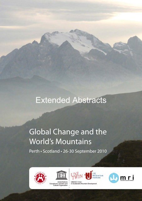
Extended Abstracts<br />
Global Change and the<br />
World’s Mountains<br />
<strong>Perth</strong> • Scotland • 26-30 September 2010<br />
.
Contents<br />
<strong>Conference</strong> <strong>Programme</strong> 3<br />
Plenary Sessions – Extended Abstracts 44<br />
Parallel Session 1 – Extended Abstracts 65<br />
Parallel Session 2 – Extended Abstracts 172<br />
Parallel Session 3 – Extended Abstracts 268<br />
Parallel Session 4 – Extended Abstracts 371<br />
Parallel Session 5 – Extended Abstracts 471<br />
Parallel Session 6 – Extended Abstracts 571<br />
Posters – Extended Abstracts 673<br />
.
Global Change and the World’s Mountains<br />
<strong>Perth</strong>, Scotland, UK<br />
27-30 September 2010<br />
<strong>Conference</strong> <strong>Programme</strong><br />
.<br />
3
<strong>Programme</strong> Overview<br />
Global Change and the World’s Mountains<br />
<strong>Perth</strong> Concert Hall – Horsecross<br />
<strong>Perth</strong>, Scotland, UK<br />
27-30 September 2010<br />
Monday 27 September 2<br />
Tuesday 28 September 3<br />
Wednesday 29 September 5<br />
Thursday 30 September 7<br />
Concurrent Sessions<br />
Monday 27 September<br />
13.45 – 15.45 8<br />
16.15 – 18.15 12<br />
Tuesday 28 September<br />
13.45 – 15.45 16<br />
16.15 – 18.15 20<br />
Wednesday 29 September<br />
13.45 – 15.45 24<br />
16.15 – 18.15 28<br />
Posters 32<br />
Page<br />
Working Lunches 37<br />
Evening events<br />
<strong>Perth</strong> conference tweets .<br />
1<br />
39<br />
40<br />
4
Plenary Session<br />
<strong>Programme</strong> overview<br />
Monday 27 September<br />
Chair: James Fraser, Principal, <strong>UHI</strong> Millennium Institute, UK<br />
09.30 Welcome to the Highlands &<br />
Islands<br />
Museum 1.2 Changes in mountain biodiversity 1<br />
Gannochy<br />
Norie-Miller 1 .<br />
1.3 Plant invasions in mountains 1<br />
1.4 Integrated mountain observing systems<br />
2<br />
Rhythm Wave and Aileen Ogilvie<br />
09.40 Welcome to <strong>Perth</strong> Martin Price, <strong>Perth</strong> <strong>College</strong> <strong>UHI</strong>, Scotland &PTHPL11<br />
09.55<br />
Introductory Remarks Rolf Weingartner, Chair, Mountain Research<br />
Initiative<br />
10.10 Opening Speech Roseanna Cunningham MSP, Minister of<br />
Environment, The Scottish Government<br />
10.30 Coffee<br />
Chair: Thomas Hofer, Food and Agriculture Organization of the United Nations<br />
11.00 The role of mountains in<br />
atmospheric circulation<br />
11.30 Water connects all: Mountain<br />
hydrology in a watershed context<br />
&PTHPL11<br />
&PTHPL11<br />
Toshio Koike, University of Tokyo, Japan &PTHPL12<br />
Anne Nolin, Oregon State University, USA &PTHPL12<br />
12.00 Questions &PTHPL12<br />
12.15 Lunch<br />
13.45 Parallel sessions 1<br />
15.45 Coffee<br />
16.15 Parallel sessions 2<br />
18.30 Poster session and reception<br />
Parallel sessions 1<br />
Location Session Title<br />
Tilt 1.1 Progress in multiproxy climatic reconstructions in the mountains<br />
5
Norie-Miller 2 1.5 Impacts of global change on mountain hydrology 1<br />
Earn 1.6 Amenity-based mountain change and development in an era of increased global<br />
uncertainty<br />
RSGS 1.7 Resilience and adaptation of socio-ecological mountain systems to global change<br />
Parallel sessions 2<br />
Location Session Title<br />
Tilt 2.1 High-elevation climate<br />
Norie-Miller 1 2.2 Effects of climatic change on natural disturbance regimes<br />
Museum 2.3 Changes in mountain biodiversity 2 – Focus on climate change drivers<br />
Gannochy 2.4 Plant invasions in mountains 2<br />
Norie-Miller 2 2.5 Impacts of global change on mountain hydrology 2<br />
Earn 2.6 Sustainable tourism and resort development in mountain environments<br />
RSGS 2.7 Mountain biocultural diversity: social scientific approaches to change<br />
Plenary Session<br />
Tuesday 28 September<br />
Chair: Axel Borsdorf, University of Innsbruck / Austrian Academy of Sciences<br />
08.45 Mountains as global common<br />
goods?<br />
09.15 Economic globalisation in mountain<br />
regions<br />
09.45 Slow mountains: Bridging the gap<br />
between contextuality and<br />
globalised agendas in mountain<br />
development<br />
Bernard Debarbieux, University of Geneva,<br />
Switzerland; Martin Price, <strong>Perth</strong> <strong>College</strong> <strong>UHI</strong>,<br />
UK<br />
David Barkin, Universidad Autónoma<br />
Metropolitana, Mexico<br />
&PTHPL21<br />
&PTHPL21<br />
Peter Messerli, University of Bern, Switzerland &PTHPL21<br />
10.15 Questions &PTHPL21<br />
10.30 Coffee<br />
.<br />
3<br />
6
Chair: Olga Solomina, Institute of Geography, Russian Academy of Sciences<br />
11.00<br />
Water shortages in arid central<br />
Eurasia - a consequence of climate<br />
change or human activities?<br />
11.30 Changes in climate over the last<br />
several hundred years based on ice<br />
cores in Asia, South America,<br />
Yukon Territory, Antarctica and<br />
Greenland<br />
Masayoshi Nakawo National Institutes for the<br />
Humanities, Japan<br />
&PTHPL22<br />
Paul Mayewski, University of Maine, USA &PTHPL22<br />
12.00 Questions &PTHPL22<br />
12.15 Lunch<br />
13.45 Parallel sessions 3<br />
15.45 Coffee<br />
16.15 Parallel sessions 4<br />
19.30 Public event and reception:<br />
Scotland’s National Parks: Whose Parks are they anyway?<br />
Parallel sessions 3<br />
Location Session Title<br />
Tilt 3.1 Changes in climate along altitudinal transects<br />
Gannochy 3.2 Impacts of climate change on mountain ecosystems 1<br />
Museum 3.3 Changes in mountain biodiversity 3 – Focus on land use change drivers<br />
Norie-Miller 1 3.4 Changes in and responses to mountain hazards<br />
Norie-Miller 2 3.5 Impacts of global change on mountain hydrology 3<br />
RSGS 3.6 Mountain Biosphere Reserves as learning sites for research, adaptation and<br />
mitigation in the context of global change<br />
Earn 3.7 The consequences of economic and cultural globalisation<br />
Parallel sessions 4<br />
Location Session Title<br />
Gannochy 4.1 Impacts of climate change on mountain ecosystems 2<br />
Museum 4.2 Past, present and future land<br />
.<br />
use in mountain regions 1: Land use, biodiversity and<br />
ecological processes<br />
4<br />
7
Norie-Miller 2 4.3 Integrated water resource management in mountain regions 1<br />
Regional sessions<br />
Earn 4.4 The Western Mountain Initiative<br />
RSGS 4.5 Global Change in the Americas Cordillera<br />
Norie-Miller 1 4.6 Monitoring of Global Change in the Asian Mountains<br />
Tilt 4.7 Global change in the Alps: impacts and adaptation<br />
Plenary session<br />
Wednesday 29 September<br />
Chair: Thomas Schaaf, United Nations Educational, Scientific and Cultural<br />
Organization<br />
08.45 The Fall of the Iron Curtain - a major<br />
driver of land-use changes in<br />
mountains<br />
09.15 Challenges of global change for<br />
Mountain Biosphere Reserves and<br />
World Heritage Sites<br />
Patrick Hostert, Humboldt University,<br />
Germany<br />
Eduard Mueller, University for International<br />
Cooperation, Costa Rica<br />
.<br />
5<br />
&PTHPL31<br />
&PTHPL31<br />
09.45 Global changes on the Third Pole Yao Tandong, Institute of Tibetan Plateau<br />
Research, Chinese Academy of Sciences<br />
&PTHPL31<br />
10.15 Questions &PTHPL31<br />
10.30 Coffee<br />
Chair: Jill Baron, US Geological Survey<br />
11.00<br />
Mountain ecosystem services – who<br />
cares?<br />
11.30 Retaining mountain biodiversity:<br />
facing the challenges<br />
Adrienne Grêt-Regamey, ETH Zurich,<br />
Switzerland<br />
Katharine Dickinson, University of Otago,<br />
New Zealand<br />
&PTHPL32<br />
&PTHPL32<br />
12.00 Questions &PTHPL32<br />
12.15 Lunch<br />
13.45 Parallel sessions 5<br />
15.45 Coffee<br />
16.15 Parallel sessions 6<br />
19.30 <strong>Conference</strong> dinner<br />
8
Parallel sessions 5<br />
Location Session Title<br />
Tilt 5.1 Changes in the mountain cryosphere 1<br />
Gannochy 5.2 Impacts of climate change on mountain ecosystems 3<br />
Norie-Miller 1 5.3 Changes in mountain soils<br />
Museum 5.4 Past, present and future land use in mountain regions 2: Socio-economic and<br />
governance aspects; climate feedback<br />
Norie-Miller 2 5.5 Integrated water resource management in mountain regions 2<br />
Earn 5.6 Demographic changes in mountain regions<br />
RSGS 5.7 Knowledge systems and mountain sustainability concerns<br />
Parallel sessions 6<br />
Location Session Title<br />
Tilt 6.1 Changes in the mountain cryosphere 2<br />
Gannochy 6.2 Impacts of climate change on mountain ecosystems 4<br />
Norie-Miller 1 6.3 Changes in aquatic mountain ecosystems<br />
Museum 6.4 Past, present and future land use in mountain regions 3: Reconstructing land use and<br />
its implications at various time scales<br />
Norie-Miller 2 6.5 Adaptations of mountain communities to changing hydrologies<br />
Earn 6.6 Urban-rural linkages in and around mountain areas<br />
RSGS 6.7 Approaches to change: The potential of regionalized analyses for mountain<br />
development and policy support<br />
.<br />
6<br />
9
Plenary session<br />
Thursday 30 September<br />
Chair: Greg Greenwood, Mountain Research Initiative<br />
09.00 Emerging themes for global change research and sustainable development<br />
10.00 Coffee<br />
.<br />
7<br />
&PTHPL41<br />
Introduction Thomas Kohler, University of Bern,<br />
Switzerland<br />
The „State of the Art‟ of Global Change Research in<br />
mountains<br />
Emerging themes for future research:<br />
Ecological perspective<br />
Socio-economic perspective<br />
Integrative perspective<br />
Martin Price, <strong>Perth</strong> <strong>College</strong> <strong>UHI</strong>, UK<br />
Eklabya Sharma, ICIMOD, Nepal<br />
Jörg Balsiger, ETH Zurich, Switzerland<br />
Jill Baron, US Geological Survey<br />
Finding the high ground in global change research Richard Aspinall, Macaulay Land Use<br />
Research Institute, UK<br />
Closing comments Greg Greenwood, Mountain Research<br />
Initiative<br />
Chair: Martin Price, <strong>Perth</strong> <strong>College</strong> <strong>UHI</strong>, Scotland<br />
10.30 Global Concerns in a time of Global Change: Where are<br />
we coming from, where are we going to?<br />
Bruno Messerli,<br />
University of Bern,<br />
Switzerland<br />
&PTHPL42<br />
11.00 Mountains on the road to Rio+20 and beyond &PTHPL42<br />
The Rio+20 process and the inclusion of mountain issues<br />
Panel discussion, leading to specific proposals on the way forward<br />
Discussion<br />
Conclusions<br />
12.00 Closing remarks &PTHPL42<br />
10
Parallel sessions<br />
Monday 27 September, 13:45 – 15.45<br />
1.1 PROGRESS IN MULTIPROXY CLIMATIC RECONSTRUCTIONS IN THE<br />
MOUNTAINS<br />
Venue: Tilt – Twitter Code: &PTHPA115<br />
Chair: Olga Maximova, Russian Academy of Sciences<br />
Rosanne D‟Arrigo Tree-ring indicators of temperature from Mongolia‟s elevational treeline<br />
Ivan Kalugin Annual climate time series reconstructed by combined geochemistry of lake<br />
sediments and tree-ring width data in the Altai Mountains<br />
Brian H. Luckmann Glacier fluctuations in the southern Andes (17°-55°S) during the past millennium<br />
Atle Nesje Holocene fluctuations of mountain glaciers in Scandinavia<br />
Kurt Nicolussi Evidence for long lasting glacier retreat periods in the European Alps during the<br />
early and middle Holocene<br />
Lothar Schulte Floods and Global Change in high mountain environments: a 4500-year multiproxy<br />
record from the Swiss Alps.<br />
Olga Solomina Holocene glacier fluctuations and their potential forcings<br />
Marc Oliva Late Holocene reconstruction of landscape changes in Sierra Nevada from<br />
sedimentary records and documentary sources<br />
1.2 CHANGES IN MOUNTAIN BIODIVERSITY I<br />
Venue: Museum – Twitter Code: &PTHPA116<br />
Chair: Eva Spehn, Global Mountain Biodiversity Assessment<br />
Anne Dubuis Predicting Spatial Patters of plant species richness: A comparison of direct and<br />
indirect and species assembly approaches<br />
Sonja Wipf Increasing plant biodiversity on summits at the upper limit of alpine grasslands<br />
and heaths<br />
Pablo Gonclaves Quaternary climatic changes and diversification on mountaintops in the Brazilian<br />
Atlantic forest: the case of Neotropical small rodents<br />
Markus Didion Ungulate herbivory modifies the effects of climate change on mountain forests<br />
Louisa Willcox The Collapse of a Foundational Species: Whitebark Pine and the Future of Rocky<br />
Mountain Ecosystems<br />
Jalil Noroozi The subnival-nival vascular plant species of Iran: a unique high-mountain flora<br />
and its threat from climate warming<br />
.<br />
Ghazala Nasim Mapping of mycorrhizal mushrooms in Himalayan Mountain ranges<br />
8<br />
11
Catherine Parks Plant Invasions in Mountains<br />
1.3 PLANT INVASIONS IN MOUNTAINS<br />
Venue: Gannochy – Tweet: &PTHPA111<br />
Chair: Christoph Kueffner, ETH, Switzerland<br />
Tim Seipel Biogeographic comparisons of non-native plant invasions in mountains: Processes at<br />
multiple spatial scales influence richness and similarity<br />
Keith McDougall Management of plant invasions in mountains in a changing world<br />
Jeanne Chambers Resistance of semi-arid mountain landscapes of the western USA to invasion by the<br />
non-native annual grass, Bromus tectorum<br />
Richard Mack Naturalization/invasion of ornamental bamboos in montane forests in the Western<br />
United States: the potential for multiple environmental hazards<br />
Fred Pollnac Factors affecting the current range limits of Linaria dalmatica in a mountainous area<br />
of the Northwest United States<br />
Pervaiz Dar Assessment of richness and abundance of native and non-native plant species across<br />
different habitats in the Kashmir Himalaya, India<br />
Katherine Pickering Plant invasions, tourists and climate change<br />
1.4 INTEGRATED MOUNTAIN OBSERVING SYSTEMS<br />
Venue: Norie-Miller 1 – Twitter Code: &PTHPA112<br />
Chair: Heidi Stelzer, Natural Resource Ecology Laboratory, USA<br />
Emil Wielgolaski Effects of climate change in Fennoscandia on phenology, growth and survival of<br />
mountain birch populations and on vegetation change above tree line<br />
Patrick Fritzmann Airborne LiDAR based surface classification of the high mountain region at<br />
Hintereisferner, Tyrol<br />
Heidi Steltzer Seasons and life cycles: a conceptual framework and low-cost instrumentation for<br />
automated monitoring of plant community life histories in alpine landscapes<br />
Helmut Franz Berchtesgaden National Park and Biosphere Reserve – Observatory for Climate<br />
Change Research (Bavaria, Germany)<br />
Rob Blair Earth System Observation Network (ESON)<br />
Linda McMillan Citizen Scientists: Helping to Transform the Mountain Protection Paradigm<br />
Jordan Stamenov Complex Environmental Studies at BEO<br />
.<br />
9<br />
12
1.5 IMPACTS OF GLOBAL CHANGE ON MOUNTAIN HYDROLOGY 1<br />
Venue: Norrie-Miller 2 – Twitter Code: &PTHPA113<br />
Chair: Daniel Viviroli, University of Bern, Switzerland<br />
Wolfgang Schoener Glaciers in the water cycle of the European Alps under a changing climate<br />
Francesca Pellicciotti Effect of glaciers on streamflow trends<br />
Antoine Bard Observed trends in the hydrologic regime of Alpine catchments<br />
Luzi Bernhard Assessing daily climate model simulations across Switzerland<br />
Gabriele Kraller Modelling the water balance in the Berchtesgaden Alps (Bavaria, Germany)<br />
Andreas Gobiet Climate Scenarios for Small-Scale Climate Change Impact Studies in the European<br />
Alpine Area: How Reliable are They?<br />
David Finger The value of glacier mass balances, satellite snow cover images and hourly<br />
discharge on calibration of a physiaclly based, fully distributed hydrological model<br />
Bodo Ahrens Regional Climate Projections in Alpine River Basins: Upper Danube and Upper<br />
Brahmaputra<br />
1.6 RESILIENCE AND ADAPTATION OF SOCIO-ECOLOGICAL MOUNTAIN SYSTEMS TO<br />
GLOBAL CHANGE<br />
Venue: RSGS – Twitter Code: &PTHPA117<br />
Chair: Julia A Klein, Colorado State University, USA<br />
Claudia Binder Transitions in pasture management in mountainous regions: a socio-ecological<br />
systems perspective.<br />
Michelle Haynes Tibetan Yak Herders - A Tale of Changing Traditions and Changing Climates<br />
Julia Klein Vulnerability on the Roof of the World: Social-Ecological Resilience to Climate<br />
Change and Grassland Policies on the Tibetan Plateau<br />
Henri Rueff Coping with Uncertain Livelihoods in Mountains: Landless Mobile Pastoralists<br />
Adaptation to Climate Change in the Himalayan Hindukush Mountains of Northern<br />
Pakistan<br />
Swati Thakur Climatic variability and agricultural land use change: A case study of Doon valley,<br />
India<br />
Ian Soane Using Panarchy models to compare the nature conservation dynamics of upland,<br />
sub-alpine and alpine pastures<br />
.<br />
in case study areas in Cumbria, England and<br />
Trentino, Italy.<br />
10<br />
13
1.7 AMENITY-BASED MOUNTAIN CHANGE AND DEVELOPMENT IN AN ERA OF INCREASESD<br />
GLOBAL UNCERTAINTY<br />
Venue: Earn – Twitter Code: &PTHPA114<br />
Chairs: Romella S. Glorioso & Laurence A.G. Moss, International Amenity Migration Centre (IAMC),<br />
Canada & USA<br />
Romella<br />
Glorioso<br />
Values, Behaviour & Motivations for Mountain Eco-living: The Amenity Migrants<br />
Niels Martin Amenity migration and post-tourism in the French Alps: a basis for reconversion and<br />
transition for tourist and rural regions?<br />
Peter Klepeis „Amenity Migration‟ and Hobby Ranching in Southern Patagonia<br />
Rodrigo<br />
Gonzales<br />
Understanding and managing sustainable competitiveness and amenity led migration in<br />
mountain tourist destinations. A comparative study of Canadian and Argentinean mountain<br />
destinations<br />
Paulina Chaverri Good deeds gone bad? Understanding failure, promoting success in local land use policy<br />
and systems: a comparative case study Costa Rica and Bath County, VA<br />
Jerry Johnson Destination mountain resorts sustainability after global financial collapse<br />
Ryan Bergstrom Conceptualizing Sustainability in Two Amenity-driven Communities of the Greater<br />
Yellowstone Ecosystem, North America.<br />
LornaStefanick The path to progress lost? Planning for amenity migration in Canadian mountain<br />
communities<br />
.<br />
11<br />
14
Monday 27 September, 16:15 – 18:15<br />
2.1 HIGH ELEVATION CLIMATE<br />
Venue: Tilt – Twitter Code: &PTHPA125<br />
Chair: Gianni Tartari, Ev-K2-CNR, Italy<br />
Mikhail Makarov Micro-climate in alpine ecosystems of the Northern Caucasus<br />
Peter Nojarov Variations in precipitation and atmosphere circulation in high mountainous parts of<br />
Bulgaria for the period 1947 – 2008<br />
Margarita Syromyatina Climate changes in the Altai Mountains and mountain landscapes response<br />
Maria Shahgedanova High elevation climate change in the Caucasus and in the mountains of Siberia:<br />
observations and projections using PRECIS RCM<br />
Jose Vergara Climate Change in the Chilean Andes mountains<br />
Emma Ward Spatial variability of rainfall in a tropical, data sparse, mountainous region<br />
Gianni Tartari How to establish whether the global climate is changing with few reliable<br />
measurements from mountain regions?<br />
2.2 EFFECTS OF CLIMATIC CHANGE ON NATURAL DISTURBANCE REGIMES<br />
Venue: Norie-Miller 1 – Twitter Code: &PTHPA122<br />
Chair: Don McKenzie, US Forest Service<br />
Jeremy Littell Climate and wildfire: an integration of vegetation, hydrology, and fire disturbance<br />
Crystal Raymond The Effects of Climate-driven changes in fire regimes on carbon dynamics in a<br />
forested region of Washington, U.S.A.<br />
William McFarlane 2009 Assessment of whitebark pine overstory mortality in the mountain areas of the<br />
Greater Yellowstone Ecosystem and the associated ecological implications<br />
Dan Fagre Snow avalanches and disturbance in a changing climate<br />
Craig Allen Climate and Synergistic Interactions Among Forest Die-off, Fire, and Erosion in<br />
Southwestern Mountains (USA)<br />
Paul Hessburg Resilience in Natural Wildfire Systems: Relevance for Climate Change and Future<br />
Mountain Landscapes<br />
Jesus Ramirez Levels of tropospheric ozone in some mountainous and non-mountainous areas of the<br />
Caribbean and Central America linked with climatic change<br />
.<br />
Douglas Fox Climate, MegaFires and MegaCity Air Quality<br />
12<br />
15
2.3 CHANGES IN MOUNTAIN BIODIVERSITY II – FOCUS ON CLIMATE CHANGE DRIVERS<br />
Venue: Museum – Twitter Code: &PTHPA126<br />
Chair: Katherine Dickinson, University of Otago, New Zealand<br />
Robin Engler Climate change threatens mountain flora unequally across Europe<br />
Antoine Guisan Can we predict communities from the individual response of species to climate?<br />
Daniel Scherrer Topography controlled niche differentiation buffers alpine biodiversity against<br />
climate warming impact<br />
Rory Hodd Climate change impacts on montane heath and bryophyte communities of the<br />
mountains of western Ireland<br />
Ramona Maggini Lehmann Predicting future ranges for breeding birds in Switzerland as a consequence of<br />
climate and land use change<br />
John Calladine Seasonal variation in the apparent abundance of breeding birds in arctic-alpine<br />
habitats in Scotland: Implications for monitoring the effects of environmental<br />
change<br />
Thomas Wohlgemuth Post-fire vegetation dynamics along a 1200 m long elevational gradient in central-<br />
Alpine Switzerland<br />
Diane Debinski Montane Meadow Biodiversity Changes During Drought: A Window into the<br />
Future?<br />
2.4 PLANT INVASIONS IN MOUNTAINS<br />
Venue: Gannochy - Twitter Code: &PTHPA121<br />
Chair: Lisa J. Rew, Montana State University, USA<br />
Chritoph Kueffner Will the risk of plant invasions into the European Alps increase with climate<br />
change?<br />
Sylvia Haider Climatic limits of non-native plant distributions along elevation gradients<br />
Jake Alexander Genetic and plastic responses of non-native plants along altitudinal gradients<br />
Eric Meineri Effect of alpine/lowland species interactions on the current and projected<br />
geographical distributions of alpine plants<br />
Susanne Venn Marching up the mountain? Mechanisms of high altitude woodland expansion<br />
into the Australian alpine zone<br />
Isla Myers-Smith Ecological Impacts of Shrubline Advance in Alpine Tundra<br />
Ann Milbau Invasibility of subarctic<br />
.<br />
plant communities along an altitudinal gradient in<br />
northern Sweden<br />
13<br />
16
2.5 IMPACTS OF GLOBAL CHANGE ON MOUNTAIN HYDROLOGY 2<br />
Venue: Norrie-Miller 2 – Twitter Code: &PTHPA123<br />
Chair: Daniel Viviroli, University of Bern, Switzerland<br />
Jean-Pierre Dedieu Snow cover monitoring in upper Rhone and Po river basins: Retrieval and<br />
Validation from 10-years of MODIS data for hydrological modeling<br />
Abdul Laghari Climate change and future water availability: a sensitivity analysis of ground water<br />
recharge and stream flow to regional climate change scenarios<br />
Annett Wolf Impacts of global change on mountain hydrology – the consequences of tree<br />
species-specific drought responses<br />
Hayley Fowler A vertical hydroclimatology of the Upper Indus Basin and the potential for<br />
hydrological change<br />
Mark Williams Assessing the current contribution of snow- and ice-melt to streamflow in the<br />
Eastern Himalaya using remote sensing and isotopic analysis<br />
Zhongqin Li Study on recent glacier changes and their impact on water resource in Xinjiang,<br />
northwestern China<br />
2.6 SUSTAINABLE TOURISM AND RESORT DEVELOPMENT IN MOUNTAIN ENVIRONMENTS<br />
Venue: Earn – Twitter Code: &PTHPA124<br />
Chair: Harry Measure, Harry Measure Associates, Canada<br />
Sahana Bose Problem of Sustainable Tourism and Development of Resorts in Darjeeling Town,<br />
India: A perspective.<br />
Venugobal<br />
Dharmalingam<br />
Tourism and Tourist Resorts Conflict in the Nilgiri Mountains of South India<br />
Bruno Abegg The challenge of sustainable climate change adaptation in Alpine winter tourism<br />
Carla Silva Tourist‟s perception of mountain destinations<br />
Nilufer Gurer The Tourism Potentials of Mountain Regions and the Insufficiency of Valuing<br />
Them<br />
Stella Giannakopoulou Valuing vernacular architecture: An innovative tool in sustainable tourism and<br />
development in mountain regions<br />
Cesare Micheletti Negotiating landscape diversity and tourism development. Two projects into the<br />
Dolomites‟<br />
.<br />
14<br />
Harry Measure Planning and Development Considerations to Achieve Mountain Resort<br />
Sustainability<br />
17
2.7 MOUNTAIN BIOCULTURAL DIVERSITY: SOCIAL SCIENTIFIC APPORACHES TO CHANGE<br />
Venue: RSGS – Twitter Code: &PTHPA127<br />
Chair: Will Tuladhar-Douglas, Scottish Centre for Himalayan Research, University of Aberdeen, UK<br />
Fausto Sarmiento Páramo Onomastics and other Misnomers in the Construction of Faulty Andeanity<br />
and Weak Andeaness during changing times<br />
Constanza Ceruti Global Change and the Sacred Andes Mountains<br />
Cristina Orsatti Adaptation strategies in mountain regions. The relation between local knowledge,<br />
development practices and global survival in Val di Ledro, Trentino: towards a<br />
sustainability” assessment<br />
Natalia Shovkolplias The Methodology of Cultural, Historical and Social Topography (CHST) as a<br />
precondition for the preservation and maintaining of natural, historical and cultural<br />
identity and diversity in the mountain areas<br />
Jan Salick Himalayan Climate Change and Ethnobotany<br />
Maitreyee Choudhury Common resources and culture of shifting cultivation among the Himalayan tribes<br />
Ranju Pandey Climate Change and Its Impact on Child Health<br />
Manohara Khadka Food Security Discourse in Nepal: Missing Social Realities<br />
.<br />
15<br />
18
Tuesday 28 September 13:45 – 15.45<br />
3.1 CHANGES IN CLIMATE ALONG ALTIDUDINAL RANGES<br />
Venue: Tilt – Twitter Code: &PTHPA235<br />
Chair: Ray Bradley, University of Massachusetts, USA<br />
John Coll Climate change and Europe‟s mountain regions: an overview and case studies at the<br />
edge<br />
Nick Pepin Changing Climate at High Elevation Stations: A Global Perspective<br />
David Schimel NEON: Not just the National Flat Places Network<br />
Bente Jessen Graae Do weather station generated data reflect the microclimate along an altitudinal<br />
gradient?<br />
Imtiaz Rangwala Examining climate change in the Colorado Rocky Mountains from high resolution<br />
climate models<br />
Fabia Huesler A 25 year snow cover time series over the European Alps derived from AVHRR<br />
satellite data.<br />
Ninglian Wang Study on the Zone of Maximum Precipitation in the North Slope of the Central<br />
Qilian Mountains, China<br />
Raphael Dulhoste Effects of temperature-radiation interactions on CO2 assimilation in tropical treeline<br />
species.<br />
3.2 IMPACTS OF CLIMATE CHANGE ON MOUNTAIN ECOSYSTEMS 1<br />
Venue: Gannochy – Twitter Code: &PTHPA231<br />
Chair: Georg Grabherr, IGF and GLORIA, Austria<br />
George Malanson Descriptive and theoretical contexts for alpine plant community dynamics<br />
Thomas Fickert Myths and facts from glacier forelands - A survey of primary succession on<br />
recently deglaciated terrain in the Eastern Alps<br />
Brigitta Erschbamer Short-term signals of climate change in the Dolomites (SAlps, Italy)<br />
Michael Gottfried European high mountain vegetation shifting towards more thermophilic species<br />
compositions<br />
Leopold Füreder Alpine river ecosystems – indicators of climate change<br />
Willem Ferguson Long term altitudinal change in vegetation at Mariepskop, South Africa, over 70<br />
years and botanical indicators for detecting global change.<br />
Ho-Yih Liu High Mountain Vegetation Change in Taiwan<br />
Christophe Randin Modelling the effect of<br />
.<br />
changing snow cover regimes on alpine plant species<br />
distribution<br />
16<br />
19
3.3 CHANGES IN MOUNTAIN BIODIVERSITY III – FOCUS ON LAND USE CHANGE DRIVERS<br />
Venue: Museum – Twitter Code: &PTHPA236<br />
Chair: Thomas Wohlgemuth, Swiss Federal Institute for Forest, Landscape and Snow Research<br />
Andrea Britton Drivers of biodiversity change in British alpine habitats<br />
Lita Patty Effects of grazing and fire on biomass productivity and diversity of herbaceous species in<br />
the Bolivian Altiplano<br />
Martin Dovčiak Forest management changes microclimate and bryophyte diversity in the Cascade<br />
Mountains of western Washington<br />
Bob Nakileza Changes in alpine plant species composition and distribution in the Rwenzoris, Uganda<br />
Fang Zhengdong Turbid water effect of plant communities<br />
Peter Gajdos Changes in composition of epigeic invertebrate communities (with accent on spiders) in<br />
Carpathian alpine meadows influenced by added nitrogen and phosphorus<br />
Annapaola Rizzoli Climate change and biodiveristy loss as drivers<br />
3.4 CHANGES IN AND RESPONSE TO MOUNTAIN HAZARDS<br />
Venue: Norie-Miller 1 – Twitter Code: &PTHPA232<br />
Chairs: Ibrahim Gurer, GAZI University, Turkey & Christian Huggel, University of Zurich, Switzerland<br />
Gordon Grant From Atmospheric Rivers To Rivers Of Debris: Coupling Extreme Precipitation Events,<br />
Glacial Retreat, Debris Flows, And Channel Changes On Mount Rainier, Washington<br />
Bill McGuire Climate change as a driver of volcano lateral collapse<br />
Martin Mergili Glacier changes and related high mountain hazards in Tajikistan<br />
Monique Fort Natural hazards, road construction, increased vulnerability in the Nepal Himalayas: what<br />
future for a developing country?<br />
Stefan Kienberger Comparison of flood vulnerability indicators in the Salzach catchment – Scale issues,<br />
relevance for spatial planning and climate change adaptation<br />
Jeff Zukiwsky Conducting Climate Change Risk and Vulnerability Assessments in Rural Mountain<br />
Communities in the Columbia Basin Region of Canada<br />
.<br />
17<br />
20
3.5 IMPACTS OF GLOBAL CHANGE ON MOUNTAIN HYDROLOGY 3<br />
Venue: Norie-Miller 2 – Twitter Code: &PTHPA233<br />
Chair: Daniel Viviroli, University of Bern, Switzerland<br />
Iris Stewart Is there acceleration in streamflow timing trends across western North American<br />
mountains?<br />
Thomas Caine Recent hydrologic change in a Colorado alpine basin: an indicator of permafrost<br />
thaw?<br />
Brian Luckman Changes in 20th century streamflow regimes of the Bow and Athabasca Rivers,<br />
Alberta, Canada<br />
David Clow Influence of windblown dust on snowmelt timing in the Rocky Mountains, USA<br />
Andrew Fountain Variations in glacier retreat in the American West, implications for water resources<br />
Stephanie Kampf Sensitivity of soil moisture to terrain and snow cover at watershed to plot scales in<br />
the Rocky Mountain Front Range, Colorado, USA<br />
Margaret Matter Effects of changes in climate and modifications to land and water use over the 20th<br />
Century on complementary temperature and precipitation patterns for tributaries of<br />
the Upper Colorado River Basin<br />
İbrahim Gürer Hydroclimatology Of Sariz Creek Watershed, Located In Seyhan Basin, And<br />
Simulation Of The Snowmelt Runoff Using Remote Sensing And Geographic<br />
Information Systems (Mountain Watershed Case Study)<br />
3.6 MOUNTAIN BIOSPHERE RESERVES AS LEARNING SITES FOR RESEARCH, ADAPTIATION,<br />
AND MIGITATION IN THE CONTEXT OF GLOBAL CHANGE<br />
Venue: RSGS – Twitter Code: &PTHPA237<br />
Chair: Yuri Badenkov, Russian Academy of Sciences<br />
Rakesh Kumar Maikhuri Climate Change Impact and Mitigation/Adaptation Strategies in Nanda Devi<br />
Biosphere Reserve (NDBR), Central Himalaya, India<br />
Tatjana Yashina Global Change in Katunskiy Biosphere Reserve: Vulnerability of ecosystems and<br />
Adaptation Strategy<br />
Juliane Geyer Carpathian Biosphere Reserve, Ukraine: proactive and strategic conservation<br />
planning under regional and global change<br />
Mark Williams The Niwot Ridge Mountain Biosphere Reserve: Tipping points in high-elevation<br />
ecosystems in response to changes in climate and atmospheric deposition<br />
.<br />
18<br />
Yasmine Antonini The conservation function of the Biosphere Reserve: the case of Espinhaço<br />
Mountain Range in Brazil<br />
21
Luis Alfonso Ortega Lessons learned on the achievement of the Joint Program of Climate Change<br />
Adaption in the Colombian Massif (Andean Belt Constellation Biosphere Reserve -<br />
Cauca Basin) with indigenous and peasant communities to affront the effects of<br />
climate change.<br />
Karen Steenkamp Initiatives from Biosphere reserves in South Africa to promote sustainable<br />
development<br />
Yuri Badenkov Biosphere Reserves as abutment piers in connectivity conservation and development<br />
in the Altai-Sayan ecoregion<br />
3.7 CONSEQUENCES OF ECONOMIC AND CULTURAL GLOBALISATION<br />
Venue: Earn – Twitter Code: &PTHPA234<br />
Chair: Bernard Debarbieux, University of Geneva, Switzerland & Douglas McGuire, Mountain<br />
Partnership Secretariat<br />
Joerg Balsiger Varieties of sustainability: The local expression of a global norm<br />
Jon Marco Church The Ideology of Environmental Regionalism: the Challenge of the Alpine Convention<br />
and the “Strange Case” of the Andean Community<br />
Fatima Gebrati Globalisation begins with tourism in the marginalised area: the case study of the<br />
High-Atlas of Marrakech.<br />
Gilles Rudaz “Mountain Women”: Limits and hopes to their participation in the global mountain<br />
agenda<br />
Mathilde Schmitt Acceptance and relevance of gender (mainstreaming) aspects in Alpine protected<br />
areas<br />
Deepak Khadka Participatory Market Systems Development: Helping smallholder farmers in the<br />
mountains of Nepal and Perú access markets<br />
Michael Kollmair A Specific Value Chain Framework for Mountain Products in a Globalised Market<br />
Kenny Lahcen The Saffron of Taliouine: A miracle crop for small farmers in the Atlas Mountains<br />
of Morocco<br />
.<br />
19<br />
22
Tuesday 27 September 16:15 – 18:15<br />
4.1 IMPACTS OF CLIMATE CHANGE ON MOUNTAIN ECOSYSTEMS 2<br />
Venue: Gannochy – Twitter Code: &PTHPA241<br />
Session Chair: Brigitta Erschbamer, University of Innsbruck, Austria<br />
David Butler The Effects of Climate Change on the Zoogeomorphic Effects and Zoogeographic<br />
Distribution of Animals in the Alpine<br />
Martha Apple Phenology, the Seasonal Appearance of Plant Species, and Nitrogen-Fixing Microbes<br />
at the GLORIA Site in Southwestern Montana, USA<br />
Mikhail Makarov Nitrogen turnover in alpine lichen heath of the Northern Caucasus<br />
Christian Rixen Reduced early growing season freezing resistance in alpine treeline plants under<br />
experimental warming and elevated atmospheric CO2<br />
Graziano Rossi Seed banking conservation of alpine plants as a mitigation tool against the impacts of<br />
climate change<br />
Ruth Toechterle Using topographic and temperature data to model snow distribution at the alpine-nival<br />
ecotone<br />
4.2 PAST, PRESENT AND FUTURE LAND USE IN MOUNTAIN REGIONS 1: LAND USE,<br />
BIODIVERSITY AND ECOLOGICAL PROCESSES<br />
Venue: Museum – Twitter Code: &PTHPA246<br />
Chair: Harald Bugmann, ETH-Zurich, Switzerland<br />
Jonathan Mitchley Biodiversity consequences of agricultural liberalization in Europe‟s mountain areas<br />
Peter Bezák Land use changes of different mountain landscapes in Slovakia<br />
Kenneth Masuki Integrated Natural Resource Management and its Implications to Agro-biodiversity<br />
Conservation in the Highlands of Eastern Africa<br />
Annett Wolf The relative importance of land use and climatic change in Alpine catchments<br />
Ihor Soloviy Towards sustainability in the Carpathian Mountains: some implications from Ukraine<br />
Christine Wanker Cultural landscape in South Tyrol (Italy) – An analysis of the changes and the<br />
perception of these changes since the 1950s<br />
.<br />
20<br />
23
4.3 INTEGRATED WATER RESOURCE MANAGEMENT IN MOUNTAIN REGIONS 1<br />
Venue: Norie-Miller 2 – Twitter Code: &PTHPA243<br />
Chair: Wouter Buytaert, Imperial <strong>College</strong> London, UK<br />
Chris Soulsby Using tracers and transit times as tools in classifying and managing montane<br />
catchments<br />
Roland Koeck Hydro-meteorological dynamics at the tree line of a karstic drinking water protection<br />
zone<br />
Bert de Bievre A regional initiative for hydrological monitoring of high Andean ecosystems<br />
Jean Christophe Pouget High Mountain Catchments Modelling and Water Resources Planning in Quito<br />
(Ecuador) - Comparisons between different glaciohydrological models on Antizana<br />
stratovolcano<br />
Nathan Forsythe Avenues for improved assessment of accumulated snowpack in the Upper Indus Basin<br />
for use in operational forecasting<br />
Amir Khan Water resource development and conservation in Khari Gandhghar area tehsil Ghazi;<br />
Pakistan<br />
Boplob Chakma Impact of Climate Change and Scarcity of Water Resources in Rural Hilly Areas:<br />
Experiences from Project Implementation in Chittagong Hill Tracts, Bangladesh<br />
Mushtaque Ahmed Groundwater Demand Management in Al Jabal Al Akhdar Region of Oman by<br />
Utilization of Low Quality Surface Water<br />
4.4 THE WESTERN MOUNTAIN INITIATIVE<br />
Venue: Earn – Twitter Code: &PTHPA244<br />
Chair: Dan Fagre, US Geological Survey<br />
Jill Baron Framework and Principles of the Western Mountain Initiative<br />
Jeffery Hicke Climate change in mountain ecosystems: Results from the Western Mountain Initiative<br />
Don McKenzie The Western Mountain Initiative III: Interactions, thresholds, and cumulative effects:<br />
how, when, and why might mountain ecosystems change rapidly or irreversibly?<br />
Christina Tague Forecasting and Futures: Spatial-complexity in scenarios of eco-hydrologic responses<br />
to warming in the Western US<br />
David Peterson Adapting to climate change through science-management partnerships<br />
.<br />
21<br />
24
4.5 GLOBAL CHANGE IN THE AMERICAS CORDILLERA<br />
Venue: RSGS – Twitter Code: &PTHPA247<br />
Chair: Fausto Sarmiento, University of Georgia, USA<br />
Lenkiza Angulo Climate change impacts and adaptation in the Andes: integrating local<br />
perceptions<br />
Brandilyn Gordon Sustainability Education and Impending Climate Change: The The<br />
Appropriation of Rurality by Globalized Migrants of Costa Rica Appropriation<br />
of Rurality by Globalized Migrants of Costa Rica<br />
David Cotacachi Assessing the economic value of water: a Contingent Valuation Approach in<br />
Tropical Mountains in Costa Rica<br />
Eric Enrique Flores De Gracia Importance of vegetation type on soil properties and water fluxes in a tropical<br />
mountain area, Panama<br />
Dirk Hoffmann Glacier monitoring in the Cordillera Apolobamba, Bolivia, by means of repeat<br />
photography<br />
Karina Yager Interpreting and monitoring dynamics of Andean peat bogs ...<br />
Alejandra Martinez Extreme meteorological events and risk management in the Andes of Peru<br />
Elsa Nickl Variability of land-surface precipitation estimates in the Central<br />
PeruvianAndes and Western United States<br />
4.6 MONITORING GLOBAL CHANGE IN THE ASIAN MOUNTAINS<br />
Venue: Norie-Miller 1 – Twitter Code: &PTHPA242<br />
Chair: Eklabya Sharma, ICIMOD, Nepal<br />
Eklabya Sharma The HKH Transect Initiative: A regional framework for developing long-term<br />
environmental monitoring capacity<br />
Daniel Maselli Central Asian Mountains Monitoring Network: A Novel Initiative of the<br />
University of Central Asia<br />
Lok Palni Ecological Research and Long-term Environmental Monitoring in the Indian<br />
Himalayan Region<br />
Shi Peili Environmental monitoring and climate change research on the Tibetan Plateau<br />
of China<br />
Gopal Rawat Rangelands of Indian Trans-Himalaya: changing land use, conservation issues<br />
and monitoring strategies<br />
Robert Zomer Potential for Carbon Finance and Environmental Monitoring Requirements in<br />
the Landuse Sector for Mitigation and Adaptation in the Hindu Kush –<br />
Himalaya Region<br />
.<br />
22<br />
Molly Brown HIMALA: Climate Impacts on Glaciers, Snow and Hydrology in the Himalayan<br />
Region<br />
Inam-ur-Rahim From a Technocratic to a Custodianship Approach: Putting Herders at the<br />
Centre of Pasture Monitoring and Management in Kyrgyzstan<br />
25
4.7 GLOBAL CHANGE IN THE ALPS: IMPACTS AND ADAPTATION<br />
Venue: Tilt – Twitter Code: &PTHPA245<br />
Chair: Daniela Hohenwallner, Institut de la Montagne, France<br />
Wilfried Haeberli New lakes in deglaciating high-mountain areas: climate-related development and<br />
challenges for sustainable use in the Swiss Alps<br />
Hermann Klug Experiencing regional impacts of climate change on the alpine mountain<br />
ecosystems using Geo Web Processing Services - Towards a Web GIS decision<br />
support tool for regions prone to water scarcity<br />
Sylvia Kruse Assessing the adaptive capacity of spatial planning to climate change impacts in<br />
Alpine countries.<br />
Wolfgang Lexer Concept and Process Design for Participatory Regional Vulnerability Assessments:<br />
Lessons learnt from Analysing Model Projects<br />
Christian Reszler Variations of groundwater recharge due to climate change in Southern Austria,<br />
case studies in mountainous areas and Alpine valleys<br />
Stefan Schneiderbauer A field-tested new approach for the evaluation of adaptive capacities within<br />
climate change vulnerability assessments<br />
Klaus Wagner Adaptation of agriculture to water scarcity in the alpine space – risk assessment<br />
Marc Zebisch From climate change scenarios to regional impact assessments – can climate<br />
impact research really help local decision makers in the Alps?<br />
.<br />
23<br />
26
Wednesday 29 September 13:45 – 15:45<br />
5.1 CHANGES IN THE MOUNTAIN CRYOSPHERE 1<br />
Venue: Tilt – Twitter Code: &PTHPA355<br />
Chair: Vladimir Aizen, University of Idaho, USA<br />
Vladimir Aizen The World Mountain Glaciers and Seasonal Snow Cover Changes after the “Little<br />
Ice Age”<br />
Shiyin Liu Glacier change in Tibetan Plateau during 1960s-2008<br />
Byran Mark Glacier Hydrological Transformation and Livelihood Vulnerability in the Cordillera<br />
Blanca, Peru: An Integrated Assessment<br />
Pascal Bohleber High elevation Alpine glaciers: A repository for long-term climate and<br />
environmental changes?<br />
Maria Shahgedanova Glacier change in the mountains of northern Eurasia: from the Polar Urals to eastern<br />
Siberia.<br />
Eliza Vuillermoz Contribution to the comprehension of climate change towards cryosphere and<br />
atmospheric analysis: the cases study of Changri Nup Glacier, Nepal Himalayas and<br />
of Forni Glacier, Italian Alps<br />
Qinghua Ye Monitoring glacier and lake changes from space in the Mt. Naimona‟Nyi region of<br />
the Western Himalayas on the Tibetan Plateau.<br />
Ben Brock Investigating the melt response of debris-covered glaciers to 21st Century climate<br />
change.<br />
5.2 IMPACTS OF CLIMATE CHANGE ON MOUNTAIN ECOSYSTEMS 3<br />
Venue: Gannochy – Twitter Code: &PTHPA351<br />
Session Chair: George Malanson, University of Iowa, USA<br />
John-Arvid Grytnes Upward elevational shifts in plants over an 86-year period in Sikkilsdalen, central<br />
Norway<br />
Sebastian Leuzinger A sink limitation module in a regional dynamic vegetation model to better predict<br />
the future alpine tree line<br />
Joerg Löffler Uncertainties in the use of treeline responses as an indicator for climatic change<br />
impacts<br />
Kerstin Potthoff Grazing history affects the tree-line ecotone: a case study from Hardanger, Western<br />
Norway<br />
Roberto Tognetti Climate vs. land-use changes affecting stand dynamics of mountain pine populations<br />
in southern Europe mountain ecosystems<br />
.<br />
Jean-Paul Theurillat Climate change and upward shift of tree-line: the case study of the cembran pine<br />
(Pinus cembra L.) of the Val d'Arpette (Valais, Switzerland)<br />
Teresa Schwarzkopf A characterization of the woody vegetation at the treeline in the Venezuelan Andes<br />
24<br />
27
5.3 CHANGES IN MOUNTAIN SOILS<br />
Venue: Norie-Miller 1 – Twitter Code: &PTHPA352<br />
Chair: Willie Towers, Macaulay Institute, UK<br />
Clemens Geitner Soil Evaluation in a Changing World – A case study from the Austrian Alps<br />
Boštjan Mali Land use evaluation according to soil and vegetation properties at the alpine ski<br />
resort Krvavec<br />
Rachel Helliwell The interactive effects of N deposition and land management on nutrient fluxes in a<br />
Scottish alpine heathland<br />
Michele Freppaz Effects of snow manipulation on nutrient concentrations in a forest soil (NW-Italy)<br />
Susmita Dhakal Effects of Land Use Change on Soil Organic Carbon Stock in Balkhu Khola<br />
Watershed Southwestern Part of Kathmandu Valley, Central Nepal<br />
Darren Grafius Carbon distribution at treeline in Glacier National Park, USA<br />
Frank Hagedorn Cold ecosystems in a warmer climate: carbon fluxes at the alpine treeline under<br />
experimental soil warming<br />
Sonja Wipf Controls over winter carbon efflux from an alpine treeline ecosystem<br />
5.4 PAST, PRESENT AND FUTURE LAND USE IN MOUNTAIN REGIONS 2: SOCIO-ECONOMIC<br />
AND GOVERNANCE ASPECTS; CLIMATE FEEDBACK<br />
Venue: Museum – Twitter Code: &PTHPA356<br />
Chair: Urs Gimmi, WSL Birmensdorf, Switzerland<br />
Nevelina Pachova Community-Based Land Use and Management in the Pamir-Alai Mountains in<br />
Central Asia<br />
Agnieszka Latocha Contemporary changes of socio-env systems<br />
Heidi Förster Energy and land use in the Pamir-Alai Mountains<br />
Ivo Baur Decreasing Rivalry in a Transhumant Social-Ecological System: The Alps of<br />
Grindelwald<br />
Philip Jones The impact of an improved diet on agricultural land use in the uplands of England &<br />
Wales<br />
Ariane Walz Do all mountain regions react upon the same drivers of change? Or how to customise<br />
IPCC scenarios to regional level analysis?<br />
.<br />
Barbara Tomassetti Meteorological effects induced by land use changes in the Abruzzo Region<br />
25<br />
28
5.5 INTEGRATED WATER RESOURCE MANAGEMENT IN MOUNTAIN REGIONS 2<br />
Venues: Norie-Miller 2 – Twitter Code: &PTHPA353<br />
Chair: Robert Hofstede, Mountain Forum<br />
Peter Greminger Risk dialogue - A way to improve sustainability in alpine areas<br />
Govinda Basnet Reciprocal relationship between struggle for water rights and social institutions: An<br />
ethnographic study of change in upper Mustang, Nepal<br />
Anil Kumar Hydrological concerns for livelihood sustainability under changed climate in Indian<br />
central Himalayan region<br />
Sushil Singla Innovative Management of Traditional Water Resources in Mountain Himalayan<br />
Areas: Indigenous Models of Inclusive Growth and Sustainable Development through<br />
Community Participation<br />
Prakash Tiwari Changing Monsoon Pattern and its Impact on Food & Livelihood Security in<br />
Himalaya: Responses & Adaptation<br />
Margot Hill Assessing adaptive governance to manage climatic uncertainty in the context of<br />
mountain basins: Case studies from the Aconcagua Basin, Chile & Rhone Basin,<br />
Switzerland<br />
Lindsay Macmillan Hydrological Challenges in Implementing the Water Framework Directive to the<br />
public water supply sources of Scotland<br />
5.6 DEMOGRAPHIC CHANGES IN MOUNTAIN REGIONS<br />
Venue: Earn – Twitter Code: &PTHPA354<br />
Chair: Manfred Perlik, ETH-Zurich, Switzerland<br />
Helen Adams Altitude, changing hydrologies and the decision to migrate<br />
Ernst Steinicke New Demographic Processes in the Italian Alps – Old Problems for Autochthonous<br />
Linguistic Minorities?<br />
Karubaki Datta Demographic changes and environmental degradation in the Eastern Himalaya A focus<br />
on Darjeeling<br />
Olga Glezer Population Dynamics in Central North Caucasus in 1990–2000-s: New Tendencies of<br />
Migration<br />
Axel Borsdorf The changing Alps – structures and processes under global change conditions<br />
Tor Arnesen The Third Man<br />
Alessandro Gretter<br />
John Provo<br />
Processes of depopulation related<br />
.<br />
to local assets variations<br />
The challenge of reconciling sustainable development objectives in the context of<br />
demographic change: Evaluating asset-based development in Appalachia<br />
26<br />
29
5.7 KNOWLEDGE SYSTEMS AND MOUNTAIN SUSTAINABILITY CONCERNS<br />
Venue: RSGS – Twitter Code: &PTHPA357<br />
Chair: Calum MacLeod, <strong>Perth</strong> <strong>College</strong> <strong>UHI</strong>, UK<br />
Cristina Orsatti How do alpine mountain communities adapt to the environment in an era of<br />
resource scarcity and constraints? Forest and pasture management, socio<br />
economic practices and development models in Val di Ledro, Trentino<br />
Jayne Glass Beyond the usual suspects? The role of expert knowledge in sustainability<br />
indicator development for Scotland‟s upland estates<br />
Rosa Isela Meneses Pastoralists of the high puna of Bolivia: local perceptions of climate change and<br />
the challenges of maintaining tradition<br />
Krishna Prasad Oli Implementation of Access and Benefit sharing mechanism for biological<br />
resources and associated traditional knowledge in the Hindu Kush - Himalaya<br />
region – key challenges<br />
Guillermo Ospina Rebel Mountains: A classification attempt to conflicts in mountain regions<br />
Liliya Vakhitova The potential for the implementation of an effective mechanism for improving<br />
knowledge of mountain communities<br />
.<br />
27<br />
30
Wednesday 29 September 16:15 – 18:15<br />
6.1 CHANGES IN THE MOUNTAIN CRYOSPHERE 2<br />
Venue: Tilt – Twitter Code: &PTHPA365<br />
Chair: Paul Mayewski, University of Maine, USA<br />
Maria Ananicheva The Koryak Upland glaciers change: new data after 60 years.<br />
Ulrich Kamp Documenting 100 Years of Glacier Variations in the Mongolian Altai Mountains –<br />
Preliminary Results<br />
Erik Bollmann Evaluation of airborne laser scanning glacier mass balance calculations at<br />
Hintereisferner (Tyrol, Austria)<br />
Markus Wagner New aspects on the late to post glacial deglaciation around the Nilgiri Himal and<br />
the southern Thakkola (Nepal Himalaya)<br />
Alton Byers Building Resilience to Climate Change in Glacially Dominated Areas in the Hindu<br />
Kush-Himalaya through South-South Collaboration and Exchange<br />
Stansilav Kutuzov Changes in glacier volume and surface area in Terskey-Ala-Too, Tien Shan.<br />
Pablo Lagos Adaptation to the effects of glacier retreat in the Mantaro Valley, Perú<br />
Etienne Cossart Rockglaciers genesis and growth in a degrading mountain cryosphere<br />
6.2 IMPACTS OF CLIMATE CHANGE ON MOUNTAIN ECOSYSTEMS 4<br />
Venue: Gannochy – Twitter Code: &PTHPA361<br />
Session Chair: Jean-Paul Theurillat, University of Geneva, Switzerland<br />
Che Elkin Assessing the impact of climate change on the spatial distribution of multiple<br />
ecosystem goods and services in mountain forests<br />
Jeremy Littell Climate and 20th century establishment in alpine treeline ecotones of the western US<br />
Alison Macalady Pattern and process of large-scale tree mortality waves in the mountains of the<br />
southwestern United States<br />
Wally Macfarlane An assessment of mountain pine beetle-caused mortality of whitebark pine forests of<br />
mountain areas of the Greater Yellowstone Ecosystem<br />
Louis Scuderi Evaluating links between climate change and recent enhanced tree growth at upper<br />
altitude sites in the western United States<br />
Emily Smith Assessing the Impact of Blister Rust Infected Whitebark Pine in the Alpine Treelines<br />
of Glacier National Park and the Beartooth Plateau, U.S.A<br />
.<br />
28<br />
Heidi Steltzer Biological consequences of earlier snowmelt from desert dust deposition in alpine<br />
landscapes<br />
31
6.3 CHANGES IN AQUATIC MOUNTAIN ECOSYSTEMS<br />
Venue: Norie-Miller 1 – Twitter Code: &PTHPA362<br />
Chair: Craig Williamson, Lehigh University, USA<br />
Craig Williamson Water transparency to UV radiation in mountain lakes: Consequences of climatedriven<br />
changes in terrestrial inputs for regulation of trophic interactions.<br />
Manuel Villar-Argaiz Propagation of global stressors at the algae-consumer interface: From short-<br />
tolong-term scales of observations<br />
Beatriz Modenutti Environmental changes affecting light climate in Andean Patagonian mountain<br />
lakes: implications for the plankton community<br />
Janet Fischer Factors influencing the distribution of Daphnia middendorffiana in alpine lakes of<br />
the Canadian Rockies<br />
Hilde Eggermont Limnological and ecological sensitivity of Rwenzori mountain lakes (Uganda –<br />
DR Congo) to climate warming<br />
Neil Rose Lake sediment evidence for long-range transported atmospheric pollutants on the<br />
Tibetan Plateau<br />
David Hannah Climate-hydrology-ecology interactions in glacierized river systems<br />
Alexander Milner Changes in stream macroinvertebrate biological traits with changes in<br />
glacierization<br />
6.4 LAND USE IN MOUNTAIN REGIONS 3: RECONSTRUCTING LAND USE & ITS IMPLICATIONS<br />
AT VARIOUS TIME SCALES<br />
Venue: Museum – Twitter Code: &PTHPA366<br />
Chair: Ariane Walz, Potsdam Institute for Climate Impact Research, Germany<br />
Raisa Gracheva Pastoral land use changes in the North Caucasus<br />
Sebastian Eiter Monitoring mountain summer farming landscapes in Norway: Temporal and<br />
regional patterns of continued farming, leisure use, and abandonment<br />
Getachew Simegn Eshetu An upland farming system under transformation<br />
Marcel Török-Oance Recent changes of the timberline and treeline in the southern Carpathians<br />
(Romania)<br />
Urs Gimmi Effects of management and natural disturbances on vegetation carbon pools in<br />
mountain forests<br />
Eric Higgs Repeat photography, historical ecology and climate change in the western<br />
Canadian cordillera<br />
.<br />
29<br />
Helen Shaw Post Medieval land use and vegetation change in upper Ribblesdale, Yorkshire<br />
Dales, UK<br />
Elodie Faure Holocene landscape construction and land use of the aubrac mountain (Massif<br />
Central, France) – A cross approach between pollen and archaeological data<br />
32
6.5 ADAPTATION OF MOUNTAIN COMMUNITIES TO CHANGING HYDROLOGIES<br />
Venue: Norie-Miller 2 – Twitter Code: &PTHPA363<br />
Chair: Hans Schreier, University of British Columbia, Canada<br />
Kindy Gosal Mountain Communities<br />
David Kraybill Farm Household Adaptation to Climate Change on Mount Kilimanjaro<br />
Christian Huggel Extreme climatic events in the Andes: impacts and adaptation<br />
Cecilia Roa-Garcia Headwater conservation and water flow regulation in headwater catchments of<br />
the Andes<br />
Nathan Forsythe Investigation of means to meet information needs for local decision makers for<br />
water resources management in the Upper Indus Basin<br />
Beatrice Mosello Water governance in Alpine Valleys: Using the past to understand the present<br />
Thomas Grothmann Regional Climate Change – The Alps facing the challenges of changing water<br />
resources<br />
Hans Schreier How to Reduce the Water Footprint and Improve Food Security in Mountain<br />
Communities<br />
6.6 URBAN-RURAL LINKAGES IN AND AROUND MOUNTAIN AREAS<br />
Venue: Earn – Twitter Code: &PTHPA364<br />
Chair: Bernard Charlery de la Masseliere, University of Toulouse, France<br />
François Bart Changing East African Volcanic Mountains: Rural dynamics and growing<br />
urbanization<br />
Alain Cazenave-Piarrot Vegetables marketing chains and town supply from East African Mountains<br />
Jan Dick An ecosystem service assessment of mountains in the UK: case study of the<br />
ECN<br />
Alexander Drozdov Central-North-Caucasian Cities in the Field of Attraction between Uplands and<br />
Lowlands<br />
Helene Mainet Urban-Rural Linkages in East African Mountains: the Role of Secondary Towns<br />
Bob Nakileza Urban land use/cover changes and sustainability implications for rural<br />
landscapes in the Mountain areas of East Africa<br />
.<br />
30<br />
Manfred Perlik Metropolises and Parks – Uneven spatial development in mountain regions.<br />
How to renew the regional actor's loyalty with the territory?<br />
Kashinath Vajpai Environmental Indicators: Measuring Urban Development in Mountains of<br />
India<br />
33
6.7 APPROACHES TO CHANGE: THE POTENTIAL OF REGIONALISED ANALYSIS FOR<br />
MOUNTAIN DEVELOPMENT AND POLICY SUPPORT<br />
Venue: RSGS – Twitter Code: &PTHPA367<br />
Chair: Thomas Köhler, University of Bern, Switzerland<br />
Asylbek Aidaraliev Global warming and sustainable development of the mountain regions<br />
of the Central Asia.<br />
Bettina Wolfgramm A Transboundary Strategy and Action Plan for SLM in the Pamir-Alai<br />
Region<br />
Juliane Dame Visions and interventions: Regional policies and development<br />
programmes in Ladakh, Northern India<br />
Sebastian Boillat Parks, people and traditional knowledge: a challenge for regionalized<br />
development<br />
Reginald Victor Al Jabal Al Akhdar Initiative 2004 -2007 – A post project analysis<br />
Boniface Kiteme Impact of 30 Years of Research: Assessing the impacts on and tracing<br />
the flow of benefits among the human, economic, and ecological<br />
contexts. The Example of the Laikipia plateau of Mt. Kenya Region.<br />
Katarzyna Ostapowicz Integrating nature and society towards sustainability – current status of<br />
global change research in the Carpathian Mountains<br />
Karina Liechti Meaningful spaces in regional planning – the example of the Swiss<br />
Alps Jungfrau-Aletsch World Heritage Site<br />
.<br />
31<br />
34
Posters<br />
Bulent Acma Developing Hydro-Sources for Environment and Sustainability in<br />
Turkey: The Southeastern Anatolia Project (GAP) As a Case Study<br />
Fernando Aguero<br />
Contreras<br />
The Role of Culture in the Mountain Quality of Life. (Cuba)<br />
Gulpinar Akbulut A Suggested Geopark Site: Kapodokya<br />
Paramanandan Anandan Impacts of invasive species on mountain ecosystem<br />
Lenka Balounova Systematic collection of worldwide special catastrophic events from<br />
glacial and periglacial environment by GAPHAZ<br />
Esteban Balseiro Oxidative stress in the copepod boeckella gracilipes in andean lakes:<br />
intraespecific differences<br />
Peter Barancok Changes of alpine vegetation in the Tatry Mts. (Western Carpathians)<br />
Marta Baró The influence of climate on historical floods and aggradation processes<br />
of the Lütschine fan delta, Swiss Alps<br />
Sophie Biskop Hydrological system analysis and modelling of the Nam Co basin in<br />
Tibet<br />
Fransico Bonet Garcia Linaria: An information system to implement GLOCHAMORE<br />
Fransico Bonet Garcia Relationship of snow cover and vegetation structure in Sierra Nevada<br />
(Spain), a Mediterranean mountain.<br />
Stanislav Brezina The changes in diversity of vascular plants at the landscape level in the<br />
Krkonoše Mts. during the last 30 years<br />
Simon Briner Change of land-use under different climate and policy scenarios: A case<br />
study in the municipality of Davos<br />
Ben Brock A Midwinter Mid-troposphere High-temperature Event Over Southern<br />
Chile and Argentina<br />
Sibyl H Brunner Spatially explicit valuation of ecosystem services for forest<br />
management in Alpine regions<br />
Daniele Cane Multimodel SuperEnsemble on Regional Climatic Scenarios in the<br />
Alpine Region<br />
Marc o Carenzo Modelling distributed glacier ablation for future climate change<br />
simulations: which models are more appropriate?<br />
Chalova Volcanoes effects on downstream river dynamics: hazards to human<br />
Brittany Cranston How does leaf morphology of the alpine cushion Donatia novaezealandiae<br />
differ at high elevation mosaic and discrete sea level<br />
populations?<br />
.<br />
32<br />
Rachel Danemann Sustainable Affordable Housing Provision in areas of High Landscape<br />
Value<br />
Thomas Dax From compensation for disadvantages to harnessing regional potential:<br />
place-based policies in mountain areas of Europe<br />
35
Dusan Djordjevic Towards a common strategy for the Balkans mountain region - A<br />
multilevel network analysis. Research needs and prospects.<br />
Eguiguren Velepucha Monitoring the impact of climate change on the floristic diversity of the<br />
target region Podocarpus National Park (Loja-Ecuador)<br />
Murray Ferguson Challenges in developing a sustainable approach to mountain<br />
recreation and tourism in the Cairngorms National Park, Scotland<br />
Rosa Fernández<br />
Calzado<br />
Sierra Nevada as observatory of the climatic change: GLORIA project<br />
Stefan Fleck Long-term changes in water availability and growth of spruce and beech<br />
in mountainous regions of Lower Saxony<br />
Bogdan Gadek Contemporary changes in the tatra mountains cryosphere, poland and<br />
slovakia<br />
Uday Gaur Consequences of climate change on mountain life and ecosystem<br />
functioning: A case study of a Nagtibba mountain in central Garhwal<br />
Himalaya, India<br />
Urs Gimmi Wetland loss in Switzerland since 1850: spatial patterns and ecological<br />
implications<br />
Raisa Gracheva Landslides in mountain regions as hazard, resource and information<br />
storage<br />
Alessandro Gretter Beyond commons: new perspectives and roles for environmental<br />
conservation<br />
Yves Guillermou Water, environment and social relations in western cameroon (town of<br />
dschang and bordering rural areas)<br />
Wanqin Guo Glacier change of Qilian Mountains of China during 1960s-2008.<br />
Robert Hart Climate change impacts on distribution, phenology and usage of<br />
Himalayan rhododendrons<br />
Catherine Hein Barriers to dispersal: a missing link in predicting climate-driven range<br />
expansions of fishes<br />
Nadine Hilker Modelling Future Water Resources in the Context of the Climate<br />
Change Adaptation Plan (PACC) in Peru<br />
Margot Hill Incorporating uncertainty to climate change into water governance<br />
assessments<br />
Leah Jackson-Blake Can environmental traits be used to understand nitrogen leaching at an<br />
upland Scottish catchment?<br />
Nikos Katsoulakos Optimizing biomass utilization in mountainous areas<br />
Shazia Tabassum Khan Role of riparian habitats in alien plant invasion in the Kashmir<br />
Himalaya, India<br />
Martin<br />
Kari<br />
Kirkbride<br />
Klanderud<br />
.<br />
Debris cover variation as a function of glaciological environment<br />
Seedclim: the role of seeds in a changing climate - linking germination<br />
ecophysiology to population and community ecology<br />
33<br />
36
Guenther Köck Global Change Research in the Alps: Research funded by the Austrian<br />
Academy of Sciences<br />
Guenther Köck Fish from sensitive ecosystems as bioindicators of global climate<br />
change (High-Arctic 1997-2010)<br />
Markus Konzetal TOPKAPI-ETH, a distribute modelling tool for integrated water cycle<br />
and hazard simulation<br />
Annika Korsten Plant functional shifts along snowmelt gradients in Southern<br />
Hemisphere alpine snowbanks<br />
Martin Kralik Has Global Change an impact on our Alpine groundwater resources?<br />
Water temperature studies in the framework of the “Alp Water Scarce”program.<br />
Reinhard Lackner Permafrost Melting and Nickel Toxicity to Fish, Phoxinus phoxinus, in<br />
high mountain lakes<br />
Steffen Link Communication in Alpine Risk Management<br />
Jeremy Littell Paleoproxy reconstructions of hydroclimatic variation in the Pacific<br />
Northwest, USA: the role of snow-sensitive trees in improving<br />
streamflow reconstructions<br />
Jesse Logan Whitebark pine vulnerability to climate driven mountain pine beetle<br />
disturbance in the Greater Yellowstone Ecosystem<br />
Carla Marchant Sustainable development in Chilean Andes Partial results: Geographical<br />
profile of the northern Chilean Andes. Key issues for its sustainable<br />
development.<br />
Jan Materna Experimental verification of changes in Ixodes ricinus altitudinal<br />
distribution in Central European mountains: What can the common tick<br />
say about climate change?<br />
Luis Matias-Resina Biodiversity and demographic consequences<br />
Katherine Matthews High-elevation Wilderness Freshwater Reserves<br />
Christian Maurer A physical model for describing local snow distribution at the alpinenival<br />
ecotone<br />
John McClatchey Climate change and the skiing industry in the Cairngorms, Scotland<br />
Barbara McNicol Canadian Rocky Mountain Landscapes, amenity migrants and<br />
recreation<br />
Carlos Mendonca Phenology of a shrubby legume species in the Espinhaço Mountain<br />
range in Diamantina-MG, Brazil<br />
Irina Merzlyakova Mountain biosphere reserves as elements of the regional socialecological<br />
systems - Russian experience in study and adaptation to<br />
global changes<br />
.<br />
34<br />
Abderrahmane Merzouki Presentation of Moroccan Target Region (Atlas Mountain): expanding<br />
Gloria project to North Africa<br />
Pavel Moiseev Climate change and site-specific treeline ecotones dynamics on the Ural<br />
mountains<br />
37
George Nakhutsrishvili High mountain interglacial vegetation of the Caucasus on the<br />
background of the global warming<br />
Ulrike Nickus Impact of active rock glaciers on high mountain stream water quality.<br />
Ernst Nordtveit Legal frameworks for Conservation of Biodiversity and Ecosystem<br />
Services in the Himalayas<br />
Claudia Notarnicola Monitoring snow cover changes in the Alpine Regions through MODIS<br />
and Landsat time series<br />
Marie Oiry-Varraca Global discourses on identity and networks of actors, emerging<br />
opportunities for Moroccan mountains to get out of marginalisation.<br />
Dennis Ojima Downscaled Climate Projections for Consideration in Complex Terrain<br />
of the Western Mountain Initiative: A Colorado Example<br />
Brooke Osborne Microbial Linkages between Climate-Induced Glacier Melt, Nitrogen<br />
Deposition, and Variable Nitrate Concentration Trends in Alpine<br />
Catchments of Colorado<br />
Ashok Kumar Patra Changes in carbon sequestration in the North-Western Himalayan<br />
region<br />
Anibal Pauchard Global database of potentially invasive non-native plants in mountains<br />
Loic Pellissier Predicting future land use changes and threats to biodiversity from past<br />
transitions<br />
Emilie Ploquin Changes in altitudinal range in Bumblebees<br />
Dinesh Pratap Forest councils of uttarakhand: an important forest management<br />
institution<br />
Timothy Reid Quantifying the effects of debris on a glacier surface.<br />
Elektra Remoundou Monitoring plant species changes in Lefka Ori massif: observations<br />
along an altitudinal gradient from 2001-2008<br />
Lisa Rew Quantifying and predicting seed dispersal from vehicles<br />
Alon Rimmer Climate Change impacts on Mt. Hermon springs: Downscaling<br />
application from a Regional Climate Model<br />
David Rodriguez How much of the world's mountains is protected?<br />
Ole Roessler Droughts will occur in the Swiss Alps under a warmer future climate –<br />
A modeling approach focusing on high mountain soil moisture<br />
Carolina Roman A problem-oriented adaptive governance approach to adaptation: a case<br />
study of Alpine Shire, Victoria, Australia<br />
Hugo Ivan Romero Socioeconomic, institutional and environmental consequences of large<br />
mining and hydropower developments in Southern Andes.<br />
.<br />
35<br />
Samuel Schmid Impacts of experimentally induced summer drought on ecosystem<br />
functioning in alpine grasslands<br />
Stefan Schörghuber A large-scale evaluation of a hybrid forest model across ecological<br />
gradients in mountain forests<br />
38
Claudia Seabra Tourists‟ place attachment and involvement with mountains as tourism<br />
nature-based destinations<br />
Igor Severskiy Modern and prognoses changes of glaciation and river runoff in central<br />
asia as a consequence of climate change<br />
Rob Smith Temperature variation and plant flowering time recorded over 38 years<br />
in the Blue Mountains, Australia<br />
Pascalle Smith Comparing the water fluxes simulated by three models in the Swiss<br />
Alps: Towards catchment-scale estimates of climate change impacts<br />
Mehmet Somuncu From the mountain pasture to the mountain resort: Land use change in<br />
Eastern Black Sea mountains, Turkey<br />
Chris Soulsby Influence of climate change on thermal regimes in montane rivers: the<br />
role of riparian forests in ameliorating ecological impacts.<br />
Jean-Paul Theurillat Elevation gradient of vascular plant diversity in the Central Apennines,<br />
Italy: a long-term project<br />
Yann Vitasse Assessing the effects of climate change on the phenology of European<br />
temperate trees<br />
Wenbin Wang Glacier recession in Tomor region, central Tianshan, and its impact on<br />
Tarim River.<br />
Christoph Wiegand Detection and multi-temporal analysis of shallow erosion events in the<br />
Alps<br />
Bruno Wilhelm An assessment of centennial to millennial-scale torrential flood activity<br />
in mountain areas: toward a better understanding of the temperature –<br />
flood activity relationship<br />
Dragos Zaharescu Enhanced deposition of trace elements driven by climate change in a<br />
mountain catchment<br />
Anne Zimmermann Sound knowledge for local to global sustainable mountain development:<br />
MRD‟s role as a journal with a global community of peers and readers<br />
Jeff Zukiwsky Benefits, Challenges and Planning Implications of Residential Tourism<br />
in the Mountain Community of Fernie, Canada<br />
Natalie Zurbriggen Effects of climatic and land use change on avalanche-forest feedbacks<br />
in a temperature sensitive valley of the Swiss Alps<br />
.<br />
36<br />
39
Venue: Norie-Miller 1<br />
Working Lunches<br />
Monday 27 September, 12.30 – 13.30<br />
Title: The South Eastern European Mountain Research network (SEEmore)<br />
Convenors: Astrid Björnsen Gurung and Mariyana Nikolova<br />
Venue: Earn<br />
Title: Mountain amenity migration & urbanization<br />
Convenors: Laurence A.G.Moss, Manfred Perlik, and Romella S. Glorioso<br />
Venue: Norie-Miller 2<br />
Title: Mountain Sustainability - Transforming research into practice<br />
Convenors: Claudia Drexler and Fides Braun<br />
Venue: Tilt<br />
Tuesday 28 September, 12.30 – 13.30<br />
Title: Use of multiple scenarios futures analysis for research and policy formulation<br />
Convenors: Laurence A.G.Moss and Romella S. Glorioso<br />
Venue: Earn<br />
Title: Mountain Research and Development (MRD): Strengthening the journal‟s new position and<br />
scope<br />
Convenors: Ted Wachs and Susanne Wymann von Dach<br />
Venue: Norie-Miller 1<br />
.<br />
Title: Greater Himalaya group side session – Traditional knowledge workshop<br />
Convenors: Jan Salik, Harald Pauli, Georg Grabherr<br />
37<br />
40
Venue: Norie-Miller 2<br />
Title: The Mountain Invasion Research Network: future research partnerships and priorities<br />
Convenors: Christoph Kueffer, Anibal Pauchard and Keith McDougall<br />
Venue: Earn<br />
Wednesday 29 September, 12.30 – 13.30<br />
Title: Business Meeting of the IGU Commission C08.29 'Mountain Response to Global Change'<br />
Convenors: Kerstin Anschlag and Joerg Loeffler<br />
Venue: Tilt<br />
Title: Construction of Global Knowledge on mountains: About two recent books on the topic<br />
Convenors: Bernard Debarbieux and Jon Mathieu<br />
Venue: Norie-Miller 1<br />
Title: Practical examples of ecosystem-based adaptation in mountains<br />
Convenors: Walter Vergara and Christian Huggel<br />
.<br />
38<br />
41
Monday 27 September<br />
18.30 – 20.00<br />
Poster session and civic reception<br />
Evening Events<br />
The reception will be hosted by Provost John Hulbert of <strong>Perth</strong> and Kinross. As well as being an opportunity for<br />
refreshment and networking, it will provide an opportunity for authors of posters to discuss them with other<br />
participants – so poster authors are encouraged to stand near their posters!<br />
Tuesday 28 September<br />
19.30 – 21.00<br />
Public event: Scotland’s National Parks: Whose Parks are they anyway?<br />
This is hosted by Cairngorms National Park Authority and Loch Lomond and the Trossachs National Park, and<br />
will be by chaired by David Green, convener of the CNPA and Grant Moir, Director of Conservation & Visitor<br />
Experience, Loch Lomond and the Trossachs National Park.<br />
Scotland‟s two National Parks are home to some of the most special and protected landscapes, habitats and<br />
species in Scotland and offer excellent opportunities for people of all backgrounds, interests and abilities to<br />
enjoy, learn and benefit from these special areas. There are also thriving businesses and communities,<br />
supporting the local and national economy. This event will bring together representatives from these diverse<br />
sectors to celebrate what National Parks have and can deliver for Scotland and its people and the challenges and<br />
opportunities facing National Parks and the people involved in them.<br />
The panel will consist of and discuss:<br />
Andrew Bruce Wootton, General Manager, Atholl Estates - What National Parks add in terms of<br />
tourism, business and the economy; the role of business and tourism in National Parks<br />
Linda McMillan – Deputy Vice-Chairman, World Commission on Protected Areas, International<br />
Union for Conservation of Nature (IUCN) and President, Mountain Protection Commission,<br />
International Mountaineering and Climbing Federation (UIAA) - Citizen Scientists, a project<br />
which engages all stakeholders in the stewardship and management of National Parks and to use their<br />
skills to protect the places they cherish<br />
Bill Wright – Vice President, Association for the Protection of Rural Scotland. Why Scotland<br />
needs its National Parks and how the two Parks are protecting the country‟s most special landscapes<br />
Paul Corrigan MBE, Chair, the Cairngorms Local Outdoor Access Forum and senior fundraiser<br />
for Chest, Heart and Stroke Scotland. The benefits and enjoyment of National Parks and how they<br />
are helping to deliver a healthier and active Scotland<br />
Pete Wishart, MP for <strong>Perth</strong> and North <strong>Perth</strong>shire. The role of National Parks in Scotland and how<br />
they are helping to deliver the Scottish Government‟s strategic objectives<br />
Following the panel discussion, there will be a question and answer session.<br />
Wednesday 29 September<br />
19:30 - ???<br />
.<br />
<strong>Conference</strong> dinner<br />
Dewars Centre: We will let you know where it is!<br />
39<br />
42
<strong>Perth</strong> <strong>Conference</strong> Tweets<br />
On the morning of the last day of the <strong>Conference</strong> (Thursday, 30 September), the Mountain Research Initiative<br />
(MRI) will attempt to provide an overview of themes emerging from both the plenary and parallel sessions of<br />
the <strong>Conference</strong>. As no one person can possibly listen to all sessions, much less provide a balanced assessment of<br />
themes emerging from multiple disciplines, this overview effort necessarily involves the active participation of<br />
multiple participants, including YOU!<br />
The managers of this overview encourage you to send to the website www.twitter.com your observations on<br />
interesting ideas, novel approaches and emerging themes. You can send messages of up to 140 characters at any<br />
time to the website.<br />
We encourage you to submit your thoughts whenever they occur to you, during the talks or afterward: feel free<br />
to "tweet" the <strong>Perth</strong> <strong>Conference</strong>! There are wi-fi connections in all meeting rooms in the <strong>Perth</strong> <strong>Conference</strong><br />
Center, so that you will be able to send messages from those venues at any time. The two venues outside the<br />
<strong>Conference</strong> Center do not have wi-fi and therefore you need to save your ideas when you participate in those<br />
sessions, and send tweets when you return to the <strong>Conference</strong> Center. The managers will review the tweets and<br />
consider them as a major data stream associated with overview effort.<br />
To participate in this effort, you will require a Twitter account. Obtaining a account is very simple: go to<br />
www.twitter.com for complete instructions.<br />
In the programme, every session has a "hash" name. When you send a tweet on a session, you should include the<br />
hash name for that session somewhere in the text of your message, so that we will be able to find your tweet<br />
later when we develop the overview. As many European keyboards do not include the hash mark (#), our hash<br />
names are in fact denoted with an ampersand (&). All the hash names have the format "&PTH" (for <strong>Perth</strong>)<br />
followed by either "PL" (for plenary sessions) or "PA" (for parallel sessions) followed by a numerical identifier.<br />
If you wish to see what others have said about particular sessions, you can search on the hash name on<br />
www.twitter.com and find all the tweets generated by that session.<br />
Thanks in advance for your tweets!<br />
.<br />
40<br />
43
Global Change and the World’s Mountains<br />
<strong>Perth</strong>, Scotland, UK<br />
27-30 September 2010<br />
Extended Abstracts<br />
Plenary Sessions<br />
.<br />
44
Economic globalisation in mountain regions<br />
David Barkin<br />
Universidad Autónoma Metropolitana – Xochimilco Camus, Mexico City<br />
barkin@correo.xoc.uam.mx<br />
It appears that not even small niches in the earth’s landscape can flee the process of<br />
integration into the global marketplace. We are assaulted by a constant barrage of<br />
information and propaganda about the homogenization of societies in all parts of the<br />
world, and left with little optimism that local communities can save themselves from the<br />
dreadful side effects of modifications of climate and associated phenomena like El<br />
Niño, glacial meltdowns, and rising sea levels. The crescendo of protests of the<br />
‘altermundistas’ demanding ‘another possible world’, however, is generating new ways<br />
for people in the developed world to think about creating ‘islands of sustainability’ in the<br />
wake of the destruction wreaked by the socio-economic and environmental crises in<br />
their lands.<br />
In much of the rest of the world, and especially in the mountainous regions of the global<br />
‘South’, people are not waiting for new ideas to take shape; they are actively engaged<br />
in constructing these alternatives for themselves. Fortunately for many of their<br />
neighbours and the regions in which they live, these peoples and their efforts to forge<br />
alternatives are also contributing to improve the quality of life and increasing the<br />
possibilities to adapt constructively to the challenges of deteriorating environmental<br />
conditions and the accompanying changes in climate that are so threatening<br />
elsewhere. The strategies of ‘sustainable regional resource management’ being<br />
implemented in thousands of ecosystems are especially notable in the world’s<br />
mountainous regions. In this presentation, I explore the contradictory patterns of<br />
mountain peoples as they attempt to defend and enrich their communities, their<br />
ecosystems, to build bulwarks against the encroachment of the global market system<br />
and its homogenizing pressures.<br />
Drawing from personal experiences and international meetings of mountain peoples in<br />
Latin America, the presentation will explore some of the diverse strategies being<br />
adopted by these peoples to survive and, indeed, to create a ‘good life’ for themselves,<br />
consistent with the possibilities of their environment and the demands for a high quality<br />
of life. These strategies embody four guiding principles that appear to be common in a<br />
wide variety of settings: autonomy, self-Sufficiency, productive diversification, and<br />
sustainable ecosystem management. What is particularly interesting about many of<br />
these experiences is how they also contribute to improving the quality of life for peoples<br />
willing to participate in these activities or coexist with these communities; they enjoy the<br />
benefits of applying the inherited wisdom from past generations’ experience in learning<br />
about their environments and the commitment of present-day societies to develop a<br />
meaningful quality of life for themselves.<br />
.<br />
45
Mountains : a global common good?<br />
Bernard Debarbieux, Department of Geography, University of Geneva, Switzerland<br />
bernard.Debarbieux@unige.ch<br />
Martin F. Price, Centre for Mountain Studies, <strong>Perth</strong> <strong>College</strong> <strong>UHI</strong>, UK<br />
martin.price@perth.uhi.ac.uk<br />
Common goods may be described in various ways and at different spatial levels within an<br />
institutional scalar system. The seminal paper on the commons (Hardin, 1968) referred to<br />
commons in terms of a property regime which, in this case, was grazing land at the local level.<br />
At the national level, common goods have been recognized in an institutional context, such as<br />
the definition of national parks in which land uses are regulated in the national interest. At the<br />
global level, commons may be regarded as a social and cultural construct: a conception of<br />
goods in which everyone on Earth has a common interest. Some of these are not locationspecific<br />
(e.g., health, the atmosphere, meteorological data), while other are associated with<br />
specific places and areas, such as World Heritage Sites, wetlands, oceans, tropical forests, and<br />
Antarctica.<br />
Mountain areas provide examples of common goods at all spatial levels (Debarbieux and Price,<br />
2008). Three conceptions of mountains as a common good may be identified. First, at the local<br />
level, communities in mountain areas around the world have defined specific parts of their<br />
territory – such as pastures, forests, and water management systems – as commons, and<br />
established specific institutions for these property regimes. Second, at local to national levels,<br />
commons may be constituted through the institutional regulation of land use and natural<br />
resources management; examples include forest and water management systems, the<br />
regulation of access to high mountain regions, and nature protection, e.g., through the<br />
designation of national parks. A third, less formal conception is that of collective interest at the<br />
national level, e.g. for the supply of natural resources or ecosystem services, or the health of<br />
society. It may be argued that this conception has been extended to the global level since<br />
1992, when mountains were the subject of a specific chapter (Chapter 13) in ‘Agenda 21’, the<br />
plan of action deriving from the United Nations <strong>Conference</strong> on Environment and Development,<br />
or ‘Rio Earth Summit’.<br />
In 1993, a ‘mountain coordination unit’ was established by the UN Food and Agriculture<br />
Organisation (FAO) to coordinate actions related to Chapter 13. In 1998, the UN General<br />
Assembly declared that the year 2002 would be the International Year of Mountains (IYM). In<br />
2002, the International Partnership for Sustainable Development in Mountain Regions (The<br />
Mountain Partnership) was established during the World Summit on Sustainable Development.<br />
This global attention towards mountains has been supported by the publication of many books<br />
and reports and the establishment of global networks in support of sustainable mountain<br />
development, such as the Mountain Forum and the World Association of Mountain Populations.<br />
A number of arguments have been advanced for such a common and global interest in<br />
mountains; all were mentioned in Chapter 13. First, mountains provide diverse ecosystem<br />
services to both mountain and downstream populations, particularly with regard to the provision<br />
of water; hence, mountains were accorded a<br />
.<br />
chapter in the Millennium Ecosystem Assessment<br />
(Körner and Ohsawa, 2005). Second, mountains are centres of global biodiversity; for example,<br />
all but two of the 25 global hotspots identified by Conservation International are entirely or partly<br />
mountainous, and, in 2004, the <strong>Conference</strong> of Parties to the Convention on Biological Diversity<br />
46
adopted a <strong>Programme</strong> of Work on Mountain Biodiversity. This also recognized linkages to a<br />
third global value of mountains: as centres of cultural diversity. Finally, mountain ecosystems,<br />
and the people who depend on them, are particularly sensitive to climate change, as noted in a<br />
chapter in the Second Assessment Report of the Intergovernmental Panel on Climate Change<br />
(Beniston and Fox, 1996) and many subsequent publications.<br />
These arguments have been developed by a coalition of epistemic communities and advocates.<br />
Each of these groups of stakeholders (e.g., scientists, States, those involved in the Rio process,<br />
UN agencies, NGOs) has framed mountain issues according to their own vision and objectives.<br />
Thus, there has been a change in scale-level arrangements from the local and national to<br />
include also the identification of certain goods at the global level. This globalization of mountain<br />
awareness and advocacy represents changes of frame and of scalar system – from local<br />
ecosystems to mountain ranges to the world’s mountains as a whole. All of these contexts –<br />
scale/level, frame, coalition of epistemic community and advocates – must be addressed when<br />
trying to answer whether mountains are a global common good.<br />
References<br />
Beniston. M. and D.G. Fox. 1996. “Impacts of climate change on mountain regions.” In R.T.<br />
Watson et al. (eds.) Impacts, Adaptations and Mitigation of Climate Change: Scientific-<br />
Technical Analyses, Cambridge University Press: 191-213.<br />
Debarbieux, B. and M.F. Price. 2008. “Representing mountains: From local and national to<br />
global common good.” Geopolitics 13: 148-168.<br />
Hardin G. 1968. "The Tragedy of the Commons." Science 162: 1243-1248.<br />
Koerner, C. and M. Ohsawa. 2005. “Mountain systems.” In R. Hassan et al. (eds.) Ecosystems<br />
and Human Well-being: Current State and Trends, Volume 1, Island Press, Washington DC:<br />
681-716.<br />
.<br />
47
Retaining mountain biodiversity: facing the challenges<br />
Katharine J.M. Dickinson<br />
Alpine Ecosystems Research Group & Department of Botany, University of Otago,<br />
P. O. Box 56, Dunedin, New Zealand 9054. kath.dickinson@otago.ac.nz<br />
The world’s mountains are very well represented in the identification of biodiversity<br />
hotspots, an approach that gained particular traction early in the new Millennium. The<br />
representation is somewhat sobering, however, given that hotspot regions are defined<br />
on the basis of two strict criteria: that a region (1) contains a minimum of 1500 endemic<br />
vascular plant species and (2) has lost more than 70% of the original habitat. Mountain<br />
biodiversity hotspots are present in every continental region. By association therefore,<br />
these ecosystems have already been substantially modified and, although they may now<br />
be protected in some way, they are generally under continuing threat.<br />
The hotspot approach has certainly focused attention on the particularly biodiverse<br />
areas of the world. However, there are, of course, other regions that may also have a<br />
very high degree of plant endemism but where much of the original habitat remains. In<br />
many of these cases, rates of loss of habitat, and biodiversity more generally, are<br />
accelerating and, before long, these regions will likely meet the second criterion of 70%<br />
loss of original habitat.<br />
In all cases, threats to biodiversity come in various forms but we are getting better at<br />
synthesising our knowledge of the world’s ecosystems, recognising that ‘one size does<br />
not fit all’ and that our knowledge of mountain systems is patchy worldwide. We know,<br />
for instance, that straightforward latitudinal hemispheric comparisons of mountain<br />
systems are unwise, given that the effects of altitude, latitude, physiography and the<br />
degree of continentality shape the ecologies of mountain ecosystems in both subtle and<br />
obvious ways. The oceanically-influenced mountain ecosystems of New Zealand, for<br />
example, have their closest ecological analogues in the tropical high mountains and<br />
subantarctic regions. Likewise, mountains in continental Europe have close ecological<br />
analogues in the more centrally located mountains of North America. The detail may be<br />
different, but the general patterns are very similar. Gaining a global overview of<br />
mountain ecosystems allows us to compare, contrast, and synthesise existing<br />
knowledge and also to learn from each other through our diversity of perspectives and<br />
experiences.<br />
Mountains have been referred to as the world’s ‘water towers’, in recognition of their<br />
significance in the delivery of water, literally from the mountains to the sea. As greater<br />
recognition is given to the many mountain ecosystem services, the influence of land<br />
cover type on water supply and the contribution of biodiversity to these services are<br />
becoming better understood and appreciated. At the same time, species alien to these<br />
environments are being deliberately planted or are dispersing into mountain regions by<br />
various means. The drivers of this spread are diverse.<br />
One major driver is the Kyoto Protocol which is having the effect of encouraging the<br />
planting of exotic trees into indigenous mountain ecosystems for carbon sequestration<br />
purposes. Global syntheses of upland indigenous<br />
.<br />
tall tussock (bunch) grassland<br />
ecosystems have shown that there are substantial trade-offs involved. Plantations of<br />
Pinus radiata, for example, deliver significantly less to ground- and stream-water than do<br />
indigenous tussock grasslands which are characteristic of mountain regions such as in<br />
48
southern and equatorial Africa, New Guinea, New Zealand, and the northern high<br />
Andes. In a world where water is in increasing demand (and scarcity) for domestic use,<br />
and for other purposes such as hydro-electric generation or irrigation, mountains and<br />
their associated cover are of crucial importance. Add to this the reality that worldwide,<br />
snow cover patterns are changing, glaciers and icesheets are retreating, there are some<br />
very serious implications for the sustainability of livelihoods and for the diversity of<br />
people that mountains will support in the future.<br />
The cascading and complex influences of climate-driven changes in temperatures,<br />
precipitation, wind and fire regimes on communities and the interactions that occur within<br />
and between them are not easy to tease apart. For example, changes in plant<br />
composition and abundance might ensue as a result of changing patterns of snow cover,<br />
but this in turn may result in shifts in herbivore pressure. Such shifts may lead to some<br />
vertebrates and invertebrates selecting for different plant species or moving into fresh<br />
habitats, thus having the potential effect of re-shaping the composition and abundance<br />
of communities in often subtle ways, perhaps over long periods of time.<br />
Mountain regions are being accessed by more people too, for a variety of reasons. For<br />
instance, population pressures may force an upward movement for additional grazing or<br />
cultivation, as is occurring in parts of South America; or the additional pressures of<br />
increased tourism, as is occurring in the Australian Alps. People along with their vehicles<br />
can be significant dispersal agents and, as our movement increases, so do the<br />
probabilities of alien species being introduced into previously largely indigenous habitats.<br />
Establishing direct causes and effects of changes in biodiversity are not trivial problems<br />
to address. However, at least in some mountain regions of the world, there is an<br />
increasing focus on research and a commitment to the establishment and maintenance<br />
of long-term data sets which should aid in assessing and more effectively addressing<br />
future changes.<br />
.<br />
2<br />
49
Mountain ecosystem services – who cares?<br />
Adrienne Grêt-Regamey, Sibyl H. Brunner<br />
Institute for Spatial and Landscape Planning, Swiss Federal Institute of Technology Zurich,<br />
Switzerland<br />
gret@nsl.ethz.ch , brunner@nsl.ethz.ch<br />
Over the past two decades, the use of the term ‘ecosystem services’ has grown exponentially in<br />
the scientific literature. The concept is currently embraced as a bridge between the natural<br />
environment and human well-being. In popular terms, ecosystem services are the benefits<br />
people obtain from ecosystems. The concept is, however, at risk of dying of misuse and<br />
reduction to a buzzword. Although the term ‘ecosystem services’ has been defined numerous<br />
times, the definitions are often competing and do not standardize the meaning, constraints and<br />
measurement of ecosystem services (Boyd and Banzhaf, 2007). Many are beginning to<br />
question the clarity of the concept, and others have begun to doubt its utility in practice (e.g.<br />
Gazhoul, 2008). Indeed, the words are currently both our best hope for conservation and<br />
sustainable development, but are in danger of meeting the fate of the word ‘sustainability’.<br />
While livelihoods in mountain areas are considerably more susceptible to environmental and<br />
economic change than those in the plains, a concept that frames the idea of conservation in<br />
light of economic benefits can open new revenue streams, and make conservation broad-based<br />
and commonplace (Chan et al., 2006). Mountain ecosystems provide a vast array of goods and<br />
services to humanity, both to people living in the mountains and to people living outside<br />
mountains. For example, more than half of humanity depends on freshwater that is captured,<br />
stored and purified in mountain regions; from an ecological point of view, mountain regions are<br />
hotspots of biodiversity; and from a societal point of view, mountains are of global significance<br />
as key destinations for touristic and recreation activities.<br />
The number of papers mentioning ecosystem services in mountainous areas has risen<br />
exponentially since the seminal book of Daily (1997). However, a comprehensive literature<br />
review revealed that less than two-thirds of the papers referring to the concept deal with<br />
ecosystem services in mountainous areas, and of these only a quarter address the ecosystem<br />
services in terms of benefits to people. By the definition provided above, less than 15% of the<br />
studies thus deal with the concept of ecosystem services. More than 85% of the contributions<br />
use the concept as a buzzword, not substantially addressing the issue. If the concept should<br />
help appreciate natural systems as vital assets, recognize the central roles these assets play in<br />
supporting human well-being, and incorporate their material and intangible values into decisionmaking,<br />
the supply of, and demand for, ecosystem services have to be determined. For if the<br />
demand exceeds the supply, the system is not self-sustaining, often resulting in ecological<br />
degradation. If there is no demand, ecosystem services many not serve as a useful<br />
management concept.<br />
In this presentation, we investigate whether ecosystem services is the right concept to link<br />
ecosystems and human well-being in different types of mountainous regions. Based on the<br />
methodological framework given in Kienast et al. (2009), we link land use and other physical<br />
properties of mountain ecosystems with ecosystem functions at a global scale for different time<br />
steps. In a second step, we relate the ecosystem functions to the demand for ecosystem goods<br />
and services using population density data. Preliminary<br />
.<br />
results show the spatially explicit<br />
distribution of ecosystem functions and demands for the services in different mountainous areas<br />
in the world, thus highlighting areas where the concept of ecosystem services can provide<br />
important support for helping meet conservation objectives while ensuring development of a<br />
50
egion. In areas characterized by agricultural abandonment, where traditional farming systems<br />
are in decline, the local demand for services is decreasing. A concept of ecosystem services<br />
should thus focus on complementing conservation efforts especially to support mechanisms<br />
where farmers take a role as stewards of the landscape and which reinforce current support for<br />
forest and agricultural systems in recognition of cultural ecosystem services. In contrast, in<br />
areas characterized by poverty and resource scarcity, where conservation enjoys low priority<br />
due to more pressing issues such as food and water availability, the concept of ecosystem<br />
services should help support the provision of services that are socially valuable and thus open<br />
new income opportunities. Finally, we discuss the results in light of a comprehensive review of<br />
studies and running projects on mountain ecosystem services.<br />
References<br />
Boyd, James and Spencer Banzhaf. 2007. What are ecosystem services? The need for<br />
standardized environmental accounting units. Ecological Economics 63: 616-626.<br />
Chan, Kai M.A., Rebecca Shaw, David R. Cameron, Emma C. Underwood, Gretchen, C. Daily.<br />
1996. Conservation planning for ecosystem services. PLoS Biology 4(11): e329.<br />
Daily, Gretchen C. (ed.). 1997. Nature´s Services. Societal Dependence on Natural<br />
Ecosystems. Washington, D.C., Covelo, California: Island Press.<br />
Ghazoul, Jaboury. 2007. Challenges to the uptake of the ecosystem service rationale for<br />
conservation. Conservation Biology 21:1651–1652.<br />
Kienast, Felix, Janine Bolliger, Mario Potschin, Rudolf S. de Groot, Peter H. Verburg, Iris Heller,<br />
Dirk Wascher and Roy Haines-Young. 2009. Assessing landscape functions at the continental<br />
scale: a methodological framework. Environmental Management 44: 1099-1120.<br />
.<br />
51
The Fall of the Iron Curtain – a major driver of land-use changes in mountains<br />
Patrick Hostert<br />
Geography Department, Humboldt-Universität zu Berlin<br />
patrick.hostert@geo.hu-berlin.de<br />
Land transitions are central among Earth system processes: the environmental<br />
transformations that human societies are causing affect the Earth’s land surface as<br />
fundamentally as the changes occurring in atmosphere and oceans. Improved knowledge of<br />
land use and land cover changes in mountains is particularly important, as the combination<br />
of ecosystem fragility and ecosystem services provision is unique to mountainous<br />
environments.<br />
Studying differences in land-use change along the national boundaries of countries<br />
experiencing rapid political and socio-economic changes generally provides a ‘natural<br />
experiment’ that is impossible to duplicate otherwise. Differences in land-use change in<br />
mountain regions during and after socialism and among neighboring countries can thereby<br />
be linked to policies, socioeconomic conditions, governance, culture, and institutions.<br />
The ‘Fall of the Iron Curtain’ resulted in rapid and drastic changes in the political, societal,<br />
and economic structures of Russia and Eastern Europe. Centralized planning economies<br />
transitioned towards free-market systems, institutional regimes were altered, and rapid<br />
demographic changes occurred. The socioeconomic and political changes heavily affected<br />
land use in mountains and mountain foreland ecosystems, with an increasing influence of<br />
market forces in shaping ‘new landscapes’. Farmland abandonment, changed forest<br />
management, and altered urban-rural gradients are among the most prominent processes.<br />
Moreover, disparities between EU Member States and non-Member States have led to<br />
diverging land-use trajectories along national boundaries.<br />
The Carpathian Mountains represent Europe’s largest continuous temperate forest<br />
ecosystem – sometimes referred to as ‘Europe’s Green Backbone’” – and serve as a case<br />
study region. The mountain range is characterized by high species richness; provides<br />
important ecosystem services, such as carbon storage and freshwater supplies; and is still<br />
rich in traditional cultural landscapes that have largely disappeared elsewhere. The seven<br />
countries that comprise the Carpathians allow the comparison of rates and spatial patterns of<br />
land use change across borders in a region that is environmentally largely homogeneous. As<br />
similar processes occur in many mountain ecosystems affected by pronounced land-use<br />
transitions, additional examples not related to post-socialism sensu stricto are also<br />
presented.<br />
Special attention is given to the peripheral and remote character of many mountain regions<br />
that often impedes easy access to relevant data for characterizing land use and land cover<br />
change. Initiatives such as the Mountain Research Initiative (MRI), the Global Observation<br />
Research Initiative in Alpine Environments (GLORIA), the Global Mountain Biodiversity<br />
Assessment (GMBA) or the Global Land Project<br />
.<br />
(GLP) have contributed a lot to bringing<br />
together urgently needed information. Individual research projects constantly add to this and<br />
remote sensing data often build an important information resource for regionalized research.<br />
This is specifically true when assessing large areas across country borders – thus, the<br />
examples largely build on information extracted from satellite remote sensing data.<br />
52
The Role of Mountains in Atmospheric Circulation<br />
Toshio Koike, University of Tokyo, Japan: tkoike@hydra.t.u-tokyo.ac.jp<br />
The atmospheric heating over the Eurasian continent causes a reversal of the<br />
meridional temperature gradient. This temperature gradient is closely related to the<br />
timing of the onset and the degree of the activity of the Asian summer monsoon. That is,<br />
the onset occurs around the same time of the temperature gradient formation, and a<br />
strong (weak) Asian summer monsoon is associated with a large (small) temperature<br />
gradient (Li and Yanai, 1996).<br />
The Tibetan Plateau contains the world's highest elevation relief features, some<br />
reaching into the mid-troposphere, being an extensive massif extending from<br />
sub-tropical to middle latitudes and spanning over 25 degrees of longitude. Due to its<br />
cryospheric character as well as its topographic one, the energy and water cycles over<br />
the Tibetan Plateau play an important role in the formation of the warm atmosphere over<br />
the Eurasian continent, which affects the monsoon onset and activity. Ueda and<br />
Yasunari (1998) demonstrated an association between atmospheric heating over the<br />
plateau in the middle of May and the onset of the South East Asian Monsoon (SEAM).<br />
The temperature gradient between the plateau and surrounding oceans develops the<br />
low-level monsoon circulation, and causes it to spread eastward. Finally, the SEAM<br />
begins abruptly.<br />
There are different ideas on the atmospheric heating over the Tibetan Plateau. Yanai et<br />
al. (1992) and Yanai and Li (1994) concluded that this sensible heat flux from the<br />
surface is the major source of heating on the plateau before the summer rain<br />
commences. On the other hand, Ueda et al. (2003) showed the importance of<br />
condensation heating in the heat balance during the pre-onset-phase of the summer<br />
monsoon over the western part of the Tibetan Plateau.<br />
The first intensive in situ observation in early spring was implemented on the plateau in<br />
April 2004 under the framework of the Coordinated Enhanced Observing Period<br />
(CEOP) (Koike, 2004). Taniguchi and Koike (2007) revealed the importance of cumulus<br />
activity in atmospheric temperature increases in the upper troposphere even in April by<br />
in situ and satellite observations and numerical simulations. They concluded that<br />
sensible heat transfer by dry convection is insufficient to warm the upper layer over the<br />
plateau and that the development of cloud convection is indispensable for atmospheric<br />
heating in the upper troposphere over the plateau during early spring.<br />
Taniguchi and Koike (2008) investigated the seasonal variation in the cloud activity over<br />
the eastern part of the Tibetan Plateau, and the vertical profile of the atmosphere and<br />
moist condition causing the cloud. They showed that cumulus convections easily occur<br />
under the adiabatically neutral condition of the first phase of the active convections in<br />
April. During a resting phase before the second active phase, the atmosphere is<br />
conditionally unstable, but an unsaturated condition restrains cloud activity. During<br />
second phase, the atmosphere tends to be saturated and cloud activity begins again.<br />
From early May to mid-June, there is a resting period of cumulus convective activity.<br />
However, the tropospheric temperature<br />
.<br />
at 200 hPa increases rapidly from late April.<br />
Such rapid tropospheric warming without significant cumulus convective activity is<br />
contradictory to the findings of Taniguchi and Koike (2007).<br />
The mechanism of the upper tropospheric warming is investigated using the climatology<br />
53
derived from the reanalysis data. Heat budget analysis of the upper troposphere shows<br />
that adiabatic subsidence plays an important role for the temperature increase from late<br />
April to mid-June. The adiabatic heating is suggested to be derived from the southerly<br />
and westerly component of the upper tropospheric circulation by Tamura, Taniguchi and<br />
Koike (2009).<br />
To get a more quantitative understanding of the atmospheric heating over the Tibetan<br />
Plateau, a satellite-based land data assimilation system coupled with a regional<br />
atmospheric model was developed. The result of the system validation for the land<br />
surface fluxes and atmospheric parameters shows better consistency with the observed<br />
data. Seto, Rasmy and Koike (2010) analyzed the assimilation products and suggested<br />
the characteristic behaviour of the convective system over the Tibetan Plateau. Firstly,<br />
the surface is heated up by the solar radiation, then a convective system occurs on the<br />
mountain area along with precipitation. Afterward, precipitating water evaporates at the<br />
bottom part of the convection. The air mass is cooled down due to the latent heat<br />
absorption. The cold air mass moves down along the slope of the mountain and meets<br />
the valley wind, and then makes a new convection at the front of the cold air mass. The<br />
result of the energy budget study shows the important roles of horizontal advection and<br />
adiabatic heating as well as the sensible and latent heat transfer by convection, as<br />
pointed out by the previous studies.<br />
.<br />
54
Changes in climate over the last several hundred years based on arrays of ice<br />
cores in Asia, South America, Yukon Territory, Antarctica and Greenland<br />
Paul Andrew Mayewski, Climate Change Institute, University of Maine,<br />
paul.mayewski@maine.edu<br />
Knowledge of the forcing and phasing of climate events on regional to hemispheric scales is<br />
essential to understanding the dynamics of Earth’s past, present, and future climate. Much<br />
emphasis has been placed in the recent literature on correlations between Greenland and<br />
Antarctic ice core records that demonstrate the link between the northern and southern polar<br />
regions on long timescales. These relationships are generally interpreted as reflecting<br />
connection between the two hemispheres via the ocean’s meridional overturning circulation<br />
(MOC), although the importance of coupled changes in atmospheric dynamics and sea ice<br />
extent is now recognised as critical to understanding the regional expression of such changes.<br />
Examination of climate event phasing on shorter timescales reveals intriguing region-to-region<br />
relationships. Annually resolved ice core records covering the last 2000 years point to gradual<br />
climate change onset in Antarctica and the North Pacific followed by abrupt change in the North<br />
Atlantic. Similar phasing and transition style is noted for earlier Holocene age abrupt climate<br />
change events. These relationships suggest that the high-latitude Southern Hemisphere may<br />
play a larger role in these climate changes than once thought, either as an initiator or perhaps<br />
as an early warning system.<br />
Detailed examination of climate forcing and response records using ice cores and other<br />
palaeoclimate archives, covering the last 2000 years, supports the close association in timing<br />
between changes in atmospheric circulation and solar energy output (Maasch et al., 2005). A<br />
mechanism for the solar variability – atmospheric circulation relationship has been suggested<br />
through changes in stratospheric ozone concentration associated with changes in solar<br />
irradiance that yield changes in the thermal gradient of the atmosphere and, consequently,<br />
shifts in the strength and shape of atmospheric circulation patterns (Shindell et al., 1999).<br />
The significance of solar forcing of modern climate is clearly overshadowed by the impacts of<br />
lower tropospheric greenhouse gas warming. The additional impact of human source depletion<br />
of stratospheric ozone over Antarctica has resulted in changes in the thermal gradient of the<br />
atmosphere. This is expressed through increase in the strength of the austral westerlies and<br />
southward shrinking of the south polar vortex resulting in an atmospheric circulation-induced<br />
increase in sea ice extent surrounding Antarctica (for a synthesis see ACCE, 2009); changes in<br />
moisture balance over Australia, New Zealand, and South America; and potential impacts on<br />
ocean circulation that have hemispheric to global significance.<br />
The consequences of continued greenhouse gas warming and healing of the Antarctic ozone<br />
hole will continue to perturb the thermal gradient<br />
.<br />
of the atmosphere, resulting in yet more<br />
changes in the strength and shape of major atmospheric features, such as the austral and<br />
boreal westerlies. The heat and moisture transported by the westerlies and associated<br />
55
atmospheric circulation systems has a significant impact on the health of glaciers outside of the<br />
polar regions. As an example, ice core records from Mount Everest and Mount Logan (Yukon<br />
Territory, Canada) provide insight into the potential changes in climate over monsoon- and<br />
ENSO-impacted regions respectively, during periods characterised by variability in the strength<br />
of atmospheric circulation over the Tibetan Plateau and the North Pacific respectively (Kaspari<br />
et al., 2007; Osterberg et al., in review). We are currently recovering and analysing ice core<br />
records from the Antarctic Peninsula and the Andes to investigate the impact of changes in the<br />
strength of the austral westerlies on Southern Hemisphere climate. Our Antarctic records<br />
provide a proxy for the behavior of the austral westerlies and associated major low pressure<br />
systems under conditions of varying thermal gradient driven likely by changes in ozone (Dixon<br />
et al., in review). These records reveal that future changes could operate at the abrupt climate<br />
change scale of several years and, as such, could have significant hemispheric to global scale<br />
implications.<br />
References<br />
Turner, J.T., R. Bindschadler, P. Convey, G. di Prisco, E. Fahrbach, D. Hodgson P.A. Mayewski<br />
and C. Summerhayes (eds.), 2009. ACCE (Antarctic Climate Change and the Environment),<br />
Scientific Committee for Antarctic Research ISBN 978-0-948277-22-1.<br />
http://www.scar.org/publications/occasionals/acce.html.<br />
Dixon, D. A., P.A. Mayewski, I. Goodwin, R. Freeman, K.A. Maasch, S.B. Sneed, and G.<br />
Marshall. An ice core proxy for northerly air mass incursions (NAMI) into West Antarctica. (in<br />
review).<br />
Kaspari, S., P.A. Mayewski, S. Kang, S. Sneed, K. Kreutz, D. Introne, R. Hooke, K. Maasch, D.<br />
Qin, and J. Ren, 2007. Reduction in northward incursions of the South Asian Monsoon since<br />
~1400 A.D. inferred from a Mt. Everest ice core, Geophys. Res. Letts. 34:<br />
doi:10.1029/2007GL030440.<br />
Maasch, K., P.A. Mayewski, E. Rohling, C. Stager, W. Karlén, L.D. Meeker, L.D., and E.<br />
Meyerson, 2005. Climate of the past 2000 years, Geografiska Annaler 87A:7-15.<br />
Osterberg, E.C., P.A. Mayewski, D.A. Fisher, K.J. Kreutz, K.A. Maasch, and S.B. Sneed.<br />
Coupled variability and forcing of El Nîno and northern hemisphere atmospheric circulation over<br />
the last 1500 years. (in review).<br />
Shindell, D., D. Rind, N.K. Balachandran, J. Lean and P. Lonergan, 1999. Solar cycle variability,<br />
ozone, and climate, Science 284:305–308.<br />
.<br />
56
Slow mountains: Bridging the gap between contextuality and globalised<br />
agendas in mountain development<br />
Peter Messerli, Centre for Development and Environment (CDE), University of Bern,<br />
Switzerland peter.messerli@cde.unibe.ch<br />
Mountain research oriented towards sustainable development<br />
Sustainable development, like any other goal-oriented development, depends on<br />
available knowledge to enhance the quality of decision-making and the management of<br />
change. Sustainability science strives to produce relevant scientific knowledge in this<br />
field. With regard to mountains, a growing body of scientific knowledge is being<br />
produced covering biophysical, economic, and socio-cultural processes and dynamics of<br />
human-environment systems. However, defining sustainability is ultimately a social<br />
choice about what to develop, what to sustain, and for how long. This implies that any<br />
assessment related to sustainable development must carefully distinguish three types of<br />
knowledge: (i) systems knowledge, referring to the understanding of human-environment<br />
systems, their dynamics and processes; (ii) target knowledge, or the valuation of current<br />
problems and potentials emerging from a societal and political setting and leading to<br />
future development objectives; and (iii) transformation knowledge, or the understanding<br />
how objectives can be achieved given a particular human-environment system.<br />
Sustainable development-oriented research in mountains hence implies the integration<br />
of these three types of knowledge. Among the numerous challenges related to these<br />
tasks, the integration of knowledge across various disciplines and new modes of<br />
collaboration between scientists and decision-makers are perhaps the most prominent.<br />
Slow mountains: the gap between rapidly changing global agendas and highly<br />
contextualized development options<br />
We illustrate the integration of system, target, and transformation knowledge using case<br />
studies from Kenya and Laos. This leads us to an important challenge for sustainable<br />
mountain development: it is well known that mountain regions manifest a high<br />
heterogeneity in biophysical, economic, and social characteristics in time and space.<br />
Moreover, external and often nested driving forces produce dissimilar development<br />
outcomes, thereby reinforcing the uniqueness of any local development context. As a<br />
result, such development contexts, understood as spatial and temporal units with similar<br />
development problems and opportunities, become more and more fragmented. No one<br />
place seems comparable to another; no strategy can be transferred from one village to<br />
another. Conversely, these contexts are increasingly interconnected and exposed to<br />
globalised drivers of change, which frequently occur at exponential rates. In terms of<br />
informed decision- and policy-making, the rapid changing drivers of development at<br />
higher levels of spatial scale stand in stark contrast to the need for highly contextualized<br />
and negotiated local mountain development. Integrated scientific knowledge production<br />
may remain useful for local development initiatives, but fails to inform relevant decisions<br />
taken at higher levels. It is neither possible to produce timely information on the infinite<br />
variety of development contexts; nor have the methodological challenges been resolved<br />
that would allow for meaningful up- and out-scaling<br />
.<br />
of research results. As a result,<br />
decisions and policies are increasingly devoid of integrated knowledge, more strongly<br />
exposed to power distortions, and ultimately unable to support sustainable development.<br />
57
Overcoming the gap: bridging scales and levels in mountain research<br />
Balancing highly contextual knowledge with generalization has been an important<br />
research priority for CDE in its NCCR North-South research programme. The debate on<br />
different knowledge systems in sustainable development has been linked to the debate<br />
addressing cross-scale and cross-level challenges in order to describe development<br />
contexts at the meso-level of spatial scale. The Kenyan case study shows how an a<br />
priori choice of an intervention context (e.g. administrative unit, watershed, economic<br />
zone) can be further differentiated by an analysis of the system and target knowledge.<br />
This has resulted in a comprehensive multi-level and multi stakeholder development<br />
strategy. In Laos, a narrow selection of development indicators allowed the analysis of<br />
recurrent linkages between poverty, resource use, market access, and policy drivers in<br />
their spatial variation. Aggregated into a typology of contexts for mountain development,<br />
this knowledge has supported national decision- and policy-making. Thereby, particular<br />
attention was paid to balancing the need for generalised policies with the call for spatially<br />
differentiated and contextualised development pathways.<br />
Conclusions<br />
In light of progressing globalisation and global change, mountain research oriented<br />
towards sustainable development must contribute to informed decision-making beyond<br />
the local context. This ambition implies the challenge of describing different contexts of<br />
mountain development through hybrid approaches encompassing both perspectives on<br />
human-environment systems and perspectives on external claims and drivers of<br />
mountain development. Initial research reveals that recurrent patterns of such contexts<br />
emerge, which may not exclusively occur in mountain areas, but may nevertheless be<br />
considered to be typical for mountain development. We conclude that, in a perspective<br />
of sustainable development, mountains represent a distinct and relevant context that<br />
necessitates particular consideration. Given the challenge of identifying and negotiating<br />
adequate development pathways vis-à-vis rapidly changing global agendas, researchers<br />
will need to advocate for mountain contexts in the upcoming political deliberations on<br />
sustainable development.<br />
.<br />
58
Challenges of global change for Mountain Biosphere Reserves and World Heritage Sites<br />
Müller, Eduard. University for International Cooperation, Costa Rica. rectoria@uci.ac.cr<br />
Biosphere reserves (BR) and world heritage sites (WH) are special places on Earth. Management differs<br />
from integrated approaches between conservation and development to strict conservation of Outstanding<br />
Universal Values. Both UNESCO sites are being threatened by climate change. Climate change will<br />
become more severe as greenhouse gases rise with a clear correlation to population increase aggravated<br />
by the consumptive development of society. The demand for natural capital increases while natural<br />
capital is still to be more widely included in the maximization process of our economies (Costanza et al.).<br />
The Global Biodiversity Outlook 3 recently released gives clear evidence that global biodiversity loss and<br />
its drivers are increasing and scientific evidence shows that mountains have a high sensitivity to this<br />
change.<br />
Elevation ranges allow for great diversity of life in mountains but at the same time result in susceptibility<br />
to shifts in temperature. Conservation practitioners frequently speak about upward shifts in ecosystems<br />
ranges. Many reports show plant and animal species rapidly shifting their habitats to higher elevations<br />
(Root et al). Empirical information is now revealing that this is happening in a disaggregated manner.<br />
Some more viable species change their range quickly, affecting the composition of higher ecosystems<br />
and, with time, will probably lead to the establishment of new ecosystems altogether.<br />
Changes are happening with great speed. Monteverde, core area of the Water and Peace BR in Costa<br />
Rica, has been a place for climate and biodiversity research; the Golden Toad (Bufo periglenes) and the<br />
Monteverde harlequin frog (Atelopus sp.) are the first official record of species extinctions in the late ‘80s<br />
due to current climate change. Today, 67% species of Atelopus endemic to the American tropics have<br />
vanished. The resplendent quetzal (Pharomachrus mocinno), an emblematic bird species which nests at<br />
higher altitudes now co-exists in the same habitat and the toucan (Ramphastus sulfuratus) that is<br />
predating on the quetzal’s nests (Pounds et al. 1999). There are reports of ants (Colwell et al.) for the<br />
first time in higher altitudes that freely predate many insect and plant species that are not prepared with<br />
defense mechanisms. Changing cloud formation dynamics impact cloud forests (Pounds et al.). Massive<br />
die-offs in Guanacaste WH in Costa Rica are the result of increasingly cloud free mountain tops.<br />
Rapid changes are going to force conservation efforts to use more empiric information; it seems almost<br />
impossible for science to catch up. Community based knowledge systems on ecosystem function and<br />
species relationships must also be used, as is the case with ecosystem restoration practices by the<br />
Lacandon Indians in Mexico (Diemonta et al).<br />
In the face of climate change, the BR concept has advantages over WH sites: broader landscape<br />
approaches with core, buffer and connectivity and, transition zones together with the participation of<br />
local communities offer greater possibilities for climate change adaptation. Recent trends in establishing<br />
large BRs and the expansion of existing ones increase this potential. On the other hand, many WH sites<br />
are becoming islands within impacted landscapes except where natural WH sites are the core zones of<br />
BR. The establishment of BR “around” existing world heritage sites seems to be a good path to follow for<br />
increased adaptation. Nevertheless, in order to reach<br />
.<br />
the full benefits of BR there must be a better onthe-ground<br />
implementation of the concept. The Man and the Biosphere Statutory Framework and the<br />
Madrid Action Plan have to be implemented to their full extent in all existing BR.<br />
59
Colwell, Robert K., Gunnar Brehm,2† Catherine L. Cardelús, Alex C. Gilman and John T. Longino. 2008.<br />
Science 322: 258-261.<br />
Costanza, Robert, Ralph d’Arge, Rudolf de Groot, Stephen Farberk, Monica Grasso, Bruce Hannon, Karin<br />
Limburg, Shahid Naeem, Robert V. O’Neill, Jose Paruelo, Robert G. Raskin, Paul Suttonkk and Marjan van<br />
den Belt. 1997. “The value of the world’s ecosystem services and natural capital.” Nature 387: 253-260.<br />
Diemonta, Stewart A.W., Jay F. Martina, Samuel I. Levy-Tacherb, Ronald B. Nighc, Pedro Ramirez<br />
Lopezd, J. and Duncan Golicherb. 2006. “Lacandon Maya forest management: Restoration of soil fertility<br />
using native tree species.” Ecological Engineering 28:205–212.<br />
Janzen, Daniel. 2010. Personal communication.<br />
Pounds, J. Alan, Michael P. L. Fogden and John H. Campbell. 1999. “Biological response to climate<br />
change on a tropical mountain.” Nature 398: 611-615.<br />
Root, Terry L., Jeff T. Price, Kimberly R. Hall, Stephen H. Schneider, Cynthia Rosenzweig and J. Alan<br />
Pounds. 2003. “Fingerprints of global warming on wild animals and plants.” Nature 421, 57-60<br />
Secretariat of the Convention on Biological Diversity. 2010. Global Biodiversity Outlook 3. Montréal: SCBD<br />
.<br />
60
Water shortages in arid central Eurasia - a consequence of climate change or<br />
human activities?<br />
Masayoshi Nakawo, National Institutes for the Humanities, Tokyo, Japan, nakawo@nihu.jp<br />
A vast arid and semi-arid region extends across central Eurasia, with annual precipitation of<br />
only several tens of millimetres in the lowlands where most people live. In the mountains<br />
surrounding the arid lowlands, however, annual precipitation is 400 to 800 mm, ten times<br />
greater than in the lowlands. There are many glaciers in the mountains, and their meltwater<br />
contributes 10 to 50 % of the total discharge from the mountains. Thus, a significant amount<br />
of water flows down from the mountains to the lowlands, and people depend on water which<br />
comes from mountain regions for farming or their daily life.<br />
The Heihe River originates in the Qilian Mountains and flows northward crossing the famous<br />
Silk Road, terminating at terminal lakes. It is the second largest inner river in China. The area<br />
of the basin is about 130,000 km², and can be divided into three zones according to elevation.<br />
The upper reaches above 2500m a.s.l. are the mountain zones with glaciers. The middle<br />
reaches 2500-1200 m: this is the oases zone, where annual precipitation is about 100 mm,<br />
and many Han people live, mostly on irrigation agriculture. The lower reaches are below 1200<br />
m; in this desert zone, annual precipitation is below 50mm and Mongolian people keep<br />
animals, irrigation agriculture having only been established recently.<br />
Water shortages have recently become a major issue in the basin. The underground water<br />
levels around the downstream area, centred on Ejina in particular, have fallen dramatically.<br />
Wells that have previously always been in use have suddenly run dry. Nearby vegetation is<br />
also on the verge of crisis. The Juyanze, the terminal lake, is also a shadow of its former self.<br />
These facts are major problems for the people who live in the Ejina region in particular. Is it<br />
because of the recent warming climate?<br />
Many historical documents indicate water shortages in the basin, among which the following<br />
five periods stand out in the period after 1200<br />
.<br />
AD:<br />
A. 1449 - 1520<br />
B. 1531 - 1556<br />
61
C. 1717 - 1721<br />
D. 1749 - 1772<br />
E. 1928 – 1939<br />
The amount of water from the mountains varies with time, in accordance with the change in<br />
climate. We have examined historical changes in water flow from the mountains, by analysing<br />
tree-ring and ice core data, with the help of hydrological and glacier models, and compared<br />
the result with the above drought records. It was found that water flow from the mountains<br />
was less abundant in the periods A, C and E. In the other two periods, B and D, however, the<br />
amount of available water is no less than the other eras when no documents are found<br />
indicating water shortages. In these periods, however, agricultural development was very<br />
intense, as described in several historical documents. Water shortages, therefore, seem to<br />
have taken place historically, owing to climate change in some eras, but to human activities in<br />
others.<br />
We have also examined the cause of recent water shortages. The volume of water from the<br />
mountains has been fairly stable in the last 50 years, although warming has become<br />
significant lately. It seems that an acceleration of glacier melt could have offset a gradual<br />
decrease in precipitation owing to the warming. The river discharge from the middle reaches<br />
to the lower reaches, however, has declined very rapidly, causing severe water shortages<br />
downstream. The recent water shortage is considered, therefore, to result mainly from an<br />
overuse of water in the oases zone (middle reaches).<br />
In order to cope with the water shortages, several measures have been taken to regulate the<br />
water use in middle reaches and to restrict glazing activities in the basin. However, these<br />
measures have resulted in overuse of groundwater. Thus, the issue has not yet been solved.<br />
.<br />
62
Water Connects All: Mountain Hydrology in a Watershed Context<br />
Anne W. Nolin<br />
Department of Geosciences, Oregon State University, USA<br />
nolina@science.oregonstate.edu<br />
Traditional perspectives in mountain geography have tended to divide the landscape into<br />
highlands and lowlands. However, as hydrologists, we understand that water knows no<br />
such boundaries. Water passes through environmental interfaces, across political<br />
borders, and through managed systems. Watersheds are the fundamental ‘containers’<br />
for hydrologic processes and related ecosystem processes. Phenomena that affect highelevation<br />
watersheds can have major impacts at lower elevations, but the connections<br />
may not be obvious. For instance, an increase in winter temperatures will shift the phase<br />
of precipitation from snow to rain, changing storage and seasonal streamflow patterns.<br />
What is not so well understood are the impacts on groundwater recharge and the<br />
intertwined roles that precipitation and geology play in this process. An example of this<br />
is in the Oregon Cascade Mountains, where a maritime snow climate means that<br />
snowpacks are very sensitive to changes in temperatures. In a paired watershed study,<br />
Jefferson et al. (2008) demonstrated that a groundwater-dominated system would<br />
experience a greater decline in streamflow during the low flow season when compared<br />
with a runoff-dominated system.<br />
The effects of climate change on snowpacks and vegetation are also important. Here,<br />
one can see important feedbacks involving changes in the amount and type of<br />
precipitation, available moisture for vegetation, fire regimes, and seasonal streamflow.<br />
While it can be difficult to establish causality, relationships have been deduced that<br />
suggest warmer temperatures are leading to earlier snowmelt, earlier greening during<br />
the growing season, lower spring streamflow, and a longer/drier summer season.<br />
Increases in forest mortality may also be linked to declining snowpacks.<br />
How do we conceptualize and quantify the water-related connections and feedbacks in<br />
mountain hydrology? Our monitoring systems are sparse and not designed to answer<br />
such questions. Remote sensing can provide key information on snowmelt and<br />
glaciermelt contributions to streamflow. Computer modeling is an important tool for<br />
examining the spatial and temporal distributions of snow in mountain watersheds.<br />
However, physically-based models require input data that may not be available. In the<br />
current hydrologic paradigm, predictive hydrologic modeling (and related modeling such<br />
as hydro-climatologic and eco-hydrologic modeling) requires watershed-specific<br />
calibration. Results cannot be accurately extrapolated elsewhere in time or space.<br />
However, most watersheds are ungauged and this leads to a fundamental problem in<br />
integrated eco-hydrology: how do we predict the states, stocks, flows and residence<br />
times of water and eco-hydrologic consequences of change?<br />
Watersheds will differ in terms of topology, geology, climate, etc. but hydrologicallyrelevant<br />
similarities can be identified. In a new paradigm, a watershed typology can be<br />
developed to focus research on selected watersheds that will span the range of interest<br />
for particular hydrologic questions and then can be used to extrapolate to other<br />
watersheds represented within the typology. Some of the science questions that can be<br />
answered include: Where and how much are temperatures changing (upper vs. lower<br />
elevations; wet side vs. dry side, etc.)? How/where<br />
.<br />
are snowpack dynamics changing<br />
(faster spring melt?, decline in peak SWE?). Is streamflow changing? Are there seasonal<br />
changes in streamflow that are important? How is soil moisture affected? How does<br />
63
geology play into this? How does climate change affect forest phenology? How does a<br />
change in phenology affect water use? How does water stress affect a young vs. an old<br />
forest? Are there keystone elements in the system that are especially vulnerable and on<br />
which numerous other processes depend?<br />
What is needed is a watershed typology that can be used to develop appropriate<br />
monitoring systems and an integrated hydrologic modeling paradigm that can be tested<br />
and validated and then extended to ungauged basins. This approach should address<br />
connectivity as well as thresholds, feedbacks, multiple forcings and other non-linear<br />
aspects of a system.<br />
Jefferson, A., A. W. Nolin, S. Lewis, and C. Tague, Hydrogeologic controls on<br />
streamflow sensitivity to climate variability, Hydrological Processes, DOI:<br />
10.1002/hyp.7041, 2008.<br />
.<br />
64
Global Change and the World’s Mountains<br />
<strong>Perth</strong>, Scotland, UK<br />
27-30 September 2010<br />
Extended Abstracts<br />
Parallel Session 1<br />
.<br />
65
Regional Climate Projections in Alpine River Basins:<br />
Upper Danube and Upper Brahmaputra<br />
Bodo Ahrens, IAU, Goethe-University Frankfurt am Main & Biodiversity and Climate<br />
Research Centre, Germany, Bodo.Ahrens@iau.uni-frankfurt.de<br />
Andreas Dobler, IAU, Goethe-University Frankfurt am Main & Biodiversity and Climate<br />
Research Centre, Germany<br />
Shakeel Asharaf, IAU, Goethe-University Frankfurt am Main & Biodiversity and<br />
Climate Research Centre, Germany<br />
The Danube and the Brahmaputra rivers have their headwaters in mountainous regions<br />
where massive glacier retreat and permafrost thaw have been observed in recent times.<br />
Thus, further climate warming is likely to impact water availability and hydrological dynamics<br />
in both river basins. In this regard, climate model projections can be used to gain some<br />
estimate of possible future impacts.<br />
To estimate the impact of future climate change on the hydrology at the basin scale, climate<br />
projections with a suitable temporal and spatial resolution are essential input to hydrological<br />
models. However, projections from current global circulation models (GCMs) as provided by<br />
the IPCC AR4 effort have grid resolutions of about 200 km or more. Thus, projections from<br />
these coarse-grid global circulation models are not suitable for regional estimates of the<br />
water balance or trends of extreme precipitation and temperature, especially not in complex<br />
terrain, and downscaling to regionally resolved projections (with grid spacing of 50km and<br />
better) is necessary.<br />
For the IPCC AR4 global projections with about twenty GCMs were compiled. Unfortunately,<br />
a multi driving-model ensemble was not feasible and a single GCM (here ECHAM5/MPIOM)<br />
based on published results in the target areas was to be selected. In the next step, the<br />
scenarios A1B, B1, A2, and the commitment scenario, as given in the IPCC Special Report<br />
on Emission Scenarios (SRES), were downscaled to generate a small ensemble of possible<br />
future developments and to provide input to integrated water resources management<br />
approaches for the Upper Danube (UDRB) and the Upper Brahmaputra (UBRB) river basins.<br />
Generally, two different classes of downscaling methods may be applied: firstly, dynamical<br />
downscaling methods based on simulations of physical processes at a fine scale using a<br />
regional climate model (RCM) and, secondly, statistical downscaling methods that employ<br />
empirical relationships between coarse and fine scales. In Dobler and Ahrens (2008),<br />
different statistical, dynamical and combined downscaling methods on global ERA-40 reanalysis<br />
data in Europe and South Asia was tested with respect to rain day frequency and<br />
intensity. For this study, one of the proposed combined downscaling methods was further<br />
developed and implemented.<br />
.<br />
For the dynamical part of downscaling method we applied the RCM COSMO-CLM<br />
(http://www.clm-community.eu) in a European and a South Asian model domain. The<br />
COSMO-CLM is based on the COSMO (COnsortium for Small scale MOdeling) model<br />
originally developed for mesoscale numerical weather forecasting. More information on the<br />
66
model setup, results, and evaluation of regional climate simulations over Europe and South<br />
Asia are given in Dobler and Ahrens (2008, 2010). The dynamical downscaling of four SRES<br />
scenarios was followed by a statistical bias correction of the downscaled precipitation and<br />
temperature fields taking into account the limited availability of observational data in the<br />
UBRB. For other hydro-meteorological fields no bias correction was applied due to lack of<br />
quality proofed observational data sets. This downscaling chain performs well in the baseline<br />
period 1971 to 2000. However, COSMO-CLM performs better in the UDRB than in the<br />
UBRB because of a longer application experience and a less complex climate.<br />
The climate change scenarios were downscaled for the time period 1960-2100. The results<br />
show a temperature increase in both basins and all seasons. The trends are generally larger<br />
in the UBRB with the highest values over the Tibetan Plateau. Annual precipitation changes<br />
not significantly, but seasonal amounts (e.g., spring precipitation in the UDRB increases).<br />
The largest trends for different precipitation statistics are projected again in the region of the<br />
Tibetan Plateau. Here, the projections show up to 50% longer dry periods in the months<br />
June to September with a simultaneous increase of about 10% for the maximum amount of<br />
precipitation on five consecutive days. For the Assam region in India, the projections of<br />
number of consecutive dry days also show an increase of 25% during the monsoon season<br />
leading to prolonged monsoon breaks. However, uncertainties have to be considered. For<br />
example, the GCM HadCM3 projects larger precipitation increases in the UBRB than the<br />
ECHAM5/MPIOM. Thus, the COSMO-CLM may be expected to project slightly larger<br />
precipitation trends too, if driven by the HadCM3. Although comparing to the different SRES<br />
scenarios, the uncertainty is expected to be small, driving the COSMO-CLM with different<br />
GCMs would reveal more insight on the influence of the driving model to the results.<br />
This work was funded by the EC project BRAHMATWINN, contract 036592 (GOCE).<br />
REFERENCES<br />
Dobler, A. and B. Ahrens, 2008. Precipitation by a regional climate model and bias<br />
correction in Europe and South-Asia, Meteorol Zeitschrift 17(4):499-509<br />
Dobler, A. and B. Ahrens, 2010. Analysis of the Indian summer monsoon system in the<br />
regional climate model COSMO-CLM, JGR– Journal Of Geophysical Research, Vol. 115,<br />
D16101, 12 PP., 2010; doi:10.1029/2009JD013497<br />
.<br />
67
Observed trends in the hydrologic regime of Alpine catchments<br />
Bard, A., Cemagref, U.R Hydrologie-Hydraulique, Lyon, France,<br />
antoine.bard@cemagref.fr<br />
Renard, B., Cemagref, U.R Hydrologie-Hydraulique, Lyon, France<br />
Lang, M., Cemagref, U.R Hydrologie-Hydraulique, Lyon, France<br />
This paper studies the evolution of hydrological regimes of Alpine rivers and shows the<br />
main results of a trend analysis at local and regional scales.<br />
A new dataset including more than 118 daily discharge time series was collected in<br />
France, Germany, Switzerland, Slovenia, Austria, and Italy. These time series contain at<br />
least forty years of daily records, with six series over one hundred years. This dataset<br />
covers the whole spectrum of hydrological regimes existing in the Alps, from pure<br />
glacier- and snowmelt-regimes to mixed rainfall / snowmelt regimes. Gauging stations<br />
were selected from undisturbed catchments to represent natural regimes. This selection<br />
was made using metadata collected from data producer in each country, in order to<br />
discard the catchments with major anthropogenic influences such as discharge control<br />
structure, water supply or intake.<br />
Most rivers studied have snowmelt or ice-melt driven regimes. The former regime is<br />
characterized by one low flow season during winter when precipitation is stored in the<br />
catchment as snow. Both regimes have a high flow season in spring (summer for glacier<br />
regimes) corresponding to the thawing of the snowpack.<br />
A set of hydrologic indices were defined to characterize the hydrologic regimes in terms<br />
of low, medium and high flows. The threshold level method was used to define low<br />
flow/drought events (Fleig 2006). The low flow threshold was taken as the 15% quantile<br />
of the flow duration curve. Seasonality indices were computed to quantify the time of<br />
start, centre and end of the drought. Volume deficit, duration, and minimum discharge<br />
values for each event were also calculated. Medium flows were described by the annual<br />
mean flow and the base flow index. For high flows, a particular interest was paid to<br />
snowmelt-related flows. The snowmelt component was taken as the baseflow,<br />
according to the Talaksen and Van Lanen (2004) baseflow separation method.<br />
Snowmelt spring floods could thus be identified for each river, and were studied<br />
regarding their seasonality and intensity. The seasonality was described by the time of<br />
start, centre and end of the flood (Stewart et al. 2005). Intensity was characterized by<br />
the baseflow maximum discharge and the cumulated baseflow volume.<br />
Trend detection was implemented in two steps. In a first step, at-site statistical tests<br />
were applied for each hydrologic indice to all gauging stations. Non-parametric tests<br />
were used to evaluate the stationarity of time series because no a priori distributional<br />
assumption could be made for most indices. We used the rank-based Mann-Kendall<br />
test, modified to account for possible auto-correlation in the data (Hamed et Rao<br />
1998). In a second step, the consistency of at-site results was tested using a procedure<br />
(Renard et al. 2008) that evaluates the existence of a trend common to all stations<br />
within a homogeneous region, after transformation of at-site series using a normal-score<br />
transformation.<br />
.<br />
The results concerning winter droughts were mixed. No consistent trends were found<br />
regarding their seasonality, except for the drought end which happened earlier within<br />
the season (23% of the studied stations have a significant downward trend with a type-I<br />
error level α = 10%). The results suggest a small tendency to less severe winter<br />
droughts. Annual minimum is globally increasing (28% of significant upward trends), and<br />
68
annual volume deficit and drought duration are decreasing (26% and 27% of significant<br />
downward trends).<br />
Results for the spring snowmelt floods showed more consistency. A large number of<br />
stations showed flood start and flood centre occurring earlier in the season (51% and<br />
31% of significant downward trends), whereas the flood end seemed to happen later,<br />
leading to a longer flood duration (53% of significant upward trends). Results concerning<br />
the flood intensity and volume were more contrasted.<br />
References<br />
Fleig, A. K., L. M. Tallaksen, H. Hisdal, and S. Demuth. 2006. A global evaluation of<br />
streamflow drought characteristics. Hydrology and Earth System Sciences 10: 535–552.<br />
Hamed, K. H., and A. R. Rao. 1998. A modified Mann-Kendall trend test for<br />
autocorrelated data. Journal of Hydrology 204:182-196.<br />
Renard, B., M. Lang, P. Bois, A. Dupeyrat, O. Mestre, H. Niel, E. Sauquet, C.<br />
Prudhomme, S. Parey, E. Paquet, L. Neppel, J. Gailhard. 2008. Regional methods for<br />
trend detection: Assessing field significance and regional consistency. Water Resources<br />
Research 44, 17 PP.<br />
Stewart, I. T., D. R. Cayan, and M. D. Dettinger. 2005. Changes toward earlier<br />
streamflow timing across western North America. Journal of Climate 18(8): 1136-1155.<br />
Tallaksen, L. M. and H. A. J. Van Lanen (2004). Hydrological Drought: processes and<br />
estimation methods for streamflow and groundwater, Elsevier.<br />
.<br />
69
Conceptualising sustainability in two amenity-driven communities of the Greater<br />
Yellowstone Ecosystem, North America<br />
Ryan Bergstrom, Kansas State University, 118 Seaton Hall, Kansas, USA, rbergstr@ksu.edu<br />
Introduction<br />
Mountain regions are vulnerable to change and there is a limited knowledge base regarding these<br />
environments, creating a critical need for research based on local perceptions (Ives et al. 1997).<br />
The Greater Yellowstone Ecosystem (GYE), centered on Yellowstone National Park, is an ideal<br />
location to study the interrelations of economic growth and environmental protection due to the<br />
region’s complex mosaic of private and public lands, competing natural resource uses and rapid<br />
population growth. The population of the GYE has grown by over 55%, with some communities<br />
increasing by as much as 275% since the 1980s (Hansen et al. 2002). The area’s abundant public<br />
lands were at one time seen as storehouses of natural resources available for exploitation, but<br />
recreational activities and amenity-based homes are now key land uses. Shifts in resource use are<br />
significant to local economies and place new and complex pressures on management agencies,<br />
local communities and the environment at a time when both mountain environments and issues<br />
of environmental, social and economic sustainability are gaining increased attention. At the core<br />
of the concept of sustainability is the idea that society must reconcile social and economic goals<br />
with the natural limits of the environment (Clark and Dickson 2003). The objective of this study<br />
was to determine the perceptions of sustainable community development within the amenitydriven<br />
community of West Yellowstone, Montana, between 2000 and 2010. West Yellowstone,<br />
population 1177, is located on the western border of Yellowstone National Park, and relies upon<br />
park visitation and related recreation as its sole source of economic activity.<br />
Methods<br />
Content analysis was implemented to qualitatively assess the perceptions of community<br />
development within West Yellowstone, Montana. Content analysis infers the symbolic, or<br />
intended, meaning from texts that may not be inherently evident to the casual observer, while<br />
simultaneously attempting to reduce the amount of meaning the analyst’s own goals, views and<br />
beliefs have on the context of the analysis (Krippendorff 2004). This study classified newspaper<br />
articles from the West Yellowstone News dated 1 January 2000 to 31 December 2010. Articles<br />
were sampled based on keyword searches within the online version of the newspaper. The six<br />
keywords chosen to infer resident perceptions were economic development, community<br />
development, natural resources, conservation, land management and sustainability.<br />
Results and Discussion<br />
Within West Yellowstone, Montana, as within much of the western USA, the three spheres of<br />
sustainability, environment, economics and society, are often found to be at odds. While<br />
traditional models of sustainability suggest that these three spheres are often mutually exclusive,<br />
the research presented here has shown that issues of sustainability are intricately intertwined and<br />
embedded. The embedded nature of sustainability discourse, however, is manifested differently<br />
within the GYE, and especially in amenity-driven gateway communities such as West<br />
Yellowstone, as a result of their unique milieu. Further, it can be argued that the perceptions,<br />
.<br />
priorities and goals of decision makers differ within individual communities, and these<br />
differences have the potential to be detrimental to sustainability initiatives. Changes to one<br />
element of the sustainability sphere, such as the acquisition of land for conservation easement or<br />
70
community expansion, can be seen as being either beneficial or detrimental to the environment<br />
and local economies, depending on specific contexts and community goals.<br />
Results suggest that while economics was the most discussed theme for shorter time<br />
intervals, e.g. 2008 and 2009, community development was the most discussed theme over the<br />
entire study period. West Yellowstone has to varying degrees recognised the challenges it faces<br />
as a gateway community, and the implications of having an economy that is dependent upon the<br />
tourism industry. This recognition was manifested through implementation of a strategic plan for<br />
the community. While certain aspects of the sustainability discourse are addressed through this<br />
‘visioning’ process, such as economics and community development, the environmental sphere<br />
is largely overlooked, at least as it relates to long-term planning. This has resulted in a<br />
community that, while dependent upon the natural environment for its survival, has not become<br />
fully cognizant of the embedded nature of the local environment within the economy and<br />
community.<br />
References<br />
Clark, W.C., and N.M. Dickson. 2003. Sustainability science: the emerging research<br />
program. Proceedings of the National Academy of Sciences USA. 100(14): 8059-8061.<br />
Hansen, A.J., R. Rasker, B. Maxwell, J.J. Rotella, J.D. Johnson, A.W. Parmenter, W.B. Cohen,<br />
R.L. Lawrence, and M.P.V. Kraska. 2002. Ecological causes and consequences of<br />
demographic change in the New West. BioScience. 52(2): 152-162.<br />
Ives, J.D., B. Messerli, and E. Spiess. 1997. Mountains of the world: a global priority. In<br />
Mountains of the World: A Global Priority, pp: 1-17. B. Messerli, and J.D. Ives, eds.<br />
London: Parthenon Publishing.<br />
Krippendorff, K. 2004. Content Analysis: An Introduction to its Methodology. Thousand Oaks,<br />
CA: Sage.<br />
.<br />
71
Assessing daily climate model simulations across Switzerland<br />
Luzi Bernhard, Swiss Federal Research Institute WSL, CH-8903<br />
Birmensdorf Switzerland, bernhard@wsl.ch<br />
Introduction: We present the derivation and validation of a 250 m x 250 m gridded<br />
daily minimum and maximum temperature and daily total precipitation data set for<br />
Switzerland that covers the 1961 – 2008 period and accounts for the complexity of<br />
the Alpine terrain. We investigate the spatial and temporal development of daily<br />
temperature and precipitation for the last decades as influenced by climate change<br />
and natural variability. To verify and assess the generation of climatic surfaces, we<br />
use the Daymet Model (Thornton et al., 1997). Predictions of minimum and maximum<br />
temperatures receive very high correlations with observed values, with a smaller bias<br />
for maximum temperature. Based on a regionalization of precipitation by means of a<br />
combined principal component and cluster analysis, we explore to what degree the<br />
model uncertainty is affected by precipitation characteristics. Additionally we<br />
compare the simulated continuous daily precipitation surfaces with the modified<br />
interpolation scheme PRISM (Parameter-elevation Regression on Independent Slope<br />
Model) (Daly et al., 1994).<br />
Methods: Measurements of near-surface meteorological conditions are made at<br />
approximately 500 locations in Switzerland. If hydrological processes are simulated<br />
area-wide over large regions we apply methods to interpolate these daily weather<br />
observations between observation locations with specific algorithms. Daymet<br />
produce surfaces of meteorological variables over large regions, taking into account<br />
the effects of complex terrain. Daymet’s interpolation algorithm is based on a<br />
truncated Gaussian Filter, using a certain number of stations located near a given<br />
point. The filter weight is associated with a radial reduced distance from the point of<br />
interest, and an unit less parameter. The model is written as follows<br />
W ( r)<br />
⎧0;<br />
r > R p<br />
⎪<br />
⎨<br />
⎡ ⎛<br />
⎪<br />
⎢−<br />
⎜<br />
r<br />
exp<br />
⎪<br />
⎢ ⎜<br />
⎩ ⎣ ⎝ R<br />
2<br />
⎞ ⎤<br />
⎟ α ⎥ − e<br />
⎟<br />
⎠ ⎥<br />
⎦<br />
= −α<br />
p<br />
; r ≤ R<br />
where W(r) is the filter weight associated with a radial distance r for p, Rp is the<br />
truncation distance from p, and a the unit less shape parameter.<br />
The temperature prediction needs a correction of elevation differences between the<br />
observation points and the prediction point, and is based on an empirical analysis<br />
(weighted least squares regression) of the relationship of temperature to the<br />
elevation. The precipitation prediction is more complicated by the need to predict<br />
both daily occurrence and daily total precipitation. The algorithm defines a simple<br />
binomial predictor of spatial precipitation occurrence as a function of the weighted<br />
occurrence at surrounding stations.<br />
.<br />
p<br />
⎫<br />
⎪<br />
⎬<br />
⎪<br />
⎪⎭<br />
72
Results: Annual cycles of the predicted temperatures at each station were compared<br />
with their associated measured station data. At Basel, the correlation between<br />
predicted and observed minimum temperatures was 0.9701 and 0.9882 for predicted<br />
and observed maximum temperatures. At Zurich (Swiss Plateau) the same<br />
correlations were 0.9142 and0.9758, and at Interlaken (Central Alps) 0.9249 and<br />
0.9529. The large positive Tn biases (3.5°C) at La Brevine (Jura) illustrates the<br />
inability of the model to simulate the lowest temperatures observed in this area; La<br />
Brevine can be classified as the Siberia of Switzerland. The temperature at the<br />
Jungfraujoch (Central Alps; the highest station at 3580 m a.s.l.) is generally too high<br />
(1.35°C), but the pattern corresponds quite well with the measured data (Bernhard,<br />
2008).<br />
Figure 1 shows the comparison of simulated continuous daily precipitation (total<br />
precipitation mean for 1971 – 1990 [mm]) surfaces (Daymet) with the modified<br />
interpolation scheme PRISM; it interpolates irregularly distributed station values to a<br />
regular mesh grid like Daymet.<br />
Conclusions: Interpolated Daymet data provide high-resolution representative<br />
information on meteorological data and provide a detailed data basis that can be<br />
used for the estimation and understanding of trends in hydrological modeling. The<br />
estimated biases for most regions are close to zero and suggests the utility of the<br />
interpolation method for the calculation of the water balance over larger areas.<br />
However, larger systematic errors occur in some regions of the Alps like the Engadin<br />
or the very cold regions of the Jura. To quantify the dimension of these errors and to<br />
assess the quality of the deployed models for scenarios we implement a sensitivity<br />
analysis using GSA-GLUE (Beven & Binley, 1992).<br />
These meteorological surfaces will be integrated in simulations of the influence of<br />
changing climate (temperature and precipitation) on the water cycle in the Alps. For<br />
the simulation of the next decades existing climate scenarios based on regionalized<br />
computations based on GCM will be used.<br />
References<br />
Bernhard, L. 2008. An uncertainty analysis of daily temperature and precipitation<br />
surfaces for Switzerland. In: 8 th Annual Meeting of the EMS/7 th ECAC Abstracts, 5,<br />
EMS2008-A-00749.<br />
Beven, K. & Binley, A. 1992. The Future of Distributed Models: Model Calibration and<br />
Uncertainty Prediction. Hydrological Processes, 6.<br />
Daly, C., Neilson, R. P. & Philips, D. L. 1994. A statistical-topographic model for<br />
mapping climatological precipitation over mountainous terrain. Journal of Applied<br />
Meteorology, 33.<br />
Thornton, P. E., Running, W. W. & White, M. A. 1997. Generating surfaces of daily<br />
meteorological variables over large regions of complex terrain. Journal of Hydrology,<br />
190.<br />
.<br />
73
.<br />
74
Transitions in pasture management in mountain regions: a socioecological<br />
systems perspective<br />
Claudia Binder, Institute for Systems Science, Innovation and<br />
Sustainability Research, University of Graz, Austria, claudia.binder@unigraz.at;<br />
Audun Sandberg, Faculty of Social Science, Bodø University <strong>College</strong>,<br />
Norway, Audun.Sandberg@hibo.no<br />
A fundamental problem in mountain governance is the systemic implications of<br />
adaptive ecosystem management on traditional enterprises based on mountain<br />
resources. This paper adapts and tests the PNAS-SES framework to analyse<br />
transitions in pasture management in mountainous regions in Switzerland and<br />
Norway (Ostrom 2007). In these regions the following common trends are<br />
observed: under-utilisation of certain pastures, re-growth of bush and forest,<br />
growth in wild herbivore populations, growth in predator populations, increased<br />
difficulties for certain types of animal husbandry, further under-utilisation of<br />
pastures, etc.<br />
The paper uses two distinct transition processes in pasture management to<br />
further examine both the analytical challenges and governability challenges of<br />
this long-term transformation. One is recent transition processes of the Swiss<br />
and Austrian mountain pastures (the classic Alp) for cattle, sheep and goats into<br />
shrubland, forest and ski slopes as a result of under-utilisation of pastures and<br />
under-provision of pasture infrastructure improvements. The other is the recent<br />
transition of northern Scandinavian mountain pastures for sheep and reindeer<br />
into forest re-growth and expansion of a wild herbivore/predator system as a<br />
result of under-utilisation and various nature conservation measures.<br />
In both regions, the conventional form of mountain governance has for many<br />
years been a direct link between sector governance and a specific resource<br />
utilisation. From this industrial epoch epistemology, where each resource was<br />
assessed and managed by its corresponding sector, there is a movement towards<br />
heavy emphasis on ecosystem management, where system properties are more<br />
focused than individual species. In practical mountain governance this means<br />
that the maintenance of basic ecosystem services is more focused than<br />
maximum sustainable yield of a particular commercial biological resource. This<br />
has consequences for development of pasture enterprises or pasture industries,<br />
which are often deeply embedded in local social systems with an influence on<br />
governance. At the other extreme, this means that the rationale for nature<br />
protection is slowly shifting from protection of certain endangered species<br />
towards prevention of loss of general biodiversity,<br />
.<br />
and through this a<br />
strengthening of overall resilience. Such processes are on-going in many UN<br />
member states and are sustained by several international treaties, conventions<br />
and organisations, e.g. CBD, IUCN, WCPA, etc. Essentially, such international<br />
75
2<br />
organisations are also social systems, with a strong influence on governments in<br />
member states.<br />
Recently, new types of epistemologies have also developed that link social and<br />
ecological systems closer together. These can form the basis for more adaptive<br />
governing efforts of ‘a more experimental character that attempts to balance<br />
short-term social, ecological or economic risks with possible longer benefits due<br />
to increased knowledge of system properties’ (Walters 1997). Such efforts are<br />
currently a rich source of research for an increasing number of sustainability<br />
scientists and are believed to be slowly building understanding of socio-ecological<br />
systems into a post-industrial epistemology.<br />
This new view of the interface of Society and Nature as a complex production<br />
system is in stark contrast to the prime rationalisation of the natural world in<br />
previous centuries. In the 17 th century, the ‘wilderness’ was conquered with<br />
agriculture and pastures for domestic animals. Harmful and useless wild animals<br />
(predators and vermin) were eradicated through state bounty programmes, and<br />
the long road towards mono-cropping and mono-ranching was set. The hard<br />
rationalities of production efficiency in a simplified ecosystem gradually<br />
penetrated all cultivation, pasture and forest plantation developments. It is<br />
important to be aware that this 300-year path dependency is also part of the<br />
dynamic and multifaceted picture of the changing interface between social and<br />
ecological systems.<br />
An open issue is how these dynamics can be explained, and to what extent they<br />
differ in the two regions. To address these questions, we adapt the SES<br />
framework developed by Ostrom et al. (2007) to show: (i) to what extent the<br />
two systems and their dynamics can be explained using the adapted framework;<br />
(ii) to what extent similarities and differences can be identified and explained;<br />
and (iii) what are the elements from the framework with the largest explanatory<br />
potential. Second, we explore the capacities and limits of different governance<br />
systems in dealing with the abovementioned problem. Finally, we test the<br />
framework in respect to its capacity to fit concepts such as eco-efficiency applied<br />
to ‘domestic socio-ecological systems” (herder–livestock systems) with ‘wild<br />
socio-ecological systems’ (hunter–game systems). We discuss the benefits and<br />
drawbacks of using a common framework to study both systems.<br />
References<br />
Ostrom, Eliinor, Marco A. Janssen, and John M. Anderies. 2007. Going beyond<br />
panaceas. Proceedings of the National Academy of Sciences USA, 104(39):<br />
15176-15223.<br />
Walters, C.J. 1997. Challenges in adaptive management of riparian and coastal<br />
ecosystems. Conservation Ecology 1(2): 1.<br />
.<br />
76
Earth system observation network (ESON)<br />
Rob Blair, Mountain Studies Institute (MSI), San Juan Mountains, Colorado, USA,<br />
blair_r@fortlewis.edu; Bruce Kowalski, Mountain Studies Institute (MSI), San Juan<br />
Mountains, Colorado, USA, Kowalski@ftitel.net; and Koren Nydick, Mountain Studies<br />
Institute (MSI), San Juan Mountains, Colorado, USA, nydick_k@fortlewis.edu<br />
Introduction<br />
The San Juan Mountains are in a state of environmental flux. This is evident from earlier peak<br />
discharges from rivers, reduced snow pack in alpine terrain, higher frequency of dust events and<br />
stress on native habitats. Based on how rapidly some of these changes appear to be occurring, it is<br />
apparent that a coordinated effort to assemble and make available a more complete and timely<br />
database would enhance and accelerate decisions made at the local and regional level. The ESON<br />
programme is a pilot project designed to address these issues. Its implementation is in progress.<br />
Background<br />
Like other physiographic regions around the world, people, businesses and governmental<br />
organisations are struggling to adapt to climate change and human impact. In the San Juan<br />
Mountains more than a dozen federal, state and non-profit organisations are engaged in<br />
monitoring programmes that track changes in water resources and the environment, but presently<br />
there is no coordinated effort to assemble this information into a central accessible database, to<br />
improve collection efficiency, to determine the interrelatedness of trends and to facilitate transfer<br />
of information to the stakeholders and policymakers in an understandable format. Having such a<br />
database available would, over decades through enhanced efficiency, save agencies time and<br />
resources, allowing predictions from trends to be addressed quickly, thus benefiting public health<br />
(i.e. mercury contamination), forest vitality (i.e. beetle infestation), property (i.e. geologic<br />
hazards) and peoples’ livelihoods (i.e. economic adaptation to change).<br />
ESON is a long-term mountain region monitoring programme that is multi-scale Earth system<br />
based, engages communities and local agencies, utilises volunteers, is cost effective, easy to<br />
implement, and uses scientific research protocols that render the data relevant for future analysis.<br />
This programme identifies and focuses on existing observation stations to monitor over decades<br />
environmental changes related to climate, water resources, geologic hazards, ecological<br />
assemblages and human impact. It increases the data value of existing monitoring stations by<br />
introducing temporal protocols and adds long-term repeat photography amenable to GIS analysis.<br />
This latter part of the programme can be carried out using citizens, students and volunteer<br />
organisations at many sites. Volunteers are trained in the research protocols necessary to maintain<br />
data integrity. The volunteer programme accomplishes three goals: 1) invites public participation<br />
to do something about climate change, 2) educates citizens and youth about how science works,<br />
and 3) reduces cost of environmental monitoring.<br />
The Mountain Studies Institute (MSI), a nonprofit organisation, is responsible for ESON. MSI<br />
was founded as a coalition, with input from local counties, US Forest Service, BLM and<br />
academic institutions. MSI works closely with the San Juan Public Lands Center (the only<br />
organisation in the US under combined management<br />
.<br />
of USFS and BLM). It is part of the San<br />
Juan Collaboratory that includes the San Juan Public Lands Center, Fort Lewis <strong>College</strong> and<br />
University of Colorado. Collectively, these organisations, plus project grants, fund MSI activities.<br />
77
MSI has been in existence for 8 years and has demonstrated leadership in establishing long-term<br />
monitoring i.e. GLobal Observation Research Initiative in Alpine environments (GLORIA),<br />
tracking mercury in water resources and wildlife and addressing fen environmental stress. It has<br />
recently published an EPA funded study on air quality and has introduced a third grade water<br />
science book into school districts in five counties. See www.mountainstudies.org.<br />
The ESON programme includes:<br />
• hosting workshops and meetings on observed climate trends and adaptation strategies,<br />
including carbon sequestration projects;<br />
• tracking climate change trends and regional response to these changes;<br />
• embracing an Earth systems, multi-disciplinary, multi-scale strategy;<br />
• employing GIS and multivariate analysis methodology to the database;<br />
• complementing sister long-term monitoring programmes such as National Ecological<br />
Observatory Network (NEON) and the Long-Term Ecological Research programme<br />
(LTER);<br />
• encouraging best management practices in response to documented environmental trends;<br />
• creating an early alert warning system;<br />
• implementing regional educational programmes to accommodate the public;<br />
• establishing a mountain field station for training and testing field research protocols;<br />
• developing a citizen-science programme that includes students and youth organisations;<br />
• facilitating monitoring to areas that currently are overlooked;<br />
• sharing the database with participating organisations.<br />
The ESON programme development is still in progress and it will take years and perhaps decades<br />
for it to evolve. Existing MSI activities that support the ESON concept include:<br />
• hosting conferences or workshops every year since 2002;;<br />
• tracking climate-induced change in alpine environment via GLORIA;<br />
• providing GIS topographic maps for the region;<br />
• working with San Juan Public lands on carbon sequestration projects;<br />
• generating multiyear data on Hg concentrations in lakes, forest and birds;<br />
• presenting an annual summer lecture series;<br />
• developing a citizen-science pikaNet survey;<br />
• maintaining access portals to datasets of principal federal and state environmental<br />
monitoring organizations.<br />
.<br />
2<br />
78
Resistance of semi-arid mountain landscapes of the western USA<br />
to invasion by the non-native annual grass, Bromus tectorum<br />
Jeanne C. Chambers, USDA Forest Service, Rocky Mountain Research Station,<br />
jchambers@fs.fed.us.<br />
In the Great Basin of the western USA invasion of non-native annual grasses, especially<br />
Bromus tectorum, into native shrubland ecosystems is resulting in widespread ecological<br />
degradation. The annual grasses increase both fine fuel loads and rate of fire spread and result<br />
in larger and more frequent fires. In many areas an annual grass-fire cycle now exists in which<br />
diverse native ecosystems are progressively converted to homogenous grasslands dominated<br />
by non-native annuals. Consequences include increased risk to human life and property, high<br />
fire management costs, and loss of economic resources. Many native species associated with<br />
these ecosystems are threatened and several are being considered for listing under the US<br />
Endangered Species Act (1974).<br />
Restoring and maintaining these semi-arid mountainous landscapes requires increasing<br />
understanding of the factors that influence ecological resistance. We conducted a series of<br />
studies over the elevational gradients that characterize these landscapes to evaluate the abiotic<br />
and biotic factors influencing resistance of native Artemisia tridentata shrublands to B. tectorum.<br />
We examined the effects of fire, perennial herbaceous species and environmental<br />
characteristics on soil resource availability (nutrients and water) and establishment and<br />
reproduction of B. tectorum<br />
Resistance to B. tectorum reflected its ecological amplitude, but was strongly influenced by<br />
factors that affected resource availability (Chambers et al. 2007, Condon et al. in press). At<br />
higher elevations and on north-facing slopes, cold temperatures restricted growth and<br />
reproduction of B. tectorum. At lower elevations, soil water availability as influenced by<br />
precipitation patterns and soil characteristics determined B. tectorum establishment. Soil<br />
nitrogen availability increased following fire regardless of elevation, but this effect was greater<br />
following removal of perennial herbaceous species (Blank et al. 2007). Soil water availability<br />
increased only following both fire and removal of herbaceous species (Roundy et al. 2007). In<br />
these shrublands, fire typically kills A. tridentata shrubs, but stimulates resprouting in most<br />
perennial herbaceous species. Fire and removal of perennial herbaceous species had only<br />
minor effects on emergence and survival of B. tectorum. However, both biomass and seed<br />
production of B. tectorum increased 2 to 3 times following removal, 2 to 6 times after fire, and 10<br />
to 30 times following removal and fire (Chambers et al. 2007). Following disturbance, annual<br />
grasses, like B. tectorum, take advantage of increased resource availability by maintaining<br />
higher growth rates than perennial grasses and producing significantly more biomass and seeds<br />
(Mazzola et al. in press). However, mature perennial herbaceous species can effectively<br />
exclude or limit B. tectorum establishment and reproduction. These data show that resistance to<br />
invasion by B. tectorum invasion is much greater following fire if perennial herbaceous species<br />
are present in sufficient abundance prior to disturbance. Environmental characteristics<br />
(elevation, soils and topographic position) and composition and abundance of native<br />
herbaceous vegetation are primary determinants of ecological resistance in these ecosystems<br />
and can be used to access recovery potentials following fire and other disturbances.<br />
.<br />
79
References<br />
Blank, R. S., J. C. Chambers, B. A. Roundy, S. E. Meyer, and A. Whittaker. 2007. Nutrient<br />
availability in rangeland soils: influence of prescribed burning, herbaceous vegetation removal,<br />
over-seeding with Bromus tectorum, season, and elevation. Rangeland Ecology and<br />
Management 60:644-655.<br />
Chambers, J. C., B.A. Roundy, R. R. Blank, S. E. Meyer and A. Whittaker. 2007. What makes<br />
Great Basin sagebrush ecosystems invasible by Bromus tectorum? Ecological Monographs 77-<br />
117-145.<br />
Condon, L. P. Weisberg and J. C. Chambers. Abiotic and biotic influences on Bromus tectorum<br />
invasion and Artemisia tridentata recovery after fire. International Journal of Wildland Fire<br />
Science. in press.<br />
Mazzola, M. B., J. C. Chambers, D. Pyke, E. W. Schupp, R. R. Blank, K. G. Allcock, and R. S.<br />
Nowak. 2010. Effects of resource availability and propagule supply on native species<br />
recruitment in sagebrush ecosystems invaded by Bromus tectorum. Biological Invasions. in<br />
press.<br />
Roundy, B. A., S. Hardegree, J. C. Chambers and A. Whittaker. 2007. Germination potential of<br />
cheatgrass in relation to disturbance and elevation. Rangeland Ecology and Management<br />
60:613-623.<br />
.<br />
80
Good deeds gone bad? Understanding failure, promoting success in local land use<br />
policy and systems: a comparative case study Costa Rica and Bath County, Virginia,<br />
USA<br />
Paulina Chaverri, independent community planner, Asociación CODECE,<br />
paucha@amigosparalapaz.org<br />
Charles Garratt, journalist, consultant, Grayowl, Inc.<br />
Opportunity: The lull in amenity migration created by the current global economic crisis may be the only<br />
chance to find, document and disseminate the tools necessary to manage change and development in<br />
many of the world’s most critical ecosystems. While the locations under threat are worldwide, and<br />
extremely diverse in peoples, politics and natural resources, the lessons learned in one location can be<br />
applied worldwide.<br />
In Costa Rica, tourism generates two billion dollars and two million visitors annually. More than thirty five<br />
poorly coordinated entities are in charge of permits for tourism, construction and real estate, stressing<br />
the high concentration of biodiversity in this small, mountainous territory. In Bath County, tourism and<br />
amenity migration have been the economy for 200 years. A family dominated oligarchy controlled land<br />
use by right of ownership until the early 1990's, followed by a largely dysfunctional one person land use<br />
department.<br />
Too often, classic systems of planning boards, land use regulations and government agencies are put in<br />
place without considering the inherent problems with such systems, or exploring their historic record of<br />
effectiveness. Studies reveal duplicity, fragmentation and poor decision making. Decades of experience<br />
on local planning boards and land use commissions, community organization, legislative initiatives, and<br />
land use related litigation, consistently reaffirms the proposition of systems put into place to solve a<br />
problem, have become part of the problem.<br />
Practical experience and much often humorous writing tell us human systems are inherently fallible.<br />
Improved ordinances and laws appear along with gaps in enforcement. Technocracy creates data and<br />
paperwork to justify the already known trends. Systems paradoxically come to operate in permanent<br />
failure mode.<br />
Solutions: Amenity migrants, investors, developers and communities must be invited to join the solution.<br />
Concentration of power into any system invariably produces a system more easily manipulated by those<br />
with the greatest resources. Initiatives from citizens, developers and officials can’t be perceived as<br />
threatening to the system. All people are stakeholders and require training to work across sectors in a<br />
collaborative way. Distribute power and empower all, including the environment.<br />
Governments, national and local, must stop urban sprawl justified as new revenue and disguised under<br />
environmentally friendly land use and zoning plans. Growth is no longer equal to development. Zoning<br />
plans that claim to order growth and bring progress with more residential use, have not understood the<br />
real loss and costs on nature and culture. The damage and natural regeneration of habitat, species,<br />
clean air and water are all to be accounted for, beyond economic public or private interest. Policy and<br />
projects that put natural systems at top priority, treating land as nature’s home rather than a financial<br />
commodity, must prevail to return balance and self sufficiency on all living ecosystems.<br />
Think above and beyond the system. The urban sprawl, obliviously justified as the path of development<br />
by technocrats, governments, and international cooperation,<br />
.<br />
ought to overcome its shameful role on this<br />
cycle of habitat loss, identity loss, and human displacement. Citizens need to continue ahead of the<br />
game.<br />
1<br />
81
Courts can be an effective tool to enforce regulations when citizens have the knowledge and resources<br />
to take individual cases to litigation. But the real key is education. Up-to-date technology and civil<br />
networks inform quite effectively and stimulate cooperation. Educational material needs to get away from<br />
dry, flow-chart laden pamphlets, and use color, artwork, humor and media, to not only inform and inspire,<br />
but to enhance change.<br />
Case studies: In Bath County, Virginia, local land use regulations, after years of discussion and<br />
argument, remain blind and ineffective. A developer acquired 14,000 acres of prime real estate with<br />
essentially no legal restrictions. While not perfect, only the developer’s vision protected the view sheds,<br />
restored and repurposed historic structures, limited density and put over half the land, including miles of<br />
prime mountain top, into permanent protection.<br />
In San Antonio de Escazú, Costa Rica, citizens resist land owners and local government officials over<br />
permitted new homes in their protected zone. Citizen initiated successful court actions to stop<br />
constructions, in some cases leaving half built homes. Leaders from ten peri-urban counties in the<br />
Central Valley formed a movement to oppose the metro plan that eliminated protection of the belt of land<br />
over aquifers, traditional farmlands and protected foothills from urban sprawl. An innovative, colorful,<br />
culturally aware booklet has been developed, printed and distributed all over the country addressing<br />
responsible participatory planning. Illustrations entice and inform in minutes.<br />
References<br />
Newer challenges: People need to know they are not<br />
isolated. Illustrating successful solutions widens the<br />
prospects of change. Multimedia used as a comparative<br />
analytical tool stimulates good practices helping to<br />
prevent the same old failures.<br />
Everyone must be educated to the real cost of<br />
development and long term benefits of responsible,<br />
synergistic development. We must all learn what is<br />
fragile, and be prepared to reduce our footprints in ways<br />
that completely change the known paths and mindsets.<br />
Chaverri, Paulina. 2008. Planes Reguladores Participativos: Del Discurso al Aprendizaje Real. Costa<br />
Rica: Asociación CODECE.<br />
Gall, John. 1975. Systemantics: How Systems Work and Especially How They Fail. New York: Pocket<br />
Books.<br />
Garratt, Charles and Paulina Chaverri. 2010. Surveys in Costa Rica and Bath County, VA. June-July<br />
2010.<br />
Garratt, Charles and Paulina Chaverri. 2010. Surveys in Costa Rica and Bath County, VA. June-July<br />
2010.<br />
GLOCHAMORE. 2006. Global Change and Mountain Regions Research Strategy. Zürich: Mountain<br />
Research Initiative. 47.<br />
Honey, Martha, Erick Vargas, William H. Durham. 2010. The Impact of Tourism Related Development<br />
along Costa Rica's Pacific Coast" Center for Responsible<br />
Travel. http://www.responsibletravel.org/resources/Coastal-Tourism.html.<br />
.<br />
Moss, L. A. (ed.) 2006. The Amenity Migrants: Seeking and Sustaining Mountains and their Cultures.<br />
Wallingford, UK: CABI.<br />
.<br />
2<br />
82
Assessment of richness and abundance of native and non-native plant species<br />
across different habitats in the Kashmir Himalaya, India<br />
Pervaiz Ahmad Dar, Department of Botany, University of Kashmir, Srinagar-190006, Jammu<br />
& Kashmir, India; pervaizahmaddar@yahoo.com; and Zafar A Reshi, Department of Botany,<br />
University of Kashmir, Srinagar-190006, Jammu & Kashmir, India<br />
Introduction<br />
Biological invasion is a major threat to native species and habitats worldwide. However,<br />
not all native species are threatened to the same degree by alien species, nor are all<br />
habitats equally invaded. It is in this context that we studied diversity and abundance of<br />
native and non-native plant species in three types of habitat, namely forests, grasslands<br />
and roadsides in the Kashmir Himalaya, India, to explore differences in occurrence and<br />
abundance of native and alien species in these three habitats and also to elucidate the role<br />
of roads in the spread of non-native plant species.<br />
Surveys conducted by us during different seasons revealed occurrence of 211 plant<br />
species in the three habitats. The habitats differed with respect to species richness, with<br />
highest richness (123 species) in roadside habitats, followed by forests (107 species) and<br />
grasslands (54 species). In contrast to these results, not only were most alien plant species<br />
associated with roadsides but the highest number of alien invasive species was also found<br />
along roadsides. The three habitats had only 16 species and 17 species in common<br />
between grasslands and forests, 31 species were common to roadsides and forests, and 41<br />
species were common to roadsides and grasslands. Most of these shared species were<br />
non-native species.<br />
Conclusions and recommendations<br />
The present study clearly indicates that forests, the dominant terrestrial ecosystem of the<br />
region, have not been invaded by alien plant<br />
.<br />
species to a large extent. Moreover, the study<br />
also highlights that roads serve as conduits and corridors for alien plant invasion. Thus,<br />
the promotion of tourism, creation of infrastructure and construction of roads in the<br />
83
mountainous regions of Kashmir Himalaya are likely factors that have the potential to<br />
increase vulnerability of such ecosystems to alien plant invasions; hence a special<br />
management approach is required to ensure that government efforts to develop the<br />
mountainous regions are not undermined by the spread of alien invasive species.<br />
.<br />
84
Tree-Ring Indicators of Past Temperature Variability from Mongolia’s<br />
Elevational Treeline<br />
Rosanne D’Arrigo, Tree-Ring Laboratory, Lamont-Doherty Earth Observatory,<br />
rdd@ldeo.columbia.edu<br />
Nicole Davi, Tree-Ring Laboratory, Lamont-Doherty Earth Observatory,<br />
ndavi@ldeo.columbia.edu<br />
Gordon Jacoby Tree-Ring Laboratory, Lamont-Doherty Earth Observatory,<br />
druid@ldeo.columbia.edu<br />
Mongolia, one of the most continental locations on the Earth, is a landlocked, semi-arid<br />
to arid country with an average altitude of 1580 m.a.s.l. (Batima et al. 2005). Its largely<br />
nomadic human and livestock populations are vulnerable to environmental change due<br />
to anthropogenic activities. These changes include significant warming as annual<br />
surface temperatures over Mongolia have risen ~1.66°C (1940-2001) with many of the<br />
warmest years in recent decades (Batima et al. 2005). Warming can contribute to<br />
increased evapotranspiration and moisture-induced drought stress. Extreme “dzuds”<br />
result from prior-summer drought, severe winter-spring cold and blizzard conditions.<br />
Tree-ring records provide long-term context for understanding rapid changes during the<br />
anthropogenic era. In Mongolia, the best source for temperature-sensitive trees is at<br />
elevational treeline, where trees grow at their uppermost limit of survival, as in<br />
Mongolia’s Tarvagatay and Altai mountain ranges.<br />
A network of tree-ring chronologies developed largely from Siberian pine (Pinus<br />
sibirica) has been generated from elevational treeline sites in northern Mongolia.<br />
Siberian larch (Larix sibirica) covaries with pine at these sites. These chronologies are<br />
comprised of both living tree samples and subfossil wood, well preserved in these cold,<br />
alpine treeline settings. In some locations subfossil wood is situated above current<br />
elevational treeline, along with establishment of young trees that may indicate upward<br />
movement of treeline due to recent warmer conditions.<br />
A notable site is Solongotyin Davaa (Sol Dav), aka Tarvagatay Pass (D’Arrigo et al.<br />
2001a). Site observations indicate that this is a classic, climatically-sensitive location,<br />
where local characteristics (e.g. soil type, associated vegetation) suggest growth<br />
limitations due to low temperatures rather than drought stress. These data provide a<br />
long-term context for recent warming dating back nearly two millennia. Comparison of<br />
the Sol Dav record with other Mongolian elevational-treeline chronologies shows<br />
coherency of tree growth and inferred decadal to centennial-scale temperature trends<br />
spanning considerable distances. There does not appear to be any evidence of socalled<br />
divergence-type effects as have been described at latitudinal treeline locations<br />
(indicating apparent decoupling of tree growth and temperature trends in recent decades<br />
- D’Arrigo et al. 2008). These trees thus do not appear to have lost their temperature<br />
sensitivity despite recent warming, and correlate significantly with meteorological<br />
temperatures at Irkutsk, Siberia, Russia, one of the closest stations to the sites. There is<br />
a scarcity of long station records for this remote region of central Asia, which<br />
complicates efforts to directly reconstruct<br />
.<br />
temperature from tree-ring data and<br />
illustrates the need for proxy data from such locations.<br />
85
Low-frequency trends correspond remarkably to those evident in hemispheric-scale<br />
temperature reconstructions for the past millennium (e.g. Esper et al. 2002, D’Arrigo et<br />
al. 2006; note that Mongolian chronologies were utilized in some large-scale<br />
reconstructions). As found in such reconstructions, there is evidence in the Mongolian<br />
tree-ring data for relative warming during periods of the Medieval Climate Anomaly<br />
(MCA), cooling during the Little Ice Age (LIA) episode and unusual recent warming<br />
coinciding with anthropogenic climatic change over the past century. Interannual<br />
variability also relates to higher-frequency environmental extremes. For example, frost<br />
damage is observed in subfossil Siberian pine wood at Sol Dav in 536 AD (D’Arrigo et<br />
al. 2001b). The narrow rings found in a number of tree-ring records worldwide at this<br />
time suggest adverse cold conditions following an unknown volcanic eruption, most likely<br />
in the tropics.<br />
The elevational treeline chronologies for Mongolia demonstrate considerable<br />
temperature sensitivity over the past millennium, with trends broadly coherent in sites<br />
across the country as well as at latitudinal treeline sites at circumpolar sub-Arctic<br />
latitudes. Growth increases since around the middle 20 th century, combined with<br />
observations of upward movement of seedlings at some sites studied, suggest that<br />
recent anthropogenic warming is unusual when placed into a long-term perspective for<br />
the past millennium.<br />
References<br />
Batima, P., L. Natsagdorj, P. Gombluudev, B. Erdenetsetseg. 2005. Observed climate<br />
change in Mongolia. Assessments of Impacts and Adaptations to Climate Change.<br />
AIACC Working Paper No. 12. Available at:<br />
http://www.aiaccproject.org/working_papers/Working%20Papers/AIACC_WP_No013.pdf<br />
D'Arrigo, R., G. Jacoby, D. Frank, N. Pederson, E. Cook, B. Buckley, Baatarbileg<br />
Nachin, R. Mijiddorj, C. Dugarjav. 2001a. 1738 years of Mongolian temperature<br />
variability inferred from a tree-ring record of Siberian pine. Geophys. Res. Lett. 28: 543-<br />
46.<br />
D'Arrigo, R., D. Frank, G. Jacoby, N. Pederson. 2001b. Spatial response to major<br />
volcanic events on or about AD 536, 934 and 1258: frost rings and other<br />
dendrochronological evidence from Mongolia. Climatic Change 49: 239-46.<br />
D'Arrigo, R., R. Wilson, G. Jacoby. 2006. On the long-term context for late twentieth<br />
century warming, J. Geophys. Res. 111: D03103, doi:10.1029/2005JD006352.<br />
D'Arrigo, R., R. Wilson, B. Liepert, P. Cherubini. 2008. On the "divergence<br />
problem" in northern forests: a review of the tree-ring evidence and possible<br />
causes. Global and Planetary Change 60: 289-305.<br />
Esper, J., E. Cook, F. Schweingruber. 2002. Low-frequency signals in long tree-ring<br />
chronologies for reconstructing past temperature variability, Science 295: 2250– 2253.<br />
.<br />
2<br />
86
Ungulate herbivory modifies the effects of climate change on mountain<br />
forests<br />
M. Didion, ALTERRA, Wageningen University and Research Centre<br />
P.O. Box 47, 6700AA Wageningen, The Netherlands,<br />
Markus_peter.didion@alumni.ethz.ch<br />
A.D. Kupferschmid, Forest Ecology, Institute of Terrestrial Ecosystems,<br />
Department of Environmental Sciences, Swiss Federal Institute of<br />
Technology ETH, Universitätstr. 22, CH-8092 Zurich, Switzerland,<br />
andrea.kupferschmid@env.ethz.ch<br />
A. Wolf, Forest Ecology, Institute of Terrestrial Ecosystems, Department<br />
of Environmental Sciences, Swiss Federal Institute of Technology ETH,<br />
Universitätstr. 22, CH-8092 Zurich, Switzerland, annett.wolf@env.ethz.ch<br />
H. Bugmann, Forest Ecology, Institute of Terrestrial Ecosystems,<br />
Department of Environmental Sciences, Swiss Federal Institute of<br />
Technology ETH, Universitätstr. 22, CH-8092 Zurich, Switzerland,<br />
harald.bugmann@env.ethz.ch<br />
In the European Alps, anthropogenic warming is expected to cause the range of tree<br />
species to shift to higher altitudes and to have an impact on forest species<br />
composition at the local scale (Gehrig-Fasel et al. 2007). Simultaneously, forest<br />
succession will be strongly influenced by disturbances such as ungulate herbivory<br />
(Theurillat and Guisane 2001) that selectively affects the establishment and growth of<br />
seedlings and saplings (Cairns and Moen 2004). Effects of ungulate herbivory on<br />
forest development have already been observed in the past, but the future population<br />
dynamics and impact of ungulates are uncertain (Tremblay et al. 2007). For the<br />
sustainable management and the provision ecosystem goods and services, it is thus<br />
important to understand the combined effect of herbivores and climate change on<br />
forest succession (Walther 2010). In this study we investigate (i) altitudinal range<br />
shifts in response to climate change, (ii) their consequences for local tree species<br />
composition, and (iii) the combined effect of climate change and ungulate herbivory.<br />
Methods:To investigate the response of forests to climate change and herbivory by<br />
wild ungulates, we used the forest gap model FORCLIM v2.9.6 (Didion et al. 2010) to<br />
simulate forest development in three climatically different valleys in the Swiss Alps: (i)<br />
‘Anniviers’, dry and warm continental climate; (ii) ‘Maggia’, moist and cold continental<br />
climate; and (iii) ‘Tuors’, moist and warm continental climate. All transects ran from a<br />
predominantly south-facing to a predominantly north-facing slope via the valley<br />
bottom covering a wide range of forest types from the cold to the dry treeline. To<br />
represent the anticipated change in climate in each of the three study regions, we<br />
used the most recent regionalized climate change data based on the A1B scenario of<br />
the IPCC AR4.<br />
For plots at 50 m elevation intervals along each transect, we simulated forest<br />
succession to equilibrium under current climate and empirical background browsing<br />
of ‘moderate’ intensity. With the transition<br />
.<br />
to the new climate ungulate herbivory<br />
intensity was varied using three settings: (i) ‘moderate’; (ii) ‘elevated’; and (iii) ‘high’.<br />
The simulations were continued until the equilibrium for each combination of climate<br />
and browsing intensity was reached.<br />
87
Results and Discussion: We found remarkable changes in the species composition<br />
in all three valleys that were the result of the warming-induced altitudinal range shifts.<br />
As tree species responded differently to the changing climate, we found no<br />
concurrent movement of today’s stand types but rather the development of new<br />
stand types, e.g., from montane Picea abies to Fagus sylvatica-Castenea sativa<br />
stands in the Maggia valley (Fig 1. a, d; Didion et al. 2010). The results for the effect<br />
of climate change were consistent with expected upslope migration of species and<br />
shifts in species composition and dominance (Gehrig-Fasel et al. 2007).<br />
In our study, the combined effect of climate change and browsing on the mix of the<br />
dominant species and stand type was non-linear (cf. Walther 2010) and noncompensatory<br />
(Didion et al. 2010). This is demonstrated by the greater dominance of<br />
C. sativa following an increase in browsing intensity and a change in climate in the<br />
Maggia valley (Fig. 1 d-f) or the shift to Quercus spp. rather than to F. sylvatica at low<br />
elevations in the Tuors valley. Since the simulated patterns were similar in all three<br />
climatically different valleys, we suggest that our findings are valid beyond the three<br />
case studies.<br />
As a ‘top-down’ process, climate change was the dominant driver of the change in<br />
species composition (Walther 2010) controlling primarily the suite of species that is<br />
able to establish; in addition, it affects tree growth and productivity of a forest<br />
(Theurillat and Guisane 2001), as shown by the changes in basal area (Fig. 1). The<br />
‘bottom-up’ effect of browsing resulted in shifts in the dominance of species (Fig. 1)<br />
and tree numbers (Cairns and Moen 2004). The significance of each process<br />
depends on the local conditions. For example, we found that browsing exacerbated<br />
the climate-induced collapse of forests at the dry treeline in the Anniviers valley,<br />
whereas it delayed the upward shift of the cold treeline by several decades. Similar<br />
patterns were found in field studies e.g. in northern Sweden (Cairns and Moen 2004)<br />
and Canada (Tremblay et al. 2007).<br />
The simulated long-term climate change and browsing effects on forest development<br />
and evidence from field studies strongly indicate the need for an integrated approach<br />
to forest management that manages ungulates as part of a complex system and as<br />
an important driver of forest development in a changing climate. The implications of<br />
the expected changes in forest ecosystems for the provision of goods and services<br />
need to be addressed. Some of the effects of climate change may be beneficial as,<br />
for example, an increasing area of protection forest due to the upslope movement of<br />
trees. Further research is needed to study these and expected adverse effects on, for<br />
example, biodiversity and water balance (Walther 2010).<br />
References<br />
Cairns, D.M., Moen, J. 2004. Herbivory influences tree lines. Journal of Ecology 92:<br />
1019-1024.<br />
Didion, M., A.D Kupferschmid, A. Wolf and H. Bugmann. 2010. Ungulate herbivory<br />
modifies the effects of climate change on mountain forests. Climatic Change, under<br />
review.<br />
.<br />
Gehrig-Fasel, J., A. Guisan, and N.E.Zimmermann. 2007. Tree line shifts in the<br />
Swiss Alps: climate change or land abandonment? Journal of Vegetation Science 18:<br />
571-582.<br />
Theurillat J-P and A. Guisan. 2001. Potential impact of climate change on vegetation<br />
in the European Alps: a review. Climatic Change 50: 77-109<br />
88
Tremblay, J.-P., J. Huot, and F. Potvin. 2007. Density-related effects of deer<br />
browsing on the regeneration dynamics of boreal forests. Journal of Applied Ecology<br />
44: 552-562.<br />
Walther, G.-R. 2010. Community and ecosystem responses to recent climate<br />
change. Philosophical Transactions of the Royal Society B: Biological Sciences 365<br />
(1549): 2019-2024.<br />
Basal Area ((m 2 ha))<br />
Basal Area ((m 2 ha)<br />
50<br />
40<br />
30<br />
20<br />
10<br />
0<br />
50<br />
40<br />
30<br />
20<br />
10<br />
0<br />
a)<br />
d)<br />
moderate browsing<br />
2200 1000 350 1000 2200<br />
northfacing<br />
slope<br />
valley<br />
bottom<br />
Coniferous<br />
southfacing<br />
slope<br />
Abies alba<br />
Larix decidua<br />
Picea abies<br />
Pinus cembra<br />
P. montana<br />
P. sylvestris<br />
Taxus baccata<br />
b)<br />
e)<br />
elevated browsing<br />
2200 1000 350 1000 2200<br />
northfacing<br />
slope<br />
valley<br />
bottom<br />
southfacing<br />
slope<br />
c)<br />
f)<br />
Deciduous<br />
Acer spp<br />
A. pseudoplatanus<br />
Carpinus betulus<br />
Castanea sativa<br />
Fraxinus excelsior<br />
Fagus sylvatica<br />
high browsing<br />
2200 1000 350 1000 2200<br />
northfacing<br />
slope<br />
valley<br />
bottom<br />
Quercus spp<br />
Tilia cordata<br />
Tilia platyphyllos<br />
Ulmus glabra<br />
other Deciduous<br />
southfacing<br />
slope<br />
Figure 1. Transect in the Maggia valley (moist and warm insubrian) after 3000 years<br />
of spin-up under current climate and moderate browsing intensity for: a-c) additional<br />
3100 years under current climate for three different browsing intensities and; d-f)<br />
after 100 years of climate transition + 3000 years under the new climate for three<br />
different browsing pressures. The graph displays the results of 75 independent<br />
simulations for the elevation plots along<br />
.<br />
the transect; “other deciduous” include:<br />
Alnus glutinosa, A. incana, A. viridis, Betula pendula, Populus nigra, P. tremula, Salix<br />
alba, Sorbus aria, S. aucuparia. (changed after Didion et al. 2010).<br />
89
Predicting spatial patterns of plant species richness: a comparison of<br />
direct and species assembly approaches<br />
Anne Dubuis, University of Lausanne, anne.dubuis@unil.ch;<br />
Vanessa Rion, University of Lausanne, vanessa.rion@unil.ch;<br />
Julien Pottier, University of Lausanne, julien.pottier@unil.ch;<br />
Loïc Pellissier, University of Lausanne, loic.pellissier@unil.ch; and<br />
Antoine Guisan, University of Lausanne, antoine.guisan@unil.ch<br />
With the increasing human impacts on biodiversity, the determinants of species<br />
distribution and the communities they comprise are of primary interest to optimise<br />
conservation actions. In particular, species richness, which corresponds to the<br />
number of taxa occurring in a defined geographic unit, is widely used as a measure<br />
of biodiversity on which conservation actions are based. But information on species<br />
richness is often fragmentary and unevenly distributed in space, with large surfaces<br />
being devoid of such data. Empirical modelling of species richness can be used to<br />
overcome this limitation.<br />
Two different approaches are currently used for modelling biodiversity. The first,<br />
hereafter referred as direct modelling, statistically relates species number – simple<br />
count of species within a geographic unit – to values of environmental variables<br />
characterising the same geographic unit. This approach is theoretically grounded on<br />
several macro-ecological hypotheses, in which the species number found at a given<br />
location is expected to depend primarily on the pool of species available regionally<br />
(i.e. depending on biogeographic history) and secondarily, within the region of<br />
interest, on various types of control factors, such as the size of the surveyed units,<br />
amount of resources available, environment heterogeneity and level of disturbance<br />
(Pausas and Austin 2001). The second approach, species assemblage modelling,<br />
consists in first predicting the distribution of each species independently, using<br />
species distribution models (Guisan and Thuiller 2005) that relate occurrence of one<br />
species to environmental predictors. Then the individual sub-models are stacked in<br />
order to predict species assemblages, providing for each modelled unit both species<br />
richness and composition. The theoretical assumptions grounding the stacking of<br />
individual species distribution models follow from the ideas of Gleason (1926), stating<br />
that a local assemblage is made up of species with partially overlapping distributions<br />
co-occurring at a particular point and, consequently, the local community can be<br />
considered as a point shared by a set of species. In summary, the direct approach<br />
considers species richness as a constrained property of an ecosystem while the<br />
species assemblage approach considers it as an emergent property of the overlap of<br />
independent species ranges. Therefore, we expect their predictions to differ.<br />
Here, we used a large and comprehensive dataset of vegetation plots originating<br />
from the Western Swiss Alps. Using an ensemble modelling with four different<br />
techniques, we implemented the direct and species assemblage approaches, and<br />
compared their results to highlight the respective strengths and weaknesses of the<br />
techniques.<br />
As expected, the direct approach predicted values centered on the observed mean<br />
for a set of environmental conditions.<br />
.<br />
The errors across plots were symmetrically<br />
distributed around the mean and, overall, no bias (over- or under-prediction) was<br />
observed. Nevertheless, the model was unable to predict extreme values; as a<br />
consequence, a large amount of variability is unaccounted for by the smoothed trend.<br />
90
Using the species assembly approach, the correlation between observed and<br />
predicted richness was higher, accounting for more variability, and therefore the<br />
model was more successful in scoring the surfaces according to their species<br />
richness. However, it was less able to accurately predict the species number. Indeed,<br />
predictions were always biased towards over-prediction of species richness. This<br />
second approach presents another advantage in providing species composition. This<br />
last property is very important, particularly if biodiversity is modelled for conservation<br />
purposes.<br />
In conclusion, both modelling approaches differ in their output, one providing a too<br />
large list of species but reflecting species richness variability, the other predicting a<br />
more realistic species number but missing both variability and species composition;<br />
they could appear to be complementary. The next challenge would be to develop a<br />
framework to allow their combination, taking advantage of their respective strengths.<br />
This study also shows that the two approaches used with the same goal can have<br />
very different outputs due to theoretical divergences. Thus, one must be careful<br />
regarding the choice of modelling method, depending on the goals of the study.<br />
References<br />
Gleason, Henry A. 1926. The Individualistic Concept of the Plant Association,<br />
Bulletin of the Torrey Botanical Club 53: 7-26.<br />
Guisan, Antoine, and Wilfried Thuiller. 2005. Predicting species distribution: offering<br />
more than simple habitat models. Ecology Letters 8: 993-1009.<br />
Hutchinson, George Evelyn. 1957. Population studies – animal ecology and<br />
demography – concluding remarks. Cold Spring Harbor Symposia on Quantitative<br />
Biology 22: 415-427.<br />
Pausas, Juli and Mike Austin. 2001. Patterns of plant species richness in relation to<br />
different environments: An appraisal. Journal of Vegetation Science 12:153-166.<br />
.<br />
91
The value of glacier mass balances, satellite snow cover images and hourly<br />
discharge on calibration of a physiaclly based, fully distributed hydrological<br />
model<br />
David Finger, ETH Zurich, Switzerland, finger@ifu.baug.ethz.ch<br />
F. Pellicciotti, ETH Zurich, Switzerland, pellicciotti@ifu.baug.ethz.ch<br />
M. Konz, ETH Zurich, Switzerland, konz@ifu.baug.ethz.ch<br />
S. Rimkus, ETH Zurich, Switzerland, rimkus@ifu.baug.ethz.ch<br />
P. Burlando, ETH Zurich, Switzerland, burlando@ifu.baug.ethz.ch<br />
Introduction: We investigated the value of conventional discharge data (Q), extensive<br />
glacier mass balance (MB) and satellite snow cover images (SC) on model calibration. By<br />
the means of Monte Carlo simulations we assessed the value of the three data sets in<br />
calibrating the physically based, distributed hydrological model TOPKAPI (Todini and<br />
Ciarapica 2001). The model was modified to account for snow and ice related hydrologic<br />
components (Finger et al. 2010). The results indicate that SC combined with Q lead to high<br />
overall model performance, suggesting that the use of these data for calibration improves<br />
internal consistency of the model.<br />
Method: The modified version of TOPKAPI was applied to a glacierized catchment in<br />
Switzerland (Rhonegletscher) and validated against Q as recorded by the Swiss Federal<br />
Office of Environment (FOEN), MB as determined by Huss et al. (2008), and SC retrieved for<br />
a 8 year time period, from 2000 to 2008 from MODIS satellite data (Hall et al. 2002). Each of<br />
these observational data sets was used individually and in combination with the others to<br />
determine the best 100 runs of 10,000 Monte Carlo runs performed with model parameter<br />
sets generated randomly within a constrained range. Further details on the model setup and<br />
on the Monte Carlo simulation strategy are given in Finger et al. (2010).<br />
Results: The mean model performance of the 100 best Monte Carlo simulations is high for<br />
all three available calibration data sets (Figure 1). Results of daily SC simulation indicate that<br />
during wintertime, when the entire catchment is covered by snow, the model parameters are<br />
insensitive to SC data and the agreement between observed and computed SC remains<br />
above 98%. In fall, when the first snow fall occurs, and in late spring, when snow melt leads<br />
to snow free areas, the computed SC is more sensitive to the choice of model parameters<br />
(Figure 1a). The snow accumulation in winter and the snow- and ice melt in summer show<br />
good agreement with the reference MB, being within the error band (standard deviation of<br />
the mean) of the TOPKAPI computed values (Figure 1b). Q drops to minimal rates of 0.2 m 3<br />
s -1 during winter period and reaches maximal values of 30 m 3 s -1 when warmer air<br />
temperatures lead to snow- and ice melt (Figure 1c). Discrepancies between modeled and<br />
observed Q can be attributed to the critical role played by the rainfall input. Overall, the<br />
model shows a good capability to simulate the melt dynamic dependent runoff variability.<br />
The role played by the variables used for calibration is illustrated in Figure 1d. The figure<br />
compares the overall model performance (defined by the average of the probability of being<br />
the best run in regard to Q, SC and MB – see Finger et al. (submitted) for details) of the best<br />
100 Monte Carlo runs selected according to<br />
.<br />
individual data sets and combination of the<br />
available data sets (Figure 1d). While the use of all data sets combined provides the highest<br />
overall model performance, the use of one or two variables only for the calibration of the<br />
model generally provides a poor performance. An exception is given by the combined use of<br />
Q and SC, which is capable of constraining the model parameters significantly, thus leading<br />
92
to an overall model performance comparable to that obtained using all the available variables<br />
(Figure 1d). This is an interesting and valuable result, as it allows a good calibration of the<br />
model on the basis of non conventional but increasingly available. The associated<br />
improvement of the internal consistency of the calibrated model is particularly important,<br />
because it increases the suitability of the model to simulate basin responses to future climatic<br />
conditions.<br />
Conclusion: The modified TOPKAPI can adequately simulate Q, SC and MB<br />
simultaneously, revealing a high internal model consistency. In particular, the calibration<br />
technique using SC and Q allows a calibration of the model with high internal consistency.<br />
Our results indicate that Q constrains the model with respect to temporal scales and volume<br />
information, whereas SC provides the necessary spatial information to constrain the model's<br />
distributed response properly.<br />
References<br />
Finger, D., F. Pellicciotti, M. Konz, S. Rimkus, and P. Burlando. 2010. The value of glacier<br />
mass balances, satellite snow cover images and hourly discharge on calibration of a<br />
physically based, fully distributed hydrological model. submitted to WRR.<br />
Hall, D. K., G. A. Riggs, V. V. Salomonson, N. E. DiGirolamo, and K. J. Bayr. 2002. MODIS<br />
snow-cover products. Remote Sensing of Environment 83 (1-2):181-194.<br />
Huss, M., A. Bauder, M. Funk, and R. Hock. 2008. Determination of the seasonal mass<br />
balance of four Alpine glaciers since 1865. Journal of Geophysical Research-Earth Surface<br />
113 (F1).<br />
Todini, E., and L. Ciarapica. 2001. The TOPKAPI model. In Mathematical models of large<br />
watershed hydrology, ed. V. P. Singh, Littleton, Colorado, USA: Water Resources<br />
Publications.<br />
.<br />
93
a) Correctly computed snow cover<br />
Ratio correctly<br />
computed [-]<br />
1.0<br />
0.8<br />
0.6<br />
0.4<br />
0.2<br />
01.10.2007 01.04.2008 01.10.2008<br />
b) Change of glacier volume<br />
2000<br />
0<br />
-2000<br />
-4000 Accumulation phase<br />
-6000 (Oct. 07 - Apr. 08)<br />
-8000<br />
c) Discharge of the 100 best Monte Carlo runs<br />
ΔV [mm w. eq]<br />
Discharge<br />
[m 3 s -1 ]<br />
20<br />
10<br />
1234567891011121314123456789101112<br />
0<br />
01.10.2007 01.04.2008 01.10.2008<br />
d) Overall performance of the 100 best Monte Carlo runs<br />
Mean Overall<br />
Performance [-]<br />
0.8<br />
0.6<br />
0.4<br />
0.2<br />
0.0<br />
Discharge<br />
upper standard deviation from mean<br />
lower standerd deviation from mean<br />
mean Qsim<br />
Q measured<br />
Snow Cover<br />
Mass Balances<br />
Huss et al. (2008)<br />
Average of MC-Simulations<br />
Ablation phase<br />
(Apr. 08 - Oct. 08)<br />
Discharge +<br />
Snow Cover<br />
Discharge +<br />
Mass Balances<br />
Snow Cover +<br />
Mass Balances<br />
Snow Cover +<br />
Mass Balances +<br />
Discharge<br />
Fig. 1: Model performance of the 100 MC simulations with the best overall model<br />
performance. Panel a) depicts the mean fraction of correctly predicted daily snow<br />
cover. In panel b) the mean MB for 14 altitude bands are compared to MB<br />
determined by Huss et al. (2008). Panel c) illustrates the hydrographs of the 100<br />
selected runs. In panel d) mean overall performance (defined by the good<br />
agreement of simulated Q, SC and MB with measurements) of the 100 best runs<br />
selected with the observational dataset indicated on the X-axis is illustrated. The<br />
error bars illustrate the standard deviation from the mean.<br />
.<br />
3<br />
94
Berchtesgaden National Park and Biosphere Reserve – Observatory for Climate<br />
Change Research (Bavaria, Germany)<br />
Helmut Franz, Administration Berchtesgaden National Park, Doktorberg 6, 83471<br />
Berchtesgaden, Germany, helmut.franz(at)npv-bgd.bayern.de; and Michael Vogel<br />
Administration<br />
Berchtesgaden National Park, Doktorberg 6, 83471 Berchtesgaden,<br />
Germany,<br />
michael.vogel(at)npv-bgd.bayern.de<br />
The objectives of research in the Berchtesgaden National Park and Biosphere<br />
Reserve are defined in the management plan, which was implemented by the<br />
Bavarian Ministry of Environment (http://www.nationalparkplan.de). Research will<br />
investigate and monitor processes in native plant and animal species and<br />
communities. In the next 100 years, there is likely to be a dramatic impact of global<br />
change, and particularly climate change, on natural and near-natural ecosystems in<br />
the park. Temperatures in the protected area are predicted to increase by 2ºC to 6ºC<br />
in next 100 years; precipitation will not shift in winter, but will decrease between 20–<br />
30% in summer. If these results of regional climate models for Germany and the Alps<br />
are proved accurate, they will lead to a tremendous change in plant and animal<br />
habitats. The research and monitoring projects in the national park will document any<br />
strong modifications driven by climate change (Kraller et al. 2010). A network of<br />
automatic meteorological stations has been established in the park that will measure<br />
and analyse long-term climatic time series data and changes. These data constitute<br />
the backbone of the dynamic snow cover model (Strasser 2008) and water balance<br />
model (Warscher et al. 2010). The impact of climate change on the on development<br />
of snow and ice cover, such as glaciers, snowfields and permafrost, will be integrated<br />
in the models. Distribution and changes in forest and non-forest ecosystems do not<br />
depend only on climate change; e will not only analyse the water balance model<br />
results and changes due to assumed climate change, but also attempt to separate<br />
these changes from land-use changes by interpreting local colour infrared aerial<br />
photographs (http://www.habitalp.de).<br />
The impact of climate change on species composition of extreme alpine habitats has<br />
been determined in a project on alpine plant communities (Kudernatsch 2006). Longterm<br />
monitoring of changes in ecosystem types and ecosystem distributions, together<br />
with possible shifts in the timberline, will employ colour infrared aerial photos of the<br />
park. Other monitoring projects, such as monitoring the timing of spring, phenological<br />
changes and – limited – monitoring of bark beetle populations will contribute to future<br />
interpretation of climate change. Further projects that analyse the possible dangers to<br />
plant–pollinator networks will indicate whether these will undergo structured or<br />
random changes. Future research requires stronger integration of specialists into a<br />
more comprehensive, transdisciplinary knowledge system. Research areas should<br />
overarch national park borders and the peripheral zone. In this way, the impact of<br />
climate change may be better interpreted for the protected areas in Berchtesgaden.<br />
The results of these monitoring projects should contribute to solutions for<br />
management of the national park and will<br />
.<br />
address the following questions:<br />
How do plant and animal species change their altitudinal distribution in response to<br />
climate change?<br />
How flexible should the updated management plan be for the national park?<br />
95
Are the present management measures (reorganisation of forest ecosystems, strong<br />
control of bark beetle populations in the peripheral area) appropriate to future climate<br />
change?<br />
These monitoring programmes and evaluations will contribute to the Glochamore<br />
research strategy of UNESCO-MAB for Mountain Biosphere Reserves.<br />
References<br />
Kraller, G., A. Lotz, and H. Franz; 2010. Climate impact research in Berchtesgaden<br />
National Park. Reflections on a workshop held on 18 and 19 February 2010.<br />
Ecomont 2(2), Dec. 2010.<br />
Kundernatsch, T. (2006): Auswirkungen des Klimawandels auf alpine<br />
Pflanzengemeinschaften im Nationalpark Berchtesgaden. Forschungsbericht 52.<br />
Nationalparkverwaltung Berchtesgaden (Hrsg.). Berchtesgaden.<br />
Warscher, M., G. Kraller, U. Strasser, H. Kunstmann, and H. Franz. 2010. Modelling<br />
the water balance in the Berchtesgaden Alps (Bavaria, Germany). Extended Abstract<br />
for the <strong>Perth</strong> 2010 Global Change in the Mountains <strong>Conference</strong>.<br />
Strasser, U. 2008. Modelling mountain snow cover in the Berchtesgaden National<br />
Park – Forschungsbericht 55. Nationalparkverwaltung Berchtesgaden (Hrsg.).<br />
Berchtesgaden.<br />
.<br />
96
Airborne LiDAR based surface classification of the high mountain region at<br />
Hintereisferner, Tyrol<br />
Patrick Fritzmann, University Innsbruck, Austria, patrick.fritzmann@uibk.ac.at; Hans<br />
Stötter, University Innsbruck, Austria, hans.stoetter@uibk.ac.at; Rudolf Sailer, University<br />
Innsbruck, Austria, rudolf.sailer@uibk.ac.at; Erik Bollmann, University Innsbruck, Austria,<br />
erik.bollmann@uibk.ac.at; Michael Vetter, Vienna University of Technology, Austria,<br />
mv@ipf.tuwien.ac.at<br />
In vulnerable high-mountain environments subject to both climate change impacts and<br />
economic and ecological dependencies, monitoring processes have gained importance<br />
during recent decades. As the acquisition of continuous surface information in highmountain<br />
environments is still very difficult, many applications are restricted to point<br />
measurements. Previous studies have shown that airborne LiDAR (light detection and<br />
ranging) devices are an effective method of monitoring for acquisition of continuous<br />
surface data at high resolution and with high accuracy. Beside the geometric attributes, the<br />
back-scattered signal energy (intensity) is stored in the resulting point cloud dataset.<br />
Several studies have demonstrated the great potential of airborne LiDAR intensity data as<br />
input for calculating surface or object parameters, e.g. for applications in forestry,<br />
geomorphology and hydrology (Höfle and Rutzinger 2010; Mandlburger et al. 2009; Geist<br />
and Stötter 2007).<br />
In this study, a classification method using gridded intensity data was developed to<br />
determine the main surface types (ice and water, snow, rock and vegetation) in the<br />
Hintereisferner region of the upper Ötztal/Tirol, Austria. The classification contains seven<br />
datasets, covering the period between 2001 and 2008. Due to the complex alpine terrain,<br />
distances between the aircraft´s LiDAR sensor and the target surface fluctuate, thus<br />
influencing the recorded signal intensity. Hence, in a first step, a correction procedure for<br />
signal intensities was performed, reducing the spherical loss as well as geometric and<br />
atmospheric effects for every recorded laser shot (Höfle and Rutzinger 2010). Then, the<br />
point data from each flight campaign was aggregated to a high-resolution raster (cell size 1<br />
m). To reduce differences in histogram ranges between the multi-temporal raster scenes,<br />
image normalisation was carried out. Two different scene-to-scene normalisation methods<br />
were performed: one applying a normalisation factor, and a second using a function to<br />
match the histogram ranges of the multi-temporal intensity rasters. The classification<br />
system is based on an statistical approach: thresholds, based on a density distribution, of<br />
each surface class were determined on a source raster and then transferred to other<br />
intensity rasters. The surface classification was evaluated using an accuracy assessment<br />
with orthoimages as reference data.<br />
The developed classification method gave different results, varying in relation to the<br />
surface class. The best classification results were achieved in the surface classes ice and<br />
water bodies and rock, showing accuracies of about 80% in both producer and user<br />
accuracy. In particular, dry rock surfaces were identified accurately, whereas wet rock<br />
surfaces were misclassified into the water<br />
.<br />
and ice classes. Hence, the surface wetness of<br />
solid rock as well as the moisture of gravelled areas decreased the recorded intensity<br />
(Kaasalainen et al. 2010). Firn areas could not be detected with high accuracy because of<br />
reflectance variability caused by melt–freeze metamorphism, local differences in dirt ratios<br />
or variations in snow crystal grain sizes. One major factor influencing classification<br />
accuracy is the small-scale surface variability of the high-resolution dataset. In particular,<br />
97
small rocks on snow or ice surfaces have a strong influence on the pixel value of the<br />
intensity raster because, during the rasterisation process, the intensities of these different<br />
point measurements per cell unit were aggregated into one single value, causing a loss of<br />
information and, accordingly, misclassification of the respective pixel.<br />
Further, as the classification results of the ice and water bodies provided good results, the<br />
raster-based classification of the water surfaces are compared to those of a 3D point cloud<br />
classification method at the braided river system of Hintereisfernerbach obtained by Vetter<br />
et al. (2009). The results of this comparison will be discussed in the presentation.<br />
References<br />
Geist, T. and J. Stötter. 2007. Documentation of glacier surface elevation change with<br />
multi-temporal airborne laser scanner data, a case study: Hintereisferner and<br />
Kesselwandferner, Tyrol, Austria. Zeitschrift für Gletscherkunde und Glazialgeologie, 41,<br />
77-106.<br />
Höfle, B. and M. Rutzinger. 2010 submitted.Topographic airborne LiDAR in<br />
geomorphology: A technological perspective. Zeitschrift für Geomorphologie.<br />
Kaasalainen, S., H. Niittymäki, A. Krooks, K. Koch, H. Kaartinen, and A. Vain. 2010. Effect<br />
of target moisture on laser scanner radiometric calibration. IEEE Transactions in<br />
Geoscience and Remote Sensing, 48(4), 2128-2136.<br />
Mandlburger, G., C. Hauer, B. Höfle, H. Habersack, and N. Pfeifer. 2009. Optimisation of<br />
LiDAR derived terrain models for river flow modelling, Hydrology and Earth System<br />
Sciences, 13, 1453-1466.<br />
Vetter, M., B Höfle, and M. Rutzinger. 2009. Water classification using 3D airborne laser<br />
scanning point clouds. Österreichische Zeitschrift für Vermessung und Geoinformation, 97,<br />
227-238.<br />
.<br />
98
Values, behaviours and motivations for mountain eco‐living: The amenity<br />
migrants<br />
Romella S. Glorioso, International Amenity Migration Centre, rglorioso@peoplepc.com<br />
Since 1986, Moss and others have identified ‘amenity migration’ (AM) as part‐time to<br />
permanent movement of people due to higher valuing of superior environmental quality and<br />
cultural differentiation. In this context, the primary motivators are leisure, learning and<br />
spirituality, secondarily, economic opportunity, and more recently, climate change threats. AM<br />
is facilitated by a ‘New Economy’ characterised by a society with increasing access to<br />
information, discretionary time and wealth, and a weakening of place rootedness (Moss 2006;<br />
Moss et al. 2009). There has been significant research on AM in mountain areas because of the<br />
focus on destination and the accompanying threats and opportunities to fragile ecosystems.<br />
AM has become a significant consideration in sustaining mountain ecologies while managing<br />
this phenomenon depends on a clearer understanding of the amenity seekers’ values,<br />
behaviours and motivations. Here, three concerns from a larger paper are highlighted, drawing<br />
particularly on a recent sustainability project for the Similkameen and South Okanagan Valleys,<br />
Canada (SSO) (see Glorioso and Moss 2010).<br />
The mobility web<br />
The concern here is permanence of AM residence. In societies with high spatial mobility<br />
dominated by values of utility and consumerism, ‘permanent’ has become less and less a<br />
meaningful reference to residence, a state that might more appropriately be referred to as the<br />
‘mobility web’. Two of the patterns found in amenity migration suggesting this are: step‐wise<br />
movement from a first visit, through multiple‐dwelling, to seeming permanence residence, and<br />
a serial move from one high‐amenity place to another by both part‐time and more permanent<br />
residents, which may include repetition of location (Moss 2006; Moss et al. 2009). For example,<br />
the SSO study indicated that 35% of self‐identified ‘permanent’ AMs stated that they had<br />
amenity‐migrated to at least one location previously, and 10% said they were considering<br />
moving to another high‐amenity place, while the AM median age was 66.<br />
Some authors (e.g. Chipeniuk and Rapaport 2009: 212‐8) argue that AM should only<br />
refer to permanent AMs. However, to exclude from consideration those who reside less<br />
permanently is neither appropriate for understanding nor realistic for managing AM. Part of the<br />
exclusionary rationale is based on an understanding<br />
.<br />
that part‐time AMs participate little in their<br />
high‐amenity communities. The SSO study indicated that they participate more in the<br />
community than so‐called ‘permanent’ AMs (Figure 1). Moreover, the study indicated that their<br />
99
ehaviour is more resource‐conserving compared to ‘intermittent’ and ‘seasonal’ AMs. Such<br />
behaviour has also been identified in other studies (see my full paper).<br />
Lifestyle change or change in location of lifestyle<br />
Some of the recent literature treating high‐amenity places concentrates on ‘lifestyle’ and is<br />
referred to as ‘lifestyle migration’ or ‘mobility’, with its opportunity to redefine oneself (e.g.<br />
McIntyre 2009: 229‐50). The concern here is not with the term or its subject, as seeking a<br />
change in ‘lifestyle’ is obvious, particularly among the learning and spiritually‐motivated in the<br />
AM construct (Moss 2006; Moss et al. 2009). An important issue is, however, how many<br />
‘lifestyle migrants’ change their lifestyles with their move. Findings to date indicate very many<br />
continue or increase in their high‐consumption lifestyle ― land, water, forest, food and fuels.<br />
An associated concern about this material is its narrow focus on affluent retirees. Many<br />
amenity‐led migrants are neither affluent nor retirees. Along with some earlier studies, the SSO<br />
study indicates this: the median income of AMs was $CDN 65,000, 13% lower than local‐born<br />
and raised, and 5% lower than those migrating principally for economic opportunity.<br />
In part, this focus stems from attention in the 1990s to failing economies of many North<br />
American resource‐based rural communities and the promise of large numbers of retiring Baby<br />
Boomers and their expected discretionary wealth. AM has brought some increased economic<br />
activity, but also socio‐economic hardship and has jeopardised ecological integrity. The SSO<br />
study also suggests great a focus on the elderly has critical drawbacks: the older the<br />
interviewee, the less resource‐conserving s/he is and the less they participate in their<br />
community.<br />
References<br />
Chipeniuk, Raymond, and Eric Rapaport. 2009. What is amenity migration and how can small<br />
mountain communities measure it? In Understanding and Managing Amenity‐led<br />
Migration in Mountain Regions, edited by Laurence A.G. Moss, Romella S. Glorioso and Amy<br />
Krause, 212‐218. Banff: The Banff Centre.<br />
Glorioso, Romella S. and Laurence A.G. Moss. 2010. Amenity Migration in the Similkameen<br />
Valley, Canada: Amenity‐Led Migration Survey, Final Report. Keremeos: Similkameen Valley<br />
Planning Society.<br />
http://www.rdosmaps.bc.ca/min_bylaws/planning/SustainableSimilkameenProject/documents<br />
/AmenityMigration_FinalReport_Reference_Material.pdf.<br />
McIntyre, Norman. 2009. Rethinking amenity migration: Integrating mobility, lifestyle and<br />
socio‐ ecological systems. Die Erde 140:3 (2009): 229‐250.<br />
.<br />
Moss, Laurence A.G. 2006. (ed). The Amenity Migrants: Seeking and Sustaining Mountains and<br />
Their Cultures. Wallingford: CABI Publishing.<br />
100
Moss, Laurence A.G., Romella S. Glorioso and Amy Krause. (eds.). 2009. Understanding and<br />
Managing Amenity‐led Migration in Mountain Regions. Banff: The Banff Centre.<br />
Figure 1: Community participation in Similkameen‐South Okanagan Valleys by amenity migrant<br />
type.<br />
Source: Glorioso and Moss (2010)<br />
.<br />
101
Climate Scenarios for Small-Scale Climate Change Impact Studies in the<br />
European Alpine Area: How Reliable are They?<br />
Andreas Gobiet, Wegener Center for Climate and Global Change and Inst. for<br />
Geophysics, Astrophysics, and Meteorology, University of Graz, Austria,<br />
andreas.gobiet@uni-graz.at<br />
Georg Heinrich<br />
Thomas Mendlik<br />
In the framework of the EU FP7 project ACQWA (Assessing Climate Impacts on the<br />
Quantity and quality of WAter), various aspects of hydrological climate change<br />
impacts on the European Alpine Area are investigated. A broad field including studies<br />
on snow pack evolution, glacier stability and mass balance, river discharge,<br />
groundwater recharge, mountain forests, lake ecosystems, geo-morphological<br />
hazards, hydrological extremes, hydropower generation, water management,<br />
agriculture, tourism, and further socio-economic aspects is covered.<br />
Such applications (and climate change impact investigations in mountainous areas in<br />
general) are extremely demanding for climate models, since they are challenged by<br />
complex orography and steep climate gradients. In addition, study areas in mountain<br />
research are usually considerably smaller than the effective resolution of state-of-theart<br />
regional climate models.<br />
Within ACQWA, these challenges are addressed in various ways, including<br />
empirical-statistical downscaling and error correction and uncertainty estimation<br />
methods. We will give an overview on the quality and suitability of state-of-the-art<br />
climate simulations for mountain research, present post-processing methods for<br />
tailoring climate scenarios for such applications, and analyse the reliability of<br />
projected small scale hydrological climate change, using ensemble-based<br />
probabilistic uncertainty estimation techniques.<br />
.<br />
102
Quaternary climatic changes and diversification on mountaintops in the<br />
Brazilian Atlantic forest: the case of Neotropical small rodents<br />
Pablo R. Gonçalves, NUPEM/UFRJ, Macaé, Brazil, prg@acd.ufrj.brand and<br />
João A. Oliveira, MN/UFRJ, Rio de Janeiro, Brazil<br />
Introduction<br />
In a time of climate change, understanding the impacts of past glacial cycles is central<br />
to prediction of biodiversity loss, particularly for montane forests and high-elevation<br />
grasslands in the Atlantic Forest domain of eastern Brazil. These habitats contain<br />
notable endemic fauna and flora, which are virtually unknown with regard to their<br />
origins and biogeographic histories. This is the case for many small sigmodontine<br />
rodents, the most diverse mammalian assemblage in such biota (Gonçalves et al.<br />
2007). To investigate the historical processes involved in the origin of this diversity, we<br />
assessed geographic patterns of genetic variation in six species of three rodent<br />
genera, using a phylogeographic approach to allow inferences on the timing and mode<br />
of differentiation of high-altitude endemic lineages. The working hypothesis was that<br />
the Quaternary climatic oscillations promoted repeated events of allopatric speciation<br />
during warmer interglacials, generating high altitude, closely related endemics, with<br />
their divergence dating back to a warmer Quaternary interglacial period.<br />
Methods<br />
We sampled 10 localities throughout the major mountain chains of southeast and south<br />
Brazil, including the highest summits of Itatiaia (2500–2800 m) and Caparaó (2600–<br />
2900 m). Comparative analyses were based on DNA sequences of mitochondrial<br />
cytochrome b (cytb) and the nuclear intron 7 of beta-fibrinogen (fgb) genes, obtained<br />
from Akodon mystax, A. paranaensis, Delomys dorsalis, Delomys sp. nov.,<br />
Oxymycterus caparaoe and O. delator. Phylogenetic relationships were established<br />
with respect to 46 other sigmodontine genera using maximum parsimony and likelihood<br />
analyses. Patterns of geographic variation were then further explored as gene<br />
networks, depicting relationships between haplotypes and alleles at the population<br />
level. Mean and 95% intervals for times of divergence were estimated with a Bayesian<br />
relaxed molecular clock approach using five calibration points taken from the fossil<br />
record (Pardiñas et al. 2002).<br />
Results<br />
The phylogenetic relationships and geographic structure recovered in cytb and fgb<br />
genealogies provided seven independent examples of diversification. The timeframe of<br />
these divergence events encompasses the last 2 Myrs of climatic oscillations (Figure<br />
1).<br />
Most species fit an allopatric mode of divergence. Both genetic markers reveal three<br />
geographic groups of D. dorsalis that are coincident to currently isolated patches of<br />
.<br />
montane forests. Phylogeographic patterns in Oxymycterus and Akodon suggest<br />
connections between high-altitude endemics and southern grassland lineages in two<br />
periods, one evidenced by the close relationship between O. caparaoe from Caparaó<br />
mountains and the southern form O. nasutus, dating back to 0.656Myrs ago, and the<br />
103
second comprising the disjunction among A. paranaensis populations 0.286 Myrs ago.<br />
Connections between mountaintop and cerrado lineages also occurred at least twice,<br />
as shown by the close relationship between A. mystax from Caparaó and A. lindberghi,<br />
(0.249 Myrs) and by the relatively recent subdivision of O. delator populations at 0.049<br />
Myrs. As for O. delator, mountaintop and cerrado populations do not form reciprocally<br />
monophyletic groups, despite their morphological distinctiveness. Finally, the disjunct<br />
distribution of Delomys sp. nov. provides the sole evidence of connection between the<br />
Itatiaia and Caparaó mountaintop faunas, which occurred 0.082 Myrs ago.<br />
Conclusion<br />
Most allopatric divergence episodes are concentrated in the last 1 Myrs, a phase<br />
characterised by higher climatic variance and drastic shifts in the distribution of lowland<br />
and montane species. Therefore, Quaternary climatic oscillations seem to be the most<br />
probable cause of diversification of high-altitude endemic taxa. Our results show that<br />
such divergence episodes occurred repeatedly throughout the Quaternary, resulting in<br />
a gradual accumulation of endemic species. Interestingly, our study also reveals that<br />
the highest mountaintops of Atlantic forest share very few montane endemics today.<br />
Given the reduced area of montane habitats during interglacials, it is possible that the<br />
Quaternary climatic oscillations also promoted differential extinctions along the Atlantic<br />
forest mountaintops.<br />
References<br />
Gonçalves, P.R., P. Myers, J.F. Vilela, and J.A. Oliveira. 2007. Systematics of species<br />
of the genus Akodon (Rodentia: Sigmodontinae) in Southeastern Brazil and<br />
implications for the biogeography of the campos de altitude. Miscellaneous<br />
Publications of the Museum of Zoology, University of Michigan 197: 1-24.<br />
Pardiñas, U.F.J, G. D´Elía, and P.E Ortiz. 2002. Sigmodontinos fósiles (Rodentia,<br />
Muroidea, Sigmodontinae) de America Del Sur: estado actual de su conocimiento<br />
y prospectiva. Journal of Neotropical Mammalogy 9(2): 209-252.<br />
Raymo, M.E. 1992. Global climate change: a three million year perspective. In Start of<br />
a Glacial, edited by G. Kukla and E. Went, 207-223. Proceedings of the Mallorca<br />
NATO ARW, NATO ASI Series I, Vol. 3. Heidelberg: Springer-Verlag.<br />
Figure 1. Chronology of the diversification of montane rodents in the Atlantic forest<br />
throughout the Quaternary. Means and 95% confidence intervals for time estimates are<br />
shown as points and bars. Closed and open triangles represent Caparaó and Itatiaia<br />
samples, respectively. Climate oscillations deduced from the benthic oxygen isotope<br />
( 18 O) are from Raymo (1992).<br />
.<br />
104
.<br />
105
Understanding and managing sustainable competitiveness and amenity-led<br />
migration in mountain tourist destination: A comparative study of Canadian and<br />
Argentinean mountain destinations<br />
Rodrigo C. González, CEPLADES - Facultad de Turismo, Universidad Nacional del<br />
Comahue, Argentina, rodrigocgonzalez@yahoo.com.ar<br />
Mountain tourist destinations in developing countries are usually amenity migration<br />
(AM) destinations, due to the increasingly global character of contemporary mobility.<br />
Regional economies often benefit from the action of people coming to these<br />
communities as new residents, bringing with them income or investment, their own<br />
talents and businesses or simply the determination and willingness to do something<br />
productive in this new environment. However, several risks can be identified within an<br />
AM process affecting mountain destination local development. The objective of this<br />
research is to analyse the experience of a group of Canadian mountain tourist<br />
destinations in the provinces of Alberta and British Columbia that are facing AM<br />
processes, in order to identify and analyse AM trends affecting tourist mountain<br />
destinations in Argentinean Northern Patagonia and promote guidelines for local<br />
development. A central topic is analysis of the implications of AM on mountain<br />
destination sustainable competitiveness (Ritichie and Crouch 2005: 3).<br />
Moss (2006: 309) recognised that AM in mountain regions exhibits some general<br />
patterning. Two configurations are most recognisable: one is predominant in mountains<br />
and the other more integrates mountains and cities located in their periphery. AM in<br />
Canada can be understood in part as a result of two interrelated phenomena: life cycle<br />
and generational effects (Stefanick 2008: 2). There is evidence that much of this capital<br />
is reinvested in purchase of properties (Stefanick 2008: 3), triggered by wealth and<br />
societal values, and leading to a global search for new AM destinations within other<br />
mountain spaces around the world, which are considered convenient for reasons of cost<br />
and tax.<br />
Historically, mountain communities in British Columbia and Alberta were founded on<br />
resource extraction. In the late twentieth century, many of these were economically<br />
depressed due to the decline of mining and logging industries. In recent years, however,<br />
these towns have become magnets for amenity migrants. Many mountain communities,<br />
like Oliver, Kaslo, Nelson, Fernie, Golden and Revelstoke in Birtish Columbia, are<br />
facing accelerated AM processes. The economies of these places, traditionally linked to<br />
extractive activities such as forestry, start turning to tourism, being in some cases an<br />
excuse to improve the real estate business. As a result, local economies experience a rebirth<br />
(Stefanick 2008: 2). However, a number of adverse effects arise. The first is the<br />
lack of affordable housing for villages residents. Additionally, the strategy of turning to<br />
tourism might involve impoverishment of working conditions for former residents due<br />
to the sector’s lower wages, seasonal character, requirement for specific skills and<br />
demands for constant differentiation. The creation of wealth sources then declines, as<br />
well as the distribution of wealth among the local community.<br />
.<br />
Although a number of different causes and consequences can be recognised,<br />
considering national and local contexts, the AM processes occurring in the<br />
106
Norpatagonia Andes show that many of the above trends are beginning to be<br />
experienced in Northern Patagonia tourist destinations, which are facing an<br />
unpredictable profitability crisis that entails risks for the economic dimension of their<br />
sustainable competitiveness.<br />
The cases studied in this research, Villa La Angostura and San Martin de los Andes in<br />
Neuquen Province, Argentina, may be cited as paradigmatic examples of the effects of<br />
AM processes on sustainable competition. Tourism, considered to be the engine of the<br />
economy of these towns, has started experiencing symptoms of decline in several of its<br />
economic indicators. A paradox is occuring: still registering steady growth in the<br />
number of tourists arriving and in the quantity of registered overnight stays, but with a<br />
drop in tourism business profitability resulting from a progressive decrease in<br />
occupancy rates. The explanation is a clear, over-growth of supply to tourism demand<br />
as a result of a "bubble of exogenous growth” (Landriscini 2008: 13), which attracted<br />
investment for the construction of accommodation sector developments that are not now<br />
profitable, with low employment generation, on a seasonal basis and in mainly familyowned<br />
businesses. All these factors generate a precarious situation for labour and a<br />
progressive reduction of local workers’ incomes, who were once attracted by the<br />
promise of a flourishing employment future within the tourism sector.<br />
References<br />
Landriscini, Graciela. 2008. Dinámica económica y percepción social de los cambios<br />
recientes en la localidad fronteriza de Villa La Angostura, Pcia. del Neuquén. IV<br />
Seminario Nacional de la RedMuni I. Articulaciones interinstitucionales para el<br />
desarrollo local.<br />
Moss, Lawrence. 2006. Next steps and the longer view. In The amenity migrants.<br />
Seeking and sustaining mountains and their cultures, edited by Lawrence Moss, 309-<br />
320. Wallingford: CABI Publishing.<br />
Ritchie, Brent and Geoffrey Crouch. 2003. The competitive destination: A sustainable<br />
tourism perspective. Wallingford: CABI Publishing<br />
Cowlishaw, Guy, and Robin Dunbar. 2000. Primate conservation biology. Chicago:<br />
University of Chicago Press.<br />
Stefanick, Lorna. 2008. The Search for Paradise: Amenity migration and the growing<br />
pains of western Canadian mountain towns. Canadian Political Science<br />
Association.Vancouver, British Columbia, Canada<br />
.<br />
107
Tibetan yak herders – A tale of changing traditions and changing climates<br />
Michelle A Haynes, University of Wisconsin-Madison, mahaynes@wisc.edu;<br />
Donald M Waller, University of Wisconsin-Madison, dmwaller@wisc.edu;<br />
Sam Kung, University of Wisconsin-Madison, kskung@wisc.edu;<br />
Yang Yongping, Institute of Tibetan Plateau Research, Chinese Academy of<br />
Sciences, yangyp@itpcas.ac.cn<br />
Ecological and climatic changes are occurring rapidly in the eastern Tibetan Plateau in ways<br />
that threaten both its high endemic plant diversity and traditional grazing livelihoods. Over the<br />
last 50 years, livestock numbers have increased seven- to ten-fold, resulting in exceptionally<br />
large herds and reduced rangeland quality. In the same interval, there has been remarkably<br />
rapid warming (2.6–10.2°C /100 years), accompanied by reductions in precipitation.<br />
Temperatures above 13°C cause stress to yaks, particularly in late winter when they are at<br />
lower elevations and are weak from an inadequate diet. Herders in northwest Yunnan,<br />
southwest China, describe increased yak sickness, a 30% decline in dairy output, shrub<br />
invasions into grazing lands and reduced forage availability. Furthermore, labour shortages<br />
increase, as children are required to attend school, causing some households to sell their herds.<br />
These changes threaten Tibetan livelihoods, social stability, alpine rangelands with more than<br />
1000 species of horticultural and medicinal plant, hydrologic services for over two billion people<br />
and regional ecosystem functions.<br />
.<br />
108
Destination Mountain Resort Sustainability after Global Financial<br />
Collapse<br />
Jerry Johnson, Montana State University, jdj@montana.edu<br />
Mountain resort development and sustainability is problematic from inception through<br />
the life cycle of the resort. Decisions with respect to infrastructure and resultant<br />
impacts on wildlife, community social and economic impacts, and resort management<br />
all affect the course of development. Recently, global financial chaos has<br />
dramatically changed the fate of many destination resorts. This paper examines three<br />
mountain resorts in Big Sky, Montana. Located in the Greater Yellowstone Region of<br />
the US, the three resorts represent a cross section of management and finance<br />
philosophy and, differences in long term viability of their respective business plans.<br />
.<br />
109
Annual climate time series reconstructed from combined geochemistry of lake sediments<br />
and tree-ring width data in the Altai Mountains<br />
Ivan Kalugin, Institute of Geology and Mineralogy of SB RAS, ikalugin@uiggm.nsc.ru; Andrey<br />
Daryin, Institute of Geology and Mineralogy of SB RAS, avd@uiggm.nsc.ru; Dmitry<br />
Ovchinnikov, Institute of Foresty of SB RAS, dovch@mail.ru; Vladimir Myglan, Siberian<br />
Federal University, Russia, Dend_ro@mail.ru; and Valery Babich, Institute of Geology and<br />
Mineralogy of SB RAS, vbabich@uiggm.nsc.ru<br />
Our knowledge of climate change and associated forcing during the last 1000 years remains<br />
limited because it cannot be studied thoroughly from instrumental data alone. So it remains<br />
necessary to find high-resolution paleoclimate records and compare them with recent patterns of<br />
short-term oscillations. Current investigation of environmental dynamics is now more focused on<br />
high-resolution studies of annual and seasonal time series (IPCC 2007), and relating these to<br />
independent natural databases.<br />
The Altai Mountain range in Central Asia is divided between Siberian forests in the north and<br />
arid areas of Central Asia in the south. The studied area is characterised as having the highest<br />
degree of continentality. In winter, due to the prevailing Siberian high pressure, cold and dry<br />
Arctic air masses dominate. In summer, humid air masses from the Atlantic Ocean as well as<br />
recycled moisture are the main sources of precipitation. Typical lakes that accumulate finegrained<br />
sediments at a rate of 0.2–2.0 mm/year were studied: Teletskoye (tectonic origin, 334 m<br />
a.s.l.), Hoton Nuur (post-glacial, 2100 m) and Kucherlinskoye (glacial, 1800 m).<br />
Sub-millimeter layered structures of bottom sediments as well as tree-ring series from<br />
surrounding areas were studied, together with baseline environmental parameters – air<br />
temperature, precipitation and lake level – on an annual scale to reconstruct data for previous<br />
millennia (Kalugin et al. 2007: 400). Climate variability reconstructed from geochemistry of<br />
lake sediments, dendrochronology and ice cores in Altai Mountain reveals similar trends as well<br />
as a good correlation between time series (Schwikowski et al. 2009: 44).<br />
The new approach to study sediment records used an automatic technique for scanning<br />
microanalysis of cores in situ. A new generation of X-ray fluorescence instrument – the XRF<br />
scanner for synchrotron radiation having a low-threshold for detectability of many elements from<br />
aluminium to uranium – was used to provide extraordinary high-resolution (up to 0.1 mm)<br />
records of elemental composition. XRF scanning allows rapid determinations, making results<br />
from sediment cores comparable with tree-rings.<br />
Lithological–geochemical time series based on radioisotope dating were calibrated with<br />
instrumental hydro-meteorological data to resolve the paleoclimate. Up to 10 elements were<br />
considered as climatic proxies after preliminary testing of analytical accuracy and the spread of<br />
values. Organophilic elements (bromine, iodine, uranium) reflecting vegetation productivity in<br />
catchments have larger coefficients in multiple regression equations for temperature<br />
reconstructions. Clastophilic components (rubidium, strontium, titatium, yttrium, zironium, etc.)<br />
responding to the water yield regime and sediment flux are higher in formulae for precipitation<br />
and lake level.<br />
.<br />
Several dendrochronologies up to 1700-years long and annual reconstructions from sediments of<br />
lakes are now available: Teletskoye – 3000-, Hoton-Nuur – 9000- and Kucherlinskoye – 100-<br />
years long. They are calibrated with local meteodata (80-170 years of measurements). Before<br />
calibration, the linear scale for sediments was transformed to a time scale using XRF values as a<br />
portion of the water content for correction at each step. Both time series of proxies and<br />
110
environmental data were preliminarily smoothed using the same run average according to the<br />
desired time scale. A good correlation between sedimentary–geochemical reconstructions and<br />
dendrochronologies corroborated similar climatic responses. Combining tree-ring width series<br />
and element content for calculation of the transfer function using multiple regression, allowed us<br />
to use one more independent environmental indicator. The result is more universal than separate<br />
reconstructions from sediment geochemistry and tree rings alone, because the climate response<br />
of the tree-ring series and lake sediments depends on both air temperature and precipitation, at<br />
least for Siberian mountain areas. The total length of the combined reconstruction is only limited<br />
by tree-ring chronology (1200 years).<br />
The characteristic periods in the northern hemisphere, such as the Medieval Warming, Little Ice<br />
Age and Recent Warming, are revealed in the Altai region from the reconstruction. Frequencies<br />
are estimated from spectral analysis of climate time series and with ex-articulation of its trends.<br />
The following periodicities, 6–8, 9–11, 16, 22, 32, 40–48, 90–100, 190–220, 320–370, 430, 770–<br />
820 and 1500 years, were recorded. In particular, sub-decade to multi-decade periods of<br />
harmonious fluctuations were traced over both the instrumental (170 years) and restored (1500<br />
years) time intervals. Some cycles coincide within both datasets as well as with global<br />
cyclicities.<br />
References<br />
IPPC. 2007. Fourth Assessment Report.<br />
www.ipcc.ch/publications_and_data/publications_and_data.htm<br />
Kalugin, Ivan, Andrey Daryin, Lyubov Smolyaninova, Andrey Andreev, Bernhard Diekmann,<br />
and Oleg Khlystov. 2007. The 800-year long annual records of air temperature and precipitation<br />
over Southern Siberia inferred from high-resolution time-series of Teletskoye Lake sediments.<br />
Quaternary Research 67: 400–410.<br />
Schwikowski, Margit, Anya Eichler, Ivan Kalugin, Dmitry Ovchinnikov, and Tatyana Papina.<br />
2009. Past climate variability in the Altai. PAGES News 17, no.1: 44-45,<br />
http://www.pages.unibe.ch/cgi-bin/WebObjects/products.woa/wa/type?id=2 .<br />
.<br />
111
Vulnerability on the Roof of the World: Social-Ecological Resilience to Climate<br />
Change and Grassland Policies on the Tibetan Plateau<br />
Julia A. Klein, Natural Resource Ecology Laboratory, Colorado State University<br />
Graduate Degree Program in Ecology, Colorado State University;<br />
jklein@cnr.colostate.edu<br />
Kelly Hopping, Natural Resource Ecology Laboratory, Colorado State University<br />
Graduate Degree Program in Ecology, Colorado State University<br />
Emily Yeh, Department of Geography, University of Colorado<br />
Jia Hu, Natural Resource Ecology Laboratory, Colorado State University<br />
Yonten Nyima, Department of Geography, University of Colorado<br />
Randall Boone, Natural Resource Ecology Laboratory, Colorado State University<br />
Graduate Degree Program in Ecology, Colorado State University<br />
Kathleen Galvin, Natural Resource Ecology Laboratory, Colorado State University<br />
Graduate Degree Program in Ecology, Colorado State University<br />
Shichang Kang, Institute for Tibetan Plateau Studies, Chinese Academy of Sciences<br />
Dennis Ojima, Natural Resource Ecology Laboratory, Colorado State University<br />
Graduate Degree Program in Ecology, Colorado State University<br />
Global environmental changes will likely have disproportionate impacts on subsistence-oriented<br />
societies. On the Tibetan Plateau, pastoralists are facing a suite of novel stresses:<br />
temperatures are increasing several times more than the global average and the frequency and<br />
severity of severe snowstorms, which lead to critical losses of livestock, may also increase.<br />
Pastoralists are experiencing changes to their livelihood activities, including reduced mobility,<br />
severe grazing restrictions, and increased opportunities for income diversification. Pastoral<br />
resources are also being affected by policies such as a pika eradication program. The main<br />
objective of this project is to investigate Tibetan pastoralists’ vulnerability to severe snowstorms<br />
within the context of changing climate and natural resource management policies in China. We<br />
are using interdisciplinary frameworks and methods that integrate results from a multifactor<br />
ecological experiment, household interviews, remote sensing, and a coupled ecosystem and<br />
household decision-making model. In this talk, we will describe the broader objectives and<br />
methods of this project and focus on preliminary results from a subset of these research<br />
activities.<br />
.<br />
The multifactor experiment is designed to test the sensitivity of the ecological system to two<br />
112
important climate changes that are occurring on the Plateau (warming and spring snowstorms)<br />
and two types of grazing that are being critically affected by policy (yak and pika grazing). We<br />
established the ecological experiment in 2008 at Nam Tso within the Tibetan Autonomous<br />
Region (N 30⁰46.44’, E 90⁰59.31’, 4820m). Nam Tso has experienced several periods of<br />
anomalously high snow cover over the past two decades and is also experiencing warming. The<br />
experiment is situated at the edge of the Nyanchenthanglha Mountains, where semi-nomadic<br />
pastoralists live and graze their yaks, sheep, and goats throughout the spring and summer<br />
seasons. In the 64 experimental plots, we are monitoring microclimate, vegetative production<br />
and composition, phenology, nutrient availability, CO2 fluxes and stable isotope signatures of<br />
select plant species that represent key pastoral resources and different plant functional groups.<br />
Through this experiment, we will investigate the sensitivity of the system to a suite of drivers,<br />
whether these drivers can push the system past critical ecological thresholds, and how resilient<br />
this system may be to predicted future climate and land use intensity changes.<br />
Semi-structured, in-depth interviews on indigenous knowledge and vulnerability complement the<br />
ecological experimental work. For the indigenous knowledge study, we are examining local<br />
perceptions of climate and ecological change in Nagchu Prefecture, a pastoral region north of<br />
our experimental site that has historically been struck by severe snowstorms. We are asking<br />
herders about their perceptions of climate and ecological change and the factors driving the<br />
ecological changes they observe across the landscape. The indigenous knowledge findings<br />
yield an understanding of system dynamics that differ in type and scale from the mechanistic<br />
relationships identified through the ecological experiment. Moreover, the indigenous knowledge<br />
results can also demonstrate how different types of learning and knowledge can build resilient<br />
social-ecological systems. We also conducted interviews on vulnerability to extreme weather<br />
events (snowstorms) across a three site, 300-500mm precipitation gradient in central Tibet. The<br />
interviewees were asked a series of questions relating to their exposure to snowstorms, their<br />
coping strategies, conditions we hypothesise will contribute to vulnerability (e.g. rangeland<br />
condition before the storm) and factors that comprise a vulnerability index.<br />
To integrate our social and ecological findings, we are using the Savanna ecosystem model to<br />
represent ecological processes and ecosystem services, and the DECUMA agent-based<br />
pastoral household model to simulate pastoral decision-making. This suite of research activities<br />
will help us to assess future vulnerability to severe snowstorms and climate warming given the<br />
current status of the herders and their rangelands, current and future climate changes and<br />
government policies.<br />
Our results to date from the experiment and the indigenous knowledge study suggest that<br />
Kobresia pygmaea, the dominant plant species and the primary food source for the larger<br />
herbivores, is vulnerable to warming. Snow additions can partially mediate this effect, which<br />
suggests that the drier soils that occur with warming may be responsible for the negative<br />
warming effect. Herders throughout this region share common knowledge about both climatic<br />
and ecological changes, but appear to be<br />
.<br />
more closely attuned to ecological shifts than to<br />
gradual climatic changes. Preliminary results indicate that herder perceptions about climate<br />
trends often contradict local weather station data, but that herders tend to be in strong<br />
113
agreement that grassland health has declined during their lifetimes. Analyses also revealed<br />
spatial patterns in interviewees’ ecological knowledge.<br />
Together, these preliminary results suggest that rangeland degradation has occurred, and that<br />
climate warming may be one driver responsible for these changes. While additional snow may<br />
improve ecological conditions, the warming-induced degradation may make the socialecological<br />
system more vulnerable to large snowstorm events. However, longer-term<br />
experimental results, findings from the vulnerability analyses and modeling results are required<br />
to obtain a more comprehensive understanding of this system’s potential resilience to ongoing<br />
and future ecological and socio-political change.<br />
.<br />
114
‘Amenity migration’ and hobby ranching in Southern Patagonia<br />
Peter Klepeis, Department of Geography, Colgate University, Hamilton NY 13346 USA,<br />
pklepeis@colgate.edu<br />
Adding to a long tradition of multidisciplinary research on land-use change, two prominent and<br />
overlapping areas of inquiry are the ‘foreignisation of land’ and the rise of amenity or lifestyleoriented<br />
rural landowners (Moss 2006; Zoomers 2010). Both the ‘amenity migration’ literature –<br />
which tends to focus on richer, developed contexts and the transition of landscapes of primary<br />
production to those of amenity consumption – and international development studies describe<br />
elements of a global land grab in which national and international elites increasingly control rural<br />
lands. The motivations and practices of these new rural landowners are diverse, as is their impact<br />
on socioeconomic and biophysical conditions (Gill et al. 2010).<br />
Amenity migration to peri-urban locations in the southernmost Andes has occurred for upwards<br />
of 50 years, but dynamics in the region’s distinctly rural areas are less well known. A case study<br />
from Patagonia exposes two waves of a transition towards amenity-oriented land use involving<br />
long-distance, absentee landowners. The first affects primarily Tierra del Fuego, Chile, where<br />
sheep ranching has dominated land use for over a century. While it remains the sparsely settled<br />
region’s predominant land use, starting in the mid-20 th century the handful of large holdings<br />
began to be subdivided through federal land reform, fragmenting the landscape into some 500<br />
properties by the year 2000. The majority are ‘hobby ranches’, where the owners rear livestock<br />
and value the supplemental income provided by wool and mutton. The logic applied to land use,<br />
however, is as much culturally dependent as it is grounded in economic potential (Klepeis and<br />
Laris 2008).<br />
The second wave of amenity-oriented land use has occurred over the last two decades, is less<br />
subtle than the first, and affects a broader area. It involves both national and international actors<br />
in the form of multinational corporations and wealthy individuals. In Chilean Patagonia there are<br />
two prominent examples: a 272,000 ha nature reserve created by Goldman, Sachs & Co after the<br />
U.S.-based Trillium Corporation’s logging project failed in 2002; and Doug Tompkins, the<br />
American clothing entrepreneur, began buying land (now totalling some 900,000 ha) for nature<br />
conservation in the 1990s. In Argentinean Patagonia, Ted Turner has purchased large tracts of<br />
land for hunting, fishing and golf (Sánchez 2006). Additional large holdings have been<br />
purchased by nationals, other Americans and Europeans, both for amenity-oriented use as well as<br />
for primary production (e.g. the Benetton family owns an approximately 1 million ha sheep<br />
ranch; Zoomers 2010).<br />
Chilean Tierra del Fuego’s transition to an amenity landscape – one with smaller land units,<br />
largely absentee landholders and dominated by hobby ranching – is one of the earliest examples<br />
worldwide, and contributes to a small number of developing country case studies on the<br />
phenomenon. The transition holds implications for natural resource management, ecosystem<br />
.<br />
services and cultural geography. For example, the relatively small properties affect stocking rates<br />
and a by-product of efforts to ‘improve’ pasture using imported grasses has resulted in the<br />
115
introduction of non-native invasive plants. At the regional level, both waves of amenity<br />
migration have modified the cultural landscape and, potentially, economic and social conditions<br />
as well. Will the influx of capital lead to improved infrastructure, job opportunities and<br />
maintained or enhanced ecosystem services, for example, or will amenity migration increase<br />
pressure on natural resources, degrade cultural integrity and displace poorer groups (Moss 2006;<br />
Zoomers 2010)?<br />
Extra-local control of land, especially connected to mining, agriculture and forestry, is a familiar<br />
story in Latin America, as is the desire of developing countries to seek out national and<br />
international actors – whether they be multinational corporations focused on biofuels or<br />
retirement migrants seeking hobby farms – as a mechanism to drive economic growth (Zoomers<br />
2010). The Patagonian case is no exception. But the study also shows how, for over 60 years,<br />
regional land use has been contested. Debates about environment and development (often pitting<br />
primary production goals against those of nature conservation and ecotourism initiatives) are<br />
becoming more complex, involving a growing number of actors who represent diverse cultural<br />
and socio-economic backgrounds and whose reach stretches from local to international scale.<br />
References<br />
Gill, Nicholas, Peter Klepeis, and Laurie Chisholm. 2010. Stewardship among lifestyle-oriented<br />
rural landowners. Journal of Environmental Planning and Management 53(3):1-18.<br />
Klepeis, Peter, and Paul Laris. 2008. Hobby Ranching and Chile’s Land Reform Legacy. The<br />
Geographical Review 98(3): 372-414.<br />
Moss, Laurence A.G. 2006. The amenity migrants: ecological challenge to contemporary<br />
Shangri-La. In: The Amenity Migrants: Seeking and Sustaining Mountains and their Cultures,<br />
edited by Moss, L.A.G. Cambridge: CABI Publishing, 3–25.<br />
Sánchez, Gonzalo. 2006. La Patagonia vendida: los nuevos dueños de la tierra. Buenos Aires:<br />
Ed. Marea.<br />
Zoomers, Annelies. 2010. Globalisation and the foreignisation of space: seven processes driving<br />
the current global land grab. Journal of Peasant Studies 37(2): 429 - 447.<br />
.<br />
116
Naturalization/invasion of ornamental bamboos in montane forests in<br />
the Western United States: the potential for multiple environmental<br />
hazards<br />
Richard N. Mack, Washington State University, rmack@wsu.edu<br />
Melissa C. Smith<br />
Bamboos can inhibit succession for decades in Asian coniferous forests. Montane<br />
coniferous forests in the Western United States bear striking floristic and<br />
physiognomic similarity to these Asian forests, although they are devoid of native<br />
bamboos. The potential for frost-tolerant Asian bamboos to become naturalized and<br />
even invasive in U.S. coniferous forests rises as their popularity grows in ornamental<br />
horticulture. We measured light response curves for seven Asian bamboos that are<br />
commercially available in the U.S. Photosynthetic rates ranged from 6.91 – 10.56<br />
μmol O2 m -2 s -1 for all species, even under 90% shade. Only Bashani fargesii showed<br />
significantly lower production under high shade. These non-native species could<br />
persist under the frequently dense canopies in western U.S. montane forests.<br />
Furthermore, bamboos display species-specific synchronous flowering and fruiting.<br />
In Asia and South America, mast flowering by bamboos provides a temporarily<br />
abundant food for rodents. If any introduced bamboo species were to proliferate in<br />
the U.S. within the range of P. maniculatus (deermouse), the subsequent risk from<br />
their flowering to human health could be substantial: P. maniculatus is a voracious<br />
seed predator and carries pathogens, including the Sin Nombre Virus (causative<br />
agent of hantavirus).<br />
.<br />
117
Amenity migration and post-tourism in the French Alps: a basis for reconversion and<br />
transition for tourist and rural regions?<br />
Niels Martin, Université Joseph Fourier Grenoble, Laboratoire Pacte Territoires,<br />
niels.martin@orange.fr<br />
Philippe Bourdeau, Université Joseph Fourier Grenoble, Laboratoire Pacte Territoires,<br />
philippe.bourdeau@ujf-grenoble.fr<br />
France is claimed to be the world’s leading tourist destination, and is also the country most often ranked<br />
top in the annual Quality of Life Index, designating ‘the top 10 places to live in the world’. The ongoing<br />
nature of France’s attractiveness for both tourist and resident is the subject of the present examination<br />
of the evolution in creating the need for, in promoting and in identifying places (‘territories’). Once an<br />
end in itself, tourism has also become a means of ‘testing’ places for their residential potential (Cériani<br />
2006). Migratory flows do in fact tend to follow tourist flows (Viard 2006). The concept of migration for<br />
pleasure or lifestyle enhancement (‘amenity migration’) (Moss 2004, Perlik 2007, Cognard 2010)<br />
describes such movements, which assign novel functions and identities to traditional tourism sites.<br />
However this also brings into play references and attributes of tourism, such as architecture, landscape,<br />
heritage, leisure, social behaviour and so on, in the production of new residential areas located in<br />
places with no strong host tradition. In this case, the tourism development stage no longer appears as a<br />
prerequisite to territorial trajectory, and is replaced by amenity migration as part of a developmentalist<br />
undertaking (‘fantasy’ may be a better word).<br />
The process of convergence between tourism and residence is far more than a mere indicator of a<br />
transition or reconversion of tourist, industrial or agricultural areas, and is in fact part of the profound<br />
rearrangement of the 20th-century ‘order of the world’ set up between the spaces and times of the<br />
‘Here’ (the city, the day-to-day, and work) and the ‘Elsewhere’ (the wild, the outside-the-rut, and leisure).<br />
This change is resulting in a number of in-between states which are breaking down barriers by creating<br />
continuities and mingling where hitherto there were spatial, temporal, cultural and functional divisions<br />
and distinctions: city vs nature, near vs far, tourist vs non-tourist, work vs leisure, daily grind vs holidays,<br />
and so on. If the resulting face of post-tourism is still a vague one (Bourdeau 2007), it nevertheless<br />
incorporates the essential dynamic of de-differentiating between ‘residing’ and ‘visiting’ (Urry 2002,<br />
Girard 2009) as embodied in the idea of ‘year-round dwelling in a holiday home’ (Viard 2000).<br />
The foregoing observations open up a rich, yet little-explored, field of study on the links between the<br />
concepts of post-tourism migrations and those undertaken for pleasure (‘amenity’), and which involve<br />
the intermingling of residential, economic and recreational functions. The growth of such continua<br />
between dwelling and recreational spaces is an encouragement to rethinking and redeploying the<br />
concepts and tools used by the social sciences in the study of tourist areas. Can ‘amenity migration’ be<br />
included in the grids for interpreting urban spread, ‘rurbanisation’ and counter-urbanisation? What<br />
becomes of the ‘tourist resort’ concept when certain residency thresholds have been passed? Could the<br />
answers to these questions lie in approaches taking individuals as centres of study rather than places,<br />
and which attempt to understand the relationship (whether real or imagined) of inhabitants to their<br />
dwelling places? Whatever the case, it is perhaps more a question of ‘thinking about links’ (Retaillé<br />
2000) and the ensuing hybrid objects, such as practices and places, rather than of describing limits or<br />
producing separations in time, space and human activities.<br />
.<br />
It is with this context in mind that the central question concerns what ‘amenity migration’ really ‘does’ to<br />
recreational practices and to tourist areas over a wide range of rural and mountain locations. This<br />
means examining the changes and reconversions observed in the way in which post-tourism processes<br />
118
and amenity migrations contribute to redefining the status and dynamics of rural and mountain areas,<br />
while looking into the concepts, methods, techniques and indicators likely to facilitate the observation,<br />
interpretation and governance of the processes involved.<br />
It is on the basis of a preliminary examination of knowledge either acquired or yet to be determined, we<br />
can identify several key questions:<br />
- What tensions have been observed between tourist functions and the beginnings of diversification or<br />
residential reconversion in certain areas?<br />
- How can pertinent economic techniques be defined for measuring the local economic impacts of<br />
amenity migration?<br />
- What are the issues at stake and what are the orientations of public and local policies with respect to<br />
new residential patterns and newly arrived inhabitants?<br />
- Can amenity migration be seen as the invention of a new style of living and working?<br />
- Is such migration leading to new recreational practices (such as a trend towards proximity, home<br />
holidays and home leisure activities) and can such practices be held to make up the outlines of an asyet<br />
ill-defined post-tourism era?<br />
Finally, an attempt will also be made to position the subject among more global processes of the<br />
evolution of contemporary societies, with discussions of different moot paradigms such as post- and<br />
trans-modernity.<br />
References<br />
• Baumann Z., 2000, Liquid modernity, Polity, Cambridge.<br />
• Bourdeau Ph. (dir.) (2007). Sports d’hiver en mutation, éditions Hermès/Lavoisier, Paris.<br />
• Bourdeau Ph. (2007). Les sports de nature comme médiateurs de l’entre-deux villemontagne<br />
: vers un post-tourisme ?, in Monteventi Weber L., Deschenaux C. et Tranda-<br />
Pitton M. (dir.), Campagne-ville. Le pas de deux. Enjeux et opportunités des<br />
recompositions territoriales. Lausanne : Presses polytechniques et universitaires<br />
romandes, Lausanne, pp. 27-36.<br />
• Bourdeau Ph. (2003). Territoires du hors-quotidien. Une géographie culturelle du rapport<br />
à l’ailleurs dans les sociétés urbaines contemporaines. Le cas du tourisme sportif de<br />
montagne et de nature. Rapport de diplôme d’habilitation à diriger des recherches,<br />
Université Joseph Fourier-Grenoble 1, Grenoble.<br />
• Corneloup J., Mao P., Bourdeau Ph. (2003). Analyse des processus de territorialisation<br />
des hauts lieux de pratiques touristiques et sportives de nature ; l’exemple des gorges<br />
du Verdon, Téoros, Vol. 22, n°2, Montréal, pp. 52-62.<br />
• Davezies L, Lejoux P., (2003), Derrière l’économie productive, attention à l’économie<br />
présentielle, 39ème colloque de l’ASRDLF, Lyon.<br />
• Desmichel P. (2000), Réalité économique et perception sociale du tourisme en milieu<br />
rural fragile. Thèse de doctorat en sciences humaines et sociales, mention géographie,<br />
Université de Limoges, Limoges.<br />
• Feifer M., (1985), Going places, Macmillan, London.<br />
• Giraut F. et B. Antheaume (2005). Le territoire est mort, vive les territoires, Ed. de l’IRD,<br />
Paris.<br />
• Lajarge R. (2006), Des parcs sans jardin et des récréactifs sans touristes ?, In Tourisme<br />
en campagne : scénarios pour le futur, POUR n°191, Paris, pp.42-46.<br />
• Lazzarotti O. (2001), Les raisons de l’habiter,<br />
.<br />
Habilitation à diriger les recherches,<br />
Université de Paris 7-Denis Diderot.<br />
• Moss L.A.G. (ed.) (2006), The Amenity Migrants: Seeking and sustaining Mountains and<br />
their Cultures, CAB International.<br />
119
• Perlik M., (2006), The Specifics of Amenity migration in the European Alps, in Moss<br />
L.A.G. (ed.), The Amenity Migrants: Seeking and sustaining Mountains and their<br />
Cultures, CAB International, pp. 215-231.<br />
• Sibony D. (1991), Entre-deux. L’origine en partage, Seuil, Paris.<br />
• Rieucau J., (2000), La Grande-Motte, Ville permanente, ville saisonnière, Annales de<br />
Géographie, Paris, N° 616, p 631-654.<br />
• Stock M., (2006), L’habiter comme pratique des lieux géographiques,<br />
EspacesTemps.net, Textuel, 18.12.2004 http://espacestemps.net/document1138.html<br />
• Stock M., (2006), L’hypothèse de l’habiter poly-topique : pratiquer les lieux<br />
géographiques dans les sociétés à individus mobiles, EspacesTemps.net, Textuel,<br />
26.02.2006 http://espacestemps.net/document1853.html<br />
• Urry J., (2002), The Tourist Gaze, Sage publications, London.<br />
• Urbain J.-D. (2002), Paradis verts. Désirs de campagne et passions résidentielles,<br />
Payot, Paris.<br />
• Viard, (2000), Court traité sur les vacances, les voyages et l’hospitalité des lieux. l’Aube,<br />
La Tour d’Aigues.<br />
• Viard J., (2006), Eloge de la mobilité, l’Aube, La Tour d’Aigues.<br />
• Violier Ph., (2002), La Baule de la station au lieu de vie, Mappemonde 66, pp. 20-24,<br />
Belin, Paris.<br />
.<br />
120
Glacier fluctuations in the southern Andes (17°-55°S) during the past<br />
millennium<br />
Mariano H. Masiokas, Instituto Argentino de Nivología, Glaciología y Ciencias<br />
Ambientales (IANIGLA), CCT-CONICET Mendoza, Argentina,<br />
mmasiokas@mendoza-conicet.gov.ar<br />
Andrés Rivera<br />
Lydia E. Espizua<br />
Ricardo Villalba<br />
Brian H. Luckman<br />
Juan Carlos Aravena<br />
Southern South America contains an impressive diversity of glaciers covering over<br />
20,000 km 2 across the Andes. Reliable glacier chronologies from this region could<br />
provide important, complementary information for comparison with other glacierized<br />
areas and/or higher-resolution palaeoenvironmental indicators for regional,<br />
hemispheric or global analyses. We focus on glacier variations over the last 1000<br />
years for which, despite recent efforts, relatively little is known. The available<br />
evidence indicates that glaciers in the southern Andes reached their maximum extent<br />
sometime between the 16 th and 19 th centuries during the Little Ice Age. The data<br />
shows considerable variability in the extent and timing of events, and precisely dated<br />
advances have only been identified at very few sites. Over the past century several<br />
readvances have been identified but glacier recession has dominated and is clearly<br />
evident throughout the region. A growing body of information is also showing glacier<br />
advances during the first half of the past millennium. Differences in glacier histories<br />
probably reflect inherent limitations in the glacier records and/or the dating<br />
techniques used in each case together with the varying dominance of climatic and<br />
non-climatic factors on glacier mass balance and glacier dynamics. A better<br />
understanding of these factors and a significantly larger number of detailed, welldated<br />
records of glacier fluctuations is needed if we are to use these records as<br />
reliable palaeoclimatic indicators.<br />
.<br />
121
Management of plant invasions in mountains in a changing world<br />
Keith McDougall, NSW Department of Environment, Climate Change and Water,<br />
Queanbeyan, Australia, keith.mcdougall@environment.nsw.gov.au<br />
Anzar A. Khuroo, Centre for Biodiversity and Taxonomy, Department of Botany,<br />
University of Kashmir, Srinagar, India, anzarak@gmail.com<br />
Lloyd Loope, Pacific Island Ecosystems Research Center, U.S. Geological Survey,<br />
Makawao, Hawaii, USA, Lloyd_Loope@usgs.gov<br />
Catherine Parks, US Forest Service, Pacific Northwest Research Station, La Grande,<br />
Oregan, USA, cparks01@fs.fed.us<br />
Anibal Pauchard, Facultad de Ciencias Forestales, Universidad de Concepción, Chile,<br />
Pauchard@udec.cl<br />
Zafar A. Reshi, Centre for Biodiversity and Taxonomy, Department of Botany,<br />
University of Kashmir, Srinagar, India, zreshi@yahoo.com<br />
Ian Rushworth, Ezemvelo KZN Wildlife, Cascades , South Africa, ianr@kznwildlife.com<br />
Christoph Kueffer, Institute of Integrative Biology – Plant Ecology, ETH Zurich,<br />
Switzerland, christoph.kueffer@env.ethz.ch<br />
Introduction<br />
Mountain ecosystems are often regarded as being at low risk of plant invasion because of<br />
their harsh climate. However, recent work shows that the climatic barrier is not as effective<br />
as once thought and, even when it is, future climate change and rapid evolution of some<br />
invasive species may breach such barriers. Introduction pathways are also likely to intensify<br />
with increasing human use of mountains for tourism, horticulture and agriculture, aiding the<br />
introduction of mountain specialists that bypass climatic filters. Plant invasions with<br />
ecological and economic impact are beginning to be reported from mountain regions<br />
suggesting that this change is already under way. Using examples from seven mountain<br />
regions – Australian Alps, Chilean Andes, Kashmir Himalaya, South Africa, European Alps,<br />
US Pacific Northwest, and Hawaii - we investigate how plant invasions are currently being<br />
managed and make recommendations for future management in this changing world.<br />
Management of plant invasions in seven mountain regions<br />
The response to plant invasions appears to be related to the extent of invasion and the<br />
nature of the threat they pose. Failure to acknowledge that plant invasions can be a threat in<br />
mountains has been and still is, in places, a barrier to management. The European Alps<br />
have relatively few invasive plant species and none that are currently presumed to threaten<br />
biodiversity values, so the focus there is on awareness building, survey and monitoring. In<br />
Chile, there has been minimal management of plant invasions in mountains, possibly<br />
because the impacts are not overtly economic. Awareness of the threat to biodiversity values<br />
in Chilean mountains is growing slowly. In Kashmir, land managers control invasive species<br />
that have an economic impact (e.g. species that affect reforestation) but there is no planning<br />
framework for tackling the problem holistically. In South Africa there is a considerable effort<br />
to control woody species that affect water production but invasive herbs have received little<br />
attention. In Australia and the US, natural resource managers implement early detection,<br />
prediction, prevention, prioritisation and integrated management programs to deal with<br />
invasive plant species in mountains. In Australia,<br />
.<br />
these management approaches arose<br />
recently because of the invasion of two Hieracium species. The high cost of eradicating<br />
these highly competitive species rapidly increased awareness of the threat of plant invasions<br />
in Australian mountains and the value of early detection and prevention. In Hawaii the<br />
preventive approach involves extending containment programs to lower parts of islands; i.e.<br />
122
treating source populations. In the Pacific Northwest, the use of hay that is certified free of<br />
invasive plant seed by trail users travelling with animals is reducing the threat from an<br />
important invasion pathway. Apart from the European Alps and Chile, there are examples in<br />
all regions of control of invasive plant species in mountains using herbicides, mechanical<br />
removal or biological agents. Control programs can be limited by the cost of labour. In<br />
Australia, this has been partly overcome through the use of volunteers; in South Africa<br />
through employment schemes. Outreach education about plant invasions in mountains is<br />
meagre or absent in some regions but is an integral part of management in South Africa,<br />
where some invasive woody species are beneficial for local economies. There, financial<br />
incentives have been provided to ensure that control programs avoid adverse economic<br />
impact and gain societal support.<br />
Conclusions and recommendations<br />
In the US and Australia, where mountains are largely publicly owned, natural resource<br />
managers use a range of approaches to deal with invasions and the focus is protection of<br />
biodiversity values. Conversely, in Kashmir, where many people live and earn their living in<br />
mountains, invasive plants of economic importance are the sole focus of management.<br />
Whilst there may be little prospect of rapidly broadening the focus in such mountain regions<br />
to include invasive plants that threaten biodiversity values, significant change is desirable<br />
and feasible. The South African example shows that the economic importance of mountains<br />
extends far beyond their boundaries and that this importance can be used to initiate invasive<br />
plant management in mountains. There, removing invasive species improves water<br />
production for lowland users and provides employment. The US and Australian examples<br />
demonstrate the cost-effectiveness of prevention. Prevention programs need not distinguish<br />
between species that threaten biodiversity and species that threaten local economies.<br />
Biodiversity values can be protected for little cost even where the aim of management is<br />
protection of economic values. Prevention may also be easier in mountains than in lowlands<br />
because of the insular nature of many mountain systems (i.e., they are often remote and<br />
have fewer invasion pathways). However, preventive measures should be extended to<br />
surrounding lowlands, target major introduction pathways, and build information networks<br />
among mountain protected areas. A new global database of mountain invasive plants<br />
(http://www.miren.ethz.ch/) will hopefully help all mountain regions to identify emerging<br />
threats.<br />
.<br />
123
Citizen Scientists: Helping to Transform the Mountain Protection Paradigm<br />
Linda McMillan, MBA, IUCN–World Commission on Protected Areas, Mountains Biome<br />
and Connectivity; International Mountaineering and Climbing Federation (UIAA);<br />
California Recreation Resource Advisory Committee; Linda@ProtectMountains.org<br />
The scope of protection that many mountain regions need today and in the future must be<br />
greatly expanded in order to respond to an increasing variety of threats. But how can land<br />
managers do this with often limited funds and staff? If they create ways for mountain user<br />
groups to serve as ‘citizen scientists’, their management capacity can be effectively enhanced:<br />
they diminish the need to protect mountains from user groups as they increase their ability to<br />
protect mountains with user groups. The result is a productive transformation of the traditional<br />
mountain protection paradigm into one that is more efficient and appropriate for addressing<br />
significant impacts on mountain regions, now and into the future.<br />
Traditionally, land managers in mountain areas have considered their role to be that of<br />
‘guardians,’ protecting mountains from user groups and their impacts. Faced with a future laced<br />
with looming threats such as global warming, climate changes, invasive species, and the needs<br />
of rapidly increasing human populations, we now realize that mountain areas will need much<br />
more than land manager ‘guardians’. They will also need a supportive network of user groups<br />
which can function as mountain ‘stewards’, pro-actively minimizing their impacts and connecting<br />
with land managers to find ways to share the burden of mountain protection. Here are additional<br />
benefits that can be reaped from leveraging citizen scientists to transform the mountain<br />
protection paradigm around the world.<br />
Increasing capacity by filling management capacity gaps<br />
Citizen scientists can help to fill certain management capacity gaps by monitoring extremely<br />
remote areas or species and collecting data or specimens from areas normally inaccessible to<br />
land management teams. For example, scientists in Yosemite National Park are now able to<br />
safely and effectively assess species on the famous vertical landscapes there by enlisting the<br />
help of climbers from The American Alpine Club serving as citizen scientists. In 2007 and 2008<br />
the climbing teams gathered lichen samples from Yosemite’s sheer granite ‘big walls’ for an alltaxa<br />
biodiversity index as part of the US Park Service’s Centennial Challenge.<br />
Increasing capacity for integrated mountain observing systems<br />
By collaborating with user groups to create a variety of citizen scientist projects, land managers<br />
can also increase the capacity for mountain regions to construct and operate integrated<br />
mountain observing systems. These types of projects can enable land managers and other<br />
mountain stakeholders to effectively and inexpensively achieve a number of crucially-important<br />
management objectives, such as observing species, impacts, and conditions in mountain<br />
regions. These projects can be sized up or down as needed, or as dictated by the availability of<br />
resources or funding. They can range from microhabitat monitoring to all-taxa biodiversity<br />
indices of landscapes, and from one-day ‘bio-blitzes’ to multi-year assessments and periodic<br />
transects.<br />
.<br />
124
Increasing capacity for monitoring of global change in mountains around the world<br />
Because of their generally collaborative, low-cost, and often ‘low-tech’ styles citizen scientist<br />
projects can also be extremely useful for monitoring aspects of global impacts and change in<br />
mountains around the world. They can produce for land managers, NGOs, scientists, and<br />
academics much-needed long-term assessments of the types and rates of global change in<br />
mountain regions. Citizen scientists around the world have particular value to offer in their<br />
contributions to long-term phenology projects, which have already shown to be effective in<br />
detecting early signs of climate change in mountain regions.<br />
Increasing capacity to promote long-term stewardship of mountains regions<br />
Citizen scientist projects also offer valuable and appreciated outreach, stewardship, and<br />
educational opportunities for diverse and often competing user groups, private citizens,<br />
communities, indigenous peoples, and youth. They also can enhance the ability for mountain<br />
regions to obtain the technical, political and financial support from governments, agencies, civic<br />
groups, NGOs, schools and universities, potential funders and key stakeholders which is needed<br />
for effective long-term mountain protection.<br />
Citizen scientist projects can promote education, increased awareness, and collaborations that<br />
bring together diverse mountain stakeholders, help to de-conflict stakeholder relationships, draw<br />
in reticent or marginalized stakeholders, and ensure that future generations will carry on the<br />
important long-term work of mountain protection around the world. They are a timely and<br />
effective way to transform the traditional, sometimes polarizing, mountain protection paradigm<br />
into one that will be more effective in our increasingly connected, communicative, threatened,<br />
and dramatically changing world.<br />
.<br />
125
Mapping of Mycorrhizal Mushrooms in Himalayan Mountain Ranges of<br />
Pakistan<br />
Ghazala Nasim, Institute of Mycology and Plant Pathology, University of the<br />
Punjab Lahore-54590, Pakistan, ghazalanasim@hotmail.com<br />
H. M. Waqas<br />
Pakistan is bestowed with a varied climate due to its differing topography. Northern<br />
areas of Pakistan contain a range of mountains, plains, deserts, plateaus and many<br />
tree range lands, which constitute natural habitats for many kinds of organisms.<br />
Climate of different regions afford a unique flora and fauna, Ayubia National Park is<br />
one of them. Conducive environmental conditions and mountainous biogeography<br />
which favors the growth and development of mushrooms are the two factors which<br />
contributed for a high range of biodiversity of both flora and fauna.<br />
Mushrooms which make symbiotic relationship with the roots of vascular plants in<br />
woodlands and ecosystems are also very important ecologically and economically. In<br />
these mutualistic and symbiotic interactions, mushrooms obtain their carbohydrates<br />
from the plant roots and the root hosts, in return are supplied with the inorganic<br />
mineral nutrients absorbed from the soil by the fungal mycelia. The present study<br />
was planned to get an overview of mapping of mycorrhizal mushrooms from the<br />
designated areas and to determine their phyto-sociological associations. In the first<br />
phase, surveys were initiated to collect, identify and characterize the mycorrhizal<br />
mushrooms. In the second phase, focus was made to identify the main reasons,<br />
responsible for producing cascading impacts on the biodiversity of these<br />
macromycetes. This objective was achieved through intercomparison of data<br />
archives previously available in relation to this geographical region. The results and<br />
analyses have indicates that many species of mushrooms are diminishing with the<br />
passage of time due to over exploitation, over grazing and recreational reasons in<br />
this area. This has greatly affected the species richness of this unique group of<br />
organisms. It is contended that the highly specialized and endemic mushroom<br />
biodiversity is being pushed towards local extinction and many new species are<br />
establishing to the detriment of the native ones.<br />
Key words: Ayubia National Park, mycorrhizal mushroom, species richness.<br />
.<br />
126
Holocene fluctuations of mountain glaciers in Scandinavia<br />
Atle Nesje, Department of Earth Science, University of Bergen and Bjerknes Centre for<br />
Climate Research, atle.nesje@geo.uib.no<br />
In the North Atlantic region, significant, high-frequency climate fluctuations have been<br />
recorded during the Late Glacial and the early Holocene. These climatic changes, causing<br />
significant variations in the marginal/frontal position of the Scandinavian ice sheet, occurred<br />
at a time of maximum summer solar insolation in the Northern Hemisphere and they cannot<br />
therefore be explained by orbital forcing. The cause(s) of these climatic fluctuations must<br />
therefore be sought in the ocean/atmosphere climate system. Increased freshwater inflow to<br />
the North Atlantic and Arctic Oceans has been suggested as one of the most likely<br />
mechanisms to explain the abrupt and significant Late Glacial and early Holocene climatic<br />
events in NW Europe. The largest early Holocene glacier readvances in Scandinavia<br />
occurred ~11,200, 10,500, 10,100, 9700, 9200 and 8400–8000 cal. yr BP. The studied<br />
Norwegian glaciers apparently melted away at least once during the early/mid-Holocene.<br />
The period with the most contracted glaciers in Scandinavia was between 6600 and 6000<br />
cal. yr BP (Nesje et al. 2008). Subsequent to ~6000 cal. yr BP the glaciers started to<br />
advance and the most extensive glaciers existed at about ~5600, 4400, 3300, 2300 and<br />
1600 cal. yr BP, and during the ‘Little Ice Age’. Times with overall less glacier activity were<br />
apparently around 5000, 4000, 3000, 2000 and 1200 cal. yr BP. It has been proposed that<br />
several glacier advances occurred in Scandinavia (including northern Sweden) at ~8500–<br />
7900, 7400–7200, 6300–6100, 5900–5800, 5600–5300, 5100–4800, 4600–4200, 3400–<br />
3200, 3000–2800, 2700–2000, 1900–1600, 1200–1000 and 700–200 cal. yr BP (Karlén<br />
1988). Glaciers in northern Sweden probably reached their greatest ‘Little Ice Age’ extent<br />
between the 17th and the beginning of the 18th centuries. Evidence for early Holocene<br />
glacier advances in northern Scandinavia, however, has been questioned by more recent,<br />
multidisciplinary studies. The early to mid-Holocene glacier episodes in northern Sweden<br />
may therefore be questioned.<br />
Most Norwegian glaciers attained their maximum ‘Little Ice Age’ extent during the mid-18th<br />
century (Nesje 2009). Cumulative glacier length variations in southern Norway, based on<br />
marginal moraines dated by lichenometry and historic evidence, show an overall retreat from<br />
the mid-18th century until the 1930s to 1940s. Subsequently, most Norwegian glaciers<br />
retreated significantly. Maritime outlet glaciers with short frontal time lags (15–20 years) continued their retreat to the 1970s and 1980s. However, maritime<br />
glaciers started to advance as a response to higher winter accumulation during the first part<br />
of the 1990s. After 2000 several of the observed glaciers have retreated remarkably fast<br />
(annual frontal retreat >100 m) mainly due to high summer temperatures. The general<br />
glacier retreat during the early Holocene and the Neoglacial advances after 6000 cal. yr BP<br />
are in line with orbital forcing, due to the decrease of Northern Hemisphere summer solar<br />
insolation and the increase in winter insolation. In addition, regional weather modes, such as<br />
the North Atlantic Oscillation (NAO), the Arctic Oscillation (AO) and the Atlantic Multidecadal<br />
Oscillation (AMO) play a significant role with respect to decadal and multi-decadal climate<br />
variability and hence glacier fluctuations.<br />
References<br />
Karlén, Wibjörn. 1988. Scandinavian glacial<br />
.<br />
and climatic fluctuations during the Holocene.<br />
Quaternary Science Reviews 7: 199–209.<br />
127
Nesje, Atle, Jostein Bakke, Svein Olaf Dahl, Øyvind Lie, and John A. Matthews. 2008.<br />
Norwegian mountain glaciers in the past, present and future. Global and Planetary Change<br />
60: 10–27.<br />
Nesje, Atle. 2009. Latest Pleistocene and Holocene alpine glacier fluctuations in<br />
Scandinavia. Quaternary Science Reviews 28: 2119–2136.<br />
.<br />
128
Evidence for long lasting glacier retreat periods in the European Alps<br />
during the early and middle Holocene<br />
Kurt Nicolussi, University of Innsbruck, Institute of Geography,<br />
Kurt.nicolussi@uibk.ac.at<br />
Ulrich E. Jörin<br />
Andreas Kellerer-Pirklbauer<br />
Andrea Thurner<br />
Christian Schlüchter<br />
The actual evolution of mountain glaciers is often quoted as the most convincing<br />
evidence for the current climate change. In the European Alps the actually<br />
observable strong glacier retreat is in agreement with the temperature evolution.<br />
However, the shrinking ice masses allow new insights into the glacier evolution<br />
during the Holocene. Finds of peat and particularly tree remains were done near or at<br />
the ice margins of some glaciers in the Swiss and Austrian Alps during the last years.<br />
In some cases the melting out of tree remains could be observed directly.<br />
Dendrochronological analyses showed that the lifetime of some of these trees was<br />
over 700 years. The finds provide evidence for similar or even smaller glacier extents<br />
as today in the past.<br />
Dating of the finds is established on the recently completed 9 ka long Eastern Alpine<br />
Tree-ring Chronology and on radiocarbon dating, respectively. The organic remains<br />
usually date back into the early and middle Holocene. The finds predominantly<br />
document multi-centennial to millennial long glacier retreat periods which were<br />
alternated with shorter advance phases. Especially long retreat phases date around<br />
8.5 and 7 ka BP. However, evidences for comparable glacier retreat periods are<br />
lacking for the last 4000 years.<br />
.<br />
129
The subnival-nival vascular plant species of Iran: a unique high-mountain<br />
flora and its threat from climate warming<br />
Jalil Noroozi, Department of Conservation Biology, Vegetation and Landscape<br />
Ecology, University of Vienna, Rennweg 14, A-1030 Vienna, Austria,<br />
noroozi.jalil@gmail.com<br />
Harald Pauli, Institute of Mountain Research (IGF) of the Austrian Academy of<br />
Sciences, c/o University of Vienna, Rennweg 14, A-1030 Vienna, Austria,<br />
herald.pauli@univie.ac.at<br />
Iran is a mountainous country in Southwest-Asia covering an area of 1.6 million km². The<br />
Alborz in the north and Zagros from northwest to southeast are the major mountain<br />
ranges of Iran. The elevation extends from -26m a.s.l. on the shore of the Caspian Sea<br />
to 5671m a.s.l. at the highest peak of Alborz (Damavand Mts.). The high mountains of<br />
Iran exhibit a continental climate with Mediterranean precipitation regime.<br />
This study provides a first country-wide overview of the vertical distribution patterns and<br />
the biiogeography of vascular plant species that occur in the uppermost elevation zones<br />
in Iran, i.e., the subnival and nival vegetation zones. In this study we attempt to answer<br />
the following questions:<br />
• How many vascular plant species live in Iran’s subnival-nival zone?<br />
• What is the relationship between their altitudinal and geographical distribution<br />
patterns?<br />
• Which threats and implications for conservation biology may arise for narrowly<br />
distributed cryophilic species?<br />
Iran's subnival and nival zones are found at elevations above 3600-3900m in a highly<br />
fragmented distribution across Alborz, Zagros, and NW-Iran. Its flora and vegetation is<br />
less well- known than that of lower altitudes. The only detailed studies on the subnivalnival<br />
vegetation of the Central Alborz were published by Klein (1982) and Klein &<br />
Lacoste (2001). The upper altitudinal limits of vascular plant life in Iran could be<br />
recognized only in Central Alborz on Damavand (5671 m) and Alamkuh (4850m), and in<br />
the NW of the country on Sabalan Mts. (4811m), the three highest mountain peaks in<br />
Iran.<br />
Based on literature research and on field observations, all vascular plant species living in<br />
the subnival-nival zone of Iranian mountains were identified and classified into three<br />
altitudinal groups:<br />
• Group A comprises species that mainly occur in subnival-nival habitats.<br />
• Group B are species being common in subnival areas but are equally present in<br />
the alpine zone.<br />
• Group C are species that can reach to subnival areas but also grow in alpine,<br />
subalpine and sometimes lower altitudes.<br />
.<br />
130
Chorological spectra were calculated separately for each species group to understand<br />
the relationship between vertical and geographical distributions. The nomenclature and<br />
chorology of species is mainly based on Flora Iranica (Rechinger, 1963-2010).<br />
A total of 151 vascular plant species, belonging to 80 genera, was found to occur within<br />
the subnival-nival zone of Iran. This is around 22% of the alpine to nival flora and 2% of<br />
the entire flora of Iran (see Noroozi et al. 2008). Fifty-one species belong to group A, 56<br />
species to group B and 44 species to group C. The chorological patterns differ among<br />
the three groups. The degree of species endemism with respect to Iran is 68% and<br />
clearly decreases to 53% and 20% for species that also occur in the alpine and in the<br />
subalpine zones, respectively.<br />
Nine groups of different distribution patterns can be distinguished for the true subnivalnival<br />
species (group A):<br />
(1) Holarctic distribution,<br />
(2) Irano-Turanian to Euro-Siberian distribution,<br />
(3) Hindu Kush-Himalaya system and Central Asian elements with disjunct<br />
distribution in Iran and sometimes in the Caucasus region,<br />
(4) Distributed from N and NW Iran to Caucasus and/or Anatolia,<br />
(5) Distributed from Iran to the Caucasus and E Anatolia,<br />
(6) Distributed across the Atropatenian subprovince sensu Zohary (1973) and<br />
Takhtajan (1986),<br />
(7) Distributed in Alborz and Zagros, (8) Alborz endemic species, (9) Zagros<br />
endemic species.<br />
The outstanding rate of high-altitude endemism mainly appear to result from a<br />
pronounced orographic isolation of the country's highly scattered cold areas and by the<br />
absence of extensive Pleistocene glaciations. The narrow distribution of most of Iran’s<br />
cold-adapted mountain flora and the low potential of alternative cold habitats render it<br />
highly vulnerable to climate change. Unlike the situation in the Alps, but similar to other<br />
Mediterranean-type mountains, barriers against invading competitor species from lower<br />
elevations, such as closed forest and grassland belts, are absent in Iranian mountains.<br />
Instead, open habitats from lower elevations up to the high terrains would support an<br />
upwardly colonization driven by climate change.<br />
References<br />
Klein, J.C. 1982. Les groupements chionophiles de l’ Alborz central (Iran). Comparaison<br />
avec leurs homolegues d’ Asie centrale. Phytocoenologia 10:463–486.<br />
Klein, J.C. and A. Lacoste. 2001. Observation sur la végétation des éboulis dans les<br />
massifs irano-touraniens: le Galietum aucheri ass. nov. de l’ Alborz (Iran). Documents<br />
phytosociologiques, Nouvelle Série, XIX : 219-228.<br />
Noroozi, J., H. Akhani and S.W. Breckle. 2008. Biodiversity and phytogeography of the<br />
alpine flora of Iran. Biodiversity and Conservation, 17:493–521.<br />
.<br />
Rechinger, K.H. (ed., 1963–2010): Flora Iranica, Vols. 1–178. Akademische Druck- und<br />
Verlagsanstalt, Graz.<br />
131
Takhtajan, A. 1986. Floristic regions of the world. University of California Press,<br />
California (English translation from Russian).<br />
Zohary, M. 1973. Geobotanical foundations of the Middle East, Vol 2. Fischer, Stuttgart.<br />
.<br />
132
Late Holocene reconstruction of landscape changes in Sierra Nevada from<br />
sedimentary records and documentary sources<br />
M. Oliva, Institute of Geography and Territorial Planning, University of Lisbon,<br />
Alameda da Universidade, Lisbon, Portugal, and Landscape Research and<br />
Mediterranean Mountain Palaeoenvironments Research Group, University of<br />
Barcelona, Spain, oliva_marc@yahoo.com<br />
A. Gómez Ortiz, Department for Physical and Regional Geography and Landscape<br />
Research and Mediterranean Mountain Palaeoenvironments Research Group,<br />
University of Barcelona, Spain<br />
Introduction: Mountain areas are very appropriate environments to study climate variability<br />
thanks to the strong vertical gradients of the different climate parameters. Our research area<br />
is located in the climate-sensitive periglacial belt of Sierra Nevada (Southern Spain) at<br />
elevations ranging from 2500 to 3000 m asl. We have reconstructed landscape changes,<br />
phases of geomorphic activity and the associated climate variability over the last 7 ka BP<br />
focusing on two different sedimentary archives: mountain lake records and solifluction<br />
landforms. Historical documents also provide palaeoenvironmental information of the<br />
landscape evolution in the highest parts of the massif for the last few centuries.<br />
Methods: The methodological approach used to reconstruct Holocene environmental<br />
changes from sedimentary archives has already been presented and discussed in former<br />
papers (Oliva et al., 2009, 2010, Oliva and Gómez Ortiz, in press). A detailed reconstruction<br />
of the environmental conditions in Sierra Nevada based on documentary sources can be<br />
found in Gómez Ortiz et al. (2009) and in Gómez Ortiz & Oliva (in press).<br />
Results<br />
Solifluction landforms: Sedimentological studies of tens of sampled solifluction landforms<br />
show a succession of mineral units and organic-rich layers. Mineral units are characterized<br />
by high gravel content, a sandy matrix and a low proportion of organic matter and are<br />
interpreted as phases with enhanced erosion and active slope processes. By contrast,<br />
organic-rich layers are composed by a silty matrix with high organic matter content and no<br />
gravels. These units developed during periods that were propitious for soil formation and<br />
stability of geomorphic processes. AMS datings performed on organic samples from the<br />
buried soil layers provide a framework for environmental changes in the massif. Phases with<br />
unstable slopes were recorded between 5–4, 3.6–3.4, 3–2.8, 2.5–2.3, 1.8–1.6 ka BP, 850–<br />
700 and 400–150 years BP.<br />
Lake records: Three mountain lakes from the southern face of Sierra Nevada were sampled<br />
(Aguas Verdes, Rio Seco and Rio Seco lagoon) and several cores were collected. Texture<br />
and geochemical properties of the sediments revealed up to eight periods with enhanced<br />
geomorphic dynamics in the highest catchments followed by others with prevailing slope<br />
stability. According to our datings, active slope processes occurred between: 6.2?–6, 5.8–<br />
5.6, 5.3–4.6, 3.7–3.1, 2.5–2.2, 1.8–1.6, 1.2–0.9 ka BP and 650–200 years BP.<br />
Historical documents: Travellers and academics describe the existence of a small glacier in<br />
the Veleta cirque between the 17th and 19th centuries (Little Ice Age, LIA), with abundant<br />
late-lying snow patches widespread in the<br />
.<br />
massif. Since the second half of the 19th century<br />
these documents show evidence of the gradual melting of the southernmost glacier in<br />
Europe, which finally disappeared in the mid-20th century.<br />
133
Discussion and conclusions: Sedimentary records suggest that cold and wet phases were<br />
prone to slope processes whereas slope stability and soil formation prevailed during dry and<br />
wet warm periods. For the past centuries, documentary sources reveal the<br />
existence/nonexistence of glacier conditions in the Veleta cirque and abundant snow<br />
patches in the massif. During the Medieval Warm Period soil formation was dominant, slope<br />
processes showed a weak activity and no glacier existed in the Veleta cirque. During the<br />
LIA, small glaciers developed in the northern cirques and geomorphic dynamics were more<br />
active. Finally, the warming trend of the last 150 years has melted these glaciers and has<br />
reduced the activity of geomorphic processes in this semiarid range.<br />
Acknowledgements: This research was funded by the Spanish research project ‘El interés<br />
científico de la documentación de época para el estudio del glaciarismo histórico (PEH) de<br />
Sierra Nevada’ and by a post-doctoral grant of the Fundação para a Ciência e a Tecnologia<br />
of Portugal.<br />
References<br />
Gómez Ortiz, Antonio, and Marc Oliva. In press. El paisaje como valor patrimonial en los<br />
espacios protegidos: el caso del Parque Nacional de Sierra Nevada (España). Scripta Nova.<br />
Gómez Ortiz, Antonio, Marc Oliva, and Ferran Salvador. 2009. Registros naturales y<br />
documentación histórica relativos a la Pequeña Edad del Hielo en las cumbres de Sierra<br />
Nevada. El sector central de las Béticas: una aproximación desde la geografía física.<br />
Editorial de la Universidad de Granada-AGE, Granada, 245–259.<br />
Oliva, Marc, and Antonio Gómez Ortiz. In press. Holocene slope dynamics in Sierra Nevada<br />
(Southern Spain). Sedimentological analysis of solifluction landforms and lake deposits.<br />
Special Publication of the Geological Society of London.<br />
Oliva, Marc, Antonio Gómez Ortiz, and Lothar Schulte. 2010. Tendencia a la aridez en<br />
Sierra Nevada desde el Holoceno Medio inferida a partir de sedimentos lacustres. Boletín de<br />
la Asociación de Geógrafos Españoles 52: 27–42.<br />
Oliva, Marc, Lothar Schulte, and Antonio Gómez Ortiz. 2009. Morphometry and Late<br />
Holocene activity of solifluction landforms in the Sierra Nevada (Southern Spain). Permafrost<br />
and Periglacial Processes 20: 369–382.<br />
.<br />
134
Plant Invasions in Mountains<br />
Catherine Gray Parks, US Forest Service, Pacific Northwest Research Station, 1401<br />
Gekeler Lane, La Grande OR 97850, USA, cparks01@fs.fed.us<br />
Lisa J. Rew, Department of Land Resources and Environmental Sciences, Montana State<br />
University, Bozeman, MT 5917, USA, lrew@montana.edu<br />
“You cannot see the mountain near”—Ralph Waldo Emerson<br />
Little effort has been directed towards the study of invasive plant species in high elevation<br />
environments (Pauchard et al. 2009). Relative isolation and harsh climatic conditions may have<br />
protected mountain ecosystems from large-scale invasions by exotic plants more than lowlands,<br />
but the constraining factors for invasion are now changing due to globalization and climate<br />
change. Around the globe, mountain ecosystems are increasingly threatened by invasive plants<br />
and research is urgently needed to understand this problem (Pauchard et al. 2009). High<br />
mountains vary greatly in topography, climate and vegetation, although all show strong<br />
environmental gradients that may affect plant invasions. Over one thousand non-native species<br />
are documented to have been established in high elevation plant ecosystems world-wide<br />
(Pauchard et al. 2009). Although many of these species are not yet invasive, they do pose<br />
considerable threat to native ecosystem biodiversity and function.<br />
The Mountain Invasion Research Network (MIREN, www.miren.ethz.ch), an international<br />
research network launched in 2005 (Dietz et al. 2006), uses mountains as model study systems<br />
for research into the mechanisms of plant invasions, particularly under changing climate<br />
scenarios. MIREN aims to respond to management needs to conserve the unique ecosystems<br />
of high mountains as well as to conduct research to improve understanding of the mechanisms<br />
and drivers behind plant invasions. MIREN strives to monitor and evaluate plant invasions into<br />
high mountain systems at a global scale. By using broad surveys coupled with standardized<br />
protocols and experiments in different mountain systems, spanning the major climatic zones,<br />
MIREN addresses several important main objectives:<br />
• Evaluate vulnerability of mountain systems to plant invasions<br />
• Analyze system-specificity of patterns and processes<br />
• Understand changes in the mechanisms of plant invasions<br />
• Predict consequences of climate change for plant invasions<br />
Researchers from 10 mountain regions are participating in standardised baseline screening and<br />
monitoring and in standardised comparative experiments. These core mountain regions cover<br />
the major climatic zones and include island and continental systems.<br />
CHARACTERISATION OF THE CORE MOUNTAIN SYSTEMS<br />
Temperate mountain systems with subcontinental climate:<br />
Pacific Northwest Yellowstone National<br />
.<br />
Park, Montana/Wyoming,<br />
(USA)<br />
USA<br />
Wallowa Mountains, Oregon, USA<br />
135
Swiss Alps (CH)<br />
Sub-equatorial mountain systems:<br />
Hawaii (USA)<br />
Canary Islands (ES)<br />
Himalaya (IN)<br />
Mediterranean / Temperate climate, southern hemisphere:<br />
Chilean Andes (CL) Central Chile<br />
South Chile<br />
Australian Alps (AUS)<br />
South Africa (ZA)<br />
Our conceptual research framework focuses on understanding the mechanisms and drivers of<br />
plant invasions by coupling plant dynamics and distribution studies with a detailed knowledge of<br />
ecosystem and elevational gradients that exist in these mountainous areas. Through our<br />
research and subsequent improved understanding of the patterns and effects of plant invasions<br />
in mountain ecosystems, we intend to provide a useful set of guidelines for managers charged<br />
with conserving mountain bio-diversity and ecosystem services (McDougall et al. 2009).<br />
Beyond the core program, MIREN connects scientists and managers, allowing them to define<br />
and address knowledge gaps related to plant invasions in mountains.<br />
MIREN serves as an initiative of the Global Mountain Biodiversity Assessment (GMBA), a crosscutting<br />
network of DIVERSITAS and the Mountain Research Initiative (MRI), and is also linked<br />
to other related initiatives including the Global Change in Mountain Regions (GLOCHAMORE)<br />
programme, and the Consortium for Integrated Climate Research in Western Mountains<br />
(CIRMOUNT).<br />
As part of the extraordinary international conference, Global Change and the World’s<br />
Mountains, this special session on Plant Invasions in Mountains is a novel opportunity to bring<br />
together leading scientists and others concerned with the potential impacts that non-native or<br />
invasive plants pose on mountain ecosystems and the crucial ecosystem services they provide.<br />
This session is organised around a full day of presentations that evaluate and synthesise<br />
progress in our understanding of plant invasion in mountains. We, representing MIREN, view<br />
this as an important opportunity to work proactively beyond our established Network on a global<br />
agenda for research and action relating to plant invasions in mountains.<br />
REFERENCES<br />
Dietz, H., C. Kueffer, & C.G. Parks, 2006. MIREN: A new research network concerned with<br />
plant invasion into mountain areas, Mountain Research and Development 26:80-81<br />
McDougall, K., S. Haider, T. Seipel, C. Kueffer<br />
.<br />
and MIREN Consortium, 2009. Spread of nonnative<br />
plant species into mountains: Now is the time to act, Mountain Forum Bulletin 9:23-25.<br />
136
Pauchard, A., C. Kueffer, H. Dietz, C.C. Daehler, J. Alexander, P.J. Edwards, J.R. Arévalo, L.<br />
Cavieres, A. Guisan, S. Haider, G. Jakobs, K. McDougall, C.I. Millar, B.J. Naylor, C.J. Parks,<br />
L.J. Rew and T. Seipel, 2009. Ain't no mountain high enough: plant invasions reaching new<br />
elevations, Frontiers in Ecology and the Environment 7:479-486<br />
.<br />
137
“EFFECT of GLACIERS on STREAMFLOW TRENDS”<br />
Francesca Pellicciotti, Swiss Federal Institute of Technology Zurich, ETH<br />
Zurich, pellicciotti@ifu.baug.ethz.ch<br />
Andreas Bauder<br />
The debate on climate change relies on the detection of trends in instrumental<br />
records of hydroclimatic variables. Recent studies have demonstrated both increase<br />
and decrease in runoff from large basins at different latitudes for the last decades.<br />
We analyse for trends daily streamflow from five glacierised Swiss basins with<br />
different percentage of glacier cover, using the Mann-Kendall test. Changes in<br />
precipitation, temperature and snow cover are also examined to explain the<br />
streamflow trends.<br />
Highly glacierised basins show statistically significant increase in annual streamflow<br />
caused by increasing spring and summer streamflow, while no trends are evident for<br />
the basin with lower glacier coverage. Changes in precipitation cannot explain the<br />
observed streamflow trends. At all sites, air temperature increased while solid<br />
precipitation decreased, likely because of a shift from snowfall into rainfall. The<br />
amount and duration of snow on the ground also decreased, because of less solid<br />
precipitation and enhanced melting.<br />
We conclude that highly glacierised basins are still in a phase of increasing<br />
contribution to streamflow. Statistically significant negative trends, however, were<br />
detected for the 1944-1974 and 1954-1984 sub-periods, associated with an increase<br />
in glacier volume. The sign and magnitude of trends are clearly related to phases of<br />
positive or negative mass balance.<br />
.<br />
138
Plant invasions, tourists and climate change<br />
Catherine Pickering, International Centre for Ecotourism, Griffith University, Gold<br />
Coast, QLD, 4222, AUSTRALIA, c.pickering@griffith.edu.au<br />
Weed diversity and cover decreases with increasing altitude in many mountain regions,<br />
including in Australia (Mallen-Cooper and Pickering 2008). Most commonly there is a linear<br />
decline in weed species richness with altitude, as was found on the verges of main roads,<br />
minor roads and as in natural sites in the Australian Snowy Mountains (Mallen-Cooper and<br />
Pickering 2008).<br />
European plants are often considered weeds in other mountain regions. In the Snowy<br />
Mountains there are at least 231 exotic taxa, mostly from Europe (Pickering et al. 2007). The<br />
eight most common weeds are Acetosella vulgaris (also known as Rumex acetosella),<br />
Hypochaeris radicata, Trifolium repens, Taraxacum officinale, Agrostis capillaris, Dactylis<br />
glomerata, Anthoxanthum odoratum and Achillea millefolium. These species are found<br />
growing on roadsides and in native vegetation in mountains in Europe, North America, South<br />
America and New Zealand (Pickering and Hill 2007).<br />
The distribution of weeds can be strongly associated with tourism infrastructure, including in<br />
the Snowy Mountain. There is often a greater diversity and cover of weeds on roadsides,<br />
around buildings and on walking tracks than in undisturbed sites (Pickering and Hill 2007,<br />
Pickering et al. 2007, Mallen-Cooper and Pickering 2008). Disturbance associated with the<br />
construction and use of infrastructure in mountain protected areas results in damage and<br />
loss of native vegetation, soil compaction, erosion and changes in soil nutrients that often<br />
favour ruderal weeds over native alpine species.<br />
In addition to the deliberate introduction of non-native plants in gardens and for rehabilitation<br />
work in many mountains, tourists may unintentionally disperse weed seed (Pickering and<br />
Mount 2010). Human mediated dispersal can involve clothing, vehicles and horses<br />
(internally and on fur). In a review of 32 studies, seed from 754 species can be dispersed,<br />
15% of which are major environmental weeds (Pickering and Mount 2010). Seed from 228<br />
species was collected from clothing and equipment, 42 species from horse and donkey fur,<br />
216 species from horse dung and 505 species from vehicles. Most were herbs (429 species)<br />
or graminoids (237 species), and native to Europe. Annual Poa, White Clover, Kentucky<br />
Bluegrass and Yorkshire Fog were the most frequent species.<br />
Experiential research indicates that what people wear and where and when they go walking<br />
all influence the number and diversity of weed seeds dispersed (Mount and Pickering 2009).<br />
Seed from 83 species have been collected on socks, shoes, laces or trousers during<br />
experimental studies in the Snowy Mountains, of which 29 were weeds. Walking on<br />
roadsides resulted in more seed attaching to clothing, including more weed seed compared<br />
to walking in natural vegetation. When the dispersal distances of five species were examined<br />
experimentally, all had some seed still attached<br />
.<br />
to socks after 5km, indicating that seed can<br />
be dispersed over long distances by walkers (unpublished data). Seed attached more tightly<br />
to socks than trousers, resulting in greater dispersal distances. When shoes of actual<br />
tourists were directly assessed at the start of a walk in the Snowy Mountains, however, they<br />
139
had few seed with 321 seed collected from 32 people, while another 14 tourists did not have<br />
seed on their shoes (unpublished data).<br />
The rate of attachment and the distance dispersed varies dramatically among weeds with<br />
attachment structure such as hairs, awns, spines, and/or hooks significantly increasing the<br />
probability of seed attaching to socks (Mount and Pickering 2009, unpublished data).<br />
Based on attachment and dispersal rates for just five species and the numbers and activities<br />
of tourists, the number of seeds that may be dispersed by tourists has been modelled.<br />
Around 1.9 million seeds could be dispersed on socks or 2.4 million seeds on trousers<br />
through a season in the Kosciuszko alpine area if seed availability was not limiting<br />
(unpublished data).<br />
Projected climatic changes including reduced snow cover, and warmer and drier summers<br />
will benefit weeds, as will associated changes in tourism as ski resorts diversify into year<br />
round destinations (Pickering et al. 2007).<br />
REFERENCES<br />
Mallen-Cooper, J. and C.M. Pickering, 2008. Linear decline in exotic and native species<br />
richness along an increasing altitudinal gradient in the Snowy Mountains, Australia, Austral<br />
Ecology 33:684-690.<br />
Pickering, C.M. and W. Hill, 2007. Roadside weeds of the Snowy Mountains, Australia,<br />
Mountain Research and Development 27:359-367.<br />
Pickering, C.M. and A. Mount, 2010. Do tourists disperse weed seed? A global review of<br />
unintentional human-mediated terrestrial seed dispersal on clothing, vehicles and horses,<br />
Journal of Sustainable Tourism 18:239-256.<br />
Mount, A. and C.M. Pickering, 2009. Testing the capacity of clothing to act as vector for nonnative<br />
seed in protected areas, Journal of Environmental Management 91:168-179.<br />
Pickering, C.M., W. Hill and R. Bear, 2007. Indirect impacts of nature based tourism and<br />
recreation: association between infrastructure and exotic plants in Kosciuszko National Park,<br />
Journal of Ecotourism 6:146-157.<br />
Bear, R., W. Hill and C.M. Pickering, 2006. Distribution and diversity of exotic plant species<br />
in montane to alpine areas of Kosciuszko National Park, Cunninghamia 9:559-570.<br />
.<br />
140
Factors affecting the current range limits of Linaria dalmatica in a<br />
mountainous area of the Northwest United States<br />
Fred Pollnac, Montana State University, fpollnac@montana.edu<br />
Matt Lavin, Montana State University, mlavin@montana.edu<br />
Bruce Maxwell, Montana State University, bmax@montana.edu<br />
Mark Taper, Montana State University, markltaper@gmail.com<br />
Lisa Rew, Montana State University, lrew@montana.edu<br />
The movement of non-indigenous plant species into mountainous areas has become an<br />
increasingly discussed topic in the past decade. As such, many studies have been<br />
undertaken in an effort to understand the dynamics of non-indigenous plant species (NIS)<br />
invasions in mountain systems. Pauchard et al. (2009) highlighted several studies that have<br />
already documented a decrease in the number of NIS with increased elevation. Several<br />
reasons have been proposed as contributing to the trend of declining richness at higher<br />
elevations, including lower propagule supply (Aragon and Morales 2003), less time since<br />
introduction (Becker et al. 2005), less disturbance (Kitayama and Muellerdombois 1995),<br />
and less available land area (Korner 2007). In an effort to understand and quantify what is<br />
driving this pattern, species level studies need to be conducted. We set up a study to<br />
evaluate if the decline in a particular NIS at high elevations is due to a lack of opportunity as<br />
suggested above, or if there are climatic factors limiting the ranges of individual NIS along an<br />
elevation gradients.<br />
To determine the effects of elevation on the growth and reproductive output of the NIS<br />
Linaria dalmatica we established 18 study sites along three mountain roads in the Absaroka-<br />
Beartooth Range (Montana, USA and Wyoming, USA) and the Northern Range of<br />
Yellowstone National Park (Wyoming, USA) in 2008. The roads commenced at<br />
approximately 1700 m elevation and in all cases the upper elevation extents of the road<br />
were higher than the highest known L. dalmatica populations. Data on stem density, stem<br />
height, capsule and seed production, and seed germination were collected. Temperature<br />
loggers have been installed at each site since June 2009. Rain gauges and soil moisture<br />
sensors were installed in June 2010. The main goal of this ongoing study is to determine if<br />
the current range of L. dalmatica is influenced by climatic factors along the elevation<br />
gradients.<br />
Available climate and L. dalmatica data were analysed using linear regression or generalized<br />
linear models where appropriate. The elevation gradients in this study were characterized by<br />
linear increases in both early season (June–July) precipitation (p
same trend (p = 0.09). Stem height, seed capsule production, and estimated seed<br />
production showed no trend with increased elevation. Preliminary regression analysis of the<br />
2009 data using available environmental predictor variables indicated that 55% of the<br />
variation in sexual reproductive output (seed production) of L. dalmatica was accounted for<br />
by percentage bare ground, annual solar radiation, mean daily minimum temperature during<br />
the growing season, and early growing season precipitation. The study will continue for<br />
another 2 two years but our preliminary analysis suggests that the range limits of L.<br />
dalmatica may be restricted by low precipitation at the lower end of the elevation gradients<br />
and by a combination of factors at the high end of the elevation gradients. The study also<br />
highlights that fine scale population dynamics and environmental data are necessary to<br />
better elucidate the processes driving invasion into mountain systems.<br />
References<br />
Aragon, R., and J.M. Morales. 2003. Species composition and invasion in NW Argentinian<br />
secondary forests: effects of land use history, environment and landscape. Journal of<br />
Vegetation Science 14: 195–204.<br />
Becker, T., H. Dietz, R. Billeter, H. Buschmann, and P.J. Edwards. 2005. Altitudinal<br />
distribution of alien plant species in the Swiss Alps. Perspectives in Plant Ecology Evolution<br />
and Systematics 7: 173–183.<br />
Kitayama, K., and D. Muellerdombois. 1995. Vegetation changes along gradients of longterm<br />
soil development in the Hawaiian montane rain-forest zone. Vegetatio 120: 1–20.<br />
Korner, C. 2007. The use of 'altitude' in ecological research. Trends in Ecology & Evolution<br />
22: 569–574.<br />
McDougall, K.L., J.W. Morgan, N.G. Walsh, and R.J. Williams. 2005. Plant invasions in<br />
treeless vegetation of the Australian Alps. Perspectives in Plant Ecology Evolution and<br />
Systematics 7: 159–171.<br />
Pauchard, A., C. Kueffer, H. Dietz, C.C. Daehler, J. Alexander, P.J. Edwards, J.R. Arévalo,<br />
L.A. Cavieres, A. Guisan, S. Haider, G. Jakobs, K. McDougall, C.I. Millar, B.J. Naylor, C.G.<br />
Parks, L.J. Rew, and T. Seipel. 2009. Ain't no mountain high enough: plant invasions<br />
reaching new elevations. Frontiers in Ecology and the Environment, Volume 7, Issue 9,<br />
479—486.<br />
.<br />
142
Coping with Uncertain Livelihoods in Mountains: Landless Mobile Pastoralists<br />
Adaptation to Climate Change in the Himalayan Hindukush Mountains of Northern<br />
Pakistan<br />
Henri Rueff, Centre for Development and Environment, University of Bern,<br />
henri.rueff@cde.unibe.ch<br />
Inam ur Rahim, University of Central Asia, Inam.rahim@ucentralasia.org<br />
The Landless Pastoralists’ transhumant system in the Himalaya-Hindukush Mountains of<br />
Northern Pakistan (Hazara–Potohar and Buner–Swat regions) has reached a state of<br />
disequilibrium. Affected herders are increasingly vulnerable: they are directly threatened by<br />
climate change, yet have little means of coping with it. In the following paper, we will describe a<br />
unique pastoral system with herders, who – until twenty years ago – were able to adapt to<br />
climate change and variability mainly due to the exchange of services they had with farmers<br />
along transhuming routes. Today, changes in land use, cropping practices, and sources of<br />
livelihoods have disrupted this equilibrium, leading to growing vulnerability and poverty among<br />
landless herders.<br />
The pasturing cycle of this system may be divided into four periods: a summer period (three<br />
months); a winter period (five to six months); an upward-movement period (two months); and a<br />
downward-movement period (two months). The winter period is spent in low-elevation (400 to<br />
1000m) scrublands in the Buner, Peshawar valley, and Potohar. The summer period is spent in<br />
higher elevation (3000 to 4000m) upland pastures in Naran, Chorh, Indus Kohistan, Swat<br />
Kohistan, and Dir Kohistan. There are several resting places along the transhuming routes<br />
where herders range anywhere from a few hours to a few weeks depending on the availability of<br />
grazing resources and accessibility.<br />
We will present the preliminary results of our ongoing research on this pastoral system,<br />
emphasising climate change adaptation and mitigation. In addition to analysing the processes<br />
that have made the system nearly unsustainable in recent years, we will discuss policy<br />
measures that could help return it to its former balanced state, capable of adapting to climate<br />
change and variability. Securing herders’ periods of transhumance appears crucial: protecting<br />
the duration and timing of these periods enables herders to find adequate grazing options along<br />
the routes and benefits upland and lowland pastures. Longer transhuming periods allow<br />
pastures sufficient time to recover and prevent animals from grazing on new growth in the<br />
uplands. When the system is at equilibrium, herders may feed their animals stubble, staple crop<br />
residues found along the transhuming routes. Making their way towards upland pastures,<br />
herders encounter freshly harvested fields made available to them by farmers for stubble<br />
feeding. In return, herders’ livestock deposit manure and fertilise the land. In such a process,<br />
herders have enough time for transhumance, have sufficient fodder along the way, and may<br />
adjust their arrival in upland pastures according<br />
.<br />
to the annual variability of snowmelts and the<br />
availability of grasses. Today, new complications have arisen: transhuming routes are<br />
increasingly obstructed by afforestation projects off limits to herders; fields of cash crops have<br />
143
eplaced fields of staple crops, and herders are not allowed to traverse them. This forces<br />
herders to shorten their trek and arrive earlier at uplands, in turn exhausting pasture resources.<br />
A holistic analysis of the system indicates that policy measures should secure the transhuming<br />
period on behalf of herders. Securing herders’ routes and resting places allows upland pastures<br />
adequate recovery periods; herders may also leave lowland pastures earlier, further reducing<br />
the stress on pasture resources.<br />
Turning to climate change mitigation, we will describe how adequate management of alpine<br />
pastures can transform them into carbon sinks for which herders receive payment. Rangeland<br />
management is gaining attention in connection with such mitigation activities (Tennigkeit and<br />
Wilkes 2008) – alpine pastures with a low rate of decomposition appear to bear great potential<br />
as carbon sinks, despite their relatively low production of biomass. The carbon market could be<br />
used to discourage cash cropping in favour of maintaining open pastures. Currently, the<br />
opposite is happening: landless herders in uplands seek to increase their income by planting<br />
cash crops on alpine pastures. This shift to cropping takes over pastures and exposes land to<br />
erosion. We are currently investigating the mitigation effect of reversing cropland to pasture land<br />
at different altitudes and slope aspects, while having cropping as a baseline. The model we<br />
develop should enable us to predict the mitigation effect of the reversal process and how it<br />
translates it into a per hectare payment.<br />
Following our presentation of climate-change adaptation and mitigation options for this pastoral<br />
system, we will conclude by discussing the broader implications of maintaining this pastoral<br />
system – a system that provides important ecosystem services and food security to Pakistani<br />
society as a whole.<br />
REFERENCES<br />
Tennigkeit, Timm, and Andreas Wilkes, 2008. Carbon Finance in Rangelands: An Assessment<br />
of Potential in Communal Rangelands, World Initiative for Sustainable Pastoralism - IUCN<br />
.<br />
144
Glaciers in the water cycle of the European Alps under a changing climate<br />
Schöner W. 1) , Koboltschnig G. 2) , Hynek B. 1)<br />
1) Central Institute of Meteorology and Geodynamics, Vienna, Austria,<br />
wolfgang.schoener@zamg.ac.at<br />
2) Interpraevent Research Society, Klagenfurt, Austria,<br />
gernot.koboltschnig@ktn.gv.at<br />
Glaciers are highly sensitive to climate change. From a series of energy balance<br />
measurements it is known that the annual net balance of Alpine glaciers is strongly dependent<br />
on shortwave net radiation in summer, which is closely linked to summer air temperature.<br />
During the last 30 years air temperature in the European Alps significantly increased by about<br />
2°C and consequently the glaciers of the European Alps showed strong mass losses. With<br />
respect to incoming shortwave radiation the increasing air temperatures are well described<br />
from increasing sunshine duration over the Alps with a clear turning point approx. 1980. At<br />
the same time the share of solid precipitation on total precipitation in summer reduced,<br />
resulting in a lowering of surface albedo of glaciers. All these changes are clearly measured at<br />
several Alpine sites, e.g. the Sonnblick Observatory (Austrian Alps).<br />
Glaciers play an important role for the Alpine hydrology and for the Alpine water cycle in<br />
particular. Beside the compensating contribution to stream flow during the ablation season,<br />
glaciers also influence the water temperature and bed load of Alpine streams. Consequently,<br />
several Alpine streams starting from glacierized region upstream in the catchments showed a<br />
decreasing trend of water temperature since 1980. Glacial sediments in streams are not only a<br />
problem for stream flow ecology but also for Alpine storage power stations.<br />
During the last few years several studies investigated the influence of Alpine glaciers on river<br />
flow during the past, present and the future. For the Sonnblick region these studies can be<br />
based on extensive monitoring of discharge, glacier mass balance, snow cover, glacier flow<br />
and the climate. Glacier mass balance have been measured for 4 glaciers including 3 smaller<br />
sized glaciers (Wurtenkees, Goldbergkees, Kleinfleißkees, approx. 1km² each) and Austrias<br />
largest glacier Pasterze (approx. 18km²). Comparison of ice ablation at Pasterze with<br />
Goldbergkees shows differnces of up to 200% at same elevations with much higher ablation<br />
at Pasterze. These differences can be well expleained from small scale climate gradients close<br />
the Alpine main divide, with singificantly higher winter precipitation north of the Alps<br />
compared to South.<br />
For the Alpine region the year 2003 constitutes a useful example for studing the influence of<br />
future-climate air temperatures on glacier mass balances, using an analogous approach.<br />
Model results of discharge for Alpine catchments in 2003 showed that glaciers contributed a<br />
large amount to Alpine river flow, e.g. about 60% in August 2003 for Upper Salzach<br />
catchment (Austria, about 600km², 5% glacierized,<br />
.<br />
Koboltschnig et al., 2008, 2009).<br />
However, in years with average temperatures of the today climate (mean over the last 30<br />
years) the input of glaciers on discharge was low for the same catchment area (less than 2%<br />
contribution to total discharge per year).<br />
145
It can be shown, as a general rule of thumb, that fraction of glacierized area on catchment area<br />
can be used for rough estimation of amount of glacial discharge on total discharge. Using<br />
climate scenarios Future scenarios show that Alpine glacier will provide an even larger<br />
contribution to Alpine river flow (e.g. Huss et al., 2008) compared to today.<br />
Huss, M., Farinotti, D., Bauder, A. and Funk, M. 2008. Modelling runoff from highly<br />
glacierized alpine drainage basins in a changing climate, Hydrological Processes, 22(19),<br />
3888–3902, doi:10.1002/hyp.7055.<br />
Koboltschnig GR, Schöner W, Zappa M, Kroisleitner C, Holzmann H. 2008. Runoff<br />
modelling of the glacierized alpine Upper Salzach basin (Austria): Multi-criteria result<br />
validation. Hydrological Processes 22: 3950–3964. DOI: 10.1002/hyp.7112<br />
Koboltschnig GR, Schöner W, Holzmann H., Zappa M. (2009). Glacier melt of a small basin<br />
contributing to runoff under the extreme climate conditions in the summer of 2003.<br />
Hydrological Processes 23, 1010-1018, DOI: 10.1002/hyp.7203.<br />
.<br />
146
Floods and Global Change in high mountain environments: a 4500-year<br />
multi-proxy record from the Swiss Alps<br />
Lothar Schulte, Fluvalps Research Group, Department of Physical and<br />
Regional Geography, University of Barcelona, Spain, schulte@ub.edu<br />
Marta Baró, Fluvalps Research Group, Department of Physical and Regional<br />
Geography, University of Barcelona, Spain, martabaro@ub.edu<br />
Juan Carlos Peña, Catalan Meteorological Survey, Spain, jpena@meteo.cat<br />
Filipe Carvalho, Fluvalps Research Group, Department of Physical and<br />
Regional Geography, University of Barcelona, Spain, filipeferreira@ub.edu<br />
Francesc Burjachs, ICREA at the Catalan Institute of Human Palaeoecology<br />
and Social Evolution, Spain, francesc.burjachs@urv.cat<br />
Heinz Veit, Institute of Geography, University of Bern, Switzerland,<br />
heinz.veit@giub.unibe.ch<br />
At present, the significance of flood magnitude, frequency and triggering forces in<br />
mountain regions is being discussed in the context of Global Change. The Alps are<br />
especially sensitive to changes in the circulation of the atmosphere at global scale and<br />
to events of extreme precipitation and floods. Floods are known to have resulted from<br />
extreme rainfall intensity and frequency, snow melt, glacier outburst, precipitation<br />
combined with frozen soils, landslide, lake outburst flood and other phenomena. Land<br />
use can modify considerable mountain ecosystems and river dynamics.<br />
Flood magnitude, frequency and triggering forces reconstructed from longer time series<br />
constitute key issues in sustainable management of flood plains in high mountain<br />
regions. However, data series of alpine instrumental hydrological measurements only<br />
exceptionally exceed the last 100 yrs and therefore they poorly record centennial<br />
climate variability. The flood reconstruction from documentary sources as chronicles,<br />
annals, paintings and flood marks provides data of the last 700 years, whereas the<br />
study of previous Holocene environmental variability and palaeofloods requires the use<br />
of sedimentary records as lake sediments, overbank, channel and slackwater flood<br />
deposits, etc. Schulte et al. (2008) showed by their multiproxy studies in the Swiss Alps<br />
that specific fluvial archives such as fan delta deposits can provide accurate data about<br />
terrestrial environmental changes, including the hydrological regime and sediment<br />
supply at a decadal time scale. XRF-core scanning is a powerful tool to improve the<br />
resolution of geochemical time series of alluvial sediments.<br />
For the reconstruction of palaeoclimate variability and palaeofloods we examined 16<br />
high-resolution fan delta records from four catchments providing a 4500-years flood<br />
history. Spectral analysis of the geochemical time series indicates similar frequency of<br />
the Ca/Ti signal at frequencies around 80 and 100 years and from 150 to 200 years<br />
suggesting the occurrence of cyclical fluvial sedimentation processes, probably<br />
controlled by solar forcing cycles (eg. Gleissberg and Suess cycles). Furthermore, the<br />
variation of organic carbon triggered by 400-yr cycles is also reported by the frequency<br />
of radiocarbon anomalies (Reimer et al. 2004). According to our geochronological<br />
.<br />
model of key section IN-2/16 of the Lütschine river fan delta, eight of nine coarse<br />
grained layers of mayor floods coincide with positive radiocarbon anomalies and cold<br />
phases in the Alps (Figure 1).<br />
147
This forcing on river dynamics was also detected for the period from 1425 to 1880 yr<br />
cal AD by flood-proxies derived from the inventories of historical buildings from 21<br />
villages in the Lake Thun and Brienz area. The rise of house building on the flood plain<br />
occurred during increased solar activity and vice versa. In addition, the summer flood<br />
index calculated from 1800 to 1997 for Switzerland correlates negatively to the<br />
composed mean annual temperature record of Berne-Vienna. The reconstruction of the<br />
Lütschine River flood levels indicates that the cold climate flood of 1831 exceeded<br />
considerably the “catastrophic” flood of 2005.<br />
References<br />
Reimer, P.J. et al. 2004. IntCal04 Terrestrial Radiocarbon Age Calibration, 0–26 Cal<br />
Kyr BP. Radiocarbon 46: 1029-1058.<br />
Schulte, Lothar, Ramon Julià, Marc Oliva, Francesc Burjachs, Heinz Veit, and Filipe<br />
Carvalho. 2008. Sensitivity of Alpine fluvial environments in the Swiss Alps to climate<br />
forcing during the Late Holocene. International Association of Hydrological Sciences<br />
(IAHS) Publications 325: 367-374.<br />
Stuiver, M., T.F. Braziunas, P.M. Grootes and G.A. Zielinski. 1997. Is There Evidence<br />
for Solar Forcing of Climate in the GISP2 Oxygen Isotope Record? Quaternary<br />
Research 48: 259-266.<br />
Figure captions:<br />
Figure 1: Correlation between Lütschine fan delta proxies (Ca/Ti ratio and flood layers),<br />
oxygen isotope record of GISP2 (60-yr smoothed) and radiocarbon anomalies during<br />
the last 3600 yrs.<br />
.<br />
148
.<br />
149
Biogeographic comparisons of non-native plant invasions in mountains:<br />
processes at multiple spatial scales influence richness and similarity<br />
Tim Seipel, Institute of Integrative Biology, ETH Zurich, Universitätsstrasse 16, CH-<br />
8092 Zürich, Switzerland and Department of Land Resources and Environmental<br />
Sciences, Montana State University, Bozeman, MT 5917, USA; t.seipel@env.ethz.ch<br />
Christoph Kueffer, Institute of Integrative Biology, ETH Zurich, Universitätsstrasse 16,<br />
CH-8092 Zürich, Switzerland and University of Hawaii, Department of Botany, 3190<br />
Maile Way, Honolulu, Hawaii 96822, USA<br />
Lisa J. Rew, Department of Land Resources and Environmental Sciences, Montana<br />
State University, Bozeman, MT 5917, USA<br />
Curtis C. Daehler, University of Hawaii, Department of Botany, 3190 Maile Way,<br />
Honolulu, Hawaii 96822, USA<br />
Aníbal Pauchard, Laboratorio de Invasiones Biológicas, Universidad de Concepción &<br />
Institute of Ecology and Biodiversity, Casilla 160-C, Concepción, Chile<br />
Bridgett J. Naylor, USDA Forest Service, Pacific Northwest Research Station, La<br />
Grande, OR 97850, USA<br />
Jake M. Alexander, Institute of Integrative Biology, ETH Zurich, Universitätsstrasse<br />
16, CH-8092 Zürich, Switzerland<br />
Peter J. Edwards, Institute of Integrative Biology, ETH Zurich, Universitätsstrasse 16,<br />
CH-8092 Zürich, Switzerland<br />
Catherine G. Parks, USDA Forest Service, Pacific Northwest Research Station, La<br />
Grande, OR 97850, USA<br />
José Ramon Arevalo, Departamento de Ecología, Facultad de Biología, Universidad<br />
de La Laguna, Tenerife, Spain<br />
Lohengrin A. Cavieres, Laboratorio de Invasiones Biológicas, Universidad de<br />
Concepción & Institute of Ecology and Biodiversity, Casilla 160-C, Concepción, Chile<br />
Hansjörg Dietz, Institute of Integrative Biology, ETH Zurich, Universitätsstrasse 16,<br />
CH-8092 Zürich, Switzerland<br />
Gabi Jakobs, University of Hawaii, Department of Botany, 3190 Maile Way, Honolulu,<br />
Hawaii 96822, USA<br />
Keith McDougall, Department of Environment and Climate Change, Queanbeyan,<br />
NSW, Australia<br />
Rüdiger Otto, Departamento de Ecología, Facultad de Biología, Universidad de La<br />
Laguna, Tenerife, Spain<br />
Neville Walsh, National Herbarium of Victoria, Locked Bag 2000, South Yarra, Victoria<br />
3141, Australia<br />
Introduction: Biological invasions are recognized as a major driver of biodiversity decline<br />
and altered ecosystem services worldwide. In the lowlands, where most studies have been<br />
conducted, large-scale invasions have been facilitated by human-mediated propagule<br />
dispersal and disturbance. In contrast, high-elevation environments appear to be less<br />
.<br />
affected by invasions – because of the harsher climatic conditions and comparatively low<br />
human population densities – and it has been assumed that this situation will not change<br />
substantially in the future. We question the assumption that mountain environments are not<br />
at risk from invasive plants. Because of climate change and the rapidly growing use of<br />
mountain areas for tourism and other purposes, plant invasions into mountain areas are<br />
150
likely to increase, affecting biodiversity and disrupting important ecosystem services. The<br />
consequences of such invasions may not only affect mountain habitats, but also adjacent<br />
lowland areas. From a practical viewpoint, research into high-elevation plant invasions is<br />
important for developing appropriate management policies, and is also important<br />
scientifically, helping us to understand the factors that influence the spread of plants species<br />
along steep environmental gradients.<br />
Plant invasions into mountain regions also provide an excellent study system for adopting a<br />
multi-scale hierarchical approach. We use plant invasions into mountains as a model system<br />
to investigate drivers of non-native plant species composition (richness and similarity) at<br />
global, regional, and local scales. We asked three questions: (1) How do factors from<br />
different scales contribute to variation in species richness and similarity? (2) What processes<br />
best explain the variation at each spatial scale? (3) How do factors operating at different<br />
scales interact to affect the richness and similarity of species at the local level?<br />
Methods: The eight regions sampled included in this study were Tenerife (Canary Islands,<br />
Spain), the Australian Alps, Swiss Alps (Canton Valais), Central Chile, Southern Chile,<br />
Montana-Yellowstone National Park, Blue Mountain range Oregon (both USA), and two of<br />
the Hawaiian islands (Hawaii and Maui). Non-native plant species were sampled within 100<br />
m 2 plots located along elevational gradients and at increasing distance from roads (0–100<br />
m). We used generalized linear models to partition variation in species richness and<br />
similarity between three scales: among regions, along elevation gradients within regions,<br />
and along disturbance gradients within sample sites.<br />
Results: A total of 375 non-native taxa were identified to species level. A majority of these<br />
(210 species) were of Eurasian or circumboreal origin, of which approximately 150 species<br />
(40% of total species pool) were also native to temperate Europe. Species richness and<br />
similarity of non-native plants species were strongly influenced by the scale of the analysis.<br />
On a global scale, the number of non-native species sampled varied from 162 on the<br />
Hawaiian Islands to 19 in the Swiss Alps. Differences in richness were best explained by<br />
longitude and climate type (AIC = 78; R 2 = 0.82). The effect of longitude reflected the<br />
contrast between old-world (Swiss Alps and Tenerife) and new-world regions. Similarity<br />
among regions was low, and due mainly to the presence of the same Eurasian species,<br />
most of them native to temperate Europe, in the new-world regions. Importantly, Eurasian<br />
species were shared equally among all pairs of new-world regions, despite large geographic<br />
distances among regions. The geographically isolated Australian Alps, for instance, shared<br />
36 species with the Blue Mountain range of Oregon, 38 species with the Hawaiian Islands<br />
and 42 species with southern Chile. This is in contrast to non-Eurasian species, which were<br />
mostly restricted to single regions.<br />
On a regional scale, in all regions non-native species richness peaked in the lowest third of<br />
the elevation gradient and was positively correlated with land-use intensity. Because of<br />
similar patterns of species decline along elevation gradients, within-region similarity was also<br />
explained largely by elevation. Non-native species composition was nested and species<br />
were lost along the gradient and did not turnover, the species found at the highest elevations<br />
also occurred in the lowlands. On a local scale, non-native species richness decreased<br />
away from roadsides, this decrease being most pronounced at mid-elevations in regions<br />
designated for conservation. Distance from roads explained little of the variation in similarity<br />
because the same species appeared near the roadside and away from the roadside.<br />
.<br />
Main conclusions: Patterns of non-native species distribution in mountain ecosystems<br />
show a spatially hierarchical structure due to processes operating at multiple spatial scales.<br />
These processes include global anthropogenic dispersal, filtering along elevation gradients,<br />
and differential establishment with distance from roadsides. This makes multi-scaled studies<br />
151
with common protocols across regions a priority for tackling global questions on invasion<br />
ecology, especially when contradictory results have been found.<br />
.<br />
152
Using panarchy models to compare nature conservation dynamics of upland,<br />
sub-alpine and alpine pastures in case study areas of Cumbria, UK, and<br />
Trentino, Italy<br />
Ian Soane, University of Lancaster, Lancaster, UK, i.soane@lancaster.ac.uk;<br />
Gretter Alessandro, IASMA Research and Innovation Centre, Fondazione Edmund Mach,<br />
Environment and Natural Resources Area, San Michele all’Adige (Trento), Italy,<br />
alessandro.gretter@iasma.it;<br />
Scolozzi Rocco, IASMA Research and Innovation Centre, Fondazione Edmund Mach,<br />
Environment and Natural Resources Area, San Michele all’Adige (Trento), Italy; and<br />
C. Orsatti, IASMA Research and Innovation Centre, Fondazione Edmund Mach,<br />
Environment and Natural Resources Area, San Michele all’Adige (Trento), Italy<br />
This paper explores insights gained by analysing valued Natura 2000 habitats, using the adaptive<br />
cycle metaphor to construct these as model components of social ecological systems. Our approach<br />
and terminology follows that of Holling et al. (2002a) and we are particularly interested in those<br />
interactions of adaptive cycle that can be described as demonstrating panarchy (Holling et al.<br />
2002b). Our case study areas share historical parallels of common resource management, which has<br />
been documented since the Middle Ages, and both areas are required to implement the EU Habitat<br />
and Species Directive (1992). To date, our main focus has been on the Malghe grasslands in Val di<br />
Ledro, Trentino, Italy, but we report on development of comparators in Cumbria, UK.<br />
As described elsewhere (Soane et al. 2010), our starting point for construction of conceptual models<br />
has been to generate tables describing attributes for key vegetation types that appear to justify<br />
occurrence of the four phases of the adaptive cycle. These phases comprise a growth or<br />
exploitation phase resulting in a build up of natural capital and complexity, which are maintained in<br />
a conservation phase. However, loss of capital and complexity comprises a release phase, while<br />
reorganisation allows regeneration of the cycle (or its transformation into something new). We<br />
describe as 'natural capital' features of Natura 2000 interest and parameters relevant to their<br />
maintainenance, and explore possible threshold effects.<br />
In Val di Ledro we identify several Natura 2000 types of predominantly calcareous grassland that<br />
can be described as adaptive cycles of intermediate speed, with natural capital comprising nature<br />
conservation attributes and pasture attributes valued by Malghe managers. This links socioeconomic<br />
parameters to 'knowledge capital' that can also be included within descriptions of<br />
adaptive cycles.We compare models with calcareous grassland in Cumbria. The Malghe pasture can<br />
be described as existing in panarchy with faster cycles of scree and chasmophytic vegetation and<br />
slower woodland and treeline scrub vegetation. 'Like-with-like' comparisons in Cumbria are<br />
complex, but limestone grassland/scrub interaction, combined with active pasture management, is a<br />
useful comparator. We also consider and compare panarchy models for other upland vegetation<br />
types.<br />
Use of the panarchy metaphor to construct alternative interpretations of social ecological systems<br />
highlights the importance of recognising system dynamics within conservation management<br />
planning. These dynamics may have the potential<br />
.<br />
for regime shifts that might ultimately result in a<br />
highly resilient regime resistant to efforts to restore former management strategies (Kinzig et al.<br />
2006). We explore the significance of these arguments to management strategies to secure the<br />
conservation interest of Natura 2000 habitats by considering whether ecological (biophysical) or<br />
societal measures can be combined within the scaling of an adaptive cycle or should be considered<br />
separately as interacting cycles. Alternatively, we also consider treating ecological, social and socio-<br />
153
economic as three different domains, all interacting in panarchy. As part of the latter approach, we<br />
also compare governance structures for Natura 2000 implementation in Trentino and Cumbria.<br />
We conclude by considering the importance of recognising different time scales of changes within<br />
both governance rules and valued vegetation characteristics. We also identify the significance of<br />
research involvement with managers in securing outcomes (cf. Scheffer et al. 2002). We suggest<br />
participative involvement as a novel way of characterising the dynamics of Natura 2000 habitats in<br />
order to develop a methodology of maintaining a resilient system of natural resource management<br />
that is adaptive to global change.<br />
References<br />
Holling, C.S., and Lance H. Gunderson (eds). 2002a. Resilience and Adaptive Cycles. In Panarchy<br />
Understanding Transformations in Human and Natural Systems. Washington DC: Island Press<br />
Holling, C.S., Lance H. Gunderson, and Garry D. Peterson. 2002b. Sustainability and Panarchies. In<br />
Panarchy Understanding Transformations in Human and Natural Systems. Edited by C.S. Holling<br />
and Lance H. Gunderson. Washington DC: Island Press<br />
Kinzig, Ann, Paul Ryan, Michel Etienne, Helen Allison, Thomas Elmqvist, and Brian Walker. 2006.<br />
Resilience and Regime Shifts: Assessing Cascading Effects. Ecology and Society 11(1): 20 online<br />
URL:http://www.ecologyandsociety.org/vol11/iss/art20/<br />
Scheffer, M, Frances Wesley, William A Brock, and Milena Holmgren. 2002c. Dynamic Interaction<br />
of Societies and Ecosystems – Linking Theories from Ecology, Economy and Sociology. In<br />
Panarchy Understanding Transformations in Human and Natural Systems. Edited by C.S. Holling<br />
and Lance H. Gunderson. Washington DC: Island Press<br />
Soane, Ian, Alessandro Gretter, Astier Almedom, Klaus Hubacek. 2010. Analysing Resilience – An<br />
expert-driven framework for analysing resilience in mountain areas. Paper presented at the ISEE<br />
<strong>Conference</strong>, Advancing Sustainability in a time of Crisis 22-25 August, Oldenburg and Bremen,<br />
Germany.<br />
.<br />
154
Holocene glacier fluctuations and their potential forcings<br />
Olga Solomina<br />
Institute of Geography RAS, Moscow, Russian Federation<br />
olgasolomina@yandex.ru<br />
Retreat of mountain glaciers in 20 th -21 th centuries in agreement with the current global warming<br />
forwards glaciers in the range of the best climate indicators. Their behavior in the past is<br />
therefore quite important for the understanding of the functioning of the Earth climatic machine.<br />
In this paper I review the major progress occurred in this field in the last few years.<br />
1. New approach of dating and more accurate chronologies of the Holocene glacier<br />
variations. The traditional radiocarbon-based glacial chronologies are able to provide only the<br />
minimum or maximum dates of glacier advances and these dates are normally obtained from<br />
different valleys. The recently developed dating approach using the cosmogenic isotopes ( 10 Be<br />
and 26 Al) allows the dating of the rock material of moraines and therefore provide the series of<br />
absolute age of moraines from the same glacier. The chronologies of this kind were constructed<br />
in New Zealand (Schaefer et al., 2009), in the tropical Andes (Glasser et al., 2009, Licciardi,<br />
2009), in Tibet (Seong et al., 2009). The age of early Holocene glacial deposits were identified<br />
this way in the Alps (Ivy-Ochs et al. 2009) and in the Southern Norway ( Matthews et al., 2008).<br />
2. Multi-proxy approach and new overviews. The proglacial lake sediments studies were<br />
very successful in the last decade allowing the detailed continuous reconstructions of glacial<br />
activity in many regions such as Scandinavia (Matthews and Dresser, 2008, Nesje, 2009), in the<br />
Baffin Iceland (Miller et al., 2005) etc. The multi-proxy reconstructions were summarized in a<br />
set of papers published in a special issue of the Quaternary Science Reviews (vol. 28, 2009).<br />
3. Wood released from the retreating glaciers and its significance for the glacial<br />
chronologies. Numerous findings of wood remains recently covered by the ice and released by<br />
retreating glaciers provided extensive opportunities to identify the periods of former glacier<br />
retreat and to date the advances which destroyed the forest growing in the vicinity of the ancient<br />
glaciers. The 14 C and especially the tree-ring dating provide very precise dates of these events.<br />
Joerin, et al. (2008) dated the wood fragments in the proglacial area of Tschierva Glacier (the<br />
Alps) and identified three periods when the glacier was smaller than in 1985 (around 9200 cal yr<br />
BP, from 7450 to 6650 cal yr BP and from 6200 to 5650 cal yr BP). Glacier recessions for the<br />
same periods are also reported from Norway (Matthews et al., 2005), Baffin Island (Miller et al.,<br />
2005) and British Columbia (Menounos et al., 2004, Koch et al., 2007), in the Altay Mountains<br />
(Galakhov et al., 2008). The enhanced seasonality with higher summer temperatures due to the<br />
changes in insolation are thought to be the main reason of glacier shrinkage in the Northern<br />
Hemisphere at that time. In Mongun Tayga (Central Asia) the fresh looking wood which<br />
appeared from the bottom of the retreating glacier in Pravy Mugur valley yielded the 14 C age as<br />
old as 57810+/-(>1829) (LU-3666). Most probably the forest was growing there during the<br />
previous interglacial (Ganiushkin, 2001). It means that the present day glacier size is smaller<br />
than it was ever in the last ca. 125000 years. However these results should be interpreted with<br />
care due to the tectonic activity of the region. The new findings of the buried and released wood<br />
in Alaska (Wiles et al., 2008), British Columbia (Reyers et al., 2006, Clague, Koch and<br />
Geertsema, 2010), the Alps (Holzhauser et al., 2005), in the Tibet and Hymalaya (Yang et al.,<br />
2008) allowed the precise dating of glacier advances in the first millennium AD and during the<br />
Medieval Climatic Anomaly.<br />
4. Correlation between advances-retreats.<br />
.<br />
Potential forcings for glacial activity in the<br />
Holocene. The long-term changes in glacier sizes seem to follow the orbital forcings. Massive<br />
evidences of smaller than now glaciers in the Early to Mid Holocene in the Northern Hemisphere<br />
and the decrease of glacier sizes in the Southern Hemisphere through the Holocene are in<br />
agreement with the decreasing (increasing) of summer insolation in the Northern (Southern)<br />
Hemisphere. The multidecadal glacier variations in the Alps and Scandinavia are generally<br />
155
similar to those in Tibet (Seong et al., 2009) and in the tropical Peruvian Andes, but they differ<br />
from the New Zealand record (Licciardi et al., 2009). In general the resolution of most dates of<br />
glacier advances is too rough to be compared with the volcanic forcings. However it is clear that<br />
some advances (e.g. between AD 1100 and 1200) coincide with the high levels of explosive<br />
volcanism, others (e.g. in 7 th century AD) correspond to solar minima (Steinhilber, Beer, and<br />
Froehlich, 2009). The dramatic decrease of alpine glaciers in the postindustrial era in both<br />
hemispheres responds to the modern warming.<br />
.<br />
156
Complex environmental studies at BEO Moussala<br />
Jordan Nikolov Stamenov, Institute for Nuclear Research and Nuclear Energy,<br />
Bulgarian Academy of Sciences, jstamen@inrne.bas.bg<br />
Ch. Angelov<br />
I. Angelov<br />
T. Arsov<br />
N.Archangelova<br />
B. Boyuklieva<br />
A.Boyukliiski<br />
A. Boyadjieva<br />
A.Damianova<br />
L.Drenska<br />
K.Georgiev<br />
I. Kalapov<br />
A.Nishev<br />
N.Nikolova<br />
I. Pavchinska<br />
I.Penev<br />
I.Sivriev<br />
A.Tchorbadjieff<br />
S.Todorov<br />
B.Vachev<br />
Monitoring and studies of global climate change, natural hazards and technological<br />
risks are the main areas of research performed in regional Global Atmospheric<br />
Watch (GAW) station BEO Moussala (2925 m a.s.l., 42 o 17’ N, 23 o 58” E). Real time<br />
measurements and observations are performed in the field of atmospheric chemistry<br />
and physics. Gas concentration measurements of CO, CO2, SO2, O3, NO, NO2 and<br />
NOx are performed with automatic atmosphere<br />
.<br />
monitoring system “Environnement<br />
S.A”. Complex information about aerosol is obtained by using a three-wavelength<br />
integrating nephelometer for measuring the scaterring and backscattering coefficients<br />
and by а scanning mobile particle sizer. The system for radioactivity and heavy<br />
metals measurement in aerosols gives the opportunity to control a large scale<br />
radioactive aerosol transport. Gamma background measurements at BEO Moussala<br />
157
are carried out in real time. The aim of ecotoxicological studies is to evaluate the<br />
impact of global changes on local environment, including the biota in the surrounding<br />
area of the observatory station. The possible influence of cosmic rays on terrestrial<br />
atmosphere is investigated by different detectors.<br />
The obtained information combined with a full set of corresponding meteorological<br />
parameters is transmitted via a high frequency radio telecommunication system to<br />
the Internet.<br />
.<br />
158
The Path to Progress or Paradise Lost? Planning for amenity migration<br />
in Canadian mountain communities<br />
Lorna J. Stefanick, Athabasca University, lornas@athabascau.ca<br />
Amenity migration has revitalized many economically depressed mountain towns in<br />
Western Canada, however, this has created challenges (Moss 2006, Chipenuk 2004,<br />
Stefanick 2007). Creating a comprehensive plan for sustainable local development<br />
can be difficult in the face of conflicting values of local residents, temporary workers,<br />
and the amenity migrants. It can also create deep divisions amongst long-term<br />
residents; on the one side are those who embrace the changes and the economic<br />
opportunities that come with them, and on the other are those who fear that they are<br />
witnessing the end of a treasured way of life.<br />
This study provides a case study of the rejection of the Eastern Boundary Expansion<br />
plan that would have seen Cranbrook BC more than double in size. As a regional hub<br />
with an airport and a comparatively diversified economy, Cranbrook has not felt the<br />
impact of amenity migration to the same extent as its smaller, more rural East<br />
Kootenay neighbours that have become year-round recreation resorts. The tenor of<br />
this debate, however, is illustrative of the many pressures mountain communities<br />
face: global forces create unprecedented opportunities for economic growth and<br />
diversification, however, they also can create unprecedented problems. What is<br />
unique about the Canadian case is the speed and the magnitude of the change that<br />
is transforming small, previously isolated communities located in the mountains of<br />
Western Canada to chic all season resort towns that boast an international clientele.<br />
As such this Canadian case provides some interesting insights into a phenomenon<br />
that is well documented elsewhere.<br />
.<br />
159
Seasons and life cycles: a conceptual framework and low-cost instrumentation<br />
for automated monitoring of plant community life histories in alpine landscapes<br />
Heidi Steltzer, Biology Department, Fort Lewis <strong>College</strong>, Durango, CO USA,<br />
steltzer_h@fortlewis.edu<br />
Chris Landry, Center for Snow and Avalanche Studies, Silverton, CO USA,<br />
clandry@snowstudies.org<br />
David Brooks, Institute for Earth Science Research and Education, Eagleville, CO USA,<br />
brooksdr@drexel.edu<br />
Rick Shory, Natural Resource Ecology Laboratory, Colorado State University, Ft. Collins,<br />
CO USA, rshory@nrel.colostate.edu<br />
Eric Post, Biology Department, Pennsylvania State University, University Park, PA USA,<br />
esp10@psu.edu<br />
GLOBAL CHANGES IN PLANT LIFE CYCLES<br />
A longer growing season was one of the most widely observed biological changes in response<br />
to climatic warming during the 20 th Century (Parmesan and Yohe 2003). This change in<br />
growing season length occurred in regions where temperatures had increased and in passive<br />
warming experiments, including those in alpine tundra (Arft et al. 1999). In contrast to the<br />
observed changes in the overall length of the growing season, warming often shortens the<br />
duration of plant species’ life histories (Post et al. 2008). This apparent contradiction in plant<br />
responses to climatic warming can be explained by considering shifts in the timing of species’<br />
life history events and the duration of species’ life histories, which together determine plant<br />
community life history responses.<br />
DIVERSE SPECIES’ LIFE HISTORIES DETERMINE COMMUNITY RESPONSE<br />
Alpine plant life histories reflect the tradeoffs between the early initiation of growth to take<br />
advantage of a relatively short growing season and the need to minimise exposure to<br />
unfavourable conditions. For example, when snowmelt is the signal for plants to initiate their life<br />
cycle, leaf expansion and flowering will begin soon after a location is snow-free. However, in<br />
years with low snowfall, snowmelt may occur early prior to when temperatures are consistently<br />
above freezing. Plants that grow and flower early may thus be exposed to frosts that damage<br />
young leaves and flowers (Inouye et al. 2000). Therefore, alpine plant life cycles may be<br />
regulated by other environmental cues, such as photoperiod and temperature, in addition to, or<br />
instead of snowmelt. For plants that delay growth, however, plant production and the success<br />
of reproduction may be limited by environmental conditions later in the growing season,<br />
including declining water availability, short day lengths, and first snowfall.<br />
In alpine plant communities that assemble across<br />
.<br />
topographic gradients in snow depth, these<br />
divergent strategies are common and influence community level response to environmental<br />
change. For instance, in response to climate warming, the growing season will begin early if<br />
160
one species greens early, likely on a ridge where shallow snow depths lead to early snowmelt<br />
and the life cycles of some alpine species are controlled by temperature. The growing season<br />
will be lengthened even if the species that greens first also senesces early as long as at least<br />
one species in the community senesces later due to warmer temperatures later in the season.<br />
Thus, a longer growing season can occur even if plant species shorten their life cycles (Steltzer<br />
and Post 2009). Observing the duration of peak season can determine how the duration of<br />
plant life histories are changing in response to climate warming, because peak season will<br />
decrease in duration if plant species life histories do not increase in proportion to how they shift<br />
in timing.<br />
THE EFFECT OF CLIMATE WARMING ON LANDSCAPE VARIATION IN THE TIMING OF<br />
PLANT COMMUNITY LIFE HISTORIES<br />
In contrast to ridge locations the timing of snowmelt, rather than temperature, may cue plant life<br />
cycles in toe-slope areas where deeper snowpacks melt late. In these areas, climate warming<br />
may only change the timing or duration of the growing season if it accelerates snowmelt.<br />
Variation across alpine landscapes in the response of plant life cycles to climate warming could<br />
lead to greater variation in the timing of plant growth across the landscape. Since earlier<br />
snowmelt leads to greater synchronization in plant life cycles across alpine landscapes (Steltzer<br />
et al. 2009), monitoring the timing and duration of plant community life histories across alpine<br />
landscapes could determine if climate warming is directly affecting the life cycles of alpine plants<br />
or if its effect is indirect by changing the timing of snowmelt.<br />
LOW COST INSTURMENTATION TO MONITOR PLANT COMMUNITY LIFE HISTORIES IN<br />
ALPINE LANDSCAPES<br />
Plant community life histories can be observed within and across alpine plant communities<br />
through daily measurements of surface greenness from ground-based platforms, which are<br />
increasingly used in phenological studies. Observations of surface greenness to track growing<br />
season length and peak season length can be made by aiming visible and broadband light<br />
sensors downward (Figure 1). The pictured instrument array for monitoring plant community life<br />
histories and microclimate in alpine tundra resembles a praying mantis thus it has the nickname<br />
‘mantis’. The instrumentation includes an upward-facing light sensor and a downward facing<br />
greenness sensor with photodiodes for visible and broadband light on the mantis head and a<br />
soil moisture sensor that extends out from the side of the mantis. The data logger and extra<br />
sensor cable are mounted on the back of the mantis in protective enclosures. A white reflective<br />
plate can be placed under one mantis to monitor incoming light for calculating reflectance.<br />
Temperature sensors placed at the soil surface over winter monitor when the site first becomes<br />
snowfree and can be mounted above the plant canopy during the growing season to monitor<br />
thaw degree days since snowmelt. The timing of key life history events, such as the start of the<br />
growing season, can be estimated by fitting a piece-wise linear model to the data and can be<br />
related to the environmental data to determine the effect of climate change on the seasonal<br />
cues that control plant life cycles.<br />
.<br />
161
REFERENCES<br />
Arft , A.M. et al, 1999. Responses of tundra plants to experimental warming: a meta-analysis of<br />
the international tundra experiment, Ecological Monographs 69:491-511.<br />
Inouye, D.W., 2008. Effects of climate change on phenology, frost damage, and floral<br />
abundance of montane wildflowers, Ecology 89:353-362.<br />
Parmesan, C. & G. Yohe, 2003. A globally coherent fingerprint of climate change impacts<br />
across natural systems, Nature 421:37-42.<br />
Post, E.S. et al, 2008. Phenological sequences reveal aggregate life history response to climatic<br />
warming, Ecology 89:363-370.<br />
Steltzer, H. & E. Post, 2009. Seasons and life cycles, Science 234:886-887.<br />
Steltzer, H. et al, 2009. Biological consequences of earlier snowmelt from desert dust deposition<br />
in alpine landscapes, PNAS 106:11629-11634.<br />
FIGURE LEGEND<br />
Figure 1: An instrument array in the alpine tundra can be used to monitor plant<br />
community life histories and microclimate across alpine landscapes (photo location is at<br />
3,719 meters, San Juan Mountains, Colorado, USA).<br />
.<br />
162
.<br />
163
Climactic variability and agricultural land use change: a case study of<br />
Doon Valley, India<br />
Swati Thakur, Dyal Singh <strong>College</strong>, University of Delhi, Delhi,<br />
swatithakur.du@gmail.com<br />
Dr. R.B.Singh<br />
Climatic variability is of importance due to its potential impact on traditional monsoon<br />
fed agriculture in fragile Himalayan region. The present study makes an attempt to<br />
understand the changing pattern of climate and its relation with agricultural land use<br />
practices in Doon Valley (a transition between the lesser and greater Himalayas in<br />
north western India) within the framework of three basic questions, how has the<br />
climate varied in past 50 years? What is the nature and magnitude of agricultural<br />
land use change and to what extent the small scale farmers adapt to the climate<br />
driven changes in land use practices? The study reveals that the mean annual<br />
average temperature shows an increasing trend. Rainfall variability is more<br />
pronounced during last 30 years. Average number of rainy days with high rainfall<br />
class (50.1-100 mm/day) is decreasing and gained by moderate and less rainfall<br />
intensity (25.1-50 and 10.1-25 mm) class. July is showing a decrease of 2.11 per<br />
cent of share to total rainfall. The seasonal rainfall intensity shows a marked<br />
decrease in monsoon and post monsoon season. Farmers’ perception of climatic<br />
variability corresponds with the data records. They think climate to be more<br />
unreliable in recent years, thereby putting constraints for their agricultural practices.<br />
Middle and high hill respondents specifically small land holders relate their land use<br />
more to climate. Changes in cropping practices as “Barahanaj” and indigenous<br />
basmati rice species, declining area of maize cropping which were more climate<br />
dependent indicates the nature of land use change in response to climate.<br />
.<br />
164
Modelling the water balance in the Berchtesgaden Alps (Bavaria, Germany)<br />
M. Warscher, Karlsruhe Institute of Technology, Institute for Meteorology and Climate<br />
Research (IMK-IFU), Kreuzeckbahnstr. 19, 82467 Garmisch-Partenkirchen, Germany,<br />
michael.warscher@kit.edu;<br />
G. Kraller, Department of Geography and Regional Science, University of Graz,<br />
Heinrichstr.26, 8010 Graz, Austria, gabriele.kraller@uni-graz.at;<br />
U. Strasser, Department of Geography and Regional Science, University of Graz,<br />
Heinrichstr.26, 8010 Graz, Austria, ulrich.strasser@uni-graz.at;<br />
H. Kunstmann, Karlsruhe Institute of Technology, Institute for Meteorology and<br />
Climate Research (IMK-IFU), Kreuzeckbahnstr. 19, 82467 Garmisch-Partenkirchen,<br />
Germany, harald.kunstmann@kit.edu; and<br />
H. Franz, Administration Berchtesgaden Nationalpark, Doktorberg 6, 83471<br />
Berchtesgaden, Germany, helmut.franz@npv-bgd.bayern.de<br />
The water balance in high-alpine regions is often affected by a significant variation of<br />
meteorological variables in space and time, a complex hydrogeological situation and<br />
heterogeneous snow cover dynamics. We apply the deterministic hydrological model<br />
WaSiM-ETH (Schulla and Jasper 2007) to analyse surface and subsurface water fluxes. The<br />
test site for our study is situated in the Berchtesgaden National Park (Bavarian Alps,<br />
Germany) and is characterised by extreme topography, with mountain ranges covering an<br />
altitude from 607 to 2713 m a.s.l. About one-quarter of the investigated catchment is steeper<br />
than 35°. The mountain ranges in the region consist of soluble limestone with a high number<br />
of subsurface pathways (karst), highly affecting both the soil and groundwater storage. The<br />
model setup is based on measurements from a spatially dense network of meteorological<br />
stations at different elevations, discharge data from nine gauges as well as extensive land<br />
use and soil data.<br />
Snow cover dynamics<br />
The dynamics of the snow cover and the respective water fluxes greatly affect the water<br />
cycle in high-alpine regions. To improve modelling of snow deposition and ablation<br />
processes, we have complemented the hydrological model WaSiM-ETH with principles<br />
derived from the high-alpine specific snow model AMUNDSEN (Strasser 2008). The new<br />
approach calculates the energy balance of the snow cover considering the terrain-dependent<br />
radiation fluxes as well as lateral snow transport processes. The scheme explicitly describes<br />
short- and long-wave radiation fluxes, turbulent latent and sensible heat exchange at the<br />
snow cover, advective energy by precipitation as well as a soil heat flux. It also accounts for<br />
mass changes accompanying the latent heat flux. This leads to terrain-driven distribution of<br />
the snow ablation processes depending on exposure, slope and shading effects. The<br />
consideration of lateral snow transport processes comprises two mechanisms: snow<br />
redistribution through snow slides on very steep slopes and wind-induced snow transport.<br />
We use a simple approach for the simulation of snow slides and develop a new method for<br />
estimation of wind-induced snow transport based on an analysis of the digital elevation<br />
model that extracts exposed and sheltered locations. First results show that energy balance<br />
calculation and modelled lateral snow transport improve reproduction of the spatial and<br />
temporal dynamics of the snow cover.<br />
Groundwater and karst system<br />
The karstified area is characterised by a large<br />
.<br />
number of subsurface pathways and a high<br />
altitudinal gradient. Both the alpine landscape and the geological structure highly affect soil<br />
water storage. To understand groundwater dynamics in the karst aquifer of the mountain<br />
ranges and its influence on the water balance of the watershed, the focus of our work lies on<br />
water storage. Due to subsurface water redistribution, measured and modelled runoff do not<br />
correspond to the precipitation input of a subbasin. By subtraction of measured and modelled<br />
runoff from the effective rainfall, subsequent comparison of the resulting measured and<br />
165
modelled water storage provides information about possible groundwater inflow and outflow<br />
to and from sub-basins. To substantiate results, an analysis of regional comprehensive tracer<br />
experiments and a regional spring database, providing data on locations, hydrographs and<br />
chemographs, is carried out. The overall aim is to quantify subsurface flow dynamics and<br />
combined effects on hydrology of the region.<br />
First results and outlook<br />
First results show that integration of the new snow module generates a considerable<br />
improvement in modelling the spatial and temporal distribution of snow cover, and enhanced<br />
reproduction of the runoff dynamics influenced by melting snow. The quantitative estimation<br />
of subsurface soil water and groundwater dynamics enables quantification of the single<br />
compartments of the water balance in this complex high-alpine region. In a next step, the<br />
model system will be forced with scenario data of a regional climate model to assess<br />
potential impacts of a changing climate on the regional water balance.<br />
Schulla, J., and K. Jasper. 2007. Model Description WaSiM-ETH. Technical report, pp. 181,<br />
ETH-Zurich, Zurich.<br />
Strasser, U. 2008. Modelling of the mountain snow cover in the Berchtesgaden National Park<br />
– Forschungsbericht 55. Nationalparkverwaltung Berchtesgaden (Hrsg.). Berchtesgaden.<br />
.<br />
166
Effects of climate change in Fennoscandia on phenology, growth and<br />
survival of mountain birch populations and on vegetation change<br />
above the tree line<br />
F. E. Wielgolaski, Prof. em., Department of Biology, University of Oslo, Norway,<br />
f.e.wielgolaski@bio.uio.no<br />
O. Skre, Sen. Scient. em., Norwegian Forest Research Institute, Bergen, Norway,<br />
oddvar@nmvskre.no<br />
During the past 30–60 years the tree-line altitudes of mountain birch (Betula pubescens<br />
tortuosa) and Norway spruce (Picea abies) in Fennoscandia have increased by more than<br />
150 m as a result of climate change (Kullman 2002) and reduced grazing. Also the forest<br />
limit has increased up to about 50 m during the last 80 years. In the southwestern mountains<br />
of Scandinavia the upper climatic birch forest limit locally may be as high as 1200 m<br />
(Wielgolaski 2005, 3).<br />
Increasing temperature is taken as the main climatic factor for growth and phenological<br />
changes in the mountain vegetation, but increased precipitation, including more nutrients,<br />
and higher CO2 content of the air, may also have an influence. In studies in the northernmost<br />
county of Norway, Finnmark, the tree biomass (as well as the growing stock) increased by<br />
more than 60% in the period 1961–2000. We also found a similar tendency in biomass<br />
changes near the upper tree line further south in Norway. Both our own unpublished results<br />
and results by others indicate that various species carry more foliage now than they did<br />
previously. Also, the biomass of the shrub and field layers increased significantly in our<br />
studies, while the biomass of lichens showed a reduction of 70% in the same period<br />
(Wielgolaski 2005, 53). This may mean that more nutrient-demanding plant species are<br />
replacing low-nutrient plants because of increased precipitation and nitrogen deposition.<br />
Higher nutrient content in the soil at increased temperature is also caused by increased<br />
decomposition of organic material changing the species composition. The effect of such<br />
manipulation is clearly shown in ITEX field experiments at many tundra sites where heath<br />
vegetation is more or less replaced by grasses, in places also by nutrient-demanding shrubs<br />
such as Salix spp., although at decreased species diversity (Walker et al. 2006, 1342).<br />
Above the tree line, Wielgolaski (2001) showed that the amount of lichens decreased by<br />
transplantation from nutrient-poor, windswept, dry heaths to nearby Vaccinium myrtillus sites<br />
with more snow. After only 1 year, the lichen Cetraria nivalis had changed colour to yellowbrown,<br />
and after 4 years nearly all arbuscular lichens were dead. This is because of ice<br />
crusts caused by periodic melting of the snow cover, leading to O2 deficiency for plants, but<br />
also because of too much moisture in the soil. This means that increasing precipitation and<br />
changes in snow by climate change will strongly reduce the lichen cover in many districts.<br />
Especially in northern Fennoscandia this may result in too low lichen cover for the reindeer<br />
herds.<br />
Transplantation studies between birch plants of different origin regarding latitude, altitude<br />
and longitude showed a more complex picture in the temperature change response,<br />
because of genetic adaptations (Wielgolaski 2005, 99). Southern alpine mountain birch<br />
populations (60º N) were slightly less hardy than northern ones (70º N). In the<br />
transplantation studies the survival rates were<br />
.<br />
lowest in southern populations transplanted to<br />
northern highland and continental regions. Generally, the latest bud break was found in<br />
southern populations, particularly from low elevations, transplanted to districts further north<br />
with longer days during the vegetation period. The earliest bud break was found in plants<br />
transplanted from the northernmost sites (especially when also from a high altitude). This<br />
167
means that the day length also influences phenology and thus also the effects of climate<br />
change.<br />
Phenology and frost hardiness studies in Fennoscandian mountain birch populations at two<br />
temperature levels during winter (Wielgolaski 2005, 87) showed that bud break in all<br />
populations seemed to occur earlier in plants treated at elevated winter temperatures than at<br />
ambient temperature. At continued climate change the studies also indicate that southern<br />
subalpine boreal trees may in the future lose their hardiness before they emerge from<br />
dormancy, which is expected to leave cambial tissue and needles less protected against<br />
spring frost damage.<br />
Comparisons with ambient temperatures at the origin of the seed populations (Taulavuori et<br />
al. 2004, 427) indicate that northern lowland and coastal populations from Fennoscandia<br />
may also become more exposed to spring frost damage in the future, while northern highaltitude<br />
populations appeared more protected because of large differences between ambient<br />
winter temperatures and the critical temperatures for spring frost damage. Also an extreme<br />
oceanic population (from western Iceland) seemed to have adapted a high spring frost<br />
tolerance, probably as an adaptation to long spring seasons with varying temperatures<br />
(Wielgolaski 2005, 87).<br />
References<br />
Kullman, L. 2002. Rapid recent range-margin rise of tree and shrub species in the Swedish<br />
scandes. Journal of Ecology 90: 68–77.<br />
Taulavuori, K.M., E.B. Taulavuori, O. Skre et al. 2004. Dehardening of mountain birch<br />
(Betula pubescens spp. czerepanovii) ecotypes at elevated winter temperatures. New<br />
Phytology 162: 427–436.<br />
Walker, M.D., C.H. Wahren, R.D. Hollister, G.H.R. Henry et al. 2006. From the Cover: Plant<br />
community responses to experimental warming across the tundra biome. PNAS 103: 1342-<br />
1346.<br />
Wielgolaski, F.E. 2001. Field- and bottom layer vegetation mat transplantation: a method to<br />
simulate possible effects of climate change? Skogræktarritid Iceland 2001: 167–170.<br />
Wielgolaski, F.E., ed. 2005. Plant Ecology, Herbivory, and Human Impact in Nordic Mountain<br />
Birch Forests, 3–18, 53–70, 87–98, 99–115. Ecological Studies 180. Berlin-Heidelberg:<br />
Springer-Verlag.<br />
.<br />
168
The collapse of a foundational species: Whitebark pine and the future of Rocky<br />
Mountain ecosystems<br />
Louisa L. Willcox, Natural Resources Defense Council, Livingston, MT 59047, USA,<br />
lwillcox@nrdc.org<br />
The<br />
importance of whitebark pine<br />
The imminent functional loss of whitebark pine (Pinus albicaulis) from the Greater Yellowstone<br />
Ecosystem (GYE) of the United States will severely challenge the adaptive capacity of natural<br />
resource management institutions, which currently do not function well in the common interest.<br />
Mature whitebark pine trees occur in ca. 15% of the Yellowstone ecosystem and are abundant<br />
at elevations >2600 m. The high-fat content seeds of whitebark pine are an important food for<br />
seven bird and seven mammal species in the GYE, including chipmunk (Tamius amoenus), red<br />
squirrel (Tamiasciurus hudsonicus), Clark’s nutcracker (Nucifraga columbiana) and grizzly bear<br />
(Ursus arctos horribilis, a subspecies of brown bear, Ursus arctos). Consumption of pine seeds<br />
has major effects on the behaviours and demography of especially nutcrackers and grizzly<br />
bears; the effects of pine seeds on vital rates of Yellowstone’s grizzly bears are the strongest of<br />
any food documented for brown bears worldwide. Female grizzly bears tend to eat nearly twice<br />
as many pine seeds as do males, and produce more cubs in areas and at times where and<br />
when pine seeds are abundant. Survival of all bear classes is higher during years of large pine<br />
seed crops because pine seeds attract bears to the de facto refugia of remote high-elevation<br />
whitebark pine habitats, where contact with humans (the major cause of bear mortality) is rare.<br />
The<br />
loss of whitebark pine and its implications<br />
Whitebark pine is forecast to be functionally extinct in the GYE within the next decade. The<br />
proximal cause of this incredibly rapid extirpation is an outbreak of native mountain pine beetle<br />
(Dendroctonus ponderosae) unleashed in the otherwise inhospitably cold environs of whitebark<br />
pine range by recent climate warming; as of 2010, approximately 82% of whitebark pine stands<br />
were either dead or dying. The non-native white pine blister rust (Cronartium ribicola) promises<br />
to further reduce most reproductive and surviving mature trees. Whitebark pine has essentially<br />
no resistance to either of these agents. Loss of whitebark pine is forecast to have major effects<br />
on hydrologic regimes (because loss of shade will accelerate snowmelt), as well as on animal<br />
species such as Clark’s nutcracker and grizzly bear.<br />
Elements<br />
of mitigation and adaptation<br />
The functional loss of whitebark pine from the Yellowstone ecosystem is probably unavoidable.<br />
We are left to mitigate and adapt, especially for grizzly bears, which are listed as Threatened<br />
under the US Endangered Species Act. Capacities to mitigate and adapt are closely linked to<br />
the learning capacities and flexibilities of natural resource management institutions. More<br />
important, any strategies for adaptation to climate change ideally arise from equitable processes<br />
that foster human dignity, realising that dignity is tied to caring for others, including non-human<br />
species. The ideal management institutions not only learn efficiently about the biophysical and<br />
human environments, but also integrate such information into processes that effectively engage<br />
stakeholders in the civil and respectful negotiation of their interests. In the case of grizzly bears,<br />
our societal interest in conserving this species<br />
.<br />
requires that we seriously consider strategies<br />
that minimise conflict with humans, maximise public acceptance and allow for colonisation of all<br />
currently suitable habitat.<br />
169
The<br />
failure of existing institutions and elements of needed change<br />
Unfortunately, wildlife and wildland management institutions in the GYE have not performed well<br />
in response to the loss of whitebark pine and the plight of grizzly bears. Government agencies<br />
have engaged in a divisive and polarising rhetoric of denial regarding both the loss of whitebark<br />
pine and the importance of this food to grizzly bears. Loss of whitebark pine is now irrefutable,<br />
but the importance of pine seeds to bears remains contested, despite affirmation of this link by<br />
the overwhelming weight of scientific evidence. By all indications, agency behaviours are rooted<br />
in historic and on-going conflict, the service of agency special interests, the backward-looking<br />
and rigid tendencies of technocratic management bureaux everywhere and lack of resources.<br />
Conservation of grizzly bears has apparently fallen prey to the maladaptive and rigid tendencies<br />
of institutions that Gunderson and Hollings (2002) identify with the conservation (K) phase of the<br />
adaptive cycle, which they posit precedes collapse and release (Ω) – at a time when a rapidly<br />
changing environment requires highly creative generative and adaptive responses.<br />
Management institutions charged with conserving grizzly bears and other biota need to be<br />
dramatically transformed if we are to meet the challenge of mitigating and adapting to climate<br />
change in the Yellowstone ecosystem. More science, more information and more decisionsupport<br />
systems will not be enough. Changes need to occur at the very heart of current<br />
paradigms, especially premises regarding who holds power and how decisions are made.<br />
Reference<br />
Gunderson, L.C., and C.S. Hollings (editors). 2002. Panarchy: Understanding transformations in<br />
human and natural systems. Washington, DC: Island Press.<br />
.<br />
2<br />
170
Increasing plant biodiversity on summits at the upper limit of alpine<br />
grasslands and heaths<br />
Sonja Wipf, Swiss Federal Institute for Forest, Snow and Landscape Research<br />
WSL, wipf@slf.ch<br />
Christian Rixen<br />
Sandro Boggia<br />
Veronika Stöckli<br />
Based on historical data, we studied changes in vascular plant composition on alpine<br />
summits over the last century. In contrast to previous studies, our summits also<br />
include the upper limits of alpine grasslands and heaths, where dramatic responses<br />
to warming are expected.<br />
On 13 summits between 2610 and 2750m in the Davos area (SE Switzerland), we<br />
found an average increase of 42 species (68 to 110sp.) per summit. Of the 239<br />
species recorded, 181 are more frequent today than in the last century, most of them<br />
typical alpine grassland or heath species. Only 30 species were less frequent, but<br />
none vanished from more than two summits.<br />
A total of 34 species did not occur above 2600m anywhere in the Davos area in the<br />
early 20 th century - these species occur on average 213m higher today. Most notable<br />
is the high number of small Larix decidua, Picea abies and Pinus cembra trees on<br />
several summits and the establishment of nine new fern species above 2600 m.<br />
We will greatly extend this dataset in the next summer with the goal to identify drivers<br />
of vegetation change and to disentangle the roles of climate change, land-use and<br />
population size of herbivores and hikers.<br />
.<br />
171
Global Change and the World’s Mountains<br />
<strong>Perth</strong>, Scotland, UK<br />
27-30 September 2010<br />
Extended Abstracts<br />
Parallel Session 2<br />
.<br />
172
The challenge of sustainable climate change adaptation in Alpine winter<br />
tourism<br />
Dr. Bruno Abegg, CIPRA International, Im Bretscha 22, FL-9494 Schaan,<br />
Liechtenstein, bruno.abegg@cipra.org<br />
Alpine winter tourism has been repeatedly identified as vulnerable to global climate change<br />
due to diminishing snow conditions required for skiing and snowboarding (Abegg et al. 2007).<br />
Vulnerability to climate change, however, depends not only on the impacts of global warming<br />
on natural snow conditions but also on the tourism stakeholders’ willingness and ability to<br />
adapt. Adaptation can be understood as actions taken to moderate harm or exploit beneficial<br />
opportunities resulting from actual or expected climate change. A particular stakeholder may<br />
choose to implement different measures at the same time while pursuing multiple objectives.<br />
An adaptation strategy, therefore, can be conceptualized as a combination of adaptation<br />
measures with distinctive strategic directions/goals. With regard to Alpine winter tourism,<br />
Hoffmann et al. (2009) distinguish three adaptation strategies: to protect the affected<br />
business, to expand beyond the affected business and to share the risks of financial impacts.<br />
Climatic changes are already having a significant impact on winter tourism in the Alps. The<br />
industry has responded by implementing a range of adaptation measures. Basically, these<br />
measures can be divided into two categories: technical and non-technical (or behavioral).<br />
There are three main types of technical adaptations (slope development, a move to higher<br />
altitudes and artificial snowmaking) and a variety of non-technical adaptations, ranging from<br />
operational practices and financial tools to revenue diversification and new business models.<br />
However, a closer look – within the industry but also in the corresponding research<br />
community – reveals that the actual discussions are dominated by technical adaptation, in<br />
particular snowmaking, and the protection of the affected business/the preservation of the<br />
status quo.<br />
Artificial snowmaking is the single-most important adaptation measure in Alpine winter<br />
tourism. In the future snowmaking will become even more important as it may “compensate”<br />
for the projected decline in natural snow. Several authors (Scott et al. 2006, Steiger and<br />
Mayer 2008) demonstrate that snowmaking has significant potential to offset the impacts of<br />
future climate change on the natural snow-reliability of ski areas (depending on the scenario,<br />
the time horizon etc.). However, skiing can only be “guaranteed” if it is possible to enhance<br />
significantly the snowmaking intensity: more snow has to be produced in shorter time spans.<br />
The questions related to this challenge are not only technical. From a technical point of view,<br />
it is possible to produce snow at temperatures above 0 Celsius degrees. But what about the<br />
costs? The costs of snowmaking can be divided into investment costs, operational costs, and<br />
maintenance costs. Different and sometimes rather contradictory figures are available for the<br />
installation and operation of snowmaking systems, and it is very challenging to sum up the<br />
total costs of snowmaking, let alone get reliable data from individual ski area operators<br />
and/or national ski area associations. Generally, very little is known about the costeffectiveness<br />
and the cost-benefit ratio of snowmaking installations. Another major issue is<br />
the financing of the artificial snow production. So far, many ski area operators have been<br />
able to finance the snowmaking installations. An increasing number, however, are relying on<br />
public support (e.g. subsidies). Others are trying to share the costs of snowmaking with the<br />
local tourism industry. With respect to climate change, the additional costs associated with<br />
more snowmaking at higher temperatures will pose a serious challenge, and it is<br />
questionable whether the ski area operators, in particular small and medium size operators,<br />
will be able to finance the required expansion in snowmaking capacities. In addition, there<br />
are considerable externalities in terms of water consumption, energy demand, landscape and<br />
ecology.<br />
.<br />
Future research activities should develop a critical understanding of the available adaptation<br />
measures (e.g. potentials and limitations), a better understanding of the adaptation<br />
processes (e.g. adaptive capacity), and pay more attention to the respective vulnerabilities of<br />
173
the various actors (e.g. within the ski industry, between ski area operators and other<br />
stakeholders, between companies and destinations, and among different destinations<br />
etc.).The aim is to make adaptation more sustainable and to reflect better the complex reality<br />
of Alpine winter tourism.<br />
References<br />
Abegg, Bruno, Shardul Agrawala, Florence Crick, and Anne de Montfalcon. 2007. “Climate<br />
change impacts and adaptation in winter tourism”. In Climate change in the European Alps,<br />
ed. Shardul Agrawala, 25–60. Paris: OECD Publishing.<br />
Hoffmann, Volker H., David C. Sprengel, Andreas Ziegler, Matthias Kolb, and Bruno Abegg.<br />
2009. Determinants of corporate adaptation to climate change in winter tourism: An<br />
econometric analysis. Global Environmental Change 19: 256–264.<br />
Scott, Daniel, Geoff McBoyle, Alanna Minogue, and Brian Mills. 2006. Climate change and<br />
the sustainability of ski-based tourism in eastern North America: A reassessment. Journal of<br />
Sustainable Tourism 14: 376–398.<br />
Steiger, Robert, and Marius Mayer. 2008. Snowmaking and climate change. Mountain<br />
Research and Development 28: 292–298.<br />
.<br />
174
Genetic and plastic responses of non-native plants along altitudinal<br />
gradients<br />
Jake M. Alexander, Institute of Integrative Biology, ETH Zurich,<br />
jake.alexander@env.ethz.ch<br />
Peter J. Edwards, Institute of Integrative Biology, ETH Zurich,<br />
peter.edwards@env.ethz.ch<br />
The spread of non-native plants provides opportunities to address ecological and<br />
evolutionary questions, such as how plants respond to environmental variation, the limits<br />
to adaptation at species range margins and the dynamics of species’ niches. A useful<br />
approach is to study these processes along elevational gradients, where large<br />
environmental changes occur over short spatial scales. These gradients are also<br />
replicated across the globe, giving opportunities to conduct reciprocal, comparative<br />
studies of evolutionary patterns and processes during invasions.<br />
In one study, we compared patterns of trait variation of eight Asteraceae species along<br />
elevational gradients in mountain regions of their native and introduced ranges<br />
(Alexander, Edwards et al. 2009). Four species were native in the southern Swiss Alps<br />
region, and four native in the Wallowa Mountain region, Oregon USA. We observed<br />
strong phenotypic responses, for example increasing seed size, in natural populations<br />
along elevational gradients in both the native and introduced regions. These responses<br />
were very similar between regions. A similar pattern was observed in the elevational<br />
distribution limits of the same species (Alexander, Naylor et al. 2009). Despite<br />
differences in abundance, introduced populations generally reached the same<br />
elevational limit as in the native region, suggesting conservation of their climatic niches<br />
between regions. An exception was Lactuca serriola, which reached substantially higher<br />
elevations in the introduced region.<br />
Observational data alone cannot determine if these patterns are underlain by phenotypic<br />
plasticity or by genetic differentiation along the gradient. Early thinking about weeds has<br />
stressed the importance of plasticity, the ability of a single genotype to produce multiple<br />
phenotypes in response to environmental variation (Baker 1974). However, the<br />
importance of clinal genetic variation is increasingly recognised (Colautti, Maron et al.<br />
2009). To disentangle the contribution of these processes, we collected native and<br />
introduced populations of a single species, L. serriola, along altitudinal gradients. Plants<br />
were grown in gardens at different elevations in Switzerland (Alexander in press), and<br />
phenological traits recorded these are most relevant to the persistence of populations of<br />
annual plants at high elevation.<br />
Flowering time was negatively related to the elevation of origin of native populations,<br />
mainly due to a strong cline in bolting time. Although genetic variability existed among<br />
introduced populations, this was not related to altitude. However these showed strong<br />
plastic responses, with differences in phenology depending on the elevation of the<br />
experimental garden. No such responses were observed in native populations. However,<br />
there were large differences in phenology between regions, and introduced populations<br />
bolted on average 25 days earlier. These<br />
.<br />
differences allowed introduced plants to flower<br />
400 m higher than native populations, a difference which closely matched that observed<br />
in natural populations. Thus this study documents regional differences in the climatic<br />
175
niche limits of L. serriola, and begs the question of why selection has not also extended<br />
the elevational limits of native populations. One explanation could be low gene flow<br />
among and low genetic variation within native populations that could limit adaptive<br />
potential at the range edge (Alexander, Poll et al. 2009).<br />
Clinal genetic differentiation among introduced populations along elevational gradients<br />
appears to be weaker than in the native range, but compensated by greater phenotypic<br />
plasticity. However, the climatic limits of introduced populations along these gradients<br />
might depend on regional selection pressures or introduction history. For L. serriola, this<br />
has preadapted some introduced populations to succeed beyond its limits in some native<br />
regions.<br />
But how general are these patterns? In a first attempt to answer this question, the<br />
Mountain Invasion Research Network (MIREN: www.miren.ethz.ch) is extending this<br />
approach to three species, L. serriola, Verbascum thapsus and Hypochaeris radicata, by<br />
documenting variation in functional and demographic traits along elevational gradients in<br />
mountain regions around the world. Preliminary results indicate regional differences in<br />
species responses. These studies underscore the value of elevational gradients for<br />
understanding evolutionary processes in invasive species.<br />
References<br />
Alexander, J. M. (in press). Genetic differences in the elevational limits of native and<br />
introduced Lactuca serriola populations. Journal of Biogeography.<br />
Alexander, J. M., Edwards, P., Poll, M., Parks, C., and Dietz, H. 2009. Establishment of<br />
parallel altitudinal clines in traits of native and introduced forbs. Ecology 90(3): 612–622.<br />
Alexander, J., Naylor, B., Poll, M., Edwards, P.J., and Dietz, H. 2009. Plant invasions<br />
along mountain roads: the altitudinal amplitude of alien Asteraceae forbs in their native<br />
and introduced ranges." Ecography 32: 334–344.<br />
Alexander, J., Poll, M., Dietz, H., Edwards, P.J. 2009. Contrasting patterns of genetic<br />
variation and structure in plant invasions of mountains. Diversity and Distributions 15:<br />
502–512.<br />
Baker, H. G. 1974. The evolution of weeds. Annual Review of Ecology and Systematics<br />
5: 1-24.<br />
Colautti, R. I., Maron, J. L., Barrett, S. 2009. Common garden comparisons of native and<br />
introduced plant populations: latitudinal clines can obscure evolutionary inferences.<br />
Evolutionary Applications 2: 187–199.<br />
.<br />
176
Climate and Synergistic Interactions Among Forest Die-off, Fire, and<br />
Erosion in Southwestern Mountains (USA)<br />
Craig D. Allen, U.S. Geological Survey, Jemez Mountains Field Station,<br />
craig_allen@usgs.gov<br />
Climate is a key driver of ecosystem patterns and disturbance processes in<br />
mountains of the southwestern USA. Forest die-off, severe fire activity, and<br />
accelerated erosion have affected millions of hectares since the late 1990s, a period<br />
of severe drought and unusual warmth. Synergistic interactions among these linked<br />
disturbances are described across landscape and climatic gradients in Southwestern<br />
mountains, particularly the Jemez Mountains of New Mexico, based upon multiple<br />
retrospective and long-term multidisciplinary studies. For example, warm drought<br />
conditions can drive plant physiological stress sufficient to kill trees across millions of<br />
hectares, with mortality often amplified by insect population explosions: resultant<br />
rapid changes in vegetation structure and composition alter fire hazards of both<br />
canopy and surface fuels; while reductions in plant surface cover below critical<br />
threshold values by fire, or drought triggers nonlinear increases in erosion rates.<br />
Feedbacks among these disturbances across spatial scales are presented, along<br />
with linkages to key ecosystem processes, from water cycling to carbon<br />
sequestration. These examples highlight the magnitude, rapidity, and synergistic<br />
complexity of climate-related disturbance processes. To better anticipate and<br />
manage climate change impacts to mountain ecosystems, improvements are needed<br />
in our conceptual and quantitative understanding of synergistic and cross-scale<br />
interactions among major disturbances<br />
.<br />
177
Problem of Sustainable Tourism and Development of Resorts in<br />
Darjeeling Town, India: A perspective.<br />
Sahana Bose, Jawaharlal Nehru University, New Delhi, India,<br />
sahanadona_bose@yahoo.com<br />
Darjeeling Town, situated in the lesser Himalayas, (2,050m above sea level) in the<br />
eastern part of India, a UNESCO World Heritage Site for its railways, is a glaring<br />
example of uncontrolled tourism expansion due to policy failures at regional level.<br />
Mushroom growths of tourist hotels and small markets all over the town has caused<br />
blockage of natural drainage, increased deforestation and landslides and a<br />
consequent decrease in timber production, world famous Darjeeling tea production<br />
and agricultural lands. Rapid increase in population and limited job availability has<br />
forced people to depend heavily on tourism. There is no fully fledged growth of tourist<br />
resorts due to middleman’s intervention, political instability and lack of funds. This<br />
paper highlights the problems of growth of tourism industry, showing the policy<br />
failures and political unrest in an under developed world. It addresses the need for<br />
government intervention to protect the fragile ecology of the surrounding area. This<br />
paper has important policy implications for sustainable tourism development,<br />
livelihood vulnerability and environmental degradation. The carrying capacity of the<br />
region is diminishing. There should be alternative tourist spots to divert a portion of<br />
tourist inflow to other areas. A questionnaire survey of 100 randomly selected tourists<br />
who visited the city during the peak season has been done to find out about the<br />
present problems. Government reports, books and articles are also consulted.<br />
.<br />
178
Seasonal variation in the apparent abundance of breeding birds in arctic-alpine habitats in<br />
Scotland: Implications for monitoring the effects of environmental change<br />
John Calladine, British Trust for Ornithology, Scotland, john.calladine@bto.org<br />
The mountains of Scotland support a geographically insular outpost of arctic-alpine habitats which are also<br />
fragmented and marginal in terms of both their altitude and latitude. Their bird populations are potentially<br />
influenced by environmental change such as changes in climate, atmospheric deposition, grazing and<br />
recreational disturbance. However, there are few robust baselines against which any future changes can<br />
be measured and furthermore there is no regular programme of monitoring to undertake such measures. In<br />
order to progress the development of such a monitoring programme, the seasonal variation in the<br />
encounter rates (the apparent abundance) of breeding birds in fragmented areas of arctic-alpine habitat in<br />
Scotland was examined by sampling from 15 repeated linear transects between April and August in 2005<br />
and 2006. Generalized Linear Mixed Models (and for the scarcer species, Generalised Linear Models)<br />
were used to investigate how the apparent abundance of different species varied between months and<br />
years.<br />
Three arctic-alpine specialists (Rock Ptarmigan, Eurasian Dotterel and Snow Bunting) were recorded as<br />
were 24 other more widely distributed upland species, generalists and transients. Overall encounter rates<br />
were low and only exceeded 1 bird km -1 for one species, the Meadow Pipit. There was marked seasonal<br />
variation in encounter rates, with the pattern of variation differing between species. For example, the peak<br />
encounter rates of Rock Ptarmigan and Eurasian Dotterel was in May, for European Golden Plover and<br />
Meadow Pipit in June and for Northern Wheatear in July. These seasonal variations will be associated with<br />
(i) the arrival of migrants, (ii) altitudinal movements, (iii) differing detectability associated with stage of the<br />
breeding cycle, and (iv) differing habitat selection associated with changing resources through the season.<br />
These variations, confounded with the logistical problems associated with collecting bird data from higher<br />
mountains (remoteness, terrain and frequently poor weather), might be considered a problem in the<br />
derivation of indices of sufficient precision to detect temporal changes in abundance. Particularly relevant is<br />
the potential for changes in the timing of breeding and seasonal movements to influence encounter rates<br />
and be falsely interpreted as changes in actual abundance. However, changes in the timing and magnitude<br />
of those within-season differences in apparent abundance might prove to be an alternative indicator of<br />
change in response to environmental changes in the mountain environment.<br />
.<br />
179
Global change and the sacred Andes Mountains<br />
Maria Constanza Ceruti, Catholic University of Salta, Argentina,<br />
constanzaceruti@hotmail.com<br />
The Incas were the first humans to surpass altitudes above 6000 meters to perform<br />
mountaintop ceremonies. Not only were offerings presented, but also occasional sacrifices<br />
of children selected to become messengers to the mountain spirits (Ceruti 2004).<br />
Nowadays, the shrines and frozen mummies preserved for half a millennium on the<br />
highest summits of the Andes are endangered by looting, mining, and climate change<br />
(Reinhard and Ceruti 2005). The author has surveyed more than one hundred mountains<br />
above 5000 meters in elevation and presented the results of her research in six academic<br />
books and numerous scientific publications and conferences (Ceruti 2008a).<br />
In collaboration with Johan Reinhard, the author co-directed a project on mount Llullaillaco<br />
(6739 m) funded by the National Geographic Society. Research on the summit of<br />
Llullaillaco - the world´s highest archaeological site - led to the discovery and study of the<br />
frozen bodies of three Inca children, considered to be among the best preserved mummies<br />
found to date (Reinhard and Ceruti 2010). Scientific studies conducted on the mummies at<br />
the Catholic University of Salta included ancient DNA and hair analysis; CT scans and Xrays,<br />
dental studies; microbiological tests, among numerous non-invasive procedures<br />
performed in collaboration with local experts and colleagues at universities and museums<br />
in Europe and USA (Ceruti 2010). Dozens of Inca-style artifacts were also rescued on the<br />
summit of Llullaillaco, including pottery items, textiles, metal and seashell figurines, as well<br />
as woolen bags containing diverse food. Their analysis shed new light on the social use<br />
and symbolic meaning of Inca offerings to the sacred mountains (Ceruti 2003).<br />
Cultural practices among modern Andean communities are also endangered by global<br />
change. Our anthropological studies in the context of mountain pilgrimages in northern<br />
Argentina and southern Peru - such as the festival of the Lord of the Star of Snow in the<br />
Andes of Vilcanota - suggest that retreating glaciers have an impact in the religious life of<br />
Andean peasants. Traditional rituals, such as the extraction of sacred ice, are being<br />
modified and challenged, while Quechua pilgrims are in fear that their prayers will no<br />
longer be heard (Ceruti 2007 and 2008b).<br />
The effect of tourism in mountainous areas that used to be virtually isolated should also be<br />
taken into consideration, particularly in the volcanoes of Ecuador, the Peruvian Cordillera<br />
Blanca and the Royal Range of Bolivia. The author has ascended glaciated mountains in<br />
these areas, such as Cotopaxi (5987 m), Pampa Raju (5240 m), Huayna Potosi (6088 m),<br />
Illimani (6460 m) and Pequeno Alpamayo (5400 m), as well as major peaks in the<br />
Southern Andes, including Aconcagua (6962 m), Mercedario (6770m) and Pissis (6882<br />
m). First-hand observations and interviews with mountain climbers, guides and porters,<br />
indicate the need to explore these issues more in depth.<br />
In conclusion, our research in the field of high altitude archaeology and mummy studies in<br />
northern Argentina contributes to the preservation of the unique and fragile heritage of the<br />
Inca civilization for future generations, in a<br />
.<br />
context of treasure hunting, mining and climate<br />
change that affects the highest peaks of the Andes. Anthropological studies of indigenous<br />
mountain pilgrimages help to deepen the understanding of the sustained sacredness that<br />
Andean peaks hold for Andean people, revealing the impact of global change on traditional<br />
180
ituals and beliefs related to mountains. Further interdisciplinary research is needed in<br />
remote mountainous areas of the Andes, which are increasingly being approached by<br />
tourists, hikers and commercially-guided climbing expeditions.<br />
REFERENCES<br />
Ceruti, María Constanza. 2003. Llullaillaco: Sacrificios y Ofrendas en un Santuario Inca de<br />
Alta Montaña. Salta (Argentina): EUCASA.<br />
Ceruti, María Constanza. 2004. Human bodies as objects of dedication at Inca mountain<br />
shrines (north-western Argentina). World Archaeology 36 (1):103-122<br />
Ceruti, María Constanza. 2007. Realm of the Ice-cloaked Mountain Gods. The Explorers<br />
Journal 85(3): 36-37.<br />
Ceruti, María Constanza. 2008a. Panorama de los santuarios Inca de alta montaña en<br />
Argentina. Arqueología y Sociedad 18: 211-228.<br />
Ceruti, María Constanza. 2008b. Qoyllur Riti: Etnografía de un peregrinaje ritual de raíz<br />
incaica por las altas montañas del sur de Perú. Scripta Ethnologica XXIX: 9-35.<br />
Ceruti, María Constanza. 2010. Embajadores del Pasado: los Niños del Llullaillaco y<br />
otras momias del mundo. Salta (Argentina): EUCASA.<br />
Reinhard, Johan and Maria Constanza Ceruti. 2005. Sacred Mountains, Ceremonial Sites<br />
and Human Sacrifice Among the Incas. Archeoastronomy XIX: 1 – 43.<br />
Reinhard, Johan and Maria Constanza Ceruti. 2010. Inca rituals, sacred mountains and<br />
the world´s highest archaeological sites. Los Angeles: UCLA Cotsen Institute of<br />
Archaeology.<br />
.<br />
181
Common resources and culture of shifting cultivation among the<br />
Himalayan tribes<br />
Maitreyee Choudhury, Centre for Himalayan Studies, North Bengal<br />
University, Pin 734013, Siliguri, Dist. Darjeeling, W.B. India,<br />
maitreyee_c@hotmail.com<br />
The complexities of landscape in the Himalayas render many of the tribal habitats<br />
isolated. Difficult terrain conditions and isolation have given the indigenous communities<br />
a kind of social solidarity and a sense of security. The social solidarity of individual tribes<br />
necessitated communal farming and collective ownership of land. The abundance of<br />
land under forests prompted the forest tribes to adopt shifting cultivation. The practice of<br />
shifting cultivation makes the tribes semi-nomadic and their villages are often semipermanent.<br />
Notionally, the entire land owned by a tribe belongs to the clan or the village.<br />
The notion of common property and practice of shifting cultivation create an eco-centric<br />
culture. The proposed paper is a critique on the use of common resources by the tribes<br />
of Arunachal Pradesh in the Eastern Himalayas.<br />
Land ownership rights in Arunachal Pradesh: In Arunachal Pradesh, only 5 per cent<br />
land is available for cultivation. On the other hand, more that 60 per cent of land in the<br />
state is under forest. Ownership of prime cultivable land as well as forests is of prime<br />
concern of the hundred-odd tribes in Arunachal Pradesh. There is no formal land tenure<br />
system in Arunachal Pradesh. Forests in Arunachal Pradesh are usually treated as<br />
common property and the people exercise customary rights on forested land for jhuming<br />
(shifting cultivation), hunting, fishing, etc.<br />
The tribes of Arunachal Pradesh are still governed by their own customary laws, and<br />
land ownership system varies from tribe to tribe. While some tribes allow individual as<br />
well as family ownership of land, others are in favour of clan ownership and still others<br />
do not confer land rights to a particular clan or family or individual. The jhuming tribes<br />
have absolute right over their jhum land. The area of a tribe is determined according to<br />
traditional agreements with the neighbouring tribal villages. In contrast, the settled<br />
villages in the state recognize three distinct categories of land ownership: (i) Individual<br />
ownership land comprising practically all cultivable land, irrigated rice fields, fields for dry<br />
crops, vegetable and fruit trees, groves of bamboos, pines and other useful trees, as<br />
well as sites for houses and granaries. (ii) Clan land that consists of meadowland near<br />
the village used as pastures and burial grounds and tract of forest, where only the<br />
members of the owner clan have the right to hunt and trap. (iii). Common village land,<br />
which is confined to one or two usually not extensive stretches of pasture and to forest<br />
tracts on the periphery (Elwin 1959).<br />
Forest ownership rights in Arunachal Pradesh: In the absence of any land tenure<br />
system in the state, the Unclassified State Forests (USF) are treated as community<br />
forests (Hegde 2002) and in certain cases, as private forests where the people exercise<br />
their traditional rights of fishing, collection of fuel wood, small timbers, fodder, cultivation<br />
and ritual hunting as well as collection of medicinal plants. The tribes of Arunachal<br />
Pradesh exercise their customary right on forest areas for the purpose of protection as<br />
well as production. From the perspective<br />
.<br />
of function, the forests of Arunachal Pradesh<br />
can be classified as:<br />
182
a) Protection forests: Some forest areas in Arunachal Pradesh are traditionally<br />
protected and preserved as sacred groves. Such forests are closed to any human<br />
interference, e.g. jhuming or hunting. All the major tribes customarily set aside<br />
patches of pristine forests and treat them as sacred. They treat these areas as<br />
spiritual lands and abodes of deities.<br />
b) Production forests: The production forests are the areas where shifting cultivation<br />
is practiced by the tribesmen. These forests are considered as the village common<br />
land or the community forest areas, where the local tribesmen also exercise their<br />
traditional rights to the forest produces. Usually the traditional village council deals<br />
with the overall management issues of the production lands, such as distribution of<br />
land among the villagers, opening of land for new cultivation, community hunting, etc.<br />
The tribesmen in Arunachal Pradesh are rich both in experience and traditional<br />
ecological knowledge (TEK), but they have reached a stage where both experience and<br />
knowledge are falling short due to unprecedented invasion and exploitation of forests by<br />
the increasing number of farming communities. A substantial area under forest has<br />
degenerated into scrubland due to repeated clearing by the jhum cultivators. The local<br />
inhabitants are still guided by customary laws, and intervention by state authorities often<br />
proves futile in villages where village councils play a superior role till date.<br />
References<br />
Elwin, V. 1959. A Philosophy for NEFA, Shillong: Published on behalf of Advisor to the<br />
Governor of Assam, India.<br />
Hegde, S.N. 2002. Arunachal Pradesh State Biodiversity Strategy & Action Plan,<br />
Itanagar: State Forest Research Institute, Arunachal Pradesh, India.<br />
.<br />
183
Montane Meadow Biodiversity Changes During Drought: A Window into the<br />
Future?<br />
Diane Debinski, Ecology, Evolution, and Organismal Biology, 253 Bessey Hal, Iowa State<br />
University, Ames, IA 50011 United States, debinski@iastate.edu<br />
Jennet Caruthers, Ecology, Evolution, and Organismal Biology , 253 Bessey Hall, Iowa<br />
State University, Ames, IA 50011 United States, jennetc@gmail.com<br />
Hadley Wickham, Department of Statistics, Duncan Hall 2058, Rice University, Houston,<br />
TX 77005 United States, h.wickham@gmail.com<br />
Climate-change in mountain systems may include earlier snowmelt, increasing precipitation in<br />
the form of rain rather than snow, and exacerbated summer drought conditions. Even if winter<br />
snowfall amounts remain constant, increased temperatures may advance the date of snowmelt<br />
and induce drier conditions during the summer growing season. In order to understand some of<br />
the potential impacts of climate change, we examined community changes within montane<br />
meadow plant and butterfly communities in the Greater Yellowstone Ecosystem of the Rocky<br />
Mountains (U.S.A) during 1997-2007. These meadows occur at ~2100m elevation and are<br />
arrayed along a hydrological gradient (including xeric, mesic, and hydric conditions). From<br />
1997-1999 the area experienced above average precipitation, whereas from 2000-2007, it<br />
experienced mild to extreme drought conditions. We examined 55 montane meadow<br />
communities in two regions of the ecosystem, 30 meadows in the Gallatin Region and 25<br />
meadows in the Teton Region. These two regions have similar plant and butterfly communities;<br />
the main difference is that the Gallatin Region has patch sizes that are smaller by a magnitude<br />
of size in comparison to the Teton Region. We hypothesized that drought effects would not be<br />
manifested evenly across the hydrological gradient, but rather would be observed as hotspots of<br />
change in some areas and minimally evident in others. With respect to landscape effects, we<br />
expected mesic meadows to be more vulnerable to change than xeric or hydric meadows, and<br />
the Gallatin Region (with smaller patch sizes) to be more vulnerable than the Teton Region.<br />
With respect to functional groups, we expected flowering plants (forbs) - which typically use<br />
water from relatively shallow soils - to be more vulnerable than woody plants (which generally<br />
use water from deeper soils) and butterflies associated with hydric and mesic meadows to be<br />
more vulnerable than those associated with xeric meadows. Our results showed that: 1)<br />
meadows in the mesic to xeric range showed increases in bare ground and decreases in forb<br />
cover, 2) meadows on both ends of the gradient showed increases woody plant cover and 3)<br />
smaller meadows in the Gallatin Region showed more changes in the butterfly community,<br />
whereas there were no major changes in the butterfly community of the Teton region. Thus, we<br />
have shown that drought effects were not manifested evenly across the hydrological gradient<br />
and that using a gradient approach to examine these responses may provide a window into<br />
understanding the complex types of community responses that may be associated with climate<br />
change.<br />
.<br />
184
Snow cover monitoring in Upper Rhone and Po river basins:<br />
Retrieval and validation from 10 years of MODIS data for hydrological modelling<br />
J.P. Dedieu, LTHE, CNRS, Université de Grenoble, jean-pierre.dedieu@ujf-grenoble.fr<br />
A. Boos, ESGT, Le Mans, France, alainboos@hotmail.fr,<br />
W. Kiage, ESGT, Le Mans, France, kiagekengni@ujf-grenoble.fr<br />
M. Pellegrini, Politecnico di Milano, Italy, matteo.pellegrini.86@gmail.com<br />
E. Cremonese, ARPA Val d’Aosta, Italy, e.cremonese@arpa.vda.it<br />
A. Salandin, ARPA Val d’Aosta, Italy, a.salandin@arpa.piemonte.it<br />
G. Ravazzani , Politecnico di Milano, Italy, giovanni.ravazzani@polimi.it<br />
D. Finger, ETH- Zürich, Switzerland, finger@ifu.baug.ethz.ch<br />
In the context of short-time climate change impacts, water budget modelling of mountainous<br />
river basins with snow and ice cover requires better knowledge of mechanisms governing<br />
water storage/release and subsequent hydrological regimes in order to improve water<br />
resource management. Thus, estimation of the Snow Covered Area (SCA) is an important<br />
issue for meteorological application and hydrological modeling of runoff.<br />
Objective:The MODIS optical satellite sensor can be used to detect snow covert hrough the<br />
use of (i) differences between visible reflectance from snow covered and snow free surfaces,<br />
and (ii) infrared separation between snow and clouds. The sensor provides a daily coverage<br />
of large areas (2,500 km range) at 500m resolution scale. After radiometric and slope effect<br />
correction, it is possible to estimate snow cover for daily or 8-day level with a relatively good<br />
accuracy for maximum extension (expressed at presence/absence) and at the sub-pixel scale<br />
(as percentage).<br />
Data: Integrated into the EU-FP7 ACQWA Project (www.acqwa.ch), this MODIS study was<br />
applied over Alpine area of Rhone river basin above Lake Geneva (5,375 km²) in the Canton<br />
of Valais/Wallis, Switzerland. Glaciers cover 14.3 % of the area. The second application was<br />
over the Alps and rolling hills of upper Po catchment in the Val d’Aosta and Piemonte regions<br />
of Italy (37,190 km²). Glaciers here cover only 0.5 % of area. Watershed boundaries were<br />
provided respectively by GRID (Ch) and ARPA (It) partners.<br />
The complete satellite images database was extracted from the MODIS/NSIDC website<br />
(http://nsidc.org/index.html) for MOD10_A2 snow cover products and from the U.S.<br />
MODIS/NASA website (http://modis.gsfc.nasa.gov/) for MOD09_B1 Reflectance images. Only<br />
the Terra platform was used because images are acquired in the morning (10:30 TU) and are<br />
therefore better correlated with dry snow surface, avoiding cloud coverage of the afternoon<br />
(Aqua Platform).<br />
Methodology: The MOD10_A2 V005 products and MOD9_B1 Image-Reflectance data were<br />
analysed to retrieve respectively (i) maximum snow cover extent, and (ii) fractional snow cover<br />
at sub-pixel scale. All outputs were retrieved at 8 day intervals over a complete time period of<br />
10 years (2000-2009), giving 500 images for each river basin. Daily data were also used for<br />
validation step using ground weather stations (2005-2009).<br />
.<br />
Digital Model Elevation was given by NASA/SRTM product at 90-m resolution and used (i) for<br />
illumination versus topography correction on snow cover, and (ii) geometric rectification of<br />
images: Geographic projection UTM 32N, WGS84.<br />
185
Maximum Snow Cover mapping was given from the NSIDC database classification (Hall et al.<br />
2002), providing snow cover products (daily, 8-day)<br />
Fractional Snow cover mapping from NSIDC database was available only for daily data, so we<br />
needed to calculate for 8-day level using the NDSI linear regression method applied to original<br />
Reflectance MOD9_B1 images (Salomonson et al. 2004). Cloud mask was given by MODIS-<br />
NASA library (radiometric threshold) and completed by inverse slope regression to avoid<br />
confusion of lowlands fog with thin snow cover in the Po river basin.<br />
Validation: Validation was performed by comparing MODIS daily snow maps outputs to daily<br />
snow depth measurements provided by network of 97 meteorological stations over Rhone and<br />
Po catchments. For 2005 to 2009 time period, a R 2 of 0.90 was achieved for snow/non snow<br />
cover and can be considered as quite satisfactory, given the radiometric problems<br />
encountered in mountainous areas, particularly in snowmelt season.<br />
Results: Seasonal and inter-annual trends were analysed for the two basins. Differences on<br />
snow cover duration and extension in regard of elevation and orientation have been observed.<br />
The 10-year time period results indicates a main difference between (i) regular snow<br />
accumulation and depletion in Rhone and (ii) the high temporal and spatial variability of snow<br />
cover for Po, particularly concerning Fractional Snow maps.<br />
MODIS Snow Cover Area was then compared to Runoff data over Rhone at Porte du Scex<br />
gauge, 377 m asl. Concerning Po catchment, the comparison needed to focus Runoff only<br />
over Val d’Aosta area (3,260 km 2 ) at Tavagnasco gauge, 270 m asl, to provide data<br />
comparative to Rhone area. Comparison between MODIS Snow Cover mapping and Runoff<br />
data shows a quite regular yearly delay from mid-April maximum of snow cover extent, to<br />
early July for runoff impact.<br />
Finally, MODIS SCA statistics were compared to the FEST physically-based and distributed<br />
hydrological model (Corbari et al. 2009). A 10-year comparison for Po basin shows that FEST<br />
simulation overestimate short snowfall events in early winter, but fits better in spring with<br />
MODIS SCA (10-year R 2 = 0.73). These results are valuable to optimise the model calibration.<br />
References<br />
Hall. D.K., G.A. Riggs, V.V. Salomonson, N. Di Giromamo and K.J. Bayr, 2002: "MODIS<br />
Snow-Cover Products”, Remote Sensing of Environment, 83:181-194.<br />
Corbari C., G. Ravazzani, J. Martinelli, and M. Mancini, 2009. “Elevation based correction of<br />
snow coverage retrieved from satellite images to improve model calibration”. Hydrology and<br />
Earth System. Sciences., 13(5), 639-649.<br />
Salomonson, V.V. and I. Appel, 2004: "Estimating the fractional snow cover using the<br />
normalized difference snow index," Remote Sensing of Environment, 89:351-360.<br />
.<br />
186
Tourism and tourist resorts conflict in the Nilgiri Mountains of South India<br />
Dharmalingam Venugopal, Nilgiri Documentation Centre, dvenu@vsnl.net<br />
Introduction: India has three major mountain range, the Himalayas in the north and the<br />
Western and Eastern Ghats in peninsular south. At the junction of the two Ghats, the<br />
Nilgiris rises like 'a cold tropical island above the warm tropical sea of south India', 40%<br />
of which rises above 5940 feet culminating in the 'big mountain' at 8699 feet. (Lengerke<br />
1989).<br />
Tourist Gaze: The Nilgiris came under 'tourist gaze' (Urry 1990) when it was discovered<br />
in 1819 by John Sullivan who described the mountains as 'the finest country I ever saw".<br />
Later a sanatorium for invalid soldiers was constructed, as was eventually as the first<br />
British 'Hill Station' providing a perfect contrast to the hot, dreary life in the plains for the<br />
British military and civil population. In the next one hundred years, the British would<br />
establish some 60 more of such hill stations (Kennedy 1996).<br />
The natural contrast provided by the hills together with the successful 'staged<br />
authenticity' of back-home feeling constructed by the colonists resulted in the growth and<br />
popularity of the Nilgiris. By late 19 th century these hill stations became the Summer<br />
Headquarters of British administration in India.<br />
Hill stations declined between the world wars and by independence has lost their original<br />
splendour. By 1950s Indian princes and wealthy class had taken over the original British<br />
establishments (Baker 2009).<br />
Domestic tourism: Domestic tourism surged after the 1970s as transport and<br />
communication developed and the visibility of the Nilgiri hills as part of 'a romantic<br />
tourist gaze' increased through cinema and media. The surge became a boom after the<br />
liberalization of the Indian economy in the 1990s and the birth of the new, wealthier<br />
middle class. The annual flux of visitors to the Nilgiris rose from 1.2 million at the end of<br />
1980s to 2.5 million at the end of 2009.<br />
Impact of Tourism: The adverse impact of tourism growth was inevitable on the Nilgiri<br />
Mountains. The demand for food, fuel, water and building material that accompanied the<br />
growth of hill stations placed huge pressure on the surrounding countryside, pressure<br />
that led inexorably to the degradation of the environment. (Kennedy 1996). These<br />
pressures multiplied post independence, especially after 1970s.<br />
Tourist Resorts: Tourist resorts have added a new dimension to the tourism quandary.<br />
These resorts defy definition, description, guidelines and regulation in their location or<br />
operation. They tout exotic experiences and luxuries and often flaunt dubious 'ecofriendly'<br />
labels to cater to an assorted group of nouveau riche. In recent years, resort<br />
tourism has come into direct conflict with wildlife protection, slope stability and town<br />
planning.<br />
Wildlife resorts which were few and far between prior to the 1970s mushroomed after<br />
1990s leading to multiple impacts caused by untreated sewage, solid waste, and<br />
excessive water use (EQUATIONS year<br />
.<br />
unknown). Leisure resorts in wildlife corridors<br />
have caused problems of increasing human-elephant conflict to such an extent that<br />
187
public interest litigation has been filed in the High Court to identify and demarcate the<br />
elephant corridors.<br />
The Nilgiris became prone to frequent landslides since 1978 with the worst occurring in<br />
2009. Recommendations for mitigation have recommended confining human settlements<br />
on the hills to 0-18 degree slopes. However, tourist resorts have a tendency to locate<br />
themselves on hill tops or steep slopes.<br />
The transformation of tourism from a seasonal to a year-round activity and the<br />
consequent spurt in hotel, lodging and timeshare resorts has over stretched the carrying<br />
capacity of the towns leading to the collapse of the life support system and causing<br />
serious damage to the environment which necessitated a moratorium on construction<br />
followed by the introduction of a Master Plan and Development Rules.<br />
Resolution: Tourist resorts have become integral to tourism. However as a rapidly<br />
growing global activity, they must be subject to the principles of sustainability and<br />
inclusiveness. This would require bringing them under relevant or appropriate rules and<br />
regulations concerning their location, operation and supervision. In the Nilgiris, wildlife<br />
corridors and unsafe slopes must be 'restored to their original status' (Government of<br />
Tamil Nadu 2009) by, if necessary, relocating existing resorts. Future resorts may be<br />
located in 'select areas without upsetting the overall ecology' (Government of Tamil<br />
Nadu 2008).<br />
References<br />
Sullivan, John (1819): Letter to Thomas Munro, Orient and India Office Library, Mss Eur<br />
F 151/28, London.<br />
Kennedy, Dane (1996): The Magic Mountains, Hill Stations and the British Raj,<br />
University of California Press.<br />
Baker, Kathy (2009): The changing tourist gaze in India's hill stations. Department of<br />
Geography, Kings <strong>College</strong> London.<br />
EQUATIONS Equitable Tourism Options (Year unknown): Nilgiris Biosphere Reserve;<br />
fading glory, Bangalore. Available at:<br />
http://www.archive.org/details/NilgirisBiosphereReserveFadingGlory<br />
Government of Tamil Nadu, Forests Department (2009): Report Of The Expert<br />
Committee Formed In Pursuance Of The Direction Of The Hon'ble High Court In<br />
W.P.No.10098/2008, 2762 & 2839 Of 2009, Chennai. Available at:<br />
http://www.forests.tn.nic.in/graphics/Expert_Committee_Report.pdf<br />
Government of Tamil Nadu, Director of Town and Country (2008): Ootacamund Modified<br />
Master Plan, Planning, Chennai.<br />
Urry, John (1990): The Tourist Gaze, Sage, London.<br />
.<br />
188
Climate change threatens mountain flora unequally across Europe<br />
Robin Engler, Department of Ecology and Evolution, University of Lausanne, Biophore,<br />
CH-1015 Lausanne, Switzerland; Christophe F. Randin, Department of Ecology and<br />
Evolution, University of Lausanne, Biophore, CH-1015 Lausanne, Switzerland; Wilfried<br />
Thuiller, Laboratoire d’Ecologie Alpine, UMR CNRS-UJF 5553, Université J. Fourier –<br />
Grenoble I, BP 53, 38041 Grenoble, France; Stefan Dullinger, Vienna Institute for Nature<br />
Conservation and Analyses, Giessergasse 6/7, 1090 Vienna, Austria, and Department of<br />
Conservation Biology, Vegetation and Landscape Ecology, University of Vienna,<br />
Rennweg 14, 1030 Vienna, Austria; Niklaus E. Zimmermann, Swiss Federal Research<br />
Institute WSL, Zuercherstr. 111, CH-8903 Birmensdorf, Switzerland; Miguel B. Araújo,<br />
National Museum of Natural Sciences, CSIC, C/ José Gutierrez Abascal, 2, 28006 Madrid,<br />
Spain, and Rui Nabeiro’ Biodiversity Chair, CIBIO, University of Évora, Largo dos<br />
Colegiais, 7000 Évora, Portugal; Peter B. Pearman, Department of Ecology and Evolution,<br />
University of Lausanne, Biophore, CH-1015 Lausanne, Switzerland;<br />
Gwennaëlle Le Lay, Department of Ecology and Evolution, University of Lausanne,<br />
Biophore, CH-1015 Lausanne, Switzerland; Christian Piedallu, AgroParisTech, UMR1092,<br />
Laboratoire d’Étude des Ressources Forêt-Bois (LERFoB), ENGREF, 14 rue Girardet, FR-<br />
54000 Nancy, France, and INRA, UMR1092, Laboratoire d’Étude des Ressources Forêt-<br />
Bois (LERFoB), Centre INRA de Nancy, F-54280 Champenoux, France; Cécile H. Albert,<br />
Laboratoire d’Ecologie Alpine, UMR CNRS-UJF 5553, Université J. Fourier – Grenoble I,<br />
BP 53, 38041 Grenoble, France; Philippe Choler, Laboratoire d’Ecologie Alpine, UMR<br />
CNRS-UJF 5553, Université J. Fourier – Grenoble I, BP 53, 38041 Grenoble, France, and<br />
Station Alpine J. Fourier, UMS CNRS-UJF 2925, Université J. Fourier - Grenoble I, BP 53,<br />
38041 Grenoble, France; Gheorghe Coldea, Department of Plant Ecology, Institute of<br />
Biological Research, Republicii Street, No. 48, 400015 Cluj-Napoca, Romania; Xavier de<br />
Lamo, Laboratory of Functional Ecology and Global Change, Forest Technology Centre<br />
of Catalonia, 25280 Solsona, Spain; Thomas Dirnböck, Environment Agency Austria, Dep.<br />
Ecosystem Research & Monitoring, Spittelauer Lände 5, 1090 Vienna, Austria; Jean-<br />
Claude Gégout, AgroParisTech, UMR1092, Laboratoire d’Étude des Ressources Forêt-<br />
Bois (LERFoB), ENGREF, 14 rue Girardet, FR-54000 Nancy, France, and INRA, UMR1092,<br />
Laboratoire d’Étude des Ressources Forêt-Bois (LERFoB), Centre INRA de Nancy, F-<br />
54280 Champenoux, France; Daniel Gómez-García, Instituto Pirenaico de Ecologia CSIC,<br />
p. box 64, 22700 Jaca, Spain; John-Arvid Grytnes, Department of Biology, University of<br />
Bergen, Postbox 7803, N-5020 Bergen, Norway; Einar Heegaard, Norwegian Forest and<br />
Landscape Institute, Fanaflaten 4, N-5244 Fana, Norway; Fride Høistad, Department of<br />
Biology, University of Bergen, Postbox 7803, N-5020 Bergen, Norway and Norwegian<br />
Forest and Landscape Institute, Fanaflaten 4, N-5244 Fana, Norway; David Nogués-Bravo,<br />
National Museum of Natural Sciences, CSIC, C/ José Gutierrez Abascal, 2, 28006 Madrid,<br />
Spain, and Center for Macroecology, Evolution and Climate, Department of Biology,<br />
University of Copenhagen, Universitetsparken 15, DK-2100 Copenhagen, Denmark; Signe<br />
Normand, Ecoinformatics and Biodiversity, Department of Biological Sciences, Aarhus<br />
University, Ny Munkegade 114, DK-8000 Aarhus C, Denmark; Mihai Puşcaş, A. Borza<br />
Botanical Garden, Babeş-Bolyai University, 42 Republicii street, 400015 Cluj-Napoca,<br />
Romania; Maria-Teresa Sebastià, Laboratory of Functional Ecology and Global Change,<br />
Forest Technology Centre of Catalonia, 25280 Solsona, Spain, and ETSEA, University of<br />
Lleida, 25198 Lleida, Spain; Angela Stanisci, Envirometrics Lab, University of Molise, I-<br />
86090 Pesche (Isernia), Italy; Jean-Paul Theurillat,<br />
.<br />
Centre alpien de Phytogéographie,<br />
Fondation J.-M. Aubert, CH-1938 Champex-Lac, Switzerland, and Laboratoire de<br />
Biogéographie, Section de Biologie, Université de Genève, Case postale 60, CH-1292<br />
Chambésy, Switzerland; Mandar Trivedi, Global Canopy <strong>Programme</strong>, John Krebs Field<br />
189
Station, Wytham, Oxford, OX2 8QJ, UK; Pascal Vittoz, Department of Ecology and<br />
Evolution, University of Lausanne, Biophore, CH-1015 Lausanne, Switzerland; Antoine<br />
Guisan, Department of Ecology and Evolution, University of Lausanne, Biophore, CH-<br />
1015 Lausanne, Switzerland<br />
Among the world’s ecosystems, mountains and their unique biota are disproportionately<br />
exposed to climate change. Models forecasting changes in species distributions as functions of<br />
climate scenarios for the 21 st century predict a massive reduction of plant diversity and high<br />
community turnover in mountainous areas (Thuiller et al. 2005; Randin et al. 2009). However,<br />
these forecasts employ coarse spatial resolution data (e.g. 50 km or 15 km) that impede<br />
accurate species-specific assessments in mountain areas (Akçakaya et al. 2006), involve<br />
analyses of geographic extents that limit inference to individual mountain areas (e.g. Engler et al.<br />
2009), and use a variety of methods that complicate direct comparison among studies. Thus,<br />
these studies do not allow continent-wide assessment of the impacts of climate change on<br />
mountain biota. Here, we use an ensemble forecasting approach (combining a suite of species<br />
distribution models; Araújo and New 2007), high resolution data (100 m or 1-km pixel size) and<br />
standardised methods to assess comprehensively the possible effects of climate change on the<br />
potential distributions of plant species in 12 target areas, spanning all major European mountain<br />
ranges (Alps, Pyrenees, Carpathians, Apennines, Norwegian Scandes and Scottish Highlands).<br />
We fitted species distribution models for 3095 plant species, using data on species presence<br />
and absence in over 8000 sampling units (field plots), eight environmental variables, and five<br />
modelling techniques. Species potential distributions were inferred for the baseline period<br />
(1960–1990 average) before being projected into the future (2070–2100 average) under four<br />
different socio-economic scenarios – A1FI, A2, B1 and B2 – developed by the<br />
Intergovernmental Panel on Climate Change (IPCC, Nakicenovic and Swart 2000). The A1FI<br />
scenario represents the extreme, with projected average warming of +5.6°C over western and<br />
central Europe by 2070–2100. B1 is the mildest (+3.0°C), and A2 (+4.5°C) and B2 (+3.3°C) are<br />
intermediate.<br />
Across our 12 mountain areas, the percentage of species projected to lose 100% of their<br />
suitable habitat by 2070–2100 varies from 5–55% (mean 25 ± 16, 1 SD for the most extreme<br />
A1FI scenario, 1–47% (mean 20 ± 15) for the A2 scenario, and 0–35% (mean 11 ± 11) under<br />
B1 and B2. Breaking down these numbers by altitudinal vegetation belt (from highest to lowest:<br />
alpine, subalpine, montane, colline), the projected effects of climate change on the loss of plant<br />
habitat are greatest at high elevation across all studied mountain ranges.<br />
We also estimated the relative sensitivity of the flora of each region to climate change, after<br />
accounting for differences in elevation range and position of species along the elevation<br />
gradient. Flora of the Eastern Austrian Alps and Spanish Pyrenees appear relatively more<br />
sensitive to climate change; the Swiss and French Alps flora are at average; and the Scottish<br />
Highlands, the Norwegian Scandes and the Carpathians flora appear less sensitive. This trend<br />
corroborates results from coarser-scale projections (Thuiller et al. 2005). Mountain ranges<br />
where our models project flora to be particularly at risk from climate change (Eastern Austrian<br />
Alps and Spanish Pyrenees) are characterised by substantial temperature increase and rainfall<br />
decrease. Conversely, those ranges whose flora are projected as less exposed to climate<br />
change have smaller projected increases in mean annual temperature, and rainfall is projected<br />
to increase rather than decrease.<br />
.<br />
190
Given the broad geographical coverage and high resolution of our study, the results likely<br />
represent comprehensively the potential impacts of climate change on the European mountain<br />
flora.<br />
References<br />
Akçakaya H.R., S.H.M. Butchart, G.M. Mace, S.N. Stuart, and C. Hilton-Taylor. 2006. Use and<br />
misuse of the IUCN Red List criteria in projecting climate change impacts on biodiversity. Global<br />
Change Biology, 12, 2037-2043.<br />
Araujo M.B. and M. New. 2007. Ensemble forecasting of species distributions. Trends in<br />
Ecology and Evolution, 22, 42-47.<br />
Engler R., C.F. Randin, P. Vittoz, T. Czáka, M. Beniston, N.E. Zimmermann, and A. Guisan.<br />
2009. Predicting future distributions of mountain plants under climate change: does dispersal<br />
capacity matter? Ecography, 32, 34-45.<br />
Guisan A. and W. Thuiller. 2005. Predicting species distribution: offering more than simple<br />
habitat models. Ecology Letters, 8, 993-1009.<br />
Nakicenovic N. and R. Swart. (eds.). 2000. Emissions Scenarios: A Special Report of Working<br />
Group III of the Intergovernmental Panel on Climate Change. Cambridge: Cambridge University<br />
Press.<br />
Randin C.F., R. Engler, S. Normand, M. Zappa, N.E. Zimmermann, P.B. Pearman, P. Vittoz, W.<br />
Thuiller, and A. Guisan. 2009. Climate change and plant distribution: local models predict highelevation<br />
persistence. Global Change Biology, 15, 1557-1569.<br />
Thuiller W., S. Lavorel, M.B. Araujo, M.T. Sykes, and I.C. Prentice. 2005. Climate change<br />
threats to plant diversity in Europe. Proceedings of the National Academy of Sciences, USA,<br />
102(23), 8245-8250.<br />
.<br />
3<br />
191
Snow avalanches and disturbance in a changing climate<br />
Daniel Fagre, US Geological Survey, dan_fagre@usgs.gov;<br />
Erich Peitzsch, US Geological Survey<br />
Snow avalanches threaten life and property in mountainous areas worldwide, but also play an<br />
important ecological role in maintaining mountain ecosystems. Snow avalanches regularly<br />
disturb herbaceous vegetation, damage or remove trees, and transport sediment and nutrients<br />
from alpine ridge tops to valley bottoms. In alpine basins of Glacier National Park, Montana, in<br />
the western United States, 50% of the vegetation shows evidence of avalanche activity and is<br />
more important than wildfire as an agent of vegetation disturbance. This regular snow avalanche<br />
disturbance leads to more complex vegetation mosaics and plant species diversity than would<br />
otherwise occur. Snow avalanche paths are valuable habitat for numerous animal species and are<br />
preferred habitat for threatened wildlife species, such as the grizzly bear. At lower elevations,<br />
snow avalanche paths act as fuel breaks to spreading wildfires, further modifying vegetation<br />
patterns through indirect interaction.<br />
Snow avalanche frequency and magnitude will be directly impacted by climate change as<br />
warming temperatures cause the snowline to rise and snow to melt up to 1 month earlier in the<br />
spring. Glacier National Park has experienced 1.8 times the global average temperature increase<br />
in the past century and a 2–3 times greater rise in regional extremes and seasonal averages<br />
(Pederson et al. 2010). Higher elevations have warmed even more rapidly although the<br />
instrumental records only extend back 25 years. To estimate the ecological impact of snow<br />
avalanches, we first mapped all avalanche paths in the central and southern portions of Glacier<br />
National Park and released the first avalanche atlas for the central portion, which provides details<br />
for each of 37 paths from starting zone to runout zone<br />
(http://nrmsc.usgs.gov/research/gtsr_aval.htm ). We also estimated avalanche return intervals for<br />
a representative path using dendrochronological techniques. Trees damaged by snow avalanches<br />
were examined for evidence of past avalanche damage and the frequencies of occurrence,<br />
combined with the position of the tree on the slope, were used to calculate a spatial distribution<br />
of avalanche frequency (Reardon et al. 2008). Frequency was highest (e.g. return intervals were<br />
shortest) at highest elevations, near starting zones, and lowest at the toe of slopes. Avalanches<br />
occurred every 2.5 years on average at high elevations and between 25–40 years at lower<br />
elevations. Although large magnitude avalanches reached valley bottoms much less often, they<br />
entrained much debris and created a larger disturbance in the forested areas. These results<br />
underscored the dominant role that avalanches play in maintaining mountain vegetation.<br />
In January 2009, a large-magnitude avalanche cycle occurred in and around Glacier National<br />
Park, Montana. This was caused by rapid warming and rain on snow at mid-elevations, events<br />
that are projected to become more common<br />
.<br />
with ongoing climate change. A large-magnitude<br />
avalanche occurred in the Little Granite avalanche path. This avalanche travelled approximately<br />
1300 vertical meters and 3220 linear meters. The rarity of such a large-magnitude avalanche and<br />
192
the relative ease of access to the site provided a unique opportunity to study a large-magnitude<br />
avalanche event and its ecological impact. The objective of the study is to quantify change in<br />
vegetative cover immediately after such a large-magnitude event and document response over a<br />
multi-year period.<br />
Accurate field mapping was completed to determine the redefined perimeter of the avalanche<br />
path. Vegetation was monitored using modified USFS Forest Inventory and Analysis plots, and<br />
cross-sections were taken from 137 dead trees throughout the avalanche path. An avalanche<br />
chronology was developed using dendrochronological methods. Preliminary results indicate such<br />
a large avalanche has not occurred in this path for more than 100 years, and the avalanche path<br />
areal extent increased by 30%. Stands of large conifers were decimated by the avalanche,<br />
causing a shift in dominant vegetation types in many parts of the avalanche path. Subalpine<br />
mesic conifer forest and woodland vegetation experienced the greatest decrease (~20%) in<br />
quantity of all vegetation types within the avalanche path. Sixty-five per cent of all trees sampled<br />
were uprooted and transported. Woody debris is now a major ground cover on lower portions of<br />
the avalanche path and will likely affect regrowth. Monitoring and measuring the post-avalanche<br />
vegetation recovery of this particular avalanche path provides a unique dataset for ecological<br />
parameters, as well as a case study of an extreme natural hazard event in the context of climate<br />
change and infrastructure planning and safety.<br />
References<br />
Pederson, G.T., L.J. Graumlich, D.B. Fagre, T. Kipfer, and C.C. Muhlfeld. 2010. A century of<br />
climate and ecosystem change in Western Montana: what do temperature trends portend?<br />
Climatic Change 98:133-154.<br />
Reardon, B. A., G. T. Pederson, C. J. Caruso, and D. B. Fagre. 2008. Spatial reconstructions and<br />
comparisons of historic snow avalanche frequency and extent using tree rings in Glacier<br />
National Park, Montana, U.S.A. Arctic, Antarctic, and Alpine Research 40:148-160.<br />
.<br />
193
A vertical hydroclimatology of the Upper Indus Basin and the potential for<br />
hydrological change<br />
Hayley J. Fowler, Newcastle University, School of Civil Engineering & Geosciences,<br />
Water Resources Research Group, Newcastle upon Tyne, United Kingdom,<br />
h.j.fowler@ncl.ac.uk<br />
Nathan Forsythe, Newcastle University, School of Civil Engineering & Geosciences,<br />
Water Resources Research Group, Newcastle upon Tyne, United Kingdom,<br />
nathan.forsythe@newcastle.ac.uk<br />
Chris G. Kilsby, Newcastle University, School of Civil Engineering & Geosciences,<br />
Water Resources Research Group, Newcastle upon Tyne, United Kingdom,<br />
c.g.kilsby@ncl.ac.uk<br />
David R. Archer, JBA Consulting, South Barn, Broughton Hall, Skipton, North Yorks,<br />
England BD23 3AE, United Kingdom davearcher@yahoo.com<br />
INTRODUCTION<br />
The water resources of the Upper Indus Basin (UIB) are of the utmost importance to the<br />
economic wellbeing of Pakistan. The scale of vertical range and variation within the UIB has<br />
few analogues elsewhere in the world – ranging from below 1000m to several mountain<br />
peaks above 8000m. The irrigated agriculture made possible by Indus river runoff underpins<br />
Pakistan’s food security. Hydropower accounts for more than one fifth of installed electrical<br />
generating capacity. Reliable projections of future water resource availability and variability<br />
are urgently needed for development planning and management.<br />
Runoff in the UIB is primarily composed of meltwater from ephemeral snow and perennial<br />
glacial masses, with a smaller contribution from direct winter or monsoon rainfall from foothill<br />
catchments. For high-elevation catchment, such as the Hunza, runoff is controlled mainly by<br />
concurrent summer temperature. For lower-elevation catchments, such as the Astore, runoff<br />
is primarily from winter accumulated snowfall.<br />
VERTICAL VARIATION OF LAND SURFACE TEMPERATURE (LST) AND SNOW<br />
COVERD AREA (SCA)<br />
The study of temperature lapse rates provides a basis for assessing energy inputs and<br />
associated melt runoff in each elevation band.<br />
Satellite-derived (MODIS) LST estimates show a large annual total temperature range – daytime<br />
Summer (JJA) LST minus night-time Winter (DJF) LST - of 40°C or more. This indicates<br />
a complex diurnal cycle of melting and refreezing and therefore meltwater generation.<br />
Day-time LST lapse rate indicates differentiated behaviour depending on the snow-cover or<br />
melt-state. Summer and Autumn (SON) demonstrate largely identical vertical patterns, with a<br />
relatively constant lapse rate of ~7°C per 1000m below 4500m asl. Winter and Spring (MAM)<br />
lapse rates track closely above ~4000m asl but diverge somewhat below it.<br />
.<br />
These complex patterns of vertical variation in lapse rates contradict initial assumptions of<br />
vertically constant lapse rates. If these are correct then this is only valid for day-time<br />
temperature in Summer and Autumn below 4500m asl. This elevation level is less than the<br />
overall catchment mean elevation.<br />
194
SCA from MODIS exhibits a large amount of annual variation. Only above ~6000m asl is<br />
permanent snowpack (or glacial ice) widespread. Interannual hydrological variability in the<br />
UIB is primarily driven by the extent and thickness of the available snow pack in the<br />
elevation zone between 2500 and 5500m asl and by how quickly the zero degree isotherm<br />
(freezing line) moves upward through the spring and early summer.<br />
TEMPERATURE AND PRECIPITATION TREND<br />
For 1961 to 2007 there is evidence of strong inter-seasonal asymmetry in Tmax and Tmin. In<br />
Winter, Spring and Autumn, strong warming is found for Tmax whereas Summer Tmax<br />
shows little if any trend. For Tmin, Summer cooling is found in all stations and is quite strong<br />
in most. Cooling is also found in some stations in Autumn and, to a lesser extent, in Spring.<br />
Moderate winter increases in Tmin are observed at some stations. The diurnal temperature<br />
range (DTR = Tmax minus Tmin) shows an increase in all seasons.<br />
The ERA-40 reanalysis dataset was examined for grid cells covering the core UIB area.<br />
During the summer, ERA-40 shows a reduction in warming but not the cooling observed by<br />
the local stations. Unfortunately this net agreement masks inverted contributions of the two<br />
diurnal components (Tmax, Tmin).<br />
This study investigated potential drivers of the asymmetric changes. ERA-40 links changes<br />
in daytime temperature to decreasing incoming solar (short-wave) radiation correlated with<br />
increasing low cloud-cover driven by increasing specific and relative humidity. However,<br />
local observations, like ERA-40, show increasing humidity and cloud yet, unlike ERA-40,<br />
observe the opposite attribution of night-time and day-time components of net temperature<br />
change.<br />
Extending the precipitation time-series to 2007 continued to support previous findings,<br />
indicating trends toward both wetter winters and summers. Analysis of the ERA-40 dataset<br />
also supported these findings.<br />
DISCUSSION AND CONCLUSIONS<br />
In the study of the UIB, spatial climate data derived from satellite imagery and point<br />
measurements from local weather stations are complimentary tools for understanding the<br />
drivers of a complex and dynamic hydrological system.<br />
In catchments such as the Hunza, where glacial melt provides a significant contribution to<br />
runoff, summer ablation season energy inputs govern runoff volumes. Specifically, these<br />
catchments appear sensitive to Tmin which is showing a strong decreasing trend in summer<br />
at valley stations. This may greatly inhibit summer runoff generation if extrapolated upwards<br />
in the catchment. The use of lapse rates may help to improve extrapolations of temperature<br />
change across the vast elevation range of the UIB and thus to assess the potential impacts<br />
on glacier-derived runoff.<br />
Assessment of the risks of changing seasonality of total runoff, however, will depend upon<br />
further detailed investigation as the timing of snowmelt runoff will be sensitive to temperature<br />
thresholds and observed (or assumed) distributions of snowpack mass within the catchment.<br />
Future work with long-record satellite-derived data products should help to improve the<br />
.<br />
characterisation of inter-annual variability and local/regional trends.<br />
195
Climate, Megafires and Megacity Air Quality<br />
D.G. Fox, CIRA, Colorado State University, Fort Collins, CO, USA; and Nine<br />
Points South Technical Pty., Peel, Isle of Man IM5 1NR,<br />
dgfox@comcast.net<br />
A. R. Riebau, USDA Forest Service Research and Development,<br />
Washington, DC, USA; and Nine Points South Technical Pty. Ltd., Clarkson,<br />
Western Australia, Australia, ariebau@ninepointsouth.com.au<br />
MegaFire, MegaCity and Climate:There are few natural disturbances more dramatic<br />
than wildfire in mountain forests. Climate change offers the potential to increase the<br />
frequency and magnitude of extreme wildland fires. Fire managers worldwide have<br />
begun to experience examples of ‘weather and fuel condition enhanced’ fire and have<br />
coined the term “megafire” to characterize them. Such fires result from extreme fire<br />
weather conditions coupled with heavy fuel loading of extraordinary flammability.<br />
‘Megacities’, cities of 10 million or more people, are a result of growing urbanization. In<br />
the 21 st century, the increased potential for megafires will generate smoke events,<br />
degrade air quality and impact human health and welfare in megacities. Such events<br />
have already occurred in the United States, Australia, Russia, Greece, and Indonesia.<br />
In June 2002 in the western US fire weather and fuel conditions resulted in the Hayman<br />
megafire in Colorado and the Rodeo-Chediski megafire in Arizona which both impacted<br />
urban areas. The 2003 Cedar fire in urbanized Southern California burned over 111,000<br />
hectares, consumed some 2,500 buildings and cost 15 firefighter lives. During the<br />
European heat-wave of 2003, the Moscow Megafire burned for almost 3 months and so<br />
covered Moscow in smoke as to reduce visibility to less than 60 meters (Cubarava et al.<br />
2009).<br />
A forest health survey concluded that 24 million hectares of US mountain forests are<br />
currently at risk, defined as areas where expected mortality is over 25% of 1” diameter<br />
and larger trees over the next 15 years. Background forest mortality rates due to climate<br />
change have increased in recent decades, with doubling periods ranging from 17 to 29<br />
years (van Mantgen et. al. 2009). In the western US large wildfire activity increased<br />
suddenly and markedly in the mid-1980s, with higher large-wildfire frequency, longer<br />
wildfire durations, and longer wildfire seasons (Westerling et.al 2006 ). Climate change<br />
projections suggest that annual mean area burned in the western United States may<br />
increase 54% by the 2050s relative to the present day (Spracklen et.al. 2009). Similar<br />
estimates are to be expected wherever the climate change trajectory is toward warmer<br />
and dryer conditions suggesting a global increase in megafire,<br />
Megacity Air Quality: A recent review (Molina & Molina 2004) summarizes megacity air<br />
quality, concluding that ozone and fine particulate remain challenges. Ozone causes<br />
human and ecological health impacts even at very low concentrations. Acknowledging<br />
this the US EPA has lowered its 8-hour ambient ozone standard to 60-70 parts per<br />
.<br />
billion (ppb), roughly half its standard 15 years ago. Global background ozone levels<br />
range from 20 – 45 ppb and a forest fire can add 15 -20 ppb to this background.<br />
Research also shows significant health impacts from very low concentrations aerosol<br />
196
particles smaller than 2.5 micrometers in diameter. Models of climate change<br />
exacerbated wildfire in the western US project increased summertime organic carbon<br />
(OC) aerosol concentrations of 40% and elemental carbon (EC) concentrations of 20%<br />
by 2050, with most of this increase (75% for OC and 95% for EC) caused by megafires<br />
(Spracklen et.al 2009).<br />
Conclusion: Megacities located near (and sometimes not so near) forest ecosystems<br />
are vulnerable to increased air pollution caused by fire smoke emissions. In North<br />
America’s west coast cities (Los Angles) and inland mountain cities (Mexico City)<br />
already experience fire contributions to ozone and PM2.5 levels. South American cities<br />
such as San Palo, La Paz, and Buenos Aires are potentially susceptible to smoke<br />
pollution episodes. In Europe, Athens, Barcelona, Lisbon, Moscow and Budapest are<br />
cities potentially threatened. In Austrasia, Jakarta, Manila, Karachi, Melborne, New<br />
Delhi, and Bangkok are also candidates. As megacities develop strategies to improve air<br />
quality, megafire smoke must be considered.<br />
References<br />
Chubarova, N.Y., N.G. Prilepsky, A.N. Rublev and A.R. Riebau. 2009. A mega-fire<br />
event in central Russia: fire weather, radiative, and optical properties of the atmosphere,<br />
and consequences for subboreal forest plants. In Developments in Environmental<br />
Science Volume 8. ed. A. Bytnerowicz, M. Arbaugh, A. Riebau and C. Andersen.<br />
Amsterdam: Elsevier. p. 247<br />
Molina, M.J. and L.T. Molina. 2004. Megacities and atmospheric pollution. J. Air & Waste<br />
Manage. Assoc. 54:644–680<br />
Spracklen, D.V., L.J. Mickley, J.A. Logan, R.C. Hudman, R. Yevich, M.D.<br />
Flannigan, and A.L. Westerling. 2009. Impacts of climate change from 2000 to<br />
2050 on wildfire activity and carbonaceous aerosol concentrations in the western<br />
United States. J. Geophys. Res. 114: D20301.<br />
van Mantgem, P.J., N.L. Stephenson, J.C. Byrne, L.D. Daniels, J.F. Franklin,<br />
P.Z. Fulé, M.E. Harmon, A.J. Larson, J.M. Smith, A.H. Taylor, and T.T. Veblen.<br />
2009. Widespread increase of tree mortality rates in the western United States.<br />
Science 323: 521–524.<br />
Westerling, A.L., H.G. Hidalgo, D.R. Cayan, and T.W. Swetnam. 2006. Warming and<br />
earlier spring increase western U.S. forest wildfire activity. Science 313: 940-943 .<br />
.<br />
197
An investigation of the hydrological system of a debris-covered glacier<br />
Catriona L. Fyffe, University of Dundee, c.l.fyffe@dundee.ac.uk<br />
Ben W. Brock, University of Dundee, b.w.brock@dundee.ac.uk<br />
Martin P. Kirkbride, University of Dundee, m.p.kirkbride@dundee.ac.uk<br />
Douglas W. F. Mair, University of Aberdeen, d.mair@abdn.ac.uk<br />
Introduction: Debris-covered glaciers are common in many of the world’s mountain<br />
regions such as the Karakorum and Himalaya, where their meltwater contributes to<br />
the rivers supplying the surrounding regions. In a warming climate, it is predicted that<br />
the thickness and aerial extent of debris-covered glaciers will increase (Stokes et al.<br />
2007), meaning that understanding the influence of debris cover on a glacier’s<br />
hydrology will become increasingly important. The hydrology of a debris-covered<br />
glacier may differ from that of a clean glacier primarily because of the decrease in<br />
ablation due to the thick rock debris, which unlike thinner covers (which decrease<br />
albedo and therefore increase melt) acts to insulate the ice beneath. This will<br />
decrease the quantity of water available for runoff and may result in supraglacial<br />
inputs being more diffuse, influencing the formation of the hydrological system. Any<br />
impacts on the structure of the hydrological system will consequently influence<br />
glacier dynamics and runoff chemistry. The effect of debris on ablation will likely<br />
impact the overall water balance, but the effect of debris on evaporation could play a<br />
significant role, especially after rainfall events. The increased sediment available<br />
from the supraglacial debris cover may alter the water chemistry of the supraglacial<br />
streams, and therefore proglacial runoff. This study aims to understand the influence<br />
of the debris on the structure and evolution of the hydrological drainage network, and<br />
understand the influence of the debris on the water balance of the glacier.<br />
Methodology: The Miage Glacier is situated in the North-Western Italian Alps, on<br />
the southeast side of the Mont Blanc Massif. It covers approximately 11 km 2 , of<br />
which the lower 5 km 2 is debris-covered, with debris thicknesses ranging from a few<br />
centimetres on the upper tongue to greater than 1 m on the lower lobes, forming the<br />
terminus at 1775 m a.s.l. The Miage Glacier has very similar characteristics to the<br />
large debris-covered Himalayan glaciers, and yet it has easy access and a wealth of<br />
data from previous studies on its debris cover, annual velocities and meteorology.<br />
This makes it an ideal site on which to study glacier hydrology. To answer the first<br />
aim, dye tracing was used to elucidate the form of the englacial and subglacial<br />
drainage pathways, with dye injected up to 4 km from the gauging station.<br />
Additionally, a differential Global Positioning System survey was carried out over the<br />
entire glacier, to capture variations in the glacier’s surface velocity, and ascertain the<br />
structure of the subglacial drainage network. Up to 24 points were surveyed, mainly<br />
along the centre line, with an up to sub-daily temporal resolution. Proglacial stream<br />
water was sampled for water chemistry analysis, with the suspended sediment<br />
concentration, and sulphate, bicarbonate and chloride ion concentration being<br />
determined. The pH, conductivity and turbidity of glacial runoff was determined in the<br />
field. On clean glaciers this data could elucidate the timing of runoff of different<br />
components of discharge, but the influence of the supraglacial sediment may mean it<br />
only reveals the debris’ influence on runoff chemistry. In order to understand the<br />
water balance, meteorological data was collected to calculate ablation from two<br />
automatic weather stations, one on the centre of the lower lobe, and the other on the<br />
upper glacier where the debris becomes<br />
.<br />
discontinuous. Ice and snow melt was<br />
measured using a stake network distributed across the glacier. Runoff was<br />
determined by installing a gauging station which measured stage continuously at the<br />
main proglacial stream. Stage measurements will be converted to discharge using<br />
198
dilution gauging. Evaporimeters were installed within the debris at the lower weather<br />
station.<br />
Results:Initial results from the early ablation season indicate that when the upper<br />
glacier remains snow covered (so that there is limited melt of clean ice) the proglacial<br />
stream does not show a diurnal pattern despite a diurnal meteorological temperature<br />
profile. Despite this, dye tracing indicated that drainage from even the upper glacier<br />
appears channelized, hinting that any delays are due to melt percolating through the<br />
snowpack or debris cover. Investigations of the influences on solute and sediment<br />
dynamics and how this changes later in the season will be presented. The differential<br />
GPS survey revealed a significant difference in horizontal velocities between the<br />
upper and lower glacier. The fine temporal variations in glacier velocity, and the<br />
changes over the ablation season will be also be discussed.<br />
References<br />
Stokes, C. R., V. Popovnin, A. Aleyhikov, S.D. Gurney and M. Shahgedanova. 2007.<br />
Recent glacier retreat in the Caucasus Mountains, Russia, and associated increase<br />
in supraglacial debris cover and supra-/proglacial lake development, Annals of<br />
Glaciology (46): 195-203.<br />
.<br />
199
Valuing vernacular architecture: An innovative tool in sustainable<br />
tourism and development in mountain regions<br />
Stella Giannakopoulou, National Technical University of Athens,<br />
stellina@central.ntua.gr<br />
Dimitris Kaliampakos, National Technical University of Athens,<br />
dkal@central.ntua.gr<br />
Introduction: Mountain areas are among the most visited tourist destinations,<br />
worldwide. Untouched nature and intriguing culture, especially traditionally built<br />
settlements, are their main attractions. Many Greek mountainous regions still have<br />
their traditional architectural characteristics though generally as a result of past<br />
marginalization which has also took a toll. In addition, recent mass tourist<br />
development is an implicit threat.<br />
Restoration of traditional villages is costly and the benefits, in terms of profit and<br />
development opportunities, are not directly perceptible. Assessing the value of<br />
cultural goods is not straightforward and thus, they are often underestimated. To<br />
overcome this problem, several methods capable of estimating the monetary value of<br />
non-market goods, such as cultural goods, have been developed (Bedate et al. 2004,<br />
Mourato et al. 2004, Kim et al. 2007). A typical example is the Contingent Valuation<br />
Method (CVM), used to estimate people’s willingness to pay (WTP) for the provision,<br />
or the willingness to accept (WTA) compensation for the loss, of a non-market good.<br />
We use CVM to reveal the value of the vernacular architecture of a mountainous<br />
town.<br />
Case study: The town of Metsovo is situated at an altitude of 1.100m., in the<br />
mountain range of Pindos, in Epirus, Greece. It is an old settlement, with a<br />
continuous presence since the 14 th ct. Today, tourism is a major part of its economy.<br />
However, the continuous development of new buildings for the increased tourist trade<br />
threaten its traditional character.<br />
Does local architectural character affect visitors’ choices? Would tourists be willing to<br />
pay in order to protect local architecture? These questions formed the core of<br />
research that took place in Metsovo during 2008.<br />
Tourists of Metsovo are mainly young. Most of them (65%) are between the ages of<br />
20 to 40. The majority have a higher education background and almost 40% of them<br />
have an annual income higher than 30.000€. Seventy-seven percent of them<br />
consider Metsovo as a traditional settlement, and 60% point out significant<br />
degradation of its traditional character.<br />
Tourists claimed the vernacular architecture of Metsovo to be a valuable cultural<br />
heritage (55%) or the settlement’s unique identity characteristic (43%). They were<br />
also asked if they would be willing to voluntarily pay an amount of money, in support<br />
of an institute founded to protect local architecture. An important 40% of them said<br />
they would, further justifying their answer in three main reasons: 53% stated that “It is<br />
important to protect our cultural tradition”,<br />
.<br />
26.5% stated that “Preserving cultural<br />
tradition is part of environmental protection”, while 15% stated that “Preservation of<br />
vernacular architecture will boost the development perspectives of the settlement”.<br />
From those unwilling to pay, 60% stated that the Greek State or the Municipality<br />
should protect the vernacular architecture. A small proportion (8%) did not believe<br />
200
that their money would actually be used for this purpose. Therefore, almost 70% of<br />
the denials were not addressed to the actual aim of the protection of vernacular<br />
architecture. These are called “denials of protest”. Furthermore, another 15% stated<br />
that it is not their responsibility to pay, since they don’t live in Metsovo and 10%<br />
mentioned their low income.<br />
Considering the total annual number of visitors, the percentage of those willing to pay<br />
and the average amount of money they would give, the total annual monetary value<br />
(Sum WTP) of local architecture is estimated as 1,3 million €. This amount equals to<br />
the Municipality’s annual budget. Further data analysis reveals that tourists’<br />
willingness to pay is mainly affected by their educational level as well as by their<br />
perception of Metsovo's current preservation status.<br />
Conclusions: The study revealed the important hidden economic value held by the<br />
vernacular architecture of Metsovo. Visitors are willing to support its protection mainly<br />
because they consider it an important cultural heritage as well as a unique identity<br />
element of the town. Application of CVM proved to be a useful tool in revealing the<br />
hidden development potentialities offered when traditional character of a place is<br />
preserved.<br />
References<br />
Bedate A., H. César and S. Ángel. 2004. Economic valuation of the cultural heritage:<br />
application to four case studies in Spain. Journal of Cultural Heritage, 5: 101–111.<br />
Kim, S., K. Wong and M. Cho. 2007. Assessing the economic value of a world<br />
heritage site and willingness-to-pay determinants: A case of Changdeok Palace.<br />
Tourism Management, 28(1):317-322.<br />
Mourato, S., E. Ozdemiroglu, T. Hett. and G. Atkinson. 2004. Pricing cultural<br />
heritage: A new approach to managing ancient resources. World Economics 5(3):1–<br />
19.<br />
.<br />
2<br />
201
Can we predict communities from the individual response of species to<br />
climate?<br />
Antoine Guisan, Department of Ecology and Evolution, University of Lausanne<br />
antoine.guisan@unil.ch<br />
Pottier, J., Dubuis, A., Pellissier, L., Maiorano, L., Vittoz, P., Randin, C.<br />
In the last decade, conceptual and technical developments of Species Distribution<br />
Models (SDMs) have allowed better assessment of the alpine flora response to<br />
climate and its threat against expected global changes. However, little is known to<br />
what extent the actual response of species to climate reflect the full spectra of<br />
community assembly processes that shape plant diversity pattern along elevation<br />
gradient. To examine such question we used a large dataset covering the full range<br />
of elevation in the Western Swiss Alps and reconstructed plant communities from<br />
individual climate based SDMs. We will see that at high elevation models predicted<br />
almost unbiased species composition and richness, giving strong support to the idea<br />
that direct or indirect effects of climate are the main drivers of community assembly in<br />
alpine ecosystems. Conversely, at low elevation, predicted species assemblages<br />
were composed by too many species compare to the observed. We showed<br />
consistent relationships between species richness or composition deviance and the<br />
functional features of actual communities leading to a better understanding of<br />
structuring forces independent from climate. We will then discuss potential ways to<br />
account for a more complete picture of community assembly, beyond the species<br />
response to climate, for better reliability assessment of global warming effects on<br />
plant diversity in mountain areas.<br />
.<br />
202
Exploiting the tourism potential of mountain regions<br />
Nilufer Gurer, Gazi University, Faculty of Architecture, Department of City and Regional<br />
Planning, Ankara, Turkey, nilufergurer@gmail.com<br />
Introduction<br />
Mountain areas are important regions of the world due to their wealth of flora, fauna, cultural,<br />
water, minerals and energy resources, forest and agricultural products, and recreational<br />
opportunities. Such natural resources and natural assets act as driving forces for social and<br />
economic development and add value for sustainability. In developing countries, like Turkey,<br />
mountain economies are based on local resources and shaped by local needs. In general, local<br />
people work in agriculture, forestry, tourism, etc., and usually have more than one job<br />
simultaneously. The aim of this study is to determine the development potential of mountain<br />
areas and analyse the current situation for Erzurum, eastern Turkey, from the point of view of<br />
sustainable tourism. The importance of local potentials is highlighted and suggestions for<br />
integrating these into the sustainable development process are evaluated.<br />
Tourism potential of Erzurum region<br />
Erzurum contains high mountain ranges extending east–west, plateaus, pastures, surface and<br />
groundwater resources and diverse flora and fauna. In addition to these natural values, the<br />
region has a history spanning several civilizations, all of which increase the cultural diversity.<br />
The region has high potential for development of sustainable tourism with its natural, cultural<br />
and archaeological diversity.<br />
Palandöken Mountain is the most important mountain in the region, and one of the most<br />
popular ski centres in Turkey because of its easy and rapid accessibility. The distance between<br />
the city centre and the ski area is just 5 km, from the city centre to the airport is 12 km. The<br />
Çoruh River is another area with natural potential that shapes most of the geomorphology of<br />
the region and has a rich flora and fauna with a variety of habitats for wild animals. The rapid<br />
flow of the river makes it suitable for sport rafting. Other potential tourism sources are:<br />
landscape, scenery opportunities, skiing, trekking, mountain biking and hiking, adventure<br />
activities, bird watching and fishing. There are also infrastructure opportunities for exploring<br />
local products, nomadic life and plateau culture, local music and other cultural traditions.<br />
Apart from the Çoruh valley, other natural assets in Erzurum include: Tortum Lake and<br />
waterfall, Pasinler thermal springs, Elmalı cave, Seven Lakes, Narman Pinnacles and<br />
Yıldızkaya Cave. Besides natural assets, Erzurum has many historical and cultural places,<br />
such as Double Minaret madrasah, Yakutiye Madrasah, The Citadel, The Clock Tower, The<br />
Three Tombs, The Great Mosque, Lalapaşa Mosque, Muratpaşa Mosque, Fountains and Baths<br />
of Erzurum, Rüstem Pasha Caravanserai, Erzurum old houses and many others.<br />
The diversity of local products in the region is relatively high, including a rich local cuisine.<br />
However, marketing this cuisine to tourists is in its infancy. The results of a questionnaire<br />
during the field study show that in local accommodation units, international food is served<br />
instead of local cuisine. In Turkey, generally, the ‘all-inclusive’ system is used in most tourist<br />
centres; therefore tourists have their breakfast,<br />
.<br />
lunch and dinner in their hotel and do not have<br />
any opportunity to try local foods (Gurer 2009). However, Erzurum, being a winter tourism<br />
area and located very near to the city centre, could provide local food to winter tourists if<br />
local restaurants and other food centres were modernised to provide for sustainability of the<br />
service. Another local commodity is jewellery made from Oltu stone. This stone is an<br />
203
important part of the local economy. In and around Rüstem Pasha Caravanserai, many oltu<br />
stone handcraft and jewellery shops serve tourists.<br />
In almost all mountain regions, integration of the female labour force and young people into<br />
the local economic development process is essential. In the study area, female labour, as in<br />
many Turkish mountain regions, is at a low level in terms of competitive economic activity,<br />
due to the conservative structure of society, and this may have retarded sustainable<br />
development.<br />
Conclusions<br />
The sustainability of local life in mountainous regions of Turkey, as in the case study area,<br />
depends on opportunities created for the younger generations so as to prevent migration to<br />
large cities (Gurer 2009). The effect of tourism on sustainable mountain development depends<br />
on the accessibility, natural and cultural potential of the area, diversity of local products,<br />
richness of local customs and traditions and integration of innovative and competitive<br />
economic activities into the development process. In the study area, all of these potentials<br />
exist, but such a potential is not enough by itself. It is necessary for local people to become<br />
effective entrepreneurs to take advantage all of these potential tourism attributes (Gurer<br />
2009).<br />
Reference<br />
Gurer, N. (2009) The Contribution of Tourism to the Development of Mountainous Regions,<br />
Case Study: Erzurum, Erzinca,n Bayburt Region of Turkey. PhD Thesis, Gazi University<br />
Institute of Science and Technology, Department of City and Regional Planning, Ankara<br />
.<br />
204
Climatic limits of non-native plant distributions along elevation gradients<br />
Sylvia Haider, Technische Universität München, Department of Ecology and Ecosystem<br />
Management, Landscape Ecology, Emil-Ramann-Straße 6, 85350 Freising, Germany,<br />
Sylvia.Haider@wzw.tum.de; Jake Alexander, ETH Zurich, Institute of Integrative Biology,<br />
Plant Ecology Group, Universitätsstr. 16, 8092 Zurich, Switzerland,<br />
Jake.Alexander@env.ethz.ch; and Christoph Kueffer, ETH Zurich, Institute of Integrative<br />
Biology, Plant Ecology Group, Universitätsstr. 16, 8092 Zurich, Switzerland,<br />
Kueffer@env.ethz.ch<br />
At a broad scale, climate matching between the native and introduced ranges of a non-native<br />
species has proved to be an important predictor of the success of plant invasions (Kueffer et<br />
al. 2010), and climatic conditions in the area of introduction are commonly used in weed risk<br />
assessment systems to estimate the probability of unintentional introduction of non-native<br />
species (Gordon et al. 2008). However, not all introduced species conserve their climatic<br />
niche in the new range. To elucidate which factors influence the climatic limits of a species,<br />
we analysed the role of pre-adaptation to climatic conditions for invasions along steep<br />
climatic gradients in mountains.<br />
We present results from a field study conducted in different climatic zones (Swiss Alps and<br />
Tenerife) and a climate chamber experiment, which investigated the climatic distribution<br />
limits of 21 non-native herbaceous plant species. We found clues that some species<br />
introduced long ago have extended their climatic niches, perhaps due to genetic adaptations to<br />
the new conditions over time. Moreover, we some found plastic responses of species under<br />
different climatic treatments.<br />
The field survey revealed that climatic pre-adaptation is important mainly for establishment.<br />
Species are mostly introduced at low elevations and spread from there to higher altitudes<br />
(lowland introduction filter; Becker et al. 2005; Pauchard et al. 2009). Thus, species that are<br />
not pre-adapted to these lowland climatic conditions need to be plastic in order to establish a<br />
founder population. This assumption is in line with the finding of a higher proportion of<br />
climatically pre-adapted species in each study region. For Tenerife, we could show that<br />
species reaching higher altitudes are predominantly old introductions. Especially for<br />
Mediterranean species, time since introduction was correlated with the maximum elevation<br />
reached by a species. This could be explained by the fact that Mediterranean species are less<br />
likely to be pre-adapted to cold climatic conditions and, consequently, local adaptation would<br />
be necessary for them to establish at high elevations. In contrast, we found some recently<br />
introduced species among non-native temperate species at high elevations. This could be<br />
because temperate species need phenotypic plasticity to establish at low elevations and also<br />
benefit from this trait to cope with high altitude climates (Haider et al. 2010).<br />
Based on findings that species established in higher elevations are predominantly old<br />
introductions and that species richness declines towards higher elevations, we wanted to test if<br />
species had genetically adapted to the local<br />
.<br />
climatic conditions. Therefore, in several<br />
experiments we compared the performance of plants from different elevations under different<br />
climate treatments. For most species, biomass allocation depended significantly on climate<br />
205
treatment and, with few exceptions, biomass production per day was higher under lowland<br />
compared to upland climates. Interestingly, plants collected at low elevations from<br />
Switzerland tended to have more constant biomass allocation under both climate treatments.<br />
In contrast, there was more often a pronounced difference in biomass production under<br />
different climate treatments for plants from high elevations.<br />
Overall, our results show that responses of non-native species to climate are highly<br />
idiosyncratic, and that their performance in short-term growth experiments has limited power<br />
to predict their elevational distribution patterns. Thus, predictions of range shifts of plants in<br />
mountains, e.g. due to climate change, need to consider the complex nature of climatic range<br />
limits and may not be possible without including multiple plant traits and climate parameters.<br />
References<br />
Becker, Thomas, Hansjörg Dietz, Regula Billeter, Holger Buschmann, and Peter J. Edwards.<br />
2005. Altitudinal distribution of alien plant species in the Swiss Alps. Perspectives in Plant<br />
Ecology, Evolution and Systematics 7: 173-183.<br />
Gordon, Doria R., Daphne A. Onderdonk, Alison M. Fox, and Randall K. Stocker. 2008.<br />
Consistent accuracy of the Australian weed risk assessment system across varied<br />
geographies. Diversity and Distributions 14: 234-242.<br />
Haider, Sylvia, Jake Alexander, Hansjörg Dietz, Ludwig Trepl, Peter J. Edwards, and<br />
Christoph Kueffer. 2010. The role of bioclimatic origin, residence time and habitat context<br />
in shaping non-native plant distributions along an altitudinal gradient. Biological<br />
Invasions. Online First. DOI 10.1007/s10530-010-9815-7.<br />
Kueffer, Christoph, Curtis C. Daehler, Christian W. Torres-Santana, Christophe Lavergne,<br />
Jean-Yves Meyer, Rüdiger Otto, and Luís Silva. 2010. A global comparison of plant<br />
invasions on oceanic islands. Perspectives in Plant Ecology, Evolution and Systematics 12:<br />
145-161.<br />
Pauchard, Aníbal, Christoph Kueffer, Hansjörg Dietz, Curtis C. Daehler, Jake M. Alexander,<br />
Peter J. Edwards, José Ramón Arévalo, Lohengrin A. Cavieres, Antoine Guisan, Sylvia<br />
Haider, Gabi Jakobs, Keith McDougall, Constance I. Millar, Bridgett J. Naylor, Catherine<br />
G. Parks, Lisa J. Rew, and Tim Seipel. 2009. Ain't no mountain high enough: plant<br />
invasions reaching new elevations. Frontiers in Ecology and the Environment 7: 479-486.<br />
.<br />
206
Resilience in natural wildfire systems: Relevance for climate change and<br />
future mountain landscapes<br />
Paul F. Hessburg, USDA-Forest Service, Pacific Northwest Research Station, Forestry<br />
Sciences Laboratory, 1133 North Western Avenue, Wenatchee, WA, 98801 USA,<br />
phessburg@fs.fed.us; Nicholas A. Povak, USDA-Forest Service, Pacific Northwest<br />
Research Station, Forestry Sciences Laboratory, 1133 North Western Avenue,<br />
Wenatchee, WA, 98801 USA, npovak@fs.fed.us; and R. Brion Salter, USDA-Forest<br />
Service, Pacific Northwest Research Station, Forestry Sciences Laboratory, 1133 North<br />
Western Avenue, Wenatchee, WA, 98801 USA, bsalter@fs.fed.us<br />
Theory suggests that before the advent of widespread forest and fire management,<br />
mountain landscapes in the western USA developed resilient patterns of structure and<br />
composition through adaptive interactions among patterns of the climate, biota,<br />
physical environments and ecological processes. These patterns occurred over<br />
predictable ranges of conditions, with unique physiographies displaying unique ranges<br />
(Hessburg et al. 1999: 1232). Today, also through adaptive interactions, mountain<br />
landscape patterns are shifting towards resilience to lower frequency, higher severity<br />
and larger wildfires, due to 20 th century selective harvesting and wildfire suppression;<br />
however, these new patterns do not adequately support some native species or related<br />
processes. Study of pre-management era pattern–process interactions should provide<br />
valuable insights into the nature, origins and variance in wildfire resilient landscape<br />
patterns that also support native species.<br />
Mountain landscapes are also sensitive to changes in the regional climate, which can<br />
have substantive effects on biotic assemblages, forest structure and composition, and<br />
disturbance processes that sculpt landscape patterns at several organisational scales.<br />
Sensitivity generally varies with the magnitude of climatic changes. Large wildfires and<br />
insect pandemics are among those most important in catalysing rapid and extensive<br />
landscape changes by synchronising effects on biota and processes.<br />
A key challenge in defining properties of wildfire-resilient landscapes is identifying<br />
mechanisms through which wildfires reinforce patterns of landscape structure and<br />
composition. A second challenge is identifying mechanisms through which vegetation<br />
patterns reinforce patterns of wildfire severity and event patch sizes. What we observe on<br />
any landscape must be a mixture of ecological pattern–process interaction and adaptive<br />
response. By choosing relevant scales of observation and unique physiographic settings<br />
(ecoregions), one might characterise a breadth of ecological structure and organisation<br />
that emerges from interactions between patterns and processes operating within<br />
ecoregions (Peterson 2002: 329).<br />
Here, we quantify signature characteristics and variability of pre-management era<br />
landscapes in four forest-dominated, mountain ecoregions in eastern Washington, USA,<br />
that were resilient to wildfire. We evaluate<br />
.<br />
evidence for power-law behaviour following<br />
the methods of Clauset et al. (2009), and apply theories of self-organised criticality and<br />
highly optimised tolerance, as evaluation filters, to explain the derivation of wildfire<br />
207
severity (low, mixed and high) and multi-scale vegetation (physiognomy, cover type,<br />
structural class and canopy cover class) patch size distributions. We evaluate evidence<br />
for concordance among the distributions and for external and internal forcing.<br />
We found good statistical evidence that multi-scale vegetation and fire severity patch size<br />
distributions were highly structured and power law over a middle range of patch sizes (~50<br />
– 5,000 ha). A one-parameter power-law model consistently over-predicted occurrence of<br />
the smallest and largest patches, indicating differing spatial controls at these scales.<br />
Internal factors (topography, vegetation patchiness) likely constrained patch sizes at small<br />
spatial scales, while external factors (physiography, rare climatic events) likely drove<br />
development of the largest patches. In the middle region, spatial controls were likely mixed.<br />
Our findings suggest that power-law behaviour emerges from dynamic configurations of<br />
vegetation patches and distributions of patch sizes regulating the flow, size and severity of<br />
wildfires over time. We further found statistical concordance between vegetation, fire<br />
severity and aspect topography patch size distributions suggesting that aspect also<br />
structures power-law distributions of vegetation and fire severity patches.<br />
We conclude that landscape resilience is an emergent property of pyrogenic landscapes<br />
resulting from interactions among controlling factors, both internal and external to the<br />
system. This resilience is expressed in signature power-law behaviour in the meso-scale<br />
region. Vegetation patchiness in multi-level mosaics reflects on-going restructuring by<br />
prior fire events and subsequent vegetation recovery, yielding mosaics of lagged<br />
landscape memories (Peterson 2002: 329; Collins et al. 2009: 114). These mosaics<br />
provide the resistance surface that, via wildfire severity (Turner et al. 1994), structure<br />
future mosaics, resulting in highly heterogeneous, non-stationary, yet self-similar<br />
distributions of disturbed and recovering patches. Knowledge of these mechanisms is<br />
key to understanding how current landscapes will respond to future climatic forcing and<br />
to sustainable forest carbon budgeting.<br />
References<br />
Clauset, A., C.R. Shalizi, and M.E.J. Newman. 2009. Power law distributions in<br />
empirical data. SIAM Review 51:661-703. http://arXiv:0706.1062v1.<br />
Collins, B.M., J.D. Miller, A.E. Thode, M. Kelly, J.W. van Wagtendonk, and S.L.<br />
Stephens. 2009. Interactions among wildland fires in a long-established Sierra<br />
Nevada natural fire area. Ecosystems 12:114–128.<br />
Hessburg, P.F., B.G. Smith, and R.B. Salter. 1999. Detecting change in forest spatial<br />
patterns from reference conditions. Ecological Applications. 9(4):1232-1252.<br />
Peterson, G.D. 2002. Contagious disturbance, ecological memory, and the emergence of<br />
landscape pattern. Ecosystems 5:329–338.<br />
Turner, M.G., W.W. Hargrove, R.H. Gardner, and W.H. Romme. 1994. Effects of fire<br />
and landscape heterogeneity in Yellowstone National Park, Wyoming. Journal of<br />
Vegetation Science 5:731-742.<br />
.<br />
208
Climate change impacts on montane heath and bryophyte communities of the<br />
mountains of western Ireland<br />
Rory Hodd, Botany and Plant Science, National University of Ireland, Galway,<br />
rlhodd@gmail.com;<br />
David Bourke, Botany and Plant Sciences and Applied Ecology Unit, National<br />
Univeristy of Ireland, Galway; and<br />
Micheline Sheehy Skeffington, Applied Ecology Unit, National University of Ireland,<br />
Galway<br />
The mountains of Ireland are of low altitude compared to those in most parts of Europe,<br />
reaching a maximum height of 1041 m. However, due to the hyper-oceanic climate prevalent<br />
along the western seaboard, Ireland does have a true montane zone, above the potential<br />
treeline. The treeline in Ireland is depressed, in comparison to more continental areas of<br />
Europe, by a combination of exposure and cloudiness (Crawford 2000). Due to<br />
anthropogenic impacts, primarily grazing, burning and deforestation, the treeline is not at its<br />
full limit in any part of Ireland, but is thought to potentially occur at a maximum of ca. 600 m<br />
in western Ireland (Hodd and Sheehy Skeffington, in press).<br />
The vegetation that occurs at and above the potential treeline is also strongly influenced by<br />
the prevalent oceanic conditions. Due to the high and frequent rainfall and high humidity,<br />
blanket peat covers all but the steepest or most exposed parts of the western Irish<br />
mountains. Therefore, blanket bog and wet heath is the dominant vegetation of most upland<br />
areas, while dry heaths, grasslands and rocky habitats are often dominated by, or contain a<br />
high proportion of, bryophyte species. Species of arctic-montane or alpine distribution are<br />
generally poorly represented in Ireland, due mainly to the low altitude of Ireland’s mountains,<br />
the lack of major variations in temperatures between summer and winter, the general<br />
unsuitability of the oceanic climate and the isolation of Ireland from continental areas of<br />
Europe. In general, arctic-montane species are mainly restricted to north- to east-facing cliffs<br />
in corries with a calcareous bedrock or flushes, as well as exposed mountain tops and<br />
ridges, and are best represented in the northwest of Ireland, where temperatures are<br />
marginally lower than elsewhere in Ireland.<br />
Of western Ireland’s montane heath communities the most vulnerable, and of greatest<br />
international importance, are those dominated by bryophyte species. Many mountain tops<br />
and ridges in western Ireland are covered by dense carpets of the moss, Racomitrium<br />
lanuginosum, which has been shown to be highly vulnerable to human impacts, particularly<br />
nitrogen deposition (Pearce et al. 2003). Even more vulnerable and restricted in distribution<br />
is a community of large leafy liverwort species, known as the mixed northern hepatic mat.<br />
This community can occur either with or without a canopy of the shrub, Calluna vulgaris, and<br />
is highly restricted in distribution to western Ireland and western Scotland. Many of its<br />
constituent species are of highly disjunct distribution, occurring elsewhere only in the<br />
Himalaya, North America, tropical African mountains or the Antarctic. These species have<br />
extremely specific microclimatic requirements, growing only on highly humid north- to<br />
northeast-facing slopes, usually above 350 m, in areas where there are 220 or more wet<br />
days per year (Ratcliffe 1968).<br />
The future survival of this community in western Ireland is under threat from a number of<br />
factors, in particular climate change and overgrazing.<br />
.<br />
Severe overgrazing has already had a<br />
major impact on hepatic mat communities, particularly on the Twelve Bens of Connemara,<br />
where the majority of stands of hepatic mat have been lost (Holyoak 2006). The effects of<br />
climate change are yet to become apparent, but may have a similarly detrimental impact.<br />
Future projections suggest that there may be a reduction in suitable climate space for these<br />
209
communities and species, leading to significant changes in their composition and distribution<br />
(Jones et al. 2006). In this paper, the current distribution, composition and climatic tolerance<br />
of these communities at a number of sites in western Ireland is discussed. We also show<br />
how species distribution models can be used to project the future distribution of these<br />
communities under a range of climate change scenarios for their component species.<br />
Results will help guide future conservation policies for these highly vulnerable species and<br />
their habitats.<br />
References<br />
Crawford, R.M.M. 2005. Trees by the sea: advantages and disadvantages of oceanic climates.<br />
Proceedings of the Royal Irish Academy 105B(3):129-139.<br />
Hodd, R.L. and M.J. Sheehy Skeffington. In press. Montane heath and associated plant<br />
communities in western Irish mountains and their potential response to climate change.<br />
Climate change, ecology and systematics. Cambridge University Press, Cambridge, UK.<br />
Holyoak, D.T. 2006. Progress towards a species inventory for conservation of bryophytes in<br />
Ireland. Proceedings of the Royal Irish Academy 106B:225-236.<br />
Jones, M.B., A. Donnelly, and F. Albanito. 2006. Responses of Irish vegetation to future climate<br />
change. Proceedings of the Royal Irish Academy 106B(3):323-334.<br />
Pearce, I.S.K., S.J. Woodin, and R. van der Wal. 2003. Physiological and growth response of<br />
the montane bryophyte Racomitrium languinosum to atmospheric nitrogen deposition. New<br />
Phytologist 160:145-155.<br />
Ratcliffe, D.A. 1968. An ecological account of Atlantic bryophytes in the British Isles. New<br />
Phytologist 67:365-439.<br />
.<br />
210
Organic biomarkers reconstruct regional fire history in Kilimanjaro ice cores<br />
Natalie Kehrwald, Institute for the Dynamics of Environmental Processes – National<br />
Research Council (IDPA-CNR), University of Venice, Ca’ Foscari, Calle Lunga S. Marta,<br />
2-31023, Italy, Kehrwald@unive.it; Roberta Zangrando, Institute for the Dynamics of<br />
Environmental Processes – National Research Council (IDPA-CNR), University of<br />
Venice, Ca’ Foscari, Calle Lunga S. Marta, 2-31023, Italy; Andrea Gambaro, Institute for<br />
the Dynamics of Environmental Processes – National Research Council (IDPA-CNR),<br />
University of Venice, Ca’ Foscari, Calle Lunga S. Marta, 2-31023, Italy; Paolo Cescon,<br />
Institute for the Dynamics of Environmental Processes – National Research Council<br />
(IDPA-CNR), University of Venice, Ca’ Foscari, Calle Lunga S. Marta, 2-31023, Italy;<br />
Lonnie Thompson, Byrd Polar Research Center, The Ohio State University, 1090<br />
Carmack Road, Columbus, OH 43210, USA; Paolo Gabrielli, Byrd Polar Research<br />
Center, The Ohio State University, 1090 Carmack Road, Columbus, OH 43210, USA;<br />
and Carlo Barbante, Institute for the Dynamics of Environmental Processes – National<br />
Research Council (IDPA-CNR), University of Venice, Ca’ Foscari, Calle Lunga S. Marta,<br />
2-31023, Italy, Barbante@unive.it<br />
Importance of the study<br />
Biomass burning causes carbon dioxide emissions equal to 50% of those from fossil fuel<br />
combustion (Power et al. 2008) and so are highly likely to influence future climate change.<br />
However, aerosols continue to be one of the least understood aspects of the modern climate<br />
system and even less is known about their past influence. Tropical savanna fires are the<br />
dominant source of carbon from fire emissions and provide more than 60% of the global total<br />
(Mouillot et al. 2005). The Kilimanjaro ice fields (3º04.6’S; 37º21.2’E; 5893 m a.s.l.) are located<br />
near the largest savanna system in the world and preserve atmospheric aerosols produced by<br />
savanna fires. Kilimanjaro ice cores provide a high-resolution Holocene equatorial climate<br />
record and present the opportunity to use a novel technique to examine regional fire history.<br />
Novel technique<br />
Important compounds from biomass burning include monosaccharide anhydrides (MAs), and<br />
the most important tracer compound among them is levoglucosan (1,6-anhydro-β-Dglucopyranose)<br />
and to a lesser degree galactosan (1,6-anhydro-β-D-galactopyranose) and<br />
mannosan (1,6-anhydro-β-D-mannopyranose). These are specific molecular tracers because<br />
they are only generated by the burning of woody tissue at temperatures greater than 300°C<br />
(Simoneit 2002). Among MAs, levoglucosan has been considered an excellent choice because<br />
it is emitted in large quantities and is trapped in mountain glaciers and polar ice sheets. The<br />
Institute for the Dynamics of Environmental Processes – CNR, University of Venice (IDPA-CNR)<br />
has developed a new technique for determination of levoglucosan in ice cores using highperformance<br />
liquid chromatography (HPLC) with triple quadrupole tandem mass spectrometric<br />
detection (Gambaro et al. 2008).<br />
Methods<br />
The Ice Core Paleoclimatology group of Bryd Polar Research Center (BPRC) drilled to bedrock<br />
six ice cores on the Kilimanjaro ice fields using a lightweight electromechanical drill. The<br />
.<br />
Kilimanjaro ice fields comprise three remaining glaciers: the Northern Ice Field, Southern Ice<br />
Field, and the significantly smaller Fürtwangler Glacier. Three cores were drilled on the Northern<br />
Ice Field (NIF1, NIF2 and NIF3) at the respective depths of 50.9, 50.8 and 49.0 m, and borehole<br />
211
temperatures between -1.2ºC and -0.4ºC (Thompson et al. 2002). This research uses NIF2 and<br />
the core chronology is outlined in Thompson et al. (2002). The Kilimanjaro ice cores have been<br />
analysed at BPRC for oxygen isotopes (δ 18 O), microparticle concentrations, major anions (F - , Cl -<br />
, NO 3-<br />
and SO4 2- ) and cations (Na + , NH 4+ , K + , Mg 2+ and Ca 2+ ). Levoglucosan concentrations from<br />
120 samples were determined in 2010 using HPLC with triple quadrupole tandem mass<br />
spectrometric detection at IDPA-CNR.<br />
Results and conclusion<br />
Past biomass burning in the Kilimanjaro region is highly variable, with levoglucosan<br />
concentrations ranging from 5 to 103,810 pg/mL. A major and sustained increase in fire activity<br />
occurs from ~1.1 ky BP until the present. The average concentration of the lowest periods of<br />
biomass burning (65 pg/mL) after 1.1 ky BP is double the low biomass burning mean before 1.1<br />
ky BP (25 pg/mL). However, the longest period of sustained high fire activity occurs between<br />
~1.55 and 2.0 ky BP. Two ~350-year periods of low fire activity occur between 1.1 and 1.45 ky<br />
PB, and 3.05 and 3.4 ky BP, while the longest period of low biomass burning after 1.1 ky BP is<br />
approximately 100 years.<br />
Levoglucosan results can be compared with the compilation of chemical proxy data measured<br />
at BPRC, which provide a climate history including circulation (δ 18 O), aridity and relative wind<br />
speed (microparticle concentrations) and atmospheric chemistry (major ions). Levoglucosan flux<br />
in Kilimanjaro appears to be only partly correlated with ariditiy, as increases in biomass burning<br />
may occur without associated aridity. Biomass burning and δ 18 O (temperature, and to a lesser<br />
extent, accumulation) are offset where the highest levoglucosan concentrations occur during<br />
δ 18 O minima. One notable exception is between ~0.8 and 1.2 ky BP, where measured<br />
levoglucosan concentrations and δ 18 O both peak. Levoglucosan flux often peaks during periods<br />
of cooler temperatures and/or higher accumulation. This apparent increase in biomass burning<br />
during cool, wet periods may be related to an increase in local or regional vegetation. Future<br />
work includes supplementing proxy data records with model predictions to provide insight into<br />
how regional circulation affects the measured levoglucosan flux.<br />
References<br />
Gambaro, A., Zangrando, R., Gabrielli, P., Barbante, C., and Cescon, P. 2008. Direct<br />
Determination of Levoglucosan at the Picogram per Milliliter Level in Antarctic Ice by High-<br />
Performance Liquid Chromatography/Electrospray Ionization Triple Quadrupole Mass<br />
Spectrometry. Analytical Chemistry, 80: 1659-1699.<br />
Mouillot, F., and Field, C.B. 2005. Global Change Biology, 11: 398-420.<br />
Power, M.J. et al. 2008. Climate Dynamics, 30: 887-907.<br />
Simoneit, B.R. 2002. Applied Geochemistry, 17: 129-162.<br />
Thompson, L.G. et al. 2002. Science, 298: 589-593.<br />
.<br />
212
Food security discourse in Nepal: Missing social realities<br />
Manohara Khadka, Sustainable Soil Management <strong>Programme</strong>, Nepal,<br />
khadkam@hotmail.com<br />
Introduction: the climate debate and food security<br />
Climate change and food security have become important discourses in development.<br />
Development actors, academics, politicians and decision makers are concerned by threats of<br />
global warming to mountain ecosystems, biodiversity, agriculture production and<br />
implications on poverty, food insecurity and gender inequality, especially in developing<br />
countries. They also recognise that persistent poverty, food insecurity and climate change<br />
affect people living in poverty. The donor community has recently emphasised the political<br />
economy framework to improve aid effectiveness. Ideas of climate change and food security<br />
are concerned with improving ecological systems and people’s livelihoods, particularly the<br />
well-being of those who depend most on the land, forests, water and pasture, such as poor<br />
disadvantaged groups and women. Since the implementation of climate change and food<br />
security discourses is contextual, implementing actors need to recognise social realities in<br />
which people in a society have different concerns, knowledge and power relations. People’s<br />
social status and gender identity influence access to and control over development<br />
programmes related to food security and income promotion. This paper explores the extent to<br />
which policy and policy implementing actors understand and consider social differences and<br />
implications on existing poverty and exclusion.<br />
Poverty, food security and donor interests<br />
Nepal, a small landlocked country, is one of the poorest in South Asia, with a per capita<br />
income (GDP) of US$ 473 in 2008 (Financial Express 2009). Nepal is 14 th poorest in the<br />
world. Since the early 1950s, aid has been the central driver of rural development (Khadka<br />
2009), and livelihood is based on agriculture. About 90% of the country’s population engages<br />
partially or fully in agricultural work, and 18% of total land is under cultivation, with the<br />
remaining land being forests, mountains, meadows and communal land (ibid). Smallholder<br />
farmers owning land between 0.15 and 1.0 ha, have food security for about 6 months a year.<br />
Gender, class, caste/ethnicity relations and geography shape the availability, accessibility and<br />
utilisation of food in Nepal, e.g. less than 11% of women own land (Shrestha 2009). Nepal<br />
suffers the highest malnutrition rate in the world, and women suffer the highest malnutrition<br />
and hunger. They lack decision-making power over food production technologies,<br />
knowledge, skills and management at household, community and state level. Dalits and<br />
janajatis too have limited access to and control over agricultural technologies and skills. The<br />
failure of the government agriculture extension system to reach poor farmers and their food<br />
insufficiency, and the lack of sustainable soil management technologies in remote areas have<br />
increased donor interests in funding for food security-related project/programme in the<br />
agriculture sector.<br />
Knowledge and power relationships in policy and policy practices<br />
.<br />
Knowledge theory informs us that certain knowledge or belief is power and vice versa<br />
(Foucault 1972). Knowledge shapes what an intervening actor should focus on for the<br />
empowerment of poor farmers in gaining food security. The knowledge system in turn<br />
reproduces power of certain actors in the sense that the knowledge system may not challenge<br />
213
underlying causes of food insecurity, which are not solely associated with technical failures.<br />
Dealing with food security issues in Nepali hierarchical society is not only associated with<br />
soil, crop, land, farmyard manure, cattle management and farmers’ organisations, it is directly<br />
linked to people and their access to and control over agricultural technologies and<br />
organisational systems.<br />
This paper demonstrates how some understanding of agriculture problems has affected<br />
implementation of a declared socially sensitive agriculture development programme in Nepal.<br />
The paper finds that socio-economically disadvantaged groups are still invisible to<br />
policymakers, planners and implementers. The government’s agricultural policy perceives<br />
agriculture issues from a technical lens, even when a policy document mentions the term<br />
‘women’s participation’ and ‘smallholder farmer empowerment’ (MOAC 2004). Although<br />
very simple, low-cost and locally based, the community-based sustainable soil management<br />
technologies overlook social issues. Sustainable soil management technologies, skills and<br />
farmer-to-farmer agriculture extension approaches are not sensitive to gender, caste, ethnicity<br />
and class-based inequality, although they recognise a decentralised and participation<br />
philosophy. Moreover, policy implementing actors such as the agriculture department, field<br />
project team, experienced leader farmers and local service providers, are not equipped to<br />
understand food security issues beyond technical know-how of agriculture production. Their<br />
views about development options for empowerment of the poor and disadvantaged groups in<br />
agricultural development do not challenge local power and power relationship issues. The<br />
limited understanding and expertise of agriculture actors raise a serious question whether<br />
agriculture interventions that aim to improve income and food security of smallholder<br />
farmers and disadvantaged groups through technology promotion, adoption and its scaling up<br />
can help to achieve aid effectiveness.<br />
References<br />
Financial Express. 2009. http://www.financialexpress.com/news/nepals-per-capita-income<br />
Foucault, M. 1972. The Archaeology of Knowledge and The Discourse on Language. New<br />
York: Pantheon Books.<br />
Khadka, M. 2009. Why Does Exclusion Continue? Aid, Knowledge and Power in Nepal's<br />
Community Forestry Policy Process. Maastricht, the Netherlands: Shaker Publishing<br />
MOAC. 2004. National Agriculture Policy, 2061 BS. Kathmandu: Ministry of Agriculture<br />
and Cooperatives, Government of Nepal<br />
Shrestha, A. 2009. Representation of Women in Politics, Private Sector, Judiciary and Media.<br />
Organisation 12 (2), 26-37.<br />
.<br />
214
Will the risk of plant invasions into the European Alps increase with climate<br />
change?<br />
Christoph Kueffer, ETH Zurich, kueffer@env.ethz.ch; Blaise Petitpierre,<br />
Université de Lausanne, bpetitpierre@gmail.com; Tim Seipel, ETH Zurich,<br />
tim.seipel@env.ethz.ch; and Antoine Guisan, Université de Lausanne,<br />
antoine.guisan@unil.ch<br />
Introduction<br />
Most mountain ecosystems have not yet been adversely affected by invasion of<br />
non-native plants (Pauchard et al. 2009). However, in the European Alps many<br />
invasive plants of lowland ecosystems currently show a sharp elevational<br />
distribution limit at 1000 to 1500 m a.s.l., which is likely linked to climate.<br />
Among the major invasive plant species of the European lowlands, 23 occur in<br />
the montane zone, of which nine reach the subalpine zone (Kueffer 2010). In a<br />
warming climate these species may move upwards, and in the future also<br />
threaten mountain ecosystems. We used species distribution models (SDM) to<br />
explore whether the risk of plant invasions into the European Alps will increase<br />
with climate change.<br />
Methods<br />
We used occurrence data ranging from 200 to 2500 m a.s.l. of 29 invasive plant<br />
species in Switzerland to fit species distribution models (SDM) that describe<br />
current species distributions in relation to temperature, precipitation and<br />
disturbance factors (Petitpierre et al. in preparation). We then predicted<br />
potential distribution of these species based on four different climate change<br />
scenarios (A1Fi, A2, B1 and B2) for four different time periods (current, 2011–<br />
2040, 2041–2070, 2071–2100).<br />
Results<br />
For current climatic conditions, the modelled potential distribution of most<br />
invasive plants in Switzerland is restricted to areas below 1000–1500 m a.s.l., in<br />
accordance with observations. For 23 species, temperature was the most<br />
important predictor, while for four species precipitation was more important,<br />
and for two species disturbance was important. Consequently, SDM models<br />
predict, for most of the major invasive plants in Switzerland, a strong potential<br />
shift towards higher elevations in a warming climate. On average across species,<br />
the upper elevation limit is predicted to increase by 2100 by approximately 450<br />
m in the least dramatic warming scenarios (B1 and B2) and by ca. 1000 m in the<br />
most dramatic scenario (A1Fi).<br />
.<br />
Discussion<br />
215
The above results suggest that major invasive species of lowland areas in<br />
Europe such as goldenrod (Solidago spp.) or giant hogweed (Heracleum<br />
mantegazzianum) may become a conservation concern in subalpine and alpine<br />
zones of the European Alps in the near future; adding an additional climate<br />
change-related threat factor affecting alpine floras (Guisan and Theurillat 2000).<br />
However, our results may not be transferable to other mountain ecosystems in<br />
the world. A similar modelling exercise for the Australian Alps indicates that in<br />
drier mountains the distribution of many invasive species seems to be limited<br />
by water availability rather than cold temperature (Petitpierre et al. in<br />
preparation). SDM models for the Australian Alps thus predict for a few invasive<br />
species a substantial elevational upward shift in a warming climate and in some<br />
cases even a contraction of future potential distribution. Nevertheless, an<br />
expansion of invasive plants may also be expected in the Australian Alps<br />
because the SDM models indicate that many invasive plants have not yet<br />
reached the limits of their potential distribution under the current climate and<br />
may considerably move upwards even under prevailing conditions.<br />
References<br />
Guisan, Antoine and Jean-Paul Theurillat 2000. Assessing alpine plant<br />
vulnerability to climate change: a modeling perspective. Integrated<br />
Assessment 1: 307–320<br />
Kueffer, Christoph 2010. Alien plants in the Alps: status and future invasion<br />
risks. In: Price Martin F. (ed). Integrated assessment of Europe's mountain<br />
areas. European Environment Agency (EEA), Copenhagen, in press<br />
Pauchard, Anibal, Christoph Kueffer, Hansjörg Dietz, Curtis C Daehler, Jake<br />
Alexander, Peter J Edwards, José Ramón Arévalo, Lohengrin A Cavieres,<br />
Antoine Guisan, Sylvia Haider, Gabi Jakobs, Keith McDougall, Constance I<br />
Millar, Bridgett J Naylor, Catherine G Parks, Lisa J Rew, and Tim Seipe.<br />
2009. Ain’t no mountain high enough: plant invasions reaching new<br />
elevations. Frontiers in Ecology and the Environment 7:479-486.<br />
.<br />
216
Climate change and future water availability: a sensitivity analysis of<br />
ground water recharge and stream flow to regional climate change<br />
scenarios<br />
Abdul Nasir Laghari, Institute of Infrastructure, University of Innsbruck,<br />
Abdul.Laghari@uibk.ac.at<br />
Davy Vanham, Wolfgang Rauch<br />
The Alpine region with complex topography, vegetation, soil types are considered<br />
more vulnerable to climate change. The amplitude of these changes varies according<br />
to regions considered. The earlier studies conducted over mountain regions<br />
projected European Alps with warmer and wetter winters, while summers with much<br />
warmer and drier than today. The changes in future climate i.e. temperature and<br />
precipitation and resulting change in snow storage alter both timing and volume of<br />
the discharge regime of mountainous rivers. This can have serious implications on<br />
adjacent lowland areas, and will ultimately result in less water availability, less<br />
hydropower potential and decline in water based tourism (skiing etc). Therefore, a<br />
modification of the prevalent climate can considerably affect the hydrological regime<br />
and induce important impacts on the water management. The objective of this study<br />
is to provide an overview of the potential implication of climate change for<br />
hydrological regime and water resources in future. The study will not only focus on<br />
the average river flow conditions but will also investigate on temporal and spatial<br />
changes in ground water recharge. In this paper the hydrological response to a<br />
number of regional climate change model scenarios for the end of the 21 st century<br />
within the catchment of the Kitzbüheler Ache in Austria is investigated by means of a<br />
distributed hydrological model PREVAH. The study will certainly help stakeholders<br />
and managers to make informed, robust decisions on adaptation and mitigation<br />
strategies to cope with the expected future changes within the catchment.<br />
.<br />
217
Study on recent glacier changes and their impact on water resource in<br />
Xinjiang, northwestern China<br />
Zhongqin Li, Cold and Arid Regions Environmental and Engineering Research<br />
Institute (CAREERI), Chinese Academy of Sciences (CAS), lizq@lzb.ac.cn<br />
Kaiming Li, Lin Wang<br />
Xinjiang, the Uyger Autonomous Region in northwestern China, possesses the<br />
biggest ice volume of the glaciers in China, which plays an extremely important role<br />
both on water resource and stabilization of river runoff in this vast arid and semi-arid<br />
region. During the past several decades, due to climate warming, the most glaciers in<br />
Xinjiang are in a state of rapid retreating. Based on field observation and remote<br />
sensing technique, this study has revealed the variations of 1800 glaciers during the<br />
past four decades and analyzed the potential influence of the glacier variations on<br />
the water resource in Xinjiang. As a result, the total area of the investigated glaciers<br />
has reduced 11.7 %. The average area of individual glaciers has reduced by 0.243<br />
km 2 , and the average retreat rate of that is 5.8 m·a -1 . The area reductions in different<br />
regions range between 8.8%~34.2 %. The potential impact of the glacier recession<br />
on water resource in future will be spatially different. For the Tarim River, the glacier<br />
runoff is estimated to maintain its current level or increase somewhat in next 30~50<br />
years. In the north slop of Tianshan, the glaciers with a size smaller than 1 km 2 are<br />
most likely to be melted away in next 20~40 years, and those larger than 5 km 2 are<br />
melting intensively. In eastern Xinjiang, because the number of the glaciers is small<br />
and also because the climate is extremely dry, the glacier retreating are causing the<br />
water shortage problem. For Ili River and Irtysh River, because they are dominant by<br />
snow melt runoff, the impact of the glacier shrinkage and temperature rise would be<br />
limited on the quantity of the river runoff, but significant on the annual distribution of<br />
the river runoff.<br />
.<br />
218
Climate and wildfire: an integration of vegetation, hydrology and fire disturbance<br />
Jeremy S. Littell, University of Washington <strong>College</strong> of the Environment, Climate Impacts<br />
Group, jlittell@uw.edu; and<br />
Richard Gwozdz, University of Washington <strong>College</strong> of the Environment, School of Forest<br />
Resources, Climate Impacts Group<br />
Fire and water are linked across multiple spatial and temporal scales. Climate provides a topdown<br />
control on fire regimes via seasonal-to-multidecadal patterns of temperature and<br />
precipitation and their interaction. At fine scales, fuel structure and composition interact with<br />
micro-meteorology to affect fire intensity and spread. At all scales, water relations provide the<br />
physical basis for understanding variability in fire activity and the landscape patterns it<br />
produces. We provide empirical analysis of relationships between the area burned by fire and<br />
plant-relevant hydrologic variables including water balance deficit and show how these<br />
relationships vary with ecosystem geography and fuel type. This analysis places pyrogeography<br />
on firm quantitative footing by relating multi-scale hydrologic and ecological processes into a<br />
better understanding of the relationship between climate and wildfire. Specifically, we use area<br />
burned between 1980 and 2006 in ecosections of western North America to derive a<br />
generalised relationship between climate and wildfire that is ecosystem and hydrologically<br />
specific. These relationships are then used to evaluate expected changes in future fire activity in<br />
ecosections.<br />
Temperature and precipitation have been linked to area burned by fire (Littell et al. 2009) and<br />
number of large fires in a fire season (Westerling et al. 2006) in western North America, but to<br />
date, there has not been a systematic approach to climatically driven water balance as a control<br />
of fire activity. Littell et al. (2009) showed that the role of climate in mediating area burned<br />
depended on ecosystem vegetation during the late 20 th century and presented strong evidence<br />
that similar controls on area burned existed throughout much of the 20 th century. Forested<br />
ecosystems tended to have climate–fire relationships consistent with ‘energy-limited’ fire<br />
regimes in which drought (low precipitation, high temperature) in the year of or prior to fire is the<br />
primary climatic correlate of area burned. Non-forested systems (e.g. grasslands, shrublands)<br />
tended to have climate–fire relationships consistent with ‘water-limited’ fire regimes, in which<br />
anomalously high precipitation (or anomalously low temperature) in years prior to the year of fire<br />
is the primary climatic correlate of area burned. The former pattern is generally found in more<br />
northern and mountainous systems, where forests dominate the vegetation and the latter is<br />
more common in more arid ecosystems of the American west, at lower elevations and more<br />
southerly ecosystems.<br />
In this work, we expand on these findings. First, we increase resolution of analysis, moving from<br />
Bailey’s ecoprovinces to Bailey’s ecosections (Littell et al. 2010). This allows more consistent<br />
analysis of fire–climate relationships with vegetation variation because ecosections represent<br />
vegetation sub-classes within ecoprovinces. Second, we approach climate not from a<br />
temperature, precipitation or drought index but more directly from water balance, which is more<br />
closely associated with production and drying of vegetation and therefore a more proximate<br />
mechanism for understanding the role of climate<br />
.<br />
in area burned by fire.<br />
219
We used variable infiltration capacity hydrologic model (VIC, e.g. Elsner et al. 2010) to estimate<br />
water balance variables (potential evapotranspiration [PET] and actual evapotranspiration<br />
[AET]) at ~ 6-km resolution over ecosections of the Pacific Northwest (PNW)/Columbia River<br />
basin for 1916–2006. We used data from the National Interagency Fire Management Integrated<br />
Database (NIFMID), an archive of historical wildland fire occurrence, area and other information,<br />
to develop sub-regional records of area burned by ecosection. We used forward selection<br />
multiple linear regression approach to develop robust climate–fire models possible for<br />
ecosections of PNW.<br />
We found results consistent with Littell et al. (2009) – large fire years in ecosections dominated<br />
by forest tended to have water balance relationships indicative of antecedent drought, while<br />
large fire years in non-forested ecosections tended to have water balance relationship more<br />
indicative of vegetation facilitation (wetter conditions). However, inter-annual PET (partially<br />
driven by temperature) explained much of the variance in area burned, while AET and water<br />
balance deficit (PET – AET) were frequently less important as predictors. More importantly,<br />
there appears to be a modal relationship between area burned and water balance deficit when<br />
all ecosections are compared simultaneously, indicating that pyrogeography may have<br />
underlying physical mechanisms. If this is correct, a global model of fire, vegetation and climate<br />
can be developed from relatively simple principles describing temporal and spatial scaling of<br />
climate, its controls on equilibrium vegetation and resulting fire regimes.<br />
References<br />
Elsner, M.M., L. Cuo, N. Voisin, J. Deems, A.F. Hamlet, J.A. Vano, K.E.B. Mickelson, S.Y. Lee,<br />
and D.P. Lettenmaier. 2010. Implications of 21st century climate change for the hydrology of<br />
Washington State. Climatic Change. Online first. DOI: 10.1007/s10584-010-9855-0<br />
Littell, J.S., D. McKenzie, D.L. Peterson, and A.L. Westerling. 2009. Climate and wildfire area<br />
burned in Western U.S. ecoprovinces, 1916-2003. Ecological Applications 19(4): 1003–1021.<br />
Littell, J.S., E.E. Oneil, D. McKenzie, J.A. Hicke, J.A. Lutz, R.A. Norheim, and M.M. Elsner.<br />
2010. Forest ecosystems, disturbance, and climatic change in Washington State, USA. Climatic<br />
Change. Online first. DOI: 10.1007/s10584-010-9858-x<br />
Littell, J.S., and R. Gwozdz. (In press). Climatic water balance and regional fire years in the<br />
Pacific Northwest, USA. Chapter 5 in Landscape Ecology of Fire edited by McKenzie, D., C.M.<br />
Miller, D.A. Falk, and L.-K.B.Kellogg. Springer, Berlin.<br />
Westerling, A.L., H.G. Hidalgo, D.R. Cayan, and T.W. Swetnam. 2006: Warming and Earlier<br />
Spring Increases Western U.S. Forest Wildfire Activity. Science, 313: 940-943.<br />
.<br />
220
2009 Assessment of whitebark pine overstory mortality in the mountain<br />
areas of the Greater Yellowstone Ecosystem and the associated<br />
ecological implications<br />
William Wallace (Sr.) Macfarlane, GEO/Graphics, Inc.,<br />
Wally.macfarlane@gmail.com<br />
Jesse A. Logan<br />
Wilson R. Kern<br />
Historically, the range of mountain pine beetle (MPB) was mainly limited to lower<br />
elevation forests because of the unfavourable climatic conditions found at higher<br />
elevations. For this reason, whitebark pine (WBP) which is located above 2500<br />
meters in the Greater Yellowstone Ecosystem (GYE), has largely avoided past MPB<br />
outbreaks. However, since 2000 and the onset of significant anthropogenic global<br />
warming these previously inhospitable WBP forests are experiencing an alarming<br />
level of MPB-related mortality. We developed a Landscape Assessment System<br />
(LAS) designed to assess WBP mortality. The LAS approach uses over-flights to<br />
capture geo-tagged aerial photography at the sub-watershed level. Within a GIS the<br />
photos are assigned a numeric rating based on mortality intensity ranging from zero,<br />
(no unusual mortality) to six (the residual gray forest). In 2009 we conducted a<br />
comprehensive LAS survey of the mountain areas of the GYE. We found<br />
measurable MPB activity in 94% of the WBP sub-watersheds sampled.<br />
Approximately 50% of the sub-watersheds sampled showed high-level mortality<br />
where the outbreaks have removed at least approximately 70% of the WBP<br />
overstory. We argue that the documented high mortality likely threatens the ability of<br />
these foundation and keystone forests to provide critical ecological services.<br />
.<br />
221
Predicting future ranges for breeding birds in Switzerland as a consequence<br />
of climate and land-use change<br />
Ramona Maggini, Swiss Ornithological Institute, Sempach, Switzerland, and Research<br />
Group on Climatic Change and Climate Impacts, Institute of Environmental Sciences,<br />
University of Geneva, Switzerland, Ramona.Maggini@vogelwarte.ch;<br />
Boris Schröder, Institute of Geoecology, University of Potsdam, Germany;<br />
Niklaus E. Zimmermann, Swiss Federal Research Institute WSL, Birmensdorf,<br />
Switzerland; Anthony Lehmann, Research Group on Climatic Change and Climate<br />
Impacts, Institute of Environmental Sciences, University of Geneva, Switzerland;<br />
Hans Schmid, Swiss Ornithological Institute, Sempach, Switzerland;<br />
Martin Beniston , Research Group on Climatic Change and Climate Impacts, Institute of<br />
Environmental Sciences, University of Geneva, Switzerland; and<br />
Niklaus Zbinden, Swiss Ornithological Institute, Sempach, Switzerland<br />
Climate change is affecting biodiversity worldwide, inducing species to either ‘move, adapt or<br />
die.’ Especially for birds, climate change has been shown to induce pole and upward shifts of<br />
distributional ranges, alter the timing of main seasonal events such as migration and<br />
reproduction, and influence survival and productivity. Project ClimBird<br />
(http://www.vogelwarte.ch/home.php?lang=e&cap=projekte&subcap=entwicklung&file=../de<br />
tailprojects.php&projId=589), developed at the Swiss Ornithological Institute, aims at<br />
assessing how the forecasted changes in climate and also in land use will modify the<br />
distribution of breeding birds in Switzerland in the future and at identifying the most<br />
vulnerable species in this respect.<br />
Since predictions of future ranges can vary greatly according to the input dataset, the<br />
employed modelling technique and the applied scenario, it is recommended to work within an<br />
‘ensemble forecasting’ framework. The current distribution of common breeding birds was<br />
therefore modelled with three different modelling techniques – generalised additive models<br />
(GAM), boosted regression trees (BRT) and multivariate adaptive regression splines (MARS)<br />
– using different bioclimatic, topographic and land-use-related predictors at a 1-km 2<br />
resolution. Data used for modelling were presence/absence data gathered from different inhouse<br />
sources (monitoring programme, atlas, ornithological databases). The distribution for<br />
the 21 st century was projected according to combined scenarios of climate and land-use<br />
change. Climatic maps were developed by the Swiss Federal Institute for Forest, Snow and<br />
Landscape Research (WSL) that downscaled, at regional scale, results from the coupled<br />
atmosphere–ocean general circulation model, HadCM3. Two scenarios were considered,<br />
namely the IPCC scenarios A1FI and B2. Land-use scenarios were developed specifically for<br />
Switzerland by the WSL and in collaboration with socioeconomic experts according to the<br />
same driving forces shaping climate scenarios but with storylines adapted to the Swiss context<br />
(Bolliger et al. 2007). The scenarios considered were the ‘liberalisatio’” scenario, which was<br />
coupled with A1FI, and the ‘lowered agricultural production (strong)’ scenario, which was<br />
coupled with B2. Projections were performed for two time steps: 2050 and 2100. Average<br />
species distributions were calculated from the ensemble forecast and then transformed into<br />
presence/absence. According to the projections of the combined scenario ‘A1FI x<br />
liberalisation,’ by the end of the 21 st .<br />
century several alpine species could ‘fly away’ from<br />
Switzerland, or at least strongly reduce their distribution. Moreover, the greatest percentage of<br />
222
species turnover is to be expected for the alpine region, and in particular for the oriental part<br />
of the Swiss Alps, and this for both of the combined scenarios.<br />
A vulnerability index was defined for each species according to the exposure to the forecasted<br />
changes and the species sensitivity. More specifically, an index was defined for each<br />
combined scenario and time step according to: a) the extent and overlap of the projected<br />
distribution relative to the current distribution, b) the likely recruitment possibilities for Swiss<br />
populations from the surrounding European countries – estimations were performed using the<br />
EBCC atlas data (Hagemeijer and Blair 1997) for the present time and projections of the<br />
climatic atlas of European breeding birds (Huntley et al. 2007) for the end of the 21 st century<br />
– and c) the population trends within Switzerland. The calculated indices clearly suggest that<br />
in the future the major threat for breeding birds in Switzerland will be climate change, and<br />
this will mainly affect subalpine and alpine species for which Switzerland has a key<br />
responsibility in the European alpine landscape.<br />
References<br />
Bolliger, J., F. Kienast, R. Soliva, and G. Rutherford. 2007. Spatial sensitivity of species<br />
habitat patterns to scenarios of land use change (Switzerland). Landscape Ecology,<br />
22:773-789.<br />
Hagemeijer, E.J.M., and M.J. Blair (editors). 1997. The EBCC Atlas of European Breeding<br />
Birds: their distribution and abundance. T & A.D. Poyser, London.<br />
Huntley, B., R.E. Green, Y.C. Collingham, and S.G. Willis. 2007. A climatic atlas of<br />
European breeding birds. Lynx Edicions, Barcelona, Spain.<br />
.<br />
223
Microclimate in alpine ecosystems of the Northern Caucasus<br />
M.I. Makarov, Soil Science Department, Moscow State University, Moscow,<br />
mikhail_makarov@mail.ru<br />
A.A. Ermak, Soil Science Department, Moscow State University, Moscow<br />
V.G. Onipchenko, Soil Science Department, Moscow State University, Moscow<br />
T.I. Malysheva, Soil Science Department, Moscow State University, Moscow<br />
I.E. Vaganov Soil Science Department, Moscow State University, Moscow<br />
Mountain ecosystems are very sensitive to changes in environmental conditions. Three factors<br />
that are directly affected by climatic change (snow cover, soil temperature and soil moisture),<br />
influence the composition and structure of the plant community and major soil processes. In the<br />
Northern Caucasus (Teberda Biosphere Reserve, Russia), ecosystems of the typical<br />
toposequence have been the subject of complex ecological studies for more than 20 years. The<br />
wind-exposed ridges and upper slopes are covered by low-productive lichen heath.<br />
Intermediate topographic positions are occupied by the most productive Festuca varia-<br />
dominated grassland on the middle slopes and Geranium gymnocaulon and Hedysarum<br />
caucasicum-dominated meadow on the lower slopes. Another low-productive snow bed<br />
community at the slope bottom is characterized by heavy winter snow accumulation and late<br />
snow melt.<br />
Studying the structure and functioning of alpine ecosystems, certainly, requires the detailed<br />
characteristics of soil temperature and moisture dynamics and also features of microclimatic<br />
conditions. Such observations can ensure correct interpretation of results on seasonal dynamics<br />
development of plant species, anthecology, inter-year variability of plant communities’<br />
composition and the dynamics of nutrient availability.<br />
The dynamics of climatic parameters and hydrothermic soil conditions within alpine ecosystems<br />
at Mt Malaya Khatipara (43°27’ N; 41°42’ E) have been studied since 2006 together with the<br />
toposequence between 2720 and 2780 m a.s.l. Air temperature and humidity, total solar<br />
radiation, wind speed, atmospheric precipitation, soil temperature and moisture (soil water<br />
pressure) are measured from May to September with automatic weather stations MiniMet (Skye<br />
Instruments Ltd, UK) which are placed in each of the studied communities. In addition,<br />
volumetric soil moisture during the growth season is measured with TRIME-EZ sensor and data<br />
TRIME-HD data logger (IMKO Micromodultechnic GMBH, Germany). All-the-year<br />
measurements of air temperature and humidity and soil temperature are carried out by<br />
autonomic sensors iButton DS 1921G, DS 1921Z and DS 1923 (Dallas Semiconductor, USA).<br />
Our results indicate that the winter soil temperature in the heath community with thin snow cover<br />
essentially differs from other alpine soils. The temperature here can fall to –10ºC, and daily<br />
temperature fluctuation is periodically observed (more than 5ºC on the soil surface), while in<br />
other soils the winter temperature is constantly about 0ºC. In addition, only in this soil are<br />
autumn and spring freeze–thawing cycles observed. Summer soil temperature in the heath<br />
community also differs from other alpine soils. If in the winter the heath soil freezes through, in<br />
the summer it gets warm more quickly than other soils. In particular, this is seen in May and<br />
June when other soils are still covered by snow. However after the snow thaws in all<br />
communities, the average monthly temperature of the heath soil exceeds the temperature of<br />
other soils by 1–2ºC.<br />
.<br />
Soil moisture in the alpine communities is high throughout all the vegetative period. Usually to<br />
the middle of summer it is 70–80% mass. In some years, the moisture decreases to 60–65%<br />
only by the end of July or August. Despite big differences in stocks of snow and in snow melting<br />
224
(1.5–2.5 months), moisture is usually similar in soils of different communities. Appreciable<br />
distinctions arise only during the periods of favourable conditions for soil drying (relatively low<br />
precipitation and high temperature). If such conditions occur in June, heath and grassland soils<br />
have time to dry at the time of snow melting in other communities. If the dry period is typical for<br />
the end of summer, lower humidity is characteristic for meadow soil which has a smaller waterretaining<br />
capacity.<br />
We compared our air temperature and atmospheric precipitation data with the results from 25<br />
years of observations on a meteorological station “Meadow-5” located at altitude 2750 m a.s.l.<br />
on the nearby ridge of Mt Malaya Khatipara. These observations were made during 1966–1990.<br />
The comparison indicated that the average temperatures of all the summer months did not differ<br />
from the range of fluctuations over 25 years of observations on the meteorological station<br />
“Meadow-5”. Absolute minimal and maximal air temperature also did not exceed the<br />
corresponding values for 1966–1990, except for the maximum temperature of August 2006,<br />
21.7ºC, which was 1.2ºC more than the maximum temperature in 1966–1990. In contrast to the<br />
temperature, the amount of precipitation in the summer months 2006–2009 differed<br />
considerably from that during 1966–1990. July and August of 2006–2009 were much drier.<br />
We conclude that microclimatic impact on the plant communities is generally determined by<br />
snow cover and hence soil temperature and moisture gradients, although the availability of soil<br />
water is not the limiting factor during any time of the year even under the most dry conditions.<br />
Our results can be applied to obtain more correct interpretation of results on the dynamics of<br />
vegetation and soil processes and in climate modelling approaches for further assessment of<br />
climate change impacts on mountain ecosystems.<br />
.<br />
225
Planning and Development Considerations to Achieve Mountain Resort<br />
Sustainability<br />
Harry Measure, Principal, HMA (Harry Measure & Associates), hmeasure@shaw.ca<br />
Introduction<br />
Tourism in mountain regions of the world had its ancient beginnings along the pilgrimage routes<br />
to religious shrines and sacred sites. Tourism in the mountains as we know it today emerged in<br />
Europe in the later half of the nineteenth century when tours groups were organized to visit rural<br />
villages in the Alps to experience the sublime alpine landscapes, and to participate in activities<br />
such as mountaineering.<br />
During the last decades of the 19 th century, large resort hotels were constructed to<br />
accommodate the rising number of tourists in European alpine towns such as St. Moritz<br />
Switzerland, and in North American mountain towns such as Glenwood Springs, Colorado and<br />
Banff, Canada. These destination resort hotels often offered geo-thermal spa amenities year<br />
round, while winter activities such as alpine skiing were introduced to increase year round hotel<br />
occupancy.<br />
During the decade following World War Two, widespread development of all season mountain<br />
resorts occurred in the European alpine countries and in the mountain regions of western North<br />
America. These resorts were typically located near service centers such as the small towns and<br />
villages in the European Alps, and near the mining towns of the North American inter-mountain<br />
west. During this period, many self contained, purpose built, pre-planned resorts such as Vail,<br />
Colorado, USA and Alp d’Huiz in France were also developed.<br />
Since the 1960’s, all season mountain resort development has been a global phenomenon, with<br />
numerous resorts constructed in Europe, North America, South America, Japan, Australia, New<br />
Zealand and Korea. Mountain resort development during this period was driven by the post<br />
World War Two population boom, and increases in discretionary income and leisure time.<br />
The majority of mountain resorts built during this period have matured with few new resort<br />
developments planned. New mountain resort markets are emerging in China and India, the<br />
world’s two most populous countries with the fastest growing economies.<br />
Discussion<br />
With reference to Butler’s ‘Theory of the Hypothetical Evolution of a Tourist Area’ (Butler, 1980),<br />
mountain resorts follow similar patterns of exploration, discovery, development, stagnation then<br />
rejuvenation or decline. After a period of fifty to sixty years of intense mountain resort<br />
development, the majority of mountain resorts have reached stagnation and now face either<br />
rejuvenation or decline, while mountain resort development in China and India is in the<br />
‘discovery’ phase.<br />
Efforts to rejuvenate mature mountain resorts and to develop sustainable mountain resorts in the<br />
emerging markets will be met with complex challenges that have contributed to the failure in<br />
recent decades of mountain resorts world-wide. For example, the number of ski resorts in the<br />
United States of America declined from 591 in 1990 to 492 in 2000. Over the past 30 years,<br />
approximately 330 ski resorts have closed in<br />
.<br />
Japan. It is anticipated that one-third of Europe’s<br />
ski resorts will disappear by the year 2050 due to low elevations and global warming (ULI, 2008).<br />
This trend of declining resort numbers in mature markets continues to present day.<br />
226
Major events such as 911, SARS, and the Global Financial Crisis have significantly impacted<br />
tourism travel trends. Other factors such as rising energy and transportation costs, an over<br />
supply of resorts, seasons of poor snow accumulation due to changing weather patterns, shifting<br />
demographic trends, and an increasing shortage of water to supply resort infra-structure now<br />
impact the sustainability of mountain resort development and operations as never before.<br />
While some issues that impact mountain resort sustainability cannot be predicted nor resolved,<br />
the impacts of many issues can be reduced to increase mountain resort sustainability. For<br />
example:<br />
• Analysis of case studies of mountain resort development cycles can provide information<br />
where good decisions were made that contributed to the resort’s success, and where<br />
poor decisions were made that initiated the resort’s decline;<br />
• Applications of recent innovations in ‘green technologies’ can lower energy and water<br />
requirements and their associated costs; and<br />
• The inclusion of facilities associated with emerging trends such as spa, wellness and<br />
medical tourism can diversify the resort appeal to new markets year round.<br />
Conclusion<br />
This presentation will introduce common challenges the global mountain resort industry is<br />
experiencing through discussion of various case studies. It will also make recommendations that<br />
should be considered for application in the redevelopment programs of the mature mountain<br />
resort markets and in the development programs of the emerging markets to achieve future<br />
sustainable resorts.<br />
References<br />
Butler, R.W., 1980. ‘Tourism Area Life Cycle’, The Canadian Geographer 24 (1).<br />
ULI, 2008. Resort Development, Second Edition, Urban Land Institute Development Handbook<br />
Series, p.452.<br />
.<br />
227
Effect of alpine/lowland species interactions on the current and projected<br />
geographical distributions of alpine plants<br />
Eric Meineri, Department of Biology, University of Bergen, Norway,<br />
Eric.Meineri@bio.uib.no<br />
Olav Skarpaas, the Norwegian Institute for Nature Research, Norway,<br />
Olav.Skarpaas@nina.no<br />
Vigdis Vandvik, Department of Biology, University of Bergen, Norway,<br />
Vigdis.Vandvik@bio.uib.no<br />
Introduction: Studies of how species distributions will be affected by future climate change<br />
are often based on species distribution models (SDM). These model the probability of<br />
species occurrence as a function of climate and other environmental variables, but generally<br />
ignore biotic processes such as competition or facilitation. However, it has been shown that<br />
competitive interactions play increasingly important roles for the survival of alpine species as<br />
abiotic stresses decrease; and so biotic interactions from lowland flora play important roles<br />
in shaping the ‘rear edge’ of alpine plant distributions (Choler et al. 2001). The relative<br />
importance of environment and biotic interactions varies with scale: while climate is more<br />
important at broad (geographic) scales, biotic interactions seem more important for<br />
understanding fine-scale distribution patterns (Pearson and Dawson 2003). However, no<br />
assessment of the relative importance of environment and interactions has been made at the<br />
intermediate resolutions often used for making landscape-scale predictions. In this study, we<br />
explored the potential effect of interactions from lowland congeners on the landscape-scale<br />
(1000 m grain) geographical distribution of two alpine plant species, Viola biflora and<br />
Veronica alpina, today and in two future time periods.<br />
Methods: We first used binomial logistic models with spatial correlation structures<br />
(glmmPQL; for detailed method see Dormann et al. 2007) to predict the distribution of the<br />
two alpine plant species and two closely related lowland plants, Viola palustris and Veronica<br />
officinalis (hereafter referred to as ‘climate models’). Species data were obtained from the<br />
‘Global Biodiversity Information Facility’ (www.gbif.org/, accessed May 2009). Seasonal<br />
temperature and precipitation variables (met. no,<br />
http://burns.idium.net/met.no/Klima/Klimastatistikk/, accessed November 2009), as well as<br />
growing degree day, solar radiation and bedrock (NGU, www.ngu.no/kart/bg250/, accessed<br />
May 2009) were used as predictors. To explore the potential effects of interactions on the<br />
alpine species’ distributions, we ran models including the predicted distribution of the closely<br />
related lowland species as explanatory variables (hereafter referred to as ‘biotic models’).<br />
We then replaced the predictions of the ‘climate models’ by the predictions of the ‘biotic<br />
models’ within the geographical zone where the alpines and their lowland congeners are<br />
predicted to co-occur according to the ‘climate models’ (hereafter referred to as ‘climatebiotic’<br />
models). ‘Climate’ and ‘climate-biotic’ models were then compared using<br />
bootstrapping procedures. To explore consequences under climate change, the models<br />
were run for two future time periods, 2041–2060 and 2071–2100.<br />
Results: For all species, the ‘climate model’ performed well (0.74
2060 and 2071–2100 showed increased effects of competition with time for the distribution<br />
of V. biflora but not for V. alpina.<br />
Discussion: The results for Viola biflora suggest that climate variables alone may not be<br />
sufficient to describe fully the geographical distribution of alpine plants at the landscape<br />
scale, as interactions from lowland species are likely to affect the distribution of alpine<br />
plants. Such effects are likely to increase over time due to individualistic responses to<br />
climate warming. However caution is needed when interpreting these results. The<br />
intermediate spatial resolution used in this study and other landscape-scale models may not<br />
permit a clear separation of biotic and abiotic effects. Using field sampling instead of<br />
herbarium data would allow downscaling of the predictions to the resolution of the available<br />
environmental data and provide observational data on co-occurrence of species at the scale<br />
where biotic interactions are known to occur. This will probably reduce the influence of<br />
unknown confounding factors. We conclude that including biotic parameters into SDMs may<br />
be necessary to understand how different biotic and abiotic processes will interact to<br />
determine the distributions of alpine plants in the future. In order to achieve acceptable<br />
levels of precision in such models, downscaling below the landscape scale is necessary, but<br />
this depends critically on the spatial resolution of the input data.<br />
References<br />
Choler, P., R. Michalet, and R.M. Callaway. 2001. Facilitation and competition on gradients<br />
in alpine plant communities. Ecology 82: 3295–3308.<br />
Dormann, C.F., J.M. McPherson, M.B. Araujo, R. Bivand, J. Bolliger, G. Carl, R.G. Davies,<br />
A. Hirzel, W. Jetz, W.D. Kissling, I. Kuhn, R. Ohlemuller, P.R. Peres-Neto, B. Reineking, B.<br />
Schroder, F.M. Schurr, and R. Wilson. 2007. Methods to account for spatial autocorrelation<br />
in the analysis of species distributional data: a review. Ecography 30: 609–628.<br />
Pearson, R.G., and T.P. Dawson. 2003. Predicting the impacts of climate change on the<br />
distribution of species: are bioclimate envelope models useful? Global Ecology and<br />
Biogeography 12: 361–371.<br />
.<br />
229
The Dolomites_Ciadenac-Catinaccio-Rosengarten project. Integrated<br />
plan of Environmental Regeneration<br />
Cesare Micheletti, A²studio_projects and researches for the alpine space,<br />
Trento (Italy), a2.studio@awn.it<br />
Loredana Ponticelli<br />
Topic: Linking landscape and local community, the Rosengarten-project is a<br />
sustainable development strategy for landscapes of world-renowned natural beauty<br />
and with high tourist pressure. This planning-strategy make connections between<br />
natural, cultural and economic processes with the aim to make the Rosengarten<br />
mountain a region that acts as a network of life, capable of supporting all of its<br />
communities, natural and human.<br />
Brief description: The 'Rosengarten project' interests the whole dolomitic massif,<br />
which is a cultural watershed between the Ladin (an ancient Alpine-Romance culture)<br />
and German world and the entire region of Vajolet Valley. It aims to create a local<br />
tourist model with a strong identity (through interventions of landscape governance<br />
and redemption of the Ladin cultural matrix), capable of attributing new contemporary<br />
meanings to one of the most famous mountain landscapes in the world. In order to<br />
make that, the project is focused on the “cultural carrying capacity” of the area,<br />
through the implementation of methods already in use (such as VERP). The project<br />
is also implemented through a participatory process that involves all the stakeholders<br />
whose have responsibility on the region. The plan is part of the governance process<br />
of the Dolomites UNESCO World Heritage Site and is funded by the European Social<br />
Fund for Sustainable Development.<br />
.<br />
230
Invasibility of subarctic plant communities along an altitudinal gradient in<br />
northern Sweden<br />
Ann Milbau, Climate Impacts Research Centre, Department of Ecology and Environmental<br />
Science, Umeå University, Sweden, ann.milbau@emg.umu.se<br />
Anna Shevtsova , Research Group of Pant and Vegetation Ecology, Department of Biology,<br />
University of Antwerp, Belgium, anna.shevtsova@svek.slu.se<br />
Bente Jessen Graae, Department of Biology, Norwegian University of Science and<br />
Technology, Trondheim, Norway, bente.graae@bio.ntnu.no<br />
Due to the warming climate, species distributions are changing and plant species are<br />
colonising areas at higher elevations or at higher latitudes than where they occurred before.<br />
Especially in Arctic and subarctic regions, strong and rapid changes are expected, because<br />
of the sensitivity of Arctic species diversity to temperature and the short distance over which<br />
the temperature gradient occurs at high latitudes. However, not all species are equally<br />
responsive to a changing climate, which implies that expanding species need to recruit and<br />
establish in already existing plant communities that are different from the ones in which they<br />
occurred before. If we want to predict how species distributions will change in a future<br />
climate, not only climatic data, but also biotic interactions and other abiotic factors (e.g.,<br />
topography, nutrient availability) need to be taken into account. This can be partly achieved<br />
by examining which plant community types are most easily invaded by expanding or invading<br />
species and which community types are less likely to being colonised.<br />
In this study, we examined the invasibility of the four most common community types (dense<br />
dwarf shrub heath, sparse dwarf shrub heath/lichen heath, meadow, Salix scrub) along an<br />
altitudinal gradient in subarctic Sweden, and how this was affected by different disturbance<br />
treatments. As potential colonizers, we used seeds from 22 local species belonging to<br />
different growth forms and varying in their current distributions. Each species was sown in<br />
undisturbed vegetation, in small vegetation gaps (3 cm diameter) and in large vegetation<br />
gaps (6 cm diameter) in three replicates per community type on five different elevations (500,<br />
600, 700, 800 and 900 m a.s.l.). We studied the effects of community type, disturbance<br />
treatment and elevation on seedling emergence, seedling survival and plant establishment.<br />
Also the effects of several abiotic factors, e.g. soil temperature, soil moisture, nutrient<br />
availability, light penetration, pH, snow depth, species richness, productivity, moss and litter<br />
cover, were considered.<br />
We found that, without disturbance, significantly more seedlings emerged in Salix scrub than<br />
in the other community types, probably because of its open structure in combination with a<br />
sufficient availability of water and nutrients. In the case of small, and especially of larger<br />
vegetation gaps, most seedlings emerged in the meadow plots. In general, the two types of<br />
heath, which are the dominant vegetation type in subarctic Sweden, showed the fewest<br />
seedlings. There was no clear effect of altitude on seedling emergence. In undisturbed<br />
vegetation, most seedlings were found in the 900 m plots, whereas in disturbed vegetation,<br />
the plots at 600 m contained most seedlings. Also the diversity of sown seedlings was<br />
significantly higher in Salix and meadow communities than in heath, especially in undisturbed<br />
vegetation. In the case of small disturbances, seedling diversity in heath was comparable to<br />
the other community types. Seedling diversity did not change with elevation. At the end of the<br />
second growing season, only 20 percent<br />
.<br />
of the seedlings had survived. In undisturbed<br />
vegetation, the pattern was similar compared to seedling emergence, with most surviving<br />
seedlings in Salix scrub and meadow, and fewest seedlings in the heath communities. Again,<br />
the plots at 600 and 900 m elevation were most successful. In disturbed vegetation, the plots<br />
at 600 m were far more successful than those at lower elevations, and more seedlings had<br />
died in the Salix plots than in other community types. Second year establishment in disturbed<br />
231
plots was therefore most successful in meadow. Data on third year establishment and<br />
possible effects of abiotic factors are currently being analyzed and will be presented at the<br />
conference.<br />
Our preliminary results suggest that meadow and Salix scrub (the latter only in case of<br />
undisturbed vegetation) are the most invasible plant communities in subarctic Sweden.<br />
Range expanding species can therefore be expected to invade mainly in these community<br />
types rather than in the much more dominant dwarf shrub heath communities, which will<br />
most likely experience little changes. Furthermore, disturbance significantly increases<br />
establishment from seed and, contrary to our expectations, species colonization did not<br />
decrease with elevation.<br />
.<br />
232
Ecological Impacts of Shrubline Advance in Alpine Tundra<br />
IH Myers-Smith, Department of Biological Sciences, University of Alberta, Canada,<br />
imyerssmith@ualberta.ca<br />
DS Hik, Department of Biological Sciences, University of Alberta, Canada,<br />
dhik@ualberta.ca<br />
Context<br />
Growing evidence indicates an expansion of canopy-forming woody shrubs up mountain<br />
slopes and northward into arctic tundra (Tape, Sturm, and Racine 2006). The correlation<br />
between warming and greening has been used to link climate change with shrub expansion;<br />
however, the exact mechanisms driving shrub increase are probably more complex. Woody<br />
shrubs will likely change the structure of tundra ecosystems by altering albedo, nutrient<br />
turnover times, carbon cycling and biodiversity. Enhanced nutrient cycling associated with<br />
warmer winter soil conditions may provide a positive feedback mechanism that could<br />
promote further shrub expansion (Sturm et al. 2005).<br />
The pattern of increasing shrubs shown with aerial photography is primarily horizontal<br />
expansion of existing shrub patches or “filling in” between shrub individuals (Tape, Sturm,<br />
and Racine 2006). Shrub increase also involves the development of new patches farther<br />
north or upslope of the current shrub extent, an “advancing shrub line”, and a change in<br />
structure of previously existing individuals from low lying to canopy-forming growth forms.<br />
Dwarfed or upright growth forms in Arctic woody plants such as Salix and Betula spp. can be<br />
genetically or environmentally determined, and improved growing conditions may result in<br />
the development of a taller or more extensive shrub canopy (Epstein et al. 2004), though<br />
herbivory may reduce rates of shrub expansion and alter the architecture of shrubs (Olofsson<br />
et al. 2009). Shrub expansion that results in a change in canopy cover may modify the soil<br />
microclimate of the tundra environment, and the strength of these processes may vary<br />
across the landscape.<br />
Shrubline Advance<br />
We surveyed willow abundance in the mountains of the Kluane Region of the Yukon<br />
Territory. We collected stem sections from willow shrubs at shrub line (the maximum<br />
elevation at which erect shrubs grow) and below shrub line (at approximately 50% shrub<br />
cover) in 12 valleys and counted and measured growth rings. Shrub stems were thinsectioned<br />
using a microtome, images of the sections were taken under a microscope and<br />
ringwidths were measured from the digital images. We compared age distributions of willows<br />
at and below shrubline and found younger populations at higher elevations, particularly on<br />
warm, south-facing aspects. Younger willows at shrubline and lack of significant mortality<br />
provide evidence that shrubs are advancing up slope. We compared annual growth rings to<br />
regional weather data. We found positive correlations between annual growth and summer<br />
temperatures, leading us to attribute the observed shrub expansion to warming over the last<br />
century. Our results indicate that willows grew most in years with a warm June and July.<br />
This evidence of a direct response of shrub growth to higher temperatures suggests that<br />
shrubline expansion may continue with projected warming in arctic and alpine ecosystems.<br />
Ecosystem-level Impacts<br />
.<br />
Increases in woody shrubs will trap carbon in biomass (Mack et al. 2004), but the influence of<br />
a shrub canopy on soil thermal dynamics remains uncertain. Snow trapping by shrub<br />
canopies may warm winter soils creating a positive feedback mechanism promoting further<br />
shrub expansion. To test this hypothesis, we experimentally manipulated willow (Salix spp.)<br />
233
canopies. Our results show that shrub canopies cooled soils during the summer (by 2ºC at 2<br />
cm depth in July) and insulated soils in the winter (by 4-5ºC at 2 cm depth in January). Shrub<br />
plots had 10 - 20 cm more snow in January than adjacent shrub-free plots. Artificial canopies<br />
and canopy removals functioned similarly to unmanipulated treatments indicating that the<br />
shrub canopy, rather than soil or understory plant biomass, is a major factor influencing the<br />
soil thermal regime. The ‘snow trapping’ hypothesis initially postulated by Sturm et al. (2005)<br />
is supported by this experiment. Our findings support the assumption that shrubs trap snow<br />
in areas where snow is redistributed by wind and this insulates soils. However, we found that<br />
the summer cooling influence of a shrub canopy is just as important as winter insulation. In<br />
fact, over the long term, as canopy-forming shrubs begin to dominate tundra ecosystems,<br />
cooler soils will likely inhibit decomposition and reduce active layer depths, potentially<br />
creating a negative feedback to permafrost degradation (Blok et al. 2009).<br />
Conclusions<br />
Dramatic increases in shrubs will considerably alter the ecology of tundra environments by<br />
changing understory plant composition, wildlife habitat and permafrost. In order to determine<br />
the ecological impacts of changing shrub canopies in tundra ecosystems, further research is<br />
required to quantify the specific influences of this rapid structural change.<br />
References<br />
Blok, D, M M P D Heijmans, G Schaepman-Strub, A V Kononov, T C Maximov, and F<br />
Berendse. 2009. Shrub expansion may reduce summer permafrost thaw in Siberian tundra.<br />
Global Change Biology. doi:10.1111/j.1365-2486.2009.02110.x.<br />
http://dx.doi.org.login.ezproxy.library.ualberta.ca/10.1111/j.1365-2486.2009.02110.x.<br />
Epstein, H E, J Beringer, W A Gould, A H Lloyd, C D C Thompson, F S Chapin, G J<br />
Michaelson, C L Ping, T S Rupp, and D A Walker. 2004. The nature of spatial transitions in<br />
the Arctic. Journal of Biogeography 31, no. 12 (December): 1917-1933.<br />
Mack, Michelle C, Edward A G Schuur, M Syndonia Bret-Harte, Gaius R Shaver, and F S<br />
Chapin. 2004. Ecosystem carbon storage in Arctic tundra reduced by long-term nutrient<br />
fertilization. Nature 431, no. 7007: 440-443. doi:10.1038/nature02887.<br />
Olofsson, J, L Oksanen, T Callaghan, P E Hulme, T Oksanen, and O Suominen. 2009.<br />
Herbivores inhibit climate-driven shrub expansion on the tundra. Global Change Biology 15,<br />
no. 11 (11): 2681-2693. doi:10.1111/j.1365-2486.2009.01935.x.<br />
Sturm, M, J P Schimel, G Michaelson, V E Romanovsky, J M Welker, S F Oberbauer, G E<br />
Liston, and J Fahnestock. 2005. Winter biological processes could help convert Arctic tundra<br />
to shrubland. Bioscience 55, no. 1 (January): 17-26.<br />
Tape, K D, M Sturm, and C H Racine. 2006. The evidence for shrub expansion in Northern<br />
Alaska and the Pan-Arctic. Global Change Biology 12, no. 4 (4): 686-702.<br />
doi:10.1111/j.1365-2486.2006.01128.x.<br />
.<br />
234
Variations in precipitation and atmosphere circulation in high mountainous<br />
parts of Bulgaria for the period 1947–2008<br />
Peter Nojarov, Assoc. Prof., Institute of Geography, Bulgarian Academy of Sciences,<br />
pnojarov@abv.bg<br />
Variations in precipitation and atmospheric circulation at three high mountainous stations in<br />
Bulgaria were investigated. The research period was 1947–2008. The three stations were<br />
peaks Moussala (2927 m), Cherni vruh (2293 m) and Botev (2378 m). Precipitation data are<br />
complete except for the years between 1982 and 1989 at Cherni vruh station. Homogeneity<br />
checks were performed. Some adjustments of monthly precipitation amounts were done due<br />
to the change of rain gauge placements, using the method of ratios. The data for<br />
atmospheric circulation over Bulgaria were obtained using reanalysis synoptic maps of the<br />
North Atlantic and European area. In such a way it was possible to count the number of<br />
cyclones and anticyclones as well as their preferred routes.<br />
The months of January, February, June and October were investigated because of some<br />
their special features connected with precipitation patterns. The methods employed in this<br />
research were statistical. A trend-analysis was carried out using linear regression function.<br />
The Spearman non-parametric rank statistic was used to assess relationships between<br />
precipitation amounts at different stations and atmospheric circulation.<br />
Trends in precipitation amounts in January showed a significant decrease at two stations –<br />
Cherni vruh with a value of -6.8 mm/decade and Botev with value of -8.2 mm/decade. The<br />
causes for these trends should be looked for in the atmospheric circulation over Bulgaria.<br />
Trends in the number of cyclones and anticyclones in January were not statistically<br />
significant. Overall, the tendency was towards a reduction of cyclonal patterns, which<br />
explains to a large extent, the drop in precipitation for this month. Duration in days of each<br />
cyclone or anticyclone is a very important circulation feature. The trend in the number of days<br />
with cyclones was statistically significant with a value of -0.8/decade. It is clear that this<br />
indicator explains much better the trends in distribution of precipitation amounts in the<br />
investigated stations. Correlation coefficients indicate that the relationship of cyclones and<br />
precipitation was stronger than between anticyclones and precipitation. Correlations between<br />
the number of days with cyclones and precipitation everywhere had higher values and were<br />
statistically significant.<br />
Trends in February showed a significant decrease in precipitation amounts at Botev station<br />
with -7.3 mm/decade. Circulation trends showed a statistically significant reduction in the<br />
number of cyclones with -0.4/decade. Anticyclones increased insignificantly. The overall<br />
result was that the circulation in February became a more anticyclonal type. The number of<br />
days with cyclones also decreased significantly at a rate of -1/decade. Only Botev station<br />
showed significant correlations between cyclones and precipitation with a value of 0.36 and<br />
between anticyclones and precipitation with a value of -0.33. When circulation was<br />
represented by the number of days with cyclones, correlations were statistically significant –<br />
at Musala the value was 0.36, at Cherni vruh 0.45, at Botev 0.48.<br />
Trends in June showed a precipitation decrease in all three investigated high mountainous<br />
stations. The trends at Moussala were statistically significant with a value of -10.3<br />
mm/decade and at Cherni vruh with value<br />
.<br />
of -23.7 mm/decade. Changes in circulation<br />
showed a substantial stabilization of the atmosphere over Bulgaria in June. The trend in the<br />
number of cyclones was significant with a value of -0.3/decade. The trend in the number of<br />
anticyclones was also significant, increasing at a rate of 0.4/decade. The number of days<br />
with cyclones decreased at a statistically significant rate of -1.8/decade. Correlations<br />
235
etween the number of cyclones and precipitation amounts were weak. But correlations<br />
between anticyclones and precipitation amounts were significant at all three stations.<br />
October showed a decreasing precipitation trend at the three stations. Values at Moussala<br />
were statistically significant at -8.5 mm/decade and at Botev -6.3 mm/decade. Circulation,<br />
described by the number of cyclones and anticyclones, did not reveal any significant trends.<br />
However, the number of days with cyclones showed a serious decrease, albeit statistically<br />
insignificant, with a value of -0.3/decade. This largely explains the observed trends in<br />
precipitation amounts at the high mountainous stations. Correlations showed once again a<br />
significant relationship between the number of cyclones and precipitation. Relationships<br />
between the number of anticyclones and precipitation were insignificant at all sites. Also<br />
important were the correlations between the number of days with cyclones and precipitation.<br />
In all four investigated months there was a statistically significant precipitation decrease in at<br />
least one of the studied high mountainous stations. This decrease was due to changes in<br />
circulation patterns. The main tendency was towards stabilization of the atmosphere over<br />
Bulgaria. This occurred either through higher number of anticyclones or by a reduced<br />
number of cyclones. An even better indicator of current circulation trends is the number of<br />
days with cyclones or anticyclones. Correlations between precipitation and atmospheric<br />
circulation were significant. In winter and autumn, cyclones explain better the precipitation<br />
amounts, while in summer the relationship between anticyclones and precipitation is more<br />
important.<br />
.<br />
236
Adaptation strategies in mountain regions. The relation between local knowledge,<br />
development practices and global survival in Val di Ledro, Trentino: towards a<br />
sustainability” assessment<br />
Cristina Orsatti, Fondazione Edmund Mach Centre for Research and Innovation<br />
Cristina.orsatti@iasma.it<br />
Mountain systems are particularly fragile, and subject to both natural and anthropogenic drivers of change.<br />
The ways in which human, social, environmental and economic development relate to each other should be<br />
analyzed in relation to various views and practices of development in specific sites of interest and in<br />
relation to various local stakeholders in order to responsibly decide which innovation and development to<br />
go for if the future of the mountain area and its inhabitants is an objective. If we consider phenomena of<br />
stagnation and marginalisation of the Alps already started at the end of the 1970s, or earlier we find out that<br />
the case of Ledro is strategically interesting in the alpine context for various development models which<br />
mingle and mix in the alpine area. How are these views practices related to sustainability, local knowledge<br />
and culture? In this paper we are interested in drafting a “sustainability” assessment of practices in the<br />
Ledro valley context considering which adaptation strategies are "sustainable" for whom and how these<br />
relate to local indigenous knowledge.<br />
.<br />
237
Climate Change and its Impact on Child Health<br />
Ms. Ranju Pandey, Friends of Needy Children (FNC), Nepal, ranjupandey@hotmail.com<br />
Climate change is a global phenomenon, but its effects on physical environment have been<br />
experienced in local communities with varying intensity and children are no exceptions: 66.5<br />
million children were affected globally by weather-related disasters every year between 1990<br />
and 2000 [1].<br />
In developing countries like Nepal, the impact of climate change on overall population has not<br />
yet been studied seriously. If we think of child health as one of the consequences of natural<br />
disaster caused by climate change, there are various impacts on child health, both direct and<br />
indirect. The effects of climate change are predicted to be heavily concentrated in poorer<br />
population, where the most major climate-sensitive health outcomes such as malnutrition,<br />
diarrhea and malaria are already common [2]. These diseases mainly affect younger children.<br />
The need to focus on climate change in relation with child health is not seen even in developed<br />
countries and Nepal is no exception: women and children are continously neglected by society.<br />
Though we have data recording the numbers of children suffering from malnutrition, diarrhea<br />
and malaria, it is critical to identify the children at risk of adverse effects from climate change.<br />
Below, we analyze both direct and indirect impacts of climate change and provide some<br />
recommendations.<br />
DIRECT IMPACT<br />
Nepal is prone to natural calamities, namely landslides, flood and droughts. The immediate<br />
health impacts of flood include drowning, injuries and physical and mental trauma. Children are<br />
more vulnerable than adults in disaster situations because they rely on others to care for them,<br />
not only during disasters but also in the later stages. However, there is little attention given to<br />
the mental health of children in Nepal and it is also difficult to measure as an impact of climate<br />
change alone.<br />
The effects of floods also include water contamination, a main cause of diarrheal diseases.<br />
Similarly, vector-borne diseases like malaria and dengue have been projected to increase due<br />
to unfavorable temperatures. In Nepal, children are attacked every year by different water and<br />
airborne diseases in refugee camps, due to inadequate hygienic and sanitation resulting from a<br />
lack of proper rescue mechanisms.<br />
INDIRECT IMPACT<br />
Unfavorable climate directly affects the cultivation and the livelihood of people, in a place where<br />
80% of the population is dependent on agriculture. Nepal faces soil erosion, floods and<br />
landslides that greatly affect the availability of fertile soil. Food insecurity not only results in an<br />
increase in child morbidity, but it is also a push factor in people’s decision to seasonally migrate<br />
for the purpose of earning money. With the movement of people, diseases such as HIV can be<br />
transferred easily. Thus, children may be infected with HIV by birth through mother as bridge<br />
population.<br />
.<br />
Longer periods of drought also deplete natural resources and so the collection of water, fuel<br />
wood and fodder – which are typically women’s responsibility – end up taking more time. This<br />
238
increases women’s drudgery and affects the entire family by removing the mother’s ability to<br />
provide proper maternal care to children who are left to be attended to by other younger<br />
siblings.<br />
Disaster and its impacts on health service accessibility can be measured in terms of travel time<br />
to the nearest health post and coverage by outreach workers. Floods and landslides not only<br />
block the road to seek health service but they also slow down the antenatal and post natal<br />
services, due to the unavailability of health personnel and drugs in health institutes on time.<br />
CONCLUSIONS AND RECOMMENDATIONS<br />
The impacts of climate change on the overall population have not yet been studied seriously.<br />
There is a great need to build people’s resilience to the multifaceted impacts of climate change<br />
in the country. In a country as diverse as Nepal, the effects of climate change may pose unique<br />
and increased risks to child health. These risks can be reduced – if not fully mitigated – through<br />
preparation, planning, and surveillance by public health agencies at government, community<br />
and local levels.<br />
• Government should increase the production of drought-resistant crop varieties by<br />
improving cropping practices to conserve water, and by promoting crop diversification so<br />
that seasonal migration might be reduced.<br />
• Priority should be given to early childhood environmental education from the beginning<br />
of child education so that they can have a deep engagement with nature.<br />
• Swimming and climbing skills should be emphasized to children as a major component<br />
of education, so that children can cope with the situation while disasters accrue.<br />
• Alternatives for firewood should be searched for when cooking to minimize deforestation.<br />
• The practical needs of women should be addressed, reducing work load so that they<br />
have more time to take care of their children.<br />
• Children and youth should be mobilised to make a healthy environment in terms of<br />
hygiene and sanitation within their community.<br />
REFERENCES<br />
United States Environmental Protection Agency<br />
(http://yosemite.epa.gov/ochp/ochpWeb.nsf/content/climate.htm)<br />
Akachi, Yoko, Donna Goodman and David Parker, 2009. Global Climate Change and Child<br />
Health: A review of pathways, impacts and measures to improve the evidence base, Innocenti<br />
Discussion Paper No. IDP 2009-03. Florence: UNICEF Innocenti Research Centre.<br />
.<br />
239
Levels of tropospheric ozone in some mountainous and non-mountainous<br />
areas of the Caribbean and Central America linked with climatic change<br />
Jesús Ramírez, Institute of Meteorology of Cuba, jramirez_cu@yahoo.com<br />
Lourdes Valdés, Institute of Meteorology of Cuba<br />
Don McKenzie, Pacific Wildland Fire Sciences Lab, US Forest Service<br />
Luz Calzadilla, Management of Hydrometeorology of Panama<br />
Victor Gutiérrez, National Center for Research and Environmental Training<br />
Adam Fenech, Environment Canada<br />
Introduction: In recent years, as a consequence of climatic change, the global scientific community<br />
has focused on polar regions, but mountain systems are extremely fragile and may be irreversibly<br />
damaged by different natural disturbances such as hurricanes (very frequent in the Caribbean) and<br />
forest fires, but also by anthropogenic aerosol emissions, which have contributed to the deterioration<br />
of these fragile ecosystems. These primary aerosols are precursors to the formation of tropospheric<br />
ozone, which causes irreversible damage in forests, to vegetation in general, and to human health,<br />
negatively influencing food security and biodiversity (Fenech A et al. 2008). Ozone has a direct<br />
influence on global change. It is the third most important greenhouse gas, contributing 25% of the<br />
anthropogenic component of global warming, thereby affecting the climate system (MARM, CIEMAT<br />
2009).<br />
The objective of monitoring in Panama, Mexico and Cuba has been to show that ozone levels have<br />
effects in both mountainous and non-mountainous areas, and that early-warning systems are<br />
necessary to mitigate damage to agricultural crops.<br />
Materials and methods: Central America and the Caribbean contain important mountain<br />
ecosystems, but few countries in this region collect ozone data in mountains. Consequently, sites in<br />
Panama, Mexico and Cuba were selected, choosing the months of greatest agricultural productivity to<br />
collect data. In Cuba, ozone data were collected in the western and central parts of the country, in<br />
Habana (at sea level), Montañas del Escambray (1140 m asl) and Ciego de Ávila (sea level). In<br />
Panama, data were collected at the meteorological station in Tocumen (sea level). In Mexico, data<br />
were collected in Parres, southwest of the Distrito Federal (3100 m asl) and at San Luís en<br />
Xochimilco (2000 m asl) south of the Distrito Federal. In all these sites, ozone was measured<br />
continuously by dry deposition, and analysed using meteorological parameters and synoptic maps at<br />
different altitudes.<br />
Results<br />
Cuba: The period of maximum concentrations (from October to March) is the most important for<br />
ensuring national food security, because then the principal agricultural crops mature (Ramírez et al.<br />
2010). During this stage, levels of ozone can reach 120 ppb. During March 2010, ozone<br />
concentrations were quite evident in the three study sites. In all these sites it was observed that ozone<br />
exceeded the permissible limit established in Cuba as hazardous for agricultural crops (40 ppb), when<br />
the region was influenced by continental air masses as a consequence of the arrival of cold fronts and<br />
high-pressure centres. Although levels of ozone high enough to produce severe crop damage were<br />
observed throughout the month, in the first 10 days of observation levels rose above 70 ppb,<br />
coinciding with hazardous meteorological phenomena. Throughout the country damage to garlic,<br />
onions and potatoes was observed, but in certain places where projections of ozone from the<br />
meteorological institute enabled counter-measures to be taken by the agricultural ministry, damage<br />
was less.<br />
.<br />
Mexico: In August 2002, results from mountainous areas and selected non-mountainous areas were<br />
similar to those from Cuba, with respect to the difference between mountains and lower elevations,<br />
but the maximum for Parres was 190 ppb. In both Parres and San Luis, 95% of the days exceeded<br />
240
the harmful levels for crops established by Cuba and other countries. They also exceeded the limits<br />
for hazard to human health (110 ppb) on 52% of the days in Parres and on 57% in San Luís.<br />
Panama: At Tocumen, more than 50% of the values exceeded the threshold of 40 ppb established for<br />
agricultural crop protection in Cuba in July of 2008; 48% exceeded the threshold in August and 57%<br />
in September.<br />
Conclusions: The high levels of ozone found in the three countries exceeded the limits established<br />
for the protection of both agricultural crops and forests, putting food security at risk. It is necessary to<br />
continue research in these countries and extend it to others in which similar conditions occur, to<br />
disseminate information and build capacity in the region.<br />
References<br />
Fenech A. D. MacIver and F. Dallmeier (eds). 2008. Climate Change and Biodiversity in the<br />
Americas. Environment Canada. Toronto, Ontario, Canada. 366p.<br />
MARM, CIEMAT. 2009. El ozono troposférico y sus efectos en la vegetación. Gobierno de España.<br />
Ramirez J, L. Valdés, D. McKenzie, C. García, V. Gutiérrez, R. Ramos, A. Fenech, and L. Calzadilla.<br />
2010. Tropospheric ozone and its effect on the main agricultural species of the region. WCC-3.<br />
Geneva.<br />
.<br />
.<br />
.<br />
241
The Effects of Climate-driven changes in fire regimes on carbon dynamics in a<br />
forested region of Washington, U.S.A.<br />
Crystal Raymond, Pacific Wildland Fire Sciences Lab, USDA Forest Service, Seattle, WA,<br />
USA., clrfire@u.washington.edu.<br />
Donald McKenzie, Pacific Wildland Fire Sciences Lab, USDA Forest Service, Seattle, WA,<br />
USA., dmck@u.washington.edu.<br />
INTRODUCTION<br />
During the 21 st century, climate-driven changes in fire regimes are expected to be a key agent<br />
of change in the forest ecosystems of western North America. In the short-term, fires reduce<br />
local carbon (C) stocks and emit CO2, creating a positive feedback on the global climate system<br />
(Bowman et al. 2009). In the long-term, fires cause no net loss of C from an ecosystem if the<br />
forest regenerates within historic time scales and to a similar density as the pre-fire forest.<br />
However, changes in fire regimes can have lasting impacts on C dynamics. Identifying forest<br />
ecosystems that will be vulnerable to greater C losses by fire in a warmer climate can help<br />
determine areas to prioritise for monitoring and post-disturbance management to minimise C<br />
losses.<br />
METHODS<br />
We used a novel empirical approach to explore the consequences of changes in fire regimes on<br />
C dynamics for 7.5 million hectares of forested land in Washington, U.S.A. This region serves<br />
as a valuable study area because of its steep gradients and high spatial variability in climate,<br />
species composition, fire regimes, and potential biomass and productivity over a small<br />
geographic area. In wet low-elevation forests of the Western Cascades ecosection, fires are<br />
infrequent and of high severity. In contrast, dry low-elevation forests of the Eastern Cascades<br />
and Okanogan Highlands ecosections experience frequent fires of low to moderate severity.<br />
High-elevation forests throughout the region experience high severity fires with frequencies<br />
generally decreasing from west to east.<br />
We fit non-linear regression models of C pools (live and dead biomass) and net primary<br />
productivity (NPP) as a function of stand age for 15 forest types. For each forest type, we<br />
classified historical (pre-settlement) fire regimes using published fire history data and calculated<br />
equilibrium age-class distributions using statistical properties of fire regimes (Agee 2003). We<br />
combined these age-class distributions with the age-based models of C dynamics to calculate<br />
mean equilibrium C pools and fluxes. We calculated equilibrium conditions of stand-replacing<br />
fire regimes analytically and used a simple stochastic simulation model for non-lethal fire<br />
regimes. We then modified historical fire regimes using proportional increases in area burned<br />
derived from ecosection-scale empirical models of future area burned as a function of climate<br />
(Littell et al. In press). We calculated the percentage change in mean equilibrium C pools and<br />
fluxes for three time periods (2020s, 2040s,<br />
.<br />
and 2080s) and two SRES emissions scenarios<br />
A1B (moderate emissions) and B1 (conservative emissions).<br />
242
RESULTS AND DISCUSSION<br />
CARBON POOLS<br />
Increases in area burned are projected to reduce live biomass relative to historic fire regimes;<br />
on average, 1.5 times the area burned causes a 20% loss of live biomass. The Western<br />
Cascades was projected to have the greatest percentage decrease in live biomass (Table 1),<br />
but this ecosection also had the greatest range of percentage change among forest types in the<br />
region. Percentage decreases in live biomass are projected to be lower for the Eastern<br />
Cascades and Okanogan Highlands (Table 1). Increases in area burned are projected to reduce<br />
CWD biomass in the Western Cascades, but slightly increase CWD biomass in the Eastern<br />
Cascades and Okanogan Highlands (Table 1). Increases in CWD biomass in drier interior<br />
forests are because of higher fire-caused mortality.<br />
CARBON FLUXES<br />
Mean landscape NPP is projected to increase in the Western Cascades (Table 1), primarily in<br />
wet low-elevation forests where fire return intervals are historically long. In contrast, mean<br />
landscape NPP is projected to decrease in the Eastern Cascades and Okanogan Highlands<br />
(Table 1). Increases in NPP in the Western Cascades are caused by a shift towards a greater<br />
proportion of the landscape in younger, more productive age classes. Decreases in NPP in<br />
eastern Washington are caused by a reduction in live biomass. Percentage increases in<br />
consumption of live and CWD biomass are greatest in the Western Cascades (Table 1),<br />
particularly in forests with historically long fire return intervals. By the 2040s, percentage<br />
increases in consumption of CWD are greater than 50% for all ecosections and are projected to<br />
be up to 4 times greater than increases in consumption of live biomass (Table 1).<br />
TABLE 1. Percentage change in mean carbon pools and fluxes for the 2040s with two<br />
emissions scenarios (A1B and B1) for three ecosections in Washington, U.S.A.<br />
Western Eastern Okanogan<br />
Cascades Cascades Highlands<br />
A1B B1 A1B B1 A1B B1<br />
Live biomass C -37 -24 -17 -20 -26 -20<br />
CWD biomass C -21 -15 1 1 7 6<br />
Net primary productivity 10 12 -7 -9 -13 -10<br />
Live biomass consumption 126 87 16 19 27 21<br />
CWD consumption 185 105 57 71 105 76<br />
REFERENCES<br />
Agee, J. K, 2003. Historical range of variability in eastern Cascades forests, Washington, USA,<br />
Landscape Ecology 18:725-740.<br />
.<br />
243
Bowman, D., J. K. Balch, P. Artaxo, W. J. Bond, J. M. Carlson, M. A. Cochrane, C. M.<br />
D'Antonio, R. S. DeFries, J. C. Doyle, S. P. Harrison, F. H. Johnston, J. E. Keeley, M. A.<br />
Krawchuk, C. A. Kull, J. B. Marston, M. A. Moritz, I. C. Prentice, C. I. Roos, A. C. Scott, T. W.<br />
Swetnam, G. R. van der Werf, and S. J. Pyne. 2009. Fire in the Earth System, Science 324:481-<br />
484.<br />
Littell, J. S., E. E. Oneil, D. McKenzie, J. A. Hicke, J. Lutz, R. A. Norheim, and M. M. Elsner. In<br />
press. Forest ecosystems, disturbance, and climatic change in Washington State, USA, Climatic<br />
Change.<br />
.<br />
244
Himalayan climate change and ethnobotany<br />
Jan Salick, PhD, Senior Curator, Missouri Botanical Garden, PO Box 299, St<br />
Louis, MO 63166, jan.salick@mobot.org<br />
The Himalayas are experiencing some of the most drastic changes in global climate outside<br />
the poles, with temperature increases of 56 o C, 20–30% increase in rainfall and rapid melting<br />
of permanent snows and glaciers. We are monitoring the effects of climate change on Alpine<br />
plants and peoples’ use of them across the eastern Himalaya – China, Tibet, Bhutan, Sikkim<br />
and Nepal. Initial results from GLORIA methodologies indicate strong influences of elevation,<br />
precipitation and biogeography. Even over distances as small as 10 km, flora, including<br />
traditional medicines, may be distinct due to dramatic relief formed by deep river gorges and<br />
high peaks. Additionally, through participatory methodologies, we have found that the<br />
peoples’ health, agriculture and livelihoods are greatly affected by climate change including<br />
diseases, pests, crops, water and annual cycles. Climate change also affects peoples’<br />
cultures and cosmologies. Traditional people perceive, adapt to and mitigate climate change<br />
in creative ways from which the world can learn. These data are contributing to international<br />
efforts to address climate change by including indigenous perspectives in policy formation<br />
(UNFCCC, CBD, UNESCO and FAO).<br />
Supporters: US National Science Foundation, US National Institute of Health, National<br />
Geographic Society, US Aid to International Development, The Nature Conservancy,<br />
International Union of Biological Sciences and International Council for Science.<br />
References<br />
Byg, A., and J. Salick. 2009. Local perspectives on a global phenomenon – climate change<br />
in Eastern Tibetan villages. Global Environmental Change 19: 156–166.<br />
Salick, J, and N. Ross (eds). 2009. Traditional peoples and climate change. Global<br />
Environmental Change 19: special issue.<br />
Salick, J, and N. Ross. 2009. Traditional peoples and climate change. Global Environmental<br />
Change 19: 137–139.<br />
Salick, J., Z.D. Fang, and A. Byg. 2009. Tibetan ethnobotany and climate change in the<br />
eastern Himalayas. Global Environmental Change 19: 147–155.<br />
Salick, J., and A. Byg. 2007. Indigenous peoples and climate change. UK: Tyndall Centre.<br />
http://www.tyndall.ac.uk/publications/other-tyndall-publications/2007/indigenous-peoplesand-climate-change<br />
.<br />
245
Páramo Onomastics and other Misnomers in the Construction<br />
of Faulty Andeanity and Weak Andeaness during changing times<br />
Fausto O. Sarmiento, Department of Geography, University of Georgia, USA,<br />
fsarmien@uga.edu<br />
Juan A. Gonzalez, Area de Botánica, Instituto de Ecología, Fundación Miguel Lillo,<br />
Argentina, lirios@cgcet.org.ar<br />
Estevan Laville, Area de vertebrados, Instituto de Zoología, Fundación Miguel Lillo,<br />
Argentina, eolavilla@gmail.com<br />
“... Ha sido costumbre muy ordinaria en estos descubrimientos del Nuevo Mundo poner<br />
nombres a las tierras y puertos, de la occasion que se les ofrecía...” - Joseph de Acosta. 1590.<br />
Historia Natural y Moral de las Indias. Cap. 13, p. 50<br />
We construct a new narrative for the essence of place by reworking mountain specificities that<br />
imprint cultural traits on Andean landscapes, creating a unique identity for the people of<br />
highland South America. We use onomastics as a study of mistaken individuality, with a poststructuralistic<br />
approach to define ‘the Andean’; thus, we incorporate notions related to<br />
phenotypic common traits of (1) ‘andeanity’, together with cryptic, emergent properties of (2)<br />
‘andeaness’ and mystic conditions of spirituality of (3) ‘andeanitude’, to produce a challenging<br />
trilemma for ‘Andean’ being cultural landscapes. Hence, the imagined, heterogeneous, and<br />
strong identity of Andeans is characterised as dynamic and evolving, still adapting to<br />
frameworks of global environment change.<br />
THE PROBLEMATIC NAMING OF THE ANDES<br />
With a review of the hermeneutics of Andes, analyses of written materials from historical<br />
sources, we claim that the term describes a modified human-occupied mountainous terrain.<br />
‘Andes’ is Castilian shorthand for ‘andenes’ or ‘andenerías’. It was because of orthographic<br />
variants (c.f.: graphiosis) that incorporated Kichwa-based words in the hegemonic lexicon of<br />
colonial expansionism of Castilian terms, that language hegemony mistakenly proposes ‘Andes’<br />
to be rooted in Kichwa, alluding a tribe who lived in the Antisuyu towards the East. We argue<br />
for the valuable lexicographic approach to incorporate vernacular descriptors instead of Roman<br />
Sanctorum or Patriotic ephemeredes, to name geographical features in Andean Latin America,<br />
such as Páramos. A plea to restore vernacular descriptors uses toponymy and onomatopoeia<br />
to bring political recognition and invigorate stronger mountain communities proud of their<br />
indigenous heritage. Switching of imperial, imposed foreign names with vernacular appellations<br />
will help find a better “sense of place” in the Andes as requested by mountain communities<br />
themselves.<br />
.<br />
POLITICS OF TRANSLATION: IS PÁRAMO AN EXEGETIC PROBLEMATIQUE?<br />
It is difficult to deconstruct the term Páramo in relation to moorland and treeless alpine<br />
formations. Most references point to Páramos as occurring only in Andean America, although<br />
246
some would argue that they also occur in Southeast Asia, Africa and Madagascar. The framing<br />
of Western thought on the Humboldtian paradigm, as related to the presence of altitudinal belts<br />
responding to climate as we move up the slopes, impedes grappling with the notion that, for<br />
millennia, most tropical American mountaineer communities have contributed to the<br />
transformation of cloud forests into simplified cold pastures, making the highland grasslands<br />
possible as anthropogenic landscapes.<br />
The Páramo occurs discontinuously, roughly between 11°N and 8°S latitude, from the Cordillera<br />
de Mérida in Venezuela to the ‘Abra de Porculla’ in the Huancabamba depression in Peru over<br />
some 3’667,919.00 ha. However, It is accepted now that Páramo also occurs on the central<br />
Póas and Irazú volcanoes and on the Talamanca range in Costa Rica and Panama. Moreover,<br />
Páramo extend northward to include highlands of Southern Mexico and Guatemala, the socalled<br />
‘zacatonales’, with the idea that they are an anomaly in the Mesoamerican landscape.<br />
For instance, in the Altos de Chiantla, in the Cuchumatanes range north of Huehuetenango, the<br />
existence of páramo is largely human-influenced. In the southern limits, the word Páramo is<br />
used in Tucumán to describe the presence and utilisation of cold summer highland pastures in<br />
the humid upper ‘Montes’ (Yungas in vernacular Tucumano) and widespread in the ‘Cerros’ (or<br />
‘Pastizales de neblina’, ‘Páramos yunganos’) of Northwestern Argentina, where ‘arrieros’ still<br />
maintain transhumance. Currently, cattle ranching and monoculture throughout the green<br />
highlands of Salta, Catamarca and La Rioja characterise the existence of Páramo. The Sierras<br />
de Córdoba and the wet montane grasslands of northern Argentina towards the eastern margin<br />
of the Bolivian Andes belong to the Páramo.<br />
Furthermore, biogeographers register Páramos in the Northern Andes and Puna in the Central<br />
Andes. A metageographical discrepancy complicates this usage, for in physical geography the<br />
Northern Andes include Ecuador, Colombia and Venezuela, whereas in cultural geography the<br />
Northern Andes do not include Ecuador, which is part of the Central Andes along with Peru and<br />
Bolivia. This regional mismatch reflects the lack of accord in seeing the equatorial grasslands<br />
as a result of ancient, continual anthropogenic agency and commoditisation.<br />
PÁRAMO ONOMASTICS AND HEGEMONY<br />
The ideal of Páramo was exalted as ‘the natural ecosystem’ of the Northern South American<br />
highlands and it was produced as either an inhospitable, barren, cold area to live in, or as being<br />
capable to produce marginal livelihoods at best. The “pristine myth” was debunked to<br />
reconstruct Páramo as a social construct, a dynamic cultural landscape. The term is not<br />
Spanish. It was not needed, because there is no wet grassland ecosystem in the mountains of<br />
Spain, but a steppe more closely related to the Eurasian flats than with the American<br />
mountaintops. The word rather came from the Kichwa root of Paramuna, the condition of being<br />
continually exposed to cold drizzle, and ultimately derived from Para, rain. Alternatively,<br />
derivation of Pagramuna, the condition of losing hair, forming bald heads, ultimately from Pagra,<br />
bald, seems to fit better the current plight of deforestation in the continual creation and<br />
maintenance of Andean balds, or páramos.<br />
.<br />
247
Topography controlled niche differentiation buffers alpine biodiversity against<br />
climate warming impact<br />
Daniel Scherrer and Christian Körner<br />
Institute of Botany, University of Basel, Schönbeinstr. 6, CH-4056 Basel, Switzerland<br />
Introduction and Methods<br />
Rough alpine terrain offers climatic conditions (niches) to plants and animals poorly<br />
represented by conventional climate station data. However, the extent to which actual<br />
temperatures deviate from those of the freely circulating atmosphere had never been<br />
assessed at a landscape level. Here, we used high resolution infra-red thermometry and<br />
small data loggers to assess the spatial and temporal variation of plant-surface and groundtemperature<br />
as well as snow melt patterns for 889 test plots, distributed across three<br />
temperate-alpine (Furka Pass, Swiss Alps) and three arctic-alpine slopes (Norway, Sweden,<br />
Svalbard). Detailed vegetation surveys of the study sites were used to correlate these<br />
environmental data with Landolt indicator values (Landolt, 1977) for temperature preferences<br />
of different plant species and vegetation units. Additionally, by simulating a uniform 2 K<br />
warming we estimated the changes in abundance of micro-habitat temperatures within the 2<br />
km 2 study area at the Furka Pass.<br />
Results<br />
The data evidence persistent root zone temperatures of 2 – 4 K above air temperature during<br />
summer. Surface temperatures show strong positive (2 – 9 K) and negative (3 – 8 K)<br />
deviations from air temperature on bright days and clear nights, respectively. As to be<br />
expected, south oriented slopes are warmer than west and north slopes. Within a given slope<br />
we observed a substantial micro-habitat variation in seasonal mean soil temperature (ΔT =<br />
3.2 ± 0.14 K; mean ± se), surface temperature (ΔT = 4.8 ± 1.1 K) and season length (>32<br />
days). By incorporating all three slopes of the study area at the Furka Pass (2 km 2 ) the<br />
micro-habitat variation reaches 7.2 K in seasonal mean soil temperature and 10.5 K in<br />
surface temperature (Scherrer and Körner, 2010a).<br />
The mosaic of thermal micro-habitats strongly correlates with the patchy distribution of plant<br />
species and vegetation units. Plant species with low indicator values for temperature (plants<br />
commonly found in cool habitats) grow in significantly colder micro-habitats than plants with<br />
higher indicator values found on the same slope. The close connection of the mosaic of<br />
thermal micro-habitats and associated plant species patterns prove that life conditions of<br />
alpine organisms are thus strongly decoupled from conditions in the free atmosphere and<br />
cannot reliably be inferred from climate station data in both, temperate and arctic latitudes.<br />
Due to the high micro-climatic variability a projected 2 K warming will lead to the loss of the<br />
coldest habitats (3% of current area), 75% of the current thermal micro-habitats will be<br />
reduced in abundance (crowding effect), and 22 % will become more abundant (Scherrer<br />
and Körner, 2010b).<br />
Conclusions<br />
The presented study quantified the mosaic nature of thermal life conditions in an alpine<br />
environment and thereby demonstrated the power of semi-quantitative ecological plant<br />
indicator values as derived from expert knowledge in detecting different abiotic habitat<br />
conditions in alpine terrain. Indicator values offer a 'low tech method' to account for the<br />
variety of micro-environments that support the<br />
.<br />
high biodiversity of alpine landscapes.<br />
Topographic variability of steep alpine terrain creates a multitude of fine-scale thermal<br />
habitats that is mirrored in plant species distribution. These local thermal contrasts exceed<br />
the range of warming in IPCC projections for the next hundred years and lead to the lack of<br />
clear species or life-form limits (isolines) such as the tree line. Within a short distance, on the<br />
same elevation, we find 'subalpine', 'alpine' and 'nival' species depending on the microenvironmental<br />
conditions of their habitats.<br />
248
The results of this study warn against projections of alpine plant species responses to<br />
climatic warming which adopt a broad-scale isotherm approach. We suggest that alpine<br />
terrain is in fact, for the majority of species, a much ‘safer’ place to live under conditions of<br />
climate change than is flat terrain which offers no short distance escapes from the novel<br />
thermal regime.<br />
References<br />
Landolt E (1977) Oekologische Zeigerwerte zur Schweizer Flora. Veröffentlichungen des<br />
Geobotanischen Instituts der ETH, Striftung Rübel, Zürich, 208 pp.<br />
Scherrer D and Körner Ch (2010a) Infra-red thermometry of alpine landscapes challenges<br />
climatic warming projections. Global Change Biology, 16, doi:10.1111/j.1365-<br />
2486.2009.02122.x.<br />
Scherrer D and Körner Ch (2010b) Topography-controlled thermal-habitat differentiation<br />
buffers alpine plant diversity against climate warming. Journal of Biogeography, in press<br />
.<br />
249
High elevation climate change in the Caucasus and in the mountains of<br />
Siberia: observations and projections using PRECIS RCM<br />
Maria Shahgedanova, The University of Reading,<br />
m.shahgedanova@reading.ac.uk<br />
This paper addresses three issues: (i) availability of the high-altitude meteorological<br />
observations in the Caucasus and the Altai Mountains including the recently<br />
established automatic weather stations, (ii) observed changes in temperature and<br />
precipitation at the high-elevation sites and (iii) performance of PRECIS regional<br />
climate model in these two regions of complex terrain. Strong climatic warming is<br />
reported for both regions. In the southern Caucasus, this trend is accompanied by a<br />
decline in precipitation. PRECIS output for the 1960-1990 period is validated against<br />
the observational data set. The model simulates air temperature well in all regions.<br />
The quality of simulation of precipitation intensity varies between regions. The model<br />
demonstrates a robust performance in Siberia where biases can be attributed to the<br />
uncertainties in observational data all month except July, August and September and<br />
in the arid regions of the Caucasus.<br />
.<br />
250
The Methodology of Cultural, Historical and Social Topography (CHST)<br />
as a precondition for the preservation and maintaining of natural,<br />
historical and cultural identity and diversity in the mountain areas<br />
Natalia Shovkoplias, The Union of Towns and Cities of Slovakia,<br />
natalia_shovkoplias@yahoo.com<br />
Marián Minarovič<br />
Annotation: The main objective of the cultural-historical and social topography<br />
(hereinafter referred to as “CHST”) is to renew and maintain harmony between the<br />
man and its environment which the man uses and governs. The determining idea is<br />
an assumption that we recognize historicity of the environment and necessity to<br />
renew a natural continuity of development based on respecting values and major<br />
properties of the environment. The CHST presents a systemic, interdisciplinary<br />
approach to identification, assessment, mutual influence and application of basic<br />
elements and structures of historical heritage and the environment which play a<br />
fundamental role in the overall identity of a concrete territory, environment or<br />
community.<br />
Practical fulfilment of the main objectives is represented by a systemic and multisectoral<br />
application of the CHST in coordination of territory‘s development and in<br />
mobilization of human resources for creation of development strategies and policies,<br />
spatial and regional plans, in urban, architectonic and conservation practice in public<br />
administration performance as well as in awareness raising, information and<br />
education.<br />
In the framework of spatial-planning practice and regional development<br />
documentation the CHST has a specific position as it seeks to identify historical and<br />
cultural values, phenomena and structures of a landscape in a monitored territory<br />
and to propose possible conservation, renewal or continuation in specific cultural<br />
phenomena, structures and values on a concrete territory through correct<br />
interpretation of this heritage.<br />
The CHST can be applied on local, regional or trans-regional levels with most<br />
frequent use on the micro-regional and regional levels.<br />
The presentation describes the objectives, application and form of CHST processing,<br />
as well as the procedure and outline of CHST methodology, evaluation of<br />
assumptions of the pilot Micro-region Sources of the White Carpathian (SWC)<br />
development and formulation of recommendations and proposals for the<br />
development of the SWC micro-region in terms of methodology CHST.<br />
.<br />
251
Climate changes in the Altai Mountains and mountain landscape response<br />
Margarita Syromyatina, Saint-Petersburg State University,<br />
Russia, margarita_soi@rambler.ru;<br />
Igor Moskalenko, Saint-Petersburg State University, Russia; and Kirill Chistyakov, Saint-<br />
Petersburg State University, Russia<br />
Climate changes in the Altai Mountains of Inner Asia are presented as a regional aspect<br />
of global climate change. The main climatic factors – surface air temperature and<br />
precipitation – influence space–time dynamics of highly sensitive mountain landscapes<br />
and their separate components. The main purpose of our research is to reveal the<br />
features and probable factors involved in regional climate changes and the mountain<br />
landscape response to such changes.<br />
The 1935(1940)–2004 time series of seasonal air temperatures and precipitation from<br />
14 weather stations (300 to 2600 m a.s.l.) was statistically analysed using regression,<br />
correlation, spectral and cluster analyses. To extend the time series to the past 350–<br />
400 years, mean summer temperatures and precipitation in the central and southeast<br />
Altai were reconstructed with dendroclimatological methods and the WSL Dendro<br />
database. According to the dendrochronological reconstruction, recent rapid warming,<br />
especially from the mid-1980s, in the Altai Mountains is non-exclusive. A similar abrupt<br />
increase of mean summer temperature was observed, for example, in the second half of<br />
the 19 th century. Temperature increased by approximately 2°C from the end of the Little<br />
Ice Age (LIA) to a maximum in the 1990s. Summer precipitation in the mountains is not<br />
as spatially stable as summer temperature; therefore reconstructed precipitation<br />
represents only local patterns, moreover the reconstruction does not show long-term<br />
fluctuations.<br />
The intra-continental location of the Altai Mountains influences climate change features<br />
in the region. Compared to the Northern Hemisphere, the tendency for an increase in air<br />
temperature in the second half of the 20 th century over the Altai Mountains was<br />
observed earlier, i.e. since the 1950s. There are essential seasonal differences in<br />
climate changes that are related to the different role of radiation and circulation factors<br />
within a year in this region. Moreover, there was a statistically significant negative<br />
correlation (from r = -0.36 to r = -0.63) between interannual variability of temperature<br />
and precipitation in summer over the Altai Mountains during the instrumental period as<br />
well as during the last 400 years. The analysis of spatial patterns of climate change<br />
showed that the most intense temperature increase during the last 20–30 years is<br />
specific to the most arid part of the region – southeast Altai. In terms of precipitation<br />
change, there are significant intraregional differences.<br />
The relationship between global and regional temperature and precipitation changes<br />
has complicated nonlinear characteristics and depends, for example, on the<br />
temperature. Positive as well as negative correlations between the regional and global<br />
seasonal climatic characteristics, particularly at high and middle latitudes and the entire<br />
Northern Hemisphere, were revealed. A statistically significant correlation (r = 0.47–0.70)<br />
between temperature time series over the Altai region and simultaneous data for the<br />
middle and high latitudes were recorded in summer and spring from the mid-1970s.<br />
Warming during the second half of the 20 th .<br />
century in the Altai Mountains probably<br />
ended at the turn of the century but has remained at high levels.<br />
252
The response of the regional climatic characteristics to such external factors as types of<br />
atmospheric circulation (zonal and meridianal), solar activity and volcanic activity was<br />
analysed. Temperature and precipitation changes are partly associated with the<br />
circulation systems, especially in winter. For example, the rapid increase in winter<br />
temperature stopped in the early 1990s, at the beginning of new circulation cycle.<br />
Spectral analysis revealed the important role of natural cyclical recurrence in climate<br />
changes in the region, for example quasi-biennial, solar and Brückner (35–40 years)<br />
cycles.<br />
Temperature and precipitation changes result in timberline, snowline, glacier, avalanche<br />
and river runoff dynamics. This research focuses on the climatic conditionality of the<br />
altitudinal belts spatial distribution. In the Altai Mountains, almost the full range of<br />
altitudinal belts of the temperate zone is represented – from desert steppe to glacialnival.<br />
Vertical temperature and pluviometric gradients were employed to characterise<br />
each altitudinal belt in different geobotanical provinces according to the climatic area of<br />
distribution.<br />
According to our observations, the treeline exactly responds to climate changes in this<br />
mountain region. As treeline, in contrast to the other belt borders, is strongly limited by<br />
summer temperature, its eventual dynamics since the end of the LIA over the Altai<br />
Mountains were estimated and treeline position at different stages of modern regional<br />
warming reconstructed. Mean summer temperature increase of 1.3°C from the end of<br />
the LIA (1860–1880) to the period 1986–2004 caused the treeline to rise by 180–290 m<br />
in different localities of the Altai Mountains. Thus, a temperature increase of 1.0°C<br />
results in a treeline rise of near 160–170 m under a vertical temperature gradient of<br />
0.60°C/100 m.<br />
.<br />
253
How to establish whether the global climate is changing with few reliable<br />
measurements from mountain regions?<br />
Gianni Tartari, EvK2CNR Committee and IRSA-CNR; tartari@irsa.cnr.it<br />
Mountain areas comprise about 25% of the Earth’s continental surface and they influence<br />
the continental circulation, and the energy and water cycle in the troposphere, and they<br />
contribute to the establishment of regional climates. Mountains play a fundamental role (as<br />
so-called water towers) in the supply of freshwater resources for much of the planet’s arid<br />
and semi-arid regions. In fact, more than 50% of mountain areas have an essential or<br />
supportive role for downstream regions (Viviroli et al. 2007). In these areas about a quarter<br />
of the world’s population resides (Meybeck et al. 2001) and 40% of global population lives in<br />
watersheds of rivers originating in various mountains chains (Beniston 2006).<br />
Despite these facts, knowledge of climate at high altitudes is generally poorer than in the<br />
lowlands, due to the small number of observation sites. A tentative survey of the distribution<br />
of stations at high altitude, excluding Antarctica, was elaborated, considering stations above<br />
2500 m a.s.l and belonging to the GTS (Global Telecommunication System), GPCP (Global<br />
Precipitation Climatology Project), FAO (Food and Agricultural Organization), NOAA<br />
(National Oceanic and Atmospheric Administration), GAW (Global Atmospheric Watch),<br />
GOSIC (Global Observing Systems Information Centre) and SHARE (Stations at High<br />
Altitude for Research on the Environment) projects, for a total of more than 25,000 sites. On<br />
this basis it is possible to affirm that, at global scale, high-altitude climate observatories are<br />
not homogeneously distributed. No more than 600–700 are installed up to 2500 m a.s.l. and<br />
only about 10 are located over 5000 m a.s.l. This estimate does not take into account<br />
several research sites installed in the Tibetan plateau in recent years, and even the<br />
reduction of observations in certain areas, such as the Pamir Mountains, but it is a significant<br />
indicator of the lack of observations at high altitude.<br />
The limited number of observations at high altitude is not the only factor that prevents a<br />
complete assessment of climate change. The measures at high altitude are, in fact, also<br />
subject to numerous factors which affect their representativeness: the topography and<br />
aspect of mountain sites, coupled with instrument calibrations and maintenance, and the<br />
organization of logistical support, etc., are major factors that usually need to be considered.<br />
One of the most important factors is, however, the continuity of the measurements. In the<br />
area of Mount Everest (Sagarmatha or Qomolangma, in Nepali and Tibetan) the first series<br />
of measurements, at about 5000 m a.s.l., was performed by Yasunari (1976), in the 1970s,<br />
but a more systematic recording was established with the Pyramid station at the beginning of<br />
the 1990s, followed by three more Khumbu Valley’s stations established in the early 2000s,<br />
now in the frame of the SHARE Project.<br />
A similar situation concerns the Karakorum and the Rwenzori ridges, where the continuous<br />
recording of climate data at more than 4000 m started only in this decade, also in the frame<br />
of SHARE; this situation is similar in other mountain chains, such as the Alps, the Apennines<br />
and the western Rocky Mountains.<br />
A lack of accurate measurements of the status of the climate (and the water and energy<br />
budget in mountain areas) can generate incorrect evaluations and conclusions.<br />
A way to compensate for the lack of information at high altitudes is the use of the data<br />
reanalysis procedures, for the assessments<br />
.<br />
of high-altitude climate variability and change<br />
(Dole 2008). Their reliability still requires experimental verifications in the field and, in<br />
particular, at high altitudes. In this frame, recently the GPCC (Global Precipitation<br />
Climatology Centre) has enlarged the database from about 28,000 stations to almost 50,000<br />
stations (http://www.gewex.org/PAN-GEWEX-MTG/Pan-GEWEX_GPCC-2006.pdf).<br />
254
Similarly, APHRODITE recently updated a very high-resolution (0.05°) and long-term (1900<br />
on) daily gridded dataset in Japan (Kamiguchi et al. 2010).<br />
These considerations highlight the importance of the creation of a global network of<br />
coordinated observations in high-elevation areas, like the CEOP-High Elevation (a<br />
component of the Coordinated Energy and Water Cycle Observation Project (CEOP) of the<br />
Global Energy and Water Cycle Experiment (GEWEX) and coordinated by the Ev-K2-CNR<br />
Committee) that aims to collect good-quality and long-term data, while improving studies on<br />
the transport of pollutants in mountain remote areas and/or the influence of aerosols on the<br />
climate. Mountains, like the oceans, can become a fundamental opportunity for international<br />
collaboration among researchers of several key disciplines.<br />
References<br />
Beniston, M. 2006. Mountain weather and climate: a general overview and a focus on<br />
climatic change in the Alps. Ecology of High Altitude Aquatic Systems in the Alps, ed. A.<br />
Lami and A. Boggero. Hydrobiologia 562: 3–16.<br />
Dole, R.M., ed. 2008. Reanalysis of historical climate data for key atmospheric features.<br />
Synthesis and Assessment Product 1.3. Report by the U.S. Climate Change Science<br />
Program and the Subcommittee on Global Change Research.<br />
Kamiguchi, K., O. Arakawa, A. Kitoh, A. Yatagai, A. Hamada, and N. Yasutomi. 2010.<br />
Japanese high-resolution daily precipitation product for more than 100 years. Hydrological<br />
Research Letters 4: 60–64.<br />
Meybeck M., P. Green, and C. Vörösmarty. 2001. A new typology for mountains and other<br />
relief classes. An application to global continental water resource and population distribution.<br />
Mountain Research and Development 21: 34–45.<br />
Yasunari, T. 1976. Seasonal weather variations in Khumbu Himal. Seppyo 38: 74–83.<br />
Viviroli, D., H.H. Dürr, B. Messerli, M. Meybeck, and R. Weingartner. 2007. Mountains of the<br />
world, water towers for humanity: typology, mapping, and global significance. Water<br />
Resources Research 43: W07447.<br />
.<br />
2<br />
255
Marching up the mountain? Mechanisms of high-altitude woodland expansion<br />
into the Australian alpine zone<br />
Susanna Venn, New South Wales National Parks and Wildlife Service, PO Box<br />
2228 Jindabyne NSW Australia 2627, Susanna.venn@environment.nsw.gov.au;<br />
and Ken Green, New South Wales National Parks and Wildlife Service, PO Box<br />
2228 Jindabyne NSW Australia 2627, Kenneth.green@environment.nsw.gov.au<br />
The high-altitude treeline is a transition zone between subalpine woodland and alpine<br />
tundra and is strongly temperature-dependent. Warmer summers predicted for the<br />
Australian alpine zone in coming decades are expected to facilitate upslope movement<br />
of the treeline, as low temperature limits on trees are diminished. However, the<br />
treeline species in the Snowy Mountains, Snowgum (Eucalyptus pauciflora subsp.<br />
niphophila), shows great tenacity; it cannot spread vegetatively, has limited seed<br />
dispersal mechanisms and very low seedling recruitment rates, is highly vulnerable to<br />
frost at the seedling stage, does not readily germinate from the soil seed bank and<br />
there are few examples of upslope regeneration after fire. Hence, treeline movement<br />
appears limited.<br />
Nevertheless, estimates of seed entering the system via the seed rain indicate high<br />
amounts of Snowgum seed: up to 300 fresh seeds per m 2 . At least 60% of this seed is<br />
likely to have high viability (66–100%). In addition, laboratory germination rates<br />
indicate germination can be up to 90% in some populations, given suitable cold–wet<br />
stratification pre-treatments. Such positive seed attributes signify high recruitment<br />
potential. In spite of this, field germination experiments have revealed very low rates<br />
of seedling emergence (up to 4.5%), and monitoring of natural seedling recruitment<br />
has indicated around 0.4 seedlings per m 2 may be present, with 25% of these not<br />
expected to be present the following season. The question remains, will Snowgums be<br />
able to expand the current range and move upward, thus encroaching into the alpine<br />
zone?<br />
Recent observations of recruitment processes operating in linear strips of trees<br />
established above the contiguous woodland may reveal mechanisms by which the<br />
treeline can ‘move’ uphill. We speculate that in past storm events, branches<br />
containing capsules with viable seed were blown upslope, lodging next to rocks that<br />
acted as a heat source, thus facilitating seedling germination. Over time, a small<br />
population of Snowgums grew as a separate island-like population, several hundred<br />
metres from the treeline. The patterns of wind and drifting snow then caused the<br />
island of trees to elongate, perpendicular to the prevailing wind direction, creating a<br />
linear band, or ‘strip’ of trees. Snowdrifts are thought to accumulate on the leeward<br />
side, perhaps preventing seedling establishment in the past and thus maintaining the<br />
island’s linear shape. Presently, these landscape features are dominated by trees that<br />
are several hundred years old, but there appears to have been more recent sapling<br />
regeneration downwind in the snowdrift zone, which is also downslope of the strip of<br />
mature trees, essentially backfilling to the existing treeline (Figure 1). The extent and<br />
duration of the recurring snowdrift is likely<br />
.<br />
to have reduced over recent decades, as<br />
have snowfalls across the region over the last 30 years, thereby maintaining a<br />
protective blanket of snow over the winter, but providing a long enough growing<br />
season for young saplings. We investigate the mechanisms that have maintained these<br />
256
features in the past and how snow, wind and fire may be interacting to facilitate<br />
expansion of the subalpine woodland.<br />
Figure 1. Aerial photograph depicting one of several strips of mature Snowgum trees,<br />
growing as an elongated island in the alpine tundra, Snowy Mountains, Australia.<br />
Arrow indicates the strip of trees and the prevailing wind direction (downslope). A<br />
snowdrift is expected to accumulate on the leeward side, which is also where several<br />
Snowgum saplings have been recorded.<br />
.<br />
257
Climate change in the Chilean Andes Mountains<br />
José A. Vergara, BuenTiempo, Av. Manuel Rodríguez 661-44, Santiago-Chile,<br />
drjosevergara@yahoo.com<br />
In Chile, the real water regulation capacity for agriculture, hydropower and water supply system resides<br />
in snow accumulated in the Andes Mountains. Any variations in snowfall and rainfall amounts, air<br />
temperature and river flow have a significant impact on the national economy. This work aims to<br />
evaluate climatic long-term variation over the Andes Mountain Range. The current analysis uses<br />
monthly time-series of snowfall, rainfall, temperature and river discharge from a meteorological station<br />
located in Chilean Andes. The period of study covers approximately 50 years. The time-series analysis<br />
show a positive trend for snowfall and air temperature over the high-elevation mountains. In the case of<br />
lower elevation mountains (< 2000 m a.s.l.), the time-series of snowfall shows negative trends due to the<br />
increase in temperature, reduction of snowfall events and increasing heavy rainfall events. River<br />
discharge, however, shows positive trends, as does hydropower production.<br />
Results<br />
The zone under study is located in a region characterised by steep high-mountain topography, quite<br />
exposed to winds from the northwest, which are typical for the intense storms that affect central and<br />
southern areas of Chile. The Andes Mountain Range is affected by depressions in medium latitudes<br />
during winter and the influence of semi-permanent anticyclones from the South Pacific during summer,<br />
with strong winds from the north (W, NW, N and NE), heavy solid precipitation in winter and rain<br />
during the rest of the year (Vergara 2000).<br />
Temperature<br />
Based on the El Yeso station data located in the Maipo River basin at 2750 m a.s.l., the upper part of the<br />
Andes Mountain Range has a thermal regime with minimum temperatures during winter. The lowest<br />
temperatures (below freezing) are recorded in July, while maximum average temperatures are achieved<br />
during February. This is consistent with the annual evolution of the 0ºC isotherm in the free atmosphere<br />
of the central zone of Chile, which reaches its highest value during January, February and March at 4200<br />
m a.s.l., while during July, it reaches its lowest value at 3000 m a.s.l. At the El Yeso station, an increase<br />
in average air temperature is observed, consistent with a climate change signal of 2.4ºC every 100 years.<br />
This trend is most notable in the case of maximum temperatures, where it reaches 3ºC every 100 years,<br />
while minimum temperatures present a lower trend, at 1.9ºC every 100 years. The increase in average<br />
temperature in high mountains results in a rise in air humidity suitable for precipitation, generating an<br />
increase in solid and liquid precipitation.<br />
Snowfall<br />
The snow resides at intermediate levels of 1500 and 3000 m a.s.l., below the average 0ºC isotherm level<br />
in winter. The various series analysed present a trend towards a reduction in solid precipitation with<br />
time, which is partly a consequence of the increase in air temperature and the rise of the 0ºC isotherm.<br />
This snow shortage is partly compensated by an increase in liquid precipitation, producing a change in<br />
the hydrological regime of mountain basins. Meanwhile, the upper or snow zone of the Andes Mountain<br />
Range snowfall records available for this study<br />
.<br />
from the historical Sewell, El Teniente station and the<br />
snow route Laguna Negra (Maipo River watershed) show a steady increase in solid precipitation.<br />
River flooding and hydropower generation<br />
258
As a consequence of the steady warming of air temperatures and increase in precipitation (solid and<br />
liquid), average annual flows in high mountain basins in the Andes Mountain Range show a steady<br />
increase through time, as observed at the outflow of the Sauzal River flood station. The steady warming<br />
of the air, increase in total precipitations and in annual average flow result in an increase in annual<br />
hydropower production. This is clearly observed in records of the Sauzal and Sauzalito hydropower<br />
plants, which show a steady increase over time in average hydropower generation of up to 20% in the<br />
last 50 years. As a consequence of the increase in total precipitation and in temperature, the annual<br />
hydrological cycle is changing, with an increase in winter flows in relation to summer flows and a rise in<br />
rapid swells during autumn and spring.<br />
Reference<br />
Vergara, J. 2000, Snow and Rain Forecasting Over the Andes Mountains. AWRA Proceedings: Water<br />
Resources in Extreme Environments, Anchorage, Alaska, 243-248.<br />
.<br />
259
Spatial variability of rainfall in a tropical, data sparse, mountainous region<br />
Emma Ward, Environmental and Water Resource Engineering, Civil and Environmental<br />
Engineering Department, Imperial <strong>College</strong> London, UK, e.ward09@imperial.ac.uk;<br />
Wouter Buytaert, Environmental and Water Resource Engineering, Civil and Environmental<br />
Engineering Department, Imperial <strong>College</strong> London, UK, and<br />
Howard Wheater, Environmental and Water Resource Engineering, Civil and Environmental<br />
Engineering Department, Imperial <strong>College</strong> London, UK<br />
Introduction<br />
Water resources in many tropical regions are under severe pressure. Negative human impacts such as<br />
local land-use changes and global climate change conflict with ever-increasing demand. Particularly<br />
in mountain regions, where water is increasingly used for hydropower generation as well as irrigation<br />
and consumption, the sustainability of water supply is at risk. A key variable to assess the reliability<br />
of water resources in a catchment is rainfall. However, obtaining rainfall time series in tropical<br />
mountainous regions is often complicated by significant spatial and temporal variability in<br />
precipitation.<br />
Case study: Paute basin<br />
A case study of the Paute basin in the tropical Andes of south Ecuador is presented. The basin has an<br />
area of around 5069 km 2 upstream of the dam and mountainous topography, with elevations ranging<br />
from 1840 m to 4680 m. The western side of the Andes is influenced by El Niño circulation currents<br />
from the Pacific Ocean much more than the eastern side (Vuille 2008). As a result, there is significant<br />
spatial variation in rainfall in the Paute basin, which can be characterised into regions exhibiting both<br />
bi-modal and uni-modal seasonal rainfall (Celleri et al. 2007).<br />
Rainfall datasets<br />
Satellite algorithm TRMM3B42<br />
One satellite product is the Tropical Rainfall Measuring Mission (TRMM), which has data from 1998<br />
(Huffman et al. 2007). Data from the TRMM 3B42 algorithm are available on a 3-hourly basis at<br />
0.25º, which equates to approximately 27 km 2 in the Paute basin. The possibility of using<br />
TRMM3B42 either to infill gaps in the rainfall data or to map spatial variability in average rainfall<br />
using a kriging approach will be considered.<br />
Re-analysis products<br />
Re-analysis products from the European Centre for Medium-Range Weather Forecasts (ERA-40 and<br />
ERA-interim) and the National Centres for Environmental Prediction (NCEP) are also compared.<br />
NCEP R1 reanalysis data are available from 1948 to the present on a 6-hourly time step and a 2.5º<br />
grid, which equates to 209 km 2 in the Paute basin. ERA-40 data runs from 1957 to 2002 on a 2.5º grid<br />
and have now been superseded by ERA-interim on a 1.5º grid, which equates to 167km 2 and runs<br />
from 1989 to date. In addition to rainfall, climatological variables such as temperature are available<br />
from the re-analysis datasets. These variables can thus be included in the stochastic rainfall model to<br />
simulate longer term weather and climate trends. These weather circulation variables can then be<br />
perturbed to simulate future rainfall patterns and allow the impact of climate change on rainfall to be<br />
assessed.<br />
Average rainfall datasets<br />
Finally, long-term average rainfall gridded datasets<br />
.<br />
such as the TRMM climatology (Nesbitt and<br />
Anders 2009), WORLDCLIM (Hijmans et al. 2005) and CRU (New et al. 2002) will be considered.<br />
Results<br />
1<br />
260
Figure 1 shows that the TRMM 3B42 and PERSIANN satellite algorithms systematically underestimate<br />
the catchment rainfall. The reanalysis datasets NCEP and ERA40 have a higher variability in<br />
rainfall than the Thiessen rainfall. However, this is to be expected because the resolution of the<br />
datasets is significantly coarser than the Paute catchment. In addition, the datasets are not based on the<br />
same time period, so differences may be due to climatic variation.<br />
Conclusions<br />
The results of the rainfall measurement comparisons suggest that there is potential to use TRMM3B42<br />
at a catchment scale. For areas of the Paute that do not have recent rain gauge records, it may be<br />
possible to calibrate the TRMM3B42 data using historical seasonal averages. Any bias in the<br />
TRMM3B42 dataset can then be corrected at a seasonal resolution.<br />
References<br />
Celleri, R., P. Willems, W. Buytaert, and J. Feyen. 2007. Space–time rainfall variability in the Paute<br />
Basin, Ecuadorian Andes, Hydrological Processes, 21, 3316-3327<br />
Hijmans, R.J., S.E. Cameron, J.L. Parra, P.G. Jones, A. Jarvis. 2005. Very high resolution interpolated<br />
climate surfaces for global land areas. International Journal of Climatology, 25(15), 1965-<br />
1978.<br />
Huffman G., R.F. Adler, D.T. Bolvin, G. Guojun, E.J. Nelkin, K.P. Bowman, H. Yang, E.F. Stocker,<br />
and D.B. Wolff. 2007. The TRMM Multisatellite Precipitation Analysis (TMPA): Quasi-<br />
Global, Multiyear, Combined-Sensor Precipitation Estimates at Fine Scales. Journal of<br />
Hydrometeorology, 8, 38-55<br />
Nesbitt, S.W., and A.M. Anders. 2009. Very high resolution precipitation climatologies from the<br />
Tropical Rainfall Measuring Mission precipitation radar. Geophysical Research Letters, 36,<br />
L15815, doi:10.1029/2009GL038026<br />
New, M., D. Lister, M. Hulme, and I. Makin. 2002: A high-resolution data set of surface climate over<br />
global land areas. Climate Research 21:1-25<br />
Vuille, M., B. Francou, P. Wagnon, I. Juen, G. Kaser, B. Mark, et al. 2008. Climate change and<br />
tropical Andean glaciers: Past, present and future. Earth-Science Reviews, 89(3-4), 79-96.<br />
Figure<br />
.<br />
Figure 1. Average rainfall in the Paute catchment.<br />
2<br />
261
Assessing the current contribution of snow- and ice-melt to streamflow<br />
in the Eastern Himalaya using remote sensing and isotopic analysis<br />
Mark Williams, University of Colorado, markw@snobear.colorado.edu<br />
Adina Racoviteanu, Richard Armstrong<br />
Recent debates and controversies about the retreat of Himalayan glaciers pose<br />
concerns about the impact of glacier changes on water supplies in this region. While<br />
snow and ice are an important component of the hydrologic regime of many large<br />
mountain ranges including the Himalaya, the role of glaciers in the hydrologic regime<br />
of this mountain range, in particular their contribution to base flow, is not well<br />
understood. Here we focus on assessing the relative contributions of snow- and icemelt<br />
to base flow in selected basins of the Eastern Himalaya (Nepal). This research<br />
combines remote sensing-derived glacier data from the Advanced Spaceborne<br />
Thermal Emission and Reflection Radiometer (ASTER) and the Shuttle Radar<br />
Topography Mission (SRTM) with field-based measurements of streamflow and<br />
water chemistry. Our approach relies on ablation gradients, the area-altitude<br />
distributions of glaciers, degree-day approaches and mixing models. Based on the<br />
ablation gradient method, we estimate that the contribution of glacier annual melt<br />
water to annual streamflow into the Ganges basin from the glacierized catchments of<br />
the Nepal Himalaya represents 2-3% of the total annual streamflow volume of the<br />
rivers of Nepal.<br />
Preliminary results from the Langtang and Dudh Kosi basins using stable water<br />
isotopes collected during baseflow conditions in November 2008 and December<br />
2009 show that glacial outflows at about 4600m have delta18O values of about -16<br />
parts per mil. The delta18O values increase by about 1 part per mil at an elevation of<br />
3300 m in river flow, and by 3 parts per mil at an elevation of 1400 parts per mil.<br />
These results suggest that glacial contributions to discharge decrease rapidly with<br />
decreasing elevation and increasing basin area, consistent with the results from the<br />
ablation modeling above.<br />
.<br />
262
Post-fire vegetation dynamics along a 1200m long elevational gradient in<br />
central-Alpine Switzerland<br />
Thomas Wohlgemuth, Swiss Federal Institute for Forest, Snow and Landscape<br />
Research WSL, Zürcherstr. 111, CH-8903 Birmensdorf, Switzerland,<br />
thomas.wohlgemuth@wsl.ch<br />
Barbara Moser, Swiss Federal Institute for Forest, Snow and Landscape Research<br />
WSL, Zürcherstr. 111, CH-8903 Birmensdorf, Switzerland, barbara.moser@wsl.ch<br />
INTRODUCTION<br />
Climate change will result in a shift of environmental conditions among which effects of<br />
increased drought are likely to aggravate the risk of forest fires, even in regions where<br />
forests are not adapted to repeated fire. The central-Alpine valleys are considered such a<br />
region: fires currently occur infrequently and with moderate intensity, and ignition is strongly<br />
related to the density of human settlement (Zumbrunnen 2009). In the Valais, a forest-fire<br />
set by arson destroyed an area of 300ha of forest during the summer heat wave of 2003.<br />
The burn was 600-1000m wide and ranged from 900 to 2100m a.s.l at the timberline (Moser<br />
et al. 2010). Due to its extension along an environmental gradient, the re-colonisation by<br />
plants was monitored for four years (2004-2007) in order to study: (1) which species<br />
dominate early after a stand-replacing fire, (2) how species richness evolves, and (3) which<br />
factors influence species richness.<br />
METHODS<br />
The burn traversed belts of Scotch pine (Pinus sylvestris), Norway Spruce (Picea abies),<br />
and European Larch (Larix decidua) forests. We examined early succession of plant species<br />
assemblages with respect to richness and its explanatory variables on permanently installed<br />
sample plots (n=153, 200m 2 each) along a rectangular grid with a mesh size of 125m. From<br />
2004 to 2007, species composition was assessed annually using the Londo coverage code.<br />
Several environmental variables such as soil depth, ash layer after one year, slope, aspect<br />
and dead wood quantity were measured in the field; others, like distance to the forest edge<br />
and distance to forest roads, were derived from aerial photos using GIS facilities.<br />
Regression analyses were conducted using R version 2.11.0 (R Development Core Team<br />
2010).<br />
RESULTS<br />
Species richness rapidly evolved from an average of 32 species per plot one year after the<br />
fire (2004) to 55 species in the fourth year following the burn (2007). The re-colonisation<br />
speed was different with respect to the wide elevational range (Fig. 1). Towards the<br />
timberline, species numbers exceeded 50 per plot already short after the fire and increased<br />
moderately towards an average of 67 species within the next three monitoring years. In<br />
contrast, species numbers of lower elevated plots were low, with 26 species early after the<br />
fire, but numbers doubling until 2007. By multiple regression analyses, we found the most<br />
influential variables to be altitude, distance<br />
.<br />
to the intact forest and ash layer shortly after the<br />
fire, coarsely representing fire intensity. The latter variable was most relevant in the first and<br />
second year after the fire when places with large ash layer hosted fewer plants than other<br />
sites. Most conspicuously, species that have dominated larger areas after the fire were<br />
263
Funaria hygrometrica, Saponaria ocymoides, Epilopium angustifolium, Euphorbia<br />
cyparissias, and Blitum virgatum.<br />
DISCUSSION<br />
Our study gives detailed insight into the re-colonisation dynamics early after forest fire in a<br />
region where such events are infrequent and species are presumably not fire-adapted.<br />
Species richness rapidly grew in numbers and exceeded the richness of adjacent intact<br />
forests only after two years (Wohlgemuth and Moser 2009). Richness was largest close to<br />
the timberline, in proximity to the intact forest and where the fire intensity was low. The rapid<br />
boost in species richness can be explained by the temporally competition-free space and by<br />
the large species pool known in this area (Wohlgemuth 1998). Among the plants dominating<br />
early after the burn only one species, namely the moss Funaria hygrometrica, is known to<br />
characteristically appear after fire. All other dominant species are considered winners: that<br />
is, they are good early colonisers, but not fire adapted.<br />
Further analyses will take into consideration possible differences in plant assemblages that<br />
may originate from the variation in dispersal traits.<br />
REFERENCES<br />
R Development Core Team, 2010. R: A language and environment for statistical computing,<br />
R Foundation for Statistical Computing, Vienna.<br />
Moser, Barbara, Christian Temperli, Gustav Schneiter and Thomas Wohlgemuth, 2010.<br />
Potential shift in tree species composition after interaction of fire and drought in the Central<br />
Alps, European Journal of Forest Research 129:625-633.<br />
Wohlgemuth, Thomas, 1998. Modelling floristic species richness on a regional scale: a case<br />
study in Switzerland, Biodiversity and Conservation 7:159-177.<br />
Wohlgemuth, Thomas, and Barbara Moser, 2009. Phönix aus der Asche – Die rasche<br />
Wiederbesiedlung der Waldbrandfläche oberhalb von Leuk durch Pflanzen. Bulletin de la<br />
Murithienne 126: 29–46.<br />
Zumbrunnen, Thomas, Harald Bugmann, Marco Conedera and M. Matthias Bürgi, 2009.<br />
Linking forest fire regimes and climate - a historical analysis in a dry inner alpine valley,<br />
Ecosystems 12:73-86.<br />
.<br />
264
Fig. 1. Numbers of plant species of 153 permanent sampling plots and regression<br />
lines derived from generalized additive models (GAM) using altitude as the single<br />
explanatory variable with Gaussian distribution type.<br />
.<br />
265
Impacts of global change on mountain hydrology – the consequences of tree<br />
species-specific drought responses<br />
Annett Wolf, Institute of Terrestrial Ecosystems, ETH Zurich, Universitätsstr. 16, CH-8092<br />
Zurich, Switzerland, annett.wolf@env.ethz.ch<br />
Sebastian Leuzinger, Institute of Terrestrial Ecosystems, ETH Zurich, Universitätsstr. 16,<br />
CH-8092 Zurich, Switzerland<br />
Bugmann, Harald, Institute of Terrestrial Ecosystems, ETH Zurich, Universitätsstr. 16,<br />
CH-8092 Zurich, Switzerland<br />
Future climate-induced changes in soil moisture conditions will influence ecosystems, which in<br />
turn partly control and/or facilitate evapotranspiration and hence have a direct feedback effect<br />
on the regional climate (Seneviratne et al. 2006). Small-scale experimental data from a mature<br />
deciduous forest suggest species-specific reductions in transpiration during drought (Leuzinger<br />
et al. 2005 ). We used these findings to investigate the short and long-term consequences of<br />
differences in drought response with the aid of the ecosystem model LPJ-GUESS. This model<br />
considers both carbon uptake and water release during photosynthesis, whereby soil moisture<br />
conditions determine the water supply and temperature and radiation determines the water<br />
demand of the plants (Smith et al. 2001, Sitch et al. 2003). Based on the yearly productivity of<br />
the trees, the model also predicts tree growth and mortality.<br />
The species-specific drought response was implemented in two different ways to test the<br />
sensitivity of model estimations to the underlying process. In the first implementation, tree<br />
species differed in their ability to extract water when the soil gets drier, whereas in the second<br />
implementation, the distribution of roots within soil layers differed between species. In both<br />
versions, we had trees that took up more water (water spenders) and trees that took up less<br />
water (water savers).<br />
These two implementations influenced the outcome of competition between species in our<br />
simulations. When grown in direct competition (same gridcell in the model), the water savers<br />
were generally less competitive, especially in the simulation of a future warmer and drier<br />
climate. However, when species did not grow in direct competition (i.e. neighboring gridcells)<br />
the differences in carbon uptake were less obvious, especially during longer drought periods. As<br />
the water savers transpired less water in the beginning of a drought (15-20% less), they had<br />
more water available at later stages in a prolonged drought. They could therefore continuously<br />
take up carbon and kept a positive carbon balance during prolonged droughts. The water<br />
spenders, however, took up more water early in the drought, which led to very low soil moisture<br />
values later, resulting in a net carbon loss for these trees, as respiration was larger than carbon<br />
uptake.<br />
.<br />
Our results underline that if species differ in their ability to take up water, the pattern of rain and<br />
drought determines the outcome of competition between tree species. Additionally, we conclude<br />
266
that the degree of overlap of the root systems (and hence the competition for water) must be of<br />
high importance, as the carbon uptake differs strongly depending on whether species competed<br />
directly or not. Although below ground competition for water is of similar importance as the<br />
above ground competition for light, it has received much less attention in field studies,<br />
experiments and ecosystem modeling. This is a shortcoming as, especially in a future of warmer<br />
and drier conditions, below ground competition for water needs to be taken into account if<br />
models aim to estimate carbon and water fluxes. Furthermore, the differences in transpiration<br />
(15-20% at times) influence the sensible heat flux and might therefore impact local and regional<br />
climate.<br />
REFERENCES<br />
Leuzinger, S., G. Zotz, R. Asshoff, C. Körner, 2005. Responses of deciduous forest trees to<br />
severe drought in Central Europe, Tree Physiology 25:641-650<br />
Seneviratne, S., D. Lüthi, M. Litschi, C. Schär, 2006. Land-atmosphere coupling and climate<br />
change in Europe, Nature 443:205-209<br />
Sitch, S., B. Smith, I.C. Prentice, A. Arneth, A. Bondeau, W. Cramer, J.O. Kaplan, S. Levis, W.<br />
Lucht, M.T. Sykes, K. Thonicke, S. Venevsky, 2003. Evaluation of ecosystem dynamics, plant<br />
geography and terrestrial carbon cycling in the LPJ dynamic global vegetation model, Global<br />
Change Biology 9:161-185<br />
Smith, B., I.C. Prentice, M.T. Sykes, 2001. Representation of vegetation dynamics in the<br />
modelling of terrestrial ecosystems: comparing two contrasting approaches within European<br />
climate space, Global Ecology & Biogeography 10:621-637<br />
.<br />
267
Global Change and the World’s Mountains<br />
<strong>Perth</strong>, Scotland, UK<br />
27-30 September 2010<br />
Extended Abstracts<br />
Parallel Session 3<br />
.<br />
268
The conservation function of a biosphere reserve: the case of the Espinhaço<br />
Mountain Range, Brazil<br />
Yasmine Antonini, Universidade Federal de Ouro Preto, Laboratório de<br />
Biodiversidade, DEBIO, antonini.y@gmail.com<br />
The Espinhaço Mountain Range represents the largest and most continuous<br />
Precambrian orogenic belt of Brazil's territory. Along the 1000 km of the cordillera,<br />
alternating elevations with peaks reaching up to 2017 m allow for an enormous<br />
diversity of climate and rainfall conditions. At the higher elevations (over 500 m), a<br />
unique phytophysionomy – the rupestrian fields – dominates. This type of vegetation<br />
is predominantly composed of a more or less continuous herbaceous stratum and<br />
small, sclerophyllous evergreen bushes. A high level of endemism is also observed<br />
in the fauna.<br />
The Biosphere Reserve of Espinhaço was created in 2005, and today contains 69<br />
protected areas (national parks, state parks, state ecological stations, besides areas<br />
considered for sustainable use); within which are 16 core areas. In addition to natural<br />
values, the area has cultural assets such as the colonial towns of Ouro Preto and<br />
Diamantina, which are UNESCO World Cultural Heritage sites. The southern limit (at<br />
20°35'S) is in the central State of Minas Gerais, southeast of Belo Horizonte in the<br />
Serra do Ouro Branco; six other important centres in this state are Serra da Piedade,<br />
Serra do Caraça, Serra do Cipó, Diamantina Plateau, Serra do Cabral and Serra do<br />
Grão-Mogol.<br />
The biosphere reserve also includes traditional groupings, like indigenous peoples,<br />
several quilombola (runaway slaves) and religious communities. The objective is to<br />
develop inter-sectoral integration and to establish partnerships for conservation of the<br />
natural aspects of the Espinhaço Range, prioritising the connectivity of the vegetation<br />
remnants to obtain ecological corridors, with the perspective of monitoring and<br />
controlling actions pertaining to sustainable development.<br />
Although the Espinhaço Range is entirely within the tropics, its landscape is far<br />
removed from that of most of tropical Brazil. The physiognomy varies greatly<br />
according to locally prevailing conditions, with the largest vegetation formation being<br />
the ‘campos rupestres’ (rocky fields). The striking differences between vegetation of<br />
Espinhaço and that of the surrounding lowlands are clearly determined by differences<br />
in geological and topographic conditions. The flora of the Espinhaço Range probably<br />
contains more than 4000 species. One special area, Serra do Cipó, has more than<br />
1600 plant species (Giulietti et al. 1997). A number of phytogeographical elements<br />
can be found within the flora of the Espinhaço Range. The forest around the rivers,<br />
natural fragments (capões) and cloud forests may represent relict communities.<br />
Many rivers have their source in the mountains<br />
.<br />
of the Espinhaço Range and are of<br />
vital importance for the economic development of northeast and southeast Brazil.<br />
Protection of their mountain sources is essential to maintain water quality and avoid<br />
excessive erosion and silting.<br />
269
The faunal biodiversity is extremely high: according to recent data compilations there<br />
are about 108 bird species (more than ten are endemic), 141 mammal species, 105<br />
amphibians (28 endemic) and 162 fish (27 endemic).<br />
Various human activities threaten the biodiversity of the Espinhaço Biosphere<br />
Reserve, such as family mining activities, which were once carried out on a large<br />
scale in the Espinhaço Range and still persist locally in some areas, as well as<br />
development of new industries in other areas (manganese mining, etc.). The impact<br />
of major soil disturbances in the search for gold and diamonds is notorious, and longabandoned<br />
mining areas still remain bare. Soil erosion is greatly accentuated by<br />
construction of badly planned highways; frequently, soil has to be brought from other<br />
areas for highway construction, thus encouraging invasive weed species. Mining<br />
threatens the ironstone fields, and there is only one protected area conserving<br />
ironstone fields, but unfortunately the ecological importance of this metaphilous<br />
community is underestimated.<br />
Forest and cerrado formations in the Espinhaço Range have been intensively<br />
exploited for fuelwood for domestic use and especially for production of charcoal.<br />
This is an important material in the iron and steel industries of Minas Gerais.<br />
Five years after recognition of the area as a biosphere reserve, what has really been<br />
achieved? There have been many studies in the core area on population dynamics of<br />
endemic and threatened species; a general survey of the fauna; studies on<br />
interactions between insects and plants, including pollination by bees and birds; and<br />
soil–plant relations. However there are few studies that have considered integrative<br />
questions. The question remains of how the results of this research can affect the<br />
biological conservation of this threatened environment.<br />
Reference<br />
Giulietti, A.M., J.R. Pirani, and R.M. Harley. 1997. Espinhaço Range region, Eastern<br />
Brazil. In: S.D. Davis, V.H. Heywood, O. Herrera-Macbryde, J. Villa-Lobos, and A.C.<br />
Hamilton (eds). Centres of plant diversity 3. pp 397-404. Information Press, Oxford.<br />
.<br />
270
Biosphere Reserves as pillars in connectivity conservation and<br />
development in Altai-Sayan ecoregion.<br />
Yuri Badenkov, Institute of Geography, Russian Academy of Science<br />
yubaden@mail.ru<br />
The Altai-Sayan Ecoregion (ASER, 1,065,000 km2) is situated in the center of Eurasia<br />
and forms the Great Inner Asia mega-corridor(1,600 km in the west-east direction) which<br />
could be extended further to the east up to the Baikal region. The region is<br />
transboundary, with 62% of its area situated in Russia, 29 % in Mongolia, 5 % in<br />
Kazakhstan, and 4% in China. It is characterized by a mix of ecosystems, including<br />
alpine tundra, forest, steppe and desert. The global significance of the Ecoregion has<br />
been recognized through the designation of two UNESCO World Heritage Sites -<br />
“Golden Mountains of Altai” and “Uvs-Nuur”.<br />
The Altai-Sayan Mountains serve as a great divide between the Arctic Ocean, Pacific<br />
Ocean and the internal drainage areas of Mongolia. It is also the headwaters of one of<br />
the ten largest rivers in the world, Russia’s Yenisei River. Glaciers are an important<br />
source of freshwater in the ASER.<br />
Analysis of the mean annual, seasonal and monthly air temperatures of the Altai<br />
Mountains indicates steady increases, which have particularly intensified since the<br />
1970’s. Instrumental meteorological observation in the Altai-Sayan Ecoregion indicates<br />
progressive warming: analysis conducted based on the data on air temperature<br />
variations from the Barnaul meteorological station (located on the northwest border of<br />
the region) revealed a clear tendency of increasing the mean annual air temperature on<br />
average by 2.8°C for the past half century.<br />
According to the Madrid Action Plan the mountain Biosphere Reserves could play a very<br />
significant role as field observatories of global change impacts on the environment,<br />
economy and human well-being based on the GLOCHAMORE research strategy. This<br />
Strategy was developed and adapted for Russian conservation/development context in a<br />
National Research/Monitoring project.<br />
There is a well developed network of Biosphere Reserves in Altai-Sayan Ecoregion,<br />
which includes 5 existing Biosphere Reserves – four in Russia and one in Mongolia. The<br />
network should be expanded by 5 new Biosphere reserves which are in process of<br />
development – 2 in Russia, 2 in Mongolia, 1 in China and one in Kazakhstan. As the<br />
basic principles of the connectivity conservation approach and those of the Biosphere<br />
Reserves concept are very similar there is a good opportunity to implement both of them<br />
in order to reconcile development and conservation in Altai-Sayan Ecoregion.<br />
.<br />
271
Varieties of sustainability: The local expression of a global norm<br />
Jörg Balsiger, ETH Zurich, joerg.balsiger@env.ethz.ch<br />
Context: Over the last two decades, the concept of ‘sustainable development’ has become a<br />
powerful global norm, referenced in preambles to international treaties, anchored in national<br />
constitutions and strategies, and applied in myriad ways at local levels (Parris & Kates 2003).<br />
Despite continued ambiguity in meaning and implementation, the notion that human wellbeing<br />
is ultimately linked to balanced environmental, economic, and social progress enjoys<br />
widespread support and has shaped economic and cultural globalization around the world<br />
(Hamdouch & Zuindeau 2010).<br />
While the bulk of scholarly and practitioner literature has focused on developing consistent<br />
criteria and indicators for sustainable development, little work has systematically examined<br />
variation in, and comparison of, localized understandings of sustainability (Hartmuth et al.<br />
2008). Some scholars have suggested that there is no single way to pursue sustainability, but<br />
rather a coexistence of complementary institutional arrangements of which society as a<br />
whole might take advantage (Layard 2001). The international environmental politics and<br />
political economy literatures similarly emphasize national political and socioeconomic, and<br />
cultural variables that determine how global norms (such as contained in international<br />
treaties) are translated locally (Finnemore & Sikkink 1998).<br />
This paper examines the local expression of the global norm of sustainable development. On<br />
the one hand, globalization has facilitated its diffusion through the plethora of international<br />
conferences since the Brundtland Commission popularized sustainable development in the<br />
late 1980s. On the other hand, reflections on globalization must also consider the local<br />
adaptation of such norms, which is always contentious. The nature and diversity of<br />
adaptations that so emerge provide important insights into their drivers, thus contributing to a<br />
more refined understanding of the impacts of globalization. In particular, the paper analyzes<br />
how a particular project context shapes local perceptions of sustainability.<br />
Data and Methods: The paper draws on local and national survey data collected in the<br />
context of an interdisciplinary project on sustainable natural resources management in<br />
mountain areas. More than 60 stakeholders involved in six different local initiatives –<br />
agroforestry, protected area development, integrated water management, integrated land<br />
reform (two initiatives), and integrated spatial development – from two different mountain<br />
regions (Jura Vaudois, Valais) were asked to rate the sustainability relevance of a selection of<br />
21 economic, environmental and social indicators. In addition, the same indicators were<br />
assessed by national policy makers with different sectoral backgrounds.<br />
Findings: The results show significant and in part unexpected differences in the absolute<br />
and relative importance that stakeholders attributed to the different sustainability dimensions<br />
and associated indicators. Stakeholders in the protected area initiative rated the average<br />
relevance of environmental indicators highest among the six initiatives, yet they also gave the<br />
highest scores for social indicators. The three sustainability dimensions were most equally<br />
weighed by stakeholders from the integrated spatial development initiative, yet the same<br />
actors also gave some of the lowest overall scores. Stakeholders from the two initiatives in<br />
the Jura Vaudois region rated the relevance of indicators from each of the sustainability<br />
dimensions around 20 percent higher than<br />
.<br />
their counterparts from the four initiatives in the<br />
Valais region of Visp. In comparison with local stakeholders, national policy makers on<br />
average rated economic indicators 12 percent higher, environmental indicators 20 percent<br />
higher and social indicators the same. As a consequence, local stakeholders weighed the<br />
three sustainability dimensions far more equally than national policy makers.<br />
This paper demonstrates how the local transposition of an international norm produces<br />
272
significant variation, generating ‘varieties of sustainability’ that gives rise to a tension between<br />
the normative content of the global norm and its local application. The preliminary findings<br />
raise questions about the degree to which declarations of support for sustainable<br />
development amounts to a symbolic commitment and, ultimately, the impact of ‘normative<br />
globalization’ on mountain areas.<br />
References<br />
Baker, Susan. Sustainable development as symbolic commitment: Declaratory politics and<br />
the seductive appeal of ecological modernisation in the European Union. Environmental<br />
Politics 16 (2007):297-317.<br />
Finnemore, Martha, and Kathryn Sikkink. International norm dynamics and political change.<br />
International Organization 52 (1998):887-917.<br />
Hamdouch, Abdelillah, and Bertrand Zuindeau. Sustainable development, 20 years on:<br />
methodological innovations, practices and open issues. Journal of Environmental Planning<br />
and Management 53 (2010):427-438.<br />
Hartmuth, Gerhard, Katja Huber, and Dieter Rink. Operationalization and Contextualization of<br />
Sustainability at the Local Level. Sustainable Development 16 (2008):261-70.<br />
Layard, Antonia. Introduction: sustainable development – principles and practice. In Planning<br />
for a sustainable future, (ed.)Antonia Layard, Simin Davoudi, and Susan Batty, 1-5. London:<br />
Spon Press, 2001.<br />
Parris, Thomas M., and Robert W. Kates. Characterizing and Measuring Sustainable<br />
Development. Annual Review of Environment and Resources 28 (2003):559-86.<br />
.<br />
273
Drivers of biodiversity change in British alpine habitats<br />
Andrea Britton, Alison Hester, Colin Beale, Richard Hewison and Willie Towers, The<br />
Macaulay Land Use Research Institute, Craigiebuckler, Aberdeen, AB15 8QH, UK,<br />
a.britton@macaulay.ac.uk<br />
Alpine areas are important biodiversity reservoirs, representing some of Britain’s most<br />
pristine habitats, but are subject to wide-ranging anthropogenic impacts including climate<br />
change, nitrogen deposition and changing land use. Detecting and quantifying changes in<br />
alpine plant communities in response to these impacts requires long-term data since such<br />
changes are likely to be slow, but experimental studies are also needed to unravel<br />
processes of cause and effect.<br />
Historical vegetation records provide a ‘snapshot in time’ of vegetation composition and an<br />
opportunity to extend the baseline in studies of long-term vegetation change. One such<br />
archive held at the Macaulay Institute comprises several thousand vegetation records<br />
collected across Scotland between the 1940s and the 1980s. A recent resurvey of 205 plots<br />
covered a range of alpine vegetation types originally recorded in the 1970s (Britton et al.<br />
2009). Analysis of vegetation change occurring during the 30-year period between surveys<br />
focused on changes in richness and diversity, the differences in responses between habitats<br />
(alpine heath, fell-field, snowbed, grassland) and the response of key species (higher plants,<br />
bryophytes, lichens).<br />
Clear differences in vegetation composition were found between the two surveys, with the<br />
key finding being an overall homogenisation of vegetation at the landscape scale. The mean<br />
number of species per plot increased from 16 in the 1970s to 19 in the 2000s (P
Many of the changes observed in the survey were consistent with the impacts of one or<br />
more drivers measured in parallel experimental studies. For example, studies in alpine<br />
heaths show terricolous lichens declining in frequency and cover in response to nitrogen<br />
deposition (Britton and Fisher 2007) while Calluna vulgaris growth responds positively<br />
(Britton and Fisher 2008). The prevalence of lichens among the declining species and the<br />
expansion of Calluna cover thus appear consistent with the increase in nitrogen deposition<br />
since the 1970s. However, in many cases the changes observed in the survey likely result<br />
from the combined impact of multiple drivers. In addition to nitrogen deposition effects,<br />
terricolous lichen cover and richness is also strongly associated with sward height (Crabtree<br />
and Ellis 2010) and may decline in response to taller swards resulting from reduced grazing<br />
or amelioration of climate. Likewise, increased Calluna cover may also be attributed to a<br />
positive growth response to increased temperatures. To date, most experimental studies<br />
have treated these major drivers (climate change, nitrogen deposition, land use) in isolation;<br />
since alpine ecosystems are exposed to multiple drivers, multi-factor experiments across a<br />
range of alpine habitats are now urgently needed if we are to be able to predict the<br />
consequences of anthropogenic changes for alpine ecosystem structure and functioning.<br />
References<br />
Britton, A.J., C.M. Beale, W. Towers, and R.L. Hewison. 2009. Biodiversity gains and losses:<br />
evidence for homogenisation of Scottish alpine vegetation. Biological Conservation 142:<br />
1728-1739.<br />
Britton, A.J., and J.M. Fisher. 2007. Interactive effects of nitrogen deposition, fire and<br />
grazing on diversity and composition of low-alpine prostrate Calluna vulgaris heathland.<br />
Journal of Applied Ecology 44: 125-135.<br />
Britton, A.J., and J.M. Fisher. 2008. Growth responses of low-alpine dwarf-shrub heath<br />
species to nitrogen deposition and management. Environmental Pollution 153: 564-573.<br />
Crabtree, D., and C.J. Ellis. 2010. Species interaction and response to wind speed alter the<br />
impact of projected temperature change in a montane ecosystem. Journal of Vegetation<br />
Science 21: 744-760.<br />
.<br />
275
Recent hydrologic change in a Colorado alpine basin: an indicator of permafrost<br />
thaw?<br />
Nel Caine, Institute of Arctic & Alpine Research, University of Colorado, Boulder,<br />
Colorado 80309-0450, USA; cainen@colorado.edu<br />
Hydrologic and hydrochemical studies have been conducted in Green Lakes Valley, Colorado<br />
Front Range above 3550m since 1981. They show a classic seasonal hydrograph dominated by<br />
snowmelt which provides about 80% of the annual flow of 850 mm/yr. They also show an earlier<br />
date for the start of spring flow and the date of peak flow over the period of record which is<br />
consistent with patterns found at lower elevations in Colorado (Clow 2010) and throughout<br />
western North America (Stewart et al. 2005).<br />
Since 1981, the records from the alpine area also show an increasing trend in the flows in<br />
September and October of almost 3.0 mm/yr (r = 0.603; p< 0.001) which is not found at lower<br />
elevations. The late-season increase is not found at the highest elevations of Green Lakes<br />
Valley or in south-facing tributary basins in which there is no evidence of permafrost today.<br />
Further, it cannot be accounted for by changes in autumn precipitation, which shows a nonsignificant<br />
decline of -0.2 mm/yr during September-October, or by the melt of surface ice, which<br />
has increased by the equivalent of less than 0.5 mm/yr in flow at Green Lake 4 (3550 m). Thus,<br />
the increase in late-season flows appears to be best explained by the thawing of alpine<br />
permafrost. This conclusion is supported by an increasing trend in the concentrations of base<br />
cations and silica which suggest a sub-surface source for the increased flows. This signal has<br />
been particularly marked by an increase in Ca and SO4 concentrations in the stream discharge<br />
starting in 2000. As with the physical hydrology, the geochemical signals have not been<br />
detected at the highest elevations (above 3730 m) in the basin, though they have been<br />
associated with stream flow from a small rock glacier in the valley (Williams et al 2006). This<br />
combination of evidence suggests that permafrost has been thawing on the north-facing slopes<br />
of the valley below 3700m, where it has been detected at depth by geophysical surveys (e.g.<br />
Leopold et al. in press).<br />
REFERENCES<br />
Clow, D.W., 2010. Changes in timing of snowmelt and streamflow in Colorado: a response to<br />
recent warming, Journal of Climate v. 23:2293-2306.<br />
Leopold, M., M. Williams, N. Caine, J. Völkel and D. Dethier in press. “The internal structure<br />
and hydrologic flowpaths of the Green Lake 5 rock glacier, Colorado Front Range, USA.”,<br />
Permafrost and Periglacial Processes.<br />
Stewart, I.T., D.R. Cayan and M.R. Dettinger, 2006. Changes toward earlier streamflow timing<br />
across western North America, Journal of Climate v.18:1136-1155.<br />
Williams, M.W., M. Knauf, N. Caine, F. Liu and P. Verplanck, 2006. Geochemistry and source<br />
waters of rock glacier outflow, Colorado Front Range, Permafrost and Periglacial Processes v.<br />
17:13-33.<br />
.<br />
276
The ideology of environmental regionalism: the challenge of the Alpine<br />
Convention and the ‘strange case’ of the Andean Community<br />
Jon Marco Church, Harvard University, jonmarco_church@hks.harvard.edu<br />
Understanding environmental regions (ecoregions) is an endeavour at the crossroads of several<br />
disciplines. Ecologists teach us to consider characteristics of the different realms, as well as geological<br />
formations; geographers tell us to look at shapes of the landscape and at the societies that inhabit it; in<br />
politics, the main focus is on local identities and global flows. Syncretistic approaches have been<br />
attempted in each discipline, with varying results, while a grand synthesis is still missing. An ecoregion<br />
can be identified with a territory where there is a strong link between society and an environmental<br />
unit. However, there is an important distinction to be made between an ecoregion as a description and<br />
an ecoregion as a prescription: on the one hand, you could affirm that a dynamic of clustering around<br />
environmental regions is in motion (ecoregionalisation), and you can find evidence thereof; on the<br />
other, it is different to argue that you should cloud together around ecoregions because this would lead<br />
to more advanced societies in more harmonious environments (ecoregionalism). As the idea of an<br />
ecoregion goes beyond description and is put into action, ecoregionalism becomes an ideology, at least<br />
for the actors involved. Mountains are significant examples to students of ecoregionalism because<br />
their territorial and human dimensions make them particularly challenging, arguably more than other<br />
types of ecosystem.<br />
The Alpine Convention is often portrayed not only as the first regional mountain agreement, but also<br />
as the only existing model. The Andean Community, however, can be considered as an alternative and<br />
even predating model. As far as the ecological dimension is concerned, the Andes are much larger and<br />
present a greater degree of diversity. While the Alpine Convention includes the whole alpine arc, the<br />
Andean Community currently does not include the southern (Argentine and Chilean) and Venezuelan<br />
Andes. Economically, in the Alps, the two dominant sectors are tourism and transport, while climate<br />
and water are emerging issues. For the Andes, mining and water are of great concern, while transport<br />
infrastructure is being upgraded regionally. If demographic patterns vary throughout the Alps, the<br />
depopulation of mountain regions in favour of urban centres is the prevailing feature in the Andes.<br />
Moreover, the economic disparity between the two ecoregions must be taken into account. Both the<br />
Alpine Convention and the Andean Community are products of the capitals and not of the locals. In the<br />
environmental field, two leading NGOs can be identified: CIPRA in the Alps and CONDESAN in the<br />
Andes, although the Andean Community does not recognise official observers, unlike the Alpine<br />
Convention. Both ranges represent mobilising factors, but they compete with other elements, such as<br />
nation states, other integration processes or norm circulation. Unlike alpine states, the same official<br />
language is shared by all Andean states and the indigenous question plays an important political role.<br />
While military and economic balance of power seems to be reflected in negotiations within the Andean<br />
Community, this is not so important in the Alps, where other factors, such as the decentralisation<br />
process and the institutions involved, play a greater role. Conversely, if the rotating presidency is<br />
extremely important in the Alps, the role of the secretariat is more prominent in the Andean<br />
Community. In both cases, while all parties may<br />
.<br />
take the lead on certain issues, hegemonic positions<br />
do not go far, isolated positions are difficult to hold and smaller countries practice free‐riding, also<br />
because of lack of institutional capacity. The Andean Community recently experienced military<br />
regimes and is divided along ideological lines. Despite its comprehensive approach, the Alpine<br />
Convention remains a regional environmental agreement, while the Andean Community is a regional<br />
integration organisation, focusing more on social and economic issues. Spillover effects are fewer in<br />
277
the Alps than in the Andes, also because of the greater dependence on the EU of the former and the<br />
greater institutionalisation of the latter. The disposition of national governments plays a key role in<br />
this regard.<br />
Their diversity compels us to question existing models for regional mountain agreements. As new<br />
agreements are being negotiated in the Balkans and the Caucasus, the Andean Community imposes<br />
itself as an alternative. In the Balkans, for instance, the security outlook is more akin to that of the<br />
Andes. The same can be argued for socio‐economic features: depopulation and lower incomes.<br />
Ecologically, they have less extension in the direction of the Alps, as well as the important presence of<br />
the EU. Similar to the Alps, the region is ethnically and linguistically divided. Like Andean states,<br />
Balkan countries transitioned to liberal democracy only recently. A proliferation of such agreements is<br />
possible, such as in the case of regional seas agreements. Recently, the Mountain Forum counted not<br />
less than 140 mountain ranges, at least 30% of which run across borders. Currently, the Andean<br />
Community is the only existing alternative to the Alpine Convention.<br />
.<br />
278
Influence of windblown dust on snowmelt timing in the Rocky<br />
Mountains, USA<br />
David Clow, U.S. Geological Survey, dwclow@usgs.gov<br />
Mark Williams<br />
George Ingersoll<br />
Windblown dust may contribute towards earlier melt by decreasing snowpack albedo.<br />
In this study, calcium concentrations in snow were used as an indicator of dust<br />
deposition based on the hypothesis that calcium was derived primarily from<br />
dissolution of eolian carbonate dust. Depth-integrated snowpack samples collected<br />
annually just prior to maximum snow accumulation at 57 sites in the Rocky<br />
Mountains during 1992-2009 were analysed for calcium. Samples were also<br />
collected from a dust-rich layer of snow just after a major dust event in February<br />
2006 at 14 sites in Colorado; these samples were analysed for calcium and dust<br />
concentrations. In the dust-rich layer of snow, there was a strong positive relation<br />
between calcium and dust concentrations (r 2 ≥ 0.95), supporting the hypothesis that<br />
calcium can be used as an indicator for dust.<br />
The influence of dust deposition on snowmelt timing was investigated by regressing<br />
climate variables and snowpack chemistry against snowmelt timing indices derived<br />
from SNOTEL data. Results indicated that maximum SWE was positively related to<br />
snowmelt timing (inducing later melt); and calcium concentrations and April and May<br />
air temperature were negatively related to snowmelt timing (promoting earlier melt).<br />
The influence of dust (as inferred from calcium concentrations) was significant, but<br />
smaller than the effects of SWE and air temperature on snowmelt timing. Results<br />
indicate that dust concentrations may be responsible for an average advance in<br />
snowmelt timing of 2.1 days in Colorado, or 15 to 25% of the total advance in<br />
snowmelt timing during the 18-year study period.<br />
.<br />
279
Climate change and Europe’s mountain regions: an overview and case studies at the<br />
edge<br />
John Coll, Department of Geography, NUI Maynooth, Maynooth, Co Kildare, Ireland.<br />
Environmental Research Institute, North Highland <strong>College</strong>, <strong>UHI</strong> Millenium Institute, Thurso,<br />
Scotland, UK. john.coll@nuim.ie<br />
David Bourke, Applied Ecology Unit, Centre for Environmental Science, NUI Galway, Galway,<br />
Ireland.<br />
Department of Botany, NUI Galway, Galway, Ireland.<br />
Stuart W. Gibb, Environmental Research Institute, North Highland <strong>College</strong>, <strong>UHI</strong> Millenium<br />
Institute, Thurso, Scotland, UK.<br />
Michael Gormally, Applied Ecology Unit, Centre for Environmental Science, NUI Galway, Galway,<br />
Ireland.<br />
John McClatchey, Environmental Research Institute, North Highland <strong>College</strong>, <strong>UHI</strong> Millenium<br />
Institute, Thurso, Scotland, UK.<br />
John Sweeney, Department of Geography, NUI Maynooth, Maynooth, Co Kildare, Ireland.<br />
Micheline Sheehy Skeffington, Department of Botany, NUI Galway, Galway, Ireland.<br />
INTRODUCTION<br />
Europe’s mountains stretch from the Arctic over the temperate and just into the subtropical climatic zone<br />
of the Northern hemisphere, encompassing a range of bioclimatic zones. During the 20th century, most of<br />
Europe experienced increases in average annual surface temperature of 0.8 °C (Alcamo et al., 2007).<br />
Instrumental and proxy records indicate that historical and recent changes in climate in many mountain<br />
regions are comparable to those observed in the adjacent lowlands, although there is spatial variation in<br />
the recorded amplitude of warming for mountain areas (Pepin and Lundquist, 2008).<br />
Even with the evolution of more sophisticated GCMs, their reproduction of the detail of regional climates<br />
remains limited (Perkins and Pitman, 2009). This limitation is compounded for mountain areas, as terrain<br />
effects interact with macro-scale influences on climate such as continentality and latitude to differentiate<br />
local climates. While RCMs provide more credible information on changes in mountain regions, because<br />
the RCMs are constrained by the boundary conditions of the driving GCM, uncertainties remain for RCM<br />
outputs (Déqué et al., 2007). The terrain smoothing within the RCMs also results in poor representation<br />
of elevation for specific sites and the observed climate is not accurately reproduced (Coll et al., 2005;<br />
Beldring et al., 2008). Overall, therefore, the spatial resolution of present GCMs and RCMs remains<br />
inadequate for impact assessment in mountain areas (EEA, 2009).<br />
.<br />
280
CASE STUDY 1: DEVELOPING SITE SCALE TEMPERATURE PROJECTIONS IN THE SCOTTISH<br />
HIGHLANDS<br />
Recognizing that these scale-dependent local controls on climate in upland regions are not captured in<br />
climate models, a modelling framework combining RCM outputs and station data is presented and used<br />
to explore possible future changes to temperature with altitude in the Scottish Highlands. The approach is<br />
extended by modelling shifts in seasonal isotherm values associated with existing vegetation zones. To<br />
achieve this temperature, lapse rate models (LRMs) are applied to 1961-1990 baseline (BL) observed<br />
station data for selected stations in the eastern Highlands using lapse rate values (LRVs) derived from<br />
paired station values. Following derivation of seasonal isotherm values for the present upper limit of<br />
vegetation zones, selected scenario data outputs from HadRM3H are used to project future changes for<br />
two of the 2050s scenarios. Results suggest substantial shifts in the isotherm associated with each zone<br />
for the scenarios selected.<br />
CASE STUDY 2: DEVELOPING PREDICTIVE MODELS FOR IRELAND’S PRIORITY HABITATS AND<br />
SPECIES<br />
This approach applies established bioclimatic modelling techniques to assess the impacts of climate<br />
change on Irish priority habitats and species. Predicting climate-change driven shifts in species and<br />
habitat distributions has been dominated by continental-scale studies, although regional scale<br />
applications are more relevant to conservation goals. Many of the 50 x 50 km grid-scale studies have<br />
neither taken account of topographical heterogeneity nor attempted to model habitat or species<br />
distributions at finer scales with an integrated topographic component (Coll et al., 2010). This introduces<br />
bias to bioclimatic models; hence, the inclusion of localised environmental variables is desirable if<br />
predictive modelling capacity is to be improved.<br />
Here we use an ensemble modelling approach to understand current species/habitat distributions and<br />
make future projections, incorporating e.g. terrain variables and other ecological information to refine the<br />
models (Coll et al., 2010). The approach to date has included applying a range of regression models<br />
coupled with machine learning algorithms, such as artificial neural networks (ANNs), using data from 10 x<br />
10 km grid cells, and following collinearity screening protocols (Coll et al., 2010). The accuracies of the<br />
final fitted model-based predictions are evaluated using area under the curve (AUC) performance<br />
measures. Finally, the outputs from the models are used to project and map future distribution changes<br />
using statistically and dynamically downscaled climate change data from different GCMs and scenarios.<br />
We discuss the results obtained to date in terms of the effectiveness of the current designated site<br />
network’s capacity to underpin future adaptation and mitigation strategies.<br />
REFERENCES<br />
Alcamo, J.M. et al, 2007. “Europe” in Climate change 2007: Impacts, adaptation and vulnerability, ed.<br />
Parry ML et al, IPCC Fourth Assessment Report, Cambridge University Press, Cambridge, 541-580.<br />
Beldring, S. et al, 2008. Climate change impacts on hydrological processes in Norway based on two<br />
methods for transferring regional climate model results<br />
.<br />
to meteorological station sites, Tellus 60:439-450.<br />
281
Coll, J. et al in press, 2010. Developing a predictive modelling capacity for a climate change vulnerable<br />
blanket bog habitat, Irish Geography 43.<br />
Coll, J. et al, 2005. “Modelling future climate in the Scottish Highlands” in The Mountains Of Europe:<br />
Conservation, Management, People and Nature, eds. D.B.A. Thompson et al, HMSO, Edinburgh, 103-119.<br />
Deque, M. et al, 2007. An intercomparison of regional climate simulations for Europe: assessing<br />
uncertainties in model projections, Climatic Change, 81:53-70.<br />
EEA, 2007. Regional climate change and adaptation: The Alps facing the challenge of changing water<br />
resources. EEA Report No 8/2009, Copenhagen.<br />
Pepin, N.C. and J. Lundquist, 2008. Temperature trends at high elevations: Patterns across the globe.<br />
Geophysical Research Letters, 35: L14701, doi:10.1029/ GL034026<br />
.<br />
Perkins, S.E. and A.J. Pitman, 2009. Do weak AR4 models bias projections of future climate changes<br />
over Australia?, Climatic Change 93:527-558.<br />
.<br />
282
Forest management changes microclimate and bryophyte diversity in the<br />
Cascade Mountains of western Washington<br />
Martin Dovčiak, State University of New York, <strong>College</strong> of Environmental Science and<br />
Forestry, Syracuse, New York 13210, mdovciak@esf.edu<br />
Charles B. Halpern, University of Washington, School of Forest Resources, Seattle,<br />
Washington 98195-2100, chalpern@u.washington.edu<br />
Shelley A. Evans, University of Washington, School of Forest Resources, Seattle,<br />
Washington 98195-2100, saevans@u.washington.edu<br />
Troy D. Heithecker, U.S. Forest Service, Forest Management Service Center, Fort Collins,<br />
Colorado 80526-1891, theithecker@fs.fed.us<br />
INTRODUCTION<br />
Global changes in land-use and climate are the two leading threats to biological diversity<br />
worldwide (Sala et al. 2000). Loss of biodiversity may have far reaching consequences; it has<br />
been linked to the functioning and stability of ecosystems ranging from grasslands (Tilman et al.<br />
2006) to forests (Dovčiak & Halpern 2010). Mountain ecosystems are characterised by<br />
pronounced gradients in physical environment and biological communities, and may be<br />
particularly sensitive to changes in climate and land-use. In mountain forest ecosystems, trees<br />
stabilise many ecological processes and provide unique microhabitats for many understory<br />
species. For example, tree canopies moderate understory microclimate by reducing solar<br />
radiation and temperature extremes while tree trunks and decaying logs provide specialised<br />
microhabitats, both critical for environmentally sensitive species such as forest bryophytes<br />
(mosses and liverworts). However, mountain forests are also important sources of timber and<br />
tree removal can significantly alter forest microclimate (Heithecker & Halpern 2006) affecting a<br />
wide range of species, including vascular plants (Halpern et al. 2005) and bryophytes (Dovčiak<br />
et al. 2006).<br />
OBJECTIVES<br />
We examined how variable tree removal and associated changes in microclimate affect<br />
bryophyte diversity and abundance in mature coniferous forests of the Cascade Mountains,<br />
western Washington, USA. We tested whether (a) bryophyte richness and abundance declined<br />
with increasing canopy removal over longer time scales (7-8 years after logging); (b) responses<br />
to tree removal differed among microhabitats (forest floor, decayed logs, and tree trunks); and<br />
(c) responses were consistent with changes in microclimate.<br />
METHODS<br />
We sampled microclimate (solar radiation and air temperature) and bryophyte cover and<br />
richness in three replicas of each of three<br />
.<br />
experimental harvest treatments representing<br />
decreasing levels of tree canopy cover (100, 40, and 15% of original basal area), 7-8 years after<br />
treatment. Each of the three microhabitats was sampled with 16 quadrats (20 × 50 cm) in each<br />
283
experimental unit (a total of 576 quadrats). Tree trunks were sampled both on their north and<br />
south facing sides. Bryophyte richness and cover within each microhabitat was analysed<br />
relative to harvest treatments using 1-way ANOVA, Wilcoxon rank sum non-parametric tests,<br />
and post-hoc Tukey HSD tests.<br />
RESULTS<br />
Solar radiation and air temperature increased, while bryophyte richness and cover generally<br />
declined with decreasing canopy cover. However, bryophyte responses varied among<br />
microhabitats: species richness declined on decayed logs and tree trunks, but not on the forest<br />
floor. Total cover of bryophytes declined with decreasing canopy cover in all microhabitats, and<br />
significantly more on the south-facing sides of retained trees (relatively exposed to direct solar<br />
radiation) than on their north-facing sides (relatively sheltered from direct solar radiation). The<br />
proportional cover of liverworts (which are more sensitive than mosses to changes in<br />
microclimate) declined with decreasing canopy cover, but only on decayed logs.<br />
DISCUSSION AND CONCLUSION<br />
Canopy removal had negative effects on microclimate and on the diversity and abundance of<br />
bryophytes. The variability in bryophyte responses across microhabitats may reflect the effects<br />
of canopy removal and associated changes in microclimate on the quality of microhabitats (e.g.,<br />
the structural integrity or moisture-holding capacity of decayed wood) or the differential<br />
responses of communities that occupy different microhabitats. Our results further suggest that<br />
>40% canopy retention is needed to maintain the diversity and abundance of bryophyte species<br />
in these mountain forests. Negative effects of forest management on microclimate and<br />
microclimate-sensitive species are likely to be exacerbated by climate warming.<br />
REFERENCES<br />
Dovčiak, M., and C.B. Halpern, 2010. Positive diversity-stability relationships in forest herb<br />
populations during four decades of community assembly, Ecology Letters, In press. DOI:<br />
10.1111/j.1461-0248.2010.01524.x<br />
Dovčiak, M., C.B. Halpern, J.F. Saracco, S.A. Evans, and D.A. Liguori, 2006. Persistence of<br />
ground-layer bryophytes in a structural-retention experiment: initial effects of level and pattern of<br />
overstory retention, Canadian Journal of Forest Research 36:3039-3052.<br />
Halpern, C.B., D. McKenzie, S.A. Evans, and D.A. Maguire, 2005. Initial responses of forest<br />
understories to varying levels and patterns of greentree retention, Ecological Applications<br />
15:175–195.<br />
.<br />
284
Heithecker, T.D, and C.B. Halpern, 2006. Variation in microclimate associated with dispersedretention<br />
harvests in coniferous forests of western Washington, Forest Ecology and<br />
Management 226:60–71.<br />
Sala, O.E., F.S. Chapin III, J.J. Armesto, E. Berlow, J. Bloomfield, R. Dirzo, et al, 2000. Global<br />
Biodiversity Scenarios for the Year 2100, Science 287:1770-1774.<br />
Tilman, D., P.B. Reich, and J.M.H. Knops, 2006. Biodiversity and ecosystem stability in a<br />
decade-long grassland experiment, Nature 441:629–632.<br />
.<br />
285
Effects of temperature–radiation interactions on CO2 assimilation in tropical<br />
treeline species<br />
R. Dulhoste, Instituto de Ciencias Ambientales y Ecológicas (ICAE), Facultad de Ciencias,<br />
Universidad de Los Andes, Mérida, Venezuela, raphael@ula.ve,<br />
F. Rada, Instituto de Ciencias Ambientales y Ecológicas (ICAE), Facultad de Ciencias,<br />
Universidad de Los Andes, Mérida, Venezuela<br />
Introduction<br />
Temperature is an important factor for plant development, affecting all life processes. This has<br />
been considered as the most important environmental filter at the treeline. Two alternative<br />
hypotheses have been developed to explain temperature effects on trees: low temperature<br />
reduces carbon gain thus limiting tree carbon balance (Stevens and Fox 1991), and low<br />
temperature limits growth processes and meristematic activity at the cell level (Körner 1998).<br />
High incoming radiation is another critical factor in tropical mountains. Some authors suggest<br />
that photo-oxidative and photoinhibition processes are important in alpine ecotones (Germino<br />
and Smith 1999). These processes may limit plant carbon gain and growth, and such a negative<br />
effect can be accentuated at low temperatures.<br />
The above two factors are frequently combined in tropical treelines. Subzero temperatures and<br />
high direct incoming radiation are present throughout the year. Research on the effects of both<br />
low temperature and high radiation on tropical treeline formation is lacking, although some<br />
authors suggest these factors might limit tree establishment (Bader et al. 2007). It is necessary<br />
to understand the effect of low temperature and high radiation inputs on carbon gain of trees at<br />
the treeline in order to predict the effects of climatic change in these tropical regions.<br />
Materials and methods<br />
The study was carried out in Páramo de San José in the Venezuelan Andes (2800–3200 m<br />
a.s.l.). Three species were selected to compare responses in this ecotone gradient:<br />
Diplostephium venezuelense Cuatrec. of to the open alpine vegetation, and the forest species<br />
Libanothamnus neriifolius (Sch. Bip. ex Wedd.) Ernst and Miconia jahnii Pittier.<br />
Gas exchange–temperature–photosynthetic photon flux density (PPFD) relationships were<br />
determined with a portable analyser in tree branches under natural and controlled laboratory<br />
conditions for all three species at different altitudes. Additionally, electron transport rate (ETR)<br />
was determined with a laboratory fluorometer under the same conditions for all species.<br />
.<br />
1<br />
286
Results and discussion<br />
Maximum assimilation per area increased with altitude, similar to other tropical alpine trees.<br />
However, maximum assimilation per mass decreased with altitude, proving that an increase in<br />
assimilation per unit area did not necessarily improve growth of plants, as confirmed by their<br />
smaller size in treeline ecotones. Considering temperature as a limitant to CO2 assimilation,<br />
several authors have suggested that woody species couple leaf to air temperature. The studied<br />
species appear to have higher optimal temperatures for photosynthesis (20 o C) compared to<br />
mean ambient temperatures where they develop (12 o C at the highest part of the gradient, 16 o C<br />
at the lowest). However, all species presented an important thermal amplitute (12–30ºC) in<br />
which they maintain 75% of maximum assimilation. Nevertheless, a rapid fall of CO2 assimilation<br />
below 11 o C is described, and a similar decrease has been reported for other woody species in<br />
high-mountain forests (Goldstein et al. 1994), even with low compensation points near 2 o C.<br />
Additionally, it was shown that, globally, formation of the continuous tree limit occurs at a mean<br />
temperature of 5–7 o C, temperatures that are often found in the highest part of the<br />
ecotone. There was a decrease in the efficiency of electron transport as temperatures neared<br />
5°C. Additional factors not examined here, may reduce the efficiency of carbon fixation, e.g.<br />
water availability and evapotranspiration.<br />
A PPFD above 2000 µmol m -2 s -1 caused a decrease in electron transport, which was enhanced<br />
when combined with low temperatures. In many cases this effect may be linked to low night<br />
temperatures, but our results confirm it occurred at low daytime temperatures in all three studied<br />
species. These processes of photoinhibition are dynamic and did not cause irreparable damage<br />
to leaf energy capturing systems, but may cause a significant decrease in CO2 assimilation.<br />
In conclusion, for the three studied tree species at the tropical treeline, low temperatures and<br />
high radiation are crucial environmental factors affecting plant CO2 assimilation. These two<br />
factors, both individually and together, could limit the development of woody plants at the<br />
treeline.<br />
References<br />
Bader, M.Y., M. Rietkerk and A.K. Bregt. 2007. Vegetation Structure and Temperature Regimes<br />
of Tropical Alpine Treelines. Arctic, Antarctic, and Alpine Research 39(3): 353-364.<br />
Germino, M.J. and W.K. Smith. 1999. Sky exposure, crown architecture, and low-temperature<br />
photoinhibition in conifer seedlings at alpine treelines. Plant, Cell and Environment 22(4):<br />
407-415.<br />
Körner, C. 1998. A re-assessment of high-elevation treeline positions and their explanation.<br />
Oecologia 115(4): 445-459.<br />
Stevens, G.C. and J.F. Fox. 1991. The Causes of Treeline. Annual Review of Ecology and<br />
Systematics 22(1): 177-191.<br />
.<br />
2<br />
287
Short-term signals of climate change in the Dolomites (SAlps, Italy)<br />
Brigitta Erschbamer, Institute of Botany, University of Innsbruck,<br />
Sternwartestr. 15, A-6020 Innsbruck, Brigitta.Erschbamer@uibk.ac.at<br />
Martin Mallaun, Institute of Botany, University of Innsbruck, Sternwartestr. 15,<br />
A-6020 Innsbruck, Martin.Mallaun@uibk.ac.at<br />
Peter Unterluggauer Institute of Botany, University of Innsbruck, Sternwartestr.<br />
15, A-6020 Innsbruck, Peter.Unterluggauer@uibk.ac.at<br />
Alpine plant communities are expected to experience serious impacts by the ongoing climate<br />
change. One of the predicted consequences is the migration of species from lower altitudes<br />
to higher elevations, potentially displacing alpine and nival species. Endemic and highly<br />
specialized species could be threatened because of their narrow distribution ranges. At<br />
present, we have little evidence on the rate of extinction processes. Empirical evidence can<br />
only be acquired by long-term observations, for instance by establishing permanent plots<br />
followed by repeated sampling. Here, we report about a monitoring programme, carried out<br />
within the framework of the project GLORIA (www.gloria.ac.at).<br />
The main aim was to analyze initial species diversity on selected summits from the treeline-<br />
up to the subnival ecotone and to repeat the recording after several years. We hypothesized<br />
that (i) species richness and composition will change due to the ongoing climate warming; (ii)<br />
the changes are probably related to the main compass directions, i.e. higher changes were<br />
expected on the species-rich expositions. We expected immigration trends of montane and<br />
treeline species, and we asked if the endemic species were more affected by these changes<br />
compared to species with a broad distribution range.<br />
The study sites are located in the western Dolomites (N-Italy). Four summits were selected:<br />
summit 1 at 2,199 m a.s.l. (tree line ecotone), summit 2 at 2,463 m a.sl. (lower alpine zone),<br />
summit 3 at 2,757 m a.s.l. (upper alpine zone), and summit 4 at 2,893 m a.s.l. (subnival<br />
zone). The sampling was performed according to the GLORIA guidelines using two different<br />
scales. On the large scale, plant species diversity was recorded by means of a semiquantitative<br />
estimation at the summit areas from the highest summit point down to the 10-mcontour<br />
line. Small-scale pattern was investigated in four permanent plots of 1 x 1 m by<br />
means of frequency counts within a grid of 100 subplots of 10 x 10 cm in each of the main<br />
compass directions at the 5-m-contour line (in total: 16 x 1 m² plots per summit). The first<br />
recording was performed in 2001. Resampling was carried out after 5 and 7 years by the<br />
same investigation team. In order to minimize the sampling error, a two-step protocol was<br />
used in both the permanent plots and the summit areas: firstly a ‘blind’ recording without<br />
knowing the baseline data from the previous recording and secondly a ‘supervised’<br />
recording, i.e. a comparison with the previous baseline data, were performed.<br />
Soil temperatures were measured continuously from 2001 to 2008 in 10 cm soil depth in the<br />
area between the four 1 m² plots at each compass direction. In order to evaluate the results<br />
on newcomers and lost species, species were classified according the following altitudinal<br />
distribution ranges: 1 = alpine-nival, 2 = alpine, 3 = treeline-alpine, 4 = montane-treelinealpine,<br />
5 = montane-treeline.<br />
.<br />
The two resamplings of the summit areas (large-scale approach) revealed consistent<br />
increasing trends in species richness at the highest summits and divergent trends at the two<br />
lower summits. During the first observation period (2001-2006) a significant species increase<br />
occurred throughout the summit areas (+1.2 species per year at the two lower summits and<br />
288
+0.7 at the two higher ones). In the second period 2006-2008 at the lower summits a yearly<br />
decrease of -1.4 species occurred whereas at the higher summits the increase continued<br />
(+1.75 species/year). The results of the 1 m² plots (small-scale approach) revealed a<br />
decrease of -0.4 species/year during the first period and an increase of +0.6/year in the<br />
second period. At the highest summits a significant increase was detected in both the<br />
periods (+0.2/year in the first and +0.4/year in the second period). A higher number of<br />
newcomers were observed in the eastern and southern expositions of the higher summits,<br />
i.e. to the directions with the highest temperatures. Endemic species were not among the<br />
decreasing or lost species.<br />
The main newcomers on the first three summits were treeline or montane species. The most<br />
prominent new arrivals were Larix decidua at all the three summits and Juniperus communis<br />
ssp. nana at the upper alpine summit. Obviously, anemochorous and zoochorous dispersal<br />
favours migration events to higher altitudes. At the lowest summit, trees enhanced their<br />
abundance and frequency considerably together with dwarf shrubs and clonally growing<br />
graminoid species. These increases seem to correlate with either retreat or disappearance of<br />
subordinate grassland species. Alpine species displacements are assumed.<br />
At the highest summit, the newcomers were restricted to the alpine species pool. The<br />
scattered vegetation at the higher summits provides enough space for newly arriving<br />
species, thus invasions are easier than at the lower summits. The already established<br />
individuals may facilitate the growth of the new arrivals. Thus, expansions of the established<br />
alpine species and new invasions are forecasted for the higher summits.<br />
.<br />
289
Long-term altitudinal change in vegetation at Mariepskop, South Africa over 70<br />
years, and botanical indicators for detecting global change<br />
J.W.H. Ferguson, University of Pretoria, South Africa,<br />
willemferguson@zoology.up.ac.za and J.C. de W. Rautenbach, University of<br />
Pretoria, South Africa, hannes.rautenbach@up.ac.za. Website: mariepskop.org.za<br />
Mariepskop (600–1940 m a.s.l.) has five vegetation zones. Aerial photography<br />
indicates that, in 1938, grassland on the lower slopes of the mountain was overlaid<br />
by montane forests at higher altitudes and fynbos at the top of the mountain. The<br />
fynbos has closely related animal taxa found only in the Cape fynbos. The extent and<br />
location of the fynbos has not changed over the last 70 years; however, the<br />
grassland has changed markedly over this period. During 1938, the lower slopes of<br />
the eastern aspect of the mountain mainly comprised grassland, with the surface<br />
area of grassland decreasing linearly with increasing altitude. Grasslands along the<br />
lower part of the eastern mountain slope disappeared at a significantly more rapid<br />
rate and earlier than the grassland patches along the higher slopes and the plateau,<br />
and today comprise the only easily recognisable forest-associated grassland habitat.<br />
The disappearance of the grassland was not a steady process, but occurred at a<br />
rapid rate between 1938–1958 and again after 1971. Until 1971, the decrease in<br />
grassland was mostly attributable to a decrease in size of existing fragments,<br />
whereas most fragments disappeared after 1971. The conversion of grassland was<br />
into deciduous woodland, a ubiquitous vegetation type on the plains below 600 m<br />
a.s.l. Currently, deciduous woodland extends up the eastern aspect of the mountain<br />
to an altitude of about 1200 m a.s.l.<br />
A similar phenomenon at a smaller scale appears to have converted montane forest<br />
into woodland. Below 100 m a.s.l., the forest strips have declined by 46% since 1938,<br />
a significant decrease according to an ANOVA, but all of this change took place after<br />
1971. Above 1000 m, this decrease in width of the forest was less pronounced, with<br />
a decrease of 21% in strip widths, which was significant (ANOVA) also after 1970.<br />
Therefore, there was a significant trend<br />
.<br />
for forests of higher slopes to be less<br />
affected. In all cases, forests changed into deciduous woodland. The above changes<br />
were restricted to the moister eastern aspect of the mountain. On the drier northern<br />
and western slopes, no visible change was observed, with forest strips remaining<br />
290
constant. In addition, extensive grasslands on the northern slopes of the mountain<br />
were not invaded by deciduous woodland.<br />
Since most of the lower slopes comprised commercial agriculture until around 1960,<br />
the initial assumption was that the vegetation change along the lower slopes was due<br />
to human disturbance, especially prevention of fire on grassland patches; however,<br />
three observations refute this assumption. 1) The grassland patches far from habitat<br />
that can easily burn (e.g. enclosed by deciduous woodland) and furthest away from<br />
human fire prevention survived for the longest period. 2) Forest strips at low<br />
elevations on the northern and western slopes of the mountain survived much better<br />
in close proximity to organised farming than did forest strips on the eastern slopes. 3)<br />
The large increase in deciduous woodland, reducing both grassland and forest strips,<br />
took place after 1970, while the area was mostly under conservation: governmentowned<br />
mountainside, plateaux under commercial forestry with surrounding protected<br />
indigenous forest, game farms and nature reserves. This suggests that human use<br />
(e.g. fire protection, heavy grazing, wood cutting) was not the primary cause of<br />
vegetation change on the mountain.<br />
At a regional level, the climate of Mariepskop is influenced by both northwesterly flow<br />
of moisture from the tropics (to a lesser extent) and easterly onshore flow over the<br />
steep South African escarpment (to a greater extent). Climate data for the plains<br />
below Mariepskop, as well as for a similar nearby escarpment indicate, as expected,<br />
a sharp decrease in temperature and an increase in rainfall with height. Mean<br />
temperatures at 1800 m a.s.l. are some 10ºC cooler and have a smaller diurnal<br />
variation than the lower plains. Rainfall at the top of the escarpment is nearly four<br />
times as much (1780 mm/year) as on the plains below the mountain. Reliable longterm<br />
trends in temperatures are available from nearby Phalaborwa for the period<br />
1967–2010. Summer temperatures (January) increased by about 0.5ºC over this<br />
period, while winter temperatures (June) decreased by about 1.0ºC; the latter figure<br />
being statistically significant. Overall, there was an increase in number of degreedays<br />
in months with precipitation. Reliable long-term rainfall data for the area are not<br />
available.<br />
.<br />
We consider that the change in vegetation can be ascribed to an interaction between<br />
longer-term climate change and human management of the vegetation. However,<br />
291
data collected to date highlight the critical need for long-term and complete<br />
meteorological as well as botanical data in order to robustly test hypotheses about<br />
the causes of vegetation change on the mountain.<br />
.<br />
292
Myths and facts from glacier forelands -<br />
A survey of primary succession on recently deglaciated terrain in the Eastern<br />
Alps<br />
Thomas Fickert , Physical Geography, University of Passau,<br />
thomas.fickert@uni-passau.de<br />
Friederike Grüninger, Physical Geography, University of Passau,<br />
friederike.grueninger@uni-passau.de<br />
Studies on the vegetation development on glacier forelands within the Alps date back to the<br />
beginning of the 19 th century. Among those pioneer studies are Hoppe (1803), Coax (1887)<br />
v. Klebelsberg (1913) and Lüdi (1958). Glacier forefields are highly suitable for studies on the<br />
dynamics of plant establishment and development, as the colonization of newly deglaciated<br />
areas represents a true primary succession. Due to time constraints, the method of “space<br />
for time substitution” (sensu Pickett 1989) is commonly employed in successional studies,<br />
using a sequence of spatially different sites to reconstruct a temporal succession. In the case<br />
of glacier forefields, dateable traces of former glaciations are used to reconstruct glacier<br />
chronologies with the assumption that sites more distant from the recent glacier terminus<br />
melted out earlier than those closer to the snout. Thus, different stages within the temporal<br />
development are encountered on the different sample sites. While this method is highly suitable<br />
for documenting shifts in species composition or vegetation structure as responses to<br />
the date of ice disappearance, internal dynamics within plant communities such as migration<br />
patterns or shifts in frequency and/or dominance of particular species due to disturbances,<br />
competition or modified site conditions remain hidden.<br />
Such long-term vegetation dynamics and successional trajectories can be observed on permanent<br />
plots. The record summer heat in 2003 caused a massive glacier retreat all over the<br />
Alps and this date was considered ideal for the initiation of a long-term monitoring project.<br />
Due to the extreme glacier retreat during that summer, it is very reasonable to consider the<br />
immediate glacier forefields to be ice free the first time for several centuries, if not millennia.<br />
In summer 2005, permanent plots were established at Goldbergkees (Sonnblick, Hohe Tauern,<br />
Austria) and Lenksteinferner (Hochgall, Rieserferner, Italy) immediately in front of glacier<br />
termini, which are to be resurveyed every two years thereafter. In 2009, the Schwarzenbergferner<br />
(Schrankogel, Ötztal, close to the GLORIA Master site, see Pauli et al. 2007) was<br />
added to our monitoring program. The 54 sample sites cover 10 m 2 (5 x 2 m) each. Vegetation<br />
sampling on these sites is done on square-meter-subplots. On these subplots all vascular<br />
plants with their respective groundcover (in %), as well as moss cover (undifferentiated),<br />
are recorded. The number of individuals per species is recorded, and species are assigned<br />
to life form and dispersal biology types. All sites are photo-documented for exact position<br />
retrieval and to allow visual interpretation of changes. During each survey the distance to the<br />
glacier terminus is measured, and since 2009 temperature loggers were buried to document<br />
the microclimatic change with retreating ice in the future.<br />
Though the three visits up to now (in 2005, 2007, and 2009) cannot be called a long-term<br />
monitoring yet, the preliminary results are rather surprising and unexpected. For instance,<br />
glacier forefields are commonly treated as very instable habitats for plants due to poorly consolidated<br />
glacial till. The repeated top view photographs of a huge number of 1x1m-subplots,<br />
however, indicate entirely different conditions. Even tiny stones are located exactly at the<br />
same spot where they have lain two years before.<br />
.<br />
Furthermore, mosses are generally considered<br />
to support and coarse debris to hamper the establishment of vascular plants. Of<br />
While there exist a couple of sites that could be used to back up both assumptions, a statistically<br />
significant interrelationship, however, does not exist. Finally, the most surprising result<br />
is the pace with which the colonization of the recently deglaciated terrain is taking place. This<br />
is expressed particularly in the individual numbers, but also the gain in groundcover and spe-<br />
293
cies number is enormous over just four years. On Goldbergkees a thirtyfold increase of individuals<br />
within this timespan was documented. We know of no such a high-speed colonization<br />
within the literature.<br />
References<br />
Coaz, J. 1887. Erste Ansiedlung phanerogamischer Pflanzen auf von Gletschern<br />
verlassenem Boden. In: Mitteilung der Naturforschenden Gesellschaft Bern, 3-12.<br />
Hoppe, D.H. 1803. Botanische Reise nach den Salzburischen, Kartnerischen und<br />
Tirolerischen Alpen. -Bot. Taschenbuch. Regensburg.<br />
Lüdi, W. 1958. Beobachtungen über die Besiedlung von Gletschervorfeldern in den<br />
Schweizeralpen. In: Flora oder Allgemeine Botanische Zeitung 146,386-407.<br />
Pauli, H., M. Gottfried, K. Reiter, C. Klettner and G. Grabherr. 2007. Signals of range expansions<br />
and contractions of vascular plants in the high Alps: observations (1994-2004) at the<br />
GLORIA* master site Schrankogel, Tyrol, Austria. Global Change Biology 13:147-156.<br />
Pickett, S.T.A. 1989. Space-for-time substitution as an alternative to long-term studies. In<br />
Long-term studies in ecology, ed. G.E. Likens, 110-135. G.E. New York: Springer-Verlag.<br />
v. Klebelsberg, R. 1913. Das Vordringen der Hochgebirgsvegetation in den Tiroler Alpen.<br />
Eine alpin-pflanzengeographische Studie. In: Österreichische Botanische Zeitschrift Bd. 63/5.<br />
.<br />
294
Natural hazards, road construction, and increased vulnerability in the Nepal<br />
Himalayas: What future for a developing country?<br />
Monique FORT, GHSS (CC 7001), Université Paris-Diderot (Paris 7), F-75205 PARIS<br />
Cedex 13, and UMR Prodig 8586 – CNRS, 2 rue Valette, F-75005 Paris, fort@univ-parisdiderot.fr<br />
Etienne COSSART, UMR Prodig 8586 – CNRS, 2 rue Valette, F-75005 Paris and<br />
Université Paris 1 Panthéon-Sorbonne, 191 rue Saint Jacques, F-75005 Paris,<br />
etienne.cossart@univ-paris1.fr<br />
The construction of new roads in Nepal attracts populations who find facilities and<br />
opportunities in a roadside location (Oven et al. 2008). This in turn might expose them to<br />
hazards (landslides, debris flows, gullying, floods) that become all the more dangerous as<br />
the immigrating population has no awareness of potential threats. Conversely, the<br />
construction of roads along valley bottoms favours outmigration from unstable mountain<br />
slopes that may lead to reactivation of landslides due to interruption of stabilization control<br />
(terracing) by village communities (Khanal and Watanabe, 2004).<br />
Along the Kali Gandaki road, open to traffic in 2008 and built rapidly without proper concern<br />
of geotechnical constrains, landslides and debris-floods can easily be foreseen. The main<br />
landslide trigger is the highly seasonal southwest monsoon, which brings more than 5M of<br />
precipitation per year, favouring soil saturation and high pore pressure in densely shattered<br />
rock material, made all the more potent by the steep flanks of river valleys. Strong dynamic<br />
coupling between hillslopes and riverbed, distinctive of confined Himalayan valleys, makes<br />
new settlements sites (fluvial terraces) and roads vulnerable.<br />
Repeated observations of distinctive study sites (Fort et al. 1987, 2009), now geometrically<br />
constrained and included in a DEM, provide a better understanding of the functioning of the<br />
landform system. In fact, rapid alternation of debris aggradation and erosion in both time (a<br />
few hours to a few centuries) and space reflects the highly dynamic geomorphic evolution of<br />
the Kali Gandaki valley (Fort et al., in press).<br />
We illustrate this with three examples where slope failures are likely to dam the Kali Gandaki<br />
valley, inducing backwater flooding and/or triggering landslide dams outburst floods. The<br />
Benighat earth flow, active in the mid-seventies, is now “dormant”, yet it still represents a<br />
potential threat to both the road and the rapidly urbanized Benighat Bazaar. The Tatopani<br />
landslide (1998) caused the ephemeral damming of the Kali Gandaki valley. The resulting<br />
diversion of the river against its right bank still undermines the alluvial and colluvial soils<br />
across which the new road is cut and threatens settlements. The Ghatte khola (right bank<br />
tributary of the Kali Gandaki) behaves occasionally as an uncontrolled debris flow. The road<br />
design across the middle fan-terrace led to flooding in Dana village and destruction of the<br />
undersized bridge during the first monsoon season (2008) following road completion.<br />
These examples, together with others of similar or greater magnitude, illustrate the<br />
interaction between road development followed by rapid urbanization on the one hand, and<br />
increased vulnerability for both the inhabitants and travellers on the other hand. Continuous<br />
updating of detailed natural hazards maps is recommended as a straightforward tool to<br />
pinpoint and monitor the endangered spots in order to prevent any increase of damages and<br />
fatalities.<br />
.<br />
The expansion of the road network in Nepal opens landlocked Himalayan valleys and<br />
favours the exchange of goods between complementary environments (tropical South Asia<br />
vs continental Central Asia). On the other hand, it reinforces vulnerability that may arise from<br />
any traffic interruption along this highly strategic and trading link road between China and<br />
295
Nepal. Additional indirect economic drawbacks may come from disappointed tourists and<br />
resulting abandonment of this classic trekking route. Eventually, any aggravation of natural<br />
hazards due to climate change (i.e. monsoon strengthening) - still a matter of debate- also<br />
raises the issue of maintenance of such a road for the next decades.<br />
References<br />
Fort Monique, Etienne Cossart, Gilles Arnaud-Fassetta. 2009. Interactions between unstable<br />
mountain slope and Kali Gandaki River: a sedimentary budget approach. In Landslide<br />
processes: from geomorphologic mapping to dynamic modelling; a tribute to Prof. Theo van<br />
Asch, ed. J.-Ph. Malet, A. Remaître, T. Bogaard, 25-29. Strasbourg, Presses Univ. de<br />
Strasbourg.<br />
Fort Monique, Etienne Cossart, Gilles Arnaud-Fassetta, in press. Hillslope-channel coupling<br />
in the Nepal Himalayas and threat to man-made structures: the middle Kali Gandaki valley.<br />
Geomorphology.<br />
Fort Monique, Bishnu Lal Shrestha, Gary White. 1987. 1:50,000 geomorphic hazards<br />
mapping in Nepal: tests in Gorkha, Myagdi and Mustang Districts. Himalayan Research and<br />
Development, Nainital 4(2): 1-12.<br />
Khanal Narendra Raj and Teiji Watanabe. 2004. Landslide and debris flow in the Himalayas:<br />
A case study of the Madi Watershed in Nepal. Himalayan Journal of Sciences 2(4): 181-182.<br />
Oven Katie, David Petley, Jonathan Rigg, Christine Dunn, Nicholas Rosser. 2008.<br />
Landslides, Livelihoods and Risk: Vulnerability and Decision-Making in Central Nepal. In<br />
Web Proceedings of The First World Landslide <strong>Conference</strong> (18-21 Nov. 2008, Tokyo), ed. N.<br />
Casagli, R. Fanti, V. Fanti. 236-240. Available at:<br />
http://www.iclhq.org/WLFweb/WebProceedings_Index.htm<br />
.<br />
296
Variations in glacier retreat in the American West: implications for water<br />
resources<br />
Andrew G. Fountain, Portland State University, andrew@pdx.edu; Daniel Fagre,<br />
U.S. Geological Survey, dan_fagre@usgs.gov; David L. Peterson, U.S. Forest<br />
Service, wild@u.washington.edu; KristinaThorneycroft, Portland State University,<br />
kthorney@pdx.edu; Hassan Basagic, Portland State University,<br />
basagic@gmail.com<br />
The American West has about 8300 perennial snow and ice features (Fountain et al.<br />
2007), of which roughly 3000 may be considered ‘glaciers’. However, all are<br />
important in terms of their hydrologic contributions during hot, dry weather of late<br />
summer. For this reason, we are not concerned with the distinction between glacier<br />
and perennial snowfield. Since about 1900, the average glacier area shrank by 45%.<br />
In some regions, such as northwest Montana, the shrinkage is about 66%, and in<br />
the Sierra Nevada of California it is about 56% (Basagic and Fountain, submitted). In<br />
contrast, glaciers in the Cascades and Olympic Ranges of Washington have<br />
suffered only a 35% loss. These regional variations reflect differences in<br />
precipitation and summer/winter air temperatures and differences in local elevation<br />
within regions (Fountain et al. 2008).<br />
The rate of glacier change largely follows worldwide trends, with a rapid retreat<br />
during the 1930s and 1940s, slowing in the 1950s, followed by either stable<br />
conditions or small advances during the 1960s1970s. Starting in the early 1990s, the<br />
glaciers started to rapidly retreat, matching rates of the 1930s. Our regional<br />
(Jackson and Fountain 2007; Hoffman et al. 2007; Basagic and Fountain, submitted)<br />
and pan-West USA studies indicate that a trend of warming air temperature is the<br />
dominant controlling factor. Precipitation shows no long-term trend, although<br />
decadal variations either enhance or diminish the effects of the warming trend.<br />
The transfer of water from storage as ice in a glacier to stream flow is an important<br />
process that buffers alpine watersheds from large variations in runoff and, in<br />
particular, drought (Moore et al. 2009). The minimum variation in flow from summer<br />
to summer occurs when the about 35% of the watershed is ice-covered. As glaciers<br />
shrink, the buffering capacity is reduced. Glaciers strongly modulate water quality<br />
characteristics of temperature and electrical conductivity for a normalised distance<br />
downstream of 10, defined by the square root of upstream glacier area in a<br />
watershed, divided by the distance downstream. The contribution of glacier mass<br />
wastage to regional stream flow is significant only in late summer (August, early<br />
September) when seasonal snow cover and precipitation are at their minimum and<br />
large areas of glacier ice are exposed. In<br />
.<br />
the Cascades of Washington, mass<br />
wastage of glaciers enhances runoff to the same degree as if rainfall was increased<br />
by 10% (Granshaw and Fountain 2006). In the Wind River Range of Wyoming, this<br />
297
elative contribution is triple that found in the Cascades, largely due to the drier<br />
conditions of the continental interior.<br />
References<br />
Basagic, Hassan, and Andrew. G Fountain. submitted. Quantifying Twentieth<br />
Century Glacier Change in the Sierra Nevada, California. Arctic, Antarctic, and<br />
Alpine Research.<br />
Fountain, Andrew G., Hassan J. Basagic, and Matthew J. Hoffman. 2008. Patterns<br />
of glacier change in the American West. EOS Transactions, American Geophysical<br />
Union, 89(53), Fall Meeting Supplement, Abstract C23A-0596.<br />
Fountain, Andrew G., Matthew Hoffman, Keith Jackson, Hassan Basagic, Thomas<br />
Nylen, and David Percy. 2007. Digital outlines and topography of the glaciers of the<br />
American West. US Geological Survey Open File Report 2006-1340, 23pp.<br />
http://pubs.usgs.gov/of/2006/1340/<br />
Granshaw, Frank D., and Andrew G. Fountain. 2006. Glacier change (1958–1998) in<br />
the North Cascades National Park Complex. Washington USA. Journal of<br />
Glaciology, 52(177), 251-256.<br />
Hoffman, Matthew J., Andrew G. Fountain, and John M. Achuff. 2007. Twentiethcentury<br />
variations in area of cirque glaciers and glacierets, Rocky Mountain National<br />
Park , Rocky Mountains Colorado , USA. Annals of Glaciology, 46, 349-354.<br />
Jackson, Keith M., and Andrew G. Fountain. 2007. Spatial and morphological<br />
change on Eliot Glacier, Mount Hood Oregon, USA. Annals of Glaciology, 46, 222-<br />
226.<br />
Moore, Dan, Sean Fleming, Brian Menounos, Roger Wheate, Andrew Fountain,<br />
Karen Stahl, Katherine Holm, and Matthias Jakob. 2009. Glacier change in western<br />
North America: Influences on hydrology, geomorphic hazards, and water quality.<br />
Hydrological Processes, 23, 42-61.<br />
.<br />
298
Alpine river ecosystems – indicators of climate change<br />
Leopold Füreder, University of Innsbruck, Institute of Ecology,<br />
Leopold.fuereder@uibk.ac.at<br />
Alpine river ecosystems above the treeline are fed by glacial icemelt, snowmelt, and<br />
groundwater and share common features (e.g. steep gradients, high flow velocities<br />
and dynamics). They support a unique flora and fauna, including endemic and<br />
threatened species adapted to harsh environmental conditions. Alpine river<br />
ecosystems are under major pressure from climate change, altered hydrology with<br />
retreating glaciers and shrinking snow cover, and increasingly from a variety of<br />
anthropogenic influences that are expected to change biodiversity and ecosystem<br />
structure and function. Although various attempts have been made to characterise<br />
diversity in alpine streams, little is known about the relationships between diversity<br />
and ecosystem function and potential alterations caused by climate change. We found<br />
that glaciation in the catchment turned out to be a major factor for defining<br />
hydromorphological conditions, the degree of harshness to influence taxa richness<br />
and diversity of the aquatic fauna. We tested the effect of glaciation on the functional<br />
organisation of the benthic invertebrate communities in applying a set of species<br />
traits, indicating strategies and adaptations of resilience and resistance as well as to<br />
face environmental harshness. The application of species traits is a prosperous tool to<br />
show climate change effects on ecosystem structure and function.<br />
.<br />
299
Changes in composition of epigeic invertebrate communities (particularly<br />
spiders) in Carpathian alpine meadows as influenced by added nitrogen<br />
and phosphorus<br />
Peter Gajdoš, Institute of Landscape Ecology, Slovak Academy of Sciences, branch<br />
Nitra, Akademická 2, 94901 Nitra, Slovak Republic, p.gajdos@savba.sk;<br />
Stanislav David, Institute of Landscape Ecology, Slovak Academy of Sciences, branch<br />
Nitra, Akademická 2, 94901 Nitra, Slovak Republic<br />
Increasing attention is now paid to potential impacts of nitrogen deposition on terrestrial and<br />
aquatic ecosystems. The deposition of anthropogenic nitrogen from the atmosphere onto the<br />
land and onto plant surfaces has a considerable influence on many processes in terrestrial<br />
ecosystems. In some cases, long-term nitrogen inputs can lead to changes in species<br />
composition and also to ecosystem decline. The invertebrates are a very important part of the<br />
alpine grassland ecosystem due not only to their high number of species, but also the huge<br />
number of individuals.<br />
Investigation into changes in composition of epigeic invertebrate communities (particularly<br />
spiders) in acid alpine meadows under Salatín peak (West Tatra Mountains), influenced by<br />
artificially added nitrogen and phosphorus, was undertaken in 2004 and 2009. Research was<br />
carried out on five experimental plots, representing a ‘dry meadow’ community dominated by<br />
Juncus trifidus using the pitfall trap method. These plots were established in May 2002, and<br />
each plot was 2 m x 2 m. Since 2002, these plots have been fertilised with solutions<br />
containing 2 g (N2), 6 g (N6) or 15 g (N15) N.m -2 .year -1 in the form of NH4NO3 and with<br />
solutions containing 5 g P.m -2 .year -1 in the form of KH2PO4. The control plot was sprayed<br />
with the same amount of water. Over 60,000 invertebrates were captured on the experimental<br />
plots, in the following eudominant taxonomic groups: Acarina, Araneae, Collembola,<br />
Auchenorrhyncha, Coleoptera and Diptera, constituting more than 90% of all specimens.<br />
Spiders are a very important group in this ecosystem (representing about 15% of captured<br />
invertebrates). In total, more than 7,000 spiders belonging to seven families were captured.<br />
They included spiders with higher dominance and spiders with the highest frequency. There<br />
are stable communities (socions) of spiders at the study sites that have been there since the<br />
end of the last glacial period, which marginally (at the southern boundary) influenced this<br />
area. This socion is determined by the eudominant species Pardosa saltuaria, as well as<br />
the most frequent and numerous species Haplodrassus signifer, Pardosa palustris, Alopecosa<br />
aculeate and Walckenaeria cuspidate, together with characteristic species typical for the study<br />
habitat, such as Meioneta milleri, Mecynargus morulus and Oreoneta tatrica. Thus, this type<br />
of alpine meadow may host the socion of Pardosa saltuaria and Meioneta milleri. This<br />
community is characterised by the most stable interactions among its dominant, differential<br />
and accessory species. Specimens from family Lycosidae were the most abundant (D > 90%).<br />
A total of 38 species were recorded, including the eudominant species P. saltuaria, and<br />
subdominant species H. signifier. Pardosa saltuaria was eudominat in all study sites. Of the<br />
identified species, nine are listed in the Slovak Red List in different categories of threat<br />
(Diplocephalus permixtus, Lepthyphantes varians, Micrargus georgescuae, Mecynargus<br />
morulus, Oreoneta tatrica, Talavera monticola, Trichoncoides piscator and Xysticus<br />
luctuosus).<br />
.<br />
Five sites were compared according to their epigeal spider community composition, species<br />
richness, total abundance and presence of threatened species in the community. The species<br />
300
ichness and presence of threatened species at the background site (C) and the sites affected<br />
by N and P were not influenced significantly during the study period, but the total abundance<br />
on the study site N15 was significantly lower in each study year in comparison with the<br />
background site and sites with lower input of nitrogen (N2 and N6). This may indicate a<br />
specific influence of higher concentrations of nitrogen-containing substances on the presence<br />
of epigeal invertebrates and also epigeal spiders. Moreover, the total abundance on the study<br />
site affected by phosphorus (P) was significantly higher in each study year in comparison with<br />
the background site.<br />
Acknowledgement<br />
This paper is based on research supported by the financial mechanisms of the European<br />
Economic Area, project No. 2008-03-09, “Development scenarios of representative landscape<br />
ecosystems in the Slovak Republic considering global changes.“<br />
.<br />
301
Globalisation begins with tourism in the marginalised area: the case study of<br />
the High-Atlas of Marrakech.<br />
Dr. Gebrati Fatima, Assistant professor, Hassan 1er University, Settat, Morocco,<br />
gebrati@yahoo.fr<br />
Historically in Morocco, if the mountains are characterized by marginalization and poverty,<br />
the reality is that the High Atlas of Marrakech spaces are undergoing deep social and<br />
economic mutations. This area presents a paradox and a spatial duality as its importance<br />
does not stop at environmental resources: it holds valuable social and cultural heritage and a<br />
great diversity in social and natural landscapes. The High Atlas provides the social, cultural,<br />
historical and economic background to the region and the city of Marrakech. The touristic<br />
potential of the High Atlas has helped in the development of this region, especially in the last<br />
decades. The proximity of metropolitan cities has also brought changes in commercial<br />
circuits. Tourism is assigned an important role in supporting the local economy. The<br />
development of this activity has generated specific relationships between local population<br />
and western and metropolitan tourists; many stakeholders, including tourists, are potentially<br />
involved in the local development dynamic. Tourism has a lot of influence on local economic<br />
and cultural behavior. The High Atlas of Marrakech has been the subject of significant<br />
change in its social, cultural and economic structures.<br />
In this communication we study the impacts of tourism on the economy of the valleys, as<br />
well as on people and their cultures. We highlight the role of tourism as one of the most<br />
important factors of the evolution of this space and the stakes linked to its development.<br />
In the meantime we will show how the local population is faced with considerable challenges<br />
to achieve socio-economic development and to protect their cultures from globalization.<br />
We argue that tourism in the High Atlas can be viewed as a consequence of globalization,<br />
but that it is interesting and important to underline that tourism in remote, marginalized,<br />
mountain areas is a central part of the imaginary construction of globalization.<br />
1. THE HIGH ATLAS OF MARRAKECH: A MARGINALISED TERRITORY<br />
Among the consequences of the twin heritage, of the dissident period on one hand and of<br />
the colonial period on the other, we choose to consider the exclusion and marginalization<br />
process suffered by the mountain. For different reasons (historical, political and economic),<br />
mountain regions did not actually achieve the socio-economic development they were<br />
entitled to expect and therefore lost out considerably on the modernization process Morocco<br />
has benefited from over this century. The High Atlas of Marrakech was no exception.<br />
Morocco concentrated its equipment and development efforts on the plains and in the cities,<br />
in areas which could be easily mechanized and which had huge innovative and creative<br />
potential. The political and administrative space was structured according to patterns<br />
inherited from the protectorate and mountain regions were completely overlooked. The<br />
marginalization of this space in the successive development exercises undertaken since the<br />
.<br />
beginning of the century have actually had very negative consequences on the evolution of<br />
the modernisation process of that area.<br />
1<br />
302
2. THE STAKES OF TOURISM IN MARGINALISED SPACES<br />
The diversity of landscape in the High Atlas of Marrakech attracts a growing number of<br />
tourists and other visitors and the area is currently a major tourist destination for Europeans.<br />
In these marginalized areas, the tourism sector indisputably offers some possibilities for<br />
progress and development. It is one of the engines of development. Tourism is today at the<br />
core of multiple challenges. It is present in all processes and projects, either as the central<br />
objective, or as a complementary resource in the framework of environmental protection<br />
actions and community development, through varied institutional frameworks (local groups,<br />
NGO interventions, management plans and zones). Tourism elicits multidimensional<br />
interests, be it in the autochthonous populations in the valleys, or for the different<br />
endogenous and exogenous stakeholders that participate in it. Tourism is certainly<br />
considered today as a new resource for social and economic development. As a factor to<br />
rehabilitate the local economy that has been, for a long time, very marginalized, tourism<br />
favors local dynamism and a blooming of initiatives and development projects. A good<br />
example is the Association of friends of the Zat valley. This association has given itself the<br />
objective of valorizing the Zat valley and has built three hostels in three douars: Warzazt,<br />
Tizirt and Ait n’Oubdires. These projects have been financed by the association<br />
« Solidarite » in Toulouse.<br />
REFERENCES<br />
Appadura, A., 1996. Modernity at large, Cultural dimensions of globalisation, London,<br />
Minneapolis: University of Minnesota Press.<br />
Berriane, M., 1999. Tourism, culture and development in the Arab region: Supporting culture<br />
to develop tourism, developing tourism to support culture, Paris Unesco.<br />
http://unesdoc.unesco.org/images/0011/001183/118316eo.pdf<br />
Debarbieux, Bernard, Cristina Del Biaggio et Mathieu Petite, « Spatialités et territorialités du<br />
tourisme », Civilisations [En ligne], 57 | 2008, mis en ligne le 29 décembre 2011, Consulté le<br />
10 septembre 2010. URL : http://civilisations.revues.org/index1085.html<br />
Gebrati, F., 2004. La mobilisation territoriale des acteurs du développement local dans le<br />
Haut Atlas Marrakech, Thèse de doctorat, IGA, Université Joseph Fourier, 352 p.<br />
.<br />
2<br />
303
Carpathian Biosphere Reserve, Ukraine: proactive and strategic conservation planning<br />
under regional and global change<br />
Juliane Geyer, Eberswalde University for Sustainable Development (GER),<br />
juliane.geyer@hnee.de; Lars Schmidt, Freelance consultant, lars.schmidt@gmx.org; Lena Strixner,<br />
Eberswalde University for Sustainable Development (GER), lena.strixner@hnee.de; Fedir Hamor,<br />
Carpathian Biosphere Reserve (UA), cbr-rakhiv@ukr.net; Vasyl Pokynchereda, Carpathian<br />
Biosphere Reserve (UA), cbr-rakhiv@ukr.net; Yaroslav Dovhanych, Carpathian Biosphere<br />
Reserve (UA), cbr-rakhiv@ukr.net; Pierre L. Ibisch, Eberswalde University for Sustainable<br />
Development (GER), pierre.ibisch@hnee.de<br />
The Carpathian Biosphere Reserve<br />
The Carpathian Biosphere Reserve (CBR) in Ukrainian Transcarpathia harbours large tracts of well<br />
preserved, old-growth mountain forest, parts of which have been declared UNESCO World<br />
Heritage sites. It also comprises other areas of exceptional conservation value with a considerable<br />
diversity of species, many of which are endangered and/or endemic. The CBR is highly significant<br />
for local communities who depend on ecosystem services provided locally, as well as for<br />
preserving traditional land uses as the area’s cultural heritage (Geyer et al. 2009). In line with the<br />
objectives of the UNESCO MAB programme and being one of the region’s key players, the CBR<br />
wants to align regional development with conservation of biological and cultural diversity.<br />
Challenges – global and regional change<br />
Since 1991, Ukraine has faced rapid socioeconomic changes and continues the process of<br />
transformation. The decollectivisation of agriculture and forestry and a general decline in industrial<br />
and agricultural output has led to high unemployment and work migration. Uncontrolled<br />
infrastructure and tourism development, as well as abandonment of mountain pastures and other<br />
traditional land uses are clear signs of approaching globalisation and associated major<br />
socioeconomic changes. A decline in governmental control is partly responsible for uncontrolled<br />
land privatisation and over-exploitation of natural resources. Unsustainable forest use and illegal<br />
logging have persisted and even increased in post-Soviet times, resulting in continued<br />
fragmentation and loss of older forests and their services (Kuemmerle et al. 2009). International<br />
timber companies have repeatedly tried to access and exploit Transcarpathia’s valuable forest<br />
resources. Also, climatic changes might influence the area, enhancing river floods and other<br />
calamities. The succession of abandoned mountain pastures to forest and subsequent displacement<br />
of grassland communities might also be accelerated by climate change (Björnsen Gurung et al.<br />
2009).<br />
Building long-term adaptive capacity – developing a strategic and proactive conservation<br />
concept for the wider CBR area<br />
Global, regional and local changes pose an enormous challenge to conventional management<br />
approaches in the CBR. For the CBR it is becoming increasingly difficult to reconcile biodiversity<br />
.<br />
conservation and regional development, both favouring opposite futures for the region. In order to<br />
proactively face the identified management challenges and future uncertain changes in the wider<br />
CBR area, a strategic adaptive management concept is being developed following the Open<br />
Standards for the Practice of Conservation as methodological framework. This is thought to<br />
increase the adaptive capacity of conservation actors to global and regional changes. The Open<br />
304
Standards comprise a series of systematic steps, including identification of conservation targets,<br />
systemic analysis of threats and factors that affect them, as well as strategy planning (CMP 2007).<br />
Additionally, we consider a ‘future driver analysis’ an essential input for proactive management to<br />
be integrated into the process.<br />
The example of old-growth forest conservation<br />
While around 14,500 ha of old-growth forests are under protection through the CBR, at least<br />
24,000 ha outside the CBR territory remain without legal protection (Hamor et al. 2008). Logging<br />
can be considered a main threat. State Forest Enterprises (SFE) are economically autonomous and<br />
have strong incentives to exploit these valuable resources. Domestic and foreign wood demand is<br />
high and might even increase in future. Many SFE are running the risk of over-exploiting their<br />
forest areas, old-growth forests in particular, to a degree that will soon leave them without a<br />
resource base, further threatening employment in the regional forest sector. The current<br />
exploitation of timber resources is also a market failure, not appropriately valuing ecosystem<br />
services such as carbon retention and sequestration. One potential strategy the CBR will pursue is<br />
use of voluntary carbon markets to incentivise the sustainable management and conservation of<br />
both managed and old-growth forests beyond CBR territorial boundaries, piloting a more<br />
sustainable development approach with regard to forest use in the region.<br />
References<br />
Björnsen Gurung, Astrid, Anita Bokwa, Wojciech Chelmicki, Marine Elbakidze, Manuela<br />
Hirschmugl, Patrick Hostert, and Pierre Ibisch, Jacek Kozak, Tobias Kuemmerle, Elena Matei,<br />
Katarzyna Ostapowicz, Joanna Pociask-Karteczka, Lars Schmidt, Sebastian van der Linden, and<br />
Marc Zebisch. 2009. Global change research in the Carpathian mountain region. Mountain<br />
Research and Development 29: 282–288.<br />
CMP (The Conservation Measures Partnership). 2007. Open standards for the practice of<br />
conservation. Version 2.0.<br />
http://www.conservationmeasures.org/CMP/Site_Docs/CMP_Open_Standards_Version_2.0.pdf<br />
(accessed December 15, 2009).<br />
Geyer, Juliane, Fedir D. Hamor, and Pierre L. Ibisch. 2009. Carpathian Biosphere Reserve<br />
(Ukraine): towards participatory management. eco.mont - Journal on Protected Mountain Areas<br />
Research 1: 5–12.<br />
Hamor, Fedir D., Yaroslav Dovhanych, Vasyl Pokynchereda, Dmytro Sukharyuk, Y. Bundyak,<br />
Yuriy Berkela, Mykola I. Voloshchuk, B. Hodovanets, and M. Kabal. 2008. Virgin forests of<br />
Transcarpathia. Inventory and management. Rakhiv: Carpathian Biosphere Reserve; Royal<br />
Dutch Society for Nature Conservation.<br />
Kuemmerle, Tobias, Oleh Chaskovskyy, Jan Knorn, Volker C. Radeloff, Ivan Kruhlov, William S.<br />
Keeton, and Patrick Hostert. 2009. Forest cover change and illegal logging in the Ukrainian<br />
Carpathians in the transition period from 1988 to 2007. Remote Sensing of Environment 113:<br />
1194–1207.<br />
.<br />
305
European high mountain vegetation shifting towards more thermophilic<br />
species compositions<br />
Michael Gottfried, Faculty Centre of Biodiversity, University of Vienna,<br />
michael.gottfried@univie.ac.at<br />
Harald Pauli, Faculty Centre of Biodiversity, University of Vienna,<br />
harald.pauli@univie.ac.at<br />
Georg Grabherr, Faculty Centre of Biodiversity, University of Vienna,<br />
georg.grabherr@univie.ac.at<br />
and the GLORIA-Europe consortium<br />
European high mountain plant species were modelled to be considerably affected by climate<br />
change (Gottfried et al. 1999; Thuiller et al. 2005) and continued and accelerating warming<br />
could fundamentally alter vegetation distribution patterns, as local case studies indicate.<br />
(Grabherr, Gottfried, and Pauli 1994; Pauli et al. 2007; Walther, Beißner, and Burga 2005).<br />
As mountain plants are not distributed randomly but along an altitudinal/thermal gradient, a<br />
rearrangement towards more warm adapted species assemblages at a given point in the<br />
landscape can be anticipated. This would result from immigration, emigration, and species<br />
cover change. We present monitoring data of vascular plant species and climate recorded at<br />
standardised permanent plots (Pauli et al. 2004) on 61 summits in 17 regions covering all<br />
major European mountain systems. We examine whether alpine plant assemblages actually<br />
show a transformation from a cold-adapted to a more thermophilic vegetation over the last<br />
decade and present first quantifications of this phenomenon.<br />
Gottfried, M., H. Pauli, K. Reiter, and G. Grabherr. 1999. A fine-scaled predictive model for<br />
changes in species distribution patterns of high mountain plants induced by climate warming.<br />
Diversity and Distributions 5:241-251.<br />
Grabherr, G., M. Gottfried, and H. Pauli. 1994. Climate effects on mountain plants. Nature<br />
369 (6480):448-448.<br />
Pauli, H., M. Gottfried, D. Hohenwallner, K. Reiter, R. Casale, and G. Grabherr. 2004. The<br />
GLORIA field manual - Multi-Summit approach. European Commission, Luxembourg:<br />
European Commission DG Research, EUR 21213, Office for Official Publications of the<br />
European Communities.<br />
Pauli, H., M. Gottfried, K. Reiter, C. Klettner, and G. Grabherr. 2007. Signals of range<br />
expansions and contractions of vascular plants in the high Alps: observations (1994-2004) at<br />
the GLORIA master site Schrankogel, Tyrol, Austria. Global Change Biology 13 (1):147-156.<br />
Thuiller, W., S. Lavorel, M. B. Araujo, M. T. Sykes, and I. C. Prentice. 2005. Climate change<br />
threats to plant diversity in Europe. Proceedings of the National Academy of Sciences of the<br />
United States of America 102 (23):8245-8250.<br />
.<br />
Walther, G.-R., S. Beißner, and C.A. Burga. 2005. Trends in upward shift of alpine plants.<br />
Journal of Vegetation Science 16:541-548.<br />
306
Does weather station generated data reflect the microclimate along an<br />
altitudinal gradient?<br />
Bente Jessen Graae, Department of Biology, NTNU, Norway,<br />
Bente.graae@bio.ntnu.no<br />
Pieter De Frenne, Laboratory of Forestry, Ghent University, Belgium,<br />
Pieter.DeFrenne@ugent.be<br />
Ann Milbau, Climate Impacts Research Centre, Umeå University, Sweden,<br />
Ann.milbau@emg.umu.se<br />
Altitudinal gradients are often used in ecological studies as proxies for climate gradients<br />
since air temperature (at 2m height) tends to decrease linearly with altitude. However, the<br />
large majority of organisms and ecosystem processes occur close to the soil surface,<br />
particularly in the alpine zone. Surface temperatures are often decoupled from air<br />
temperatures, mainly because the topography and extant vegetation determine the incoming<br />
solar radiation, soil moisture, relative air humidity and, in winter, the depth of the insulating<br />
snow cover.<br />
Here, we explored the difference between the microclimate at the soil surface measured by<br />
data loggers, and temperature measurements from a nearby weather station corrected for<br />
altitude by the adiabatic lapse rate (-0.55°C/100 meter). The study was carried out along a<br />
gradient at 500, 600, 700, 800 and 900m a.s.l. on a north-east facing slope in northern<br />
Sweden. The temperature was logged hourly at 0-2 cm soil depth at 5 altitudes during 11<br />
months in three or four different plant communities. The communities reflected a snow<br />
gradient from poor heath with a thin snow layer over rich heath with intermediate snow depth<br />
to willow scrub and meadow with a thick snow pack during winter. Subsequently, we<br />
performed a literature review on how other recent ecological studies used latitudinal clines in<br />
temperature. Finally, we compared this with our findings on the differences between<br />
microclimate loggings and weather station data.<br />
The mean annual temperature (MAT; 11 moths only) in the microsites was, on average, 1-<br />
4°C warmer in the soil surface than the weather station generated temperatures along the<br />
entire altitudinal gradient. The difference between the microsites was less than 1°C below<br />
the treeline, whereas the variation increased to almost 3°C above the treeline. The snow and<br />
biomass rich meadow, willow and heath dominated sites above the treeline were always<br />
warmer than the poor heaths covered by little snow and sparse vegetation.<br />
The differences between weather station and microclimate data show the same trends for all<br />
community types and altitudes. The difference was largest and positive in winter and early<br />
spring (up to 10°C warmer microclimate), and smaller and negative during June (2-5°C<br />
colder than the air temperatures measured with the weather station). The July temperatures<br />
on the other hand differed little between data<br />
.<br />
obtained from weather stations and from the<br />
dataloggers.<br />
The growing degree hours (>5°C; GDH) calculated from the weather station data show a<br />
decreasing trend with altitude from ca. 10900 to 6600°C.hour. Also the microclimate-GDH<br />
decreased to some extent, but the variation between sites was often >3000°C.hour within<br />
307
one altitude. This intra-altitudinal variation would parallel a change of 300 altitudinal meters<br />
calculated with weather station data and the adiabatic lapse rate.<br />
In the literature review (2005-2009), we found 50 studies that recorded ecological processes<br />
at the soil surface level and used altitudinal gradients as climate proxies. Sixteen studies<br />
used dataloggers; the measurements taken varied much with respect to time periods.<br />
Significant correlations between climate variables and the response variables were found in<br />
fourteen of these, but only five of them with MAT. The temperature measurements were<br />
found well correlated with the response variables in approximately half of the cases of the<br />
remaining 34 studies.<br />
The present study confirms the finding by other recent studies that the microclimate along<br />
altitudinal gradients varies much more than can be predicted from weather stations, and in<br />
subtle ways that are hardly predictable. Poor heath with sparse snow cover in winter and<br />
sparse vegetation was closer coupled to the air temperature than the other community<br />
types. The intra-altitudinal variation increased with altitude, mostly due to varying winter and<br />
spring temperatures. The July temperatures measured by the dataloggers closely matched<br />
those predicted from the weather station. However, the differences between weather station<br />
and dataloggers skyrocketed when we calculated GDHs due to warmer air compared to soil<br />
temperatures during spring and early summer. Also, within altitudes the GDHs varied<br />
dramatically, most likely due to differences in snowmelt time.<br />
We conclude that studying the impact of climate on ecological processes close to the soil<br />
surface is only reliable when combined with measurements of the actual microclimate. As<br />
seen from the literature review, climate variables need to be chosen carefully to reflect the<br />
temperature effect on ecological processes. MAT is rarely sufficient. The good news, as also<br />
demonstrated in other recent studies, is that the alpine landscape appears to be a fine<br />
mosaic of highly variable climatic envelopes. Consequently, plant species can possibly<br />
escape climate warming, not only by migrating upward, but also by performing smaller-scale<br />
migrations in a heterogeneous alpine landscape.<br />
.<br />
308
From atmospheric rivers to rivers of debris: Coupling extreme precipitation events,<br />
glacial retreat, debris flows, and channel changes on Mount Rainier, Washington<br />
Gordon E. Grant, USDA Forest Service, Pacific Northwest Research Station,<br />
gordon.grant@oregonstate.edu; Anne Nolin, Dept. of Geosciences, Oregon State<br />
University, anne.nolin@oregonstate.edu; Stephen Lancaster, Dept. of Geosciences,<br />
Oregon State University, stephen.lancaster@oregonstate.edu; Elizabeth Copeland, Dept.<br />
of Geosciences, Oregon State University, copeland@oregonstate.edu; Jonathan Ellinger,<br />
Dept. of Geosciences, Oregon State University, ellingjo@onid.orst.edu; Lauren Parker,<br />
Dept. of Geosciences, Oregon State University, parkerla@onid.orst.edu; Paul Kennard,<br />
Mount Rainier National Park, paul.kennard@nps.gov; and Ian Delaney, Whitman<br />
<strong>College</strong>; delaneia@whitman.edu<br />
Extreme floods in rivers can be viewed as the terminal link in a chain of causality and<br />
processes that extends from the atmosphere to the watershed. In the Cascade Mountains<br />
of the US Pacific Northwest, the links in this chain include extremely high precipitation<br />
cells that are embedded in coherent streams of subtropical moisture, very steep side<br />
slopes of active stratovolcanoes mantled in copious volumes of loose debris, and the<br />
over-steepened channel heads and courses left by rapidly retreating glaciers. The<br />
consequences of this suite of process linkages include extremely destructive debris flows,<br />
hyper-concentrated flows and bedload floods that are capable of stripping and burying<br />
lower elevation old-growth forests and destroying infrastructure, while transporting large<br />
quantities of sediment to larger rivers downstream. Such an event occurred during<br />
November 2006, and resulted in catastrophic debris flows from all major volcanoes in the<br />
Pacific Northwest.<br />
We report on a coupled set of studies intended to describe the above linkages on Mt.<br />
Rainier, Washington, and evaluate the potential impact of climate warming on these<br />
complex processes. Components include an evaluation of the frequency and dynamics of<br />
flood-generating storms, the location of and controls on debris flow initiation and runout,<br />
spatial patterns of disturbance to riparian forests and historical trends in frequency of<br />
debris flows and floods, with an eye towards exploring the role of changing climate.<br />
Climate warming can potentially affect these linkages by: 1) changing the frequency or<br />
intensity of driving storm events; 2) changing the frequency or extent of precursory<br />
events, such as rain or snowfall; or 3) forcing glacial retreat thereby changing the spatial<br />
distribution of potential initiating sites.<br />
Synoptic reconstruction of meteorological conditions accompanying debris-flow<br />
initiating storms reveals that debris flows occur during both atmospheric river (AR) and<br />
non-AR events. Atmospheric rivers are focused extropical excursions of very moist air<br />
masses driven by the jet stream forcing into temperate latitudes; they typically involve<br />
both large amounts of precipitation and very high freezing levels due to warm<br />
temperatures. Non-AR events are moist air masses that typically are associated with<br />
zonal flow or large regional fronts. Recent debris flows on Mt. Rainier have resulted from<br />
.<br />
both types of event, although the largest debris flow episodes have occurred during AR<br />
events. Evidence is inconclusive as to whether there is a clear climate change signal in<br />
309
the data. LiDAR and field evidence supports that recent debris flows initiated in recently<br />
deglaciated areas (last 20 years) on the steep upper slopes of Mt. Rainier. Initiation sites<br />
were just downslope from active glaciers, areas of stagnant ice, or debris-mantled ice.<br />
We speculate that presence of impermeable ice layers may concentrate runoff during<br />
extreme precipitation events, resulting in a ‘firehose’ effect on debris-mantled slopes just<br />
below the ice.<br />
Debris flows that initiate on the upper flanks of the volcano run out over many<br />
kilometers, transforming into debris-laden floods as slopes diminish. Recent debris flows<br />
have deposited aprons and fans of very coarse material in channels, resulting in extensive<br />
aggradation with in the park boundaries. Further deposition occurs where channels<br />
draining the volcanic edifice enter larger rivers. There is no consistent pattern of bed<br />
aggradation within these larger channels, however, suggesting that most of the sediment<br />
derived from recent debris flow events is being stored closer to the base of the volcano.<br />
These studies have implications for montane regions in other areas of the world, where<br />
changes in temperature and precipitation patterns, coupled with geomorphic changes on<br />
the mountains themselves, may be changing the risk from episodic debris flows and<br />
similar events.<br />
.<br />
310
Hydroclimatology of Sarız Creek watershed and simulation of snowmelt runoff using<br />
remote sensing and GIS<br />
İbrahim Gürer, Faculty of Engineering, Gazi University, Ankara, Turkey, gurer@gazi.edu.tr;<br />
İbrahim Ucar, Faculty of Engineering, Gazi University, Ankara, Turkey, iucar@gazi.edu.tr;<br />
and Gökhan Tasdemir, tasdemirgok@hotmail.com, Faculty of Engineering, Gazi University,<br />
Ankara, Turkey<br />
Introduction<br />
A significant part of annual runoff volume of central Taurus mountain basins in Turkey, at<br />
altitudes >1200 m with high snow potential, is from melting of accumulated snow in spring.<br />
Modelling accumulation and melting of snow is important for making integrated water<br />
resource management of high altitude basin recharge by snowmelt as efficient and sustainable<br />
as possible.<br />
Study area<br />
Sarız Creek watershed is a sub-basin of Seyhan basin (Figure 1) (38°27’– 38°41’N, 36°27’–<br />
36°40’E). Streamflow is forecast by simulation from hydrographs for the 2004 and 2005<br />
winter snowmelt season (March–April). Sariz basin has a continental climate, with maximum<br />
temperatures of 33 o C and minimum of -24 o C. The watershed is covered by snow for up to<br />
70% of winter, usually from the beginning of January through April. Perennial snow cover<br />
area starts to decrease in March and melts completely before the end of April. The land is<br />
covered with low bushes and small oak trees, with heavy erosion of barren surfaces. The river<br />
basin covers 1410 km 2 , with surrounding mountains having a mean elevation of 1560 m. The<br />
reason for selecting the 2004 and 2005 snow melting periods is the high snowfall during these<br />
2 years.<br />
The main economy is animal husbandry and agriculture. Sariz town, with a history to 7000<br />
BC, is at the outlet of Sariz Creek, 123 km east of Kayseri city. The population is about<br />
12,700 (2007 census), 4600 live downtown and 8100 in rural areas. There is strong<br />
immigration from Sariz to big towns and to EU countries. As in many high plateau<br />
settlements, the local economy depends on infrastructure improvements provided by the<br />
public sector, i.e. Turkish State. The Turkish State Hydraulics Works (DSI) constructed a weir<br />
about 300 m upstream in 1983 to raise water levels in Sariz Creek; where annual inflow is<br />
basically from snowmelt floods and provides gravitational irrigation for 1080 ha. Sariz town<br />
and villages around use Sariz Creek during the irrigation season, starting at the beginning of<br />
May. Conversion of dry to irrigated farming increases grain production ten-fold. This should<br />
stop immigration and keep people on their lands by providing work in local industry and<br />
decreasing unemployment.<br />
Hydro-meteorological observations<br />
Sariz Creek is equipped with a discharge measuring station at 1550 m a.s.l., operated by DSI.<br />
Total hydrographs for spring snowmelt flood discharge for March–April 2004 and 2005 are<br />
simulated. The meteorological data is from the Turkish Meteorological Office (DMI) in Sariz<br />
at 1591 m a.s.l. The snow data is from two snow<br />
.<br />
courses of the Electric Survey<br />
Administration (EIEI), located at 1670 m and at 1760 m a.s.l.<br />
Simulation model<br />
311
The snowmelt runoff model (SRM) is used to compute runoff produced by melting of snow<br />
accumulated during winter. The rate of melting is computed using the temperature index.<br />
Remote sensing (RS) and GIS tools provide more reliable results in a shorter period. The part<br />
of the watershed covered by snow can be defined using MODIS sensors in the TERRA and<br />
AQUA satellites. The SRM model computes runoff components from daily snowmelt and<br />
rainfall in the watershed, and superimposes these on a flow recession curve, which is<br />
converted to watershed outflow:<br />
A.10000<br />
Q = [c .a (T + ΔT ).S +c .P ]. .(1-k )+Q .k<br />
86400<br />
n+1 Sn n n n n Rn n n+1 n n+1<br />
where Q = Daily mean discharge (m 3 /s); c = Ratio of loss to runoff (runoff/precipitation), Cs<br />
for snow, Cr for rain; a = Degree-day factor (cm/ºC/day); T = Number of degree-days<br />
(ºC/day); ΔT = temperature variation due to elevation (°C); S = Snow-covered area/Total area;<br />
P = Precipitation contributing to flow (cm); A = Basin or area of specific elevation zone<br />
(km 2 ); k = Flow recession coefficient; n = Order of days. It is necessary to measure T, S and P<br />
and also determine the parameters Cr, Cs, ΔT, critical temperature Tkr, k and lag time L, which<br />
are characteristic for a basin and climate.<br />
Model inputs<br />
The SRM model uses spatial variation of snow cover as input. Images from MODIS sensors<br />
are utilized to determine variation in snow borders. For SRM analysis, two 500-m elevation<br />
bands were selected. In forming the recession curve of snow cover, TERRA images were<br />
used. Runoff coefficients Cs and Cr were computed from flow data from a flow measuring<br />
station.<br />
The flow recession coefficient is derived from consecutive daily flow data of ‘dry-no<br />
precipitation’ periods. To compute daily snowmelt water (M, cm), the degree-day factor (a),<br />
and daily degree-days (T) are used. The ΔT is assumed to be 0.65 o C/100 m, and critical<br />
temperature is 0.01 o C. Rain contribution area (RCA) was taken as 1 for both 2004 and 2005.<br />
In assessing lag time, WMO comparative estimates of lag times were used (Tasdemir 2009).<br />
Model outputs<br />
The SRM was run for two cases for the snowmelt seasons of 2004 and 2005. The variables<br />
computed and parameters estimated before simulation were directly included in analysis<br />
(Figures 2a, b).<br />
Conclusions<br />
With the available data and limited representation of basin characteristics, simulations of<br />
snowmelt runoff hydrographs were quite satisfactorily. Especially in the second case, average<br />
values of Cs, Cr and flow recession coefficients helped improve hydrograph simulations. If<br />
the coefficients and model parameters, which are natural inputs of the SRM simulation, are<br />
computed from direct field data more successful model simulations can be obtained<br />
Acknowledgement<br />
This research was supported by SCR of Gazi<br />
.<br />
University under Project Contract No. 06/2008-<br />
02.<br />
Reference<br />
312<br />
(1)
Tasdemir, G. 2009. Simulation of the Snowmelt Runoff Hydrograph Using Remote Sensing<br />
and Geographic Information Systems (Sarız Creek Watershed Case Study). MSc Thesis, Gazi<br />
University, Institute of Science and Technology, Department of Civil Engineering.<br />
Figures<br />
Figure 1. Location of Sariz basin<br />
Figure 2a. Hydrograph simulations for March and April 2004 and 2005 in case 1.<br />
Figure 2b. Hydrograph simulations for March and April 2004 and 2005 in case 2.<br />
.<br />
313
A 25-year snow cover time series over the European Alps derived from AVHRR<br />
satellite data<br />
Fabia Huesler, Remote Sensing Research Group, Department of Geography,<br />
University of Bern, Hallerstrasse 12, 3012 Bern, huesler@giub.unibe.ch<br />
Stefan Wunderle, Remote Sensing Research Group, Department of Geography,<br />
University of Bern, Hallerstrasse 12, 3012 Bern, swun@giub.unibe.ch<br />
Christoph Neuhaus, Remote Sensing Research Group, Department of<br />
Geography, University of Bern, Hallerstrasse 12, 3012 Bern,<br />
chrin@giub.unibe.ch<br />
Introduction: The high sensitivity of snow to changes in temperature and precipitation is a<br />
crucial indication for climate variability and change in mountain regions. As temporal and<br />
spatial variations in snow coverage have extensive environmental and socioeconomic<br />
impacts, accurate snow monitoring and knowledge of its long-term dynamics is of great<br />
importance.<br />
Data and methods: The University of Bern has received and archived daily full resolution<br />
(1.1 km) AVHRR data over Europe since 1984. The dataset is employed to generate a<br />
number of geophysical data records such as snow cover extent. Solely AVHRR offers the<br />
opportunity to analyse over 25 years of moderate resolution satellite imagery on a daily<br />
basis and thereby provides the unique potential to identify long-term trends. Data<br />
preprocessing includes radiometric calibration, geolocation, orthorectification to compensate<br />
for terrain elevation, and a cloud masking procedure (Key 2002). For time series<br />
compilation, only afternoon platforms are included in order to have consistent illumination<br />
conditions over the region. The radiometric stability as well as the geolocation accuracy are<br />
shown to be consistent and precise throughout the dataset. Snow cover retrieval is based on<br />
a threshold approach developed by Khlopenkov and Trishchenko (2007). This algorithm was<br />
shown to be very robust to calibration uncertainties, it takes into account the spectral<br />
characteristics of older AVHRR sensors and it was successfully employed to generate a 25year<br />
AVHRR 1-km dataset over Canada (Latifovic et al. 2005).<br />
Validation and first results: The validation includes a comparison to the quality assessed<br />
MOD10A1 snow cover product (Hall and Riggs 2000) as well as a conventional ground-truth<br />
station data validation. We systematically validated AVHRR/2 and AVHRR/3 platforms as<br />
well as snow masks derived from older platforms with differing AVHRR channel availability in<br />
order to provide a homogene and consistent dataset. The accuracy of the binary snow mask<br />
was found to be close to 90% (when compared with ground measurements) and correlations<br />
with MODIS snow masks exceed 0.9 (Pearson correlation coefficient). As expected,<br />
differences occur predominantly in lower lying and forest-covered regions as well as in north<br />
to east facing slopes which are typically shadowed areas. Therefore, adequate corrections<br />
are implemented and show an improvement in algorithm performance. Intersatellite<br />
comparison revealed high agreements between snow masks derived from different<br />
platforms, which is a crucial task for the resulting time series to be suitable for climate<br />
change studies. A preliminary time series is calculated based on 10-day composites which<br />
contain the information of the last clear-sky observation within the compositing interval. A<br />
suitable compositing is necessary to compensate<br />
.<br />
for the frequent cloud cover over the<br />
European Alps. First results from the generated time series over Switzerland (1990–2009),<br />
which show good qualitative agreement with snow cover information obtained by spatially<br />
interpolated station data (Jonas et al. 2009) and MODIS snow cover product, will be<br />
presented. While the confidence for the time series in higher elevated regions above treeline<br />
314
is high, further analysis is needed to establish equally consistent snow information in lower<br />
lying areas and to provide a 25-year snow cover time series for all elevation zones of the<br />
European Alps.<br />
Conclusions: Given the importance of mountainous regions for climate change studies, our<br />
archive has the potential to become an important tool for the assessment of environmental<br />
changes in the European Alps as well as in adjacent regions. Once the overall quality is<br />
established, this dataset will, for the first time, provide comprehensive snow cover<br />
information in the Alpine Region for the past 25 years. Future applications will not only<br />
include climate trend analysis but the dataset will also serve as a reference for regional<br />
climate and hydrological models.<br />
References<br />
Hall, Dorothy and George Riggs. 2007. Accuracy assessment of the MODIS snow products.<br />
Hydrological Process, no. 21, http://modis-snow-ice.gsfc.nasa.gov/pap_HP07.pdf<br />
Jonas, Tobias, Christoph Marty and Jan Magnusson. 2009. Estimating the snow water<br />
equivalent from snow depth measurements in the Swiss Alps. Journal of Hydrology, no. 378,<br />
http://www.sciencedirect.com/science/article/B6V6C-4X6MT39-<br />
3/2/1810568c50f304c938e9414a1e259160<br />
Key, Jeffrey. 2002. The cloud and surface parameter retrieval (CASPR) system for polar<br />
AVHRR – user’s guide. Technical report. Cooperative Institute for Meteorological Satellite<br />
Studies, University of Wisconsin.<br />
Khlopenkov, Konstantin and Alexander Trishchenko. 2007. SPARC: new cloud, snow, and<br />
cloud shadow detection scheme for historical 1-km AVHHR data over Canada. Journal of<br />
Atmospheric and Oceanic Technology, no. 24,<br />
http://journals.ametsoc.org/doi/abs/10.1175/JTECH1987.1<br />
Latifovic, Rasim, Alexander Trishchenko, Ji Chen, William Park, Konstantin Khlopenkov,<br />
Richard Fernandes, Darren Pouliot, Calin Ungureanu, Yi Luo, Shusen Wang, Andrew<br />
Davidson and Joseph Cihlar. 2005. Generating historical AVHRR 1 km baseline satellite<br />
data records over Canada suitable for climate change studies. Canadian Journal of Remote<br />
Sensing, no. 31, http://pubservices.nrc-cnrc.ca/rpps/inDetail.jsp?jcode=cjrs&vol=31&is=5&lang=eng<br />
.<br />
315
Sensitivity of soil moisture to terrain and snow cover at watershed to plot scales<br />
in the Rocky Mountain Front Range, Colorado, USA<br />
Stephanie Kampf, Natural Resources Ecology Laboratory, Colorado State<br />
University, skampf@warnercnr.colostate.edu<br />
Katie Williams, Natural Resources Ecology Laboratory, Colorado State University,<br />
katie.williams@du.edu<br />
Eric Richer, Natural Resources Ecology Laboratory, Colorado State University,<br />
eericher@warnercnr.colostate.edu<br />
Jill Baron, Natural Resources Ecology Laboratory, Colorado State University,<br />
jill@nrel.colostate.edu<br />
Melting of the seasonal snow pack provides the dominant input of moisture to soils in mountain<br />
environments, but steep topography and varying land cover in mountainous terrain leads to high<br />
heterogeneity in both snow and moisture. The objective of this research is to identify controls on<br />
snow and soil moisture variability at watershed, hillslope, and plot scales in the eastern Rocky<br />
Mountains, Colorado, USA. At watershed scale, we analysed snow covered area images from<br />
the MODIS sensor from 2000 to 2010 over an area of approximately 3000 km 2 to document<br />
snow depletion characteristics and identify regions that exhibit similar snow pack behaviour.<br />
Using both snow cover image data and meteorological station data, we developed conceptual<br />
snowmelt models to derive estimations of the water balance for different elevation zones. At<br />
hillslope and plot scales, we monitored snow depth, snow cover and soil moisture using both<br />
time-lapse photography and in situ monitoring within the Loch Vale watershed, a 6.6 km 2<br />
headwater watershed, which has elevations ranging from 3110 to 4010 m. We conducted field<br />
surveys of snow depth and soil moisture along hillslope transects approximately once a week<br />
during the snowmelt seasons of 2008–2010, and we monitored continuous patterns of soil<br />
moisture at point locations within these hillslope transects.<br />
Watershed scale analyses of snow cover depletion from MODIS images show that snow cover<br />
was intermittent in elevation zones between around 1600 and 2600 m. This elevation range was<br />
frequently covered with snow during the winter and spring, but the snow cover did not persist<br />
through the entire winter; these areas were usually snow-free by April. In contrast, snow cover<br />
above approximately 3000 m was seasonally persistent, with these upper elevation areas<br />
retaining nearly complete snow cover until early–mid May. During the snowmelt season from<br />
April–May, snow cover developed a sharp stratification between the high elevations with<br />
persistent snow cover and the lower elevations with limited snow cover. Snowmelt runoff<br />
models suggested that the zones with intermittent snow cover had low runoff ratios (
MODIS images suggested that this elevation zone lost its snow cover by early June in most<br />
years. In contrast, time-lapse images and snow depth measurements of this area showed snow<br />
cover persisting until early–mid July. The MODIS image pixels have a 500 m resolution and fail<br />
to capture the high sub-pixel variability in snow cover depletion at high elevations. Time-lapse<br />
images showed that snow cover persisted longest on north-facing slopes or slopes with high<br />
terrain shading. At plot scale, snow depletion patterns also related to tree distribution. These<br />
snow patterns related somewhat to soil moisture at the hillslope scale in that hillslopes retained<br />
higher average soil moisture on slopes with high snow persistence. However, soil moisture<br />
patterns in the locations we measured showed that substantial soil moisture redistribution<br />
occurred well before the slopes lost their snow cover. This lateral flow created soil moisture<br />
patterns that related more to slope gradient and microtopography than they did to snow<br />
depletion patterns.<br />
The multi-scale perspective we present in this study offers a framework for interpreting snow<br />
and soil moisture behaviours in complex terrain. The watershed scale perspective helps stratify<br />
a mountain basin into areas with distinct snow cover characteristics; in our region, we found that<br />
during the past decade, the snowpack transitioned from seasonally intermittent to seasonally<br />
persistent at an elevation of around 3000 m. Modelling results suggested that the seasonally<br />
persistent snow zone should generate high runoff and retain high soil moisture. Within this zone,<br />
field measurements corroborated high snow persistence, high runoff, and high soil moisture on<br />
average, but there was significant local variability in both snow and soil moisture patterns. This<br />
variability can be interpreted from both a hillslope-scale and a plot-scale perspective. At the<br />
hillslope scale, variability in both snow depletion and soil moisture related to terrain attributes,<br />
and at plot scale, variability was further controlled by tree distribution and microtopography.<br />
.<br />
317
Participatory Market Systems Development: helping smallholder farmers in the<br />
mountains of Nepal and Peru access markets<br />
Deepak Dhoj Khadka, Practical Action Nepal Office,<br />
Deepak.khadka@practicalaction.org.np<br />
Background: Agriculture production and market development, whether in the mountains of<br />
Nepal or in the Peruvian Andes, share similar challenges. Small and dispersed communities,<br />
limited input and fragmented/small land holdings limit production potentials. This is further<br />
exacerbated by the mountainous topography limiting quick access to markets, value additions<br />
and introduction of new technologies. These factors, when combined, limit smallholder farmers’<br />
market opportunities especially for those who are marginalized and living in rural and remote<br />
mountain regions; further worsened by risks of vulnerabilities arising from climate change. In<br />
recent years, donors and practitioners have been exploring approaches to economic<br />
development that uses the power of markets to deliver benefits to the poor. Traditional<br />
development approaches have typically struggled to achieve impact at scale or sustainability,<br />
often both. These new approaches such as Making Markets Work for the Poor (M4P) share a<br />
central idea that the poor are dependent on market systems for their livelihoods and enabling<br />
those market systems to work more effectively and sustainably can improve their livelihoods<br />
and consequently reduce poverty (DFID 2008, 7). Practical Action’s programme in Nepal and<br />
Peru build on these ideas and have explored how taking a participatory and systemic approach<br />
to market development can make markets work for poor smallholder farmers in mountainous<br />
regions.<br />
Participatory Market Systems Development (PMSD) approach: Practical Action has been<br />
evolving an approach to market development for the poor that is both systemic and<br />
participatory. This paper shares some of its learning and experience from past and current<br />
projects working with smallholder farmers in Peru and Nepal to make market systems work<br />
better through this approach emerging out of our learning that it is important to take a systemic<br />
approach, i.e. to understand the whole market system and see where the blockages and<br />
opportunities are. This is important to utilize knowledge, resources and innovations to catalyse<br />
investments and interests from the market actors themselves to improve their situation, and<br />
involves external agencies taking the role of market facilitators only (Albu and Griffith 2005, 4).<br />
The initial steps of this process are focused on selecting sub-sectors offering the best potential<br />
for large numbers of marginalized producers and developing a preliminary market map for<br />
understanding the market system. One of the key tools of this approach is the Market Mapping<br />
exercise which brings together different market actors and guides a process of engagement and<br />
interaction between these actors. Not only are these interactions crucial as an analytical<br />
framework but have been proven to promote dialogue and improve understanding between<br />
actors.<br />
Designing and implementing a PMSD project: Practical Action’s PMSD approach uses four<br />
principles to design and implement pro-poor market development projects and these principles<br />
have recently been described by Alan Gibson in the Business Fights Poverty journal (comment<br />
posted on March 18, 2009). Practical Action’s programmes in challenging mountain<br />
environments in Nepal and Peru demonstrate the importance of these principles:<br />
.<br />
Systemic thinking: Market development interventions require the facilitators to take into account<br />
the issues and the interplay within the core market chain actors (core functions), supporting<br />
services and inputs (supporting functions) and the overall business environment (rules). This<br />
318
means addressing issues across the market system through key ‘leverage points’ rather than<br />
only focusing on producers. Tools such as PMM workshops help facilitators ensure that critical<br />
issues within a market system can be identified and addressed.<br />
Facilitation role: Facilitators focus on building ownership, capacities and resources of the market<br />
actors while developing shared market visions and catalysing and facilitating the development of<br />
innovations. Emphasis is on working with market actors to facilitate transformation in the system<br />
(even if it takes a longer time) rather than becoming directly involved in the market system.<br />
Sustainability: Sustainability of the transformations in the market system is the priority of the<br />
PMSD approach. This includes jointly exploring new ideas and innovations to be ‘owned’ by the<br />
market actors and understanding and ‘shaping’ incentives for market actors to realise value in<br />
performing new roles whilst building their capacities to do so.<br />
Scaling-up: Scaling-up of initial interventions requires utilizing the existing resources to change<br />
market systems from within leading to increased competitiveness. Promising practices and<br />
innovative business models are communicated via a series of routines and spaces to ‘crowd-in’<br />
more actors, leading to a greater number of services being offered and scaled-up in other<br />
locations and sectors.<br />
Conclusion: Agriculture production and market development especially in rural and remote<br />
mountains is challenging. Understanding how the market systems work for the poor within their<br />
context and developing project interventions that are systemic and participatory require<br />
facilitators to develop their own capacities and move into action quickly. The PMSD approach<br />
has been proven to provide a quick and effective way to design and develop pro-poor market<br />
development interventions that are efficient in analysis, effective in implementation and<br />
sustainable in its outcomes.<br />
References<br />
Albu, Mike and Alison Griffith. 2005. Mapping the Market: A Framework for Rural Enterprise<br />
Development Policy and Practices. Rugby: United Kingdom<br />
Practical Action Publishing<br />
DFID. 2008. A Synthesis of Making Markets Work for the Poor (M4P) Approach. London: UK<br />
Department for International Development.<br />
Business Fights Poverty. The making markets work for the poor (M4P) approach: what it is and<br />
why it’s important,<br />
http://businessfightspoverty.ning.com/profiles/blogs/alan-gibson-cofounder-the<br />
.<br />
319
Comparison of flood vulnerability indicators in the Salzach catchment –<br />
Scale issues, relevance for spatial planning and climate change<br />
adaptation<br />
Stefan Kienberger, Centre for Geoinformatics, Salzburg University,<br />
stefan.kienberger@sbg.ac.at<br />
Prinz, T.<br />
Zeil, P.<br />
The Salzach river in Austria is prone to flood hazards deriving from severe rainfall. A<br />
method has been developed to assess the socio-economic vulnerability on the<br />
catchment scale with a focus on climate change. The major aim has been the<br />
development of spatial vulnerability units (VulnUs), which represent a spatial<br />
homogenous area of vulnerability. Specific and suitable indicators have been<br />
identified together with local experts and stakeholders to describe the different<br />
elements of the vulnerability function. The method developed, allows the spatial and<br />
disaggregated representation of vulnerability independent from administrative units.<br />
Next to that, different domains and indicators can be decomposed.<br />
Additionally to the catchment scale an analysis of vulnerabilities to tourism and the<br />
built-up sector has been carried out at the district (NUTS 3) and the local community<br />
scale.<br />
Within our presentation we discuss and compare the different assessments from a<br />
methodological and conceptual approach. A specific evaluation is carried out in<br />
regard to the requirements for disaster risk reduction and their policies at various<br />
scales and its relevance for spatial planning in an alpine environment.<br />
.<br />
320
A value chain framework for mountain products in a globalised market<br />
Michael Kollmair, International Centre for Integrated Mountain Development (ICIMOD)<br />
Kathmandu, Nepal, mkollmair@icimod.org; and Brigitte Hoermann, International Centre for<br />
Integrated Mountain Development (ICIMOD), Kathmandu, Nepal, bhoermann@icimod.org<br />
Introduction<br />
Increasingly globalised and interlinked world markets create major challenges, but offer opportunities<br />
for mountain products and services. Mountain development must use the potentials of mountain<br />
produce to benefit populations. Currently, they have a meagre share of the final product value or<br />
service, and most benefit accrues to far away people and places. At international development level,<br />
various value chain (VC) approaches are widely used in poverty reduction to provide guidance for<br />
analysis and interventions. However, generic VC frameworks lack understanding of socio-economic<br />
and environmental imperatives in mountains. Mountain VCs differ from those in plains areas and<br />
require different interpretations; they are influenced by mountain specificities providing comparative<br />
advantages, but also presenting challenges in reaping higher returns. Specificities, such as availability<br />
of unique and niche products and services, limited accessibility, fragility, diversity and marginality,<br />
strongly impact VC analysis and selection of options. Disregard for mountain specificities (Jodha<br />
1992) makes VC interventions less successful and can expose mountain communities to increased<br />
vulnerability. From analysis of almost 20 different product and service-based VCs, ICIMOD has<br />
developed a strategic framework for pro-poor VC development in mountain areas (Hoermann et al.<br />
2010). We present specific features of this framework and its relevance for income generation and<br />
poverty reduction for the Himalaya.<br />
Mountain-specific VC approach<br />
Most people of the Hindu Kush-Himalayas (HKH) depend on agriculture and natural resources for<br />
their livelihoods. The great diversity afforded by mountain conditions (high biodiversity, climate,<br />
topography, cultures) gives a comparative advantage in production of ‘niche products’ for own and<br />
lowland consumption. However, collection, processing and marketing suffer many problems, which<br />
often prevent mountain people from benefiting from their own resources. Markets are often secretive<br />
and disorganised, and small producers and service providers lack capacity to interact actively and<br />
negotiate with more experienced buyers and traders.<br />
The adapted analytical and strategic framework (Hoermann et al. 2010) provides an opportunity to<br />
better comprehend and consider specificities of mountain VCs and provides guiding questions for<br />
practitioners and researchers. Strategies for improved and sustainable returns are prioritised. The<br />
framework offers orientation to and decision-making aid for design and implementation of VC<br />
projects in mountain and hill areas.<br />
The bay leaf<br />
Application of the framework to VC analysis and intervention for bay leaves (Cinnamomum tamala)<br />
in Nepal and India is described. These are used as a spice, in traditional medicines and in flavour<br />
industries and are in high demand in South Asian markets. Detailed analysis documented current<br />
marketing practice, pricing, marketing channels and obstacles and opportunities for improving the<br />
VC. Each year about 2500 tons of bay leaves are<br />
.<br />
traded from Nepal to India, but the VC, like those of<br />
many non-timber forest products (NTFPs) and medicinal and aromatic plants (MAPs), is<br />
disorganised, inequitable and secretive. While wholesale market price (2008) for dried leaves in India<br />
was 40–44 $/100 kg, producers in Nepal received 10–15 $/100 kg. Obstacles to obtain a better price<br />
were (a) producer lack of information about market systems and pricing, (b) poorly organised<br />
321
production, harvest and post-harvest techniques, and (c) policy and regulatory constraints for<br />
marketing and transport. To counter factors reducing bargaining power and competitiveness of<br />
upstream producers, improved VC coordination, involvement of different stakeholders and improved<br />
harvesting techniques have been implemented. Contracts between formalized producer groups and<br />
primary traders have been facilitated and government agencies involved in improved implementation<br />
of existing policies. These interventions increased farm gate price to 25-30 $/100 kg within 1 year.<br />
Preliminary results indicate that upstream VC interventions produce immediate benefits to poor<br />
producers. Equitable integration of producers with local, national and global high value products can<br />
enhance food security, promote resilience to global change, reduce poverty of mountain people and<br />
could be replicated and up-scaled for wider benefits.<br />
Conclusions<br />
• VC analysis and development is a significant tool for poverty reduction, particularly for<br />
mountain areas. It increases profitable participation and uses mountain-specific potential for<br />
niche marketing.<br />
• Mountain VCs require specific contextual analysis, as products and services are impacted by<br />
mountain specificities, e.g. poor accessibility, marginality, fragility and diversity.<br />
• Interventions in VCs should be integrated and reflect effects of each action on the mountain<br />
system, be it economic, social or environmental.<br />
• Selection of appropriate products or services is important. It requires not only thorough VC<br />
analysis, but also in-depth understanding of the wider mountain context to determine longterm<br />
sustainability.<br />
• A significant difference between mountain and other VCs is the heterogeneous and scattered<br />
nature of production in mountains areas, with difficulties in realising economies of scale.<br />
Hence, strategy should focus on a basket of products or services from the same market chain<br />
(economies of scope), rather than development of single product or service.<br />
References<br />
Jodha, Narpat S. 1992. Mountain agricultural development strategies: Comparative perspectives from<br />
the countries of the Hindu Kush- Himalayan region. In Sustainable Mountain Agriculture, edited by<br />
Jodha, NS, Banskota, M and Partap, T. 43-80, New Delhi: Oxford and IBH Publishing.<br />
Hoermann, Brigitte, Dyutiman Choudhary, Dhrupad Choudhury, and Michael Kollmair. 2010.<br />
Integrated Value Chain Development as a Tool for Poverty Alleviation in Rural Mountain Areas. An<br />
analytical and strategic framework. Kathmandu: ICIMOD.<br />
.<br />
322
The Saffron of Taliouine:<br />
A miracle crop for small farmers in the Atlas Mountains of Morocco<br />
Lahcen Kenny. IAV Hassan II, BP 123, Ait melloul; Agadir, Morocco<br />
Kenny.lahcen@gmail.com<br />
Theme 22<br />
Saffron (Crocus sativus L.) has been grown in the Taliouine area in South of Morocco for centuries.<br />
Thousands of small terraces (200 – 2000 m²), constructed in the seventeenth century at various<br />
altitudes (1500 to 2500 m) in remote areas located at the junction of tow mountains chains: the High<br />
and Anti‐Atlas ‐ are currently cropped by a community of small farmers with saffron mixed with fruit<br />
trees, cereals, legumes and forage species. From an economic point of view, saffron contributes to<br />
about 60% of the annual revenues of these rural families. It’s also a crop which is profoundly rooted<br />
in the traditions and socio‐cultural life of Taliouines’ mountains community; it gives job for men and<br />
women alike: while men are taking care of the crop throughout the year women are usually in charge<br />
of the harvesting, cleaning, drying and other post‐harvest operations. In many areas, saffron farmers<br />
are organized in cooperatives to manage collectively the packaging, marketing and penetration of<br />
new markets. Given the scarcity of water in the area where saffron is grown, growers have innovated<br />
long time ago a social networking for managing and sharing the irrigation water which gives to the<br />
saffron of Taliouine an image of a typical crop that foster not only social cohesion and partnerships<br />
among the farmers but actually ground truth one of the basic principle of sustainable management<br />
of agricultural resources: social networking. In terms of quality and compared to other saffrons from<br />
Iran, Kashmir and Spain, the one of Taliouine is known for its high content in safranal which is<br />
responsible for the particular aroma of the spice. Such superior quality is due to a unique<br />
combination of pedo‐climatic conditions, local knowledge and the use of local varieties. All these<br />
attributes have pushed the regional authorities to launch a regional program aiming at labeling the<br />
‘Saffron of Taliouine’ as a Protected Designation of Origin (PDO) to protect it from adulteration,<br />
misuse and usurpation. In Morocco, saffron as a typical mountain crop is playing a detrimental role in<br />
alleviating poverty, creating jobs and preserving the environment and cultural heritage associated<br />
with it.<br />
Key words: Morocco, Taliouine, Saffron.<br />
Late submission – forwarded by Douglas Mcguire 16/3/10<br />
.<br />
323
High-mountain vegetation change in Taiwan<br />
Ho-Yih Liu, Department of Biological Sciences, National Sun Yat-sen University,<br />
Kaohsiung, Taiwan; hoyih@fac.nsysu.edu.tw; Ling-Chun Hsieh, Department of<br />
Biological Sciences, National Sun Yat-sen University, Kaohsiung,<br />
Taiwan, spring884552@hotmail.com; Che-Yuh Lin, Department of Biological<br />
Sciences, National Sun Yat-sen University, Kaohsiung, Taiwan, linzeyu@gmail.com;<br />
and Tay-Chen Liou, Conservation Division, Forestry Bureau, Taipei,<br />
Taiwan, dentate@forest.go v.tw.<br />
Taiwan is a subtropical mountainous island at the fringe of East Asia. It has complex<br />
topography ranging from sea level to the highest peak at 3952 m. The alpine<br />
vegetation above timberline generally exists above 3600 m a.s.l. and has the highest<br />
species endemism. Geographically, this vegetation is found in the Central Range<br />
throughout the island and Hseuhshan Range in the north. The effect of global<br />
warming on alpine environment is one of the main ecological concerns of recent years.<br />
However, there have been few studies to investigate Taiwan alpine vegetation change.<br />
So the aims of this study are to check the timberline position changes in the past 30<br />
years using available aerial, to classify the Taiwan alpine vegetation floristically,<br />
study relationships between vegetation types and environmental factors, and set up an<br />
alpine environment monitoring baseline database.<br />
Aerial photos from the past were collected to evaluate the timberline changes. These<br />
photos indicated that timberlines have moved up by 10 to 30 m attitudinally on all<br />
high mountains in the past 30 years. In addition, in all area above timberline, woody<br />
species become more abundant and more and more herbaceous areas have become<br />
fragmented due to recent connections of tree and shrub patches. These changes were<br />
hypothesised as related to rising temperatures in these 30 years, although there is only<br />
one set of weather station data available. To better understand the possible effects of<br />
potential future temperature rises on these herbaceous species and alpine vegetation,<br />
sites with different environment or floristic components should be studied. Also, a<br />
permanent plot with vegetation data and embedded temperature measuring devices is<br />
needed. To reflect the possible environment differences, four sites at different<br />
latitudes but with similar altitudes were set up in the Central Range, and one site in<br />
the Hseuhshan Range. The surveys were conducted in the last 3 years according to the<br />
current GLORIA multi-summit approach<br />
.<br />
(Pauli et al. 2003), with temperature loggers<br />
embedded to record soil temperature changes in the near future. At the same time, plot<br />
data collected by the recent national vegetation survey and mapping project (Chiou et<br />
al. 2009) were combined with all available historic alpine vegetation data, and the<br />
324
combined data were analysed to reveal alpine plant community types down to<br />
association level. The GLORIA survey results show fewer plant species in Taiwan<br />
plots compared to other global GLORIA sites. The results also seem to indicate that a<br />
few species become dominant toward the warmer summits, and some warmer slopes<br />
might be completely occupied by shrub or even tree species in the near future.<br />
Endemic species were not evenly distributed in these plots, and the species number<br />
varied greatly. These results, in combination with the newly classified vegetation<br />
system and postulated future temperature changes, were analysed to indicate the<br />
possible future of Taiwan’s alpine environments. In addition, the combined vegetation<br />
and environment data suggest that at least two sites are needed to continue GLORIA<br />
monitoring.<br />
References<br />
Chiou, Chyi-Rong, Tze-Ying Chen, Ho-Yih Liu, Jenn-Che Wang, Ching-Long Yeh,<br />
and Chang-Fu Hsieh. 2009. Natural Vegetation Map of Taiwan. Taipei: Forestry<br />
Bureau. (In Chinese)<br />
Pauli, Harald, Michael Gottfried, Daniela Hohenwallner, Karl Reiter, and Georg<br />
Grabherr, eds. 2004. The GLORIA Field Manual: Multi-summit Approach.<br />
Luxembourg: Office for Official Publications of the European Communities.<br />
.<br />
325
Changes in 20 th century streamflow regimes of the Bow and Athabasca<br />
Rivers, Alberta, Canada<br />
Brian Luckman, Department of Geography, University of Western Ontario,<br />
London, Ontario, CANADA, Luckman@uwo.ca<br />
Heather Haines, Department of Geography, University of Western Ontario,<br />
London, Ontario, CANADA, hhaines@uwo.ca<br />
Increases in global, particularly winter, temperatures are anticipated to have significant<br />
effects on the regime of rivers draining from high mountain areas. These include<br />
changes in the absolute amounts of precipitation, snowpack, rain-to-snow ratios and<br />
glacier melt. This paper presents preliminary results of an examination of the available<br />
discharge records for headwaters of the Athabasca and Bow Rivers in the Canadian<br />
Rockies to examine streamflow changes over the last century. The Bow River at Banff<br />
(mean discharge 65.7m 3 /s., basin area 2210 km 2 , 2.5% glacier cover) has the longest<br />
natural flow record in the Canadian Rockies (1909- present) and provides a baseline to<br />
evaluate other records. Summer and annual discharge are strongly correlated with<br />
snowpack and these discharge and regional snowpack data show strong influence of the<br />
Pacific Decadal Oscillation. Lower (higher) snowfall and summer discharges associated<br />
with positive (1925-1946, 1977-ca 2000) and negative phases of the PDO (1947-1976),<br />
respectively. These phase changes also dominate changes in the timing of spring pulse<br />
onset and centre of mass of flows (CT) making it difficult to evaluate linear trends over<br />
the 20 th century.<br />
The record for the Athabasca River at Jasper is less complete (1913-1929, 1970-2005)<br />
but the basin is larger (3872 km 2 ), mean discharge is greater (136.4 m 3 /s) and the basin<br />
has more (6.85%) glacier cover. Moreover, one of the headwaters, the Sunwapta River,<br />
was gauged at a site ca. 1-2 km downstream of Athabasca Glacier from 1953-1995. The<br />
seasonal (May-October) record from this small basin (29km 2 , mean seasonal flow ca 2.5<br />
m 3 /s) is the longest and most complete proglacial flow record from the Rockies. The<br />
Miette River, a tributary to the Athabasca at Jasper, was gauged from 1915-21 and<br />
1976-present with an area of 628 km 2 , discharge of 19.2 m 3 /s and almost no (0.3%)<br />
glacier cover. Comparisons are made between the discharge of the Bow, Athabasca,<br />
Miette and Sunwapta Rivers over their common 1976-1995 period to illustrate the<br />
distribution of flow volumes during the summer half year that reflect differences in the<br />
present glacier cover within these basins. The median (summer) flow dates of these<br />
rivers are June 29 (Miette), July 9 th (Bow), July 21 st. (Athabasca) and July 28 th<br />
(Sunwapta). Studies by Stewart et al (2005) report a 5-10 day decrease in the timing of<br />
the centre of mass over a 55 year period for rivers in western North America. In the<br />
Canadian Rockies the centre of mass (CM) over the 1971-2005 period has decreased<br />
(become earlier) by 2 days for the Athabasca and 4 days for the Bow. The Miette also<br />
has a greater decrease in the CM than the Athabasca over this period. The smaller trend<br />
in the Athabasca record possibly reflects the buffering effect of greater summer glacier<br />
melt due to a longer period of ice exposure. The Sunwapta record also shows strong<br />
PDO effects with both higher flows and an increasing trend in discharge after 1976 but<br />
the Athabasca record has insufficient data to evaluate PDO related changes directly.<br />
.<br />
Reference<br />
326
Stewart, I.T., D.R. Cayan., and M.D. Dettinger, 2005. Changes toward earlier<br />
streamflow timing across Western North America. Journal of Climate, 18: 1136-1155.<br />
.<br />
327
Climate change impact and mitigation/adaptation strategies in Nanda Devi<br />
Biosphere Reserve (NDBR), Central Himalaya, India<br />
R.K. Maikhuri, G.B. Pant Institute of Himalayan Environment and Development, Garhwal<br />
Unit, Srinagar Garhwal, Uttarakhand – 246 174, India, rkmaikhuri@rediffmail.com<br />
K.G. Saxena, School of Environmental Sciences, Jawaharlal Nehru University, New Delhi,<br />
India, kgsaxena@gmail.com<br />
The protected area network in the Himalayan region consists of six biosphere reserves, 18<br />
national parks and 71 wildlife sanctuaries and accounts for 9.2% of the area of Indian<br />
Himalayas. The Nanda Devi Biosphere Reserve (NDBR) is located in the central Himalaya, and<br />
was recognized as a world heritage site in 1992. It covers a total area of 5860.69 km 2 and has<br />
47 buffer zone villages. It is a unique reserve with rich ecological, cultural, religious and spiritual<br />
values and abundant biodiversity. Global change and, in particular, global warming have and<br />
will have serious impacts on the biophysical environment and the socioeconomic conditions and<br />
livelihoods of people living in and around the reserve and adjacent areas of the plains. Species’<br />
composition and diversity, habitats and the occurrence of rare and endangered species, as well<br />
as invasive species of the reserve, will also be affected, thus jeopardizing the conservation<br />
value of NDBR and its environment. Further, it is impacting on glacial retreat, thereby affecting<br />
freshwater supplies and other ecosystem services.<br />
Impact of climate change on agriculture, transhumant pastoralism and forests and alpine<br />
meadows: A majority of the population (70%) in the buffer zone villages depend upon<br />
agriculture based activities for their livelihood. The agriculture in this region is very complex in<br />
that crops, animal husbandry and forest systems are closely interlinked. The response of<br />
agricultural crop production in the high altitude region to climate change varies according to crop<br />
composition, edaphic conditions and the cropping pattern. It was observed during the recent<br />
past that many rainfed crops such as Amaranthus, Vigna unquiculate, V. angularis and<br />
Phaseolus spp. are attacked by several diseases. One of the reasons for the occurrence of<br />
disease in these crops could be that the climatic conditions are favourable for the life cycle of<br />
the insects, i.e. an increase in moisture or humidity, or milder winters in the low altitude areas. It<br />
is believed that even minor changes in temperature could have a major impact on the severity of<br />
diseases. Farmer-selected crops/cultivars may reduce such future risks/uncertainties caused by<br />
pest and diseases. The buffer zone agriculture and crop diversity is definitely in transition and a<br />
rise in temperature in the future may enhance agricultural productivity, particularly for cash<br />
crops and medicinal plants (Saxena et al. 2004).<br />
Animal husbandry constitutes an important component of the rural economy in the buffer zone<br />
and provides a wide range of services and products. As a system of land use, pastoralism<br />
requires a variety of different ecological niches and as a result of conservation of land cover in<br />
the alpine region and intensified production in the lower valleys, transhumant pastoralists have<br />
lost most of the available grazing areas. Transhumant pastoralism has undergone rapid<br />
changes due to various factors and climate change is one of them. To adjust to this situation,<br />
farmers keep less livestock and that has reduced the pastoral economy (Maikhuri et al. 2009).<br />
In the event of an increase in temperature this would seriously affect the transhumant pastoral<br />
production system (increase disease and pests<br />
.<br />
that spread disease, reduce water supplies) and<br />
thus make it difficult to survive in extreme environments.<br />
1<br />
328
The biodiversity of forest/alpine areas is being threatened by a range of human activities (i.e.<br />
habitat loss due to conversion to agriculture, overexploitation of forest resources for fuel, nontimber<br />
forest products, overgrazing, etc.), some of which are in response to climate change<br />
impacts. In this region there is a dominance of tree species such as Abies pindor, Betula utilis<br />
and Acer cesium because of their physiological adaptation to extremely low temperature. These<br />
species with narrow ecological niches or amplitudes may disappear if they fail to compete with<br />
new arrivals under a warmer regime and/or to expand their ranges (Maikhuri et al. 2009).<br />
Climate change mitigation and adaptation – strategic actions: The in-depth field research,<br />
experiences and action-oriented activities on livelihood improvement and conservation of<br />
biodiversity carried out by the authors in the NDBR over the past two decades indicate<br />
appropriate mitigation/adaption strategies to reduce the impact of climate change which include<br />
(1) conservation of wild biodiversity through strengthening of the protected area network, (2)<br />
rehabilitation of degraded forest and abandoned lands, (3) promotion of traditional crop<br />
cultivation, (4) capacity building and skill development in the field of climate- and eco-friendly<br />
rural technologies, (5) conservation and management of alpine meadows, and (6) institutional<br />
cooperation, coordination, collaboration and capacity building to address climate change in<br />
various sectors. Climate change adaptation strategies in NDBR should therefore simultaneously<br />
have an integrated plan for biodiversity conservation and livelihood adaptation strategies that<br />
match local resource use patterns without jeopardizing the resilience of agriculture, livestock,<br />
forest and alpine ecosystems to climate change impacts.<br />
References<br />
Maikhuri, R.K., L.S. Rawat, V.S. Negi, P. Phondani, A. Bahuguna and N.A. Farooquee. 2009.<br />
Impact of climate change and coping strategies in Nanda Devi Biosphere Reserve, Central<br />
Himalayas, India. In: Biodiversity Conservation and Management for Enhanced Ecosystem<br />
Services: Responding to the Challenges of Global Change, ed. Eklabya Sharma, 136–148.<br />
Kathmandu, Nepal: ICIMOD.<br />
Saxena, K.G., Ramakrishnan, P.S., Maikhuri, R.K., Rao, K.S. & Patnaik, S. 2004. Assessment<br />
of vulnerability of forests, meadows and mountain ecosystems due to climate change. Chapter<br />
14. In: Ravindranath, H.N., Sharma, S.K., Garg, A., Bhattacharya, S. & Murthy, I.K. (Eds.).<br />
Proceedings of the Workshop on Vulnerability Assessment and Adaptation Due to Climate<br />
Change on Indian Agriculture, Forestry and Natural Ecosystems. Ministry of Environment and<br />
Forests, New Delhi. pp. 170-176.<br />
.<br />
2<br />
329
Descriptive and theoretical contexts for alpine plant community dynamics<br />
George P. Malanson, The University of Iowa, george-malanson@uiowa.edu<br />
Jonathan P. Rose, The University of Iowa, jonathan-p-rose@uiowa.edu<br />
P. Jason Schroeder, The University of Iowa, philip-schroeder@uiowa.edu<br />
Daniel B. Fagre, USGS Glacier Field Station, Dan_fagre@usgs.gov<br />
David R. Butler, Texas State University, Db25@txstate.edu<br />
Introduction: Alpine tundra response to climate change must be interpreted in the context of<br />
fundamental controls of plant species composition and diversity (Malanson et al. 2006). The<br />
range of existing types of alpine tundra as it exists at a biogeographic scale is one context. A<br />
second context is the equilibrium turnover rates that should exist for any place, although derived<br />
from island biogeography, regardless of how alpine areas differ from islands (Nagy and<br />
Grabherr 2009). The turnover will depend, however, on what counts as a species pool: is all<br />
tundra in a region a potential pool or are limits imposed by environment (i.e. niche<br />
differentiation) or distance (i.e. dispersal assembly, related to neutral biogeographic theory)<br />
(Hubbell 2001)?<br />
Methods: Species abundance on plots was taken from numerous studies across western North<br />
America. These data are taken at face value, as representing the variation of tundra of their<br />
surroundings when those were more extensive or of their own limited extent. To these sites,<br />
data from the GLORIA master site at Glacier National Park, MT, USA (GNP) were added. In<br />
addition, the extensive surveys of alpine tundra by Komarkova (1979) and Damm (2001) from<br />
the Indian Peaks Area, CO, USA (IPA) and GNP, respectively, are fully used. Both workers<br />
used visual estimates of percentage cover of each species, including vascular plants and<br />
cryptogams.<br />
Damm has UTM coordinates for most of his plots filed with the USGS Glacier Field station and<br />
supplemented by them with his cooperation. Komarkova included a map created by hand with<br />
each plot shown as a point on a base topographic map from which locations were digitized and<br />
UTM coordinates derived. Both Damm and Komarkova collected basic descriptive information<br />
about their sites: elevation, aspect, slope, percentage cover by rock and percentage cover by<br />
bare soil, and percentage cover of vascular plants, mosses and lichen. On first inspection these<br />
variables do not include important factors known to be associated with the species and growth<br />
of alpine tundra, especially soil moisture related to snow cover. However, in sum they are likely<br />
to be correlated with more important single variables. A disturbance that is important in alpine<br />
tundra is solifluction, which is certainly correlated with percentage cover by rock (e.g. Butler and<br />
Malanson 1989).<br />
The species–plot data were ordinated using non-metric multidimensional scaling to examine the<br />
basic relation of the data, including the change in the GLORIA sites in GNP relative to the<br />
potential range of tundra communities represented by the multiple sources. The data of<br />
Komarkova and Damm were used in a Mantel test to determine the relative importance of<br />
environmental variables and geographic distance (and thus niche and neutral explanations to<br />
some degree) in differentiating the tundra plant communities.<br />
Results and discussion: Ordinations of the array of sources replicate broad geographic<br />
differentiation. The changes in the GLORIA<br />
.<br />
sites in GNP, although surprisingly large at first<br />
observation, are small relative to the breadth of mixes of tundra species potentially found in<br />
western North America. The Mantel tests do not strongly differentiate between environment and<br />
330
location in the community structure of alpine tundra within or between the GNP and IPA study<br />
areas. Because some of the most important variables (i.e. climate) are correlated with location,<br />
the Mantel r scores are low (although significant) for both environment and location when the<br />
other is controlled in partial correlations. We conclude that better context is needed for<br />
interpreting change in GLORIA observations. This context needs to include the surrounding<br />
tundra areas. Second, better environmental information is needed to advance the study of the<br />
importance of environment and location. While results here indicate that all nearby tundra may<br />
be relevant to the turnover of species in any observed area, additional data on environmental<br />
variables not accounted for could provide limits to what is relevant.<br />
References<br />
Butler, D.R. and G. P. Malanson. 1989. Periglacial patterned ground, Waterton-Glacier<br />
International Peace Park, Canada and USA. Zeitschrift fur Geomorphologie 33: 43–57.<br />
Damm, C. 2001. A phytosociological study of Glacier National Park, Montana, U.S.A., with<br />
notes on the syntaxonomy of alpine vegetation in western North America. PhD thesis, Georg-<br />
August Universitaet Goettingen.<br />
Hubbell SP. 2001. The Unified Neutral Theory of Biodiversity and Biogeography. Princeton:<br />
Princeton University Press.<br />
Komarkova V. 1979. Alpine Vegetation of the Indian Peaks Area. Vaduz: J. Cramer.<br />
Malanson, G.P., K. Scott, D. Fagre and K. Holzer. 2006. Ordination context of GLORIA sites in<br />
Glacier National Park, USA. In: Global Change in Mountain Regions, ed. M.F. Price, 154–155.<br />
Duncow, UK: Sapiens Publishing.<br />
Nagy, l. and G. Grabherr. 2009. The Biology of Alpine Habitats. Oxford: Oxford University<br />
Press.<br />
.<br />
331
Effects of changes in climate and modifications to land and water use over the<br />
20 th Century on complementary temperature and precipitation patterns for<br />
tributaries of the Upper Colorado River Basin<br />
Margaret Matter, Colorado State University (to 31/1/10),<br />
Utah Water Research Laboratory, Utah State University (from 1/9/10),<br />
Margaret.matter@comcast.net<br />
Understanding the underpinnings of hydroclimatic variability is critical to accurately anticipating,<br />
and efficiently mitigating for and adapting to effects of changes in climate, land use, land cover<br />
and water use on water and related resources. Variability in climate and hydrology increased<br />
over the 20 th Century in the Colorado River Basin (CRB), and the cause was often attributed to<br />
greenhouse gas-related climate change. Yet variability in the hydroclimate also stemmed from<br />
other sources including internal climate variability (e.g., climate modes such as Atlantic<br />
Multidecadal Oscillation (AMO), El Niño/Southern Oscillation (ENSO), and climate cycles),<br />
variations in the solar cycle, and effects of modifications to land use and land cover. Three<br />
climate cycles occurred in the CRB during the 20 th Century. The climate cycles were: (a) shaped<br />
by climate modes that influenced hydroclimate in the CRB, such as AMO, ENSO, and Pacific<br />
Decadal Oscillation (PDO); (b) characterized by prevailing temperature and precipitation<br />
conditions (i.e., cool/wet and warm/dry); (c) lasted approximately 25-30 years; and (d) were<br />
influenced by external forcings, including climate change, modifications to land use, land cover,<br />
and water use. Since climate cycles are fundamental forms of hydroclimatic variability, it was<br />
assumed that characterizing meteorological and streamflow data according to the three climate<br />
cycles during the 20 th Century in the CRB would reveal patterns in temperature and precipitation<br />
accompanying each climate cycle that were associated with higher or lower streamflow volumes;<br />
and that changes in the temperature/precipitation patterns over the century may be reasonably<br />
attributed to causes, such as climate change or land use change.<br />
The sequence of climate cycles during the 20 th Century in the CRB involved a cool/wet climate<br />
cycle earlier in the century, followed by a warm/dry cycle during mid-century, and a second<br />
cool/wet climate cycle during the later part of the century. Temperature, precipitation, and<br />
streamflow data for two tributaries in the Upper CRB were characterized according to each of<br />
the three climate cycles. Results showed that hydroclimatic variability entailed complementary<br />
temperature and precipitation patterns associated with wetter or drier conditions on climate cycle<br />
and annual scales in each river basin. Complementary temperature and precipitation patterns on<br />
climate cycle scales characterized climate cycle type (cool/wet or warm/dry) in each river basin.<br />
Temperatures changed magnitude and precipitation changed magnitude and shifted temporally<br />
according to climate cycle type. Changes in the complementary temperature and precipitation<br />
patterns for the cool/wet climate cycles that occurred earlier and later in the century were<br />
consistent with and were reasonably attributed to anticipated or observed effects of<br />
anthropogenic external forcings, such as climate change, sulfate aerosols, and modifications to<br />
land use, land cover and water use. Consequently, the complementary temperature and<br />
precipitation patterns were unique to each climate cycle, as well as specific to each river basin.<br />
Two multiple linear regression models were developed from the complementary temperature<br />
and precipitation patterns to predict annual flow volumes for each climate cycle in each river<br />
basin. The September-December models consisted of four temperature and precipitation<br />
variables between September and December,<br />
.<br />
and similarly, the September-March model<br />
consisted of four temperature and precipitation variables between September and March.<br />
Results of regression models demonstrated that: (a) the models accurately predicted annual flow<br />
volumes for each climate cycle in each river basin; (b) proportionately more variance in annual<br />
332
flow volumes was explained by temperature and precipitation conditions between September<br />
and December than between January and March; and (c) changes in the complementary<br />
temperature and precipitation patterns over the 20 th Century that were attributed to climate<br />
change, sulfate aerosols, or other causes were also reflected in the multiple linear regression<br />
models.<br />
In conclusion, characterizing meteorological and streamflow data according to climate cycles in<br />
a river basin revealed that the underpinnings of hydroclimatic variability in the Upper CRB<br />
during the 20 th Century entailed complementary temperature and precipitation patterns<br />
associated with wetter and drier conditions on climate cycle and annual scales, and that<br />
changes in the complementary patterns over the century were consistent with effects of<br />
anthropogenic external forcings, including climate change, and modifications to land use and<br />
cover. The results suggested that decreasing trends in streamflow in the CRB over the 20 th<br />
Century were due mainly to effects of modifications to land use, land cover, and water use, but<br />
that the effects were exacerbated by changes in climate, including climate change and climate<br />
cycles. In addition, the results showed that most of the predictive information about upcoming<br />
water supply in the snowmelt-dominated Upper CRB was detectable in the autumn, prior to<br />
substantial snow accumulation.<br />
Applications of the results include: (a) improving water supply forecast accuracy and increasing<br />
lead time by as much as six months (i.e., from 1 April to 1 October of the previous year); (b)<br />
downscaling climate models; (c) improving hydrologic models; and (d) developing system-wide<br />
adaptive management plans for water and related resources.<br />
.<br />
333
Climate change as a driver of volcano lateral collapse<br />
Bill McGuire, Aon Benfield UCL Hazard Research Centre, University <strong>College</strong><br />
London, w.mcguire@ucl.ac.uk<br />
Rachel Lowe, Exeter Climate Systems, University of Exeter, r.lowe@exeter.ac.uk<br />
Periods of exceptional climate change in Earth history are associated with a dynamic<br />
response from the geosphere that includes elevated levels of volcanic activity (McGuire,<br />
2010). During Holocene times, a volcanic response to post-glacial environmental change<br />
is recognized and attributed to a range of mechanisms including ice unloading in<br />
glaciated volcanic terrains, ocean loading associated with global sea-level rise and<br />
increased precipitation arising from warmer, wetter conditions. It has been speculated<br />
that elevated levels of volcanic activity at such times may, at least in part, be an<br />
expression of increased instability at volcanic edifices (McGuire et al. 1997; Capra,<br />
2006) leading to lateral collapse and the triggering of giant volcanic landslides. As<br />
demonstrated by the 1956 collapse of Bezymianny (Kamchatka, Russia) and the failure<br />
of the north flank of Mount St. Helens (Washington State, USA) in 1980, such behaviour<br />
is an effective eruption trigger via explosive decompression due to exposure of shallow<br />
magma reservoirs.<br />
Catastrophic lateral collapse and ensuing stürtzstrom (rapidly emplaced rock avalanche)<br />
formation is now recognized as marking a common, transitory stage in the life cycles of<br />
many long-lived volcanoes (e.g. Siebert 1984; McGuire 2006) ranging from strato-<br />
volcanoes to basaltic shields; in some cases such behaviour being displayed many<br />
times in the history of a single, long-lived volcano. Lateral collapse is a natural<br />
consequence of growing gravitational instability, as an edifice increases in mass and<br />
volume. Instability is often compounded by steep slopes, a mechanically weak structure<br />
and sometimes by high precipitation rates associated with a topographically elevated<br />
location. A destabilized edifice can be induced to collapse in one of a number of ways,<br />
including increased ground accelerations associated with accompanying earthquakes or<br />
elevated mechanical stresses owing to gravitational loading or dyke injection and porewater<br />
pressurization, the latter two associated with the emplacement of fresh magma.<br />
Lateral collapse events are characterized by very high velocities typically exceed 40ms -1 ,<br />
and may reach more than 100ms -1 , with collapse volumes ranging from less than 1km 3<br />
to more than 10km 3 at many continental and subduction zone volcanoes, and to<br />
1000km 3 or more at the great basalt shields of Hawaii.<br />
Here we present a new database that supports the ubiquity of volcano lateral collapse<br />
events in space and time. 480 collapse events are recognized at 316 volcanoes across a<br />
range of geographical and tectonic settings, revealing a time-averaged event rate of<br />
around 20 collapses a century over the last 500 years – a much higher frequency than<br />
previously thought. 74 volcanoes are known to have collapsed more than once, with<br />
strato-volcanoes located in island arcs above subduction zones being most prone to<br />
collapse. Lateral collapse is also demonstrated to be particularly common in the marine<br />
environment and is recognized at volcanoes in island and continental volcanic arcs, hotspot<br />
related archipelagoes and at individual ocean islands.<br />
.<br />
Of the 1546 volcanoes known to have been active during the Holocene (Siebert &<br />
Simkin, 2002), 20 percent show evidence of having undergone lateral collapse.<br />
Recognising trends or patterns in the temporal distribution of collapse events is<br />
334
compromised by dating and preservation issues and the still incomplete nature of the<br />
record and, unsurprisingly, the incidence of collapse events appears to increase towards<br />
the present day. Filtering out small volume (< 1km 3 ) collapses, and those younger than<br />
2ka and older than 40ka (the effective limit of radio-carbon dating), however, provides a<br />
relatively unbiased catalogue that has formed the basis of preliminary analysis. From<br />
around 23ka BP, this suggests four cycles of lateral collapse activity with a periodicity of<br />
ca 4ka years. The pattern is more apparent in the marine environment, in comparison to<br />
volcanoes located inland, suggesting that oceanic effects, such as sea-level variations or<br />
changes in precipitation could be influential. At this time, however, both the periodicity<br />
and possible causative mechanisms remain speculative.<br />
References<br />
Capra, L. 2006 Abrupt climate changes as triggering mechanisms of massive volcanic<br />
collapses. J. Volcanol. Geotherm. Res. 155, 329-333.<br />
McGuire, W. J. 2010 Potential for a hazardous geospheric response to projected future<br />
climate changes. Phil. Trans. R. Soc. A., 368, 2317 – 2345.<br />
McGuire, W. J. 2006 Lateral collapse and tsunamigenic potential of marine volcanoes,<br />
In: Troise, C. , De Natatale, G. & Kilburn, C. R. J. (eds) Mechanisms of Activity and<br />
Unrest at Large Calderas. Geological Society London Special Publications, 269(1), 121-<br />
140.<br />
McGuire, W. J. et al. 1997 Correlation between rate of sea-level change and frequency<br />
of explosive volcanism in the Mediterranean, Nature, 389(6650), 473-476.<br />
Siebert, L. 1984 Large Volcanic Debris Avalanches - Characteristics of Source Areas,<br />
Deposits, and Associated Eruptions, Journal of Volcanology and Geothermal Research,<br />
22(3-4), 163-197.<br />
Siebert, L. & Simkin, T. 2002 Volcanoes of the World: an Illustrated Catalog of Holocene<br />
Volcanoes and their Eruptions, Smithsonian Institution, Global Volcanism Program<br />
Digital Information Series, GVP-3,(http://www. volcano. si. edu/world/).<br />
.<br />
335
Glacier changes and related high mountain hazards in Tajikistan<br />
Martin Mergili, Institute of Applied Geology, BOKU University, Vienna, Austria,<br />
martin.mergili@boku.ac.at<br />
Chris Kopf, Institute of Applied Geology, BOKU University, Vienna, Austria<br />
Jean F. Schneider, Institute of Applied Geology, BOKU University, Vienna, Austria<br />
Most of the high mountain areas of Tajikistan are subjected to increasing temperatures, a<br />
trend supposed to continue during the next decades (Makhmadaliev et al. 2002). However,<br />
quantifying and predicting climate change phenomena in the Central Asian mountains<br />
suffers from a sparse network of reliable meteorological stations and insufficient resolution of<br />
global climate models. Furthermore, the response of glaciers to a changing climate is<br />
anything but straightforward, primarily governed by the poorly known conditions in the highaltitude<br />
accumulation areas of the glaciers (see Hewitt 2010).<br />
The changing temperature regime impacts the livelihood of the local communities in those<br />
arid regions both positively and negatively (Kassam 2009). Many types of impacts are<br />
related to water resources originating from the numerous glaciers in the headwaters of the<br />
valleys. Outburst floods (GLOFs) from lakes evolving in the front of retreating, or being<br />
dammed behind, advancing or surging glaciers are an important aspect (e.g. Costa and<br />
Schuster 1988, Evans and Clague 1994, Huggel 2004). In summer 2002, the village of<br />
Dasht (Shakhdara Valley, Southern Pamir) was hit by such a GLOF – 10 km upstream, a<br />
supra-glacial lake suddenly released an estimated water volume of 250,000 m³, entraining a<br />
3–5-fold quantity of sediment on it way downstream. The event destroyed a large portion of<br />
the village of Dasht and killed dozens of people. There was no awareness of the hazard or<br />
preparedness for the event. Some other GLOFs have occurred in the Pamirs since 2002, but<br />
without comparable consequences. Another hazard connected to glacier fluctuations is that<br />
of ice avalanches, e.g. when a glacier evolves into a hanging glacier and parts of the tongue<br />
become prone to detachment.<br />
The goal of the present study was to identify relevant glacial hazards in selected areas of<br />
Tajikistan, to develop impact scenarios and to give recommendations on how to mitigate the<br />
hazards. The glaciers and glacial lakes in selected areas of the Pamir (Tajikistan) were<br />
mapped from multi-temporal imagery from 1968 to 2009. Helicopter and field surveys were<br />
carried out in 2003 and 2009, and flood wave modelling was performed.<br />
While some glaciers in the Northern and Central Pamir display a highly variable behaviour<br />
including advances, as well as pronounced surging, glaciers are retreating in the Southern<br />
Pamir. Numerous lakes have formed in the front or on the top of retreating glacier tongues<br />
during the past decades, and many others are retained by moraine dams and in sinks within<br />
the glacially shaped terrain. Some of these lakes are prone to an outburst potentially leading<br />
to powerful flood waves converting into destructive flows of debris or mud threatening the<br />
communities even tens of kilometres downstream.<br />
Particularly in the upper reaches of Rivakdara and Varshedzdara (tributaries of the Gunt<br />
Valley, Southern Pamir), a number of hazardous<br />
.<br />
glacial lakes was identified. Some more<br />
potentially hazardous lakes drain directly and steeply to the villages of the Gunt Valley.<br />
While most of these lakes are dammed by moraines – which may, however, contain<br />
significant quantities of ice – some other lakes are dammed by glaciers or rock glaciers. The<br />
most striking example is located in the upper Khavrazdara (Bartang Valley, Central Pamir),<br />
336
where the dam appears stable at the moment, but further melting of the ice could lead to a<br />
sudden or progressive outburst as soon as a certain threshold is reached. In the highest<br />
portions of the Northern Pamir, melting of the glaciers has not yet reached the stage as<br />
observed in the Southern Pamir. Glacial lakes just start to develop, but an accelerated<br />
evolution of glacial lakes in the area has to be expected in the future. In addition, several<br />
surging glaciers in the area may lead to the quick development of new lakes.<br />
Well-designed risk management strategies are required to prevent future disasters. These<br />
should include monitoring, early warning systems and, where feasible, technical measures.<br />
An essential point is to involve the communities and to foster awareness of the hazards and<br />
the preparedness for possible events. In the Pamir, such activities are implemented by<br />
FOCUS Humanitarian Assistance, founded on the recommendations from the present study.<br />
References<br />
Costa, J.E., and R.L. Schuster. 1988. The formation and failure of natural dams. Geological<br />
Society of America Bulletin 100: 1054–1068.<br />
Evans, S.G., and J.J. Clague. 1994. Recent climatic change and catastrophic geomorphic<br />
processes in mountain environments. Geomorphology 10: 107–128.<br />
Hewitt, K. 2010. Understanding glacier changes. www.chinadialogue.net (accessed<br />
February 1).<br />
Huggel, C. 2004. Assessment of glacial hazards based on remote sensing and GIS<br />
modeling. Dissertation, University of Zurich.<br />
Kassam, K.A. 2009. Viewing change through the prism of indigenous human ecology:<br />
findings from the Afgan and Tajik Pamirs. Human Ecology 37: 677–690.<br />
Makhmadaliev, B., V. Novikov, A. Kayumov, U. Karimov, and M. Perdomo, eds. 2002.<br />
National Action Plan of the Republic of Tajikistan for Climate Change Mitigation. Dushanbe:<br />
Tajik Met Service.<br />
.<br />
337
Changes in alpine plant species composition and distribution in the Rwenzoris,<br />
Uganda<br />
B.R. Nakileza, Mountain Resource Centre, Department of Geography, Makerere<br />
University, P.O Box 7062 Kampala, Uganda, nakilezab@yahoo.com<br />
L. M. Resler, Virginia Tech, Department of Geography, Blacksburg, VA 24061, USA,<br />
resler@vt.edu<br />
H. Eggermont, Department of Biology, Research Group Limnology, Ghent University,<br />
Belgium, eggermont@urgent.be<br />
T.J. Oyana, Department of Geography and Environmental Resources, Advanced<br />
Geospatial Analysis Lab, Southern Illinois University, 1000 Faner Drive, Mail Code 4514,<br />
Carbondale, Illinois 62901, USA, tjoyana@siu.edu<br />
J.M. Russell, Department of Geological Sciences, Brown University, USA,<br />
james_russell@brown.edu<br />
Correspondence: nakilezab@yahoo.com<br />
Tropical Afroalpine ecosystems, defined as alpine areas within the African tropics above the<br />
natural elevation limits of continuous forest (Smith and Young, 1987), are especially vulnerable<br />
to climate warming. There is increasing evidence supporting climate warming as the main cause<br />
of glacial retreat in many of the tropical mountain areas including the Rwenzori (Taylor et al,<br />
2006). However, the response of the afroalpine ecosystems to climate change has generally<br />
been less explored. This paper examines the changes in the composition and distribution of<br />
plant species in relation to varied environmental conditions in the Alpine zone of Mt. Rwenzori in<br />
Uganda. Thematic and remotely sensed images for the study area were compiled and analyzed<br />
using a Geographical Information System (GIS). Study sites for fieldwork were selected using<br />
the resulting baseline GIS information. Of the five selected representative study sites, only two<br />
were visited in the preliminary phase and eight sampling plots (nested 2m; 5m and 10m<br />
diameter) were established along an altitudinal gradient within the alpine zone. Soils,<br />
geomorphic processes, temperature, and landscape features were observed along the sampling<br />
plots. A GPS unit was used to collect point information on location and altitude. Species<br />
identification was done mostly on-site, but selected samples of plant species were collected for<br />
further identification using the Herbarium resources at Makerere University. Results revealed<br />
that the lower alpine area (3500-3900m a.s.l.) had more diversity of plants, particularly herbs<br />
and trees, due to well drained deeper soils, than the upper alpine. No lianas were observed at<br />
higher altitude (>4000m a.s.l.) and significant temporal changes were also observed in plant<br />
species composition. Shifts in the astareceae (e.g. Senecio species) were particularly prominent<br />
even on recently deglaciated areas. The<br />
.<br />
changes in plant distribution have important<br />
implications in terms of ecosystem health and stability<br />
338
REFERENCES<br />
Smith, A. P. and T. P. Young, 1987. Tropical alpine plant ecology, Annual Review of Ecology<br />
and Systematics 18:137-58.<br />
Taylor R. G., L. Mileham, C. Tindimugaya, A. Majugu, A. Muwanga and R. Nakileza, 2006.<br />
Recent glacial recession in the Rwenzori Mountains of East Africa due to rising air temperature,<br />
Geophysical Research Letters 33: accessed June 2010. DOI 10/1029/2006GRL025962.<br />
.<br />
339
Lessons learned on the achievement of the Joint Program of Climate Change<br />
Adaption in the Colombian Massif (Andean Belt Constellation Biosphere Reserve<br />
- Cauca Basin) with indigenous and peasant communities to affront the effects of<br />
climate change.<br />
Luis Alfonso Ortega-Fernandez, Expert consultant, United Nations Development Program<br />
(UNDP), Protected Areas Director of Foundation Ecohabitats,<br />
luis.alfonso.ortega@pnud.org.co<br />
The authorship of this work is a collective creation between organizations of the Joint<br />
Program – United Nations, and peasant and indigenous Organizations of the ethnic<br />
Kokonuko.<br />
INTRODUCTION<br />
The object of study is the analysis of the interactions between climatic conditions and population<br />
and socio-environmental systems, defined by the axes: a) Ecosystems, b) productive systems<br />
and food security, c) Water Resource Management, d) e Healthy Environments ) Risk<br />
Management<br />
This project is of national coverage with a local pilot on the issue of enhancing adaptation<br />
capacity.<br />
The area for the development of the pilot exercise is located in Colombia, Biosphere Reserve,<br />
Massif Colombian, department of Cauca, high basin of Cauca River (59 400 hectares) in an<br />
altitudinal range between 1900 and 4630 masl .<br />
In this area are located peasants’ organisations called Asocampo-Asproquintana and the<br />
indigenous reservations of Paletará, Kokonuko, Puracé, Poblazón and Quintana (3224 families,<br />
approximately 11,500 inhabitants).<br />
The project will be run for a duration of three years and this is the third year (implementation of<br />
measures).<br />
METHODOLOGY AND RESULTS<br />
The vulnerability analysis method corresponds to an adjustment of the Politics Framework of<br />
Climate Change Adaptation document -MPA (2005). This exercise directly involves social<br />
organisations and institutions in learning by doing, thus contributing to the sustainability and<br />
appropriation of results.<br />
Five activities are proposed in this study:<br />
1) Structuring of the vulnerability assessment; 2) Identification of vulnerable groups; 3)<br />
Evaluation of sensitivity and implementation of adaptation measures; 4) Assessment of future<br />
vulnerability and 5) Linking the results of vulnerability assessment with policies or adaptation<br />
strategies.<br />
.<br />
340
The results achieved so far are:<br />
- Participative consolidation of socio-environmental baseline from the definition of<br />
vulnerability analysis indicators.<br />
- A social-GIS structured for management of information by local community<br />
- Vulnerability ranges identification for the axes: a) Ecosystems, b) food security, c) Water<br />
Resource Management d) Healthy Environments and e) Risk Management.<br />
- Specific adaptation measures were identified (we are starting the implementation),<br />
framed in a Transition Route for the Adaptation called Safe Water and Safe Food in a<br />
Healthy Territory, in order to generate ownership of these schemes by institutions and<br />
communities.<br />
- Identificaton and implementation of six environmental and social corridors, with 40 core<br />
areas of environmental and cultural importance.<br />
- Six field schools are being implemented for the adaptation (1 per Corridor) with active<br />
participation from nine hundred families<br />
- "Trueque (barter)"strengthened as a measure of ancestral adaptation.<br />
- Six areas have been prioritized to strengthen the water access for human and<br />
agricultural consumption<br />
- Contribution to strengthening national policies through the inclusion of climate change<br />
issues (i.e. water, climate change and health policies).<br />
- Adjustment of the Risk Management component in the Environmental Management<br />
Plan of Purace Municipality.<br />
- Identification of political elements related to the adaptability to be included in Life Plans<br />
of Indigenous communities, Local Development Plans and Management Plans of the<br />
Environmental Authorities.<br />
- Progress in the establishment of a local early warning system related with the climate<br />
change and natural hazards<br />
CONCLUSIONS<br />
This work constitutes one of the first experiences where the vulnerability and adaptation<br />
analysis to climate change was made with a local focus and a global projection, based on<br />
participatory strategies to face the effects of climate change.<br />
This work has built a methodology around the "learning - doing" approach, for its application in<br />
other highlands communities.<br />
The processes of adaptation, vulnerability analysis and design of adaptation measures should<br />
be based on a comprehensive reading of the territory from the perspective and interests of the<br />
communities and their strengths, to ensure their adoption and sustainability<br />
Climate variability as the main focus allows the design of adaptation measures at local scales,<br />
which produce early effects in the short term and impact in the medium and long term.<br />
The consolidation of intercultural teams with members<br />
.<br />
of the community (promoters and<br />
technicians) and the agencies of the United Nations have allowed sharing and understanding of<br />
341
the empirical and technical knowledge required to arrange adaptation actions consistent with<br />
the territorial reality and the worldviews of the indigenous communities<br />
The results in communities must be addressed on the basis of the family and with the aim of<br />
promoting the proactive role of women in decision making.<br />
The adaptation processes are medium and long term, and so projects must comply with these<br />
times.<br />
REFERENCES<br />
Lim, Bo and Erika Spanger-Siegfried, 2005 (ed.). Adaptation Policy Frameworks For Climate<br />
Change: Developing Strategies, Policies and Measures. Cambridge: Cambridge University<br />
Press.<br />
.<br />
342
Effects of grazing and fire on biomass productivity and diversity of herbaceous<br />
species in the Bolivian Altiplano<br />
Lita Patty, Institute of Botany, University of Basel; lita.patty@unibas.ch<br />
Erika Hiltbrunner, Institute of Botany, University of Basel<br />
Christian Körner, Institute of Botany, University of Basel<br />
INTRODUCTION<br />
The semi-arid grassland of the Bolivian Altiplano (4250m) is dominated by tall tussocks of<br />
Festuca orthophylla and, to a lesser extent, by herbaceous species growing either within<br />
tussocks or in the inter-tussock space. This grassland provides the main forage for camelids.<br />
The tiny herbaceous species emerging only during the rainy season may represent an important<br />
quality fodder due to their high leaf nitrogen concentration and total non-structural<br />
carbohydrates (NSC) (Patty et al., 2010). During the last decades, disturbances of over-grazing<br />
(increase in livestock) and frequent man-made fires have increased (Spehn et al. 2006).<br />
Bolivian stocks represent c. 63% of the South American llama population (Makerman et al.<br />
2009), and the stocking density has gone up threefold in the last 20 years (fivefold in alpacas)<br />
(FAO, 2005).<br />
This study explores the responses of these herbaceous species to grazing, fire and dung<br />
addition in diversity and productivity, as well as their forage quality (leaf N and NSC<br />
concentration). We also explored the soil seed bank and the influence of tussocks on dust and<br />
seed translocation by wind.<br />
METHODS<br />
The study was conducted in Sajama National Park (18°08’S, 68°58’W, 4250m, Bolivia). The<br />
village of Sajama has a population density of 1.2 habitants km -2 , and about 150 families live in<br />
this district, with a long tradition in husbandry of llamas (53%), alpacas (39%) and sheep (8%).<br />
The growing season for herbaceous species is driven by rainfall and lasts from December to<br />
March (annual rainfall 350 mm), the mean air temperature being calculated at 8.8°C (2003-<br />
2008) and the minimum and maximum temperatures at -5.9 and 31.0°C respectively. The mean<br />
soil temperature (-10 cm) was 8.6 °C in growing season 2006/2007, the same season in which<br />
precipitation was only 279mm (drought caused by the climatic oscillation “El Niño”) while in the<br />
growing season 2007/2008, precipitation was 342mm, corresponding to normal seasonal rain<br />
amounts.<br />
In 2006, eight plots of 25x25m were set (4 fenced and 4 unfenced) and the effect of fire and<br />
dung was tested in subplots (nested design). The experiment was established in the<br />
homogeneous dry grassland ‘pajonal’ of Festuca<br />
.<br />
orthophylla.<br />
343
For seed bank assessment, the soil samples were collected with cores of 5cm depth and eolian<br />
sedimentation was assessed with buried sediment traps and local wind velocity measurements<br />
in covered and uncovered soil surface.<br />
In this study, we identified two types of non-tussock vegetation: the inter-tussock species -<br />
mainly small rosettes and minor graminoids - growing between Festuca orthophylla tussocks,<br />
and the intra-tussock vegetation, growing nested in Festuca orthophylla.<br />
RESULTS AND DISCUSSION<br />
Even after 3 years of exclosure, herbaceous species regeneration was minor: only small<br />
increases in productivity and diversity were noticed. The impact of grazers is greater on<br />
herbaceous species than in Festuca tussocks. In 2007, the aboveground biomass of intertussock<br />
species in unfenced plots was 20 mg m -2 and 1000 mg m -2 in fenced plots; intra-tussock<br />
species in unfenced plots was 30 mg m -2 , 10 times lower than in fenced plots. In 2008, the<br />
biomass in unfenced plots for inter-tussocks was 110 mg m -2 and 450 mg m -2 in fenced; for<br />
intra-tussock species 190 mg m -2 in unfenced and 800 mg m -2 in fenced.<br />
This extremely low biomass production may be partly explained by the low quantity and quality<br />
of seeds found in the soil, resulting in an inability for fast regeneration. In unfenced areas, seed<br />
density was 860 seeds m -2 and in fenced plots 1120 seeds m -2 . However, the use of fire in<br />
unfenced areas drastically reduced seed density to 150 seeds m -2 . Dung addition without fence<br />
had no significant effect on herbaceous species, while the use of fire in unfenced areas<br />
suppressed the herbaceous vegetation.<br />
The emergence of inter-tussock and intra-tussock species coincides with the camelids birth<br />
season; they provide protein, sugar and starch, rapidly metabolized and likely to improve<br />
nutrition through lactation. Herbaceous species leaves showed higher N (37.6 ± 9.5 mg g -1 d.w.<br />
n = 18), and NSC (64.3 ± 28.7 mg g -1 d.w. n = 6) concentration than Festuca orthophylla leaves<br />
(N 10.0 ± 1.2 mg g -1 d.w. n = 4, and NSC 34.0 ± 0.6 mg g -1 d.w. n = 4).<br />
The reduction of tussocks density increased wind erosion from 10 t ha -1 a -1 to 24 t ha -1 a -1 ,<br />
reducing herbaceous plant species diversity, recruitment and productivity in this area.<br />
CONCLUSIONS<br />
Our results indicate that the current land management is not in the least bit sustainable.<br />
Overstocking by llamas and intentionally set fires cause a massive decline in the diversity and<br />
productivity of perennial herbs in this semi-arid grassland. Taking into account that future<br />
climate change may induce higher incidence of droughts in this region (IPCC 2007), we strongly<br />
recommend the reduction of llama livestock and the banning of intentional burning.<br />
.<br />
344
REFERENCES<br />
FAO. 2005. Situación actual de los camélidos sudamericanos en Bolivia. Proyecto de<br />
Cooperación Técnica en apoyo a la crianza y aprovechamiento de los Camélidos<br />
Sudamericanos en la Región Andina. TCP/RLA/2914.<br />
IPCC 2007. Climate Change 2007: Impacts, Adaptation and Vulnerability. Contribution of<br />
working group II to the fourth assessment report of the intergovernmental panel on climate<br />
change. Parry ML, Canziani OF, Palutikof JP, van der Linden PJ, Hanson CE (eds). Cambridge<br />
University Press 976.<br />
Makerman, A., A. Stemmer, M. Siegmund-Schultze, H.P. Piepho, and A. Valle Zárate, 2009.<br />
Stated preferences of llama keeping functions in Bolivia, Livestock Science 124:119-125.<br />
Patty, L., S. Halloy, E. Hiltbrunner, C. Körner, 2010. Biomass allocation in herbaceous plants<br />
under grazing impact in the high semi-arid Andes, Flora. In press.<br />
Spehn, E., M. Liberman, C. Körner, (eds.), 2006. Land use change and mountain biodiversity.<br />
U.S.: Taylor & Francis Group, CRC Press.<br />
.<br />
345
Changing Climate at High Elevation Stations: A Global Perspective<br />
Nick Pepin, Department of Geography, University of Portsmouth, U.K.,<br />
Nicholas.pepin@port.ac.uk<br />
Because mountains are critical and sensitive environments, there is considerable interest as<br />
to whether high elevations are experiencing accelerated and/or more variable rates of<br />
climate change in comparison with low elevation regions (Diaz & Bradley 1997, Pepin &<br />
Lundquist 2008). There have been numerous regional studies, both observational and<br />
modelling, including several on the Tibetan plateau (e.g. Chen et al. 2003, Liu et al. 2009),<br />
along the American Cordilliera and in the Alps. Not all observational studies agree as to the<br />
extent of elevation dependency in past temperature records (the phenomenon, predicted by<br />
global circulation models, that high elevations will warm more rapidly in a warmer world than<br />
low elevations, making mountains more sensitive to warming).<br />
Analysis of surface temperature trends (1948-2006) from large global homogeneity-adjusted<br />
surface temperature datasets such as GHCNv2 (Peterson et al. 1997) and CRU (Jones et al.<br />
2003) using more than 1000 high elevation stations, shows an unsystematic change in<br />
temperature trend magnitude with elevation on the global scale. However, significant<br />
relationships are shown between warming rate (as measured by the gradient of a linear<br />
regression line) and mean annual temperature (Figure 1). Where current mean annual<br />
temperatures are near freezing, the warming rate is usually higher. Thus, it is suggested that<br />
cryospheric feedback processes (melting snow and ice) are leading to enhanced warming in<br />
such cases. However, this critical elevation will be different depending on latitude and<br />
continentality.<br />
Topography is also an important moderator of temperature trends. Mountain summit sites,<br />
which are exposed to the free atmosphere, have been shown in previous research to behave<br />
in a much more similar way to free air reanalysis temperatures (Pepin & Seidel 2005). Thus,<br />
their temperature trends tend to be more consistent and less variable than those at other<br />
locations. In contrast, at incised mountain valley locations the spatial variance in temperature<br />
trend magnitudes is much higher.<br />
Cold air ponding, which decouples surface climate from the free-atmosphere, is a strong<br />
influence on mountain climate in areas of concave topography. The global effect is to<br />
increase the variability of temperature trends in such decoupled locations. However, the<br />
exact influence of decoupling on rates of past temperature change depends on synoptic<br />
climatology (Daly et al. 2010). In the western U.S., a study of 500 stations from the GHCNv2<br />
and COOP datasets shows that on an annual basis decoupled (cold air ponding) locations<br />
have not warmed more or less rapidly than exposed free-air sites. However, the presence of<br />
snow cover is critical in modulating this effect. Winter snowpack damps down past warming<br />
rates in strongly decoupled locations through an ice-box effect, but when snow cover is<br />
absent, and in fall, decoupled locations have warmed more rapidly. The fall change is not<br />
independent of synoptic changes which have increased storminess (cyclonicity),<br />
preferentially warming/cooling decoupled/exposed sites respectively.<br />
.<br />
Thus future change in mountain regions will be spatially variable, but this research is<br />
beginning to understand the factors controlling this variability. The increased variability in<br />
346
concave locations has several important consequences. First our current global temperature<br />
monitoring network is biased toward such locations, and could give a misleading and less<br />
consistent picture of global change than is the case. Second, our past paleaoclimate<br />
reconstruction network is similarly biased since most proxies are found in depositional<br />
concave environments. Both points argue for an enhanced network of high elevation “freeair”<br />
summit stations to monitor globally representative changes. Third, downscaling future<br />
climate change predictions to localities in mountain regions requires further research into the<br />
controls of spatial patterns of change discussed above, since free-air based predictions<br />
could be too conservative.<br />
REFERENCES<br />
Daly, Chris, David Conklin, and Mike Unsworth, 2010. Local atmospheric decoupling in<br />
complex topography alters climate change impacts, International Journal of Climatology, In<br />
press.<br />
Diaz, Henry. F. and Raymond Bradley, 1997. Temperature variations during the last century<br />
at high elevation sites, Climatic Change 36:253-279.<br />
Chen, B., W.C. Chao and X. Liu, 2003. Enhanced climatic warming in the Tibetan plateau<br />
due to doubling CO2: A model study, Climate Dynamics 20:401-413.<br />
Jones, Phil, and Anders Moberg, 2003. Hemispheric and large-scale surface air temperature<br />
variations: An extensive revision and update to 2001, J. Climate 16:206-223.<br />
Liu, X.D., Z. Cheng, L. Yan, and Z-Y Yin, 2009. Elevation Dependency of Recent and Future<br />
Minimum Surface Air Temperature Trends in the Tibetan Plateau and its Surroundings,<br />
Global and Planetary Change doi: 10.1016/j.gloplacha.2009.03.017.<br />
Pepin, Nick .C. and Jessica D. Lundquist, 2008. Temperature trends at high elevations:<br />
Patterns across the globe, Geophysical Research Letters 35: L14701, doi:10.1029/<br />
2008GL034026.<br />
Pepin, Nick. C. and Dian J. Seidel, 2005. A global comparison of surface and free-air<br />
temperatures at high elevations, J. Geophys. Res. 110: D03104, doi:10.1029/<br />
2004JD005047.<br />
Peterson, Thomas C., and Russell S. Vose, 1997. An overview of the Global Historical<br />
Climatology Network temperature database, Bulletin of the American Meteorological Society<br />
78:2837-2848<br />
.<br />
347
Figure 1<br />
Temperature Trend Magnitude: deg C/decade<br />
-.5 0 .5 1<br />
n = 876: r =-0.397: p
Modelling the effect of changing snow cover regimes on alpine plant species<br />
distribution<br />
Christophe F. Randin , Institute of Botany, University of Basel, Schönbeinstrasse 6,<br />
CH-4056 Basel, Switzerland; Christophe.Randin@unibas.ch<br />
Jean-Pierre Dedieu, LTHE-CNRS, 1023, rue de la Piscine - Domaine Universitaire - BP<br />
53 38041 Grenoble, France<br />
Li Long, Vital-IT Project, Swiss Institute of Bioinformatics, Quartier Sorge - Bâtiment<br />
Génopode, CH-1015 Lausanne, Switzerland<br />
Thomas Dirnböck, Department for Ecosystem Research and Monitoring, Austrian<br />
Environment Agency, Spittelauer Lände 5, 1090 Vienna, Austria<br />
Ingrid Kleinbauer, Vienna Institute for Nature Conservation & Analyses, Giessergasse<br />
6/7, 1090 Vienna, Austria<br />
Hubacher Raphael, University of Bern, Institute of Geography, Hallerstrasse 12, CH-<br />
3012 Bern, Switzerland<br />
Tobias Jonas, WSL, Mountain Hydrology and Torrents Research group,<br />
Zürcherstrasse 111, CH-8903 Birmensdorf, Switzerland<br />
Massimiliano Zappa, WSL, Mountain Hydrology and Torrents Research group,<br />
Zürcherstrasse 111, CH-8903 Birmensdorf, Switzerland<br />
Stefan Dullinger*, Vienna Institute for Nature Conservation & Analyses, Giessergasse<br />
6/7, 1090 Vienna, Austria.<br />
Department of Conservation Biology, Vegetation and Landscape Ecology, Faculty<br />
Centre of Biodiversity, University of Vienna, Rennweg 14; 1030 Vienna, Austria.<br />
Climate change and the associated changes in snow regime will likely affect plant species<br />
diversity and distribution in mountain systems in the future. These species will be most<br />
vulnerable to the change itself and the degree to which climate change may cause positive<br />
feedback. For instance, evidence indicates that snow cover and earlier melting period<br />
influence nitrogen and carbon (C and N) fluxes. Microbial biomass in the soil benefits from<br />
early melting of snowpack and microbial activity leads to an increase of soil inorganic N. This<br />
change in nutrient availability will have a direct impact on plant community composition and<br />
diversity and the spatial distribution of species. Snowpack is also a direct source of N and a<br />
reservoir of water for plant species during the growing season through its impact on soil<br />
moisture (Litaor et al. 2008). In the Alps, earlier snow melt and an elongation and/or shift of<br />
the snow-free period - as a result of increasing<br />
.<br />
summer temperatures observed since the<br />
1990s – might severely alter the spatial pattern of suitable habitats of highly specialised<br />
plants of snowbed communities. In addition, dominant species of other community types<br />
(e.g. dry and wet meadows) could also expand, decline, or shift in distribution.<br />
349
Here, we used in the first step the existing spatially-explicit and physically-based snow<br />
distribution models PREVAH (Gurtz et al. 1999) and SnowModel (Liston et al. 2006) to<br />
generate daily snow cover maps (SCMs) at a 20m resolution for a high mountain landscape<br />
and for the time period from 1981-2000. We used the North-eastern Calcareous Alps in four<br />
different mountain ranges (Mt. Hochschwab, Mt. Rax, Mt. Schneealpe and Mt. Schneeberg;<br />
overall area of about 150km 2 ) as a model system. We evaluated SCMs with SPOT-HRVIR<br />
images. With spectral bands in the visible, near and middle infrared, the SPOT sensors are<br />
used to retrieve snow cover at 20-m scale. For our study, 12 relatively cloud free SPOT<br />
images were available for the years 1998-2000. The relationships between PREVAH and<br />
SnowModel predictions and SPOT observations of snow cover were tested with linear<br />
regressions over 250'000 pixels. The three linear regressions showed all significant<br />
relationships (PREVAH ~ SPOT; 0.97, SnowModel ~ SPOT; 0.98, PREVAH ~ SnowModel;<br />
0.97, all P-values < 0.05).<br />
After successful evaluation, we simulated SCMs under the A2 IPCC scenario of<br />
temperature, and precipitation regime changes for the end of the 21 st century (2081-2100)<br />
and with the HirHam4 and HadCM3 models. These SCMs will finally be used as additional<br />
predictor variables in species distribution models (SDMs) to assess potential modification in<br />
the area and connectivity of the habitats of a set of 60 alpine plants, in particular those<br />
confined to sites with long-lasting snow cover (“snowbeds”). The BIOMOD modeling<br />
framework (Thuiller et al. 2009) with an ENSEMBLE of SDMs techniques will used to<br />
provide the spatial projections of SDMs under current and future climate conditions. The<br />
main parameter analysed will be the timing and duration of the snow-free period. This would<br />
allow for tracking spatial patterns of snowbed habitats, or analysing if emerging gaps or<br />
corridors would prohibit, respectively facilitate adaptive migration of plants in the future.<br />
REFERENCES<br />
Gurtz, J., A. Baltensweiler and H. Lang, 1999. Spatially distributed hydrotope-based modelling of<br />
evapotranspiration and runoff in mountain basins, Hydrological Processes 13:2751-2768.<br />
Liston, G.E. & K. Elder, 2006. A distributed snow-evolution modeling system (SnowModel). Journal<br />
of Hydrometeorology 7:1259-1276.<br />
Litaor, M.I., M. Williams and T.R. Seastedt, 2008. Topographic controls on snow distribution, soil<br />
moisture, and species diversity of herbaceous alpine vegetation, Niwot Ridge, Colorado, Journal of<br />
Geophysical Research-Biogeosciences 113.<br />
Thuiller, W., B. Lafourcade, R. Engler and M.B. Araujo, 2009. BIOMOD - a platform for ensemble<br />
forecasting of species distributions, Ecography 32:369-373.<br />
.<br />
2<br />
350
Examining climate change in the Colorado Rocky Mountains from high resolution<br />
climate models<br />
Imtiaz Rangwala, NOAA Earth System Research Laboratory, Imtiaz.Rangwala@noaa.gov<br />
Mountain regions are not realistically represented - particularly in terms of elevation and terrain -<br />
in the current global climate models. This occurs primarily because of the low spatial resolution<br />
(2 degrees and higher) extant in these models. The Colorado Rocky Mountains, for example,<br />
have a maximum elevation of about 8,000ft in most GCMs. From a water resource perspective,<br />
most of the annual base flow in the Colorado River occurs from the snowpack above 8,000ft.<br />
Moreover, the snowmelt timing in these mountains is strongly related to the elevation and<br />
aspect. Therefore, it is expected that by improving the spatial resolution in the climate models, a<br />
more realistic simulation of climatic and hydrological variables will occur over the mountainous<br />
regions.<br />
This study examines climate change in the Colorado Rocky Mountains from high resolution (0.5<br />
degree) climate model products from the North American Regional Climate Change<br />
Assessment Program (NARCCAP), on seasonal and elevation bases, between the late 20 th and<br />
the mid 21 st century. The NARCCAP products are output from combinations of several different<br />
regional climate models (RCMs) nested in a selective number of global climate models<br />
considering only the SRES A2 emission scenario. The RCMs process at 50km resolution over<br />
the North American domain. This increased resolution increases the maximum elevation of the<br />
Colorado Rockies to 11,000ft.<br />
We present results and elucidate mechanisms for changes in maximum and minimum<br />
temperature between the late 20 th (1971-2000) and the mid 21 st (2041-2070) century for the<br />
available NARCCAP model outputs. Our analysis shows large increases (2 o C or greater) in the<br />
maximum and minimum temperatures in all seasons by the middle of the 21 st century. Summer<br />
shows the largest increases in the maximum temperature (> 3.5 o C) and these increases are<br />
greater at higher elevations. For summer, the surface energy fluxes show large decreases in<br />
latent heat fluxes and corresponding increases in sensible heat fluxes. These changes are<br />
accompanied by soil moisture deficits. These changes in energy fluxes and soil moisture are<br />
greater at higher elevations. There are also decreases in summer precipitation by about 10% in<br />
most models. Despite a good agreement for seasonal warming among most models, they show<br />
large divergence in predicting the minimum temperature change for winter (2-5 o C).<br />
Most models show an increase in winter and spring precipitation. Despite these precipitation<br />
increases, there are decreases in snow depth during winter and spring. The winter time<br />
decreases in snow depth are more pronounced at lower elevations while the spring time<br />
decreases at higher elevations. Corresponding changes in surface reflectivity are also found.<br />
.<br />
We will also present a comparison of observed and reanalysis (NCEP) forced NARCCAP model<br />
trends in temperature between 1981-2005 and elucidate possible mechanisms for the observed<br />
warming by analyzing the model output. Results from the NCEP forced WRF model at 3km<br />
351
esolution will also be presented to explain the late 20 th century warming in the Colorado Rocky<br />
Mountains.<br />
.<br />
352
Climate change and biodiversity loss as drivers for zoonotic diseases<br />
emergence in the Alps: the case of Tick- borne encephalitis<br />
Annapaola Rizzoli, Edmund Mach Foundation, annapaola.rizzoli@iasma.it<br />
Heidi C. Hauffe<br />
Valentina Tagliapietra<br />
Markus Neteler<br />
Roberto Rosà<br />
In Europe, the number of human TBE (tick-borne encephalitis) cases has increased<br />
dramatically over the last decade, risk areas are expanding also toward higher<br />
altitude and new foci are being discovered every year. A number of parameters have<br />
been suggested to explain TBE upsurges, including climate change and biodiveristy<br />
loss. In this paper, we analyse the correlation between the upsurge of TBE in 17<br />
alpine provinces in northern Italy since 1992 with climatic variables, forest structure,<br />
and abundance of few large vertebrate tick host (roe deer), using datasets available<br />
for the last 40 years. No significant differences between the pattern of changes in<br />
climatic variables in provinces where TBE has emerged compared to provinces were<br />
no clinical TBE cases have been observed to date. Instead, the best model for<br />
explaining the increase in TBE incidence in humans in this area include changes in<br />
forest structure, in particular the ratio of coppice to high stand forest, and the density<br />
of roe deer. Substantial changes in vegetation structure that improve habitat<br />
suitability for the main TBE reservoir hosts (small mammals), as well as an increase<br />
in roe deer abundance due to changes in land and wildlife management practices,<br />
are among the most crucial factors affecting the upsurge of TBE virus in western<br />
Europe.<br />
.<br />
353
“Mountain Women”: Limits and hopes to their participation in the global<br />
mountain agenda<br />
Gilles Rudaz, Department of Geography, University of Geneva, Switzerland,<br />
rudazgilles@yahoo.com.<br />
If “global change” has considerable, direct and concrete impacts on mountain environments<br />
and communities, the mountains have also been affected by globalisation in another<br />
overlooked and less direct way: the re-scaling and the subsequent re-framing of mountain<br />
issues (Debarbieux and Price 2008, see also their keynote speech during the conference).<br />
The recognition of the global significance of mountains, their inscription in the international<br />
political agenda (Chapter 13, Agenda 21) and all the following initiatives are clear<br />
illustrations of these processes.<br />
Early in the definition of a global mountain agenda, its advocates proved to be anxious to<br />
integrate the mountain communities for a successful implementation of sustainable mountain<br />
development. In this regard, “mountain women” were quickly identified as a specific category<br />
of key actors. The international <strong>Conference</strong> Celebrating Mountain Women, which was held in<br />
2002 in Bhutan and brought together an amazing 250 participants from 35 countries, was a<br />
momentum in that regard (Tshering and Thapa 2003). Indeed, for the promoters of the<br />
global mountain agenda, the crucial role played by mountain women in the management of<br />
the environment and natural resources renders their inclusion necessary. Their contributions<br />
are considered essential to sustainable mountain development, the target of the global<br />
mountain agenda. Some even saw a “natural convergence” between the environmental<br />
agenda and the women’s agenda (Byers and Sainju 1994). The focus on women related to<br />
sustainable mountain development and the need to integrate them into the global mountain<br />
agenda appear to be more than an “add women and stir” process.<br />
Despite the recognition of women’s contribution to sustainable mountain development, their<br />
participation in the global agenda has proven to be limited. Drawing on documents, a survey<br />
and interviews, the presentation reveals that, while the making of such a gendered category<br />
appears to be pertinent for actors with a global perspective on mountains, this identification<br />
seems of little relevance for the primary ones concerned – women in the mountains. This<br />
presentation is an attempt to understand such a gap between the strong invocation of<br />
women in the global mountain agenda and their minimal participation in it. The presentation<br />
focuses on the building of the category “mountain woman” in the international context of a<br />
global mountain agenda. It addresses the ways in which the social category of so-called<br />
"mountain women" has evolved, developed, and been constructed by international<br />
discourses on sustainable mountain development and on women in the mountains.<br />
The gap can be explained by various factors. First, “mountain woman” is not yet a common<br />
self-designation. Few organisations are willing to identify themselves as groups of “mountain<br />
women”. Several interviews have shown that women prefer to define themselves as<br />
indigenous or to refer to tribes, ethnicities,<br />
.<br />
or cultures rather than to mountains for selfdesignation.<br />
Second, if many mountain women groups expressed a general commitment to<br />
sustainable mountain development, most of them have other objectives on their agendas.<br />
Third, most of these groups have a local, sub-national, or national scale of action. Finally,<br />
354
interviews show that tangible outcomes of the identification of women in the global mountain<br />
agenda are hard to identify.<br />
Transnational initiatives on mountain women do not follow an agenda of their own yet, but<br />
operate within the framework of the global mountain agenda. The mountain women’s<br />
discourses appear to be embedded in the global mountain agenda. All of these initiatives<br />
aim at mobilising women to achieve sustainable mountain development.<br />
The category “mountain women” has been constructed in terms of social identity in order to<br />
integrate a gendered dimension into the general rescaling process required by the recent<br />
globalisation of mountain issues. Though “mountain woman” is a clear social identity within<br />
the global mountain agenda, it has not yet evolved into a collective identity that can ground<br />
collective action.<br />
REFERENCES<br />
Byers, Elizabeth & Meeta Sainju, 1994. Mountain Ecosystems and Women: Opportunities for<br />
Sustainable Development and Conservation, Mountain Research and Development<br />
14(3):213-228.<br />
Debarbieux, Bernard and Martin Price, 2008. Representing mountains: From local and<br />
national to global common good, Geopolitics 13(1):148-168.<br />
Tshering, Phuntsok and Rosemary Thapa, 2003. Celebrating Mountain Women: a report on<br />
a global gathering in Bhutan, October 2002, Kathmandu: International Centre for Integrated<br />
Mountain Development.<br />
.<br />
355
NEON: Not just the National Flat Places Network<br />
David Schimel, NEON, dschimel@neoninc.org; Michael Keller, NEON,<br />
mkeller@neoninc.org; Henry Loescher, NEON, hloescher@neoninc.org; Heather<br />
Powell, NEON, hpowell@neoninc.org; Rebecca Kao, NEON, bkao@neoninc.org;<br />
Jill Baron, US Geological Survey, jill_baron@usgs.gov; and Paul Duffy, Neptune,<br />
Inc., paul.duffy@neptuneinc.org<br />
The National Ecological Observatory Network will monitor ecological change<br />
across the United States using a multi-scaled observing approach including field<br />
and lab biological, automated sensor and airborne techniques. The Observatory<br />
uses a stratified design, using strata based on cluster analysis of ecological,<br />
climatic, edaphic and topographic variables. The design attempts to standardize<br />
the proportion of total national eco-climatic variability represented by each site.<br />
One of the challenges in designing NEON was capturing the variability in<br />
environments and rates of change in high elevation regions of the US, and<br />
particularly in the Western Mountains, where systematic within-strata variability is<br />
high due to terrain effects. Each site in the Observatory measured 539 distinct<br />
primary variables, summing over terrestrial, atmospheric, edaphic and aquatic<br />
variables. Measurements are made using instrumental, in situ and laboratory<br />
analysis of chemical, biological, genomic, taxonomic and physical properties.<br />
Early analyses of the Observatory showed that the ability of a fixed number of<br />
sites to represent climate zones and ecological variability was far lower in areas<br />
of extreme topography than in the more subdued landscapes (which were<br />
dominated by random rather than systematic patterns) of the Eastern U.S. The<br />
strong zonation of both mean climate and rates of change with elevation and<br />
aspect led to higher unsampled variability in the Mountain West than in the rest<br />
of the U.S. In addition, within each strata, a core site samples wildland or<br />
unmanaged conditions, and a small constellation of sites addresses land use and<br />
invasive species impacts. While in the Eastern US the majority of land use<br />
effects were local and could be studied at individual sites (excepting Nitrogen<br />
deposition), hydrological and atmospheric teleconnections via transport of<br />
material mediated many land use effects.<br />
In response to these differences, the selection of sites in the Mountain West<br />
reflected 1) zonation with elevation, and sites were selected in different elevation<br />
regions, and 2) transport, so sites were selected along atmospheric flowpaths<br />
controlling dust and nitrogen transport. These two criteria were not mutually<br />
exclusive and led to an integrated design approach. Land use effects are thus<br />
studied by measuring land management impacts on dust and pollutant<br />
production in source areas, and interactions of deposited material with in situ<br />
land management in receptor regions. The montane and intermountain sites<br />
thus form an integrated observing system to study both local and non-local<br />
.<br />
effects on land management.<br />
356
Within this sampling design, complex topography presents additional challenges<br />
over flatter regions. Careful site selection, and extensive modelling is needed to<br />
ensure useful micrometeorological measurements in sloping landscapes. Flux<br />
measurements in mountain landscapes are not enabled by choosing nonrepresentative,<br />
but flatter, sites but rather by selection of sloping sites with<br />
relatively tractable and predictable terrain-driven flows. These measurements<br />
may have high uncertainty, but lower bias than measurements in more tractable<br />
but less representative areas. Complex landscapes also present challenges<br />
because of high local heterogeneity driven by slope, aspect and erosional or<br />
hydrological transport. These dimensions of heterogeneity are accounted for by<br />
careful a priori stratification and rigorous subsequent randomization of plots.<br />
Again, while high heterogeneity increases uncertainty, selection of complex but<br />
representative sites reduces systematic bias in measurements. Some of the<br />
increased variation will be compensated by additional sampling effort, but in<br />
many cases resources are not sufficient to fully equalize uncertainty between<br />
more and less complex landscapes. During the construction of NEON, estimates<br />
of variation in uncertainty (standard error of the mean and other measures) as a<br />
function of landscape type will be computed and all NEON data products will<br />
include estimates of landscape contributions to measurement uncertainty.<br />
NEON will make long-term (30 year) measurements in sites in the Sierra<br />
Nevada, Rocky Mountain cordillera, Appalachians and the Alaska Range at<br />
elevations up to 3520 meters. NEON measurements will include biodiversity,<br />
invasive species, ecohydrology, biogeochemistry, zoonotic diseases and land<br />
use: high-level derived products will blend site-specific data with airborne and<br />
satellite remote sensing to produce standard, gridded continental-scale data<br />
products. The methods, approaches and measurements employed in building<br />
NEON build on the legacy of global ecological science, and draw heavily from<br />
experience in the current mountain networks. Hopefully, some of NEON’s<br />
contributions to studying process in complex landscapes will become common<br />
practice and aid in dispelling the prevailing view that research in mountains is<br />
more difficult or less feasible than topographically simpler systems.<br />
.<br />
357
Acceptance and relevance of gender (mainstreaming) aspects in Alpine protected<br />
areas<br />
Mathilde Schmitt<br />
Austrian Academy of Sciences, Mountain Research: Man and Environment, Innsbruck<br />
(Austria)<br />
mathilde.schmitt@oeaw.ac.at<br />
The EC Women’s Charta 2010 on building a gender perspective into all policies in accordance with<br />
the European theme of being 'united in diversity' requires the integration of gender aspects into<br />
regional development. Due to (1) their role as lebensraum (living space) including their function for<br />
rural development, and (2) their function as educational and recreational spaces protected areas<br />
can serve as reference points and platforms for this objective. In order to integrate gender-specific<br />
issues systematically into the day-to-day operation of protected areas and for an effective<br />
communication with the public, it is necessary to raise the awareness of the people involved and to<br />
develop relevant gender perspectives guiding protected area conceptualization and management.<br />
When the first protected areas in the Alps were established as national parks according to biocentric<br />
ideas of nature protection and research-oriented ecological approaches, gender aspects<br />
played no role. However, with the paradigm shift towards integrative biodiversity politics which<br />
includes aspects of species diversity as well as regional development (Mose and Weixlbaumer<br />
2003) gender aspects have gained importance. This new understanding reflects the awareness<br />
that in national parks not all untouched nature is conserved but cultural landscapes are transferred<br />
into new types of use. Besides seeing nature not any longer as environment but as ‘Mitwelt’, the<br />
world one is together with (Meyer-Abich 1990), this requires to re-negotiate the symbolic meaning<br />
of and the social responsibility for national parks (Kupper 2008) – as well as for other protected<br />
areas.<br />
The introduced project will not follow ecofeminism ideas of women’s closer relationship with nature<br />
due to an intrinsic biological condition or symbolic affinity and solidarity. It is assumed that the<br />
relationship between human beings and their environment depends on their specific engagement<br />
with nature through work, adventure or recreation. As a consequence there exist still, but not<br />
exclusively, gender specific relationships concerning protected areas due to different previous<br />
experiences with environment in childhood, social attributions and living arrangements of men and<br />
women – independent from all gender mainstreaming efforts.<br />
This understanding has to be considered, following the results of a pilot project in the national park<br />
Eifel, Germany (ISOE 2005), in order to<br />
• guarantee equal access to protected areas for everybody,<br />
• leave a permanent impression of nature and wilderness likewise with boys and girls, young<br />
men and women,<br />
• provide long-lasting inspiration for nature conservation for both sexes alike,<br />
• support the understanding of nature/culture, urban/rural, producer-/consumer interests etc.<br />
based on gender specific experiences,<br />
• strengthen motivation and foster an understanding for the need of sustainable<br />
development.<br />
.<br />
Regarding sustainable regional development aspects of gender equality can be integrated into the<br />
now popular dynamic-innovative paradigm of protected areas. To date decisions in rural<br />
358
development and infrastructure are strongly influenced by men and their interests according to<br />
Theresia Oedl-Wieser from Austria: “Women are thus generally poorly represented in politics but<br />
this is especially true for the rural areas. The social acceptance of women in such positions and<br />
functions is still very low in most Austrian regions” (Oedl-Wieser 2007, 56). The European<br />
Commission itself has argued that it will not be easy to attain the goal of gender equality in rural<br />
development (European Commission 2000, according to Eccher 2007). This seconds Ruth Moser’s<br />
assessment that not least the strengthening of women will also contribute to reconcile human,<br />
nature and economy in the biosphere reserve Großes Walsertal (Moser 2009) – and similar in<br />
other protected areas . Especially as various studies have demonstrated “(…) that women are<br />
increasingly willing to participate in environmental debates and to use their skills and knowledge to<br />
speak out on environmental issues.“ (Little 2002, 68)<br />
Based on expert interviews and a survey conducted with the Alpine protected areas in summer<br />
2010, first results will be presented to show<br />
• how prevalent gender (mainstreaming) is accepted;<br />
• in which matters of mountain protected areas gender perspectives are considered as<br />
important;<br />
• which gender equitable action strategies are already planned or already realised.<br />
References:<br />
Eccher, Francesca. 2007. Women entrepreneurs and employees in agriculture as a resource for<br />
rural development. In The other driving force of the economy, ed. Claudia Marchesoni and<br />
Alessandro Gretter, 83-90. Sardagna, Trento: Centro di Ecologia Alpina.<br />
Kupper, Patrick. 2008. Nationalparks in der europäischen Geschichte. Themenportal Europäische<br />
Geschichte, http://www.europa.clio-online.de/2008/Article=330 (accessed July 27, 2010)<br />
Institut für sozial-ökologische Forschung (ISOE), ed. 2005. Konzeptionelle Eckpunkte einer<br />
geschlechtergerechten Bildung in Nationalparken. Frankfurt am Main.<br />
Little, Jo. 2002. Gender and Rural Geography. Identity, sexuality and power in the countryside.<br />
Essex: Pearson Education Limited.<br />
Meyer-Abich, Klaus Michael. 1990. Aufstand für die Natur. Von der Umwelt zur Mitwelt.<br />
München/Wien: Carl Hanser Verlag.<br />
Mose Ingo and Norbert Weixlbaumer. 2003. Grossschutzgebiete als Motoren einer nachhaltigen<br />
Regionalentwicklung? In Grossschutzgebiete – Instrumente nachhaltiger Entwicklung, ed. Thomas<br />
Hammer, 35-95. München: ökom verlag.<br />
Moser, Ruth. 2009. Der Biosphärenpark Großes Walsertal: Aktuelle Problemstellungen und<br />
Perspektiven aus der Sicht der Praxis. In Der Biosphärenpark als regionales Leitinstrument, ed.<br />
Martin Coy and Norbert Weixlbaumer, 109-122, Innsbruck: Innsbruck University Press.<br />
Oedl-Wieser, Theresia. 2007. Female entrepreneurship in the alpine region of Pinzgau-Pongau<br />
(Austria). In The other driving force of the economy, ed. Claudia Marchesoni and Alessandro<br />
Gretter, 45-64. Sardagna, Trento: Centro di Ecologia Alpina.<br />
.<br />
359
Initiatives from biosphere reserves in South Africa to promote sustainable<br />
development<br />
Karen Steenkamp, Department of Economic Development, Environment and Tourism,<br />
Limpopo, South Africa, steenkampk@ledet.gov.za<br />
The Limpopo province, South Africa, has three biosphere reserves registered with UNESCO.<br />
The Waterberg Biosphere Reserve (WBR) and the Kruger to Canyon Biosphere (K2C) were<br />
officially registered as reserves in 2001; the Vhembe Biosphere Reserve (VBR) was registered<br />
in 2009. The aim of this paper is to highlight some of the best examples of demonstration and<br />
other projects in which sustainable living is promoted for all stakeholders within the reserve.<br />
Kruger to Canyons Biosphere Reserve<br />
The K2C is estimated to cover 2.6 million hectares, and falls into two provinces, Limpopo and<br />
Mpumalanga. It is characterised by Drakensberg Mountain and the Blyde River Canyon. At the<br />
moment, the K2C is managed through a stakeholders’ council, consisting of representatives<br />
from government and civil society; this partnership is regulated by a constitution. The<br />
stakeholders’ council elects an executive committee, which is responsible for the day-to-day<br />
running of biosphere activities. At this stage, the management of activities is done by EXCO as<br />
volunteers. An environmental management framework has been developed for the K2C by the<br />
Limpopo provincial government. The challenge is now for the two provinces to sign a<br />
memorandum of understanding on cooperation to support K2C.<br />
In February 2010, a workshop was held with stakeholders to review the functioning and<br />
management of the K2C to date, with the purposes of drawing up a vital ‘Lesson's Learned’<br />
document that would aid in establishing a Section 21 company. The workshop was facilitated by<br />
the German Development Service (DED) and vital issues, successes and obstacles were<br />
identified and documented. The resultant document will definitely assist future development of<br />
the K2C as it continues to go from strength to strength.<br />
K2C established a partnership with the Rhön Biosphere Reserve in Germany, which resulted<br />
amongst others, in a student exchange programme. A student from this reserve arrived in<br />
March and has been doing volunteer and experiential work with Hlokomela in the K2C.<br />
Hlokomela is a project that aims to empower commercial farm workers within the reserve. The<br />
reserve also established an annual festival focusing on sustainable living, where relevant<br />
projects and products are demonstrated and/or sold. This year, the Sustainable Living Festival<br />
was followed by a workshop on climate change, where the reserve stakeholders were informed<br />
about the latest developments and projections regarding climate change for the specific area.<br />
The climate change workshop was in collaboration with the Council for Scientific and Industrial<br />
Research. The Southern Cross School hosted the festival and participates actively because<br />
environmental issues are included in the school curriculum.<br />
World Biodiversity Day is also celebrated by K2C and, in 2008 scientists and other experts<br />
volunteered and bio-monitoring took place at 18 sites. The data were analysed and a small<br />
report compiled. The K2C is involved in several demonstration projects, including development<br />
of a bio-cultural protocol, a river corridor project<br />
.<br />
and establishment of a tourism nodal centre<br />
within the reserve.<br />
360
Waterberg Biosphere Reserve<br />
The Waterberg Mountains form an integral part of the reserve, which has one of the lowest<br />
population densities of reserves in South Africa. The WBR in managed by a committee<br />
consisting of representatives from different stakeholder groups, with equal representation<br />
between government and the private sector, community organisations and NGOs. The WBR is<br />
a registered as a Section 21 company.<br />
The WBR launched a tourism route – the Waterberg Meander. This was done in partnership<br />
with local and provincial government and communities living in the area. It was sponsored<br />
through the EU-funded Limpopo local economic development programme and Waterberg<br />
District municipality. The route showcases prime tourist attractions, exposes a series of<br />
community-linked projects and provides information on historical, geological, cultural and<br />
environmental sites along the route. There are several community projects in which the WBR<br />
assisted communities in acquiring funds to further develop their product. One such example is<br />
the Telekishi Ramasobana Hospitality project. The centre is built in traditional Pedi style, with<br />
eco-toilets, and provides accommodation for 16 people. Another success story is that of<br />
Kamotsogo Craft Art, which is an empowerment project of the Clive Walker Foundation, creating<br />
employment opportunities, transferring skills and empowering women through the production,<br />
marketing and selling of hand-crafted products. The Lapalala Wilderness School plays an<br />
important part in environmental education within the reserve.<br />
Vhembe Biosphere Reserve<br />
The Soutpansberg Mountains, a biodiversity hotspot, form part of the largest reserve in South<br />
Africa, the VBR. The VBR hosted a Sustainable Livelihoods Expo, focused on cultural and<br />
indigenous knowledge and appropriate technologies associated with sustainable development<br />
and sustainable livelihoods. School children in the surrounding areas visited the expo, where<br />
exhibitors demonstrated projects such as organic vegetable farming, making beads from<br />
recycled glass, pottery and other handicrafts.<br />
.<br />
361
Is there acceleration in streamflow timing trends across western North American<br />
mountains?<br />
I.T. Stewart, Santa Clara University, IStewartFrey@scu.edu<br />
H. Fritze, University of Münster, holger.fritze@uni-muenster.de<br />
E. Pebesma, University of Münster, edzer.pebesma@uni-muenster.de<br />
Continued warmer temperatures in mountain regions worldwide are expected to result in<br />
increasingly less snow deposition, as well as earlier melting and runoff. These changes, in<br />
combination with precipitation shifts, have and will likely continue to alter mountain hydrology<br />
and runoff regimes, with the greatest implications where water supplies are short and already<br />
overcommitted. A case in point is western North America, and especially California and the<br />
Southwest, where the water supplies for agriculture, urban users and ecosystems hinge on<br />
highly seasonal and variable mountain runoff patterns.<br />
It has thus been noted with some concern that shifts towards earlier snowmelt and snowmeltderived<br />
mountain runoff have taken place over the past few decades (Stewart et al. 2005). This<br />
earlier timing means that more runoff is coming when reservoirs are still in flood control mode<br />
and less is coming during the extended summer drought period when the demand is the<br />
greatest. Earlier streamflow timing has been connected to warmer winter and spring<br />
temperatures and regional precipitation changes. Formal detection and attribution studies have<br />
linked these hydro-climatic changes to human-induced warming (Bonfils et al. 2008). These<br />
previous studies have not fully taken the past decade into account, which has been one of the<br />
warmest on record.<br />
The overall question driving this study, then, was whether the very warm temperatures of the<br />
1998–2008 decade have led to continued and accelerated changes in streamflow timing<br />
compared with the earlier decades. To this end we used linear trend analysis for different timing<br />
measures and correlated these changes to climate indices, developed an algorithm and<br />
classification method to distinguish between mostly snowmelt-dominated, mixed, and mostly<br />
rain-dominated basins, examined shifts in snowmelt-dominated regimes, and employed two<br />
generalized second-order linear regression models to determine whether an acceleration in<br />
streamflow timing changes has taken place.<br />
Shifts in runoff timing towards earlier in the year have continued with very few exceptions for<br />
most of the study area, spanning an area from Alaska to New Mexico. By contrast, runoff is<br />
consistently coming later for the coastal rain-dominated gauges from Washington to California<br />
and the snowmelt-dominated gauges in the Canadian Northern interior. Interestingly, the sign in<br />
the shift is mostly dependent on geographical location rather than the elevation or the degree of<br />
snowmelt domination, while the magnitude of the change is connected to snowmelt domination<br />
category (SDC). The earlier runoff timing trends are particularly pronounced for gauges with the<br />
greatest snowmelt runoff component, but are also present for mixed-regime basins. For all<br />
SDCs, these trends represent a redistribution of flow from late spring and summer towards late<br />
winter and early spring, in particular March, and appear connected to regional-scale changes in<br />
temperature and precipitation indices. Temperatures have increased throughout the study area<br />
in the late winter, spring and summer, and correlations<br />
.<br />
between warmer temperatures around<br />
the timing of peak flow and earlier melt and runoff are strong for the entire region. By contrast,<br />
precipitation has not shown any consistent trends, but coastal decreases in October, January<br />
362
and March, and increases in December and April could help to explain the trends towards later<br />
streamflow timing. Correlations with the PDO index are not consistent in sign or magnitude<br />
throughout the domain. While this and previous studies have established an influence of the<br />
PDO phase change on some areas within the region, streamflow timing changes have<br />
continued beyond the most recent PDO warm phase that ended in 1999.<br />
In spite of the relatively warm 1998–2008 decade, our second-order linear regression models,<br />
which took spatial and temporal correlation of observations into account, indicated no<br />
statistically significant acceleration of streamflow timing trends when averaging over SDCs as a<br />
whole. It should be noted in this context, that the sign of the model coefficients, especially for<br />
the most snowmelt-dominated basins, does point towards earlier runoff timing and an<br />
acceleration of the shifts towards earlier timing. Future analysis with a longer time series could<br />
yield more clarity on this issue. Based on the number of snowmelt runoff pulses occurring<br />
basins that changed their regime designation between an earlier and a later portion of the study<br />
were determined. These category shifts were almost exclusively towards greater rain<br />
domination and were consistently identified in several geographical regions that appear to<br />
possess a particular vulnerability. While the climatic shifts observed to date do not appear to<br />
have clearly intensified the effects on snowmelt runoff overall, the most vulnerable basins in the<br />
region are already responding in a non-linear way to the existing climatic drivers. In addition,<br />
several highly vulnerable regions where runoff regime shifts have taken place exist across the<br />
study area.<br />
References<br />
Bonfils, C., B.D. Santer, D.W. Pirce, H.G. Hidalgo, G. Bala, T. Das, T.P. Barnett, D.R. Cayan,<br />
A.W. Doutriaux, C. Wood, A. Mirin, and T. Nozawa. 2008. Detection and attribution of<br />
temperature changes in the mountainous western United States. Journal of Climate 21: 6404–<br />
6424.<br />
Stewart, I.T., D.R. Cayan, and M.D. Dettinger. 2005. Changes toward earlier streamflow timing<br />
across western North America. Journal of Climate 18: 1136–1155.<br />
.<br />
363
Study on the Zone of Maximum Precipitation in the North Slope of the<br />
Central Qilian Mountains, China<br />
Ninglian Wang, Cold and Arid Regions Environmental and Engineering<br />
Research Institute, Chinese Academy of Sciences (CAS), nlwang@lzb.ac.cn<br />
During the period of June 2006 through September 2008, we conducted an<br />
investigation in spatial variations in precipitation in the upper catchment of the Heihe<br />
River in the north slope of the central Qilian Mountains in northeast Tibetan Plateau.<br />
Based on the data observed, it was found that: 1) summer precipitation displayed a<br />
decreasing trend from east to west in the intermediate altitude with a rate of<br />
approximately 80mm/100km; 2) the zone of maximum precipitation lay between 4500<br />
to 4700 m a.s.l. (where annual precipitation is 485 mm), which coincided with the<br />
zone of maximum relative humidity (above 4400 m a.s.l., with a central height of<br />
4600 m a.s.l.) and the height of 0 o C in summer (about 4680 m a.s.l.). By analysis of<br />
the difference between air temperature and dew point at different height in the days<br />
that precipitation occurred, we deduced that the average condensation height was<br />
4900 m a.s.l. in the summertime of 2008, and it might decrease to 4460 m a.s.l.<br />
sporadically. In the study mountainous area under the zone of maximum<br />
precipitation, mean annual precipitation increased with the height with a rate of<br />
17.2mm/100m, and summer precipitation increased with a rate of 11.5mm/100m.<br />
.<br />
364
The Niwot Ridge Mountain Biosphere Reserve: Tipping points in highelevation<br />
ecosystems in response to changes in climate and<br />
atmospheric deposition<br />
Mark Williams, University of Colorado, markw@snobear.colorado.edu<br />
Niwot Ridge is the only multidisciplinary, long-term field site for high-elevation areas<br />
on the North American continent. As such, the site is an essential benchmark for<br />
regional, national, and global networks that measure biological changes and<br />
feedbacks and experimentally determine mechanisms for these relationships. Our<br />
ongoing attempts to meet the challenge of converting long term monitoring into<br />
process-based understanding on the controls of biodiversity at the NWT LTER is<br />
shaped by the interface of two conceptual models a) the Landscape Continuum<br />
Model and b) the novel ecosystems concept that arises out of the Panarchy Model.<br />
The interplay of these two models argues that amplification of drivers such as climate<br />
change, N deposition, and dust deposition in high-elevation catchments may be<br />
“tipping” these ecosystems into states not experienced in modern times. A major<br />
component of our activities over the last six years has been to develop NWT LTER<br />
as a research platform to broaden the scope of science by a) bringing in new<br />
scientists, b) collaborating with new environmental observatories such as the<br />
National Ecological Observatory Network (NEON) and the Critical Zones Observatory<br />
(CZO) program, and c) collaborating at regional to international scales.<br />
I’ll illustrate these ideas with the following items: a) evaluate the quality and quantity<br />
of organic carbon deposition to high-elevation landscapes, b) test how plant-soil<br />
feedbacks and directional environmental change influence community dynamics,<br />
extending previously developed theory on threshold effects or tipping points to alpine<br />
ecosystems, c) evaluate the potential of biotic disturbances such as species<br />
invasions and infectious diseases to tip ecosystem properties and dynamics into<br />
novel ecosystems in both terrestrial and aquatic environments, d) build on a new<br />
conceptual framework and global meta-analysis to test the ways in which a<br />
stoichiometric perspective may better predict N accumulation along the hydrologic<br />
continuum both within and beyond the NWT region, e) explore ecohydrological<br />
feedbacks over the NWT LTER and the surrounding region through the next century<br />
by improved synthesis, integration and model development, and (f) work with social<br />
scientists and economists to increase our understanding of the impact of these and<br />
other perturbations such as the mountain pine beetle invasion on ecosystem services<br />
in high-elevation areas.<br />
.<br />
365
.<br />
366
Global Change in Katunskiy Biosphere Reserve: Vulnerability of<br />
ecosystems and Adaptation Strategy<br />
Tatjana Yashina, Katunskiy Biosphere Reserve, Katunskiy@mail.ru<br />
Katunskiy Biosphere Reserve (BR) is located in the centre of the Eurasia in the<br />
marginal region of Russia and characterized by high diversity of ecosystem cover.<br />
The major types of land use are deer farming, grazing, recreation and tourism, nontimber<br />
forestry. The presentation will highlight the outcomes of the GLOCHAMOST<br />
Assessment for Katunskiy BR, including the status of climate, water resources,<br />
biodiversity and land use, the drivers of changes and observes changes.<br />
Scenarios of climate change and land use change are discussed with the focus on<br />
their effects on the biodiversity. Based on these scenarios, an outline of adaptation<br />
strategy for Katunskiy BR has been developed. It includes following directions:<br />
diversification of economies, development of sustainable tourism, promotion of<br />
alternative energy suppliers, monitoring of changes as a basis for adaptive<br />
management and building partnerships with research community. This will allow<br />
using the BR as a natural laboratory according to the Madrid Action Plan.<br />
.<br />
367
Turbid Water Effect of Plant Communities<br />
Fang Zhendong, Shangri-La Alpine Botanical Garden (SABG),<br />
zhendong.fang@gmail.com<br />
Barry Baker<br />
Jian Ma<br />
Renee Mullen<br />
Ruth Sherman<br />
Human management practices, grazing, burning, firewood collection and logging, are<br />
major forms of disturbance in the high mountain ecosystems of northwester Yunnan<br />
Province in the People’s Republic of China. We have conducted systematic sampling<br />
and plant community descriptions in 96 numbers of plots over the past 8 years. We<br />
have found that in plots with less disturbance the distribution of species and<br />
vegetation communities appear to occur according to hypothesized “climax”<br />
distribution patterns. As expected, species composition and community structure<br />
differs significantly on highly disturbed sites. Metaphorically we have viewed this<br />
process as the “Turbid Water Effect of Plant Community”, just as water in a pool with<br />
mud becomes muddy when stirred so have the species compositions in our alpine<br />
communities been mixed and boundary lines of plant communities get confused with<br />
these disturbances. We have photographic evidence from repeat-photo pairs<br />
spanning nearly 100 years that removal or lessening disturbances and change in<br />
local climate regimes are altering successional patterns. We will discuss the<br />
implications of these changes on ecosystem structure and implications for<br />
conservation.<br />
.<br />
368
Conducting Climate Change Risk and Vulnerability Assessments in Rural<br />
Mountain Communities in the Columbia Basin Region of Canada<br />
Jeff Zukiwsky, Zumundo, Community and Environmental Planning, Fernie, Canada,<br />
jeff@zumundo.com<br />
INTRODUCTION<br />
Our global climate is changing, and will continue to change, in ways that affect planning<br />
activities and development. Despite our best mitigation efforts, climatic changes will impact our<br />
environment, economy and lifestyles in unprecedented ways. For small mountain communities,<br />
particularly those dependant on natural resources, such changes may have significant impacts,<br />
including: reduced water quality and availability, loss of winter tourism and recreation<br />
opportunities, and increased frequency and intensity of flooding and wildfires (Harford, 2008).<br />
Given the potential impacts, it is necessary at all planning levels to prepare for and adapt to<br />
these potential climatic changes.<br />
Adapting to climate change is about making adjustments or improvements to technology,<br />
behavior, infrastructure or administration in response to the likely threats arising from a<br />
changing climate. Given the uncertainties of the future climate, such adjustments must be based<br />
on a sound assessment of potential risks. This study highlights the risk and vulnerability<br />
assessment (RVA) process undertaken by five rural communities (Elkford, Kimberley,<br />
Castlegar, Rossland, and Kaslo) in the Columbia Basin Region of Canada to prioritize climate<br />
change risks within an adaptation planning process. Each community was supported by the<br />
Columbia Basin Trust, which provided monetary support as well as access to an advisory<br />
committee of climate scientists, government agents, First Nations, and professional planners.<br />
Informal discussions with project coordinators and participants were used to highlight some of<br />
the benefits and challenges of the RVA processes in each community.<br />
RISK AND VULNERABILITY ASSESSMENT<br />
An adaptation strategy should be built on a good understanding of the key climate threats facing<br />
a community. Priorities will need to be established so that any actions taken are directed<br />
towards mitigating the effects of the most probable and severe climate impacts. Various<br />
techniques exist for completing such a prioritisation of climate change risks. For example,<br />
Bruce, Egener, & Noble (2006) use a risk management (or risk-based) approach. Others<br />
approach adaptation from a vulnerability assessment perspective (Ford and Smit, 2004) or a<br />
combination of risk and vulnerability assessment (Snover et al, 2007).<br />
RISK AND VULNERABILITY ASSESSMENT IN THE COLUMBIA BASIN<br />
Before risk assessment could occur, risks needed to be identified. To complete this task, each<br />
community conducted an impact mapping exercise whereby community members brainstormed<br />
the ways in which projected climate changes<br />
.<br />
might impact and/or benefit the community. To<br />
assess and prioritise the risks outlined in the impact mapping exercise, each community used a<br />
unique approach which suited their needs, capacities and preferences. The processes varied in<br />
369
terms of who led the process, and the structure of the assessment. For example, Kimberley<br />
used a ‘working group’ approach. The process was led by a local coordinator and local people<br />
with specific expertise were hand-picked to complete the assessment. Alternatively, Elkford<br />
used a ‘consultant’ approach whereby external consultants were hired to complete the<br />
assessment. In terms of structure, Rossland completed both a vulnerability assessment and a<br />
risk assessment (based on Snover et al., 2007). Other communities used only one or the other.<br />
For example, Kimberley completed only a vulnerability assessment, whereas Kaslo used only<br />
the risk assessment process (based on Bruce, Egener, & Noble 2006).<br />
LESSONS FROM THE COLUMBIA BASIN<br />
The various methods employed to conduct a RVA demonstrates the flexibility and ingenuity of<br />
each community to take complex assessment processes and modify them to suit their own<br />
needs. The variety in methods also demonstrates the lack of a clear, concise, and effective<br />
methodology for conducting a community-based RVA. Most communities felt the RVA process<br />
was overly ‘academic’ and complicated. Project coordinators questioned the validity of the<br />
assessment results due to the ambiguity of the process. Regardless of the results however,<br />
communities felt that the process of completing a RVA process was an extremely valuable<br />
learning tool. It helped town planners to better understand how climate change will impact their<br />
specific areas of work. In this sense, climate adaptation and risk assessment has been<br />
mainstreamed into the operations of community through an increased awareness and<br />
understanding of climate change impacts.<br />
REFERENCES<br />
Bruce, J. P., M. Egener and D. Noble, 2006. Adapting to Climate Change: A Risk-Based Guide<br />
for Ontario Municipalities. Retrieved November 22, 2009, from Natural Resources Canada:<br />
http://adaptation.nrcan.gc.ca/projdb/pdf/176a_e.pdf<br />
Ford, J. D. and B. Smit, 2004. A Framework for Assessing the Vulnerability of Communities in<br />
the Canadian Arctic to Risks Associated with Climate Change, Arctic 57 (4):389-400.<br />
Harford, D., 2008. Climate Change Adaptation: Planning for BC. Retrieved November 28, 2009,<br />
from Pacific Institute for Climate Solutions: www.pics.uvic.ca/research.php<br />
Snover, A. K., L. Whitley-Binder, J. Lopez, E. Willmott, J. Kay, D. Howell et al, 2007. Preparing<br />
for Climate Change: A Guidebook for Local, Regional, and State Governments. Oakland, CA:<br />
Local Governments for Sustainability (ICLEI).<br />
.<br />
370
Global Change and the World’s Mountains<br />
<strong>Perth</strong>, Scotland, UK<br />
27-30 September 2010<br />
Extended Abstracts<br />
Parallel Session 4<br />
.<br />
371
Groundwater demand management in Al Jabal Al Akhdar region of Oman<br />
by utilization of low quality surface water<br />
Mushtaque Ahmed, Department of Soils, Water and Agricultural Engineering,<br />
<strong>College</strong> of Agricultural and Marine Sciences, P.O. Box 34, Sultan Qaboos<br />
University, PC 123, Sultanate of Oman<br />
Mohammed Jashoul, Department of Soils, Water and Agricultural Engineering,<br />
<strong>College</strong> of Agricultural and Marine Sciences, P.O. Box 34, Sultan Qaboos<br />
University, PC 123, Sultanate of Oman<br />
Seif Al-Adawi, Department of Soils, Water and Agricultural Engineering,<br />
<strong>College</strong> of Agricultural and Marine Sciences, P.O. Box 34, Sultan Qaboos<br />
University, PC 123, Sultanate of Oman<br />
Reginald Victor ,Department of Biology, <strong>College</strong> of Science, P.O. Box 36,<br />
Sultan Qaboos University, PC 123, Sultanate of Oman<br />
Introduction: Oman is an arid country and the pressure on freshwater reserves is severe.<br />
Jabal Akhdar, located in arid northern Oman has freshwater resources that have supported<br />
small communities for hundreds of years. Jabal Akhdar receives more rainfall than desert<br />
plains (300-400 mm). In the last decade, the Jabal Akhdar region had undergone enormous<br />
changes due to rapid development. As a consequence, the resident and transient<br />
populations of this area have increased and their activities exert a severe stress on water<br />
resources.<br />
Water Resources of Jabal Akhdar: The groundwater aquifer on the Saiq Plateau and<br />
several others are exploited to supply drinking water to the villages in the area. In Jabal<br />
Akhdar, the natural springs flow downstream as perennial spring-streams. All flowing water<br />
in the mountains is harnessed by man-made aflaj (singular falaj). The government planned<br />
to construct 64 retention dams in Jabal Akhdar area and by 1994 completed building of 24<br />
dams. Most of these reservoirs are eutrophic because of the fecal matter of goats and<br />
donkeys that gets washed in to the reservoir via surface run-off. These waters are also<br />
contaminated with unacceptable levels of coliform bacteria and some also had pathogenic<br />
Escherichia coli.<br />
Linkage between Groundwater and Surface Water Utilization: Drinking water needs of<br />
all the villages in the primary zone and the requirements of at least one farm (annual water<br />
usage of 30,000 m3) and a small hotel (annual water usage of 10,000 m3) are met at<br />
present by groundwater extraction. Despite the lack of reliable or accessible data on water<br />
budgets, and based on irregular rainfall patterns over the last few years, it is not hard to<br />
suspect overexploitation of groundwater resources. Because of poor quality, the surface<br />
water in the reservoirs is under-utilized and management strategies for its efficient use could<br />
relieve the pressure on groundwater extraction, thus permitting recovery through recharge.<br />
Therefore, a low cost low maintenance treatment system has been designed, constructed<br />
and operated in one village to clean the reservoir water for improved human use.<br />
.<br />
Details of the Treatment System: A simple filtration unit of 110 cm length and 134 cm<br />
diameter was constructed. The low quality reservoir water was sent through a sand trap to<br />
372
allow settlement of soil particles. Subsequently, the water was conveyed by gravity to water<br />
storage tank, and the water dropped from near soil surface to the water level, aerating on its<br />
way. A submersible pump was installed in the water storage tank, which was controlled by a<br />
float. Thus, untreated water was not held in the storage tank for prolonged periods. Water<br />
lifted by the pump was sent through an irrigation filter. This prevented floating matter to<br />
proceed further. Subsequently, water enters a filter unit, which consisted of an activated<br />
carbon tray (10 cm length), 0.2 mm washed beach sand (70 cm length), gravel 0.3 cm (10<br />
cm length), gravel 0.6 cm (10 cm length) and stones (10 cm length).<br />
Following filtration, the water passed through a chlorination chute, packed with chlorine<br />
tablets. Filtered water mixed with chlorine was then dropped into the treated water storage<br />
tank, being aerated on its passage.<br />
Treatment Efficiency and Social Acceptance: The treatment unit significantly improved<br />
the quality of water with regards to COD, TSS and other water quality parameters. Coliform<br />
and E. Coli were completely eliminated. The water satisfied the Omani standard for use of<br />
treated wastewater for irrigation. A survey among the adult male population of the village<br />
overwhelmingly showed their eagerness to adopt this system and use the treated reservoir<br />
water for uses other than agriculture. Such uses could be flushing of toilets, washing<br />
clothes, cars and yards. Such change in water use pattern will definitely have impact on<br />
groundwater extraction as household requirement of groundwater is likely to decrease.<br />
Conclusions: Present usage of surface waters for agriculture and other nominal purposes<br />
could be enhanced if low cost treatment facilities were installed. This would reduce the<br />
pressures on groundwater which is facing increasing demand due to development of tourism<br />
facilities and agricultural farms.<br />
.<br />
373
Climate change impacts and adaptation in the Andes: integrating local perceptions<br />
Lenkiza Angulo, Adaptation to Climate Change <strong>Programme</strong> (PACC),<br />
langulo@intercooperation.org.pe; Maruja Gallardo, PACC,<br />
mgallardo@intercooperation.org.pe; Julio Alegría, Centro Bartolome de las Casas CBC,<br />
julio.f.alegria@gmail.com; Gilberto Romero, Study Center and Disaster Prevention,<br />
gilberto@predes.org.pe; Elizabeth Silvestre, National Service of Meteorology and Hydrology,<br />
esilvestre@senmahi.gob.pe; Berioska Quispe, Management Institute of Water and<br />
Environment, bberioska@gmail.com; Verónica Gálmez, Intercooperation,<br />
vgalmez@intercooperation.org.pe<br />
Introduction<br />
The Adaptation to Climate Change <strong>Programme</strong> (PACC) is the national programme in Peru,<br />
which has generated quantitative and qualitative data showing changing climate trends at<br />
local scales. Local research has concentrated on two Andean micro-watersheds:<br />
Huacrahuacho in Cuzco and Mollebamba in Apurimac. Results have identified changing<br />
trends in climate patterns that may impact on natural resources availability, and therefore<br />
affect productive activities that are highly dependent on these resources.<br />
As a result of these local studies, quantitative data are available on changes in precipitation,<br />
soil erosion and temperature. Nevertheless, these changing climate trends need to be analysed<br />
based on integrative and interdisciplinary perspectives. Only then will the impacts that these<br />
changing processes trigger at the local scale be understood. The importance, validity and<br />
pertinence of local Andean knowledge and perceptions, translated into signs and bioindicators,<br />
are being used to interpret and predict atmospheric phenomena linked to<br />
agriculture and daily life. Such information is needed to complement and strengthen the ties<br />
with scientific studies. Uncertainty in quantitative data and predictions stresses the importance<br />
of this connection.<br />
Two high mountain ecosystems: micro-watersheds of Huacrahuacho (Cuzco) and<br />
Mollebamba (Apurimac)<br />
Huacrahuacho and Mollebamba are local areas of intervention for PACC. Mollebamba's<br />
population, in a territory that spans wide altitudes (between 2950 and 5200 m a.s.l.), is<br />
engaged in subsistence agriculture and raising cattle, sheep and alpacas. In Huacrahuacho, an<br />
area of grassland at 3750 to 4700 m a.s.l., the population is predominantly dedicated to the<br />
breeding of cattle and sheep, cultivation of grass and small-scale potato cultivation for home<br />
consumption.<br />
Trends of change in availability of natural resources, consistent with peasant<br />
perceptions<br />
Scientific findings<br />
As a result of local investigations, is possible to identify trends of change in availability of<br />
natural resources that will impact the livelihoods of peasants who depend on these resources.<br />
Decadal changes in precipitation patterns<br />
.<br />
This is expressed as the coefficient of variation per decade (Cv). In Mollebamba, the<br />
increased Cv (1990–1997 = 0.15; 2000–2008 = 0.20) is leading to greater variability in<br />
rainfall. In Huacrahuacho, since 1994 there has been a decreasing trend in rainfall of -12 mm<br />
per year, and since 2009 there has been a sharp drop in base flow.<br />
374
Increased aggressive rainfall<br />
This is causing further erosion of soils, and is measured by the modified Fournier index<br />
(MFI), an indicator of erosivity of rainfall. In Mollebamba, the IMF has been increasing since<br />
2000 (1990–1997 = 146; 2000–2007 = 156), increasing the potential for erosion of soils.<br />
Maximum and minimum temperatures<br />
In Apurimac, there is a trend for more extreme temperatures, with an increase in maximum<br />
and a decrease in minimum temperature (Figures 1 and 2).<br />
Qualitative evidence from rural perceptions<br />
Scientific findings are consistent with peasants’ perceptions in both micro-watersheds,<br />
indicating the occurrence of significant changes in climatic conditions in recent decades.<br />
These include:<br />
• Changes in timing and intensity of precipitation patterns. The onset of the rains has<br />
moved from September to November or December, and now there are more frequent<br />
heavy rains and floods that occur over short time periods.<br />
• Extension of the daily temperature range, with higher daily maximum and lower daily<br />
minimum temperatures. Also the period of frost appears to have increased and become<br />
more intense and unpredictable.<br />
• Altering pattern of winds, with an increased number of more intense winds, especially<br />
during August and September.<br />
• Increases in solar radiation (warmth) and evapotranspiration.<br />
Local environmental degradation is also impacting on the configuration of these climatic<br />
variations, e.g. deforestation and overgrazing are causing a deterioration of grasslands,<br />
increased soil erosion and reduced water recharge environmental capacity, thus generating an<br />
increase in conflicts over access and use of water. The increase in daily maximum<br />
temperatures and unexpected periods of dryness and humidity are also causing an increase in<br />
pests and diseases of crops.<br />
Several other factors are also contributing to vulnerability of communities and families in<br />
these areas, such as the introduction of improved seeds, which are replacing the planting of<br />
native crops that are more resilient to climate variability; the weakening of traditional peasant<br />
knowledge on natural resource management; the division of property; and the disappearance<br />
of communal land management. All of these limit the diverse ecological and traditional<br />
strategies for diversification and risk reduction of peoples in the Andes.<br />
.<br />
375
Figure 1. Increase in maximum temperatures<br />
in Apurimac region. SENAMHI, 2009<br />
.<br />
Figure 2. Decrease in minimum<br />
temperature in Apurimac region.<br />
SENAMHI, 2009<br />
376
Plant phenology and nitrogen-fixing microbes at the GLORIA site in<br />
southwest Montana, USA<br />
Martha E. Apple, 1 Department of Biological Sciences, Montana Tech of the University of<br />
Montana, Butte, Montana 59701, USA, applemartha@gmail.com;<br />
John E Warden, Department of Biological Sciences, Montana Tech of the University of<br />
Montana, Butte, Montana 59701, USA;<br />
Joshua B. Prince, Department of Biological Sciences, Montana Tech of the University of<br />
Montana, Butte, Montana 59701, USA;<br />
Tyler Y. Pullman, Department of Biological Sciences, Montana Tech of the University of<br />
Montana, Butte, Montana 59701, USA:<br />
Charles. J. Apple, Portland Community <strong>College</strong>, Portland, Oregon, USA; and James H.<br />
Gallagher, OPeNDAP, Inc., Butte, Montana 59701, USA<br />
Global climate change is predicted to have major impacts on alpine environments and alpine<br />
plants in western North America. Warmer temperatures may allow trees and herbaceous plants<br />
currently found at lower elevations to move to higher elevations. This upward movement might<br />
raise the treeline and displace plants currently living at the highest elevations in alpine regions.<br />
The overall spatial distribution of tree and herbaceous plant species may shift due to potential<br />
changes in microhabitats. Climate change in alpine environments could also contribute to<br />
changes in species composition and vegetation cover.<br />
The project Global Research Initiative in Alpine Environments (GLORIA) consists of an<br />
international network of alpine sites, established with the purpose of conducting long-term<br />
monitoring of naturally occurring alpine plants potentially exposed to climate change. In summer<br />
2008, we established the Target Region US-PIO, a GLORIA site in southwest Montana,<br />
consisting of four sub-summits of ascending elevation, ranging from treeline to upper alpine<br />
zone. Each sub-summit has quadrats positioned 5 m below the summit in each cardinal direction.<br />
Underground, Hobo -20°C to 50° C temperature loggers (Onset TB132) have ben installed, and<br />
plants are surveyed in accordance with the GLORIA experimental design, (www.gloria.ac.at).<br />
Target Region US-PIO sits immediately east of the North American Continental Divide at Mt.<br />
Fleecer, (45°49”36.06”N, 112°48’08.18”W), a 2873 m peak situated between the Anaconda-<br />
Pintlar Mountains and the Pioneer Mountains, and at Mt. Keokirk, 2987.3 m (45°35’37.94” N,<br />
112°57”03.89” W), which is south of Mt. Fleecer in the Pioneer Mountain Range. The<br />
Anaconda-Pintlar and Pioneer Mountains are both part of the Northern Rocky Mountain Range.<br />
The proximity of this GLORIA site to the Continental Divide places it in a transitional region<br />
between the more humid western and the more arid lands eastern sides of the Continental Divide.<br />
The species mix at the southwest Montana GLORIA site reflects this location, since species<br />
typifying vegetation on both sides of the Continental Divide are represented.<br />
Phenology is an important aspect of life in the mountains. Specifically, herbaceous plant species<br />
appear at different times throughout the growing season but can be virtually undetectable at other<br />
times. To determine when particular species can<br />
.<br />
be detected, we are constructing a time series of<br />
photographs of plants of the sub-summits at Mt. Fleecer, starting in summer 2010, with the first<br />
set of photographs taken in July, just after snow melt when the mountain became accessible.<br />
377
Photographs of the overall 3-m 2 quadrat and in each corner of 1-m 2 quadrats at each cardinal<br />
direction will be compared throughout the time series, with closer views taken of flowers in<br />
bloom or plants appearing on specific dates. These photographs will record information on<br />
species presence and stages of vegetative and reproductive growth. Recognition of fruiting<br />
structures, e.g. capsules and siliques, in photographs will be important in determining which<br />
species are present once seed formation begins and leaves begin seasonal, post-flowering<br />
dieback. Lastly, we will note when different species become visible and whether they disappear<br />
before the end of the growing season. The results may prove useful in tracking species<br />
throughout their phenological stages and in gaining a larger picture of species presence at<br />
GLORIA, and by extension, other long-term alpine monitoring sites. For example, Gentiana<br />
calycosa was in bloom at the Mt. Fleecer treeline site in September 2009 but was not apparent<br />
during the initial baseline survey in July 2008.<br />
Because nitrogen fixation is a critical process in alpine environments, the lives of alpine plants<br />
are intricately linked to nitrogen-fixing and often symbiotic microbes. Therefore, not only plants<br />
are affected by changes in climate but also the nitrogen-fixing microbes. To develop an<br />
understanding of the distribution of nitrogen fixers at the southwest Montana GLORIA site, we<br />
initiated a survey of these microbes in lichens, legumes and cryptogams. We used light<br />
microscopy to examine the following lichens from Mt. Fleecer: Caloplaca arenaria, Cetraria<br />
nivalis, Letharia vulpina, Neofuscelia loxodes, Phaecophyscia sciastra and Protoparmelia badia.<br />
These lichens only contained green algae, but no nitrogen-fixing cyanobacteria. Lupinus sp. and<br />
Oxytropis campestris are legumes of Mt. Fleecer with root nodules containing nitrogen-fixing<br />
bacteria (Rhizobium and Bradyrhizobium sp.). In addition, we are using microscopy to examine<br />
cryptogamic crusts on soils from meadows near the treeline and at lower alpine sub-summits of<br />
Mt. Fleecer to determine whether nitrogen-fixing cyanobacteria are present and thus contribute<br />
nitrogen to the alpine ecosystem. Knowledge of the locations and hosts of nitrogen-fixing<br />
microbes will be important in understanding nitrogen dynamics at GLORIA and other alpine<br />
sites.<br />
.<br />
378
Framework and Principles of the Western Mountain Initiative<br />
Jill Baron, US Geological Survey, Natural Resource Ecology Laboratory, Colorado<br />
State University<br />
jill@nrel.colostate.edu<br />
Craig D. Allen, David L. Peterson, Don McKenzie, Dennis Ojima, Nate Stephenson, Dan<br />
Fagre, Christina Tague, Jeff Hicke, Stephanie Kampf<br />
The Western Mountain Initiative team explores the effects of climate change on<br />
ecological disturbance, responses of forest vegetation, mountain hydrology, and the<br />
coupled hydro-ecological responses that determine vulnerability of Western mountain<br />
ecosystems. Chronic and surprising climate change effects, multi-factor stress<br />
complexes, and guidelines for natural resource management and adaptation to climate<br />
change in mountain ecosystems were chronicled by scientists involved with the Western<br />
Mountain Initiative in FY09. The combination of background climate-caused mortality<br />
and climate-enhanced disturbances such as fire, insect outbreaks, and pathogens,<br />
termed “stress complexes,” are evident throughout western US forests. The stress<br />
complex idea can be extended to address hydro-ecologic responses to climate change.<br />
An unexpected consequence of mountain glacier decline is a strong increase in<br />
headwater nitrate concentrations, which exacerbates an already significant change in<br />
high elevation lake stoichiometry from atmospheric nitrogen deposition, and represents<br />
yet another stress complex. All of the above issues pose serious management issues<br />
for natural resource managers. Adaptation options for protected area managers have<br />
been developed by us and are the topic of upcoming workshops in western regions.<br />
.<br />
379
Land use changes of different mountain landscapes in Slovakia<br />
Peter Bezák, Institute of Landscape Ecology, Slovak Academy of Sciences, Akademická 2,<br />
94901 Nitra, Slovakia, peter.bezak@savba.sk<br />
Our contribution focuses on differences between development of various mountain regions in<br />
Slovakia through the changes in land use and the driving forces behind them. While there<br />
are some common socio-economic factors of land use change (e.g. agricultural policy), their<br />
spatial impact manifests differently in particular areas and ecosystems. Forest ecosystems in<br />
the mountainous territories have been stable elements of the landscape during last decades<br />
in Slovakia, as nature protection has significant status and forestry is based on the constant<br />
long-term management. In contrast agricultural land underwent radical transformation with<br />
substantial changes in land use. Site specific attributes played a crucial role in the landscape<br />
development as well.<br />
Selected mountain landscapes: The following mountain landscape ecosystems were<br />
analysed:<br />
1. Mixed forest-agricultural mosaic of the Nová Baňa dispersed settlement<br />
2. Coniferous forest-agricultural mosaic of the upper Orava region<br />
3. Highland mountain pastures of the Liptovská Teplička<br />
4. Broad leaved forest-agricultural mosaic of the Poloniny National Park<br />
Region 1 is located in the uplands of west part of middle Slovakia, at the edge of Carpathian<br />
mountain system. Dispersed settlements have been a typical form in the landscape since<br />
16 th century. The upper Orava region (2) is located in the north part of Slovakia on the border<br />
with Poland. Compact settlements stretch along main roads in the river valleys with many<br />
individual farming plots around them. The muicipality of Liptovská Teplička (3) is situated in<br />
the middle Slovakia, falling under the Low Tatras mountains. Large pastures and meadows<br />
on steep slopes surround the village in the valley while more distant parts are covered by<br />
large coniferous forests on massive ranges. Region 4 is the most eastern part of Slovakia on<br />
the border with Poland and Ukraine. Broad-leaf beech forests dominate the landscape,<br />
settlements and large grasslands are concentrated in the valleys while small extensive<br />
meadows are scattered in the landscape. All these regions have high biodiversity values, as<br />
is reflected in representation of protected areas.<br />
Changes in land use and key driving forces: Common key driving forces of land use<br />
change for all areas are:<br />
- establishment of central economy and collective husbandry after World War II<br />
- social and economic transformation of society after 1989<br />
- accession of Slovakia to EU in 2004.<br />
Mountain regions were influenced by collectivisation in agriculture at beginning of 1970s.<br />
Many regions saw a homogenization of their landscapes due to the transformation of<br />
mosaics of arable land, pastures and forests, usually separated with non-forest vegetation, to<br />
large intensive agricultural units in accessible locations adjacent to villages. Concomitantly,<br />
the most distant agricultural patches were abandoned and overgrown by expanding forests.<br />
Typical examples are study areas 1 and 4 where abandonment was radical and succession<br />
processes significant (more than 20% of the area), with regions recording continuous<br />
declines in population after peaks in the 1960s and 1970s. In region 4 crucial factors of<br />
agricultural decline include remoteness, unsuitable<br />
.<br />
economic and livelihood conditions, and<br />
removal of seven villages due to construction of the Starina reservoir for drinking water.<br />
Locality 1 is particular in its dispersed form of settlement that was suitable for individual<br />
farming and traditional living. However intensification of agriculture and socialistic<br />
industrialisation significantly limited sustainability of these places. Regions 2 and 3 were<br />
380
more viable and despite changing social conditions succeeded in stabilising their populations<br />
and maintained farming. Liptovská Teplička is unique due to its preservation of historical<br />
agricultural landscape (terraces, stone walls). Here arable land was consolidated, changed to<br />
grasslands, and managed as one farm. In locality 2 extensive grassland management was<br />
significantly supported by house farming, and many small parcels around villages<br />
complementws the structure of large scale forest-grassland landscape.<br />
The transformation in 1990s led to economic decline. Landscapes were confronted by either<br />
abandonment or unregulated land use development. While depopulation and land<br />
abandonment dominated in regions 1 and 4, prior management practices persisted in areas<br />
2 and 4 without radical changes and their built-up areas grew.<br />
.<br />
The most recent period of Slovakia’s accession to EU saw increased support to agriculture<br />
and environment, with many previously overgrown agricultural patches mowed or cleared,<br />
even in regions 1 and 4. Nevertheless the recovery of complete farming management in<br />
region 4 is hindered by the weak viability of the region and the focus of recent farming<br />
subsidies on only large scale farming. Small biodiversity-rich meadows of higher altitudes are<br />
being converting to shrub-forest ecosystems. In region 1 empty houses are potential<br />
localities for recreation and thus land could be partly managed. This region is not as isolated<br />
as 4 since large cities and economic centres are relatively near. Land use in regions of 2 and<br />
3 has not changed excepting a gradual increase in built-up areas due to population growth.<br />
.<br />
381
HIMALA: Climate Impacts on Glaciers, Snow and<br />
Hydrology in the Himalayan Region<br />
Molly E. Brown, NASA Goddard Space Flight Center, molly.brown@nasa.gov<br />
H. Ouyang, ICIMOD, houyang@icimod.org<br />
S. Habib, NASA Goddard, shahid.habib@nasa.gov<br />
B. Shrestha, ICIMOD, bshrestha@icimod.org<br />
M. Shrestha, ICIMOD, mshrestha@icimod.org<br />
P. Panday, Clark University, ppanday@clark.edu<br />
M. Tzortziou, University of Maryland, maria.a.tzortziou@nasa.gov<br />
G. Artan, USGS Sioux Falls, gartain@usgs.gov<br />
A. Giriraj, ICIMOD, agiriraj@icimod.org<br />
SR. Bajracharya, ICIMOD, srbajrachar@icimod.org<br />
A. Racovinteanu, University of Colorado, racovite@gmail.com<br />
Glaciers are the largest reservoir of freshwater on Earth, supporting one third of the<br />
world’s population. The Himalayas possess one of the largest resources of snow and<br />
ice, which act as a huge freshwater reservoir. Monitoring glaciers is important to assess<br />
the overall health of this reservoir (Kulkarni et al. 2007; Immerzeel et al 2010). Glaciers<br />
and snowfields also form potential hazards in the Himalayas and in similarly glacierised<br />
regions of the world. Water resources will be affected by climate change as well as<br />
population growth, changing economic activity, land use change, rapid urbanization and<br />
inefficient water use. National governments have limited capacity to determine and<br />
accurately predict possible impacts to water resources due to scarcity of<br />
hydrometeorological data, limited technical capacity, and the transboundary nature of<br />
many major river systems. This has also led to recent controversies surrounding the fate<br />
of Himalayan glacier melt (Schiermeier 2010) which highlight the need for further<br />
glaciological and hydrological research in this region.<br />
HIMALA is a project funded by NASA’s Applied Sciences Program and the United States<br />
Agency for International Development (USAID) in collaboration with the International<br />
Center for Integrated Mountain Development (ICIMOD). The HIMALA project focuses on<br />
utilizing satellite-based products to improve our knowledge of hydrological processes of<br />
local river basins. With USAID support, ICIMOD together with its partners have been<br />
working on the application of satellite based rainfall estimates for flood prediction.<br />
Through this work, we have identified the need to incorporate the snow and glacier<br />
component into the model. HIMALA aims to address this gap by developing a system<br />
that will improve our understanding of<br />
.<br />
the impact of weather and climate on floods,<br />
droughts and other water and climate-induced natural hazards in the Himalayan region,<br />
382
an area that is home to over 200 million inhabitants in Afghanistan, Bangladesh, Bhutan,<br />
China, India, Myanmar, Nepal, and Pakistan.<br />
Our multi-organizational, multidisciplinary team leverages the extensive resources and<br />
expertise of NASA, the U.S. Geological Survey (USGS), USAID, and ICIMOD. Among<br />
our main goals are to: (i) introduce the use of NASA Earth Science products and models<br />
to ICIMOD and its member countries through collaboration with USAID and USGS, (ii)<br />
enhance the decision making capacity of ICIMOD and its member countries for<br />
management of water resources (floods, agricultural water) in the short (snow, rainfall)<br />
and the long-term (glaciers), and (iii) provide projections of climate change impacts on<br />
water resources through 2100 using the IPCC (Intergovernmental Panel on Climate<br />
Change) models.<br />
To accomplish these goals, we focus on creating an end-to-end sub-basin prototype<br />
hydrological model that includes modeling both snow and glacier-melt water<br />
contributions to local river networks. We are developing new user interfaces so that<br />
models will be easy to learn and can be used to monitor streamflow in other basins in<br />
the region. Model implementation in Himalayan basins by ICIMOD, its member<br />
countries, and other scientists will focus on improving our understanding of the<br />
contribution of snow and ice to hydrology in the region. NASA and USAID will provide<br />
training and data inputs for the member country experts as needed. In partnership with<br />
ICIMOD the sub-basin prototype hydrological model will be replicated on several key<br />
basins before the end of the project.<br />
References<br />
Immerzeel, Walter, Ludovicus van Beek, Marc Bierkens (2010): Climate Change Will<br />
Affect the Asian Water Towers. Science, Vol. 328. no. 5984, pp. 1382 – 1385.<br />
Kulkarni, A. V., Bahuguna, I. M., Rathore, B. P., Singh, S. K., Randhawa, S. S.,Sood, R.<br />
K., and Dhar, S. (2007). Glacial retreat in Himalaya using IndianRemote Sensing<br />
satellite data. Current Science, 92(1): 69-74.<br />
Schiermeier, Quirin (2010): Glacier estimate is on thin ice. Nature 463, 276-277.<br />
.<br />
383
The Effects of Climate Change on the Zoogeomorphic Effects and Zoogeographic<br />
Distribution of Animals in the Alpine<br />
David R. Butler, Department of Geography, Texas State University-San Marcos, San<br />
Marcos, TX 78666-4616 U.S.A., db25@txstate.edu<br />
Many animals in alpine environments alter the landscape through zoogeomorphological<br />
processes such as denning and burrowing, digging for food, and trampling (Butler, 1995; Butler<br />
et al., 2009). Large ungulates such as deer, elk, mountain goats, and bighorn sheep create<br />
scraped daybeds and trample the landscape, and secondarily influence geomorphology through<br />
their food browsing habits. Carnivores such as grizzly and black bears create annual burrows<br />
on steep mountain slopes, and create widespread, seasonally varying excavations in search of<br />
food (Butler, 1992). Numerous species of burrowing mammals including gophers, ground<br />
squirrels, and marmots create widespread areas of sediment displacement, sediment churning<br />
and loosening, and spoil mounds (Butler and Butler, 2009). As ecotones shift in response to<br />
global climatic change, zoogeomorphic zones of influences and intensities may also be affected.<br />
As climates change, habitat for alpine animals may change dramatically. It is imperative that<br />
accurate landform maps of sensitive alpine areas exist, in order to focus on which locations and<br />
animals that dwell therein may be most at risk due to climate change. The surficial geology and<br />
landforms of Glacier National Park, Montana, provide a valuable example. Rock glaciers and<br />
protalus landforms are particularly good terrain for pikas (Ochotona princeps). They are talusrich<br />
landforms that are typically colder and at higher elevations than many of the more<br />
widespread talus cones/deposits that typify much of the landscape of Glacier National Park.<br />
These features have not been mapped in detail in the Park, although Carrara (1990) mapped<br />
rock glaciers at a 1:100,000 scale as part of his Surficial Geology map of the park. Although<br />
this map is an excellent representation of general patterns of surficial deposits in the Park,<br />
a close examination of the deposits illustrated on the map illustrate at least nine (9) features<br />
identified as rock glaciers that are not rock glaciers; they were mis-identified on aerial<br />
photographs. Neither does the Carrara map illustrate protalus landforms. In addition, several<br />
rock glaciers exist on the Glacier Park landscape that were not mapped as such on the 1990<br />
Carrara map. Some of these have only recently become visible on aerial photos because of<br />
permanent snowpack recession since the 1980s when Carrara carried out his work, whereas<br />
others are somewhat small and were apparently simply "missed" at the 1:100,000 scale of the<br />
map. Rock glaciers and protalus landforms have been identified as key locations for pika<br />
survival because of their coarse nature, cold-air drainage and elevation, and so it is essential<br />
that an accurate portrayal of all such features be created in order to target potential sites for<br />
monitoring pika survival. Other animals dependent on alpine habitat and subalpine meadows<br />
for food sources, some such as grizzly bears with much more significant geomorphic impacts,<br />
face similar issues of habitat change and, in some cases, disappearance. This paper presents<br />
several suggested pathways of change that may have particular impacts on the alpine treeline<br />
ecotone, where closed canopy forest gives way to alpine tundra. Examples are drawn from<br />
several charismatic western United States<br />
.<br />
National Parks that are intensive study sites<br />
(Whitesides and Butler, in press) for the U.S. Geological Survey/National Park Service project<br />
“The Western Mountain Initiative”.<br />
384
REFERENCES<br />
Butler, David R.,1992. The grizzly bear as an erosional agent in mountainous terrain, Zeitschrift<br />
für Geomorphologie 36(2):179-189.<br />
Butler, David R., 1995. Zoogeomorphology: Animals as Geomorphic Agents, Cambridge<br />
University Press, Cambridge and New York, 231 pp.<br />
Butler, David R. and William D. Butler, 2009. The geomorphic effects of gophers on soil<br />
characteristics and sediment compaction: a case study from alpine treeline, Sangre de Cristo<br />
Mountains, Colorado, USA., The Open Geology Journal 3:82-89.<br />
Butler, David R., George P. Malanson, Lynn M. Resler, Stephen J. Walsh, Forrest D. Wilkerson,<br />
Ginger L. Schmid and Carol F. Sawyer, 2009. “Geomorphic patterns and processes at alpine<br />
treeline” in The Changing Alpine Treeline - The Example of Glacier National Park, MT, USA,<br />
ed. Butler, David R., George P. Malanson, Stephen J. Walsh, and Daniel B. Fagre, Amsterdam,<br />
The Netherlands, Elsevier, 63-84.<br />
Carrara, Paul E. 1990, Surficial Geologic Map of Glacier National Park, Montana, Washington,<br />
D.C.: U.S. Geological Survey Miscellaneous Investigations Series Map I-1508-D.<br />
Whitesides, Clayton J. and David R. Butler, in press, accepted May 2010. Adequacies and<br />
deficiencies of alpine and subalpine treeline studies in the national parks of western USA,<br />
Progress in Physical Geograph.<br />
.<br />
385
Impact of Climate Change and Scarcity of Water Resources in Rural Hilly<br />
Areas: Experiences from Project Implementation in Chittagong Hill<br />
Tracts, Bangladesh<br />
Biplob Chakma, NGO Forum for Drinking Water Supply & Sanitation,<br />
biplob@ngof.org<br />
Saiful Islam<br />
Climate change presents serious challenges for water managers and scientists with<br />
significant impacts owing to increased safe water scarcity and more frequent natural<br />
calamities. Among the effects of global climate change, NGO Forum cites, in<br />
particular, reducing access to safe drinking water and environmental sanitation for all<br />
poor communities in Bangladesh. There is the advantage of an integrated and<br />
community managed approach considering geophysical characters of the<br />
intervention areas on use of safe water and sanitation technologies on which the<br />
NGOF has considerable influence and could make it possible to deal with crossborder<br />
effects basically in hilly areas. This paper takes an overview of projects which<br />
will explore the impact of climate change in the intervention areas and adaptation of<br />
alternative safe water options in the context of geo-physical and cultural set-up of the<br />
hill communities. It also provides case studies and examples that show the difficulties<br />
and potential for adaptation of alternative safe water options. By combining a rich set<br />
of contexts and approaches, the paper succeeds in offering a view of the climate<br />
challenges faced by water agencies to seek adaptive strategies rather than trying to<br />
reduce or control resources.<br />
.<br />
386
Assessing the economic value of water: a contingent valuation approach in<br />
tropical mountains in Costa Rica<br />
David Cotacachi, The University of Georgia, Athens, GA 30602, USA, davidc@uga.edu<br />
Introduction<br />
Deforestation and ecosystem transformation into agriculture affects the ability of forests to<br />
capture, recharge and retain water. In addition, climate change modifies the precipitation<br />
patterns worldwide. Consequently, the quantity and quality of water required to sustain<br />
environmental services are decreasing, especially in areas subject to strong land-cover change.<br />
The economic losses related to the depletion of forest hydrologic services are difficult to<br />
estimate because such services have non-market values. Also, the supply, demand and type of<br />
use of environmental services vary from region to region. For instance, the historical<br />
relationship between water and humans differs between dry and humid regions. Therefore, it<br />
is difficult to design and effectively apply global conservation strategies to local scenarios.<br />
Markets for environmental services provide the link between suppliers and beneficiaries of<br />
environmental services (Landell-Mills and Porras 2002). Thus, the economic valuation of<br />
environmental goods and services is possible within this context. Current markets, however,<br />
are characterised by unsophisticated payment mechanisms, low levels of price discovery, high<br />
transaction costs and weak trading (Landell-Mills and Porras 2002). As a result, current<br />
financial mechanisms and policies for conservation are far from perfection, although they<br />
have evolved notably.<br />
Payment for environmental services<br />
In Costa Rica, land-cover change into agriculture has not only led to a loss of biodiversity, but<br />
also to loss of several environmental services, including water capture, recharge and retention.<br />
To stop this negative trend, the government has implemented the Payment for Environmental<br />
Services programme (PES), beginning in 1997 (Pagiola 2008). Through this programme, land<br />
and forest owners are paid to protect their forests and environmental services from<br />
development. The PSE programme is designed to protect four major environmental services:<br />
(i) mitigation of climate change; (ii) hydrologic services; (iii) biodiversity protection; and (iv)<br />
provision of recreational uses. Costa Rica has succeeded in its aim to reducing its<br />
deforestation rates. Indeed, this country registered a negative forest change rate in the 1990s<br />
and an increase of forest cover between 2000 and 2005 (FAO 2007). However, it is difficult<br />
to know to what extent this trend is a result of the implementation of the PSA programme or<br />
the macroeconomic pressure upon agriculture.<br />
Valuing forest hydrologic services<br />
A contingent valuation survey in two localities in Costa Rica, Turrialba and Guácimo, both<br />
characterised by intensive agriculture of coffee, banana, sugar cane and pineapple, was<br />
.<br />
administered to estimate the economic value of forest hydrologic services. From a total of 311<br />
interviews, only 3% linked the forest value to mitigation of climate change, while 60% gave<br />
more value to the forest hydrologic services. Although the number of ‘protest-zero’ answers<br />
was larger in low-income neighbourhoods, a significant portion of the sampled population<br />
387
would be willing to pay more than the current water tariff to finance the conservation of forest<br />
hydrologic services. Even the high level of precipitation does not seem to reduce the local<br />
interest in water protection. This result suggests that rural communities are more concerned<br />
about the environmental issues that affect them locally in the short term, such as water<br />
availability and quality, rather than climate change mitigation.<br />
Water plays a more important role in the development of rural communities than any other<br />
environmental service; however, current environmental services markets are paying more<br />
attention to carbon capture and climate change mitigation. Carbon markets have evolved<br />
significantly, but it is also vital to develop innovative and efficient financial mechanisms and<br />
policies, coherent with the local context, to promote conservation. In particular, developing<br />
markets for hydrologic services could be more effective and inclusive for conservation in<br />
rural communities and farmscapes in tropical mountains.<br />
References<br />
FAO. 2007. Latin American and the Caribbean. In: FAO (Eds). State of the World's<br />
Forests 2007.pp. 36-47. FAO, Roma, Italy. 144pp.<br />
Landell-Mills, N. and I.T. Porras. 2002. Silver bullet or fool’s gold. A global review of<br />
markets for forest environmental services and their impact on the poor. London,<br />
UK: The International Institute for Environment and Development: 249pp.<br />
Pagiola, Stefano. 2007. Payment for environmental services in Costa Rica. Ecological<br />
Economics. 65: 712-724.<br />
.<br />
388
A regional initiative for hydrological monitoring of high Andean ecosystems<br />
Bert De Bievre, Consortium for the Sustainable Development of the Andean Ecoregion<br />
(CONDESAN), Quito, Ecuador, bert.debievre@condesan.org<br />
Rolando Célleri, Universidad de Cuenca, Cuenca, Ecuador, rcelleri@gmail.com<br />
Introduction<br />
The function of mountains as water suppliers is widely recognized. However our knowledge on<br />
the hydrological functioning of large mountain areas is limited (Buytaert et al, 2006). Policy<br />
makers and catchment managers want to invest, and nowadays often have the funding, in<br />
measures that will improve hydrological performance of catchments. However, much of their<br />
actions are trial and error, because of a lack of predictive capacity. Hydrological modelling often<br />
failed to provide clear answers. This is even more the case in the Andes mountains. The high<br />
altitude grasslands, paramo and puna, and what is left over of high Andean forest, are<br />
hydrologically extremely important, but little quantitative information is available.<br />
Climate change has given a lot of attention to glacier retreat and its monitoring because glaciers<br />
are excellent indicators of global warming, however this has lead to underestimation of the share<br />
of high altitude grasslands and forests, a share that will increase while glaciers keep reducing<br />
(Buytaert et al, 2007).<br />
Approach<br />
An experimental approach at the microcatchment scale is proposed. In order for information to be<br />
representative for so many different conditions in the extreme variability of physical conditions in<br />
the Andes, it is considered to be more important to implement a basic rainfall/runoff monitoring in<br />
many sites, than more thorough monitoring in a few. Allthough Universities in the tropical Andean<br />
countries, and their more specific hydrological studies are linked to the initiative (Célleri et al,<br />
2010), the initiative intends to partner with many local governmental and non-governmental<br />
organizations for specific field work. More than a dozen have been identified and demand this<br />
kind of initiative. Some of them already started monitoring. A central coordination run by<br />
CONDESAN and the University of Cuenca, Ecuador, will provide technical assistance in<br />
installation of monitoring equipment, catchment selection, and quality control of data. A<br />
programme for exchange of experiences will be set up, and data will be shared in common<br />
formats.<br />
The basic rainfall/runoff information of a large number of microcatchments under different rainfall<br />
and land use regimes should upgrade in a few years time the knowledge base for management<br />
action, in a collaborative effort between local stakeholders, regional bodies and specialized<br />
research groups. Wherever possible a paired catchment approach will be implemented, which<br />
should allow for drawing important conclusions in a few years monitoring period. Basic indicators<br />
that allow for comparison between catchments, such as those proposed by Crespo et al. (2010),<br />
will be determined. Those indicators should be adjusted for better uptake by policy makers, in<br />
order for the initiative to collaborate to its overall goal: improve the efficiency of efforts in water<br />
conservation, on the supply by high altitude ecosystems’ side.<br />
References<br />
Buytaert, W., R. Célleri, B. De Bièvre, F. Cisneros, G. Wyseure, J. Deckers, R. Hofstede, 2006,<br />
Human impact on the hydrology of the Andean páramos. Earth Science Reviews. 79, 53–72.<br />
.<br />
Buytaert, W., B. De Bièvre, F. Cuesta, R. Célleri, R. Hofstede, J. Sevink, 2007, E-letter response<br />
to “Threats to water supplies in the tropical Andes” (R. Bradley et al. Science 2006; 312: 1755-<br />
1756), Science.<br />
389
Célleri, R., W. Buytaert, B. De Bievre, C. Tobón, P. Crespo, J. Molina, J. Feyen, 2010,<br />
Understanding the hydrology of tropical Andean ecosystems through an Andean Network of<br />
Basins, in: Status and Perspectives of Hydrology of Small Basins (Proceedings of the Workshop<br />
held in Goslar-Hahnenklee, Germany, 30 March-2 April 2009), International Association for<br />
Hydrological Sciences Publ. 336.<br />
Crespo, P., R. Célleri, W. Buytaert, J. Feyen, V. Iñiguez, P. Borja, B. De Bievre, 2010, Land use<br />
change impacts on the hydrology of wet Andean paramo ecosystems, in: Status and<br />
Perspectives of Hydrology of Small Basins (Proceedings of the Workshop held in Goslar-<br />
Hahnenklee, Germany, 30March-2 April 2009), International Association for Hydrological<br />
Sciences Publ. 336.<br />
.<br />
390
Importance of vegetation type on soil properties and water fluxes in a tropical mountain<br />
area, Panama<br />
Eric Enrique Flores de Gracia, CATHALAC, eric.flores@cathalac.org and Luitgard<br />
Schwendenmann, University of Auckland, New Zealand, l.schwendenmann@auckland.ac.nz<br />
Background and objectives<br />
Land-use change in montane regions is of increasing concern, especially because such forests<br />
are often a primary source of water for human populations. The Bulaba River catchment (8°32’<br />
N 81° 06 W, 300 to 1500 m a.s.l., 84.57 km 2 ) in Veraguas Province, central Panama, is part of<br />
the Talamanca montane eco-region and is considered a watershed of national importance.<br />
About 66% of the Bulaba River catchment is forested (Flores 2005: 60-62). The forest margin is<br />
dominated by secondary forest, croplands and pastures. The consequences of the different<br />
land-use systems on soil properties and the hydrological cycle of the study area remain<br />
unknown. Thus, our main goal was to investigate the effect of different vegetation types (primary<br />
forest, secondary forest, cropland and pasture) on soil properties and water fluxes in the Bulaba<br />
river catchment. Our specific objectives were to: i) characterise the vegetation structure and<br />
variation in soil chemical properties, ii) determine sources and flow paths of water through<br />
plants and soil, and iii) simulate the effects of different vegetation types on water yield dynamics<br />
at the plot scale. We selected three plots per vegetation type. Investigations were carried out<br />
between September 2007 and November 2008. Rainfall and soil moisture were continuously<br />
recorded; throughfall, stemflow and soil solution was collected bi-weekly.<br />
Results and discussion<br />
Vegetation types differed in species diversity (Shannon index), structure and aboveground<br />
biomass (Müller 2008: 24-26). However, variability among plots of the same vegetation type<br />
was high, which may partly be explained by the high biodiversity in the region, topography and<br />
plot history/management. Forest conversion resulted in changes in soil carbon content, pH,<br />
cation exchange capacity and fine root biomass especially in the surface layer (0–10 cm). Soil<br />
carbon content was highest (7 ±1.6%, n = 3) in the primary forest and lowest under cropland (4<br />
±1.4%, n = 3) (Walczyk 2008). Loss of soil carbon will not only have a long-term impact on site<br />
productivity but may also affect the hydrological cycle due to changes in water retention<br />
capacity. Fine root biomass was lowest in pasture (165 g/cm 3 ) and highest in secondary forest<br />
(464 g/cm 3 ) (Torres and Jordan 2008). Mean annual precipitation (September 2007–August<br />
2008) was 256.0 mm, with about 38.97 mm per month during the peak dry season (February–<br />
April) and 250 to 370 mm per month during the rainy season (May–November). In primary<br />
forests, around 90% of net precipitation passed through the canopy (throughfall) during the rainy<br />
season. Slightly less throughfall was measured in secondary forests (85%) (Müller 2008: 34-38).<br />
Throughfall was negatively correlated with leaf area index LAI (r = -0.68, P < 0.05) and<br />
positively correlated with tree density (r = 0.89,<br />
.<br />
P < 0.05) (Müller 2008: 53-57). Analysis<br />
conducted at the end of dry season 2008 showed that species in secondary forest tapped water<br />
from different depths (0–70 cm), while cropland and pasture species absorbed water from<br />
391
intermediate and shallow (0–30 cm) depths, respectively (Jost 2009: 57-61). Simulation of water<br />
fluxes indicated that despite differences in net precipitation and transpiration between<br />
secondary forest and cropland, the drainage of both was of similar magnitude (Flores 2010: 13-<br />
21).<br />
Summary and conclusion<br />
This is the first study conducted to address the consequences of different land-use types on soil<br />
properties and the hydrological cycle in tropical mountains in Panama. The four vegetation<br />
types vary in their impact on soil properties and above- and belowground biomass. Conversion<br />
to cropland and pasture had sensitive effects on soil properties and water fluxes, influencing the<br />
soil nutrient budget, amount of water reaching the soil, water consumption and transpiration.<br />
Rainfall partitioning during the rainy season did not differ substantially between primary and<br />
secondary forests, suggesting that conversion of one into the other did not alter the hydrological<br />
regime of these study sites. Because extreme dry periods associated with climatic variability<br />
(e.g. ENSO) lead to a considerable reduction in the water flux in the river, secondary forests are<br />
of great importance to preserve soil structure and the local hydrological cycle.<br />
References<br />
Flores de Gracia, EE. 2005. Farm or forest: conservation of the Panamanian watershed, the<br />
Bulaba sub-basin study. ETFRN News 45/46: 60-62.<br />
Flores de Gracia, EE. 2010. Importancia de la vegetación y la capa orgánica en los procesos<br />
eco-hidrológicos en los bosques montanos tropicales en Panama (COL07-44). Technical report<br />
No. 4. SENACYT (unpublished).<br />
Jost, F. 2009. Using stable isotopes (D, 18 O) to estimate plant water uptake in different<br />
vegetation types, Panama. MSc thesis, University of Göttingen, Germany.<br />
Müller, H. 2008. Rainfall partitioning in different land-use systems in a lower montane tropical<br />
region, Panama. MSc thesis, Technical University of Dresden, Germany.<br />
Torres, L. and J. Jordan. 2008. Variación de la acumulación de biomasa de raíces finas en<br />
cuatro tipos de cobertura de suelo, Distrito de Santa Fe, provincial de Veraguas (in Spanish).<br />
BSc. Thesis. University of Panama.<br />
Walczyk, LV. 2008. Physical and chemical soil properties under different land-use types,<br />
Panama (in German). BSc thesis. University of Göttingen, Germany.<br />
.<br />
2<br />
392
Avenues for improved assessment of accumulated snowpack in the Upper<br />
Indus Basin for use in operational forecasting<br />
Nathan Forsythe, Newcastle University, School of Civil Engineering & Geosciences,<br />
Water Resources Research Group, Newcastle upon Tyne, United Kingdom,<br />
nathan.forsythe@newcastle.ac.uk<br />
Hayley J. Fowler, Newcastle University, School of Civil Engineering & Geosciences,<br />
Water Resources Research Group, Newcastle upon Tyne, United Kingdom<br />
Chris G. Kilsby, Newcastle University, School of Civil Engineering & Geosciences,<br />
Water Resources Research Group, Newcastle upon Tyne, United Kingdom<br />
David R. Archer, JBA Consulting, South Barn, Broughton Hall, Skipton, North Yorks,<br />
England BD23 3AE, United Kingdom<br />
INTRODUCTION AND CONTEXT<br />
The water resources of the Upper Indus Basin (UIB) are crucial to Pakistan’s economic<br />
development. Discharge from the Indus and its tributary the Jhelum underpins Pakistan’s<br />
food security and employment in its massive agricultural sector. Hydropower from reservoirs<br />
on the Indus and Jhelum also account for a significant portion of Pakistan’s total installed<br />
electrical generating capacity.<br />
Improved operational forecasting for the melt-runoff season depends greatly on accurate<br />
assessment of the accumulated snowpack at the end of Spring. Precipitation measurements<br />
at permanent, manned weather stations provide an initial index to cold-season snowpack<br />
accumulation. In spite of severe orographic precipitation gradients and relatively sparse<br />
spatial coverage, accumulated precipitation measurements made at these stations located in<br />
valley towns correlate well, over the length of the multi-decadal historical record, with melt<br />
season discharge measured at river gauging stations.<br />
This study focuses on avenues for refining the assessment of accumulated snowpack. The<br />
work presents approaches to assimilation of data from a variety of additional sources<br />
including ground-based measurements from Automatic Weather Stations (AWS) located in<br />
alpine passes and plateaus and currently available observations from satellite imagery<br />
(MODIS). Special emphasis is placed on deriving insight into the distribution of available<br />
snowpack versus elevation as this information can be combined with temperature lapserates<br />
to produce forecasts of discharge timing. Also presented are plans for future<br />
refinements including energy balance modelling and initiation of a targeted campaign of field<br />
measurements of snow water equivalent (SWE). Finally the potential benefits of an<br />
extended-record dataset are considered in light of the present work.<br />
ASSIMILATION OF AVAILABLE DATA AND INITIATIVES TO FURTHER IMPROVE<br />
SNOWPACK CHARACTERISATION<br />
.<br />
Although only less than 5 years of AWS data is available to this project, strong correlations<br />
with observations from the permanent manned weather stations support the validity of the<br />
AWS data to help quantify the regional, seasonal orographic precipitation gradients.<br />
393
At present, moderate resolution (500m horizontal grid spacing) satellite-derived estimates of<br />
snow-covered area (SCA) produced by the MODIS instrument on the NASA-operated Terra<br />
platform are available for a period beginning in early 2000 and continuing to present. As a<br />
first step in assimilation of this data -- aggregated at primary gauged basins – the annual UIB<br />
SCA cycle is characterised with specific emphasis on the vertical distribution of interannual<br />
variability of annual SCA maxima and minima. The second step in assimilation of SCA data<br />
is comparison to ground-based observations. These comparisons include the correlation of<br />
standardised anomalies in annual SCA maxima to accumulated winter (October to March)<br />
precipitation measured at the permanent manned weather stations as well as plotting the<br />
annual SCA cycle against available observations from primary river gauges.<br />
In addition to the current assimilation of AWS and SCA data, further work is planned to<br />
improve snowpack assessment to estimate SWE. One component will use a (physicallybased)<br />
energy balance melt-water runoff model (software) to extrapolate SWE using<br />
available river gauging data as a constraint. Input data will include SCA, satellite-derived<br />
land surface temperature (LST) and point observations of precipitation and temperature from<br />
manned weather stations. The formal modelling element of this work will differentiate it from<br />
the earlier applied statistical approaches to data assimilation. Correlations between this<br />
SWE extrapolation and SCA in specific elevation bands will then be tested. The motivation<br />
for identifying a relationship between SCA and SWE is to develop an improved predictor<br />
which would be available when needed (in early Spring) for hydrological forecasting as for<br />
many catchments, snow-melt is the primary runoff generation mechanism. Additionally, a<br />
targeted campaign of SWE measurements is planned to begin in Autumn 2010 to provide<br />
“ground truthing” for ongoing estimates. Site selection for measurements will be based on<br />
mapping of SCA cycles & variability while taking into account logistical constraints.<br />
DISCUSSIONS AND CONCLUSION<br />
Spatially meaningful direct observations of snowpack mass (SWE) in the Upper Indus Basin<br />
from ground observations and satellite-borne instruments are severely hampered<br />
respectively by logistical and cost constraints and technical limitations in the face of extreme<br />
topographic variability. To overcome these obstacles, and provide much needed accurate<br />
predictors for hydrological forecasting, an approach assimilating ground-based observations<br />
and satellite-derived estimates of SCA is being developed.<br />
To this end, the presently available data products from the MODIS instrument are useful but<br />
ultimately limited due to its short historical record. The decade of data now available (early<br />
2000 to present) is useful for characterisation of present climate and interannual variability<br />
but inadequate for the assessment of trends. It is anticipated that a suite of AVHRR-derived<br />
data products specifically for the UIB domain, including SCA and LST, now under<br />
development will help to overcome these limitations by providing a continuous record more<br />
than thirty years long. This dataset coupled with the present methodology should yield<br />
important improvements in snowpack assessment<br />
.<br />
for the Upper Indus.<br />
394
Sustainability Education and Impending Climate Change: The Appropriation of<br />
Rurality by Globalized Migrants of Costa Rica<br />
Brandilyn Gordon, The University of Georgia, Athens, Georgia, USA<br />
bgordon@uga.edu<br />
Fausto Sarmiento, Jeffrey Jones, Ricardo Russo<br />
An innovative framework for 'sustainability' helps investigate the impacts of real estate<br />
development and educational attainment of newcomers; more specifically, landscape<br />
transformation due to ‘amenity migration’ into the Global South. We argue that<br />
sustainability research requires a de-categorization between ‘human’ and ‘nature’, and<br />
refocus on intersections of multiple and complex socio-environmental processes,<br />
including those power relations inherent to development in the cultural landscapes of<br />
tropical mountains. Further, due to the explicit impact of amenity migration on the<br />
mountain environment, the ecological modernity of Costa Rica becomes less neatly<br />
categorical, requiring new educational frameworks linked with ecologically-minded<br />
social actors, which could be obtained by developing an educational pipeline for the<br />
humid tropics. Due to the normative nature of sustainability, we suggest that<br />
sustainability education is an essential component in influencing those value-laden<br />
choices central to environmental decision making, and plans for adaptation to global<br />
climate change, as determined by well informed citizens and professionals trained with<br />
sustainability education approaches.<br />
.<br />
395
New lakes in deglaciating high-mountain areas: climate-related development and<br />
challenges for sustainable use in the Swiss Alps<br />
Wilfried Haeberli, Glaciology, Geomorphodynamics & Geochronology, Geography<br />
Department, University of Zurich, wilfried.haeberli@geo.uzh.ch<br />
Christian Huggel, Glaciology, Geomorphodynamics & Geochronology, Geography<br />
Department, University of Zurich<br />
Matthias Künzler, Glaciology, Geomorphodynamics & Geochronology, Geography<br />
Department, University of Zurich<br />
Andreas Linsbauer, Glaciology, Geomorphodynamics & Geochronology,<br />
Geography Department, University of Zurich<br />
Hansruedi Müller, Research Institute for Leisure and Tourism, University of Bern<br />
Therese Lehmann, Research Institute for Leisure and Tourism, University of Bern<br />
Anton Schleiss, Laboratory of Hydraulic Constructions, Federal Institute of<br />
Technology Lausanne (EPFL)<br />
Frédéric Jordan, Laboratory of Hydraulic Constructions, Federal Institute of<br />
Technology Lausanne (EPFL)<br />
Michael Bütler, Lawyer’s Office Bergrecht, Zurich<br />
Glaciers in high-mountain regions are shrinking rapidly. Since the turn of the millennium, overall<br />
glacier volume in the European Alps has decreasing at a rate of about 2 to 3% per year<br />
(Haeberli et al. 2007). As one consequence of accelerated change, glacier retreat gives way,<br />
more and more, to phenomena of glacier down wasting, disintegration and even collapse (Paul<br />
et al. 2007). About 75% of the glacier area remaining at the end of the 20th century could<br />
disappear within the first half of our century (Zemp et al. 2006).<br />
As a consequence of the such glacier disappearance , numerous new lakes have already<br />
formed and continue to form in closed depressions of glacier-bed topography. These lakes are<br />
interesting for tourism and hydropower production. They indeed replace some of the lost<br />
attractiveness of formerly glacierized high-mountain landscape and offer corresponding<br />
economic potential for tourist development. Concerning hydropower production, they create<br />
important new possibilities for high-head storage, especially in view of covering short-term peak<br />
energy demands and stabilizing rapidly expanding electricity networks.<br />
As the new lakes come into existence in an increasingly destabilised environment, they also<br />
represent a serious hazard. Recent Alpine examples<br />
.<br />
attracting considerable public interest are<br />
Lago Effimero on Ghiacciaio del Belvedere (Monte Rosa/Macugnaga, Italian Alps; Mortara and<br />
Tamburini 2009), Triftsee near Gadmen (Bernese Alps), the ‘Gletschersee’ on Lower<br />
Grindelwald Glacier (Bernese Alps; Werder et al. 2010), Lac de Rochemelon (Vanoise, French<br />
Alps; Vincent et al. 2010) or the lake now growing at the margins of Rhone Glacier (Valais Alps).<br />
396
GIS-based spatial model simulations show that numerous new lakes are likely to come into<br />
existence within the next few decades (Frey et al. 2010). A study recently begun in the Swiss<br />
Alps treats the questions of where and when lakes are likely to form, what their characteristics<br />
will be (depth, volume, moraine/bedrock) and how optimal and sustainable use can be made of<br />
them. To this end, a digital terrain model of the Swiss Alps ‘without glaciers’ (Linsbauer et al.<br />
2009) was generated to map sites where future lakes could form. The investigations combine<br />
perspectives of geoscience (deglaciation, landscape evolution, lake characteristics, natural<br />
hazards) with hydraulic/hydrological aspects (retention capacity, flood protection, hydropower<br />
potential, sediment balance, ecological runoff regimes) and economic/tourist considerations<br />
(costs, benefits, perception, added value). The whole complex of questions is also examined<br />
with respect to legal conditions (property, spatial planning, natural hazard law, responsibility,<br />
liability, concessions, landscape protection).<br />
Input and feedback from important stakeholders (political authorities, hydropower enterprises,<br />
nature and landscape protection, weighting of interests, etc.) will be taken into account. A<br />
systematic long-term planning process should thereby be initiated and facilitated. Within the<br />
framework of international glacier monitoring programmes and climate impact research, methods<br />
and results of the project will be made available for worldwide application. The Andes, the<br />
Himalayas and Central Asia high-mountain areas, as well as the North American Cordilleras are<br />
regions of high interest in terms of new lake formation and growth, representing a tension<br />
between socio-economic potential and risks.<br />
References<br />
Frey, H., W. Haeberli, A. Linsbauer, C. Huggel and F. Paul. 2010. A multi level strategy for<br />
anticipating future glacier lake formation and associated hazard potentials. Natural Hazards and<br />
Earth System Science, 10:339-352.<br />
Haeberli, W., M. Hoelzle, F. Paul and M. Zemp. 2007. Integrated monitoring of mountain<br />
glaciers as key indicators of global climate change: the European Alps. Annals of Glaciology<br />
46:150-160.<br />
Linsbauer, A.,F. Paul, M. Hoelzle, H. Frey and W. Haeberli. 2009. The Swiss Alps without<br />
glaciers – a GIS-based modelling approach for reconstruction of glacier beds. Proceedings of<br />
Geomorphometry 2009. Zurich, Switzerland, 243-247.<br />
Mortara, G. and A. Tamburini. 2009. Il Ghhiacciaio del Belvedere e l’emergenza del Lago<br />
Effimero. Regione Piemonte e Società Meteorologica Italiana. Edizioni Società Meteorologica<br />
Subalpina.<br />
Paul. F., A. Kääb and W. Haeberli. 2007. Recent glacier changes in the Alps observed by<br />
satellite: Consequences for future monitoring strategies. Global and Planetary Change, 56:111-<br />
122.<br />
Vincent, C., S. Auclair and E. Le Meur, E. 2010. Outburst flood hazard for glacier-dammed Lac<br />
de Rochemelon, France. Journal of Glaciology 56(195):91-100.<br />
.<br />
Werder, M.A., A. Bauder, M. Funk and H.R. Keusen. 2010. Hazard assessment investigation in<br />
connection with the formation of a lake on the tongue of Unterer Grindelwaldgletscher, Bernese<br />
Alps, Switzerland. Natural Hazards and Earth System Science 10:227-237.<br />
Zemp, M., W. Haeberli, M. Hoelzle and F. Paul. 2006. Alpine glaciers to disappear within<br />
decades? Geophysical Research Letters 33, L13504.<br />
397
Climate Change in Mountain Ecosystems: Results from the Western Mountain<br />
Initiative<br />
Jeffrey A. Hicke, University of Idaho, jhicke@uidaho.edu<br />
Craig Allen, U.S. Geological Survey<br />
Jill Baron, U.S. Geological Survey<br />
Dan Fagre, U.S. Geological Survey<br />
Andrew Fountain, Portland State University<br />
Don McKenzie, U.S. Forest Service<br />
Dennis Ojima, Colorado State University<br />
David Peterson, U.S. Forest Service<br />
Nathan Stephenson, U.S. Geological Survey<br />
Christina Tague, University of California, Santa Barbara<br />
INTRODUCTION<br />
Climate change is occurring and is projected to continue in mountain ecosystems worldwide. In<br />
the western United States, temperatures have increased by 1ºC in recent decades, and future<br />
warming is expected to continue and even intensify. Major impacts to natural ecosystems and<br />
humans, including increasing tree stress and mortality, shrinking glaciers, reduced water<br />
delivery, changing wildlife habitat, and modified biogeochemical cycles, have been documented<br />
and are projected as a result.<br />
THE WESTERN MOUNTAIN INITIATIVE<br />
The Western Mountain Initiative (WMI) explores these effects of climate change in the<br />
mountains of the western United States using field observations, spatially extensive data sets,<br />
and modeling. Consisting of US Geological Survey, US Forest Service, and academic<br />
scientists, WMI has been funded by the USGS since the early 2000s. The WMI project<br />
addresses the goal of documenting climate change impacts using intensive, place-based<br />
research at a network of national park and monument sites in the region as well as extensive,<br />
regional studies. Three aspects of climate change are of particular interest to WMI participants.<br />
First, there is an emphasis on regional responses, including differences among ecosystems<br />
types that range from semi-arid woodlands to cool wet forests to alpine environments.<br />
Secondly, there is an emphasis on integration<br />
.<br />
of impacts across multiple disciplines, including<br />
hydrology, glaciology, forest and aquatic ecology, and biogeochemistry. Thirdly, there is an<br />
emphasis on linkages and cascading effects among processes.<br />
398
OBSERVATIONS OF CLIMATE CHANGE IN THE WESTERN US AND PREDICTIONS FOR<br />
THE FUTURE<br />
FOREST DISTURBANCES<br />
Evidence of climate-induced background tree mortality at many scales has been reported from<br />
WMI research. A global assessment identified many regions with documented tree mortality<br />
resulting from drought and heat stress (Allen, Macalady et al. 2010). This spatial assessment<br />
was augmented by a longitudinal study of tree mortality in the western US by van Mantgem et<br />
al. (2009). The authors found an increase in background mortality rates in recent decades<br />
pervasive across elevations, tree sizes, and fire history. The combination of background<br />
climate-caused mortality and climate-enhanced disturbances such as fire, insect outbreaks, and<br />
pathogens has been termed stress complexes (McKenzie, Peterson et al. 2009). Effects of firerelated<br />
stress complexes are evident throughout western US forests. Widespread highelevation<br />
tree mortality caused by insect outbreaks across the western US is another example<br />
of a stress complex. Mountain pine beetles rarely have favorable temperatures at high<br />
elevations; recent years, however, have seen expansion of their ranges to whitebark pines at<br />
high elevations, and future projects predict continued susceptibility (Hicke, Logan et al. 2006).<br />
HYDROLOGIC RESPONSES<br />
Mountain glaciers and rock glaciers have declined rapidly in the region (Fountain, Hoffman et al.<br />
2009). An unexpected consequence of mountain glacier decline was a strong increase in<br />
headwater nitrate concentrations (Baron, Schmidt et al. 2009). This exacerbates an already<br />
significant change in high elevation lake stoichiometry from atmospheric nitrogen deposition and<br />
represents yet another stress complex.<br />
REFERENCES<br />
Allen, C. D., A. K. Macalady, et al, 2010. A global overview of drought and heat-induced tree<br />
mortality reveals emerging climate change risks for forests, Forest Ecology and Management<br />
259(4): 660-684.<br />
Baron, J. S., T. M. Schmidt, et al, 2009. Climate-induced changes in high elevation stream<br />
nitrate dynamics, Global Change Biology 15(7): 1777-1789.<br />
Fountain, A. G., M. J. Hoffman, et al, 2009. The 'benchmark glacier' concept - does it work?<br />
Lessons from the North Cascade Range, USA, Annals of Glaciology 50(50): 163-168.<br />
Hicke, J. A., J. A. Logan, et al, 2006. Changing temperatures influence suitability for modeled<br />
mountain pine beetle (Dendroctonus ponderosae) outbreaks in the western United States,<br />
Journal of Geophysical Research-Biogeosciences 111: G02019, doi:10.1029/2005JG000101.<br />
McKenzie, D., D. L. Peterson, et al, 2009. Global warming and stress complexes in forests of<br />
western North America. In: Wildland Fires and<br />
.<br />
Air Pollution. Edited by A. Bytnerowicz, M.<br />
Arbaugh, C. Andersen and A. Riebau. Amsterdam, The Netherlands, Elsevier: 319-338.<br />
399
van Mantgem, P. J., N. L. Stephenson, et al, 2009. Widespread increase of tree mortality rates<br />
in the western United States, Science 323(5913): 521-524.<br />
.<br />
400
Glacier monitoring in the Cordillera Apolobamba, Bolivia, by means of repeat<br />
photography<br />
Dirk Hoffmann, Bolivian Mountain Institute (BMI) and Instituto de Ecología /<br />
Universidad Mayor de San Andrés (UMSA), dirk.hoffmann@berlin.de;<br />
Tim Foster, Oxford University, UK<br />
Glacier retreat in Bolivia<br />
Due to global warming, the world’s tropical glaciers are retreating at an unprecedented rate;<br />
Bolivia is likely to be heavily impacted by this phenomenon. According to the World Glacier<br />
Monitoring Service (WGMS), Bolivia holds 566 km² of glaciated area in its mountain ranges<br />
(original data from the 1980s, provided by the German geographer Ekkehard Jordan). The<br />
accelerated melting of glaciers in most parts of the world commenced around 1980. Thus far,<br />
research on glacial retreat has focussed largely on the Bolivian Cordillera Real, with recent<br />
studies suggesting a 50% reduction in surface area and volume over the last 35 years<br />
(Soruco et al. 2009). Yet, there is almost no documentation available on glacial retreat in the<br />
Apolobamba Mountain range, which accounts for about 7.5% of the world’s tropical glaciers.<br />
Indeed, awareness of this on-going phenomenon is not at all widespread. The Apolobamba<br />
National Protected Area for Integrated Management (ANMIN), first recognised as a<br />
Biosphere Reserve in 1977, extends over 483,745 ha and sustains a population of 18,500.<br />
Together with Madidi National Park, it holds the largest continuous glaciated area in Bolivia,<br />
with an extent of 220 km² in the 1980s.<br />
Repeat photography<br />
Repeat photography is not only a well-recognised method for documenting landscape<br />
changes (Butler and DeChano 2001), but increasingly used to document glacier retreat as<br />
part of the efforts to establish the impacts of human induced/anthropogenic climate change<br />
(see Zängl and Hamberger 2004, and others). Mountain glaciers are especially sensitive to<br />
changes in climatic conditions (mainly temperature and precipitation), hence they are the<br />
most visible sign of human-induced global warming.<br />
Our paper portrays a number of pairs of repeat photographic images of glaciers from the<br />
Cordillera de Apolobamba. These early images are based on collections from two<br />
expeditions some 50 years apart. Several of the photographs were taken by Colonel<br />
Fawcett’s team during efforts to demarcate the Peru–Bolivia border area of Apolobamba in<br />
1911. Other photos originate from the extraordinary collection of photos taken by W.H.<br />
Melbourne during the 1959 scientific expedition to the area, undertaken under the auspices<br />
of the Imperial <strong>College</strong> of Science and Technology. This expedition conducted surveys,<br />
geological studies and climbed principal peaks in previously unmapped areas. The<br />
expedition also collected detailed meteorological and glaciological observations.<br />
Future monitoring and environmental education<br />
This study has multiple objectives. Repeat photography based on a century-long time span<br />
(1911 and 1959 versus 2009/10) constitutes the first documented comprehensive evidence<br />
of glacial retreat in the Apolobamba area, and<br />
.<br />
provides a baseline for continuous monitoring<br />
in the future.<br />
401
Locating exact positions is often difficult in the Andes, due to a lack of infrastructure in the<br />
area (mountain huts, roads or other types of landmark), as also in the European Alps, for<br />
example (for further information on methodology used see Butler and DeChano 2001;<br />
NRMSC 2010). Byers (2007) notes the importance of further enhancing the value of repeat<br />
photography of glacier recession by supplementing it with ground-truth analysis, interviews<br />
with locals and a review of secondary literature. Efforts are currently underway to integrate<br />
photographic glacier monitoring into the monitoring system of ANMIN Apolobamba as part of<br />
its management scheme.<br />
Whilst climate change is likely to have a major impact on less visible ecosystems, visually<br />
documenting glacier recession is an important means to create awareness of the reality of<br />
climate change by bringing attention to the ‘canary in the coal mine.’ The photographs will<br />
also be used for public awareness campaigns, in recognition of the fact that visual evidence<br />
is often the most convincing way of disseminating knowledge to a non-scientific audience.<br />
References<br />
Butler, David R. and Lisa M. DeChano. 2001. Environmental Change in Glacier National<br />
Park, Montana: An Assessment through Repeat Photography. Physical Geography, 22, 5.<br />
Byers, Alton C. 2007. An assessment of contemporary glacier fluctuations in Nepal’s<br />
Khumbu Himal using repeat photography. Himalayan Journal of Sciences, 4(6), 21–26 .<br />
Northern Rocky Mountains Science Center (NRMSC). 2010. Climate Change in Mountain<br />
Ecosystems (CCME); A focus on Mountain Ecosystems.<br />
http://nrmsc.usgs.gov/research/global.htm consulted 03/03/10.<br />
Soruco, Alvaro, Christian Vincent, Bernard Francou, and Javier Francisco Gonzalez. 2009.<br />
Glacier decline between 1963 and 2006 in the Cordillera Real, Bolivia. Geophysical<br />
Research Letters, 36, LO3502.<br />
Zängl, Wolfgang, and Sylvia Hamberger. 2004. Gletscher im Treibhaus. Eine fotografische<br />
Zeitreise in die alpine Eiswelt. Steinfurt: Tecklenborg Verlag.<br />
.<br />
402
Water resource development and conservation in Khari Gandhghar<br />
area tehsil Ghazi; Pakistan<br />
Amir Khan, Professor and Head, Department of Geography, Urban and Regional<br />
Planning, University of Peshawar, Pakistan, amirkhan65@gmail.com<br />
OBJECTIVES<br />
This paper discusses the water resource development and conservation with the objectives: to<br />
assess the potential of rain and surface water harvesting by building reservoirs; to provide<br />
evidence to plan for bringing rain-fed areas under irrigation to sustain agriculture and food<br />
security; and to protect/maintain the natural environment by reducing the land degradation, soil<br />
erosion and flash flooding.<br />
BACKGROUND<br />
The Khari Gandhghar area extends from 33°-52′ to 34°-25′ north latitudes and from 72°-30′ to<br />
72°-55′ east longitudes, with a population of about one hundred thousand. Administratively it is<br />
part of Tehsil Ghazi, Khyber Pukhtun Khawa, Pakistan. Indus River flows in North District<br />
Attock in South and West; District Haripur is attached to Federal territory Islamabad in East and<br />
South East. The area has three well-defined physical regions, namely the Gandghar hills<br />
toward the south, composed of limestone, slate, shale sand stone; the Indus river flood plain, a<br />
good quality soil and, in between these two, the narrow strip of pied mountain, used for livestock<br />
grazing and wood.<br />
METHODS<br />
Ground truthing, discussion with stakeholders including community meetings, focus group<br />
discussions, elected representatives and government official and non-government organisation<br />
was carried out for identifying suitable sites for water conservation and harvesting. Remote<br />
sensing quick bird 0.61 meter resolution data and a survey of Pakistan maps were used to draw<br />
the land use map and identify suitable sites on the ground.<br />
FINDINGS AND DISCUSSION<br />
The River Indus has an average flow of 2350 cumecs at Tarbela/ flow through the study area.<br />
Natural flows in the river entering the Tarbela Lake have a large seasonal variation, with about<br />
83% in “monsoon” only. The Tarbela Dam reservoir is used to regulate these flows for irrigation<br />
as per requirement and to control floods to the best possible extent. At downstream Tarbela, the<br />
River is braided and flows in a relatively wide channel until the confluence with the Kabul River.<br />
Below the Ghazi Barotha barrage site, the river slope is 1 m/km (1:1000). The riverbed is 2 to<br />
5km wide and is composed of coarse sand and gravel. Channel meandering is common in this<br />
region. There are also numerous “nullahs” that enter from the hills to the southeast. The largest<br />
of these is village Kundi “Darra”, which enters the Indus immediately downstream from the<br />
barrage site. Its 40 year flood is estimated at about 520 cumecs and 100-year flood at about<br />
600 cumecs. Groundwater is a major source<br />
.<br />
of irrigation and domestic water supply in the study<br />
area.<br />
403
The wet and dry season fluctuations in the water table vary throughout the area. These<br />
fluctuations are in the range 2 to 4m area from Ghazi to Qazipur, while it is generally 0.2 to 2m<br />
in the rest of the area. The river flows therefore play a major role in groundwater recharge in the<br />
area between Ghazi and Qazipur.<br />
The land that lies between the Indus and the pied mountain, and the mountain in the south, is<br />
used for cultivation, with decreased cropping intensity while moving from north towards the<br />
south because of the shortage of the irrigation water. The revenue record of the villages and the<br />
field observations reveals that the land within the corridor of the recently built Ghazi Barotha<br />
water power channel and the spoil banks is generally a good and productive rain fed “barani”<br />
land with some minor irrigated agriculture concentrated close to the human settlements/<br />
villages: namely Ghazi, Khalo, Issa, Jallo, Bhai, Jammou, Qazipur, Hasanpur, Aldo-Jabbi,<br />
Naqarchian, Mian Dheri and Mirpur. Land located further south toward the pied mount and the<br />
hill is useful for Kharif crops such as peanuts and millets. While the bulk of the land is grazed<br />
by cattle, wheat is sown as a winter crop and grows well if timely winter rains occurs. The<br />
remaining land which is not suitable for cultivation is used for the grazing of the livestock and<br />
fuel for wood.<br />
Out of a total of 544.6km 2 (134,407 acres), 18% is cultivated and the remaining 82% is<br />
uncultivated due to physical environment and the shortage of water. Of the cultivated area, only<br />
7% has some limited irrigation and the remaining 93% is rain-fed. There is therefore great<br />
potential for bringing this rain-fed and uncultivated land under irrigation.<br />
RESULTS AND CONCLUSION<br />
Sites identified for water harvesting are essential to bring waste land under cultivation to sustain<br />
agriculture and food security and to upgrade the environmental conditions by reducing soil<br />
erosion and flash flood protection. The sites identified as having good watershed and<br />
catchments areas are Khairbara, Thalikot, Sherawal, Kundi, Umerkhana, Salamkhand,<br />
Baghdara, Kothera Muskai and Gowari.<br />
.<br />
404
Experiencing regional impacts of climate change on the alpine mountain<br />
ecosystems using Geo Web Processing Services - Towards a Web GIS<br />
decision support tool for regions prone to water scarcity<br />
Hermann Klug, Paris Lodron University Salzburg (PLUS) Centre for<br />
Geoinformatics (Z_GIS), Hermann.klug@sbg.ac.at<br />
Peter Zalavari<br />
Elisabeth Weinke<br />
Regional climate change and societies’ increasing water consumption will probably<br />
intensify the already existing spatio-temporal water shortage in the European Alps.<br />
The increase of the near surface air temperature within the last decades intensifies<br />
evapotranspiration and decreases precipitation while water consumption and future<br />
demand in agriculture, industries or tourism exacerbates the regional water<br />
problems. This talk focuses on a workflow of anthropogenous and environmental<br />
changes towards a Web GIS decision support tool for regions prone to water<br />
scarcity. Numerous climate station datasets from different data suppliers across the<br />
Alps have already been acquired, pre-processed (e.g. harmonised) and semioperationally<br />
transferred into a geodatabase. Climate station datasets have been<br />
statistically analysed and interpolated for spatially explicit representation of<br />
precipitation and temperature. For visualisation of climate variables an interactive<br />
Web GIS has been set up. This enables the public to discover latest regional climate<br />
changes. People are able to specify a region of interest and select time frames for<br />
which changes should be calculated. Further ongoing research efforts will integrate<br />
socio-economic information on water consumption/demand. Both consumption and<br />
availability of water will be compared and balanced. The result is an outline of a<br />
Water Scarcity Warning System to be developed.<br />
.<br />
405
Hydro-meteorological dynamics at the tree line of a karstic drinking water<br />
protection zone<br />
Roland Koeck, Department of Forest and Soil Sciences, Institute of<br />
Silviculture, University of Natural Resources and Applied Life Sciences,<br />
Vienna, Austria, roland.koeck@boku.ac.at<br />
Eduard Hochbichler, Department of Forest and Soil Sciences, Institute of<br />
Silviculture, University of Natural Resources and Applied Life Sciences,<br />
Vienna, Austria, eduard.hochbichler@boku.ac.at<br />
Introduction: The drinking water supply of the City of Vienna is provided by karstic springs<br />
of a water protection zone (WPZ) within the North Eastern Limestone Alps of Austria. The<br />
protection of the karstic soil layers by adequate vegetation cover is one of the most<br />
important features for water protection. At the tree line of Mount Rax, alpine pasture areas,<br />
dwarf pine communities and subalpine spruce forest communities could potentially shift their<br />
actual distribution area due to climate change. All of these three vegetation types act<br />
specifically on a hydrological level. Two hydro-meteorological monitoring stations were<br />
installed in order to demonstrate and compare the behaviour of dwarf pine and alpine<br />
pasture on the level of the measured parameters. Additionally, snow course data were also<br />
gathered within a subalpine spruce-fir forest. In particular, data regarding soil temperature,<br />
soil moisture and precipitation (rain and snow) provide insights into the hydrological regime<br />
of these vegetation types.<br />
Results of the monitoring stations: On the Rax plateau at 1850 m asl, the comparison<br />
between dwarf pine (Pinus mugo Turra) and subalpine pasture vegetation showed<br />
pronounced differences on the level of soil temperature at 5 cm depth. At this altitude, the<br />
actually established tree line can be found, with intermittent growing Norway spruce (Picea<br />
abies Karst.) and European larch (Larix decidua Mill.) within the densely covered dwarf pine<br />
areas. During summer periods, the peaks of the daily soil temperature curve beneath dwarf<br />
pine vegetation (DP) were up to 8°C lower than on the subalpine pasture plot (PA). This was<br />
related to the shielding of solar radiation given by the dense dwarf pine cover. Also the<br />
means of soil temperature during the summer season were lower at the DP plot than at the<br />
PA plot. During winter seasons, the soil temperature at DP was generally higher than at PA.<br />
Some of the winter seasons showed a pronounced soil frost formation at PA, with minimum<br />
temperatures around –5°C. At the DP plot the establishment of soil frost conditions occurred<br />
rarely; in most of the measured seasons the soils remained unfrozen. The difference<br />
between DP and PA was related to the formation of snow cover, which occurred frequently<br />
at the DP plot, but was blown off during some of the winter seasons at the PA plot, hence<br />
facilitating the formation of soil frost. In the case of DP, the intercepted snow on the dwarf<br />
pine branches facilitated the formation of a solid snow pack, despite the impact of strong<br />
winds, and subsequently prevented the soils from freezing (Sturm et al. 2001). During the<br />
snow ablation period in spring, the melt water infiltration was reflected by pronounced daily<br />
courses of soil moisture content at the DP plot, while it was obviously hindered during the<br />
presence of soil frost in the case of the PA plot (Koeck 2008). The fact that snow melt water<br />
or precipitation water may infiltrate more easily into soils without ground frost than into frozen<br />
soils was also highlighted by Shanley and Chalmers (1999). Within a subalpine spruce-fir<br />
forest at 1450 m asl, snow course measurements showed, that naturally structured forest<br />
stands with dense tree clusters and intermittent<br />
.<br />
small gaps had a high snow storage<br />
capacity, which is due to their high roughness coefficient at relatively high elevations of the<br />
WPZ. Within the small gaps snow cover was present until the late spring season, while it<br />
was melting earlier within the dense clusters of Norway spruce. A forest stand which was<br />
treated with the shelterwood cutting method showed an intermediate snow storage capacity<br />
but a significant reduction of forest stand stability.<br />
406
Relevance for source water protection on landscape scale: Shifts of the forest<br />
vegetation types would cause a change of the hydrological characteristics of the whole<br />
subalpine area. As a further database, a GIS-based map showing the current distribution of<br />
potential natural vegetation forms the crucial knowledge base for any estimation of<br />
vegetation changes due to climate change scenarios. The influence of a changed climate on<br />
the distribution of the three discussed vegetation types is already examined in the course of<br />
the Interreg SEE project CC-WaterS. The gathered data support the elaboration of forest<br />
and land use management concepts with the purpose of an optimisation of water protection<br />
functionality under the influence of possible climate change scenarios.<br />
References<br />
Koeck, Roland. 2008. Waldhydrologische Aspekte und Waldbaukonzepte in karstalpinen<br />
Quellenschutzgebieten in den nördlichen Kalkalpen. Dissertation, Department für Wald- und<br />
Bodenwissenschaften, Institut für Waldbau, Universität für Bodenkultur, Vienna.<br />
Shanley, James B. and Ann Chalmers. 1999. The effect of frozen soil on snowmelt runoff at<br />
Sleepers River, Vermont. Hydrological Processes 13: 1843–1857.<br />
Sturm, Matthew, John Holmgren, Joseph P. McFadden, Glen E. Liston, F. Stuart Chapin III<br />
and Charles H. Racine. 2001. Snow–shrub interactions in arctic tundra: a hypothesis with<br />
climate implications. Journal of Climate 14: 336–344.<br />
.<br />
407
Assessing the adaptive capacity of spatial planning to climate change<br />
impacts in alpine countries<br />
Sylvia Kruse, Swiss Federal Research Institute (WSL), Research Unit Economics<br />
and Social Sciences, Zürcherstr. 111, 8903 Birmensdorf, Switzerland,<br />
sylvia.kruse@wsl.ch;<br />
Marco Pütz, Swiss Federal Institute for Forest, Snow and Landscape Research<br />
( WSL), Birmensdorf, Switzerland; and<br />
Melanie<br />
Butterling, Swiss Federal Office for Spatial Development (ARE)<br />
Alpine cities and regions in climate change adaptation<br />
Climate change exposure, economic and societal vulnerabilities and capacities to adapt to<br />
climate change differ significantly between regions. Whereas climate mitigation must be<br />
conducted and coordinated at global level, climate adaptation requires the local and regional<br />
level. Climate adaptation refers to anticipatory or reactive “adjustments to reduce<br />
vulnerability or enhance resilience in response to observed or expected changes in climate<br />
and associated extreme weather events” (IPCC 2007: 720). These ‘adjustments’ are<br />
processes, practices, interactions and decisions in which regional economies and societies<br />
adapt to climate change impacts. The European Alps, the geographical focus of this analysis,<br />
are already exposed to climate change impacts due to global warming, especially retreat of<br />
glaciers, increased alpine hazards, changes in biodiversity and low flow conditions. In<br />
addition, the Alps show high local variability of climatic conditions and expected impacts due<br />
to climate change. Further, climate change stimuli are expected to have tremendous impacts<br />
on land use in the alpine space (e.g. in agriculture, tourism, transport and infrastructure) and<br />
therefore strongly relate to spatial development issues. Consequently, spatial planning and<br />
policymaking is currently facing the challenge to enhance adaptation options and improve<br />
capacities of cities and regions to adapt to climate change impacts. In the European<br />
Adaptation Strategy, the European Commission points out the potential of spatial planning to<br />
define cost-effective adaptation measures and their key role for awareness-raising among<br />
the public, decision makers and professionals (Commission of the European Communities<br />
2009). Hence, the study addresses two research questions: how is climate adaptation<br />
governed in spatial planning systems; and what are potentials, strengths and weaknesses of<br />
spatial planning to improve adaptation to climate change.<br />
Assessment of adaptive capacity<br />
To assess adaptive capacity of spatial planning systems of six alpine countries (Austria,<br />
Germany, Slovenia, Italy, Switzerland and Liechtenstein), the analysis draws on a<br />
participatory evaluation design realised in the research project ‘Climate Change Adaptation<br />
by Spatial Planning’ (CLISP), a European project funded by the Alpine Space <strong>Programme</strong><br />
under the European Territorial Cooperation 2007-2013 (www.clisp.eu). Evaluation criteria<br />
and methods have been developed with national and regional planning authorities involved<br />
as active partners in the project. The evaluation procedure followed three steps, focusing on<br />
different levels of spatial planning:<br />
• Transnational analysis of spatial<br />
.<br />
planning system of alpine countries gives an<br />
overview of the general architecture of the system;<br />
• Detailed review of adaptive capacities of the spatial planning system in a standardised<br />
survey covered different aspects of spatial planning; and<br />
408
• In-depth evaluation in ten model regions assesses local adaptation requirements and<br />
implementation of adaptation activities.<br />
This transnational analysis and review of requirements and capacities of spatial planning to<br />
adapt to climate change in the Alps shows different starting points for enhancement options.<br />
Within the spatial planning system, recent changes in the political framework, especially at<br />
supra-national and national level, foster climate change adaptation, as some countries<br />
include climate adaptation explicitly in national climate action plans. However, legal and<br />
instrumental frameworks shows that very few regulations and instruments directly focus on<br />
climate change adaptations or include adaptation as planning objectives. This is a major<br />
constraint, as most planning experts consider it to be highly relevant for adequate<br />
implementation that adaptation to climate change impacts is included in planning objectives.<br />
Cooperation with other sectoral planning authorities and political willingness at municipal<br />
level are seen as other prerequisites for successful implementation of adaptation measures.<br />
This suggests governance mechanisms for climate change adaptation: interplay and<br />
coherence of planning activities, flexibility and stability of regulations and informational,<br />
financial and personal resources. Whereas vertical and horizontal interplay is mostly<br />
coherent within the analysed planning systems, the extent of flexibility is crucial for both<br />
spatial planning in general and for climate change adaptation. While adaptation practises<br />
require flexible and short-term reactions or precautionary adjustment of regulations and<br />
implementation, spatial planning relies on minimum stability to coordinate economic and<br />
social development in a stable way. In the field of resources it becomes quite clear that the<br />
informational basis is highly relevant for adaptation activities, and spatial planning actors<br />
have a diverse demand for knowledge but also perceive a lack of specified knowledge and<br />
personnel.<br />
Reflecting the methodological approach, further research should focus on implementation of<br />
planning activities fostering climate change adaptation on a local level and include<br />
municipalities in the assessment. Within the evaluation design applied in the CLISP project,<br />
municipalities have not yet been involved as active partners. Nevertheless, the results show<br />
the high relevance of political willingness and flexibility of local planning actors for successful<br />
climate change adaptation.<br />
References<br />
IPCC. 2007. Assessment of adaptation practices, options, constraints and capacity. Climate<br />
Change 2007: Impacts, Adaptation and Vulnerability. Contribution of Working Group<br />
II to the Fourth Assessment Report of the Intergovernmental Panel on Climate<br />
Change. Cambridge, UK: Cambridge University Press.<br />
Commission of the European communities. 2009. White paper. Adapting to climate change:<br />
Towards a European framework for action. COM/2009/0147. Brussels.<br />
.<br />
2<br />
409
Concept and process design for participatory regional vulnerability<br />
assessments: lessons learnt from analysing model projects<br />
Wolfgang Lexer, Environment Agency Austria, wolfgang.lexer@umweltbundesamt.at<br />
Astrid Felderer, Environment Agency Austria<br />
Torsten Grothmann, Potsdam Institute for Climate Impact Research<br />
Anne Holsten, Potsdam Institute for Climate Impact Research<br />
Jürgen Kropp, Potsdam Institute for Climate Impact Research<br />
Manfred J. Lexer, Institute of Silviculture, University of Natural Resources and Applied<br />
Life Sciences, Vienna<br />
Werner Pleschberger, Institute of Forest, Environmental, and Natural Resource Policy,<br />
University of Natural Resources and Applied Life Sciences, Vienna<br />
Olivia Roithmeier, Potsdam Institute for Climate Impact Research<br />
Patrick Scherhaufer, Institute of Forest, Environmental, and Natural Resource Policy,<br />
University of Natural Resources and Applied Life Sciences, Vienna<br />
Carsten Walther, Potsdam Institute for Climate Impact Research<br />
Introduction and research gap: The concept of vulnerability is increasingly being applied in<br />
international climate change impact and adaptation research (e.g. Schröter et al. 2004,<br />
Zebisch et al. 2005, Patt et al. 2009) and has been recognised as a key approach to<br />
targeted and effective adaptation of climate sensitive systems and sectors (IPCC 2007). The<br />
type, magnitude, spatial distribution and timing of expected climate change impacts as well<br />
as their potential consequences for natural, social and economic systems are strongly<br />
determined by the vulnerability of these systems. Thus, adapting to climate change in a<br />
preventive, anticipatory and proactive approach requires best available and spatially explicit<br />
information about vulnerabilities. With a strong view towards practical relevance of research<br />
results for adaptation policy cycles and regional climate change governance, participation of<br />
multilevel stakeholders in vulnerability assessment studies is increasingly being called upon<br />
and practised (e.g. Schröter et al. 2005; Turner et al. 2003; de la Vega-Leinert 2008). The<br />
close involvement of place-based stakeholders makes it possible to make regional expertise<br />
accessible, to adequately consider different risk perceptions, and to take account of the<br />
institutional, social and economic contexts and related values in which climate-triggered risks<br />
are evaluated (Renn 2008). According to the concept of usable science, interaction with<br />
stakeholders favours the generation of knowledge that is useful for decision-makers (Lemos<br />
& Morehouse 2005). However, despite a wealth of meta-analytical literature on<br />
conceptualisations of vulnerability (e.g. Füssel 2006; Füssel & Klein 2002; Brooks 2003),<br />
existing regional vulnerability studies often differ considerably in terms of the basic concepts,<br />
methodologies, assessment procedures and intensity levels and techniques of stakeholder<br />
involvement applied (Carney et al. 2009). In addition, the effectiveness of stakeholder<br />
participation is often hampered by practical problems regularly related to science–<br />
stakeholder interactions (Naess et al. 2006).To date, there is no widely accepted concept<br />
and process design for stakeholder-inclusive regional vulnerability assessments, although<br />
these are urgently needed for the implementation of adaptation strategies.<br />
.<br />
Project objectives: In response to these knowledge gaps, the project RIVAS aims to<br />
provide an advanced conceptual, methodological and procedural framework for regional<br />
vulnerability assessments that meets the requirements of both scientific soundness and<br />
practicality, and that adequately considers the role of stakeholder views, interests,<br />
410
preferences and information needs in both (1) the assessment process and (2) policymaking<br />
and operational decision-making on adaptation. RIVAS is centred along the following<br />
main lines of activities: (1) the preparation of a transferable concept and methodologies for<br />
indicator-based regional vulnerability assessment; (2) the design of a science-based<br />
participatory stakeholder process beneficial to such assessments; (3) the test application in<br />
an Austrian pilot region; and (4) the evaluation of test results and stakeholder process<br />
performance. Final results are expected to include an improved re-design of the framework<br />
and generally applicable implementation guidelines for future applications.<br />
Project review – methodology and results: In order to capitalise on existing knowledge<br />
and experiences gathered in previous studies, we applied a systematic review of<br />
international key projects on regional vulnerability. Based on selection criteria such as<br />
regional scale of assessments, place-based stakeholder participation, and application of a<br />
multi- or inter-sectoral approach, 14 model projects primarily from Europe, in particular from<br />
the Alps, but also some from other continents have been selected. The project pool reflects<br />
a diversity of different vulnerability concepts, methodological approaches and forms of<br />
stakeholder involvement. Guided by a comprehensive project analysis matrix, each<br />
individual project was first analysed with regard to criteria as: underlying theoretical<br />
concepts; regional setting of the vulnerability assessment in terms of, for example, systems<br />
and (sub-)objects of concern, climatic stimuli, impact types; natural and social science<br />
methods; intra- and interdisciplinary integration methods; identified adaptation options; and<br />
practical, scientific and political outcome. Literature sources complemented by ex postinterviews<br />
with project representatives were used as information sources. In a second<br />
phase, a comparative analysis across all projects was conducted in order to evaluate<br />
strengths and weaknesses and to identify practical and methodological problems in relation<br />
to the research questions asked by RIVAS. The evaluation was supported by using ideal<br />
models of participatory regional vulnerability assessments, which were constructed from<br />
existing meta-studies, as a benchmark. Additional interviews and a transnational project<br />
dialogue helped to fill remaining knowledge gaps on aspects insufficiently documented.<br />
Outlook: Based on the synthesis of the lessons learnt from the project review, the concept<br />
and process design for the participatory vulnerability assessment in the test region is<br />
currently being (re-)designed and will be implemented throughout 2011.<br />
Acknowledgements: The project RIVAS is funded by the Austrian Climate Research<br />
<strong>Programme</strong> (ACRP) under the Climate and Energy Funds.<br />
References<br />
Brooks, N. 2003. Vulnerability, risk and adaptation: a conceptual framework. Working Paper<br />
38. Norwich, UK: Tyndall Centre for Climate Change Research.<br />
Carney, S., L. Whitmarsh, S.A. Nicholson-Cole and S. Shackley. 2009. A Dynamic Typology<br />
of Stakeholder Engagement within Climate Change. Working Paper 128. Norwich, UK:<br />
Tyndall Centre for Climate Change Research.<br />
De la Vega-Leinert A.C., D. Schröter, R. Leemans, U. Fritsch and J. Pluimers. 2008. A<br />
stakeholder dialogue on European vulnerability. Regional Environmental Change 8 (3 -<br />
Special Issue on Advanced Terrestrial Ecosystem Analysis and Modelling): 109-124.<br />
.<br />
Füssel, H.-M. 2006. Vulnerability: A generally applicable conceptual framework for climate<br />
change research. Global Environmental Change 17 (2007): 155-167.<br />
Füssel, H.-M. and R.J.T. Klein. 2002: Climate Change Vulnerability Assessments: an<br />
Evolution of Conceptual Thinking. Climatic Change (2006) 75: 301-329.<br />
411
IPCC – Intergovernmental Panel of Climate Change. 2007. Climate Change 2007 - Impacts,<br />
Adaptation and Vulnerability. Contribution of Working Group II to the Fourth Assessment<br />
Report of the Intergovernmental Panel of Climate Change. Cambridge and New York:<br />
Cambridge University Press.<br />
Lemos, M.C. and B. Morehouse. 2005. The Co-Production of Science and Policy in<br />
Integrated Climate Assessments. Global Environmental Change 15: 57–68.<br />
Naess, L. O., I.T. Norland, W.M. Lafferty and C. Aall. 2006. Data and processes linking<br />
vulnerability assessment to adaptation decision-making on climate change in Norway. Global<br />
Environmental Change 16 (2006): 221-233.<br />
Patt, A.G., D. Schröter, R.J.T. Klein and A.C. de la Vega-Leinert. 2009. Assessing<br />
Vulnerability to Global Environmental Change: Making Research Useful for Adaptation<br />
Decision Making and Policy. London: Earthscan.<br />
Renn, O. 2008. Risk Governance. Coping with Uncertainty in a Complex World. London:<br />
Earthscan.<br />
Schröter, D., C. Polsky and A. Pratt. 2005. Assessing vulnerabilities to the effects of global<br />
change: an eight step approach. Mitigation and Adaptation Strategies for Global Change<br />
(2005) 10: 573-596.<br />
Schröter, D., ed. 2004. ATEAM – Advanced Terrestrial Ecosystem Analysis and Modelling.<br />
Final Report 2004, Section 5 and 6. Potsdam: Potsdam Institute for Climate Impact<br />
Research.<br />
Turner, B.L., R.E. Kasperson, P. Matson, J.J. McCarthy, R.W. Corell, L. Christensen, N.<br />
Eckley, J.X. Kasperson, A. Luers, M.L. Martello, C. Polsky, A. Pulsipher and A. Schiller.<br />
2003. A Framework for Vulnerability Analysis in Sustainability Science. Proceedings of the<br />
National Academy of Sciences, 100: 8074–8079.<br />
Zebisch, M., T. Grothmann, D. Schröter, C. Hasse, U. Fritsch and W. Cramer. 2005. Climate<br />
Change in Germany: Vulnerability and Adaptation of Climate Sensitive Sectors. Research<br />
Report 201 41 253. Climate Change 10/05. Dessau: Umweltbundesamt.<br />
.<br />
412
Nitrogen turnover in alpine lichen heath of the Northern Caucasus<br />
M.I. Makarov, Soil Science Department, Moscow State University, Moscow,<br />
mikhail_makarov@mail.ru<br />
A.A. Ermak, Soil Science Department, Moscow State University, Moscow<br />
T.I. Malysheva, Soil Science Department, Moscow State University, Moscow<br />
Alpine ecosystems are characterised by a stressful climate with low temperatures and a short<br />
growing season. Resource limitation is especially important to control an ecosystem’s stability.<br />
Among different resources, nitrogen availability is a major factor regulating primary production<br />
and composition of alpine plant communities. Therefore we investigated how nitrogen is utilized<br />
and cycled, and how symbiotic N2 fixation is important for nitrogen supply in the most nitrogenlimited<br />
alpine ecosystem of the Northern Caucasus (low-productive alpine lichen heath of the<br />
wind-exposed ridges and upper slopes). The research was conducted at the Teberda Biosphere<br />
Reserve on Mt. Malaya Khatipara (43°27’ N; 41°42’ E; altitude of the experimental plots 2780 m<br />
a.s.l.).<br />
The study of temporal dynamics of soil available and microbial biomass nitrogen was done<br />
simultaneously with the measurement of atmospheric precipitation, soil and air moisture and<br />
temperature. The results indicated that the dynamics has a complex character which is<br />
controlled by different factors in different stages of the growing season. During the first third of<br />
vegetation growth the role of nitrogen uptake by plants is dominant, while later the main role<br />
belongs to non-biotic factors (soil temperature and moisture) which control nitrogen availability,<br />
influencing the microbial community in the soil. Concentrations of different nitrogen forms are<br />
more closely connected with soil moisture than with temperature.<br />
To investigate how nitrogen from different sources was subsequently utilized and cycled in the<br />
ecosystem, 15 N-labelled ammonium, nitrate, glycine and aspartic acid were injected in situ into<br />
the soil of lichen heath before growth of the above-ground biomass. We analysed the<br />
distribution of 15 N between dominant plant species (above-ground biomass), roots, microbial<br />
biomass, extractable inorganic and organic nitrogen and total soil nitrogen during the whole<br />
growing season in order to reveal differences for separate nitrogen sources. Results of this<br />
experiment indicated that 15 N in heath soil was quickly absorbed by microorganisms – on the<br />
second day, up to 80% of the 15 N was found in the microbial biomass while only 5–10% was<br />
found in the plants and 7–15% remained in the fraction of extractable inorganic and organic<br />
nitrogen. Soil microorganisms take up 15 N more efficiently from amino acids than from inorganic<br />
sources. In contrast, plants take up more 15 N from inorganic sources than from amino acids.<br />
This pattern is typical for all studied plant species, but some of them especially prefer inorganic<br />
nitrogen. Probably it reflects the high speed of available inorganic nitrogen absorption by these<br />
species. The maximal 15 N excess was typical for Carex sp., Festuca ovina, Anemone speciosa<br />
and Campanula tridentata, while much lower values were observed for Antennaria dioica and<br />
Vaccinium vitis-idaea. Among the species, Carex sp. preferred 15 N-NO3 - , while Festuca ovina<br />
and Campanula tridentata absorbed 15 N-NH4 + more efficiently. One month after labelling, a<br />
majority of the plant species still showed a preference for nitrogen absorption from inorganic<br />
sources. However after 3 months, when nitrogen previously absorbed by microorganisms was<br />
remineralized, such a difference was hardly noticeable.<br />
In contrast to other alpine communities of the Teberda Reserve, lichen heath contains several<br />
legume species. Among the four legumes one has non-nodulated roots. In all the legume<br />
species there is a highly significant correlation between nitrogen concentration and δ 15 N in<br />
leaves. The lowest nitrogen and 15 N concentrations are characteristic for non-nodulated<br />
Trifolium polyphyllum. We have estimated symbiotic N2 fixation, using two methods: 15 N natural<br />
abundance and 15 N dilution ( 15 .<br />
N labelling with ammonium). Non-nodulated Trifolium polyphyllum<br />
was used as a reference species for nitrogen-fixing legumes. Because we do not know the rate<br />
413
of nitrogen isotope fractionation during N2 fixation by alpine legume species, in the 15 N natural<br />
abundance method we applied the dual-sources model without isotope fractionation. In this<br />
case the percentage of plant nitrogen which is fixed from the atmosphere varied from about<br />
30% for Anthyllis vulneraria to about 70% for Astragalus levieri and Oxytropis kubanensis. The<br />
result of the isotope dilution method showed higher values (about 40% for Anthyllis vulneraria<br />
and 90% for two other nitrogen-fixing legumes). These results can testify that nitrogen isotope<br />
fractionation during N2 fixation of 0.5–1.0‰ is very probable and that symbiotic N2 fixation is<br />
highly important for nitrogen supply in the low-productive alpine lichen heath of the Northern<br />
Caucasus.<br />
We conclude that: (1) climatic factors in high mountains influence nitrogen dynamics; (2) soil<br />
microorganisms are more competitive than plants in nitrogen uptake, especially from organic<br />
sources; (3) symbiotic nitrogen fixation by legume species is important for nitrogen flux within<br />
the alpine lichen heath and contributions to the ecosystem nitrogen budget can be successfully<br />
estimated both by the natural 15 N abundance and 15 N tracer techniques.<br />
.<br />
414
Extreme meteorological events and risk management in the Andes of Peru<br />
Alejandra G. Martínez, Instituto Geofísico del Perú, alejandra.martinez@igp.gob.pe<br />
Ken Takahashi, Instituto Geofìsico del Perù, ken.takahashi@igp.gob.pe<br />
Enma Núñez, Grupo Yanapai, enumunoz@gmail.com<br />
Jahir Anicama, UNMSM, jahir.anicama@gmail.com<br />
Jacinto Arroyo, Instituto Geofísico del Perú, jacinto.arroyo@igp.gob.pe<br />
Franklin Blanco, UNMSM, kfran1@hotmail.com<br />
Juan Carlos C. Gómez, Instituto Geofísico del Perú, juan.gomez@igp.gob.pe<br />
Lidia Enciso, UNMSM, geografia_lidia@yahoo.es<br />
Christian Huggel, University of Zurich, christian.huggel@geo.uzh.chKaren Latínez,<br />
Instituto Geofísico del Perú, karen.latinez@igp.gob.peDalma Mamani, UNMSM,<br />
damitza@gmail.com<br />
Luis Ocampo, Instituto Geofísico del Perú, luis.ocampo@igp.gob.pe<br />
Gilberto Romero, PREDES, Gilberto@predes.org.pe<br />
Miguel Saavedra, UNMSM, msaavedra17@gmail.com<br />
Yamina Silva, Instituto Geofísico del Perú, yamina.silva@igp.gob.pe<br />
Juan Carlos Sulca, UNMSM, sulcaf5@gmail.com<br />
Grace Trasmonte, Instituto Geofísico del Perú, grace.trasmonte@igp.gob.pe<br />
Ricardo Zubieta, Instituto Geofísico del Perú, ricardo.zubieta@igp.gob.pe<br />
The Andean region is particularly vulnerable to natural phenomena and Peru is especially<br />
vulnerable to extreme meteorological events. This situation is likely to worsen due to increasing<br />
population pressures and climate change. Although in Peru the population and its authorities are<br />
sensitized to the impacts of meteorological phenomena, limitations in scientific and technical<br />
knowledge precludes the implementation of effective actions to prevent them. Recurrent events<br />
like freezes occur every year and yet continue to have negative effects on health and<br />
agriculture.<br />
This contribution presents findings from two ongoing projects on risk reduction and climate<br />
change adaptation in different parts of the Peruvian Andes. The first one is the “Risk<br />
management of extreme meteorological events in the Mantaro valley as adaptation<br />
measurement to climate change MAREMEX” that is developing in the Junin Region (Central<br />
Andes), and the second one is the “Adaptation Program to the Climate Change PACC” that is<br />
developing in the Cusco and Apurimac regions (Southern Andes). In both cases, extreme<br />
meteorological phenomena such as drought, intense rainfall and frosts are considered, working<br />
at the level of micro and sub basins, and taking into account the most vulnerable population,<br />
those with less access to economic, social and information resources.<br />
The main objectives are to strengthen the capabilities for risk management associated with<br />
these meteorological events by: researching<br />
.<br />
the physical aspects; developing an integrated risk<br />
management and adaptation strategy in collaboration with the local and regional authorities,<br />
415
population, and other institutions; disseminating the results of the study in the population and<br />
involving local researchers, students, and research institutes in the development of the study.<br />
Research in the physical aspects is aimed at increasing the knowledge of atmospheric<br />
mechanisms associated with the extreme events to improve the capability of prediction of these<br />
events. Also, the general analysis includes the identification of the key players and stakeholders,<br />
and the identification and analysis of past events and their impacts on the population.<br />
An important aspect to be considered in the assessment of the capacity of the population for risk<br />
management is the perception that the population has of the extreme meteorological events.<br />
This information is being collected through participative workshops, surveys and interviews.<br />
Among the main changes that the population has noticed are changes in the rainfall regime,<br />
mainly in its temporality. The collected information suggests that in both areas, central and<br />
southern Andes, the beginning of rain season has moved from September to October,<br />
November or even December. This has very serious implications to productive sectors such as<br />
agriculture or livestock raising.<br />
These sectors are also affected by frosts, which are perceived to be more intense and frequent;<br />
this perception is congruent with investigations developed in the Central Antes (IGP, 2005;<br />
Trasmonte, 2009). Various lung related diseases are associated with frosts, mainly among<br />
children and the elderly.<br />
The extreme meteorological events risk management as adaptation strategy must be treated<br />
with actions at two different levels: one at the family and community level, and another at the<br />
“formal” level of local and regional decision-makers, through the capacity building at all levels,<br />
where the integrated management of water and soil resources must be a priority.<br />
References<br />
Instituto Geofísico del Perú, 2005: "Vulnerabilidad actual y futura ante el cambio climático y<br />
medidas de adaptación en la cuenca del río Mantaro". Fondo Editorial CONAM. Lima.<br />
Trasmonte, G., 2009: Propuesta de Gestión de Riesgo de Heladas, que afectan a la Agricultura<br />
del Valle del Mantaro (Andes Centrales del Perú). Tesis para optar el grado académico de<br />
Maestra en Ecología y Gestión Ambiental. Universidad Ricardo Palma.<br />
.<br />
416
Central Asian Mountains Monitoring Network: A Novel Initiative of the University<br />
of Central Asia<br />
Dr Daniel Maselli, University of Central Asia; daniel.maselli@ucentralasia.org<br />
Dr Inam-ur-Rahim, University of Central Asia<br />
Dr Nasreen Dhanani, University of Central Asia<br />
The ‘Central Asian Mountain Monitoring Network’ (CAMMoN) is intended to harness existing<br />
monitoring systems and data, and establish much needed additional systems to create a<br />
comprehensive, regional monitoring network to collect and make critical data available to<br />
stakeholders across the region and the globe. Supported by a consortium of institutions under<br />
the lead of UCA, the goal of the CAMMoN is to contribute to the monitoring and better<br />
understanding of change processes, in particular Global Change and Climate Change in the<br />
region.<br />
The CAMMoN directly addresses internationally sanctioned efforts, as laid out in United Nations<br />
Resolution 62/196, paragraph 34 which ‘encourages Member States to collect and produce<br />
information and to establish databases devoted to mountains so as to capitalize on knowledge<br />
to support interdisciplinary research, programmes and projects and to improve decision-making<br />
and planning’. The CAMMoN strives at becoming an important international source of<br />
information for comparison and analysis at a global level in critical mountain related issues such<br />
as biodiversity conservation, ecosystem services, and energy supply or trans-boundary water<br />
management.<br />
By complementing and combining traditional bio-physical monitoring parameters with socioeconomic<br />
and cultural ones, CAMMoN is meant to be one of the most comprehensive and<br />
innovative monitoring instruments for mountain systems worldwide. It will involve a wide range of<br />
concerned actors such as responsible state entities, academia, development agencies or civil<br />
society organizations.<br />
In addition to the collection and coordination of monitoring data sets, CAMMoN shall help to<br />
promote mountain research and actions in Central Asia. The initiative will foster trans-boundary<br />
and trans-regional cooperation and support strategic partnerships such as with the International<br />
Centre for Integrated Mountain Development (ICIMOD, www.icimod.org) allowing better<br />
cooperation with the Hindukush-Karakorum-Himalaya (HKH) region. By applying the principle of<br />
public access to data, CAMMoN shall help in establishing a landmark for trans-boundary<br />
information sharing, by promoting joint efforts of various stakeholders to address the pressing<br />
issues in Central Asia such as e.g. environmental hazards or food security.<br />
In addition CAMMoN shall provide teaching, research and training opportunities through<br />
excursions, field exercises, demonstration plots and field studies. The direct involvement in<br />
concrete monitoring work will allow CAMMoN members to establish close links with various<br />
stakeholders and establish regular dialogues on change, trends and opportunities or threats at<br />
local, national, regional and even global level.<br />
.<br />
417
The CAMMoN framework of operations will be based on three complementary pillars:<br />
1 Support to existing (long-term) monitoring sites;<br />
2 Revival of abandoned or neglected (long-term) monitoring sites; and<br />
3 Identifying and establishing new monitoring sites including such with a particular focus on<br />
socio-economic processes.<br />
CAMMoN will also offer the opportunity to incorporate monitoring data from terminated, ongoing<br />
and future research and/or development projects and programs. This will allow the extension of<br />
data collection beyond the lifetime of projects and programs which will be of high interest for the<br />
funding institutions as it can directly contribute to the sustainability of many data collection<br />
activities which are coming due to close.<br />
As a first concrete and successful example, the Swiss funded and now terminated programme<br />
‘KIRFOR’ has given its entire data collection to UCA under the framework of CAMMoN. The<br />
‘Kyrgyz-Swiss Forestry’ (KIRFOR) Support <strong>Programme</strong> started in 1995 with the goal to help in<br />
reforming the Kyrgyz forestry sector towards a more social and productive oriented forest<br />
management aiming at sustainability and biodiversity conservation. The programme was<br />
developed by Intercooperation, the Swiss Foundation for Development and International<br />
Cooperation, and funded by the Swiss Agency for Development and Cooperation SDC. The<br />
website http://www.kirfor.org/ contains a large digital library including papers, books, photos,<br />
maps and reports produced during the 15 years of the KIFOR project activity until 2009. One of<br />
the important and most unique documents included is the ‘Typology of Kyrgyz Forestry’ also<br />
used by agronomists working in/for Kyrgyzstan.<br />
UCA will try to promote KIRFOR as a collaborative platform to share all the past, current, and<br />
future knowledge about forestry in Kyrgyzstan. Furthermore, efforts shall be undertaken to<br />
include similar data/information on forests and their management from neighboring states. The<br />
system is a content management system (CMS) allowing dynamic update with new documents<br />
and content by different users, following a quality check. The established website is fully<br />
searchable and each document is indexed including its internal content to make it more userfriendly.<br />
The CAMMoN shall include all major mountain systems in Central Asia located within the<br />
borders of Kyrgyzstan, Tajikistan, Kazakhstan, and Uzbekistan. This will include in particular, the<br />
Tien-Shan, the High Pamirs, the Alai, and the Altai mountain systems, as well as their connected<br />
sub-systems. Given the direct linkages with neighboring mountain systems such as the<br />
Hindukush and Karakorum ranges, as well as the prolongation of mountain ranges such as the<br />
Chinese Tien-Shan, close trans-boundary collaboration will be sought and developed, in<br />
particular with Afghanistan, China and Pakistan.<br />
.<br />
418
Integrated Natural Resource Management and its Implications to Agrobiodiversity<br />
Conservation in the Highlands of Eastern Africa<br />
Kenneth Masuki, World Agroforestry Centre (ICRAF/AHI), Kampala,<br />
k.masuki@cgiar.org<br />
Jeremias Mowo, World Agroforestry Centre, Nairobi, Kenya<br />
Joseph Tanui, World Agroforestry Centre, Nairobi, Kenya<br />
Juma Wickama, Directorate of Research, Training and Development, Tanzania<br />
Zenebe Adimassu, Ethiopian Institute of Agricultural Research, Ethiopia<br />
Mogoi Tukahirwa World Agroforestry Centre, Nairobi, Kenya<br />
Joy Tukahirwa World Agroforestry Centre (ICRAF/AHI), Kampala<br />
Introduction<br />
The highlands of eastern Africa represent an example of the complex interactions between<br />
land-users and their environments. The farmers operate in complex environments with<br />
diverse enterprises. Struggles to improve their livelihoods are at the expense of agroecosystems<br />
sustainability, including the intensively cultivated highlands (Mowo et al. 2002).<br />
The region has unsustainable use of natural resources due to high population, poor resource<br />
governance and restricted livelihood options.<br />
Agro-biodiversity conservation in the region<br />
Agro-biodiversity involves biodiversity resources used within agriculture (Attah-Krah, 2006).<br />
Most biodiversity is managed by farmers where by 99% of tropical biodiversity resources are<br />
in human-dominated landscapes (Garrity, 2004). These farmers are architects of the agrobiodiversity<br />
through diverse practices, interests, skills, and needs. Its management in<br />
agricultural landscapes has received recognition and attention (Stocking et al. 2003). Eastern<br />
Africa is renowned for its high natural biodiversity having a wealth of flora and fauna and rich<br />
natural biophysical diversity (Kaihura et al. 1999). There is a large diversity in farming<br />
systems, human societies, and ways of managing external pressures on land-use, making<br />
agro-biodiversity a basic component of sustainable land management, production and food<br />
security.<br />
Integrated NRM approach in the region<br />
African Highlands Initiative (AHI) is an eco-regional programme mandated to develop<br />
methodologies for integrated natural resource management (INRM) and their<br />
institutionalization in eastern Africa. The AHI worked in Areka and Ginchi (Ethiopia) Kabale<br />
and Kapchorwa (Uganda) and Lushoto (Tanzania) (Figure 1). The INRM enhanced the<br />
adaptive management capacity of farmers to manage their resource (Stroud 2003). Agrobiodiversity<br />
is one of principal components of NR within agricultural systems (Atta-Krah,<br />
2006). This paper demonstrates how INRM practiced by farmers has enhanced biodiversity<br />
conservation at landscape level.<br />
INRM and Conservation Agro-diversity<br />
.<br />
System Intensification<br />
System intensification was carried out through use of entry points and linked technologies.<br />
Farmers intensified their mixed-crop systems by improved crop germplasm, linking them with<br />
other technologies to ensure multiple benefits which address multiple farmers’ needs.<br />
419
Farmers demonstrated the importance of linking conservation with soil fertility measures,<br />
food and fodder legumes and new crop varieties.<br />
Agro-ecosystem integrity<br />
Agroecosystem integrity exhibited biodiversity through niche compatible agroforestry and<br />
soil-health. Integration of niche compatible trees into farming systems enhanced farmers’<br />
incomes from diverse tree products, while conserving soil, water and agro-biodiversity.<br />
Management of manure, crop residues, multipurpose trees and nitrogen-fixing legumes, lead<br />
to improved soil fertility, soil conservation and species and genetic diversities in the<br />
landscapes.<br />
Resource governance<br />
The INRM approaches ensured effective NR governance by promoting reformulation of bylaws,<br />
collective action and negotiated support. Governance in NRM supported negotiation for<br />
NRM interventions that harmonized the interactions among land users and creation of social<br />
movements for better land stewardship. Multi-stakeholder negotiations and inclusive policy<br />
processes enhanced replacement of Eucalyptus trees with niche compatible multipurpose<br />
trees (Calliandra, Grevillea robusta, Pinus patula and Markamia spp).<br />
Conclusion<br />
In smallholder farming systems, agro-biodiversity is not an accident of history or geography,<br />
but a product of resource management and stewardship of particular cultures instilled to<br />
communities.<br />
References<br />
Atta-Krah, Kwesi. 2006. Integrated Natural Resources Management and Genetic Diversity:<br />
Two Sides of the Coin for Sustainable Livelihoods and Development. In Integrated Natural<br />
Resource Management in Practice: Enabling Communities to Improve Mountain Livelihoods<br />
and Landscapes, ed. Tilahun Amede, Laura German, Chris Opondo, Sheila Rao and Ann<br />
Stroud. 8-17 Proceedings of a conference held on October 12-15, 2004 at ICRAF HQ in<br />
Nairobi, Kenya. June 2006. AHI: Kampala, Uganda.<br />
Garrity, Dennis P. 2004. Agroforestry and the achievement of the Millennium Development<br />
Goals. Agroforest. Syst. 61: 5–17.<br />
Kaihura, Fidelis B., Romano Kiome, Michael Stocking, Ann Tengberg, and Joy Tumuhairwe.<br />
1999. Agrodiversity highlights in East Africa, PLEC News and Views, No. 14, pp. 25–32.<br />
Mowo, Jeremias G., Steven T. Mwihomeke, J. B. Mzoo 2002. Managing natural resources in<br />
the West Usambara Mountains: A glimmer of hope in the horizon. Paper presented at the<br />
Mountain High Summit <strong>Conference</strong> for Africa, May 6-10 2002. UNEP, Nairobi, Kenya.<br />
Stocking, Michael, Kaihura Fidelis, Liang Luohui. 2003. Agricultural biodiversity in East Africa<br />
- Introduction and acknowledgements. In Agricultural biodiversity in smallholder farms of East<br />
Africa, ed. Fidelis Kaihura and Mike Stocking, 3-20. United Nations University Press, Tokyo,<br />
Japan<br />
Stroud, Ann. 2003. Participatory agroecosystem management - an approach used by<br />
benchmark location research teams in the African Highlands Initiative Eco-regional<br />
<strong>Programme</strong>. In Managing natural resources for sustainable livelihoods: uniting science and<br />
participation, ed. Barry Pound, Sieglinde Snapp, Cynthia McDougall and Ann Braun 186-188.<br />
London UK: Earthscan.<br />
.<br />
420
Figure 1: Map of the location of the study sites<br />
.<br />
3<br />
421
The Western Mountain Initiative III: Interactions, thresholds and cumulative<br />
effects – how, when, and why might mountain ecosystems change rapidly or<br />
irreversibly?<br />
Donald McKenzie, Pacific Wildland Fire Sciences Lab, US Forest Service,<br />
donaldmckenzie@fs.fed.us<br />
Jeremy S. Littell, CSES Climate Impacts Group, University of Washington, jlittell@uw.edu<br />
Jeffrey A. Hicke, Department of Geography, University of Idaho, jhicke@uidaho.edu<br />
David L. Peterson, Pacific Wildland Fire Sciences Lab, US Forest Service,<br />
peterson@fs.fed.us<br />
Introduction: The response of ecological systems to ongoing climate forcing is expected to be<br />
complex, nonlinear and not necessarily continuous. Abrupt shifts in ecosystem structure and<br />
function are likely when a rapidly changing climate interacts with mountain hydrology, fire and<br />
other disturbances, and forest succession (McKenzie et al. 2009). Using mountains of western<br />
North America, and previous and current WMI research, we summarise how disturbance<br />
interactions and their synergistic effects may cause rapid or irreversible changes in vegetation<br />
composition and structure, thereby affecting hydrology, carbon dynamics and ecosystem<br />
services. We also explore a potential regional-scale change in interactions between fire and<br />
hydrology that may substantially change projections of the future area burned by wildfire,<br />
particularly in semi-arid montane ecosystems.<br />
Disturbance interactions and thresholds: The principal disturbances in our study area are<br />
wildfire, insect outbreaks and avalanches (in snow-dominated ecosystems). These interact with<br />
each other, and with climatic variability and change, to change ecosystems in ways that are<br />
both synergistic and abrupt. For example, wildfires that closely follow outbreaks of bark beetles<br />
can be much more intense due to massive amounts of dead fuel in forest canopies (McKenzie,<br />
personal observation).<br />
Ecological thresholds are approached or crossed in response to exogenous (to ecosystems)<br />
factors such as climate or human activity, and endogenous factors such as successional and<br />
disturbance dynamics. The climate system itself is subject to strong non-linearities, both local<br />
and global, extreme events, critical thresholds and multiple stable states. Climate–ecosystem<br />
coupling is sensitive not only to threshold behaviour in the individual systems, but also to abrupt<br />
changes and multiple equilibria emerging from system interactions.<br />
In mountains of the western USA, thresholds may arise from interactions among disturbance<br />
processes (McKenzie et al. 2009). Of the variety of empirical and modelling studies that address<br />
climate and abrupt ecosystem change, some of the most elegant, and with the largest potential<br />
consequences, are those that have identified threshold behaviour in the reproductive cycle of<br />
mountain pine beetle, whose outbreaks have killed thousands of hectares of pine in the western<br />
states and British Columbia, Canada. Within particular ranges of growing-season degree days,<br />
the reproductive cycle is synchronised to the seasonal cycle, thereby permitting larvae to<br />
emerge at the right time to ensure mass attack of host trees and therefore population increase.<br />
This ‘adaptive seasonality’ (Hicke et al. 2006),<br />
.<br />
combined with drought-caused and age-related<br />
vulnerability of the host species, has abruptly increased mortality of lodgepole pine across the<br />
American West, with significant effects on ecosystems.<br />
422
Example – Ecohydrology and fire in a warming world: A common paradigm, supported by<br />
both empirical and simulation modelling, holds that an increasing tendency toward longer and<br />
more extreme droughts in a warming world will lead to persistent increases in area burned by<br />
wildfire (Lenihan et al. 2003, Littell et al. 2009). Recently, we examined this idea more closely by<br />
modelling the association between area burned by wildfire and water-balance deficit explicitly<br />
across a gradient of maritime to dry continental ecosystem types (Littell et al. 2010, McKenzie<br />
and Littell in press). Not surprisingly, results from most forested ecosystems support the<br />
hypothesis that hotter drier years produce more wildfire area, but models from rangelands and<br />
the driest forests suggest the opposite – that increasing drought will actually reduce fire area in<br />
the future, because flammable fuels across these landscapes will become increasingly sparse.<br />
This example supports the idea that not only may abrupt changes surprise us with their<br />
magnitude and timing, but they may also do so with their direction.<br />
References<br />
Hicke, J.A., J.A. Logan, J.A. Powell and D.S. Ojima. 2006. Changing temperatures influence<br />
suitability for modeled mountain pine beetle (Dendroctonus ponderosae) outbreaks in the<br />
western United States. Journal of Geophysical Research B 111: G02019; doi:<br />
10.1029/2005JG000101.<br />
Lenihan, J.M., R. Drapek, D. Bachelet and R.P. Neilson. 2003. Climate change effects on<br />
vegetation distribution, carbon, and fire in California. Ecological Applications 13: 1667–1681.<br />
Littell, J.S., D. McKenzie, D.L. Peterson and A.L. Westerling. 2009. Climate and wildfire area<br />
burned in western U.S. ecoprovinces, 1916–2003. Ecological Applications 19: 1003–1021.<br />
Littell, J.S., E.A. Oneil, D. McKenzie, J.A. Hicke, J.A. Lutz, R.A. Norheim and M.M. Elsner.<br />
2010. Forest ecosystems, disturbance, and climatic change in Washington State, USA. Climatic<br />
Change. Online First, doi: 10.1007/s10584-010-9858-x.<br />
McKenzie, D. and J.S. Littell. In press. Climate change and wilderness fire regimes.<br />
International Journal of Wilderness.<br />
McKenzie, D., D.L. Peterson and J.S. Littell. 2009. Global warming and stress complexes in<br />
forests of western North America. In Developments in Environmental Science, ed. S.V. Krupa.<br />
Vol. 8. Wild Land Fires and Air Pollution, ed. A. Bytnerowicz, M. Arbaugh, A. Riebau and C.<br />
Anderson, 319–337. Amsterdam, the Netherlands: Elsevier Science.<br />
.<br />
423
Biodiversity consequences of agricultural liberalization in Europe’s mountain<br />
areas<br />
Jonathan Mitchley, School of Biological Sciences, University or Reading, UK,<br />
j.mitchley@reading.ac.uk<br />
Joseph Tzanopoulos, Centre for Agroecological Research, University of Reading, UK,<br />
j.tzanopoulos@reading.ac.uk<br />
Janine Bolliger, Swiss Federal Institute for Forest, Snow and Landscape Research,<br />
Zurich, janine.bolliger@wsl.ch<br />
Paul Caplat, School of Biological Sciences, University of Queensland, Australia,<br />
P.caplat@gmail.com<br />
Lubos Halada, Institute of Landscape Ecology, Bratislava, Slovakia,<br />
lubos.halada@savba.sk<br />
Athanasios Kallimanis, Department of Environmental and Natural Resources<br />
Management, University of Ioannina, Greece, kalliman@bio.auth.gr<br />
Gunilla Olsson, School of Global Studies, University of Gothenburg, Sweden,<br />
g.olsson@globalstudies.gu.se<br />
Introduction<br />
Priorities in nature conservation management in Europe’s mountains have changed dramatically<br />
during the 20th century. Previous concern for the management of wildlife in pristine landscapes<br />
has been superseded by acknowledgement of the value of cultural landscapes and their<br />
associated species and man-made habitats. It is now recognised that mountain biodiversity has<br />
been largely defined by direct and indirect impacts of agricultural management on habitats,<br />
species and landscapes. Until recently mountain agriculture in Europe was dependent on<br />
subsidy. However, recent shifts in agricultural policy priorities (i.e. CAP (Common Agriculture<br />
Policy) reform) reflect the dominant neo-liberal ideas within the WTO (World Trae Organisation)<br />
and signal a movement towards the free market. The heavy economic burden of subsidies and<br />
the increasingly aggressive rounds of trade talks, have brought a previously unthought-of<br />
scenario, Agricultural Liberalization, into the centre stage.<br />
The BioScene project<br />
This paper draws on the results of an interdisciplinary European 5th Framework project,<br />
BioScene, to investigate the implications of Agricultural Liberalization for the landscapes and<br />
biodiversity of Europe's mountains. The research was carried out in six case-study areas: a)<br />
north-eastern part of Cairngorms National Park - Scotland, b) Causse Méjan – France, c) Vikos-<br />
Aoos Pindos mountains – Greece, d) Bukovské vrchy mountains – Slovakia, e) Sjodalen valley<br />
East Jotunheimen – Norway and f) Mid Grisons –Switzerland.<br />
Methods<br />
Two exploratory scenarios were investigated: a) Business as Usual scenario (BAU) reflecting the<br />
current market and policy trends and b) Agricultural<br />
.<br />
Liberalization scenario (LIB) exploring the<br />
impacts of withdrawal of agricultural support. Firstly, air-photo / satellite image interpretation was<br />
carried out to map the land-use and landscape change over the last 40 years. A combination of<br />
GIS analysis and landscape modelling was then used to identify a set of “rules of change” that<br />
424
determined the past landscape changes and, through an interdisciplinary analysis, those “rules”<br />
were translated into ecological and socio-economic parameters. These parameters were<br />
subsequently modified based on the assumption of each scenario and were fed back to the<br />
landscape models in order to project the landscape changes in the next 30 years. The projected<br />
changes in land-use and landscape structure/configuration were then compared to known<br />
habitat and management preferences / threats for a list of priority species in each case study<br />
area. The implications of LIB scenarios were assessed against the current situation and against<br />
the BAU projections.<br />
Results and Discussion<br />
The analysis showed that continued decline of farming in all case-study areas was followed by a<br />
woodland expansion under both scenarios. Under the BAU, scenario farming will continue to<br />
decline especially in areas with a long history of agricultural abandonment (e.g. the Greek<br />
mountains) and the closing over of the landscape will negatively affect farmland species. In<br />
areas where the agricultural sector is less vulnerable to change in agricultural subsidies, the<br />
landscape will remain broadly unchanged but the management of the grasslands, meadows and<br />
shrublands habitats will become less intensive. Thus the effects on farmland species are<br />
expected to be neutral or positive depending on the management regime. Woodland species<br />
are likely to benefit from the woodland expansion but the precise population trends also depend<br />
on the type and intensity of management of woodlands and neighbouring areas. Negative<br />
effects are expected on the species depending on heathlands and shrublands mainly because<br />
the inappropriate management practices that currently occur will continue in the future. The<br />
changes will be more dramatic under the liberalisation scenario. The increased agricultural<br />
decline will affect mainly the extensive production systems and it will hit hard extensive livestock<br />
production. As a result, liberalisation will lead to more closed landscapes and the extent of<br />
farmland habitats will be significantly reduced. Intensive agricultural systems may persist in<br />
mountain areas where agricultural production is less vulnerable and still profitable (e.g. The<br />
Causse Méjan – France and The Cairngorms - Scotland); thus liberalisation may also lead to<br />
polarised landscapes with intensively managed farmland concentrated in the most productive<br />
areas and abandonment of farms on the least productive and the most marginal areas. A small<br />
further decrease is also projected for wetland and shrubland/heathland habitats. Liberalisation is<br />
expected to have negative impacts on farmland and mixed habitat species in all mountain areas.<br />
Woodland species are expected to benefit in almost all countries. The liberalisation scenario is<br />
characterised by a significant expansion of woodland and consequently some opportunities for<br />
re-introduction of large predator species (e.g. wolves) arise. The negative biodiversity<br />
consequences of the liberalisation scenario result from the nature of the current priority lists<br />
which are often dominated by farmland related species. If in the future, societies biodiversity<br />
priorities shift away from the preoccupation on open-habitat species and man made habitats<br />
towards, for example, the maintenance of landscape level ecological processes, this could result<br />
in a more favourable view of the LIB scenario<br />
.<br />
425
Variability of land-surface precipitation estimates in the Central Peruvian<br />
Andes and Western United States<br />
Elsa Nickl, Center for Climatic Research, Department of Geography, University of<br />
Delaware, enickl@udel.edu<br />
Cort J. Willmott, Center for Climatic Research, Department of Geography, University of<br />
Delaware, willmott@udel.edu<br />
Understanding the spatial and temporal variability of land-surface precipitation is critical for<br />
assessing the potential impacts of climate change on water resources in mountainous regions.<br />
In order to study this variability, it is essential to have accurate precipitation fields over these<br />
regions. However, our current measurement-based knowledge of land-surface precipitation<br />
variability and change is uncertain, as is evident in the differences between available gridded<br />
land-surface precipitation datasets (IPCC, 2007, Nickl et al., 2010). An important factor which<br />
influences these differences is the low-spatial density of weather stations in regions with<br />
complex terrain (e.g. mountainous regions).<br />
This paper describes progress in the development of a new spatial-interpolation method that<br />
takes into account topographic influences on precipitation. It also describes our analyses of the<br />
spatial and temporal variability of land-surface precipitation during the period 1901-2008 within<br />
these two mountainous regions. Three gridded (at a 0.5x0.5-degree resolution) raingage-based<br />
precipitation datasets, available from the Climatic Research Unit (CRU), the Global Precipitation<br />
Climate Center (GPCC) and the University of Delaware (UDel), are used.<br />
The ultimate goal of this ongoing research is to re-evaluate the variability of land-surface<br />
precipitation in mountainous regions using precipitation fields obtained from the new<br />
interpolation method.<br />
ESTIMATION OF LAND-SURFACE PRECIPITATION FIELDS IN CENTRAL PERUVIAN<br />
ANDES AND WESTERN UNITED STATES<br />
Our in-preparation spatial interpolation method takes into account relationships among the<br />
spatial arrangements of elevation, slope, slope orientation, and precipitation as well as of station<br />
locations over the Central Peruvian Andes and Western United States.<br />
“Special” scatterplots are used to help explore these relationships. In order to identify spatial<br />
resolutions that most influence orography (“orographic scales”), topographic information was<br />
averaged up to more coarse spatial resolutions from a high-resolution DEM, using a search<br />
radius (distance) to identify the surrounding cells to be averaged.<br />
For Western United States, when the DEM features are averaged up to 7.5 and 12.5 minute<br />
resolutions, a slight relationship appears between higher winter precipitation values and south-<br />
.<br />
west and north-east orientations at elevations greater than one km.<br />
426
Within the Central Peruvian Andes, precipitation exhibits a strong seasonal cycle, with one dry<br />
and one wet season. The “special” scatterplots show a relationship between higher precipitation<br />
values and north-eastern slope orientations, especially at 2.5 minute resolution. This pattern is<br />
explained, in part, by the north-eastern winds that bring in humidity from the Amazon Basin,<br />
during the austral summer. The location of the Intertropical Convergence Zone (ITCZ) near the<br />
Tropic of Capricorn (~22.5 o S) is another contributing factor.<br />
The new spatial interpolation procedure will combine the horizontal-distance-and-direction<br />
influences (from nearby raingage-station observations) and additional topographic influences on<br />
interpolated monthly precipitation.<br />
SPATIAL AND TEMPORAL VARIABILITY OF LAND-SURFACE PRECIPITATION OVER THE<br />
CENTRAL PERUVIAN ANDES AND WESTERN UNITED STATES<br />
The analysis of this variability is based on the research performed by Nickl et al. (2010) into the<br />
changes in global annual land-surface precipitation over the 20 th and early 21 st century. Spatially<br />
weighted (geographic) percentiles and a simple-linear regression technique were applied to<br />
annual-land-surface precipitation from the CRU, UDel and GPCC datasets. A join-point<br />
technique was used to identify a tipping-point year for major change in the time series (1993). It<br />
was found that a consistent increase in annual land-surface-average precipitation occurred<br />
during the first half of the 20 th century, followed by a period (from 1949 through 1993) of<br />
decreases in annual land-surface-average precipitation, and an increase over the decade from<br />
1992 through 2002. Maps of the geography of precipitation change during these alternating<br />
periods of increasing and decreasing precipitation show considerable spatial variability.<br />
For the Central Peruvian Andes, there is an increase in annual land-surface precipitation during<br />
the first half of the 20 th century. During the period 1950-1993, the trends show a spatial<br />
variability (drier conditions in northern region and increased land-surface precipitation in central<br />
and southern regions). There is a decrease of annual land-surface precipitation for the period<br />
1992-2002.<br />
For the Western United States, a slight decrease of annual land-surface-average precipitation<br />
during the first half of the 20 th century was found, followed by a period of increase (from 1949<br />
through 1993), and a decrease over the decade from 1992 through 2002.<br />
REFERENCES<br />
IPCC. 2007. Climate Change 2007: The Physical Science Basis, Contribution of Working Group<br />
I to the Fourth Assessment Report of the Intergovernmental Panel on Climate Change,<br />
Solomon, S., D. Qin, M, Manning (eds.)<br />
Nickl, E., C.J. Willmott, K. Matsuura and S.M. Robeson, 2010. Changes in annual land-surface<br />
precipitation over the 20 th and early 21 st century,<br />
.<br />
Annals of the Association of American Geographers<br />
(AAG), (accepted January 28, 2010, forthcoming)<br />
427
Ecological Research and Long-term Environmental Monitoring<br />
in the Indian Himalayan Region<br />
Lok Palni, G. B. Pant Institute of Himalayan Environment & Development (GBPIHED),<br />
Kosi-Katarmal, Almora 263 643, India, lmspalni@rediffmail.com<br />
Ranbeer Rawal, G. B. Pant Institute of Himalayan Environment & Development<br />
(GBPIHED), Kosi-Katarmal, Almora 263 643, India, psdir@gbpihed.nic.in<br />
BACKGROUND<br />
The majestic Himalaya, with discrete geographic and ecological entity, is still young and in the<br />
process of evolution. It exhibits great dynamism in its ecosystem patterns and processes and<br />
represents a highly complex and diversified system in terms of biological and physical attributes,<br />
leading to richness of bio-physical and life support values ranging well beyond its physical<br />
boundaries.<br />
The Indian Himalayan Region (IHR) constitutes a large proportion of the Himalayan biodiversity<br />
hotspot and contributes greatly to richness and representativeness of its biodiversity<br />
components at all levels. This ecosystem, with its proven sensitivity towards environmental<br />
perturbations, is considered amongst the most vulnerable of ecosystems and requires urgent<br />
global attention. In this context, it is pertinent to: (i) synthesise the existing ecological research<br />
to bring out usable knowledge and highlight gaps; (ii) build on the evidence to project future<br />
scenarios; (iii) find ways of promoting long-term environmental monitoring; and (iv) make the<br />
Himalayan datasets acceptable to the global scientific community by integrating contemporary<br />
global thinking on approaches and technological interventions.<br />
EXTENT OF ECOLOGICAL KNOWLEDGE<br />
Considering the existing ecological knowledge, excluding pure floristic or faunal accounts, the<br />
floristic affinities, along with phyto-geographic descriptions and comparison, of life zones<br />
between the humid east and the relatively dry west Himalaya are widely evident. The early<br />
studies provided qualitative or semi-quantitative descriptions. However, during the last three<br />
decades, quantitative details on structure and functions have begun to emerge. Notably, the<br />
systematic studies at Ecological Research Circle, Kumaun University, Nainital, contributed to<br />
build a comprehensive database on Himalayan forests (Singh and Singh 1992, 294). More<br />
recently, datasets have been strengthened on: (i) subalpine forests (Gairola et al. 2009, 73) (ii)<br />
co-dominant forest species (Rawal et al. 2003, 990), and (iii) growth and change dynamics<br />
(Borgaonkar et al. 2010). The quantitative details for the eastern part, including North East<br />
Region, largely focus on: (i) structural and compositional patterns; and (ii) recovery of<br />
ecosystems subsequent to shifting cultivation.<br />
In recent times, descriptive information on alpine ecosystems has been supported by<br />
quantitative datasets on community patterns. Evidence for the establishment of the conservation<br />
.<br />
value of alpine meadows is also available (Rawat 2005, 219). Studies have also: (i) described<br />
compositional patterns from representativeness perspective; (ii) analyzed endemism and<br />
428
nativity; (iii) assessed status of populations; (iv) provided understanding on socio-economic and<br />
ecological dimensions of resource extraction; and (v) investigated patterns of changes.<br />
Evidences of climate change vulnerability and impacts have also attracted the attention<br />
(Sharma et al. 2010, 32).<br />
BROAD RANGE EVIDENCE AND INDICATIONS<br />
The analysis reveals the following: (i) ecological characteristics of different bio-physical systems<br />
in IHR are unique; (ii) available datasets are strong enough to depict broad range patterns,<br />
identify priorities, and draw strategies for conservation and use; and (iii) ecosystem elements<br />
exhibit changing trends, with varying intensities and patterns of responses.<br />
POTENTIAL ISSUES AND CONCERNS<br />
The major weaknesses of Himalayan datasets include: lack of (i) continuity and comparability;<br />
(ii) uniformity in study focus; (iii) model based integration and scenario development; and (iv)<br />
linkages with socio-cultural and other change dynamics.<br />
POSSIBLE WAYS TO ADDRESS ISSUES<br />
Among other things, systematic and long term monitoring of ecosystem components and<br />
processes, following compatible global protocols, in representative Long-term Ecological<br />
Monitoring sites is required. Also, increased and effective use of technological advancements is<br />
essential.<br />
STRENGTHENING ENVIRONMENTAL MONITORING NETWORK IN IHR<br />
The government of India has aptly recognized the importance of the Himalayan Region by way<br />
of provisioning for a National Mission for Sustaining the Himalayan Ecosystem under the<br />
National Action Plan on Climate Change to ensure continuous and enhanced monitoring.<br />
Among others, the G.B. Pant Institute of Himalayan Environment & Development in<br />
collaboration with Centre for Mathematical Modeling and Computer simulation has initiated the<br />
establishment of a network of weather towers and permanent GPS stations. Also, efforts are<br />
being made to identify areas and initiate long-term environmental monitoring sites, especially in<br />
representative Biosphere Reserves.<br />
REFERENCES<br />
Borgaonkar, H.P., A.B. Sikder and S. Ram. 2010. High altitude forest sensitivity to the recent<br />
warming: a tree-ring analysis of conifers from western Himalaya, India, Quaternary International<br />
(in press) doi:10.1016/j.quaint.2010.01.016.<br />
Gairola, S., R.S. Rawal, and U. Dhar, 2009. Patterns of litter fall and return of nutrients across<br />
anthropogenic disturbance gradient in three sub-alpine forests of west Himalaya, India, Journal<br />
of Forest Research 14(2):73-80.<br />
Rawal, R.S., B. Pandey, U. Dhar, 2003. Himalayan forest database – thinking beyond<br />
dominants, Current Science 84(8):990-994.<br />
.<br />
Rawat, G.S. 2005. Alpine Meadows of Uttaranchal, Gopeshwar: Herbal Research and<br />
Development Institute.<br />
429
Sharma, E., N. Chetri, K. Tse-ring, A.B. Shrestha, Fang Jing, P. Mool and M. Eriksson, 2010.<br />
Climate Change Impacts and Vulnerability in the Eastern Himalayas. Kathmandu (Nepal):<br />
International Center for Integrated Mounatin Development.<br />
Singh, J.S., and S.P. Singh. 1992. Forests of Himalaya. Nainital: Gyanodya Prakashan.<br />
.<br />
430
Adapting to climate change through science-management partnerships<br />
David Peterson, U.S. Forest Service, peterson@fs.fed.us<br />
Jessica Halofsky, University of Washington<br />
Craig Allen, U.S. Geological Survey<br />
Jill Baron, U.S. Geological Survey<br />
Dan Fagre, U.S. Geological Survey<br />
Andrew Fountain, Portland State University<br />
Jeffrey Hicke, University of Idaho<br />
Don McKenzie, U.S. Forest Service<br />
Dennis Ojima, Colorado State University<br />
Nathan Stephenson, U.S. Geological Survey<br />
Christina Tague, University of California-Santa Barbara<br />
The Western Mountain Initiative is using science-management partnerships to develop plans<br />
for adapting to climate change on federal lands in the western United States. These<br />
collaborations among multiple organizations across large landscapes (millions of hectares)<br />
are the first substantive efforts at adaptation in mountain regions of the Americas. The<br />
adaptation process consists of: (1) educating resource managers on climate change<br />
science; (2) conducting vulnerability assessments for different resource disciplines<br />
(vegetation, wildlife, etc.); and (3) developing options that will improve resilience to adverse<br />
effects of climate change. Resource managers provide the adaptation options through a<br />
facilitated dialogue in which scientists ask questions and managers provide responses. To<br />
date, our adaptation efforts have produced similar outcomes at different locations,<br />
suggesting that a common set of scientific principles and adaptation strategies may exist to<br />
guide management of mountain ecosystems in a warmer climate.<br />
The Olympic Climate Change Case Study (Halofsky et al. in press) focused on climate<br />
change adaptation for the Olympic Peninsula (Olympic National Forest and Olympic National<br />
Park, Washington State, USA). The case study included a vulnerability assessment to<br />
facilitate development of adaptation strategies and actions, including review of climate model<br />
projections to determine exposure of resources to climate change. We synthesized literature<br />
and effects model projections to identify climate change sensitivities for hydrology and roads,<br />
fish, vegetation and wildlife. We reviewed current management activities to evaluate capacity<br />
to implement adaptive actions. Adaptation options were developed through workshops for<br />
each focus area, giving resource managers a forum to discuss ideas among peers, and<br />
facilitating communication between scientists and managers. We found that resource<br />
managers had remarkable creativity in identifying actions that increase resilience of<br />
ecosystems to climate change.<br />
A national adaptation guidebook (Peterson et al. in press) was written to provide a<br />
framework for adaptation to climate change on 177 U.S. National Forests and National<br />
Grasslands, with potential applications to other federal lands. The guidebook builds on<br />
existing principles of adaptation to climate<br />
.<br />
change, such as Joyce et al. (2008), to provide<br />
strategic and tactical ways for resource managers to adapt to climate change. This<br />
guidebook is a summary of current knowledge on climate-change adaptation from<br />
educational syntheses, specific tools, facilitated dialogues, workshops and case studies<br />
focused on topics and approaches that are relevant to resource management on national<br />
431
forests and other federal lands. It is intended to ease the transition to a new climate change<br />
paradigm in resource management.<br />
The guidebook is sufficiently inclusive that managers, decision-makers and policy makers<br />
can find most of the information they need to prepare for climate change, but it is not<br />
intended to be comprehensive of all scientific and management efforts. The guidebook is<br />
intended to be dynamic and will continue to evolve as new knowledge becomes available,<br />
adaptation options on federal lands are implemented and evaluated, policy and guidelines<br />
are formalized, and the effects of a changing climate are documented. Although<br />
incorporating climate change into resource management is a new requirement for national<br />
forests, at this point, major modifications do not appear to be needed in strategic or tactical<br />
management. Rather, it is simply one of many considerations for sustainable resource<br />
management and will be more important for some resources and landscapes than others.<br />
Managing for resilience to climate change is often compatible, and sometime synonymous,<br />
with managing for resilience to other stressors such as fire and insects.<br />
References<br />
Halofsky, J.E., D.L. Peterson, K. O’Halloran, and C. Hawkins Hoffman. In press. Adapting to<br />
climate change at Olympic National Forest and Olympic National Park. USDA Forest Service<br />
General Technical Report RM-PNW-xxx. Pacific Northwest Research Station, Portland, OR.<br />
Joyce, L.A., G.M. Blate, J.S. Littell, S.G. McNulty, C.I. Millar, S.C., Moser, R.P. Neilson, K.<br />
O’Halloran, and D.L. Peterson. 2008. National Forests. In Preliminary Review of Adaptation<br />
Options for Climate-Sensitive Ecosystems and Resources. A Report by the U.S. Climate<br />
Change Science Program and the Subcommittee on Global Change Research, ed. S.H.<br />
Julius and J.M. West, 3-1 to 3-127. Washington, DC: U.S. Environmental Protection Agency.<br />
Peterson, D.L., C.I. Millar, L.A. Joyce, M.J. Furniss, J.E. Halofsky, R.P. Neilson, and T.L.<br />
Morelli. In press. Adaptation guidebook: developing adaptation options in response to<br />
climate change on U.S. National Forests and other federal lands. USDA Forest Service<br />
General Technical Report GTR-XXX-xxx.<br />
.<br />
432
High Mountain Catchments Modelling and Water Resources<br />
Planning in Quito (Ecuador) - Comparisons between different<br />
glaciohydrological models on Antizana stratovolcano<br />
POUGET Jean-Christophe. 1, 2 , VILLACIS Marcos 3 , CONDOM Thomas 4 ,<br />
PURKEY David 5 , ESCOBAR Marisa 5 , CALISPA Marlon 3 , CALVEZ Roger 1, 2 ,<br />
CÁCERES Bolivar 6 , MAISINCHO Luis 6 , FRANCOU Bernard 1 , PAREDES Diego 7<br />
[1] French Institute for the Research and the Development, IRD Quito ECUADOR<br />
[2] UMR G-EAU Montpellier FRANCE<br />
[3] National Polytechnic School, EPN Quito ECUADOR<br />
[4] IRD Lima PERU – UMR HydroSciences Montpellier FRANCE<br />
[5] Stockholm Environment Institute-US Center, SEI-US Davis California USA<br />
[6] National Institute of Meteorology and Hydrology, INAMHI Quito ECUADOR<br />
[7] Public Water and Sanitation Co. Quito, EMAAP-Q Quito ECUADOR<br />
Correspondence to: J.C. Pouget (jean-christophe.pouget@ird.fr)<br />
Context<br />
Quito constitutes one of the most densely populated Andean basin. The Quito<br />
population has increased by 7 since 1950 to reach 2.5 million inhabitants (2007).<br />
The imbalance between supplies and demands has led to great transfers from<br />
high mountain watersheds with altitude above 3500 m asl, including Amazon<br />
catchments. Thus, the Mica system that supplies water to Quito since 2000 uses<br />
some catchments of the Antizana stratovolcan (5760 m). These basins are<br />
composed by 90% of páramos and 2.5% of glaciers (2006). The glaciers retreat<br />
has been of 30-40% in 40 years. Major water projects exist to increase heavily<br />
interbasin transfers in order to cope with increasing demand over the next 50<br />
years (Pouget et al, 2008). So as to propose an integrated water resources<br />
management model to support Quito planning, we tested several models to<br />
represent the high mountain hydrology, using 2 high nested watersheds (2.7 and<br />
12.5 km2). A double validation of the models was done by comparing observed<br />
and simulated streamflows at the 2 control points (2005-2009 period) and the<br />
calculated and observed glacier area evolution (1956-2009).<br />
Proposals<br />
The taken approaches use the planning tool WEAP (Water Evaluation and<br />
Planning System, Yates et al, 2005), run at monthly time-step. The originality of<br />
our work is that it links a glacier evolution module to a WEAP's integrated<br />
rainfall-runoff/water resource systems modelling framework to investigate the<br />
climate-glacier-hydrology-water management continuum.<br />
First, we tested Antizana models, issued from a Peruvian WEAP application<br />
(Purkey et al, 2008). This application joins a glacial module derived from the<br />
reduced form degree-day method (DDM) for simulating glacier evolution<br />
(Schaefli et al, 2005), and the WEAP’s existing rainfall-runoff hydrology module.<br />
This formulation considers a spatialization with predefined catchments, based on<br />
a division into elevation bands in order to capture elevation related climatic<br />
gradients (ie each 250 or 125m). The<br />
.<br />
calibration of the non-glaciated portions of<br />
the watershed to represent the hydrology of páramos gave good results. But we<br />
showed that the altitudinal spatialization did not improve the results, probably<br />
due to a lack of rainfall data. The glacier calibration has been disappointing, due<br />
to the need for representation of sublimation and underground circulations<br />
(Favier et al, 2008).<br />
433
We developed a simplified and robust model, so called KISS "Keep It Simple not<br />
Simpler". This model, using DDM, sublimation and underground circulation, is<br />
based on a single glacier catchment considering an ablation zone and<br />
accumulation zone. These corresponding areas are recalculated each month,<br />
based on a temperature limit. Like the first formulation, the volume and surface<br />
glacial change each year by calculating glacier mass balance, considering glacier<br />
area-volume scaling (Bahr et al, 1997).<br />
Discussions<br />
The long-term simulations to represent the glaciers evolution, considering a<br />
discretization by catchments above 4500 m, give quite good results on the past<br />
observed retreat of glaciers around Quito, using the Antizana calibration. But our<br />
operational research aims to learn from the past to prepare for the future. So we<br />
can discuss : (1) the validity of our calibrations to represent the future evolution<br />
of glaciers ; (2) its importance regarding the role of regulation of páramos ;<br />
(3) the evolution of this regulatory role, regarding the possible impacts of the<br />
global warming on this organic structure and on this altitudinal repartition due<br />
partially to human actions (Buytaert et al, 2006).<br />
References<br />
Bahr D., Mier M., Peckham S., 1997. The physical basis of glacier area-volume<br />
scaling, Journal of Geophysical research, 102 (B9), 355 – 362 pp.<br />
Buytaert W., De Bièvre B., Celleri R., Cisneros F., Wyseure G., Deckers S.,<br />
Hofstede R., 2006 (a), Human impact on the hydrology of the Andean páramos,<br />
Earth Science Review, 79(2006): 53.<br />
Favier V., Coudrain A., Cadier E., Francou B., Maisinsho L., Praderio E.,<br />
Villacis M., Wagnon P., Evidences of underground circulations on Antizana ice<br />
covered volcano, Ecuador, Hydrol. Sci.J. , 53 , (1) 278-291, 2008<br />
Pouget J.C., Calvez R., Le Goulven P., Lloret P., Villacis M., 2008. Challenges of<br />
water resources planning in the Andes - The case of Quito in Ecuador. XIIIth<br />
World Water Congress (IWRA), (Ed. by O. Varis, C. Tortajada, P. Chevallier,<br />
B.Pouyaud, E. Servat), (Montpellier, France, 1-4 September 2008), (CD-ROM -<br />
www.worldwatercongress2008.org), 14 p.<br />
Purkey D., Condom T., Escobar M., Pouget J.C., Ramos C., Suarez W., 2008. An<br />
Approach for Modelling the Hydrologic Role of Glaciers in WEAP, IRD-SEI report<br />
of World Bank Project "Assessing the Impacts of Climate Change on Mountain<br />
Hydrology: Development of a Methodology through a Case Study in Peru", oct<br />
2008, 11 p.<br />
Schaefli B., Hinglay B., Miggli M., Musy A., 2005. A conceptual glaciohydrological<br />
model for high mountainous catchments, Hydrology and Earth<br />
System Science, 9, 95 – 109 pp.<br />
Yates D., Sieber J., Purkey D., Huber-Lee A., 2005. WEAP21 – A Demand-,<br />
Priority-, and Preference-Driven Water<br />
.<br />
Planning Model. International Water<br />
Resources Association, 30(4), 487 – 500 pp.<br />
434
From a Technocratic to a Custodianship Approach: Putting Herders at the Centre<br />
of Pasture Monitoring and Management in Kyrgyzstan<br />
Inam-ur-Rahim, University of Central Asia, inam.rahim@ucentralasia.org<br />
Daniel Maselli, University of Central Asia, daniel.maselli@ucentralasia.org<br />
Different approaches have been used worldwide to manage and monitor pastures and<br />
rangelands. The most important among them include rating systems, succession models, key<br />
species models, productivity and stocking rate assessments, habitat use and availability<br />
assessments, nutritional models, interactive models or state and transition models. However,<br />
such approaches have a rather narrow focus either on ecological or economic aspects and have<br />
limited integrative potential (Caughley 1979), mostly unsuited for the variable semi-arid<br />
environments (McLeod 1997) like those prevailing in Central Asia. Furthermore, most are either<br />
too subjective or too complicated to be effectively linked to a specific local context (Western<br />
2004). In addition, these have a rather limited capacity to incorporate indigenous knowledge<br />
concerning, in particular, resource capacity and trends (Khwarae 2006). Finally, in order to be<br />
effective and usable by the custodian communities, a suitable assessment and monitoring<br />
model needs to be cheap and simple and must ensure local ownership and participation<br />
(Western 2004).<br />
Given the planned economic historical background of the former Soviet Union, the independent<br />
Central Asian Republics require a fundamental change in management and monitoring<br />
techniques both within the governmental entities and the local pasture dependent communities.<br />
In Central Asia, pastures are still assessed by state specialists; however, the results obtained<br />
are rarely usable by herders and village administrations. Based on experiences from northern<br />
Pakistan, a new approach has been tested in a few selected Kyrgyz villages. The fundamental<br />
change resides in recognising local herders as the real managers and custodians of pastures.<br />
The approach integrates bio-physical, socio-economic and institutional elements into a<br />
participatory pasture management planning and monitoring methodology. The dynamic,<br />
interactive nature and interdependence of the three elements call for a context-specific,<br />
integrative and participatory approach.<br />
The standard planning procedure largely based on bio-physical aspects includes the<br />
identification of appropriate natural pasture units (i), the exploration of traditionally classified<br />
spatial zones within a pasture unit (ii) and the evaluation of seasonal occupation patterns of<br />
these zones (iii). Within each zone, selected and motivated herders are guided to assess the<br />
edible biomass at the peak season, and to explore current and potential stocking capacity. Such<br />
information is then analysed jointly with the herders and the underused or overused pasture<br />
zones are assessed to revise the occupation strategy accordingly. In parallel, the most<br />
experienced herders, through their traditional knowledge, jointly identify and select indicator<br />
plant species. For regular monitoring, herders<br />
.<br />
are then trained in assessing the relative<br />
availability of these indicator species and in adapting the stocking accordingly. The monitoring is<br />
made as simple as possible by limiting it to a transect walks along jointly defined representative<br />
435
lines through the pasture zones where the frequency of indicator species is recorded and<br />
vegetation coverage assessed.<br />
The relevant social structure relating to the corresponding pasture unit is assessed in parallel<br />
with the above described bio-physical assessment. To address the economic aspect, the<br />
bottlenecks in livestock breeding, management and marketing are assessed through interviews.<br />
The traditional regulatory institutional mechanisms are explored and supported to ensure a<br />
regular self-monitoring and corresponding revision of the occupation timings and duration. This<br />
includes strategies for rehabilitating degraded pasture zones on an annual basis.<br />
For the assessment and planning at a given pasture unit, the entire process may spread over<br />
one year to collect information on bio-physical, socio-economic and institutional aspects in a<br />
participatory manner that leads to a joint pasture management strategy formulation. It is then<br />
tested in the subsequent year for the rectification of possible problems. The success of the<br />
approach and corresponding strategy is subject to the willingness of all the relevant<br />
stakeholders. The main innovation resides in adapting the classical top-down conservation<br />
monitoring approach to a simplified one, adoptable and owned by herders. Through such a<br />
process, the herders develop the required ownership of the process and ultimately become the<br />
real managers of pastures instead of the so far responsible governmental institutions. The<br />
improved management of pastures will ensure sustainable improvement of the livestock output.<br />
This can be further complemented by building capacity in improved livestock breeding,<br />
management and marketing.<br />
REFERENCES<br />
Caughley, G, 1979. “What is this thing called carrying capacity?” in North American elk:<br />
ecology, behaviour and management, Boyce, M. S. And L.D. Harden-Wing (eds), Univ.<br />
Wyoming, Laramie, WY, pp. 2-8<br />
Khwarae G. M, 2006. Community perceptions of rangeland degradation and management<br />
systems in Loologane and Shadishadi, Kweneng North Botswana, PhD Thesis, Department of<br />
International Environment and Development Studies, Norwegian University of Life Sciences<br />
McLeod S. R., 1997. Is the Concept of Carrying Capacity Useful in Variable Environments?,<br />
Oikos, 79(3):529-542<br />
Western, D. 2004. The challenge of integrated rangeland monitoring: synthesis address,<br />
African Journal of Range and Forage Science, 21(2):129-136<br />
.<br />
436
Variations of groundwater recharge due to climate change in Southern Austria,<br />
case studies in mountainous areas and Alpine valleys<br />
Christian Reszler, Institute of Water, Energy and Sustainability, Dept. of Water<br />
Resources Management, Joanneum Research, Elisabethstraße 16/I, 8010 Graz,<br />
christian.reszler@joanneum.at;<br />
Till Harum, Institute of Water, Energy and Sustainability, Dept. of Water Resources<br />
Management, Joanneum Research, Elisabethstraße 16/I, 8010 Graz,<br />
till.harum@joanneum.at<br />
Walter Poltnig, Institute of Water, Energy and Sustainability, Dept. of Water Resources<br />
Management, Joanneum Research, Elisabethstraße 16/I, 8010 Graz,<br />
walter.poltnig@joanneum.at<br />
Christophe Ruch, Institute of Water, Energy and Sustainability, Dept. of Water<br />
Resources Management, Joanneum Research, Elisabethstraße 16/I, 8010 Graz,<br />
christophe.ruch@joanneum.at<br />
Gerhard Freundl, Carinthian Government, Dept. 18 Water Management, Flatschacher<br />
Straße 70, 9020 Klagenfurt, gerhard.freundl@ktn.gv.at<br />
Jochen Schlamberger, Carinthian Government, Dept. 15 Geology and Soil Protection,<br />
Flatschacher Straße 70, 9020 Klagenfurt, jochen.schlamberger@ktn.gv.at<br />
Gunther Suette, Government of the Province of Styria, Dept. of Water management<br />
and urban water management, Stempfergasse 7, 8010 Graz,<br />
gunther.suette@stmk.gv.at<br />
INTRODUCTION<br />
Groundwater is the most important source of drinking water in Austria. Particularly in<br />
Southern Austria, homogenised long term data (HISTALP, Auer et al., 2007) and regional<br />
water balance studies based on this data (e.g. Harum et al., 2008) show a decreasing trend<br />
in precipitation, groundwater recharge and spring discharge. This paper presents several<br />
case studies within the ETC Alpine Space project ALP-WATER-SCARCE for estimating the<br />
impact of climate change on groundwater recharge in Southern Austria. The study is based<br />
on simulations with a spatially distributed hydrological model and the use of the long term<br />
HISTALP data.<br />
METHOD<br />
In several pilot regions a physically based distributed model is used to calculate – and, if<br />
possible, calibrate – water balance components<br />
.<br />
and, in particular, groundwater recharge for<br />
a period of 10 to 30 years. The pilot sites range from mountainous catchments with steep<br />
hillslopes to Alpine valleys and flatlands with porous aquifers. The distributed model MIKE<br />
SHE (e.g. Reefsgard and Storm, 1995) is used, applying different concepts and model<br />
setups of water movement formulation selectable in the model package. Depending on the<br />
437
local situation at the pilot sites, physically based algorithms are combined with conceptual<br />
approaches regarding, for example, overland flow, macropore flow or saturated zone flow. In<br />
the modelling period, distributed land data and meteorological data is available for the water<br />
balance calculations. Land cover data is obtained from satellite data (e.g. LANDSAT), soil<br />
and geological data by comprehensive field surveys and (hydro-)geological surveying and<br />
mapping.<br />
The simulated groundwater recharge is then extended on an annual basis up to 200 years<br />
by regression analysis with long-term meteorological parameters of the HISTALP data set. In<br />
this study the formula of Turc (1954) is used for the data prolongation, where the actual<br />
evapotranspiration (ET) is only a function of precipitation and air temperature. Groundwater<br />
recharge is then estimated from the precipitation minus the actual ET.<br />
RESULTS AD CONCLUSION<br />
An example of the long-term groundwater recharge estimation is plotted in Fig. 1. The<br />
groundwater recharge is calculated from the actual ET by the Turc-formula, which is<br />
adjusted according to the calculated actual ET in the model period. As illustrated in Fig. 1,<br />
the results in most of the pilot regions in Southern Austria show that groundwater recharge<br />
decreased since the beginning of the 20 th century. This trend is mainly the effect of a<br />
decrease in precipitation in the region. However, with the distributed modelling approach, the<br />
interplay with other climate parameters such as temperature and evapotranspiration can be<br />
quantified. Changes of land use in the area are of minor relevance.<br />
The results are of major importance for the planning of future water management in areas<br />
affected by climate change induced reduction of the water resources with the main goal to<br />
avoid local overuse and guarantee the optimal distribution of drinking water for the<br />
population.<br />
(mm/year)<br />
1600<br />
1400<br />
1200<br />
1000<br />
800<br />
600<br />
400<br />
200<br />
0<br />
1810<br />
1820<br />
1830<br />
1840<br />
1850<br />
1860<br />
1870<br />
1880<br />
1890<br />
1900<br />
1910<br />
GWR Turc GWR mod Precip<br />
Fig.1: Prolongation of annual groundwater<br />
.<br />
recharge as for example in the Jauntal in<br />
southern Carinthia. GWR mod is the groundwater recharge simulated by the<br />
hydrological model; GWR Turc is the groundwater recharge using the Turc formula,<br />
which is adjusted to the values obtained from the model.<br />
438<br />
1920<br />
1930<br />
1940<br />
1950<br />
1960<br />
1970<br />
1980<br />
1990<br />
2000<br />
2010
REFERENCES<br />
Auer, I., R. Böhm, A. Jurkovic, W. Lipa, A. Orlik, R. Potzmann, W. Schöner, M. Ungersböck,<br />
C. Matulla, K. Briffa, P.D. Jones, D. Efthymiadis, M. Brunetti, T. Nanni, M. Maugeri, L.<br />
Mercalli, O. Mestre, J.M. Moisselin, M. Begert, G. Müller-Westermeier, V. Kveton, O.<br />
Bochnicek, P. Stastny, M. Lapin, S. Szalai, T. Szentimrey, T. Cegnar, M. Dolinar, M. Gajic-<br />
Capka, K. Zaninovic, Z. Majstorovic and E. Nieplova, 2007. HISTALP – Historical<br />
instrumental climatological surface time series of the greater Alpine region 1760-2003,<br />
International Journal of Climatology 27:17-46.<br />
Harum, T., W. Poltnig, C. Ruch, G. Freundl and J. Schlamberger, 2008. Variability and<br />
trends of groundwater recharge in the last 200 years in a South Alpine groundwater system<br />
as consequence of climate change, Geophysical Research Abstracts 10, EGU2008-A-<br />
07672, 2008, SRef-ID: 1607-7962/gra/EGU2008-A-07672, EGU General Assembly 2008,<br />
Vienna.<br />
Refsgaard, J.C. and B. Storm. 1995: “MIKE SHE” in: Computer Models of Watershed<br />
Hydrology, Singh, V.P. (ed.), Water Resources Publications, Colorado, USA, p809-846.<br />
Turc, L., 1954. Calcul du bilan de l’eau évaluation en fonction des précipitations et des<br />
températures. Int. Assoc. Sci. Hydrol., 38(3), S. 188–202.<br />
.<br />
439
Reduced early growing season freezing resistance in alpine treeline plants<br />
under experimental warming and elevated atmospheric CO2<br />
Christian Rixen, WSL Institute for Forest, Snow and Landscape Research SLF, Alpine<br />
Ecosystems, Flüelastr. 11, CH-7260 Davos, Switzerland, rixen@slf.ch<br />
Melissa Martin, WSL Institute for Forest, Snow and Landscape Research SLF, Alpine<br />
Ecosystems, Flüelastr. 11, CH-7260 Davos, Switzerland<br />
Sonja Wipf, WSL Institute for Forest, Snow and Landscape Research SLF, Alpine<br />
Ecosystems, Flüelastr. 11, CH-7260 Davos, Switzerland.<br />
Swiss Federal Institute for Forest, Snow and Landscape Research (WSL), CH-8093<br />
Birmensdorf, Switzerland<br />
Frank Hagedorn, Swiss Federal Institute for Forest, Snow and Landscape Research<br />
(WSL), CH-8093 Birmensdorf, Switzerland<br />
Konstantin Gavazov, WSL Institute for Forest, Snow and Landscape Research SLF,<br />
Alpine Ecosystems, Flüelastr. 11, CH-7260 Davos, Switzerland<br />
Christian Körner, Institute of Botany, University of Basel, Schönbeinstrasse 6, CH-<br />
4056 Basel, Switzerland<br />
Stephan Hättenschwiler, Centre d’Ecologie Fonctionnelle & Evolutive, CEFE-CNRS,<br />
1919 route de Mende, F-34293 Montpellier cedex 5, France<br />
Freezing damage to high-altitude plants could increase in the future due to the increasing<br />
frequency of freezing events during growing season or/and increasing plant vulnerability.<br />
We analysed freezing damage during naturally occurring freezing events and controlled<br />
freezing experiments in plants from a long-term in situ CO2 enrichment and 3-year soil<br />
warming experiment at treeline in the Swiss Alps (Hagedorn et al. 2010).<br />
Summer freezing events caused damage in several abundant plant species in four out of five<br />
years between 2005 and 2009. Most frost damage occurred when temperatures dropped to<br />
approx. -5°C a few weeks after snowmelt. Frost damage rates were higher under elevated<br />
CO2 conditions and/or warming than in controls in the tree Larix decidua and the shrubs<br />
Vaccinium myrtillus and Empetrum nigrum (up to 50% die-back in E. nigrum without<br />
protective snow cover). Freezing experiments confirmed that exposure to elevated CO2 led<br />
to greater freezing sensitivity in L. decidua and V. myrtillus (Fig. 1; Martin et al. 2010).<br />
Our findings suggest that alpine plant species may be more susceptible to freezing in a<br />
warmer climate with higher CO2 levels, if the likelihood of extreme events remains constant.<br />
The higher susceptibility to freezing is probably caused by a combination of earlier<br />
snowmelt, earlier plant phenology and changes in plant physiology. Changes in snow cover<br />
will probably have large effects on key<br />
.<br />
alpine plant species (Rixen et al. 2010) and<br />
vegetation (Rammig et al. 2010, Wipf and Rixen 2010).<br />
440
REFERENCES<br />
Hagedorn, F., M. Martin, C. Rixen, S. Rusch, P. Bebi, A. Zürcher, R. Siegwolf, S. Wipf, C.<br />
Escape, J. Roy, and S. Hättenschwiler, 2010. Short-term responses of ecosystem carbon<br />
fluxes to experimental soil warming at the Swiss alpine treeline, Biogeochemistry 97:7-19.<br />
Martin, M., K. Gavazov, C. Körner, S. Hattenschwiler, and C. Rixen. 2010. Reduced early<br />
growing season freezing resistance in alpine treeline plants under elevated atmospheric<br />
CO2, Global Change Biology 16:1057-1070.<br />
Rammig, A., T. Jonas, N. Zimmermann, and C. Rixen. 2010. Changes in alpine plant growth<br />
under future climate conditions, Biogeosciences 7:2013–2024.<br />
Rixen, C., C. Schwoerer, and S. Wipf. 2010. Winter climate change at different temporal<br />
scales in Vaccinium myrtillus, an Arctic and alpine dwarf shrub, Polar Research 29:85-94.<br />
Wipf, S. and C. Rixen. 2010. Winter climate change in arctic and alpine ecosystems: a<br />
review of snow manipulation experiments, Polar Research 29:95–109.<br />
.<br />
441
Figure 1. CO2 (elevated = E, ambient = A) and soil warming (warmed = W, control = C)<br />
treatment effects on the freezing resistance (LT50) of treeline plant species at<br />
Stillberg. Mean LT50 values across all plots per treatment combination +/- 1 standard<br />
error are presented. Treatment effects are marked as marginally significant: P < 0.10,<br />
(*); and significant: P < 0.05, *. Sample size in each treatment group was determined<br />
by species presence in the plots and missing samples. For trees, n = 3 to 5; for<br />
understorey plants, n = 5 to 10 and means across larch and tree identity are shown.<br />
.<br />
442
Impact of climate change on mountain ecosystems<br />
Graziano Rossi, University of Pavia, Dipartimento di Ecologia del Territorio, Lombardy<br />
Seed Bank (CFA Parco Monte Barro), SHARE/EvK2CNR, Via S. Epifanio 14, 27100<br />
Pavia, Italy, graziano.rossi@unipv.it<br />
Costantino Bonomi, Museo Tridentino di Scienze Naturali, Via Calepina 14, 38100<br />
Trento Italy, bonomi@mtsn.tn.it<br />
Jonas V. Müller, Seed Conservation Department, Royal Botanic Gardens Kew,<br />
Ardingly, UK RH17 6TN, j.mueller@kew.org<br />
Andrea Mondoni, University of Pavia, Dipartimento di Ecologia del Territorio,<br />
Lombardy Seed Bank (CFA Parco Monte Barro), SHARE/EvK2CNR, Via S. Epifanio 14,<br />
27100 Pavia, Italy, andrea.mondoni@unipv.it<br />
Gilberto Parolo, University of Pavia, Dipartimento di Ecologia del Territorio, Lombardy<br />
Seed Bank (CFA Parco Monte Barro), SHARE/EvK2CNR, Via S. Epifanio 14, 27100<br />
Pavia, Italy, gilberto.parolo@unipv.it<br />
Simon Linington, Seed Conservation Department, Royal Botanic Gardens Kew,<br />
Ardingly, UK RH17 6TN, s.linington@kew.org<br />
Ruth Eastwood, Seed Conservation Department, Royal Botanic Gardens Kew,<br />
Ardingly, UK RH17 6TN, r.eastwood@kew.org<br />
Alpine ecosystems naturally occur above the tree line and can be found worldwide, for<br />
example in the Andean Mountains, European Alps and Asian Himalayas. Alpine ecosystems<br />
are characterised by extreme cold in winter, high rainfall, long snow cover and greater<br />
radiation levels than lowland areas. To cope with this environment, Alpine plants are often<br />
highly specialised and grow in narrow climatic bands (Grabherr et al. 2003). Consequently,<br />
they are particularly threatened by changes in climate, notably temperature increase and<br />
related phenomena (less snow cover duration, longer growing season, draught).<br />
Clear evidence of upward migration of plants from lower to higher altitude, based on<br />
historical data, is now available for Switzerland, Austria, North America and Italy (Parolo and<br />
Rossi 2008).This conclusion is supported by specific long-term monitoring programmes (i.e.<br />
GLORIA, L-TER) which have been running for more than one decade, since the beginning of<br />
the century. The effects of climate change may cause high mountain areas to lose many of<br />
their unique and remarkable species, such as endemic plants, in key sensitive areas<br />
(Thomas et al. 2003). According to most projections, climate warming is expected to cause<br />
the extinction of approximately 60% of the alpine flora by the end of this century, with a more<br />
dramatic impact on lower altitude mountains north of the Mediterranean basin such as the<br />
Southern Alps and the Northern Apennines, which lack higher peaks (Thuiller et al. 2005).<br />
.<br />
Many international conventions and strategies such the CBD, the Global Strategy for Plant<br />
Conservation (GSPC), the European Strategy for Plant Conservation (ESPC) and the EU<br />
“Biodiversity Action Plan to 2010 and beyond”, provide a clear framework to develop<br />
443
appropriate actions to mitigate the effects of climate change. As far as alpine plants are<br />
concerned, the present situation offers a timely opportunity to carefully plan activities for<br />
plant conservation (Rossi et al. 2007). These include seed banking and other appropriate ex<br />
situ methods that would provide local native material for the re-establishment of wild<br />
populations, in more appropriate growing sites in the future (assisted migration) as well as<br />
reliably identified seed for scientific research.<br />
The European Native Seed Conservation Network (ENSCONET), an EU Sixth Framework<br />
<strong>Programme</strong> project, brought together 31 institutions from 19 countries to work together in<br />
four activity areas: Collecting, Curation, Data Management and Dissemination. The<br />
Collecting activity involved the preparation of a detailed, coordinated and prioritised seed<br />
collection programme for the European spermatophyte flora which aims to contribute to the<br />
time bound targets identified in the GSPC, together with the objectives of The Sixth<br />
Environment Action <strong>Programme</strong> of the European Community 2002-2012 and the EU Action<br />
Plan 2010. ENSCONET has produced seed collecting plans at the following scales: 1)<br />
Europe, 2) Biogeographic regions such as the Alpine region of EU, 3) EU Country and 4)<br />
Member. If fulfilled, these plans would significantly contribute to the ex situ (off site)<br />
conservation of Europe’s threatened native species. The ENSCONET database,<br />
ENSCOBASE (http://enscobase.maich.gr/), shows that 3416 accessions of 1480 alpine<br />
species have been banked in Europe to date. Nevertheless, approximately 3000 priority<br />
species are still in urgent need of seed collection and storage.<br />
Two key seed conservation institutions (RBG Kew and the University of Pavia) are currently<br />
investigating the seed longevity of European alpine species in storage conditions (seed<br />
bank), in order to gain useful information for the management of the collections and the need<br />
of their recollection or regeneration (Mondoni et al. 2010).<br />
REFERENCES<br />
Grabherr, Georg, Christian Körner, Laszlo Nagy and Des B. A. Thompson (eds), 2003.<br />
Alpine Biodiversity in Europe, Springer-Verlag, Berlin, Ecologica Studies 477 p.<br />
Gilberto, Parolo and Rossi Graziano, 2008. Upward migration of vascular plants following a<br />
climate warming trend in the Alps, Basic & Applied Ecology 9:100-107.<br />
Chris D. Thomas et al, 2004. Extinction risk from climate change, Nature 427:145-148.<br />
Wilfried, Thuiller, Sandra Lavorel, Miguel B Araujo., Martin T. Sykes and Prentice, I. Colin,<br />
2005. Climate change threats to plant diversity in Europe, PNAS 102: 8245-8250.<br />
Graziano, Rossi, Parolo Gilberto and David Aplin, 2007. Ex situ conservation reaches out to<br />
save upwardly mobile plants from extinction, Ensconews 3:3-4<br />
Mondoni, Andrea, Robin Probert, Rossi Graziano and Emanuele Vegini, 2010. Climate<br />
change in alpine ecosystems: will seed banking be an effective strategy to halt biodiversity<br />
loss?, The 3 rd International Society for Seed Science Meeting on Seeds and the<br />
Environment, Salt Lake City, Utah, USA, 20 th -24 h .<br />
June 2010 (Proceedings – Abstract of the<br />
conference).<br />
444
A field-tested new approach for the evaluation of adaptive capacities within climate<br />
change vulnerability assessments<br />
Stefan Schneiderbauer, Lydia Pedoth, Danyang Zhang, Marc Zebisch<br />
All: EURAC Research – Institute for Applied Remote Sensing<br />
EXTENDED ABSTRACT<br />
The majority of attempts to assess regional vulnerability to climate change bases their approach on the<br />
most widely quoted definition of vulnerability from the IPCC’s Fourth Assessment Report (IPCC 2007),<br />
where vulnerability is described as “a function of the character, magnitude, and rate of climate change<br />
and variation to which a system is exposed, its sensitivity, and its adaptive capacity” (IPCC 2007, p.883).<br />
The definition of adaptive capacity is fuzzy; often it is defined in a similar way like ‘coping ability’,<br />
‘robustness’, ‘flexibility’, and ‘resilience’ (Smithers and Smit, 1997; Adger and Kelly, 1999; Fraser et al.,<br />
2003; Tompkins and Adger, 2004; Brooks, 2003). Adaptive Capacity is a complex concept proved by the<br />
facts that for example its scales are not independent or separate, that it’s dynamics influence future<br />
vulnerabilities and that it is not only determined by the actual capacity but by the willingness to adapt<br />
(Smit and Wandel 2006; Brooks 2003; Grothmann and Patt, 2005). Nevertheless the number of attempts<br />
to quantify adaptive capacity as part of the evaluation of vulnerabilities is increasing (for example<br />
Schröter et al. 2004: Yohe and Tol 2001; Kumpulainen 2006; Luers et al., 2003; Metzger et al., 2005).<br />
This paper presents a methodology to assess regional adaptive capacities to climate change that<br />
benefits from identified strengths and constraints of previously developed approaches. It has been<br />
developed within the European Commission financed Territorial Cooperation project CLISP (Climate<br />
Change Adaptation by Spatial Planning in the Alpine Space) and mainly contributes to two CLISP<br />
purposes: (1) providing the test case regions with a vulnerability assessment significant for most relevant<br />
sectors and (2) the identification of most efficient region-specific adaptation strategies. The method has<br />
been tested in practice in 9 CLISP test cases distributed over 6 Alpine countries and incorporating 7<br />
different economic sectors.<br />
The assessment concept considers generic aspects of adaptive capacity as well as concrete adaptation<br />
measures, their effectiveness and the presence/absence within the model regions. The evaluation of the<br />
Adaptive Capacities in each CLISP test case considers three levels with decreasing degree of specificity<br />
(see Figure 1). For each level a number of indicators and criteria allows for an assessment of the<br />
adaptive capacity.<br />
.<br />
445
Figure 1: The three levels of specificity for Adaptive Capacity assessment in CLISP Model Regions<br />
The three levels of AC are the following:<br />
1. The Adaptive Capacity related to Potential Impact:<br />
This is the adaptive capacity related to particular climate change impacts as they had been<br />
identified and described earlier in the project CLISP. The evaluation of this level of adaptive<br />
capacity is structured by selected relevant and feasible adaptation measures aiming to reduce<br />
the respective potential impact. For example, the feasibility of measures to reduce water loss due<br />
to old pipes and irrigation systems is assessed in the context of potential future water scarcity.<br />
The assessment itself will be carried out by focusing on the measures’<br />
a. positive aspects (opportunities / effectiveness)<br />
b. negative aspects (costs, efforts and barriers)<br />
c. degree of current implementation within the model region<br />
2. The sector specific level represents the adaptive capacity of a certain sector within a model<br />
region that is usually independent from specific potential impacts. The evaluation at this level is<br />
based on<br />
a. selected indicators that designate the sector-specific AC (for example the existing of<br />
cross-sectoral coordination activities and stakeholder involvement for water management<br />
as one indicator amongst others for regulatory and institutional adaptive capacity related<br />
to the sector water)<br />
b. the assessment of adaptation measures relevant for the mitigation to several potential<br />
impacts or the respective sector in general (following the same evaluation procedure as<br />
for the potential impact related adaptive capacity described in previous paragraph. For<br />
example the adjusted measures and regulations considering water management and<br />
usage rights.<br />
3. The regional generic level represents the adaptive capacity of a certain model region at<br />
regional level. The regional generic AC is not directly linked to any specific sectors or potential<br />
impact. It is assessed by indicators explaining this level of AC in terms of political, legal,<br />
institutional, social, economic etc. aspects. For example it will be considered if climate change<br />
adaptation appears as an objective or principle within spatial planning legislation when looking at<br />
legal aspects of regional generic AC.<br />
.<br />
446
At each of these levels various indicators and criteria have been selected to best allow for an evaluation<br />
of the respective parts of the adaptive capacity. The selection of indicators/criteria has been conducted<br />
based on previous studies and research, stakeholder discussions, incorporation of relevant ‘dimensions’<br />
(political or institutional settings, the economic wellbeing or risk communication practices etc.) and data<br />
availability. They are evaluated with help of stakeholder judgements and by using a simple five class<br />
system that also allows the integration with other elements of an overall regional vulnerability<br />
assessment, namely the exposure and sensitivity part. In addition, selected adaptation measures are<br />
scrutinised regarding their effectiveness and their costs and barriers potentially hindering their<br />
implementation. The presentation shows examples of selected indicators, clarifies the aggregation<br />
methodology and present final results at regional level.<br />
References<br />
Adger, W.N. and Kelly, P.M. (1999): Social vulnerability to climate change and the architecture of<br />
entitlements. Mitigation and Adaptation Strategies for Global Change 4, pp. 253–266.<br />
Brooks, N. (2003): Vulnerability, Risk and Adaptation: A Conceptual Framework. Working Paper 38,<br />
Tyndall Centre for Climate Change Research, University of East Anglia, Norwich.<br />
Dalziell, E.P. and McManus, S.T. (2004): Resilience, Vulnerability, and Adaptive Capacity: Implications<br />
for System Performance. Stoos, Switzerland: 1st International Forum for Engineering Decision Making<br />
(IFED), 5-8 Dec 2004, 17 pp.<br />
ESPON 1.3.1 (2005): The Spatial Effects and Management of Natural and Technological Hazards in<br />
Europe, final report. Available online at<br />
http://www.espon.eu/mmp/online/website/content/projects/259/655/index_EN.html<br />
Fraser, E., Mabee, W. and Slaymaker, O. (2003): Mutual vulnerability, mutual dependence: the reflective<br />
notion between human society and the environment. Global Environmental Change 13, pp. 137–144.<br />
Füssel H.-M. and Klein R.J.T. (2006): Climate Change vulnerability assessment: An evolution of<br />
conceptual thinking, Climatic Change, Volume 75 (3), Springer Netherlands.<br />
Greiving, S. (2006): Integrated risk assessment of multi-hazards: a new methodology. In: Schmidt-<br />
Thomé, P. (ed.): Natural and technological hazards and risks affecting the spatial development of<br />
European regions. Geological Survey of Finland, Special Paper 42, Espoo, pp. 75-82.<br />
Grothmann, T. and Patt, A.G. (2005): Adaptive capacity and human cognition: The process of individual<br />
adaptation to climate change, Global Environmental Change 15 (3), 2005, pp. 199-213, Elsevier<br />
Harvey, A., Hinkel, J., Horrocks, L., Klein, R., Lasage, R., Hodgson, N., Sajwaj, T. and Benzie, M.<br />
(2009): Preliminary assessment and roadmap for the elaboration of Climate Change Vulnerability<br />
Indications at regional level. Final report to the European Commission. Reference:<br />
ENV.G.1/ETU/2008/0092r. AEA/ED45669/Issue 3<br />
.<br />
IPCC (2007): Climate Change 2007: Impacts, Adaptation and Vulnerability. Contribution of Working<br />
447
Group II to the Fourth Assessment Report of the Intergovernmental Panel on Climate Change, M.L.<br />
Parry, O.F. Canziani, J.P. Palutikof, P.J. van der Linden and C.E. Hanson, Eds., Cambridge University<br />
Press, Cambridge, UK.<br />
Kumpulainen, S. (2006): Vulnerability concepts in hazard and risk assessment in P. Schmidt-Thomé<br />
(Ed.), Natural and Technological Hazards and Risks Affecting the Spatial Development of European<br />
Regions, Geological Survey of Finland Special Paper 42, Helsinki, pp. 65-74. Available online at<br />
http://arkisto.gtk.fi/sp/SP42/4_vulnera.pdf<br />
Luers, A.L., Lobell, D.B., Sklar, L.S., Addams, C.L. and Matson, P.A. (2003): A method for quantifying<br />
vulnerability, applied to the agricultural system of the Yaqui Valley, Mexico. Global Environmental<br />
Change 13, pp. 255–267.<br />
Metzger, M.J., Leemans R. and Schröter, D., (2005): A multidisciplinary multiscale framework for<br />
assessing vulnerability to global change. International Journal of Applied Earth Observation and<br />
Geoinformation 7, pp. 253–267.<br />
Schröter, D., Acosta-Michlik, L., Arnell, A. and Araujo, M. (2004): The ATEAM Final report 2004. Section<br />
5 and 6 and Annex 1 to 6. Detailed report related to the overall project duration, Potsdam Institute for<br />
Climate Impact Research (PIK).<br />
Smit, B. and Wandel, J. (2006): Adaptation, adaptive capacity and vulnerability. Global Environmental<br />
Change 16 (3), pp. 282-292.<br />
Smithers, J. and Smit, B. (1997): Human adaptation to climatic variability and change. Global<br />
Environmental Change 7, pp. 129–146.<br />
Tompkins, E.L. and Adger, W.N. (2004): Does adaptive management of natural resources enhance<br />
resilience to climate change?. Ecology and Society 9, 10. Available online at<br />
http://www.ecologyandsociety.org/vol9/iss2/art10.<br />
United Kingdom Climate Impacts <strong>Programme</strong> (UKCIP) (2003): Climate adaptation: Risk, uncertainty and<br />
decision-making. UKCIP Technical Report. R.I. Willows and R.K. Connel (eds.), UKCIP, Oxford, UK.<br />
Willows, R. and Richenda, C. (Eds.) (2003): Climate adaptation Risk, uncertainty and decision-making.<br />
UK Climate Impacts <strong>Programme</strong> (United Kingdom). Available online at<br />
http://hdl.handle.net/10068/617046.<br />
Yohe, G. and Tol, S.J. (2001): Indicators for Social and Economic Coping Capacity -Moving Toward a<br />
Working Definition of Adaptive Capacity, Global Environmental Change 12 (1), April 2002<br />
Zebisch, M., Schröter, D. and Grothmann, T. (2005): Climate Change in Germany - Vulnerability and<br />
Adaptation of<br />
Climate-Sensitive Sectors. Research report, commissioned by the Federal Environmental Agency,<br />
Berlin,<br />
Germany.<br />
.<br />
448
The HKH Transect Initiative: a regional framework for developing long-term<br />
environmental monitoring capacity<br />
Eklabya Sharma, International Centre for Integrated Mountain Development (ICIMOD),<br />
Kathmandu, Nepal, esharma@icimod.org<br />
Robert Zomer, International Centre for Integrated Mountain Development (ICIMOD),<br />
Kathmandu, Nepal<br />
Krishna Oli, International Centre for Integrated Mountain Development (ICIMOD),<br />
Kathmandu, Nepal<br />
Nakul Chettri, International Centre for Integrated Mountain Development (ICIMOD),<br />
Kathmandu, Nepal<br />
Introduction: Climatic, environmental and other change processes across the Hindu Kush–<br />
Himalaya (HKH) region are of both regional and global concern (Messerli 2009). Nevertheless,<br />
the HKH region is one of least scientifically studied or monitored areas in the world, and a ‘datadeficit’<br />
region (IPCC 2007). Basic hydro-meteorological data are lacking, sparse, or not readily<br />
available. This is true for other environmental data, e.g. biodiversity, landuse and landcover<br />
change, climate change impacts on various ecosystem goods and services, and carbon cycles.<br />
An improved understanding of these regional change processes is essential to provide the basis<br />
for informed decision making, risk and vulnerability mapping, adaptation and mitigation<br />
strategies, and effective biodiversity conservation and management.<br />
The HKH Transect Initiative (HKH-TRANSECT): ICIMOD, an intergovernmental regional<br />
centre working in the eight countries of the HKH, has been active in facilitating its regional<br />
member countries through various conservation and development approaches. Among other<br />
factors, regional cooperation on conservation and management through an ‘ecosystem<br />
approach’, ‘transboundary landscapes’, and ‘transects’ have been prominent themes (see<br />
Chettri et al. 2009, Messerli 2009, Sharma et al. 2010).<br />
The HKH-TRANSECT, an approach to address the information gaps across the HKH, was<br />
conceptualized and discussed among global and regional stakeholders in 2008 (Chettri et al.<br />
2009). Four ‘transects’ have been proposed considering representation from west to east, dry to<br />
wet and the south to north latitudinal expanse of the HKH region (Figure 1). Additionally, seven<br />
transboundary landscapes provide an initial opportunity for piloting of the concept and activities<br />
including a range of environmental monitoring and the initiation of long-term ecological<br />
research.<br />
This conceptual framework promotes a participatory approach in regional cooperation for longterm<br />
and standardised ecological research, capacity development, and the enhancement of a<br />
shared regional knowledge base. The geographically defined ‘transects’ allow for co-locating<br />
research, monitoring and sampling sites, in-depth studies, and action research projects across<br />
the region, and for both comparative research and synergistic efficiencies. ICIMOD envisaged<br />
playing a facilitating role amongst the regional, national and local partners, and the global<br />
research community and other stakeholders<br />
.<br />
through participatory and consultative processes<br />
encouraging regional cooperation and national ownership. On an experimental basis ICIMOD<br />
has initiated a number of pilot programmes of which two are highlighted below.<br />
449
The Kailash Sacred Landscape Conservation Initiative (KSLCI): Piloting the concept,<br />
ICIMOD has been engaged in partnership with UNEP, GTZ and member countries in the<br />
Kailash Sacred Landscape. This transboundary landscape includes an area of the remote<br />
southwestern portion of the Tibetan Autonomous Region of China, and adjacent parts of<br />
northwestern Nepal, and northern India, and is comprised of a broad array of bioclimatic zones,<br />
rich natural and cultural resources, and a wide range of forest types. The initiative engages<br />
regional, national and local stakeholders in a consultative process for facilitation of<br />
transboundary, integrated approaches to sustainable development and conservation.<br />
Ecosystem management is promoted through the Regional Cooperation Framework<br />
development process, based upon a Conservation Strategy, supported by a comprehensive<br />
environmental monitoring plan, to address threats to the environmental and cultural integrity of<br />
this area, analyse change processes, and to develop a knowledge base upon which to build<br />
regional cooperation.<br />
The Bramhaputra-Salween Landscape: Likewise, ICIMOD is promoting this concept in<br />
facilitating the Brahmaputra-Salween Landscape in the far eastern Himalayas comprising the<br />
Namdapha–Hkakaborazi–Gaoligongshan complex which covers adjacent protected areas of<br />
China, India and Myanmar. The complex is biologically highly diverse with a common<br />
ecosystem shared by many species of global importance, and an important habitat and refuge<br />
for these species. During a regional consultation held in Tengchong, Yunnan, China in 2009, the<br />
representative members from the three participating countries recognised the importance of<br />
regional cooperation for this biodiversity-rich complex and delineated a set of actions towards<br />
developing a regional cooperation framework.<br />
References<br />
Chettri, N., E. Sharma, and R. Thapa. 2009. Long term monitoring using transect and landscape<br />
approaches within Hindu Kush Himalayas. In Proceedings on International Mountain<br />
Biodiversity <strong>Conference</strong>, 16–18 November 2008, ed. E. Sharma, 201–208. Kathmandu:<br />
ICIMOD.<br />
IPCC. 2007. IPCC summary for policymakers: climate change 2007. Climate change impacts,<br />
adaptation and vulnerability. Fourth Assessment Report. WGII IPCC.<br />
Messerli, B. 2009. Biodiversity, environmental change and regional cooperation in the Hindu<br />
Kush-Himalayas. In Proceedings on International Mountain Biodiversity <strong>Conference</strong>, 16–18<br />
November 2008, ed. E. Sharma, 13–20. Kathmandu: ICIMOD.<br />
Sharma, E., R. Zomer, and A. Schild. 2010. Trans-Himalayan transects: an approach for longterm<br />
ecological research and environmental monitoring to enhance climate change adaptation<br />
in the Hindu Kush–Himalayas. In Biodiversity and Climate Change: Achieving the 2020 Targets.<br />
Abstracts of Posters Presented at the 14th Meeting of the Subsidiary Body on Scientific,<br />
Technical and Technological Advice of the Convention on Biological Diversity, 10–21 May 2010,<br />
Nairobi, Kenya. Technical Series No. 51, 26–28. Montreal: SCBD.<br />
.<br />
450
Figure 1. Map showing the delineation of the four geographically defined ‘transects’, and the<br />
seven yranboundary landscapes of the HKH-TRANSECT.<br />
.<br />
451
Environmental monitoring and climate change research<br />
on the Tibetan Plateau of China<br />
Peili Shi<br />
Institute of Geographic Sciences and Natural Recourses Research, Chinese Academy of<br />
Sciences. e-mail:shipl@igsnrr.ac.cn<br />
The Tibetan Plateau has been undergoing climate change in a large scale and extent.<br />
The plateau is not only among the most sensitive, but the most fragile region in<br />
Himalayas or even over the world. However, the present knowledge available on the<br />
climate change and its impact in the plateau is very limited due to little data in the<br />
public domain, especially on the western Tibetan Plateau.<br />
A series of observation and monitoring programs on the Tibetan Plateau have been<br />
implemented, including the Himalayas Inter-disciplinary Paleoclimatic Projects (HIPPS),<br />
GEWEX Asia Monsoon Experiment on the Tibetan Plateau (GAME/Tibet), Tibetan<br />
Plateau-Uplifting, Environmental changes and Ecosystem (TiP), Climate and Cryospere<br />
<strong>Programme</strong> (CliC), Comprehensive station-oriented long-term ecological Research of<br />
Chinese Ecosystem Research Network (CERN) and recently the Third Pole Environment<br />
(TPE) Initiative. More research programs are being introduced by scientists from<br />
various nations to observe and monitor regional environment and climate on the<br />
Plateau, on both a long-term and short-term basis. The environmental monitoring<br />
program involves climate, pedology, hydrology, glacier, vegetation; ecosystem<br />
functioning, air pollution and land use and land cover change. Remote sensing<br />
monitoring is becoming one of the significant means to assess dynamics and patterns<br />
of environmental change in large scale. Spatial and temporal climate change in the<br />
past 100 years was clearly clarified although other environmental elements related to<br />
climate change were by no means clear. The monitoring is concentrated in eastern<br />
Tibetan Plateau with little information on western and northern Tibetan Plateau.<br />
Inadequate availability of database and<br />
.<br />
spare-spot in the Tibet Plateau make it both<br />
difficult to plan appropriate responses and create public opinion in favour of drastic<br />
actions. For sparse and separated data sources in different disciplinary, synthetic and<br />
452
integrated analysis and datasets are needed to be established for comprehensive<br />
understanding of the mechanisms of environmental change on the Plateau.<br />
Climate change on the Tibet Plateau is on a unprecedented rate in terms of means and<br />
extremes of each elements since second half of last century. The Himalayan region is<br />
one of the most sensitive and vulnerable to global climate change, and it has shown<br />
consistent warming during the past 100 years. The rapid global warming also caused<br />
severe issues such as glacier retreat, permafrost degradation and resultant disasters.<br />
The temperature has risen by an average of 0.32 °C every 10 years from 1961 to 2008,<br />
much higher than China’s national warming rates of 0.05 to 0.08 °C. Tibet’s average<br />
temperature in summer was maintained among the highest in recent two years since<br />
1950s. Rain in western and southern Tibet lessened by between 30 to 80 % compared<br />
to the same period in previous years, while that in eastern Tibetan increased in<br />
different intensity. Due to global warming, glaciers on the Tibetan Plateau are<br />
retreating extensively at a speed faster than in any other part of the world. About 82<br />
percent of glacier surface on the plateau has retreated and the glacier area itself has<br />
decreased by 4.5 percent during the past 20 years. In the short term, this has been<br />
causing lakes expanding and disaster of floods and mudflows. Another huge threat<br />
because of warming was the degradation of permafrost. The thawed depth of<br />
permafrost of Tibet Plateau is activated 20 cm in the past decades.<br />
The impact of climate change has been focused on glacier melting and hydrology,<br />
vegetation dynamics, net primary productivity, carbon and nitrogen cycling, and land<br />
use and land cover change. However, little concerns were taken in the impact on<br />
human well-beings and livelihood strategies.<br />
International cooperation is suggested to enhance capacity building in environmental<br />
monitoring, establish Himalayan environmental monitoring network and share<br />
datasets for disaster early-warning systems and make adaptation strategies for climate<br />
change.<br />
.<br />
453
Towards sustainability in the Carpathian Mountains: some implications<br />
from Ukraine<br />
Maria Nijnik, The Macaulay Land Use Research Institute,<br />
m.nijnik@macaulay.ac.uk<br />
Albert Nijnik<br />
Ihor Soloviy<br />
This paper addresses major challenges and policy responses for linking of the<br />
concept of sustainable development to the socio-economic and environmental<br />
conditions of a transitional economy, by focusing on the Ukraine’s Carpathians. The<br />
Carpathians cover 4% of the territory of Ukraine. However, they produce one-third of<br />
the forest resources of this country, with forests in this region occupying 53.5% of the<br />
land 1 . Forests are primarily publicly owned, with the forestland divided into protected<br />
forests and those managed for commercial purposes. There are 70 species of trees,<br />
110 of bushes and 1500 species of flower plants in the region. This vast wilderness<br />
area supports large carnivores, with over half of the continent's population of bears,<br />
wolves and lynx. 2<br />
In the 18-20 th centuries, human influence (when in 1950-60s, annual volumes of<br />
timber cut exceeded the average increment by almost double) led to the weakening<br />
of forests. Environmental and landscape’s stability in the region has decreased;<br />
erosion processes have intensified, with the occurrence of floods and windfalls in the<br />
mountains. These forests are now threatened by the consequences of their overharvesting;<br />
poor timber harvesting operations, and other anthropogenic pressures<br />
(e.g. unsustainable development of infrastructure and/or recreation facilities) resulting<br />
in the decline of forest health and vitality; destruction of native vegetation and wildlife<br />
habitats, and the subsequent threats to biodiversity. Moreover, the use of forests has<br />
been driven by short-term financial considerations, whereas the long-term reasoning<br />
to sustain/enlarge forest ecosystem services has been overlooked. Environmental<br />
requirements and the needs of local people call for sustainable, multipurpose use of<br />
forests, and their proper integration with other land uses into an overall landscape<br />
context.<br />
The case studies from international and national projects and environmental policy<br />
initiatives directed towards sustainable strategy implementation in the Ukrainian<br />
Carpathians are presented. The paper argues that the way to sustainability lies<br />
through internalizing of the most important externalities in using/managing ofN<br />
ecosystem services, as well as through the changing of institutions by capacity<br />
building and involvement of local communities in decision-making. Sustainable<br />
development of highlands requires mountain-specific strategies based on mountainfocused<br />
research that would integrate scientific and local/traditional knowledge of the<br />
mountain areas.<br />
1<br />
Ministry of Environment of Ukraine (2003). The resolution on biodiversity. Fifth Ministerial<br />
<strong>Conference</strong>. Kyiv, Ukraine, 21–23 May 2003, seen<br />
.<br />
at:<br />
www.ieep.eu/20CAP%20and%20Biodiversity%20(2007)%20Report.pdf<br />
2<br />
See more at: http://www.panda.org/about_wwf/where_we_work/europe/. See also International<br />
Convention “On the protection and sustainable development of the Carpathians” (2003) at:<br />
http://www.rada.gov.ua .<br />
454
.<br />
455
Using tracers and transit times as tools in classifying and managing<br />
montane catchments<br />
Chris Soulsby, Northern Rivers Institute, School of Geosciences, University of<br />
Aberdeen, c.soulsby@abdn.ac.uk<br />
Doerthe Tetzlaff<br />
Markus Hrachowitz<br />
Use of stable isotopes and other tracers has provided insights into the hydrology of<br />
montane catchments at a range of spatial and temporal scales. Using input-output<br />
relationships to characterize the Transit Time Distribution (TTD) of a catchment can<br />
be used to infer flow paths, storage and mixing processes. Moreover, it can be used<br />
to derive statistics, such as the Mean Transit Time (MTT), that can be used in<br />
catchment inter-comparisons to identify how the landscape controls on water flux<br />
rates vary in different mountainous regions. This contribution will show how we<br />
estimated MTTs in over 50 montane catchments (ranging from 0.4 to 1800km 2 ) in the<br />
Scottish Highlands. The MTTs varied between 30 days to over 4 years. A simple<br />
regression model – based on catchment soil, geomorphic and climatic parameters -<br />
explained 90% of this variability and provided a robust basis for predicting MTTs in<br />
ungauged catchments. Furthermore, MTTs were found to be closely correlated with<br />
hydrometric design statistics such as the Mean Annual Flood and the Q95, which<br />
could therefore also be predicted from the same landscape characteristics for<br />
ungauged basins. This provides a novel set of tools that can aid hydrological<br />
prediction and environmental management in montane watersheds.<br />
.<br />
456
Forecasting and futures: Spatial-complexity in scenarios of eco-hydrologic<br />
responses to warming in the Western USA<br />
Christina Tague, Donald Bren School of Environmental Science & Management,<br />
University of California, Santa Barbara, ctague@bren.ucsb.edu<br />
Co-authors: C. Allen, J. Baron, D. Fagre, A Fountain, J. Hicke, D McKenzie, D. Peterson,<br />
and N. Stephenson<br />
In the mountains of the Western USA, the impacts of a warmer climate on ecohydrologic<br />
processes will reflect the complex spatial heterogeneity and temporal<br />
patterns of moisture and energy inputs. In the Western Mountain Initiative, we integrate<br />
measurements and modelling to characterise these patterns and show how impacts will<br />
vary at local to regional scales.<br />
In the Western USA, a large, but spatially variable, fraction of precipitation falls during<br />
the winter, and often as snow. Consequently, spring snowmelt is a significant water<br />
input and supports summertime ecosystem processes. Climate-driven variation in the<br />
magnitude and timing of spring snowmelt is likely to have critical implications for<br />
summer water availability. Many studies have shown declines in late summer<br />
streamflow due to earlier snowmelt under a warming climate. We show that<br />
characterising the sensitivity of local watersheds to these changes depends on<br />
adequately capturing both the vulnerability of snow to warming and spatial patterns of<br />
geology, which influences groundwater drainage rates. Groundwater storage and<br />
response times influence summer streamflow responses to changes in spring snowmelt<br />
inputs. Thus, summer streamflow in systems with larger, slower-draining groundwater<br />
stores can, in some cases, be more vulnerable to reductions in spring snowmelt than<br />
the faster draining systems.<br />
The timing and magnitude of spring snowmelt also influences soil moisture and the<br />
availability of water for vegetation. In water-limited regions of the Western USA, forest<br />
productivity (measured as tree-ring width or basal area increment) shows high<br />
sensitivity to drought stress. At higher energy-limited elevations, productivity shows<br />
greater responses to variation in temperature. We demonstrate the use of an RHESSys,<br />
a spatially distributed coupled model of hydrology and carbon cycling, to capture these<br />
historic patterns. RHESSys is an open-source tool that integrates state-of-the art<br />
science-based understanding of hydrology and forest structure and function with<br />
observational data from multiple sources, including point measures such as streamflow<br />
and carbon flux tower data and spatial data from remote-sensing products. We use the<br />
model to estimate how a range of different watersheds within the Western USA might<br />
respond to a warming climate.<br />
One of our key findings is that while the timing of snowmelt plays an important role in<br />
many water-limited systems, how this translates into forest drought stress depends<br />
strongly on a priori climate, vegetation characteristics<br />
.<br />
and soil properties that show finescale<br />
heterogeneity. Improved modelling of these responses therefore requires new<br />
strategies for linking models and measurements, data assimilation and analysis of<br />
457
uncertainty. In the USA, a new emphasis on hydrologic, critical zone and ecological<br />
observatory networks will provide new data to support this integration. Using some of<br />
these approaches for linking data and models, we use our coupled eco-hydrology model<br />
to develop relationships between the degree of warming and vulnerability to drought<br />
stress for forests in semi-arid regions of the Western USA. For example, we show that<br />
the spatial extent of a recent ponderosa pine forest dieback event in New Mexico would<br />
have likely doubled if air temperature had been 2ºC warmer. This sensitivity is primarily<br />
due to temperature-driven changes in seasonal snowpack. We also show that while<br />
there is some potential mediation of drought stress responses with elevated CO2 and<br />
associated changes in water-use efficiency, the impact of changes in water availability<br />
as snowmelt is dominant.<br />
At the watershed scale, we show that aggregate responses of forest productivity, water<br />
use and streamflow depend not only on local interactions between snowmelt and soil<br />
drainage characteristics but also on connectivity between upland and riparian areas,<br />
which is again a function of underlying geology and geomorphology. For a snowdominated<br />
watershed in the Sierras, we show important differences between upland<br />
and riparian zone responses to year-to-year differences in climate, and demonstrate<br />
that these differences contribute to larger-scale, combined watershed behaviour. Given<br />
these interactions, we demonstrate the importance of thinking about ecohydrology in the<br />
context of climate warming from a geomorphic perspective, which integrates over a<br />
distribution of energy- and water-limited areas. From this perspective, a strategic<br />
combination of measurements and modelling studies as part of the Western Mountain<br />
Initiative can provide new insights into landscape-level sensitivities to climate warming,<br />
and can provide guidance for the strategic design of data assimilation and monitoring<br />
strategies.<br />
.<br />
458
Using topographic and temperature data to model snow distribution at<br />
the alpine-nival ecotone<br />
Ruth Toechterle, Research Platform Mountain Limits; Faculty Centre of<br />
Biodiversity, University of Vienna, Rennweg 14, Wien 1030 AUSTRIA,<br />
ruth.toechterle@univie.ac.at<br />
Gottfried, Michael<br />
Hantel, Michael<br />
Maurer, Christian<br />
Pauli, Harald<br />
Grabherr, Grabherr<br />
Vegetation patterns in alpine environments depend on temperature and the seasonal<br />
snow regime. Both are governed by elevation and the mountain topography. In this<br />
work we focus on the correlation of topography and snow in the summer season on<br />
Mt. Schrankogel (Tyrol) in order to predict the snow distribution across a high<br />
mountain terrain.<br />
Snow cover data for the summer seasons were calculated from diurnal variations of<br />
temperature, where a snow day is defined as a day with a temperature range below<br />
5K, or, alternatively, with a daily mean T below 2°C. Temperature was measured at<br />
34 positions distributed over the slope system (1997-2006). Different primary (e.g.<br />
aspect or slope) and derived topographic variables (e.g. curvature) were extracted<br />
from a Digital Elevation Model.<br />
The variance of point data of snow duration was determined and evaluated through<br />
topographic variables. This was the basis for an extrapolation of the snow cover to<br />
the slope system.<br />
Linking our modelled snow cover to observed vegetation patterns in the study area<br />
will improve our understanding of vegetation-snow relationships in high alpine<br />
environments.<br />
.<br />
459
Adaptation of agriculture to water scarcity in the alpine space: risk<br />
assessment<br />
Klaus Wagner, Federal Institute of Agricultural Economics, Vienna, Austria,<br />
klaus.wagner@awi.bmlfuw.gv.at<br />
Julia Neuwirth, Federal Institute of Agricultural Economics, Vienna, Austria<br />
Outline and objectives: The Federal Institute of Agricultural Economics takes part in the<br />
EU Alpine Space project ‘Alp Water Scarce’, under the coordination of the Mountain<br />
Institute, University of Savoy (FR). The subproject of the Federal Institute of Agricultural<br />
Economics tackles the role of agriculture in an integrated water management system for<br />
strengthening the awareness of water consumption in agriculture. It should outline the risks<br />
for agriculture and water systems in climate change scenarios and show possibilities for an<br />
adapted land use to increase the efficiency of water usage and to avoid water scarcity and<br />
its negative consequences for agriculture. Focus is on a regional scale, which enables an<br />
overview of priorities for adaptation strategies and measures to be obtained.<br />
Method: A general risk evaluation defines potential impacts of certain combinations of<br />
agricultural land use and regional natural conditions through developing corresponding<br />
indicators of the topics agricultural land use, livestock husbandry, soil conditions and climate.<br />
A concrete risk characterisation is done using the example of several Alp Water Scarce pilot<br />
regions in Austria, Slovenia, Italy, France and Switzerland, including climate change<br />
scenarios (Wagner and Neuwirth 2010). This will lead to potential adaptation strategies and<br />
measures for agriculture that will be integrated in overall strategies for mitigation of water<br />
scarcity (detailed project information: www.alpwaterscarce.eu).<br />
Interim results: Interim results concern classifications of agricultural crops (crop<br />
coefficients), livestock husbandry (guideline values per livestock units) and soils (capacity of<br />
available water) due to their influence on water demand. The proportion of classified<br />
categories in the pilot regions results in specific patterns of risk classes. They vary greatly in<br />
the pilot regions and give hints as to the degree of adaptation of the current agriculture to the<br />
current climate. In particular, the high share of water-demanding grassland in mountainous<br />
areas contributes to higher risks in those areas, for example in the Styrian Randgebirge or<br />
Koralpe, in French Tarentaise or in Slovene Julian Alps. High water-consuming intensive<br />
livestock categories – for example chicken fattening – are located in valley grounds for the<br />
most part, but dairy cattle also have a high water demand. The regions Styrian Randgebirge,<br />
Carinthian Koralpe and Slovene Dravsko-Ptujsko show highest risks in livestock concerns.<br />
Flatlands and valley floors mostly with better condition of soils allow higher rates of water<br />
saving and compensation for dry periods – essential for efficient arable farming. The current<br />
climatic situation is represented in the study by an aridity index, combining temperature and<br />
precipitation. Highest risks regarding this matter occur in the regions of Scrivia in Italy,<br />
Tarentaise in France and Dravsko-Ptujsko in Slovenia. The partial risks may be aggregated<br />
to one risk indicator but it is more meaningful to show the risk categories side by side for<br />
each of the regions.<br />
Current work is to add in agreed scenario assumptions for climate change and also for<br />
agricultural development for the years 2030 and 2050 to assess the changing risk patterns.<br />
The purpose is to work out regions and sectors with priority for adaptation measures. First<br />
results show that the agricultural water demand<br />
.<br />
in absolute terms will decrease because of<br />
decreasing agricultural area and decreasing livestock numbers. However, the specific risk<br />
classes of land use will shift and the water demand for livestock per agricultural area will<br />
increase which is important in climate change scenarios with a lower or staggered water<br />
supply.<br />
460
Reference<br />
Wagner, Klaus and Neuwirth Julia. 2010. Agricultural Indicators and Risk Model<br />
Development for Water Scarcity. Working Paper WP6 – EU-Alpine Space project Alp Water<br />
Scarce. Vienna: Federal Institute of Agricultural Economics.<br />
.<br />
461
Cultural landscape in South Tyrol (Italy) – An analysis of the changes and<br />
perception of these changes since the 1950s<br />
Mag. Christine Wanker, Institute of Geography, University of Innsbruck, Innrain 52f,<br />
6020 Innbruck, Austria, Christine.Wanker@uibk.ac.at<br />
Introduction<br />
The poster considers the cultural landscape change in South Tyrol (Italy) since the 1950s.<br />
Based on a research project, it illuminates the methods used to analyse and visualise<br />
changes in ten municipalities of South Tyrol, presents the main results and perception of the<br />
changes. The results should sensitise the population and are expected to be useful as<br />
support for planning processes.<br />
Methods<br />
The data collection and illustration of the transformation were undertaken using a<br />
combination of various methods. Repeat photography, dynamic flight simulations, mapping,<br />
statistical analysis and interviews with local experts were used. A further method used was<br />
comparison of aerial images for three different periods (1954–1956, 1982–1985 and 2006).<br />
Perception of the changes was analysed with a mailed questionnaire.<br />
Results and discussion<br />
From analysis of the transformation, it clearly emerges that a very strong expansion of the<br />
settlement areas has taken place due to demographic changes and tourism growth. The area<br />
of some settlements nearly quadrupled in the last 50 years. Moreover, the land use has also<br />
drastically changed: from the bottom of valleys, fruit-growing and viticulture have spread up<br />
to about 1000 m a.s.l., while in higher areas one finds almost exclusive grassland farming.<br />
Hence, the variety of the cultural landscape has diminished (Wanker and Dusleag 2010). The<br />
same result also arises from study of the perception of cultural landscape change. First<br />
results show that many people experience the cultural landscape today as less variable than<br />
during the 1950s. It also clearly emerges that the increasing accessibility and growing<br />
amount of infrastructure is seen as a negative development, with consequent high urban<br />
sprawl. Nevertheless, most of the interviewed people are of the opinion that the cultural<br />
landscape in South Tyrol is still worth protecting, is valuable and well maintained.<br />
Conclusions<br />
A continuous change of cultural landscapes is natural, but the velocity of the transformation<br />
is not constant. During the last 50–60 years, the cultural landscape in South Tyrol has<br />
experienced an enormous change. This arises from demographic changes, industrialisation,<br />
mechanisation and intensification of agriculture. The economic growth and high mobility of<br />
people, goods and money have also been very important driving forces (Wanker and<br />
Dusleag 2010). Most of the interviewees are aware of the changes and it was clear that<br />
perception of the cultural landscape has changed.<br />
Acknowledgement<br />
The project ‘Cultural landscape in South Tyrol – The changes since 1950’ was promoted by<br />
the Department for Nature and Landscape of the Autonomous Province of Bolzano-South<br />
Tyrol (Italy) and carried out by the Institute of Geography of the University of Innsbruck<br />
(Austria).<br />
.<br />
Reference<br />
Wanker, Christine, and Alexander Dusleag. 2010. Kulturlandschaft Südtirol – Der Wandel<br />
seit 1950. Ed. Autonome Provinz Bozen - Südtirol, Abteilung Natur und Landschaft. Bozen.<br />
462
The relative importance of land use and climatic change in Alpine catchments<br />
Annett Wolf, Forest Ecology, Institute of Terrestrial Ecosystems, Department of<br />
Environmental Science, ETH Zurich, Universitätsstr. 16, CH-8092 Zurich, Switzerland,<br />
annett.wolf@env.ethz.ch<br />
Patrick Lazzarotto, Forschungsanstalt Agroscope Reckenholz-Tänikon ART,<br />
Reckenholzstrasse 191, CH-8046 Zürich, Switzerland<br />
Harald Bugmann, Forest Ecology, Institute of Terrestrial Ecosystems, Department of<br />
Environmental Science, ETH Zurich, Universitätsstr. 16, CH-8092 Zurich, Switzerland<br />
Although carbon storage and catchment hydrology are influenced both by land use change<br />
and the anticipated change in climate, there are few studies addressing both factors<br />
simultaneously. We therefore quantified the importance of (1) land use change and (2)<br />
climate change respectively, and (3) the interaction between climate and land use. We<br />
investigate four catchments that differ in climate and vegetation cover to show the influence<br />
of current patterns on the results. We use the ecosystem model LPJ-GUESS (Smith et al.<br />
2001, Sitch et al. 2003), which considers forest (different tree species or tree types) and<br />
added two different scenarios of grassland management that were calibrated using the<br />
grassland management model PROGRASS.<br />
CARBON CYCLE<br />
Under future climate conditions but stable land use, three of four investigated catchments<br />
became carbon sources. In the pre-alpine catchments, the increase in carbon uptake was<br />
counteracted by higher soil decomposition rates. In two catchments, temperature increase<br />
led to an upward shift of the treeline and consequently higher carbon storage in these<br />
catchments. In the bottom of the dry valley, however, low soil moisture led to a decrease in<br />
forest cover and, as a consequence, to lower carbon storage. We therefore found in only<br />
one catchment that the shift in the upper treeline was large enough to fully compensate for<br />
the increase in soil respiration and/or the change in the lower treeline. These highly different<br />
responses between catchments illustrate clearly that studies on high resolutions are needed<br />
if complex mountain terrains are investigated.<br />
Reduction in litter input (harvesting) led to carbon losses from all catchments when<br />
management was intensified. The effects of land use intensification were comparable<br />
between catchments, but the largest changes were observed in catchments with higher<br />
forest cover as more carbon is stored in the above-ground biomass of forests. Only<br />
completed afforestation led to a carbon sink in the catchments. These sinks, however, were<br />
often not stable under the climatic change assumptions and a part or all of the carbon was<br />
lost again until the end of this century.<br />
WATER CYCLE<br />
The interaction between land use change<br />
.<br />
and climate was evident when examining the<br />
water balance. We found that both reforestation and higher temperatures increased<br />
transpiration, whereas higher CO2 levels and lower precipitation decreased transpiration.<br />
463
When land use was intensified, the transpiration responses were more similar between<br />
catchments. However, it became more dissimilar when reforestation was assumed. In the<br />
latter case, the different components of climate change (temperature, precipitation, CO2)<br />
resulted in different transpiration patterns. For instance, the two catchments with the<br />
stronger response of transpiration to higher CO2 levels had a negligible response to the<br />
decrease in precipitation.<br />
In the case of grassland, transpiration responded similarly to changes in climate conditions<br />
in all catchments, i.e. increasing transpiration with higher temperature and consistently<br />
decreasing transpiration with higher CO2 and lower precipitation. The interaction between<br />
climate and land use might be explained by the higher heterogeneity in forested catchments,<br />
where forests have a higher structural diversity (tree sizes, biomass) compared to grassland<br />
systems.<br />
CONCLUSION<br />
We have shown that: (1) the interaction between the carbon and the water cycle was<br />
important when investigating the individual responses of catchments to changes in climate<br />
and land use, especially in complex terrain as found in mountain regions: these fluxes need<br />
to be studied at sufficiently high resolution to avoid erroneous conclusions. (2) Only<br />
complete reforestation led to an increase in long-term carbon storage, all intensification<br />
resulted in carbon losses, due to removal of woody biomass and due to the decrease in litter<br />
input by harvesting. (3) The interactions between land use change and climate change need<br />
to be considered, as the increase in carbon storage in the case of reforestation was only<br />
temporary when climate was changed simultaneously (in three of four catchments). (4) Also<br />
for the transpiration pattern, changes in land use interacted with changes in climate. It is<br />
likely that the differences in structural diversity determined the differences in responses<br />
between catchments, whereby the changes in transpiration persisted throughout the<br />
simulation period and did not declined by mid-century, as carbon storage did.<br />
REFERENCES<br />
Sitch, S., B. Smith, I.C. Prentice, A. Arneth, A. Bondeau, W. Cramer, J.O. Kaplan, S. Levis,<br />
W. Lucht, M.T. Sykes, K. Thonicke, S. Venevsky, 2003. Evaluation of ecosystem dynamics,<br />
plant geography and terrestrial carbon cycling in the LPJ dynamic global vegetation model,<br />
Global Change Biology 9:161-185<br />
Smith, B., I.C. Prentice, M.T. Sykes, 2001. Representation of vegetation dynamics in the<br />
modelling of terrestrial ecosystems: comparing two contrasting approaches within European<br />
climate space, Global Ecology & Biogeography 10:621-637<br />
.<br />
2<br />
464
Interpreting and monitoring the dynamics of Andean peatbogs with remote<br />
sensing data<br />
Karina Yager, NASA Goddard Flight Space Center, Biospheric Sciences Branch<br />
karina.a.yager@nasa.gov<br />
Andean peatbogs, also termed bofedales, are fundamental components of the high<br />
altitude puna (alpine) biome (above 4000 m) of South America. Key ecosystem services<br />
include the regulation of hydrological systems, support of livestock production, and<br />
carbon sequestration. Current climate change processes, particularly deglaciation,<br />
combined with increasing water demands may threaten the sustainability of Andean<br />
peatbog systems. Analysis of imagery from an extensive remote sensing data archive<br />
(Landsat) permits monitoring the dynamics of Andean peatbogs over recent decades.<br />
Drawing on satellite image analysis and fieldwork, this paper will present research on<br />
the vegetation dynamics of Andean peatbogs in Bolivia, and will further consider socioecological<br />
variables that may impact the resilience of peatbog systems in the face of<br />
climate change<br />
.<br />
465
From climate change scenarios to regional impact assessments: can climate<br />
impact research really help local decision-makers in the Alps?<br />
Marc Zebisch, EURAC Research – Institute for Applied Remote Sensing;<br />
marc.zebisch@eurac.edu<br />
Steve Kass, EURAC Research – Institute for Applied Remote Sensing<br />
Alberto Pistocchi, EURAC Research – Institute for Applied Remote Sensing<br />
Tim Golletz, EURAC Research – Institute for Applied Remote Sensing<br />
Stefan Schneiderbauer, EURAC Research – Institute for Applied Remote Sensing<br />
Climate in the Alps is changing, but what consequences could this have for Alpine regions?<br />
This paper presents an assessment cascade from climate change scenarios to impact<br />
indicators and models for regional applications in the Alps. The results are part of the<br />
vulnerability assessment for nine model regions throughout the Alps under the scope of the<br />
EU INTERREG Project CLISP – Climate Change Adaptation by Spatial Planning in the<br />
Alpine Space.<br />
The general scheme follows the concept of vulnerability according to IPCC 2003, in which<br />
the potential impact is a function of the exposure (climate change) and the sensitivity of a<br />
system, while vulnerability is a function of the potential impact and the ability of a system to<br />
adapt to the adverse effects of climate change (adaptive capacity). Here, we will only<br />
discuss the impact assessment, while the concept of adaptive capacity is presented in a<br />
paper by Schneiderbauer et al.<br />
The study on exposure is based on different climate scenarios taking into account different<br />
emissions scenarios (A1B, B1), different driving global circulation models (GCMs) and<br />
different regional climate models (RCMs). Most of the scenarios are extracted from the EU<br />
FP6 Project ENSEMBLE. The following eight scenario runs were considered:<br />
CLM (18 km) (Consortial), driven by ECHAM5 (A1B)<br />
CLM (18 km) (Consortial), driven by ECHAM5 (B1)<br />
REMO-UBA-M 2006 (10 km), driven by ECHAM5 (A1B), only available for the northern Alps<br />
REMO-UBA-M 2006 (10 km), driven by ECHAM5 (B1), only available for the northern Alps<br />
REMO (25 km) (Ensembles), driven by ECHAM5 [r3] (A1B)<br />
RegCM (25 km) (Ensembles), driven by ECHAM5 [r3] (A1B)<br />
CLM (25 km) (Ensembles), driven by HadCM3Q0 (A1B)<br />
Aladin (25 km) (Ensembles), driven by ARPEGE (A1B)<br />
These scenarios reflect a large range of possible future climate conditions. Accordingly,<br />
results can differ greatly depending on the GCM, RCM and emission scenario. As ECHAM5<br />
is widely regarded as a kind of standard driving GCM for Europe most scenarios rely on this<br />
GCM (1–6). Results for RCMs driven by other GCMs (7, 8) deviate significantly. All<br />
parameters were calculated in terms of an absolute change from the reference period<br />
(1961–1990) to the 20-year mean of two future periods (2011–2030; 2031–2050). Results<br />
are presented as maps (temperature and precipitation) and as graphs with averaged values<br />
for each region.<br />
.<br />
For the impact assessment we followed a two-fold approach considering quantitative and<br />
qualitative aspects. While the quantitative assessment is built on a selection of indicators<br />
and models, the qualitative assessment is based on the assumption that particular to a<br />
466
egional scale, a lot of information on the potential impact of climate change can be<br />
extracted from information of past and recent challenges related to climate or meteorology.<br />
Knowing that, for instance, agriculture in a region has already been suffering from summer<br />
drought in the past is sometimes a better indicator for vulnerability than any physically based<br />
impact model. Here, we will focus more on the quantitative methods.<br />
Impact assessment was performed for the sectors (1) agriculture, (2) built-up areas and land<br />
development, (3) energy, (4) forestry, (5) health, (6) tourism and (7) water management.<br />
First, we developed for each of the sectors a conceptual model on potential impacts by<br />
summarising and formalising potential impacts extracted from literature reviews and expert<br />
knowledge into so-called impact chains. For each of these formalised impact chains we<br />
defined if and how this impact can be assessed by quantitative indicators or models, and<br />
how aspects could be evaluated qualitatively. Among the quantitative approaches, for many<br />
impacts, climatological indicators based on the climate scenarios were defined, while for<br />
specific impacts, namely snow reliability (tourism), avalanches, rock-falls, floods (built-up<br />
areas) the analysis was based on semi-empirical models. Most of these approaches are<br />
models which are already in use for risk-indication mapping without considering climate<br />
change. As most of these models are not process oriented and are not designed for a direct<br />
ingestion of meteorological data, we treated the climate scenarios as a source of information<br />
on how parameters inside the models could change due to climate change. In the end, we<br />
obtain for each of the quantitative indicators, maps indicating the sensitivity to changing<br />
conditions.<br />
Both results (exposure and impact analysis) were discussed in a stakeholder process. One<br />
of the conclusions was that, in particular, the increasing number of climate scenarios shows<br />
the fuzziness of climate change information. While temperature shows a rather consistent<br />
trend in all scenario runs, precipitation trends are very heterogeneous, often even with<br />
contradicting patterns. The same limitation is true for physically based models. In the end,<br />
quantitative, model-based climate impact studies on a regional scale could help to show the<br />
range of potential changes and to indicate a kind of worst case. They are not as well suited<br />
as a quantitative basis for planning concrete adaptation measures. Qualitative approaches<br />
are very useful to improve the informative value of vulnerability assessments.<br />
.<br />
467
Potential for Carbon Finance and Environmental Monitoring Requirements in the<br />
Land-use Sector for Mitigation and Adaptation in the Hindu Kush – Himalaya<br />
Region<br />
Robert J. Zomer, International Centre for Integrated Mountain Development (ICIMOD),<br />
Kathmandu, Nepal, rzomer@icimod.org<br />
Bhaskar Singh Karky, International Centre for Integrated Mountain Development<br />
(ICIMOD), Kathmandu, Nepal<br />
Ek Bahadur Rana, International Centre for Integrated Mountain Development (ICIMOD),<br />
Kathmandu, Nepal<br />
Eklabya Sharma, International Centre for Integrated Mountain Development (ICIMOD),<br />
Kathmandu, Nepal<br />
Introduction: Reduced emissions from the land-use sector, in particular from deforestation and<br />
degradation (REDD), or enhanced forestry practices and conservation (REDD+), have emerged<br />
as a core component of global climate negotiations. In the Hindu Kush – Himalaya (HKH)<br />
region, adaptation is clearly the priority; however, certain mitigation activities have the potential<br />
to be important complementary factors to adaptation efforts. For mitigation action to be effective<br />
for promoting adaptation and sustainable development, as well as benefits such as equity and<br />
biodiversity conservation, project level efforts require support from regional policy, enabling<br />
frameworks, and of specific concern, they need to be verified. A detailed empirical assessment<br />
of the potential for carbon finance in the land-use sector would require a level of data and a<br />
knowledge base which is currently not available for the HKH region. However, critical linkages<br />
and synergies with adaptation and other environmental change needs to be considered, in<br />
particular, opportunities to support biodiversity conservation and sustainable development.<br />
Potential for carbon finance in the HKH: A recent study on the ‘Potential for carbon finance in<br />
the land use sector in the Hindu Kush – Himalaya Region’ (ICIMOD 2009) provides an initial<br />
assessment of carbon finance opportunities in the HKH region (Figure 1). A clearer<br />
understanding of this potential, as well as challenges and constraints, is essential to promote<br />
informed and knowledgeable participation, and to allow a more realistic interpretation of the<br />
implications of climate negotiations for the HKH. Although the HKH has significant deforestation<br />
and forest degradation issues that need to be addressed, a strict interpretation of a REDD<br />
finance mechanism limited to protection of existing forests provides relatively few benefits within<br />
the HKH region. Enhanced forest management (REDD+), historical conservation and broader<br />
landscape approaches, in particular including agriculture, agroforestry and rangelands, have<br />
been highlighted in the study. This more comprehensive approach, referred to as Agriculture,<br />
Forestry, and Other Land Uses (AFOLU) allows for a greater basket of benefits when<br />
considering non-tropical forests and mountainous countries where degradation is a more<br />
significant process then deforestation. Intervention in the agricultural sector could add<br />
significantly to the food security, and sustainable development goals of carbon finance,<br />
providing important synergies with the adaptation needs and priorities of the HKH region.<br />
Monitoring and information needs for carbon finance in the HKH: As in other developing<br />
countries and remote mountainous regions,<br />
.<br />
high levels of uncertainty exist regarding land use,<br />
changes, trends, deforestation rates and carbon budgets. Consequently, the estimates of<br />
potential opportunities for carbon finance are highly uncertain. In the same context where much<br />
468
of the debate around carbon and forests was initially driven by concerns of lowland tropical<br />
forest countries, methods recommended for monitoring and verification perform significantly less<br />
well and with higher cost in mountainous regions. Small patch size, topographic shadow effects<br />
and ongoing subsistence-based degradation of both forest and other land-use types can<br />
significantly increase the difficulty and cost of measuring, reporting and verification. Remotesensing<br />
approaches which might be reliable in more homogeneous lowland tropical forest types<br />
suffer from significant constraints in the highly diverse mountain forests and heterogeneous<br />
environments of the HKH. In particular, degradation is difficult to quantify, and spatially<br />
scattered small patch sizes make even deforestation hard to detect. Major scientific,<br />
technological and other knowledge gaps exist across the region that will constrain the<br />
implementation and development of carbon finance mechanisms. Development of a regional<br />
knowledge base, based on multi-scale research, as well as advanced remote sensing and<br />
modelling approaches, is essential to support the national partners in understanding the<br />
implications of and benefiting from the complex issues involved in carbon finance.<br />
Understanding of technical and methodological issues regarding assessment of carbon and<br />
land-use changes, and in-depth research on drivers, processes and cost and benefits of<br />
deforestation, degradation and ecosystem management options to local resource users and<br />
local communities also need to be strengthened. Both improved understanding of communitybased<br />
approaches, as well as high-level expertise on carbon issues and advanced approaches<br />
for monitoring and assessment of carbon, are required if the least developed countries in the<br />
region are to participate meaningfully and benefit from carbon finance. Improved understanding<br />
of the drivers and impacts of deforestation and forest degradation, as well as specific ecosystem<br />
level management options, is essential to allow countries in the region to adopt policies and<br />
implement projects that address the needs of poor mountain communities. Community carbon<br />
forestry approaches, which include community-based monitoring, show great promise for<br />
promoting participation, equity and cost-effective, reliable and verifiable monitoring. Meeting the<br />
information needs for verifiable carbon estimation and land-use change assessment within the<br />
highly diverse, rugged and remote terrain will remain a challenge without significant support for<br />
both regional and national capacity building efforts.<br />
Reference<br />
ICIMOD. 2009. Potential for carbon finance in the land use sector in the Hindu Kush-Himalayan<br />
region: a preliminary scoping study, Kathmandu: ICIMOD, http://www.books.icimod.org<br />
Figure 1. Annual carbon mitigation potentials in the HKH region in t CO2e. AFD = forest<br />
degradation; IFM = improved forest management; ALM = alternative land management; ARR =<br />
afforestation, reforestation and restoration; Rangeland = rangeland improvement; AUD =<br />
unplanned deforestation. (Source: ICIMOD 2009).<br />
.<br />
469
.<br />
3<br />
470
Global Change and the World’s Mountains<br />
<strong>Perth</strong>, Scotland, UK<br />
27-30 September 2010<br />
Extended Abstracts<br />
Parallel Session 5<br />
.<br />
471
Altitude, changing hydrologies and the decision to migrate<br />
Helen Adams, University of East Anglia and Tyndall Centre for Climate Change<br />
Research, h.adams1@uea.ac.uk<br />
Due to the potentially negative impacts of climate change, research into the environment as<br />
a driver of migration is increasing in popularity. However, work often takes exposure to<br />
climate risk as the main driving factor, without taking socio-economic and personal variation<br />
into account. The incorporation of environmental factors into existing migration theory and<br />
frameworks is an important factor in understanding how migration may play out in a<br />
changing climate. The use of concepts from migration theory allows insights to be gained<br />
into the nature, destination and timing of climate change migration.<br />
This research attempts to quantify the influence of environmental factors in the decision to<br />
migrate, using migration theory to provide information on the probability of future migration<br />
resulting from changes in water resources. Patterns of migration are mediated by<br />
dependence on the environment and climate as a source of income and utility. Migration<br />
theory can reveal those in the population who are most likely to migrate; the impacts of<br />
climate change add complexity.<br />
The research was carried out at various altitudes within the Rímac river basin in Peru. This<br />
coastal basin provides Lima, a city of nearly 9 million people with an average annual rainfall<br />
of only 13mm, with the grand part of its water. The basin falls from 5508m above sea level to<br />
the desert coast within 134km, representing a huge range of ecological levels and climate<br />
zones. The basin therefore provides an excellent location to study the interaction of the<br />
environment with socio-economic processes (and subsequently migration).<br />
Over 450 households were surveyed along the length of the Río Rímac. Migration theory<br />
tells us that the possibility of migration taking place is likely to be highest among those for<br />
whom it is easy to move, who have previously thought about leaving and who do not gain<br />
utility from where they live. Dependency on a chacra (an allotment or small farm) was used<br />
as a proxy for dependency on the environment. The ability to adapt was based on a series of<br />
questions about current options in drought situations, both in the home and in the chacra.<br />
Initial findings reveal that changes in the reliance of the population on the natural<br />
environment vary with altitude. The natural resources endowed to different altitudes make<br />
agriculture a more or less attractive, that is to say profitable, option. The disposition to<br />
migrate of people living at each altitude also varied greatly. The proclivity of the population to<br />
migrate was found to change with the level of immigration that had occurred in the village.<br />
Immigration, in turn, is a result of natural resource availability to provide industry. The desire<br />
to migrate was lowest in the village still relying almost entirely on agriculture for its income.<br />
At a household level, although those that dedicate themselves to agriculture may be those<br />
first and most directly affected by changes in water resources, they are also some of the<br />
most unlikely to leave their village. Firstly, rules on the way in which community lands are<br />
managed mean that it is difficult for newcomers<br />
.<br />
to gain access to chacras; those that farm<br />
are those that are born and bred in that village. Secondly, because of the tie they have to<br />
their resources, the needs of their land and their animals: one of the most common reasons<br />
for return migration was to look after their chacra and their animals.<br />
472
The potential of the climate to act as a driver of migration is doubted by many. However,<br />
initial results of this study show that in certain subgroups, environmental factors and<br />
changes in the climate directly affect migration through income. However, it is clear that not<br />
all environmental impacts are stressors to every household and that each household feels<br />
this ‘stress’ to a different degree. Furthermore, the negative impact felt by the population and<br />
the availability of adaptation options to them vary with altitude and the resources provided by<br />
the local environment. Possible adaptation to water shortages is highly dependent on<br />
location within the valley.<br />
As a final note, with respect to water shortages it seems that for the foreseeable future there<br />
will be alternative options in drought situations. In general, people will remain in their village<br />
until there is no water to buy. However, migration for education leaves no such room for<br />
manoeuvre. For those that wish for a better future for their children, eventual migration down<br />
slope to Lima is certain.<br />
.<br />
473
Sociocultural and environmental education and the pattern of production<br />
in mountain communities.<br />
Dr. Fernando C Agüero Contreras<br />
faguero@ucf.edu.cu<br />
The paper presents an experience of sociocultural and environmental education at the<br />
community level the Escambray o Guamuhaya, one of the three most important and<br />
social and culturally complex, of the Cuban mountain chains. Although the mountain<br />
constitute a geographic and cultural region, it is at present is politically part of three<br />
provinces, with the major part in Cienfuegos.. The priority of the state to support the<br />
zone explains the increased role of the university.<br />
The Cuban mountain areas are defined as areas over 200 meters above sea level<br />
(ASL). The average elevation of this region is of 450 meters with the highest point at<br />
San Juan Peak (1140 m ASL). The area covers about 430 Kms² with 6,000 inhabitants<br />
of which 80% live in 32 settlements. Educational and health care system are widely<br />
available all over the mountain area and explain the very low infantile and maternal<br />
mortality rates.<br />
Since the end of military action in 1965, the economy consists of individual coffee<br />
plantations, organized into production cooperatives. Other important sociological and<br />
anthropological factors in mountain zone are:<br />
• Aging of the labour force,<br />
• Slow replenishment of technical support for production,<br />
• High levels of spatial mobility of the population,<br />
• Weakness of the cultural tradition and cultural values,<br />
• Inability of the educational system to meet the expectations of the population,<br />
• Limited morale role of the family at community level ,<br />
• Limited commitment of younger generation to ecological sustainability,<br />
• Lack of new scientific and technological approaches in school curricula to mountain<br />
survival,<br />
• Lack of social belief in the role of science and technology in the solution of the<br />
community difficulties<br />
• Food insecurity<br />
At the same time environmental changes are driving changes in the culture. Among<br />
them are:<br />
• A longer dry season, which requires transformation of the production system, new<br />
seeds, and new production practices,<br />
• Continuing deforestation with attendant impacts on the mountain ecosystem,<br />
• An increasing number of hurricanes in<br />
.<br />
recent years.<br />
• Lack of commitment of communities to watershed management,<br />
• Lack of knowledge by communities to manage the hydrograph basins<br />
• A deep and dangerous loss of soil.<br />
474
Table No. I. Actions emanating from the University to mountain communities<br />
Communitarian<br />
work from the<br />
University<br />
Improvement<br />
Capabilities<br />
Introduce new<br />
approaches<br />
about the<br />
sciences,<br />
technology for<br />
sustainable<br />
development<br />
Rescuing<br />
traditional<br />
knowledge<br />
Enterprises<br />
and<br />
Producers<br />
Capacity<br />
building<br />
Promote<br />
environment<br />
leadership<br />
Reinforce<br />
rural<br />
extension<br />
and the role<br />
of new<br />
pattern of<br />
sciences and<br />
technologies<br />
to do<br />
compatible<br />
the<br />
traditional<br />
knowledge<br />
with last<br />
results of the<br />
sciences for<br />
sustainable<br />
development<br />
Families and<br />
communities<br />
Capacity<br />
building<br />
Promote<br />
environment<br />
leadership<br />
NGOs and<br />
Communities<br />
to do<br />
compatible<br />
the traditional<br />
knowledge<br />
with last<br />
results of the<br />
sciences for<br />
sustainable<br />
development<br />
.<br />
Educational<br />
Institutions<br />
Capacity<br />
building<br />
Promote<br />
environment<br />
leadership<br />
New<br />
subjects at<br />
curricula<br />
level:<br />
biodiversity<br />
and<br />
communities<br />
Participation<br />
to do<br />
compatible<br />
the<br />
traditional<br />
knowledge<br />
with last<br />
results of the<br />
sciences for<br />
sustainable<br />
development<br />
Local<br />
Government<br />
Capacity<br />
building.<br />
And improve<br />
self<br />
government<br />
Promote<br />
environment<br />
leadership<br />
Capacity<br />
building and<br />
improve<br />
programs and<br />
communitarians<br />
projects<br />
to do<br />
compatible the<br />
traditional<br />
knowledge with<br />
last results of<br />
the sciences for<br />
sustainable<br />
development<br />
To develop these perspectives of work,we took not only the best values of the heritage<br />
traditional culture but also the new results of science. It became clear that not only<br />
were education and information important for people but that it was also necessary to<br />
hold discussions, to have new and better social representations coming for the arts,<br />
seeing the experience and results of those persons, enterprises and communities<br />
which experienced better understanding and results. The socio-cultural approach and<br />
action research method enabled a special combination of interdisciplinary scope to join<br />
with a critical perspective of the past and the present in a widest horizon of necessities<br />
Table No. II. Sociocultural approaches to develop environment and sustainable<br />
education.<br />
Environment<br />
problems and<br />
difficulties for<br />
sustainable<br />
development<br />
Enterprises<br />
and<br />
Producers<br />
Rural<br />
extension<br />
Theatre<br />
Videos, films<br />
Families and<br />
communities<br />
.<br />
Systematized<br />
experiences,<br />
videos<br />
discussions,<br />
Educational<br />
Institutions<br />
Systematized<br />
experiences,<br />
videos<br />
discussions,<br />
Local<br />
Government<br />
Systematized<br />
experiences,<br />
videos<br />
discussions,<br />
475
Soil erosion Forums of<br />
discussions,<br />
arts<br />
expositions,<br />
cartels,<br />
Reforestation<br />
Watershed<br />
Hydrograph<br />
basins<br />
Rural<br />
extension<br />
Theatre<br />
Videos, films<br />
Forums of<br />
discussions,<br />
arts<br />
expositions,<br />
cartels,<br />
Rural<br />
extension<br />
Theatre<br />
Videos, films<br />
Forums of<br />
discussions,<br />
arts<br />
expositions,<br />
cartels,<br />
Rural<br />
extension<br />
Theatre<br />
Videos, films<br />
Forums of<br />
discussions,<br />
arts<br />
expositions,<br />
cartels,<br />
public debate,<br />
Productions<br />
fair, field visits,<br />
Theatre<br />
Systematized<br />
experiences,<br />
videos<br />
discussions.<br />
Public debate.<br />
Production<br />
fairs. Field<br />
visits. Theatre<br />
Systematized<br />
experiences,<br />
videos<br />
discussions.<br />
Public debate.<br />
Productions<br />
fair. Field<br />
visits, Theatre<br />
Systematized<br />
experiences,<br />
videos<br />
discussions,<br />
public<br />
discussions,<br />
Productions<br />
fair, field visits,<br />
Theatre<br />
public debate<br />
Productions<br />
fair, field visits,<br />
Theatre.<br />
Interdisciplinary<br />
actions<br />
Systematized<br />
experiences,<br />
videos<br />
discussions,<br />
public debate,<br />
Productions<br />
fair, field visits,<br />
Theatre.<br />
Interdisciplinary<br />
actions<br />
Systematized<br />
experiences,<br />
videos<br />
discussions.<br />
Public debate.<br />
Productions<br />
fair. Field visits,<br />
Theatre<br />
Interdisciplinary<br />
actions<br />
Systematized<br />
experiences,<br />
videos<br />
discussions,<br />
public<br />
discussions,<br />
Productions<br />
fair, field visits,<br />
Theatre.<br />
Interdisciplinary<br />
actions<br />
public debate,<br />
Productions<br />
fair, field visits,<br />
Intersector<br />
projects<br />
Systematized<br />
experiences,<br />
videos<br />
discussions,<br />
public debate,<br />
Productions<br />
fair, field visits,<br />
Intersector<br />
projects<br />
Systematized<br />
experiences,<br />
videos<br />
discussions.<br />
Public debate.<br />
Productions<br />
fair. Field<br />
visits, Theatre<br />
Intersector<br />
projects<br />
Systematized<br />
experiences,<br />
videos<br />
discussions,<br />
public<br />
discussions,<br />
Productions<br />
fair, field visits,<br />
Intersector<br />
projects<br />
The educational institutions could contribute more if they were capable of improving<br />
their curricula. The need for wider interdisciplinary and intersectoral work and the<br />
influence of the cultural dimension as a whole become a priority very close to a new<br />
approach for the science and technology to realise the new mode of production.<br />
.<br />
476
The World Mountain Glaciers and Seasonal Snow Cover Changes after<br />
the “Little Ice Age”<br />
Vladimir Aizen, University of Idaho, aizen@uidaho.edu<br />
Elena Aizen<br />
Over one sixth of the world’s population lives in areas where surface water is<br />
dominantly derived from seasonal snow cover or glaciers. Climate change always<br />
has and always will have a significant impact on the seasonal snow and glacier water<br />
resources and river water supply in mountain regions. However, glaciers have<br />
retreated globally since the middle of the 19 th century, after the “Little Ice Age” and<br />
acceleration of the glacier’s recession appears from the end of the 20 th century in the<br />
majority of the world’s mountain regions as a response to the rapid increase of air<br />
temperature and changes in precipitation partition (rain instead of snow) at high<br />
mountains. The changes in seasonal snow covered area and glacier melt are not a<br />
liner process and may be different even within one mountain system. The<br />
appearance of seasonal snow pack in mountains shifted to later autumn and peak of<br />
snowmelt from early April to late March. The largest glacier recession was observed<br />
in Alps and Andes, while the high elevated glaciers in Pamir, Karakorum, and<br />
Himalayas are more sustainable to the modern climate change.<br />
The changes in seasonal snow and glacier water resources have distinct hydroecological<br />
consequences that feed back to the regional and global socio-economy.<br />
.<br />
477
The Third Man<br />
Tor Arnesen, Kjell Overvåg and Terje Skjeggedal, Eastern Norway Research<br />
Institute, Østlandsforskning, Norway, tar@ostforsk.no<br />
In Graham Green's epic novel and later film, ‘The Third Man’, the solution to a<br />
murder case rests on realising that an unseen third man was involved beyond the<br />
two suspects already seen and described. We are not solving a murder case here,<br />
but do have a riddle that made us look for a third man– on a conceptual level.<br />
The riddle is: amenity‐rich mountain communities and landscapes 2–4 h drive<br />
into the rural hinterland of major cities in Norway experience a very noticeable<br />
development of agglomerations of high‐quality second homes. Investment and<br />
running costs required for these developments definitely affect the local<br />
economy, and the owners and users of these houses are highly visible motorists<br />
as they pour from their city dwellings in and out of rural zones on long weekends<br />
and for longer stays. It is common indeed that the very same rural communities<br />
experience a decline in their registered resident population as an effect of a long<br />
and, in Norway, still unbroken trend of urbanisation – for the affected<br />
communities, a depressing development to be followed on a per capita level in<br />
census data. Add to this a steady decline in hotel beds in the last two decades in<br />
rural areas, even in the most amenity‐rich hinterland tourist regions. Why is there<br />
high activity for housing developments in the very same rural communities that<br />
are experiencing a declining in resident numbers according to census data? Why<br />
this commuter‐ish flow of traffic? Who is coming to and living in these<br />
communities, how and when?<br />
Clearly tourism is relevant. Hunziker and Krapf (1941) defined tourism as “the<br />
sum of the phenomena and relationships arising from travel and stay of non‐<br />
residents, insofar as they do not lead to permanent residence and are not<br />
connected with any earning activity.” Following the established conceptual<br />
approach within tourism research – within the binary world of the census regime<br />
– the suspects in the riddle are tourists and not residents. But the tourist concept<br />
does not fit very well to the facts on the ground. Conceptually, what is needed is<br />
a concept of the ‘third man’ having the following qualities:<br />
• Unlike tourists, they recur on a frequent and regular basis;<br />
• Like residents and unlike tourists, they make a fixed housing investment<br />
(without the primary goal to earn money);<br />
.<br />
• Unlike residents but like tourists, they are there for recreational purposes<br />
only/mainly;<br />
478
• Unlike tourists, they may transfer some additional household functions to<br />
a purpose‐built recreational house, e.g. some work to maximise leisure<br />
time, storage functions.<br />
‘House’ is a tangible object. ‘Home’ is domestic and repetitive functions<br />
performed by households (paid work, education, eating, sleeping, child rearing,<br />
shelter, personal property storage, recreation). Home functions are located in a<br />
house, which should not itself be reduced to something tangible. Thus, we find<br />
that what is called a ‘second home’ should more correctly be called a<br />
‘recreational house’ in a multi‐house home. Given this concept of a multi‐house<br />
home, the ‘third man' is a member of a multi‐house home household performing<br />
intra‐home circulation between a house in the city fulfilling daily functions (work,<br />
school, storage, etc.) and a house in the rural hinterland fulfilling recreational<br />
functions. (Tourists are performing extra‐home circulations.)<br />
What is seen in the growth of agglomerations of high standard recreational<br />
houses in the hinterland of major urban regions in Norway, is best conceptualised<br />
as the advent of a multi‐house home, with a house in the city for daily household<br />
functions and a recreational house in the rural hinterlands. This creates a<br />
qualitatively new relation between the city and the rural. The ‘third man’ is a<br />
principal actor creating and executing this relation. Dispositions and actions of<br />
the ‘third man’ influence the economy, demand for public and private service<br />
production, planning and politics at both ends of this dual relation – but most<br />
notably in the rural communities. It is necessary to put the ‘third man’ on a<br />
conceptual footing, independent of established concepts of a resident and a<br />
tourist in order to develop a better understanding of potentials, rights and<br />
obligations that should come with this lifestyle, especially in relation to rural<br />
communities. This may include development of fiscal arrangements, access to<br />
policy‐making processes, analysis of multi‐home lifestyles on the natural<br />
environment, social profile of access to multi‐homes, etc.<br />
As will be detailed in the paper, some of these discussions are already developing<br />
in Norway and in several other countries. However, a good conceptual<br />
framework for the discussions is lacking. The concept of a multi‐house home<br />
household performing recreational (intra‐home) commuting between the urban<br />
daily house and the rural hinterland recreational house puts the ‘third man’ on a<br />
conceptually independent footing from the resident and the tourist.<br />
Reference<br />
Hunziker, W., Krapf, K. (1942): Grundriß Der Allgemeinen Fremdenverkehrslehre.<br />
Zurich, Polygr. Verlag.<br />
.<br />
479
Reciprocal relationship between the struggle for water rights and social institutions: An<br />
ethnographic study of change in upper Mustang, Nepal<br />
Govinda Basnet, Environmental Anthropologist, PO Box 24043, Kathmandu, Nepal,<br />
gbasnet@gmail.com<br />
Overview<br />
This ethnographic study of water management in upper Mustang, Nepal, investigated the<br />
relationship between society and irrigation by integrating comparative and historical approaches.<br />
As water is the most limiting resource for production in this cold desert-like mountain<br />
environment, social arrangements developed to manage water are the backbone of community<br />
norms. Comparison of current and historical water management practices in different villages<br />
revealed deeper processes of change in social institutions. This study used ‘water rights’ to study<br />
water management, differential access to water, struggle for access and control of water sources,<br />
and the overall process of change in social institutions in relations to these struggles. Such<br />
struggles are integral to community identity and thus often serve as cohesive forces.<br />
Objective and design<br />
The study was designed to investigate the dynamics of struggle for water rights: (i) within a<br />
settlement among users with relatively little social differentiation; (ii) within a settlement among<br />
users with marked social differentiation; (iii) between settlements with similar socio-ecological<br />
complexes; (iv) between settlements having widely differing socio-ecological complexes; and (v)<br />
to compare patterns of intra-village struggle for water rights in the presence/absence of intervillage<br />
competition. The study was conducted in three settlements to suit these objectives. The<br />
first, Tsaile and Ghyakar, have little social differentiation, with similar socio-ecological<br />
complexes and share the same water source. The second, Lo Monthang and Namgyal, have<br />
widely differing socio-ecological complexes and share a common water source; Lo Monthang is<br />
also characterised by marked social differences. The third, Ghiling and Dhee do not share water<br />
source with any other village.<br />
Water rights and social change<br />
Definition and struggle for water rights were investigated at three levels: (i) definition of water<br />
rights at operational level, (ii) rights to participate in rule making and decision making; and (iii)<br />
control of water sources. At the operational level, water rights are mainly defined as who can use<br />
how much water for what crops and when. Factors like the society’s crop preference, crop<br />
physiology, hydrology, field position, social stratification and landholding size were intricately<br />
involved in defining water rights.<br />
At the level of participation in decision-making, rights are shaped by social factors, like class,<br />
according to the inheritance system, caste and gender. An individual’s rights at this level are<br />
largely defined through social class, created by a system of parental property inheritance. The<br />
primogeniture system of inheritance in the region has its roots in a fraternal polyandry system of<br />
marriage, although this is declining fast. This system of property inheritance creates two classes:<br />
Dhongba, inheriting parental property, and Farang<br />
.<br />
Marang who do not. The Dhongba family<br />
inherits all parental property and may give a small portion of land to younger brothers (Farang)<br />
and unmarried sisters (Marang). Class largely determines a family’s landholding size.<br />
480
The nature of rights exercised by the above two classes varies in different villages and forms a<br />
continuum. At one end of the continuum is Dhi village, where Farang Marang are excluded<br />
from both water and participation in the village council responsible for water management;<br />
Farang Marang can access water only through a Dhongba household. Next in the continuum are<br />
Ghiling and Tsalie, where Farang Marang are included in the water rotation but excluded from<br />
the village council. At the end of the continuum are Lo Monthang and Namgyal, where no<br />
differentiation exists between these classes in terms of access and participation in management;<br />
however, these two villages once had similar differential water rights, which were abolished<br />
following struggles by the Farang Marang.<br />
At the level of rights to control water sources, such rights are collectively held and defended by<br />
the community. Strategies to validate rights to water sources range from claims through to<br />
divergent rights, e.g. customary usage, riparian rights, land-based rights, political manoeuvering<br />
and resorting to violence and sabotage. Rituals and legends were found to be powerful means for<br />
validating claims. Contestations for accessing rights to make decisions on agriculture and<br />
irrigation activities have triggered changes in the institution of property inheritance. These<br />
contests for control of water sources between the villages not only reinforced the authority and<br />
power of a village but also constituted a sense of cohesion and identity for a village. The very<br />
social institution at the foundation of differential access to water rights is witnessing a change<br />
caused by the struggle for water rights.<br />
Acknowledgements<br />
Support in the form of field research grants from the Wenner-Gren Foundation for<br />
Anthropological Research, USA (Gr. 7328); the National Science Foundation (BCS 0413727);<br />
Wincrok International, Nepal; the International Water Management Institute, Sri Lanka; and the<br />
International Centre for Integrated Mountain Development, Nepal, is acknowledged. The author<br />
is also grateful to his supervisor, the late Robert Rhoades, Distinguished Research Professor.<br />
.<br />
481
Decreasing rivalry in a transhumant social–ecological system:<br />
The Alps of Grindelwald<br />
Ivo Baur, Institute of Systems Sciences, Innovation and Sustainability Research,<br />
University of Graz, Austria, Ivo.Baur@uni-graz.at; Claudia R. Binder, Institute of<br />
Systems Sciences, Innovation and Sustainability Research, University of Graz,<br />
Austria, Claudia.Binder@uni-graz.at<br />
Introduction<br />
In the European Alps, transhumance has been institutionalised since the Middle<br />
Ages. In Switzerland, 80% of higher pastures (Alp) are common property. Common<br />
property regimes were established by local communities to mitigate rivalryies over<br />
scarce resources. Their design allowed sustainable use of pastures and forests for<br />
centuries (Netting 1981, 42-68). As a by-product of agricultural production, the alpine<br />
landscape was transformed into the cultural landscape of today, which is a highly<br />
valued and debated good (Lehmann and Messerli 2006, 22-28). Therefore, quality of<br />
the cultural landscape in the Alps is strongly interlinked with use of common property<br />
resources (CPR). The NRP 48 ‘Landscape and Habitats of the Alps’ reports that<br />
marginal pastures (often common property) have become less intensively maintained<br />
and used. Consequently, forest and shrubs have re-grown, negatively impacting local<br />
species diversity and landscape perception of local people and potential tourists<br />
(Stöcklin et al. 2007, 27-103).<br />
To preserve the varied societal functions of the alpine arc, CPR must not be underused.<br />
This requires knowledge of local dynamics: (i) how do common property<br />
regimes react to problems of decreasing rivalry? (ii) How do agricultural policies<br />
affect local institutions? (iii) What are local synergies and conflicts between use of the<br />
landscape for recreation and agriculture?<br />
Grindelwald as a social–ecological system<br />
To approach the above questions, Grindelwald, in the Swiss Bernese Alps, was<br />
chosen for study and framed as a social–ecological system (SES) (e.g. Janssen and<br />
Ostrom 2006, 1472-1475; Ostrom 2009 419-422). Figure 1 depicts the human and<br />
biophysical subsystems:<br />
• (A) Resources mainly pasture and forest are property of cooperatives<br />
(Bergschaften).<br />
• (B) Resource users (Besetzerschaft) are farmers sending livestock for<br />
summering.<br />
• (C) Public infrastructure providers are Bergschaft and Besetzerschaft.<br />
• (D1) Institutional capital bundled in a legal body (Taleinung) with a legislature<br />
(Taleinungsbrief).<br />
• (D2) Man-built physical infrastructure, e.g. milking huts, paths, and telepherics<br />
are mostly private property.<br />
.<br />
These subsystems interact. Users harvest from the CPR through cows on the alp (1).<br />
Harvest is regulated by rules of the Taleinung (5). Based on number of cows<br />
summered, farmers must undertake some communal work and thus become public<br />
infrastructure providers (2). Maintenance of physical capital is organised by the<br />
Bergschaften. This involves human resources and is the obligation of and provided<br />
482
y the Besetzerschaft, with capital investment from the Bergschaften (3). Investments<br />
in physical capital affect the stock of resources (4). Finally, resource users can<br />
petition the Taleinung regarding operational rules (6).<br />
The robustness of this system can be challenged by internal fluctuations or external<br />
disturbances (Janssen and Ostrom 2006). A current challenge is the fluctuation of<br />
resource users driven by agricultural policies (8a). As a result of policy-induced<br />
structural change, the number of users has fallen from 235 in 1990 to 126 in 2009.<br />
Since remaining farm enterprises have also grown in scale and scope, and the<br />
Taleinung assigns user rights to external users (those who have no private<br />
landholdings in the valley), the reduction in harvest is modest. However, the stock of<br />
public infrastructure providers is decreasing since external users are not likely to<br />
conduct communal work and pay a fine instead. Maintenance of the resource system<br />
is worrying the Bergschaften, with tendencies to abandon marginal land. The<br />
contribution from summering is a policy tool for subsidising harvests (8a). For every<br />
livestock unit summered, the Bergschaften receives payments that can be reinvested<br />
in public or processing infrastructure. But payments are only provided if<br />
harvests range from 75% to 110%, based on 1996–1998. Also important is tourist<br />
demand for recreational space and infrastructure (e.g. skiing). This affects present<br />
physical capital (e.g. restaurants and lifts) and therefore resource stock, and limits<br />
harvesting opportunities in time and quality. But funding from enterprises that provide<br />
recreational infrastructure is important income for many Bergschaften and can be<br />
reinvested into processing infrastructure.<br />
Conclusion<br />
(i) Common property regimes open the stock of resources to external users.<br />
(ii) Common property regimes do so because of incentives to maintain harvesting<br />
rate, upon which summering payments are conditioned.<br />
(iii) Demand for recreational space creates conflicts with harvesting of CPR but<br />
allows the Bergschaften to continue as public infrastructure providers.<br />
.<br />
483
Biophysical<br />
disturbances<br />
7<br />
1<br />
A<br />
Resources<br />
Pastures & forests<br />
4<br />
5<br />
Incentives: Direct<br />
payments & milk-price<br />
B<br />
Resource Users<br />
„Besetzerschaft“<br />
6<br />
8a<br />
D1<br />
Institutional capital<br />
„Taleinung“<br />
-------------------------<br />
D2<br />
Physical Capital<br />
processing &<br />
recreational<br />
infrastructure<br />
8c<br />
Incentives: Demand for recreational<br />
space and infrastructure<br />
2<br />
C<br />
Public Infrastructure<br />
Providers<br />
„Bergschaften“<br />
3<br />
8b<br />
Incentives:<br />
Contribution for<br />
summering &<br />
Reparations<br />
Figure 1: Conceptual model of Grindelwald as social-ecological system after Janssen and<br />
Ostrom 2006, 1473).<br />
References<br />
Janssen, Marco A., and Elinor Ostrom. 2006. Governing Social-Ecological Systems. In<br />
Handbook of Computational Economic, ed. Leigh Tesfatsion and Kenneth L. Judd, 1465-<br />
1509. Amsterdam: North-Holland, Elsevier.<br />
Lehmann, Bernard, and Paul Messerli. 2007. The Swiss National Research Program<br />
“Landscapes and habitats of Alpine Arc”. Journal of Alpine Research 95. 19-28.<br />
Ostrom, Elinor. 2009. A General Framework for Analyzing Sustainability of Social–Ecological<br />
Systems. Science 325. 419 – 422.<br />
Netting, Robert McC. 1981. Balancing on an Alp: Ecological Change and Continuity in a<br />
Swiss Mountain Community. Cambridge: Cambridge University Press.<br />
Stöcklin Jürg, Andreas Bosshard, Gregor Klaus, Katrin Rudmann-Maurer and Markus<br />
Fischer. 2007. Landnutzung und biologische Vielfalt in den Alpen. Fakten, Perspektiven,<br />
Empfehlungen. Zürich: vdf Hochschulverlag ETH Zürich.<br />
.<br />
484
High-elevation Alpine glaciers: A repository for long-term climate and<br />
environmental changes?<br />
P. Bohleber, Institut für Umweltphysik, University of Heidelberg, Germany,<br />
Pascal.Bohleber@iup.uni-heidelberg.de;<br />
B. May, Institut für Umweltphysik, University of Heidelberg, Germany; and<br />
D. Wagenbach, Institut für Umweltphysik, University of Heidelberg, Germany;<br />
R. Böhm, Zentralanstalt für Meterologie und Geodynamik, Vienna, Austria;<br />
W. Haeberli, Department of Geography, University of Zurich, Switzerland;<br />
S. Preunkert, Laboratoire de Glaciologie et Géophysique de l'Environnement, France<br />
The significance of any finding on current or future anthropogenic influences on climate has<br />
to be assessed against the background of natural climate variability. This challenge relies on<br />
past climate records from proxy archives extending instrumental datasets backward at various<br />
spatial scales. In this context, water isotopes (δ 18 O, δD) recorded from polar ice cores provide<br />
one of the most faithful atmospheric paleo-thermometers, since they may be calibrated in<br />
terms of local temperature change (Jouzel et al. 1997). Non-tempered glaciers located within<br />
high-summit regions of the European Alps basically offer paleo-climate records within a<br />
populated area, which are closely related to a dense network of instrumental data and various<br />
proxy archives, e.g. tree rings and lake sediments. Thus, in terms of long-term temperature<br />
history, water isotope variability preserved in non-tempered Alpine glaciers might supplement<br />
respective records from Arctic areas.<br />
Here, we present results from a multi-core approach to long-term paleo-climate studies,<br />
deploying ice cores from Monte Rosa (Colle Gnifetti) as well as from Mont Blanc summit<br />
ranges. The latter (Col du Dome) offers a relatively high annual net snow accumulation (~1.5<br />
m water equivalent), giving sub-seasonal isotope (and chemical impurity) records, however,<br />
these are restricted to a few decades (Figure 1). In contrast, the low-accumulation Colle<br />
Gnifetti site (0.2–0.4 m of water equivalent) allows for retrieving long-term records over, at<br />
least, several centuries, however, this is substantially at the expense of temporal resolution.<br />
Since these long-term isotope records are basically biased with respect to season, their<br />
straightforward interpretation in terms of net temperature change is hampered so far by strong<br />
depositional noise, as well as by insufficient knowledge of their spatial significance<br />
(Wagenbach 1989).<br />
With the aim of assessing the potential of long-term isotope records for temperature<br />
reconstruction, isotope records from our Colle Gnifetti multi-core array are contrasted via<br />
dedicated time series analysis to an ice core-adapted temperature time series synthesised from<br />
the high-elevation stations of the instrumental HISTALP network (Auer et al. 2007). Thereby,<br />
common, decadal-scale, isotope signals could be extracted from four cores within the last<br />
century (where dating and homogeneity problems do not matter), which is shown to largely<br />
co-vary with the temperature record (although coupled with an apparently high isotope–<br />
temperature sensitivity). The inter-core correspondence in the temperature-related decadal<br />
trends could be proved for two cores throughout the last 500 years. On this basis, the prospect<br />
of climate records contained in cold Alpine<br />
.<br />
ice archives over the last millennium and beyond<br />
is discussed, including new results from low-elevation miniature ice caps (Haeberli et al.<br />
2004) holding clues on potential past climate warming.<br />
485
Auer, I., R. Böhm, A. Jurkovic, W. Lipa, A. Orlik, R. Potzmann, W. Schöner, M. Ungersböck, C.<br />
Matulla, K. Briffa, P.D. Jones, D. Efthymiadis, M. Brunetti, T. Nanni, M. Maugeri, L. Mercalli, O.<br />
Mestre, J.-M. Moisselin, M. Begert, G. Müller-Westermeier, V. Kveton, O. Bochnicek, P. Stastny, M.<br />
Lapin, S. Szalai, T. Szentimrey, T. Cegnar, M. Dolinar, M. Gajic-Capka, K. Zaninovic, Z.<br />
Majstorovic, and E. Nieplova. 2007. HISTALP – Historical instrumental climatological surface time<br />
series of the greater Alpine region 1760–2003. International Journal of Climatology 27: 17-46<br />
Jouzel, J., R.B. Alley, K.M. Cuffey, W. Dansgaard, P. Grootes, G. Hoffmann, S.J. Johnsen, R.D.<br />
Koster, D. Peel, C.A. Shuman, M. Stievenard, M. Stuiver, and J. White. 1997. Validity of the<br />
temperature reconstruction from water isotopes in ice cores. Journal of Geophysical Research,<br />
102(C12), 26,471–26,487.<br />
Haeberli, W., R. Frauenfelder, A. Kääb, and S. Wagner. 2004. Characteristics and potential climatic<br />
significance of “miniature ice caps” (crest- and cornice-type low-altitude ice archives). Journal of<br />
Glaciology, 50(168), 129-136.<br />
Wagenbach, D. Environmental records in alpine glaciers. In The environmental record in glaciers and<br />
ice sheets edited by H. Oeschger and C.C. Langway. Dahlem Konferenzen. Chichester: John Wiley<br />
and Sons, pp. 69, 1989<br />
delta O-18<br />
delta O-18<br />
-8<br />
-12<br />
-16<br />
-20<br />
-6<br />
-8<br />
-10<br />
-12<br />
-14<br />
-16<br />
-18<br />
1996<br />
2000 1980 1960 1940 1920 1900<br />
1995<br />
1994<br />
1993<br />
age [year AD]<br />
1992<br />
1991<br />
-24<br />
6 8 10 12 14 16 18 20<br />
1990<br />
Monte Rosa Ice Core<br />
Mont Blanc Ice Core<br />
depth [m abs]<br />
Figure 1: Comparison of long-term δ 18 .<br />
O variability at Colle Gnifetti (above) with a respective highresolution<br />
record obtained at Col du Dome (below).<br />
486
The changing Alps:<br />
Structures and processes under global change conditions<br />
Axel Borsdorf, Institute of Mountain Research: Man and Environment, Austrian<br />
Academy of Sciences, Innsbruck. axel.borsdorf@oeaw.ac.at<br />
Global change is dramatically altering processes in the Alps including hydrologic, geomorphic,<br />
climatic, ecological and cryospheric processes. Globalization in economy, politics, culture,<br />
demography, and communication are similarly impacting a cultural landscape heretofore<br />
characterized by tradition and conservatism. Global change in the broad sense is thus a<br />
main challenge for the future development of the Alps. Urbanization and marginalization,<br />
consumption of open space, post-suburban development, demographic and economic<br />
change, the intensification of regional disparities and the division of alpine space into active<br />
and passive regions, with certain areas labeled as “alpine fallows” are some of the consequences.<br />
Although demographic change began in the 19 th century, the disparities in population have<br />
accelerated during the past decades. Some Alpine regions, many in Italy, but also some in<br />
Austria, Switzerland and France have suffered population losses, while others demonstrate a<br />
remarkable increase of population due to international and amenity immigration. Characteristics<br />
of demographic change include aging, an increase of single person households, and<br />
trends of lifestyle migration. Indications of economic change and the challenges of competitiveness<br />
in a global economy include shifts in economic sectors, the size of industrial enterprises,<br />
changes in agriculture, and the share of public and private services. One driver of this<br />
dynamic is the accessibility of regions by car and railroad infrastructure, and the distance to<br />
the nearest urban center with universities and airports.<br />
In the economically active alpine valleys, the processes of post-suburbanization are leading<br />
to a loss of importance of the urban centers and a transfer of central functions to the formerly<br />
rural outskirts of the cities. The role of the perialpine metropolises (Perlik 2001) is also important.<br />
The changes caused by climate change and globalization are demonstrated visually for<br />
some case studies (Innsbruck, South Tyrol, Stubai Valley).<br />
The causes and conditions are analyzed based on data which include the complete Alpine<br />
arc (Tappeiner et al. 2008). The maps are complemented by analysis of the socio-economic<br />
processes, either as consequences or reasons for the changes. Every change will include<br />
both risks and opportunities. It must be asked if there are strategies for a sustainable regional<br />
development in the Alps. It can be demonstrated that – because of the manifold cultural<br />
regions in the Alpine area – these strategies can only be elaborated and implemented in a<br />
region-specific way. Such strategies include the paradigms of sustainable development, participation,<br />
and public-private partnerships.<br />
References<br />
Perlik, M. 2001. Alpenstädte –zwischen Metropolisation und neuer Eigenständigkeit.<br />
Geographica Bernensia, Bern.<br />
.<br />
Tappeiner, U., A. Borsdorf & E. Tasser (eds.). 2008. Mapping the Alps. Society – Economy -<br />
Environment. Spektrum Verlag, Heidelberg.<br />
487
Fig. 1: Total population change 1990-2000 in the alpine bow. Source: Tappeiner, U., A.<br />
Borsdorf & E. Tasser: Mapping the Alps. Heidelberg 2008<br />
.<br />
488
Investigating the melt response of debris-covered glaciers to 21 st<br />
Century climate change<br />
Ben Brock, School of Social and Environmental Sciences, University of<br />
Dundee, Dundee DD1 4HN. U.K., b.w.brock@dundee.ac.uk<br />
Mark Cutler, School of Social and Environmental Sciences, University of<br />
Dundee, Dundee DD1 4HN. U.K.<br />
Guglielmina Diolaiuti, Department of Earth Sciences “Ardito Desio”,<br />
University of Milan, Milan. Italy<br />
Catriona Fyffe, School of Social and Environmental Sciences, University<br />
of Dundee, Dundee DD1 4HN. U.K.<br />
Martin Kirkbride, School of Social and Environmental Sciences,<br />
University of Dundee, Dundee DD1 4HN. U.K.<br />
Claudia Mihalcea, Department of Earth Sciences “Ardito Desio”,<br />
University of Milan, Milan. Italy<br />
Tim Reid, School of Social and Environmental Sciences, University of<br />
Dundee, Dundee DD1 4HN. U.K.<br />
Claudio Smiraglia, Department of Earth Sciences “Ardito Desio”,<br />
University of Milan, Milan. Italy<br />
Debris-covered glaciers, which have a continuous mantle of rock debris over the full<br />
width of at least part of their ablation areas, are found in most of the world’s major<br />
mountain ranges, and are particularly extensive in the high Asian mountains and the<br />
central Andes, where lowland rivers have either a dominant or significant seasonal<br />
glacier melt component. Comparatively little is know about the impact of extensive<br />
supraglacial debris on glacier ablation and hydrology and its effects have not been<br />
taken into account in studies of mountain water resources under climate warming<br />
scenarios. Since 2005, these questions have been addressed through extensive field<br />
and satellite-based investigations of meteorology, surface energy balance, hydrology<br />
and debris characteristics at the 11 km long Miage glacier on the Italian side of the<br />
Mt Blanc Massif, which is considered representative of less accessible debriscovered<br />
glaciers in Asia. The lowest 5 km of the glacier is mantled by debris, with<br />
debris thickness increasing downglacier from a few cm of patchy cover above 2400<br />
metres above sea level (a.s.l.) to a metre or more on the snout below 1800 metres<br />
a.s.l., although significant lateral variations exist due to uneven rates of debris input.<br />
Meteorological conditions have been monitored using automatic weather stations<br />
located on the lower (2030 m a.s.l.) and upper parts (2340 m asl.) of the debriscovered<br />
zone and debris temperatures and humidity measured extensively. The daily<br />
cycle of surface temperature and surface layer meteorology is driven by the pattern<br />
of incoming shortwave radiation. The debris transfers heat to the atmosphere through<br />
convection and longwave radiation. At night time the surface layer loses energy by<br />
radiative cooling and heat conduction to the ice below. Rainfall is an important<br />
component of the surface energy balance<br />
.<br />
due to the high latent heat required in<br />
evaporating surface water. More than twice as much water was evaporated from the<br />
debris surface in the wet summer of 2007 as in the dry year of 2005, using the<br />
equivalent energy required to melt 76 mm of ice. This implies that melt rates beneath<br />
debris covers will be reduced in areas of high summer rainfall, such as the Himalaya,<br />
489
and will be sensitive to future changes in rainfall patterns (Brock et al. 2010,<br />
D09106).<br />
Energy is supplied to the ice at the base of the debris layer primarily through<br />
conduction and the rate of ice melt is controlled by the debris thickness. While melt<br />
rates are accelerated in areas of patchy debris less than 3-4 cm thick (with maximum<br />
enhancement around 1 cm), the dominant effect of the extensive debris-cover is to<br />
reduce ablation. The mean summer sub-debris ice melt rate is 17 mm day -1 for the<br />
median debris thickness of 200 mm, approximately one third of the measured bare<br />
ice melt rate. Surprisingly, sub-debris ice melt rates are relatively insensitive to<br />
atmospheric temperature variations. Mean sub-debris ice melt rates were only 2 mm<br />
day -1 higher in 2006 than in 2007, despite an average air temperature almost a<br />
degree warmer. This temperature sensitivity is about 4 times less than that of clean<br />
(debris-free) glaciers, implying that debris-covered ice is relatively well insulated<br />
against the direct effects of climatic warming. We have recently developed a<br />
numerical model capable of calculating the ice melt rate beneath a debris cover,<br />
requiring only meteorological data and debris thickness as inputs.<br />
We have also developed methods for mapping patterns of debris-cover thickness<br />
from thermal-band satellite imagery using both empirical and physically-based<br />
models (Mihalcea et al. 2008, 341). Knowledge of the distribution of debris-cover<br />
thickness is an essential component of assessing future glacier melt rates over large<br />
areas such as the Himalaya under climate warming scenarios, and we plan to<br />
evaluate the regional application of satellite mapping and distributed numerical<br />
modelling for this purpose. A parallel project is examining the hydrology of debriscovered<br />
glaciers and related ongoing projects include study of the impact of tephra<br />
deposition on the mass balance of ice-covered volcanoes (Brock et al. 2007, 104).<br />
References<br />
Brock, Ben W., Andrés Rivera, Gino Casassa, Francisca Bown, César Acuña. 2007.<br />
The surface energy balance of an active ice-covered volcano: Volcan Villarrica,<br />
southern Chile. Annals of Glaciology, 45: 104-114.<br />
Brock, Ben W., Claudia Mihalcea, Mark Cutler, Guglielmina Diolaiuiti, Martin<br />
Kirkbride and Claudio Smiraglia. 2010. Meteorology and surface energy fluxes in the<br />
2005-2007 ablation seasons at Miage debris-covered glacier, Mont Blanc Massif,<br />
Italian Alps. Journal of Geophysical Research, 115, D09106.<br />
Mihalcea, Claudia, Ben W. Brock, Guglielmina Diolaiuti, Carlo D'Agata, Michele<br />
Citterio, Martin Kirkbride, Mark Cutler, Claudio Smiraglia. 2008. Cold Regions<br />
Science and Technology, 52: 341-354.<br />
.<br />
490
Demographic changes and environmental degradation in the Eastern Himalaya:<br />
A focus on Darjeeling<br />
Karubaki Datta, Centre for Himalayan Studies, North Bengal University, PO North Bengal<br />
University, District- Darjeeling, West Bengal, India 734013, karu_baki@rediffmail.com<br />
Mountains cover 24% of the Earth’s surface and directly support 22% of the world’s people.<br />
Over half of the global population depends on mountain environments for a wide range of goods<br />
and services (Bridges 1990:260); yet studies have found that human interference has caused<br />
environmental damage to many mountain regions, creating a far reaching threat to human<br />
security. Such changes as a result of socio-economic development are also taking place in parts<br />
of the Himalaya. The Darjeeling region in the eastern Himalaya is an example of how population<br />
pressure and related anthropogenic activity can cause severe environmental degradation.<br />
Human population growth in the Himalaya<br />
There has been an alarming rise in the Himalayan population. At the onset of the 20 th century, the<br />
total population was below 12 million, but by 2006 the total population exceeded 65 million, an<br />
increase of 5.5-fold or 449%. Across regions the population in Indian Himalaya rose six-fold<br />
from 6 to 34.6 million. The decadal growth between 1991 and 2001 was about 25%, and from<br />
2001 to mid 2006 it has increased by 20%. Across regional divisions, recent annual population<br />
growth was: Nepal Himalaya, 4.4%/year; Indian Himalaya, 4.0%/year; and Bhutan Himalaya,<br />
0.4%/year (Khawas 2007).<br />
Darjeeling: Population growth and its fallout<br />
Darjeeling (26.48º–27.13.30º N, 87.55º–87.59º E) is the northernmost district of West Bengal.<br />
Three of the four sub-divisions, viz. Sadar Darjeeling, Kurseong and Kalimpong, are in the<br />
Eastern Himalaya. The hill region has three major towns in the three subdivisions, Darjeeling,<br />
Kurseong and Kalimpong; very recently, two more, Cart Road and Mirik, were given town status<br />
by the Indian census, but their populations are negligible in comparison to the former three.<br />
Because of considerable variations in altitude, topography, climate and edaphic factors, the<br />
region has complex ecology. Like all other mountain regions, Darjeeling is a fragile resource<br />
zone and is highly susceptible to soil erosion from both natural and anthropogenic sources<br />
(Geography of Darjeeling). Developmental started in the region in 1835, when the area was<br />
acquired by the British from the independent state of Sikkim. The town of Darjeeling became the<br />
summer capital of Bengal and adjoining towns became sanitaria and resorts and was known as<br />
the ‘Queen of the hills.’ With the extension of tea plantations, the towns buzzed with social<br />
activity. The population of Darjeeling was only 100 in 1835, but with introduction of tea from<br />
1856 onwards, it increased rapidly mainly through from immigration from outside. In the census<br />
of 2001 it had 79,8651 residents (Census 1872 -2001), to which can be added a huge number of<br />
tourists who come throughout the year.<br />
.<br />
491
This huge demographic change has taken its toll on the environment of the surrounding hills,<br />
particularly in the post-colonial period (1947 onwards), when the government failed to control<br />
haphazard urban growth, flouting of building rules, deforestation and resultant soil erosion. The<br />
overall environmental degradation manifests itself in bare hill slopes and ugly landscapes across<br />
the whole range. Rampant felling of trees has led to a sharp decline in forest areas. The towns<br />
have lost their previous colonial ambience and have developed several civic problems (Chatterjee<br />
2006:209 -227). Soil erosion has increased because of deforestation, overgrazing and extensive<br />
construction works, which has increased the frequency of landslides that often cause severe loss<br />
of life and property (Basu 2006: 51-54). In the last 100 years more than 10,000 landslides of<br />
different magnitudes have been recorded (Khawas 2007).<br />
What has happened in Darjeeling Himalaya is not a case in isolation. Similar problems are faced<br />
in other regions of the Indian Himalaya. Darjeeling is just an example of what happens in a<br />
fragile mountain ecosystem when the population grows rapidly and economic gains from natural<br />
resources and locational beauty take priority over environmental sustainability.<br />
References<br />
Basu, Partha. 2006. Soil erosion and landslides in Darjeeling Himalaya. Envis Bulletin,14(2): 50-<br />
54.<br />
Bridges, E.M. 1990. World Geomorphology. Cambridge: Cambridge University Press.<br />
Chatterjee, Aditi. 2006. The impact of urbanisation in Darjeeling: A study of colonial and postcolonial<br />
urban development. In Urbanisation in the Eastern Himalayas: Emergence and Issues,<br />
ed. Karubaki Datta, pp. 189-230, New Delhi: Serials Publications.<br />
Government of India. 1892 onwards. Census Reports.<br />
Khawas, Vimal. 2007. Environmental Challenges and Human Security in the Himalaya. Paper<br />
presented at National Seminar on Himalaya in the New Millennium: Environment, Society,<br />
Economy and Polity, January 11-12, Centre for Himalayan Studies, North Bengal University,<br />
West Bengal, India.<br />
Geography of Darjeeling: http://Darjeeling.gov.in/geography.html (accessed on 1.14.2010)<br />
.<br />
492
Effects of Land Use Change on Soil Organic Carbon Stock in Balkhu<br />
Khola Watershed Southwestern Part of Kathmandu Valley, Central Nepal<br />
Susmita Dhakal, Tribhuvan University, Susmita_dhakal1@yahoo.com<br />
Dr. Madan Koirala<br />
Dr Eklabya Sharma<br />
Naba Raj Subedi<br />
Soils of the world are potentially viable sinks for atmospheric carbon and may<br />
significantly contribute to mitigate the global climate change. Soil organic carbon<br />
(SOC) content exhibits considerable variability spatially both horizontally according to<br />
land use and vertically within the soil profile. Land use and management are among<br />
the most important determinants of SOC stock. Present study was focused on<br />
implication of land use changes for SOC sinking, as its major objective was land use<br />
change effect on SOC stock. Land use change was analyzed using GIS tool and soil<br />
samples were collected by stratified random sampling technique within the Balkhu<br />
Khola watershed. Forests were degraded notably within first analysis period (1978-<br />
1994) and in later 11 years (1994-2005) positive sign of forest conservation was seen<br />
as Bush land was transformed to forested land. Land use and soil depth both affect<br />
significantly on SOC stock. It was found that forest soil was good potential for sinking<br />
SOC having capacity of 8.12kgC/m 2 . Rainfed upland cultivation (Bari) has sunk<br />
6.12kgC/m 2 and irrigated lowland cultivation (Khet) has sunk 4.93kgC/m 2 . The forest<br />
soil of 0-13 cm depth has contributed almost 50.6% of total SOC stock; Khet sunk<br />
44.2% while Bari contributed only 31 % of total SOC. The estimated amount of SOC<br />
in Balkhu Khola watershed was found to be 257.71 MTC among which forest contain<br />
107.61 MTC (41.76%) and cultivation 146.68 MTC (56.92%). Land use and soil<br />
depth also has significant effect on bulk density (BD) of soil. BD was found less in<br />
forest soil compared to Bari and Khet in all depth, which shown negative correlation<br />
with SOC. Conversion of forest to cultivation, and other land uses has resulted loss<br />
of SOC while reverse phenomenon enhanced the SOC stock. The Balkhu Khola<br />
watershed has gained net SOC by 10.36 MTC during 27 years period because of<br />
promotion of regrowth of forested land.<br />
.<br />
493
Building Resilience to Social Dimensions of Climate Change and<br />
Improving the Equity of Adaptation through Action Coalitions in Rural<br />
Communities in Peru<br />
Edith Cristina Fernandez-Baca, Consortium for the Sustainable Development of<br />
the Andean Ecoregion- CONDESAN, edith.fernandez-baca@condesan.org<br />
Cornelia Butler Flora<br />
Jan L. Flora<br />
Maximillian Ashwill<br />
This research looks at creating improved governance and institutional structure more<br />
acquiescent to the variable social impacts of climate change by using an Action<br />
Coalition Framework (ACF). The aim was to build action coalitions in three<br />
indigenous communities with different levels of organization, in the Altiplano of Puno<br />
Peru in an effort to help them build social resilience to climate change. By building<br />
coalitions, adaptation strategies to climate change can be more site-specific and<br />
equitable and allow institutions and governments to be more responsive to local<br />
needs. Coalitions serve as a way to strategically link the multiple resources of<br />
market, state and civil society groups at various levels to best facilitate adaptation of<br />
vulnerable communities to climate change. The project aimed at creating a<br />
framework for raising awareness of climate change issues and identifying and<br />
implementing adaptation options. Likewise, by strengthening and building coalitions,<br />
informed participation in the policy making process by which decisions on adaptation<br />
(at different levels) are made will be facilitated. Informed participation is especially<br />
critical in adapting to climate change since impacts are so highly variable and are felt<br />
in a unique and highly specific way by disparate communities under different social,<br />
economic and environmental conditions.<br />
.<br />
494
Energy and land use in the Pamir-Alai Mountains<br />
Heidi Förster, United Nations University Institute for Environment and Human<br />
Security, foerster@ehs.unu.edu;<br />
Nevelina Pachova, United Nations University Institute for Environment and Human<br />
Security; and<br />
Fabrice Renaud, United Nations University Institute for Environment and Human<br />
Security<br />
The Pamir-Alai Mountains are situated in the Central Asian states of Kyrgyzstan and<br />
Tajikistan. They constitute a unique ecosystem, with landscapes ranging from deeply incised<br />
valleys to arid high plains surrounded by peaks of over 7000 m. Kyrgyzstan and Tajikistan<br />
are former Soviet states that became independent in 1991. With the collapse of the Soviet<br />
Union, the political, economic and societal structures of the countries changed dramatically.<br />
The energy sector was also transformed, and the supply of fossil fuels from the former Soviet<br />
Union was reduced. This had severe consequences, both on people’s livelihoods and on the<br />
environment. The mountain communities of the Pamir and Alai Mountains were struck by<br />
severe poverty and affected by hunger. The large state farms were dismantled such that now<br />
people rely on subsistence agriculture and livestock breeding. For their energy needs, people<br />
heavily exploit the surrounding ecosystems, resulting in severe deforestation and land<br />
degradation. It is important to explore the scope of action to both conserve the ecosystems<br />
and improve the livelihoods of rural communities. For this, in addition to understanding<br />
energy resources and energy consumption patterns in rural communities, the relations<br />
between energy, land use and socio-economic factors need to be investigated.<br />
In a comparative study comprising five villages in the Pamir and Alai Mountains, data were<br />
collected using semi-structured household interviews and group discussions. Village profiles<br />
were established that show both the energy flow and monetary flow between natural<br />
resources and household consumption. The village profiles represent a basic livelihood<br />
assessment and provide an insight on the natural resources and land-use strategies in the<br />
different villages. In addition, data collected through household interviews allow us to<br />
distinguishing land uses and pressures on natural resources for both poor and wealthy<br />
households. Importantly, the land-use strategies, state of the natural resources and<br />
pressures exerted differ greatly between villages. Contributing factors are topographic and<br />
climatic conditions, access to markets, legal entities responsible for the different land<br />
resources, and traditional lifestyles of pastoral and settled communities.<br />
Although livelihood conditions slowly recovered 20 years after the collapse of the Soviet<br />
Union, the pressure on natural resources remains or has even increased. The main energy<br />
resources available in the mountain villages are dried manure from livestock, as well as<br />
firewood and shrubs, depending on altitude and climate. In Kyrgyzstan, local coal mines<br />
provide coal for heating and cooking in winter, while in Tajikistan, mountain communities<br />
typically have no access to coal. Electricity supply is linked more to development than to<br />
land-use problems and is not the focus of this paper.<br />
To highlight the connection between land use and energy, we present a scheme of the<br />
energy flow through the ecosystem, while taking into account the end use. The main end use<br />
is thermal energy for heating, cooking and washing,<br />
.<br />
on the one hand, and food, on the other<br />
hand. Although energetically, the proportion of food consumed by a household is small<br />
compared to the thermal energy consumption, it should not be neglected in this context since<br />
it has important consequences for land-use strategies. The ecosystems providing the energy<br />
resources can be categorised into different land-use classes: pastures, croplands and<br />
forests. The energy stored in pastures is made useful through livestock breeding. Dried<br />
manure is used as fuel (and partly as fertiliser), whereas milk and meat products go into the<br />
495
food sector. The use of cropland is mainly aimed at personal consumption, and forests and<br />
shrubs are sources of firewood.<br />
An over-use of food and energy resources has resulted in severe land degradation, e.g.<br />
deforestation, over-grazing, declining productivity, landslides, erosion, etc., which in turn<br />
negatively affect the provisioning with food and fuel. This vicious cycle can be addressed at<br />
various levels. On the supply side, strategies of sustainable land management can help to<br />
preserve the functioning of the ecosystem and the continuous provision of ecosystem<br />
services. On the demand side, the efficiency of use of thermal energy can be improved, as<br />
well as reducing demand with thermal insulation measures.<br />
The Pamir-Alai Mountains offer a valuable example of how external energy supply can<br />
render mountain communities vulnerable and how a strong reduction of energy imports lead<br />
to land degradation and poverty. Energy plays a central role, both for the conservation of<br />
ecosystems and human wellbeing, and should become a focus of research and<br />
development. Measures are possible with respect to both sustainable land management and<br />
energy efficiency. Although the origins of the problems are similar throughout the region,<br />
strategies for solutions need to be diverse and adapted to specific conditions.<br />
.<br />
496
Effects of snow manipulation on nutrient concentrations in a forest soil (NW Italy)<br />
Michele Freppaz, Università degli Studi di Torino, Di.Va.P.R.A. Chimica Agraria e Pedologia,<br />
Laboratorio Neve e Suoli Alpini, 44, Via Leonardo Da Vinci, Grugliasco (TO), 10095 Italy,<br />
michele.freppaz@unito.it ;<br />
Davide Viglietti, Università degli Studi di Torino, Di.Va.P.R.A. Chimica Agraria e Pedologia,<br />
Laboratorio Neve e Suoli Alpini, 44, Via Leonardo Da Vinci, Grugliasco (TO), 10095 Italy;<br />
Gianluca Filippa, Università degli Studi di Torino, Di.Va.P.R.A. Chimica Agraria e Pedologia,<br />
Laboratorio Neve e Suoli Alpini, 44, Via Leonardo Da Vinci, Grugliasco (TO), 10095 Italy; and<br />
Ermanno Zanini, Università degli Studi di Torino, Di.Va.P.R.A. Chimica Agraria e Pedologia,<br />
Laboratorio Neve e Suoli Alpini, 44, Via Leonardo Da Vinci, Grugliasco (TO), 10095 Italy<br />
Timing and distribution of snow cover exert strong control on soil temperature and soil moisture<br />
and are perhaps the main factors indirectly controlling microbial activity during the cold season<br />
(Brooks and Williams 1999). Shallow, ephemeral snowpack tends to promote soil freezing, while<br />
deep, persistent snow cover may keep the soil free of frost throughout the winter (Freppaz et al.<br />
2008). If water is available, psychrophilic organisms continue decomposition under the above<br />
conditions (Freppaz et al. 2007; Filippa et al. 2009).<br />
The effects of a lack of snow cover and of rain-on-snow events during winter 2009–2010 were<br />
investigated in a forest soil (Humic Dystrudept) beneath larch, in northwest Italy. During the late<br />
1980s and early 1990s and 2000s, this region experienced extreme meteorological conditions,<br />
including thin snow pack and a lack of snow cover for extended periods. Moreover, warmer winter<br />
and spring temperatures could lead to earlier and more rapid snowmelt, as well as more rain-onsnow<br />
events, which, by increasing snow density, may affect its insulation properties (Rixen et al.<br />
2008).<br />
The study site is located within a forest (Larix decidua) at 2020 m a.s.l., in northwest Italy<br />
(44°93’24’’ N, 6°75’45’’E). Mean annual air temperature is +2°C; average annual precipitation is<br />
900 mm. A continuous snowpack develops each year to depths of 0.5–1.5 m. The study site<br />
includes three plots:<br />
1. In this plot, the snow was removed until February 12, to simulate a winter with late snow<br />
accumulation;<br />
2. In the second plot, the snow was gently wetted (February 24), to simulate a rain-on-snow<br />
event (15 mm);<br />
3. In the control plot, the snowpack was left undisturbed.<br />
All the plots were fitted with soil solution samplers (zero tension lysimeters) and dataloggers to<br />
allow for continuous monitoring of soil moisture and temperature (Delta Instruments EC-5-10M and<br />
PT100-3-50-20, respectively). Soil A horizons (10-cm depth) were periodically sampled and<br />
extracted with 0.5 M K2SO4. Subsequent analyses included ammonium, nitrate, dissolved organic<br />
nitrogen, biomass nitrogen, dissolved organic carbon and biomass carbon. The soil solution<br />
samples were analysed for major cations and anions. Physical and chemical properties of the<br />
snowpack were determined about biweekly.<br />
The removal of the snow cover caused a significant decrease in soil temperature, related to<br />
concurrent decreases in air temperature. The lowest soil temperature recorded was –7.6°C on 31<br />
January 2010 (mild deep-freezing). The simulated rain-on-snow event caused a slight increase in<br />
snow density, mainly in the upper snow layers (312 versus 299 kgm -3 .<br />
), without any significant<br />
effect on soil temperature. Soil temperature in the undisturbed plot was maintained above freezing<br />
point when snow cover was present. Soil moisture was also affected by the treatments, with lower<br />
amounts in the snow removal plot. Irrigation resulted in a small (5%) increase in soil moisture,<br />
occurring during snowmelt. Soil ammonium and nitrate concentrations were comparable to other<br />
alpine and subalpine sites (Filippa et al. 2009). Treatments had significant effects on soil abiotic<br />
497
components (namely, soil temperature and moisture). Results will be presented to illustrate the<br />
effect of treatments on bulk soil carbon and nitrogen winter dynamics and on chemistry of the soil<br />
solution.<br />
Acknowledgements<br />
Thanks to Valeria Cena for the fieldwork. This project will continue for a further 2 years and is part<br />
of EU Operational programme 'Italy - France (Alps - ALCOTRA 2007-2013)’, Project “Forêts de<br />
protection: techniques de gestion et innovation dans les Alpes occidentales”.<br />
References<br />
Brooks, Paul D., and Mark W. Williams. 1999. Snowpack controls on nitrogen cycling and<br />
export in seasonally snow-covered catchments. Hydrological Processes 13: 2177-2190.<br />
Filippa, Gianluca, Michele Freppaz, Mark W. Williams, Detlev Helmig, Daniel Liptzin, Brian<br />
Seok, Brad Hall, and Kurt Chowanski. 2009. Winter and summer nitrous oxide and nitrogen oxides<br />
fluxes from a seasonally snow-covered subalpine meadow at Niwot Ridge, Colorado.<br />
Biogeochemistry 95(1): 131-149.<br />
Freppaz, Michele, Berwyn L. Williams, Anthony C. Edwards, Riccardo Scalenghe, and Ermanno<br />
Zanini. 2007. Labile nitrogen, carbon, and phosphorus pools and nitrogen mineralization and<br />
immobilization rates at low temperatures in seasonally snow-covered soils. Biology and Fertility of<br />
Soils 43: 519-529.<br />
Freppaz, Michele, Marco Marchelli, and E. Zannini. 2008. Snow removal and its influence on<br />
temperature and N dynamics in alpine soils (Vallée d'Aoste - NW Italy). Journal of Plant Nutrition<br />
and Soil Science 171: 672-680.<br />
Rixen, Christian, Michele Freppaz, Veronika Stoeckli, Christine Huovinen, Kai Huovinen, and<br />
Sonja Wipf. 2008. Altered snow density and chemistry change soil nitrogen mineralization and<br />
plant growth. Arctic Antarctic and Alpine Research 40 (3): 568-575.<br />
.<br />
498
Soil evaluation in a Changing World – A case study from the Austrian Alps<br />
Clemens Geitner, Institute of Mountain Research: Man and Environment, Austrian Academy<br />
of Sciences, Innsbruck, Austria, clemens.geitner@oeaw.ac.at and Markus Tusch, Institute of<br />
Geography, University of Innsbruck, Innsbruck, Austria, Markus.tusch@uibk.ac.at<br />
Motivation and aims<br />
Adequate information about soils and their natural functions is important for the<br />
implementation of soil conservation measures in spatial planning, as required by various<br />
regulations. Content and quality of this information depend on the requirements for particular<br />
planning procedures and on the level of detail of available input data. So far, soil protection<br />
that exceeds mere quantitative aspects – i.e. limitation of land consumption and sealing –<br />
has generally played a minor role in planning procedures in Austria. Often, soil is only<br />
mentioned in Environmental Impact Assessment reports, without spending much time or<br />
effort on a closer examination of soil quality, except in relation to contamination. The Soil<br />
Conservation Protocol of the Alpine Convention (1998) today constitutes the most important<br />
transnational regulation concerning soil protection in the alpine space. It includes farreaching<br />
demands that support soil protection, few of which have currently been<br />
implemented. Our project SEPP (Soil Evaluation for Planning Procedures) aims at providing<br />
a basis for soil-protection practice in the future.<br />
Scope of work<br />
The project is subdivided into four successive steps that correspond to the main objectives:<br />
� Definition of evaluation criteria: to meet requirements of spatial planning, a set of<br />
criteria relevant for soil evaluation is defined in collaboration with planners.<br />
� Preparation of a pool of basic data: all available data for a specific work area are<br />
collected, sifted, checked for applicability in the evaluation procedure, processed and<br />
amended if necessary and possible. Missing data must be surveyed in fieldwork.<br />
� Application of evaluation procedures: taking evaluation criteria and available soil data<br />
into account, adequate evaluation procedures are selected (and adjusted or<br />
improved, as required).<br />
� Implementation in test areas: the evaluation system will be implemented in the district<br />
of Kufstein. In addition to a general evaluation of the entire territory, test areas of<br />
approximately 5–10 km² are selected for a closer assessment.<br />
Methodology<br />
Soil data<br />
Most important sources of information for soil evaluation at regional level are soil maps<br />
ranging from 1:5 000 to 1:50 000, which are available for open land in most alpine countries.<br />
Accompanying booklets describe soil parameters for each horizon of profiles at<br />
representative locations. For Austria, there is an overview with detailed discussion of these<br />
sources in a publication by the Austrian Society of Soil Science (ÖBG 2001). For soil<br />
evaluation in high-mountain regions there are usually no equivalent sources and the<br />
necessary data either have to be derived from secondary sources or surveyed in soilmapping<br />
campaigns.<br />
.<br />
Soil evaluation<br />
Soil evaluation for effective soil conservation attempts to appraise the ecological value of<br />
soils (Landeshauptstadt München 2006). Standard evaluation algorithms assess soil<br />
potentials by combining basic parameters that describe specific soil characteristics (Geitner<br />
499
and Tusch 2008; LABO 2003). A major challenge is designing a flexible evaluation system to<br />
work with input data of varying scale, content and level of detail and to give precise and<br />
target-oriented answers to a variety of planning questions.<br />
Outcomes<br />
Soil evaluation system<br />
A set of evaluation algorithms for the soil functions listed in Section 1 of the Soil<br />
Conservation Protocol of the Alpine Convention will be provided as part of a practical<br />
manual. Another core feature is an automatic evaluation tool.<br />
Planner guidelines<br />
A practical handbook will be developed and published. It will include a discussion of the<br />
objectives of soil evaluation in general, a manual explaining the applied algorithms and user<br />
guidelines for the evaluation tool. In addition, suggestions will be given for possible fields of<br />
application and how to integrate evaluation results into environmental reports in Strategic<br />
Environmental Assessments of local and regional planning instruments.<br />
Thematic maps<br />
For the district of Kufstein, we are developing a set of thematic maps on different scales. The<br />
maps display evaluated soil potentials with reference to the functions listed in the Soil<br />
Conservation Protocol of the Alpine Convention. Some maps with different objectives and<br />
scales will be shown and discussed.<br />
References<br />
Geitner, Clemens, and Markus Tusch. 2008. Soil Evaluation for Planning Procedures:<br />
Providing a Basis for Soil Protection in Alpine Regions. In Proceedings of the Innsbruck<br />
<strong>Conference</strong> “Managing Alpine Future”, edited by Axel Borsdorf, Johann Stötter and Eric<br />
Veulliet, 287-294. Innsbruck: Innsbruck University Press.<br />
LABO – Bund/Länder-Arbeitsgemeinschaft Bodenschutz. 2003. Zusammenfassung und<br />
Strukturierung von relevanten Methoden und Verfahren zur Klassifikation und Bewertung von<br />
Bodenfunktionen für Planungs- und Zulassungsverfahren mit dem Ziel der Vergleichbarkeit.<br />
Hannover and Hamburg: Planungsgruppe Ökologie + Umwelt GmbH.<br />
Landeshauptstadt München. 2006. Soil Evaluation in Spatial Planning. A contribution to<br />
sustainable spatial development. Results of the EU INTERREG III B Alpine Space Project<br />
TUSEC-IP. München and Bozen: self-published.<br />
ÖBG – Österreichische Bodenkundliche Gesellschaft. 2001. Bodenaufnahmesysteme in<br />
Österreich. Vol. 62 of Mitteilungen der Österreichischen Bodenkundlichen Gesellschaft.<br />
Wien: Österreichische Bodenkundliche Gesellschaft.<br />
.<br />
500
Beyond the usual suspects? The role of expert knowledge in sustainability<br />
indicator development for Scotland’s upland estates<br />
Jayne H Glass, Centre for Mountain Studies, <strong>Perth</strong> <strong>College</strong> <strong>UHI</strong>, UK,<br />
jayne.glass@perth.uhi.ac.uk;<br />
Alister J Scott, Birmingham City University, UK alister.scott@bcu.ac.uk; and Martin F<br />
Price, Centre for Mountain Studies, <strong>Perth</strong> <strong>College</strong> <strong>UHI</strong>, UK martin.price@perth.uhi.ac.uk<br />
Introduction<br />
In Scotland, upland areas have a unique pattern of landownership, with much of the<br />
land divided into ‘estates’ owned by private individuals and organisations, public bodies<br />
and non‐governmental and community organisations. The extent to which estate<br />
management practices seek a balance between the use of natural resources and the<br />
economic and social needs of communities is a key aspect of sustainability. However,<br />
little academic or policy attention has been devoted to translating sustainability<br />
principles into practical upland estate management strategies due to the varied range of<br />
estate<br />
ownership types, estate management objectives and values of opinions of<br />
numerous external stakeholders.<br />
Sustainability indicators are useful tools that can be used to monitor progress towards<br />
sustainability and define the central tenets of the concept. However, rationales for<br />
indicator selection are often unclear and their ‘top‐down’ nature can antagonise<br />
stakeholders and hinder their effective implementation, particularly when they do not<br />
take into account the values of relevant stakeholders. The development of sustainability<br />
indicators in a participatory manner may improve communication and increase<br />
consensus among stakeholders with contrasting management objectives; however,<br />
problems arise when participants represent different backgrounds or expertise, or do<br />
not collectively have a history of good communication. We argue that there remains<br />
scope to develop sustainability indicators in a creative manner, bringing different types<br />
of<br />
expert knowledge together to seek joint learning opportunities and develop<br />
indicators<br />
in a collective, more accountable manner.<br />
A novel approach<br />
We propose a widely applicable methodological approach that was used to develop<br />
sustainability indicators for Scotland’s upland estates, centred round an anonymous,<br />
iterative process that involved four developmental stages. Adapting a policy Delphi<br />
approach, we worked with a multi‐disciplinary group of 19 stakeholders who<br />
comprised expertise in sustainability, rural/upland<br />
.<br />
land use and/or estate<br />
management; incorporating land management professionals, researchers, policy‐<br />
makers and members of representative bodies. This secured a range of experts that had<br />
not previously discussed sustainability in this context and went beyond traditional<br />
501
definitions of ‘expert’ knowledge, recognising local managerial knowledge as having<br />
expert<br />
quality. Panellists did not know the identity of other participants during the<br />
process so that a safe environment for open dialogue was created.<br />
The first stage was carried out in interview format to establish rapport between the<br />
researcher and the experts, increasing motivation and buy‐in. This resulted in an 89%<br />
response rate over the whole process. In the first round, interviews with each panellist<br />
explored participants’ perceptions of sustainability. In the second round, interview<br />
findings were collated by the researcher and returned to the panel in an unattributable,<br />
combined feedback and questionnaire document, and each was invited to comment on<br />
points made by other panellists. The results of the first two rounds were then analysed<br />
by the researcher, who actively reframed the panel’s ideas into the first draft of a suite<br />
of indicators. Using clear explanations and diagrams, the indicators were presented to<br />
the panel for their comments; these were incorporated into a new version that was<br />
presented to the panel in round four for further comment and subsequent amendment.<br />
A sustainability toolkit<br />
Spending time at the outset exploring different perceptions of sustainability allowed a<br />
working definition of sustainable upland estate management to be developed prior to<br />
selecting indicators. This gave a sound, rational basis to the process. Five ‘sustainable<br />
estate principles’ comprise this definition, around which the assessment tool is<br />
organised<br />
(Adapting Management; Broadening Options; Ecosystem Thinking; Linking<br />
into Social Fabric; Thinking beyond the Estate).<br />
Sixteen ‘opportunities’ for sustainable upland estates were identified, developed and<br />
endorsed by the panel (these are the indicators). The extent to which an estate takes<br />
advantage of each opportunity can be assessed through the tool’s user, to judge whether<br />
an estate’s management practices are deemed ‘proactive’ (more sustainable), ‘active’ or<br />
‘underactive’ (less sustainable). ‘Creativity’, ‘innovation’ and a ‘proactive’ attitude were<br />
regularly cited by more than half of the panel as crucial for moving beyond traditional<br />
ideas<br />
to promote management, which demonstrates a shift towards a more sustainable<br />
approach.<br />
Reflections<br />
The indicators were developed by the researcher using only the participants’ opinions<br />
and ideas as content; the format of the tool was not pre‐determined. This allowed<br />
participants to have ownership over evolution of the process and recognised the<br />
.<br />
creative<br />
role that the facilitator can play in collating and feeding back the responses for<br />
further<br />
reflection.<br />
502
This approach proved very effective for bringing together different types of expert<br />
knowledge in order to find common solutions, going beyond what can be achieved using<br />
more traditional methods. The active role that the facilitator played in developing and<br />
feeding back material (based on the experts’ input) created an excellent platform for<br />
continual deliberation, reflection and development of ideas. There is scope for this<br />
method to be applied to other situations, where bringing together different types of<br />
knowledge is problematic.<br />
.<br />
503
Population dynamics in Central North Caucasus, 1990s–2000s: New trends in<br />
migration<br />
Olga Glezer, Institute of Geography of the Russian Academy of Sciences, yalog@rambler.ru and<br />
Alexander Drozdov, Institute of Geography of the Russian Academy of Sciences,<br />
drozdov2009@gmail.com<br />
This paper focuses on three ethnic republics (Karachai-Cherkess, Kabardino-Balkaria, North<br />
Ossetia) in the central part of the Russian North Caucasus that have been subject to less extreme<br />
external political impacts that have influenced the population dynamics. Rural settlements are<br />
found at up to 2000 m, while almost all towns are in the lowlands. Demographics in these<br />
republics during last 20 years have been quite different from the situation of the 1970s–1980s<br />
and they has been influenced by new processes peculiar to all of Russia and specifically this<br />
macro-region. New factors for development of the territories appeared, so previous factors<br />
should be estimated in accordance with the new criteria.<br />
Political and economic transformations in Russia and the demographic transition of the North<br />
Caucasian peoples has led to a five- to eight-fold reduction in traditionally high population levels<br />
after 1990 in all republics. Although these continued to be positive, as opposed to the majority of<br />
Russian regions with a noticeable prevalence of Slavic peoples. At the same time, the dynamics<br />
of migratory processes have diverged much more because they have been influenced by multiple<br />
factors. Under-developed agriculture (in particular, animal husbandry in mountain pastures, and<br />
some agriculture), mining (non-iron ore) and recreation (downhill skiing, mountaineering) were<br />
the economic basis of the examined territories before the 1990s. In that period, many inhabitants<br />
of upland rural settlements moved to the lowlands, mainly to towns or to upland urban<br />
settlements.<br />
A political and economic crisis followed the collapse of the USSR, with development of markets<br />
and introduction of private ownership of land that has changed the competitiveness of the above<br />
branches of the economy. The criterion of production efficiency, which was not taken into<br />
consideration in the planned socialistic economy, made it unprofitable to maintain or restore<br />
(after crises or acts of god) old industrial and tourist facilities because they were uncompetitive,<br />
not only in world markets but also inside Russia. In contrast, it became profitable to create<br />
private mini-hotels and eateries, provide private recreational services, develop private agriculture<br />
and sell produce to tourists.<br />
Moreover, spatial consolidation of some North Caucasian nations, from which many people had<br />
been deported in 1943–1944, led to real spatial rehabilitation only in the 1990s, and added a new<br />
factor for development of some uplands areas. As a result, in the 1990s net migration for some<br />
mountain areas became negative. The number of such areas grew at the beginning of the 21st<br />
century, although arrivals also increased. The population moved from the lowlands to some<br />
upland rural settlements, although overall depopulation of upland areas remained. Now, the<br />
population is increasing in the uplands and decreasing in the lowlands, except around capital<br />
cities. This is opposite to the situation in the 1970s–1980s, but the rate of population increase<br />
now is less than it was in previous times.<br />
.<br />
The population of many urban upland settlements has decreased due to out-migration caused by<br />
exhaustion of the economic base, but almost all rural settlements below 700 m have retained<br />
their population. There are fewer growing settlements at altitudes of 700–1000 m (sometimes to<br />
1500 m); higher than this, the majority of settlements are gradually dying because young people<br />
are leaving. However, some rural upland settlements have grown due to development of private<br />
504
agricultural production and trade, new recreational services and ethnic in-migration.<br />
Nevertheless, employment and living standard are low everywhere in the uplands. So, labour<br />
migration outside the republics (mainly men) for periods from 1 to 6 months is widespread. This<br />
often leads to temporary residences becoming permanent residences. As a result, in many upland<br />
settlements the difference between the registered and domiciled population is 30%. This situation<br />
is typical in Russia, especially in its European part, for the majority of rural areas and also for<br />
smaller towns. The present population dynamics has caused land-use changes that have had<br />
negative environmental consequences.<br />
It is not possible to reliably estimate migratory processes and population dynamics for the near<br />
future. The factors that have influenced these – global, national, macro-regional, regional and<br />
local – are new. Unlike natural increases that have changed in an evolution fashion, migrations<br />
have changed according to non-evolutionary factors and sometimes because of disastrous events.<br />
However, globalisation has reduced competition for recreational and mineral resources in the<br />
region and increased the economic potential of the uplands in the North Caucasus.<br />
.<br />
505
Carbon distribution at treeline in Glacier National Park, USA<br />
Darren R. Grafius, The University of Iowa, darren-grafius@uiowa.edu; and<br />
George P. Malanson, The University of Iowa, george-malanson@uiowa.edu<br />
Introduction<br />
The alpine treeline ecotone is highly controlled by climate. Because of this, treelines are<br />
expected to shift in location and character under global climate change scenarios, with<br />
resulting alterations to local and regional carbon budgets (Holtmeier and Broll 2007).<br />
However, complexity and an incomplete understanding of treeline carbon/biomass<br />
distributions and dynamics, particularly belowground, make it difficult to predict the exact<br />
nature of these changes (Malanson et al. 2007; Holtmeier 2009).<br />
Linkages between terrestrial ecosystems and the atmosphere have given rise to<br />
research on carbon flux in various biomes. Alpine treelines have received relatively little<br />
attention given their remote locations and lack of extensive land area. However, their<br />
importance is being increasingly recognised given the causal relationships they share<br />
with climate. While the complex nature of these relationships makes treeline unreliable<br />
as a direct indicator of global change, the fact that the ecotone will change with climate<br />
is assured and a more complete understanding of the distribution and dynamics of<br />
carbon at treeline will help us to understand the nature of these changes.<br />
Methods<br />
In order to advance existing knowledge of the treeline, carbon biomass in dwarf tree<br />
patches, krummholz and open tundra was measured and estimated in Glacier National<br />
Park (GNP), Montana, USA, during August 2009. A total of 60 sample points were<br />
divided between these three cover types and distributed at treeline sites throughout the<br />
park to represent the variety of plant growth forms at treeline in the northern Rocky<br />
Mountains. GNP’s complex glacial topography and position straddling the Continental<br />
Divide result in a very diverse environment. High-altitude roads and a northerly position<br />
within the continental USA make its treeline sites more accessible than many other<br />
locations, and its status as a national park has left its treelines relatively untouched by<br />
anthropogenic influences.<br />
Field sampling and biomass estimation methods sampled aboveground plants, litter and<br />
soil to estimate and compare relative amounts of carbon storage in each of the three<br />
cover types, and each main biomass component within them. These methods were<br />
modified from existing procedures developed for biomass estimation using size/weight<br />
relationships in the forests of the western USA for the purpose of fire fuel inventorying<br />
(Brown et al. 1982). The original methods applied best to conventional forestland at<br />
lower elevations than the treeline, and required some alteration in order to more<br />
appropriately address the unique characteristics of treeline, particularly for biomass<br />
estimation within and beneath krummholz canopies.<br />
Results and conclusions<br />
The results indicated that dwarf tree environments contained the highest relative<br />
biomass density, averaging 6169 g m -2 of ground area. Krummholz patches averaged<br />
2149 g m -2 , while open tundra contained the lowest biomass density at 704 g m -2 .<br />
. Within<br />
dwarf tree patches, the trees themselves, surprisingly, only accounted for 1360 of the<br />
506
total 6169 g m -2 , while downed woody material accounted for approximately half of all<br />
biomass as sampled here (3184 g m -2 ). This may be due to slow rates of decomposition,<br />
as found in past research in cold treeline environments. Litter biomass was also<br />
surprisingly high under dwarf trees (1918 g m -2 ), further suggesting the role played by<br />
slow decomposition. Since decomposition rates are highly dependent on temperature,<br />
this limit to carbon cycling at the treeline may change in a warmer climate and alter<br />
treeline biomass distribution and carbon exchange.<br />
The findings in this study provide an inventory of how carbon biomass is distributed at<br />
the alpine treeline ecotone in Glacier National Park. While further research is needed to<br />
expand this type of understanding to more locations for comparison, it is hoped that this<br />
knowledge will act as a basis for projecting changes in treeline carbon budgets to<br />
complement projected climate-driven changes in vegetation structure.<br />
References<br />
Brown, J.K., R.D. Oberheu, and C.M. Johnston. 1982. Handbook for inventorying<br />
surface fuels and biomass in the interior west. Edited by F. S. U.S. Department of<br />
Agriculture: Intermountain Forest and Range Experiment Station.<br />
Holtmeier, F.-K., and G. Broll. 2007. Treeline advance – driving processes and adverse<br />
factors. Landscape Online, 1, 1-33.<br />
Holtmeier, F.-K. (2009) Mountain Timberlines: Ecology, Patchiness, and Dynamics.<br />
Edited by M. Beniston. Vol. 36, Advances in Global Change Research. Geneva:<br />
Springer.<br />
Malanson, G.P., D.R. Butler, D.B. Fagre, S.J. Walsh, D.F. Tomback, L.D. Daniels, L.M.<br />
Resler, W.K. Smith, D.J. Weiss, D.L. Peterson, A.G. Bunn, C.A. Hiemstra, D.<br />
Liptzen, P.S. Bourgeron, Z. Shen, and C.I. Millar. 2007. Alpine treeline of western<br />
North America: linking organism-to-landscape dynamics. Physical Geography,<br />
28(5), 378-396.<br />
.<br />
507
Risk dialogue – A way to improve sustainability in alpine areas<br />
Greminger Peter, Federal Office for Environment, Switzerland,<br />
peter.greminger@bafu.admin.ch; and<br />
Willi Christian, Ernst Basler & Partner AG, Switzerland, christian.willi@ebp.ch<br />
Introduction<br />
The scientific community, private sector, public administrations, policymakers and society as a<br />
whole must all decide how to deal with climate change – its effects together with its<br />
uncertainties. Decisions made for the future should be based on the concept of sustainability<br />
and on analyses of potential risks, especially those associated with climate change and weather<br />
anomalies that threaten humans and their material assets. Taking ecological, economic and<br />
social values into account from different viewpoints allows risk reduction to be optimised.<br />
Problems<br />
Presently, both politics and research are developing strategies for adapting to climate change.<br />
In view of the very recent nature of the time series of observations available for ascertaining<br />
environmental parameters, forecasts regarding intensity and temporal and spatial progression<br />
of climate change are problematic at all levels – global, national, regional and local. Hence,<br />
searching for methods that facilitate understandable decision making that provide a suitable<br />
basis for discussion is important, even in the absence of reliable data. Because of<br />
environmental diversity, concepts and research in mountainous regions may better provide<br />
understanding of the ecological and economic consequences of climate change in relation to<br />
continued development and sustainability of society.<br />
Finding solutions based on risk dialogue<br />
Within Switzerland, centuries of human experience exist on preventive protection against<br />
natural hazards. This, coupled with modern-day globally respected basic research, is an<br />
unparalleled opportunity to support a change in strategy from ‘defending against danger’ to<br />
‘being aware of risks,’ as formulated by the National Platform for Natural Hazards (PLANAT<br />
2002). Interdisciplinary risk dialogue is a precondition for establishment of a culture of risk that<br />
can serve different goals in connection with climate change and its consequences:<br />
a.) Discussion of hazardous developments e.g. increases in extreme precipitation<br />
events and associated erosion processes in the mountain region, extreme heat<br />
waves with associated water shortages and their possible damage scenarios at<br />
different local and regional levels.<br />
b.) Discussion of possible risk reduction measures, e.g. in response to threats posed to<br />
arterial roads and settlements.<br />
c.) Introduction of a culture of short-, medium- and long-term decision making, based on<br />
analysis of risks and cost-effectiveness of risk reduction measures.<br />
d.) Introduction of a participation model, which ensures that the current sector and<br />
disciplines make optimal and interactive use of knowledge and best practice for<br />
resolution of problems and implementation of decision-making processes.<br />
e.) Utilisation of system, target and transformation knowledge provided by science for<br />
promoting sustainable development (Akademien et al. 1997).<br />
f.) Attainment of progress in evaluation of non-marketable values, e.g. an intact<br />
landscape, biodiversity, security services provided by civil protection, etc.<br />
Risk management is a standard instrument in financial and insurance sectors where economic<br />
perspectives take priority. In the environmental<br />
.<br />
sector, the concept of risk is widely used in<br />
political and scientific debate – also in connection with climate change. There is too little<br />
discussion on the consequences, possible risk reduction measures and, in particular, weight<br />
carried by and uncertainties implicit in the term ‘risk.’ Risk management is necessary when<br />
relevant decision-making factors are characterised by a high level of variability, uncertain<br />
508
interdependencies and extensive complexity. The intention here is to improve quality of<br />
decision-making processes through adoption of an integrated approach to risk management, i.e.<br />
a systematic approach to risk. Risk management involves recognition of risks, their evaluation<br />
and sustainable reduction through an optimum combination of preventive measures.<br />
Riskplan a tool to support risk management<br />
Based on the conviction that the strategy of risk-based decision-making could become an<br />
important management instrument – outside financial, insurance and technical sectors – the<br />
Swiss Federal Office for the Environment and the Federal Office for Civil Protection have<br />
developed a risk management tool in cooperation with the private sector and research<br />
(www.riskplan.admin.ch) enabling the practical definition of damage scenarios and their<br />
probabilities of occurrence in the context of protection against natural hazards. Riskplan was<br />
successfully tested using the example of flood protection in the canton of Nidwalden. Riskplan<br />
facilitates successful implementation of preventive measures by enabling provision of<br />
responses to the following questions (Greminger et al. 2009):<br />
• What can happen?<br />
• What should be prevented?<br />
• How can we prevent it?<br />
• What will it cost?<br />
• What opportunities arise from the change?<br />
• How to deal with residual risks with which we must live?<br />
By systematically answering these questions, it should be possible to analyse, evaluate and<br />
compare all types of risk that are important for humans and discuss possible alternative<br />
measures from a combined economic, ecological and social perspective. As is the case with all<br />
model-based approaches, effectiveness of the response depends on validity of the information<br />
used. Therefore, basic research is always desirable to verify and provide better data and<br />
improve available information. The better the information, the more valuable is Riskplan in<br />
ensuring sustainability.<br />
References<br />
CASS Konferenz der Schweizerischen Wissenschaftlichen Akademien (1997). Visionen der<br />
Forschenden: Forschung zu Nachhaltigkeit & Globalem Wandel - Wissenschaftspolitische<br />
Visionen der Schweizer Forschenden. ProClim, Forum für Klima & Global Change,<br />
Schweizerische Akademie der Naturwissenschaften, Bern.<br />
Greminger, Peter, Jürg Balmer, Christian Willi, Hans A. Merz, Peter Gutwein (2009).<br />
Pragmatisches Risikomanagement mit Riskplan, TEC21 31-32/2009. Available at<br />
http://www.ebp.ch/files/fachartikel/tec21_3120095425-1.pdf<br />
PLANAT (2002). From protection against hazards to the management of risk. Available at:<br />
http://www.planat.ch/ressources/planat_product_e_2.pdf<br />
.<br />
509
Processes of depopulation related to local assets variations<br />
Alessandro Gretter, Environment and Natural Resources Area, <strong>Programme</strong><br />
Climate Change Impact and Adaptation, IASMA Research and Innovation<br />
Centre, Fondazione Edmund Mach, alessandro.gretter@iasma.it<br />
Rocco Scolozzi, Environment and Natural Resources Area, <strong>Programme</strong> Climate<br />
Change Impact and Adaptation, IASMA Research and Innovation Centre,<br />
Fondazione Edmund Mach<br />
Processes of depopulation lead to changes in other local assets, especially within mountain<br />
regions: economic (e.g. failure of traditional activities), social (such as identity loss) and<br />
natural (e.g. forest re-establishment). Many mountain territories have existed for centuries<br />
and the ecological and social systems have historical coevolved. Today, in the human<br />
dominated landscapes of Alpine regions, large part of biodiversity is dependent upon<br />
traditional land-uses, as has been formalized in the definition of conservation priorities of the<br />
European “Habitat Directive” (e.g. for species-rich Nardus grasslands in Alpine meadows).<br />
During the last 50 years population dynamics within mountain contexts (abandonment of<br />
rural landscapes and settlements, recreational use, “hinterland effect” with respect to<br />
conurbations) have almost permanently changed the landscapes’ ecology, affecting cultural<br />
and ecological processes that had supported them. During this same period mountain<br />
territories in Italy have undergone transformation: in many cases depopulation, and social<br />
and cultural depletion are the central processes (Zucca 2007), but in other cases faster<br />
urban-like growth episodes have been scattered along the lowers borders of these regions<br />
(Bätzing 2005).<br />
Measuring the fragility associated with both systems, by eliciting causal relationships and<br />
dependencies between them, can support decision-making needed to face external driving<br />
forces, such as climate changes and economic dynamics. We present evaluation related to<br />
various provinces in the Southern Alps of Italy.<br />
We considered the mountain communities as a combination of natural and societal features,<br />
using the metaphor of Social Ecological Systems (SES) as the main research approach<br />
(Berkes & Folke, 2000). We assume that changes in Ecosystem Services (ES) provisioning<br />
at regional scale could be extrapolated from land use changes. In particular, the research<br />
estimates the changes in ES provisioning, i.e. the potential total economic losses, caused by<br />
land use changes in the decade 1990-2000 in Italy. The value transfer protocol relies on<br />
meta-analysis on literature available, and entails differentiating peculiar characteristics of<br />
Italian ecosystems and land covers. The characterization is based on expert-based definition<br />
of “correction coefficients”, in which several experts from different fields, involved in Delphi<br />
survey, estimated qualitative influence of different land covers and two significant variables<br />
on ES provisioning. The differentiating variables refer to altitude and distance from sources<br />
of human disturbance.<br />
Final results show significant and quite different losses among Italian provinces. Related to<br />
mountain territories (namely Aosta, Belluno, Bolzano, Isernia, L’Aquila, Sondrio, Trento,<br />
Verbania Cusio Ossola) we have registered that ecosystem services could “grant” an<br />
estimated value of Natural Capital that goes from 4.409 € (Bolzano) to 17.799 € (Belluno) per<br />
capita. A clear comparison is with lowland and urbanised province like Rome and Milan<br />
where the value is between 330 and 129 € per<br />
.<br />
inhabitants (Scolozzi et al., 2010).<br />
These data have been linked with socio-demographical trends, including long (1951-2003),<br />
medium (1981-2009) and short-term (2001-2009) population variations; quota of fertile<br />
women; variation of immigration rates (1999-2008) and “proximity rate” (percentage of<br />
municipalities closer to major centres).<br />
510
Notable variations have been registered in habitat services in Aosta (+2.95%) and Trento (-<br />
1.32%), where populations have increased steadily in recent years. Verbania Cusio Ossola<br />
registered increases in nutrition, climate, habitat, pollination and water services, while local<br />
population has decreased during the last 20 years. These changes give rise to some<br />
reflections about the processes of population dynamics and land use occurred in the<br />
analysed period.<br />
We should consider that robust Ecosystem Services provisioning likely sustains the<br />
resilience of social-ecological systems within dramatic economic and ecological changes<br />
(Kremen, 2005; Raymond et al. 2009). Understanding and making explicit possible gains and<br />
losses of ES values in regional planning may provide important information to foster<br />
sustainability and support strategic decision making, in particular reconsidering the effects of<br />
depopulation.<br />
References<br />
Bätzing W. 2005. Le Alpi : una regione unica al centro dell'Europa. Bollati Bollinghieri,<br />
Torino.<br />
Berkes F. and C. Folke, C (ed.). 2000. Linking Social and Ecological Systems: Management<br />
Practices and Social Mechanisms for Building Resilience. Cambridge: Cambridge University<br />
Press<br />
Kremen C. 2005. Managing ecosystem services: what do we need to know about their<br />
ecology? Ecology Letters, 8: 468–479.<br />
Raymond C.M., B.A Bryan, D.H. MacDonald, A. Cast, S. Strathearn, A. Grandgirard and T.<br />
Kalivas. 2009. Mapping community values for natural capital and ecosystem services.<br />
Ecological Economics, 68:1301-1315.<br />
Scolozzi, R., M.A. Cataldi, E. Morri, R. Santolini, and N. Zaccarelli. 2010. Il valore economico<br />
dei servizi ecosistemici in Italia dal 1990 al 2000: indicazioni per strategie di sostenibilità o<br />
vulnerabilità in Valutazione Ambientale (in press).<br />
Zucca M. 2007. The Alps. The People. Anthropology of Small Communities. Demographic<br />
Movements. Women’s Condition. Development Perspectives. English edn. Centro di<br />
Ecologia Alpina, Viote del Monte Bondone (TN).<br />
.<br />
511
Upward elevational shifts in plants over an 86-year period in Sikkilsdalen,<br />
central Norway<br />
John-Arvid Grytnes, University of Bergen, john.grytnes@bio.uib.no<br />
Vivian Felde, University of Bergen, vivian.felde@student.uib.no<br />
Jutta Kapfer, University of Bergen, jutta.kapfer@bio.uib.no<br />
Europe has had a long tradition for describing vegetation patterns in mountains. Many of<br />
these studies provide valuable starting points for studies of long term effect of climate<br />
change. Rolf Nordhagen made a phytosociological survey in 1922-1923 from Sikkilsdalen,<br />
central Norway. His survey was based on almost 1500 quadrats, each with a complete list of<br />
vascular plants. The quadrats were distributed throughout the valley from 900 m to 1600 m<br />
above sea level. We resurveyed the area in 2008 using 424 quadrats following the methods<br />
used by Nordhagen in the original sampling. The distribution of the species along elevation<br />
was compared between the two surveys, focusing on highest and lowest observation of each<br />
species and on optima of the species.<br />
Extreme observations have moved upwards: A restricted permutation test was used to<br />
evaluate if the extreme observations of the species had moved upward or downward since<br />
1923. Only species with more than ten observations in both time periods were tested (106<br />
species), and species that could not possibly be observed in a more extreme elevation than<br />
already found in 1923 was not considered (e.g. when evaluating if highest observed<br />
elevation had increased, species that are already observed at highest sampled position were<br />
not considered). Twenty-five species (of 93 tested; 27%) were observed at significantly<br />
higher elevations in 2008 than in 1923. Twelve species (of 44 tested;, 27%) had increased<br />
their lower elevational limit. Only a small fraction of species were found to have lower<br />
extreme observations today than before: 4 out of 90 species had maximum observation at<br />
lower elevations in 2008 than in 1923, whereas none of 16 species evaluated had a lower<br />
minimum in 2008 than in 1923. The number of significant species is a conservative estimate<br />
because Nordhagen gave an elevational range for his samples and when doing these<br />
analyses the conservative end of the range was used, i.e. when testing if a species had<br />
increased in elevation the upper end of range given by Nordhagen was used, whereas the<br />
lower end was used when testing for downward trends.<br />
Species optima have moved upwards: Species response curves were quantified using<br />
logistic regression separately for the two time periods with presence-absence as response<br />
variable and elevation as predictor. Optimum elevation and the confidence interval for the<br />
optimum were estimated for all species that showed a unimodal response to elevation. Fortyfive<br />
species showed a unimodal response in both time periods and for these species<br />
optimum had on average moved upwards by 41 meter. Eighteen of the species had a nonoverlapping<br />
confidence interval for the optima. Fourteen of these eighteen species had a<br />
higher optimum, and four species had a significantly lower optimum in 2008 compared to<br />
1923.<br />
The analyses of both species optima and species extremes shows the same pattern, namely<br />
an upward migration of species in the eight<br />
.<br />
decades that have elapsed since the initial<br />
sampling. Climate warming is probably an important factor for the observed changes in<br />
species elevational ranges. Mean annual temperatures has increased in this period by 2<br />
degrees Celsius. However, temperature during summer has changed only marginally, and it<br />
is the higher spring and autumn temperatures that have caused the mean annual<br />
512
temperatures to increase. This may indicate that if climate warming is important for the<br />
changes observed it is probably a longer growing season rather than warmer temperatures<br />
during the peak of the growing season that is causing the changes. Changes in human<br />
activities in the study area could also have caused the observed changes. However, when<br />
relating the magnitude of change to the preference of grazing animals for the species no<br />
relationship was found, positive or negative. We therefore believe that a large part of the<br />
observed changes can be attributed to changes in climate.<br />
.<br />
513
Cold ecosystems in a warmer climate: carbon fluxes at the alpine<br />
treeline under experimental soil warming<br />
Frank Hagedorn, Swiss Federal Institute for Forest, Snow and Landscape<br />
Research (WSL), hagedorn@wsl.ch<br />
Melissa Martin<br />
Rolf Siegwolf<br />
Christian Rixen<br />
Alf Ekblad<br />
Sonja Wipf<br />
The impact of climatic warming on the C balance of terrestrial ecosystems is<br />
uncertain because rising temperature increases both C gains through net primary<br />
production, but also respiratory C losses. ‘Cold’ ecosystems such as treeline<br />
ecotones will respond particularly sensitive to climatic changes because many<br />
processes are limited by temperature and soils store large amounts of labile carbon.<br />
In a climate change experiment at the Swiss alpine treeline, we studied ecosystem<br />
responses to 9 years of elevated atmospheric CO2 and 3 years of soil warming by<br />
4°C. The added CO2 contained another δ 13 C signature than normal air, which allows<br />
the tracing of new carbon through the plant and soil system. This provided new<br />
insight into carbon cycling at the treeline and it shows which C flux respond most<br />
sensitive to climatic changes. Results indicate that soil warming turned the treeline<br />
ecotones into a temporary C source by increasing soil respiration, in particular the<br />
mineralization of ‘old’ soil organic matter more than C gains through plant growth.<br />
After the second year of soil warming increased nitrogen availability which may lead<br />
to a long-term stimulation of plant growth that could compensate for the enhanced<br />
soil C losses.<br />
.<br />
514
The interactive effects of N deposition and land management on nutrient<br />
fluxes in a Scottish alpine heathland<br />
Rachel Helliwell, Macaulay Land Use Research Institute, Craigiebuckler,<br />
Aberdeen, AB15 8QH, r.helliwell@macaulay.ac.uk<br />
Andrea Britton, Macaulay Land Use Research Institute, Craigiebuckler,<br />
Aberdeen, AB15 8QH<br />
Sheila Gibbs, Macaulay Land Use Research Institute, Craigiebuckler,<br />
Aberdeen, AB15 8QH<br />
Julia Fisher, Macaulay Land Use Research Institute, Craigiebuckler, Aberdeen,<br />
AB15 8QH<br />
We present results from a long term experiment on a Calluna-dominated alpine heathland in<br />
the Scottish Highlands. This study was designed to investigate the interactive effects of<br />
nitrogen (N) additions (0 and 50 kg N ha -1 yr -l ), and burning using a whole ecosystem<br />
approach. Details of the study site and experimental design are described in Helliwell et al.<br />
2010 and Britton et al. 2008. Nutrient budgets were calculated by quantifying the flux of N in<br />
bulk deposition (including the contribution from snow and cloud), vegetation, soil and soil<br />
solution.<br />
Under ambient conditions in the control plots, the largest pool of N was found in the (HE)<br />
horizon (0.421±0.008 kg m -2 ) of the soil with a much smaller amount in the above ground<br />
biomass. Nitrogen deposition at the study site is low (10-13 kg N ha -1 yr -1 ) and the flux of<br />
inorganic N (NO3 - and NH4 + ) in soil solution reflected the low input. The N addition treatment<br />
had a significant effect on the chemical composition and nutrient status of both vegetation<br />
and soil with clear evidence of nutrient enrichment and acidification. Nitrogen addition<br />
significantly increased the N pool of the HE soil horizon (0.447±0.009 kg m -2 ), but had no<br />
effect on the size of the soil carbon (C) pool. As a consequence, a significant decrease in the<br />
soil C:N was observed from 32.03±0.45 mol/mol at the control plots to 30.58±0.40 mol/mol<br />
with the N addition. The flux of NO3 - and NH4 + in soil solution increased significantly<br />
(P
C:N may, with future N additions result in N leaching to soil solution. To date however, the<br />
burning treatment had no effect on organic or inorganic N concentrations in soil solution. In<br />
contrast the dissolved organic carbon (DOC) flux was 14% lower (P=0.029) at the burnt plots<br />
compared with unburnt plots. This result has important management implications since<br />
burning practices in alpine heaths have potentially important implications for C stocks. In<br />
general, changes in outputs of inorganic N and DOC reflect the integrated effects on<br />
ecosystem processes and changes in storage in response to N addition and burning.<br />
These results confirm that the interaction of N addition and burning contribute to N<br />
accumulation in soil and vegetation and may act as an indicator for the approach of N<br />
saturation in the system as a whole. While it is apparent that a vital ecosystem service is<br />
being provided (by long-term soil storage of N) in hindering N pollution release to surface or<br />
ground water, the long-term consequences of an accumulation of pollutant N certainly need<br />
to be determined, particularly with regard to its impact on the biodiversity and ecosystem<br />
function of alpine heathland.<br />
References<br />
Britton, Andrea J., Rachel C.Helliwell, Julia M. Fisher, S. Gibbs. 2008. Interactive effects of<br />
nitrogen deposition and fire on plant and soil chemistry in alpine heathland. Environmental<br />
Pollution 156:409-416.<br />
Helliwell, Rachel C., Andrea J.Britton, Sheila Gibbs, Julia M. Fisher and Jackie Potts. In<br />
press. Interactive effects of nitrogen deposition, land management and weather on soil<br />
solution chemistry in a Scottish low-alpine heath. Ecosystems. DOI: 10.1007/s10021-010-<br />
9348-z.<br />
.<br />
516
Assessing adaptive governance to manage climatic uncertainty in the context of<br />
mountain basins: Case studies from the Aconcagua Basin, Chile & Rhone Basin,<br />
Switzerland<br />
Margot Hill, Research Group on Climate Change and Climate Impacts, University<br />
of Geneva margot.hill@unige.ch<br />
Background: For most people around the world, climate change will be experienced through<br />
changes in local hydrological patterns (Parry et al. 2007). Moreover, mountainous areas,<br />
commonly considered ‘Water Towers’ of the world are at the forefront of warming patterns. The<br />
changing requirements and contradictory impacts on demand and supply are therefore leading<br />
to questions of whether existing water institutional frameworks are robust enough to cope.<br />
Building adaptive capacity in mountain communities is seen as vital for the sustainable<br />
management and protection of water resources in upper watersheds. Since governance is an<br />
issue at the heart of the water discourse effective adaptive governance is essential to building<br />
capacity in communities to respond to future climatic uncertainty and stress. To date, however,<br />
there has still been fairly minimal empirical verification of indicators of adaptive capacity,<br />
particularly at local and regional scales, and more so within the water sector (Engle and Lemos<br />
2010).<br />
A better understanding of adaptive capacity within the water governance framework is an<br />
important component of any proactive response strategy to the complex issue of climate change<br />
impacts on water resources. Understanding how governance systems have adapted to past<br />
stresses from extreme events may allow us to draw recommendations for how they could build<br />
resilience to future uncertainty. The presentation of this paper will discuss the development of<br />
tentative indicators of adaptive capacity, and results from their empirical exploration within the<br />
context of extreme events in the mountain areas of the Canton Valais, Rhone Basin,<br />
Switzerland. Future work will then extend the exploration and development of the indicators to<br />
the Aconcagua Basin, Chile.<br />
Aims & Key Questions: The aim of the adaptive capacity assessment is to build a better<br />
understanding of the characteristics of different water governance systems, which contribute to<br />
resilience or vulnerability to climate change impacts. The assessment therefore explores<br />
patterns in management techniques and adaptability across the different contexts and identifies<br />
the most prominent factors at the local and regional levels which affect adaptive capacity. Key<br />
questions are therefore: What key components of adaptive capacity can be empirically observed<br />
in the case areas in the response to extreme events? How does the mobilisation of indicators<br />
components vary across the different sectors/uses/locales?<br />
Methods: A mix of qualitative and quantitative data has been used to develop an adaptive<br />
capacity component to the governance assessment. A desktop legal and policy review was<br />
supplemented by stakeholder interviews to provide key information on the current strengths and<br />
weaknesses of the governance system (Hill 2010). The analysis of climatic data in the two<br />
regions then allowed for a better characterisation of the physical forcing on the system.<br />
Literature review contributed to the theoretical development of 8 tentative indicators of adaptive<br />
capacity. The adaptive capacity indicators and sub-criteria draw on current understanding and<br />
the different indicators in the discipline of adaptive capacity, adaptive governance and adaptive<br />
management, as well as the discourse on Integrated<br />
.<br />
Water Resources Management (IWRM)<br />
and results from an initial governance assessment within the Valais case area (Hill 2010).<br />
517
The tentative indicators identified were: Knowledge, Networks, Levels of Decision Making,<br />
Integration, Flexibility-Predictability, Resources, Experience and Leadership. The indicators were<br />
then empirically tested and developed in further stakeholder interviews at the local and regional<br />
levels. Open ended qualitative interviews with local level water stakeholders (hydropower,<br />
agriculture, utilities, tourism) explored the tentative indicators and adaptive responses to<br />
previous extreme events in the case regions.<br />
Initial Findings: In the Valais, the predominant issue has been flooding, with the volume of<br />
water significantly increasing since the 1990s due to an increase in run-off from glacial melt.<br />
Interestingly, during the summer 2003 heat wave, the Valais experienced increased run off from<br />
glacial melt into the waterways, buffering any problems from reduced precipitation. However, as<br />
one of the oldest irrigated cantons in Switzerland, traditional and modern irrigation networks are<br />
currently well positioned to manage periods of low precipitation. However, increasing numbers of<br />
communes have experienced scarcity situations, predominantly in spring time or during winter<br />
months in the ski resorts. With regards to the indicators, results will allow the presentation of a<br />
deeper operationalisation as well as a refinement of the full list.<br />
References<br />
Engle, N. and M.C.Lemos. 2010. Unpacking governance: Building adaptive capacity to climate<br />
change of river basins in Brazil. Global Environmental Change, 20: 4-13.<br />
Hill, M. 2010. Converging threats: Assessing socio-economic and climate impacts on water<br />
governance. International Journal of Climate Change Management and Strategies. Accepted.<br />
Parry, M.L., O.F. Canziani, J.P. Palutikof and Co-authors . 2007.Technical Summary. Climate<br />
Change 2007: Impacts, Adaptation and Vulnerability. Contribution of Working Group II to the<br />
Fourth Assessment Report of the Intergovernmental Panel on Climate Change, M.L. Parry, O.F.<br />
Canziani, J.P. Palutikof, P.J. van der Linden and C.E. Hanson, Eds., Cambridge University<br />
Press, Cambridge, UK, 23-78.<br />
.<br />
518
The impact of an improved diet on agricultural land use in the uplands of England and<br />
Wales<br />
Philip Jones, Centre for Agricultural Strategy, University of Reading, UK,<br />
P.j.jones@reading.ac.uk; and Joseph Tzanopoulos, Centre for Agri‐Environment Research,<br />
University of Reading, UK, J.tzanopoulos@reading.ac.uk<br />
Upland agriculture in the UK is facing a time of great uncertainty, stemming from both<br />
policy and market changes. Policy changes include the recent changes in the CAP (Common<br />
Agricultural Policy; in 1999 and 2003), which has phased‐out support directly linked to<br />
production. This means that farmers no longer have to maintain livestock numbers in<br />
upland areas in order to receive support payments. Evidence is accumulating that some of<br />
the land use responses to this policy change in the uplands have been deleterious (Acs et al.<br />
2010). While the short‐term vagaries of the market are nothing new, over the longer term<br />
upland agriculture will have to deal with more far‐reaching trends, such as major shifts in<br />
future food consumption patterns due to growing concern over dietary health impacts. In<br />
the last 10–15 years, obesity has increased by 40% in some EU countries (WHO 2004). In<br />
response, the WHO has designed a global strategy for diet, and many EU countries,<br />
including the UK, have set up operational nutrition policies.<br />
This paper examines how these two major drivers of change are likely to affect land use and<br />
agricultural landscapes in the uplands of England and Wales. In overview, the project<br />
methodology employed econometric models to help define modelling scenarios (e.g.<br />
impacts of policy and consumer trends on demand and prices); a quadratic programming<br />
model to interpret dietary changes in terms of demand for agricultural commodities; and a<br />
landscape modelling approach to identify impacts of projected land‐use changes on<br />
landscape quality. The centrepiece of this approach was a large‐scale linear programming<br />
model of agriculture, the Land‐Use Allocation Model (LUAM), i.e. upland agriculture<br />
modelled in the context of agriculture in England and Wales as a whole. This ‘holistic’<br />
approach is necessary to capture both direct pressures resulting from these drivers and<br />
those acting indirectly via competition from lowland agriculture (for market share).<br />
The modelling projections show that the recent CAP reforms will lead to marked reductions<br />
in beef and more especially dairy cattle in all regions, extending on‐going consolidation in<br />
the dairy sector. Sheep numbers are projected to increase in the south and east, but<br />
decrease in more marginal regions of the northwest. Generally, impacts on lowland arable<br />
regions will be relatively minor, with by far the most dramatic changes taking place in the<br />
uplands.<br />
Results of diet optimisation indicated a large drop in consumption of foods rich in saturated<br />
fats and sugar, essentially cheese and sugar‐based products, along with lesser cuts of fat<br />
and meat products. Conversely, consumption of fruit and vegetables, cereals and flour<br />
would increase to meet dietary fibre recommendations. Such a shift in demand would<br />
.<br />
dramatically affect production patterns. Some regions would be negatively affected, mostly<br />
those dependent on beef cattle and sheep production that could not benefit from an<br />
increased demand for cereals and horticultural crops. While arable‐dominated landscapes<br />
would be little affected, pastoral landscapes would suffer through loss of grazing<br />
519
management and, possibly, land abandonment, especially in upland areas. Beef and dairy<br />
numbers fall heavily, but only a marginal fall in sheep number is projected, because the very<br />
large falls required due to loss of demand for lamb are already projected to have taken<br />
place as a result of the recent CAP reforms.<br />
The landscape effects of these land‐use changes would be, in upland and marginal lowland<br />
pastoral areas, every bit as negative and extreme as their direct financial consequences. In<br />
northwest upland areas, recent CAP reform will lead to a closing over of the landscape due<br />
to under‐grazing; loss of livestock production will degrade the pastoral character of these<br />
upland landscapes. Conversely, in southwest upland areas, an increase in grassland areas<br />
and more extensive grazing will positively impact the landscape. However, diet optimisation<br />
will extend livestock losses in the north, leading to negative landscape consequences due to<br />
under‐grazing, and so also in parts of the far southwest. The negative effects of the<br />
projected changes will reach beyond agriculture to other areas of national life that depend<br />
on ecosystem services that these agricultural landscapes currently provide, such as support<br />
to recreation and tourism sectors. The significance of these projected changes highlights the<br />
dangers inherent in allowing their level of provision to be determined solely by vagaries of<br />
the agricultural and food market, as well as the on‐going failure to sustainability‐proof social<br />
and health policies.<br />
References<br />
Acs, S., N. Hanley, M. Dallimer, K.J. Gaston, P. Robertson, P. Wilson, P.R. Armsworth. 2010.<br />
The effect of decoupling on marginal agricultural systems: implications for farm<br />
incomes, land use and upland ecology. Land Use Policy 27, 550‐563.<br />
WHO, 2004. Global strategy on diet, physical activity and health. World Health<br />
Organisation: Geneva.<br />
.<br />
520
Hydrological concerns for livelihood sustainability under changed climate in<br />
Indian central Himalayan region<br />
Anil Kumar, Professor, Department of Soil and Water Conservation<br />
Engineering, G.B. Pant University of Agriculture and Technology, Pantnagar-<br />
263145 (Uttarakhand), India, anilkumar_swce61@rediffmail.com<br />
Water is the single most important and integral part of all the facets of a mountain<br />
environment. The Indian central Himalayan region, comprising mainly the Uttarakhand State<br />
of India, had huge water resources in the past and produced several rivers and their<br />
tributaries for sustaining life in most parts of northern plains of India. The people living in the<br />
mountainous areas were dependent on natural water springs and streams for their drinking<br />
water supply, household activities and irrigation, but in recent times most of the springs and<br />
streams have either become seasonal or have been extinct due to lack of recharge. In<br />
remote areas, women have to walk several kilometres to fetch a head-load of water for<br />
drinking and domestic uses. Continuous decline in water resource availability is primarily due<br />
to ecological imbalances caused by human greed and unlawful activities in this resource-rich<br />
and fragile ecosystem, giving rise to natural calamities and a harsh climate. In recent times,<br />
the changing scenario of water resources due to climatic change has caused serious<br />
concerns for the researchers, planners and policymakers ascertaining livelihood<br />
sustainability in the Indian central Himalayan region. Agriculture, largely rain-fed (90%), is<br />
the mainstay of the people, but various environmental, hydro-geographical and<br />
socioeconomic constraints have led to a dismal low agricultural productivity and threatens<br />
the livelihood sustainability in the region. In the mid and high altitude areas, the water needs<br />
for drinking and other household activities get the highest priority, followed by cattle feeding<br />
and irrigation. Therefore, efforts are required to beneficially utilize and manage each drop of<br />
water judiciously and scientifically using low-cost and eco-friendly indigenous techniques<br />
such as rainwater/spring-water harvesting and storage, groundwater recharge using<br />
bioengineering methods, etc.<br />
Hydrological analysis: The mean annual rainfall in the region varies from 1000 to 2500<br />
mm. A hydrological study was undertaken to assess the water yield of existing perennial<br />
water springs with variable discharge, and to collect this water in suitable storage structures<br />
(tanks/ponds) to solve the crucial problems of drinking water and irrigation. Field studies<br />
were conducted on two perennial natural water springs, namely Hill Campus spring and<br />
Fakua spring, located at about 2000 m above mean sea level. The minimum required<br />
storage was computed for both the water springs to meet the water demands for the purpose<br />
of drinking, personal hygiene and domestic use, irrigation, etc. The results indicate that the<br />
construction of a cemented tank to store spring water for drinking purpose, and the dug-out<br />
pond/tank lined with a 0.25 mm thick low-density polyethylene (LDPE) sheet for irrigation<br />
purposes at the downstream side to collect the overflow from the main cemented tank and<br />
the surface runoff, is a technically feasible and economically viable option to mitigate the<br />
problem of drinking water shortage and increase irrigation potential to enhance the<br />
productivity of rain-fed agriculture in the region. Realizing the fact that water resources are<br />
limited, the obvious solution to meet the water demands of present and future lies in<br />
harnessing the available resources in the most efficient and effective way.<br />
The minimum storage required to fulfil a variable monthly water demands was found to be<br />
284.75 m 3 and 192.42 m 3 , for Hill campus and Fakua springs, respectively. Alternatively, by<br />
assuming a uniform water demand to ensure<br />
.<br />
uninterrupted water supply throughout the<br />
year, the estimated minimum volumes of storage for both the springs were computed using<br />
the best fit line and the relationships were found in linear form as given below:<br />
521
Hill Campus spring:<br />
Sh = 210.3 Dh – 1669.0 (R 2 = 0.99)<br />
Fakua spring:<br />
Sf = 55.3 Df – 318.5 (R 2 = 0.92)<br />
where, Sh and Dh are the required storage volume (m 3 ) and constant demand rate (m 3 /day),<br />
respectively, for Hill Campus spring; and Sf and Df are the required storage volume (m 3 ) and<br />
constant demand rate (m 3 /day), respectively, for Fakua spring. Because the storage volume<br />
is directly proportional to the demand rate, there must be a limitation for the feasible size of<br />
the storage structure under field conditions with natural and socioeconomic constraints.<br />
Efforts were also made to enhance the discharge from water springs and re-emergence of<br />
new seasonal springs using biological and engineering measures. The spring discharge is<br />
mainly controlled by geological structures, land-use pattern and the nature and extent of<br />
vegetal cover in the upstream (recharge) zone of the springs. Trees reduce evaporation, and<br />
the biomass generated would increase infiltration, which would subsequently increase the<br />
recharge of the springs. This study clearly suggests the importance of appropriate collection,<br />
storage and utilization of precious water, which otherwise goes to waste into the deep<br />
valleys causing downstream soil erosion as well. This approach can be effectively replicated<br />
in other mountain areas of the world.<br />
.<br />
522
Contemporary changes of socio-environmental systems in mid-mountains:<br />
their driving forces and impacts (Sudety Mountains case study, SW Poland)<br />
Agnieszka Latocha, University of Wroclaw, Institute of Geography and Regional<br />
Development, Poland, latocha@geom.uni.wroc.pl, aga_latocha@yahoo.com<br />
In the Sudetes Mountains (SW Poland), two opposite trends of socioeconomic development<br />
can be observed in the past decades, both leading to environmental changes of various<br />
extent and durability. These are: (1) depopulation, which locally started at the end of the 19th<br />
century and was intensified after the 2nd World War, and (2) present increase of new<br />
houses (mainly holiday houses) and tourist infrastructure (e.g. skiing) (Table 1).<br />
The study aimed at (1) establishing the main natural or/and socioeconomic factors which<br />
were the driving forces of withdrawal, and afterwards, of re-encroachment of human activity<br />
in mountain areas; and (2) establishing the relationships between the socioeconomic and<br />
environmental aspects of mountain changes. The study contains both quantitative and<br />
qualitative characteristics of both trends, i.e. decrease and increase of human impact. The<br />
study was based on field mapping, analyses of cartographic materials from various time<br />
periods, historical records and regional planning documents and statistics.<br />
The post-World War 2 period was characterised in the Sudetes by stagnation or regression<br />
of regional development, which was due to, among other factors, substantial depopulation,<br />
decapitalisation of properties, housing crisis and barriers in the industry development (Ciok<br />
1991). The environmental results of these socioeconomic changes were as follows:<br />
disappearance of settlements (Table 1) and field roads, secondary vegetation succession on<br />
abandoned grounds, increase of forest stands (natural and plantations), amelioration of<br />
condition of the natural environment. In general, the renaturalisation of the environment was<br />
observed in that period, with development of many various ecotones, increase of biodiversity<br />
and landscape diversity, as well as limitation of soil erosion, which was very intensive in the<br />
previous period (Latocha and Migoń 2006, Latocha 2009).<br />
However, in the most recent two decades (since c. 1989), a substantial increase in the<br />
number of single-family houses (mainly holiday houses) can be observed, together with<br />
development of tourist infrastructure, which becomes excessive in some places. There are<br />
also fewer areas with spontaneous secondary vegetation succession due to maintenance of<br />
previously abandoned arable grounds. This is the result of participation of Poland in EUenvironmental<br />
funds and agri-environmental schemes since 2004. The environmental effects<br />
of these new processes are as follows: revival of rural areas – however, new owners are<br />
often not connected with local communities; renewed expansion of built-up areas; limitation<br />
of development of natural secondary vegetation succession; re-enhancement of slope<br />
processes (soil erosion); loss of landscape value, as a result of a disturbed spatial order, due<br />
to chaotic development of new buildings and little respect to traditional local architecture.<br />
There are some projects in regional development, which aim at the promotion of<br />
environmental and landscape values of the Sudetes Mountains (i.e. Cyron et al. 2007,<br />
Latocha et al. 2008); however, their implementation is unfortunately often not efficient.<br />
References<br />
.<br />
Ciok S. 1991. Sudety. Obszar problemowy. Acta Universitatis Wratislaviensis, no. 1236,<br />
Studia Geograficzne 51: 89.<br />
Cyron A., K. Komornicki, B. Kutkowska, A. Latocha, R. Malarski and J. Waszkiewicz. 2007.<br />
Investment assistance for sustainable development of the mountain areas in Poland. FAO,<br />
FAPA, Wrocław-Warszawa, 128.<br />
523
Latocha A. 2009. Land use changes and longer-term human-environment interactions in a<br />
mountain region, (Sudetes Mountains, Poland). Geomorphology 108: 48–57.<br />
Latocha A. and P. Migoń. 2006. Geomorphology of medium-high mountains under changing<br />
human impact: from managed slopes to nature restoration: a case study from the Sudetes,<br />
SW Poland. Earth Surface Processes and Landforms 31: 1657–73.<br />
Latocha A., M. Staffa, T. Przerwa and T. Podruczny. 2008. Krajobraz produktem<br />
turystycznym ziemi kłodzkiej. Agencja Rozwoju Regionalnego "Agroreg" S.A., Nowa Ruda<br />
(typescript).<br />
Table 1. Characteristics of settlements in the Kłodzko region; all data refer to rural<br />
settlements within rural and urban–rural gminas (excluded towns and urban gminas)<br />
Administrativ<br />
e unit<br />
(gmina)<br />
Total<br />
number of<br />
settlement<br />
s in<br />
historical<br />
time<br />
Number of<br />
settlements<br />
which were<br />
subject to<br />
any phase<br />
of<br />
depopulatio<br />
n<br />
Number of<br />
settlement<br />
s which<br />
were<br />
included<br />
into bigger<br />
village or<br />
town<br />
Number of<br />
settlement<br />
s which<br />
disappeare<br />
d<br />
completely<br />
Settlement<br />
s with<br />
present<br />
stabilizatio<br />
n or<br />
increase<br />
of<br />
inhabitants<br />
Bystrzyca Kł. 63 61 31 7 20 32<br />
Kłodzko 57 28 22 3 23 30<br />
Lewin<br />
Kłodzki<br />
23 21 10 4 1 10<br />
Lądek Zdrój 17 17 7 3 4 9<br />
Międzylesie 30 30 8 3 17 17<br />
Radków 30 24 17 1 11 11<br />
Stronie Śl. 18 17 5 3 8 13<br />
Szczytna 31 23 24 2 8 10<br />
.<br />
Number of<br />
settlement<br />
s where<br />
new<br />
holiday<br />
houses<br />
have been<br />
recently<br />
built<br />
524
A sink limitation module in a regional dynamic vegetation model to<br />
better predict the future alpine tree line<br />
Sebastian Leuzinger, ETHZ, Leuzings@ethz.ch<br />
Annett Wolf<br />
Climatic change is anticipated to be most pronounced in mountainous areas, where<br />
the tree line is mainly temperature limited. Future upward shifts of the tree line are<br />
likely but vegetation models often overestimate the shift of the tree line biome. One<br />
reason for this might be that vegetation models usually use source-limited (i.e.<br />
photosynthesis-limited) algorithms, while at this altitude, sink-limitation (restriction of<br />
meristematic activity) may be more important. Here we show for the first time that the<br />
incorporation of a temperature driven sink-limitation module incorporated into the<br />
regional vegetation model LPJ-GUESS improves the representation of above-ground<br />
biomass in an inner-alpine valley (Urserental). We show that previously<br />
overestimated biomass at and above the treeline are more accurately modelled when<br />
sink-limitation is considered. Our model allows therefore a more realistic scenario for<br />
climate-driven future tree line shifts. We suggest that the mechanism of empirical<br />
sink limitation should be included in dynamic vegetation models, particularly at the<br />
alpine tree line.<br />
.<br />
525
Glacier change in Tibetan Plateau during 1960s-2008<br />
Shiyin Liu, State Key Laboratory of Cryospheric Science, Cold and Arid<br />
Environmental and Engineering Research Institute, Chinese Academy of<br />
Science, liusy@lzb.ac.cn<br />
Guo Wanqin<br />
Xu Junli<br />
Yu Pengchun<br />
Ding Liangfu<br />
Li Gang<br />
We studied the glacier change in Tibetan Plateau based on first and second glacier<br />
inventory works of China. The first glacier inventory of China has been finished in<br />
2002, which mainly based on topographical maps and aerial photographs obtained<br />
around 1960s. The second glacier inventory is an ongoing work based on satellite<br />
imageries obtained mostly around 2008. The current change analysis results depict<br />
that, the glaciers in Tibetan Plateau have changed significantly during last four<br />
decades. The total area of change studied glaciers is 19,555 km2 around 1960s, but<br />
the total area reduced to 17,710 km2 till 2008. The whole area change rate amounts<br />
to -9.4% over the Tibetan Plateau, and the mean annual change rate also reached -<br />
0.2%/a. The glacier change of Tibetan Plateau also show a very distinctive spatial<br />
pattern, where the minimum change occurs at northern Tibetan plateau, and the<br />
maximum change rate appears at the eastern part of Tibet. Regions around the north<br />
slope of Himalaya Mountain also show a relatively larger change, where the change<br />
rate can reach to 40% in some places.<br />
.<br />
526
Uncertainties in use of treeline responses as an indicator for climatic change<br />
impacts<br />
J. Löffler, Department of Geography, University of Bonn, Department of Geography,<br />
Uni Bonn, Meckenheimer Allee 166, 53115 Bonn, Germany, Joerg.loeffler@unibonn.de,<br />
and<br />
O. Rößler, Department of Geography, University of Bonn, Department of Geography,<br />
Uni Bonn, Meckenheimer Allee 166, 53115 Bonn, Germany<br />
Treelines are widely used as an indicator for observation of landscape response to climatic<br />
change. A major uncertainty in analysing treeline responses to climatic change is the global<br />
influence of non-climatic variables, primarily the land use. We attempted to uncouple<br />
climatic- and land use-driven responses of the treeline and assess their influence on the<br />
treeline ecosystem. An integrative approach was applied to four treeline ecosystems in the<br />
central Norwegian Scandes, stretching from oceanic to continental zones. At each of these<br />
four treelines, we reconstructed shifts of the treeline using bitemporal aerial photo<br />
interpretation. We found a re-establishment of forest fragments in formerly used pastures<br />
and slight upward shifts of solitary trees throughout the past decades.<br />
To find the underlying processes responsible for the above changes, we analysed climate<br />
and land-use trends during the last decades and correlated these with growth responses of<br />
the trees. Tree growth data were obtained using dendro-ecological methods; climate data<br />
from meteorological stations situated near the treelines were provided by the DNMI<br />
(Norwegian Institute of Meteorology). We analysed annual, seasonal, and monthly trends of<br />
temperature and precipitation using Sen´s slope estimation and tested the significance with<br />
the non-parametric Mann–Kendall test. Reconstruction of land-use intensities at the<br />
investigated treelines were realised by reviewing local archives and interrogating farmers.<br />
Finally, we recorded the regeneration of trees at the treeline using vegetation mapping<br />
techniques.<br />
We found tree growth increased in conjunction with the re-establishment of forest fragments<br />
and a slight upward shift of trees during the last decades. Coetaneous, mean annual<br />
temperature rose by 0.03 K/year, strongly pointing to a climatic change. However, in addition<br />
we found that intensive historical land use for logging and grazing had decreased the<br />
treelines at the beginning of the 20 th century. Recently, there has been an extensification,<br />
mainly due to a change in farming practice from alpine summer farming to valley-based<br />
sheep husbandry. Thus, both a decrease of land-use intensity and a positive mean annual<br />
trend of air temperatures could be connected to treeline alterations. To estimate the driving<br />
factor we needed to uncouple the two processes using tree growth responses. We analysed<br />
the correlation of tree growth to monthly temperatures and found the best correlation for the<br />
three warmest months; but neither this nor lengths of the growing period were found to<br />
change significantly over the past decades, since temperature increase was restricted to the<br />
winter months only. Thus, direct causal response to climatic change could be neglected in<br />
our findings. Instead, land-use change during the last century was the major trigger for reestablishment<br />
of forest fragments at the treeline. Consequently, climate change impacts on<br />
the treeline are probably covered by land-use change impacts.<br />
.<br />
We argue that treelines in mountain areas influenced by land use are, therefore, very limited<br />
in their use as an indicator for climate change responses. The anthropogenic influence, even<br />
in remote areas like Norway, is so high that uninfluenced treelines can hardly be found.<br />
Instead, shifts of alpine ecosystems and ecosystem processes show great potential for<br />
analysis of climatic change responses.<br />
527
Hydrological Challenges in Implementing the Water Framework Directive to the<br />
public water supply sources of Scotland<br />
Lindsay MacMillan, Centre for Mountain Studies, <strong>Perth</strong> <strong>College</strong>, <strong>UHI</strong> Millenium Institute,<br />
UK and Scottish Water, lindsay.macmillan@perth.uhi.ac.uk<br />
Caroline Jones, Scottish Water, caroline.jones@scottishwater.co.uk<br />
INTRODUCTION<br />
The mountain regions of Scotland heavily influence the country’s public water supply systems.<br />
Their presence has an orographic effect on the incoming precipitation from the Atlantic, yielding<br />
high annual precipitation 1 to the benefit of water resources and simultaneously forming barriers<br />
to integrated supply systems. Whilst there is a long history of hydrometric measurement in<br />
Scotland, dating back to the early 1800’s (Black & Cranston 1995), which has developed into a<br />
national monitoring network of 398 river gauging stations 2 , gauging stations are not located at<br />
all sites where water activities take place (Copestake et al 2006).<br />
There is a particular paucity of historical, long-term monitoring of river flows in catchments<br />
where public water supply abstractions take place and this has given rise to challenges in<br />
implementation of the Water Framework Directive (WFD). This paper identifies some of the key<br />
hydrological challenges that have been faced in implementing the WFD to abstraction sources<br />
and shows how these challenges were addressed through specific site examples.<br />
PUBLIC WATER SUPPLY RESOURCE SYSTEMS IN SCOTLAND<br />
Historically, the development of water resources in Scotland has been based on gravity supply<br />
of good quality water from the uplands. A population of five million people is supplied from 481<br />
sources, via 278 Water Treatment Works (WTW) in 220 Water Resource Zones (WRZ). 3 84% of<br />
the sources are from surface waters – reservoirs, lochs and rivers, with 16% from groundwater<br />
boreholes and springs.<br />
There are two types of water supply systems: (i) those for the densely populated central belt<br />
(85% of population) which is supplied by a relatively small number of WRZ comprising complex,<br />
integrated loch and reservoir systems in the adjacent upland regions, and (ii) simple supply<br />
systems with single or perhaps two sources supplying individual rural communities where<br />
mountains have formed barriers to integrated, regional systems. This results in a situation<br />
where 3/4 of the WTW produce only 1.3% of total water supplied.<br />
THE WATER FRAMEWORK DIRECTIVE IN SCOTLAND<br />
With the introduction of the European Union Water Framework Directive in 2000 (WFD, 2000),<br />
Scotland, through its competent authority, the Scottish Environmental Protection Agency<br />
(SEPA) is in the first cycle of its implementation.<br />
.<br />
1<br />
1521mm LongTerm Annual Average for Scotland 1971-2000, UK Meteorological Office<br />
2<br />
Maintained and operated by the Scottish Environmental Protection Agency (SEPA)<br />
3<br />
A WRZ is the largest supply zone within which resources can be shared and customers experience the same level of service<br />
during a drought<br />
528
One of the objectives of WFD is to aim to achieve “good ecological status” (GES) in all water<br />
bodies by 2015 while taking account of sustainability and the social and economic impacts. In<br />
contribution to this aim, the abstraction regime of over 40% of Scotland’s public water supply<br />
sources (220 sources in 78 WRZ) has been studied to assess compliance with WFD objectives.<br />
Where the abstraction regime is not compliant, delivery of required improvements has been<br />
identified and is being implemented.<br />
The Environmental Standards (Scottish Government Directions 2007) 4 against which<br />
abstraction has been assessed under the WFD, allow the following:<br />
• Rivers: an allowable abstraction as % of river flow (Q95, Q70, Q60)<br />
• Natural or Raised Lochs (
The actual operation of abstractions under WFD Standards can also be a challenge in<br />
remote, upland areas: Eg South Medwyn intake. Under WFD, 25% of river flow may be<br />
abstracted when flows >Q60, 20% when flows between Q60 and Q70, 15% when flows<br />
between Q95 and Q70 and 10% when flows less than Q95. In order to meet these standards<br />
on the ground, a new complex passive weir plate was designed and installed to ensure<br />
compliance under gravity at a remote unmanned location in the Southern Uplands.<br />
CONCLUSION<br />
The first phase of implementation of the WFD to public water abstractions in Scotland has been<br />
an immense project which has raised many hydrological and other challenges. Much<br />
experience and progress has been gained quickly in surmounting the hydrological challenges,<br />
which has allowed confidence in outcomes and provided an improved platform to begin the next<br />
phase, examining the impact of WFD in a further 26 WRZ.<br />
REFERENCES<br />
Black, A.R. and M.D. Cranston, 1995. River flow gauging station data usage and network<br />
evaluation in Scotland, Proceedings of the British Hydrological Society’s 5 th National<br />
Symposium.<br />
Copestake, P.G., N.G. Goody, R.D. Gosling, F.H. Logan and P.J. Rodgers, 2006. The WFD: a<br />
monitoring strategy for determining the quantity and dynamics of flow in Scotland, Proceedings<br />
of the British Hydrological Society’s 9 th National Symposium.<br />
http://www.hydrology.org.uk/Publications/durham/bhs_04.pdf<br />
Scottish Government, 1995. Environment Act 1995: The Scotland River Basin District (Surface<br />
Water Typology and Environmental Standards) (Scotland), Directions 2007.<br />
http://www.scotland.gov.uk/Publications/2007/10/02104453/1<br />
Scottish Government, 2009. The Scotland River Basin District (Surface Water Typology,<br />
Environmental Standards, Condition Limits and Groundwater Threshold Values) Directions<br />
2009. http://www.scotland.gov.uk/Publications/2010/01/06141049/0<br />
Directive 2000/60/EC of the European Parliament and of the Council of 23 October establishing<br />
a framework for community action in the field of water policy.<br />
http://forum.europa.eu.int/Public/irc/env/wfd/library?l=/framework_directive/legislative_texts/wfd<br />
_en_pdf/_EN_1.0_&a=d<br />
.<br />
530
Land use evaluation according to soil and vegetation properties<br />
at the alpine ski resort Krvavec<br />
Boštjan Mali, Slovenian Forestry Institute, Ljubljana, Slovenia,<br />
bostjan.mali@gozdis.si<br />
Lado Kutnar, Slovenian Forestry Institute, Ljubljana, Slovenia,<br />
lado.kutnar@gozdis.si<br />
Klemen Eler, Biotechnical faculty, Department of Agriculture, Ljubljana,<br />
Slovenia, klemen.eler@bf.uni-lj.si<br />
Mihej Urbančič, Slovenian Forestry Institute, Ljubljana, Slovenia,<br />
mihej.urbancic@gozdis.si<br />
Primož Simončič, Slovenian Forestry Institute, Ljubljana, Slovenia,<br />
primoz.simoncic@gozdis.si<br />
Hojka Kraigher, Slovenian Forestry Institute, Ljubljana, Slovenia<br />
hojka.kraigher@gozdis.si<br />
Introduction<br />
Soil quality and vegetation type in managed mountain ecosystems depend on climate, soil<br />
condition, and human activities. In mountain regions of Europe, ski slope construction and<br />
over-exploitation by pasture represent a threat to sensitive alpine ecosystems. Studies in the<br />
Central Alps have shown significant effects of these land use types on land degradation,<br />
changes in plant species composition and richness (e.g. Wipf et al. 2005, 314). The aim of<br />
this study was to evaluate the impacts of different ski slope preparation intensity as indicated<br />
by soil and vegetation properties.<br />
Material and methods<br />
Five research locations were selected on slopes in the ski area Krvavec with regard to<br />
different preparation intensity of ski slopes: meliorated as a) leveled and graded, b) graded<br />
only, c) not meliorated but woody plants removed and the slopes were cleared from stumps,<br />
d) old pasture, on which woody plants were cut but stumps left, e) old pasture with some<br />
woody plants left. In summer 2009 vegetation composition was surveyed in detail on five 2 m<br />
× 2 m plots per location. Ground cover was estimated after a modified Braun-Blanquet<br />
method, while plant species diversity was calculated according to Shannon index (H). Peak<br />
biomass, which is assumed to measure net productivity of plants, was assessed by<br />
harvesting the living aboveground plant biomass at seven spots in each location inside a<br />
square patch (0.5 m × 0.5 m). Two undisturbed soil samples were taken from each<br />
vegetation plot in order to determine soil aggregate stability, which was used as a key<br />
indicator for land degradation. Soil samples were taken with a split tube sampler and soil<br />
aggregate stability was tested according to the procedure of Frei et al. (2003, 874). After<br />
determination of the indices, statistical parameters such as average and standard deviation<br />
were calculated in each obtained data. Linear relationships between soil aggregate stability<br />
and vegetation parameters were tested by Pearson’s<br />
.<br />
correlation.<br />
531
Results and discussion<br />
Vegetation analysis showed that ground cover, plant species diversity and net productivity<br />
were lower on meliorated ski slopes compared to other studied locations. In general,<br />
vegetation and soil parameters decreased with intensity of ski slope preparation from old<br />
pasture and cleared slopes to slopes that were leveled and graded (meliorated). We found<br />
ground cover and net productivity to be the highest on an old pasture, while the Shannon<br />
diversity index (H) was the highest on cleared ski slope, ranging from 65.1% to 98.6%, from<br />
157.0 to 259.2 g/m 2 and from 1.9 to 2.8, respectively. The same trend was observed for soil<br />
aggregate stability, which varied between 33.0 and 61.7%. As already shown by Maihe and<br />
Kräuchi (2003, 449), when the frequency, intensity and/or duration of disturbances are<br />
limited, the corresponding change in vegetation is slow and small. On the other hand, if<br />
nature of land use implies stronger disturbances in short or long term, a shift in vegetation<br />
composition can be expected, as well as decrease in plant species diversity and net<br />
productivity. In addition, we have also shown that a significant linear relationship exists<br />
between the Shannon diversity index and soil aggregate stability (r = 0.65, n = 5, p < 0.01).<br />
Conclusions<br />
Parameters such as soil aggregate stability, plant species diversity and net productivity<br />
indicate the state and changes in the environment and are important measures of ecosystem<br />
functioning for alpine grasslands. We conclude that on slopes where vegetation has a high<br />
conservation value, grading should be minimized and clearing only might be applied for ski<br />
slope preparation. Due to the effect of management on plant species distribution, ski resorts<br />
also contribute to the conservation and diversity of herb species (Kubota and Shimano 2009,<br />
73).<br />
Acknowledgements<br />
The study was co-financed by the Slovenian Research Agency and the Ministry for<br />
agriculture, forestry and food through the research project L4-0637, the programme P4-0107<br />
and the young researchers’ project (BM).<br />
References<br />
Frei, Martin, Albert Boll, Frank Graf, Hans-Ruedi Heinimann, and Sarah Springmann (2003)<br />
Quantification of the influence of vegetation on soil stability. In Proceedings of the<br />
International <strong>Conference</strong> on Slope Engineering, eds. Chack Fan Lee, Leslie George Tham,<br />
872-877. Hong Kong, China<br />
Kubota, Hitomi and Koji Shimano. 2010. Effects of ski resort management on vegetation.<br />
Landscape and Ecological Engineering 6:61-74<br />
Maihe, Li and Norbert Kräuchi. 2003. A method for estimating vegetation changes over time<br />
and space. Journal of Geographical Sciences 4: 447-454<br />
Wipf, Sonja, Christian Rixen, Markus Fischer, Bernhard Schmid, and Veronika Stoeckli.<br />
2005. Effect of ski piste preparation on alpine vegetation. Journal of Applied Ecology 42:306–<br />
316<br />
.<br />
532
Glacier Hydrological Transformation and Livelihood Vulnerability in the Cordillera<br />
Blanca, Peru: An Integrated Assessment<br />
Bryan G. Mark Department of Geography and Byrd Polar Research Center<br />
Ohio State University, mark.9@osu.edu<br />
Jeffrey Bury, Environmental Studies Department, University of California Santa Cruz,<br />
jbury@ucsc.edu<br />
Jeffrey M. McKenzie, Earth and Planetary Sciences, McGill University,<br />
mckenzie@eps.mcgill.ca<br />
Michel Baraer, Earth and Planetary Sciences, McGill University,<br />
michel.baraer@mail.mcgill.ca<br />
Kyung In Huh, Department of Geography and Byrd Polar Research Center, Ohio State<br />
University, huh.26@buckeyemail.osu.edu<br />
Adam French, Environmental Studies Department, University of California Santa Cruz,<br />
akfrench@ucsc.edu<br />
Introduction: Glaciers are an integral component of the coupled natural-human systems of the<br />
tropical Central Andes and their rapid recession is transforming downstream hydrology. While<br />
progress has been made in tracing glacier changes over time and space, new and more<br />
integrated research is needed to evaluate these ongoing social and hydrological transformations<br />
(Mark 2008). We have undertaken transdisciplinary collaborative research evaluating the<br />
complex relationships between coupled environmental and social change in the Cordillera<br />
Blanca, Peru. Climate change is forcing dramatic glacier mass loss and hydrologic<br />
transformation in these mountains (8-10°S), where more than 25 percent of the world’s tropical<br />
glaciers are located, and the majority of discharge flows to the arid Pacific coast via the Santa<br />
River. There is a long history of environment-society dynamics in this region that has been<br />
densely settled for many centuries and the spatial extent of human activities is often conditioned<br />
by water availability. The range has also been the epicenter of some of the most disastrous<br />
glacier hazards in recorded history (Carey 2010).<br />
Our research focuses on evaluating the regional impact of glacier melt on seasonal and<br />
interannual water availability and assessing human vulnerability and governance shifts related<br />
to the political economy of climate change. The linked foci of this research are on shifts in<br />
regional water resources and the impacts of such changes on household livelihood strategies<br />
and vulnerability in the Cordillera Blanca. To examine these questions we integrate in situ<br />
observations with geospatial analyses, hydrochemical mixing models, semi-structured<br />
household surveys and key interviews. Our methodology also identifies and analyzes patterns<br />
across nested spatial and temporal scales. The uneven distribution of modern glaciers in the<br />
tributary watersheds of the Santa River provides a natural continuum over which to evaluate<br />
changes in hydrologic processes related to different amounts of glacier coverage. We focus on<br />
the dry season when water resources are more stressed and glacier melt production is relatively<br />
more important. We selected three representative<br />
.<br />
tributary watersheds to the Santa River<br />
(Llanganuco, Querococha, and Quilcay) with different glacial coverage, variable hydrological<br />
characteristics and diverse livelihood pursuits in order to understand and measure hydrologic<br />
533
processes, calibrate hydrochemical mixing models, and evaluate the spatial distribution of<br />
household resource use patterns.<br />
Shifts in regional water resources<br />
Glacier-fed stream discharge from the Cordillera Blanca correlates strongly (p = 0.004) with air<br />
temperature changes, suggesting stream flow responds rapidly to regional scale climatic<br />
forcing, but the magnitude of glacier melt influence is scale-dependent. Streams draining the<br />
two watersheds with greatest amounts of glacier coverage (glacial >20% of watershed by area,<br />
n = 2) experienced a significant increase (p = 0.023) in average annual discharge over the fortythree<br />
year period of historical records. Our analysis of stable isotope values from<br />
subcatchments with and without glaciers confirms a relative increase in dry season discharge<br />
due to recent glacier melt. However, there is no significant trend in annual discharge averaged<br />
for all tributaries with glaciers (n = 7), implying that glacier melt enhancement is not discernable<br />
on an annual basis below a threshold amount of glacier coverage. In the same glaciated<br />
watersheds, dry season (May through October) stream discharge increased significantly until<br />
the early 1980s, but since 1983 has declined considerably. This change in trend indicates that<br />
glacier melt water buffers discharge only temporarily in local watersheds, and future dry season<br />
stream flow is likely to decline further. The Santa River watershed capturing all Pacific draining<br />
glacier discharge at La Balsa (
Pastoralists of the high puna of Bolivia: local perceptions of climate<br />
change and the challenges of maintaining tradition<br />
Rosa Isela Meneses, Herbario Nacional de Bolivia- Museo Nacional de Historia<br />
Natural, rosaisela_meneses@yahoo.com<br />
Karina Yager<br />
Freddy Canqui<br />
Stephan Beck<br />
Stephan Halloy<br />
Research was conducted in two communities of pastoralists in the Cordillera<br />
Occidental and Oriental of Bolivia. This includes the community of Sajama, situtated<br />
at 4200 m at the base of the highest mountain in Bolivia (6542 m), and two<br />
communities in Apolobamba, residing at 4800 m. The high altitude regions are<br />
ecologically characterized by bofedales (Andean peatbogs) and glaciers, and local<br />
communities living in the puna (alpine) zone depend upon pastoral production of<br />
camelids (llamas and alpacas) for their livelihoods. The management of camelids<br />
includes rotation among mountain ecological zones in relation to foraging<br />
preferences and phenological changes.<br />
Community workshops and interviews were conducted in both communities. This<br />
paper discusses the local perceptions of recent climate change processes and how<br />
this affects a long standing tradition of pastoralism. The local indicators that are used<br />
by pastoralists to interpret climate and how that affects management decisions are<br />
identified. Also discussed are strategies of adaptation, from ritual offerings to<br />
migration. The socio-ecological challenges associated with sustaining pastoral<br />
management at high altitudes in the Andes are rapidly increasing, and the local<br />
social systems of knowledge and management need recognized and supported for<br />
community based pastoralism in the alto-andino to continue.<br />
.<br />
535
Implementation of access and benefit sharing mechanism for biological<br />
resources and associated traditional knowledge in the Hindu Kush – Himalaya<br />
region: key challenges<br />
Krishna Prasad Oli, The International Centre for Integrated Mountain Development<br />
(ICIMOD), Kathmandu, Nepal, koli@icimod.org , and<br />
Eklabya Sharma<br />
Introduction: The issue of access to genetic resources and benefit-sharing (ABS) continues<br />
to be a central theme in the negotiations and meetings of the Convention on Biological<br />
Diversity (CBD). For decades, genetic resources and traditional knowledge have been<br />
regarded as the common heritage of humankind, i.e. freely accessible – without the<br />
authorization of the country of origin and without obligation to share benefits from their<br />
exploitation. There has now arisen a strong interest by the developing countries, and those<br />
of the Hindu Kush Himalayan (HKH) region, to claim benefit to their own economies from the<br />
value-added potential offered by technological advances from their biological resources.<br />
These countries of the region are at different stages of developing ABS regimes and face<br />
various key challenges.<br />
Key issues: In general, the ABS policies and legislation developed in the Himalayan<br />
countries are restrictive and result from prohibitive effects on intellectual property rights that<br />
generally accompany innovations, especially in the field of biotechnology. Countries are<br />
promulgating ABS regimes conducive to their benefits from the use of biological resources,<br />
as more open policies and laws will have far-reaching problems that undermine the country's<br />
national control over their own biological resources and associated traditional knowledge<br />
(TK) as a result of claims to innovations linked to biological/genetic resources. This has<br />
created conflicts between biodiversity laws and scientific research and easy access to<br />
restrictive access (Kothamasi and Kiers 2009). Due to the restrictive nature of evolving laws,<br />
taxonomic research that includes obtaining permission to do field work for specimens or for<br />
comparative studies and exchange and collaboration of biological material has been<br />
impacted, involving a long procedural delay. As the genetic resource is not a material but a<br />
type of use – this clarity is not there in the evolving legislations. This has created confusion<br />
in implementing the ABS objectives. The ABS process requires negotiation of contracts and<br />
other actions before any use has been made. Unfortunately by the time the contract is<br />
signed the samples are already out of the jurisdiction of the agencies that conducted the<br />
negotiation and signed the contracts.<br />
In the Himalayan countries, direct participation of the local and indigenous community in<br />
ABS negotiation and decision-making is minimal. The evolving laws require that the prior<br />
informed consent is taken at the national level and in many cases the holder of biological<br />
resources and associated TK are unfamiliar with the legal arrangements. This has become a<br />
major issue in benefit sharing. The patent holders are not willing to disclose the sources of<br />
origin of bioresources and associated TK in patent applications. Physically, the biological<br />
resources can be owned by individuals or the community. However common genetic<br />
resources and TK are found across the Himalayas. If the same species is held with another<br />
country or other person or community, establishing<br />
.<br />
ownership becomes difficult. Therefore<br />
recognizing a single ownership of indigenous and local communities is a major issue. There<br />
is no systematic documentation of records of what resources have been accessed earlier<br />
from the Himalayan countries. Plants and animals and their parts have been traded and<br />
large collection has occurred before the entry of the convention. CBD emphasizes facilitated<br />
536
access, but the return of such access is non-significant. Therefore, Himalayan countries are<br />
wary of foreign research on native biological resources in the move toward increased<br />
sovereignty over biological resources.<br />
Key challenges: ABS concepts are new in international law, as well as in domestic<br />
legislation. Important challenges ahead include: how to share benefits equitably, transfer of<br />
technology and protection of biodiversity. Establishing ownership over biological/genetic<br />
resources and associate TK at the community level is a major challenge, but essential. This<br />
is further compounded by the fact that there is high expectation on potential returns. From<br />
the user’s side, disclosure of source of origin is an important requirement. The evolving<br />
policies and laws need more focus on benefit-sharing while regulating access. There is<br />
therefore a need to harmonize laws and a need for comprehensive ABS legislation. While<br />
developing and adopting such a comprehensive law involves a long process, it is suggested<br />
existing laws and regulations are improved to address the gaps identified (Xue and Cai<br />
2009).<br />
References<br />
Kothamasi, D. and T. Kiers (2009). Emerging conflicts between biodiversity conservation<br />
laws and scientific research: the case of the Czech entomologists in India. Conservation<br />
Biology, 23, 1328-1330.<br />
Xue, D. and L. Cai (2009). China’s legal and policy frameworks for access to genetic<br />
resources and benefit-sharing from their use. RECIEL 18: 91–99.<br />
.<br />
537
How do alpine mountain communities adapt to the environment in an era of<br />
resource scarcity and constraints? Forest and pastures management in Val di<br />
Ledro, Trentino, Italy<br />
Cristina Orsatti, IASMA Research and Innovation Centre, Fondazione Edmund Mach,<br />
Environment and Natural Resources Area <strong>Programme</strong> Climate Change Impact and<br />
Adaptation, cristina.orsatti@iasma.it (www.openloc.eu)<br />
Alessandro Gretter, IASMA Research and Innovation Centre - Fondazione Edmund<br />
Mach - Environment and Natural Resources Area <strong>Programme</strong> Climate Change Impact<br />
and Adaptation<br />
Rocco Scolozzi, IASMA Research and Innovation Centre - Fondazione Edmund Mach -<br />
Environment and Natural Resources Area <strong>Programme</strong> Climate Change Impact and<br />
Adaptation<br />
Forest and pastures are relevant for our discussion on adaptation of socio ecological “systems” in the<br />
Alps, for they react variably to environmental, social and economic changes. If we consider that the<br />
phenomena of stagnation and marginalisation already started at the end of the 1970s, or earlier in<br />
similar mountain context with regard to wood and forest, we find out that the case of Ledro is interesting<br />
in the alpine context. In relation to pastures, it reveals an abandoned landscape on one hand and, on<br />
the other, attempts to re-qualify them “strategically”. In this paper, we wish to discuss responses to<br />
social-ecological changes and the “global market”. This will be done through data resulting from field<br />
work focusing on the ways in which forest and pastures and related resources are managed in Val di<br />
Ledro, how they relate to the “territory” as a “valuable” asset for sustainability, or a means of growth<br />
whose location does not matter to the end of economic resilience. The paper will focus on the<br />
relationship between social and natural capital, the present situation of forest-wood and pasture<br />
management prioritising social capital in relation to the management of natural capital and resources.<br />
The results arising may provide a better understanding of what is locally and contextually sustainable.<br />
RESEARCH PERSPECTIVE<br />
The question of whether the territory – in specific development approaches - is a means of growth<br />
whose relation to location matters or not with regard to resilience and territorial reproduction is one of<br />
our queries. We focus on development practices, use of natural resources and the relationship<br />
inhabitants have with their territory (Magnaghi, 1998) as a place in its making rather than a ready made<br />
place (Raffles, 2002). This would make dwellers – at least in part - agents in the performance of their<br />
practices in scale.<br />
RESEARCH FIELD<br />
The context of our analysis is Val di Ledro, located in the South-West part of Trentino, an alpine<br />
province of Italy. Its territory is extended on about 155 Km² and it has a population of about 5,600<br />
inhabitants with a density of about 35 inh/ Km2. The majority of the Valley is covered by natural assets<br />
such as forest, graze land and, notably, a lake.<br />
.<br />
METHODS<br />
As an interdisciplinary team, we started our fieldwork in July 2009 using a mixed methods approach. It is<br />
clear from our field work that social anthropology practices and categories have enhanced and improved<br />
538
geographical and ecosystem analysis, at least in the following ways: identifying places, perceptions and<br />
values, developing a better understanding of the context to analyze and providing ways of interpreting<br />
places and their mutual relationship. The typical tools of ethnographic analysis have been deployed:<br />
ethnographic interviews, participant observations, note taking, informal conversations and focus groups<br />
including value mapping.<br />
FOREST-WOOD SECTOR<br />
From the Middle Ages until the end of the XVIII° Century, the wood production of the Ledro Valley was<br />
flourishing. At the end of 1800’s the wood sector employed more than 10% of the overall employed<br />
people in the valley and almost all the local power-engines (at that time animals and watermills) were<br />
devoted to wood extraction and transformation. The sector faced an evident period of crisis through the<br />
WW. Eventually, this was reinforced by a general disruption in the traditional activities of forestry and<br />
agriculture and competitors from Central and Northern Europe. The turning point was around the mid<br />
1980s when “traditional” sawmills family members and forestry firms decided to invest in new wood<br />
transformation processes where row material coming from the outside was cheaper. Local and public<br />
investments allowed the gaining of considerable space in the new market, using about 90% of imported<br />
woods while encouraging the immigration of external workers. Nowadays the valley is one of the most<br />
important wood production districts in the province of Trento (13 sawmills, 250 workers). Within 6 km,<br />
130,000 m³ of round wood are produced annually.<br />
PASTURES<br />
The initial description of pastures has to be substantiated by data of how these relate to the territory<br />
(industrial vs. familiar production and distribution) and complex models of development behind practices.<br />
Malghe-grassland is the property of the public and councils since XIV C. However, since the 1950s this<br />
sector has diminished, mainly due to socio-economic drivers. Consequently, biodiversity has declined.<br />
Pastures offer a multiplicity of advantages: services to the community and, potentially, the valorisation of<br />
human, social and cultural capitals. However, such advantages are not fully exploited. There is lack of<br />
accountability concerning how malghe are managed from upper levels of governance in relation to their<br />
productivity and multi functionality (e.g. subsidies that are granted without strategic evaluation). As yet,<br />
changes in pastures have been performed at the level of infrastructures and not, for example, at the<br />
level of ecosystems. There is evidence of a lack of knowledge and cultural transmission between<br />
generations, as well as amongst stakeholders, and there are not enough human resources to manage<br />
them. A new consciousness on the value of ecosystems has emerged quite recently, for example in<br />
work concerning areas of priority interest conservation (EU Directive Habitat 2000). However, there<br />
seem to be little interest in enhancing the biodiverse, cultural and historical heritage of the alpine<br />
landscape in a context where intuitive and tacit forms of indigenous and sustainable knowledge are<br />
disappearing.<br />
TOWARDS A TOPOLOGY OF PRACTICES<br />
In order to make responsible choices, we need to make development models and environmental<br />
carrying capacities clear. By analysing the context, we are attempting to reveal the circumstances which<br />
allow certain enterprises to develop as well as elicit forms of governance and relations with the territory.<br />
In the paper, we used interdisciplinary research<br />
.<br />
methods while trying to balance between different<br />
disciplines and aspects of development framing the problem of sustainability between tradition and<br />
innovation. We focused on the contribution of field work and contextual analysis by eliciting inhabitants’<br />
environmental practices and perceptions and the conflicts and synergies of different activities in the<br />
same territory. The need for sustainability assessments – the ecological, social, cultural impact (also<br />
539
positive) of practices to promote what is already sustainable and strategically think for the future -<br />
appears more and more urgent.<br />
REFERENCES<br />
Magnaghi, A., 1998. Il territorio degli abitanti, Milano: Dunod.<br />
Raffles, H., 2002. Intimate Knowledge, Indigenous knowledge, International Social Science<br />
Journal UNESCO, 173:325-33.<br />
.<br />
540
Rebel Mountains: A classification attempt to conflicts in mountain<br />
regions<br />
Guillermo Andres Ospina, Groupo de Estudios sociales comparativos (gesc),<br />
Universidad del Cauca, gospina@unicauca.edu.co<br />
In mountain regions there are some of the most violent and durable conflicts in the<br />
World. Remote mountains in several cases are ideal refuges to rebels defending by<br />
any mean an ideological position or political and economical interests clandestinely.<br />
Myanmar, Northeast India, Nepal, Eritrea, Ethiopia, Sudan, Peru and Colombia are<br />
countries in which coincides a mountainous geography with historical persistence of<br />
armed resistances. Some situations observed in mountain regions exposed to violent<br />
conflicts are the systematic murdering, forced displacement, land abandonment,<br />
landmines fields, land use change into illicit activities, and lost of governance among<br />
others. In this paper, is presented first a preliminary inventory of conflicts affecting<br />
mountain countries at global scale from secondary sources of information such as<br />
UCDP/PRIO Armed Conflict Dataset and Conflict Barometer of the Heidelberg<br />
Institute for International Conflict Research. Secondly, is proposed a preliminary<br />
classification of conflicts in mountain regions and their characteristics with the<br />
interest to finally, calling mountain research community to construction of an agenda<br />
to work focused to knowledge and monitoring of conflicts affecting sustainability in<br />
mountain regions as opportunity to peace building.<br />
.<br />
541
Community-Based Land Use and Management in the Pamir-Alai Mountains in<br />
Central Asia<br />
Nevelina Pachova, Institute for Environment and Human Security, United Nations<br />
University, pachova@vie.unu.edu<br />
Community-based natural resource management (CBNRM) has been promoted as a promising<br />
alternative to centralised decision-making regarding the use of natural resources over the past<br />
decades. Arguably, CBNRM is a particularly promising approach for natural resources<br />
management in mountain regions, where local ecosystem knowledge is essential for promoting<br />
resource use practices and management regimes adapted to the highly diverse ecological<br />
conditions in mountain regions and allowing for the preservation of the cultural diversity of the<br />
world’s highlands. Attempts at introducing CBNRM, however, have had mixed results which are<br />
highly dependent on the local context and conditions.<br />
The goal of the presented study is to contribute to understanding the context and prerequisites<br />
for a successful shift towards decentralised resource use and management regimes in the High<br />
Pamir and adjacent Pamir-Alai mountain ranges situated in the north-eastern part of Tajikistan<br />
and southern part of Kyrgyzstan. The need for a change in current resource use and<br />
management regimes in the region is driven by evidence of widespread degradation of the<br />
mountain ecosystems which affects negatively the services they provide to the local<br />
populations, the adjacent lowlands and the global community.<br />
The theoretical framework for the assessment combines the key elements of the framework for<br />
institutional analysis and policy design (IAD), which is most commonly used for analysis of<br />
community-based management of common pool resources (CPR) with process-related factors<br />
highlighted in the literature on participatory natural resources management. Expectations from<br />
the theoretical analysis are related to the preliminary results from a process of communitybased<br />
natural resources management undertaken at ten sub-district units across the region in<br />
the framework of a transboundary project on sustainable land management in the High Pamir<br />
and Pamir-Alai Mountains funded by the Global Environment Facility and a consortium of<br />
national and international partners.<br />
The preliminary results from the assessment suggest that the attributes of the natural<br />
environment, cultural characteristics, the length of settlement at a particular location, and<br />
access to markets, among a range of other factors, shape differences across community<br />
capacities for self-organization. Generally, however, capacities for efficient, effective and<br />
equitable management of natural resources are constrained by the Soviet legacy of centralised<br />
decision-making and control. Furthermore, continued state ownership of natural resources such<br />
as forests and pastures, maintains the widespread views among local communities that natural<br />
resources management is the responsibility of the government and specialised technical<br />
agencies, rather than of those who utilise the<br />
.<br />
resources in question.<br />
542
The process of community-based land use planning can create a space for discussion of shared<br />
problems and provide a basis for the establishment of collective resource use and management<br />
rules, as well as mechanisms for the enforcement of collective commitments. In order to<br />
maximize and sustain the benefits of the process, however, it needs to be integrated in local<br />
government decision-making processes and the capacities of local community leaders and<br />
government officials to support the process’ need to be enhanced. Furthermore, it needs to be<br />
accompanied by the development of additional policy and institutional mechanisms, allocating<br />
land tenure rights to the communities who use them or enabling long-term leases that allow for<br />
co-management of natural resources between state agencies and local communities who utilise<br />
them. In parallel, options for the establishment of specialised environmental funds or marketbased<br />
mechanisms enabling access to investment grants or long-term credits at preferential<br />
interest rates adapted to the long-term return to investments in natural resource use and<br />
management improvements need to be explored.<br />
.<br />
543
Grazing history affects the tree-line ecotone: a case study from Hardanger,<br />
Western Norway<br />
Kerstin Potthoff, Department of Geography, University of Bergen, Norway,<br />
Kerstin.Potthoff@geog.uib.no<br />
Introduction: Expansion of subalpine forests and upslope shift of tree-lines are expected in<br />
temperate and boreal mountain ecosystems due to global climate change. On a local scale,<br />
climatic forces are modified by a number of controlling factors (e.g. Holtmeier 2003). Site<br />
history is of central interest because it impacts on the importance of temperature vs. other<br />
factors. In many mountains, the grazing record is an important part of the site history. This<br />
study investigates the relevance of grazing history to tree cover and ground vegetation in the<br />
tree-line ecotone. It compares two localities with different grazing histories under similar<br />
climatic conditions, and aims to answer the following questions. How does grazing history<br />
influence (1) the structure of tree cover and establishment of trees and (2) the composition of<br />
the ground cover?<br />
Study area and methods: The two seasonally inhabited farmsteads of Storlii (890 m a.s.l.)<br />
and Berastølen (914 m a.s.l.) were investigated. In summer 2007, Storlii farm was used for<br />
goat grazing (131 animals) and processing milk. At Berastølen in the same year, seven head<br />
of cattle were grazing with occasionally some sheep. However, none of these animals was<br />
observed close to the investigation site. Data from the sampling of trees, saplings, seedlings<br />
and ground cover, tree age determinations, aerial photographs, interviews and literature<br />
research are used in the analysis.<br />
Results and discussion<br />
Structure of the tree cover: Aerial photographs from 1961 reveal a complete lack of trees at<br />
Berastølen. High grazing intensity and, at least, a 200-year-old grazing history appear to<br />
have been key factors for this lack. At present, the uppermost part of the tree-line ecotone at<br />
Berastølen is made up of large open areas and patches of trees with a dense understory.<br />
The tree cover is characterised by a large number of small and thin, mostly young trees.<br />
Only two samples are 50 years or older. These current occurrences of trees coincide with a<br />
strong reduction of grazing intensity in the 1950/60s. At present, the speed of establishment<br />
of new trees may decelerate because almost no seedlings were found in the samples, and<br />
higher saplings outnumber smaller ones. A reason may be that the most appropriate habitats<br />
for birch establishment are already colonized, while thick ground cover vegetation, moisture<br />
conditions or other environmental factors may hamper further colonization (e.g. Broll et al.<br />
2007).<br />
At Storlii the uppermost tree cover consists of tree patches that are in most cases<br />
interconnected. The trees are arranged quite evenly and a dense understory is lacking. The<br />
aerial photographs show a similar situation prevailing in 1961. High, thick and old trees<br />
(mainly age classes 90–104 and 120–134) are predominant. At present grazing intensity<br />
appears to prevent tree establishment. However, grazing pressure does not appear to be<br />
strong enough to remove birch completely from the understory as a high number seedlings<br />
and small saplings shows. The latter may be a result of grazing causing a thinner ground<br />
cover and openings of bare ground, which support birch establishment (Grime et al. 2007).<br />
Thus, the current structure of the understory and present regrowth patterns appear to be in<br />
line with the younger grazing history. However, the occurrence of larger and older trees can<br />
only be explained by the older grazing history because it appears impossible that these trees<br />
could develop under a grazing pressure comparable to that of recent times.<br />
.<br />
Ground cover: A comparison of the ground cover shows that the two localities are<br />
numerically quite similar and that species favoured by grazing occur in both. The latter can<br />
544
e understood as a direct consequence of the grazing history caused by the direct and<br />
indirect influences of grazing. The most noticeable difference between the localities<br />
concerns the light demand of the most frequent species. Values at Berastølen mainly range<br />
from plants growing in a semi-shaded environment to species occurring in full light and ‘lightloving<br />
plants’ pointing to an historical lack of tree cover. The range of species' light demand<br />
at Storlii is extended to more shaded conditions while light-loving plants are almost absent.<br />
This appears to be related to a long history of tree cover at that locality.<br />
Together, the differences between the two localities stress the importance of site history<br />
consideration in order to understand changes in the tree-line ecotone, because dissimilar<br />
site histories may result in differing local responses to future global and regional climatic<br />
changes.<br />
References<br />
Broll Gabriele, Friedrich-Karl Holtmeier, Kerstin Anschlag, Sabine Wald Brauckmann, and<br />
Birgit Drees. 2007. Landscape mosaic in the treeline ecotone on Mt Rodjanoaivi, Subarctic<br />
Finland. Fennia 185: 89–105.<br />
Grime, J. Philip, John G. Hodgson, and Roderick Hunt. 2007. Comparative Plant Ecology. A<br />
Functional Approach to Common British Species. Colvend: Castlepoint Press.<br />
Holtmeier, Friedrich-Karl. 2003. Mountain Timberlines. Ecology, Patchiness, and Dynamics.<br />
Dordrecht: Kluwer Academic Publishers.<br />
.<br />
545
The challenge of reconciling sustainable development objectives in the context of<br />
demographic change: Evaluating asset-based development in Appalachia<br />
John Provo, Ph.D., Virginia Polytechnic Institute and State University, jprovo@vt.edu<br />
Mel Jones, Virginia Polytechnic Institute and State University,<br />
jones.melissa.kay@gmail.com<br />
This paper considers whether the US Appalachian Regional Commission (ARC) Asset-Based<br />
Development Initiative (ABDI) reconciles objectives in communities experiencing demographic<br />
change. Through a case study approach, utilising key informant interviews in Southwest Virginia<br />
communities and a review of ARC-funded projects across multiple states, the authors consider<br />
two main questions: (i) did community leadership structures change or adapt the new program?<br />
And (ii) were new projects demonstrably different in objectives, content and/or outcomes than<br />
past projects? Economic and demographic similarities between Alpine and Appalachian<br />
communities suggest that this study’s findings will be relevant for many mountain regions and<br />
could stimulate a productive conversation among international scholars of mountain<br />
development.<br />
In 2005 the ARC launched ABDI. The ARC is a federal body that supports development in the<br />
historically impoverished Appalachian mountain region of the eastern US, which covers 205,000<br />
square miles in 13 states. ABDI is one in a series of programs that ARC terms Innovative<br />
Regional Initiatives. Specifically, this initiative builds on a 1997-2004 entrepreneurial<br />
development program encouraging entrepreneurs to capitalise on traditional arts and culture,<br />
leverage natural amenities, support sustainable and value-added agriculture and forestry,<br />
promote local civic entrepreneurship, and convert underutilised community facilities for<br />
productive reuse. Innovative Regional Initiative funds flow through state development agencies<br />
to local governments and community-based non-profits, and leverage other agency, community<br />
and foundation resources (ARC, 2004; Economic Development Research Group et al., 2007;<br />
RUPRI, 2008).<br />
The ABDI is contrary to the region’s economic history, which was long-driven by employment in<br />
factories and extractive industries with externally-owned firms. Like many small Appalachian<br />
communities, Alpine towns historically lacked the communication infrastructure and urban<br />
amenities that help to attract a highly skilled labour force critical for economic diversification.<br />
Recent observers highlight some evidence of a counter-urbanisation, where some small<br />
communities were successful in attracting new lifestyle migrants interested in amenities present<br />
in these communities, or with flexible work arrangements facilitated in part by investment in<br />
advanced telecommunications infrastructure which is increasingly present in the regions.<br />
Appalachian and Alpine returnees and in-migrants have brought new perspectives and visions<br />
to their respective communities. In both regions, new ideas have become profitable ventures on<br />
some occasions. However, the interest of these relatively privileged in-migrants in<br />
environmental quality, for example, may not<br />
.<br />
coincide with the priority generally poorer residents<br />
of Appalachian communities may place on economic prosperity or social equity (Glasmier and<br />
Farrigan, 2003; Knox and Mayer, 2009; Perlik et al., 2001).<br />
546
Findings from our study of ABDI projects are mixed. In some communities ABDI funding simply<br />
supported the status quo in terms of leadership and project activities, while other communities<br />
used the funds to introduce new projects and new leaders. Sometimes these changes were<br />
shaped by amenity-driven in-migration, but in most cases severe economic disruptions<br />
provoked power shifts and progressive programs. While new initiatives did not emerge without<br />
engendering some conflict, communities that developed a framework for projects linking ABDI<br />
with the earlier entrepreneurship initiative were often quite successful in engaging a broad and<br />
diverse coalition of community support.<br />
REFERENCES<br />
Appalachian Regional Commission (ARC) 2004. Appalachia: Turning Assets into Opportunities,<br />
Washington: ARC.<br />
Economic Development Research Group, Regional Technology Strategies, and MIT<br />
Department of Urban Studies and Planning , 2007. Sources of Regional Growth in Non-Metro<br />
Appalachia, Washington: Appalachian Regional Commission.<br />
Glasmier A and T. Farrigan. 2003. Poverty, Sustainability, and the Culture of Despair: Can<br />
Sustainable Development Strategies Support Poverty Alleviation in America's Most<br />
Environmentally Challenged Communities?, Annals of the American Academy of Political and<br />
Social Science 590:131.<br />
Knox, P.and H. Mayer, 2009. Small Town Sustainability: Economic, Social, and Environmental<br />
Innovation, Basil: Birkhauser.<br />
Perlik, Manfred, P. Messerli, and W. Baetzing, 2001. Towns in the Alps: Urbanization<br />
Processes, Economic Structure, and Demarcation of European Functional Urban Areas in the<br />
Alps, Mountain Research and Development. 21:3. 243-52.<br />
Rural Policy Research Institute (RUPRI), 2008. Creating an Entrepreneurial Appalachian<br />
Region: Lessons learned and an Evaluation of the Entrepreneurship Initiative. Washington:<br />
Appalachian Regional Commission.<br />
.<br />
547
A characterization of the woody vegetation at the treeline in the<br />
Venezuelan Andes<br />
Teresa Schwarzkopf<br />
Instituto de Ciencias Ambientales y Ecológicas (ICAE), Facultad de<br />
Ciencias, Universidad de Los Andes, Mérida, Venezuela.<br />
tschwarzkopf@gmail.com<br />
Lirey Ramírez<br />
Instituto de Ciencias Ambientales y Ecológicas (ICAE), Facultad de<br />
Ciencias, Universidad de Los Andes, Mérida, Venezuela.<br />
Erika Rodríguez<br />
Instituto de Ciencias Ambientales y Ecológicas (ICAE), Facultad de<br />
Ciencias, Universidad de Los Andes, Mérida, Venezuela.<br />
Luis Daniel Llambí<br />
Instituto de Ciencias Ambientales y Ecológicas (ICAE), Facultad de<br />
Ciencias, Universidad de Los Andes, Mérida, Venezuela.<br />
Raphael Dulhoste<br />
Instituto de Ciencias Ambientales y Ecológicas (ICAE), Facultad de<br />
Ciencias, Universidad de Los Andes, Mérida, Venezuela.<br />
The mountain treeline in the northern Andes is a complex transition zone between<br />
mountain forests (prepáramo) and open páramo grasslands, and is considered a key<br />
environment for monitoring the effects of global climate change. Thermal limitations<br />
have been suggested as the main cause for the altitudinal position of the treeline at a<br />
global scale, with biotic and abiotic modulating factors that may vary in importance<br />
depending on the planet’s region (Koerner, 1998). In the northern Andes, the treeline is<br />
fairly abrupt and seems to be below its climatical potential as a result of burning of the<br />
páramo vegetation or due to cattle grazing. In the Venezuelan Andes, structure of the<br />
vegetation in the treeline ecotone is also abrupt with forest tongues and islands,<br />
however, cattle grazing is variable and burning is almost absent.<br />
The aim of this study was to characterize the structure and composition of the woody<br />
vegetation in forest islands and forest tongues, as well as in the edges between<br />
páramo vegetation and forest vegetation. We also explore the relationship between<br />
canopy closure and forest species at a gradient from the exterior to the interior of forest<br />
tongues. We analyzed the woody vegetation of the ecotone in the upper limit of<br />
continuous forests between 3260 to 3550 m a.s.l. at two sites in the Sierra Nevada de<br />
Mérida. At both sites cattle grazing, if present, is very low and no burning evidence was<br />
found.<br />
Results show that tree density decreases with altitude as a result of decrease in forest<br />
cover, although it does not change with altitude<br />
.<br />
within the páramo or the forest.<br />
Diversity and density of the woody species decreased with altitude, and, composition<br />
and abundance changed along the altitudinal gradient. Species richness decreased<br />
from 5-8 species per plot in the forest, to five in the borders, to 1-4 in the open<br />
páramos. Tree species richness and diversity within forests show no differences at<br />
548
different altitudes, however, significant differences were observed when forests and<br />
páramos were compared. In continuous forests bellow 3300 m cloud forest and<br />
prepáramo species were dominant, while they were completely absent in forest islands<br />
and open páramos at higher altitudes. This suggests that these forest islands are not<br />
relicts of a descending forest vegetation.<br />
In the forest islands and páramo-forest borders the dominant woody species was<br />
Diplostephium venezuelense. Puentes (2010) has shown that this species did not<br />
experience chronic photoinhibition after exposure to direct radiation in the páramo.<br />
Bader et al. (2007) reached to similar results in Ecuador where another species of the<br />
same genus grows in the open páramo, while other woody species did not survive the<br />
higher radiation outside the forest. They suggest that the higher radiation levels in the<br />
open páramo limits the advance of the treeline. Forest tongues were studied in more<br />
detail, since woody species reach their highest elevations there. Canopy structure was<br />
analyzed along woody species composition on an exterior-interior transect crossing<br />
forest tongues. Results indicate that the lowest optimum leaf area index of the above<br />
canopy corresponds to D. venezuelense juveniles with a value of 1, while for the<br />
remaining species this value is around 2. Also, more shaded edges (as a result of<br />
differential topographic exposure to light) are colonized by the other species, as<br />
opposed to D. venezuelense, which grows especially at the edges and exterior of the<br />
forest tongues.<br />
Results suggest that D. venezuelense could act as pioneer species in scenarios of<br />
altitudinal advance of the treeline induced by climate change. However, the possible<br />
role of this species as a facilitator of the advance of other forest species needs to be<br />
evaluated since in the less shaded forest edges, where D. venezuelense is also<br />
present, regeneration of other woody species is scarcer.<br />
We conclude that the advance of the forest toward higher elevations in the Sierra<br />
Nevada de Mérida is limited in the first place by radiation and that topographic factors<br />
modifying the radiation impact determine the local advance of species other than D.<br />
venezuelense.<br />
References<br />
Bader, M., I. van Geloof and M. Rietkerk, 2007. High solar radiation hinders tree<br />
regeneration above the alpine treeline in northern Ecuador. Plant Ecology, 191:33-45.<br />
Koerner, C., 1998. A re-assessment of high elevation treeline positions and their<br />
explanation. Oecologia, 115:713-732.<br />
Puentes, J., 2010. Patrones y mecanismos de establecimiento de dos especies<br />
leñosas en la transición entre el bosque paramero y el páramo en los Andes tropicales.<br />
Master dissertation. Postgrado de Ecología Tropical, Universidad de Los Andes.<br />
Mérida, Venezuela.<br />
.<br />
549
Glacier change in the mountains of northern Eurasia: from the Polar<br />
Urals to eastern Siberia<br />
Maria Shahgedanova, The University of Reading,<br />
m.shahgedanova@reading.ac.uk<br />
C. R. Stokes<br />
S. D. Gurney<br />
G. Nosenko<br />
T. Khromova,<br />
A. Muravyev<br />
V. Popovnin<br />
A. Aleynikov<br />
This paper examines changes in the surface area and volume of glaciers of northern<br />
Eurasia - from the Polar Urals to north-eastern Siberia - in the context of the<br />
observed temperature and precipitation variability between the middle of the 20 th and<br />
the beginning of the 21 st century. Glacier change was assessed using aerial<br />
photography from the 1950s-1960s, Landsat and ASTER imagery from 1990s-2000s,<br />
historical terrestrial photogrammetrical surveys and recent DGPS surveys. In all<br />
regions, glaciated area has decreased, however, the rates of glacier wastage vary. In<br />
the Polar Urals and the Altai, about 20% of glacier surface area was lost in the 1953-<br />
2009 and 1952-2004 respectively. In the Kodar, glacier wastage was faster at 23% in<br />
1995-2007 with an average glacier surface lowering of 20 m in 1979-2007. A 54%<br />
reduction in the surface area of clear ice and was observed in the Kodar between<br />
1963 and 2007, however, this rate of glacier shrinkage may be overestimated due to<br />
the debri cover on the glacier surface. The slowest shrinkage was observed in the<br />
Buordakh massif of the Chersky Mountains where glaciers lost 17% of their Little Ice<br />
Age area. In all regions, glacier wastage is attributed to the increasing summer<br />
temperatures.<br />
.<br />
550
Innovative Management of Traditional Water Resources in Mountain<br />
Himalayan Areas: Indigenous Models of Inclusive Growth and<br />
Sustainable Development through Community Participation<br />
Sushil Kumar Singla, Forest Department, Himachal Pradesh, Government of<br />
India, Sushilsingla77@yahoo.co.in<br />
The state of Himachal Pradesh in Indian Himalayan region represents unique agroecological<br />
setting with dominating traditional systems of indigenous resource<br />
management. The generational experience over the years has resulted in<br />
development of traditional community based modules of water harnessing and use.<br />
These models are inclusive in their growth with potential of sustainability. The local<br />
livelihoods of the people were largely determined by the successful implementation<br />
of these traditional water management strategies. Due to rising resource pressure<br />
and degradation over the years, these traditional models have started rupturing. The<br />
local water harvesting systems have been depleted and neglected over the years.<br />
Thus there is need to conserve the water through the maintenance of age old Boulies<br />
(Traditional water sources), water harvesting structures, bio-engineering measures of<br />
soil conservation, ponds, dug wells, kuhls, hand pumps and other community based<br />
initiatives of water harvesting. A systematic effort is being attempted through<br />
implementation of watershed development project with the involvement of local<br />
community and village level local institutions known as Panchayats. I am closely<br />
associated with this project and implementing it in 8 watersheds draining in national<br />
river Yamuna. The traditional community managed water reservoirs are successfully<br />
intervened and rejuvenated through reconciliation of local community initiatives and<br />
external technical and managerial input. The traditional wisdom and ethos of the<br />
stakeholders are effectively reflected in the village micro plans which are<br />
implemented in field through community participation. The paper begins with an<br />
attempt to understand the evolution of policies on water and forest management with<br />
particular reference to the state of Himachal Pradesh. It then discusses the linkages<br />
between community, forest management and its impact on water management based<br />
livelihood issues. It explores the community models as inclusive growth initiatives. It<br />
also examines the possibilities of strengthening local institutions through appropriate<br />
policy interventions.<br />
Keywords: Innovative Management, Inclusive growth, Local Governance,<br />
Panchayats, Resource degradation.<br />
.<br />
551
New demographic processes in the Italian Alps: old problems for<br />
autochthonous linguistic minorities<br />
Ernst Steinicke, Institute of Geography, University of Innsbruck, Austria,<br />
ernst.steinicke@uibk.ac.at<br />
Given its cultural as well as sociopolitical relevance, in Europe of today the preservation of<br />
ethno-linguistic minorities is no longer seriously in question. Nowhere in Western Europe is<br />
the ethno-linguistic structure more diverse than in the Italian Alps. In addition to the state<br />
majority, no less than seven linguistic minorities coexist here side by side, sometimes in<br />
close vicinity. This study attempts to denote the threat to ethnic diversity caused by current<br />
demographic processes.<br />
The State Implementation Act no. 482, 1999, which enforces the principles of minority<br />
protection enshrined in the Italian constitution, grants the municipalities the right to define<br />
themselves in ethno-linguistic terms. Communities where minorities live thus come to benefit<br />
from state funding to preserve their cultural specificity. The general lack of knowledge about<br />
the exact distribution of the autochthonous ethnic groups in the Italian Alps made it possible<br />
for communities in which – from an objective point of view – no linguistic minorities live, to<br />
suddenly regard themselves as a minority territory. For this reason in the present study it<br />
became necessary to create two distribution maps of the linguistic minorities (minoranze<br />
linguistiche storiche): one according to the current language use, a second by the municipal<br />
self-assessment (Walder et al. 2010). For the first time, the two representations offer not only<br />
a community-specific overall view of the ethno-linguistic situation in the Italian Alps, but<br />
demonstrate at the same time that the language boundaries do not always agree with the<br />
ethnic self-assessments of the municipalities. This reflects the political dilemma of<br />
establishing appropriate measures for effective protection of minorities. Moreover, not only<br />
future policies, but also demographic developments will have an impact on the survival of the<br />
minoranze linguistiche storiche.<br />
Particularly in those parts of the Italian Alps where detrimental factors had influenced nature<br />
and socio-agricultural conditions, massive depopulation took place. Lasting well into the<br />
1970s, it can be attributed to a lack of employment opportunities in the secondary and<br />
tertiary sectors (Steinicke 1991). According to the maps provided by Bätzing (2002),<br />
depopulation in the Italian Alps has undoubtedly decreased since the 1980s. Considering the<br />
population development since the early 1990s, there are, however, still areas evident with<br />
some significant population losses. Even today the effects of unfavourable bio-demographic<br />
factors resulting from the migration period – specifically aging – can be observed in many<br />
Italian Alpine communities (Čede and Steinicke 2007). Although specifically in peripheral<br />
areas the minority languages could endure, it is obvious that – outside of South Tyrol and to<br />
a lesser extent the Aosta Valley – these days mostly the elderly are proficient in them. The<br />
high statistical proportion of upper age groups often creates the impression that the minority<br />
groups are sound, but with the progressive decimation of the older population the ethnic<br />
proportions will change rapidly.<br />
The decline of a linguistic minority in its own settlement area is not solely due to emigration<br />
of its members. In-migration and the associated increased interaction with the majority<br />
population have similar weakening influences. While immigration until a few years ago<br />
concentrated mainly on central areas with strong economy, tourism and transportation<br />
connection, the analysis of Beismann (2009) shows that more and more peripherally located<br />
Italian Alpine communities accomplish a positive migration balance. Thus his work, created<br />
in the course of our Austrian Science Fund Project is the first to draw attention to the current<br />
demographic turnaround in the Italian high mountains.<br />
.<br />
Until 1980, when mainly the economically induced out-migration or the birth deficit<br />
contributed to minority losses, assimilation progressed only insignificantly in peripheral areas.<br />
552
In contrast, the minority members have more recently gone through a greater assimilation<br />
process brought on by the new immigration, which has first become apparent in the<br />
disappearance of minority languages from daily life. The newcomers originate mainly from<br />
Italian-speaking provinces. Given the new influx in the form of amenity migration, the<br />
linguistic minorities are becoming minor constituencies in their own territories. In the Italian<br />
Alps, the phenomenon of amenity migration, which typifies the transfer of residence by<br />
preference from urban to attractive rural areas, is limited only to certain alpine communities.<br />
Therefore a fragmented development – population growth and settlement expansions on the<br />
one hand, and increasing depopulation up to the point of abandoned ‘ghost towns’ on the<br />
other – can be expected to continue.<br />
With advancing amenity migration, conditions emerge that open up other potential points of<br />
conflict between long-established residents and new immigrants: rising land and real estate<br />
prices, ‘no trespassing’ orders due to new ownership structures, as well as changing political<br />
power relations. For the continued survival of autochthonous minorities in the Italian Alps,<br />
therefore, overall, neither emigration nor immigration is favourable.<br />
References<br />
Bätzing, Werner. 2002. Die Bevölkerungsentwicklung der Alpen 1871–2000. Map<br />
Supplement to CIPRA-Info 65.<br />
Beismann, Michael. 2009. Aktueller demographischer Wandel in den italienischen Alpen.<br />
Thesis, University of Innsbruck, Institute of Geography.<br />
Čede, Peter, and Ernst Steinicke. 2007. Ghosttowns in den Ostalpen. Das Phänomen der<br />
Entvölkerung im friulanischen Berggebiet. Geographica Helvetiva 62: 93–103.<br />
Loeffler, Roland, and Ernst Steinicke. 2007. Amenity migration in the U.S. Sierra Nevada.<br />
Geographical Review 97: 167–188.<br />
Steinicke, Ernst. 1991. Friaul – Friuli. Bevölkerung und Ethnizität. Innsbruck: Innsbrucker<br />
Geographische Studien 19.<br />
Walder, Judith, Roland Loeffler and Ernst Steinicke. 2010. Autochthone ethno-linguistische<br />
Minderheiten in den italienischen Alpen im Lichte des aktuellen demographischen Wandels.<br />
Europa Regional 16: 178–189.<br />
.<br />
553
Climate change and upward shift of treeline: the case study of the cembran<br />
pine (Pinus cembra L.) of the Val d'Arpette (Valais, Switzerland)<br />
Jean-Paul Theurillat, Centre alpien de Phytogéographie, Fondation J.-M. Aubert, CH-<br />
1938 Champex-Lac, Switzerland, and Laboratory of Biogeography, Section of Biology,<br />
University of Geneva, Case postale 60, CH-1292 Chambésy, Switzerland, jeanpaul.theurillat@unige.ch;<br />
and<br />
Paolo Cherubini, WSL Swiss Federal Research Institute, Dendro Sciences,<br />
Zuercherstrasse 111, CH-8903 Birmensdorf, Switzerland, paolo.cherubini@wsl.ch<br />
The so-called 'Kampfzone' or 'subalpine–alpine ecocline', i.e. the transition from the upper<br />
forest limit (trees taller than 8 m) to treeline (trees less than 2 m) to the phanerophyte line<br />
(ligneous species >0.5 m) and low heaths and swards, is one of the most striking features of<br />
the landscape of many high mountains, including the European Alps. In natural conditions,<br />
this limit is mainly determined by climatic conditions and, to a lesser extent, by edaphic or<br />
orographic factors. During the past century, the mean air temperature of the Earth surface<br />
increased by 0.8 K. However, the increase has been double that value in the European Alps.<br />
Thus, for the period 1901–2007, Rebetez et al. (2008) estimated the increase to be 1.68 K in<br />
the Valais (Sion, Switzerland). In relation to the mean air adiabatic decrease of 0.55 K/100<br />
m, such a temperature increase would correspond theoretically to an upward shift of about<br />
300 m of the potential timberline and treeline when these limits correspond to a climatic<br />
climax.<br />
In the Val d'Arpette, on siliceous rock in the northeast part of the Mont-Blanc massif, the<br />
upper natural limit of the forest consists of cembran pine (Pinus cembra L.). At the beginning<br />
of the 20 th century, this limit reached about 2100 m a.s.l., in particular on the north-facing<br />
side, according to a dendroecological study between 1998 and 2009. Respectively, the<br />
treeline reached 2150–2200 m and the phanerophyte line 2200–2250 m a.s.l. In 1998, the<br />
timberline on the steep rocky slopes on the south-facing side reached 2180 m, the treeline<br />
2330 m and the phanerophyte line 2400 m a.s.l. In 2009, following an increase in height of<br />
cembran pine, the potential timberline on the southern aspect was 100-m higher than in<br />
1998, reaching 2280 m a.s.l., although the observed timberline was unchanged.<br />
Respectively, the treeline was 120-m higher, at 2450 m and the phanerophyte line was 100–<br />
1500m higher, at 2500–2550 m a.s.l. Therefore, relative to the beginning of the 20 th century,<br />
the potential timberline on the southern slopes has shifted upward by 180 m, and both the<br />
treeline and phanerophyte line by 300–350 m. As the shift for treeline corresponds effectively<br />
to a difference of 1.65–1.92 K of the mean air adiabatic gradient, we infer that the upward<br />
extension of the treeline responded immediately to the air temperature increase of 1.68 K<br />
between 1900 and 2007. On the other hand, the timberline responded with a certain delay.<br />
As a consequence, the rapid response of the treeline caused a mostly upward extension of<br />
the natural transition zone between the timberline and the alpine belt. Thus, the observed<br />
subalpine–alpine ecocline that had an altitudinal extension of about 150 m a century ago and<br />
220 m 10 years ago is extending now by about 300–350 m in elevation.<br />
The response of cembran pine to warming appears to be identical on both northern and<br />
southern aspects. However, on the northern rocky slopes, the altitudinal extension is limited<br />
by edaphic and geomorphological processes above 2400 m a.s.l., the periglacial processes<br />
of erosion being very active. When comparing<br />
.<br />
the mean age of trees up to 2300 m, it<br />
appears to be older on the northern than on the southern aspect for a given elevation. The<br />
age structure reveals that this difference comes mainly from the presence of older trees on<br />
the northern aspect. In addition, the most frequent age class, when calculated either for 50-m<br />
or 100-m elevation bands, is always older on the northern than on the southern aspect. The<br />
554
observed differences can be explained mainly by the fact that on the northern aspect the<br />
slopes are more gentle, up to 2300 m a.s.l., than on the southern aspect. That is, they are<br />
more favourable for cembran pine to be maintained and hence have slower turnover, with the<br />
regular presence of trees of more than 200 years old up to 2100 m.<br />
If the current upward shift of cembran pine continues, one can estimate that in 15–20 years<br />
the treeline could reach the highest elevation ever seen during the Holocene, i.e. 2500–2550<br />
m a.s.l. (Carnelli et al. 2004).<br />
References<br />
Carnelli, Adriana, Jean-Paul Theurillat, Michel Thinon, Gaëlle Vadi, and Brigitte Talon. 2004.<br />
Past uppermost tree limit in the Central European Alps (Switzerland) based on soil and soil<br />
charcoal. The Holocene 14: 393-405.<br />
Rebetez M., and M. Reinhard. 2008. Monthly air temperature trends in Switzerland 1901–<br />
2000 and 1975–2004. Theoretical and Applied Climatology 91: 27-34.<br />
.<br />
555
Changing monsoon pattern and its impact on food and livelihood security in<br />
Himalaya: Responses and adaptation<br />
Prakash C. Tiwari, Kumaon University, Nainital – 263002, Uttarkhand,<br />
India, pctiwari@yahoo.com<br />
In Himalaya, constraints of terrain and climate impose severe restrictions on resource<br />
productivity as well as on the efficiency of infrastructural facilities. As a result, biomassbased<br />
subsistence agriculture constitutes the main source of rural food and livelihood for<br />
more than 75% of the population, even though the availability of arable land is severely<br />
limited and agricultural productivity is low. Moreover, climate change has stressed the<br />
traditional subsistence agricultural economy through higher mean annual temperatures<br />
and melting of glaciers and snow, altered precipitation patterns and hydrological<br />
disruptions, and more frequent and extreme weather events in Himalaya. The long-term<br />
impacts of changing climatic conditions are likely to cause a 22% to 30% decline in food<br />
productivity by 2080 and consequently increase the proportion of food-insecure people in<br />
Himalaya.<br />
The main objective of the paper is to analyse trends of changes in precipitation patterns,<br />
assess impacts on productivity, availability, access, stability and food utilisation, and<br />
analyse community responses and adaptation strategies to impacts of climate change on<br />
the regional agricultural and food system, with a case illustration from Kosi watershed in<br />
Kumaon Himalaya, India. Detailed data with respect to: (i) precipitation pattern, water<br />
discharge in springs and streams were collected from hydro-meteorological monitoring<br />
and observations; (ii) land use and resource appraisal were obtained through<br />
interpretation of high-resolution satellite images, field survey and mapping techniques<br />
and employing community-based resource appraisal and management tools; (iii)<br />
irrigation potential, biomass supply to agriculture and productivity, availability, access,<br />
stability and use of food were collected through comprehensive socio-economic surveys<br />
using exclusively designed schedules and questionnaires, and from various secondary<br />
sources; (iv) community responses and adaptation were obtained from empirical studies<br />
carried out to document practices, approaches and methods that have evolved and been<br />
used by indigenous communities to respond and adapt their agricultural resource use<br />
pattern and food system to changing climatic conditions in varying agro-climatic zones<br />
and socio-economic backdrops of the region.<br />
The study revealed that the number of rainy days and amount of annual rainfall had<br />
decreased, respectively, by 25% and 40% during the last 20 years. Natural forests have<br />
been reduced by nearly 15% due to rapid land-use changes. As a result, water discharge<br />
in streams and springs has diminished drastically, nearly 45% of natural spring have gone<br />
dry, irrigation potential has been reduced by 15%, and supply of biomass to cultivated<br />
land has fallen by 15%. Consequently, agricultural productivity has declined by 25%. On<br />
average, the region faces an overall food deficit of 65%, which is balanced by<br />
.<br />
procurement of food from the market. This clearly shows that food security in Himalaya<br />
mainly depends on local agricultural productivity and food purchasing power of local<br />
556
people. A huge proportion of the rural population, particularly the landless, marginalised<br />
and poor people, largely depend on agricultural labour, village-based agro-processing<br />
activities, making agricultural tools, etc. for their livelihood, which constitute an<br />
important sources of rural income and community food purchasing capacity. However,<br />
due to a decline in agricultural and livestock productivity, rural livelihood opportunities<br />
in the agriculture and livestock sectors have reduced, respectively, by 24% and 15% in<br />
different villages of the catchment.<br />
Indigenous communities inhabiting the remote high Himalaya for several thousand years<br />
foresaw changing climatic conditions and their probable impacts on their subsistence<br />
agriculture and livelihoods because of their traditional ecological knowledge and their<br />
earlier experiences of climate change and potential impacts, as now accepted by the<br />
scientific community. In order to maintain local food and livelihood security under<br />
changing climatic conditions: (i) communities in 27% of villages have replenished their<br />
water sources through water-conserving forestry and horticultural practices; (ii) nearly<br />
19% of families cultivate less water-requiring and drought-resistant food as well as cash<br />
crops; (iii) 25% of villages managed scarce water through rainwater-harvesting schemes<br />
based on local indigenous knowledge and community participation; (iv) 21% of villages<br />
have altered traditional cropping patterns and adjusted crop rotation; (iv) 11% of<br />
households cultivate abandoned land; and (vii) 27% of families have relocated their<br />
agriculture. The study also revealed in some cases that people have (i) abandoned<br />
agriculture and switched to secondary and tertiary economic activities (7% families), and<br />
even out-migrated (5% families); and (ii) decreased consumption of certain food crops<br />
that have quite low productivity (11% households) mainly due decreased rainfall and<br />
reduced irrigation potential. These changes will have long-term impacts on food security<br />
of the region in terms of quantity, quality and nutritional value of food, particularly<br />
affecting the poor and socially marginalized, who constitute nearly 75% of the total<br />
population of the region.<br />
.<br />
557
Climate versus land-use changes affecting stand dynamics of mountain pine<br />
populations in southern Europe mountain ecosystems<br />
Roberto Tognetti, Dipartimento STAT, Università del Molise, 86090 Pesche, Italy,<br />
tognetti@unimol.it;<br />
Caterina Palombo, Dipartimento STAT, Università del Molise, 86090 Pesche, Italy;<br />
Paolo Cherubini, Dendro Sciences, WSL, 8903 Birmensdorf, Switzerland;<br />
Gherardo Chirici, Dipartimento STAT, Università del Molise, 86090 Pesche, Italy;<br />
Giovanna Battipaglia, Centro Ricerche Casaccia, ENEA, 00123 Roma, Italy;<br />
Fabio Lombardi, Dipartimento STAT, Università del Molise, 86090 Pesche, Italy;<br />
Vittorio Garfì, Dipartimento STAT, Università del Molise, 86090 Pesche, Italy; and<br />
Marco Marchetti, Dipartimento STAT, Università del Molise, 86090 Pesche, Italy<br />
In contrast to the long tradition of treeline research in Nordic countries and alpine<br />
environments, examination of changes in cover and position of forest ecosystems in the<br />
treeless pasture landscapes of Mediterranean mountains has only just begun. Historical human<br />
adaptation to environmental gradients and limitations has created a vertical system of land use<br />
in these mountain areas. A large part of the biodiversity of the Apennines (and the Alps) is<br />
linked to an interaction between the natural environment and traditional human practices.<br />
Expansion of forests into previous agricultural areas after a long period of deforestation has<br />
been recorded in the many places around the world, which is of great interest for biodiversity<br />
conservation and climate change monitoring.<br />
Forest expansion in the Alps and the Apennines can be hypothetically attributed to three major<br />
(interrelated) issues: (i) temperature controlling treeline dynamics, as tree growth at the<br />
natural boundary appears to be largely limited by seasonal mean temperature; (ii) past land<br />
use leading to present vegetation mosaics, as mountain landscapes were used differently<br />
before abandonment; and (iii) natural disturbances driving the regeneration dynamics of<br />
forests by creating opportunities for establishment of new individuals. The presence of<br />
woodland patches dominated by mountain pine (Pinus mugo Turra) at the treeline, on dry<br />
plateaus of the calcareous Majella massif (Apennines), resembles ecosystems at the<br />
subalpine/alpine border of this species on rocky debris of the southeast Dolomites (Alps).<br />
However, these ecosystems are different, as high rates of regeneration and recent expansion<br />
characterise stand dynamics on the Apennines, after partial release of human pressure at<br />
transitional zones between woodlands and prairies (Di Martino et al. 2006), although northern<br />
alpine populations are currently threatened by biotic disturbances (Bendel et al. 2006).<br />
In order to detect the effects of climate change on mountain pine, we examined tree-ring<br />
growth–climate relationships of mountain pine forests at their upper limit of distribution in the<br />
Majella National Park, central Italy, and in the Dolomiti Bellunesi National Park, northern Italy,<br />
(Figure 1). Sampling plots for dendrochronology were established within krummholz at<br />
increasing elevation from 2000 to 2200 (Majella) or from 1850 to 2000 (Dolomiti) m a.s.l.<br />
Peaks reaching more than 2400 m a.s.l. in the central Apennines are considered the lower<br />
border of the subalpine/alpine ecocline (Blasi et al. 2003) at continental level. On the Majella<br />
massif, a wide altitudinal range is available for tree recruitment in the alpine belt, consisting of<br />
gentle slopes and large plateaux.<br />
Our results show that the forest–pasture ecotone of the Majella massif has changed<br />
fundamentally during the last 50 years, involving bare lands. This points to climate-driven<br />
fluctuations of the treeline on the massif. However, neither increasing growth trends nor<br />
decreasing ages along the elevation transect<br />
.<br />
were observed, pointing to a major role played by<br />
changes in land use. Indeed, the recruitment rate upwards has increased in association with a<br />
decline of the local human population and regional livestock. The mountain pine population on<br />
the Dolomiti Bellunesi was found to neither expand upwards nor downwards. Nevertheless,<br />
thoughtful analyses of climate and land-use changes at this treeline warrant further research<br />
on aerial photos and climate series. The climate responses indicated that tree-ring growth of<br />
mountain pine was positively influenced by current spring temperature, and to a lesser extent<br />
558
y summer precipitation, in the Apennines population. Comparisons between populations of<br />
the Majella with those of the Dolomiti Bellunesi will serve to test the hypothesis that tree<br />
establishment is mainly controlled by land use and that tree growth is mostly climatically<br />
driven.<br />
On-going global change is already leaving a footprint on the appearance, structure and<br />
productivity of the treeline ecotone, and knowledge of these factors is important to<br />
comprehend present patterns and to predict future trends of forest dynamics in the<br />
Mediterranean mountains.<br />
References<br />
Bendel, M., F. Kienast, H. Bugmann and D. Rigling. 2006. Incidence and distribution of<br />
Heterobasidion and Armillaria and their influence on canopy gap formation in unmanaged<br />
mountain pine forests in the Swiss Alps. European Journal of Plant Pathology. 116: 85–93.<br />
Blasi, C., Romeo Di Pietro; Paola Fortini b ; Carlo Catonica. 2003. The main plant community<br />
types of the alpine belt of the Apennine chain. Plant Biosystems. 137: 83-110.<br />
Di Martino, P., P. Di Marzio,C. Giancola, and M. Ottaviano. 2006. The forest landscape of<br />
transhumance in Molise, Italy. Edited by Parrotta, J., Mauro Agnoletti, and Elisabeth<br />
Johann, Cultural heritage and sustainable forest management: The role of traditional<br />
knowledge. Ministerial <strong>Conference</strong> on the Protection of Forests in Europe (MCPFE), Warsaw,<br />
pp. 195-200.<br />
.<br />
Mountain pine dominated tree line at the Dolomiti Bellunesi (Col Bel, above) and Majella<br />
National Park (Monte Cavallo, below).<br />
559
Meteorological effects induced by land-use changes in the Abruzzo region<br />
Barbara Tomassetti, Centro di Eccellenza CETEMPS, Università degli Studi dell’Aquila,<br />
L’Aquila, Italy, barbara.tomassetti@aquila.infn.it;<br />
Valentina Colaiuda, Centro di Eccellenza CETEMPS, Università degli Studi dell’Aquila,<br />
L’Aquila, Italy;<br />
Annalina Lombardi, Centro di Eccellenza CETEMPS, Università degli Studi dell’Aquila,<br />
L’Aquila, Italy;<br />
Marco Verdecchia, Centro di Eccellenza CETEMPS, Università degli Studi dell’Aquila,<br />
L’Aquila, Italy, and Dipartimento di Fisica, Università degli Studi dell’Aquila, L’Aquila, Italy;<br />
and Guido Visconti, Centro di Eccellenza CETEMPS, Università degli Studi dell’Aquila,<br />
L’Aquila, Italy, and Dipartimento di Fisica, Università degli Studi dell’Aquila, L’Aquila, Italy<br />
It is well recognised that land-use changes induced both by anthropogenic and natural factors can<br />
affect climate at regional scale, and many studies have attempted to estimate such effects. Landcover<br />
changes over the Abruzzo region in central Italy has been analysed using two different sets<br />
of aerial orthophotographs for 1980 and 2002. The main land-use change was a noticeable<br />
increase of forests and woodlands where crops and pastures were found in the early 1980s. The<br />
meteorological effects of observed land-use change were investigated using different simulations<br />
with the MM5 limited area model, forced with the two land-cover scenarios. Several case studies<br />
were analysed and demonstrate a significant change in rainfall spatial distribution, while<br />
differences in circulation appear to be negligible. Changes in surface temperature are spatially<br />
limited; nevertheless, such local temperature changes appear as large as those resulting from the<br />
anthropogenic increase of greenhouse gases.<br />
Land use characterisation<br />
The area of Abruzzo was divided in cells of 1 km 2 and, for each grid point, the land use was<br />
established considering a random point, following unaligned systematic sampling (USS) (Fattorini<br />
2003; Fattorini et al. 2003). Land use was classified for each grid cell using six different types<br />
derived from the USGS database (Table 1). Despite changes in vegetation cover over the<br />
considered region being different and heterogeneous (Figure 1), such changes produce a<br />
decrease of albedo and an increase of soil moisture in most of the area, therefore we expect a<br />
significant climatic and meteorological effect over the region.<br />
MM5 configuration<br />
Land-use data are available as a regular grid in vectorial form: they were up-scaled at the MM5<br />
innermost domain grid, with a horizontal resolution of 3 km (third domain). We assume that land<br />
surface interaction can be adequately described, for each grid point, by soil and vegetation<br />
characteristics of the region occupying most of the area in the considered cell (Dickinson et al.<br />
1986). Case studies for 72 h have been simulated, with different meteorological conditions.<br />
Results<br />
.<br />
The average temperature at 2 m increased in all case studies. The heating effect is particularly<br />
evident around city hotspots, where land cover changed from ‘cultivation’ to ‘urban.’ Smoother,<br />
560
increasing temperatures are distributed throughout the region, with effects beyond administrative<br />
boundaries, where land use was supposed to be constant. The warming can probably be explained<br />
with the general decrease of albedo and soil moisture availability and consequent change in<br />
partitioning of available energy, from latent heat toward sensible heat. The magnitude of such<br />
warming is more evident for the case study characterised by high pressure in summer (Figure 1)<br />
and is reduced in the case of strong forcing due to dispersion by more intense background wind.<br />
The temperature differences are strongly dependent on solar declination angle, having a maximum<br />
increase at noon, when net incident radiation per m 2 is maximal. Changes in precipitation appear<br />
to be very different for the selected case studies, ranging from a few millimeters to centimeters.<br />
Conclusions<br />
Different simulations were carried out with the MM5 mesoscale model to investigate meteorological<br />
effects of observed land-use change over Abruzzo region in the last 20 years. Different case<br />
studies were simulated to study effects at regional scale linked to modifications of land use over<br />
the region in the last 20 years. These simulations show that the regional changes in surface<br />
temperature and precipitation can be as large as those resulting from the anthropogenic increase<br />
of greenhouse gases. Comparison of different simulations also show that warming caused by the<br />
changes in land cover is more pronounced during daytime than at night.<br />
References<br />
Dickinson, R.E., A. Henderson-Sellers, P. Kennedy, and M. Wilson. 1993. Biosphere–Atmosphere<br />
Transfer Scheme (BATS) for the NCAR community climate model. Boulder: National Center for<br />
Atmospheric Research.<br />
Fattorini L. 2003. A two-phase sampling strategy for forest inventories. In Advances in forest<br />
inventory for sustainable forest management and biodiversity monitoring, edited by Corona P,<br />
M. Koehl, and M. Marchetti M. Vol. 76, Forest Sciences, 143-156. Dordrecht: Kluwer Academic.<br />
Fattorini L., M. Marcheselli, and C. Pisani. 2003. Two-phase estimation of coverage with secondphase<br />
corrections. Environmetrics 14: 1-12.<br />
MM5 ID<br />
Land-use<br />
type<br />
Albedo<br />
(%)<br />
Available<br />
moisture (%)<br />
Roughness<br />
length (cm)<br />
Emissivity<br />
(% at 9 µm)<br />
Heat<br />
capacity<br />
(W/m 2 )<br />
1 Urban 15 10 50 88 18.9 ∙ 10 5<br />
2<br />
Dryland crop<br />
and pasture<br />
20 45 10 92 25.0 ∙ 10 5<br />
3<br />
Irrigated crop<br />
and pasture<br />
20.5 50 10 92 25.0 ∙ 10 5<br />
Crop and<br />
6<br />
woodland 18 45.5 20 98 25.0 ∙ 10<br />
mosaic<br />
5<br />
15 Mixed forest 13.5 45 50 94 41.0 ∙ 10 5<br />
Table 1. .<br />
561
Figure 1.<br />
.<br />
562
The potential for the implementation of an effective mechanism for improving<br />
knowledge of adaptation to climate change of mountain communities<br />
Liliya Vakhitova, EfSD expert, Eco-Forum of Uzbekistan, App. 43, h.13”a”, kvartal 22,<br />
Uchtepa district, Tashkent 100152, Uzbekistan, ecomuz@inbox.ru; nvakhitova@list.ru<br />
Introduction: In developing economics the State does not have enough finances for<br />
environmental and health protection and the situation has not improved over the years.<br />
Mountain territories are not only a ‘barometer’ of global climate changes, but their reactions<br />
also have a significant impact on the further strengthening of these processes. The<br />
consequences of climate change are exacerbated by anthropogenic impacts on the<br />
environment. Such problems arise because of lack of knowledge and environmental<br />
education. As we know, progressive initiatives are promoted at the school level but<br />
environmental problems are mainly related to the activities of adults. However, in adult<br />
education, which is a more complex process, methods for the environmental education of<br />
adults do not exist.<br />
To help address these issues Eco-Forum implements an educational programme. Eco-<br />
Forum organizes roundtable discussions and training in the villages. One of the impact tools<br />
used is a brochure (Vakhitova and Vakhitov 2008). It is the first in a series of books about<br />
the adaptability of the family to climate change (organic farming and rational grazing, the<br />
shift to new activities such as sustainable tourism and national crafts, a knowledge of climate<br />
change, consequence mitigation at the household level – ways of cleaning water, saving<br />
water and energy resources, rational waste management).<br />
Results and discussion: The unique aspects of the offered programme are listed below.<br />
Psychological<br />
- Effective pedagogical and psychological methods of influence on ordinary inhabitants<br />
taking account their mentality and self-preservation instinct.<br />
- The complex approach – do not worsen the environment – there will be less illness. A man<br />
harms both his health and environment through irrational use of natural resources and<br />
indifferent attitude to environment.<br />
Practical<br />
- Skills of survival in a zone of ecological risk.<br />
- Effective systems of training of youths and adults that do not demand investments.<br />
- Similar projects can be realized in many countries with developing or transitional<br />
economies.<br />
- Best environmental techniques of households.<br />
- Effective, simple and accessible methods of water and energy resource saving in<br />
household and agriculture, decreasing expenses of the family budget.<br />
The programme is practical – increasing the adaptive capacity of local communities to the<br />
impacts of climate change, as well as mitigating the negative impacts of people on the<br />
environment. Eco-Forum educational programmes became national winners of two<br />
international Awards on Sustainable Development – Energy Globe.<br />
Conclusions: In a situation where the developing countries have limited resources for<br />
environmental and health protection, it is<br />
.<br />
of great importance to study and mobilize the<br />
capability of local communities to adapt to climate change. It is necessary to use the<br />
potential available at a local level that does not demand investment and considers<br />
opportunities in schools, such a parental meetings (taking place in all CIS countries on a<br />
563
egular basis in schools). Schools occur over the whole country and cover the majority of the<br />
population of the country.<br />
Reference<br />
Vakhitova, Liliya, and Artur Vakhitov. 2008. Environmental safety of family and environment<br />
conservation. Tashkent: ABV-Press.<br />
.<br />
564
Contribution to understanding climate change using cryospheric and atmospheric<br />
analysis: case studies of Changri Nup Glacier, Nepal Himalaya and Forni Glacier,<br />
Italian Alps<br />
Elisa Vuillermoz, Ev-K2-CNR Committee, Bergamo, Italy, and University of Milan,<br />
Department of Earth Sciences A. Desio, Milan, Italy; elisa.vuillermoz@evk2cnr.org;<br />
A. Senese, University of Milan, Department of Earth Sciences A. Desio, Milan, Italy;<br />
G. Diolaiuti, University of Milan, Department of Earth Sciences A. Desio, Milan, Italy;<br />
GP. Verza, Ev-K2-CNR Committee, Bergamo, Italy; A. Marinoni, Institute of Atmospheric<br />
Sciences and Climate, Italian National Research Council, Bologna, Italy; and P. Bonasoni,<br />
Ev-K2-CNR Committee, Bergamo, Italy, and Institute of Atmospheric Sciences and Climate,<br />
Italian National Research Council, Bologna, Italy<br />
Scientific observations in high-mountain regions, particularly directly on glaciers and the<br />
atmosphere, are fundamental to understand on-going environmental modifications. Observations<br />
on atmospheric composition and its chemical-physical processes measured at high-altitude<br />
mountain observatories are representative of large areas and are important indicators to identify<br />
ecosystem modifications and environmental damage; while glaciers, with their mass and extension<br />
variations, are useful to identify climate change effects. We describe investigations on the surface<br />
of two high-elevation sites: Changri Nup Glacier in Nepal Himalaya and Forni Glacier in the Italian<br />
Alps. Both studies analyse glacier short-term variations and links to regional and global climate and<br />
atmospheric forcing.<br />
In February 2010, within the Ev-K2-CNR Project, SHARE (Stations at High Altitude for Research<br />
on the Environment), automatic weather stations (AWS) were installed on the debris-free surface<br />
of Changri Nup Glacier at 5,700 m a.s.l. (27°58’54.5”N, 86°45’53.8”E) (Smiraglia et al. 2007).<br />
During the field campaign, ablation sticks were positioned and snow sampling carried out. The<br />
AWS continuously acquire meteorological and energy flux (incoming and outgoing) data at the<br />
glacier surface. The data will permit calculation of glacier energy balance and high-resolution<br />
analysis of surface albedo (snow or ice). Obtained results will be correlated with atmospheric<br />
observations at the Nepal Climate Observatory-Pyramid (NCO-P) at 5,079 m a.s.l., 5.7 km away,<br />
near the Pyramid Laboratory Observatory and part of UNEP-ABC and WMO-GAW networks.<br />
The first Italian permanent glacial AWS, installed in 2005 by the University of Milan, in collaboration<br />
with Ev-K2-CNR in the framework of SHARE Project, is fundamental to analyse the atmospheric<br />
boundary layer and quantify energy fluxes at the ice–atmospheric interface and calculate energy<br />
and mass balance. The AWS1 Forni (46°23’56.0”N, 10°35’25.2”E, ca. 2700 m a.s.l.) is in the lower<br />
glacier sector, about 800 m from the glacier front. Since 2009, AWS were added to the CEOP<br />
network of the GEWEX project. Data allow characterisation of glacier surface conditions,<br />
calculation of energy balance and evaluation of ablation amount; moreover, snow accumulation<br />
data allow estimation of glacier mass balance. From October 2005 to September 2010, the<br />
estimated mass lost was -22.7 kg m -2 , while accumulation was +7.21 m w.e. The mass balance<br />
was -15.5 m w.e. The parameter most influencing net energy flux was net shortwave radiation, at<br />
80%. Spring was the most relevant season for determination of surface glacial variations. Solar<br />
radiation, albedo and air temperature were identified as the three most relevant parameters for<br />
determination of mass balance.<br />
In summer 2010, to complete our knowledge on Forni Glacier dynamics and the influence of<br />
climate forcing on cryospheric variations, atmospheric composition instruments were installed in a<br />
representative, high-elevation site near Forni<br />
.<br />
Glacier. In this area, atmospheric measurements<br />
were recently activated within the SHARE Stelvio Project; the site chosen is ‘Guasti Hut,’ an old<br />
refuge of the Italian Alpine Club, about 5 km from AWS1 Forni, at 3,285 m a.s.l. Also at Guasti hut,<br />
analogous to Changri Nup, snow sampling activities are planned to determine aerosol<br />
concentrations on the glacier surface and analyse effects of aerosol deposition on glacier melting.<br />
Snow samples, acquired periodically to analyse seasonal behaviour, and an intensive field<br />
565
campaign to estimate aerosol deposition rate, will be used to quantify the presence of atmospheric<br />
absorbing aerosols (e.g. black carbon, soil dust). The latter plays a key role in snow and ice albedo<br />
and drives glacier ablation on several high-elevation Himalayan and Alpine glaciers. In this<br />
experiment, by coupling energy data (from AWS) with results from snow sample chemical analysis,<br />
it will be possible to investigate relations between atmosphere and cryosphere and quantify<br />
impacts, if any, of atmospheric dust and/or black carbon deposition on the Changri Nup and Forni<br />
Glacier ablation rates.<br />
References<br />
Citterio, M., G. Diolaiuti, C. Smiraglia, G.P. Verza, and E. Meraldi. 2007. Initial results from the<br />
Automatic Weather Station (AWS) on the ablation tongue of Forni Glacier (Upper Valtellina, Italy).<br />
Geografia Fisica e Dinamica Quaternaria, 30: 141-151.<br />
Smiraglia C., C. Mayer, C. Mihalcea, G. Diolaiuti, M. Belò, and G. Vassena. 2007. Ongoing<br />
variations of Himalayan and Karakoram glaciers as witnesses of global changes: recent studies of<br />
selected glaciers. In Baudo, R., G. Tartari & E. Vuillermoz (eds.), Mountain witnesses of global<br />
change research in the Himalaya and Karakoram; SHARE-Asia project, Developments in Earth<br />
Surface Processes, 10: 235-247.<br />
AWS FORNI<br />
AWS CHANGRI NUP<br />
Figure 1 Components of radiative balance for melting glacier surface at AWS Forni (Citterio et al.<br />
2007) and AWS Changri Nup, as measured on a clear day in spring–summer. SW in= downward<br />
short-wavelength; SW out = upward short-wavelength; LW in = downward long-wavelength, LW out<br />
= upward long-wavelength; SW in - SW out = net solar; Lw in – LW out = net long-wavelength; Rs =<br />
net radiation.<br />
.<br />
566
Do all mountain regions react to the same drivers of change? How to customise IPCC<br />
scenarios to regional analysis<br />
Ariane Walz, Potsdam Institute for Climate Impact Research (PIK), Telegraphenberg<br />
A62/1.09, 14412 Potsdam, Germany, and Swiss Federal Institute for Forest, Snow and<br />
Landscape Research (WSL), Zürcherstrasse 111, 8903 Birmensdorf, Switzerland;<br />
ariane.walz@pik-potsdam.de<br />
Fridolin Brand, Swiss Federal Institute of Technology, Institute for Environmental Decisions<br />
(IED), Natural and Social Science Interface (NSSI), Universitätsstrasse 22, 8092 Zürich,<br />
Switzerland; Julia Braendle, Swiss Federal Institute of Technology, Institute for<br />
Environmental Decisions (IED), Natural and Social Science Interface (NSSI),<br />
Universitätsstrasse 22, 8092 Zürich, Switzerland; Simon Briner, Swiss Federal Institute of<br />
Technology, Institute for Environmental Decisions (IED), Agri-food and agri-environmental<br />
economics group (AFEE), Sonneggstrasse 33, 8092 Zürich, Switzerland; Che Elkin, Swiss<br />
Federal Institute of Technology, Institute for Terrestrial Ecosystems, Chair of Forest Ecology,<br />
Universitätstrasse 16, 8092 Zürich, Switzerland; Christian Hirschi, Swiss Federal Institute of<br />
Technology, Institute for Environmental Decisions (IED), Environmental Policy and<br />
Economics (PEPE), Universitätsstrasse 22, 8092 Zürich, Switzerland; Heike Lischke, Swiss<br />
Federal Institute for Forest, Snow and Landscape Research (WSL), Zürcherstrasse 111, 8903<br />
Birmensdorf, Switzerland; Dirk Schmatz, Swiss Federal Institute for Forest, Snow and<br />
Landscape Research (WSL), Zürcherstrasse 111, 8903 Birmensdorf, Switzerland; Daniel<br />
Lang, Leuphana University Lüneburg, Department for Sustainability, Scharnhorststr. 1, 21335<br />
Lüneburg, Germany, and Swiss Federal Institute of Technology, Institute for Environmental<br />
Decisions (IED), Natural and Social Science Interface (NSSI), Universitätsstrasse 22, 8092<br />
Zürich, Switzerland<br />
Introduction<br />
Estimating future impacts of climate change has high uncertainties, especially on a local level.<br />
For developing local adaptation strategies, an idea about these impacts and concomitant<br />
social, political and economic contexts is essential. In this paper, we present national context<br />
scenarios of climate change with special focus on future management of ecosystem services<br />
for three mountain regions in Switzerland. These context scenarios provide the backbone of<br />
regional analyses by model simulation in all three regions. They are based on IPCC scenarios<br />
(IPCC 2000), as the most recognised set of climate-related future scenarios, and because these<br />
also provide a basis for input datasets for ecological and ecosystem services modelling.<br />
However, storylines of the IPCC scenarios need to be specified for the national level and<br />
expanded by further assumptions with respect to management of the specific ecosystem<br />
services. How strongly ecosystem services need to be directly supported by central<br />
regulations depends mainly on land-use decisions. So, additional scenario assumptions<br />
include key drivers of land-use change and reflect socio-economic and political situations in<br />
which management of ecosystem services will be decided.<br />
Methods<br />
.<br />
To systematically deduce national scenarios in line with global IPCC scenarios, we use<br />
formative scenario analysis (Scholz and Tietje 2002); where a scenario is defined by a distinct<br />
combination of future states of all impact factors of the system under investigation. The<br />
principal steps are: (1) identification of principal impact factors on development and<br />
management of ecosystem services in Switzerland for 2060; (2) a system analysis; (3) a<br />
567
consistency analysis; (4) formal deduction of scenarios; and (5) selection of final scenarios<br />
based on clear criteria.<br />
To ensure that no important aspect is missed and to establish a common understanding on<br />
scenarios amongst all researchers within the project, scenario development started with a<br />
brain-storming session at a general project meeting. A working group of ten persons covering<br />
all disciplines involved, from ecology to political sciences, continued selecting and specifying<br />
the final set of impact factors and their definitions. IPCC scenarios were incorporated into<br />
analysis as possible future states of the impact factor ‘Global trends.’ The basis for the system<br />
analysis was established in a first matrix by assessing the effect of each factor on any other<br />
factor. Then possible future states were specified for each variable, and the possibility of a<br />
simultaneous occurrence of two projections assessed. Based on the consistency matrix, a<br />
cluster analysis was done to identify the most consistent scenarios. Formal qualities, such as<br />
consistency of future levels or degree of difference between scenarios, helped to select the<br />
final scenarios.<br />
First results<br />
First results provide distinct sets of future states for the three IPCC scenarios. Accordingly,<br />
they show distinct variations in future states of the impact factor ‘Environmental Awareness’<br />
and of trends in economy that become most obvious for the impact factors ‘Agricultural<br />
Markets and Prices,’ ‘Tourism”, “Energy Markets and Prices’ and ‘Wood Markets and<br />
Prices.’ However, some impact factors with strong impacts on future land use and<br />
management in Switzerland are only loosely connected to the given global trends. One such is<br />
the process of ‘Suburbanisation and Urban–rural Migration’, which will play a key role in<br />
settlement expansion in remote mountain regions.<br />
Discussion<br />
Although the available IPCC scenarios have been much criticised over recent years, they still<br />
build the only sound regional scenarios when simulated climate data are used for further<br />
modelling. As global trends can be integrated into the analysis, similar to any other impact<br />
factor, formative scenario development proves a particularly suitable technique to customise<br />
global IPCC scenarios for regional case study analysis. The preliminary scenarios deduced are<br />
considered most appropriate, and definition of criteria to identify the final set of scenarios will<br />
soon be finalised. However, some impact factors with high relevance for future land use and<br />
provisioning of ecosystem services are rather arbitrarily connected to the scenarios and might<br />
require further assumptions. Besides their relevance for concrete modelling, the development<br />
of the context scenarios was an important means of knowledge integration within the large<br />
interdisciplinary project (MOUNTLAND), in which natural and social scientists closely<br />
cooperated.<br />
References<br />
IPCC. 2000. Special Report on Emission Scenarios. Cambridge: Cambridge University Press.<br />
.<br />
Scholz, R.W., and ). Tietje. 2002. Embedded case study methods: Integrating quantitative and<br />
qualitative knowledge. Thousand Oaks: Sage.<br />
568
Controls over winter carbon efflux from an alpine treeline ecosystem<br />
Sonja Wipf, Swiss Federal Institute for Forest, Snow and Landscape Research<br />
WSL, wipf@slf.ch<br />
Siegwolf, Rolf<br />
Esperschütz, Jürgen<br />
Hagedorn, Frank<br />
In high latitude and altitude ecosystems, winter soil respiration contributes<br />
substantially to the annual CO2 effluxes. Despite low air temperatures, soil microbes<br />
remain active under thick insulating snow packs, but carbon sources and processes<br />
involved, as well as the sensitivity to changing snow cover remain largely unknown.<br />
To identify the sources of soil-respired CO2 in winter, we added labelled litter<br />
(13C/15N) and measured its contribution to the CO2 efflux and incorporation into<br />
microbial biomass. By removing the insulating snow cover, and thus lowering soil<br />
temperatures on half of the plots, we also investigated the response of these<br />
processes to changes in winter climate.<br />
Litter addition increased CO2 efflux by up to 30% at the beginning of the winter, but<br />
the added litter contributed less than 15% to the total C efflux. Colder temperatures<br />
reduced soil respiration, but not the proportion of litter respired. Respiration rates,<br />
their stimulation by litter addition and the proportion of C derived from added litter<br />
decreased over winter.<br />
In summary, our results show that soil respiration in winter contributes significantly to<br />
annual CO2 effluxes and that it is dominated by old C. Therefore, winter processes<br />
play an important role in the balance of soil organic matter.<br />
.<br />
569
Monitoring glacier and lake changes from space in the Mt. Naimona’Nyi<br />
region of the Western Himalayas on the Tibetan Plateau<br />
Qinghua Ye, 1. Key Laboratory of Tibetan Environment Changes and Land<br />
Surface Processes, Institute of Tibetan Plateau Research, Chinese Academy of<br />
Sciences (CAS), Beijing 100085, China<br />
State Key Laboratory of Remote Sensing Science, Institute of Remote Sensing<br />
Applications, CAS, Beijing 100101, China<br />
Tandong Yao<br />
Alfred Stein<br />
We studied change of glacier coverage and lakes in the Mt. Naimona’Nyi region of<br />
western Himalayas in 1974-2007. Glaciers in this region have both retreated and<br />
advanced during the last several decades in the warming climate, with retreat<br />
dominating and accelerating. Glacier coverage change is analyzed both by glacier<br />
sizes and by different spatial features, e.g. different elevations, slopes and aspect.<br />
For smaller glaciers that were smaller than 1 km2, both glacier retreat and its<br />
advance rate were increased obviously in 2003-2007, which might due to the<br />
increased precipitation, glacier surge or accelerated hydrological process in the<br />
warming climate. As a consequence, lakes in the region had increased both by<br />
quantities and by area. It shows that glaciers retreat extensively and faster in the<br />
Himalayas.<br />
.<br />
570
Global Change and the World’s Mountains<br />
<strong>Perth</strong>, Scotland, UK<br />
27-30 September 2010<br />
Extended Abstracts<br />
Parallel Session 6<br />
.<br />
571
Extended Abstract of the Article:<br />
GLOBAL WARMING AND SUSTAINABLE DEVELOPMENT OF MOUNTAIN REGIONS<br />
OF THE CENTRAL ASIA<br />
Asylbek A. Aidaraliev<br />
President of Educational Research and Production Association<br />
“International University of Kyrgyzstan”<br />
A member of the World Bank Strategic Climate Investment Funds TF Committee<br />
Academician of the National Academy of Sciences<br />
Bishkek, Kyrgyz Republic<br />
E-mail: iuk@mail.elcat.kg<br />
The analysis of territories of mountain regions shows that the most massive and<br />
densely populated mountain territory is situated at the Asian part of terrestrial land and<br />
is divided by a set of states with different way of life, living standards, and multilanguage<br />
population. At this mountain territory, which occupies a space from the Pacific<br />
Ocean to the Black Sea, the enormous Central-Asian mountain region is allocated with<br />
many billions population of mountain inhabitants. Geopolitically and historically the<br />
Central-Asian mountain region was in isolation for a long time and so has lagged behind<br />
substantially from the other mountain regions of the world in terms of organization,<br />
problem statement, and programs realization for economic growth of their mountain<br />
regions.<br />
Meanwhile during the last years the number of emergency situations in the Central Asia<br />
greatly increased because of the intensive global rise in temperature. Particularly in<br />
mountain regions an average annual temperature rose on 1.6 Celsius, which has<br />
caused a deglaciation. For the last 40-50 years more than 1000 small and medium<br />
sized glaciers have been already disappeared, and to 2100 – 100%, which means a<br />
social catastrophe for the growing population of the Central Asia.<br />
Melting glaciers causes seasonal increases in runoff of surface and underground<br />
waters, which in turn causes a significant increase in landslides, avalanches, flooding of<br />
soils, salinization and soil erosion. The frequency of natural disasters has dramatically<br />
increased in the region. The number of landslides and floods has increased 22 times,<br />
.<br />
avalanches – in 12 times. The loss of strategic water reserves is being a real threat for<br />
food-environmental security in the region.<br />
572
The desertification goes high rates in the Central Asian region: 90% of territories of the<br />
region land tend to desertification, 7% of cultivated land per year drop out of processing.<br />
Considering that in mountain countries of the region the cultivated land is only 7-10% of<br />
the territory, and for one inhabitant is 0.23 hectare of cultivated land – it is easy to<br />
imagine the consequences of such a desertification in the nearest future.<br />
Besides that there is a drop in pasture productivity. Up to 50% of arable land is eroded,<br />
15-20% is saline, 60% is degraded pasture, and their yields in recent years have fallen<br />
by 60-70%.<br />
The soil ecosystem is destroyed: the humus percentage is reducing against the<br />
percentage increasing of heavy metals salts and others harmful chemical substances.<br />
The overall poverty of mountain societies pushes their inhabitants to cut down the<br />
forests in order to provide hitting, cooking and for getting some benefit to survive.<br />
The adverse tendency of forests decrease and even of forests disappearance in<br />
mountain territories is inherent for the whole planet. During the last 40-50 years the area<br />
of forests in the Kyrgyz Republic decreased for 50% and now is only 4% of the territory<br />
of the country. The same situation is in the other states of the region. Natural<br />
rehabilitation of forests practically stopped, and this means, that in 50 years the Central<br />
Asian region will be deprived of wood resources.<br />
The degradation of mountain forests (and so of their economic, defensive and<br />
recreational functions) is accompanied by the fauna and the flora disappearing, and<br />
leads to ecological transformation of the other mountain ecosystems and so provokes<br />
social cataclysms by the principle of “domino”.<br />
In order to study the problems of sustainable development and so to mitigate the<br />
consequences of global warming, under the aegis of the Asian Development Bank<br />
there was developed “A Strategy and Action Plan for Sustainable Development of<br />
Mountain Regions in Central Asia”.<br />
.<br />
The detailed Action Plan is worked out to provide the sustainable development of<br />
mountain territories to satisfy demands and streams of people and realize their<br />
capabilities so that the human development would be oriented to wider the choice for<br />
573
every human being. The concrete Action Plan shows the ways on how to wider the<br />
rights of the local communities to own the resources and to get a benefit using them<br />
(licenses for shooting of mountain animals, the right to use wood products on the<br />
preserving territories and etc.).<br />
.<br />
574
The Koryak Upland glaciers change: new data after 60 years<br />
Maria Ananicheva, Institute of Geography, RAS, Maria_anan@rambler.ru<br />
Gregory Kapustin<br />
The Koryak Upland glaciarisation, located between Chukotka and Kamchatka, was<br />
for a long time a poorly explored region in terms of glacier state. The information<br />
about the glaciers in the USSR Glacier Inventory (1982) was obtained by topographic<br />
maps and aerial phography in the 1950s. According to this, the Upland used to hold<br />
715 glaciers<br />
For glacier state assessment we conducted the satellite imagery study using Landsat<br />
and ASTER mosaic.<br />
The imagery shows that a significant part of the glaciers are absent; we have found<br />
only 237 glaciers. According to (Galanin, 2005) the Koryak Upland is a region of<br />
widespread rock-glaciers. The hypothesis is that part of the rock glaciers of this<br />
distant region were taken as normal glaciers during aerial-photography and<br />
subsequent inventorying.<br />
The comparison of results of the satellite imagery and Glacier Inventory data has<br />
allowed the assessment of area changes for glaciers both as a whole, and by the<br />
glacier groups selected by the same aspect and morphological type.<br />
Since 1950, the Koryak glaciers have reduced dramatically - at 66-70%, it is the<br />
greatest shrinkage among the analysed mountain countries within the Russian<br />
Subarctic. This was caused by climatic factors.<br />
.<br />
575
Changing East African volcanic mountains: rural dynamics and growing<br />
urbanization<br />
Prof. François BART, Université de Bordeaux, CNRS UMR 5185 ADES-DYMSET<br />
fbart@ades.cnrs.fr<br />
The paper focuses on the contemporary trends of change in the high population density<br />
mountains of East Africa. In those very fertile and humid highlands, most of the economic<br />
activities were based on agriculture and cattle breeding, taking advantage of the soil fertility,<br />
good water resources and efficient « traditional » farming systems. One of the outstanding<br />
basis of the development of agriculture in those volcanic mountains was Arabica coffee<br />
production (Kilimanjaro, Kenya, Meru, Elgon) or tea (Rungwe). To some extent, cash crops<br />
may be considered as the starting point of the socio-economic development of those<br />
mountain farmers, who could have access to new amenities and services, such as<br />
education, health facilities, cooperatives, drinking water.<br />
Those mountains are now facing several major issues. There are changes in agriculture :<br />
decline of some cash crops, new cash crops (flowers), and new cash food crops<br />
(vegetables). Land and water scarcity and increasing poverty have grown as major problems,<br />
due to the joint effects of population growth, climate change and economic crisis.<br />
The most conspicuous evolution of these rural mountains is now driven by towns and, for<br />
some of them, from tourism (Kilimanjaro, Ngorongoro, Kenya).<br />
First, high population densities combined with increasing demographic pressure, goods and<br />
cash flows, were favourable to urbanization of the mountains. Each of them has now « its »<br />
town : Moshi (Kilimanjaro), Arusha (Meru), Mbale (Elgon), Nyeri (Kenya), Mbeya (Rungwe)<br />
and so on. We emphasize a few examples, from fieldwork experience during last years :<br />
Mount Kilimanjaro (Tanzania), Mount Elgon (Uganda), mount Rungwe (Tanzania). This<br />
paper points out both the impact of roads and market facilities, so that those volcanic<br />
mountains become very active areas, and the growing number of small towns (Kapchorwa in<br />
Mt Elgon, Tukuyu in Rungwe, Hai in Kilimnjaro), which may contribute to the emergence of<br />
mountain urban networks.<br />
Moreover, these mountains are well connected to very distant towns, In many areas, there<br />
are no more strictly agrosystems, but mainly « agro-urban systems », partly based on money<br />
flows from towns, even distant towns, such as Dar es Salaam for Mount Kilimanjaro. Some of<br />
those mountains are bi-national (Elgon, Uganda/Kenya) or close to the border (Kilimanjaro<br />
close to Kenya, Rungwe close to Malawi and Zambia). As such, are they destined to become<br />
new nodal points of the East African Community ?<br />
These East African mountains are thus increasingly open modern systems, mountains in a<br />
globalization context.<br />
References<br />
Bart François, Mbonile Milline Jethro and Devenne François, eds. (2006), Kilimanjaro,<br />
mountain, memory, modernity. Dar es Salaam, Mkuki na Nyota Publishers.<br />
.<br />
Bart François, Morin Serge et Salomon Jean-Noël (2001), Les montagnes tropicales,<br />
identities, mutations, développement, DYMSET / CRET, Presses Universitaires de<br />
Bordeaux, collection Espaces tropicaux, n° 16.<br />
576
Charlery de la Masselière Bernard (2006), Populations, territory and coffee revival on<br />
Kilimanjaro. In Coffee: terroirs and qualities, ed. Christophe Montagnon, 69-85. Versailles:<br />
Quae.<br />
Afrique de l’Est : montagnes, les Cahiers d’Outre-Mer, Special issue n° 235, 2006, Bordeaux.<br />
Afrique de l’Est : dynamiques urbaines, les Cahiers d’Outre-Mer, Special issue n° 237, 2007,<br />
Bordeaux.<br />
.<br />
577
Parks, people and traditional knowledge: a challenge for regionalized<br />
development<br />
Sébastien Boillat, Centre for Development and Environment (CDE),<br />
University of Bern; Swizerland; sboillat@hotmail.com<br />
Many scholars consider protected areas as being simultaneously a response to and a<br />
constitutive element of global change. Protected areas have a special importance in mountains,<br />
where biological diversity is high, but also where there is an important diversity of cultures and<br />
landscapes. Though the involvement of local people in the governance of protected areas is now<br />
widely recognized, there is still a wide debate between exclusion “fortress” and inclusion<br />
“participatory” policies (Galvin &Haller, 2008).<br />
Here we present some of the impacts on biodiversity and on local livelihoods of the National<br />
Park of Tunari (TNP), in the Bolivian Andes. The Park was created in 1962 to protect the<br />
mountainous area surrounding the city of Cochabamba from erosion, to promote reforestation<br />
and to provide a recreation area. In 1991, the Park was extended to the whole Tunari mountain<br />
range, but the very strict Park regulations (ban on livestock grazing and expropriation of<br />
uncultivated areas) could not be applied in this area due to active opposition of peasants living<br />
there. To understand the impact on the area, we assessed current land use, soil erosion<br />
processes, the diversity of ecosystems as well as existing traditional ecological knowledge in two<br />
villages in the Park, one, Tirani, from the initial area where Park law has been enforced and one,<br />
Chorojo, from the extended area, where it has not.<br />
In the first village, Tirani, people used to carry out cultivation and pastoralism in their whole<br />
territory, which ranges from 2,700 to 4,500 m above sea level. Higher areas were managed<br />
using controlled burning to produce edible grasslands, and lower areas were under irrigated<br />
cultivation. The intermediary area, between 3,200 and 4,000 m, had a mosaic of rain-fed<br />
cultivation plots, fallow plots, native forests and burnt grasslands. After Park implementation, the<br />
“middle” area was forested with pines and eucalyptuses, and people concentrated their<br />
dwellings in the lower area. Today, only few of them still practice cultivation as a main economic<br />
activity. Since 2004, some have been enabled to work as Park rangers. In the second village,<br />
Chorojo, most people rely on small-scale cultivation and pastoralism, but also on off-farm work<br />
with temporal migration. They use an area ranging from 3,400 to 4,600 m, with pastoralism in<br />
the higher areas, shifting and plot-based rain-fed cultivation in the middle ones (3,700 to 4,000<br />
m) and irrigated and rain-fed cultivation in the lower areas. Since the few last decades, some<br />
areas have been progressively enabled for cultivation, leading livestock to higher areas. There<br />
are some native forest patches between 3,600 and 3,900 m, which are grazed. Use of fire is<br />
internally banned in the community, and firewood and wood extraction is strictly regulated.<br />
Though starting from a similar situation, the landscape of the “middle” areas of both villages has<br />
been transformed. In Chorojo, there is a mosaic of native forest patches, shrublands, grasslands,<br />
wetlands and cultivated and fallow cultivation plots. In Tirani, the main area between 3,200 and<br />
4,000 m has been forested with plantations and has a uniform landscape. However, erosion<br />
processes could be stopped thanks to forestation but also to watershed management. In<br />
Chorojo, soil erosion processes are very active and enhanced by the lack of soil conservation<br />
practices linked to local labor shortage due to temporal migration (Zimmerer 1993), and to high<br />
grazing.<br />
.<br />
Traditional ecological knowledge is still widely used in Chorojo, where it plays an important role<br />
in rain-fed cultivation with the use of climatic prediction, knowledge on topography and soil, and<br />
a strong spiritual link with the land which favor extensive use. In Tirani, though the spiritual link<br />
578
with the land still exists; traditional practices are no longer learned by the younger generation.<br />
There is however, an important body of knowledge on tree plantation management, which has<br />
been partly reinterpreted according to local worldview, but which cannot be put into practice any<br />
more because of Park’s regulations.<br />
These results show that the Tunari mountain range is characterized by a cultural landscape<br />
which relies on extensive agriculture, a mosaic of ecosystems and the use of traditional<br />
knowledge. This landscape is threatened by changing livelihoods and erosion processes, but<br />
also by the “protection” measures enforced by the Park. The concept of “bio-cultural diversity<br />
conservation” that proposes to focus on the links between biological and cultural diversity (Maffi<br />
& Woodley, 2010) could set the pathways towards reconciliation.<br />
References<br />
Galvin M, Haller T, editors. 2008. People, protected areas and global change. Perspectives of<br />
the Swiss National Centre of Competence in Research (NCCR) North-South, University of Bern,<br />
Vol. 3. Bern: Geographica Bernensia.<br />
Maffi L, Woodley E. 2010. Biocultural Diversity Conservation: A Global Sourcebook. London:<br />
Earthscan.<br />
Zimmerer KS. 1993. Soil Erosion and Labor Shortages in the Andes with Special Reference to<br />
Bolivia, 1953-1991: Implications for "Conservation-With Development". World Development<br />
21(10):1659-75.<br />
.<br />
579
Evaluation of airborne laser scanning glacier mass balance calculations at<br />
Hintereisferner (Tyrol, Austria)<br />
Erik Bollmann, Institute of Geography, Innsbruck University, erik.bollmann@student.uibk.ac.at;<br />
Rudolf Sailer, Institute of Geography, Innsbruck University, rudolf.sailer@uibk.ac.at;<br />
Andrea Fischer, Institute of Meteorology and Geophysics, Innsbruck University,<br />
andrea.fischer@uibk.ac.at;<br />
Johann Stötter, Institute of Geography, Innsbruck University, hans.stoetter@uibk.ac.at<br />
Hintereisferner is a scientifically well-investigated valley glacier in the Ötztal Alps (Austria)<br />
where mass balance measurements using the direct glaciological method were initiated in<br />
the glaciological year 1952/53. Since then, the direct glaciological method has been applied<br />
annually, without any interruption, resulting in a consistent mass balance dataset of high<br />
quality.<br />
In 2001, the first airborne laser scanning (ALS) campaign at Hintereisferner was carried out<br />
and, up to now, 18 ALS campaigns have been conducted. This has resulted in a worldwide,<br />
unique ALS dataset of a glacierized alpine area. Each year, one ALS data acquisition<br />
campaign has been carried out at the end of the glaciological year. The resulting data provide<br />
high-quality topographic data to determine the mass balance of the glacier by applying the<br />
geodetic method. The accuracy of the geodetic net mass balance depends on the accuracy<br />
of the input airborne ALS data and on density assumptions that have to be made to convert<br />
volume changes to mass changes. To determine the accuracy of the input DEMs, an<br />
accuracy assessment is computed comprising: (i) calculation of deviations between the zcoordinates<br />
of dGPS and ALS points, (ii) errors resulting from point to raster conversion, and<br />
(iii) the vertical accuracy dependence of the DEMs on terrain slope angles.<br />
In this study, we calculate the geodetic net mass balance of Hintereisferner on highresolution<br />
digital elevation models with 1-m spatial resolution derived from ALS data. To<br />
obtain mass changes of the glacier, the surface elevation changes of the glacier are<br />
calculated in a first step, followed by conversion to mass changes by multiplying the surface<br />
elevation changes by an assumed ice density of 0.9 g/cm 3 . The total geodetic net mass<br />
balance is determined on an inter-annual time scale as well as in its cumulative form from<br />
2001–2009.<br />
The geodetic net mass balances of Hintereisferner are compared to results from the direct<br />
glaciological method. On an inter-annual time scale, the calculated total geodetic mass<br />
balance shows negative values for all mass balance years within the investigation period.<br />
This corresponds with results from the direct glaciological method. However, stronger<br />
deviations between the two methods become evident for individual mass balance years. The<br />
mass losses calculated by the two methods differ from each other within a range of -38%<br />
(2004/05) to +82% (2002/03). Differences of the total net mass balance are large for mass<br />
balance years with extraordinary high mass losses. With increasing time spans, deviations<br />
between the two methods tend to become smaller, from initially 60% for the glaciological year<br />
2001/02 to 25% for the glaciological year 2008/09. The smallest deviation is -1% for the<br />
glaciological year 2008/09.<br />
Potential factors affecting these deviations will be presented and discussed, and solutions to<br />
overcome some of the above problems will be given. Such factors might be (I) slightly<br />
different glacier boundaries used in the<br />
.<br />
two methods, (II) density assumptions that are<br />
necessary for the geodetic method to convert volume changes to mass changes, (III) the<br />
influence of ice dynamic processes on the geodetic mass balance, (IV) the magnitude of<br />
changing crevasses (opening/closing) on the geodetic mass balance, and (V) limitations of<br />
point sampling methods that are necessary for the direct glaciological method.<br />
580
Building Resilience to Climate Change in Glacially Dominated Areas in the Hindu<br />
Kush-Himalaya through South-South Collaboration and Exchange<br />
Alton C. Byers, Ph.D., Director of Science, The Mountain Institute,<br />
abyers@mountain.org<br />
Mountain areas are particularly vulnerable to the impact of climate change. Currently global<br />
warming is changing the water storage functionality of snow and glaciers, as well as changing<br />
frequency, magnitude and seasonality of rainfall. Snow and glacier-dominated mountains play a<br />
major role in providing water to large populations, especially in the Hindu Kush - Himalaya-<br />
(HKH) (Singh and Bengtsson 2004, Barnett et al. 2005) and Andes regions (Bradley et al.<br />
2006). Continued and increasing snow and glacier melting may initially increase runoff in some<br />
regions, but the loss of a glacial buffer will ultimately cause decreased reliability of dry season<br />
streamflow, affecting water supply, agriculture, ecosystems, and hydropower. These changes<br />
are superimposed on other drivers in society, and have profound impact on mountain<br />
communities and downstream populations. The changes also pose unique challenges for<br />
adaptation to climate change, including reduced dry season flows, more variable seasonal<br />
patterns, and increased threats of glacial lake outburst floods, all of which have strong impacts<br />
on regional social, environmental, and economic systems. Considerable uncertainty surrounds<br />
these scenarios of future water supply, storage, and hazards. Additionally, the need to<br />
incorporate the insights and participation of local people within climate change research, policy,<br />
and field-based initiatives is becoming increasingly recognized as vital to any activity's success<br />
(e.g., Carey 2010).<br />
In July 2009, The Mountain Institute (TMI), in cooperation with the US Agency for International<br />
Development (USAID), International Resources Group (IRG), National Science Foundation, and<br />
other partners convened Adapting to a World without Glaciers--Realities, Challenges, and<br />
Action, an eight-day workshop held in Lima and Huaraz, Peru. Workshop participants included<br />
Andean researchers, graduate students, and policymakers; researchers and graduate students<br />
from the US and Europe; and representatives from Nepal. Outputs included recommendations<br />
for priority research and pilot projects within the Water and Hazards, Agricultural, and<br />
Biodiversity sectors, several of which are now being actively implemented by TMI under the<br />
project "From the Glaciers to the Coast: Building Social and Environmental Resilience to<br />
Climate Change," funded by USAID. Following the workshop, a keen interest was expressed<br />
among all participants in conducting a follow-on conference in the Hindu Kush-Himalaya region,<br />
one that not only built upon the progress made in Peru but could also provide increased<br />
opportunities for exchange and collaboration between Andean and HKH scientists, graduate<br />
students, and policymakers.<br />
As a result, a unique mobile workshop to the Imja lake in the Sagarmatha (Everest) National<br />
Park, Nepal is now in the final planning stages. The field-based workshop, “Building Resilience<br />
to Climate Change in Glacially Dominated Areas in the Hindu Kush-Himalaya through South-<br />
South Collaboration and Exchange," is designed to strengthen linkages and partnerships<br />
between south-south practitioners, researchers, and policy makers in ways that can facilitate<br />
glacial lake hazard reduction while advancing our understandings of glacial retreat impacts on<br />
present and future water supplies. The workshop will be distinguished by its (a) involvement of<br />
world-class glacial lake outburst flood specialists, (b) focus on collaboration and exchange<br />
between Andean, HKH, European, and US<br />
.<br />
scientists, practitioners, graduate students, and<br />
policy makers, and (c) mobile, expedition-style approach, where practitioners will trek to and<br />
assess the growing and potentially dangerous Imja lake in eastern Nepal. The mobile and field-<br />
581
ased approach assures that sharing and exchange of direct experiences in glacial lake control<br />
and management will take place, actively incorporating local Sherpa people in meetings and<br />
presentations. It will be one of the first workshops of its kind, confronting real problems while<br />
developing prospective solutions with the assistance of local stakeholders. The workshop is<br />
also designed to challenge current conventional wisdom in the Himalayas that high altitude<br />
glacial lakes are too difficult to reach and too expensive to control; and that scientists from other<br />
countries never share the results of their field work nor collaborate with local people.<br />
Topics covered in the <strong>Perth</strong> presentation will include a review of contemporary climate change<br />
impacts on glaciers in the Mt. Everest region of Nepal based on three climate change<br />
expeditions to the region since 2007; review of the 2009 workshop in Peru and follow-on field<br />
projects in strengthening local resilience, conservation, and awareness capacities; and<br />
proposed objectives, structure, venue, and outputs of the "Building Resilience through South-<br />
South Collaboration and Exchange" mobile workshop.<br />
References<br />
Barnett, T.P., J.C. Adam and D.P. Lettenmaier. 2005. Potential impacts of a warming climate on<br />
water availability in snow dominated regions. Nature, 438(7066): 303–309.<br />
Bradley, R.S., M. Vuille, H.F. Diaz and W. Vergara. 2006. Threats to water supply in the tropical<br />
Andes. Science 312(5781): 1755–1756.<br />
Carey, M. 2010. In the Shadow of Melting Glaciers: Climate Change and Andean Society. New<br />
York Oxford Univ. Press.<br />
Singh, P. and L. Bengtsson. 2004. Hydrological sensitivity of a large Himalayan basin to climate<br />
change. Hydrol. Process., 18(13): 2363–2385.<br />
Website of The Mountain Institute:<br />
http://www.mountain.org/press/events/glaciers/glacierworkshop.cfm (for more information on the<br />
conference “A World Without Glaciers: Realities, Challenges, and Actions” held in July 2009 in<br />
Peru)<br />
.<br />
582
Vegetables marketing chains and town supply from east African mountains<br />
Jean-Claude Bruneau and Alain Cazenave-Piarrot<br />
Fields of investigation: Our analysis relies on investigations made on the ground in December<br />
2008 (Mbale surroundings, in Uganda), in July 2009 (Mbeya region, in Tanzania) and in June<br />
2010 (Nyeri region, in Kenya).<br />
A double questioning: On the one hand, we wished to evaluate how vegetable production in<br />
the mountains manages to feed the towns and cities in the lowlands, whether these areas are<br />
close, as are Mbale or Mbeya, or more distant, as are Jinja, Kampala, Dar Es Salaam, and<br />
towns in Zambia and Malawi. On the other hand, we tried to measure the impact of these<br />
marketing chains on wealth production in the country as well as in urban areas.<br />
Plan of the paper:<br />
1. The routes of vegetables.<br />
Starting from five referential vegetable productions – carrots, cabbages, bananas, potatoes and<br />
onions – we will define the production basins, the marketing sites, and the carrying process.<br />
2. Actors and mechanisms in prices formation.<br />
The actors are the producers, traders, brokers and transporters. Prices are determined<br />
according to the distances, the number of middlemen, and the place of the selling.<br />
3. From market to consumer’s plate. We will work out :<br />
. the proportion of vegetables in peasants and urban dwellers usual cooking,<br />
. the public and private catering places, and<br />
. the diffusion of vegetables and of culinary habits out off the areas of this study.<br />
.<br />
583
Rockglacier genesis and growth in a degrading mountain cryosphere<br />
Etienne Cossart, Université Paris 1 Panthéon-Sorbonne, 191 rue Saint Jacques, F-<br />
75005 Paris, and UMR Prodig 8586 – CNRS, 2 rue Valette, F-75005 Paris, France,<br />
etienne.cossart@univ-paris1.fr;<br />
Monique Fort, UMR Prodig 8586 – CNRS, 2 rue Valette, F-75005 Paris, and GHSS (CC<br />
7001), Université Paris-Diderot (Paris 7), F-75205 PARIS Cedex 13, France, fort@univparis-diderot.fr;<br />
Romain Perrier, UMR Prodig 8586 – CNRS, 2 rue Valette, F-75005 Paris, and GHSS (CC<br />
7001), Université Paris-Diderot (Paris 7), F-75205 PARIS Cedex 13, France; Didier<br />
Bourles, GEREGE Europole Méditerranéen de l'Arbois BP 80, F-13545 Aix-en-Provence<br />
cedex 4, France; and<br />
Régis Braucher, GEREGE Europole Méditerranéen de l'Arbois BP 80, F-13545 Aix-en-<br />
Provence cedex 4, France.<br />
Rockglaciers are considered one of the best geo-indicators for reconstruction of past<br />
cryosphere environments. In the French Alps, most of the identified rockglaciers were<br />
assumed to be late glacial features (Younger Dryas), as they reveal cold and dry climatic<br />
conditions. Nevertheless, this statement was hitherto not supported by any chronological<br />
benchmark. New data, acquired using both absolute and relative dating provide new insights<br />
on rockglacier genesis and growth patterns in the Clarée valley (Briançonnais area, Upper<br />
Durance catchment, Southern French Alps).<br />
The Clarée valley, surrounded by ridges locally reaching 3000 m a.s.l., is currently<br />
completely deglaciated: the local equilibrium line altitude (ELA) ranges between 3100 and<br />
3200 m a.s.l. (Cossart et al. 2006). The absence of glaciers reveals the continental climatic<br />
influences on the area (low precipitation) due to partial sheltering from oceanic influences by<br />
the Massif des Écrins. The contrast between a fully glaciated valley during the last glacial<br />
maximum (LGM) and a completely deglaciated one, where permafrost is widespread at<br />
present (Cossart et al. 2008) makes this catchment ideal for identifying all stages of glacial<br />
retreat and discussing when and under which control factors rockglaciers grew.<br />
We made an inventory of glacial remnants and investigated 31 rockglaciers to reconstruct<br />
former environments since the LGM. The fluctuations of former glaciers were synthesised<br />
through variations of reconstructed ELA. The spatial succession of rockglaciers was<br />
assessed through the altitude of their fronts: this parameter possibly reveals the<br />
discontinuous permafrost lower limit (LLP). Yet this limit may be greatly influenced by<br />
topographic and geomorphic conditions, thus making rockglacier climatic significance<br />
debatable. To provide absolute chronological benchmarks and to constrain in time the glacial<br />
and periglacial sequences recognised in the field, we used the CRE (cosmic ray exposure)<br />
dating method coupled with weathering rind thickness.<br />
The evolutionary pattern of periglacial environments is summarised in three main sequences<br />
(Cossart et al. 2010). (1) During the late glacial period, upper parts of catchments remained<br />
glaciated; potential sources of debris (rockwalls and scree aggradation) for rockglaciers to<br />
develop were either covered or evacuated by the glacier. Only two rockglaciers could<br />
develop, yet their extent was limited downward by glacially polished rock-bars; therefore the<br />
altitude of their fronts do not adequately<br />
.<br />
reflect the LLP during this stage. (2) Most<br />
investigated rockglaciers are Holocene (second half) features that expanded freely when<br />
sediment sources (glacial cirque free faces) became available. According to the altitude of<br />
the rockglacier front, the LLP was estimated to be between 2350 and 2400 m a.s.l. (3) Since<br />
the Little Ice Age, and despite good potential climate conditions for periglacial features to<br />
develop (LLP at 2500 m a.s.l., as observed in adjacent areas; Bodin et al., 2009), the limited<br />
584
number of active rockglaciers in the Clarée valley appears to be mainly controlled by<br />
exhaustion and/or rare sediment sources, which prevent rockglacier growth.<br />
Finally, the process chain for rockglacier development can be highly constrained by the<br />
geomorphic context: debris must not be evacuated by glaciers, and debris supply from free<br />
faces must be significant. As already noted (Fort 2003), some lava stream-like landform<br />
occurrences could mostly depend on debris supply and little on climate change. This pattern<br />
seems to be more frequent than expected, particularly in the study area.<br />
References<br />
Bodin, Xavier, Emmanuel Thibert, Denis Fabre, Alessandro Ribolini, Philippe Schoeneich,<br />
Bernard Francou, Louis Reynaud, and Monique Fort. 2009. Two decades of responses<br />
(1986–2006) to climate by the Laurichard Rock Glacier, French Alps. Permafrost and<br />
Periglacial Processes, 20: 331-344.<br />
Cossart, Etienne, Monique Fort, Didier Bourles, Jérôme Carcaillet, Romain Perrier, Lionel<br />
Siame, and Régis Braucher. 2010. Climatic significance of glacier retreat and rockglaciers<br />
re-assessed in the light of cosmogenic dating and weathering rind thickness in Clarée<br />
valley (Briançonnais, French Alps). Catena 80: 204–219.<br />
Cossart, Etienne, Monique Fort, Vincent Jomelli, and Delphine Grancher. 2006. Les<br />
variations glaciaires en Haute- Durance Briançonnais, Hautes-Alpes depuis le XIXè<br />
siècle: mise au point d'après les documents d'archives et la lichénométrie. Quaternaire<br />
17(1): 7592.<br />
Cossart, Etienne, Romain Perrier, M. Schwarz, and S. Houée. 2008. Mapping permafrost at<br />
a regional scale: interpolation of field data by using GIS in the Upper Durance catchment,<br />
Southern French Alps. GeoFocus 8: 205–224.<br />
Fort, Monique. 2003. Are high altitude, lava stream-like debris mixtures all rock glaciers? A<br />
perspective from the Western Himalaya. Zeitschrift für Geomorphologie N. F. 130: 11–29.<br />
.<br />
585
Visions and interventions:<br />
Regional policies and development programmes in Ladakh, Northern India<br />
Juliane Dame, South Asia Institute, Department of Geography,<br />
University of Heidelberg, Im Neuenheimer Feld 330, 69120 Heidelberg,<br />
juliane.dame@uni-heidelberg.de.<br />
Marcus Nüsser, South Asia Institute, Department of Geography,<br />
University of Heidelberg, Im Neuenheimer Feld 330, 69120 Heidelberg<br />
In 2005, the Ladakh Autonomous Hill Development Council (LAHDC) issued the “2025 Vision<br />
Document”, resulting from a consultative workshop with members from government<br />
departments and non-governmental organisations (NGOs). It envisages that “by 2025,<br />
Ladakh will emerge as the country’s best model of hill area development” (LAHDC 2005, 7).<br />
This paper illustrates the constellation of governmental and non-governmental actors in the<br />
contested “development arena” of this Himalayan region, their interests, motivation and<br />
power. The focus is on examples of agriculture and watershed development. Given the<br />
prevailing arid climatic conditions in Ladakh, settlements and cultivated areas are found in<br />
dispersed irrigated oases fed by glacier- and snow-melt water or along the river courses.<br />
While subsistence agriculture still forms the economic mainstay in the region, current<br />
dynamics are generally characterized by a diversification of mountain livelihoods with<br />
increased off-farm income and an expansion of external development interventions (Dame<br />
and Nüsser 2008).<br />
The paper is based on extensive empirical research since 2007. Following an actor-oriented<br />
and multi-methodological approach (quantitative and qualitative interviews, multitemporal<br />
land-use analyses), we illustrate how initiatives of non place-based actors influence local<br />
adaptation strategies through agricultural programmes, watershed development and food<br />
subsidies. Rural households find their livelihood strategies embedded in this web of actors<br />
with different interests and uneven power relations offering new possibilities to some while<br />
posing higher risk to others (e.g. de Haan and Zoomers 2005).<br />
Since the 1990s, Ladakh has witnessed the mushrooming of non-governmental<br />
organisations promoting "development progreammes". The NGOs are very heterogeneous<br />
with respect to their size, fields of intervention and financial budget. Some operate merely as<br />
project implementing agencies for public schemes (fostered by the nature of the watershed<br />
development scheme), some are based on private initiatives, while few organisations with<br />
larger budget and access to international donor funds operate in the area. Public policies are<br />
shaped by government actors on different levels, including the Hill Council established in<br />
1995 (van Beek, 1999), the state government of Jammu and Kashmir and the national<br />
government. While LAHDC is responsible for development strategies including the<br />
formulation of budgets and guidelines for programme implementation its de facto power is<br />
limited by its dependency on the state government e.g. for the release of funds and final<br />
decisions. Due to its geostrategic importance, the region further benefits from welfare<br />
programmes initiated by the Army after the Kargil Crisis in 1999.<br />
The impact of the programmes at the local level varies, as selected examples illustrate. The<br />
national Public Distribution System has a wide<br />
.<br />
impact on mountain communities. Through<br />
the distribution of subsidised staple crops dietary transitions and modifications of the<br />
cropping system are fostered. At the same time, government subsidies on seeds, fertilizer<br />
and machines support changes in the agriculture sector. In that case comparatively well-off<br />
households, who can afford the remaining cash investments, benefit especially from the<br />
scheme. Watershed development is implemented with the goal of an extension of agricultural<br />
586
production in the region. Under this scheme, different NGOs work as project implementing<br />
agencies.<br />
The examples show how the numerous local NGO programmes and the differing agendas of<br />
district, state and national policies lead to an overlap of initiatives and enhance resentments<br />
between actors. The result is a situation where programmes are implemented without<br />
coordination and foster competition. This lack of mutual consent represents particular<br />
interests of the actors and hinders the work towards the officially approved common vision<br />
agenda.<br />
Against the background of our preliminary findings we argue that a concentration of<br />
development efforts is necessary. A first step would be the coordination of initiatives between<br />
NGOs and local departments, while a general agreement on coherent policies is needed in<br />
the long run. In a situation of growing disparities among the mountain community, the<br />
creation of a common platform that works as a mediating body and the establishment of<br />
cooperation ideally leading to more cohesive mountain policies is one possibility. Yet it<br />
remains unclear how power issues might be diffused rather than exacerbated. A first initiative<br />
has been taken by a French NGO that established a common programme with a network of a<br />
German and six local NGOs. Their experience should be evaluated for future efforts.<br />
Especially in view of the current web of actors it remains to be seen which development<br />
paths will be taken.<br />
References<br />
Dame, Juliane, and Marcus Nüsser. 2008. Development paths and perspectives in Ladakh,<br />
India. Geographische Rundschau – International Edition 4 (4): 20-27 & supplement.<br />
de Haan, Leo, and Annelies Zoomers. 2005. Exploring the frontier of livelihood research.<br />
Development and Change 36 (1): 27-47.<br />
LAHDC. 2005. Ladakh 2025 Vision Document. Leh: LAHDC.<br />
van Beek, Martijn, 1999. Hill Councils, development, and democracy: Assumptions and<br />
xperiences from Ladakh. Alternatives 24 (4): 435-459.<br />
.<br />
587
An ecosystem service assessment of mountains in the UK: case study<br />
of the ECN<br />
Jan Dick, Centre for Ecology and Hydrology, jand@ceh.ac.uk<br />
Chris Andrews, Deb A. Beaumont, Sue Benham, David R. Brooks,<br />
Stewart Corbet, Dylan Lloyd , Simon McMillan, Don T. Monteith<br />
Emma S Pilgrim, Rob Rose, W Andy Scott, Tony Scott, Rognvald.I. Smith<br />
Carol Taylor, Michele Taylor, Alex Turner, Helen Watson<br />
We used data collected from three mountain sites which form part of the long-term<br />
monitoring Environmental Change Network (ECN), to assess the practicalities of<br />
determining the extent of ecosystem services, as defined by Millennium Ecosystem<br />
Assessment (MA 2003). The differences and similarities were compared with the<br />
wider network to test the hypothesis that mountains provide as many although<br />
different ecosystem services to lowland sites. A similarity analysis of 72 variable<br />
dataset revealed the value of mountain sites was as important as lowland sites for<br />
regulating and cultural services however there were larger difference in the<br />
provisioning services. This approach has highlighted the importance of ecosystem<br />
services delivered by mountain areas.<br />
.<br />
588
Central-North Caucasian cities and the complementary attractions of the<br />
uplands and lowlands<br />
Alexander Drozdov, Institute of Geography of the Russian Academy of Sciences,<br />
drozdov2009@gmail.com, and<br />
Olga Glezer, Institute of Geography of the Russian Academy of Sciences,<br />
yalog@rambler.ru<br />
This paper is focused on the largest cities of the central part of the North Caucasus<br />
(Ciscaucasus), with population of 100,000–300,000, situated between the uplands and lowlands.<br />
These cities are the capitals of three ethnic Russian republics – Cherkessk, Nal’chik and<br />
Vladikavkaz – and three resort towns Pyatigorsk, Yessentuki and Kislovodsk. These cities<br />
developed at the turn of the 18–19th century as Russian fortifications during conquest of the<br />
North Caucasus, and their functions diverged in the 20th century. The capitals became<br />
multifunctional centres – administrative, industrial, commercial, cultural and partly recreational.<br />
Pyatigorsk, Yessentuki and Kislovodsk became large spa and climatic health resorts. Linkages<br />
within the area changed to an economic type, and these towns connected the economies of the<br />
lowlands and uplands, e.g. irrigated agriculture and animal husbandry using mountain pastures,<br />
mining and metallurgy, spas in the foothills and mountain tourism. At the beginning of the<br />
1990s, decay in agriculture and industry, aggravation of ethnic problems and imbalances in<br />
recreation transformed urban–rural linkages. Although functions of the cities remained, linkage<br />
variety, intensity and length were reduced, making the spatial structure of the present uplandlowland<br />
system amorphous. This has caused, inter alia, environmental problems both at regional<br />
and local levels.<br />
Among factors causing growing upland–lowland and rural–urban tension in the North Caucasus<br />
is tourism (Drozdov 2008). Tourism development in the Russian Caucasus as a whole can be<br />
divided in three zones: northern piedmont, mountain and southern Black Sea littoral zones. The<br />
cities of Cherkessk, Nal’chik and Vladikavkaz and the three resort towns Pyatigorsk, Yessentuki<br />
and Kislovodsk, together known as the Kavkazskiye Mineral’niye Vody, are situated in the first<br />
zone. Main functions of the zones are: first zone – spas; second zone – trekking and skiing; and<br />
third zone – beach holidays. As a matter of course, there are many connections between these<br />
zones. Thus the resorts of Kavkazskiye Mineral’niye Vody serve mountain centres as a source of<br />
large numbers of 1-day visitors. Some tourists spend 1 week trekking in the central zone and<br />
another week on the Black Sea beaches. The back flow from beach resorts to mountain centres<br />
has also developed relatively rapidly; but currently coordination between tourism programmes is<br />
poor to practically non-existent.<br />
According to data from the Statistics Committee of the Russian Federation, the three zones<br />
hosted the following numbers of tourists in 1999:<br />
• Northern piedmont zone – 836 000,<br />
• Mountain zone – 212 000,<br />
• Southern Black Sea littoral zone – 2 285 000.<br />
Thus the gradients between numbers of tourists visiting the northern and southern zones and<br />
numbers of tourists in the central zone are large. These gradients will inevitably cause pressure<br />
on tourist centres and on the environment of the mountain zone.<br />
.<br />
Russia’s recreational areas in the Caucasus hosted the following numbers of holidaymakers in<br />
2003: Kavkazskiye Mineral’niye Vody (Caucasus spas) – 485 000; Black Sea zone – 6 100 000<br />
(including Anapa – 1 200 000, Gelenjik – 1 074 000, Tuapse – 990 000, Sochi – 2 200 000).<br />
589
Three years later, i.e. 2006, these figures generally showed remarkable growth and concurrent<br />
spatial changes: Anapa – 2 000 000, Gelenjik – 1 700 000, Tuapse – 600 000, Sochi – 2 000 000.<br />
Thus, the number of visitors staying in hotels and sanatoria grew to 6 300 000, plus about<br />
another 1 000 000 who stayed in rented private apartments and mini-hotels, giving a total of<br />
approximately 7 300 000 persons, i.e. some 20% more than in 2003, demonstrating ever<br />
increasing real and potential pressure upon the central mountain zone.<br />
The six North Caucasian cities themselves also show clear growth tendencies (Table 1). This<br />
means that the risk of environmental and social conflicts and conflicts of interests between<br />
regional elites in the area in the near future is significant. Unfortunately, many new official<br />
tourism development projects for North Caucasus, like the so-called ‘Altitude 5642’<br />
(http://www.ewnc.org/node/5553) do not take this dangerous situation into account. Some<br />
environmentally very important nature protected areas (biosphere reserves, etc.) and traditional<br />
pastures of local people are now under threat from large ski resort construction plans. The<br />
deteriorating situation will also be reflected in the functioning of the cities, mostly in the capital<br />
cities.<br />
Reference<br />
Drozdov, Alexander. 2008. The development of environmentally-oriented tourism in North<br />
Caucasus. In Perspectives for the development of specially protected areas and tourism in North<br />
Caucasus, 264–273. Maikop: OOO ‘Kachestvo’.<br />
Table 1. Regional revenues from tourism (in thousands of rubles).<br />
Year<br />
2002<br />
2004<br />
2005<br />
2006<br />
2007<br />
2008<br />
Region<br />
Pyatigorsk,<br />
Yessentuki and<br />
Kislovodsk<br />
75649 67665.9 77180.1 152098.3 115738 206257.6<br />
Cherkessk 16 45 3322 2243.2 4043.8 13519.2<br />
Nal’chik 99551.5 90547.6 126368.4 5955.1 17927.3 18541.8<br />
Vladikavkaz 4353.9 4128 6476 8538.4 16476.3 24715.7<br />
.<br />
590
Limnological and ecological sensitivity of Rwenzori mountain lakes (Uganda –<br />
DR Congo) to climate warming<br />
Hilde Eggermont, Research Group Limnology – Ghent University, K.L.<br />
Ledeganckstraat 35, 9000 Gent, Belgium, hilde.eggermont@ugent.be<br />
James M. Russell, Geological Sciences, Brown University, 324 Brook Street,<br />
Box 1846, Providence, RI, USA, james_russell@brown.edu<br />
Leen Audenaert, Research Group Limnology – Ghent University, K.L.<br />
Ledeganckstraat 35, 9000 Gent, Belgium, leen.audenaert@ugent.be<br />
Dirk Verschuren, Research Group Limnology – Ghent University, K.L.<br />
Ledeganckstraat 35, 9000 Gent, Belgium, dirk.verschuren@ugent.be<br />
The modern landscape of the Rwenzori has been sculptured by a sequence of Pleistocene<br />
glaciations, resulting in six separate mountains rising over 4,500 m. All mountains were<br />
glaciated until historic times, but ice caps on Mts. Gessi, Emin and Luigi di Savoia have now<br />
completely disappeared. Our knowledge on the history of the modern glaciers starts at about<br />
200 years ago, when the glaciers extended to an altitude of about 4300 m and occupied<br />
about 10 km². Recent surveys confirm that ice caps have strongly retreated over the past<br />
100 years (
In addition, we assessed the limnological and ecological sensitivity of the Rwenzori mountain<br />
lakes to climate change.This was done by comparing s the species assemblages of larval<br />
chironomid remains deposited recently in lake sediments of 16 lakes with those deposited at<br />
the base of short cores, dated to within or briefly after the Little Ice Age. Chironomid-based<br />
reconstructions of mean annual air temperature (MATemp) were made using a variety of<br />
inference models (with transfer functions based on weighted averaging, weighted-averaging<br />
partial least squares, and a weighted modern analogue technique), and two different<br />
calibration data sets which either cover the full regional temperature gradient or only highelevation<br />
Rwenzori lakes and ponds. Chironomid-inferred temperature changes mostly fall<br />
within the error range of the regional temperature inference models. Yet, a generalized linear<br />
mixed model analysis of the combined result indicates significantly warmer MATemp (on<br />
average +0.38 ± 0.11 °C) at present compared to between ~85 and ~645 years ago. Inferred<br />
temperature changes are independent of the location of lakes in glaciated or non-glaciated<br />
catchments, and of the age of the core base, suggesting that at least part of the signal is due<br />
to relatively recent, anthropogenic warming. The direction of faunal change at the lakes in<br />
relation to established species-environment relationships suggests that part of the observed<br />
shifts in species composition reflect lake-specific evolution in habitat features other than<br />
temperature, such as nutrients, pH or oxygen regime, which in our present calibration<br />
dataset co-vary with temperature to a greater or lesser extent. The fairly uniform and marked<br />
historical warming trend in Rwenzori lakes documented by this study highlights their<br />
ecological vulnerability, and their value as early-warning systems for detecting the<br />
limnological and ecological effects of global warming.<br />
.<br />
592
Monitoring mountain summer farming landscapes in Norway: Temporal and<br />
regional patterns of continued farming, leisure use, and abandonment<br />
Sebastian Eiter, Norwegian Forest and Landscape Institute,<br />
Sebastian.Eiter@skogoglandskap.no<br />
Introduction: Norway is a mountainous country with 44% of the land area situated above<br />
the climatic limit for productive forest. Until the 20th century’s industrialisation and<br />
mechanisation of agriculture, and the internationalisation of the food market, intensive use of<br />
outfields for summer grazing, dairy farming and production of winter fodder occurred. The<br />
number of seasonal farming settlements used for agricultural purposes declined from<br />
approximateld 90,000 in the mid-19th century to roughly 1,200 receiving production subsidies<br />
in 2008. Innumerable independent research and documentation projects in different parts of<br />
the country have resulted in extensive written and photographic material on mountain<br />
summer farming landscapes. However, a statistically consistent national overview of state<br />
and developments, needed to evaluate existing policy and in the development of new policy<br />
measures, does not yet exist.<br />
Methods<br />
National monitoring programme: In 2009 the Norwegian Forest and Landscape Institute<br />
started a national monitoring programme of mountain summer farming landscapes. Grid cells<br />
of 5 x 5 km 2 with registered summer farming buildings were randomly chosen from a<br />
nationally standardised net (Strand and Bloch 2009). All summer farming settlements within<br />
the grid cells were visited by a fieldworker. Physical features, condition and state of use of<br />
buildings and curtilages were registered according to a standard guide (Stensgaard 2009).<br />
Registration also included photographic documentation.<br />
Retrospective case studies: The documentation of landscape change still depends on case<br />
studies. This paper uses Sjodalen in Eastern Norway and Stølsheimen in Western Norway<br />
as examples. Historical photographs were provided by earlier ethnological and cultural<br />
heritage field reports (Christensen 1981, Fylkeskonservatoren i Hordaland 1979), and land<br />
use history was examined based on a large amount of written documents (Eiter and Potthoff<br />
2007). Rephotos were taken in 2010 and 2009 respectively.<br />
Results and discussion<br />
National monitoring programme: In 2009 mountain summer farming sites within 41 grid cells<br />
were surveyed. They included approximately 350 farming units altogether, ranging from one<br />
to 66 units per grid cell. However, more than half of the cells included a maximum of five<br />
units. About half of the units registered are located in Eastern Norway, while approximately<br />
one fourth are located in Western and in Central Norway, respectively.<br />
In Eastern Norway regrowth of woody vegetation on curtilages is lowest, and more than half<br />
of the units registered have road connections. The latter applies also to Central Norway,<br />
where farms show the highest degree of service infrastructure such as tourist information<br />
and electricity, even if its occurrence is still generally low. In Western Norway, only one fourth<br />
of the units registered have road connections, and long distances are common. Moreover,<br />
the share of inactive farm units is highest, and of units with agricultural or recreational use<br />
lowest. These patterns are reflected in the condition<br />
.<br />
of buildings: Western Norway is the only<br />
region where less than half of the buildings are in good repair, and where more than one<br />
fourth are foundation walls only.<br />
593
Retrospective case studies: In the course of 35–40 years, comparative rephotography<br />
reveals significant differences in the condition of most buildings: decay or restoration<br />
(possibly adaption to new use), replacement or removal. These can be related to significantly<br />
different histories of establishment, use and abandonment of mountain summer farmsteads<br />
in the respective regions.<br />
Potential of the approach and further work: Use of statistical evidence for reporting<br />
purposes in terms of agricultural policies will remain restricted to recent investigations, the<br />
database for which is still under development. However, written records of land use and<br />
historical photographs are valuable and illustrative materials for comparative landscape<br />
rephotography and for historical analyses of driving forces. Combining recent results with<br />
historical data can reveal local developments of, for example, continued ‘modernised’<br />
farming use, transition to leisure use, and abandonment and decay. Case studies should be<br />
selected that can be representative for larger areas.<br />
References<br />
Christensen, Arne Lie. 1981. Etnologisk feltarbeid i Sjodalen sommeren 1969. Rapport. Oslo:<br />
Institutt for folkelivsgransking, Universitetet i Oslo.<br />
Eiter, Sebastian, and Kerstin Potthoff. 2007. Improving the factual knowledge of landscapes:<br />
Following up the European Landscape Convention with a comparative historical analysis of<br />
forces of landscape change in the Sjodalen and Stølsheimen mountain areas, Norway. Norsk<br />
Geografisk Tidsskrift–Norwegian Journal of Geography 61 (4), 145–156.<br />
Fylkeskonservatoren i Hordaland 1979. Stølar i Stølsheimen. Registreringsrapport nr. 5.<br />
Bergen: Fylkeskonservatoren i Hordaland.<br />
Stensgaard, Kari. 2009. Registrering av Seterlandskap 2009: Veileder. Ås: Norsk institutt for<br />
skog og landskap.<br />
Strand, Geir-Harald, and Vilni Verner Holst Bloch. 2009. Statistical grids for Norway:<br />
Documentation of national grids and visualisation of spatial data in Norway. Document<br />
2009/9. Oslo and Kongsvinger: Statistics Norway, Department of Economic Statistics.<br />
.<br />
594
Assessing the impact of climate change on the spatial distribution of<br />
multiple ecosystem goods and services in mountain forests.<br />
Ché Elkin, Chair of Forest Ecology, ETH Zurich, che.elkin@env.ethz.ch<br />
Harald Bugmann<br />
In mountain forest the value and the spatial distribution of ecosystem goods and<br />
services (EGS) is predicted to be impacted by climate change. These impacts will<br />
be driven by both the direct influence of climate change on forest growth, as well the<br />
indirect influence that results from shifts in forest disturbances such as wind throw<br />
and fire. Forest management strategies that aim to minimize the negative impacts of<br />
climate change on EGS must take into account the fact that management designed<br />
to maintain one EGS may be detrimental to the provisioning of other EGS.<br />
Therefore, effective holistic EGS management must account for the impact of<br />
climate change on the aggregation and spatial interactions of multiple-ecosystem<br />
services. Here we use a spatially explicit, process based forest model (LandClim) to<br />
assess where and how interactions between three key ecosystem services<br />
(protection from gravitational hazards, biodiversity, and timber production) are<br />
impacted by climate change in the European Alps. At low elevations we found that<br />
climate change increased drought stress and fire disturbance, which resulted in EGS<br />
becoming more spatially heterogeneous. At higher elevations forest became more<br />
homogeneous, thereby increasing the potential efficacy of management actions. We<br />
conclude by discussing how forest management can be used to maintain multiple<br />
EGS.<br />
.<br />
595
HOLOCENE LANDSCAPE CONSTRUCTION AND LAND USE OF THE AUBRAC<br />
MOUNTAIN (MASSIF CENTRAL, FRANCE) – A CROSS APPROACH BETWEEN<br />
POLLEN AND ARCHAEOLOGICAL DATA.<br />
E. Faure, Laboratoire de Géographie de l’Environnement (GEODE), UMR 5602 CNRS,<br />
Université Toulouse-Le Mirail, 5 allées A. Machado, F-31058 Toulouse Cedex, France,<br />
elodie.faure@univ-tlse2.fr<br />
D. Galop, Laboratoire de Géographie de l’Environnement (GEODE), UMR 5602 CNRS,<br />
Université Toulouse-Le Mirail, 5 allées A. Machado, F-31058 Toulouse Cedex, France,<br />
didier.galop@univ-tlse2.fr<br />
This communication presents the first results of a multidisciplinary approach combining<br />
palaecology, based on new dated pollen data from peatbogs and lakes, and archaeology in<br />
the Aubrac Mountains (SW Massif Central, France).This research is a continuity to previous<br />
palaeoecological studies and recent palaecological and archaeological studies*. Today, the<br />
Aubrac Mountains are sparsely populated and the landscape is dominated by summer<br />
pastures and forests.<br />
Our major aims are: (1) to study the adaptation of populations to living conditions, in terms of<br />
land-use management of local resources in mountainous systems, (2) to propose more<br />
precise scenarios of evolution of settlements in the region from the end of the Mesolithic to<br />
the modern time and (3), to detail the rhythms and intensity of human activities in this middle<br />
range mountain.<br />
The wide agro-pastoral landscapes of the upper plateau of Aubrac are the result of past<br />
human activities in this area, although a wooded environment was maintained over a long<br />
period. Long-term deforestation on a large scale was only associated to an intensification of<br />
agro-pastoral activities from the XII-XIII th centuries. Indeed, the creation of a monasteryhospital<br />
on the plateau in 1120 enhanced the opening of large pastures areas and<br />
introduced traditional land management that still exist today. Before the twelfth century,<br />
human occupation is less documented by archaeological data; however, it seems there was<br />
some dynamism. Pollen analysis indicates that deforestation started during the Antiquity and<br />
that the intensification of human activities is not necessarily synchronous among sites,<br />
highlighting a possible time lag effect between different areas of the Aubrac Mountains.<br />
These new pollen analyses in southern Massif Central aim to synthesize discordances, local<br />
variabilities and particularities of past land use management and their evolution.<br />
*Laboratory of historical botany of Marseille (thirty years ago), Eclipse project and collective<br />
research programme on the Monts d’Aubrac in the Middle Ages Age (dir. De L.Fau).<br />
.<br />
596
Factors influencing the distribution of Daphnia middendorffiana in alpine lakes of the<br />
Canadian Rockies<br />
J.M. Fischer, Franklin and Marshall <strong>College</strong>, jfischer@fandm.edu; M.H. Olson, Franklin and<br />
Marshall <strong>College</strong>, molson@fandm.edu; J.C. Everhart, Franklin and Marshall <strong>College</strong>,<br />
jeverhar@fandm.edu; K.C. Rose, Miami University, rosekc@muohio.edu; C.E. Williamson,<br />
Miami University, craig.williamson@muohio.edu; and R.D. Vinebrooke. University of Alberta,<br />
rolf@ualberta.ca<br />
Alpine lakes are characterised by a combination of low temperatures, low nutrient concentrations<br />
and high levels of ultraviolet radiation. In the absence of fish, crustacean zooplankton<br />
communities in the Canadian Rocky Mountains are dominated by the ubiquitous copepod,<br />
Hesperodiaptomus arcticus, whereas the cladoceran Daphnia middendorffiana is present in only<br />
a subset of lakes. Our survey of seven lakes in Banff and Yoho National Parks in late July or<br />
early August indicates that D. middendorffiana are absent from lakes with both lower dissolved<br />
organic carbon (DOC) concentration and colder water temperature. Specifically, Daphnia were<br />
absent from lakes with DOC concentrations below 0.4 mg/L and near surface water temperature<br />
below 6°C. In contrast, the presence or absence of Daphnia did not appear to be related to<br />
ultraviolet radiation transparency in our study lakes.<br />
To evaluate the separate and interactive effects of DOC and temperature on Daphnia in more<br />
detail, we conducted a field experiment in two lakes in Yoho National Park. Lake Oesa, which<br />
lacks D. middendorffiana, is 16.1 ha with a maximum depth of 39 m, DOC concentrations of 0.2<br />
mg/L, and late July surface temperatures of 7°C. Lake Hungabee, which contains D.<br />
middendorffiana, is 1.7 ha, with a maximum depth of 2.7 m, DOC concentrations of 0.7 mg/L,<br />
and late July surface temperatures of 13°C. In August 2009, we incubated D. middendorffiana<br />
collected from Lake Hungabee in both lakes under three different water conditions, thus creating<br />
a 2 x 3 factorial design. The three water source treatments included water from Lake Hungabee,<br />
water from Lake Oesa, and water collected from Lake Oesa amended with DOC. One-liter bags<br />
each containing three adult female D. middendorffiana were incubated for 11 days at 0.5 m in<br />
each lake. Growth of juvenile Daphnia, a metric highly correlated with population growth rate,<br />
was significantly affected by water source and incubation site (two-way ANOVA; water source<br />
df = 2,20, F = 6.911, P = 0.005; incubation site df = 1,20, F = 79.1, P < 0.001). Daphnia<br />
juveniles achieved highest growth rates in all three water sources when incubated in Lake<br />
Hungabee. Across both incubation sites, Daphnia juveniles grew best in Lake Hungabee water<br />
whereas growth did not differ between natural and DOM-amended Lake Oesa water.<br />
Interestingly, there was no significant interaction between water source and incubation site<br />
effects (df = 2,20, F = 1.551, P = 0.234). Therefore, our results suggest that both temperature and<br />
water chemistry separately affect D. middendorffiana distribution.<br />
Alpine ecosystems are particularly vulnerable to effects of climate change because warming is<br />
disproportionately rapid at high elevation. Warmer air temperatures have been shown previously<br />
to lead to warmer surface water temperatures<br />
.<br />
in lakes. Climate change is also likely to advance<br />
the treeline and increase terrestrial vegetation surrounding alpine lakes, resulting in increased<br />
DOC inputs into higher elevation lakes. Together, our survey and experimental results indicate<br />
597
that these changes are likely to ameliorate environmental conditions that currently exclude<br />
Daphnia from some alpine lakes. Thus, the invasion of alpine lakes by Daphnia middendorffiana<br />
may be an early indicator of the biotic consequences of climate change in the Canadian Rocky<br />
Mountains.<br />
.<br />
598
Investigation of means to meet information needs for local decision makers for<br />
water resources management in the Upper Indus Basin<br />
Nathan Forsythe, Newcastle University, School of Civil Engineering & Geosciences,<br />
Water Resources Research Group, Newcastle upon Tyne, United Kingdom,<br />
nathan.forsythe@newcastle.ac.uk<br />
Hayley J. Fowler, Newcastle University, School of Civil Engineering & Geosciences,<br />
Water Resources Research Group, Newcastle upon Tyne, United Kingdom<br />
Chris G. Kilsby, Newcastle University, School of Civil Engineering & Geosciences,<br />
Water Resources Research Group, Newcastle upon Tyne, United Kingdom<br />
David R. Archer, JBA Consulting, South Barn, Broughton Hall, Skipton, North Yorks,<br />
England BD23 3AE, United Kingdom<br />
INTRODUCTION AND CONTEXT<br />
The water resources of the Upper Indus Basin (UIB) are crucial to Pakistan’s economic<br />
development. Discharge from the Indus and its tributary the Jhelum underpins Pakistan’s<br />
food security and employment in its massive agricultural sector. Hydropower from reservoirs<br />
on the Indus and Jhelum also account for a significant portion of Pakistan’s total installed<br />
electrical generating capacity.<br />
This dependence is as true at the local scale in the headwaters of the UIB as it is at the<br />
national level. Highly variable precipitation over the past decade has exposed the<br />
vulnerabilities of village-scale irrigation systems to low snowfall conditions. Furthermore, the<br />
successful development of small hydropower schemes depends upon accurate assessment<br />
of seasonal and interannual variability of streamflows. Lastly, as recent events have<br />
demonstrated, the slopes of the high mountain valleys are vulnerable to extreme runoff<br />
conditions which can trigger landslides destroying crops, infrastructure and human lives.<br />
In order to meet the challenges to mountain communities, posed by changing hydroclimatic<br />
conditions, an initiative has been launched between Newcastle University and local partners<br />
in the Gilgit-Baltistan region of Pakistan to investigate means to satisfy the information needs<br />
of community decision makers for seasonal activity planning and small scale infrastructure<br />
design. Initial work focuses on identification of information needs and assessment of the<br />
adequacy of current data and methodologies to characterise the valley spatial scale.<br />
IDENTIFICATION OF INFORMATION NEEDS FOR LOCAL WATER RESOURCE<br />
MANAGEMENT<br />
The identification of UIB-specific information needs for operational planning and<br />
infrastructure design depends upon understanding of the local specificities of water<br />
dependent activities. The crop species and varieties grown determine variations in irrigation<br />
water demand throughout the growing cycle.<br />
.<br />
Key parameters include minimum water<br />
applications for plant survival and optimised productivity at harvest. This work presents the<br />
results of a literature review of water demand patterns for similar agricultural systems and<br />
599
applies this data to an area and land-use composition typical of UIB communities based on<br />
input from local stakeholders.<br />
Planning for infrastructure creation and improvements requires assessment of the future<br />
viability (sustainability) of the activities these systems are destined to support. Mean trends<br />
and interannual variability in temperature and water availability may have the potential to<br />
threaten hydropower and irrigated agriculture. This work investigates the thresholds which<br />
will define system reliability (frequency of adequate performance) and resilience (ability to<br />
recover from or withstand severe or prolonged adverse conditions). Examples for the UIB of<br />
such thresholds include the standard operating ranges of small-scale hydroelectric turbines<br />
and the vulnerability of local crops to drought or frost.<br />
ASSESSMENT OF AVAILABLE DATA ADEQUACY TO MEET INFORMATION NEEDS<br />
The availability of mass (snowpack) and energy (temperature) inputs governs stream flows<br />
from which villages in the UIB abstract their water supplies. Accurate quantitative<br />
assessment of these inputs in an area as rugged and diverse as the UIB is a significant<br />
challenge. The number of available long-record meteorological and hydrological<br />
observations in the UIB is quite limited in comparison with its overall area and topographic<br />
variation. Recent moderate resolution remote sensing (MODIS) data products offer one<br />
promising avenue to compensate for this scarcity of data. Available spatial data products<br />
include estimates of snow covered area (SCA) and land surface temperature (LST).<br />
This work assesses the MODIS data, including its characterisation of annual cycles and<br />
interannual variability for a number of case study sub-catchments. The data is also tested for<br />
its coherence based on correlations to the available regional meteorological and hydrological<br />
observations. Furthermore, the spatial averages and anomalies at the case study (subcatchment)<br />
level are compared to the values found when aggregating to the larger gauged<br />
tributary river basin scale. Finally inferences about the potential hydrologic variability at the<br />
ungauged case study scale are drawn based on the observed patterns of SCA & LST<br />
anomalies compared to relationships between these anomalies at the gauged basin scale<br />
and the observed variations in river discharge.<br />
DISCUSSION AND CONCLUSIONS<br />
The scientific and engineering challenges in providing adequate quantitative information to<br />
support local scale development in a context as vast, rugged and complex as the UIB are<br />
substantial. To this end, the presently available spatial data products from the MODIS<br />
instrument are useful but ultimately limited due to their short historical record. The decade of<br />
data now available (early 2000 to present) is useful for characterisation of present climate<br />
and interannual variability, but inadequate for the assessment of trends. It is anticipated that<br />
a suite of AVHRR-derived data products specifically for the Upper Indus domain, including<br />
SCA and LST, now under development will help to overcome these limitations by providing a<br />
continuous record more than thirty years long. This dataset coupled with the present<br />
methodology should provide further insight into the linkages between anomalies in spatial<br />
observations of driving parameters (SCA, LST)<br />
.<br />
and resultant hydrological conditions.<br />
600
Effects of management and natural disturbances on vegetation carbon<br />
pools in mountain forests<br />
Urs Gimmi, Research Unit Land Use Dynamics, Swiss Federal Institute for<br />
Forest, Snow and Landscape Research WSL, Birmensdorf, Switzerland<br />
Annet Wolf, Forest Ecology, Institute of Terrestrial Ecosystems,<br />
Department of Environmental Sciences, Swiss Federal Institute of<br />
Technology ETH, Zurich, Switzerland<br />
Matthias Bürgi, Research Unit Land Use Dynamics, Swiss Federal Institute<br />
for Forest, Snow and Landscape Research WSL, Birmensdorf, Switzerland<br />
Marc Scherstjanoi, Research Unit Land Use Dynamics, Swiss Federal<br />
Institute for Forest, Snow and Landscape Research WSL, Birmensdorf,<br />
Switzerland<br />
Harald Bugmann, Forest Ecology, Institute of Terrestrial Ecosystems,<br />
Department of Environmental Sciences, Swiss Federal Institute of<br />
Technology ETH, Zurich, Switzerland<br />
Forests store 10–20 times more carbon in their plant biomass per unit area than all other<br />
land cover types (Olson et al. 1983). Natural disturbances and forest management<br />
strongly affect the size of carbon pools and alter biogeochemical cycles in forested<br />
landscapes (Houghton et al. 2000). Regional case studies based on detailed historical<br />
evidence are suitable for an in-depth analysis of the impact of anthropogenic and natural<br />
disturbances. Such approaches are particularly important to gain a better understanding<br />
of the current state of forest ecosystems and help to anticipate the range of future<br />
dynamics.<br />
We reconstructed the dynamics of vegetation carbon stocks and flows in forests across<br />
the past 100 years for a 47 km 2 valley in the eastern Swiss Prealps using quantitative<br />
and qualitative information from forest management plans (Gimmi et al. 2009). The<br />
excellent quality of the historical information made it possible to link dynamics in growing<br />
stocks with high-resolution time series for natural and anthropogenic disturbances. The<br />
results of the historical reconstruction were compared with modelled potential natural<br />
vegetation.<br />
Forest carbon stock at the beginning of the twentieth century was substantially reduced<br />
compared to natural conditions as a result of large scale clearcutting lasting until the late<br />
nineteenth century. Recovery of the forests from this unsustainable exploitation and<br />
systematic forest management aiming at maximization of timber production were the<br />
main drivers of a strong carbon accumulation during almost the entire 20 th century. The<br />
accumulation rates observed in the Alptal are two to three times higher than large scale<br />
inventory-based estimates for European temperate forests (Nabuurs et al. 2003) and six<br />
to seven times higher than regional estimates for Scandinavian boreal forests (Kauppi et<br />
.<br />
al. 2010). In the 1990s, two major storm events and subsequent bark beetle infestations<br />
significantly reduced stocks back to the levels of the mid-twentieth century. The future<br />
potential for further carbon accumulation was found to be strongly limited, as the<br />
601
potential for further forest expansion in this valley is low and forest properties seem to<br />
approach equilibrium with the natural disturbance regime.<br />
We conclude that consistent long-term observations of carbon stocks and their changes<br />
provide rich information on the historical range of variability of forest ecosystems. Such<br />
historical information improves our ability to assess future changes in carbon stocks and<br />
provides important background for appropriate management decisions.<br />
References<br />
Gimmi U., A. Wolf, M. Bürgi, M. Scherstjanoi and H. Bugmann. 2009. Quantifying<br />
disturbance effects on vegetation carbon pools in mountain forests based on historical<br />
data. Regional Environmental Change 9: 121-130.<br />
Houghton RA and J.L. Hackler. 2000. Changes in terrestrial carbon storage in the United<br />
States. 1. The roles of agriculture and forestry. Global Ecology and Biogeography 9:<br />
125–144.<br />
Kauppi P.E., A. Rautiainen, K.T. Korhonen, A. Lehtonen, J. Liski, P.Nöjd, S. Tuominen ,<br />
M. Haakana and T. Virtanan. 2010. Changing stock of biomass carbon in a boreal forest<br />
over 93 years. Forest Ecology and Management 259: 1239-1244.<br />
Naabuurs G-J, M-J. Schelhaas, G.M.J. Mohren and C.G. Field. 2003. Temporal<br />
evolution of the European forest sector carbon sink from 1950 to 1999. Global Change<br />
Biology 9:152–160.<br />
Olson J.S., J.A. Watts, L.J. Allison. 1983. Carbon in live vegetation of major world<br />
ecosystems. Oak Ridge: Oak Ridge National Laboratory.<br />
.<br />
602
Mountain Communities in the Canadian Columbia Basin– Adaptation in the Face<br />
of Climate Change<br />
Kindy Gosal, Columbia Basin Trust<br />
kgosal@cbt.org<br />
This paper will outline a community-based approach undertaken by Columbia Basin<br />
Trust (CBT) to enable Climate Change adaptation to become part of local community<br />
planning in south-eastern British Columbia, Canada.<br />
The CBT Communities Adapting to Climate Change (CACC) Initiative, now in its 3 rd year<br />
of operation, is focusing its work on assisting mountain communities in the Canadian<br />
Columbia Basin to:<br />
• downscale and interpret Climate Change science,<br />
• to develop local Climate Change impacts scenarios at a community level,<br />
• develop impact pathways that identified how the climatic scenarios could impact<br />
the community at a local level,<br />
• undertake vulnerability or sensitivity analysis based on the predicted impacts for<br />
a variety of sectors in the community (including municipal infrastructure, water<br />
resources, tourism, industry, health, forest etc).<br />
• prioritize the vulnerabilities,<br />
• assist the local governments (municipalities and regional districts) to design<br />
locally relevant adaptation plans to address key vulnerabilities.<br />
The outputs of these processes are then implemented or put into operation by the local<br />
governments by integrating the adaptation plans into existing or planned Official<br />
Community Plans, Community Zoning Plans, Community By Laws and Emergency<br />
Preparedness Plans. The result is that the CACC is helping to build more resilient<br />
communities in the face of Climate Change in this part of the world. The learning that<br />
has taken place in this initiative is transferable to a variety of locations across the<br />
planet.<br />
The following is a listing of the key components of this initiative:<br />
• Respected Expertise: A technical team with a wide variety of expertise (from<br />
Climate Change Modelling to Community Engagement) was struck to help guide<br />
the initiative and provide mentorship to the local communities as they went<br />
through this process. This technical team was made up of scientists form<br />
academic institutions (University of British Columbia, University of Victoria,<br />
University of Washington), Government agencies (Provincial and Federal<br />
Government Agencies) as well as independent professionals whose skills were<br />
required to assist the communities.<br />
• Sound Science; Efforts were made<br />
.<br />
to ensure that the best available Climate<br />
Change information was used and downscaled to the community level by<br />
members of the technical team.<br />
603
• Working directly with Local Governments: The CACC Initiative is built to<br />
assist mountain communities in South-eastern BC by working with elected<br />
officials and staff of municipalities and Regional Districts. It is at this level of<br />
government that the impacts of Climate Change are most acutely felt. This<br />
required that local government in this region provide political support and staff<br />
support to the initiative and agree to implement the outputs of the Climate<br />
Change adaptation process into local development plans and develop<br />
implementation laws. Thus the local communities were the champions and<br />
owners of the process.<br />
• Raising Local understanding and Awareness: Significant effort was put into<br />
public engagment in all of the communities. These efforts ranged from engaging<br />
the public in the actual adaptation planning process, conducting local workshops<br />
in school and communities, to public dialogue sessions on a variety of climate<br />
change related topics. Many activities and techniques were used to engage the<br />
local public in this climate adaptation initiative.<br />
• Learning and Sharing: The CBT and the local governments have made a<br />
commitment to document and share the key learning’s for the processes that<br />
have been undertaken in this region and share those learning a as widely as<br />
possible to assist other jurisdictions to deal with these issues. Web-based tools,<br />
journal articles and workshops around North America have been used to ensure<br />
that other communities and groups take advantage of the lessons that have<br />
been learning in our region.<br />
.<br />
604
Pastoral land use changes in the North Caucasus<br />
Raisa Gracheva, Elena Belanovskaya<br />
Institute of Geography of Russian Academy of Sciences<br />
gracheva04@list.ru; belena53@mail.ru<br />
The mountain grasslands of the Caucasus had been formed under human impact for several<br />
millennia. Seasonal grazing and mowing are the important factors of stability/instability of these<br />
ancient seminatural landscapes, and the variety of local land use determines landscape diversity<br />
to a great extent. The established pastoral land use system generally remained unchanged in<br />
Soviet time. In the last 20 post-soviet years the local land use regulations were disturbed and<br />
changing of human impact affects the condition of the pastoral landscapes. An integrated study<br />
of the current land use and its impact on mountain environment provides an opportunity to<br />
understand: what are the effects of land use changes in the transition or crisis time on the highmountain<br />
pastoral landscapes?<br />
Pastoral landscapes<br />
Mountain pastoral lands are about 5 million ha in the North Caucasus, extending from the<br />
elevations of 3200 – 1900 m a.s.l. in the East and Central Caucasus, to the 3500 – 900 m a.s.l. in<br />
the West Caucasus. They occupy 30-40% of total area in the eastern Caucasus and over 25% in<br />
central and western regions.<br />
Pastoral land using was strongly stratified by the traditional livestock system. Alpine short grass<br />
meadows and carpet-like meadows (3200 – 2500m a.s.l.) were used as the distant pastures during<br />
2-3 summer months only; subalpine high-grass meadows (2800-2000 m a.s.l.) were used as highyield<br />
hayfields and autumn ranges. Mountain steppe meadows and meadow steppes lie in the<br />
slopes and valleys of the North-Jurassic depression between 2500 - 900 m a.s.l., partly in the<br />
forest belt, having both climatic and anthropogenic origin. These are the most populated and the<br />
most vulnerable landscapes used as the summer or year-round pastures.<br />
Change in the livestock management system<br />
In the Central Caucasus the cattle number decreased up to 5-10 times just after disintegration of<br />
the kolkhoz system, and is gradually increasing during the last 10 years. Small cattle decrease in<br />
a less degree in Kabardino-Balkaria and Karachaevo-Cherkessia where wool is traditional source<br />
of income, and almost disappeared in North Ossetia (for example, in the studied mountain<br />
village there is 80 sheep instead of former 2000). In Daghestan and Chechen Republic increasing<br />
rural population expands cattle breeding activity, but under the legal irregularity and neglect of<br />
traditional nature protection behavior.<br />
Overgrazing is usually considered as the major threat to mountain pastoral landscapes. However,<br />
at the present time the contrary processes in land use caused by socio-economic factors take<br />
place in the cattle-breeding area of the North Caucasus. A private animal husbandry abandons<br />
extensive remote high-mountain grazings and uses the nearest pastures and hayfields. Communal<br />
distant-pasture cattle tending is being stopped, cattle-driving routes are not used and any control<br />
on the range activity is not realized.<br />
The remote alpine and subalpine pastures<br />
Estimated 60-80% of remote ranges are abandoned or underused in North Ossetia, 50-60% - in<br />
Kabardino-Balkaria. Sharp decreasing or stopping of the grazing pressure on the remote pastures<br />
results in the various consequences.<br />
Weakening of the grazing pressure increases bioproductivity and strengthens erosion resistance;<br />
biodiversity of meadows can be gradually<br />
.<br />
recovered by plant successions, however recovery<br />
rates for certain ecosystems are not well known. Field observations show that 20-year<br />
destruction of grazing regularity destroys the specific assemblages of alpine and subalpine<br />
meadows, and ruderal vegetation extends over the meadows diversity. Birch crooked forest and<br />
bush spread rapidly throughout subalpine grasslands, much more likely due to socio-economic<br />
not climate changes. The most visible and significant natural processes act upon soil surface:<br />
605
tussocks formation, cryoturbation and stony accumulation up to “stone paving” formation. The<br />
overcoming these natural phenomena required great efforts.<br />
The nearest pastures and hayfields<br />
Year-round grazing pressure shifted to slopes at approximately 2 km around villages, in<br />
subalpine belt and deforested lands. Chronologically land use changes in these areas were as<br />
follows: arable lands (within centuries until 1960 th ) – haylands (1960 th – 1990-2000 th ) – pastures<br />
(the last 15-20 years); or long-term haylands – present pastures. At present haylands occupy only<br />
slope bottoms and valleys. Current grazing does not contribute essentially in the pastoral<br />
ecosystems conditions; nevertheless it strengthens degradation of lands overgrazed in the past.<br />
Within comparable natural conditions projective cover of grasslands varies from 100 up to 50-40<br />
and 10-0%% depending on current impact and past land use. Wide distribution of annual plants<br />
with short and fragile rootage instead of the soil-protecting permanent grasses was observed<br />
during the last 20 years. In extreme case of grazing pressure spatial-temporal changes of<br />
vegetation are as follows: meadow – steppe meadow – meadow steppe – steppe – eroded barren<br />
plots. Anthropogenic steppes and eroded barren plots occupy about 15-20 % of the nearest<br />
pastoral lands.<br />
Generally land use changes during the last 20 years increased spatial diversity and pattern<br />
structure of mountain pastoral ecosystems. Having socioeconomic roots these processes<br />
influence upon the system of interrelated mountain landscapes.<br />
.<br />
606
Regional climate change and adaptation: the Alps facing the challenges of<br />
changing water resources<br />
Wolfgang Lexer, Umweltbundesamt Wien, Austria,<br />
Wolfgang.lexer@umweltbundesamt.at<br />
Torsten Grothmann, Potsdam Institute for Climate Impact Research<br />
Andrea Prutsch, Umweltbundesamt Wien, Austria<br />
Sabine McCallum, Umweltbundesamt Wien, Austria<br />
Inke Schauser, Umweltbundesamt Dessau, Germany<br />
Benno Hain, Umweltbundesamt Dessau, Germany<br />
Michaela Schaller, Umweltbundesamt Dessau, Germany<br />
Diana Nenz, Potsdam Institute for Climate Impact Research<br />
Anne Holsten, Potsdam Institute for Climate Impact Research<br />
Marc Zebisch, EURAC – European Academy of Bolzano<br />
Patrick Zimmermann, EURAC – European Academy of Bolzano<br />
Stéphane Isoard, EEA – European Environment Agency<br />
Study objectives: The Alps as 'water towers of Europe' host most of the headwaters of the<br />
rivers Danube, Rhine, Po and Rhone; as such, they deliver vital ecosystem services both<br />
within and beyond the region, underpinning social and economic wellbeing in vast lowland<br />
areas. Troublingly, the alpine climate has changed significantly during the past century, with<br />
temperatures increasing more than twice the global average. This makes alpine mountains<br />
especially vulnerable to changes in the hydrological cycle and global climate change<br />
threatens to continue altering the alpine hydrological system drastically, making adaptation<br />
imperative. The objective of this study is to gain some insights into the vulnerability of the<br />
Alps and surrounding European regions with regard to the impacts of climate change on<br />
water resources (in quantity and quality). Furthermore, this study extensively discusses<br />
existing strategies to adapt to these impacts. Therefore, six case studies in regions across<br />
the Alps were conducted to illustrate adaptation to the water resource problems that have<br />
resulted from climate change. They provide valuable insights into the factors that promote or<br />
obstruct adaptation. The results will support regional and local administrations in making<br />
informed decisions to better develop and implement adaptation strategies.<br />
Case study selection and methods: Six case study regions were selected to explore and<br />
illustrate key issues related to water resource problems and their management under the<br />
conditions of climate change: two Austrian regions (the Lavant valley and a region around<br />
Vienna), South Tyrol in Italy, Savoy region in France, Valais in Switzerland and Slovenian<br />
river Soča. Data collection for the case studies combined a review of existing material on<br />
each case study region and interviews with stakeholders, decision developers and experts. A<br />
2-day workshop with experts on climate change impacts, water resource problems and water<br />
governance (October 23–24, 2008, Bolzano, Italy) identified key results and lessons learnt<br />
from the case studies. In order to identify the most important barriers and drivers of<br />
adaptation to water resource problems in the various regional case studies a questionnaire<br />
was filled in by the case study authors, which was based upon the factors named in the<br />
workshop and in publications on adaptation to climate change and water management.<br />
.<br />
Lessons learnt from the case studies – drivers and barriers of adaptation: The analysis<br />
of the various case studies revealed that eight meta factors (institutional and organizational<br />
context; awareness and information/education and skills; equity; social and cultural context;<br />
economic context; technological context; legal context; political context) were relevant in all<br />
607
egional cases. Hence, the results highlight the importance of social, institutional and<br />
management factors in addition to legal, economic and technological factors. Legal<br />
requirements (e.g. EU Water Framework Directive – WFD), economic incentives (e.g. water<br />
prices), the availability of technological adaptation solutions (e.g. drop irrigation) and<br />
especially concrete water resource problems seem to be important as triggers and boundary<br />
conditions for processes of adaptation to water resource problems. But the adaptation<br />
processes themselves seemed to depend predominantly on the people involved (their<br />
motivations, interests, knowledge, perceptions, competences and the availability of leaders<br />
and facilitators) as well as institutional and organizational factors such as the management of<br />
the adaptation process, the realised stakeholder participation and the cooperative structures<br />
between different sectors, communities, regions and policy levels.<br />
The importance of the various factors differed to a large extent between regions. Therefore,<br />
there is no specific best way of adaptation, but adaption should be tailored to the regional<br />
conditions. This highlights the importance of a careful analysis of the specific regional<br />
conditions before and during an adaptation process. Before a process of adaptation to<br />
climate change is initiated in a region a pre-analysis with regard to potential barriers and<br />
drivers of adaptation should be conducted. During the process of adaptation, a monitoring<br />
scheme should be set up to detect new barriers and make use of new adaptation drivers –<br />
following an adaptive management approach. Adaptive management approaches – often<br />
applied when the knowledge base for management decisions is incomplete and uncertain –<br />
enable the decision developers to change former decisions and adaptation measures based<br />
on new knowledge in a continuing learning process.<br />
The only factor that was identified in all case studies as a very important barrier against<br />
adaptation to climate change was the lack of planning and management tools that consider<br />
climate change. This shows that although such management tools exist, they seem not to be<br />
known among local and regional decision developers. Obviously, there is a need to<br />
disseminate such management tools more strongly.<br />
Acknowledgements: The lead partners (UBA Germany, UBA Austria) are members of the<br />
consortium of the European Topic Centre on Air and Climate Change (ETC/ACC) of the<br />
European Environment Agency (EEA). The study was financed by EEA, UBA Germany and<br />
UBA Austria. The results of the project are available as a Technical Report by the EEA<br />
(EEA Report No 8/2009, Regional climate change and adaptation –<br />
The Alps facing the challenges of changing water resources. Copenhagen: EEA,<br />
http://www.eea.europa.eu/publications/alps-climate-change-and-adaptation-2009).<br />
.<br />
608
Climate-hydrology-ecology interactions in glacierized river systems<br />
David M. Hannah, School of Geography, Earth and Environmental Sciences, University<br />
of Birmingham, Edgbaston, Birmingham, B15 2TT, UK, d.m.hannah@bham.ac.uk<br />
Lee E. Brown, School of Geography, University of Leeds, Woodhouse Lane, Leeds,<br />
LS2 9JT, UK, l.brown@leeds.ac.uk<br />
Alexander M. Milner School of Geography, Earth and Environmental Sciences,<br />
University of Birmingham, Edgbaston, Birmingham, B15 2TT, UK ,<br />
a.m.milner@bham.ac.uk<br />
Context: Predicting hydrological and ecological responses of river systems to climate<br />
change, and potentially increased future climatic variability, is a major challenge for scientists<br />
worldwide. Mountain environments are amongst the most sensitive to climate change/<br />
variability because of the very strong coupling between atmospheric forcing, snowpacks/<br />
glacier mass-balance, stream flow, water quality and hydrogeomorphology (physico-chemical<br />
habitat), and river ecology. Indeed, many glacierized and snow covered landscapes are<br />
located near the edge of their climatic limits. High climatic sensitivity and low anthropogenic<br />
influence make glacierized river basins important environments for examining hydrological<br />
and ecological response to global change. Many aspects of the hydrology (water quantity<br />
and quality) and hydrogeomorphology of alpine, glacier-fed streams are arguably well<br />
studied. In contrast, the ecology of these river systems has received little attention until<br />
recently. There is a lack of integrated research; but, to be successful, mountain river<br />
conservation strategies must be underpinned by a holistic understanding of the cascade of<br />
environmental processes, which ultimately determine biotic communities. This paper<br />
addresses these critical knowledge gaps using results from previous and ongoing research in<br />
glacierized river basins, which adopts an interdisciplinary approach to investigate the climatehydrology-ecology<br />
cascade.<br />
Aims:<br />
1. To showcase an alternative glacier river classification as a tool for quantifying and<br />
understanding hydrology-ecology interactions<br />
2. To advance hypotheses concerning impact of climate change on glacierized river<br />
system hydrology and ecology, specifically macroinvertebrates<br />
3. To identify future research imperatives and directions for glacier-fed river<br />
hydroecology.<br />
Results and Discussion: Data from study basins located in the French Pyrenees, New<br />
Zealand and Swedish Lapland (Brown et al., 2007, 2009, 2010; Cadbury et al., 2008;<br />
Hannah et al., 2007; Milner et al., 2009) are used to advance hypotheses concerning impacts<br />
of climate change/ variability on glacier river system hydrology and ecology. In the current<br />
phase of global warming, many glaciers are retreating. Shrinking snow and ice-masses will<br />
alter spatial and temporal dynamics in bulk basin runoff with significant changes in the<br />
relative contributions of snowmelt, glacier-melt and groundwater to stream flow. The timing of<br />
peak snow- and ice-melt will shift; and proportion of stream flow sourced from rainfall-runoff<br />
and groundwater will increase. The influence of changing water source contributions on<br />
physico-chemical habitat and, in turn, benthic<br />
.<br />
communities was assessed using the new<br />
Alpine RIver and Stream Ecosystem (ARISE; Brown et al., 2009, 2010) classification. In the<br />
future, this model predicts more rapid downstream change in benthic communities as<br />
meltwater contributions decline; and, at the basin-scale, biodiversity may be reduced due to<br />
less spatio-temporal heterogeneity in water sources contributions and, thus, physico-<br />
609
chemical habitat. Notably, species such as cold stenothermic taxa (including some endemic<br />
macroinvertebrates) will be vulnerable to extinction.<br />
Outlook:Despite recent knowledge advances about glacier-fed river ecosystems, significant<br />
research gaps still exist that need to be addressed if we are to fully understand their<br />
response to shrinking glaciers in the future (as reviewed by Milner et al., 2009). With the<br />
effects of a shrinking cryopshere now becoming evident, addressing these research gaps is<br />
of high and urgent importance. Integrated, long-term research into the climate-hydrologyecology<br />
cascade in other glacierized river basins is vital because interdisciplinary science is<br />
fundamental: to predicting stream hydrology and ecology under scenarios of future climate/<br />
variability, to assessing the utility of alpine river systems as indicators of global change, and<br />
to developing conservation strategies for these fragile ecosystems. With further evaluation,<br />
our ARISE model may serve as an important pure research and decision-support tool for<br />
alpine river basins to inform biodiversity conservation and management. By being built on the<br />
water source-physicochemical habitat-biota process cascade, the ARISE method has<br />
potential to be flexible enough (and scientifically valid) to allow differentiation amongst<br />
streams when transferred to other alpine river basins. To build further on this potential, it is<br />
vital that ARISE be evaluated more widely to test its general applicability. We welcome<br />
collaboration in achieving this goal.<br />
References<br />
Brown L.E., D.M. Hannah and A.M. Milner. Vulnerability of alpine stream biodiversity to<br />
shrinking glaciers and snowpacks. Global Change Biology 13 (2007): 958–966.<br />
Brown L.E., D.M. Hannah and A.M. Milner. ARISE: A classification tool for alpine river and<br />
stream ecosystem management. Freshwater Biology 54 (2009): 1357–1369.<br />
Brown L.E., A.M. Milner and D.M. Hannah. Predicting glacial river ecosystem response to<br />
meltwater reduction: comparing the utility of quantitative water sourcing and glaciality index<br />
approaches. Aquatic Sciences 72 (2010): 325-334.<br />
Cadbury S.L., D.M. Hannah, A.M. Milner, C.P. Pearson and L.E. Brown. Stream temperature<br />
dynamics within a New Zealand glacierized river basin. River Research and Applications 24<br />
(2008): 68–89.<br />
Hannah D.M., L.E. Brown, A.M. Milner, A.M. Gurnell, G.R. McGregor, G.E. Petts, B.P.G.<br />
Smith and D.L. Snook. Integrating climate-hydrology-ecology for alpine river systems.<br />
Aquatic Conservation: Marine and Freshwater Ecosystems 17 (2007): 636–656.<br />
Milner A.M., L.E. Brown and D.M. Hannah. Hydroecological response of river systems to<br />
shrinking glaciers. Hydrological Processes 23 (2009): 62-77.<br />
.<br />
610
Repeat photography, historical ecology and climate change in the western<br />
Canadian cordillera<br />
Eric Higgs, School of Environmental Studies, University of Victoria, ehiggs@uvic.ca<br />
In 1998, university researchers and land-based managers in western Canada began working<br />
with a large collection of mountain survey photographs to assess historical conditions and to<br />
understand landscape change through repeat photography. The historical collections cover<br />
most of the mountainous regions of Alberta, British Columbia, and the Yukon (including the<br />
Yukon/Alaska boundary). Comprising the work of dozens of topographic and geological survey<br />
teams working from 1888 to 1958, we have uncovered more than 140,000 large-format images<br />
to date. The photographs were a key ingredient in a distinctive mapping technology that was<br />
perfected in Canada and used extensively to create most of the original topographic maps of<br />
mountainous regions of the country (MacLaren, Higgs, and Zezulka-Mailloux, 2005). A particular<br />
virtue of the collection is its systematic and comprehensive quality: photographs were taken<br />
from promontories and peaks and in most case comprise views of other survey stations in the<br />
landscape. The repeat pairs alone and in combinations with others permit studies at nearly all<br />
scales from site to landscape. With promising recent computer-based tools there are<br />
opportunities for greater quantitative rigour and visualisation power.<br />
Over eight field seasons, members of the Mountain Legacy Project have completed 4,000<br />
repeat images that show a wide variety of landscape change phenomena, including human<br />
activity, fluvial change, rockslide, glacial recession, vegetation succession and disturbance<br />
patterns. We believe this constitutes the largest systematic repeat photography project in the<br />
world. The challenges involved in retaking the photographs are considerable, involving<br />
painstaking historical research and demanding fieldwork. The challenges of presenting the<br />
results of our work are also daunting. With more than 80,000 digital artifacts (including the high<br />
resolution image pairs), we have met technological challenges in organising, distributing, and<br />
analysing the images .<br />
Our principal focus in the last several years has been the creation of a large, easily accessible<br />
image database for researchers across a wide variety of institutions and disciplines. A variety of<br />
graduate students and researchers have begun work with the collections, as well as managers<br />
from land-based governmental organisations. This presentation marks an international debut for<br />
the project, and my intention is to summarise the project, highlight several studies focusing on<br />
vegetation change and upward shifts in treeline ecotone, and examine prospects for ecological<br />
recovery in an era of rapid environmental change (Hobbs, Higgs and Harris, 2009; Higgs 2003).<br />
.<br />
611
REFERENCES<br />
Higgs, E.S., 2003. Nature by design: people, natural process, and ecological restoration,<br />
Cambridge, MA: MIT Press.<br />
Hobbs, R.J., E.S. Higgs, J.A. Harris, 2009. Novel ecosystems: implications for conservation and<br />
restoration, Trends in Ecology & Evolution 24(11):599-605.<br />
MacLaren, I.S., E.S. Higgs, G. Zezulka-Mailloux, 2005. Mapper of mountains: M.P. Bridgland in<br />
the Canadian Rockies, 1902-1930. Edmonton: University of Alberta Press.<br />
.<br />
612
Extreme climatic events in the Andes: impacts and adaptation<br />
Christian Huggel, Glaciology, Geomorphodynamics & Geochronology, Geography<br />
Department, University of Zurich, Switzerland, christian.huggel@geo.uzh.ch;<br />
Lenkiza Angulo, Intercooperation, Lima, Peru;<br />
Pierluigi Calanca, Agroscope Reckenhoz-Tänikon ART, Zurich, Switzerland;<br />
Christine Jurt, Glaciology, Geomorphodynamics & Geochronology, Geography<br />
Department, University of Zurich, Switzerland;<br />
Mario Rohrer, 4 Meteodat, Zurich, Switzerland; Gilberto Romero, 5 PREDES, Lima,<br />
Peru; Nadine Salzmann, 1 Glaciology, Geomorphodynamics & Geochronology,<br />
Geography Department, University of Zurich, Switzerland;<br />
Elizabeth Silvestre, Servicio Nacional de Meteorología e Hidrología – SENAMHI, Lima,<br />
Peru<br />
In high-mountain regions, such as the Andes, the rural population lives in precarious and<br />
highly vulnerable livelihood conditions, exposed to large climate variability. Extreme climatic<br />
events, such as cold waves, droughts or intensive precipitation, are part of the natural climatic<br />
variability but there is concern that the frequency and/or intensity of extreme events increases<br />
with on-going climate change. In fact, recent studies on the perception of local people in the<br />
Andes of Peru indicated that climatic extreme events have increased in recent years. However,<br />
climatological studies have so far not provided a clear corresponding trend for the southern<br />
Peruvian Andes.<br />
In this contribution, we analyse the different levels of impacts of extreme events on local<br />
population of the region. Climatic indices of extreme temperature and precipitation events are<br />
generally expressed in percentiles of an historical reference distribution (Aguilar et al. 2005).<br />
Landslides or floods are often triggered by extreme precipitation events but several other<br />
physical and anthropogenic factors contribute to such an extreme event. Furthermore, some<br />
extreme events in mountain regions, such as glacier lake outburst floods, are rather the result<br />
of climatically related cumulative developments (glacier retreat), with or without specific<br />
triggers. Similarly, the impact of a drought or a cold wave depends on a number of social or<br />
economic factors in addition to climatic indices. Thus, the degree of impact felt by local<br />
communities might not directly correspond to climatic indices.<br />
The relation of climatologically defined extreme events, the different levels of impacts and<br />
the perception of local populations has been poorly studied so far but is essential in terms of<br />
climate change adaptation. In the southern Peruvian Andes we have studied the climatological<br />
basis, different impact levels and perception of local people for a number of extreme events in<br />
the recent past. Analysed events include droughts and cold waves in the Altiplano region and<br />
landslides and floods.<br />
Methodological problems in documentation of impacts of extreme events make analysis of<br />
possible trends a particular challenge. However, rather than striving to derive significant<br />
trends in extreme events and impacts, it is fundamental to understand how the natural and<br />
socioeconomic systems are impacted by, respond<br />
.<br />
to or cope with climatic extreme events.<br />
This is especially important in view of adaptation to a possible increase in extreme events in<br />
the future (Marengo et al. 2009), where the resilience of social, economic and political<br />
systems needs to be strengthened. Uncertainties of climate models regarding future climatic<br />
extreme events on a regional and local scale should be specifically considered (Urrutia and<br />
613
Vuille 2009). In this context, complex topography and climate, spatial resolution and sparse<br />
observation networks are a major difficulty in regions such as the Peruvian Andes. To provide<br />
conclusions for adaptation, on the one hand, the relation of extreme events to climatic and<br />
atmospheric circulation patterns must be understood, and on the other hand, the different<br />
levels of impacts, vulnerabilities and local perceptions must be studied. Adaptation to extreme<br />
events can then be addressed at various levels and can specifically consider livelihood<br />
conditions and assets and related vulnerability of local peoples (Mirza et al. 2003).<br />
On the basis of recent high-intensity rainfall and flood events in January 2010 and several<br />
other past extreme events, the aforementioned relations are analysed for the southern Peruvian<br />
Andes, and strategies for adaptation are outlined. The studies are performed in the context of<br />
an on-going international programme on climate change adaptation (PACC) (Salzmann et al.<br />
2009).<br />
References<br />
Aguilar, E., T.C. Peterson, P. Ramíırez Obando, R. Frutos, J.A. Retana, M. Solera, I.<br />
González Santos, R.M. Araujo, A. Rosa Santos, V.E. Valle, and others. 2005. Changes<br />
in precipitation and temperature extremes in Central America and northern South<br />
America, 1961–2003. Journal of Geophysical Research, 110: D23107.<br />
Marengo, J.A., R. Jones, L.M. Alves, and M.C. Valverde. 2009. Future change of temperature<br />
and precipitation extremes in South America as derived from the PRECIS regional<br />
climate modeling system. International Journal of Climatology, 29(15): 2241–2255.<br />
Mirza, M.Q. 2003. Climate change and extreme weather events: can developing countries<br />
adapt? Climate Policy, 3(3): 233–248.<br />
Urrutia, R., and M. Vuille. 2009. Climate change projections for the tropical Andes using a<br />
regional climate model: temperature and precipitation simulations for the end of the<br />
21st century. Journal of Geophysical Research, 114(D2): D02108.<br />
Salzmann, N. C. Huggel, P. Calanca, A. Díaz, T. Jonas, C. Jurt, T. Konzelmann, P. Lagos, M.<br />
Rohrer, W. Silverio and M. Zappa. 2009. Integrated assessment and adaptation to<br />
climate change impacts in the Peruvian Andes. Advances in Geosciences, 22: 35–39.<br />
.<br />
614
Documenting 100 Years of Glacier Variations in the Mongolian Altai Mountains<br />
– Preliminary Results<br />
Ulrich Kamp, Department of Geography, The University of Montana, U.S.A; at present:<br />
Research Fellow of the Alexander von Humboldt Foundation, Institute for Space<br />
Sciences, Free University of Berlin, Germany, ulrich.kamp@umontana.edu<br />
Dashtseren Avirmed, Institute of Geography, Mongolian Academy of Sciences,<br />
Mongolia<br />
Brandon Krumwiede, Department of Geography, The University of Montana, U.S.A.,<br />
brandon.krumwiede@umconnect.umt.edu<br />
Kevin McManigal, Department of Geography, The University of Montana, U.S.A.,<br />
kevin.mcmanigal@umconnect.umt.edu<br />
Michael Walther, MOLARE Research Centre, National University of Mongolia,<br />
Mongolia, mwaltherub@gmail.com<br />
BACKGROUND<br />
Glaciers provide a standard by which the effects of global climate change can be measured,<br />
and they also act as harbingers of possible future scenarios. Worldwide, nearly all glaciers<br />
are currently experiencing a period of rapid recession. Thus, efforts are underway to<br />
evaluate the current state of glaciers and their alpine environments.<br />
Glaciers account for roughly 10% of the water resources within Mongolia. Our studies<br />
focused on selected glaciers of the Mongolian Altai in Western Mongolia that have yet to be<br />
fully studied and documented. These glaciers play a vital role in the regional ecosystem, are<br />
responsible for the formation of a unique physical landscape, and contribute greatly into the<br />
regional hydrology. Our understanding of past and recent glacier dynamics will allow for a<br />
base prediction of future glacier variations, as climate change ultimately affects the glaciers,<br />
the landscape, and the people who live in the region.<br />
Lehmkuhl (1998) reported that glaciers of the Turgen Massif receded 200-500m between<br />
1948 and 1991. Kadota and Gombo (2007) showed that the Turgen ice cap and three other<br />
nearby glaciers lost 10-30% in area between the 1940s and the late 1980s, and were then<br />
stagnant until 2000. No steps have been taken to evaluate glaciers further to the southeast,<br />
where the Munkhkhairkhan Massif is situated.<br />
Our studies had two objectives: (i) the monitoring of glaciers in the Munkhkhairkhan Massif<br />
for the international Global Land Ice Measurements from Space (GLIMS) program using GIS<br />
technologies; and (ii) repeating photographs from the 1910 Carruthers’ Royal Geographic<br />
Society expedition to the Turgen Mountains.<br />
.<br />
615
STUDY AREAS<br />
The Mongolian Altai (46-50° N; 88-95° E) in Western Mongolia, at the border to Russia,<br />
Kazakhstan and China stretches over 1,000km from southeast to northwest with a maximum<br />
elevation of 4,374 m asl. in Tavan Bogd. The mountain range is a transition zone between<br />
the deserts of Central Asia and the steppes and forests of Northern Asia. Thus, it represents<br />
an interesting study region that is sensitive to climatic changes.<br />
GLACIER MAPPING USING GIS TECHNOLOGIES, MUNKHKHAIRKHAN MASSIF<br />
Through the use of multi-temporal Landsat and ASTER satellite imagery, together with<br />
morphometric analyses of digital elevation models (DEMs), it was possible to map the<br />
glaciers and identify various glacial and periglacial landforms. Supporting field work was<br />
carried out in the summer of 2009. Results indicate that: (i) between 1990 and 2006 there<br />
was a decrease in glacial area by ~30% (12 km2) and glaciers receded at a rate of 1.3-5.0 m<br />
per year; and (ii) LGM glaciers were approximately 150 m thick and ELAs were 260-375 m<br />
lower than today. As a result of orographic conditions and westerlies precipitation patterns,<br />
glaciers towards the east of the massif show higher losses than those towards the west.<br />
REPEAT PHOTOGRAPHY, TURGEN MOUNTAINS<br />
A Royal Geographical Society (RGS) expedition under Douglas A. Carruthers visited the<br />
area in 1910 and undertook an extensive survey of the range. The expedition produced a<br />
detailed topographic map and also documented glacier extents with photographs. One<br />
hundred years later, in summer 2010, we retraced most of the expedition. In the field, we<br />
repeated the historical photos, mapped glacial geomorphology, and surveyed glacier termini<br />
using GPS. We will conduct spatial analyses using GIS to generate a ‘historic’ elevation<br />
model from the 1910 map and compare it to a modern DEM generated from ASTER satellite<br />
data. We will evaluate the DEMs using the field GPS data and satellite imagery (Corona,<br />
Landsat, ASTER) to quantitatively describe the changes in the glacial system. Also, we will<br />
analyze the repeat photography and use it as a qualitative measure of glacier changes over<br />
the last 100 years. The final documentation will include a new map, side-by-side repeated<br />
photos, and a link on the RGS website. Our results will document glacier variations in the<br />
Turgen Mountains between 1910 and 2010.<br />
CONCLUSION<br />
Our results showed that the general glacier recession in the Mongolian Altai Mountains in<br />
the last century as reported in other studies has proceeded into the new millennium. This<br />
decrease in glacial area could negatively impact landscape development, melt water<br />
contribution into the regional hydrology, and the people who depend upon these glaciers to<br />
maintain their nomadic way of life.<br />
REFERENCES<br />
Kadota, T. and D. Gombo, 2007. Recent glacier variations in Mongolia. Annals of Glaciology<br />
46:185-188.<br />
.<br />
Lehmkuhl F., 1998. Quaternary glaciation in central and western Mongolia, Quaternary<br />
Proceedings 6:153-167.<br />
616
Impact of 30 Years of Research: Assessing the impacts on and tracing<br />
the flow of benefits among the human, economic, and ecological<br />
contexts. The Example of the Laikipia plateau of Mt. Kenya Region.<br />
Boniface P. Kiteme, CETRAD Kenya, b.kiteme@africaonline.co.ke<br />
Wiesmann, Urs, Centre for Development and Environment, Univ. of Bern<br />
The Laikipia plateau on the north-western slopes of Mt. Kenya presents a unique<br />
highland-lowland system that has experienced more than a century of tremendous<br />
transformation and that supports complex resource sharing arrangements in a<br />
diversity of socio-cultural, economic, political, and ecological set up. A concerted<br />
effort of long-term research intervention has played a key role to the development of<br />
a strong body of knowledge that has been instrumental in shaping policy and<br />
mobilizing public participation for more ecological sustainability in the area.<br />
Taking a historical perspective, this paper elaborates the evolution process of a<br />
research facility that started in 1976, as a simple academic exchange programme<br />
focusing on climate change and the global mountain agenda and transformed, in a<br />
span of just over 30 years, and through a six phases process, into a Kenyan<br />
Research Institution with a national mandate. The paper then discusses some of the<br />
major research impacts on, and traces the flow of the associated ‘profits’ among the<br />
different human, economic and ecological contexts during this evolution process. In<br />
particular, the paper differentiates impacts and ‘profits’ at local, regional and national<br />
levels in the key areas of external development interventions, land use planning,<br />
project planning support, innovative approaches to natural resources management<br />
(including building alliances and platforms for resources negotiations) and capacity<br />
building for professional/technical competencies in different fields. The paper<br />
concludes by underlining the main features (approach and structures) and<br />
imperatives of a research facility that aims to contribute to sustainable development.<br />
.<br />
617
Farm Household Adaptation to Climate Change on Mount Kilimanjaro<br />
David Kraybill, Ohio State University, kraybill.1@osu.edu<br />
Climate change is expected to worsen Africa’s climatic extremes, potentially pushing<br />
households and communities beyond their coping capacity. This paper analyzes the<br />
trade-offs, opportunity costs, and income potential of off-farm employment and water<br />
trading as adaptive strategies for farm households on Mount Kilimanjaro in Tanzania.<br />
Household models are embedded in a disaggregated rural computable general<br />
equilibrium (CGE) model. Rainfall enters the model as an untradeable endowment,<br />
and climate change is modeled as an exogenous reduction in this endowment.<br />
Households with access to off-farm labor markets respond to rainfall shocks by<br />
reallocating labor across agriculture, off-farm employment, and leisure, while<br />
households in remote locations reallocate labor between agriculture and leisure.<br />
Members of households may migrate, depending on returns to labor within the<br />
household compared to the tourism industry. Though water markets do not currently<br />
exist in the Kilimanjaro region, we introduce a hypothetical water market into the<br />
model to access how water trading would affect household wellbeing. Data for the<br />
analysis are obtained from multiple waves of a household survey. The analysis is<br />
designed to provide stylized insights on how climate shocks affect households under<br />
differing market conditions and types of agricultural technology.<br />
.<br />
618
Changes in glacier volume and surface area in Terskey-Ala-Too, Tien<br />
Shan.<br />
Stanislav Kutuzov, Institute of Geography, Russian Academy of Sciences,<br />
s.kutuzov@gmail.com<br />
Changes in the extent of 20 valley glaciers were estimated with a relatively small time<br />
step using topographic maps from 1965, aerial photographs from 1943, 1956, 1977,<br />
the 1990/1999 Landsat and an ASTER image from 2006. Such analysis has enabled<br />
glacier extent variations over the 20th century to be characterized with a high<br />
temporal resolution.<br />
For all the glaciers moraine complexes were interpreted. Additional data-set<br />
comprising accurately dated moraines were used to ensure the mapping of selected<br />
glaciers was accurate.<br />
For these selected glaciers volume change in the second part of 20 th century has<br />
been evaluated using digitized 1:25000 scale topographic maps of 1965, 1977 and<br />
SRTM data of 2000.<br />
Major changes have occurred in the lower parts of the glaciers where surface area<br />
has decreased in average by 60-80 m in 1965-2000 period. Surface lowering took<br />
place throughout entire glaciers area, except only upper parts of the accumulation<br />
zones.<br />
Parameters of the volume-area scaling equation have been obtained using earlier ice<br />
thickness measurements in study area. It was shown that current rate of glacier’s<br />
area recession is not coincides to volume reduction. Therefore in spite of relatively<br />
slow glaciers surface area recession in the Inner Tien Shan, volume decreasing is<br />
significant due to ice surface lowering.<br />
.<br />
619
Adaptation to the effects of glacier retreat in the Mantaro Valley, Perú<br />
Pablo Lagos, Instituto Geofísico del Perú, Perú, plagose@gmail.com<br />
Bryan Mark, Department of Geography, The Ohio State University, Ohio, USA<br />
Thomas Condom, Institut de recherché pour le Développement, France<br />
Christian Huggel, Department of Geography, University of Zurich, Switzerland<br />
Ricardo Zubieta, Instituto Geofísico del Perú, Perú<br />
The impact of the glacier retreat on the downstream population in the Mantaro Valley<br />
of the central Peruvian Andes is analyzed and adaptation measures are proposed. It<br />
is anticipated that diminished glacial water resources due to global warming will have<br />
grave and imminent repercussions for the availability of agricultural and urban water<br />
supply in the valley zones.<br />
This study, that follows a previous one on the integrated assessment of climate<br />
change in the Mantaro basin, will provide a first assessment of how rapidly the<br />
Huaytapallana glacier system, located in the upstream Shullcas river sub-basin, is<br />
melting due to global warming, and estimate future availability of water resources for<br />
the next 50 years in the Shullcas watershed. This will be accomplished by a surface<br />
mass balance analysis. The analysis includes evaluating aerial photography and<br />
satellite images spanning from 1976 to 2009 to evaluate the area of glacial ice<br />
retreat, altitude ice profiling with LIDAR to constrain volume loss, and a<br />
hydrochemical and isotopic mass balance approach to estimate percentage<br />
contribution of glacier meltwater to stream flow. The mass balance for the years 2009<br />
until 2060 will be estimated based on the IPCC scenarios. To compensate the future<br />
reduction of water availability in the Mantaro valley, a socially and economically<br />
consistent adaptation measure will be implemented through water resources<br />
management approaches and innovative techniques for collecting and storing<br />
precipitation water.<br />
.<br />
620
Meaningful spaces in regional planning – the example of the Swiss Alps Jungfrau-<br />
Aletsch World Heritage Site<br />
Karina Liechti, Centre for Development and Environment, University of Bern,<br />
Switzerland, karina.liechti@cde.unibe.ch<br />
World Heritage Sites, according to the World Heritage Convention (UNESCO 1972), are<br />
considered as sites of outstanding universal value from the viewpoints of science, aesthetics and<br />
conservation. In the case of the Swiss Alps Jungfrau-Aletsch World Heritage Site (WHS), this<br />
outstanding universal value is related to its classic glacial features, geological records, alpine and<br />
sub-alpine habitats with great diversity of wildlife and excellent examples of plant succession,<br />
and impressive vista that has played an important role in European tourism, literature and art<br />
(UNESCO World Heritage Centre 2003). These values are said to be of highest importance to the<br />
international community as a whole and must be preserved for coming generations.<br />
Are these ‘universal values’ also reflected at the local scale?<br />
This was a question in our long-term research in the Swiss Alps WHS. We investigated<br />
negotiation processes (Wiesmann et al. 2005) and media coverage (Liechti et al. 2010) on the<br />
WHS, both prior to and after its inscription into the World Heritage list. Thereby we were<br />
particularly interested in local people’s individual or shared ‘realities’, on how they ascribed<br />
meaning to the WHS, and thus, in a spatial sense, constructed their own meaningful spaces<br />
(Liechti and Mueller 2010). Our findings show that the aforementioned rather abstract ‘universal<br />
values’ of a scientific, aesthetic or conservationist nature do not usually have enough in common<br />
with local people’s lives and are thus just one aspect in construction of a meaningful space. Other<br />
interrelated dimensions contribute more significantly to the process of making WHS meaningful<br />
at the local scale (Liechti 2008):<br />
The historical dimension: Actors construct meaningful spaces by relating views of the current<br />
situation to interpretations of both former experiences and future perspectives. Negotiations on<br />
sustainable regional development are usually dominated by a future-oriented perspective, because<br />
of the emphasis on future generations in the general understanding of sustainability. However, in<br />
our studies it seemed that people’s shared history in a certain setting was a crucial element in<br />
construction of meaningful spaces. In their debates on future strategies, it proved very important<br />
for the actors not only to refer to coming generations, but also to relate to the past.<br />
The identity dimension: Meaningful spaces are formed in close interdependency with an actor’s<br />
personal identity and his or her identity within a given group. Actions and ascribed meanings are<br />
thus always related to the actor’s personal biography in a certain physical space. Consequently,<br />
times of change and their negotiation not only represent a challenge in a thematic sense, but<br />
challenge the actor’s self-conception as a person and his or her relation to a certain group.<br />
The existential dimension: The physical distance of a person to the physical space under<br />
negotiation is decisive in this person’s construction<br />
.<br />
of meaningful spaces. This is related to the<br />
fact that physical closeness to a particular physical space often correlates with both existential<br />
dependence on it and spatial impact. Due to their locally rooted livelihoods, local actors’<br />
conceptions of this particular physical space are necessarily highly complex and integrated.<br />
621
External actors, by contrast, can afford to pronounce very broad objectives regarding the<br />
environmental functions and values of a specific physical space (‘universal values’) and<br />
frequently have more normative power.<br />
When considering the ‘universal values’ of an international community and the aforementioned<br />
local dimensions of making WHS meaningful, one characteristic of negotiation processes about<br />
the Swiss Alps WHS can be regarded as the quest of some actors – frequently external – for more<br />
spatial impact and of other actors – frequently local – for more normative power. An indicator for<br />
success in negotiation processes and for their potential to enhance more sustainable regional<br />
development might therefore, in many cases, be the ability of these negotiations to engender an<br />
approximation between different actors with regard to these quests.<br />
References<br />
Liechti, Karina. 2008. Negotiating Sustainable Regional Development: The Relevance of<br />
Meaningful Spaces in Times of Change. PhD dissertation, Bern University.<br />
Liechti, Karina, and Urs Mueller. 2010. Negotiating Conservation: The Construction of<br />
Meaningful Spaces in a World Heritage Debate. In Global Change and Sustainable Development:<br />
A Synthesis of Regional Experiences from Research Partnerships. Perspectives of the Swiss<br />
National Centre of Competence in Research (NCCR) North-South, Vol. 5, edited by Hans Hurni,<br />
Urs Wiesmann, and an international group of co-editors, 547-561. Bern, Switzerland:<br />
Geographica Bernensia.<br />
Liechti, Karina, Astrid Wallner, and Urs Wiesmann. 2010. Linking a World Heritage Site to<br />
Sustainable Regional Development – Contested Natures in a Local Negotiation Process. Society<br />
& Natural Resources 23(8): 726-741.<br />
UNESCO [United Nations Educational, Scientific and Cultural Organisation]. 1972. Convention<br />
Concerning the Protection of the World Cultural and Natural Heritage. Paris, France: UNESCO.<br />
Available at: http://whc.unesco.org/en/conventiontext/; accessed on 15 July 2010.<br />
UNESCO World Heritage Centre. 2003. Jungfrau-Aletsch-Bietschhorn. UNESCO World<br />
Heritage. http://whc.unesco.org/en/list/1037; accessed on 15 July 2010.<br />
Wiesmann, Urs, Karina Liechti, and Stephan Rist. 2005. Between conservation and development:<br />
Concretising the first World Natural Heritage Site in the Alps through participatory processes.<br />
Mountain Research and Development 25(2):128–138.<br />
.<br />
liechti Seite 2 9/14/2010<br />
622
Climate and 20th century establishment in alpine treeline ecotones of the western<br />
USA<br />
Jeremy S. Littell, University of Washington <strong>College</strong> of the Environment, Climate Impacts<br />
Group, jlittell@uw.edu;<br />
Matthew J. Germino, Idaho State University, Department of Biological Sciences;<br />
Gregory T. Pederson, United States Geological Survey;<br />
Lisa J. Graumlich, University of Washington, <strong>College</strong> of the Environment<br />
Climate affects the location and demography of treeline by affecting the balance between<br />
seedling establishment and mortality (Lloyd and Graumlich 1997). Climate is widely assumed to<br />
be the primary factor controlling position and structure of treelines. However, local ecological<br />
and biophysical interactions modulate climatic control of treelines (Germino and Smith 1999;<br />
Maher et al. 2005). The nature of these local feedbacks is key to understanding how treelines<br />
and alpine treeline ecotones will respond to climate change. In this study, we evaluated the<br />
nature of and climatic associations with conifer establishment at nine treelines in the western<br />
USA. Late-20th century establishment pulses occurred at all nine treelines, and the location of<br />
new establishment is almost entirely within 50m of trees that established prior to the 19th or<br />
early 20th century. The timing, species and magnitude of the pulses varied among treelines. At<br />
the scale of the western USA, pulses appear to be related to increasing temperature, but<br />
detailed analysis at the level of each treeline suggests a more complicated relationship between<br />
site-level climatic and biotic factors.<br />
Methods for estimating site climate and surveying site establishment<br />
In summer and autumn 2007, we deployed two canopy (for air, 2–4 m) and two surface (for<br />
snow persistence) Onset Hobo temperature loggers at each of the upper treeline sites. In 2008,<br />
we retrieved Hobos from the sites and sampled seedlings in variable length transects (~five per<br />
ecotone, length determined by presence of seedlings + ~15 m). We systematically sampled all<br />
seedlings (complete individual) and saplings (basal cross-section at root collar) within transects,<br />
as well as opportunistically sampled cross sections of saplings outside transects and cores from<br />
established trees (>8 cm). Microtomed and stained cross-sections were used to date all<br />
seedlings, and all sapling cross-sections and tree cores were dated using standard<br />
dendrochronological techniques. We also took hemispherical photographs of the sky exposure<br />
for all established seedlings and saplings
vegetative cover. Taken across species and sites, about 11% of establishment was associated<br />
with rocks and 2% with downed wood.<br />
Establishment in all sites occurred in temporal waves, despite dating control with our methods.<br />
The timing of these, however, varies regionally within datasets, with the Snowy and Zirkel<br />
treelines exhibiting very recent waves of establishment, the Beartooth, Wind River, and Teton<br />
treelines exhibiting pulses of establishment between the 1960s and 2000s, and the Goat Rocks,<br />
Eagle Cap and Harts Pass treelines exhibiting pulses of establishment in the 1980s to 2000s.<br />
The Bitterroot has a very strong pulse of establishment centered at 1977. All sites had relatively<br />
constant levels of establishment of 0–5 trees per year, randomly distributed as far back as we<br />
attempted to reconstruct (usually ~1850), although some transects showed evidence of pulses<br />
likely to have generated established trees at the edge of the alpine treeline ecotone.<br />
Nature of site climate for variables thought to affect establishment<br />
Between 1916–2006, most site climates appear experience trends toward increasing GDD,<br />
decreasing frequencies of frost events and declining maximum and May 1 snowpack. Not all<br />
these trends have significant slopes for the entire period of record due to strong inter-decadal<br />
variability. The Hobos allow better estimation of site climate due to use of monthly lapse rates in<br />
extrapolating from existing climate stations. None of the climate variables explains<br />
establishment at all sites or all times, but snowpack and temperature variables frequently have<br />
either threshold or modal relationships with establishment. The fact remains that in most years,<br />
establishment is very low, so statistical modelling of climatic niche of successful establishment<br />
is multivariate and nonlinear.<br />
References<br />
Elsner, M.M., L. Cuo, N. Voisin, J. Deems, A.F. Hamlet, J.A. Vano, K.E.B. Mickelson, S.Y. Lee,<br />
and D.P. Lettenmaier. 2010. Implications of 21st century climate change for the hydrology of<br />
Washington State. Climatic Change. Online first. DOI: 10.1007/s10584-010-9855-0<br />
Germino M.J., and Smith W.K. 1999. Sky exposure, crown architecture, and low-temperature<br />
photoinhibition in conifer seedlings at alpine treeline. Plant, Cell, & Environment 22: 407-415<br />
Lloyd, A.H., and L.J. Graumlich. 1997. Holocene dynamics of treeline forests in the Sierra<br />
Nevada. Ecology, 78:1199-1210.<br />
Maher E, Germino M.J., and Hasselquist N.J. 2005. Interactive effects of tree and herb cover on<br />
survivorship, physiology, and microclimate of conifer seedlings at the alpine-treeline ecotone.<br />
Canadian Journal of Forest Research 35: 567-574<br />
.<br />
624
Pattern and process of large-scale tree mortality waves in the mountains of<br />
the southwestern United States<br />
Alison K. Macalady, School of Geography and Regional Development and Laboratory of<br />
Tree- Ring Research, University of Arizona, Tucson, AZ 85721, USA,<br />
amacalad@email.arizona.edu<br />
Harald Bugmann, Forest Ecology, Institute of Terrestrial Ecosystems, ETH Zurich, CH-<br />
8092 Zürich, Switzerland, harald.bugmann@env.ethz.ch<br />
Across the mountains and high plateaus of the western U.S., many coniferous forests have<br />
recently experienced tree “die-off” due to a series of prolonged droughts and associated insect<br />
outbreaks. In piñon-juniper (PJ) woodlands of the Southwest, which constitute the 3 rd largest<br />
vegetation type in the continental U.S., millions of hectares experienced elevated mortality<br />
during a severe drought between 2000 and 2004, characterised by high temperatures. The<br />
2000’s piñon die-off is widely considered to have been more severe than a mortality wave<br />
associated with drought in the 1950s. However, the physiological mechanisms that drove piñon<br />
mortality during both droughts are not well understood, and the climatic thresholds and stand<br />
conditions associated with the mortality waves are not well documented.<br />
Our research has two main objectives: 1) to uncover the relationships between tree growth,<br />
competition, climate, and the likelihood of tree death for piñon pine during drought, and 2) to<br />
document and interpret the spatial and temporal patterns of tree mortality at a range of study<br />
sites in New Mexico, USA. In 2008-2009, we sampled pairs of live and recently dead piñon<br />
trees at three sites spanning a latitudinal gradient within the species’ regional distribution, and<br />
sampled archival material at the University of Arizona, Laboratory of Tree-Ring Research for<br />
trees that lived and died at the same sites during the 1950s drought. Short and long-term growth<br />
indices from tree-rings were used to develop statistical models of mortality risk for trees across<br />
space and time. Neighbourhood information was also collected for the 2000s samples in order<br />
to document spatial patterns of mortality and to assess the influence of tree competition on<br />
growth and mortality risk.<br />
Radial growth was not a strong predictor of mortality at the two northern-most sites during the<br />
2000s drought, although growth was a good predictor for the third, southern site. Growth indices<br />
did a much better job capturing mortality risk during the 1950s drought, with 70-80% prediction<br />
accuracy achieved in internal validation routines. At sites with strong growth-mortality<br />
relationships, recent growth and mean sensitivity over timescales of one to two decades were<br />
the best predictors of mortality risk. The inclusion of competition indices derived from<br />
neighbourhood sampling did not significantly improve growth-mortality models, and did not<br />
explain much of the recent growth of either live or dead piñon trees. Spatial and temporal<br />
patterns of tree mortality at the stand scale differed significantly between sites: death dates of<br />
sample trees at the two northern sites were<br />
.<br />
clustered tightly around a few drought years, but<br />
were spread out over an entire decade at the southern site, during both the 2000’s and 1950’s<br />
mortality waves. Spatially, some sites exhibited clustering of dead trees, while others did not.<br />
625
These results suggest varying drought-induced mortality processes and thresholds through<br />
space and time, and have important implications for understanding and modelling tree mortality<br />
under climate change. Leading theories of tree death suggest that mortality risk hinges at least<br />
in part on individual trees’ overall carbon budget. For species including piñon pine, a potential<br />
mortality mechanism during drought involves the avoidance of hydraulic failure via stomatal<br />
closure, which can result in limited assimilation and carbon starvation either as carbon reserves<br />
are depleted, or as they become unavailable due to metabolic stress. Death follows carbon<br />
starvation either from outright metabolic cessation or failure to defend against attacking agents<br />
such as bark beetles, whichever occurs first. While data has been accumulating in support of<br />
chronic water stress and carbon limitation driving mortality in piñon pine, our study reveals<br />
inconsistent evidence for a simple carbon limitation mechanism driving widespread tree<br />
mortality, especially during the warm 2000s drought. At many of the sampled sites, weak<br />
differentiation in growth signals between live and dead trees points either to the dominance of<br />
indirect, potentially insect- and/or fungi-mediated effects of climate warming on tree mortality, or<br />
to physiological processes linked directly to climate stress but not easily captured in long and<br />
short-term records of tree growth. Future work on our data set will utilise stable carbon isotopes<br />
and measurements of tree allocation to defensive structures in order to further clarify<br />
physiological pathways of piñon pine mortality during recent and historical droughts.<br />
.<br />
626
An assessment of mountain pine beetle-caused mortality of whitebark pine forests of<br />
mountain areas of the Greater Yellowstone Ecosystem<br />
William W. Macfarlane, Geo/Graphics, Inc., 90 West Center St., Logan, Utah 84321 USA,<br />
wally.macfarlane@gmail.com; Jesse A. Logan, USDA Forest Service (retired), Box 482,<br />
Emigrant, Montana 54927 USA, jesse.logan@gmail.com; and Wilson R. Kern, Geo/Graphics,<br />
Inc., 90 West Center St., Logan, Utah 84321 USA, williekern@gmail.com<br />
Historically, the range of mountain pine beetle (MPB, Dendroctonus ponderosae) was mainly<br />
limited to lower-elevation forests because of unfavourable climatic conditions found at higher<br />
elevations (Amman 1973). For this reason, whitebark pine (Pinus albicaulis), which is found<br />
above approximately 2500 m in the Greater Yellowstone Ecosystem (GYE), has largely avoided<br />
past MPB outbreaks. However, since 2000, with the continuing onset of significant<br />
anthropogenic global warming, the ecological relationship between MPB and whitebark pine has<br />
undergone a fundamental shift. The harsh environment that served to protect these forests has<br />
moderated to the extent that it is no longer a deterrent to outbreak populations of beetles. As a<br />
result, unprecedented MPB outbreaks are currently killing vast tracts of whitebark pine in the<br />
GYE.<br />
Traditionally, the USDA Forest Service Aerial Detection Surveys (ADS) have been the major<br />
means to inventory forest conditions across large areas in the US Rocky Mountains. Recent ADS<br />
surveys indicate large-scale outbreaks of MPB in whitebark pine in the GYE (Gibson et al.<br />
2008). However, because of various limitations of ADS in areas with large amounts of<br />
designated Wilderness and National Park lands, ADS surveys have not quantified the full spatial<br />
extent and intensity of these outbreaks. Motivated by a desire to document this mortality trend<br />
more effectively, we developed a landscape assessment system (LAS) designed to provide a<br />
GYE-wide assessment of beetle-caused whitebark pine mortality.<br />
The LAS approach used airplane over-flights to capture oblique geo-tagged aerial photography<br />
at the small catchment level (mean area 6.7 km 2 ). Once the aerial photography was captured, an<br />
experienced observer visually examined the amount and intensity of beetle-caused mortality on a<br />
photo-by-photo basis and assigned a numeric rating of 0–6 based on a MPB-caused mortality<br />
rating system. In areas with active outbreaks, the amount of red (recent attack) and grey (old<br />
attack) whitebark pine was visually assessed and rated. The active outbreak ratings ranged from<br />
0–4, where zero represented no unusual MPB activity and four represented an outbreak condition<br />
where virtually all suitable whitebark pines were killed. Areas where the outbreak cycle was<br />
complete were classified as residual forests, with ratings from 5 through 6, depending on the<br />
amount of remaining green whitebark pine overstorey that was visible on the landscape.<br />
In the summer of 2009 we conducted a comprehensive LAS survey of the GYE whitebark pine<br />
distribution that included all 21 major mountain ranges of the ecosystem (9,500 km 2 ). Our<br />
project consisted of 8,673 km of flightlines, along which 4,653 small catchment aerial photos<br />
were captured. In small catchments not sampled<br />
.<br />
by aerial photos, a mortality surface was<br />
interpolated. We found that 95% of the whitebark pine catchments showed some level of<br />
measurable MPB-caused mortality. Nearly half (46%) showed high mortality (class 3–6), where<br />
627
outbreaks have coalesced and the majority of the whitebark pine overstorey has been killed, 36%<br />
showed medium mortality (2–2.9), 13% showed low mortality (1), and 5% showed no unusual<br />
mortality (0). Results indicate mortality levels that are distinctly related to geographic location<br />
and associated landscape attributes. Generally, whitebark pine forests in colder weather areas are<br />
in a healthier condition than in warmer weather areas.<br />
This project effectively documented widespread high-intensity mortality that will likely impact<br />
the ability of this species to provide critical ecosystem services, and may threaten the very future<br />
of this ecosystem (Logan et al. 2010). Since whitebark pine is a foundation and a keystone<br />
species, its loss would reverberate through the entire GYE, resulting in impacts that far outweigh<br />
its physical presence on the landscape (Logan et al. 2009). It is our hope that this spatially<br />
explicit mortality information will help resource managers to develop and implement<br />
ecologically sound conservation strategies that include both preservation and restoration efforts.<br />
References<br />
Amman, G. D. 1973. Population changes of the mountain pine beetle in relation to elevation.<br />
Environmental Entomology 2:541-547.<br />
Gibson, K., K. Skov, S. Kegley, C. Jorgensen, S. Smith, and J. Witcosky. 2008. Mountain pine<br />
beetle impacts in high-elevation five-needle pines: current trends and challenges. USDA<br />
Forest Service, Forest Health Protection R1-08-020<br />
Logan, J.A., W.W. Macfarlane, and L. Willcox. 2009. Effective monitoring as a basis for<br />
adaptive management: a case history of mountain pine beetle in Greater Yellowstone<br />
Ecosystem whitebark pine. iForest 2:19–22.<br />
Logan, J.A., W.W. Macfarlane, and L. Willcox. 2010. Whitebark pine vulnerability to climate<br />
change induced mountain pine beetle disturbance in the Greater Yellowstone Ecosystem.<br />
Ecological Applications 20:895-902.<br />
.<br />
628
Urban–rural linkages in East African mountains:<br />
the role of secondary towns<br />
Helene Mainet, CERAMAC, University Blaise Pascal, Clermont-Ferrand, France,<br />
Helene.MAINET@univ-bpclermont.fr<br />
Jean-Charles Edouard, CERAMAC, University Blaise Pascal, Clermont-Ferrand,<br />
France, J-Charles.EDOUARD@univ-bpclermont.fr<br />
Impacts of the global restructuring are profoundly affecting mountain areas and their<br />
population. Some aspects of the integration of economies into globalisation, such as higher<br />
agricultural produce prices and improved access to credit, are generally beneficial. However,<br />
others have been more negative (withdrawal of certain subsidies as part of the public<br />
expenditure cuts). In addition, the context of metropolisation tends, theoretically, to weaken<br />
inferior levels of the urban hierarchy (through the process of concentration of people and<br />
activities in the metropolis). But decentralisation policies have given a new role to small and<br />
medium-sized cities. Effects of global changes are therefore complex and paradoxical. The<br />
place of secondary towns in mountain systems is important, as they are ‘intermediate’ places<br />
between highlands and lowlands, rural areas and urban centres. They are part of wider<br />
networks, but are they able to handle the territorial development of their hinterlands?<br />
The analysis is based on fieldwork led by the French programme CORUS on mountain and<br />
medium-sized towns in East Africa. Case studies of Mbale (Uganda) and Mbeya (Tanzania)<br />
have been developed. Our hypothesis is that, in this changing context, intermediate towns in<br />
East African mountain areas are still playing a key role in polarising their surroundings, at<br />
different scales. They act as sub-poles for local and regional economies, as redistribution<br />
points and as central places for services. But they are nevertheless confronted by effective<br />
changes and elements of weakening.<br />
Intermediate towns are linking rural areas with urban markets: The importance of small<br />
and medium-sized towns in linking rural areas with urban markets has been analysed<br />
(Rondinelli 1988). The expansion of these urban–rural linkages is crucial for economic<br />
development, agricultural production and food distribution and marketing. Small and mediumsized<br />
towns, although they often have a relatively small place in sub-national and national<br />
production, play an important role as centres where goods and services are available to<br />
inhabitants of their hinterlands and as centres through which rural populations have most of<br />
their links with sub-national and national sectors of the economy. One of the first visible<br />
aspects of towns such as Mbale and Mbeya is the importance of activities linked with rural<br />
areas, through multiple flows. They are at the centre of active linkages going to and coming<br />
from the surroundings mountains. They are literally ‘intermediate’ towns.<br />
Multi-scale and complex linkage effects: It is inadequate merely to analyse small and<br />
medium-sized towns themselves in order to determine their role in rural development.<br />
Exploitation and surplus extraction, diffusion and modernisation, even at the level of<br />
secondary towns, are all part of wider processes, institutional structures and a larger canvas.<br />
Many of the critical parameters (economic, political) are set in regional or national capitals or<br />
even abroad, rather than locally. Yet, many local phenomena do have an impact at these<br />
larger scales. The complexities and interactions are crucial to realistic analysis (Simon 1992).<br />
Small and medium-sized towns fulfil an important role in integrating urban and rural functions<br />
into the national spatial system. These urban<br />
.<br />
centres provide important linkage effects down<br />
the spatial hierarchy to farms and villages and upward to large urban centres (Owuor 2007).<br />
They are likely to make the trickling down process more effective during diffusion of<br />
innovations and transmission of economic stimuli down or up the settlement systems. This<br />
issue questions the capacity of secondary towns to maintain (or improve) their role as subpoles<br />
for regional development. It is visible through the analysis of services to farmers<br />
629
offered in and by intermediate towns and challenged by liberalisation processes (competition<br />
of new actors) and by increasing mobility and improving networks allowing people easier and<br />
faster accesses to other urban units.<br />
The importance of urban–rural linkages in these economies and areas (densely populated<br />
zones, with intense connections) is still noticeable and intermediate towns play a key role in<br />
those interactions (as market centres and by providing services, innovation and changes).<br />
But small and medium-sized towns are often described as ‘administrative, trading and market<br />
centres with sometimes limited industries, employment opportunities and infrastructures’<br />
(Owuor 2007). Mbale and Mbeya seem to be incomplete poles of centrality. They are very<br />
active in collecting products from rural areas and supplying the mountain region with goods<br />
from outside, but they lack elements of real territorial local development (in terms of which a<br />
region’s resources are developed for the benefit of the local population). The issue of their<br />
development capacity is important and they surely need a real policy or local involvement of<br />
stakeholders to strengthen their centrality.<br />
References<br />
Owuor, Samuel. 2007. Small and medium-size towns in the context of urbanization and<br />
development process in Kenya. Les Cahiers d’Afrique de l’Est, Supplementary Issue, pp. 1–<br />
10.<br />
Rondinelli, Dennis A. 1988. Market towns and agriculture in Africa: the role of small urban<br />
centres in economic development. African Urban Quarterly, Vol. 3, Nos. 1-2 (1988), pp. 3-10.<br />
Simon, D.1992. Conceptualizing small towns in African development. In The Rural–Urban<br />
Interface in Africa: Expansion and Adaptation, ed. J. Baker, P.O. Pedersen, pp. 29–50.<br />
Uppsala, Sweden: Scandinavian Institute of African Studies.<br />
.<br />
630
Changes in stream macroinvertebrate biological traits with changes in<br />
glacierization<br />
Alexander M. Milner, School of Geography, Earth and Environmental Sciences,<br />
University of Birmingham, Birmingham, a.m.milner@bham.ac.uk<br />
Lee E. Brown, School of Geography, University of Leeds, Leeds,<br />
L.Brown@leeds.ac.uk<br />
Anne L. Robertson, Department of Life Sciences, University of Roehampton, London,<br />
A.Robertson@roehampton.ac.uk<br />
INTRODUCTION<br />
In Arctic and alpine regions where glaciers contribute markedly to stream flow, significant<br />
changes in the floral and faunal composition of streams are expected over coming decades<br />
due to anticipated decreases in suspended sediment load, higher water temperature and<br />
channel stability as catchment glacier cover decreases (e.g. Ilg and Castella, 2006; Brown et<br />
al., 2007a; Milner et al., 2009). Most regions of the world have seen decreases in<br />
glacierization over the last 50-60 years (Zemp et al., 2009) but particularly extensive and<br />
rapid retreat has been observed for many of the low elevation glaciers along the Gulf of<br />
Alaska ( Larsen et al., 2007). Here, glacial retreat has occurred rapidly since around 1750<br />
(end of the Little Ice Age), opening up vast areas of deglaciated terrain and creating<br />
hundreds of kilometres of new streams that subsequently undergo colonization and primary<br />
succession by biotic communities.<br />
Glacier Bay National Park in southeast Alaska is one area where primary biological<br />
succession following glacial retreat has been studied intensively over recent decades. Rapid<br />
ice loss has created a deglaciated landscape across a spatial scale of 11,000km 2 , providing<br />
a “blank slate” to study changes in species composition (Platt and Connell, 2003). This rapid<br />
retreat in Glacier Bay has created watersheds of different ages and provides insights into<br />
how communities in streams will respond with climate change and differing amounts of<br />
glacierization in the catchment.<br />
A TRAITS APPROACH TO STREAM COMMUNITY CHANGES<br />
In this paper we are interested in how the functionality of streams will respond with differing<br />
amounts of glacierization and in this regard have examined stream macroinvertebrate<br />
biological traits to ascertain how functionality will change. The traits (broadly categorized as<br />
life-history, mobility, morphological, and ecological) for 61 modalities were characterized for<br />
37 macroinvertebrate taxa using published databases. Long-term studies are fundamental<br />
for understanding ecosystem dynamics induced by environmental change such as climate,<br />
offering opportunities to observe and document slow, rare, subtle or complex changes<br />
frequently missed by shorter studies Here we quantify changes in biological traits across 13<br />
streams aged from 45 to 200 years, and also examine inter-annual dynamics from a 28-year<br />
study of Wolf Point Creek (WPC).<br />
.<br />
CHANGES IN TRAITS ACROSS STREAMS OF DIFFERENT AGES<br />
Four measures of functional diversity (Trait richness, Simpson’s Index, Bray-Curtis<br />
dissimilarity, Rao’s quadratic entropy) showed significant increases as catchment<br />
glacierization decreased. Over the duration of the record, there were significant inverse<br />
relationships between catchment glacierization and the abundance of most trait modalities.<br />
631
Across the stream chronosequence of different aged streams, enhanced macroinvertebrate<br />
mobility was evident with stream age, with clear increases in female dispersal ability,<br />
occurrence in the drift, swimming ability, maximum crawling rates and streamlining of body<br />
shape.<br />
LONG TERM STUDY OF ONE STREAM AS GLACIERISATION DECREASED<br />
In WPC, the number of biological traits represented within the macroinvertebrate community<br />
and Simpson’s Index of trait diversity increased over time as glacial ice decreased.<br />
Significant increases in bivoltine life histories, female dispersal abilities, adult flying strength<br />
and maximum crawling rates occurred. The relative abundance of collector-gatherer feeding<br />
habit decreased linearly as glacierization reduced. Disturbance associated with redd digging<br />
by salmon enhanced the persistence of fugitive species with smaller body size and more<br />
rapid life histories.<br />
SUMMARY<br />
These insights, together with data from regions in Europe, are used to develop a conceptual<br />
model of environmental filters operating at different levels of glacierization to determine the<br />
composition of the macroinvertebrate community and their associated dominant traits. In<br />
streams with large degrees of glacierization, strong filters are suggested to be water<br />
temperature, nearest colonizing source, bed stability, the amount of coarse benthic organic<br />
matter and habitat heterogeneity. These filters reduce over time such that at 0%<br />
glacierization, water temperature and nearest colonizing source are no longer filters, or are<br />
only weak, and biotic interactions play a stronger role. Overall, this study has provided an<br />
insight into long-term biological trait changes that can be expected in coastal stream<br />
ecosystems of Alaska with ongoing glacial retreat. In particular, our findings suggest a<br />
greater number of macroinvertebrate traits will become established and functional diversity<br />
will increase in these locations.<br />
REFERENCES<br />
Brown, L. E., D.M. Hannah and A.M. Milner, 2007. Vulnerability of alpine stream biodiversity<br />
to shrinking glaciers and snowpacks, Global Change Biology 13:958-966.<br />
C. Ilg and E. Castella, 2006. Patterns of macroinvertebrate traits along three glacial stream<br />
continuums, Freshwater Biology 51:840-853.<br />
Larsen, C. F., M.K. Motyka, A.A. Arendt, K.A. Echelmeyer, and P.E. Geissler, 2007. Glacier<br />
changes in southeast Alaska and northwest British Columbia and contribution to sea level<br />
rise, Journal of Geophysical Research 112:F01007.<br />
Milner, A. M., L.E. Brown, and D.M. Hannah, 2009. Hydroecological response of river<br />
systems to shrinking glaciers, Hydrological Processes 23: 62-77.<br />
Platt, W. J. and J.H. Connell, 2003. Natural<br />
.<br />
disturbances and the directional replacement of<br />
species, Ecology Letters 73:507-522.<br />
Zemp, M., M. Hoelzle, and W. Haeberli, 2009. Six decades of glacier mass-balance<br />
observations: a review of the worldwide monitoring network, Annals of Glaciology 50:101-<br />
111<br />
632
Environmental changes affecting light climate in Andean Patagonian mountain<br />
lakes: Implications for the plankton community<br />
Beatriz Modenutti, Laboratorio de Limnología, INIBIOMA, UNComahue-CONICET,<br />
Bariloche, Argentina, bmodenutti@comahue-conicet.gob.ar<br />
Esteban Balseiro, Laboratorio de Limnología, INIBIOMA, UNComahue-CONICET,<br />
Bariloche, Argentina<br />
Marcela Bastidas Navarro, Laboratorio de Limnología, INIBIOMA, UNComahue-<br />
CONICET, Bariloche, Argentina<br />
María Sol Souza, Laboratorio de Limnología, INIBIOMA, UNComahue-CONICET,<br />
Bariloche, Argentina<br />
Cecilia Laspoumaderes, Laboratorio de Limnología, INIBIOMA, UNComahue-CONICET,<br />
Bariloche, Argentina<br />
Florencia Cuassolo, Laboratorio de Limnología, INIBIOMA, UNComahue-CONICET,<br />
Bariloche, Argentina<br />
Climate warming may have important implications for the light physical structure and<br />
consequently for the planktonic microbial food web. Here, we presented evidence of the<br />
consequences of these changes in Andean North-Patagonian lakes considering three<br />
different scenarios: changes in thermocline depth, glacial melting and ultraviolet radiation<br />
(UVR) effect.<br />
In temperate lakes, summer stratification is characterized by a wind-mixed surface layer that<br />
is isolated from colder deep waters by a marked thermal discontinuity at the metalimnetic<br />
level. Wind action is important in determining mixing depth; therefore lake epilimnion can<br />
undergo periods of heating during hot and calm weather and periods of strong mixing by<br />
wind. Vertical mixing means shortage of light, because planktonic organisms are frequently<br />
mixed down to the bottom, while stratification enhances light supply through a decrease in<br />
mixing depth. Thus, temporal heterogeneity in vertical mixing can affect diversity and<br />
composition of phytoplankton communities. In the North Andean Patagonian region (around<br />
41ºS) there is an extended lake district with both Pacific and Atlantic watersheds. In these<br />
lakes, the thermal structure, together with the low nutrient and organic carbon concentrations<br />
and the high ultraviolet transparency exert a strong effect on the composition and function of<br />
plankton communities. Stratification depth can alter the light supply to phototrophic plankton<br />
since the deepening of thermocline, which increases the thickness of the mixing layer, can<br />
drag down planktonic organisms to low light levels. Our results indicated that temporal or<br />
spatial variations in thermocline depth would imply advantages for one or other mixotrophic<br />
ciliate species that dominate the plankton assemblages in these lakes. Stentor araucanus, a<br />
UVR resistant species, was present in the epilimnion attaining higher abundances when the<br />
thermocline depth was lower and the mean irradiance higher. Ophrydium naumanni showed<br />
an opposite pattern preferring the metalimnetic layers and was more abundant in years with<br />
deeper thermoclines. S. araucanus requires high light supply to maintain endosymbiotic algal<br />
photosynthesis; thus, the lower thermocline depth implies an increase in light supply in the<br />
mixolimnion, benefitting this species. On the<br />
.<br />
contrary, O. naumanni abundance decreased in<br />
relation with the increase in the light extinction coefficient caused by the numerical increment<br />
of S. araucanus.<br />
633
Additionally, significant warming was observed and a decrease in precipitation that<br />
corresponds to a drastic glacier recession. In particular, glacier fluctuations on Mount<br />
Tronador showed a continuous and maintained recession and these meltwaters are<br />
transported to Lake Mascardi via the River Manso Superior which carries large amounts of<br />
glacial clay. These suspended sediment particles cause a very sharp light longitudinal<br />
gradient along the western branch of Lake Mascardi (Brazo Tronador). Changes in the water<br />
transparency caused by these suspended particles were analyzed along the gradient, and an<br />
increase in light penetration resulted which was directly related to the depth of the deep<br />
chlorophyll maxima. During years with higher inputs, the conformation of chlorophyll maxima<br />
occurs at lower depth. Lakes with relatively high availability of solar radiation compared to<br />
nutrients will result in carbon rich and phosphorus poor algal biomass, and this in turn, in<br />
factors that limit growth at various trophic levels. In that sense, the Andean North Patagonian<br />
lakes have been described as high light-low nutrient environments, therefore the plankton<br />
community showed a strong nutrient limitation. The high transparency at different<br />
wavelengths exhibited by Andean lakes would imply a high exposure to UVR and<br />
Photosynthetically Available Radiation (PAR) that can lead to photoinhibition of<br />
photosynthetic species or the increase of protected mixotrophic taxa like Stentor araucanus<br />
which can benefit from high irradiances at surface levels.<br />
Finally, the microbial loop in small (maximum depth < 10 m) ultraoligotrophic alpine Andean<br />
lakes (Patagonia, Argentina), located at or above the timberline (> 1600 m a.s.l.) is exposed<br />
to high UVR. These lakes exhibited low dissolved organic matter concentrations (less than 1<br />
mg L -1 ) and low Dissolved Organic Carbon specific absorbance, thus high UV irradiance and<br />
transparency. We analysed bacterial morphological distribution (cocci or rods vs. filaments<br />
>7µm) and performed a field experiment in which we measured the nanoflagellates grazing<br />
rates with natural fluorescently labelled bacteria (including cocci and filaments) in two<br />
treatments: PAR and UVR. The relative proportion of filaments to total bacterial biovolume<br />
was high in all the lakes at epilimnetic layers. Mixotrophic flagellates such as<br />
Chrysochromulina parva and Dinobryon spp were the dominant bacterivorous protists. The<br />
field experiment indicated that only bacterial cocci were ingested by protists and that UVR<br />
negatively affected the clearance rates. Thus, carbon transfer within the microbial food web<br />
will be substantially altered.<br />
.<br />
634
Water governance in Alpine valleys: using the past to understand the present<br />
Beatrice Mosello, PhD Political Science, Graduate Institute of International and<br />
Development Studies, Geneva, beatrice.mosello@graduateinstitute.ch<br />
Since concerns about anthropogenic climate change have started dominating the agenda of<br />
the environmental debate worldwide, mountain regions have been considered by scientists,<br />
practitioners, decision-makers and the public alike as ‘special victims’. This is due to the<br />
particularly harsh impacts that modifications in the global climate are expected to have on<br />
the delicate mountain ecosystems as well as on the inestimable water reservoirs of which<br />
mountains are the main custodians. Not only is climate change predicted to modify the<br />
quantities of water available and to shift its seasonality, but even greater challenges will<br />
come from the dynamics of human behaviour. Population growth is one obvious threat to<br />
sufficient water supply, but equally important are changing norms and evolving activities.<br />
Historically dominant activities like agriculture and herding now compete with industry,<br />
leisure, domestic and energy sectors for mountain water (Wiegandt 2008, 3). However,<br />
mountains are not simply the passive recipients of modern human greed and environmental<br />
insensitivity; human populations have lived there for centuries, adapting to a generally<br />
hostile environment. Mountains, therefore, have important stories to tell in terms of how to<br />
best respond to natural as well as socioeconomic changes. How did local communities cope<br />
with such socioeconomic and climate-related changes, i.e. how did they adapt through time<br />
to modifications in their environment?<br />
Recently, and as a consequence of increased awareness about the dynamics underpinning<br />
climate change and its impacts in particularly vulnerable areas, a number of authors have<br />
started focusing their attention upon mountain regions (Debarbieux and Price 2008, Finger-<br />
Stich 2010). At the same time, global governance studies have benefited from the analysis<br />
of the many initiatives that have been taking place in mountain territories aiming at their<br />
recognition as regions with a proper identity and, therefore, specific needs in terms of<br />
political and administrative autonomy. Mountain networks or associations have been used as<br />
another example of the shifting authority of nation-states towards new forms of governance<br />
at different ‘lower’ and ‘upper’ levels, i.e. instances of localisation and regionalisation (Paasi<br />
2002). These studies, nevertheless, still focus on the passive role that mountains play in the<br />
global context, as ‘victims’ of indiscriminate environmental degradation and disruption of<br />
traditional lifestyles, thus failing to recognise the important package of information and<br />
knowledge they represent for managing situations characterised by a similar vulnerability to<br />
externally led changes. In other words, the literature currently misses the crucial lessons<br />
learned and best practices that mountains can offer to the debate on adaptation to climate<br />
change.<br />
In order to fill these gaps and answer the critical questions posed above, this work aims at<br />
investigating the factors that have defined, and still define, the capacity of mountain<br />
populations to adapt to climate-related and socioeconomic changes. Attention is more<br />
specifically focused upon water resources, as these have always had a special role in the<br />
economic, political and cultural life of mountain communities. In fact, the successful<br />
governance of water was fundamental for the agricultural sector, and later on for generating<br />
hydroelectricity and for the development of the tourist sector; water also served the domestic<br />
needs of mountain villagers and, in many instances, assumed a symbolic value, thus<br />
fundamentally entering the traditional local<br />
.<br />
culture. This is why the conditions that have<br />
enabled adaptation to external changes to occur will here be examined by means of a<br />
historical analysis of water resources management in two Alpine regions, and more<br />
specifically in the Aosta Valley and the Ossola Valley in Italy. This exercise highlights three<br />
factors that hypothetically contribute to increased adaptive capacity, namely: (1) public<br />
635
participation in decision-making processes; (2) access to and availability of information; and<br />
(3) access to and availability of financial resources, infrastructure and expertise. By means<br />
of semi-structured interviews conducted in the two selected areas, we then proceeded to<br />
verify whether these same conditions still apply vis-à-vis present socioeconomic and climatic<br />
changes.<br />
Assessing the conditions that favour adaptive capacity in mountain regions can provide<br />
important guidelines for directing policies and initiatives aimed at promoting their sustainable<br />
development in the context of socioeconomic transformations and climate-related<br />
challenges. Such ‘lessons learned’ can also become helpful when eventually applied to other<br />
particularly vulnerable areas (e.g. mountain territories outside the alpine ‘region’), of course<br />
by duly taking into account the specificities of each case in order to avoid dangerous and<br />
useless generalisations. Finally, a historical overview of the evolution of structures for water<br />
resource management in the two alpine areas under analysis serves to make sense of the<br />
current challenges that mountain regions are to face against the threats to, inter alia, the<br />
traditional lifestyle of mountain communities that are posed by climatic changes as well as by<br />
an intensive and often irrational utilisation of water resources for purely economic purposes,<br />
and without a real consideration for their sustainability.<br />
References<br />
Debarbieux, B., and M. Price. 2008. Representing mountains: from local and national to<br />
global common good geopolitics. Geopolitics 13: 148–168.<br />
Finger-Stich, A. 2010. Innovation in the plural of the alpine cre-actors. Revue de géographie<br />
alpine (online), 97-1 2009, (accessed 17 May 2010), http://rga.revues.org/index817.html.<br />
Paasi, A. 2002. Bounded spaces in the mobile world: deconstructing ‘regional identity’.<br />
Tijdschrift voor Economische en Sociale Geografie 93: 137–148.<br />
Wiegandt, E. 2008. Framing the study of mountain water resources: an introduction. In<br />
Mountains: Sources of Water, Sources of Knowledge, ed. Ellen Wiegandt, Dordrecht, The<br />
Netherlands: Springer.<br />
.<br />
636
Urban land use/cover changes and sustainability implications for rural<br />
landscapes in the Mountain areas of East Africa<br />
Bob Nakileza, Department of Geography, Makerere University, P.O. Box 7062, Kampala,<br />
Uganda, nakilezab@yahoo.com<br />
Benard Charlery De la Masseliere, University of Toulouse, UMR Dynamiques rurales,<br />
Université Toulouse2-Le Mirail, 31058 Toulouse cedex9, France, charlery@univ-tlse2.fr<br />
C.M. Nantumbwe, Department of Geography, Makerere University, P.O. Box 7062,<br />
Kampala, Uganda, nantumbwe@gmail.com<br />
C. Sokoni, Department of Geography, University of Dar es Salaan, Tanzania,<br />
csokoni@yahoo.com<br />
P.M. Isolo-Mukwaya, Department of Geography, Makerere University, P.O. Box 7062,<br />
Kampala, Uganda, pmukwaya@gmail.com<br />
F. Bart, University of Bordeaux, France, fbart@ades.cnrs.fr<br />
Correspondence: nakilezab@yahoo.com<br />
Concerns about land-use/cover change emerged in the research agenda on global<br />
environmental change several decades ago, with the realization that land surface processes<br />
influence climate (Lambin et al. 2003; Gurung, 2007). Urban development in the East African<br />
mountains is a recent phenomenon hardly studied by scholars in the region, save for media<br />
reports and political statements. Improved understanding of the complexity and dynamism of<br />
transformative processes underlying land-use/cover change allows more reliable projections<br />
and therefore more realistic scenarios of future changes. This paper examines the main drivers<br />
of urban land use change: the processes of urban transformation and their implications on the<br />
rural landscapes in the mountain areas of East Africa. The study approach involved selection of<br />
main urban centres as case studies. The urban centres were selected from different mountain<br />
regions; e.g. Mbale and Kapchorwa in Mt. Elgon in Uganda, Nyeri in Mt. Kenya, Kenya and<br />
Mbeya and Tukuyu in Rungwe mountains in Tanzania. Data was collected through field<br />
surveys, field observations, discussions and review of secondary data sources. To capture and<br />
interpret land use/cover change, use was made of LANDSAT images (2003 to 2008) in a<br />
Geographical Information System (GIS) using Arc View 3.2. Urban land use change is driven by<br />
synergistic factor combinations of changing market-created opportunities, population increase,<br />
inappropriate policy intervention giving rise to rapid modifications of landscapes and<br />
ecosystems, gerrymandering and the politics of district creation, changes in social organization<br />
and attitudes. There is an increasing trend in the loss of rural arable land to urban land use; the<br />
main loss occurred to urban settlements and transport (roads). Loss of arable fertile land has<br />
.<br />
implications on ecosystem services and rural livelihoods. Field observations and interviews<br />
revealed a shift in the farming system largely resulting from increased demand in the urban<br />
637
settings for new food crops (e.g. carrots, tomatoes, Irish potatoes). Fragile steep slopes have<br />
been deforested or converted to settlements with little attention given to appropriate land<br />
management practice, threatening ecosystem sustainability. The paper argues that there is<br />
need to consolidate the natural resource management policies and integrate or harmonise<br />
urban-rural land use planning to achieve eco-development in fragile regions.<br />
REFERENCES<br />
Gurung, A.B. (ed.) 2007. Global change and mountain regions, The GLOCHAMORE research<br />
strategy, Zürich, Switzerland, 2 nd ed.<br />
Lambin, E. F., H. J. Geist, and E. Lepers, 2003. Dynamics of land-use and land-cover change in<br />
tropical regions, Annual Review of Environment and Resources 28:205–241<br />
.<br />
638
Integrating nature and society towards sustainability<br />
– current status of global change research in the Carpathian Mountains<br />
Katarzyna Ostapowicz, Jagiellonian University, Poland, Science for the Carpathians<br />
(S4C), kostapowicz@gis.geo.uj.edu.pl<br />
Astrid Björnsen Gurung, MRI, Switzerland, IGF, Austrian Academy of Sciences, S4C,<br />
astrid.bjoernsen@uibk.ac.at<br />
Andrzej Bytnerowicz, USDA Forest Service, USA, S4C, abytnerowicz@fs.fed.us<br />
Pavel Cudlin, Academy of Sciences of the Czech Republic, Czech Republic, S4C,<br />
pavelcu@usbe.cas.cz<br />
Marine Elbakidze, Ivan Franko National University of Lviv, Swedish University of<br />
Agricultural Sciences, Ukraine, S4C, Marine.Elbakidze@smsk.slu.se<br />
Ľuboš Halada, Slovak Academy of Sciences, Slovakia, S4C, lubos.halada@savba.sk<br />
Manuela Hirschmugl, Joanneum Research, Austria,<br />
manuela.hirschmugl@joanneum.at<br />
Patrick Hostert, Humboldt-Universität zu Berlin, Germany, S4C,<br />
patrick.hostert@geo.hu-berlin.de<br />
Jacek Kozak, Jagiellonian University, Poland, S4C, jkozak@gis.geo.uj.edu.pl<br />
Ivan Kruhlov, Ivan Franko National University of Lviv, Ukraine, S4C,<br />
ikruhlov@gmail.com<br />
Elena Matei, University of Bucharest, Romania, S4C, matei_ubg@yahoo.com<br />
Katalin Mázsa, Institute of Ecology and Botany of HAS, Hungary, S4C,<br />
mazsa@botanika.hu<br />
Maria Nijnik, Macaulay Land Use Research Institute, United Kingdom and Ukraine,<br />
S4C, m.nijnik@macaulay.ac.uk<br />
Bohdan Prots, National Academy of Sciences of Ukraine, Ukraine, S4C,<br />
bohdan.prots@gmail.com<br />
Marc Zebisch, European Academy Bolzano (EURAC), Italy, marc.zebisch@eurac.edu<br />
The Carpathians are the largest European mountain range, hosting a unique natural and<br />
cultural diversity, and have been impacted by the rapid socio-economic transformation and a<br />
widespread land use system change since the fall of the Iron Curtain (including shifting<br />
policy frameworks, institutional change, land reform, accession to the European Union, and<br />
demographic change; Turnock 2002). Taking into account the outstanding value of the<br />
region and the high complexity of ongoing changes, the Science for the Carpathians (S4C,<br />
http://mri.scnatweb.ch/networks/mri-europe/carpathians/) initiative attempts to integrate<br />
various regional research issues into integrated research framework dedicated to<br />
sustainable development of the Carpathian region.<br />
.<br />
The S4C is an international science network aiming for the facilitation, coordination and<br />
enhancement of collaborative research in the Carpathian mountains, with the roots going<br />
back to the initiation of the Carpathian Convention in 2001. The S4C network was formally<br />
639
established during the launching workshop in May 2008 at the Jagiellonian University in<br />
Kraków, Poland (Ostapowicz, Sitko 2009) and is one of the regional activities of MRI.<br />
Currently the major activity of the S4C is the organisation of the first Forum Carpaticum, an<br />
open international conference bringing together scientists and practitioners interested in the<br />
sustainable development of the Carpathian region. This interdisciplinary event, dedicated to<br />
the “Integration of nature and society towards sustainability”, takes place in Kraków at the<br />
Jagiellonian University between 15th and 18th of September 2010<br />
(www.forumcarpaticum.org). The aims of the Forum are to:<br />
• provide scientific support to the actions leading towards sustainability in the<br />
Carpathian region,<br />
• increase the visibility of the Carpathians in the global change research agendas, and<br />
• Link research and practice in the field of coupled human-environmental systems in<br />
mountain regions.<br />
The goal of this paper is to summarise emerging themes and research gaps of global<br />
change research in the Carpathian Mountains based on the outcomes of the Forum<br />
Carpaticum (at the moment, these are accepted abstracts – oral presentations, posters and<br />
workshops – and the registration database), and the previous S4C meetings (e.g. Björnsen<br />
Gurung et al. 2009).<br />
Currently, about 200 participants from the Carpathian region (Austria, Czech Republic,<br />
Hungary, Poland, Romania, Slovakia, Ukraine) and several other non-Carpathian countries<br />
(Germany, Nepal, The Netherlands, Sweden, Switzerland, UK, USA) are registered for the<br />
Forum. The accepted contributions [>150] cover a wide range of themes, which are<br />
structured in twelve thematic sessions:<br />
• Chemical environment [15]<br />
• Climate Change: Implications for nature and society [8]<br />
• Conservation and sustainable use of biodiversity [18]<br />
• Ecosystem services and human well-being [7]<br />
• Forests, their management and resources [27]<br />
• Integrated land resource management and regional development policy [12]<br />
• Land use and land cover change [12]<br />
• Natural Hazards and Risks [17]<br />
• Tourism (Re-) Development and sustainability [15]<br />
• Traditional knowledge [9]<br />
• Urban and rural development – opportunities and challenges [7]<br />
• Water resources and management, fluvial processes and interactions with biotic<br />
processes [12].<br />
In addition, five workshops focusing mostly on the establishment of links with practitioners<br />
were planned. The distribution of papers among thematic sessions shows dominance of<br />
biodiversity and forestry related proposals. A few underrepresented issues concern social<br />
and economic problems, except tourism.<br />
.<br />
In general, the presented topics of the Forum illustrate that research focused on the<br />
Carpathian has so far been mostly disciplinary, and has dealt with human-environmental<br />
systems at a single scale, mostly as small case studies located in a single country. There<br />
640
are only a few cases of the pan-Carpathian, cross-border, or multidisciplinary studies. What<br />
is highlighted by some authors and what can also be concluded is an urgent need for<br />
integrated, multi- and trans- disciplinary studies to:<br />
• connect scientific, practical and traditional knowledge about ecological, social,<br />
economic and policy systems across multiple scales,<br />
• evaluate the entire Carpathians by scaling up the results of a multitude of local case<br />
studies and initiating the transnational multidisciplinary research,<br />
• apply a systems approach including different issues relevant to the sustainable<br />
development of the Carpathians,<br />
• construct scenarios for different future climate, socio-economic and land use<br />
changes, and<br />
• bridge the gap between scientists, stakeholders, and decision-makers.<br />
The S4C initiate will make use of the knowledge generated during the Forum Carpaticum<br />
2010 for its future strategic planning (organisation of research proposals, thematic meetings<br />
and research papers) and the planning of the 2nd Forum Carpaticum 2012 (Slovakia).<br />
REFERENCES<br />
Björnsen Gurung A., A. Bokwa, W. Chełmicki, M. Elbakidze, M. Hirschmugl, P. Hostert, P.<br />
Ibisch, J. Kozak, T. Kuemmerle, E. Matei, K. Ostapowicz, J. Pociask-Karteczka, L. Schmidt,<br />
S. van der Linden and M. Zebisch, 2009. Global Change Research in the Carpathian<br />
Mountain Region, Mountain Research and Development 29 (3):282-288<br />
Ostapowicz K. and I. Sitko (eds.), 2009. Science for the Carpathians, Strategy Development<br />
and Networking Workshop, Workshop Report, 43 pp.<br />
Turnock D., 2002. Ecoregion-based conservation in the Carpathians and the land use<br />
implications, Land Use Policy 19:47–63<br />
.<br />
641
Metropolises and Parks – Uneven spatial development in mountain regions.<br />
How to renew the regional actor's loyalty with the territory?<br />
Manfred Perlik, ETH Zurich, IRL-PLUS, perlik@nsl.ethz.ch<br />
1. NEW SPATIAL AND FUNCTIONAL DYNAMICS<br />
The Alps and many other European mountains are surrounded by a fringe of economically<br />
strong metropolitan areas. With the analyses of socio-economic processes in the mountains<br />
(Perlik, Messerli and Bätzing 2001, Perlik and Messerli 2004), it is possible to show not only<br />
the development of the mountain regions but also the new quality of the European<br />
metropolisation process. This development can be subsumed as "metropolises and parks".<br />
Firstly, metropolitan areas attract new economic functions and new population which leads<br />
to a periurban enlargement of the agglomerations into the adjacent mountains. Secondly, the<br />
new metropolitan regions integrate sparsely populated regions inside the mountains if these<br />
places offer attractive landscapes for recreative premium dwelling and leisure functions.<br />
There, the metropolisation process turns the peripheral parts of the European mountains into<br />
leisure landscapes. Metropolises and parks are mutually dependent: the mountain areas are<br />
supported only when they are open to urban life. The metropolitan cores need the mountain<br />
areas as amenities that allow them to attract a highly qualified staff for a high added value<br />
economy.<br />
2. UNEVEN SPATIAL DEVELOPMENT<br />
In the past, regional disparities in the mountains arose from different material wealth. These<br />
differences have been reduced. New inhabitants bring purchase power into mountain<br />
regions and mountains and urban cores develop functionally differently by a high spatial<br />
division of labour. The uneven spatial development gets a new quality. Now, the cleavage<br />
arises by productive teritiarised cores and consuming peripheries. The gradient gets less<br />
visible in terms of GDP but it rises in terms of reputation, by the different quality of regional<br />
production systems and by the difference of future chances. Regional strategies in mountain<br />
areas try to sharpen the regional profile by valorizing attractive landscapes as selling<br />
argument. A shift from tourism to residential functions can be observed.<br />
3. SELECTIVE USE OF LANDSCAPE RESOURCES<br />
Landscape becomes a new resource and commodity. The new in-migration is part of a<br />
multilocal dwelling based on an urban life style and an urban economy, and enabled by the<br />
possibility to work from different places (Perlik 2009). The multilocal dwelling generates the<br />
problem of apartments only used part-time, known in the Alps as "cold beds". There, the new<br />
dwelling stands in competition to traditional tourism which developed over many decades to<br />
a mountain-specific, embedded regional production system.<br />
.<br />
The spatial and functional division of labour has increased and, by this, the selective use of<br />
the mountain regions for residential and leisure purposes. These purposes are mainly<br />
consuming motives which are not to be presumed as generating active regional actors.<br />
Therefore, the problem of mountain regions in Europe turns from a status as poor periphery<br />
642
to a new dependency on external decision making and purchase power. The question is<br />
whether these residential areas as a new type of metropolitan peripheries can keep, and<br />
enlarge, the mountain's territorial capital in the long run.<br />
4. HOW TO EMBED NEW CITIZENS AND KEEP THEIR LOYALTY<br />
The new residential and leisure functions seem to be more volatile than the former<br />
agricultural, industrial and tourist ones. The urban majority who uses the mountains<br />
temporarily might decide to go elsewhere while – at least for the moment – the metropolises<br />
are resilient because of their variety interaction, their specialided labour markets and their<br />
strong value chains in the service and knowledge based industries (Schuler, Perlik and<br />
Pasche, 2004).<br />
With consideration for enhancing territorial capital, the question to be posed is not "How to<br />
attract more residents" but "How to attract regional actors" Regions have to search<br />
possibilities and strategies to attach the new (part-time) residents to their chosen region and<br />
to motivate them to deploy their skills and networks in the mountain interest. Under the<br />
conditions of rising volatility this is difficult as the loyalty of all stakeholders to maintain their<br />
embedding has to be renewed continuously.<br />
These strategies are in line with new regional policies which set their focus on innovative<br />
regions developing unique selling positions. Its recommendations stress on the means of<br />
subsidiarity and devolution and are mainly market-driven. As mentioned, the selective<br />
consuming of landscape commodities by multilocal dwelling competes with existing<br />
economic sectors, lowering the reach of the actor based approach. Sometimes the local<br />
networks are too weak to be innovative. New policy solutions to keep and to enhance<br />
territorial capital have to consider that the actor based model is not enough and that the<br />
given spatial division of labor has to be questioned as well.<br />
REFERENCES<br />
Perlik, Manfred, Paul Messerli, and Werner Bätzing, 2001. Towns in the Alps, Mountain<br />
Research and Development 21(3):243–252.<br />
Perlik, Manfred and Paul Messerli, 2004. Urbanization in the Alps: development processes<br />
and urban strategies, Mountain Research and Development 24(3):215–219.<br />
Perlik, Manfred, 2009. Differentiated Regional Development in Mountain Areas Resulting<br />
From Global Change, Proceedings "Understanding and Managing Amenity-led Migration in<br />
Mountain Regions", Banff.<br />
Schuler, Martin, Manfred Perlik and Natacha Pasche, 2004. Non-urbain, campagne ou<br />
périphérie – où se trouve l’espace rural aujourd’hui?, Berne.<br />
.<br />
643
Headwater conservation and water flow regulation in headwater catchments of the Andes<br />
Cecilia Roa-García<br />
croa09@gmail.com<br />
More than 80% of the Colombian population obtains its water from small sources – streams, creeks and small<br />
rivers. It is estimated that there are around 700,000 catchments with areas of less than 10 km 2 in the country.<br />
Only 15% of these small catchments are located in the Andean region (IDEAM, 2000), where more than 60% of<br />
the Colombian population lives; therefore the pressure on these catchments is high. Despite the fact that<br />
precipitation is higher in the mountains, the population depending on water coming from the mountains is<br />
recurrently subject to scarcity and to use restriction of the resource. IDEAM forecasts that in scenarios of dry<br />
years in the near future, over 60% of the Colombian population will be subject to water scarcity (IDEAM, 2001).<br />
Knowledge about the hydrology of small tropical mountain headwater catchments is still limited and myths about<br />
the role of ecosystems in “producing” water are prevalent. This paper is a contribution to the understanding of<br />
process hydrology in small headwater catchments of the Andes and provides an understanding of the influence<br />
that land use differences have on the hydrological behavior of small headwater catchments of the tropical Andean<br />
mountains. It shows that soil properties limit the potential influence of land use management (conservation or<br />
restoration) on the water regulation function of catchments.<br />
In order to isolate the impacts of land use change on water resources a comparative field measurements study<br />
between three small neighbouring headwater catchments was proposed as a way to minimize confounding<br />
effects. The catchments were chosen based on their strategic importance for the supply of water to a small<br />
Andean community of 15,000 that depends on the water flow regulation of the catchments for the provision of<br />
water in the dry season and the amelioration of storm flows in the wet season. The catchments are located in the<br />
coffee growing region of Colombia, on the western side of the central branch of the Andes and drain to the Cauca<br />
River, which flows north to the Atlantic Ocean. Soils are classified as Andisols (IGAC, 1996) characterized by high<br />
organic matter content which, in combination with their high content of allophanes and imogolite, result in light<br />
soils with very high water holding capacity. The catchments were compared in terms of their low flows, water<br />
.<br />
yields, and soil water relations. Low flows were analyzed using flow duration curves – FDC (Smakhtin, 2001); and<br />
soils were analyzed using soil moisture retention curves by land use.<br />
644
FDC showed that when the flows are reduced in the dry season the flow of the forest dominated catchment<br />
decreases first. However, when the dry season advances, the grassland dominated catchment shows a<br />
significant drop in flow. In the dry season the forest dominated catchment presents a significantly reduced flow,<br />
though an order of magnitude higher than the flow of the grassland dominated catchment. This catchment has a<br />
significantly reduced discharge in the dry season which may be explained by the compaction of soil by grazing in<br />
the grasslands relative to the characteristics of soils in riparian or natural forests and the absence of the litter layer<br />
and canopy. Compaction reduces rainfall infiltration opportunities, making groundwater replenishment insufficient<br />
during the rainy season and producing strong declines in dry season flows (Bruijnzeel, 2004) which has been<br />
termed the “infiltration trade-off” hypothesis for tropical environments. This is contrary to the conclusions of the<br />
majority of studies conducted in temperate areas where as a result of deforestation increases of baseflow, and<br />
associated reduction in ET, are almost consistently observed (Hornbeck et al., 1993, Andreassian, 2004).<br />
The comparison of soil moisture retention curves of the three land use types of the study site with the typical<br />
curves for clay, loam and sand, showed that despite the large water storage capacity of the soils, they tend to<br />
hold water, reducing its movement. More importantly this characteristic makes these soils poor sources to release<br />
water in the dry season.<br />
Soil water content is relatively high in the three catchments in the dominant land uses most of the year. Because<br />
of the unusual water storage and release characteristics of these Andisols they influence the hydrological<br />
processes by creating slow percolation rates and increased surface runoff during the wet season. Both the soil<br />
moisture content in the field and the soil moisture curves indicate that the soils under riparian and natural forests<br />
have a larger capacity to release water than those in grassland.<br />
Results of this study highlight the dependency of the water providers on the ability of the ecosystems in the<br />
headwaters to regulate water flows. The relatively poor infiltration and release of water in the soil, amplify the<br />
differences in land use effects on the stream flow regulation. The transformation of the headwater catchments<br />
from forests and wetlands to grasslands is most likely contributing to the reduction in their water regulation<br />
capacity.<br />
.<br />
645
References<br />
Andréassian, V. (2004), Water and forest: From historical controversy to scientific debate, Journal of Hydrology<br />
291, 1–27.<br />
Bruijnzeel, L.A. (2004), Hydrological functions of tropical forests: not seeing the soil for the trees?,<br />
Agriculture, Ecosystems and Environment, 104: 185–228.<br />
Instituto Geográfico Agustín Codazzi – IGAC (1996), Suelos Departamento del Quindío, CRQ, Armenia.<br />
Instituto de Hidrología, Meteorología y Estudios Ambientales – IDEAM (2001), El Medio Ambiente en Colombia,<br />
IDEAM, Santafé de Bogotá.<br />
Instituto de Hidrología, Meteorología y Estudios Ambientales – IDEAM (2000), Estudio nacional del agua.<br />
Relaciones oferta demanda e indicadores de sostenibilidad para el año 2025, IDEAM, Santafé de Bogotá.<br />
Smakhtin, V.U.( 2009), Low flow hydrology: a review, Journal of Hydrology, 240, 147-186, 2001.<br />
.<br />
646
Lake sediment evidence for long-range transported atmospheric pollutants on<br />
the Tibetan Plateau<br />
Neil L. Rose, Environmental Change Research Centre, University <strong>College</strong> London,<br />
London, UK, n.rose@.ucl.ac.uk<br />
Handong Yang, Environmental Change Research Centre, University <strong>College</strong> London,<br />
London, UK<br />
Simon D. Turner, Environmental Change Research Centre, University <strong>College</strong> London,<br />
London, UK<br />
Richard W Battarbee, Environmental Change Research Centre, University <strong>College</strong><br />
London, London, UK<br />
Wu Guangjian, Institute of Tibetan Plateau Research, Chinese Academy of Sciences,<br />
Beijing, China<br />
Yang Ruiqiang, Institute of Tibetan Plateau Research, Chinese Academy of Sciences,<br />
Beijing, China<br />
Wang Xiaoping, Institute of Tibetan Plateau Research, Chinese Academy of Sciences,<br />
Beijing, China<br />
Joan O. Grimalt, Institute of Environmental Assessment and Water Research,<br />
Barcelona, Spain<br />
Kym Jarvis, Centre for Environmental Policy, Imperial <strong>College</strong>, London, UK<br />
The Tibetan Plateau is a unique environment and one of the most isolated regions in the<br />
world. It is bounded on three sides by high mountain ranges and averages an altitude of over<br />
4000 m. The region is fundamental to Asian water resources as it is the source of many<br />
major rivers including the Ganges, Brahmaputra, Indus and Yangtse and is thus ‘upstream’<br />
of half the world’s population.<br />
The remoteness and inaccessibility of the Tibetan Plateau has led to a presumption that the<br />
region is pristine. However, evidence from recent studies shows that this remote area is<br />
receiving low, but increasing, levels of contamination deposited from the atmosphere,<br />
including the toxic metals lead and mercury. This contamination has added significance due<br />
to the altitude of the region, as pollutants are likely to originate from long-range sources<br />
including industrialised areas of Eastern China and northern India and also intercontinental<br />
sources. Although emissions of air pollutants have declined in many regions of the world,<br />
industrialisation in China and northern India has increased rapidly in recent decades and,<br />
perhaps more importantly, is expected to continue to increase well into the 21st century.<br />
Furthermore, future deposition on the Plateau may be exacerbated by the effects of climate<br />
change which may alter the Asian monsoons such that transport of contaminants to the<br />
region is enhanced. The Tibetan Plateau therefore faces the threat of increased pollutant<br />
deposition and yet data on toxic substances remain scarce and the extent of impacts is<br />
largely unknown.<br />
This 3-year collaborative project (2006–2009), funded by the Leverhulme Trust, aimed to<br />
assess contamination status across the region as a baseline for future change. Undisturbed<br />
lake sediments faithfully record trends in atmospherically<br />
.<br />
deposited pollution and thus act as<br />
a natural archive allowing identification of historical trends in remote regions. We took<br />
sediment cores from lakes in three regions on a transect from Qinghai in the north, through<br />
the Nam Co region in the central part of the Plateau to the southern Himalayan region.<br />
647
Cores were 210 Pb dated and analysed for trace metals, Pb isotopes, persistent organic<br />
pollutants (POPs) and fly-ash particles.<br />
The use of dated sediment cores allowed us to determine trends and input rates (fluxes) of<br />
pollutants to each lake basin. Our data showed significant increases in POPs and also in Hg<br />
across all regions of the Plateau in recent decades. Mercury fluxes in the north were found<br />
to increase by around three-fold over ‘pre-industrial’ levels but by more in central and<br />
southern regions. Global Hg emissions are known to have increased three-fold over this<br />
period so the northern lakes appear to be reflecting this global signal. The enhanced<br />
increase in central and southern areas may be due to inputs from long-range sources via<br />
tropospheric air as a result of their higher altitude (Yang et al. 2010). Temporal trends for<br />
POPs showed major increases since the 1960s and are similarly thought to be reflecting a<br />
hemispheric signal. By contrast, inputs of other metals and SCPs showed increases in the<br />
northern region only. This is supported by Pb isotope data which showed an increase in<br />
anthropogenically derived Pb only in this region. These data imply that as well as being<br />
affected by long-range sources, the northern part of the Plateau is also being impacted by<br />
local sources probably from cities such as Lanzhou and Xining.<br />
This project was the first multi-pollutant study for Tibetan lake sediments. As well as<br />
providing spatial and temporal data on deposited contamination to freshwaters it can also<br />
provide crucial ‘ground-truth’ data for hemispherical modelling. In recent years the<br />
intercontinental movement of pollutants has become of increasing concern and the UNECE<br />
has recently set up a Task Force on Hemispherical Transport of Air Pollution to develop a<br />
fuller understanding of this problem. Due to its altitude and location between the major<br />
industrial centres of Europe and eastern Asia, the Tibetan Plateau is uniquely placed to<br />
provide information on hemispherical transport. Contemporary Hg accumulation rate data<br />
derived from our sediment cores were found to be in broad agreement with Hg deposition<br />
values derived from a global model (STOCHEM). This model attributed Hg pollution to<br />
sources mainly within south-east Asia, but also shows considerable contributions from other<br />
continents.<br />
Reference<br />
Yang, H., R.W. Battarbee, S.D. Turner, N.L. Rose, R.G. Derwent, G. Wu, and R. Yang.<br />
2010. Historical reconstruction of mercury pollution across the Tibetan Plateau using lake<br />
sediments. Environmental Science & Technology 44: 2918–2924.<br />
.<br />
648
How to Reduce the Water Footprint and Improve Food Security in Mountain<br />
Communities<br />
Hans Schreier, Professor, Faculty of Land & Food Systems, University of British<br />
Columbia, Vancouver, Canada (email:star@interchange.ubc.ca)<br />
Extended Abstract<br />
Many mountain communities are located in the headwater areas of streams and their<br />
water concerns focus mainly on storm events and hazards. Drought concerns, water<br />
shortages, and conservation outside of the semiarid area are usually not key issues.<br />
Over the last few years food security is emerging as a major issue since the agricultural<br />
potential in mountains is often limited, the climate is not particularly well suited for food<br />
production, the cost of transporting food from the lowland to the mountains is increasing,<br />
and climatic variability is creating significant uncertainty about food supplies. The aim of<br />
this presentation is to show that determining water requirements for different crops is a<br />
novel way of becoming water efficient and growing water efficient crops is an excellent<br />
adaptation strategy in view of global warming.<br />
The headwaters of the Columbia Basin are located in Canada and are home to 25<br />
mountain communities. In 2006 the Columbia Basin Trust initiated a climate change<br />
adaptation program to create awareness and inform the mountain communities of<br />
emerging changes that are expected based on climate modelling. The aim is to help<br />
communities develop an adaptation action plan to reduce the risks imposed by climate<br />
change. So far 5 communities have developed an adaptation strategy using a multistakeholder<br />
participatory method and they are now in the process of putting these<br />
strategies into action. Along with concerns about higher destructive action due to<br />
increasing peak flows, earlier snow melt, snow security issues, and extended summer<br />
low flows, food security has emerged as an interesting new issue.<br />
One major tributary to the Columbia Basin is the Okanagan river systems, which<br />
represents the driest watershed in Canada. Because of its unique climate and<br />
topographic setting, the basin is known to produce some of the best tree fruit (peaches,<br />
pears, cherries, plums, apricots) and grapes in Canada. It now supplies about one<br />
quarter of all tree fruits and produces 33% of all Canadian wines. It is also a very<br />
attractive area for recreation and retirement because of the 8 ski resorts in the basin, the<br />
network of 5 lakes offering plenty of opportunities for water based recreation, more than<br />
50 wineries which have become a major tourist attraction, and over 60 golf courses.<br />
Over the past 20 years this basin has experienced some of the most rapid population<br />
growth in the country and requires the construction of over 185 water storage reservoirs<br />
for domestic and agricultural water uses. Over the past 5 years we have now reached<br />
the stage where the water in every major river in the basin is fully allocated and the<br />
concerns of leaving sufficient water in stream to maintain essential environmental<br />
services is emerging as the major concern.<br />
Agriculture uses 75% of the freshwater resources and the residents are also among the<br />
largest per capita water uses. Water conservation is the most viable short term strategy<br />
and since agriculture consumes most<br />
.<br />
of the water there are a number of options<br />
available to maintain food production but reduce the water consumed for irrigation.<br />
These include: 1. improving the efficiency of irrigation, and 2. growing crops that are less<br />
water demanding.<br />
649
Only 14% of the water used in agriculture is from groundwater and the rest is from<br />
surface water sources. The annual rainfall in the lower elevations of the basin, where<br />
agriculture is dominant, ranges between 300 and 500 mm per year with most of it falling<br />
during the winter months.<br />
The Irrigation Water Demand Model (IWDM) is a GIS based model which calculates the<br />
water use for each crop in the Okanagan on a property by property basis and then sums<br />
the property values to achieve total water use for the entire basin. The data used to<br />
calculate crop water use includes cadastre information, crop type, soil type, irrigation<br />
system used and detailed climate data. The model determined the average irrigation<br />
water requirements (blue water) for the different crops grown in the basin. The total<br />
irrigation water requirements for all agricultural crops were estimated to be 132.2 billion<br />
m3/year on an irrigated area of 30034 ha.<br />
The total irrigation water requirements were determined on an m3/year on an<br />
m3/ha/year basis for 10 different crop categories. The results showed that, for the entire<br />
basin, forage crops and apples cover 42% of the agricultural area but use 67% of all<br />
irrigation water. However, a better comparison is on a per ha basis. From Figure 1 it is<br />
evident that golf courses, turf production and nurseries are the highest irrigation water<br />
users. In contrast grapes have the lowest irrigation water requirements on a per ha<br />
basis, 45% of all irrigation water requirements were for forage crops and 32% for tree<br />
fruit production. Golf courses, turf and apricots are the next most water consumptive<br />
categories. Grapes, cereals and forage crops are the least water demanding crops. This<br />
information is critical for decision makers because it allows them for the first time to<br />
compare the water efficiencies between different crops.<br />
m3 / ha / year<br />
Irrigation Water Requirements (m3/ha/year)<br />
12000<br />
10000<br />
8000<br />
6000<br />
4000<br />
2000<br />
0<br />
Apples<br />
Berries<br />
Cherries<br />
Fruit<br />
Grapes<br />
Forage<br />
Vegetables<br />
Golf Courses<br />
Turf<br />
Nurseries<br />
Figure 1. Irrigation water requirements for different crops ( m3/ha/y - Okanagan Basin)<br />
By strategically focusing on water requirements it is now possible to preferentially select<br />
crops on the basis of water efficiency and then compare that with the farm gate value of<br />
the crop. In this study it was shown that the greatest water value was achieved by<br />
growing grapes and pears (highest market<br />
.<br />
value per amount of water used to grow the<br />
crop). In watersheds where water scarcity is a key issue these types of evaluations have<br />
650
the potential to save large quantities of water by strategically growing those crops that<br />
have a high market value and use the least amount of water.<br />
Modelling water requirements between wet, dry and average years provided another<br />
interesting set of information that can be used for climate change scenario development.<br />
2003 was an exceptionally dry year (283mm of rainfall), while 1997 was a wet year (434<br />
mm of rainfall). The results showed that water requirements differed by 40% between<br />
wet and dry years and it also showed which crops were most sensitive to drought. This<br />
provides a scientific approach for selecting water efficient crops and for selecting the<br />
most appropriate water conservation methods. It also forms the basis for what can be<br />
expected in terms of additional water requirements with global warming scenarios.<br />
Since agriculture is the most water consumptive activity in this basin, matching crops to<br />
the most appropriate climatic conditions and paying attention to green water<br />
management should be a priority for most communities. Comparing water requirements<br />
for different crops, soils and irrigation systems are the best ways of reducing the water<br />
footprint and at the same time reallocating water to rivers for assuring fully functioning<br />
aquatic ecosystems.<br />
.<br />
651
Evaluating links between climate change and recent enhanced tree growth<br />
at upper altitude sites in the western United States<br />
Louis A. Scuderi<br />
Center for Rapid Environmental Assessment and Terrain Evaluation (CREATE),<br />
and Department of Earth and Planetary Sciences, MSC03 2040<br />
University of New Mexico,<br />
Albuquerque New Mexico, USA 87131tree@unm.edu<br />
Maria Lohmann<br />
Center for Rapid Environmental Assessment and Terrain Evaluation (CREATE),<br />
and Department of Earth and Planetary Sciences, MSC03 2040<br />
University of New Mexico,<br />
Albuquerque New Mexico, USA 87131mlohmann@q.com<br />
Knowledge of how high altitude vegetation may be responding to recent global change is<br />
essential for predicting future plant distributions and current and future hydrologic<br />
response in mountainous terrain. While climatic variability at the Pleistocene to Holocene<br />
transition generated considerable change in vegetation distributions in the arid western<br />
United States, we have significantly less knowledge of the impacts of current rapid<br />
warming. The western United States has experienced an increase in minimum<br />
temperatures over the past 30 years that has extended the growing season by several<br />
weeks producing a significant impact on forest growth conditions. Alpine tree lines in this<br />
region, because of their temperature sensitivity, may potentially have the greatest growth<br />
response to this recent warming.<br />
High altitude dendroclimatic studies on bristlecone pine have recently suggested that<br />
plant growth is increasing rapidly at a few alpine tree line sites in the western United<br />
States. However, since only a small number of sites can be monitored in situ, it is difficult<br />
to draw consistent and verifiable conclusions about the overall response at alpine, subalpine<br />
and mid-elevation sites. Lack of a spatially complete record of vegetation change<br />
in these mountainous areas highlights the critical need to better understand the<br />
distribution (elevation, latitude and longitude) of this possible species-specific response.<br />
To this end, we have used satellite-derived estimates of Net Primary Productivity (NPP),<br />
a measure of greenness and a surrogate measure of the rate at which organic matter is<br />
incorporated into plants, to quantify change in western United States vegetation cover<br />
between 1981 and 2010. We specifically utilized existing Global Production Efficiency<br />
Model (GloPEM) NPP estimates produced at an 8 km resolution from the Advanced<br />
Very High Resolution Radiometer (AVHRR) Pathfinder Project on a 10-day time step<br />
summed to annual totals. GloPEM combines remotely sensed observations of surface<br />
spectral reflectance and thermal emissions in a physiologically based production<br />
efficiency model. The dataset is radiometrically calibrated, cloud-screened and<br />
georeferenced. This data set was augmented with MODerate-resolution Imaging<br />
Spectroradiometer (MODIS) based estimates covering the period 2000 to 2010. This<br />
spatially distributed and synoptic approach is in contrast to site-specific studies that<br />
represent only a small subset of possible<br />
.<br />
responses to changing climatic inputs. Our<br />
approach is also independent of tree ring based estimates of plant growth used and<br />
criticized in prior studies.<br />
652
Using these gridded estimates of NPP, we show that there has been a significant<br />
increase in greenness/biomass between 1981 and 2010 at all elevations for the 15 tree<br />
species examined. While all species showed positive increases in NPP, Pinus<br />
longeavea (Great Basin bristlecone pine), Pinus balifouriana (foxtail pine, Sierra Nevada<br />
subpopulation), Pinus monophyilla (single leaf pinyon) and Juniperus osteosperma (Utah<br />
juniper) showed the greatest increases (11.67, 12.95, 15.58 and 8.91 percent<br />
respectively) over all elevations with the largest increase at higher elevations. We also<br />
differentiated between precipitation regimes for specific subpopulations of bristlecone<br />
and foxtail pine allowing us to look at the growth response under differing water<br />
availability conditions. Pinus aristata (Rocky Mountain bristlecone pine) found in areas<br />
with higher precipitation showed an average increase of only 3.8 percent between 1980<br />
and 2000 while the drier areas with Pinus longeava showed an increase of 11.67<br />
percent. The Pinus balifouriana subpopulations, found in the wetter Trinity Alps of<br />
northern California, and the drier southern Sierra Nevada showed increases of 6.65 and<br />
12.95 percent respectively.<br />
This last analysis suggests that water use efficiency and drought tolerance could<br />
possibly play a role in the observed increase in NPP and in the differential response<br />
between species. We characterized water use efficient and inefficient species using<br />
USDA estimates of variables controlling forest growth. We analyzed the relationship<br />
between NPP and over 25 different species characteristics and found that there was a<br />
consistent and highly significant relationship between the water use and NPP change for<br />
specific species over the interval studied. At every elevation those species with low<br />
water use added significantly more biomass over the 30 years of satellite monitoring<br />
than those that required more water for growth. We found that species that are drought<br />
tolerant and characterized by low water use also showed an enhanced increase in<br />
greenness/biomass at the highest elevations.<br />
We conclude that the large increase in NPP in the western United States, defined by the<br />
observed change in greenness resulting from enhanced carbon sequestration in stems,<br />
branches, and leaves, is mitigated by the ability of individual species to utilize water, with<br />
drought tolerant and low water use species able to take advantage of warmer<br />
temperatures. If these elevated temperatures are part of a long-term trend then any<br />
additional warming may lead to significant carbon sequestration beyond that already<br />
observed. However, our results also suggest that large temperature increases<br />
envisioned in a 2XCO2 world could elevate water stress and may significantly reduce<br />
growth in water sensitive species.<br />
.<br />
653
Post Medieval land use and vegetation change in upper Ribblesdale,<br />
Yorkshire Dales, UK.<br />
Helen Shaw, Lancaster Environment Centre, Lancaster University,<br />
h.e.shaw@lancaster.ac.uk<br />
Ian Whyte, Lancaster Environment Centre, Lancaster University,<br />
i.whyte@lancaster.ac.uk<br />
European reforms to the Common Agricultural Policy (CAP) have recently focussed<br />
on prescribing payments for farming strategies that create environmental benefit<br />
including biodiversity and habitat value. Our understanding of ecosystems and<br />
biodiversity are almost completely limited to recent and short term studies. For most<br />
areas, we simply do not know, in any detail, human influences on biodiversity in the<br />
historic period. This may have impacts on the ability of policy to achieve, and to set,<br />
objectives. How do we know what is environmentally sustainable in the long-term?<br />
Are current assumptions of a pre-1950’s panacea of sustainable upland management<br />
really correct? How flexible should prescriptions for phytosociological communities<br />
be?<br />
Integrated research projects examining vegetation change using palaeoecological<br />
techniques and human impact via historical research can help fill the gaps in our<br />
knowledge of drivers of biodiversity change between the millennial and decadal<br />
timeframes (e.g. Davies and Dixon 2007). They can challenge our perceptions of<br />
natural or sustainable habitats (e.g. Oldfield 1970, Chambers et al. 1999). This paper<br />
presents ongoing research from the Yorkshire Dales which integrates<br />
palaeoecological and historical disciplines to further our understanding of sustainable<br />
pasture lands.<br />
Upper Ribblesdale in the west of the Yorkshire Dales has a long history of pastoral<br />
development and exploitation. Archaeology and palaeoecology provide evidence of<br />
human influence on the landscape from the Neolithic period, and perhaps even the<br />
Mesolithic (Swales 1987, Johnson 2008 p105) with agricultural exploitation resulting<br />
in major arboreal clearance from the Bronze Age. Pollen evidence supports the<br />
archaeology showing clearance episodes and the development of a pastoral pollen<br />
signal (e.g. Swales 1987). However, pollen evidence currently lacks temporal<br />
resolution in the historic period, arguably the period of most interest to modern<br />
ecologists. From the 12 th Century much of the study area came under monastic<br />
control and pastoral farming, producing quantities of wool, cheese and butter for<br />
export, developed into a farming system with resonance to today’s upland<br />
agriculture. In detail though, there was much change within this pastoral system<br />
throughout the centuries: The Dissolution of the Monasteries led to the development<br />
of individually tenanted farms and eventually to enclosure by private agreement and<br />
under parliamentary act. The monastic “ranches” were divided into smaller farm<br />
units under pressure of population growth in the sixteenth and seventeenth centuries.<br />
Periods of favourable and unfavourable climate impacted on the economics of the<br />
farming system with crop surpluses<br />
.<br />
interspersed with crop failure, disease and<br />
famine. There was also a major development of infrastructure in the later eighteenth<br />
and nineteenth centuries with the construction of turnpike roads, the Leeds-Liverpool<br />
canal and the Settle-Carlisle railway providing faster access to regional and national<br />
markets for mutton, lamb, beef, cheese and butter.<br />
654
Pollen data in this study show that habitats have changed within the post-medieval<br />
period. On preliminary dating and pollen evidence, plant biodiversity declines from<br />
the 1850’s rather than being triggered solely by the changes in farming driven by the<br />
post 1960’s CAP and there is a loss of species, including those of wetter habitats<br />
such as sedges, possibly linked to land drainage for soil improvement rather than<br />
solely to shifts in to stocking levels. The shift from heath to grass dominated<br />
landscape is also evident as is a slight loss of tree and shrub cover, probably from<br />
wood pasture or scattered boundary trees.<br />
To complement the palaeoecological site histories the research includes an<br />
examination of modern pollen-vegetation relationships which set parameters for our<br />
understanding of the way in which pollen analysis measures local biodiversity within<br />
open pastoral landscapes.<br />
References<br />
Chambers F.M. Mauquoy, Dmitri and Todd, Pamela A. 1999. Recent rise to<br />
dominance of Molinia caerulea in environmentally sensitive areas: new perspectives<br />
from palaeoecological data. Journal of Applied Ecology 36: 719-733<br />
Davies, A.L. and Dixon, P. 2007. Reading the pastoral landscape: palynological and<br />
historical evidence for the impacts of long-term grazing on Wether Hill, Cheviot<br />
foothills, Northumberland. Landscape History 29: 35-45.<br />
Johnson, D. 2009. Ingleborough. A Landscape History. Lancaster. Carnegie.<br />
Oldfield, F. 1970. The ecological history of Blelham Bog, National Nature Reserve. In<br />
Studies of the vegetational history of the British Isles. ed. Walker, D. and West, R.G.<br />
141–57. Cambridge University Press.<br />
Swales, Susan. 1987. The vegetational and archaeological history of the<br />
Ingleborough Massif, North Yorkshire. PhD thesis. University of Leeds.<br />
.<br />
655
An upland farming system under transformation: Proximate causes of<br />
land use change in Bela-Welleh catchment (Wag, Northern Ethiopian<br />
Highlands)<br />
Getachew Simegn Eshetu, Organization for Rehabilitation and Development in<br />
Amhara, simegngetch@yahoo.com<br />
Pro, Jan Nyssen<br />
A possible way out of the ‘low-level equilibrium trap’ in the Ethiopian Highlands is<br />
agricultural intensification. To characterise and quantify current transformations in<br />
these permanent upland cultivation systems, a detailed study on land use changes<br />
and its proximate causes was carried out in the 41 km2 Bela-Welleh catchment<br />
(2050–3682 m a.s.l.) in the Wag zone of Amhara Region, Northern Ethiopia. Land<br />
use maps were obtained through aerial photo interpretation (1965 and 1986) and<br />
detailed field mapping (2005–2006). Interpretation of topographic maps and field<br />
mapping gave knowledge of the spatial distribution of possible explanatory factors.<br />
Major land use changes are (1) a gradual abandonment of mountain agriculture<br />
which was replaced by woody vegetation (now covering 70% of the upper catchment)<br />
and (2) the widespread introduction of irrigation agriculture, wherever water is<br />
available (from 0% in 1982 to 5% of the catchment in 2006). Whereas both changes<br />
are favoured by government policies, they have now at least partially been taken up<br />
by the farming communities. The study demonstrates these land use changes and<br />
their influencing factors. Changes of crop- and rangeland into forest occur on the<br />
steeper slopes in higher topographical position. Changes from rain fed cropland into<br />
irrigated cropland (two harvests) depend obviously on the availability of water, but<br />
also on population density, and inversely on distance to Sekota town. We are here in<br />
presence of an almost classical example of the mutation of a ‘‘permanent upland<br />
cultivation system’’ into a system with irrigated agriculture.<br />
Keywords: Agricultural intensification, Ethiopia, Farming system, Forest regeneration,<br />
Irrigation agriculture, Land use changes<br />
.<br />
656
Assessing the Impact of Blister Rust Infected Whitebark Pine in the<br />
Alpine Treelines of Glacier National Park and the Beartooth Plateau,<br />
U.S.A<br />
Emily Smith, PhD student, Virginia Tech, emksmith@vt.edu<br />
Evidence indicates that treeline patterns are influenced by climate. One response to<br />
a warming climate is subalpine tree encroachment within the alpine treeline ecotone<br />
(ATE). Whitebark pine (Pinus albicaulis), a high elevation conifer providing many<br />
essential ecosystem services in the northwest mountains of the U.S., is declining in<br />
population due to the introduced fungal pathogen white pine blister rust (Cronartium<br />
ribicola). Research has shown, especially in the Northern Rocky Mountains of<br />
Montana, that whitebark pine plays a prominent role in tree island initiation. The<br />
rampant spread of blister rust has devastated this important pine species, and has<br />
serious consequences for treeline dynamics. The research objectives for this study<br />
are to 1) characterize tree island pattern and process, 2) assess disease-infected<br />
whitebark pine and characterize any influences on treeline patterns due to whitebark<br />
pine mortality, and 3) spatially correlate site conditions and microclimate conditions<br />
with these treeline patterns in the ATE. Research findings from fieldwork conducted<br />
in Glacier National Park and the Beartooth Plateau, Montana and Wyoming U.S.A.,<br />
will be presented. Findings are anticipated to further the research into this landscape<br />
pathology problem, and reveal the impacts of disease on treeline dynamics in the<br />
ATE in the context of climate change.<br />
.<br />
657
Biological consequences of earlier snowmelt from desert dust deposition in<br />
alpine landscapes<br />
Heidi Steltzer, Biology and Agriculture Department, Fort Lewis <strong>College</strong>, Durango, CO<br />
USA, steltzer_h@fortlewis.edu<br />
Chris Landry, Center for Snow and Avalanche Studies, Silverton, CO USA,<br />
clandry@snowstudies.org<br />
Thomas Painter, Jet Propulsion Laboratory, California Institute of Technology, Pasadena,<br />
CA USA, tpainter@jifresse.ucla.edu<br />
Justin Anderson, Mountain Studies Institute, Silverton, CO USA<br />
Edward Ayres, NEON, Inc., Boulder, CO USA, eayres@neoninc.org<br />
DUST DEPOSITED ON SNOW AFFECTS THE TIMING OF SNOWMELT IN ALPINE<br />
LANDSCAPES<br />
The transfer of dust from aridlands to snow-covered landscapes takes place around the world.<br />
While this process has occurred historically, the increasing area of aridlands and the utilisation<br />
of these lands by expanding human populations have increased dust loads. In the Western<br />
U.S., mountain dust levels are generally 5 times greater than those prior to the mid-19th<br />
century, due in large part to increased human activity in the deserts (Neff et al. 2008). Dust<br />
deposited in winter and spring decreases the albedo of the snow surface at the time it is<br />
deposited and again when the buried dust layers re-emerge during spring snowmelt. Through<br />
this change in surface energy exchange, dust can advance the timing of snowmelt by more than<br />
a month (Painter et al. 2007). In 2009, twelve dust storms painted the mountain snowpack red<br />
and advanced the retreat of snow cover by nearly a month across Colorado (Figure 1a).<br />
CAN WE EXPERIMENTALLY CHANGE THE TIMING OF SNOWMELT?<br />
Numerous studies have altered the timing of snowmelt through infrared warming lamps or by<br />
changing snow depth (Wipf and Rixen 2010). These studies have demonstrated that a<br />
corresponding shift in plant life history events occurs for most alpine species. However, the<br />
effect of earlier snowmelt from desert dust deposition may differ, since dust-driven advances in<br />
the timing of snowmelt can occur without a corresponding change in air temperatures or a<br />
decrease in snow inputs. In 2008, in an alpine basin in the San Juan Mountains, Colorado, we<br />
simulated dust effects on snowmelt in experimental plots by adding and removing dust from the<br />
snow surface and by placing radiation absorbing fabric on the snow surface in early May (Figure<br />
1b)(Steltzer et al. 2009). In comparison to control areas where snow surface energy exchange<br />
was not altered, snowmelt occurred 11 days<br />
.<br />
later when dust was removed and 7 and 13 days<br />
earlier for the dust addition and fabric covered plots respectively (Figure 1c). As a result, areas<br />
658
with accelerated snowmelt were snow-free 1-2 weeks before mean daily air temperatures were<br />
above 0 °C.<br />
DESERT DUST CHANGES THE CLIMATE CUES OF ALPINE PLANT LIFE HISTORIES<br />
In most years, the timing of snowmelt signals to alpine plants that it is time to start growing and<br />
flowering (Walker et al. 1995, Molau et al. 2005). However, in areas where we accelerated<br />
snowmelt, plant growth did not begin soon after the snow was gone. Instead, plants delayed<br />
their annual life cycle until air temperatures had warmed consistently above freezing. As a<br />
result, greening and flowering times for plant communities were similar on contrasting hillslopes,<br />
despite differences in snow depth and the timing of snowmelt. More typically, the diverse plant<br />
communities in alpine landscapes begin growth at different times (Bliss 1956). Thus, earlier<br />
snowmelt due to desert dust alters a characteristic feature of alpine landscapes. Additionally, a<br />
shift from snowmelt to temperature regulation of alpine plant community life histories increases<br />
the sensitivity of these systems to climate warming.<br />
CONSEQUENCES FOR ECOSYSTEM FUNCTION AND FUTURE RESEARCH<br />
The effect of desert dust on the timing of snowmelt synchronised plant community life histories<br />
across the alpine. Synchronised growth and flowering was unexpected and may have adverse<br />
effects on plants, water quality, and wildlife. Competition for water and nutrient resources<br />
among plants should increase, leading to the loss of less competitive species. Delayed plant<br />
growth following snowmelt could increase nutrient losses, decreasing water quality. Similarity in<br />
flowering times and plant growth will result in abundant resources for wildlife for a short time<br />
rather than staggered resources over the whole summer. The full consequences of<br />
synchronised plant community life histories and how often synchronisation would occur are not<br />
yet understood and should be a focus of future research. Long-term monitoring of snowmelt<br />
and plant community life histories across alpine landscapes through near-surface sensing could<br />
greatly increase our understanding (Steltzer et al. this volume).<br />
REFERENCES<br />
Bliss, L.C., 1956. A comparison of plant development in microenvironments of arctic and alpine<br />
tundras, Ecological Monographs 26:303-337.<br />
Molau, U., U. Nordenhäll, & B. Eriksen, 2005. Onset of flowering and climate variability in an<br />
alpine landscape: a 10-year study from Swedish Lapland, American Journal of Botany 92:422-<br />
431.<br />
Neff, J.C. et al, 2008. Increasing eolian dust deposition in the western United States linked to<br />
human activity, Nature Geoscience 1:189-195.<br />
Painter, T.H., et al, 2007. Impact of disturbed desert soils on duration of mountain snow cover,<br />
Geophysical Research Letters 34:doi:10.1029/2007GL030284.<br />
.<br />
Steltzer, H. et al, 2009. Biological consequences of earlier snowmelt from desert dust deposition<br />
in alpine landscapes, PNAS 106:11629-11634.<br />
659
Walker, M.D., R.C. Ingersoll and P.J. Webber, 1995. Effects of interannual climate variation on<br />
phenology and growth of two alpine forbs, Ecology 76:1067-1083.<br />
Wipf, S. & C. Rixen, 2010. A review of snow manipulation experiments in Arctic and alpine<br />
tundra ecosystems, Polar Research 29:95-109.<br />
FIGURE LEGEND<br />
Figure 1: a) In 2009, 12 dust events covered the snowpack in the Colorado Rocky<br />
Mountains with red desert dust. b) The effect of dust deposition on the timing of<br />
snowmelt was simulated in 2008 by adding dust to the snow surface and by placing<br />
radiation absorbing fabric on the snow surface. c) The fabric accelerated snowmelt<br />
creating areas that were snowfree 13 days earlier than control plots.<br />
a) b) c)<br />
.<br />
660
Recent changes of the timberline and treeline in the southern Carpathians<br />
(Romania)<br />
Marcel Török-Oance, West University of Timişoara, torok@cbg.uvt.ro;<br />
Rodica Török-Oance, West University of Timişoara, rodica.torok@cbg.uvt.ro;<br />
Alexandru Onaca, West University of Timişoara, onacaalex@cbg.uvt.ro;<br />
Florina Ardelean, West University of Timişoara, ardelean_f@yahoo.com; and<br />
Mircea Voiculescu, West University of Timişoara, voicu@cbg.uvt.ro<br />
Introduction<br />
The aim of the present work is to analyse evolution of the timberline and treeline during<br />
the last 50 years using remote-sensing data, old vegetation maps and field data, in<br />
correlation with climatic data, human activities and present-day geomorphological<br />
processes. The study focused on three interest areas: the Retezat–Godeanu Massif and<br />
the Făgăraş Mountains, which are the most representative areas for the Southern<br />
Carpathians, and the Arjana Massif, the lowest area (1512 m) where an alpine<br />
ecosystem was identified.<br />
Study area<br />
The Southern Carpathians are the most massive and highest part of the Romanian<br />
Carpathians (10% of the mountain areas lie above 2000 m). The altitude is from 200 m<br />
to 2544 m a.s.l. (Moldoveanu Peak, Făgăraş Mountains), leading to vertical zonation of<br />
climatic conditions and to appearance of all vegetation levels of the Carpathians: alpine<br />
level (> 2200 m), subalpine level (from treeline to 2200 m), coniferous forest level (from<br />
1300–1400 m to around 1800 m) and deciduous forest level (< 1300–1400 m).<br />
Data and methods<br />
The spatial data for this project were collected from a variety of sources: 1:20,000<br />
topographic maps (1930–1953 edition), 1:25,000 topographic maps (1980 edition), and<br />
1:10,000 forestry cadastre maps, old (1956, 1972) and recent aerial photos (2005),<br />
Landsat TM/ETM+ images (1988 and 2006), SPOT images (2008) and GPS data. For<br />
this study, we used climate data (temperature and precipitation) from meteorological<br />
stations above 1400 m in the Southern Carpathians. The human activities and presentday<br />
geomorphologic processes with an impact on the treeline/timberline were mapped in<br />
the field. All data were georeferenced and integrated in a GIS.<br />
Analysis of the climate data allowed observation of a general tendency: the slight raise in<br />
values of average annual temperatures and a decrease of precipitation. The digital<br />
climatic models allowed comparison of the present-day timberline with the climatic limit<br />
of the forest (Török-Oance et al. 2006). To detect change in vegetation, for the regional<br />
scale we used the change detection method (two Landsat TM/ETM+ scenes for a similar<br />
season) and land change modeller software (Idrisi Andes software). For both scenes, we<br />
first made a correction for the topographic effect using illumination modelling based on a<br />
digital elevation model (DEM). For the local scale, we first used visual analysis based on<br />
old and recent aerial photos to identify areas with major changes in the<br />
treeline/timberline. For these areas, we digitised<br />
.<br />
the treeline and timberline for different<br />
periods (1953, 1980, 2005 and 2008) based on different cartographic sources. The<br />
evolution of the vegetation levels could be seen overlaid on all layers (ArcGIS software).<br />
661
Results and conclusions<br />
The results show that the general trend is one of forest recovery in the subalpine<br />
meadow zone (Mihai et al. 2007). This trend is climatically driven and is being modified<br />
by other factors (Holtmeier and Broll 2007), anthropogenic and geomorphological factors<br />
being the most important. The human impact at the subalpine and alpine levels,<br />
especially grazing, has made a large contribution to shaping the timberline configuration<br />
(Urdea et al. 2009). As a result, in many places the treeline has been destroyed and the<br />
timberline is 300-400-m lower than the climatic limit of the forest (in Tarcu and Godeanu<br />
Mountains). In areas with abandoned alpine pastures recover of the treeline is the<br />
dominant process. At low altitudes this process is more intense i.e. Arjana Massif. At the<br />
local scale, there are many areas that have not changed since 1956 because of active<br />
geomorphological processes (the northern slope of the Făgăraş Mountains), where the<br />
geomorphological timberline is also lower than the climatic limit.<br />
Acknowledgements<br />
This work was supported by CNCSIS–UEFISCSU, project number PNII–IDEI 1075/2009<br />
and by CNMP, project number PNII–GEOMORF 32-140/2008.<br />
References<br />
Holtmeier, Friedercih-Karl, and Gabriele Broll. 2007 Treeline advance – driving<br />
processes and adverse factors. Landscape Online 1: 1-33.<br />
Mihai, Bogdan, Ionut Săvulescu,, and Ionut Şandric. 2007. Change Detection Analysis<br />
(1986–2002) of Vegetation Cover in Romania. A Study of Alpine, Subalpine and Forest<br />
Landscapes in the Iezer Mountains, Southern Carpathians, Mountain Research and<br />
Development 27: 250–258.<br />
Török-Oance, Marcel, Mircea Voiculescu, Florin Vuia, Mircea Ardelean, and Rodica<br />
Török-Oance. 2006. Considerations sur la surface et les limites actuelles du domaine<br />
alpin du Massif Fagaras en utilisant la teledetection et SIG. Télédétection 6, no 3: 205-<br />
213.<br />
Urdea, Petru, Marcel Törok-Oance, Mircea Ardelean, Florin Vuia, and Mircea<br />
Voiculescu. 2009. Geomorphological Aspects of the Human Impact in the Alpine Area of<br />
Southern Carpathians (Romania). Hrvatski Geografski Glasnik 71: 19–32.<br />
.<br />
662
Environmental Indicators: Measuring Urban Development in Mountains<br />
of India<br />
Kashinath Vajpai, Prakriti, a Mountain Environment Group, India,<br />
knvajpai@prakriti-india.org<br />
The ongoing rapid economic growth and the changes thereon in consumption<br />
patterns are drastically changing the nature and scale of impact on the India’s<br />
mountain environment and natural resources. The pace of urbanization and<br />
industrialization has also lead to major pollution sources, deteriorating the quality of<br />
water, soil and air, leading to major health hazards, economic losses and poor quality<br />
of environmental in majority of towns in north-western Himalayan region. In response<br />
to the experiences from ongoing city development planning process under National<br />
Urban Renewal Mission-JNNURM in India, a study was commissioned in October<br />
2009 understanding that, there had been less focus on different environmental<br />
sustainability measures. This study developed a set of practical 120 environmental<br />
indicators on various environmental considerations and suggests that, these must be<br />
incorporated during any city development planning process in the mountains. These<br />
indicators were developed as a result of thorough consultation with various<br />
stakeholders and expert institutions in the region. The process considered<br />
institutional, implementation and operational issues of a city planning process. The<br />
important indicators covered 7 major aspects i.e. Water, Waste Water, Solid Waste,<br />
Sanitation, Air pollution, Renewable Energy and Community Participation.<br />
.<br />
663
Al Jabal Al Akhdar Initiative 2004–2007: a post-project analysis<br />
Reginald Victor, Department of Biology, <strong>College</strong> of Science, P.O. Box 36, Sultan Qaboos<br />
University, PC123, Sultanate of Oman, rvictor@squ.edu.om<br />
Introduction: The Al Jabal Al Akhdar Initiative (2004–2007) was a strategic research project<br />
that dealt with the issues of conservation and sustainable development in an arid mountain<br />
ecosystem in Oman. This project covered nine subprojects that studied the climate, flora and<br />
vegetation, faunal biodiversity, water resources, soil resources, goat husbandry, overgrazing,<br />
optimization of ecotourism and the socioeconomic impacts of tourism. Here, a post-project<br />
analysis to reveal the impacts it has made on the conservation and sustainable development of<br />
the area is provided.<br />
Methodology: A modified pressure–states–responses (PSR) methodology was used.<br />
Pressures identified at the beginning of the project (2004), states found at the end (2007) and<br />
responses to date (2010) are discussed.<br />
Results<br />
Climate: Pressures on climate change were a part of changes in the global climate. The states<br />
observed showed a significantly increasing trend in temperature. Low rainfall, low vapour<br />
pressure and low humidity all indicate inadequate water supply. The data available were for
Goat husbandry: Pressures of goat husbandry on the range are due to overgrazing and the<br />
belief that ranging goats produce better-tasting meat. The range did not provide sufficient<br />
nutrition for goats and lack of child labour impacted herding. Stall feeding was widely practiced.<br />
Pen feeding using supplementary feed followed by short periods grazing had been<br />
recommended. Farmers have positively responded and the governmental support is<br />
encouraging.<br />
Overgrazing: Saiq Plateau is the most intensely used grazing area and the three grazers<br />
responsible are goats, sheep and feral donkeys. Quantification of diets and the degree of plant<br />
resource sharing showed that the grazing pressures on shared diet plants was great and feral<br />
donkeys may be reducing small stock productivity. Other research results indicated that the<br />
grazing intensity is beyond sustainable levels. Response towards changes in range<br />
management policy has not happened.<br />
Ecotourism development: Jabal Akhdar is high on the list of tourism development and tourism<br />
activities are intensively promoted. Optimizing the benefits of ecotourism was explored using<br />
mathematical models. General guidelines to enhance ecotourism in the region were provided.<br />
This study has a high potential of being misunderstood causing unchecked tourism<br />
development.<br />
Socioeconomic impact assessment of tourism development: Pressures expected were the<br />
threat to the environment, local tradition and culture, and pressure on existing infrastructure and<br />
the non-accrual of benefits to the locals. Some increase in employment opportunities for locals,<br />
improvement in revenue generation and infrastructure had occurred. A comprehensive<br />
socioeconomic environment management plan was proposed. Tourism development continues<br />
unabated and local perception of tourism being beneficial is reversing.<br />
Conclusion: In 2008, a question, ‘Are we losing Al Jabal Akhdar?’ was asked (Victor 2009).<br />
The arguments were based on problems with scientific uncertainties, not addressed by the<br />
Initiative and the author implied that we may be losing Al Jabal Akhdar. This post-project<br />
analysis, based on empirical data affirms that we are rapidly losing Al Jabal Akhdar.<br />
References<br />
Victor, Reginald. 2008. Are we losing Al Jabal Al Akhdar? An environmental evaluation of an<br />
arid mountain ecosystem in Oman. International Journal of Environmental Studies 65: 731–736.<br />
.<br />
665
Propagation of global stressors at the algae-consumer interface: from short- to<br />
long-term scales of observations<br />
Manuel Villar-Argaiz, Departamento de Ecología, Facultad de Ciencias, Universidad de<br />
Granada, 18071 Granada, Spain, mvillar@ugr.es<br />
Juan M. Medina-Sánchez, Departamento de Ecología, Facultad de Ciencias,<br />
Universidad de Granada, 18071 Granada, Spain, jmmedina@ugr.es<br />
Francisco J. Bullejos, Departamento de Ecología, Facultad de Ciencias, Universidad<br />
de Granada, 18071 Granada, Spain, fjbc@ugr.es<br />
Guillermo Herrera, Instituto del Agua, Universidad de Granada, 18071 Granada, Spain,<br />
gherrera@ugr.es<br />
Cristina Duran, Instituto del Agua, Universidad de Granada, 18071 Granada, Spain,<br />
cduran@ugr.es<br />
Presentación Carrillo, Instituto del Agua, Universidad de Granada, 18071 Granada,<br />
Spain, pcl@ugr.es<br />
Species and ecosystems are being affected in multiple ways in response to current global<br />
change. However, while the direct effects of global stressors are relatively well established,<br />
the subtle indirect effects may outweigh the impacts of direct effects by, for example,<br />
affecting the nutrient imbalance in food webs via changes in food quantity and quality of<br />
primary producers and hence the efficiency at which energy moves to higher trophic levels.<br />
To date, important global stressors are atmospheric aerosols and ultraviolet radiation (UVR).<br />
Although the ozone layer is slowly recovering, its recovery can be delayed due to climate–<br />
ozone interactions (Waugh et al. 2009). In addition, the interplay of multiple factors may act<br />
to amplify or reduce the effects of a given climate-forcing factor on ecosystems. For example<br />
increased aerosol (particulate matter in the atmosphere) loading into many ecosystems may<br />
have strong interactive impacts on the effect that UVR may exert on species (Carrillo et al.<br />
2008) and the interaction among them. Although predictions for changes in overall<br />
atmospheric aerosol amounts are unreliable at global scales (IPCC 2007), expectations for<br />
increased loading of aerosols seems to be a well-established pattern in the Mediterranean<br />
region (Santese et al. 2007).<br />
The goal of this study was to analyse the propagation of the effects of UVR and natural<br />
atmospheric loads at the plant–herbivore interface. For this purpose, we combined the<br />
analysis of short- (days), mid- (months) and long-term data (years) in a high mountain lake<br />
of Sierra Nevada (Southern Spain). The short- and mid-term approaches consisted of an in<br />
situ 2 x 5 mesocosm experiment in which a broad gradient in the quantity and quality of<br />
seston was generated by exposing plankton to increasing phosphorus concentrations under<br />
the presence and absence of UVR. The propagation of these effects was investigated in the<br />
laboratory by examining the nutritional suitability of the reared seston for zooplankton growth<br />
using specific dilution bioassays with three herbivore grazers of contrasting life-history traits<br />
(short-term observations). The field mesocosms were further incubated for 2 months to test<br />
further the natural effects of UVR and nutrients on the simultaneous dynamics of<br />
phytoplankton and zooplankton (mid-term approach).<br />
.<br />
For the long-term approach, we analysed a 30-year record of phytoplankton and<br />
zooplankton in relation to long-term aerosol index (AI) data as a proxy for P-deposition<br />
(Morales-Baquero et al. 2006) and UV irradiances derived from original data of NASA. The<br />
long-term results, consistently with the projections for the Mediterranean region, indicated an<br />
666
increase in the magnitude and frequency of atmospheric aerosols, responsible for the<br />
increase in phytoplankton biomass since 1978. Such an increase, however, was not<br />
followed by enhanced zooplankton biomass from the beginning of 1990s, resulting in strong<br />
decoupled plant–herbivore dynamics. These results suggest that a combination of these<br />
larger atmospheric dust depositions with the high UVR levels might underlie the observed<br />
inter-annual increase in phytoplankton and, in turn, the strong decoupling between<br />
phytoplankton and zooplankton for the last decade. This finding found strong support from<br />
our mid-term experimental results where the phytoplankton–zooplankton relationship<br />
became uncoupled in the presence of UVR. However, in the absence of UVR, from low to<br />
moderate P-enrichments benefited zooplankton performance and reinforced PZC, while<br />
stronger P-enrichment impaired growth and disrupted PZC. These findings suggest that<br />
UVR makes a key contribution to the shape of the phytoplankton–zooplankton relationship.<br />
The intensity of the P- and UVR-induced decoupling effect may therefore depend on the<br />
magnitude and frequency of the atmospheric inputs, the exposure of lakes to UVR and<br />
atmospheric dust depositions, and the specific structure of the zooplankton communities in<br />
these high mountain lakes. Future changes in UVR regimes and nutrients due to enhanced<br />
atmospheric deposition may, therefore, propagate in cascade and affect the growth of<br />
herbivore grazers by the simultaneous alteration in the quantity and quality of their food.<br />
References<br />
Carrillo, P., José A. Delgado-Molina, Juan M. Medina-Sánchez, Francisco J. Bullejos, and<br />
Manuel Villar-Argaiz. 2008. Phosphorus inputs unmask negative effects of ultraviolet<br />
radiation on algae in a high mountain lake. Global Change Biology 14: 423–439.<br />
IPCC. 2007. Climate change 2007: the physical science basis. Contribution of Working<br />
Group I to the Fourth Assessment Report of the Intergovernmental Panel on Climate<br />
Change.<br />
Morales-Baquero, R., Elvira Pulido-Villena, and Isabel Reche. 2006. Atmospheric inputs of<br />
phosphorus and nitrogen to the southwest Mediterranean region: biochemical response of<br />
high mountain lakes. Limnology and Oceanography 51: 830–837.<br />
Santese, M., F. De Tomasi, and M.R. Perrone. 2007. Moderate resolution imaging<br />
spectroradiometer (MODIS) and aerosol robotic network (AERONET) retrievals during dust<br />
outbreaks over the Mediterranean. Journal of Geophysical Research-Atmospheres 112:<br />
D18201; doi:18210.11029/12007JD008482.<br />
Waugh, D.W., L. Oman, S.R. Kawa, R.S. Stolarski, S. Pawson, A.R. Douglass, P.A.<br />
Newman, and J.E. Nielsen. 2009. Impacts of climate change on stratospheric ozone<br />
recovery. Geophysical Research Letters 36: L03805; doi: 10.1029/2008GL036223.<br />
.<br />
667
New aspects on the late to post glacial deglaciation around the Nilgiri Himal and the southern<br />
Thakkola (Nepal Himalaya)<br />
Markus Wagner, Northwest German Forest Research Station (Goettingen, Germany), mwagner@gmx.org<br />
There is still a controversy on late pleistocene glacier extensions for many parts of the<br />
Himalaya. Besides differing geomorphologic results, more recent absolute dating of glacial<br />
landforms delivered further inconsistent findings. Absolute dating techniques are<br />
characterised by complex and limitative requirements and thus not always accomplishable on<br />
glacial landforms - especially in steep and high mountain areas. Hence relative dating<br />
methods like the geomorphology itself, detailed ELA calculations or pedochronology are<br />
furthermore of fundamental importance both as autonomous glaciochronological indicator and<br />
as testing and equalisation system for absolute dating methods. For the southern Thakkola and<br />
several catchments around the Nilgiri Himal a field review of controversially discussed<br />
glaciogeomorphological reconstructions has been carried out, supplemented by new<br />
equilibrium line altitude (ELA) calculations. In a second step these findings have been used as<br />
benchmark to explore the options and limits of pedological relative dating of glacigene<br />
accumulations in the Higher Himalaya.<br />
A field review of the already existing glaciogeomorphologic results clearly approves the<br />
general spatial dimension and timely stratification of the by Kuhle (1982, 1-183)<br />
reconstructed glaciation expansion, while the more restricted expansion advanded by Fort<br />
(2000, 101-19) is the result of faulty - like disregarding the glacial redeposition of the<br />
Dhampu-Chooya landslide - and missing geomorphological interpretations.<br />
To reconstruct former ELA depressions within the very steep and highly dynamic landforms<br />
of the Himalaya, „Toe-To-Summit-Altitude-Methods“ (TSAM) are most adequate. Only the<br />
upper and lower glacier margin need to be known, which can be identified quite certain even<br />
for pre-existing glacier extensions. The method Kuhle is proved to provide the most suitable<br />
results, because the strong influence of the valley topography and the degree of debris cover<br />
on the position of the ELA within the vertical extension of the glacier can be simulated by the<br />
„factor of snowline deviation“ (FSD). Late Pleistocene ELA depressions of up to 1300 m can<br />
be observed for the Nilgiri Himal as well as the southern Thakkhola (Wagner 2007, 181-184).<br />
A certain improbability, however, remains for some of the older glacier advances, during<br />
which the glaciers pushed out of their narrow canalised tributary valleys into the flat and wide<br />
areas of the Kali-Gandaki main valley bottom, since this topographical change can be<br />
simulated via the FSD only inaccurately. The ELA depressions calculated for the highglacial<br />
and early lateglacial Dhaulagiri-East-Glacier do not lead to realistic results, since at the time<br />
they were calculated for, the ice flow of an outlet glacier tongue of the Tibetan inland ice<br />
(Kuhle 2006, 189) could not be taken into consideration. However, the relative chronology of<br />
the stadia - being relevant for a comparison with the pedochronological dating within the<br />
framework of this study - can adequately be derived.<br />
Around the Nilgiri Himal most of the pedochemical weathering indices mirror the relative<br />
chronology of deglaciation correctly, since the soils have been developed under comparable<br />
conditions and a moderate humid climate (Wagner 2005, 99-102, Wagner 2007, 184-5).<br />
Thereby not only a differentiation between the High Glacial and Late Glacial is possible, but<br />
also within the Late Glacial. In the Dhampu<br />
.<br />
Basin even a combined chronological order of<br />
moraines and aeolian deposits can be reconstructed. In the southern Thakkhola variations of<br />
the parent material and the for the southern slope of the Higher Himalaya typical<br />
characteristics, e.g., a high degree of relief energy, precipitation, and anthropogenic use,<br />
preclude a reliable deduction of the relative age of the glacigenic accumulations from the soil<br />
age, since a required undisturbed soil development and primary form conservation of the<br />
668
accumulations, is nearly impossible. Most of the granulometric weathering indices are<br />
inapplicable as relative dating methods because of the typically high textural variability<br />
within till deposits.<br />
References<br />
Fort, Monique. 2000. Glaciers and mass wasting processes: their influence on the shaping of<br />
the Kali Gandaki valley (higher Himalaya of Nepal). Quaternary International 65/66: 101-<br />
119.<br />
Kuhle, Matthias. 1982. Der Dhaulagiri- und Annapurna-Himalaya. Ein Beitrag zur<br />
Geomorphologie extremer Hochgebirge. Zeitschrift für Geomorphologie 41 (I, Suppl. Vol.):<br />
1-183.<br />
Kuhle, Matthias. 2006. The Reconstruction of Ice Age Glaciation of the Himalaya and High<br />
Asia by Quaternary Geological and Glaciogeomorphological Methods. In Himalaya<br />
(Geological Aspects) 4, ed. P.S. Saklani, 181-214. New Delhi: Satish Serial Publishing<br />
House.<br />
Wagner, Markus. 2005. Geomorphological and pedological investigations on the glacial<br />
history of the Kali Gandaki (Nepal Himalaya). GeoJournal 63 (1-4): 91-113.<br />
Wagner, Markus. 2007: Zur pedologischen Relativdatierung glazialgeomorphologischer<br />
Befunde aus dem Dhaulagiri- und Annapurna-Himalaja im Einzugsgebiet des Kali Gandaki<br />
(Zentral-Nepal). Pedological relative dating of glaciogeomorphological features from the<br />
Dhaulagiri and Annapurna Himalaya along the catchment of the Kali Gandaki (central Nepal).<br />
Geography International 1: 1- 410.<br />
.<br />
669
Water transparency to UV radiation in mountain lakes: Consequences of climatedriven<br />
changes in terrestrial inputs for regulation of trophic interactions.<br />
Craig Williamson, Miami University of Ohio; craig.williamson@muohio.edu<br />
Jasmine Saros, University of Maine; jasmine.saros@maine.edu<br />
Carrie Kissman, Miami University of Ohio; kissmac@muohio.edu<br />
Kevin Rose, Miami University of Ohio; rosekc@muohio.edu<br />
Janet Fischer, Frankline & Marshall <strong>College</strong>; janet.fischer@fandm.edu<br />
Jennifer Everhart, Franklin & Marshall <strong>College</strong>; Jennifer.everhart@fandm.edu<br />
In mountain lakes, UV transparency may be a particularly effective sentinel of climate change<br />
because it is highly sensitive to inputs of color-absorbing or chromophoric dissolved organic<br />
matter (CDOM) from terrestrial vegetation, as well as to changes in phytoplankton abundance.<br />
In highly transparent lakes, even slight changes in CDOM concentrations can lead to<br />
pronounced changes in UV transparency. Here we consider how UV transparency can signal<br />
important climate-driven changes in turbidity, chlorophyll, and CDOM that may in turn alter the<br />
vertical distribution and interactions of zooplankton consumers and their phytoplankton food<br />
resources in alpine lakes. We report seasonal and interannual shifts in UV transparency,<br />
turbidity, chlorophyll fluorescence, CDOM fluorescence, and zooplankton from field surveys as<br />
well as results of experiments that simulated increases in terrestrial vegetation by adding CDOM<br />
to microcosms.<br />
The field surveys demonstrated often striking seasonal and interannual differences in UV<br />
transparency. In the Beartooth Mountains of Wyoming and Montana, USA, UV transparency<br />
(defined as the depth to which 1% of surface 320 nm UV penetrates) increases rapidly following<br />
ice out and can as much as double between ice out and mid-summer in some, but not all, lakes.<br />
Zooplankton such as Daphnia, Holopedium, and cyclopoid copepods show a peak depth<br />
distribution that is deeper in the water column of more UV transparent lakes, while the depth of<br />
the population peak of other species such as diaptomid copepods is independent of, or even<br />
positively correlated with UV transparency. In Lake Oesa, an alpine lake in the Canadian Rocky<br />
Mountains, UV transparency varies greatly from year to year even when sampled on the same<br />
date. For example, on the same sampling date (July 28 th ) in each of 2 years, the 320 nm UV 1%<br />
(of surface irradiance) depths were 12m vs. 21m in 2008 and 2009 respectively. Vertical<br />
profiles with a Turner C6 submersible sonde revealed greater CDOM fluorescence in 2008 than<br />
2009, similar levels of chlorophyll a fluorescence in the top 6m and similar turbidity levels in the<br />
top 4m of the water column in 2008 and 2009, but substantially lower turbidity and chlorophyll a<br />
at midwater depths (down to ~ 24m) in 2009.<br />
.<br />
Below 24m in 2009, turbidity remained lower than<br />
in 2008, but a deep chlorophyll maximum led to much higher deep water chlorophyll in 2009<br />
than in 2008. The average depth of Hesperodiaptomus arcticus, the dominant crustacean<br />
670
zooplankton species present in the lake, was at a depth of 8.7m in 2008 and 17.9m in 2009.<br />
This data suggests that UV transparency may be a good predictor of depth distribution of these<br />
copepods in this alpine lake that has no fish or other visual predators.<br />
In a series of 3 week long mesocosm experiments, terrestrially-derived CDOM and zooplankton<br />
were manipulated in a 2X2 factorial experiment where whole-water samples were incubated at<br />
two different depths in Emerald Lake, a UV transparent lake in the Beartooth Mountains of<br />
Wyoming. DOC concentrations increased in mesocosms that did not have a CDOM addition but<br />
dropped (relative to initial) in mesocosms with a CDOM addition. DOC concentrations were<br />
generally lower when zooplankton were present and in hypolimnetic treatments. In mesocosms<br />
incubated in the epilimnion, the spectral slope across the wavelength region 275-295 nm<br />
steadily became more negative while the same wavelength region in hypolimnetic treatments<br />
became steadily less negative, suggesting that this wavelength region is a sensitive indicator of<br />
photobleaching. The addition of CDOM increased chlorophyll and phytoplankton biomass in all<br />
treatments. Increases in chlorophyll were significantly greater in mesocosms incubated in the<br />
hypolimnion than in the epilimnion, while incubation depth had no significant effect on<br />
phytoplankton biomass. CDOM stimulation of chlorophyll and phytoplankton biomass was<br />
greatest in the treatments with no zooplankton, and this pattern held at both depths. The CDOM<br />
stimulation of primary productivity was transferred up to the zooplankton consumers. In the<br />
treatments with zooplankton, CDOM additions stimulated significant increases in zooplankton<br />
biomass in both the epilimnetic and hypolimnetic incubations. Increases in terrestrially derived<br />
CDOM in alpine lakes may also alter thermal stratification patterns, further modifying pelagic<br />
food web dynamics. UV transparency and related optical parameters are sensitive sentinels of<br />
changes in not only the quantity, but also the quality, of climate-induced changes in CDOM in<br />
alpine lakes and their biotic consequences for pelagic food webs.<br />
.<br />
671
A Transboundary Strategy and Action Plan for SLM in the Pamir-Alai<br />
Region<br />
Bettina Wolfgramm, Centre for Development and Environment (CDE),<br />
University of Bern, Switzerland, Bettina.wolfgramm@cde.unibe.ch<br />
Jyldyz Shigaeva<br />
Svetlana Jumaeva<br />
Within the framework of the GEF funded project “Pamir-Alai Sustainable Land<br />
Management (PALM)” a transboundary Strategy and Action Plan for SLM in the<br />
region has been elaborated. The strategy aims at enhanced regional cooperation<br />
between Tajikistan and Kyrgyzstan creating the enabling regional strategic planning,<br />
and national legislative, policy, technical, and economic environment, for the<br />
sustainable management of the High Pamir and Pamir-Alai mountain ecosystems.<br />
The interdisciplinary team assigned with the task included ecologists, agronomists,<br />
economists, social as well as legal experts from Kyrgyzstan and Tajikistan. A<br />
preparatory phase to gather existing information and a preliminary regional study to<br />
identify the main strategic directions was followed by a field survey. The next step<br />
was a transdisciplinary synthesis, including validation, discussion and<br />
recommendations by local stakeholders representing the different levels. The final<br />
step was the integration in the regional planning and the elaboration of concrete<br />
action plans.<br />
The major strategic themes are biodiversity, pasture use and management, tourism,<br />
energy sources and market access. A Regional Natural Resources Governance<br />
Framework providing the legal and institutional frame is understood as a key aspect<br />
of the strategy. Negotiations between Kyrgyz and Tajik interests and perspectives<br />
were required most at the national and not at the local level.<br />
.<br />
672
Global Change and the World’s Mountains<br />
<strong>Perth</strong>, Scotland, UK<br />
27-30 September 2010<br />
Extended Abstracts<br />
Posters<br />
.<br />
673
Developing Hydro-Sources for Environment and Sustainability in<br />
Turkey: The Southeastern Anatolia Project (GAP) As a Case Study<br />
Dr Acma Bulent, Anadolu University, Department of Economics, Unit of<br />
Southeastern Anatolia Project (GAP) 26470 Eskisehir/TURKEY,<br />
bacma@anadolu.edu.tr<br />
The Republic of Turkey has a special place in the Eurasian and Islamic World with<br />
respect to both its social-economic structure and its geo-politic and geo-strategic<br />
importance. It is also the best model for the Islamic World of combining the traditional<br />
and modern life styles.<br />
In recent years, many opportunities have emerged through the development of<br />
Turkey. One of these is the unvalued rich agricultural and hydro-sources in the<br />
Southeastern Anatolia Region: Turkey, which has been trying to make use of these<br />
resources for years, has now reached a landmark stage.<br />
The Southeastern Anatolia Project (GAP), one of the most important projects in the<br />
world in terms of developing the remarkable natural resources of the world, is<br />
accepted as a means of taking advantage of the benefits of rich water and<br />
agricultural resources of the Southeastern Anatolia Region for the Eurasian.<br />
The GAP Project has been considered as a regional development project over the<br />
years, but the dimensions of sustainability, protection of environment and<br />
participation have been attached to the project in recent years. The GAP Project, by<br />
taking responsibility for some important tasks and functions in the future’s Eurasian<br />
World, is giving hope and fertility to its region. In addition, the project will provide<br />
some contributions in respect to water sources and agricultural development in<br />
Eurasia.<br />
The aim of this study is to introduce this region as having rich natural hydro and<br />
agricultural resources and to introduce the GAP Project. Firstly, therefore, the natural<br />
potential of the region will be explored. Secondly, The GAP Project’s aim of making<br />
good use of the country’s natural resources - especially water resources - will be<br />
presented in detail.<br />
In the third stage, the projects with the aim of protecting natural sources and<br />
environment and making use of water will be analysed. In the last stage, strategies<br />
and policies to develop and to protect the natural resources of the region in the short,<br />
mid, and long term will be proposed for the benefit of Turkey and Eurasia.<br />
.<br />
674
The role of culture in the mountain quality of life (Cuba)<br />
Fernando Carlos Agüero Contreras, Cienfuegos University, Cuba,<br />
faguero@ucf.edu.cu<br />
Candida Rosa Urquiza García<br />
Alejandro Rafael Socorro Castro<br />
Lic Yisel Herrera Martínez<br />
Lic Greta Muñiz García.<br />
Lic Yannet López Verdecia<br />
Lic, Yimislay Ayala Milián<br />
Theatre, literature and music play an active role in supporting community social<br />
development and therefore cultural growth. The movie activities for community<br />
groups and the endeavour of arts specialists and sportsmen to increase facilities for<br />
the regular practice of sport and other cultural expressions are present. An overview<br />
of the cultural and artistic creation in the mountain in the last 20 years is explained at<br />
that time while it will be reflected the variation of the subject to the themes in close<br />
relation with change of global climate and their influences in the mountain zone.<br />
Some experiences of the artists sharing their activities with people in the community<br />
as part of the recuperation process following the three continuous hurricanes two<br />
years ago are commented. Still, a narrow overview about the art creation and the<br />
need for sustainable development is needed.<br />
.<br />
675
A Suggested Geopark Site: Kapodokya<br />
Gulpinar Akbulut, Inonu University, gakbulut@inonu.edu.tr<br />
The subject of this study is “A Suggested Jeopark Site With Tourism Dimension:<br />
Kapodokya”. A geopark is defined as a geographical area where geological and<br />
geomorphological heritage sites are part of a holistic concept involving conservation<br />
of all natural and cultural heritages, with the aims of socio-economic development,<br />
education, sustainability and where sites of ecological, archaeological, historical<br />
and/or cultural value are included.<br />
Turkey has important potential in terms of geoparks with its many natural<br />
landscapes. Kapodokya, which is located in the Inner Anatolia Region of Turkey, is<br />
one such site. In this area, there are many geological and geomorphological<br />
heritages such as volcanic mountains, a volcanic lake and tuff. At the same time<br />
there are also different geological structures of volcanic origin that it are known as<br />
the “fairy chimneys”. Göreme, Ürgüp and Avonos and their surrounding areas are the<br />
most attractive points for tourism. Among these, Göreme is the only site under a<br />
conservative programme such as a National Park. All sites need to be protected and<br />
used for tourism. In a suggested study, the intention is to reveal the touristic potential<br />
of this area and to determine how to protect from the negative effects of tourism.<br />
Also, attempts are made to decide on the geopark borders of this area.<br />
.<br />
676
Impacts of invasive species on mountain ecosystems<br />
S. Paramanandan, Director, Foundation for Research and Sustainable Development<br />
(FRSD), frsdmdu@yahoo.co.in<br />
INTRODUCTION<br />
Invasive alien species cause loss of biodiversity, including the extinction of native species and<br />
changes in hydrology and ecosystem function throughout the world. In India, about 40% of the<br />
species in the Indian flora are alien, of which 25% are invasive alien species, according to<br />
statistics. The economic valuation of these exotic species is not yet known except for Lantana<br />
camara, one of the most invasive species in the Western Ghats Mountains. The Western Ghats<br />
Mountain is among the most densely populated of the 34 global biodiversity hotspots, according<br />
to Critical Ecosystem Partnership Fund (CEPF). This biodiversity hotspot has exceptional levels<br />
of plant endemism. Today, the hotspot faces various management challenges due to invasive<br />
species. This paper briefly explains the impact of invasive and introduced tree species in the<br />
hotspot. The major impacts of the exotic and introduced species have been brought under the<br />
following headings:<br />
(a) Extinction of native plant species (Rare and Endangered species list of the IUCN is<br />
increasing).<br />
(b) Increase in the intensity of forest fires (which are common today)<br />
(c) Upsetting the stability of mountains’ catchment areas (depriving rural and indigenous<br />
communities of water for survival since mountains are Water Towers).<br />
(d) Polluting existing water resources such as streams, and rivers.<br />
(e) Threats to Shola Forests (tropical montane forests) and grasslands.<br />
(f) Invasive and Introduced species have become more aggressive since the effects of climate<br />
change have strengthened.<br />
(g) Unprecedented environmental damage to mountain ecosystem and indigenous communities<br />
on mountains.<br />
IMPACTS ON MOUNTAIN BIODIVERSITY<br />
Invasions of invasive alien species in the Western Ghats Mountains pose a serious threat to<br />
mountain biodiversity and native species are doomed for extinction. Mountain areas of the<br />
Western Ghats are increasingly threatened by invasive alien species like Lantana camara and<br />
Chromolaena odorata. There is an urgent need for a comprehensive study on biological<br />
invasions and their impact on mountain ecosystems.<br />
Invasive species have already devastated native flora and fauna in isolated mountains in the<br />
hotspot as well as causing anthropogenic disturbances and fragmentation of our ancient forests.<br />
Another crisis comes from introduced tree species such as Eucalyptus grandis, wattle, silver<br />
oak etc. Wattle was introduced for the extraction of tannin and is a major threat to our evergreen<br />
Shola forests and grasslands in the Western Ghats. Exotic tree species are fast growing and<br />
.<br />
were introduced to meet the demand in the paper industry.<br />
677
STATUS OF BIOLOGICAL INVASIONS<br />
We are currently engaged in the undertaking of screening surveys to assess the current state of<br />
biological invasions in the Western Ghats Mountains in Tamilnadu, India. With the help of the<br />
University of IOWA, USA, spatial mapping has been completed. We have prepared traditional<br />
invasive plant mapping using ground-based GPS mapping. However, a comprehensive,<br />
regional-scale invasive alien species forecasting capability is needed, necessitating remote<br />
sensing technology. The University of IOWA has approached NASA to study the effects of land<br />
use and climate change on hydrology across southern India. We will be able to include analyses<br />
of the effects of invasive species and potential impacts on biological diversity if NASA provides<br />
the computational capabilities and expertise to meet this conservation challenge. We can<br />
explore new opportunities for geospatial information research and development to combat<br />
invasive species in the Western Ghats. In fact, biological invasions are influenced by landscape<br />
pattern and scale, tools that integrate space, time and scale are needed to understand the<br />
dramatic invasions. As such, we requested the Department of Geography at the University of<br />
IOWA to assist our Foundation in monitoring and modeling to assess the impact of invasive<br />
species on the landscape in the Western Ghats region. Research scholars from the University<br />
of IOWA used GIS and remote sensing under the guidance of Dr Marc Linderman Ph.D.<br />
The study was carried out during January 2009 as a part of the WINTERIM INDIA Program of<br />
the University in collaboration of Gandhigram Rural University, India. We intend to undertake<br />
further study, which can be combined with computer simulation, model-based management and<br />
model implementation into an integrated environment for simulating invasions on mountain<br />
regions of the Western Ghats.<br />
CONCLUSION<br />
We strongly feel that a hydrological model is needed to predict the spatially distributed increase<br />
in water resources by invasive species within catchment areas of the Western Ghats Mountains.<br />
The model will facilitate evaluation and strategies for a cost effective eradication program in the<br />
hotspot, considering the serious threats caused by invasive species and introduced tree<br />
species. A comprehensive inventory of alien flora in the Western Ghats, using remote sensing<br />
and GIS, satellite imagery and statistical analysis on exotic species and introduced tree species<br />
in various mountain ranges in south India is what is needed to save the Western Ghats<br />
Biodiversity Hotspot.<br />
REFERENCES<br />
Critical Ecosystem Partnership Fund (CEPF): www.cepf.net<br />
WINTERIM INDIA Program, the University of IOWA, USA. http://www.uiowa.edu/~geog/india/<br />
.<br />
678
Systematic collection of worldwide special catastrophic events from<br />
glacial and periglacial environment by GAPHAZ<br />
Lenka Balounová, Department of Geosciences, University of Oslo, Oslo<br />
0316, Norway, balounovalenka@gmail.com<br />
Andreas Kääb, Department of Geosciences, University of Oslo, Oslo 0316,<br />
Norway, kaeaeb@geo.uio.no<br />
Anton Novichikhin, Lomonosov Moscow State University, GSP-1, Moscow<br />
119991, Russian Federation, novi-mail@mail.ru,<br />
Introduction: High mountain environments are sensitive to climatic changes. The<br />
glacial and periglacial environment is a source of a number of disasters related to<br />
mountain glaciers and permafrost, which cause a growing threat to human population<br />
and infrastructure. The threat by disasters is increasing as a consequence of climate<br />
changes. An international working group on glacier and permafrost hazards in<br />
mountains (GAPHAZ) is creating a new version of the database on mountain glacier<br />
and permafrost hazards as a systematic collection and documentation of the past<br />
and present catastrophic events of the glacial and periglacial environment. The old<br />
version was founded in 2007 by Melanie Flubacher with support of Christian Huggel,<br />
Michael Zemp and Andreas Kääb at the Department of Geography, University of<br />
Zurich, in collaboration with the World Glacier Monitoring Service.<br />
Aims: GAPHAZ aims to develop a simple, understandable and easily accessible webbased<br />
database available to the interested community as a reliable tool of information for<br />
research work or interest. The objectives are to show the extent and significance of the<br />
natural disasters and to improve understanding of related processes and their<br />
interactions. The database will improve the international communication and knowledge<br />
related to glacier and permafrost hazards, and facilitate research and analysis. It is<br />
therefore essential that the database be easy to use and that the information it contains<br />
correct.<br />
Method: The creation of the new database involved a detailed study of the relevant data<br />
sources and collaboration with experts to improve and update the initial database. The<br />
event locations, descriptions and parameters were carefully checked and corrected, and<br />
new information was added. Pictorial data and new special events were collected and<br />
included in the new database. Special events usually involve a loss of life and significant<br />
direct damage, or an unusual process or process combination. If the main criteria were<br />
not applicable, then additional criteria with a specific threshold for individual processes<br />
were used (e.g. glacier flood with volume more then 1 million m 3 ). Afterwards the<br />
corrected and new data information, represented in tabular and image formats, was<br />
transferred into Microsoft Access and linked in to Google Earth as a kml-file with the real<br />
world coordinate. An interface has been developed to allow for continuous updating of<br />
the Google Earth kml-database out of the original database.<br />
Results: The corrected and extended data information in the new database are in tables<br />
matched to Google Earth layers, and provide<br />
.<br />
descriptions and parameters on the<br />
nature of the events, includes pictorial data of the events from before and after the<br />
disaster. The data are correctly registered to real world coordinates. The events are<br />
sorted according to processes of glacier flood, glacier length variation, ice fall and<br />
avalanche, rock fall and avalanche, land and rock slide, volcano and earthquake<br />
interaction, and other events, and combinations of these. The new version is available<br />
679
on the GAPHAZ website http://www.geo.uio.no/remotesensing/gaphaz from an<br />
interactive web-based link<br />
http://www.geo.uio.no/remotesensing/gaphaz/database/gaphaz_new.kmz.<br />
Further work: Further plan is to extend the database by collecting more special events,<br />
which have not currently been included in the database by using only reliable data<br />
sources to ensure the database become a source of correct information. The further<br />
aims are to assess interactions and connections among processes involved in glacier<br />
and permafrost hazards and look for some temporal and spatial relation in the context of<br />
global changes. Additional further work is to create a publication of database guideline<br />
which is included database rules, used criteria and terms.<br />
Conclusion: The database is improved and updated continuously by checking the<br />
already collected events and by including new events. GAPHAZ is open to any<br />
corrections and recommendation for improving the database. Any reliable contributions<br />
and additional information on data not included in the database are highly appreciated.<br />
References<br />
Flubacher, Melanie, Christian Huggel, Andreas Kaab, and Michael Zemp 2007. Webbased<br />
database on worldwide glacier and permafrost disasters. Geophysical Research<br />
Abstracts, 9, 04374.<br />
.<br />
680
Oxidative stress in the copepod Boeckella gracilipes in Andean lakes:<br />
intra-specific differences<br />
Esteban Balseiro, Laboratorio de Limnología, INIBIOMA, UNComahue-CONICET,<br />
Bariloche, Argentina, balseiro@crub.uncoma.edu.ar; María Sol Souza,<br />
Laboratorio de Limnología, INIBIOMA, UNComahue-CONICET, Bariloche,<br />
Argentina; Cecilia Laspoumaderes, Laboratorio de Limnología, INIBIOMA,<br />
UNComahue-CONICET, Bariloche, Argentina; Beatriz Modenutti, Laboratorio de<br />
Limnología, INIBIOMA, UNComahue-CONICET, Bariloche, Argentina,<br />
bmodenutti@comahue-conicet.gob.ar; Marcela Bastidas Navarro Laboratorio de<br />
Limnología, INIBIOMA, UNComahue-CONICET, Bariloche, Argentina; and<br />
Florencia Cuassolo Laboratorio de Limnología, INIBIOMA, UNComahue-<br />
CONICET, Bariloche, Argentina<br />
In freshwater systems, ultraviolet radiation (UVR) is recognised as an important<br />
biological stressor. UVR can penetrate the euphotic zone, affecting physiology of<br />
aquatic organisms to different degrees, and shorter wavelengths (UV-B, 280–315 nm)<br />
are more deleterious than longer ones (UV-A, 320–400nm). Planktonic organisms have<br />
developed a variety of photoprotection strategies, including behavioural avoidance of<br />
photodamage, production or incorporation of UV-absorbing compounds such as<br />
carotenoids, melanin and mycosporine-like amino acids (MAAs), and enzymes involved<br />
in DNA repair and in antioxidant defences. Among the latter, glutathione S-transferase<br />
(GST) is a detoxifying enzyme involved in the removal of reactive organic<br />
hydroperoxides, such as the products of lipid peroxidation under oxidative stress.<br />
Antioxidant mechanisms are energetically demanding and may require additional<br />
elemental supplies of phosphorus (P) for antioxidant enzymes. Thus, the relative<br />
importance and efficiency of UVR defences would depend on the availability of dietary<br />
factors, such as P and N (nitrogen). Among the deleterious effect on proteins, UVR<br />
oxidant injuries might affect specific enzymatic endpoints, such as that of<br />
acetylcholinesterase (AChE). AChE catalyses the hydrolysis of acetylcholine (ACh), the<br />
primary neurotransmitter in sensory and neuromuscular systems in most species. The<br />
interaction between ACh and AChE is vital for normal behaviour and muscular function.<br />
Natural factors such as UVR may also influence this enzyme activity but there is little<br />
information on the direct effects of UVR on enzyme activity in natural populations of<br />
planktonic organisms.<br />
Boeckella gracilipes is the dominant copepod species in many Andean north<br />
Patagonian lakes. In these lake ecosystems, high C:P ratios are associated with high<br />
light:P ratios, thus organisms living in these transparent lakes would be constrained by<br />
potentially hazardous ultraviolet radiation (UVR). We analysed natural populations that<br />
showed intra-specific differences in photoprotective pigments (carotenoids and MAAs),<br />
elemental ratios (C:N:P) and antioxidant<br />
.<br />
enzyme activities. From field and laboratory<br />
exposure experiments, we determined the response to UVR in populations inhabiting<br />
different lakes (medium- and high-altitude lakes). In particular, we analysed the<br />
response of antioxidant enzymes (GST) and the detrimental effects of UVR on AChE.<br />
We were able to determine that natural populations of the same species exhibited<br />
681
differences in the response to UVR. Although carotenoid concentrations were higher in<br />
organisms inhabiting fish-free high-altitude lakes, GST activity was also higher in these<br />
copepods than in low-altitude and less transparent lakes. However, in the former there<br />
was no UVR effect on AChE whereas a reduction in activity was observed in the<br />
colourless copepods, confirming that AChE activity depends more on the antioxidant<br />
capacity (GST) for enzyme synthesis than on the presence of photoprotective<br />
compounds. Nevertheless, during laboratory incubations, up to 30% of the pigmented<br />
copepod individuals exhibited damage on antenna 1, suggesting that these copepods<br />
were indeed affected by UVR.<br />
Because calanoid copepods depend on swimming as an escape reaction and on<br />
feeding currents, dysfunction of AChE would affect their fitness by affecting their<br />
motility patterns. Motion is not a singular event; it results from the integrated function of<br />
several reaction components that imply multiple nerve impulses that are accurately<br />
coordinated. Thus, any alteration in neurotransmitter mechanisms, such as AChE, will<br />
have strong negative effects on this vital function. Our results indicated that the level of<br />
GST activity was key in the protection of AChE, and that GST activity level depends on<br />
the food stoichiometry (C:P ratio); thus high C:nutrient ratios will increase the risk of<br />
UVR damage to the copepod neurotransmitter system.<br />
.<br />
682
Changes of alpine vegetation in the Tatry Mts. (Western Carpathians)<br />
Peter Barančok, Institute of Landscape Ecology, Slovak Academy of Sciences,<br />
Štefánikova 3, 814 99, Bratislava, Slovak Republic, peter.barancok@savba.sk<br />
Ján Krajčí, Institute of Landscape Ecology, Slovak Academy of Sciences, Štefánikova<br />
3, 814 99, Bratislava, Slovak Republic, jan.krajci@savba.sk<br />
Mountains represent one of the major landscape elements of Slovakia, covering over 60% of<br />
its area, but alpine zones represent only its negligible part. Its largest areas are to be found<br />
in the highest mountains, for example Tatra Mts reaching up to 2655m a.s.l.<br />
The alpine vegetation underwent clear changes here in the last centuries. From among the<br />
sources of these changes, the following should be highlighted: natural development,<br />
environment quality and, finally, direct human activities, which were probably a leading factor<br />
in the last centuries. The impact of grazing and trampling on alpine vegetation is dated back<br />
to the 16 th century, the time of colonization by sheep and cattle keepers. Additionally,<br />
timberline was shifted down by about 200-300m and dwarf pine stands were reduced. After<br />
1949, when Tatra National Park was established, pasturing was excluded and timberline<br />
(with its floristic composition) was returning back. Evidence of such processes can be seen<br />
by comparison of historical and actual pictures (Barančok 2001; Barančok, Krajčí 2009).<br />
Furthermore, it seems that alpine vegetation itself has changed. However, detailed data for<br />
comparison on the historical state of vegetation is unusual.<br />
Nowadays, the most significant direct human impact is tourism. However, this is not so<br />
intensive and is restricted mainly to tourist paths and their surroundings (Barančok,<br />
Barančoková, 2008). On the other hand, changes resulting from environment quality<br />
(including climate) are much more difficult to identify. To observe the development of alpine<br />
vegetation, monitoring plots were established (Kanka et al. 2005) in compliance with<br />
appropriate methodologies (Pauli et al. 2004). In regular periods, data is recorded on flora<br />
quantity and quality, phenology, climate parameters and the impact of trampling etc.<br />
According to our preliminary results it seems that dwarf pine stands and timber line are<br />
recovering and that plant abundance is changing (most notably in an increase of abundance<br />
of some grasses, such as Nardus stricta, Deschampsia flexuosa, and Agrostis rupestris).<br />
However, to give more accurate and complex conclusions, longer observation is required.<br />
Our research on this problem is supported by the VEGA grant No. 2/0192/09<br />
Phytocoenological and ecological characteristic of the natural and man-affected forest and<br />
non-forest biotopes at the chosen parts of the Western Carpathians high mountains.<br />
REFERENCES<br />
Barančok, P. 2001. “Observation of forest stands changes on the timber line and dwarf pine<br />
stands changes in the Belianske Tatry Mountains” in State and perspectives of ecological<br />
research of montane forest ecosystems, ed. J. Minďáš, Forestry Research Institute, Zvolen<br />
.<br />
Barančok, P. and M. Barančoková, 2008. Evaluation of the tourist path carrying capacity in<br />
the Belianske Tatry Mts., Ekológia (Bratislava), 27, 4, 401-420.<br />
683
Barančok, P. and J. Krajčí, 2009. “The vegetation of subalpine and alpine zone of the<br />
Kráľovohoľské Tatry Mts. (in Slovak)” in: Nature of Nízke Tatry Mts., ed. P. Turis and Ľ<br />
Vidlička, vol. 2, Nízke Tatry National Park Administration (Banská Bystrica), 87-108.<br />
Kanka R., J. Kollár and P. Barančok, 2005. Monitoring of climate change impacts on alpine<br />
vegetation in Tatra Mts. – first approach, Ekológia (Bratislava), 24, 4, 411-418.<br />
Pauli H., M. Gottfried, D. Hohenwallner, K. Reiter, R. Casale and G. Grabherr (eds.), 2004,<br />
The Gloria field manual – multi-summit approach. Global observation research initiative in<br />
alpine environments – a contribution to the global terrestrial observing system. Luxemburg<br />
Office for Official Publication of the European Communities, 2004. 45 pp. + appendix.<br />
.<br />
684
The influence of climate on historical floods and aggradation processes of the<br />
Lütschine fan delta, Swiss Alps<br />
Marta Baró, Fluvalps Research Group, Department of Physical and Regional<br />
Geography, University of Barcelona, Spain, martabaro@ub.edu; Lothar Schulte,<br />
Fluvalps Research Group, Department of Physical and Regional Geography,<br />
University of Barcelona, Spain, schulte@ub.edu<br />
Geoscientists have studied river deposits in many regions of the world, including<br />
mountain areas, in order to reconstruct climate and environmental changes.<br />
However, fluvial deposition is discontinuous in time and space, and sediments might<br />
be eroded by subsequent reworking phases, which might limit the precision of<br />
palaeoclimate interpretation. For the last two decades, palaeoenvironmental research<br />
on catchment dynamics has usually focused on lake sediments. The fluvial<br />
processes have been derived indirectly from these continuous and sensitive proxies.<br />
However, fluvial archives deposited in specific fluvial environments, such as smooth<br />
sloping fan deltas with a high water table in high-mountain regions, can also provide<br />
high-resolution data on environmental changes, as reported by Schulte et al. (2008)<br />
from the Swiss Alps.<br />
The present contribution – core activity of the multidisciplinary Fluvalps-plus research<br />
project – focuses on reconstruction of the historical variability of floods in the<br />
Lütschine catchment, based on sedimentary archives. Palaeoenvironmental time<br />
series has been established from four high-resolution fan delta records using<br />
techniques of sedimentology, geochemistry and geochronology, as well as<br />
correlation with pollen records, radiocarbon anomalies and δ 18 O isotopes.<br />
Geochemical properties were obtained by conventional X-ray fluorescence, XRFcore<br />
scanning and loss on ignition (LOI).<br />
The data show that the geochemical variables such as total organic carbon (TOC)<br />
and calcium: titanium (Ca:Ti) ratio record aggradation and environmental changes.<br />
During colder climate phases, indicated by the δ 18 O record of the GISP2 core, the<br />
elements silicon (Si) and aluminium (Al) increase whereas Ca decreases. This<br />
pattern results from major sediment input of the higher areas dominated by<br />
crystalline rocks, where glacial, periglacial and paraglacial processes trigger<br />
geomorphic processes. During warmer phases, the Ca values increase due to the<br />
catchment response from lower areas dominated by limestone and marls. These<br />
data evidence climate control of the fan delta aggradation for selected time windows<br />
in the last 4700 years.<br />
Major flood cycles were detected from geochemical variations at recurrence intervals<br />
of around 100 and 150 years: core AA-1<br />
.<br />
shows 11 pulses from 4700–3000 cal BP;<br />
core IN-40 records 15 pulses from 2730–1300 cal BP; core IN-30 records seven<br />
pulses from 2350–1575 cal BP; and profile IN-4 shows two pulses from AD 1800–<br />
2001. Catastrophic flood events vary between 300 and 600 years.<br />
685
Documentary sources from the last 200 years validate the chronology of the two<br />
youngest flood layers (Figure 1) dated AD 1831 and 1933 (Baró and Schulte 2009,<br />
126). The two youngest sedimentary cycles end with a low Ca:Ti ratio and increased<br />
organic carbon values. In 2005, 4 years after taking the samples from profile IN-4, a<br />
major flood occurred on the Lütschine fan delta, marking the start of a new<br />
aggradation pulse.<br />
References<br />
Baró, Marta and Lothar Schulte. 2009. La influencia de la variabilidad climática<br />
histórica sobre el registro sedimentario del abanico deltaico del río Lütschine, Alpes<br />
Suizos. In VII Reunião do Quaternário Ibérico - O futuro do ambiente da Península<br />
Ibérica: as lições do passado geológico recente, ed. Ed: T. Boski, D. Moura and A.<br />
Gomes, 123-126. Faro: GTPEQ/AEQUA.<br />
Schulte, Lothar, Ramon Julià, Marc Oliva, Francesc Burjachs, Heinz Veit, and Filipe<br />
Carvalho. 2008. Sensitivity of Alpine fluvial environments in the Swiss Alps to climate<br />
forcing during the Late Holocene. International Association of Hydrological Sciences<br />
(IAHS) Publications 325: 367-374.<br />
Figure caption<br />
Figure 1: Sedimentary Lütschine river fan delta proxy data for the last 200 years.<br />
.<br />
686
.<br />
687
Hydrological system analysis and modelling of the Nam Co basin in Tibet<br />
Sophie Biskop, Department for Geoinformatics, Hydrology and Modelling,<br />
Friedrich‐Schiller‐University, Jena, Germany, c2biso@uni‐jena.de; Peter Krause, Department for<br />
Geoinformatics, Hydrology and Modelling, Friedrich‐Schiller‐University, Jena, Germany,<br />
p.krause@uni‐jena.de; and Jörg Helmschrot, Department for Geoinformatics, Hydrology and<br />
Modelling, Friedrich‐Schiller‐University, Jena, Germany, c5johe@uni‐jena.de<br />
The evidence of temperature rise, precipitation and lake level increase, as well as glacier and<br />
permafrost retreat, indicate significant system changes and high sensitivity of the Nam Co<br />
region to global warming. The overall objective of this study is to understand driving forces<br />
controlling the hydrological system dynamic of the Nam Co basin in the context of a likely<br />
changing climate and monsoon dynamic. The aim is to clarify the hydrological system<br />
response to changing rainfall patterns, amount of snow and ice melt runoff,<br />
evapotranspiration and dynamics of wetlands, permafrost and glacier by analysing and<br />
modelling interactions between the spatially and temporally variable hydrological<br />
components and processes. Integrated system analysis combines spatial hydrological<br />
parameter derivation from remote‐sensing data, climate data analysis and GIS techniques<br />
for delineation of hydrological response units (HRUs) and derivation of catchment‐related<br />
information. Development of a suitable water balance model was done with the Jena<br />
Adaptable Modelling System (JAMS), together with existing scientific process components of<br />
the J2000 module library (Kralisch and Krause 2006), which were further developed to<br />
reflect specific conditions of the high elevation Nam Co basin. Despite a large amount of<br />
uncertainty, the model could be used for reproduction and analysis of the rising level of Lake<br />
Nam Co. Water balance analyses suggested that increased precipitation and glacier melting<br />
rate were the main reasons for the lake water augmentation.<br />
Introduction and study site<br />
The Tibetan Plateau has outstanding relevance for the global climate dynamic through its<br />
impact on the Asian monsoon system, which in turn affects the water resources of this<br />
extremely vulnerable region. Considering global climate change, there is a severe gap in<br />
knowledge of short‐ and long‐term implications on the hydrological system. Lake level<br />
fluctuations sensitively indicate changes in the water balance. This study concentrates on<br />
the catchment of Lake Nam Co (10,800 km²) at the northern flank of Nyainqentanglha<br />
Mountain in central Tibet (30°N, 90°E, 4718 m a.s.l.). The water balance is influenced by the<br />
Asian monsoon, where dry winters and precipitation mainly occur during the summer<br />
season, with snow and ice melt runoff and high<br />
.<br />
evaporation rates due to the high radiation<br />
input and low air humidity. To identify reasons for Lake Nam Co level increases, an<br />
integrated hydrological modelling approach that quantifies the different subprocesses of the<br />
water cycle is required.<br />
688
Material and methods<br />
With respect to the limited data availability, gridded global and regional climate projections<br />
were acquired and processed to replace in situ measurements for the hydrological<br />
modelling. Digital elevation data of SRTM, land cover information based on Landsat ETM/TM<br />
and soil information provided by ISRIC–World Soil Information Service were integrated for<br />
delineation of HRUs using ArcGIS functions. A topographic‐oriented HRU approach (Wolf et<br />
al. 2009), which is particularly suitable for basins with high relief characteristics, was applied.<br />
The approach is based on cluster analysis of selected relief indices derived from the SRTM<br />
digital elevation model (DEM). The hydrological model was extended through a glacier<br />
module based on a classical degree‐day model and a lake module that tracks volume<br />
changes resulting from hydrological dynamics in the lake basin.<br />
Results and discussion<br />
Despite the uncertainties of the input data, model parameterisation and model structure,<br />
the preliminary modelling exercise provided reasonable estimates on the important<br />
hydrological water balance components of the Nam Co basin for the last 50 years. The model<br />
simulation indicated that precipitation and glacier melt runoff are the most important<br />
components to explain the lake level rise. The impact of changing permafrost conditions<br />
could not be analysed with the current model. Much model developmental work remains to<br />
be done to understand the hydrological processes that influence the lake level rises and how<br />
these may change in the future. Furthermore, future work should concentrate on a<br />
reduction and quantification of the overall uncertainty of climate input data. The<br />
disadvantage of the global and regional gridded climate data is the insufficient<br />
representation of small‐ or regional‐scale climate patterns; while elevation‐controlled<br />
gradients in temperature, rainfall, etc. cannot be fully represented. Additional data for<br />
model validation, which will be available in the future, will help to analyse model structure<br />
and model parameterisation.<br />
References<br />
Kralisch, Sven, and Peter Krause. 2006. JAMS, a Framework for Natural Resource Model<br />
Development and Application. Paper presented at the 3 rd International<br />
Environmental Software Society (IEMSS), July 9‐13, in Vermont, USA.<br />
Wolf, Markus, Björn Pfennig, Peter Krause, and Wolfgang‐Albert Flügel. 2009. Transfer of<br />
landscape‐dependent model parameters for hydrological modelling in Ungauged<br />
Basins. Paper presented at the 18 th World<br />
.<br />
IMACS Congress and MODSIM09<br />
International Congress on Modelling and Simulation, July 13‐17, Cairns, Australia.<br />
689
Relationship of snow cover and vegetation structure in Sierra Nevada<br />
(Spain), a Mediterranean mountain.<br />
Francisco Bonet García, Centro Andaluz de Medio Ambiente. Universidad de<br />
Granada. Spain, fjbonet@ugr.es<br />
Sierra Nevada is the second highest range in Europe. It is the southernmost<br />
mountain in Europe in which snow cover determines the structure of vegetation.<br />
Climate change predictions show that Mediterranean ecosystems will be affected by<br />
alterations in temperature and rainfall patterns. Both issues add interest to the<br />
analysis of the relationships between snow cover and vegetation structure. We have<br />
assessed the relationships of snow cover behaviour (duration, snow cover onset<br />
date, snow cover melting date) and two ecotones (treeline and woody vegetation<br />
limit). Snow cover has been analysed using the snow product of MODIS satellite<br />
images, (2000-2009). Ecotones have been obtained by photointerpretation of aerial<br />
photos. To analyse the coupling among both variables, we have assessed the<br />
similarity of snow cover in the pixel occupied by the ecotone and in the pixels<br />
immediately above and immediately below from this ecotone. That is, we have<br />
assessed how different the snow cover patterns are in locations situated right above<br />
and right below from the ecotone. If we consider only ecotones not created by human<br />
land use, we can conclude that uncoupling among both factors means that snow<br />
cover has changed and vegetation structure is still adapting to it. We therefore expect<br />
changes in vegetation structure in next decades due to changes in snow cover.<br />
.<br />
690
Linaria: an information system to implement GLOCHAMORE project and<br />
promote conversion of information into knowledge in Sierra Nevada<br />
Biosphere Reserve.<br />
Francisco Bonet García, Centro Andaluz de Medio Ambiente. Universidad de<br />
Granada. Spain, fjbonet@ugr.es<br />
Antonio P. Luque<br />
Ramón Pérez Pérez<br />
A large amount of information is being generated by the monitoring of the impacts of<br />
global change in the Sierra Nevada biosphere reserve. This information is maintained<br />
within an information system so that it can be useful both to managers and scientists.<br />
The idea that has inspired the design of this system is to enhance the creation of<br />
useful knowledge from environmental raw data. We show the structure and functions<br />
of this information system. Thus, the data input to the system is performed through<br />
one cybertracker sequence per monitoring methodology. Data is collected by means<br />
of transects or sampling points and is shown to an ecosystem type scale. To achieve<br />
this, spatial interpolations are performed regarding the ecosystem type in which the<br />
data was collected. These and other modelling algorithms are performed through<br />
Kepler, a workflow management software that we have implemented in a repository<br />
of models. Processed information is converted into useful knowledge by means of a<br />
set of pressure-status-response indicators. These indicators are shown with a<br />
temporal perspective, since their values are shown in the past, present and future<br />
(forecasts). Both raw data and the knowledge generated is documented by a<br />
metadata system that meets international standards.<br />
.<br />
691
The changes in diversity of vascular plants at the landscape level in the<br />
Krkonoše Mts. during the last 30 years<br />
Stanislav Březina, The Administration of the Krkonoše Mts. National Park,<br />
sbrezina@krnap.cz<br />
The Krkonoše Mts. are the highest mountains in the Czech Republic, rising to 200-300m<br />
above the timber-line. This considerably determines the extraordinary diversity of species in<br />
the meadows, which host the plant species from above the timber-line as well as the species<br />
from the foothills.<br />
The management of the meadows has been changed profoundly during the last several<br />
decades. Meadows have been extensively grazed and mown for centuries until the year<br />
1948. After the expulsion of native farmers and land collectivistation they were abandoned or<br />
“managed” by heavy fertilisation and intensive grazing. The comeback of the extensive<br />
farming has been dated back to the year 1989 and since this time the Administration of the<br />
Krkonoše Mts. National Park (KRNAP), in collaboration with farmers, has slowly<br />
reintroduced this extensive management.<br />
In the present poster, I evaluate the ecological consequences of absence of management of<br />
the meadows in KRNAP. More specifically I assess the relationship between changes in<br />
diversity of vascular plants and the distribution of endangered plant species with the<br />
changes of characteristics of the meadows during the last 30 years at the landscape scale. I<br />
use the data from botanical inventories conducted twice with similar methodology in the<br />
Krkonoše Mts.: between the years 1977-1981 and between the year 2006 and present. The<br />
area of the Krkonoše Mts. has been divided into squares measuring 500m x 500m for the<br />
purpose of the inventory. In each of the squares the total number of plant species has been<br />
estimated, as well as the number of endangered plant species and the distribution of<br />
selected plant species. In addition, the state and type of management and the intensity of<br />
degradation of the meadows has been observed in each of the squares and added to the<br />
maps and/or final reports. More than 20 botanists conducted the botanical inventory.<br />
The comparisons shows that the meadows are, on average, more heavily degraded now<br />
than 30 years ago. Despite this, the mean changes in the diversity and distribution of plant<br />
species across all the observed squares varied little during the last 30 years. Noticeably,<br />
there are great variations in the direction and intensity of all the observed changes when<br />
comparisons are made between each of the observed squares individually. This suggests<br />
that although the mean diversity has changed little in the Krkonoše Mts. during the last 30<br />
years, its spatial distribution has changed considerably. More detailed analyses of the<br />
pattern of the observed changes are presented in the present poster.<br />
.<br />
692
Change of land-use under different climate and policy scenarios: A case study<br />
in the municipality of Davos<br />
Simon Briner, ETH Zürich, Switzerland, briners@ethz.ch; Natalie Zurbriggen, Swiss<br />
Federal Research Institute WSL and ETH Zürich, Switzerland,<br />
natalie.zurbriggen@wsl.ch; Robert Huber, Swiss Federal Research Institute WSL,<br />
Switzerland, robert.huber@wsl.ch<br />
Background<br />
Alpine ecosystems provide important ecosystem services. However, they are<br />
especially vulnerable to climate and land-use change (Schröter et al. 2005). We<br />
present a modelling approach to assess impacts of climate and land-use change on<br />
provision of ecosystem goods and services in the temperature-sensitive high-alpine<br />
valley of Davos (Switzerland). We established a modelling framework consisting of a<br />
forest landscape submodel, an agricultural submodel, and an economic land<br />
allocation model to provide information on the dynamic development of land-use<br />
change and ecosystem goods and services provision.<br />
Methodology<br />
Forest landscape submodel<br />
The spatially explicit forest landscape model, TreeMig (Lischke et al. 2006), allows<br />
grid-based modelling of forest dynamics over several centuries with different climate<br />
change scenarios. Each 100 x 100-m cell it simulates forest dynamics based on<br />
species-specific germination, establishment, growth, competition, reproduction and<br />
mortality. Spatial interaction between cells is given by explicit seed dispersal<br />
simulation. As an input to the land allocation model, TreeMig provides information on<br />
changes in tree species diversity and forested area driven by climate change.<br />
Agricultural submodel<br />
The agricultural submodel consists of ‘livestock farming’ and ‘plant cultivation’<br />
modules. The ‘plant cultivation’ module distinguishes different types of crops and<br />
grassland, including management intensities. Yields depend on soil quality and<br />
climate conditions in each cell. In accordance with the forest landscape submodel,<br />
agricultural land-use alternatives are calculated within 100 x 100-m grid cells. The<br />
‘livestock farming’ module includes dairy production (cows and sheep) and meat<br />
production (beef and sheep). This module is integrated with the ‘plant cultivation’<br />
module through balances between grassland- and cropland-based forage production<br />
and its use, as well as with livestock manure production and application to soil. The<br />
agricultural submodel provides information on changes of food production and landuse<br />
intensity.<br />
Land allocation model<br />
.<br />
The alpine land-use allocation model (ALUAM) can be characterised as a recursive–<br />
dynamic two-sector supply model, maximising sector income from forestry and<br />
agriculture. This occurs subject to a specific factor endowment and considering<br />
693
production, management and policy constraints. The input for the land allocation<br />
model is based on spatially explicit output of the submodels.<br />
Two major challenges arise from this optimisation process:<br />
a) Different time scales in the two submodels: The production cycle in agriculture is<br />
calculated on a 1-year basis. In contrast, expected returns in forestry are based on a<br />
much longer time scale. To deal with this problem, we use the submodels to<br />
calculate expected land rents for all possible land-use opportunities in all grid cells;<br />
then these expected land rents are used in the optimisation process.<br />
b) Dynamics of land-use change (succession) in short, medium and long term: We<br />
use an iterative approach to tackle this second challenge: (1) the expected land rents<br />
for every grid cell are calculated by applying the agricultural submodel and TreeMig,<br />
respectively; (2) Using GIS maps, results are transferred to the land allocation model<br />
and income maximising land-use decisions are identified; (3) the resulting land-use<br />
maps are re-transferred into the forest landscape model – for each cell in which land<br />
use changed from agriculture to forest – then TreeMig starts simulating the<br />
succession process; and (4) the procedure is repeated for every year so that it is<br />
possible to simulate dynamic development of land use, and provision of the<br />
corresponding ecosystem goods and services.<br />
Scenarios<br />
We apply climate scenarios based on the Third Assessment Report of the<br />
Intergovernmental Panel on Climate Change (IPCC) for our simulation. The data are<br />
downscaled to grid cells using an anomaly method. The market and policy scenarios<br />
are based on storylines of IPCC scenarios. These global storylines are completed to<br />
regional and local scenarios using existing literature and a stakeholder survey (Walz<br />
et al. 2007).<br />
Expected results<br />
We apply the scenarios for 2050 and 2100 and evaluate the impacts of these<br />
scenarios on change of land use and land cover. Results demonstrate the combined<br />
effects of global warming and land-use policy changes on land use, and on provision<br />
of ecosystem services in the study area. More specifically, we present the change in<br />
forest protection services and landscape maintenance.<br />
References<br />
Lischke, Heike, Niklaus E. Zimmermann, Janine Bolliger, Sophie Rickebusch, and<br />
Thomas J. Löffler 2006. TreeMig: A forest-landscape model for simulating spatiotemporal<br />
patterns from stand to landscape scale. Ecological Modelling 199: 409-<br />
20.<br />
.<br />
Dagmar Schröter, Wolfgang Cramer, Rik Leemans, I. Colin Prentice, Miguel B.<br />
Araújo, Nigel W. Arnell, Alberte Bondeau, et al. 2005. Ecosystem services supply<br />
and vulnerability to global change in Europe. Science 310: 1333-1337.<br />
694
Walz, Arianne, Corinna Lardelli, Heiko Behrendt, Adrienne Grêt-Regamey, Corinne<br />
Lundström, Susanne Kytzia, and Peter Bebi. 2007. Participatory scenario analysis<br />
for integrated regional modelling. Landscape and Urban Planning 81: 114–131.<br />
.<br />
695
A Midwinter Mid-troposphere High-temperature Event Over Southern<br />
Chile and Argentina<br />
Ben Brock, School of Social and Environmental Sciences, University of<br />
Dundee, Dundee DD1 4HN. U.K, b.w.brock@dundee.ac.uk<br />
Andres Rivera Departamento de Geografía, Universidad de Chile,<br />
Santiago, Chile<br />
Gino Casassa, Centro de Estudios Científicos, Maipú 60, PO Box 1469,<br />
Valdivia, Chile<br />
Jorge Carrasco, Dirección Meteorológica de Chile, Santiago, Chile<br />
A remarkable midwinter melt event was recorded at Glaciar Pichillancahue, Volcán<br />
Villarica, in Chile (39° 25’ 12’’ S, 71° 56’ 27’’ W) between 7-10 August 2004.<br />
Meteorological conditions were monitored at the site during 2004 and 2005 at an<br />
automatic weather station installed on the glacier at 1900 m above sea level (a.s.l.) in<br />
the summers and on a ridge adjacent to the glacier at 1890 m a.s.l. in the winters.<br />
Mean 2 metre air temperature over the 4 day period was 9.7° C, compared with a<br />
winter mean of -1.6° C. The overnight temperature on 8-9 August did not drop below<br />
10.1° C, and the mean temperature on 8 August was 12.4°C, remarkably, the 4 th<br />
warmest day of that year and warmer than any day in 2005. The event was also<br />
noteworthy for extreme aridity, with mean relative humidity
predicting winter melting episodes at glacier elevations, as these events are<br />
associated with shallow lapse rates or inversions. In the absence of local<br />
meteorological measurements, knowledge of air mass characteristics, particularly<br />
vertical temperature structure, is needed. 3. The event described here shares some<br />
characteristics with ‘dry air layers’ reported over tropical oceans (Casey et al. 2009,<br />
1831) albeit over land at lower elevation. 4. Climatic warming is likely to increase the<br />
frequency of winter melt events as global circulation models predict the low to mid<br />
Troposphere to warm faster than the surface (Bradley et al. 2006, 1755).<br />
References<br />
Bradley, R.S., M. Vuille, H.F. Diaz and W. Vergara. 2006. Threats to water supplies<br />
in the tropical Andes. Science 312: 1755-1756.<br />
Casey, S.P.F., A.E. Dessler and C. Schumacher, 2009. Five-year climatology of<br />
midtroposphere dry air layers in warm tropical ocean regions as viewed by<br />
AIRS/Aqua. Journal of Applied Meteorology and Climatology 48(9): 1831-1842.<br />
Pellicciotti, Francesca, Ben W. Brock, Ulrich Strasser, Paolo Burlando, Martin Funk<br />
and Javier Corripio. 2005. An enhanced temperature-index glacier melt model<br />
including the shortwave radiation balance: development and testing for Haut Glacier<br />
d’Arolla, Switzerland. Journal of Glaciology 51(175): 1-16.<br />
.<br />
697
Spatially explicit valuation of ecosystem services for forest management in<br />
Alpine regions<br />
Sibyl H. Brunner, Institute for Spatial and Landscape Planning, Swiss Federal<br />
Institute of Technology, Zurich, brunner@nsl.ethz.ch<br />
Jürg Altwegg, Institute for Spatial and Landscape Planning, Swiss Federal<br />
Institute of Technology, Zurich<br />
Ariane Walz, Swiss Federal Institute for Forest, Snow and Landscape Research<br />
WSL, Birmensdorf<br />
Peter Bebi, Swiss Federal Institute for Forest, Snow and Landscape Research<br />
WSL, Birmensdorf<br />
Adrienne Grêt-Regamey, Institute for Spatial and Landscape Planning, Swiss<br />
Federal Institute of Technology, Zurich<br />
The concept of ecosystem services has been promoted as an approach to connect human<br />
welfare to the services provided by ecosystems. While there is an active discussion on the<br />
definition of ecosystem services, the concept is recognized as supporting the integration of<br />
economic and ecological sciences into an operational decision support system. Many recent<br />
examples show how the framework can be used to balance competing interests when deciding<br />
how best to manage and allocate natural resources (for a review, see Fisher et al., 2008).<br />
Since forest managers must decide about the management of their areas for protection,<br />
harvesting, or development, information about the supply and demand of ecosystem services<br />
must be available in a spatially explicit manner. Geographic Information Systems have been<br />
recognized for decades as useful tools to model spatial data. Recent studies show that the<br />
spatially explicit valuation of ecosystem services can provide a suitable basis for establishing<br />
management strategies (e.g. Chan et al., 2006; Grêt-Regamey et al., 2008). Especially in<br />
mountainous areas, where the provision of ecosystem services is highly heterogeneous, spatial<br />
mapping of ecosystem service values is essential for decision-makers to prioritize natural<br />
resource management efforts.<br />
Spatially explicit forest management always implies setting priorities. The conventional solution<br />
to this problem has been to design policies in proportion to the severity of the potential effects<br />
(Mazur, 1985). Severity is the operationalized linear combination of magnitude of harm and the<br />
probability of occurrence. Instead of investing efforts to gain more knowledge about the different<br />
uncertainty components of the analysis, one can try to develop better approaches to cope with<br />
uncertainties and information gaps. Vulnerability management builds on the risk analysis results<br />
to develop adaptation strategies and at the same time prioritizes the strategies that can be<br />
managed even in extreme situations.<br />
.<br />
Despite the proliferation of studies operationalizing the ecosystem services framework, there<br />
have been relatively few attempts to value ecosystem services in a spatially explicit manner<br />
useful for making trade-offs in natural resource management (e.g. Beier et al., 2008). We are<br />
not aware of any specific study considering risks of changes in the provision of ecosystem<br />
698
services due to different socio-economic and climate change scenarios. In this contribution, we<br />
introduce an approach for ecosystem management based on risk analysis and the valuation of<br />
ecosystem services. We illustrate the approach in a case study in the Swiss Alps – the<br />
Landschaft Davos – in which forest ecosystem services provide important services for the<br />
regional economy (Grêt-Regamey and Kytzia, 2007). We restrict our analysis to three<br />
ecosystem services - biomass production, carbon sequestration and avalanche protection -<br />
which can be valued using market-based approaches. The main objective of the study is to<br />
show how such an approach pinpoints where adaptive management might be most beneficial,<br />
allowing managers to prioritize efforts needed to address uncertainty and mitigate vulnerability<br />
in managed ecosystems.<br />
References<br />
Beier , Collin M., Trista M. Patterson and F. Stuart Chapin. 2008. Ecosystem services and<br />
emergent vulnerability in managed ecosystems: a geospatial decision-support tool. Ecosystems<br />
11(6): 923-938.<br />
Chan, Kai M.A., Rebecca Shaw, David R. Cameron, Emma C. Underwood, Gretchen C. Daily.<br />
1996. Conservation planning for ecosystem services. PLoS Biology 4(11): e329.<br />
Fisher, Brendan, Kerry Turner, Matthew Zylstra, Roy Brouwer, Rudolf de Groot, Stephen<br />
Farber, Paul Ferraro, Rhys Green, David Hadley1, Julian Harlow, Paul Jefferiss, Chris Kirkby,<br />
Paul Morling, Shaun Mowatt, Robin Naidoo, Jouni Paavola, Bernardo Strassburg, Doug Yu, and<br />
Andrew Balmford. 2008. Ecosystem services and economic theory: integration for policyrelevant<br />
research. Ecological Applications 18(8): 2050–2067.<br />
Grêt-Regamey, Adrienne and Susanne Kytzia. 2007. Integrating the valuation of ecosystem<br />
services into input output economics of an Alpine region. Ecological Economics 63:786-798.<br />
Grêt-Regamey, Adrienne, Peter Bebi, Ian D. Bishop,Willy A. Schmid. 2008. Linking GIS-based<br />
models to value ecosystem services in an Alpine region. Journal of Environmental Management<br />
89:197-208.<br />
Mazur, Allan. 1985. Bias in risk-benefit analysis. Technology in Society 7(1):25-30.<br />
.<br />
699
Multimodel Super Ensemble on Regional Climatic Scenarios in the Alpine Region<br />
Daniele Cane, Regional Agency for Environmental Protection - Arpa Piemonte, Torino,<br />
Italy, daniele.cane@arpa.piemonte.it<br />
Massimo Milelli, Regional Agency for Environmental Protection - Arpa Piemonte, Torino,<br />
Italy<br />
Description: We present a careful downscaling of Regional Climate Models (RCMs) scenarios<br />
over Piemonte Region. Our goals are the improvement of weather parameter projections,<br />
removing the model errors, and a better description of the orography and of the complex<br />
physical processes due to interaction between air masses and the Alps.<br />
We selected 7 RCMs (HIRHAM5-DMI, REGCM3-ICTP, HadRM3Q0-Hadley Center, RM4.5-<br />
CNRM, CLM-ETH Zurich, RACMO2–KNMI, REMO-MPI) from the ENSEMBLES dataset and for<br />
each of them we used the reanalysis on ECMWF ERA-40 (1961-2000) and A1B scenario runs<br />
(1961-2100).<br />
Optimal Interpolation (Kalnay 2003) was used to assimilate the daily ground station data on a<br />
selected regular three-dimensional grid map based on a background field obtained on a<br />
selected grid (0.125° resolution, with careful description of the complex orography of the region)<br />
by a linear tri-dimensional downscaling of ERA-40 archive from 1957 to 2001 and of the<br />
ECMWF objective analysis from 2002 to 2009. The use of ERA-40 on the regional area is<br />
suggested by checking that the main climatological signals are congruent with the signals from<br />
a station subset working in the period 1950-2000 in Piemonte. The method enables one to<br />
weight the contribution to the temperature/precipitation value on each grid point from the<br />
nearest observation data through suitable parameters. A careful modulation of these<br />
parameters as a function of the data density and the use of an external background field help to<br />
achieve the time homogeneity and the spatial coherence of the final dataset.<br />
The Multimodel SuperEnsemble method (Krishnamurti T.N. et al. 1999) requires several model<br />
outputs, which are weighted with an adequate set of weights calculated during the so-called<br />
training period. We applied this technique to a wide number of weather parameters in Piemonte<br />
region with a very good reduction of the forecast errors (Cane and Milelli 2006).<br />
We interpolated the model scenarios and control runs on the OI grid via bilinear interpolation<br />
and for each grid point we compared the model runs in the period 1961-2000 with the<br />
observations from our OI. We then obtained the Multimodel SuperEnsemble weights with a<br />
Gauss Jordan minimisation and applied them to the scenario period.<br />
Results: We tested the technique on past data, splitting the control period of the models into<br />
two halves with the first (1961-1980) used as a training period and the second (1981-2000) as<br />
the forecast period. The trends and seasonal component of the Multimodel SuperEnsemble in<br />
the 1981-2000 period (calculated with the Seasonal Decomposition of Time Series by Loess)<br />
show a very good agreement with the available observations.<br />
Figure 1 shows the difference between the Multimodel SuperEnsemble scenario data averaged<br />
over the period 2031-2050 with respect to the period 1981-2000, as a function of the season.<br />
The scenario projection shows a significant<br />
.<br />
increase of the temperatures over the region. The<br />
post-processed data allow a better characterization of the alpine region with respect to the<br />
original RCMs, with stronger differences on temperature variations. In particular, maximum<br />
temperatures increase more on the plains than in the mountains in spring and summer, while<br />
minimum temperatures increase more in the mountains than on the plains in autumn and<br />
winter.<br />
700
Conclusions and future developments: Multimodel SuperEnsemble technique can be applied<br />
to the RCMs outputs to downscale the scenarios over complex terrain regions like Piemonte. A<br />
coherent reconstruction of the temperature climatology is required to be used as the<br />
Multimodel training period.<br />
The scenario projection obtained with Multimodel SuperEnsemble allows a better<br />
characterization of the temperature variations in the alpine area, with differences between<br />
mountainous and plain regions.<br />
We developed a probabilistic technique for the quantitative precipitation forecast (Cane and<br />
Milelli 2010), with careful correction of precipitation PDFs, and we are testing its use in the<br />
framework of the regional climatic model downscaling. The down-scaled temperatures and<br />
precipitation so obtained will be used in the framework of the EU projects ACQWA, on the<br />
hydrologic balance in the Alpine Area, and ALP FFIRS, on the evaluation of forest fire danger.<br />
Acknowledgements: The ENSEMBLES data used in this work was funded by the EU FP6<br />
Project ENSEMBLES whose support is gratefully acknowledged. This work is partially funded<br />
by the EU projects ACQWA and ALP FFIRS.<br />
References<br />
Cane D. and M. Milelli. 2006. Weather forecasts obtained with a Multimodel SuperEnsemble<br />
Technique in a complex orography region. Meteorologische Zeitschrift 15(2): 207-214.<br />
Cane D. and M. Milelli. 2010. Can a Multimodel SuperEnsemble technique be used for<br />
precipitation forecasts? Advances in Geoscience 25:17-22.<br />
Kalnay E. 2003. Atmospheric modeling, data assimilation and predictability. Cambridge<br />
University Press, Cambridge.<br />
Krishnamurti T.N., C. M. Kishtawal, Timothy E. LaRow, David R. Bachiochi, Zhan Zhang, C.<br />
Eric Williford, Sulochana Gadgil and Sajani Surendran. 1999. Improved weather and seasonal<br />
climate forecasts from Multimodel SuperEnsemble. Science 285:1548-1550.<br />
.<br />
701
a)<br />
b)<br />
Overall ΔT: 0.8 °C<br />
≤ 700 m ΔT: 0.8 °C<br />
> 700 m ΔT: 0.8 °C<br />
Overall ΔT: 1.6 °C<br />
≤ 700 m ΔT: 1.8 °C<br />
> 700 m ΔT: 1.4 °C<br />
Overall ΔT: 1.1 °C<br />
≤ 700 m ΔT: 0.8 °C<br />
> 700 m ΔT: 1.4 °C<br />
Overall ΔT: 1.8 °C<br />
≤ 700 m ΔT: 1.8 °C<br />
> 700 m ΔT: 1.8 °C<br />
Overall ΔT: 1.4 °C<br />
≤ 700 m ΔT: 1.6 °C<br />
> 700 m ΔT: 1.2 °C<br />
Overall ΔT: 1.2 °C<br />
≤ 700 m ΔT: 1.2 °C<br />
> 700 m ΔT: 1.2 °C<br />
Overall ΔT: 1.3 °C<br />
≤ 700 m ΔT: 1.2 °C<br />
> 700 m ΔT: 1.3 °C<br />
Overall ΔT: 1.3 °C<br />
≤ 700 m ΔT: 1.1 °C<br />
> 700 m ΔT: 1.5 °C<br />
.<br />
Fig. 1. Difference between the Multimodel SuperEnsemble scenario data averaged over the<br />
period 2031-2050 with respect to the period 1981-2000, as a function of the season. a) maximum<br />
temperature data b) minimum temperature data<br />
702
Modelling distributed glacier ablation for future climate change simulations:<br />
which models are more appropriate?<br />
Marco CARENZO, Swiss Federal Institute of Technology Zurich, ETH Zurich<br />
carenzo@ifu.baug.ethz.ch<br />
PELLICCIOTTI Francesca, HELBING Jakob, DADIC Ruzica, BURLANDO Paolo<br />
Accurate modelling of glacier ablation is essential to study the response of glaciers to<br />
changes in the climate system. Physically-based energy-balance (EB) models are better<br />
suitable for simulations of future melt and runoff because they rely less on calibrated<br />
parameters in comparison to the more empirical temperature-index (TI) models.<br />
Comparison between the two methods has often been conducted at the point scale, but<br />
few studies exist at the glacier-wide scale.<br />
We compare predictive skills and limitations of an EB model and an enhanced<br />
temperature-index (ETI) model on Haut Glacier d’Arolla, Switzerland, using input data<br />
from two ablation seasons measured both on and off the glacier. Multiple data sets are<br />
used for model validation: melt rates are compared to ablation observations, the<br />
evolution of the snowline is validated against georeferenced photos, and simulated<br />
values of input variables (incoming shortwave and longwave radiation, albedo and<br />
surface temperature) are validated against observations at Automatic Weather Stations.<br />
Differences between the EB and ETI model are not large in terms of total melt,<br />
especially when the models are forced by meteorological input data measured off<br />
glacier. We also show that extrapolation of meteorological input variables is a large<br />
source of uncertainty and is more important than recalibration of the model parameters.<br />
.<br />
703
Volcanoes effects on downstream river dynamics: hazards to human<br />
Aleksandra Chalova, Lomonosov Moscow State University, Faculty of<br />
Geography, Aleksandra-1984@mail.ru<br />
Among the great variety of hazardous hydrometeorological processes occurring in<br />
mountains, phenomena relating to volcanic activity are of primary interest. Rivers<br />
draining volcanic slopes are often considered as the main agent of pyroclastic<br />
materials transportation from volcanic regions to piedmont and flatland. These rivers<br />
are characterised by unstable hydrological regime, debris flow and disastrous<br />
channel deformations.<br />
Classification of hazardous phenomena of hydrological origin in volcanic areas was<br />
performed based on the Kamchatka peninsula volcanoes study.<br />
At the foothill of volcanoes with the flattening of slopes there are observed maximal<br />
rates of aggradation and formation of alluvial fans, which are drained by rivers with<br />
unstable shifting channels. Water flow fluctuations and intensive channel dynamics<br />
determine certain difficulties in sustainable use of rivers in volcanic regions.<br />
Furthermore, the mean value of SSC in these rivers exceeds 700 mg/l, turbidity<br />
plumes spread for significant distance downstream. Rapid changes at alluvial fans<br />
may have devastating consequences by directing downstream floods or debris flow<br />
impacts into populated areas.<br />
Rivers rising from volcanoes present a path for lahars and mudflows. The latter<br />
cause significant increase of water turbidity and water level in rivers, provoke channel<br />
shifts and cause certain damage to economy and population of the peninsula.<br />
.<br />
704
How does leaf morphology of the alpine cushion Donatia novae-zealandiae differ<br />
between high elevation mosaic and discrete sea level populations?<br />
Brittany Cranston, Botany Department, University of Otago, New Zealand,<br />
britt.cranston@gmail.com<br />
Katharine Dickinson, Botany Department, University of Otago, New Zealand,<br />
kath.dickinson@botany.otago.ac.nz.<br />
Background and Objectives: Facilitation, the ability of an individual to promote the growth and<br />
survival of another, is an understudied process which has received little attention with respect to<br />
climate change ecology. Alpine environments present a unique opportunity to study this process.<br />
Here, severe gradients in temperature, precipitation, and radiation are coupled with strong winds<br />
and unstable substrates to produce harsh environmental conditions and short growing seasons<br />
(Korner 2007). The highly compact and prostrate form of cushion plants reduces these stresses<br />
and generally eliminates erratic variability in the abiotic environment, making them effective<br />
facilitators. Facilitation by cushions may play an integral role in the survival of many of the worlds’<br />
endemic alpine species, but may also act as a vector for lowland migration to high altitude areas<br />
previously closed to invasion.<br />
Cushion communities occur in two distributions: mosaic, where cushions grow in close proximity to<br />
one another, forming a continuous mat; and discrete, where cushions grow as independent units.<br />
Until now research has focused almost exclusively on facilitation provided by discrete communities<br />
(Cavieres et al. 2007); the role of cushion mosaics in structuring alpine communities has yet to be<br />
investigated. This is an oversight as mosaics are relatively common in oceanic southern<br />
hemisphere alpine systems. Cushion mosaics are described from both New Zealand, and<br />
Tasmania with an alpine-subalpine distribution (Gibson and Kirkpatrick 1985). In special<br />
circumstances mosaics can extend to sea level such as in the Waituna Wetlands near Invercargill,<br />
New Zealand, where the severe climate reduces the vigor of species more typical of low altitude<br />
habitats(Gibson and Kirkpatrick 1985).<br />
The objective of this study is to determine how these distribution patterns differ and how these<br />
differences translate to ecosystem functions, driving community structure in New Zealand, the<br />
United States, and Australia. This study is in its early stages, having completed one field season.<br />
At this point we are focusing on leaf traits.<br />
Methodology and results: Four field sites selected for this study represent high altitude mosaic,<br />
and sea level discrete Donatia novae-zealandiae cushion fields found throughout the South Island<br />
of New Zealand. Two high elevation mosaic sites were selected at Maungatua and the Blue<br />
Mountains, and two discrete populations were selected at the sea level site in the Waituna<br />
Wetlands (‘Waituna 1’ and ‘Waituna 2’) of Southland. December 2009, two leaf samples were<br />
taken from 24 cushions each site (except ‘Waituna 1’ where 14 cushions were sampled due to lack<br />
of individuals) for morphological measurements including length, width, dry matter, water content,<br />
and Specific Leaf Area (SLA). A 5 cm corer was used to sample tissue from the centre and margin<br />
of each cushion. Twenty leaves from each sample (40 leaves per cushion) were measured using a<br />
leaf area meter and wet and dry mass weighed.<br />
A hierarchical linear mixed effects model was applied to the data to determine if there is a<br />
significant difference in leaf morphology among sites as well as the location of the sample (center<br />
or margin of the cushion). Analysis of the data revealed that both sea level discrete cushion sites<br />
had significantly longer leaves and greater SLA. This suggests that even within species, plants at<br />
high elevation tend to have smaller leaves as an adaptation to living in an extreme environment.<br />
.<br />
Future research: During the following field season, we hope to conduct research into the genetics<br />
of the highland and lowland D. novae-zealandiae. As yet, no investigation into the potential genetic<br />
differences between these populations has been carried out. Should the lowland populations be<br />
705
determined genetically distinct from the highland populations, we hope to work with the New<br />
Zealand Department of Conservation to protect and restore the lowland population, currently at risk<br />
of being out-competed by invasive shrub and rush species. We have also erected Open Top<br />
warming chambers to investigate cushion responses to warming at the four study sites, and hope<br />
to investigate facilitative ability of D. novae-zealandiae in the coming seasons.<br />
References<br />
Cavieres, L. A., E. I. Badano, A. Sierra-Almeida, and M. A. Molina-Montenegro. 2007.<br />
Microclimatic modifications of cushion plants and their consequences for ceedling survival of native<br />
and non-native herbaceous species in the High Andes of Central Chile. Arctic, Antarctic, and<br />
Alpine Research 39(2): 229-236.<br />
Gibson, N. and J. B. Kirkpatrick. 1985. A comparison of the cushion-plant communities of New-<br />
Zealand and Tasmania. New Zealand Journal of Botany 23(4): 549-566.<br />
Korner, C. 2007. The use of `altitude' in ecological research. Trends in Ecology & Evolution 22(11):<br />
569-574.<br />
.<br />
706
Sustainable Affordable Housing Provision in areas of High Landscape<br />
Value<br />
Rachel Danemann<br />
University of Stirling<br />
rb35@stir.ac.uk<br />
Poster Presentation<br />
The Research Poster highlights an ongoing research project looking at the<br />
demand and need for housing in National Parks and AONBs in the United<br />
Kingdom, this paper considered how housing, planning and other<br />
professionals can best work together to address issues of climate change. It<br />
considers what sustainable development might mean for these locations, and<br />
the mechanisms and processes by which this could be delivered.<br />
As a practicing planning officer, who is also undertaking a PhD, the potential<br />
impacts of my research on practice are fundamental to my whole research<br />
agenda. Knowledge Transfer is therefore a key consideration in the<br />
construction and desired output of this project. This paper will presents<br />
interim finding of the project so far.<br />
My research interests are around delivering affordable housing in areas of<br />
high landscape value, but with a clear focus on not merely just documenting<br />
the problems, which are well known and well rehearsed, but moving to a<br />
piece of research that is topical relevant and current, with a focus on solution<br />
to the barriers to delivering identified. Although I am only just starting out<br />
on my research the Knowledge Transfer aspects of my work are already<br />
shaping my research methodology and research questions.<br />
The whole project is being developed in a collaborative way with my employer<br />
and other key stakeholders such as the Royal Town Planning Institute, the<br />
Royal Institute of Chartered Surveyors and the Chartered Institute of Housing.<br />
The resulting mix of reflective practice, participant observation and action<br />
research raises many ethical and practical issues for me to negotiate, but as a<br />
.<br />
result the ultimate output of my research should be much more relevant to<br />
practitioners and their institutions as they themselves have helped to shape<br />
and develop the work.<br />
707
.<br />
708
From compensation for disadvantages to harnessing regional potential: place‐based<br />
policies in mountain areas of Europe<br />
Thomas Dax, Bundesanstalt für Bergbauernfagen, Wien, Austria, thomas.dax@babf.bmlfuw.gv.at,<br />
Gerhard Hovorka, Bundesanstalt für Bergbauernfagen, Wien, Austria<br />
Recognition of the crucial role of global changes on securing sustainable development has provided<br />
momentum to the discourse on mountain policy. The increasing linkages to lowland areas have<br />
raised worldwide attention and enlarged the scope of policy analyses. This underpins the need for a<br />
more comprehensive view on mountain development problems, taking account of the resource<br />
potential and diversity of mountain areas in physical, climatic and cultural terms.<br />
From the former view of ‘problem’ areas depending on development incentives from ‘growth’ areas<br />
outside the mountains, the perception has changed to address the specific amenity features as<br />
development assets. The focus is no longer on compensating for production difficulties and location<br />
disadvantages, but increasingly on acknowledgement, maintenance and provision of positive<br />
externalities. Mountain farming (Dax 2009), forestry and nature protection activities were the first<br />
policy fields to address the mountain context as a particular policy task. With the diversification of<br />
economic activities, the scope of mountain policies has extended to a more comprehensive<br />
approach, and integrated regional policy assessment increasingly addresses specific geographical<br />
areas. Local assets are conceived in this perspective as (partly untapped) development opportunities.<br />
Regional development and territorial cohesion have become one of the core tasks of European Union<br />
policies. The main objective is to reduce territorial disparities by achieving more balanced regional<br />
development performance, thereby contributing to European cohesion. With the title ‘Turning<br />
territorial diversity into strength’, the European Commission’s Green Paper on Territorial Cohesion<br />
(EC 2008) refers to the thrust of cohesion policy, including regions with specific geographical features<br />
as one of the main targets. The development of the assets of mountain areas is well placed in this<br />
new approach. A place‐based policy, as discussed for regional policy in general, here can become a<br />
useful type in regions for applying a comprehensive set of mountain policies that will contribute to<br />
development strategies.<br />
Analysis of the relevance of this concept for mountain areas has shown that they comprise significant<br />
development opportunities and important challenges (Dax 2008). The high diversity of mountain<br />
regions suggests a tailored policy approach that would include the following key aspects for future<br />
place‐based mountain policies:<br />
.<br />
• An integrated policy assessment of all relevant sector policies that focus on a territorial<br />
impact assessment of the policy system.<br />
• Appreciation of mountain areas as specific geographic development categories.<br />
709
• Improving physical accessibility and ‘soft’ infrastructure development to provide a sound<br />
base for economic and social participation.<br />
• Remuneration for (public) services of mountain activities, including their impact on lowland<br />
areas.<br />
• Addressing the particular sensitivity if ecosystems in these regions, preserve high biodiversity<br />
levels and elaborate targeted mitigation strategies to climate change challenges.<br />
• Taking account of small‐scale differences in regional strategies and policy implementation.<br />
• Addressing the need for and effectiveness of trans‐regional cooperation.<br />
• Placing a specific focus on institutional development of actors in mountain areas.<br />
This comprehensive policy framework requires the involvement of institutions at all administrative<br />
levels and a wide consensus within societies on the appropriate strategies. The debate on territorial<br />
cohesion must address the geographic and cultural diversity of European regions that have specific<br />
features in their mountain areas. Following the recent emphasis on the place‐based approach (Barca<br />
2009) in the European discussion, mountain areas can be understood as important partners to<br />
address regional disparities and to enhance trans‐regional cooperation. The underlying shift in the<br />
policy perspective therefore calls for an enhanced level of policy coordination. These multi‐level<br />
governance approaches should be based on ambitious administrative processes. Their value is going<br />
to be communicated to society only if the relation to place‐specific challenges and the enhanced use<br />
of resources and development potential can be monitored and accepted in the public discourse.<br />
References<br />
Barca, Fabrizo. 2009. An agenda for a reformed cohesion policy: A place‐based approach to meeting<br />
European Union challenges and expectations. Brussels: EC.<br />
Dax, Thomas. 2008. The role of mountain regions in territorial cohesion, a contribution to discussion<br />
on the Green Paper on Territorial Cohesion. Commissioned by Euromontana. Brussels, 57pp.<br />
http://www.mtnforum.org/rs/ol/browse.cfm?tp=vd&docid=4877<br />
Dax, Thomas. 2009. Recognising the amenities of mountain agriculture in Europe. Mountain Forum<br />
Bulletin. IX(1), 3‐5. http://www.mtnforum.org/rs/ol/browse.cfm?tp=vd&docid=2013<br />
European Commission. 2008. Green Paper on Territorial Cohesion. Turning territorial diversity into<br />
strength. Brussels: EC.<br />
.<br />
710
Towards a common strategy for the Balkans mountain region - A multilevel network<br />
analysis: research needs and prospects.<br />
Dusan Djordjevic, Department of Geography, University of Geneva,<br />
Dusan.Djordjevic@unige.ch<br />
Raphael Pieroni, Department of Geography, University of Geneva<br />
Simon Gaberell. Department of Geography, University of Geneva<br />
Even though environmental initiatives are today increasingly built on a global scale, it does not<br />
imply that actions at the local, national and regional scales have become any less pertinent. On<br />
the contrary, the globalization of environmental issues and actions is characterized by a parallel<br />
process of institutionalization of the local and regional scales as relevant scales of actions of<br />
international organizations.<br />
This paper presents on-going research on regional and transnational environmental diagnosis and<br />
subsequent governance in South-East Europe. It explores research needs for and prospects of<br />
analysis of different kinds of actors, mainly inter-governmental and non-governmental institutions,<br />
national governmental institutions and national experts, and international and national data<br />
processing institutions. The research aims at understanding, for each of the individual<br />
stakeholders, which environmental issues they find to be the most important, the scale at which<br />
and the institutional arrangement within which they conceive their action, and the spatial entities to<br />
which their respective diagnosis, recommendation and institutional arrangement refer.<br />
Regional environmental governance is comprised of knowledge building, spatial concepts and<br />
collective arrangements. Present activities of the UNEP/DEWA/GRID-Europe concerning the<br />
“Dinaric Arc and Balkans Environment Outlook Reporting Process” will be followed and used to<br />
identify relevant actors, as well as to observe and analyze the course of (dis)-agreement on form of<br />
the mountain region and composition of priority environmental topics.<br />
These three research streams will contribute to the overall objectives of a three-year research<br />
project called GloRete (Globalization and Reterritorialization of Environmental Initiatives in<br />
Europe).<br />
Rescaling Environmental initiatives in Europe: regional issues for international<br />
organizations. The territorial reconfiguration of environmental initiatives raises the question of the<br />
identification of relevant spatial entities by the international organizations, according to which<br />
environmental actions are reorganized.<br />
The research takes addresses the process of regionalization of environment in order to<br />
understand:<br />
• How new regional entities are identified by international organizations as relevant and<br />
appropriate in justifying their environmental initiatives?<br />
• Through and within which processes are they discussed among those involved?<br />
The research group has selected three environmental organizations operating at the European<br />
scale: IUCN, WWF, UNEP, and potentially a fourth, the European Environment Agency (EEA).<br />
.<br />
Defining a common environment in the Balkans: networks, framing, and rescaling. The aim<br />
of this research is to understand how institutional actors position themselves within and throughout<br />
the process of establishment of a new frame for environmental action. The scope of the research<br />
is the Balkan region with focus on national and regional actors.<br />
The research deals with occurrences within the networks of various players who operate on the<br />
regional and national level. It looks into motivations and strategies that guide these actors towards<br />
711
agreement and/or conflict regarding the shape of new territories. It examines the artifacts (data,<br />
maps, texts, etc.) and arguments that they put forward to justify working with such geographical<br />
entities. It explores critically the efforts made to promote these geographical entities as<br />
appropriate spaces for regional governance.<br />
Strategic data processing: the knowledge tools impact and influence on the regionalization<br />
process. As instruments that measure and represent phenomena, GIS belongs to knowledge<br />
tools. As such it makes way for discussion of two issues of governance theories : relationships<br />
between supranational, central and local administrations, and relationships between state and<br />
non-state organizations. In this respect the research will focus on understanding the ways in which<br />
those databases contribute to the regional process of environmental governance, by answering to<br />
the following questions:<br />
• In which ways does GIS allow actors to position themselves within the scale of actions, to<br />
legitimize their own actions and to provide visibility to their institutions?<br />
• To what extent does the initiative to promote normalisation of environmental information at<br />
the European level influence the regional cooperation modalities?<br />
•<br />
This research stream will focus particularly on Alpine, Carpathian and Balkan experience.<br />
Methods: We will use<br />
• textual analysis of documents, publications and printed materials referring to environmental<br />
initiatives at the regional level,<br />
• participant observation in the ”Dinaric Arc and Balkans Environment Outlook” (DABEO)<br />
reporting process and of the ordinary activities of the institutional actors,<br />
• comparative analysis of database structuration in transnational projects in the Alpine<br />
region, the Carpathians and the Balkans, and<br />
• semi-structured interviews with relevant regional actors.<br />
References<br />
Chrisman N. (1999), Trading Zones or Boundary Objects: Understanding Incomplete Translations<br />
of Technical Expertise. Paper presented at the Presented at Society for Social Studies of Science<br />
Annual Meeeting, 1999, http://faculty.washington.edu/chrisman/Present/4S99.pdf, p. 28-31.<br />
VanDeveer, S. (2004), Ordering Environments: Regions in European International Environmental<br />
Cooperation. In Earthly Politics: Local and Global in Environmental Governance, edited by Sheila<br />
Jasanoff and Marybeth Long Martello, 309–334. Cambridge, MA: MIT Press.<br />
Paasi, A. (1986), “The institutionalization of regions: a theoretical framework for understanding the<br />
emergence of regions and the constitution of regional identity.” Fennia 164, 105-46.<br />
.<br />
712
Monitoring the impact of climate change on the floristic diversity of the<br />
target region Podocarpus National Park (Loja-Ecuador)<br />
Paul Alexander Eguiguren Velepucha, National University of Loja; Biodiversity<br />
Center; Miccambio Project (Monitoring long-term impact of climate change on<br />
biodiversity in paramo ecosystem Project), paul_eguiguren@yahoo.com<br />
Aguirre Mendoza Nikolay<br />
Ojeda Luna Tatiana<br />
This monitoring began by setting a target region, which wass formed by three<br />
summits along the altitudinal gradient (from 3270 to 3400m above sea level) of the<br />
páramo ecosystem of Podocarpus National Park (PNP). In the entire target region<br />
were installed 48 subplots of 1m 2 , 16 for each summit, which helped with the<br />
identification and quantification of floristic diversity. In this study, 86 species were<br />
recorded and distributed in 60 genus and 34 families; the most diverse families were<br />
Ericaceae, Asteraceae, Poaceae y Bromeliaceae that characterise the páramo of<br />
Southern Ecuador. On the other hand the species that have a high density are<br />
Tillandsia aequatorialis, Disterigma alaternoides, D. empetrifolium, D. pentandrum<br />
Themistoclesia epiphytica, Oxalis spiralis, Chusquea neurophylla, Neurolepis nana,<br />
and Bomarea setacea. Each summit records a high alpha diversity, with medium<br />
similarity indexes, because the summits share some floristic elements. From these<br />
results, we concluded that the target region located in the highlands of the PNP<br />
contains a representative sample of floristic diversity of these ecosystems and also<br />
has specific and unique ecological characteristics that differentiate them from other<br />
páramo ecosystems of Ecuador.<br />
.<br />
713
Challenges in developing a sustainable approach to mountain<br />
recreation and tourism in the Cairngorms National Park, Scotland<br />
Murray Ferguson, Cairngorms National Park Authority,<br />
murrayferguson@cairngorms.co.uk<br />
Hamish Trench<br />
The Cairngorms National Park is one of the world’s most recently designated<br />
National Parks (and the UK’s largest) but it was the first National Park in the UK to be<br />
awarded the Europarc Charter for Sustainable Tourism in Protected Areas. Using a<br />
collaborative approach the particular challenges being addressed include:<br />
- working with Scotland’s unique liberal approach to recreational access in areas<br />
of high environmental sensitivity<br />
- engaging with partners around a montane massif that geographically isolates<br />
them<br />
- Managing the inevitable conflicts that arise from competing demands o for a<br />
shared resource.<br />
The National Park is being extended into the mountains to the north and east of Blair<br />
Atholl (near <strong>Perth</strong>) at the very time the Mountains <strong>Conference</strong> is being held.<br />
.<br />
714
Sierra Nevada as observatory of the climatic change: GLORIA project<br />
Mª Rosa Fernández Calzado, University of Granada (Spain),<br />
rosafc@ugr.es<br />
Joaquín Molero Mesa, University of Granada (Spain), jmolero@ugr.es<br />
Abderrahmane Merzouki, University of Granada (Spain); University of<br />
Abdelmalek Essaâdi (Morocco)<br />
merzouki@ugr.es<br />
Introduction: Nowadays many researchers have focused their investigations on<br />
mountain summits because these areas are remote, little affected by human population<br />
pressure and have high habitat diversity. As such, these areas appear particularly<br />
suited for ecological research on climatic change processes.<br />
Long term monitoring programs such as the Global Observation Research Initiative in<br />
Alpine Environments (GLORIA; www.gloria.ac.at) provide insight into these processes.<br />
The main purpose of GLORIA is to establish and maintain a long term observation<br />
network in alpine environments. The vegetation and temperature data collected at the<br />
GLORIA sites can be used for discerning trends in species diversity and temperatures<br />
on these fragile ecosystems threatened by climate change pressure.<br />
The cited project originally focused on 18 target regions in thirteen European countries<br />
with Sierra Nevada among them. Its inclusion was motivated mainly by its importance<br />
in the context of national and international biodiversity and its exceptional<br />
concentrations on its higher summits of endemic taxa, which might suffer critical<br />
species loss due to the current trends.<br />
Methods: Eight summits were selected within the Sierra Nevada range and composed<br />
two target regions (ES-SNE, central-occidental zone, altitudes between 2778 m a.s.l.<br />
and 3327 m; ES-SNN, oriental zone, altitudes between 3144 m and 2668 m). On these<br />
summits the methodology eemployed followed the field-work handbook of the GLORIA<br />
project in detail (Pauli et al. 2004).<br />
First, the survey area on each summit was defined as a polygon with four corners, at<br />
each point of the compass and 10 m from the highest summit point (HSP). Within each<br />
of these survey areas a smaller one was defined in a similar manner at 5 m from HSP.<br />
On each of these eight summit area sections information was compiled such as a<br />
complete list of all vascular plants species, cover of vascular plants, solid rock, etc.<br />
Second, four quadrat clusters (3 m x 3 m, nine 1 m² quadrats) were established on<br />
each compass direction to evaluate the quantitative floristic compositions for each<br />
aspect. The vegetation sampling (vascular plant species and their percentage cover)<br />
was recorded in the four corners of 1 m² quadrats inside the 3 m x 3 m quadrat cluster.<br />
In addition, the frequency count of the species on the 1 m² quadrats was recorded with<br />
the help of a grid divided into 100 cells (10 cm x 10 cm).<br />
.<br />
Third, at 10 cm below the surface, on each central quadrat (22) in the 3 m x 3 m<br />
quadrat cluster, a data-logger was introduced to measure the temperatures every 1<br />
hour.<br />
Analysis of Covariance was used to analyse the effect of aspect on species richness<br />
values at each spatial scale, with altitude used as the covariate. Linear regression was<br />
715
used to analyse the relation between species richness, altitude and average soil<br />
temperature. Both of the analyses were performed in the statistical package SPSS.<br />
Results: The total number of vascular plant species in the Target regions was 101<br />
including 84 genera. These taxa are included inside 29 families. The most common<br />
are the typical Mediterranean families such as Asteraceae (17), Poaceae (15),<br />
Brassicaceae (11) and Caryophyllaceae (10).<br />
In the two target regions the species richness decreased with increasing altitude at<br />
different spatial scales, following the same pattern as in other mountain regions.<br />
However, this decline was not uniform as on middle altitudes we observed the<br />
presence of peaks where the number of species is highest.<br />
The life form spectrum emphasizes the important role of hemicryptophytes (52 taxa)<br />
and chamaephytes (36 taxa) on all the summits.<br />
Endemic species accumulate within the uppermost life zones of Sierra Nevada, where<br />
they are the principal component of the prevailing vegetation (ES-SNN (26.98-48%)<br />
and ES-SNE (23.4-66.67%)). This prevalence indicates a particular vulnerability to<br />
climate warming and a high risk of warming-induced species loss.<br />
There was a significant linear relationship between species richness and altitude at<br />
each spatial scale and no significant relationship between species richness and the<br />
four aspects of the summits. The species richness was also correlated with average<br />
soil temperature at each spatial scale.<br />
Reference<br />
Pauli H, M,Gottfried, D. Hohenwallner, K. Reiter, and G. Grabherr. 2004. The GLORIA<br />
field manual a multi-summit approach. Luxembourg: European Community.<br />
.<br />
716
Long-term changes in water availability and growth of spruce and beech in<br />
mountainous regions of Lower Saxony<br />
Stefan Fleck, Nordwestdeutsche Forstliche Versuchsanstalt, Göttingen, Germany<br />
Stefan.fleck@nw-fva.de<br />
Dr. Markus Wagner, Dr. Henning Meesenburg<br />
Growth of trees in mountainous regions is an indicator for the vulnerability of forest<br />
ecosystems due to climate change. For the Central German mountain ranges,<br />
increasing temperatures and decreasing precipitation are expected. We suppose that<br />
water availability for trees becomes a risk for tree growth in mountainous areas and test<br />
this hypothesis based on long term climate records and modelled water availability for<br />
the last 40 years.<br />
The Level-II plots Lange Bramke and Solling in the Harz and Solling mountains belong<br />
to the sites with the longest hydrological records in Germany starting in the 1960ies. We<br />
used the model Brook90 to calculate plant available water for one beech and two<br />
spruce forest ecosystems. The data are compared to long-term growth rates obtained<br />
from tree ring chronologies.<br />
.<br />
717
Contemporary changes in the Tatra Mountains cryosphere, Poland and<br />
Slovakia<br />
Bogdan Gadek, Department of Geomorphology, University of Silesia, Sosnowiec,<br />
Poland, bogdan.gadek@us.edu.pl<br />
Introduction: The analysis of meteorological data revealed that the variability of both winter<br />
and summer air temperature in the Tatras is increasing, while the variability of annual<br />
precipitation total shows no trend. No changes were recorded in hydrological processes,<br />
slope processes and vegetation cover which could be regarded unequivocally as the effect of<br />
climate warming, first symptoms of which are nonetheless visible in cryosphere. The paper<br />
shows long-term variation of snow and lake ice covers, firn-ice patches (glacierets), and also<br />
ground surface temperature (GST) in the zone of sporadic permafrost occurrence.<br />
Regional setting: The Tatras represent “miniature” high mountains (57 km by15 km, 2655 m<br />
a.s.l.) located in middle latitudes (Europe; the Carpathians) in the zone of transitional climate<br />
between the maritime and continental influences. They have well preserved climaticvegetation<br />
belts from forest to the semi-nival. They rise above the lower climatic limit of<br />
permafrost patches and only periodically above climatic snow line. The climatic conditions in<br />
their foreland have been monitored for over 100 years, and along the whole vertical profile of<br />
the massif for about 70 years. The Tatras - a National Park for several decades and<br />
international Biosphere Reserve (UNESCO) for several years - may represent a reference<br />
area for investigations of global changes and the world's mountains.<br />
Data and methods: Four datasets were analyzed for significant linear trends in the<br />
investigations.<br />
• Number of days with snow cover ≥1cm and seasonal maximum values of snow cover<br />
thickness at the synoptic station on the top of Kasprowy Wierch (1991 m a.s.l.) in the<br />
period 1954-2010 (Institute of Meteorology and Water Management data),<br />
• Number of days with ice cover at the Morskie Oko Lake (1393 m a.s.l.) and its maximum<br />
thicknesses in the period 1971-2010 (Institute of Meteorology and Water Management<br />
data),<br />
• Length of glacierets in the area of Morskie Oko Lake (Pod Bula, Pod Cubryna and<br />
Mieguszowieckie) in the period 1980-2005 (IUGG-UNEP-UNESCO 1993, 1998, 2005<br />
and 2008) , and the area and thickness of the largest in the Tatras - Medeny glacieret - in<br />
the period 1998-2009 (results of photogrammetric and ground penetrating radar surveys),<br />
• Mean daily GST values in the period 1954-2005 at 5 sites located in the alpine zone, in<br />
sites that were permafrost-free and contemporary permafrost occurrence (results of<br />
measurements and statistical modeling: Gadek and Leszkiewicz 2010).<br />
Results<br />
Changes in snow cover: In the last 56 years the number of days with a snow cover at the<br />
Kasprowy Wierch summit varied between 184 to 285. A mean value amounted to 240.<br />
Extreme values and the mean of seasonal maximum value of snow cover thickness was 92<br />
cm, 355 cm and 205 cm respectively. Variability of the snow cover features in the period<br />
studied showed decreasing trend but statistically insignificant.<br />
.<br />
Changes in lake ice: The ice cover at the Morskie Oko Lake in the last 40 years developed in<br />
the period November-December and lasted until April-May. The frozen period varied<br />
between 112 and 200 days. Mean maximum ice thickness in the monitored sites was close<br />
718
to 0.67 m, with the extreme values from 0.4 m to 1.14 m. Interannual variability of both the<br />
number of days with an ice cover and its maximum thickness showed a decreasing trend.<br />
Changes in glacierets: Glacieret fluctuations in the area of the Morskie Oko Lake in the last<br />
30 years were not usually synchronic and did not show statistically significant trends.<br />
However, in the last decade their mean length was smaller than it was in previous decades.<br />
The glacierets were the smallest in 2003, and the Pod Bula patch melted out in 2002 and<br />
developed again in 2004. The area of the Medeny glacieret during the last 12 years<br />
fluctuated between 12000 m 2 and 25000 m 2 , and its maximum thickness was between 17 m -<br />
22 m. At present, the size of this glacieret is similar to the one from the beginning of the<br />
observation period, and about 36% of its mass consists of the firn and ice from the period<br />
2004-2009.<br />
Changes in frozen ground: Mean annual GST values in the places where a frozen ground<br />
occurred seasonally were in the range from 1.9 o C to 0.2 o C, and in the places where<br />
contemporary permafrost occurred it was -1 o C. At all the sites, 50 year long fluctuations of<br />
mean GST at the bottom of winter snow cover showed no trend. On the other hand, in the<br />
snow-free periods an increasing trend occurred. In the period 2005-2010, thermokarst forms<br />
developed near the monitored permafrost site.<br />
Conclusion: The increase of air temperature in the Tatras, at the end of the 20 th century,<br />
was only slight reflected in decreasing trends of fluctuations of seasonal cryospheric<br />
components. It has caused changes in perennial cryospheric components - surface and<br />
subsurface ice patches, the existence of which is conditioned by topography. It is expected<br />
therefore that in the next decades of the 21 st century the predicted increase of air<br />
temperature will be accompanied by further changes of natural environment.<br />
References<br />
Gadek Bogdan and Jan Leszkiewicz. 2010. Influence of snow cover on ground surface<br />
temperature in the zone of sporadic permafrost, Tatra Mountains, Poland and Slovakia. Cold<br />
Regions Science and Technology 60: 205-211.<br />
IUGG-UNEP-UNESCO. 1993. Fluctuations of Glaciers 1985-1990. Volume VI, Zurich:World<br />
Glacier Monitoring Service.<br />
IUGG-UNEP-UNESCO. 1998. Fluctuations of Glaciers 1990-1995. Volume VII, Zurich:World<br />
Glacier Monitoring Service.<br />
IUGG-UNEP-UNESCO. 2005. Fluctuations of Glaciers 1995-2000. Volume VIII, Zurich:World<br />
Glacier Monitoring Service.<br />
IUGG-UNEP-UNESCO. 2008. Fluctuations of Glaciers 2000-2005. Volume IX, Zurich: World<br />
Glacier Monitoring Service.<br />
.<br />
719
Consequences of climate change on mountain life and ecosystem<br />
functioning: A case study of a Nagtibba mountain in central Garhwal<br />
Himalaya, India<br />
Uday Gaur, Government <strong>College</strong> Ghorakhuri, Tehri Garhwal , Uttarakhand,<br />
gaurmountain@yahoo.com<br />
All ecosystems will experience climate change but ecosystems of the high mountain<br />
are considered to be particularly sensitive to warming because they are regulated by<br />
low temperature conditions. This study has been undertaken to study the effect and<br />
adaptation of climate change on mountain life, particularly on high mountain zone.<br />
After exploration of different high altitude landscape the Nagtibba Mountain (3500m)<br />
of central Himalaya has been selected for ecological study. The mountain zone have<br />
comprises real wilderness habitat with ecosystem undisturbed by direct<br />
anthropogonic impact. This allows the study of impact caused by climate change<br />
without effect caused by human land use. GLORIA a standardized method has been<br />
applied. The data of plant density, biomass and caloric value had compared. The<br />
density (m -2 ), biomass (gm m -2 ) and energy value (gm -1 ) of some climate sensitive<br />
plant species viz. Podophyllum hexandrum, Aconitum heterophyllum, Aconitum atrox,<br />
Lilium oxypetallum, Potentialla atrosanguinea Anemone obtisuloba, and Sellinum<br />
candollii have been decreased in 2009 in compared to 1998.<br />
One of the very important data has been observed. The tribal people settled around<br />
the Nagtibba Mountain traditionally used to preserved raw mutton for four to five<br />
months, but now due to increase in temperature the time duration of its storage has<br />
decreased considerably and this age old tradition is at verge of extinction. Altitudinal<br />
amplitude of mosquitoes has increased considerable during the last 40 years. The<br />
cereals production has decreased considerably and it is also encouraging migration<br />
of people.<br />
.<br />
720
Wetland loss in Switzerland since 1850: spatial patterns and ecological<br />
implications<br />
Urs Gimmi, Research Unit Land Use Dynamics, Swiss Federal Institute for<br />
Forest, Snow and Landscape Research WSL, Birmensdorf, Switzerland<br />
Thibault Lachat, Research Unit Forest Dynamics, Swiss Federal Institute<br />
for Forest, Snow and Landscape Research WSL, Birmensdorf, Switzerland<br />
Matthias Bürgi, Research Unit Land Use Dynamics, Swiss Federal Institute<br />
for Forest, Snow and Landscape Research WSL, Birmensdorf, Switzerland<br />
Wetlands provide important ecosystem services as habitats, buffers in the regional<br />
hydrological and climate system, and significant pools of soil organic carbon. Information<br />
on the historical extent and distribution is therefore essential for the assessment of longterm<br />
changes in regional carbon pools and for setting goals for wetland conservation<br />
and restoration (Gibbs 2000).<br />
In Central Europe wetlands have been under pressure since people started to expand<br />
their agricultural activities. Drainage of wetlands has played an important role in the<br />
evolution of agriculture. Over the past few centuries, wetlands vanished in accelerated<br />
rates as a result of a high demand for cropland and the development of efficient largescale<br />
drainage techniques (Moser et al. 1996). Additionally many wetlands have been<br />
exploited for peat mining. In Switzerland peat mining started at some places in the early<br />
18 th century and experienced a last peak during the 2 nd World War (Grünig 1994).<br />
We reconstructed spatially explicit time series of wetland occurrence for 1850/1900/1950<br />
and 2000 based on information from historical and modern topographical maps for the<br />
Canton of Zurich, Switzerland. Careful evaluation of the different map types and the<br />
according mapping instructions revealed that instructions significantly changed over time<br />
and wetlands were mapped in a more conservative way in the past. Consequently, direct<br />
comparison of wetland cover as represented on the maps would lead to an<br />
underestimation of the real wetland loss. We developed a methodology that accounts for<br />
changing mapping instructions and reconstructed a consistent time series of wetland<br />
cover applying modern mapping standards.<br />
Our results show that the Canton of Zurich experienced a dramatic loss of wetland area<br />
over the past 150 years. In the mid 19 th century wetlands covered more than 8% of the<br />
study area whereas this proportion dropped well below 1% until 2000. Absolute wetland<br />
loss over the whole study period amount to 12'500 ha which is 91% of the wetland cover<br />
in 1850. Highest loss rates were observed for the first half of the 20 th century. The large<br />
loss caused dramatic changes of spatial wetland patterns. The largest contiguous<br />
wetland patch was almost 10km2 in 1850 while the largest remaining patch today is not<br />
even 2 km2. In 1850 almost 200 patches were larger than 10 ha in contrast to 17<br />
patches in 2000. Size distribution of today's wetlands is dominated by small and medium<br />
sized patches. In addition, these changes resulted in a strong decrease of wetland<br />
connectivity. Considering limited dispersal<br />
.<br />
abilities of many wetland animals (e.g.,<br />
amphibians) we assume strong impact on metapopulation dynamics of wetland species.<br />
Average distance to the closest neighboring wetland patch increased from 350 m in<br />
1850 to 1260 m in 2000, surpassing the 'magic' distance of one kilometer beyond which<br />
721
amphibian populations are considered to be isolated from dispersal events (Smith and<br />
Green 2005). When applying this one kilometer distance large connected wetland<br />
networks remained more or less intact until the mid 20 th century despite considerable<br />
loss of wetland area. Over the past 50 years these networks disintegrated into small<br />
isolated networks consisting of only a few wetlands. Fragmentation of wetland habitats<br />
becomes even more pronounced when taking into account that over the past decades<br />
additional fragmenting impact emerged due to transport infrastructure and settlement<br />
expansion.<br />
We propose that future wetland restoration efforts should focus on re-establishing<br />
connectivity between wetlands and removing dispersal barriers between habitats. In this<br />
context, historical reconstruction of wetland networks can serve as reference conditions<br />
and help to set appropriate conservation goals and restoration priorities.<br />
References<br />
Gibbs JP. 2000. Wetland loss and biodiversity conservation. Conservation Biology 14:<br />
314-317.<br />
Grünig A (Ed.). 1994. Mires and Man: Mire conservation in a densely populated country -<br />
the Swiss experience. Birmensdorf: Swiss Federal Institute for Forest, Snow and<br />
Landscape Research.<br />
Moser M, C. Prentice and S. Frazier. 1996. A global overview of wetland loss and<br />
degradation. Proceedings to the 6 th meeting of the conference of contracting parties of<br />
the Ramsar Convention, vol. 10.<br />
Smith MA and DM Green. 2005. Dispersal and metapopulation paradigm in amphibian<br />
ecology and conservation: are all amphibian populations metapopulations? Ecography<br />
28: 110-128.<br />
.<br />
722
Landslides in mountain regions as hazard, resource and information storage<br />
Raisa Gracheva, Institute of Geography of Russian Academy of Sciences,<br />
gracheva04@list.ru; and<br />
Alexandra Golyeva, Institute of Geography of Russian Academy of Sciences,<br />
alexandragolyeva@rambler.ru<br />
Transportation of loose mineral material by landslides contributes to the global process of earth<br />
surface denudation; the consequences of which are of vital importance for specific mountain<br />
environments and populations. Destruction of settlements and cultivated lands and occasional<br />
loss of human life are well known consequences. There is another consequence – irreversible<br />
losses of loose material, soil and the most important constituent, fine earth. Eventually, such a<br />
loss signifies a dramatic reduction of biodiversity, ecosystem productivity and leads to<br />
depopulation of the area; however, the role of landslides in the mountains is more complex.<br />
We consider landslides as a hazard to the loose mantle of mountains, as a source of loose mineral<br />
material and as a factor for scientific information preservation, with special reference to<br />
mountain regions of the Caucasus (Russia and Georgia). In Russia the most landslide-hazardous<br />
region is the Caucasian coast of the Black Sea, where the relation of landslide-damaged areas to<br />
total area is approximately ∼0.7. Within 10 km of the coastline between Sochi and Anapa there<br />
have been more than 1000 landslides. The rate of soil wastage through small landslides and<br />
creep exceeds that of surface wash by two or more orders of magnitude, and amounts to 600–800<br />
kg/ha per year. Each of the larger landslides accounts for sediment loss of between 2×10 3 and<br />
5×10 3 m 3 . The mountains, once devoid of loose cover, soon lose their population. There is,<br />
however, an opposite tendency in population behaviour: in many mountain regions inhabitants<br />
that left settlements destroyed by landslides soon return to the damaged district. This was<br />
observed in the South Caucasus, in western Georgia (Mountain Adzharia): about 15 000<br />
residents moved from landslide-damaged areas in the 1980s, and more than a half have now<br />
returned.<br />
Why do people return to landslide-hazardous areas in mountains? Leaving aside economic,<br />
ethnic and other reasons for such behaviour, we considered the role of landslide loose material<br />
transportation within mountain areas having a shortage of agricultural land. Part of the sliding<br />
mass can be stopped and stabilised, forming a new element in mountain topography, terrace-like<br />
or fan-like steps on slopes comprising an enormous volume of loose mineral material – a<br />
valuable agricultural resource in the mountains. There are many cases of mountain inhabitants<br />
using not only ancient landslide deposits and landforms, but quite recent ones. A chronological<br />
sequence of landslides was studied in Mountain Adzharia: landslides occurring 15 years, about<br />
60 years and 100 years ago. Total initial volume of each landslide body was roughly 10×104 m 3 ;<br />
about a half of this volume entered the river and was washed downwards.<br />
The 15-year-old cone-shaped landslide body has a low, mound-shaped surface, covered by<br />
scattered trees, and initially a thin and compacted soil formed. After the 40–60 year event,<br />
landslide sides spread laterally and become gentler, stones were removed by people and the<br />
surface was repeatedly ploughed and sown with perennial grasses. The 100-year-old landslide<br />
.<br />
became a cultivated landscape, typical of Mountain Adzharia (farmhouses, vegetable gardens,<br />
orchards); landslide cultivation had started 60–70 years previously. Hence, 30–40 years is<br />
sufficient for the population to forget the catastrophe and begin using the landslide surface for<br />
human needs. In the North Caucasus, some North Jurassic inter-mountain depression landslide<br />
723
odies were also slope-modelled into agricultural terraces. Usually people used small slumps,<br />
moving almost undisturbed regolith and forming bench-like steps.<br />
Studies of soils and deposits buried under landslides allow the event to be dated; moreover, they<br />
provide insight into environments of the past and history of regional colonisation. Numerous<br />
dolmen and burial hills were studied in collaboration with the Institute of Archaeology, Russian<br />
Academy of Sciences, in the Abinsk inter-mountain depression (North Caucasus, Krasnodar<br />
Territory). The first radiocarbon date is 3260 BP, approximating the time of dolmen appearance<br />
in this region.<br />
The study demonstrates that stages of active settling of the area alternated with those of<br />
depopulation and decay. A high density of dolmens and settlements strongly suggests that human<br />
activities since the Bronze Age (deforestation, stone quarrying, transportation of stone slabs)<br />
could seriously affect slope stability and promote landslide activation. The repeated cycles<br />
appear to be: colonisation of area – human impact on slopes – frequent landslides – abandoning<br />
the area. Hence, the role of landslides in mountains goes beyond destructive activity. The sliding<br />
mass exposes surfaces for weathering and accumulates loose material, thus starting new cycles in<br />
ecosystem development, forming new habitats for biota and new land for agricultural<br />
ecosystems. In such cases, sliding processes may be considered a mechanism of long-term<br />
compensation for rapidly inflicted damage. Landslides may also be considered as places of<br />
stored information on the past evolution of environments and human society.<br />
.<br />
724
Beyond commons: new perspectives and roles for environmental conservation<br />
Alessandro Gretter, Environment and Natural Resources Area, <strong>Programme</strong> Climate<br />
Change Impact and Adaptation, IASMA Research and Innovation Centre,<br />
Fondazione Edmund Mach, alessandro.gretter@iasma.it<br />
Beatrice Marelli, Environment and Natural Resources Area, <strong>Programme</strong> Climate<br />
Change Impact and Adaptation, IASMA Research and Innovation Centre,<br />
Fondazione Edmund Mach<br />
The aim of this paper is to give a perspective on common-pool resources (or commons), which are<br />
frequent in many nations and often characterise extensive areas of mountain territories.<br />
Collective forms of organisation and management related to commons represent a viable<br />
opportunity to enhance local development in ways that preserve the various natural, economic and<br />
social assets present.<br />
Commons’ issues have been viewed under different perspectives, among which evaluation of<br />
ecosystems and associated social-ecological systems can be considered as a valuable new<br />
approach. The aim of this research is to identify and to outline traditional approaches adopted by<br />
communities while managing environmental resources, for analyzing the possibility of adaptive<br />
managements and resilience processes to arise as best responses while fostering sustainable<br />
behaviour. Social-ecological systems have in fact strongly coupled ecological and societal<br />
components. The social components may be identified by the individuals, organized groups, and<br />
institutional rules used to guide interactions within the system. These actions and interventions are<br />
developed to manipulate ecological systems to receive goods and services for the benefit of local<br />
communities.<br />
In most of the Alpine territories, forests and pastures produce private, public and mixed goods,<br />
thereby justifying their description as a social-ecological system. A recent recognition of the actual<br />
situation of these territories suggests that local communities are revitalising some of the ancient<br />
experiences of collective management, which still survive. The Nobel laureate Ostrom stated that<br />
self-governing associations of users of collective resources with free access could act as effective<br />
where local identity is preserved and the community as a whole is called to solve and manage<br />
monitoring and sanctioning system from within (Ostrom 1990).<br />
Selected case studies from Italy and England identify some key issues and highlight some<br />
recommendations. Specifically, experiences from Northern Italy are presented: two referred to<br />
forest and pasture in the region of Trento, while a third is related to water management in<br />
Lombardy. The Trento region represents different approaches, one more “traditional” and another<br />
more innovative, to the issues of wood and grazing. The Lombardy case explores how within the<br />
same community there can be success and failure in collective management of irrigation sytems<br />
(Marelli, 2010), while the English experience focuses on hill-farming activities carried out in the<br />
Lake District area (Cumbria).<br />
From the above mentioned case studies, insights can be drawn and generalized with respect to<br />
participative governance, such as the need for a management related to preservation of biocultural<br />
assets (based on long-term perspectives rather than to more extractive ones), sense of<br />
trust and enhancement of social capital.<br />
.<br />
In such a respect, innovation in the organisational and institutional sphere is highly recommended.<br />
The final aim of this paper is to give some guidance on the enhancement of the tools for<br />
developing policies and actions for upland communities. Two of the expected outcomes are: the<br />
enlargement of the capacity of total economic value method to express local heritage and the<br />
reinforcement of participation in creating effective planning activities (Gretter et al., 2010). On this<br />
725
issue, the research provides an opportunity in parallel with the practical applications of adaptive<br />
management. Finally, the challenge of reversing the degradation of ecosystems while meeting<br />
increasing demands for services can be partially met in some scenarios proposed by the<br />
Millennium Ecosystems Assessment (MEA 2005).<br />
References<br />
Gretter, A., I. Goio and G. Gios. 2010. Beyond commons: new perspectives and roles for common<br />
properties. In Local Economies and Global Compatitiveness, ed. B.Dallago and C.Guglielmetti,,<br />
London: Palgrave Macmillan.<br />
Marelli, B. 2010. Commons: The search for rationality through values. The process of selfgovernance<br />
in irrigation communities, Book of the ICAR Series. Aachen, Germany: Shaker-Verlag,<br />
MEA. 2005. Chap. 24 Mountain Systems. In Ecosystems and Human Well-being: Current State<br />
and Trends, Millennium Ecosystems Assessment Reports. Washington: Island Press.<br />
Merlo M. 1995. Common property forest management in northern Italy: a historical and socioeconomic<br />
profile. Unasylva, 180<br />
Ostrom E.1990. The Evolution of Institutions for Collective Action. Cambridge: Cambridge<br />
University Press.<br />
.<br />
726
Water, environment and social relations in western Cameroon (town of<br />
Dschang, bordering rural areas)<br />
Yves Guillermou, University of Toulouse III, France; guillerm@cict.fr<br />
In spite of a cool and humid tropical climate fit for human settlement and activities, water<br />
issues in the Highlands of Western Cameroon appear increasingly acute on account of high<br />
human densities and rapid urbanisation. A pilot survey conducted in 2005 and 2008 with<br />
students of the University of Dschang attempted to tackle these problems from three basic<br />
angles: 1) water as an agricultural means of production; 2) water for human consumption and<br />
domestic use and 3) water and health relations. This survey focused on several urban areas<br />
of Dschang and surrounding rural areas and reached a total of about 200 households in<br />
2005 and 370 in 2008. Its main results are summarised in the following table:<br />
WATER and AGRICULTURE<br />
Irrigated market gardening<br />
Fish farming<br />
⇓ ⇓<br />
High costs & High risks<br />
inputs plant diseases<br />
hired labour drop in prices<br />
⇓ ⇓<br />
affordable to well-off<br />
farmers only<br />
⇓<br />
Alternation loss - profit<br />
Small-scale irrigation<br />
on low ground plots<br />
⇓<br />
small farmers<br />
high labour investment<br />
insecure land rights<br />
for women and tenants<br />
variety of water collecting<br />
and distribution techniques<br />
continuous innovation<br />
but limited access to<br />
inputs and market<br />
⇓<br />
low yields<br />
Competition for water :<br />
Market gardening versus<br />
Eucalyptus planting or<br />
non agricultural activities<br />
Unequal perception of<br />
the nature of the resource :<br />
Unlimited > < Limited<br />
⇓ ⇓<br />
No need for Need of a<br />
public<br />
any control control<br />
WATER for DOMESTIC USE<br />
Access to drinking water<br />
⇓<br />
Major constraint for most country<br />
and town dwellers<br />
but more crucial for the poor<br />
households<br />
Modes of supplying :<br />
Individual Communal<br />
main water drinking fountains<br />
wells springs<br />
tanks boreholes<br />
private sellers rivers<br />
Well-off households with running<br />
water:<br />
High connection costs,<br />
but cheap water<br />
Problems of water cuts<br />
Huge profits from water sales<br />
Poor households:<br />
Wells → water unfit to drink<br />
Public fountains → long waiting<br />
files<br />
Private sellers → huge prices<br />
The poor pay much more for<br />
water<br />
Unequal water supply :<br />
• Plentiful in some areas<br />
• Below the basic needs in most<br />
densely populated areas<br />
Consciousness about the<br />
hardness and complexity of the<br />
situation, but diverging opinions<br />
about the solutions :<br />
• Role of State or local powers<br />
• People’s initiative & control<br />
.<br />
WATER and HEALTH<br />
Most common and serious<br />
diseases are water-borne or<br />
related to water :<br />
⇓<br />
Malaria<br />
Typhoid<br />
Diarrhoeas<br />
Dysentery<br />
Skin diseases<br />
Eye diseases<br />
Intestinal worms<br />
Rheumatism<br />
Various infections<br />
Environment & Hygiene<br />
– Swampy areas → mosquitoes,<br />
other insects, parasites<br />
– Densely populated urban areas:<br />
• Waste heaping → pollution of<br />
air, streams and ground water<br />
through rainfall, seepage and<br />
runoff<br />
• Lack of security space between<br />
houses → wells contaminated<br />
by neighbours’ latrines<br />
Households’ health strategies :<br />
varying with social position<br />
Double health inequality :<br />
• Poor households are more<br />
exposed to the risks of disease<br />
• Access to healthcare is more<br />
difficult for the poor<br />
Population’s claims :<br />
• Improving of the sanitation<br />
• Improving of access and quality<br />
of public healthcare, with special<br />
measures for the poor<br />
• Actions of prevention and<br />
heightening public awareness<br />
The survey has brought to light not only the huge variety of situations but also the socially<br />
unequal nature of access conditions in relation to water. This point is common to the three<br />
fields of the investigation.<br />
727
Another aspect emphasised by the survey is the fact that most problems related to water<br />
cannot be studied separately since they are deeply interconnected: this is particularly evident<br />
with the growing competition between different forms of water uses, implying serious risks of<br />
ecological damage, recurring water shortages and new social tensions.<br />
.<br />
728
Glacier change of Qilian Mountains of China during 1960s-2008<br />
Wangin Guo, State Key Laboratory of Cryospheric Science, Cold and Arid<br />
Environmental and Engineering Research Institute, Chinese Academy of<br />
Science, guowq@lzb.ac.cn<br />
Liu Shiyin, Yu Pengchun, Xu Junli, Wei Junfeng, Ding Liangfu, Li Gang<br />
Qilian Mountains are located in northwestern China, and have more than 2,000km2<br />
glaciers. During the last decades, the glaciers in Qilian Mountains experienced<br />
dramatic change due to global warming. We studied these glacier changes based on<br />
the first and second glacier inventory of China. The first glacier inventory of China is<br />
mainly based on topographical maps and aerial photographs obtained around the<br />
1960s, while the second glacier inventory is based on satellite imageries obtained<br />
mostly around 2008. The current change analysis result shows that glaciers in Qilian<br />
Mountains have changed impressively between 1960s-2008. The mean glacier<br />
change rate of this region is -16%, whereas the maximum change rate can reach to -<br />
46%. The glacier change of Qilian Mountains has very distinctive spatial pattern. The<br />
minimum change occurs at the western part of Qilian Mountains, while the maximum<br />
change appears at the eastern part. A preliminary change study of glacier surface<br />
elevation change based on DEM derived from topographical maps (mainly around<br />
1960s) and ASTER GDEM (around 2000) also shows that more than 60% of the<br />
glaciers thickened in accumulation area and thinned in ablation area, while the others<br />
thinned or thickened in both accumulation area and ablation area.<br />
.<br />
729
Climate change impacts on distribution, phenology and use of Himalayan<br />
rhododendrons<br />
Robbie Hart, Missouri Botanical Garden and University of Missouri, St. Louis, MI, USA,<br />
robbie.hart@mobot.org;<br />
Jan Salick, Missouri Botanical Garden, St. Louis, MI, USA; and<br />
Jianchu Xu, World Agroforestry Centre, ICRAF-China and Kunming Institute of Botany<br />
Unsurpassed diversity, endemism and beauty of Rhododendron shrubs in the eastern Himalaya<br />
make the genus iconic for scientists, horticulturalists and indigenous peoples. Informal<br />
observations by these three groups suggest that flowering time (phenology) and spatial patterns<br />
(distribution) are changing with the rapid effects of climate change in the region. Plant phenology<br />
and distribution are excellent indicators and important influences of climate change, but<br />
demonstrating long-term change is difficult and accurate historical records of phenology are rare.<br />
Recently, scientists have turned to new sources of historical information on range and<br />
phenology, such as indigenous ecological knowledge (Salick and Ross 2009) and museum and<br />
herbarium specimens (Primack et al. 2004). As both distribution and phenology of<br />
rhododendrons is affected by climate change, so too are those of associated plants, pollinator,<br />
and Himalayan indigenous peoples, for whom rhododendrons serve as religious objects,<br />
utilitarian resources and key indicators of seasonal change for timing agricultural and livelihood<br />
cycles.<br />
On Yulong Mountain in the Chinese Himalaya of Northwest Yunnan hundreds of years of<br />
indigenous knowledge and more than a century of collections by Western plant hunters<br />
comprise a baseline from which to analyse the long-term effects of climate change on<br />
rhododendrons and their characteristic and distinctive distribution and phenology. To elucidate<br />
these effects, we characterised distribution of rhododendrons along an elevational gradient from<br />
2500–4500 m; initiated coupled long-term monitoring of rhododendron phenology and microclimate;<br />
gathered historical phenological and distributional data from herbarium collections<br />
worldwide; and conducted ethnobotanical interviews on traditional phenological knowledge of<br />
local peoples.<br />
From the 1880s, Yulong Mountain has been a centre of botanical collection, with flowering<br />
rhododendron specimens collected by George Forrest, Joseph Rock and dozens of other<br />
Western and Chinese collectors. Over the same period, temperatures in northwest Yunnan have<br />
increased significantly more than the global mean, with corresponding distributional changes:<br />
increase in treeline elevation and rhododendron shrub encroachment into alpine meadows<br />
(Baker and Moseley 2007). Initial results combining herbarium and weather station data reveal a<br />
century of rhododendron phenology linked to climate. Collection dates of flowering herbarium<br />
specimens from Yulong changed from year to year with winter temperature and summer<br />
precipitation. More dramatically, the recent rapid warming measured in the Yulong Mountain<br />
area correlates with a significant advance in flowering time. On-going detailed microclimate data<br />
across the elevational gradient will supplement these coarser resolution climate records and<br />
offer insight into how elevation affects the phenology–climate relationship. Long-term<br />
phenological monitoring will clarify differential responses among rhododendron species and<br />
within species along the elevational gradient.<br />
.<br />
Yulong Mountain is the cultural center of the indigenous Naxi people, and rhododendrons of the<br />
mountain have high significance in their traditional religious practice (dongba). As vital<br />
components of dongba purification rituals, rhododendrons derive their superlative purity from the<br />
730
Naxi recognition that the flowers are the earliest and the highest to appear – a cultural salience<br />
based directly on distribution and phenology. At the same time, the Naxi mountain users<br />
recognise a direct effect of the warming climate and changing precipitation patterns on<br />
rhododendron phenology and report detailed observations of subtle changes. Naxi farmers<br />
report increasing difficulty in using traditional planting calendars and seasonal indicators, and<br />
herders tell of the complete disappearance of certain high-elevation species. Together, these<br />
data paint a picture of an intricate spatial and temporal patterning subject to disruption by<br />
climate change; demonstrate the use of herbarium specimens to infer past phenology in<br />
‘collection hotspots;’ and underscore the value of indigenous knowledge as a source of<br />
sophisticated, long-term ecological observation.<br />
Baker, Barry B., and Robert K. Moseley. 2007. Advancing treeline and retreating glaciers:<br />
Implications for conservation in Yunnan, P.R. China. Arctic, Antarctic and Alpine Research 39:<br />
200-209.<br />
Primack, Daniel, Carolyn Imbres, Richard B. Primack, Abraham J. Miller-Rushing, and Peter Del<br />
Tredici. 2004. Herbarium specimens demonstrate earlier flowering times in response to warming<br />
in Boston. American Journal of Botany 91: 1260-1264.<br />
Salick, Jan, and Nanci Ross. 2009. Traditional peoples and climate change. Global<br />
Environmental Change 19: 137-139.<br />
.<br />
731
Barriers to dispersal: a missing link in predicting climate-driven range<br />
expansions of fishes<br />
Catherine Hein, Climate Impacts Research Centre, Umeå University,<br />
clhein@gmail.com<br />
Göran Englund, Gunnar Öhlund<br />
Fish distributions are expected to change with a warming climate, but dispersal to<br />
new lakes will be limited by the connectivity of river networks. Although dispersal<br />
limitations have been cited, mapping river connectivity over large regions has not<br />
been incorporated into predictions of future fish distributions. Thus, predictions of<br />
future fish distributions in a warmer climate might grossly overestimate range<br />
expansions. We developed a method to map the connectivity of river networks<br />
throughout Sweden, identifying lakes as isolated, upstream or downstream from<br />
natural barriers. We then modeled future distributions of pike (Esox lucius), a fish<br />
native to Sweden, based on climate and habitat and compared our results with and<br />
without including dispersal barriers. By 2100, we predicted pike presence in all<br />
Swedish lakes. After accounting for dispersal barriers, we predicted pike presence in<br />
44,950 fewer lakes. Dispersal barriers most strongly limited pike invasion in the<br />
mountainous regions of Sweden. Lakes in mountain regions are less vulnerable to<br />
invasion of pike than low-elevation lakes and might remain as refugia for arctic char<br />
(Salvelinus alpinus) and brown trout (Salmo trutta), species that rarely coexist with<br />
pike. Direct effects of temperature on salmonids in mountain lakes must also be<br />
assessed.<br />
.<br />
732
Modelling Future Water Resources in the Context of the Climate Change<br />
Adaptation Plan (PACC) in Peru<br />
Nadine Hilker, Swiss Federal Institute WSL, Switzerland, nadine.hilker@wsl.ch<br />
Massimiliano Zappa, Swiss Federal Institute WSL, Switzerland,<br />
massimiliano.zappa@wsl.ch<br />
Mario Rohrer, Meteodat GmbH, Switzerland, rohrer@meteodat.ch<br />
Waldo Lavado, National Weather Service of Peru SENAMHI, Peru,<br />
wlavado@senamhi.gob.pe<br />
Oscar Felipe, National Weather Service of Peru SENAMHI, Peru,<br />
ofelipe@senamhi.gob.pe<br />
Marlene Scheel, mscheel@alumni.ethz.ch<br />
Introduction: As the quality and quantity of water resources in Peru’s high Andean plateau<br />
are highly affected by climate change, the "Climate Change Adaptation Plan (PACC) in Peru"<br />
was started with the aim to reduce climate vulnerability for the population of the regions of<br />
Cusco and Apurímac. It is a joint project of Swiss and Peruvian development organisations<br />
and a bi-national scientific consortium (Salzmann et al. 2009).<br />
The main focus concerning water resources supply is to investigate the link between climate<br />
and water cycle and availability. The analysis is based on numerical simulations with the<br />
distributed hydrological catchment modelling System PREVAH (Precipitation-Runoff-<br />
Evapotranspiration Hydrotope Model), which translates climate change scenarios into<br />
predictions with respect to the future water resources. For this purpose we used observed<br />
hydro-meteorological data for the period 1998-2010 to calibrate the model and to create a<br />
baseline to simulate the present and future conditions.<br />
Data and Methods: Beside spatial data (soil properties, digital elevation model, land use)<br />
PREVAH requires hydrometeorological input data: precipitation, air temperature, sunshine<br />
duration, relative humidity, wind velocity, and (for calibration) runoff data. The National<br />
Weather Service of Peru SENAMHI provided meteorological data such as precipitation, air<br />
temperature and relative humidity as well as runoff data from one station in the investigated<br />
area (Cusco Region, river Vilcanota, gauge Pisac). There are 36 meteorological stations in<br />
and around the catchment basin (6911 km 2 ) with varing durations of measurement (longest:<br />
1965-2010).<br />
Because these data are not completely satisfactory in terms of spatial distribution and<br />
completeness, results are planned to be compared with simulations using satellite data by<br />
TRMM (Tropical Rainfall Measuring Mission). TRMM was launched in 1997, and provides<br />
datasets for undersampled oceanic and tropical continental regimes (Huffman et al. 2010).<br />
The spatial resolution of the 3B42V6 product is 0.25° every 3 hours. As sunshine duration<br />
and wind velocity data were not available from those sources, ERA-Interim data (0.5°<br />
spacing) were used for these parameters. ERA-Interim is a global atmospheric reanalysis<br />
product (ECMWF 2009) covering the period from 1989 to present.<br />
.<br />
The SRES scenarios A1B and B1 were used to calculate future climate at regional scale.<br />
Therefore, the general circulation models BCM2, CSMK3 and MIHR (Semenov and<br />
733
Stratonovitch 2010) were applied to obtain monthly "delta change" factors for the parameters<br />
precipitation and temperature.<br />
First Results: The model did not yet been calibrated satisfactorily. Therefore the following<br />
results are constrained to a sensitivity analysis concerning the implication of the different<br />
climate scenarios to the runoff of river Vilcanota over the year (Fig. 1).<br />
The climate scenarios show rather different tendencies in the seasonality of discharge. There<br />
is a considerable uncertainty regarding the direction of such changes. Nevertheless, the<br />
majority of the scenarios indicate increased runoff in the future during the summer half year<br />
(rainy season) - particularly those of the period 2070-2100. None of the scenarios show a<br />
substantial change in the low-flow periods during the southern winter half year.<br />
First experience in using TRMM data confirms the potential of this product for water<br />
resources studies in poorly gauged areas. Nevertheless strong year-to-year variability in<br />
performance have been found.<br />
Conclusions: Further efforts are planned to improve the model performance during the<br />
control period. To enhance the calibration e.g. anthropogenic factors such as irrigation and<br />
hydroelectric power production need to be considered.<br />
Calibration of TRMM by correlation with surface observation will be explored. However,<br />
doubts regarding the quality of input data persist. More accurate measurements in the<br />
investigation area could find a remedy for this problem in the future.<br />
References<br />
Dee, D., P. Berrisford, P. Poli, and M. Fuentes. 2009. ERA-Interim for climate monitoring.<br />
ECMWF Newsletter 119: 5-6.<br />
Huffman, G.J., R.F. Adler, D.T. Bolvin, and E.J. Nelkin. 2010. The TRMM Multi-Satellite<br />
Precipitation Analysis (TMPA). In Satellite Rainfall Applications for Surface Hydrology, ed. G.<br />
Mekonnen and H. Faisal, 3-22. Springer Netherlands.<br />
Salzmann, N., C. Huggel, P. Calanca, A. Diaz, T. Jonas, C. Jurt, T. Konzelmann, P. Lagos,<br />
M. Rohrer, W. Silverio, and M. Zappa. 2009. Integrated assessment of climate change<br />
impacts in Peru. Advances in Geosciences 22: 35-39.<br />
Semenov, M.A., and P. Stratonovitch. 2010. Use of multi-model ensembles from global<br />
climate models for assessment of climate change impacts. Climate Research 41 (January<br />
20), http://www.rothamsted.bbsrc.ac.uk/masmodels/SupportFiles/Papers/MMEnsemblesCR2010.pdf<br />
(accessed July 19, 2010).<br />
.<br />
734
Difference scenario - reference simulation [mm/month]<br />
8.0<br />
7.0<br />
6.0<br />
5.0<br />
4.0<br />
3.0<br />
2.0<br />
1.0<br />
0.0<br />
-1.0<br />
-2.0<br />
-3.0<br />
-4.0<br />
-5.0<br />
-6.0<br />
-7.0<br />
-8.0<br />
J F M A M J J A S O N D<br />
Fig. 1: Climate change impact on simulated monthly discharge of river Vilcanota, Pisac:<br />
difference [mm/month] between scenario (emission scenarios A1B (full lines), B1 (dashed<br />
lines); global models BCM2 (rhombs), CSMK3 (triangles), MIHR (circles); time windows<br />
2010-2040 (green), 2040-2070 (blue), 2070-2100 (red)) and reference simulation with<br />
observed data 2009/09/01-2010/01/24. Same period simulated with TRMM data (grey line;<br />
squares).<br />
.<br />
735
Incorporating uncertainty to climate change into water governance assessments<br />
Margot Hill, Research Group on Climate Change and Climate Impacts, University<br />
of Geneva, margot.hill@unige.ch<br />
Introduction: Climate impacts on glacial retreat, precipitation patterns and associated changes<br />
in runoff regimes are already observed from the Alps to the Andes (IPCC 2007). Effective<br />
adaptation and building adaptive capacity within water governance arrangements is seen as<br />
crucial to the sustainable management of water resources under the uncertainty of future<br />
conditions. It is vital to increase capacity to cope with future uncertainty and change through<br />
robust and flexible management/policy approaches, while legislation, policy and institutional<br />
frameworks should collaboratively contribute to adaptive capacity (UNECE 2009). In order to<br />
achieve this end, scientists and policy makers can look to the past to learn about how to manage<br />
the future. Adaptation to past events, such as extremes in the form of heat waves and floods,<br />
can inform our understanding about how a system can be responsive to change (IISD 2006).<br />
This poster presents the challenges and lessons learnt in the further development of the<br />
governance assessment methodology that was produced in the STRIVER/BRAHMATWINN<br />
projects (http://www.striver.no; http://www.brahmatwinn.uni-jena.de), to take better account of<br />
the dynamic interplay between the human, hydrological and climate components of the system.<br />
It discusses the methodology development of an adaptive capacity component for the<br />
governance system in the Canton Valais, Rhone Basin in Switzerland. The aim of developing the<br />
adaptive capacity assessment is to build a better understanding of how institutional and<br />
governance determinants contribute to building an enabling environment to manage these<br />
impacts.<br />
Methods: A mix of qualitative and quantitative data has been used to develop an adaptive<br />
capacity component to the governance assessment. A desktop legal and policy review was<br />
supplemented by stakeholder interviews to provide key information on the current strengths and<br />
weaknesses of the governance system (Hill 2010), as well as potential challenges it may face<br />
from socio-economic and climatic pressures. The analysis of climatic data in the two regions<br />
then allowed for a better characterisation of the physical forcing on the system. Literature review<br />
contributed to the theoretical development of 8 tentative indicators of adaptive capacity, which<br />
will then be empirically tested and developed in further stakeholder interviews at the local and<br />
regional levels (to be presented in ‘Assessing adaptive governance to manage climatic<br />
uncertainty in the context of mountain basins’).<br />
Tentative Indicators:The following is a list of the tentative indicators followed by an initial<br />
proposal for the sub-criteria, which will be further operationalised according to qualitative and<br />
quantitative data.<br />
Knowledge: Right to Information; Communication/Public Perception; Spatial Planning; Access to<br />
scientific/environmental information; Exchange of data & information; Integration of scientific<br />
expertise; Quality of Scientific Information; Use of traditional & local knowledge<br />
Networks: Access to participation; Selection of non-state actors; Level of influence; Type of<br />
participation; Stage in the political process; Social Networks; Professions Networks; Willingness<br />
to Cooperate<br />
.<br />
Levels of Decision Making: Ecological based units of decision making; Institutional<br />
arrangements;<br />
736
Integration: Geographical integration; Sectoral/Uses integration; Political integration<br />
Flexibility-Predictability: Consistency in rule of the law; Rigidity of legal provisions; Iterative<br />
elements of law/institutions<br />
Resources: Financial resources; Quantity/quality of human resources; Organisation of<br />
resources; Independence/impartiality of experts<br />
Experience: Training & development; Years of experience<br />
Leadership: Political Commitment; Facilitating role; Initiation of partnerships; Support<br />
mobilisation; Linking of actors; Trust amongst stakeholders<br />
Key Lessons:There is a need to challenge assumptions in the adaptation literature and to take<br />
a more critical approach to concepts in the adaptation literature, in order to question thoroughly<br />
the extent to which they can provide answers for dealing with future uncertainty. Case studies of<br />
past extreme events can serve as useful reference points of climate variability and as useful<br />
indications of impacts in a future, warmer climate. These case studies of extreme events can<br />
allow deeper investigation into the potential performance of the governance system before,<br />
during, and after climate change impacts, by serving as reference points of climate variability<br />
and as useful indications of impacts of extremes in a future, warmer climate. Utilising empirical<br />
knowledge from past experience in dealing with climate related events allow the study to better<br />
understand coping strategies, adaptive capacity and explore adaptation to variability and<br />
extremes under uncertainty.<br />
References<br />
Hill, M. 2010. Converging Threats: Assessing socio-economic and climate impacts on water<br />
governance. International Journal of Climate Change Management and Strategies. Accepted.<br />
IISD. 2006. Designing Policies in a World of Uncertainty, Change and Surprise: Adaptive Policy-<br />
Making for Agriculture and Water Resources in the Face of Climate Change, International<br />
Development Research Centre & The Energy and Resources Institute, Winnipeg, Manitoba &<br />
New Delhi, India.<br />
IPCC. 2007. Summary for Policymakers. In: Climate Change 2007: Impacts, Adaptation and<br />
Vulnerability. Contribution of Working Group II to the Fourth Assessment Report of the<br />
Intergovernmental Panel on Climate Change, M.L. Parry, O.F. Canziani, J.P. Palutikof, P.J. van<br />
der Linden and C.E. Hanson, Eds., Cambridge University Press, Cambridge, UK, 7-22.<br />
UNECE. 2009. "Guidance on Water and Adaptation to Climate Change ", United Nations<br />
Economic Commission for Europe Geneva, Switzerland.<br />
.<br />
737
Can environmental traits be used to understand nitrogen leaching at an<br />
upland Scottish catchment?<br />
Leah Jackson-Blake, Macaulay Land Use Research Institute, Craigiebuckler,<br />
Aberdeen, AB15 8QH, Scotland, l.jackson-blake@macaulay.ac.uk;<br />
R. Rachel Helliwell, 1 Macaulay Land Use Research Institute, Craigiebuckler,<br />
Aberdeen, AB15 8QH, Scotland;<br />
Andrea Britton, Macaulay Land Use Research Institute, Craigiebuckler,<br />
Aberdeen, AB15 8QH, Scotland;<br />
Sheila Gibbs, Macaulay Land Use Research Institute, Craigiebuckler, Aberdeen,<br />
AB15 8QH, Scotland; and<br />
Malcolm Coull, Macaulay Land Use Research Institute, Craigiebuckler,<br />
Aberdeen, AB15 8QH, Scotland<br />
The last few decades have seen an exponential increase in the atmospheric concentration of<br />
reactive nitrogen (N). Mountain ecosystems receive high rain- and cloud-water inputs of<br />
nitrogen, while having low vegetation biomass and thin organic-poor soils. This combination<br />
of factors may lead to N saturation and nitrate (NO3) leaching, contributing to freshwater<br />
acidification and eutrophication. To date, most research has focused on forested ecosystems<br />
and major uncertainties remain in predicting the capacity of mountain systems to retain N.<br />
Local spatial variability in surface water NO3 is often high, for reasons that remain<br />
incompletely understood. Previous studies have shown correlations with catchment factors<br />
such as peat and bare rock area and slope angle, as described in Evans et al. (2004).<br />
We present the results of a 5-year monitoring programme designed to investigate the finescale<br />
controls on N leaching in an upland catchment. Soil water samples were collected from<br />
six sites along an altitudinal transect on the northwest side of the Allt a’Mharcaidh valley,<br />
western Cairngorms, Scotland. The sites range in elevation from 500 to 900 m and display a<br />
typical range of soil types and vegetation (Table 1). Eight tensionless lysimeters were placed<br />
at each site (four in the organic horizon and four in the underlying mineral horizon) and<br />
rainfall and interception gauges were installed at sites 2 and 5. Bulk soil sampling took place<br />
during 2005, and fortnightly to monthly water sampling for major ions, organic N and<br />
dissolved organic carbon (DOC) took place between 2005 and 2009.<br />
Median concentrations of soil water inorganic N (NH4 + and NO3 - ) were low throughout the<br />
transect (generally < 5 µmol/l), as expected for a low N deposition catchment that is severely<br />
N-limited. Rainwater and snow contained significantly higher concentrations of N (4 to 5<br />
µmol/l NO3 - , 3–6 µmol/l NH4 + ), but the highest values were found at the interception gauges<br />
(median values up to 35 µmol/l for NH4 + and 23 µmol/l for NO3 - ), highlighting the<br />
importance of low-level cloud in mountainous environments.<br />
Carbon (C) pools were found to exert significant control on soil NO3 concentrations, with<br />
consistently low values at sites with a C pool greater than around 700 mol/m 2 . At sites with<br />
small C pools, soil moisture and winter freezing<br />
.<br />
appear to be important factors controlling<br />
NO3 concentrations, with the highest values seen at sites that are both free-draining and<br />
experience the most severe freeze thaw cycles (exposed sites on the valley side). Spring NO3<br />
peaks are commonly seen at these low C pool exposed sites, suggesting that soils respond<br />
738
apidly to acid pulses from snowmelt. On a longer time scale, stream NO3 concentrations are<br />
controlled more by soil water NH4 than NO3, as NH4 is rapidly mineralised on discharge to<br />
the stream. Soil water NH4 concentrations also decrease with increasing C pool, although the<br />
relationship is not as strong, and some of the highest concentrations were observed in the<br />
blanket bog where the breakdown of organic matter is fastest. Perhaps surprisingly, only a<br />
weak relationship was apparent between soil water DOC concentrations and above-tray C<br />
pools, highlighting the potential pitfalls of using DOC as a proxy for C pool.<br />
This study shows that the susceptibility to N saturation varies within a sub-catchment, due to<br />
differences in soil and vegetation processes and hydrology. These in turn are controlled by<br />
small-scale heterogeneity in altitude, orientation, topography and exposure. The accurate<br />
prediction of N deposition impacts on sensitive montane ecosystems may therefore require a<br />
finer-scale spatial approach than can currently be achieved by critical load assessments at the<br />
whole-catchment scale.<br />
References<br />
Evans, C.D., B. Reynolds, C.J. Curtis, H.D. Crook, D. Norris, and S.A. Brittain. 2004. A<br />
conceptual model of spatially heterogeneous nitrogen leaching from a Welsh catchment.<br />
Water, Air and Soil Pollution: Focus 4: 97-105.<br />
Site<br />
Number<br />
1 2 3 4 5 6<br />
Elevation<br />
(m)<br />
908 884 798 640 613 486<br />
Soil type Oroarctic Peaty Oroarctic Peaty podzol Dystrophi Peaty<br />
podzol podzol podzol<br />
c peat podzol<br />
Vegetation Racomitriu Alpine Nardus Boreal Blanket Boreal<br />
m moss Calluna stricta Calluna mire Calluna<br />
heath heath snowbed heath<br />
heath<br />
Table 1: Summary of characteristics of the six study sites.<br />
.<br />
739
Optimizing biomass utilization in mountainous areas<br />
Nikos Katsoulakos, PhD student, National Technical University of Athens, Greece,<br />
katsoulakos@metal.ntua.gr<br />
Dimitris Kaliampakos, Professor, National Technical University of Athens, Greece,<br />
dkal@central.ntua.gr<br />
Objectives: This paper proposes a methodology for achieving optimum energy utilization of<br />
biomass in mountainous areas. Biomass is a significant renewable energy source available<br />
in high quantities in mountainous areas. The optimum solution is extracted by combining<br />
financial and environmental parameters. The use of renewable energy sources plays an<br />
essential role in the policy and actions confronting climate change. Mountainous areas are<br />
considered to be particularly affected by climate change and therefore, they should be an<br />
active part of the global efforts against it.<br />
Methodology: Metsovo, a small town in the range of Pindos, Greece, was used as a case<br />
study. Firstly, the energy needs of the town were estimated along with the biomass potential.<br />
Then, three biomass utilization scenarios were formed. For each case, the total investment<br />
cost, the external benefits, the annual equivalent cost and the annual equivalent social cost<br />
were calculated. The annual equivalent social cost per unit of produced energy<br />
(socioeconomic efficiency) reflects both the financial and environmental performance.<br />
Therefore, the scenario that achieves the highest socioeconomic efficiency is selected as the<br />
optimum one (Kaliampakos and Damigos 2004). The proposed methodology can be<br />
employed by policy makers in mountainous areas in order to evaluate energy projects.<br />
Under the condition of attentive market research, it can lead to reliable results quickly.<br />
Energy needs and biomass potential: The town of Metsovo requires 16,600 MWh/year for<br />
its thermal needs and 17,000 MWh/year for its electricity needs. The thermal needs of the<br />
town are much higher than the thermal needs of towns at lower altitudes in the same area.<br />
This is a common characteristic of mountain settlements (Katsoulakos and Kaliampakos<br />
2010). Therefore, introducing a technology to produce heat in an environment-friendly way is<br />
a crucial factor for mountain environmental policy. Biomass is the renewable energy source<br />
with the highest thermal content. Forest biomass is the main biomass source in Metsovo. On<br />
a yearly basis 5000 t firewood, 500 t forest residues and 500 t of agricultural residues can be<br />
collected (6000 t in total). Energy utilization of biomass can cover up to 46% of the thermal<br />
needs and 33% of the electricity needs. The technology applied to produce energy from<br />
forest and agricultural biomass is combustion in large- or small-scale heaters (Gelegenis and<br />
Axaopoulos 2005).<br />
Biomass utilization scenarios: Three different cases were studied:<br />
1. Co-generation of heat and electricity in a biomass combustion unit, using the total<br />
available amount of biomass (6000 t). A district heating system will be used to transfer<br />
the heat to the households.<br />
2. Electricity production in a biomass combustion unit using the residues (1000 t).<br />
Replacement of household oil heaters with biomass heaters, utilizing the available<br />
firewood (5000 t).<br />
3. Co-generation of heat and electricity and district heating using the residues and part of<br />
the firewood (3000 t). Replacement of oil heaters with biomass heaters, utilizing the rest<br />
of the available firewood (3000 t).<br />
.<br />
The three scenarios are targeted at exploiting the total biomass quantity available in the area<br />
of Metsovo. Moreover, cases 1 and 2 cover the two main ways of exploiting biomass, a<br />
740
central combustion unit and, on the other hand, decentralized household units. The third<br />
scenario is a combination of the two.<br />
Cost: The investment costs have been calculated after thorough market research. The<br />
results of the EXTERNE European research project (ExternE – Externalities of Energy,<br />
http://www.externe.info/) have been used to calculate the external costs. The main results<br />
are shown in Table 1.<br />
Conclusions: The highest socioeconomic efficiency is achieved by the second biomass<br />
utilization scenario. District heating systems require very high installation costs, especially in<br />
mountainous settlements and this has a negative influence on the total performance. The<br />
characteristics of biomass energy exploitation and the small scale of mountainous<br />
settlements indicate that the use of decentralized biomass heating systems (e.g. in<br />
households) produces better financial and environmental results.<br />
References<br />
European Commission. 2005. Integrated Pollution Prevention and Control. Reference<br />
Document on Economics and Cross – Media Effects. Available at: http://www.ippcrussia.org/public/cluster07/02_Economic_and_Cross_Media_Bref.pdf<br />
Gelegenis, I., and P. Axaopoulos. 2005. Energy Sources. Conventional and Renewable.<br />
Athens: Sygxroni Ekdotiki.<br />
Katsoulakos, N., and D. Kaliampakos. 2010. Renewable Energy Sources and Mountainous<br />
Areas. 6th MIRC <strong>Conference</strong>, The Integrated Development of Mountainous Areas. Metsovo.<br />
Ragwitz M., Resch G., Faber T., Haas R., Hoogwijk M., Voogt M., Rathmann M. 2006.<br />
Economic Analysis of reaching a 20% share of renewable energy sources in 2020.<br />
Executive Summary. Report by order of the European Commission. Available at:<br />
http://ec.europa.eu/environment/enveco/others/pdf/res2020_final_report.pdf<br />
Table 1. Characteristics of the biomass utilization scenarios<br />
Utilization<br />
scenario<br />
1 2 3<br />
Total investment<br />
cost (10 6 €)<br />
7.4 3.25 7.16<br />
Electrical energy<br />
produced<br />
(MWh/year)<br />
5,625 938 2,812<br />
Thermal<br />
energy produced<br />
(MWh/year)<br />
7,750 6,200 7,595<br />
External benefit<br />
(€/year)<br />
312,750 204,028 275,412<br />
Annual equivalent<br />
social cost (€/year)<br />
Socioeconomic<br />
efficiency of energy<br />
production (€/MWh)<br />
580,280 252,032<br />
.<br />
43 35<br />
488,163<br />
47<br />
741
Role of riparian habitats in alien plant invasion in the Kashmir Himalaya,<br />
India<br />
Shazia Tabassum Khan, Department of Botany, University of Kashmir Srinagar-190006<br />
Jammu & Kashmir, India, shazutab@gmail.com; and<br />
Zafar A Reshi, Department of Botany, University of Kashmir Srinagar-190006Jammu &<br />
Kashmir, India<br />
Riparian zones – the interface between aquatic and terrestrial ecosystems – typically support a<br />
distinctive flora that is rich in alien species and hence serve as conduits for the spread of aliens.<br />
It is in this context that the present study was carried out to document the diversity of native and<br />
alien species in the riparian habitats (stream and river banks) of Kashmir Himalaya, India. The<br />
surveys of species during different seasons resulted in identification of 134 plant species<br />
belonging to 35 families. Dicots were predominant, with 116 species, followed by 16 monocot<br />
and two pteridophyte species. Out of 90 alien plant species inhabiting these habitats, 38 were<br />
invasive. The families with the highest representation of alien species were Asteraceae (14),<br />
Brassicaceae (10) Poaceae (nine), Caryophyllaceae (six) and Lamiaceae (six). The majority of<br />
the alien plant species were herbaceous annuals.<br />
The two types of riparian habitat (associated with streams and rivers) shared 48 species,<br />
comprised of 34 alien and 14 native species. Amongst the 34 alien species, 15 were invasive and<br />
were more abundant in riparian habitats of rivers than of streams.<br />
The present study clearly indicates that the riparian habitats are rich in alien species and hence<br />
represent a major reservoir and pathway for the spread of alien plant species in the Kashmir<br />
Himalaya, India. Hence, more extensive surveys, authentic identification, documentation and<br />
characterization of alien flora of riparian zones is of paramount importance for better<br />
management of alien plant invasions.<br />
.<br />
742
Debris cover variation as a function of glaciological environment<br />
Martin Kirkbride, Geography, School of the Environment, University of Dundee,<br />
Scotland, m.p.kirkbride@dundee.ac.uk<br />
Philip Deline, Laboratoire EDYTEM,CNRS – Université de Savoie,73376 Le Bourget du<br />
Lac, France, pdeli@univ-savoie.fr<br />
THEORY OF DEBRIS SUPPLY FROM AN INCLINED DEBRIS SEPTUM<br />
Understanding how debris is dispersed across glaciers is essential for understanding debris<br />
cover change in relation to climate. Debris covers alter melt rates, thereby affecting<br />
meltwater production, and are sensitive to changes in ice flow and ablation. This study<br />
examines the transfer of dipping debris bands (septa) from englacial to supraglacial<br />
transport. Two research questions are addressed:<br />
1. What are the glaciological determinants of the thickness and rate of spreading of<br />
supraglacial debris derived from englacial transport?<br />
2. Are there associations between a glacier’s sensitivity to debris cover change and its<br />
terminus morphology?<br />
Three geometric relations between englacial septa and the supraglacial debris load are<br />
outlined to elucidate the role of glaciological variables (gradient, ice motion, ablation, rate of<br />
glacier thinning). Each measures a glacier’s ability to evacuate supraglacial debris.<br />
(1) The concentration of englacial debris into specific supraglacial mass loads. The<br />
thickness of supraglacial debris accumulated by melt-out of an englacial septum is a function<br />
of its englacial thickness and septum dip angle. Thus, steep debris bands will yield thicker<br />
supraglacial covers than gentle ones for a given ablation rate.<br />
(2) The rate of migration of a septum outcrop relative to the local ice surface. The<br />
local rate at which supraglacial debris covers a clean glacier surface depends on ablation<br />
rate and septum dip angle. For a given ablation rate, gently-dipping septa will cover a<br />
glacier surface more quickly than steep septa, especially when foliation < 25°, but the cover<br />
will be thinner.<br />
(3) An increasing downstream velocity differential between a septum outcrop and the<br />
ice surface. On a moving, thinning glacier, the outcrop of a dipping debris septum will be<br />
displaced at a velocity slower than the ice surface velocity. Likely combinations of<br />
parameters show that the velocity differential is positively related to ice velocity and dip<br />
angle and inversely related to glacier thinning. Outcrops of gently-dipping septa in thinning<br />
slow-moving ice may even migrate upglacier as ice stagnates to quickly create a thin,<br />
extensive debris cover.<br />
These relations are quantified at an alpine cirque glacier to present an explanatory model of<br />
why parts of the glacier become debris-covered more rapidly than others.<br />
RESULTS FROM GLACIER D’ESTELETTE<br />
At Glacier d’Estelette (NW Italy), debris emerges as planar septa along transverse foliation<br />
in an ablation zone of constant gradient. Surveys since 2005 allow key parameters to be<br />
quantified.<br />
.<br />
Towards the terminus, ice velocity and outcrop velocity diverge, indicating that the glacier<br />
becomes less able to evacuate its debris load as it slows and thins. This corresponds to a<br />
743
apid increase in debris load, and shows why debris patches lie downglacier from outcrops:<br />
outcrops migrate more slowly than the surrounding ice. Upstream, outcrops manifest as icecored<br />
ridges with debris-free ice in between, which are transported downglacier at a velocity<br />
close to the ice velocity. Foliation declines in angle downstream and emergent debris is<br />
more efficiently and widely spread across the glacier.<br />
A key finding is that the displacement of debris outcrops is retarded relative to ice velocity.<br />
Upstream, ice and outcrop velocities are similar due to the steep altitude of septa and lower<br />
rates of ablation. The velocity differential increases downstream due to the geometrical<br />
relation between greater glacier thinning combined with lower-angled foliation. Thus, each<br />
increment of ablation will supply more debris to the supraglacial zone from emergent septa<br />
in nearer to the terminus. Observed downglacier trends are from transport- to ablationdominant<br />
conditions associated with increasing debris cover. Close to the terminus, outcrop<br />
velocity declines to zero where ice motion is 5 m yr -1 and ablation 6-7 m yr -1 . Here, all debris<br />
in an emerging septum arrive at the same cross-section of the glacier surface until supply is<br />
exhausted, generating a continuous debris cover downstream as ice flow moves debris<br />
away from the point of emergence. However, such a situation will not be sustainable due to<br />
rapid thinning, unless debris supply is high enough to generate a protective debris layer.<br />
WIDER IMPLICATIONS<br />
1. Alpine glaciers characteristically have gentler foliation towards their termini, so they<br />
are sensitive to rapid increases in debris covered area, but the cover will be thin.<br />
2. Glaciers whose termini are obstructed (by moraine or dead-ice dams) have steep<br />
foliation near their termini. While their surfaces may be heavily debris-covered, such<br />
covers will be much less sensitive to glaciologically-driven change.<br />
3. As climate warms, some structural types of alpine glacier will experience greater<br />
modulation of runoff due to debris-cover increase than others.<br />
Figure 1. Downstream divergence between 2007-08 ice surface velocity (black dots) and<br />
debris septum outcrop velocity (grey dots). Glacier flow is from left to right. Open symbols<br />
represent the velocity differential. Note that septum outcrops beyond the 500m point will<br />
migrate upstream (velocity is negative).<br />
.<br />
744
SeedClim: the role of seeds in a changing climate – linking germination<br />
ecophysiology to population and community ecology<br />
Vigdis Vandvik, Department of Biology, University of Bergen, Allegaten 41, N-<br />
5007 Bergen, Norway<br />
Kari Klanderud, Department of Biology, University of Bergen, Allegaten 41, N-<br />
5007 Bergen, Norway, kari.klanderud@bio.uib.no<br />
Olav Skarpås, Norwegian Institute for Nature Research, N-0313 Oslo, Norway<br />
Eric Meineri, Department of Biology, University of Bergen, Allegaten 41, N-5007<br />
Bergen, Norway<br />
Joachim Spindelböck, University <strong>College</strong> in Sogn og Fjordane, N-6851<br />
Sogndal, Norway<br />
Tessa Bargmann, Department of Biology, University of Bergen, Allegaten 41,<br />
N-5007 Bergen, Norway<br />
Astrid Berge, Department of Biology, University of Bergen, Allegaten 41, N-<br />
5007 Bergen, Norway<br />
Matt I. Daws, Earth, Water, Life (EWL) Sciences Pty Ltd. Darwin, NT 0800,<br />
Australia<br />
Deborah Goldberg, Department of Ecology and Evolutionary Biology,<br />
University of Michigan, Ann Arbor, MI 48109-1048, USA<br />
Zuzanna Munzbergova, Department of Botany, Faculty of Science, Charles<br />
University, Prague, Czech Republic<br />
Øyvind Nordli, Meteorological Institute, N-0313 Oslo, Norway<br />
Regeneration from seed is a key event in plant life-histories, affecting the ability to disperse,<br />
evolve and persist under unfavourable conditions. The SeedClim project integrates<br />
observational and experimental approaches across broad-scale climate gradients in Norway<br />
to explore how climate, and climate change, affects seed recruitment, as well as the<br />
consequences for plant populations and communities. The western Norwegian fjord<br />
landscapes provides a unique opportunity to set up a grid of study sites along independent<br />
temperature and precipitation gradients, enabling us to study the unique and combined<br />
effects of a warmer and a wetter climate.<br />
Our 12 experimental sites are located in a climate grid where four levels of annual<br />
precipitation (600, 1200, 2000 and 2700 mm) are combined with three levels of mean<br />
summer temperatures (7.5, 9.5 and 11.5°C)<br />
.<br />
while keeping all other variables as constant as<br />
possible. Within the climate grid, we have transplanted seeds of focal species pairs (alpine<br />
specialists: Veronica alpina, Viola biflora, Carex capillaris; lowland generalists: Viola<br />
palustris, V. officinalis, Carex pallescens) and turfs (25 x 25 cm) of intact plant communities<br />
including focal populations, from cold and/or dry conditions towards warmer and/or wetter<br />
conditions. This enables us to provide a mechanistic understanding of how in seed<br />
745
germination, seedling establishment and population and community dynamics will be<br />
affected by the predicted climatic changes (increased temperature and precipitation,<br />
downscaled regional models). As the project runs from 2008 to 2012, the final results are not<br />
yet available.<br />
To examine patterns of seedling recruitment along the precipitation and temperature<br />
gradients we recorded seedling emergence in intact vegetation and in experimentally<br />
created disturbances, or gaps, in the 12 sites. In the intact vegetation, the effects of<br />
temperature on seedling emergence changed along the precipitation gradient: seedling<br />
emergence increased towards warmer temperatures in the driest region, but it decreased<br />
towards warmer temperature in the wetter regions. In gaps, however, the number of<br />
germinating seedlings increased with temperature across all regions, and it also increased<br />
towards drier regions. This suggests that seedling recruitment into intact vegetation may<br />
become harder in a warmer and a wetter climate, and that the ability of species to respond to<br />
future climate change by means of colonisation of new areas (range shifts) and/or local<br />
adaptation may depend critically on the level of disturbance in the landscapes.<br />
A recruit tag experiment (Vandvik and Goldberg 2006) and seed rain exclosures were used<br />
to examine the relative contribution from the soil seed bank and the seed rain to seedling<br />
recruitment. The seed bank was the major source of seedlings across the climatic grid (23–<br />
90% of all seedlings; model estimate 82%), but its relative contribution increased towards<br />
cold and dry climates, suggesting that the role of seed banks may decrease in the future<br />
(Berge 2010).<br />
In addition to the experiments, we have measured plant traits and resource allocation in our<br />
focal species, as well as species composition and diversity of extant grassland communities<br />
to examine how these vary along the natural temperature and precipitation gradients.<br />
Preliminary results show contrasting responses in growth and resource allocation to<br />
temperature between species. The alpine specialist Veronica alpina grew larger in cold and<br />
wet sites, but the plants allocated more of their total resources to above-ground vegetative<br />
growth in warmer climates (Bargmann 2009). In contrast, the lowland generalist V. officinalis<br />
grew larger in warm and wet sites, but allocated more resources towards below-ground<br />
structures in warmer climates (Bargmann 2009). These results show that both precipitation<br />
and temperature affect growth and resource allocation in the two species, and that speciesspecific<br />
responses may affect the competitive relationship between them, favouring the<br />
lowland generalist in a warmer and a wetter world.<br />
Ongoing experiments will enable us to (i) assess to what extent differences in recruitment<br />
among populations reflect local adaptations vs. plastic responses to the environment, (ii)<br />
quantify effects across different levels of organization from individual performance via<br />
demographic responses to population and community dynamics, (iii) explore links across<br />
these levels, and (iv) assess the susceptibility of local species and communities to climate<br />
change – specifically the invasiveness of lowland species and the invasibility of alpine<br />
communities.<br />
References<br />
Bargmann, T. 2009. How are plants responding to a changing climate? A case study of<br />
growth and allocation in Veronica alpina, Viola biflora, Veronica officinalis and Viola palustris<br />
in western Norway. MSc thesis, University of Oxford, UK.<br />
.<br />
Berge, A. 2010. Seedbank, seedrain and seedling recruitment along climate gradients in<br />
southern Norway. MSc thesis, University of Bergen, Norway.<br />
746
Vandvik, V. and D.E. Goldberg. 2006. Sources of diversity in a grassland metacommunity:<br />
quantifying the contribution of dispersal to species richness. American Naturalist 168: 157–<br />
167.<br />
.<br />
747
Global Change Research in the Alps: Research funded by the Austrian Academy of Sciences<br />
Günter Köck, Austrian Academy of Sciences, Dr. Ignaz Seipel‐Platz 2, 1010 Vienna, Austria; phone: +43<br />
(0) 1 51581 1271, fax: +43 (0) 1 51581 1275, e‐mail: guenter.koeck@oeaw.ac.at;<br />
http://www.oeaw.ac.at/english/forschung/programme/programme.html<br />
The Austrian Academy of Sciences as a partner of international research programmes<br />
The international research programmes of the Austrian Academy of Sciences (ÖAW) play a significant<br />
role in the Austrian basic and applied earth system sciences research efforts. In total, seven<br />
international research programmes are established at the Austrian Academy of Sciences: Alpine<br />
Research, Global Change, Man and the Biosphere (MAB), International Strategy for Disaster<br />
Reduction (ISDR), Hydrology of Austria (the Austrian contribution to UNESCO´s International<br />
Hydrological <strong>Programme</strong>), International Geoscience <strong>Programme</strong> (IGCP) and Geophysics of the Earth’s<br />
Crust (GdE). These programmes, administered by national committees established at the ÖAW, are<br />
financed by the Federal Ministry of Science and Research (BMWF). The national committees, made<br />
up of renowned scientists and representatives of several ministries and federal organizations, see<br />
their main task as facing Global Change proactively by establishing timely strategic research foci.<br />
Other tasks of the national committees include:<br />
• coordination of the research activities in the research sector of their expertise<br />
• formulating programme‐based research strategies<br />
• quality assurance of the funded research projects<br />
• development of new research foci<br />
• stimulation und funding of new research projects and scientific cooperation<br />
The research proposals submitted after specific project calls are granted by the national committee<br />
after an external peer review. In addition, the scientific quality of both the results and project reports<br />
are also reviewed by the national committee.<br />
All ÖAW research programmes are either part of international scientific programmes (e.g. UNESCO,<br />
UNO, ICSU) or linked to international research programmes through contracts and scientific co‐<br />
operations.<br />
Mountain and global change research programmes in Austria<br />
While the programmes Alpine Research and Global Change are definitely focused on mountain,<br />
environmental and global change research issues, all other programmes are regularly (co)funding<br />
some projects in these fields of research. For example, since 2007, the programmes Alpine Research<br />
and ISDR have been co‐financing the new interdisciplinary research focus “Permafrost in the Austrian<br />
Alps”. According to statistics provided by the BMWF, the ÖAW research programmes in the period of<br />
2002‐2006 were the most significant source of funding for climate‐related research in Austria.<br />
The Global Change programme, established in 1990, covers three international research networks<br />
including the International Geosphere Biosphere <strong>Programme</strong> (IGBP), the World Climate Research<br />
<strong>Programme</strong> (WCRP) and the International Human<br />
.<br />
Dimension <strong>Programme</strong> (IHDP). The programme<br />
aims to promote high‐quality research in the field of global environmental changes (e.g. climate,<br />
biodiversity) and the transfer of scientific results into practice and to the public. The programme<br />
provides funding for targeted research and activities that will contribute to a better understanding of<br />
impacts on and vulnerabilities of terrestrian and aquatic ecosystems to global change and provide<br />
information necessary for the development of adaptation and mitigation strategies. Current research<br />
748
topics are: effects of climate warming on alpine permafrost; global change impacts on species<br />
composition of mountain biota; the impact of neobiota; land‐use change (the impact of agro‐<br />
industrial practices on traditional mountain farming); hydrological processes in a changing<br />
environment; predictability; and global change effects in alpine and Arctic areas.<br />
The programme Alpine Research, established in 1999, is part of the research cooperation<br />
"International Scientific Committee on Alpine Research (ISCAR)". Partners of ISCAR are the ÖAW, the<br />
Swiss Academy of Sciences (SANW), the Swiss Academy of Humanities and Social Sciences (SAGW),<br />
the Bavarian Academy of Sciences and Humanities, the Slovenian Academy of Sciences and Arts as<br />
well as relevant institutions in Italy (Ente Italiano della Montagna ‐ EIM) and France (University and<br />
Research Pole Grenoble). The research programme serves to promote pan‐alpine and<br />
interdisciplinary cooperation in the field of the alpine research. Main research topics include global<br />
change, water, traffic, natural disasters, biodiversity, social economy and geoscience.<br />
In the period from 2005 to 2010, these two programmes have financed numerous research projects<br />
with a total budget of approx. 3.0 million euros to work on a wide range of basic and applied<br />
research topics.<br />
Further information on projects funded by the seven international research programmes can be<br />
obtained from the ÖAW website<br />
http://www.oeaw.ac.at/deutsch/forschung/programme/programme.html).<br />
Dissemination<br />
The work as well as the scientific expertise of the seven research programmes are communicated to<br />
the public by targeted public relation work. The achievements of the research programmes are also<br />
presented at national and international conferences as well as in popular‐scientific print media.<br />
In order to increase both the scientific output and public access to the results of projects financed by<br />
the ÖAW research programmes, the option of online publication (including ISBN and DOI) of project<br />
reports was introduced in cooperation with Austrian Academy of Sciences Press. Currently, 26<br />
project reports (accessible by full‐text search with all WWW search engines) can be downloaded<br />
from the Austrian Academy of Sciences Press homepage<br />
(http://epub.oeaw.ac.at/forschungsprogramme).<br />
.<br />
749
Fish from sensitive ecosystems as bioindicators of global climate change (High‐Arctic 1997‐2010)<br />
Günter Köck, Austrian Academy of Sciences, Dr. Ignaz Seipel‐Platz 2, 1010 Vienna, Austria; phone: +43<br />
(0) 1 51581 1271, fax: +43 (0) 1 51581 1275, e‐mail: guenter.koeck@oeaw.ac.at<br />
Derek Muir, Environment Canada, Aquatic Ecosystem Protection Research Division 867 Lakeshore<br />
Road, Burlington, ON L7R 4A6, Canada; phone: (905) 319‐6921, fax: (905) 336‐6430, e‐mail:<br />
derek.muir@ec.gc.ca<br />
James D. Reist, Fisheries and Oceans Canada, 501 University Crescent, Winnipeg, Manitoba, R3T 2N6,<br />
Canada, phone: (204) 983 5032, fax: (204) 984 2403, e‐mail: reistj@dfo‐mpo.gc.ca<br />
John Babaluk, Fisheries and Oceans Canada, 501 University Crescent, Winnipeg, Manitoba, R3T 2N6,<br />
Canada, phone: (204) 983 5143, fax: (204) 984 2403, e‐mail: john.babaluk@dfo‐mpo.gc.ca<br />
Mike Flannigan, Great Lakes Forestry Centre, 1219 Queen Street East, Sault Ste. Marie, ON P6A 2E5,<br />
Canada; phone: (705) 541‐5541, e‐mail: mike.flannigan@nrcan‐rncan.gc.ca<br />
Harald Niederstätter, Institute of Legal Medicine, Müllerstr. 44, 6020 Innsbruck, Austria, phone: +43<br />
(0) 512 9003 70600, fax +43 (0) 512 9003 73600, e‐mail: harald.niederstaetter@i‐med.ac.at<br />
The long‐range transport of pollutants and global warming are processes causing fundamental<br />
changes even in regions far from direct anthropogenic impact. High‐altitude and high‐latitude lakes<br />
are very sensitive ecosystems, where even slight environmental changes will possibly substantially<br />
affect ecosystem function. Studies on fish from Austrian high mountain lakes have shown that the<br />
combination of both types of processes tends to endanger fish populations by leading to highly<br />
elevated metal accumulation (Köck et al. 1996). Water temperature has been shown to be the driving<br />
force of excessive metal accumulation in these fish. Rising water temperatures lead to increased<br />
metabolic rates and thus pumping of higher volumes of water across the gills, which in turn results in<br />
increased uptake of dissolved metals from the water.<br />
The aim of the ongoing multi‐year project High‐Arctic, centered around small sensitive lake<br />
ecosystems in the Canadian Arctic Archipelago (Cornwallis Island, Somerset Island, Devon Island,<br />
Ellesmere Island), is to explain the interactions between short‐ or longer‐term climatic variation, the<br />
bioaccumulation of metals, and various biochemical stress indicators in land‐locked populations of<br />
Arctic char. Since 1997 land‐locked Arctic char are collected annually from lakes near the community<br />
of Resolute Bay on Cornwallis Island (e.g. Resolute Lake) and lakes on other islands (Muir et al. 2005).<br />
Comparison of metal levels (e.g. cadmium, zinc) and biochemical stress indicators in Arctic char<br />
(Salvelinus alpinus) collected from Canadian Arctic lakes revealed marked seasonal and interannual<br />
trends in the turnover of metals, as well as stress responses in the liver (Köck and Doblander 2000,<br />
Köck et al. 2004, Reist et al. 2006). Results indicate metal accumulation and level of stress to be<br />
higher the warmer the summers are in the Canadian Arctic.<br />
Predictive relationships between lake temperature and metal uptake were similar for high Arctic<br />
lakes and previously studied Austrian high mountain lakes, thus confirming water temperature to be<br />
a driving force of metal accumulation in char from these sensitive ecosystems. The observed effects<br />
provide clues as to what would happen to the extremely vulnerable land‐locked char populations in<br />
the event of a longer‐term, synoptic warming trend associated with global climate change. Our<br />
results illustrate that Arctic char are extremely susceptible to even slight changes in lake water<br />
temperatures. The rapid increase in temperatures<br />
.<br />
projected by various Global Climate Models will<br />
possibly be a serious threat to the stability of Arctic char populations in high‐latitude and high‐<br />
altitude lakes. High‐Arctic 1997‐2010 illustrates that fish from high latitude and high altitude lakes<br />
appear to be sensitive bioindicators of the interactive effects of pollution and global climate change.<br />
750
Köck, Günter, Martin Triendl and Rudolf Hofer. 1996. Season patterns of metal accumulation in Arctic<br />
char (Salvelinus alpinus) from oligotrophic alpine lakes related to temperature. Canadian Journal of<br />
Fisheries and Aquatic Sciences 53: 780‐786.<br />
Köck, Günter, and Christine Doblander. 2000. Fishes from sensitive ecosystems as bioindicators of<br />
global climate change: Metal accumulation and stress response in fish from Arctic lakes. Journal of<br />
Fish Biology. 57 (Suppl. A): 178‐179.<br />
Köck, Günter, John Babaluk, Burkhard Berger, Doug Bright, Christine Doblander, Mike Flannigan, Yash<br />
Kalra, Lisa Loseto, Hermann Miesbauer, Derek Muir, Harald Niederstätter, Jim Reist, and Kevin<br />
Telmer. 2004. Fish from sensitive ecosystems as bioindicators of global climate change – High‐Arctic<br />
1997 ‐ 2003. ISBN‐3‐901249‐68‐0, Innsbruck University Press 245, 120 pp.<br />
Muir, Derek, Xioawa Wang, Doug Bright, Lyle Lockhart, and Günter Köck. 2005. Spatial and temporal<br />
trends of mercury and other metals in landlocked char from lakes in the Canadian Arctic archipelago.<br />
Science of the Total Environment 351‐352: 464‐478.<br />
Reist, James D., Frederick J. Wrona, Terry D. Prowse, J. Brian Dempson, Michael Power, Günter Köck,<br />
Theresa J. Carmichael, Chantelle D. Sawatzky, Hannu Lehtonen and Ross F. Tallman. 2006. Effects of<br />
climate change and UV radiation on fisheries for Arctic freshwater and anadromous species. AMBIO<br />
35(7): 402‐410.<br />
.<br />
751
TOPKAPI-ETH, a distribute modelling tool for integrated water cycle and<br />
hazard simulation<br />
Marcus Konz, ETH Zurich, Institute of Environmental Engineering, Hydrology<br />
and Water Resources Management, Wolfgang-Pauli-Strasse 15, 8093 Zurich,<br />
Switzerland, markus.konz@ifu.baug.ethz.ch<br />
David Finger<br />
Paolo Burlando<br />
Hydrological changes in alpine and prealpine environments driven by climate and<br />
anthropogenic forcings will likely have substantial impacts on livelihoods and will alter<br />
eco-systems. Because of its complexity the hydrological basin response is often<br />
investigated by separating the modelling of the water cycle from the simulation of<br />
processes driven by the hydrological response, such as soil erosion on hill slopes,<br />
sediment transport in rivers, and slope stability. The drawback of this approach is that<br />
important feedback mechanisms as well as the seriality of processes are hard to<br />
study. The answer to this limitation can come from integrated models, which account<br />
for both basin hydrology and processes driven by hydrological response.<br />
Accordingly, we developed further a distributed physically-based hydrological model<br />
to simulate the temporal evolution of soil erosion and river bed sediment dynamics,<br />
as well as to predict the occurrence of soil slips in an integrated way at the catchment<br />
scale. Several sediment transport equations are implemented and the user has the<br />
possibility to apply the model in the most appropriate way in order to meet specific<br />
catchment conditions. Soil slip occurrences are simulated on the basis of the factor of<br />
safety concept driven by the soil water content dynamics. The model was tested in<br />
various Swiss catchments in the Bernese Alps and the Valais in Switzerland to<br />
evaluate its performance with respect to erosion, sediment transport and soil slip<br />
prediction ability. The promising results suggest that this research avenue should be<br />
further explored to aim at integrated models that are suitable for both hazard<br />
prediction in the current climate and to investigate the effects of climate change<br />
and/or land use change scenarios.<br />
.<br />
752
Plant functional shifts along snowmelt gradients in Southern Hemisphere alpine<br />
snowbanks<br />
Annika C. Korsten, Alpine Ecosystems Research Group, Ecology <strong>Programme</strong> & Department of<br />
Botany, University of Otago Dunedin, New Zealand, ackorsten@botany.otago.ac.nz; Adrian<br />
Monks, Landcare Research, Dunedin, New Zealand, monksa@landcareresearch.co.nz; and<br />
Katharine J.M. Dickinson, Alpine Ecosystems Research Group, Ecology <strong>Programme</strong> &<br />
Department of Botany, University of Otago, Dunedin, New Zealand,<br />
kath.dickinson@botany.otago.ac.nz<br />
Strategies used by plant have been widely discussed, along with their practicality. In essence,<br />
without the need to reference individual species and their taxonomic identity, functional traits<br />
and associated plant strategy schemes might assist in identifying vegetation responses to historical<br />
and current environmental conditions. This may further allow prediction of changes along<br />
environmental gradients at the ecosystem, landscape and even biome level, especially with respect<br />
to projected climate change scenarios. Plant responses along these gradients have often been<br />
associated with low and high resource strategy schemes. A ‘quick and slow return’ scheme has<br />
commonly been proposed, with a trade-off between efficient resource acquisition and nutrient<br />
conservation. Alpine areas worldwide consist of distinct plant communities closely related to<br />
steep environmental (snowmelt) gradients. Besides the short growing season, major limitations<br />
on plant performance and distribution are low temperature, radiation stress, restricted water and<br />
nutrient availability and strong wind. These are particular apparent along snowmelt gradients in<br />
snowbank ecosystems, where snow persists significantly longer than in the adjacent landscape.<br />
We explored whether the ‘quick and fast return’ can also be applied to snowbank ecosystems. We<br />
tested whether a subset of inherent plant functional traits could predict life-history strategies<br />
along natural steep snowmelt gradients in these systems. We were particularly interested in<br />
whether plant functional trait variations, if any, are consistent between countries in the Southern<br />
Hemisphere. We measured timing of snow release and vegetation patterns for six snowbanks in<br />
Central Otago, New Zealand, and six snowbanks in the Snowy Mountains, Australia. We collated<br />
selected functional traits (specific leaf area, in situ height at maturity, dry matter and seed mass)<br />
for the most abundant vascular species at each site and determined relationships between their<br />
distributions and the snow melt gradient. We used linear mixed effect models to determine plant<br />
trait variations along the snowmelt gradient at community level. This was used as a tool to predict<br />
life-history strategies from existing species distribution and trait data along the snowmelt<br />
gradient. Relationships between snowmelt gradient and traits were compared between countries.<br />
Consistent shifts in particular functional traits along snowmelt gradients in New Zealand and<br />
Australia were observed. Height at maturity decreased consistently (F 1, 331; P = 0.0001) with a<br />
shorter growing season in both countries. The predictive effect seed mass decreased (F 1, 331; P <<br />
0.0001) and specific leaf area (SLA) increased (F 1, 331; P < 0.0001) with shortening growing<br />
season. Direct comparison between countries and trait variation revealed a strong country–dry<br />
matter interaction (F 1, 331; P < 0.0001), with dry matter decreasing in New Zealand as the length<br />
of the growing season declined, but remaining relatively constant in Australia. The effect of SLA<br />
(F 1, 331; P = 0.0002) and seed mass (F 1, 331; P = 0.0008) varied significantly between countries, both<br />
having a steeper slope in New Zealand. SLA decreased and seed mass increased in both countries<br />
in response to a longer growing season.<br />
.<br />
Growing season length has been shown to be a major environmental filter driving trait variation<br />
within snowbanks. The consistency of at least a subset of traits suggests that alpine plants have<br />
adapted similar strategies along snowmelt gradients in snowbanks of the Southern Hemisphere.<br />
753
Based on trait variation and possible associated plant strategies, it is likely that the resource<br />
gradient (i.e. nutrients and water) is concurrent with the proposed ‘quick and slow’ return scheme<br />
along the snowbank snowmelt gradient. Earlier snowmelt with a longer growing season exposes<br />
alpine plants at ridgetops to less snow cover, which is likely to result in less meltwater and<br />
possible nutrient supply, hence, increasing the chances of both summer and winter desiccation.<br />
In contrast, core snowbank species are insulated by the snowpack, but are stressed by the shorter<br />
growing season. Due to meltwater runoff, it is likely that the amount of water and nutrients for<br />
these plants is, at least in the short term, higher than at ridgetops. Hence, a trade-off between<br />
species with high leaf nutrient concentrations, photosynthesis rates and a short leaf-lifespan at the<br />
quick end (core), and the ability to conserve nutrients at the other end of the spectrum<br />
(ridgetops) is suggested. Confounding results for the dry matter relationship (weak effect of dry<br />
matter in Australia) and variations between countries suggest that environmental conditions in<br />
Australia are more constant and not as abrupt as in New Zealand. Predictable temperatures and a<br />
longer growing season in Australia may govern more uniform plant trait composition, with less<br />
obvious changes, in contrast to unpredictable weather extremes in New Zealand mountains.<br />
Earlier snowmelt events (longer growing season), projected for the coming decades, could have<br />
confounding impacts on the alpine flora in New Zealand and on Australian snowbanks. High and<br />
low variations in life-history traits could imply both high resistance but also higher vulnerability<br />
to climate change. Further investigations of soil properties and manipulative studies are required<br />
to decipher this ambiguity.<br />
.<br />
754
Has Global Change an impact on our Alpine groundwater resources? Water<br />
temperature studies in the framework of the “Alp Water Scarce”-program.<br />
Martin Kralik, Environment Agency Austria / Umweltbundesamt GmbH, and Univ.<br />
of Vienna<br />
martin.kralik@umweltbundesamt.at<br />
Till Harum, Jochen Schlamberger, Gunther Suette<br />
The Alpine valleys at the South-East of Austria (SE Styria – S Carinthia) at the southern<br />
part of the Eastern Alps are supposed to show a general pattern of increasing<br />
temperatures and decreasing precipitation during proposed climate change during the<br />
next 50 to 100 years.<br />
Water quality of about 40 springs and few selected surface water stations (Austrian<br />
Water Quality Monitoring) in this area have been analysed by statistical methods to<br />
distinguish trends (1992-2008) and impacts of temperature, rock-water interaction and<br />
human land use or touristic changes.<br />
Seasonal and long term trend analysis (1973-2008) of environmental isotopes ( 18 O, 2 H,<br />
3 H) in 5 precipitation stations in the Alpine area South – East Austria (SE Styria – S<br />
Carinthia) and Slovenia considering changes in temperature and origin of precipitation<br />
sources (Mediterranean – Atlantic) will be performed. These data in combination with<br />
outflow data in two larger river stations (Mur and Drau) will allow distinguishing trends in<br />
climatic changes. These potential trends can be compared with long term trend<br />
analyses of Swiss stations in the South of Switzerland and where possible with<br />
Slovenian, Italian and French data. Theses may allow developing a model for predicting<br />
changes of seasonal precipitation patterns for the next 10 – 15 years at the internal and<br />
adjacent mountain valleys at the southern part of the Alps.<br />
The aim is to develop and contribute to an early warning system for inappropriate<br />
groundwater usage and water quality deterioration. Mitigation and adaptation measures<br />
will be developed to guarantee a sustainable water supply and to prevent damages to<br />
groundwater dependent ecological systems.<br />
.<br />
755
Permafrost Melting and Nickel Toxicity to Fish, Phoxinus phoxinus, in<br />
high mountain lakes<br />
Reinhard Lackner, Research focus ‘Alpine Space – Man and Environment’<br />
University of Innsbruck, Austria, Reinhard.Lackner@uibk.ac.at<br />
R. Hofer, J. Kargl, B. Thaler, D. Tait, L. Bonetti, R. Vistocco, G. Flaim<br />
It has been reported by H. Thies et al. (2007) that solute activities are rising ind high<br />
alpine lakes and alarmingly this is accompanied by high nickel concentrations. These<br />
changes were attributed to the melting of permafrost, the nickel beeing released form<br />
the melting ice of a rock glacier. In this case nickel concentrations may exceed<br />
drinkwater limits by an order of magnitude.<br />
This paper is a reevaluation of the data previously published on toxicant<br />
accumulation in fish (Hofer et al. 2001). At the time of this publication the primary<br />
source of nickel was assumed to be geogenic. However, industrial processes may<br />
also cause anthropogenic nickel burdens. Most of the lakes are high mountain lakes<br />
in the central Alps and presumably under the influence of melting permafrost.<br />
Nickel concentration in the fish carcass has a clear correlation with tissue damage in<br />
the liver. However, The nickel concentration in the fish has a very poor correlation<br />
with nickel concentration in the water. It remains unclear if this missing relationship is<br />
caused by episodic high nickel concentrations in the lakes or if it is caused by<br />
differences in metal availability and/or food chain effects. The adverse effects of<br />
nickel on fish are of a similar importance as are other organic (PCB, DDE …) and<br />
inorganic (Mercury, Lead, Cadmium, Chromium …) pollutants.<br />
Acknowledment:<br />
This work is supported by the project „METING“ of the Austrian Academy of<br />
Sciences.<br />
References:<br />
Rudolf Hofer , Reinhard Lackner, Joachim Kargl, Bertha Thaler, Danilo Tait,<br />
Leopoldo Bonetti, Raffaele Vistocco and Giovanna Flaim (2001)Organochlorine and<br />
Metal Accumulation in Fish (Phoxinus phoxinus) Along a North-South Transect in the<br />
Alps. Water, Air, & Soil Pollution 125(1), 189-200<br />
Hansjörg Thies, Ulrike Nickus, Volkmar Mair, Richard Tessadri, Danilo Tait, Bertha<br />
Thaler, and Roland Psenner 2007, Unexpected Response of High Alpine Lake<br />
Waters to Climate Warming. Environ. Sci. Technol. 41 (21), 7424–7429<br />
.<br />
756
Communication in alpine risk management<br />
Steffen Link, Institute of Geography, University Innsbruck, Innrain 52, 6020 Innsbruck,<br />
Austria, steffen.link@uibk.ac.at; and<br />
Johann Stötter, Institute of Geography, University Innsbruck, Innrain 52, 6020<br />
Innsbruck, Austria<br />
Introduction<br />
Natural hazards have long challenged alpine societies and their managing institutions.<br />
Accelerated societal change and economic development in the last century in alpine regions<br />
created rising potential losses, resulting in higher risk, as well as changing hazard<br />
characteristics due to climate change. The impetus to act in alpine societies leads to<br />
changes in management concepts, as illustrated by the shift from hazard to risk<br />
management. Non-structural protection measures are gradually gaining relevance after<br />
almost a century of dominant structural protection. Hazard zone mapping has generally<br />
proved to be an efficient tool for long-term loss prevention in alpine regions, through limiting<br />
the utilisation of hazard prone areas.<br />
Focussing on communication in hazard zone planning, major challenges in internal and<br />
external communication arise. Multiple local stakeholders hold different interests in the<br />
scarce remaining land, and the integrative character of hazard zone planning forces different<br />
specialised governmental authorities, consulting engineers and municipalities to collaborate<br />
across their disciplinary borders. The overarching paradigm of sustainability in regional (risk)<br />
governance demands integration of all economic, ecological and social claims. But how to<br />
turn this sophisticated demand into institutional practice on the ground? The Autonomous<br />
Province of Bolzano, South Tyrol, recently introduced a state-of-the-art hazard zone planning<br />
scheme. Based on experiences of neighbouring countries, the scheme contains innovative<br />
aspects such as risk zone maps, all area coverage and a legally binding character.<br />
Nevertheless, external communication aspects were only marginally included in the concept,<br />
while internal communication was neglected. This paper presents the results of the internal<br />
communication analysis, as basis for a holistic, application-oriented communication concept<br />
in hazard zone planning. Bearing in mind that external communication analysis will follow.<br />
Methodology<br />
Internal communication in South Tyrolean hazard zone planning takes places within and<br />
between five specialised authorities, consultant engineers and local administration of 116<br />
municipalities. Due to the running process of hazard zone planning, data collection followed<br />
three major criteria: i) no delay or interruption of the planning process; ii) as little influence on<br />
the communication process as possible; and iii) openness of observation. Participating<br />
observation, guided by a steadily evolving observation scheme, was applied in 13<br />
municipality-specific internal coordination meetings. The observation protocols were<br />
systematically analysed and structurally compared. Communication elements were extracted<br />
and grouped in categories: a) setting, b) media and data, c) communication modes, d)<br />
content, e) participants and interests and f) areas of conflict. The assessment of observations<br />
in a SWOT analysis, and their presentation to and discussion with authority representatives<br />
builds a starting point for practical implementation of changes in internal communication.<br />
.<br />
Findings<br />
Internal communication in hazard zone planning in South Tyrol is strongly characterised by<br />
tight personal relationships among key actors in different positions. This represents strengths<br />
when it comes to interdisciplinary cooperation and mutual trust between the involved<br />
institutions. Specialised knowledge and relevant experience are strongly connected to key<br />
persons, representing a weakness of the communication system in case of individual<br />
absence. The most striking weakness was a lack of general project management and<br />
757
moderation of meetings, which is due to unclear roles – or missing role descriptions – of the<br />
parties. Indirectly it was observed that, as a side effect to public discussions on hazard zone<br />
planning, a ‘window of opportunity’ opened for external risk communication and prevention<br />
campaigns due to the high public interest in risk-related topics. Potential threats to<br />
communication in hazard zone planning and beyond are unsettled liability questions, little<br />
everyday-life-relevance of the topic and laggard communities.<br />
Conclusions<br />
It is shown that there is a large gap between theoretical requirements and practical<br />
implementation, even in advanced risk management concepts. Goal-oriented communication<br />
requires structures; hazard zone planning lacks internal communication structures. Internal<br />
communication – too often overlooked in the risk communication debate – poses several<br />
challenges from project management to organisational management and beyond that have to<br />
be overcome as a precondition for effective external communication, especially when it<br />
comes to real participation efforts. Risk communication in general is an on-going process;<br />
therefore, project-oriented structures as provided in hazard zone planning do not seem<br />
appropriate in the long term.<br />
.<br />
758
Paleoproxy reconstructions of hydroclimatic variation in the Pacific Northwest,<br />
USA: the role of snow-sensitive trees in improving streamflow reconstructions<br />
Jeremy S. Littell, University of Washington <strong>College</strong> of the Environment<br />
Climate Impacts Group, jlittell@uw.edu;<br />
Alan F. Hamlet, University of Washington Department of Civil and Environmental<br />
Engineering, Climate Impacts Group; and<br />
Eric Lutz, University of Washington, Department of Civil and Environmental Engineering,<br />
Climate Impacts Group<br />
Introduction<br />
Tree-ring proxy reconstructions of streamflow in the Pacific Northwest (PNW) have to date failed<br />
to achieve the quality or coverage evident in other regions of the western USA. This is likely for<br />
three reasons. First, the history of chronology development is sparser in this region than in other<br />
parts of the West – there are fewer available chronologies to work with in which the climatic<br />
factors that affect streamflow are recorded, and most that do exist only extend into the 1980s at<br />
best. Second, the dendroclimatic statistical approaches that lead to high-quality streamflow<br />
reconstructions in other regions do not work as well in the PNW. Finally, assumptions about<br />
what drives streamflow and tree growth has actually limited proxy hydroclimatic work in the<br />
PNW – both the fundamentally different nature of hydroclimate in the PNW and the ways that<br />
trees are facilitated and limited by that hydroclimate must be considered to improve streamflow<br />
reconstructions. Here, we emphasize the role of snow-limited trees and a common signal<br />
approach in the presented reconstructions to develop preliminary reconstructions of streamflow<br />
back to 1650 for 11 sites in the PNW.<br />
An expanded network of tree-ring chronologies in the PNW<br />
The International Tree Ring Data Bank (ITRDB) has roughly 330 chronologies in the Columbia<br />
River Basin and nearby (within 100 km) that could be useful for streamflow reconstruction. In<br />
the last 8 years, we developed 130 new chronologies (120 Douglas-fir from Littell et al. (2008)<br />
and another 10 new or updated from mixed lower treeline and subalpine species). We also<br />
relied on ~30 long chronologies from collaborators (G. Pederson and S. Gray, personal<br />
communication). Each chronology was tested for climatic sensitivity using modelled site-specific<br />
(~6 km) modern (1916–2006) climate data (temperature, precipitation, snow water equivalent,<br />
soil moisture, water balance deficit, e.g. Elsner et al. 2010). Chronologies were also screened<br />
directly against either gauge or modelled (variable infiltration capacity distributed hydrologic<br />
model calibrated) streamflow at targeted gauges.<br />
Two relationships between tree growth and climate (Littell and Tjoelker, in preparation) were<br />
used to reconstruct streamflow. The first is characterised by snow limitation, in which interannual<br />
tree growth is at least partially limited by snowpack. The second is characterised by<br />
annual or summer water limitation, in which tree growth is limited by water availability (we relied<br />
on networks of snow-limited and precipitation-facilitated trees for this study).<br />
Reconstruction methods<br />
For each gauge, we applied two independent<br />
.<br />
empirical orthogonal function/principal<br />
components (EOF/PC) analyses to the screened subset of (1) positively (water-limited) and (2)<br />
negatively correlated (snow-limited) standard chronologies. The leading PCs (e.g. PC1.Neg,<br />
759
PC2.Neg, PC2.Pos, etc.) were used as candidate predictors in multiple linear regressions to<br />
reconstruct streamflow at each gauge as a function of leading modes of variation in tree-ring<br />
proxies. Regression models were built with forward selection methods, with the cardinal order<br />
of PCs indicating priority for forward selection, and we based retention of variables on the p(t)<br />
associated with each. We allowed interaction terms between PC variables as candidate<br />
predictors in most cases. Given that many of the most useful chronologies in the region do not<br />
extend past the late 1970s and early 1980s, we used all gauge and tree-ring data available to<br />
produce the best reconstructions possible. Validation is therefore only possible using<br />
independent data or via methods such as k-fold cross-validation and reduction of error statistics.<br />
As of now, we have not finished validating the reconstructions presented here, but the reduction<br />
of error statistics for the worst reconstructions (e.g. calibration R2 ~ 0.4 to 0.5) are positive and<br />
indicate moderate skill.<br />
Results<br />
We have, so far, successfully reconstructed streamflow at a dozen sites, with calibration R2<br />
between 0.43 and 0.75. Several reconstructions show promise of longer (pre-1650) records, but<br />
skill diminishes with the pool of available chronologies, falling markedly prior to 1580. In all<br />
reconstructions, the most important predictand is the first PC time series of chronologies<br />
negatively correlated with streamflow – the snow-sensitive network frequently accounts for 25–<br />
45% of explained variance. In nearly all cases, the second most important predictand is the first<br />
PC time series of the drought-sensitive network. Key features common to reconstructions are<br />
that (1) the 1920s–1930s drought is of a magnitude and duration that appears rare: when snow<br />
contribution is factored in, streamflow during the 1840s is not as low as described in Gedalof et<br />
al. (2002). Longer chronologies indicate that the 1550s may have been an event of comparable<br />
magnitude and duration, but this will require further study.<br />
References<br />
Elsner, M.M., L. Cuo, N. Voisin, J. Deems, A.F. Hamlet, J.A. Vano, K.E.B. Mickelson, S.Y. Lee,<br />
and D.P. Lettenmaier. 2010. Implications of 21st century climate change for the hydrology of<br />
Washintgon State. Climatic Change. Online first. DOI: 10.1007/s10584-010-9855-0<br />
Gedalof, Z.M., D.L. Peterson, and N.J. Mantua. 2004. Columbia River flow and drought since<br />
1750. Journal of the American Water Resources Association 40(6):1579-1592.<br />
Littell, J.S., D.L. Peterson, and M. Tjoelker. 2008. Douglas-fir growth-climate relationships along<br />
biophysical gradients in mountain protected areas of the northwestern U.S. Ecological<br />
Monographs 78(3): 349–368.<br />
.<br />
760
Whitebark pine vulnerability to climate-driven mountain pine beetle disturbance in the<br />
Greater Yellowstone Ecosystem<br />
Jesse A. Logan, USDA Forest Service (retired), Box 482, Emigrant, Montana 54927 USA,<br />
jesse.logan@gmail.com, and William W. Macfarlane, Geo/Graphics, Inc., 90 West Center St.,<br />
Logan, Utah 84321 USA,wally.macfarlane@gmail.com, williekern@gmail.com<br />
Yellowstone National Park holds an important place in global conservation history. As the<br />
world's first national park, Yellowstone inspired the creation of other parks and natural reserves<br />
worldwide; and within the USA, it played an important role in creation of the National Forest<br />
system. The first national forest (the Shoshone) was established in 1891 abutting the eastern<br />
boundary of the park, and subsequent national forests and protected areas were established in the<br />
surrounding region. This collection of national parks, national forests and wildlife refuges has<br />
become collectively known as the Greater Yellowstone Ecosystem (GYE). At approximately<br />
73,000 km 2 , an area roughly the size of South Carolina, the GYE is one of the largest nearly<br />
intact temperate zone ecosystems remaining on Earth.<br />
Across the GYE, whitebark pine (Pinus albacaulis), an important component of the ecosystem,<br />
is facing serious decline. Mountain pine beetle (MPB, Dendroctonus ponderosae) outbreaks are<br />
occurring throughout the entire distribution of the GYE whitebark pine, in some areas resulting<br />
in whitebark pine mortality exceeding 95% of cone-bearing trees (those with DBH of 12.7–15.24<br />
cm).<br />
The mountain pine beetle is somewhat unique, belonging to the relatively small group of<br />
‘aggressive’ bark beetles that must kill their host to successfully reproduce. Eruptive outbreaks<br />
of MPB can be impressive events, particularly in its principle host, lodgepole pine (P. contorta).<br />
Previous research indicated that the limitation to mountain pine beetle distribution in highelevation<br />
forests was the typically cold temperatures in this environment. With the advent of a<br />
warming climate: (1) winter temperatures have become mild enough to allow substantial overwinter<br />
survival of all life stages; and (2) there is sufficient summer thermal energy to complete<br />
an entire life cycle in 1 year. Historically, the simultaneous occurrence of these necessary<br />
conditions in whitebark pine forests occurred only infrequently. With the level of warming that<br />
has already occurred, their simultaneous occurrence has become common.<br />
Whitebark pine plays a major role in the ecological integrity of the GYE since it functions as<br />
both a foundation and a keystone species. It forms the foundation of hig- mountain and alpine<br />
ecosystems by providing the major biomass and primary productivity, enhancing soil formation<br />
and serving as ‘nurse tree’ for other conifers. In the spatial context of the entire GYE, it is a<br />
keystone species because of the driving influence of high-elevation forests on snow dynamics,<br />
both in the distribution of snow during winter and subsequent temporal attenuation of spring<br />
melt. The large, fleshy, highly nutritious seeds of whitebark pine also provide critical resources<br />
to a wide array of wildlife species, ranging from Clarks nutcracker (Nucifraga columbiana) and<br />
red squirrels (Tamiasciurus hudsonicusto) to the iconic grizzly bear (Ursus arctos).<br />
.<br />
The potential for a climate change-induced shift in thermal habitat that would allow intensified<br />
MPB activity in high-elevation forests was first recognised in modelling studies (Logan and<br />
761
Bentz 1999; Logan and Powell 2001). Logan and Bentz (1999) suggested that due to the<br />
potential for regime shift, increased MPB activity in whitebark pine would be a good candidate<br />
for a ‘canary in the coal mine’ indicator for the ecological impacts of climate change.<br />
In summary, there is no doubt that a major disturbance event is underway in an important and<br />
sensitive ecosystem (Logan et al. 2009). The question of interest, however, is not 'has a major<br />
disturbance occurred', but rather, 'how important is this disturbance in an ecological context?' In<br />
order to evaluate this question we: (1) present evidence that the current outbreak is outside the<br />
historic range of variability; (2) examine system resiliency to MPB disturbance based on<br />
adaptation to disturbance and host defences to MPB attack; and (3) investigate the potential<br />
domain of attraction to large-scale MPB disturbance based on thermal developmental thresholds,<br />
spatial structure of forest types and the confounding influence of an introduced pathogen. We<br />
conclude that the loss of climax whitebark pine forests, and the ecological services they provide,<br />
is likely under continuing climate warming, and that new research and strategies are needed to<br />
respond to the crisis facing whitebark pine.<br />
References<br />
Logan, J.A., and B.J. Bentz. 1999. Model analysis of mountain pine beetle seasonality.<br />
Environmental Entomology 28:924-934.<br />
Logan, J.A., and J.A. Powell. 2001. Ghost forests, global warming, and the mountain pine<br />
beetle. American Entomologist 47:160-173<br />
Logan, J.A., W.W. Macfarlane, and L. Willcox. 2009. Effective monitoring as a basis for<br />
adaptive management: a case history of mountain pine beetle in Greater Yellowstone Ecosystem<br />
whitebark pine. iForest 2:19-22.<br />
.<br />
762
Sustainable development in Chilean Andes. Partial results: geographical<br />
profile of the northern Chilean Andes. Key issues for its sustainable<br />
development<br />
Mag. Carla Marchant-Santiago, Institute of Geography, University of Innsbruck,<br />
Austria, carla.marchant-santiago@student.uibk.ac.at<br />
Introduction: With a range extending almost 7500 km over seven countries, the Andes<br />
represents the largest mountain range of the American continent and possesses an<br />
enormous social, territorial, economic and environmental relevance for the countries and<br />
villages that rest on it. In general terms, Andean mountain ecosystems, given their biological<br />
abundance, are distinguished by their complexity and are considered one of the most<br />
meaningful hot spots worldwide for the high levels of endemism they host, and also for the<br />
great variety of highly valued environmental goods and services they provide. This situation<br />
has given rise to steadily growing pressure on the natural resources from these mountains,<br />
which translates into accelerated processes of degradation and the emergence of<br />
environment-related conflicts that threaten the sustainability of the Andes. In this context of<br />
elevated ecological vulnerability, the Andes in northern Chile do not escape this reality. The<br />
implementation of a neoliberal economic model, as of the mid-1970s, was focused on the<br />
exploitation of natural resources. This represents a visible threat to these fragile ecosystems<br />
as well as to the indigenous communities living in these territories, and puts the sustainability<br />
of these Andean cultures at risk.<br />
The following analysis seeks to reveal the current situation of the Andes in northern Chile, in<br />
terms of its sustainable development. The main social, economic and environmental<br />
tendencies are analysed using relevant indicators.<br />
Area of research – the Andes in northern Chile: In the case of northern Chile, the large<br />
extent of land is responsible for the existence of various landscapes, with two natural subzones<br />
as a result of the geomorphological, biogeographical and climatic characteristics of<br />
the location. One of these areas is called Norte Grande (Spanish for Big North) and<br />
comprises the regions of Arica y Parinacota, Tarapacá and Antofagasta, located between 17<br />
and 26º South. In this sector the Andes is characterized by the physiognomy of solid<br />
highlands at 2400 m and peaks beyond 4000 m, together with various volcanoes reaching<br />
heights of 6000 m.<br />
The second sub-area is known as Norte Chico (Spanish for Small North) and comprises the<br />
regions of Atacama and Coquimbo, located between 26 and 32º South. In this area the<br />
Andes reach heights not as elevated as in Norte Grande (3000–4000 m) and active<br />
volcanoes are not dominant, except the Nevado Ojos del Salado.<br />
Methodology: See Figure.<br />
Major trends identified<br />
Economic activity: As far as the economic activities in the Andean municipalities are<br />
concerned, two distinct tendencies of urban–rural dynamics can be observed. On the one<br />
hand, in the rural villages of Big North (Camiña, Colchane, Huara) forestry, farming and<br />
livestock development activities predominate, and specifically, camelids and horticultural<br />
crops such as quinoa and other similar products; these are mainly for personal consumption<br />
and are traded in regional markets. In these<br />
.<br />
types of activity it is noticeable how traditional<br />
techniques have been preserved. In contrast, in urban villages other types of activity are<br />
dominant, such as mining and services in general.<br />
763
Gender issues – female illiteracy: Illiteracy rates are low in Chile, only 4.3% of the total<br />
population, a fact that means the country is situated among the four Latin American<br />
countries with the lowest indexes. This achievement is mostly due to the increasing<br />
coverage of primary school education. As far as the female rural population is concerned, as<br />
in most Andean villages where high rates of indigenous settlements are found, access of the<br />
female population to education is clearly unfavourable with respect to men. The highest<br />
proportion of illiteracy is concentrated in municipalities in Norte Grande, such as General<br />
Lagos (42.9%), Colchane (31.6%) and Putre (31.5%).<br />
Socioeconomic situation – poverty: According to the Survey of Socioeconomic<br />
Characterization (CASEN) held in Chile, a person is considered to be poor if they live on less<br />
than $86 per month in urban zones and less than $58 in rural areas (1 dollar amounts to 543<br />
Chilean pesos, according to the exchange rate observed on June 30, 2009). In Chile, 13.7%<br />
of the total population lives in such conditions of poverty. Statistics further show that in the<br />
country there has been a steady decline in destitution and poverty since 1990. In the case of<br />
the Andean communities in the north, there is also a decrease in this condition; however<br />
poverty is still persistent and is more pronounced in rural communities (Colchane, Camiña,<br />
General Lagos, Ollague). For Colchane, 50.9% the community is among the poorest in the<br />
country.<br />
References<br />
Bertrand, Georges & Dollfus, Olivier. “Le Paysage et son Concept”. L‘ Espace<br />
Geographique 2 (1973) 171-184.<br />
Price, Larry. Mountains and Man. Los Angeles:<br />
.<br />
University of California Press, 1981<br />
Gerrard, John, Mountain environments: an examination of the physical geography of<br />
mountains. London: Belhaven Press, 1990<br />
764
Experimental verification of changes in Ixodes ricinus altitudinal distribution in Central<br />
European mountains:<br />
What can the common tick say about climate change?<br />
Jan Materna a* , Milan Daniel b , Ladislav Metelka c , S. Kliegrová c and Josef Harčarik a<br />
a Krkonoše National Park Authority, Vrchlabí, Czech Republic<br />
b School of Public Health, Institute for Postgraduate Medical Education, Praha, Czech<br />
Republic<br />
c Czech Hydrometeorological Institute, Hradec Králové, Czech Republic<br />
* Corresponding author, e-mail address: jmaterna@krnap.cz<br />
Introduction<br />
The length of Ixodes ricinus life cycle is influenced by two key factors: a velocity of<br />
finding a host and by developmental rates. Duration of all particular developmental stages is<br />
substantially shortened with increasing temperature up to approximately 30 °C (MacLeod<br />
1935); however yet published results concerning the relationship between developmental rates<br />
and temperature are based only on constant laboratory conditions which do not reflect diurnal<br />
and seasonal temperature fluctuations.<br />
A considerable shift of the upper I. ricinus altitudinal distribution limit by 300–400 m<br />
during the last 2 decades was observed in the highest mountain ranges of the Czech Republic<br />
(Materna et al. 2005, Daniel et al. 2009). The viable local tick populations are currently found<br />
up to the alpine timberline.<br />
To test the hypothesis of the influence of rising temperature on the tick encroachment<br />
into higher altitudes, we arranged a field experiment, where we compared the developmental<br />
capability of different life stages along altitudinal transect.<br />
Material and methods<br />
Study area<br />
The Krkonoše Mts. are situated on the Czech-Polish border. The mean annual<br />
temperature ranges from 6 °C in the foothills down to almost 0 °C on the highest summits.<br />
Precipitation ranges from about 800 mm per year at the lowest altitudes or leeward up to<br />
.<br />
1200–1400 mm at the highest ones or windward. There is a permanent snow cover 7 months<br />
at higher elevations.<br />
765
Field experiment<br />
An altitudinal transects (650 – 1550 m a.s.l.) were set out in the central part of the<br />
Krkonoše Mts. reaching from deciduous and mixed forests at the bottom of the mountains,<br />
through Norway spruce forests, subalpine dwarf pine stands up to the alpine belt. Ten<br />
experimental stands were chosen in altitudinal distances of approximately 100 m (with three<br />
replicates at each). All the stands included forest-meadow ecotones with identical exposure<br />
and relief. Unfed life stages originated from a field were engorge on guinea pigs and<br />
immediately placed in the field in porous plastic-coated wire cages in the end of May 2006,<br />
2007 and 2008. The cages were slightly inserted in the ground and covered by a 1.5–2.5 cm<br />
layer of the forest litter to simulate natural conditions for tick development as much as<br />
possible. A temperature and air relative humidity datalogger were installed to monitor the<br />
microclimatic conditions on the ground, in tick cages and in surrounding litter.<br />
Results and Discussion<br />
The experiment has shown a significant relationship between developmental rates and<br />
success on one hand and microclimate in different altitudes on the other in all tick stages.<br />
Whereas oviposition capability of engorged females was not influenced by altitude, rate and<br />
success of egg hatching decreased significantly with rising altitude. Moulting success of<br />
engorged larvae and engorged nymphs at 650–920 m a.s.l. was about 90% in all three years<br />
studied. In altitudes above 1000 m, it was hardly influenced by climatic conditions of a<br />
particular spring–autumn period. Whereas metamorphosis was realized in the year of<br />
engorgement by at least 50% of engorged nymphs up to 1250 m in the exceptionally warm<br />
spring–autumn 2006, it was only up to 1170 m in 2007 and up to 1070 m in 2008.<br />
Field experiment, regarding tick survival and development in the different altitudinal<br />
zones (650–1550 m), clearly determined that all the tick stages may successfully survive and<br />
develop at least up to 1000–1100 m a.s.l. at present (previously up to 750 m). This limit<br />
corresponds with its field monitoring (Materna et al. 2005, Daniel et al. 2009). The<br />
experiment also revealed that the present tick density at recently colonised areas is the result<br />
of only 4–5 developmental cycles. So we can suppose further increase of its abundance in the<br />
close future.<br />
The observed shift of the upper distribution<br />
.<br />
limit of I. ricinus by 300–400 m in altitude<br />
seems to be best explained by the recorded climate changes (the rise of mean monthly<br />
temperature by 2–3.5 ºC in the period of May–August, which is crucial for tick host finding and<br />
development). The comparison of climatic data with experimental results showed that the<br />
766
temperature conditions of 16 from 18 tick seasons since 1990 has been suitable, thanks to<br />
warming, for development of all tick stages at altitude of 1000 m. Therefore engorged ticks<br />
recently introduced into higher altitudes by red deer (regularly migrating from the foothills to<br />
the summits in spring and back in autumn) or by birds, may there develop and establish new<br />
local populations. In contrast, ticks introduced to mountain areas in the past might have<br />
survived there for a while and engorged females may have even oviposited but they never<br />
gave rise to a new local population due to low temperatures (Daniel, 1993).The tick thus may<br />
serve as very sensitive and suitable model organism of investigation of climate change impact<br />
on mountain ecosystems.<br />
References<br />
Daniel, Milan.1993. Influence of the microclimate on the vertical distribution of the tick<br />
Ixodes ricinus (L.) in Central Europe. Acarologia 34: 105–113.<br />
Daniel, Milan, Jan Materna, Václav Hönig, Ladislav Metelka, Vlasta Danielová, Josef<br />
Harčarik, Stanislava Kliegrová, and Libor Grubhoffer. 2009. Vertical distribution of the<br />
tick Ixodes ricinus and tick-borne pathogens in the Northern Moravian mountains<br />
correlated with climate warming (Jeseníky Mts., Czech Republic). Central European<br />
Journal of Public Health 17: 139–145.<br />
MacLeod, John. 1935. Ixodes ricinus in relation to its physical environment. III. Climate and<br />
reproduction. Parasitology 27: 489–500.<br />
Materna, Jan, Milan Daniel, and Vlasta Danielová. 2005. Altitudinal distribution limit of the<br />
tick Ixodes ricinus shifted considerably towards higher altitudes in Central Europe: results<br />
of three years monitoring in the Krkonoše Mts. (Czech Republic). Central European<br />
Journal of Public Health 13: 24–28.<br />
.<br />
767
High-elevation wilderness freshwater reserves<br />
Kathleen R. Matthews, PSW USDA Forest Service Research, Berkeley, California,<br />
USA. kmatthews@fs.fed.us<br />
Climate change is predicted to have significant impacts on high elevation amphibians<br />
and fish already in decline and vulnerable due to exotic species, disease, and habitat<br />
degradation. At the highest elevations, survival of species closely associated with water<br />
depends on adequate snowpack to provide enough water of suitable temperatures.<br />
Climate change is predicted to reduce snowpack and increase water temperatures at<br />
high elevation, and these changes will interact with ongoing stressors. Studies have<br />
shown that the imperiled mountain yellow-legged frog already in decline from extensive<br />
fish stocking (Knapp and Matthews 2000), will be further stressed by lower snowpack<br />
relegating frogs to deeper lakes inhabited by exotic trout (Lacan et al. 2008). Moreover,<br />
preliminary data show that overgrazed stream areas are prone to water temperatures<br />
greater than 24 o C and these temperatures will increase to more stressful and possibly<br />
lethal levels for the California golden trout under climate warming scenarios (Matthews<br />
2010). It is incumbent upon resource managers to ensure that high elevation habitats<br />
become more resilient by reducing current stressors, restoring degraded habitats<br />
already experiencing warm temperatures and removing exotic species. In the Sierra<br />
Nevada (California, USA), there is great opportunity to increase resiliency of high<br />
elevation aquatic habitats because most of these habitats occur within federally<br />
designated Wilderness set aside by U.S. Congress to “to preserve its natural conditions<br />
and which generally appears to have been affected primarily by forces of nature”<br />
(Kloepfer et al. 1994) . While designation as Wilderness typically prohibits logging,<br />
roads, and mechanized equipment, it does allow cattle grazing, which often impacts<br />
stream habitat and increases water temperatures, and still permits aerial planting of<br />
exotic fish into historically fishless lakes and streams. To provide more resiliency of<br />
important habitat for aquatic species, Wilderness areas could be used as refuges, i.e.,<br />
the freshwater version of marine preserves. In these preserves, managers could<br />
eliminate or minimize activities that are currently allowed, such as fish stocking and<br />
cattle grazing, with the goal of increasing the resiliency of freshwater habitats to<br />
increased warming.<br />
References<br />
Kloepfer, D., J. Watson, and P. Byrnes. 1994. The Wilderness Act Handbook. The<br />
Wilderness Society. Washington. D.C.<br />
Knapp, R.A. and K.R. Matthews. 2000. Non-native fish introductions and the decline of<br />
the mountain yellow-legged frog from within protected areas. Conservation Biology<br />
14:428-438.<br />
Lacan I., K.R. Matthews, and K.V. Feldman. 2008. Interaction of an introduced predator<br />
with future effects of climate change in the recruitment dynamics of the imperiled Sierra<br />
Nevada Yellow-legged Frog (Rana sierrae). Herpetological Conservation and Biology<br />
3(2):211-223.<br />
.<br />
Matthews, K.R. 2010. Golden trout and Climate Change. In R. F. Carline and C.<br />
LoSapio, (ed.). Wild Trout X: Sustaining wild trout in a changing world. Wild Trout<br />
Symposium, Bozeman, Montana.<br />
768
A physical model for describing local snow distribution at the alpine-nival<br />
ecotone<br />
C. Maurer, Research Platform Mountain Limits, Institute of Meteorology and<br />
Geophysics, University of Vienna, christian.maurer@univie.ac.at<br />
R. Toechterle, Research Platform Mountain Limits, Faculty Centre of Biodiversity,<br />
University of Vienna, ruth.toechterle@univie.ac.at<br />
M. Gottfried, Research Platform Mountain Limits, Faculty Centre of Biodiversity,<br />
University of Vienna, michael.gottfried@univie.ac.at<br />
M. Hantel, Research Platform Mountain Limits, Institute of Meteorology and<br />
Geophysics, University of Vienna, michael.hantel@univie.ac.at<br />
H. Pauli Research Platform Mountain Limits, Faculty Centre of Biodiversity,<br />
University of Vienna, harald.pauli@univie.ac.at<br />
G. Grabherr, Research Platform Mountain Limits, Faculty Centre of Biodiversity,<br />
University of Vienna, georg.grabherr@univie.ac.at<br />
1. Introduction<br />
High mountain plants are highly influenced by temperature and snow. As these two factors<br />
exhibit a pronounced altitude dependence, mountain vegetation is zonally arranged in<br />
mountain systems all over the world. Here we focus on the narrow transition zone<br />
connecting the alpine grassland/tundra with the upper sparsely vegetated nival zone which<br />
is well known as the alpine-nival ecotone (Gottfried et al., 1998). We are trying to build up a<br />
temperature dependent snow model valid for the alpine-nival ecotone.<br />
2. The snow duration concept<br />
The relative snow duration n in a given year is mainly a function of local temperature t .<br />
n is calculated for a given threshold of snow depth at Alpine climate stations (Hantel and<br />
Hirtl-Wielke, 2007) and soil temperatures at arbitrary measuring points at an example<br />
mountain through:<br />
1<br />
n =<br />
I<br />
I<br />
∑<br />
i=<br />
1<br />
ν , (1)<br />
i<br />
where ν i = 0 if it is a day with snow or ν i = 1if<br />
it is a day without snow according to the<br />
threshold. The daily index I runs from i = 1,...<br />
I .<br />
In the present evaluation, n of the season June-July-August (JJA) for the whole Alps and<br />
for the years 1961-2000 is calculated using a threshold of 2cm snow depth and n of JJA for<br />
Mt. Schrankogel (located in Tyrol, Austria, 47.02°N, 11.05°E, 3497m) and for the years<br />
1998-2006 using a threshold of daily mean soil temperature of 2°C.<br />
3. The concept of mountain temperature<br />
.<br />
Local temperature at the alpine-nival ecotone is governed by three factors: the regional<br />
climate temperature T and parameters quantifying the influence of relief and altitude. In<br />
769
previous work (Hantel and Hirtl-Wielke, 2007) we have introduced the mountain<br />
temperature τ :<br />
τ = T + ax + by + cz , (2)<br />
with x being the longitude [°E], y being the latitude [°N] , z being the altitude [m] and<br />
a , b and c being the respective gradients.<br />
Now we apply this approach to 34 measuring points at Mt. Schrankogel by replacing<br />
longitude and latitude in the definition of τ through micro-topographical descriptors. This<br />
allows for implementing orographic influences on T and thereby on the modelled snow<br />
duration on a small spatial scale. Following the above considerations equation (2) turns<br />
into:<br />
τ = T + αX<br />
+ βY<br />
+ cz , (3)<br />
where X depicts the first principal component and Y the second principal component of a<br />
Principal Component Analysis of several topographical descriptors used. α and β are again<br />
the corresponding gradients. Longitudinal and latitudinal temperature dependences in the<br />
case of a very limited area of investigation have to be omitted.<br />
For T (JJA) of the European Alps we take the monthly gridded (0.5° grid-point distance)<br />
CRU-temperatures (Brohan et al., 2006), averaged horizontally over the rectangle 5.75°E-<br />
17.25°E, 43.75°N-49.25°N and time averaged for the years 1961-2000. For T (JJA) at Mt.<br />
Schrankogel we apply the same procedure to the four neighbouring grid-points (i.e.<br />
10.75°E,11.25°E,46.75°N,47.25°N) in the years 1998-2006.<br />
4. The state function of snow-duration<br />
The concept of τ allows the snow data of a whole area to be condensed into one analytical<br />
curve called the state function of snow duration (Hantel and Hirtl-Wielke, 2007):<br />
N τ ) = Φ(<br />
2π s [ τ −τ<br />
]) . (4)<br />
( 0 0<br />
The model interprets n as the probability Φ that water is frozen. Φ mathematically is the<br />
Gaussian error integral; N interpolates measured values of n , T , x or X , y orY<br />
and<br />
z through the fitted parameters s0 (extreme sensitivity of N with respect to τ ), τ 0 (a<br />
reference constant), a or α , b or β and c.<br />
5. Results<br />
The most interesting outputs are the maximum sensitivity s0<br />
of relative snow cover duration<br />
n with respect to the large scale temperature T (equivalent to the sensitivity with respect<br />
toτ ) and the altitude of this maximum sensitivity. As can be shown, the<br />
Schrankogel values are in the range of the values for the whole European Alps<br />
( °C -1 Hextr<br />
s0, Alps = −0.<br />
14 ± 0.<br />
02 , s 0,<br />
Schr = −0<br />
. 13 ± 0.<br />
35 °C -1 .<br />
, Hextr Alps = 2709 ± 90 m,<br />
HextrSchr<br />
= 3188 ± 453 m ). However, the results for Mt. Schrankogel are much more<br />
uncertain (uncertainty σ is determined by the “bootstrap method”) than the ones for the<br />
Alps due to a smaller amount of data.<br />
770
The special season JJA is chosen because it is decisive for the growth of high mountain<br />
plants. The ultimate perspective of this work is to combine snow duration with vegetation<br />
cover in a unifying model. This appears a promising concept to improve the understanding<br />
of how snow cover determines the dynamics of the alpine-nival ecotone.<br />
6. References<br />
Gottfried, M, Pauli, H and Grabherr, G. 1998. Prediction of vegetation patterns at the limits<br />
of plant life: A new view of the alpine-nival ecotone. Arct. Alp. Res. 30: 207-21.<br />
Hantel, M and Hirtl-Wielke, L-M. 2007. Sensitivity of Alpine snow cover to European<br />
temperature. Int. J. Climatol. 27: 1265-75.<br />
Brohan, P, Kennedy, JJ, Harris, I, Tett, SFB and Jones, PD. 2006. Uncertainty estimates in<br />
regional and global observed temperature changes: a new dataset from 1850. J. Geophys.<br />
Res. 111: D12106.<br />
.<br />
771
Climate change and the skiing industry in the Cairngorms, Scotland<br />
John McClatchey, Environmental Research Institute, Thurso, Scotland,<br />
john.mcclatchey@thurso.uhi.ac.uk<br />
Skiing has been practiced in Scotland for much of the last century but it was not until 1959<br />
that the first lift was built at White Corries in Glencoe, closely followed by a lift in 1961 on<br />
Cairngorm.<br />
This investigation used records from Cairngorm Mountain, coded to include identification of<br />
days when the ski area was stormbound or when individual tows were off due to high winds,<br />
and also to note when tows were broken, iced-up or buried in snow. Hourly wind speed, wind<br />
direction, temperature and dew point temperature data were downloaded from the British<br />
Atmospheric Data Centre (BADC) from Cairngorm summit SIESAWS (1245 m) and from the<br />
Met. Office synoptic station based at Aviemore (229m). Median monthly wind speed and<br />
temperature differences (Aviemore – Cairngorm) and a fractional rate of precipitation<br />
enhancement were used to construct estimated values for 900m (roughly the central altitude<br />
of the upper slopes). At present, the meteorological data covers a period from 1984 to 2000.<br />
The length of the ski season is defined as the number of days between the first date on<br />
which any ski tow was open and the last date on which any ski tow was open. A simple<br />
regression between season length and year has an r 2 value of 26.5%, suggesting that,<br />
although there is a statistically significant trend (at better than the 1% level), the explanation<br />
is low.<br />
If, however, ski days (i.e. days on which one or more tows were open) are examined there is<br />
a clear declining trend and in this case, there is a statistically significant regression (at better<br />
than the 0.1% level) and an r 2 value of 38.7%. This trend strongly suggests that there has<br />
been a decline in the availability of skiing at Cairngorm, particularly over the period from the<br />
early 1990s. The results for individual tows show more variability.<br />
If the number of ski days per season is examined over the period for which meteorological<br />
records are available (1984-2000), the same downward trend is observed, but in the case of<br />
the whole ski area (figure 9) the regression is not statistically significant. There is, however,<br />
a statistically significant downward trend in ski days (at better than the 5% level) in the case<br />
of the Coire na Ciste tow.<br />
Using the meteorological data, a series of accumulated snowfall (water equivalent),<br />
temperature (>0oC) and humidity mixing ratios (>3.8g/kg) were compiled, as were<br />
accumulated values of temperature times wind speed and humidity mixing ratio times wind<br />
speed.<br />
A regression of snow water equivalent against temperature was statistically significant (a<br />
better than the 1% level) but less than 45% of the variance was explained. However,<br />
.<br />
temperature-index models have often been used successfully in hydrological studies and it<br />
might have been expected that more of the variance would have been explained.<br />
772
Using estimates of the sensible and latent heat fluxes based on the accumulated series of<br />
temperature and humidity mixing ratios times the wind speed it was found that there was an<br />
even better statistically significant relationship (at better than the 0.1% level ) and which, with<br />
an r 2 value of 61.9%, explained much more of the variance.<br />
This result highlights the importance of the wind as a factor in snow loss from Cairngorm<br />
Mountain ski area and, given that the number of days lost due to high winds has been<br />
greater since 1988, it may help explain why there has been a more notable decline in ski<br />
days since that time.<br />
Overall, it appears that there has been a decline in the number of ski days at Cairngorm in<br />
recent years, which continues the trend reported by Harrison et al (2001). However, the<br />
results show that it is not simply temperature that controls the loss of snow but that wind<br />
plays an important role as well, which is perhaps not surprising given that Cairngorm is<br />
noted for its windy environment.<br />
These results suggest that when assessing the impact of climate change on the ski season<br />
in the Scottish Highlands, it would appear that knowledge of the future wind regime and not<br />
just temperature and precipitation will be important.<br />
REFERENCES<br />
Harrison, S John, Sandy Winterbottom and Richard J Johnson , 2001. Climate change and<br />
changing patterns of snowfall in Scotland. Scottish Executive, Edinburgh, 48pp.<br />
.<br />
773
Canadian Rocky Mountain landscapes, amenity migrants and recreation<br />
Barbara J. McNicol, Chair and Associate Professor, Department of Earth Sciences,<br />
Faculty of Science and Technology, Mount Royal University, Calgary, Alberta, Canada,<br />
bmcnicol@mtroyal.ca<br />
Joe Pavelka, Associate Professor, Department of Physical Education and Recreation,<br />
Faculty of Health and Community Studies, Mount Royal University, Calgary, Alberta,<br />
Canada, jpavelka@mtroyal.ca<br />
The Town of Canmore, next to Banff National Park in the Canadian Rocky Mountains of Alberta,<br />
has experienced growth in recreational markets due to amenity migration. Rapid population<br />
growth, housing development and expansion has occurred in the Bow Corridor of Alberta<br />
involving both permanent and non-permanent resident populations. The perception of amenable<br />
attributes has attracted and increased the permanent resident population over time while<br />
amentity tourism migration of second home owners, predominantly from Canada, the United<br />
States and the UK, has become a real, while fluctuating, market phenomenon.<br />
Amenity tourism migration studies suggest that there are important amenity attributes that<br />
motivate second home migration. These attributes generally link to recreational,<br />
cultural/heritage and physical environments. In 2006 a survey was implemented seeking<br />
information about second home owners in Canmore (McNicol and Sasges 2008). This Town of<br />
Canmore Second Home Owner Survey asked questions about the importance of recreational<br />
amenities to residential second home owners. A previous survey of permanent residents by<br />
HarGroup Management Consulting Limited (Pavelka 2004) used the same recreation-based<br />
questions to evaluate solely permanent residents, the data results of which were eventually<br />
incorporated into the Town of Canmore Recreation Master Plan. These two studies have<br />
provided data for comparison about recreational amenities between both (1) permanent and<br />
second home owners in Canmore and (2) the three main second home markets of Canadian,<br />
American and UK respondents targeted in the The Town of Canmore Second Home Owner<br />
Survey.<br />
This poster presents differences and similarities between permanent residents and second<br />
home owners in Canmore for recreational amenities and group preferences about types of<br />
recreational opportunities. The Mann–Whitney U test (aka Wicoxon rank sum W) was used to<br />
determine statistically significant differences between permanent residents and second home<br />
owners about question-generated recreational categories. It was discovered that considerable<br />
differences exist between the the permanent resident population of Canmore and the Canadian<br />
second home market. In fact, the greatest differences exist between these two resident groups:<br />
often labelled permanent and non-permanent residents in the Bow Corridor of Alberta. There<br />
are also significant differences (as well as similarities) among the three international second<br />
home markets of Canada, the United States and the UK.<br />
All second home owner markets, in general, place greater emphasis on the opportunties found<br />
on trails and parks inside the boundaries of the Town of Canmore. Responses indicate<br />
preferences for mountain-generated recreational opportunties surrounding the town which<br />
include various forms of skiing, climbing, hiking and water-based canoing and kayaking.<br />
Permanent residents place greater emphasis<br />
.<br />
on drop-in opportunities at the Canmore<br />
Recreational Centre, and other commercial opportunities such as arts, studios, bars and<br />
774
heritage museums. Second home owners from the United States and the UK also place greater<br />
emphasis than Canadian second home markets on these forms of commercial opportunities.<br />
Study results indicate that permanent residents have some different requirements compared<br />
with second home owners for recreational preferences and opportunities in the Town of<br />
Canmore. At the same time, domestic amenity tourism markets have some different recreational<br />
wants and needs compared with international amentity tourism markets locating in Canmore.<br />
Key to this examination are the recreational opportunities available in and around the Town of<br />
Canmore which are representative of attractive Canadian Rocky Mountain landscapes.<br />
McNicol, B. and K. Sasges. 2008. Canmore Second Home Owner Survey: Data Analysis and<br />
Presentation Report. Canmore, Alberta: Town of Canmore Planning and Development Office.<br />
Pavelka, J. 2004. Background Document for the Town of Canmore Recreation Master Plan.<br />
Canmore, Alberta: HarGroup Management Consulting Ltd.<br />
.<br />
775
Phenology of a shrubby legume species in the Espinhaço Mountain range in<br />
Diamantina-MG, Brazil<br />
Carlos Mendonça, UFVJM, cvmendonca@gmail.com<br />
Cíntia Gonçalves, UFVJM, cintiagguimaraes@yahoo.com.br<br />
Viviane Cunha, UFVJM, 1vivi10@gmail.com<br />
Yasmine Antonini, UFOP, antonini.y@gmail.com<br />
Introduction: The Brazilian cerrado is a neotropical savanna included within the Espinhaço<br />
mountain range considered by UNESCO as a biosphere reserve. It bears a unique<br />
phytophysiognomy in the world – the ‘mountain outcrops’ – with approximately 3000 plant<br />
species and 30% of estimated exclusive taxa. Leguminosae comprises about 727 genera<br />
and 19,325 species (Lewis et al. 2005). It is highly represented in mountain outcrops, with<br />
338 species and 52 genera (Garcia and Dutra 2004). Chamaecrista is a large, very<br />
important legume genus, as all species that have been tested so far for their capacity to fix<br />
nitrogen presented nodulation in the roots, indicating an association with nitrifying bacteria<br />
(Sprent 1999, 149).<br />
Most tropical woody plants display seasonal variation in the presence of new leaves, flowers<br />
and fruits as they produce in bursts rather than continuously. Many studies have shown that<br />
in seasonally dry environments, plants concentrate leafing and flowering around the start of<br />
the rainy season and they also tend to fruit at the same time (Van Schaik et al. 1993, 353).<br />
The aim of this study was to track the phenological behaviour of Chamaecrista debilis, an<br />
endemic legume species of the Espinhaço Mountains, in order to understand its patterns of<br />
vegetative and reproductive activity and their relationship with climatic seasonality. We also<br />
wish to bring information that will help in the inclusion of this species in recovery projects, as<br />
it has it has been seen disturbed in many areas of its range.<br />
The following questions were addressed: (1) Are vegetative and reproductive patterns of this<br />
species related to the climate seasonality? (2) Do different phenophases tend to peak<br />
together in this species?<br />
Material and methods<br />
Study site: The study was carried out in areas of rocky fields located at the Campus<br />
Juscelino Kubitschek (JK), of the Federal University (UFVJM) (18º11´40´´S, 43º 34´0,7´´W),<br />
in Diamantina-MG. In the region, sharp areas are found intermixed with deep valleys, with<br />
sand formations and quartzite in the edges and crests. The climate is seasonal,<br />
characterised as mesothermal Cwb of Köppen, with pleasant summers. The rainy season<br />
occurs from October to April, while the dry season extends from May to September; June is<br />
the coldest month (11.84°C) and February the hottest (25.33°C). The average annual<br />
precipitation varies from 1250 to 1550 mm and the average annual temperature ranges from<br />
18° to 19°C.<br />
Phenological data: The phenology of 30 individuals of Chamaecrista debilis was tracked<br />
from October 2006 to October 2008. The<br />
.<br />
phenophases evaluated were leaf fall, leaf flush,<br />
flowering and dispersion. All sampled shrubs were considered to be sexually mature, and<br />
without vine infestations, deformities or obvious diseases. All individuals were mapped and<br />
marked with an aluminium tag to facilitate relocation. Each shrub was visited during the<br />
middle of each month and the presence of flowers, fruits and leaves was noted.<br />
776
Data analyses: One way ANOVA was used to test differences on leaf fall, leaf flush,<br />
flowering and fruit dispersion between dry and wet season. Moreover, linear regression was<br />
used to analyse the relationship between leaf flush and flowering.<br />
Results and discussion<br />
Climate data: The climate at Diamantina Platô and its surroundings are clearly seasonal, a<br />
feature observed in tropical deciduous forests, but also in savanna and in rocky field areas in<br />
the southern range of Serra do Espinhaço, in Minas Gerais State.<br />
Phenological behaviour: Leaf fall peaked from May through July during the dry season of<br />
2008, after an extended dry season and a dryer wet season in 2007. Leaf flush and<br />
flowering peaked at the beginning of the wet season and a second peak was observed at<br />
the beginning of the dry season and was related to a previous peak of leaf fall which<br />
probably allowed plant re-hydration. However, one-way ANOVA indicated that leaf flush was<br />
more concentrated in wet than in dry seasons (F1.23 = 11.31; p = 0.002). Regression<br />
analyses also showed that leaf flush and flowering were co-occurring events (R 2 = 0.51, p <<br />
0.001), a pattern known for seasonal tropical vegetation. Fruit dispersion peaked at the end<br />
of the wet season with a small peak in the dry season. The species is well adapted to the<br />
seasonality of the area, particularly to the severity of the dry season and should be<br />
continuously tracked in times of increased global climatic changes.<br />
Supported by FAPEMIG, CNPQ.<br />
References<br />
Garcia, F.C.P. & Dutra, V.F. 2004. Leguminosae nos campos rupestres. CD-ROM<br />
(Simpósios, palestras e mesas redondas do 55º Congresso Nacional de Botânica) Alpha<br />
Mídia Assessoria Fonográfica Ltda., Viçosa.<br />
Lewis, Gwilym P., Brian Schrire, Barbara Mackinder, and Mike Lock. 2005. Legumes of the<br />
World. Kew: Royal Botanic Gardens.<br />
Sprent, Janet I. 1999. Nitrogen fixation and growth of non-crop species in diverse<br />
environments. Perspectives in Plant Ecology, Evolution and Systematics 2: 149–162.<br />
Van Schaik, Carel P., John W. Terborgh and S. Joseph Wright. 1993. The phenology of<br />
tropical forests: adaptive significance and consequences for primary consumers.<br />
Annual Review of Ecology and Systematics 24: 353–377.<br />
.<br />
777
Mountain biosphere reserves as elements of the regional socialecological<br />
systems - Russian experience in study and adaptation to<br />
global changes<br />
Irina Merzlyakova, Institute of Geography, Russian Academy of Sciences,<br />
merzlyak@gmail.com<br />
Seven mountain ecoregions of the Russian Federation: Khibiny, Zabaikalie,<br />
Caucasus, Ural, Far East, Altai-Sayany, mountains of the Northern Siberia cover the<br />
whole range of ecosystems from tundra to semi-deserts and face global changes,<br />
which manifest itselves in econonic transformation and climatic fluctuations.<br />
Each region is presented by one or two mountain biosphere reserves, comprising a<br />
network of potential scientific and monitoring polygons for investigation of<br />
enviromental trends, discovering signals coming from ecosystems, that are<br />
approaching thersholds, testing adaptation approaches including economic practices,<br />
developing partnerships between interested parties: decision makers, business,<br />
communities, science.<br />
In order to realize these ambitions the program is being developed on study of the<br />
global changes in Russian mountain biosphere reserves. Its another goal is to initiate<br />
collaborative efforts that help to preserve biological and cultural diversity, determine<br />
the place of the reserve as element of the regional social-ecological system and<br />
support the economically effective and ecologically attractive strategy for sustainable<br />
development of the region, containing the reserve.<br />
The studies in the biosphere reserves should provide scientific and information basis<br />
for effective territorial planning and introduction of PES approaches.<br />
.<br />
778
Presentation of Moroccan Target Region (Atlas Mountain): expanding<br />
Gloria project to North Africa<br />
Abderrahmane Merzouki, University Abdelmalek Essaadi / University of<br />
Granada, merzouki@ugr.es<br />
Abdeltif El Ouahrani, Rosa Fernandez Calzado, Joaquin Molero Mesa<br />
This paper is aimed to expand the Gloria Project to North Africa by implementing the<br />
Gloria protocol to Atlas Mountain in central Morocco. The Atlas is a mountain range<br />
across a north Africa (Morocco. Algeria and Tunisia) extending from 2500m to 4167m<br />
(a.s.l.) which represents the second highest pick in African continent.<br />
In this study, 4 summits will be included ranging from 2500 to 4000 m altitudes. The 4<br />
picks have been selected as started in Gloria protocol.<br />
Compared to Gloria Alpine region, this study will help understand the latitudinal as<br />
well as the altitudinal effect of climate change on Mountain ecosystem across the<br />
Mediterranean region.<br />
.<br />
779
Climate change and site-specific treeline ecotones dynamics on the Ural<br />
mountains<br />
P.A. Moiseev, Institute of Plant and Animal Ecology, 8 Marta St. 202, Yekaterinburg,<br />
620144, Russia, moiseev@ipae.uran.ru<br />
F. Hagedorn, Swiss Federal Research Institute WSL, Zurcherstrasse 111, CH-8903<br />
Birmensdorf, Switzerland<br />
S.G. Shiyatov, Institute of Plant and Animal Ecology, 8 Marta St. 202, Yekaterinburg,<br />
620144, Russia<br />
V.S. Mazepa, Institute of Plant and Animal Ecology, 8 Marta St. 202, Yekaterinburg,<br />
620144, Russia<br />
N.M. Devi, Institute of Plant and Animal Ecology, 8 Marta St. 202, Yekaterinburg,<br />
620144, Russia<br />
A.A. Bartyish, Ural State Forest Engineering University, Sibirskii trakt 37,<br />
Yekaterinburg, 620100, Russia<br />
A. Rigling, Swiss Federal Research Institute WSL, Zurcherstrasse 111, CH-8903<br />
Birmensdorf, Switzerland<br />
Treeline is one of the climatic dependant boundaries, as is snowline, and the climate has<br />
been changing considerably since the 1830s in all parts of the Ural Mountains. Main<br />
alterations happened during cold season, when temperature gradually increased on 1.8-<br />
2.5°C and precipitation fluctuated with maximums in 1890-1920s and 1970-2000s. Summer<br />
temperature grew on 0.2-1°C, essentially due to changes in June which led to the<br />
prolongation of vegetative season by 3-7 days. Summer precipitation gradually raised 15-<br />
25%.<br />
In this study, we have investigated how treeline ecotones in untouched areas of the Ural<br />
Mountains have changed during the last centuries by comparing 450 historic and<br />
contemporary photographs and by determining the tree age structure of 16 altitudinal<br />
gradients in the South, North, Sub-Polar and Polar Urals (the ages of more than 9000 trees<br />
were determined). In these four regions, the photographical analyses indicated that, in<br />
general, the boundaries of the open forest with sparse trees (cover>20%) and of the closed<br />
forest (cover >50%) have expanded by 20 to 80m in altitude and 200 to 600m in horizontal<br />
distance during the last century. Comparison of age structure on different sites has shown<br />
that beginning, course and intensity of changes depends considerably on average snowpack<br />
depth.<br />
.<br />
Thus, on wind-sheltered sites with thick snow cover, the active establishment of trees started<br />
simultaneously within all altitudes of modern treeline ecotone in the 1830s, reaching a<br />
maximum around the 1900s and stopping in the 1960s. However, on the sites of South and<br />
North Urals the dominant species was Picea sibirica, while on Sub-Polar and Polar, it was<br />
780
Larix sibirica and Betula pubescens ssp tortuosa. On sites with medium snowpack, trees<br />
appeared in the middle of the XVIII century, but active regeneration started in the low part of<br />
the ecotone in 1880-1910, the middle part in the 1930s and the upper part in the 1970s.<br />
Larch dominates here on all regions except South Urals, where spruce prevails. On windswept<br />
sites with shallow snow-pack, trees appeared at the end of XIX century but intensive<br />
establishment began in the low part of the ecotone in the 1950s, in the middle part in the<br />
1970s and has only just begun now in the upper part. Larch is also dominant here, but on<br />
the upper parts of the South Urals, birch prevails. During the 20 th century, the dominant<br />
growth form of trees changed from multi-stem trees that had adapted to harsh winter<br />
conditions to single-stem trees, while 87, 31, and 93 % of the stems appearing before 1950<br />
were from tree clusters with several stems in the South, North and Polar Urals respectively.<br />
In a global meta-analysis, Harsch et al. (2009) found that treelines have advanced more<br />
strongly when they have experienced higher winter than summer warming, and explained<br />
this pattern by an amelioration of harsh winter conditions. Kullman & Öberg (2009) observed<br />
on Scandes that treelines reach higher altitudes in snow-rich regions and treeline changes<br />
during the last century have been strongest on wind-protected and concave slopes,<br />
suggesting that snow conditions are at least an important co-driver for the treeline advances.<br />
Supporting this idea are the increases in shrub abundance in Northern Alaska, mainly<br />
related to a positive feedback between increases in snow fall and plant growth: higher snow<br />
packs lead to higher soil temperatures, thereby increasing nutrient availability and plant<br />
growth which in turn promotes the accumulation of more snow. Climate reconstructions and<br />
instrumental records indicate that precipitation in the Northern Hemisphere has increased<br />
during the last millennia and within the last century (New et al., 2001), implying that foresttundra<br />
ecotones have received more snow in the recent past. Obtained results point out the<br />
importance of cold season conditions for spatio-temporal dynamics of treeline ecotone and<br />
the necessity of a new approach formation for the investigation of these phenomena.<br />
REFERENCES<br />
Kullman L. And L. Öberg, 2009. Post-Little Ice Age tree line rise and climate warming in the<br />
Swedish Scandes: a landscape ecological perspective, Journal of Ecology 2009 97:415–<br />
429.<br />
New M., M. Todd, M. Hulme, P. Jones, 2001. Review. Precipitation measurements and<br />
trends in the twentieth century, Int. J. Climatol 21:1899-1922.<br />
.<br />
781
High mountain interglacial vegetation of the Caucasus on the background of the<br />
global warming<br />
Prof. Dr. Nakhutsrishvili, Ilia State University, Tbilisi Botanical Garden and Institute of<br />
Botany, Georgia, nakgeorg@gmail.com<br />
Otar Abdaladze, Ilia State University, Tbilisi Botanical Garden and Institute of Botany,<br />
Georgia<br />
Maia Akhalkatsi, Ilia State University, Tbilisi Botanical Garden and Institute of Botany,<br />
Georgia<br />
Ketevan Batsatsashvili, Ilia State University, Tbilisi Botanical Garden and Institute of<br />
Botany, Georgia<br />
Traces of interglacial xerophytization can be found in gorges of the northern slopes of the<br />
Greater Caucasus. One of the examples is the Kazbegi region (especially its subalpine zone,<br />
1800-2400 m a.s.l.) with relatively continental climate and pronounced fluvioglacial topography.<br />
The Kazbegi region is situated in the eastern part of the Central Caucasus (N 42 0 39’15’’; E<br />
44 0 38’57’’). The mean altitude is 2850 m a.s.l., the lowest point is at 1210m (at the end of Dariali<br />
canyon) and the highest at 5033m (Mt. Kazbegi). The following factors have mainly contributed<br />
to the climate formation in the region: high elevation, complex morphology and location on the<br />
north-facing macro-slope of the Greater Caucasus. Vertical zonation typical of the nemoral<br />
nature is well pronounced in Kazbegi region, where the middle-mountain forest (1000-1500 m<br />
a.s.l.), the upper-mountain forest (1500-1750 m a.s.l.), the subalpine (1750-2500 m a.s.l.), the<br />
alpine (2500-3000 m a.s.l.), the subnival (3000-3600 m a.s.l.) and the nival (above 3600 m a.s.l.)<br />
altitudinal zones are clearly represented.<br />
In the interglacial period, cushion tragacanth steppes, oroxerophilous scrub, dry grasslands of<br />
Irano-Thuranian origin penetrated and spread to the area. Tragacanth vegetation occurs on the<br />
screes of marl schists, and is represented by Tragacantha Astragalaetum community with the<br />
dominant species Astragalus denudatus. The community is made up of typical steppe species<br />
such as Stipa tirsa, Festuca valesiaca, Teucrium nuchense as well as Scutellaria leptostegia,<br />
Artemisia sosnowskyi, etc. Xerophilous rock communities of pine forest formed in the same<br />
period expanded to the steep granite rocks of the Dariali canyon.<br />
Tendencies towards climate warming have been observed recently, as well as resulting first<br />
signs of plant cover transformation in the subalpine zone (degradation of chionophytes,<br />
expansion of xerophytes, etc.). Observations carried out since 1962 in the Kazbegi High-<br />
Mountain Station have revealed changes in species composition and suppression of the vitality<br />
of subalpine and alpine plant species caused by climate warming and increase in aridity in the<br />
region. Long-term phenological observations, in particular, determination of phases of<br />
vegetation, time of budding, flowering, wilting, fruit maturation, and dispersal have been<br />
conducted to study effects of climate changes on plant vitality. The results of these observations<br />
showed that subalpine meadows in the Kazbegi region have become drier during the last<br />
decades, and expansion of xerophilous plant species was observed. According to the recent<br />
forecast (Shvangiradze, Beritashvili, 2009), by 2100, mean annual air temperature will rise by<br />
4.9°C. Increase in temperature in the Kazbegi<br />
.<br />
region will take place on the background of<br />
anthropogenic landscapes (deforested slopes, degraded pastures) and, most importantly,<br />
interglacial vegetation. Expansion of drought-resistant plants was already observed on pebbles,<br />
screes, alluvial cones, dry slopes, etc. Pebble biotopes are widespread along rivers in the<br />
782
egion. Their typical components are Trisetum rigidum, Astragalus captiosus and Sobolevskya<br />
caucasica. Trisetum rigidum has expanded to adjacent slopes and its abundance increased. It<br />
occupies not only the territory of pebbles, but also adjacent slopes. Sobolevskya caucasica was<br />
a very rare species in the region a few decades ago. Now the species is relatively abundant and<br />
occupies not only the pebble habitat, but also dry slopes of marl schist. 10-15 years ago<br />
Campanula sarmatica was a rare species, but the abundance of this xerophilous plant on<br />
southern-facing steep rocky slopes is presently much higher. Interesting changes were observed<br />
on a young alluvial cone in the Sno gorge. 5-10 years ago species of meadows, tall herbaceous<br />
vegetation and shrublands were abundant in the habitat and Epilobium caucasicum was<br />
recorded only as single specimens. Now dense cover of this plant is formed on the area. The<br />
appearance of Echium vulgare, previously unreported for the Kazbegi high mountains, has been<br />
recorded recently. Trifolium trichocephalum has become more abundant. Finally, some<br />
mesophilous species have been eliminated from the tussock grass communities. For example,<br />
Botrychium lunaria normally found in the dense tussock community Pulsatillo violaceae –<br />
Festucetum ovinae, completely disappeared after prolonged drought periods.<br />
Since the Pleistocene and postglacial period, xerothermal vegetation occurred in dry areas of<br />
the Caucasus, acting as a source for a number of plant communities in the Greater Caucasus,<br />
and in particular, in the Kazbegi region.<br />
In the future, a new wave of xerophytization is expected, which will significantly change<br />
subalpine vegetation of the Kazbegi region and in particular, that of the Kazbegi valley and<br />
Dariali canyon. Similar processes are expected in a number of gorges, especially those of the<br />
eastern Greater Caucasus, where climate is relatively continental and landscapes are made up<br />
of interglacial oroxerophylous plants. The vegetation may become similar to that of dry gorges of<br />
the Rocky Ridge of the Greater Caucasus, which are 10-15 km north from the Kazbegi region, in<br />
Russia. Mesophylous vegetation may be restricted in the subalpine belt (up to 2200-2300 m)<br />
due to low snow cover.<br />
.<br />
783
Impact of active rock glaciers on high mountain stream water quality<br />
Ulrike Nickus, University of Innsbruck, Institute of Meteorology and<br />
Geophysics, ulrike.nickus@uibk.ac.at<br />
Hansjörg Thies, Karl Krainer, Richard Tessadri<br />
Active rock glaciers are a widespread phenomenon of permafrost in high mountain<br />
areas. There is evidence that the increase in air temperature has recently enhanced<br />
the solute release from active rock glaciers to headwaters in the Alps (Thies et al.<br />
2007).<br />
Here we present results on the seasonality of solutes in selected high mountain<br />
streams directly draining from active rock glaciers in the Eastern Alps (Austria, Italy).<br />
The dominating ions calcium, magnesium and sulfate comprise up to 98% of the total<br />
ion balance and rise by a factor of 2 to 5 from the onset of melting in late spring to<br />
autumn. Concurrently, we observe a shift in the relative contribution of distinct<br />
solutes to the total ion balance.<br />
Reference: Thies et al. 2007. Unexpected response of high alpine lake waters to<br />
climate warming. Environ. Sci. Technol. 41, 7424-7429.<br />
.<br />
784
Legal frameworks for Conservation of Biodiversity and Ecosystem<br />
Services in the Himalayas<br />
Ernst Nordtveit, University of Bergen, UNI Global, ernst.nordtveit@jur.uib.no<br />
Vigdis Vandvik, Inger Elisabeth Måren<br />
Himalines is an interdisciplinary and multidisciplinary project aiming to investigate the<br />
effects of different legal frameworks on biodiversity, ecosystem services, forest<br />
dynamics and population dynamics of medicinal and edible plants in the Central<br />
Himalayas, Nepal.<br />
The project is focused on the high-altitude forest ecotone in and surrounding three<br />
protected areas (Langtang, Manang, and Sagarmatha). This ecotone is tightly linked<br />
to climate change and land use, and a good model system for testing the effects of<br />
differing land-use systems arising from differing legal frameworks. A network of<br />
paired sites are set up inside and outside the protected areas, in order to assess how<br />
legal frameworks affect costs, in terms of ecosystem degradation and diversity-loss,<br />
of meeting the demands for two major ecosystem services in these forests; namely<br />
animal husbandry (grazing and fodder/fuel wood collection) and medicinal plant<br />
collection. Specifically, we study population dynamics and implementations of legal<br />
frameworks on selected edible, medicinal and aromatic plants.<br />
The project is a cooperation with Tribhuvan University, Kathmandu and involves<br />
partners from ICIMOD, and National Herbarium and Plant Laboratories in<br />
Kathmandu, Oxford University and Royal Botanic Garden, Edinburgh.<br />
.<br />
785
Monitoring snow cover changes in the Alpine Regions<br />
through MODIS and Landsat time series<br />
Claudia Notarnicola, EURAC - Institute for Applied Remote Sensing, Viale Druso 1,<br />
39100 Bolzano (Italy), claudia.notarnicola@eurac.edu<br />
Nico Mölg, EURAC - Institute for Applied Remote Sensing, Viale Druso 1, 39100<br />
Bolzano (Italy)<br />
Philipp Rastner, EURAC - Institute for Applied Remote Sensing, Viale Druso 1, 39100<br />
Bolzano (Italy)<br />
Luca Irsara, EURAC - Institute for Applied Remote Sensing, Viale Druso 1, 39100<br />
Bolzano (Italy)<br />
Marc Zebisch, EURAC - Institute for Applied Remote Sensing, Viale Druso 1, 39100<br />
Bolzano (Italy)<br />
Introduction: Remote sensing techniques have proven to be a useful tool to capture the<br />
spatial and temporal variability of snow [Tong et al. 2009, Hall et al. 2002], especially for<br />
investigations of larger areas which do not require very high spatial resolutions. The sensor<br />
MODIS, mounted on NASA EOS satellites TERRA and AQUA provides multispectral images<br />
suitable for mapping both snow and clouds with a temporal resolution of one day each. The<br />
potential time frame for all-season-coverage starts in fall 2000 for TERRA and fall 2002 for<br />
AQUA. The area under investigation is the Province of Bolzano/Bozen (South Tyrol/Südtirol/<br />
Alto Adige), the northernmost Province of Italy. It is entirely located in the Eastern Alps,<br />
south of the Alpine Divide, between 10°23’ - 12°28’ East and 46°13’ - 47°5’ North. The<br />
region covers an area of 7.399km² with an altitudinal range from 200m to 3.700m and a<br />
mean elevation of 1.770m.<br />
Methodology: In order to meet the high demands due to high topographic variability, a<br />
newly developed snow detection algorithm was chosen, which is capable of generating<br />
snow cover maps with a spatial resolution of 250m [Tampellini et al. 2005]. The basic<br />
feature for detecting snow is a combination of thresholds on reflectance values of band 1<br />
(620-670nm) and values of the Normalized Difference Vegetation Index (NDVI). The<br />
resulting output map has a spatial resolution of 250m and contains the four land surface<br />
classes 0 (no snow), 1 (snow), 2 (cloud) and 3 (no data). The maps are generated daily from<br />
both AQUA and TERRA sensors. To reduce the cloud and no data presence, the two daily<br />
snow cover maps are aggregated by using the approach of Wang et al. (2009).<br />
SCE is defined as the proportion of snow coverage of the total area under investigation.<br />
Since frequent cloud coverage obscures parts of the region, two filters are used to select the<br />
input maps for calculating the SCE. First, days with a cloud coverage ≥30% are removed.<br />
Second, in order to avoid distortion due to clouds, the SCE is calculated considering only<br />
the areas of class 0 and 1.<br />
SCD maps constitute an aggregation of all daily maps within one season. The values for<br />
cloud pixels have been set in accordance to the values before and after the cloudy period. In<br />
case of a snow day before and a no snow<br />
.<br />
day after such a period, half of the days are<br />
assumed to be snow covered. The final SCD values of each pixel result from the addition of<br />
786
all ‘1’ (snow class) classifications plus the number of snow days from cloud obscured<br />
periods.<br />
Additional snow maps from LANDSAT 7 ETM+ data were created in order to evaluate the<br />
CGS snow maps.<br />
Results: For SCE, the results indicate that the evolution of snow coverage strongly varies<br />
among the years and elevation zones but shows rather stable differences among different<br />
expositions. The north-south disparity of the seven seasons under investigation is 13%,<br />
east-west accounts for 8%. For SCD, the maps indicate similar patterns for each year,<br />
revealing the dominant influence of topography. The SCD mean values for the region vary<br />
between 115 and 154 days. Both values represent two main seasons: 2006/07 as the<br />
warmest winter and 2008/09 as one of the snow-richest winters during the last decades.<br />
Differences in SCD among the expositions account for values around 24-36 days<br />
prolongation in the north compared to the south, and 7-11 days longer SCD of east<br />
compared to west exposed slopes. This contrast reaches its highest value in elevations<br />
between 1.600-2.000m with values of seven weeks and more. Generally, there is a strong<br />
negative correlation between the difference north-south and the total SCD.<br />
Conclusions: Although further evaluation of the results is needed, the methodology to<br />
retrieve useful information on the spatial and temporal snow behavior from MODIS snow<br />
cover time series has proven to be valuable. The broad range of the resulting information<br />
and the daily snow cover maps suggest wide potential usage for both analysis in the<br />
temporal and spatial behavior of snow and for civil protection use (e.g. ingestion in<br />
avalanche prediction model).<br />
References:<br />
Tong, J et al., “Topographic control of snow distribution in an alpine watershed of western<br />
Canada inferred from spatially-filtered MODIS snow products”. Hydrology and Earth System<br />
Sciences (2009): 319–326.<br />
Hall, D. K et al., “MODIS snow-cover products” Remote Sensing of Environment”, (2002):<br />
181–194.<br />
Tampellini, L., et al., “EO-Hydro: Earth Observation Data for hydropower plant<br />
management”. Proceedings of ISRSE 2005, San Petersbourg<br />
Wang, X.W. et al., “Comparison and Validation of MODIS Standard and New Combination of<br />
Terra and Aqua Snow Cover Products in Northern Xinjiang, China”. Hydrological Processes,<br />
23 (2009): 419-429.<br />
.<br />
787
Global discourses on identity and networks of actors, emerging opportunities<br />
for Moroccan mountains to get out of marginalisation.<br />
Marie Oiry-Varacca, PhD Student and Teaching Assistant, Geography Department,<br />
University of Geneva, Switzerland, 40 Bd du Pont-d'Arve CH-1211 Geneva,<br />
Switzerland, marie.oiry@unige.ch<br />
MOROCCAN MARGINS TOWARDS GLOBALISATION: EMPIRICAL AND THEORETICAL<br />
CONTEXT AND RESEARCH KEY ISSUE<br />
In a globalisation context, mountains are often described as margins, especially in the South.<br />
We will show that while globalization can increase marginalisation, it can also be used as a<br />
territorial resource.<br />
Globalisation is a selective process, widening the gap between connected areas -littoral<br />
plains and cities- and margin areas. The case of Morocco illustrates such a marginalisation<br />
(Boujrouf 1996). Since colonization, Moroccan mountains are recognised mainly for their<br />
water, wood and landscape resources, used by centres. The process is growing now<br />
because Moroccan politics have to connect the country to global economy by projects such<br />
as the container platform “Tangier Med” or the resort “Azure plan” on the Atlantic coast. The<br />
Atlas Mountains are not concerned by these investments: their traditional economic system<br />
is becoming more and more disrupted and migration seems to be the only solution.<br />
Furthermore, the mountain is directly exposed to the negative impacts of globalization:<br />
international tourism disrupts Berber culture, which is also attacked by public politics that try<br />
hard to impose Arabic language and culture.<br />
Local actors do try to make globalization an opportunity, leaning on international community<br />
discourses. Especially through Chapter 13 (Rio 1992) and Paragraph 42 (Johannesburg<br />
2002), they focus on the need for sustainable development, respecting their fragile<br />
environmental, economical and social particularities and the identity of mountain people.<br />
They explore specific ways of promoting identities and heritages, for example through<br />
alternative tourism. Local activists also try to gain the support of networks of NGOs fighting<br />
for applying global discourses. Scientific works have studied identity as the base of networks<br />
(Castells 1999), and as a territorial resource (Gumuchian 2006) in heritage and tourism<br />
projects (Goode 2002, Ait Hamza 2005). These have to be deepened in the particular<br />
context of mountains. Therefore, our key issue is to discuss how the connection on global<br />
discourses and networks can be an economical and cultural resource for a social and<br />
cultural development of Atlas.<br />
SUCCESSES AND FAILURES OF NETWORKS: SCALE ISSUES, RESEARCH<br />
METHODS AND FIRST ANALYSIS<br />
We will discuss this key issue with three networks of actors and projects, in which the<br />
emphasis on culture is very different. The ‘Network around World Mountain People<br />
Association’ (WMPA) fights for the recognition of mountains specificities. Migrations and<br />
development (Migdev) and Earth and Humanism<br />
.<br />
(EH) pay attention to the immaterial<br />
heritage of farmer know-how: Migdev has created three solidarity tourism trips around the<br />
theme of a local product -rose, saffron or argon-, while TH runs an agro-ecological formation<br />
centre for Moroccan farmers, financed by tourism, in order to put this back into practice and<br />
improve farmer know-how. Our methods of research are long-term observation of actors and<br />
788
projects, and semi-structured interviews with relevant global, national and local actors.<br />
Focus groups will be engaged later. From our first analysis, few conclusions can be<br />
presented.<br />
In actual fact, networks valorising identity are a local opportunity. They become more and<br />
more structured (like WPMA networks, organised to global, regional, national, massif and<br />
local scales), in a process supposed to be participative: the three Moroccan NGOs have<br />
been created by French founder NGOs, but there are quite independent, have different<br />
financial sources, and encourage local initiatives: Migdev works with various local actors,<br />
public (local assembly and association) or private (family auberges, cooperatives). EHM’s<br />
tourism centre is planned with the village so that people can be informed and potentially<br />
included in the project. Global discourses also provide opportunity because they encourage<br />
public policies to support projects on local products. Finally, strategies of using global<br />
discourses and networks encourage real local dynamics bring new incomes and contribute<br />
to cultural mobilisation: mountain people become aware of their difference, Berber and<br />
mountainous.<br />
Nevertheless, the territorial impacts of these projects are still limited: local actors remain<br />
technically and financially dependent on global and national actors. They can do little against<br />
ancient persistent occidental models, like intensive agriculture. Country product projects do<br />
not generate much income, because intermediary actors control markets. Berber projects<br />
always come up against the lack of official recognition of the mountain people’s cultural<br />
specificities. By reinforcing networks, local actors try hard to force public policies which take<br />
into account the mountains when making laws.<br />
REFERENCES<br />
Aït Hamza, Mohammed and Herbert Popp, 2005. Pour une nouvelle perception des<br />
montagnes marocaines: espaces périphériques? Patrimoine culturel et naturel? Stock de<br />
ressources pour l’avenir?, Rabat: Publication de la faculté des lettres et des sciences<br />
humaines.<br />
Boujrouf, Saïd, 1996. The place of mountain areas in Morocco's national planning and<br />
development policies, Journal of alpine research 84:37-49.<br />
Castells, Manuel, 1999. The power of identity, Massachusetts: Blackwell.<br />
Goode, Price and Zimmermann. 2002. Tourism and Development in mountain regions.<br />
Oxford : CABI.<br />
Gumuchian and Pecqueur, 2006. La ressource territoriale. Paris : Anthropos<br />
.<br />
2<br />
789
Downscaled Climate Projections for Consideration in Complex Terrain<br />
of the Western Mountain Initiative: A Colorado Example<br />
Dennis S. Ojima, Natural Resource Ecology Laboratory, Colorado State<br />
University, dojima@nrel.colostate.edu<br />
Craig D. Allen, David L. Peterson, Don McKenzie, Nate Stephenson, Dan Fagre,<br />
Christina Tague, Jeff Hicke, Stephanie Kampf, Tim Kittel<br />
Decision making and regional planners in the West are being challenged by<br />
emerging climate change effects on various ecosystem services, natural resources,<br />
and biodiversity. The ability to manage for resilience and to strengthen conservation<br />
efforts under changing climate conditions in complex terrain is difficult without climate<br />
information at the appropriate scales. A1km daily downscaled climate data set was<br />
created for the Western mountain regions of USA. We present here analysis from the<br />
Colorado Rockies to demonstrate the ability to evaluate local coping strategies and<br />
assessing impacts of climate change in these mountain systems. Statistical<br />
downscaling approaches provide a way to extract climate change information at<br />
these appropriate scales. The daily climate projections will utilize the available<br />
DayMet data set (Thornton at UCAR: http://www.daymet.org) as the baseline data<br />
set for the downscaling effort. This 1km multi-year daily climate data set provides a<br />
1980 to 2003 baseline to link to scenario output from the NCAR’s Community Climate<br />
System Model (CCSM) and other general circulation models. Statistical downscaling<br />
methods developed in the VEMAP project (Kittel et al 2004) and at NCAR were used<br />
to create the 1km data set for the Western US.<br />
.<br />
790
Changes in carbon sequestration in the North-Western Himalayan<br />
region<br />
Ashok Kumar Patra, Division of Soil Science & Agricultural Chemistry<br />
Indian Agricultural Research Institute, New Delhi 110 012, India,<br />
patraak@gmail.com<br />
R.D. Singh, K. Arun Kumar<br />
In the north-western Himalayan region, 12 different land use systems, located at 900<br />
m to 2700 m above the mean sea level, ranging from undisturbed natural forests and<br />
crop based systems were studied for two years (2007-2009) for assessing C<br />
sequestration and N dynamics at surface and subsurface soil layers. It has been<br />
noticed that Oak Deodar and mixed forest systems maintained highest level of<br />
organic C (2.5-3%); whereas, pine forest and apple plantation recorded significantly<br />
lower values. With regard to N, soil under Deodar forest contained highest inorganic<br />
N, and closely followed by mixed forest and Oak forest. Potential nitrogen<br />
mineralization (PNM) varied narrowly in the range of 16-17 mg kg -1 day -1 indicating<br />
similarity of the quality of resident soil organic matter in the forest ecosystems.<br />
Potential nitrate reductase activity, an indicator of denitrification, was highest in<br />
mixed forest (16.8 mg NO3 - -N kg -1 ) followed by Oak and Deodar. Nitrification rates<br />
and population of nitrifying organisms (ammonia and nitrite oxidizing bacteria, AOB<br />
and NOB) were much higher in the surface layer in mixed forest, Oak and Deodar.<br />
Deodar and organic farming showed higher densities of AOB than rest of the<br />
systems. It can be concluded that C and N sequestrations is reduced significantly<br />
under cultivated systems of the Himalayan region, which needs immediate attention if<br />
the sustainability of the ecosystem to be restored.<br />
.<br />
791
Global Database of potentially invasive non-native plants in mountains<br />
Aníbal Pauchard, Laboratorio de Invasiones Biológicas, Facultad de Ciencias<br />
Forestales, Universidad de Concepción, Casilla 160-C, Concepción, Chile,<br />
pauchard@udec.cl<br />
Keith McDougall, Silke Dietz, Christoph Kueffer, MIREN consortium<br />
With climate change, globalisation and land use changes, the risk of invasions into mountain<br />
ecosystems will rapidly increase. Prevention will be the most cost-effective tool for<br />
addressing this risk. Our global review of alien flora in mountains has shown that the most<br />
commonly occurring species are ruderal species reliant on anthropogenic disturbance and<br />
not of major management concern. A better predictor of invasiveness appears to be whether<br />
a species is being controlled or eradicated in multiple mountain regions. To assist mountain<br />
managers in performing weed risk assessments based on presence and management in<br />
other regions, we have set up a global database of non-native plants in mountains. It<br />
includes over 1,500 plant taxa, of which some one hundred are of management concern in<br />
at least one mountain region. The database is available through the webpage of the<br />
Mountain Invasion Research Network (MIREN, www.miren.ethz.ch). Based on our findings,<br />
Cirsium arvense, Cirsium vulgare, Cytisus scoparius, Hieracium aurantiacum,<br />
Leucanthemum vulgare, Linaria dalmatica, Linaria vulgare, Lupinus polyphyllus, Potentilla<br />
recta, Ulex europaeus, Verbascum thapsus, and species of the genera Pinus, Salix,<br />
Hieracium, Carduus, and Centaurea, are likely to be a threat in many mountains. We<br />
encourage managers and researchers in mountain regions to contribute to the database.<br />
AP funded by ICM P05-002, PFB-23 and Fondecyt 1100792.<br />
.<br />
792
Predicting future land use changes and threats to biodiversity from past<br />
transitions<br />
Loïc Pellissier, Department of Ecology and Evolution, University of Lausanne,<br />
Bâtiment Biophore, Lausanne, Switzerland, loic.pellissier@unil.ch<br />
Marusk Anzini, Department of Ecology and Evolution, University of Lausanne,<br />
Bâtiment Biophore, Lausanne, Switzerland<br />
Luigi Maiorano, Department of Ecology and Evolution, University of Lausanne,<br />
Bâtiment Biophore, Lausanne, Switzerland<br />
Anne Dubuis, Department of Ecology and Evolution, University of Lausanne, Bâtiment<br />
Biophore, Lausanne, Switzerland.<br />
Julien Pottier, Department of Ecology and Evolution, University of Lausanne,<br />
Bâtiment Biophore, Lausanne, Switzerland.<br />
Pascal Vittoz, Department of Ecology and Evolution and Faculty of Geosciences and<br />
Environment, University of Lausanne, Bâtiment Biophore, Lausanne, Switzerland<br />
Antoine Guisan, Department of Ecology and Evolution and Faculty of Geosciences<br />
and Environment, University of Lausanne, Bâtiment Biophore, Lausanne, Switzerland<br />
Land use change can dramatically modify ecosystems. The ability to understand and predict<br />
where land use change is likely to occur and how it may affect biodiversity is a useful tool for<br />
land management and biodiversity conservation. In the past few decades, land use change<br />
has affected natural and semi-natural ecosystems in many different ways, displaying two<br />
main trends. The first trend is an intensification of human activities, resulting in devastating<br />
effects on biodiversity and ecosystems that occurs mainly in accessible areas. The second<br />
trend towards land abandonment followed by forest regrowth is occurring throughout Europe<br />
in more remote places. This form of land use change can have positive impacts on some<br />
biodiversity elements (e.g. the large carnivore comeback in many European countries), but it<br />
can also represent a serious threat to biodiversity through habitat loss. Indeed, agricultural<br />
land abandonment occurs mostly in extensively used open grasslands, characterised by<br />
semi-natural environments and representing important refuges for many species in Europe.<br />
Because the potential natural vegetation of these grasslands is generally forest, semi-natural<br />
grasslands have mainly developed as a result of a long tradition of extensive agriculture that<br />
has generated local hotspots of high species richness. In particular, land abandonment<br />
followed by forest regrowth is recognised to cause important negative impacts on<br />
biodiversity in semi-natural grasslands by reducing the surfaces occupied by such speciesrich<br />
habitats.<br />
We used statistical distribution models to predict the location of land abandonment that was<br />
followed by forest regrowth in semi-natural grasslands of the Western Swiss Alps. Eight<br />
modelling methods were tested on two different transitions occurring over three time periods.<br />
Models were calibrated using data on land use change occurring between 1979 and 1992.<br />
These models were then validated for their capacity to predict the changes observed from<br />
1992 to 2004. An ensemble forecast of the eight models provided probabilities of change for<br />
the semi-natural grasslands. These were related to a macro-ecological model of plant<br />
species richness based on 912 vegetation plots that were well distributed across the study<br />
area in order to identify areas of priority<br />
.<br />
concern for preserving biodiversity. The models<br />
calibrated for the first land use transition could successfully predict the second one,<br />
indicating that the factors explaining land abandonment and forest regrowth remained<br />
constant over time and confirming the usefulness of such transition modelling. The overlay of<br />
793
the species richness- and land use change-prediction maps allowed for the identification of<br />
priority areas for the management and conservation of biodiversity.<br />
With our analyses, we were able to unambiguously highlight those areas where<br />
management actions are most urgently needed if one wants to limit the ongoing erosion of<br />
biodiversity. To protect these areas, measures should be taken in two main directions: local<br />
policy makers should select an adequate number of areas that should be targeted with<br />
cutting to prevent forest regrowth, or these areas could be attributed to farmers in exchange<br />
for financial compensation. In addition, governments have become more conscious of the<br />
problems of mountain farmers in general, and the attribution of subsidies to farmers might<br />
favour a return of extensive agriculture in alpine landscape. However, this process is slow<br />
and biodiversity erosion is likely to continue, being affected by forest regrowth, before<br />
enough grassland parcels below the treeline have been maintained or returned to extensive<br />
agricultural use. As a consequence, the direct cutting or reattribution of parcels to limit forest<br />
regrowth in species-rich areas might be an efficient, if temporary, solution.<br />
Land use change modelling was illustrated here in the case of forest regrowth in the Alps in<br />
an effort to reduce the erosion of biodiversity through habitat loss using applied measures;<br />
the same approach could be applied to other types of land use changes occurring in other<br />
ecosystems.<br />
.<br />
794
Changes in altitudinal range in bumblebees<br />
Emilie F. Ploquin, Ecology Unit, Department BOS, University of Oviedo, and Instituto<br />
Cantábrico de Biodiversidad (ICAB, CSIC-UO-PA), E-33071, Oviedo, Spain,<br />
ploquin.emilie@gmail.com,<br />
José R. Obeso, Ecology Unit, Department BOS, University of Oviedo, and Instituto<br />
Cantábrico de Biodiversidad (ICAB, CSIC-UO-PA), E-33071, Oviedo, Spain,<br />
jrobeso@uniovi.es<br />
Introduction: Bumblebees (Bombus sp.) are important pollinators in cold areas and<br />
mountains. They are suffering a global decline, also observed in bees and butterflies, which<br />
has been called a ‘global pollination crisis’ (Ghazoul 2005, 367, Kearns et al. 1998, 83).<br />
Climate change is considered one of the main factors driving this decline, which would<br />
produce altitudinal or latitudinal displacement of their climatic optimum. In this context,<br />
species with greater climatic specialisation and in areas near the limit of their climatic range<br />
would be more sensitive to the negative effects of climate change (Williams et al. 2007, 493).<br />
This study was carried out in the Cantabrian range (NW Spain) where there has been an<br />
increase in mean temperature (Rodríguez et al. 2007, 36). The high habitat diversity and<br />
altitudinal gradient provide suitable habitats for northern species at high altitudes and<br />
southern species in low altitudes, where they reach their southern limit of distribution. If<br />
Bombus species are declining in the Cantabrian Mountains as they did in other European<br />
countries (Kosior et al. 2007, 79), the following can be predicted: (1) a decrease in the<br />
number of species; (2) a shift towards higher altitudes in their distribution ranges. A<br />
reference work carried out 20 years ago provides information about abundance and<br />
altitudinal range occupied by the 24 species that occur in the region (Obeso 1992, 244).<br />
The objectives of the study were to examine changes in altitudinal range and relative<br />
abundance of Bombus species in the past 20 years in the Cantabrian range and to identify<br />
potential species threatened with extinction.<br />
Methods: We compared the altitudinal range occupied by bumblebees in years 2007–2009<br />
with a database of 1988–1989 (Obeso 1992, 244). In each locality, we sampled a circular<br />
area of 100 m 2 for 1 h during the flowering peak. Each locality was sampled once, in order to<br />
standardize the sampling effort made in the reference study. In the first sampling (1988 and<br />
1989), 88 localities were sampled, along an altitudinal gradient between 3 m and 2218 m asl,<br />
and 1291 individuals were caught of 24 species. In the second sampling (2007, 2008 and<br />
2009), 57 localities were sampled, between 10 m and 2218 m asl and 1747 individuals of 21<br />
species were caught. We constructed rarefaction curves, based on individuals, to remove<br />
the effect of sample size. To examine if there has been significant shifts in altitudinal range,<br />
the Mann–Whitney U test was performed with abundance and presence–absence data for<br />
each species.<br />
Results: Three species were not found in the second sampling period: B. cullumanus, B.<br />
laesus and B. gestaeckerii, which are very rare or have disappeared in Europe (Kosior et al.<br />
2007, 79). B. hortorum, B. lucorum, B. muscorum, B. pascuorum, B. pratorum and B.<br />
terrestris were the most abundant species in the period 1988–89. In the period 2007–2009,<br />
only B. terrestris and B. lucorum were still among the most abundant species, together with<br />
B. humilis, B. lapidarius, B. soroeensis and B. sichelii.<br />
.<br />
Eight species showed a displacement of their mean altitudinal distribution toward higher<br />
altitudes, from 100 m for B. ruderarius and B. jonellus to more than 600 m for B. muscorum<br />
and B. pratorum. On the other hand, five species showed a displacement toward lower<br />
altitudes, although it was less pronounced, between 100 and 200 m. This is the case of B.<br />
soroensis, B. monticola, B. humilis, B. hortorum and B. pascuorum. Bombus species that<br />
795
showed a displacement in their altitudinal distribution toward higher altitudes are of special<br />
interest because they could be threatened in the future in the region.<br />
References<br />
Ghazoul, Jaboury. 2005. Buzziness as usual? Questioning the global pollination crisis.<br />
Trends in Ecology & Evolution 20: 367–373.<br />
Kearns, Carol A., David W. Inouye, and Nickolas M. Waser. 1998. Endangered mutualisms:<br />
the conservation of plant–pollinator interactions. Annual Review of Ecology, Evolution, and<br />
Systematics 29: 83–112.<br />
Kosior, Andrzej, Waldemar Celary, Pawel Olejniczak, Jan Fijal, Wieslaw Król, Wojciech<br />
Solarz, and Piotr Plonka. 2007. The decline of the bumble bees and cuckoo bees<br />
(hymenoptera: Apidae: Bombini) of western and central Europe. Oryx 41: 79–88.<br />
Obeso, José R. 1992. Geographic distribution and community structure of bumblebees in the<br />
northern Iberian peninsula. Oecologia 89: 244–252.<br />
Rodríguez, Carlos, Javier Naves, Alberto Fernández-Gil, José R. Obeso, and Miguel<br />
Delibes. 2007. Global and local factors in long-term trends of brown bear food habits in<br />
northern Spain. Environmental Conservation 34: 36–44.<br />
Williams, Paul H., Miguel B. Araújo, and Pierre Rasmont. 2007. Can vulnerability among<br />
British bumblebee (Bombus) species be explained by niche position and breadth? Biological<br />
Conservation 138: 493–505.<br />
.<br />
796
Forest Councils of Uttarakhand: An important forest management<br />
institution<br />
Dinesh Pratap, Associate Professor, Department of Geography, D.A.V (P.G.)<br />
<strong>College</strong>, Dehradun, Uttarakhand, INDIA, dpratap@nde.vsnl.net.in<br />
INTRODUCTION<br />
Uttarakhand, one of the northern states of the Indian republic, is a<br />
predominantly mountainous region. Forests, covering around 65 % of the<br />
geographical area, dominate its landscape and have sustained the village<br />
community for centuries. The rural population of the region is heavily dependent<br />
upon the forests and has consequently always had high stakes in their conservation<br />
and management. The colonial government in the early 19 th century disturbed<br />
the community’s traditional use of, and management relationship with forests.<br />
This resulted in massive protests and Forest Councils, popularly known as Van<br />
Panchayats (VPs), were created to ensure some role for local communities in<br />
forest management. Initially, only 429 Van Panchayats could be formed by 1947<br />
but their number rose to 3458 by 1988. The introduction of Joint Forest<br />
Management (JFM) in 1997 triggered a jump in VPs as the Joint Forest<br />
Management Committees (JFMCs) also used this popular name. At present, 12089<br />
Van Panchayats are managing 544964 hectares, constituting 15.72 % of total forest<br />
area of Uttarakhand. The present study has tried to understand the communityforest<br />
relationship and has attempted a SWOT analysis of Forest Councils (Van<br />
Panchayats).<br />
METHODOLOGY<br />
Van Panchayat (VP) is a representative body of villagers where members are<br />
elected by show of hands. VP is responsible for the management of the demarcated<br />
Village Forest (Panchayati Forest) with technical inputs from the Forest Department<br />
and supervision form the Revenue Department. The respondents for this study were<br />
drawn from among the community leaders (including Van Panchayat Heads and<br />
members, village Headman etc), common villagers and forest/revenue personnel. In<br />
total, there were 9 sample villages from 5 districts representing different forest types<br />
and forest management scenarios. Three different primary survey schedules were<br />
canvassed to elicit the opinions of 30 community leaders, 149 common villagers and<br />
27 forest and revenue officials. In the case of common villagers, 56% of total<br />
respondents were males, 44% were females and both represented different agegroups,<br />
educational levels, social groups, land-owning category and income<br />
sources.<br />
RESULTS<br />
USAGE OF FOREST<br />
.<br />
The community usage of neighbourhood forests including those managed by VPs<br />
continues to be high. On average, 3 in 4 households send their animals for grazing<br />
in the forest. The majority of households (38%) send them mainly to Panchayati<br />
forests. Similarly, more than 75% of respondents fulfill the majority of their fodder<br />
797
needs from local forests. In the case of fuel wood, more than 40% of households<br />
collect more than three quarters of fuel wood from forests. This shows that forests in<br />
general, and Panchayati forests in particular, continue to be important source areas<br />
for the basic needs of the village community.<br />
MANAGEMENT OF VAN PANCHAYATS<br />
The VPs have been assessed as a fairly representative body working in a<br />
satisfactory manner. The respondents reported that the frequency of meetings in the<br />
majority of cases was low, but that more than 50% of the villagers attended the<br />
meetings. Female attendance was higher than that of males. A general trend<br />
towards increased attendance in the last 10 years was noticed. The overall<br />
management system of Van Panchayat in the last 10 years was reported as good<br />
by 45% of respondents.<br />
SWOT ANALYSIS<br />
Based on the opinions of respondents, the following SWOT (Strengths,<br />
Weaknesses, Opportunity and Threats) analysis presents the current scenario of<br />
VPs in Uttarakhand.<br />
Strengths<br />
• Involvement of villagers in<br />
decisions<br />
• Usefulness of Village forests<br />
• Autonomy of VP in<br />
decisions<br />
• Proper protection of Village<br />
Forest<br />
• Village Forests are better<br />
protected than government<br />
forests<br />
• Attachment of villagers to<br />
these forests<br />
Opportunities<br />
• Emphasis by government,<br />
community, NGOs on forest<br />
conservation<br />
• Increased emphasis on<br />
community involvement in<br />
village level activities<br />
• Devolution of powers to<br />
local level bodies<br />
• Possibility of carbon credits<br />
.<br />
Weaknesses<br />
• Lack of adequate funds<br />
• Lack of government<br />
support<br />
• Absence of regular<br />
meetings<br />
• Absence of adequate<br />
forest protection<br />
mechanisms<br />
• Poor awareness of VP<br />
rules<br />
Threats<br />
• Government preference<br />
for financial returns<br />
• Forest department<br />
increased control<br />
• Increased conflict with<br />
Village Council<br />
• Privatisation of common<br />
property<br />
CONCLUSION<br />
It emerges that the usefulness of Panchayat forests and the involvement of a large<br />
number of villagers in their management are the main strengths of the VP system;<br />
798
lack of funds and government support and absence of regular meetings are<br />
perceived as main weaknesses. VPs as an ideal system of participatory forest<br />
management have a lot of opportunities because of overwhelming support among<br />
the community, but the threats have to be met by adequate funding and government<br />
support, appropriate technical inputs from forest department, effective protection<br />
measures and regular monitoring of Van Panchayats.<br />
.<br />
3<br />
799
Quantifying the effects of debris on a glacier surface<br />
Timothy Drummond Reid, University of Dundee, t.d.reid@dundee.ac.uk<br />
Ben Brock<br />
Layers of debris on glacier surfaces have been seen to expand in recent years, so it<br />
is essential to assess exactly how the presence of debris may affect a glacier’s<br />
response to climate changes. This paper presents a physically-based energy balance<br />
model for the surface of a debris-covered glacier. The model is driven by<br />
meteorological variables, and was developed and tested using data collected at<br />
Miage Glacier, Italy during the ablation seasons of 2005, 2006 and 2007. The debris<br />
surface temperature is numerically estimated by considering the balance of heat<br />
fluxes at the air-debris interface, and heat conduction through the debris is calculated<br />
in order to estimate melt rates at the debris-ice interface. The predicted hourly debris<br />
surface temperatures and debris internal temperatures provide a good fit to<br />
temperatures measured on Miage Glacier (r 2 >0.94) and the very different tephracovered<br />
glacier on Villarica Volcano, southern Chile (r 2 >0.85). It also matches<br />
observed changes in melt rates below debris layers of varying thickness, and can<br />
reproduce the well-known Østrem curve - which shows that thin debris covers<br />
enhance melt, while thicker covers reduce melt - by considering that thinner debris<br />
covers are more ‘patchy’, with exposed portions of ice increasing the surface albedo.<br />
.<br />
800
Monitoring plant species changes in Lefka Ori massif: observations along an altitudinal gradient from<br />
2001-2008<br />
1 George Kazakis, 1 Dany Ghosn, 2 Panagiotis Nyktas, 1 Elektra Remoundou, 3 Ioannis N. Vogiatzakis<br />
1 Department of Environmental Management, Mediterranean Agronomic Institute of Chania, Greece<br />
kazakis@maich.gr, dghosn@maich.gr, hlektra@maich.gr<br />
2 Department of Geography, University of Reading, UK<br />
p.nyktas@reading.ac.uk<br />
3 School of Pure and Applied Sciences, Open University of Cyprus, Cyprus<br />
ioannis.vogiatzakis@ouc.ac.cy<br />
Abstract<br />
The vulnerability of European mountain regions has been highlighted by many studies (e.g. Dullinger et al. 2007).<br />
In particular Mediterranean mountain ecosystems and associated biodiversity will be threatened even under<br />
conservative climate change estimates (Nogués-Bravo et al. 2008). Northern Mediterranean Mountains might<br />
lose more species than southern mountains due to the existing adaptation of the latter to drought and high<br />
temperatures (Berry 2008) Although the importance of the Lefka Ori massif in Crete in the context of national and<br />
international biodiversity is well documented (Vogiatzakis et al. 2003) research on the effects of regional climate<br />
changes on plant species distribution remains limited (Kazakis et al. 2007). The paper provides with a preliminary<br />
analysis of the changes of the vascular flora and the local climate along a 675m altitudinal gradient in the Lefka<br />
Ori massif Crete focusing on four summits. The GLORIA multi summit approach was used to provide vegetation<br />
and floristic data together with temperature records for every summit in two sampling periods. The first set of data<br />
was collected in 2001 and the sites were revisited in 2008. Species richness and species turnover was calculated<br />
together with floristic similarity between the summits. Species turnover (beta diversity), was calculated as the gain<br />
and loss of species between survey times. 70 species were recorded, 20 of which were endemic, belonging to 23<br />
different families. The findings from both sampling periods were consistent demonstrating that Cretan endemics<br />
dominate at high altitudes and that species richness and turnover decreased with altitude.<br />
Although there are no statistically significant differences in the four summits between species alpha diversity in<br />
2008 compared to 2001, there have been changes in beta diversity during this period. Beta diversity, i.e. species<br />
turnover was twice as high in the middle altitudes compared to lower and higher altitudes. Similar changes were<br />
also observed for species cover. The results demonstrate that the ecotones between the oro-mediterranean and<br />
alti-mediterranean zone are likely to be more vulnerable to future climate induced changes. Overall there were 4<br />
gains and 8 species losses from the target region (all four summits). Overall, there is a c.5 o C decrease in<br />
temperature from the lowest to the highest summit. The longer growing season and the higher June minimum<br />
temperature observed for most of the summits and aspects during the study period indicate possible onset of a<br />
warmer climate. Further analysis is required to relate temperature and snow data with species turnover in order to<br />
disentangle climate change signals from interannual variation.<br />
References<br />
Berry P. 2008. Climate Change and the vulnerability of Bern Convention species and habitats. Report for the<br />
Council of Europe. T-PVS/Inf (2008) 6 rev.<br />
Dullinger, S., Kleinbauer, I., Pauli, H., Gottfried, M., Brooker, R., Nagy, L., Theurillat, J-P., Holten, J.I., Abdaladze,<br />
O., Benito, J.-L., Borel, J-L., Coldea, G., Ghosn, D., Kanka, R., Merzouki, A., Klettner, C., Moiseev, P., Molau, U.,<br />
Reiter, K, Rossi, G., Stanisci, A., Tomaselli, M., Unterlugauer, P. Vittoz, P., Grabherr G. 2007. Weak and<br />
variable relationships between environmental severity and small-scale co-occurrence in alpine plant communities<br />
Journal of Ecology 95: 1284-1295.<br />
.<br />
Kazakis, G., Ghosn, D., Vogiatzakis, I.N. & Papanastasis, V.P. 2007. Vascular plant diversity and climate change<br />
in the alpine zone of the Lefka Ori, Crete. Biodiversity and Conservation 16: 1603-1615<br />
Nogués-Bravo, D., Araujo, M.B., Lasanta, T., López Moreno, J.I. 2008. Climate Change in Mediterranean<br />
Mountains during the 21st Century. Ambio 37: 280-285<br />
801
Pauli H., Gottfried M., Reiter K., Klettner C., Grabherr G. 2007. Signals of range expansions and contractions of<br />
vascular plants in the high Alps: observations (1994-2004) at the GLORIA* master site Schrankogel, Tyrol,<br />
Austria Global Change Biology 13: 147-156<br />
Vogiatzakis I.N., Griffiths G.H. and Mannion A.M. 2003. Environmental factors and vegetation composition, Lefka<br />
Ori massif Crete, S.Aegean. Global Ecology and Biogeography 12: 131-146<br />
.<br />
802
Quantifying and predicting seed dispersal from vehicles<br />
Lisa J. Rew, Montana State University, Bozeman, MT, 59717, lrew@montana.edu<br />
Bruce D. Maxwell, Montana State University, Bozeman, MT, 59717,<br />
bmax@montana.edu<br />
Alexandre Wing, Montana State University, Bozeman, MT, 59717, awing88@gmail.com<br />
Fredric Pollnac, Montana State University, Bozeman, MT, 59717,<br />
fpollnac@montana.edu<br />
To better predict where new populations of plant species may occur we need to better<br />
understand ecosystem properties, propagule pressure and the plant species characteristics<br />
(Lonsdale 1999) as well as the variability of individual species population dynamics over a<br />
heterogeneous landscape. Limited research has been conducted to evaluate the secondary<br />
dispersal distance of seed by vehicles (Clifford 1959, Schmidt 1989, Lonsdale and Lane<br />
1994, Hodkinson and Thompson 1997, Von der Lippe and Kowarik 2007). Consequently<br />
there are few if any data on how far a seed is likely to disperse from a known source, or the<br />
probability of the seed establishing after dispersal. We have conducted research on the seed<br />
loss from vehicles and used these data to predict invasion rates across time over a spatially<br />
variable landscape.<br />
In a controlled experiment on seed loss we placed a known amount of seed and soil slurry<br />
onto 0.1 m 2 plates that were then dried and attached to the chassis of a vehicle. Our<br />
preliminary data analysis suggested that seed loss from a vehicle driven on paved roads<br />
under wet conditions was four times greater than on dry pavement and unpaved roads in<br />
either wet or dry condition. These data were fitted to a dispersal curve (Kot et al. 1996,<br />
Model 4, N= e (a-b ) ) and the resulting model predicted that 25% of seeds were lost within<br />
30 km and 50% by 130 km under wet conditions on paved roads. This secondary dispersal<br />
curve was added to a spatially heterogeneous population dynamics cellular automata model<br />
(Maxwell and Rew 2010, 80). In addition to basic population dynamics parameters (including<br />
reproduction and transition rates between seedbank, seedling and flowering plants), the<br />
model has a spatial component where seed survival to the next generation is a function of<br />
environmental suitability. In this version of the model the seeds were dispersed initially with<br />
the primary dispersal function (limited dispersal, using the form above). A second dispersal<br />
function was then fit prior to seed survival being determined according to environmental<br />
suitability. The proportion of seed which could be secondarily dispersed was set at 10% and<br />
2% to represent wet and dry vehicle accumulation and dispersal, respectively. The<br />
underlying landscape was simple, with a linear feature (road) horizontally dissecting the 20<br />
cell x 3020 cell landscape, with the most suitable habitat located along the road feature. Cell<br />
size represented 1 km 2 . The model was run for 20 generations with all parameters held<br />
constant except the proportion of seeds available for secondary dispersal, and the model<br />
was run five times for each scenario. After 20 generations the meta-population had<br />
dispersed up to 818 km (SD = 44.3 km) under wet conditions and 406 km (SD = 72.7 km)<br />
under dry. The total number of cells occupied was low and mean plant density/cell was<br />
highly variable for the first 3 and 7 years for the wet and dry scenarios, respectively. After 10<br />
years density/cell began to plateau under the wet scenario but took 19 years for the dry<br />
scenario. While the details of the model<br />
.<br />
cannot be fully explained here, the model does<br />
demonstrate the importance of understanding secondary dispersal by vehicles in addition to<br />
environmental suitability (Davis 2009) for successfully predicting invasions. With additional<br />
empirical data we will be able to better predict dispersal distances under different road<br />
surfaces and conditions, and varied landscape scenarios. An improved understanding of the<br />
rate of seed loss, and distance and shape of vehicular secondary seed dispersal curves<br />
803
could help guide survey methods for newly invading species and development of prevention<br />
protocols.<br />
References<br />
Clifford, H. R., 1959. Seed dispersal by motor vehicles. Journal of Ecology 47: 311–315.<br />
Davis, M.A. 2009. Invasion Biology. Oxford University Press, Oxford, Britain. pp 244.<br />
Hodkinson, D.J., and Thompson, K. 1997. Plant dispersal: the role of man. Journal of<br />
Applied Ecology 34: 1484–1496.<br />
Kot, M., Lewis, M.A., and van den Driessche, P. 1996. Dispersal data and the spread of<br />
invading organisms. Ecology 77: 2027–2042.<br />
Lonsdale, W.M. 1999. Global patterns of plant invasions and the concept of invisibility.<br />
Ecology 80: 1522–1536.<br />
Lonsdale, W.M., and Lane, A.M. 1994. Tourist vehicles as vectors of weed seeds in Kakadu<br />
National Park, Northern Australia. Biological Conservation 69: 277–283.<br />
Maxwell, B.D., and Rew, L. 2010. The interaction of processes that govern invasions.<br />
Presented at Society for Range Management and Weed Science Society of America,<br />
‘Working landscapes providing for the future’, February 7–11, Denver, Colorado.<br />
Parendes, L.A., and Jones, J.A. 2000. Role of light availability and dispersal in exotic plant<br />
invasion along roads and streams in the H. J. Andrews Experimental Forest, Oregon.<br />
Conservation Biology 14: 64–75.<br />
Schmidt, W. 1989. Plant dispersal by motor cars. Vegetatio 80: 147–152.<br />
Von der Lippe, M., and Kowarik, I. 2007. Long-distance dispersal of plants by vehicles as a<br />
driver of plant invasions. Conservation Biology 21: 986–996.<br />
.<br />
804
Climate Change impacts on Mt. Hermon springs: Downscaling<br />
application from a Regional Climate Model<br />
Alon Rimmer, Israel Oceanographic & Limnological Research Ltd,<br />
alon@ocean.org.il<br />
Rana Samuels, Andreas Hartmann, Simon Krichak, Pinhas Alpert<br />
The integration of climate change projections into hydrological models used for water<br />
resource planning is challenging given the varying spatial resolutions of the different<br />
models. In general, climate models are generated at spatial ranges of hundreds of<br />
kilometers while hydrological models are watershed specific and based on input at<br />
the station or local level. The paper focuses on techniques applied to downscale<br />
large scale climate model simulations to the spatial scale required by local response<br />
hydrological model. Specifically, we extracted results from a regional climate model<br />
(RegCM) simulation focused on the Middle East, and downscaled it to a scale<br />
appropriate for input into a local watershed model (HYdrological Model for Karst<br />
Environment) calibrated for the Mt. Hermon tributaries, part of the Upper Jordan<br />
River catchments. With this application we could evaluate the impact of future climate<br />
change on the amount and form of precipitation (rain or snow), and its effect on<br />
streamflow in tributaries of the Jordan River. We found that the expected changes in<br />
the form of precipitation are nearly insignificant in terms of changing the timing of<br />
stream flow. Additionally, our results suggest a future increase in evaporation and<br />
decrease in average annual rainfall, supporting expected changes based on global<br />
models in this region.<br />
.<br />
805
How much of the world's mountainous area is protected?<br />
David Rodríguez-Rodríguez, Institute of Economics, Geography and Demography,<br />
Spanish National Research Council (CSIC), c/Albasanz 26-28, 28037 Madrid, Spain,<br />
david.rodriguez@cchs.csic.es<br />
Bastian Bomhard, United Nations Environment <strong>Programme</strong> World Conservation<br />
Monitoring Centre (UNEP-WCMC), 219 Huntingdon Road, Cambridge CB3 0DL, United<br />
Kingdom, bastian.bomhard@unep-wcmc.org<br />
Simon Blyth, United Nations Environment <strong>Programme</strong> World Conservation Monitoring<br />
Centre (UNEP-WCMC), 219 Huntingdon Road, Cambridge CB3 0DL, United Kingdom,<br />
simon.blyth@unep-wcmc.org<br />
Claire Fitzgerald, United Nations Environment <strong>Programme</strong> World Conservation<br />
Monitoring Centre (UNEP-WCMC), 219 Huntingdon Road, Cambridge CB3 0DL, United<br />
Kingdom, Claire.fitzgerald@unep-wcmc.org<br />
Parties in the Convention on Biological Diversity (CBD) set a number of targets for the<br />
world’s protected areas, to be met in terrestrial environments by 2010. These targets<br />
included 1) protecting at least 10% of each of the world’s mountain ecosystems and 2)<br />
protecting areas of particular importance to mountain biodiversity. Protected area coverage<br />
of the world’s land area outside Antarctica has increased from 9.6% in 1990 to 12.9% in<br />
2009 according to the World Database on Protected Areas (WDPA, www.wdpa.org), but<br />
protected area coverage is not even across the world and the CBD’s protected area targets<br />
have not yet been met in all countries and environments.<br />
In order to measure progress in relation to the CBD’s protected area targets for mountain<br />
environments, we analysed status and trends in protected area coverage of the world’s<br />
mountains, the last analysis of which was published in 2005 (Kollmair et al. 2005, 181). The<br />
2010 annual release of the WDPA was overlaid with a range of biodiversity datasets and a<br />
map of the world’s mountains (Blyth et al. 2002, 74) to calculate global and regional<br />
protected area coverage of the world’s mountains from 1950 to date. We also analysed how<br />
well mountain ecosystems and areas of particular importance to mountain biodiversity are<br />
covered by nationally and internationally designated protected areas.<br />
Our analyses show that, although considerable progress has been made and mountains are<br />
relatively well protected compared to other environments, not all of the CBD’s protected area<br />
targets for mountain environments have yet been met. Thus, there is still substantial work to<br />
do to effectively protect mountain biodiversity within the current context of global change.<br />
REFERENCES<br />
Blyth, Simon, Brian Groombridge, Igor Lysenko, Lera Miles and Adrian Newton, 2002.<br />
Mountain watch: Environmental change and sustainable development in mountains.<br />
Cambridge, UK: UNEP World Conservation Monitoring Centre.<br />
.<br />
Kollmaier, Michael, Ghana S. Gurung, Kaspar Hurni and Daniel Maselli, 2005. Mountains:<br />
Special places to be protected? An analysis of worldwide nature conservation efforts in<br />
mountains, International Journal of Biodiversity Science and Management 1:181-89.<br />
806
Droughts will occur in the Swiss Alps under a warmer future climate – A<br />
modeling approach focusing on high mountain soil moisture<br />
O. Rößler, Department of Geography, University of Bonn, Meckenheimer Allee 166<br />
53115 Bonn, Germany, o.roessler@giub.uni-bonn.de<br />
J. Löffler, Department of Geography, University of Bonn, Meckenheimer Allee 166<br />
53115 Bonn, Germany<br />
High mountain areas are expected to respond sensitively to climate change, especially in<br />
terms of the hydrologic cycle. Several studies investigate the response of glaciers and snow<br />
coverage related runoff changes. Studies focusing on changes in soil moisture of high<br />
mountain catchments are relatively sparse despite the fact that changes to the soil moisture<br />
have a strong influence on the alpine ecosystems and therefore on local inhabitants,<br />
rendering them of high importance. In previous studies of the Swiss Alps, climate change<br />
was simulated to lead to a strong increase of temperature (+5° C by 2100) and slight<br />
decrease of precipitation (0-20%). Both changes are very likely to affect soil moisture.<br />
Hydrological impact studies are very common today, but very few studies consider the<br />
uncertainty introduced by coupling the climate model data with hydrological models.<br />
Uncertainties are not only system inherent in both coupled models, like model structure and<br />
parameter, but also depend strongly on the downscaling method used. Thus, we began by<br />
estimating the uncertainties originating from different models and downscaling techniques<br />
before using the best approach with least uncertainties for future scenarios. In this study we<br />
aimed at quantifying the effects of climate change on soil moisture of a high mountain<br />
catchment, and evaluated the uncertainties introduced by applying climate models.<br />
Our study area was located in the high mountain catchment, Lötschen valley, (160km²),<br />
Switzerland, situated in the transition zone between the moist northern rim of the Alps and<br />
the inner-alpine dry areas. The simulation was conducted using the physically-based,<br />
distributed hydrological model WaSiM-ETH that has been proven in several studies in the<br />
Swiss-Alps. We used a references run based on observations for 1960-1990 and calibrated<br />
the model in terms of discharge. The data of two Regional Climate Models (RCM), CHRM<br />
and REMO-UBA, were used to drive the calibrated hydrological model for 1960-1990 and<br />
2070-2100. To estimate the uncertainties of different models and downscaling techniques<br />
we tested both dynamical and statistical downscaling for the time period 1960-1990 of both<br />
RCMs. For dynamical downscaling we directly used the data of the RCMs, while for<br />
statistical downscaling we applied the program SDSM to downscale the RCM to the<br />
meteorological stations used.<br />
In this presentation, we present the best modeling approach and the spatial and temporal<br />
uncertainties introduced. Furthermore, we present the results of future scenario simulations<br />
for soil moisture variability (2070-2100) considering simulation uncertainties. Our study<br />
reveals that, despite the uncertainties in<br />
.<br />
soil moisture simulations, droughts are likely to<br />
occur, potentially causing severe damage to the forests, which in turn might affect their<br />
stability for avalanche protection purposes.<br />
807
A problem-oriented adaptive governance approach to adaptation: a case<br />
study of Alpine Shire, Victoria Australia.<br />
Carolina Roman, School of Geography and Environmental Science, Monash<br />
University, Melbourne Australia, carolina.roman@arts.monash.edu.au<br />
A problem-oriented and interdisciplinary approach is being employed at Alpine Shire,<br />
in northeast Victoria Australia, to explore the concept of contextual vulnerability and<br />
adaptability to stressors that include, but are not limited to climatic change. Using a<br />
policy sciences approach, the objective is to identify factors that influence existing<br />
vulnerabilities and that might consequently act as barriers to effective adaptation.<br />
Focusing on the tourism sector, analyses of preliminary results suggest that many<br />
threats, including the effects climate change, compete for the resources, strategy and<br />
direction of local tourism management bodies. Further analysis of conditioning<br />
factors revealed that many complex and interacting factors define the vulnerability<br />
and adaptive capacity of the Shire’s tourism sector to the challenges of global<br />
change, which collectively represent more immediate implications for policy and<br />
planning than future climate change scenarios. An approximation of the common<br />
interest, i.e. enhancing capacity in business acumen amongst tourism operators,<br />
would facilitate adaptability and sustainability through the enhancement of social<br />
capital.<br />
.<br />
808
Impacts of experimentally induced summer drought on ecosystem functioning in alpine grasslands<br />
Samuel Schmid 1 , Eva Spehn 2 , Erika Hiltbrunner 2 , Andreas Lüscher 3 and Michael Scherer-Lorenzen 4<br />
1<br />
Institute of Plant, Animal and Agroecosystem Sciences, ETH Zürich, Switzerland<br />
samuel.schmid@ipw.agrl.ethz.ch<br />
2<br />
Institute of Botany, University of Basel, Switzerland<br />
3<br />
Grassland Systems and Forage Production Group, Agroscope Reckenholz-Tänikon, Switzerland<br />
4 Faculty of Biology / Geobotany, University of Freiburg, Germany<br />
Human induced climate change is unequivocal and ongoing and the future summer climate in the<br />
European Alps is predicted to be drier and warmer, with an increased probability of extreme events<br />
such as severe droughts. How alpine ecosystems will react on changing precipitation regimes is<br />
unclear.<br />
In a field experiment, established in the Swiss Central Alps, we study the impacts of prolonged<br />
summer drought on several key ecosystem processes in alpine grasslands. At three sites at 2500 m<br />
a.s.l. with contrasting macroclimate and geology we simulate summer drought with rainout shelters.<br />
Knowledge is gained on the impacts of drought on above- and belowground biomass production and<br />
on changes in structural parameters of the alpine swards. The experiment reveals whether drought will<br />
change plant ecophysiological parameters related to water use and whether these responses are<br />
species-specific, leading to changes in competitive abilities and, thus, species composition and<br />
diversity in the long term. We investigate whether the reproductive success of alpine plant species is<br />
influenced by summer drought. Furthermore we examine whether drought modifies litter<br />
decomposition and nitrogen cycling (nitrogen mineralisation rates, nitrogen uptake).<br />
Here we present data of the first two years of drought simulation with focus on biomass production.<br />
The standing aboveground biomass of the alpine swards has decreased significantly under summer<br />
drought. In contrast, due to an increased formation of fine roots and storage organs, the standing<br />
belowground biomass has increased substantially. These significant reactions in above- and<br />
belowground biomass production after two years of treatment show that alpine swards are very<br />
susceptible to summer drought.<br />
Our project will contribute to predictions of the consequences of the most likely climate change<br />
scenario for the Swiss Alps. Because vegetation integrity of alpine grasslands reduces risk of erosion<br />
and secures slope stability, knowledge on vulnerability of these grasslands to climate change is crucial<br />
for the welfare and safety of many people.<br />
.<br />
809
A large-scale evaluation of a hybrid forest model across ecological gradients<br />
in mountain forests<br />
Stefan Schörghuber<br />
University of Natural Resources and Life Sciences Vienna<br />
Department of Forest and Soil Sciences, Institute of Silviculture<br />
Werner Rammer, stefan.schoerghuber@boku.ac.at<br />
University of Natural Resources and Life Sciences Vienna<br />
Department of Forest and Soil Sciences, Institute of Silviculture,<br />
werner.rammer@boku.ac.at<br />
Rupert Seidl,<br />
University of Natural Resources and Life Sciences Vienna<br />
Department of Forest and Soil Sciences, Institute of Silviculture,<br />
rupert.seidl@boku.ac.at<br />
Manfred J. Lexer<br />
University of Natural Resources and Life Sciences Vienna<br />
Department of Forest and Soil Sciences, Institute of Silviculture, mj.lexer@boku.ac.at<br />
Introduction and Objectives<br />
Mountain forests are expected to experience a particularly high exposure to future climate<br />
change. For vulnerability assessments in heterogeneous landscapes and the design of<br />
adaptation strategies the ability of forest models to respond properly to steep ecological<br />
gradients and to capture the behaviour of various forest stand types is a key requirement.<br />
The objective of the present study was to test the hybrid forest ecosystem model PICUS<br />
v1.42 in predicting tree growth in Central European mountain forests with data from the<br />
Austrian Forest Inventory.<br />
The hybrid model PICUS v1.42<br />
PICUS is a hybrid forest gap model (Seidl et al. 2005) combining a 3D gap model approach<br />
(Lexer and Hönninger 2001) with a physiologically-based production approach (Landsberg<br />
and Waring 1997). The model simulates individual tree dynamics on 10×10m patches and<br />
was applied on a generic one hectare basis. It accounts for spatially explicit interactions<br />
between patches via a 3D light module, simulates explicit seed dispersal as well as<br />
ecosystem carbon, nitrogen and water cycles. PICUS has been successfully evaluated in<br />
simulating equilibrium species composition as well as in reproducing longterm growth and<br />
yield on experimental plots. The model has been successfully applied to support climate<br />
change adaptation planning.<br />
Material<br />
A subset of 1394 plots of the Austrian Forest<br />
.<br />
Inventory (AFI) from the inventory period 1981-<br />
1986 spread all over Austria was used for the current analysis. AFI records forest conditions<br />
with a combined variable and fixed radius plot design. Trees with diameter larger 10.4cm are<br />
sampled with Bitterlich´s angle count method, smaller trees larger 5cm in diameter are<br />
recorded in a plot with a fixed radius of 2.6m. Monthly climate data were interpolated to<br />
810
inventory plots from the network of Austrian weather stations (Petritsch and Hasenauer,<br />
2009). Soil pH, carbon and nitrogen pools for the sites were taken from Seidl et al. (2009).<br />
Methods<br />
Initial stand conditions for the simulations were generated for each sample plot from diameter<br />
distributions and diameter-height relationships which had been derived from the sample plot<br />
tree data. As no information on stand structure was available for the inventory plot trees a<br />
random procedure was used to place the trees in the simulated 1.0ha stand. Simulated basal<br />
area growth was directly taken from the trees in the simulated stand. Observed growth was<br />
calculated according to the manual of the AFI.<br />
Results<br />
Regressing simulated against observed periodic basal area increment yielded a coefficient of<br />
determination of R 2 = 0.54. The significant slope parameter of b = 0.93 indicated a moderate<br />
underestimation of the basal area increment of the period 1981-1986 (residual standard error<br />
= 0.434 m 2 ha -1 yr -1 basal area). Stratifying the data set into six species mixture types yielded<br />
similar results with the strongest tendency to underestimate basal area increment in pure<br />
Picea abies and conifer-broadleaf stands comprising a high share of admixed Picea abies.<br />
Interestingly residual analysis showed that there was a tendency to overestimate basal area<br />
growth in stands with low basal area and underestimate in stands with high basal area.<br />
There were no significant trends with altitude, temperature, precipitation and soil type.<br />
When plots were aggregated into combinations of stand development phase and mixture<br />
type (48 entities) to reduce effects of the angle count method in the observed stand growth<br />
data the coefficient of determination increased to R 2 = 0.76 with a residual standard error of<br />
0.125 m 2 ha -1 yr -1 .<br />
Discussion and conclusion<br />
Results indicated good ability of the model to reproduce the productivity gradients observed<br />
over the Eastern Alps, and documented a realistic environmental sensitivity of the model.<br />
However, indications of model bias were detected for selected species compositions, and at<br />
very low as well as high stand densities. It is important to note that no prior calibration or<br />
model tuning attempts were made. The analysis revealed artefacts of the inventory design<br />
regarding periodic stand growth at plot level. Aggregation into site-stand combinations<br />
appear a promising approach not just for model evaluation exercises but also for large-scale<br />
model applications in forest management planning.<br />
References<br />
Landsberg, J.J. and Waring, R.H. 1997. A generalized model of forest productivity using<br />
simplified concepts of radiation-use efficiency, carbon balance and partitioning. For.<br />
Ecol. Manage. 95: 209–228.<br />
Lexer, M.J. and Hönninger, K. 2001. A modified 3D-patch model for spatially explicit<br />
simulation of vegetation composition in heterogeneous landscapes. For. Ecol. Manage.<br />
144: 43–65.<br />
Petritsch, R., Hasenauer, H. 2009. Tägliche Wetterdaten im 1 km Raster von 1960 bis 2008<br />
für Österreich. Centralblatt für das gesamte Forstwesen (Austrian Journal of Forest<br />
Sciences), 126(4), 215-225.<br />
Seidl, R., Lexer, M.J., Jäger, D. and Hönninger, K. 2005. Evaluating the accuracy and<br />
generality of a hybrid forest patch model.<br />
.<br />
Tree Phys. 25: 939-951.<br />
Seidl, R., Rammer, W. and Lexer, M.J. 2009. Schätzung von Bodenmerkmalen und<br />
Modellparametern für die Waldökosystemsimulation auf Basis einer Großrauminventur.<br />
Allg. Forst- Jagdztg. 180: 35-44.<br />
811
Tourists’ place attachment and involvement with mountains as tourism<br />
nature-based destinations<br />
Cláudia Seabra, Instituto Politécnico Viseu, Escola Superior Tecnologia Viseu,<br />
cseabra@estv.ipv.pt<br />
Carla Silva, José Luís Abrantes<br />
Involvement and place attachment have received significant attention as individual<br />
constructs in tourism contexts, however their study in combination has been<br />
undertaken only recently, and almost exclusively in leisure and recreation contexts<br />
(Gross & Brown, 2006).<br />
This study aims to contribute for a scale development that measures a combine<br />
analysis of tourists’ involvement and place-attachment with mountain destinations.<br />
Based on a literature review of place attachment and involvement and insights from<br />
an empirical study with more than 500 tourists in a European Mountain Destination –<br />
Serra da Estrela, the highest mountain range in Portugal – this study reveals an<br />
interesting relationship between involvement and place attachment in a mountain<br />
destination context.<br />
Discussion is focused on theoretical and practical implications for tourism destination<br />
planning, marketing and management. Study limitations and directions for future<br />
research are also presented.<br />
.<br />
812
Modern and prognoses changes of glaciations and river runoff in central Asia as a<br />
consequence of climate change<br />
Igor Severskiy<br />
Institute of Geography Kazakhstan, iseverskiy@gmail.com<br />
Unified glacier inventories of Zailiyskiy-Kungei glacial system as of the state in the years 1955,<br />
1974, 1979, 1990, 1999 and 2008 and Djungar glacial system as of the state in the years 1956,<br />
1979, 1990 and 2000 were compiled based on the data of aerial photograph and satellite<br />
images. The characteristics of regional-temporal changes in the glaciation of the region were<br />
studied on the base of comparative analysis of the above-mentioned inventories data.<br />
According to the results of investigations, glaciation of Central Asia during the last century was<br />
in the state of degradation. In the most studied Zailiyskiy-Kungei glacial system, in the period<br />
from 1955 to 2000, glaciation, on average, reduced at an average rate of about 0.8% over the<br />
area and about 1% an ice volume per year. At the beginning of the considered period the rate of<br />
degradation of glaciation area quickly increased, but after reaching its maximum in the first part<br />
of the 1970s (1.2% a year), started to decrease and at the present time is equal to 5.6% per<br />
year.<br />
The state of glaciers is formed not so by the variations in the air temperature in the ablation<br />
period but mainly by the variations in the volumes of maximal snow accumulation in the cold<br />
season. For example, the data of many-year observations show that the coefficient of<br />
correlation of yearly and winter mass balance for the Tuyuksu glacier is 0.73. As the air<br />
temperature smoothly varies over the area with relatively stable latitude and vertical gradients,<br />
one can suppose that inter-basin and inter-regional differences in glaciological regime and the<br />
rate of degradation of glaciers are mainly determined by the differences in the volumes of<br />
maximal snow accumulation.<br />
A comparative analysis of glaciers from the above-mentioned glacier inventories showed that<br />
the ratio of the glaciation area of individual basins and the glaciation area of the whole glacier<br />
system do not change in time. This result gives possibility to organize operative monitoring of<br />
the state of entire glacier systems (glaciation of groups of basins, mountainous region or a<br />
whole mountainous country). Having determined the total area of glaciers in a particular basin<br />
by the satellite data, it is possible to calculate the glaciation area of the corresponding glacier<br />
system. An analysis of the data for the Pamir, Gissar-Alay, Tien-Shan, Djungar Alatau and Altai<br />
areas showed asymptotic dependence of the error of calculation of the glaciation area of the<br />
glacier system on the area of glaciation of an individual basin. This error does not exceed ±10%<br />
for the glaciation area of an individual basin more than 5 km 2 and decreases to ±5% for the<br />
glaciation area of an individual basin ≥ 10 km 2 .<br />
The reduction of the area of the open part of glaciers does not mean equivalent reduction of<br />
glacier resources. As degradation progresses, larger and larger parts of glaciers transform from<br />
open to buried type increasing resources of underground ices (buried glaciers, ice reserves of<br />
rock glaciers and permafrost). The underground ices play a role of water reservoirs in the manyyear<br />
regulation of runoff: their contribution to the runoff formation may vanish in the cold periods<br />
and make a considerable part of the total runoff in the warm periods.<br />
.<br />
Over the last decades the glacier runoff are decreased proportionally to the decrease in the<br />
glaciation area. During the same period increase in the glacier runoff due to global warming,<br />
estimated by comparison of the losses of glacier volumes (in water equivalent), only amounts<br />
813
to a few (often less than 5%) percent of the total annual runoff of the rivers of Zailiyskiy and<br />
Djungar Alatau.<br />
Despite the reduction of glaciers, annual runoff volumes and runoff distribution within a year<br />
remained unchanged during the last decades. During the same period, norms of precipitation<br />
and maximum snow reserves in the zone of runoff formation also remained stable as well. All<br />
these facts suggest the presence of a certain compensatory mechanism. Such mechanism can<br />
be an increased (with climate warming) participation of melting water of underground ices<br />
(buried glaciers, rock glaciers, permafrost) in the river runoff.<br />
Taking into consideration the fact that reserves of underground ice in high mountains of Central<br />
Asia and Kazakhstan are equivalent to the present-day terrestrial glacier resources and in the<br />
Chinese mountains they are two times greater, and also considering that the rates of melting of<br />
underground ice are much lower than those of the open glaciers, we believe that even if the<br />
present-day trends in climate warming are preserved, the above mentioned compensatory<br />
mechanism may work for hundreds of years. Hence it can be predicted that the ongoing<br />
degradation of glaciers will not cause considerable reduction in the runoff and regional water<br />
resources at least up to next decades.<br />
.<br />
814
Comparing the water fluxes simulated by three models in the Swiss Alps:<br />
Towards catchment-scale estimates of climate change impacts<br />
Pascalle C. Smith, Agroscope Zürich, Switzerland, pascalle.smith@art.admin.ch<br />
David Finger, ETH Zürich, Switzerland, fiinger@ifu.baug.ethz.ch<br />
Sebastian Leuzinger, ETH Zürich, Switzerland, sebastian.leuzinger@env.ethz.ch<br />
Annett Wolf, ETH Zürich, Switzerland, annett.wolf@env.ethz.ch<br />
Irene Lehner, ETH Zürich, Switzerland, irene.lehner@env.ethz.ch<br />
Regional climate model projections for Switzerland and the Alps suggest a decrease in summer rainfall and an<br />
increase in radiation and temperature. These changes may affect both input (precipitation and snowmelt) as well as output<br />
(runoff and Evapo-Transpiration (ET)) to the water balance of mountain catchments and might thus increase the risk of more<br />
frequent and intense droughts in the intra-alpine valleys [Calanca 2007]. Catchments highly dependent on glacier dynamics<br />
(peak and seasonality of ice melt) may be the most vulnerable. Not only the water balance but also the distribution,<br />
productivity and phenology of vegetation are influenced by climate. Vegetation in turn influences ET, soil moisture and runoff<br />
and therefore has a potentially large impact on catchment hydrology.<br />
On the medium term, we aim at quantifying climate change impacts on catchment water balance and interpreting<br />
the range in predictions by several models driven by the same past and future climates. Here, as a first step, we investigate<br />
the changes in the water balance variables predicted by three existing models and perform sensitivity analyses to their soil<br />
and vegetation parameters. The three models are currently used for different applications. The spatially explicit hydrological<br />
model TOPKAPI [Todini and Ciarapica, 2001] predicts glacier mass balance and peak and average runoff. The LPJ-GUESS<br />
dynamic ecosystem model [Smith et al., 2001] predicts carbon and water fluxes as well as carbon storage in forests and<br />
grasslands. The point-scale grassland model PROGRASS [Lazzarotto et al., 2009] predicts similar variables for dynamic<br />
grass/clover mixtures responding to management practices including nitrogen application and irrigation. These models differ<br />
greatly in the complexity of their vegetation and hydrological cycle description.<br />
For the ET calculation, TOPKAPI uses the Makkink formulation [Makkink, 1957] at an hourly time-step, based on<br />
radiation, temperature and atmospheric pressure, while LPJ-GUESS computes ET according to Priesley-Taylor at a daily<br />
time-step using cloud cover as a proxy for radiation. PROGRASS uses either the Shuttleworth & Wallace or Penman-<br />
Monteith approach respectively at hourly and daily time-steps and requires humidity and wind speed in addition to the usual<br />
weather inputs. Phenology and productivity are dynamic in both vegetation models whereas productivity is not simulated in<br />
TOPKAPI and phenology prescribed every year identically. In all cases the atmospheric water demand (“reference” ET) is<br />
modulated by soil and vegetation type specific resistances resulting in the non-water-limited ET (“potential” ET). In TOPKAPI<br />
this is done following the crop coefficient (Kc) approach of the Food and Agriculture Organization of the United Nations<br />
(FAO).<br />
Water deficiency (in case of low water supply due to lack of precipitation, incoming runoff or to a shallow soil, or of<br />
high atmospheric and plant water demand) affects vegetation functioning in all models, thus creating a gap between<br />
“potential” and “actual” ET. Soil is represented in PROGRASS as one homogeneous layer over the rooting depth,<br />
considering a non-restricted capillary rise or exfiltration at the bottom, whereas both other models use two layers, the bottom<br />
one representing ground water.<br />
First, an evaluation of all three models was performed against lysimeter data over the last decades at daily timestep<br />
in the Rietholzbach pre-alpine catchment.<br />
Then, the models are applied to the Urseren Valley catchment in the Swiss Alps (192km 2 , 1427 to 3630m.a.s.l.) on<br />
the one hand in their original state and on the other hand after homogenization of soil parameters and implementation of a<br />
seasonality in the Kc values used in TOPKAPI. The latter is run over the whole catchment using interpolated weather station<br />
data. To start with, selected grid cells are extracted for comparison with both vegetation models applied only to these<br />
dedicated locations along an altitudinal and soil property gradient.<br />
Preliminary results (ET components, soil moisture, surface runoff and drainage) show that day-to-day variations<br />
are in agreement between models. However, discrepancies in the seasonal cycle and annual averages can be partly<br />
explained by the missing effect of the snow cover on plant growth processes in both vegetation models, and the lack of<br />
precipitation interception by the vegetation layer in TOPKAPI. Discrepancies in inter-annual variations as well as remaining<br />
model input related issues such as options for correcting precipitation measurement underestimation are discussed.<br />
.<br />
Finally, as an outlook, future gridded downscaled climate change scenarios will be applied and analyzed at<br />
catchment scale. For each scenario, we will estimate the relative importance of vegetation and soil properties for the water<br />
balance terms. A strategy for feeding back the vertical water fluxes (varying in time and across vegetation types) to the<br />
hydrological model and combining them with the lateral fluxes will be proposed and implemented.<br />
815
Calanca, Pierluigi. 2007. Climate change and drought occurrence in the Alpine region: How severe are becoming the<br />
extremes? Global and Planetary Change 57:151–160.<br />
De Bruin, H.A. R. and J.N. M. Stricker. 2000. Evaporation of grass under non-restricted soil moisture conditions.<br />
Hydrological Sciences Journal 45(3):391-406.<br />
Lazzarotto, Patrick, Pierluigi Calanca and Jürg Fuhrer. 2009. Dynamics of grass–clover mixtures: An analysis of the<br />
response to management with the PROductive GRASsland Simulator (PROGRASS). Ecological Modelling 220: 703–724.<br />
Makkink, G.F..1957. Testing the Penman formula by means of lysimeters. Journal of the Institution of Water Engineers<br />
11:277-288.<br />
Smith, Benjamin, I. Colin Prentice and Martin T. Sykes. 2001. Representation of vegetation dynamics in the modelling of<br />
terrestrial ecosystems: comparing two contrasting approaches within European climate space. Global Ecology and<br />
Biogeography 10:621-637.<br />
Todini, E. and L. Ciarapica. 2001. The TOPKAPI Model, in Mathematical models of large watershed hydrology ed. V.P.<br />
Singh, Water Resources Publications, Littleton, Colorado, USA.<br />
.<br />
816
Temperature variation and plant flowering time recorded over 29<br />
years in the Mount Tomah Botanic Garden, Blue Mountains,<br />
Australia.<br />
Authors Smith RB 1 , Allen JM 2 , Carle M 3<br />
1. rob.smith@rbgsyd.nsw.gov.au 2. jan.allen@rbgsyd.nsw.gov.ua 3. michael.carle@rbgsyd.nsw.gov.au .<br />
Mount Tomah Botanic Garden is situated in World Heritage listed Greater Blue Mountains<br />
Area in New South Wales, Australia. At 1000m in altitude the botanic garden holds the cool<br />
climate collections of the Royal Botanic Gardens and Domain Trust, Sydney.<br />
This study compares the temperature data collected on a daily basis in the botanic garden<br />
depot with average temperature data collected by Mrs Rita Barnes between 1981 and 1986 at<br />
Skyline Road Mount Tomah. The two sites are about 1km distant with the same aspect and at<br />
the same altitude.<br />
The data was collected using maximum minimum thermometers and read at 7.30am each<br />
day. It appears there may be an increase in average maximum temperature. The greatest<br />
observed increase is in the October where average maximum increased by 3.1 o C while in<br />
winter the June average maximum was -0.1 o C lower. Also the maximum reading recorded<br />
was 44 o C on 1/1/2006 and the minimum was -2 o C on 17/7/2007.<br />
While there is a possible shift in average temperature in Spring and Summer the photographic<br />
record for peak flowering times of Narcissus ‘King Alfred” Rhododendron ‘Colbertii’ and<br />
Rhododendron ‘Sakura Tsukasa’ and Prunus subhirtella are similar. The greatest<br />
difference was 16 days for the Prunus in September 1999. Unfortunately there is no<br />
temperature data for that year. While the smallest difference was 3 days for the Narcissus,<br />
the month of August only recorded a 1 o C increase in average maximum, perhaps explaining<br />
the limited shift in flowering time.<br />
It is intended monitoring of flowering time will continue, perhaps with longer correlated<br />
flowering times with the data collection more accurate patterns will emerge. Also we have<br />
established data loggers on the two sites to check for localised difference which could be a<br />
possible cause of these differences in temperature.<br />
.<br />
817
From the Mountain Pasture to the Mountain Resort: Land Use Change in<br />
the Eastern Black Sea Mountains, Turkey<br />
Mehmet Somuncu, Department of Geography, Ankara University,<br />
m38somuncu@hotmail.com<br />
Dr. Nevin Akpinar, Dr. Nilay Cabuk Kaya, Dr. Ekrem Kurum, Dr. Tanyel Ozelci<br />
Eceral<br />
Turkey is a generally mountainous country, lying in Mediterranean segment of Alpine<br />
orogenic belt. The Eastern Black Sea Region with mountainous shoreline has a<br />
population of 3.2 million people and covers a land area of 36,837 km² - 4.7% of<br />
Turkey. The Region has high altitude with rough terrain and limited agricultural<br />
activities and large number of yaylas (Yayla:a temporary settlement in mountain<br />
pastures; plural: yaylas). Therefore, animal husbandry and transhumance has<br />
become an important economic activity in this area since long time. However, a great<br />
increase in tourism activities and seasonal amenity migration has been observed in<br />
these yaylas especially since 1990s onward.<br />
The objective of this study is to evaluate the land use changes occurring in the yaylas<br />
of the Eastern Black Sea Mountains. This special geography of the country is<br />
analysed for the first time in a regional level, using an interdisciplinary approach. Two<br />
basic purposes of the present study are; to measure the spatial change in the<br />
mountain pastures and to assess environmental, economic and social dimensions<br />
of this transformation process.<br />
Data has been collected with qualitative and quantitative methods to achieve the<br />
goals of the study. The research methodology has been undertaken through four<br />
dimensions such as; the land use study and the observation of the survey area of<br />
yaylas, the in-depth interviews and the questionnaires with the stakeholders, the<br />
analysis and the interpretation of the aerial photographs and satellite images (1960-<br />
2005), and the analysis of the relevant documents about the study area. 30 sample<br />
yaylas have been selected randomly from the Eastern Black Sea Mountainous Area.<br />
It is planned to conduct 1350 face to face questionnaires and 45 in-depth interviews<br />
in these yaylas. All the data will be transferred to the geographical information<br />
system to develop the data set. Existing land use pattern, the change in the land use<br />
pattern and the spatial, environmental, economic and social risks will be put forward<br />
after the analyses with the GIS.<br />
The research has begun in 2009 and is already underway. In this paper, the first<br />
results of the research will be presented.<br />
.<br />
818
Influence of climate change on thermal regimes in montane rivers: the<br />
role of riparian forests in ameliorating ecological impacts.<br />
Chris Soulsby, Northern Rivers Institute, School of Geosciences, University of<br />
Aberdeen, c.soulsby@abdn.ac.uk<br />
Markus Hrachowitz, Christian Imholt, Iain A. Malcolm, Doerthe Tetzlaff<br />
Climate change is predicted to increase river temperatures in northern temperate<br />
regions. This is of particular concern in salmon rivers, where the fishery comprises a<br />
conservation, economic and cultural resource that is vulnerable to increasing<br />
temperatures. Predicting impacts depends upon understanding the controls on river<br />
temperature regimes, the sensitivity of aquatic communities and the potential for<br />
ameliorative management. We examined the River Dee in the Scottish Cairngorms.<br />
Temperature observations at 25 sites in the 2000 km 2 catchment were used, with GIS<br />
analysis, to identify dominant landscape controls on stream temperatures. Maximum<br />
temperatures in summer, which cause greatest risk to salmonids, are strongly<br />
influenced by riparian forest cover. Catchment wide distribution of maximum stream<br />
temperatures for the hottest week of the two year observation period was modelled.<br />
Small upland streams without any forest cover experience the highest thermal stress.<br />
Under current conditions these still provide suitable thermal habitat for both, salmon.<br />
Using a climate change scenario assuming a 4°C air temperature increase, thermally<br />
sensitive zones of the stream network where adverse effects on salmon could be<br />
expected increased. However, analysis showed that extension of riparian forests into<br />
these areas has the potential to mitigate these adverse impacts.<br />
.<br />
819
Elevation gradient of vascular plant diversity in the Central Apennines, Italy: a<br />
long-term project<br />
Jean-Paul Theurillat, Centre alpien de Phytogéographie, Fondation J.-M. Aubert, CH-<br />
1938 Champex-Lac, Switzerland, and Laboratory of Biogeography, Section of Biology,<br />
University of Geneva, Case postale 60, CH-1292 Chambésy, Switzerland, jeanpaul.theurillat@unige.ch;<br />
Marco Iocchi, Laboratory of Vegetation Ecology, Department<br />
of Biology, University of Roma Tre, Viale G. Marconi 446, I-00146 Roma, Italy,<br />
marco.iocchi@gmail.com; Maurizio Cutini, Laboratory of Vegetation Ecology,<br />
Department of Biology, University of Roma Tre, Viale G. Marconi 446, I-00146 Roma,<br />
Italy, cutini@uniroma3.it; and Giovanni De Marco, Laboratory of Vegetation Ecology,<br />
Department of Biology, University of Roma Tre, Viale G. Marconi 446, I-00146 Roma,<br />
Italy, demarco@uniroma3.it<br />
The Central Apennines are known for their great diversity of vascular plants; more than 1000<br />
species and subspecies have been recorded above 1500–1600 m a.s.l., 12.7% of which are<br />
endemic (Lucchese and De Simone 2000). Although many of these endemics are located at<br />
the highest elevation above the treeline, most of the Central Apennines lacks such extensive<br />
areas. To evaluate the evolution of plant diversity at high elevation in the Central Apennines<br />
in relation to future climatic changes and modifications in land use, it is necessary to assess:<br />
(1) how diversity is changing with elevation, i.e. with colder conditions and a decrease of<br />
habitat availability (temperature–physiography hypothesis; Theurillat et al. 2003); (2) for a<br />
given elevation, the extent to which richness depends on area, habitat diversity and land use,<br />
and whether richness by habitat is a function of regional richness (species pool hypothesis;<br />
Zobel 1997); and (3) monitor evolution of diversity over the mid- and long term.<br />
Hence, a long-term monitoring project was established on two elevational transects close to<br />
each other, 2-km wide, with southwest exposure, from 1100 m a.s.l. to the summit, with<br />
identical geology, geomorphology and climate, but with different landscape and land use.<br />
The Monte Velino, Abruzzo, transect is almost totally deforested from the lower slopes to the<br />
summit (2487 m). The Montagne della Duchessa, Lazio, transect reaches 2141 m at Monte<br />
Morrone and is mainly forested up to the treeline at 1800 m a.s.l. Both transects are<br />
characterised by a sub-mediterranean climate up to the highest elevation. They occupy the<br />
supra-mediterranean vegetation belt (to ca. 1600 m), the oro-mediterranean vegetation belt<br />
(1600–2300 m) and the cryoro-mediterranean vegetation belt (above 2300 m, only Mt.<br />
Velino). These have been subject to pasturing and woodcutting for millennia.<br />
Climate. In each area, air and soil temperatures, respectively, at 2 m above and 10 cm below<br />
soil level are measured at regular elevation intervals of 250 m along the elevation gradient<br />
using thermistor probes. Monthly precipitation is measured at soil level, mainly during the<br />
vegetation period, using a pair of gauges at the same elevation intervals.<br />
Diversity analysis. Regional (gamma) diversity, i.e. regional species pool, is surveyed in 100m<br />
altitude sections for 2 km, following contour lines. Local (alpha) diversity is analysed with<br />
nested plots (1.56 x 1.56, 3.12 x 3.12, 6.25 x 6.25, 12.5 x 12.5, 25 x 25, 50 x 50, 100 x 100,<br />
200 x 200, 400 x 400, 800 x 800, 1600 x 1600 cm). The plots are random in each 100-m<br />
altitude section in proportion to the section’s surface. To avoid spatial autocorrelation, a<br />
minimum distance of 200 m is kept between plots. For long-term monitoring, these are<br />
precisely marked with stakes at the main<br />
.<br />
angles. The coordinates of the origin of nested<br />
plots are calculated with a GPS. Furthermore, 2 x 2-m plots are randomly chosen at a given<br />
elevation along the contour lines (00, 25, 50, 75 m) in each 100-m altitude section. The<br />
Monte Velino transect has 84 nested plots plus 55 2 x 2-m plots and the Montagne della<br />
Duchessa transect has 81 nested plots plus 41 2 x 2-m plots. In each nested plot, species<br />
cover is estimated for the classes:
62.5%; 62.5–75%; 75–87.5%; 87.5–100%. Number of individuals per species used a scale<br />
of: 1; 2–5; 6–25; 26–125: 126–625; >625). Environmental layers (aspect, slope, elevation)<br />
are obtained through spatial analysis, and habitat diversity through analysis of aerial<br />
orthophotos (1:10 000).<br />
Long-term monitoring. Both transects are part of the 'Apennines high-elevation ecosystems'<br />
site that joined the Long-term Ecosystem Research network in 2007 (LTER-Italy); the aim of<br />
which is to monitor evolution of high-elevation ecosystems in relation to global warming and<br />
land-use changes. For both transects, nested plots up to 2 m will be monitored at 5-year<br />
intervals over a cycle of 2 years per transect, together with temperature and precipitation<br />
measurements.<br />
References<br />
Lucchese, Fernando, and Matteo De Simone. 2000. Confronto tra flore d'altitudine<br />
nell'Appennino centrale. Metodi di rilevamento, risultati e analisi di una caratterizzazione<br />
fitogeografica. Annali dei Museo Civico di Rovereto. Sezione Archeologia, Storia e Scienze<br />
Naturali 14, suppl.: 113-145.<br />
Theurillat, Jean-Paul, André Schlüssel, Patricia Geissler, Antoine Guisan, Caterina Velluti,<br />
and Lucie Wiget. 2003. Plant and bryophyte diversity along elevational gradients in the Alps.<br />
In Alpine biodiversity in Europe, edited by Laszlo Nagy, Georg Grabherr, Christian Körner<br />
and Des Thompson, 185-193. Heidelberg: Springer.<br />
Zobel, M. 1997. The relative role of species pools in determining plant species richness: an<br />
alternative explanation of species coexistence? Trends in Ecology and Evolution 12: 266-<br />
269.<br />
.<br />
821
Assessing the effects of climate change on the phenology of European<br />
temperate trees<br />
Yann Vitasse, Université Bordeaux, UMR BIOGECO-1202, Av. des Facultés, F-33405<br />
Talence, France, yann.vitasse@unibas.ch<br />
Christophe François, Université Paris-Sud, UMR ESE-8079, F-91405 Orsay, France<br />
and CNRS, F-91405 Orsay, France, christophe.francois@ese.u-psud.fr<br />
Nicolas Delpierre, Université Paris-Sud, UMR ESE-8079, F-91405 Orsay, France,<br />
nicolas.delpierre@u-psud.fr<br />
Eric Dufrêne, Université Paris-Sud, UMR ESE-8079, F-91405 Orsay, France and CNRS,<br />
F-91405 Orsay, France, eric.dufrene@u-psud.fr<br />
Antoine Kremer, INRA, UMR BIOGECO-1202, 69 route d’Arcachon, F-33612 Cestas,<br />
France, antoine.kremer@pierroton.inra.fr<br />
Isabelle Chuine, Centre d’Ecologie Fonctionnelle et Evolutive, UMR 5175, Equipe<br />
BIOFLUX, CNRS, 1919 route de Mende, 34293 Montpellier cedex, France,<br />
isabelle.chuine@cefe.cnrs.fr<br />
Sylvain Delzon, Université Bordeaux, UMR BIOGECO-1202, Av. des Facultés, F-33405<br />
Talence, France, sylvain.delzon@u-bordeaux1.fr<br />
Modelling phenology is crucial for assessing the impact of climate change on the length of<br />
the canopy duration and the productivity of terrestrial ecosystems. Focusing on six dominant<br />
European tree species, the aims of this study were (1) to examine the accuracy of different<br />
leaf phenology models to simulate the onset and ending of the leafy season, with particular<br />
emphasis on the putative role of chilling to release winter bud dormancy, and (2) to predict<br />
seasonal shifts for the 21st century in response to climate warming.<br />
Model testing and validation were done for each species considering 2 or 3 years of<br />
phenological observations acquired over a large altitudinal gradient (1500 m range, 57<br />
populations). Flushing models were either based solely on forcing temperatures (1-phase<br />
models) or on both chilling and forcing temperatures (2-phase models). Leaf senescence<br />
models were based on both autumn temperature and photoperiod.<br />
We show that most flushing models are able to predict accurately the observed flushing<br />
dates. The 1-phase models (based on forcing temperatures) are as efficient as 2-phase<br />
models (based on both forcing and chilling temperatures) for most species suggesting that<br />
chilling temperatures are currently sufficient to fully release bud dormancy. However, our<br />
predictions for the 21st century highlight that chilling temperature could be insufficient for<br />
some species at low altitude. Overall, flushing is expected to advance in the next decades<br />
but this trend substantially differed between species (from 0 to 2.4 days per decade). The<br />
prediction of leaf senescence appears more challenging, as the proposed models work<br />
properly for only two out of four deciduous species, for which senescence is expected to be<br />
delayed in the future (from 1.4 to 2.3 days per decade). These trends to earlier spring leafing<br />
and later autumn senescence are likely to affect the competitive balance between species.<br />
For instance, simulations over the 21st century<br />
.<br />
predict a stronger lengthening of the canopy<br />
duration for Quercus petraea than for Fagus sylvatica, suggesting that shifts in the altitudinal<br />
distributions of these species might occur.<br />
822
Glacier recession in Tomor region, Tianshan, and its impact on Tarim<br />
River, central<br />
Wenbin Wang, Cold and Arid Regions Environmental and Engineering<br />
Research Institute (CAREERI), Chinese Academy of Sciences (CAS),<br />
wangwenbin@lzb.ac.cn<br />
Puyu Wang, Lin Wang<br />
As the major water resource of the Tarim River, glaciers in the high mountains<br />
surrounding Tarim River Basin (TRB) are experiencing rapid recession in the past<br />
several decades as a result of climatic warming. Tomor region is the largest<br />
glacierized region in Tianshan, which contains 1858 glaciers in the Chinese territory<br />
covering and a total area of 4195.42 km 2 . Among the glaciers, there are six glaciers<br />
with an area larger than 100 km 2 each. Glacial runoff from Tomor region is the main<br />
water sources of Aksu River that accounts for about 70% of the surface runoff of<br />
Tarim River. In this study, the glacier changes in Tomor region as well as their<br />
potential impact on Tarim River are investigated. Field observation of a reference<br />
glacier, Qingbingtan Glacier No. 72 during 2007 to 2009 indicates that the glaciers in<br />
this region are more sensitive to climate warming than any other glaciers in eastern<br />
Tianshan. The ablation of the lower part of the reference glacier is very fast and the<br />
motion of the glacier is robust. By comparing outlines of 468 glaciers inferred from<br />
the 1964 topographic map and high resolution SPOT5 satellite images in 2004, we<br />
estimated the shrinkage of the glacier area in this region during the past 40 year<br />
reaches as high as 9 %.<br />
.<br />
823
Detection and multi-temporal analysis of shallow erosion events in the Alps<br />
Christoph Wiegand, Institute of Mountain Research: Man and Environment, Austrian<br />
Academy of Sciences, Innsbruck, Austria, christoph.wiegand@oeaw.ac.at;<br />
Kati Heinrich, Institute of Mountain Research: Man and Environment, Austrian<br />
Academy of Sciences, Innsbruck, Austria, kati.heinrich@oeaw.ac.at; and<br />
Clemens Geitner, Institute of Mountain Research: Man and Environment, Austrian<br />
Academy of Sciences, Innsbruck and Institute of Geography, University of<br />
Innsbruck, Austria, clemens.geitner@oeaw.ac.at<br />
Climate change and land-use changes in particular have serious repercussions on alpine<br />
ecosystems. As a consequence of abandoning previously farmed slopes, shallow erosions<br />
can emerge, and various investigations confirm an increase in this type of erosion in recent<br />
decades (e.g. Meusburger and Alewell 2008; Tasser et al. 2005). Compared to large mass<br />
movements, the loss of material in each event is relatively small, but the overall amount of<br />
displaced material in such erosion incidents is remarkable. Especially critical is the loss of<br />
soil − an already endangered resource in mountain regions.<br />
Various processes are attributed to this erosion type. On the one hand, this erosion is seen<br />
as the result of shallow landslides and, as such, as a form of gravitational mass movement<br />
(Meusburger and Alewell 2008). On the other hand, the dislocation of material may be<br />
caused by snow-gliding processes and, as such, is a form of superficial erosion (Wiegand<br />
and Geitner 2010). Trampling by heavy grazing animals also damages the sward, contributes<br />
to superficial erosion and may trigger further erosion.<br />
Due to the relatively small size of the eroded areas (2–200 m 2 ), aerial photographs in<br />
combination with digital elevation models derived from laser-scanning data are best suited<br />
for a methodical approach to this type of erosion (Alewell et al. 2008). They have a very high<br />
resolution, which provides exact topographical information and allows delineating the extent<br />
of the eroded areas (minimum extent 25 m 2 ).<br />
Particularly interesting is identification of shallow erosion events over a larger area using<br />
semiautomatic detection. This procedure needs to integrate a large amount of aerial images<br />
and an algorithm to analyse the entire area. In a first step, specific rules will be applied to<br />
separate out certain areas. In this way, certain altitude ranges (the majority of this erosion<br />
type is documented between 1200–2500 m a.s.l.) and inclinations (the majority documented<br />
between 25°–45°) can be excluded (Wiegand and Geitner 2010). The remaining areas are<br />
subject to an object-based classification algorithm that helps to classify areas of different<br />
land cover. One method for defining homogeneous objects in the aerial images is<br />
segmentation. Classical parameters such as spectral values, statistics and texture are used<br />
in addition to typical GIS functions such as border lengths of objects, topological<br />
relationships or distances to another feature with a specific property. The segmentation is<br />
followed by classification, which assigns the objects to a defined class. In this context, we<br />
refer to Aplin and Smith (2008), who review object-based image classification approaches<br />
and outline recent developments. Once such areas of homogeneity are identified they can<br />
further be investigated during subsequent fieldwork and/or by multi-temporal analysis.<br />
Multi-temporal analysis is one way of measuring potential changes in occurrence of this<br />
erosion type over a defined period. Time series exist for some areas, comprising analogue<br />
.<br />
and digital images, which need to be homogenised. Only with high accuracy can changes in<br />
size be elucidated and used as evidence of the slope conditions. Decreasing sizes through<br />
recolonisation of plants can be interpreted as fairly stable conditions. Increasing sizes of<br />
existing erosion areas and additional material displacement suggest less stable slope<br />
conditions.<br />
824
Integrating the results of the multi-temporal analysis with data on meteorological settings,<br />
unconsolidated material, soils, vegetation and historical land use in a GIS allows conclusions<br />
about the trigger parameters and their critical interaction. Only accurate and comprehensive<br />
data on this erosion type can provide solid evidence of its temporal dynamics. Methods of<br />
remote sensing could support understanding of the processes involved. With such an<br />
approach, responses could be devised and discussed to support protection of alpine soils.<br />
References<br />
Alewell, Christine, Katrin Meusburger, Monika Brodbeck, and Dominik Bänninger. 2008.<br />
Methods to describe and predict soil erosion in mountain areas. Landscape and Urban<br />
Planning 88: 46–53.<br />
Aplin, Paul, and Geoff M. Smith. 2008. Advances in object-based image classification.<br />
International Archives of the Photogrammetry, Remote Sensing and Spatial Information<br />
Sciences Vol. XXXVII. Part B7. Bejing, 725–728.<br />
Meusburger, Katrin, and Christine Alewell. 2008. Impacts of anthropogenic and<br />
environmental factors on the occurrence of shallow landslides in an alpine catchment<br />
(Urseren Valley, Switzerland). Natural Hazards and Earth System Sciences 8: 509–520.<br />
Tasser, Erich, Ulrike Tappeiner, and Alexander Cernusca. 2005. Ecological Effects of Landuse<br />
Changes in the European Alps. In Global Change and Mountain Regions, edited by<br />
Huber, Uli, Harald Bugmann and Mel Reasoner, 409–420.<br />
Wiegand, Christoph, and Clemens Geitner. 2010. Flachgründiger Abtrag auf Wiesen- und<br />
Weideflächen in den Alpen (Blaiken) – Wissensstand, Datenbasis und Forschungsbedarf.<br />
Mitteilungen der Österreichischen Geographischen Gesellschaft 152. (in print).<br />
.<br />
825
An assessment of centennial- to millennial-scale torrential flood activity in<br />
mountain areas: toward a better understanding of temperature–flood activity<br />
relationships<br />
Bruno Wilhelm, Laboratory Environnement et Dynamique des Territoires de Montagne<br />
(EDYTEM), UMR 5204, Campus Scientifique, Pole Montagne, Le Bourget-du-Lac,<br />
France, Bruno.Wilhelm@univ-savoie.fr; Fabien Arnaud, Laboratory Environnement et<br />
Dynamique des Territoires de Montagne (EDYTEM), UMR 5204, Campus Scientifique,<br />
Pole Montagne, Le Bourget-du-Lac, France ; Charline Giguet-Covex, Dirk Enters,<br />
Laboratory Environnement et Dynamique des Territoires de Montagne (EDYTEM), UMR<br />
5204, Campus Scientifique, Pole Montagne, Le Bourget-du-Lac, France ; and Jean-<br />
Jacques Delannoy, Laboratory Environnement et Dynamique des Territoires de<br />
Montagne (EDYTEM), UMR 5204, Campus Scientifique, Pole Montagne, Le Bourget-du-<br />
Lac, France<br />
Floods are one of the most common and widespread natural hazards. They cause loss of<br />
human life, lead to high costs for damage to property and infrastructure and are particularly<br />
destructive in mountain areas. For example, in August 2005 a series of catastrophic floods<br />
throughout the European Alps caused at least 43 deaths and several billion euros of<br />
damage, according to the international press. While predictive models suggest an increase of<br />
torrential flood hazards in the context of global warming, long time series of climate and<br />
gauge data at high-elevation sites are still too sparse to reliably assess recurrence times of<br />
such events in mountain areas. In this paper, we used paleolimnological techniques to<br />
assess the evolution of frequency and magnitude of flash flood events in northwest European<br />
Alps. We first present a historical time sediment sequence to evidence possible effects of<br />
post-19th century global warming on torrential floods and then a longer sequence to<br />
investigate trends of torrent activity evolution during previous Holocene warm periods.<br />
For the historical study, short sediment cores were retrieved from a proglacial lake (Lake<br />
Blanc, 2170 m a.s.l., Belledonne Massif, French Alps) upstream of a village damaged by the<br />
2005 flood event. An important effort was made to precisely date the 56 detected flood<br />
events from classical sediment dating methods cross-referenced with archived historical<br />
data. Caesium was measured to detect atmospheric fallout from the Chernobyl accident<br />
(1986) and atmospheric nuclear weapons tests (1955–1963). Stable lead data were used to<br />
document maximum use of leaded gasoline, which ended in the 1970s. In parallel, local and<br />
regional historical archives were investigated in order to correlate the thickest sediment<br />
deposits triggered by major floods and earthquakes with their potential triggering historic<br />
events. The resulting flood calendar is well-constrained thanks to 23 chronological markers<br />
over the last 270 years. Furthermore, the proglacial system comprising an important stock of<br />
material (moraines) permits work in a transport-limited river. Thus, the thickness of the floodtriggered<br />
deposits can be associated directly to relative magnitude of past floods. The flood<br />
calendar revealed two of the three strongest events occurred during recent decades (July<br />
1987 and August 2005). This suggests an increase in flood magnitude in the current global<br />
warming. Flood frequency at the decennial scale is positively correlated with temperature<br />
variations for all the covered period. We therefore evidence complex temperature forcing on<br />
magnitude and frequency of torrential flood activity at high elevations over recent centuries.<br />
To go further than the historical period, another sediment lake sequence was studied (Lake<br />
Anterne, 2063 m a.s.l., Haut-Giffre Massif, French Alps). Eleven vegetal remains were 14 .<br />
Cdated<br />
and used to establish an age–depth model spanning the last ca. 2000 years. Lead was<br />
measured to compare the resulting age–depth model with historic lead pollution (e.g.<br />
medieval and Roman periods). Lake Anterne tributaries cross easily erodible black shale,<br />
which supplies important detrital input. However, the catchment seems to be a material-<br />
826
limited system as the stock of material varies through time. Hence, we preferred to use grain<br />
size and high-resolution relative Ca content (indirect grain size proxy) to assess paleoflood<br />
magnitude rather than thickness. The strongest events occurred during the warmest periods<br />
(i.e. Roman Optimum Period, Medieval Warm Period and current global warming). A<br />
monitoring survey shows that flood deposits are triggered by intense precipitation during<br />
thunderstorms, indicating more intense storms during warm periods. However, at this pluricentennial<br />
to millennial scale flood frequency appears to be negatively correlated with<br />
temperature trends.<br />
A comparison between the two sites for flood return period over the historical period gives an<br />
identical period of 5 years, suggesting sediment transfer triggered by a similar precipitation<br />
event magnitude. The difference in frequency may be explained by more available stock<br />
material during cold periods in Anterne, perhaps due to more intense frost breaking or, most<br />
probably, a wetter climate that washed material from mountainsides to fill the channels.<br />
From both high-alpine lake sediment studies, an unequivocal trend toward more intense<br />
precipitation events (i.e. thunderstorms) during warm periods at different time scales is<br />
found. This suggests an increase of torrential flood hazard in mountain areas in the current<br />
context of global warming. We are working to confirm this trend with other sediment<br />
sequences for the northwest French Alps and will compare them to southern data<br />
(Mediterranean climate). To proceed further it will be necessary to better understand the<br />
meteorological link between temperature and thunderstorm activity (intensity and frequency).<br />
.<br />
827
Enhanced deposition of trace elements driven by climate change in a<br />
mountain catchment<br />
Dragos G. Zaharescu, Animal Anatomy Laboratory, Faculty of Sciences, Vigo<br />
University, 36310, Vigo, Spain<br />
School of Geography, Geology and the Environment, Kingston University London,<br />
Kingston upon Thames, KT1 2EE, UK, zaha_dragos@yahoo.com<br />
Carmen I. Burghelea, Animal Anatomy Laboratory, Faculty of Sciences, Vigo<br />
University, 36310, Vigo, Spain, bcarmen@uvigo.es<br />
Peter S. Hooda, School of Geography, Geology and the Environment, Kingston<br />
University London, Kingston upon Thames, KT1 2EE, UK, P.Hooda@kingston.ac.uk<br />
Sufficient evidence has been gathered from observational records to indicate that climate<br />
change has an amplified effect on physical, chemical and biological processes in sensitive<br />
regions such as mountain landscapes (IPCC 2007). However, its potential impact on trace<br />
elements dynamics in such exposed environments has received little attention. Here, we<br />
examined whether change in sedimentary record of a number of trace elements (As, Cu, Mn,<br />
and Pb) from Bubal reservoir, a 1085m altitude waterbody from central Pyrenees, can be<br />
attributed to recent alterations in the local climate. For this purpose a sediment core was<br />
collected from the lake bed in August 2005, covering the depositionary period 1972-2004.<br />
The core was subsampled at 1.5cm intervals, corresponding to the annual sedimentation<br />
rate in the catchment (Lavilla et al. 2006). The
lakes. In Bubal lake catchment, the drainage of sulphide deposits from the metamorphic<br />
geology is the major potential metal source. These deposits are known for their high<br />
presence of trace elements (Subías et al. 1993). The metal containing sulphides can oxidise<br />
relatively rapidly under neutral pH conditions of high altitudes and naturally release As and<br />
other elements at enhanced rates, especially following the dry periods (Trois 1999).<br />
Our findings have implications for the understanding of the influence of climate change on<br />
mountain geochemical processes and the potential adverse consequences on ecosystems<br />
and the wider environment. Further experimental/modelling work is however needed to<br />
clearly pinpoint the causative relationships between increased trace elements dissolution<br />
rates and climate change.<br />
REFERENCES<br />
IPCC (Intergovernment Panel on Climate Change), 2007. IPCC Fourth Assessment Report:<br />
Climate Change 2007. Geneva, Switzerland. pp 104.<br />
Lavilla, Isela, A. V. Filgueiras, F. Valverde, J. Millos, A. Palanca, and C. Bendicho, 2006.<br />
Depth profile of trace elements in a sediment core of a high-altitude lake deposit at the<br />
Pyrenees, Spain, Water, Air & Soil Pollution 172:273-293.<br />
Subías, I., I. Fanlo, and C. Fernández-Nieto, 1993. Las mineralizaciones filonianas de F-Zn-<br />
Pb de Las Marmoleras (Pirineo Occidental, prov. Huesca): Caracterización geológica,<br />
mineralógica y geoquímica, Acta Geológica Hispánica 28:49-61.<br />
Trois, Cristina, 1999. Metodologie di Neutralizzazione del potenziale inquinante delle<br />
discariche e dei reflui minerari. (Methodologies for the neutralization of polluting potential of<br />
rock dumps and mine effluents). PhD diss., Cagliari University, Italy.<br />
US EPA (US Environmental Protection Agency), 1999. SW-846 reference methodology:<br />
method 3050B - standard operating procedure for the digestion of soil/sediment samples<br />
using a hotplate/beaker digestion technique. Chicago, Illinois.<br />
White, A. F. and A. E. Blum, 1995. Effects of climate on chemical weathering in watersheds,<br />
Geochimica et Cosmochimica Acta 59:1729- 1747.<br />
.<br />
829
Figures<br />
X0C_isotherm<br />
Correlation<br />
(*100)<br />
DaysApreciablePrecip<br />
DaysSnow<br />
Metals_pool<br />
Fig.1 Correlogram showing significant association between trace and major elements<br />
pool (multiple linear regression predicted values of As, Cu, Pb, Mn and Ti) and climate<br />
variables (highlighted on grey) spanning > 30 years of record in Bubal reservoir<br />
catchment, central Pyrenees. Pies cells indicate correlation levels while ellipses<br />
represent 68% interval regression with a loess smoothed curve. P
Sound knowledge for local to global sustainable mountain development:<br />
MRD’s role as a journal with a global community of peers and readers (Poster)<br />
Anne Zimmermann, Centre for Development and Environment (CDE), University of<br />
Bern, Hallerstrasse 12, 3012 Bern, Switzerland, anne.zimmermann@cde.unibe.ch<br />
Susanne Wymann von Dach, Centre for Development and Environment (CDE),<br />
University of Bern, Switzerland, susanne.wymann@cde.unibe.ch<br />
Hans Hurni, Centre for Development and Environment (CDE), University of Bern,<br />
Switzerland, hans.hurni@cde.unibe.ch<br />
TYPES OF KNOWLEDGE REQUIRED FOR SUSTAINABLE MOUNTAIN DEVELOPMENT<br />
In the context of globally and locally induced changes, mountain areas face demanding<br />
challenges when trying to achieve more sustainable development. Socioeconomic, cultural,<br />
and biophysical systems in mountains interact via a set of organisational, spatial, and<br />
temporal “couplings” (Lassoie and Sherman 2010) that are highly complex. Despite much<br />
progress in science, these interacting systems are still characterised by many uncertainties<br />
and are little understood. As underlined by Hurni et al. (2004), coupled human and natural<br />
systems require further “systems knowledge”, which can be disciplinary but often also needs<br />
to be interdisciplinary. On the other hand, the normative orientation towards sustainability<br />
(which needs to be negotiated among stakeholders and produces “target knowledge”) calls<br />
for an additional type of knowledge about how these interactions between people and<br />
ecosystems can be transformed to make development more sustainable and more capable<br />
of adapting to change. We call this knowledge “transformation knowledge” (Hurni et al 2004).<br />
The special format and editorial policy of the international, peer-reviewed and open access<br />
journal Mountain Research and Development (MRD) is geared to serve the need for<br />
dissemination of these types of knowledge for sustainable mountain development among a<br />
broader audience seeking sound and innovative research results. In a survey conducted in<br />
2006, ~90% of MRD’s readers, authors, and reviewers confirmed that the combination of<br />
knowledges and their presentation in different formats is effective and bridges the gap<br />
between research and development (Wymann von Dach et al. 2007).<br />
TWO PEER-REVIEWED SECTIONS<br />
MOUNTAIN RESEARCH<br />
To ensure that sound, innovative, and relevant systems knowledge is presented,<br />
manuscripts are reviewed anonymously by two scientific experts, according to the following<br />
main criteria: Does the paper describe how the systems focused on - i.e. society; the<br />
economy; the environment - function and interact? Is the systems knowledge presented<br />
novel and relevant to sustainable development in mountains? Is the work sound from the<br />
.<br />
point of view of concept and method, and are the references pertinent and international?<br />
831
Example:<br />
Stef de Haan et al. (2010) explore the botanical species, morphological, genetic, and spatial<br />
diversity of Andean potatoes in Peru, showing that the “principal source of genetic variation<br />
is found within rather than between geographically distanced subpopulations” (p. 222).<br />
MOUNTAIN DEVELOPMENT<br />
To ensure that sound and relevant transformation knowledge is presented, manuscripts are<br />
reviewed anonymously by an internationally recognised scientist and an expert oriented<br />
towards development. The following main criteria are considered: Are innovative<br />
development approaches/methods presented, are they validated (e.g. systematically<br />
assessed experiences; validation through the communities concerned), and are they<br />
transferable to other mountain regions? Are new research insights presented for a mountain<br />
development/policy community? Are there useful and convincing recommendations and are<br />
the research methods comprehensible for an audience of practitioners and policy-makers?<br />
Example:<br />
Ophélie Robineau et al. (2010) analyse the dynamics of local farming systems in relation to<br />
paramó conservation, and develop objectives for action that reconcile smallholders’ farming<br />
practices and the government’s biodiversity and water conservation goals.<br />
OPEN ACCESS POLICY<br />
The global relevance of sound mountain knowledge of these types is enhanced by open<br />
access, which ensures permeability between knowledge types and audiences (from local to<br />
global): systems and transformation knowledge are accessible for both the scientific<br />
community and a broader community of practitioners, policy and decision-makers, and coproduction<br />
of knowledge is encouraged (Roux et al. 2006).<br />
REFERENCES<br />
De Haan, Stef, Jorge Núñez, Merideth Bonierbale, and Marc Ghislain, 2010. Multilevel<br />
agrobiodiversity and conservation of Andean potatoes in central Peru: Species,<br />
morphological, genetic, and spatial diversity, Mountain Research and Development,<br />
30(3):222–231. http://dx.doi.org/10.1659/MRD-JOURNAL-D-10-00020.1<br />
Hurni, Hans, Urs Wiesmann, and Roland Schertenleib (eds.), 2004. Research for mitigating<br />
syndromes of global change. A transdisciplinary appraisal of selected regions of the world to<br />
prepare development-oriented research partnerships. Perspectives of the Swiss National<br />
Centre of Competence in Research (NCCR) North-South, University of Bern, Vol. 1. Bern,<br />
Switzerland: Geographica Bernensia. http://www.northsouth.unibe.ch/content.php/publication/id/1711<br />
.<br />
Lassoie, James P., and Ruth E. Sherman, 2010. Promoting a coupled human and natural<br />
systems approach to addressing conservation in complex mountainous landscapes of<br />
832
Central Asia, Frontiers of Earth Science in China 4(1):67–82.<br />
http://dx.doi.org/10.1007/s11707-010-0007-7<br />
Robineau, Ophélie, Martin Châtelet, Christophe-Toussaint Soulard, Isabelle Michel-Dounias,<br />
and Joshua Posner, 2010. Integrating farming and páramo conservation: A case study from<br />
Colombia, Mountain Research and Development, 30(3):212–221.<br />
http://dx.doi.org/10.1659/MRD-JOURNAL-D-10-00048.1<br />
Roux, Dirk J., Kevin H. Rogers, Harry C. Biggs, Peter J. Ashton, and Anne Sergeant, 2006.<br />
Bridging the science–management divide: Moving from unidirectional knowledge transfer to<br />
knowledge interfacing and sharing, Ecology and Society 11(1):4.<br />
http://www.ecologyandsociety.org/vol11/iss1/art4/<br />
Wymann von Dach, Susanne, Anne B. Zimmermann, Theodore Wachs, Bishnu Katuwal,<br />
2007. 25th anniversary survey: MRD’s readers assess the journal. Mountain Research and<br />
Development 27 (1): 90-91. doi:10.1659/0276-4741(2007)27[90:TASMRA]2.0.CO;2 online<br />
[URL]: http://www.bioone.org/doi/full/10.1659/0276-<br />
4741%282007%2927%5B90%3ATASMRA%5D2.0.CO%3B2<br />
.<br />
833
Benefits, Challenges and Planning Implications of Residential Tourism<br />
in the Mountain Community of Fernie, Canada<br />
Jeff Zukiwsky, School of Resource Environmental Management, Simon Fraser University,<br />
Burnaby, Canada, jeff@zumundo.com<br />
INTRODUCTION<br />
Human beings have always migrated in search of better living conditions, food sources, and<br />
temperate climates. A more recent trend is migration for the purpose of living close to desirable<br />
natural and cultural amenities, for pleasure and recreational purposes. Such amenities include<br />
beaches, lakes, rivers, mountains, recreation opportunities and clean air and water. Those<br />
partaking in such migration include entrepreneurs, mobile firms, footloose professionals,<br />
retirees, and residential tourists (RTs). RTs are those who invest in property in a high amenity<br />
area and use the property as a vacation home (Mazon, 2006). The trend is largely driven by the<br />
‘baby boom’ generation, who have relatively high levels of disposable time and income, and a<br />
demand for recreation property in high amenity locales (Moss, 2006).<br />
Residential tourism brings many economic benefits to rural communities, namely jobs in the<br />
construction industry. Challenges include a reduced sense of place or quality of life experienced<br />
by local residents, resulting from high proportions of RTs in the community. This research<br />
project explored the benefits, challenges and planning implications of residential tourism on<br />
quality of life in the mountain community of Fernie, Canada.<br />
RESEARCH METHOD<br />
To complete the research, a comprehensive literature review was conducted focusing on<br />
planning for tourism and migration in mountain tourism communities. Following this, twentythree<br />
community stakeholders were interviewed in Fernie including business owners, elected<br />
officials, city staff, and non-profit organizations. Finally, a survey of non-resident property<br />
owners yielded 237 responses (24%).<br />
RESEARCH RESULTS<br />
Results of the non-resident property owner survey showed that Fernie’s RTs are older,<br />
wealthier, and more educated than the average Fernie resident. Furthermore, two statistically<br />
significant groups of RTs were identified: the ‘vacationers’ and the ‘future amenity migrants’.<br />
The future amenity migrant group represents about one-quarter of the RTs in Fernie and<br />
consists of those who have intentions to move permanently to Fernie. This group was more<br />
likely to reside within a 300km radius of Fernie, use their property more than 90 days per year,<br />
and be involved in a local community group. The vacationers, representing three-quarters of the<br />
sample, have no intention to move permanently to Fernie, they tend to use their property less<br />
than 90 days per year, and are less likely to be involved in a community group.<br />
.<br />
To determine the local factors that affect quality of life, RTs were asked to “describe what a<br />
good quality of life in Fernie means for you.” The largest proportion identified environmental<br />
attributes including the natural environment (45%) and outdoor recreation (41%) most<br />
834
frequently. Cultural amenities were third and fourth most important including Fernie’s<br />
friendliness (37%) and small town atmosphere (27%).<br />
Another component of the research was to understand how community stakeholders perceive<br />
the affect of residential tourism on Fernie’s quality of life. Several challenges and benefits were<br />
identified. On the positive side, RTs have helped to diversify Fernie’s economy by providing<br />
shoulder season jobs, primarily in the construction and renovation sector. Moreover, Fernie’s<br />
retail sector, including restaurants, grocery stores and other specialty retailers, is more diverse<br />
and of higher quality than ever before. Conversely, community stakeholders identified several<br />
challenges. First, there has been a loss of neighbourhood appeal and sense of place from the<br />
increased proportion of RTs (empty homes) in the community. Secondly, Fernie’s population<br />
has shifted from a stable permanent population, to an increasingly transient one. A reduced<br />
permanent population affects various components of City life including school enrolment, and<br />
provincial funding for social services. Thirdly, the demand for recreational properties has<br />
increased the overall cost of housing, making it difficult for lower income earners to purchase<br />
property. Finally, community stakeholders cited negative environmental impacts tied to the siting<br />
of new RT housing developments in environmentally sensitive areas around the Town.<br />
Several planning strategies can help Fernie overcome the challenges and exploit the<br />
opportunities identified above. In the long term, the most significant opportunity for Fernie is to<br />
leverage its unique natural and cultural amenities as an ‘industry’ to attract long term migration<br />
and investment (Nelson, 1999). This means a concerted effort to preserve, protect, and<br />
enhance the community amenities that attract the increasingly mobile young professionals,<br />
entrepreneurs, and firms to Fernie. Given this increasing ability to choose where to live and<br />
invest, amenity rich communities can simply ‘create a great place to live, and migration and<br />
investment will follow’.<br />
REFERENCES<br />
Mazon, T., 2006. Inquiring into Residential Tourism: The Costa Blanca Case, Tourism and<br />
Hospitality Planning and Management 3(2):89-97.<br />
Moss, L. A., 2006a. “The Amenity Migrants: Ecological Challenge to Contemporary Shangri-La”<br />
in The Amenity Migrants: Seeking and Sustaining Mountains and their Cultures, pp. 3-25,<br />
Wallingford, Oxfordshire, UK: CABI Publishing.<br />
Nelson, P. B., 1999. Quality of life, nontraditional income, and economic growth: New<br />
development opportunities for the rural west, Rural Development Perspectives 14 (2):32-37.<br />
.<br />
835
Effects of climatic and land-use change on avalanche–forest feedbacks in a<br />
temperature-sensitive valley of the Swiss Alps<br />
Natalie Zurbriggen, Land Use Dynamics, Swiss Federal Research Institute WSL,<br />
Birmensdorf, Switzerland, and Forest Ecology, Institute of Terrestrial Ecosystems ITES,<br />
ETH Zürich, Switzerland, natalie.zurbriggen@wsl.ch<br />
Michaela Teich, Ecosystem Boundaries, WSL Institute for Snow and Avalanche Research<br />
SLF, Davos, Switzerland<br />
Heike Lischke, Land Use Dynamics, Swiss Federal Research Institute WSL, Birmensdorf,<br />
Switzerland<br />
Peter Bebi, Ecosystem Boundaries, WSL Institute for Snow and Avalanche Research<br />
SLF, Davos, Switzerland<br />
Harald Bugmann, Forest Ecology, Institute of Terrestrial Ecosystems ITES, ETH Zürich,<br />
Switzerland<br />
Introduction: Avalanches are an important natural hazard in mountainous regions, affecting<br />
both human settlements and alpine ecosystems. Climatic change influences avalanches both<br />
directly and indirectly: temperature and precipitation directly influence snow amount and snow<br />
cover stability, but they also influence forest growth and survival, which indirectly affects<br />
avalanches. Avalanches can release not only on bare slopes but also inside forests, especially<br />
in steep and sparsely vegetated areas near the tree line. This locally creates feedback loops<br />
between forests and avalanches, where frequent avalanches prevent the forest from recovering<br />
and maintain a high probability of future avalanche releases.<br />
The feedback effects can make forest dynamics less predictable, and management of protection<br />
of forests more complicated. In order to analyse the future development of forests and<br />
avalanches under changing environmental influences, we added an avalanche module to the<br />
spatially explicit forest-landscape model TreeMig (Lischke et al. 2006). The feedback effects<br />
and changes in disturbance dynamics are analysed under different climate change scenarios.<br />
Here, we focus on one aspect of the feedback effects, namely on how the climatic changes<br />
influence the effects of the avalanches on the forest.<br />
Our study area Davos is an inner-alpine temperature-sensitive area, where avalanches are the<br />
most important natural disturbance. Accordingly, avalanche protection forests play an important<br />
role for the tourism- and agriculture-dependent municipality.<br />
Adaptations to TreeMig: TreeMig allows a dynamic modelling of forests over several centuries<br />
with different climate change scenarios. Forest dynamics are based on species-specific<br />
germination, establishment, growth, competition, reproduction and mortality. Spatial interaction<br />
between the cells is given by explicit seed dispersal simulation.<br />
TreeMig was adapted for the Davos area in general and for the local tree-line ecotone in<br />
particular. First, calculations of the survival of trees near the tree line were improved by taking<br />
into account snow cover duration, which influences<br />
.<br />
young trees. Second, the maximum tree<br />
height was reduced in high altitudes to account for winter desiccation and frost damage. Third,<br />
836
disturbance probability and intensity, constant parameters over space and time in the previous<br />
TreeMig version, were adapted for spatially connected disturbances, i.e. avalanches.<br />
Development of the avalanche module: The calculation of avalanche variables is done in<br />
several steps in a new avalanche module. Avalanche release probability outside forested areas<br />
depends on slope, aspect and snow condition parameters, and is based on the RAMMS<br />
avalanche model (Christen et al. 2008). Avalanche release inside forests is additionally<br />
influenced by crown coverage, stand structure and canopy gap size. Using Swiss historical<br />
avalanche data (Schneebeli and Meyer-Grass 1992), we used a regression analysis<br />
(generalised linear model, GLM) to find key factors determining avalanche release in coniferous<br />
and mixed forests. While the coniferous forest equation is determined by slope angle, crown<br />
projection and maximum gap size, the mixed forest equation uses the proportion of coniferous<br />
trees instead of the gap size. A random component was used instead of explicit weather-related<br />
variables to simulate short-term weather variability. Avalanche flow, i.e. the length of the<br />
avalanche in flow direction, and damage potential in the avalanche track, are calculated based<br />
on a meta-model of RAMMS.<br />
Model application: To implement the avalanche module in TreeMig, the avalanche submodel<br />
and the growth and regeneration subroutines in TreeMig require careful calibration. The<br />
feedback effects will emerge once the avalanche release probability, flow dynamics, destruction,<br />
and regeneration subroutines are implemented. Once the feedbacks are established, we will<br />
compare the output with current tree-line positions and patterns, to estimate the precision of the<br />
model for the Davos area. A sensitivity analysis in the current version of TreeMig showed that it<br />
is sensitive to changes in avalanche probability and intensity, and that the effect of the<br />
avalanches on the forest is sensitive to changes in climate. Changes in disturbance dynamics<br />
led to changes not only in total biomass, but also species composition and structural diversity in<br />
the affected areas. The merged model allows the analysis of changes introduced to the forest<br />
and disturbance dynamics in different climate change scenarios.<br />
References<br />
Christen, M., P. Bartelt, J. Kowalski, and L. Stoffel. 2008. Calculation of dense snow avalanches<br />
in three-dimensional terrain with the numerical simulation program RAMMS.<br />
http://ramms.slf.ch/ramms/images/stories/rammsissw08.pdf (accessed July 2010).<br />
Lischke, H., N.E. Zimmermann, J. Bolliger, S. Rickebusch, and T.J. Loeffler. 2006. TreeMig: a<br />
forest-landscape model for simulating spatio-temporal patterns from stand to landscape scale.<br />
Ecological Modelling 199: 409–420.<br />
Schneebeli, M., and M. Meyer-Grass. 1993. Avalanche starting zones below the timberlinestructure<br />
of forest. In Proceedings of the International Snow Science Workshop, Breckenridge,<br />
Colorado, 4–8 October 1992, 176–181.<br />
.<br />
837
Supported by<br />
.<br />
www.perth.uhi.ac.uk/specialistcentres/cms