

2011 - Geoinformatics
2011 - Geoinformatics
2011 - Geoinformatics

You also want an ePaper? Increase the reach of your titles
YUMPU automatically turns print PDFs into web optimized ePapers that Google loves.
Magazine for Surveying, Mapping & GIS Professionals Oct./Nov.<br />
● Intergeo <strong>2011</strong> ● A Report on the ISPRS York <strong>2011</strong> Conference<br />
● Surveying Buildings ● Simultaneous Data Capture<br />
7<br />
2 0 1 1<br />
Volume 14
grafit-werbeagentur.de<br />
HIGH SPEED TRACKING<br />
The quickest and most<br />
accurate Robotic Total Station<br />
on the market<br />
www.topcon.eu
GeoInformatics is the leading publication for Geospatial<br />
Professionals worldwide. Published in both hardcopy and<br />
digital, GeoInformatics provides coverage, analysis and<br />
commentary with respect to the international surveying,<br />
mapping and GIS industry. GeoInformatics is published<br />
8 times a year.<br />
Editor-in-chief<br />
Eric van Rees<br />
evanrees@geoinformatics.com<br />
Copy Editor<br />
Frank Artés<br />
fartes@geoinformatics.com<br />
Editors<br />
Florian Fischer<br />
ffischer@geoinformatics.com<br />
Huibert-Jan Lekkerkerk<br />
hlekkerkerk@geoinformatics.com<br />
Remco Takken<br />
rtakken@geoinformatics.com<br />
Joc Triglav<br />
jtriglav@geoinformatics.com<br />
Contributing Writers:<br />
Hamish Grierson, Matt Sheehan, Henri Eisenbeiss,<br />
Gordon Petrie, Luigi Colombo, Barabara Marana,<br />
Monika Sester, Ruud Groothuis, Florian Fischer,<br />
Financial Director<br />
Yvonne Groenhof<br />
finance@cmedia.nl<br />
Advertising<br />
Ruud Groothuis<br />
rgroothuis@geoinformatics.com<br />
Subscriptions<br />
GeoInformatics is available against a yearly<br />
subscription rate (8 issues) of € 89,00.<br />
To subscribe, fill in and return the electronic reply<br />
card on our website www.geoinformatics.com or<br />
contact the subscription department at<br />
services@geoinformatics.com<br />
Webstite<br />
www.geoinformatics.com<br />
Graphic Design<br />
Sander van der Kolk<br />
svanderkolk@geoinformatics.com<br />
ISSN 13870858<br />
© Copyright <strong>2011</strong>. GeoInformatics: no material may<br />
be reproduced without written permission.<br />
P.O. Box 231<br />
8300 AE<br />
Emmeloord<br />
The Netherlands<br />
Tel.: +31 (0) 527 619 000<br />
Fax: +31 (0) 527 620 989<br />
E-mail: mailbox@geoinformatics.com<br />
Corporate<br />
Member<br />
Sustaining<br />
Member<br />
Some remarks on this year’s<br />
Intergeo trade fair<br />
Having returned from this year’s Intergeo trade show, a number of things caught my<br />
eye. First of all, the number of acquisitions in the industry which resulted in large<br />
booths on the exhibition floor of big companies with smaller, local parties that are<br />
owned by the big guys. But that does not mean there are no small, interesting companies<br />
that do stuff that is promising for the future. On the contrary, my interest<br />
always goes out to the OSGeo Park, where a number of small booths are combined<br />
with open source projects. Every year I see new initiatives happening that are shared<br />
with the audience. That these initiatives are no longer something that is happening<br />
on the margins of the industry, is proven by the interest shown in them by the big<br />
guys, or a major event such as FOSS4G.<br />
Mobile mapping is a technology that seems to have reached its peak and is now<br />
being replaced by a new trend, namely UAV’s. In this issue there are some contributions<br />
on this topic that have gained a lot of attention in both the academic world<br />
and the industry itself. While still an interesting and relevant topic, I noticed less<br />
attention to mobile mapping systems on the exhibition floor than at last year’s<br />
Intergeo.<br />
The presence by Google at the exhibition was to be expected, since their Google<br />
Earth Builder cloud platform is meant for organizations who want to upload their<br />
data into the cloud. It will be interesting to follow where exactly this will take Google<br />
in the geospatial market, since their services and infrastructure are meant as an<br />
add-on to an already existing GIS infrastructure. But nonetheless, it’s a move that<br />
could prove to be interesting, although Google is known for trying out many things<br />
and not always succeeding in the long run.<br />
Coming back to my first point about acquisitions, I noticed a trend where the whole<br />
cycle of data capture up to the final end product is now being handled by a number<br />
of companies operating under the same umbrella or mother company (exceptions<br />
aside, such as Esri). Hardware and software are being integrated and different<br />
‘flavors’ are available for different applications, in the case of Z/I Imaging and<br />
Leica Geosystems.<br />
All in all, this year’s Intergeo once again was a good indication of how the industry<br />
is doing. For those of you who weren’t there to witness it, there’s a review of the<br />
event in this issue, as well as a series of specialized contributions that show that the<br />
industry as a whole is moving forward at a fast pace.<br />
Enjoy your reading,<br />
Eric van Rees<br />
evanrees@geoinformatics.com<br />
Latest News? Visit www.geoinformatics.com October/November <strong>2011</strong><br />
3
C o n t e n t<br />
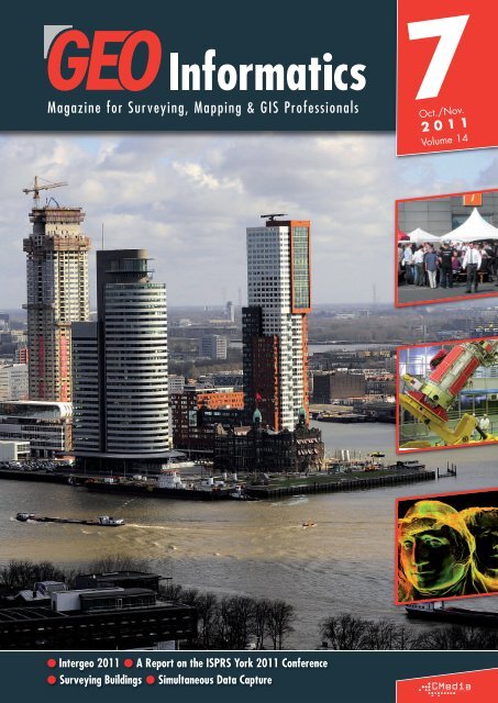
At the cover:<br />
CycloMedia brings accurate street level imaging to your desktop. At the<br />
Intergeo <strong>2011</strong> the availability of the GlobeSpotter application and data<br />
coverage throughout Europe were announced. An in depth interview details<br />
the existing possibilities and future applications. (See page 42)<br />
A r t i c l e s<br />
Simultaneous Data Capture 6<br />
The New Location Revolution 10<br />
Surveying Buildings 26<br />
Geosensor Networks 36<br />
Glonass-M sent into Orbit 40<br />
Cyclorama’s Globespotter 42<br />
Supporting Ecuador’s National GIS Initiative 46<br />
At the Crossroads of Geovisualization 48<br />
E v e n t s<br />
UAVs on Duty 12<br />
Cultural Heritage Data Acquisition & Processing 18<br />
Intergeo <strong>2011</strong> 30<br />
Racurs Conference <strong>2011</strong> 52<br />
I n t e r v i e w<br />
Esri and Cloud GIS Strategies 14<br />
C a l e n d a r / A d v e r t i s e r s I n d e x 54
This article presents the current<br />
26<br />
status of techniques and technologies<br />
for the construction of<br />
a textured model, through the<br />
support of experiences regarding<br />
an ancient historical building<br />
in the Lombardy region<br />
of Northern Italy.<br />
42<br />
On the InterGeo <strong>2011</strong><br />
CycloMedia demonstrated<br />
their panoramic imagery<br />
which take away those<br />
barriers and brings the 3rd<br />
dimension to your desktop.<br />
In line with last year, there is not<br />
only a 3-day exhibition, but also an<br />
30<br />
academic conference, this year<br />
supplemented with a Navigation<br />
Conference and the first ever<br />
Intergeo BarCamp – an open<br />
space conference devoted to Open<br />
Street Map.<br />
Esri IT Strategies Architect<br />
explains where<br />
14<br />
the company<br />
stands at the moment in<br />
adopting this new technology<br />
trend and announces a new<br />
partnership and a private<br />
cloud platform.<br />
Two examples from research at<br />
the Institute of Cartography<br />
36<br />
and <strong>Geoinformatics</strong> at Leibniz<br />
Universität Hannover,<br />
Germany, are given in order to<br />
illustrate the potential and application<br />
areas of geosensor<br />
networks in an exemplary fashion.<br />
40<br />
The booster Soyuz-2.1b, carrying<br />
a Global Navigation<br />
Satellite System (Glonass) satellite,<br />
was successfully launched<br />
from the Plesetsk spaceport and<br />
put into orbit. Space Troop<br />
teams monitored the launch through<br />
the ground automated<br />
control system.<br />
The GeoWeb<br />
48<br />
brings up more<br />
and more new ways of mapping<br />
the world that put the traditional<br />
distance-based god’s<br />
eye view of the map on the<br />
edge. This article give a short<br />
overview about the changing<br />
landscape of mapping from<br />
the author’s point of view.<br />
The development of the new<br />
close-range digital imaging,<br />
photogrammetric and laser<br />
scanning technologies is<br />
having a huge impact on the<br />
measurement, recording,<br />
depiction and analysis of<br />
cultural heritage sites and objects<br />
world-wide – as revealed<br />
at the recent ISPRS conference<br />
held in York, England.<br />
18
A r t i c l e<br />
ALTM and Large Format Digital Photography<br />
Simultaneous Data<br />
Blom have a long history of owning and operating a range of digital cameras and sensors across<br />
Europe. Traditionally, these instruments would be used independently, even if multiple data formats<br />
were required. However, the demand for higher quality resources, and the need for improved capture<br />
efficiency, has seen the long established techniques of aerial surveying put under the microscope. One<br />
method to emerge is to use aircraft with dual sensor capabilities. In early, <strong>2011</strong> Blom UK adapted one<br />
of their aeroplanes to enable simultaneous data capture with their Vexcel large format digital camera<br />
and Optech ALTM LiDAR system.<br />
By Hamish Grierson<br />
The Second Hole<br />
Cutting a hole into the fuselage of an aircraft is not as simple as<br />
one may initially think, especially if the plane already contains a<br />
large survey hatch. Before the hole can be cut several things need<br />
to be considered. Will the control cables that run under the cabin<br />
floor need to be rerouted? What is the strength and air worthiness<br />
of the plane and how many alterations will be required? What are<br />
the logistics of fitting the equipment and operators into the cabin<br />
and will everything fit? Lastly, timescale and costs need to be considered.<br />
How long will the plane be out of service and how much<br />
will it cost, both in down time and in parts and labour?<br />
Figure 1 - Both sensors are located on the right of the aircraft and the operator sits between them.<br />
6<br />
The original concept was to add a second full size survey hatch.<br />
Following many discussions it was deemed that, with the engineering<br />
taking up to six weeks, this would be too expensive. More importantly,<br />
it became apparent that a full size hole was not actually<br />
required. The ALTM head is a much smaller unit than the digital camera<br />
so it does not require such a large hole. It could, in fact, utilise<br />
the existing “Nav-Sight” hole.<br />
Before the advent of GPS, nav-sights were used by operators of large<br />
format film cameras to ensure the camera was taking pictures at the<br />
required rate and over the correct location. The nav-sight sat in front<br />
of the operator’s seat and required a small hole in the aircraft floor<br />
October/November <strong>2011</strong>
Capture<br />
to enable the ground directly below to be viewed. With the introduction<br />
of digital photography nav-sights were no longer required<br />
so the holes were closed up. By removing the internal and external<br />
plates the resulting hole was ideally suited to accommodate the ALTM<br />
sensor. Luckily, this was the most cost effective and quickest adaptation<br />
for the plane, as minimal work was required to create the second<br />
hole.<br />
System Installations<br />
With two holes now established, the next problem to be resolved<br />
was how to get all the equipment in, powered up and leaving<br />
enough room for the operator. Both systems can be operated by one<br />
operator so there was no need to accommodate another person.<br />
With both hatches situated on the right hand side of the plane there<br />
remained plenty of room on the left hand side for both control racks.<br />
And with the operator sitting between the two sensors it enables<br />
them to operate the systems efficiently (see Figure 1).<br />
Each sensor contains it own IMU, but the plane only has one GPS<br />
antenna. Rather than add an additional antenna to the top of the<br />
plane, a GPS Antenna Splitter (Diplexer) was fitted to feed GPS data<br />
to both systems.<br />
Flight Planning and Data Capture<br />
When flight planning for dual capture several factors need to be<br />
considered to ensure suitable data is collected. The primary factors<br />
being the required point density from the LiDAR and the Ground<br />
Sample Distance (GSD) of the imagery and their operational capabilities<br />
need to be assessed to ensure usable data is collected from<br />
Figure 2 - Clifton Suspension Bridge, Bristol captured as part of our MetroHEIGHT product range.<br />
A r t i c l e<br />
both sensors. The specification and operational capabilities of our<br />
Optech ALTM 3033 means that the dual capture is flight planned to<br />
optimise data from it.<br />
Blom wanted to capture both 4cm GSD imagery and 1m post spacing<br />
LiDAR and, to achieve this, planned to fly at 700m above<br />
ground. At this height the imagery has a 60/40% overlap and the<br />
LiDAR has a 20% overlap.<br />
Several other factors need to be considered during flight planning.<br />
Due to the additional weight the endurance of the plane reduced,<br />
meaning shorter sorties have to be planned. Additional cross strips<br />
need to be included to help with the calibration and matching of the<br />
LiDAR data.<br />
Although the planning is optimised for the LiDAR, the capture has to<br />
be optimised for the quality of the imagery. This meant that sun<br />
angles and cloud cover need to be assessed before any data is<br />
acquired.<br />
Data Processing<br />
Once the data has been acquired, the processing flow lines follow<br />
the standard processing procedures. The LiDAR is extracted to create<br />
the point cloud; matching to ensure that overlapping flight lines<br />
align with one another; classification to create a ground class. The<br />
imagery is colour balanced; using the IMU/GPS data and base station<br />
data an aerial triangulation is done; the images are mosaiced<br />
into tiles; final QA and correction undertaken.<br />
One benefit of dual capture is that a DTM can be created from the<br />
LiDAR data and supplied for the imagery production to be used as<br />
a surface model during rectification of the aerial photography.<br />
Latest News? Visit www.geoinformatics.com October/November <strong>2011</strong><br />
7
A r t i c l e<br />
And the end result is…<br />
Once we have completed all data capture and processing the LiDAR<br />
and aerial imagery is added into our data archive as part of the<br />
product line called BlomMETRO. This creates a high specification<br />
suite of aerial survey data products, with the core of the database<br />
being the 4cm GSD aerial photography and 1 point/m² LiDAR, creating<br />
a unique and up-to-date dataset of urban areas (see Figure 2).<br />
However, it doesn’t have to end there. What if, on top of the core<br />
product, we could provide derivative or value-added products? Well<br />
that’s exactly what we have done. From the aerial survey data five<br />
categories of sub products will be available.<br />
False colour and near infra red imagery is categorised as<br />
MetroSOURCE. This provides vital information for what can generally<br />
be categorized as environmental studies and this data is often<br />
used in coastal and environmental monitoring, crop and tree canopy<br />
management and deforestation studies. Exploiting our extensive<br />
experience in photogrammetry we use the stereo pairs captured with<br />
our Vexcel UltraCam to create 3D city models, and lastly, we have<br />
produced MetroINSIGHT. This is a value-added product designed to<br />
complement the core data with miscellaneous information such as<br />
flood risk modeling, or our solar potential analysis as used by Bristol<br />
City Council.<br />
As the economies of scale dictate, BlomMETRO is focused on the<br />
larger urban areas across the UK. However, in keeping with Blom’s<br />
SPONSORS*<br />
Images courtesy of Topcon<br />
Alice Labs ��� �� �� �� �� �� �� �� �� �� �� �� �� �� �� �� �� �� �� ��AVEV VEVA A ��� �� �� �� �� �� �� �� �� �� �� �� �� �� �� �� �� �� �� �� Bentley ��� �� �� �� �� �� �� �� �� �� �� �� �� �� �� �� �� �� �� ��ClearEdge 3D ��� �� �� �� �� �� �� �� �� �� �� �� �� �� �� �� �� �� �� ��FA<br />
ARO<br />
��� �� �� �� �� �� �� �� �� �� �� �� �� �� �� �� �� �� �� ��FIT ESIC ��� �� �� �� �� �� �� �� �� �� �� �� �� �� �� �� �� �� �� ��InfoEra ��� �� �� �� �� �� �� �� �� �� �� �� �� �� �� �� �� �� �� �� Intergraph ��� �� �� �� �� �� �� �� �� �� �� �� �� �� �� �� �� �� �� ��Kubit ��� �� �� �� �� �� �� �� �� �� �� �� �� �� �� �� �� �� �� �� Leica<br />
Geosystems ��� �� �� �� �� �� �� �� �� �� �� �� �� �� �� �� �� �� �� ��MDL MDL Laser Systems ��� �� �� �� �� �� �� �� �� �� �� �� �� �� �� �� �� �� �� �� Pointools<br />
��� �� �� �� �� �� �� �� �� �� �� �� �� �� �� �� �� �� �� ��Riegl ��� �� �� �� �� �� �� �� �� �� �� �� �� �� �� �� �� �� �� ��SPHERON-VR SPHERON-VR AG ��� �� �� �� �� �� �� �� �� �� �� �� �� �� �� �� �� �� �� ��Topcon opcon ��� �� �� �� �� �� �� �� �� �� �� �� �� �� �� �� �� �� �� ��Trimble rimble ���<br />
�� �� �� �� �� �� �� �� �� �� �� �� �� �� �� �� �� �� ��<br />
�� �� �� �� �� �� �� �� �� �� �� �� �� �� �� �� �� �� �� ��Urbica ��� �� �� �� �� �� �� �� �� �� �� �� �� �� �� �� �� �� �� ��Virtalis � �� �� �� �� �� �� �� �� �� �� �� �� �� �� �� �� �� �� �� ��<br />
Zoller +<br />
Unison Laser Scanning �<br />
Fröhlich (Z +F)<br />
*As of print deadline<br />
FIATECH TECH meeting - 7 November <strong>2011</strong><br />
Co-located with Digital Asset Management<br />
European Conference<br />
wwww.SPARPointGroup.com/Europe<br />
ww.<br />
SPARPo<br />
o intGroup.<br />
com/<br />
Europe<br />
8<br />
ethos of supplying exactly what the customer requires, areas that<br />
are not currently in the program can be captured on a project by<br />
project basis. Many targets have already been captured and more<br />
are in the pipeline and a regular refresh program to keep the data<br />
as up-to-date as possible.<br />
Conclusion<br />
The complexities of simultaneous data capture, especially whilst captured<br />
in a high speed, high altitude environment, provide many challenges,<br />
and it’s largely due to the resources and experience that<br />
Blom has that make this not only possible, but a more effective and<br />
efficient method for both us and the end user. Reducing the time we<br />
spend flying not only reduces our costs, which we are then able to<br />
pass on to the end user, but also offers CO2 savings, always an<br />
important consideration in the present climate. Secondary to these<br />
savings, dual capture also ensures that we can offer multiple data<br />
sets created from data of the same age. For example, this can prove<br />
important when used as analysis for insurance claims or inspection<br />
of transport routes. Lastly, collating this data into a package, such<br />
as BlomMETRO, ensures that Blom is always able to offer a comprehensive<br />
data set of any urban area, no matter what the clients photographic<br />
and LiDAR needs are.<br />
Conference<br />
on<br />
3D<br />
Ima<br />
g ging<br />
& Data<br />
Management<br />
for<br />
Engineering/<br />
Construction<br />
ion / Manufacturing/<br />
Security<br />
DDiscover. iscover.<br />
. Connect. Con<br />
n nect.<br />
Learn.<br />
At SPAR Europe <strong>2011</strong>, you’ll discover the latest advances and<br />
technologies in 3D imaging and processing, learn from the<br />
best minds in the business, and come away with with the tools<br />
and knowledge to refine your processes and better your<br />
business. Visit www.SPARPointGroup.com/Europe for more<br />
information and to register.<br />
FEAT<br />
URI<br />
NG:<br />
Keynote by Ed Lantz,<br />
President & CTO,<br />
V ortex Immersion Media<br />
17 Sessions<br />
40+ Presenters<br />
Technical echnical Seminars<br />
User Meetings<br />
Mobile Scanning & Mapping Demos<br />
Pre-Conference TTutorial<br />
utorial<br />
Exhibits<br />
Produced by:<br />
Hamish Grierson, Blom UK.<br />
Internet: www.blomasa.com<br />
8 & 9 November<br />
<strong>2011</strong><br />
W orld<br />
Forum<br />
| The<br />
Hagu<br />
e<br />
The<br />
Netherlands<br />
Keynote by Blaine R.<br />
Tookey ookey,<br />
ITS,<br />
Chief Technology<br />
Office, BP<br />
REEG<br />
GI IST STE ERR<br />
EA ARLY<br />
LY &<br />
SAV AVE E<br />
October/November <strong>2011</strong>
Connect to the<br />
INSPIRE Network<br />
With Esri ® Technology, you can create a spatial data<br />
infrastructure and services that ful� ll European Union (EU)<br />
Member State obligations. Esri’s ArcGIS ® for INSPIRE<br />
provides an open source portal that allows your<br />
geospatial data to be shared across the EU.<br />
Learn more at esri.com/geoinfoinspire<br />
Copyright © <strong>2011</strong> Esri. All rights reserved.
A r t i c l e<br />
Mobile and LBS<br />
The New Location Revolution<br />
Location based data is about to move from the margins, to the core of many user applications.<br />
Bold statements, but should we believe the hype?<br />
By Matt Sheehan<br />
Looking back, the GIS and location<br />
based sectors were very much a niche.<br />
MapQuest and later Google taking<br />
advantage of the Web, helped broaden the<br />
availability, appeal and usefulness of maps.<br />
Slippy maps, free data and a plethora of<br />
new (free) tools, spawned a new breed of<br />
Web based location focused applications.<br />
Route finding, traffic data, locating points of<br />
interest, and traditional GIS could all be<br />
done on the Web. The GeoWeb was upon<br />
us; a revolution of availability.<br />
But what of mobile devices? They offer<br />
portability, instant Internet access, geo-location<br />
and simple more intuitive interaction as<br />
key benefits. This article discusses mobile,<br />
with a particular focus on the location based<br />
sector.<br />
The Mobile Market in <strong>2011</strong><br />
Mobile remains a confusing market place.<br />
A turf war is being waged between rival<br />
hardware and software companies. A multitude<br />
of new devices have been launched in<br />
the last 6 months. Both smartphones and<br />
tablets of varying size and spec.<br />
Disagreements continue over software. The<br />
recent spat between Adobe and Apple over<br />
the Flash player, being but one notable<br />
example. Many companies looking to<br />
Figure 1 – Mobile ArcGIS Viewer<br />
develop mobile solutions have remained<br />
cautiously on the sidelines.<br />
But slowly the dust is clearing. For platforms;<br />
Android, Apple, Blackberry and Windows<br />
dominate. Now, no longer is there the need<br />
to build multiple versions of an application<br />
for each platform. A single code base which<br />
can run across mobile platforms is today a<br />
reality, thanks to HTML 5 for the mobile Web<br />
and installed hybrid apps built with Adobe<br />
AIR.<br />
Mobile Applications<br />
There are two ways to access applications<br />
on a mobile device. The first is to simply fire<br />
up the mobile Web browser and load a<br />
Web application. Existing Web sites are<br />
designed for mouse interaction. Mobile<br />
interaction is with the finger, thus most Web<br />
sites need to be optimized for the mobile<br />
Web. This usually means a rework of both<br />
design and functionality. Restrictions by<br />
Apple mean that cross platform Web solutions<br />
are limited to HTML5/Javascript. Sites<br />
built with Flash, Flex and Silverlight are not<br />
accessible on the iPhone or iPad.<br />
Installed applications are the second type<br />
accessible on mobiles. These can be downloaded<br />
from the various app stores. Many<br />
are written in so called native languages;<br />
10<br />
Objective C for Apples IOS, Java for<br />
Android etc. Native languages are specific<br />
for a platform, meaning multiple versions of<br />
the same app need be developed for cross<br />
platform operation. The recent launch of<br />
mobile AIR by Adobe, means that so called<br />
hybrid apps can be written which run across<br />
all platforms.<br />
Mobiles and the Location Sector<br />
Portability and resulting location change are<br />
key reasons for the popularity of mobiles.<br />
Location becomes a key piece of this new<br />
computing universe. The location based sector<br />
should be well positioned to provide the<br />
tools for this new universe. Geo-location and<br />
context are important. Geo-location, tracks<br />
current GPS location. It has spawned a new<br />
location based services (LBS) sector. The<br />
likes of Foursquare, Facebook and Yelp are<br />
allowing mobile users to discover who and<br />
what are near them. Extend that to geospatial<br />
and users can start any GIS query and<br />
discovery from their current location.<br />
Routing, traffic and local search provided<br />
by MapQuest become more relevant and<br />
useful in the field.<br />
Context is more subtle, but provides a deeper<br />
understanding of data. GIS has been traditionally<br />
used in an office or home. Taking<br />
Figure 2 - Enterprise Mobile Check-In Application Home Screen<br />
October/November <strong>2011</strong>
Figure 3 – Check-In/Out and Data Collection Figure 4 – Directions and Local Search<br />
these GIS applications into the field and running<br />
them on a mobile device, dramatically<br />
improves insight.<br />
Mobile Hardware and<br />
Application Development<br />
The mobile market is made up of smart<br />
phones and tablets. Historically dominated<br />
by the iPhone and iPad, new launches by<br />
other manufacturers have started to challenge<br />
Apples preeminence. Mobile device<br />
screen size is an important application<br />
development and design consideration.<br />
Screen sizes range from the 2.6″ HP Veer,<br />
through the 3.5″ iPhone, and 9.7″ iPad to<br />
the 10.1″ Samsung Galaxy Tab. An application<br />
designed for a tablet will not necessarily<br />
work well on a smart phone and vice<br />
versa. Applications built for a tablet can be<br />
richer and more complex than those<br />
designed for smart phones. The smart phone<br />
is ideal for quick snapshots of information.<br />
These differences are best illustrated with<br />
two examples.<br />
Mobile ArcGIS Viewer for the<br />
Tablet<br />
There are a number of excellent Web based<br />
ArcGIS viewers on the market. One of the<br />
more notable is the Esri Flex Viewer. This<br />
provides a rich GIS user experience. But,<br />
given its architecture, and the fact it is written<br />
in Flex, it will not run on any Apple<br />
device. This posed an interesting problem;<br />
can a viewer of this type be run on a mobile<br />
device? We took some of the modules<br />
which make up the Esri Flex viewer and<br />
started work on integrating them into a<br />
mobile viewer. Using mobile Adobe Air, we<br />
found we could modify the base module<br />
code and run it across all platforms. Figure<br />
1 shows the final application interface.<br />
Once built, we started testing the application<br />
across devices. It soon became clear,<br />
that even on the largest smart phone, that<br />
this was a viewer best accessed on a tablet.<br />
The tools were far harder to use on the smart<br />
phone, and subtle details in the map hard<br />
to see. The free application is now available<br />
for Apple, Android and Blackberry.<br />
Enterprise Mobile Check-In<br />
Application for the Smart Phone<br />
Mobile check-In has become very popular<br />
in marketing and advertising. Florian Fischer<br />
discussed this phenomenon in Issue 5 of<br />
GeoInformatics. To date this has been a consumer<br />
focused phenomena. But enterprises<br />
are now looking at the potential use of the<br />
check-in. Facility management companies,<br />
surveyors, multilevel marketing, insurance<br />
claims, pipeline companies, water utilities;<br />
all have field workers who would benefit<br />
from this type of mobile application. Not<br />
only checking in to work sites, but keeping<br />
a record of the work done; notes, pictures,<br />
video, even voice records. Using the new<br />
Flash tools from MapQuest, we went ahead<br />
and built an application which provided this<br />
functionality. Figure 2 shows the home<br />
screen of the application.<br />
Not only does the application include checkin<br />
and data collection, but routing, local<br />
search and a geocoder. Functionality of the<br />
application is tied to either a point of interest<br />
or GPS location. The application allows<br />
a field worker start the day by viewing an<br />
optimized route of the day’s calls. On arrival<br />
A r t i c l e<br />
at each call, the user can use the checkin/out<br />
screen to register job location and<br />
provide data relating to the call, see Figure<br />
3.<br />
The local search and geocoder provide<br />
additional tools for discovering who or what<br />
is nearby and address search capabilities<br />
respectively.<br />
A link to a video showing the application is<br />
provided at the end of the article. This application<br />
was found to be ideal for a smart<br />
phone. It provides snapshots of information<br />
regarding routing and local data. Check-in<br />
and data collection are simple interactions.<br />
And portability of the smart phone, makes<br />
it easy for field workers to both carry and<br />
use.<br />
The new mobile revolution offers exciting<br />
opportunities for the location based sector.<br />
The combination of geo-location and context<br />
provides the potential to extend existing<br />
location focused applications. It also opens<br />
the way for new, innovative applications.<br />
Maybe most importantly it offers the possibility<br />
of integrating with a wide range of<br />
other applications.<br />
Matt Sheehan is a Principal and Senior developer at<br />
WebMapSolutions. The company builds mobile applications, specialising<br />
in location based services (LBS), GIS and mapping.<br />
www.webmapsolutions.com<br />
Links:<br />
Mobile ArcGIS Viewer – www.webmapsolutions.com/arcgis-ipadandroid-blackberry-playbook<br />
Enterprise Mobile Check-In Application -<br />
www.webmapsolutions.com/checkin-data-collection<br />
WebMapSolutions Blog –<br />
www.webmapsolutions.com/category/mobile<br />
WebMapSolutions on Twitter – www.twitter.com/flexmappers<br />
Latest News? Visit www.geoinformatics.com October/November <strong>2011</strong><br />
11
E v e n t<br />
Civil Applications of UAVs<br />
UAVs on Duty<br />
UAVs (Unmanned Aerial Vehicles) are highly developed flight systems, which can be used for a great<br />
variety of applications, such as monitoring of natural hazards (landslides, flooding and volcanoes etc.)<br />
and the documentation of archaeological excavations, gravel pits, and construction sites. Furthermore,<br />
UAVs can be used for mapping of agricultural and forest areas as well as for cadastral tasks in combination<br />
with traditional surveying methods.<br />
By Henri Eisenbeiss<br />
Worldwide interest in UAVs<br />
The UAV-g <strong>2011</strong> conference was a get-together at ETH Zurich and<br />
airfield Birrfeld of 220 scientists, users, delegates of government<br />
authorities and manufacturers coming from over 30 different countries.<br />
At the conference the current research on UAVs with the emphasis<br />
on applications in Geo matics was presented and discussed under<br />
the consideration of user requirements. The focus of the conference<br />
was on the exchange of UAV-g research activities between the different<br />
disciplines (artificial intelligence, robotics, photogrammetry,<br />
geodesy, computer vision,<br />
and aerospace engineering)<br />
and furthermore, the needs<br />
for future developments were<br />
formulated.<br />
Use of UAVs under<br />
legal regulations<br />
In the keynote speech Roland<br />
Siegwart (Vice President Re -<br />
search and Corporate Rela -<br />
tions and chair of the auto -<br />
UAVs presented during the UAV-g demonstration.<br />
12<br />
no mous system lab ETH Zurich) gave a fascinating overview of<br />
autonomous navigation, positioning and collision avoidance and<br />
showed the trend towards the miniaturization of UAV systems.<br />
Currently available UAV platforms can already be used as measuring<br />
system for various mapping and monitoring applications.<br />
However, the operation of UAVs is limited by legal regulations. For<br />
example, in Switzerland autonomous flying model aircrafts with a<br />
take-off weight of over 30 kg require a particular authorization by<br />
the Federal Office of Civil Applications (FOCA). Furthermore, UAVs<br />
with a take-off weight of fewer than 30 kg can only be operated in<br />
restricted flight zones, line of sight and operated with a back-up pilot<br />
who can take over the control of the system at any time.<br />
Fascinating live demonstrations<br />
The experts were impressed by the live show at the airfield Birrfeld.<br />
During the demonstration various autonomously flying UAVs were<br />
presented, such as open source systems, fixed wings, a helicopter,<br />
multicopters, a blimp and a motorized kite. The best presentations<br />
of the live show were awarded with the “Most Innovative UAV<br />
Application and Demonstration - Award” sponsored by Hexagon<br />
Technology Center/Leica Geo systems. The R-Pod system could persuade<br />
the jury due to the light take-off weight (500 g) and the flexible<br />
applicability. A quadrocopter (open source project MikroKopter)<br />
realized by a team of the Swiss College of Agriculture (SHL / BFH)<br />
was awarded with the second price, while the third price went to<br />
Ascending Technology for the Falcon 8 system.<br />
Future research and developments will be presented at the conference<br />
UAV-g 2013 in Rostock (Germany).<br />
Dr. Henri Eisenbeiss, henri.eisenbeiss@geod.baug.ethz.ch,<br />
ETH Zurich, Institute for Geodesy and Photogrammetry<br />
More information under http://www.uav-g.ethz.ch<br />
Exhibition during the UAV-g conference.<br />
October/November <strong>2011</strong>
Combining a global reach with local expertise<br />
to fulfil your geographical data needs<br />
Blom is one of the largest providers of aerial imagery and geospatial data in Europe. Utilising a versatile fleet of aircraft and<br />
sensors, Blom captures oblique and vertical aerial photography plus topographic survey data using LiDAR (Light Detection<br />
and Ranging) technology.<br />
Blom uses this information to produce a range of datasets and solutions, such as 3D models and vector maps. This<br />
information is a vital intelligence resource and is used by local and regional government, transport, infrastructure, engineering<br />
and environmental industry sectors.<br />
Come and see us on stand 22 at ELMF <strong>2011</strong> or contact your local sales office at www.blomasa.com to find out more.<br />
CAPTURING. MODELLING.<br />
ANALYSING. YSING. SERVING.<br />
Blom SERVICES<br />
Blom MARKETS<br />
On Stand 22 at ELMF <strong>2011</strong>
I n t e r v i e w<br />
New Initiatives and Perspectives<br />
Esri and Cloud GIS Strategies<br />
In the last months, Esri has made a big step forward in embracing the cloud. With developments<br />
regarding ArcGIS Online and ArcGIS Server for the cloud, the company's cloud systems illustrate that<br />
Esri is at the edge of an upswing concerning cloud technology and solutions. Victoria Kouyoumjian,<br />
Esri IT Strategies Architect explains where the company stands at the moment in adopting this new<br />
technology trend and announces a new partnership and a private cloud platform.<br />
By Eric van Rees<br />
Esri's ArcGIS Online allows you to take advantage of a cloud-hosted platform for creating and sharing your maps on-demand, including ready-to-use and customizable templates for to create<br />
a web application with your own look and functionality.<br />
During the last Esri UC in San Diego,<br />
the company announced their plans<br />
for the cloud. This fall, the ArcGIS<br />
Online system will be shifted to a full GIS-inthe-cloud<br />
environment. It will be an open<br />
platform for mapping and geographic information<br />
in the cloud, where everything is tied<br />
together with intelligent web maps that are<br />
described as a new medium where multiple<br />
services are integrated and shared. Esri IT<br />
Strategies Architect Victoria Kouyoumjian<br />
confirms that things are happening fast, as<br />
opposed to one year ago: “We are full<br />
steam ahead, that's for sure. We are just at<br />
the edge of an upswing of getting in the<br />
cloud and providing more cloud solutions.”<br />
Cloud Adoption by the Esri community<br />
With new tools and services, the community<br />
has a better understanding and capabilities<br />
of adopting the new technology.<br />
14<br />
Kouyoumjian: “ArcGIS Server for the cloud<br />
has been out there for a year. New features<br />
to be released on desktop will allow the<br />
geospatial community to publish right to the<br />
cloud. So I think the message is clear that<br />
this is not just a single step into the cloud<br />
technology landscape - it's something Esri<br />
intends to put a lot of research and development<br />
into.”<br />
Kouyoumjian's task within Esri is to work<br />
between cloud vendors and the company's<br />
October/November <strong>2011</strong>
customers to see where both can meet each<br />
other: “Primarily, my role involves a consultative<br />
business approach to examining<br />
which technologies are worth adopting, particularly<br />
as these emerging technologies<br />
move from a blip to a trend. So I spend a<br />
lot of time in the cloud, so to speak. We look<br />
at various cloud providers, for instance, to<br />
see if there's an opportunity there for Esri<br />
and for our customers. We are fully<br />
engaged with Microsoft and their Windows<br />
Azure platform and we are looking at other<br />
providers going forward. The whole idea of<br />
the cloud is sometimes hard to “get”, so I<br />
help to facilitate that, distilling loads of information<br />
into consumable content, for<br />
instance, through frequent presentations,<br />
white papers and articles.”<br />
Cloud solutions within the Esri<br />
portfolio<br />
One might wonder where exactly does the<br />
cloud fit into Esri's existing portfolio of desktop,<br />
server and mobile solutions. Will it<br />
replace or complement the existing products<br />
and what does the cloud mean in terms of<br />
licensing costs and models? About this,<br />
Kouyoumjian is clear: “One of the channels<br />
of thought that Esri has is that cloud computing<br />
is not exclusively the solution. It complements<br />
the portfolios of solutions we have<br />
and not meant as a 100% replacement.”<br />
Indeed, it is intended to be another platform<br />
for organizations, individuals or business<br />
units that see the benefits of leveraging<br />
cloud storage, or with disaster response<br />
operations, or for economies of scale or cost<br />
purposes. Organizations that already have<br />
on-premise solutions create their data mainly<br />
through their field operations or in-house<br />
and then push that out to the cloud, storing<br />
it there so they can access it through various<br />
applications and services, states<br />
Kouyoumjian.<br />
Licensing for the Cloud<br />
When asked how licensing works for the<br />
cloud in relation to existing software licenses<br />
for desktop and server, Kouyoumjian<br />
answers that currently, to leverage ArcGIS<br />
for Server on Amazon EC2, you need to<br />
have an ArcGIS for Server license. Term<br />
licenses are also an option: “Term license<br />
are attractive to a lot of people because, in<br />
lieu of 'pay as you go' licenses for Server,<br />
Esri offers licenses in 1-month, 3-month and<br />
12-month terms.” Of course, with ArcGIS<br />
Online, you don’t need a license to initialize<br />
a SaaS-based solution to immediately<br />
start building a cloud-based application<br />
through ArcGIS Exporer Online or the Web<br />
Map Viewer.<br />
Victoria Kouyoumjian, Esri IT Strategies Architect<br />
I n t e r v i e w<br />
Going forward, Esri will be expanding<br />
ArcGIS Online to include the ability for organizations<br />
to store, manage, and host<br />
services, personalizing their geo-cloud presence<br />
for on-premise or off-premise con -<br />
sumption. Esri will have a subscription<br />
based offering for hosting map services<br />
depending on what you're doing with<br />
ArcGIS Online: With private cloud enablement<br />
through Portal for ArcGIS, and Esri<br />
leveraging SaaS, PaaS and IaaS, in a way,<br />
Esri is taking on the role of a comprehensive<br />
geo cloud broker.”<br />
Looking ahead, out of all the many cloud<br />
providers, only the select few will remain:<br />
“So you've got Microsoft, Amazon and<br />
there's all these other ones coming out of the<br />
Latest News? Visit www.geoinformatics.com October/November <strong>2011</strong><br />
15
I n t e r v i e w<br />
woodwork for cloud adopters to select from,<br />
but you can't predict how long they will be<br />
around for. The prediction is that the number<br />
of cloud providers will eventually peak and<br />
those cloud providers that are the most robust<br />
and trusted and have a successful trackrecord<br />
will survive and rise to the top.”<br />
Vblock<br />
Recently, Esri has become more engaged<br />
with VCE – a company formed as a joint<br />
venture by Cisco and EMC with investments<br />
from VMware and Intel. VCE released a pre-<br />
A customized interface of private cloud enablement through Portal for ArcGIS<br />
configured infrastructure platform called<br />
Vblock Infrastructure Platforms, enabling<br />
rapid deployment for cloud computing applications.<br />
Kouyoumjian states that this platform<br />
offers interesting opportunities for customers<br />
since Vblock platforms have compute<br />
storage, networking, security management<br />
and virtualization, so users can put their<br />
apps and everything on it, plugging it into<br />
their existing data center as a private cloud:<br />
“It's very attractive to a lot of organizations<br />
that don't want to leverage the public cloud<br />
and don't want to put their data, applica-<br />
16<br />
Vblock Infrastructure Platforms<br />
tions and their sensitive information in the<br />
public cloud space. We’ve tested ArcGIS on<br />
this platform with impressive results.”<br />
Kouyoumjian is looking forward to see<br />
what’s happening with Vblock platforms:<br />
“It's a private cloud infrastructure platform<br />
that is moving quickly into this new cloud<br />
skyscape for a lot of organizations that want<br />
on-premises, but also want to leverage the<br />
technology capabilities of a cloud.”<br />
Clearly, cloud computing has moved quickly<br />
into the mainstream geospatial environment,<br />
and is impacting nearly every vertical<br />
leveraging information technology. For Esri<br />
and GIS, the skies the limit – or is it the<br />
cloud? Watch this space.<br />
A white paper by Victoria Kouyoumjian on GIS<br />
in the cloud can be downloaded through:<br />
www.esri.com/library/ebooks/gis-in-the-cloud.pdf<br />
October/November <strong>2011</strong>
Take it for a test flight.<br />
actual size<br />
New SPAN-MEMS, small enough for any unmanned air or ground vehicle.<br />
Our new SPAN products combine GNSS technology with a range of MEMS inertial measurement unit options to provide continuously<br />
available position, velocity and attitude – even when GNSS signals are blocked by barriers such as trees, canyons or buildings. It’s ideal<br />
for UAVs or UGVs, tracking and mapping, or anyplace else you’d like to soar over the competition. To help imagine what it is like to hold<br />
the power of SPAN-MEMS in your hand, fold this page according to the instructions. Or, to integrate the real card into your own design,<br />
call you-know-who. Just remember, MEMS the word. For more info, visit novatel.com/span-mems.<br />
CREASE FOLD<br />
FOLD FOLD<br />
FOLD FOLD<br />
FOLD FOLD<br />
FOLD UP<br />
Integrate success into your .<br />
Integrate success into your .<br />
FOLD<br />
BACK<br />
FOLD OPTION
E v e n t<br />
A Report on the ISPRS York <strong>2011</strong> Conference<br />
Cultural Heritage Data Acqui<br />
The development of the new close-range digital imaging, photogrammetric and laser scanning technologies<br />
is having a huge impact on the measurement, recording, depiction and analysis of cultural<br />
heritage sites and objects world-wide – as revealed at the recent ISPRS conference held in York, England.<br />
By Gordon Petrie<br />
As mentioned in the report on the ISPRS Commission V<br />
Symposium held in Newcastle that was published in the<br />
September 2010 issue of GEO infor matics, one of the most<br />
active groups within this particular ISPRS technical commission is<br />
Working Group (WG) V/2 - which is concerned with cultural heritage<br />
data acquisition and processing and its applications. The working<br />
group had 30 papers presented on this topic at the Newcastle<br />
Symposium. A follow-up conference was held by the working group<br />
in York in Northern England between 17 th and 19 th August <strong>2011</strong><br />
and produced a further 47 papers. The conference was organised<br />
by the chairman of WG V/2, Paul Bryan of English Heritage, who<br />
was ably assisted by a small team drawn largely from his own organisation<br />
and the University of York. The actual venue for the conference<br />
was the King’s Manor, which comprises a group of medieval<br />
buildings that are currently occupied by the Department of<br />
Archaeology and the Centres for Medieval Studies and Eighteenth<br />
Century Studies of the University of York. It proved to be a very suitable<br />
venue for a conference concerned with cultural heritage.<br />
The format of the conference provided a one-hour keynote address<br />
at the start of each of the three days over which it was held. These<br />
were followed by two technical sessions and an industry session<br />
held on the first day; two further technical sessions and a poster session<br />
held on the second day; and a final technical session on the<br />
18<br />
Fig. 1 – A perspective overview of the faces of the four<br />
presidents – from left to right: George Washington;<br />
Thomas Jefferson; Theodore Roosevelt; and Abraham<br />
Lincoln – at the Mount Rushmore National Memorial in the<br />
Black Hills of South Dakota, which has been produced by<br />
the digital laser scan survey. (Source: CDDV)<br />
third (half) day. The conference also included a technical exhibition<br />
of photogrammetric and terrestrial laser scanner hardware and software<br />
products. The accompanying social events included a reception<br />
by the Lord Mayor at the city’s Mansion House; an evening boat<br />
cruise on the River Ouse that passes through the city; and the conference<br />
dinner which was held on one of the platforms in the hall<br />
Fig. 2 – The scanning team, supported by harnesses and ropes, are using a custom-made<br />
tripod and trivet to act as the mount for a Leica ScanStation laser scanner during the<br />
survey at Mount Rushmore. (Source: Doug Pritchard)<br />
October/November <strong>2011</strong>
sition & Processing<br />
housing the royal trains at the National Railway Museum. In total,<br />
the conference had a busy and satisfying programme of activities.<br />
Keynote Addresses<br />
The first of the three keynote addresses was given by Professor<br />
Jon Mills of Newcastle University, who is the president of ISPRS<br />
Commission V. He first reviewed the past and present activities of<br />
the Commission, before going on to outline the extensive international<br />
cooperation that is taking place in the acquisition and processing<br />
of cultural heritage data. The second address, entitled “An<br />
Update on the Scottish Ten” was given by Doug Pritchard, who<br />
is the Head of Visualisation at the Digital Design Studio of Glasgow<br />
School of Art and Director of the Centre for Digital Documentation<br />
& Visualization (CDDV). The Centre is a collaborative venture<br />
between the School of Art and Historic Scotland, which is the agency<br />
of the Scottish Government charged with safeguarding the country’s<br />
historic environment. One of its major projects is the so-called<br />
“Scottish Ten” which aims to deliver the comprehensive digital documentation<br />
of the five UNESCO World Heritage Sites located in<br />
Scotland and a further five International Heritage Sites. Using a combination<br />
of airborne and terrestrial laser scanning and imaging,<br />
three of the Scottish sites - (i) the New Lanark industrial settlement<br />
and village dating from the late 18 th Century; (ii) the group of<br />
Neolithic sites in the northern island of Orkney; and (iii) the remote<br />
and now-deserted Atlantic island of St. Kilda – have already been<br />
surveyed. The survey of a fourth large site – the old town of<br />
Fig. 3 – Stonehenge – showing its circles of large standing stones. (Source: Gareth Wiscombe on Wikipedia)<br />
E v e n t<br />
Edinburgh – is currently under way. On the international front, in<br />
cooperation with the U.S. National Park Service, the CyArk organisation<br />
and local specialists, the Scottish team has already carried<br />
out the survey of the spectacular national memorial of four former<br />
American presidents that has been carved out on the side of Mount<br />
Rushmore in South Dakota in the U.S.A. The images that have been<br />
acquired by the team using Leica ScanStation scanners that were<br />
shown during this address were really outstanding [Figs. 1 and 2].<br />
Currently the planning of the survey of the Rani Ki Vav (The Queen's<br />
Stepwell) site in Gujerat, India dating from the 11th Century is well<br />
under way and will take place soon. Once this has been completed,<br />
the next international site that will be surveyed (in 2012) will be<br />
the Eastern Qing Tombs, located northeast of Beijing, where numerous<br />
Chinese emperors and empresses are buried.<br />
The third keynote address was given by Paul Backhouse, who is<br />
the head of Imaging Graphics & Survey of English Heritage, which<br />
is the official agency that is charged with the preservation and management<br />
of the historic built environment of England. He gave an<br />
account of the strategies and the technologies that have been adopted<br />
by his agency in acquiring measured data of a large number of<br />
heritage sites in England and the lessons that have been learned<br />
from these surveys. Details were given of four case studies – (i)<br />
Coombe Down, a huge underground stone mine located near the<br />
city of Bath in south-west England; (ii) Chedham’s Yard, an old blacksmith’s<br />
workshop located in Warwickshire; (iii) the Dover Tunnels,<br />
Latest News? Visit www.geoinformatics.com October/November <strong>2011</strong><br />
19
Xiang Yu,<br />
Peace Map Co., Ltd.<br />
Visit iFlyUltraCam.com<br />
to see the PMC video.<br />
Or scan tag and watch on<br />
your mobile phone.<br />
Download the free tag reader app at http://gettag.mobi.<br />
����������������������������������������������������<br />
�������������������������������������������������������<br />
����������������������������������������������������<br />
������������������������������������������������������<br />
����������������������������������<br />
����������������������������������<br />
�����������������������������������������������������<br />
������ ���������������������<br />
�������������������������������������������<br />
��������������<br />
���������������������������������������������������������<br />
��������������������������������������������������<br />
������������������������������������������������������<br />
���������������������������������������������������������<br />
���������������������������������<br />
www.UltraCamEagle.com�<br />
��������������������������������������������������������������������������������������������������������������������������������������
[b]<br />
the maze of underground tunnels lying beneath Dover Castle on the<br />
cliff coast of south-east England facing France that have been constructed<br />
for defence purposes over a period of several centuries;<br />
and (iv) the World Heritage prehistoric (Neolithic) site of Stonehenge<br />
with its famous circles of standing and fallen stones (dating from<br />
around 2500 BC) and its surrounding ring bank and ditch earthwork<br />
[Fig. 3]. Again the documentation resulting from these various<br />
surveys in the form of images, maps, plans, 3D perspectives and<br />
video fly-throughs was often eye-catching in the extreme.<br />
Technical Sessions<br />
The first of the technical sessions (TS-1) was entitled Sensor<br />
Development & Mapping Solutions and featured several very interesting<br />
presentations. Among these was that given by Konrad<br />
Wenzel of the University of Stuttgart. He and his colleagues from<br />
the University’s Institute of Photogrammetry have devised a low-cost<br />
photogrammetric imaging system comprising five small-format cameras<br />
equipped with very short focal length lenses and a near-IR random<br />
pattern projector. All of these are mounted together on a<br />
portable metal frame that can be used to undertake very close-range<br />
imaging surveys [Fig. 4 (a)]. The highly automated processing of<br />
the resulting data is then carried out using an image matching algorithm<br />
that has recently been developed for use with very dense data<br />
sets. The imaging system has been used to survey the huge triangular<br />
stone tympana (each 25 m in width and 6 m in height) which<br />
are mounted at the top of the façades of the Royal Palace located in<br />
the Dam Square in Amsterdam [Fig. 4 (b)]. The scaffolding and<br />
screens that have been erected to carry out the restoration of the<br />
whole building [Fig. 4(c)] only allowed imaging distances of less<br />
than one metre. With an object (post) sampling distance of 1 mm,<br />
the point cloud that results from the images acquired at circa 2,000<br />
different camera positions is simply enormous, as is the subsequent<br />
task of processing this data mountain (or cloud). Another interesting<br />
presentation in this session included a comparison of range-based<br />
(laser scanner) techniques with image-based (photogrammetric) techniques<br />
for the surveys and documentation of rock art shelters in Spain<br />
that was given by Professor Lerma of Valencia Polytechnic. Yet<br />
another eye-catching presentation was that given by Dr. Caterina<br />
Balletti of the CIRCE Photogrammetric Laboratory of the IUAV<br />
[a] [c]<br />
E v e n t<br />
Fig. 4 – (a) This photogrammetric imaging system<br />
comprises four small-format digital cameras equipped<br />
with short focal length lenses and filters that only transmit<br />
near-IR radiation. The fifth camera transmits light in<br />
the visible part of the spectrum and is equipped with an<br />
even shorter focal length lens. The five cameras are<br />
mounted rigidly on and are protected by an aluminium<br />
frame. At the top of the frame is the projector from a<br />
Microsoft Kinect device that projects a random pattern<br />
in the near-IR part of the spectrum to provide additional<br />
texture to the images. This helps with the later automated<br />
image matching process. (Source: Institute of<br />
Photogrammetry, University of Stuttgart)<br />
(b) This triangular clay relief was made in around 1655<br />
to act as a model for the tympanum mounted at the top<br />
of the façade at the rear of the Amsterdam town hall,<br />
now today's Royal Palace on Dam Square. (Source:<br />
Rijksmuseum)<br />
(c) The front façade of the Royal Palace with the scaffolding<br />
and screens which have been erected during its<br />
restoration. The Palace is located in the Dam Square in<br />
Amsterdam. (Source: Institute of Photogrammetry,<br />
University of Stuttgart)<br />
University of Venice. This involved the survey of the historic buildings<br />
lining Venice’s Grand Canal, which was carried out using a<br />
boat-mounted Riegl VMX-250 mobile mapping system [Fig. 5] and<br />
processed using Riegl’s RiPROCESS software.<br />
The second Technical Session (TS-2), entitled “Imaging Solutions from<br />
Aerial to Underwater”, proved to be no less interesting. Dr. Geert<br />
Verhoeven from the University of Ghent gave an entertaining<br />
account of the aerial photogrammetric survey of an ancient Roman<br />
quarry located at Pitaranha in the central part of Portugal, close to<br />
the Spanish/Portuguese border. This was implemented using a Nikon<br />
D80 small-format (10 Megapixel) digital camera which was mounted<br />
on a low-flying Helikite aerostat attached to a tether [Fig. 6]. The<br />
Helikite is a combination of a balloon and kite that is manufactured<br />
by Allsopp Helikites Ltd. in the U.K. The subsequent data processing<br />
of the 1,000 often quite tilted images that covered the Pitaranha site<br />
was carried out using the Structure from Motion (SfM) software that<br />
is popular in machine vision and robotics to handle multiple-view<br />
images. [N.B. The SfM software appears to implement a set of fairly<br />
conventional multi-image photogrammetric solutions, even though it<br />
uses a wholly different terminology to that in common use in photogrammetry.]<br />
Also of much interest in this second (TS-2) session were the presentations<br />
on the aerial surveys of heritage sites from low-flying UAVs.<br />
The first of these was given by Greg Colley of sUAVe Aerial<br />
Photographers, who used a Canon 5D camera mounted on a UAV<br />
that was operated from a very low altitude to survey the Roman<br />
Amphitheatre in Chester in north-west England. The second presentation<br />
was given by Dr. Sara Bursanti of the University of Trieste.<br />
She utilized a quadcopter UAV equipped with a Canon IXUS compact<br />
digital camera to carry out a survey of the city walls of the<br />
Roman city of Aquileia in north Italy - which is yet another site that<br />
has been included in UNESCO’s World Heritage List. These two<br />
presentations were supplemented by a poster by Andrew Blogg<br />
of the KOREC company in the U.K., who brought along (in a suitcase)<br />
and showed an actual example of the very lightweight Swinglet<br />
CAM flying-wing mini-drone with its 80 cm wingspan that is produced<br />
by the SenseFly company in Switzerland [Fig. 7]. It features<br />
Latest News? Visit www.geoinformatics.com October/November <strong>2011</strong><br />
21
Complete Solutions for Lidar<br />
����������������������<br />
IN THE AIR<br />
ON THE GROUND<br />
ON THE MOVE<br />
Engineered. Integrated. Supported.<br />
From underground on Earth to the barren plains of Mars, Optech lidars bring the unknown to light. For over 35 years<br />
Optech has led the world in advanced laser ranging and imaging systems. Whether it's airborne, mobile or static<br />
surveying, Optech lidars are a complete solution.<br />
And now Optech offers the only full line of high-performance aerial digital cameras, both standalone and lidarintegrated.<br />
For film replacement, corridor mapping, oblique acquisition, thermal classification and more, Optech’s<br />
scalable and flexible cameras reduce costs and deliver superior image quality.<br />
For project managers, Optech delivers precise, accurate, and geo-referenced spatial data. For surveyors worldwide,<br />
Optech delivers rugged lidar and camera hardware with reliable support and service—anywhere, any time—backed by<br />
the industry’s leading global 24/7 support.<br />
Please join us at upcoming shows: ASPRS <strong>2011</strong> Pecora 18 Conference, November 14-17, Henderson, VA, USA, Booth #403;<br />
ELMF <strong>2011</strong>, November 29-30, Salzburg, Austria, Stand #31.<br />
www.optech.com<br />
RGB/Lidar
Fig. 5 – This RIEGL VMX-250 Mobile Laser Scanning (MLS) measurement system comprises two<br />
RIEGL VQ-250 scanners and accompanying inertial and GNSS navigation hardware. The system has<br />
been mounted on a specially built frame on the boat that has been used to carry out the scanning of<br />
the historic buildings along the Canal Grande, Venice. (Source: RIEGL)<br />
a miniaturized GPS/IMU unit that allows the pre-programmed<br />
autonomous flight of a 12 Megapixel camera over a site. Apparently<br />
this flying wing drone has already been used to survey the remains<br />
of ancient walls in Switzerland. Finally what was for me a fascinating<br />
lecture within this session was that given by Dr. Dimitrios<br />
Skarlatos of Cyprus University of Technology. He has investigated<br />
and evaluated the quite staggering amount of free (or nearly-free)<br />
open-source software or software components that are available on<br />
the Web and can be used for the photogrammetric processing of<br />
the images acquired using low-cost digital cameras. Much of this<br />
information was simply unknown to me (and to other photogrammetrists<br />
in the audience) and it needs to be publicized more widely<br />
within the cultural heritage community as well.<br />
The third Technical Session (TS-3) was entitled “Remote Sensing<br />
Technologies & Single/Multi Image Approaches”. The presentations<br />
included a description of the DART project at the University of Leeds<br />
that is investigating the underlying physical, chemical and biological<br />
properties and factors in the soil and vegetation that affect the<br />
contrast in the images that have been recorded by aerial cameras<br />
and, in turn, affect their interpretation for archaeological purposes.<br />
This was supplemented by a contribution from Poland that investigated<br />
the site formation of medieval landscapes in Pomerania.<br />
Another presentation from Nottingham Trent University described a<br />
new hyperspectral imaging system for the inspection and analysis of<br />
wall paintings and other large surfaces, while Ian Anderson of<br />
SiteScene described his work of monitoring and recording heritage<br />
plasterwork within the ruined Cowdray Castle in West Sussex. Finally<br />
Lindsay Macdonald, who is the Professor of Digital Media at the<br />
London College of Communication, gave an interesting account of<br />
his comparison of alternative photogrametric and photometric methods<br />
of constructing a digital model of an Egyptian funerary urn, comparing<br />
the results with the dense point cloud that has been generated<br />
by a high-resolution Arius 3D colour laser triangulation scanner.<br />
This work was done in collaboration with University College London<br />
and the University of Parma.<br />
The fourth Technical Session (TS-4) was concerned with “Data<br />
Processing & 3D Modelling Solutions”. Contributions included the<br />
E v e n t<br />
development of automated texture mapping; the 3D modelling of<br />
building interiors; and the development of the CityGrid software<br />
suite for 3D city modelling by the Austrian UVM (Urban Visualisation<br />
& Management) company. Next came a description of low-cost 3D<br />
modelling as applied to the London City Wall project. Finally there<br />
was an account given by Professor George Fraser of the Space<br />
Research Centre of the University of Leicester of the use of Siemens’<br />
Teamcenter data management and archiving software in the context<br />
of the laser scanning of two tomb-monuments of the Howard Dukes<br />
of Norfolk. Another interesting contribution within this area of 3D<br />
modelling came from the Virtalis company and the British Geological<br />
Survey (BGS). This described their joint development of the<br />
GeoVisionary software for the 3D visualization and interpretation of<br />
very large spatial data sets – though this contribution was, in fact,<br />
presented in both the industry and poster sessions instead of TS-4.<br />
The LFM software suite from Z+F – which provides a complete solution<br />
from the initial registration of laser scan data to the final as-built<br />
3D modelling – was also presented both in the industry session and<br />
in the exhibition.<br />
The fifth Technical Session (TS-5) had the title “Development of<br />
Standards & Best Practice Applications”. It began with a most interesting<br />
and thoughtful presentation by Dr. Stuart Jeffrey of the<br />
Archaeological Data Service (ADS) at the University of York. This<br />
expressed his views about the long-term archiving and maintenance<br />
of the enormous volume of heritage data that is being generated by<br />
photogrammetry and laser scanning, especially given the processing<br />
and re-processing that is likely to occur in the foreseeable future.<br />
He then went on to discuss the revision of the “Guides to Good<br />
Practice” for the archiving of archaeological and heritage data that<br />
the ADS has produced in partnership with the University of Arkansas<br />
and Arizona State University. This work has been carried out in support<br />
of the U.S.-based Digital Antiquity organisation that is concerned<br />
with the preservation of and access to irreplaceable archaeological<br />
records and data. It also oversees the use, development,<br />
and maintenance of the Digital Archaeological Record (tDAR), which<br />
is a unique digital repository for archaeological data. The other contributions<br />
to this session included two separate accounts (i) of the<br />
recent very detailed high-precision 3D survey of Stonehenge undertaken<br />
on behalf of English Heritage by the Greenhatch Group, Atkins<br />
Mapping and Archaeo-Environment Ltd. using Z+F Imager 5010<br />
Fig. 6 – Inflating the Allsopp helikite prior to it being used as the platform for the lightweight digital<br />
camera that has been used to carry out the low-altitude imaging survey of the Roman stone quarry at<br />
Pitaranha, Portugal. (Source: G. Verhoeven)<br />
Latest News? Visit www.geoinformatics.com October/November <strong>2011</strong><br />
23
E v e n t<br />
Fig. 7 – The lightweight SenseFly Swinglet CAM flying wing mini-drone is shown together with its carrying<br />
case and laptop control computer. It is an electrically-powered UAV capable of autonomous flight over<br />
an operational range up to 20km and can operate in winds up to 25km/h. (Source: KOREC Group)<br />
and Leica C10 laser scanners and digital photogrammetric procedures;<br />
and (ii) a similar survey by ArcHeritage using a Leica C10<br />
scanner that has produced a 3D model of the 17 th Century Staveley<br />
Hall and its grounds in the Peak District of England [Fig. 8].<br />
Poster Session<br />
Twenty or so of the presentations given at the conference took the<br />
form of posters. Often at conferences, poster sessions are poorly<br />
attended and supported, but not at this meeting. The session was<br />
lively and very well attended and most of the authors had an interested<br />
group asking questions and seeking more information about<br />
the topic concerned. No fewer than five of the poster presentations<br />
came from different Italian universities concerned with the survey of<br />
various different buildings, monuments and landscapes. As noted in<br />
my report on the previous Newcastle symposium, this is not wholly<br />
unexpected given the extent of the cultural heritage from Roman<br />
times onwards that is so prominent in that country. Two other posters<br />
were contributed by Por tu guese participants, where again there is a<br />
similar interest in the country’s national heritage. There were also<br />
two or three presentations that were concerned with satellite remote<br />
sensing – which, in my opinion, did not seem too appropriate, given<br />
that ISPRS Commission V is concerned with close-range imaging and<br />
measuring techniques and their applications. Either ISPRS<br />
Commission VII, which deals with the thematic processing, modelling<br />
and analysis of remotely sensed data, or Commission VIII, which<br />
covers remote sensing applications, would seem to be a more much<br />
appropriate platform for the presentation of these contributions.<br />
Fig. 8 – A perspective view of the exterior façade of Staveley<br />
Hall that has been produced from digital 3D laser scan data.<br />
(Source: ArcHeritage)<br />
24<br />
Industry Session &<br />
Exhibition<br />
As one would expect, these two<br />
parts of the programme mainly<br />
featured the manufacturers and<br />
suppliers of terrestrial laser scanners<br />
and the accompanying software.<br />
They also supplemented<br />
their presentations by displaying<br />
and demonstrating their instruments<br />
and systems both in the<br />
technical exhibition and in the<br />
grounds of King’s Manor. Most of<br />
the laser scanners that were<br />
exhibited were of the short-range<br />
type based on the phase measuring<br />
technique that are best suited<br />
to heritage and building applications.<br />
They included the Leica<br />
HDS6200, the Z+F Imager 5010,<br />
the Faro Focus 3D and the<br />
Surphaser from Basis Software.<br />
On the photogrammetric side, the<br />
well known suite of Vr photogrammetric<br />
and lidar processing products<br />
that have been developed by<br />
Cardinal Systems in the U.S.A.<br />
were demonstrated by its U.K.<br />
Fig. 9 – This diagram shows the horizontal<br />
rotational motion of the SpheroCam HDR digital<br />
panoramic line scanner around its vertical axis.<br />
When used together with the near 180° vertical<br />
field of its fisheye lens, the instrument can generate<br />
spherical (360° x 180°) digital images in a<br />
single rotational pass. The instrument is produced<br />
by the Spheron-VR company, which is based near<br />
Kaiserslautern in the state of Rhineland-Palatinate<br />
in Germany. (Source: Spheron-VR)<br />
agent. What was more unusual was the presence in the exhibition<br />
of a single example of a rotating panoramic line scanner in the form<br />
of the SpheroCam HDR from Germany [Fig. 9]. This instrument produces<br />
digital panoramic images in a single pass without any need<br />
for stitching. I have long been mystified as to the almost complete<br />
lack of knowledge and application of this type of precision imaging<br />
device (which is also produced by several other German and Swiss<br />
manufacturers and by Panoscan in the U.S.A.) on the part of the cultural<br />
heritage community in the U.K. The instruments seem very well<br />
suited to the imaging of the interiors and exteriors of the large buildings<br />
that form a major part of the cultural and architectural heritage<br />
in so many countries and especially in the U.K.<br />
Conclusion<br />
This was a very worthwhile meeting to attend - well organised and<br />
with a friendly but serious atmosphere and a useful outcome. With<br />
only a few exceptions, the presentations were of a really good standard<br />
and were very focussed on the specific topics that have been<br />
set out in the Working Group’s terms of reference. Thus there was a<br />
great deal of new information for the participants to assimilate, both<br />
on the hardware and software systems side and on the very wide<br />
range of applications to cultural heritage documentation that were<br />
discussed. Undoubtedly the cultural heritage area has already benefitted<br />
greatly from its successful adoption of modern close-range digital<br />
photogrammetric and laser scanning technologies. Furthermore,<br />
on the evidence of this meeting, there is much more to come!<br />
Gordon Petrie is Emeritus Professor of Topographic Science<br />
in the School of Geographical & Earth Sciences of the University<br />
of Glasgow, Scotland, U.K.<br />
E-mail - Gordon.Petrie@glasgow.ac.uk;<br />
Web Site - http://web2.ges.gla.ac.uk/~gpetrie<br />
October/November <strong>2011</strong>
A r t i c l e<br />
Point Clouds and Multi-image Panoramas<br />
Surveying Buildings<br />
The development of building knowledge systems is nowadays a meaningful step when planning<br />
architectural maintenance and managing emergencies during a building’s life cycle. A 3D photo-textured<br />
model, which can describe both spatial connections and material properties, is a measurable<br />
virtual object that is achieved via terrestrial survey techniques, such as laser scanning and imaging.<br />
This article presents the current status of techniques and technologies for the construction of a textured<br />
model, through the support of experiences regarding an ancient historical building in the Lombardy<br />
region of Northern Italy.<br />
By Luigi Colombo and Barbara Marana<br />
Fig. 1- The Monte Oliveto Sanctuary, suggestively placed inside a small valley<br />
Knowledge technologies<br />
Survey and representation techniques can provide, without contact,<br />
spatial numeric plots and drawings with an assigned precision, to<br />
produce a geo-database of architectural information.<br />
The survey process can be enhanced using image measurement (close<br />
range photogrammetry) or scanning laser sensors, which record a<br />
sequence of spatial points describing the selected object. Usually, the<br />
combination of both methodologies will overcome accessibility and<br />
visibility problems, which often affect the employment of optical instruments<br />
during a terrestrial survey.<br />
Photogrammetry is based on the use of an imaging camera (film or<br />
digital), in which the acquisition of many overlapping images produces<br />
spatial and orthographic representations, thanks to the application<br />
of projective geometry algorithms. Photo gram metric solutions,<br />
despite offering interesting and complete application fields, do not<br />
permit simultaneous processing with acquisition. This said, it is now<br />
in competition with the emerging laser scanning technology, which<br />
provides real-time, fast, and increased automatic metric output.<br />
A sophisticated digital sensor, placed over a standard support, is<br />
used to emit a thin laser beam towards the object to be measured.<br />
The beam, while rotating in the horizontal and vertical planes,<br />
describes pre-selected areas, directly recording a cloud of spatial<br />
points (coordinates x, y, z). The reflected energy and, under certain<br />
circumstances, the photographic information, produces an object<br />
26<br />
Fig. 2 – The church interiors, with Z+F scanner at work and mobile targets<br />
point model of given density with materials and natural colours.<br />
As with photogrammetric methodology, the laser device is located at different<br />
spatial positions providing overlapping cloud sequences in order to<br />
guarantee software connection in a global model.<br />
It is interesting to note that this motorized sensor can record up to<br />
1,000,000 object points per second, with an accuracy of a few millimetres,<br />
and within a range of more than one hundred metres.<br />
October/November <strong>2011</strong>
The produced sketchy model can be observed and processed using various<br />
software packages available with many well-known and established<br />
CAD systems.<br />
It is easy to think that each cloud could contain redundant information (for<br />
instance too many points) for zones with simple and regular geometry. On<br />
the other hand, there could be too little information (voids) caused by the<br />
position of the measurement device not allowing for by complex object<br />
morphologies and object roughness. Therefore, editing is necessary to<br />
simplify and refine the collected data. In addition, the phases regarding<br />
adjacent cloud connection and texture mapping require manual work and<br />
the use of different dedicated packages.<br />
The Monte Oliveto survey: a new experience<br />
The 16th century Monte Oliveto Sanctuary is located at Adrara St.<br />
Martino, on the first Val di Pieve reliefs, at the eastern border of the<br />
Bergamo province (Fig.1).The church interior shows one nave divided<br />
in three spans by masonry pilasters (Fig. 2).The building (its inside<br />
and part of the outside, due to restoration) was recently surveyed by<br />
the Geo-Technology Lab from the University of Bergamo. This program<br />
of analysis, documentation and cataloguing, was done in collaboration<br />
with the Historic Research Group of Adrara St. Martino,<br />
which has been studying the valley monuments for many years.<br />
It was planned to employ, as usual in the Lab applications, both scanning<br />
and imaging techniques in order to obtain a 3D spatial model<br />
of the building. The assigned parameters were 10 mm expected accuracy,<br />
that is a level of detail corresponding to the traditional 1:50<br />
scale, scanning density at the highest level (for a linear sampling of<br />
about 3 mm or 4 mm of the walls), and object detail detection if<br />
greater than 10 mm, with a 60% level of confidence.<br />
The technology used was a panoramic laser device (field of view<br />
equal to 360°x320°) from Zoller+Frölich (500,000 points per second<br />
rating and cloud scanning time under seven minutes) plus an<br />
external Nikon reflex camera with panoramic lens (180°) and highresolution<br />
sensor.<br />
In this application, an external camera was preferred for photographic<br />
texturing, instead of the motorized photo camera, superimposable<br />
to the scanner, adopted in a previous Lab experience<br />
[<strong>Geoinformatics</strong> 4, <strong>2011</strong>]. The new choice allowed photographic<br />
textures to be generated more independently from the scanning conditions<br />
and times, a solution that presents less constraint for<br />
device/object distance.<br />
A r t i c l e<br />
Fig. 3 – The sanctuary façade,<br />
with the panoramic photo<br />
camera on its spherical support<br />
Both the aforementioned selections however provide approximate solutions.<br />
Only a laser with an integrated photo camera, but of a selectable<br />
high resolution, allows for the production of a truly coloured point cloud.<br />
As yet, this option is not provided by Z+F.<br />
The photo camera was installed over a mechanical support with a round<br />
head, to be connected to the laser tripod. In this way, 360° images are<br />
recordable from the same scanning positions (without parallax errors) for<br />
the final model photo-texturing. For each of the panoramic scans, manually,<br />
six horizontal shots and one zenithal shot were carried out (Fig. 3).<br />
These seven images were then processed inside photographic stitching<br />
software so as to generate a global spherical multi-image panorama<br />
to be mapped over the point cloud or point-derived triangular<br />
mesh. This way, it is possible to manage a reduced number of<br />
Fig. 4 – Single images (top) and the corresponding multi-image panorama (bottom)<br />
Latest News? Visit www.geoinformatics.com October/November <strong>2011</strong><br />
27
A r t i c l e<br />
Fig. 5 – Wireframe model with local photo-textures<br />
images, bypassing the heavy step dedicated to each photo projection<br />
and the need for several homologous tie points.<br />
Altogether, fifteen scans (each of 800 Mb) were produced, seven<br />
over the exteriors and eight for the interiors, with the aid of thirteen<br />
plane targets (mounted over a mobile support to optimize the survey<br />
inter-visibility) located inside a selected area and suitable for the<br />
cloud connection.<br />
The external survey was undertaken in the morning under a clouded<br />
sky, this way avoiding the unwanted effects of image shadowing.<br />
The interiors were measured under artificial lighting due to the low<br />
level of natural illumination provided by the windows.<br />
The church model and photo-texturing<br />
With the aid of targets, the sanctuary point model was generated by<br />
connecting each cloud to the central one, selected as reference. From<br />
the same scanning positions, proper overlapping images were acquired<br />
via manual shooting using the Nikon camera.<br />
The following photo-texturing process was automatically carried out<br />
thanks to the PTGui stitching package, in order to perform spherical<br />
multi-image panoramas, which were then imported inside 3D<br />
Reconstructor software, switching on spherical projectors for model rendering.<br />
A series of photographic images is shown describing the building façade<br />
Fig. 6 – Perspective view of the textured model<br />
28<br />
and the corresponding spherical panorama produced<br />
with PTGui (Fig. 4).<br />
Finally, the following figures (Figs. 5, 6) show some<br />
striking perspective views of the reconstructed 3D<br />
church model (points and meshes), with the phototexture<br />
superimposition.<br />
Entity edge detection, for the building vector drawing<br />
generation, was done by automatic extraction<br />
of the angular discontinuity lines from the point<br />
model; this 2D product is performed by applying<br />
geometric tests regarding the local attitude of the<br />
surface-perpendicular in every point of the model.<br />
The process provides sketchy elevations of a building.<br />
Figure 7 shows an example of the church<br />
main elevation, achieved both through the angular<br />
surface discontinuity analysis (sketchy drawing<br />
being completed in CAD) and by tracing a preproduced<br />
colour orthophoto.<br />
Final remarks<br />
Laser scanning techniques provide an interesting<br />
3D point or surface model, which can be<br />
integrated with colour images and is fully measurable.<br />
The extraction of 2D plots from this model is still a complex step:<br />
starting from the scanned data and using cutting planes, it is possible<br />
to produce horizontal and vertical cross-profiles to be used<br />
together with orthophoto backdrops to complete building cross sections.<br />
However, 2D elevations have to be realized with the heavy<br />
support of manual editing and the photo-texturing step causes the<br />
greatest difficulties and errors.<br />
Nevertheless, the 3D model and its derived 2D plots represent an<br />
effective tool for the metric analysis of a building (geometry, shape,<br />
symmetries, alignments, parallelisms), for thematic inspections<br />
(colours, materials, preservation and/or decay condition) and globally<br />
for the generation of a knowledge database of an historical<br />
monument.<br />
Luigi Colombo, luigi.colombo@unibg.it, is professor of Geomatics and<br />
Barbara Marana is assistant professor at the University of<br />
Bergamo - Faculty of Engineering - DPT - Dalmine (Italy)<br />
Acknowledgements:<br />
Thanks are due to some graduated students of Geo-Technology Lab<br />
at the University of Bergamo and to 3DTarget for Z+F technology support.<br />
Fig. 7 – Sketchy elevation for the main façade (to the left); the same drawing performed by orthophoto<br />
tracing (to the right)<br />
October/November <strong>2011</strong>
We Get the Point...<br />
In Fact, We Get Billions.<br />
Together with Leica Geosystems, we offer the<br />
�����������������������������������������<br />
���������������������������������������������<br />
ERDAS IMAGINE ®<br />
, LPS, ERDAS APOLLO and<br />
Intergraph’s GeoMedia ®<br />
at www.erdas.com/lidar
E v e n t<br />
More than just an Exhibition<br />
I n t e r g e o 2 0 1 1<br />
Intergeo is more than just a huge geospatial exhibition. In line with last year, there is not only a 3-day<br />
exhibition, but also an academic conference, this year supplemented with a Navigation Conference<br />
and the first ever Intergeo BarCamp – an open space conference devoted to Open Street Map.<br />
By Eric van Rees<br />
Introduction<br />
Intergeo is Europe’s major exhibition for the<br />
geoinformation industry. This year’s event was<br />
held in Nuremburg, Bavaria during 27-29<br />
September. The 17th edition of the event,<br />
which normally combines a trade fair with a<br />
conference, was for the first time combined<br />
with a Navigation Conference, held during<br />
27 and 28 September, jointly organized by<br />
the German Federal Ministry of Transport,<br />
Building and Urban Development and the<br />
Federal Association for Information Tech no -<br />
logy, Telecommunications and New Media<br />
(BITKOM).<br />
No less than 527 exhibitors were to be expected<br />
from over 30 countries, the visitors amount<br />
was over 16,000 and 1,500 conference participants<br />
from around 80 countries from all continents.<br />
The event claims to cover all the trends<br />
along the value-added chain, from data acquisition<br />
to sophisticated applications, on a gross<br />
exhibition area of 28,000 meters.<br />
The overarching motto for this year’s conference,<br />
the 59th German Cartographers Day<br />
and the Geodetec Week was ‘Knowledge and<br />
action for planet Earth’. For the first time, this<br />
year’s event also sees the integration of the<br />
‘Navigation Conference’, held on Wed nesday.<br />
One new feature aimed at the open data community<br />
is a BarCamp devoted to the potential<br />
of OpenStreetMap. The BarCamp was part of<br />
the Intergeo Academy launched in 2010 with<br />
great success and started on the Monday<br />
before the fair. Participants were to determine<br />
the program of presentations themselves at the<br />
outset.<br />
The BarCamp is a type of open-space conference<br />
and centers on the idea that coffee breaks<br />
are the most important part of a conference,<br />
providing an opportunity to share knowledge<br />
and float new ideas. Beforehand, 250 participants<br />
were expected.<br />
Press Conference<br />
The German Intergeo event hosted a press conference<br />
with several major people from the<br />
industry on Wednesday 28th of September. An<br />
interesting point made by Prof. Dr. Karl Fr.<br />
30<br />
Thöne was that politics was also present at<br />
Intergeo, which means not only the focus on<br />
business and technology. The importance of this<br />
remark was proven by the Galileo project,<br />
scheduled for 2014/2015 which will yield a<br />
lot of work for not only satellite building companies<br />
but also for the industry as a whole.<br />
Also, it was stressed that it’s important to be<br />
independent as a country as a whole for having<br />
such as system for itself.<br />
Rainier Bomba State Secretary in the BMVBS,<br />
The German Federal Ministry of Transport,<br />
Building and Urban Development, spoke about<br />
the use of navigation systems in transportation,<br />
as well as building future housing more energy<br />
efficient, all through the use of geospatial software<br />
and hardware.<br />
Matt Delano (Trimble) spoke about the surveying<br />
industry and the company he represented:<br />
he described that the future for geomatics professionals<br />
is not only about location since the<br />
technique tells you all about the location. This<br />
vision was shared by Ed Parsons, also present<br />
at the same press conference, who held a<br />
October/November <strong>2011</strong>
mobile device in his hand as to show where<br />
the future is headed for mobile data capture.<br />
Of course, surveyors claim rightly that mobile<br />
consumers devices cannot deliver the accuracy<br />
they can with professional devices, but the trend<br />
is clear. The geomatics industry as a whole is<br />
changing quickly.<br />
Delano described surveyors as ‘the custodians<br />
of spatial information’, but the technology has<br />
put an end to the monopoly position of surveyors<br />
as data collectors. This is no news for anyone<br />
in the industry. What was interesting<br />
though, was that both Delano and Parsons<br />
shared the same ideas about acquisitions in the<br />
geospatial industry: both agreed that acquisition<br />
and innovation are closely linked and therefore<br />
acquisitions are a good thing. Delano<br />
argued that integration of technology leads to<br />
a better use of the technology as a whole.<br />
Google’s focus on data gets a new perspective<br />
by their Enterprise suite that makes use of the<br />
cloud infrastructure that’s already there.<br />
Parsons claimed to be able to innovate for more<br />
quickly because of this cloud infrastructure.<br />
A question for all participants about how to<br />
deal with a lack of finance was discussed in<br />
detail. For governments, the current financial<br />
crisis meant less budgets for geospatial activities<br />
and for the industry itself harsh competition.<br />
Although the answers from the participants<br />
were far from original (‘necessity if the mother<br />
of invention’, ‘a crisis calls for creativity’ and<br />
the like), Rainier Bomba stressed that Germany<br />
itself was well-prepared in terms of budgeting<br />
for the future, as an example the Galileoproject.<br />
Key Themes<br />
Key themes for this year’s event were sensors,<br />
geodata infrastructures and 3D mapping. I<br />
noticed a lot of UAV’s whereas mobile mapping<br />
seemed to be less present than the last<br />
two years. The sudden interest in UAV’s has<br />
to do with pricing: a system can be purchased<br />
relatively cheap. Mavinci was a new company<br />
present at the exhibition floor that offers<br />
UAV services. Although cheap, it’s not easy<br />
to use UAV since permission is needed for car-<br />
E v e n t<br />
rying out surveys. Everyone with a UAV will<br />
tell you how difficult and time-consuming it is<br />
before all required permission has been<br />
obtained for carrying out a survey.<br />
Open source keeps an interesting topic on the<br />
exhibition as well. As well as the last few<br />
years, there was an open source park<br />
(OSGeo Park), with presentations and booths<br />
of open source initiatives and booths. It was<br />
announced that for the first time there were<br />
more than ten exhibitors, making the OSGeo<br />
Park an integral part of Intergeo. A new company<br />
I haven’t seen before was CSGIS, a<br />
German-Spanish collaborative project that<br />
offers GIS services through open source, from<br />
web design to cartography, geodata management<br />
and Web GIS. Other interesting<br />
open source initiatives present were<br />
OpenSeaMap, a project that makes use of<br />
Open Street Map data, but for sea routes.<br />
The OSGeo-Park organized a day of presentations,<br />
with German presenters of different<br />
open source initiatives. This makes clear that<br />
the open source community in Germany is big<br />
and has a large following.<br />
Familiar faces such from<br />
Quantum GIS and rasmadan<br />
were present, but also a lot of<br />
new companies such as<br />
Omniscale, MapMedia, Inte -<br />
va tion, in mediares, Where -<br />
Group and terrestris, as well as<br />
presentations with technical<br />
details on how to manage data<br />
in open source, or Web GIS<br />
clients for Smartphones, the<br />
aforementioned Open Street<br />
Map, MapServer 6, Earth -<br />
Server and Mapguide, among<br />
others.<br />
Google was for the first time<br />
present at the exhibition floor<br />
with a booth to promote<br />
Google Earth Builder, the company’s<br />
cloud-based mapping<br />
platform and Google Earth<br />
Enterprise.<br />
Latest News? Visit www.geoinformatics.com October/November <strong>2011</strong><br />
31
E v e n t<br />
Product releases at Intergeo<br />
As always, there were a number of product<br />
releases at the trade fair. The following is a<br />
selection of these releases.<br />
Trimble<br />
Trimble introduced a new version of its terrestrial<br />
mobile mapping office software—<br />
TrimbleTrident Analyst 4.7. The software is<br />
designed to effectively manage and interpret<br />
high-resolution digital images and large point<br />
clouds, and automatically extract features from<br />
Trimble’s MX Mobile Mapping and Survey<br />
systems. These capabilities allow land mobile<br />
data to be transformed into geospatial intelligence.<br />
The latest version incorporates new quality<br />
control tools for efficient review of positional<br />
and orientation accuracy, and quick validation<br />
of boresight parameters and registration<br />
results using passive objects in the mapping<br />
environment. In addition, new 3D point cloud<br />
classification capabilities increase productivity<br />
and enhance usability throughout corridor<br />
mapping and survey workflows.<br />
Trident Analyst is designed for robust object<br />
positioning, measurement, and data layer creation—ideal<br />
for the analysis of geo-referenced<br />
imagery and laser scanner data. New functions<br />
can accelerate projects and increase productivity,<br />
including key automated processes<br />
such as surface modeling, roadway sign and<br />
pole detection, lane marking detection, edge<br />
and breakline detection, road geometry and<br />
clearance measurements.<br />
Trimble introduced additions to its portfolio of<br />
Connected Site survey solutions for the field<br />
and office. The new and enhanced tools allow<br />
surveyors to collect, share and deliver data<br />
faster to improve accuracy, efficiency and productivity.<br />
Additions to the survey portfolio include:<br />
• Trimble S6 Robotic Total Station with<br />
Trimble VISION Technology<br />
• Trimble M3 Total Station with Trimble<br />
Access Field Software<br />
• Trimble GeoExplorer GeoXR Network<br />
Rover<br />
• Trimble Business Center Software version<br />
2.60<br />
• Trimble Access Field Software Developers<br />
Kit (SDK)<br />
Leica Geosystems<br />
Leica Geosystems announced version 4.0 of<br />
the easy-to-use Leica SmartWorx Viva onboard<br />
software being available in November <strong>2011</strong>.<br />
This new version is packed with exciting new<br />
features to make data collection and stakeout<br />
even simpler and even more productive. Also<br />
announced were the CGR10 and CGR15<br />
radio modems for its Leica Viva CS 10 & CS<br />
15 Controllers. Both modems are an ideal<br />
extension to the Leica Viva NetRover and Leica<br />
Viva GS12 rover. They can also be used with<br />
the Leica Viva GS10, GS15, and the new<br />
GS25 receiver.<br />
Leica Geosystems announces Leica GR25<br />
GNSS Reference Server, with integrated internal<br />
and external device management, multiuser<br />
management, high end security, modular<br />
and scalable design, the GR25 GNSS<br />
Reference Server will grow with users’ needs<br />
and keep their GNSS applications and networks<br />
fully up to date. The newest member of<br />
Leica Geosystems’ trusted GNSS Spider family<br />
is designed for numerous permanent and<br />
semi-permanent GNSS network installations<br />
and monitoring applications. Including RTK<br />
and static networks, single base station, field<br />
campaigns, structural monitoring, atmospheric<br />
and seismic studies and offshore positioning.<br />
Also announced was Leica Exchange. With<br />
Leica Exchange, secure two-way wireless information<br />
transfer between the field and office is<br />
seamless and instant. As soon as field work is<br />
32<br />
complete, measurements can be sent to the<br />
office; or upon design changes, updates can<br />
be sent instantaneously to field personnel.<br />
Lastly, the Leica Viva GS25 is the ultimate highend<br />
GNSS Surveying Receiver and further<br />
expands Leica Geosystems’ GNSS surveying<br />
portfolio of its successful Leica Viva family.<br />
Topcon/Sokkia<br />
Topcon released the IS-3 Imaging Station.<br />
Following in the footsteps of its QS A robotic<br />
cousin, the IS-3 now features the patented<br />
prism auto-tracking scanning interface technology,<br />
XTRAC 8 to increase productivity when<br />
used in two-man auto-tracking or single operator<br />
robotic modes. When used in conjunction<br />
with Topcon’s unique RC-4 remote control system,<br />
the IS-3 will track prisms up to 1000 m<br />
away. Alternatively, use the innovative longrange<br />
Wi-Fi WT-100 wireless device, to control<br />
the instrument via live video feed from up<br />
to 300 m away.<br />
Also announced was the MR-1 modular GNSS<br />
receiver. The new MR-1 receiver is a<br />
ruggedised GNSS platform that delivers<br />
Topcon’s G3 and VISORTM technologies in a<br />
compact and easy to integrate package. It<br />
incorporates 72 universal tracking channels<br />
and is capable of tracking all signals from<br />
GPS, GLONASS and SBAS satellite systems<br />
that are currently operational and available for<br />
public use.<br />
Topcon further announced Tesla - large screen<br />
data collector .The Tesla is a controller running<br />
Windows Mobile 6.5.3 operating system. The<br />
new unit operates with Topcon’s full suite of<br />
software, including Magnet, Pocket 3D and<br />
Layout. All three Topcon Tesla units – Standard,<br />
Geo and Geo G3 –come with Wi-Fi and<br />
Bluetooth wireless technology. The Geo and<br />
the Geo 3G add a 3.2 MP camera and GPS<br />
capability; the Geo 3G also has a 3G GSM<br />
modem (AT&T network approved).<br />
Topcon also announced Magnet, cloud-based<br />
software for real-time collaboration. This new<br />
software solution makes it possible for real-time<br />
collaboration between project manager, field<br />
crews, office personnel, engineers, or consultants.For<br />
the first time, a software solution is<br />
available that combines every facet of managing<br />
a company’s projects, data, and assets<br />
The Magnet family includes four basic product<br />
modules: Field, Tools, Office, and Enterprise.<br />
The Field, Tools, and Office products can be<br />
purchased outright, or can simply be activated<br />
on a subscription basis by picking from one of<br />
the Magnet Solution packages. The heart of<br />
Magnet is a cloud-based web environment that<br />
connects every user within a company to each<br />
other, within the productivity application you<br />
use, or by simply logging in using your web<br />
browser.<br />
October/November <strong>2011</strong>
Improve your fi eld effi ciency<br />
with Spectra Precision.<br />
FIRST CHOICE OF<br />
S U R V E Y O R S<br />
FOCUS ® 30<br />
• Robotic, StepDrive, and LockNGo models<br />
• Powerful total station at only 5.0 kgs<br />
EPOCH ® 50<br />
• GNSS, with 220 channels<br />
• Compact and lightweight<br />
RANGER 3<br />
• Large, sunlight-viewable touchscreen<br />
• Spectra Precision Survey Pro onboard<br />
For more information on Spectra Precision solutions please visit<br />
www.spectraprecision.com/info<br />
© <strong>2011</strong> Spectra Precision. All rights reserved. All other trademarks are property of their respective owners.
E v e n t<br />
Blom<br />
Blom brought a new product to INTERGEO<br />
<strong>2011</strong>; BlomSTREET - Powered by Cyclo me dia.<br />
At the trade fair, the company demonstrated<br />
how geographically accurate street level spherical<br />
images, complete with metric capabilities,<br />
are an essential tool for street asset inventory,<br />
situational awareness for emergency services<br />
and responders, and road and waterworks<br />
amongst others.<br />
BlomSTREET comes together via an exclusive<br />
franchise agreement between Cyclomedia and<br />
Blom in the territories of Norway, Sweden,<br />
Finland and Denmark. Both companies are currently<br />
investigating similar agreements for other<br />
territories in Southern Europe.<br />
Blom already has a number of customers currently<br />
using BlomSTREET as during this summer<br />
Blom completed a pilot projects across the<br />
Nordic countries. Additional territories in<br />
Southern Europe are planned to be incorporated<br />
into this partnership.<br />
52°North<br />
52°North presented state of the art Sensor<br />
Web technology supporting seamless integration<br />
of live sensor data into Spatial Data<br />
Infrastructures via OGC Sensor Observation<br />
Services. A suite of open source tools is available<br />
for easy and efficient visualization and<br />
analysis of time series information. Applica -<br />
tions in water management, environmental<br />
monitoring and meteorology impressively<br />
vouch for the benefit of this innovative technology<br />
and point the way for other fields of application.<br />
52°North’s new WPS “Appstore” provides<br />
many advantages for users and providers of<br />
processes (e.g. hydrological models, EO algorithms<br />
or geostatistical functions).<br />
RIEGL<br />
RIEGL Laser Measurement Systems, manufacturer<br />
of laser scanners for terrestrial, mobile,<br />
airborne and industrial applications, an -<br />
nounced the following releases at Inter geo:<br />
VZ-4000 Terrestrial Laser Scanner. This High<br />
Speed, High Resolution 3D VZ-Line Laser<br />
Scanner offers a wide field of view and a long<br />
range of up to 4000 m. Hence, the most<br />
recent RIEGL development is perfectly suitable<br />
for operation in mining and topography. The<br />
scanner is characterized by high accuracy (15<br />
mm), a laser pulse repetition rate of up to 200<br />
kHz, echo digitization and online waveform<br />
processing for multiple target capability and<br />
34<br />
an optional waveform data output.<br />
VMX-250 Mobile Laser Scanning System, now<br />
in an aerodynamic new design, and its sister<br />
type VMX-450 with a laser pulse repetition<br />
rate of up to 1.1 MHz.<br />
Fully integrated Mobile Laser Scanning System<br />
in a new design, which ensures excellent aerodynamics<br />
and protection of cabling. Two<br />
RIEGL VQ-450 "Full Circle" Laser Scanners,<br />
providing a scanning rate of up to 400<br />
lines/sec and a laser pulse repetition rate of<br />
up to 1.1 MHz, are combined with an<br />
IMU/GNSS unit and assure very fast acquisition<br />
of survey-grade 3D data.<br />
Just like its sister type VMX-250, it operates at<br />
eye-safe laser class 1 and is capable of multiple<br />
targets, guaranteeing a high penetration<br />
rate of obstructions. In combination with an<br />
optional modular camera system, scan data<br />
and precisely time-stamped calibrated images<br />
can be acquired simultaneously for seamless<br />
storage and processing in the same project<br />
structure.<br />
The VQ-580 Airborne Laser Scanner, especially<br />
designed for measuring on snow and<br />
ice, delivers data in the areas of snowfieldand<br />
glacier surveying. It distinguishes itself by<br />
means of a laser pulse repetition rate of up to<br />
380 kHz and a range of up to 2350 m. The<br />
October/November <strong>2011</strong>
combination of echo digitization and waveform processing<br />
allows for multiple target capability. A field of view of 60° and<br />
a scanning rate of up to 150 lines/sec and hence an evenly<br />
distributed high resolution point grid.<br />
The VQ-820-G Bathymetric Airborne Laser Scanner, especially<br />
designed and excellently suited for combined land and hydrograhpic<br />
airborne surveying. The high-accuracy ranging is based<br />
on echo digitization and online waveform processing with multiple<br />
target capability. Laser range measurements for high resolution<br />
surveying of underwater topography, the bottom of shallow<br />
waters and riverbeds, are carried out with a narrow, visible<br />
green laser beam at 532 nm, emitted from a powerful laser<br />
source. Depending on water turbidity this particular laser wavelength<br />
allows measuring into water.<br />
In 2012, Intergeo will be held<br />
in Hannover, Germany.<br />
Internet: www.intergeo.de<br />
www.mavinci.eu<br />
www.csgis.de<br />
�����<br />
�������������������������������<br />
�������������������������<br />
����������<br />
����������������<br />
����������������������������������<br />
��������������������������<br />
����� ����� ����<br />
������������<br />
����������������<br />
��� ������ ��������<br />
����������� ������<br />
���� ���� ����������<br />
����� ������� ��� ���<br />
���������������������<br />
���� ������ ���������<br />
������������������<br />
���������� ��� �����<br />
���� ������� ����<br />
����������<br />
����������<br />
���������������������<br />
���������������<br />
������������������<br />
�����������������������<br />
�����������������<br />
��������������������<br />
�����������<br />
�����������������<br />
�������������������<br />
������������<br />
������������������<br />
������������<br />
����������<br />
���������������<br />
�������������<br />
�����<br />
�������������<br />
������������������������������������������������������<br />
����������������������������������������������������<br />
������������������������������������������������������<br />
Latest News? Visit www.geoinformatics.com October/November <strong>2011</strong><br />
35
A r t i c l e<br />
Chances and Challenges<br />
Geosensor Networks<br />
Geosensor networks for the observation and monitoring of environmental phenomena are a recent<br />
trend in GIScience. With the increasing availability of sensors also their integration and cooperation in<br />
terms of sensor networks will evolve, argues Monika Sester. Two examples from research at the<br />
Institute of Cartography and <strong>Geoinformatics</strong> at Leibniz Universität Hannover, Germany, are given in<br />
order to illustrate the potential and application areas of geosensor networks in an exemplary fashion.<br />
By Monika Sester<br />
1 Overview<br />
Sensors are well known in Geodetic Science;<br />
also, integrating sensor to sensor networks is<br />
not new. This has been done to observe<br />
geodetic networks for exact point densification<br />
ever since. Traditional geodetic networks<br />
consist of a fixed set of dedicated sensors with<br />
a given configuration and measurement<br />
regime. The processing of the data is usually<br />
done in a centralized fashion. Geosensor networks<br />
for the observation and monitoring of<br />
environmental phenomena are a recent trend<br />
in GIScience. What is new is the fact that different<br />
sensors act independently, have the<br />
capability to communicate and thus the network<br />
is able to operate beyond the individual<br />
sensors’ capabilities. In this way, the network<br />
as such is more than the sum of the individual<br />
sensors. Besides their own position, geosensors<br />
capture information about the environment,<br />
such as temperature or humidity. In the<br />
context of engineering geodesy, sensor networks<br />
are used for monitoring purposes, e.g.<br />
to observe and monitor georisks like hang<br />
slides. For the future, a miniaturization of the<br />
sensors is envisaged, which eventually leads<br />
to so-called smart dust, i.e. sensors virtually<br />
integrated in the environment. This indicates<br />
that the number of sensors is typically very<br />
high.<br />
For scalability of the sensor network potential-<br />
ly consisting of a huge amount of sensors,<br />
which are distributed in the environment, different<br />
characteristics are essential: wireless<br />
communication, ad hoc determination of network<br />
topology, i.e. the neighborhood relationships<br />
between sensors, as well as local analysis.<br />
Thus, there is no central service in the<br />
sense of a global data and processing server,<br />
which receives and analyzes all the data.<br />
Instead, data is processed or at least pre-processed<br />
locally on the sensor, typically including<br />
information of neighboring sensors. Often,<br />
local information only<br />
matters locally and<br />
thus there is no need<br />
for creating a lot of<br />
data traffic in the network.<br />
In this way, a<br />
tight coupling of processing<br />
and sensing<br />
will be achieved. In<br />
summary, geosensor<br />
networks are characterized<br />
both by distributed<br />
data capture<br />
and distributed data<br />
processing.<br />
Decentralized algorithms<br />
for geosensor<br />
networks have been<br />
investigated by sever-<br />
36<br />
Figure 1: principle of cooperative<br />
adaptation of W-R-relationships<br />
al researchers and for different applications.<br />
Laube, Duckham & Wolle (2008) describe an<br />
algorithm to detect a moving point pattern,<br />
namely a so-called flock pattern. A flock is<br />
described as a group of objects that moves in<br />
a certain distance over a certain time. In a<br />
similar spirit, Laube & Duckham (2009) present<br />
a method for the detection of clusters in<br />
a decentralized way. Depending on the communication<br />
range, clusters of a certain size<br />
(radius) can be detected.<br />
There are many applications for Geosensor<br />
networks, see, e.g. Stefanidis & Nittel (2005):<br />
- Environmental monitoring<br />
- Disaster management, early warning systems<br />
(Bill et al., 2008), e.g. earthquakes,<br />
hill slides, …<br />
- Surveillance, risk management (buildings,<br />
technical devices, …)<br />
- Military<br />
- Traffic management and monitoring<br />
(car2car-communication)<br />
- Topographic Mapping<br />
- Glacier movements<br />
- Human body<br />
Figure 2: Quality of rainfall measurement.<br />
October/November <strong>2011</strong>
Geosensor networks in the sense described<br />
above are still in their infancy; today’s networks<br />
mainly consist of a small number of sensors,<br />
often linked by wire; the processing often<br />
is done on a central server. However, one can<br />
observe an increasing availability of positioning<br />
sensors, equipped with additional sensing<br />
capabilities, e.g. smartphones. These sensors<br />
are already used for massive data collection<br />
for the determination of the traffic situation by<br />
companies like TomTom or Google. Another<br />
example is the exploitation of photos in the<br />
web to create 3D-models of landmark objects<br />
(Agarwal et al, <strong>2011</strong>). This indicates the huge<br />
potential, as even low quality sensors, or sensors<br />
originally dedicated for other tasks, can<br />
yield quality and instant information when integrated<br />
in an ad-hoc fashion. With the increasing<br />
availability of sensors also their integration<br />
and cooperation in terms of sensor<br />
networks will evolve.<br />
2 Distributed Processing<br />
In the following, two examples from research<br />
at the Institute of Cartography and Geo infor -<br />
matics at Leibniz Universität Hannover,<br />
Germany, are given in order to illustrate the<br />
potential and application areas of geosensor<br />
networks in an exemplary fashion.<br />
2.1 Using cars as moving rain<br />
sensors<br />
One example for the distributed data acquisition<br />
is currently being investigated in the context<br />
of a project funded by the German<br />
Research Foundation, entitled RainCars.<br />
Starting point is the fact that exact measurements<br />
of rainfall is needed for hydrological<br />
planning and water resources management,<br />
especially for highly dynamic and nonlinear<br />
processes like floods, erosion or wash out of<br />
pollutants. Surprisingly, such data is not readily<br />
available: there are recording rain gauges,<br />
but even in Germany, their spacing is rather<br />
poor (one station per 1800 km2). Rain radar<br />
[a] [b] [c]<br />
is available at a high temporal resolution and<br />
at a spatial resolution of typically 1km*1km.<br />
However, radar only measures reflectivity,<br />
which has to be transformed to rainfall measurements<br />
in a calibration process. Thus the<br />
idea of RainCars is to exploit the massive<br />
availability of cars and use them as rainfall<br />
measurement devices: if it rains, the wiper is<br />
put on; depending on the degree of rainfall,<br />
the frequency of the wipers is increased.<br />
In this way the cars form a dynamic sensor<br />
network. In order to transform the raw measurements<br />
(Wiper (W) frequencies) into rainfall<br />
(R) values, a functional relationship (WRrelationship)<br />
has to be determined. This<br />
relationship will be depending on the car type,<br />
the inclination of the windshield, but also on<br />
other factors like the driver, the location (under<br />
tree, in free space), just to name a few. Thus,<br />
the idea is to determine the WR-relationship<br />
in an iterative and integrated fashion in a sensor<br />
network, consisting of the cars and stationary<br />
recording rain gauges: As soon as a<br />
car comes into the vicinity of a station or<br />
another car, it is able to incrementally adapt<br />
and correct its current WR-relationship (see<br />
A r t i c l e<br />
Figure 4a b and c : Detection of the boundary of a phenomenon: areal phenomenon and initial sensor distribution (a), movement of neurons (b) and<br />
approximate boundary points in yellow (c).<br />
Figure 3: Principle of iterative adaptation of sensors (circles) to<br />
phenomenon (polygon)<br />
Figure 1). The Figure visualizes qualitatively,<br />
how the quality of the WR-relationship is<br />
increasing, when a car exchanges information<br />
with a station, or another car.<br />
In a preliminary simulation study it could been<br />
shown that the accuracies achievable using<br />
an assumed equipment rate of 4% of all the<br />
cars the rainfall estimates determined with the<br />
cars moving car network outperform the values<br />
determined using traditional methods<br />
(Haberlandt & Sester 2010). Figure 2 shows<br />
the standard deviation of the rainfall measured<br />
in a catchment area using the sensor network.<br />
It is clearly visible that in the vicinity of the stations<br />
the quality of the rainfall measurements<br />
is very high and that this quality is propagated<br />
along the most frequently used roads<br />
(Schulze et al., 2010).<br />
2.2 Distributed delineation of<br />
boundaries of spatial phenomena<br />
Distributed processing can also be used for<br />
the scenario that moving sensors have the task<br />
to delineate the boundary of a spatial phenomenon,<br />
such as an oil spill or the moving<br />
area of hill slide. To this end, a distributed<br />
algorithm has been proposed, which is able<br />
to iteratively approximate the boundary of the<br />
phenomenon (Sester, 2009). The algorithm<br />
uses the concept of Kohonen Feature Maps<br />
(Kohonen, 1982): sensors communicate in<br />
their local environment and try to find the<br />
boundary of the phenomenon by individually<br />
checking pairs of adjacent sensors. A boundary<br />
is identified, if both sensors measure different<br />
values, i.e. one sensor measures the<br />
existence of the phenomenon, the other sensor<br />
does not. In this case, the boundary is<br />
somewhere between the two sensors. To better<br />
delineate the boundary, the sensors move<br />
towards each other; in order to better sample<br />
the boundary, at the same time, these two sensors<br />
also drag the sensors in their local neighborhood<br />
into that direction, thus leading to the<br />
fact that more sensors aggregate on both sides<br />
Latest News? Visit www.geoinformatics.com October/November <strong>2011</strong><br />
37
A r t i c l e<br />
Figure 5: Automatically extracted poles<br />
(vertical structures) from a Lidar Point<br />
cloud (Brenner, 2009).<br />
of the boundary. This principle is shown in the<br />
following Figure 3: sensors A and B detect the<br />
boundary in between them; they move<br />
towards each other, dragging their neighbors<br />
with them.<br />
Figure 4 shows an application where a set of<br />
sensors has to detect a concave phenomenon.<br />
The sensors are spread out in a random fashion.<br />
On the left is the initial situation of the<br />
spatial phenomenon in light blue, whose<br />
boundary has to be approximated; the point<br />
sensors are randomly distributed in the beginning<br />
and they are measuring the phenomenon<br />
(blue) or not (red). If they are exactly on the<br />
boundary, they are shown in yellow. The figure<br />
in the middle shows the movements of the<br />
sensors during the iterative adjustment, and<br />
the situation on the right shows the situation<br />
after the adaptation. It clearly indicates that<br />
the boundary is nicely approximated by many<br />
sensors. Some sensors are still in the middle<br />
of the phenomenon – this is due to the fact<br />
that they were not in the communication range<br />
of neighboring sensors and thus were not<br />
dragged towards the boundary.<br />
2.3 New Maps<br />
In the context of sensor networks and the massive<br />
availability of environmental data, a new,<br />
dynamic understanding of digital maps for<br />
recording these data is needed. The automatic<br />
processing of these masses of distributed sensor<br />
data demands for adequate representation<br />
forms. A future aim is a system, which –<br />
depending on the given task – assembles, analyzes<br />
and interprets the given data and thus<br />
derives higher level constructs from it (Brenner,<br />
2006). In this way, a self adapting map is created,<br />
which knows its quality and its application<br />
ranges.<br />
This also includes the fact that the maps of the<br />
future might not only be readable by humans,<br />
but also contain elements that make them readily<br />
usable by machines. Thus the map features<br />
have to be close to the interpretation capabilities<br />
of the machine. Only then an immediate<br />
and exact identification of the correspondence<br />
of map features and features recognized in the<br />
environment is possible for the machine. This<br />
principle is being applied in robotics, where<br />
often so called occupancy grids are used to<br />
determine areas, where an autonomous system<br />
is able to move around. Brenner (2009)<br />
extends this concept by introducing higher level<br />
features than just pixels. These features, vertical<br />
poles, are distinct features in a road environment<br />
and can easily be extracted with automatic<br />
processes from Lidar data (see Figure 5).<br />
These features can be used for exact positioning<br />
of a vehicle in the environment. Figure 6<br />
shows a map with the achievable accuracies<br />
using the poles as ground-control features: the<br />
distribution and density of the poles directly<br />
influences the quality (Hofmann et al., <strong>2011</strong>).<br />
Along highways, there are typically no poles,<br />
thus, no position can be determined using this<br />
method. However, in city areas, accuracies in<br />
the low dm-range can be achieved. Thus, such<br />
a system can ideally complement GPS, which<br />
has problems in dense city areas and performs<br />
well in highway areas with free sky view.<br />
3 Consequences for future mapping<br />
and maps<br />
The ever increasing number of sensors leads<br />
to a situation where we have a lot of measurements,<br />
even related to the same spatial situation.<br />
The data will be heterogeneous, of different<br />
quality, temporal and spatial resolution,<br />
different scale, inhomogeneous spatial coverage<br />
and of different type, ranging from lowlevel<br />
information to high-level data, such as<br />
raw Lidar points to GIS-data. There are several<br />
benefits of such a situation, e.g. data can<br />
be incrementally refined and enriched using<br />
sensors with complementary capabilities.<br />
Also, repetitive measurements can lead to an<br />
increase in accuracy of the data and an immediate<br />
quality check. Having many sensors<br />
available leads to redundancy and thus to<br />
fault tolerance, as the system does not depend<br />
on one sensor alone. Also, scalability can be<br />
38<br />
Figure 6: Achievable accuracies using vertical poles as positioning<br />
references.<br />
achieved. The information is directly available,<br />
as soon as it is acquired, and can be<br />
used in an instant fashion. Using the concept<br />
of a dynamic map, which is able to adapt its<br />
contents to the applications, leads to a high<br />
degree of data reuse.<br />
There are new challenges which pose new<br />
demands on mapping, which can only be met<br />
with new sensors and sensor integration:<br />
already now, but even more so in the near<br />
future, we will have new users, but also new<br />
applications which demand for high resolution<br />
environmental data, in geometric, temporal<br />
and thematic dimension, and in different<br />
abstraction hierarchies.<br />
More and more, we see different users of the<br />
maps: whereas previously, map usage was<br />
mainly targeted at humans, nowadays also<br />
automatic or assisted systems are relying on<br />
accurate and adequate maps. New applications<br />
– both on the low end side in terms of<br />
Apps for Smartphones, but also on the high<br />
end side in assisted system, are coming to the<br />
market. For a navigation system to operate<br />
satisfactory the geometric accuracy has to be<br />
in the dm-range in order to allow for precise<br />
driving directions, also the timeliness has to<br />
be very high. An autonomous robot has to<br />
have sensors to capture the current local situation<br />
and map it to the knowledge encoded<br />
in the map. To this end, the dynamics of the<br />
environment has to be integrated in the map,<br />
on order to allow the system to interpret and<br />
explain the sensed features has available.<br />
Geosensor networks have the potential to<br />
serve these needs. Besides the developments<br />
in sensor technology, also new methods for<br />
data processing have to be developed, as<br />
well as new data structures to adequately<br />
manage the data. Besides storing the mere<br />
information, also information about its quality<br />
has to be captured and processed. Also, methods<br />
and processes to handle and respect privacy<br />
have to be developed.<br />
Monika Sester, Institute of Cartography and <strong>Geoinformatics</strong>, Leibniz<br />
Universität Hannover, Germany.<br />
October/November <strong>2011</strong>
A r t i c l e<br />
Glonass-M sent into Orbit<br />
The booster Soyuz-2.1b, carrying a Global Navigation Satellite System (Glonass) satellite, was successfully<br />
launched from the Plesetsk spaceport and put into orbit. Space Troop teams monitored the launch<br />
through the ground automated control system.<br />
By Ruud Groothuis<br />
launch of the booster and the orbiting of the satellite passed<br />
as scheduled,” a spokesman for the Russian Space Troops,<br />
“The<br />
Aleksey Zolotukhin, told. The satellite weighs 1,415 kilograms<br />
and is expected to serve for seven years.<br />
More Glonass launches are scheduled for this year. A Proton-M rocket<br />
with a Briz-M booster will launch a Glonass-M trio from Baikonur on<br />
November 4, while a Soyuz-2-1B rocket with a Fregat booster will<br />
bring another Glonass-M into orbit from Plesetsk on November 22.<br />
The Glonass satellite constellation consists of 24 space vehicles, evenly<br />
distributed in three orbital planes. Satellites operate in circular orbits<br />
at altitudes of 19,100 kilometers. This configuration permits uninterrupted<br />
global coverage of the Earth’s surface and terrestrial space by<br />
the navigation field.<br />
Data from NIS Glonass<br />
The Global navigation satellite system Glonass is intended for determining<br />
location, speed and exact time by military and civilian users.<br />
The system will provide continuous year-round global navigation support<br />
globally regardless of weather conditions. The system is available<br />
to a vast number of users on the Earth’s surface and at elevations<br />
of up to 2,000 kilometers.<br />
The first Glonass test flight took place in October 1982, and by 1993<br />
the Glonass system was brought into operational testing. In 1995 the full<br />
orbit group of 24 satellites was formed. However, a reduction in funding<br />
in 1990 for Russia’s space industry led to a deterioration of the Glonass<br />
project.<br />
In 2002, the Russian government approved a number of policy<br />
documents, including the “Glo bal Navigation System” federal program,<br />
which brought new life and funding to the navigation system.<br />
Glonass vs. GPS<br />
According to Russia’s Federal Space Agency, the main difference<br />
between Glonass and GPS is the signal and its structure. The GPS<br />
system uses code-division channeling. Glo nass uses frequency-divi-<br />
40<br />
sion channeling. Also, Glonass satel lites’ motion is described as<br />
using fundamentally different mathematical models.<br />
While Glonass consists of 24 satellites, GPS can be fully functional<br />
with 24 satellites but is currently using 31 of them.<br />
According to Voice of Russia, many countries consider GLONASS as<br />
an alternative to the GPS. Belarus, India, Kazakhstan and Canada<br />
have signed agreements on using GLONASS. The EU has prepared a<br />
draft treaty to this effect. Latin American and Arab countries have<br />
been showing interest too. Experts say, however, that GPS and<br />
GLONASS are not rivals but supplement one another. Russia’s GLONASS<br />
is expected to hit 1-metre accuracy in three years.<br />
October/November <strong>2011</strong>
A r t i c l e<br />
Measurement in Cycloramas<br />
Cyclorama’s Globespotter<br />
)The technical innovation of panoramic imagery has reached a revolutionary stage. In recent years we<br />
saw major developments in Lidar-based systems providing additional panoramic imagery. However,<br />
the combination of street-level imagery with Lidar data requires huge storage facilities and significant<br />
engineering capability. At Intergeo <strong>2011</strong> CycloMedia demonstrated its panoramic imagery, which<br />
eliminates those barriers and brings the 3rd dimension to your desktop.<br />
By the editors<br />
Company introduction<br />
CycloMedia is a Netherlands-based company.<br />
Its core business is the large-scale systematic<br />
capture of 360-degree panoramic<br />
photographs (Cycloramas). Every year,<br />
CycloMedia creates panoramic photos<br />
every five meters along all the public roads<br />
in the Netherlands (150,000 km). All the<br />
pictures are stored in a Cloud environment.<br />
CycloMedia recently signed contracts with<br />
partners in Poland, Sweden, Norway,<br />
Finland, Denmark, Germany, Italy and<br />
Spain to enlarge the coverage. These partners<br />
will capture data with licensed equipment<br />
from CycloMedia and provide access<br />
to clients via the GlobeSpotter application.<br />
GlobeSpotter<br />
Until recently, performing measurements was<br />
a cumbersome process that required a certain<br />
level of expertise. Now, GlobeSpotter<br />
software allows anyone to do this job. The<br />
combination of street-level views with aerial<br />
imagery makes life easier for a much broader<br />
group of non-expert users.<br />
Bart van Velden, Product Manager at<br />
CycloMedia, explains the role of<br />
GlobeSpotter: “Cycloramas are a unique<br />
type of data which is not supported by standard<br />
GIS software that is capable of han-<br />
42<br />
dling raster and vector files. GlobeSpotter<br />
enables this feature for these users.<br />
However, many large national organizations<br />
such as banks and insurance companies<br />
do not have a company-wide GIS platform.<br />
The application of spatial information<br />
combined with “normal” data is growing at<br />
October/November <strong>2011</strong>
CycloMedia has a wealth of historical material that can be unlocked using GlobeSpotter. Here is an idyllic view in Rotterdam, close to the Maashaven, taken in 1995.<br />
a high speed. In these cases GlobeSpotter<br />
provides a total solution. Within that solution,<br />
the map forms an intuitive and handy<br />
tool to search for and to view a location.”<br />
GlobeSpotter provided as<br />
Software as a Service (SaaS)<br />
GlobeSpotter fits perfectly with the trends for<br />
SaaS (Software as a Service), Cloud<br />
Computing and RIAs (Rich Internet<br />
Applications). All the data and<br />
the application itself are provided<br />
online. Because some (local<br />
authority) customers require<br />
Latest News? Visit www.geoinformatics.com<br />
or prefer to use a local infrastructure,<br />
GlobeSpotter is also supported on local<br />
intranets.<br />
To provide a user-ready solution on<br />
www.GlobeSpotter.eu, country-tailored configurations<br />
of GlobeSpotter are available.<br />
They include a base map, address search and<br />
local spatial reference systems and height systems<br />
by default, with a multilingual user interface.<br />
The online application enables users<br />
throughout Europe to locate, search and view<br />
Cycloramas , perform exact measurements of<br />
object location and dimensions and overlay<br />
vector data.<br />
43<br />
A r t i c l e<br />
Additionally the GlobeSpotter API (App -<br />
lication Programming Interface) offers the<br />
means to integrate the mobile mapping data<br />
and functionality into existing applications.<br />
The API, freely available to any software<br />
developer, has already been integrated into<br />
major GIS, CAD and Asset Management software<br />
solutions (e.g. Esri, Bentley, Autodesk,<br />
Intergraph, Oranjewoud, Grontmij).<br />
Measurements<br />
The origin of the company is in photogrammetry<br />
and the patented technology allows the<br />
company to capture its data at an absolute<br />
average position precision of 10 cm. Pictures<br />
are also geometrically correct, so they can be<br />
used for measurement, inventories, asset management<br />
etc.<br />
Measuring in photographs is performed in a<br />
way similar to the method used in stereo aerial<br />
photographs. Bart van Velden, Product<br />
Manager at CycloMedia: “Our measuring<br />
functionality is based on the principle of forward<br />
intersection. You always require two photographs<br />
for this.” According to CycloMedia,<br />
half an hour of training is all that is needed to<br />
be able to measure in photographic material<br />
using the correct shortcut keys.<br />
Commercial Director Martin te Dorsthorst: “The<br />
advantage is that you measure what you see:<br />
no interpretation is necessary. A high level of<br />
October/November <strong>2011</strong>
A r t i c l e<br />
expertise is also not required: we make it possible<br />
for a Park’s Manager to become a surveyor<br />
as well. Using the measurement functionality<br />
users are able to update maps and<br />
inventories, although CycloMedia also offers<br />
this as a service.”<br />
Adding information yourself<br />
The properties of Cycloramas which enable<br />
measurements can also be used to visualize<br />
data as overlays on the imagery. Globe -<br />
Spotter supports several OGC (Open Geo -<br />
spatial Consortium) standards as endorsed<br />
by the European INSPIRE directive.<br />
This functionality has several applications.<br />
Van Velden explains how this works in practice:<br />
“The map and the addresses are primarily<br />
intended for searching, navigating<br />
and orientating. The street map, recording<br />
locations of the Cycloramas and the<br />
addresses, can be displayed on the aerial<br />
photograph. This data is also projected in<br />
Like cartography in Aerials now street furniture and road markings can be controlled or created in panoramic imagery.<br />
the Cycloramas. Insight and understanding<br />
of the information is created by combining<br />
and presenting it in this specific way.”<br />
Van Velden: “When excavation work is to<br />
be undertaken damage can, for example,<br />
be prevented by showing underground<br />
pipes and cables in Cycloramas. The envi-<br />
44<br />
ronment, soil use and type of paving can<br />
also be taken into account when sending<br />
people out with equipment. An insurance<br />
company that projects the contract administration<br />
into the images can perform a risk or<br />
accumulation analysis. Authorities in the<br />
Netherlands now use this feature to obtain<br />
insight in the BAG (Key Register for<br />
Addresses and Buildings) or BGT (Key<br />
Register Large-Scale Topography) and thus<br />
evaluate the quality. Every sector shall thus<br />
be able to develop its own applications.”<br />
Future<br />
CycloMedia and its partners are currently<br />
providing imagery of areas based on customer<br />
contracts, while additional areas are<br />
being captured to improve coverage for<br />
prospects. With GlobeSpotter only recently<br />
put into place for end users, CycloMedia is<br />
already looking forward to new possibilities.<br />
A preview (now also available via<br />
www.cyclomedia.com/depth) in the Cyclo -<br />
Media booth at the Intergeo trade fair<br />
showed the latest: a 3D mouse cursor in the<br />
imagery following real-world contours and<br />
enabling single-click measurements.<br />
CycloMedia explained it was the result of<br />
the automated fusion of dense Lidar data<br />
with the panoramic images. The results and<br />
the accuracy looked very promising. We<br />
can probably expect more on this next year.<br />
Internet: www.globespotter.eu<br />
www.cyclomedia.com/depth<br />
October/November <strong>2011</strong>
ULTIMATE<br />
VERSATILITY<br />
Scalable - Affordable - Triple Wireless Technologies<br />
The entirely new Sokkia GNSS system provides<br />
unsurpassed versatility and usability for<br />
RTK,network RTK and static survey, enhancing<br />
efficiency in all types of field work.<br />
www.sokkia.eu<br />
GNSS Receiver
A r t i c l e<br />
GNSS Technology applied<br />
Supporting Ecuador’s National<br />
SIGTIERRAS is a land management initiative in Ecuador where land titling program and promotes<br />
sustainable territorial planning and growth initiatives is developed. A multi-year pilot project included<br />
collecting accurate orthophoto and land attribute data across 200,000 parcels of land. The resulting<br />
land management system now includes aerial photographs, orthophotos, thematic maps, and land<br />
use value at the municipal level.<br />
By Rebecca Muhlenkort<br />
Rapid training of 15 field workers from various agriculture and land planning departments ensures future expansion and long term<br />
success of the initiative<br />
In 2009, the Ecuador Ministry of Agri -<br />
culture, Livestock, Aquaculture and Fisheries<br />
began a ground-breaking land management<br />
initiative called SIGTIERRAS. Also known<br />
as the National Information System and<br />
Management of Rural Lands, SIGTIERRAS is a<br />
land-titling program aimed at mapping land<br />
parcels and collecting property ownership<br />
information for the entire nation.<br />
The executive director of SIGTIERRAS, Johnny<br />
Hidalgo Mantilla, believes an integrated and<br />
transparent national GIS-based information<br />
system is fundamental to supporting development<br />
and business growth in the country.<br />
Primary objectives of this multi-year initiative<br />
include:<br />
• Analysis and design of an information system<br />
for property tax administration;<br />
• Implementation and system maintenance<br />
of land information for each municipality<br />
at the territorial level;<br />
• The successful training of representatives<br />
of each municipality as well as their ability<br />
to systematically collect and update land,<br />
location, and attribute records;<br />
• Creation and implementation of a repeatable<br />
approach for updating farm and land<br />
information;<br />
• Final digital mapping (scale 1:5,000) of<br />
each municipality, including the use of a<br />
unique farm code for each parcel of land;<br />
• The accurate valuation of land and property<br />
tax data for each municipality; and<br />
• Generation of final cadastral codes and<br />
the publishing of results in the SIGTIERRAS system.<br />
For farmers and land owners, obtaining an<br />
accurate deed to land is a critical step in securing<br />
loans. Government-sponsored assistance<br />
programs and international organizations also<br />
require official land ownership records to<br />
receive funding.<br />
“An integrated approach to data collection is<br />
absolutely necessary to produce consistent<br />
parcel boundary definitions and descriptions,”<br />
said Hidalgo. “This project is a substantial<br />
46<br />
undertaking because it requires a synchronized<br />
effort from property owners, technical<br />
crews, officials within neighboring municipalities,<br />
as well as SIGTIERRAS representatives.”<br />
With the program objectives clearly outlined,<br />
SIGTIERRAS implemented a pilot program focusing<br />
first on eight Ecuadorian counties.<br />
In addition to the comprehensive program<br />
designed to capture orthophotos across the<br />
test area, officials selected the Trimble line of<br />
mapping-grade GNSS units designed for<br />
mobile GIS data collection including Trimble<br />
GeoExplorer series GeoXT handhelds for<br />
ground-level accuracy. Subsequently, Trimble<br />
GPS Pathfinder Pro XR receivers and Juno ST<br />
and SB series handhelds were also employed<br />
for this project. For differential postprocessing,<br />
SIGTIERRAS relied on Trimble GPS Pathfinder<br />
Office software.<br />
Project Methodologies<br />
For the initial phase of this effort, SIGTIERRAS<br />
relied on an existing set of aerial photogrammetric<br />
images produced by the country’s<br />
Military Geographic Institute (IGM). These<br />
images are at a scale of 1:3,000 or greater,<br />
depending on each municipality and the density<br />
and size of the parcels. Hidalgo and other<br />
officials agree that for the country’s rural land<br />
parcels, the most appropriate scale for the<br />
cadastral survey orthophotos is 1:5,000. The<br />
team decided to use this scale because it’s sufficient<br />
to plot maps containing rural parcels<br />
that vary from one-half hectare (ha), up to hundreds<br />
of hectares.<br />
To collect the necessary property data, crew<br />
members travel to each farm and walk property<br />
boundaries with assistance from the<br />
landowner and neighbors. In teams of two<br />
they collect submeter GNSS points at the parcel<br />
corners. For the initial pilot project, crew<br />
members also entered a basic property<br />
description, including crops planted and infor-<br />
October/November <strong>2011</strong>
GIS Initiative<br />
mation about the land’s natural vegetation into<br />
the GNSS receiver.<br />
After completing the survey of each identified<br />
piece of property, field workers then assign a<br />
previously defined rural cadastral code. Back<br />
at the office, these descriptions are linked to<br />
the location data for each parcel. During the<br />
initial phases of the project, SIGTIERRAS field<br />
crews were able to collect pertinent parcel<br />
data quickly, spending about an hour at each<br />
property. The teams averaged the successful<br />
survey of approximately seven parcels of land<br />
per day, even facing challenging environmental<br />
conditions.<br />
“In the field our crew members frequently face<br />
dense vegetation and heavy cloud cover,”<br />
said Hidalgo. “We were pleased that spec<br />
requirements in our pilot project were met—<br />
20 cm accuracy—even with Ecuador’s diverse<br />
landscape.”<br />
Once parcel coordinates and land data are<br />
collected, a unique cadaster code is assigned<br />
to each section of land. At that point officials<br />
perform a series of checks and balances to<br />
determine the accuracy of the parcel delineation<br />
as well as to investigate the legal land<br />
tenure. Once certified by the appropriate<br />
municipality officials, and any subsequent<br />
land disputes are resolved, the landowner<br />
receives a certificate confirming ownership.<br />
Trimble Solution<br />
SIGTIERRAS field crews use GeoXT handhelds<br />
with EVEREST multipath rejection technology to<br />
record high-quality and accurate GNSS. Back<br />
in the office, teams use GPS Pathfinder Office<br />
software for powerful differential correction of<br />
data. Differential correction techniques are<br />
used to enhance the quality of location data<br />
gathered using global positioning system GPS<br />
receivers. Postprocessing tools used include<br />
Trimble DeltaPhase technology. In the postpro-<br />
To collect the necessary property data, crew members travel to each farm and walk property boundaries with assistance<br />
from the landowner and neighbors.<br />
cessing environment, crews can achieve 50<br />
cm accuracy for GNSS code measurements.<br />
The SIGTIERRAS team is also depending on 17<br />
Trimble NetR9 receivers to capture aerial photos<br />
of the area. The large-scale SIGTIERRAS initiative<br />
will eventually be used to support the<br />
country’s more sophisticated survey, taxation,<br />
and valuation efforts.<br />
Currently SIGTIERRAS has successfully completed<br />
the pilot project, collecting accurate parcel<br />
data and georeferenced land information for<br />
eight intercontinental counties. Nearly seven<br />
percent, or 200,000 parcels of land out of<br />
Ecuador’s estimated three million parcels,<br />
have been captured and stored into the national<br />
GIS system.<br />
Hidalgo and other SIGTIERRAS officials are<br />
extremely pleased with the high level of accuracy<br />
of the properties and the speed at which<br />
field crews can acquire submeter data about<br />
each parcel.<br />
Future Plans<br />
Over the next several years, the GIS database<br />
will continue to be established as the repository<br />
for Ecuador’s national cadastral informa-<br />
A r t i c l e<br />
tion. As additional land data is collected and<br />
published, the database will act as a clearinghouse<br />
for georeferenced registration<br />
records based on physical and legal status of<br />
properties.<br />
In terms of updating parcel land records in the<br />
property database in the future, each of<br />
Ecuador’s 220 municipalities will be responsible.<br />
Municipalities will work closely with the<br />
Public Property Registry, or public appraiser,<br />
to maintain survey data. For example, if a parcel<br />
of land has to updated, split, is sold, or<br />
merged, crews will visit the property, perform<br />
field verification, pulling up maps and existing<br />
records on Trimble GeoXT handhelds, collect<br />
updated measurements and then share the<br />
land data with the Property Registry.<br />
With support from Trimble and other partners,<br />
Hidalgo is confident his team is taking important<br />
steps to establish a national land administration<br />
system that will ensure private property<br />
ownership and provide critical<br />
informa tion for planning and land development<br />
throughout the country.<br />
Rebecca Muhlenkort, Trimble Mapping & GIS:<br />
www.trimble.com/mappingGIS<br />
Latest News? Visit www.geoinformatics.com October/November <strong>2011</strong><br />
47
A r t i c l e<br />
How the GeoWeb changes the way of mapping the World<br />
At the Crossroads of Geo<br />
The GeoWeb brings up more and more new ways of mapping the world that put the traditional<br />
distance-based god’s eye view of the map on the edge. Thereby the need for a changed perspective<br />
on mapping from an object resulting of a process to being a composition of practiced mapping functionalities<br />
becomes ever more obvious in order to explain how they do work in the world. This article<br />
give a short overview about the changing landscape of mapping from the author’s point of view.<br />
By Florian Fischer<br />
Geovisualisation<br />
Since the 1990s analysis and output of geographic<br />
information has been commonly<br />
embraced by the field of Geovisualization.<br />
Former cartographic research has mainly<br />
focused on the efficient communication and presentation<br />
of geographic information. For this<br />
purpose specific principles of design have been<br />
developed over the centuries. An example is<br />
graphic variables, like geometry and symbols:<br />
based on epistemological and linguistic<br />
approaches, they attempt to model the referencing<br />
between object and symbol in cartographic<br />
presentation for fast and accurate perception<br />
by the user. Thereby the presentation<br />
of geographic information on maps has been<br />
at the centre, holding data and visual presentation.<br />
While GIS separated the database from<br />
the map, the internet made distributed databases<br />
the groundwork for mapping. Maps that<br />
became interactive, integrate multiple media formats<br />
and allow for new ways of visual exploration,<br />
analysis, representation and knowledge<br />
construction by the user.<br />
The rise of the GeoWeb<br />
The technical opportunity to integrate dynamic, interactive elements<br />
(e.g. hyperlinks) in digital maps marked an important peak of innovation<br />
in the history of cartography and geovisualization. It allowed the<br />
user to thoroughly explore geographical data in multiple dimensions.<br />
Recently the establishment of the GeoWeb indicated another turning<br />
point, strongly influencing the practice of mapping with so-called map<br />
mash-ups as major elements. Sharing information, communication and<br />
collaboration in online communities allows for a different spatial reasoning<br />
and construction of geographic knowledge along social ties,<br />
collaborative classification and discussion. Instead of decision-making<br />
for public concern, new forms of activism (e.g. smart mobs) and citizen-science<br />
are enabled, and focused on everyday forms of spatial<br />
reasoning. Instead of urban planning, the GeoWeb is directed towards<br />
purchasing real estate, eating out, meeting friends, tourist destinations<br />
and bike trips. Consequently, the focus on a feed of information between<br />
public and government makes way for a communication between users<br />
as consumers and business (B2C) or amongst users themselves as consumer<br />
to consumer (C2C). GeoWeb applications allow for new ways<br />
of decision making, like social navigation, where people make decisions<br />
about their actions based on what other people have done.<br />
Figure 1: The location-based view concentrates on the user’s<br />
location using distance based representations of space<br />
48<br />
Concurrently, new rationales for geovisualization<br />
by advertising- and marketing-driven business<br />
models are introduced by GeoWeb applications.<br />
Hence selection, graphical pronunciation and<br />
other variables of cartographic representation are<br />
re-modeled to influence perception by the user<br />
according to marketing intentions, instead of political<br />
intentions one might argue as maps cannot<br />
be unbiased. Furthermore, maps are increasingly<br />
used for immediate location-based interaction,<br />
e.g. in Foursquare a user can directly benefit from<br />
a map-based transaction (“Check in and receive<br />
a discount”).<br />
From Maps to Interfaces<br />
While these transformations concern the very<br />
nature of geovisualization for knowledge construction<br />
about space and its embedment in quotidian<br />
contexts, the GeoWeb facilitates an integration<br />
of geovisualization with everyday spaces:<br />
They are interfaces that can drive interactions with<br />
any spatial resource. The GeoWeb drives a progressive<br />
separation between the map as an interactive<br />
interface and the database as a distributed web-based information<br />
resource that becomes part of an Internet of Things at an<br />
ever-increasing pace. The utilization of these interfaces is expanded by<br />
the global media of communication linked to physical space by geocode,<br />
and the comprehensive geo-tagging of all aspects of life by map<br />
mash-ups. They become tools to organize, navigate, search and select<br />
any type of resource on the internet, from photographs to discussion<br />
forums. In brief: It is the shift Lior Ron termed from “Google and Maps”<br />
to “Google on Maps”. At the same time the scope of map interfaces<br />
within the GeoWeb has expanded far beyond its focus up till now on<br />
a unidirectional and task-oriented communication between producer<br />
and recipient. Maps become an interface for networked communication<br />
about spaces, places and objects, through which users can access,<br />
alter and deploy information.<br />
New fields of application for geovisualization emerge and existing<br />
fields are transformed (e.g. crisis management and urban management).<br />
In terms of Geovisualization, the GeoWeb is a kind of public<br />
environment rather than an expert environment, in which lay-users or<br />
non-experts (termed ‘accidental geographers’), are the driving factor<br />
behind the design of knowledge construction about space. Thereby<br />
enormously heterogeneous data and new maps of space emerge,<br />
extending the map’s still popular bird’s-eye view that concentrates on<br />
the perspective conceived from a cartographer from above.<br />
October/November <strong>2011</strong>
visualization<br />
Figure 2: The geo-social network view<br />
partly replaces distance by social<br />
connectedness<br />
New Mappings<br />
Within the GeoWeb environment several new mapping practices have<br />
emerged, presenting different views of a world that increasingly uses<br />
mobile devices and their capabilities. They extend from the bird’s-eye<br />
view to a location-based view, a social-network view to a street view.<br />
The paper map and its digital equivalents follow a strict approach to<br />
represent space. This underlying principle allows for the construction of<br />
social spaces that are primarily restricted to physical distance. In the<br />
GeoWeb environment map signatures allow for a much broader negotiation<br />
of meanings as maps become windows to an unlimited amount<br />
of location-based information and interaction. Several mobile locationbased<br />
services use a similar distance-based approach but abandon<br />
A r t i c l e<br />
Latest News? Visit www.geoinformatics.com October/November <strong>2011</strong><br />
49
A r t i c l e<br />
Figure 3: Based on panoramic photographs street views simulate a walkabout in cities<br />
the bird’s-eye view of a map in favor of a view from the user’s location.<br />
It is a different mode of representation of space, as it narrows<br />
down the view to the immediate surroundings.<br />
In contrast to the bird’s-eye view of maps, the geo-social network view<br />
takes a different approach to augmenting space. Though still representing<br />
objects by geometries and coordinates, the geo-social network view<br />
replaces physical distance as a paradigm with the social connectedness<br />
of places and people. Hereby the map is reworked from a distance-based<br />
representation of physical space to the representation of<br />
space by means of weak and strong social ties within a social network<br />
platform, e.g. Qype.com.<br />
In recent years, Google and Microsoft have supplemented the bird’seye<br />
view with the street-level view, a new way of projecting the earth’s<br />
surface and allowing users to roam it. Referring to that perspective, this<br />
mode of representing space might be termed street-view. Street views<br />
simulate a walkabout in cities, based on panoramic photographs of<br />
various urban canyons. The panoramic photographs are stitched together<br />
by geo-referencing their position, resulting in a continuous walkable<br />
Figure 4: AR extends the street-view mode into the real-time and mobile paradigm<br />
50<br />
map for the user. In so doing it applies a location-based view as well,<br />
however, a view not referring to the actual position of the user, but to<br />
his viewing position on the map. Additional layers can be superimposed<br />
using coordinates to match the panoramic views. These means<br />
of representing space still rest on geographic coordinates. Technically<br />
though, meaning is not attached to points, lines or areas, but rather to<br />
the spliced panoramic photographs.<br />
Augmented Reality (AR) applications, such as Wikitude.com, Layar.com<br />
or Wayfindermobile.com, extend the street-view mode of representing<br />
space towards a real-time and mobile paradigm, with additional information<br />
and graphics being superimposed on the mobile’s camera<br />
screen. Today’s popular smartphones all have integrated cameras, GPS<br />
modules, large screens and enough computing power to do Augmented<br />
Reality. Furthermore, fast mobile broadband Internet allows these smartphones<br />
to connect to major geo-referenced information databases such<br />
as Bing Maps, Google, Qype or all the geo-tagged articles of<br />
Wikipedia. In contrast to direction signs and memorial plaques that tell<br />
everyone the same story, AR is considered to have the potential to<br />
replace those analogue locative media and customize information sticking<br />
to physical space and even overlaying historical, future or fictional<br />
layers (e.g. www.augmentedrealitycinema.com).<br />
Modern Mappings: From Paper to Software – from<br />
Object to Practice<br />
All these new modes of representing space provide a different way for<br />
users to make sense of the geographic world. Concurrently the rise of<br />
the GeoWeb, the shift from maps towards interfaces, and the new mappings<br />
show that we need to reconsider the nature of the map in some<br />
ways. In GIScience, mapping space is normally considered a method<br />
only. Roughly speaking, it follows a rather process-oriented approach.<br />
While production and consumption melt into prosumption, driven by<br />
lay-persons rather than professionals (who are still involved in the backend)<br />
maps might rather be viewed as practices that emerge from their<br />
producers, and users who appropriate those maps, having certain intentions<br />
and uses in mind. Moreover the map as an holistic and stable<br />
framework of spatial representation, including<br />
certain elements of communication<br />
seems to dissolve, being recombined with<br />
new elements, new views and methods of<br />
linking information to space next to a purely<br />
distance-based mode. An appropriate<br />
view on maps in the age of the GeoWeb<br />
might be a view on their functionalities and<br />
components (e.g. user-profiles, rankings,<br />
proximity search as in Figure 2) and how<br />
they codify the world thus. This perspective<br />
reflects a broader shift from media studies<br />
to software studies, asking how functionalities,<br />
components and codes work in the<br />
world instead of asking how the map<br />
relates to the world.<br />
Ron, Lior: Google Maps = Google on maps. Lecture at the Where<br />
2.0 Conference, 14 May: http://blip.tv/file/969411<br />
Florian Fischer, GIS Editor and Research Assistant at the Austrian<br />
Academy of Sciences, Institute for GIScience in Salzburg, Austria.<br />
He has a blog with small essays on the Geographic Information<br />
Society, Locative Media, Geobrowsers and the like:<br />
www.ThePointOfInterest.net<br />
October/November <strong>2011</strong>
E v e n t<br />
Digital Photogrammetric Technologies<br />
Racurs Conference <strong>2011</strong><br />
Tossa de Mar, Spain, was the location for the 11th Racurs conference. As always, this four-day conference<br />
hosted two days of presentations about digital photogrammetric technologies, PHOTOMOD<br />
software workshops and an excursion. The conference was attended by over 100 managers and specialists<br />
from industrial enterprises and academic institutions from 21 countries which are using remote<br />
sensing data and photogrammetric processing in their day-to-day operations.<br />
By Eric van Rees<br />
Introduction<br />
The 11th International Scientific and<br />
Technical Conference «From Imagery<br />
to Map: Digital Photo grammetric<br />
Technologies» was held in Spain in<br />
the town of Tossa de Mar, which is<br />
located approximately 90 km northeast<br />
of Barcelona. The conference<br />
provided ample opportunities for discussion,<br />
learning and sharing experiences<br />
in the field of digital photogrammetric<br />
technology and remote<br />
sensing. The conference was attended<br />
by over 100 managers and specialists<br />
from industrial enterprises and<br />
academic institutions from 21 countries<br />
which are using remote sensing<br />
data and photogrammetric processing<br />
in their day-to-day operations.<br />
The Conference organizer was<br />
Racurs Co., (Moscow, Russia) supported<br />
by the International Society of<br />
Photogrammetry and Remote Sensing<br />
(ISPRS), Russian GIS-Association, and<br />
the Society of Friendship, Cultural and<br />
Scientific Relations with Spain. This<br />
year NP AGP «Meridian+» (Russia)<br />
came onboard as the Platinum sponsor<br />
to the Conference. Gold sponsors<br />
to support the Conference were:<br />
VisionMap (Israel), Consulting Center<br />
Zeminform of the State University of<br />
Land Management (Russia), GeoEye<br />
(USA), Sovzond (Russia), Innoter GIA<br />
(Russia). Video Broadcast Sponsor<br />
was ScanEx (Russia).<br />
The conference offered a two-day<br />
program of presentations, followed<br />
by a day of masterclasses with DPS<br />
PHOTOMOD. As always, this was followed<br />
by a social program which<br />
included a sports event, gala dinner<br />
and lastly, an excursion to Barcelona<br />
by bus.<br />
Victor Adrov, managing director of Racurs<br />
Armin Gruen asking a question of the presenter<br />
Conference audience<br />
52<br />
A selection of the<br />
Conference presentations<br />
The first conference day tackled four<br />
different themes: General photogrammetric<br />
and cartographic problems,<br />
Digital cameras and aerial equipment,<br />
Photogrammetric processing of digital<br />
aerial imagery, and UAV aerial photography<br />
and processing.<br />
The second conference day consisted<br />
of presentations on the following topics:<br />
Modern space remote sensing<br />
data, Photo gram metric processing of<br />
space remote sensing data, Geo -<br />
portals and SAR Surveys.<br />
The conference was opened by Victor<br />
Adrov, managing director of Racurs.<br />
He introduced his Racurs team and<br />
laid out the schedule of the conference,<br />
as well as the themes to be discussed<br />
during the presentations. A number of<br />
presentations were to be delivered by<br />
Racurs’ staff, mostly about the company’s<br />
PHOTOMOD software, but also UAV<br />
image processing capabilities and a<br />
corporate administrative geoportal.<br />
PHOTOMOD 5.2<br />
Alexandra S. Kiseleva, Manager of<br />
Technical Support Department, Ra -<br />
curs, Russia spoke about the new<br />
capabilities of PHOTOMOD 5.2, re -<br />
leased last September. New opportunities<br />
offered in this version included<br />
special aerial triangulation tools for<br />
Unmanned Aerial Vehicle data processing,<br />
direct work with JPEG images<br />
without conversion, orthorectification<br />
“on-the-fly”, 3D models with textures<br />
in 3D-Mod module and support for<br />
GLONASS data. Also, just released<br />
in September, was PHOTOMOD Lite,<br />
which dramatically increases the<br />
allowed data volume.<br />
October/November <strong>2011</strong>
Institut Cartografic de Catalunya<br />
David Sanchez i Carbonell, International<br />
Sales Manager of the Institut Cartografic de<br />
Catalunya, held a presentation on the Institut<br />
Cartografic de Catalunya, the Catalan<br />
Mapping Agency. The presentation focused<br />
mainly on the cartographic products that the<br />
institute produces, such as topographic base<br />
maps and derived maps, and how they are<br />
produced. City models and vegetation maps<br />
are examples of derived maps. The institute<br />
generates large area orthophotos and true<br />
orthos from 10 cm resolutions, the last one taking<br />
seven years to complete. The institute is<br />
not only active in Spain, but also undertakes<br />
a number of successful international projects,<br />
such as one in Argentina, a project for the<br />
army with satellite imagery. In Venezuela,<br />
orthophotography was performed from radar<br />
images at the south of the Orinoco River. In<br />
France, the institute performed precision farming<br />
projects, using the CASI (hyperspectral)<br />
sensor. Different data are used for different<br />
scale levels of the produced maps, but in 90%<br />
of all cases, orthophotos are used.<br />
Remote Sensing Serving<br />
Regional Development<br />
Gottfried Konecny, Leibniz University<br />
Hannover, Germany, spoke about Remote<br />
Sensing Serving Regional Development. His<br />
presentation provided an overview of the<br />
history of remote sensing as a discipline<br />
from its origins in quantum physics up to the<br />
present day. Not only were the current satellite<br />
applications and capabilities mentioned<br />
by Konecny (up to half a meter range), such<br />
as the integrated use of remote sensing in<br />
programs like the Corine land cove, but he<br />
also pleaded for creation of SDI (‘this is a<br />
must’) and the establishment of an institutional<br />
framework for remote sensing data,<br />
as working in the cloud is now becoming a<br />
reality.<br />
Leica Geosystems – Z/I Imaging<br />
Mikhail I. Petukhov, Development Director,<br />
Intergraph Z/I Imaging Moscow Office,<br />
Russia, spoke about the new organizational<br />
structure of Z/I Imaging within Hexagon. His<br />
presentation was entitled “Leica GeoSystems<br />
— Z/I Imaging combined portfolio of airborne<br />
sensors for a wide range of applications”.<br />
This talk featured product presentations<br />
of airborne sensors from both Leica<br />
and Intergraph, who used to be competitors<br />
but are now both part of the Hexagon<br />
brand. In terms of organization, ‘everything<br />
will have to be harmonized in the future’, as<br />
Petukhov stated during his presentation. It is<br />
apparent that the new organizational structure<br />
offers a lot of different products and services<br />
for various applications, and different<br />
options are available per application, with<br />
combinations of different brands (Erdas,<br />
Intergraph and/or Leica).<br />
Advances in UAV<br />
Photogrammetry<br />
Armin Gruen, Prof. Institute of Conservation<br />
and Building Research, Switzerland, spoke<br />
just as he did last year about UAV’s<br />
(Unmanned Aerial Vehicles), a topic that is<br />
of great interest these days. Interestingly<br />
enough, there were no less than six presentations<br />
on this topic during the first confer-<br />
Sports event<br />
E v e n t<br />
ence day. His presentation was entitled<br />
‘Advances in UAV Photogrammetry’ and<br />
gave an update on the ongoing and future<br />
R&D work on UAV’s, having just visited a<br />
conference on UAV’s (also covered in this<br />
magazine). UAV’s have a number of advantages,<br />
such as when deployed in high-risk<br />
situations. Also, the production of vertical,<br />
oblique and horizontal images have a high<br />
educational value as well, allowing students<br />
to perform a project in its totality, that is controlling<br />
a complete workflow from data capture<br />
to end product. They are also very inexpensive,<br />
which makes UAV’s popular these<br />
days. Unfortunately, there are also a number<br />
of disadvantages in the use of UAV’s,<br />
such as the requirement for flight permission,<br />
which can take a long time to obtain.<br />
Weight restrictions, limited operating distance<br />
and the inability to cope with unexpected<br />
obstacles are also seen as shortcomings.<br />
Gruen mentioned a number of projects<br />
with UAV’s, mainly for archeological purposes<br />
but also other applications as well. In<br />
terms of data processing methods, there is<br />
much room for improvement, but without<br />
doubt UAV’s have a number of advantages<br />
that make them attractive to use. He concluded<br />
his presentation with a discussion on<br />
how people deal with 3D, as opposed to<br />
how computers perform image analysis.<br />
Gruen stated that image understanding is<br />
based on experiences and emotions, something<br />
which computers cannot duplicate.<br />
Understanding how the brain understands<br />
imagery will be the next step in the developments<br />
of image analysis in photogrammetry.<br />
Internet: www.racurs.ru.<br />
Many thanks to Andrey Pirogov for<br />
providing imagery of the Conference.<br />
Latest News? Visit www.geoinformatics.com October/November <strong>2011</strong><br />
53
C a l e n d a r 2 0 1 1 / A d v e r t i s e r s I n d e x<br />
October<br />
20 October myWorld UK & Ireland Roadshow<br />
Wembley Stadium, London, U.K.<br />
E-mail: myworldroadshow@leica-geosystems.com<br />
Internet: www.myworldroadshow.co.uk<br />
20-21 October 8th International Workshop of the<br />
EARSeL Special Interest Group (SIG) on Forest<br />
Fires<br />
Stresa, Italy<br />
Internet: http://forest.jrc.ec.europa.eu/earsel<br />
26-28 October <strong>2011</strong> Esri European User<br />
Conference EFEMA<br />
Feria de Madrid, Spain<br />
Internet: www.esri.com<br />
November<br />
01 November Global to Local: Space Innovations<br />
in Mapping<br />
The National Space Centre, Leicester, U.K.<br />
E-mail: dg125@le.ac.uk<br />
Internet: http://spacedata.eventbrite.com<br />
01-02 November Introduction to Open Source<br />
E-mail: ceg.cpd@ncl.ac.uk<br />
Internet: www.ncl.ac.uk/cegs.cpd/cpd/introgisos.php<br />
01-03 November Aquaterra, International Water<br />
Week Conference<br />
RAI Convention Centre, Amsterdam, The Netherlands<br />
Internet: www.aquaterraconference.com<br />
01-04 November GIS-Pro <strong>2011</strong>: URISA's 49th<br />
Annual Conference for GIS Professionals<br />
Indianapolis, IN, U.S.A.<br />
E-mail: wnelson@urisa.org<br />
Internet: www.urisa.org<br />
02-03 November 3th Annual Blue Marble User<br />
Conference<br />
Denver, CO, U.S.A.<br />
E-mail: bmuc@bluemarblegeographics.com<br />
Internet: www.bluemarblegeo.com/products/user_conference.php<br />
07-09 November GNSS and Network RTK<br />
E-mail: ceg.cpd@ncl.ac.uk<br />
Internet: www.ncl.ac.uk/cegs.cpd/cpd/gnss.php<br />
08-09 November Be Inspired: Thought Leadership<br />
in Infrastructure event<br />
Amsterdam, The Netherlands<br />
E-mail: beinspired@bentley.com<br />
Internet: www.bentley.com/BeInspired<br />
08-09 November SPAR Europe/Plant-Tech <strong>2011</strong><br />
World Forum, The Hague, The Netherlands<br />
Internet: www.SPARPointGroup.com/Europe<br />
Advertisers Index<br />
Blom www.blomasa.com 13<br />
CycloMedia www.cyclomedia.com 51<br />
ERDAS www.erdas.com 29<br />
Esri www.esri.com 9<br />
FOIF www.foif.com.cn 41<br />
Leica Geosystems www.leica-geosystems.com 56<br />
Microsoft UltraCam www.iFlyUltraCam.com 20<br />
NovAtel www.novatel.com 17<br />
Optech Inc. www.optech.ca 22<br />
08-11 November Intelligent Cities Expo<br />
Hamburg, Germany<br />
E-mail: info@intelligentcitiesexpo.com<br />
Internet: www.intelligentcitiesexpo.com<br />
14-17 November ASPRS <strong>2011</strong> Fall Pecora<br />
Conference<br />
Hilton Hotel, Herndon, WV, U.S.A.<br />
Internet: www.asprs.org<br />
14-18 November UGI <strong>2011</strong> Regional Geographic<br />
Conference<br />
Escuela Militar, Santiago, Chile<br />
Internet: www.ugi<strong>2011</strong>.cl<br />
15-17 November spatial@gov® Conference<br />
National Convention Centre, Canberra, Australia<br />
Internet: www.cebit.com.au/<strong>2011</strong>/conferences/spatial-atgov<br />
15-17 November IGNSS <strong>2011</strong><br />
University of New South Wales, Sydney, Australia<br />
Internet: www.ignss.org/Conferences<br />
15-18 November 15th ASITA National Conference<br />
Reggia di Colorno, Italy<br />
Internet: www.asita.it<br />
16 November GISDay 'Discovering the World<br />
Through GIS'<br />
Internet: www.gisday.com<br />
16-18 November 2nd International Workshop on<br />
3D Cadastres (organized by FIG, EuroSDR and<br />
TU Delft)<br />
Delft, The Netherlands<br />
Internet: http://3dcadastres<strong>2011</strong>.nl<br />
21-23 November 8th International Symposium on<br />
Location-Based Services<br />
Vienna, Austria<br />
E-mail: info@lbs<strong>2011</strong>.org<br />
21-25 November Surveying & Spatial Sciences<br />
Conference <strong>2011</strong><br />
Wellington Convention Centre, Wellington, New Zealand<br />
E-mail: convenor@sssc<strong>2011</strong>.org<br />
Internet: http://sssc<strong>2011</strong>.org<br />
22-23 November Geoimagery Malaysia <strong>2011</strong><br />
The Legend Hotel, Kuala Lumpur, Malaysia<br />
E-mail: maz@geoimagerymalaysia.com<br />
Internet: www.geoimagerymalaysia.com<br />
27-30 November Saudi Planning and Geodesign<br />
Forum<br />
Riyadh, Saudi Arabia<br />
Internet: www.saudiplanningandgeodesign.com<br />
28 November–01 December 5th International<br />
Conference "Earth from Space - the Most<br />
Effective Solutions"<br />
Moscow, Russia<br />
E-mail: conference@scanex.ru<br />
Internet: www.conference.scanex.ru/index.php/en.html<br />
Please feel free to e-mail your calendar notices to:calendar@geoinformatics.com<br />
54<br />
29-30 November European LIDAR Mapping Forum<br />
(ELMF <strong>2011</strong>)<br />
Salzburg, Austria<br />
E-mail: info@lidarmap.net<br />
Internet: www.lidarmap.org<br />
29 November-02 December The 5th International<br />
Conference "Earth from Space - the Most<br />
Effective Solutions"<br />
Moscow Region Vatutinki recreation center, Russia<br />
E-mail: conference@scanex.ru<br />
Internet: www.conference.scanex.ru/index.php/en.html<br />
30 November- 01 December GIN Congres / Geo-Info<br />
Xchange <strong>2011</strong><br />
Utrecht, The Netherlands<br />
E-mail: info@geo-info.nl<br />
Internet: geoinfo.kingsquare.nl<br />
30 November-02 December 7th International gvSIG<br />
Conference<br />
Centro de eventos, Feria Valencia, Spain<br />
E-mail: conference-contact@gvsig.com<br />
Internet: http://jornadas.gvsig.org/presentacion/<br />
objetivo-en/view?set_language=en<br />
December<br />
05-09 December AGU Fall Meeting <strong>2011</strong><br />
San Francisco, CA, U.S.A.<br />
Internet: www.agu.org<br />
05-09 December FMEdays <strong>2011</strong><br />
Factory Hotel, Muenster, Germany<br />
E-mail: info@fmedays.de<br />
Internet: www.fmedays.de/index_en.shtm<br />
2012<br />
09-10 January Introduction to GIS<br />
E-mail: ceg.cpd@ncl.ac.uk<br />
Internet: www.ncl.ac.uk/cegs.cpd/cpd/gis.php<br />
11-12 January Intermediate GIS<br />
E-mail: ceg.cpd@ncl.ac.uk<br />
Internet: www.ncl.ac.uk/cegs.cpd/cpd/gis.php<br />
13 January Spatial Analysis<br />
E-mail: ceg.cpd@ncl.ac.uk<br />
Internet: www.ncl.ac.uk/cegs.cpd/cpd/gis.php<br />
17-19 January Least Squares Adjustment for<br />
Offshore Survey<br />
E-mail: ceg.cpd@ncl.ac.uk<br />
Internet: www.ncl.ac.uk/cegs.cpd/cpd/lsadjust.php<br />
23-25 January Symposium GIS OSTRAVA 2012<br />
VSB-TU, Ostrava, Czech Republic<br />
Internet: http://gis.vsb.cz/gis2012/authors.php<br />
Orbit Geospatial Technologies www.orbitgis.com 25<br />
Pacific Crest www.pacificcrest.com/adl 55<br />
RACURS www.racurs.ru 49<br />
RIEGL www.riegl.com 35<br />
Sokkia www.sokkia.net 45<br />
SPAR Europe www.sparpointgroup.com 8<br />
Spectra Precision www.spectraprecision.com 33<br />
SuperMap www.supermap.com 39<br />
Topcon Europe BV www.topcon.eu 2<br />
October/November <strong>2011</strong>
Ibelieveinprecision.<br />
Leica Geosystems AG<br />
Switzerland<br />
www.leica-geosystems.com<br />
ThenewLeicaScanStationC10:thishigh-definition<br />
3D laser scanner for civil engineering and plant<br />
surveying is a fine example of our uncompromising<br />
dedication to your needs. Precision: yet another<br />
reason to trust Leica Geosystems.<br />
Precision is more than an asset – when your<br />
reputation is at stake, it’s an absolute necessity.<br />
Zerotoleranceisthebestmindsetwhenothersneedtorelyon<br />
your data. That’s why precision comes first at Leica Geosystems.<br />
Our comprehensive spectrum of solutions covers all your measurement<br />
needs for surveying, engineering and geospatial applications.<br />
And they are all backed with world-class service and support<br />
thatdeliversanswerstoyourquestions.Whenitmattersmost.<br />
Whenyouareinthefield.Whenithastoberight.<br />
You can count on Leica Geosystems to provide a highly precise<br />
solution for every facet of your job.