

Urban Heat Island Basics - US Environmental Protection Agency
Urban Heat Island Basics - US Environmental Protection Agency
Urban Heat Island Basics - US Environmental Protection Agency

You also want an ePaper? Increase the reach of your titles
YUMPU automatically turns print PDFs into web optimized ePapers that Google loves.
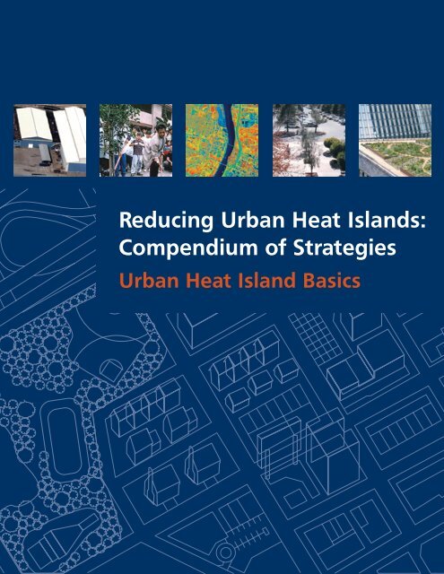
Reducing <strong>Urban</strong> <strong>Heat</strong> <strong>Island</strong>s:<br />
Compendium of Strategies<br />
<strong>Urban</strong> <strong>Heat</strong> <strong>Island</strong> <strong>Basics</strong>
Acknowledgements<br />
Reducing <strong>Urban</strong> <strong>Heat</strong> <strong>Island</strong>s: Compendium of Strategies describes the<br />
causes and impacts of summertime urban heat islands and promotes<br />
strategies for lowering temperatures in U.S. communities. This compendium<br />
was developed by the Climate <strong>Protection</strong> Partnership Division in the U.S.<br />
<strong>Environmental</strong> <strong>Protection</strong> <strong>Agency</strong>’s Office of Atmospheric Programs. Eva<br />
Wong managed its overall development. Kathleen Hogan, Julie Rosenberg,<br />
and Andrea Denny provided editorial support. Numerous EPA staff in<br />
offices throughout the <strong>Agency</strong> contributed content and provided reviews.<br />
Subject area experts from other organizations around the United States and<br />
Canada also committed their time to provide technical feedback.<br />
Under contracts 68-W-02-029 and EP-C-06-003, Perrin Quarles Associates,<br />
Inc. provided technical and administrative support for the entire<br />
compendium, and Eastern Research Group, Inc. provided graphics and<br />
production services.<br />
PositvEnergy provided support in preparing the Trees and Vegetation, Cool<br />
Roofs, and UHI Activities chapters under contract PO #2W-0361-SATX.<br />
Experts who helped shape this chapter include:<br />
Hashem Akbari, Ryan Bell, Tony Brazel, David Cole, Maury Estes, Gordon<br />
Heisler, David Hitchcock, Brenda Johnson, Megan Lewis, Greg McPherson,<br />
Tim Oke, Danny Parker, Alan Perrin, Joyce Rosenthal, David Sailor, Jason<br />
Samenow, Haider Taha, James Voogt, Darrell Winner, Kathy Wolf, and Barry<br />
Zalph.
Contents<br />
<strong>Urban</strong> <strong>Heat</strong> <strong>Island</strong> <strong>Basics</strong> . . . . . . . . . . . . . . . . . . . . . . . . . . . . . . . . . . . . . . . . . .1<br />
1. What Are <strong>Urban</strong> <strong>Heat</strong> <strong>Island</strong>s? .................................................1<br />
1.1 Surface <strong>Urban</strong> <strong>Heat</strong> <strong>Island</strong>s ...............................................2<br />
1.2 Atmospheric <strong>Urban</strong> <strong>Heat</strong> <strong>Island</strong>s . . . . . . . . . . . . . . . . . . . . . . . . . . . . . . . . . . . . . . . . .3<br />
2. How Do <strong>Urban</strong> <strong>Heat</strong> <strong>Island</strong>s Form? ............................................7<br />
2.1 Reduced Vegetation in <strong>Urban</strong> Areas . . . . . . . . . . . . . . . . . . . . . . . . . . . . . . . . . . . . . .7<br />
2.2 Properties of <strong>Urban</strong> Materials . . . . . . . . . . . . . . . . . . . . . . . . . . . . . . . . . . . . . . . . . . . .8<br />
2.3 <strong>Urban</strong> Geometry ........................................................10<br />
2.4 Anthropogenic <strong>Heat</strong> . . . . . . . . . . . . . . . . . . . . . . . . . . . . . . . . . . . . . . . . . . . . . . . . . . . .12<br />
2.5 Additional Factors ......................................................12<br />
3. Why Do We Care about <strong>Urban</strong> <strong>Heat</strong> <strong>Island</strong>s? . . . . . . . . . . . . . . . . . . . . . . . . . . . . . . . . . .13<br />
3.1 Energy Consumption . . . . . . . . . . . . . . . . . . . . . . . . . . . . . . . . . . . . . . . . . . . . . . . . . . .13<br />
3.2 Air Quality and Greenhouse Gases .......................................14<br />
3.3 Human Health and Comfort .............................................14<br />
3.4 Water Quality ...........................................................15<br />
4. Strategies to Reduce <strong>Urban</strong> <strong>Heat</strong> <strong>Island</strong>s . . . . . . . . . . . . . . . . . . . . . . . . . . . . . . . . . . . . .16<br />
5. Additional Resources ........................................................16<br />
Endnotes .......................................................................18
<strong>Urban</strong> <strong>Heat</strong> <strong>Island</strong> <strong>Basics</strong><br />
As urban areas develop, changes occur in the landscape. Buildings, roads, and other<br />
infrastructure replace open land and vegetation. Surfaces that were once permeable<br />
and moist generally become impermeable and dry.* This development leads to<br />
the formation of urban heat islands—the phenomenon whereby urban regions experience<br />
warmer temperatures than their rural surroundings.<br />
This chapter provides an overview of different types of urban heat islands, methods for<br />
identifying them, and factors that contribute to their development. It introduces key concepts<br />
that are important to understanding and mitigating this phenomenon, as well as additional<br />
sources of information. It discusses:<br />
•<br />
•<br />
•<br />
•<br />
•<br />
General features of urban heat islands<br />
Surface versus atmospheric heat islands<br />
Causes of urban heat island formation<br />
<strong>Urban</strong> heat island impacts on energy consumption, environmental quality, and human health<br />
Resources for further information.<br />
1 . What Are <strong>Urban</strong> <strong>Heat</strong> <strong>Island</strong>s?<br />
Many urban and suburban areas experience elevated temperatures compared to their outlying<br />
rural surroundings; this difference in temperature is what constitutes an urban heat<br />
island. The annual mean air temperature of a city with one million or more people can<br />
be 1.8 to 5.4°F (1 to 3°C) warmer than its surroundings, 1 and on a clear, calm night, this<br />
temperature difference can be as much as 22°F (12°C). 2 Even smaller cities and towns will<br />
produce heat islands, though the effect often decreases as city size decreases. 3<br />
This chapter focuses on surface and atmospheric urban heat islands. These two heat island<br />
types differ in the ways they are formed, the techniques used to identify and measure<br />
them, their impacts, and to some degree, the methods available to mitigate them. Table 1<br />
summarizes the basic characteristics of each type of heat island. These features are described<br />
in more detail in the following sections of this chapter.<br />
* This change in landscape may differ in regions such as deserts, where moisture may increase in urban areas if development introduces grass lawns and<br />
other irrigated vegetation.<br />
URBAN HeAt IslANd BAsIcs – dRAFt 1
Table 1: Basic Characteristics of Surface and Atmospheric <strong>Urban</strong> <strong>Heat</strong> <strong>Island</strong>s (UHIs) 4<br />
Feature Surface UHI Atmospheric UHI<br />
Temporal Development • Present at all times of the day and<br />
Peak Intensity<br />
(Most intense UHI<br />
conditions)<br />
Typical Identification<br />
Method<br />
night<br />
1.1 Surface <strong>Urban</strong> <strong>Heat</strong> <strong>Island</strong>s<br />
Most intense during the day and in<br />
On a hot, sunny summer day, the sun can<br />
heat dry, exposed urban surfaces, like roofs<br />
and pavement, to temperatures 50 to 90°F<br />
(27 to 50°C) hotter than the air, 5 while<br />
shaded or moist surfaces—often in more<br />
rural surroundings—remain close to air<br />
temperatures. Surface urban heat islands<br />
are typically present day and night, but<br />
tend to be strongest during the day when<br />
the sun is shining.<br />
On average, the difference in daytime surface<br />
temperatures between developed and<br />
rural areas is 18 to 27°F (10 to 15°C); the<br />
difference in nighttime surface temperatures<br />
is typically smaller, at 9 to 18°F (5 to<br />
10°C). 6<br />
The magnitude of surface urban heat islands<br />
varies with seasons, due to changes<br />
in the sun’s intensity as well as ground<br />
cover and weather. As a result of such<br />
variation, surface urban heat islands are<br />
typically largest in the summer. 7<br />
•<br />
•<br />
•<br />
the summer<br />
More spatial and temporal variation:<br />
n Day: 18 to 27°F (10 to 15°C)<br />
n Night: 9 to 18°F (5 to 10°C)<br />
Indirect measurement:<br />
n Remote sensing<br />
May be small or non-existent during<br />
To identify urban heat islands, scientists<br />
use direct and indirect methods, numerical<br />
modeling, and estimates based on empirical<br />
models. Researchers often use remote<br />
sensing, an indirect measurement technique,<br />
to estimate surface temperatures.<br />
They use the data collected to produce<br />
thermal images, such as that shown in<br />
Figure 1.<br />
2 RedUcING URBAN HeAt IslANds – dRAFt<br />
•<br />
•<br />
•<br />
•<br />
the day<br />
Most intense at night or predawn and<br />
in the winter<br />
Less variation:<br />
n Day: -1.8 to 5.4°F (-1 to 3°C)<br />
n Night: 12.6 to 21.6°F (7 to 12°C)<br />
Direct measurement:<br />
n Fixed weather stations<br />
n Mobile traverses<br />
Typical Depiction • Thermal image<br />
• Isotherm map<br />
•<br />
Temperature graph<br />
How Weather Influences<br />
<strong>Urban</strong> <strong>Heat</strong> <strong>Island</strong>s<br />
Summertime urban heat islands are<br />
most intense when the sky is clear<br />
and winds are calm. Heavy cloud<br />
cover blocks solar radiation, reducing<br />
daytime warming in cities. Strong<br />
winds increase atmospheric mixing,<br />
lowering the urban-rural temperature<br />
difference. This document, Reducing<br />
<strong>Urban</strong> <strong>Heat</strong> <strong>Island</strong>s: Compendium<br />
of Strategies, focuses on mitigating<br />
summertime heat islands through<br />
strategies that have maximum impact<br />
under clear, calm conditions.
Figure 1: Thermal Image Depicting a<br />
Surface <strong>Urban</strong> <strong>Heat</strong> <strong>Island</strong><br />
This image, taken from an aircraft, depicts a<br />
midday surface urban heat island in Salt Lake<br />
City, Utah, on July 13, 1998. White areas are<br />
around 160°F (70°C), while dark blue areas are<br />
near 85°F (30°C). Note the warmer urban surface<br />
temperatures (left side of image) and cooler<br />
surfaces in the neighboring foothills (on the right).<br />
1.2 Atmospheric <strong>Urban</strong> <strong>Heat</strong><br />
<strong>Island</strong>s<br />
Warmer air in urban areas compared to<br />
cooler air in nearby rural surroundings<br />
defines atmospheric urban heat islands.<br />
Experts often divide these heat islands into<br />
two different types:<br />
• Canopy layer urban heat islands exist<br />
in the layer of air where people live,<br />
from the ground to below the tops of<br />
trees and roofs.<br />
•<br />
NASA/Marshall Space Flight Center<br />
Boundary layer urban heat islands<br />
start from the rooftop and treetop<br />
level and extend up to the point where<br />
urban landscapes no longer influence<br />
the atmosphere. This region typically<br />
extends no more than one mile (1.5<br />
km) from the surface. 8<br />
Canopy layer urban heat islands are the<br />
most commonly observed of the two<br />
types and are often the ones referred to in<br />
discussions of urban heat islands. For this<br />
reason, this chapter and compendium use<br />
the more general term atmospheric urban<br />
heat islands to refer to canopy layer urban<br />
heat islands.<br />
Atmospheric urban heat islands are often<br />
weak during the late morning and throughout<br />
the day and become more pronounced<br />
after sunset due to the slow release of heat<br />
from urban infrastructure. The timing of<br />
this peak, however, depends on the properties<br />
of urban and rural surfaces, the season,<br />
and prevailing weather conditions.<br />
URBAN HeAt IslANd BAsIcs – dRAFt 3
Surface and Air Temperatures: How Are They Related?<br />
Surface temperatures have an indirect, but significant, influence on air temperatures,<br />
especially in the canopy layer, which is closest to the surface. For example, parks<br />
and vegetated areas, which typically have cooler surface temperatures, contribute to<br />
cooler air temperatures. Dense, built-up areas, on the other hand, typically lead to<br />
warmer air temperatures. Because air mixes within the atmosphere, though, the relationship<br />
between surface and air temperatures is not constant, and air temperatures<br />
typically vary less than surface temperatures across an area (see Figure 2).<br />
Figure 2: Variations of Surface and Atmospheric Temperatures<br />
Temperature<br />
DAY<br />
NIGHT<br />
Rural Suburban<br />
Pond<br />
Warehouse<br />
or Industrial<br />
<strong>Urban</strong><br />
Residential<br />
Surface Temperature (Day)<br />
Air Temperature (Day)<br />
Surface Temperature (Night)<br />
Air Temperature (Night)<br />
Downtown <strong>Urban</strong><br />
Residential<br />
Park Suburban Rural<br />
Surface and atmospheric temperatures vary over different land use areas. Surface<br />
temperatures vary more than air temperatures during the day, but they both are fairly similar<br />
at night. The dip and spike in surface temperatures over the pond show how water maintains<br />
a fairly constant temperature day and night, due to its high heat capacity.<br />
* Note: The temperatures displayed above do not represent absolute temperature values or<br />
any one particular measured heat island. Temperatures will fluctuate based on factors such as<br />
seasons, weather conditions, sun intensity, and ground cover.<br />
4 RedUcING URBAN HeAt IslANds – dRAFt<br />
Modified from Voogt, 2000
Atmospheric heat islands vary much less in<br />
intensity than surface heat islands. On an<br />
annual mean basis, air temperatures in large<br />
cities might be 1.8 to 5.4°F (1 to 3°C) warmer<br />
than those of their rural surroundings. 9<br />
Researchers typically measure air temperatures<br />
through a dense network of<br />
sampling points from fixed stations or<br />
Figure 3: Isotherm Map Depicting an Atmospheric<br />
Nighttime <strong>Urban</strong> <strong>Heat</strong> <strong>Island</strong><br />
Wind<br />
+1<br />
+3<br />
+3<br />
+3<br />
+1 +2<br />
+5<br />
+5<br />
+4<br />
+3<br />
+1<br />
+2<br />
+2<br />
+6<br />
mobile traverses, which are both direct<br />
measurement methods. Figure 3 illustrates<br />
a conceptual isotherm map that depicts an<br />
atmospheric urban heat island. The center<br />
of the figure, which is the hottest area, is<br />
the urban core. A simple graph of temperature<br />
differences, as shown in Figure 4, is<br />
another way to show the results.<br />
URBAN HeAt IslANd BAsIcs – dRAFt 5<br />
+<br />
4<br />
+3 Park +2<br />
This conceptual map with overlaid isotherms (lines of equal air temperature)<br />
exhibits a fully developed nighttime atmospheric urban heat island. The<br />
dotted red line indicates a traverse along which measurements are taken.<br />
Figure 4: Conceptual Drawing of the Diurnal Evolution of the <strong>Urban</strong> <strong>Heat</strong><br />
<strong>Island</strong> during Calm and Clear Conditions<br />
Air Temperature<br />
<strong>Heat</strong> <strong>Island</strong> Intensity<br />
(a)<br />
2°C<br />
(b)<br />
Sunset<br />
<strong>Urban</strong><br />
Rural<br />
T = CLUHI<br />
UR<br />
Time<br />
Sunrise<br />
12 18 24 06 12<br />
Modified from Oke, 1982, and Runnalls and Oke, 2000<br />
+2<br />
+1<br />
Modified from Voogt, 2000<br />
Atmospheric urban heat islands<br />
primarily result from different cooling<br />
rates between urban areas and their<br />
surrounding rural or non-urban<br />
surroundings (section (a) of Figure<br />
5). The differential cooling rates are<br />
most pronounced on clear and calm<br />
nights and days when rural areas can<br />
cool more quickly than urban areas.<br />
The heat island intensity (section<br />
(b)) typically grows from mid- to late<br />
afternoon to a maximum a few hours<br />
after sunset. In some cases, a heat<br />
island might not reach peak intensity<br />
until after sunrise.
<strong>Urban</strong> <strong>Heat</strong> <strong>Island</strong>s, Climate Change, and Global Warming<br />
<strong>Urban</strong> heat islands refer to the elevated temperatures<br />
in developed areas compared to more rural<br />
surroundings. <strong>Urban</strong> heat islands are caused by<br />
development and the changes in radiative and<br />
thermal properties of urban infrastructure as well<br />
as the impacts buildings can have on the local<br />
micro-climate—for example tall buildings can<br />
slow the rate at which cities cool off at night.<br />
<strong>Heat</strong> islands are influenced by a city’s geographic<br />
location and by local weather patterns, and their<br />
intensity changes on a daily and seasonal basis.<br />
The warming that results from urban heat islands<br />
over small areas such as cities is an example<br />
of local climate change. Local climate changes<br />
resulting from urban heat islands fundamentally<br />
differ from global climate changes in that their<br />
effects are limited to the local scale and decrease<br />
with distance from their source. Global climate<br />
changes, such as those caused by increases in<br />
the sun’s intensity or greenhouse gas concentrations,<br />
are not locally or regionally confined.<br />
Climate change, broadly speaking, refers to<br />
any significant change in measures of climate<br />
(such as temperature, precipitation, or wind)<br />
lasting for an extended period (decades or<br />
longer). Climate change may result from:<br />
•<br />
•<br />
•<br />
Natural factors, such as changes in the<br />
sun’s intensity or slow changes in the<br />
Earth’s orbit around the sun<br />
Natural processes within the climate system<br />
(e.g. changes in ocean circulation)<br />
Human activities that change the atmosphere’s<br />
composition (e.g. burning fossil<br />
fuels) and the land surface (e.g. deforestation,<br />
reforestation, or urbanization).<br />
The term climate change is often used interchangeably<br />
with the term global warming, but<br />
according to the National Academy of Sciences,<br />
“the phrase ‘climate change’ is growing<br />
in preferred use to ‘global warming’ because<br />
it helps convey that there are [other] changes<br />
in addition to rising temperatures.”<br />
Global warming is an average increase in<br />
the temperature of the atmosphere near the<br />
Earth’s surface and in the lowest layer of the<br />
atmosphere, which can contribute to changes<br />
in global climate patterns. Global warming<br />
can occur from a variety of causes, both natural<br />
and human induced. In common usage,<br />
“global warming” often refers to the warming<br />
that can occur as a result of increased emissions<br />
of greenhouse gases from human activities.<br />
Global warming can be considered part<br />
of global climate change along with changes<br />
in precipitation, sea level, etc.<br />
The impacts from urban heat islands and<br />
global climate change (or global warming)<br />
are often similar. For example, some<br />
communities may experience longer growing<br />
seasons due to either or both phenomena.<br />
<strong>Urban</strong> heat islands and global climate<br />
change can both also increase energy demand,<br />
particularly summertime air conditioning<br />
demand, and associated air pollution and<br />
greenhouse gas emissions, depending on the<br />
electric system power fuel mix.<br />
Strategies to reduce urban heat islands—the<br />
focus of this document, Reducing <strong>Urban</strong><br />
<strong>Heat</strong> <strong>Island</strong>s: Compendium of Strategies—<br />
produce multiple benefits including lowering<br />
surface and air temperatures, energy<br />
demand, air pollution and greenhouse gas<br />
emissions. Thus, advancing measures to<br />
mitigate urban heat islands also helps to address<br />
global climate change.<br />
For more information on global warming see<br />
EPA’s Climate Change website, .<br />
6 RedUcING URBAN HeAt IslANds – dRAFt
2 . How Do <strong>Urban</strong> <strong>Heat</strong> <strong>Island</strong>s<br />
Form?<br />
While many factors contribute to urban<br />
heat island formation (see Table 2), this<br />
chapter focuses on vegetative cover and<br />
surface properties because communities<br />
can directly address these factors with<br />
available technologies. See the “Trees and<br />
Vegetation,” “Green Roofs,” “Cool Roofs,”<br />
and “Cool Pavement” chapters for detailed<br />
information on these strategies.<br />
2.1 Reduced Vegetation in <strong>Urban</strong> Areas<br />
In rural areas, vegetation and open land<br />
typically dominate the landscape. Trees<br />
and vegetation provide shade, which helps<br />
lower surface temperatures. They also help<br />
Figure 5: Impervious Surfaces and Reduced Evapotranspiration<br />
30% evapotranspiration<br />
55% runoff<br />
10% shallow<br />
infiltration<br />
5% deep<br />
infiltration<br />
reduce air temperatures through a process<br />
called evapotranspiration, in which plants<br />
release water to the surrounding air, dissipating<br />
ambient heat. In contrast, urban<br />
areas are characterized by dry, impervious<br />
surfaces, such as conventional roofs, sidewalks,<br />
roads, and parking lots. As cities<br />
develop, more vegetation is lost, and more<br />
surfaces are paved or covered with buildings.<br />
The change in ground cover results<br />
in less shade and moisture to keep urban<br />
areas cool. Built up areas evaporate less<br />
water (see Figure 5), which contributes to<br />
elevated surface and air temperatures.<br />
25% shallow<br />
infiltration<br />
40% evapotranspiration<br />
10% runoff<br />
25% deep<br />
infiltration<br />
Highly developed urban areas (right), which are characterized by 75%-100% impervious surfaces, have less surface<br />
moisture available for evapotranspiration than natural ground cover, which has less than 10% impervious cover (left).<br />
This characteristic contributes to higher surface and air temperatures in urban areas.<br />
URBAN HeAt IslANd BAsIcs – dRAFt 7<br />
Modified from the Federal Interagency Stream Restoration Working Group (FISRWG)
2.2 Properties of <strong>Urban</strong> Materials<br />
Properties of urban materials, in particular<br />
solar reflectance, thermal emissivity, and<br />
heat capacity, also influence urban heat<br />
island development, as they determine how<br />
the sun’s energy is reflected, emitted, and<br />
absorbed.<br />
Figure 6 shows the typical solar energy that<br />
reaches the Earth’s surface on a clear summer<br />
day. Solar energy is composed of ultraviolet<br />
(UV) rays, visible light, and infrared<br />
energy, each reaching the Earth in different<br />
percentages: five percent of solar energy is<br />
in the UV spectrum, including the type of<br />
rays responsible for sunburn; 43 percent of<br />
solar energy is visible light, in colors ranging<br />
from violet to red; and the remaining<br />
52 percent of solar energy is infrared, felt<br />
as heat. Energy in all of these wavelengths<br />
contributes to urban heat island formation.<br />
Figure 6: Solar Energy versus Wavelength Reaching Earth’s Surface<br />
Normalized Solar Intensity<br />
1.00<br />
0.90<br />
0.80<br />
0.70<br />
0.60<br />
0.50<br />
0.40<br />
0.30<br />
0.20<br />
0.10<br />
Solar reflectance, or albedo, is the percentage<br />
of solar energy reflected by a surface.<br />
Much of the sun’s energy is found in the<br />
visible wavelengths (see Figure 6); thus,<br />
solar reflectance is correlated with a material’s<br />
color. Darker surfaces tend to have<br />
lower solar reflectance values than lighter<br />
surfaces. Researchers are studying and<br />
developing cool colored materials, though,<br />
that use specially engineered pigments that<br />
reflect well in the infrared wavelengths.<br />
These products can be dark in color but<br />
have a solar reflectance close to that of a<br />
white or light-colored material. (See the<br />
“Cool Roofs” chapter for further discussion<br />
of cool colored roof products.)<br />
ultraviolet visible infrared<br />
0.00<br />
0 200 400 600 800 1000 1200 1400 1600 1800 2000 2200 2400 2600<br />
Solar energy intensity varies over wavelengths Wavelength from about (nanometers)<br />
250 to 2500 nanometers.<br />
8 RedUcING URBAN HeAt IslANds – dRAFt
<strong>Urban</strong> areas typically have surface materials,<br />
such as roofing and paving, which have<br />
a lower albedo than those in rural settings.<br />
As a result, built up communities generally<br />
reflect less and absorb more of the<br />
sun’s energy. This absorbed heat increases<br />
surface temperatures and contributes to<br />
the formation of surface and atmospheric<br />
urban heat islands.<br />
Although solar reflectance is the main<br />
determinant of a material’s surface temperature,<br />
thermal emittance, or emissivity,<br />
also plays a role. Thermal emittance is a<br />
measure of a surface’s ability to shed heat,<br />
or emit long-wave (infrared) radiation. All<br />
things equal, surfaces with high emittance<br />
values will stay cooler, because they will<br />
release heat more readily. Most construction<br />
materials, with the exception of metal,<br />
have high thermal emittance values. Thus,<br />
this property is mainly of interest to those<br />
installing cool roofs, which can be metallic.<br />
See the “Cool Roofs” chapter of the compendium<br />
for more information.<br />
Another important property that influences<br />
heat island development is a material’s heat<br />
capacity, which refers to its ability to store<br />
heat. Many building materials, such as steel<br />
and stone, have higher heat capacities than<br />
rural materials, such as dry soil and sand.<br />
As a result, cities are typically more effective<br />
at storing the sun’s energy as heat<br />
within their infrastructure. Downtown metropolitan<br />
areas can absorb and store twice<br />
the amount of heat compared to their rural<br />
surroundings during the daytime. 10<br />
Radiative and Thermal<br />
Properties—Cool Roofs<br />
and Cool Pavements<br />
Albedo and emissivity are considered<br />
“radiative properties.” <strong>Heat</strong> capacity,<br />
on the other hand, is one of several<br />
“thermal properties” a material can<br />
possess. For thin materials like roofing,<br />
which is typically placed over<br />
insulation, reflectance and emittance<br />
are the main properties to consider,<br />
as the heat capacity of a well insulated<br />
roof is low. For pavements,<br />
which are thicker than roofing<br />
products and are placed on top of<br />
the ground, which has its own set of<br />
thermal characteristics, designers and<br />
researchers need to consider a more<br />
complex set of factors that include<br />
radiative and thermal properties—<br />
such as heat capacity, thermal conductivity,<br />
and density.<br />
URBAN HeAt IslANd BAsIcs – dRAFt 9
2.3 <strong>Urban</strong> Geometry<br />
An additional factor that influences urban<br />
heat island development, particularly at<br />
night, is urban geometry, which refers to<br />
the dimensions and spacing of buildings<br />
within a city. <strong>Urban</strong> geometry influences<br />
wind flow, energy absorption, and a given<br />
surface’s ability to emit long-wave radiation<br />
back to space. In developed areas, surfaces<br />
and structures are often at least partially<br />
obstructed by objects, such as neighboring<br />
buildings, and become large thermal<br />
masses that cannot release their heat very<br />
readily because of these obstructions. Especially<br />
at night, the air above urban centers<br />
is typically warmer than air over rural areas.<br />
Nighttime atmospheric heat islands can<br />
have serious health implications for urban<br />
residents during heat waves (see textbox<br />
in Section 3.3, “Factors in <strong>Heat</strong>-Related Illnesses<br />
and Death.”)<br />
Table 2: Factors that Create <strong>Urban</strong> <strong>Heat</strong> <strong>Island</strong>s<br />
•<br />
•<br />
•<br />
•<br />
•<br />
•<br />
Factors Communities are Focusing On<br />
Researchers often focus on an aspect of<br />
urban geometry called urban canyons,<br />
which can be illustrated by a relatively narrow<br />
street lined by tall buildings. During<br />
the day, urban canyons can have competing<br />
effects. On the one hand, tall buildings<br />
can create shade, reducing surface and air<br />
temperatures. On the other, when sunlight<br />
reaches surfaces in the canyon, the sun’s<br />
energy is reflected and absorbed by building<br />
walls, which further lowers the city’s<br />
overall albedo—the net reflectance from<br />
surface albedo plus urban geometry—<br />
and can increase temperatures. 11 At night,<br />
urban canyons generally impede cooling,<br />
as buildings and structures can obstruct<br />
the heat that is being released from urban<br />
infrastructure.<br />
Reduced vegetation in urban regions: Reduces the natural cooling effect from shade and evapotranspiration.<br />
Properties of urban materials: Contribute to absorption of solar energy, causing surfaces, and the air above<br />
them, to be warmer in urban areas than those in rural surroundings.<br />
Future Factors to Consider<br />
<strong>Urban</strong> geometry: The height and spacing of buildings affects the amount of radiation received and emitted by<br />
urban infrastructure.<br />
Anthropogenic heat emissions: Contribute additional warmth to the air.*<br />
Additional Factors<br />
Weather: Certain conditions, such as clear skies and calm winds, can foster urban heat island formation.<br />
Geographic location: Proximity to large water bodies and mountainous terrain can influence local wind patterns<br />
and urban heat island formation.<br />
* Although communities currently can lower anthropogenic heat emissions through energy efficiency technologies<br />
in the building and vehicle sectors, this compendium focuses on modifying vegetative cover and surface properties<br />
of urban materials, as they have long been regarded as urban heat island reduction strategies. An emerging body<br />
of literature on the role waste heat plays in urban heat island formation, though, may lead communities to focus on<br />
anthropogenic heat in the near future.<br />
10 RedUcING URBAN HeAt IslANds – dRAFt
The <strong>Urban</strong> Surface Energy Budget<br />
An energy budget provides an equation that quantifies the balance of incoming<br />
and outgoing energy flows, or fluxes (see Figure 7). The surface energy budgets of<br />
urban areas and their more rural surroundings will differ because of differences in<br />
land cover, surface characteristics, and level of human activity. Such differences can<br />
affect the generation and transfer of heat, which can lead to different surface and air<br />
temperatures in urban versus rural areas. Various elements of the budget include:<br />
• Short-wave radiation is ultraviolet, visible light, and near-infrared radiation from<br />
the sun that reaches the Earth (see Figure 6). This energy is a key driver of urban<br />
heat islands. <strong>Urban</strong> surfaces, compared to vegetation and other natural ground<br />
cover, reflect less radiation back to the atmosphere. They instead absorb and store<br />
more of it, which raises the area’s temperature.<br />
• Thermal storage increases in cities in part due to the lower solar reflectance of<br />
urban surfaces, but it is also influenced by the thermal properties of construction<br />
materials and urban geometry. <strong>Urban</strong> geometry can cause some short-wave radiation—particularly<br />
within an urban canyon—to be reflected on nearby surfaces, such<br />
as building walls, where it is absorbed rather than escaping into the atmosphere.<br />
Figure 7: <strong>Urban</strong> Surface Energy Budget<br />
Continued on next page<br />
Anthropogenic heat<br />
Sensible heat<br />
Thermal storage<br />
Short-wave radiation<br />
Long-wave radiation<br />
Latent heat<br />
URBAN HeAt IslANd BAsIcs – dRAFt 11<br />
Adapted from David Sailor
The <strong>Urban</strong> Surface Energy Budget (continued)<br />
• Similarly, urban geometry can impede the release of long-wave, or infrared,<br />
radiation into the atmosphere. When buildings or other objects absorb incoming<br />
short-wave radiation, they can re-radiate that energy as long-wave energy, or<br />
heat. However, at night, due to the dense infrastructure in some developed areas<br />
that have low sky view factors (see section 2.3), urban areas cannot easily release<br />
long-wave radiation to the cooler, open sky, and this trapped heat contributes to<br />
the urban heat island.<br />
• Evapotranspiration describes the transfer of latent heat, what we feel as humidity,<br />
from the Earth’s surface to the air via evaporating water. <strong>Urban</strong> areas tend to<br />
have less evapotranspiration relative to natural landscapes, because cities retain<br />
little moisture. This reduced moisture in built up areas leads to dry, impervious<br />
urban infrastructure reaching very high surface temperatures, which contribute to<br />
higher air temperatures.*<br />
• Convection describes the transfer of sensible heat, what we feel as temperature,<br />
between the surface and air when there is a difference in temperature between<br />
them. High urban surface temperatures warm the air above, which then circulates<br />
upwards via convection.<br />
• Anthropogenic heat refers to the heat generated by cars, air conditioners, industrial<br />
facilities, and a variety of other manmade sources, which contributes to the<br />
urban energy budget, particularly in the winter.<br />
* This change in landscape may differ in regions such as deserts, where moisture may increase in<br />
urban areas if development introduces grass lawns and other irrigated vegetation.<br />
The effects of urban geometry on urban heat<br />
islands are often described through the “sky<br />
view factor” (SVF), which is the visible area<br />
of the sky from a given point on a surface.<br />
For example, an open parking lot or field that<br />
has few obstructions would have a large SVF<br />
value (closer to 1). Conversely, an urban canyon<br />
in a downtown area that is surrounded<br />
by closely spaced, tall buildings, would have a<br />
low SVF value (closer to zero), as there would<br />
only be a small visible area of the sky.<br />
2.4 Anthropogenic <strong>Heat</strong><br />
Anthropogenic heat contributes to atmospheric<br />
heat islands and refers to heat<br />
produced by human activities. It can come<br />
from a variety of sources and is estimated<br />
by totaling all the energy used for heating<br />
and cooling, running appliances, transportation,<br />
and industrial processes. Anthropogenic<br />
heat varies by urban activity and<br />
infrastructure, with more energy-intensive<br />
buildings and transportation producing<br />
more heat. 12 Anthropogenic heat typically<br />
is not a concern in rural areas and during<br />
the summer. In the winter, though, and<br />
year round in dense, urban areas, anthropogenic<br />
heat can significantly contribute to<br />
heat island formation.<br />
2.5 Additional Factors<br />
Weather and location strongly influence<br />
urban heat island formation. While communities<br />
have little control over these factors,<br />
12 RedUcING URBAN HeAt IslANds – dRAFt
esidents can benefit from understanding<br />
the role they play.<br />
• Weather. Two primary weather characteristics<br />
affect urban heat island<br />
development: wind and cloud cover. In<br />
general, urban heat islands form during<br />
periods of calm winds and clear skies,<br />
because these conditions maximize the<br />
amount of solar energy reaching urban<br />
surfaces and minimize the amount of<br />
heat that can be convected away. Conversely,<br />
strong winds and cloud cover<br />
suppress urban heat islands.<br />
• Geographic location. Climate and<br />
topography, which are in part determined<br />
by a city’s geographic location,<br />
influence urban heat island formation.<br />
For example, large bodies of water<br />
moderate temperatures and can generate<br />
winds that convect heat away from<br />
cities. Nearby mountain ranges can either<br />
block wind from reaching a city, or<br />
create wind patterns that pass through<br />
a city. Local terrain has a greater significance<br />
for heat island formation when<br />
larger-scale effects, such as prevailing<br />
wind patterns, are relatively weak.<br />
3 . Why Do We Care about <strong>Urban</strong><br />
<strong>Heat</strong> <strong>Island</strong>s?<br />
Elevated temperatures from urban heat<br />
islands, particularly during the summer,<br />
can affect a community’s environment<br />
and quality of life. While some heat island<br />
impacts seem positive, such as lengthening<br />
the plant-growing season, most impacts are<br />
negative and include:<br />
•<br />
•<br />
•<br />
•<br />
Increased energy consumption<br />
Elevated emissions of air pollutants and<br />
greenhouse gases<br />
Compromised human health and comfort<br />
Impaired water quality.<br />
Wintertime Benefits of<br />
<strong>Urban</strong> <strong>Heat</strong> <strong>Island</strong>s<br />
Communities may benefit from the<br />
wintertime warming effect of urban<br />
heat islands. Warmer temperatures<br />
can reduce heating energy needs and<br />
help to melt snow and ice on roads.<br />
Fortunately, urban heat island mitigation<br />
strategies—for example, trees and<br />
vegetation and green roofs—generally<br />
provide year-round benefits, or their<br />
winter penalty, such as that from cool<br />
roofs, is much smaller than their summertime<br />
benefits.<br />
3.1 Energy Consumption<br />
Elevated summertime temperatures in cities<br />
increase energy demand for cooling and<br />
add pressure to the electricity grid during<br />
peak periods of demand, which generally<br />
occur on hot, summer weekday afternoons,<br />
when offices and homes are running cooling<br />
systems, lights, and appliances (see<br />
Figure 8). This peak urban electric demand<br />
increases 1.5 to 2 percent for every 1°F<br />
(0.6°C) increase in summertime temperature.<br />
Steadily increasing downtown temperatures<br />
over the last several decades mean<br />
that 5 to 10 percent of community-wide demand<br />
for electricity is used to compensate<br />
for the heat island effect. 13 During extreme<br />
heat events, which are exacerbated by urban<br />
heat islands, the resulting demand for<br />
cooling can overload systems and require a<br />
utility to institute controlled, rolling brownouts<br />
or blackouts to avoid power outages.<br />
URBAN HeAt IslANd BAsIcs – dRAFt 13
Figure 8: Increasing Power Loads with Temperature Increases 14<br />
Average Electric Load (MWh)<br />
1200<br />
1000<br />
800<br />
600<br />
400<br />
200<br />
0<br />
0<br />
(-18)<br />
20<br />
(-7)<br />
40<br />
(4)<br />
60<br />
(16)<br />
3.2 Air Quality and Greenhouse Gases<br />
As discussed in Section 3.1, higher temperatures<br />
can increases energy demand, which<br />
generally causes higher levels of air pollution<br />
and greenhouse gas emissions. Currently,<br />
most electricity in the United States is<br />
produced from combusting fossil fuel. Thus,<br />
pollutants from most power plants include<br />
sulfur dioxide (SO 2), nitrogen oxides (NO x),<br />
particulate matter (PM), carbon monoxide<br />
(CO), and mercury (Hg). These pollutants<br />
are harmful to human health and contribute<br />
to complex air quality problems such as<br />
acid rain. Further, fossil-fuel-powered plants<br />
emit greenhouse gases, particularly carbon<br />
dioxide (CO 2 ), which contribute to global<br />
climate change.<br />
In addition to increases in air emissions,<br />
elevated air temperatures increase the rate<br />
of ground-level ozone formation, which<br />
is produced when NO x and volatile organic<br />
compounds (VOCs) react in the<br />
presence of sunlight. If all other variables<br />
are equal—such as the level of precursor<br />
emissions or wind speed and direction—<br />
ground-level ozone emissions will be<br />
higher in sunnier and hotter weather.<br />
3.3 Human Health and Comfort<br />
Increased daytime surface temperatures,<br />
reduced nighttime cooling, and higher<br />
air pollution levels associated with urban<br />
heat islands can affect human health by<br />
contributing to general discomfort, respiratory<br />
difficulties, heat cramps and exhaustion,<br />
non-fatal heat stroke, and heat-related<br />
mortality.<br />
<strong>Urban</strong> heat islands can also exacerbate the<br />
impact of heat waves, which are periods of<br />
abnormally hot, and often humid, weather.<br />
Sensitive populations, such as children,<br />
older adults, and those with existing health<br />
conditions, are at particular risk from these<br />
events. For example, in 1995, a mid-July<br />
heat wave in the Midwest caused more<br />
than 1,000 deaths. 15 While it is rare for a<br />
14 RedUcING URBAN HeAt IslANds – dRAFt<br />
80<br />
(27)<br />
Maximum Daily Temp ºF (ºC)<br />
As shown in this example from New Orleans, electrical load can increase steadily once<br />
temperatures begin to exceed about 68 to 77°F (20 to 25°C). Other areas of the country show<br />
similar demand curves as temperature increases.<br />
100<br />
(38)<br />
120<br />
(49)<br />
Sailor, 2006, with data courtesy of Entergy
Factors in <strong>Heat</strong>-Related Illnesses and Death<br />
Low income elderly people who live in row homes are at a particular risk for heatrelated<br />
health incidents. Living on the upper floor of a typical row home, with a dark<br />
roof, brick construction, and windows on only two sides, could contribute to the risk<br />
of heat-related illness or death during heat waves, as temperatures in these homes<br />
can be extreme. 16 These homes often lack air conditioning, especially in areas unaccustomed<br />
to high temperatures. Further, even when air conditioning is available,<br />
residents may not use it for fear of high utility bills.<br />
Social isolation and physical health also contribute to one’s vulnerability. Elderly<br />
people, especially, may not have family or friends nearby, may not report to work<br />
regularly, and may lack neighbors who can check on them, leaving them stranded<br />
during extreme heat events. The elderly may also fail to hear news or other warnings<br />
of impending heat waves and recommendations on how to cope. Finally, their bodies<br />
may be less able to handle heat stress.<br />
The lack of nighttime relief in air temperatures is strongly correlated with increased<br />
mortality during heat waves. Some studies suggest that these oppressive nighttime<br />
temperatures may be more significant than high maximum daytime temperatures. 17<br />
For more information on heat-related health incidents and ways to respond, see the EPA<br />
Excessive <strong>Heat</strong> Events Guidebook <br />
heat wave to be so destructive, heat-related<br />
mortality is not uncommon. The Centers for<br />
Disease Control estimates that from 1979 to<br />
1999, excessive heat exposure contributed<br />
to more than 8,000 premature deaths in<br />
the United States. 18 This figure exceeds the<br />
number of mortalities resulting from hurricanes,<br />
lightning, tornadoes, floods, and<br />
earthquakes combined.<br />
3.4 Water Quality<br />
Surface urban heat islands degrade water<br />
quality, mainly by thermal pollution. Pavement<br />
and rooftop surfaces that reach temperatures<br />
50 to 90°F (27 to 50°C) higher<br />
than air temperatures transfer this excess<br />
heat to stormwater. Field measurements<br />
from one study showed that runoff from<br />
urban areas was about 20-30°F (11-17°C)<br />
hotter than runoff from a nearby rural<br />
area on summer days when pavement<br />
temperatures at midday were 20-35°F<br />
(11-19°C) above air temperature. When<br />
the rain came before the pavement had<br />
a chance to heat up, runoff temperatures<br />
from the rural and urban areas differed by<br />
less than 4°F (2°C). 19 This heated stormwater<br />
generally drains into storm sewers<br />
(see Figure 5) and raises water temperatures<br />
as it is released into streams, rivers,<br />
ponds, and lakes. A study in Arlington,<br />
Virginia, recorded temperature increases<br />
in surface waters as high as 8ºF (4°C) in<br />
40 minutes after heavy summer rains. 20<br />
Water temperature affects all aspects of<br />
aquatic life, especially the metabolism<br />
and reproduction of many aquatic species.<br />
Rapid temperature changes in aquatic<br />
URBAN HeAt IslANd BAsIcs – dRAFt 15
ecosystems resulting from warm stormwater<br />
runoff can be particularly stressful.<br />
Brook trout, for example, experience<br />
thermal stress and shock when the water<br />
temperature changes more than 2 to 4ºF (1-<br />
2°C) in 24 hours. 21<br />
4 . Strategies to Reduce <strong>Urban</strong><br />
<strong>Heat</strong> <strong>Island</strong>s<br />
Although urban climatologists have been<br />
studying urban heat islands for decades,<br />
community interest and concern regarding<br />
them has been more recent. This increased<br />
attention to heat-related environment and<br />
health issues has helped to advance the<br />
development of heat island reduction strategies,<br />
mainly trees and vegetation, green<br />
roofs, and cool roofs. Interest in cool pavements<br />
has been growing, and an emerging<br />
body of research and pilot projects are<br />
helping scientists, engineers, and practitioners<br />
to better understand the interactions<br />
between pavements and the urban climate.<br />
This compendium Reducing <strong>Urban</strong> <strong>Heat</strong><br />
<strong>Island</strong>s: Compendium of Strategies provides<br />
details about how these strategies<br />
work, their benefits and costs, factors<br />
to consider when selecting them, and<br />
additional resources for communities to<br />
further explore. It presents the multiple<br />
benefits—beyond temperature reduction—<br />
that a community can accrue from advancing<br />
heat island reduction strategies. It also<br />
gives examples of how communities have<br />
implemented these strategies through<br />
voluntary and policy efforts in the “<strong>Heat</strong><br />
<strong>Island</strong> Reduction Activities” chapter. Communities<br />
can use this compendium as a<br />
foundation and starting point for understanding<br />
the nuts and bolts of existing<br />
urban heat island reduction strategies that<br />
communities are currently advancing.<br />
Future policy efforts may focus on encouraging<br />
strategies to modify urban<br />
geometry and anthropogenic heat in<br />
communities to reduce urban heat islands.<br />
Research in this area is on-going,<br />
and there is a growing awareness of the<br />
importance of these factors.<br />
5 . Additional Resources<br />
The table on the next page provides additional<br />
resources on urban heat island<br />
formation, measurement, and impacts.<br />
16 RedUcING URBAN HeAt IslANds – dRAFt
Table 3: <strong>Urban</strong> <strong>Heat</strong> <strong>Island</strong> Resources<br />
Name Description Web Link<br />
General Information<br />
EPA’s <strong>Heat</strong> <strong>Island</strong> Website Through this website, EPA provides background in-<br />
International Association<br />
for <strong>Urban</strong> Climate (IAUC)<br />
Lawrence Berkeley<br />
National Laboratory<br />
(LBNL) <strong>Heat</strong> <strong>Island</strong> Group<br />
National Center of<br />
Excellence - SMART<br />
Innovations for <strong>Urban</strong><br />
Climate and Energy<br />
<strong>Urban</strong> <strong>Heat</strong> <strong>Island</strong>s:<br />
Hotter Cities<br />
National Aeronautics and<br />
Space Administration<br />
(NASA) and the U.S.<br />
Geological Survey Landsat<br />
Program<br />
formation, publications, reports, access to national<br />
webcasts, a database of urban heat island activities,<br />
and links to other resources to help communities<br />
reduce urban heat islands.<br />
This international website is the main forum in which<br />
urban climatologists communicate. <strong>Urban</strong> climate<br />
resources, including a bimonthly newsletter, and in-<br />
formation on upcoming meetings can be found here.<br />
LBNL provides background information on urban<br />
heat islands and their impacts through this website.<br />
It also presents some of the impacts heat island re-<br />
duction strategies can have on temperature, energy<br />
consumption, and air quality.<br />
Arizona State University’s National Center of Excellence<br />
collaborates with industry and government to research<br />
and develop technologies to reduce urban heat islands,<br />
especially in desert climates. Its website provides back-<br />
ground information on urban heat islands.<br />
This article explains urban heat islands and presents<br />
solutions to mitigate them.<br />
Measuring <strong>Heat</strong> <strong>Island</strong>s and Their Impacts<br />
The Landsat program is a series of Earth-observing<br />
satellites used to acquire images of the Earth’s land<br />
surface and surrounding coastal regions. These<br />
images provide information from which research-<br />
ers can derive surface temperatures and evaluate<br />
urban heat islands.<br />
National Weather Service The National Weather Service is a source for air<br />
EPA’s Excessive <strong>Heat</strong><br />
Events Guidebook<br />
temperature measurements, climate and weather<br />
models, and past and future climate predictions.<br />
The site also has links to excessive heat outlooks,<br />
fatality statistics, historic data on major heat waves,<br />
drought information, and advice on how to mini-<br />
mize the health risks of heat waves.<br />
This document is designed to help community officials,<br />
emergency managers, meteorologists, and others plan<br />
for and respond to excessive heat events by highlight-<br />
ing best practices that have been employed to save<br />
lives during excessive heat events in different urban<br />
areas. It provides a menu of options that officials can<br />
use to respond to these events in their communities.<br />
<br />
<br />
<br />
<br />
<br />
<br />
<br />
<br />
URBAN HeAt IslANd BAsIcs – dRAFt 17
Endnotes<br />
1 Oke, T.R. 1997. <strong>Urban</strong> Climates and Global <strong>Environmental</strong> Change. In: Thompson, R.D. and<br />
A. Perry (eds.) Applied Climatology: Principles & Practices. New York, NY: Routledge. pp.<br />
273-287.<br />
2 Oke. T.R. 1987. Boundary Layer Climates. New York, Routledge.<br />
3 Oke, T.R. 1982. The Energetic Basis of the <strong>Urban</strong> <strong>Heat</strong> <strong>Island</strong>. Quarterly Journal of the Royal<br />
Meteorological Society. 108:1-24. The threshold city population for heat islands of the size<br />
2-5°F may be closer to 100,000 inhabitants in some cases. See also Aniello, C., K. Morgan, A.<br />
Busbey, and L. Newland. 1995. Mapping Micro-<strong>Urban</strong> <strong>Heat</strong> <strong>Island</strong>s Using Landsat TM and a<br />
GIS. Computers and Geosciences 21(8):965-69.<br />
4 From: 1) Oke, T.R. 1997. <strong>Urban</strong> Climates and Global <strong>Environmental</strong> Change. In: Thompson,<br />
R.D. and A. Perry (eds.) Applied Climatology: Principles & Practices. New York, NY: Routledge.<br />
pp. 273-287. 2) Oke. T.R. 1987. Boundary Layer Climates. New York, Routledge. 3)<br />
Voogt, J.A. and T.R. Oke. 2003. Thermal Remote Sensing of <strong>Urban</strong> Areas. Remote Sensing of<br />
Environment. 86. (Special issue on <strong>Urban</strong> Areas): 370-384. 4) Roth, M., T. R. Oke, and W. J.<br />
Emery. 1989. Satellite-derived <strong>Urban</strong> <strong>Heat</strong> <strong>Island</strong>s from Three Coastal Cities and the Utilization<br />
of Such Data in <strong>Urban</strong> Climatology. Int. J. Remote Sensing. 10:1699-1720.<br />
5 Berdahl P. and S. Bretz. 1997. Preliminary Survey of the Solar Reflectance of Cool Roofing Ma-<br />
terials. Energy and Buildings 25:149-158.<br />
6 Numbers from Voogt, J.A. and T.R. Oke. 2003. Thermal Remote Sensing of <strong>Urban</strong> Areas. Remote<br />
Sensing of Environment. 86. (Special issue on <strong>Urban</strong> Areas): 370-384. Roth, M., T. R. Oke, and<br />
W. J. Emery. 1989. Satellite-derived <strong>Urban</strong> <strong>Heat</strong> <strong>Island</strong>s from Three Coastal Cities and the Utilization<br />
of Such Data in <strong>Urban</strong> Climatology. Int. J. Remote Sensing. 10:1699-1720.<br />
7 Oke, T.R. 1982. The Energetic Basis of the <strong>Urban</strong> <strong>Heat</strong> <strong>Island</strong>. Quarterly Journal of the Royal<br />
Meteorological Society. 108:1-24.<br />
8 Oke, T.R. 1982. The Energetic Basis of the <strong>Urban</strong> <strong>Heat</strong> <strong>Island</strong>. Quarterly Journal of the Royal<br />
Meteorological Society. 108:1-24.<br />
9 Oke, T.R. 1997. <strong>Urban</strong> Climates and Global <strong>Environmental</strong> Change. In: Thompson, R.D. and<br />
A. Perry (eds.) Applied Climatology: Principles & Practices. New York, NY: Routledge. pp.<br />
273-287.<br />
10 Christen, A. and R. Vogt. 2004. Energy and Radiation Balance of a Central European City. International<br />
Journal of Climatology. 24(11):1395-1421.<br />
11 Sailor, D.J., and H. Fan. 2002. Modeling the Diurnal Variability of Effective Albedo for Cities.<br />
Atmospheric Environment. 36(4): 713-725.<br />
12 Voogt, J. 2002. <strong>Urban</strong> <strong>Heat</strong> <strong>Island</strong>. In Munn, T. (ed.) Encyclopedia of Global <strong>Environmental</strong><br />
Change, Vol. 3. Chichester: John Wiley and Sons.<br />
13 Akbari, H. 2005. Energy Saving Potentials and Air Quality Benefits of <strong>Urban</strong> <strong>Heat</strong> <strong>Island</strong> Mitigation.<br />
Retrieved 2 Jul. 2008 from .<br />
14 Sailor, D. J. 2002. <strong>Urban</strong> <strong>Heat</strong> <strong>Island</strong>s, Opportunities and Challenges for Mitigation and Adaptation.<br />
Sample Electric Load Data for New Orleans, LA (NOPSI, 1995). North American <strong>Urban</strong><br />
<strong>Heat</strong> <strong>Island</strong> Summit. Toronto, Canada. 1-4 May 2002. Data courtesy Entergy Corporation.<br />
18 RedUcING URBAN HeAt IslANds – dRAFt
15 Taha, H. and L.S. Kalkstein, S.C. Sheridan, and E. Wong. 2004. The Potential of <strong>Urban</strong> <strong>Environmental</strong><br />
Controls in Alleviating <strong>Heat</strong>-wave Health Effects in Five <strong>US</strong> Regions. Presented at the<br />
American Meteorological Society Fifth Conference on <strong>Urban</strong> Environment. 25 August. See also<br />
NOAA. 1995. Natural Disaster Survey Report: July 1995 <strong>Heat</strong> Wave. Retrieved 20 June 2008<br />
from .<br />
16 Kalkstein, L.S. and S.C. Sheridan. 2003. The Impact of <strong>Heat</strong> <strong>Island</strong> Reduction Strategies on<br />
Health-Debilitating Oppressive Air Masses in <strong>Urban</strong> Areas. Prepared for U.S. EPA <strong>Heat</strong> <strong>Island</strong><br />
Reduction Initiative.<br />
17 Kalkstein, L.S. 1991. A New Approach to Evaluate the Impact of Climate upon Human Mortality.<br />
<strong>Environmental</strong> Health Perspectives 96: 145-50.<br />
18 CDC. 2004. Extreme <strong>Heat</strong>: A Prevention Guide to Promote Your Personal Health and Safety.<br />
Retrieved 27 July 2007 from .<br />
19 Roa-Espinosa, A., T.B. Wilson, J.M. Norman, and Kenneth Johnson. 2003. Predicting the Impact<br />
of <strong>Urban</strong> Development on Stream Temperature Using a Thermal <strong>Urban</strong> Runoff Model<br />
(TURM). National Conference on <strong>Urban</strong> Stormwater: Enhancing Programs at the Local<br />
Level. February 17-20. Chicago, IL. Retrieved 17 Jul. 2008 from .<br />
20 EPA. 2003. Beating the <strong>Heat</strong>: Mitigating Thermal Impacts. Nonpoint Source News-Notes. 72:23-26.<br />
21 EPA. 2003. Beating the <strong>Heat</strong>: Mitigating Thermal Impacts. Nonpoint Source News-Notes. 72:23-26.<br />
URBAN HeAt IslANd BAsIcs – dRAFt 19


