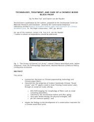
appendix c: historic preservation reports - Smithsonian Institution
appendix c: historic preservation reports - Smithsonian Institution
appendix c: historic preservation reports - Smithsonian Institution

Create successful ePaper yourself
Turn your PDF publications into a flip-book with our unique Google optimized e-Paper software.
1.0 INTRODUCTION<br />
1.2 ROLE OF THE CULTURAL RESOURCE ASSESSMENT IN THE MASTER<br />
PLAN<br />
The cultural resources assessment provides detailed information on the campus and the<br />
importance of its <strong>historic</strong> resources, including an inventory of existing buildings and features;<br />
identification of missing buildings and features; and major changes that have affected the<br />
landscape and built environment. Identification of all types of existing cultural resources and<br />
assessment of their <strong>historic</strong> role in the development of the complex is essential so that these<br />
resources can be considered in the planning process. The cultural resources assessment includes<br />
this text, supplemented by campus maps showing resource locations, an inventory composed of<br />
inventory records (each with a photograph and a description), and an index of inventoried<br />
resources.<br />
Existing conditions base mapping for this project has been developed using electronic files<br />
provided by Ayers Saint Gross (ASG) Architects. The team updated the files using information<br />
gathered during field investigations in October and November 2005 and revised the drawings to<br />
include feature labels that are consistent with the information presented in the cultural resources<br />
assessment.<br />
The individual resource descriptions are organized by area within the campus. The six areas<br />
include groups of related cultural features: Central Post, Race Track and Slate Hills, Green and<br />
Meade Barns, Bear Pond, Leach Farm/Posey Hollow, and South Pastures.<br />
1.3 DESCRIPTION OF THE FRONT ROYAL CAMPUS<br />
The Front Royal campus of the National Zoological Park, including the Conservation and<br />
Research Center, is located in Warren County, Virginia, approximately 3.2 k (2 miles) southeast<br />
of Front Royal along both sides of State Route (SR) 522 (also known as Remount Road). It is<br />
characterized by rolling terrain typical of the lower side slopes of the Blue Ridge Mountains. The<br />
area has been utilized primarily for agricultural activities and pursuits by occupants since the<br />
early nineteenth century. Soils associated with the property range from gently sloping, welldrained<br />
soils that are suitable for crop and hay production, to steeply sloping stony soils that are<br />
best suited to woodland. Soil suitability and capability are an important consideration for new<br />
uses and development on the site.<br />
The built core, known as the Central Post, is sited just north of SR 522. Other smaller groupings<br />
of buildings and structures occur on the property. A small farmstead cluster with numerous<br />
outbuildings edges SR 522 across the road from the Central Post. There is also a small grouping<br />
of features to the north of the post, which includes water towers and an archives building. To the<br />
west of the post there is a small group of buildings along SR 522 off of Slate Hill Drive. A cluster<br />
of barns and other outbuildings edge Rivinus Road to the east of the Central Post. The former<br />
Leach property includes a farmstead cluster of nineteenth-century buildings and outbuildings to<br />
the northeast of the Central Post.<br />
Currently a mix of open grassland and successional deciduous hardwood woodland, the site has a<br />
remarkable pastoral beauty. The natural setting also includes springs, seeps, and geologic<br />
formations, such as rock outcrops. Longer views of surrounding mountains and hills are afforded<br />
from high points around the site. Elevations associated with the property range from a high point<br />
of approximately 616 m (2,020 ft) above mean sea level (MSL) along the side slopes of High<br />
Knob at the site’s eastern boundary, to 219 m (720 ft) MSL along SR 522 at the western edge of<br />
NATIONAL ZOOLOGICAL PARK FACILITIES MASTER PLAN<br />
FRONT ROYAL CAMPUS, WARREN COUNTY, VIRGINIA<br />
CULTURAL RESOURCES ASSESSMENT<br />
2