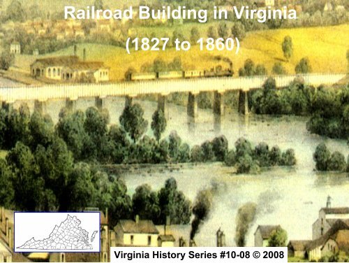
Railroad Building in Virginia (1827 to 1860) - Virginiahistoryseries.org
Railroad Building in Virginia (1827 to 1860) - Virginiahistoryseries.org
Railroad Building in Virginia (1827 to 1860) - Virginiahistoryseries.org

You also want an ePaper? Increase the reach of your titles
YUMPU automatically turns print PDFs into web optimized ePapers that Google loves.
<strong>Railroad</strong> <strong>Build<strong>in</strong>g</strong> <strong>in</strong> Virg<strong>in</strong>ia<br />
(<strong>1827</strong> <strong>to</strong> <strong>1860</strong>)<br />
Virg<strong>in</strong>ia His<strong>to</strong>ry Series #10-08 © 2008
Major <strong>Railroad</strong>s <strong>in</strong> Virg<strong>in</strong>ia<br />
(from <strong>1827</strong>-<strong>1860</strong>)<br />
• Baltimore and Ohio (<strong>1827</strong>)<br />
– W<strong>in</strong>chester & Po<strong>to</strong>mac<br />
(at Harpers Ferry)<br />
– W<strong>in</strong>chester & Strasburg<br />
-- North Western <strong>to</strong><br />
Parkersburg, WV<br />
• Manassas Gap (1850-54)<br />
• Orange & Alexandria (1848)<br />
• Virg<strong>in</strong>ia Central (1836)<br />
-- Blue Ridge (1858)<br />
• Virg<strong>in</strong>ia & Tennessee (1850s)<br />
• Richmond, Fredericksburg, and<br />
Po<strong>to</strong>mac <strong>to</strong> Alexandria (1834) &<br />
Fredericksburg & Charlottesville RR<br />
• South Side or “Petersburg &<br />
Lynchburg RR” (1849-54)<br />
• Richmond & Danville (1847-1856)<br />
• Petersburg & Roanoke (river <strong>in</strong> NC)<br />
(1833)<br />
-- Richmond & Petersburg (1838)<br />
• Norfolk and Petersburg (1853)<br />
• Seaboard & Roanoke (river <strong>in</strong> NC) or<br />
“Portsmouth and Weldon RR” (1835)
Major RR Routes <strong>in</strong> Virg<strong>in</strong>ia by <strong>1860</strong><br />
Bris<strong>to</strong>l ●<br />
Parkersburg ●<br />
Wheel<strong>in</strong>g●,<br />
Ohio<br />
River<br />
● Graf<strong>to</strong>n<br />
Weldon ■<br />
Maryland<br />
& York RR+<br />
+<br />
++++++/<br />
+ Norfolk Stn<br />
+ Petersburg & + Norfolk RR<br />
+ +<br />
+ + Suffolk Stn<br />
+<br />
+<br />
+<br />
+<br />
+<br />
+ Norfolk &<br />
+ Roanoke RR
On March 8, <strong>1827</strong>, the Commonwealth of Virg<strong>in</strong>ia<br />
jo<strong>in</strong>ed Maryland <strong>in</strong> giv<strong>in</strong>g the Baltimore and Ohio<br />
Rail Road (B&O RR) the task of build<strong>in</strong>g a railroad<br />
from the port of Baltimore, MD West <strong>to</strong> a suitable<br />
po<strong>in</strong>t on the Ohio River.<br />
The railroad was <strong>in</strong>tended <strong>to</strong> provide a faster route<br />
for Midwestern goods <strong>to</strong> reach the East Coast than<br />
the successful Erie Canal across upstate NY.<br />
Construction began on July 4 th , 1828. It was<br />
decided <strong>to</strong> follow the Patapsco River <strong>to</strong> a po<strong>in</strong>t<br />
near where the railroad would cross the “fall l<strong>in</strong>e”<br />
and descend <strong>in</strong><strong>to</strong> the valley of the Monocacy and<br />
Po<strong>to</strong>mac Rivers.
Thomas Viaduct (on the B&O RR)<br />
spans the Patapsco River and<br />
Patapsco Valley between Relay and<br />
Elkridge, MD (1833-35) It was the<br />
largest bridge <strong>in</strong> the nation and <strong>to</strong>day<br />
its still the world's oldest multiple<br />
arched s<strong>to</strong>ne railroad bridge
Further extensions of the B&O RR soon<br />
opened <strong>to</strong> Frederick and Po<strong>in</strong>t of Rocks on the<br />
Po<strong>to</strong>mac river. A connection with the<br />
W<strong>in</strong>chester and Po<strong>to</strong>mac RR opened at Harper’s<br />
Ferry <strong>in</strong> 1837. The B&O RR was completed <strong>to</strong><br />
Wheel<strong>in</strong>g, WV (then part of Virg<strong>in</strong>ia) <strong>in</strong> 1853.<br />
In Virg<strong>in</strong>ia, the W<strong>in</strong>chester & Po<strong>to</strong>mac RR<br />
and the W<strong>in</strong>chester & Strasburg RR connected<br />
with the B&O RR at Harper’s Ferry; and later <strong>in</strong><br />
1867, they became part of the B&O RR as it was<br />
extended South through the Shenandoah river<br />
valley <strong>to</strong> Stan<strong>to</strong>n and then <strong>to</strong> Lex<strong>in</strong>g<strong>to</strong>n, VA by<br />
1890.
Baltimore & Ohio RR from Baltimore <strong>to</strong> Wheel<strong>in</strong>g<br />
with extension up the Valley <strong>to</strong> Lex<strong>in</strong>g<strong>to</strong>n by 1892<br />
Wheel<strong>in</strong>g ▪<br />
Ohio<br />
River<br />
Parkersburg ■ North Western RR ■<br />
Clarksburg<br />
● Baldw<strong>in</strong> Stations<br />
■ Other Stations<br />
■<br />
Graf<strong>to</strong>n<br />
Strasburg ▪<br />
Stan<strong>to</strong>n ■<br />
▪ Harrisonburg<br />
MARYLAND
Early RRs competed<br />
with canal-boats for<br />
freight and passengers.<br />
Pictured here, the B&O<br />
RR at “Po<strong>in</strong>t of Rocks”<br />
on the VA/MD border<br />
runs along side the C&O<br />
Canal with a Po<strong>to</strong>mac<br />
River bridge (i.e., on<br />
present day Rt. 15 North<br />
of Leesburg) shown <strong>in</strong><br />
the background.
B&O RR and C&O Canal go<strong>in</strong>g West “<strong>to</strong>gether”<br />
<strong>to</strong>ward Harper’s Ferry (on the left)
Shenandoah<br />
B&O RR<br />
Po<strong>to</strong>mac<br />
C&O<br />
Canal<br />
Harper’s Ferry is a his<strong>to</strong>ric <strong>to</strong>wn <strong>in</strong> Jefferson Co., WV. It is<br />
situated at the fork of the Po<strong>to</strong>mac and Shenandoah Rivers.<br />
His<strong>to</strong>rically, Harper’s Ferry is best known for John Brown's<br />
raid on its Armory <strong>in</strong> 1859 and as a RR junction.
Harper’s Ferry (look<strong>in</strong>g East -- Beyer<br />
pa<strong>in</strong>t<strong>in</strong>g ca. 1855)
The picturesque<br />
Tray Run Viaduct<br />
bridge on the B&O<br />
RR was built over<br />
a g<strong>org</strong>e of the<br />
Cheat River near<br />
Rowlesburg, WV. It<br />
was the subject of<br />
a pa<strong>in</strong>t<strong>in</strong>g by<br />
Edward Beyer <strong>in</strong><br />
his “Album of<br />
Virg<strong>in</strong>ia” made<br />
dur<strong>in</strong>g travels<br />
throughout the<br />
State (ca. 1855)
Tray Run Viaduct near<br />
the Cheat River, WV<br />
(Beyer pa<strong>in</strong>t<strong>in</strong>g ca. 1855)
Tray Run<br />
Viaduct<br />
(Circled) near<br />
K<strong>in</strong>gwood<br />
Tunnel
Wheel<strong>in</strong>g, WV with its “state of the art” Suspension<br />
Bridge over the Ohio River
North Western RR (1857) from Graf<strong>to</strong>n Junction <strong>to</strong><br />
Parkersburg, WV on the Ohio River. The <strong>to</strong>wn of<br />
Parkersburg was the term<strong>in</strong>us of 2 separate turnpike roads<br />
from Staun<strong>to</strong>n and W<strong>in</strong>chester. Graf<strong>to</strong>n is pictured here<br />
with its RR bridge across the Tygert River.
North Western RR was an extension of the B&O<br />
RR from Graf<strong>to</strong>n <strong>to</strong> Parkersburg on the Ohio<br />
River<br />
At the Graf<strong>to</strong>n Junction, the B&O RR itself went<br />
Northwest <strong>to</strong> Wheel<strong>in</strong>g, WV (also on the Ohio<br />
River)
Rails were used <strong>to</strong> br<strong>in</strong>g up coal <strong>in</strong> the m<strong>in</strong>es (<strong>in</strong>set<br />
above) and coal was loaded on<strong>to</strong> RR cars under<br />
“tipples” for shipment (e.g., m<strong>in</strong>e and RR cars at<br />
Clarksburg, WV on the North Western RR l<strong>in</strong>e)
Steam Eng<strong>in</strong>es and<br />
Passenger Travel <strong>in</strong><br />
the 1800s
Eng<strong>in</strong>es carried wood or coal <strong>to</strong> “s<strong>to</strong>ke” their boilers;<br />
but, s<strong>to</strong>pped for water at “water<strong>in</strong>g <strong>to</strong>wers” along<br />
their routes.<br />
Sketch<br />
from<br />
Harper’s<br />
New<br />
Monthly<br />
Magaz<strong>in</strong>e
Manassas Gap RR was chartered <strong>in</strong> 1850 <strong>to</strong> build from<br />
Manassas Junction at the Orange & Alexandria RR through the<br />
“Manassas Gap” <strong>to</strong> the extended B&O RR at Strasburg (1854) <strong>in</strong> the<br />
Shenandoah Valley<br />
Ohio<br />
North Western RR<br />
●<br />
Graf<strong>to</strong>n<br />
+<br />
+<br />
+<br />
+<br />
+<br />
Strasburg ▪ +<br />
+<br />
+<br />
+<br />
+<br />
+<br />
+<br />
+<br />
+<br />
+<br />
Manassas Gap RR<br />
Baltimore & Ohio RR<br />
Harper’s Ferry ▪
Manassas Junction (formerly called “Tudor Hall”) on<br />
the Manassas Gap and Orange & Alexandria RRs<br />
South of Bull Run
At RR Junctions, passengers and freight were<br />
transferred between railway l<strong>in</strong>es
The Orange and<br />
Alexandria <strong>Railroad</strong><br />
(O&A) was chartered by<br />
the VA General Assembly<br />
on May 28, 1848, <strong>to</strong> run<br />
North & South between<br />
Alexandria &<br />
Gordonsville.<br />
Construction began <strong>in</strong><br />
1850 and was completed<br />
<strong>in</strong> April of 1854 when it<br />
connected with the<br />
Virg<strong>in</strong>ia Central <strong>Railroad</strong><br />
at Gordonsville <strong>in</strong> Orange<br />
Co.<br />
Orange Court House<br />
on RR l<strong>in</strong>e with<br />
Montebello nearby
Eng<strong>in</strong>e “Gen. Haupt” with “turn-a” round-house<br />
<strong>in</strong> the background (Alexandria, VA ca. 1863)
The “President’s Car” was parked <strong>in</strong> the O&A<br />
RR yard at Alexandria, VA (1865)
Catlett’s Station on Orange & Alexandria RR
Locomotive & Bridge on Orange &<br />
Alexandria RR (ca. 1862)
Culpepper<br />
Station on<br />
Orange &<br />
Alexandria<br />
RR l<strong>in</strong>e (ca.<br />
1862)
Orange Courthouse Station<br />
on Orange & Alexandria RR<br />
L<strong>in</strong>e with Tra<strong>in</strong> <strong>in</strong> Foreground
Virg<strong>in</strong>ia Central <strong>Railroad</strong> was chartered as the “Louisa<br />
<strong>Railroad</strong>” <strong>in</strong> 1836 by the VA Board of Public Works. It ran West from<br />
Richmond through Louisa Co. across the “central” part of the State and<br />
had its name changed <strong>to</strong> Virg<strong>in</strong>ia Central <strong>Railroad</strong> <strong>in</strong> 1850. It connected<br />
with the Orange and Alexandria RR at Gordonsville <strong>in</strong> 1854 and was<br />
extended through Charlottesville <strong>to</strong> Staun<strong>to</strong>n (via the Blue Ridge RR<br />
tunnels through the mounta<strong>in</strong>s <strong>in</strong> 1858) and up the valley <strong>to</strong>ward<br />
Lex<strong>in</strong>g<strong>to</strong>n. Manassas<br />
Gap RR<br />
Richmond &<br />
York River RR
Gordonsville Junction between Virg<strong>in</strong>ia Central<br />
and Orange & Alexandria <strong>Railroad</strong>s<br />
The “grand” Exchange Hotel near the RR Depot orig<strong>in</strong>ally built <strong>in</strong> 1859
RR Tra<strong>in</strong>s at a Junction
In 1850, the Virg<strong>in</strong>ia Central <strong>Railroad</strong> connected<br />
Richmond with Charlottesville. More than 400<br />
slaves, some purchased specifically for build<strong>in</strong>g<br />
the railroad, made up the construction crew.<br />
When completed, the connection was described<br />
as:<br />
“…an important l<strong>in</strong>k <strong>in</strong> the connection of the metropolis<br />
with the West. The traveler may now leave Richmond<br />
soon after six <strong>in</strong> the morn<strong>in</strong>g, arrive <strong>in</strong> Charlottesville at<br />
one, and reach Staun<strong>to</strong>n the same night.”<br />
- Quoted <strong>in</strong> the Virg<strong>in</strong>ia His<strong>to</strong>rical Register, 1851
Early views of Charlottesville RR Stations
In 1858, the state-built Blue<br />
Ridge <strong>Railroad</strong> was<br />
completed <strong>to</strong> connect the<br />
Piedmont and Shenandoah<br />
Valley regions of VA by<br />
go<strong>in</strong>g thru the Blue Ridge<br />
mounta<strong>in</strong>s at Rockfish Gap<br />
near Af<strong>to</strong>n Mounta<strong>in</strong>. The<br />
cross<strong>in</strong>g was made with<br />
four tunnels, <strong>in</strong>clud<strong>in</strong>g the<br />
4,263-foot “Blue Ridge<br />
Tunnel” at the <strong>to</strong>p of the<br />
pass (then one of the<br />
longest tunnels <strong>in</strong> the<br />
world.)<br />
This RR became part of the<br />
Virg<strong>in</strong>ia Central RR upon<br />
completion of the tunnels.
Rockfish Gap (View of the Shenandoah Valley look<strong>in</strong>g northwest<br />
<strong>to</strong>ward the <strong>to</strong>wn of Waynesboro on the western side of the<br />
Blue Ridge Mounta<strong>in</strong> tunnels. Af<strong>to</strong>n Mounta<strong>in</strong> is on the right. The<br />
road with two travelers on horseback is on the approximate location<br />
of <strong>to</strong>day’s Blue Ridge Parkway – Beyer Pa<strong>in</strong>t<strong>in</strong>g ca. 1855)
Virg<strong>in</strong>ia and Tennessee (V&T) RR<br />
The "Roanoke," as pho<strong>to</strong>graphed <strong>in</strong> 1854<br />
Built <strong>in</strong> the 1850s, the V&T ran completely through<br />
southwestern VA along the length of the Great Valley of<br />
Virg<strong>in</strong>ia. The railroad extended westward from its<br />
Junction with the Orange & Alexandria RR at Lynchburg,<br />
through a gap <strong>in</strong> the Blue Ridge Mts near the <strong>to</strong>wn of Big<br />
Lick (now called Roanoke); there, it turned south<br />
westward and followed the Great Valley <strong>to</strong> Bris<strong>to</strong>l, TN.
Developed <strong>to</strong> Encourage<br />
“Agriculture & Commerce”,<br />
the V&T RR covered 175<br />
miles from Lunchburg, VA<br />
<strong>to</strong> Bris<strong>to</strong>l, TN plus a 9 ½<br />
mile short l<strong>in</strong>e off the ma<strong>in</strong><br />
track <strong>to</strong> the Salt Works at<br />
Saltville, VA
The Ma<strong>in</strong> East <strong>to</strong> So.West RRs from Lynchburg,<br />
VA <strong>in</strong><strong>to</strong> TN and other Southern States
VA. & Tennessee RR depot and tra<strong>in</strong> shed (center/left),<br />
the V&T roundhouse (right), and a covered, wooden RR<br />
bridge across the James River (1875) at Lynchburg, VA
V&T RR from Lynchburg past the<br />
“Peaks of Otter” near Liberty through<br />
Buford’s Gap <strong>in</strong> the Blue Ridge<br />
Mounta<strong>in</strong>s <strong>to</strong> “Big Lick” (i.e., Roanoke)
View of Liberty and Peaks of Otter<br />
(Beyer pa<strong>in</strong>t<strong>in</strong>g, ca. 1855)
V&T RR near Peaks of Otter (Beyer<br />
pa<strong>in</strong>t<strong>in</strong>g, ca 1855)
V&T RR from Buford’s Gap through “Big Lick”,<br />
Salem and White Sulfur Spr<strong>in</strong>gs South of the “Salt<br />
Pond” & “Coal Fields” <strong>in</strong> Montgomery, Co. VA
Salem, VA (Beyer pa<strong>in</strong>t<strong>in</strong>g, ca. 1855)
Little Tunnel (look<strong>in</strong>g NE from Shawsville, VA) cuts<br />
through Middle Piece Mtn. This tra<strong>in</strong> is headed East<br />
<strong>to</strong>ward Salem (V&T RR -- Beyer pa<strong>in</strong>t<strong>in</strong>g, ca 1855)
Yellow Sulfur Spr<strong>in</strong>gs is a “Spa” that was accessed<br />
by stage coach from the V&T RR l<strong>in</strong>e (Beyer<br />
pa<strong>in</strong>t<strong>in</strong>g, ca 1855)
Much of the panhandle and north-central portion<br />
of present-day WV is underla<strong>in</strong> by bedded salt<br />
deposits over 50-feet thick <strong>in</strong> places. Salt m<strong>in</strong><strong>in</strong>g<br />
s<strong>in</strong>ce the late 1700s had taken out most of the<br />
easily m<strong>in</strong>ed salt by <strong>1860</strong> (“The Salt Pond” –<br />
Beyer ca. 1855).
V&T RR from Yellow Sulfur Spr<strong>in</strong>gs <strong>to</strong><br />
Wytheville Through Newbern <strong>in</strong> Pulaski Co., VA
Boisseva<strong>in</strong><br />
“Tipples” at the<br />
Pocohantas coal<br />
field <strong>in</strong> Tazewell<br />
County, SW Virg<strong>in</strong>ia<br />
near Bluefield.<br />
A “tipple” was built<br />
over a RR track so<br />
that coal could be<br />
dropped down <strong>in</strong><strong>to</strong><br />
the RR cars for<br />
shipment <strong>to</strong> market<br />
by rail.<br />
“tipples”
V&T RR at the rural Newbern Depot (New<br />
Harpers Magaz<strong>in</strong>e Sept. 1857)
Wytheville, VA with a stage coach road through<br />
the <strong>to</strong>wn (Beyer pa<strong>in</strong>t<strong>in</strong>g, ca. 1855)
V&T RR from Wytheville <strong>in</strong><strong>to</strong><br />
Wash<strong>in</strong>g<strong>to</strong>n Co., VA
Connect<strong>in</strong>g RR<br />
“spur” <strong>to</strong> Saltville<br />
V&T RR <strong>in</strong><strong>to</strong> TN at the Bris<strong>to</strong>l<br />
Junction with the East TN & VA RR
Workers Mak<strong>in</strong>g Salt at Saltville, VA
Bris<strong>to</strong>l Station <strong>in</strong> TN at the end of the VA & TN<br />
RR l<strong>in</strong>e (175 miles from Lynchburg, VA) where<br />
the East TN & VA RR began
Richmond, Fredericksburg and Po<strong>to</strong>mac RR<br />
(North of Richmond <strong>to</strong> Alexandria) and<br />
Fredericksburg and Charlottesville RR through<br />
Orange Court House
Richmond, Fredericksburg, and Po<strong>to</strong>mac RR<br />
Passenger Tra<strong>in</strong> Leav<strong>in</strong>g from Richmond<br />
Station go<strong>in</strong>g North
By 1861, major junctions of compet<strong>in</strong>g railroads<br />
<strong>in</strong> Virg<strong>in</strong>ia <strong>in</strong>cluded:<br />
• Manassas (Orange & Alexandria/Manassas Gap RRs)<br />
• Gordonsville (Orange and Alexandria/Virg<strong>in</strong>ia Central<br />
RRs)<br />
• Charlottesville (Orange and Alexandria/Virg<strong>in</strong>ia<br />
Central RRs)<br />
• Doswell called “Chesterfield” or “Squashapenny”<br />
(Virg<strong>in</strong>ia Central/Richmond, Fredericksburg, and<br />
Po<strong>to</strong>mac RRs)<br />
• Petersburg (<strong>in</strong>tersection of several RRs)<br />
• Burksville (South Side or “Lynchburg &<br />
Petersburg”/Richmond and Danville RRs)
The Richmond,<br />
Fredricksburg, &<br />
Po<strong>to</strong>mac RR followed<br />
the present-day route<br />
I-95 from Richmond<br />
North <strong>to</strong> the “Po<strong>to</strong>mac<br />
RR Yard” outside<br />
Alexandria, VA. It<br />
crossed the South &<br />
North Anna, Mattaponi,<br />
and Rappahannock<br />
Rivers with major<br />
junctions at Doswell<br />
and Fredericksburg.
Bridge over the Po<strong>to</strong>mac Creek on<br />
the Richmond, Fredericksburg,<br />
and Alexandria RR just north of<br />
Fredericksburg, VA
Fredericksburg on far side of Rappahannock<br />
river with RR bridge pil<strong>in</strong>gs seen <strong>in</strong> river after<br />
bridge was burned (ca. 1862)
RR bridge over the Rappahannock River at<br />
Fredericksburg (on far side of river) shown<br />
here under repair, ca. 1863
South Side <strong>Railroad</strong> (a.k.a. “Petersburg &<br />
Lynchburg” RR) was formed <strong>in</strong> Virg<strong>in</strong>ia <strong>in</strong> 1846.<br />
Construction from City Po<strong>in</strong>t (a port on the<br />
James River) began <strong>in</strong> 1849, it reached<br />
Burksville (a junction with the Richmond and<br />
Danville RR) <strong>in</strong> 1852, and was completed <strong>to</strong><br />
Lynchburg, VA <strong>in</strong> 1854. It connected the farm<br />
country south and west of Petersburg and<br />
around Lynchburg, VA <strong>to</strong> the James River.<br />
Follow<strong>in</strong>g an <strong>in</strong>direct route, the railroad<br />
constructed a famous 21 span “High Bridge”<br />
across the Appomat<strong>to</strong>x River valley near<br />
Farmville. The bridge was 2,400 feet long and as<br />
high as 100 feet <strong>in</strong> the center, one of the largest<br />
<strong>in</strong> the world when built.
South Side RR Map from City Po<strong>in</strong>t on the James<br />
through Petersburg and Burksville <strong>to</strong> Lynchburg
City Po<strong>in</strong>t Term<strong>in</strong>al on<br />
the James River, RR<br />
Yard, and Roundhouse
Burksville (this small <strong>to</strong>wn was a Junction of the<br />
Richmond and Danville and the Petersburg &<br />
Lynchburg RRs).
“High Bridge” near Farmville, VA (Beyer, ca. 1855)
Location of the 105 ft “High Bridge” on the<br />
Petersburg & Lynchburg RR over the Appomat<strong>to</strong>x<br />
River near Farm V. (i.e., “Farmville”)
Richmond & Danville RR was chartered <strong>in</strong> 1847<br />
and completed <strong>to</strong> Danville <strong>in</strong> 1856 (140 miles)
Richmond & Danville RR Bridge over the<br />
James River viewed from Gamble’s Hill
As a private enterprise, the Richmond &<br />
Danville RR was funded by sell<strong>in</strong>g shares <strong>in</strong><br />
the company.<br />
RR construction was supervised by Col. Andrew<br />
Talcott, who later served as an eng<strong>in</strong>eer <strong>in</strong> the<br />
Confederate Army of No. Virg<strong>in</strong>ia
After the Civil War, the<br />
Richmond & Danville RR<br />
grew <strong>to</strong> 3,300 miles of track<br />
<strong>in</strong> 9 states. Today, its part of<br />
the Norfolk Southern RR.
Richmond and York (river) RR<br />
Savage’s Station on the Richmond & York RR
Virg<strong>in</strong>ia<br />
Petersburg<br />
& Roanoke<br />
(river <strong>in</strong><br />
NC) RR<br />
Roanoke<br />
North<br />
Carol<strong>in</strong>a<br />
City<br />
Po<strong>in</strong>t<br />
Norfolk &<br />
Petersburg RR<br />
Norfolk, VA (i.e., “Seaboard”)<br />
& Roanoke (river <strong>in</strong> NC) RR
Petersburg was a major Junction of several RRs<br />
south of Richmond. At this station, locomotives<br />
needed <strong>to</strong> “turn around” on a rotat<strong>in</strong>g rail<br />
section as pictured here without a roof.
Norfolk and<br />
Petersburg RR<br />
Great Dismal Swamp<br />
Beg<strong>in</strong>n<strong>in</strong>g <strong>in</strong> 1853,<br />
William Mahone, a graduate of VMI, designed and<br />
built drawbridges across the busy Eastern and<br />
Southern branches of the Elizabeth River near<br />
Norfolk. He also designed and built an <strong>in</strong>novative<br />
RR roadbed through the Great Dismal Swamp<br />
employ<strong>in</strong>g a corduroy log foundation laid at right<br />
angles beneath the surface of the swamp.<br />
Mahone's RR roadbed design withs<strong>to</strong>od immense<br />
<strong>to</strong>nnages of coal traffic through the swamp.
Res<strong>to</strong>red Suffolk<br />
Junction Station<br />
and Museum<br />
between the<br />
Norfolk &<br />
Petersburg and<br />
Seaboard &<br />
Roanoke RRs<br />
Seaboard & Roanoke RR<br />
<strong>to</strong> Weldon, NC
“Cot<strong>to</strong>n<br />
tra<strong>in</strong>” <strong>in</strong> the<br />
South<br />
Portsmouth &<br />
Weldon RR (a.k.a.<br />
“Seaboard &<br />
Roanoke RR) was<br />
<strong>org</strong>anized <strong>in</strong> 1833 and<br />
completed <strong>in</strong> 1835. It was the<br />
1st RR <strong>to</strong> reach the Norfolk<br />
area and supported shipment<br />
of goods orig<strong>in</strong>at<strong>in</strong>g on the<br />
Roanoke River and its canal<br />
system from po<strong>in</strong>ts West <strong>to</strong><br />
the Norfolk area on the harbor<br />
of Hamp<strong>to</strong>n Roads.<br />
Cot<strong>to</strong>n-dock at Norfolk
Petersburg and Roanoke (river <strong>in</strong> NC) RR<br />
The Port of Petersburg (i.e., City Po<strong>in</strong>t on the<br />
James River) became renowned as a<br />
commercial center for transport<strong>in</strong>g and<br />
process<strong>in</strong>g cot<strong>to</strong>n, <strong>to</strong>bacco, metal, etc.<br />
produced and shipped from the region. As<br />
travel technology developed, Petersburg<br />
became established as a railroad Junction,<br />
with l<strong>in</strong>ks <strong>to</strong> Richmond <strong>in</strong> the north, Farmville<br />
and Lynchburg <strong>in</strong> the west, and Weldon, NC <strong>in</strong><br />
the south via the Petersburg and Roanoke RR.<br />
The Norfolk and Petersburg RR was the last<br />
major connection from Petersburg <strong>to</strong> the east<br />
when it was completed <strong>in</strong> 1858.
Hicksford Junction<br />
on the Petersburg<br />
& Roanoke RR was<br />
also a junction of<br />
several turnpike<br />
roads <strong>in</strong> southern<br />
Virg<strong>in</strong>ia.<br />
[Hicksford, also<br />
known as “Hick's<br />
Ford”, became<br />
part of a Town and<br />
later the<br />
<strong>in</strong>dependent City<br />
of Emporia]<br />
Where “Fort Road” of<br />
eastern Virg<strong>in</strong>ia crossed<br />
the Mecherr<strong>in</strong> River.
Weldon, NC (a major<br />
Junction station on<br />
the Roanoke River).<br />
Timber and other raw<br />
materials came down<br />
the Roanoke River<br />
from VA <strong>to</strong> the falls at<br />
Weldon and were<br />
transported by RR <strong>to</strong><br />
markets via deep<br />
water ports <strong>in</strong> VA on<br />
the James River (i.e.,<br />
Portsmouth, City<br />
Po<strong>in</strong>t, or Norfolk).<br />
Roanoke River<br />
watershed City Port ●<br />
● Weldon, NC<br />
● Norfolk<br />
● Portsmouth
Private <strong>in</strong>itiative and State supported<br />
private enterprise resulted <strong>in</strong> the <strong>in</strong>credible<br />
development of Virg<strong>in</strong>ia’s RR transportation<br />
<strong>in</strong>frastructure from <strong>1827</strong> – <strong>1860</strong>.<br />
But, the fierce competiveness that created<br />
this <strong>in</strong>frastructure had its limitations.<br />
Interconnectivity between compet<strong>in</strong>g<br />
railroads was a rarity. For example, while 6<br />
railroads had term<strong>in</strong>als at Richmond city, none<br />
provided direct connections <strong>to</strong> other railroads<br />
from the city. This later became a major<br />
problem for the Confederacy dur<strong>in</strong>g the Civil<br />
War.
Six RRs <strong>in</strong> Richmond City – No<br />
Interchange
The economic impact of this period of<br />
railroad build<strong>in</strong>g <strong>in</strong> Virg<strong>in</strong>ia was huge. By<br />
connect<strong>in</strong>g m<strong>in</strong>es, forests, farms, people, diverse<br />
regions, <strong>to</strong>wns, and develop<strong>in</strong>g urban/<strong>in</strong>dustrial<br />
centers throughout the state, the railroads changed<br />
Virg<strong>in</strong>ia from a “farm economy” <strong>in</strong><strong>to</strong> a “market<br />
economy” based upon the production, distribution<br />
and market<strong>in</strong>g of goods (e.g., timber, coal, <strong>to</strong>bacco,<br />
salt) and services (e.g., <strong>to</strong>urism) with<strong>in</strong> the State,<br />
with other States, and with other countries.<br />
Inevitably, railroad build<strong>in</strong>g and the<br />
prosperity it brought had a dramatic impact on<br />
Virg<strong>in</strong>ia’s social <strong>in</strong>stitution (e.g., on slavery).
(Recap) Major RR Routes <strong>in</strong> Virg<strong>in</strong>ia by <strong>1860</strong><br />
Bris<strong>to</strong>l ▪<br />
Parkersburg ●<br />
Wheel<strong>in</strong>g●,<br />
Ohio<br />
River<br />
● Graf<strong>to</strong>n<br />
Weldon ■<br />
Maryland<br />
& York RR+<br />
+<br />
++++++/<br />
+ Norfolk Stn<br />
+ Petersburg & + Norfolk RR<br />
+ +<br />
+ + Suffolk Stn<br />
+<br />
+<br />
+<br />
+<br />
+<br />
+ Norfolk &<br />
+ Roanoke RR
References:<br />
Baltimore & Ohio RR, “Map of the B&O RR” (1891)<br />
Beyer, Andrew, “Album of Virg<strong>in</strong>ia” (a set of colored lithographs) (1857)<br />
Blackford, W.W., “Map & Profile of the Virg<strong>in</strong>ia & TN RR”, Richie & Dunnavant, Lith.<br />
Richmond, VA (1856)<br />
Col<strong>to</strong>n, G.W., and C.B., “Map Show<strong>in</strong>g the Fredericksburg & Gordonsville RR of Virg<strong>in</strong>ia”<br />
(1869)<br />
Crutchfield, James A., The Grand Adventure: A Year by Year His<strong>to</strong>ry of Virg<strong>in</strong>ia, The<br />
Dietz Press, Richmond, Virg<strong>in</strong>ia (2005)<br />
Currier & Ives, “Night Scene at a Junction”, ca. 1885; and “American Railway Scene”, ca.<br />
1874<br />
Doran, Michael F., Atlas of County Boundary Changes <strong>in</strong> Virg<strong>in</strong>ia, 1634-1895, Iberian<br />
Publish<strong>in</strong>g Company, Athens, GA (1987)<br />
Faul, August, “Map and Profile of the Orange & Alexandria Rail Road with its Warren<strong>to</strong>n<br />
Branch and a Portion of the Manassas Gap Rail Road <strong>to</strong> Show its Po<strong>in</strong>t of Connection”,<br />
Ackerman Litho., NY, NY (1854)<br />
Gabel, Chris<strong>to</strong>pher R., “Rails <strong>to</strong> Oblivion: The Battle of Confederate RRs <strong>in</strong> the Civil<br />
War”, US Army Command and General Staff College Press (2002)<br />
Harpers New Monthly Magaz<strong>in</strong>e, “W<strong>in</strong>ter <strong>in</strong> the South”, Sept., 1857
References Cont.<br />
K<strong>in</strong>g, Edward, The Great South: A Record of Journeys (Illustrated by James Wells<br />
Chapney), American Publish<strong>in</strong>g Co., Hartford Conn. (1875)<br />
Library of Congress, Pr<strong>in</strong>ts & Pho<strong>to</strong>graphs Onl<strong>in</strong>e Catalog at<br />
[http://www.loc.gov/rr/pr<strong>in</strong>t/catalog.html]<br />
L<strong>in</strong>k, William A., Roots of Secession: Slavery and Politics <strong>in</strong> Antebellum Virg<strong>in</strong>ia,<br />
Univ. of NC Press, 2004<br />
Noe, Kenneth w., Southwest Virg<strong>in</strong>ia’s <strong>Railroad</strong>: Modernization and the Sectional<br />
Crisis <strong>in</strong> the Civil War Era, Univ. of Alabama Press, 2003<br />
Rose, Albert C., His<strong>to</strong>ric American Roads: From Frontier Trails <strong>to</strong> Superhighways<br />
(Includ<strong>in</strong>g 109 pa<strong>in</strong>t<strong>in</strong>gs by Carl Rakeman), Crown Publishers, N.Y., N.Y. (1976)<br />
Ruggles, F.G., “Map of the Virg<strong>in</strong>ia Central RR and its Proposed Connections”, P.S.<br />
Duval & Co. Lithographic Press, Philadelphia, PA (1852)
References Cont.<br />
Hildebrand, John R., Iron Horses <strong>in</strong> the Valley, Burd St. Press, Shippensburg, PA<br />
2001<br />
Vaisz, W., “Map of the Virg<strong>in</strong>ia Central Rail Road Show<strong>in</strong>g Connections <strong>to</strong> the<br />
Ohio River at Big Sandy, Guyandotte and Po<strong>in</strong>t Pleasant”, P.S. Duval & Co.<br />
Lithographic Press, Philadelphia, PA (1852)<br />
Wikipedia (The Free Encyclopedia) on the <strong>in</strong>ternet at [http://www.Wikipedia.<strong>org</strong>]<br />
Credits: Bybee, Dennis L., PhD, Virg<strong>in</strong>ia His<strong>to</strong>ry<br />
Series, #6-08 © 2008
Learn<strong>in</strong>g Exercises:<br />
A. Steam Locomotive<br />
Component Parts<br />
Worksheet<br />
B. Viewer Presentation<br />
Response Sheet<br />
(See Separate File)
7<br />
Steam Locomotive<br />
Component Parts Worksheet<br />
1<br />
2<br />
3<br />
8<br />
Eng<strong>in</strong>e “Gen. Haupt” with “turn-a” round-house<br />
<strong>in</strong> the background (Alexandria, VA ca. 1863)<br />
6<br />
4<br />
5
Steam Locomotive Component Parts Worksheet<br />
Match the Numbered Part on the Locomotive with<br />
its name:<br />
1. _____ 2. _____ 3. _____ 4. _____<br />
5. _____ 6. _____ 7. _____ 8. _____<br />
Names:<br />
A. Smoke Stack B. Coupler C. Headlamp<br />
D. Tender Box E. Cab F. Whistle<br />
G. Water Compartment H. Boiler