Mallusk Heritage Walking Trail - Newtownabbey Borough Council
Mallusk Heritage Walking Trail - Newtownabbey Borough Council
Mallusk Heritage Walking Trail - Newtownabbey Borough Council

Create successful ePaper yourself
Turn your PDF publications into a flip-book with our unique Google optimized e-Paper software.
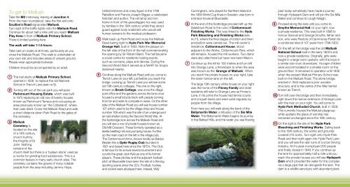
To get to <strong>Mallusk</strong><br />
Take the M2 motorway, leaving at Junction 4.<br />
From the main roundabout, take the first exit onto<br />
Scullion’s Road signposted <strong>Mallusk</strong>.<br />
Turn right at the traffic lights onto the <strong>Mallusk</strong> Road.<br />
Continue for about half a mile until you reach <strong>Mallusk</strong><br />
Play Area in front of <strong>Mallusk</strong> Primary School.<br />
There is limited parking here.<br />
The walk will take 1-1.5 hours.<br />
Take care on roads at all times, particularly as you<br />
cross the <strong>Mallusk</strong> Road. This walk is undertaken at<br />
your own risk and includes areas of uneven ground.<br />
Please wear appropriate footwear.<br />
Children should be accompanied by an adult.<br />
1 The trail starts at <strong>Mallusk</strong> Primary School,<br />
opened in 1936, to replace the old National<br />
School in Trench Lane (see no.9).<br />
2 Turning left out of the car park you will pass<br />
Parkmount Housing Estate, which was built<br />
in 1970 replacing an old row of twenty houses<br />
known as Parkmount Terrace and occupying an<br />
area previously known as ‘the Cotterland’, where<br />
linen was dried. Cross the <strong>Mallusk</strong> Road and walk<br />
a short distance down Park Road to the gates of<br />
the cemetery.<br />
3 <strong>Mallusk</strong><br />
Cemetery is<br />
located on the site<br />
of a 14th century<br />
church built by<br />
the Knights of St<br />
John. Nothing<br />
remains of the<br />
church itself but there is a ‘bullaun stone’ used as<br />
a mortar for grinding food substances. This is a<br />
common feature in many early church sites. The<br />
cemetery contains the graves of many notable<br />
people from the area including Jemmy Hope,<br />
United Irishman and a key figure in the 1798<br />
Rebellion and Francis Joseph Bigger, a celebrated<br />
historian and author. The old lamp and iron<br />
frame in front of the gravediggers hut was used<br />
by families in the 19th century whilst they stood<br />
guard against body snatchers who would sell<br />
human remains to the medical profession.<br />
4 Walk back up Park Road and cross the <strong>Mallusk</strong><br />
Road baring right to Hyde Park War Memorial<br />
Orange Hall, built in 1933. Note the plaque on<br />
the left side of the front of the hall commemorating<br />
the opening by Sir Robert Baird. The hall became<br />
a social centre for residents hosting events<br />
such as concerts, plays and dances. During the<br />
Second World War it served as a NAAFI for troops<br />
stationed nearby.<br />
5 Continue along the <strong>Mallusk</strong> Road until you come to<br />
Trench Lane on your left, just before you reach the<br />
bridge. Looking up Trench Lane you will see some<br />
old 19th century cottages. The one on the right,<br />
known as Brook Cottage, was once the village<br />
post office and the gardens across the lane once<br />
housed a small bicycle track with people coming<br />
from far and wide to compete in races. On the other<br />
side of the <strong>Mallusk</strong> Road you will see house number<br />
107 which used to be the village shop and house<br />
number 109 which was the site of an underground<br />
air raid shelter during the Second World War. At<br />
the footbridge look across the <strong>Mallusk</strong> Road and<br />
you will see a row of private houses known as<br />
Old Mill Crescent. These formerly operated as a<br />
textile beetling mill and pumping house. Further<br />
up the main road on the left is the village pub,<br />
The Cottonmount Arms, known locally as Baldys.<br />
Beside this is Ophir Rugby Club founded in<br />
1921 and based here since the 1970’s. The Club<br />
is famous for its annual sevens tournament and<br />
counts the great Jack Kyle as one of its former<br />
players. These pitches and the adjacent football<br />
pitch at Bluecastle have been the site of a thriving<br />
sporting scene since the 20’s. Football, hockey<br />
and cricket were all played here. Indeed, Willy<br />
Cunningham, who played for Northern Ireland in<br />
the 1958 World Cup finals in Sweden, was born in<br />
a terrace house at Bluecastle.<br />
6 At the end of the footbridge proceed left up the<br />
Sealstown Road to the ruins of Cottonmount<br />
Finishing Works. This was linked to the Hyde<br />
Park Bleaching and Finishing Works (see<br />
no.11), where the final stages of cotton and linen<br />
production were carried out. The mill owner’s<br />
residence, Cottonmount House, stood<br />
adjacent to the Works. Cottonmount Row, which<br />
still remains, housed the mill workers. Two dams<br />
were also sited here but have now been filled in.<br />
7 Continue up the hill for 100 metres and turn left<br />
into Grange Lane, a throwback to when the area<br />
was known as the ‘Grange of <strong>Mallusk</strong>’. When<br />
you reach the private houses on your right, take<br />
the lower narrow lane on the left.<br />
The large 19th century white house on your right<br />
was the home of the Finney Family and older<br />
residents still refer to Grange Lane as Finney’s<br />
Lane. In its prime the house had tennis courts<br />
and croquet lawns and were used regularly by<br />
people from the village.<br />
From here you will walk along the bank of the<br />
Ballymartin Water, a tributary of the Six Mile<br />
Water. The Ballymartin Water begins its journey<br />
in the Belfast Hills, and the water you see flowing<br />
past today will already have made a journey<br />
through Hydepark Dam and will join the Six Mile<br />
Water and continue to Lough Neagh.<br />
8 Proceed along the lane until you come to<br />
Smythe Memorial Hall on your right, now<br />
a private residence. This was built in 1896 to<br />
honour Samuel and George Smythe, father and<br />
son, who were Rectors of Carnmoney Parish for<br />
a combined total of 107 years from 1796-1903.<br />
9 On the left at the bridge was the old <strong>Mallusk</strong><br />
National School built in the early 1800’s and<br />
now a private residence. Originally, girls were<br />
taught in a large room upstairs, with the boys in<br />
a similar size room downstairs. Younger children<br />
were accommodated in a smaller room on the<br />
ground floor. It remained in operation until 1936<br />
when the present <strong>Mallusk</strong> Primary School was<br />
built on the <strong>Mallusk</strong> Road. The stone bridge,<br />
erected in 1942 replaced a prior wooden<br />
structure, and is the centre of the little hamlet<br />
known as Trench.<br />
10 Turn left over the bridge and then immediately<br />
right down the narrow extension of Grange Lane<br />
with the river on your right. You will come to<br />
Hyde Park Methodist Church, built in 1829.<br />
This currently houses the <strong>Mallusk</strong> playgroup<br />
while upstairs the place of worship has<br />
remained unchanged since the 19th century.<br />
11 On the right is the site of the Hyde Park<br />
Bleaching and Finishing Works. Dating back<br />
to the 18th century, the works and grounds<br />
covered 210 acres. Turn right onto Hyde Park<br />
Road and then right again into Hyde Park Lane<br />
and you will see the vast ruins of a once thriving<br />
industry. At it’s peak it employed 200 people<br />
and finally closed in 1948. If you continue up<br />
the lane for approximately half a mile until you<br />
reach the private houses you will see Hydepark<br />
Dam which provided the water for the complex<br />
via a large pipe that ran alongside the lane. The<br />
dam is a wildlife sanctuary with abundant plant,