Nature Guide to the Largest Virgin Beech Forest - WSL
Nature Guide to the Largest Virgin Beech Forest - WSL
Nature Guide to the Largest Virgin Beech Forest - WSL

You also want an ePaper? Increase the reach of your titles
YUMPU automatically turns print PDFs into web optimized ePapers that Google loves.
16<br />
THE VELYKA UHOLKA HIKING TRAIL<br />
The trail is about 4.5 km in length, with a<br />
400 m difference in altitude. The whole trail<br />
takes about 2 hours. The best time <strong>to</strong> visit is<br />
between April and Oc<strong>to</strong>ber.<br />
Start at <strong>the</strong> checkpoint<br />
430 m asl<br />
The trail begins at <strong>the</strong> Carpathian Biosphere<br />
Reserve’s checkpoint in Uholka, which is 5<br />
km north of <strong>the</strong> village of Velyka Uholka.<br />
About 100 m from <strong>the</strong> checkpoint <strong>the</strong>re is a<br />
hydrocarbon mineral spring. Its water is still<br />
used by <strong>the</strong> locals <strong>to</strong> treat ailments. A few<br />
centuries ago this area is said <strong>to</strong> have been<br />
rich in <strong>the</strong>rmal springs, but <strong>the</strong>se are no<br />
longer here <strong>to</strong>day. From <strong>the</strong> checkpoint <strong>the</strong><br />
path leads uphill passing through several<br />
meadows. After leaving <strong>the</strong> last houses you<br />
enter a beech forest, where you will at first<br />
still find traces of human activity, but <strong>the</strong><br />
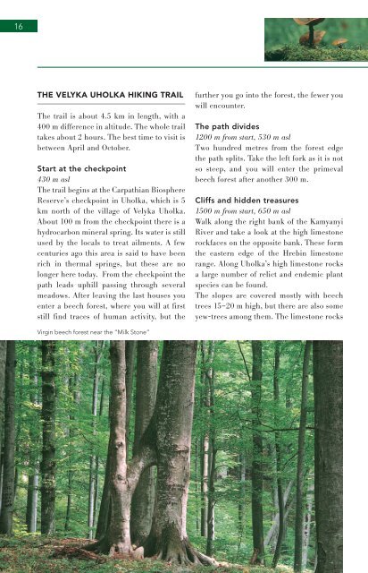
<strong>Virgin</strong> beech forest near <strong>the</strong> “Milk S<strong>to</strong>ne”<br />
fur<strong>the</strong>r you go in<strong>to</strong> <strong>the</strong> forest, <strong>the</strong> fewer you<br />
will encounter.<br />
The path divides<br />
1200 m from start, 530 m asl<br />
Two hundred metres from <strong>the</strong> forest edge<br />
<strong>the</strong> path splits. Take <strong>the</strong> left fork as it is not<br />
so steep, and you will enter <strong>the</strong> primeval<br />
beech forest after ano<strong>the</strong>r 300 m.<br />
Cliffs and hidden treasures<br />
1500 m from start, 650 m asl<br />
Walk along <strong>the</strong> right bank of <strong>the</strong> Kamyanyi<br />
River and take a look at <strong>the</strong> high limes<strong>to</strong>ne<br />
rockfaces on <strong>the</strong> opposite bank. These form<br />
<strong>the</strong> eastern edge of <strong>the</strong> Hrebin limes<strong>to</strong>ne<br />
range. Along Uholka’s high limes<strong>to</strong>ne rocks<br />
a large number of relict and endemic plant<br />
species can be found.<br />
The slopes are covered mostly with beech<br />
trees 15–20 m high, but <strong>the</strong>re are also some<br />
yew-trees among <strong>the</strong>m. The limes<strong>to</strong>ne rocks