Historic Environment Record Search - Wychavon District Council
Historic Environment Record Search - Wychavon District Council
Historic Environment Record Search - Wychavon District Council

You also want an ePaper? Increase the reach of your titles
YUMPU automatically turns print PDFs into web optimized ePapers that Google loves.
Worcestershire Archive and Archaeology Service<br />
Providing specialist information and advice to the public, local authorities and developers<br />
<strong>Historic</strong> <strong>Environment</strong> <strong>Record</strong> <strong>Search</strong><br />
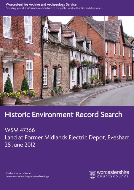
WSM 47366<br />
Land at Former Midlands Electric Depot, Evesham<br />
28 June 2012<br />
Find out more online at<br />
www.worcestershire.gov.uk/archaeology<br />
0
<strong>Historic</strong> <strong>Environment</strong> <strong>Record</strong><br />
<strong>Search</strong><br />
Author: Overton, D<br />
Date of Issue: 28-06-12<br />
Contents:<br />
Information about the data sent to you<br />
An Archaeological Summary for the search area<br />
Modern Ordnance Survey map(s) with HER data and, where requested, historic<br />
mapping of the search area.<br />
The HER short report<br />
The HER full reports for each HER record<br />
The HER search results are valid for 3 months from the date of issue as the HER is<br />
being updated with new sites of archaeological importance. Please note that<br />
searches are tailored to suit the needs of the client and if these needs change<br />
significantly, you will need to contact us again.<br />
The Worcestershire Archive and Archaeology<br />
Service is a Registered Organisation with the<br />
Institute for Archaeologists.<br />
1
An <strong>Historic</strong> <strong>Environment</strong> <strong>Record</strong> <strong>Search</strong> for Land at Midland<br />
Electric Depot, Evesham<br />
Introduction<br />
The <strong>Historic</strong> <strong>Environment</strong> <strong>Record</strong> for Worcestershire is held in a GIS (Geographical Information<br />
System). This is a computer system designed to allow users to collect, manage and analyse large<br />
volumes of spatially referenced information and associated attribute data. When you request<br />
information from us on a particular area, we carry out a spatial search on a grid reference (or a<br />
specific area) supplied by you, which will bring up all the records within that area. Unless<br />
otherwise requested, the search radius will be restricted to everything within 500m of the centre<br />
point of the proposed investigation (or a 250m buffer along pipelines).<br />
If you are conducting research it must be remembered that the results of an HER search are<br />
designed to be a starting point, not a complete record. The sources mentioned in the full reports<br />
should be consulted in order to fully understand the nature of the archaeology in your search<br />
area. We strongly recommend that you come to visit the HER once you have received your search<br />
results to consult all the sources mentioned along with other more general information that we<br />
hold. The majority of the grey literature reports can now be accessed online at<br />
www.worcestershire.gov.uk/archaeology/library, other sources may need to be consulted at the<br />
HER offices.<br />
If your site is within, or close to, one of the ‘Central Marches <strong>Historic</strong> Towns’, you should consult<br />
the CMHTS report for that town. These can be found at<br />
www.worcestershire.gov.uk/archaeology/library and relate to the following towns: Alvechurch,<br />
Bewdley & Wribbenhall, Broadway, Bromsgrove, Clifton-Upon-Teme, Droitwich, Evesham &<br />
Bengeworth, Kidderminster, Pershore, Redditch, Stourport-on-Severn, Tenbury Wells and Upton-<br />
Upon-Severn.<br />
If your search area includes a <strong>Historic</strong> Farmstead or Outfarm, as identified by English Heritage's<br />
'<strong>Historic</strong> Farmsteads Project', you should consult the current project publications, including the<br />
County summary, online at http://www.englishheritage.org.uk/professional/research/landscapes-and-areas/characterisation/West-Midlands-<br />
Farmsteads-Landscapes-Project.<br />
If the search has been requested prior to development, you may need to consult the <strong>Historic</strong><br />
<strong>Environment</strong> Planning Officer (HEPO) to see how your proposal would affect the archaeology.<br />
When you request a search as part of the planning process, a copy is also sent to the HEPO (in<br />
confidence) so that he/she can determine the level and type of archaeological mitigation<br />
required, if any. If any aspect of the development changes after this point, particularly alterations<br />
to groundworks on pipeline schemes, then the HEPO MUST be informed.<br />
The HER search results will remain valid for 3 months only from the date of production, because<br />
the HER is constantly being updated as new sites of archaeological importance are identified. It<br />
should also be noted that searches are tailored to suit the needs of the client and if these needs<br />
change significantly, you may need to contact us again. Another important point to note is that an<br />
absence of archaeological sites in a particular area should not necessarily be interpreted as an<br />
absence of archaeology. It may be that surviving archaeology has not been identified in the HER<br />
for a number of reasons. If it is thought likely that archaeology could exist in such an area, then<br />
the HER team or the HEPO will inform you of this.<br />
Guidelines for Access<br />
The HER was set up as a planning tool 30 years ago and contained the minimum level of data.<br />
Since then the records have been added to and enhanced over the years as more information has<br />
come to light. The records, therefore, vary greatly in their detail and accuracy. We are constantly<br />
2
updating and improving these records, however, they are compiled from a range of sources of<br />
varying quality and the information they contain should not be seen as definitive. We cannot<br />
accept responsibility for the accuracy of any information supplied and the user must accept that<br />
information may be outdated or inaccurate.<br />
We ask that all users provide us with any new information that they obtain during the course of<br />
their research. Where further archaeological work is required as part of the planning process, we<br />
ask that the contractor/developer provide us with a digital copy and one hard copy of the<br />
resulting report within six months of its completion. Briefs written by the HEPO after 01/10/2007<br />
now require a digital copy to be submitted to the HER. Our preferred format for digital copies is<br />
pdf, however, we are happy to take other formats, from which we will create pdfs. All reports<br />
submitted as part of the development control process will<br />
3<br />
be included on our Online<br />
Archaeology Library 3 months after submission unless the report is deemed to be archaeologically<br />
or commercially sensitive by the Archive and Archaeology Service Manager.<br />
We will provide details of Scheduled Ancient Monuments, along with maps showing their<br />
locations. The boundaries shown on our maps are intended to be a guide only and the precise<br />
location of any SAM must be obtained from English Heritage. It should also be noted that work<br />
cannot be carried out within the boundary of a Scheduled Ancient Monument without consent<br />
from English Heritage. This includes non-intrusive work such as geophysical surveys and field<br />
walking.<br />
When information is provided in advance of metal detecting, the detectorist must agree to report<br />
detailed information for all finds, including an eight or ten figure grid reference, to the Portable<br />
Antiquities Scheme (via Angie Bolton, Finds Liaison Officer for Worcestershire and Warwickshire<br />
on 01905 721130 or abolton@worcester.gov.uk)<br />
Copyright<br />
The sources referenced in the HER records may require permission from the copyright holder for<br />
reproduction. The copyright holder is usually a third party, not the HER. In these instances, the<br />
onus is on you to obtain permission for reproduction from the relevant person(s). The HER<br />
accepts no responsibility for any user making unauthorized copies of such documents. In some<br />
instances the HER has been granted permission by the copyright holder to give out a copy of a<br />
source for reference only. In these instances, you must not copy, pass on or publish that source<br />
without permission from the copyright holder.<br />
If Ordnance Survey maps are included in this report, then they are for reference only and require<br />
copyright permission from The Ordnance Survey for any reproduction.<br />
Planning Policy<br />
National Planning Policy Framework (NPPF) was published in 2012. It sets out the Government's<br />
planning policies, including those on the conservation of the historic environment. It replaces<br />
Planning Policy Statement 5: Planning for the <strong>Historic</strong> <strong>Environment</strong> (PPS5), which was published in<br />
2010.<br />
If your search is in advance of a planning application, you may be required to describe the<br />
significance of any heritage assets affected, including the contribution made by their setting, in<br />
accordance Paragraph 128 of NPPF and the Local Authority's Local Plan. The Archaeological<br />
Summary below and the sources mentioned in the HER records should be taken into<br />
consideration when detailing the significance of the heritage assets. The Archaeological Summary<br />
does not consider the effects of any specific development on the historic environment, it lays out<br />
the archaeological survival, significance and potential. The statement submitted with a planning<br />
application would also need to consider the effects of your proposed development on the<br />
historic environment.
The HER data<br />
This document contains two types of report:<br />
1) The Single Line or Short Report – this provides the basic information: the WSM Number, the<br />
Name/Title of the <strong>Record</strong>, the monument type, the date range and finally the National Grid<br />
Reference (the WSM number is the unique number given to each record within the HER).<br />
2) The Full Report – this provides the above information plus a more detailed description of<br />
the monument/site/find/fieldwork etc. It also contains the sources and references that<br />
the record is based upon and gives its relationship (if any) to other associated sites. A ‘full’<br />
report is not definitive and all sources mentioned should be consulted to gain a full<br />
understanding of the record.<br />
This report also contains the location of the records on maps (unless you have requested GIS data<br />
in a shape file, which will be sent in an email with this report). Where appropriate/requested we<br />
will also include historical maps.<br />
1) GIS Shape Files<br />
We can provide site location data as shape files for use with your own GIS system. This is the<br />
best way of sending and receiving complex spatial information. We send this out by email.<br />
In built up areas where there are a large number of records, the data will be sent out in several<br />
files. We will provide site location data as individually themed shape files for each type of<br />
record. This will allow you to switch on each HER archaeological theme independently and is<br />
most appropriate for use by our customers whose projects are located in areas of intense<br />
archaeological activity, where there is more likely to be a need to discreetly interrogate the<br />
data and examine spatial relationships.<br />
2) pdf Maps<br />
If you do not have a GIS, location maps will be included in this report. The clarity of these<br />
maps is not perfect, but they are clear enough to distinguish all the site locations - especially if<br />
you zoom in.<br />
The maps will show the location of all the sites in the report, labelled with the WSM number.<br />
Please note: The labels only give the approximate location of the sites and monuments. The<br />
reason for this is that if there is more than one record for a location or there are lots of sites<br />
in close proximity – i.e. on a street of historic houses – then the labels overlie each other and<br />
cannot be read. We, therefore, move or adjust the labels very slightly to make them easier to<br />
see. To get the precise location you must use the grid reference.<br />
The HER is set up with a number of themes or layers. Each theme contains a different type of<br />
record e.g. <strong>Historic</strong> Buildings or Excavations. This allows us to switch the various themes on<br />
and off to look at different types of record separately. The various themes are colour coded<br />
to make them easily identifiable (see the key on the maps).<br />
3) <strong>Historic</strong> Maps<br />
We can also supply copies of Landmark Digital mapping based on 1 st , 2 nd , 3 rd and 4 th Edition<br />
Ordnance Survey maps. These are drawn from several maps and are referred to as Epochs not<br />
Editions. It is important to note that Copyright restrictions mean that they must not be used<br />
in any report and are for research purposes only. If you have requested these they will be<br />
included below.<br />
4
Archaeological Summary for Land at Midland Electricity Depot<br />
Evesham.<br />
An HER search was carried out on a 500m radius of grid reference 403591, 244762 on the 28 June 2012.<br />
The search area contains 26 HER records including 9 monuments and 7 buildings, three of which were<br />
listed buildings. There were two archaeological events and five parish records. The recently completed<br />
historic farmstead project identified a single out farm within the vicinity.<br />
Summary: Evesham lies in a meander of the River Avon and the underlying geology consists of sand<br />
and gravel terraces on either side of the river with clayey alluvial soils above. The areas outside of the<br />
town are intensively farmed and associated with fertile, free draining soils which give rise to high<br />
quality agricultural land used for growing a wide variety of crop.<br />
The town of Evesham grew up around the Minster, which was established circa 700, possibly on the<br />
site of an old church based on writings in the early 12th century. There is no historical evidence of the<br />
settlement prior to this date. Evesham is a planned medieval town and evidence of this still survives in<br />
the historic core. The town has expanded over the last century and much of the landscape is<br />
characterised by 20th century semi-detached housing.<br />
The historic core of Evesham contains buried archaeological deposits, and these are judged to have<br />
high potential. In addition there is high potential for the recovery of artefact and ecofact assemblages.<br />
The historic and Listed buildings constitute a coherent body of evidence, but are not numerous for<br />
early periods, and are judged to have moderate potential for detailed study and recording. The<br />
surviving documentary sources are moderate in quantity for the medieval period, but are numerous<br />
for the later post-medieval period.<br />
Outside of the residential suburbs the landscape is characterised by small nucleated settlements,<br />
linked by a network of medieval or earlier roads. These are set in a landscape derived from vast<br />
expanses of former open fields, which have remained under intensive cultivation following their<br />
enclosure. Market gardening and orchards are strong features of this area, particularly close to the<br />
villages. This zone is characterised by the abundance of crop marks relating to prehistoric and<br />
Romano-British settlement, a number of which are Scheduled Monuments. The crop marks show<br />
evidence of a former prehistoric landscape of isolated farmsteads and small hamlets, settled within a<br />
network of track ways and small enclosed fields.<br />
Statutory and other Designations<br />
Scheduled Ancient Monuments<br />
Scheduled monuments are those considered to be monuments of national importance. The<br />
Ancient Monuments and Archaeological Areas Act 1979, supports a formal system of Scheduled<br />
Monument Consent (SMC) for any work to a designated monument. Any works within a<br />
Scheduled area will require SMC, this includes non-invasive techniques such as geophysics or fieldwalking.<br />
There are no Scheduled areas within the search area.*<br />
Listed Buildings<br />
The Secretary of State for Culture, Media and Sport holds a List of Buildings of Special<br />
Architectural or <strong>Historic</strong> Interest, considered to be of national importance. Compiled under the<br />
Planning (Listed Buildings and Conservation Areas) Act 1990, the List includes structures from<br />
boundary walls and telephone boxes to cathedrals. Listing gives statutory protection and<br />
restrictions apply. Consent may be required for works to, or that affect the setting of, a Listed<br />
Building and the LPA conservation officer should be consulted if in doubt. There are 3 Listed<br />
Buildings within the search area, none of which are inside the development area.*<br />
Conservation Areas<br />
A Conservation Area is an area considered worthy of preservation or enhancement because of its<br />
special architectural or historic interest, "the character or appearance of which it is desirable to<br />
5
preserve or enhance," as required by the Planning (Listed Buildings and Conservation Areas) Act<br />
1990 (Section 69 and 70). There are additional planning controls over certain works carried out<br />
within the Conservation Area. The designation does not preclude development from taking place,<br />
but does require that developments preserve or enhance the historic character of the area, for<br />
example by ensuring that newly constructed buildings are of a high quality design. Conservation<br />
Area status also removes some permitted development rights that apply in undesignated areas.<br />
There is one Conservation Areas within the search area, covering the historic core of Evesham.*<br />
Registered Parks and Gardens<br />
English Heritage holds a Register of <strong>Historic</strong> Parks and Gardens of Special <strong>Historic</strong> Interest. These<br />
Registered landscapes are graded I, II* or II, and include private gardens, public parks and other<br />
green spaces. They are valued for their design, diversity and historical importance. Inclusion on the<br />
Register brings no additional statutory controls, but there is a presumption in favour of<br />
conservation of the designated site. Local authorities are required to consult English Heritage on<br />
applications affecting sites Registered as grade I or II* and the Garden History Society on sites of<br />
all grades. There are no Registered Parks within the search area.*<br />
Registered Battlefields<br />
There are two Registered Battlefields in Worcestershire, The Battle of Evesham and The Battle of<br />
Worcester. Unlike Listed Buildings and the Register of Parks and Gardens, Registered Battlefields<br />
are not currently graded as a means of ascribing relative significance. They do not carry any<br />
statutory designation, but there is a presumption in favour of preservation. There is one<br />
Registered Battlefields within the search area. The site of the Battle of Evesham.*<br />
Locally Listed <strong>Historic</strong> Buildings<br />
Worcester City, Redditch Borough and Wyre Forest <strong>District</strong> have a Schedule of Buildings of Local<br />
Interest in Worcestershire. These are buildings that are not of national importance, and therefore<br />
not Listed, but are considered to be of local or regional importance and make a significant<br />
contribution to the historic environment character of an area. They do not carry any statutory<br />
designation, but local policies make it clear that retention of these structures is important to the<br />
historic environment. There are no locally listed buildings within the search area.<br />
* Heritage Assets are designated by English Heritage. It is possible that the HER is out of date. EH<br />
(or the LPA as appropriate) should be consulted for confirmation of designated status.<br />
NB. Other statutory designations may apply to your site, such as SSSI status. The HER does not<br />
keep a record of such designations and the onus is on the client to ascertain whether any further<br />
restrictions might apply.<br />
6
Glossary of commonly used terms<br />
AS: The unique number given to each aerial photograph referenced in the HER<br />
Cropmarks: The visible effect of arable crops caused by the presence of below ground historic<br />
environment features<br />
HER: <strong>Historic</strong> <strong>Environment</strong> <strong>Record</strong><br />
Monument: an archaeological site either showing as visible remains on the ground or a below<br />
ground site revealed by, for example, aerial photography or geophysical survey<br />
Planning Policy Statement 5 (PPS5): provides a full statement of Government policies for the<br />
identification and protection of historic buildings, conservation areas, archaeological remains and<br />
other elements of the historic environment<br />
Palaeochannels: ancient silted up river channels, or other watercourses that are often associated<br />
with well-preserved organic remains and historic environment features<br />
Palaeo-environmental: Organic remains associated with past landscapes. Such deposits can reveal<br />
information about climate, the types of fauna and flora in a landscape and past human activity<br />
Ridge and furrow: large-scale earthworks associated with former medieval and post-medieval<br />
open-field communal farming that appear as a distinctive corrugated surface<br />
WCC: Worcestershire County <strong>Council</strong><br />
WR: The unique number given to each report, document, map etc<br />
WSM: The unique number given to each monument, building and archaeological event recorded<br />
in the HER.<br />
General periods in the HER<br />
The beginning and end of certain periods is a contentious issue. In the HER, the following dates<br />
are used. This is a standard convention across all HERs.<br />
Palaeolithic -500000BC to -10001BC<br />
Mesolithic -10000BC to -4001BC<br />
Neolithic -4000BC to -2351BC<br />
Bronze Age -2350BC to -801BC<br />
Iron Age -800BC to 42AD<br />
Romano-British 43AD to 409AD<br />
Post-roman (Early medieval) 410AD to 1065AD<br />
Medieval 1066AD to 1539AD<br />
Post- medieval 1540AD to 1900AD<br />
Modern 1901AD to 2050AD<br />
7
Modern and <strong>Historic</strong> Mapping<br />
1. 1886 1st Edition Ordnance Survey, © Crown Copyright.<br />
2. 1904 2nd Edition Ordnance Survey, © Crown Copyright.<br />
3. 1923-27 3rd Edition Ordnance Survey, © Crown Copyright.<br />
4. 1938 4th Edition Ordnance Survey, © Crown Copyright.<br />
5. Modern Ordnance Survey map showing HER features: Buildings and Monuments, © Crown<br />
Copyright.<br />
6. Modern Ordnance Survey map showing HER features: Archaeological Events, © Crown<br />
Copyright.<br />
7. Modern Ordnance Survey map showing HER features: Archaeological Designations and<br />
Farmsteads, © Crown Copyright.<br />
8
245000 .000000<br />
244500 .000000<br />
403000 .000000<br />
For Reference purposes only<br />
No further copies may be made<br />
© Crown Copyright and Landmark Information Group Ltd<br />
(all rights reserved LM000371)<br />
403000 .000000<br />
Archive and Archaeology Service<br />
<strong>Historic</strong> <strong>Environment</strong> <strong>Record</strong><br />
403500 .000000<br />
403500 .000000<br />
Former Midland Electricty Depot Evesham<br />
1st Edition OS Map<br />
404000 .000000<br />
404000 .000000<br />
© Crown copyright and database rights<br />
1:5,000<br />
2011 Ordnance Survey 100024230. when printed on A3<br />
Landmark digital mapping based on Ordnance Survey 1st edition, 1886<br />
(Landmark reference number 39sp0344. Original scale: 25" (1:2500))<br />
0 100 200 400<br />
Metres<br />
°<br />
Map produced 28-06-12<br />
Information valid for three months<br />
from date of production<br />
404500 .000000<br />
404500 .000000<br />
The Hive, Sawmill Walk, The Butts,<br />
Worcester. WR1 3TD<br />
Telephone: 01905 765560<br />
245000 .000000<br />
244500 .000000
245000 .000000<br />
244500 .000000<br />
403000 .000000<br />
For Reference purposes only<br />
No further copies may be made<br />
© Crown Copyright and Landmark Information Group Ltd<br />
(all rights reserved LM000371)<br />
403000 .000000<br />
Archive and Archaeology Service<br />
<strong>Historic</strong> <strong>Environment</strong> <strong>Record</strong><br />
403500 .000000<br />
403500 .000000<br />
Former Midland Electricty Depot Evesham<br />
2nd Edition OS Map<br />
404000 .000000<br />
404000 .000000<br />
© Crown copyright and database rights<br />
1:5,000<br />
2011 Ordnance Survey 100024230. when printed on A3<br />
Landmark digital mapping based on Ordnance Survey 2nd edition, 1904<br />
(Landmark reference number 39sp0344. Original scale: 25" (1:2500))<br />
0 100 200 400<br />
Metres<br />
°<br />
Map produced 28-06-12<br />
Information valid for three months<br />
from date of production<br />
404500 .000000<br />
404500 .000000<br />
The Hive, Sawmill Walk, The Butts,<br />
Worcester. WR1 3TD<br />
Telephone: 01905 765560<br />
245000 .000000<br />
244500 .000000
245000 .000000<br />
244500 .000000<br />
403000 .000000<br />
For Reference purposes only<br />
No further copies may be made<br />
© Crown Copyright and Landmark Information Group Ltd<br />
(all rights reserved LM000371)<br />
403000 .000000<br />
Archive and Archaeology Service<br />
<strong>Historic</strong> <strong>Environment</strong> <strong>Record</strong><br />
© Crown copyright and database rights<br />
1:5,000<br />
2011 Ordnance Survey 100024230. when printed on A3<br />
0 100 200 400<br />
Metres<br />
403500 .000000<br />
403500 .000000<br />
Former Midland Electricty Depot Evesham<br />
3rd Edition OS Map<br />
404000 .000000<br />
404000 .000000<br />
Landmark digital mapping based on Ordnance Survey ,<br />
°<br />
(Landmark reference number 39sp0344. Original scale: 25" (1:2500))<br />
Map produced 28-06-12<br />
Information valid for three months<br />
from date of production<br />
404500 .000000<br />
404500 .000000<br />
The Hive, Sawmill Walk, The Butts,<br />
Worcester. WR1 3TD<br />
Telephone: 01905 765560<br />
245000 .000000<br />
244500 .000000
245000 .000000<br />
244500 .000000<br />
403000 .000000<br />
For Reference purposes only<br />
No further copies may be made<br />
© Crown Copyright and Landmark Information Group Ltd<br />
(all rights reserved LM000371)<br />
403000 .000000<br />
Archive and Archaeology Service<br />
<strong>Historic</strong> <strong>Environment</strong> <strong>Record</strong><br />
403500 .000000<br />
403500 .000000<br />
Former Midland Electricty Depot Evesham<br />
4th Edition OS Map dated 1938<br />
404000 .000000<br />
404000 .000000<br />
© Crown copyright and database rights<br />
2011 Ordnance Survey 100024230.<br />
1:5,000<br />
when printed on A3<br />
Landmark digital mapping based on Ordnance Survey 4th Edition OS Map, Date 1938<br />
(Landmark reference number 39sp0344. Original scale: 25" (1:2500))<br />
0 100 200 400<br />
Metres<br />
°<br />
Map produced 28-06-12<br />
Information valid for three months<br />
from date of production<br />
404500 .000000<br />
404500 .000000<br />
The Hive, Sawmill Walk, The Butts,<br />
Worcester. WR1 3TD<br />
Telephone: 01905 765560<br />
245000 .000000<br />
244500 .000000
245000 .000000<br />
244500 .000000<br />
WSM31671<br />
<strong>Search</strong> Area<br />
WSM36949<br />
Buildings (poly)<br />
Monuments (poly)<br />
© Crown copyright and database rights<br />
2011 Ordnance Survey 100024230.<br />
403000 .000000<br />
WSM31664<br />
WSM02230<br />
403000 .000000<br />
Archive and Archaeology Service<br />
<strong>Historic</strong> <strong>Environment</strong> <strong>Record</strong><br />
WSM24946<br />
WSM33709<br />
403500 .000000<br />
403500 .000000<br />
1:5,000<br />
when printed on A3<br />
0 100 200 400<br />
Metres<br />
HER search: Land at former Midlands Electricty<br />
Depot, Evesham<br />
HER records Monuments and Buildings<br />
WSM04386<br />
404000 .000000<br />
404000 .000000<br />
WSM23056<br />
WSM27286<br />
°<br />
WSM44135<br />
WSM42376<br />
28-06-2012<br />
Information valid for three months<br />
from date of production<br />
WSM31670<br />
WSM27285<br />
WSM27284<br />
WSM32531<br />
WSM27283<br />
404500 .000000<br />
404500 .000000<br />
The Hive, Sawmill Walk, The Butts,<br />
Worcester. WR1 3TD<br />
Telephone: 01905 765560<br />
245000 .000000<br />
244500 .000000
245000 .000000<br />
244500 .000000<br />
<strong>Search</strong> Area<br />
Events<br />
© Crown copyright and database rights<br />
2011 Ordnance Survey 100024230.<br />
403000 .000000<br />
403000 .000000<br />
Archive and Archaeology Service<br />
<strong>Historic</strong> <strong>Environment</strong> <strong>Record</strong><br />
403500 .000000<br />
403500 .000000<br />
1:5,000<br />
when printed on A3<br />
0 100 200 400<br />
Metres<br />
HER search: Land at former Midlands Electricty<br />
Depot, Evesham<br />
HER Events<br />
404000 .000000<br />
404000 .000000<br />
°<br />
28-06-2012<br />
Information valid for three months<br />
from date of production<br />
WSM43231<br />
WSM47365<br />
404500 .000000<br />
404500 .000000<br />
The Hive, Sawmill Walk, The Butts,<br />
Worcester. WR1 3TD<br />
Telephone: 01905 765560<br />
245000 .000000<br />
244500 .000000
245000 .000000<br />
244500 .000000<br />
Field Barns north of Valley Preserve Works<br />
<strong>Search</strong> Area<br />
403000 .000000<br />
Registered Battlefields (poly)<br />
Conservation Areas<br />
! English Heritage Listed Building<br />
© Crown copyright and database rights<br />
2011 Ordnance Survey 100024230.<br />
403000 .000000<br />
Archive and Archaeology Service<br />
<strong>Historic</strong> <strong>Environment</strong> <strong>Record</strong><br />
403500 .000000<br />
!<br />
403500 .000000<br />
1000010<br />
1:5,000<br />
when printed on A3<br />
0 100 200 400<br />
Metres<br />
HER search: Land at former Midlands Electricty<br />
Depot, Evesham<br />
Archaeological Designations and <strong>Historic</strong> Farmsteads<br />
!<br />
!<br />
404000 .000000<br />
!<br />
404000 .000000<br />
1095961<br />
1156276<br />
1081387<br />
°<br />
28-06-2012<br />
Information valid for three months<br />
from date of production<br />
404500 .000000<br />
404500 .000000<br />
The Hive, Sawmill Walk, The Butts,<br />
Worcester. WR1 3TD<br />
Telephone: 01905 765560<br />
245000 .000000<br />
244500 .000000
Worcestershire Archive and Archaeology Service<br />
Monument List Report<br />
HER search: Land at former Midlands Electricty Depot, Evesham<br />
28/06/2012 Number of records: 21<br />
Ref Site Name Monument Types<br />
Parish<br />
Building<br />
WSM24946 Ethland, Worcester Road, Evesham Lodge (POST MEDIEVAL to 21ST CENTURY AD -<br />
1540 AD to 2050 AD)<br />
Evesham<br />
WSM27284 Greenhill Garage, Greenhill, Evesham Garage (20TH CENTURY AD to 21ST CENTURY AD -<br />
1927 AD to 2050 AD)<br />
Munitions Factory (World War Two - 1939 AD to 1945<br />
AD)<br />
Evesham<br />
WSM27285 Greenhill Hotel, Greenhill, Evesham House (18TH CENTURY AD to 19TH CENTURY AD -<br />
1775 AD to 1900 AD)<br />
Hotel (20TH CENTURY AD - 1901 AD to 1989 AD)<br />
Hostel (World War Two - 1939 AD to 1945 AD)<br />
Recreation Centre (World War Two - 1939 AD to 1945<br />
AD)<br />
Apartment (20TH CENTURY AD to 21ST CENTURY<br />
AD - 1990 AD to 2050 AD)<br />
Evesham<br />
Report generated by HBSMR from exeGesIS SDM Ltd<br />
Report prepared by Worcestershire HER, tel: 01905 765560 or<br />
email archaeology@worcestershire.gov.uk. Information is valid<br />
for three months from date of production.<br />
Grid Reference<br />
SP 0334 4513<br />
SP 0377 4451<br />
SP 0390 4468<br />
Page 1
Ref Site Name Monument Types<br />
Parish<br />
Grid Reference<br />
WSM31664 Oxford, Worcester and Wolverhampton Railway (19TH CENTURY AD to 21ST CENTURY AD - Aldington, SO 9264 6123<br />
Railway<br />
1854 AD to 2050 AD)<br />
Bretforton,<br />
Charlton,<br />
Churchill and<br />
Blakedown, Clent,<br />
Cropthorne,<br />
Drakes Broughton<br />
and Wadborough,<br />
Droitwich Spa,<br />
Elmbridge, Elmley<br />
Lovett, Evesham,<br />
Fladbury, Hagley,<br />
Hampton Lovett,<br />
Hartlebury, Hill<br />
and Moor,<br />
Honeybourne,<br />
Kidderminster,<br />
Martin<br />
Hussingtree,<br />
North Claines,<br />
Norton juxta<br />
Kempsey,<br />
Offenham,<br />
Pershore, Pinvin,<br />
Salwarpe, South<br />
Littleton, St Peter<br />
the Great County,<br />
Stoulton,<br />
Whittington,<br />
Worcester (Non<br />
Civil Parish),<br />
Wyre Piddle<br />
WSM32531 Railway Station, Evesham Railway Station (POST MEDIEVAL to 21ST CENTURY<br />
AD - 1540 AD to 2050 AD)<br />
Evesham SP 0370 4445<br />
WSM42376 Green Hill Grammer School, Greenhill, Grammar School (19TH CENTURY AD to 21ST<br />
Evesham SP 0397 4493<br />
Evesham<br />
CENTURY AD - 1830 AD to 2050 AD)<br />
WSM44135<br />
Monument<br />
70 Greenhill, Evesham House (19TH CENTURY AD to 21ST CENTURY AD -<br />
1830 AD to 2050 AD)<br />
Evesham SP 0394 4500<br />
WSM02230 Civil War Defences, Evesham Defence (17TH CENTURY AD - 1601 AD to 1700 AD) Evesham SP 0369 4425<br />
Report generated by HBSMR from exeGesIS SDM Ltd<br />
Page 2
Ref Site Name Monument Types<br />
Parish<br />
Grid Reference<br />
WSM04386 Site of the Battle of Evesham 1265 Battlefield (13TH CENTURY AD - 1265 AD)<br />
Holy Well (13TH CENTURY AD to 21ST CENTURY<br />
AD - 1266 AD to 2050 AD)<br />
Chapel (13TH CENTURY AD to 16TH CENTURY AD -<br />
1297 AD to 1539 AD)<br />
Evesham SP 0393 4526<br />
WSM23056 Former Smithfield Cattle Market, Cattle Market (19TH CENTURY AD to 20TH CENTURY Evesham SP 0383 4430<br />
Evesham<br />
AD - 1850 AD to 1995 AD)<br />
Military Residence (World War Two - 1939 AD to 1945<br />
AD)<br />
WSM27283 Spigot Mortar Emplacement, former Spigot Mortar Emplacement (World War Two - 1939 AD Evesham SP 0375 4434<br />
council yard, High Street, Evesham to 1945 AD)<br />
WSM27286 Ornamental Pool, Pool House, Greenhill, Pool (19TH CENTURY AD to 21ST CENTURY AD - Evesham SP 0391 4505<br />
Evesham<br />
1801 AD to 2050 AD)<br />
WSM31670 Railway (disused) - Salford Priors to Railway (19TH CENTURY AD to 21ST CENTURY AD - Cleeve Prior, SP 0564 4764<br />
Evesham - Section BEA/3<br />
1840 AD to 2050 AD)<br />
Evesham,<br />
Harvington,<br />
Norton and<br />
Lenchwick<br />
WSM31671 Site of Midland Railway Line between Railway (19TH CENTURY AD to 20TH CENTURY AD - Ashton under Hill, SP 0058 3929<br />
Ashchurch and Evesham.<br />
1860 AD to 1963 AD)<br />
Beckford,<br />
Evesham, Hinton<br />
on the Green,<br />
Sedgeberrow, Out<br />
of county<br />
WSM33709 Approximate Site of Iron-Age<br />
Occupation Site (EARLY IRON AGE - 800 BC to 401 Evesham SP 0367 4418<br />
Occupation, Evesham<br />
BC)<br />
WSM36949 Site of Railway Bridge (Midland Railway),<br />
River Avon, Evesham<br />
Evesham SP 0317 4463<br />
General Parish Info<br />
WSM21048 Unlocated Unstratified Finds from the Event (IRON AGE - 800 BC to 42 AD)<br />
Evesham SP 0374 4338<br />
Parish of Evesham<br />
Event (ROMAN - 43 AD to 410 AD)<br />
Event (17TH CENTURY AD - 1601 AD to 1700 AD)<br />
WSM32194 <strong>Record</strong> for general aerial photographs of<br />
the Parish of Evesham<br />
Event (MEDIEVAL - 1066 AD to 1539 AD)<br />
Evesham SP 0374 4338<br />
Report generated by HBSMR from exeGesIS SDM Ltd<br />
Page 3
Ref Site Name Monument Types<br />
Parish<br />
WSM37177 World War 2 Bombing Incidents in<br />
Worcestershire; Parish of Evesham<br />
Bomb Site (World War Two - 1939 AD to 1945 AD) Evesham<br />
WSM38650 Parish of Evesham, Portable Antiquities Event (IRON AGE - 800 BC to 42 AD)<br />
Evesham<br />
Scheme<br />
Event (ROMAN - 43 AD to 410 AD)<br />
Event (EARLY MEDIEVAL - 411 AD to 1065 AD)<br />
Event (MEDIEVAL - 1066 AD to 1539 AD)<br />
Event (POST MEDIEVAL - 1540 AD to 1900 AD)<br />
WSM39379 General Information for the Parish of Event (MEDIEVAL - 1066 AD to 1539 AD)<br />
Evesham<br />
Evesham<br />
Ridge And Furrow (LATE 11TH CENTURY AD to 19TH<br />
CENTURY AD - 1066 AD to 1900 AD)<br />
Event (POST MEDIEVAL - 1540 AD to 1900 AD)<br />
Report generated by HBSMR from exeGesIS SDM Ltd<br />
Grid Reference<br />
SP 0374 4338<br />
SP 0374 4338<br />
SP 0374 4338<br />
Page 4
Worcestershire Archive and Archaeology Service<br />
Event Short Report<br />
HER search: Land at the former Midlands Electricity Depot, Evesham<br />
28/06/2012 Number of records: 2<br />
Event no. Event Name Event Type<br />
Organisation<br />
WSM43231 Ongoing Work - Building<br />
<strong>Record</strong>ing in 2010, Greenhill<br />
School, 66 Greenhill,<br />
Event - Survey<br />
WSM47365 St. Mary's R C Primary School,<br />
Evesham<br />
Event - Intervention<br />
Report generated by HBSMR from exeGesIS SDM Ltd<br />
Report prepared by Worcestershire HER. Tel<br />
01905 855494 or email<br />
archaeology@worcestershire.gov.uk.<br />
Information valid for three months from date of<br />
production.<br />
Date of work Grid Reference<br />
SP 0397 4493<br />
SP 0387 4423<br />
Page 1
Worcestershire HER Designation Summary Report<br />
28/06/2012<br />
HER search: Land at former Midlands Electricty Depot, Evesham<br />
DesigUID: DWR6159 Type: Registered Battlefields Status: Active<br />
Preferred Ref: 1000010<br />
Grade: Pre WWI<br />
Name: BATTLE OF EVESHAM<br />
Legal Description<br />
NGR:<br />
#Error<br />
Centroid SP 0393 4531 (MBR: 1667m by 1589m)<br />
WSM04386<br />
Monument: Site of the Battle of Evesham 1265<br />
DesignationSummaryRpt Report generated by HBSMR from exeGesIS SDM Ltd<br />
Page 1
Worcestershire Archive and Archaeology Service<br />
Monument Full Report<br />
HER search: Land at former Midlands Electricty<br />
Depot, Evesham<br />
28/06/2012 Number of records: 21<br />
Report prepared by Worcestershire HER. Tel<br />
01905 765560 or email<br />
archaeology@worcestershire.gov.uk.<br />
Information valid for three months from date of<br />
production.<br />
HER Number Site Name<br />
<strong>Record</strong> Type<br />
WSM02230<br />
Civil War Defences, Evesham<br />
Monument<br />
Monument Types and Dates<br />
DEFENCE (17TH CENTURY AD - 1601 AD to 1700 AD)<br />
Evidence DOCUMENTARY EVIDENCE<br />
Description<br />
Probable line of the Civil War defensive ditch. The majority of this line is conjectural.[1]<br />
In much later times Evesham was occupied as a royal garrison during the civil wars, but was stormed and taken from the<br />
royalists by Col Massey on 26.5.1645.[2]<br />
Earthworks totally destroyed and the uncertain but suggested alignment was assumed to run along Inches Lane. [3]<br />
The ditch was found in February 2003 crossing Swan Lane. The ditch has been excavated at Swan Lane prior to<br />
development and found to be 1.65m deep from the current ground surface and V-shaped. [4]<br />
Sources<br />
(1) Personal Comment: White H A. Undated. Personal Comment by Hillary White. SMR. SWR1936<br />
(2) Bibliographic reference: 1911. Evesham and 4 shires N & Q.<br />
SWR4706<br />
(3) Bibliographic reference: William Page. 1906. A History of the County of<br />
Worcestershire.. Victoria County History. 382<br />
SWR2058<br />
(4*) Bibliographic reference: Martin H R. 2003. 45-47 Swan Lane, Evesham,<br />
Worcestershire - Post-Excavation Assessment and Research Design,. Birmingham<br />
Archaeology.<br />
SWR1874<br />
Location<br />
National Grid Reference<br />
SP 0369 4425 Sheet No. SP04SW<br />
Administrative Areas<br />
Civil Parish Evesham, <strong>Wychavon</strong>, Worcestershire<br />
Associated Designations - None <strong>Record</strong>ed<br />
Associated <strong>Historic</strong> Landscape Character <strong>Record</strong>s - None <strong>Record</strong>ed<br />
Related Monuments - None <strong>Record</strong>ed<br />
Associated Events/Activities<br />
Excavation in 2003 at 45 to 47 Swan Lane, Evesham (Event - Intervention. Ref: WSM33638)<br />
Report generated by HBSMR from exeGesIS SDM Ltd<br />
Page 1
HER Number<br />
WSM04386<br />
Report prepared by Worcestershire HER. Tel<br />
01905 765560 or email<br />
archaeology@worcestershire.gov.uk.<br />
Information valid for three months from date of<br />
production.<br />
HER Number Site Name<br />
<strong>Record</strong> Type<br />
WSM04386<br />
Site of the Battle of Evesham 1265<br />
Monument<br />
Monument Types and Dates<br />
BATTLEFIELD (13TH CENTURY AD - 1265 AD)<br />
Evidence CONJECTURAL EVIDENCE<br />
HOLY WELL (13TH CENTURY AD to 21ST CENTURY AD - 1266 AD to 2050 AD)<br />
Evidence STRUCTURE<br />
CHAPEL (13TH CENTURY AD to 16TH CENTURY AD - 1297 AD to 1539 AD)<br />
Evidence DOCUMENTARY EVIDENCE<br />
Description<br />
4.8.1265: Simon de Montfort killed in battle near Evesham (with 7500 troops)... fighting against Edward, son of Henry III.<br />
According to Evesham monks the year after the battle a spring of water was found on the site of the battle by Piers de<br />
Saltmarsh. Earl Simon's Well soon attracted pilgrims etc etc. At some time before 1346 and probably before 1297 a small<br />
chapel was built over the remains of some of the dead Montfortian leaders... by 1502 called Chapel of the Battle Well.[1]<br />
King Henry II in his efforts to subdue the reforms springing from the Provisions of Oxford of 1258, provoked a baronial faction<br />
led by Simon de Montfort, Earl of Leicester, to the extent that civil war was only a matter of time. The Battle of Lewes (1264)<br />
had ended with negotiation which gave Simon and the Barons increasing power, but the deciding factor in the struggle<br />
between reform and absolute monarchy had to wait until the Battle of Evesham in August 1265.<br />
On 4 August, Simon de Montfort's army of 6,000 men was trapped in Evesham by a Royal army of 8,000 under Prince<br />
Edward (the future Edward I) and the Earl of Gloucester. Simon had no choice but to fight his way out. He deployed his army<br />
as a single column and charged at the junction between Edward's and Gloucester's troops on Green Hill. It was a desperate<br />
tactic which might have succeeded had not the cavalry wings of the Royal army swung in on de Montfort's flanks. Although<br />
the Baronial army continued to resist for some hours, the battle became a progressively bloody massacre. Both Simon and<br />
his son Henry were killed, along with some 4,000 of his soldiers.<br />
Their field army had been destroyed, but nonetheless the surviving Barons still held their castles and the war against the King<br />
dragged on until 1267. Complete reconciliation came only in 1275, when the best elements of the Provisions of Oxford were<br />
encapsulated in the Statute of Westminster. Through the actions of de Montfort and the Barons, the die was cast for the role<br />
of Parliament as adviser to the monarch, a tradition which can be traced through to present times.[2]<br />
Booklets covering history of battle.[3] [9]<br />
Battlefields Register information from English Heritage.[4][5]<br />
Synopsis of pre and post reformation and also modern sources relating to the Battlwell.[6][7][8]<br />
Sources<br />
(1) Bibliographic reference: Cox, D.C.. 1988. The Battle of Evesham: a new account. SWR689<br />
(2) Guide: Not Known. 1995. Proposed Battlefields Register: Evesham 1265. English<br />
Heritage.<br />
SWR4473<br />
(3) Bibliographic reference: Butler Maureen. 2002. The Lost Abbey of Evesham. SWR2171<br />
(4*) List: English Heritage. 1995. English Heritage Battlefields Register: Evesham 1265.<br />
English Heritage.<br />
SWR3107<br />
(5*) Correspondence: Brown, D.A.. 1995. Correspondence regarding Register of <strong>Historic</strong> SWR6685<br />
Battlefields for Powick and Evesham. .<br />
(6*) List: Moreton, K.. 2009. A Synopsis of Pre-Reformation Sources for Battlewell Field,<br />
Evesham. Simon De Montfort Society.<br />
SWR12003<br />
(7*) List: Moreton, K.. 2009. A Synopsis of Post-Reformation Sources for Battlewell<br />
Field, Evesham. Simon De Montfort Society.<br />
SWR12015<br />
(8*) List: Moreton, K.. 2009. A Synopsis of Modern Sources for Battlewell Field,<br />
Evesham. Simon De Montfort Society.<br />
SWR12016<br />
Report generated by HBSMR from exeGesIS SDM Ltd<br />
Page 2
HER Number<br />
Location<br />
WSM04386<br />
National Grid Reference<br />
SP 0393 4526 Sheet No. SP04NW<br />
Administrative Areas<br />
Civil Parish Evesham, <strong>Wychavon</strong>, Worcestershire<br />
Associated Designations<br />
Registered Battlefields (Pre WWI) -<br />
1000010<br />
Associated <strong>Historic</strong> Landscape Character <strong>Record</strong>s - None <strong>Record</strong>ed<br />
Related Monuments - None <strong>Record</strong>ed<br />
Associated Events/Activities<br />
Report prepared by Worcestershire HER. Tel<br />
01905 765560 or email<br />
archaeology@worcestershire.gov.uk.<br />
Information valid for three months from date of<br />
production.<br />
(9*) Unpublished document: Carpenter, D, de Laborderie O and Madicott J R. Unknown. SWR16540<br />
The Last Hours of Simon de Montford. Evesham Simon de Montford Society.<br />
BATTLE OF EVESHAM Active DWR6159<br />
Geophysical Survey in 2008, Battlewell Field, Evesham (Event - Survey. Ref: WSM40617)<br />
Report generated by HBSMR from exeGesIS SDM Ltd<br />
Page 3
HER Number<br />
WSM21048<br />
Report prepared by Worcestershire HER. Tel<br />
01905 765560 or email<br />
archaeology@worcestershire.gov.uk.<br />
Information valid for three months from date of<br />
production.<br />
HER Number Site Name<br />
<strong>Record</strong> Type<br />
WSM21048<br />
Unlocated Unstratified Finds from the Parish of<br />
Evesham<br />
General Parish Info<br />
Monument Types and Dates<br />
EVENT (IRON AGE - 800 BC to 42 AD)<br />
Evidence FIND<br />
EVENT (ROMAN - 43 AD to 410 AD)<br />
Evidence UNSTRATIFIED FIND<br />
EVENT (17TH CENTURY AD - 1601 AD to 1700 AD)<br />
Evidence UNSTRATIFIED FIND<br />
Description<br />
Finds of flint leaf shaped arrowhead, William III half penny 1700; Charles I Rose Farthing 1635 - 1644; Tewkesbury,<br />
Gloucester, token of Samuel Jeenes [1]<br />
Unlocated find sublitted by Four Parishes Archaeology group Small limestone cube thought to have been found in vegetable<br />
garden at Hazloe Lane, Evesham. Probably a medieval chess piece (bishop or pawn). Usually wood or bone, a stone<br />
counter is unusual [2].<br />
Group of Roman pottery recovered from excavation of a "reservoir site" in Evesham. Located as part of an on-going WHEAS<br />
project P2898 [3]<br />
Hand collected assemblage by P.H.Roe. All 14 sherds were Roman with little abrasion, some being Samian ware. There<br />
were 6 sherds of Fabric 12, 2 sherds of Fabric 14, 1 sherd of Fabric 22, and 5 sherds of Fabric 43 [4].<br />
Romano-British pottery - possibly from an Iron-Age site found said to have been found near Knowle Hill. <strong>Record</strong> card<br />
contains pencil written note but no other information. Entry has been made but source of, and nature of, material not known<br />
[5].<br />
A find of a heavilly clipped silique (rather than a half silique) of an emporer of the later 4th century. Reverse: Roma seated<br />
left holding Victory on globe and reversed spear. Some of the various mints are shown with a relatively small head. Fine but<br />
for clipping. Found at Greenhill, Evesham [6].<br />
Gold Dobunnic coin of Bodvoc. Location given as SP0343. Found before 1960.[7]<br />
Two silver Dobunnic coins. Location given as SP0343. Found in 1938.[7]<br />
Silver Dobunnic coin. Location given as SP0343. Found in 1898.[7]<br />
Sources<br />
(1*) <strong>Record</strong> card: Booth, P. 1986. Warwickshire Museum Enquiry form. Warwickshire<br />
Museum Service.<br />
SWR2015<br />
(2*) <strong>Record</strong> card: Not Known. 2002. Finds Enquiry Form 10/02. WCCAS Ref 10/02. SWR979<br />
(3) Personal Comment: Jacobs, A. 2006. Location and identification of finds as part of<br />
"Unlocking the past: collections and HER enhancement" project funded by ASLF.<br />
WHEAS.<br />
SWR10270<br />
(4) Bibliographic reference: Jacobs, Alan. 2006. Finds from Unlocated Site at<br />
Evesham.. WHEAS.<br />
SWR3774<br />
(5) Personal Comment: Taylor, Neville. Various. Comments on Setting Up or Amending SWR4033<br />
<strong>Record</strong>. WHEAS.<br />
(6*) <strong>Record</strong> card: Seaby, W A. 1990. Warwickshire Museum Identification Service:<br />
Receipt 2158. Warwickshire Museum.<br />
SWR6187<br />
(7*) Bibliographic reference: de Jersey, Philip. 1994. Gazeteer of Find Spots of Dobunnic SWR351<br />
Coins. Oxford University Committee for Archaeology.<br />
Report generated by HBSMR from exeGesIS SDM Ltd<br />
Page 4
HER Number<br />
Location<br />
WSM21048<br />
National Grid Reference<br />
SP 0374 4338 Sheet No. SP04SW<br />
Administrative Areas<br />
Civil Parish Evesham, <strong>Wychavon</strong>, Worcestershire<br />
Associated Designations - None <strong>Record</strong>ed<br />
Associated <strong>Historic</strong> Landscape Character <strong>Record</strong>s - None <strong>Record</strong>ed<br />
Related Monuments - None <strong>Record</strong>ed<br />
Associated Events/Activities - None <strong>Record</strong>ed<br />
Report generated by HBSMR from exeGesIS SDM Ltd<br />
Report prepared by Worcestershire HER. Tel<br />
01905 765560 or email<br />
archaeology@worcestershire.gov.uk.<br />
Information valid for three months from date of<br />
production.<br />
Page 5
HER Number<br />
WSM23056<br />
WSM23056<br />
Report prepared by Worcestershire HER. Tel<br />
01905 765560 or email<br />
archaeology@worcestershire.gov.uk.<br />
Information valid for three months from date of<br />
production.<br />
HER Number Site Name<br />
<strong>Record</strong> Type<br />
Monument Types and Dates<br />
Site of former cattle market. The auction room was requisitioned during WWII as a billet for troops.[1][2]<br />
Sources<br />
Location<br />
National Grid Reference<br />
SP 0383 4430 Sheet No. SP04SW<br />
Administrative Areas<br />
Associated Designations - None <strong>Record</strong>ed<br />
Former Smithfield Cattle Market, Evesham<br />
Cattle Market (19TH CENTURY AD to 20TH CENTURY AD - 1850 AD to 1995 AD)<br />
Evidence CARTOGRAPHIC EVIDENCE<br />
MILITARY RESIDENCE (World War Two - 1939 AD to 1945 AD)<br />
Evidence DOCUMENTARY EVIDENCE<br />
Description<br />
Civil Parish Evesham, <strong>Wychavon</strong>, Worcestershire<br />
Associated <strong>Historic</strong> Landscape Character <strong>Record</strong>s - None <strong>Record</strong>ed<br />
Related Monuments - None <strong>Record</strong>ed<br />
Associated Events/Activities - None <strong>Record</strong>ed<br />
Monument<br />
(1) Map: Ordnance Survey. 2003. Digital 4th Edition OS Map (Original<br />
scale:25"(1:2500)). Landmark Digital.<br />
SWR9906<br />
(2*) <strong>Record</strong> card: Jones, C.D.. 2009. Defence of Worcestershire Project: Billet, Auction<br />
Room, Smithfield Market, High Street, Evesham. Defence of Worcestershire Project.<br />
SWR3619<br />
Report generated by HBSMR from exeGesIS SDM Ltd<br />
Page 6
HER Number<br />
WSM24946<br />
Report prepared by Worcestershire HER. Tel<br />
01905 765560 or email<br />
archaeology@worcestershire.gov.uk.<br />
Information valid for three months from date of<br />
production.<br />
HER Number Site Name<br />
<strong>Record</strong> Type<br />
WSM24946<br />
Ethland, Worcester Road, Evesham<br />
Building<br />
Monument Types and Dates<br />
LODGE (POST MEDIEVAL to 21ST CENTURY AD - 1540 AD to 2050 AD)<br />
Evidence BUILDING<br />
Description<br />
Unlisted house. Former lodge, south west of Abbey Manor Farm. [1]<br />
Shown on 1st Edition Ordnance Survey map. [2]<br />
Sources<br />
(1) Map: SMR Overlay SP04NW. SMR overlay.<br />
SWR3529<br />
(2) Map: Ordnance Survey. 2003. Digital 1st Edition OS Map (Original<br />
scale:25"(1:2500)). Landmark Digital .<br />
SWR9303<br />
Location<br />
National Grid Reference<br />
SP 0334 4513 Sheet No. SP04NW<br />
Administrative Areas<br />
Civil Parish Evesham, <strong>Wychavon</strong>, Worcestershire<br />
Associated Designations - None <strong>Record</strong>ed<br />
Associated <strong>Historic</strong> Landscape Character <strong>Record</strong>s - None <strong>Record</strong>ed<br />
Related Monuments - None <strong>Record</strong>ed<br />
Associated Events/Activities - None <strong>Record</strong>ed<br />
Report generated by HBSMR from exeGesIS SDM Ltd<br />
Page 7
HER Number<br />
WSM27283<br />
Report prepared by Worcestershire HER. Tel<br />
01905 765560 or email<br />
archaeology@worcestershire.gov.uk.<br />
Information valid for three months from date of<br />
production.<br />
HER Number Site Name<br />
<strong>Record</strong> Type<br />
WSM27283<br />
Spigot Mortar Emplacement, former council yard,<br />
High Street, Evesham<br />
Monument<br />
Monument Types and Dates<br />
SPIGOT MORTAR EMPLACEMENT (World War Two - 1939 AD to 1945 AD)<br />
Evidence DOCUMENTARY EVIDENCE<br />
Description<br />
A concrete spigot mortar emplacement was located here to cover the approaches from the north over the two road bridges<br />
over the railway.[1]<br />
Sources<br />
(1*) <strong>Record</strong> card: Wilks, M.. 1998. Defence of Britain: Spigot Mortar Emplacement,<br />
former <strong>Council</strong> Yard, High Street, Evesham. Defence of Worcestershire Project.<br />
SWR12889<br />
Location<br />
National Grid Reference<br />
SP 0375 4434 Sheet No. SP04SW<br />
Administrative Areas<br />
Civil Parish Evesham, <strong>Wychavon</strong>, Worcestershire<br />
Associated Designations - None <strong>Record</strong>ed<br />
Associated <strong>Historic</strong> Landscape Character <strong>Record</strong>s - None <strong>Record</strong>ed<br />
Related Monuments - None <strong>Record</strong>ed<br />
Associated Events/Activities - None <strong>Record</strong>ed<br />
Report generated by HBSMR from exeGesIS SDM Ltd<br />
Page 8
HER Number<br />
WSM27284<br />
WSM27284<br />
Report prepared by Worcestershire HER. Tel<br />
01905 765560 or email<br />
archaeology@worcestershire.gov.uk.<br />
Information valid for three months from date of<br />
production.<br />
HER Number Site Name<br />
<strong>Record</strong> Type<br />
Monument Types and Dates<br />
Description<br />
Early 20th century concrete garage. Used during WWII as an ammunitions factory.[1]<br />
Sources<br />
Location<br />
Greenhill Garage, Greenhill, Evesham<br />
GARAGE (20TH CENTURY AD to 21ST CENTURY AD - 1927 AD to 2050 AD)<br />
Evidence EXTANT BUILDING<br />
Main building CONCRETE<br />
material<br />
MUNITIONS FACTORY (World War Two - 1939 AD to 1945 AD)<br />
Evidence DOCUMENTARY EVIDENCE<br />
National Grid Reference<br />
SP 0377 4451 Sheet No. SP04SW<br />
Administrative Areas<br />
Civil Parish Evesham, <strong>Wychavon</strong>, Worcestershire<br />
Associated Designations - None <strong>Record</strong>ed<br />
Associated <strong>Historic</strong> Landscape Character <strong>Record</strong>s - None <strong>Record</strong>ed<br />
Related Monuments - None <strong>Record</strong>ed<br />
Associated Events/Activities - None <strong>Record</strong>ed<br />
Building<br />
(1*) <strong>Record</strong> card: Wilks, M.. 1998. Defence of Britain: Ammunition Manufacture Site,<br />
Greenhill Garage, Evesham. Defence of Worcestershire Project.<br />
SWR12891<br />
Report generated by HBSMR from exeGesIS SDM Ltd<br />
Page 9
HER Number<br />
WSM27285<br />
Report prepared by Worcestershire HER. Tel<br />
01905 765560 or email<br />
archaeology@worcestershire.gov.uk.<br />
Information valid for three months from date of<br />
production.<br />
HER Number Site Name<br />
<strong>Record</strong> Type<br />
WSM27285<br />
Greenhill Hotel, Greenhill, Evesham<br />
Building<br />
Monument Types and Dates<br />
HOUSE (18TH CENTURY AD to 19TH CENTURY AD - 1775 AD to 1900 AD)<br />
Evidence EXTANT BUILDING<br />
Main building SLATE<br />
material<br />
Main building STUCCO<br />
material<br />
HOTEL (20TH CENTURY AD - 1901 AD to 1989 AD)<br />
Evidence DOCUMENTARY EVIDENCE<br />
HOSTEL (World War Two - 1939 AD to 1945 AD)<br />
Evidence DOCUMENTARY EVIDENCE<br />
RECREATION CENTRE (World War Two - 1939 AD to 1945 AD)<br />
Evidence DOCUMENTARY EVIDENCE<br />
APARTMENT (20TH CENTURY AD to 21ST CENTURY AD - 1990 AD to 2050 AD)<br />
Evidence EXTANT BUILDING<br />
Description<br />
Late 18th, early 19th century house, with stucco, sash windows and a slate roof. The building became a hotel and is now split<br />
into apartments.[1]<br />
The former hotel was occupied by both the Womens Land Army and American Nurses during WWII. The hotel was also the<br />
hub of off duty activity and served as a non-residential club for staff of the BBC's Monitoring Service who were evacuated<br />
from London in August 1939 to Wood Norton.[2][3]<br />
Dates for change of use are conjectural.[4]<br />
Sources<br />
(1) Map: Google. 2010. Google Street View. Google Street View.<br />
SWR1718<br />
(2*) <strong>Record</strong> card: Wilks, M.. 1998. Defence of Britain: Womens Land Army Hostel,<br />
Greenhill Hotel, Evesham. Defence of Worcestershire Project.<br />
SWR12900<br />
(3*) <strong>Record</strong> card: Wilks, M.. 1998. Defence of Britain: BBC Staff Recreation Facility,<br />
Greenhill Hotel, Evesham. Defence of Worcestershire Project.<br />
SWR13005<br />
(4) Personal Comment: Russell, O.K.. Various. Comment On Setting Up <strong>Record</strong>.<br />
WAAS. Comment: 02-12-2010<br />
SWR999<br />
Location<br />
National Grid Reference<br />
SP 0390 4468 Sheet No. SP04SW<br />
Administrative Areas<br />
Civil Parish Evesham, <strong>Wychavon</strong>, Worcestershire<br />
Associated Designations - None <strong>Record</strong>ed<br />
Associated <strong>Historic</strong> Landscape Character <strong>Record</strong>s - None <strong>Record</strong>ed<br />
Related Monuments - None <strong>Record</strong>ed<br />
Report generated by HBSMR from exeGesIS SDM Ltd<br />
Page 10
HER Number<br />
WSM27285<br />
Associated Events/Activities - None <strong>Record</strong>ed<br />
Report generated by HBSMR from exeGesIS SDM Ltd<br />
Report prepared by Worcestershire HER. Tel<br />
01905 765560 or email<br />
archaeology@worcestershire.gov.uk.<br />
Information valid for three months from date of<br />
production.<br />
Page 11
HER Number<br />
WSM27286<br />
Report prepared by Worcestershire HER. Tel<br />
01905 765560 or email<br />
archaeology@worcestershire.gov.uk.<br />
Information valid for three months from date of<br />
production.<br />
HER Number Site Name<br />
<strong>Record</strong> Type<br />
WSM27286<br />
Ornamental Pool, Pool House, Greenhill, Evesham Monument<br />
Monument Types and Dates<br />
POOL (19TH CENTURY AD to 21ST CENTURY AD - 1801 AD to 2050 AD)<br />
Evidence DOCUMENTARY EVIDENCE<br />
Evidence EARTHWORK<br />
Description<br />
The ornamental pool was requisitioned as an emergency water supply for fire fighting purposes during WWII. The remains of<br />
the pool are just discernible behind the front wall of the property.[1]<br />
Sources<br />
(1*) <strong>Record</strong> card: Wilks, M.. 1998. Defence of Britain: Emergency Water Supply, Pool<br />
House, Greenhill, Evesham. Defence of Worcestershire Project.<br />
SWR13009<br />
Location<br />
National Grid Reference<br />
SP 0391 4505 Sheet No. SP04NW<br />
Administrative Areas<br />
Civil Parish Evesham, <strong>Wychavon</strong>, Worcestershire<br />
Associated Designations - None <strong>Record</strong>ed<br />
Associated <strong>Historic</strong> Landscape Character <strong>Record</strong>s - None <strong>Record</strong>ed<br />
Related Monuments - None <strong>Record</strong>ed<br />
Associated Events/Activities - None <strong>Record</strong>ed<br />
Report generated by HBSMR from exeGesIS SDM Ltd<br />
Page 12
HER Number<br />
WSM31664<br />
Report prepared by Worcestershire HER. Tel<br />
01905 765560 or email<br />
archaeology@worcestershire.gov.uk.<br />
Information valid for three months from date of<br />
production.<br />
HER Number Site Name<br />
<strong>Record</strong> Type<br />
WSM31664<br />
Oxford, Worcester and Wolverhampton Railway Building<br />
Monument Types and Dates<br />
RAILWAY (19TH CENTURY AD to 21ST CENTURY AD - 1854 AD to 2050 AD)<br />
Evidence DOCUMENTARY EVIDENCE<br />
Evidence EXTANT BUILDING<br />
Description<br />
Between 1845 when the Oxford Worcester and Wolverhampton Railway was sanctioned by parliament to build the line, and<br />
1854 when it was completed, the company were bedevilled by a chronic lack of working capital and the battle over the<br />
gauges. Most railways were built to a gauge of 1.453 metres but the Great Western Railway was built to the broad gauge<br />
standard of 2.134 metres. In 1844 a branch from Didcot ended at a temporary station at Oxford just south of the present<br />
station. It was intended as the first stage of a broad-gauge expansion into the Midlands and a starting point to<br />
Wolverhampton via Worcester. Worcester though, had begun to feel the benefits of rail travel when the Birmingham and<br />
Gloucester Railway provided a station at Spetchley some four miles east of the town in 1840. Every train was met by a<br />
coach. The Act for the broad-gauge Oxford Worcester and Wolverhampton Railway was passed on 24/06/1845 and it was<br />
chosen in preference to the proposed standard-gauge London and Birmingham line to Worcester and Wolverhampton. By<br />
1847 construction had started but working captal was always in short supply and men were laid off. There followed years of<br />
political intrigue and threats of litigation but in 1850 the first section of the line opened when the Midland Railway, who were<br />
keen to serve Worcester, opened a standard-gauge link between Abbotswood Junction and Worcester (Shrub Hill). Services<br />
began on 05/10/1850. On 18/02/1852 the line between Worcester (Shrub Hill) and Droitwich opened with new stations at<br />
Fernhill Heath, Droitwich and Stoke Works. Between Norton Junction and Eesham the line was now double-track. Trains<br />
were operated by the Midland Railway. On 04/06/1853 the line between Oxford and Evesham opened and in the same year<br />
running powers were granted to the GWR. On 18/03/1854 the line between Evesham and Honeybourne was closed as,<br />
contrary to the terms of the Act, it had been built to standard gauge. It re-opened on 20/03/1855 after a broad-gauge rail had<br />
been laid and the line doubled as far as Campden. On 14/06/1860 the Oxford Worcester and Wolverhampton Railway<br />
amalgamated with the Worcester and Hereford, and the Newport, Abergavenny and Hereford Railways to form the West<br />
Midland Railway with effect from 01/07/1860. Through services from Wolverhampton to Paddington via Worcester<br />
commenced on 01/10/1861. On 01/08/1863 the West Midlands Railway was absorbed by the GWR. [1]<br />
The first stretch to open was in 1850 and it ran from a temporary terminus in Worcester to Abbotswood Junction The line<br />
between Worcester and Evesham opened in 1852 and from Evesham to Wolvercote Junction (Oxford) in 1853. The line from<br />
Worcester to Droitwich Spa and the spur to Stoke Works opened in 1852, Droitwich to Stourbridge also opened a few months<br />
later in the same year. [2]<br />
Vertical aerial photograph showing Kidderminster, west of Greenhill and Comberton, CHURCHHILL AND BLAKEDOWN. [4]<br />
Vertical aerial photograph showing Hindlip and surrounding areas, HINDLIP. [5]<br />
Vertical aerial photograph showing Stakenbridge, CHURCHILL AND BLAKELEY. [6]<br />
Vertical aerial photographs showing West Hagley and surrounding area, CHURCHILL AND BLAKELEY / HAGLEY. [7]<br />
Includes the Lickey Incline railway cutting known for its notoriety due to locomotive problems it caused.[8]<br />
Newspaper article and photograph regarding the Lickey Incline.[9]<br />
Defence of Britain site report form documenting the location of an identified vulnerable point at the Avon Railway Bridge<br />
during the Second World War. This position was an 'all night guard'.[10]<br />
Sources<br />
Aerial Photograph: Aerofilms Ltd. 1985. Oblique photograph of the Oxford to<br />
Birmingham Railway, Droitwich. Worcestershire Archaeological Service.<br />
Aerial Photograph: Cartographical Services (Southampton) Ltd. 1975. Vertical aerial<br />
photograph showing Kidderminster to W of Greenhill and Comberton, CHURCHHILL<br />
AND BLAKEDOWN.<br />
Aerial Photograph: Cartographical Services (Southampton) Ltd. 1975. Vertical aerial<br />
photograph showing Hindlip and surrounding areas, HINDLIP..<br />
Aerial Photograph: Cartographical Services (Southampton) Ltd.. 1980. Vertical<br />
aerial photograph showing Stakenbridge, CHURCHILL AND BLAKELEY..<br />
Report generated by HBSMR from exeGesIS SDM Ltd<br />
SWR16207<br />
SWR15445<br />
SWR15483<br />
SWR15491<br />
Page 13
HER Number<br />
WSM31664<br />
Report prepared by Worcestershire HER. Tel<br />
01905 765560 or email<br />
archaeology@worcestershire.gov.uk.<br />
Information valid for three months from date of<br />
production.<br />
Aerial Photograph: Topographical International. 1976. Vertical aerial photograph<br />
showing area W of West Hagley, CHURCHILL AND BLAKELEY / HAGLEY..<br />
SWR15493<br />
Aerial Photograph: Topographical International. 1976. Vertical aerial photograph<br />
showing area W of West Hagley, CHURCHILL AND BLAKELEY / HAGLEY..<br />
SWR15494<br />
Aerial Photograph: Topographical International. 1976. Vertical aerial photograph<br />
showing the western extent of West Hagley, HAGLEY..<br />
SWR15495<br />
Aerial Photograph: Topographical International. 1976. Vertical aerial photograph<br />
showing the western extent of West Hagley, HAGLEY..<br />
SWR15496<br />
Aerial Photograph: Cartographical Services (Southampton) Ltd. 1980. Vertical aerial SWR15522<br />
photograph showing West Hagley, HAGLEY/CLENT..<br />
Aerial Photograph: Cartographical Services (Southampton) Ltd. 1980. Vertical aerial SWR15523<br />
photograph showing West Hagley, HAGLEY/CLENT..<br />
Aerial Photograph: Aerofilms Ltd. 1985. Obligue photograph of canal and railway,<br />
Chawson, Droitwich. Worcestershire Archaeological Service.<br />
SWR16179<br />
Aerial Photograph: Aerofilms Ltd. 1985. Obilque photograph of canal and railway,<br />
Chawson, Droitwich. Worcestershire Archaeological Service.<br />
SWR16180<br />
Aerial Photograph: Aerofilms Ltd. 1985. Oblique photograph of the Vines Park area<br />
of Droitwich, including the railway. Worcestershire Archaeological Service.<br />
SWR16206<br />
Aerial Photograph: Aerofilms Ltd. 1985. Oblique photograph of the Oxford to<br />
Birmingham Railway, Droitwich. Worcestershire Archaeological Service.<br />
SWR16214<br />
Aerial Photograph: Aerofilms Ltd. 1985. Oblique photograph of the Vines Park area,<br />
Droitwich. Worcestershire Archaeological Service.<br />
SWR16210<br />
Aerial Photograph: Aerofilms Ltd. 1985. Oblique photograph of the Oxford to<br />
Birmingham Railway, Droitwich. Worcestershire Archaeological Service.<br />
SWR16211<br />
Aerial Photograph: Aerofilms Ltd. 1985. Oblique photograph of the Oxford to<br />
Birmingham Railway, Droitwich. Worcestershire Archaeological Service.<br />
SWR16212<br />
Aerial Photograph: Aerofilms Ltd. 1985. Oblique photograph of the Oxford to<br />
Birmingham Railway, Droitwich. Worcestershire Archaeological Service.<br />
SWR16213<br />
Aerial Photograph: Aerofilms Ltd. 1985. Oblique photograph of the Vines park area,<br />
Droitwich. Worcestershire Archaeological Service.<br />
SWR16208<br />
Aerial Photograph: Aerofilms Ltd. 1985. Oblique photograph of railway line,<br />
CHawson, Droitwich. Worcestershire Archaeological Service.<br />
SWR16181<br />
(1) Bibliographic reference: Boynton, John. 2002. The Oxford, Worcester, and<br />
Wolverhampton Railway. Mid England Books.<br />
SWR19<br />
(2) Bibliographic reference: Smith, Andrew. 2005. Worcestershire Stations and Lines.<br />
Malvern Industrial Archaeology Circle.<br />
SWR23<br />
(3) Aerial Photograph: Various. 1998. Aerial photographs. WHEAS.<br />
AS762,AS763,AS764,AS787,AS788,AS789,AS790,AS791,AS792,AS793,AS794<br />
SWR1683<br />
(4) Aerial Photograph: Various. 1998. Aerial photographs. WHEAS. AS2312<br />
SWR1683<br />
(5) Aerial Photograph: Various. 1998. Aerial photographs. WHEAS. AS2347<br />
SWR1683<br />
(6) Aerial Photograph: Various. 1998. Aerial photographs. WHEAS. AS2354<br />
SWR1683<br />
(7) Aerial Photograph: Various. 1998. Aerial photographs. WHEAS.<br />
AS2356,AS2357,AS2358,AS2359,AS2382,AS2383<br />
SWR1683<br />
(8) Unpublished document: Radford, J. pre 2000. Brief notes on the Lickey Bankers.<br />
SMR File.<br />
SWR1214<br />
(9*) Newspaper cutting: Unknown. 1990. All aboard for a whiff of nostalgia. Worcester<br />
Evening News.<br />
SWR13062<br />
Report generated by HBSMR from exeGesIS SDM Ltd<br />
Page 14
HER Number<br />
Location<br />
WSM31664<br />
National Grid Reference<br />
SO 9264 6123 Sheet No. SO96SW<br />
Associated Events/Activities - None <strong>Record</strong>ed<br />
Report prepared by Worcestershire HER. Tel<br />
01905 765560 or email<br />
archaeology@worcestershire.gov.uk.<br />
Information valid for three months from date of<br />
production.<br />
(10*) <strong>Record</strong> card: Wilks, M. 2008. Defence of Britain: Vulnerable Point, Railway Bridge<br />
over the River Avon, Evesham. Defence of Worcestershire Project.<br />
SWR21119<br />
Administrative Areas<br />
Civil Parish Aldington, <strong>Wychavon</strong>, Worcestershire<br />
Civil Parish Bretforton, <strong>Wychavon</strong>, Worcestershire<br />
Civil Parish Charlton, <strong>Wychavon</strong>, Worcestershire<br />
Civil Parish Churchill and Blakedown, Wyre Forest, Worcestershire<br />
Civil Parish Clent, Bromsgrove, Worcestershire<br />
Civil Parish Cropthorne, <strong>Wychavon</strong>, Worcestershire<br />
Civil Parish Drakes Broughton and Wadborough, <strong>Wychavon</strong>, Worcestershire<br />
Civil Parish Droitwich Spa, <strong>Wychavon</strong>, Worcestershire<br />
Civil Parish Elmbridge, <strong>Wychavon</strong>, Worcestershire<br />
Civil Parish Elmley Lovett, <strong>Wychavon</strong>, Worcestershire<br />
Civil Parish Evesham, <strong>Wychavon</strong>, Worcestershire<br />
Civil Parish Fladbury, <strong>Wychavon</strong>, Worcestershire<br />
Civil Parish Hagley, Bromsgrove, Worcestershire<br />
Civil Parish Hampton Lovett, <strong>Wychavon</strong>, Worcestershire<br />
Civil Parish Hartlebury, <strong>Wychavon</strong>, Worcestershire<br />
Civil Parish Hill and Moor, <strong>Wychavon</strong>, Worcestershire<br />
Civil Parish Honeybourne, <strong>Wychavon</strong>, Worcestershire<br />
Civil Parish Kidderminster, Wyre Forest, Worcestershire<br />
Civil Parish Martin Hussingtree, <strong>Wychavon</strong>, Worcestershire<br />
Civil Parish North Claines, <strong>Wychavon</strong>, Worcestershire<br />
Civil Parish Norton juxta Kempsey, <strong>Wychavon</strong>, Worcestershire<br />
Civil Parish Offenham, <strong>Wychavon</strong>, Worcestershire<br />
Civil Parish Pershore, <strong>Wychavon</strong>, Worcestershire<br />
Civil Parish Pinvin, <strong>Wychavon</strong>, Worcestershire<br />
Civil Parish Salwarpe, <strong>Wychavon</strong>, Worcestershire<br />
Civil Parish South Littleton, <strong>Wychavon</strong>, Worcestershire<br />
Civil Parish St Peter the Great County, Worcester City, Worcestershire<br />
Civil Parish Stoulton, <strong>Wychavon</strong>, Worcestershire<br />
Civil Parish Whittington, <strong>Wychavon</strong>, Worcestershire<br />
Civil Parish Worcester (Non Civil Parish), Worcester City, Worcestershire<br />
Civil Parish Wyre Piddle, <strong>Wychavon</strong>, Worcestershire<br />
Associated Designations - None <strong>Record</strong>ed<br />
Associated <strong>Historic</strong> Landscape Character <strong>Record</strong>s - None <strong>Record</strong>ed<br />
Related Monuments - None <strong>Record</strong>ed<br />
Report generated by HBSMR from exeGesIS SDM Ltd<br />
Page 15
HER Number<br />
WSM31664<br />
Report generated by HBSMR from exeGesIS SDM Ltd<br />
Report prepared by Worcestershire HER. Tel<br />
01905 765560 or email<br />
archaeology@worcestershire.gov.uk.<br />
Information valid for three months from date of<br />
production.<br />
Page 16
HER Number<br />
WSM31670<br />
Report prepared by Worcestershire HER. Tel<br />
01905 765560 or email<br />
archaeology@worcestershire.gov.uk.<br />
Information valid for three months from date of<br />
production.<br />
HER Number Site Name<br />
<strong>Record</strong> Type<br />
WSM31670<br />
Railway (disused) - Salford Priors to Evesham -<br />
Section BEA/3<br />
Monument<br />
Monument Types and Dates<br />
RAILWAY (19TH CENTURY AD to 21ST CENTURY AD - 1840 AD to 2050 AD)<br />
Description<br />
Taken from working map from Worcestershire Railways Project started in May 2002. Coordinated by Michael McCurdy. Full<br />
details and report not yet available. [1]<br />
See also [2]<br />
Sources<br />
Aerial Photograph: CUCAP. 1959. Oblique photograph of probable Prehistoric<br />
Enclosures 800m E of Norton Church.<br />
SWR15108<br />
Aerial Photograph: CUCAP. 1959. Oblique photograph of probable Prehistoric<br />
Enclosures 800m E of Norton Church.<br />
SWR15107<br />
Aerial Photograph: Baker, W A. Unknown. Oblique photograph of probable<br />
Prehistoric Enclosures 800m E of Norton Church.<br />
SWR15102<br />
(1) Map: Michael McCurdy. 2002. Working Map for Worcestershire Railway Project. SWR9328<br />
(2) Aerial Photograph: Various. 1998. Aerial photographs. WHEAS. AS1939 AS1943<br />
AS1944<br />
SWR1683<br />
Location<br />
National Grid Reference<br />
SP 0564 4764 Sheet No. SP04NE<br />
Administrative Areas<br />
Civil Parish Cleeve Prior, <strong>Wychavon</strong>, Worcestershire<br />
Civil Parish Evesham, <strong>Wychavon</strong>, Worcestershire<br />
Civil Parish Harvington, <strong>Wychavon</strong>, Worcestershire<br />
Civil Parish Norton and Lenchwick, <strong>Wychavon</strong>, Worcestershire<br />
Associated Designations - None <strong>Record</strong>ed<br />
Associated <strong>Historic</strong> Landscape Character <strong>Record</strong>s - None <strong>Record</strong>ed<br />
Related Monuments - None <strong>Record</strong>ed<br />
Associated Events/Activities - None <strong>Record</strong>ed<br />
Report generated by HBSMR from exeGesIS SDM Ltd<br />
Page 17
HER Number<br />
WSM31671<br />
Report prepared by Worcestershire HER. Tel<br />
01905 765560 or email<br />
archaeology@worcestershire.gov.uk.<br />
Information valid for three months from date of<br />
production.<br />
HER Number Site Name<br />
<strong>Record</strong> Type<br />
WSM31671<br />
Site of Midland Railway Line between Ashchurch<br />
and Evesham.<br />
Monument<br />
Monument Types and Dates<br />
RAILWAY (19TH CENTURY AD to 20TH CENTURY AD - 1860 AD to 1963 AD)<br />
Description<br />
Midland Railway Line from Ashchurch to Evesham<br />
One of the disadvantages of the Midland Railway main line between Birmingham and Gloucester was that it bypassed the<br />
important fruit and vegetable growing areas in the Vale of Evesham. On 1858/07/23 parliament agreed to plans for a singletrack<br />
branch line from the Birmingham and Gloucester line at Barnt Green to Redditch and the first trains reached Redditch<br />
on 1859/09/19.<br />
In June 1861 the Midland Railway was authorised to construct a branch line from Ashchurch to Evesham (the Oxford,<br />
Worcester and Wolverhampton company had already opened a station at Evesham in 1852). The Midland line was<br />
completed on 1864/10/01 with the Midland Railway station built adjacent to the Oxford, Worcester, and Wolverhampton<br />
station and it shared the same approach road. The remainder of the loop between Evesham and Redditch was authorised on<br />
1863/07/13. The section from Evesham to Alcester was opened to passengers on 1866/09/17 but the final section between<br />
Alcester and Redditch was held up due to the difficulty of constructing a tunnel, just south of Redditch, with deep cuttings at<br />
each end. This section finally opened on 1868/05/04 when the original station at Redditch was closed and a new station<br />
opened nearer the town centre. Between Evesham and Redditch the line was single-track with passing loops, whereas from<br />
Evesham to Ashchurch the track was double throughout. The line between Redditch and Evesham was closed from October<br />
1962 and the line between Evesham and Ashchurch closed on 1963/06/17 [Essery].<br />
The mapping has been based on the third edition map interpreted by possible existing landscape features noted opn the<br />
modern Mastermap [1].<br />
For a general overview of the parish, see [2]<br />
Sources<br />
(1) Personal Comment: Taylor Neville. 2006. Comments on Setting Up or Amending<br />
HER <strong>Record</strong>. <strong>Historic</strong> <strong>Environment</strong> and Archaeology Service.<br />
SWR10178<br />
(2*) Bibliographic reference: Simpson, E.. 2008. A Parish Archaeology - Sedgeberrow. .<br />
Worcestershire <strong>Historic</strong> <strong>Environment</strong> and Archaeolog.<br />
SWR4526<br />
Location<br />
National Grid Reference<br />
SP 0058 3929 Sheet No. SP03NW<br />
Administrative Areas<br />
Civil Parish Ashton under Hill, <strong>Wychavon</strong>, Worcestershire<br />
Civil Parish Beckford, <strong>Wychavon</strong>, Worcestershire<br />
Civil Parish Evesham, <strong>Wychavon</strong>, Worcestershire<br />
Civil Parish Hinton on the Green, <strong>Wychavon</strong>, Worcestershire<br />
Civil Parish Out of county, Out Of County, Worcestershire<br />
Civil Parish Sedgeberrow, <strong>Wychavon</strong>, Worcestershire<br />
Associated Designations - None <strong>Record</strong>ed<br />
Associated <strong>Historic</strong> Landscape Character <strong>Record</strong>s - None <strong>Record</strong>ed<br />
Related Monuments - None <strong>Record</strong>ed<br />
Associated Events/Activities<br />
Report generated by HBSMR from exeGesIS SDM Ltd<br />
Page 18
HER Number<br />
WSM31671<br />
Report prepared by Worcestershire HER. Tel<br />
01905 765560 or email<br />
archaeology@worcestershire.gov.uk.<br />
Information valid for three months from date of<br />
production.<br />
Desk Based Assessment in 2010, land south west of Hampton, Evesham (Desk Based Assessment. Ref:<br />
WSM42422)<br />
Report generated by HBSMR from exeGesIS SDM Ltd<br />
Page 19
HER Number<br />
WSM32194<br />
Report prepared by Worcestershire HER. Tel<br />
01905 765560 or email<br />
archaeology@worcestershire.gov.uk.<br />
Information valid for three months from date of<br />
production.<br />
HER Number Site Name<br />
<strong>Record</strong> Type<br />
WSM32194<br />
<strong>Record</strong> for general aerial photographs of the Parish<br />
of Evesham<br />
General Parish Info<br />
Monument Types and Dates<br />
EVENT (MEDIEVAL - 1066 AD to 1539 AD)<br />
Evidence UNSTRATIFIED FIND<br />
Description<br />
AS1782 to AS1790 are Aerofilms general shots of Evesham town. Undated, but probably 1960s.<br />
AS1791 St Joseph general shot of Evesham town<br />
AS1792 to AS1796 are Aerofilms general shots of Evesham town. Undated, but probably 1960s.<br />
AS1797 Glyde general shot of WSM26956<br />
AS1798, AS1799 and AS1802 are Aerofilms general shots of Evesham town. Undated, but probably 1960s.<br />
AS1800 Glyde shot of St Laurence's Church, Evesham and surrounding area.<br />
AS1802. Glyde shot of WSM26957.<br />
AS1832 Aerofilms shot of Evesham town, looking west.<br />
AS1833 Shot of Evesham town looking north<br />
AS1834 Aerofilms general shot of Evesham town, looking east<br />
AS1835 Aerofilms general shot of Bengeworth, looking north.[1][2]<br />
Sources<br />
Aerial Photograph: Aerofilms Ltd. 1973. Oblique view of Evesham town, looking SWR14943<br />
north.<br />
Aerial Photograph: Aerofilms Ltd. Unknown. Oblique view of Evesham town, looking SWR14929<br />
west..<br />
Aerial Photograph: Aerofilms Ltd. Unknown. Oblique view of Evesham town, looking SWR14930<br />
north..<br />
Aerial Photograph: Aerofilms Ltd. Unknown. Oblique view of Evesham town, looking SWR14931<br />
north.<br />
Aerial Photograph: Aerofilms Ltd. Unknown. Oblique view of Evesham town, looking SWR14932<br />
north west..<br />
Aerial Photograph: Aerofilms Ltd. Unknown. Oblique view of Evesham town, looking SWR14933<br />
north..<br />
Aerial Photograph: Aerofilms Ltd. Unknown. Oblique view of Evesham town, looking SWR14934<br />
north west.<br />
Aerial Photograph: Aerofilms Ltd. 1973. Oblique view of Evesham town, looking SWR14935<br />
south..<br />
Aerial Photograph: Aerofilms Ltd. 1973. Oblique view of Evesham town, looking SWR14937<br />
south west.<br />
Aerial Photograph: St. Joseph, J. Unknown. Oblique view of Evesham town, looking SWR14938<br />
north.<br />
Aerial Photograph: Aerofilms Ltd. 1973. Oblique view of Evesham town, looking SWR14939<br />
north east..<br />
Aerial Photograph: Aerofilms Ltd. 1973. Oblique view of Evesham town, looking SWR14940<br />
west..<br />
Aerial Photograph: Aerofilms Ltd. Unknown. Oblique view of Evesham town, looking SWR14928<br />
west..<br />
Aerial Photograph: Aerofilms Ltd. 1973. Oblique view of Evesham town, looking SWR14942<br />
west..<br />
Aerial Photograph: Glyde, M. 1997. Oblique photograph of cropmarks, Evesham. SWR14944<br />
Report generated by HBSMR from exeGesIS SDM Ltd<br />
Page 20
HER Number<br />
Location<br />
WSM32194<br />
National Grid Reference<br />
SP 0374 4338 Sheet No. SP04SW<br />
Administrative Areas<br />
Civil Parish Evesham, <strong>Wychavon</strong>, Worcestershire<br />
Associated Designations - None <strong>Record</strong>ed<br />
Associated <strong>Historic</strong> Landscape Character <strong>Record</strong>s - None <strong>Record</strong>ed<br />
Related Monuments - None <strong>Record</strong>ed<br />
Associated Events/Activities - None <strong>Record</strong>ed<br />
Report prepared by Worcestershire HER. Tel<br />
01905 765560 or email<br />
archaeology@worcestershire.gov.uk.<br />
Information valid for three months from date of<br />
production.<br />
Aerial Photograph: Aerofilms Ltd. Unknown. Oblique view of Abbot Chryton's Wall,<br />
Boat Lane, Evesham.<br />
SWR14945<br />
Aerial Photograph: Aerofilms Ltd. Unknown. Oblique view of Evesham, looking<br />
north.<br />
SWR14946<br />
Aerial Photograph: Aerofilms Ltd. Unknown. Oblique photograph of Stourport Basin.<br />
Worcestershire Archaeological Service.<br />
SWR14948<br />
Aerial Photograph: Glyde, M. 1997. Oblique photograph of All Saints' Church,<br />
Evesham.<br />
SWR14949<br />
Aerial Photograph: Aerofilms Ltd. 1973. Oblique general view of Evesham, looking<br />
north.<br />
SWR14951<br />
Aerial Photograph: Aerofilms Ltd. 1973. Oblique photograph of Evesham Town,<br />
looking west.<br />
SWR14984<br />
Aerial Photograph: Unknown. Unknown. Oblique photograph of Evesham Town,<br />
looking west.<br />
SWR14985<br />
Aerial Photograph: Aerofilms Ltd. 1973. Oblique photograph of Evesham Town,<br />
looking east.<br />
SWR14986<br />
Aerial Photograph: Aerofilms Ltd. 1973. Oblique photograph of Bengeworth, looking<br />
west.<br />
SWR14987<br />
Aerial Photograph: Aerofilms Ltd. 1973. Oblique view of Evesham town, looking<br />
east.<br />
SWR14941<br />
(1) Aerial Photograph: Various. 1998. Aerial photographs. WHEAS. AS1782 AS1783<br />
AS1784 AS1785 AS1786 AS1787 AS1788 AS1789 AS1790 AS1791 AS1792<br />
AS1793 AS1794 AS1795<br />
SWR1683<br />
(2) Aerial Photograph: . Overflow Source 1. for WR1683. . AS1796 AS1797 AS1798<br />
AS1799 AS1800 AS180 AS1802 AS1832 AS1833 AS1834 AS1835<br />
SWR3433<br />
Report generated by HBSMR from exeGesIS SDM Ltd<br />
Page 21
HER Number<br />
WSM32531<br />
WSM32531<br />
Report prepared by Worcestershire HER. Tel<br />
01905 765560 or email<br />
archaeology@worcestershire.gov.uk.<br />
Information valid for three months from date of<br />
production.<br />
HER Number Site Name<br />
<strong>Record</strong> Type<br />
Monument Types and Dates<br />
Description<br />
Included in Industrial Monuments Survey of 1978.[1]<br />
Sources<br />
Location<br />
Administrative Areas<br />
Railway Station, Evesham<br />
National Grid Reference<br />
SP 0370 4445 Sheet No. SP04SW<br />
Associated Designations - None <strong>Record</strong>ed<br />
Associated <strong>Historic</strong> Landscape Character <strong>Record</strong>s - None <strong>Record</strong>ed<br />
Related Monuments - None <strong>Record</strong>ed<br />
Associated Events/Activities - None <strong>Record</strong>ed<br />
Building<br />
RAILWAY STATION (POST MEDIEVAL to 21ST CENTURY AD - 1540 AD to 2050 AD)<br />
Evidence EXTANT BUILDING<br />
(1*) Bibliographic reference: Falconer Keith A. 1978. Industrial Monuments Survey.<br />
<strong>Historic</strong> <strong>Environment</strong> and Archaeology Service.<br />
SWR1164<br />
Civil Parish Evesham, <strong>Wychavon</strong>, Worcestershire<br />
Report generated by HBSMR from exeGesIS SDM Ltd<br />
Page 22
HER Number<br />
WSM33709<br />
Report prepared by Worcestershire HER. Tel<br />
01905 765560 or email<br />
archaeology@worcestershire.gov.uk.<br />
Information valid for three months from date of<br />
production.<br />
HER Number Site Name<br />
<strong>Record</strong> Type<br />
WSM33709<br />
Approximate Site of Iron-Age Occupation, Evesham Monument<br />
Monument Types and Dates<br />
OCCUPATION SITE (EARLY IRON AGE - 800 BC to 401 BC)<br />
Evidence STRATIFIED FIND<br />
Evidence SUB SURFACE DEPOSIT<br />
Description<br />
Approximate site of Iron-Age occupation [1] [2] [3]<br />
Included in gazetteer of key sites in discussion of social and landscape change in Iron Age Societies in the Severn-<br />
Cotswolds.[4]<br />
Newspaper cuttings relating to finds from 1992 evaluation. [5] [6] [7]<br />
Sources<br />
(1*) Bibliographic reference: Edwards, R; Hurst,D. 2000. Iron Age Settlement, and a<br />
Medieval And later Farmstead: Excavation at 93-97 High Street, Evesham.<br />
Archaeological Service - Worcestershire County <strong>Council</strong>.<br />
SWR4998<br />
(2*) Bibliographic reference: Edwards, R and Hurst, D. 2000. Excavation and building<br />
recording at 93-97 High Street, Evesham, Worcestershire: archive report.<br />
Archaeological Service - Worcestershire County <strong>Council</strong>.<br />
SWR7937<br />
(3*) Bibliographic reference: Edwards, R. 1999. 93-97 High Street, Evesham: Post-<br />
Excavation Assessment & Updated Project Design. Archaeological Service -<br />
Worcestershire County <strong>Council</strong>.<br />
SWR1064<br />
(4*) Bibliographic reference: Moore, T. 2006. Iron Age Societies in the Severn-<br />
Cotswolds: Developing Narratives of Social and Landscape Change. University of<br />
Durham PhD Thesis.<br />
SWR298<br />
(5*) Newspaper cutting: Unknown. 1997. 'Pots of history could hold key to mystery<br />
settlement'. Unw.<br />
SWR21052<br />
(6*) Newspaper cutting: Birmingham Post. 1997. 'Pots of history could hold key to<br />
mystery settlement'. Birmingham Post.<br />
SWR21051<br />
(7*) Newspaper cutting: Worcester Evening News. 1997. 'Iron Age find excites team'.<br />
Worcester Evening News.<br />
SWR21050<br />
Location<br />
National Grid Reference<br />
SP 0367 4418 Sheet No. SP04SW<br />
Administrative Areas<br />
Civil Parish Evesham, <strong>Wychavon</strong>, Worcestershire<br />
Associated Designations - None <strong>Record</strong>ed<br />
Associated <strong>Historic</strong> Landscape Character <strong>Record</strong>s - None <strong>Record</strong>ed<br />
Related Monuments - None <strong>Record</strong>ed<br />
Associated Events/Activities<br />
Report generated by HBSMR from exeGesIS SDM Ltd<br />
Page 23
HER Number<br />
WSM33709<br />
Report prepared by Worcestershire HER. Tel<br />
01905 765560 or email<br />
archaeology@worcestershire.gov.uk.<br />
Information valid for three months from date of<br />
production.<br />
Excavation in 1997-98, Rear of 97 and 95 High St, Evesham (Event - Intervention. Ref: WSM26358)<br />
Excavation in 1999, Rear of 93 High Street, Evesham (Event - Intervention. Ref: WSM27191)<br />
Report generated by HBSMR from exeGesIS SDM Ltd<br />
Page 24
HER Number<br />
WSM36949<br />
WSM36949<br />
Report prepared by Worcestershire HER. Tel<br />
01905 765560 or email<br />
archaeology@worcestershire.gov.uk.<br />
Information valid for three months from date of<br />
production.<br />
HER Number Site Name<br />
<strong>Record</strong> Type<br />
Monument Types and Dates<br />
Description<br />
Site of now destroyed Midland Railway bridge. Last visible on 5th Edition Ordnance Survey 1:10560 mapping. [1]<br />
Sources<br />
Location<br />
National Grid Reference<br />
SP 0317 4463 Sheet No. SP04SW<br />
Administrative Areas<br />
Associated Designations - None <strong>Record</strong>ed<br />
Associated Events/Activities - None <strong>Record</strong>ed<br />
Site of Railway Bridge (Midland Railway), River<br />
Avon, Evesham<br />
Civil Parish Evesham, <strong>Wychavon</strong>, Worcestershire<br />
Associated <strong>Historic</strong> Landscape Character <strong>Record</strong>s - None <strong>Record</strong>ed<br />
Related Monuments - None <strong>Record</strong>ed<br />
Monument<br />
(1) Map: Ordnance Survey. 1954-1963. Digital 5th Edition OS Map (Original scale:6"<br />
(1:10560)). Landmark Digital.<br />
SWR4425<br />
Report generated by HBSMR from exeGesIS SDM Ltd<br />
Page 25
HER Number<br />
WSM37177<br />
Report prepared by Worcestershire HER. Tel<br />
01905 765560 or email<br />
archaeology@worcestershire.gov.uk.<br />
Information valid for three months from date of<br />
production.<br />
HER Number Site Name<br />
<strong>Record</strong> Type<br />
WSM37177<br />
World War 2 Bombing Incidents in Worcestershire;<br />
Parish of Evesham<br />
General Parish Info<br />
Monument Types and Dates<br />
BOMB SITE (World War Two - 1939 AD to 1945 AD)<br />
Evidence DOCUMENTARY EVIDENCE<br />
Description<br />
Thursday 29th August 1940. Two High Explosive bombs dropped at Greenhill. One house damaged and one person injured.<br />
Friday/Saturday 6/7th September 1940. Bombs dropped at Clark's Hill, Hampton, Evesham.<br />
Thursday 12th December 1940. Twelve high explosives dropped at Evesham. A land mine dropped on the Evesham to<br />
Broadway Road at Bengehill. [1][2]<br />
Sources<br />
(1*) Unpublished document: Wilks, Mick. 2006. Bombing Raids in Worcestershire During SWR5336<br />
World War 2. Defence of Worcestershire Project. p2<br />
(2) Bibliographic reference: Kedward Brian. Not Known. Angry Skies Across the Vale.<br />
Private Publications.<br />
SWR4479<br />
Location<br />
National Grid Reference<br />
SP 0374 4338 Sheet No. SP04SW<br />
Administrative Areas<br />
Civil Parish Evesham, <strong>Wychavon</strong>, Worcestershire<br />
Associated Designations - None <strong>Record</strong>ed<br />
Associated <strong>Historic</strong> Landscape Character <strong>Record</strong>s - None <strong>Record</strong>ed<br />
Related Monuments - None <strong>Record</strong>ed<br />
Associated Events/Activities - None <strong>Record</strong>ed<br />
Report generated by HBSMR from exeGesIS SDM Ltd<br />
Page 26
HER Number<br />
WSM38650<br />
Report prepared by Worcestershire HER. Tel<br />
01905 765560 or email<br />
archaeology@worcestershire.gov.uk.<br />
Information valid for three months from date of<br />
production.<br />
HER Number Site Name<br />
<strong>Record</strong> Type<br />
WSM38650<br />
Parish of Evesham, Portable Antiquities Scheme General Parish Info<br />
Monument Types and Dates<br />
EVENT (IRON AGE - 800 BC to 42 AD)<br />
Evidence UNSTRATIFIED FIND<br />
EVENT (ROMAN - 43 AD to 410 AD)<br />
Evidence UNSTRATIFIED FIND<br />
EVENT (EARLY MEDIEVAL - 411 AD to 1065 AD)<br />
Evidence UNSTRATIFIED FIND<br />
EVENT (MEDIEVAL - 1066 AD to 1539 AD)<br />
Evidence UNSTRATIFIED FIND<br />
EVENT (POST MEDIEVAL - 1540 AD to 1900 AD)<br />
Evidence UNSTRATIFIED FIND<br />
Description<br />
WAW-739F07. Roman Coin: it is either an as or a dupondius. Both of these dominations were in use from 23 BC to 260 AD.<br />
The style of the bust may suggest a 1st century date for this coin. It is very worn, therefore the legends are not visible [1].<br />
WAW-89BDE3. A cast lead or lead alloy button. The button head is sub-circular in plan, the front is domed and the back flat.<br />
The back has a central integral loop, which is not sited on a stem terminal. The front of the head is decorated with a high-relief<br />
cross pattee with a central pellet, and the arms of the cross having transverse ridges. The surface has a matt beige coloured<br />
patina. The diameter of the head is 11.55mm diameter and 15.68mm long from the apex of the loop to the furthest edge of the<br />
head. It weighs 3.3g. Egan and Pritchard (Egan and Pritchard 2002 Dress Accessories Boydell Press) illustrate similar<br />
buttons, particularly, No. 1381 which is decorated and described as cast from a three-part mould. These buttons date to early<br />
13th to 14th century [2].<br />
WAW-969902. A Post Medieval cast lead or lead alloy cloth seal. It is composed of two sub-circular discs linked with an<br />
integral ribbon. The ribbon is folded in half, thereby the two discs lay over each other with the stud passing through the<br />
perforation in the second disc. Both discs have then been flattened and stamped with ‘?f // W’ on one face and ‘L 8’ on the<br />
other. The ‘f’ shaped figure may be a privy mark which identifies an artisan dyer (Egan G. 1992 Leaden cloth Seals Datasheet<br />
3 Finds Research Group 700-1700 p. 4). The surface of the seal has oxidised forming a mottled cream/grey colour. It<br />
measures 24.79mm long, 18.11mm wide and 4.15mm thick. It weighs 7.7g. Cloth seals were in use between the 14th and<br />
18th centuries (Egan, G. 1989 ‘Leaden Seals for Textiles – Some Archaeological Evidence Relating to Fabric and Trade’<br />
Costume No. 23) as a form of quality control. The seal probably dates to the 16th to 17th centuries [3].<br />
WAW-A9F8D5. Medieval Coin: halfpenny of Edward I, II or III [4].<br />
WAW-AE3AA5. A Post Medieval cast lead or lead alloy cloth seal. It is composed of a large sub-circular discs with a possible<br />
smaller second disc on the reverse. It is unclear how they are connected as there is no integral ribbon. The face of the large<br />
disc has a central ornate shield with a ‘+’ at the apex and an unclear design below. Around the edge there is a legend starting<br />
with a crescent and then possibly reading ‘RAE[ ]S[ ]’. The smaller disc on the reverse has ‘20’ slightly off the flan.<br />
The field around the smaller disc, on the reverse of the larger disc has a coating of feint pellets. The surface of the seal has<br />
oxidised forming a cream colour. It measures 27.82mm long, 26.72mm wide and 4.18mm thick. It weighs 8.9g. Cloth seals<br />
were in use between the 14th and 18th centuries (Egan, G. 1989 ‘Leaden Seals for Textiles – Some Archaeological Evidence<br />
Relating to Fabric and Trade’ Costume No. 23) as a form of quality control. Larger seals were used in the 17th to 18th<br />
century, for example from Colchester (Egan G. 1992 Leaden cloth Seals Datasheet 3 Finds Research Group 700-1700,<br />
Figure 11a-c) [5].<br />
WAW-AED541. The portion of the buckle which remains is the apex of the loop and some of the sides. Egan and Pritchard<br />
illustrates similar frame(No. 421), but this is not decorated with a face. The face is possibly that of a man with a beard, but<br />
otheriwse there is no headwear or clothing visible. The London example is dated to the 14th century. It is made from cast<br />
copper alloy. The loop which protrudes from either side of the neck is triangular in section. Each terminal of the loop is<br />
broken, but not recently. The reverse of the frame is flat and flush with the protruding head. The object has a dark green<br />
shiny patina. It measures 21.6mm long, 19mm wide and weighs 1.88g [6].<br />
WAW-AFDF12. A sub-circular cast copper alloy ring or loop, with a slender sub-pointed oval section. In profile the loop is<br />
slightly twisted. The loop has an abraded surface with traces of a mid green patina. It measures 26.13mm long, 24.24mm<br />
wide and 1.6mm thick. It weighs 1.5g. Similar rings are illustrated in Margeson’s, (1993) Norwich Households; Medieval<br />
Report generated by HBSMR from exeGesIS SDM Ltd<br />
Page 27
HER Number<br />
WSM38650<br />
Report prepared by Worcestershire HER. Tel<br />
01905 765560 or email<br />
archaeology@worcestershire.gov.uk.<br />
Information valid for three months from date of<br />
production.<br />
and Post Medieval Finds from Norwich Survey Excavations 1971-78. East Anglian Archaeology Report No. 58. Margeson<br />
describes them as being suspension rings which were probably multi-functional, including curtain rings. The three excavated<br />
from Norwich (No. 522-524) date from the mid 15th to mid 17th century. However the recorded example is possibly not as<br />
robust as these, and another function is likely [7].<br />
WAW-C6DA15. Strap Fitting. The object is probably a type of strap guide. It has three integral components, an upper small<br />
loop, a connecting block and a lower large loop. The upper small loop is rectangular in plan, with the two upper corners being<br />
rounded. The hole in the centre is circular and is 3.93mm wide. The edge of this hole has a small casting sprue, which may<br />
suggest the object has not been used particularly often. Below the hole, on the outer and side faces there is a horizontal<br />
ridge. The second component, the integral connecting block has moulded decoration. Firstly a narrowed rectangular<br />
sectioned block which is seated above a sub-square shaped block which has concave outer and side faces. This portion is<br />
seated above the third component of the object, the large loop. The loop is perpendicular to the small upper loop. In profile<br />
the loop is an elongated drop shape with a horizontal tip. The outer face of the loop, along the edges, has three scallops on<br />
either side as decoration, forming three joined sub-oval shapes. Each oval is decorated with incised decoration consisting of a<br />
‘X’ within a border which matches the shape of the oval. The reverse face of the loop, connecting black and small upper loop<br />
are flat, undecorated and flush with each other. There are obliquely angled file marks on the reverse. The surface of the<br />
object has a well developed mid grey patina. It measures 45.37mm long, 7.27mm wide and 9.21mm thick. The object weighs<br />
6.81g. The object is likely to be a type of strap guide, either from a harness or a dress fitting. The date is more uncertain, but<br />
may be Medieval rather than Roman. This is suggested by the style of the incised decoration, the scalloped edges and the<br />
loop. However, Roman implements, such as toilet instruments have similar small upper loops and connecting integral blocks<br />
[8].<br />
WAW-C6EE11. Post Medieval coin: an Irish farthing of Charles II, issued by Armstrong between 1660 and 1661 [9].<br />
WAW-F76B32. A possible fragment a pro forma cast lead cloth seal. The seal is a sub-rectangle in plan with one terminal<br />
being abraded and therefore incomplete. In profile the pro forma is tubular and has then been flattened, which is probably<br />
intentional. The reverse plate is more incomplete than the upper plate. The upper plate has lettering in high-relief reading<br />
‘XXXIIII’ within a rectangular beaded border. The reverse is has a possible high-relief design which is very feint and may<br />
include a ‘J’. The surface of the pro forma has a matte off-white coloured patina. It measures 26.39mm long, 17.69mm wide<br />
and 2.13mm thick, weighing 4.7g. Dr. Geoff Egan (Portable Antiquities Scheme Finds Advisor) comments on a previous<br />
pro forma (WAW-79D3C6) found in Worcestershire that pro formas were cast with the dimensions ,as required by law, of a<br />
particular variety of cloth. 34 is may be the length in yards of the fabric or its weight. When examining the cloth government<br />
officials measured and weighed the cloth and checked it conformed to specifications. ‘<strong>Search</strong>ed’ was stamped in the blank<br />
area below the figures, and then the seal was closed and fixed to the textile so it could be seen on the market stall. Egan goes<br />
on to comment that the seal dates from the transitional Medieval to Post Medieval period of the late 16th century to c1620,<br />
and this is probably the second to be discovered in Worcestershire. Other examples are illustrated in Egan, G. 1995 Lead<br />
Cloth Seals and Related Items in the British Museum British Museum Occasional Paper 93, Nos. 117 to 119 [10].<br />
WAW-F794D6. A cast copper alloy pendant or mount which is possibly Early Medieval. The pendant or mount is an inverted<br />
sub-drop shape in the shape of a human face. From the back of the upper edge is there is an integral lug with a circular<br />
perforation at the apex of the loop. The perforation is slightly sub-circular, possibly due to wear along the upper edge,<br />
therefore suggesting it is a pendant rather than a mount. The pendant is domed in profile with a slightly hollow reverse. The<br />
head has straight hair depicted by slightly oblique linear grooves. The eyes have a central pellet within a oval frame. The nose<br />
is a high-relief sub-rectangle with slightly concave sides and rounded edges. Either the mouth or the moustache is depicted<br />
as a transverse ridge. The lower edge of the pendant becomes narrow in profile until it is broken. This break is not too recent.<br />
The surface of the mount has a mottled green/brown patina which is slightly abraded. It measures 30.89mm long, 13.81mm<br />
wide and 6.99mm thick. It weighs 7.4g. The face is similar in style to that found on other Early Medieval objects, such as a<br />
similar object recorded from Surry (SUR-350D51), or the 9th century lead vat recorded from Northamptonshire (WAW-<br />
A4D8D4). The function of the object is not certain [11].<br />
WMID1159. An iron nail-like object. The head is sub-circular and slightly domed. The head has been slightly damaged and<br />
an edge has become straight. On the reverse there is a single stud in the centre which has a rectangular section and tapers<br />
to a point [12].<br />
WMID1160. Fragment of a stoneware which has a salt-glaze. There is a high relief female bust within a circular border. The<br />
bust is wearing a cloth hat. The dress which is visible has a high lace neck, and a square collar. The fragment is slightly<br />
concave [13].<br />
WMID1333. The arrowhead appears to be incomplete. There has been damage to one edge and the tip of the arrowhead,<br />
therefore the arrowhead would have been originally longer and triangular in shape [14].<br />
WMID1832. The tile is slightly curved in profile. The item is only a fragment therefore the complete profile is not visible. At the<br />
apex of the curve there is a finial which is a leaning conical. There are traces of glaze on the upper surface of the tile. The<br />
fabric is a light orange/brown colour with sandy inclusions [15].<br />
Report generated by HBSMR from exeGesIS SDM Ltd<br />
Page 28
HER Number<br />
WSM38650<br />
Report prepared by Worcestershire HER. Tel<br />
01905 765560 or email<br />
archaeology@worcestershire.gov.uk.<br />
Information valid for three months from date of<br />
production.<br />
WMID1837. Single loop trapezoidal shaped buckle. The notched edge of the loop is expanded. The three other edges are<br />
the same widths and depth. Decoration consists of oblique notches on the edges of the buckle, with the expanded loop have<br />
two incised parallel lines forming an internal border. The reverse has four oblique notches on the expanded loop and traces of<br />
tinning. On the strap bar there is a trace of iron corrosion suggesting there was an iron pin [16].<br />
WMID2263. Harness Pendant. The body of the pendant is a small quatrefoil which has a high relief square shape in the<br />
centre. Protruding from the upper petal is a lug perpendicular to the pendant. This lug has a small hole within which there are<br />
traces of iron. The lug is bent forwards slightly. The reverse is plain [17].<br />
WMID4636. Dress Hook. The body of the dress hook is sub-circular with a rectangular loop protruding from the upper edge.<br />
Decoration of the body of the object consists of a border of annulets around a central larger annulet. Protruding from the lower<br />
edge is a hook which is semi-circular in cross-section and 'U' shaped in profile. The reverse is undecorated [18].<br />
WMID5223. The fabric of the sherd which remains is a grey colour with an ornage exterior surface. The exterior surface is<br />
covered with a mid green coloured glaze. The vessel had been mended by lead. There appears to have been two holes in the<br />
vessel thereby the lead forms a loop around the sherd. The exteror surface of the lead is an irregular shape and appears to<br />
have been shaped by a two fingers because fingerprints are visible. On the interior of the vessel the lead is a relatively narrow<br />
band [19].<br />
WMID588. Dress Hook. Triangular shape with a rivet hole in each top corner. The lower third corner has a possible worn<br />
zoomorphic head that leads to a hook. The border of the tag has an incised border groove which has perpendicular lines from<br />
the incised line to the edge [20].<br />
WMID607. Circular cloth seal. Obverse has [ ] LEMS GO [ ] around the edge with a sword in the centre. The reverse has<br />
stars and lozenges around the edge and 2[ ] in the centre. The seal is two circular discs joined by a narrow band. The centre<br />
of the reverse appears to have been cut into a separate circular disc. Could this have been caused by the die? [21].<br />
WMID6091. Medieval Silver Coin [22].<br />
WMID628. Brooch. Only the upper plate remains. The plate is sub-trapezoidal in shape, with a knop on three sides of the<br />
plate. There is an elongated trapezoidal platform in the centre of the plate. From this platform an arched strip of copper alloy<br />
forms which has a broken edge, but which would have formed the upright of the brooch. On the reverse is a vertical<br />
protruding plate which is incomplete [23].<br />
WMID660. Buckle. Narrowed and offset strap bar. Diagonal lines on the upper face as decoration. Part of the pin remains<br />
curled around the strap bar [24].<br />
WMID661. Appears to be a rams head and neck. Ornate style. The reverse is straight and a flange it 90º runs across the<br />
upper edge. Something has broken off the base of the item. Possibly a mount? [25].<br />
WMID674. Strap Fitting. The lower plate is sub-circular with four rivets in each corner. The upper plate is also sub-circular,<br />
however there is an oval shaped openwork at one end, leaving a small gap on the edge. On the upper plate there is incised<br />
decoration which appears to be two leaves creating a 'V' with a fleur-de-lis at the centre base. At this base there is a further<br />
rectangular shape which the lower plate lacks. This rectangular shape is moulded with two rows of four circular indentations.<br />
Two outer indentations are openwork, but maybe too small for rivets. Between the lower and upper plate there are traces of<br />
leather [26].<br />
WMID675. Seal Matrix. Oval base. Hexagonal stem terminating in a trefoil loop. The device is a bird, like an heraldic eagle<br />
[27].<br />
WMID676. Two long-cross hammered coins, both folded in half and interlocked with each other, forming a flat conical shape.<br />
One is a York penny, the other a Durham mint. Both Edward I [28].<br />
Sources<br />
(1) Internet Site: British Museum. 2007. Portable Antiquities Scheme.. The British<br />
Museum. WAW-739F07<br />
SWR9225<br />
(2) Internet Site: British Museum. 2007. Portable Antiquities Scheme.. The British<br />
Museum. WAW-89BDE3<br />
SWR9225<br />
(3) Internet Site: British Museum. 2007. Portable Antiquities Scheme.. The British<br />
Museum. WAW-969902<br />
SWR9225<br />
Report generated by HBSMR from exeGesIS SDM Ltd<br />
Page 29
HER Number<br />
WSM38650<br />
Report prepared by Worcestershire HER. Tel<br />
01905 765560 or email<br />
archaeology@worcestershire.gov.uk.<br />
Information valid for three months from date of<br />
production.<br />
(4) Internet Site: British Museum. 2007. Portable Antiquities Scheme.. The British<br />
Museum. WAW-A9F8D5<br />
SWR9225<br />
(5) Internet Site: British Museum. 2007. Portable Antiquities Scheme.. The British<br />
Museum. WAW-AE3AA5<br />
SWR9225<br />
(6) Internet Site: British Museum. 2007. Portable Antiquities Scheme.. The British<br />
Museum. WAW-AED541<br />
SWR9225<br />
(7) Internet Site: British Museum. 2007. Portable Antiquities Scheme.. The British<br />
Museum. WAW-AFDF12<br />
SWR9225<br />
(8) Internet Site: British Museum. 2007. Portable Antiquities Scheme.. The British<br />
Museum. WAW-C6DA15<br />
SWR9225<br />
(9) Internet Site: British Museum. 2007. Portable Antiquities Scheme.. The British<br />
Museum. WAW-C6EE11<br />
SWR9225<br />
(10) Internet Site: British Museum. 2007. Portable Antiquities Scheme.. The British<br />
Museum. WAW-F76B32<br />
SWR9225<br />
(11) Internet Site: British Museum. 2007. Portable Antiquities Scheme.. The British<br />
Museum. WAW-F794D6<br />
SWR9225<br />
(12) Internet Site: British Museum. 2007. Portable Antiquities Scheme.. The British<br />
Museum. WMID1159<br />
SWR9225<br />
(13) Internet Site: British Museum. 2007. Portable Antiquities Scheme.. The British<br />
Museum. WMID1160<br />
SWR9225<br />
(14) Internet Site: British Museum. 2007. Portable Antiquities Scheme.. The British<br />
Museum. WMID1333<br />
SWR9225<br />
(15) Internet Site: British Museum. 2007. Portable Antiquities Scheme.. The British<br />
Museum. WMID1832<br />
SWR9225<br />
(16) Internet Site: British Museum. 2007. Portable Antiquities Scheme.. The British<br />
Museum. WMID1837<br />
SWR9225<br />
(17) Internet Site: British Museum. 2007. Portable Antiquities Scheme.. The British<br />
Museum. WMID2263<br />
SWR9225<br />
(18) Internet Site: British Museum. 2007. Portable Antiquities Scheme.. The British<br />
Museum. WMID4636<br />
SWR9225<br />
(19) Internet Site: British Museum. 2007. Portable Antiquities Scheme.. The British<br />
Museum. WMID5223<br />
SWR9225<br />
(20) Internet Site: British Museum. 2007. Portable Antiquities Scheme.. The British<br />
Museum. WMID588<br />
SWR9225<br />
(21) Internet Site: British Museum. 2007. Portable Antiquities Scheme.. The British<br />
Museum. WMID607<br />
SWR9225<br />
(22) Internet Site: British Museum. 2007. Portable Antiquities Scheme.. The British<br />
Museum. WMID6091<br />
SWR9225<br />
(23) Internet Site: British Museum. 2007. Portable Antiquities Scheme.. The British<br />
Museum. WMID628<br />
SWR9225<br />
(24) Internet Site: British Museum. 2007. Portable Antiquities Scheme.. The British<br />
Museum. WMID660<br />
SWR9225<br />
(25) Internet Site: British Museum. 2007. Portable Antiquities Scheme.. The British<br />
Museum. WMID661<br />
SWR9225<br />
(26) Internet Site: British Museum. 2007. Portable Antiquities Scheme.. The British<br />
Museum. WMID674<br />
SWR9225<br />
(27) Internet Site: British Museum. 2007. Portable Antiquities Scheme.. The British<br />
Museum. WMID675<br />
SWR9225<br />
Report generated by HBSMR from exeGesIS SDM Ltd<br />
Page 30
HER Number<br />
Location<br />
WSM38650<br />
National Grid Reference<br />
SP 0374 4338 Sheet No. SP04SW<br />
Administrative Areas<br />
Civil Parish Evesham, <strong>Wychavon</strong>, Worcestershire<br />
Associated Designations - None <strong>Record</strong>ed<br />
Associated <strong>Historic</strong> Landscape Character <strong>Record</strong>s - None <strong>Record</strong>ed<br />
Related Monuments - None <strong>Record</strong>ed<br />
Associated Events/Activities - None <strong>Record</strong>ed<br />
Report prepared by Worcestershire HER. Tel<br />
01905 765560 or email<br />
archaeology@worcestershire.gov.uk.<br />
Information valid for three months from date of<br />
production.<br />
(28) Internet Site: British Museum. 2007. Portable Antiquities Scheme.. The British<br />
Museum. WMID676<br />
SWR9225<br />
Report generated by HBSMR from exeGesIS SDM Ltd<br />
Page 31
HER Number<br />
WSM39379<br />
Report prepared by Worcestershire HER. Tel<br />
01905 765560 or email<br />
archaeology@worcestershire.gov.uk.<br />
Information valid for three months from date of<br />
production.<br />
HER Number Site Name<br />
<strong>Record</strong> Type<br />
WSM39379<br />
General Information for the Parish of Evesham General Parish Info<br />
Monument Types and Dates<br />
EVENT (MEDIEVAL - 1066 AD to 1539 AD)<br />
RIDGE AND FURROW (LATE 11TH CENTURY AD to 19TH CENTURY AD - 1066 AD to 1900 AD)<br />
Evidence EARTHWORK<br />
EVENT (POST MEDIEVAL - 1540 AD to 1900 AD)<br />
Description<br />
Material.[1]<br />
Material in the Mick Aston Archive. This material has yet to be studied.[2]<br />
Ridge and furrow survey carried out in 2000.[3] [4]<br />
A Short Account of the History and Antiquities of Evesham. [5]<br />
Article on the Evesham Map of the World. [6]<br />
The Book of Evesham. [7]<br />
Pamphlet on the Local Plan from the 1980s (housing development and construction of the bypass). [8]<br />
Anglo-Saxon Evesham. [9]<br />
Sources<br />
(1*) Bibliographic reference: Tindall, W. 1794. The history and antiquities of the Abbey<br />
and Borough of Evesham : compiled chiefly from mss. in the British Museum<br />
. Publisher: Longman.<br />
SWR4396<br />
(2*) Bibliographic reference: Aston, Mick. Late 1960's. Notes and Comments in the Mick<br />
Aston Archive relating to the Parish of Evesham. Mick Aston Archive.<br />
SWR5438<br />
(3*) <strong>Record</strong> card: Jerram, T.. 2000. Ridge and Furrow Survey: Ward of Bengeworth . . SWR4305<br />
(4) Digital archive: White, P.. . Ridge and Furrow Survey Database. WHEAS.<br />
SWR4316<br />
(5) Bibliographic reference: Rudge, E J. 1820. A Short Account of the History and<br />
Antiquities of Evesham. J. Agg, Evesham.<br />
SWR16534<br />
(6*) Article in monograph: Barber Peter. 1995. The Evesham World Map: A Late<br />
Medieval English View of God and the World. Imago Mundi.<br />
SWR16536<br />
(7) Bibliographic reference: Cox Benjemin G. 1977. The Book of Evesham. The Story of SWR16537<br />
the Towns Past. Barracuda Book Limited.<br />
(8*) Unpublished document: <strong>Wychavon</strong> <strong>District</strong> <strong>Council</strong>. 1980s. Evesham Vale in the<br />
80s. <strong>Wychavon</strong> <strong>District</strong> <strong>Council</strong>.<br />
SWR16541<br />
(9*) Unpublished document: Hemingway J A. Unknown. Anglo-Saxon Evesham.<br />
Unknown.<br />
SWR16542<br />
Location<br />
National Grid Reference<br />
SP 0374 4338 Sheet No. SP04SW<br />
Administrative Areas<br />
Civil Parish Evesham, <strong>Wychavon</strong>, Worcestershire<br />
Report generated by HBSMR from exeGesIS SDM Ltd<br />
Page 32
HER Number<br />
WSM39379<br />
Associated Designations - None <strong>Record</strong>ed<br />
Associated <strong>Historic</strong> Landscape Character <strong>Record</strong>s - None <strong>Record</strong>ed<br />
Related Monuments - None <strong>Record</strong>ed<br />
Associated Events/Activities - None <strong>Record</strong>ed<br />
Report generated by HBSMR from exeGesIS SDM Ltd<br />
Report prepared by Worcestershire HER. Tel<br />
01905 765560 or email<br />
archaeology@worcestershire.gov.uk.<br />
Information valid for three months from date of<br />
production.<br />
Page 33
HER Number<br />
WSM42376<br />
Report prepared by Worcestershire HER. Tel<br />
01905 765560 or email<br />
archaeology@worcestershire.gov.uk.<br />
Information valid for three months from date of<br />
production.<br />
HER Number Site Name<br />
<strong>Record</strong> Type<br />
WSM42376<br />
Green Hill Grammer School, Greenhill, Evesham Building<br />
Monument Types and Dates<br />
GRAMMAR SCHOOL (19TH CENTURY AD to 21ST CENTURY AD - 1830 AD to 2050 AD)<br />
Evidence EXTANT BUILDING<br />
Main building BRICK<br />
material<br />
Main building SLATE<br />
material<br />
Description<br />
Circa 1830. Set back from road in grounds. Stucco; 2 storeys; slightly projecting central bay (one window); 3 sash windows<br />
overall in moulded architraves, the central with cornice hood on consoles; ground storey windows tripartite and with cornices<br />
on consoles; plain centre doorcase with rectangular fanlight and 4-panelled divided door; moulded band; plain frieze; moulded<br />
eaves cornice; blocking course. Later and modern additions on north side.[1][2]<br />
Proposed for conversion to residential 2010 [3][4]<br />
Sources<br />
(1) Internet Site: English Heritage. Reg updates. THE NATIONAL HERITAGE LIST<br />
FOR ENGLAND. English Heritage. 147419<br />
SWR2380<br />
(2) Digital archive: English Heritage. 2000. Images of England. English Heritage<br />
website of Listed buildings. English Heritage.<br />
SWR9341<br />
(3) Planning Application: Mike Glyde. 2010. Information obtained from 2010 Planning<br />
Application Documentation.. W/10/1243<br />
SWR12165<br />
(4*) Illustration: R G R Mumford. 2010. Basic survey drawings of Green Hill School, 66<br />
Greenhill, Evesham produced for planning application W/10/01243.<br />
SWR12358<br />
Location<br />
National Grid Reference<br />
SP 0397 4493 Sheet No. SP04SW<br />
Administrative Areas<br />
Civil Parish Evesham, <strong>Wychavon</strong>, Worcestershire<br />
Associated Designations<br />
Listed Building (II) - 1156276 GREENHILL SCHOOL Active DWR4790<br />
Associated <strong>Historic</strong> Landscape Character <strong>Record</strong>s - None <strong>Record</strong>ed<br />
Related Monuments - None <strong>Record</strong>ed<br />
Associated Events/Activities - None <strong>Record</strong>ed<br />
Report generated by HBSMR from exeGesIS SDM Ltd<br />
Page 34
HER Number<br />
WSM44135<br />
Report prepared by Worcestershire HER. Tel<br />
01905 765560 or email<br />
archaeology@worcestershire.gov.uk.<br />
Information valid for three months from date of<br />
production.<br />
HER Number Site Name<br />
<strong>Record</strong> Type<br />
WSM44135<br />
70 Greenhill, Evesham<br />
Building<br />
Monument Types and Dates<br />
HOUSE (19TH CENTURY AD to 21ST CENTURY AD - 1830 AD to 2050 AD)<br />
Evidence EXTANT BUILDING<br />
Main building CAST IRON<br />
material<br />
Main building SLATE<br />
material<br />
Main building STUCCO<br />
material<br />
Description<br />
Circa 1830. Stucco; 2 storeys; 3 sash windows, each in an arched recess and the bays defined by plain pilasters; plain wood<br />
doorcase with rectangular fanlight, cornice hood porch on slender cast iron columns, and part-glazed door; plain eaves;<br />
hipped slate roof.[1][2]<br />
Sources<br />
(1) Internet Site: English Heritage. Reg updates. THE NATIONAL HERITAGE LIST<br />
FOR ENGLAND. English Heritage.<br />
SWR2380<br />
(2) Digital archive: English Heritage. 2000. Images of England. English Heritage<br />
website of Listed buildings. English Heritage.<br />
SWR9341<br />
Location<br />
National Grid Reference<br />
SP 0394 4500 Sheet No. SP04NW<br />
Administrative Areas<br />
Civil Parish Evesham, <strong>Wychavon</strong>, Worcestershire<br />
Associated Designations<br />
Listed Building (II) - 1095961 No name for this Entry Active DWR4932<br />
Associated <strong>Historic</strong> Landscape Character <strong>Record</strong>s - None <strong>Record</strong>ed<br />
Related Monuments - None <strong>Record</strong>ed<br />
Associated Events/Activities - None <strong>Record</strong>ed<br />
Report generated by HBSMR from exeGesIS SDM Ltd<br />
Page 35
Worcestershire Archive and Archaeology Service<br />
Event Full Report<br />
HER search: Land at the former Midlands Electricity<br />
Depot, Evesham<br />
28/06/2012 Number of records: 2<br />
WSM Reference WSM43231<br />
Event Name Ongoing Work - Building <strong>Record</strong>ing in 2010, Greenhill School, 66 Greenhill,<br />
No dates recorded<br />
Project Details<br />
Event/Activity Types<br />
Field Survey/Building <strong>Record</strong>ing<br />
Organisation that carried out the work<br />
110 Archaeology<br />
Finds and <strong>Environment</strong>al Data - None <strong>Record</strong>ed<br />
Location<br />
Grid Reference<br />
SP 0397 4493 Sheet No. SP04SW<br />
Administrative Areas<br />
Civil Parish Evesham, <strong>Wychavon</strong>, Worcestershire<br />
Description<br />
Number issued to 110 Archaeology (Sean Cook) 08-12-2010<br />
Sources - None recorded<br />
Associated Monuments - None recorded<br />
Report generated by HBSMR from exeGesIS SDM Ltd<br />
Report prepared by Worcestershire HER. Tel<br />
01905 855494 or email<br />
archaeology@worcestershire.gov.uk.<br />
Information valid for three months from date of<br />
production.<br />
Page 1
WSM Reference WSM47365<br />
Name: St. Mary's R C Primary School, Evesham<br />
WSM Reference WSM47365<br />
Event Name St. Mary's R C Primary School, Evesham<br />
No dates recorded<br />
Project Details<br />
Event/Activity Types<br />
Archaeological Intervention/Watching Brief<br />
Organisation that carried out the work<br />
Worcestershire Archive and Archaeology Service<br />
Finds and <strong>Environment</strong>al Data - None <strong>Record</strong>ed<br />
Location<br />
Grid Reference<br />
SP 0387 4423 Sheet No. SP04SW<br />
Report prepared by Worcestershire HER. Tel<br />
01905 855494 or email<br />
archaeology@worcestershire.gov.uk.<br />
Information valid for three months from date of<br />
production.<br />
Administrative Areas<br />
Civil Parish Evesham, <strong>Wychavon</strong>, Worcestershire<br />
Description<br />
Watching Brief at St. Mary' s R C Primary School, number and full HER search issued 27/06/2012<br />
Sources - None recorded<br />
Associated Monuments - None recorded<br />
Report generated by HBSMR from exeGesIS SDM Ltd<br />
Page 2
Worcestershire HER Designation Full Report<br />
28/06/2012<br />
HER search: Land at former Midlands Electricty Depot, Evesham<br />
DesigUID: DWR6159<br />
Preferred Ref<br />
National Ref<br />
1000010<br />
1000010<br />
Name: BATTLE OF EVESHAM<br />
Curatorial Notes<br />
Type: Registered Battlefields Status: Active<br />
Grade: Pre WWI Date Assigned 06/06/1995<br />
Legal Description<br />
Designating Organisation: English Heritage<br />
Location<br />
Grid Reference: Centroid SP 0393 4531 (MBR: 1667m by 1589m)<br />
Map sheet: SP04NW<br />
Area (Ha): 124.01<br />
#Error<br />
#Error<br />
#Error<br />
#Error<br />
WSM04386<br />
Additional Information<br />
Monument: Site of the Battle of Evesham 1265<br />
Legacy RB#<br />
11<br />
Amended:<br />
DesignationFullRpt Report generated by HBSMR from exeGesIS SDM Ltd<br />
Revoked:<br />
Page 1