

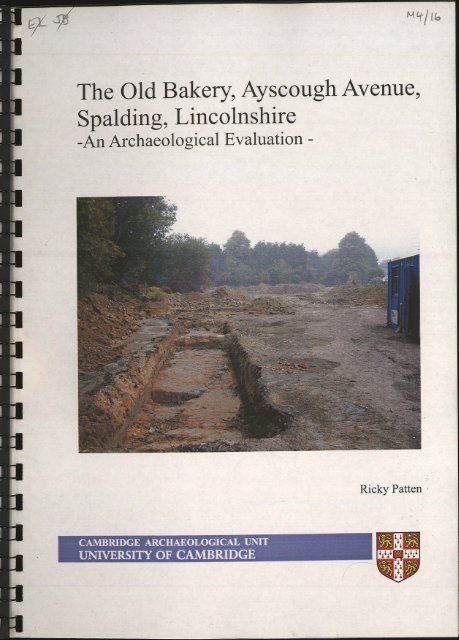
The Old Bakery, Ayscough Avenue, Spalding, Lincolnshire
The Old Bakery, Ayscough Avenue, Spalding, Lincolnshire
The Old Bakery, Ayscough Avenue, Spalding, Lincolnshire

You also want an ePaper? Increase the reach of your titles
YUMPU automatically turns print PDFs into web optimized ePapers that Google loves.
<strong>The</strong> <strong>Old</strong> <strong>Bakery</strong>, <strong>Ayscough</strong> <strong>Avenue</strong>,<br />
<strong>Spalding</strong>, <strong>Lincolnshire</strong><br />
-An Archaeological Evaluation -<br />
CAMBRIDGE ARCHAEOLOGICAL UNIT<br />
UNIVERSITY OF CAMBRIDGE<br />
Ricky Patten
L15 2 o G<br />
'Sou^ci?<br />
<strong>The</strong> <strong>Old</strong> <strong>Bakery</strong>, <strong>Ayscough</strong> <strong>Avenue</strong>, <strong>Spalding</strong><br />
<strong>Lincolnshire</strong><br />
-An Archaeological Evaluation-<br />
Site Code: AAS04<br />
Accession Number: 2004.167<br />
Ricky Patten<br />
With contributions by Steve Boreham<br />
Cambridge Archaeological Unit<br />
University of Cambridge<br />
September 2004<br />
Report Number 642<br />
nI c^A-n<br />
Conservation<br />
Services<br />
0 4 OCT 2004<br />
Highways & Planning<br />
Directorate
Summary<br />
An archaeological evaluation was undertaken on the site of the <strong>Old</strong> <strong>Bakery</strong>, <strong>Ayscough</strong><br />
<strong>Avenue</strong>, <strong>Spalding</strong> (AAS04) ahead of redevelopment. Eleven trenches were excavated<br />
to asses the potential for any archaeological evidence. <strong>The</strong> trenches revealed traces<br />
of the more recent industrial activities along with evidence that the environs would<br />
have been wet and un-inhabitable until recent times.<br />
Introduction<br />
Between the 3 rd of August 2004 and the 6 of August 2004 an archaeological<br />
evaluation was undertaken on behalf of <strong>Lincolnshire</strong> Developments Limited by a<br />
team from the Cambridge Archaeological Unit (CAU). This was in response to an<br />
archaeological specification set out by the CAU (Standring 2004) and agreed by Jim<br />
Bonner (County Archaeologist, <strong>Lincolnshire</strong> County Council). <strong>The</strong> Proposed<br />
Development Area (PDA) comprised of 0.52 hectares of land at the southern end of<br />
<strong>Ayscough</strong> <strong>Avenue</strong> and Johnson <strong>Avenue</strong> (NGR 524900 321950).<br />
1
Topography and Geology<br />
<strong>The</strong> site is situated at 2.77m OD within a residential area. <strong>The</strong> southern boundary of<br />
the site is bordered by a cycle route and footpath (formerly the route of the Midland<br />
and Great Northern rail line) and private homes surrounding. <strong>The</strong> underlying geology<br />
comprised of Jurassic Kimmeridge and Ampthill clays; overlain by Barroway Drove<br />
Beds and Terrington Beds deposits.<br />
Archaeological and Historical Background<br />
<strong>The</strong> earliest activity recorded in the county Sites and Monuments Records (SMR)<br />
dates to the Romano-British period and represents agricultural evidence in the form of<br />
enclosures, droves and a track way (SMR 23597) recorded in association with a<br />
Roman coin. Evidence from crop marks suggests that a settlement existed c.2km<br />
southeast of the site at NGR 525900 321700 and evidence from individual finds in the<br />
Clay Lake area of <strong>Spalding</strong> and south of Coronation Channel at Four Ashes suggests<br />
this settlement may have extended to the southern boundary of modern <strong>Spalding</strong>.<br />
Historical sources account for the vast majority of information pertaining to<br />
<strong>Spalding</strong>'s past.<br />
<strong>The</strong> Tribal Hideage, a late 7 th century tax/tribute list, shows a small lordship in south<br />
<strong>Lincolnshire</strong> called Spaldas and, along with a charter of 716AD (SMR 23603),<br />
suggests that <strong>Spalding</strong> had been founded at least by the 7 th century. Geological studies<br />
have shown that at this time the coastline would have been only a few kilometres to<br />
the north with an inlet coming down to <strong>Spalding</strong> (S. Boreham, pers comm.). This<br />
coastal nature of the settlement may have led to its growth and increase in importance,<br />
which continued even as the sea level decreased. <strong>The</strong> inlet (the River Welland?)<br />
enabled the settlement to continue and grow into a busy port throughout the medieval<br />
period.<br />
In the 1050's AD a Priory (SMR 22355) was founded in <strong>Spalding</strong> by the Benedictines<br />
(the mark of Lady Godiva, "di Ego Godiva Comitissa diu istud desideravi" has been<br />
found on the charter given to the Priory by her brother Thorold of Bucknall, the<br />
sheriff of <strong>Lincolnshire</strong>) and was renewed as a dependency of St. Nicolas, Angers in<br />
1070 AD.<br />
<strong>The</strong> Domesday Book of 1086AD lists <strong>Spalding</strong> (Spallinge) as being within the<br />
wapentake (a Danelaw administrative area, the equivalent of an Anglo-Saxon<br />
hundred) of Elloe, one of the largest and wealthiest of the Danelaw centres. <strong>The</strong> lands<br />
of <strong>Spalding</strong> had been given to Ivo Tailebois, the nephew of William I, after the<br />
Norman conquest in 1066AD and <strong>Spalding</strong> became a royal residence with the<br />
construction of a timber castle (locted at NGR 524810 323060).<br />
<strong>Spalding</strong> continued to grow throughout the medieval period with the greatest increase<br />
in population occurring between 1086AD and 1307AD. <strong>The</strong> location of <strong>Spalding</strong> on<br />
the banks of the River Welland meant that even when the rate of growth began to<br />
decline in the 14 th century <strong>Spalding</strong> remained an important fishing town able to<br />
accommodate large ships.<br />
9
In the 17 th century the river was widened to help with the draining of Deeping Fen<br />
and as a result <strong>Spalding</strong> grew into a busy port with barges being able to navigate as<br />
far as Stamford and sea-going vessels as far as <strong>Spalding</strong>'s High Bridge. In the 19 th<br />
century the Great Northern Railway opened in <strong>Spalding</strong> and the port started to fall in<br />
to decline.<br />
Historic maps of <strong>Spalding</strong> located in the <strong>Lincolnshire</strong> Archives show that the PDA<br />
was located outside the limit of the town until the last century. <strong>The</strong> county map of<br />
1732 shows the PDA lying within an area of open fields. <strong>The</strong> 1889 OS map shows the<br />
boundaries of the site as existing today with fields to the north, east and west, and a<br />
railway to the south. It is not until the survey of 1904 that any signs of development<br />
on the site are visible with two small structures shown in the western portion of the<br />
PDA. By 1968, the Ordnance Survey maps show the construction of a bakery, a depot<br />
and a sewage pumping station.<br />
Methodology<br />
Eleven trenches totalling 185m were opened using a 360°-tracked machine with a<br />
toothless ditching bucket down to an archaeological level. This comprises a 7%<br />
sample of the site area. Each trench was recorded on CAU trench sheets and<br />
photographed on digital medium; all features were planned at a scale of 1:50.<br />
Excavation Results<br />
<strong>The</strong> eleven trenches excavated provided evidence of post-medieval activity associated<br />
with the development of the site over the last one hundred years. Evidence for<br />
geological channels and an area of salt marsh were recorded within the trenches.<br />
Trench 1<br />
Trench 1 was orientated north-south for a distance of 15m; it was cut to a depth of<br />
0.92m through 0.26m of rubble made ground, 0.25m of silty sub-soil and 0.43m of<br />
silty clay to an organic clay layer. This clay layer contained organic rootlets that<br />
represented a salt marsh. <strong>The</strong>se deposits and underlying layers were sampled by<br />
geological borehole and were described by S. Boreham (see Appendix 1).<br />
A modern ditch cut through the trench orientated northwest-southeast. At 3m from<br />
the southern end of the trench and at right angles Trench 4 was cut orientated eastwest.<br />
Trench 2<br />
Trench 2 was orientated east-west for a distance of 28m; it was cut to a depth of<br />
1.05m through 0.30m of rubble made ground, 0.16m of silty sub-soil and 0.59m of a<br />
mixed clay silt to an organic clay layer. This clay layer was the salt marsh recorded in<br />
Trench 1 and stopped at the eastern end of the trench where the silt beds were<br />
3
ULiUliiiUJJJJJJJJijJJLIlJJJJJJJLiULIUI<br />
Figure 2: Trench locations
encountered. At the western end of the trench a test pit was cut through the clay to<br />
ascertain its depth and the silt beds were encountered at 1.60m.<br />
Trench 3<br />
Trench 3 was orientated north-south for a distance of 14m and was cut through a large<br />
amount of modern disturbance including a demolition pit at the northern end which<br />
exceeded 1.20m in depth. <strong>The</strong> trench was cut down to the level of the organic clay<br />
which represented the salt marsh and evidence for a geological channel cutting<br />
through this was recorded. However, the trench was heavily contaminated and in the<br />
absence of any pertinent archaeology no work was undertaken on the trench.<br />
Trench 4<br />
Trench 4 was orientated east-west for a distance of 29m; it was cut to a depth of<br />
0.92m through 0.26m of rubble made ground, 0.23m of silty sub-soil and 0.43m of<br />
silt. Orientated northwest-southeast through the length of the trench was a modern<br />
ditch, which carried on through to Trench 1. At the western end of the trench Trench 1<br />
was cut at right angles, orientated north-south, and at this end of the trench was<br />
evidence for the edge of the salt marsh recorded in Trench 1.<br />
Trench 5<br />
Trench 5 was orientated north-west for a distance of 10m; it was cut to a depth of<br />
1.14m through 0.39m of hardcore made ground, 0.20m of sub-soil and 0.55m of silt.<br />
Trench 6<br />
Trench 6 was orientated east-west for a distance of 23m; it was cut to a depth of 77m<br />
through 0.10m of topsoil, 0.22m of a clayey sub-soil and 0.45m of silt.<br />
Trench 7<br />
Trench 7 was orientated north-south for a distance of 13m; it was cut to a depth of<br />
0.84m through 0.20m of made ground, 0.24m of silty sub-soil and 0.40m of silt. In the<br />
centre of the trench was an area of oil or diesel contamination.<br />
Trench 8<br />
Trench 8 was orientated north-south for a distance of 11m; it was cut to a depth of<br />
0.57m through 0.07m of tarmac, 0.18m of hardcore packing and 0.32m of a clay subsoil.<br />
Orientated northwest-southeast through the trench was a geological channel<br />
which was traced through trenches 9 and 11. At the southern end of the trench was a<br />
single modern posthole.<br />
Trench 9<br />
Trench 9 was orientated east-west for a distance of 16m; it was cut to a depth of<br />
0.66m through 0.46m of rubble made ground and 0.20m of silt. Orientated northwestsoutheast<br />
along much of the trench was a geological channel, which was further<br />
5
traced through Trenches 8 and 11. At right angles to the trench orientated north-south<br />
was a brick culvert or storm drain.<br />
Trench 10<br />
Trench 10 was orientated north-south for a distance of 13m; it was cut to a depth of<br />
0.62m through 0.30m of made ground, 0.12m of a silty sub-soil and 0.20m of a clay<br />
layer to the silt. Evidence of a geological channel orientated northwest-southeast was<br />
recorded along with five square cut postholes 0.15m by 0.15m associated with the<br />
modern buildings previously on site and an area of oil or diesel contamination at the<br />
southern end of the trench.<br />
Trench 11<br />
Trench 11 was orientated east-west for a distance of 13m; it was cut to a depth of<br />
0.70m through 0.35m of rubble made ground and 0.35m of silt. Orientated northwestsoutheast<br />
along the trench was a geological channel, which was further traced through<br />
Trenches 8 and 9.<br />
Discussion<br />
<strong>The</strong> negative evidence from the evaluation would suggest that until recently this area<br />
of <strong>Spalding</strong> would have been too wet for inhabitation. <strong>The</strong> British Geological Survey<br />
geology map shows that the area is underlain by salt marsh, tidal creek and floodplain<br />
deposits which were lain down by the marine inundations which occurred from the<br />
late Iron Age onwards. This is certainly confirmed by the results of on-site<br />
environmental assessment and borehole characterisation of the deposits (see Boreham,<br />
Appendix 1). Silt encountered within each trench attest to an area of sand banks and<br />
mud flats. Trenches 3, 8, 9, 10 and 11 produced evidence of a natural channel cutting<br />
through the sand banks and mud flats, while within Trenches 1, 2, 3 and 4 evidence<br />
for an area of salt marsh was evident. <strong>The</strong>se silt beds (Terrington Beds) were between<br />
lm and 2m in depth and sealed marine sands of Barroway Drove Beds which were<br />
deposited during the Neolithic and Bronze Age, and can extend to a depth of 14m.<br />
Although later drainage would have enabled medieval and Post-Medieval activity, no<br />
evidence for this was recorded and the area would most likely have been open fields.<br />
<strong>The</strong> PDA appeared to remain unsettled until 1904 when Ordnance Survey maps show<br />
two unidentified structures in the field, activity which is presumably associated with<br />
the adjacent rail line.<br />
Acknowledgements<br />
<strong>Lincolnshire</strong> Developments Limited funded the excavation and thanks are due to Dennis of G.C.E Ltd.<br />
for his careful machining of the site. Thanks must also go to those who recorded, excavated, discussed<br />
and interpreted the site, Dominique Bruno and lain Forbes and to Steve Boreham (Department of<br />
Geography, University of Cambridge). Iain Forbes surveyed the site and provided the computer and<br />
digital illustrations. Robin Standring was the project manager and along with Victoria Donnelly and<br />
Jim Bonner (<strong>Lincolnshire</strong> County Archaeologist, <strong>Lincolnshire</strong> County Council) provided valuable<br />
support.<br />
6
E:524870.21<br />
N:322058.27<br />
Channel<br />
Sand bank<br />
Salt marsh<br />
metres<br />
Figure 3: Geological Interpretation<br />
E:525075.88<br />
N:321914.59
Appendix 1: Report on the Geological Conditions<br />
Steve Boreham<br />
Introduction<br />
This report describes a geological investigation at <strong>Ayscough</strong> <strong>Avenue</strong>, <strong>Spalding</strong><br />
<strong>Lincolnshire</strong>. <strong>The</strong> deposits investigated were exposed in a series of trenches in an old<br />
industrial area located at the southern end of <strong>Ayscough</strong> <strong>Avenue</strong> and Johnson <strong>Avenue</strong><br />
(NGR 524900 321950). <strong>The</strong> basal part of the trenches exposed a light orange/brown<br />
silt with fine sand laminae, which included clay-filled palaeochannels (interpreted as<br />
tidal creeks). This material was overlain in part by organic silty clay 'saltmarsh'<br />
deposits with abundant rootlets and organic remains. An upper layer of grey/brown<br />
silt with occasional small clay-filled palaeochannels covered the whole site, and was<br />
cut into by Made Ground. A single borehole was sunk at the northern end of Trench 1<br />
to investigate the stratigraphy below the base of the trench. <strong>The</strong> borehole revealed a<br />
sequence of brown sand with shell debris below the upper silty units, stretching down<br />
to at least 5.15m below ground surface (see below).<br />
Geology of the <strong>Spalding</strong> Area<br />
<strong>The</strong> British Geological Survey (BGS) geology map of the <strong>Spalding</strong> area (Sheet 144)<br />
shows that much of the area surrounding <strong>Spalding</strong> and the <strong>Ayscough</strong> <strong>Avenue</strong> Site is<br />
directly underlain by saltmarsh, tidal creek and floodplain deposits attributed to the<br />
Terrington Beds, dating from a late Iron Age marine inundation of Fenland at c.2500<br />
years BP. Even in Saxon times, it is known that <strong>Spalding</strong> had a direct connection to<br />
the sea. It should be noted that all dates given here are approximate due to the<br />
diachronous (time transgressive) nature of the deposits. <strong>The</strong> Terrington Beds in this<br />
area are l-2m thick and overlie marine sands of the Barroway Drove Beds. <strong>The</strong><br />
Barroway Drove Beds have been dated at between c.6000 and 3000 years BP in this<br />
area, and are up to 12m thick. <strong>The</strong> Barroway Drove Beds have two distinct facies.<br />
To the southwest of <strong>Spalding</strong> they are represented by silty saltmarsh deposits, which<br />
in the field can only be separated from the overlying Terrington Beds by the presence<br />
of a thin 'leaf' of Nordelph Peat, representing freshwater conditions between c.3000<br />
and 2500 years BP. In the <strong>Spalding</strong> area the Barroway Drove Beds are represented by<br />
inter-tidal and sub-tidal shelly sands indicating more open marine conditions. <strong>The</strong>se<br />
overlie the Crowland Bed (cold-stage soliflucted material), various glacial sands and<br />
gravels and Jurassic Oxford Clay bedrock at depth.<br />
For much of the Holocene, human occupation of this area seems to have been<br />
restricted to better-drained gravel terrace sites at the edge of Fenland. It appears that<br />
during the late Iron Age marine regression (c.2500 years BP) there was human<br />
occupation of sites on the slightly more elevated silt roddons of the Barroway Drove<br />
Beds. <strong>The</strong> remains of salterns from this period are known to the northeast of<br />
<strong>Spalding</strong>. <strong>The</strong> marine transgression of the Terrington Beds flooded some of these<br />
sites, but by late Roman times the retreating marine influence allowed renewed<br />
occupation of well-drained areas. Extensive medieval saltern silt mounds are known<br />
from Surfleet Seas End 5km northeast of <strong>Spalding</strong>.<br />
8
Interpretation of the <strong>Ayscough</strong> <strong>Avenue</strong> Sequence<br />
<strong>The</strong> sandy sediments in borehole BH1 were not bottomed because saturated 'running'<br />
sand was contacted at 5.15m depth, making further hand augering impossible. <strong>The</strong>se<br />
sediments probably continued to 10-12m depth. It appears that the brown sand with<br />
shell debris described betweenl.50m and 5.15m represents the sub-tidal facies of the<br />
Barroway Drove Beds. Similar sediments are being deposited today in <strong>The</strong> Wash<br />
offshore of Hunstanton, Norfolk. <strong>The</strong> top surface of these sediments probably dates<br />
from c.3000 years BP. It is worth noting that the Terrington Beds - Barroway Drove<br />
Beds interface was probably reached at the base of most of the archaeological<br />
trenches. <strong>The</strong> basal part of the Terrington Beds here probably dates from c.2500 years<br />
BP. Four distinct environments of deposition are indicated. <strong>The</strong> light brown silt with<br />
sand laminae appears to represent inter-tidal mudflat conditions, and the clay-rich<br />
channel-fills are interpreted as tidal creek deposits. <strong>The</strong> organic silty clay clearly<br />
represents the overgrowth of saltmarsh associated with retreating marine influence. It<br />
is not easy to assign a date to the saltmarsh formation, but it is presumably Roman,<br />
and certainly pre-Saxon. <strong>The</strong> containment of the marine influence to the north of the<br />
site in Saxon times suggests that the overlying grey/brown silt is for the most part<br />
floodplain alluvium of the River Welland. It appears that the site may have remained<br />
as open water meadow until its eventual industrial use in Victorian times.<br />
Borehole description<br />
(Described top down)<br />
0-0.14m Made ground<br />
0.14-0.31m Brown/black silty clay with brick, pottery & pipe<br />
0.31-0.45m Grey silt<br />
0.45-0.83m Grey/brown silt<br />
0.83-0.88m Grey/brown organic silt<br />
0.88-1.18m Blue/brown silty clay<br />
1.18-1.50m Orange/brown mottled silt with fine sand laminae<br />
1.50-1.90m Brown fine sand<br />
1.90-2.35m Brown medium sand with shell debris<br />
2.35-4.00m Brown medium to coarse sand with bands of shell debris<br />
4.00-5.15m Brown fine sand<br />
5.15m Hole stopped on running sand
Bibliography<br />
Ferrante Di Ruffano, L. 2002. Final Report for an Archaeological Watching Brief at<br />
<strong>The</strong> Vines, 3 Love Lane, <strong>Spalding</strong>, <strong>Lincolnshire</strong>. Soke Archaeological Services<br />
Limited SAS02/17.<br />
M and M Archaeological Services. 2002. Results of an archaeological trial trench<br />
evaluation: <strong>Ayscough</strong>fee Hall School, Welland Hall, London Road, <strong>Spalding</strong>,<br />
<strong>Lincolnshire</strong>.<br />
Standring, R. 2004. <strong>The</strong> <strong>Old</strong> <strong>Bakery</strong>, <strong>Ayscough</strong> <strong>Avenue</strong>, <strong>Spalding</strong>. Project Design<br />
Specification for Archaeological Evaluation. CAU.<br />
10


