

Archaeological Evaluation at Hanson House, Normanton, West ...
Archaeological Evaluation at Hanson House, Normanton, West ...
Archaeological Evaluation at Hanson House, Normanton, West ...

You also want an ePaper? Increase the reach of your titles
YUMPU automatically turns print PDFs into web optimized ePapers that Google loves.
<strong>Archaeological</strong> Research & Consultancy <strong>at</strong> the University of Sheffield<br />
Unit R6, Riverside Block<br />
Sheaf Bank Business Park<br />
Prospect Road<br />
Sheffield S2 3EN Phone 0114 2225106 Fax 0114 2797158<br />
Project Report 1198b.1(1)<br />
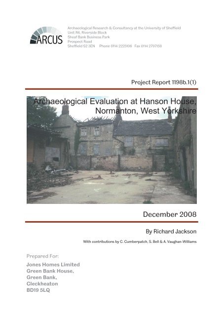
<strong>Archaeological</strong> <strong>Evalu<strong>at</strong>ion</strong> <strong>at</strong> <strong>Hanson</strong> <strong>House</strong>,<br />
<strong>Normanton</strong>, <strong>West</strong> Yorkshire<br />
Prepared For:<br />
Jones Homes Limited<br />
Green Bank <strong>House</strong>,<br />
Green Bank,<br />
Cleckhe<strong>at</strong>on<br />
BD19 5LQ<br />
December 2008<br />
By Richard Jackson<br />
With contributions by C. Cumberp<strong>at</strong>ch, S. Bell & A. Vaughan-Williams
<strong>Hanson</strong> <strong>House</strong>, <strong>Normanton</strong><br />
N<strong>at</strong>ional Grid Reference: SE 388 224 (centred)<br />
<strong>Evalu<strong>at</strong>ion</strong> report<br />
Report 1198b.1(1) © ARCUS 2008<br />
Fieldwork Reporting<br />
Richard Jackson Richard Jackson<br />
Illustr<strong>at</strong>ions Archive<br />
K<strong>at</strong>hy Speight Ben Graves<br />
Checked by: Passed for submission to client:<br />
D<strong>at</strong>e:<br />
Richard Jackson<br />
Project Archaeologist<br />
D<strong>at</strong>e:<br />
Richard O’Neill<br />
Project Manager<br />
<strong>Archaeological</strong> <strong>Evalu<strong>at</strong>ion</strong>, <strong>Hanson</strong> <strong>House</strong>, <strong>Normanton</strong>, <strong>West</strong> Yorkshire<br />
ARCUS 1198b.1(1) – December 2008 i
OASIS SUMMARY FORM<br />
PROJECT DETAILS<br />
OASIS identifier Arcus2-48571<br />
Project title <strong>Hanson</strong> <strong>House</strong>, <strong>Normanton</strong>.<br />
Short description of the<br />
project<br />
Project d<strong>at</strong>es 13-05-08 to 04-06-08<br />
Previous/future work None/potential w<strong>at</strong>ching brief<br />
ARCUS were commissioned by Jones Homes Limited to undertake an archaeological evalu<strong>at</strong>ion of<br />
the surrounding environment of <strong>Hanson</strong> <strong>House</strong>, a complex of grade II listed buildings thought to<br />
have origin<strong>at</strong>ed in the sixteenth century. Recent dendrochronological analysis of timbers from the<br />
buildings has provided d<strong>at</strong>es of AD1455/6 (barn) and AD1448 (house). The evalu<strong>at</strong>ion comprised a<br />
total of ten trenches evenly distributed around the site. Only two of the trial trenches, Trenches 5<br />
and 8, revealed fe<strong>at</strong>ures of archaeological interest. The trenches were loc<strong>at</strong>ed to the north<br />
(Trench 5) and east (Trench 8) of the listed stone-built rectangular (barn) building Two separ<strong>at</strong>e<br />
ditch fe<strong>at</strong>ures were identified, one of which contained three sherds of medieval pottery. The size<br />
and profile of the ditches suggests they were contemporary. The evidence recovered to d<strong>at</strong>e<br />
suggests a limited amount of activity on the site in the medieval period, probably rel<strong>at</strong>ed to<br />
agricultural or domestic enclosures.<br />
Monument type and period Medieval/post-medieval buildings<br />
Significant finds<br />
(artefact type and period)<br />
PROJECT LOCATION<br />
4 sherds of 12 th -13 th -century pottery<br />
County/Parish <strong>West</strong> Yorkshire, <strong>Normanton</strong><br />
Site address <strong>Hanson</strong> <strong>House</strong>, Johnson’s yard, Snydale Road, <strong>Normanton</strong>, Wakefield, <strong>West</strong> Yorkshire<br />
Site co-ordin<strong>at</strong>es SE 388 224<br />
Site area 0.7 hectares<br />
Height OD 38.21-35.46m OD<br />
PROJECT CREATORS<br />
Organis<strong>at</strong>ion ARCUS<br />
Project brief origin<strong>at</strong>or WYAAS<br />
Project design origin<strong>at</strong>or Ian Sanderson<br />
Project supervisor Richard Jackson<br />
Project manager Richard O’Neill<br />
Sponsor or funding body Jones Homes Limited<br />
PROJECT ARCHIVES<br />
Archive Type Loc<strong>at</strong>ion/Accession no. Content (e.g. pottery, metalwork, etc)<br />
Physical Wakefield Museum Pottery<br />
Paper Wakefield Museum Report<br />
Digital Wakefield SMR Pdf copy<br />
BIBLIOGRAPHY<br />
Title <strong>Archaeological</strong> <strong>Evalu<strong>at</strong>ion</strong> <strong>at</strong> <strong>Hanson</strong> <strong>House</strong>, <strong>Normanton</strong>, <strong>West</strong> Yorkshire<br />
Report no 1198b.1(1)<br />
Author Richard Jackson<br />
D<strong>at</strong>e December 2008<br />
<strong>Archaeological</strong> <strong>Evalu<strong>at</strong>ion</strong>, <strong>Hanson</strong> <strong>House</strong>, <strong>Normanton</strong>, <strong>West</strong> Yorkshire<br />
ARCUS 1198b.1(1) – December 2008 ii
CONTENTS<br />
OASIS SUMMARY FORM .................................................................................................. II<br />
LIST OF ILLUSTRATIONS AND PLATES ........................................................................... IV<br />
NON-TECHNICAL SUMMARY ........................................................................................... V<br />
1 INTRODUCTION ........................................................................................................ 1<br />
1.1 Site loc<strong>at</strong>ion and land use ............................................................................................................................... 1<br />
1.2 Geology .................................................................................................................................................................. 1<br />
1.3 <strong>Archaeological</strong> Background ........................................................................................................................... 1<br />
2 AIMS AND METHODOLOGY ...................................................................................... 1<br />
2.1 Aims ......................................................................................................................................................................... 1<br />
2.2 R<strong>at</strong>ionale ................................................................................................................................................................ 1<br />
2.3 Excav<strong>at</strong>ion Methodology ................................................................................................................................ 2<br />
2.4 Recording ............................................................................................................................................................. 2<br />
2.5 Finds Collection Policy .................................................................................................................................... 2<br />
2.6 Archive ................................................................................................................................................................... 2<br />
2.7 Staffing and Timetable .................................................................................................................................... 2<br />
3 RESULTS ................................................................................................................... 2<br />
3.1 Trench 1 ................................................................................................................................................................ 2<br />
3.2 Trench 2 ................................................................................................................................................................ 3<br />
3.3 Trench 3 ................................................................................................................................................................ 3<br />
3.4 Trench 4 ............................................................................................................................................................... 3<br />
3.5 Trench 5 ............................................................................................................................................................... 4<br />
3.6 Trench 6 ............................................................................................................................................................... 5<br />
3.7 Trench 7 ................................................................................................................................................................ 5<br />
3.8 Trench 8 ............................................................................................................................................................... 5<br />
3.9 Trench 9 ............................................................................................................................................................... 6<br />
3.10 Trench 10 .............................................................................................................................................................. 7<br />
3.11 W<strong>at</strong>ching brief .................................................................................................................................................... 8<br />
4 ARTEFACTS .............................................................................................................. 8<br />
4.1 Pottery................................................................................................................................................................... 8<br />
4.2 Animal Bone ........................................................................................................................................................ 11<br />
4.3 Archaeobotanical remains........................................................................................................................... 13<br />
5 CONCLUSION .......................................................................................................... 14<br />
6 BIBLIOGRAPHY ........................................................................................................ 14<br />
7 PLATES AND ILLUSTRATIONS ................................................................................. 15<br />
APPENDIX A: LIST OF CONTEXTS ................................................................................... 24<br />
APPENDIX B: WYAAS SPECIFICATION ........................................................................... 26<br />
<strong>Archaeological</strong> <strong>Evalu<strong>at</strong>ion</strong>, <strong>Hanson</strong> <strong>House</strong>, <strong>Normanton</strong>, <strong>West</strong> Yorkshire<br />
ARCUS 1198b.1(1) – December 2008 iii
LIST OF ILLUSTRATIONS AND PLATES<br />
Illustr<strong>at</strong>ions<br />
1 Site loc<strong>at</strong>ion map<br />
2 Site plan<br />
3 Plans: Trenches 1-4, 7, 9<br />
4 Sections: Trenches 1-4, 7, 9<br />
5 Plans: Trenches 5, 6, 8, 10.<br />
6 Sections: Trenches 5 and 6<br />
7 Trench 7 section<br />
8 Trench 10 section<br />
9 Plan and profile of well [505]<br />
Pl<strong>at</strong>es<br />
1 General shot of Trench 1, east-facing<br />
2 General shot of Trench 2, east-facing<br />
3 General shot of Trench 3, south east-facing<br />
4 General shot of Trench 4, east-facing<br />
5 General shot of Trench 5, west-facing<br />
6 Section through ditch [502], Trench 5, south east-facing<br />
7 General shot of Trench 6, north-facing<br />
8 Trench 6, East-facing section through [602]<br />
9 General shot of Trench 7, east-facing<br />
10 General shot of Trench 8, north-facing<br />
11 Pig skeleton in cut [803], Trench 8<br />
12 Section through ditch [805], Trench 8<br />
13 General shot of Trench 9, west-facing<br />
14 General shot of Trench 10, south-facing<br />
15 General shot of Trench 10, north-facing<br />
16 Well [505], southwest facing.<br />
17 Well [505], northwest facing.<br />
<strong>Archaeological</strong> <strong>Evalu<strong>at</strong>ion</strong>, <strong>Hanson</strong> <strong>House</strong>, <strong>Normanton</strong>, <strong>West</strong> Yorkshire<br />
ARCUS 1198b.1(1) – December 2008 iv
NON-TECHNICAL SUMMARY<br />
ARCUS were commissioned by Jones Homes Limited to undertake an archaeological<br />
evalu<strong>at</strong>ion of the surrounding environment of <strong>Hanson</strong> <strong>House</strong>, a complex of grade II<br />
listed buildings thought to have origin<strong>at</strong>ed in the sixteenth century. Recent<br />
dendrochronological analysis of timbers from the buildings has provided d<strong>at</strong>es of<br />
AD1455/6 (barn) and AD1448 (house). The project was carried out in accordance<br />
with the written specific<strong>at</strong>ion produced by the <strong>West</strong> Yorkshire Archaeology Advisory<br />
Service (WYAAS), on behalf of Wakefield MDC (Planning Applic<strong>at</strong>ion reference<br />
07/00704/FUL), <strong>at</strong> the request of Jones Homes.<br />
The evalu<strong>at</strong>ion comprised a total of ten trenches evenly distributed around the site.<br />
Only two of the trial trenches, Trenches 5 and 8, revealed fe<strong>at</strong>ures of archaeological<br />
interest. The trenches were loc<strong>at</strong>ed to the north (Trench 5) and east (Trench 8) of the<br />
listed stone-built rectangular (barn) building Two separ<strong>at</strong>e ditch fe<strong>at</strong>ures were<br />
identified, one of which contained three sherds of medieval pottery. The size and<br />
profile of the ditches suggests they were contemporary. The evidence recovered to<br />
d<strong>at</strong>e suggests a limited amount of activity on the site in the medieval period, probably<br />
rel<strong>at</strong>ed to agricultural or domestic enclosures.<br />
Following completion of fieldwork a w<strong>at</strong>ching brief condition was placed on further<br />
development by WYAAS. Work carried out under this condition entailed recording a<br />
well found bene<strong>at</strong>h one of the red brick warehouses during demolition.<br />
<strong>Archaeological</strong> <strong>Evalu<strong>at</strong>ion</strong>, <strong>Hanson</strong> <strong>House</strong>, <strong>Normanton</strong>, <strong>West</strong> Yorkshire<br />
ARCUS 1198b.1(1) – December 2008 v
1 INTRODUCTION<br />
ARCUS were commissioned by Jones Homes Limited to undertake an archaeological<br />
evalu<strong>at</strong>ion of the site surrounding a group of post-medieval buildings in <strong>Normanton</strong>,<br />
in advance of renov<strong>at</strong>ion and re-development. An archaeological condition was placed<br />
on the development of this site due to the presence of standing Grade II listed<br />
buildings within the site boundary.<br />
1.1 Site loc<strong>at</strong>ion and land use<br />
The site of approxim<strong>at</strong>ely 0.7 hectares in extent, and is situ<strong>at</strong>ed on the south west<br />
side of Snydale Road, just to the south of the centre of the village of <strong>Normanton</strong><br />
(illustr<strong>at</strong>ion 1). The site was most recently utilised as a builder’s yard, with extensive<br />
areas of modern concrete and tarmac paving on the central area of the site,<br />
contained between twentieth-century warehouses and workshops.<br />
1.2 Geology<br />
The drift geology of this area is Coal Measures sandstones and shales (Geological<br />
Survey Sheet 78) whilst the soils are unmapped.<br />
1.3 <strong>Archaeological</strong> Background<br />
The site is occupied by <strong>Hanson</strong> <strong>House</strong>, a complex of grade II listed buildings thought<br />
to have origin<strong>at</strong>ed in the sixteenth century. <strong>Hanson</strong> <strong>House</strong> is a stone and timber<br />
framed building of two builds. An 18 th century farmhouse is <strong>at</strong>tached to a stone and<br />
timber framed building of sixteenth century or earlier d<strong>at</strong>e. A further stone built<br />
rectangular building of unknown function (possibly a barn) lies immedi<strong>at</strong>ely south of<br />
the earlier section of <strong>Hanson</strong> <strong>House</strong>. Recent dendrochronological analysis of timbers<br />
from the buildings has provided fifteenth century d<strong>at</strong>es of AD1455/6 (barn) and<br />
AD1448 (house).<br />
2 AIMS AND METHODOLOGY<br />
2.1 Aims<br />
The aims of this project were:<br />
• to g<strong>at</strong>her sufficient inform<strong>at</strong>ion to establish the extent, condition, character and<br />
d<strong>at</strong>e (as far as circumstances permit) of any archaeological fe<strong>at</strong>ures and deposits<br />
within the proposed development area<br />
• to record <strong>at</strong> an appropri<strong>at</strong>e level, archaeological fe<strong>at</strong>ures encountered in the<br />
evalu<strong>at</strong>ion trenches.<br />
2.2 R<strong>at</strong>ionale<br />
The evalu<strong>at</strong>ion comprised excav<strong>at</strong>ion of ten trenches, resulting in a total excav<strong>at</strong>ed<br />
area of 303m 2 .<br />
The trenches were distributed evenly around the proposal area in order to provide a<br />
clear assessment of the quantity and preserv<strong>at</strong>ion of any archaeological fe<strong>at</strong>ures,<br />
structures or deposits. Slight adjustments of the trench loc<strong>at</strong>ions were required in<br />
some cases due to presence of nearby trees or site boundaries.<br />
<strong>Archaeological</strong> <strong>Evalu<strong>at</strong>ion</strong>, <strong>Hanson</strong> <strong>House</strong>, <strong>Normanton</strong>, <strong>West</strong> Yorkshire<br />
ARCUS 1198b.1(1) – December 2008 1
2.3 Excav<strong>at</strong>ion Methodology<br />
The trenches were opened by a mechanical excav<strong>at</strong>or under close supervision by an<br />
appropri<strong>at</strong>ely qualified and experienced archaeologist. Trench loc<strong>at</strong>ions are shown<br />
on illustr<strong>at</strong>ion 2.<br />
Mechanical excav<strong>at</strong>ion ceased <strong>at</strong> the exposure of deposits immedi<strong>at</strong>ely bene<strong>at</strong>h the<br />
topsoil. All trenches were cleaned by hand and subsequently photographed and<br />
recorded in line with the specific<strong>at</strong>ions of the WYAAS written scheme of investig<strong>at</strong>ion<br />
(appendix B)<br />
2.4 Recording<br />
Trenches were planned <strong>at</strong> a standard scale of 1:50, or <strong>at</strong> 1:20 in trenches where<br />
discrete fe<strong>at</strong>ures or structures were present. In trenches where str<strong>at</strong>igraphy was<br />
limited sample sections were drawn. Deposits were described on pro forma context<br />
sheets. The photographic record comprised 35mm standard form<strong>at</strong> colour slide and<br />
monochrome film.<br />
2.5 Finds Collection Policy<br />
Artefactual m<strong>at</strong>erial was collected according to an explicit sampling str<strong>at</strong>egy. M<strong>at</strong>erial<br />
th<strong>at</strong> was obviously twentieth century or l<strong>at</strong>er in d<strong>at</strong>e, and derived from unstr<strong>at</strong>ified<br />
contexts, was not kept unless it was of exceptional intrinsic interest. M<strong>at</strong>erial<br />
discarded as a consequence of this policy was described and quantified in the field.<br />
This involved basic analyses such as counting artefacts, and assigning finds to broad<br />
c<strong>at</strong>egories, e.g. plastics, glass etc. All other finds were retained.<br />
All retained finds were cleaned, marked, c<strong>at</strong>alogued and packed in m<strong>at</strong>erials suitable<br />
for long-term storage, as detailed in the Institute of Field Archaeologists (IFA)<br />
guidelines for finds work.<br />
2.6 Archive<br />
The site archive and associ<strong>at</strong>ed m<strong>at</strong>erial culture will be deposited <strong>at</strong> Wakefield<br />
Museum under the appropri<strong>at</strong>e accession number.<br />
2.7 Staffing and Timetable<br />
The fieldwork was undertaken in May 2008, and completed in June 2008. The work<br />
was carried out by Roz Sampson, under the supervision of the author. An additional<br />
w<strong>at</strong>ching brief was undertaken by Richard Jackson in August 2008. The site survey<br />
was undertaken by Tom Sparrow.<br />
3 RESULTS<br />
3.1 Trench 1<br />
Trench 1 was loc<strong>at</strong>ed <strong>at</strong> the south-west corner of the proposal area, and orient<strong>at</strong>ed<br />
approxim<strong>at</strong>ely southwest-northeast. The trench measured 2.0m by 15m (illustr<strong>at</strong>ion<br />
3a). Preliminary mechanical excav<strong>at</strong>ion removed topsoil to a depth of 0.2m. The<br />
presence of modern refuse, such as plastic bags and bottles, as inclusions within the<br />
topsoil points to the use of this area as an informal dumping ground for local refuse.<br />
The topsoil [100] was dark grey-brown silt, with occasional small pebble inclusions.<br />
The frequent root disturbance of the topsoil, which persisted into the underlying<br />
<strong>Archaeological</strong> <strong>Evalu<strong>at</strong>ion</strong>, <strong>Hanson</strong> <strong>House</strong>, <strong>Normanton</strong>, <strong>West</strong> Yorkshire<br />
ARCUS 1198b.1(1) – December 2008 2
subsoil, correl<strong>at</strong>es with the use of the western area of the site as an orchard.<br />
The subsoil [101] measured 0.4m in thickness, and comprised mid orange-brown fine<br />
sandy silt, with infrequent inclusions of small sandstone pebbles. The interface<br />
between [100] and [101] was level and sharp (illustr<strong>at</strong>ion 4a). The degree of root<br />
disturbance observed in the overlying topsoil [100] continued into [101].<br />
The underlying n<strong>at</strong>ural [102] was exposed in the centre of the trench, due to a n<strong>at</strong>ural<br />
outcropping above the level of the surrounding subsoil (pl<strong>at</strong>e 1). Deposit [102]<br />
comprised a sandstone shale deposit, of we<strong>at</strong>hered sand and approxim<strong>at</strong>ely 35%<br />
loose pl<strong>at</strong>y sandstone fragments. The trench was archaeologically sterile.<br />
Trench 1 was loc<strong>at</strong>ed with the aim of assessing the potential presence of a linear<br />
fe<strong>at</strong>ure running along the adjacent site boundary. There was no evidence of any<br />
sealed sub-surface fe<strong>at</strong>ures, which may have accounted for the change in topology <strong>at</strong><br />
the south-west end of the trench. This surface ‘ditch’ was therefore interpreted as a<br />
modern landscape fe<strong>at</strong>ure, most likely associ<strong>at</strong>ed with recent orchard management.<br />
3.2 Trench 2<br />
Trench 2 was loc<strong>at</strong>ed midway along the western site boundary, and orient<strong>at</strong>ed<br />
approxim<strong>at</strong>ely northwest-southeast. The trench measured 2.0m by 16m (illustr<strong>at</strong>ion<br />
3b). The topsoil was removed by mechanical excav<strong>at</strong>or to a depth of 0.2m. Topsoil<br />
[200] comprised dark brown sandy-silt of a firm consistency. The deposit was<br />
homogenous, with a clear boundary to the underlying subsoil [201] (illustr<strong>at</strong>ion 4b).<br />
As with [100], there was persistent evidence of root disturbance within [200], which<br />
penetr<strong>at</strong>ed down to the underlying subsoil [201].<br />
Subsoil [201] comprised mid orange-brown sand with a small silt component. The<br />
deposit was homogenous and extensive, covering the whole trenched area to a<br />
thickness of 0.4-0.5m (pl<strong>at</strong>e 2). The subsoil contained 2-3% inclusions of poorly<br />
sorted sandstone pebbles. The deposit was devoid of any evidence of archaeology.<br />
3.3 Trench 3<br />
Trench 3 was loc<strong>at</strong>ed <strong>at</strong> the western corner of site, and was orient<strong>at</strong>ed approxim<strong>at</strong>ely<br />
northwest-southeast. The trench measured 2m by 14m (illustr<strong>at</strong>ion 3c). Mechanical<br />
excav<strong>at</strong>ion removed topsoil [300] to a depth of 0.1-0.2m, and exposed the underlying<br />
subsoil [301] to a thickness of 0.3-0.4m (illustr<strong>at</strong>ion 4c). The topsoil was vey similar<br />
in composition to the topsoil in Trenches 1 and 2, with a similarly sharp interface to<br />
the underlying subsoil [301]. The subsoil [301] comprised a mid orange-brown sandysilt<br />
with 2-3% sandstone pebble inclusions (pl<strong>at</strong>e 3). This sequence of deposits was<br />
devoid of any evidence of archaeology.<br />
3.4 Trench 4<br />
Trench 4 was loc<strong>at</strong>ed in the central concreted area between the asbestos-roofed<br />
red-brick warehouses, approxim<strong>at</strong>ely 30m south of <strong>Hanson</strong> house and its associ<strong>at</strong>ed<br />
buildings. The trench was orient<strong>at</strong>ed northeast-southwest, and measured 16m by 2m<br />
(illustr<strong>at</strong>ion 3d).<br />
A machine-mounted breaker was used to open the trench through the concrete<br />
hard-standing [400]. The concrete contained a layer of metal re-enforcing rods. The<br />
concrete surface [400] measured 0.2m in thickness, and extended across the areas<br />
evalu<strong>at</strong>ed by trench 6 and trench 7. This surface was interpreted as contemporary to<br />
the adjacent red-brick warehouses. The concrete was underlain by a finely-crushed<br />
<strong>Archaeological</strong> <strong>Evalu<strong>at</strong>ion</strong>, <strong>Hanson</strong> <strong>House</strong>, <strong>Normanton</strong>, <strong>West</strong> Yorkshire<br />
ARCUS 1198b.1(1) – December 2008 3
layer of limestone [401], which was extensive across the whole trench to a thickness<br />
of 0.08m. Context [401] was interpreted as a bedding layer for the overlying context<br />
[400].<br />
Trench 4 did not contain n<strong>at</strong>urally-derived subsoil as in the previous trenches.<br />
Instead, the context between [401] and the underlying n<strong>at</strong>ural [403] comprised a<br />
mottled deposit of various shades of mid- to light brown sandy-silt. This deposit<br />
measured 0.3m in thickness and exhibited a sharp boundary with both the overlying<br />
limestone crush [401] and the underlying n<strong>at</strong>ural [403]. Deposit [402] was interpreted<br />
as the product of levelling activities prior to the inst<strong>at</strong>ement of the overlying deposit<br />
and surface (illustr<strong>at</strong>ion 4d).<br />
The underlying n<strong>at</strong>ural deposit [403] was a slight vari<strong>at</strong>ion on the n<strong>at</strong>ural deposits<br />
exposed during the excav<strong>at</strong>ion of Trenches 1-3. Although mostly consisting of<br />
sandstone shale deposits, the n<strong>at</strong>ural <strong>at</strong> the south-west end of the trench was of a<br />
firm sandy-clay consistency (pl<strong>at</strong>e 4). As the gradu<strong>at</strong>ion from shale to sandy clay was<br />
smooth and gradual, this was interpreted as a straightforward geological vari<strong>at</strong>ion.<br />
3.5 Trench 5<br />
Trench 5 was loc<strong>at</strong>ed midway along the north west site boundary, in a small yard area<br />
formed by the buildings associ<strong>at</strong>ed with <strong>Hanson</strong> <strong>House</strong> to the south and west, and by<br />
more modern red-brick workshops to the north. The trench was orient<strong>at</strong>ed<br />
approxim<strong>at</strong>ely northeast-southwest, although a slight change in orient<strong>at</strong>ion had to be<br />
made during initial mechanical excav<strong>at</strong>ion due to the presence of a network of gas<br />
pipes to the north and to the west of the trenching area. Trench 5 measured 14.5m by<br />
2m (illustr<strong>at</strong>ion 5a).<br />
Initial mechanical excav<strong>at</strong>ion removed the uppermost deposit [500], which comprised<br />
a firm black gritty deposit. The deposit measured between 0.2 and 0.25m in<br />
thickness, and was homogenous. Context [500] was interpreted as a simple yard<br />
surface. As such surfaces are less labour intensive to cre<strong>at</strong>e than concrete surfaces;<br />
this deposit was interpreted as potentially belonging to a slightly earlier phase of site<br />
use than the ostensibly modern concrete in the vicinity of Trenches 4, 6 and 7. No<br />
artefacts were recovered from the context which may have disproved or supported<br />
this interpret<strong>at</strong>ion.<br />
Mechanical excav<strong>at</strong>ion continued down into the subsoil [503], which comprised a mid<br />
orange-brown sandy-silt context, with approxim<strong>at</strong>ely 20% inclusions of pl<strong>at</strong>y<br />
sandstone chunks, typically 5-15cm in size. This deposit measured 0.2m in thickness.<br />
The high stone inclusion concentr<strong>at</strong>ion in this subsoil is explained by the<br />
corresponding n<strong>at</strong>ure of the local substr<strong>at</strong>e. The n<strong>at</strong>ural deposit [504], bene<strong>at</strong>h<br />
subsoil [503], was almost exclusively composed of sandstone aside from a n<strong>at</strong>ural<br />
sand lens, which outcropped in the centre of the trench (pl<strong>at</strong>e 5).<br />
Upon the completion of cleaning by hand, a potential linear fe<strong>at</strong>ure was observed <strong>at</strong><br />
the south-west end of the trench. The fe<strong>at</strong>ure was differenti<strong>at</strong>ed from the<br />
surrounding n<strong>at</strong>ural [504] by the significantly lower stone content and the pale brown<br />
fill colour. A sample section of the fe<strong>at</strong>ure was excav<strong>at</strong>ed by hand, and the section was<br />
drawn <strong>at</strong> 1:10 (illustr<strong>at</strong>ion 6a) and photographed accordingly. The context number<br />
[502] was ascribed to the cut, and context number [501] was ascribed to the fill. On<br />
excav<strong>at</strong>ion, the cut was shown to be of a gently sloping profile with a slightly u-shaped<br />
base (pl<strong>at</strong>e 6), which measured 1.4m wide and 0.4m deep. The linear appearance in<br />
plan led to the interpret<strong>at</strong>ion of [502] as a ditch. Fe<strong>at</strong>ure [502] had been cut directly<br />
into the solid bedrock, and then gradually filled up with deposit [501] over time. The<br />
<strong>Archaeological</strong> <strong>Evalu<strong>at</strong>ion</strong>, <strong>Hanson</strong> <strong>House</strong>, <strong>Normanton</strong>, <strong>West</strong> Yorkshire<br />
ARCUS 1198b.1(1) – December 2008 4
fill was probably gener<strong>at</strong>ed by n<strong>at</strong>ural we<strong>at</strong>hering from the sides of the cut, due to<br />
the close similarity in colour and texture of the fill to the underling substr<strong>at</strong>e. Fill [501]<br />
contained approxim<strong>at</strong>ely 40-60% medium-sized sandstone inclusions which were<br />
irregularly distributed through the section. The ditch fill was sampled according to<br />
standard guidelines. The samples were then removed from site for subsequent<br />
specialist analysis (see section 4).<br />
3.6 Trench 6<br />
Trench 6 was in the central area of site, to the north-east of Trench 4. The trench<br />
measured 15m by 2m, and was orient<strong>at</strong>ed approxim<strong>at</strong>ely northwest-southeast<br />
(illustr<strong>at</strong>ion 5b). Initial mechanical excav<strong>at</strong>ion with a machine-mounted breaker was<br />
required to loosen the concrete hard-standing across the trenching area. In addition,<br />
a low modern breeze-block wall ran perpendicular across the line of the trench. This<br />
was also removed with the breaker prior to excav<strong>at</strong>ion. The concrete surface [600]<br />
was very similar to the concrete surface over Trench 4, and was interpreted as<br />
contemporary. Context [600] measured 0.2-0.25m in thickness. Mechanical<br />
excav<strong>at</strong>ion continued into the homogenous subsoil [603], which measured between<br />
0.3 and 0.45m in thickness, and comprised a mid yellow-brown context of sandy silt.<br />
Upon the removal of context [603], the top of the underlying n<strong>at</strong>ural was cleaned by<br />
hand (pl<strong>at</strong>e 7). During cleaning, the existence of a cut fe<strong>at</strong>ure became apparent. The<br />
fe<strong>at</strong>ure comprised a sub-oval cut [602], filled by mid-brown sandy silt with 10-20%<br />
sandstone pebble inclusions [601].The upper 80 percent of the fe<strong>at</strong>ure was only<br />
visible by virtue of a slight colour differenti<strong>at</strong>ion between the surrounding subsoil<br />
[603] and fill [601]. In totality the fe<strong>at</strong>ure measured 1.4m in length and 0.5m in depth<br />
(illustr<strong>at</strong>ion 6b). The base of the fe<strong>at</strong>ure was cut into the n<strong>at</strong>ural bedrock to a depth<br />
of 0.1m. The fe<strong>at</strong>ure was not fully visible in plan, as it continued on into the north-east<br />
facing section (pl<strong>at</strong>e 8). The width of the fe<strong>at</strong>ure from the north-east facing section<br />
measured 0.9m. No artefacts were recovered during the excav<strong>at</strong>ion of [601], although<br />
the fact th<strong>at</strong> [603] was cut through the existing subsoil implies the d<strong>at</strong>e of the fe<strong>at</strong>ure<br />
is considerably l<strong>at</strong>er than the ditch fe<strong>at</strong>ures in Trenches 5 and 8, which were sealed<br />
by a similar subsoil deposit.<br />
3.7 Trench 7<br />
Trench 7 was loc<strong>at</strong>ed towards the south-east edge of site, and orient<strong>at</strong>ed north eastsouth<br />
west. The trench measured 16m by 2m (illustr<strong>at</strong>ion 3e). Initial mechanical<br />
excav<strong>at</strong>ion removed the concrete hard-standing and associ<strong>at</strong>ed crushed bedding<br />
m<strong>at</strong>erial [700]. This context measured 0.3m in thickness, and was directly underlain<br />
by context [701], a 0.2m thick deposit of black gritty silt (illustr<strong>at</strong>ion 4e). This context<br />
was similar in composition to the uppermost deposit excav<strong>at</strong>ed in Trench 5 (pl<strong>at</strong>e 9).<br />
Removal of [701] by mechanical excav<strong>at</strong>ion exposed underlying subsoil [702]. This<br />
deposit measured 0.4m in thickness, and comprised a mid orange-brown sandy-silt<br />
containing approxim<strong>at</strong>ely 40-50% inclusions of small sandstone fragments. Context<br />
[702] was homogenous and archaeologically sterile.<br />
3.8 Trench 8<br />
Trench 8 was loc<strong>at</strong>ed towards the north-east end of site, in an apparently<br />
undeveloped part of the site. The trench was orient<strong>at</strong>ed northwest-southeast, and<br />
measured 16m by 2m. Initial mechanical excav<strong>at</strong>ion removed turf and topsoil to a<br />
depth of between 0.1 and 0.12m. Topsoil [800] comprised dark brown sandy-silt of<br />
loose consistency.<br />
<strong>Archaeological</strong> <strong>Evalu<strong>at</strong>ion</strong>, <strong>Hanson</strong> <strong>House</strong>, <strong>Normanton</strong>, <strong>West</strong> Yorkshire<br />
ARCUS 1198b.1(1) – December 2008 5
Deposit [800] was removed by mechanical excav<strong>at</strong>or, exposing the underlying context<br />
[801] which measured 0.3m in thickness. This context comprised a mixed loose<br />
deposit of crushed limestone fragments, mixed with dark brown sandy-silt, similar in<br />
composition to context [800]. Context [801] contained occasional inclusions of large<br />
sandstone blocks. This context was interpreted as a residual deposit associ<strong>at</strong>ed with<br />
the inst<strong>at</strong>ement of the concrete hard-standing to the south. It is possible th<strong>at</strong> building<br />
m<strong>at</strong>erial was stockpiled in this area prior to use on site or elsewhere.<br />
Context [801] was removed with the use of a mechanical excav<strong>at</strong>or, exposing the<br />
underlying deposit of subsoil. This deposit [802], comprised a mid orange-brown<br />
deposit of sandy silt with frequent small inclusions of sandstone fragments. The<br />
context covered the whole area of the trench, and measured 0.35-0.4m in thickness,<br />
and was homogenous throughout the excav<strong>at</strong>ed extent (illustr<strong>at</strong>ion 5c). The deposit<br />
was removed with a mechanical excav<strong>at</strong>or, exposing the underlying n<strong>at</strong>ural.<br />
The trench was then cleaned by hand and photographed (pl<strong>at</strong>e 10). The presence of<br />
two cut fe<strong>at</strong>ures in the base of the trench became apparent during cleaning. Cut<br />
[803], loc<strong>at</strong>ed close to the south-east end of the trench was sub-oval in plan,<br />
measuring 1.16m in length, 0.91m in width and 0.35m deep. Excav<strong>at</strong>ion of the fe<strong>at</strong>ure<br />
exposed an intact and articul<strong>at</strong>ed pig skeleton (pl<strong>at</strong>e 11, section 4.2). The fill [804]<br />
comprised a deposit of dark brown sandy-silt with frequent orange-brown mottles.<br />
The context also contained substantial quantities of lime, which was persistent<br />
enough to form a discrete layer around the skeleton (illustr<strong>at</strong>ion 7b). The lime had<br />
undergone a chemical change whilst in situ, forming concretions of such density th<strong>at</strong><br />
judicious use of a small pick was required to loosen the deposit. A single small<br />
fragment of pottery was recovered during the excav<strong>at</strong>ion of the fe<strong>at</strong>ure; although this<br />
fragment was probably medieval (section 4.1), its small size and abraded condition<br />
suggests the possibility of residual inclusion within the fe<strong>at</strong>ure.<br />
The other fe<strong>at</strong>ure in Trench 8 was situ<strong>at</strong>ed <strong>at</strong> the north end of the trench, and was<br />
orient<strong>at</strong>ed east-west. The fe<strong>at</strong>ure was linear in plan and ascribed context number<br />
[805] for the cut, and [806] for the fill. The cut was gently sloping in profile with a<br />
dished base (pl<strong>at</strong>e 12). Fill [806] comprised a mid brown clay-silt, which was mostly<br />
homogenous with a thin pale lens interposed between the main fill and the base of<br />
the cut. Deposit [806] was sampled according to standard guidelines. The samples<br />
were then removed from site for subsequent specialist analysis (see section 4.3).<br />
The ditch measured 1.4m wide and 0.4m deep (illustr<strong>at</strong>ion 7a). Three sherds of<br />
pottery were recovered from the base of the fill. These sherds had a secure<br />
str<strong>at</strong>igraphical provenance from the base of the ditch fill [806], and were<br />
subsequently identified as Hillam type ware and Buff gritty ware. Both of these types<br />
d<strong>at</strong>e from the l<strong>at</strong>e eleventh century to the early thirteenth century, but the individual<br />
sherds are likely to pre-d<strong>at</strong>e the thirteenth century (see section 4.1). A single sherd<br />
of ceramic was also recovered from within the top 0.05m of the fill as excav<strong>at</strong>ed.<br />
Although this sherd was identified as Cistercian ware or possibly an early type of l<strong>at</strong>e<br />
Blackware (see section 4.1), it can be interpreted as a stray artefact from l<strong>at</strong>er use of<br />
the site which subsequently became incorpor<strong>at</strong>ed into the top of the ditch fill.<br />
3.9 Trench 9<br />
Trench 9 was loc<strong>at</strong>ed in the centre of the grassed area of site adjacent to Snydale<br />
Road. The trench measured 15m by 2m, and was orient<strong>at</strong>ed northeast-southwest<br />
(illustr<strong>at</strong>ion 3f). The local ground cover consisted of grass and light scrub, with the<br />
land sloping down towards the north-east. Mechanical excav<strong>at</strong>ion removed turf and<br />
overlying topsoil [900], which increased in depth towards the south-west. Topsoil<br />
<strong>Archaeological</strong> <strong>Evalu<strong>at</strong>ion</strong>, <strong>Hanson</strong> <strong>House</strong>, <strong>Normanton</strong>, <strong>West</strong> Yorkshire<br />
ARCUS 1198b.1(1) – December 2008 6
[900] measured between 0.23m and 1.1m in depth, and comprised a dark brown<br />
coarse gritty silt with occasional inclusions of sandstone, red brick fragments, sl<strong>at</strong>e<br />
and coal.<br />
Upon removal of [900], the edge of a concrete and brick structure became visible in<br />
the north facing section (illustr<strong>at</strong>ion 4f). The structure comprised a level concrete<br />
layer [901], which measured 0.1m in thickness and ran the entire length of the trench.<br />
Concrete [901] was supported by an underlying brick structure [902]. Structure [902]<br />
generally comprised a single layer of mixed red brick, with both hand-made and<br />
machine-made brick present, typically measuring 230 x 110 x 80mm. The coursing was<br />
occasionally irregular, with missing bricks <strong>at</strong> some points along the section, and<br />
double bricks <strong>at</strong> other points. This composite structure was interpreted as an earlier<br />
phase of yard-type surface, constructed from a re-used brick base and freshly mixed<br />
concrete.<br />
The structure [901]-[902] was str<strong>at</strong>igraphically situ<strong>at</strong>ed above the subsoil, further<br />
supporting the interpret<strong>at</strong>ion of the structure as a l<strong>at</strong>er addition to the built<br />
structures on site. Subsoil [903] comprised a dark grey-brown sandy-silt of firm<br />
consistency, and measured 0.12m in thickness (pl<strong>at</strong>e 13). Two small square fe<strong>at</strong>ures<br />
had been cut into [903], and subsequently filled with loose deposits composed of a<br />
mixture of deposits [900] and [903]. The fe<strong>at</strong>ures were ascribed context numbers<br />
[905] and [906], and were interpreted as modern cuts for the insertion of fence posts.<br />
3.10 Trench 10<br />
Trench 10 was loc<strong>at</strong>ed <strong>at</strong> the north-east edge of site, and was orient<strong>at</strong>ed<br />
approxim<strong>at</strong>ely northwest-southeast, parallel to the adjacent Snydale Road, and<br />
measured 14m by 2m (illustr<strong>at</strong>ion 5d). Initial mechanical excav<strong>at</strong>ion removed turf<br />
and overlying topsoil [1000] to a depth of 0.38m. Deposit [1000] comprised a dark<br />
black-brown fine silt of soft consistency, containing occasional stone and modern<br />
refuse inclusions, and evidence of root activity. The topsoil was homogenous, and was<br />
subsequently removed with a mechanical excav<strong>at</strong>or to expose the underlying deposit<br />
[1001].<br />
Context [1001] comprised a mixed deposit 0.4m deep, generally brown in colour with<br />
light yellow-brown and mid-grey-brown mottles. The deposit also contained<br />
occasional lenses of pink brick dust. This context was interpreted as a product of the<br />
continued landscaping of this area of site.<br />
The context underlying [1001] was ascribed context number [1002], and comprised a<br />
dark grey deposit of fine gritty silt, containing occasional small stone inclusions.<br />
Fragments of ceramic and slag were recovered for analysis. The deposit measured<br />
0.3m in thickness and was extensive across the trenching area (pl<strong>at</strong>e 14). The first<br />
slot dug into [1002] showed th<strong>at</strong> the interface between [1002] and the underlying<br />
context [1003] was uneven, sloping down towards the north end of the trench. A<br />
second slot was subsequently excav<strong>at</strong>ed to assess the n<strong>at</strong>ure of this irregularity<br />
(illustr<strong>at</strong>ion 8). This showed the irregularity to generalised, r<strong>at</strong>her than specific to<br />
any particular area. Context [1002] was therefore interpreted as a generalised<br />
levelling deposit. To support this interpret<strong>at</strong>ion, a tipped lens of orange-brown sandysilt<br />
[1003] was identified within context [1002]. Subsequent excav<strong>at</strong>ion through these<br />
deposits showed th<strong>at</strong> [1003] was only 0.25m thick, and exposed underlying deposit<br />
[1004]. This context comprised an even layer of soft grey-brown clay-silt, measuring<br />
between 0.4 and 0.65m in thickness. Excav<strong>at</strong>ion by hand established th<strong>at</strong> [1004] was<br />
immedi<strong>at</strong>ely overlying the base n<strong>at</strong>ural deposit [1005]. Therefore, [1004] was<br />
<strong>Archaeological</strong> <strong>Evalu<strong>at</strong>ion</strong>, <strong>Hanson</strong> <strong>House</strong>, <strong>Normanton</strong>, <strong>West</strong> Yorkshire<br />
ARCUS 1198b.1(1) – December 2008 7
interpreted as a potential former topsoil, which was sealed by subsequent<br />
landscaping activities.<br />
3.11 W<strong>at</strong>ching brief<br />
A stone-lined well [505] was exposed by the demolition of the red brick workshop<br />
abutting the east end of the barn (pl<strong>at</strong>es 15 and 16). This well was recorded<br />
(illustr<strong>at</strong>ion 10) and assessed with an auger to a depth of 3.1m <strong>at</strong> which point a<br />
consistently solid surface was encountered. The fill of the well [506] comprised<br />
mostly modern rubble backfill, although the basal 0.4m of fill consisted of fine grey silt<br />
which evolved a strong odour of hydrocarbons on excav<strong>at</strong>ion. The well was<br />
interpreted as a fe<strong>at</strong>ure th<strong>at</strong> may be contemporary with the original structures,<br />
although l<strong>at</strong>er and modern use of the well entailed the inclusion of pollutants which<br />
have rendered further analysis impossible. Given the inclusion of modern rubble with<br />
the backfill [506], it is highly likely th<strong>at</strong> the augered deposits are represent<strong>at</strong>ive of the<br />
l<strong>at</strong>est use of the well as a drain or soak-away.<br />
4 ARTEFACTS<br />
4.1 Pottery<br />
The pottery assemblage from <strong>Hanson</strong> <strong>House</strong>, <strong>Normanton</strong>, <strong>West</strong> Yorkshire was<br />
examined by the author on 1 st September 2008. It consisted of twenty-six sherds of<br />
pottery weighing 322 grams representing a maximum of twenty-five vessels. The d<strong>at</strong>a<br />
are summarised in Table 1.<br />
The earliest pottery from the site was identified in contexts 804 and 806. Context<br />
804 produced a single small and heavily abraded sherd of 12 th century Sandy ware<br />
(Cumberp<strong>at</strong>ch 2002:172). Context 806 produced two sherds of Hillam type ware<br />
(Cumberp<strong>at</strong>ch 2002:173-174) and a sherd of the closely rel<strong>at</strong>ed Buff Gritty ware<br />
(Cumberp<strong>at</strong>ch 2002:176). All of these sherds can be <strong>at</strong>tributed to the earlier<br />
medieval period, most probably pred<strong>at</strong>ing the mid 13 th century.<br />
The group from context 806 also included the base of a small cup or tyg which in<br />
form resembled a Cistercian ware cup but which differed significantly in terms of its<br />
fabric and p<strong>at</strong>tern of glazing. Although listed in the d<strong>at</strong>a table as of Cistercian ware<br />
type and d<strong>at</strong>ed accordingly, there is considerable room for doubt over this<br />
identific<strong>at</strong>ion and it is possible th<strong>at</strong> it is of a l<strong>at</strong>er d<strong>at</strong>e and may even be an early<br />
example of L<strong>at</strong>e Blackware, d<strong>at</strong>ing to the early 18 th century.<br />
The remainder of the assemblage (from contexts 901, 902 and 1001) was of much<br />
l<strong>at</strong>er d<strong>at</strong>e with only the utilitarian wares from context 1001 possibly pred<strong>at</strong>ing the mid<br />
19 th century (and even here a mid to l<strong>at</strong>er 19 th century d<strong>at</strong>e would be perfectly<br />
possible to argue, given the long lifespan of the Yellow Glazed Coarseware tradition).<br />
The range of wares was domin<strong>at</strong>ed by various kinds of Whiteware bearing slip<br />
banded, transfer printed and overglaze designs, as described in Table 1. Utilitarian<br />
wares were represented by the Yellow Glazed Coarsewares mentioned above and by<br />
the sherds of stoneware from context 1001, one of which appears to be from a<br />
cooking vessel.<br />
The pottery assemblage from <strong>Hanson</strong> <strong>House</strong> falls into two distinct parts. The earlier<br />
is of medieval d<strong>at</strong>e although with a post-medieval component represented by the<br />
sherd of possible Cistercian ware/Blackware. The second, larger component is of<br />
mid to l<strong>at</strong>er 19 th and possibly early 20 th century d<strong>at</strong>e and is entirely consistent with<br />
<strong>Archaeological</strong> <strong>Evalu<strong>at</strong>ion</strong>, <strong>Hanson</strong> <strong>House</strong>, <strong>Normanton</strong>, <strong>West</strong> Yorkshire<br />
ARCUS 1198b.1(1) – December 2008 8
the occup<strong>at</strong>ion of the existing house and ancillary structures.<br />
No further work is required on this assemblage although should further excav<strong>at</strong>ion or<br />
rel<strong>at</strong>ed work on the site yield additional pottery, the present assemblage should be<br />
reviewed as part of a full report.<br />
<strong>Archaeological</strong> <strong>Evalu<strong>at</strong>ion</strong>, <strong>Hanson</strong> <strong>House</strong>, <strong>Normanton</strong>, <strong>West</strong> Yorkshire<br />
ARCUS 1198b.1(1) – December 2008 9
Context Type No Wt ENV Part Form Decor<strong>at</strong>ion D<strong>at</strong>e range Notes<br />
804 C12th Sandy ware 1 1 1 BS Hollow ware U/Dec LC11th - C12th Very fine sandy textured sherd; heavily<br />
abraded<br />
806 Buff Gritty ware 1 1 1 BS Hollow ware U/Dec LC11th - EC13th Sparse quartz and non-crystalline grit in a<br />
buff body<br />
806 Cistercian type ware 1 22 1 Base Cup/tyg U/Dec C16th - EC17th Non-standard orange-red fabric with<br />
brown glaze int & ext<br />
U/Dec LC11th - EC13th Typical square sectioned rim; white quartz<br />
tempered fabric<br />
806 Hillam type ware 1 27 1 Rim Jar/cooking<br />
pot<br />
806 Hillam type ware 1 9 1 BS Hollow ware U/Dec LC11th - EC13th Ash-white ext, buff int; quartz temper with<br />
non-crystalline red grit<br />
M - LC19th<br />
901 Stoneware 1 25 1 Handle Flagon Mottled iron-wash finish on lob<strong>at</strong>e<br />
handle<br />
901 Transfer printed Whiteware 1 9 1 Rim Fl<strong>at</strong>ware Blue-black floral design with cartouche LC19th - EC20th Blue-black floral design with cartouche<br />
901 Transfer printed Whiteware 1 3 1 BS Fl<strong>at</strong>ware U/ID Black printed design int M - LC19th See also cxt 1001 for a similar sherd<br />
C19th<br />
902 Colour Glazed ware 1 14 1 BS Hollow ware Dark brown-black glaze ext on a white<br />
body<br />
902 Transfer printed Whiteware 2 18 2 Rim Pl<strong>at</strong>e Asi<strong>at</strong>ic Pheasants M - LC19th One flaked<br />
M - LC19th<br />
902 Transfer printed Whiteware 2 5 1 Footring base Pl<strong>at</strong>e Unidentified Chinese landscape, dark<br />
blue print<br />
902 Wall tile 1 8 1 Fragment Wall tile Dark green glazed tile MC19th - EC20th<br />
1001 Bone China 1 3 1 Rim Hollow ware Thin over-glaze gold line on top of rim LC19th - EC20th<br />
1 8 1 BS Bowl/dish Brown ext, grey int C19th Cooking vessel<br />
1001 Brown Salt Glazed<br />
Stoneware<br />
Mug/jug Brown band and thin blue lines ext C19th<br />
1001 Slip Banded Whiteware 1 5 1 BS/handle<br />
stump<br />
C19th<br />
1001 Stoneware 1 12 1 BS Hollow ware Grey finish int & ext on a buff<br />
stoneware body<br />
M - LC19th<br />
1001 Transfer printed Whiteware 1 5 1 Rim Pl<strong>at</strong>e Briar rose p<strong>at</strong>tern on a stippled<br />
background<br />
<strong>Archaeological</strong> <strong>Evalu<strong>at</strong>ion</strong>, <strong>Hanson</strong> <strong>House</strong>, <strong>Normanton</strong>, <strong>West</strong> Yorkshire<br />
ARCUS 1198b.1(1) – December 2008 9
Context Type No Wt ENV Part Form Decor<strong>at</strong>ion D<strong>at</strong>e range Notes<br />
1001 Transfer printed Whiteware 1 5 1 BS Fl<strong>at</strong>ware U/ID Black printed design int M - LC19th See also cxt 901 for a similar sherd<br />
1001 Transfer printed Whiteware 1 3 1 BS Hollow ware U/ID transfer printed design int M - LC19th<br />
?Bowl All-over blue finish int, white ext M - LC19th Probably a bowl<br />
1001 Whiteware 1 19 1 Semirecessed<br />
base<br />
1001 Whiteware 1 6 1 Rim Pl<strong>at</strong>e U/Dec M - LC19th<br />
M - LC19th Could be early C20th<br />
1001 Whiteware 1 4 1 Rim Pl<strong>at</strong>e Yellow band on extreme edge of rim<br />
with thin gold line inside, relief moulded<br />
concentric ridges<br />
C18th - C19th Sharply everted rounded rim<br />
1001 Yellow Glazed Coarseware 1 70 1 Rim Pancheon White slip under clear glaze int with<br />
unslipped red band on top of rim<br />
C18th - C19th Sharply everted rim with thickened ext<br />
edge<br />
1001 Yellow Glazed Coarseware 1 40 1 Rim Pancheon White slip int on a red body with<br />
unslipped red band on rim<br />
Total 26 322 25<br />
Table 1. Pottery from <strong>Hanson</strong> <strong>House</strong>, <strong>Normanton</strong>, <strong>West</strong> Yorkshire<br />
<strong>Archaeological</strong> <strong>Evalu<strong>at</strong>ion</strong>, <strong>Hanson</strong> <strong>House</strong>, <strong>Normanton</strong>, <strong>West</strong> Yorkshire<br />
ARCUS 1198b.1(1) – December 2008 10
4.2 Animal Bone<br />
The assemblage consisted of approxim<strong>at</strong>ely 655 mammalian fragments from a single<br />
str<strong>at</strong>ified context. The assemblage was rapidly identified and assessed to consider<br />
the assemblage’s potential. Bone fragments were identified to a broad species level<br />
where possible and notes were made regarding the condition (preserv<strong>at</strong>ion) of the<br />
bones within each context. Other fe<strong>at</strong>ures such as evidence of bone working<br />
(butchery) or p<strong>at</strong>hology was also noted. No <strong>at</strong>tempt was made to discern the<br />
differences between sheep (Ovis aires) and go<strong>at</strong> (Capra hircus). Where species<br />
identific<strong>at</strong>ion was not possible, bone fragments were assigned to ‘Large’, ‘Medium’<br />
and ‘Small’ mammal groups. ‘Large mammal’ refers to horse/cow sized animals,<br />
‘medium mammal’ refers to sheep/pig/dog sized animals and ‘small mammal’ refers<br />
to rabbit/domestic c<strong>at</strong> sized animals.<br />
The method used to record this assemblage follows a modified version of the Davies<br />
(1992) system. Under this system specific zones of each skeletal element are included<br />
as ‘countable’. In mammals, these are: upper and lower teeth; mandibles with <strong>at</strong> least<br />
one tooth in situ; cranium; <strong>at</strong>las; axis; scapula (glenoid cavity); distal humerus; distal<br />
radius; proximal ulna; pelvis; distal femur; distal tibia; astragalus; calcaneum; proximal<br />
metapodial; distal metapodial; phalanges 1, 2 and 3. Ribs and vertebrae are not<br />
considered ‘countable’ elements, but were examined macroscopically for evidence of<br />
butchery.<br />
The elements examined were all identified as pig (Sus scrofa) and indic<strong>at</strong>ed th<strong>at</strong> two<br />
individuals were present within context [804]. These are summarized in Table 2. Both<br />
individuals were fairly young with none of the long bone elements bearing completely<br />
fused epiphyses. The inclusion within the assemblage of four, separ<strong>at</strong>e unfused<br />
scapula (bicipital tuberosity), proximal radius and pelvis (acetabulum) indic<strong>at</strong>e th<strong>at</strong><br />
both individuals were less than one year old <strong>at</strong> the time of de<strong>at</strong>h. The skulls of the two<br />
individuals showed different st<strong>at</strong>es of fusion and this, along with the presence of a<br />
partially fused distal humerus, would indic<strong>at</strong>e th<strong>at</strong> one of the individuals was slightly<br />
older than the other. One set of long bones also appeared to be slightly smaller than<br />
the other.<br />
The countable elements, along with the vertebrae and ribs were all examined for<br />
evidence of butchery. No cut marks or evidence for sawing or chopping was present<br />
on any of the elements within the assemblage. The surface of the bone was slightly<br />
abraded due to the young age of the individuals, but this was judged not to have been<br />
sufficient to obscure cut marks on the surface.<br />
The only identified taphonomic difference between the two individuals was th<strong>at</strong> the<br />
smaller pair of femurs appeared to exhibit a gre<strong>at</strong>er degree of surface abrasion and<br />
degrad<strong>at</strong>ion than any other elements within the assemblage.<br />
No p<strong>at</strong>hologies were noted on any of the elements.<br />
The presence of two fairly complete, young individuals within a single context, and<br />
with no evidence for butchery, is interesting. Further analysis of the assemblage,<br />
however, is unlikely to yield any inform<strong>at</strong>ion of archaeological significance and is not<br />
recommended. It may be useful to retain the assemblage as part of a reference<br />
collection.<br />
<strong>Archaeological</strong> <strong>Evalu<strong>at</strong>ion</strong>, <strong>Hanson</strong> <strong>House</strong>, <strong>Normanton</strong>, <strong>West</strong> Yorkshire<br />
ARCUS 1198b.1(1) – December 2008 11
Context Species Element L/R Proximal Distal Notes<br />
804 Pig Mandible L<br />
804 Pig Mandible L<br />
804 Pig Mandible R<br />
804 Pig Mandible R<br />
804 Pig Skull<br />
804 Pig Skull Cranial cavity unfused<br />
(frontale + parietale)<br />
804 Pig Scapula L Unfused<br />
804 Pig Scapula L Unfused<br />
804 Pig Scapula R Unfused<br />
804 Pig Scapula R Unfused<br />
804 Pig Humerus L Unfused Unfused<br />
804 Pig Humerus L Unfused Fusing<br />
804 Pig Humerus R Unfused Unfused<br />
804 Pig Humerus R Unfused Unfused<br />
804 Pig Radius L Unfused Unfused<br />
804 Pig Radius L Unfused Unfused<br />
804 Pig Radius R Unfused Unfused<br />
804 Pig Radius R Unfused Unfused<br />
804 Pig Ulna L Unfused<br />
804 Pig Ulna L Unfused<br />
804 Pig Ulna R x<br />
804 Pig Ulna R Unfused<br />
804 Pig Pelvis L Unfused Unfused<br />
804 Pig Pelvis L Unfused Unfused<br />
804 Pig Pelvis R Unfused Unfused<br />
804 Pig Pelvis R Unfused Unfused<br />
804 Pig Femur L Unfused Unfused Appears more<br />
degraded than<br />
remainder of<br />
assemblage<br />
804 Pig Femur L Unfused Unfused<br />
804 Pig Femur R Unfused Unfused Appears more<br />
degraded than<br />
remainder of<br />
assemblage<br />
804 Pig Femur R Unfused Unfused<br />
804 Pig Tibia L Unfused Unfused<br />
804 Pig Tibia L Unfused Unfused<br />
804 Pig Tibia R Unfused Unfused<br />
804 Pig Tibia R Unfused Unfused<br />
Table 2: Summary of ‘Countable’ Elements.<br />
<strong>Archaeological</strong> <strong>Evalu<strong>at</strong>ion</strong>, <strong>Hanson</strong> <strong>House</strong>, <strong>Normanton</strong>, <strong>West</strong> Yorkshire<br />
ARCUS 1198b.1(1) – December 2008 12
4.3 Archaeobotanical remains<br />
This report summarises the findings arising out of the archaeobotanical assessment<br />
undertaken following an archaeological evalu<strong>at</strong>ion <strong>at</strong> <strong>Hanson</strong> <strong>House</strong>, <strong>Normanton</strong>,<br />
<strong>West</strong> Yorkshire (1198b). The evalu<strong>at</strong>ion uncovered two ditches in Trench 5 and<br />
Trench 8. Early medieval pottery was recovered from the ditch in Trench 8. The aim<br />
of this report was to ascertain the concentr<strong>at</strong>ion and preserv<strong>at</strong>ion of<br />
archaeobotanical m<strong>at</strong>erial from the site and to evalu<strong>at</strong>e their potential for<br />
establishing: (1) their rel<strong>at</strong>ion to the post-medieval standing buildings; (2) sp<strong>at</strong>ial<br />
differenti<strong>at</strong>ion; and (3) the local environment.<br />
The bulk samples were processed by flot<strong>at</strong>ion using a 300 micron mesh sieve. The<br />
flots were scanned using a low power zoom-stereo microscope. Identific<strong>at</strong>ions were<br />
made with reference to the author’s modern seed reference collection, and Berggren<br />
(1981), Anderberg (1994) and Cappers, Bekker and Jans (2006). Recommend<strong>at</strong>ions<br />
for further analysis were based on the diversity, concentr<strong>at</strong>ion and standard of<br />
preserv<strong>at</strong>ion of the m<strong>at</strong>erial. Plant nomencl<strong>at</strong>ure follows Stace (1997). The results are<br />
summarised in Table 3.<br />
Context Cut Sample Trench Fe<strong>at</strong>ure Sample Flot Content Wood Other Details<br />
no. vol. (l) vol. (ml) Chd Des. Char Des.<br />
501 502 1 5 Ditch 10 1 * * O - Anthracite Triticum sp.<br />
806 805 2 8 Ditch 10 15 - ** O - Anthracite<br />
Table 3: <strong>Hanson</strong> <strong>House</strong> Archaeobotanical Assessment.<br />
Context 501 was sampled from ditch 502. One charred grain of whe<strong>at</strong> (Triticum sp.)<br />
was preserved. Desicc<strong>at</strong>ed seeds of orache (Atriplex sp.) were occasional. Charcoal<br />
and anthracite were also occasional.<br />
Context 806 was sampled from ditch 805. Modern grass / roots made up the bulk of<br />
the flot; however occasional fragments of charcoal were present along with frequent<br />
desicc<strong>at</strong>ed seeds of orache. Anthracite was occasional.<br />
Whe<strong>at</strong> is believed to have been one of the favoured cereals cultiv<strong>at</strong>ed throughout the<br />
medieval and post-medieval periods, and as such is one of the more frequent grains<br />
recovered. The density and diversity of charred m<strong>at</strong>erial was low however which<br />
means th<strong>at</strong> little can be interpreted except th<strong>at</strong> whe<strong>at</strong> was consumed.<br />
Orache grows mainly, though not always, in saline environments. It is also common on<br />
wasteground. It is probable th<strong>at</strong> these seeds represent post-depositional m<strong>at</strong>erial as<br />
their well preserved st<strong>at</strong>e would have required excellent conditions of preserv<strong>at</strong>ion,<br />
and the site was not w<strong>at</strong>erlogged. The presence of anthracite indic<strong>at</strong>es the residue of<br />
an industrial process. Ditches were often the recipients of waste and this is the<br />
probable reason for the presence of the charcoal and grain.<br />
The assemblages were too small to provide m<strong>at</strong>erial viable for further interpret<strong>at</strong>ion.<br />
No further action is therefore recommended.<br />
<strong>Archaeological</strong> <strong>Evalu<strong>at</strong>ion</strong>, <strong>Hanson</strong> <strong>House</strong>, <strong>Normanton</strong>, <strong>West</strong> Yorkshire<br />
ARCUS 1198b.1(1) – December 2008 13
5 CONCLUSION<br />
ARCUS were commissioned by Jones Homes Limited to undertake an archaeological<br />
evalu<strong>at</strong>ion of the surrounding environment of <strong>Hanson</strong> <strong>House</strong>, a complex of grade II<br />
listed buildings thought to have origin<strong>at</strong>ed in the sixteenth century. Recent<br />
dendrochronological analysis of timbers from the buildings has provided d<strong>at</strong>es of<br />
AD1455/6 (barn) and AD1448 (house).<br />
The evalu<strong>at</strong>ion comprised a total of ten trenches evenly distributed around the site.<br />
Only two of trial trenches, Trenches 5 and 8, revealed fe<strong>at</strong>ures of archaeological<br />
interest. The trenches were loc<strong>at</strong>ed to the north (Trench 5) and east (Trench 8) of<br />
the listed stone built rectangular (barn) building. Two separ<strong>at</strong>e ditch fe<strong>at</strong>ures were<br />
identified, one of which contained several sherds of medieval pottery. The size and<br />
profile of the ditches suggests they were contemporary. Environmental assessment<br />
of the ditch fill samples was unable to provide any further inform<strong>at</strong>ion.<br />
The presence of the two porcine skeletons in Trench 8 is somewh<strong>at</strong> unusual. Burial in<br />
lime is a common practice in agriculture as a methodology for the safe disposal of<br />
diseased carcasses. Their presence perhaps suggests th<strong>at</strong> the vicinity of Trench 8<br />
was not used for agriculture on a regular basis, but was waste or unenclosed land<br />
used for the dumping of refuse.<br />
The evidence recovered to d<strong>at</strong>e suggests a limited amount of activity on the site in<br />
the medieval period, probably rel<strong>at</strong>ed to agricultural or domestic enclosures.<br />
6 BIBLIOGRAPHY<br />
Anderberg, A-L. 1994 Atlas of Seeds: Part 4, Swedish Museum of N<strong>at</strong>ural History,<br />
Risbergs Trycheri AB, Uddevalla, Sweden<br />
Berggren, G. 1981 Atlas of Seeds: Part 3, Swedish Museum of N<strong>at</strong>ural History, Berlings,<br />
Arlöv, Sweden<br />
Cappers, R.T.J., Bekker, R.M. and Jans, J.E.A. 2006 Digitale Zaden<strong>at</strong>las Van Nederland,<br />
Barkuis Publishing and Groningen University Library, Groningen<br />
Cumberp<strong>at</strong>ch, C.G. 2002 The pottery In: I. Roberts Pontefract Castle<br />
<strong>Archaeological</strong> Excav<strong>at</strong>ions 1982 –86. Yorkshire Archaeology 8. <strong>West</strong> Yorkshire<br />
Archaeology Service / English Heritage; 169-226.<br />
<strong>West</strong> Yorkshire Archaeology Advisory Service (WYAAS). Specific<strong>at</strong>ion for trial<br />
trenching to evalu<strong>at</strong>e and record archaeological remains in advance of development<br />
<strong>at</strong> <strong>Hanson</strong> <strong>House</strong>, Johnson’s Yard, Snydale Road, <strong>Normanton</strong>.<br />
Specific<strong>at</strong>ion prepared <strong>at</strong> the request of Jones Homes on behalf of Wakefield M. D.<br />
Council (planning Applic<strong>at</strong>ion reference 07/00704/FUL).<br />
Stace, C. 1997 New Flora of the British Isles (2 nd ed.), Cambridge University Press,<br />
Cambridge<br />
<strong>Archaeological</strong> <strong>Evalu<strong>at</strong>ion</strong>, <strong>Hanson</strong> <strong>House</strong>, <strong>Normanton</strong>, <strong>West</strong> Yorkshire<br />
ARCUS 1198b.1(1) – December 2008 14
7 PLATES AND ILLUSTRATIONS<br />
Pl<strong>at</strong>e 1: Trench 1, east-facing.<br />
Pl<strong>at</strong>e 2: Trench 2, east-facing.<br />
<strong>Archaeological</strong> <strong>Evalu<strong>at</strong>ion</strong>, <strong>Hanson</strong> <strong>House</strong>, <strong>Normanton</strong>, <strong>West</strong> Yorkshire<br />
ARCUS 1198b.1(1) – December 2008 15
Pl<strong>at</strong>e 3: Trench 3, south east-facing.<br />
Pl<strong>at</strong>e 4: Trench 4, east-facing.<br />
<strong>Archaeological</strong> <strong>Evalu<strong>at</strong>ion</strong>, <strong>Hanson</strong> <strong>House</strong>, <strong>Normanton</strong>, <strong>West</strong> Yorkshire<br />
ARCUS 1198b.1(1) – December 2008 16
Pl<strong>at</strong>e 5: Trench 5, west-facing.<br />
Pl<strong>at</strong>e 6: Section through ditch [502], east-facing shot.<br />
<strong>Archaeological</strong> <strong>Evalu<strong>at</strong>ion</strong>, <strong>Hanson</strong> <strong>House</strong>, <strong>Normanton</strong>, <strong>West</strong> Yorkshire<br />
ARCUS 1198b.1(1) – December 2008 17
Pl<strong>at</strong>e 7: Trench 6, north-facing.<br />
Pl<strong>at</strong>e 8: Trench 6, east-facing section through fe<strong>at</strong>ure [602].<br />
<strong>Archaeological</strong> <strong>Evalu<strong>at</strong>ion</strong>, <strong>Hanson</strong> <strong>House</strong>, <strong>Normanton</strong>, <strong>West</strong> Yorkshire<br />
ARCUS 1198b.1(1) – December 2008 18
Pl<strong>at</strong>e 9: Trench 7, east facing.<br />
Pl<strong>at</strong>e 10: Trench 8, north facing.<br />
<strong>Archaeological</strong> <strong>Evalu<strong>at</strong>ion</strong>, <strong>Hanson</strong> <strong>House</strong>, <strong>Normanton</strong>, <strong>West</strong> Yorkshire<br />
ARCUS 1198b.1(1) – December 2008 19
Pl<strong>at</strong>e 11: Pig skeleton in cut [803], Trench 8.<br />
Pl<strong>at</strong>e 12: Section through ditch [805], Trench 8.<br />
<strong>Archaeological</strong> <strong>Evalu<strong>at</strong>ion</strong>, <strong>Hanson</strong> <strong>House</strong>, <strong>Normanton</strong>, <strong>West</strong> Yorkshire<br />
ARCUS 1198b.1(1) – December 2008 20
Pl<strong>at</strong>e 13: Trench 9, west-facing.<br />
Pl<strong>at</strong>e 14: Trench 10, south-facing.<br />
<strong>Archaeological</strong> <strong>Evalu<strong>at</strong>ion</strong>, <strong>Hanson</strong> <strong>House</strong>, <strong>Normanton</strong>, <strong>West</strong> Yorkshire<br />
ARCUS 1198b.1(1) – December 2008 21
Pl<strong>at</strong>e 15: Trench 10, north-facing.<br />
Pl<strong>at</strong>e 16: Well [505], southwest facing.<br />
<strong>Archaeological</strong> <strong>Evalu<strong>at</strong>ion</strong>, <strong>Hanson</strong> <strong>House</strong>, <strong>Normanton</strong>, <strong>West</strong> Yorkshire<br />
ARCUS 1198b.1(1) – December 2008 22
Pl<strong>at</strong>e 17: Well [505], northwest facing.<br />
<strong>Archaeological</strong> <strong>Evalu<strong>at</strong>ion</strong>, <strong>Hanson</strong> <strong>House</strong>, <strong>Normanton</strong>, <strong>West</strong> Yorkshire<br />
ARCUS 1198b.1(1) – December 2008 23
APPENDIX A: LIST OF CONTEXTS<br />
Site subdivision<br />
Context<br />
number<br />
Context<br />
type<br />
Description<br />
Trench 1 100 Deposit Topsoil<br />
Trench 1 101 Deposit Subsoil<br />
Trench 1 102 Deposit N<strong>at</strong>ural<br />
Trench 2 200 Deposit Topsoil<br />
Trench 2 201 Deposit Subsoil<br />
Trench 2 202 Deposit N<strong>at</strong>ural<br />
Trench 3 300 Deposit Topsoil<br />
Trench 3 301 Deposit Subsoil<br />
Trench 3 302 Deposit N<strong>at</strong>ual<br />
Trench 4 400 Structure Concrete hardstanding<br />
Trench 4 401 Deposit Bedding layer for 400<br />
Trench 4 402 Deposit Light brown made ground<br />
Trench 4 403 Deposit N<strong>at</strong>ural<br />
Trench 5 500 Deposit Black made ground<br />
Trench 5 501 Deposit Fill of 502<br />
Trench 5 502 Cut Ditch orient<strong>at</strong>ed east-west<br />
Trench 5 503 Deposit Subsoil<br />
Trench 5 504 Deposit N<strong>at</strong>ural<br />
WB 505 Structure Well<br />
WB 506 Fill Fill of well [505]<br />
Trench 6 600 Structure Concrete<br />
Trench 6 601 Deposit Fill of 602<br />
Trench 6 602 Cut Medium-sized shallow pit<br />
Trench 6 603 Deposit Subsoil<br />
Trench 6 604 Deposit N<strong>at</strong>ural<br />
Trench 7 700 Structure Concrete<br />
Trench 7 701 Deposit Black made ground<br />
Trench 7 702 Deposit Subsoil<br />
Trench 7 703 Deposit N<strong>at</strong>ural<br />
Trench 8 800 Deposit Topsoil<br />
Trench 8 801 Deposit Limestone hardcore rubble<br />
Trench 8 802 Deposit Mid orange-brown stony subsoil<br />
Trench 8 803 Cut Small oval cut in centre of trench<br />
Trench 8 804 Deposit Fill of 803, contains porcine skeleton.<br />
Trench 8 805 Cut Linear ditch cut, orient<strong>at</strong>ed east-west.<br />
Trench 8 806 Deposit Fill of 805<br />
Trench 8 807 Deposit N<strong>at</strong>ural<br />
Trench 9 900 Deposit Topsoil<br />
Trench 9 901 Structure Concrete in north-facing section<br />
Trench 9 902 Structure Brick structure in north-facing section<br />
<strong>Archaeological</strong> <strong>Evalu<strong>at</strong>ion</strong>, <strong>Hanson</strong> <strong>House</strong>, <strong>Normanton</strong>, <strong>West</strong> Yorkshire<br />
ARCUS 1198b.1(1) – December 2008 24
Site sub- Context Context Description<br />
division number type<br />
Trench 9 903 Deposit Subsoil<br />
Trench 9 904 Deposit N<strong>at</strong>ural<br />
Trench 10 1000 Deposit Topsoil<br />
Trench 10 1001 Deposit Mixed brown layer<br />
Trench 10 1002 Deposit Black layer<br />
Trench 10 1003 Deposit Orange lense<br />
Trench 10 1004 Deposit Grey-brown layer<br />
Trench 10 1005 Deposit N<strong>at</strong>ural<br />
<strong>Archaeological</strong> <strong>Evalu<strong>at</strong>ion</strong>, <strong>Hanson</strong> <strong>House</strong>, <strong>Normanton</strong>, <strong>West</strong> Yorkshire<br />
ARCUS 1198b.1(1) – December 2008 25
APPENDIX B: WYAAS SPECIFICATION<br />
<strong>Archaeological</strong> <strong>Evalu<strong>at</strong>ion</strong>, <strong>Hanson</strong> <strong>House</strong>, <strong>Normanton</strong>, <strong>West</strong> Yorkshire<br />
ARCUS 1198b.1(1) – December 2008 26


