BOARD OF COUNTY COMMISSIONERS LEON COUNTY, FLORIDA
BOARD OF COUNTY COMMISSIONERS LEON COUNTY, FLORIDA
BOARD OF COUNTY COMMISSIONERS LEON COUNTY, FLORIDA

Create successful ePaper yourself
Turn your PDF publications into a flip-book with our unique Google optimized e-Paper software.
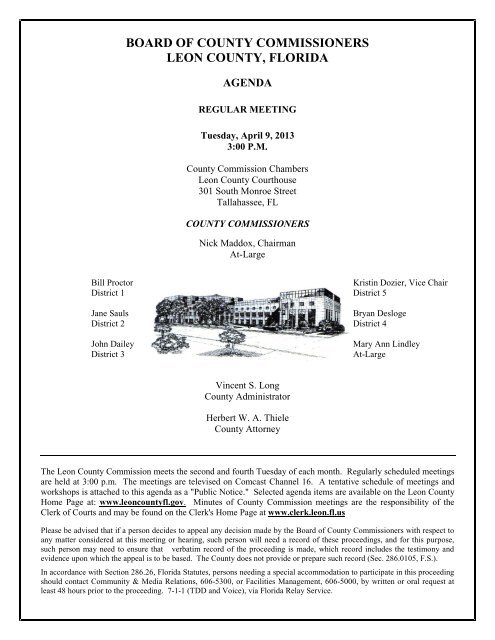
<strong>BOARD</strong> <strong>OF</strong> <strong>COUNTY</strong> <strong>COMMISSIONERS</strong><br />
<strong>LEON</strong> <strong>COUNTY</strong>, <strong>FLORIDA</strong><br />
AGENDA<br />
REGULAR MEETING<br />
Tuesday, April 9, 2013<br />
3:00 P.M.<br />
County Commission Chambers<br />
Leon County Courthouse<br />
301 South Monroe Street<br />
Tallahassee, FL<br />
<strong>COUNTY</strong> <strong>COMMISSIONERS</strong><br />
Nick Maddox, Chairman<br />
At-Large<br />
Bill Proctor Kristin Dozier, Vice Chair<br />
District 1 District 5<br />
Jane Sauls Bryan Desloge<br />
District 2 District 4<br />
John Dailey Mary Ann Lindley<br />
District 3 At-Large<br />
Vincent S. Long<br />
County Administrator<br />
Herbert W. A. Thiele<br />
County Attorney<br />
The Leon County Commission meets the second and fourth Tuesday of each month. Regularly scheduled meetings<br />
are held at 3:00 p.m. The meetings are televised on Comcast Channel 16. A tentative schedule of meetings and<br />
workshops is attached to this agenda as a "Public Notice." Selected agenda items are available on the Leon County<br />
Home Page at: www.leoncountyfl.gov. Minutes of County Commission meetings are the responsibility of the<br />
Clerk of Courts and may be found on the Clerk's Home Page at www.clerk.leon.fl.us<br />
Please be advised that if a person decides to appeal any decision made by the Board of County Commissioners with respect to<br />
any matter considered at this meeting or hearing, such person will need a record of these proceedings, and for this purpose,<br />
such person may need to ensure that verbatim record of the proceeding is made, which record includes the testimony and<br />
evidence upon which the appeal is to be based. The County does not provide or prepare such record (Sec. 286.0105, F.S.).<br />
In accordance with Section 286.26, Florida Statutes, persons needing a special accommodation to participate in this proceeding<br />
should contact Community & Media Relations, 606-5300, or Facilities Management, 606-5000, by written or oral request at<br />
least 48 hours prior to the proceeding. 7-1-1 (TDD and Voice), via Florida Relay Service.
INVOCATION AND PLEDGE <strong>OF</strong> ALLEGIANCE<br />
Board of County Commissioners<br />
Leon County, Florida<br />
Agenda<br />
Regular Public Meeting<br />
Tuesday, April 9, 2013<br />
Commissioner Mary Ann Lindley<br />
Dr. Jimmy Yu, Sheng Yen Assistant Professor of Chinese Buddhism at Florida State University will provide<br />
the Invocation.<br />
AWARDS AND PRESENTATIONS<br />
Proclamation Recognizing April as National Jazz Month<br />
(Chairman Nick Maddox)<br />
CONSENT<br />
1. Approval of Minutes: February 12, 2012 Cycle 2013-1 Comprehensive Plan Amendments<br />
Workshop and the February 26, 2013 Regular Meeting<br />
(Clerk of the Courts/Finance/Board Secretary)<br />
2. Ratification of Commissioners Appointments to the Contractors Licensing and Examination<br />
Board, Housing Finance Authority, Library Advisory Board, Minority, Women and Small<br />
Business Enterprise Committee, and Viva Florida Time Capsule Committee<br />
(County Administration/Agenda Coordinator)<br />
3. Approval of Capital Region Transportation Planning Agency Interlocal Agreement<br />
(Capital Region Transportation Planning Agency)<br />
4. Approval of Payment of Bills and Vouchers Submitted April 9, 2013, and Pre-Approval of<br />
Payment of Bills and Vouchers for the Period of April 10 through April 22, 2013<br />
(Financial Stewardship/Office of Management & Budget)<br />
5. Approval of an Amendment to Bond Community Health Center’s FY 2012-2013 Contract<br />
(Human Services & Community Partnerships/Housing Services)<br />
6. Approval to Submit 2013 Florida Department of Health, Bureau of Emergency Medical Services<br />
Matching Grant Application<br />
(Public Services/Emergency Medical Services)<br />
7. Approval of a Resolution to Suspend Assessment of Fees for Requests to Extend Environmental<br />
Management Permits as a Part of Economic Stimulus Strategies for Development and Related<br />
Activities<br />
(Public Works & Community Development/DSEM/Environmental Services)<br />
8. Approval of the Proposed Staffing and Customer Service Enhancements at the Department of<br />
Development Support and Environmental Management<br />
(Public Works & Community Development/DSEM/Permit & Code Services)<br />
Page 2 of 622 Posted at 5:00 p.m. on April 1, 2013
Board of County Commissioners<br />
Regular Public Meeting Agenda<br />
April 9, 2013 Page 2<br />
9. Approve the First Amendment to the State Highway Lighting Maintenance and Compensation<br />
Agreement with Florida Department of Transportation<br />
(Public Works & Community Development/Public Works/Engineering)<br />
10. Request to Schedule a Public Hearing to Adopt a Resolution Imposing Special Improvement<br />
Liens, and Adoption of a Non-Ad Valorem Assessment Roll for Brushy Creek Road Stormwater<br />
Control and Drainage Improvement Project for Tuesday, May 14, 2013 at 6:00 p.m.<br />
(Public Works & Community Development/Public Works/Engineering)<br />
11. Request to Schedule a Public Hearing to Adopt a Resolution Imposing Special Improvement<br />
Liens, and Adoption of a Non-Ad Valorem Assessment Roll for Terre Bonne Subdivision Street<br />
Improvement Project for Tuesday, May 14, 2013 at 6:00 p.m.<br />
(Public Works & Community Development/Public Works/Engineering)<br />
12. Adoption of a Resolution Supporting Little League as the Baseball/Softball Sports Provider for<br />
Leon County<br />
(Public Works & Community Development/Public Works/Parks & Recreation)<br />
Status Reports: (These items are included under Consent.)<br />
13. Acceptance of Status Report Regarding Boat Ramp Enhancements and Lake Maintenance<br />
(Public Works & Community Development/Public Works/Parks & Recreation)<br />
14. Acceptance of Status Report on the Huntington Oaks “Sense of Place” Initiative<br />
(Public Works & Community Development/PLACE/Planning)<br />
CONSENT ITEMS PULLED FOR DISCUSSION<br />
CITIZENS TO BE HEARD ON NON-AGENDAED ITEMS<br />
3-minute limit per speaker; there will not be any discussion by the Commission<br />
GENERAL BUSINESS<br />
15. Acceptance of Status Report on the 2013 Legislative Session<br />
(Economic Development & Business Partnerships/Special Projects & Intergovernmental Affairs Coordinator)<br />
16. Acceptance of a Status Report and Approval to Implement After-Hours and Weekend Building<br />
Inspections for Certain Types of Construction Projects<br />
(Public Works & Community Development/DSEM/Building Plans Review & Inspection)<br />
17. Consideration of Full Board Committee Appointments to the Affordable Housing Advisory<br />
Committee, Enterprise Zone Development Agency, and Value Adjustment Board<br />
(County Administration)<br />
SCHEDULED PUBLIC HEARINGS, 6:00 P.M.<br />
18. Joint City/County Transmittal Hearing on Cycle 2013-1 Comprehensive Plan Amendments<br />
(Public Works & Community Development/PLACE/Planning)<br />
Page 3 of 622 Posted at 5:00 p.m. on April 1, 2013
Board of County Commissioners<br />
Regular Public Meeting Agenda<br />
April 9, 2013 Page 3<br />
CITIZENS TO BE HEARD ON NON-AGENDAED ITEMS<br />
3-minute limit per speaker; Commission may discuss issues that are brought forth by speakers.<br />
COMMENTS/DISCUSSION ITEMS<br />
Items from the County Attorney<br />
Items from the County Administrator<br />
Discussion Items by Commissioners<br />
RECEIPT AND FILE<br />
None.<br />
ADJOURN<br />
The next Regular Board of County Commissioners Meeting is scheduled for<br />
Tuesday, April 23, 2013 at 3:00 p.m.<br />
All lobbyists appearing before the Board must pay a $25 annual registration fee. For registration forms and/or<br />
additional information, please see the Board Secretary or visit the County website at www.leoncountyfl.gov<br />
Page 4 of 622 Posted at 5:00 p.m. on April 1, 2013
Board of County Commissioners<br />
Regular Public Meeting Agenda<br />
April 9, 2013 Page 4<br />
2013<br />
JANUARY<br />
S M T W T F S<br />
1 2 3 4 5<br />
6 7 8 9 10 11 12<br />
13 14 15 16 17 18 19<br />
20 21 22 23 24 25 26<br />
27 28 29 30 31<br />
APRIL<br />
S M T W T F S<br />
1 2 3 4 5 6<br />
7 8 9 10 11 12 13<br />
14 15 16 17 18 19 20<br />
21 22 23 24 25 26 27<br />
28 29 30<br />
JULY<br />
S M T W T F S<br />
1 2 3 4 5 6<br />
7 8 9 10 11 12 13<br />
14 15 16 17 18 19 20<br />
21 22 23 24 25 26 27<br />
28 29 30 31<br />
OCTOBER<br />
S M T W T F S<br />
1 2 3 4 5<br />
6 7 8 9 10 11 12<br />
13 14 15 16 17 18 19<br />
20 21 22 23 24 25 26<br />
27 28 29 30 31<br />
FEBRUARY<br />
S M T W T F S<br />
1 2<br />
3 4 5 6 7 8 9<br />
10 11 12 13 14 15 16<br />
17 18 19 20 21 22 23<br />
24 25 26 27 28<br />
MAY<br />
S M T W T F S<br />
1 2 3 4<br />
5 6 7 8 9 10 11<br />
12 13 14 15 16 17 18<br />
19 20 21 22 23 24 25<br />
26 27 28 29 30 31<br />
AUGUST<br />
S M T W T F S<br />
1 2 3<br />
4 5 6 7 8 9 10<br />
11 12 13 14 15 16 17<br />
18 19 20 21 22 23 24<br />
25 26 27 28 29 30 31<br />
NOVEMBER<br />
S M T W T F S<br />
1 2<br />
3 4 5 6 7 8 9<br />
10 11 12 13 14 15 16<br />
17 18 19 20 21 22 23<br />
24 25 26 27 28 29 30<br />
MARCH<br />
S M T W T F S<br />
1 2<br />
3 4 5 6 7 8 9<br />
10 11 12 13 14 15 16<br />
17 18 19 20 21 22 23<br />
24 25 26 27 28 29 30<br />
31<br />
JUNE<br />
S M T W T F S<br />
1<br />
2 3 4 5 6 7 8<br />
9 10 11 12 13 14 15<br />
16 17 18 19 20 21 22<br />
23 24 25 26 27 28 29<br />
30<br />
SEPTEMBER<br />
S M T W T F S<br />
1 2 3 4 5 6 7<br />
8 9 10 11 12 13 14<br />
15 16 17 18 19 20 21<br />
22 23 24 25 26 27 28<br />
29 30<br />
DECEMBER<br />
S M T W T F S<br />
1 2 3 4 5 6 7<br />
8 9 10 11 12 13 14<br />
15 16 17 18 19 20 21<br />
22 23 24 25 26 27 28<br />
29 30 31<br />
Page 5 of 622 Posted at 5:00 p.m. on April 1, 2013
Board of County Commissioners<br />
Regular Public Meeting Agenda<br />
April 9, 2013 Page 5<br />
PUBLIC NOTICE<br />
2013 Tentative Schedule<br />
All Workshops, Meetings, and Public Hearings are subject to change<br />
All sessions are held in the Commission Chambers, 5 th Floor, Leon County Courthouse unless otherwise<br />
indicated. Workshops are scheduled as needed on Tuesdays from 12:00 to 3:00 p.m.<br />
Month Day Time Meeting Type<br />
April 2013 Wednesday 3 FAC County<br />
Commissioner Workshop<br />
Thursday 4 FAC Legislative Day Tallahassee<br />
Friday 5 FAC County<br />
Commissioner Workshop<br />
FSU Turnbull Conference Center<br />
Tallahassee<br />
FSU Turnbull Conference Center<br />
Tallahassee<br />
Tuesday 9 1:30 – 3:00 p.m. Workshop on Sidewalk Policy, Priorities, and<br />
Funding Options<br />
3:00 p.m. Regular Meeting<br />
6:00 p.m. Joint City/County Transmittal Hearing on<br />
Cycle 2013-1 Comprehensive Plan Amendments<br />
Monday 15 9:00 a.m. – 1:00 p.m. Capital Region Transportation Planning Agency<br />
(CRTPA) Retreat;<br />
Tallahassee Regional Airport, Conference Room<br />
Thursday 18 –<br />
Friday 19<br />
FAC Advanced County<br />
Commissioner Workshop<br />
Seminar 3 of 3:<br />
UF Hilton, Gainesville; Alachua County<br />
Tuesday 23 9:00 a.m. – 3:00 p.m. FY 13/14 Budget Workshop<br />
3:00 p.m. Regular Meeting<br />
Wednesday 24 2:30 p.m. Community Redevelopment Agency (CRA)<br />
Meeting; City Commission Chambers<br />
May 2013 Tuesday 14 3:00 p.m. Regular Meeting<br />
6:00 p.m. First and Only Public Hearing on an Ordinance<br />
Amending Chapter 10, Division 7, “Historic<br />
Preservation District Designation Revisions”<br />
Public Hearing for Bushy Creek Road<br />
Stormwater Control and Drainage Improvements<br />
Project Proposed Special Improvement Liens and<br />
the Non-Ad Valorem Assessment Roll<br />
Public Hearing for Terre Bonne Subdivision<br />
Street Improvement Project Proposed Special<br />
Improvement Liens and the Non-Ad Valorem<br />
Assessment Roll<br />
Monday 20 11:00 a.m. Community Redevelopment Agency (CRA)<br />
Meeting; City Commission Chambers<br />
1:00 p.m. Capital Region Transportation Planning Agency<br />
(CRTPA) Meeting; City Commission Chambers<br />
Page 6 of 622 Posted at 5:00 p.m. on April 1, 2013
Board of County Commissioners<br />
Regular Public Meeting Agenda<br />
April 9, 2013 Page 6<br />
Month Day Time Meeting Type<br />
May 2013<br />
(Continued)<br />
Monday 27 Offices Closed MEMORIAL DAY<br />
Tuesday 28 3:00 p.m. Regular Meeting<br />
6:00 p.m. Joint City/County Adoption Hearing on Cycle 2013-<br />
1 Comprehensive Plan Amendments<br />
June 2013 Tuesday 11 3:00 p.m. Regular Meeting<br />
Monday 17 11:00 a.m. Community Redevelopment Agency (CRA)<br />
Meeting; City Commission Chambers<br />
1:00 p.m. Capital Region Transportation Planning Agency<br />
(CRTPA) Meeting; City Commission Chambers<br />
3:00 – 5:00 p.m. IA (BP2000); City Commission Chambers<br />
Tuesday 18 3:00 Regular Meeting<br />
Tuesday 25 No Meeting FAC CONFERENCE<br />
Tuesday 25<br />
Friday 28<br />
FAC Annual Conference Marriott Tampa Waterside<br />
Hillsborough County<br />
July 2013 Thursday 4 Offices Closed JULY 4 TH HOLIDAY<br />
Monday 8 9:00 a.m. – 5:00 p.m. FY 13/14 Budget Workshop<br />
Tuesday 9 9:00 a.m. – 3:00 p.m. FY 13/14 Budget Workshop, if necessary<br />
3:00 p.m. Regular Meeting<br />
Wednesday 10 9:00 a.m. – 2:00 p.m. FY 13/14 Budget Workshop, if necessary<br />
Friday 19 –<br />
Monday 22<br />
2:30 p.m. Community Redevelopment Agency (CRA)<br />
Meeting; City Commission Chambers<br />
NACo Annual Conference Fort Worth Convention Center<br />
Tarrant County/Ft. Worth, Texas<br />
Tuesday 23 No Meeting <strong>BOARD</strong> RECESS<br />
Wednesday 24 –<br />
Saturday 27<br />
August 2013 Friday 9 –<br />
Sunday 11<br />
National Urban League<br />
Annual Conference<br />
Chamber of Commerce<br />
Annual Conference<br />
Philadelphia, PA<br />
Omni Amelia Island Plantation<br />
Tuesday 13 No Meeting <strong>BOARD</strong> RECESS<br />
Tuesday 27 3:00 p.m. Regular Meeting<br />
Page 7 of 622 Posted at 5:00 p.m. on April 1, 2013
Board of County Commissioners<br />
Regular Public Meeting Agenda<br />
April 9, 2013 Page 7<br />
Month Day Time Meeting Type<br />
September 2013 Monday 2 Offices Closed LABOR DAY HOLIDAY<br />
Monday 16 11:00 a.m. CRA Meeting; City Commission Chambers<br />
1:00 p.m. CRTPA Meeting; City Commission Chambers<br />
5:00 – 8:00 p.m.<br />
5:30 p.m.<br />
Tuesday 17 3:00 p.m. Regular Meeting<br />
Wednesday 18 –<br />
Friday 20<br />
IA (BP 2000); City Commission Chambers<br />
Public Hearing on FY 2014 Budget<br />
6:00 p.m. First Public Hearing Regarding Tentative Millage<br />
Rates and Tentative Budgets for FY 2013/2014 *<br />
FAC Policy Committee<br />
Conference<br />
Wednesday 18 FAC County<br />
Commissioner Workshop<br />
Wednesday 18 –<br />
Saturday 21<br />
Sunday 22 –<br />
Wednesday 25<br />
Congressional Black<br />
Caucus Annual<br />
Legislative Conference<br />
Marriott West Palm Beach<br />
Palm Beach County<br />
Marriott West Palm Beach<br />
Palm Beach County<br />
Washington, D.C.<br />
ICMA Annual Conference Boston, Massachusetts<br />
Tuesday 24 3:00 p.m. Regular Meeting<br />
October 2013 TBD Advanced County<br />
Commissioner Program<br />
6:00 p.m. Second Public Hearing on Adoption of Millage<br />
Rates and Budgets for FY 2013/2014*<br />
Tuesday 8 3:00 p.m. Regular Meeting<br />
Part 1 of 3<br />
UF Hilton, Gainesville; Alachua County<br />
Monday 21 9:00 a.m. – 1:00 p.m. CRTPA Retreat; Location TBD<br />
1:30 p.m. CRA - Immediately following CRTPA Retreat<br />
Tuesday 22 3:00 p.m. Regular Meeting<br />
November 2013 Monday 11 Offices Closed VETERAN’S DAY OBSERVED<br />
Tuesday 12 –<br />
Thursday 14<br />
Wednesday 13 –<br />
Friday 15<br />
County Commissioner<br />
Workshops<br />
FAC Legislative<br />
Conference<br />
Hilton, Daytona Beach<br />
Volusia County<br />
Hilton, Daytona Beach<br />
Volusia County<br />
Tuesday 19 3:00 p.m. Reorganization of the Board; Regular Meeting<br />
Monday 25 11:00 a.m. CRA Meeting; City Commission Chambers<br />
1:00 p.m. CRTPA Meeting; City Commission Chambers<br />
Thursday 28 Offices Closed THANKSGIVING DAY<br />
Friday 29 Offices Closed FRIDAY AFTER THANKSGIVING DAY<br />
Page 8 of 622 Posted at 5:00 p.m. on April 1, 2013
Board of County Commissioners<br />
Regular Public Meeting Agenda<br />
April 9, 2013 Page 8<br />
Month Day Time Meeting Type<br />
December 2013 Monday 9 9:00 a.m. – 4:00 p.m. Board Retreat<br />
Tuesday 10 3:00 p.m. Regular Meeting<br />
Wednesday 11 2:30 p.m. Community Redevelopment Agency (CRA)<br />
City Commission Chambers<br />
Tuesday 24 No Meeting <strong>BOARD</strong> RECESS<br />
Wednesday 25 Offices Closed CHRISTMAS DAY<br />
January 2014 Wednesday 1 Offices Closed NEW YEAR=S DAY<br />
Page 9 of 622 Posted at 5:00 p.m. on April 1, 2013
Board of County Commissioners<br />
Regular Public Meeting Agenda<br />
April 9, 2013 Page 9<br />
VACANCIES<br />
Citizen Committees, Boards, and Authorities<br />
2013 Expirations and Vacancies<br />
www.leoncountyfl.gov/committees/expire.asp<br />
Affordable Housing Advisory Committee<br />
Board of County Commissioners (4 appointments)<br />
A member who represents employers within the jurisdiction.<br />
A member who is actively engaged in the banking or mortgage banking industry in connection with affordable housing.<br />
A member who is actively engaged as an advocate for low-income persons in connection with affordable housing.<br />
A member who is actively engaged as a for-profit provider of affordable housing.<br />
Architectural Review Board<br />
Board of County Commissioners (1 appointment)<br />
Housing Finance Authority<br />
Commissioner – District IV: Desloge, Bryan (1 appointment)<br />
Viva Florida Time Capsule Committee<br />
Commissioner - District I: Proctor, Bill (1 appointment)<br />
Commissioner - District III: Dailey, John (1 appointment)<br />
Commissioner - District V: Dozier, Kristin (1 appointment)<br />
EXPIRATIONS<br />
Adjustment and Appeals Board<br />
Tallahassee City Commission (1 appointment)<br />
Architectural Review Board<br />
Tallahassee City Commission (2 appointments)<br />
Canopy Roads Citizens Committee<br />
Tallahassee City Commission (1 appointment)<br />
Enterprise Zone Agency Development (EZDA) Board of Commissioners<br />
Tallahassee City Commission (1 appointment)<br />
Human Services Grants Review Committee<br />
Commissioner - District IV: Desloge, Bryan (1 appointment)<br />
Commissioner - District V: Dozier, Kristin (1 appointment)<br />
Library Advisory Board<br />
Commissioner - District III: Dailey, John (1 appointment)<br />
Commissioner - District V: Dozier, Kristin (1 appointment)<br />
Minority, Women & Small Business Enterprise (M/WSBE) Committee<br />
Commissioner - District III: Dailey, John (1 appointment)<br />
Commissioner - District V: Dozier, Kristin (1 appointment)<br />
Value Adjustment Board<br />
Board of County Commissioners (1 appointment)<br />
MARCH 31, 2013<br />
Contractors Licensing and Examination Board<br />
Commissioner - At-large II: Maddox, Nick (1 appointment)<br />
Commissioner - District II: Sauls, Jane G. (1 appointment)<br />
Science Advisory Committee<br />
Tallahassee City Commission (1 appointment)<br />
Page 10 of 622 Posted at 5:00 p.m. on April 1, 2013
Board of County Commissioners<br />
Regular Public Meeting Agenda<br />
April 9, 2013 Page 10<br />
APRIL 30, 2013<br />
Commission on the Status of Women and Girls<br />
Commissioner - At-large I: Lindley, Mary Ann (1 appointment)<br />
Commissioner - At-large II: Maddox, Nick (1 appointment)<br />
Commissioner - District I: Proctor, Bill (1 appointment)<br />
Commissioner - District II: Sauls, Jane G. (1 appointment)<br />
Commissioner - District III: Dailey, John (1 appointment)<br />
Commissioner - District IV: Desloge, Bryan (1 appointment)<br />
Commissioner - District V: Dozier, Kristin (1 appointment)<br />
Tallahassee Sports Council<br />
Board of County Commissioners (2 appointments)<br />
MAY 31, 2013<br />
Minority, Women & Small Business Enterprise (M/WSBE) Committee<br />
Commissioner - At-large II: Maddox, Nick (1 appointment)<br />
Commissioner - District II: Sauls, Jane G. (1 appointment)<br />
JUNE 30, 2013<br />
Adjustment and Appeals Board<br />
Board of County Commissioners (1 appointment)<br />
Tallahassee City Commission (2 appointments)<br />
Leon County Sales Tax Committee<br />
Blueprint Citizens Advisory Committee (1 appointment)<br />
Capital City Chamber of Commerce (1 appointment)<br />
Commissioner - At-large I: Lindley, Mary Ann (1 appointment)<br />
Commissioner - At-large II: Maddox, Nick (1 appointment)<br />
Commissioner - District I: Proctor, Bill (1 appointment)<br />
Commissioner - District II: Sauls, Jane G. (1 appointment)<br />
Commissioner - District III: Dailey, John (1 appointment)<br />
Commissioner - District IV: Desloge, Bryan (1 appointment)<br />
Commissioner - District V: Dozier, Kristin (1 appointment)<br />
EECC (1 appointment)<br />
Greater Tallahassee Chamber of Commerce (1 appointment)<br />
Tallahassee City Commission (6 appointments)<br />
Planning Commission<br />
Board of County Commissioners (1 appointment)<br />
Workforce Plus<br />
Board of County Commissioners (3 appointments)<br />
Page 11 of 622 Posted at 5:00 p.m. on April 1, 2013
Board of County Commissioners<br />
Regular Public Meeting Agenda<br />
April 9, 2013 Page 11<br />
JULY 31, 2013<br />
Educational Facilities Authority<br />
Board of County Commissioners (2 appointments)<br />
Enterprise Zone Agency Development (EZDA) Board of Commissioners<br />
Board of County Commissioners (3 appointments)<br />
Investment Oversight Committee<br />
Board of County Commissioners (3 appointments)<br />
Clerk (1 appointment)<br />
Water Resources Committee<br />
Commissioner - At-large I: Lindley, Mary Ann (1 appointment)<br />
Commissioner - At-large II: Maddox, Nick (1 appointment)<br />
Commissioner - District I: Proctor, Bill (1 appointment)<br />
Commissioner - District II: Sauls, Jane G. (1 appointment)<br />
Commissioner - District III: Dailey, John (1 appointment)<br />
AUGUST 31, 2013<br />
Canopy Roads Citizens Committee<br />
Tallahassee City Commission (1 appointment)<br />
Code Enforcement Board<br />
Commissioner - At-large II: Maddox, Nick (1 appointment)<br />
SEPTEMBER 30, 2013<br />
Community Development Block Grant Citizen's Advisory Task Force<br />
Board of County Commissioners (2 appointments)<br />
Council on Culture & Arts<br />
Board of County Commissioners (1 appointment)<br />
Housing Finance Authority<br />
Commissioner - At-large II: Maddox, Nick (1 appointment)<br />
Commissioner - District I: Proctor, Bill (1 appointment)<br />
Research and Development Authority at Innovation Park<br />
Florida A & M (1 appointment)<br />
Tallahassee Community College (1 appointment)<br />
OCTOBER 31, 2013<br />
Canopy Roads Citizens Committee<br />
Board of County Commissioners (2 appointments)<br />
Tourist Development Council<br />
Board of County Commissioners (1 appointment)<br />
Page 12 of 622 Posted at 5:00 p.m. on April 1, 2013
Board of County Commissioners<br />
Regular Public Meeting Agenda<br />
April 9, 2013 Page 12<br />
DECEMBER 31, 2013<br />
Human Services Grants Review Committee<br />
Commissioner - At-large I: Lindley, Mary Ann (1 appointment)<br />
Commissioner - At-large II: Maddox, Nick (1 appointment)<br />
Commissioner - District I: Proctor, Bill (1 appointment)<br />
Commissioner - District II: Sauls, Jane G. (1 appointment)<br />
Commissioner - District III: Dailey, John (1 appointment)<br />
Commissioner - District IV: Desloge, Bryan (1 appointment)<br />
Commissioner - District V: Dozier, Kristin (1 appointment)<br />
Library Advisory Board<br />
Commissioner - At-large I: Lindley, Mary Ann (1 appointment)<br />
Commissioner - District II: Sauls, Jane G. (1 appointment)<br />
Commissioner - District III: Dailey, John (1 appointment)<br />
Commissioner - District IV: Desloge, Bryan (1 appointment)<br />
Tallahassee/Leon County Cultural Plan Review Committee<br />
Board of County Commissioners (4 appointments)<br />
Capital City Chamber of Commerce (1 appointment)<br />
Economic Development Council (1 appointment)<br />
Greater Tallahassee Chamber of Commerce (1 appointment)<br />
KCCI (1 appointment)<br />
Leadership Tallahassee (1 appointment)<br />
Tallahassee City Commission (4 appointments)<br />
Page 13 of 622 Posted at 5:00 p.m. on April 1, 2013
Leon County<br />
Board of County Commissioners<br />
Notes for Agenda Item #1<br />
Page 14 of 622 Posted at 5:00 p.m. on April 1, 2013
Leon County<br />
Board of County Commissioners<br />
Cover Sheet for Agenda #1<br />
April 9, 2013<br />
To: Honorable Chairman and Members of the Board<br />
From: Vincent S. Long, County Administrator<br />
Title: Approval of Minutes: February 12, 2013 Cycle 2013-1 Comprehensive Plan<br />
Amendments Workshop; and February 26, 2013 Regular Meeting<br />
County Administrator<br />
Review and Approval:<br />
Department/<br />
Division Review:<br />
Lead Staff/<br />
Project Team:<br />
Fiscal Impact:<br />
Vincent S. Long, County Administrator<br />
David Reid, Finance Director, Clerk of the Court<br />
Rebecca Vause, Board Secretary<br />
This item has no fiscal impact to the County.<br />
Staff Recommendation:<br />
Option #1: Approve the minutes of the February 12, 2013 Cycle 2013-1 Comprehensive Plan<br />
Amendments Workshop; and February 26, 2013 Regular Meeting.<br />
Attachments:<br />
1. February 12, 2013 Cycle 2013-1 Comprehensive Plan Amendments Workshop<br />
2. February 26, 2013 Regular Meeting<br />
Page 15 of 622 Posted at 5:00 p.m. on April 1, 2013
<strong>BOARD</strong> <strong>OF</strong> <strong>COUNTY</strong> <strong>COMMISSIONERS</strong><br />
WORKSHOP<br />
CYCLE 2013-1 COMPREHENSIVE PLAN AMENDMENTS<br />
February 12, 2013<br />
The Leon County Board of County Commissioners convened on February 12, 2013 to<br />
conduct a workshop on the Cycle 2013-1 Comprehensive Plan Amendments. Attending<br />
were Commissioners Nick Maddox (Chairman), Kristin Dozier (Vice Chairman), Bryan<br />
Desloge, Jane Sauls, Mary Ann Lindley. Commissioner Proctor was not in attendance.<br />
Also attending were County Administrator Vincent Long, County Attorney Herb Thiele,<br />
and Board Secretary Rebecca Vause.<br />
Chairman Maddox called the 2013-1 Comprehensive Plan Amendments Workshop to<br />
order at 1:31 p.m.<br />
Facilitator(s): Cherie Bryant, Manager, Comprehensive Planning and Urban Design<br />
Brian Weibler, Principal Planner<br />
Steve Hodges, Senior Planner<br />
A. Introductory Comments By Staff:<br />
Ms. Bryant stated the purpose of the workshop was to introduce the Cycle 2013-1<br />
Comprehensive Plan Amendments and to provide an opportunity for the Board to<br />
discuss and request additional information. She provided that staff has held two public<br />
workshops on the proposed amendments, and another was held by the Local Planning<br />
Agency (LPA). She stated that the LPA recommends approval of all amendments and<br />
tentative approval has been received by the City Commission. Ms. Bryant advised that<br />
no formal vote was needed at this time; however, staff did ask the Board to vote on a<br />
tentative position.<br />
B. Review of Proposed Cycle 2013-1 Comprehensive Plan Amendments<br />
Monday Road near Capital Circle Southeast - (PCM130101)<br />
Applicant: City of Tallahassee Owner: Melvin and Marcus Payne<br />
Request: “High Intensity Urban Activity Center” to „Urban Residential – 2” for a<br />
one-acre parcel located north of Monday Road near Capital Circle Southeast.<br />
City staff initiated the amendment following issuance of a Land Use Compliance<br />
Certificate to construct two single-family residences on the parcel. The<br />
amendment allows the owner to move forward with the subdivision and<br />
construction of the homes as represented in the Land Use Compliance<br />
Certificate.<br />
Commissioner Sauls moved, duly seconded by Commissioner Dozier, approval of<br />
amendment PCM130101. The motion carried 5-0 (Commissioners Dailey and<br />
Proctor out of Chambers).<br />
West Brevard Street – PCM130102<br />
Applicant and Owner: Lewis Chambers<br />
Attachment #1<br />
Page 1 of 5<br />
Request: “Residential Preservation” to “Central Urban” on lots totaling 1.15<br />
acres located immediately north of West Brevard Street, between Dade Street<br />
and Dean Street. The site includes the existing Blue Collar Restaurant, a use<br />
which is non-conforming under the current Residential Preservation category.<br />
Workshop: Cycle 2013-1 Comprehensive Plan Amendments Page 1<br />
February 12, 2013<br />
Page 16 of 622 Posted at 5:00 p.m. on April 1, 2013
The requested change would provide relief from the current status as nonconforming<br />
and allow the applicant to expand the use.<br />
Commissioner Lindley moved, duly seconded by Commissioner Desloge, approval<br />
of amendment PCM130102. The motion carried 5-0 (Commissioners Dailey and<br />
Proctor out of Chambers).<br />
Truett Drive and Bradford Road – (PCM130103)<br />
WITHDRAWN BY APPLICANT<br />
Timberlane Road near Market District – (PCM130104)<br />
Applicant and Owner: Dr. Darrh Bryant<br />
Request: “Lake Protection” to “Suburban” on one parcel (approximately 0.5<br />
acres) located at 1234 Timberlane Road. This parcel is presently developed for<br />
office use. The existing Lake Protection category does not permit non-residential<br />
uses inside the City Limits. The requested Suburban category would provide<br />
relief from the current status as non-conforming and allow the applicant to<br />
utilize the property as a dental office. Staff is also recommending the<br />
surrounding office buildings be included in the amendment (34 properties on<br />
about 10 acres).<br />
Commissioner Desloge moved, duly seconded by Commissioner Dozier, approval<br />
of amendment PCM130104. The motion carried 6-0 (Commissioner Proctor out of<br />
Chambers).<br />
Woodville rural Community Expansion – (PCM130105)<br />
Applicant and Owner: Disc Village<br />
Attachment #1<br />
Page 2 of 5<br />
Request: “Rural” to “Woodville Rural Community” on three adjoining parcels<br />
(totaling approximately 98 acres) located on the southside of Natural Bridge<br />
Road, approximately one mile east of Woodville Highway. These parcels are<br />
presently developed as a non-profit community-based therapeutic community.<br />
The requested Woodville Rural Community category would allow an expansion of<br />
facilities and programs oriented towards senior citizens.<br />
Commissioner Dozier moved, duly seconded by Commissioner Dailey, approval of<br />
amendment PCM130105. The motion carried 5-0 (Commissioner Desloge and<br />
Proctor out of Chambers).<br />
Jackson Bluff Road and Ausley Street – (PCM130106)<br />
Applicant: Carolyn Bibler Owner: Jackson Bluff Properties LLC, Landmark<br />
Apartments LLC, Stadium Place of Tallahassee LLC, Greenbriar Partners, LLC<br />
Request: “Urban Residential–2” to “University Transition” for four parcels<br />
totaling 16.42 acres located near Jackson Bluff and Ausley Road. The applicant<br />
would like to redevelop this node at Jackson Bluff and Ausley Road with small<br />
scale commercial intermixed with higher density housing to support it. The<br />
neighborhood scale commercial development would also serve the existing<br />
residential neighborhoods in the area.<br />
Commissioner Sauls moved, duly seconded by Commissioner Desloge, approval of<br />
amendment PCM130106. The motion carried 6-0 (Commissioner Proctor out of<br />
Chambers).<br />
Workshop: Cycle 2013-1 Comprehensive Plan Amendments Page 2<br />
February 12, 2013<br />
Page 17 of 622 Posted at 5:00 p.m. on April 1, 2013
9 th Avenue and Thomasville Road – (PCM130107)<br />
Applicant: City of Tallahassee Owner: Marshall Cassedy, Jr.<br />
Request: “Residential Preservation” to “Neighborhood Boundary” on two<br />
adjoining parcels and a portion of a third adjoining parcel (totaling<br />
approximately 0.4 acre) located on the east side of Thomasville Road between 8 th<br />
and 9 th Avenues. The area is presently developed and used for a hair salon and<br />
related parking. This amendment implements recommendations in a settlement<br />
agreement reached on September 7, 2012 between Marshall Cassedy, the City,<br />
and participating neighbors.<br />
Commissioner Desloge moved, duly seconded by Commissioner Dailey, approval<br />
of amendment PCM130107. The motion carried 6-0 (Commissioner Proctor out of<br />
Chambers).<br />
Chairman Maddox confirmed with staff that the remaining amendments had received<br />
no opposition by either the City Commission or the LPA. He then asked fellow<br />
Commissioners if there were issues or questions regarding any of the remaining<br />
amendments. Commissioner Lindley indicated that she would like more information on<br />
PCT130109. Chairman Maddox requested a motion to move the remaining<br />
amendments minus PCT130109.<br />
Commissioner Dailey moved, duly seconded by Commissioner Desloge, approval of PCM<br />
130108; PCT130110; PCT130111; PCT130112, AND PCT130113. The motion carried 5-1<br />
(Commissioner Dozier in opposition and Commissioner Proctor out of Chambers).<br />
Commissioner Dozier clarified that her dissenting vote to the motion was not indicative<br />
of any opposition to the amendments, but merely her opposition to moving the<br />
remaining amendments in mass.<br />
Fred George and Old Bainbridge Road – (PCM130108)<br />
Applicant: City of Tallahassee Owner: Andrews Enterprises Inc. (Jack<br />
Buford, Agent)<br />
Request: “Residential Preservation” to “Suburban” for an approximately oneacre<br />
parcel located on the southwest corner of Fred George Road and Old<br />
Bainbridge Road. This property presently contains a 1,973 square-foot<br />
convenience store built in 1987 in accordance with the former Huntington<br />
Woods Development of Regional Impact (DRI) development order. On June 23,<br />
2010, the City Commission rescinded the Huntington Woods DRI development<br />
order and the existing convenience store use of the property became a nonconforming<br />
use.<br />
Text-Updating Environmental Definitions – (PCT130110)<br />
Applicant: Planning Department<br />
Attachment #1<br />
Page 3 of 5<br />
Request: Amend the Glossary of the Comprehensive Plan to update<br />
environmental definitions that were recently amended in the City and County<br />
Code as part of the Countywide Minimum Environmental Standards project.<br />
These changes will avoid confusion between the definitions included in the City<br />
and County Code and the definitions in the Comprehensive Plan.<br />
Workshop: Cycle 2013-1 Comprehensive Plan Amendments Page 3<br />
February 12, 2013<br />
Page 18 of 622 Posted at 5:00 p.m. on April 1, 2013
Text – Clean up of Policies 1.1.10[M] and 2.3.8 [LU] – PCT130111)<br />
Applicant: Planning Department<br />
Request: Amend the Mobility Element and the Land Use Element. The<br />
amendment updates and removes outdated language in Policy 1.1.10 [M] and<br />
Policy 2.1.8 [L] and correctly identifies the policy guidance to receive a density<br />
bonus in the Mobility District (Multi-Modal Transportation District).<br />
Text – Addition of Paul Russell Road Extension to Future right of Way<br />
Needs Map – PCT130112)<br />
Applicant: Planning Department<br />
Request: Amend the Mobility Element to place the Paul Russell Road extension<br />
back on the Future Right-of-Way Needs Map. The roadway extension was<br />
previously included on the map, however, during the 2011-1 amendment cycle it<br />
was removed until such time as the English property was ready for development.<br />
The proposed Paul Russell Road extension bisects the English property. In the<br />
interim, owners of the English property have moved forward with development<br />
proposals for the property, as such, the Planning Department is requesting that<br />
the roadway extension be added back to the Future Right-of-Way Needs Map.<br />
Text – Walaunee Plantation Access from Thornton Road – PCT130113)<br />
Applicant: City of Tallahassee Commission<br />
Request: Amend the Welaunee Critical Area Plan in the Land Use element. The<br />
amendment would modify Policy 13.14 to change the allowed roadway access to<br />
the Walaunee Toe via Miccosukee Road from a crossing of the Miccosukee<br />
Canopy Road Greenway at Arendell Way to a crossing at Thornton Road. The<br />
amendment will be subject to site approval of a proposed land exchange to allow<br />
for the alternative crossing of the Greenway at Thornton Road.<br />
Text-Steep Grade Policy Inside Urban Service Area - (PCT130109)<br />
Applicant: Board of County Commissioners<br />
Request: Amend the Conservation element to remove Comprehensive Plan<br />
requirements for the protection of significant and severe grades inside the Urban<br />
Service Area. No change is proposed outside of the Urban Service Area. This<br />
amendment implements direction provided by the Board of County<br />
Commissioner on May 8, 2012 as part of the review conducted for the<br />
Countywide Minimum Environmental Standards project.<br />
Mr. Weibler provided a summary of the text amendment.<br />
Attachment #1<br />
Page 4 of 5<br />
Commissioner Dozier moved, duly seconded by Commissioner Desloge, approval<br />
of amendment PCT130109. The motion carried 6-0 (Commissioner Proctor out of<br />
Chambers).<br />
Workshop: Cycle 2013-1 Comprehensive Plan Amendments Page 4<br />
February 12, 2013<br />
Page 19 of 622 Posted at 5:00 p.m. on April 1, 2013
C. Adjournment<br />
ATTEST:<br />
Chairman Maddox adjourned the workshop at 2:00 p.m.<br />
BY: _____________________________<br />
Bob Inzer, Clerk of the Court<br />
Leon County, Florida<br />
<strong>LEON</strong> <strong>COUNTY</strong>, <strong>FLORIDA</strong><br />
Attachment #1<br />
Page 5 of 5<br />
BY: ________________________________<br />
Nicholas Maddox, Chairman<br />
Board of County Commissioners<br />
Workshop: Cycle 2013-1 Comprehensive Plan Amendments Page 5<br />
February 12, 2013<br />
Page 20 of 622 Posted at 5:00 p.m. on April 1, 2013
<strong>BOARD</strong> <strong>OF</strong> <strong>COUNTY</strong> <strong>COMMISSIONERS</strong><br />
<strong>LEON</strong> <strong>COUNTY</strong>, <strong>FLORIDA</strong><br />
REGULAR MEETING<br />
February 26, 2013<br />
The Board of County Commissioners of Leon County, Florida, met in regular session with<br />
Chairman Nick Maddox presiding. Present were Commissioners Kristin Dozier, Bill Proctor,<br />
Mary Ann Lindley, John Dailey, Bryan Desloge, and Jane Sauls. Also present were County<br />
Administrator Vincent Long, County Attorney Herb Thiele, Finance Director David Reid and<br />
Board Secretary Rebecca Vause.<br />
Chairman Maddox called the meeting to order at 3:00 p.m.<br />
Attachment #2<br />
Page 1 of 6<br />
The Invocation was provided by Commissioner Bryan Desloge who then led the Pledge of<br />
Allegiance.<br />
Awards and Presentations<br />
Commissioner Mary Ann Lindley presented a Proclamation congratulating the National<br />
High Magnetic Field Laboratory on the five-year renewal grant of $168 million from the<br />
National Science Foundation.<br />
Dr. Eric Palm, Deputy Lab Director, accepted the Proclamation on behalf of the Mag<br />
Lab and its staff.<br />
Consent:<br />
Commissioner Dozier moved, duly seconded by Commissioner Sauls, to approve the Consent<br />
Agenda. The motion carried 7-0.<br />
1. Approval of Minutes: January 29, 2013 Attorney/Client Meeting; and January 29,<br />
2013 Regular Meeting<br />
The Board approved Option 1: Approve the minutes of the January 29, 2013<br />
Attorney/Client Meeting; and January 29, 2013 Regular Meeting.<br />
2. Ratification of Commissioners’ Appointments to the Capital Region<br />
Transportation Planning Authority Citizens Multi-modal Advisory Committee,<br />
Development Support & Environmental Management Citizens Users Group,<br />
Human Services Grant Review Committee, and Minority, Women and Small<br />
Business Enterprise Committee<br />
The Board approved Option 1: Ratify Commissioners’ appointments as follows:<br />
a. Commissioner Lindley appoints Jeff Roberts to the Capital Region Transportation<br />
Planning Authority Citizens Multi-modal Advisory Committee.<br />
b. Commissioner Proctor appoints Sharon Sapp to the Capital Region Transportation<br />
Planning Authority Citizens Multi-modal Advisory Committee.<br />
c. Commissioner Sauls appoints John Folks to the Capital Region Transportation<br />
Planning Authority Citizens Multi-modal Advisory Committee.<br />
d. Commissioner Sauls appoints Bryan Hayden to the Development Support &<br />
Environmental Management Citizens Users Group.<br />
e. Commissioner Lindley appoints Connie Ruggles to the Human Services Grant<br />
Review Committee.<br />
f. Commissioner Dailey reappoints Cheri Garbark to the Minority/Women and Small<br />
Business Enterprise Committee.<br />
g. Commissioner Proctor appoints Paula Duncan to the Minority/Women & Small<br />
Business Enterprise Committee.<br />
Regular Meeting Page 1<br />
February 26, 2013<br />
Page 21 of 622 Posted at 5:00 p.m. on April 1, 2013
Attachment #2<br />
Page 2 of 6<br />
h. Commissioner Desloge appoints Joanie Trotman to the Minority/Women & Small<br />
Business Enterprise Committee.<br />
3. Approval of the Proposed Third Amendment to the Disaster Recovery Sub-<br />
Recipient Agreement with the City of Tallahassee<br />
The Board approved Option 1: Approve the proposed Amendment to the Disaster<br />
Recovery Sub-Recipient Agreement with the City of Tallahassee, and authorize the County<br />
Administrator to execute.<br />
4. Approval of Payment of Bills and Voucher Submitted for February 26, 2013, and<br />
Pre-Approval of Payment of Bills and Vouchers for the Period of February 27, 2013<br />
through March 11, 2013<br />
The Board approved Option 1: Approve payment of bills and vouchers submitted for<br />
February 26, 2013, and Pre-Approval of Payment of Bills and Vouchers for the Period of<br />
February 27, 2013 through March 11, 2013.<br />
5. Request to Schedule a First and Only Public Hearing on Consideration of Adoption<br />
of an Ordinance Amending Chapter 10, Division 7 of the Leon County Code of<br />
Laws, Entitled, “Historic Preservation District Designation Revisions” for<br />
Tuesday, May 14, 2013 at 6:00 p.m.<br />
The Board approved Option 1: Schedule the first and only public hearing on consideration<br />
of adoption of an ordinance amending Chapter 10, Division 7 of the Leon County Code of<br />
Laws, entitled, “Historic Preservation District Designation Revisions” on Tuesday, May 14,<br />
2013 at 6:00 p.m.<br />
6. Acceptance of a Release, Quitclaim, and Termination of Conservation Easement<br />
from ABR Construction, Inc. and Ryan M. Dungey for Conservation Easement #7<br />
within The Ridge at Velda Dairy Subdivision<br />
The Board approved Option 1: Approve and accept for recording the Release, Quitclaim,<br />
and Termination of Conservation Easement from ABR Construction, Inc. and Ryan M.<br />
Dungey for Conservation Easement #7 within the Ridge at Velda Dairy Subdivision.<br />
7. Approval of Off System Project Agreement with Florida Department of<br />
Transportation for the Natural Bridge Road Bridge Replacement<br />
The Board approved Options 1 & 2: 1) Approve the proposed Off System Project<br />
Agreement with Florida Department of Transportation for the Natural Bridge Road Bridge<br />
Replacement, and authorize the County Administrator to execute the Agreement, and 2)<br />
Ratify and accept the Warranty Deed from St. Joe as Exhibit B to the Agreement.<br />
8. Approval of Amendment No. 1 to the Department of Environmental Protection<br />
Agreement No. T10005 Extending the Completion Date of the Miccosukee<br />
Greenway Trail Grant, Phase II, to March 3, 2014<br />
The Board approved Option 1: Approve Amendment No. 1 to the Department of<br />
Environmental Protection Agreement No. T10005 to extend the completion date of the<br />
Miccosukee Greenway Trail Grant, Phase II, to March 3, 2014, and authorize the County<br />
Administrator to execute.<br />
Regular Meeting Page 2<br />
February 26, 2013<br />
Page 22 of 622 Posted at 5:00 p.m. on April 1, 2013
9. Acceptance of the 2012 Annual Report of the Science Advisory Committee<br />
The Board approved Option 1: Accept the 2012 Annual Report of the Science Advisory<br />
Committee.<br />
10. Acceptance of the 2011-2012 Annual Report of the Code Enforcement Board and<br />
the Code Compliance Program<br />
The Board approved Option 1: Accept the 2011-2012 Annual Report of the Code<br />
Enforcement Board and the Code Compliance Program.<br />
11. Acceptance of Staff Report on Pursuing Sister County Relationships with Prince<br />
George’s County, Maryland and Montgomery County, Maryland<br />
The Board approved Option 1: Accept the staff report on pursuing sister county<br />
relationship with Prince George’s County, Maryland and Montgomery County, Maryland<br />
and take no further action.<br />
Citizens to be Heard on Non-Agendaed Items (3-minute limit per speaker; there will not be any<br />
discussion by the Commission)<br />
Chairman Maddox confirmed that there were no speakers on Non-Agendaed Items.<br />
General Business<br />
12. Acceptance of Status Report on the Adult Civil Citation Program<br />
Chairman Maddox conveyed that the NAACP has requested that the Board postpone<br />
discussion of this item until its March 12, 2013 meeting.<br />
Commissioner Sauls moved, duly seconded by Commissioner Proctor, to continue this item<br />
and place it on the March 12, 2013 Board meeting agenda. The motion carried 7-0.<br />
13. Consideration of Full Board Committee Appointments to the Affordable Housing<br />
Advisory Committee, Educational Facilities Authority, and Value Adjustment<br />
Board<br />
The Board approved the following appointments:<br />
Affordable Housing Advisory Committee (AHAC)<br />
Commissioner Proctor moved, duly seconded by Commissioner Dozier, reappointment<br />
of Wanda Carter, John Boston Clark, Regina Davis, Nicole Everett, Darryl Jones,<br />
Charles Milstead and Mark Worley to the Affordable Housing Advisory Committee.<br />
The motion carried 7-0.<br />
Educational Facilities Authority<br />
Commissioner Dozier moved, duly seconded by Commissioner Desloge, appointment<br />
of Laura Billberry, to the Educational Facilities Authority. The motion carried 7-0.<br />
Value Adjustment Board<br />
Attachment #2<br />
Page 3 of 6<br />
Commissioner Sauls moved, duly seconded by Commissioner Proctor, reappointment<br />
of Commissioners Maddox and Dozier to the Value Adjustment Board. The motion<br />
carried 7-0.<br />
Regular Meeting Page 3<br />
February 26, 2013<br />
Page 23 of 622 Posted at 5:00 p.m. on April 1, 2013
Citizens to be Heard on Non-Agendaed Items (3-minute limit per speaker; Commission may<br />
discuss issues that are brought forth by speakers.)<br />
Chairman Maddox confirmed that there were no speakers on Non-Agendaed Items.<br />
Comments/Discussion Items<br />
County Attorney Thiele:<br />
No comments.<br />
Attachment #2<br />
Page 4 of 6<br />
County Administrator Long:<br />
Provided an update on local flooding due to the recent rains. He reported that flooding<br />
has been isolated to the Fairbanks Ferry Road area and Crooked Road. Public Works,<br />
the Sheriff’s Office, EMS, Community/Media Relations and the County Health<br />
Department have been closely monitoring the County’s response efforts. He remarked<br />
that staff will continue to closely monitor the situation. County Administrator Long<br />
requested the Board bring to his attention any constituent issues.<br />
A Proclamation Declaring a Local State of Emergency has been signed by Chairman<br />
Maddox.<br />
Commissioner Dailey inquired the approximate time when the Ochlockonee River is<br />
expected to crest. Tony Park, Director of Public works and Community<br />
Development responded that the river’s crest is forecasted for the later part of the<br />
week.<br />
Commissioner Dozier confirmed that there was no extreme flooding in the<br />
Chaires/Bucklake area.<br />
The following announcements/reminders were offered:<br />
The EDC will hold its annual Winter Forum on February 28 th at the Turnbull Center<br />
beginning at 11:30 with a focus on “Cultivating an Entrepreneurial Community.”<br />
Commissioner Dozier will be a featured speaker.<br />
The 24 th Annual National African-American Read-In will take place on Thursday,<br />
February 28 from 6:00 - 8:00 p.m. at the Main Library.<br />
Town and Gown will hold its first organizational meeting this week. Ken Morris,<br />
Director, Office of Economic Development & Business Partnerships, has been<br />
designated to represent the County.<br />
The annual NACo Legislative Conference will be held next week in Washington, D.C.<br />
There are six Commissioners scheduled to attend and he looks forward to joining<br />
them on the Hill to meet with the Congressional Delegation.<br />
The 2013 Legislative Session begins next week. The Board will receive weekly<br />
Capitol Updates and calls to action throughout the session.<br />
The County will host the grand opening of the Planning Departments’ Design Studio<br />
on Thursday, March 7 th from 4:00 to 7:00 p.m.<br />
March 13 th is Florida Tourism Day at the Capitol. The Tourism Division reminds<br />
and welcomes the Board to attend the block party on Adams Street from 5:00 – 8:00<br />
p.m. The block party is sponsored by a number of statewide organizations that will<br />
host visitors that week.<br />
Announced that the Timberlake Project has received the American Public Works<br />
Association’s Florida Project of the Year for an environmental project under $5<br />
million. The project now will compete on the national level. A formal presentation<br />
will be made to the Board once the award is received.<br />
Maggie Theriot, Director, Office of Resource Stewardship, introduced Robert Mills as the<br />
new Solid Waste Director.<br />
Regular Meeting Page 4<br />
February 26, 2013<br />
Page 24 of 622 Posted at 5:00 p.m. on April 1, 2013
Commissioner Discussion Items<br />
Commissioner Desloge:<br />
Congratulated Mr. Park on the recognition for the Timberlake project.<br />
Acknowledged the grand-opening of the Northwest Community Center.<br />
Mentioned that as Florida Association of Counties (FAC) President he has over the last<br />
three weeks visited with every major paper’s Editorial Board.<br />
Stated that he receives complaints periodically about the illegal placement of signs<br />
littering the right of way, usually by commercial enterprises. He suggested there may<br />
be a way to use robocalls as a method of alerting the offenders of the inappropriate<br />
placement of signs and requesting they be removed.<br />
Commissioner Desloge moved, duly seconded by Commissioner Dozier, to request<br />
staff bring back an agenda item regarding the feasibility of instituting a robocalls<br />
policy regarding the illegal placement of signs. The motion carried 7-0.<br />
Commissioner Proctor:<br />
Announced that the FAMU High Girls Basketball team has repeated as Class 2-A State<br />
Champions and finished the year with a 25-4 record.<br />
Commissioner Proctor moved, duly seconded by Commissioner Desloge, approval for a<br />
Proclamation recognizing the FAMU High Girls Basketball team as Class 2-A State<br />
Champions. The motion carried 7-0.<br />
Spoke to Agenda Item #11. He requested the Board’s approval for him to explore<br />
relations with Prince George and Montgomery Counties, while he is in Washington, D.C.<br />
attending the NACo Legislative Conference. Approved without Objection.<br />
Invited all to the UniverSoul Circus currently performing at the fairgrounds February 26<br />
& 27.<br />
Commissioner Dailey:<br />
Thanked staff for a wonderful grand opening of the Northwest Community Center.<br />
Commissioner Sauls:<br />
No comments.<br />
Commissioner Lindley:<br />
No comments.<br />
Commissioner Dozier:<br />
Commissioner Dozier moved, duly seconded by Commissioner Desloge, approval to<br />
present a Proclamation in support of the Talla-Happy Sunflower initiative at the March 12<br />
meeting. The motion carried 7-0.<br />
Commissioner Dozier moved, duly seconded by Commissioner Desloge, approval of a<br />
Proclamation in support of Brain Awareness Week, to be presented at the March 12, 2013<br />
Board meeting. The motion carried 7-0.<br />
Encouraged fellow Commissioners to consider attending the EDC annual Winter Forum<br />
on February 28 th .<br />
Welcomed Robert Mills, new Solid Waste Director.<br />
Chairman Maddox:<br />
No comments.<br />
Attachment #2<br />
Page 5 of 6<br />
Regular Meeting Page 5<br />
February 26, 2013<br />
Page 25 of 622 Posted at 5:00 p.m. on April 1, 2013
Receipt and File:<br />
None<br />
Adjourn:<br />
There being no further business to come before the Board, Commissioner Desloge moved, duly<br />
seconded by Commissioner Dozier to adjourn the meeting at 3:25 p.m.<br />
ATTEST:<br />
BY: _____________________________<br />
Bob Inzer, Clerk of the Court<br />
Leon County, Florida<br />
<strong>LEON</strong> <strong>COUNTY</strong>, <strong>FLORIDA</strong><br />
BY: ________________________________<br />
Nicholas Maddox, Chairman<br />
Board of County Commissioners<br />
Attachment #2<br />
Page 6 of 6<br />
Regular Meeting Page 6<br />
February 26, 2013<br />
Page 26 of 622 Posted at 5:00 p.m. on April 1, 2013
Leon County<br />
Board of County Commissioners<br />
Notes for Agenda Item #2<br />
Page 27 of 622 Posted at 5:00 p.m. on April 1, 2013
To:<br />
Leon County<br />
Board of County Commissioners<br />
Cover Sheet for Agenda #2<br />
April 9, 2013<br />
Honorable Chairman and Members of the Board<br />
From: Vincent S. Long, County Administrator<br />
Title: Ratification of Commissioners’ Appointments to the Contractors Licensing<br />
and Examination Board, Housing Finance Authority, Library Advisory<br />
Board, Minority, Women and Small Business Enterprise Committee, and<br />
Viva Florida Time Capsule Committee<br />
County Administrator<br />
Review and Approval:<br />
Department/Division<br />
Review:<br />
Lead Staff/<br />
Project Team:<br />
Fiscal Impact:<br />
This item has no fiscal impact to the County.<br />
Vincent S. Long, County Administrator<br />
Alan Rosenzweig, Deputy County Administrator<br />
Christine Coble, Agenda Coordinator<br />
Staff Recommendation:<br />
Option #1: Ratify Commissioners’ appointments as follows:<br />
a. Commissioner Desloge appoints Tom Lewis to the Housing Finance Authority.<br />
b. Commissioner Dailey appoints Bill Summers to the Library Advisory Board.<br />
c. Commissioner Dozier appoints Carole Fiore to the Library Advisory Board.<br />
d. Commissioner Dailey appoints Christi Hale to the Minority/Women and Small<br />
Business Enterprise Committee.<br />
e. Commissioner Dailey appoints Laura Lee Corbett to the Viva Florida Time Capsule<br />
Committee.<br />
f. Commissioner Dozier appoints Kim Galban-Countryman to the Viva Florida Time<br />
Capsule Committee.<br />
g. Commissioner Proctor appoints Paula Deboles-Johnson to the Viva Florida Time<br />
Capsule Committee.<br />
Option #2: Waive Policy No. 03-15, "Board-appointed Advisory Committees," regarding<br />
term limits, to provide for Commissioner Maddox to reappoint Katherine Beck to<br />
the Contractors Licensing and Examination Board.<br />
Page 28 of 622 Posted at 5:00 p.m. on April 1, 2013
Title: Ratification of Commissioners’ Appointments to the Contractors Licensing and<br />
Examination Board, Housing Finance Authority, Library Advisory Board, Minority,<br />
Women and Small Business Enterprise Committee, and Viva Florida Time Capsule<br />
Committee<br />
April 9, 2013<br />
Page 2<br />
Report and Discussion<br />
Background:<br />
At its August 23, 2011 meeting, the Board approved the revised process for Advisory Committee<br />
appointments by having a Consent item prepared for individual Commissioner appointments.<br />
Analysis:<br />
Contractors Licensing and Examination Board (CLEB)<br />
Members serve three-year terms, with each Commissioner having one appointment. Such board<br />
should include, whenever possible, one architect or engineer, one business person, one general<br />
contractor or other contractor (building & residential) one pool contractor or other contractor<br />
(building, residential, or general), and three consumer representatives who may be any resident<br />
of Leon County that is not, and has never been, a member or practitioner of a profession<br />
regulated by the contractors licensing and examination board or a member of any closely related<br />
profession. All members of the CLEB, except for the consumer representatives, should be<br />
licensed in this state and actively engaged in the profession they represent on such board<br />
(Attachment #1).<br />
The term of Katherine Beck, Consumer Representative, (Commissioner Maddox), expired<br />
March 31, 2013. Ms. Beck has served since 2001, completing her 4th term and would not be<br />
eligible for reappointment due to term limits. Commissioner Maddox notes that during her<br />
tenure as a member of the CLEB, Ms. Beck is in good standing with the CLEB and attends<br />
meetings regularly. Additionally, her years of experience provides her with a wealth of<br />
information regarding Board procedures/policy, Chapter 10 of the Leon County Code of Laws,<br />
and the Florida Building Code. Therefore, Commissioner Maddox requests the Board waive<br />
Policy No. 03-15, "Board-appointed Advisory Committees," regarding term limits to provide for<br />
Commissioner Maddox to reappoint Ms. Beck (Attachment #2).<br />
Housing Finance Authority (HFA)<br />
Members serve four-year terms, with each Commissioner making one appointment; no less than<br />
three members should be knowledgeable in one of the following fields: labor, finance, or<br />
commerce. Members of the HFA also serve on the Community Development Block Grant<br />
(CDBG) Task Force (Attachment #3). Michael Hervey (Commissioner Desloge) has resigned<br />
(Attachment #4); therefore, an appointment is needed to fill the unexpired term<br />
(September 30, 2015. An application from Tom Lewis has been submitted (Attachment #5).<br />
Commissioner Desloge appoints Tom Lewis.<br />
Library Advisory Board (LAB)<br />
Members serve two-year terms, expiring December 31, with each Commissioner making one<br />
appointment. The Library Advisory Board serves as a forum for community input concerning<br />
library programs and activities and as a liaison and advocate for the library (Attachment #6).<br />
The term of Brian Lupiani (Commissioner Dozier) expired December 31, 2012. Mr. Lupiani has<br />
served four terms (2004); therefore, according to Policy No. 03-15, Mr. Lupiani is no longer<br />
eligible to serve.<br />
Additionally, member Carrie Blanchard (Commissioner Dailey) has resigned (Attachment #7).<br />
An appointment is needed to fill the unexpired term (December 2013).<br />
Page 29 of 622 Posted at 5:00 p.m. on April 1, 2013
Title: Ratification of Commissioners’ Appointments to the Contractors Licensing and<br />
Examination Board, Housing Finance Authority, Library Advisory Board, Minority,<br />
Women and Small Business Enterprise Committee, and Viva Florida Time Capsule<br />
Committee<br />
April 9, 2013<br />
Page 3<br />
Applications were submitted from Carole Fiore (Attachment #8) and Bill Summers<br />
(Attachment #9) expressing interest in serving on the Library Advisory Board.<br />
Commissioner Dailey appoints Bill Summers.<br />
Commissioner Dozier appoints Carole Fiore.<br />
Minority, Women and Small Business Enterprise Committee<br />
Members serve two-year terms, with four terms expiring on January 31 and three terms expiring<br />
on May 30. The MWSBE Committee reviews the M/WSBE Program. Each Commissioner has<br />
one appointment (Attachment #10). The term of Cheri Garbark (Commissioner Dailey) expired<br />
January 31, 2013. Ms. Garbark submitted her resignation (Attachment #11). An application was<br />
received from Christi Hale (Attachment #12).<br />
Commissioner Dailey appoints Christi Hale.<br />
Viva Florida Time Capsule Committee<br />
At the January 29, 2013 meeting, the Board adopted an Enabling Resolution establishing the<br />
Viva Florida Time Capsule Committee (Attachment #13). The Committee is comprised of seven<br />
Leon County residents (one appointment per Commissioner), and have the responsibility of<br />
leading the effort of recommending and collecting the items for the time capsule. Additionally,<br />
the Committee is charged with gathering public input on determining the appropriate items that<br />
capture the events, policies, literature, and technologies that shape the community. Applications<br />
have been received from Paula Deboles-Johnson (Attachment #14), Laura Lee Corbett<br />
(Attachment #15), and Kim Galban-Countryman (Attachment 16).<br />
Commissioner Dailey appoints Laura Lee Corbett.<br />
Commissioner Dozier appoints Kim Galban-Countryman.<br />
Commissioner Proctor appoints Paula Deboles-Johnson.<br />
Options:<br />
Option #1: Ratify Commissioners’ appointments as follows:<br />
a) Commissioner Desloge appoints Tom Lewis to the Housing Finance Authority.<br />
b) Commissioner Dailey appoints Bill Summers to the Library Advisory Board.<br />
c) Commissioner Dozier appoints Carole Fiore to the Library Advisory Board.<br />
d) Commissioner Dailey appoints Christi Hale to the Minority/Women and Small Business<br />
Enterprise Committee.<br />
e) Commissioner Dailey appoints Laura Lee Corbett to the Viva Florida Time Capsule<br />
Committee.<br />
f) Commissioner Dozier appoints Kim Galban-Countryman to the Viva Florida Time<br />
Capsule Committee.<br />
g) Commissioner Proctor appoints Paula Deboles-Johnson to the Viva Florida Time Capsule<br />
Committee.<br />
2. Waive Policy No. 03-15, "Board-appointed Advisory Committees," regarding term limits, to<br />
provide for Commissioner Maddox to reappoint Katherine Beck to the Contractors Licensing<br />
and Examination Board. direction.<br />
3. Board direction.<br />
Recommendation:<br />
Options #1, a-g, and #2. Page 30 of 622 Posted at 5:00 p.m. on April 1, 2013
Title: Ratification of Commissioners’ Appointments to the Contractors Licensing and<br />
Examination Board, Housing Finance Authority, Library Advisory Board, Minority,<br />
Women and Small Business Enterprise Committee, and Viva Florida Time Capsule<br />
Committee<br />
April 9, 2013<br />
Page 4<br />
Attachments:<br />
1. Eligibility and Criteria – Contractors Licensing and Examination Board (CLEB)<br />
2. Email from Commissioner Maddox regarding Katherine Beck (CLEB)<br />
3. Eligibility and Criteria – Housing Finance Authority (HFA)<br />
4. Resignation of Michael Hervey – (HFA)<br />
5. Application – Tom Lewis – (HFA)<br />
6. Eligibility and Criteria – Library Advisory Board<br />
7. Resignation of Carrie Blanchard (Library Advisory Board)<br />
8. Application – Carole Fiore (Library Advisory Board)<br />
9. Application – Bill Summers (Library Advisory Board)<br />
10. Eligibility and Criteria – Minority/Women Small Business Enterprise Committee<br />
11. Resignation of Cheri Garbark (MWSBE Committee)<br />
12. Application – Christi Hale (MWSBE Committee)<br />
13. Enabling Resolution – Viva Florida Time Capsule Committee<br />
14. Application – Paula Deboles-Johnson - Viva Florida Time Capsule Committee<br />
15. Application – Laura Lee Corbett – Viva Florida Time Capsule Committee<br />
16. Application – Kim Galban-Countryman - Viva Florida Time Capsule Committee<br />
Page 31 of 622 Posted at 5:00 p.m. on April 1, 2013
Contractors Licensing and Examination Board<br />
Responsibility:<br />
Accepts and approves or disapproves applications; Administers Examinations for contractors licenses;<br />
Issues contractor certificates; Conducts hearings and Disciplines contractors for violations of building<br />
codes or State Statutes<br />
Created By:<br />
County Ordinance 74-22, Amended 9/8/1998<br />
Appointments:<br />
7 members. Each commissioner appoints one member. Building Inspection Department Director<br />
serves as non-voting member and keeps records of all proceedings.<br />
1. General/Residential/Pool Contractor At Large I<br />
2. Building/General/Residential/Pool Contractor<br />
3. Business Person<br />
4. Architect or Engineer<br />
5. Consumer Representative<br />
6. Consumer Representative<br />
7. Consumer Representative<br />
Terms:<br />
3 years. Terms expire March 31. Number of terms allowed not specified in the Ordinance. No member<br />
may serve more than three consecutive terms. Vacancies filled for remainder of unexpired term.<br />
Eligibility Criteria:<br />
The contractors licensing and examination board shall consist of seven members to be appointed by<br />
the Board of County Commissioners. Such board shall include whenever possible, one architect or<br />
engineer, one business person, one general contractor or other contractor (building & residential) who<br />
is registered or certified under Section 489.105(3)(a) (c). F.S., one pool contractor or other contractor<br />
(building, residential, or general) who is registered or certified under Section 489.105(3)(d) (o). F.S.,<br />
and three consumer representatives who may be any resident of Leon County that is not, and has<br />
never been, a member or practitioner of a profession regulated by the contractors licensing and<br />
examination board or a member of any closely related profession. All members of the board, except for<br />
the consumer representatives, shall be licensed in this state and actively engaged in the profession<br />
they represent on such board. All members shall be voters registered in the County.<br />
Schedule:<br />
First Thursday of each month, 4:30 p.m.; Renaissance Building, 2nd Floor Conference Room<br />
435 N. Macomb Street<br />
Contact Person/Staff:<br />
Ed Jarriel, Building Inspector, Growth and Environmental Management<br />
Jessica Koon, Contractors Licensing Board Administrator<br />
435 N. Macomb Street, 2nd Floor<br />
Tallahassee, FL 32301<br />
606-1300; 606-1301 - Fax<br />
CLEB Attorney<br />
Laura Youmans, Asst. County Attorney<br />
301 S. Monroe St.<br />
Tallahassee, FL 32301<br />
606-2500<br />
Attachment #1<br />
Page 1 of 1<br />
Page 32 of 622 Posted at 5:00 p.m. on April 1, 2013
From: Catherine Jones<br />
To: Coble, Christine<br />
Date: 3/27/13 3:11 PM<br />
Subject: Contractors Licensing and Examination Board<br />
Christine,<br />
Commissioner Maddox would like to waive the current policy regarding term limits as it<br />
pertains to the Contractors Licensing and Examination Board and reappoint Katherine<br />
Beck, Consumer Representative. Ms. Beck has demonstrated her commitment to this<br />
citizen's board and the Commissioner would like her to continue as his appointee.<br />
Please let me know at your earliest convenience should you require additional<br />
information.<br />
Best regards,<br />
Cathy<br />
Attachment #2<br />
Page 1 of 1<br />
Page 33 of 622 Posted at 5:00 p.m. on April 1, 2013
Housing Finance Authority<br />
Responsibility:<br />
Encourages investment by private enterprise and stimulates construction and rehabilitation<br />
of housing through use of public financing. The Authority is authorized to issue and sell<br />
bonds, but first must seek approval of BCC.<br />
The Ordinance requires:<br />
Section 8: Any bonds to be issued and sold by the HFA on the negotiated basis authorized in<br />
Sec. 159.613(2), FS, 1979, shall first be approved by resolution of the BCC, both as to the<br />
documents and the method of sale by the HFA.<br />
Section 9: Any rules or regulations to be promulgated by the HFA setting forth standards or<br />
criteria for determining "eligible persons" in the program shall be submitted to and<br />
approved by the BCC prior to implementation.<br />
Section 10: Contracts by the HFA shall first be approved by resolution of the BCC.<br />
Section 11: The exercise of any of the powers hereby authorized or conferred is subject to<br />
the power of the BCC to approve the budget of the HFA.<br />
Created By:<br />
Ch. 159, Part IV, F.S.; Leon County Ordinance 80-39<br />
Appointments:<br />
7 - BCC Each Commissioner has an appointment.<br />
Terms:<br />
4 years, (a member holds office until his/her successor has been appointed and has<br />
qualified); Terms expire September 30. Number of terms allowed not specified in the statue<br />
or ordinance. Vacancies filled for remainder of unexpired term.<br />
Eligibility Criteria:<br />
No less than 3 members shall be knowledgeable in one of the following fields: labor,<br />
finance, or commerce.<br />
Schedule:<br />
Meets second Thursday of each month, from 11:30 a.m. to 1 p.m., at the Amtrack Building<br />
Training Room located on Railroad Avenue.<br />
Contact Person/Staff:<br />
Mr. Lamarr Kemp<br />
Housing Services<br />
Office of Human Services & Community Partnerships<br />
606-1900<br />
email: kempl@leoncountyfl.gov<br />
Attachment #3<br />
Page 1 of 3<br />
Page 34 of 622 Posted at 5:00 p.m. on April 1, 2013
Bond Counsel: Robert Reid<br />
Bryant, Miller & Olive<br />
101 North Monroe Street, Suite 900<br />
Tallahassee, Florida 32301<br />
Phone: 222-8611<br />
Financial Advisor: David Moore<br />
Public Financial Management<br />
300 S. Orange Avenue, Suite 1170<br />
Orlando, Florida 32801<br />
Ph: (407)-648-2208<br />
FAX: (407)-648-1323<br />
and<br />
Joe Litten<br />
Public Financial Management<br />
50 California Street, Suite 2300<br />
San Francisco, CA 94111<br />
Ph: (415)-982-5544<br />
Members:<br />
Sharkey, Jeffrey<br />
Capitol Alliance<br />
Group<br />
Milon, Gail<br />
Hervey, Michael<br />
Affordable Housing<br />
Solutions<br />
Tallahassee, LLC<br />
RESIGNED<br />
Davis, James (Jim)<br />
E.<br />
Begin Term:<br />
7/12/2011<br />
End Term:<br />
9/30/2013<br />
Type: unexpired<br />
term<br />
Begin Term:<br />
9/22/2009<br />
End Term:<br />
9/30/2013<br />
Type: four years<br />
Begin Term:<br />
10/14/2011<br />
End Term:<br />
9/30/2015<br />
Type: four years<br />
Begin Term:<br />
10/14/2011<br />
End Term:<br />
9/30/2015<br />
Type: four years<br />
Original Date:<br />
7/12/2011<br />
Appointed by: Nick<br />
Maddox<br />
Commissioner Atlarge<br />
II<br />
Original Date:<br />
9/22/2009<br />
Appointed by: Bill<br />
Proctor<br />
Commissioner<br />
District I<br />
Original Date:<br />
8/25/2009<br />
Appointed by:<br />
Bryan Desloge<br />
Commissioner<br />
District IV<br />
Original Date:<br />
1/18/2011<br />
Appointed by: John<br />
Dailey<br />
Commissioner<br />
District III<br />
Attachment #3<br />
Page 2 of 3<br />
Email:<br />
jeff@capitolalliancegroup.com<br />
Email:gmilon@metlife.com<br />
Email:<br />
mhervey2000@yahoo.com<br />
Notes: Email:<br />
jim@jamesdaviscpa.com<br />
Page 35 of 622 Posted at 5:00 p.m. on April 1, 2013
Stucks, Allen<br />
Gaver, Patrick<br />
Branch Banking &<br />
Trust<br />
Rogers, Mike<br />
Begin Term:<br />
10/14/2011<br />
End Term:<br />
9/30/2015<br />
Type: four years<br />
Begin Term:<br />
1/29/2013<br />
End Term:<br />
9/30/2016<br />
Type: four years<br />
Begin Term:<br />
10/23/2012<br />
End Term:<br />
9/30/2016<br />
Type: four years<br />
Original Date:<br />
12/14/2010<br />
Appointed by: Jane<br />
G. Sauls<br />
Commissioner<br />
District II<br />
Original Date:<br />
4/13/2010<br />
Appointed by: Mary<br />
Ann Lindley<br />
Commissioner Atlarge<br />
I<br />
Original Date:<br />
8/23/2011<br />
Appointed by:<br />
Kristin Dozier<br />
Commissioner<br />
District V<br />
Notes: Email:<br />
stucksfam@comcast.net<br />
Notes: Email:<br />
pgaver@bbandt.com<br />
Attachment #3<br />
Page 3 of 3<br />
Notes: Email: Mike@Green-<br />
BuildingGroup.com<br />
Page 36 of 622 Posted at 5:00 p.m. on April 1, 2013
ADVISORY COMMITTEE APPLICATION FOR <strong>BOARD</strong> APPOINTMENT<br />
It is the applicant’s responsibility to keep this information current.<br />
To advise the County of any changes please contact Christine Coble<br />
by telephone at 606-5300 or by e-mail at CobleC@leoncountyfl.gov<br />
Applications will be discarded if no appointment is made after two years.<br />
Name: Thomas Lewis Date: 12-Mar-2013<br />
Home Phone: (850) 893-0991 Work Phone: (850)228-9756X Email: nupe1963@aol.com<br />
Occupation: RETIRED<br />
Preferred mailing location: Home Address<br />
Work Address:<br />
Employer: FORMER DIRECTOR <strong>OF</strong> ECON. COMMUNITY DEVEL. CITY <strong>OF</strong> TALL.<br />
City/State/Zip:<br />
Home Address<br />
TALLAHASSEE FL<br />
7099 OX BOW ROAD<br />
City/State/Zip: TALLAHASSEE FL 32312<br />
Do you live in Leon County? Yes If yes, do you live within the City limits? No<br />
Do you own property in Leon County? Yes If yes, is it located within the City limits? No<br />
For how many years have you lived in and/or owned property in Leon County? 20.00years<br />
Are you currently serving on a County Advisory Committee?<br />
If yes, on what Committee(s) are you a member?<br />
No<br />
Have you served on any previous Leon County committees?<br />
If yes, on what Committee(s) are you a member?<br />
No<br />
Are you interested in serving on any specific Committee(s)? If yes, please indicate your preference<br />
1st Choice: Housing Finance Authority<br />
What cultural arts organization do you represent, if any?<br />
NONE<br />
2nd Choice: Housing Finance Authority<br />
If not interested in any specific Committee(s), are you interested in a specific subject matter? If yes, please<br />
note those areas in which you are interested:<br />
HOUSING FINANCE<br />
If you are appointed to a Committee, you are expected to attend regular meetings.<br />
How many days permonth would you be willing to commit for Committee work? 4 or more<br />
And for how many months would you be willing to commit that amount of time? 6 or more<br />
What time of day would be best for you to attend Committee meetings? Day<br />
(OPTIONAL) Leon County strives to meet its goals, and those contained in various federal and state laws, of<br />
maintaining a membership in its Advisory Committees that reflects the diversity of the community. Although<br />
strictly optional for Applicant, the following information is needed to meet reporting requirements and attain<br />
those goals.<br />
Race: African American Sex: Male Age: 67<br />
Disabled? No<br />
District:<br />
In the space below briefly describe or list the following: any previous experience on other<br />
Committees; your educational background; your skills and experience you could contribute to a<br />
Committee; any of your professional licenses and/or designations and indicate how long you have<br />
held them and whether they are effective in Leon County; any charitable or community activities in<br />
which you participate; and reasons for your choice of the Committee indicated on this Application.<br />
I BELIEVE MY EXPERIENCE AS THE FORMER DIRECTOR <strong>OF</strong> ECONOMIC COMMUNITY<br />
DEVELOPMENT WILL CONTRIBUTE TO THE HOUSING FINANCE COMMITTEE'S MISSION.<br />
Attachment #5<br />
Page 1 of 2<br />
Page 38 of 622 Posted at 5:00 p.m. on April 1, 2013
References (you must provide at least one personal reference who is not a family member):<br />
Name: ANITA FAVORS THOMPSON, COT CITY MANAGER Telephone: 850-891-8181<br />
Address: TALLAHASSEE CITY HALL<br />
Name: THOMAS COE, COT ASST CITY MANAGER Telephone: 850-891-8181<br />
Address: TALLAHASSEE CITY HALL<br />
IMPORTANT LEGAL REQUIREMENTS FOR ADVISORY COMMITTEE MEMBERSHIP<br />
AS A MEMBER <strong>OF</strong> AN ADVISORY COMMITTEE, YOU WILL BE OBLIGATED TO FOLLOW ANY<br />
APPLICABLE LAWS REGARDING GOVERNMENT-IN-THE-SUNSHINE, CODE <strong>OF</strong> ETHICS FOR PUBLIC<br />
<strong>OF</strong>FICERS, AND PUBLIC RECORDS DISCLOSURE. THE CONSEQUENCES <strong>OF</strong> VIOLATING THESE<br />
APPLICABLE LAWS INCLUDE CRIMINAL PENALTIES, CIVIL FINES, AND THE VOIDING <strong>OF</strong> ANY<br />
COMMITTEE ACTION AND <strong>OF</strong> ANY SUBSEQUENT ACTION BY THE <strong>BOARD</strong> <strong>OF</strong> <strong>COUNTY</strong><br />
<strong>COMMISSIONERS</strong>. IN ORDER TO BE FAMILIAR WITH THESE LAWS AND TO ASSIST YOU IN<br />
ANSWERING THE FOLLOWING QUESTIONS, YOU MUST COMPLETE THE ORIENTATION PUBLICATION<br />
www.leoncountyfl.gov/bcc/committees/training.asp BEFORE YOUR APPLICATION IS DEEMED<br />
COMPLETE.<br />
Have you completed the Orientation? Yes<br />
Are you willing to complete a financial disclosure form and/or a background check, if applicable? Yes<br />
Will you be receiving any compensation that is expected to influence your vote, action, or<br />
No<br />
participation on a Committee?<br />
If yes, from whom?<br />
Do you anticipate that you would be a stakeholder with regard to your participation on a Committee?<br />
Do you know of any circumstances that would result in you having to abstain from voting on a Committee due<br />
to voting conflicts? No<br />
If yes, please explain.<br />
Do you or your employer, or your spouse or child or their employers, do business with Leon County? No<br />
If yes, please explain.<br />
Do you have any employment or contractual relationship with Leon County that would create a continuing or<br />
frequently recurring conflict with regard to your participation on a Committee? No<br />
If yes, please explain.<br />
All statements and information provided in this application are true to the best of my knowledge.<br />
Signature: Thomas H Lewis<br />
This application was electronically sent: 3/12/2013 9:22:49AM<br />
No<br />
Attachment #5<br />
Page 2 of 2<br />
Page 39 of 622 Posted at 5:00 p.m. on April 1, 2013
Responsibility:<br />
Library Advisory Board<br />
Serves as a forum for community input concerning library programs and activities and as a liaison and advocate for the library.<br />
Created By:<br />
Created by the BCC in 1955.<br />
Revised, By-laws written in 1988<br />
Appointments:<br />
7 – Each Commissioner has one appointment<br />
Terms:<br />
2 years. Terms expire December 31. Number of terms allowed is three consecutive terms. Vacancies fill remainder of unexpired term.<br />
Eligibility Criteria:<br />
Not specified.<br />
Schedule:<br />
Meetings are held the first Tuesday of each month, at 10:00 am in the Library Board Room.<br />
Contact Person/Staff:<br />
Cay Hohmeister, Director<br />
Library Services<br />
606-2665<br />
email: hohmeisterc@leoncountyfl.gov<br />
Members:<br />
LUPIANI, BRIAN<br />
INELIGIBLE<br />
Doffek, Pamala<br />
Begin Term: 12/14/2010<br />
End Term: 12/31/2012<br />
Type: two years<br />
Begin Term: 2/28/2012<br />
End Term: 12/31/2013<br />
Type: two years<br />
Original Date: 11/16/2004<br />
Appointed by: Kristin Dozier<br />
Commissioner District V<br />
Original Date: 2/28/2012<br />
Appointed by: Mary Ann Lindley<br />
Commissioner At-large I<br />
Notes: Email:<br />
brianlupiani@yahoo.com<br />
Notes: Email:<br />
pamdoffek@cci.fsu.edu<br />
Attachment #6<br />
Page 1 of 2<br />
Page 40 of 622 Posted at 5:00 p.m. on April 1, 2013
Blanchard, Carrie<br />
RESIGNED<br />
Lovelace, Julie<br />
Labat, Marcia<br />
Timmons, Christopher<br />
Jackson, Eddie<br />
Begin Term: 2/28/2012<br />
End Term: 12/31/2013<br />
Type: two years<br />
Begin Term: 2/28/2012<br />
End Term: 12/31/2013<br />
Type: two years<br />
Begin Term: 12/11/2012<br />
End Term: 12/31/2014<br />
Type: two years<br />
Begin Term: 1/29/2013<br />
End Term: 12/31/2014<br />
Type: two years<br />
Begin Term: 12/11/2012<br />
End Term: 12/31/2014<br />
Type: two years<br />
Original Date: 2/28/2012<br />
Appointed by: John Dailey<br />
Commissioner District III<br />
Original Date: 2/28/2012<br />
Appointed by: Jane G. Sauls<br />
Commissioner District II<br />
Original Date: 12/11/2012<br />
Appointed by: Nick Maddox<br />
Commissioner At-large II<br />
Original Date: 1/29/2013<br />
Appointed by: Bryan Desloge<br />
Commissioner District IV<br />
Original Date: 12/11/2012<br />
Appointed by: Bill Proctor<br />
Commissioner District I<br />
Notes: Email:<br />
cblanchard@flfoundation.org<br />
Notes: Email:<br />
julielovelace@comcast.net<br />
Notes: Email:<br />
marcialabat@comcast.net<br />
Notes: Email:<br />
chris@floridanetwork.org<br />
Attachment #6<br />
Page 2 of 2<br />
Notes: Email: ejack1152@aol.com<br />
Page 41 of 622 Posted at 5:00 p.m. on April 1, 2013
Dear Chairman Abberger,<br />
Please accept this letter of resignation related to my service on the Leon County Library<br />
Advisory Board.<br />
Given general timing I will be unable to join you for a final meeting, so if you would please pass<br />
along regards to the Board on my behalf. It has been a distinct pleasure to serve our<br />
community in this capacity and I expect that the experience will stay with me as I pursue a<br />
career in higher education. A letter of resignation has also been provided to Commissioner<br />
John Dailey.<br />
Here’s to a great future for our public libraries ---<br />
Best,<br />
Carrie<br />
Carrie Blanchard Bush, Ph.D.<br />
Director of Research and Public Policy<br />
Florida Chamber Foundation<br />
136 South Bronough Street<br />
Tallahassee, FL 32301<br />
Phone: 850.521.1283<br />
Fax: 850.521.1239<br />
www.FLFoundation.org<br />
Attachment #7<br />
Page 1 of 1<br />
Page 42 of 622 Posted at 5:00 p.m. on April 1, 2013
ADVISORY COMMITTEE APPLICATION FOR <strong>BOARD</strong> APPOINTMENT<br />
It is the applicant’s responsibility to keep this information current.<br />
To advise the County of any changes please contact Christine Coble<br />
by telephone at 606-5300 or by e-mail at CobleC@leoncountyfl.gov<br />
Applications will be discarded if no appointment is made after two years.<br />
Name: Carole D. Fiore Date: 07-Nov-2012<br />
Home Phone: (850) 656-8474 Work Phone: Email: carole@fiore-tlc.biz<br />
Occupation: LIBRARY CONSULTANT (SEMI-RETIRED) Employer: SELF<br />
Preferred mailing location: Home Address<br />
Work Address:<br />
City/State/Zip:<br />
Home Address<br />
TALLAHASSEE FL<br />
4651 FLEDGLING DRIVE<br />
City/State/Zip: TALLAHASSEE FL 32311<br />
Do you live in Leon County? Yes If yes, do you live within the City limits? Yes<br />
Do you own property in Leon County? Yes If yes, is it located within the City limits? No<br />
For how many years have you lived in and/or owned property in Leon County? 22.00years<br />
Are you currently serving on a County Advisory Committee?<br />
If yes, on what Committee(s) are you a member?<br />
No<br />
Have you served on any previous Leon County committees?<br />
If yes, on what Committee(s) are you a member?<br />
No<br />
Are you interested in serving on any specific Committee(s)? If yes, please indicate your preference<br />
1st Choice: Library Advisory Board<br />
What cultural arts organization do you represent, if any?<br />
2nd Choice: Council on Culture & Arts<br />
If not interested in any specific Committee(s), are you interested in a specific subject matter? If yes, please<br />
note those areas in which you are interested:<br />
If you are appointed to a Committee, you are expected to attend regular meetings.<br />
How many days permonth would you be willing to commit for Committee work? 2 to 3<br />
And for how many months would you be willing to commit that amount of time? 6 or more<br />
What time of day would be best for you to attend Committee meetings? Day<br />
(OPTIONAL) Leon County strives to meet its goals, and those contained in various federal and state laws, of<br />
maintaining a membership in its Advisory Committees that reflects the diversity of the community. Although<br />
strictly optional for Applicant, the following information is needed to meet reporting requirements and attain<br />
those goals.<br />
Race: Caucasian Sex: Female Age: 66<br />
Disabled? No<br />
District: District 5<br />
In the space below briefly describe or list the following: any previous experience on other<br />
Committees; your educational background; your skills and experience you could contribute to a<br />
Committee; any of your professional licenses and/or designations and indicate how long you have<br />
held them and whether they are effective in Leon County; any charitable or community activities in<br />
which you participate; and reasons for your choice of the Committee indicated on this Application.<br />
MS IN LIBRARY SCIENCE.<br />
SERVED AS A LIBRARY CONSULTANT WITH THE STATE LIBRARY <strong>OF</strong> <strong>FLORIDA</strong> FROM 1990-2006;<br />
OPENED MY OWN INDEPENDENT LIBRARY CONSULTING COMPANY IN 2006.<br />
SERVED AS PRESIDENT <strong>OF</strong> THE ASSOCIATION FOR LIBRARY SERVICES TO CHILDREN, A DIVISION<br />
<strong>OF</strong> THE AMERICAN LIBRARY ASSOCIATION.<br />
SERVED ON THE ADVISORY <strong>BOARD</strong> FOR THE PARKWAY FAMILY YMCA.<br />
CURRENTLY SERVES AS THE CHAIR <strong>OF</strong> THE EXECUTIVE COMMITTEE FOR THE (FSU) UNIVERISTY<br />
MUSICAL ASSOCIATES.<br />
Attachment #8<br />
Page 1 of 2<br />
Page 43 of 622 Posted at 5:00 p.m. on April 1, 2013
References (you must provide at least one personal reference who is not a family member):<br />
Name: RUTH O'DONNELL<br />
Telephone: 850-668-6911<br />
Address: 3509 TRILLIUM COURT, TALLAHASSEE<br />
Name: DEBRA SEARS Telephone: 850-606-2665 (W<br />
Address: 2959 COMPTON WÄY, TALLAHASSEE<br />
IMPORTANT LEGAL REQUIREMENTS FOR ADVISORY COMMITTEE MEMBERSHIP<br />
AS A MEMBER <strong>OF</strong> AN ADVISORY COMMITTEE, YOU WILL BE OBLIGATED TO FOLLOW ANY<br />
APPLICABLE LAWS REGARDING GOVERNMENT-IN-THE-SUNSHINE, CODE <strong>OF</strong> ETHICS FOR PUBLIC<br />
<strong>OF</strong>FICERS, AND PUBLIC RECORDS DISCLOSURE. THE CONSEQUENCES <strong>OF</strong> VIOLATING THESE<br />
APPLICABLE LAWS INCLUDE CRIMINAL PENALTIES, CIVIL FINES, AND THE VOIDING <strong>OF</strong> ANY<br />
COMMITTEE ACTION AND <strong>OF</strong> ANY SUBSEQUENT ACTION BY THE <strong>BOARD</strong> <strong>OF</strong> <strong>COUNTY</strong><br />
<strong>COMMISSIONERS</strong>. IN ORDER TO BE FAMILIAR WITH THESE LAWS AND TO ASSIST YOU IN<br />
ANSWERING THE FOLLOWING QUESTIONS, YOU MUST COMPLETE THE ORIENTATION PUBLICATION<br />
www.leoncountyfl.gov/bcc/committees/training.asp BEFORE YOUR APPLICATION IS DEEMED<br />
COMPLETE.<br />
Have you completed the Orientation? No<br />
Are you willing to complete a financial disclosure form and/or a background check, if applicable? Yes<br />
Will you be receiving any compensation that is expected to influence your vote, action, or<br />
No<br />
participation on a Committee?<br />
If yes, from whom?<br />
Do you anticipate that you would be a stakeholder with regard to your participation on a Committee?<br />
Do you know of any circumstances that would result in you having to abstain from voting on a Committee due<br />
to voting conflicts? No<br />
If yes, please explain.<br />
Do you or your employer, or your spouse or child or their employers, do business with Leon County? No<br />
If yes, please explain.<br />
Do you have any employment or contractual relationship with Leon County that would create a continuing or<br />
frequently recurring conflict with regard to your participation on a Committee? No<br />
If yes, please explain.<br />
All statements and information provided in this application are true to the best of my knowledge.<br />
Signature: Carole D. Fiore<br />
This application was electronically sent: 11/7/2012 12:29:35PM<br />
No<br />
Attachment #8<br />
Page 2 of 2<br />
Page 44 of 622 Posted at 5:00 p.m. on April 1, 2013
ADVISORY COMMITTEE APPLICATION FOR <strong>BOARD</strong> APPOINTMENT<br />
It is the applicant’s responsibility to keep this information TALLAHASSEE current.<br />
To advise the County of any changes please contact Christine Coble<br />
by telephone at 606-5300 or by e-mail at CobleC@leoncountyfl.gov<br />
Applications will be discarded if no appointment is made after two years.<br />
Name: F. Wiilliam (Bill) Summers Date: 07-Mar-2013<br />
Home Phone: (850) 385-5038 Work Phone: Email: summersbill@comcast.net<br />
Occupation: RETIRED<br />
Preferred mailing location: Home Address<br />
Work Address:<br />
Employer: LAST <strong>FLORIDA</strong> STATE UNIVERSITY<br />
City/State/Zip:<br />
Home Address<br />
FL<br />
505 LIVE OAK PLANATATION RD.<br />
City/State/Zip:<br />
FL 32312<br />
Do you live in Leon County? Yes If yes, do you live within the City limits? Yes<br />
Do you own property in Leon County? Yes If yes, is it located within the City limits? Yes<br />
For how many years have you lived in and/or owned property in Leon County? 28.00years<br />
Are you currently serving on a County Advisory Committee?<br />
If yes, on what Committee(s) are you a member?<br />
No<br />
Have you served on any previous Leon County committees?<br />
If yes, on what Committee(s) are you a member?<br />
No<br />
Are you interested in serving on any specific Committee(s)? If yes, please indicate your preference<br />
1st Choice: Library Advisory Board 2nd Choice:<br />
Caucasian Male 80<br />
If not interested in any specific Committee(s), are you interested Noin<br />
a specific subject matter? If yes,se District 3<br />
note those areas in which you are interested: NONE<br />
If you are appointed to a Committee, you are expected to attend regular meetings.<br />
How many days permonth would you be willing to commit for Committee work? 4 or moreDay, Night<br />
And for how many months would you be willing to commit that amount of time? 6 or more<br />
What time of day would be best for you to attend Committee meetings? Day or Night<br />
(OPTIONAL) Leon County strives to meet its goals, and those contained in various federal and state laws, of<br />
maintaining a membership in its Advisory Committees that reflects the diversity of the community. Although<br />
strictly optional for Applicant, the following information is needed to meet reporting requirements and attain<br />
those goals.<br />
Race: White Sex: M Age: 80<br />
Disabled? District: 3<br />
In the space below briefly describe or list the following: any previous experience on other<br />
Committees; your educational background; your skills and experience you could contribute to a<br />
Committee; any of your professional licenses and/or designations and indicate how long you have<br />
held them and whether they are effective in Leon County; any charitable or community activities in<br />
which you participate; and reasons for your choice of the Committee indicated on this Application.<br />
Attachment #9<br />
Page 1 of 2<br />
Page 45 of 622 Posted at 5:00 p.m. on April 1, 2013
References (you must provide at least one personal reference who is not a family member):<br />
Name: DR. ROBERT BRADLEY. VICE PRESIDENT Telephone: , ACADEMIC 644-0797 AFFAIRS, FSU<br />
Address: WESTCOTT0212A,323061310<br />
Name: DR. WAYNE WEIGAND, PR<strong>OF</strong>ERSSOR EMERITUS, Telephone: FSU 850-641-8123<br />
Address:<br />
IMPORTANT LEGAL REQUIREMENTS FOR ADVISORY COMMITTEE MEMBERSHIP<br />
AS A MEMBER <strong>OF</strong> AN ADVISORY COMMITTEE, YOU WILL BE OBLIGATED TO FOLLOW ANY<br />
APPLICABLE LAWS REGARDING GOVERNMENT-IN-THE-SUNSHINE, CODE <strong>OF</strong> ETHICS FOR PUBLIC<br />
<strong>OF</strong>FICERS, AND PUBLIC RECORDS DISCLOSURE. THE CONSEQUENCES <strong>OF</strong> VIOLATING THESE<br />
APPLICABLE LAWS INCLUDE CRIMINAL PENALTIES, CIVIL FINES, AND THE VOIDING <strong>OF</strong> ANY<br />
COMMITTEE ACTION AND <strong>OF</strong> ANY SUBSEQUENT ACTION BY THE <strong>BOARD</strong> <strong>OF</strong> <strong>COUNTY</strong><br />
<strong>COMMISSIONERS</strong>. IN ORDER TO BE FAMILIAR WITH THESE LAWS AND TO ASSIST YOU IN<br />
ANSWERING THE FOLLOWING QUESTIONS, YOU MUST COMPLETE THE ORIENTATION PUBLICATION<br />
www.leoncountyfl.gov/bcc/committees/training.asp BEFORE YOUR APPLICATION IS DEEMED<br />
COMPLETE.<br />
Have you completed the Orientation? Yes<br />
Are you willing to complete a financial disclosure form and/or a background check, if applicable? Yes<br />
Will you be receiving any compensation that is expected to influence your vote, action, or<br />
No<br />
participation on a Committee?<br />
If yes, from whom?<br />
Do you anticipate that you would be a stakeholder with regard to your participation on a Committee?<br />
Do you know of any circumstances that would result in you having to abstain from voting on a Committee due<br />
to voting conflicts? No<br />
If yes, please explain.<br />
Do you or your employer, or your spouse or child or their employers, do business with Leon County? No<br />
If yes, please explain.<br />
Do you have any employment or contractual relationship with Leon County that would create a continuing or<br />
frequently recurring conflict with regard to your participation on a Committee? No<br />
If yes, please explain.<br />
All statements and information provided in this application are true to the best of my knowledge.<br />
Signature: F. William (Bill) Summers<br />
This application was electronically sent: 3/7/2013 7:41:50PM<br />
Attachment #9<br />
Page 2 of 2<br />
Page 46 of 622 Posted at 5:00 p.m. on April 1, 2013<br />
No
Minority, Women & Small Business Enterprise (M/WSBE)<br />
Responsibility:<br />
Reviews M/WSBE Program.<br />
Created By:<br />
Created by the BCC in 1987.<br />
Appointments:<br />
7 - Each Commissioner appoints one member.<br />
Terms:<br />
Committee<br />
2 years. Expiration: 4 on January 31; 3 on May 30. Number of terms allowed is three. Vacancies filled for remainder of<br />
unexpired term.<br />
Schedule:<br />
As needed.<br />
Contact Person/Staff:<br />
Shanea Wilks, Director<br />
M/WSBE Division<br />
Office of Economic Development & Business Partnerships<br />
Office: (850) 606-1650<br />
Fax: (850) 606-1651<br />
E-mail: WilksSh@leoncountyfl.gov<br />
Members:<br />
Brown, Clifton L.<br />
Garbark, Cheri<br />
Begin Term: 2/22/2011<br />
End Term: 1/31/2013<br />
Type: two years<br />
Begin Term: 3/15/2011<br />
End Term: 1/31/2013<br />
Type: two years<br />
Original Date: 1/30/2001<br />
Appointed by: Bryan<br />
Desloge<br />
Commissioner District IV<br />
Original Date: 3/15/2011<br />
Appointed by: John Dailey<br />
Commissioner District III<br />
Notes: Business: 21st Century<br />
Development<br />
Email: clifton.brown@famu.edu<br />
Notes: Business: Lewis Property<br />
Management<br />
Email: cherigarbark@yahoo.com<br />
Attachment #10<br />
Page 1 of 2<br />
Page 47 of 622 Posted at 5:00 p.m. on April 1, 2013
Williams, Frank<br />
Florida Development<br />
Incorporated<br />
Parker, Ted<br />
Ajax Construction<br />
Workman, Gale<br />
Manning, Denise<br />
Wyrick, Michelle<br />
Begin Term: 2/22/2011<br />
End Term: 1/31/2013<br />
Type: two years<br />
Begin Term: 2/22/2011<br />
End Term: 1/31/2013<br />
Type: two years<br />
Begin Term: 8/28/2012<br />
End Term: 5/30/2013<br />
Type: unexpired term<br />
Begin Term: 6/12/2012<br />
End Term: 5/31/2013<br />
Type: unexpired term<br />
Begin Term: 6/26/2012<br />
End Term: 5/31/2014<br />
Type: two years<br />
Original Date: 1/31/1989<br />
Appointed by: Kristin<br />
Dozier<br />
Commissioner District V<br />
Original Date: 3/22/2005<br />
Appointed by: Bill Proctor<br />
Commissioner District I<br />
Original Date: 8/28/2012<br />
Appointed by: Jane G.<br />
Sauls<br />
Commissioner District II<br />
Original Date: 6/12/2012<br />
Appointed by: Nick<br />
Maddox<br />
Commissioner At-large II<br />
Original Date: 6/26/2012<br />
Appointed by: Mary Ann<br />
Lindley<br />
Commissioner At-large I<br />
Notes: Business: Florida Developers,<br />
Inc.<br />
Email: frank@fldevelopers.com<br />
Notes: Business: Ajax Building<br />
Corporation<br />
Email: Ted@ajaxbuilding.com<br />
Notes: Email:<br />
gale_workman@hotmail.com<br />
Notes: Email:<br />
denisemanning5@hotmail.com<br />
Attachment #10<br />
Page 2 of 2<br />
Notes: Email:<br />
michellewyrick@eliteoperationalservices.<br />
com<br />
Page 48 of 622 Posted at 5:00 p.m. on April 1, 2013
From: Bryan Desloge<br />
To: Coble, Christine<br />
Date: 2/21/13 10:42 AM<br />
Subject: Re: Fwd: County Citizen Committees<br />
>> Cheri Garbark 2/18/2013 3:51 PM >>><br />
Bryan,<br />
I am sorry to inform you I will not be able to continue to serve on the MWSBE Citizens<br />
Advisory Committee. Sorry I am getting this notice to you late in the game, but<br />
informed the office and they called me back today and asked that I inform you as well.<br />
I am sorry but have truly enjoyed the experience and maybe in the future could be<br />
appointed to the same or another committee.<br />
Sincerely,<br />
Cheri Garbark<br />
Cheri Lewis Garbark, Owner<br />
Lewis Assoc Property Management<br />
& Keller Williams Realty Agent<br />
2910 Kerry Forest Parkway, Suite D-4 #294<br />
Tallahassee, FL 32309<br />
850-668-1173 Office HOA/Condos<br />
850-668-1122 Fax<br />
Lewis Real Property Management/Rentals<br />
850-591-3121 Office<br />
850-668-1122 Fax<br />
Attachment #11<br />
Page 1 of 1<br />
Page 49 of 622 Posted at 5:00 p.m. on April 1, 2013
ADVISORY COMMITTEE APPLICATION FOR <strong>BOARD</strong> APPOINTMENT<br />
It is the applicant’s responsibility to keep this information current.<br />
To advise the County of any changes please contact Christine Coble<br />
by telephone at 606-5300 or by e-mail at CobleC@leoncountyfl.gov<br />
Applications will be discarded if no appointment is made after two years.<br />
Name: Christi Hale Date: 21-Mar-2013<br />
Home Phone: (850) 508-5950 Work Phone: (850)575-2506X Email: c.hale@halecontracting.net<br />
Occupation: PRESIDENT/OWNER<br />
Preferred mailing location: Work Address<br />
Employer: HALE CONTRACTING, INC.<br />
Work Address: 1736 COMMERCE BOULEVARD<br />
City/State/Zip:<br />
Home Address<br />
MIDWAY FL 32343<br />
430 LACY WOODS CT<br />
City/State/Zip: TALLAHASSEE FL 32312<br />
Do you live in Leon County? Yes If yes, do you live within the City limits? Yes<br />
Do you own property in Leon County? Yes If yes, is it located within the City limits? Yes<br />
For how many years have you lived in and/or owned property in Leon County? 7.00 years<br />
Are you currently serving on a County Advisory Committee?<br />
If yes, on what Committee(s) are you a member?<br />
No<br />
Have you served on any previous Leon County committees?<br />
If yes, on what Committee(s) are you a member?<br />
No<br />
Are you interested in serving on any specific Committee(s)? If yes, please indicate your preference<br />
1st Choice: Minority, Women & Small Business Enterprise (M/WSBE) 2nd Choice: Committee Minority, Women & Small Business Enterprise (M/WSBE) Committe<br />
What cultural arts organization do you represent, if any?<br />
NONE<br />
If not interested in any specific Committee(s), are you interested in a specific subject matter? If yes, please<br />
note those areas in which you are interested:<br />
If you are appointed to a Committee, you are expected to attend regular meetings.<br />
How many days permonth would you be willing to commit for Committee work? 1<br />
And for how many months would you be willing to commit that amount of time? 6 or more<br />
What time of day would be best for you to attend Committee meetings? Day<br />
(OPTIONAL) Leon County strives to meet its goals, and those contained in various federal and state laws, of<br />
maintaining a membership in its Advisory Committees that reflects the diversity of the community. Although<br />
strictly optional for Applicant, the following information is needed to meet reporting requirements and attain<br />
those goals.<br />
Race: Caucasian Sex: Female Age: 37<br />
Disabled? No<br />
District:<br />
In the space below briefly describe or list the following: any previous experience on other<br />
Committees; your educational background; your skills and experience you could contribute to a<br />
Committee; any of your professional licenses and/or designations and indicate how long you have<br />
held them and whether they are effective in Leon County; any charitable or community activities in<br />
which you participate; and reasons for your choice of the Committee indicated on this Application.<br />
Attachment #12<br />
Page 1 of 2<br />
AS THE SOLE OWNER AND PRESIDENT <strong>OF</strong> HALE CONTRACTING, INC., A CERTIFIED WBE AND DBE<br />
WITH <strong>LEON</strong> <strong>COUNTY</strong>, THE CITY <strong>OF</strong> TALLAHASSEE, <strong>FLORIDA</strong> DEPARTMENT <strong>OF</strong> MANAGEMENT<br />
SERVICE AND THE <strong>FLORIDA</strong> DEPARTMENT <strong>OF</strong> TRANSPORTATION (RESPECTIVELY), I FEEL THERE<br />
IS GREAT NEED FOR MANY CURRENT POLICIES REGARDING MINORITY, WOMAN AND SMALL<br />
BUSINESSES TO BE ADDRESSED. I HAVE EXTENSIVE KNOWLEDGE IN THIS AREA AND CAN HELP<br />
PROVIDE <strong>LEON</strong> <strong>COUNTY</strong> VITAL INSIGHT THAT WILL FACILITATE THE BETTERMENT <strong>OF</strong> CURRENT<br />
POLICIES. BY ADDRESSING MANY <strong>OF</strong> THE ISSUES WITH THE CURRENT POLICIES AND<br />
INTERPRETATIONS THERE<strong>OF</strong>, THE <strong>COUNTY</strong> WILL BETTER SERVE ITS TAXPAYERS AND THE<br />
BUSINESSES THAT COMPETE FOR <strong>COUNTY</strong> CONTRACTS. I HOLD A CURRENT UNDERGROUND<br />
UTILITIES AND EXCAVATION LICENSE THROUGH THE DEPARTMENT <strong>OF</strong> PR<strong>OF</strong>ESSIONAL<br />
REGULATIONS AND ALSO AN EXCAVATION LICENSE ISSUED THROUGH <strong>LEON</strong> <strong>COUNTY</strong>. I HAVE<br />
SERVED AND PARTICIPATED IN VARIOUS MBE/WBE & SBE MEETINGS CALLED BY BOTH <strong>LEON</strong><br />
<strong>COUNTY</strong> AND THE CITY <strong>OF</strong> TALLAHASSEE. I WOULD<br />
Page 50<br />
APPRECIATE<br />
of 622<br />
THE OPPORTUNITY<br />
Posted at 5:00<br />
TO SERVE<br />
p.m. on April 1, 2013<br />
ON THIS COMMITTEE AND LOOK FORWARD TO CONTINUING TO SERVE MY COMMUNITY.
References (you must provide at least one personal reference who is not a family member):<br />
Name: MR. BRENT SPARKMAN<br />
Telephone: 850-528-5684<br />
Address: 1714 MAHAN DRIVE, TALLA, FL 32308<br />
Name: MR. CHUCK ROBERTS Telephone: 850-385-5060<br />
Address: PO BOX 16279, TALLA., FL 32317<br />
IMPORTANT LEGAL REQUIREMENTS FOR ADVISORY COMMITTEE MEMBERSHIP<br />
AS A MEMBER <strong>OF</strong> AN ADVISORY COMMITTEE, YOU WILL BE OBLIGATED TO FOLLOW ANY<br />
APPLICABLE LAWS REGARDING GOVERNMENT-IN-THE-SUNSHINE, CODE <strong>OF</strong> ETHICS FOR PUBLIC<br />
<strong>OF</strong>FICERS, AND PUBLIC RECORDS DISCLOSURE. THE CONSEQUENCES <strong>OF</strong> VIOLATING THESE<br />
APPLICABLE LAWS INCLUDE CRIMINAL PENALTIES, CIVIL FINES, AND THE VOIDING <strong>OF</strong> ANY<br />
COMMITTEE ACTION AND <strong>OF</strong> ANY SUBSEQUENT ACTION BY THE <strong>BOARD</strong> <strong>OF</strong> <strong>COUNTY</strong><br />
<strong>COMMISSIONERS</strong>. IN ORDER TO BE FAMILIAR WITH THESE LAWS AND TO ASSIST YOU IN<br />
ANSWERING THE FOLLOWING QUESTIONS, YOU MUST COMPLETE THE ORIENTATION PUBLICATION<br />
www.leoncountyfl.gov/bcc/committees/training.asp BEFORE YOUR APPLICATION IS DEEMED<br />
COMPLETE.<br />
Have you completed the Orientation? Yes<br />
Are you willing to complete a financial disclosure form and/or a background check, if applicable? No<br />
Will you be receiving any compensation that is expected to influence your vote, action, or<br />
No<br />
participation on a Committee?<br />
If yes, from whom?<br />
Do you anticipate that you would be a stakeholder with regard to your participation on a Committee?<br />
Do you know of any circumstances that would result in you having to abstain from voting on a Committee due<br />
to voting conflicts? No<br />
If yes, please explain.<br />
Do you or your employer, or your spouse or child or their employers, do business with Leon County? Yes<br />
If yes, please explain. I AM THE SOLE OWNER AND PRESIDENT <strong>OF</strong> HALE CONTRACTING, INC. WHICH<br />
COMPETITIVELY BIDS ON CONSTRUCTION PROJECTS TO <strong>LEON</strong> CO AND IS A<br />
Do you have any employment or contractual relationship with Leon County that would create a continuing or<br />
frequently recurring conflict with regard to your participation on a Committee? No<br />
If yes, please explain.<br />
All statements and information provided in this application are true to the best of my knowledge.<br />
Signature: Christi Hale<br />
This application was electronically sent: 3/21/2013 2:36:33PM<br />
Attachment #12<br />
Page 2 of 2<br />
Page 51 of 622 Posted at 5:00 p.m. on April 1, 2013<br />
No
RESOLUTION NO. /3-0Z<br />
A RESOLUTION <strong>OF</strong> THE <strong>BOARD</strong> <strong>OF</strong> <strong>COUNTY</strong> <strong>COMMISSIONERS</strong> <strong>OF</strong><br />
<strong>LEON</strong> <strong>COUNTY</strong>, <strong>FLORIDA</strong>, TO ESTABLISH AN ADVISORY<br />
COMMITTEE WHICH SHALL BE NAMED THE <strong>LEON</strong> <strong>COUNTY</strong> VIVA<br />
<strong>FLORIDA</strong> TIME CAPSULE COMMITTEE AND WHICH SHALL<br />
OPERATE AND FUNCTION AS A DECISION MAKING COMMITTEE.<br />
Attachment #13<br />
Page 1 of 3<br />
WHEREAS, the state of Florida is celebrating the SOOth anniversary of its discovery by Juan<br />
Ponce de Leon with the Viva Florida Celebration; and<br />
WHEREAS, the Board of County Commissioners of Leon County, Florida (the Board) has<br />
identified the Viva Florida SOOth anniversary as a strategic initiative and citizen engagement in the<br />
celebration as a high priority; and<br />
WHEREAS, the Florida Department of State has provided Leon County as well as the<br />
remaining 66 counties with a time capsule to store and seal items unique to the community that may<br />
one day be opened by a future generation; and<br />
WHEREAS, the time capsule is required to be sealed with the items selected by<br />
December 31, 2013; and<br />
WHEREAS, the Board recognizes and acknowledges the importance of public involvement<br />
and input in County government; and<br />
\VHEREAS, the Board wishes to engage citizens in collecting items for the Viva Florida<br />
Time Capsule and to establish and appoint an advisory committee to function and operate in<br />
accordance with Board Policy No. 03-lS, "Board-Appointed Advisory Committees: Establishment,<br />
Appointment, Function, Operation, and Dissolution" ("Board-Appointed Advisory Committees")<br />
Page 52 of 622 Posted at 5:00 p.m. on April 1, 2013
Attachment #13<br />
Page 2 of 3<br />
NOW, THEREFORE, BE IT RESOLVED BY THE <strong>BOARD</strong> <strong>OF</strong> <strong>COUNTY</strong><br />
<strong>COMMISSIONERS</strong> <strong>OF</strong> <strong>LEON</strong> <strong>COUNTY</strong>, that:<br />
1. The Board hereby establishes an advisory committee, to be named the Leon County<br />
Viva Florida Time Capsule Committee, for the purpose of leading the effort to recommend and<br />
collect the items for the Viva Florida Time Capsule.<br />
2. The Leon County Viva Florida Time Capsule Committee shall function and operate as<br />
a Decision Making Committee in accordance with Board Policy No. 03-15, "Board-Appointed<br />
Advisory Committees."<br />
3. The Leon County Viva Florida Time Capsule Committee shall have as its goal the<br />
promotion of awareness of the County's effort to collect items for the Viva Florida Time Capsule<br />
and to gather public input on items that should be included.<br />
4. The Leon County Viva Florida Time Capsule Committee shall determine the length of<br />
period for which the Viva Florida Time Capsule shall be sealed.<br />
5. The Leon County Viva Florida Time Capsule Committee shall provide a presentation<br />
the Board within 60 days of its appointment.<br />
6. The Leon County Viva Florida Time Capsule Committee shall have seven (7)<br />
members with each County Commissioner having one appointment.<br />
7. The members of the Leon County Viva Florida Time Capsule Committee shall not be<br />
subject to full and public disclosure of financial interests.<br />
8. The Leon County Viva Florida Time Capsule Committee shall be dissolved on<br />
June 30, 2013.<br />
9. This Resolution shall become effective immediately upon its adoption.<br />
Page 2 of3<br />
Page 53 of 622 Posted at 5:00 p.m. on April 1, 2013
Attachment #13<br />
Page 3 of 3<br />
DONE, ADOPTED, AND PASS ED by the Board of County Commissioners of Leon<br />
County, Florida, this 29th day of January, 2013.<br />
Clerk of the Circuit Court<br />
Page 3 of3<br />
erbert W. A. Thiele, Esq.<br />
County Attorney<br />
Page 54 of 622 Posted at 5:00 p.m. on April 1, 2013
ADVISORY COMMITTEE APPLICATION FOR <strong>BOARD</strong> APPOINTMENT<br />
It is the applicant’s responsibility to keep this information current.<br />
To advise the County of any changes please contact Christine Coble<br />
by telephone at 606-5300 or by e-mail at CobleC@leoncountyfl.gov<br />
Applications will be discarded if no appointment is made after two years.<br />
Name: Paula DeBoles-Johnson Date: 05-Mar-2013<br />
Home Phone: (850) 878-9277 Work Phone: (850)339-3734X Email: ccydcdirector@embarqmail.com<br />
Occupation: CONSULTANT<br />
Preferred mailing location: Home Address<br />
Work Address:<br />
Employer: VOLUNTEER <strong>FLORIDA</strong> & CCYDC<br />
City/State/Zip:<br />
Home Address<br />
1421 LOLA DRIVE<br />
32301<br />
City/State/Zip: TALLAHASSEE FL 32301<br />
Do you live in Leon County? Yes If yes, do you live within the City limits? Yes<br />
Do you own property in Leon County? Yes If yes, is it located within the City limits? Yes<br />
For how many years have you lived in and/or owned property in Leon County? 27.00years<br />
Are you currently serving on a County Advisory Committee?<br />
If yes, on what Committee(s) are you a member?<br />
No<br />
Have you served on any previous Leon County committees?<br />
If yes, on what Committee(s) are you a member?<br />
No<br />
Are you interested in serving on any specific Committee(s)? If yes, please indicate your preference<br />
1st Choice:<br />
What cultural arts organization do you represent, if any?<br />
2nd Choice: Commission on the Status of Women and Girls<br />
If not interested in any specific Committee(s), are you interested in a specific subject matter? If yes, please<br />
note those areas in which you are interested:<br />
MOST <strong>OF</strong> MY SERVICE EXPERIENCE HAS BEEN IN THE HUMAN SERVICES FIELD, PARTICULARLY WITH POLICIES THAT IMPAC<br />
If you are appointed to a Committee, you are expected to attend regular meetings.<br />
How many days permonth would you be willing to commit for Committee work? 2 to 3<br />
And for how many months would you be willing to commit that amount of time? 6 or more<br />
What time of day would be best for you to attend Committee meetings? Day, Night<br />
(OPTIONAL) Leon County strives to meet its goals, and those contained in various federal and state laws, of<br />
maintaining a membership in its Advisory Committees that reflects the diversity of the community. Although<br />
strictly optional for Applicant, the following information is needed to meet reporting requirements and attain<br />
those goals.<br />
Race: African American Sex: Female Age: 44<br />
Disabled? No<br />
District: District 5<br />
In the space below briefly describe or list the following: any previous experience on other<br />
Committees; your educational background; your skills and experience you could contribute to a<br />
Committee; any of your professional licenses and/or designations and indicate how long you have<br />
held them and whether they are effective in Leon County; any charitable or community activities in<br />
which you participate; and reasons for your choice of the Committee indicated on this Application.<br />
Attachment #14<br />
Page 1 of 6<br />
PAULA DEBOLES-JOHNSON, MPA, CCM IS THE FOUNDER AND EXECUTIVE DIRECTOR <strong>OF</strong> CAPITAL<br />
CITY YOUTH DEVELOPMENT CORPORATION (CCYDC) FOUNDED IN 2003 FOR THE PURPOSES <strong>OF</strong><br />
TEACHING YOUTH PRO-SOCIAL SKILLS FOR SUCCESS AND INFORMING THEM ABOUT THE<br />
DANGERS <strong>OF</strong> RISKY BEHAVIORS. SHE HAS CONTINUED TO SERVE AS A PROGRAM CONSULTANT<br />
WITH THE GOVERNOR’S COMMISSION ON VOLUNTEERISM & COMMUNITY SERVICE (VOLUNTEER<br />
<strong>FLORIDA</strong>) FOR MORE THAN EIGHT YEARS. SHE IS A GRADUATE <strong>OF</strong> <strong>FLORIDA</strong> A & M UNIVERSITY,<br />
WHERE SHE EARNED BOTH HER BACHELORS DEGREE IN POLITICAL SCIENCE AND A MASTERS<br />
DEGREE IN PUBLIC ADMINISTRATION. MS. JOHNSON IS AN ACTIVE MEMBER <strong>OF</strong> SEVERAL<br />
ORGANIZATIONS AS A <strong>BOARD</strong> MEMBER, MOTIVATIONAL SPEAKER AND YOUTH ADVOCATE. HER<br />
EXPERTISE INCLUDES PROGRAM DEVELOPMENT AND IMPLEMENTATION, , TEAM BUILDING AND<br />
COMMUNITY DEVELOPMENT. SHE IS A TRAINER AND SPEAKER ON BOTH STATE AND NATIONAL<br />
LEVELS, AS WELL AS A <strong>FLORIDA</strong> SUPREME COURT CERTIFIED MEDIATOR.<br />
(PLEASE SEE ATTACHED RESUME FOR SPECIFIC<br />
Page<br />
ORGANIZATIONAL<br />
55 of 622<br />
AFFILIATIONS.)<br />
Posted at 5:00 p.m. on April 1, 2013
References (you must provide at least one personal reference who is not a family member):<br />
Name: DR. ROBERT CRAIG<br />
Telephone: 850.933.3102<br />
Address: 2440 BASSWOOD LANE TALLAHASSEE, FL 32308<br />
Name: MRS. STACIA HAMMOND Telephone: 813.433.8758<br />
Address: 11122 HARTFORD FERN DRIVE RIVERVIEW, FL 33569<br />
IMPORTANT LEGAL REQUIREMENTS FOR ADVISORY COMMITTEE MEMBERSHIP<br />
AS A MEMBER <strong>OF</strong> AN ADVISORY COMMITTEE, YOU WILL BE OBLIGATED TO FOLLOW ANY<br />
APPLICABLE LAWS REGARDING GOVERNMENT-IN-THE-SUNSHINE, CODE <strong>OF</strong> ETHICS FOR PUBLIC<br />
<strong>OF</strong>FICERS, AND PUBLIC RECORDS DISCLOSURE. THE CONSEQUENCES <strong>OF</strong> VIOLATING THESE<br />
APPLICABLE LAWS INCLUDE CRIMINAL PENALTIES, CIVIL FINES, AND THE VOIDING <strong>OF</strong> ANY<br />
COMMITTEE ACTION AND <strong>OF</strong> ANY SUBSEQUENT ACTION BY THE <strong>BOARD</strong> <strong>OF</strong> <strong>COUNTY</strong><br />
<strong>COMMISSIONERS</strong>. IN ORDER TO BE FAMILIAR WITH THESE LAWS AND TO ASSIST YOU IN<br />
ANSWERING THE FOLLOWING QUESTIONS, YOU MUST COMPLETE THE ORIENTATION PUBLICATION<br />
www.leoncountyfl.gov/bcc/committees/training.asp BEFORE YOUR APPLICATION IS DEEMED<br />
COMPLETE.<br />
Have you completed the Orientation? Yes<br />
Are you willing to complete a financial disclosure form and/or a background check, if applicable? Yes<br />
Will you be receiving any compensation that is expected to influence your vote, action, or<br />
No<br />
participation on a Committee?<br />
If yes, from whom?<br />
Do you anticipate that you would be a stakeholder with regard to your participation on a Committee?<br />
Do you know of any circumstances that would result in you having to abstain from voting on a Committee due<br />
to voting conflicts? No<br />
If yes, please explain.<br />
Do you or your employer, or your spouse or child or their employers, do business with Leon County? No<br />
If yes, please explain.<br />
Do you have any employment or contractual relationship with Leon County that would create a continuing or<br />
frequently recurring conflict with regard to your participation on a Committee? No<br />
If yes, please explain.<br />
All statements and information provided in this application are true to the best of my knowledge.<br />
Signature: Paula DeBoles-Johnson<br />
This application was electronically sent: 3/5/2013 4:28:18PM<br />
Attachment #14<br />
Page 2 of 6<br />
Page 56 of 622 Posted at 5:00 p.m. on April 1, 2013<br />
No
Paula DeBoles-Johnson, M.P.A., CCM (850) 339.3734<br />
1421 Lola Drive ** Tallahassee, FL 32301 ccydcdirector@embarqmail.com<br />
Summary of Qualifications<br />
Proven performance record in progressively responsible positions in program development, implementation<br />
and management; highly skilled leader, motivator, trainer and manager of human resources; well<br />
developed analytical and organizational skills; goal directed and results oriented; excellent written and<br />
verbal communication skills; team player who is self-motivated with extensive experience in the private and<br />
public sectors.<br />
Management – Founder and Executive Director of Capital City Youth Development Corporation<br />
(CCYDC). Supervising a volunteer staff of 16 persons. Created and executed an annual girls program<br />
(ALL ABOUT GIRLS) in North Florida, which has spread to South Georgia and is now being<br />
considered as a national model.<br />
Served in the capacities of Program Manager and Administrator for programs in excess of $20 million<br />
within state government.<br />
Supervised a staff of 25 persons, as Program Director (Interim Executive Director) for a private, nonprofit<br />
agency. Agency programming and staffing increased in capacity under my direction.<br />
Over 14 years of successful supervisory, coordination, teambuilding and program management<br />
experience.<br />
Coordination – Numerous commendations for the efficient and professional coordination of youth<br />
programming activities, trainings, seminars and community service events planned and executed.<br />
CCYDC has a reputation for excellence in programs and services as well as client satisfaction in<br />
honest and fair dealings. Business continues to grow as we continue to cultivate young minds with<br />
new and innovative programs and activities.<br />
Communication – Demonstrated oral and written communication skills. Proven ability to create<br />
training programs and to train the human resource. Ability to be personable, yet remain succinct and<br />
objective. Known to be energetic, knowledgeable and the ability to communicate knowledge on a<br />
variety of different levels.<br />
Education<br />
Masters (MS)- Applied Social Sciences<br />
Licensed Mediator - County<br />
Bachelors (BS) – Political Science<br />
Work History<br />
Program Consultant<br />
Florida A & M University,<br />
Tallahassee, FL<br />
Supreme Court of Florida<br />
Tallahassee, FL<br />
Florida A & M University<br />
Tallahassee, FL<br />
Governors Commission on<br />
Volunteerism and Community Service<br />
TLH, FL<br />
Executive Director/Consultant Capital City Youth Development Corp.<br />
TLH, FL<br />
Attachment #14<br />
Page 3 of 6<br />
April 1997<br />
April 1996<br />
April 1991<br />
July 2006 - Present<br />
October 2003 - Present<br />
Page 57 of 622 Posted at 5:00 p.m. on April 1, 2013
Administrator FL Department of Health<br />
TLH, FL<br />
Program Manager FL Department of Health<br />
TLH, FL<br />
Sr. Management Analyst FL Department of Children & Families<br />
TLH, FL<br />
Program Director Community Intervention Center<br />
TLH, FL<br />
Program Manager Community Intervention Center<br />
Program Specialist<br />
Direct Service<br />
Supervisor<br />
Counselor<br />
Staff Assistant<br />
Knowledge, Skills and Abilities<br />
TLH, FL<br />
FL Dept. of Labor<br />
Gadsden Co. Senior<br />
Citizens Center<br />
DISC Village<br />
Department of Education<br />
Attachment #14<br />
Page 4 of 6<br />
October 2002 - May 2003<br />
December 2001 – October 2002<br />
May 1999 – December 2001<br />
September 1998 – May 1999<br />
August 1995 – August 1998<br />
1993 - 1994<br />
1993 - 1993<br />
1992 - 1993<br />
1989 - 1992<br />
Knowledge of program policy and development, state budgetary system, welfare reform, team-building and<br />
public relations. Extensive knowledge of National Service, Legislative, Juvenile Justice, Child Welfare, Senior<br />
Programming and Public Health programs on state and national levels.<br />
Skilled in most computer software programs, including Microsoft office Suite and general office equipment.<br />
Skilled in the development of social service programs and activities. Possesses strong organizational and<br />
supervisory skills.<br />
Ability to speak publicly, monitor various social service programs, write and review grants, create contracts,<br />
provide technical assistance, strategically plan and organize. Ability to train, recruit, positively influence and<br />
motivate the human resource. Proven ability to assimilate information quickly.<br />
Professional Affiliations<br />
Volunteer Activities<br />
Gamma Sigma Sigma National Service Sorority, Inc. - National<br />
Tallahassee Human Relations Council - Tallahassee, FL<br />
Florida Academy of Professional Mediators – Florida Chapter<br />
Faith Family Resource Center Board Member (Chair) - Tallahassee, FL<br />
Governor’s Task Force on Sexual & Domestic Violence (Former Liaison Member)<br />
James S. Rickards High School International Baccalaureate Parent Volunteer – Tallahassee, FL<br />
National Achiever’s Society Parent Alliance Member – Tallahassee, FL<br />
Tallahassee Police Department Citizens Academy Graduate – Tallahassee, FL<br />
Celebrate New Life Tabernacle Church Member - Tallahassee, FL<br />
Timothy Center Executive Board Member (Vice Chair) – Tallahassee, FL<br />
2004 Outstanding Child Advocate Nominee – Tallahassee, FL<br />
Adoption Support & Consultation Service of Florida (Vice-Chair), Brandon, FL<br />
Volunteer Florida Inclusion Council (Training Committee), Tallahassee, FL<br />
Consultant Opportunities<br />
2004 – 2006 Florida Commission for the Transportation Disadvantaged – Tallahassee, FL<br />
Programmatic Monitoring and Quality Assurance.<br />
Page 58 of 622 Posted at 5:00 p.m. on April 1, 2013
2004 Leon County Schools – Tallahassee, FL<br />
National Achiever’s Society year-end program execution and program review.<br />
1999-2002 Community Intervention Center, Inc. – Tallahassee, FL<br />
Program Development, Quality Assurance, Staff Training and Development.<br />
2005 Contributing Author, “Raising the Bottom”, GMA Publishing Company © 2005.<br />
Relevant Training<br />
Teambuilding<br />
Group Presentation<br />
Leadership Training<br />
Contract Procurement<br />
Program Evaluation<br />
Working with At-Risk Youth<br />
Local & National Speaking Engagements<br />
Negotiation<br />
Mediation<br />
Ethics<br />
Sterling Training<br />
Contract Management<br />
Performance Based Budgeting<br />
Attachment #14<br />
Page 5 of 6<br />
Health and Human Services – “The Importance of Reaching Our Youth” (Chicago, IL) – June 2004<br />
SMART Marriages Conference – “Fiscal Responsibility” (Dallas, TX) – August 2004<br />
Administration for Children & Families –“Reaching Youth in Today’s Hop-Hop Culture” (Los Angeles,<br />
CA) – September 2004<br />
National Governors Association – “Best Practices in Working with Minority Youth” (Washington, DC) -<br />
October 2004<br />
Health and Human Services/Administration for Children & Families – African-American Healthy<br />
Marriage Curriculum Development Workgroup (New Orleans, LA) – April 2005<br />
Health and Human Services/Administration for Children & Families – Healthy Marriage and Fatherhood<br />
Workgroup (Rome, Georgia) – May 2005<br />
Stronger Marriages, Stronger Families Conference Presenter “Healthy Marriage & Youth” (Orlando,<br />
FL) – June 2005<br />
From Dialogue to Service Delivery, Academy Presenter – “Incorporating Youth” (Detroit, MI) – June<br />
2005<br />
Kids Incorporated, Speaker – “Parenting 101” (Tallahassee, FL) - April 2006<br />
Department of Children & Family Services, Presenter – “Grant Writing” (Pensacola, FL) – May 2006<br />
LLAMDA Conference, Presenter – “Creating Effective Healthy Marriage Programs” (Tallahassee, FL)<br />
July 2006<br />
Workforce Plus Expo – Panelist (Tallahassee, FL) – Fall 2006<br />
Kids Incorporated, Speaker – “Professional Development Seminars” – February 2007<br />
Administration for Children & Families, Ounce of Prevention Florida, & CCYDC Press Conference-<br />
(The Capitol, FL)<br />
Hillsborough Education Foundation (Tampa, FL) – Diversity Appreciation; Conflict Resolution<br />
Trainings- Fall 2007<br />
Volunteer Florida Disaster Institute (Tallahassee, FL, West Palm Beach, FL) -Professional<br />
Development Seminars - 2007<br />
Miami Reads Program (Miami FL) - Diversity Appreciation; Conflict Resolution Trainings– 2007<br />
AmeriCorps State Parks Program ( Apopka, FL) - Diversity Appreciation; Conflict Resolution Trainings-<br />
2008<br />
Conflict Resolution & Diversity Appreciation – Leon County Schools AmeriCorps Teams 2008-2010<br />
Trainer for various nonprofit and for profit organizations on a national and state level. 2007- Present<br />
Page 59 of 622 Posted at 5:00 p.m. on April 1, 2013
Other Relevant Experience<br />
More than 10 years of grant writing experience. {State, Private and Federal}<br />
Serves as a grant reviewer for various agencies on the state and federal level including OJJDP,<br />
Administration for Children & Families, National Service Programs and Florida Department of Education.<br />
Personal Information<br />
Considered a valuable community resource with expertise in community mobilization, training and<br />
collaboration. Seen as a creative problem solver, who can stay focused and positive in critical situations.<br />
Strong advocate for children, families and the community.<br />
References<br />
Personal philosophy: “Nothing that you ever do for children is wasted!”<br />
References are available upon request.<br />
Attachment #14<br />
Page 6 of 6<br />
Page 60 of 622 Posted at 5:00 p.m. on April 1, 2013
ADVISORY COMMITTEE APPLICATION FOR <strong>BOARD</strong> APPOINTMENT<br />
It is the applicant’s responsibility to keep this information current.<br />
To advise the County of any changes please contact Christine Coble<br />
by telephone at 606-5300 or by e-mail at CobleC@leoncountyfl.gov<br />
Applications will be discarded if no appointment is made after two years.<br />
Name: Laura Lee Corbett Date: 03/27/2013<br />
Home Phone: 597-7759 Work Phone: 264-4611 Email: LLCorbett@earthlink.net<br />
Occupation: Historic Preservation<br />
Consultant; FEMA Reservist<br />
Please check box for preferred mailing address.<br />
Work Address:<br />
City/State/Zip:<br />
Home Address: 1422 Devils Dip<br />
City/State/Zip: Tallahassee, FL 32308<br />
Employer: Self Employed; FEMA<br />
Do you live in Leon County? X Yes No If yes, do you live within the City limits? X Yes No<br />
Do you own property in Leon County? X Yes No If yes, is it located within the City limits? Yes No<br />
For how many years have you lived in and/or owned property in Leon County? ___13__ years<br />
Are you currently serving on a County Advisory Committee? Yes X No<br />
If Yes, on what Committee(s) are you a member? ________________________________________________________<br />
Have you served on any previous Leon County committees? Yes X No<br />
If Yes, on what Committee(s) have you served? _________________________________________________________<br />
Are you interested in serving on any specific Committee(s)? If yes, please indicate your preference<br />
1st Choice: ____Viva Florida 500 Time Capsule__________________________ 2nd Choice:<br />
If not interested in any specific Committee(s), are you interested in a specific subject matter? If yes, please note<br />
those areas in which you are interested: NO<br />
If you are appointed to a Committee, you are expected to attend regular meetings.<br />
How many days per month would you be willing to commit for Committee work? X 1 2 to 3 4 or more<br />
And for how many months would you be willing to commit that amount of time? 2 3 to 5 X 6 or more<br />
What time of day would be best for you to attend Committee meetings? X Day Night<br />
(OPTIONAL) Leon County strives to meet its goals, and those contained in various federal and state laws, of<br />
maintaining a membership in its Advisory Committees that reflects the diversity of the community. Although strictly<br />
optional for Applicant, the following information is needed to meet reporting requirements and attain those goals.<br />
Race: Caucasian African American Hispanic Asian Other<br />
Sex: Male Female Age: _______ Disabled? Yes No<br />
District 1 District 2 District 3 District 4 District 5<br />
“People Focused, Performance Driven.”<br />
Attachment #15<br />
Page 1 of 3<br />
Page 61 of 622 Posted at 5:00 p.m. on April 1, 2013
In the space below briefly describe or list the following: any previous experience on other Committees; your<br />
educational background; your skills and experience you could contribute to a Committee; any of your professional<br />
licenses and/or designations and indicate how long you have held them and whether they are effective in Leon County;<br />
any charitable or community activities in which you participate; and reasons for your choice of the Committee indicated<br />
on this Application. Please attach your resume, if one is available.<br />
Past Chair of the Tallahassee Trust for Historic Preservation. Former Florida Main Street Coordinator for the Florida Dept. of<br />
State. Member of the Florida Trust for Historic Preservation’s Endangered Sites Committee several years running. Member of<br />
the Florida Chamber Foundation’s Quality of Life & Places Six Pillars Caucus. Responsible for bringing a private, museum<br />
quality historic map & print collection to Leon County for two separate exhibits associated with the Viva Florida 500<br />
commemoration. Secretary of the Interior qualified Architectural Historian.<br />
Savannah College of Art and Design<br />
MFA, Architectural History<br />
1995 – 1999<br />
Savannah College of Art and Design<br />
BFA, Historic Preservation, Interior Design<br />
1992 – 1995<br />
References (you must provide at least one personal reference who is not a family member):<br />
Name: Alissa Slade Lotane Telephone: 245.6357<br />
Address: 500 S. Bronough Street, Tallahassee, FL 32399<br />
Name: Michelle Gammon Purvis Telephone: 487.1902<br />
Address: 400 S Monroe St Tallahassee, FL 32399<br />
IMPORTANT LEGAL REQUIREMENTS FOR ADVISORY COMMITTEE MEMBERSHIP<br />
AS A MEMBER <strong>OF</strong> AN ADVISORY COMMITTEE, YOU WILL BE OBLIGATED TO FOLLOW ANY APPLICABLE LAWS<br />
REGARDING GOVERNMENT-IN-THE-SUNSHINE, CODE <strong>OF</strong> ETHICS FOR PUBLIC <strong>OF</strong>FICERS, AND PUBLIC RECORDS<br />
DISCLOSURE. THE CONSEQUENCES <strong>OF</strong> VIOLATING THESE APPLICABLE LAWS INCLUDE CRIMINAL PENALTIES,<br />
CIVIL FINES, AND THE VOIDING <strong>OF</strong> ANY COMMITTEE ACTION AND <strong>OF</strong> ANY SUBSEQUENT ACTION BY THE <strong>BOARD</strong><br />
<strong>OF</strong> <strong>COUNTY</strong> <strong>COMMISSIONERS</strong>. IN ORDER TO BE FAMILIAR WITH THESE LAWS AND TO ASSIST YOU IN ANSWERING<br />
THE FOLLOWING QUESTIONS, YOU MUST COMPLETE THE ORIENTATION PUBLICATION<br />
www.leoncountyfl.gov/bcc/committees/training.asp BEFORE YOUR APPLICATION IS DEEMED COMPLETE.<br />
Have you completed the Orientation? Yes X No<br />
Are you willing to complete a financial disclosure form and/or a background check, if applicable? X Yes No<br />
Will you be receiving any compensation that is expected to influence your vote, action, or participation<br />
on a Committee? Yes X No If yes, from whom? ___________________________________________<br />
Do you anticipate that you would be a stakeholder with regard to your participation on a Committee? Yes X No<br />
Do you know of any circumstances that would result in you having to abstain from voting on a Committee due to voting<br />
conflicts? Yes X No If yes, please explain. __________________________________________________<br />
Do you or your employer, or your spouse or child or their employers, do business with Leon County? Yes X No<br />
If yes, please explain. _________________________________________________________________________________<br />
Do you have any employment or contractual relationship with Leon County that would create a continuing or frequently<br />
recurring conflict with regard to your participation on a Committee? Yes X No<br />
If yes, please explain. _________________________________________________________________________________<br />
All statements and information provided in this application are true to the best of my knowledge.<br />
Signature: ___Laura Lee Corbett__________________________________________________________________<br />
“People Focused, Performance Driven.”<br />
Attachment #15<br />
Page 2 of 3<br />
Page 62 of 622 Posted at 5:00 p.m. on April 1, 2013
Laura Lee Corbett offers<br />
a variety of historic<br />
preservation services<br />
with an emphasis on<br />
cultural resource<br />
management,<br />
community<br />
revitalization and notfor-profit<br />
development.<br />
As a professional<br />
architectural historian and historic preservationist,<br />
Corbett meets the Secretary of the Interior’s<br />
professional qualifications standards. She assists<br />
private sector clients to comply with various cultural<br />
resource laws in development projects. She is<br />
experienced in handling Section 106 or Federal<br />
undertakings, Developments of Regional Impact and<br />
local regulations. Corbett also provides technical<br />
assistance to FEMA’s disaster programs to fulfill the<br />
agency’s legal responsibilities under various historic<br />
preservation laws, Executive Orders and regulations.<br />
She provides technical assistance to Main Street<br />
programs, Community Redevelopment Agencies, notfor-profit<br />
organizations and government agencies on<br />
the local, state and federal levels. Corbett is an<br />
approved consultant in the areas of organizational<br />
development, fund-raising, business recruitment,<br />
property development, historic preservation,<br />
promotion, public relations and advertising by both<br />
the National Trust for Historic Preservation and the<br />
Florida Department of State.<br />
Awards & Affiliations<br />
Florida Preservation Award in Education/Media<br />
FL Trust for Historic Preservation, 2009<br />
Outstanding Achievement in Architectural History<br />
SCAD, 1997<br />
Tallahassee Trust for Historic Preservation<br />
Chair, 2008-2010; V.P. 2006-2008<br />
Florida Chamber Foundation Caucus System<br />
Caucus Member, 2010 - current<br />
Riverside-Avondale Preservation (RAP), Jacksonville<br />
Past Board Member<br />
Jacksonville Historic Preservation Commission<br />
Past Commission Member<br />
School of Building Arts Advisory Board, SCAD<br />
Past Board Member<br />
Services and capabilities<br />
Annual board retreat & work plan facilitation<br />
Grant writing & funding source identification<br />
Archival and historical research<br />
National Register assessment and nomination<br />
Historic property survey and documentation<br />
Preservation planning & incentives<br />
Study and treatment of historic cemeteries<br />
NEPA/NHPA Section 106 compliance<br />
USFWS wetlands mapping<br />
Coastal Barrier Resource System mapping<br />
NFIP Flood Insurance Rate mapping<br />
Land records research<br />
Military resource experience<br />
Linear historic resource experience<br />
Disaster mitigation<br />
Native American coordination<br />
Clients<br />
1000 Friends of Florida<br />
Creech Engineering<br />
Crestview Main Street & CRA<br />
Environmental Consulting & Technology (ECT)<br />
Federal Emergency Management Agency (FEMA)<br />
Fort Pierce Main Street<br />
Gainesville Community Redevelopment Agency<br />
Garlick Environmental Associates, Inc.<br />
Hardeman-Kempton and Associates<br />
Inovia Consulting Group<br />
Kissimmee Main Street<br />
Lincoln Park Main Street (Fort Pierce, FL)<br />
Martin County Historic Preservation Board<br />
Melbourne Main Street<br />
Moore Bass Consulting, Inc.<br />
Old Palm Harbor Main Street<br />
Panama City Community Redevelopment Agency<br />
PBS&J Engineering<br />
Thomasville Landmarks, Inc.<br />
Vilano Beach Town Center Program<br />
Education<br />
● Master of Fine Arts, Architectural History<br />
Savannah College of Art and Design, 1997<br />
● Bachelor of Fine Arts, Historic Preservation<br />
Savannah College of Art and Design, 1995<br />
Attachment #15<br />
Page 3 of 3<br />
Page 63 of 622 Posted at 5:00 p.m. on April 1, 2013
ADVISORY COMMITTEE APPLICATION FOR <strong>BOARD</strong> APPOINTMENT<br />
It is the applicant’s responsibility to keep this information current.<br />
To advise the County of any changes please contact Christine Coble<br />
by telephone at 606-5300 or by e-mail at CobleC@leoncountyfl.gov<br />
Applications will be discarded if no appointment is made after two years.<br />
Name: Kimberly Galban-Countryman Date: 29-Mar-2013<br />
Home Phone: (850) 906-0614 Work Phone: (850)222-3833X Email: kgalban70@gmail.com<br />
Occupation: DIRECTOR <strong>OF</strong> DEVELOPMENT<br />
Preferred mailing location: Home Address<br />
Employer: SOUTHERN SCHOLARSHIP FOUNDATION<br />
Work Address: 322 STADIUM DRIVE<br />
City/State/Zip:<br />
Home Address<br />
TALLAHASSEE FL 32304<br />
3248 STORRINGTON DRIVE<br />
City/State/Zip: TALLAHASSEE FL 32309<br />
Do you live in Leon County? Yes If yes, do you live within the City limits? Yes<br />
Do you own property in Leon County? Yes If yes, is it located within the City limits? Yes<br />
For how many years have you lived in and/or owned property in Leon County? 24.00years<br />
Are you currently serving on a County Advisory Committee?<br />
If yes, on what Committee(s) are you a member?<br />
No<br />
Have you served on any previous Leon County committees?<br />
If yes, on what Committee(s) are you a member?<br />
No<br />
Are you interested in serving on any specific Committee(s)? If yes, please indicate your preference<br />
1st Choice:<br />
What cultural arts organization do you represent, if any?<br />
2nd Choice: Human Services Grants Review Committee<br />
If not interested in any specific Committee(s), are you interested in a specific subject matter? If yes, please<br />
note those areas in which you are interested:<br />
If you are appointed to a Committee, you are expected to attend regular meetings.<br />
How many days permonth would you be willing to commit for Committee work? 4 or more<br />
And for how many months would you be willing to commit that amount of time? 6 or more<br />
What time of day would be best for you to attend Committee meetings? Day, Night<br />
(OPTIONAL) Leon County strives to meet its goals, and those contained in various federal and state laws, of<br />
maintaining a membership in its Advisory Committees that reflects the diversity of the community. Although<br />
strictly optional for Applicant, the following information is needed to meet reporting requirements and attain<br />
those goals.<br />
Race: Hispanic Sex: Female Age: 42<br />
Disabled? No<br />
District:<br />
In the space below briefly describe or list the following: any previous experience on other<br />
Committees; your educational background; your skills and experience you could contribute to a<br />
Committee; any of your professional licenses and/or designations and indicate how long you have<br />
held them and whether they are effective in Leon County; any charitable or community activities in<br />
which you participate; and reasons for your choice of the Committee indicated on this Application.<br />
Attachment #16<br />
Page 1 of 7<br />
Page 64 of 622 Posted at 5:00 p.m. on April 1, 2013
References (you must provide at least one personal reference who is not a family member):<br />
Name: ANDREA JONES<br />
Telephone: 850-566-3201<br />
Address: AMJONES.HARKNESS@GMAIL.COM<br />
Name: PAM DAVIS Telephone: 850-251-0451<br />
Address: PDAVIS@KIDSINCORPORATED.ORG<br />
IMPORTANT LEGAL REQUIREMENTS FOR ADVISORY COMMITTEE MEMBERSHIP<br />
AS A MEMBER <strong>OF</strong> AN ADVISORY COMMITTEE, YOU WILL BE OBLIGATED TO FOLLOW ANY<br />
APPLICABLE LAWS REGARDING GOVERNMENT-IN-THE-SUNSHINE, CODE <strong>OF</strong> ETHICS FOR PUBLIC<br />
<strong>OF</strong>FICERS, AND PUBLIC RECORDS DISCLOSURE. THE CONSEQUENCES <strong>OF</strong> VIOLATING THESE<br />
APPLICABLE LAWS INCLUDE CRIMINAL PENALTIES, CIVIL FINES, AND THE VOIDING <strong>OF</strong> ANY<br />
COMMITTEE ACTION AND <strong>OF</strong> ANY SUBSEQUENT ACTION BY THE <strong>BOARD</strong> <strong>OF</strong> <strong>COUNTY</strong><br />
<strong>COMMISSIONERS</strong>. IN ORDER TO BE FAMILIAR WITH THESE LAWS AND TO ASSIST YOU IN<br />
ANSWERING THE FOLLOWING QUESTIONS, YOU MUST COMPLETE THE ORIENTATION PUBLICATION<br />
www.leoncountyfl.gov/bcc/committees/training.asp BEFORE YOUR APPLICATION IS DEEMED<br />
COMPLETE.<br />
Have you completed the Orientation? No<br />
Are you willing to complete a financial disclosure form and/or a background check, if applicable? Yes<br />
Will you be receiving any compensation that is expected to influence your vote, action, or<br />
No<br />
participation on a Committee?<br />
If yes, from whom?<br />
Do you anticipate that you would be a stakeholder with regard to your participation on a Committee?<br />
Do you know of any circumstances that would result in you having to abstain from voting on a Committee due<br />
to voting conflicts? No<br />
If yes, please explain.<br />
Do you or your employer, or your spouse or child or their employers, do business with Leon County? No<br />
If yes, please explain.<br />
Do you have any employment or contractual relationship with Leon County that would create a continuing or<br />
frequently recurring conflict with regard to your participation on a Committee? No<br />
If yes, please explain.<br />
All statements and information provided in this application are true to the best of my knowledge.<br />
Signature: Kimberly Galban-Countryman<br />
This application was electronically sent: 3/29/2013 11:13:42AM<br />
Attachment #16<br />
Page 2 of 7<br />
Page 65 of 622 Posted at 5:00 p.m. on April 1, 2013<br />
No
Kimberly J. Galbán-Countryman<br />
3248 Storrington Drive<br />
Tallahassee, FL 32309<br />
(850) 339-6414<br />
kgalban70@gmail.com<br />
EDUCATION<br />
M.P.A, Master’s in Public Administration, Florida State University<br />
B.S. in Professional Administration, Barry University<br />
A.A., Tallahassee Community College<br />
SUMMARY <strong>OF</strong> QUALIFICATIONS<br />
• Effective working within complex, high-demand environments, coordinating efforts of<br />
government agencies, private sector representatives, and volunteer organizations<br />
• Knowledge of state and federal policies, and procedures of the Florida Legislature and US<br />
Congress and Federal Government<br />
• Efficient in directing and maximizing human/financial/material resources<br />
• Recognized expertise in developing productive relationships with a diverse range of contacts<br />
• Skilled in developing, implementing, and managing social services programs<br />
• Skilled in exercising judgment and discretion in establishing, applying and interpreting policies<br />
and procedures<br />
• Strong communication skills, with proven ability to clarify information for a defined audience<br />
• Superior presentation skills; adept at designing and delivering training programs<br />
• Advanced computer skills including database development, e-commerce, web page<br />
development and graphic design<br />
• Strong fundraising skills including grant development, special events coordination, and private<br />
donor cultivation<br />
EXPERIENCE<br />
June 2011 - Present<br />
Southern Scholarship Foundation, Tallahassee, Florida. Director of Development<br />
Responsibilities:<br />
• Identify and cultivate relationships with grantmaking Foundations<br />
• Cultivate relationships with and participate in activities hosted by civic clubs<br />
throughout the state<br />
• Write and manage over 60 grants<br />
• Organize and host all fundraising events including the Annual Education for Life 5K<br />
• THIS SECTION IS NOT DONE<br />
February 2011 – June 2011<br />
PACE Center for Girls-Leon, Tallahassee, Florida. Consultant<br />
Responsibilities:<br />
• Plan the PACE Center for Girls – Leon 17 th Annual Golf Open<br />
• Secure sponsors and participants for the event<br />
• Coordinate marketing efforts<br />
• Ensure the event meets its target income<br />
• Act as liaison for the PACE Leon Board of Directors<br />
February 2009 – January 2011<br />
United Partners for Human Services, Tallahassee, Florida. Executive Director<br />
Responsibilities:<br />
Attachment #16<br />
Page 3 of 7<br />
Page 66 of 622 Posted at 5:00 p.m. on April 1, 2013
Attachment #16<br />
Page 4 of 7<br />
• Provide financial management including budget development, adherence to approved budget,<br />
ensuring financial audit is completed, providing monthly financial reports to the board<br />
• Develop and maintain financial resources for the association through membership dues, grants,<br />
sponsorships, training, conference and event revenue<br />
• Develop and maintain a high level of contacts with current and potential coalition members<br />
• Actively solicit new memberships and be available for support and technical assistance for<br />
current members<br />
• Develop and maintain high level relationships and contacts with related private and public<br />
human service organizations and associations, and legislative and governmental offices<br />
• Develop and maintain positive relationships with business supporters and sponsors of UPHS<br />
events<br />
• Represent the Coalition at meetings and discussions relevant to the needs of UPHS members<br />
• Advocate for the needs of the membership based on the advocacy positions established by the<br />
Board of Directors and within the parameters of the UPHS mission and strategic plan<br />
• Monitor and report on City of Tallahassee and Leon County Commission agenda items<br />
• Develop and review City of Tallahassee and Leon County programs and ordinances that impact<br />
local delivery of human services<br />
• Work with the Board of Directors to develop UPHS strategic initiatives<br />
• Organize training workshops, the annual conference and the annual celebration dinner<br />
• Provide written, comprehensive reports to the board of directors related to the Executive<br />
Directors activities and the organization’s achievement of its mission<br />
• Recruit, hire and supervise any paid staff members and administrative volunteers of UPHS<br />
• Serve as a spokesperson for the organization with local media<br />
August 2002 – February 2009<br />
The Family C.A.F.E., Inc. (a 501(c)3 organization and Florida Department of Education Special<br />
Project), Tallahassee, Florida. Chief Operations Officer<br />
Responsibilities:<br />
• Work with the President to strategically plan all projects and outcomes for the organization<br />
• Coordinate funding and support efforts with the Governor’s Office, state agencies, and<br />
corporate sponsors<br />
• Provide year-round advocacy at the statewide and local level on disability-related issues<br />
• Review and report on legislation in Florida that impacts disability services<br />
• Develop and maintain all policy and procedures for the organization<br />
• Analyze areas of improvement for maximum efficiency<br />
• Manage state and federal grants<br />
• Manage all private sector contracts<br />
• Manage all aspects of corporate accounting and protocols<br />
• Manage corporate IT needs including website development<br />
• Coordinate all aspects of hosting the Annual Family Café Conference<br />
• Supervise employees, interns, and all consultants<br />
February 2002-October 2002<br />
H.A.Bruno, LLC., New York, New York. Consultant for the World Congress & Exposition on<br />
Disabilities.<br />
Responsibilities:<br />
• Provide strategic advice and counsel regarding disability issues in the State of Florida<br />
• Develop a budget for the event<br />
• Secure public and private sponsors<br />
• Act as liaison between H.A. Bruno, LLC and state agencies<br />
• Manage all contracts for funding of the employment symposium<br />
December 1998-August 2002<br />
The Family Cafe, Inc., Tallahassee, Florida. Board of Directors/Treasurer<br />
Page 67 of 622 Posted at 5:00 p.m. on April 1, 2013
Attachment #16<br />
Page 5 of 7<br />
Responsibilities:<br />
• Work directly with the President to develop the idea of the Family Café into a viable statewide<br />
non-profit.<br />
• Develop an annual budget<br />
• Coordinate strategic planning exercises<br />
• Solicit the public and private sectors for over $450,000 in donations<br />
• Develop policies and procedures<br />
• Manage state and federal grants<br />
• Manage all private sector contracts<br />
• Maintain and prepare financial records and reports<br />
• Develop and maintain all databases<br />
• Sell exhibitor space and organize all aspects of the commercial exhibit area of the annual<br />
conference<br />
• Coordinate regional forums hosted by local legislators<br />
• Produce marketing materials<br />
• Create and maintain the company website<br />
September 1998-April 2002<br />
Florida Association of Rehabilitation Facilities, Tallahassee, Florida. CPE Administrator/Marketing<br />
Coordinator<br />
Responsibilities:<br />
• Administer the Community Partners for Employment Program (CPE), which aimed at<br />
improving employment and career opportunities for individuals with disabilities<br />
• Develop all reports needed to satisfy the grant that funded the CPE program including Activities<br />
Reports, Implementation Plans, Replicability Plans and quarterly budgets<br />
• Supervise the activities of all field staff working on the CPE program<br />
• Negotiate contracts with hotels and other meeting facilities<br />
• Coordinate joint symposiums with the Florida Department of Developmental Disability<br />
Services and Florida ARC<br />
• Develop and produce all meeting brochures and registration packets<br />
• Coordinate all meeting planning and training activities<br />
• Produce all marketing materials for the Association<br />
May, 1996-September 1998<br />
RESPECT of Florida, Tallahassee, Florida. Marketing Assistant<br />
Responsibilities:<br />
• Tradeshow coordination<br />
• Design marketing materials<br />
• Design and edit RESPECT of Florida’s bi-monthly newsletter<br />
• Provide text and layout for the catalog updates<br />
• Review pricing packages and specifications for potential products.<br />
• Research sales and locate vendors for potential products.<br />
• Produce monthly comparative sales reports.<br />
August, 1996-May, 1997<br />
Florida State University, Tallahassee, Florida. Subject Mentor<br />
Responsibilities:<br />
• Help the student athletes understand the concepts and theories of oceanography, biology and<br />
earth science.<br />
June, 1994-November, 1994 and March, 1995- December, 1995<br />
Pier 1 Imports, Tallahassee, Florida. Assistant Manager<br />
Responsibilities:<br />
• Manage merchandise and corresponding paperwork for the Passports department<br />
Page 68 of 622 Posted at 5:00 p.m. on April 1, 2013
COMPUTER<br />
Demonstrated proficiency in:<br />
Microsoft Word<br />
Microsoft Excel<br />
Microsoft Access<br />
Microsoft PowerPoint<br />
Microsoft Outlook<br />
Microsoft Publisher<br />
Open Office<br />
Adobe InDesign<br />
Adobe Illustrator<br />
Adobe Photoshop<br />
GIMP<br />
Quickbooks Pro<br />
HTML<br />
Windows XP<br />
Mambo Open Source<br />
SPSS<br />
Joomla<br />
Drupal<br />
CiviCRM<br />
Etapestry<br />
Attachment #16<br />
Page 6 of 7<br />
WORK RELATED ACTIVITIES<br />
Volunteer Coordinator, Southern Scholarship Foundation Education for Life 5K Run, 2011<br />
Board of Directors, Development Committee, Kids Incorporated 2010 – present<br />
Presenter, Southeastern Conference on Public Administration 2010<br />
Guest Speaker, FSU Askew School of Public Administration, 2009, 2010, 2011<br />
Member, Leadership Tallahassee Class 27<br />
Member, Tallahassee-Leon County Joint Planning Board 2009/2010<br />
Chair, Census 2010 Complete Count Subcommittee on Community Based Organizations 2009/10<br />
Board of Directors, Florida Alliance for Assistive Technology and Services (FAAST) 2003-2009<br />
Member, Florida Department of Education, Bureau of Exceptional Education and Student Services<br />
Statewide Long Term Planning for Parent Services Team 2007<br />
Member, American Society for Public Administration, 2003-2005<br />
Member, Pi Alpha Alpha, National Honor Society for Public Affairs and Administration 2003-2005<br />
COMMUNITY INVOLVEMENT<br />
Volunteer, Tallahassee United Futbol Club, 2012 - present<br />
Member, eKiwanis Club of the Big Bend 2012<br />
Member, Business and Professional Women of Tallahassee 2011 – present<br />
Volunteer, Roberts Elementary 2005-2012<br />
Chair, Leadership Tallahassee Class 29 Human Services Day 2011<br />
Volunteer softball coach for City of Tallahassee Parks and Recreation 2011<br />
Planning Committee Member, Leadership Tallahassee Human Services Day 2010 & 2011<br />
Volunteer, Youth Leadership Tallahassee Interview Day 20111<br />
Volunteer soccer coach for City of Tallahassee Parks and Recreation 2008-2012<br />
Volunteer, Oasis Center for Women and Children Girls Can Do Anything Camp 2009-2010<br />
Founding Member – Oasis Center for Women and Children 2009<br />
Vice-President Roberts Elementary Parent Teacher Organization 2008/09<br />
Meals on Wheels volunteer, Tallahassee, Florida 2001<br />
Volunteer soccer coach for Tops of Florida program, Tallahassee, Florida 1998-2000<br />
Volunteer science fair judge for Hartsfield Elementary, Tallahassee, Florida 1998<br />
Volunteer at St. Rita’s Sunday School Program, West Palm Beach, Florida 1997<br />
Teaching Assistant for at-risk and honors biology at Rickards High School, Tallahassee, Florida 1996<br />
Page 69 of 622 Posted at 5:00 p.m. on April 1, 2013
AWARDS<br />
President’s List, Barry University, Spring 2002, Fall 2002, Spring 2003<br />
Employee of the Year Award Recipient, given by Florida ARF, 2000<br />
Dean’s List, Florida State University, Spring 1999<br />
Attachment #16<br />
Page 7 of 7<br />
TRAININGS & CERTIFICATIONS<br />
Introduction to the Incident Command System – U.S. Department of Emergency Management Agency,<br />
FEMA<br />
Community Leadership Institute – The Center for Community Leadership 2006<br />
Leadership Tallahassee - Class 27<br />
Page 70 of 622 Posted at 5:00 p.m. on April 1, 2013
Leon County<br />
Board of County Commissioners<br />
Notes for Agenda Item #3<br />
Page 71 of 622 Posted at 5:00 p.m. on April 1, 2013
To:<br />
Leon County<br />
Board of County Commissioners<br />
Cover Sheet for Agenda #3<br />
April 9, 2013<br />
Honorable Chairman and Members of the Board<br />
From: Vincent S. Long, County Administrator<br />
Title: Approval of the Capital Region Transportation Planning Agency Interlocal<br />
Agreement<br />
County Administrator<br />
Review and Approval:<br />
Department/<br />
Division Review:<br />
Lead Staff/<br />
Project Team:<br />
Vincent S. Long, County Administrator<br />
Tony Park, P.E., Director, Public Works & Community<br />
Development<br />
David McDevitt, Director, Development Support & Environmental<br />
Management<br />
Wayne Tedder, Director, Planning, Land Management &<br />
Community Enhancement<br />
Harry Reed, Executive Director, Capital Region Transportation<br />
Planning Agency<br />
Scott Ross, Director, Office of Financial Stewardship<br />
Fiscal Impact:<br />
This item has a fiscal impact. As with the current Capital Region Transportation Planning<br />
Agency (CRTPA) Interlocal Agreement, upon execution of a new Interlocal Agreement with all<br />
the membership within the planning boundaries, cost of operations of CRTPA, that is not eligible<br />
for reimbursement from state and federal grants and local grant matching funds, will be shared<br />
by the membership, based on the weighted voting apportionment. The CRTPA staff works to<br />
keep the total of non-eligible CRTPA expenses and matching funds below $20,000 annually.<br />
Historically, Leon County budgets $15,000 annually to cover its share of non-reimbursable costs,<br />
and funds are available in the FY 2013 budget.<br />
Staff Recommendation:<br />
Option #1: Approve the Capital Region Transportation Planning Agency Interlocal<br />
Agreement, and authorize the Chairman to execute the Agreement<br />
(Attachment #1).<br />
.<br />
Page 72 of 622 Posted at 5:00 p.m. on April 1, 2013
Title: Approval of the Capital Region Transportation Planning Agency Interlocal Agreement<br />
April 9, 2013<br />
Page 2<br />
Report and Discussion<br />
Background:<br />
There are several legal documents that must be updated as a result of the Governor’s approval of<br />
the Capital Region Transportation Planning Agency (CRTPA) Apportionment Plan in<br />
March 2011. The most important document is the Interlocal Agreement, which will implement<br />
the Apportionment Plan. The Interlocal Agreement establishes the CRTPA as an organization<br />
with recitals, purpose, organization and creation, composition, membership, terms of office,<br />
authorities, responsibilities, powers, duties, administration, funding, inventory reporting, recordkeeping,<br />
and miscellaneous provisions.<br />
Analysis:<br />
The approval of the Apportionment by the Governor in March 2011 set forth the basis for<br />
development of the legal documents to establish the Capital Region Transportation Planning<br />
Agency (CRTPA). The most important of these documents is the Interlocal Agreement. The<br />
typical Interlocal Agreement is a boiler-plate document that varies very little across the state in<br />
the sense that all of the legal statutes at the Federal and State levels, are recited, and<br />
miscellaneous provisions are included, as well.<br />
Based on the fact that the CRTPA has recently been established as an independent body with its<br />
own administrative structure, and unique apportionment process with members from Gadsden,<br />
Jefferson, Leon, and Wakulla Counties, the Cities of Chattahoochee, Gretna, Midway, Quincy,<br />
Tallahassee, the Towns of Havana and Greensboro, and the Leon County School Board, the<br />
CRTPA Attorney and the Executive Director included additional language to the Interlocal<br />
Agreement that is specific to the organization; such as, the weighted voting of the membership, a<br />
description of the administration, and provisions for funding. After the development by the<br />
CRTPA Attorney and the Executive Director, the Interlocal Agreement was forwarded to the<br />
Florida Department of Transportation (FDOT) for review of the additional language, compliance<br />
with the 2010 Census and MAP-21 (the most recently adopted federal transportation legislation).<br />
FDOT found the Interlocal Agreement to meet the needs that they have for the establishment of<br />
the CRTPA.<br />
By way of explanation, the standard FDOT form Agreement contains those fundamental<br />
provisions that FDOT believes should be in every interlocal agreement, and provides blanks that<br />
must be filled in for the particular metropolitan planning organization. The proposed Interlocal<br />
Agreement reflects how the CRTPA Attorney and the Executive Director “filled in the blanks,”<br />
as well as the additional terms developed to implement the apportionment plan to describe the<br />
administration of the CRTPA, and to provide for funding.<br />
This proposed Agreement supersedes and replaces the November 15, 2004 Interlocal Agreement.<br />
Page 73 of 622 Posted at 5:00 p.m. on April 1, 2013
Title: Approval of the Capital Region Transportation Planning Agency Interlocal Agreement<br />
April 9, 2013<br />
Page 3<br />
Options:<br />
1. Approve the Capital Region Transportation Planning Agency Interlocal Agreement, and<br />
authorize the Chairman to execute the Agreement.<br />
2. Do not approve the Capital Region Transportation Planning Agency Interlocal Agreement.<br />
3. Board direction.<br />
Recommendation:<br />
Option #1.<br />
Attachment:<br />
1. Proposed Capital Region Transportation Planning Agency Interlocal Agreement.<br />
Page 74 of 622 Posted at 5:00 p.m. on April 1, 2013
AMENDED INTERLOCAL AGREEMENT CONCERNING THE FORMATION AND<br />
OPERATION <strong>OF</strong> THE<br />
CAPITAL REGION TRANSPORTATION PLANNING AGENCY<br />
THIS AMENDED INTERLOCAL AGREEMENT is made and entered into this ______day of<br />
___________, 2013, by and between the STATE <strong>OF</strong> <strong>FLORIDA</strong>, DEPARTMENT <strong>OF</strong> TRANSPORTATION<br />
(hereinafter DEPARTMENT); the COUNTIES <strong>OF</strong> GADSDEN, JEFFERSON, <strong>LEON</strong> and WAKULLA; the<br />
CITIES <strong>OF</strong> CHATTAHOOCHEE, GRETNA, MIDWAY, QUINCY, TALLAHASSEE; the TOWNS <strong>OF</strong><br />
GREENSBORO and HAVANA; and the <strong>LEON</strong> <strong>COUNTY</strong> SCHOOL <strong>BOARD</strong>.<br />
RECITALS<br />
Attachment #1<br />
Page 1 of 26<br />
WHEREAS, the Federal Government, under the authority of 23 U.S.C. and 49 U.S.C. requires each<br />
metropolitan area, as a condition to the receipt of federal capital or operating assistance, to have a continuing,<br />
cooperative, and comprehensive transportation planning process that results in plans and programs consistent<br />
with the comprehensively planned development of the metropolitan area; and further requires the State<br />
Transportation Agency and the Metropolitan Planning Organization (MPO) to enter into an Agreement clearly<br />
identifying the responsibilities of each party for cooperatively carrying out such transportation planning; and<br />
WHEREAS, the parties to this Interlocal Agreement desire to participate cooperatively in the<br />
performance, on a continuing basis, of a coordinated, comprehensive transportation planning process to assure<br />
that highway facilities, mass transit, rail systems, air transportation and other facilities will be properly located<br />
and developed in relation to the overall plan of community development; and<br />
WHEREAS, 23 United States Code 134, as amended by the Intermodal Surface Transportation<br />
Efficiency Act of 1991, the Transportation Equity Act for the Twenty-first Century (Public Law 105-178, 112<br />
Stat. 107), and the Moving Ahead for Progress in the 21 st Century Act (Public Law 112-141), 49 United States<br />
Code 5303-5307, 23 Code of Federal Regulations 450.306, and Section 339.175, Florida Statutes, provide for<br />
the creation of Metropolitan Planning Organizations to develop transportation plans and programs for<br />
metropolitan areas;<br />
WHEREAS, pursuant to 23 U.S.C., 49 U.S.C., 23 CFR 450 and Section 339.175, Florida Statutes, a<br />
determination has been made by the Governor and units of general purpose local government representing at<br />
least 75% of the affected population (including the central city or cities) in the metropolitan area to designate a<br />
Metropolitan Planning Organization; and<br />
WHEREAS, pursuant to Section 339.175(4), Florida Statutes, the Governor shall, with the agreement of<br />
the affected units of general-purpose local government as required by federal rules and regulations, apportion<br />
the membership on the applicable MPO among the various governmental entities within the area; and<br />
WHEREAS, pursuant to 23 CFR 450 and Section 339.175(2)(b), Florida Statutes, an Interlocal<br />
agreement must be entered into by the Department and the governmental entities designated by the Governor for<br />
membership on the MPO. The signatories to the Interlocal agreement shall be the Department and the<br />
governmental entities designated by the Governor for membership on the MPO; and<br />
WHEREAS, on June 21, 2004, the Board of the Tallahassee-Leon County Metropolitan Planning<br />
Organization approved a resolution changing the name of the MPO to the Capital Region Transportation<br />
Planning Agency (the CRTPA), without any change to its legal organization; and<br />
Page 75 of 622 Posted at 5:00 p.m. on April 1, 2013
WHEREAS, on January 12, 2009, the CRTPA Board approved a reapportionment plan in accordance<br />
with the revised Planning Area Boundary to include all of Gadsden, Jefferson, Leon and Wakulla Counties,<br />
which reapportionment plan was subsequently submitted to the Governor for approval; and<br />
WHEREAS, pursuant to Section 339.175(4), Florida Statutes, in a letter dated March 17, 2011, the<br />
Governor has agreed to the apportionment plan; and<br />
WHEREAS, the Interlocal agreement is required to create the CRTPA and delineate the provisions for<br />
operation of the CRTPA as the MPO for this region; and<br />
WHEREAS, the undersigned parties have determined that this Interlocal Agreement satisfies the<br />
requirements of and is consistent with Section 339.175, Florida Statutes;<br />
WHEREAS, pursuant to Section 339.175(2)(b), Florida Statutes, the Interlocal agreement must be<br />
consistent with statutory requirements set forth in Section 163.01, Florida Statutes, relating to Interlocal<br />
agreements; and<br />
WHEREAS, the undersigned parties have determined that this Interlocal Agreement is consistent with<br />
the requirements of Section 163.01, Florida Statutes.<br />
NOW, THEREFORE, in consideration of the mutual covenants, promises, and representation herein,<br />
the parties desiring to be legally bound, do agree as follows:<br />
ARTICLE 1<br />
RECITALS; DEFINITIONS<br />
Section 1.01. Recitals. Each and all of the foregoing recitals are hereby incorporated herein and<br />
acknowledged to be true and correct to the best of the parties' knowledge. Failure of any of the foregoing<br />
recitals to be true and correct shall not operate to invalidate this Agreement.<br />
Section 1.02. Definitions. The following words when used in this Agreement (unless the context<br />
shall clearly indicate the contrary) shall have the following meanings:<br />
Agreement means and refers to this instrument, as amended from time to time.<br />
Attachment #1<br />
Page 2 of 26<br />
<strong>BOARD</strong> shall mean the governing board of the CAPITAL REGION TRANSPORTATION PLANNING<br />
AGENCY (CRTPA).<br />
Congestion Management System as defined by the Federal Highway Administration means a systematic<br />
process for managing congestion that provides information on transportation system performance and on<br />
alternative strategies for alleviating congestion and enhancing the mobility of persons and goods to levels that<br />
meet state and local needs.<br />
CRTPA means the Capital Region Transportation Planning Agency, which is the MPO formed pursuant<br />
to this Agreement<br />
Page 76 of 622 Posted at 5:00 p.m. on April 1, 2013
DEPARTMENT shall mean and refer to the <strong>FLORIDA</strong> DEPARTMENT <strong>OF</strong> TRANSPORTATION, an<br />
agency of the State of Florida created pursuant to Section 20.23, Florida Statutes.<br />
FHWA means and refers to the Federal Highway Administration.<br />
FTA means and refers to the Federal Transit Administration.<br />
Functional Classification means the assignment of roads into systems according to the character of service<br />
they provide in relation to the total road network using procedures developed by the Federal Highway<br />
Administration.<br />
Long-Range Transportation Plan is the 20-year plan which: identifies transportation facilities; includes a<br />
financial plan that demonstrates how the plan can be implemented and assesses capital improvements necessary<br />
to preserve the existing metropolitan transportation system and make efficient use of existing transportation<br />
facilities, indicates proposed transportation enhancement activities; and in ozone/carbon monoxide<br />
nonattainment areas is coordinated with the State Implementation Plan, all as required by 23 U.S.C. 134(c) ,23<br />
CFR 450, and Section 339.175(7), Florida Statutes.<br />
Metropolitan Area means and refers to the planning area as delineated by the MPO for the urbanized area<br />
containing at least a population as described in 23 U.S.C., 49 U.S.C., and Section 339.175, Florida Statutes,<br />
which shall be subject to the Metropolitan Planning Organization’s planning authority.<br />
MPO means Metropolitan Planning Organization and refers to the CRTPA which is the MPO formed<br />
pursuant to this Agreement.<br />
Transportation Improvement Program (TIP) is the is the staged multi-year program of transportation<br />
improvement projects developed by a Metropolitan Planning Organization consistent with the Long-Range<br />
Transportation Plan and developed pursuant to title 23 U.S.C., 49 U.S.C, 23 CFR 450 and Section 339.175,<br />
Florida Statutes.<br />
Unified Planning Work Program (UPWP) is the annual program developed in cooperation with the<br />
Department and public transportation providers, that lists all planning tasks to be undertaken during a program<br />
year, together with a complete description of each planning task and an estimated budget therefore and must<br />
comply with applicable state and federal law, all as required by 23 CFR 450 and Section 339.175(9), Florida<br />
Statutes.<br />
ARTICLE 2<br />
PURPOSE<br />
Attachment #1<br />
Page 3 of 26<br />
Section 2.01. General Purpose. The purpose of this Agreement is to establish the Capital Region<br />
Transportation Planning Agency:<br />
(a) To assist in the safe and efficient management, operation, and development of surface<br />
transportation systems embracing various modes of transportation in a manner that will maximize the mobility<br />
of people and freight within and through this metropolitan area of this state, foster economic growth and<br />
development within and through urbanized areas of this state and minimize, to the maximum extent feasible for<br />
transportation-related fuel consumption, air pollution, and greenhouse gas emissions through metropolitan<br />
transportation planning processes;<br />
Page 77 of 622 Posted at 5:00 p.m. on April 1, 2013
(b) To develop transportation plans and programs, in cooperation with the state and public transit<br />
operators, which plans and programs provide for the development and integrated management and operation of<br />
transportation systems and facilities, including pedestrian walkways and bicycle transportation facilities that will<br />
function as multi-modal and an intermodal transportation system for the metropolitan area, based upon the<br />
prevailing principles provided in section 334.046(1), Florida Statutes;<br />
(c) To implement and ensure a continuing, cooperative, and comprehensive transportation planning<br />
process that considers all modes of transportation based on the complexity of the transportation problems to be<br />
addresses and results in coordinated plans and programs consistent with the comprehensively planned<br />
development of this affected metropolitan area in cooperation with the Department;<br />
(d) To ensure that the process is integrated with the statewide planning process, the MPO shall<br />
develop plans and programs that identify transportation facilities that should function as an integrated<br />
metropolitan transportation system, giving emphasis to facilities that serve important national, state and regional<br />
transportation functions;<br />
(e) To assure eligibility for the receipt of Federal capital and operating assistance pursuant to 23<br />
U.S.C. and 49 U.S.C.; and<br />
(f) To carry out the metropolitan transportation planning process, in cooperation with the<br />
Department, as required by 23 U.S.C. and 49 U.S.C.; 23 CFR 420 and 450, and 49 CFR Part 613; and consistent<br />
with Chapter 339, Florida Statutes, and other applicable state and local laws.<br />
Section 2.02. Major MPO Responsibilities. The MPO is intended to be a forum for cooperative<br />
decision making by officials of the governmental entities which are party to this Agreement in the development<br />
of transportation-related plans and programs, including but not limited to:<br />
(a) The Long-range Transportation Plan;<br />
(b) The Transportation Improvement Program;<br />
(c) The Unified Planning Work Program;<br />
(d) A congestion management system for the metropolitan area and cooperate with the Department<br />
in the development of all other transportation management systems as required by state or<br />
federal law;<br />
(e) Assisting the Department in mapping transportation planning boundaries required by state or<br />
federal law;<br />
(f) Assisting the Department in performing its duties relating to access management, functional<br />
classification of roads, and data collection; and<br />
(g) Execute all agreements or certifications necessary to comply with applicable state or federal<br />
law;<br />
(h) Represent all the jurisdictional areas within the metropolitan area in the formulation of<br />
transportation plans and programs required by this section; and<br />
(i) Performing such other tasks presently or hereafter required by state or federal law.<br />
Attachment #1<br />
Page 4 of 26<br />
Page 78 of 622 Posted at 5:00 p.m. on April 1, 2013
Section 2.03. MPO decisions coordinated with the DEPARTMENT and consistent with comprehensive<br />
plans. Chapter 334, Florida Statutes, grants the broad authority for the Department’s role in transportation.<br />
Section 334.044, Florida Statutes, shows the legislative intent that the Department shall be responsible for<br />
coordinating the planning of a safe, viable and balanced state transportation system serving all regions of the<br />
State and to assure the compatibility of all components, including multimodal facilities. Section 339.155,<br />
Florida Statutes, requires the Department to develop and update at least once every 5 years, or more often as<br />
necessary, to reflect substantive changes to federal or state law, a statewide transportation plan, which<br />
established and defines the state’s long-range transportation goals and objectives to be accomplished over a<br />
period of at least 20 years within the context of the State Comprehensive Plan, and considers, to the maximum<br />
extent feasible, strategic regional policy plans, MPO plans, and approved local government comprehensive<br />
plans. Section 339.175, Florida Statutes, specifies the authority and responsibility of the MPO and the<br />
Department in the management of a continuing, cooperative, and comprehensive transportation planning process<br />
for the metropolitan area.<br />
In fulfillment of this purpose and in the exercise of the various powers granted by Chapters 334 and 339,<br />
Florida Statutes, the parties to this Agreement acknowledge that decisions made by the MPO will be<br />
coordinated with the Department. The parties to this Agreement acknowledge that actions taken pursuant to this<br />
Agreement will be consistent with local government comprehensive plans.<br />
ARTICLE 3<br />
MPO ORGANIZATION AND CREATION<br />
Attachment #1<br />
Page 5 of 26<br />
Section 3.01. Establishment of MPO. The MPO for the metropolitan area as described in the<br />
membership apportionment plan approved by the Governor is hereby created and established pursuant to the<br />
Agreement to carry out the purposes and functions set forth in Articles 2 and 5. The legal name of this<br />
Metropolitan Planning Organization shall be the Capital Region Transportation Planning Agency (CRTPA).<br />
Section 3.02. Effect on Prior Interlocal Agreement. This Agreement supercedes and replaces the<br />
November 15, 2004, Interlocal Agreement between the <strong>FLORIDA</strong> DEPARTMENT <strong>OF</strong> TRANSPORTATION;<br />
the COUNTIES <strong>OF</strong> GADSDEN, <strong>LEON</strong> AND WAKULLA; the CITIES <strong>OF</strong> QUINCY, MIDWAY and<br />
TALLAHASSEE; the TOWN <strong>OF</strong> HAVANA; and the <strong>LEON</strong> <strong>COUNTY</strong> SCHOOL <strong>BOARD</strong>, upon the effective<br />
date of this Agreement. The November 15, 2004 Interlocal Agreement superceded and replaced the October 16,<br />
2000, Interlocal Agreement between THE DEPARTMENT <strong>OF</strong> TRANSPORTATION, <strong>LEON</strong> <strong>COUNTY</strong>, THE<br />
CITY <strong>OF</strong> TALLAHASSEE and THE <strong>LEON</strong> <strong>COUNTY</strong> SCHOOL <strong>BOARD</strong>. Notwithstanding the foregoing, the<br />
legal existence of the MPO shall be continuous and all lawful and valid acts of the MPO and its Board and<br />
officials prior to the date of this Agreement are hereby ratified and acknowledged as valid and binding acts of<br />
the CRTPA.<br />
Section 3.03. MPO to operate pursuant to law. In the event that any election, referendum, approval,<br />
permit, notice, other proceeding or authorization is required under applicable law to undertake any power, duty,<br />
or responsibility hereunder, or to observe, assume, or carry out any of the provisions of this Agreement, the<br />
MPO will, to the extent of its legal capacity, comply with all applicable laws and requirements.<br />
Section 3.04. Governing board to act as policy-making body of MPO. The governing board established<br />
pursuant to Section 4.01 of this Agreement shall be the policy-making body of the MPO responsible for<br />
cooperative decision-making of actions taken by the MPO. The governing board is the policy-making body that<br />
is the forum for cooperative decision-making and will be taking the required approval action as the MPO.<br />
Page 79 of 622 Posted at 5:00 p.m. on April 1, 2013
Section 3.05. Submission of proceedings; Contracts and other documents. Subject to the right to claim<br />
an exemption from the Florida Public Records Law, Chapter 119, Florida Statutes, the parties shall submit to<br />
each other such data, reports, records, contracts, and other documents in its possession relating to the<br />
metropolitan planning organization as is requested. Charges are to be in accordance with Chapter 119, Florida<br />
Statutes.<br />
Section 3.06. Rights of review. All parties to this Agreement, and the affected federal funding agency<br />
(i.e., FHWA, FTA, and FAA) shall have the rights of technical review and comment of MPO projects.<br />
ARTICLE 4<br />
COMPOSITION; MEMBERSHIP; TERMS <strong>OF</strong> <strong>OF</strong>FICE<br />
Section 4.01. Composition and membership of governing board.<br />
(a) The voting membership of the MPO shall consist of representatives from the Counties of<br />
Gadsden, Jefferson, Leon and Wakulla; the Cities of Chattahoochee, Gretna, Midway, Quincy, and Tallahassee;<br />
the Towns of Greensboro and Havana; the Leon County School Board. .<br />
(1) The apportionment of the membership of the MPO is based on population distribution<br />
among the above members, using weighted voting as specifically outlined in the CRTPA bylaws. For Leon<br />
County and the City of Tallahassee, the number of voting points is determined by the number of voting<br />
members as agreed upon by the Leon County Board of County Commissioners and the City of Tallahassee<br />
respectively.<br />
(2) Representatives of the Department shall serve as nonvoting advisers to the MPO. The MPO<br />
may also provide for other non-voting advisors as outlined in the MPO bylaws.<br />
(3) The Board shall have the authority to adopt bylaws concerning the governance and<br />
management of the CRTPA, including provisions governing Board meetings and votes, the authority of Board<br />
officers and the authority of CRTPA officials. The bylaws shall address:<br />
(A) The weighted votes assigned to each member from the County Commission designated<br />
by Leon County and each member from City Commission to be designated by the City of Tallahassee.<br />
(B) The weighted votes assigned to each representative of any consolidated membership of<br />
the Counties of Gadsden, Jefferson, Leon and Wakulla; the Cities of Chattahoochee, Gretna, Midway, Quincy,<br />
and Tallahassee; and the Towns of Greensboro and Havana.<br />
(C) Substitution and replacement of Board members.<br />
Attachment #1<br />
Page 6 of 26<br />
(D) Such other matters as are necessary or convenient for the administration of the MPO.<br />
(b) The voting membership of an MPO shall consist of not fewer than 5 or more than 19<br />
apportioned members, the exact number to be determined on an equitable geographic-population ratio basis by<br />
the Governor, based on an agreement among the effected units of general-purpose local government as required<br />
by federal rules and regulations. The Governor, in accordance with 23 USC 134, may also provide for MPO<br />
members who represent municipalities to alternate with representatives from other municipalities within the<br />
metropolitan planning area that do not have members on the MPO.<br />
Page 80 of 622 Posted at 5:00 p.m. on April 1, 2013
(c) All voting representatives shall be elected officials of general purpose local governments, except<br />
that an MPO may include, as part of its apportioned voting members, a member of a statutorily authorized<br />
planning board, an official of an agency that operates or administers a major mode of transportation, or an<br />
official of Space Florida. As used in this section, the term “elected officials of a general-purpose local<br />
government” shall exclude constitutional officers, including sheriffs, tax collectors, supervisors of elections,<br />
property appraisers, clerks of the court, and similar types of officials. Where all members of a governing board<br />
of the county, the city, or authority are to be voting representatives on the MPO, each member shall become a<br />
representative on the MPO upon entering office. Otherwise, individuals acting as a representative of the<br />
governing board of the county, the city, or authority shall first be selected by said governing board.<br />
(d) In no event shall the county commission representatives constitute less than one-third of the<br />
weighted vote of the MPO, except for an MPO with more than 15 members located in a county with a 5member<br />
county commission or an MPO with 19 members located in a county with no more than 6 county<br />
commissioners, in which case county commission members may compose less than one-third percent of the<br />
MPO membership, but all county commissioners must be members.<br />
(e) County commissioners shall compose not less than 20 percent of the MPO membership if an<br />
official of the agency that operates or administers a major mode of transportation has been appointed to an<br />
MPO.<br />
(f) In metropolitan areas in which authorities or other agencies have been or may be created by law<br />
to perform transportation functions and are performing transportation functions that are not under the<br />
jurisdiction of a general-purpose local government represented on the MPO, they shall be provided voting<br />
membership on the MPO. Consortiums of municipalities may organize to appoint voting members who alternate<br />
each year.<br />
(g) In the event that a governmental entity that is a member of the MPO fails to fill an assigned<br />
appointment to the MPO within 60 days after notification by the Governor of its duty to appoint a<br />
representative, that appointment shall be made by the Governor from the eligible individuals of that<br />
governmental entity.<br />
Section 4.02. Terms. The term of office of members of the MPO shall be four years. The membership<br />
of a member who is a public official automatically terminates upon said official leaving the elective or<br />
appointive office for any reason, or may be terminated by a majority vote of the total membership of the<br />
governmental entity represented by the member. A vacancy shall be filled by the original appointing entity. A<br />
member may be appointed for one or more additional four year terms. Where Counties and Cities have elected<br />
to consolidate their memberships and weighted vote, the term of the representative member or members shall be<br />
no less than one year from the date of designation by the consolidated entity represented by the member or as<br />
outlined in the CRTPA bylaws.<br />
ARTICLE 5<br />
AUTHORITIES, POWERS, DUTIES AND RESPONSIBILITIES<br />
Attachment #1<br />
Page 7 of 26<br />
Section 5.01. General authority. The MPO shall have all authorities, powers and duties, enjoy all<br />
rights, privileges, and immunities, exercise all responsibilities and perform all obligations necessary or<br />
appropriate to managing a continuing, cooperative, and comprehensive transportation planning process as<br />
specified in Section 339.175 (5) and (6), Florida Statutes.<br />
Page 81 of 622 Posted at 5:00 p.m. on April 1, 2013
Section 5.02. Specific authority and powers. The MPO shall have the following powers and authority:<br />
(a) As provided in Section 339.175(6)(g), Florida Statutes, the MPO shall have an executive or<br />
staff director who reports directly to the MPO governing board for all matters regarding the administration and<br />
operation of the MPO and any additional personnel as deemed necessary. The executive director and any<br />
additional personnel may be employed either by the MPO or by another governmental entity, such as a county,<br />
city, or regional planning council, that has a staff services agreement signed and in effect with the MPO. Each<br />
MPO may enter into contracts with local or state agencies, private planning or private engineering firms, or<br />
other public or private entities to accomplish its transportation planning and programming and administrative<br />
functions;<br />
(b) As provided in Section 163.01(14), Florida Statutes, the MPO may enter into contracts for the<br />
performance of service functions of public agencies;<br />
(c) As provided in Section 163.01(5)(j), Florida Statutes, the MPO may acquire, own, operate,<br />
maintain, sell, or lease real and personal property;<br />
(d) As provided in Section 163.01(5)(m), Florida Statutes, the MPO may accept gifts, grants,<br />
assistance funds, or bequests;<br />
(e) The MPO may promulgate rules to effectuate its powers, responsibilities, and obligations<br />
enumerated herein; provided, that said rules do not supersede or conflict with applicable state laws, rules and<br />
regulations; and<br />
(f) The MPO shall have such powers and authority as specifically provided in Sections 163.01 and<br />
339.175, Florida Statutes, and as may otherwise be provided by federal or state law.<br />
Section 5.03. Duties and responsibilities. The MPO shall have the following duties and<br />
responsibilities:<br />
Attachment #1<br />
Page 8 of 26<br />
(a) As provided in Section 339.175(6)(d), Florida Statutes, the MPO shall create and appoint a<br />
technical advisory committee;<br />
(b) As provided in Section 339.175(6)(e), Florida Statutes, the MPO shall create and appoint a<br />
citizens’ advisory committee;<br />
(c) As provided in Section 163.01(5)(o), Florida Statutes, the MPO membership shall be jointly and<br />
severally liable for liabilities, and the MPO may respond to such liabilities through the purchase of insurance or<br />
bonds, the retention of legal counsel, and, as appropriate, the approval of settlements of claims by its governing<br />
board;<br />
(d) As provided in Section 339.175(9), Florida Statutes, the MPO shall establish a budget which<br />
shall operate on a fiscal year basis consistent with any requirements of the Unified Planning Work Program;<br />
(e) The MPO, in cooperation with the Department, shall carry out the metropolitan transportation<br />
planning process as required by 23 CFR Parts 420 and 450, and 49 CFR Part 613, and consistent with Chapter<br />
339.175, Florida Statutes, and other applicable state and local laws;<br />
Page 82 of 622 Posted at 5:00 p.m. on April 1, 2013
(f) As provided in Section 339.175(10)(a), Florida Statutes, the MPO shall enter into written<br />
agreements, which shall be reviewed, and updated as necessary, every 5 years with the Department, operators of<br />
public transportation systems and the metropolitan and regional intergovernmental coordination and review<br />
agencies serving the metropolitan area. These agreements will prescribe the cooperative manner in which the<br />
transportation planning process will be coordinated and included in the comprehensively planned development<br />
of the area;<br />
Program;<br />
(g) Prepare the Long-Range Transportation Plan;<br />
(h) In cooperation with the Department, prepare the Transportation Improvement Program;<br />
(i) In cooperation with the Department, prepare and annually update the Unified Planning Work<br />
(j) Prepare a congestion management system for the metropolitan area and cooperate with the<br />
Department in the development of all other transportation management systems required by state or federal law;<br />
(k) Assist the Department in mapping transportation planning boundaries required by state or<br />
federal law;<br />
(l) Assist the Department in performing its duties relating to access management, functional<br />
classification of roads, and data collection;<br />
(m) Execute all certifications and agreements necessary to comply with state or federal law;<br />
(n) Represent all the jurisdictional areas within the metropolitan area in the formulation of<br />
transportation plans and programs;<br />
(o) Perform such other tasks presently or hereafter required by state or federal law; and<br />
(p) Adopt operating rules and procedures.<br />
ARTICLE 6<br />
ADMINISTRATION<br />
Attachment #1<br />
Page 9 of 26<br />
Section 6.01. Generally. In addition to its function as the policy-making body of MPO, the Board shall<br />
have responsibility to approve the official MPO reports and take the official MPO actions required by Section<br />
339.175, Florida Statutes. The Board Chairman shall serve as the principle administrative officer of the Board<br />
and shall have such additional duties and authority as described in the MPO bylaws. An Executive Director<br />
shall serve as the principal administration of MPO operations and staff, shall have responsibility for advising the<br />
Board regarding official MPO business and administration. The Executive Director shall have responsibility for<br />
the day-to-day administration of MPO operations, supervision of MPO staff, consultants and contractors,<br />
establishment of procedures and operational policies governing MPO administration and staff, and such other<br />
responsibilities as are set forth in the MPO bylaws.<br />
Page 83 of 622 Posted at 5:00 p.m. on April 1, 2013
Section 6.02. Administrative Support. The MPO shall operate as an independent legal entity, employ its<br />
own staff, and enter into any contracts necessary or convenient for its operations and administration. The MPO<br />
may contract for office space and administrative support and, alternatively or additionally, enter into<br />
arrangements with one or more of the member cities or counties for such purposes, setting forth the nature,<br />
scope and terms of service and method of compensation therefore. Such compensation may be by direct<br />
payment, by credit against monies due under Section 7.01, or a combination thereof.<br />
Section 6.03. Recommendations and Reports. The Executive Director shall have responsibility to<br />
ensure that the Board timely receives all necessary and appropriate recommendations and reports for the<br />
efficient performance of the MPO’s obligations. Unless otherwise provided by law or MPO bylaws, all<br />
recommendations and reports by MPO staff, consultants, contractors, committees and advisory bodies shall be<br />
directed to the Executive Director, who will thereafter formulate a recommendation(s) or report to the Board for<br />
consideration and coordinate such staff and other presentations to the Board as appropriate.<br />
Section 6.04 Delegation. The Board may, in accordance with MPO bylaws, delegate authority to one or<br />
more of its members to act on behalf of the Board as necessary for the efficient and effective performance of<br />
MPO obligations. The MPO bylaws shall provide procedures and criteria for such delegation, which shall<br />
ensure that such delegation is limited in scope and time appropriate for the intended purpose and as necessary to<br />
comply with law, and is subject to Board ratification or approval whenever practicable. Any such delegation<br />
shall be subject to the requirements of the Sunshine Law, when applicable. Additionally, the Board may, in<br />
accordance with MPO bylaws, delegate certain duties to the Executive Director, subject to such limitations in<br />
scope, direction and supervision by the Board as appropriate for the intended purpose and as necessary to<br />
comply with law.<br />
Section 6.05 General Counsel. The MPO may employ a general counsel, who shall serve under contract<br />
and at the pleasure of the Board, providing legal counsel and services to the MPO and its Executive Director at<br />
the direction of the Board, the Board Chairman and the Executive Director.<br />
ARTICLE 7<br />
FUNDING; INVENTORY REPORT; RECORD-KEEPING<br />
Attachment #1<br />
Page 10 of 26<br />
Section 7.01. Funding. Pursuant to Section 339.175(6)(f), Florida Statutes, the Department shall allocate to the<br />
MPO for its performance of its transportation planning and programming duties, an appropriate amount of<br />
federal transportation planning funds. The MPO will be responsible for the establishment of procedures and<br />
operational policies governing all other MPO funding allocations and responsibilities as set forth in the MPO<br />
bylaws.<br />
Section 7.02. Inventory report. The MPO agrees to inventory, to maintain records of and to insure<br />
proper use, control, and disposal of all nonexpendable tangible property acquired pursuant to funding under this<br />
Agreement. This shall be done in accordance with the requirements of 23 CFR Part 420, 49 CFR Part 18, and<br />
all other applicable federal regulations.<br />
Section 7.03. Record-keeping and document retention. The Department and the MPO shall prepare and<br />
retain all records in accordance with the federal and state requirements, including but not limited to 23 CFR Part<br />
420, 49 CFR Part 18, 49 CFR 18and Chapter 119, Florida Statutes. The Executive Director or his designee<br />
shall be the custodian of official MPO records.<br />
Page 84 of 622 Posted at 5:00 p.m. on April 1, 2013
ARTICLE 8<br />
MISCELLANEOUS PROVISIONS<br />
Section 8.01. Constitutional or statutory duties and responsibilities of parties. This Agreement shall<br />
not be construed to authorize the delegation of the constitutional or statutory duties of any of the parties. In<br />
addition, this Agreement does not relieve any of the parties of an obligation or responsibility imposed upon<br />
them by law, except to the extent of actual and timely performance thereof by one or more of the parties to this<br />
Agreement or any legal or administrative entity created or authorized by this Agreement, in which case this<br />
performance may be offered in satisfaction of the obligation or responsibility.<br />
Section 8.02. Amendment of Agreement. Amendments or modifications of this Agreement may only<br />
be made by written agreement signed by all parties here to with the same formalities as the original Agreement.<br />
No amendment may alter the apportionment or jurisdictional boundaries of the MPO without approval by the<br />
Governor.<br />
Section 8.03. Duration; withdrawal procedure.<br />
Attachment #1<br />
Page 11 of 26<br />
(a) Duration. This Agreement shall remain in effect until terminated by mutual agreement of all<br />
parties to this Agreement. The Governor shall review the composition of the MPO membership in conjunction<br />
with the decennial census as prepared by the United States Department of Commerce, Bureau of Census, and<br />
reapportion it as necessary to comply with Section 339.175, Florida Statutes, as appropriate. During<br />
examination of the MPO apportionment by the Governor, this Agreement shall also be reviewed by the MPO<br />
and the Department to confirm the validity of the contents and to recommend amendments, if any, that are<br />
required.<br />
(b) Withdrawal procedure. Any party, except Leon County and the City of Tallahassee and the<br />
United States Bureau of the Census designated center city(ies), may withdraw from this Agreement after<br />
presenting in written form a notice of intent to withdraw to the other parties to this Agreement and the MPO, at<br />
least 90 days prior to the intended date of withdrawal. Withdrawal of one or more members of this MPO shall<br />
not result in termination of this Agreement or the MPO. Unless agreed in writing by the remaining members of<br />
the MPO, withdrawal by a member shall be effective at the end of the MPO’s fiscal year during which the<br />
memorandum of withdrawal was received, and any financial or other obligation of the withdrawing member<br />
shall remain in effect for the remainder of said fiscal year. Upon receipt of the intended notice of withdrawal:<br />
(1) The withdrawing member and the MPO shall execute a memorandum reflecting the<br />
withdrawal of the member and alteration of the list of member governments that are signatories to this<br />
Agreement. The memorandum shall be filed in the Office of the Clerk of the Circuit Court of each county in<br />
which a party hereto is located; and<br />
(2) The Office of the Governor shall be contacted, and the Governor, with the agreement of the<br />
remaining members of the MPO, shall determine whether any reapportionment of the membership shall be<br />
appropriate. The Governor and the MPO shall review the previous MPO designation, applicable Florida and<br />
local law, and MPO rules for appropriate revision. In the event that another entity is to accorded membership in<br />
the place of the member withdrawing from the MPO, the parties acknowledge that pursuant to 23 CFR<br />
450.306(k), adding membership to the MPO does not automatically require redesignation of the MPO. In the<br />
event that a party who is not a signatory to this Agreement is accorded membership on the MPO, membership<br />
shall not become effective until this Agreement is amended to reflect that the new member has joined the MPO.<br />
Page 85 of 622 Posted at 5:00 p.m. on April 1, 2013
Section 8.04. Notices. All notices, demands and correspondence required or provided for under this<br />
Agreement shall be in writing and delivered in person or dispatched by certified mail, postage prepaid, return<br />
receipt requested. Notice required to be given shall be as provided in the MPO bylaws All notices to the<br />
Department shall be addressed to the District Three Secretary, Florida Department of Transportation, Post<br />
Office Box 607, Chipley, Florida 32428.<br />
Section 8.05. Interpretation.<br />
(a) Drafters of Agreement. The Department and the members of the MPO were each represented by<br />
or afforded the opportunity for representation by legal counsel and participated in the drafting of this Agreement<br />
and in choice of wording. Consequently, no provision hereof should be more strongly construed against any<br />
party as drafter of this Agreement.<br />
(b) Severability. Invalidation of any one of the provisions of this Agreement or any part, clause or<br />
word hereof, or the application thereof in specific circumstances, by judgment, court order, or administrative<br />
hearing or order shall not affect any other provisions or applications in other circumstances, all of which shall<br />
remain in full force and effect; provided, that such remainder would then continue to conform to the terms and<br />
requirements of applicable law.<br />
(c) Renumbering or Revisions to Statutory Provisions. To the extent that any statutory revisions<br />
occur between the date of this Interlocal Agreement and its five year review, it is the intent of the CRTPA to<br />
incorporate the changes or renumbering of the statutory provisions into this Interlocal Agreement.<br />
(d) Rules of construction. In interpreting this Agreement, the following rules of construction shall<br />
apply unless the context indicates otherwise:<br />
(1) The singular of any word or term includes the plural;<br />
(2) The masculine gender includes the feminine gender; and<br />
(3) The word “shall” is mandatory, and “may” is permissive.<br />
Section 8.06. Enforcement by parties hereto. In the event of any judicial or administrative action to<br />
enforce or interpret this Agreement by any party hereto, each party shall bear its own attorney’s fees in<br />
connection with such proceeding.<br />
Section 8.07. Agreement execution; Use of counterpart signature pages. This Agreement, and any<br />
amendments hereto, may be simultaneously executed in several counterparts, each of which so executed shall be<br />
deemed to be an original, and such counterparts together shall constitute one and the same instrument.<br />
Section 8.08. Effective date; Cost of recordation.<br />
Attachment #1<br />
Page 12 of 26<br />
(a) Effective date. This Agreement shall become effective upon its filing in the Office of the Clerk<br />
of the Circuit Court of each county in which a party hereto is located. Any amendment hereto shall become<br />
effective only upon its filing in the Office of the Clerk of the Circuit Court for each county in which a party<br />
hereto is located.<br />
(b) Recordation. The Counties of GADSDEN, JEFFERSON, <strong>LEON</strong> and WAKULLA hereby agree<br />
to pay for any costs of recordation or filing of this Agreement in the Office of the Circuit Court for each county<br />
in which a party is hereto located. The recorded or filed original hereof, or any amendment, shall be returned to<br />
the MPO for filing in its records.<br />
Page 86 of 622 Posted at 5:00 p.m. on April 1, 2013
IN WITNESS WHERE<strong>OF</strong>, the undersigned parties have executed this Interlocal Agreement on behalf of<br />
the referenced legal entities and hereby establish the above designated MPO.<br />
Signed, Sealed and Delivered in the presence of:<br />
Passed and adopted by the Board of County Commissioners of Gadsden County, this _____ day of _________,<br />
2013.<br />
ATTEST:<br />
NICHOLAS THOMAS, CLERK <strong>OF</strong> THE COURT<br />
GADSDEN <strong>COUNTY</strong>, <strong>FLORIDA</strong><br />
BY: _________________________________<br />
APPROVED AS TO FORM:<br />
GADSDEN <strong>COUNTY</strong> ATTORNEY<br />
BY: ____________________________<br />
Deborah Minnis, Esq.<br />
______________________________<br />
Douglas M. Croley, Chairperson<br />
Board of County Commissioners<br />
(Signature Pages Continue)<br />
Attachment #1<br />
Page 13 of 26<br />
Page 87 of 622 Posted at 5:00 p.m. on April 1, 2013
Passed and adopted by the Board of County Commissioners of Jefferson County, this _____ day of _________,<br />
2013.<br />
ATTEST:<br />
KIRK REAMS, CLERK <strong>OF</strong> THE COURT<br />
JEFFERSON <strong>COUNTY</strong>, <strong>FLORIDA</strong><br />
BY: _________________________________<br />
APPROVED AS TO FORM:<br />
JEFFERSON <strong>COUNTY</strong> ATTORNEY<br />
BY: ____________________________<br />
T. Buckingham Bird, Esq.<br />
______________________________<br />
John Nelson, Chair<br />
Board of County Commissioners<br />
(Signature Pages Continue)<br />
Attachment #1<br />
Page 14 of 26<br />
Page 88 of 622 Posted at 5:00 p.m. on April 1, 2013
Passed and adopted by the Board of County Commissioners of Leon County, this _____ day of _________,<br />
2013.<br />
ATTEST:<br />
BOB INZER, CLERK <strong>OF</strong> THE COURT<br />
<strong>LEON</strong> <strong>COUNTY</strong>, <strong>FLORIDA</strong><br />
BY: _________________________________<br />
APPROVED AS TO FORM:<br />
<strong>LEON</strong> <strong>COUNTY</strong> ATTORNEY’S <strong>OF</strong>FICE<br />
BY: ____________________________<br />
Herbert W.A. Thiele, Esq.<br />
County Attorney<br />
______________________________<br />
Nicholas Maddox, Chair<br />
Board of County Commissioners<br />
(Signature Pages Continue)<br />
Attachment #1<br />
Page 15 of 26<br />
Page 89 of 622 Posted at 5:00 p.m. on April 1, 2013
Passed and adopted by the Board of County Commissioners of Wakulla County, this _____ day of _________,<br />
2013.<br />
ATTEST:<br />
BRENT X. THURMOND, CLERK <strong>OF</strong> THE COURT<br />
WAKULLA <strong>COUNTY</strong>, <strong>FLORIDA</strong><br />
BY: _________________________________<br />
APPROVED AS TO FORM:<br />
WAKULLA <strong>COUNTY</strong> ATTORNEY<br />
BY: ____________________________<br />
Heather Encinosa, Esq.<br />
______________________________<br />
Randy Merritt, Chair<br />
Board of County Commissioners<br />
(Signature Pages Continue)<br />
Attachment #1<br />
Page 16 of 26<br />
Page 90 of 622 Posted at 5:00 p.m. on April 1, 2013
Passed and adopted by the Chattahoochee City Commission, this _____ day of _________, 2013.<br />
ATTEST:<br />
GAYLE LANIER, TREASURER, CLERK<br />
CITY <strong>OF</strong> CHATTAHOOCCHEE, <strong>FLORIDA</strong><br />
BY: _________________________________<br />
APPROVED AS TO FORM:<br />
CITY <strong>OF</strong> CHATTAHOOCHEE<br />
BY: ____________________________<br />
John D. House, Esq.<br />
______________________________<br />
Kenneth Kimrey<br />
Mayor, City of Chattahoochee<br />
(Signature Pages Continue)<br />
Attachment #1<br />
Page 17 of 26<br />
Page 91 of 622 Posted at 5:00 p.m. on April 1, 2013
Passed and adopted by the Gretna City Commission, this _____ day of _________, 2013.<br />
ATTEST:<br />
NICHOLAS THOMAS, TREASURER, CLERK<br />
CITY <strong>OF</strong> GRETNA, <strong>FLORIDA</strong><br />
BY: _________________________________<br />
APPROVED AS TO FORM:<br />
CITY <strong>OF</strong> GRETNA<br />
BY: ____________________________<br />
Harold Knowles, Esq.<br />
______________________________<br />
Clarence M. Jackson II<br />
Mayor, City of Gretna<br />
(Signature Pages Continue)<br />
Attachment #1<br />
Page 18 of 26<br />
Page 92 of 622 Posted at 5:00 p.m. on April 1, 2013
Passed and adopted by the Midway City Commission, this _____ day of _________, 2013.<br />
ATTEST:<br />
FRANCES HARRELL, CLERK<br />
CITY <strong>OF</strong> MIDWAY, <strong>FLORIDA</strong><br />
BY: _________________________________<br />
APPROVED AS TO FORM:<br />
CITY <strong>OF</strong> MIDWAY ATTORNEY<br />
BY: ____________________________<br />
Henry Hunter, Esq.<br />
______________________________<br />
Ella Barber<br />
Mayor, City of Midway<br />
(Signature Pages Continue)<br />
Attachment #1<br />
Page 19 of 26<br />
Page 93 of 622 Posted at 5:00 p.m. on April 1, 2013
Passed and adopted by the Quincy City Commission, this _____ day of _________, 2013.<br />
ATTEST:<br />
SYLVIA HICKS, TREASURER, CLERK<br />
CITY <strong>OF</strong> QUINCY, <strong>FLORIDA</strong><br />
BY: _________________________________<br />
APPROVED AS TO FORM:<br />
CITY <strong>OF</strong> QUINCY<br />
BY: ____________________________<br />
Larry White, Esq.<br />
______________________________<br />
Angela G. Sapp<br />
Mayor, City of Quincy<br />
(Signature Pages Continue)<br />
Attachment #1<br />
Page 20 of 26<br />
Page 94 of 622 Posted at 5:00 p.m. on April 1, 2013
Passed and adopted by the Tallahassee City Commission, this _____ day of _________, 2013.<br />
ATTEST:<br />
JAMES O. COOK, IV, TREASURER, CLERK<br />
CITY <strong>OF</strong> TALLAHASSEE, <strong>FLORIDA</strong><br />
BY: _________________________________<br />
APPROVED AS TO FORM:<br />
CITY <strong>OF</strong> TALLAHASSEE ATTORNEY’S <strong>OF</strong>FICE<br />
BY: ____________________________<br />
Lewis E. Shelley, Esq.<br />
______________________________<br />
John Marks, Mayor<br />
City of Tallahassee<br />
(Signature Pages Continue)<br />
Attachment #1<br />
Page 21 of 26<br />
Page 95 of 622 Posted at 5:00 p.m. on April 1, 2013
Passed and adopted by the Greensboro Town Council, this _____ day of _________, 2013.<br />
ATTEST:<br />
H. MAXWELL FLETCHER, TREASURER, CLERK<br />
TOWN <strong>OF</strong> GREENSBORO, <strong>FLORIDA</strong><br />
BY: _________________________________<br />
APPROVED AS TO FORM:<br />
TOWN <strong>OF</strong> GREENSBORO<br />
BY: ____________________________<br />
Alan Jackson, Esq.<br />
______________________________<br />
William K. Pitts Jr.<br />
Mayor, Town of Greensboro<br />
(Signature Pages Continue)<br />
Attachment #1<br />
Page 22 of 26<br />
Page 96 of 622 Posted at 5:00 p.m. on April 1, 2013
Passed and adopted by the Havana Town Council, this _____ day of _________, 2013.<br />
ATTEST:<br />
SHEILA EVANS, CLERK<br />
TOWN<strong>OF</strong> HAVANA, <strong>FLORIDA</strong><br />
BY: _________________________________<br />
APPROVED AS TO FORM:<br />
TOWN <strong>OF</strong> HAVANA<br />
BY: ____________________________<br />
Alex Hinson, Esq.<br />
______________________________<br />
T. J. Davis<br />
Mayor, Town of Havana<br />
(Signature Pages Continue)<br />
Attachment #1<br />
Page 23 of 26<br />
Page 97 of 622 Posted at 5:00 p.m. on April 1, 2013
Passed and adopted by the School Board of Leon County, this _____ day of _________, 2013.<br />
ATTEST:<br />
BY: _________________________________<br />
APPROVED AS TO FORM:<br />
SCHOOL <strong>BOARD</strong> <strong>OF</strong> <strong>LEON</strong> <strong>COUNTY</strong><br />
BY: ____________________________<br />
Jeff Wahlen, Esq.<br />
______________________________<br />
Georgia Bowen, Chair<br />
School Board of Leon County<br />
(Signature Pages Continue)<br />
Attachment #1<br />
Page 24 of 26<br />
Page 98 of 622 Posted at 5:00 p.m. on April 1, 2013
Agreed to by the State of Florida Department of Transportation, this _____ day of _________, 2013.<br />
ATTEST:<br />
BY: _________________________________<br />
Executive Secretary<br />
Legal Review:<br />
<strong>OF</strong>FICE <strong>OF</strong> THE GENERAL COUNSEL<br />
BY: ____________________________<br />
Samuel Henderson, Esq.<br />
______________________________<br />
James T. Barfield, P.E.<br />
FDOT District III Secretary<br />
(Signature Pages Continue)<br />
Attachment #1<br />
Page 25 of 26<br />
Page 99 of 622 Posted at 5:00 p.m. on April 1, 2013
APPROVED AS TO FORM AND LEGALITY:<br />
CRTPA GENERAL COUNSEL<br />
BY: _______________________________<br />
Thornton Williams, Esq.<br />
Attachment #1<br />
Page 26 of 26<br />
Page 100 of 622 Posted at 5:00 p.m. on April 1, 2013
Leon County<br />
Board of County Commissioners<br />
Notes for Agenda Item #4<br />
Page 101 of 622 Posted at 5:00 p.m. on April 1, 2013
To:<br />
Leon County<br />
Board of County Commissioners<br />
Cover Sheet for Agenda #4<br />
April 9, 2013<br />
Honorable Chairman and Members of the Board<br />
From: Vincent S. Long, County Administrator<br />
Title: Approval of Payment of Bills and Vouchers Submitted for<br />
April 9, 2013, and Pre-Approval of Payment of Bills and Vouchers for the<br />
Period of April 10 through April 22, 2013<br />
County Administrator<br />
Review and Approval:<br />
Department/Division<br />
Review:<br />
Lead Staff/<br />
Project Team:<br />
Vincent S. Long, County Administrator<br />
Alan Rosenzweig, Deputy County Administrator<br />
Scott Ross, Director, Office of Financial Stewardship<br />
Fiscal Impact:<br />
This item has a fiscal impact. All funds authorized for the issuance of these checks have been<br />
budgeted.<br />
Staff Recommendation:<br />
Option #1: Approve the payment of bills and vouchers submitted for April 9, 2013, and preapprove<br />
the payment of bills and vouchers for the period of April 10 through<br />
April 22, 2013.<br />
Page 102 of 622 Posted at 5:00 p.m. on April 1, 2013
Title: Approval of Payment of Bills and Vouchers Submitted for April 9, 2013, and Pre-<br />
Approval of Payment of Bills and Vouchers for the Period of April 10 through<br />
April 22, 2013<br />
April 9, 2013<br />
Page 2<br />
Report and Discussion<br />
This agenda item requests Board approval of the payment of bills and vouchers submitted for<br />
approval April 9, 2013 and pre-approval of payment of bills and vouchers for the period of<br />
April 10 through April 22, 2013. The Office of Financial Stewardship/Management and Budget<br />
(OMB) reviews the bills and vouchers printout, submitted for approval during the<br />
April 9, 2013 meeting, the morning of Monday, April 8, 2013. If for any reason, any of these<br />
bills are not recommended for approval, OMB will notify the Board.<br />
Due to the Board not meeting the third Tuesday in April, it is advisable for the Board to preapprove<br />
payment of the County's bills for April 10 through April 22, 2013, so that vendors and<br />
service providers will not experience hardship because of delays in payment. The OMB office<br />
will continue to review the printouts prior to payment and if for any reason questions payment,<br />
then payment will be withheld until an inquiry is made and satisfied, or until the next scheduled<br />
Board meeting. Copies of the bills/vouchers printout will be available in OMB for review.<br />
Options:<br />
1. Approve the payment of bills and vouchers submitted for April 9, 2013, and pre-approve the<br />
payment of bills and vouchers for the period of April 10 through April 22, 2013.<br />
2. Do not approve the payment of bills and vouchers submitted for April 9, 2013, and do not<br />
pre-approve the payment of bills and vouchers for the period of April 10 through<br />
April 22, 2013.<br />
3. Board direction.<br />
Recommendation:<br />
Option #1.<br />
VSL/AR/SR/cc<br />
Page 103 of 622 Posted at 5:00 p.m. on April 1, 2013
Leon County<br />
Board of County Commissioners<br />
Notes for Agenda Item #5<br />
Page 104 of 622 Posted at 5:00 p.m. on April 1, 2013
To:<br />
Leon County<br />
Board of County Commissioners<br />
Cover Sheet for Agenda #5<br />
April 9, 2013<br />
Honorable Chairman and Members of the Board<br />
From: Vincent S. Long, County Administrator<br />
Title: Approval of the First Amendment to the Bond Community Health Center’s<br />
FY 2012-2013 Primary Healthcare Contract and Approval of the Letter of<br />
Agreement with the Agency for Healthcare Administration<br />
County Administrator<br />
Review and Approval:<br />
Department/<br />
Division Review:<br />
Lead Staff/<br />
Project Team:<br />
Vincent S. Long, County Administrator<br />
Alan Rosenzweig, Deputy County Administrator<br />
Candice M. Wilson, Director, Office of Human Services and<br />
Community Partnerships<br />
Eryn D. Calabro, Financial Compliance Administrator<br />
Fiscal Impact:<br />
This item has no fiscal impact to the County. The County has allocated $805,140 for primary<br />
healthcare, women, children’s health services, and mental health services, of which a total of<br />
$626,891 is currently remitted as grant matching funds. This amendment to the contract would<br />
increase the matching funds to $699,346 thereby, would reduce the remaining reimbursable<br />
funding for Bond Community Health Center from $178,249 to $105,794.<br />
Staff Recommendation:<br />
Option #1: Approve the First Amendment to the Bond Community Health Center’s FY 2012-<br />
2013 Primary Healthcare Contract (Attachment #1), and authorize the County<br />
Administrator to execute.<br />
Option #2: Approve the Letter of Agreement with the Agency for Healthcare Administration<br />
(Attachment #2), and authorize the County Administrator to execute.<br />
Page 105 of 622 Posted at 5:00 p.m. on April 1, 2013
Title: Approval of the First Amendment to the Bond Community Health Center’s FY 2012-<br />
2013 Primary Healthcare Contract and Approval of the Letter of Agreement with the Agency for<br />
Healthcare Administration<br />
April 9, 2013<br />
Page 2<br />
Report and Discussion<br />
Background:<br />
A request was received from the Interim CEO of Bond Community Health Center (CHC) to<br />
utilize a portion of the contracted Pharmacy dollars as a match in support of a new Agency for<br />
Health Care Administration’s (AHCA) LIP grant (Attachments #3 and #4). Currently, Leon<br />
County provides funding to Bond Community Health Center, Inc. (Bond CHC) for healthcare<br />
services to uninsured and indigent residents of Leon County. Bond CHC receives $332,052 for<br />
primary healthcare services, $245,588 for women and children’s health services, $177,500 for<br />
pharmacy services, and $50,000 for mental health services for a total of $805,140. Currently, a<br />
portion of the funding is allocated to the Agency for Health Care Administration’s (AHCA) Low<br />
Income Pool (LIP), as matching funds, for the expansion of healthcare services to low-income<br />
residents. Of the $805,140 allocated for primary healthcare, women and children’s health<br />
services and mental health services, $626,891 is provided as a match. This match allows Bond<br />
to receive more than $2.5 million in state and local funding. The remaining County funding of<br />
$178,249 is to be reimbursed to Bond CHC for services including pharmacy staffing.<br />
Analysis:<br />
Bond CHC has been receiving the $177,500 in funding for pharmacy staffing reimbursements<br />
since 2009. Bond CHC has indicated, in its letter of request, that a portion of the staffing costs,<br />
previously supported by the County, will now be supported by patient revenue derived from selfpay/co-pay,<br />
Medicaid reimbursement, and third-party insurance. The remaining County dollars<br />
will be used to support the Pharmacy as follows:<br />
Proposed Partially Funded Pharmacy<br />
Program Expense (Bond CHC FY12/13)<br />
1.0 FTE Pharmacy Manager<br />
(Salary + Fringe) $71,016<br />
1 x 1.0 FTE Pharmacy Technician<br />
(Salary + Fringe) $24,856<br />
.50 FTE PAP Coordinator<br />
(Salary + Fringe) $9,173<br />
Total: $105,045<br />
AHCA Low Income Pool<br />
The Medicaid Low Income Pool (LIP) grant is made available to Bond CHC as a Federally<br />
Qualified Health Center. Per House Bill 5001, the General Appropriations Act of State Fiscal<br />
Year 2012-2013, passed by the 2012 Florida Legislature, funding, in the amount of $98,955 is<br />
available to Bond CHC with a match contribution from the County of $72,455. This match will<br />
net Bond CHC a total of $171,410.<br />
Page 106 of 622 Posted at 5:00 p.m. on April 1, 2013
Title: Approval of the First Amendment to the Bond Community Health Center’s FY 2012-<br />
2013 Primary Healthcare Contract and Approval of the Letter of Agreement with the Agency for<br />
Healthcare Administration<br />
April 9, 2013<br />
Page 3<br />
Bond CHC intends to utilize the full $171,410 to maintain and support operations of the Mobile<br />
Unit in order to provide services to patients throughout Leon County. Additionally, the funding<br />
will provide for the clinical and outreach staff consisting of an Advanced Registered Nurse<br />
Practitioner (ARNP), Licensed Practical Nurse (LPN), Medical Assistant (MA), Spanish<br />
Speaking Outreach Worker, Intake Specialist and Driver for the Mobile Unit. The Mobile Unit<br />
provides an additional resource to mitigate the barrier for patients in Leon County who do not<br />
have access to the Health Center. By funding the Mobile Unit, additional Leon County residents<br />
can now be afforded quality health care access. Meanwhile, Bond CHC maintains that the<br />
Pharmacy will remain operational and fully staffed through the combined funding of County and<br />
non-County dollars.<br />
Approval of the First Amendment to the Contract with Bond CHC and Board approval of the<br />
Letter of Agreement between Leon County and the Agency for Healthcare Administration in the<br />
amount of $72,455 to match the Medicaid Low Income Pool funds for the Bond Community<br />
Health Center would mean reducing the FY 12/13 provider’s reimbursable allocation, which<br />
includes funds for pharmacy staffing, from $178,249 to $105,794. By allowing Bond CHC to<br />
utilize a portion of the pharmacy staffing dollars, they would receive $98,955 from the State for a<br />
total of $171,410 in Medicaid Low Income Pool funds. Approval of this Amendment is<br />
consistent with previous Board actions regarding amendments to Bond CHC’s Contract for<br />
Medicaid LIP funding.<br />
Options:<br />
1. Approve the First Amendment to the Bond Community Health Center FY 2012-2013<br />
Primary Healthcare Contract, and authorize the County Administrator to execute.<br />
2. Approve the Letter of Agreement with the Agency for Healthcare Administration, and<br />
authorize the County Administrator to execute.<br />
3. Do not approve the First Amendment to the Bond Community Health Center’s FY 2012-<br />
2013 Primary Healthcare Contract.<br />
4. Board direction.<br />
Recommendation:<br />
Options #1 and #2.<br />
Attachments:<br />
1. First Amendment to the Bond Community Health Center Standard Contract<br />
2. Letter of Agreement with the Agency for Healthcare Administration<br />
3. Bond CHC Letter of Request<br />
4. Addendum to Bond CHC Letter of Request<br />
Page 107 of 622 Posted at 5:00 p.m. on April 1, 2013
FIRST AMENDMENT TO CONTRACT<br />
Attachment #1<br />
Page 1 of 3<br />
THIS FIRST AMENDMENT TO THE CONTRACT dated January 14, 2013, by and between<br />
Leon County, Florida and Bond Community Health Center, Inc., is made and entered into this _____<br />
day of April, 2013.<br />
NOW THEREFOR, in consideration of the following mutual covenants and promises, the<br />
sufficiency of which being acknowledged, the Parties do hereby agree:<br />
Section 1.<br />
Section II. The County Agrees:<br />
Section II. A., Contract Amount, of the Contract dated January 14, 2013, shall be and hereby<br />
is deleted in its entirety and replaced with the following:<br />
To pay for contracted services according to the conditions of Attachment I in an<br />
amount of up to $125.00 per patient visit for Primary Care and Women and Children’s<br />
Services, not to exceed a total of $332,052 for Primary Care, $245,588 for Women &<br />
Children’s Services, $177,500 for Pharmacy Services and $80.00 per patient visit for<br />
Mental Health Services not to exceed $50,000 for a total contract amount of<br />
$805,140, of which, $699,346 will be remitted as grant matching funds to the Agency<br />
for Healthcare Administration, and $105,794 will be reimbursed to the Provider,<br />
subject to the availability of funds. Leon County’s performance and obligation to pay<br />
under this contract is contingent upon an annual appropriation by the Board of County<br />
Commissioners. The costs of services paid under any other contract or from any other<br />
source are not eligible for reimbursement under this contract.<br />
Section III. The Provider and the County Mutually Agree:<br />
Section III. E., All Terms and Conditions Included, Attachment I, Section C, Method of<br />
Payment, number 5, of the Contract dated January 14, 2013, shall be and hereby is deleted in its<br />
Entirety and replaced with the following:<br />
Payment for pharmacy services shall be made by the County upon receipt of valid<br />
invoice by Provider at a monthly rate equal to no more than one twelfth (1/12) of the<br />
following total contractual amount: $105,045. The contractual amount is based upon<br />
the following line items (for twelve months):<br />
Pharmaceutical Care Services:<br />
1720 South Gadsden Street<br />
1.0 FTE RX Manager<br />
$71,016.34 (salary + fringe)<br />
Page 108 of 622 Posted at 5:00 p.m. on April 1, 2013
1.0 FTE Pharmacy Technician<br />
$24,855.72 (salary + fringe)<br />
.50 FTE PAP Technician<br />
$9172.94 (salary + fringe)<br />
Attachment #1<br />
Page 2 of 3<br />
No line item (as identified above) payment shall be made until such time as the staff<br />
members identified in Section 6 of this contract are hired by the Contractor or County<br />
authorized Subcontractor. Similarly, no payment shall be made if the required monthly<br />
reports are not attached to the monthly invoice appropriately.<br />
Section 2.<br />
All other provisions of the Contract dated January 14, 2013, not otherwise inconsistent with<br />
the provisions herein shall remain in full force and effect.<br />
Section 3.<br />
This First Amendment to the Contract dated January 14, 2013, shall become effective upon<br />
full execution hereof.<br />
(Remainder of page intentionally left blank)<br />
Page 109 of 622 Posted at 5:00 p.m. on April 1, 2013
DONE AND EXECUTED this _____ day of April, 2013.<br />
Attachment #1<br />
Page 3 of 3<br />
WITNESS BY: BOND COMMUNITY HEALTH CENTER,<br />
INC.<br />
By:<br />
(Print Name and Title) Debra Weeks, Chief Administrative<br />
Officer/Interim CEO<br />
(Signature)<br />
Date:<br />
<strong>LEON</strong> <strong>COUNTY</strong>, <strong>FLORIDA</strong><br />
ATTESTED BY:<br />
BY:<br />
Nicholas Maddox, Chairman<br />
Board of County Commissioners<br />
Bob Inzer, Clerk of Circuit Court<br />
BY:<br />
Approved as to Form:<br />
<strong>COUNTY</strong> ATTORNEY’S <strong>OF</strong>FICE<br />
<strong>LEON</strong> <strong>COUNTY</strong>, <strong>FLORIDA</strong><br />
By:<br />
Herbert W.A. Thiele, Esq.<br />
County Attorney<br />
Page 110 of 622 Posted at 5:00 p.m. on April 1, 2013
LIP Letter of Agreement for SFY 2012-13<br />
Letter of Agreement<br />
Attachment #2<br />
Page 1 of 4<br />
THIS LETTER <strong>OF</strong> AGREEMENT is made and entered into in duplicate on the _____ day of April,<br />
2013, by and between Leon County, Florida, a political subdivision of the State of Florida,<br />
(hereinafter referred to as the “County"), and the State of Florida, through its Agency for Health<br />
Care Administration (hereinafter referred to as the “Agency”),<br />
1. Per House Bill 5001, the General Appropriations Act of State Fiscal Year 2012-2013,<br />
passed by the 2012 Florida Legislature, County and the Agency, agree that County will<br />
remit to the Agency an amount not to exceed a grand total of $72,455.<br />
a. The County and the Agency have agreed that these funds will only be used to<br />
increase the provision of health services for the Medicaid, uninsured, and<br />
underinsured people of the County and the State of Florida at large.<br />
b. The increased provision of Medicaid, uninsured, and underinsured funded health<br />
services will be accomplished through the following Medicaid programs:<br />
i. The Disproportionate Share Hospital (DSH) program.<br />
ii. The removal of inpatient and outpatient reimbursement ceilings for<br />
teaching, specialty and community hospital education program hospitals.<br />
iii. The removal of inpatient and outpatient reimbursement ceilings for<br />
hospitals whose charity care and Medicaid days as a percentage of total<br />
adjusted hospital days equals or exceeds 11 percent.<br />
iv. The removal of inpatient and outpatient reimbursement ceilings for<br />
hospitals whose Medicaid days, as a percentage of total hospital days,<br />
exceed 7.3 percent, and are trauma centers.<br />
v. Increase the annual cap on outpatient services for adults from $500 to<br />
$1,500.<br />
vi. Medicaid Low Income Pool (LIP) payments to rural hospitals, trauma<br />
centers, specialty pediatric hospitals, primary care services and other<br />
Medicaid participating safety-net hospitals.<br />
vii. Medicaid LIP payments to hospitals in the approved appropriations<br />
categories.<br />
viii. Medicaid LIP payments to Federally Qualified Health Centers.<br />
ix. Medicaid LIP payments to Provider Access Systems (PAS) for Medicaid<br />
and the uninsured in rural areas.<br />
x. Medicaid LIP payments for the expansion of primary care services to low<br />
income, uninsured individuals.<br />
Page 111 of 622 Posted at 5:00 p.m. on April 1, 2013
LIP Letter of Agreement for SFY 2012-13<br />
Attachment #2<br />
Page 2 of 4<br />
2. The County will pay the Agency an amount not to exceed the grand total amount of<br />
$72,455. The County will transfer payments to the Agency in the following manner:<br />
a. The first 50% to be remitted by May 30, 2013 and the remaining 50% to be<br />
remitted by June 30, 2013.<br />
b. The Agency will bill the County $36,227.50 for the first payment and $36,227.50<br />
for the final payment.<br />
3. Timelines: This agreement must be signed and submitted to the Agency no later than<br />
April 30, 2013, to be effective for SFY 2012-2013.<br />
4. Attached are the DSH and LIP schedules reflecting the anticipated annual distributions for<br />
State Fiscal Year 2012-2013.<br />
5. The County and the Agency agree that the Agency will maintain necessary records and<br />
supporting documentation applicable to Medicaid, uninsured, and underinsured health<br />
services covered by this Letter of Agreement. Further, the County and Agency agree that<br />
the County shall have access to these records and the supporting documentation by<br />
requesting the same from the Agency.<br />
6. The County and the Agency agree that any modifications to this Letter of Agreement shall<br />
be in the same form, namely the exchange of signed copies of a revised Letter of<br />
Agreement.<br />
7. The County confirms that there are no pre-arranged agreements (contractual or<br />
otherwise) between the respective counties, taxing districts, and/or the providers to redirect<br />
any portion of these aforementioned Medicaid supplemental payments in order to<br />
satisfy non-Medicaid, non-uninsured, and non-underinsured activities.<br />
8. The County agrees the following provision shall be included in any agreements between<br />
the County and local providers where funding is provided for the Medicaid program.<br />
Funding provided in this agreement shall be prioritized so that designated funding shall<br />
first be used to fund the Medicaid program (including LIP) and used secondarily for other<br />
purposes.<br />
9. The Agency will reconcile the difference between the amount of the IGTs used by or on<br />
behalf of individual hospitals’ buybacks of their Medicaid inpatient and outpatient trend<br />
adjustments or exemptions from reimbursement limitations for SFY 2011-12 and an<br />
estimate of the actual annualized benefit derived based on actual days and units of<br />
service provided. Reconciliation amount may be incorporated into current year (SFY<br />
2012-13) LOAs.<br />
10. This Letter of Agreement covers the period of July 1, 2012 through June 30, 2013 and<br />
shall be terminated June 30, 2013.<br />
Page 112 of 622 Posted at 5:00 p.m. on April 1, 2013
LIP Letter of Agreement for SFY 2012-13<br />
WITNESSETH:<br />
Attachment #2<br />
Page 3 of 4<br />
IN WITNESS WHERE<strong>OF</strong> the parties have duly executed this Letter of Agreement on the day and<br />
year above first written.<br />
Leon County, Florida State of Florida, Agency for Health Care<br />
Administration<br />
Nicholas Maddox, Chairman Phil E. Williams<br />
Board of County Commissioners Assistant Deputy Secretary for Medicaid<br />
Finance, Agency for Health Care<br />
Administration<br />
Attest:<br />
Bob Inzer, Clerk of the Court<br />
Leon County, Florida<br />
By: ___________________________<br />
Approved as to form:<br />
Leon County Attorney’s Office<br />
By: _________________________<br />
Herbert W. A. Thiele, Esq.<br />
County Attorney<br />
Page 113 of 622 Posted at 5:00 p.m. on April 1, 2013
Local Government Intergovernmental Transfers<br />
Program / Amount State Fiscal Year 2012-2013<br />
DSH<br />
LIP, Exemptions & SWI 72,455<br />
Nursing Home SMP<br />
Total Funding $72,455<br />
LIP Letter of Agreement for SFY 2012-13<br />
Attachment #2<br />
Page 4 of 4<br />
Page 114 of 622 Posted at 5:00 p.m. on April 1, 2013
Bond Community Health Center, Inc.<br />
Eryn Calabro<br />
Financial Compliance Administrator<br />
Office of Human Services and<br />
Community Partnerships<br />
918 Railroad Avenue<br />
Tallahassee, Florida 32310<br />
March 25, 2013<br />
Ms. Calabro,<br />
As you may be aware, I have just returned from Washington, DC for the NACHC Policy<br />
and Issues Conference and would like to thank you for extending the date of my<br />
response. As a follow up to your email dated 3/22/2013 the Bond Community Health<br />
Center, Inc. (BCHC) is formally requesting to amend the current contract to use $72,455<br />
of pharmacy staffing funding from $177,500 for the AHCA LIP funding grant.<br />
Accordingly BCHC will attempt to answer each bullet:<br />
Specify what is this particular AHCA LIP grant for and how much it is:<br />
Per House Bill 5001, the General Appropriations Act of State Fiscal Year<br />
2012-2013, passed by the 2012 Florida Legislature, County and the Agency,<br />
the County will remit to the State an amount not to exceed a grand total of<br />
$72,455. With this match, the State of Florida will make available $98,955 for<br />
a total of $171,410.<br />
a. The County and the Agency have agreed that these funds will only be<br />
used to increase the provision of health services for the Medicaid,<br />
uninsured, and underinsured people of the County and the State of Florida<br />
at large.<br />
b. The increased provision of Medicaid, uninsured, and underinsured funded<br />
health services will be accomplished through the following Medicaid<br />
programs:<br />
i. The Disproportionate Share Hospital (DSH) program.<br />
Attachment #3<br />
Page 1 of 3<br />
ii. The removal of inpatient and outpatient reimbursement ceilings for<br />
teaching, specialty and community hospital education program<br />
hospitals.<br />
Page 115 of 622 Posted at 5:00 p.m. on April 1, 2013
iii. The removal of inpatient and outpatient reimbursement ceilings for<br />
hospitals whose charity care and Medicaid days as a percentage of<br />
total adjusted hospital days equals or exceeds 11 percent.<br />
iv. The removal of inpatient and outpatient reimbursement ceilings for<br />
hospitals whose Medicaid days, as a percentage of total hospital<br />
days, exceed 7.3 percent, and are trauma centers.<br />
v. Increase the annual cap on outpatient services for adults from $500<br />
to $1,500.<br />
vi. Medicaid Low Income Pool (LIP) payments to rural hospitals,<br />
trauma centers, specialty pediatric hospitals, primary care services<br />
and other Medicaid participating safety-net hospitals.<br />
vii. Medicaid LIP payments to hospitals in the approved appropriations<br />
categories.<br />
viii. Medicaid LIP payments to Federally Qualified Health Centers.<br />
ix. Medicaid LIP payments to Provider Access Systems (PAS) for<br />
Medicaid and the uninsured in rural areas.<br />
x. Medicaid LIP payments for the expansion of primary care services<br />
to low income, uninsured individuals.<br />
Detail how you will use the total funding:<br />
The total funds from this grant $171,410 related to fiscal year 2012-12013<br />
will assist us with maintaining and supporting the operations of the Mobile<br />
Unit to provide services to patients throughout Leon County at various<br />
sites. In addition, clinical and outreach staff consisting of an ARNP, LPN,<br />
MA, Outreach worker, Intake Specialist and Driver will provide services to<br />
the Mobile Unit. Other operating costs include medical supplies and fuel.<br />
The mobile unit provides an additional resource to mitigate the barrier for<br />
patients in Leon County who do not have access to the Health Center<br />
located at 1720 Gadsden Street.<br />
How will it benefit the County to fund these positions rather than the pharmacy<br />
staff?<br />
For the 2012/2013 fiscal year, additional Leon County residents can now be<br />
afforded quality health care with access to the Mobile Unit.<br />
The Pharmacy will remain operational and fully staffed.<br />
Attachment #3<br />
Page 2 of 3<br />
Page 116 of 622 Posted at 5:00 p.m. on April 1, 2013
How will the pharmacy staffing be funded now? (Detail how the remaining, if any,<br />
of the funding will used for staffing. Titles, FTEs, salaries, fringe)<br />
The Pharmacy staffing previously supported by the County will now be<br />
supported by patient revenue derived from self-pay/co-pay, Medicaid<br />
reimbursement and third-party insurance to maintain the following:<br />
1 FTE Pharmacy Manager $120,000 (salary + fringe)<br />
1 FTE Pharmacy Technician $ 42,000 (salary + fringe)<br />
.5 FTE PAP Technician $ 15,500 (salary + fringe)<br />
Total $177,500<br />
If there are any additional questions or information needed please contact me at (850)<br />
321-5333 or Mrs. Poole at (850) 576-4073, ext. 273. Once again, the Bond Community<br />
Health Center, Inc. appreciates your continued support of the services we provide to<br />
Leon County.<br />
Sincerely,<br />
Debra Weeks, MSW<br />
Chief Administrative Officer / Interim CEO<br />
Bond Community Health Center, Inc.<br />
1720 South Gadsden Street<br />
Tallahassee, Florida 32301<br />
Attachment #3<br />
Page 3 of 3<br />
Cc: Angela Poole, CFO, BCHC<br />
Candice Wilson, Director, Office of Human Services and Community Partnerships<br />
Kimberly Dressel, Director of Management Services<br />
Page 117 of 622 Posted at 5:00 p.m. on April 1, 2013
Candice Wilson - follow up<br />
From:<br />
To:<br />
Date:<br />
Subject:<br />
CC:<br />
Alan and Candice,<br />
"Angela Poole" <br />
"Candice Wilson" ,
Leon County<br />
Board of County Commissioners<br />
Notes for Agenda Item #6<br />
Page 119 of 622 Posted at 5:00 p.m. on April 1, 2013
To:<br />
Leon County<br />
Board of County Commissioners<br />
Cover Sheet for Agenda #6<br />
April 9, 2013<br />
Honorable Chairman and Members of the Board<br />
From: Vincent S. Long, County Administrator<br />
Title: Approval to Submit 2013 Florida Department of Health, Bureau of<br />
Emergency Medical Services Matching Grant Application<br />
County Administrator<br />
Review and Approval:<br />
Department/<br />
Division Review:<br />
Lead Staff/<br />
Project Team:<br />
Vincent S. Long, County Administrator<br />
Alan Rosenzweig, Deputy County Administrator<br />
Tom Quillin, Chief, Division of Emergency Medical Services<br />
Mac Kemp, Deputy Chief, Division of EMS<br />
Fiscal Impact:<br />
This item is associated with a grant and has no immediate fiscal impact. The grant process<br />
requires a 25% match on the part of the applicant. If the County received funding for the grant,<br />
the total match required would be $10,800. If the grant is awarded, an agenda item will be<br />
brought back to the Board for acceptance of the grant and associated allocation of matching<br />
funds. There is adequate funding available in the EMS Fund.<br />
Staff Recommendation<br />
Option #1 Approve the submittal of the 2013 Florida Department of Health, Bureau of<br />
Emergency Medical Services matching grant application, and authorize the<br />
County Administrator to execute documents associated with this grant<br />
application.<br />
Page 120 of 622 Posted at 5:00 p.m. on April 1, 2013
Title: Approval to Submit 2013 Florida Department of Health, Bureau of Emergency Medical<br />
Services Matching Grant Application<br />
April 9, 2013<br />
Page 2<br />
Background:<br />
Report and Discussion<br />
This agenda item seeks Board approval to submit a matching grant application to the Florida<br />
Department of Health, Bureau of Emergency Medical Services (DOH/EMS), which will be used<br />
to fund community Cardio Pulmonary Resuscitation (CPR) training programs.<br />
Each year the DOH/EMS makes funding available to EMS organizations in Florida through<br />
matching grants. The DOH/EMS provides 75% of the funding towards the project with the<br />
County being responsible for a 25% match. The purpose of this grant is to improve and enhance<br />
pre-hospital emergency medical services.<br />
This grant project is essential to the following FY2012 & FY2013 Strategic Initiatives that the<br />
Board approved at the January 29, 2013 meeting:<br />
“Provide community risk reduction programs (such as AED/CPR training)”<br />
“Support programs which advocate for AED’s in public spaces”<br />
“Provide Emergency Medical Services.”<br />
These particular Strategic Initiatives align with the Board’s Strategic Priorities – Quality of Life,<br />
“Provide essential public safety infrastructure and services which ensures the<br />
safety of the entire community.” (Q2)<br />
“Maintain and further develop programs and partnerships necessary to support a<br />
healthy community, including: access to health care and community-based human<br />
services.” (Q3)<br />
Analysis:<br />
The application consists of one matching grant which is funded on a competitive basis.<br />
Cardio Pulmonary Resuscitation Rally/Training – Total Cost - $43,200 ($32,400<br />
grant/$10,800 match) This grant is to provide CPR training to minorities and citizens<br />
in Leon County through CPR Rallies and other continuing training efforts.<br />
The matching grant process is a highly competitive process. If the County received funding for<br />
the grant, the total match required would be $10,800. If the grant is awarded, an agenda item<br />
would be brought back to the Board for acceptance of the grant and associated allocation of<br />
matching funds. There is adequate funding available in the EMS Fund.<br />
Page 121 of 622 Posted at 5:00 p.m. on April 1, 2013
Title: Approval to Submit 2013 Florida Department of Health, Bureau of Emergency Medical<br />
Services Matching Grant Application<br />
April 9, 2013<br />
Page 3<br />
Options:<br />
1. Approve the submittal of the 2013 Florida Department of Health, Bureau of Emergency<br />
Medical Services, matching grant application, and authorize the County Administrator to<br />
execute documents associated with this grant application.<br />
2. Do not approve the submittal of the 2013 Florida Department of Health, Bureau of<br />
Emergency Medical Services, matching grant application.<br />
3. Board direction.<br />
Recommendation:<br />
Option #1.<br />
VSL/AR/TQ/MK/ab<br />
Page 122 of 622 Posted at 5:00 p.m. on April 1, 2013
Leon County<br />
Board of County Commissioners<br />
Notes for Agenda Item #7<br />
Page 123 of 622 Posted at 5:00 p.m. on April 1, 2013
To:<br />
Leon County<br />
Board of County Commissioners<br />
Cover Sheet for Agenda #7<br />
April 9, 2013<br />
Honorable Chairman and Members of the Board<br />
From: Vincent S. Long, County Administrator<br />
Title: Approval of a Resolution to Suspend Assessment of Fees for Requests to<br />
Extend Environmental Management Permits as Part of Economic Stimulus<br />
Strategies for Development and Related Activities<br />
County Administrator<br />
Review and Approval:<br />
Department/<br />
Division Review:<br />
Lead Staff/<br />
Project Team:<br />
Vincent S. Long, County Administrator<br />
Tony Park, P.E., Director, Public Works and Community<br />
Development<br />
David McDevitt, Director, Department of Development Support<br />
and Environmental Management<br />
John Kraynak, Director, Environmental Services Division<br />
Fiscal Impact:<br />
This item has a minimal fiscal impact. The estimated revenue, which is utilized to offset the<br />
operation of the Development Support and Environmental Management Department, loss from<br />
this proposal is anticipated to be minimal.<br />
Staff Recommendation:<br />
Option #1: Approve the Resolution to suspend assessment of fees for requests to extend<br />
environmental management permits as part of economic stimulus strategies for<br />
development and related activities through December 31, 2013 (Attachment #1).<br />
Page 124 of 622 Posted at 5:00 p.m. on April 1, 2013
Title: Approval of a Resolution to Suspend Assessment of Fees for Requests to Extend<br />
Environmental Management Permits as Part of Economic Stimulus Strategies for Development<br />
and Related Activities<br />
April 9, 2013<br />
Page 2<br />
Report and Discussion<br />
Background:<br />
At the September 2, 2008 Board meeting, staff was directed to provide additional detail<br />
regarding anticipated impacts associated with several economic development incentives that<br />
were identified to encourage development. As the Board’s representative to the Economic<br />
Development Council (EDC), Commissioner Desloge recommended that the Board consider a<br />
strategy similar to what had been approved by the City of Tallahassee.<br />
The Board adopted Resolution R08-56 on October 14, 2008 for purposes of suspending<br />
assessment of fees for requests to extend environmental permits. The Resolution intended to<br />
provide a “bridge” to allow currently approved, but not built, development projects to remain<br />
valid until the local/national economic situation improved. That suspension of extension fees<br />
expired on December 31, 2010. On January 18, 2011, the Board adopted Resolution R11-01 for<br />
purposes of continuing the suspension of fees to extend environmental permits. That Resolution<br />
expired on December 31, 2011.<br />
The economic recovery was slower than anticipated. As a result, the Legislature approved<br />
HB 503 in the 2012 legislative session that provided another two-year extension, without<br />
payment, if notification was given to the County by December 31, 2012. That legislation expired<br />
on December 31, 2012.<br />
This agenda item is essential to the following FY2012 and FY 2013 Strategic Initiative that the<br />
Board approved at the January 29, 2013 meeting:<br />
“Implement strategies that encourage highest quality sustainable development, business<br />
expansion and redevelopment opportunities, including consider a policy to continue<br />
suspension of fees for environmental permit extensions.”<br />
This particular Strategic Initiative aligns with the Board’ Strategic Priority – Economy,<br />
“Support business expansion and job creation…” (EC2).”<br />
Analysis:<br />
The original fee assessment suspension on environmental permit extension requests originated<br />
on October 14, 2008, and combined with the Legislative extension last year, lasted 50 months<br />
and expired on December 31, 2012. The economic recovery has been slow; therefore, in an<br />
effort to accommodate County citizens and businesses, staff recommends the Board approve a<br />
new Resolution to continue the suspension for an additional year until December 31, 2013, with<br />
a retroactive date of January 1, 2013. The anticipated impacts of this proposal are as follows:<br />
• The proposal would provide a “bridge” to allow currently approved, but not built,<br />
development projects to remain valid until the local/national economic situation improves.<br />
• It would allow property owners to maintain their approved project’s transportation<br />
concurrency capacity reservation, based on the conditions and the mitigation approved at the<br />
time of the initial development approval.<br />
Page 125 of 622 Posted at 5:00 p.m. on April 1, 2013
Title: Approval of a Resolution to Suspend Assessment of Fees for Requests to Extend<br />
Environmental Management Permits as Part of Economic Stimulus Strategies for Development<br />
and Related Activities<br />
April 9, 2013<br />
Page 3<br />
• The proposal provides the developer of an approved project the ability to maintain an<br />
exempt/vested status from compliance with any new state-mandated concurrency or other<br />
growth management-related requirements, including associated mitigation costs.<br />
• If environmental permits are allowed to expire, the project’s underlying subdivision and/or<br />
site and development plan approval and concurrency determinations would also expire.<br />
Reactivation of the project would require payment of all related fees and mitigation costs<br />
(PUV, land use approval, environmental permitting, and concurrency review/determination).<br />
Therefore, the proposal could potentially save the developer the money and time associated<br />
with the reactivation of expired approvals.<br />
Additionally, if a development project has demonstrated compliance with all of the County’s<br />
applicable standards and requirements, in effect at the time of its initial approval, there does not<br />
appear to be substantive negative impact on the community that would result from the approval<br />
for an additional time certain period through the extension of the environmental permit. The<br />
estimated revenue, which is utilized to off-set the operation of the Development Support and<br />
Environmental Management Department, loss from this proposal is anticipated to be minimal.<br />
The current Board-approved environmental permit extension fee is assessed at 50% of the<br />
original environmental permit fee, up to a cap of $1,200.<br />
Options:<br />
1. Approve the Resolution to suspend assessment of fees for requests to extend<br />
environmental management permits as part of economic stimulus strategies for<br />
development and related activities through December 31, 2013<br />
.<br />
2. Do not approve the Resolution to suspend assessment of fees for requests to extend<br />
environmental management permits through December 31, 2013.<br />
3. Board direction.<br />
Recommendation:<br />
Option #1.<br />
Attachment:<br />
1. Draft Resolution<br />
VSL/TP/DM/JK<br />
Page 126 of 622 Posted at 5:00 p.m. on April 1, 2013
RESOLUTION NO. R13-_______<br />
A RESOLUTION <strong>OF</strong> THE <strong>BOARD</strong> <strong>OF</strong> <strong>COUNTY</strong><br />
<strong>COMMISSIONERS</strong> <strong>OF</strong> <strong>LEON</strong> <strong>COUNTY</strong>, <strong>FLORIDA</strong>,<br />
SUSPENDING THE FEES CHARGED FOR THE EXTENSION <strong>OF</strong><br />
PREVIOUSLY APPROVED ENVIRONMENTAL MANAGEMENT<br />
PERMITS (EMP) THROUGH DECEMBER 31, 2013.<br />
Attachment #1<br />
Page 1 of 2<br />
WHEREAS, the Board of County Commissioners of Leon County, Florida, Board desires to<br />
implement certain economic development incentive strategies that could stimulate new development<br />
and redevelopment during the current economic down turn in the associated construction, real estate<br />
and land development consulting industries, and could also enhance opportunities to establish<br />
permanent long-term job opportunities in the County;<br />
WHEREAS, the suspension of fee collections for Environmental Management Permit (EMP)<br />
proposals would provide a “bridge” to allow currently approved, but unbuilt, development projects to<br />
remain valid until the local/national economic situation improves;<br />
WHEREAS, the fee suspension approved by the Board on January 18, 2011 under Resolution<br />
R11-01 expired on December 31, 2011.<br />
WHERAS, the fee suspension approved by the Legislature expired on December 31, 2012.<br />
WHEREAS, if environmental permits are allowed to expire, the project’s underlying<br />
subdivision and/or site and development plan approval and concurrency determinations would also<br />
expire. Reactivation of the project would require payment of all related fees and mitigation costs<br />
(PUV, land use approval, environmental permitting, and concurrency review/determination).<br />
Therefore, the proposal could potentially save the developer/owner the money and time associated<br />
with the reactivation of expired approvals;<br />
WHEREAS, the proposal provides the developer/owner of an approved project the ability to<br />
maintain an exempt/vested status from compliance with the state-mandated and concurrency<br />
requirements, and the anticipated mitigation costs until the local/national economic situation<br />
improves; and,<br />
WHEREAS, through user fees, the Board has committed to recovering the cost of fee-related<br />
services provided by the Development Support and Environmental Management Department;<br />
specifically the Division of Environmental Services through the adoption of a fee schedule and the<br />
impact on overall fee collection is anticipated to be minimal.<br />
NOW, THEREFORE, BE IT RESOLVED BY THE <strong>BOARD</strong> <strong>OF</strong> <strong>COUNTY</strong><br />
Page 127 of 622 Posted at 5:00 p.m. on April 1, 2013
<strong>COMMISSIONERS</strong> <strong>OF</strong> <strong>LEON</strong> <strong>COUNTY</strong>, <strong>FLORIDA</strong>, DULY ASSEMBLED IN REGULAR<br />
SESSION THIS 9TH DAY <strong>OF</strong> ARIL 2013, AS FOLLOWS:<br />
Section 1. That under the Fee Category Amendments/Resubmittals/EMP extension<br />
Requests of the Fee Schedule Effective October 1, 2008 for Development Services & Environmental<br />
Services, more specifically subsection C. Request for EMP Extension, the associated fee schedule<br />
shall be modified, as shown:<br />
50% of initial fee up to a maximum of $1,200<br />
No fee will be assessed through December 31, 2013 for EMP Extension Requests with a<br />
retroactive date of January 1, 2013.<br />
Section 2. That this Resolution shall be effective upon adoption by the Board.<br />
ATTEST:<br />
Bob Inzer, Clerk of the Court<br />
Leon County, Florida<br />
BY: __________________<br />
Approved as to Form:<br />
Leon County Attorney=s Office<br />
BY: ____________ ______<br />
Herbert W.A. Thiele, Esq.<br />
County Attorney<br />
<strong>LEON</strong> <strong>COUNTY</strong>, <strong>FLORIDA</strong><br />
BY:<br />
Nicholas Maddox, Chairman<br />
Board of County Commissioners<br />
Attachment #1<br />
Page 2 of 2<br />
Page 128 of 622 Posted at 5:00 p.m. on April 1, 2013
Leon County<br />
Board of County Commissioners<br />
Notes for Agenda Item #8<br />
Page 129 of 622 Posted at 5:00 p.m. on April 1, 2013
To:<br />
Leon County<br />
Board of County Commissioners<br />
Cover Sheet for Agenda #8<br />
April 9, 2013<br />
Honorable Chairman and Members of the Board<br />
From: Vincent S. Long, County Administrator<br />
Title: Approval of the Proposed Staffing and Customer Service Enhancements at the<br />
Department of Development Support and Environmental Management<br />
County Administrator<br />
Review and Approval:<br />
Department/<br />
Division Review:<br />
Lead Staff/<br />
Project Team:<br />
Fiscal Impact:<br />
Vincent S. Long, County Administrator<br />
Tony Park, P.E., Public Works and Community Development<br />
David McDevitt, Director, Development Support & Environmental<br />
Management<br />
Ed Jarriel, Director of Building Plans Review and Inspection<br />
This item has a fiscal impact. The proposed additional position in the Department's Building<br />
Plans Review and Inspection Division for the remainder of FY13 is anticipated to be $38,095.<br />
The funds required to support the proposed position will come from the increase in the<br />
Division’s fee revenues due to increased permitting activity. The attached Resolution and<br />
associated Budget Amendment request provides for this budget increase (Attachment #1).<br />
Staff Recommendation:<br />
Option #1: Approve the proposed staffing and customer service enhancements at the<br />
Department of Development Support and Environmental Management, and<br />
approve the Resolution and associated Budget Amendment Request.<br />
Page 130 of 622 Posted at 5:00 p.m. on April 1, 2013
Title: Approval of Proposed Staffing and Customer Service Enhancements at the Department of<br />
Development Support and Environmental Management<br />
April 9, 2013<br />
Page 2<br />
Report and Discussion<br />
Background:<br />
Due to the downturn in the land development and building construction related industries over<br />
the past several years, staffing levels at the Department of Development Support and<br />
Environmental Management (DSEM) have been significantly reduced. The reduction in staffing<br />
was achieved through elimination of vacant positions during the Board’s annual budget process,<br />
as well as by transferring DSEM staff to other departments and/or divisions vacancies in the<br />
County. The DSEM staff downsizing was also a direct result of the reduction in application<br />
review fees being collected due to the downturn in the economy. Throughout the<br />
implementation of this staff downsizing, it was noted that when development and construction<br />
related activities increased, along with an increase in the collection of associated application<br />
review fees, staffing enhancements would be proposed to ensure the maintenance of the level of<br />
customer service anticipated by the public that utilize the various services provided by DSEM.<br />
Analysis:<br />
The Department’s Building Plans Review and Inspection Division is an enterprise operation<br />
funded through the collection of building permit application review and associated inspection<br />
fees. During the downturn (2008 – 2010), four positions were eliminated from the Division<br />
based on the reduction in building permit applications and associated fees. The positions that<br />
were eliminated included two Building Inspectors, a Building Plans Reviewer position, and the<br />
Deputy Building Official position. The Division’s operating budget during the economic<br />
downturn was maintained as an enterprise account through the elimination of positions and the<br />
utilization of the Division’s unappropriated fund balance that had been accumulated prior to the<br />
downturn.<br />
The Division’s workload, including building plans reviewed, building permits issued, and<br />
building inspections completed, has leveled off and/or returned to historical levels. As a result of<br />
this return to historical activity levels, the requested position can be fully funded in the current<br />
fiscal year and subsequent out years from the associated increase in building permit fee revenue<br />
without the use of current fund balance. The Division’s workload has transitioned over the past<br />
several years from predominately application requests for alterations and additions to existing<br />
structures to more application requests for new residential and non-residential structures. This<br />
transition in application type has resulted in an increase in associated review and inspection fees.<br />
In addition, staff has recently initiated the beta testing of ProjectDox for the building plans<br />
submittal, review, and approval process. This expansion will allow applicants to electronically<br />
submit building permit applications and associated documentation for review. Similar to the<br />
implementation of ProjectDox in the Department’s other divisions (Development Services and<br />
Environmental Services), it is anticipated that when the program is fully implemented the<br />
Building Plans Review and Inspection Division will realize increased review efficiencies,<br />
including a reduction in overall review and approval time frames.<br />
Page 131 of 622 Posted at 5:00 p.m. on April 1, 2013
Title: Approval of Proposed Staffing and Customer Service Enhancements at the Department of<br />
Development Support and Environmental Management<br />
April 9, 2013<br />
Page 3<br />
Therefore, based on the Division’s current workload levels, the associated increase in fee<br />
collection, unappropriated fund balance, and proposal to fully implement the ProjectDox<br />
electronic submittal and review process for building permit applications, staff is requesting<br />
Board approval to re-establish one of the four positions previously eliminated from the Division.<br />
If approved, the position would be established as a Building Plans Review Administrator. This<br />
would provide three building plans reviewers and five building inspectors, which will allow the<br />
Division to maintain the level of service expected by the public. The re-established position<br />
would also serve as the Project Manager responsible for the implementation of electronic<br />
building permit application submittals utilizing ProjectDox. The re-established position would<br />
be funded entirely by the Division’s enterprise account and would not impact the County’s<br />
general revenue funds.<br />
Options:<br />
1. Approve the proposed staffing and customer service enhancements at the Department of<br />
Development Support and Environmental Management, and approve the Resolution and<br />
associated Budget Amendment Request.<br />
2. Do not approve the proposed staffing and customer service enhancements at the<br />
Department of Development Support and Environmental Management, and do not<br />
approve the Resolution and associated Budget Amendment Request.<br />
3. Board direction.<br />
Recommendation:<br />
Option #1.<br />
Attachment:<br />
1. Resolution and Budget Amendment Request<br />
VSL/TP/DM/EJ<br />
Page 132 of 622 Posted at 5:00 p.m. on April 1, 2013
RESOLUTION NO.<br />
WHEREAS, the Board of County Commissioners of Leon County, Florida, approved a<br />
budget for fiscal year 2012/2013; and,<br />
WHEREAS, the Board of County Commissioners, pursuant to Chapter 129, Florida<br />
Statutes, desires to amend the budget.<br />
NOW, THEREFORE, BE IT RESOLVED, that the Board of County Commissioners of<br />
Leon County, Florida, hereby amends the budget as reflected on the Departmental Budget<br />
Amendment Request Form attached hereto and incorporated herein by reference.<br />
Adopted this 9 th day of April, 2013.<br />
ATTEST:<br />
Bob Inzer, Clerk of the Court<br />
Leon County, Florida<br />
BY: _________________________<br />
Approved as to Form:<br />
Leon County Attorney’s Office<br />
BY: _________________________<br />
Herbert W. A. Thiele, Esq.<br />
County Attorney<br />
<strong>LEON</strong> <strong>COUNTY</strong>, <strong>FLORIDA</strong><br />
BY: _________________________<br />
Nicholas Maddox, Chairman<br />
Board of County Commissioners<br />
Attachment #1<br />
Page 1 of 2<br />
Page 133 of 622 Posted at 5:00 p.m. on April 1, 2013
FISCAL YEAR 2012/2013<br />
BUDGET AMENDMENT REQUEST<br />
No: BAB13023 Agenda Item No:<br />
Date: 3/29/2013 Agenda Item Date:<br />
4/9/2013<br />
County Administrator Deputy County Administrator<br />
Vincent S. Long Alan Rosenzweig<br />
Request Detail:<br />
Revenues<br />
Account Information<br />
Current Budget Change Adjusted Budget<br />
Fund Org Acct Prog Title<br />
120 000 322000 000 Building Permit Fees 945,250 38,095<br />
983,345<br />
Subtotal: 38,095<br />
Expenditures<br />
Fund Org Acct<br />
Account Information<br />
Prog Title<br />
120 220 51200 524 Regular Salaries and Wages 683,334 38,095<br />
Current Budget Change Adjusted Budget<br />
Subtotal: 38,095<br />
-<br />
-<br />
-<br />
-<br />
-<br />
721,429<br />
-<br />
-<br />
-<br />
-<br />
Purpose of Request:<br />
This budget amendment realizes additional revenue received from Building Plan Permit Fees in the amount of $38,095<br />
to support the proposed staffing increase of one Building Plans Review Administrator. The proposed position would<br />
manage the addition of ProjectDox to the Building Plans Review and Inspection Division in its efforts to increase review<br />
efficiencies as well as reducing review and approval time frames.<br />
Group/Program Director<br />
Senior Analyst<br />
Scott Ross, Director, Office of Financial Stewardship<br />
Approved By: Resolution Motion Administrator<br />
X<br />
BAB13023<br />
Attachment #1<br />
Page 2 of 2<br />
Page 134 of 622 Posted at 5:00 p.m. on April 1, 2013
Leon County<br />
Board of County Commissioners<br />
Notes for Agenda Item #9<br />
Page 135 of 622 Posted at 5:00 p.m. on April 1, 2013
To:<br />
Leon County<br />
Board of County Commissioners<br />
Cover Sheet for Agenda #9<br />
April 9, 2013<br />
Honorable Chairman and Members of the Board<br />
From: Vincent S. Long, County Administrator<br />
Title: Approve the First Amendment to the State Highway Lighting Maintenance<br />
and Compensation Agreement with Florida Department of Transportation<br />
County Administrator<br />
Review and Approval:<br />
Department/<br />
Division Review:<br />
Lead Staff/<br />
Project Team:<br />
Fiscal Impact:<br />
Vincent S. Long, County Administrator<br />
Tony Park, P.E., Director of Public Works and Community<br />
Development<br />
Kathy Burke, P.E., Director of Engineering Services<br />
This item has no net fiscal impact to the County. The reimbursement amount from Florida<br />
Department of Transportation (FDOT) is adjusted to reflect the reduction in the total number of<br />
lights within the unincorporated area of the County, which will reduce expenditure to the City for<br />
maintenance accordingly.<br />
Staff Recommendation:<br />
Option # 1: Approve the First Amendment to the State Highway Lighting Maintenance and<br />
Compensation Agreement with Florida Department of Transportation<br />
(Attachment #1), and authorize the County Administrator to execute.<br />
Page 136 of 622 Posted at 5:00 p.m. on April 1, 2013
Title: Approve the First Amendment to the State Highway Lighting Maintenance and<br />
Compensation Agreement with Florida Department of Transportation<br />
April 9, 2013<br />
Page 2<br />
Background:<br />
Report and Discussion<br />
In 2002, Florida Department of Transportation (FDOT) initiated a program to reimburse local<br />
agencies 90% of the costs for operating and maintaining streetlights along FDOT roadways.<br />
Prior to this action, the local agencies had to provide this service without reimbursement. This<br />
was not an issue for the County, since there were no streets lights on the FDOT roadways within<br />
the unincorporated areas.<br />
The first reimbursement for maintenance of streetlights was for the FY 09/10 budget year.<br />
The most recent Lighting Maintenance and Compensation Agreement with FDOT was approved<br />
by the Board on September 20, 2011, and fully executed by the Department on January 9, 2012.<br />
This Agreement contained the modification required for the addition of the e-verify language and<br />
stipulated that the inventory of lights was 42 lights. This does not provide maintenance of the<br />
streetlights, as Leon County contracts with the City of Tallahassee for this service and essentially<br />
passes-thru the funds from FDOT to the City. Each year, FDOT submits a work order to the<br />
County with the number of lights its records indicate is within the County’s jurisdiction. It is the<br />
basis for invoicing the state for reimbursement. With the construction of a number of segments<br />
of Capital Circle, this 2012 work order assigned 185 lights to the County.<br />
County staff worked with the City of Tallahassee and FDOT to conduct an audit on the number<br />
of lights assigned to each jurisdiction. The numbers were field-verified and the audited count for<br />
streetlights within the unincorporated county was 68.<br />
Analysis:<br />
The proposed modification to the Agreement adjusts the number of lights eligible for<br />
reimbursement to 68. It further clarifies that the light count has been field verified with the<br />
County for accuracy. Operations staff is working with GIS to input the locations into a GIS layer<br />
for tracking. If an area with County-assigned streetlights were ever annexed, the light number<br />
would need to be adjusted to remove responsibility from the County and transfer to the City.<br />
This would be done via adjustments to the light count in the respective lighting agreements.<br />
The FDOT Agreement agrees to pay the County $12,337 for the 68 lights on the state-maintained<br />
roadways within the unincorporated area of the County.<br />
Page 137 of 622 Posted at 5:00 p.m. on April 1, 2013
Title: Approve the First Amendment to the State Highway Lighting Maintenance and<br />
Compensation Agreement with Florida Department of Transportation<br />
April 9, 2013<br />
Page 3<br />
Options:<br />
1. Approve the First Amendment to the State Highway Lighting Maintenance and<br />
Compensation Agreement with the Florida Department of Transportation, and authorize the<br />
County Administrator to execute.<br />
2. Do not approve the First Amendment to the State Highway Lighting Maintenance and<br />
Compensation Agreement with the Florida Department of Transportation.<br />
3. Board direction.<br />
Recommendation:<br />
Option #1.<br />
Attachment:<br />
1. First Amendment to the State Lighting Maintenance and Compensation Agreement<br />
VSL/TP/KB/djw/la<br />
Page 138 of 622 Posted at 5:00 p.m. on April 1, 2013
FIRST AMENDMENT TO STATE HIGHWAY LIGHTING, MAINTENANCE<br />
AND COMPENSATION AGREEMENT DATED JANUARY 9, 2012<br />
BY AND BETWEEN<br />
STATE <strong>OF</strong> <strong>FLORIDA</strong> DEPARTMENT <strong>OF</strong> TRANSPORTATION<br />
AND<br />
<strong>LEON</strong> <strong>COUNTY</strong><br />
FPN: 405499-1-78-62<br />
THIS FIRST AMENDMENT TO AGREEMENT (the “First Amendment”) is made this<br />
____ day of ____________, 2013, by and between STATE <strong>OF</strong> <strong>FLORIDA</strong> DEPARTMENT <strong>OF</strong><br />
TRANSPORTATION, hereinafter referred to as “FDOT,” and <strong>LEON</strong> <strong>COUNTY</strong>, hereinafter<br />
referred to as the “MAINTAINING AGENCY.”<br />
RECITALS<br />
Attachment # 1<br />
Page 1 of 3<br />
WHEREAS, FDOT and the MAINTAINING AGENCY, on January 9, 2012, entered into<br />
a State Highway Lighting, Maintenance and Compensation Agreement for the maintenance and<br />
reimbursement for direct costs of maintaining lighting located on the State Highway System<br />
within the jurisdictional boundaries of the MAINTAINING AGENCY under Contract No.<br />
AQ997, Financial Project No. 405499-1-78-62, hereinafter referred to as the Agreement; and<br />
WHEREAS, pursuant to paragraph 2b of the Agreement, a work order was issued on<br />
May 23, 2012 reflecting the total number of lights to be maintained as One Hundred Eight-Five<br />
(185) lights; and<br />
WHEREAS, the MAINTAINING AGENCY has subsequently informed FDOT that the<br />
correct number lights to be maintained is Sixty-Eights (68) lights; and<br />
WHEREAS, FDOT and the MAINTAINING AGENCY mutually desire to amend the<br />
Agreement to reflect the correct number of lights to be maintained and the correct amount of<br />
compensation to be paid.<br />
NOW THEREFORE, in consideration of the mutual covenants contained herein and<br />
other good and valuable consideration, the receipt and sufficiency of which is hereby<br />
acknowledged, FDOT and the MAINTAINING AGENCY hereby agree as follows:<br />
1. Recitals. The recitals set forth above are true and correct and are incorporated<br />
into, and made a part of, this First Amendment.<br />
2. Amendment. This First Amendment shall be incorporated into the Agreement<br />
and thereby become a part thereof by this reference.<br />
3. Agreement Remains in Full Force and Effect. Except as modified by the<br />
provisions herein below, the Agreement shall remain in full force and effect. The Agreement<br />
Page 139 of 622 Posted at 5:00 p.m. on April 1, 2013
and any modifications thereto as provided in this First Amendment shall be hereinafter<br />
collectively referred to as the “Agreement.”<br />
4. Effective Date. The effective date of this First Amendment shall be the latest date<br />
on which either party signs this First Amendment.<br />
5. Modifications to May 23, 2012 Work Order. In order to reflect the correct<br />
number of lights for which the MAINTAINING AGENCY is responsible, the May 23, 2012<br />
work order submitted in accordance with paragraph 2b of the Agreement shall be amended to<br />
change the total number of lights from One Hundred Eighty-Five (185) lights to Sixty-Eight (68)<br />
lights.<br />
6. Modifications to Paragraph 2, Compensation and Payment. In order to reflect the<br />
correct compensation to be paid to the MAINTAINING AGENCY based on the actual number<br />
of lights to be maintained, paragraph 2a of the Agreement shall be amended to read:<br />
F93-00016<br />
2. Compensation and Payment<br />
a. FDOT agrees to pay to the MAINTAINING AGENCY a<br />
lump sum of $12,336.70 for the fiscal year in which this<br />
Agreement is signed (fiscal year as referenced in this<br />
Agreement shall be FDOT’s fiscal year). Payments will be<br />
made in accordance with Exhibit B.<br />
IN WITNESS WHERE<strong>OF</strong>, the parties hereto have executed this First Amendment effective<br />
the day and year first written..<br />
MAINTAINING AGENCY<br />
By: _______________________________<br />
Vincent S. Long<br />
County Administrator<br />
Date Signed: ________________________<br />
STATE <strong>OF</strong> <strong>FLORIDA</strong> DEPARTMENT<br />
<strong>OF</strong> TRANSPORTATION<br />
By: _______________________________<br />
Tim Smith<br />
District Utilities Engineer<br />
Page 2 of 3<br />
ATTEST:<br />
Bob Inzer, Clerk of the Court<br />
Leon County, Florida<br />
BY: ______________________<br />
Leon County Attorney’s Office<br />
Attachment # 1<br />
Page 2 of 3<br />
BY: ______________________<br />
Herbert W.A. Thiele, Esq.<br />
County Attorney<br />
Date Signed: ________________________<br />
Page 140 of 622 Posted at 5:00 p.m. on April 1, 2013
FDOT Legal Review<br />
F93-00016<br />
Page 3 of 3<br />
BY: ______________________<br />
(Typed Name) __________________________<br />
Attachment # 1<br />
Page 3 of 3<br />
Page 141 of 622 Posted at 5:00 p.m. on April 1, 2013
Leon County<br />
Board of County Commissioners<br />
Notes for Agenda Item #10<br />
Page 142 of 622 Posted at 5:00 p.m. on April 1, 2013
To:<br />
Leon County<br />
Board of County Commissioners<br />
Cover Sheet for Agenda #10<br />
April 9, 2013<br />
Honorable Chairman and Members of the Board<br />
From: Vincent S. Long, County Administrator<br />
Title: Request to Schedule a Public Hearing to Adopt a Resolution Imposing Special<br />
Improvement Liens, and Adoption of a Non-Ad Valorem Assessment Roll for<br />
Brushy Creek Road Stormwater Control and Drainage Improvement Project<br />
on Tuesday, May 14, 2013 at 6:00 p.m.<br />
County Administrator<br />
Review and Approval:<br />
Department/<br />
Division Review:<br />
Lead Staff/<br />
Project Team:<br />
Vincent S. Long, County Administrator<br />
Tony Park, P.E, Director of Public Works & Community<br />
Development<br />
Katherine Burke, P.E. Director of Engineering Services<br />
Tom Brantley, P.E., Director of Facilities Management<br />
Jim Pilcher, PSM, Chief of Right-of-Way and Survey<br />
Graham Stewart, Real Estate Manager<br />
Mitzi McGhin, Real Estate Specialist<br />
Fiscal Impact:<br />
This item has a fiscal impact. The County advanced funding for the construction of the Brushy<br />
Creek Road Stormwater Control and Drainage Improvement Project (the “Project”) with the<br />
understanding that 80% of the total project costs, plus interest, would be reimbursed by the<br />
affected property owners through special improvement liens, and the County will contribute the<br />
remaining 20% of the costs. The County has expended $120,442 in completing the project of<br />
which $96,353 (80%) will be assessed to the benefited properties to be repaid, based upon an<br />
eight-year amortization schedule at 2.45% interest.<br />
Staff Recommendation:<br />
Option #1: Schedule a public hearing to consider adoption of a Resolution imposing special<br />
improvement liens, and adoption of a Non-Ad Valorem Assessment Roll<br />
(Attachment #1) for the Brushy Creek Road Stormwater Control and Drainage<br />
Improvement Project for Tuesday, May 14, 2013 at 6:00 p.m.<br />
Page 143 of 622 Posted at 5:00 p.m. on April 1, 2013
Agenda Title: Request to Schedule a Public Hearing to Adopt a Resolution Imposing Special<br />
Improvement Liens, and Adoption of a Non-Ad Valorem Assessment Roll for Brushy Creek<br />
Road Stormwater Control and Drainage Improvement Project on Tuesday, May 14, 2013<br />
at 6:00 p.m.<br />
April 9, 2013<br />
Page 2<br />
Report and Discussion<br />
Background:<br />
On January 29, 2009, the Board held a Workshop to address the need for transportation and/or<br />
stormwater projects to mitigate or alleviate community impacts during and after major storm<br />
events. In that Workshop, the Board directed staff to enact a new program to aid areas that are<br />
impacted by flooding during major storms. The new program was to be similar to the County’s<br />
on-going 2/3 Program, but would only address stormwater control and drainage improvements<br />
and the County would contribute 20% of the project costs, subject to the availability of funds.<br />
At its April 13, 2010 regular meeting, the Board accepted the petition initiating the Project from<br />
the benefited owners in Augustine Hills Subdivision, Units I and II and the Board directed staff<br />
to begin right-of-way and easement acquisition. At the April 12, 2011 meeting, the Board<br />
accepted the perpetual access and drainage easements for the Project. The first public hearing<br />
was held on May 24, 2011, and a Resolution authorizing the Special Improvements for the<br />
Project was adopted. At a public hearing held on November 13, 2012, the Board adopted a<br />
Resolution of Intent to use the Uniform Method of Levy, Collection, and Enforcement for<br />
collection of the upcoming liens.<br />
Analysis:<br />
The Project is located in Section 16, Township 1 South, Range 2 East, Leon County, Florida<br />
lying on the west side of Louvenia Road, approximately 1.7 miles south of Highway 27 South<br />
and approximately 5.3 miles east of Capitol Circle S.E. (Attachment #2).<br />
Improvements consisted of replacing the decayed drainage structure under Brushy Creek Road<br />
that failed during a storm event denying access to homes and properties, armoring the roadbed<br />
and shoulders, and stabilizing the roadside ditches.<br />
In accordance with Section 18-128 of the Code of Laws of Leon County, the Board must prepare<br />
a special assessment roll used to impose the special improvement liens. A preliminary<br />
assessment roll has been prepared for review based upon $96,353 (80% of $120,441.62) being<br />
divided evenly among 22 benefited properties or parcels, which results in a $4,380 per parcel<br />
assessment. The original estimate supplied to the owners for their participation in the Project<br />
was $96,670 (80% of $120,838) or $4,394 per parcel.<br />
The Stormwater Control and Drainage Improvements Ordinance (Leon County Ordinance 09-07)<br />
is defined under Chapter 18, Article IV, Division 2, of the Code of Laws of Leon County.<br />
It allows for construction of special improvements relating to stormwater runoff and drainage to<br />
benefit private properties and to have the cost of the improvements financed and assessed<br />
through property liens. The Ordinance requires two public hearings. The first hearing authorizes<br />
the construction of the special improvements, and the second and final hearing authorizes<br />
imposition of the liens against the properties. In preparation for the final public hearing, the<br />
Ordinance requires that the Board prepare a Special Improvement Assessment Roll, publish<br />
notice in a local newspaper that the Roll is open for public inspection and the date and time of<br />
the public hearing, and send a copy of the notice to the affected owners by certified mail. The<br />
notice must be published and mailed at least 20 days prior to the date of the public hearing.<br />
Page 144 of 622 Posted at 5:00 p.m. on April 1, 2013
Agenda Title: Request to Schedule a Public Hearing to Adopt a Resolution Imposing Special<br />
Improvement Liens, and Adoption of a Non-Ad Valorem Assessment Roll for Brushy Creek<br />
Road Stormwater Control and Drainage Improvement Project on Tuesday, May 14, 2013<br />
at 6:00 p.m.<br />
April 9, 2013<br />
Page 3<br />
Section 197.3632(4), Florida Statues, requires that when the non-ad valorem assessment is levied<br />
for the first time a public hearing be held between January 1 and September 15 to receive<br />
comments from affected owners on adopting the non-ad valorem assessment roll. The public<br />
hearing must be noticed at least 20 days prior to the public hearing by publication in local<br />
newspaper and by first class mail to the affected owners. At this public hearing, the Board will<br />
consider a Resolution adopting a non-ad valorem assessment roll.<br />
In order to comply with the requirements of Chapter 18, Article IV, Division 2, of the Code of<br />
Laws and Section 197.3632, Florida Statutes, staff requests scheduling a public hearing for<br />
Tuesday, May 14, 2013 at 6:00 p.m. to consider the resolutions to impose special improvement<br />
liens and to adopt a non-ad valorem assessment roll.<br />
Options:<br />
1. Schedule a public hearing to consider adoption of a Resolution imposing special<br />
improvement liens, and adoption of a Non-Ad Valorem Assessment Roll for the Brushy<br />
Creek Road Stormwater Control and Drainage Improvement Project for Tuesday,<br />
May 14, 2013 at 6:00 p.m.<br />
2. Schedule the public hearing to consider adoption of a Resolution imposing special<br />
improvement liens, and adoption of a Non-Ad Valorem Assessment Roll for the Brushy<br />
Creek Road Stormwater Control and Drainage Improvement Project for an alternate date.<br />
3. Board direction.<br />
Recommendation:<br />
Option #1.<br />
Attachments:<br />
1. Preliminary Assessment Roll<br />
2. Location Map<br />
VSL/TP/TB/GS/MM/JP/la<br />
Page 145 of 622 Posted at 5:00 p.m. on April 1, 2013
Tax Item Number<br />
PROPERTY<br />
DESCRIPTION<br />
(Official Record<br />
Book and Page) OWNER MAILING ADDRESS<br />
6240 Brushy Creek Road<br />
ASSESSMENT<br />
32-16-09-A-0050 1869/1039 Susan E. O'Bryan<br />
Tallahassee, FL 32311<br />
3488 Velda Dairy Drive<br />
$4,379.70<br />
32-16-09-A-0060 1528/0603 Mohammad and Parivash Amirzadeh Tallahassee, FL 32309<br />
6228 Brushy Creek Road<br />
$4,379.70<br />
32-16-09-A-0070 1378/2037 Michael L. and Mary Cotton Linzy<br />
Tallahassee, FL 32311<br />
6204 Brushy Creek Road<br />
$4,379.70<br />
32-16-09-A-0080 2888/1283 Reynolds A. Bond<br />
Tallahassee, FL 32311<br />
6194 Brushy Creek Road<br />
$4,379.70<br />
32-16-09-A-0090 2620/1226 Fedrick D. and Lisa D. Williams<br />
Tallahassee, FL 32311 $4,379.70<br />
Florida Statute<br />
6253 Brushy Creek Road<br />
32-16-09-C-0050 119.071 (4)(d) Owner<br />
Tallahassee, FL 32311<br />
113 Dawn Lauren Lane<br />
$4,379.70<br />
32-16-09-C-0140 2760/1884 Liang-Tsair and Yu-Feng Lin<br />
Tallahassee, FL 32301 $4,379.70<br />
32-16-09-C-0150<br />
4286/1269<br />
4369/296 Glenda Faye Wells<br />
32-16-09-C-0160 2069/2031<br />
4359/2304<br />
Johnnie Vic and Kathie Jean Camechis<br />
32-16-09-C-0250 2016/0244<br />
4286/1269<br />
Robert J. and Alecia W. Shally<br />
32-16-29-A-0100 3160/0516 Christine M. Garrison<br />
32-16-29-A-0110 1859/1755 Marsha G. Roaden<br />
32-16-29-A-0120 1859/1755 Marsha G. Roaden<br />
32-16-29-A-0130 1858/1450<br />
4240/883<br />
Kathleen L. Hewitt<br />
32-16-29-C-0170 1792/1726 Troy Alan Brewer<br />
Attachment # 1<br />
Page 1 of 2<br />
135 Palm Avenue<br />
Auburndale, FL 33823 $4,379.70<br />
1204 B. Carrin Drive<br />
Tallahassee, FL 32311 $4,379.70<br />
4742 Sweetwater Lane<br />
Tallahassee, FL 32311 $4,379.70<br />
3765 Chaires Cross Road<br />
Tallahassee, FL 32317 $4,379.70<br />
8980 S. Hollybrook Boulevard, Apt. 110<br />
Pembroke Pines, FL 33025 $4,379.70<br />
8980 S. Hollybrook Boulevard, Apt. 110<br />
Pembroke Pines, FL 33025 $4,379.70<br />
4736 Sweetwater Lane<br />
Tallahassee, FL 32311 $4,379.70<br />
4773 Sweetwater Lane<br />
Tallahassee, FL 32311 $4,379.70<br />
Page 146 of 622 Posted at 5:00 p.m. on April 1, 2013
Tax Item Number<br />
PROPERTY<br />
DESCRIPTION<br />
(Official Record<br />
Book and Page) OWNER MAILING ADDRESS ASSESSMENT<br />
32-16-29-C-0180 2847/2064 Brenda J. Moody, aka Brenda J. Pantango<br />
32-16-29-C-0190 2025/1665 James W. and Dawn Ries Coste<br />
32-16-29-C-0200 1987/2279 Carl H. and Donna F. Cavanaugh, Jr.<br />
32-16-29-C-0210 3272/2055 Donna K. Pottle<br />
32-16-29-C-0220 1861/1838 Richard A. and Julia M. Webb<br />
32-16-29-C-0230 1953/0760<br />
4477/036<br />
Timothy R. and Tina A. Seager<br />
32-16-29-C-0240 4056/2243 Manuel Souza Weiss<br />
Attachment # 1<br />
Page 2 of 2<br />
P.O. Box 13963<br />
Tallahassee, FL 32317 $4,379.70<br />
4785 Sweetwater Lane<br />
Tallahassee, FL 32311 $4,379.70<br />
9153 Yashuntafun Road<br />
Tallahassee, FL 32311 $4,379.70<br />
4808 Sweetwater Lane<br />
Tallahassee, FL 32311 $4,379.70<br />
4802 Sweetwater Lane<br />
Tallahassee, FL 32311 $4,379.70<br />
4774 Sweetwater Lane<br />
Tallahassee, FL 32311 $4,379.70<br />
4760 Sweetwater Lane<br />
Tallahassee, FL 32311 $4,379.70<br />
Page 147 of 622 Posted at 5:00 p.m. on April 1, 2013
Leon County<br />
Board of County Commissioners<br />
Notes for Agenda Item #11<br />
Page 149 of 622 Posted at 5:00 p.m. on April 1, 2013
To:<br />
Leon County<br />
Board of County Commissioners<br />
Cover Sheet for Agenda #11<br />
April 9, 2013<br />
Honorable Chairman and Members of the Board<br />
From: Vincent S. Long, County Administrator<br />
Title: Request to Schedule a Public Hearing to Adopt a Resolution Imposing Special<br />
Improvement Liens, and Adoption of a Non-Ad Valorem Assessment Roll for<br />
Terre Bonne Subdivision Street Improvement Project for Tuesday,<br />
May 14, 2013 at 6:00 p.m.<br />
County Administrator<br />
Review and Approval:<br />
Department/<br />
Division Review:<br />
Lead Staff/<br />
Project Team:<br />
Vincent S. Long, County Administrator<br />
Tony Park, P.E, Director, Public Works and Community Development<br />
Katherine Burke, P.E. Director of Engineering Services<br />
Tom Brantley, P.E., Director of Facilities Management<br />
Jim Pilcher, PSM, Chief of Right-of-Way and Survey<br />
Graham Stewart, Real Estate Manager<br />
Mitzi McGhin, Real Estate Specialist<br />
Fiscal Impact:<br />
This item has a fiscal impact. The County advanced funding for the construction of the Terre<br />
Bonne Subdivision Street Improvement Project (Project) with the understanding that total project<br />
costs, plus interest, would be reimbursed by the affected property owners through special<br />
improvement liens. The County has expended $160,000 in completing the project, which will be<br />
assessed to the affected properties to be repaid based upon a 15-year amortization schedule at<br />
2.45% interest.<br />
Staff Recommendation:<br />
Option #1: Schedule a public hearing to consider adoption of a Resolution Imposing Special<br />
Improvement Liens, and adoption of a Non-Ad Valorem Assessment Roll<br />
(Attachment #1) for the Terre Bonne Subdivision Street Improvement Project for<br />
Tuesday, May 14, 2013 at 6:00 p.m.<br />
Page 150 of 622 Posted at 5:00 p.m. on April 1, 2013
Agenda Title: Request to Schedule a Public Hearing to Adopt a Resolution Imposing Special<br />
Improvement Liens, and Adoption of a Non-Ad Valorem Assessment Roll for Terre Bonne<br />
Subdivision Street Improvement Project for Tuesday, May 14, 2013 at 6:00 p.m.<br />
April 9, 2013<br />
Page 2<br />
Report and Discussion<br />
Background:<br />
At its August 17, 2010 regular meeting, the Board accepted the petition initiating the Terre<br />
Bonne Subdivision Street Improvement Project (Project) from the property owners in Terre<br />
Bonne Subdivision and the Board directed staff to begin right-of-way and easement acquisition.<br />
At the February 8, 2011 meeting, the Board accepted the deed for right-of-way for the Project<br />
from the Terre Bonne Property Owners Association. The first public hearing was held on<br />
March 15, 2011 and a resolution authorizing the special improvements for the Project was<br />
adopted. At a public hearing held on November 13, 2012, the Board adopted a Resolution of<br />
Intent to Use the Uniform Method of Levy, Collection, and Enforcement for collection of the<br />
upcoming liens.<br />
Analysis:<br />
The Project is located in Section 12, Township 1 North, Range 1 West, Leon County, Florida<br />
lying on the north side of Lakeshore Drive approximately two-thirds of a mile west of Meridian<br />
Road (Attachment #2). The streets involved are Rue De Lafitte, LeMoyne, and Claiborne Court.<br />
Improvements consisted of street resurfacing and drainage system improvements.<br />
In accordance with Section 16-30 of the Code of Laws of Leon County, the Board must prepare a<br />
special assessment roll used to impose the special improvement liens. A preliminary assessment<br />
roll has been prepared for review, based upon $160,000 being divided evenly among 39<br />
benefited properties or parcels, which results in a $4,103 per parcel assessment. After the<br />
County received bids for construction, in a letter dated March 14, 2012, the owners were<br />
supplied with a $160,000 estimate or $4,103 per parcel. Typically, the collection period is eight<br />
years; however, due to the anticipated cost of the project, the owners have requested a 15-year<br />
period.<br />
The Street Improvement Ordinance (Leon County Ordinance 82-45) is defined under Chapter 16,<br />
Article II, of the Code of Laws of Leon County. It allows for construction of special<br />
improvements to streets to benefit private properties and to have the cost of the improvements<br />
financed and assessed through property liens. The Ordinance requires two public hearings.<br />
The first hearing authorizes the construction of the special improvements, and the second and<br />
final hearing authorizes imposition of the liens against the properties. In preparation for the final<br />
public hearing, the Ordinance requires that the Board prepare a Special Improvement<br />
Assessment Roll and publish notice in a local newspaper that the Roll is open for public<br />
inspection, and the date and time of the public hearing. The notice must be published at least<br />
10 days prior to the date of the public hearing. Additionally, staff mails a copy of the notice to<br />
the affected owners.<br />
Section 197.3632(4), Florida Statues, requires that when the non-ad valorem assessment is levied<br />
for the first time, a public hearing be held between January 1 and September 15 to receive<br />
comments from affected owners on adopting the non-ad valorem assessment roll. The public<br />
hearing must be noticed at least 20 days prior to the public hearing by publication in local<br />
newspaper and by first class mail to the affected owners. At this public hearing, the Board will<br />
consider a Resolution adopting a non-ad valorem assessment roll.<br />
Page 151 of 622 Posted at 5:00 p.m. on April 1, 2013
Agenda Title: Request to Schedule a Public Hearing to Adopt a Resolution Imposing Special<br />
Improvement Liens, and Adoption of a Non-Ad Valorem Assessment Roll for Terre Bonne<br />
Subdivision Street Improvement Project for Tuesday, May 14, 2013 at 6:00 p.m.<br />
April 9, 2013<br />
Page 3<br />
In order to comply with the requirements of Chapter 16, Article II, of the Code of Laws and<br />
Section 197.3632, Florida Statutes, staff requests scheduling a public hearing for Tuesday,<br />
May 14, 2013 at 6:00 p.m. to consider the resolutions to impose special improvement liens and<br />
to adopt a non-ad valorem assessment roll.<br />
Options:<br />
1. Schedule a public hearing to consider adoption of a Resolution Imposing Special<br />
Improvement Liens, and adoption of a Non-Ad Valorem Assessment Roll for the Terre<br />
Bonne Subdivision Street Improvement Project for Tuesday, May 14, 2013 at 6:00 p.m.<br />
2. Schedule a public hearing to consider adoption of a Resolution Imposing Special<br />
Improvement Liens, and adoption of a Non-Ad Valorem Assessment Roll for the Terre<br />
Bonne Subdivision Street Improvement Project for an alternate date.<br />
3. Board direction.<br />
Recommendation:<br />
Option #1.<br />
Attachments:<br />
1. Preliminary Assessment Roll<br />
2. Location Map<br />
VSL/TP/TB/GS/MM/JP/la<br />
F:\JIMP\Section 16-26 Street\Terra Bonne\Agenda\Terre Bonne Request Final PH.doc<br />
Page 152 of 622 Posted at 5:00 p.m. on April 1, 2013
Tax Item Number<br />
21-12-12-000-0010<br />
PROPERTY<br />
DESCRIPTION<br />
(Official Record<br />
Book/Page) OWNER<br />
4282/1921<br />
1341/1066 Janie E. Sandy<br />
21-12-12-000-0020 1660/1004<br />
4297/747<br />
Ira and Judith F. Chester<br />
21-12-12-000-0030 2677/2296 Elizabeth T. Davies and Anne G. Van Meter<br />
21-12-12-000-0040 2887/1333 Janis Tiff McClellan Trust<br />
21-12-12-000-0050 3963/1780 Theo and Mirella Siegrist<br />
21-12-12-000-0060 1411/2039 Linda Sue Weeks<br />
Martha W. Barnett Trust and<br />
21-12-12-000-0070 2346/1843 Richard R. Barnett Trust<br />
21-12-12-000-0080 1933/1122 Phillip A. and Jacqueline M. Werndli<br />
21-12-12-000-0090 1460/0722<br />
3888/49<br />
Lynn Hollis Curtright<br />
21-12-12-000-0100 4386/421 Madeline B. Shepard Trust<br />
21-12-12-000-0110 2661/1928<br />
3506/1546<br />
Pauline F. Hunter<br />
21-12-12-000-0120 1191/446<br />
4271/2164<br />
Carol Ann Conner<br />
21-12-12-000-0130 1827/1552 Louis B. and Heidi F. Wauthier<br />
21-12-12-000-0140 1811/445 Jane J. Robinson<br />
21-12-12-000-0150 1428/533 Phillip R. and Lois M. Fordyce<br />
MAILING<br />
ADDRESS ASSESSMENT<br />
3301 Claiborne Court<br />
Tallahassee, FL 32312 $4,102.56<br />
3305 Claiborne Court<br />
Tallahassee, FL 32312 $4,102.56<br />
251 Levy Bay Road<br />
Panacea, FL 32346 $4,102.56<br />
3313-C Claiborne Court<br />
Tallahassee, FL 32312 $4,102.56<br />
3284 Rue De Lafitte<br />
Tallahassee, FL 32312 $4,102.56<br />
8800 Bixler Trail<br />
Tallahassee, FL 32312 $4,102.56<br />
1901 Miller Landing Road<br />
Tallahassee, FL 32312 $4,102.56<br />
3272 Rue De Lafitte<br />
Tallahassee, FL 32312 $4,102.56<br />
3268 Rue De Lafitte<br />
Tallahassee, FL 32312 $4,102.56<br />
3264 Rue De Lafitte<br />
Tallahassee, FL 32312 $4,102.56<br />
3260 Rue De Lafitte<br />
Tallahassee, FL 32312 $4,102.56<br />
34 Douglass Street, Apt. #3<br />
Brooklyn, NY 11231-4730 $4,102.56<br />
3252 Rue De Lafitte<br />
Tallahassee, FL 32312 $4,102.56<br />
3248 Rue De Lafitte<br />
Tallahassee, FL 32312 $4,102.56<br />
3244 Rue De Lafitte<br />
Tallahassee, FL 32312 $4,102.56<br />
Attachment # 1<br />
Page 1 of 3<br />
Page 153 of 622 Posted at 5:00 p.m. on April 1, 2013
Tax Item Number<br />
PROPERTY<br />
DESCRIPTION<br />
(Official Record<br />
Book/Page) OWNER<br />
21-12-12-000-0160 3089/481 Lisa M. Gregg<br />
21-12-12-000-0170 4147/171 Kate A. Brady<br />
21-12-12-000-0180 3532/315 Carolyn Thompkins<br />
21-12-12-000-0190 2124/883 Arthur R. and Carolyn W. Fixel<br />
21-12-12-000-0200 4103/2107 Thomas H. Oberman<br />
21-12-12-000-0210 4135/1031 Tawanna M. Hay<br />
21-12-12-000-0220 2000/2350<br />
4232/1740<br />
Arthur R. and Carolyn W. Fixel<br />
21-12-12-000-0230 2883/1161 Grazyna K. Bergman<br />
21-12-12-000-0240 1383/1460 Sarah Dianne Gregory<br />
Lois A. Gentry<br />
21-12-12-000-0250 1655/4 c/o Richard C. Dowdy<br />
21-12-12-000-0260 2423/75 Lila K. T. Eubanks<br />
21-12-12-000-0270 3636/1612 Charles A. Fish<br />
21-12-12-000-0280 3656/1051 Lisa L. Dale<br />
21-12-12-000-0290 3528/379 Linda R. Mahler<br />
21-12-12-000-0300 3196/1869 Shelton Dennis and Shirley Ross Baker<br />
MAILING<br />
ADDRESS ASSESSMENT<br />
3240 Rue De Lafitte<br />
Tallahassee, FL 32312 $4,102.56<br />
3306 LeMoyne Court<br />
Tallahassee, FL 32312 $4,102.56<br />
3304 LeMoyne Court<br />
Tallahassee, FL 32312 $4,102.56<br />
318 East King Street<br />
Quincy, FL 32351 $4,102.56<br />
3309 LeMoyne Court<br />
Tallahassee, FL 32312 $4,102.56<br />
3305 LeMoyne Court<br />
Tallahassee, FL 32312 $4,102.56<br />
P. O. Box 534<br />
Quincy, FL 32353 $4,102.56<br />
3235 Rue De Lafitte<br />
Tallahassee, FL 32312 $4,102.56<br />
3231 Rue De Lafitte<br />
Tallahassee, FL 32312 $4,102.56<br />
2308 Tour Eiffel Drive<br />
Tallahassee, FL 32308 $4,102.56<br />
3223 Rue De Lafitte<br />
Tallahassee, FL 32312 $4,102.56<br />
P.O. Box 12303<br />
Tallahassee, FL 32317 $4,102.56<br />
346 Skate Drive<br />
Tallahassee, FL 32312 $4,102.56<br />
1108 Sandhurst Drive<br />
Tallahassee, FL 32312 $4,102.56<br />
3202 Remington Run<br />
Tallahassee, FL 32312 $4,102.56<br />
Attachment # 1<br />
Page 2 of 3<br />
Page 154 of 622 Posted at 5:00 p.m. on April 1, 2013
Tax Item Number<br />
PROPERTY<br />
DESCRIPTION<br />
(Official Record<br />
Book/Page) OWNER<br />
21-12-12-000-0310 2084/344 Taylor's Building Supply, Inc.<br />
21-12-12-000-0320 2135/1382 Keith G. and Renate I. Baker<br />
21-12-12-000-0330 2605/703 Paula Leigh and Bess H. Tyler<br />
21-12-12-000-0340 1962/2227 Iragene H. Gregory<br />
21-12-12-000-0350 2124/883 Arthur R. and Carolyn W. Fixel<br />
21-12-20-004-0000 1709/1993 William R. and Robin F. Robinson<br />
21-12-20-421-0000 3639/382 Dwayne Russell Snyder<br />
21-12-20-423-0000 2338/388 Patricia Ann Jones Trust<br />
21-12-20-427-0000 2874/2052 Margaret C. Lawson<br />
MAILING<br />
ADDRESS ASSESSMENT<br />
P. O. Box 605<br />
East Point, FL 32328 $4,102.56<br />
10777 Wadesboro Road<br />
Tallahassee, FL 32317 $4,102.56<br />
3263 Rue De Lafitte<br />
Tallahassee, FL 32312 $4,102.56<br />
3261 Rue De Lafitte<br />
Tallahassee, FL 32312 $4,102.56<br />
318 East King Street<br />
Quincy, FL 32351 $4,102.56<br />
3222-B Lakeshore Drive<br />
Tallahassee, FL 32312 $4,102.56<br />
3222 Rue De Lafitte<br />
Tallahassee, FL 32312 $4,102.56<br />
3214 Rue De Lafitte<br />
Tallahassee, FL 32312 $4,102.56<br />
3218 Rue De Lafitte<br />
Tallahassee, FL 32312 $4,102.56<br />
Attachment # 1<br />
Page 3 of 3<br />
Page 155 of 622 Posted at 5:00 p.m. on April 1, 2013
W*E<br />
N<br />
s<br />
Attachment # 2<br />
Page 1 of 1<br />
LOCATION MAP<br />
SCALE 1 " = 3000'<br />
Page 156 of 622 Posted at 5:00 p.m. on April 1, 2013
Leon County<br />
Board of County Commissioners<br />
Notes for Agenda Item #12<br />
Page 157 of 622 Posted at 5:00 p.m. on April 1, 2013
To:<br />
Leon County<br />
Board of County Commissioners<br />
Cover Sheet for Agenda #12<br />
April 9, 2013<br />
Honorable Chairman and Members of the Board<br />
From: Vincent S. Long, County Administrator<br />
Title: Adoption of a Resolution Supporting Little League as the Baseball/Softball<br />
Sports Provider for Leon County<br />
County Administrator<br />
Review and Approval:<br />
Department/<br />
Division Review:<br />
Lead Staff/<br />
Project Team:<br />
Fiscal Impact:<br />
This item has no fiscal impact. .<br />
Vincent S. Long, County Administrator<br />
Tony Park, P.E., Director of Public Works and Community<br />
Development<br />
Leigh Davis, Director of Parks and Recreation<br />
Staff Recommendation:<br />
Option #1: Adopt the Resolution supporting Little League as the baseball/softball sports<br />
provider for Leon County (Attachment #1).<br />
Page 158 of 622 Posted at 5:00 p.m. on April 1, 2013
Title: Adoption of a Resolution Supporting Little League as the Baseball/Softball Sports<br />
Provider for Leon County<br />
April 9, 2013<br />
Page 2<br />
Background:<br />
Report and Discussion<br />
At the February 26, 2013 Board meeting, at the request of Commissioner Dailey, the Board<br />
directed staff to prepare a resolution of support for Little League as the baseball/softball sports<br />
provider for Leon County (Attachment #1). According to Policy No. 12-5, “Proclamations and<br />
Resolutions – Ceremonial Recognition Policy,” adopted by the Board on December 11, 2012,<br />
Resolutions are a formal expression of opinion, intention, or support declared by the Board by a<br />
majority vote after consideration of the matter as presented by County staff in an agenda request.<br />
Analysis:<br />
Little League has been Leon County’s sports provider for baseball and softball programs since<br />
the infancy of the County’s Parks and Recreation active programs. In January 2012, that<br />
relationship was formalized with the execution of the License Agreement with Little League<br />
District 20.<br />
Little League International - District 20 offers recreational opportunities through its baseball and<br />
softball activities. Five programs exist under the District 20 structure to serve the various<br />
geographical areas of Leon County. Numerous volunteers spend countless hours ensuring that<br />
the Little League Programs at Chaires, Ft. Braden, Miccosukee, Northwest (a.k.a. Canopy Oaks),<br />
and Woodville are strong and vibrant programs. In the past eight years, alone, nearly 10,000<br />
kids have been able to participate in, and benefit from, the baseball experience through this<br />
strong Leon County/Little League partnership.<br />
The Resolution reflects the County’s continued support for the strong community partnership<br />
found with Little League International.<br />
Options:<br />
1. Adopt the Resolution supporting Little League as the baseball/softball sports provider for<br />
Leon County.<br />
2. Do not adopt the Resolution supporting Little League as the baseball/softball sports provider<br />
for Leon County<br />
3. Board direction.<br />
Recommendation:<br />
Option #1.<br />
Attachment:<br />
1.Resolution<br />
Page 159 of 622 Posted at 5:00 p.m. on April 1, 2013
Resolution No. ______<br />
WHEREAS, it is a strategic priority of the Leon County Board of County<br />
Commissioners to be a provider of essential services in our continuous efforts to make Leon<br />
County a place where people are healthy, safe, and connected to their community; and<br />
WHEREAS, it is Leon County Parks and Recreation’s goal to provide for the safety,<br />
comfort, and convenience of the public by creating and maintaining infrastructure and programs<br />
that support recreation, parks and open space; and<br />
WHEREAS, providing opportunities for building self esteem and teaching teamwork<br />
along with other general life skills is of critical importance for the children of Leon County; and<br />
WHEREAS, Little League International - District 20 offers such opportunities through<br />
its baseball and softball activities; and<br />
WHEREAS, five programs exist under the District 20 structure to serve the various<br />
geographical areas of Leon County; and<br />
WHEREAS, numerous volunteers are spending countless hours ensuring that the Little<br />
League Programs at Chaires, Ft. Braden, Miccosukee, Northwest (a.k.a. Canopy Oaks), and<br />
Woodville are strong and vibrant programs; and<br />
WHEREAS, in the last eight years, alone, nearly 10,000 children have benefited from<br />
the Leon County/Little League partnership; and<br />
WHEREAS, the County and Little League formalized that partnership through the<br />
License Agreement executed in 2012 that extends through 2017; and<br />
WHEREAS, it is the desire of the Leon County Board of County Commissioners to<br />
continue its partnership with, and support of, the Little League program;<br />
NOW, THEREFORE, BE IT RESOLVED BY THE <strong>BOARD</strong> <strong>OF</strong> <strong>COUNTY</strong><br />
<strong>COMMISSIONERS</strong> <strong>OF</strong> <strong>LEON</strong> <strong>COUNTY</strong>, <strong>FLORIDA</strong>, that<br />
LITTLE LEAGUE – DISTRICT 20<br />
AND THE FIVE CORRESPONDING PARK PROGRAMS<br />
Attachment #1<br />
Page 1 of 2<br />
be commended and recognized for a job well done and the service being provided to Leon<br />
County youth, and hereby offer its continued support for the strong community partnership found<br />
with Little League International.<br />
Page 160 of 622 Posted at 5:00 p.m. on April 1, 2013
DATED this ________day of April 2013.<br />
ATTEST:<br />
Bob Inzer, Clerk of the Court<br />
Leon County, Florida<br />
By:<br />
Approved as to Form:<br />
Leon County Attorney’s Office<br />
By:<br />
Herbert W.A. Thiele, Esq.<br />
County Attorney<br />
<strong>LEON</strong> <strong>COUNTY</strong>, <strong>FLORIDA</strong><br />
By:<br />
Nicholas Maddox, Chairman<br />
Board of County Commissioners<br />
Attachment #1<br />
Page 2 of 2<br />
Page 161 of 622 Posted at 5:00 p.m. on April 1, 2013
Leon County<br />
Board of County Commissioners<br />
Notes for Agenda Item #13<br />
Page 162 of 622 Posted at 5:00 p.m. on April 1, 2013
To:<br />
Leon County<br />
Board of County Commissioners<br />
Cover Sheet for Agenda #13<br />
April 9, 2013<br />
Honorable Chairman and Members of the Board<br />
From: Vincent S. Long, County Administrator<br />
Title: Acceptance of a Status Report Regarding Boat Ramp Enhancements and Lake<br />
Maintenance<br />
County Administrator<br />
Review and Approval:<br />
Department/<br />
Division Review:<br />
Lead Staff/<br />
Project Team:<br />
Fiscal Impact:<br />
Vincent S. Long, County Administrator<br />
Tony Park, P.E., Director of Public Works and Community<br />
Development<br />
Leigh Davis, Director of Parks and Recreation<br />
Josh McSwain, Parks and Community Center Supervisor<br />
This item has no fiscal impact. General maintenance and improvements are funded by the Parks<br />
operating budget, the Florida Boating Improvement Fund, and the Parks maintenance CIP.<br />
Staff Recommendation:<br />
Option #1: Accept the status report regarding boat ramp enhancements and lake maintenance.<br />
Page 163 of 622 Posted at 5:00 p.m. on April 1, 2013
Title: Acceptance of a Status Report Regarding Boat Ramp Enhancements and Lake<br />
Maintenance<br />
April 9, 2013<br />
Page 2<br />
Background:<br />
Report and Discussion<br />
In late September 2011, Public Works and Parks and Recreation staff, along with Commissioner<br />
Proctor, conducted site visits at several of the Leon County boat landing facilities. Based on the<br />
evaluation of those visits and due to the continuing low water conditions, staff accelerated<br />
maintenance activities at all of the boat landings.<br />
In March of 2012, staff distributed a memo to the Board regarding the boat ramp maintenance<br />
that had occurred over the previous six-month period. At the July 10, 2012 Board meeting, a<br />
status report was presented to the Board providing further information on activities that were<br />
occurring to capitalize on low water levels (Attachment #1).<br />
At the February 26, 2013 Board meeting, the Board directed staff to update that status report.<br />
Analysis:<br />
Low water levels provide an opportunity for a myriad of activities that are more difficult, if not<br />
impossible, during normal flows and water depths. These activities include ramp construction or<br />
rehabilitation, the redistribution of rock base at the end of ramps, removal of invasive exotics,<br />
shoreline/lake bottom clean-ups, dirt ramp re-grading (further down to the existing water’s edge),<br />
and muck removal.<br />
The tables in Attachment #1, found on pages 2, 4, and 5, capture the work that was accomplished<br />
between December 2011 and July 2012. The following table captures actions that have taken<br />
place since the July 10, 2012 report.<br />
Landing/Location Date of<br />
Activity<br />
27 Landing<br />
(Lake Jackson)<br />
Bull Headley Landing<br />
(Lake Iamonia)<br />
Cypress Landing<br />
(Lake Miccosukee)<br />
Faulk Landing<br />
(Lake Jackson)<br />
Fuller Landing<br />
(Lake Jackson)<br />
Hall Landing<br />
(Lake Talquin)<br />
Type of Activity<br />
10/2012 Since October, the landing has been graded at least once a month (on<br />
occasion twice a month)<br />
3/27/13 Floating dock re-installment scheduled.<br />
1/29/13 Board adopted a resolution authorizing the conveyance of a temporary<br />
access easement to Florida Fish and Wildlife Conservation Commission<br />
for the purpose of disposal of muck material from Lake Miccosukee<br />
(Agenda Item #15)<br />
11/14/12<br />
3/29/13<br />
Dirt ramp re-grading<br />
Dirt ramp re-grading<br />
3/15/13 Ramp Construction/Rehabilitation Project Complete<br />
7/31/12 Campground Upgrade Project- resetting and upgrading all campsites to<br />
current standards<br />
Page 164 of 622 Posted at 5:00 p.m. on April 1, 2013
Title: Acceptance of a Status Report Regarding Boat Ramp Enhancements and Lake<br />
Maintenance<br />
April 9, 2013<br />
Page 3<br />
Iamonia Landing<br />
(Lake Iamonia)<br />
Meginnis Arm Landing<br />
(Lake Jackson)<br />
Miller Landing<br />
(Lake Jackson)<br />
Reeves Landing<br />
(Lake Miccosukee)<br />
Rhoden Cove Landing<br />
(Lake Jackson)<br />
11/15/12 Redistribution of rock base<br />
5/14/12<br />
5/8/12<br />
11/14/12<br />
3/29/13<br />
8/22/2012<br />
9/15/12<br />
8/8/12<br />
3/29/13<br />
Access Road and Parking Paving Project<br />
Invasive exotics removal<br />
Dirt ramp re-grading<br />
Dirt ramp re-grading<br />
Modified low end of ramp to facilitate easier access for smaller boats<br />
Shoreline clean up – 8 volunteers from Bryan Hall Learning<br />
Community, 8 cubic yards of litter/debris removed at Reeves Landing<br />
Control Structure.<br />
Barriers installed to curtail illegal lake bottom access<br />
Barriers removed<br />
Regarding muck removal, such projects are generally led by and accomplished through the<br />
State’s Florida Fish and Wildlife Conservation Commission (FWC). Over the last 18 months,<br />
FWC has focused its efforts on lakes most affected by the drought. Those are Lakes Iamonia,<br />
Jackson, and Miccosukee. On Lake Iamonia, contractors were hired by the state to remove<br />
sediment materials along the north shore, between Iamonia Landing and Beadle Road. In<br />
addition, prescribed fire has been used to reduce organic materials from the lake bottom.<br />
At the Lake Miccosukee sites, FWC planned a drawdown to conduct tussock and sediment<br />
removal. As reflected in the table, the Board assisted in this project by approving a resolution on<br />
January 29, 2013, authorizing the conveyance of a temporary access easement in order to efficiently<br />
expedite the disposal of muck material from Lake Miccosukee by allowing trucks to haul across the<br />
County’s Cypress Landing property. The FWC was ready to begin this project; however, the heavy rains<br />
in February created a significant rise in water levels at Lake Miccosukee, resulting in the project being<br />
postponed. Currently, FWC is uncertain as to when that project could commence. However, the<br />
conveyance of the easement approved by the Board was for one year. Staff will continue to assist FWC<br />
as they work to make these improvements or others on the surrounding lakes.<br />
Options:<br />
1. Accept the status report regarding boat ramp enhancements and lake maintenance.<br />
2. Do not accept the status report regarding boat ramp enhancements and lake maintenance.<br />
3. Board direction.<br />
Recommendation:<br />
Option #1.<br />
Attachment:<br />
1. Agenda Item #16 – July 10, 2012<br />
VSL/TP/LD/ld<br />
Page 165 of 622 Posted at 5:00 p.m. on April 1, 2013
Leon County<br />
Board of County Commissioners<br />
Cover Sheet for Agenda #16<br />
July 10, 2012<br />
To: Honorable Chairman and Members of the Board<br />
From: Vincent S. Long, County Administrator<br />
Attachment #1<br />
Page 1 of 8<br />
Title: Acceptance of a Status Report Regarding Lake Maintenance and<br />
Enhancements<br />
County Administrator Vincent S. Long, County Administrator<br />
Review and Approval:<br />
Department/ Tony Park, P.E., Director of Public Works and Community<br />
Division Review: Development<br />
Leigh Davis, Director of Parks and Recreation<br />
Lead Staff/ Josh McSwain, Parks and Community Center Supervisor<br />
Project Team:<br />
Fiscal Impact:<br />
This item has no fiscal impact. General maintenance and improvements are funded by the Parks<br />
operating budget, the Florida Boating Improvement Fund, and the Parks maintenance CIP.<br />
Staff Recommendation:<br />
Option #1: Accept the status report regarding lake maintenance and enhancements.<br />
Page 166 of 622 Posted at 5:00 p.m. on April 1, 2013
Title: Acceptance of a Status Report Regarding Lake Maintenance and Enhancements<br />
July 10, 2012<br />
Page2<br />
Report and Discussion<br />
Attachment #1<br />
Page 2 of 8<br />
Background:<br />
On March 7, 2012, staff distributed a memo to the Board regarding boat ramp maintenance that<br />
had been occurring since December 2011 (Attachment #1). Together with regularly scheduled<br />
maintenance, staff has been taking advantage of the lower lake levels in the area to accomplish<br />
tasks only possible during these unique conditions.<br />
At its May 8, 2012 meeting, the Board directed staff to bring back an agenda item to address the<br />
low water levels and dry lakes, and to consider how to enhance the lakes while the water levels<br />
are down, how to strengthen the lakes, and maintenance of lakes.<br />
Analysis:<br />
Since the March 7, 2012 memo, these additional maintenance activities have occurred.<br />
Landing/Location Date of<br />
Activity<br />
Type of Activity<br />
27 Landing<br />
(Lake Jackson)<br />
4/3/2012 Dirt ramp regrading<br />
Coe Landing 5/14/12 Access Road and Parking Paving Project<br />
Fuller Landing 6/11/12 Construction permit granted by DEP, Army Corps of Engineers,<br />
(Lake Jackson) NWFWM District<br />
7/2/1 2 Bid Document to be advertised<br />
Gil Waters Preserve<br />
(Lake Munson)<br />
5/25/12 Comfort Station Update, Nature Trail Installation<br />
Hall Landing 5/14/12 Access Road and Parking Paving Project<br />
(Lake Talquin) 6/2/12 Volunteer Day with Tri-Eagle Sales- 4200 Pounds of trash<br />
removed from Lake Talquin Shores by over 80 Volunteers.<br />
4/2/12 Campground Upgrade Project- resetting and upgrading all<br />
campsites to current standards- Completion Date-7 /31/12<br />
Iamonia Landing 3/24/12 Lake Bottom Cleanup with FWC, FSU, and Volunteer Leon-<br />
(Lake Iamonia) 2,400 pounds of litter removed form the dry lake bed.<br />
5/9/1 2 FWC Muck Removal Project along North Shore to Beadle Road<br />
Meginnis Arm Landing<br />
(Lake Jackson)<br />
5/14/ 12 Access Road and Parking Paving Project<br />
Miller Landing<br />
(Lake Jackson)<br />
4/3/1 2 Dirt ramp regrading<br />
Cypress Landing (Lake 6/21/12 Coordination with FWC to repair boat ramp during pending<br />
Miccosukee) draw down of Lake Miccosukee<br />
6/21 /1 2 Pending drawdown of Lake Miccosukee, FWC with be removing<br />
muck material, treating invasive plants and improving fish habitat<br />
Tower Road Landing 3/24/12 Lakeshore Cleanup with Volunteer Leon- 700 pounds of litter<br />
(Ochlocknee River) removed along the Ochlocknee River<br />
Williams Landing 5/14/12 Access Road and Parking Paving Project<br />
Page 167 of 622 Posted at 5:00 p.m. on April 1, 2013
Title: Acceptance of a Status Report Regarding Lake Maintenance and Enhancements<br />
July 10, 2012<br />
Page 3<br />
Attachment #1<br />
Page 3 of 8<br />
In addition, staff has contacted the Florida Fish and Wildlife Conservation Commission (FWC)<br />
to determine its efforts during this time. This is the primary agency for boating access and<br />
fishing habitat restoration. Information received from FWC is provided as Attachment #2.<br />
In summary, FWC is focusing its efforts on lakes most affected by the drought: Iamonia,<br />
Jackson, and Miccosukee. On Lake Iamonia, contractors hired by the state are removing<br />
sediment materials along the north shore, between Iamonia Landing and Beadle Road.<br />
Additionally, FWC is pursuing opportunities in the Bull Headley Landing area for a similar<br />
project, and are seeking areas for sediment disposal. These efforts are combined with the use of<br />
prescribed fire, to reduce organic materials from the lake bottom. Some burn activity has been<br />
completed on Lake Iamonia and plans are being developed for Lake Miccosukee.<br />
At the Lake Miccosukee sites, FWC is attempting a drawdown to conduct tussock and sediment<br />
removal. Similar efforts of sediment removal and reduction of organic material will be done if<br />
weather conditions afford the opportunity. Similar efforts are to be expected at Lake Jackson,<br />
pending the continuation of the drought conditions and the recent sinkhole activity.<br />
Options:<br />
1. Accept the status report regarding lake maintenance and enhancements<br />
2. Do not accept the status report regarding lake maintenance and enhancements<br />
3. Board direction.<br />
Recommendation:<br />
Option #1.<br />
Attachments:<br />
1. Leon County Parks Memo -March 7, 2012<br />
2. Email- Michael Hill Fisheries Biologist FWC<br />
VSL/TP/LD/jm<br />
Page 168 of 622 Posted at 5:00 p.m. on April 1, 2013
Attachment #1<br />
Page 4 of 8<br />
Attachment #1<br />
Page 1 of 2<br />
<strong>BOARD</strong> <strong>OF</strong> <strong>COUNTY</strong> <strong>COMMISSIONERS</strong><br />
MEMORANDUM<br />
DATE: March 7, 2012<br />
TO: Board of County Commissioners<br />
THRU: Vincent S. Long, County Administrator<br />
Tony Park, P. E., Director of Public Works and Community<br />
FROM: Leigh Davis, Interim Director of Parks and Recreation<br />
SUBJECT: Maintenance Activities at Boat Landings<br />
In late September, 2011, Public Works and Parks and Recreation staff, along with Commissioner<br />
Proctor, conducted site visits at several of the Leon County boat landing facilities. Based on<br />
evaluation of those visits and due to the low water conditions, staff accelerated maintenance<br />
activities at all ofthe boat landings.<br />
At the January 24, 2012, Board meeting Commissioner Proctor asked for a report to be provided<br />
regarding improvements that have been or could be made to boat landing facilities. Below is a<br />
table of activities summarizing the work that has been completed over the last four months.<br />
Landing/Location Date of Type of Activity<br />
Activity<br />
27 Landing 12/15/11 Dirt ramp regrading<br />
(Lake Jackson)<br />
Bull Headley 1125/12 Redistribution of rock at base of ramp<br />
(Lake Iamonia) 2/20/12 Ramp repair/extension and ADA sidewalk<br />
Cedar Hill Landing 12/14/11 Granite material added to lake side of ramp (32 cubic yards)<br />
(Carr Lake) 12/14/11 Maintenance at base of ramp<br />
03/01112 Redecking of boat dock<br />
03/19/12 ADA access sidewalk- scheduled for construction<br />
Crowder Landing 12/02/11 Redistribution of rock at base of ramp<br />
(Lake Jackson) 01/18/12 Redistribution of rock at base of ramp<br />
02/13/12 Boat ramp extension installed<br />
Faulk Landing<br />
Fuller Landing 02/01/12 Construction permit submitted to DEP<br />
(Lake Jackson)<br />
Hall Landing 03/15/12 Dock redecking<br />
(Lake Talquin)<br />
Iamonia Landing 12/04/11 Redistribution of rock at base of ramp<br />
(Lake Iamonia) 12/12/11 Redistribution of rock at base of ramp<br />
12/22/11 Repair of ramp cracking/undermining<br />
Page 169 of 622 Posted at 5:00 p.m. on April 1, 2013
March 7, 2012<br />
Re: Maintenance Activities ofBoat Landings<br />
Page2<br />
Attachment #1<br />
Page 5 of 8<br />
Attachment #1<br />
Page 2 of 2<br />
Meginnis Arm 12/05/11 Invasive exotic removal for improved lake access<br />
Landing<br />
(Lake Jackson)<br />
Miller Landing 12/13/11 Dirt ramp regrading<br />
. (Lake Jackson)<br />
Cypress Landing 12/08/11 Redistribution of rock at base of ramp<br />
(Lake Miccosukee) 12/22/11 Redistribution of rock at base of ramp<br />
12/22/11 Repair of ramp cracking/undermining<br />
Rhoden Cove Landing 12/01/11 Redistribution of rock at base of ramp<br />
(Lake Jackson) 01/11112 Redistribution of rock at base of ramp<br />
02/20112 Boat ramp extension installed<br />
Sunset Landing 12/01/11 Redistribution of rock at base of ramp<br />
(Lake Jackson) 12/16/11 Redesigned/reset parking area to better accommodate users<br />
12/22111 Invasive exotic removal along shoreline per DEP<br />
01/11/12 Redistribution of rock at base of ramp_<br />
Tower Road Landing 01117112 Sediment removal<br />
_{Ochlocknee River)<br />
Vause Landing 03/08112 Dock redecking<br />
(Lake Jackson)<br />
Wainwright Landing 01/27/12 New dock installation including demolition and access ramp<br />
(Lake Jackson) modification<br />
In addition, staff has been in contact with the Fish and Wildlife Commission to discuss potential<br />
solutions for preventing vehicle access to the lake bottom at Rhoden Cove Landing.<br />
Staff agrees that with the water levels low, now is the time to significantly complete<br />
rehabilitation projects and maintenance activities. We are continuing to evaluate and act on<br />
opportunities as they are made available.<br />
Page 170 of 622 Posted at 5:00 p.m. on April 1, 2013
Josh McSwain - Fwd: RE: Lake Improvements<br />
From:<br />
To:<br />
Date:<br />
Subject:<br />
Leigh Davis<br />
MCSwain, Josh<br />
6/4/2012 8:05 PM<br />
Fwd: RE: Lake Improvements<br />
Attachments: DSC_9495.JPG; DSC_9388.JPG; DSC_9296.JPG; DSC_9302.JPG;<br />
DSC_9488.JPG<br />
Here is a cleaner copy without all the e-mails back and forth.<br />
Leigh Davis<br />
Director of Parks&. Recreation<br />
Leon County<br />
850/606-1542<br />
fax: 850/606-1501<br />
davisle@leoncountyfl.gov<br />
Attachment #1<br />
Page 6 of 8<br />
Attachment #2<br />
Page 1 of 3<br />
Please note: Under Florida's Public Records laws, most written communications to or from county staff or<br />
officials regarding county business are public records available to the public and media upon request. Your email<br />
communications may therefore be subject to public disclosure. >>> "Hill, Michael"<br />
5/9/2012 9:48AM >>><br />
Good morning, Tony.<br />
A prudent and timely comment by Commissioner Proctor! Yes, it certainly makes sense to work on our<br />
lakes during this extremely dry period. And that is what FWC AHRE (Aquatic Habitat<br />
Restoration/Enhancement) is going to do.<br />
First, Lake lamonia is days away from a muck removal project being started. We have hired a contractor, a firm<br />
from Lake Butler, for $178,000 to remove muck from the north side ofthe lake at Beadle Road. We expect to<br />
scrape about 23 acres (similar to the lamoni a Landing Road project of 2000) down to the mineralized soils. The<br />
material will be placed on the uplands on approved disposal sites on Tall Timbers property. John Kraynak<br />
made an early site visit and helped us select the disposal sites. Yes, we have a GEM permit. If all goes well, the<br />
project will be completed by July. If I can find a disposal site on the south side of the lake, I could modify<br />
permits to work at Bull Headley. Any ideas of a nearby disposal site would be most welcomed. Prior to the<br />
muck removal, we did burn some of the bottom to reduce organic volumes. The Tall Timbers crews are<br />
masters of the prescribed fire.<br />
Second, Lake Miccosukee is about 4 feet below full pool with two new sinkholes formed. Plans are to further<br />
drain this lake (yes, in Jefferson Co.) another 4 feet and conduct muck removal and tussock (floating islands)<br />
control operations in the coming year. Should a tropical storm occur this summer, we will close the gates and<br />
wait until another drought cycle. If muck disposal needs to be done in Leon County, appropriate GEM permits<br />
will be secured. Burning lake bottom and tussocks will also be actively pursued on Lake Miccosukee.<br />
Third, at Strickland Arm on Lake lamonia, a rusty 8' corrugated pipe was removed to completely connect this<br />
portion of the lake to the main waterbody. Both Strickland Arm and Cromartie Arm have long been<br />
file://C:\Documents and Settin2:s\user\Local Page 171 of 622 Settin2:s\Temn\XP2:mwise\4FC... Posted at 5:00 p.m. on April 1, 6/22/2012<br />
2013
Attachment #1<br />
Page 7 of 8<br />
Attachment #2<br />
Page 2 of 3<br />
determined to be sovereign by DEP State Lands. Now, Strickland Arm water levels can fluctuate naturally like<br />
the rest of the lake and the public can enter this part of the lake like they used to. Opening up the Cromartie<br />
Arm to restore historic hydrology is trickier, but I'm working on it.<br />
Fourth, at the L. Kirk Edwards stakeholder meeting, we discussed the merits of a joint LC/FWC land owner<br />
partnership at Road to the Lake on Lower Lake Lafayette . There is a vacant lot between our mutual properties<br />
which is impacting opportunities for a better lake access site. I know our land managers, Morgan Wilber and<br />
Richard Noyse, would like to discuss options with you guys. When that property issue is resolved, muck<br />
removal could be accomplished here (5-10 acres?) with the muck being deposited across the tracks in the<br />
abandoned pits of LC (good idea, yes?}<br />
Fifth, in Alford Arm, tussocks and accumulating muck will continue to be the bane of this system. Although no<br />
actual plans are active here, I have always envisioned working on habitat enhancement projects, with material<br />
deposited on the abandoned watermelon fields (like we once discussed.} Just floating that one out there!<br />
9495- Alford Arm ; 9388- Lake Miccosukee burned tussock: 9296 Lake lamonia Bull Headley (stuck car) 9302-<br />
Lake lamonia Beadle Road site 9488- Road to the Lake . Lafavette<br />
Pictures identified above, and LMK if you have any questions. I'd be happy to discuss with you at any time.<br />
Regards, and hope this helps. Michael<br />
Michael Hill<br />
FWC Fisheries Biologist<br />
Division ofl-labilat and Species Conservation<br />
Aquatic Habitat Restoration and Enhancement Sub-Section<br />
1338 Avondale Way<br />
Tallahassee, FL 3:2317<br />
Cell: 850-251-89.19<br />
Fax: 850-410-2842<br />
"The gods do not deduct, fi·om man's allotted span.<br />
the hours spent in fishing." Babylonian Proverb<br />
From: Tony Park [mailto:ParkT@Ieoncountyfl.gov]<br />
Sent: Wednesday, May 09, 2012 8:57AM<br />
To: Hill, Michael<br />
Cc: Katherine Burke; Leigh Davis; Theresa Heiker<br />
Subject: Lake Improvements<br />
Michael,<br />
Good morning. Last night at the LCBCC meeting Comm. Proctor asked if there was any work that<br />
could be done while our lakes are at their low levels to improve water quality. I was out at L. Iamonia last week<br />
and it appear there may have been some burning on the lake bottom. Are there any on going activities that<br />
FFWCC is doing to any lakes in Leon County ? Please let us know. THANKS.<br />
file://C:\Documents and Settings\user\Local Page 172 of 622 Settings\Temo\XPgrowise\4FC... Posted at 5:00 p.m. on April 1, 6/22/2012<br />
2013
Leon County<br />
Board of County Commissioners<br />
Notes for Agenda Item #14<br />
Page 174 of 622 Posted at 5:00 p.m. on April 1, 2013
To:<br />
Leon County<br />
Board of County Commissioners<br />
Cover Sheet for Agenda #14<br />
April 9, 2013<br />
Honorable Chairman and Members of the Board<br />
From: Vincent S. Long, County Administrator<br />
Title: Acceptance of Status Report on the Huntington Oaks “Sense of Place”<br />
Initiative<br />
County Administrator<br />
Review and Approval:<br />
Department/<br />
Division Review:<br />
Lead Staff/<br />
Project Team:<br />
Vincent S. Long, County Administrator<br />
Tony Park, P.E., Director, Public Works and Community<br />
Development<br />
Wayne Tedder, Director, Planning, Land Management and<br />
Community Enhancement (PLACE)<br />
Roxanne Manning, Planning Manager<br />
Cherie Bryant, Comprehensive Planning & Urban Design Manager<br />
Earnest McDonald, Principal Planner<br />
Fiscal Impact:<br />
This item has no current fiscal impact. The Action Plan would likely require budgetary<br />
allocation in the future to implement the stated goals and objectives; however, no funding is<br />
requested at this time.<br />
Staff Recommendation:<br />
Option #1: Accept the status report on the Huntington Oaks “Sense of Place” Initiative.<br />
Option#2: Approve the renaming of the Huntington Oaks Plaza to “Lake Jackson Town<br />
Center at Huntington.”<br />
Page 175 of 622 Posted at 5:00 p.m. on April 1, 2013
Title: Acceptance of Status Report on the Huntington Oaks Sense of Place Initiative<br />
April 9, 2013<br />
Page 2<br />
Background:<br />
Report and Discussion<br />
In 2012, the Leon County Board of County Commissioners adopted a Strategic Plan to establish<br />
priorities for guiding project implementation over a two-year period. With this plan, the Board<br />
undertook an initiative to redevelop Huntington Oaks Plaza (hereafter referred to as the<br />
Huntington District) by expanding the Lake Jackson Branch Library and creating a new<br />
community center through a “Sense of Place” initiative.<br />
Pursuant to that effort, planning staff conducted a community workshop on April 16, 2012 to<br />
facilitate public discussions that included a SWOT (Strengths, Weaknesses, Opportunities and<br />
Threats) analysis, and which resulted in various ideas and citizen map sketches. This<br />
participatory process established community priorities and infrastructure needs for the<br />
Huntington District. The goal of the workshop was to initiate the creation of a clear vision for<br />
the area that may be implemented over time in future budget cycles.<br />
The acceptance of the status report and renaming of the Huntington Oaks Plaza to “Lake Jackson<br />
Town Center at Huntington” are essential to the following FY 2012 and FY2013 Strategic<br />
Initiative that the Board approved at the January 29, 2013 meeting:<br />
“Redevelop Huntington Oaks Plaza, which will house the expanded Lake Jackson Branch<br />
Library and new community center, through a sense of place initiative.”<br />
This particular Strategic Initiative aligns with the Board’s Strategic Priorities – Quality of Life<br />
and Economy:<br />
Analysis:<br />
“Maintain and enhance our recreational offerings associated with parks and greenway<br />
systems for our families, visitors, and residents.” (Q1)<br />
“Integrate infrastructure, transportation, redevelopment opportunities and community<br />
planning to create the sense of place which attracts talent.” (EC1)<br />
Since the community workshop, planning staff has been developing an Action Plan for the<br />
Huntington District, which prioritizes the recommendations into goals and action steps. Included<br />
within the draft Plan is the recommendation to change the name of the existing shopping center<br />
from “Huntington Oaks Plaza” to “Lake Jackson Town Center at Huntington.” This is part of a<br />
re-branding strategy intended to revitalize the shopping center, attract more customers, and<br />
realize the District’s potential to become a strong, cohesive, and recognizable community center<br />
with plenty of retail destinations and community points of interest.<br />
Page 176 of 622 Posted at 5:00 p.m. on April 1, 2013
Title: Acceptance of Status Report on the Huntington Oaks Sense of Place Initiative<br />
April 9, 2013<br />
Page 3<br />
The draft goals, as distilled from community input, are as follows:<br />
• The Center (Library + Community Center)<br />
1. Create a Center<br />
2. Activate the Center<br />
3. Define the Place<br />
• Connections (Traveling between Places)<br />
4. Connect Places<br />
5. Improve Safety for All Modes<br />
• The Ring (Surrounding neighborhoods, parks, etc.)<br />
6. Green the Place<br />
7. Build a Community Voice<br />
The Planning Department anticipates providing an initial draft of the Action Plan for internal<br />
review by April 30, 2013, and community meetings seeking public input would follow<br />
immediately thereafter. The Department expects to submit a formal Action Plan for adoption to<br />
the Board no later than the July 9, 2013 regular meeting.<br />
Options:<br />
1. Accept the status report on the Huntington Oaks “Sense of Place” Initiative.<br />
2. Approve the renaming of the Huntington Oaks Plaza to “Lake Jackson Town Center at<br />
Huntington.”<br />
3. Accept the status report and do not approve the renaming of the Huntington Oaks Plaza to<br />
“Lake Jackson Town Center at Huntington.”<br />
4. Board direction.<br />
Recommendation:<br />
Options #1 and #2.<br />
Attachment:<br />
1. Summary of the April 16, 2012 Community Workshop Comments<br />
Page 177 of 622 Posted at 5:00 p.m. on April 1, 2013
Huntington Oaks Public Workshop<br />
04.16.12<br />
Attachment #1<br />
Page 1 of 4<br />
ORGANIZED COMMENTS: PUBLIC WORKSHOP GENERAL COMMENTS AND SWOT ANALYSIS<br />
[Numbers in parenthesis indicate multiple related comments]<br />
Connectivity<br />
Sidewalks needed (4)<br />
o Fred George Road (4)<br />
o Connecting sidewalks/ trails between neighborhoods, community center, schools (3)<br />
o N. Monroe Street, north on US 27 to surrounding neighborhoods (2)<br />
o Old Bainbridge Road, is width adequate for sidewalks?<br />
o Improve condition of existing sidewalks<br />
Bicycle facilities<br />
o Bike paths needed, either off-road or bike lanes (3)<br />
Transit is an asset<br />
o Improved StarMetro waiting area with shelters, safe, and well lit (5)<br />
o Expand Park + Ride program (2)<br />
o Relocate bus transfer location closer to library/ community center frontage<br />
o Covered waiting area needed<br />
o Need better access to transit<br />
Intersection upgrades<br />
o Improve/ create safer pedestrian crossings on N. Monroe (3)<br />
o Pedestrian refuges at major intersections to improve pedestrian safety.<br />
o Increase pedestrian crossing times on N. Monroe St.<br />
o Crosswalk upgrades (e.g., brick) across US 27<br />
Traffic safety<br />
o Sight lines on Fred George Rd. (shrubs & trees, placement of rocks for left turning<br />
vehicles into the Plaza, exit from Walgreens onto Fred George) (5)<br />
o Heavy, fast traffic on Monroe St. acts as divider of area – as more walk to library/<br />
comm. center, it will be an issue. (2)<br />
o Address safety for seniors on foot<br />
Streetscape + Landscaping<br />
Landscaping<br />
o Planted medians on N. Monroe, Landscape the US 27 medians, Create gateway from<br />
I-10 to the area, Streetscape improvements for N. Monroe, including nice street lights<br />
(7)<br />
o Gateway treatment for N. Monroe, south of Lk. Jackson. (2)<br />
o Median improvements/ increased planting/ better maintenance on Fred George Rd.<br />
o Increase landscaping in area<br />
Street lighting<br />
o Improve street lighting, better maintenance (5)<br />
o Nicer fixtures<br />
o Increase number for walker safety<br />
Page 178 of 622 Posted at 5:00 p.m. on April 1, 2013
Huntington Oaks Public Workshop<br />
04.16.12<br />
o Neighborhood lighting plan – distinct light fixture, address dark areas<br />
Huntington boulder<br />
o Move the Rock into the Plaza, but keep it prominent/ focal point (3)<br />
o Landmark, do not move (3)<br />
Landscape/ Improve area around boulder<br />
Treat it as a landmark, “Take care of our rock lovingly”<br />
Attachment #1<br />
Page 2 of 4<br />
Parks and Open Space<br />
General<br />
o Develop parks for the area<br />
o Create active park in the area, within walking distance<br />
Passive/ Walking loop<br />
o Continue connections across the street from the Shopping Plaza (2)<br />
o Create a small Lake Ella with amenities, trails, fish, observation decks, etc.<br />
o Vacant property immediately adjacent and west of the Shopping Plaza<br />
o Create fitness trail around the on-site SWMF that is safe and attractive<br />
Lake Jackson<br />
o Improve signage for Lake Jackson Mounds state park<br />
o Create lake side trails around Lake Jackson<br />
o Improve Jackson View Park with permanent bathrooms and basic walking trail<br />
o Improve access to the lake for those without a boat<br />
o Recreate parks at boat landings – parks disappeared at boat ramps, replaced with<br />
parking lot for trailers<br />
o Improve landscaping for US27 adjacent to Lk. Jackson that improves visibility of lake<br />
Business development<br />
Business Assistance<br />
o Business association needed<br />
o Empty buildings that could be utilized<br />
o Messy business properties<br />
Businesses desired for area<br />
o New family-oriented or sit-down restaurants (like Cracker Barrel, Red Elephant, etc.)<br />
(3)<br />
o Not enough restaurants, but enough fast food in area<br />
o Outdoor seating at restaurants<br />
o Better retail is welcome<br />
o Compatible uses for neighborhoods, such as child care and restaurants<br />
o Tax collector needs a local presence<br />
o Family-oriented businesses of all types in the Plaza<br />
Page 179 of 622 Posted at 5:00 p.m. on April 1, 2013
Huntington Oaks Public Workshop<br />
04.16.12<br />
Community Center or Library programming<br />
Library<br />
o Library is in good location, active, covers different interests, and has a dedicated<br />
staff (3)<br />
o Need longer library hours (2)<br />
o Wireless access and/or computer lab needed (2)<br />
o Need covered drop-off for library patrons and book drop off (2)<br />
o Provide reading area in front of the library, hopefully with a small café<br />
o Comfortable seating area<br />
Community Center<br />
o Once decided, publicize the Comm. Center programming<br />
o Senior programs are available as soon as the infrastructure is ready<br />
o YMCA/ Community center partnership for programming (3), such as…<br />
Programs to meet needs of seniors, satellite Sr. Center (3)<br />
Develop a teen center (2)<br />
Before and after school programs (2)<br />
Arts + Crafts, painting (2)<br />
Neighborhood recreation center (2)<br />
YMCA needs a pool<br />
Tutoring business needed<br />
Small theatre<br />
Dog training<br />
Greater socialization, develop more opportunities for exercise<br />
Educational evening classes<br />
Shopping Plaza<br />
Built concepts<br />
Outdoor reading room (2)<br />
Reading room and sidewalk cafes preferred.<br />
Repurpose the SWMF for the shopping center<br />
Walking/ exercise course around center<br />
o “Parcourse” around the center and adjacent lot to the west.<br />
o Create walking paths around SWMF and through adjacent westward parcel<br />
Upgrade wood retaining wall in Plaza to improve looks<br />
Flooding in Plaza parking lot<br />
Few ADA parking spaces in Plaza<br />
Programming possibilities<br />
Community garden (3)<br />
Farmers market in plaza parking lot, possibly with a pavilion (3)<br />
Put the center back on the tax rolls<br />
Outdoor music opportunities<br />
Other<br />
Christmas decorations in plaza and on Fred George Rd.<br />
Attachment #1<br />
Page 3 of 4<br />
Page 180 of 622 Posted at 5:00 p.m. on April 1, 2013
Huntington Oaks Public Workshop<br />
04.16.12<br />
Neighborhood assistance<br />
How can we organize a neighborhood association? Need some assistance and education<br />
Improved neighborhood services, rental/ transient residents are a problem<br />
Security/ Law enforcement<br />
Homeless/ transient population in open space areas – safety concerns (3)<br />
Police/sheriff sub-station needed in area<br />
Nuisance Issues<br />
Mandatory trash containers for in-town lots, just like the City requires<br />
Trash<br />
o Adopt-a-Road programs on area roads (2)<br />
o Recycling station made more prominent<br />
Snipe signs are illegal in ROW and detract from area aesthetics<br />
Vandalism of the Rock<br />
Other<br />
Feel the NW is the “forgotten side of town.”<br />
Need to network with other communities<br />
Middle school would be amenity for NW area<br />
Attachment #1<br />
Page 4 of 4<br />
Page 181 of 622 Posted at 5:00 p.m. on April 1, 2013
Leon County<br />
Board of County Commissioners<br />
Notes for Agenda Item #15<br />
Page 182 of 622 Posted at 5:00 p.m. on April 1, 2013
To:<br />
Leon County<br />
Board of County Commissioners<br />
Cover Sheet for Agenda #15<br />
April 9, 2013<br />
Honorable Chairman and Members of the Board<br />
From: Vincent S. Long, County Administrator<br />
Title: Acceptance of Status Report on the 2013 Legislative Session<br />
County Administrator<br />
Review and Approval:<br />
Department/<br />
Division Review:<br />
Lead Staff/<br />
Project Team:<br />
Fiscal Impact:<br />
This item does not have a fiscal impact.<br />
Vincent S. Long, County Administrator<br />
Alan Rosenzweig, Deputy County Administrator<br />
Ken Morris, Director of Economic Development and Business<br />
Partnerships<br />
Cristina L. Paredes, Special Projects and Intergovernmental Affairs<br />
Coordinator<br />
Staff Recommendation:<br />
Option #1: Accept status report on the 2013 legislative session.<br />
Page 183 of 622 Posted at 5:00 p.m. on April 1, 2013
Title: Acceptance of the Status Report on the 2013 Legislative Session<br />
April 9, 2013<br />
Page 2<br />
Report and Discussion<br />
Background:<br />
Each week throughout the legislative session, staff distributes the Capitol Update to<br />
Commissioners to provide a concise overview of the key issues affecting Leon County before the<br />
Florida Legislature. Leon County also utilizes contract lobbying services, represented by the<br />
Capitol Alliance Group, at the state level to further the County’s legislative priorities. Capitol<br />
Alliance Group provides a daily presence at the state Capitol by advocating the County’s<br />
legislative priorities with the County’s delegation and legislative leaders.<br />
In addition, the Capitol Alliance Group provides a comprehensive weekly overview of legislative<br />
issues to compliment the Capitol Update produced by staff.<br />
Analysis:<br />
County staff and representatives of the Capitol Alliance Group will provide a mid-session oral<br />
report to the Board during the April 9, 2013 Commission meeting.<br />
Sine Die for the 2013 legislative session is scheduled for May 3, 2013. As the closing weeks of<br />
the state legislative session grow near, staff will continue to provide the Board with information<br />
affecting the County through the Capitol Update and calls-to-action.<br />
Options:<br />
1. Accept status report on the 2013 legislative session.<br />
2. Do not accept the status report on the 2013 legislative session.<br />
3. Board direction.<br />
Recommendation:<br />
Option #1.<br />
Page 184 of 622 Posted at 5:00 p.m. on April 1, 2013
Leon County<br />
Board of County Commissioners<br />
Notes for Agenda Item #16<br />
Page 185 of 622 Posted at 5:00 p.m. on April 1, 2013
To:<br />
Leon County<br />
Board of County Commissioners<br />
Cover Sheet for Agenda #16<br />
April 9, 2013<br />
Honorable Chairman and Members of the Board<br />
From: Vincent S. Long, County Administrator<br />
Title: Acceptance of a Status Report and Approval to Implement After-Hours and<br />
Weekend Building Inspections for Certain Types of Construction Projects<br />
County Administrator<br />
Review and Approval:<br />
Department/<br />
Division Review:<br />
Lead Staff/<br />
Project Team:<br />
Fiscal Impact:<br />
Vincent S. Long, County Administrator<br />
Tony Park, P.E., Director, Public Works and Community<br />
Development<br />
David McDevitt, Director, Development Support and<br />
Environmental Management<br />
Ed Jarriel, Jr., Director, Building Plans Review and Inspections<br />
Division<br />
This item has a minimal fiscal impact to the County. The estimated fiscal impact, associated<br />
with on-call and overtime pay, to support this initiative would be approximately $4,270 per year.<br />
The Building Plans Review and Inspection Division is designated as an enterprise fund, and, as<br />
such, receives no resources from the County’s general revenue account. The Division’s current<br />
unappropriated fund balance is sufficient to support this proposal without any impact on the<br />
County’s general revenue fund.<br />
Staff Recommendation:<br />
Option #1: Accept the status report and approve the proposal to provide after-hours and<br />
weekend building inspections for certain types of construction projects.<br />
Page 186 of 622 Posted at 5:00 p.m. on April 1, 2013
Title: Acceptance of a Status Report and Approval to Implement After-Hours and Weekend<br />
Building Inspections for Certain Types of Construction Projects<br />
April 9, 2013<br />
Page 2<br />
Report and Discussion<br />
Background:<br />
On January 23, 2012, a LEADS focus group meeting was held with Building Plans Review and<br />
Inspection Division staff and local construction industry leaders. The purpose of the focus group<br />
meeting was to identify and discuss the Strengths, Weaknesses, Opportunities, and Threats of the<br />
Division. Included in this group were contractors representing the Tallahassee Builders<br />
Association, local sub-trade contractors (such as plumbers), local realtors, and key DSEM staff<br />
familiar with the internal processes of the Building Plans Review and Inspection Division.<br />
Additional focus group members included outside personnel from the State Department of<br />
Health.<br />
During the focus group discussions, several opportunities for enhanced customer service were<br />
identified. Among these opportunities was the potential to provide after-hours and weekend<br />
building inspections for single-family dwellings. Currently, building inspections for singlefamily<br />
dwellings are restricted to normal business hours, and are accommodated through the<br />
normal inspection process. However, with the implementation of the after-hours and weekend<br />
inspection initiative, these inspections could be performed beyond normal business hours and on<br />
weekends; thereby, allowing the contractor greater flexibility to continue the work on his/her<br />
construction schedule. Greater flexibility will allow shortened construction time periods and<br />
provide for reduced costs to the contractor, and, ultimately, the homeowner. Additionally, this<br />
initiative will allow the inspections of certain types of minor construction activities as well,<br />
including water heater and HVAC change-outs, electrical service work, and reroofing work,<br />
which are often conducted during weekends. At the conclusion of the focus group meeting, staff<br />
agreed to further investigate the possibility of expanding the current inspection process to<br />
include after-hours and weekend inspections.<br />
The approval to implement after-hours and weekend building inspections is essential to the<br />
following FY2012 and FY2013 Strategic Initiative, adopted by the Board at the January 29, 2013<br />
meeting:<br />
“Investigate feasibility of providing after hours and weekend building inspections for<br />
certain types of construction projects.”<br />
This particular Strategic Initiative aligns with the Board’s Strategic Priority – Governance,<br />
“Sustain a culture of performance, and deliver effective, efficient services that exceed<br />
expectations and demonstrate value.”<br />
Analysis:<br />
At the February 26, 2013 meeting, the Board adopted an amended Ordinance to the County’s<br />
Noise Ordinance to allow construction-related activities on Saturdays during an established time<br />
period, and to include an exemption for non-residential and multi-family development projects<br />
that have received the required development approval and permits from the County. As a result<br />
of the amendment, Building Plans Review and Inspection staff completed the investigation into<br />
the possibility of providing after-hours and weekend building inspections, as proposed by the<br />
LEADS Focus Group.<br />
Page 187 of 622 Posted at 5:00 p.m. on April 1, 2013
Title: Acceptance of a Status Report and Approval to Implement After-Hours and Weekend<br />
Building Inspections for Certain Types of Construction Projects<br />
April 9, 2013<br />
Page 3<br />
During the investigation, it was concluded that there would be two separate fiscal impacts that<br />
would be realized in order to support this proposed initiative. The first fiscal impact will be the<br />
“on-call” pay identified in the County’s Personnel Policies and Procedures Manual, Section 5.12<br />
(Attachments #1 and #2). As per the manual, employees in positions that provide "emergency"<br />
service on a recurring basis may be designated "on-call" during other than normal working hours.<br />
Employees on such on-call status are expected to be constantly available in order to respond to<br />
the need for their services. Further, the policy states that such employees shall receive on-call<br />
pay at the rate of $10 per workday, $15 per weekend day and $20 per holiday. It is anticipated<br />
that the on-call expenditures to support this initiative would total approximately $4,270 per year<br />
and will be realized regardless of whether an inspection service is provided.<br />
The second fiscal impact involves expenses incurred as a result of an inspection request. Should<br />
an inspector be “called out” to perform an inspection, a minimum of two hours pay will be<br />
charged to the contractor to recover the associated costs of the inspection. The minimum fee<br />
charged will be $82.24 per hour, as established in the Building Inspection Fee Ordinance 07-01<br />
and will recover the required minimum staff pay established in the County’s Personnel Policies<br />
and Procedures Manual.<br />
Options:<br />
1. Accept status report and approve the proposal to provide after-hours and weekend<br />
building inspections for certain types of construction projects.<br />
2. Accept status report and do not approve the proposal to provide after-hours and weekend<br />
building inspections for certain types of construction projects.<br />
3. Board direction.<br />
Recommendation:<br />
Option #1.<br />
Attachments:<br />
1. Building Inspection Fee Ordinance #07-01<br />
2. Leon County Policies and Procedures Manual Section 5.12<br />
VSL/TP/DM/EJ<br />
Page 188 of 622 Posted at 5:00 p.m. on April 1, 2013
is required duty. Failure to perform overtime, except in cases of personal emergency, or<br />
other appropriate reasons, is deemed to be insubordination. Exceptions shall be granted in<br />
cases of such emergency or other appropriately approved reason.<br />
Procedure: Overtime<br />
Leave time earned and used is recorded daily on the official time sheet.<br />
5.12 On-Call, Stand-By and Call-Out Pay<br />
Employees in positions which provide "emergency" service on a recurring basis may<br />
volunteer or be designated "on-call" during other than normal working hours. Employees<br />
in such "on-call" status are expected to be constantly available in order to respond<br />
immediately to the need for their services. Such employees shall receive "ON-CALL"<br />
pay consisting of a weekly premium in an amount designated by the Board, and shall be<br />
paid for the time worked.<br />
When an emergency requires employees not scheduled for "ON-CALL" duty to be in<br />
preparedness status to come to work upon call, they are considered to be on "STAND<br />
BY", and are compensated according to the established "ON-CALL" premium amount.<br />
Should these employees' status move from ON-CALL or STAND-BY into "CALL<br />
OUT", or should any employee with no prior notice be called out, they are compensated<br />
from the time of the call and provided a minimum of two hours worked. Compensation<br />
differs between normal weekday (Monday thru Friday), weekend (Saturday & Sunday)<br />
and Holiday.<br />
On-Call pay is $10.00 per day, $15.00 per weekend day and $20.00 per Holiday.<br />
(Weekend days are defined as Saturday and Sunday.) Should the employee be called out,<br />
a minimum of two (2) hours pay will be granted<br />
5.13 Emergency Guidelines for Compensation, Work Hours and Work Assignments<br />
The purpose of this policy is to provide guidelines for compensating employees and<br />
designating work hours and work assignments for employees of the Board of County<br />
Commissioners during a Declared Local State of Emergency (DLSOE).<br />
The County shall make a reasonable effort to release employees from work prior to,<br />
during and after any DLSOE to take care of personal and family related safety matters.<br />
Whether the County remains operational or shuts down operations due to a DLSOE, all<br />
employees will be required to report to work, if needed. Employees may be reassigned to<br />
other work areas and work hours altered in order to ensure continuation and restoration of<br />
community services, maintain safety and fulfill the County's responsibilities to its<br />
citizens.<br />
Revised 02/09 V:9<br />
Attachment #2<br />
Page 1 of 1<br />
Page 192 of 622 Posted at 5:00 p.m. on April 1, 2013
Leon County<br />
Board of County Commissioners<br />
Notes for Agenda Item #17<br />
Page 193 of 622 Posted at 5:00 p.m. on April 1, 2013
To:<br />
Leon County<br />
Board of County Commissioners<br />
Cover Sheet for Agenda #17<br />
April 9, 2013<br />
Honorable Chairman and Members of the Board<br />
From: Vincent S. Long, County Administrator<br />
Title: Consideration of Full Board Committee Appointments to the Affordable<br />
Housing Advisory Committee, Enterprise Zone Development Agency, and<br />
Value Adjustment Board<br />
County Administrator<br />
Review and Approval:<br />
Department/Division<br />
Review:<br />
Lead Staff/<br />
Project Team:<br />
Fiscal Impact:<br />
This item has no fiscal impact to the County.<br />
Staff Recommendation:<br />
Vincent S. Long, County Administrator<br />
Alan Rosenzweig, Deputy County Administrator<br />
Christine Coble, Agenda Coordinator<br />
Option #1: Make one appointment to the Affordable Housing Advisory Committee.<br />
Option #2: Make one appointment to the Enterprise Zone Development Agency.<br />
Option #3: Make one citizen appointment to the Value Adjustment Board.<br />
Page 194 of 622 Posted at 5:00 p.m. on April 1, 2013
Title: Consideration of Full Board Committee Appointments to the Affordable Housing<br />
Advisory Committee, Enterprise Zone Development Agency, and Value Adjustment Board<br />
April 9, 2013<br />
Page 2<br />
Report and Discussion<br />
Background:<br />
At its August 23, 2011 meeting, the Board approved the revised process for Advisory Committee<br />
appointments by having a General Business item prepared for full Board appointments.<br />
Analysis:<br />
Affordable Housing Advisory Committee (AHAC)<br />
The membership of the AHAC is comprised of 11 members who serve four year terms that<br />
ended September 30, 2012. The goal of AHAC is to identify incentives that are pertinent to<br />
affordable housing and serve as an information resource to help improve affordable housing<br />
feasibility. All members are appointed by the full Board (Attachment #1). There are currently<br />
four positions vacant.<br />
The specific criteria for the four vacancies are:<br />
A member who represents employers within the jurisdiction<br />
Citizen who is actively engaged in the banking or mortgage banking industry<br />
A member who is actively engaged as an advocate for low-income persons in connection<br />
with affordable housing<br />
Citizen who is actively engaged as a for-profit provider of affordable housing<br />
An application has been received from Keishann Corley, who would meet the criteria for a<br />
member who is actively engaged as an advocate for low-income persons in connection with<br />
affordable housing (Attachment #2).<br />
The full Board has one appointment.<br />
Enterprise Zone Development Agency<br />
The EZDA has 11 members, serving four-year terms, with the full Board having eight<br />
appointments, by designated positions/categories. The primary responsibility of the EZDA is to<br />
assist in the development and oversight of the Enterprise Zone strategic plan; and, identify and<br />
recommend ways to remove regulatory barriers placed on businesses to the County and City<br />
Commissions (Attachment # 3). One of the members of the EZDA consists of a representative<br />
from a local finance or insurance entity, which currently has a vacancy. An application was<br />
received from Mr. Sherwood Brown (Attachment #4), and, subsequently, a letter of<br />
recommendation was submitted from Sue Dick, President, Economic Development Council of<br />
Tallahassee/Leon County, Inc. (Attachment #5). The Leon County Code of Laws requires that<br />
the members of the EZDA be appointed by the Board by resolution (Attachment #6).<br />
Full Board has one appointment of a representative of a local finance or insurance entity.<br />
Value Adjustment Board<br />
The Value Adjustment Board (VAB) settles disputes between taxpayers and the Property<br />
Appraiser. If the property owner feels the property’s assessment, classification or exemption is<br />
incorrect, a petition can be filed with the VAB. The VAB consists of two County Commissioners,<br />
a School Board member, and two citizens (one appointed by the County Commission and one<br />
appointed by the School Board). Members serve one-year terms, expiring on February 28, with<br />
the full Board making appointments (Attachment #7). Currently, a citizen needs to be appointed<br />
by the Board to fill a vacancy. Applications have been received by Pamela Kiser-Burch<br />
(Attachment #8) and Greg Cowan (Attachment #9).<br />
Full Board has one citizen appointment.<br />
Page 195 of 622 Posted at 5:00 p.m. on April 1, 2013
Title: Consideration of Full Board Committee Appointments to the Affordable Housing<br />
Advisory Committee, Enterprise Zone Development Agency, and Value Adjustment Board<br />
April 9, 2013<br />
Page 3<br />
Options:<br />
1. Make one appointment to the Affordable Housing Advisory Committee.<br />
2. Make one appointment to the Enterprise Zone Development Agency.<br />
3. Make one citizen appointment to the Value Adjustment Board.<br />
4. Continue appointments.<br />
5. Board direction.<br />
Recommendation:<br />
Options #1, #2, and #3.<br />
Attachments:<br />
1. Eligibility and Criteria – Affordable Housing Advisory Committee (AHAC)<br />
2. Application – Keishann Corley (AHAC)<br />
3. Eligibility and Criteria – Enterprise Zone Development Agency (EZDA)<br />
4. Application – Sherwood Brown (EZDA)<br />
5. Letter of Recommendation from Sue Dick (EZDA)<br />
6. Resolution for appointment (EZDA)<br />
7. Eligibility and Criteria – Value Adjustment Board (VAB)<br />
8. Application – Pamela Kiser-Burch (VAB)<br />
9. Application – Greg Cowan<br />
Page 196 of 622 Posted at 5:00 p.m. on April 1, 2013
Responsibility:<br />
Affordable Housing Advisory Committee (AHAC)<br />
The goal of AHAC is to identify incentives that are pertinent to affordable housing and serve as an information resource to help<br />
improve affordable housing feasibility. The AHAC will review the established policies and procedures, ordinances, land<br />
development regulations, and adopted local government comprehensive plan and shall recommend specific actions or initiatives<br />
to encourage or facilitate affordable housing.<br />
Created By:<br />
F. S. 420.9076 (2007)<br />
County Ordinance No. 08-10, adopted May 13, 2008<br />
Resolution No. 08-6, adopted May 13, 2008<br />
Appointments:<br />
11 - Full Board appointments (see eligibility requirements)<br />
Terms:<br />
Each of the five dual-role members (HFA/AHAC) would serve a term that would coincide with the HFA appointment. The<br />
remaining six members would serve a four-year term, ending September 30.<br />
Eligibility Criteria:<br />
The membership of the AHAC shall comprise eleven (11) members based on the following criteria:<br />
1. A member who is actively engaged in the residential home building industry in connection with affordable housing.<br />
2. A member who is actively engaged in the banking or mortgage banking industry in connection with affordable housing.<br />
3. A member who is a representative of those areas of labor actively engaged in home building in connection with affordable<br />
housing.<br />
4. A member who is actively engaged as an advocate for low-income persons in connection with affordable housing.<br />
5. A member who is actively engaged as a for-profit provider of affordable housing.<br />
6. A member who is actively engaged as a not-for-profit provider of affordable housing.<br />
7. A member who is actively engaged as a real estate professional in connection with affordable housing.<br />
8. A member who actively serves on the local planning agency pursuant to s. 163.3174.<br />
9. A member who resides within the jurisdiction of the local governing body making the appointments.<br />
10. A member who represents employers within the jurisdiction.<br />
11. A member who represents essential services personnel, as defined in the local housing assistance plan.<br />
Type of Report:<br />
The AHAC will submit a written report to the Board.<br />
Contact Person/Staff:<br />
Lamarr Kemp, Housing Director<br />
Office of Human Services & Community Partnerships<br />
918 Railroad Avenue<br />
Tallahassee, 32310<br />
606-1900 Office<br />
606-1901 Fax<br />
Email: kempl@leoncountyfl.gov<br />
Attachment #1<br />
Page 1 of 3<br />
Page 197 of 622 Posted at 5:00 p.m. on April 1, 2013
Members:<br />
Jones, Darryl Eugene<br />
Bethel CDC<br />
Milsted, Charles<br />
Carter, Wanda<br />
Davis, Regina<br />
Frenchtown CDC<br />
Worley, Mark<br />
Everett, Nicole<br />
Tallahassee Lenders'<br />
Consortium<br />
Clark, John Boston<br />
Begin Term: 02/26/2013<br />
End Term: 9/30/2016<br />
Type: four years<br />
Begin Term: 02/26/2013<br />
End Term: 9/30/2016<br />
Type: four years<br />
Begin Term: 02/26/2013<br />
End Term: 9/30/2016<br />
Type: four years<br />
Begin Term: 02/26/2013<br />
End Term: 9/30/2016<br />
Type: four years<br />
Begin Term: 02/26/2013<br />
End Term: 9/30/2016<br />
Type: four years<br />
Begin Term: 02/26/2013<br />
End Term: 9/30/2016<br />
Type: four years<br />
Begin Term: 02/26/2013<br />
End Term: 9/30/2016<br />
Type: four years<br />
Original Date: 12/14/2010<br />
Appointed by:<br />
Planning Commission<br />
Original Date: 10/14/2008<br />
Appointed by:<br />
Board of County<br />
Commissioners<br />
Original Date: 4/13/2010<br />
Appointed by:<br />
Board of County<br />
Commissioners<br />
Original Date: 10/14/2008<br />
Appointed by:<br />
Board of County<br />
Commissioners<br />
Original Date: 10/14/2008<br />
Appointed by:<br />
Board of County<br />
Commissioners<br />
Original Date: 10/14/2008<br />
Appointed by:<br />
Board of County<br />
Commissioners<br />
Original Date: 3/15/2011<br />
Appointed by:<br />
Board of County<br />
Commissioners<br />
Attachment #1<br />
Page 2 of 3<br />
Category: Citizen who actively<br />
serves on the local planning<br />
agency<br />
Email:<br />
dajones32301@yahoo.com<br />
Category: Citizen who resides<br />
within the jurisdiction of the local<br />
governing body making the<br />
appointments.<br />
Email: cmilsted@aarp.org<br />
Category: Citizen who is actively<br />
engaged as a real estate<br />
professional<br />
Email:<br />
realestatepro2008@gmail.com<br />
Category: Citizen who is actively<br />
engaged as a not-for-profit<br />
provider of affordable housing<br />
Email: frenchtowncdc@aol.com<br />
Category: Citizen who is actively<br />
engaged in the residential home<br />
building industry<br />
Email:<br />
markworley@embarqmail.com<br />
Category: Citizen who represents<br />
essential services personnel, as<br />
defined in the local housing<br />
assistance plan<br />
Email:<br />
neverett@tallahasseelenders.org<br />
Category: Citizen Representative<br />
of those areas of labor actively<br />
engaged in home building<br />
Email:jbclark5@earthlink.net<br />
Page 198 of 622 Posted at 5:00 p.m. on April 1, 2013
Vacant Category: Citizen who<br />
Attachment #1<br />
Page 3 of 3<br />
represents employers within the<br />
jurisdiction<br />
Vacant Category: Citizen who is actively<br />
engaged in the banking or<br />
mortgage banking industry<br />
Vacant Category: Citizen who is actively<br />
engaged as an advocate for lowincome<br />
Vacant Category: Citizen who is actively<br />
engaged as a for-profit provider<br />
of affordable housing<br />
Page 199 of 622 Posted at 5:00 p.m. on April 1, 2013
ADVISORY COMMITTEE APPLICATION FOR <strong>BOARD</strong> APPOINTMENT<br />
It is the applicant’s responsibility to keep this information current.<br />
To advise the County of any changes please contact Christine Coble<br />
by telephone at 606-5300 or by e-mail at CobleC@leoncountyfl.gov<br />
Applications will be discarded if no appointment is made after two years.<br />
Name: Keishann Corley Date: 13-Mar-2013<br />
Home Phone: (850) 590-3380 Work Phone: (850)487-1911X117 Email: corley.keishann@gmail.com<br />
Occupation: DEPUTY CLERK; DIRECTOR & PROGRAM Employer: COORDINATION<br />
DEPT <strong>OF</strong> ADMINISTRATIVE HEARINGS; DANCING COMMUNITY <strong>OF</strong> PRA<br />
Preferred mailing location: Work Address<br />
Work Address: 1180 APALACHEE PARKWAY<br />
SUITE C<br />
City/State/Zip: TALLAHASSEE FL 32301<br />
Home Address 2738 WEST THARPE STREET<br />
APT 110<br />
City/State/Zip: TALLAHASSEE FL 32303<br />
Do you live in Leon County? Yes If yes, do you live within the City limits? Yes<br />
Do you own property in Leon County? No If yes, is it located within the City limits? No<br />
For how many years have you lived in and/or owned property in Leon County? 7.00 years<br />
Are you currently serving on a County Advisory Committee?<br />
If yes, on what Committee(s) are you a member?<br />
No<br />
Have you served on any previous Leon County committees?<br />
If yes, on what Committee(s) are you a member?<br />
No<br />
Are you interested in serving on any specific Committee(s)? If yes, please indicate your preference<br />
1st Choice: Affordable Housing Advisory Committee<br />
What cultural arts organization do you represent, if any?<br />
DANCING COMMUNITY <strong>OF</strong> PRAISE<br />
2nd Choice: Research and Development Authority at Innovation Park<br />
If not interested in any specific Committee(s), are you interested in a specific subject matter? If yes, please<br />
note those areas in which you are interested:<br />
If you are appointed to a Committee, you are expected to attend regular meetings.<br />
How many days permonth would you be willing to commit for Committee work? 4 or more<br />
And for how many months would you be willing to commit that amount of time? 6 or more<br />
What time of day would be best for you to attend Committee meetings? Day<br />
(OPTIONAL) Leon County strives to meet its goals, and those contained in various federal and state laws, of<br />
maintaining a membership in its Advisory Committees that reflects the diversity of the community. Although<br />
strictly optional for Applicant, the following information is needed to meet reporting requirements and attain<br />
those goals.<br />
Race: African American Sex: Female Age: 25<br />
Disabled? No<br />
District:<br />
In the space below briefly describe or list the following: any previous experience on other<br />
Committees; your educational background; your skills and experience you could contribute to a<br />
Committee; any of your professional licenses and/or designations and indicate how long you have<br />
held them and whether they are effective in Leon County; any charitable or community activities in<br />
which you participate; and reasons for your choice of the Committee indicated on this Application.<br />
INITIALLY I BECAME INVOLVED WITH AFFORDABLE HOUSING WHEN I RECEIVED HELP FROM A<br />
HOUSING PROGRAM CALLED, "NEW HOPE FOUNDATION." IT IS A 6 MONTH TO 2 YEAR PROGRAM<br />
THAT PROVIDES ROOMS FOR ANYONE IN NEED AND WHO ARE WILLING TO ADHERE TO THE<br />
CONDITIONS <strong>OF</strong> THE PROGRAM. IN OCTOBER 2011 MY YOUNGEST BROTHER PASSED. AS A<br />
RESULT, I MADE SOME CARELESS DECISIONS DUE TO WAY THAT I DECIDED TO GRIEVE HIS<br />
DEATH.<br />
DURING THAT TIME I WAS WORKING ON A YOUTH PREVENTION PROGRAM AND TWO COMMUNITY<br />
PROJECTS. I STOPPED DOING EVERYTHING UNTIL I REALIZED THAT LIFE CONTINUES, BILLS STILL<br />
NEED TO BE PAID AND TIME DOES NOT STOP. AFTER LEAVING NEW HOPE ABOUT 4 MONTHS<br />
LATER I BECAME INTERESTED IN HOUSING AND WAYS THAT THE PROGRAM COULD IMPROVE. I<br />
RECEIVED SO MUCH FROM THEM THAT I DESIRED TO GIVE BACK.<br />
Attachment #2<br />
Page 1 of 3<br />
Page 200 of 622 Posted at 5:00 p.m. on April 1, 2013<br />
I STARTED ASSISTING THE COORDINATOR IN FUNDRAISING IDEAS AND HANDLING THE BUDGET.
FROM THERE, I BECAME INVOLVED WITH GRADUATING RESIDENTS, INSURING THEY HAD CHOSEN Attachment #2<br />
AN AFFORDABLE APARTMENT TO MOVE IN THAT FIT THEIR BUDGET. I ASSISTED WITH<br />
Page 2 of 3<br />
EDUCATIONAL PLANS, SCHEDULING MEETINGS, AND SCHEDULING BUDGET/HOUSEHOLD<br />
MANAGEMENT CLASSES, ETC.<br />
IN CONNECTION WITH MY YOUTH PREVENTION PROGRAM, "DANCING COMMUNITY <strong>OF</strong> PRAISE,"<br />
(DC) MANY <strong>OF</strong> THE STUDENTS I SERVICE LIVED IN LOW-INCOME AREAS AND AS I INTERACTED<br />
WITH THEIR PARENTS, I WAS ABLE TO PROVIDE THEM WITH ADDITIONAL RESOURCES.<br />
LAST YEAR, I STARTED TO USE THE FACILITIES AT MARYLAND OAKS CROSSING FOR MY YOUTH<br />
TO HAVE DANCE PRACTICE AND TO HOLD VOLUNTEER PROJECT MEETINGS. I HAVE LEARNED<br />
MUCH FROM THEM AS WELL AND INTERVIEWED SOME FOR SCHOOL PURPOSES. I AM SCHEDULED<br />
TO FINISH MY MASTERS PROGRAM IN COMMUNITY AND ECONOMIC DEVELOPMENT IN JULY 2014.<br />
MY INTEREST IN JOINING THIS COMMITTEE STEMS FROM THE HEART I DEVELOPED JUST OVER<br />
THE COURSE <strong>OF</strong> 4 YEARS. NOT ONLY HAVE I PERSONALLY EXPERIENCED ISSUES THAT THOSE <strong>OF</strong><br />
A LOWER SOCIO-ECONOMIC FACE, I SIMPLY DESIRE TO HELP.<br />
TO BE HONEST, WHEN I FIRST STARTED MY COMMUNITY PROGRAMS, IT WAS NOT ACCEPTED<br />
WITH PRAISE. I BELIEVE NO ONE REALLY TOOK ME SERIOUSLY. I UNDERSTOOD THEIR<br />
REASONING FOR NOT DOING SO WHICH PUSHED ME TO FURTHER MY EDUCATION IN THE<br />
SOMETHING COMMUNITY BASED. I AM SIMPLY LOOKING FOR MORE WAYS TO BECOME INVOLVED,<br />
LEARN MORE, AND IMPROVE THE CONDITIONS <strong>OF</strong> THE COMMUNITY WHERE I RESIDE.<br />
I <strong>OF</strong>FER NEW IDEAS AND CLEARER UNDERSTANDING <strong>OF</strong> HOW WE CAN PROVIDE A FRAMEWORK<br />
WHICH WOULD ALLOW INDIVIDUALS TO BECOME SELF-SUFFICIENT. THE PRINCIPLE <strong>OF</strong><br />
RESPONSIBILITY AND ACCOUNTABILITY ARE KEYS THAT CAN<br />
Page 201 of 622 Posted at 5:00 p.m. on April 1, 2013
References (you must provide at least one personal reference who is not a family member):<br />
Name: VICKIE RUTLEDGE<br />
Telephone: 8506680111<br />
Address: KILMARTIN DRIVE TLH, FL 32309<br />
Name: LEIGH DAVIS Telephone: 8506061428<br />
Address:<br />
IMPORTANT LEGAL REQUIREMENTS FOR ADVISORY COMMITTEE MEMBERSHIP<br />
AS A MEMBER <strong>OF</strong> AN ADVISORY COMMITTEE, YOU WILL BE OBLIGATED TO FOLLOW ANY<br />
APPLICABLE LAWS REGARDING GOVERNMENT-IN-THE-SUNSHINE, CODE <strong>OF</strong> ETHICS FOR PUBLIC<br />
<strong>OF</strong>FICERS, AND PUBLIC RECORDS DISCLOSURE. THE CONSEQUENCES <strong>OF</strong> VIOLATING THESE<br />
APPLICABLE LAWS INCLUDE CRIMINAL PENALTIES, CIVIL FINES, AND THE VOIDING <strong>OF</strong> ANY<br />
COMMITTEE ACTION AND <strong>OF</strong> ANY SUBSEQUENT ACTION BY THE <strong>BOARD</strong> <strong>OF</strong> <strong>COUNTY</strong><br />
<strong>COMMISSIONERS</strong>. IN ORDER TO BE FAMILIAR WITH THESE LAWS AND TO ASSIST YOU IN<br />
ANSWERING THE FOLLOWING QUESTIONS, YOU MUST COMPLETE THE ORIENTATION PUBLICATION<br />
www.leoncountyfl.gov/bcc/committees/training.asp BEFORE YOUR APPLICATION IS DEEMED<br />
COMPLETE.<br />
Have you completed the Orientation? Yes<br />
Are you willing to complete a financial disclosure form and/or a background check, if applicable? Yes<br />
Will you be receiving any compensation that is expected to influence your vote, action, or<br />
No<br />
participation on a Committee?<br />
If yes, from whom?<br />
Do you anticipate that you would be a stakeholder with regard to your participation on a Committee?<br />
Do you know of any circumstances that would result in you having to abstain from voting on a Committee due<br />
to voting conflicts? No<br />
If yes, please explain.<br />
Do you or your employer, or your spouse or child or their employers, do business with Leon County? No<br />
If yes, please explain.<br />
Do you have any employment or contractual relationship with Leon County that would create a continuing or<br />
frequently recurring conflict with regard to your participation on a Committee? No<br />
If yes, please explain.<br />
All statements and information provided in this application are true to the best of my knowledge.<br />
Signature: Keishann Corley<br />
This application was electronically sent: 3/13/2013 2:23:18PM<br />
Attachment #2<br />
Page 3 of 3<br />
Page 202 of 622 Posted at 5:00 p.m. on April 1, 2013<br />
No
Enterprise Zone Agency Development (EZDA) Board of Commissioners<br />
Responsibility:<br />
- Review, process and certify applications for state enterprise zone tax incentives<br />
- Provide assistance to businesses and residents within the EZ<br />
- Promote the development of the EZ<br />
- Make and execute contracts and other instruments necessary to the exercise of the County's powers as an EZ<br />
governing body<br />
- Assist in the development and oversight of the EZ strategic plan and identifying and recommending ways to remove<br />
regulatory barriers placed on businesses to the County and City Commissions<br />
- Oversee and monitor the implementation of the strategic plan for the Enterprise Zone<br />
- Identify to the City and County Commissions the financial needs of, and local resources or assistance available to,<br />
eligible businesses within the EZ<br />
Created By:<br />
Leon County Code of Laws Chapter 2, Art. III, Div. 4; Selection Criteria for EZDA members:<br />
BCC Ordinance - June 11, 2002<br />
BCC Resolution - July 30, 2002<br />
Appointments:<br />
11 - appointed by the BCC<br />
One representative from each of the following:<br />
1. Chamber of Commerce<br />
2. A local financial or insurance entity<br />
3. A business operating within the proposed EZ area<br />
4. A resident residing within the proposed EZ area<br />
5. Non-profit, community-based organization operating within the proposed EZ area<br />
6. Local Workforce Development Board<br />
7. Local Code Enforcement Board<br />
8. Local Law Enforcement<br />
9. Chairperson of the Board of County Commissioners or Commissioner designee<br />
10. Vice-chairperson of the Board of County Commissioners or Commissioner designee<br />
11. Mayor of the City of Tallahassee or designee<br />
Terms:<br />
Initial Terms were staggered for specific members.<br />
Subsequent terms are 4 years.<br />
Eligibility Criteria:<br />
[Refer to Positions]<br />
Attachment #3<br />
Page 1 of 1<br />
Page 203 of 622 Posted at 5:00 p.m. on April 1, 2013
ADVISORY COMMITTEE APPLICATION FOR <strong>BOARD</strong> APPOINTMENT<br />
It is the applicant’s responsibility to keep the information on this form current.<br />
To advise the County of any changes please contact Christine Coble<br />
by telephone at 606-5300 or by e-mail at CobleC@leoncountyfl.gov<br />
Applications will be discarded if no appointment is made after two years.<br />
Sherwood L. Brown, Sr.., CFP 3-12-13<br />
562-5553 410-3565 Slbrown@firstcommercecu.org<br />
Bus. Serv. Manager. First Commerce Credit Union<br />
Name: Date:<br />
Home Phone: Work Phone: Email:<br />
Occupation: Employer:<br />
Please check box for preferred mailing address.<br />
Work Address:<br />
* PO Box 6416, Tallahassee, FL 32314<br />
City/State/Zip:<br />
Home Address<br />
City/State/Zip:<br />
7804 Preservation Road, Tallahassee, FL 32312-6752<br />
Do you live in Leon County? Yes No If yes, do you live within the City limits? Yes No<br />
Do you own property in Leon County? Yes No If yes, is it located within the City limits? Yes No<br />
For how many years have you lived and/or owned property in Leon County? _____ years<br />
Are you interested in serving on any specific Committee(s)? If yes, please indicate your preference<br />
EZDA Board of Commissioners<br />
1st Choice: ______________________________ 2nd Choice: ______________________________<br />
If not interested in any specific Committee(s), are you interested in a specific subject matter? If yes, please check<br />
those areas in which you are interested, or describe other areas not listed:<br />
Human Services __ Housing __ Health Care __ Science __ Library Services __ Growth Management __<br />
Tourist Development __ Transportation __ Bicycle/Pedestrian __ Parks & Recreation __<br />
Code Enforcement___<br />
Other Areas _______________________________________________________________________________<br />
Have you served on any previous Leon County committees? Yes No<br />
If Yes, on what Committee(s) have you served? _________________________________________________________<br />
How many days per month would you be willing to commit for Committee work? 1 2 to 3 4 or more<br />
And for how many months would you be willing to commit that amount of time? 2 3 to 5 6 or more<br />
What time of day would be best for you to attend Committee meetings? Day Night<br />
(OPTIONAL) Leon County strives to meet its goals, and those contained in various federal and state laws, of<br />
maintaining a membership in its Advisory Committees that reflects the diversity of the community. Although strictly<br />
optional for Applicant, the following information is needed to meet reporting requirements and attain those goals.<br />
Race: Caucasian African American Hispanic Asian Other<br />
Sex: Male Female Age: _______ Disabled? Yes No<br />
45<br />
Persons needing a special accommodation to participate in an Advisory Committee should contact<br />
Christine Coble by telephone at 606-5300 or e-mail at CobleC@mail.co.leon.fl.us<br />
26<br />
Attachment #4<br />
Page 1 of 4<br />
Page 204 of 622 Posted at 5:00 p.m. on April 1, 2013
In the space below briefly describe or list the following: any previous experience on other Committees; your<br />
educational background; your skills and experience you could contribute to a Committee; any of your professional<br />
licenses and/or designations and indicate how long you have held them and whether they are effective in Leon County;<br />
any charitable or community activities in which you participate; and reasons for your choice of the Committee indicated<br />
on this Application. Please attach your resume, if one is available.<br />
23 years in banking of which 22 of those years have<br />
been in the Big Ben Market. At least 20 years of<br />
Commercial lending experience and loaned in excess<br />
of $3MM in the Frenchtown community.<br />
References (you must provide at least one personal reference who is not a family member):<br />
Malcolm K. Barrington. 850-339-5705<br />
6245 Hines Hill Circle, Tallahassee, FL 32312<br />
Name:__________________________________________ Telephone: ________________<br />
Address: ____________________________________________________________________<br />
Carla De Baldo 850-410-3567<br />
2073 Summit Lake Dr., Tallahassee, FL 32317<br />
Name:__________________________________________ Telephone: ________________<br />
Address: ____________________________________________________________________<br />
IMPORTANT LEGAL REQUIREMENTS FOR ADVISORY COMMITTEE MEMBERSHIP<br />
AS A MEMBER <strong>OF</strong> AN ADVISORY COMMITTEE, YOU WILL BE OBLIGATED TO FOLLOW ANY APPLICABLE<br />
LAWS REGARDING GOVERNMENT-IN-THE-SUNSHINE, CODE <strong>OF</strong> ETHICS FOR PUBLIC <strong>OF</strong>FICERS, AND<br />
PUBLIC RECORDS DISCLOSURE. THE CONSEQUENCES <strong>OF</strong> VIOLATING THESE APPLICABLE LAWS<br />
INCLUDE CRIMINAL PENALTIES, CIVIL FINES, AND THE VOIDING <strong>OF</strong> ANY COMMITTEE ACTION AND <strong>OF</strong><br />
ANY SUBSEQUENT ACTION BY THE <strong>BOARD</strong> <strong>OF</strong> <strong>COUNTY</strong> <strong>COMMISSIONERS</strong>. IN ORDER TO BE FAMILIAR<br />
WITH THESE LAWS AND TO ASSIST YOU IN ANSWERING THE QUESTIONS BELOW, YOU MUST COMPLETE<br />
AN ORIENTATION BEFORE YOUR APPLICATION IS DEEMED COMPLETE.<br />
Have you completed the Orientation? Yes No<br />
Are you willing to complete a financial disclosure form, if applicable? Yes No<br />
Will you be receiving any compensation that is expected to influence your vote, action, or participation<br />
on a Committee? Yes No If yes, from whom? ___________________________________________<br />
Do you anticipate that you would be a stakeholder with regard to your participation on a Committee? Yes No<br />
Do you know of any circumstances that would result in you having to abstain from voting on a Committee due to voting<br />
conflicts? Yes No If yes, please explain __________________________________________________<br />
Do you or your employer, or your wife or child or their employers, do business with Leon County? Yes No<br />
If yes, please explain _________________________________________________________________________________<br />
Do you have any employment or contractual relationship with Leon County that would create a continuing or frequently<br />
recurring conflict with regard to your participation on a Committee? Yes No<br />
If yes, please explain _________________________________________________________________________________<br />
All statements and information provided in this application are true to the best of my knowledge.<br />
Signature: ____________________________________________________________________________________<br />
Please return Application to Christine Coble, Agenda Coordinator<br />
Leon County Board of County Commissioners<br />
301 South Monroe Street<br />
Tallahassee, FL 32301<br />
Page 2 of 2<br />
Attachment #4<br />
Page 2 of 4<br />
Page 205 of 622 Posted at 5:00 p.m. on April 1, 2013
Sherwood L. Brown, Sr., CFP<br />
7804 Preservation 850-410-3565 Office<br />
Tallahassee, FL 32312 850-562-5553 Home<br />
sherwood67@comcast.net 850-264-4752 Mobile<br />
EDUCATION: Florida A&M University, Tallahassee, FL<br />
Degree: BS, Business Administration<br />
G.P.A.: 3.2/4.0 Scale, Cum Laude<br />
Graduated 12/1989<br />
EXPERIENCE<br />
College for Financial Planning, Denver, CO<br />
CFP Professional Education Program<br />
June 2000<br />
Attachment #4<br />
Page 3 of 4<br />
First Commerce Credit Union<br />
12/2010 – Present Business Services Manager - Lead and facilitate the entire commercial<br />
banking function of the credit union by supervising a small team of<br />
relationship managers while maintaining a small book of business<br />
individually. Grew the business services portfolio by 65% annually during<br />
the first two years at the credit union. Responsible for training &<br />
developing the business services channel within the financial centers.<br />
S&R Brown Consulting, LLC<br />
04/1994 – Present Owner, Managing Member, Certified Financial Planner - Provide tax<br />
preparation services, credit repair and counseling services, financial<br />
literacy seminars, retirement planning/referral, and pre-marital financial<br />
counseling. Clients past and present include but not limited to the Passport<br />
Program at Tampa Bay Workforce Innovation, Florida A&M University<br />
and several area churches, schools and non profits.<br />
Wachovia Bank, NA, A Wells Fargo Company<br />
12/2009 – 12/2010 Manager, Vice-President – Managed the $17MM, South Monroe Store leading<br />
a team of 4 Personal Bankers, 10 Tellers and 10 College Interns delivery<br />
financial solutions to the Mass market in the Southeast quadrant of Tallahassee.<br />
The South Monroe store consistently performed in the top 10% of the 500+<br />
Wachovia stores in Florida. Also responsible for training bankers to become<br />
managers and serving as the local relationship manager/liaison to Florida A&M<br />
University a large Wachovia Client.<br />
12/2004 –12/2009 Small Business Banker, Vice-President – Prospected, sold and delivered<br />
financial services and solutions to businesses and their owners with annual sales<br />
up to $3MM and total loan exposure no greater than $2.5MM. Served as a<br />
coach, mentor and business partner for Financial Specialist/Branch population in<br />
Page 206 of 622 Posted at 5:00 p.m. on April 1, 2013
the area of small business. Territory included all of the Big Bend including, the<br />
Perry and Madison markets. Represented the bank heavily in the community and<br />
other areas of the state as a seminar and conference speaker as it concerned small<br />
business, credit and financial planning.<br />
05/01- 12/2004 Financial Specialist II/Certified Financial Planner, VP – Tallahassee.<br />
Developed and grew relationships with small businesses and consumers through<br />
needs based delivery of loans, investment products, deposit products and<br />
financial planning, through consistently prospecting and profiling prospects and<br />
the existing customer base. Serves as a mentor to new hires and college recruits<br />
helping them develop those necessary practices necessary for their success.<br />
Earned Certified Financial Planner status in May of 2001, 1 st Wachovia<br />
employee in the Big Bend market to earn such designation.<br />
03/00 – 05/01 Senior Financial Specialist, VP – Tallahassee – Coached under performing<br />
Financial specialist by helping them develop and activate those skills necessary<br />
to reach their full potential. Mentored new hires and college recruits in addition<br />
to developing and growing existing customer base through effective prospecting<br />
and profiling.<br />
07/98 – 03/00 Financial Specialist II, AVP– North Monroe Business Financial Center<br />
Developed and grew relationships with through needs based delivery of loans,<br />
investment products with an emphasis on small businesses.<br />
02/92 – 07/98 Branch Manager IV, AVP – South Monroe Financial Center & Monroe-Park<br />
Financial Center (2/92 – 11/94) Managed a financial center with $13MM in<br />
deposits growing loans and deposits. Provided leadership for 8 to 12 financial<br />
center employees including customer sales specialist, licensed employees, teller<br />
specialist and tellers. Modeled relationship building and stellar service to be<br />
imitated by team members. Recognized as one the 4 top branch managers in<br />
Florida in 1993 winning a sales trip to St. Thomas, Virgin Islands.<br />
06/90 – 02/91 Consumer Sales Associate – Miami, FL & Tallahassee Serviced new &<br />
existing clients in financial centers in both Miami, FL and Tallahassee FL. Sold<br />
bank deposit products and loan products.<br />
01/90 – 06-90 Community Bank Management Associate – Miami, FL<br />
Successfully completed First Union’s (FKA Southeast Bank, N.A)’s consumer<br />
associate program designed for selected college graduates to prepare them for<br />
management positions within the company.<br />
Affiliations:<br />
• Metropolitan Cathedral of Truth – Board member, Minister of Music<br />
• Leadership Tallahassee – Class 23 Graduate<br />
• Northwest Florida Black Business Investment Corporation – Secretary of the Board<br />
• 100 Black Men of America, Tallahassee Chapter – Vice President of Finance<br />
• Rotary Club of Tallahassee – Director of New Generations, Paul Harris Fellow<br />
.<br />
Attachment #4<br />
Page 4 of 4<br />
Page 207 of 622 Posted at 5:00 p.m. on April 1, 2013
March 15, 2013<br />
To Whom It May Concern:<br />
The Tallahassee/Leon County Enterprise Zone Development Agency bylaws, policies and procedures<br />
mandates that the members of the EZDA shall be appointed by Resolution of the County Commission<br />
and shall consist of eleven (11) members; one of the members consisting of a representative from a<br />
local finance or insurance entity to serve an initial term of four years (subsequent term: four years).<br />
This letter is to serve as my formal recommendation for Sherwood Brown, Business Services Manager,<br />
First Commerce Credit Union, to serve on the Tallahassee/Leon County Enterprise Zone Development<br />
Agency as the local finance entity.<br />
His capacity as a Business/Commercial Services manager and strong background in the area and prior<br />
experience working with the Enterprise Zone provides him with the knowledge and background that the<br />
board is seeking. For these reasons, I highly recommend Sherwood Brown as a candidate to serve on<br />
the Tallahassee/Leon County Enterprise Zone Development Agency Board of Commissioners.<br />
If you have any questions regarding Sherwood Brown or this recommendation, please contact me at<br />
(850) 521-3100.<br />
Sincerely,<br />
Sue Dick,<br />
President<br />
Economic Development Council of Tallahassee/Leon County, Inc.<br />
PO Box 1639<br />
115 N. Calhoun Street<br />
Tallahassee, FL 32302<br />
Direct: (850) 521-3100<br />
s.dick@taledc.com<br />
www.taledc.com<br />
Attachment #5<br />
Page 1 of 1<br />
Page 208 of 622 Posted at 5:00 p.m. on April 1, 2013
RESOLUTION __________<br />
RESOLUTION <strong>OF</strong> <strong>BOARD</strong> <strong>OF</strong> <strong>COUNTY</strong> <strong>COMMISSIONERS</strong> <strong>OF</strong> <strong>LEON</strong> <strong>COUNTY</strong>,<br />
<strong>FLORIDA</strong>, SETTING FORTH APPOINTMENT <strong>OF</strong> NEW MEMBER TO THE<br />
ENTERPRISE ZONE DEVELOPMENT AGENCY (EZDA);<br />
WHEREAS, Section 2-92 of Chapter 2, Article III, Division 4 of the Code of Laws of<br />
Leon County requires that the members of the Enterprise Zone Development Agency (the<br />
EZDA) be appointed by the Board of County Commissioners (the Board) by resolution; and<br />
WHEREAS, there currently is a need for a new member to be appointed to the EZDA.<br />
NOW THEREFORE, BE IT RESOLVED, by the Leon County Board of County<br />
Commissioners as follows:<br />
Section 1. That the Leon County Board of County Commissioners hereby<br />
appoints the following person as a new member of the Enterprise Zone Development<br />
Agency for the term set forth hereinbelow:<br />
ATTEST:<br />
Name Category Begin Term End Term<br />
<br />
<br />
<br />
Proposed, presented, and passed this th day of , 201.<br />
BOB INZER, CLERK <strong>OF</strong> THE CIRCUIT COURT<br />
By: _______________________________<br />
APPROVED AS TO FORM:<br />
<strong>OF</strong>FICE <strong>OF</strong> THE <strong>COUNTY</strong> ATTORNEY<br />
<strong>LEON</strong> <strong>COUNTY</strong>, <strong>FLORIDA</strong><br />
By: _______________________________<br />
<strong>LEON</strong> <strong>COUNTY</strong>, <strong>FLORIDA</strong><br />
July 31, 201<br />
Attachment #6<br />
Page 1 of 1<br />
By: ______________________________________<br />
, Chairman<br />
Board of County Commissioners<br />
Page 209 of 622 Posted at 5:00 p.m. on April 1, 2013
Attachment #7<br />
Page 1 of 2<br />
The Value Adjustment Board (VAB) settles disputes between taxpayers<br />
and the Property Appraiser. Property owners are notified in August of<br />
their property’s assessed and market values in a Truth in Millage (TRIM)<br />
notice. If the property owner feels the property’s assessment, classification<br />
or exemption is incorrect, a petition can be filed with the VAB.<br />
VAB, which consists of two county commissioners, one school board<br />
member and two citizen members, approves and hires Special Magistrates<br />
to settle disputes during scheduled quasi-judicial hearings.<br />
Page 210 of 622 Posted at 5:00 p.m. on April 1, 2013
THE <strong>BOARD</strong> <strong>OF</strong> <strong>COUNTY</strong> <strong>COMMISSIONERS</strong>, <strong>LEON</strong> <strong>COUNTY</strong>, <strong>FLORIDA</strong><br />
CITIZEN MEMBER QUALIFICATIONS DECLARATION<br />
TO THE VALUE ADJUSTMENT <strong>BOARD</strong><br />
The citizen member appointed by the Board of County Commissioners must be the<br />
following:<br />
1. One who owns homestead property in the County appointed by the county’s<br />
governing body.<br />
2. Citizen members must not be:<br />
a. A member or employee of any taxing authority in this state;<br />
b. A person who represents property owners, property appraisers, tax collectors,<br />
or taxing authorities in any administrative or judicial review of property taxes.<br />
3. Citizen members shall be appointed in a manner to avoid conflicts of interest or the<br />
appearance of conflicts of interest.<br />
(a) Each elected member of the Value Adjustment Board (Board) shall serve on the<br />
Board until he or she is replaced by a successor elected by his or her respective<br />
governing body or School Board or is no longer a member of the governing body<br />
or School Board of the County.<br />
(b) When an elected member of the Value Adjustment Board ceases being a<br />
member of the governing body or School Board whom he or she represents, that<br />
governing body or School Board must elect a replacement.<br />
(c) When the citizen member of the Value Adjustment Board appointed by the<br />
governing body of the County is no longer an owner of homestead property<br />
within the County, the governing body must appoint a replacement.<br />
(d) When the citizen member appointed by the School Board is no longer an owner<br />
of a business occupying commercial space located within the school district, the<br />
School Board must appoint a replacement.<br />
As the BOCC appointed citizen member to the Value Adjustment Board, the<br />
undersigned confirms compliance of the Department of Revenue requirements listed<br />
above.<br />
ATTESTED:<br />
______________________________________<br />
Applicant Date<br />
(EXCERPT <strong>OF</strong> DEPARTMENT <strong>OF</strong> REVENUE RULE 12D-9.004)<br />
Attachment #7<br />
Page 2 of 2<br />
Page 211 of 622 Posted at 5:00 p.m. on April 1, 2013
ADVISORY COMMITTEE APPLICATION FOR <strong>BOARD</strong> APPOINTMENT<br />
It is the applicant’s responsibility to keep this information current.<br />
To advise the County of any changes please contact Christine Coble<br />
by telephone at 606-5300 or by e-mail at CobleC@leoncountyfl.gov<br />
Applications will be discarded if no appointment is made after two years.<br />
Name: Pamela Kiser-Burch Date: 21-Feb-2013<br />
Home Phone: (850) 544-9240 Work Phone: (850)539-2542X102 Email: pkiserburch@tallbud.com<br />
Occupation: DIRECTOR <strong>OF</strong> HUMAN RESOURCESEmployer: TRI-EAGLE SALES<br />
Preferred mailing location: Work Address<br />
Work Address: 545 RIVER BIRCH ROAD<br />
City/State/Zip:<br />
Home Address<br />
MIDWAY FL 32343<br />
4652 PIMLICO DRIVE<br />
City/State/Zip: TALLAHASSEE FL 32309<br />
Do you live in Leon County? Yes If yes, do you live within the City limits? No<br />
Do you own property in Leon County? Yes If yes, is it located within the City limits? No<br />
For how many years have you lived in and/or owned property in Leon County? 40.00years<br />
Are you currently serving on a County Advisory Committee?<br />
If yes, on what Committee(s) are you a member?<br />
No<br />
Have you served on any previous Leon County committees?<br />
If yes, on what Committee(s) are you a member?<br />
No<br />
Are you interested in serving on any specific Committee(s)? If yes, please indicate your preference<br />
1st Choice: Value Adjustment Board<br />
What cultural arts organization do you represent, if any?<br />
NONE<br />
2nd Choice:<br />
If not interested in any specific Committee(s), are you interested in a specific subject matter? If yes, please<br />
note those areas in which you are interested:<br />
If you are appointed to a Committee, you are expected to attend regular meetings.<br />
How many days permonth would you be willing to commit for Committee work? 4 or more<br />
And for how many months would you be willing to commit that amount of time? 6 or more<br />
What time of day would be best for you to attend Committee meetings? Day<br />
(OPTIONAL) Leon County strives to meet its goals, and those contained in various federal and state laws, of<br />
maintaining a membership in its Advisory Committees that reflects the diversity of the community. Although<br />
strictly optional for Applicant, the following information is needed to meet reporting requirements and attain<br />
those goals.<br />
Race: Caucasian Sex: Female Age: 41<br />
Disabled? No<br />
District:<br />
In the space below briefly describe or list the following: any previous experience on other<br />
Committees; your educational background; your skills and experience you could contribute to a<br />
Committee; any of your professional licenses and/or designations and indicate how long you have<br />
held them and whether they are effective in Leon County; any charitable or community activities in<br />
which you participate; and reasons for your choice of the Committee indicated on this Application.<br />
PLEASE SEE ATTACHED BIO<br />
Attachment #8<br />
Page 1 of 2<br />
Page 212 of 622 Posted at 5:00 p.m. on April 1, 2013
References (you must provide at least one personal reference who is not a family member):<br />
Name: SUSIE BUSCH TRANSOU<br />
Telephone: (850) 539-2539<br />
Address: 545 RIVER BIRCH ROAD, MIDWAY, <strong>FLORIDA</strong> 32343<br />
Name: KEN STEVENSON Telephone: (850) 878-2121<br />
Address: EARL BACON AGENCY, TALLAHASSEE, <strong>FLORIDA</strong><br />
IMPORTANT LEGAL REQUIREMENTS FOR ADVISORY COMMITTEE MEMBERSHIP<br />
AS A MEMBER <strong>OF</strong> AN ADVISORY COMMITTEE, YOU WILL BE OBLIGATED TO FOLLOW ANY<br />
APPLICABLE LAWS REGARDING GOVERNMENT-IN-THE-SUNSHINE, CODE <strong>OF</strong> ETHICS FOR PUBLIC<br />
<strong>OF</strong>FICERS, AND PUBLIC RECORDS DISCLOSURE. THE CONSEQUENCES <strong>OF</strong> VIOLATING THESE<br />
APPLICABLE LAWS INCLUDE CRIMINAL PENALTIES, CIVIL FINES, AND THE VOIDING <strong>OF</strong> ANY<br />
COMMITTEE ACTION AND <strong>OF</strong> ANY SUBSEQUENT ACTION BY THE <strong>BOARD</strong> <strong>OF</strong> <strong>COUNTY</strong><br />
<strong>COMMISSIONERS</strong>. IN ORDER TO BE FAMILIAR WITH THESE LAWS AND TO ASSIST YOU IN<br />
ANSWERING THE FOLLOWING QUESTIONS, YOU MUST COMPLETE THE ORIENTATION PUBLICATION<br />
www.leoncountyfl.gov/bcc/committees/training.asp BEFORE YOUR APPLICATION IS DEEMED<br />
COMPLETE.<br />
Have you completed the Orientation? Yes<br />
Are you willing to complete a financial disclosure form and/or a background check, if applicable? No<br />
Will you be receiving any compensation that is expected to influence your vote, action, or<br />
No<br />
participation on a Committee?<br />
If yes, from whom?<br />
Do you anticipate that you would be a stakeholder with regard to your participation on a Committee?<br />
Do you know of any circumstances that would result in you having to abstain from voting on a Committee due<br />
to voting conflicts? No<br />
If yes, please explain.<br />
Do you or your employer, or your spouse or child or their employers, do business with Leon County? No<br />
If yes, please explain.<br />
Do you have any employment or contractual relationship with Leon County that would create a continuing or<br />
frequently recurring conflict with regard to your participation on a Committee? No<br />
If yes, please explain.<br />
All statements and information provided in this application are true to the best of my knowledge.<br />
Signature: Pamela Kiser-Burch<br />
This application was electronically sent: 2/21/2013 2:34:33PM<br />
Attachment #8<br />
Page 2 of 2<br />
Page 213 of 622 Posted at 5:00 p.m. on April 1, 2013<br />
No
ADVISORY COMMITTEE APPLICATION FOR <strong>BOARD</strong> APPOINTMENT<br />
It is the applicant’s responsibility to keep this information current.<br />
To advise the County of any changes please contact Christine Coble<br />
by telephone at 606-5300 or by e-mail at CobleC@leoncountyfl.gov<br />
Applications will be discarded if no appointment is made after two years.<br />
Name: Gregory Cowan Date: 22-Mar-2013<br />
Home Phone: (850) 509-7036 Work Phone: (850)386-2223X Email: gcowan@flccoc.org<br />
Occupation: SENIOR BUDGET MANAGER<br />
Preferred mailing location: Home Address<br />
Employer: STATE <strong>OF</strong> <strong>FLORIDA</strong> - CLERKS <strong>OF</strong> COURT OPERATIONS CORP.<br />
Work Address: 2560-102 BARRINGTON CIRCLE<br />
City/State/Zip:<br />
Home Address<br />
TALLAHASSEE FL 32308<br />
1415 ALSHIRE COURT SOUTH<br />
City/State/Zip: TALLAHASSEE FL 32317<br />
Do you live in Leon County? Yes If yes, do you live within the City limits? No<br />
Do you own property in Leon County? Yes If yes, is it located within the City limits? No<br />
For how many years have you lived in and/or owned property in Leon County? 17.00years<br />
Are you currently serving on a County Advisory Committee?<br />
If yes, on what Committee(s) are you a member?<br />
No<br />
Have you served on any previous Leon County committees?<br />
If yes, on what Committee(s) are you a member?<br />
No<br />
Are you interested in serving on any specific Committee(s)? If yes, please indicate your preference<br />
1st Choice: Housing Finance Authority<br />
What cultural arts organization do you represent, if any?<br />
NONE.<br />
2nd Choice: Affordable Housing Advisory Committee<br />
If not interested in any specific Committee(s), are you interested in a specific subject matter? If yes, please<br />
note those areas in which you are interested:<br />
THE COMMITTEE PREFERENCES I HAVE LISTED ABOVE ARE BASED ON CURRENTLY VACANT POSITIONS. HOWEVER, I AM W<br />
If you are appointed to a Committee, you are expected to attend regular meetings.<br />
How many days permonth would you be willing to commit for Committee work? 4 or more<br />
And for how many months would you be willing to commit that amount of time? 6 or more<br />
What time of day would be best for you to attend Committee meetings? Day, Night<br />
(OPTIONAL) Leon County strives to meet its goals, and those contained in various federal and state laws, of<br />
maintaining a membership in its Advisory Committees that reflects the diversity of the community. Although<br />
strictly optional for Applicant, the following information is needed to meet reporting requirements and attain<br />
those goals.<br />
Race: Caucasian Sex: Male Age: 47<br />
Disabled? No<br />
District: District 5<br />
In the space below briefly describe or list the following: any previous experience on other<br />
Committees; your educational background; your skills and experience you could contribute to a<br />
Committee; any of your professional licenses and/or designations and indicate how long you have<br />
held them and whether they are effective in Leon County; any charitable or community activities in<br />
which you participate; and reasons for your choice of the Committee indicated on this Application.<br />
I HAVE ATTACHED MY DETAILED CURRICULUM VITAE. FOR A FULL LIST <strong>OF</strong> MY EXPERIENCE,<br />
BACKGROUND, AND COMMUNITY INVOLVEMENT, PLEASE SEE MY CURRICULUM VITAE.<br />
Page 214 of 622 Posted at 5:00 p.m. on April 1, 2013<br />
Attachment #9<br />
Page 1 of 2
References (you must provide at least one personal reference who is not a family member):<br />
Name: BOB INZER<br />
Telephone: 850-577-4005<br />
Address: 301 S. MONROE STREET, TALLAHASSEE, FL 32301<br />
Name:<br />
Address:<br />
Telephone:<br />
IMPORTANT LEGAL REQUIREMENTS FOR ADVISORY COMMITTEE MEMBERSHIP<br />
AS A MEMBER <strong>OF</strong> AN ADVISORY COMMITTEE, YOU WILL BE OBLIGATED TO FOLLOW ANY<br />
APPLICABLE LAWS REGARDING GOVERNMENT-IN-THE-SUNSHINE, CODE <strong>OF</strong> ETHICS FOR PUBLIC<br />
<strong>OF</strong>FICERS, AND PUBLIC RECORDS DISCLOSURE. THE CONSEQUENCES <strong>OF</strong> VIOLATING THESE<br />
APPLICABLE LAWS INCLUDE CRIMINAL PENALTIES, CIVIL FINES, AND THE VOIDING <strong>OF</strong> ANY<br />
COMMITTEE ACTION AND <strong>OF</strong> ANY SUBSEQUENT ACTION BY THE <strong>BOARD</strong> <strong>OF</strong> <strong>COUNTY</strong><br />
<strong>COMMISSIONERS</strong>. IN ORDER TO BE FAMILIAR WITH THESE LAWS AND TO ASSIST YOU IN<br />
ANSWERING THE FOLLOWING QUESTIONS, YOU MUST COMPLETE THE ORIENTATION PUBLICATION<br />
www.leoncountyfl.gov/bcc/committees/training.asp BEFORE YOUR APPLICATION IS DEEMED<br />
COMPLETE.<br />
Have you completed the Orientation? No<br />
Are you willing to complete a financial disclosure form and/or a background check, if applicable? Yes<br />
Will you be receiving any compensation that is expected to influence your vote, action, or<br />
No<br />
participation on a Committee?<br />
If yes, from whom?<br />
Do you anticipate that you would be a stakeholder with regard to your participation on a Committee?<br />
Do you know of any circumstances that would result in you having to abstain from voting on a Committee due<br />
to voting conflicts? No<br />
If yes, please explain.<br />
Do you or your employer, or your spouse or child or their employers, do business with Leon County? No<br />
If yes, please explain.<br />
Do you have any employment or contractual relationship with Leon County that would create a continuing or<br />
frequently recurring conflict with regard to your participation on a Committee? No<br />
If yes, please explain.<br />
All statements and information provided in this application are true to the best of my knowledge.<br />
Signature: Gregory J. Cowan<br />
This application was electronically sent: 3/22/2013 2:02:50PM<br />
Page 215 of 622 Posted at 5:00 p.m. on April 1, 2013<br />
No<br />
Attachment #9<br />
Page 2 of 2
Leon County<br />
Board of County Commissioners<br />
Notes for Agenda Item #18<br />
Page 216 of 622 Posted at 5:00 p.m. on April 1, 2013
TRANSMITTAL PUBLIC HEARING<br />
MATERIALS<br />
CYCLE 2013-1<br />
COMPREHENSIVE PLAN AMENDMENTS<br />
Leon County<br />
Board of County Commissioners<br />
And<br />
The City of Tallahassee City Commission<br />
Tuesday, April 9, 2013, 6:00 PM<br />
County Commission Chambers<br />
Page 217 of 622 Posted at 5:00 p.m. on April 1, 2013
MEMORANDUM<br />
TO: Members of the County and City Commissions<br />
FROM: Brian Wiebler, Principal Planner<br />
DATE: March 27, 2013<br />
SUBJECT: Materials for April 9, 2013 Transmittal Public Hearing<br />
The Joint City-County Transmittal Public Hearing on the 2013-1 Comprehensive Plan<br />
amendments is scheduled for Tuesday, April 9th at 6:00 PM in the County Commission<br />
Chambers. The purpose of this public hearing is to receive public testimony, discuss the<br />
amendments, and vote on those to be forwarded to the state for their review prior to adoption.<br />
The full schedule of meetings from the 2013-1 cycle is included below.<br />
This electronic version of the agenda and materials includes the agenda, all updated materials,<br />
and public comments received through March 26, 2013.<br />
Attached for your consideration are:<br />
Workshop Agenda (Attachment #1)<br />
Summary Chart of Recommendations (Attachment #2)<br />
Staff Reports for each amendment (Attachment #3 through #14)<br />
Public Comments (Attachment #15)<br />
Full 2013-1 Amendment Schedule:<br />
Application Deadline October 1, 2012<br />
First Public Open House November 7, 2012<br />
Local Planning Agency Workshop January 17, 2013<br />
Second Public Open House January 17, 2013<br />
Local Planning Agency Public Hearing February 5, 2013<br />
City Commission Workshop February 6, 2013<br />
County Commission Workshop February 12, 2013<br />
Joint City-County Commission Workshop (Canceled) February 26, 2013<br />
Joint City-County Transmittal Public Hearing April 9, 2013<br />
Joint City County Adoption Public Hearing May 28, 2013<br />
If you have any questions about the public hearing or any of the attached materials, please<br />
contact me at (850) 891-6400.<br />
Page 218 of 622 Posted at 5:00 p.m. on April 1, 2013
Transmittal Public Hearing Agenda<br />
April 9, 2013<br />
Page 219 of 622 Posted at 5:00 p.m. on April 1, 2013
A. Introductory Comments by Staff<br />
<strong>BOARD</strong> <strong>OF</strong> <strong>COUNTY</strong> COMMISSIONRERS<br />
AND<br />
CITY <strong>OF</strong> TALLAHASSEE CITY COMMISSION<br />
2013-1 TRANSMITTAL PUBLIC HEARING<br />
APRIL 9, 2013 6:00 PM<br />
County Commission Chambers<br />
Attachment #1<br />
Page 1 of 3<br />
B. Discussion Items<br />
None- The County and City Commissions have both voted to tentatively support<br />
approval of all proposed amendments in the 2013-1 amendment cycle.<br />
C. Consent Agenda<br />
Staff Recommendation is to approve transmittal of the 2013-1 amendments to the<br />
State Department of Economic Opportunity for review.<br />
All amendments listed below received a tentative vote of support by the City<br />
Commission on February 6, 2013 and the Board of County Commissioners on<br />
February 12, 2013.<br />
Monday Road near Capital Circle Southeast- (PCM130101)<br />
Applicant: City of Tallahassee Owner: Melvin and Marcus Payne<br />
Request: “High Intensity Urban Activity Center” to “Urban Residential -2” for a one acre parcel located north of<br />
Monday Road near Capital Circle Southeast. City staff initiated the amendment following issuance of a Land Use<br />
Compliance Certificate to construct two single-family residences on the parcel. The amendment allows the owner to<br />
move forward with the subdivision and construction of the homes as represented in the Land Use Compliance Certificate.<br />
Preliminary Staff Recommendation: Approve<br />
West Brevard Street- (PCM130102)<br />
Applicant and Owner: Lewis Chambers<br />
Staff: Debra Thomas<br />
Request: “Residential Preservation” to “Central Urban” on lots totaling 1.15 acres located immediately north of West<br />
Brevard Street, between Dade Street and Dean Street. The site includes the existing Blue Collar Restaurant, a use which<br />
is non-conforming under the current Residential Preservation category. The requested change would provide relief from<br />
the current status as non-conforming and allow the applicant to expand the use.<br />
Preliminary Staff Recommendation: Approve<br />
Truett Drive and Bradford Road- (PCM130103)<br />
WITHDRAWN BY APPLICANT<br />
Timberlane Road near Market District- (PCM130104)<br />
Applicant and Owner: Dr. Darrh Bryant<br />
Request: “Lake Protection” to “Suburban” on one parcel (approximately 0.5 acre) located at 1234 Timberlane Road.<br />
This parcel is presently developed for office use. The existing Lake Protection category does not permit non-residential<br />
uses inside the City Limits. The requested Suburban category would provide relief from the current status as nonconforming<br />
and allow the applicant to utilize the property as a dental office. Staff is also recommending the surrounding<br />
office buildings be included in the amendment (34 properties on about 10 acres).<br />
Preliminary Staff Recommendation: Approve the amendment as expanded to include 34 properties<br />
and 9.9 acres<br />
1<br />
Page 220 of 622 Posted at 5:00 p.m. on April 1, 2013
2<br />
Attachment #1<br />
Page 2 of 3<br />
Woodville Rural Community Expansion-(PCM130105)<br />
Applicant and Owner: Disc Village<br />
Request: “Rural” to “Woodville Rural Community” on three adjoining parcels (totaling approximately 98 acres)<br />
located on the south side of Natural Bridge Road, approximately one mile east of Woodville Highway. These parcels are<br />
presently developed as a non-profit community-based therapeutic community. The requested Woodville Rural<br />
Community category would allow an expansion of facilities and programs oriented towards senior citizens.<br />
Preliminary Staff Recommendation: Approve proposed amendment PCM130105 subject to<br />
approval of a Planned Unit Development that:<br />
1. Limits the maximum allowed dwelling units to 416 for the combined site,<br />
2. Requires Advanced Wastewater Treatment within a specified period of time,<br />
3. Requires use of Low Impact Development design approach for all new development and<br />
redevelopment,<br />
4. Addresses transportation concurrency.<br />
Jackson Bluff Road and Ausley Street-(PCM130106)<br />
Applicant: Carolyn Bibler<br />
Owners: Jackson Bluff Properties LLC, Landmark Apartments LLC, Stadium Place of Tallahassee<br />
LLC, Greenbriar Partners LLC<br />
Request: “Urban Residential-2” to “University Transition” for four parcels totaling 16.42 acres located near Jackson<br />
Bluff and Ausley Road. The applicant would like to redevelop this node at Jackson Bluff and Ausley Road with small<br />
scale commercial intermixed with higher density housing to support it. The neighborhood scale commercial development<br />
would also serve the existing residential neighborhoods in the area.<br />
Preliminary Staff Recommendation: Approve<br />
9th Avenue and Thomasville Road- (PCM130107)<br />
Applicant: City of Tallahassee Owner: Marshall Cassedy Jr.<br />
Request: “Residential Preservation” to “Neighborhood Boundary” on two adjoining parcels and a portion of a third<br />
adjoining parcel (totaling approximately 0.4 acre) located on the east side of Thomasville Road between 8th and 9th<br />
Avenues. The area is presently developed and used for a hair salon and related parking. This amendment implements<br />
recommendations in a settlement agreement reached on September 7, 2012 between Marshall Cassedy, the City, and<br />
participating neighbors.<br />
Preliminary Staff Recommendation: Approve<br />
Fred George and Old Bainbridge Road –(PCM130108)<br />
Applicant: City of Tallahassee Owner: Andrews Enterprises Inc. (Jack Buford, Agent)<br />
Request: “Residential Preservation” to “Suburban” for an approximately one-acre parcel located on the southwest<br />
corner of Fred George Road and Old Bainbridge Road. This property presently contains a 1,973 square-foot convenience<br />
store built in 1987 in accordance with the former Huntington Woods Development of Regional Impact (DRI)<br />
development order. On June 23, 2010, the City Commission rescinded the Huntington Woods DRI development order<br />
and the existing convenience store use of the property became a non-conforming use.<br />
Preliminary Staff Recommendation: Approve<br />
Text- Steep Grade Policy Inside Urban Service Area-(PCT130109)<br />
Applicant: Board of County Commissioners<br />
Request: Amend the Conservation element to remove Comprehensive Plan requirements for the protection of<br />
significant and severe grades inside the Urban Service Area. No change is proposed outside of the Urban Service Area.<br />
This amendment implements direction provided by the Board of County Commissioners on May 8, 2012 as part of the<br />
review conducted for the Countywide Minimum Environmental Standards project.<br />
Preliminary Staff Recommendation: Approve<br />
Page 221 of 622 Posted at 5:00 p.m. on April 1, 2013
3<br />
Attachment #1<br />
Page 3 of 3<br />
Text- Updating Environmental Definitions-(PCT130110)<br />
Applicant: Planning Department<br />
Request: Amend the Glossary of the Comprehensive Plan to update environmental definitions that were recently<br />
amended in the City and County Code as part of the Countywide Minimum Environmental Standards project. These<br />
changes will avoid confusion between the definitions included in the City and County Code and the definitions in the<br />
Comprehensive Plan.<br />
Preliminary Staff Recommendation: Approve<br />
Text- Cleanup of Policies 1.1.10 [M] and 2.1.8 [LU]-(PCT130111)<br />
Applicant: Planning Department<br />
Request: Amend the Mobility Element and the Land Use Element. The amendment updates and removes outdated<br />
language in Policy 1.1.10 [M] and Policy 2.1.8 [L] and correctly identifies the policy guidance to receive a density bonus<br />
in the Mobility District (Multi-Modal Transportation District).<br />
Preliminary Staff Recommendation: Approve<br />
Text- Addition of Paul Russell Road Extension to Future Right of Way Needs Map-<br />
(PCT130112)<br />
Applicant: Planning Department<br />
Request: Amend the Mobility Element to place the Paul Russell Road extension back on the Future Right-of-Way<br />
Needs Map. The roadway extension was previously included on the map, however during the 2011-1 amendment cycle it<br />
was removed until such time as the English property was ready for development. The proposed Paul Russell Road<br />
extension bisects the English property. In the interim, owners of the English property have moved forward with<br />
development proposals for the property, as such, the Planning Department is requesting that the roadway extension be<br />
added back to the Future Right-of-Way Needs Map.<br />
Preliminary Staff Recommendation: Approve<br />
Text- Welaunee Plantation Access from Thornton Road- (PCT130113)<br />
Applicant: City of Tallahassee Commission<br />
Request: Amend the Welaunee Critical Area Plan in the Land Use Element. The amendment would modify Policy<br />
13.1.4 to change the allowed roadway access to the Welaunee Toe via Miccosukee Road from a crossing of the<br />
Miccosukee Canopy Road Greenway at Arendell Way to a crossing at Thornton Road. The amendment will be subject to<br />
state approval of a proposed land exchange to allow for the alternative crossing of the Greenway at Thornton Road.<br />
Preliminary Staff Recommendation: Approve Amendment Request PCT130113 with an effective<br />
date tied to approval of the Thornton Road Land Exchange by the State of Florida.<br />
D. Adjournment<br />
If you have a disability requiring accommodations, please contact the Tallahassee-Leon County Planning Department.<br />
The Planning Department telephone number is (850) 891-6400. The telephone number of the Florida Relay TDD Service<br />
is # 1-800-955-8771.<br />
"Please be advised that if a person decided to appeal any decision made by the Planning Commission/Local Planning<br />
Agency with respect to any matter considered at this meeting or hearing, such person will need a record of these<br />
proceedings, and for this purpose such person may need to ensure that a verbatim record of the proceedings is made,<br />
which record indicates the testimony and evidence upon which the appeal is to be based. The Planning<br />
Commission/Local Planning Agency does not provide or prepare such a record (Section 286.0105 F.S.)."<br />
Page 222 of 622 Posted at 5:00 p.m. on April 1, 2013
Summary Chart of<br />
Recommendations<br />
Page 223 of 622 Posted at 5:00 p.m. on April 1, 2013
Item # Amendment To: Nature of Proposed Amendment<br />
PCM130101<br />
PCM130102<br />
PCM130103<br />
PCM130104<br />
PCT130105<br />
PCT130106<br />
PCT130107<br />
PCT130108<br />
FUTURE LAND USE MAP<br />
Monday Road near Capital Circle<br />
Southeast<br />
FUTURE LAND USE MAP<br />
West Brevard Street<br />
FUTURE LAND USE MAP<br />
Truett Drive and Bradford Road<br />
FUTURE LAND USE MAP<br />
Timberlane Road near Market<br />
District<br />
FUTURE LAND USE MAP<br />
Woodville Rural Community<br />
Expansion<br />
FUTURE LAND USE MAP<br />
Jackson Bluff Road and Ausley<br />
Street<br />
FUTURE LAND USE MAP<br />
9th Avenue and Thomasville Road<br />
FUTURE LAND USE MAP<br />
Fred George and Old Bainbridge<br />
Road<br />
From: High Intensity Urban Activity Center<br />
To: Urban Residential -2<br />
1-acre<br />
From: Residential Preservation<br />
To: Central Urban<br />
1.15-acres<br />
MATRIX FOR CYCLE 2013-1<br />
Page 1<br />
Planning Staff<br />
Recommendation<br />
Water Resources<br />
Committee<br />
Recommendation<br />
A = Approve<br />
D = Denial<br />
AM = Approve as Modified<br />
LPA<br />
Recommendation<br />
City Commission<br />
Position<br />
A Not Reviewed A A<br />
A<br />
Board of County<br />
Commissioners<br />
Position<br />
Not Reviewed A A A<br />
WITHDRAWN BY APPLICANT NA NA NA NA NA<br />
From: Lake Protection<br />
To: Suburban<br />
9.9-acres<br />
From: Rural<br />
To: Woodville Rural Community<br />
98-acres<br />
From: Urban Residential-2<br />
To: University Transition<br />
16.42-acres<br />
From: Residential Preservation<br />
To: Neighborhood Boundary<br />
0.4-acres<br />
From: Residential Preservation<br />
To: Suburban<br />
1-acre<br />
A A A A A<br />
A - Subject to<br />
Planned Unit<br />
Development<br />
A AM A A<br />
A Not Reviewed A A A<br />
A Not Reviewed A A A<br />
A Not Reviewed A A A<br />
Updated Through February 13, 2013<br />
Page 224 of 622 Posted at 5:00 p.m. on April 1, 2013<br />
A<br />
Attachment #2<br />
Page 1 of 2
Item # Amendment To: Nature of Proposed Amendment<br />
PCT130109<br />
PCT130110<br />
PCT130111<br />
PCT130112<br />
PCT130113<br />
TEXT AMENDMENT<br />
Steep Grade Policy Inside Urban<br />
Service Area<br />
TEXT AMENDMENT<br />
Updating Environmental Definitions<br />
TEXT AMENDMENT<br />
Cleanup of Policies 1.1.10 [M] and<br />
2.1.8 [LU]<br />
TEXT AMENDMENT<br />
Addition of Paul Russell Road<br />
Extension to Future Right of Way<br />
Needs Map<br />
TEXT AMENDMENT<br />
Welaunee Plantation Access from<br />
Thornton Road<br />
Remove Comprehensive Plan requirements for<br />
the protection of significant and severe grades<br />
inside the Urban Service Area.<br />
Update environmental definitions that were<br />
recently amended in the City and County Code<br />
as part of the Countywide Minimum<br />
Environmental Standards project.<br />
Updates and removes outdated language in<br />
Policy 1.1.10 [M] and Policy 2.1.8 [L] and<br />
correctly identifies the policy guidance to receive<br />
a density bonus in the Mobility District.<br />
Amend the Mobility Element to place the Paul<br />
Russell Road extension back on the Future<br />
Right-of-Way Needs Map.<br />
Modify Policy 13.1.4 to change the allowed<br />
roadway access to the Welaunee Toe via<br />
Miccosukee Road from a crossing of the<br />
Greenway at Arendell Way to a crossing at<br />
Thornton Road.<br />
MATRIX FOR CYCLE 2013-1<br />
Page 2<br />
Planning Staff<br />
Recommendation<br />
Water Resources<br />
Committee<br />
Recommendation<br />
A = Approve<br />
D = Denial<br />
AM = Approve as Modified<br />
LPA<br />
Recommendation<br />
City Commission<br />
Position<br />
Board of County<br />
Commissioners<br />
Position<br />
A A A A A<br />
A A A A A<br />
A Not Reviewed A A A<br />
A Not Reviewed A A A<br />
A Not Reviewed A A A<br />
Updated Through February 13, 2013<br />
Page 225 of 622 Posted at 5:00 p.m. on April 1, 2013<br />
Attachment #2<br />
Page 2 of 2
Staff Reports<br />
Page 226 of 622 Posted at 5:00 p.m. on April 1, 2013
NI CK LA US<br />
D R<br />
OCK CT<br />
T<strong>OF</strong>F<br />
PAUL RUSSELL RD<br />
BL OUNTSTOWN HWY<br />
I-10<br />
CAPITAL CIR NW<br />
W TEN N E SSEE ST<br />
DUCHAINE DR<br />
ORANGE AVE E<br />
General Location Map<br />
CRAWFORDVILLE R D<br />
N MONROE ST<br />
MERIDIAN RD<br />
ORANGE AVE W<br />
CAPITAL C IR SE<br />
WOODVILLE HWY<br />
THOMASVILLE R D<br />
TRAM RD<br />
CENTER VILLE RD<br />
MICCOSUKEE RD<br />
APPALACHEE PKWY<br />
MONDAY RD<br />
MOCCAS IN GAP RD<br />
MA HAN DR<br />
I-10<br />
COU N TY RD 59<br />
MI CCOSUKEE R D<br />
J S DILLON AVE<br />
BROOKHAVEN CT<br />
ARCELONA CT<br />
MIDYETTE RD<br />
CAPITAL CIR SE<br />
CAPITAL CIR SE<br />
Monday Road near<br />
Capital Circle Southeast<br />
PCM130101<br />
ACRES: 1 +<br />
PCM130101<br />
City Of Tallahassee<br />
SITE TAX ID:<br />
31-09-20-261-0000<br />
Subject Parcel<br />
Aerial date: 2012<br />
.<br />
Page 227 of 622 Posted at 5:00 p.m. on April 1, 2013<br />
HIL<br />
Attachment #3<br />
Page 1 of 8
DUCHAINE DR<br />
DUCHAINE DR<br />
City limits<br />
County<br />
ORANGE AVE E<br />
City limits<br />
County<br />
ORANGE AVE E<br />
MONDAY RD<br />
J S DILLON AVE<br />
MONDAY RD<br />
Existing<br />
J S DILLON AVE<br />
CAPITAL CIR SE<br />
Proposed<br />
CAPITAL CIR SE<br />
Future Land Use<br />
Legend<br />
Activity Center<br />
Governmental Operation<br />
Open Space<br />
Planned Development<br />
Urban Residential 2<br />
Subject Parcel<br />
City Limits<br />
Monday Road near<br />
Capital Circle Southeast<br />
PCM130101<br />
City Of Tallahassee<br />
Existing<br />
Activity Center<br />
Proposed<br />
Urban Residential-2<br />
.<br />
SITE TAX ID:<br />
31-09-20-261-0000<br />
ACRES: 1<br />
Page 228 of 622 Posted at 5:00 p.m. on April 1, 2013<br />
+<br />
Attachment #3<br />
Page 2 of 8
MONDAY RD<br />
DUCHAINE DR<br />
ORANGE AVE E<br />
City Limits<br />
Single Family Detached/Mobile Home<br />
Multi-Family<br />
Motel/Hospital/Clinic<br />
Office<br />
Warehouse<br />
Legend<br />
Subject Parcel<br />
City limits<br />
County<br />
Current Uses (Oct. 2012)<br />
Open Space Common Areas<br />
Open Space Resource Protection<br />
Religious/Non-profit<br />
Transportation/Communications/Utilities<br />
Vacant<br />
Current Uses<br />
J S DILLON AVE<br />
CAPITAL CIR SE<br />
Monday Road near<br />
Capital Circle Southeast<br />
PCM130101<br />
City Of Tallahassee<br />
SITE TAX ID:<br />
31-09-20-261-0000<br />
ACRES: 1 +<br />
.<br />
Page 229 of 622 Posted at 5:00 p.m. on April 1, 2013<br />
Attachment #3<br />
Page 3 of 8
R-4<br />
R-5<br />
R-4<br />
R-4<br />
R-4<br />
R-5<br />
DUCHAINE DR<br />
R-3<br />
ORANGE AVE E<br />
MR-1<br />
R-4<br />
R-5<br />
DUCHAINE DR<br />
City limits<br />
R-3<br />
County<br />
ORANGE AVE E<br />
MR-1<br />
City limits<br />
County<br />
R-3<br />
R-5<br />
AC<br />
MONDAY RD<br />
AC<br />
AC<br />
AC<br />
EXISTING<br />
MONDAY RD<br />
AC<br />
J S DILLON AVE<br />
J S DILLON AVE<br />
CAPITAL CIR SE<br />
CAPITAL CIR SE<br />
PUD<br />
PROPOSED<br />
PUD<br />
ZONING<br />
Legend<br />
Subject Parcel<br />
zoning<br />
City Limits<br />
Monday Road near<br />
Capital Circle Southeast<br />
PCM130101<br />
City Of Tallahassee<br />
Existing<br />
Activity Center<br />
Proposed<br />
R-5 (Manufactured Home<br />
and<br />
Single Family Detached<br />
Residential)<br />
SITE TAX ID:<br />
31-09-20-261-0000<br />
ACRES: 1 +<br />
Page 230 of 622 Posted at 5:00 p.m. on April 1, 2013<br />
Attachment #3<br />
Page 4 of 8<br />
.
MAP AMENDMENT #: PCM130101<br />
PCM130101 Monday Rd. near Capital Circle, SE<br />
APPLICANT: City of Tallahassee Growth Management Department<br />
TAX I.D. # s: 31-09-20-261-0000 (±1 acre)<br />
CITY __X__ <strong>COUNTY</strong> _ _<br />
CURRENT DESIGNATION: High Intensity Urban Activity Center (AC)<br />
REQUESTED DESIGNATION: Urban Residential-2 (UR-2)<br />
DATE: January 9, 2013<br />
PRELIMINARY STAFF RECOMMENDATION: Approve Amendment PCM130101<br />
A. SUMMARY:<br />
This is a request to change the Future Land Use Map from High Intensity Urban Activity<br />
Center to Urban Residential -2 for a one acre parcel located north of Monday Road near<br />
Capital Circle Southeast. The existing High Intensity Urban Activity Center allows for large<br />
scale commercial activities and residential development up to 45 units per acre. The<br />
proposed Urban Residential -2 category allows residential uses up to 20 units per acre. City<br />
staff initiated this amendment following issuance of a Land Use Compliance Certificate to<br />
construct two single-family residences on the parcel. The amendment allows the owner of<br />
the parcel to move forward with the subdivision and construction of the homes as represented<br />
in the Land Use Compliance Certificate. An application for rezoning to R-5, which allows<br />
single-family housing, has been filed concurrent with this map amendment request.<br />
B. REASONS FOR RECOMMENDATION FOR APPROVAL:<br />
1. The proposed Urban Residential -2 land use category is consistent with the predominant<br />
development pattern in the vicinity of the subject site. The subject site and the<br />
surrounding area are developed with low density residential development.<br />
2. The proposed change would correct an error made during the Land Use Compliance<br />
Certificate Process, and would allow the subject parcel to be subdivided into two<br />
residential lots with two single-family homes which is compatible with the surrounding<br />
land uses.<br />
3. The proposed amendment is not anticipated to have adverse effects on public facilities.<br />
Page 231 of 622 Posted at 5:00 p.m. on April 1, 2013<br />
1<br />
Attachment #3<br />
Page 5 of 8
C. APPLICANT’S REASON FOR THE AMENDMENT:<br />
PCM130101 Monday Rd. near Capital Circle, SE<br />
The application gives the following basis for the proposed change:<br />
The property owner wishes to subdivide the property into lots for development with two<br />
single family detached dwellings units. The AC zoning district does not allow single<br />
family residential development as permitted use. The AC zoning district would allow<br />
multi-family development at a maximum allowable density of 45 units per acre. The R-5<br />
zoning district allows a maximum of 8 units per acre. The City of Tallahassee is<br />
representing the applicant in these requests because it is a downzoning. The property<br />
immediately adjacent to this site is zoned R-5 with a Future Land use designation of UR-<br />
2. This change is desired by the City in order to continue compatibility with surrounding<br />
land uses which are residential in nature. Given the trend in the area, it is doubtful that<br />
AC uses would be compatible in this area.<br />
D. STAFF ANALYSIS:<br />
In February and March of 2012, Land Use Compliance Certificates (LUC) were issued for<br />
the subject parcel. The Certificates noted that the subject parcel was eligible for subdivision<br />
into two residential lots and authorized a limited partition to split the one lot into two lots.<br />
After the issuance of the certificates staff realized that an error had occurred and that the<br />
parcel was ineligible for the limited partition because of its zoning as Activity Center (AC).<br />
The proposed amendment has been initiated by Growth Management staff so the owner of<br />
the subject parcel can legally subdivide the property into two lots and construct two single<br />
family residences. The subject parcel is located immediately north of Monday Road and is<br />
currently designated High Intensity Urban Activity Center (AC) on the Future Land Use Map<br />
(FLUM). The existing High Intensity Urban Activity Center category allows for large scale<br />
commercial activities and medium-high density residential development up to 45 units per<br />
acre. However, under the implementing AC zoning district, single–family residential housing<br />
is not a permitted use. In order to correct the error made through the Land Use Compliance<br />
Certificate Process, staff is requesting that the parcels FLUM designation be changed to<br />
Urban Residential -2 (UR-2), with implementing zoning of Residential -5 (R-5). The<br />
proposed Urban Residential -2 category allows residential uses up to 20 units per acre and<br />
the implementing R-5 zoning includes single-family housing. The primary intent of the<br />
Urban Residential 2 category is to encourage a range of housing density (4-20 dwelling units<br />
per acre) to promote urban infill, and maximize the efficient use of infrastructure. Urban<br />
Residential- 2 may also serve as a transition category between lower density residential<br />
categories and more intensive development.<br />
The requested change would allow the parcel to be subdivided into two residential lots with<br />
two single-family homes. The property owner has already built one home on the site and is<br />
awaiting the approval of this amendment before proceeding with the second home. In<br />
addition, the proposed change would be consistent with the future land use designation and<br />
zoning occurring in the vicinity of the request. The property immediately adjacent to the site<br />
Page 232 of 622 Posted at 5:00 p.m. on April 1, 2013<br />
2<br />
Attachment #3<br />
Page 6 of 8
PCM130101 Monday Rd. near Capital Circle, SE<br />
to the west is zoned R-5 with a Future Land Use designation of UR-2. The proposed change<br />
is consistent and compatible with the predominant use in the area which is residential.<br />
E. ENVIRONMENTAL FEATURES & IMPACT ON INFRASTRUCTURE:<br />
1. Environmental Features: The subject site is located in the eastern edge of Lake<br />
Munson Drainage basin. County environmentally sensitive area maps indicate no<br />
other known environmentally sensitive features in the subject area.<br />
2. Water/Sewer: City water and sewer are available to the area.<br />
3. Transportation:<br />
Transportation Analysis and Conclusion: The subject site is located north of Monday<br />
Road and west of Capital Circle, SE. Trip generation analysis by the City<br />
Concurrency Division, concluded that the proposed change in future land use would<br />
result in a net decrease of 20 PM peak hour trips.<br />
Transit Availability: The subject site is located on the north side of Monday Road,<br />
approximately 1,100 feet west of Capital Circle, southeast. There is a StarMetro bus<br />
stop located at the intersection of Capital Circle SE and Old St. Augustine Road,<br />
which is approximately 4,450 feet north of the property and other bus stop located at<br />
the intersection of Capital Circle SE and S. Blair Stone Road, which is approximately<br />
4,800 feet south of the property.<br />
Bicycle/Pedestrian Facilities Availability: The bike lanes and sidewalks are planned<br />
for roads in the immediate area, including Monday Road, Paul Russell and Midyette<br />
Roads. Capital Circle, SE has sidewalks and bike lanes.<br />
4. Schools: The subject site is in the Conley, Fairview and Rickards school attendance<br />
zones.<br />
School Name Conley Elementary Fairview Middle Rickards High<br />
Potential Students<br />
Generated<br />
2 1 1<br />
Present Capacity -486 -222 241<br />
Post<br />
Development<br />
Capacity<br />
-488 -223 240<br />
The table above depicts preliminary calculations provided by School Board staff<br />
based on the maximum residential development allowed under the requested future<br />
Page 233 of 622 Posted at 5:00 p.m. on April 1, 2013<br />
3<br />
Attachment #3<br />
Page 7 of 8
PCM130101 Monday Rd. near Capital Circle, SE<br />
land use category. Final school concurrency calculations will be conducted in the<br />
future when a site plan for proposed development is submitted.<br />
5. Optional Sustainable Development Survey<br />
The amendment application forms include an optional sustainable development<br />
survey that allowed the applicant to provide information about the proximity of<br />
services to the site under review. The form was not completed by the applicant.<br />
F. VESTED / EXEMPT STATUS:<br />
The subject site is not vested or exempt.<br />
G. CONCLUSION:<br />
Based on the above data and analysis, staff concludes the following:<br />
1. The proposed Urban Residential -2 land use category is consistent with the<br />
predominant development pattern in the vicinity of the subject site. The subject site and<br />
the surrounding area are developed with low density residential development.<br />
2. The proposed change would correct an error made during the Land Use Compliance<br />
Certificate Process, and would allow the subject parcel to be subdivided into two<br />
residential lots with two single-family homes which is compatible with the surrounding<br />
land uses.<br />
3. The proposed amendment is not anticipated to have adverse effects on public<br />
facilities.<br />
Thus, based on the data, analysis, and conclusions, staff is recommending approval of<br />
this amendment.<br />
Page 234 of 622 Posted at 5:00 p.m. on April 1, 2013<br />
4<br />
Attachment #3<br />
Page 8 of 8
ST DELAWARE ST<br />
R ST DOVER ST<br />
AY<br />
XHAM CUT<strong>OF</strong>F<br />
W TENNESSEE ST<br />
BL OUNTSTOWN HWY<br />
BIRMINGHAM ST<br />
I-10<br />
CAP ITAL CIR NW<br />
W TENN E S SEE ST<br />
C RAWFORDV ILLE R D<br />
N MONROE ST<br />
MERIDIA N RD<br />
ORANGE AVE W<br />
N WOODWARD AVE<br />
CAPITA L C IR SE<br />
WOODVI LE HWY<br />
THOMASVILLE RD<br />
TR AM R D<br />
CENTE RVIL LE RD<br />
MICCO SUKEE RD<br />
APPAL ACHEE P K WY<br />
DADE ST<br />
DENT ST<br />
DEAN ST<br />
DUNN ST<br />
POPE ST<br />
W CAROLINA ST<br />
MOCCAS I N GAP RD<br />
MA H AN DR<br />
I-10<br />
COU N TY RD 59<br />
MI C COSUKEE R D<br />
VIRGINIA ST<br />
W BREVARD ST<br />
ACRES: 1.16 +<br />
DEWEY ST<br />
ON ST<br />
PCM130102<br />
Subject Parcel<br />
W GEORGIA ST<br />
Aerial date: 2012<br />
General Location Map West Brevard Street<br />
PCM130102<br />
Louis Chambers<br />
SITE TAX IDs:<br />
21-26-53-002-0010<br />
21-26-53-002-0011<br />
21-26-53-002-0020<br />
21-26-53-002-0040<br />
21-26-53-002-0050<br />
21-26-53-002-0060<br />
21-26-53-002-0070<br />
.<br />
B<br />
DOVER<br />
DENT ST<br />
Page 235 of 622 Posted at 5:00 p.m. on April 1, 2013<br />
Attachment #4<br />
Page 1 of 10<br />
D
AY<br />
BIRMINGHAM ST<br />
ST DELAWARE ST<br />
ST DOVER ST<br />
N WOODWARD AVE<br />
W TENNESSEE ST<br />
Single Family Detached/Mobile Home<br />
Two-Family Dwelling<br />
Multi-Family<br />
Retail<br />
Office<br />
Warehouse<br />
School<br />
Legend<br />
Subject Parcel<br />
DADE ST<br />
Current Uses (Oct. 2012)<br />
DENT ST<br />
DEAN ST<br />
DUNN ST<br />
POPE ST<br />
W CAROLINA ST<br />
Open Space Common Areas<br />
VIRGINIA ST<br />
Open Space Resource Protection<br />
Open Space Recreation/Parks<br />
Religious/Non-profit<br />
Transportation/Communications/Utilities<br />
Vacant<br />
Current Uses<br />
W BREVARD ST<br />
DEWEY ST<br />
W GEORGIA ST<br />
DOVER<br />
DENT ST<br />
West Brevard Street<br />
PCM130102<br />
Louis Chambers<br />
SITE TAX IDs:<br />
21-26-53-002-0010<br />
21-26-53-002-0011<br />
21-26-53-002-0020<br />
21-26-53-002-0040<br />
21-26-53-002-0050<br />
21-26-53-002-0060<br />
21-26-53-002-0070<br />
ACRES: 1.16 +<br />
.<br />
Page 236 of 622 Posted at 5:00 p.m. on April 1, 2013<br />
Attachment #4<br />
Page 2 of 10<br />
D
N WOODWARD AVE<br />
N WOODWARD AVE<br />
DADE ST<br />
DADE ST<br />
DOVER ST<br />
DOVER ST<br />
DEAN ST<br />
DUNN ST<br />
POPE ST<br />
W CAROLINA ST<br />
DEAN ST<br />
DUNN ST<br />
POPE ST<br />
W CAROLINA ST<br />
Existing<br />
DEWEY ST<br />
W BREVARD ST<br />
Proposed<br />
DEWEY ST<br />
W BREVARD ST<br />
W GEOR<br />
W GEOR<br />
Future Land Use<br />
Legend<br />
Central Urban<br />
Educational Facilities<br />
Governmental Operation<br />
Open Space<br />
Residential Preservation<br />
Subject Parcel<br />
West Brevard Street<br />
PCM130102<br />
Louis Chambers<br />
Existing<br />
Residential Preservation<br />
Proposed<br />
Central Urban<br />
.<br />
SITE TAX ID:<br />
21-26-53-002-0010<br />
21-26-53-002-0011<br />
21-26-53-002-0020<br />
21-26-53-002-0040<br />
21-26-53-002-0050<br />
21-26-53-002-0060<br />
21-26-53-002-0070<br />
ACRES: 1.16<br />
Page 237 of 622 Posted at 5:00 p.m. on April 1, 2013<br />
+<br />
Attachment #4<br />
Page 3 of 10
CU-45<br />
UT<br />
CU-45<br />
UT<br />
N WOODWARD AVE<br />
N WOODWARD AVE<br />
DADE ST<br />
DOVER ST<br />
DUNN ST<br />
POPE ST<br />
W CAROLINA ST<br />
DADE ST<br />
RP-2<br />
CU-26<br />
CU-45<br />
DOVER ST<br />
RP-2<br />
DUNN ST<br />
CU-18<br />
CU-26<br />
POPE ST<br />
CU-45<br />
W CAROLINA ST<br />
DEAN ST<br />
DEAN ST<br />
EXISTING<br />
DEWEY ST<br />
W BREVARD ST<br />
PROPOSED<br />
W BREVARD ST<br />
CU-18<br />
DEWEY ST<br />
W GEOR<br />
OS<br />
CU-18<br />
W GEOR<br />
OS<br />
ZONING<br />
Legend<br />
Subject Parcel<br />
zoning<br />
West Brevard Street<br />
PCM130102<br />
Louis Chambers<br />
Existing<br />
RP-2<br />
(Residential Preservation)<br />
Proposed<br />
CU-18<br />
( Central Urban )<br />
SITE TAX ID:<br />
21-26-53-002-0010<br />
21-26-53-002-0011<br />
21-26-53-002-0020<br />
21-26-53-002-0040<br />
21-26-53-002-0050<br />
21-26-53-002-0060<br />
21-26-53-002-0070<br />
ACRES: 1.16+<br />
Page 238 of 622 Posted at 5:00 p.m. on April 1, 2013<br />
Attachment #4<br />
Page 4 of 10<br />
.
MAP AMENDMENT #: PCM130102<br />
APPLICANT: Louis Chambers<br />
PCM130102 West Brevard Street<br />
TAX I.D. # s: 21-26-53-002-0010, 0011, 0020, 0040, 0050, 0060, 0070 (±1.15 acre)<br />
CITY __X__ <strong>COUNTY</strong> _ _<br />
CURRENT DESIGNATION: Residential Preservation (RP)<br />
REQUESTED DESIGNATION: Central Urban (CU)<br />
DATE: January 9, 2013<br />
PRELIMINARY STAFF RECOMMENDATION: Approve Amendment PCM 130102<br />
A. SUMMARY:<br />
This is a request to change the Future Land Use Map (FLUM) from Residential Preservation<br />
(RP) to Central Urban (CU) on seven lots totaling 1.15 acres located immediately north of<br />
West Brevard Street, between Dade Street and Dean Street. The existing Residential<br />
Preservation category allows single-family housing up to six units per acre. The proposed<br />
Central Urban allows a variety of office and commercial uses and housing up to 45 units per<br />
acre. The subject site includes the existing Blue Collar Restaurant, a use which is nonconforming<br />
under the Residential Preservation category. This request would provide relief<br />
from the current status as non-conforming and allow the applicant to expand the use.<br />
In conjunction with this map amendment, the applicant is requesting a zoning change from<br />
Residential Preservation -2 (RP-2) to Central Urban -18 (CU-18). A rezoning application has<br />
been filed concurrent with this map amendment.<br />
B. REASONS FOR RECOMMENDATION FOR APPROVAL:<br />
1. The requested change to the Central Urban land use category would be consistent with<br />
the predominant development pattern occurring along this segment of West Brevard<br />
Street. The proposed CU land use category allows office, commercial and retail<br />
activities, along with a variety of housing types, all of which are located in the vicinity of<br />
the subject site.<br />
2. The proposed amendment site does not generally meet the criteria for Residential<br />
Preservation as established by Land Use Policy 2.2.3.<br />
3. The proposed amendment eliminates a nonconforming land use which further and<br />
supports the intent of Land Use Objective 1.5.<br />
Page 239 of 622 Posted at 5:00 p.m. on April 1, 2013<br />
1<br />
Attachment #4<br />
Page 5 of 10
PCM130102 West Brevard Street<br />
4. Approval of the amendment would support and further recommendations from the<br />
Frenchtown Revitalization Plan which direct commercial areas along Brevard Street to<br />
provide walkability to goods and services for the Frenchtown/ Springfield community.<br />
5. The subject site is located in the Mobility District. Approval of the amendment would<br />
further the goals of the Mobility District, by allowing mixed use development, and higher<br />
intensities and densities, a prerequisite for successful implementation of mass transit and<br />
other alternative modes of transportation.<br />
6. Approval of this amendment is not expected to have adverse effects on public facilities.<br />
C. APPLICANT’S REASON FOR THE AMENDMENT:<br />
The application gives the following basis for the proposed change:<br />
The change is needed in order to protect a 20 year investment. I own Blue Collar<br />
Restaurant located at 818 west Brevard Street. I was told by the Planning Department<br />
that my property is zoned Residential preservation-2 which does not allow a restaurant.<br />
I have been told that if the building is destroyed I would not be able to replace it at this<br />
location. I would like to get the correct zoning on my business. I also have several other<br />
properties adjacent to the restaurant that I feel are not zoned correctly. Brevard Street is<br />
not a residential street and the area consists mostly of businesses and commercial uses.<br />
The residential zoning put my restaurant in jeopardy, if something was to happen to the<br />
building. Also in the future I would like to sell beer and wine and possibly expand the<br />
restaurant. The zoning I have now will not allow me to do this.<br />
D. STAFF ANALYSIS:<br />
Location and Land Use<br />
The subject site is under single ownership and is located immediately north of West Brevard<br />
Street, between Dade and Dean Streets. The site is part of the Saxon Northwest Addition, a<br />
residential subdivision, and backs up to single-family homes. The subject site, comprised of<br />
seven lots, is developed with the Blue Collar Restaurant, two single family rental homes, an<br />
office and parking lots. The parcels range in size from .07 acre to .29 acre.<br />
In determining whether the subject site should remain in the Residential Preservation land<br />
use category or be changed to Central Urban, several issues need to be considered: 1) the<br />
intent of each of the categories as they relate to the site and surrounding area; 2) the effects<br />
the proposed change could have on the residential character of the area; and 3) an evaluation<br />
of the applicant’s reasons for the proposed amendment in context of the Comprehensive Plan.<br />
Page 240 of 622 Posted at 5:00 p.m. on April 1, 2013<br />
2<br />
Attachment #4<br />
Page 6 of 10
PCM130102 West Brevard Street<br />
1. Review of the Site Relative to the Intent of the Future Land Use Categories<br />
Land Use Policy 2.2.3 establishes the Residential Preservation Future Land Use category.<br />
The Residential Preservation category is intended to protect existing stable and viable<br />
residential areas from incompatible land use intensities and density intrusions. Under it<br />
multi-family, commercial, and office uses are prohibited. Permitted uses include low density<br />
residential (up to 6 du/ac), recreation (passive and active), community services and light<br />
infrastructure. Under the category, consistency with surrounding residential type and density<br />
shall be a major determinant in granting development approval. While the subject site was<br />
platted as part of a residential subdivision, it does not meet the general criteria for Residential<br />
Preservation as established by Land Use Policy 2.2.3. The subject site fronts a major<br />
collector street and consists mostly of nonresidential development, along with some vacant<br />
residential homes.<br />
Land Use Policy 2.2.8 establishes the Central Urban category. Central Urban areas are<br />
characterized by older developed portions of the community that are primarily located<br />
adjacent to or in close proximity to the urban core and the major universities. Land use<br />
intensities in this category are intended to be higher due to the presence of requisite capital<br />
infrastructure, and the nearby location of employment and activity centers. Under the<br />
category, infill and potential redevelopment and/or rehabilitation activity are encouraged.<br />
Allowable uses include residential (up to 45 du/ac), employment (including light<br />
manufacturing), office and commercial development. The siting of land uses within the<br />
category is dependent on implementing zoning districts. If the subject site is changed to the<br />
Central Urban land use category, the applicant is requesting that it be rezoned to Central<br />
Urban – 18. This zoning would provide a variety of housing types with densities ranging<br />
from a minimum of four dwelling units per acre to a maximum of 18 dwelling units per acre,<br />
and office uses up to 22,000 square feet per acre.<br />
2. Effects of the proposed change on character of the area<br />
The subject site is located in the Frenchtown/Springfield community along West Brevard<br />
Street, a major collector street. While there are some single family homes along this corridor<br />
(most of which are rental), this segment of the corridor has development mostly with<br />
nonresidential uses in the form of offices, stores, and restaurants; uses not permitted under<br />
the Residential Preservation category.<br />
The proposed land use designation of Central Urban would be consistent with the dominant<br />
uses occurring along this segment of West Brevard Street. In addition, the applicant is<br />
requesting CU-18 zoning to implement the change which would also be consistent with the<br />
existing development pattern in the area. This zoning district is intended to provide for a<br />
variety of uses while promoting compatibility between adjacent residential and nonresidential<br />
uses through development and design standards.<br />
Page 241 of 622 Posted at 5:00 p.m. on April 1, 2013<br />
3<br />
Attachment #4<br />
Page 7 of 10
PCM130102 West Brevard Street<br />
3. Evaluation of the Applicant’s Reasons for the Request in the Context of the Plan and<br />
Surrounding Area<br />
The applicant is requesting this map change to make Blue Collar Restaurant a conforming<br />
use under the zoning code and the future land use map. The applicant was informed by staff<br />
when he made inquiry about expanding the building and applying for a beer and wine license<br />
that he could not do either because his property was nonconforming under the current<br />
Residential Preservation -2 (RP-2) zoning. This came as a surprise to the applicant since he<br />
thought his property was zoned commercial. The applicant purchased the Blue Collar site in<br />
October 1991. The business started at the site in November of 1991. At the time the site<br />
was zoned C-2, a commercial zoning. The Comprehensive Plan was adopted in July 1990<br />
and designated the property as Residential Preservation; however the zoning to implement<br />
this designation was not effective until February 1992. Staff research revealed that the C-2<br />
zoning had been on the subject site since the 1980’s.<br />
Because Blue Collar Restaurant did not exist prior to the adoption of the Comprehensive Plan<br />
in 1990, it is not eligible for the PELUC (Previously Existing Land Use Conformity) process<br />
which would deem the use of the property to be conforming and therefore, allow the property<br />
to expand its use. While the use of the property commenced after the adoption of the Plan, it<br />
still is a long standing use in the community. Land Use Objective 1.5 promotes the<br />
elimination of nonconforming land uses created by the adoption of the Plan. The proposed<br />
amendment would further and support the intent of the objective.<br />
Major Planning Issues Analysis<br />
The subject site is located on the fringe of a residential neighborhood. However, while the<br />
site was platted as part of the residential neighborhood, over time this area along West<br />
Brevard Street has evolved into a commercial/retail area, with the exception of a few single<br />
family homes, most of which are rental or vacant. These uses existed prior to the adoption<br />
of the Comprehensive Plan and were placed in Residential Preservation even though they did<br />
not generally meet the intent of the category.<br />
It should be noted that the subject site is located in an area that is commonly referred to as<br />
“Frenchtown”. In the mid 1990’s a revitalization plan was approved for the area titled the<br />
“Frenchtown Revitalization Plan”. In the Plan there were specific recommendations<br />
provided by businesses and residents for land use along Brevard Street. These<br />
recommendations included making the street a “Residential Neighborhood Commercial”<br />
corridor with walk to retail/commercial activities. This was to facilitate local walk to<br />
services so that residents would not have to rely on automobiles. This concept was furthered<br />
when the Mobility District was adopted for our urban core area in 2009. The subject site is<br />
located in that district. The proposed amendment would further the recommendations<br />
provided in the Frenchtown Revitalization Plan and those of the Mobility District.<br />
Page 242 of 622 Posted at 5:00 p.m. on April 1, 2013<br />
4<br />
Attachment #4<br />
Page 8 of 10
PCM130102 West Brevard Street<br />
E. ENVIRONMENTAL FEATURES & IMPACT ON INFRASTRUCTURE:<br />
1. Environmental Features: The subject site has been developed and is located in the<br />
Lake Munson Drainage Basin of southwest Tallahassee.<br />
2. Water/Sewer: City water and sewer are available to the area.<br />
3. Transportation:<br />
Transit Availability: The subject properties and surrounding area are serviced by Star<br />
Metro.<br />
Bicycle/Pedestrian Facilities Availability: The request area does have sidewalks.<br />
Transportation Analysis and Conclusion: The subject site is located within the<br />
Mobility District. Automobile Level of Service standards do not apply to parcels<br />
contained within the adopted Mobility District, as created by Comprehensive Plan<br />
Amendment PCT080119, because this geographic area is now governed by area wide<br />
multimodal Level of Service standards to be evaluated every other year pursuant to<br />
state requirements.<br />
Schools: The subject site is in the Riley, Griffin and Leon school attendance zones.<br />
School Name Riley Elementary Griffin Middle Leon High<br />
Potential Students<br />
Generated<br />
6 2 2<br />
Present Capacity -142 419 11<br />
Post<br />
Development<br />
Capacity<br />
-148 417 9<br />
The table above depicts preliminary calculations provided by School Board staff<br />
based on the maximum residential development allowed under the requested future<br />
land use category. Final school concurrency calculations will be conducted in the<br />
future when a site plan for proposed development is submitted.<br />
Page 243 of 622 Posted at 5:00 p.m. on April 1, 2013<br />
5<br />
Attachment #4<br />
Page 9 of 10
4. Optional Sustainable Development Survey<br />
PCM130102 West Brevard Street<br />
The amendment application forms include an optional sustainable development<br />
survey that allowed the applicant to provide information about the proximity of<br />
services to the site under review. The form was not completed by the applicant.<br />
F. VESTED / EXEMPT STATUS:<br />
The subject properties are not vested or exempt.<br />
G. CONCLUSION:<br />
Based on the above data and analysis, staff concludes the following:<br />
1. The requested change to the Central Urban land use category would be consistent<br />
with the predominant development pattern occurring along this segment of West<br />
Brevard Street. The proposed CU land use category allows office, commercial and<br />
retail activities, along with a variety of housing types, all of which are located in the<br />
vicinity of the subject site.<br />
2. The proposed amendment site does not generally meet the criteria for Residential<br />
Preservation as established by Land Use Policy 2.2.3.<br />
3. The proposed amendment eliminates a legal nonconforming land use created at the<br />
adoption of the Comprehensive Plan which further and supports the intent of Land<br />
Use Objective 1.5.<br />
4. Approval of the amendment would support and further recommendations from the<br />
Frenchtown Revitalization Plan which direct commercial areas along West Brevard<br />
Street to provide walkability to goods and services for the Frenchtown/Springfield<br />
community.<br />
5. The subject site is located in the Mobility District. Approval of this amendment<br />
would further the goal of the Mobility District, by allowing mixed use development,<br />
and higher intensities and densities, a prerequisite for successful implementation of<br />
mass transit and other alternative modes of transportation.<br />
6. Approval of this amendment is not expected to have adverse effects on public<br />
facilities.<br />
Thus, based on the data, analysis, and conclusions, staff is recommending approval of<br />
this amendment.<br />
Page 244 of 622 Posted at 5:00 p.m. on April 1, 2013<br />
6<br />
Attachment #4<br />
Page 10 of 10
FOREST LAIR<br />
M C UT<strong>OF</strong>F<br />
BL OUNT STOWN HWY<br />
I-10<br />
CAP ITA L CIR N W<br />
W T ENN E S SEE ST<br />
ORANGE AVE W<br />
TH OM ASVILLE RD<br />
TRA M RD<br />
CEN TE RVILLE RD<br />
MICC OSUKEE R D<br />
A PPALACHEE P K WY<br />
TIMBERLANE RD<br />
PALAFOX LN<br />
INTERSTATE 10<br />
M A H A N DR<br />
CO U NT Y RD 59<br />
MI CCOSU KE E R D<br />
MARTIN HURST RD<br />
MARTIN HURST RD<br />
METROPOLITAN BLVD<br />
General Location Map Timberlane Road<br />
C RAWFORDVILLE R D<br />
N MONROE S T<br />
MERIDIAN RD<br />
CA PITA L C IR SE<br />
WOODVILLE HWY<br />
MOCCAS IN GAP RD<br />
I-10<br />
near<br />
Market District<br />
PCM130104<br />
Darrh Bryant<br />
ACRES: 9.8 +<br />
PCM130104<br />
MULTIPLE SITE TAX ID’s<br />
( See Text )<br />
Applicant Request<br />
Staff Expansion<br />
Aerial date: 2012<br />
.<br />
Page 245 of 622 Posted at 5:00 p.m. on April 1, 2013<br />
Attachment #5<br />
Page 1 of 26<br />
I-
Y RD<br />
TRILLIUM CT<br />
FOREST LAIR<br />
Single Family Detached/Mobile Home<br />
Retail<br />
Office<br />
Open Space Common Areas<br />
Open Space Recreation Parks<br />
TIMBERLANE SCHOOL RD<br />
Legend<br />
Applicant Request<br />
Staff Expansion<br />
City Limits<br />
Current Uses (Oct. 2012)<br />
PALAFOX LN<br />
County<br />
City Limits<br />
TIMBERLANE RD<br />
INTERSTATE 10<br />
Open Space Resource Protection<br />
Motel/Hospital/Clinic<br />
Religious/Non-profit<br />
Transportation/Communications/Utilities<br />
Va cant<br />
Current Uses<br />
THOMASVILLE RD<br />
MARKET ST<br />
Timberlane Road<br />
near<br />
Market District<br />
PCM130104<br />
Darrh Bryant<br />
MULTIPLE SITE TAX ID’s<br />
( See Text )<br />
ACRES: 9.8 +<br />
.<br />
Page 246 of 622 Posted at 5:00 p.m. on April 1, 2013<br />
Attachment #5<br />
Page 2 of 26
UM UM CT CT<br />
FOREST LAIR RD<br />
TRILLIUM CT<br />
FOREST LAIR RD<br />
TRILLIUM CT<br />
TIM BERLANE SCHOOL RD<br />
TIMB ERLANE SCHOOL RD<br />
PALA FOX LN<br />
PALA FOX LN<br />
County<br />
City Limits<br />
TIMBERLANE RD<br />
INTERSTATE 10<br />
County<br />
City Limits<br />
TIMBERLANE RD<br />
INTERSTATE 10<br />
Existing<br />
Proposed<br />
Future Land Use<br />
Legend<br />
Activity Center<br />
Educational Facilities<br />
Government Operation<br />
Lake Protection<br />
Recreation/Open Space<br />
Residential Preservation<br />
Suburban<br />
Urban Residential 2<br />
Applicant Request<br />
Staff Expansion<br />
Timberlane Road<br />
near<br />
Market District<br />
PCM130104<br />
Darrh Bryant<br />
Existing<br />
Lake Protection<br />
Proposed<br />
Suburban<br />
ACRES: 9.8<br />
+<br />
.<br />
MULTIPLE SITE TAX ID’s<br />
( See Text )<br />
Page 247 of 622 Posted at 5:00 p.m. on April 1, 2013<br />
Attachment #5<br />
Page 3 of 26
R RD<br />
LP<br />
ST LAIR RD<br />
LP<br />
LP<br />
TIMBERLANE SCHOOL RD<br />
TIMBERLANE SCHOOL RD<br />
OR-3<br />
OR-3<br />
PUD<br />
LP<br />
PALAFOX LN<br />
County<br />
City Limits<br />
TIMBERLANE RD<br />
PUD<br />
LP<br />
PUD<br />
OR-3<br />
INTERSTATE 10<br />
PALAFOX LN<br />
County<br />
City Limits<br />
OR-3<br />
TIMBERLANE RD<br />
INTERSTATE 10<br />
PUD<br />
EXISTING<br />
PROPOSED<br />
OR-3<br />
ZONING<br />
Legend<br />
Applicant Request<br />
Staff Expansion<br />
zoning<br />
City Limits<br />
Timberlane Road<br />
near<br />
Market District<br />
PCM130104<br />
Darrh Bryant<br />
Existing<br />
LP<br />
(Lake Protection)<br />
Proposed<br />
OR-2<br />
( Office Residential<br />
Medium Density )<br />
MULTIPLE SITE TAX ID’s<br />
( See Text )<br />
ACRES: 9.8 +<br />
Page 248 of 622 Posted at 5:00 p.m. on April 1, 2013<br />
Attachment #5<br />
Page 4 of 26<br />
.
MAP AMENDMENT: PCM130104<br />
APPLICANT: Dr. Darrh Bryant, DMD<br />
TAX I.D. #:<br />
Original Request: 11-08-51-012-290 (0.5 acres)<br />
Staff Recommended Expansion 1 : 9.9 acres<br />
CITY X <strong>COUNTY</strong><br />
CURRENT DESIGNATION: Lake Protection<br />
REQUESTED DESIGNATION: Suburban<br />
DATE: January 9, 2013<br />
PCM130104 Timberlane Road near the Market District<br />
PRELIMINARY STAFF RECOMMENDATION: Approve the amendment as expanded<br />
to include 34 properties and 9.9 acres.<br />
A. SUMMARY:<br />
The applicant’s original request was to change the Future Land Use Map designation from “Lake<br />
Protection” to “Suburban” for a single developed parcel approximately 0.5 acre in size on the<br />
north side of Timberlane Road approximately 300’ east of its intersection with Timberlane<br />
School Road. Staff also recommends expanding the boundary of the proposed change to<br />
incorporate this parcel and 33 additional developed parcels that are currently designated as Lake<br />
Protection. All except one of these parcels were developed as office or commercial uses in the<br />
early 1970s through the early-1980s. However, the adoption of the Comprehensive Plan and<br />
designation of these parcels as Lake Protection in 1990 made these uses nonconforming because<br />
Lake Projection in the City Limits does not allow non-residential uses.<br />
B. REASONS FOR RECOMMENDATION FOR APPROVAL:<br />
1. The proposed land use change for the 34 subject properties will eliminate the legal<br />
nonconforming land uses created at the time of adoption of the Comprehensive Plan,<br />
which supports and furthers the intent of Land Use Objective 1.5.<br />
2. The developed parcels do not meet the criteria for Lake Protection as established in Land<br />
Use Policy 2.2.18.<br />
3. The existence and likely future redevelopment of these parcels provide employment,<br />
service, and shopping opportunities within walking distance of nearby residential areas.<br />
4. Given the frontage along Timberlane Road and the existing and surrounding land uses,<br />
these parcels would likely be found undesirable for redevelopment as single-family<br />
residences over the planning horizon.<br />
1 Tax ID Numbers provided in Attachment #1.<br />
Page 249 of 622 Posted at 5:00 p.m. on April 1, 2013<br />
1<br />
Attachment #5<br />
Page 5 of 26
PCM130104 Timberlane Road near the Market District<br />
5. The parcels are mostly impervious due to existing development, and therefore<br />
redevelopment could not significantly increase impervious area and runoff into the Lake<br />
Jackson basin.<br />
6. The proposed amendment is not anticipated to have adverse effects on public facilities.<br />
C. APPLICANT’S REASON FOR THE AMENDMENT:<br />
The existing Lake Preservation (LP) land use designation for the original subject<br />
property is inconsistent with the use of the property. This property, as well as 33<br />
additional, similar parcels immediately on the north side of Timberlane Road, is part<br />
of a set of commercial offices and small businesses along the north side of<br />
Timberlane Road and east of the Market Square commercial area that was developed<br />
in 1983 prior to the adoption of the Comprehensive Plan in 1990. Despite its use,<br />
during the process of creating the Comprehensive Plan, this property was designated<br />
Lake Protection with a Lake Protection zoning designation. This land use designation<br />
therefore makes the current use legally non-conforming, which prohibits both new<br />
commercial and office uses and the expansion of existing, legally non-conforming<br />
land uses. This is also true for the remainder of the developed LP properties in this<br />
immediate area.<br />
While this status may continue without the requested change, the non-conforming<br />
status limits the property owner’s ability to expand and/or obtain financing for<br />
repairs and improvements. It also limits the owner’s ability to sell or lease the<br />
property for other redevelopment for other uses. The lack of the ability to redevelop<br />
these properties and/or change their uses limits the incentive or requirement to<br />
address drainage issues that may impact Lake Jackson.<br />
D. STAFF ANALYSIS<br />
The original subject property, located at 1234 Timberlane Road, was previously utilized as a<br />
toxicology laboratory. It was purchased in early 2012 by the applicant to be renovated as a dental<br />
office so that he could relocate and expand his existing practice at 1280 Timberlane Road, four<br />
properties east of the subject property. Although the use of the subject property as a medical<br />
facility (dental office) is technically not allowable, the City’s Growth Management Department<br />
allowed the requested use to move forward if all concurrency and other land development<br />
requirements were met. While not normal practice, this flexibility was granted based on two<br />
factors. One, the proposed use is functionally very similar to the prior use, and two, there are<br />
several similar historically non-conforming properties in this area north of Timberlane Road.<br />
Following a determination by the Growth Management Department that the property owner was<br />
willing to and could fulfill the City’s compliance requirements, including stormwater, parking,<br />
number of trips, and other stipulations, an agreement was prepared by the City Growth<br />
Management Department, Planning Department, and City Attorney’s Office. The agreement<br />
would allow the property owner to use the subject property for a dental office under specific<br />
conditions intended to ensure no additional impacts to the local transportation network or to Lake<br />
Jackson would occur (Agreement included as Attachment #2.) These conditions include limiting<br />
the square footage of the property as a dental office, limiting the available parking, and<br />
submitting an application to change the future land use category and zoning of the subject<br />
Page 250 of 622 Posted at 5:00 p.m. on April 1, 2013<br />
2<br />
Attachment #5<br />
Page 6 of 26
PCM130104 Timberlane Road near the Market District<br />
property. The application was submitted as part of the 2013-1 Cycle with a requested<br />
implementing zoning of OR-3 Office Residential District.<br />
An additional 33 parcels on the north side of Timberlane Road have a land use designation of<br />
LP. Because they were previously developed as a mix of offices and commercial uses prior to the<br />
adoption of the Comprehensive plan, they are also legally non-conforming. Therefore, they were<br />
also incorporated into this analysis.<br />
Existing Land Use & Zoning<br />
The subject parcels are within the City and have a current Future Land Use Map (FLUM)<br />
and zoning designation of Lake Protection. This area is characterized by a mix of existing<br />
land uses, but the largest uses include open space, water, vacant lands, and single family<br />
detached/mobile homes. These existing land uses are indicated in Table 1.<br />
Table 1: Existing Land Uses in the Lake Protection FLUM Category as of 2010.<br />
LANDUSE Parcels Acres<br />
Percent of<br />
Total<br />
Open Space Undesignated 4 3.7 0.06<br />
Warehouse 10 6.1 0.09<br />
Motel/Hospital/Clinic 4 6.5 0.10<br />
Government Operation 1 10.3 0.16<br />
Transportation/Communications/Utilities 10 15.7 0.24<br />
Two-Family Dwelling 47 20.7 0.32<br />
Single Family Attached 204 28.7 0.44<br />
Religious/Non-profit 12 30.2 0.47<br />
Retail 23 50.2 0.78<br />
Office 71 52.4 0.81<br />
Multi-Family 15 52.6 0.81<br />
Open Space Resource Protection 55 56.2 0.87<br />
Open Space Common Areas 26 258.0 3.99<br />
Water 7 267.4 4.14<br />
Open Space Recreation/Parks 10 556.7 8.61<br />
Vacant 447 1737.4 26.87<br />
Single Family Detached/Mobile Home 3727 3312.9 51.24<br />
Total 4673 6466 100.00<br />
Notably, office and retail uses together comprise less than two percent of the total area in<br />
acres within the 4,673 acres designated as Lake Protection. The total area of the<br />
combined 34 subject properties is 9.9 acres.<br />
Page 251 of 622 Posted at 5:00 p.m. on April 1, 2013<br />
3<br />
Attachment #5<br />
Page 7 of 26
PCM130104 Timberlane Road near the Market District<br />
Lake Protection Land Use Category<br />
The Lake Protection category allows residential uses of one unit per two acres with<br />
clustering options that vary by jurisdiction.<br />
Industrial, office and commercial uses are prohibited in the Lake Protection category<br />
within the City of Tallahassee. In the unincorporated areas of the Lake Protection<br />
category, minor office and minor commercial uses may be approved through the PUD<br />
process only if development retains its resultant stormwater on site. Industrial,<br />
commercial and office uses other than minor are prohibited in the unincorporated areas of<br />
the Lake Protection category.<br />
Urban services are intended for this category inside the Urban Service Area. Additional<br />
requirements based on scientific studies and deemed necessary to protect the lake from<br />
further degradation, as well as improve existing water quality, are intended to be included<br />
in the land development code. Existing non-residential uses within the Lake Protection<br />
land use category that meet all water quality standards and associated time frames<br />
required in the Comprehensive Plan will be considered as permitted uses.<br />
Within the Lake Protection Category, stormwater for non-single family and non-vested<br />
uses shall be retained on-site.<br />
Lake Protection Zoning District<br />
The purpose and intent of the Lake Protection district is to regulate activities in the area<br />
immediately adjacent to and affecting Lake Jackson, while protecting that water body and<br />
ecosystem. The area of the Lake Protection district is based on the lake basin boundary,<br />
adjusted to include undeveloped areas and existing, less intensely developed areas.<br />
The lake protection district allows residential uses of one unit per two acres, or one unit<br />
per gross acre if clustered on 25 percent of the property. This cluster option is intended to<br />
leave large areas of land undisturbed within critically impacted areas, preserve green<br />
space, and minimize non-point pollution.<br />
Urban services are intended for this category inside the urban service area. Existing<br />
nonresidential uses within this district that meet all water quality standards set forth in the<br />
comprehensive plan and environmental regulations will be considered permitted, lawfully<br />
established conforming uses.<br />
Stormwater generated by any development must be either retained on-site or filtered<br />
through an approved regional stormwater management facility within the closed basin.<br />
Allowable land uses include low density residential, passive recreation, active recreation,<br />
and community services. Industrial, office and commercial uses are prohibited in this<br />
category in the city limits.<br />
A cluster option is available within the City that allows residential development at a<br />
density of one unit per gross acre as long as the resultant development clusters the units<br />
on 25% of the property and maintains the remaining 75% in natural open space. In the<br />
unincorporated portions of the Lake Protection category, clustering is allowed on 40% of<br />
the site at a net density of two (2) units per acre on the developed portion of the property.<br />
The remaining 60% of the property must remain in natural open space. Minimum lot<br />
sizes under the cluster option are 1/2 acre.<br />
Page 252 of 622 Posted at 5:00 p.m. on April 1, 2013<br />
4<br />
Attachment #5<br />
Page 8 of 26
PCM130104 Timberlane Road near the Market District<br />
Cluster of residential development in areas designated for Lake Protection land use shall<br />
be permitted only on those portions of parcels not located within the Lake Jackson<br />
Special Development Zone and lying below one hundred ten (110) feet NGVD, and for<br />
higher elevations not determined to be severely limited by environmental constraints.<br />
Proposed Land Use and Zoning<br />
Suburban Land Use Category<br />
The intent of the Suburban land use category, as stated in the Comprehensive Plan, is to<br />
create an environment for economic investment or reinvestment through the mutually<br />
advantageous placement of employment and shopping opportunities with convenient<br />
access to low to medium density residential land uses. Employment opportunities should<br />
be located near residential areas, and if possible, within walking distance.<br />
This category recognizes the manner in which much of Tallahassee-Leon County has<br />
developed since the 1940’s. The category predominantly consists of single-use projects<br />
that are interconnected whenever feasible. Mixed-use projects and the principles of<br />
traditional neighborhood developments are encouraged but not required. The Suburban<br />
category is most suitable for those areas outside of the Central Core. However, additional<br />
areas inside the Central Core may be designated as appropriate based on existing land use<br />
patterns.<br />
To complement the residential aspects of this development pattern, recreational<br />
opportunities, cultural activities, and commercial goods and services should be located<br />
nearby. To reduce automobile dependency of residents and employers alike, mass transit<br />
stops should be located at large commercial centers and appropriate street and pedestrian<br />
connections established between commercial and residential areas.<br />
Except within mixed use centers, larger scale commercial development should be<br />
buffered from adjacent residential neighborhoods. Development shall comply with the<br />
Suburban Intensity Guidelines.<br />
Office/Residential - 3 Zoning District<br />
The OR-3 district is intended to be located within areas designated Suburban on the Future Land<br />
Use Map of the Comprehensive Plan in areas where employment and residential uses are<br />
encouraged to locate in close proximity to each other. The provisions of this district are intended<br />
to promote urban density and intensity of residential and office uses and the mixing of permitted<br />
uses to promote the use of public transit and the efficient use of public infrastructure.<br />
Offstreet parking facilities in the OR-3 district shall be located and designed to promote<br />
convenient access to pedestrian and mass transit facilities. A variety of housing types,<br />
compatible non-retail activities of moderate intensity, retail commercial activities (limited to the<br />
ground floor), and certain community and recreational facilities related to office or residential<br />
uses are permitted in the OR-3 district. The allowed uses include medical and dental offices and<br />
services, laboratories, and clinics.<br />
The maximum gross density allowed for new residential development in the OR-3 district is 20<br />
dwelling units per acre, which is the maximum allowed under the Suburban land use category,<br />
while the minimum gross density allowed is eight (8) dwelling units per acre, unless constraints<br />
Page 253 of 622 Posted at 5:00 p.m. on April 1, 2013<br />
5<br />
Attachment #5<br />
Page 9 of 26
PCM130104 Timberlane Road near the Market District<br />
of concurrency or preservation and/or conservation features preclude the attainment of the<br />
minimum densities. The OR-3 zoning district chart is included as Attachment 3.<br />
E. ENVIRONMENTAL FEATURES & IMPACT ON INFRASTRUCTURE:<br />
1. Environmental Features<br />
The subject parcels are located within the Lake Jackson drainage basin. All of the subject<br />
parcels are outside the Special Development Zone for Lake Jackson.<br />
The original subject parcel is developed with an office building and associated parking lot.<br />
Approximately 60 percent of the parcel is impervious. Approximately 5.9 acres (60 percent)<br />
of the 9.9 acres that comprise the total area of the subject properties are impervious.<br />
County environmentally sensitive area maps indicate no other significant environmentally<br />
sensitive features in the subject area.<br />
2. Water/Sewer<br />
The subject property is inside the established Urban Services Area. According to the City of<br />
Tallahassee, adequate water and sewer services are available for the subject properties.<br />
3. Other<br />
Roads<br />
Timberlane Road is a County road that is classified functionally as a major collector with<br />
segments in the County and segments in the City. A concurrency analysis, conducted by City<br />
staff and shared with County staff, indicated no impacts to the available traffic capacity from<br />
the proposed use of the original subject property as a dental office under the terms of the<br />
agreement with the City.<br />
At present, there are no identified capacity issues along that segment of Timberlane Road<br />
between Market Street and Timberlane School Road. Since traffic impacts are calculated on a<br />
site by site basis and by proposed use, it cannot be determined what the potential impacts<br />
may be if the land use amendment is adopted. An estimation of potential impacts based on<br />
residential uses is not useful since it is unlikely that any conversions of existing offices to<br />
residential will occur in this location.<br />
Transit Availability<br />
StarMetro has two existing bus routes that offer service within walking distance of the<br />
subject property. The Red Hills route passes approximately 0.5 miles from the property, and<br />
the Dogwood route passes approximately 0.6 miles from the property.<br />
Bicycle/Pedestrian Facilities Availability<br />
Am existing sidewalk is located on the south side of Timberlane Road from Timberlane<br />
School Road to Thomasville Road. No bicycle facilities exist along Timberlane Road.<br />
The subject area is considered to be part of the Market District, which is being addressed<br />
through the Market District Placemaking Plan. The Plan includes objectives that include<br />
creating an interconnected district that links businesses and neighborhoods, and improving<br />
Page 254 of 622 Posted at 5:00 p.m. on April 1, 2013<br />
6<br />
Attachment #5<br />
Page 10 of 26
PCM130104 Timberlane Road near the Market District<br />
traffic safety for all users. As part of this plan, streetscape improvements along Timberlane<br />
Road and greenway connections are being considered to enhance additional mobility modes,<br />
and to increase pedestrian connectivity and comfort. Specific improvements being considered<br />
include wider sidewalks, street trees, and street lighting;<br />
4. Schools<br />
The site is zoned for Gilchrist Elementary School, Raa Middle School, and Leon High<br />
School. The potential impact on available public school capacity, if the original subject<br />
property was redeveloped residentially, is indicated in the following table:<br />
School Name<br />
Gilchrist<br />
Elementary Raa Middle Leon High<br />
Potential Students Generated 1 0 0<br />
Present Capacity 104 87 11<br />
Post Development Capacity 103 87 11<br />
The table above depicts preliminary calculations provided by School Board staff based on the<br />
maximum residential development allowed under the requested future land use category.<br />
Since the proposed use is office for the original subject property, there will be no anticipated<br />
school impacts. If all the 34 developed properties remain as offices, there will be no<br />
anticipated school impacts.<br />
5. 5-Year Capital Improvements Projects<br />
None.<br />
F. VESTED / EXEMPT STATUS:<br />
Not applicable.<br />
G. PLANNING ISSUES<br />
Protection of Lake Jackson<br />
Lake Jackson is one of the principal recreational lakes in Leon County, and is considered<br />
a world-renowned bass fishing spot and recreational resources for the entire Tallahassee<br />
area. These uses of the lake have historically provided a net positive economic benefit to<br />
Leon County. In response to environmental concerns and the economic and recreational<br />
value of this waterbody, Lake Jackson was designated by the State of Florida as an<br />
"Outstanding Florida Water." It is also the only freshwater lake that is a state-designated<br />
Aquatic Preserve in Florida.<br />
Lake Jackson is a closed drainage basin. Surface water flows into the lake, but leaves<br />
only through evaporation or by seeping into the ground. The lake’s bottom has a number<br />
of sinkholes that are connected to the Floridan Aquifer through a network of spaces in the<br />
underground rock. During periods of drought, reduced inflows from rainfall and runoff<br />
lower the lake level, and can allow sinkholes to drain the water remaining in the lake. On<br />
September 16, 1999, Porter Hole Sink drained, taking with it fish, turtles, and the<br />
Page 255 of 622 Posted at 5:00 p.m. on April 1, 2013<br />
7<br />
Attachment #5<br />
Page 11 of 26
PCM130104 Timberlane Road near the Market District<br />
majority of the southern portion of Lake Jackson. Early in 2000, the northern portion of<br />
the lake drained through Lime Sink.<br />
Following these events, Leon County, the Northwest Florida Water Management District,<br />
the Florida Fish and Wildlife Conservation Commission, and the Florida Department of<br />
Environmental Protection (FDEP) funded an $8.4 million restoration project. This project<br />
entailed scraping an existing layer of nutrient-rich sediment (organic muck) up to three<br />
feet thick from the bottom of the lake to restore its natural sand and clay bottom. These<br />
sediments washed into the lake from the construction of Interstate – 10 and from prestormwater<br />
regulation development upstream. After considerable efforts and expense by<br />
local and state government, the water quality has recovered considerably.<br />
The original intent of the Lake Protection land use category was the protection of the<br />
water quality of Lake Jackson from the effects of unmanaged urban development. This<br />
land use category was developed in response to the well-documented scientific concerns<br />
regarding the degradation and continuing pollution of Lake Jackson. This category is<br />
based on the lake basin boundary, adjusted to include contributing watersheds but to<br />
exclude existing, more intensely already-developed areas south of Interstate 10 along<br />
U.S. Highway 27.<br />
Given its value to the community, and the funds invested in its environmental<br />
management and restoration, the continuing protection of Lake Jackson, including the<br />
waters that flow into the lake from its surrounding watershed, is a continuing community<br />
priority. A non-profit group called the Friends of Lake Jackson was created to preserve,<br />
enhance, and maintain the waters of Lake Jackson and its surrounding and supporting<br />
watershed. The Friends have been active since 1998, and remain active today.<br />
The Friends of Lake Jackson group has expressed concern about the possible impacts on water<br />
quality from stormwater runoff if the subject property is rezoned. However, this area has been<br />
developed since the early 1980s, and this development occurred before many of the current<br />
stormwater and other land development and concurrency requirements were put into place. If the<br />
land use and zoning designations for this parcel and others similar to it along the north side of<br />
Timberlane Road continue to make these properties non-conforming, there is little incentive for<br />
any redevelopment of these properties to occur.<br />
Additionally, if any of these properties are more than 50 percent destroyed by fire or another<br />
catastrophic event, they cannot be rebuilt if they are non-conforming. It is also unlikely, given<br />
the financial returns for property owners on office uses versus residential uses, their frontage<br />
along Timberlane Road, and the existing and surrounding land uses, that these properties will be<br />
redeveloped as low-density housing at one unit per two acres.<br />
Therefore, if these properties are rezoned and their current uses are made conforming, property<br />
owners can more easily obtain financing for maintenance and upgrades or expansions, or to<br />
change uses as allowed by the new land use and zoning categories. Furthermore, any significant<br />
expansions of existing uses or changes in use will be required to meet current growth<br />
management policies and land development regulations, including stormwater management<br />
requirements. There are presently 25 properties within the subject area that either contain no<br />
documented stormwater management facilities, or contain stormwater management facilities that<br />
are sub-standard as compared with today’s requirements. Redevelopment of these parcels will<br />
provide a much-needed opportunity to upgrade or completely retrofit these existing sub-standard<br />
Page 256 of 622 Posted at 5:00 p.m. on April 1, 2013<br />
8<br />
Attachment #5<br />
Page 12 of 26
PCM130104 Timberlane Road near the Market District<br />
stormwater management systems. Redevelopment of these parcels will also offer the opportunity<br />
to incorporate landscape areas into the site, which would both shade the vehicular use area and<br />
lower the temperature of the runoff into Lake Jackson. It is anticipated that these changes will<br />
improve the water quality of stormwater runoff entering Lake Jackson.<br />
Regional Stormwater Treatment<br />
As a result of the concerns over the impacts to Lake Jackson from untreated stormwater runoff<br />
from developed areas, a number of studies and plans have been developed by local and state<br />
government over the last several decades. The Lake Jackson Regional Stormwater Retrofit Plan<br />
was developed by the Northwest Florida Water Management District (NWFWMD), FDEP, Leon<br />
County, and the City of Tallahassee in 1992. A more comprehensive Lake Jackson Management<br />
Plan (also known as the Lake Jackson Surface Water Improvement and Management (SWIM)<br />
Plan) was developed in the 1994 by NWFWMD to preserve the undisturbed portions of the Lake<br />
Jackson watershed, and restore those areas that are already polluted or under stress. An update<br />
and addendum to this plan was published in 1997. Priorities of the Lake Jackson SWIM plan<br />
include:<br />
Improve and maintain water quality in Lake Jackson to preserve environment, fisheries<br />
and recreation.<br />
Preserve the undisturbed portions of the Lake Jackson watershed by developing a<br />
comprehensive management plan for the entire watershed.<br />
Restore the polluted portions of the lake through constructing and operating regional<br />
stormwater treatment facilities throughout the watershed.<br />
Work with federal, state and local governmental agencies to acquire and manage<br />
environmentally sensitive land in the Lake Jackson watershed.<br />
Increase public awareness and participation in the management of the lake and its<br />
uplands.<br />
Develop a plan to remove nutrient-laden sediments during a natural drawdown of the<br />
lake.<br />
Leon County worked with the Northwest Florida Water Management District (NWFWMD) to<br />
design and construct the following regional retrofit facilities identified in the Lake Jackson<br />
SWIM plan: Megginnis Creek, I-10, Okeeheepkee Area, and Yorktown Pond. The<br />
Okeeheepkee Area facility constructed north of Fuller Road was enhanced by the additional<br />
treatment facility built by Leon County south of Fuller Road. The frequent flooding in the<br />
Jackson Heights neighborhood created federal funding eligibility to acquire several homesites.<br />
These parcels were combined to construct flood attenuation and water quality facilities, replacing<br />
the stormwater retrofit originally proposed at Lake Charles and Cynthia Pond.<br />
The Lake Jackson drawdown of 1999 presented the opportunity for lake sediment removal.<br />
Construction funds budgeted for the Rhoden Cove and Lexington facilities were added to state<br />
grant funds so that Leon County staff and private contractors could remove over 2 million cubic<br />
yards of sediment.<br />
Leon County pursued funding through the U.S. Army Corps of Engineers for the Rhoden Cove<br />
and Lexington facilities, and then was able to successfully obtain funding from the Water<br />
Quality Program Funds from the Blueprint 2000 Sales Tax Extension. Comprehensive Plan<br />
Page 257 of 622 Posted at 5:00 p.m. on April 1, 2013<br />
9<br />
Attachment #5<br />
Page 13 of 26
PCM130104 Timberlane Road near the Market District<br />
amendments for impacts to floodplain and sensitive features were required for the projects to<br />
continue, as well as amendment to the County environmental ordinance.<br />
However, the Rhoden Cove (Lexington Road) facility location, intended to capture and treatment<br />
a significant amount of the stormwater flowing along Timberlane Creek to Lake Jackson via<br />
Fords Arm, was determined by County environmental staff to contain protected high quality<br />
wetlands. Alternative locations could not be located in the watershed to provide cost-effective,<br />
accessible retrofit. The stormwater treatment facility was not constructed. However, state and<br />
local funds were used to perform exotic and invasive plant management within 215 acres of<br />
wetlands west of Meridian Road.<br />
The Lexington facility location identified by the NWFWMD was reevaluated as well. Extended<br />
review of alternatives and design goals have resulted in a 30% design presented at a public<br />
workshop October 4, 2012.<br />
Environmentally sensitive lands that border Lake Jackson were also acquired to further protect<br />
the lake. In 1992 the District purchased 508 acres that now make up part of the Klapp-Phipps<br />
Park. Another 26-acre parcel was purchased in 1999 by Leon County for the Okeeheepkee<br />
Prairie Regional Stormwater Management Facility, and another 72 acres were purchased by the<br />
City of Tallahassee for a passive park (Timberlane Ravine Greenway) in the late 2000s.<br />
Comprehensive Plan Policies<br />
Policy 2.3.5 of the Conservation Element of the Comprehensive Plan addresses both the City of<br />
Tallahassee and Leon County’s role in implementing the Lake Jackson SWIM Plan. This policy<br />
requires local government to adopt a plan and implementation schedule by 2004 to retrofit<br />
developed areas in the Lake Jackson basin that do not meet the stormwater standards required by<br />
the comprehensive land use plan and provided in the implementing ordinances. This policy<br />
requires this plan to include priorities for implementation and provide for funding. In the City’s<br />
version of this policy, the implementation and funding priorities are to be created with due<br />
consideration of other stormwater management needs in the community.<br />
Towards implementing this policy and several closely related policies elsewhere in the<br />
Comprehensive Plan, the City of Tallahassee completed in 2005 a substantial water quality<br />
analysis and planning project that was based on concerns over the feasibility of many of these<br />
broad-based water quality goals in the Plan. This project led to the adoption and funding of the<br />
City’s Stormwater Pollution Reduction Program (SPRP). Following establishment of the SPRP,<br />
the City Commission directed staff to revise the broad-based water quality goals in the<br />
Conservation Element, as well as the Stormwater Element, including policies 1.4.2 [SM] and<br />
2.1.7 [C]. These changes were made in the 2006-1 Cycle. Policy 1.4.2 [SM] was deleted and a<br />
substitute new Policy 1.5.4[SM] was established with the same revised language.<br />
The language in Policy 2.3.5[C] is very similar to the type of language the Commission directed<br />
be modified in light of its adoption of the SPRP approach to water quality. Staff from the City<br />
Underground Utilities Department has recommended that Policy 2.3.5 [C] be modified or<br />
removed to be consistent with the approved SPRP approach. Planning Staff is evaluating this<br />
suggestion for possible future amendment.<br />
Transportation<br />
There is a sidewalk along the south side of Timberlane Road, but none at present along the north<br />
side. A sidewalk has been proposed in the list of Proposed Area Infrastructure Projects for the<br />
Page 258 of 622 Posted at 5:00 p.m. on April 1, 2013<br />
10<br />
Attachment #5<br />
Page 14 of 26
PCM130104 Timberlane Road near the Market District<br />
Market Square Placemaking project (Attachment #4). This proposed sidewalk would provide a<br />
means for residents and visitors to access the subject property and the other similar properties<br />
east and west of the subject property by foot. Bicycle lanes have also been proposed by local<br />
government along Timberlane Road. However, funding for this project, and the sidewalk, has not<br />
yet been identified.<br />
Local Government Priorities<br />
The Market Square Placemaking project is an effort to bring existing shopping centers, offices,<br />
neighborhoods, and apartments that comprise this urban node into a more coherent district with<br />
improved road, sidewalk, and trail connections, and other local activities and events intended to<br />
build a stronger identity and sense of place. As part of this effort, local property owners,<br />
residents, businesses, and Planning Department staff have met to create an action plan and a list<br />
of infrastructure projects intended to foster more physical connections and travel mode choices<br />
for increased accessibility. This proposed land use amendment is consistent with this planning<br />
project in that it is within easy walking and bicycling distance of the Market Square area, and is a<br />
part of this district.<br />
The Leon County Board of County Commissioners’ FY 2012 & FY 2013 Strategic Plan directs<br />
the County to implement economic initiatives and implementing strategies that encourage the<br />
highest quality sustainable development, business expansion, and redevelopment opportunities.<br />
These initiatives include the identification of revisions to future land uses which expand<br />
opportunities to promote and support economic activity. This proposed land use amendment is<br />
consistent with this Plan in that it promotes and supports economic activity.<br />
The 2012-2013 update to the Tallahassee – Leon County Greenways Master Plan includes a<br />
proposed greenway composed of three shared use paths or trails that connect the Timberlane<br />
Greenway north to Alfred B. Maclay Gardens State Park, and to the Meridian Greenway, the<br />
Market Square commercial district, the Village Commons Shopping Center, and the Maclay<br />
Hammock neighborhood. These trails will use a combination of utility easements on private land<br />
and publicly owned property, including road rights of way and greenway land acquisitions<br />
acquired for multiple purposes, including trail connections.<br />
H. CONCLUSION:<br />
Based upon the above data and analysis, Planning Department staff concludes the following:<br />
1. The proposed land use change for the 34 subject properties will eliminate the legal<br />
nonconforming land uses created at the time of adoption of the Comprehensive Plan,<br />
which supports and furthers the intent of Land Use Objective 1.5.<br />
2. The developed parcels do not meet the criteria for Lake Protection as established in Land<br />
Use Policy 2.2.18.<br />
3. The existence and likely future redevelopment of these parcels provide employment,<br />
service, and shopping opportunities within walking distance of nearby residential areas.<br />
4. Given the frontage along Timberlane Road and the existing and surrounding land uses,<br />
these parcels would likely be found undesirable for redevelopment as single-family<br />
residences over the planning horizon.<br />
Page 259 of 622 Posted at 5:00 p.m. on April 1, 2013<br />
11<br />
Attachment #5<br />
Page 15 of 26
PCM130104 Timberlane Road near the Market District<br />
5. The parcels are mostly impervious due to existing development, and therefore<br />
redevelopment could not significantly increase impervious area and runoff into the Lake<br />
Jackson basin.<br />
6. The proposed amendment is not anticipated to have adverse effects on public facilities.<br />
Based on this analysis and its conclusions, Planning Department staff recommends changing the<br />
area covered by the subject properties that is currently designated as Lake Protection to<br />
Suburban.<br />
I. ATTACHMENTS:<br />
1. List of Tax Identification Numbers<br />
2. Memorandum of Agreement<br />
3. OR-3 Zoning Code<br />
4. Market District Map<br />
Page 260 of 622 Posted at 5:00 p.m. on April 1, 2013<br />
12<br />
Attachment #5<br />
Page 16 of 26
PCM130104 Subject Property Tax Identification Numbers<br />
110854000 0010<br />
110815000 0020<br />
110851012 1272<br />
110851012 1297<br />
110815000 0040<br />
110851012 1267<br />
110854000 0020<br />
110815000 0050<br />
110851012 1271<br />
110851012 1210<br />
110815000 0080<br />
110851012 1220<br />
110851012 1290<br />
110851012 1266<br />
110851012 1270<br />
110851012 1250<br />
110851012 1260<br />
110854 0001<br />
110851012 1230<br />
110815000 0010<br />
110851012 1225<br />
110851012 1295<br />
110851012 1265<br />
110815000 0070<br />
110854000 0030<br />
110851012 1296<br />
110815000 0060<br />
110851012 1240<br />
110815000 0030<br />
110854000 0040<br />
110851012 1235<br />
110851012 1280<br />
110851012 1273<br />
110851012 1269<br />
Attachment #1<br />
Page 1 of 1<br />
Page 261 of 622 Posted at 5:00 p.m. on April 1, 2013<br />
Attachment #5<br />
Page 17 of 26
20120052884 RECORDED IN PUBLIC RECORDS <strong>LEON</strong> <strong>COUNTY</strong> FL BK: 4401 PG: 1259,<br />
08/06/2012 at 03:11 PM, BOB INZER, CLERK <strong>OF</strong> COURTS<br />
I<br />
2<br />
3<br />
MEMORANDUM <strong>OF</strong> AGREEMENT<br />
CITY <strong>OF</strong> TALLAHASSEE AND DR. M. DARRH BRYANT<br />
4 This Agreement is entered into by and between M. Darrh Bryant, DMD, P.L., whose<br />
5 address is 1280 Timberlane Road, Tallahassee, FL 32312 (hereinafter "Bryant") and the Growth<br />
6 Management Department and PLACE Department of the City of Tallahassee, a Florida<br />
7 municipal corporation (hereinafter "City"), whose address is 300 South Adams St., Tallahassee,<br />
8 Florida 32301, related to use of property described below, which Bryant has under contract for<br />
9 purchase in the City of Tallahassee, Leon County, Florida.<br />
10 WHEREAS, Bryant has contracted to purchase property identified as Tax Parcel No.<br />
11 1108510121290, located at 1234 Timberlane Road, Tallahassee, Florida, which is designated on<br />
12 the Tallahassee-Leon County Future Land Use Map as Lake Protection, and on the City's official<br />
13 zoning map as Lake Protection Zoning District (hereinafter "Property"); and<br />
14 WHEREAS, the Property is now a general (non-medical) office, which ts a<br />
15 nonconforming use under the Lake Protection Future Land Use Category and the Lake<br />
16 Protection Zoning District; and<br />
17 WHEREAS, upon purchasing the Property, Bryant intends to move his dental practice<br />
18 into the existing building on the Property; and<br />
19 WHEREAS, although medical office uses traditionally have greater impacts than non-<br />
20 medical offices, and are nonconforming uses under the Lake Protection Future Land Use<br />
21 Category and the Lake Protection Zoning District, Bryant agrees to limit the use of the Property<br />
22 as provided herein to ensure no additional impacts over current impacts to the surrounding<br />
23 transportation network or to Lake Jackson; and<br />
24 WHEREAS, Bryant agrees herein to submit applications to change the Future Land Use<br />
25 Category and Zoning District on the Property; and<br />
Page 262 of 622 Posted at 5:00 p.m. on April 1, 2013<br />
Attachment #5<br />
Page 18 of 26<br />
Attachment #2<br />
Page 1 of 6
OR BK 4401 PG 1260<br />
WHEREAS, to encourage the economic vitality of the Property and the surrounding area,<br />
2 and continue protection of Lake Jackson, City Planning Department and Growth Management<br />
3 Department staff agree to support Bryant's use of the property for his dental practice as long as<br />
4 the terms of this Agreement are met.<br />
5 NOW THEREFORE, in consideration of ten dollars and other good and valuable<br />
6 consideration, the receipt and sufficiency of which is acknowledged, the parties agree as follows:<br />
7 1. The above recitals are acknowledged as true and correct, and are hereby adopted<br />
8 and incorporated into the body of this Agreement by reference. All exhibits attached to this<br />
9 Agreement are incorporated by reference herein.<br />
10 2. On May 15, 2012, Bryant submitted an application for concurrency for use of the<br />
II Property as a medical office pursuant to the City's concurrency regulations. In its review of the<br />
12 concurrency application, City staff determined that the proposed medical office use will not<br />
13 create an increase in traffic intensity because there will be no increase in total PM peak hour<br />
14 traffic for the site, and the use will not result in any transportation concurrency deficiencies.<br />
15 3. Bryant hereby agrees to maintain the status quo, as stated above, as long as the<br />
16 Property remains in the Lake Protection Future Land Use Category and Lake Protection Zoning<br />
17 District. To accomplish this, Bryant shall limit the impacts of his dental office use by limiting<br />
18 the total gross floor area of the dental office use to 4200 square feet; and the remainder of the<br />
19 existing building on the Property will be used as a properly permitted warehouse/storage area.<br />
20 There are currently 22 parking spaces on the Property. One parking space will be lost due to<br />
21 improvements in traffic circulation on the site to be done by Bryant, reducing the number of<br />
22 parking spaces on site to 21. Bryant agrees to limit the parking spaces to 21 as long as this<br />
23 Agreement is in effect. Pursuant to the terms of this Agreement, Bryant's application for<br />
2<br />
Page 263 of 622 Posted at 5:00 p.m. on April 1, 2013<br />
Attachment #5<br />
Page 19 of 26<br />
Attachment #2<br />
Page 2 of 6
OR BK 4401 PG 1261<br />
concurrency with use of the Property for a medical office as set forth herein, is hereby approved<br />
2 and granted.<br />
3 4. On or before October 1, 2012 or the 2013-1 Amendment Cycle application filing<br />
4 deadline, whichever is later, Bryant, or his duly authorized agent, shall submit an application for<br />
5 a Comprehensive Plan Map Amendment and a rezoning to change the Future Land Use Category<br />
6 on the Property to Suburban or another category that permits medical uses and the zoning district<br />
7 to Office Residential 2 (OR2) or another district that permits medical uses. Bryant agrees to<br />
8 submit and pursue the application in good faith.<br />
9 5. If Bryant fails to submit the application as stated above, this Agreement shall be<br />
1 o null and void.<br />
11 6. If Bryant's applications for a Comprehensive Plan Map Amendment and rezoning<br />
12 are not approved, the use by Bryant of the Property for a medical office as stated herein may<br />
13 continue. If the application is approved, this Agreement will terminate and Bryant may use the<br />
14 Property as allowed under the new Comprehensive Plan Future Land Use Category and Zoning<br />
15 District.<br />
16 7. This Agreement shall run with the land described in Exhibit A, unless terminated<br />
17 as provided herein.<br />
18 8. Upon execution by all parties and contemporaneous with Bryant's closing on the<br />
19 Property , Bryant shall record this Agreement in the public records of Leon County and provide<br />
20 in writing the recording information to the City's Land Use Administrator. Failure to do so shall<br />
21 render the Agreement null and void.<br />
22 9. In the event Bryant leases or sells the Property, he shall notify in writing the lessee or<br />
23 purchaser of this Agreement. Any lease or sale of the property for other than dental or general<br />
3<br />
Page 264 of 622 Posted at 5:00 p.m. on April 1, 2013<br />
Attachment #5<br />
Page 20 of 26<br />
Attachment #2<br />
Page 3 of 6
OR BK 4401 PG 1264<br />
EXHIBIT"A"<br />
COMMENCE AT A CONCRETE MONUMENT MARKING THE NORTHWEST CORNER <strong>OF</strong> LOT 12,<br />
JOHNSON'S SUBDIVISION AS PER MAP OR PLAT THERE<strong>OF</strong> RECORDED IN PLAT BOOK 2,<br />
PAGE 71 <strong>OF</strong> THE PUBLIC RECORDS <strong>OF</strong> <strong>LEON</strong> <strong>COUNTY</strong>, <strong>FLORIDA</strong>, AND RUN THENCE NORTH<br />
89 DEGREES 46 MINUTES EAST ALONG THE NORTH LINE <strong>OF</strong> SAID LOT NO. 12, A DISTANCE<br />
<strong>OF</strong> 70.00 FEET TO AN IRON PIN MARKING THE POINT <strong>OF</strong> BEGINNING. FROM SAID POINT<br />
<strong>OF</strong> BEGINNING CONTINUE NORTH 89 DEGREES 46 MINUTES EAST ALONG THE NORTH<br />
LINE <strong>OF</strong> SAID LOT NO. 12, A DISTANCE <strong>OF</strong> 65.00 FEET TO AN IRON PIN, THENCE SOUTH 00<br />
DEGREES 43 MINUTES WEST 316.70 FEET TO AN IRON PIPE, THENCE SOUTH 89 DEGREES 46<br />
MINUTES WEST ALONG THE NORTH BOUNDARY LINE <strong>OF</strong> TIMBERLANE ROAD 65.00 FEET<br />
TO AN IRON PIN, THENCE NORTH 00 DEGREES 43 MINUTES EAST 112.90 FEET TO AN IRON<br />
PIN, THENCE NORTH 41 DEGREES 58 MINUTES EAST 4.55 FEET TO AN IRON PIN, THENCE<br />
NORTH 00 DEGREES 53 MINUTES WEST 71.83 FEET TO AN IRON PIN, THENCE NORTH 25<br />
DEGREES 37 MINUTES WEST 225 FEET TO AN IRON PIN, THENCE NORTH 00 DEGREES 43<br />
MINUTES EAST 126.53 FEET TO THE POINT <strong>OF</strong> BEGINNING.<br />
Page 267 of 622 Posted at 5:00 p.m. on April 1, 2013<br />
Attachment #5<br />
Page 23 of 26<br />
Attachment #2<br />
Page 6 of 6
Section 10-253 OR-3 Office Residential District<br />
The following applies to the OR-3 Office Residential District:<br />
PERMIITED USES<br />
1. District Intent 2. Principal Uses 3. Accessory Uses<br />
The OR-3 district is intended to be located (1) Banks and other financial (12) Passive and active recreational (1) A use or structure on the same lot<br />
within areas designated Suburban on the institutions.<br />
facilities.<br />
with, and of a nature customarily<br />
Future Land Use Map of the Comprehensive (2) Broadcasting studios.<br />
(13) Personal services.<br />
incidental and subordinate to, the<br />
Plan in areas where employment and (3) Community facilities related to (14) Rooming Houses.<br />
principal use or structure and which<br />
residential uses are encouraged to locate in office or residential facilities, (15) Single-family attached dwellings. comprises no more than 33 percent<br />
close proximity to each other. The provisions including libraries, religious (16) Single-family detached dwellings. of the floor area or cubic volume of<br />
of this district are intended to promote urban facilities, vocational, police/fire (17) Social, fraternal, recreational clubs and the principal use or structure, as<br />
density and intensity of residential and office stations, middle, and high schools. lodges, and assembly halls.<br />
determined by the Land Use<br />
uses and the mixing of permitted uses to Other community facilities may (18) Studios for photography, music, art, Administrator.<br />
promote the use of public transit and the be allowed in accordance with dance, drama, and voice.<br />
(2) Light infrastructure and/or utility<br />
efficient use of public infrastructure. Off- Section 10-413 of these<br />
(19) Two-family dwellings.<br />
services and facilities necessary to<br />
street parking facilities in the OR-3 district regulations.<br />
(20) Veterinary services, including serve permitted uses, as determined<br />
shall be located and designed to promote (4) Day care centers.<br />
veterinary hospitals.<br />
by the Land Use Administrator.<br />
convenient access to pedestrian and mass (5) Golf courses.<br />
(21) Zero-lot line single-family detached<br />
transit facilities. A variety of housing types, (6) Hotels and motels, including bed dwellings.<br />
compatible non-retail activities of moderate and breakfast inns.<br />
(22) Any use permitted in the C-1 & C-2<br />
intensity, retail commercial activities (limited (7) Medical and dental offices and districts with the exception of<br />
to the ground floor), and certain community services, laboratories, and clinics. Billboards (and is not listed in uses 1-<br />
and recreational facilities related to office or (8) Multiple-family dwellings.<br />
21 above), provided that the use is on<br />
residential uses are permitted in the OR-3 (9) Non-medical offices and services, the first floor of a multi-story building<br />
district. The maximum gross density allowed including business and<br />
containing office and/or residential<br />
for new residential development in the OR-3 government offices and services. uses on any of the floors above the first<br />
district is 20 dwelling units per acre, while (10) Nursing homes, including other floor.<br />
the minimum gross density allowed is 8 residential care facilities.<br />
dwelling units per acre, unless constraints of (11) Off-street parking facilities.<br />
concurrency or preservation and/or<br />
conservation features preclude the attainment<br />
of the minimum densities.<br />
Development standards for properties<br />
located within the MMTD are established<br />
within Division 4 of this Code.<br />
Attachment #3<br />
Page 1 of 2<br />
Page 268 of 622 Posted at 5:00 p.m. on April 1, 2013<br />
Attachment #5<br />
Page 24 of 26
DEVELOPMENT STANDARDS<br />
4. Minimum Lot or Site Size 5. Minimum Building Setbacks 6. Maximum Building Restrictions<br />
Use Category a. Lot or Site b. Lot c. Lot a. Front b. Side-<br />
c. Side- d. Rear a. Building Size<br />
b. Building<br />
Area<br />
Width Depth<br />
Interior Lot<br />
Corner<br />
(excluding gross building Height<br />
Lot<br />
floor area used for parking) (excluding<br />
stories used<br />
for parking)<br />
Single-Family 5,000 square 50 feet 100 feet 15 feet 7.5 feet on each side; or 15 feet 25 feet not applicable 3 stories<br />
Detached Dwellings feet<br />
any combination of<br />
setbacks that equals at<br />
least 15 feet, provided<br />
that no such setback shall<br />
be less than 5 feet<br />
Two-Family 8,500 square 70 feet 100 feet 15 feet same as single-family 15 feet 25 feet not applicable 3 stories<br />
Dwellings<br />
feet<br />
above<br />
Single-Family 1,600 s.f. 16 feet none 15 feet none 15 feet 25 feet not applicable 3 stories<br />
Attached Dwellings min.; avg. of<br />
2,000 square<br />
feet<br />
Rooming Houses 5,000 square 50 feet 100 feet 15 feet 7.5 feet on each side; or 15 feet 25 feet not applicable 3 stories<br />
feet<br />
any combination of<br />
setbacks that equals at<br />
least 15 feet, provided<br />
that no such setback shall<br />
be less than 5 feet<br />
Multiple-Family 10,000 80 feet 100 feet 15 feet 15 feet on each side<br />
10 feet not applicable 3 stories<br />
Dwellings<br />
square feet<br />
15 feet<br />
Zero-Lot Line 3,750 square 30 feet 100 feet 20 feet 0 feet one side; 5 feet 15 feet 25 feet not applicable 3 stories<br />
Single-Family feet interior<br />
other side<br />
Detached Dwellings<br />
lot; 40<br />
feet<br />
corner<br />
lot<br />
Any Permitted 12,000 60 feet 100 feet 15 feet 15 feet on each side<br />
10 feet 20,000 square feet of gross 3 stories<br />
Principal Non- square feet<br />
15 feet<br />
building floor area per acre (SEE NOTE<br />
Residential Use<br />
(SEE NOTE 4)<br />
4)<br />
7. Street Vehicular Access Restrictions: Properties in the OR-3 zoning district may have vehicular access to any type of street. However, in order to protect residential areas<br />
and neighborhoods from non-residential traffic, vehicular access to a local street is prohibited for C-2 uses, not specifically listed as one of the principal uses above, if one of the<br />
following zoning districts is located on the other side of the local street: RA, R-1, R-2, R-3, R-4, R-5, MH, MR-1, RP-1, RP-2, RP-MH, RP-UF, and RP-R.<br />
Attachment #3<br />
Page 2 of 2<br />
GENERAL NOTES:<br />
1. If central sanitary sewer is not available, residential development is limited to a minimum of 0.50 acre lots and non-residential development is limited to a maximum of 2,500 square feet of building<br />
area. Community service facilities are limited to a maximum of 5,000 square feet of building area or a 500 gallon septic tank. Also, refer to Sanitary Sewer Policy 2.1.12 of the Comprehensive Plan for<br />
additional requirements.<br />
2. Refer to chapter 5, environmental management for information pertaining to the regulation of environmental features (preservation/conservation features), stormwater management requirements, etc.<br />
3. Refer to chapter 4, concurrency management for information pertaining to the availability of capacity for certain public facilities (roads, parks, etc.).<br />
4. In properties formerly designated as Mixed Use C in the Future Land Use Map, the maximum non-residential gross building floor area is 40,000 square feet per acre and the maximum building height<br />
is six stories, if parking structures are provided for at least 50% of the parking spaces.<br />
Page 269 of 622 Posted at 5:00 p.m. on April 1, 2013<br />
Attachment #5<br />
Page 25 of 26
WINDBROOK<br />
OLD MILL<br />
PALAFOX<br />
TIMBERLANE<br />
MILLERS BRIDGE<br />
STONEHURST<br />
SKIP WELLS<br />
SHERRILL<br />
MARTIN HURST<br />
The Market District: Placemaking<br />
Proposed Area Infrastructure Projects<br />
MOSSWOOD CHASE<br />
SILVER MOON<br />
MARTIN HURST<br />
MACLAY<br />
HIDDEN TIMBERS<br />
FERN HILL<br />
PINEWALK<br />
CAMERON<br />
JULIE BUG<br />
OLD VILLAGE<br />
MACLAY COMMERCE<br />
MARKET<br />
FINANCIAL<br />
JOSHUA<br />
TIMBERLANE<br />
MACLAY GARDEN<br />
CAPITAL<br />
CAPITAL<br />
INTERSTATE 10<br />
HALSTEAD<br />
THOMASVILLE<br />
VILLAGE SQUARE<br />
INTERSTATE 10<br />
PHIPPS POINT<br />
DELANEY<br />
<strong>OF</strong>FALY<br />
StarMetro stops<br />
BICYCLE LANES<br />
BICYCLE ROUTE<br />
SIDEWALK<br />
SIDEWALK + BICYCLE LANES<br />
Existing Sidewalks<br />
R L WILSON<br />
WATERMARK<br />
WESTFORD<br />
LIMERICK<br />
KILLEARN CENTER<br />
THOMASVILLE<br />
City parks & Green space<br />
ALTOONA<br />
MARTINWOOD<br />
TALLAHASSEE<br />
Page 270 of 622 Posted at 5:00 p.m. on April 1, 2013<br />
Attachment #4<br />
WOODBINE<br />
MONAGHAN<br />
KILLARNEY<br />
Attachment #5<br />
Page 26 of 26<br />
KILKENNY
N JUNCTURE DR<br />
TERS CT<br />
M CUT<strong>OF</strong>F<br />
BLUE WATERS RD<br />
BROAD LEAF DR<br />
BL OUNTSTOWN HWY<br />
I-10<br />
CAP ITAL CIR NW<br />
SINK RD<br />
W TEN N E S SEE ST<br />
GREEN FOUNTAIN RD<br />
OLEBEN CIR<br />
YROCK LN<br />
General Location Map<br />
CRAWFORDVILLE R D<br />
N MONROE ST<br />
MERIDIAN RD<br />
ORANGE AVE W<br />
CAPITAL C IR SE<br />
WOODVILLE HWY<br />
THOMASVILLE R D<br />
TRAM RD<br />
CENTE R VILLE RD<br />
MICCOSUKEE RD<br />
APPALACHEE P KW Y<br />
OLEBEN CIR<br />
MOCCAS IN GAP RD<br />
MA H AN DR<br />
I-10<br />
COU N TY RD 59<br />
MI CCOSUKEE R D<br />
RECOVERY WAY<br />
PILETTE DR<br />
SYPHON DR<br />
SHARMAN CT<br />
SERENITY WAY<br />
YSTALLINE CT<br />
NATURAL BRIDGE LN<br />
CEDAR TRACE DR<br />
SITE TAX ID:<br />
33-15-20-602-0000<br />
33-15-20-603-0000<br />
33-16-20-407-0000<br />
ACRES: 98.04 +<br />
PCM130105<br />
Subject Parcel<br />
ENOCH MCDANIEL RD<br />
NATURAL BRIDGE RD<br />
Aerial date: 2012<br />
Woodville<br />
Rural Community Expansion<br />
PCM130105<br />
Disc Village<br />
.<br />
Page 271 of 622 Posted at 5:00 p.m. on April 1, 2013<br />
Attachment #6<br />
Page 1 of 19
KATYDID LN<br />
LAWH ON R D<br />
RCH<br />
ANYON<br />
REEK LN<br />
TAR<br />
T AND T<br />
RE CT<br />
RD<br />
W RUN LOOP<br />
ROBINSON<br />
RD<br />
FAMILY LN<br />
SHADY SIDE C IR<br />
CEMETERY AVE<br />
BEARINGTON<br />
DR<br />
PAGE RD<br />
NATURAL BRIDGE RD<br />
HICKO R Y LN<br />
SHADY WOOD<br />
TRL<br />
LARCHMONT<br />
AM BUSH<br />
RD<br />
LN<br />
LARCHMONT LN<br />
WOODVILLE HWY<br />
SUMMERHAVEN<br />
DR<br />
EDELLE<br />
RD<br />
REGISTER RD<br />
BARWICK D R<br />
L IS K A DR<br />
HICKORY CT<br />
LAVERNES WAY<br />
ENGLISH<br />
WRENN LN<br />
FILMO RE RD<br />
NATURAL WELLS RD<br />
FOX SQUIRREL LN<br />
Single Family Detached/Mobile Home<br />
Multi-Family<br />
Retail<br />
Office<br />
Government Operation<br />
Religious/Non-profit<br />
Vacant<br />
DUGGAR R D<br />
SYCAMO RE RIDGE LN<br />
N N ATURAL WELLS DR<br />
TAFT RD<br />
TAFT RD<br />
LOW RIDGE LN<br />
ES TRL<br />
BRENDA<br />
BLUE<br />
DR<br />
BLU E WATERS RD<br />
WATERS CT<br />
Legend<br />
stseg_20120612<br />
Subject Parcel<br />
BROAD LEAF<br />
DR<br />
Current Uses (Oct. 2012)<br />
SPRING SINK RD<br />
JUNCTURE DR<br />
CT<br />
GREEN F OUNTAIN RD<br />
SANDYROCK LN<br />
Two-Family Dwelling<br />
Warehouse<br />
School<br />
OLEBEN CIR<br />
PILETTE DR<br />
SYPHON DR<br />
RECOV E RY WAY<br />
Open Space Common Areas<br />
SHARMAN CT<br />
CIR<br />
OLEBEN<br />
LEWIS W O OD LN<br />
TWELVE STEP WAY<br />
SERENITY WAY<br />
Open Space Resource Protection<br />
Open Space Recreation/Parks<br />
CRYSTALLINE CT<br />
GRA N NY LN<br />
NATURAL BRIDGE LN<br />
NATURAL<br />
BRID GE<br />
LN<br />
Transportation/Communications/Utilities<br />
Current Uses<br />
CEDAR TRACE DR<br />
NATURAL BRIDGE RD<br />
EN OCH MCD ANIEL RD<br />
COGGIN GSW OO D RD<br />
REGISTER FARM RD<br />
Woodville<br />
Rural Community<br />
Expansion<br />
PCM130105<br />
Disc Village<br />
SITE TAX ID:<br />
33-15-20-602-0000<br />
33-15-20-603-0000<br />
33-16-20-407-0000<br />
ACRES: 98.04 +<br />
.<br />
Page 272 of 622 Posted at 5:00 p.m. on April 1, 2013<br />
Attachment #6<br />
Page 2 of 19
C EM ETER Y AVE<br />
SON<br />
C EME TERY AV E<br />
SON<br />
SHADY SIDE CIR<br />
BEARINGTON<br />
DR<br />
SHADY SIDE CIR<br />
BEARINGTON<br />
DR<br />
PAGE RD<br />
NATURAL BRIDGE RD<br />
HICKO R Y LN<br />
SH AD Y W OO D<br />
TRL<br />
LARCHMONT<br />
HIC KO R Y LN<br />
SH AD Y W OOD<br />
TRL<br />
LARCHMONT<br />
LN<br />
A MB U SH<br />
RD<br />
LN<br />
AM BUS H<br />
RD<br />
PAGE RD<br />
SUMMERHAVEN<br />
DR<br />
L AR C HM ON T LN<br />
WOODVILLE HWY<br />
SUMMERHAVEN<br />
DR<br />
NATURAL BRIDGE RD<br />
LA RC H MON T LN<br />
WOODVILLE HWY<br />
BA RWICK D R<br />
BA R WICK D R<br />
L IS K A DR<br />
(FLUM-WRC)<br />
HICKORY CT<br />
LAVERNE S WAY<br />
L IS K A DR<br />
(FLUM-WRC)<br />
HICKORY CT<br />
LAVERNES WAY<br />
ENG LISH<br />
EN GLI SH<br />
WRENN LN<br />
FILMO R E R D<br />
NATURAL WELLS RD<br />
FOX SQUIRREL LN<br />
WRENN LN<br />
FIL MO R E R D<br />
NATURAL WELLS RD<br />
FOX SQUIRREL LN<br />
D UGG AR R D<br />
SYC AMO R E R ID GE LN<br />
D U GGA R RD<br />
SYC AMO R E R IDG E LN<br />
N N AT URA L WE LL S D R<br />
N N A TUR AL WE LL S D R<br />
TA FT R D<br />
(FLUM-WRC)<br />
L OW RID GE LN<br />
TA FT R D<br />
(FLUM-WRC)<br />
LOW R ID GE LN<br />
A<br />
BLUE<br />
BLU E<br />
BL UE WATER S R D<br />
WATERS CT<br />
B LU E WATE RS R D<br />
WATE RS CT<br />
BROAD LEAF<br />
DR<br />
SPRING SINK RD<br />
(FLUM-WRC)<br />
BROAD LE AF<br />
DR<br />
SPRING SINK RD<br />
(FLUM-WRC)<br />
JUN C TU RE DR<br />
GR EEN F O UN TA IN RD<br />
J U NC TU RE D R<br />
GR E EN F O UN TA IN R D<br />
S AN DYR OC K L N<br />
SA ND YR OC K LN<br />
OLEBE N CIR<br />
PILE TTE DR<br />
OLEBEN CIR<br />
SY PH ON DR<br />
PILETTE DR<br />
SY PH ON D R<br />
R EC O V E R Y WAY<br />
RE CO V E R Y WAY<br />
SHARMAN CT<br />
SHARMAN CT<br />
CIR<br />
OL EB EN<br />
Existing<br />
LEWIS W OO D LN<br />
TW ELVE STE P WAY<br />
SE RENITY WAY<br />
LEWIS W O O D L N<br />
CIR<br />
OLE BE N<br />
TW ELVE STE P WAY<br />
C RY STALLIN E CT<br />
GR A N N Y LN<br />
SE REN ITY WAY<br />
CR YSTALLIN E C T<br />
GR A N NY LN<br />
NATURAL BRIDGE LN<br />
NATUR AL<br />
BRIDGE<br />
LN<br />
NATURAL<br />
BR ID GE<br />
LN<br />
CEDAR TRACE DR<br />
Proposed<br />
CEDAR TRACE DR<br />
NATURAL BRIDGE RD<br />
NATURAL BRIDGE RD<br />
Future Land Use<br />
Legend<br />
Rural<br />
Woodville Rural Community<br />
Woodville RC with RP overlay<br />
Subject Parcel<br />
Owners Adjacent Parcel<br />
To be Included in<br />
a PUD with Subject Parcel<br />
Woodville<br />
Rural Community<br />
Expansion<br />
PCM130105<br />
Disc Village<br />
Existing<br />
Rural<br />
Proposed<br />
Woodville<br />
Rural Community<br />
.<br />
SITE TAX ID:<br />
33-15-20-602-0000<br />
33-15-20-603-0000<br />
33-16-20-407-0000<br />
ACRES: 98.04 +<br />
Page 273 of 622 Posted at 5:00 p.m. on April 1, 2013<br />
Attachment #6<br />
Page 3 of 19
N JUNCTURE DR<br />
RS CT<br />
BROAD LEAF DR<br />
BLUE WATERS RD<br />
(FLUM-WRC)<br />
SINK RD<br />
RA<br />
RP<br />
N JUNCTURE DR<br />
RS CT<br />
BROAD LEAF DR<br />
BLUE WATERS RD<br />
(FLUM-WRC)<br />
SINK RD<br />
RA<br />
RP<br />
GRE E N FOUNTAIN RD<br />
GRE E N FOUNTAIN RD<br />
DOLEBEN CIR<br />
DOLEBEN CIR<br />
YROCK LN<br />
YROCK LN<br />
R<br />
OLEBEN CIR<br />
R<br />
PILETTE DR<br />
RECOVERY WAY<br />
OLEBEN CIR<br />
SYPHON DR<br />
SHARMAN C<br />
NATURAL BRIDGE LN LN<br />
SERENITY WAY<br />
R<br />
PILETTE DR<br />
RECOVERY WAY<br />
SHARMAN C<br />
STALLINE CT<br />
NATURAL BRIDGE LN<br />
SERENITY WAY<br />
PUD<br />
SYPHON DR<br />
STALLINE CT<br />
EXISTING<br />
CEDAR TRACE DR<br />
CEDAR TRACE DR<br />
R<br />
R<br />
ENOCH MCDANIEL RD<br />
NATURAL BRIDGE RD<br />
PROPOSED<br />
R<br />
R<br />
ENOCH MCDANIEL RD<br />
NATURAL BRIDGE RD<br />
ZONING<br />
Legend<br />
Subject Parcel<br />
zoning<br />
Woodville<br />
Rural Community<br />
Expansion<br />
PCM130105<br />
Disc Village<br />
Existing<br />
R<br />
( Rural )<br />
Proposed<br />
PUD<br />
(Planned<br />
Unit Development)<br />
SITE TAX ID:<br />
33-15-20-602-0000<br />
33-15-20-603-0000<br />
33-16-20-407-0000<br />
ACRES: 98.04 +<br />
Page 274 of 622 Posted at 5:00 p.m. on April 1, 2013<br />
Attachment #6<br />
Page 4 of 19<br />
.
MAP AMENDMENT: PCM130105<br />
APPLICANT: Woodville Properties<br />
PCM130105 DISC Village<br />
TAX I.D. #: 33-15-20-407-000 (94.6 acres), 33-15-20-602-000 (1.5 acres), 33-15-20-603-000,<br />
(2 acres)<br />
CITY <strong>COUNTY</strong> X<br />
CURRENT DESIGNATION: Rural<br />
REQUESTED DESIGNATION: Woodville Rural Community<br />
DATE: January 9, 2013<br />
PRELIMINARY STAFF RECOMMENDATION: Approve proposed amendment<br />
PCM130105 subject to approval of a Planned Unit Development that:<br />
1. Limits the maximum allowed dwelling units to the maximum currently allowed for the<br />
combined site (estimated 416 residential units).<br />
2. Requires Advanced Wastewater Treatment within a specified period of time.<br />
3. Requires use of Low Impact Development design approach for all new development and<br />
redevelopment.<br />
4. Addresses transportation concurrency.<br />
A. SUMMARY:<br />
This is a request to change the Future Land Use Map designation from “Rural” to “Woodville<br />
Rural Community” for three contiguous, developed parcels with a combined area of 98 acres<br />
located on the south side of Natural Bridge Road approximately one and 1/3 rd of a mile east of<br />
Woodville Highway.<br />
The current Rural future land use category allows single-family housing up to one dwelling unit<br />
per ten acres, minimal commercial uses designed to service basic household needs of adjacent<br />
residents, and passive recreational land uses. The proposed Woodville Rural Community<br />
category allows non-residential development limited to a maximum of 50,000 square feet per<br />
building and 50,000 square feet per parcel. Residential development is limited to a density of<br />
four (4) dwelling units per acre. Residential densities of up to eight (8) dwelling units per acre<br />
may be allowed through the transfer of development units system as provided for in Policy 4.2.5<br />
of the Conservation Element.<br />
The applicant is simultaneously proposing a Planned Unit Development (PUD) for the subject<br />
properties and an additional adjacent 101.4 acres currently within the Woodville Rural<br />
Community under the same ownership as the subject parcels (see Attachment #1). A PUD is a<br />
unique zoning district intended to accommodate development proposals not provided for or<br />
allowed in the current established zoning districts. This proposed PUD will incorporate the<br />
combined 199.4 acres (consisting of five parcels), and will allow only the current, preamendment<br />
development rights to build an estimated maximum of 416 residential dwelling units.<br />
Page 275 of 622 Posted at 5:00 p.m. on April 1, 2013<br />
1<br />
Attachment #6<br />
Page 5 of 19
PCM130105 DISC Village<br />
The intent of the land use change and PUD is to convert over time the existing DISC Village into<br />
an independent and assisted living retirement community.<br />
B. REASONS FOR RECOMMENDATION FOR APPROVAL:<br />
1. The existing DISC Village is a legal non-conforming use under its current Rural land use<br />
category. Eliminating this non-conformity will allow for further investment in the<br />
property and provide some flexibility for future use of the property.<br />
2. The subject property, when combined with an adjacent parcel that would be incorporated<br />
into the PUD as proposed by the applicant, is within one and 1/3 mile of the area of<br />
Woodville that is built up with commercial land uses, and is designated as a growth node<br />
in the Regional Mobility Plan.<br />
3. The applicant has applied for a PUD that would be limited to estimated maximum of 416<br />
residential dwelling units within the combined 199.4 acres under common ownership as<br />
the DISC Village, as well as incorporate other requirements of Policy 4.2.5 of the<br />
Conservation Element. These requirements include, as applied to this proposed land use<br />
amendment and accompanying PUD, new development to connect to sewer facilities<br />
designed to achieve Advanced Wastewater Treatment standards; the use of Low Impact<br />
Development planning and practices, particularly as they apply to stormwater<br />
management; and no net increase in dwelling units within the Primary Springs Protection<br />
Zone (in which the subject property is located).<br />
4. As part of the development of a PUD, the applicant will be required to specifically<br />
identify allowable land uses and their densities and intensities, and all specific impacts<br />
from this proposed development, the phasing of development and any required<br />
infrastructure or other mitigation, including transportation impacts, and any needed<br />
improvements or other options for wastewater treatment and disposal consistent with<br />
Policy 4.2.5.<br />
C. APPLICANT’S REASON FOR THE AMENDMENT:<br />
The applicant has stated that their purpose for requesting this land use change is to make the land<br />
use designation conform to the existing use of the property as the non-profit DISC Village.<br />
Another reason is to allow more flexibility for the reuse and redevelopment of the Village and a<br />
101.4 acre parcel immediately west of the subject property (this adjacent property is currently<br />
within the Woodville Rural Community). The applicant is proposing the conversion of a portion<br />
of the existing facilities into a residential and nursing home facility for senior citizens with a mix<br />
of independent and assisted living facilities, including nursing services and extended congregate<br />
care facilities.<br />
D. STAFF ANALYSIS<br />
DISC Village is a non-profit community-based agency that has been in operation for nearly 40<br />
years. It is one of the largest and most comprehensive prevention, intervention and treatment<br />
agencies in Florida. DISC Village provides delinquency and substance abuse prevention/<br />
intervention programs in Leon County and North Florida.<br />
Page 276 of 622 Posted at 5:00 p.m. on April 1, 2013<br />
2<br />
Attachment #6<br />
Page 6 of 19
PCM130105 DISC Village<br />
Originally established as a Drug Information Service Center (DISC) on the grounds of Florida<br />
State University, DISC Village established in 1971 one of the state's first therapeutic<br />
communities for adolescents. This therapeutic community provides services for delinquent<br />
adolescent males and substance abusing adults on a residential services campus in Woodville,<br />
Florida. The Woodville Campus, approximately 15 miles south of Tallahassee, includes several<br />
program buildings, an educational/vocational facility, recreational building, sports areas and a<br />
ROPES course, community meeting space, central nursing center, and an administrative<br />
building. The campus serves as a location for both juvenile and adult residential programs.<br />
Clients may be voluntary or court-ordered to the programs on this campus.<br />
The applicant has stated that the funding sources that have historically supported the DISC<br />
Village are declining over time. Therefore, in order to keep the facilities and land intact, it is<br />
necessary for the Village to change its focus and use. The market for personal services for a<br />
facility the size and type of the Village is in senior citizen residential-based care, which is a<br />
growing market nationwide. The proposed land use change and accompanying rezoning is<br />
intended to allow more flexibility for the reuse and redevelopment of the Village and a 99.6 acre<br />
parcel immediately west of the subject property into a residential and nursing home facility for<br />
senior citizens. The applicant is proposing to provide a mix of independent and assisted living<br />
facilities, including nursing services and extended congregate care facilities. This will include the<br />
conversion of one or more of the existing DISC Village buildings into facilities to serve the daily<br />
care needs of the anticipated resident population, and the construction over time of several<br />
hundred residential “cottages” for senior citizens who are able to and prefer to remain<br />
independent. A more reduced version of the present DISC Village would be relocated to the<br />
northeast portion of the subject property.<br />
The requested zoning is a Planned Unit Development (PUD) for the subject property and the coowned<br />
parcel to the west. The applicant proposes to work with the County’s Department of<br />
Development Support and Environmental Management to develop a PUD concurrent with the<br />
proposed land use amendment.<br />
Existing FLUM & Zoning<br />
The subject parcels are within the unincorporated area and have a current Future Land<br />
Use Map (FLUM) and zoning designation of Rural. This area is characterized by lowdensity<br />
residential housing and larger parcels utilized for silvicultural activities.<br />
Rural/Agriculture (Rural 1 ) Land Use<br />
The Rural land use category is characterized by largely undeveloped acreage remotely<br />
located away from urbanized areas containing the majority of the County's present<br />
agricultural, forestry and grazing activities. These areas are intended to maintain and<br />
promote present and future agriculture land uses, and prohibit residential sprawl into<br />
remote areas lacking basic urban infrastructure services. They are not intended to be<br />
scheduled for urban activity during the Plan Horizon due to lack of present and/or<br />
scheduled urban infrastructure services.<br />
The Rural FLUM designation is further characterized by very low residential density (1<br />
unit per 10 acres) and minimal commercial uses designed to service basic household<br />
needs of adjacent residents, as well as passive recreational land uses. Industrial and<br />
1 Leon County refers to this category as "Rural" only.<br />
Page 277 of 622 Posted at 5:00 p.m. on April 1, 2013<br />
3<br />
Attachment #6<br />
Page 7 of 19
PCM130105 DISC Village<br />
ancillary commercial land uses associated directly with the timbering and/or agribusiness<br />
are permitted.<br />
Rural Zoning<br />
The Rural zoning district includes undeveloped and non-intensively developed acreage<br />
remotely located away from urbanized areas. This district contains the majority of the<br />
county's present agricultural, forestry, and grazing activities.<br />
Urban land use intensities are not anticipated during the time frame of the comprehensive<br />
plan, due to lack of urban infrastructure and services. Very low residential density (one<br />
unit per ten acres) and small scale commercial activities designed to service basic<br />
household needs of area residents are allowed, as well as passive recreational land uses.<br />
Industrial and ancillary commercial land uses directly associated with the timbering<br />
and/or agribusiness are permitted. This district is intended to maintain and promote<br />
present and future agricultural and silvicultural uses, and to prohibit residential sprawl<br />
into remote areas lacking basic urban infrastructure and services.<br />
Proposed FLUM & Zoning<br />
Woodville Rural Community Land Use<br />
The primary intent of the Woodville Rural Community land use category is to protect this<br />
unique rural community through specific objectives and policies designed to address the<br />
issues unique to Woodville. Towards this goal, residential development is limited to a<br />
density of four (4) dwelling units per acre. However, residential densities of up to eight<br />
(8) dwelling units per acre may be allowed through the transfer of development units as<br />
provided for in Policy 4.2.5 of the Conservation Element.<br />
Non-residential development is limited to a maximum of 50,000 square feet per building<br />
and 50,000 square feet per parcel.<br />
Planned Unit Development Zoning<br />
The planned unit development (PUD) zoning district is intended to provide a method by<br />
which proposals for a unique zoning district which are not provided for or allowed in the<br />
zoning districts otherwise established by the land development code may be evaluated.<br />
In the County, the standards and procedures of this district are intended to promote<br />
flexibility of design and permit planned diversification and integration of uses and<br />
structures, while at the same time retaining in the Board of County Commissioners the<br />
absolute authority to establish such limitations and regulations as it deems necessary to<br />
protect the public health, safety, and general welfare.<br />
As described in Section 10-6.696 of Leon County’s land development regulations, the<br />
PUD district is intended to:<br />
Page 278 of 622 Posted at 5:00 p.m. on April 1, 2013<br />
4<br />
Attachment #6<br />
Page 8 of 19
PCM130105 DISC Village<br />
(1) Promote more efficient and economic uses of land.<br />
(2) Provide flexibility to meet changing needs, technologies, economics, and<br />
consumer preferences.<br />
(3) Encourage uses of land which reduce transportation needs and which conserve<br />
energy and natural resources to the maximum extent possible.<br />
(4) Preserve to the greatest extent possible, and utilize in a harmonious fashion,<br />
existing landscape features and amenities.<br />
(5) Provide for more usable and suitably located recreational facilities, open spaces<br />
and scenic areas, either commonly owned or publicly owned, than would<br />
otherwise be provided under a conventional zoning district.<br />
(6) Lower development and building costs by permitting smaller networks of utilities<br />
and streets and the use of more economical building types and shared facilities.<br />
(7) Permit the combining and coordinating of land uses, building types, and building<br />
relationships within a planned development, which otherwise would not be<br />
provided under a conventional zoning district.<br />
E. ENVIRONMENTAL FEATURES & IMPACT ON INFRASTRUCTURE:<br />
1. Environmental Features<br />
The subject parcels are located within the Woodville Recharge drainage basin and the<br />
Primary Springs Protection Zone as mapped in the City and County Code. Approximately<br />
half of the subject area is forested, but it has been clear-cut in the past.<br />
County environmentally sensitive area maps indicated the presence of several potential karst<br />
features on the southern half of the subject area, which is presently primarily undeveloped,<br />
but does include the 0.8 acre wastewater spray field for the existing facility. This karst<br />
potential is based on digital elevation modeling, and review by a licensed geologist is<br />
appropriate prior to any development in these areas. There are no other known<br />
environmentally sensitive features in the subject area.<br />
2. Water/Sewer<br />
The subject property is outside of the established Urban Services Area. However, according<br />
to the City of Tallahassee, adequate water service is available for the proposed land use and<br />
zoning categories.<br />
DISC Village currently has an active permit issued by the Florida Department of<br />
Environmental Protection for an existing activated sludge wastewater treatment facility<br />
(WWTF) with reclaimed water reuse sent to a rapid rate land application system (sprayfield).<br />
The permit is for a 0.030 million gallon per day (MGD) annual average daily flow. The<br />
residual materials are transported to the City of Tallahassee’s T.P. Smith WWTF for<br />
disposal.<br />
3. Other<br />
Roads<br />
Natural Bridge Road is a major collector. The applicant has provided a preliminary traffic<br />
impact analysis as part of the land use amendment application. This analysis acknowledges<br />
that, based on the maximum development potential allowed by the requested land use<br />
Page 279 of 622 Posted at 5:00 p.m. on April 1, 2013<br />
5<br />
Attachment #6<br />
Page 9 of 19
PCM130105 DISC Village<br />
change, it is anticipated that the proposed land use designation of Woodville Rural<br />
Community will have some level of impact on the local transportation network, including<br />
Natural Bridge Road.<br />
A more precise accounting of these impacts will depend on the number and type of<br />
residential or other units, access points, and any additional development or redevelopment.<br />
This accounting is normally analyzed in detail at the site plan level prior to the issuance of<br />
any development permits, but, given the unique nature of the proposed development and the<br />
desire of the applicant to create a PUD, it will be more useful to analyze the transportation<br />
impacts at this level.<br />
Policy 1.2.2 of the Capital Improvements Element requires that future development shall pay<br />
for its proportional share of the capital improvements needed to address the impact of such<br />
development. If deficiencies are anticipated, local government may use a “significant<br />
benefit” approach to assess proportionate fair-share mitigation in order to schedule<br />
improvements addressing the identified deficiency(ies) on the impacted facility(ies) to meet<br />
the requirements for financial feasibility. Future development on the subject site can mitigate<br />
under this policy by paying its proportional share of any needed improvements to provide<br />
sufficient capacity into the Significant Benefits account for this area of the County.<br />
Transit Availability<br />
StarMetro does not provide bus service south of Capital Circle South.<br />
Bicycle/Pedestrian Facilities Availability<br />
No sidewalks or bicycle facilities currently exist along Natural Bridge Road east of<br />
Woodville Highway. Bicycle lanes have been proposed by the Capital Regional<br />
Transportation Planning Agency along Natural Bridge Road from Woodville Highway to<br />
Taff Road, as well as paved shoulders from Taff Road east to Old Plank Road, but to date no<br />
funding has been identified for either of these projects.<br />
4. Schools<br />
The site is zoned for Woodville Elementary School, Nims Middle School, and Rickards High<br />
School. The potential impact on available public school capacity is indicated in the following<br />
table:<br />
School Name<br />
Woodville<br />
Elementary Nims Middle Rickards High<br />
Potential Students Generated 0 0 0<br />
Present Capacity 0 0 0<br />
Post Development Capacity 0 0 0<br />
Preliminary calculations are provided by School Board staff based on the maximum<br />
residential development allowed under the requested future land use category. Because the<br />
proposed development on the subject site will be limited to residents 55 or older, it is<br />
anticipated that there will be no students generated as a result of this land use amendment.<br />
Page 280 of 622 Posted at 5:00 p.m. on April 1, 2013<br />
6<br />
Attachment #6<br />
Page 10 of 19
PCM130105 DISC Village<br />
Final school concurrency calculations will be conducted during the development of a PUD<br />
for the subject property and an adjoining parcel, and when a site plan for proposed<br />
development is submitted.<br />
5. 5-Year Capital Improvements Projects<br />
None.<br />
F. VESTED / EXEMPT STATUS:<br />
Not applicable.<br />
G. PLANNING ISSUES<br />
Wastewater Treatment<br />
Policy 4.2.5 of the Conservation Element (Attachment #2) addresses protection of Wakulla<br />
Springs by requiring the establishment of a mapped Primary Spring Protection Zone (PSPZ) for<br />
Wakulla Springs that is based on the Leon County Aquifer Vulnerability Assessment (LAVA).<br />
Subsection 1 of this policy requires that the preferred method of wastewater treatment in the<br />
PSPZ within the Woodville Rural Community and the Urban Services Area shall be connection<br />
to sewer facilities designed to achieve Advanced Wastewater Treatment standards. The subject<br />
property is presently serviced by an existing activated sludge wastewater treatment facility with<br />
reclaimed water reuse sent to a rapid rate land application system (sprayfield). The permit is for a<br />
0.030 million gallon per day (MGD) annual average daily flow.<br />
If this WWTF facility is intended to be utilized by the redevelopment of the subject property, its<br />
present capacity will need to be expanded to treat the anticipated 300-400 residential units being<br />
planned. In addition, this facility at present is required to meet state drinking water quality<br />
standards for total nitrogen (10mg/L) in the effluent released to the sprayfield. Given the<br />
eventual 3.0 mg/L water quality standard for total nitrogen that the City of Tallahassee is<br />
required by its state permit to achieve for its sprayfield north of the subject property, and the<br />
location of the subject property within the PSPZ, the DISC Village WWTF should be required to<br />
meet similar advanced wastewater treatment standards as a condition of the applicant receiving<br />
the requested land use change in order to be consistent with Policy 4.2.5.<br />
In addition, this policy requires new development and redevelopment in the PSPZ to use a Low<br />
Impact Development (LID) approach to minimize adverse impacts of development on water<br />
quality and Wakulla Springs. The development and redevelopment of the subject property should<br />
use LID design principles to the maximum extent possible as a condition of the applicant<br />
receiving the requested land use change in order to be consistent with Policy 4.2.5.<br />
Transportation<br />
The applicant has conducted a preliminary traffic impact analysis that indicates potential impacts<br />
on the local transportation system from an increase in automotive trips resulting from the<br />
proposed land use amendment. This analysis was submitted as part of the land use amendment<br />
application.<br />
At a public meeting held by the applicant at the Woodville Elementary School on November 28,<br />
2012, there were several concerns voiced by members of the public about transportation impacts<br />
from the redevelopment of the DISC Village. These issues included speeding and the number of<br />
Page 281 of 622 Posted at 5:00 p.m. on April 1, 2013<br />
7<br />
Attachment #6<br />
Page 11 of 19
PCM130105 DISC Village<br />
potential trips this proposed development would create. Other similar concerns were expressed to<br />
the Planning Department through several letters and telephone calls.<br />
The applicant stated in their preliminary traffic impact analysis that the proposed use of the<br />
property as a senior assisted living facility and nursing home would not generate the number of<br />
trips estimated by standard professional manuals for a development of this kind, and that the<br />
number of trips would be substantially lower than initially calculated. No other materials were<br />
provided in the application to substantiate this claim.<br />
Based on public concerns, the lack of specificity as to exactly what is proposed, where it would<br />
be located, and the timing of its development, as well as the lack of sidewalks and traffic lights in<br />
the Woodville area, it is recommended that the applicant conduct a more formal traffic study as<br />
part of the requested PUD as a condition of the applicant receiving the requested land use<br />
change. The Concurrency Management Section of DSEM further recommends that the proposed<br />
traffic study be consistent with the Leon County Concurrency Management Policies and<br />
Procedures Manual, 2006, or as may be amended from time to time.<br />
Allowable Residential Density<br />
At present, the total number of allowable dwelling units within the subject property is 11. If the<br />
proposed land use amendment is approved, the current number of allowed dwelling units in the<br />
subject property would increase from 11 to 390. The number of allowed dwelling units in the<br />
two adjacent parcels in the Woodville Rural Community area that will be incorporated into the<br />
PUD is 379.<br />
The total of currently allowed dwelling units for the five parcels together is 390. If the proposed<br />
land use amendment is approved and these parcels are incorporated into the proposed PUD, the<br />
total number of allowed dwelling units for the five parcels together would be 769.<br />
Policy 4.2.5 of the Conservation Element prohibits any net increase in dwelling units in the<br />
PSPZ as allowed by the Future Land Use Map on April 10, 2009. Parcels for which an increase<br />
in allowable dwelling units is requested (from a land use or zoning change) must transfer an<br />
existing equivalent number of development rights from another area within the PSPZ so that no<br />
net increase in allowable residential units can occur.<br />
If the land use amendment is approved, the number of allowed dwelling units in the five parcels<br />
would result in a net increase in the number of legally allowed dwelling units within the PSPZ by<br />
379 units. In order for this to occur, the development rights for the estimated 416 residential<br />
dwelling units would have to be transferred from other areas in the PSPZ to be consistent with<br />
Policy 4.2.5. In order to avoid doing this, the applicant has proposed a PUD that would cap the<br />
allowable number of dwelling units to that currently allowed (an estimated 416 residential<br />
dwelling units). The table below indicates the acreage, units per acre, and total estimated<br />
residential units for this area.<br />
Page 282 of 622 Posted at 5:00 p.m. on April 1, 2013<br />
8<br />
Attachment #6<br />
Page 12 of 19
PCM130105 DISC Village<br />
Current<br />
Allowable<br />
Density<br />
(Residential<br />
Units/Acre)<br />
Current<br />
Number<br />
Of Units<br />
Allowed<br />
(Residential<br />
Units/Acre)<br />
New<br />
Allowable<br />
Density<br />
(Residential<br />
Units/Acre)<br />
New<br />
Number<br />
of Units<br />
Allowed<br />
(Residential<br />
Units/Acre)<br />
Tax ID Acreage 2<br />
Subject Parcels<br />
3316204070000 94.6 1/10 9 4/1 378<br />
3315206020000 1.5 1/10 1 4/1 5<br />
3315206030000 2.0 1/10 1 4/1 8<br />
total<br />
Additional Parcels<br />
to be Incorporated<br />
Into PUD<br />
98.0 11 390<br />
3316204020000 99.6 4/1 398 4/1 398<br />
3316200020000 1.8 4/1 7 4/1 7<br />
total 101.4 405 405<br />
Grand Total 199.4 416 795<br />
Limiting the total allowed dwelling units in the PUD to those currently allowed would result in<br />
an estimated 416 residential dwelling units spread across the combined 199.4 acres presently<br />
under common ownership as the DISC Village. If the proposed land use amendment is approved<br />
and the number of dwelling units capped to 416, the land use change with the PUD in place<br />
would be consistent with Section 4 (c) of Policy 4.2.5 [C].<br />
Allowable Non-residential Uses<br />
The allowed square footage of non-residential uses within the Woodville Rural Community land<br />
use category is limited to a maximum of 50,000 square feet per building and 50,000 square feet<br />
per parcel. If the land use designation of the subject property (comprising three parcels) is<br />
allowed to be changed to the requested category, the applicant would be entitled to a maximum<br />
of 150,000 square feet.<br />
At present, there are approximately 85,000 square feet of existing non-residential development<br />
on the subject property. If the land use change occurs, the applicant would gain an additional<br />
65,000 square feet of non-residential development rights.<br />
There are two parcels already designated Woodville Rural Community that the applicant intends<br />
to include in the PUD. If added to the three parcels that comprise the subject property, if the<br />
PUD is assembled, the applicant would have a maximum allowed 250,000 square feet of nonresidential<br />
development rights (a net gain of 165,000 square feet, given the existing 85,000<br />
square feet on the subject property). The following table summarizes the existing and proposed<br />
non-residential uses.<br />
2 From Property Appraiser’s Legal Description.<br />
Page 283 of 622 Posted at 5:00 p.m. on April 1, 2013<br />
9<br />
Attachment #6<br />
Page 13 of 19
Tax ID<br />
PCM130105 DISC Village<br />
Current<br />
Allowable<br />
Non-<br />
Residential<br />
Use<br />
(Square Feet)<br />
Proposed<br />
Allowable<br />
Non-Residential<br />
Use<br />
(Square Feet)<br />
Subject Parcels<br />
3316204070000 0 50,000<br />
3315206020000 0 50,000<br />
3315206030000 0 50,000<br />
total 150,000<br />
Additional Parcels<br />
to be Incorporated<br />
Into PUD<br />
3316204020000 50,000 50,000<br />
3316200020000 50,000 50,000<br />
total 100,000 100,000<br />
Grand Total 250,000<br />
The specific uses and maximum square footage allowed will be established within the PUD.<br />
Local Government Priorities<br />
The Leon County Board of County Commissioners’ FY 2012 & FY 2013 Strategic Plan includes<br />
several strategic priorities and corresponding initiatives designed to implement these priorities.<br />
One of the initiatives under the Environmental strategic priority includes developing and<br />
implementing strategies which plan for environmentally sound growth in the Woodville Rural<br />
Community. These strategies that this proposed amendment may be consistent with include:<br />
(1) Bring central sewer to Woodville consistent with the Water and Sewer Master Plan, including<br />
consideration for funding through Sales Tax Extension; and<br />
(2) Promote concentrated commercial development in Woodville.<br />
The provision of sanitary sewer as part of the proposed conversion and expansion of the DISC<br />
Village, while not connected with the City’s existing centralized sanitary sewer system,<br />
nevertheless will provide a similar level and scope of wastewater treatment in an area that is<br />
serviced at present by onsite sewer treatment and disposal systems (OSTDS). It is also possible<br />
that this system could be connected to a more centralized sewer system in the future, which<br />
would reduce the number of conversions from OSTDS to centralized wastewater treatment.<br />
The increased number of residential units, including those oriented towards a senior citizen<br />
population that may not choose or cannot drive to Tallahassee to shop, eat, and take advantage of<br />
other commercial services, may also help promote additional commercial development in<br />
Woodville.<br />
Regional Mobility Plan<br />
A significant component of the Capital Regional Transportation Planning Agency’s Regional<br />
Mobility Plan (RMP) is the selection of a “preferred growth scenario” that will affect growth<br />
patterns and the nature of transportation infrastructure investment over the coming decades. The<br />
Page 284 of 622 Posted at 5:00 p.m. on April 1, 2013<br />
10<br />
Attachment #6<br />
Page 14 of 19
PCM130105 DISC Village<br />
CRTPA Board selected Scenario #3, termed “Quality Growth Plus.” This scenario is intended to<br />
promote infill development, optimize current transportation infrastructure, and focus growth in<br />
concentrated areas.<br />
Implementation of this scenario is intended to lead to a regional urban structure that consists of a<br />
primary core (the Tallahassee multi-modal transportation district) and a series of outlying nodes<br />
that represent smaller urban centers in Gadsden, Jefferson, Leon, and Wakulla counties. The<br />
Woodville Rural Community is one of these nodes.<br />
The nodes are intended, among other objectives, to foster access to goods and services, provide<br />
interconnectivity, including regional connectivity to employment, education, and activity centers,<br />
and to utilize multiple modes of transportation.<br />
H. CONCLUSION:<br />
Based upon the above data and analysis, Planning Department staff concludes the following:<br />
1. The existing DISC Village is a legal non-conforming use under its current Rural land use<br />
category. Eliminating this non-conformity will allow for further investment in the<br />
property and provide some flexibility for future use of the property.<br />
2. The subject property, when combined with an adjacent parcel that would be incorporated<br />
into the PUD as proposed by the applicant, is within one and 1/3 mile of the area of<br />
Woodville that is built up with commercial land uses, and is designated as a growth node<br />
in the Regional Mobility Plan.<br />
3. The applicant has applied for a PUD that would be limited to an estimated 416 residential<br />
dwelling units within the combined 199.4 acres under common ownership as the DISC<br />
Village, as well as incorporate other requirements of Policy 4.2.5 of the Conservation<br />
Element. These requirements include, as applied to this proposed land use amendment<br />
and accompanying PUD, new development to connect to sewer facilities designed to<br />
achieve Advanced Wastewater Treatment standards; the use of Low Impact Development<br />
planning and practices, particularly as they apply to stormwater management; and no net<br />
increase in dwelling units within the Primary Springs Protection Zone (in which the<br />
subject property is located).<br />
4. As part of the development of a PUD, the applicant will be required to specifically<br />
identify allowable land uses and their densities and intensities, and all specific impacts<br />
from this proposed development, the phasing of development and any required<br />
infrastructure or other mitigation, including transportation impacts, and any needed<br />
improvements or other options for wastewater treatment and disposal consistent with<br />
Policy 4.2.5.<br />
Page 285 of 622 Posted at 5:00 p.m. on April 1, 2013<br />
11<br />
Attachment #6<br />
Page 15 of 19
PCM130105 DISC Village<br />
Based on this analysis and its conclusions, Planning Department staff recommends the<br />
approval of the proposed amendment PCM130105 subject to the approval of a Planned Unit<br />
Development that:<br />
1. Limits the maximum allowed dwelling units to an estimated 416 residential dwelling<br />
units for the combined site,<br />
2. Requires Advanced Wastewater Treatment within a specified period of time,<br />
3. Requires use of Low Impact Development design approach for all new development and<br />
redevelopment,<br />
4. Addresses transportation concurrency.<br />
I. ATTACHMENTS:<br />
Attachment #1: Location of Proposed PUD, Acreage, and Existing and Allowable Densities<br />
Attachment #2: Policy 4.2.5 of the Conservation Element<br />
Page 286 of 622 Posted at 5:00 p.m. on April 1, 2013<br />
12<br />
Attachment #6<br />
Page 16 of 19
URAL BRIDGE RD<br />
HICKO R Y LN<br />
SHADY WOOD<br />
TRL<br />
LARCHMONT<br />
AMBUSH<br />
RD<br />
LN<br />
LARCHMONT LN<br />
WOODVILLE HWY<br />
MMERHAVEN<br />
DR<br />
EDELLE<br />
RD<br />
33-16-20-002-0000<br />
BARWICK D R<br />
LIS K A DR<br />
HICKORY CT<br />
LAVERNES WAY<br />
ENGLIS<br />
WRENN<br />
FILMO RE RD<br />
NATURAL WELL S RD<br />
FOX SQUIRREL LN<br />
1.8<br />
SYCAMO RE RIDGE LN<br />
Acreage: 1.577 Acres<br />
Residential Density<br />
Allowable Density: 4 units per acre.<br />
Proposed Density: 4 units per acre.<br />
Total allowed Units: 6 units<br />
7<br />
33-16-20-402-0000<br />
N NATURAL WE LLS DR<br />
LOW RIDGE LN<br />
99.6<br />
Acreage: 93.317 Acres<br />
BRENDA<br />
BLUE<br />
DR<br />
BLUE WATERS RD<br />
Residential Density<br />
Allowable Density: 4 units per acre.<br />
Proposed Density: 4 units per acre.<br />
Total allowed Units: 373 units<br />
WATE RS CT<br />
398<br />
BROAD LEAF<br />
DR<br />
SPRING SINK RD<br />
JUNCTURE DR<br />
GREEN FOUNTAIN RD<br />
PCM 130105<br />
Residential Densities<br />
SANDYROCK LN<br />
OLEBEN CIR<br />
PILETTE DR<br />
SYPHON DR<br />
RECOV E RY WAY<br />
SHARMAN CT<br />
CIR<br />
OLEBE N<br />
LEWIS W OOD LN<br />
TWELVE STEP WAY<br />
33-16-20-407-0000<br />
Acreage: 94.553 Acres<br />
Residential Density<br />
Allowable Density: 1 unit per10 acres.<br />
Proposed Density: 4 units per acre.<br />
Total allowed Units: 9 units<br />
SERENITY WAY<br />
CRYSTALLINE CT<br />
GRA N NY LN<br />
NATURAL<br />
BRIDGE<br />
LN<br />
CE DA R TRA CE DR<br />
NATURAL BRIDGE RD<br />
33-15-20-602-0000<br />
ENOCH MCDANIEL RD<br />
Acreage: 1.475 Acres<br />
Residential Density<br />
Allowable Density: 1 unit per10 acres.<br />
Proposed Density: 4 units per acre.<br />
Total allowed Units: 1 unit<br />
33-15-20-603-0000<br />
Acreage: 2.0 Acres<br />
Residential Density<br />
Allowable Density: 1 unit per10 acres.<br />
Proposed Density: 4 units per acre.<br />
Total allowed Units: 1 unit<br />
TALLAHASSEE - <strong>LEON</strong> <strong>COUNTY</strong><br />
PLACE -PLA NNING, LAN D MANAGEMENT AND COMMUNITY EN HANCEMENT<br />
COGGIN GSW OOD RD<br />
REGISTER FARM RD<br />
.<br />
Date Printed: Dec. 10, 2012<br />
Page 287 of 622 Posted at 5:00 p.m. on April 1, 2013<br />
Attachment #1<br />
Page 1 of 1<br />
Attachment #6<br />
Page 17 of 19
Policy 4.2.5: [C] (Effective 4/10/09; Revision Effective 12/15/11)<br />
Attachment #2<br />
Page 1 of 2<br />
By 2010, local government shall adopt in the Land Development Regulations a mapped Primary<br />
Spring Protection Zone (PSPZ) for Wakulla Springs based on the Leon County Aquifer<br />
Vulnerability Assessment (LAVA). Land development regulations shall be adopted to establish<br />
additional requirements and regulations within the PSPZ to minimize the adverse impacts of<br />
development on groundwater recharge quality and quantity. At a minimum, local government<br />
shall address the items below:<br />
1. The preferred method of wastewater treatment in the PSPZ within the Woodville Rural<br />
Community and the USA shall be connection to sewer facilities designed to achieve<br />
Advanced Wastewater Treatment standards. Land development regulations and the Water<br />
and Sewer Agreement shall be amended to include enhanced requirements for new<br />
development and redevelopment to connect to Advanced Wastewater Treatment<br />
facilities. The costs of required sewer connections in the PSPZ shall be borne in part or in<br />
whole by the developer.<br />
2. When connection to sewer facilities designed to achieve Advanced Wastewater<br />
Treatment standards is not available, new development and redevelopment in the PSPZ<br />
shall use Performance Based On-Site Treatment Disposal Systems (OSTDS) as defined<br />
in Policy 1.2.6: [SS]. Existing traditional OSTDS shall be upgraded to Performance<br />
Based OSTDS when the traditional OSTDS fails, as defined in the Florida Administrative<br />
Code. A process providing alternatives to upgrading to a Performance Based OSTDS at<br />
the time of traditional OSTDS failure may be developed for low-income households. To<br />
ensure that all existing traditional OSTDS and new Performance Based OSTDS function<br />
effectively, local government shall designate or institute a Responsible Management<br />
Entity and supporting fee structure.<br />
3. New development and redevelopment in the PSPZ shall use a Low Impact Development<br />
approach, in addition to conventional water quality treatment infrastructure required<br />
outside the PSPZ, to minimize adverse impacts of development on water quality and<br />
Wakulla Springs. Land development regulations shall specify the mechanism for<br />
implementing the Low Impact Development planning and design approach.<br />
4. Establish a transfer of development units system within the PSPZ to foster growth in<br />
Woodville Rural Community, increase the feasibility of providing centralized sewer<br />
service, and protect Wakulla Springs. The transfer of development units system shall be<br />
based on the policies below:<br />
(A) The Rural and Urban Fringe Future Land Use Map categories inside the PSPZ shall<br />
be designated as the sending areas to transfer dwelling units out of. Expansion of<br />
the Urban Fringe Future Land Use Map category shall not be allowed in the PSPZ.<br />
(B) Areas inside the Woodville Rural Community Future Land Use Map category,<br />
where connection to sewer facilities designed to achieve Wastewater Treatment<br />
standards is available and required, shall be designated to receive dwelling units.<br />
(C) No net increase in dwelling units, as allowed by the Future Land Use Map on the<br />
effective date of this policy, shall be allowed in the PSPZ. Areas inside the USA are<br />
Page 288 of 622 Posted at 5:00 p.m. on April 1, 2013<br />
Attachment #6<br />
Page 18 of 19
Attachment #2<br />
Page 2 of 2<br />
exempt from this policy and may increase in allowed density when consistent with<br />
applicable Comprehensive Plan policies. Approval of a Future Land Use Map<br />
amendment outside the USA that would allow an increased number of dwelling<br />
units shall require appropriate documentation that rights to the number of increased<br />
dwelling units have been, or are committed by a legally binding agreement to be,<br />
acquired from the designated sending areas.<br />
5. Restrict fertilizer content and application rates within the PSPZ.<br />
6. Protection of environmentally sensitive areas and features within the PSPZ shall be a<br />
priority for the local government environmental land acquisition program.<br />
Page 289 of 622 Posted at 5:00 p.m. on April 1, 2013<br />
Attachment #6<br />
Page 19 of 19
MIDFLOW ST<br />
SABLE CT<br />
ACKSON BLUFF RD<br />
M CUT<strong>OF</strong>F<br />
OXFORD RD<br />
SEA<strong>BOARD</strong> COAST LINE RAILROAD<br />
BL OUNTS TOWN HWY<br />
I-1 0<br />
C APITAL CIR NW<br />
BERKSHIRE DR<br />
W TEN N E S SEE ST<br />
LEISURE LN<br />
BE RKSHIRE DR<br />
ESSEX DR<br />
ESSEX DR<br />
STRATFORD<br />
COVENTRY<br />
CT<br />
General Location Map<br />
C RAWFORDVILLE R D<br />
N MONROE ST<br />
MERIDIAN R D<br />
OR ANGE AVE W<br />
CAPITAL C IR SE<br />
WOODVIL LE HWY<br />
THOMAS VILLE R D<br />
TR AM RD<br />
CENTERVILLE RD<br />
MICCOSUKEE RD<br />
APPAL ACHEE P KWY<br />
MEADOWBROOK LN<br />
MELANIE DR<br />
M OCCAS IN GAP R D<br />
MA HA N DR<br />
I-10<br />
COU N TY RD 59<br />
M I CCOSUKEE R D<br />
CAMBRIDGE DR<br />
AUSLEY RD<br />
AUSLEY RD<br />
JACQUELINE LN<br />
JACKSON BLUFF RD<br />
TOMAHAWK CT<br />
ACRES: 16.42+<br />
BALD EAGLE RUN<br />
MARILYN<br />
CT<br />
BALD EAGLE RUN<br />
KAREN LN<br />
BRAVE TRL<br />
CARDINAL CT<br />
PCM130106<br />
Subject Parcel<br />
TOMAHAWK TRL<br />
BRAVE TRL<br />
EVELYN<br />
CT<br />
Aerial date: 2012<br />
Jackson Bluff<br />
and Ausley Street<br />
PCM130106<br />
Carolyn Bibler<br />
SITE TAX IDs:<br />
21-34-20-402-0000<br />
21-34-20-627-0000<br />
41-03-20-201-0000<br />
41-03-20-240-0000<br />
.<br />
Page 290 of 622 Posted at 5:00 p.m. on April 1, 2013<br />
POW WOW TRL<br />
Attachment #7<br />
Page 1 of 15
SABLE CT<br />
OXFORD RD<br />
BERKSHIRE DR<br />
LEISURE LN<br />
BERKSHIRE DR<br />
ESSEX DR<br />
ESSEX DR<br />
COVENTRY<br />
CT<br />
SEA<strong>BOARD</strong> COAST LINE RAILROAD<br />
Single Family Detached/Mobile Home<br />
Two-Family Dwelling<br />
Multi-Family<br />
School<br />
Legend<br />
STRAT<br />
Subject Parcel<br />
MELANIE DR<br />
Current Uses (Oct. 2012)<br />
MEADOWBROOK LN<br />
CA MB RIDGE DR<br />
AUSLEY RD<br />
Open Space Common Areas<br />
AUSLEY RD<br />
Open Space Resource Protection<br />
Religious/Non-profit<br />
Vacant<br />
Current Uses<br />
JACKSON BLUFF RD<br />
JACQUELINE LN<br />
TOMAHAWK CT<br />
BALD EAGLE RUN<br />
MARILYN<br />
CT<br />
BALD EAGLE RUN<br />
KAREN LN<br />
BRAVE TRL<br />
CARDINA<br />
TOMAHAWK TRL<br />
BRAVE TRL<br />
Jackson Bluff<br />
and Ausley Street<br />
PCM130106<br />
Carolyn Bibler<br />
SITE TAX IDs:<br />
21-34-20-402-0000<br />
21-34-20-627-0000<br />
41-03-20-201-0000<br />
41-03-20-240-0000<br />
ACRES: 16.42+<br />
.<br />
Page 291 of 622 Posted at 5:00 p.m. on April 1, 2013<br />
EVELYN<br />
Attachment #7<br />
Page 2 of 15
BELLE VUE WAY<br />
WAY<br />
RE DR<br />
EY ST<br />
RD<br />
YORKSHIRE DR<br />
REVE LL DR<br />
SURREY ST<br />
KSON BLUFF RD<br />
MIDFLOW ST<br />
MIDFLOW ST<br />
SABLE CT<br />
OXFORD RD<br />
BERKSHIRE DR<br />
OXFORD RD<br />
SABLE CT<br />
BERKSHIRE DR<br />
LEISURE LN<br />
LEI SUR E LN<br />
ESSEX DR<br />
BERKS HIR E D R<br />
ESSEX DR<br />
BER KSHIRE DR<br />
ESSEX DR<br />
ESSEX DR<br />
SEA<strong>BOARD</strong> COAST LINE RAILROAD<br />
SEA<strong>BOARD</strong> COAST LINE RAILROAD<br />
STRATFORD PL<br />
COVENTRY<br />
CT<br />
JACKSON BLUFF RD<br />
STRATFORD PL<br />
COVEN TRY<br />
CT<br />
MEADOWBROOK LN<br />
ME AD OWB ROOK LN<br />
JACKSON BLUFF RD<br />
MELANIE DR<br />
MELANIE DR<br />
C AM BR ID GE D R<br />
CAMBRIDGE DR<br />
HA ROLD<br />
CT<br />
DESIREE<br />
AUSLEY RD<br />
AUSLEY RD<br />
DESIREE<br />
AUSLEY RD<br />
AUSLEY RD<br />
CT<br />
CT<br />
Existing<br />
JACQUELINE LN<br />
TOM AH AWK CT<br />
JACQUELINE LN<br />
TOMAHAWK CT<br />
OC<br />
BALD EAGLE RUN<br />
MARILYN<br />
CT<br />
BALD EAGLE RUN<br />
BELLE VUE WAY<br />
KA REN LN<br />
BALD EAGLE RUN<br />
BR AVE TRL<br />
MARILYN<br />
CT<br />
BALD EAGLE RUN<br />
BELLE VUE WAY<br />
KAREN LN<br />
BRAVE TRL<br />
CARDINAL CT<br />
TOMAHAWK TRL<br />
BRAVE TRL<br />
D<br />
B LA CK B U RN AVE<br />
CA RD IN AL CT<br />
TOM AH AWK TRL<br />
BR AVE TRL<br />
EVELYN<br />
CT<br />
Proposed<br />
POW WOW TRL<br />
EVELYN<br />
CT<br />
POW WOW TRL<br />
LIP ONA RD<br />
Future Land Use<br />
Legend<br />
Educational Facilities<br />
Residential Preservation<br />
University Transition<br />
Suburban<br />
Urban Residential 2<br />
Subject Parcel<br />
Jackson Bluff<br />
and Ausley Street<br />
PCM130106<br />
Carolyn Bibler<br />
Existing<br />
Urban Residential-2<br />
Proposed<br />
University Transition<br />
.<br />
SITE TAX IDs:<br />
21-34-20-402-0000<br />
21-34-20-627-0000<br />
41-03-20-201-0000<br />
41-03-20-240-0000<br />
ACRES: 16.42<br />
Page 292 of 622 Posted at 5:00 p.m. on April 1, 2013<br />
+<br />
Attachment #7<br />
Page 3 of 15
SABLE CT<br />
OXFORD RD<br />
BERKSHIRE DR<br />
MR-1<br />
COVENTRY<br />
CT<br />
SEA<strong>BOARD</strong> COAST LINE RAILROAD<br />
SABLE CT<br />
OXFORD RD<br />
BERKSHIRE DR<br />
MR-1<br />
LEISURE LN<br />
LEISURE LN<br />
BERKSHIRE DR<br />
ESSEX DR<br />
ESSEX DR<br />
R-3<br />
RP-1<br />
BER KSHIRE DR<br />
ESSEX DR<br />
ESSEX DR<br />
R-3<br />
COVENTRY<br />
CT<br />
RP-1<br />
STRAT<br />
MR-1<br />
MEADOWBROOK LN<br />
MELANIE DR<br />
CAMBRIDGE DR<br />
SEA<strong>BOARD</strong> COAST LINE RAILROAD<br />
STRAT<br />
UT<br />
MEADOWBROOK LN<br />
MELANIE DR<br />
MR-1<br />
CAMBRIDGE DR<br />
UT<br />
MR-1<br />
MR-1<br />
MR-1<br />
UT<br />
AUSLEY RD<br />
AUSLEY RD<br />
AUSLEY RD<br />
AUSLEY RD<br />
M-1<br />
EXISTING<br />
MR-1<br />
M-1<br />
R-3<br />
JACQUELINE LN<br />
JACQUELINE LN<br />
RP-2<br />
TOMAHAWK CT<br />
TOMAHAWK CT<br />
UT<br />
JACKSON BLUFF<br />
BALD EAGLE RUN<br />
BALD EAGLE RUN<br />
MARILYN<br />
CT<br />
BALD EAGLE RUN<br />
PROPOSED<br />
UT<br />
UT<br />
R-3<br />
RP-2<br />
MARILYN<br />
CT<br />
BALD EAGLE RUN<br />
KAREN<br />
BRAVE TRL<br />
TOMA HA<br />
JACKSON BLUFF R<br />
BRAVE TRL<br />
TOMA HA<br />
B<br />
KAREN<br />
BR<br />
ZONING<br />
Legend<br />
Subject Parcel<br />
zoning<br />
Jackson Bluff<br />
and Ausley Street<br />
PCM130106<br />
Carolyn Bibler<br />
Existing<br />
MR-1<br />
(Medium Density<br />
Residential<br />
Proposed<br />
UT<br />
( University Transition )<br />
SITE TAX IDs:<br />
21-34-20-402-0000<br />
21-34-20-627-0000<br />
41-03-20-201-0000<br />
41-03-20-240-0000<br />
ACRES: 16.42 +<br />
Page 293 of 622 Posted at 5:00 p.m. on April 1, 2013<br />
Attachment #7<br />
Page 4 of 15<br />
.
MAP AMENDMENT #: PCM130106<br />
APPLICANT: Carolyn Bibler, Bibler Design Development<br />
PCM130106 Jackson Bluff/Ausley Rd.<br />
TAX I.D. # s: 41-03-20-201-0000, 41-03-20-240-0000, 21-34-20-402-0000, 21-34-20-627-<br />
0000 (±16.42 acres)<br />
CITY __X__ <strong>COUNTY</strong> _ _<br />
CURRENT DESIGNATION: Urban Residential -2 (UR-2)<br />
REQUESTED DESIGNATION: University Transition (UT)<br />
DATE: January 9, 2013<br />
PRELIMINARY STAFF RECOMMENDATION: Approve Amendment PCM130106<br />
A. SUMMARY:<br />
This is a request to change the Future Land Use Map (FLUM) designation of four parcels<br />
from “Urban Residential-2 (UR-2)” to the “University Transition (UT)” category. The four<br />
parcels are located near the intersection of Jackson Bluff and Ausley Road and total 16.42<br />
acres. The existing Urban Residential -2 category allows a variety of housing types ranging<br />
from 4 to 20 dwelling units per acre. The proposed University Transition allows higher<br />
density housing up to 50 dwelling units per acre and non-residential land uses typically<br />
required by students and the universities. The applicant would like to redevelop the node at<br />
Jackson Bluff and Ausley Road with small scale commercial intermixed with higher density<br />
housing to support it. The neighborhood scale commercial development would serve new<br />
development and existing residential neighborhoods in the area. In conjunction with the map<br />
amendment, the applicant is requesting a zoning change from Medium Density Residential<br />
(MR-1) to University Transition (UT). A rezoning application has been filed concurrent with<br />
this map amendment request.<br />
B. REASONS FOR RECOMMENDATION FOR APPROVAL:<br />
1. The proposed amendment would further a number of strategies and recommendations<br />
from the West Pensacola Sector Plan for the Jackson Bluff Road area. All four parcels in<br />
this amendment front on Jackson Bluff Road. The Sector Plan recommended that<br />
Jackson Bluff remain a walkable/pedestrian friendly road with a mixture of housing<br />
types and uses and that higher intensities be allowed for existing retail and multi-family<br />
areas. The Plan also recommended that if additional development was approved it should<br />
be compatible with existing single-family housing and utilize urban design techniques.<br />
Page 294 of 622 Posted at 5:00 p.m. on April 1, 2013<br />
1<br />
Attachment #7<br />
Page 5 of 15
PCM130106 Jackson Bluff/Ausley Rd.<br />
2. The subject parcels are located in the Mobility District, which promotes the use of<br />
alternative transportation. Approval of this amendment would further the goals of the<br />
Mobility District and the transportation strategies of the West Pensacola Sector Plan by<br />
promoting mixed use development and higher densities and intensities, a prerequisite for<br />
successful implementation of mass transit and other alternative modes of transportation.<br />
3. The subject parcels are within what could be a future urban node providing limited scale<br />
commercial/retail uses for nearby residents. Such nodes can be characterized by a mix of<br />
higher intensity services and uses, more dense housing choices, easy access to mass<br />
transit, and increased walkability made possible by an interconnected sidewalk system.<br />
4. The proposed amendment is not anticipated to have adverse effects on public facilities.<br />
C. APPLICANT’S REASON FOR THE AMENDMENT:<br />
See Attachment I.<br />
D. STAFF ANALYSIS:<br />
The proposed amendment consists of 4 parcels totaling 16.42 acres. Two of the parcels are<br />
developed with apartment complexes, one with a thrift store (formerly the Winn-Dixie site),<br />
and the fourth parcel is a vacant site (formerly a daycare center/classroom portable site).<br />
Land uses in the vicinity of the amendment include single family residences, multi-family<br />
dwelling units, and the School for Arts & Innovative Learning (SAIL) High School.<br />
In determining whether the subject site should remain in the Urban Residential - 2 land use<br />
category or be changed to the University Transition category several issues should be<br />
considered, including: 1) the intent of each of the land use categories as they relate to the<br />
subject site and surrounding area; 2) the effects the proposed change could have on the<br />
character of the area; 3) an evaluation of the applicant’s reason for the amendment in context<br />
of the Comprehensive Plan; and 4) the availability of infrastructure.<br />
1. Review of the Site Relative to the Intent of the Future Land Use Categories<br />
Land Use Policy 2.2.24 establishes the Urban Residential- 2 land use category. The primary<br />
intent of the category is to promote a wide range of housing types and densities (4-20<br />
dwelling units per acre) to encourage urban infill development and the efficient use of<br />
infrastructure. This category may also serve as a transition between low density residential<br />
land use categories and more intense development. Office, retail and commercial uses are<br />
not permitted in this category.<br />
Land Use Policy 2.2.17 establishes the University Transition land use category. This<br />
category is intended to be a compact land use category that provides higher density<br />
residential opportunities (50 dwellings units per acre) near the campuses, serving both to<br />
provide opportunities for student housing near the universities and to protect existing<br />
Page 295 of 622 Posted at 5:00 p.m. on April 1, 2013<br />
2<br />
Attachment #7<br />
Page 6 of 15
PCM130106 Jackson Bluff/Ausley Rd.<br />
residential neighborhoods located away from the universities from student housing<br />
encroachment. In order to achieve this, the category may only be applied to lands generally<br />
within the polygon created by Florida State University’s main campus and Florida A & M<br />
University, Tallahassee Community College/Lively Technical Institute campuses and<br />
Innovation Park. It is intended to transition from present industrial and lower density<br />
residential land uses to those more compatible with vibrant urban areas. Under this category,<br />
retail commercial, limited to a smaller scale classification to provide essential services to<br />
immediate residents and ancillary needs of universities may be permitted, as well as<br />
restaurants, movie theaters, and other entertainment commercial uses. The proposed<br />
amendment meets the locational criteria for the University Transition category.<br />
2. Effects of the proposed change on character of the area<br />
The subject site is located in an urbanized area, comprised of a mixture of student rental<br />
housing, large apartment complexes, and older neighborhoods. Most of the housing stock is<br />
geared toward student use. All four parcels of the amendment front on Jackson Bluff Road,<br />
with two parcels having dual frontage on Ausely Road. Both roads are classified as major<br />
collectors and all four parcels lie within 1000 feet of the intersection of these two corridors.<br />
The West Pensacola Sector Plan identified the corridors as having underutilized parcels that<br />
over time would be converted to uses in keeping with the surrounding university influences.<br />
In addition, recommendations from the public directed high intensity/density development to<br />
the major transportation corridors, while encouraging mixed uses, pedestrian oriented<br />
development and good urban design. For the Jackson Bluff Road area, the public<br />
recommended that it remain a walkable/pedestrian friendly road with a mixture of housing<br />
types and uses and that existing retail and multi-family areas be allowed to redeveloped with<br />
greater intensities/densities. They also recommended that if additional development was<br />
approved it should be compatible with the existing single-family housing and utilize urban<br />
design techniques. The goal was to create projects that resulted in a mixture of land uses,<br />
encouraged walkability and supported other modes of transportation.<br />
In addition to the recommendations pertaining to retail and existing multi-family areas, the<br />
Sector Plan also provided recommendations for the single family residential neighborhoods<br />
along the roadway. Jackson Bluff Road is generally a residential corridor with a combination<br />
of single family residential and apartments. The existing residential neighborhoods are the<br />
most likely location for affordable single family housing in the sector. This is important<br />
since the sector is the home to some of those most in need of affordable housing. It was the<br />
recommendation of the rental-owners and resident-owners who attended the public meetings<br />
to preserve those neighborhoods with the Residential Preservation designation where<br />
homeownership was the highest and most stable. For the Jackson Bluff area, that<br />
neighborhood was Bradford Manor. Bradford Manor is located north of Jackson Bluff Road,<br />
between Ausley Road and Mabry. At the time of the Sector Plan (2005), the neighborhood<br />
had a homeownership rate of 37%. Today the ownership rate has dropped to 22% (see<br />
Attachment 2 for map of homestead properties in the vicinity of the amendment). However,<br />
the housing stock is still affordable for those who chose to reside in the sector.<br />
Page 296 of 622 Posted at 5:00 p.m. on April 1, 2013<br />
3<br />
Attachment #7<br />
Page 7 of 15
PCM130106 Jackson Bluff/Ausley Rd.<br />
3. Evaluation of the Applicant’s Reasons for the Request in the Context of the Plan and<br />
Surrounding Area<br />
The applicant is requesting the map change to allow for a higher density of multi-family<br />
development, as well as much needed neighborhood scale commercial development at<br />
Jackson Bluff/Ausley Road node. The four parcels are located within 1000 feet of the<br />
intersection of Jackson Bluff and Ausley Road. Although this is a reasonable site for<br />
neighborhood commercial redevelopment at this node, the current zoning and future land use<br />
designation only allows for more medium density residential development. The proposed<br />
amendment would allow smaller scale commercial intermixed with higher density housing.<br />
The applicant notes that this combination increases chances for the success of retail, service,<br />
food, and entertainment establishments that will serve the neighborhood as a whole.<br />
Currently, the nearest grocery store is the Publix at Ocala Road and Tennessee Street, a mile<br />
away on foot, and the closest restaurants are over a third-mile away from the node.<br />
The proposed amendment is also within the Mobility District, which promotes the use of<br />
alternative transportation. The Mobility District encourages mix uses, and well-designed<br />
buildings and public places. The proposed amendment furthers the goals of the Mobility<br />
District and the transportation strategies in the West Pensacola Sector Plan since it would<br />
allow higher densities/intensities and mixed use development, a perquisite for successful<br />
implementation of mass transit and other alternative modes of transportation.<br />
4. Availability/impacts of Infrastructure<br />
The subject parcels are centrally located in the City and are serviced by all the essential<br />
urban services, and thus could support more intense development. The parcels have access<br />
to water and sewer, sidewalks, transit, parks, cultural and recreational facilities.<br />
Planning Summation<br />
The Tallahassee-Leon County Comprehensive Plan directs the sector planning of the<br />
Southern Strategy area. The West Pensacola Sector Plan is a product of that directive. With<br />
more than 15,000 residents in the Sector, the area is one of the most densely populated in our<br />
community and because of its proximity to Tallahassee Community College and Florida<br />
State University and its large student population; many in the community see the Sector as<br />
part of a larger education quadrant. With these two institutions as primary destinations, the<br />
sector has several significant corridors. These corridors in the Plan were recommended for<br />
the highest density development as well as supporting retail and office uses. In addition,<br />
Jackson Bluff, the roadway which all four subject parcels front, was to remain a<br />
walkable/pedestrian friendly road with a mixture of housing types and uses with additional<br />
development designed to be compatible with adjacent single family housing. The design<br />
standards contained within the proposed UT zoning category would facilitate this since they<br />
seek to provide aesthetic design and compatible transition between land uses and activities.<br />
Page 297 of 622 Posted at 5:00 p.m. on April 1, 2013<br />
4<br />
Attachment #7<br />
Page 8 of 15
PCM130106 Jackson Bluff/Ausley Rd.<br />
E. ENVIRONMENTAL FEATURES & IMPACT ON INFRASTRUCTURE:<br />
1. Environmental Features: The four parcels of this amendment are located within the<br />
Lake Munson drainage basin. Two of the parcels, located immediately south of<br />
Jackson Bluff Road, are in altered floodplains (parcel # 41-03-20-201-0000 and<br />
parcel # 41-03-20-240-0000). County environmentally sensitive area maps indicate<br />
no other known environmentally sensitive features in the subject area.<br />
2. Water/Sewer: City water and sewer are available to the area.<br />
3. Transportation:<br />
Transit Availability: The subject parcels and surrounding area are serviced by Star<br />
Metro.<br />
Bicycle/Pedestrian Facilities Availability: The request area does have sidewalks.<br />
Transportation Analysis and Conclusion: The subject site is located within the<br />
Multimodal Transportation District (MMTD). Automobile Level of Service<br />
standards do not apply to parcels contained within the adopted Multimodal<br />
Transportation District, as created by Comprehensive Plan Amendment PCT080119,<br />
because this geographic area is now governed by area wide multimodal Level of<br />
Service standards to be evaluated every other year pursuant to state requirements.<br />
4. Schools: The subject site is in the Riley, Nims and Rickards school attendance<br />
zones.<br />
School Name Riley Elementary Nims Middle Rickards High<br />
Potential Students<br />
Generated<br />
94 36 35<br />
Present Capacity -48 510 240<br />
Post<br />
Development<br />
Capacity<br />
-142 474 205<br />
The table above depicts preliminary calculations provided by School Board staff<br />
based on the maximum residential development allowed under the requested future<br />
land use category. Final school concurrency calculations will be conducted in the<br />
future when a site plan for proposed development is submitted.<br />
Page 298 of 622 Posted at 5:00 p.m. on April 1, 2013<br />
5<br />
Attachment #7<br />
Page 9 of 15
5. Optional Sustainable Development Survey<br />
PCM130106 Jackson Bluff/Ausley Rd.<br />
The amendment application forms include an optional sustainable development<br />
survey that allowed the applicant to provide information about the proximity of<br />
services to the site under review. The form was completed by the applicant.<br />
F. VESTED / EXEMPT STATUS:<br />
The subject properties are not vested or exempt.<br />
G. CONCLUSION:<br />
Based on the above data and analysis, staff concludes the following:<br />
1. The proposed amendment would further a number of strategies and recommendations<br />
from the West Pensacola Sector Plan for the Jackson Bluff Road area. All four<br />
parcels in this amendment front on Jackson Bluff Road. The Sector Plan<br />
recommended that Jackson Bluff remain a walkable/pedestrian friendly road with a<br />
mixture of housing types and uses and that higher intensities be allowed for existing<br />
retail and multi-family areas. The Plan also recommended that if additional<br />
development was approved it should be compatible with existing single-family<br />
housing and utilize urban design techniques.<br />
2. The subject parcels are located in the Mobility District, which promotes the use of<br />
alternative transportation. Approval of this amendment would further the goal of the<br />
Mobility District and the transportation strategies of the West Pensacola Sector Plan<br />
by promoting mixed use development and higher densities and intensities, a<br />
prerequisite for successful implementation of mass transit and other alternative modes<br />
of transportation.<br />
3. The subject parcels are within what could be a future urban node providing limited<br />
scale commercial/retail uses for nearby residents. Such nodes can be characterized by<br />
a mix of higher intensity services and uses, more dense housing choices, easy access<br />
to mass transit, and increased walkability made possible by an interconnected<br />
sidewalk system.<br />
4. The proposed amendment is not anticipated to have adverse effects on public<br />
facilities.<br />
Thus, based on the data, analysis, and conclusions, staff is recommending approval of<br />
this amendment.<br />
Page 299 of 622 Posted at 5:00 p.m. on April 1, 2013<br />
6<br />
Attachment #7<br />
Page 10 of 15
1. Why do you want to change the Future Land Use Map?<br />
Attachment I<br />
Page 1 of 4<br />
Four separate tax parcels that lie within the West Pensacola Street Sector<br />
are the subjects of this request. Please refer to Vicinity Map, Figure 1.<br />
Currently, all four parcels have an underlying Future land Use Map<br />
(FLUM) designation Urban Residential (UR-2) and are zoned Medium<br />
Density Residential (MR-1).<br />
Two of the four parcels are currently developed as apartment complexes,<br />
while the third is an old grocery store shopping center that is currently<br />
used as Salvation Army thrift store, Community Garden and office. The<br />
fourth parcel is currently vacant, although it has been developed in the<br />
past as a site for portable classrooms and contains asphalt driving lanes<br />
and parking areas. An older house also exists on the property and was<br />
formerly used as a day care center. Please refer to attached Existing<br />
Conditions Aerial Map, Figure 2.<br />
All four parcels front on Jackson Bluff Road, with two of the parcels having<br />
dual frontage on Ausley Road. Both roads are designated Major Collectors<br />
and all four parcels lie within 1000' of the intersection of these two<br />
significant corridors.<br />
It is requested that all four parcels be re-designated University Transition<br />
(UT) on the FLUM, with zoning also being revised to UT. This change<br />
would allow for a higher density of multi-family residential development at<br />
this important node, as we11 as allowing for much-needed neighborhoodscale<br />
commercial development.<br />
The parcels lie within the Multi-Modal Transportation District (MMTD) and<br />
are well served by Tallahassee's mass transit system. Ausley Road has a<br />
designated on-street bike lane and Jackson Bluff Road has wide pavement<br />
and is shown as a "Shared ROW" for bicycles on Mobility District maps.<br />
The Jackson Bluff/ Ausley intersection is less than one mile from Doak<br />
Campbell Stadium and approximately a mile and a half from Tallahassee<br />
Community College campus. However, apart from the thrift store- retail<br />
and service businesses to serve a walking and biking populace are nonexistent<br />
within% mile of the intersection. The nearest location for a loaf<br />
of bread or carton of milk is nearly V2 mile to Pensacola Street at the<br />
Circle K or 3/4 mile down Jackson Bluff to a Kangaroo gas station<br />
convenience store. The nearest real grocery store is the Publix at Ocala<br />
and Tennessee, a mile away on foot. There are no restaurants within a<br />
third-mile. Although there is ample opportunity for redevelopment at this<br />
Page 300 of 622 Posted at 5:00 p.m. on April 1, 2013<br />
Attachment #7<br />
Page 11 of 15
Attachment I<br />
Page 2 of 4<br />
node, the current zoning and Future Land Use designation only allows for<br />
more residential development. Please refer to Zoning Vicinity Map, Figure<br />
3.<br />
According to the West Pensacola Street Sector Plan, which was prepared<br />
by the Tallahassee-Leon COunty Planning Department in 2006, sixty-five<br />
percent of the sector is between the ages of 18 and 24, with sixty-three<br />
percent enrolled in college. Recommendations from public input to the<br />
sector plan included directing high density/intensity development to the<br />
corridors and permitting an increase in density there, whi1e encouraging<br />
mixed uses and good urban design. Specific to Jackson Bluff Road,<br />
recommendations for redevelopment included allowance for higher density<br />
development in existing retail areas or existing multi-family areas. Also,<br />
additional development, if approved, should be compatible with existing .<br />
single-family housing and utilize urban design techniques. Jackson Bluff<br />
Road should be a walkable/ pedestrian friendly road with a mixture of<br />
housing types and uses. A Future Land Use Map and zoning change to UT<br />
would allow for smaller scale commercial intermixed with higher density<br />
housing to support it. This combination increases chances for the success<br />
of retail, service, and food and entertainment establishments that will<br />
serve the neighborhood as a whole. The design standards contained<br />
within the UT zoning category provide for aesthetic protections and value- ·<br />
added functionality.<br />
Page 301 of 622 Posted at 5:00 p.m. on April 1, 2013<br />
Attachment #7<br />
Page 12 of 15
X<br />
X<br />
SABLE CT<br />
OXFORD RD<br />
X X X<br />
X X<br />
X<br />
X<br />
SABAL<br />
X X<br />
VILLAGE<br />
X<br />
RE PLAT<br />
INIUMS<br />
X<br />
BERKSHIRE DR<br />
X<br />
X<br />
X<br />
X<br />
X<br />
X<br />
LEISURE LN<br />
BERKSHIRE DR<br />
X<br />
X<br />
X<br />
X<br />
X<br />
X<br />
X<br />
X<br />
X<br />
X<br />
ESSEX DR<br />
X<br />
ESSEX DR<br />
COVENTRY<br />
CT<br />
SEA<strong>BOARD</strong> COAST LINE RAILROAD<br />
STRAT<br />
X<br />
MEADOWBROOK LN<br />
MELANIE DR<br />
CA MB RIDGE DR<br />
BRADFORD MANOR X X<br />
X<br />
X<br />
X<br />
X<br />
X<br />
X<br />
X<br />
X<br />
X<br />
Single Family Detached/Mobile Home<br />
Two-Family Dwelling<br />
Multi-Family<br />
School<br />
X<br />
X<br />
Legend<br />
Subject Parcel<br />
Subdivisions<br />
X<br />
X<br />
Current Uses (Oct. 2012)<br />
X<br />
X<br />
AUSLEY RD<br />
Open Space Common Areas<br />
AUSLEY RD<br />
X<br />
Open Space Resource Protection<br />
Religious/Non-profit<br />
Vacant<br />
X Homestead Exempt Properties<br />
X<br />
Attachment II<br />
Current Uses<br />
PRINCE MURAT<br />
HILLS<br />
JACKSON BLUFF RD<br />
X<br />
X<br />
JACQUELINE LN<br />
TOMAHAWK CT<br />
BALD EAGLE RUN<br />
MARILYN<br />
CT<br />
CAROLINE COURTS<br />
X X X X<br />
X<br />
X<br />
X X<br />
X<br />
X<br />
BALD EAGLE RUN<br />
KAREN LN<br />
BRAVE TRL<br />
CARDINA<br />
X<br />
CARDI<br />
COU<br />
X<br />
X<br />
X X<br />
RENEGADE VILLAGE<br />
UNRECORDED<br />
X<br />
X X<br />
TOMAHAWK TRL<br />
BRAVE TRL<br />
Jackson Bluff<br />
and Ausley Street<br />
PCM130106<br />
Carolyn Bibler<br />
SITE TAX IDs:<br />
21-34-20-402-0000<br />
21-34-20-627-0000<br />
41-03-20-201-0000<br />
41-03-20-240-0000<br />
ACRES: 16.42+<br />
.<br />
Page 304 of 622 Posted at 5:00 p.m. on April 1, 2013<br />
X<br />
EVELYN<br />
X<br />
X<br />
Attachment #7<br />
Page 15 of 15
R<br />
M CUT<strong>OF</strong>F<br />
<strong>OF</strong>FICER PONCE WAY<br />
BL OUNTSTOWN HWY<br />
ANDERSON ST<br />
I-10<br />
CAP ITAL CIR NW<br />
W TEN N E S SEE ST<br />
N MERIDIAN ST<br />
CRISTOBAL CT<br />
CRISTOBAL DR<br />
N GADSDEN ST<br />
General Location Map<br />
CRAWFORDVILLE R D<br />
N MONROE ST<br />
MERIDIAN RD<br />
ORANGE AVE W<br />
CAPITAL C IR SE<br />
WOODVILLE HWY<br />
THOMASVILLE R D<br />
TRAM RD<br />
CENTE R VILLE RD<br />
MICCOSUKEE RD<br />
APPALACHEE P KW Y<br />
ISABEL CT<br />
MOCCAS IN GAP RD<br />
MA H AN DR<br />
I-10<br />
COU N TY RD 59<br />
MI CCOSUKEE R D<br />
RTEZ ST<br />
FERNANDO DR<br />
THOMASVILLE RD<br />
CHERRY ST<br />
GRAPE ST<br />
E 8TH AVE<br />
ACRES: 0.38 +<br />
PCM130107<br />
Subject Parcel<br />
E 9TH AVE<br />
COLONIAL DR<br />
Aerial date: 2012<br />
9th Avenue and<br />
Thomasville Road<br />
PCM130107<br />
City of Tallahassee<br />
SITE TAX ID:<br />
11-30-57-000-0120<br />
11-30-57-000-0130<br />
and<br />
11-30-57-000-0220<br />
(Northwest 22 ft)<br />
.<br />
PINE ST<br />
E 7TH AVE<br />
Page 305 of 622 Posted at 5:00 p.m. on April 1, 2013
E 7TH AVE<br />
N MERIDIAN RD<br />
CRISTOBAL DR<br />
N GADSDEN ST<br />
Subject Parcel<br />
Single Family Detached/Mobile Home<br />
Single Family Attached<br />
Two-Family Dwelling<br />
Multi-Family<br />
Retail<br />
Office<br />
Legend<br />
ISABEL CT<br />
Current Uses (Oct. 2012)<br />
THOMASVILLE RD<br />
GRAPE ST<br />
CHERRY ST<br />
Government Operation<br />
Open Space Common Areas<br />
Open Space Recreation/Parks<br />
Religious/Non-profit<br />
Vacant<br />
Current Uses<br />
E 7TH AVE<br />
E 8TH AVE<br />
E 9TH AVE<br />
9th Avenue and<br />
Thomasville Road<br />
PCM130107<br />
City of Tallahassee<br />
SITE TAX ID:<br />
11-30-57-000-0120<br />
11-30-57-000-0130<br />
and<br />
11-30-57-000-0220<br />
(Northwest 22 ft)<br />
ACRES: 0.38 +<br />
.<br />
Page 306 of 622 Posted at 5:00 p.m. on April 1, 2013
N MERIDIAN RD<br />
E 7TH AVE<br />
N MERIDIAN RD<br />
E 7TH AVE<br />
CRISTOBAL DR<br />
CRISTOBAL DR<br />
ISABEL CT<br />
FERNANDO DR<br />
N GADSDEN ST<br />
ISABEL CT<br />
FERNANDO DR<br />
N GADSDEN ST<br />
THOMASVILLE RD<br />
GRAPE ST<br />
THOMASVILLE RD<br />
GRAPE ST<br />
Existing<br />
E 8TH AVE<br />
E 8TH AVE<br />
E 9TH AVE<br />
Proposed<br />
E 9TH AVE<br />
Future Land Use<br />
Legend<br />
Central Urban<br />
Open Space<br />
Residential Preservation<br />
Suburban<br />
Neighborhood Boundary<br />
Subject Parcel<br />
9th Avenue and<br />
Thomasville Road<br />
PCM130107<br />
City of Tallahassee<br />
Existing<br />
Residental<br />
Preservation<br />
Proposed<br />
Neighborhood<br />
Boundary<br />
.<br />
SITE TAX ID:<br />
11-30-57-000-0120<br />
11-30-57-000-0130<br />
and<br />
11-30-57-000-0220<br />
(Northwest 22 ft)<br />
ACRES: 0.38 +<br />
Page 307 of 622 Posted at 5:00 p.m. on April 1, 2013
CU-26<br />
CU-26<br />
N MERIDIAN ST<br />
N MERIDIAN ST<br />
CRISTOBAL DR<br />
CU-45<br />
CRISTOBAL DR<br />
CU-45<br />
RP-1<br />
OR-1<br />
N GADSDEN ST<br />
ISABEL CT<br />
E 7TH AVE<br />
RP-1<br />
OR-1<br />
N GADSDEN ST<br />
ISABEL CT<br />
E 7TH AVE<br />
THOMASVILLE RD<br />
NBO<br />
GRAPE ST<br />
CHERRY ST<br />
THOMASVILLE RD<br />
NBO<br />
NBO<br />
GRAPE ST<br />
CHERRY ST<br />
EXISTING<br />
RP-2<br />
RP-2<br />
E 9TH AVE<br />
E 8TH AVE<br />
PROPOSED<br />
E 9TH AVE<br />
E 8TH AVE<br />
ZONING<br />
Legend<br />
Subject Parcel<br />
zoning<br />
9th Avenue and<br />
Thomasville Road<br />
PCM130107<br />
City of Tallahassee<br />
Existing<br />
RP-2<br />
( Residential<br />
Preservation-2 )<br />
Proposed<br />
NBO<br />
( Neighborhood<br />
Boundary )<br />
SITE TAX ID:<br />
11-30-57-000-0120<br />
11-30-57-000-0130<br />
and<br />
11-30-57-000-0220<br />
(Northwest 22 ft)<br />
ACRES: 0.38 +<br />
Page 308 of 622 Posted at 5:00 p.m. on April 1, 2013<br />
.
MAP AMENDMENT #: PCM130107<br />
APPLICANT: City of Tallahassee<br />
PCM130107 9 th and Thomasville Rd.<br />
TAX ID NO: 11-30-57-000-0120, 11-30-57-000-0130, portion of 11-30-57-000-0220<br />
CITY X <strong>COUNTY</strong> __<br />
CURRENT DESIGNATION: Residential Preservation<br />
REQUESTED DESIGNATION: Neighborhood Boundary<br />
DATE: January 9, 2013, Updated January 29, 2013 Updated March 27, 2013<br />
PRELIMINARY STAFF RECOMMENDATION: Approve Amendment PCM130107.<br />
A. SUMMARY:<br />
This is a request to change the Future Land Use Map designation from Residential<br />
Preservation to Neighborhood Boundary on two adjoining parcels and a portion of a third<br />
adjoining parcel (approximately 0.38 acres) all owned by Marshal Cassedy Jr. and located<br />
approximately 100’ south of the intersection of 9 th Avenue and Thomasville Road.<br />
On September 19, 2012, The City Commission approved a settlement agreement reached by<br />
Marshal Cassedy, the Special Master, City staff, and five neighborhood participants. The<br />
City Commission also revised the Board of Adjustment and Appeals Previously Existing<br />
Land Use Conformity (PELUC) Order to reflect the approved settlement agreement and<br />
directed the initiation of this Comprehensive Plan amendment as provided in the settlement<br />
agreement.<br />
This is the third time some version of the subject property has been included in a<br />
Comprehensive Plan amendment request. The first was initiated by staff in 2006 based on an<br />
adjacent request from the former veterinary clinic site, the second was initiated in 2011 by<br />
the owner, and this third time was initiated by the City Commission based on the settlement<br />
agreement.<br />
The staff recommendation for the Neighborhood Boundary category seeks to balance the<br />
historic commercial use of the parcels with protection of the significant residential<br />
investment that has occurred in the surrounding area over the past 20 years. The owner has<br />
fully complied with the PELUC Order that reflects the items included in the settlement<br />
agreement.<br />
1<br />
Page 309 of 622 Posted at 5:00 p.m. on April 1, 2013
PCM130107 9 th and Thomasville Rd.<br />
B. REASONS FOR RECOMMENDATION FOR APPROVAL:<br />
1. Meets the intent of Neighborhood Boundary as a transition land use intended to<br />
protect existing commercial and office uses and adjacent stable and viable residential<br />
areas.<br />
2. Reinstates, but limits, commercial use designations that were in place prior to the<br />
City-wide rezoning in 1992.<br />
3.2.Promotes walkable opportunities for small-scale employment, service opportunities,<br />
and housing, in close proximity to residential areas, and subject to mandatory design<br />
standards required to promote compatibility with adjacent residential development.<br />
C. APPLICANT’S REASON FOR THE AMENDMENT:<br />
The applicant is the City of Tallahassee. The intent of the proposed land use change is to<br />
make the land use and zoning designations more consistent with the long-term use of the<br />
property as a business, and to implement the terms of the settlement agreement as part of the<br />
Special Master’s recommendation approved by the City Commission on September 19, 2012.<br />
D. STAFF ANALYSIS:<br />
Location<br />
These two contiguous parcels and a portion of a third contiguous parcel are located<br />
approximately 100’ south of the intersection of 9 th Avenue and Thomasville Road on the east<br />
side of Thomasville Road.<br />
History<br />
The historical zoning atlas indicates the site was in the Automotive Commercial (C-4) zoning<br />
district prior to adoption of the Comprehensive Plan in 1990 and the City-wide rezoning in<br />
1992 (Attachment #1). The Planning Department has previously indicated that inclusion of<br />
these parcels in the Residential Preservation district appears to have been in error.<br />
This is the third time this property has been subject to a proposed land use and zoning<br />
change. The most recent proposed land use and zoning change was considered during the<br />
2012-1 Cycle. A history of the proposed amendments from 1992 through 2012 is presented<br />
in Attachment #2. The applicant, who is also the property owner, proposed a land use and<br />
zoning change for parcels 11-30-57-000-0120, 11-30-57-000-0130, and 11-30-57-000-0140<br />
to go from Residential Preservation to Neighborhood Boundary. This proposal was denied at<br />
the Joint City-County Commission Adoption Public Hearing on June 26, 2012, based in part<br />
on complaints brought by neighborhood residents who objected to the continuing use of an<br />
adjoining residential lot that provided access to Grape Street, which was temporarily blocked<br />
on the day of the Public Hearing.<br />
At the same time this proposed comprehensive plan amendment was being considered, the<br />
applicant applied for a Certificate of Previously Existing Land Use Conformity (PELUC) for<br />
the properties being considered in the 2012-1 Cycle. A PELUC allows land uses legally<br />
established prior to adoption of the Comprehensive Plan on July 16, 1990, but made non-<br />
2<br />
Page 310 of 622 Posted at 5:00 p.m. on April 1, 2013
PCM130107 9 th and Thomasville Rd.<br />
conforming by the adoption of the Plan, to be certified as legally conforming. A PELUC<br />
allows a property owner to continue the present use of the property although the land use and<br />
zoning codes would not allow this use, and to also rebuild any structures to their existing<br />
form and use if they are more than 50 percent destroyed.<br />
Based on direction given to staff by the Long Range Target Issue Committee on November<br />
30, 2011, the City Commission voted on March 14, 2012 to waive the fees for a PELUC<br />
application addressing the two parcels upon which the hair salon and its adjacent parking<br />
area are located. The PELUC application was submitted to the City by the owner of the<br />
subject parcels. The Tallahassee – Leon County Board of Adjustments and Appeals (BOAA)<br />
reviewed this application at their regular meeting on April 12, 2012, and then voted<br />
unanimously to approve the PELUC with the following conditions:<br />
1. That an 8 foot high opaque fence be erected along the rear property line of<br />
the site to buffer the adjacent residential lots from the hair salon; prevent<br />
use of the adjacent residential lot for parking; and prevent vehicular access<br />
across the residential lot;<br />
2. That a fence or barrier be constructed along the southern property line to<br />
ensure containment of the use to the site.<br />
3. That a unity of title uniting the lots be recorded and recognized by the<br />
Leon County Property Appraiser’s office.<br />
4. That changes to the parking lot and spaces resulting from the buffer fence<br />
installation be consistent with current code requirements.<br />
5. That the existing dumpster be relocated consistent with current code<br />
requirements.<br />
6. That the sign on Grape Street be removed.<br />
7. That all conditions be completed within 30 days of the recording of the<br />
certificate.<br />
On May 24, 2012, the applicant submitted a Request for Relief from the PELUC mitigation<br />
measures that halted the implementation time period for the PELUC. On September 7, 2012,<br />
Mr. Cassedy, his attorney, and his planner met with the Special Master, City staff, and five<br />
neighborhood participants to discuss the challenge. At the end of the meeting, the parties<br />
reached a settlement agreement as part of the Special Master’s recommendation.<br />
On September 19, 2012, this settlement agreement was reviewed by the City Commission<br />
with a staff recommendation to approve the agreement through a City Commission order and<br />
revising the PELUC Order consistent with the agreement. The settlement agreement and City<br />
Commission order was approved at that meeting, and the BOAA PELUC Order was revised<br />
and recorded in the public records of Leon County (Attachment #3).<br />
The September 19, 2012 agenda item also included a request on behalf of Marshall Cassedy,<br />
the property owner, that the City Commission initiate a Comprehensive Plan amendment to<br />
change the Future Land Use Map designation to Neighborhood Boundary and the zoning to<br />
Neighborhood Boundary Office on a portion of the Grape Street residential lot shown in the<br />
settlement agreement, and on the two parcels used by the hair salon. This request was<br />
approved by the Commission at that meeting.<br />
3<br />
Page 311 of 622 Posted at 5:00 p.m. on April 1, 2013
PCM130107 9 th and Thomasville Rd.<br />
Subsequently, the Planning Department completed an application for the 2013-1<br />
Comprehensive Plan amendment cycle on October 1, 2012 to change the Future Land Use<br />
Map category and zoning on Lots 12 and 13 and the portion of Lot 22, Hiway Park<br />
Subdivision, as provided in the settlement agreement.<br />
On December 3, 2012, the City’s Growth Management Department issued a Notice of<br />
Violation (NOV) to Mr. Cassedy based on the lack of progress on meeting the conditions of<br />
the Settlement Agreement as outlined in the PELUC Order. As of January 17, 2013, Mr.<br />
Cassedy was determined by the City Attorney’s Office to have adequately met the<br />
requirements of the PELUC order. The NOV has subsequently been administratively<br />
dismissed.<br />
Existing Land Use, Future Land Use Designation, and Zoning<br />
Land Use<br />
A hair salon is located on the northernmost parcel. A parking area for the salon is located on<br />
the adjacent parcel. That portion of the third parcel under consideration is used as part of the<br />
parking area.<br />
Thomasville Road runs along the west side of the parcel. The property immediately north of<br />
the subject properties is an empty office building that used to be a veterinarian hospital, and<br />
the properties to the north (across 9 th Ave.) and east of the site are single-family residential.<br />
A vacant lot immediately east of the hair salon previously provided vehicular access to Grape<br />
Street, but it has been blocked by a fence that sits approximately 22’ east of the easternmost<br />
property line. That portion of this property that is west of the newly-installed fence is part of<br />
the subject properties under consideration for a proposed land use and zoning change.<br />
Land Use Designation<br />
The subject properties are currently designated Residential Preservation (RP) on the<br />
Future Land Use Map. The RP land use category is characterized by existing<br />
homogeneous residential areas within the community predominantly accessible by<br />
local streets. The primary function of this category is to protect existing stable and<br />
viable residential areas from incompatible land use intensities and density intrusions.<br />
Future development primarily will consist of infill due to the built out nature of the<br />
areas. Commercial, office, and industrial land uses are prohibited. Future arterial<br />
and/or expressways should be planned to minimize impacts within this category.<br />
Single family, townhouse and cluster housing may be permitted within a range of up<br />
to six units per acre. Consistency with surrounding residential type and density shall<br />
be a major determinant in granting development approval.<br />
Zoning<br />
The subject properties are currently zoned Residential Preservation 2 (RP-2). The RP-2<br />
Zoning District is intended to apply to residential development in areas designated<br />
"Residential Preservation" on the Future Land Use Map, preserving the low density<br />
residential character of single-family, two-unit townhouse, and duplex residential<br />
development, protecting from incompatible land uses, and prohibiting densities in excess of<br />
4<br />
Page 312 of 622 Posted at 5:00 p.m. on April 1, 2013
PCM130107 9 th and Thomasville Rd.<br />
six (6.0) dwelling units per acre. RP-2 zoning also allows passive and active recreation,<br />
community services, and light infrastructure. The RP-2 zoning would allow 1 dwelling unit<br />
on each of the three subject properties.<br />
Proposed Future Land Use Designation and Zoning<br />
Proposed Land Use Designation<br />
This amendment proposes to change the Comprehensive Plan Future Land Use Map<br />
designation on the subject property from Residential Preservation to Neighborhood<br />
Boundary. The intent of this land use category is to create a transition area between<br />
residential development and more intensive development such as multi-family and nonresidential<br />
development, while still preserving roadway capacity through access management<br />
practices. This category is limited to properties adjacent to existing and future residential<br />
neighborhoods and on roads with high traffic volumes. For properties located at an<br />
arterial/local, arterial/major collector, or arterial/minor collector intersection, non-residential<br />
development must front the arterial road. The land development regulations also specify<br />
specific vehicular access.<br />
Allowable uses in areas designated NB include:<br />
Low-density residential, including duplexes, townhomes, triplexes, and quadraplexes;<br />
and<br />
Non-residential development scaled to serve the surrounding neighborhood such as<br />
limited retail, offices, bed and breakfast inns and community services. Auto-oriented<br />
uses, such as gas stations or any other use having drive-through facilities, are not<br />
allowed in order to protect neighborhoods from any negative impacts associated with<br />
increased vehicular traffic.<br />
The maximum density limit is eight (8) dwelling units per acre. Mandatory design standards<br />
for new development, which are embedded in the NBO zoning regulations, are intended to<br />
promote compatibility with adjacent residential development. These design standards address<br />
roof styles, building scale, color, exterior building materials, front setbacks, architectural<br />
style, buffering, landscaping, solid waste disposal, parking, lighting, and signs.<br />
Proposed Zoning<br />
The applicant has requested Neighborhood Boundary Office (NBO) zoning for the subject<br />
properties. The Neighborhood Boundary Office (NBO) district is intended to be located in<br />
areas designated as Neighborhood Boundary on the Future Land Use Map of the<br />
Comprehensive Plan and shall apply to areas located on the edges of existing or planned<br />
single-family attached and detached residential neighborhoods fronting arterial and collector<br />
roadways.<br />
The NBO district is intended to provide minor office opportunities serving the immediate<br />
area and higher intensity residential land uses while providing a transition between the<br />
residential development and more intensive development, and to preserve roadway capacity<br />
through appropriate access management. The intent of these access management<br />
requirements is to reduce access points along the roadway system, provide interconnectivity<br />
5<br />
Page 313 of 622 Posted at 5:00 p.m. on April 1, 2013
PCM130107 9 th and Thomasville Rd.<br />
between non-residential developments (within this land use category), and encourage<br />
convenient walk-to work opportunities in close proximity to the residential areas it will serve.<br />
The NBO district cannot be applied to the interior of an existing neighborhood, nor in areas<br />
designated as Lake Protection on the Future Land Use Map of the Comprehensive Plan. It is<br />
not intended to accommodate large scale office development. Personal services (including<br />
hair salons), medical clinics, bail bonds, and payday loan offices are prohibited.<br />
In addition, the NBO district shall not exceed 350 feet in depth parallel to the arterial or<br />
collector roadway in which it fronts or one (originally) platted lot whichever is less. The<br />
maximum gross density allowed for new residential development in the NBO district is eight<br />
(8) dwelling units per acre.<br />
Multimodal Transportation District and Neighborhood Boundary Office Zoning<br />
In 2007, the Planning Department began the process of developing the Multimodal<br />
Transportation District (MMTD). The MMTD is an 18-square mile area (Attachment #4) that<br />
encompasses the downtown and surrounding areas of Tallahassee. It is intended to help<br />
create a more compact, pedestrian-oriented mixture of neighborhoods and commercial center,<br />
allowing independence to those who do not drive; an interconnected network of roadways<br />
designed to disperse traffic and reduce the length of automobile trips; and neighborhoods<br />
with a range of housing types to accommodate diverse ages and incomes.<br />
The MMTD, also known as the Mobility District, was adopted in 2009, and its implementing<br />
development code was adopted in 2011. Compatibility is one of the main goals in creating a<br />
successful mix of land uses, and it incorporates many features found in the development<br />
standards that are part of NBO.<br />
As stated in Section 10-266 of the City’s Land Development Code addressing the NBO<br />
zoning district, the development standards for properties located within the MMTD are<br />
established within Division 4 (MMTD Development Standards) of this Code. The subject<br />
properties are located within the MMTD.<br />
The NBO zoning district intent and permitted uses established under Section 10-266 are not<br />
affected by the MMTD Code. However, there are several differences between development<br />
standards under the former NBO code and those under that part of the MMTD code that<br />
addresses all properties within the MMTD area. Differences and conflicts in code are guided<br />
by Section 1-2 of the City’s Land Development Code. This section states that when two<br />
regulations conflict, the more restrictive shall apply. In the case of NBO zoning and the<br />
MMTD overlay, MMTD regulations are intended to apply. However, the building height<br />
restriction in NBO allows only two stories, while MMTD allows three stories. Based on<br />
Section 1.2, the two-story NBO height limit prevails because it is more restrictive. Other<br />
provisions in the NBO code not addressed in the MMTD remain in force unless there are<br />
other ordinances, regulations, and standards that expressly supersede the zoning code.<br />
Commonalities and differences between the two development standards are briefly<br />
summarized in the following points:<br />
1. Building setbacks are mostly similar.<br />
2. Buffers are required in NBO for townhomes (single-family attached) and minor office<br />
uses developed adjacent to existing single-family (detached). An additional, narrower<br />
6<br />
Page 314 of 622 Posted at 5:00 p.m. on April 1, 2013
PCM130107 9 th and Thomasville Rd.<br />
option is available in the MMTD, but buffers are only required for non-residential<br />
uses only.<br />
3. The maximum height under MMTD for principal buildings is three stories, whereas<br />
under NBO it was two stories. However, RP also allow 35 feet high (3-story)<br />
structures, which is why the MMTD code allows 3.<br />
4. The maximum building size for non-residential structures is mostly similar.<br />
5. Building orientation requirements are mostly similar.<br />
6. Lighting standards are similar, but there are additional requirements under MMTD.<br />
7. Street access and interconnections are mostly similar.<br />
8. Fencing and/or screening are mostly similar.<br />
9. Compatibility requirements under NBO were intended to provide a unified sense of<br />
place, a pedestrian scale, and design that reflects the general character and scale of<br />
typical residential structures in adjacent neighborhoods. MMTD compatibility<br />
requirements for structures adjacent to low-density neighborhoods address building<br />
height, including requiring setbacks.<br />
10. Signage requirements are mostly similar. However, there are several additional<br />
restrictions under NBO.<br />
11. Several Nnoise, business hours, and solid waste limitations and other requirements<br />
exist in the NBO zoning district that are not present under that portion of the MMTD<br />
which addresses areas zoned as NBO. However, these provisions remain enforceable<br />
where there are no conflicts with any other regulations.<br />
A comparison of development standards in Section 10-266 and Division 4 is attached to this<br />
report (Attachment #5).<br />
E. ENVIRONMENTAL FEATURES & IMPACT ON INFASTRUCTURE:<br />
Environmental Features<br />
The subject properties are located within the Lake Lafayette drainage basin. County<br />
environmentally sensitive area maps indicate the presence of significant grades on small<br />
portions of the subject properties. No other known environmentally sensitive features are<br />
identified onsite.<br />
Water/Sewer<br />
City centralized water and sewer services presently are connected to the subject properties.<br />
Roadways<br />
Roadway: Thomasville Road<br />
Adopted Level-of-Service: E<br />
Functional Classification: Principal Arterial<br />
Available Capacity: Functioning over capacity.<br />
The subject properties are already in use commercially, and a change in use will not<br />
adversely impact the roadway capacity. The subject properties are located within the<br />
Multimodal Transportation District.<br />
7<br />
Page 315 of 622 Posted at 5:00 p.m. on April 1, 2013
PCM130107 9 th and Thomasville Rd.<br />
The MMTD is established in the Mobility Element by Policy 1.1.9., and extends out to<br />
Bradford and Betton roads north of Mid-town. The purpose of the MMTD is to promote<br />
walking, bicycling, and transit use in order to reduce dependence on the automobile.<br />
(Roadways and associated rights-of-way shown as boundaries for the MMTD are considered<br />
part of the MMTD.)<br />
Policies in the MMTD call for land uses that provide appropriate densities, intensities and<br />
mixture of land uses to support 18-hour activity and multimodal transportation based on land<br />
use mix targets and to facilitate walking and bicycling as an alternative to driving. Transit is<br />
a component of the MMTD where redevelopment in the urban center is encouraged to have<br />
10 minute headways for buses.<br />
Urban design standards to encourage energy efficiency and livability include pedestrian<br />
oriented blocks, easy access transit stops, compatibility measures between land uses,<br />
transparency of uses, use of sidewalks, and parking standards to discourage single-occupancy<br />
vehicles. Transit commitments and requirements for “complete streets” are part of the<br />
MMTD.<br />
Transit Availability:<br />
The subject properties are located on the “Dogwood” StarMetro route and approximately<br />
200’ from the “Gulf” route.<br />
Bicycle/Pedestrian Facilities Availability:<br />
Thomasville Road has a sidewalk on the east side of the road next to the subject properties.<br />
School Information:<br />
The site is zoned for Sullivan Elementary, Cobb Middle School, and Leon High School. The<br />
potential impact on available public school capacity is illustrated in the following table:<br />
School Name<br />
Sullivan<br />
Elementary Cobb Middle Leon High<br />
Potential Students Generated 2 1 1<br />
Present Capacity 83 159 24<br />
Post Development Capacity 81 158 23<br />
The table above depicts preliminary calculations provided by School Board staff based on the<br />
maximum residential development allowed under the requested future land use category.<br />
Final school concurrency calculations will be conducted in the future when a site plan for<br />
proposed development is submitted.<br />
F. VESTED / EXEMPT STATUS: None.<br />
G. MAJOR PLANNING ISSUES:<br />
8<br />
Page 316 of 622 Posted at 5:00 p.m. on April 1, 2013
PCM130107 9 th and Thomasville Rd.<br />
Applicability of the Existing Residential Preservation Category<br />
The primary function of the Residential Preservation category is to protect existing stable and<br />
viable residential areas from incompatible land use intensities and density intrusions. Criteria<br />
measuring the stability and viability of residential areas include:<br />
Degree of existing land uses that are residential.<br />
Locality of automotive traffic.<br />
Predominance of residential uses fronting on local streets.<br />
Relatively safe internal mobility.<br />
Densities generally of six units per acre or less.<br />
Presence of sidewalks.<br />
Existing residential type and density exhibiting relatively homogeneous patterns.<br />
Degree of home ownership.<br />
Existence of neighborhood organizations.<br />
Degree of owner-occupied residential units.<br />
Little or no history of rezoning.<br />
A previous study of this area by Planning staff to evaluate the viability and stability of<br />
residential uses found that the residential area meets a majority of the evaluative criteria,<br />
whereas the subject properties meet approximately half of the criteria for inclusion in<br />
Residential Preservation.<br />
Traffic Issues in the Surrounding Area<br />
Several transportation issues are associated with the subject site. A significant volume of<br />
traffic passes by the subject parcels on Thomasville Road, and there have been several<br />
speeding and cut-through issues in the residential area east of the subject parcels. City Public<br />
Works staff have begun discussions of potential options for addressing traffic engineering<br />
issues in this part of Mid-town, including the area where traffic on Gadsden Street going<br />
north merges onto Thomasville Road just north of 9 th Avenue. However, at this time, there<br />
are no firm plans that have been established, and no funding is currently designated for any<br />
related capital improvements in this area.<br />
Staff recommends that local government move forward first with a decision regarding the<br />
appropriate Future Land Use designation in order to appropriately address existing<br />
transportation design issues.<br />
Local Planning Agency Review<br />
The Local Planning Agency (LPA) reviewed this proposed amendment at its workshop on<br />
January 17, 2013. LPA members asked about the safety issues associated with access to the<br />
subject properties from Thomasville Road, including both southbound and northbound.<br />
Staff’s response was that Thomasville Road is under the responsibility of the Florida<br />
Department of Transportation (FDOT), and that the City’s Public Works Department is<br />
continuing to coordinate with FDOT to address these and other safety and access issues along<br />
this roadway.<br />
9<br />
Page 317 of 622 Posted at 5:00 p.m. on April 1, 2013
PCM130107 9 th and Thomasville Rd.<br />
H. CONCLUSION:<br />
Based on the above data and analysis, Planning Department staff recommends approval of<br />
the amendment request for the following reasons:<br />
1. Meets the intent of Neighborhood Boundary as a transition land use intended to<br />
protect existing commercial and office uses and adjacent stable and viable residential<br />
areas.<br />
2. Reinstates, but limits, commercial use designations that were in place prior to the<br />
City-wide rezoning in 1992.<br />
3.2.Promotes walkable opportunities for small-scale employment, service opportunities,<br />
and housing, in close proximity to residential areas, and subject to mandatory design<br />
standards required to promote compatibility with adjacent residential development.<br />
I. ATTACHMENTS<br />
Attachment #1: Historic Zoning Map<br />
Attachment #2: History<br />
Attachment #3: PELUC Order<br />
Attachment #4: MMTD Map<br />
Attachment #5: Comparison of Development Standards in Section 10-266 and Division 4<br />
of the City’s Land Development Code<br />
10<br />
Page 318 of 622 Posted at 5:00 p.m. on April 1, 2013
Zoning History<br />
History<br />
Attachment #2<br />
Page 1 of 4<br />
Pre 1990: C-4 Zoning (Automotive Commercial) consistent with Comprehensive<br />
Plan.<br />
July 1990: New Comprehensive Plan adopted and FLUM became Residential<br />
Preservation with C-4 Zoning.<br />
March 1992: City wide rezoning to implement the Comprehensive Plan, zoning on site<br />
changed to RP-2 (Residential Preservation-2). The zoning has remained<br />
unchanged since 1992.<br />
Ownership History<br />
March 1997: Mr. Cassedy purchased parcel 1130570000120 (existing hair salon<br />
building).<br />
April 1997: Mr. Cassedy purchased parcels 1130570000130 and 1130570000220<br />
(parking lot and Grape Street access).<br />
July 2004: Mr. Cassedy purchased parcel 1130570000140 (southern forested<br />
triangle).<br />
2007-1 Proposed Comprehensive Plan Amendment History<br />
July 2006: Allied Veterinarian Services applied for a Comprehensive Plan<br />
amendment to parcel 1130570000110 (corner of 9th and Thomasville).<br />
August 2006: Staff recommended changing the Future Land Use Map designation of the<br />
Allied Veterinarian Services parcel and three parcels owned by Mr.<br />
Cassedy from Residential Preservation to Suburban with Office<br />
Residential 1 (OR-1) zoning.<br />
October 2006: Local Planning Agency (LPA) voted 2-2 to deny this amendment. LPA<br />
members stated the amendment was denied due to the overall need for<br />
residential vs. commercial in the area and to promote the success of the<br />
area as a stable and affordable neighborhood that requires protection by<br />
the Comprehensive Plan provisions for neighborhood protection.<br />
February 1, 2007: City Commission transmitted a compromise plan between Allied<br />
Veterinarian Services and the Mid-Town Neighborhood Association to<br />
change the parcel just north of the parcels owned by Mr. Cassedy to<br />
Neighborhood Boundary. The Neighborhood Association and Mr.<br />
Cassedy did not agree to a mutually acceptable Future Land Use<br />
designation and zoning category for his three parcels. The motion passed<br />
at this meeting is included below<br />
“On behalf of the City, City Commissioner Lightsey moved to act only on<br />
the applicant’s property and try to work with the compromise and prohibit<br />
the interconnection, recognizing the obligation to move forward to study<br />
Page 320 of 622 Posted at 5:00 p.m. on April 1, 2013
Attachment #2<br />
Page 2 of 4<br />
what would happen on the other three parcels because something viable<br />
must be allowed on that property. City Commissioner Katz seconded the<br />
motion.”<br />
April 4, 2007: Based on the direction provided at the February 1, 2007 Transmittal<br />
Hearing, Planning staff provided an implementation plan to the Long<br />
Range Target Issues Committee (LRTIC) that addressed the 1) FLUM<br />
designation on the Allied Veterinarian Services site, 2) prohibition of<br />
interconnection, and 3) moving forward with a traffic study for the parcels<br />
owned by Mr. Cassedy. Planning staff was directed to continue moving<br />
forward with the ordinances needed to address items 1 and 2.<br />
Commissioners also provided the following directions:<br />
• Provide a traffic accident rate study at the merging intersection of<br />
Thomasville Road and Gadsden Street.<br />
• Provide a speed study and traffic count.<br />
• Need to determine the safety issue first and then address the land use<br />
issue.<br />
May 8, 2007: City Commission approved the Comprehensive Plan amendment to<br />
Neighborhood Boundary on the Allied Veterinarian Services site (4-0).<br />
May 10, 2007: The LRTIC engaged in a brief discussion with Public Works staff<br />
regarding traffic safety near 9th Avenue and Thomasville and directed<br />
staff to provide further information regarding safety, compatibility and<br />
development within this intersection. The item was scheduled to return in<br />
June 2007<br />
May 23, 2007: City Commission approved an ordinance to amend the Neighborhood<br />
Boundary Office zoning district to address compatibility with adjacent<br />
residential uses. This included the prohibition of interconnection issue<br />
identified at the February 1, 2007 Transmittal Hearing.<br />
June 6, 2007: LTRTIC meeting canceled and items continued to July.<br />
July 2, 2007: LRTIC did not accept Public Works recommendations for structural<br />
changes to modify traffic patterns near the property owned by Mr.<br />
Cassedy. Additionally, the LRTIC did not direct staff to file a<br />
Comprehensive Plan amendment on behalf of Mr. Cassedy. The Planning<br />
Department had no pending action items after this meeting.<br />
Nov. 30, 2011: The LRTI Committee met on Wednesday, November 30, 2011. The<br />
Committee directed staff to:<br />
Page 321 of 622 Posted at 5:00 p.m. on April 1, 2013
Attachment #2<br />
Page 3 of 4<br />
1) Prepare an agenda item for the City Commission requesting a waiver<br />
of the fees associated with a Certification of Previously Established<br />
Land Use Conformity (PELUC) for the two parcels upon which the<br />
hair salon and its adjacent parking area are located.<br />
2) Do not request a waiver of the comprehensive plan amend fees.<br />
3) Do not have the City Commission initiate the Comprehensive Plan<br />
amendment.<br />
4) Try to address the issue of parking and access via the parcel fronting<br />
on Grape Street.<br />
5) Try to address what could be done with the parcels if joined by a unity<br />
of title.<br />
March 14, 2012: City Commission voted on to waive the fees for a PELUC application<br />
addressing the two parcels upon which the hair salon and its adjacent<br />
parking area are located.<br />
April 12, 2012: Tallahassee – Leon County Board of Adjustments and Appeals (BOAA)<br />
reviewed this application at their regular meeting on April 12, 2012. The<br />
BOAA voted unanimously to approve the PELUC with conditions.<br />
May 24, 2012: Marshall Cassedy submitted a Request for Relief from the PELUC<br />
mitigation measures that halted the implementation time period for the<br />
PELUC.<br />
June 26, 2012 Second proposed land use and zoning change for parcels 11-30-57-000-<br />
0120, 11-30-57-000-0130, 11-30-57-000-01402012-1 was denied at the<br />
Cycle 2012-1 Joint City-County Commission Adoption Public Hearing<br />
based in part on complaints brought by neighborhood residents who<br />
objected to the continuing use of an adjoining residential lot that provided<br />
access to Grape Street, which was temporarily blocked only on the day of<br />
the Public Hearing.<br />
September 7, 2012: Mr. Cassedy, his attorney, and his planner met with the Special Master,<br />
City staff, and five neighborhood participants to discuss the challenge. At<br />
the end of the meeting, the parties reached a settlement agreement as part<br />
of the Special Master’s recommendation.<br />
September 19, 2012: The settlement agreement was reviewed and approved by the City<br />
Commission, who issued an order accepting the settlement agreement and<br />
revising the PELUC Order consistent with the settlement agreement.<br />
The City Commission also initiate a Comprehensive Plan amendment to<br />
change the Future Land Use Map designation to Neighborhood Boundary<br />
and the zoning to Neighborhood Boundary Office on a portion of the<br />
Grape Street residential lot shown in the settlement agreement, and on the<br />
two parcels used by the hair salon.<br />
Page 322 of 622 Posted at 5:00 p.m. on April 1, 2013
Attachment #2<br />
Page 4 of 4<br />
October 1, 2012: The Planning Department completed an application for the 2013-1<br />
Comprehensive Plan amendment cycle on to change the Future Land Use<br />
Map category and zoning on Lots 12 and 13 and the portion of Lot 22,<br />
Hiway Park Subdivision, as provided in the settlement agreement.<br />
December 3, 2012: City Growth Management Department issued a Notice of Violation<br />
(NOV) to Mr. Cassedy based on the lack of progress of on meeting the<br />
conditions of the Settlement Agreement as outlined in the PELUC Order.<br />
Page 323 of 622 Posted at 5:00 p.m. on April 1, 2013
20120069149 RECORDED IN PUBLIC RECORDS <strong>LEON</strong> <strong>COUNTY</strong> FL BK: 4427 p G: 136 6,<br />
10/ 10 I 2012 at 02:34 PM, BOB INZER, CLERK <strong>OF</strong> COURTS<br />
I •<br />
Marshall R. Cassedy, Jr.,<br />
Applicant<br />
TALLAHASSEE-<strong>LEON</strong> <strong>COUNTY</strong><br />
<strong>BOARD</strong> <strong>OF</strong> ADJUSTMENT AND APPEALS<br />
AS REVISED BY THE CITY COMMISSION<br />
SEPTEMBER 19,2012<br />
PURSUANT TO A SPECIAL MASTER PROCEEDING<br />
CASE NO. TVA120005<br />
FINDINGS <strong>OF</strong> FACT, CONCLUSIONS <strong>OF</strong> LAW, AND ORDER<br />
GRANTING A PREVIOUSLY ESTABLISHED LAND USE<br />
CONFORMITY CERTIFICATE<br />
This case came for public hearing before the Tallahassee-Leon County Board of Adjustment and<br />
Appeals on April 12, 2012 on the request of the Petitioner for a Previously Established Land Use<br />
Conformity (PELUC) Certificate pursuant to Section 10-105 of the City of Tallahassee Land<br />
Development Code. The Board having heard testimony and received evidence, and being otherwise fully<br />
advised in the premises, issues its findings of fact, conclusions oflaw, and order in this case as follows:<br />
FINDINGS <strong>OF</strong> FACT<br />
1. That Marshall R. Cassedy, Jr, is the owner of the subject property and was served notice ofthese<br />
proceedings.<br />
2. That notice was given at least five (5) calendar days in advance of the hearing to the general<br />
public by publication in a newspaper of regular and general circulation in Tallahassee and Leon<br />
County on April 2, 2012 and to 26 owners of property within two hundred feet of the subject<br />
property by written notification, and that the property was posted in accordance with Section 2-<br />
164(2) (Posting of property required), TLDC.<br />
3. That the subject property of these proceedings is identified by Leon County tax parcels # 11-3 0-<br />
57-000-0120 & 11-30-57-000-0130 and is located at 1447 Thomasville Road, Tallahassee,<br />
Florida.<br />
4. That the zoning of the property on which the current hair salon use is located is RP-2, a<br />
residential zoning district. The RP-2 zoning was instituted in 1992 and hair salons are not<br />
permitted in this zoning district.<br />
5. That the hair salon use was established as a legal use and was in existence on July 16, 1990.<br />
6. The waiver provisions requested by this application to the Board of Adjustment and Appeals are<br />
for an existing nonconforming land use, and is not for the waiver of any other development<br />
standards or criteria contained within the City of Tallahassee land development ordinances and<br />
regulations.<br />
Page 324 of 622 Posted at 5:00 p.m. on April 1, 2013
OR BK 4427 PG 1367<br />
TVA120005<br />
Page 2<br />
7. The subject hair salon use is classified as neither Heavy Infrastructure nor Heavy Industrial use.<br />
CONCLUSIONS <strong>OF</strong> LAW<br />
The Board of Adjustment and Appeals determined that the subject property is consistent with Land Use<br />
Policy 1.5 .1 of the 2010 Comprehensive Plan and Section 10-105 of the City of Tallahassee Land<br />
Development Code based on the following:<br />
1. The impact of the subject property's nonconformity is minimal upon surrounding land use and is<br />
not detrimental to the health, safety and welfare.<br />
2. The subject property meets the requisite criteria in the City of Tallahassee Land Development<br />
Code for issuance of a PELUC Certificate.<br />
3. The subject property's nonconforming status was occasioned by the change m zoning<br />
classification exclusively, and not through the actions of the Petitioner.<br />
ORDER<br />
Based upon the findings of fact, conclusions of law, and pursuant to Ordinance 94-0-0024, by Motion<br />
and duly seconded, which carried by a vote of 6 in favor to 0 opposed, it is hereby ORDERED:<br />
1. That a Previously Established Land Use Conformity (PELUC) Certificate be issued to the<br />
Petitioner with the following conditions:<br />
a. That an 8 foot high opaque fence be erected east of the rear property line of Lot 13, as<br />
shown on Exhibit A attached hereto and made a part hereof, to: buffer the remainder of the<br />
adjacent residential lot east of the fence ("adjacent residential lot") from the hair salon;<br />
prevent use of the adjacent residential lot for commercial parking; and prevent vehicular<br />
access across the residential lot to the commercial site.<br />
b. That a fence or barrier be constructed along the southern property line to ensure containment<br />
of the nonconforming use to the site.<br />
c. That a unity of title uniting the two lots identified above in Finding of Fact #3 be recorded<br />
and recognized by the Leon County Property Appraiser's office.<br />
d. That changes to the parking lot and spaces for the hair salon resulting from the buffer fence<br />
installation be consistent with current code requirements.<br />
e. That the existing dumpster be relocated consistent with current code requirements.<br />
f. That the off-site directional sign on Grape Street for the hair salon be removed.<br />
g. That all conditions be completed within 30 days of the recording ofthe certificate.<br />
REVISED BY ACTION <strong>OF</strong> THE CITY COMMISSION PURSUANT TO CITY COMMISSION<br />
POLICY 414, SPECIAL MASTER PROCEEDINGS, ON WEDNESDAY, SEPTEMBER 19, 2012.<br />
DONE AND ORDERED this<br />
2012.<br />
s- J:!!:- day of Oc.Tc:>t:> f--17... , 2012, nunc pro tunc, September 19,<br />
Page 325 of 622 Posted at 5:00 p.m. on April 1, 2013
N \<br />
·•· 8<br />
W PENSACoLA ST<br />
•<br />
ORANGEAVEW<br />
ORANGEAVEE<br />
Page 328 of 622 Posted at 5:00 p.m. on April 1, 2013
Multimodal Transportation District<br />
In 2007, the Planning Department began the process of developing the Multimodal Transportation<br />
District (MMTD). The MMTD is an 18-square mile area (Attachment #3) that encompasses the<br />
downtown and surrounding areas of Tallahassee. It is intended to help create a more compact,<br />
pedestrian-oriented mixture of neighborhoods and commercial center, allowing independence to those<br />
who do not drive; an interconnected network of roadways designed to disperse traffic and reduce the<br />
length of automobile trips; and neighborhoods with a range of housing types to accommodate diverse<br />
ages and incomes.<br />
The MMTD, also known as the Mobility District, was adopted in 2009, and its implementing<br />
development code was adopted in 2011. Compatibility is one of the main goals in creating a successful<br />
mix of land uses, and it incorporates many features found in the development standards that are part of<br />
NBO.<br />
As stated in Section 10-266 of the City’s Land Development Code addressing the NBO zoning district,<br />
the development standards for properties located within the MMTD are established within Division 4<br />
(MMTD Development Standards) of this Code. The subject properties are located within the MMTD.<br />
The NBO zoning district intent and permitted uses established under Section 10-266 are not affected by<br />
the MMTD Code. However, there are several differences between development standards under the<br />
former NBO code and those under that part of the MMTD code that now addresses properties zoned<br />
NBO. Commonalities and differences between the two development standards are briefly summarized in<br />
the following points:<br />
1. Building setbacks are mostly similar.<br />
2. Buffers are required in NBO for townhomes (single-family attached) and minor office uses<br />
developed adjacent to existing single-family (detached). An additional, narrower option is<br />
available in the MMTD, but buffers are only required for non-residential uses only.<br />
3. The maximum height under MMTD for principal buildings is three stories, whereas under NBO<br />
it was two stories. However, RP also allow 35 feet high (3-story) structures, which is why the<br />
MMTD code allows 3.<br />
4. The maximum building size for non-residential structures is mostly similar.<br />
5. Building orientation requirements are mostly similar.<br />
6. Lighting standards are similar, but there are additional requirements under MMTD.<br />
7. Street access and interconnections are mostly similar.<br />
8. Fencing and/or screening are mostly similar.<br />
9. Compatibility requirements under NBO were intended to provide a unified sense of place, a<br />
pedestrian scale, and design that reflects the general character and scale of typical residential<br />
structures in adjacent neighborhoods. MMTD compatibility requirements for structures adjacent<br />
to low-density neighborhoods address building height, including requiring setbacks.<br />
10. Signage requirements are mostly similar. However, there are several additional restrictions under<br />
NBO.<br />
11. There are several noise, business hours, and solid waste limitation and other requirements in<br />
NBO that are not present under MMTD.<br />
A comparison of development standards in Section 10-266 and Division 4 is attached to this report.<br />
Page 329 of 622 Posted at 5:00 p.m. on April 1, 2013
RLENE<br />
CT<br />
T<br />
WESTBURY DR<br />
CIR<br />
EVANW OOD CT<br />
CHASE TRAIL CT<br />
CARNWATH RD<br />
LN<br />
MCFARLANE DR<br />
OLD BAINBRIDGE RD<br />
CARRINGTON DR<br />
M CUT<strong>OF</strong>F<br />
FRED GEORGE<br />
BL OUNTS TOWN HWY<br />
BENTLEY DR<br />
TREVOR CT<br />
CARRINGTON P L<br />
I-1 0<br />
CASTLEBERRY DR<br />
CA RNWATH RD<br />
C APITAL CIR NW<br />
W TEN N E S SEE ST<br />
CA RA CUS CT<br />
COTTINGHAM D<br />
MARS H RD<br />
FRED GEORGE CT<br />
HA RWELL PL<br />
CA RNWATH RD<br />
SMOKING THUNDER CT<br />
N SETTLERS BLV<br />
General Location Map<br />
C RAWFORDVILLE R D<br />
N MONROE ST<br />
MERIDIAN R D<br />
OR ANGE AVE W<br />
CAPITAL C IR SE<br />
WOODVIL LE HWY<br />
THOMAS VILLE R D<br />
TR AM RD<br />
CENTERVILLE RD<br />
SETTER<br />
CT<br />
MICCOSUKEE RD<br />
APPAL ACHEE P KWY<br />
NEZ PERCE TRL<br />
RIPPEE RD<br />
CA RNATION<br />
CA RNATION<br />
CT S CT N<br />
HUNTERS GLEN<br />
LAWRENCE DR<br />
HASTINGS DR HASTINGS DR<br />
AMBER TRCE<br />
SETTER PL<br />
M OCCAS IN GAP R D<br />
MA HA N DR<br />
I-10<br />
COU N TY RD 59<br />
M I CCOSUKEE R D<br />
FENWOOD CT<br />
STEWART WAY<br />
TET ON TRL<br />
BRENTSHIRE DR<br />
PCM130108<br />
BOOTH RD<br />
Subject_Parcel<br />
ROLF DR<br />
OLD BAINBRIDGE RD<br />
FRED GEORGE RD<br />
N MONROE ST<br />
ASHBY HILL RD<br />
BELLAC RD<br />
ACRES: 1.0 +<br />
MANDRELL CT<br />
WAKEFIELD LN<br />
WOODSTOCK LN<br />
SWATTS RD<br />
HOME CT<br />
MCKEE RD<br />
CASA LINDA CT<br />
C<strong>OF</strong>FEE LN<br />
Aerial date: 2012<br />
CROWDER RD<br />
OLD BAINBRIDGE PL<br />
Fred George<br />
and<br />
Old Bainbridge Road<br />
PCM130108<br />
City of Tallahassee<br />
SITE TAX ID#<br />
21-09-47-000-0010<br />
.<br />
Page 330 of 622 Posted at 5:00 p.m. on April 1, 2013<br />
Attachment #9<br />
Page 1 of 14
Subject_Parcel<br />
City Limits<br />
Single Family Detached/Mobile Home<br />
Single Family Attached<br />
Two-Family Dwelling<br />
Retail<br />
Office<br />
Open Space Common Areas<br />
Open Space Recreation Parks<br />
Legend<br />
Current Uses (Oct. 2012)<br />
Open Space Resource Protection<br />
Multi-Family<br />
Motel/Hospital/Clinic<br />
Religious/Non-profit<br />
Transportation/Communications/Utilities<br />
Vacant<br />
Current Uses<br />
Fred George<br />
and<br />
Old Bainbridge Road<br />
PCM130108<br />
City of Tallahassee<br />
SITE TAX ID#<br />
21-09-47-000-0010<br />
ACRES: 1.0 +<br />
.<br />
Page 331 of 622 Posted at 5:00 p.m. on April 1, 2013<br />
Attachment #9<br />
Page 2 of 14
E<br />
CIR<br />
RY DR<br />
CORRIE ADRIAN<br />
LN<br />
CIR<br />
TBURY DR<br />
MCFARLANE DR<br />
O LD BAINBRID GE RD<br />
EVANW OOD CT<br />
CHASE TRAIL CT TREV OR CT<br />
NGTON D R<br />
LN<br />
RNWATH RD<br />
MCFARLANE D<br />
D BAINBRIDGE RD<br />
EVA NW OOD CT<br />
A SE TRAIL CT TRE VO R CT<br />
N DR<br />
ATH RD<br />
BE N TLEY DR<br />
BEN TLEY DR<br />
CARRINGTON PL<br />
CARRINGTON PL<br />
CASTLEBERRY<br />
CARACUS CT<br />
CARNWATH RD<br />
CASTLEBERRY D<br />
CARACUS CT<br />
CARNWATH RD<br />
COTTINGHAM<br />
COTTINGHAM<br />
CARNWATH RD<br />
MARSH RD<br />
FR ED GE ORGE CT<br />
HA RW ELL P L<br />
CARNWATH RD<br />
MARSH RD<br />
FR ED GE ORGE CT<br />
HARW ELL PL<br />
SMOKING THUNDE<br />
SETTER<br />
CT<br />
SMOKING THUNDER<br />
SETTER<br />
CT<br />
NEZ PERC<br />
NE Z PE RCE TRL<br />
RIPPEE RD<br />
CARNATION<br />
CT S<br />
CARNATION<br />
CT N<br />
NTE R S GLEN<br />
LAWRE NCE DR<br />
HASTINGS DR HASTINGS DR<br />
AMBER TRCE<br />
SETTER P L<br />
RIPPEE RD<br />
CARNATION<br />
CT S<br />
FENWOOD CT<br />
STEWART WAY<br />
TET<br />
CARNATION<br />
CT N<br />
TRL<br />
TE RS GLEN<br />
BOOTH RD<br />
LAWRENCE DR<br />
HASTINGS DR HASTINGS DR<br />
AMBER TRCE<br />
SETT ER PL<br />
FENWOOD CT<br />
T<br />
STEWART WAY<br />
Existing<br />
BOOTH RD<br />
OLD BAINBRIDGE RD<br />
OLD BAINBRIDGE RD<br />
ROLF DR<br />
FR E D GE ORGE RD<br />
Proposed<br />
RO LF DR<br />
FR E D GE ORGE RD<br />
N MONROE ST<br />
ASHBY HILL RD<br />
MANDRELL CT<br />
WAKEFIELD LN<br />
N MONROE ST<br />
ASHBY HILL RD<br />
MANDRELL CT<br />
WAKEFIELD LN<br />
CRD<br />
WOODSTOCK LN<br />
SWATTS RD<br />
WOODSTOCK LN<br />
SWATTS RD<br />
HOME<br />
MCKE<br />
CASA LIN<br />
C<strong>OF</strong>FEE<br />
HO M<br />
MCK<br />
CASA L<br />
C<strong>OF</strong>FE<br />
Future Land Use<br />
Legend<br />
Residential Preservation<br />
Suburban<br />
Urban Residential<br />
Urban Residential 2<br />
Subject Parcel<br />
Fred George<br />
and<br />
Old Bainbridge Road<br />
PCM130108<br />
City of Tallahassee<br />
Existing<br />
Residental<br />
Preservation<br />
Proposed<br />
Suburban<br />
SITE TAX ID#<br />
21-09-47-000-0010<br />
ACRES: 1.0<br />
Page 332 of 622 Posted at 5:00 p.m. on April 1, 2013<br />
+<br />
Attachment #9<br />
Page 3 of 14<br />
.
L<br />
NWATH RD<br />
L<br />
CARACUS CT<br />
CARACUS CT<br />
NWATH RD<br />
MARSH RD<br />
FR ED G EORGE CT<br />
HARWELL PL<br />
CARNWATH RD<br />
MARSH RD<br />
N SETTL<br />
FR ED G EORGE CT<br />
HARWELL PL<br />
CARNWATH RD<br />
N SETTL<br />
SET TER<br />
CT<br />
RP-1<br />
AMBER TRCE<br />
RP<br />
SET TE R PL<br />
SET TER<br />
CT<br />
RP-1<br />
AMBER TRCE<br />
RP<br />
SET TE R PL<br />
FENWO OD CT<br />
ST EWART WAY<br />
CARNATION<br />
CT S<br />
RP-2<br />
TET O N TRL<br />
FENWO OD CT<br />
ST EWART WAY<br />
CARNATION<br />
CT S<br />
RP-2<br />
C-1<br />
TET O N TRL<br />
CARNATION<br />
CT N<br />
MR-1<br />
OLD BAINBRIDGE RD<br />
HUNTER S GLEN<br />
CARNATION<br />
CT N<br />
MR-1<br />
HUNTER S GLEN<br />
F RED G EO RGE RD<br />
R-4<br />
OLD BAINBRIDGE RD<br />
R-4<br />
RP-2<br />
ASHBY HILL RD<br />
RP<br />
CP<br />
EXISTING<br />
F RED G EO RGE RD<br />
BELLAC RD<br />
ASHBY HILL RD<br />
BELLAC RD<br />
RP-2<br />
MANDRELL CT<br />
RP<br />
WAKEFIELD LN<br />
CP<br />
PROPOSED<br />
R-4<br />
R-4<br />
RP-2<br />
RP<br />
WOODSTOCK L<br />
RP<br />
RP-2<br />
MANDRELL CT<br />
RP<br />
WAKEFIELD LN<br />
SWATTS RD<br />
O<br />
WOODSTOCK L<br />
RP<br />
SWATTS RD<br />
O<br />
ZONING<br />
Legend<br />
Subject Parcel<br />
zoning<br />
Fred George<br />
and<br />
Old Bainbridge Road<br />
PCM130108<br />
City of Tallahassee<br />
Existing<br />
RP-2<br />
( Residential<br />
Preservation-2 )<br />
Proposed<br />
C-1<br />
( Neighborhood<br />
Commercial )<br />
SITE TAX ID#<br />
21-09-47-000-0010<br />
ACRES: 1.0 +<br />
Page 333 of 622 Posted at 5:00 p.m. on April 1, 2013<br />
Attachment #9<br />
Page 4 of 14<br />
.
MAP AMENDMENT: PCM130108<br />
APPLICANT: City of Tallahassee<br />
TAX I.D. #: 21-09-47-000-0010<br />
CITY X <strong>COUNTY</strong><br />
CURRENT DESIGNATION: Residential Preservation<br />
REQUESTED DESIGNATION: Suburban<br />
DATE: January 9, 2013<br />
PCM130108 Fred George and Old Bainbridge<br />
PRELIMINARY STAFF RECOMMENDATION: Approve Amendment PCM130108.<br />
A. SUMMARY:<br />
This is a request from the City of Tallahassee, on behalf of the owner, Andrews Enterprises Inc.<br />
(Jack Buford, Agent), to change the Future Land Use Map designation from “Residential<br />
Preservation” to “Suburban” for an approximately one-acre parcel located on the southwest<br />
corner of Fred George Road and Old Bainbridge Road (Attachment #1). This property presently<br />
contains a 1,973 square-foot convenience store built in 1987 in accordance with the former<br />
Huntington Woods Development of Regional Impact (DRI) development order.<br />
The Huntington Woods DRI was a 944-acre mixed-use development originally approved in<br />
1974, and essentially built-out by 2010. On June 23, 2010, the City Commission rescinded the<br />
Huntington Woods DRI development order because it no longer served any useful purpose (See<br />
Attachment #2 for complete history). After the development order was rescinded, the Future<br />
Land Use Map (FLUM) categories and implementing zoning districts provided the land use<br />
regulation for the property within the former DRI.<br />
However, the Residential Preservation FLUM category, and associated Residential Preservation-<br />
2 (RP-2) zoning district for the subject property does not accurately reflect the existing (and<br />
intended) use of the property as a neighborhood convenience store. The Residential Preservation<br />
FLUM and the RP-2 zoning district only permit low density residential land uses and community<br />
services. Therefore, the existing convenience store use of the property is a non-conforming use.<br />
The non-conforming status of the property allows the convenience store to continue to operate<br />
under the existing ownership, but a pending sale of the property would require a new liquor<br />
license in order to continue beer sales. A new liquor license cannot be issued in a Residential<br />
Preservation zoning district. In addition, the non-conforming status puts other limitations on the<br />
property, which may adversely affect the value of the property.<br />
Page 334 of 622 Posted at 5:00 p.m. on April 1, 2013<br />
1<br />
Attachment #9<br />
Page 5 of 14
PCM130108 Fred George and Old Bainbridge<br />
B. REASONS FOR RECOMMENDATION FOR APPROVAL:<br />
1. The proposed Suburban land use category and C-1 zoning district reflects the existing<br />
development of the property. It is also consistent with the intent of the former Huntington<br />
Woods DRI development order to provide a small commercial node at a major intersection to<br />
provide nearby residents with the opportunity to purchase convenience goods without leaving the<br />
area.<br />
2. The proposed FLUM and zoning change would correct the existing non-conforming status of<br />
the convenience store on the site, and therefore, allow the transfer of ownership of the property<br />
without adversely impacting the ability of the convenience store to sell beer or be encumbered by<br />
other restrictions associated with the legal non-conforming status of the property.<br />
3. The proposed amendment is not anticipated to have adverse effects on public facilities.<br />
C. APPLICANT’S REASON FOR THE AMENDMENT:<br />
The City is requesting this land use change to allow continued use of the property as a<br />
neighborhood convenience store. The FLUM change to Suburban and zoning change to C-1 will<br />
also make this existing use conforming, which will eliminate encumbrances to the sale of the<br />
property.<br />
D. STAFF ANALYSIS<br />
Existing FLUM & Zoning<br />
The 1-acre property has a current Future Land Use Map (FLUM) designation of<br />
Residential Preservation and a zoning designation of Residential Preservation-2 (RP-2).<br />
The area is within the City and the Urban Service Area. The subject property is not in<br />
the Multi-Modal Transportation District<br />
Residential Preservation and RP-2 Zoning<br />
The existing Residential Preservation FLUM designation category is characterized by<br />
existing homogeneous residential areas within the community predominantly accessible<br />
by local streets. The primary function of this category is to protect existing stable and<br />
viable residential areas from incompatible land use intensities and density intrusions.<br />
Future development primarily will consist of infill due to the built out nature of the areas.<br />
Commercial, office, and industrial land uses are prohibited. Future arterial and/or<br />
expressways should be planned to minimize impacts within this category. Single family,<br />
townhouse and cluster housing may be permitted within a range of up to six units per<br />
acre. Consistency with surrounding residential type and density shall be a major<br />
determinant in granting development approval intended for community services,<br />
infrastructure, and state and federal government facilities.<br />
The subject property is currently zoned Residential Preservation 2 (RP-2). The RP-2<br />
Zoning District is intended to apply to residential development in areas designated<br />
"Residential Preservation" on the Future Land Use Map, preserving the low density<br />
Page 335 of 622 Posted at 5:00 p.m. on April 1, 2013<br />
2<br />
Attachment #9<br />
Page 6 of 14
PCM130108 Fred George and Old Bainbridge<br />
residential character of single-family, two-unit townhouse, and duplex residential<br />
development, protecting from incompatible land uses, and prohibiting densities in excess<br />
of six (6.0) dwelling units per acre. RP-2 zoning also allows passive and active<br />
recreation, community services, and light infrastructure. The RP-2 zoning would allow 6<br />
dwelling units on the subject property.<br />
Proposed Land Use and Zoning<br />
Suburban Land Use<br />
The Suburban land use category recognizes the manner in which much of Tallahassee-<br />
Leon County has developed since the 1940s. It is intended to create an environment for<br />
economic investment or reinvestment through the mutually advantageous placement of<br />
employment and shopping opportunities with convenient access to low to medium<br />
density residential land uses. Employment opportunities are intended ideally to be located<br />
near residential areas, if possible within walking distance.<br />
This category predominantly consists of single-use projects that are interconnected<br />
whenever feasible. Mixed use projects and the principles of traditional neighborhood<br />
developments are encouraged, though not required. The Suburban category is most<br />
suitable for those areas outside of the Central Core. However, additional areas inside the<br />
Central Core may be designated as appropriate based on existing land use pattern.<br />
To complement the residential aspects of this development pattern, recreational<br />
opportunities, cultural activities, commercial goods and services should be located<br />
nearby. To reduce automobile dependency of residents and employers alike, mass transit<br />
stops should be located at large commercial centers and appropriate street and pedestrian<br />
connections established between commercial and residential areas. Except within mixed<br />
use centers, larger scale commercial development should be buffered from adjacent<br />
residential neighborhoods.<br />
Development is required to comply with the Suburban Intensity Guidelines, which would<br />
limit development based on the development pattern. The development pattern for the<br />
subject property would be Suburban Corridor, which limits commercial development to<br />
25,000 square feet per acre.<br />
The Suburban category allows higher density housing up to 20 dwelling units per acre<br />
and a wide variety of office and commercial uses. The maximum number of units on 1<br />
acre is 20 residential units and 25,000 square feet of non-residential uses [calculated at<br />
25,000 square feet per acre].<br />
Page 336 of 622 Posted at 5:00 p.m. on April 1, 2013<br />
3<br />
Attachment #9<br />
Page 7 of 14
Neighborhood Commercial Zoning<br />
PCM130108 Fred George and Old Bainbridge<br />
The C-1 district is intended to be located in areas designated Suburban on the Future Land Use<br />
Map of the Comprehensive Plan and shall apply to suburban areas with direct access to<br />
collector or arterial roadways located within convenient traveling distance to one or more<br />
neighborhoods, wherein small groups of retail commercial, professional, office, community and<br />
recreational facilities and other convenience commercial activities are permitted in order to<br />
provide goods and services that people frequently use in close proximity to their homes.<br />
The C-1 district is intended to provide shopping for residential areas without requiring access to<br />
arterial roadways, thereby providing more convenient shopping for area residents and preserving<br />
the capacity of the arterial roadway network. The provisions of this district are intended to<br />
encourage commercial development that is compatible in scale and design with surrounding<br />
residential uses and, therefore, the district limits the maximum size of individual buildings.<br />
The C-1 district is not intended to accommodate large scale commercial or service activities or<br />
automotive or other types of more intensive commercial activity. The maximum gross density<br />
allowed for new residential development in the C-1 district is 16 dwelling units per acre, with a<br />
minimum gross density of 8 dwelling units per acre, unless constraints of concurrency or<br />
preservation and/or conservation features preclude the attainment of the minimum density. The<br />
residential uses are required to be located on the second floor or above a building containing<br />
commercial or office uses on the first floor. Mixed use projects in the C-1 district are<br />
encouraged, but are not required.<br />
In order to maintain compact and nonlinear characteristics, C-1 districts shall not be located<br />
closer than ¼ mile to other C-1 or C-2 districts or to parcels containing commercial<br />
developments including more than 20,000 gross square feet of floor area and shall not exceed 15<br />
acres in size.<br />
Major Planning Issues<br />
1. Suburban FLUM and C-1 rezoning will implement the efficient land use pattern approved in<br />
the Huntington Woods DRI.<br />
The subject parcel is centrally located within the former Huntington Woods DRI and traffic to<br />
the site is concentrated on major roadways (Fred George Road and Old St. Augustine Road).<br />
Because of the central location and the accessibility of the site, it was designated in the<br />
Huntington Woods DRI for a small commercial development, predominately for the use of<br />
residents in the Huntington Woods DRI.<br />
The intended land in the development order for the subject parcel of a small-scale commercial<br />
use was implemented through the 1981 Leon County rezoning of the subject property from a<br />
medium density residential category to a commercial zoning district with, what was termed at the<br />
time, “a limited use site plan”. In this context, a “limited use site plan” meant that some uses<br />
from the neighborhood commercial zoning district were permitted and others were not.<br />
Page 337 of 622 Posted at 5:00 p.m. on April 1, 2013<br />
4<br />
Attachment #9<br />
Page 8 of 14
PCM130108 Fred George and Old Bainbridge<br />
Specifically, large traffic generating uses such as restaurants, cocktail lounges and movie theatres<br />
were not permitted uses.<br />
After the property was annexed by the City of Tallahassee in 1985, the city adopted an ordinance<br />
that allowed the same uses that were previously allowed by the county. In 1986, in accordance<br />
with the Huntington Woods development order and the associated rezonings, a 1,973 square foot<br />
convenience store with fueling facilities was constructed on the site.<br />
Four years after the site was developed, the subject site was included in the Residential<br />
Preservation FLUM in the Comprehensive Plan, and it was subsequently rezoned to RP-2 zoning<br />
district. However, it was still under the purview of the Huntington Woods DRI development<br />
Order, which established a small-scale commercial use for the subject property.<br />
However, in 2010 when the Huntington Woods development order was rescinded, and the land<br />
use regulations, including the Comprehensive Plan FLUM category of the subject parcel, did not<br />
reflect the intent of the original Huntington Woods development order. The proposed<br />
amendment and associated rezoning return the land use designation to reflect the original intent<br />
of the Huntington Woods DRI for the subject parcel.<br />
2. The continued operation of the convenience store on the subject parcel as a non-conforming<br />
use would be a hardship on the owner of the subject parcel.<br />
The convenience store that exists on the subject parcel is a non-conforming use. A nonconforming<br />
use is a use that conformed to the zoning regulations at the time it was built, but no<br />
longer conforms to the existing zoning regulations because of changes to the zoning regulation or<br />
the zoning district. The use on the subject property is non-conforming because it was rezoned to<br />
RP-2 consistent with the Residential Preservation FLUM adopted in the Comprehensive Plan<br />
(see Attachment 2).<br />
In accordance with provisions of Sections 10-78 and 10-79 of the City of Tallahassee Land<br />
Development Code, a non-conforming use can continue to exist indefinitely, unless it loses it<br />
non-conforming status by going out of business for a year or more (with some exceptions), or it<br />
illegally expands or changes use, or when remodeling or reconstruction of the structure exceeds<br />
50% of the value of the structure. These limitations on non-conforming properties adversely<br />
affect the value of the property, and may affect its property insurance rates.<br />
In addition, the sale of alcoholic beverages is not addressed by Sections 10-78 and 10-79 of the<br />
City of Tallahassee Code of Ordinances. Therefore, the City of Tallahassee will not certify to<br />
the State of Florida liquor license application that the zoning requirements have been meet for<br />
the sale of alcoholic beverages for a business that is a non-conforming use in a Residential<br />
Protection zoning district. Without the City certification of zoning compliance, the State will not<br />
issue a liquor license.<br />
The existing convenience store on the subject property can sell beer under the license it was<br />
issued prior to the 1992 zoning change to RP-2 zoning district. However, when the property is<br />
sold, the new owners will be required to obtain a new liquor license, which will not be issued<br />
Page 338 of 622 Posted at 5:00 p.m. on April 1, 2013<br />
5<br />
Attachment #9<br />
Page 9 of 14
PCM130108 Fred George and Old Bainbridge<br />
until the non-conforming status of the property is resolved. According to the agent for the<br />
property owner of the subject property, a pending sale for the subject site will not go forward if<br />
the new owners cannot obtain a new liquor license for the continued sale of beer and associated<br />
malt beverages. Without the sale of beer at this location, the continued operation of convenience<br />
store is not viable.<br />
There are two methods to eliminate the non-conforming status of the subject property. The most<br />
expeditious method is through the granting of a waiver by the Board of Adjustment and Appeals<br />
that deems a non-conforming use, developed prior to the adoption of the Comprehensive Plan, to<br />
be a conforming use. The non-conformity waiver is called a “previously existing land use<br />
certificate”, or PELUC. The requirements for a PELUC are contained in Section 10-104 of the<br />
Land Development Code.<br />
However, a PELUC is not the best solution for the subject property for two reasons. First, the<br />
PELUC would prohibit the redevelopment of the property to any use other than the existing<br />
convenience store. In the future, as the Huntington Oaks area becomes more vibrant and<br />
walkable through the Huntington Oaks Placemaking initiative, the subject site could be more<br />
viable if it were redeveloped with a use less oriented to the automobile, such as a small restaurant<br />
or personal service business. A PELUC would not allow the flexibility for the owners to change<br />
the use of the subject property as the Huntington Woods area evolves.<br />
The other limitation of a PELUC would be that any re-development or expansion would be<br />
subject to the development standards (setback, height imperious coverage etc.) of the RP-2<br />
zoning district. The RP-2 development standards were formulated to apply to low density<br />
residential and community service land uses, and as such, are not applicable to commercial<br />
development. Since there are no commercial development standards in the RP-2 zoning district,<br />
it is unclear if residential or community service development standards would apply to<br />
commercial redevelopment of the subject site. In either case, the extensive setbacks and strict<br />
restrictions on impervious area would make the commercial redevelopment of the site very<br />
challenging.<br />
The second method for eliminating the non-conforming status of the subject property is to adopt<br />
the proposed Comprehensive Plan amendment. A Comprehensive Plan amendment cannot be<br />
accomplished as quickly as a PELUC, but it does not have any of its disadvantages related to<br />
non-conforming structures. The proposed Comprehensive Plan amendment, once adopted, will<br />
allow the use of the structure to change or expand in accordance with the regulations and<br />
development standards of the Suburban FLUM and the C-1 zoning district.<br />
E. ENVIRONMENTAL FEATURES & IMPACT ON INFRASTRUCTURE:<br />
1. Environmental Features:<br />
The one-acre subject site is an existing convenience store with fueling facilities. The<br />
building parking and solid waste collection portion encompasses approximately one-third of<br />
the site. The remainder of the site consists of light landscaping along Fred George Road, and<br />
significant landscaping along Old Bainbridge Road, a designated Canopy Road. In addition,<br />
there is a substantial wooded buffer between the developed portion of the property and<br />
existing townhome development to the south and west.<br />
Page 339 of 622 Posted at 5:00 p.m. on April 1, 2013<br />
6<br />
Attachment #9<br />
Page 10 of 14
PCM130108 Fred George and Old Bainbridge<br />
The Canopy Road protection zone is the only known environmentally sensitive feature in the<br />
subject area.<br />
2. Water/Sewer:<br />
According to the City of Tallahassee, adequate sanitary sewer and water exist at the site; and<br />
adequate capacity is available to serve the existing building and future development.<br />
3. Transportation:<br />
Roadways: The site is presently developed and it is not anticipated that the proposed FLUM<br />
change and rezoning will result in additional impacts to the roadway network. If the site<br />
were to attempt redevelop in the future to a more intense use, it would be subject to<br />
transportation concurrency regulations. The major segments of roadways that could be<br />
affected by future redevelopment are Fred George Road, a major collector, and Old<br />
Bainbridge Road, a minor arterial and a Canopy Road.<br />
Through the existing Significant Benefit program and the potential development of a<br />
Mobility Fee System, the requisite planning will continue to occur to address transportation<br />
needs into the future including identification of roadway and other multi-modal projects.<br />
Nothing in the proposed amendment would exempt it from being assessed by the local<br />
government under either approach.<br />
Transit Availability: StarMetro’s Forest bus route runs along this portion of Fred George<br />
Road every 20 minutes during weekdays and Saturdays.<br />
Bicycle/Pedestrian Facilities Availability: No sidewalks exist along Fred George Road,<br />
except on the north side of the roadway, between Old Bainbridge Road and Stewart Way.<br />
There are no sidewalks presently along Old Bainbridge Road, but sidewalks are programed<br />
for inclusion south of Fred George Road in the Leon County Sales Tax program priorities.<br />
There are presently no bicycle lanes along Fred George Road or Old Bainbridge Road.<br />
4. Schools:<br />
The site is zoned for Springwood Elementary, Griffin Middle School, and Godby High<br />
School. Since the site is already developed commercially, it is not anticipated that the site<br />
would have an impact on school capacity. In the unlikely event that the site redevelops as a<br />
residential project in the future, as a one acre site with a maximum density of 20 units an<br />
acre; the redevelopment would have a minimal impact on school capacity. Finally, school<br />
concurrency calculations will be conducted in the future if a residential subdivision or site<br />
plan for subject site is submitted.<br />
5-Year Capital Improvements Projects:<br />
None.<br />
Page 340 of 622 Posted at 5:00 p.m. on April 1, 2013<br />
7<br />
Attachment #9<br />
Page 11 of 14
F. VESTED / EXEMPT STATUS:<br />
PCM130108 Fred George and Old Bainbridge<br />
The previous Huntington Woods DRI development order was exempt from consistency and<br />
concurrency requirements by ordinance. However, when the development order for the<br />
Huntington Woods DRI was rescinded in 2010, the consistency and concurrency exemption was<br />
eliminated for the Huntington woods DRI, including the subject site.<br />
G. CONCLUSION:<br />
Based on the above data and analysis, staff concludes the following:<br />
1. The proposed Suburban land use category and C-1 zoning district reflects the existing<br />
development of the property. It is also consistent with the intent of the former Huntington<br />
Woods DRI development order to provide a small commercial node at a major intersection to<br />
provide nearby residents with the opportunity to purchase convenience goods without leaving the<br />
area.<br />
2. The proposed FLUM and zoning change would correct the existing non-conforming status of<br />
the convenience store on the site, and therefore, allow the transfer of ownership of the property<br />
without adversely impacting the ability of the convenience store to sell beer or be encumbered by<br />
other restrictions associated with the legal non-conforming status of the property.<br />
3. The proposed amendment is not anticipated to have adverse effects on public facilities.<br />
Thus, based on the data, analysis, and conclusions, staff is recommending approval of this<br />
amendment.<br />
H. ATTACHMENTS:<br />
Attachment #1: Map of Huntington Woods DRI.<br />
Attachment #2: Regulatory history of subject site<br />
Page 341 of 622 Posted at 5:00 p.m. on April 1, 2013<br />
8<br />
Attachment #9<br />
Page 12 of 14
FRED GEORGE RD<br />
CSX Railroad<br />
GEARHART RD<br />
Legend<br />
Subject Parcel<br />
County<br />
OUT<br />
Huntington Woods DRI<br />
OUT<br />
C-2<br />
OUT<br />
OUT<br />
INTERSTATE 10<br />
N MISSION RD<br />
FRED G E ORGE RD<br />
Huntington Woods R-1<br />
DRI<br />
Attachment #1<br />
Page 1 of 1<br />
City<br />
N MONROE ST<br />
Date Printed: Nov. 21, 2012<br />
Page 342 of 622 Posted at 5:00 p.m. on April 1, 2013<br />
Attachment #9<br />
Page 13 of 14
History<br />
Attachment #2<br />
Page 1 of 1<br />
The following is the regulatory history of the subject property that is useful in understanding the<br />
planning issues associated with the proposed FLUM change, and associated rezoning.<br />
Pre-1970: The subject property was in the A-1 (agricultural) zoning district in Leon County<br />
December 18, 1973: The subject property was rezoned to the RM-1 (medium density<br />
residential) zoning district.<br />
May 14, 1974: The development order for the Huntington Woods development-of-regionalimpact<br />
was adopted by Leon County.<br />
November 24, 1981: Leon County rezoned the property from RM-1 to C-1 (light commercial)<br />
with a limited use site plan. The C-1 with a limited use site plan allowed retail food and grocery<br />
use and other retail and office uses. It removed as permitted uses more intense traffic generating<br />
uses from the C-1 zoning district such as movie theatres or cocktail lounges. Motor fuels sales<br />
were permitted restricted use, in the C-1 zoning district with a limited use site plan proved the<br />
motor fuel facilities were ancillary to the retail grocery sales.<br />
1985: Much of the Huntington Woods DRI (including the subject property) was annexed into<br />
the City of Tallahassee.<br />
December 10, 1986: The subject property was rezoned by the City of Tallahassee to C-1 with a<br />
limited use site plan. The principal and restricted permitted uses were exactly the same as in the<br />
county zoning district.<br />
1987: A convenience store with fueling facilities was constructed on to the site.<br />
July 19, 1990: The Tallahassee-Leon County Comprehensive Plan was adopted by the City of<br />
Tallahassee and Leon County. In the Comprehensive Plan, the subject property and the<br />
surrounding area was placed in the Residential Preservation Future Land Use Preservation<br />
category.<br />
February 23, 1992: The zoning ordinance implementing the Comprehensive Plan was adopted<br />
by the City of Tallahassee. The subject property was re-zoned from C-1 with a limited use site<br />
plan to the Residential Preservation-2 (RP-2), a low density residential zoning district.<br />
September 25, 2002: A development order for the City’s portion of the Huntington Woods DRI<br />
was adopted by the City of Tallahassee.<br />
August 4, 2010: The City of Tallahassee rescinded the Huntington Woods DRI development<br />
order.<br />
Page 343 of 622 Posted at 5:00 p.m. on April 1, 2013<br />
1<br />
Attachment #9<br />
Page 14 of 14
TEXT AMENDMENT #: PCT130109<br />
APPLICANT: Leon County Board of County Commissioners<br />
PCT130109 Steep Grades<br />
TEXT/POLICY I.D. #:<br />
Policy 1.3.1 [C], 1.3.2 [C] , 1.3.3 [C] , 1.3.4 [C] , 1.3.5 [C] , 1.3.6 [C] , 1.3.7 [C] , 1.3.8 [C] ,<br />
1.3.12 [C] , 1.3.13 [C] , 1.3.14 [C] , and 1.3.15 [C]<br />
CITY X <strong>COUNTY</strong> X_<br />
DATE: January 9, 2013<br />
PRELIMINARY STAFF RECOMMENDATION: Approve Amendment PCT130109<br />
A. SUMMARY:<br />
The requested amendment removes the Comprehensive Plan requirement for significant and severe<br />
grade regulations inside the Urban Service Area. Requirements outside the Urban Service Area are<br />
unchanged. The amendment also provides authorization for, but does not require, some level of<br />
grade regulation in the Land Development Code that is appropriate for fostering compact urban<br />
development inside the Urban Service Area. The goals of the amendment are to provide flexibility<br />
in the protection of steep grades, help direct development and growth to inside the Urban Service<br />
Area, and further the protection of lands outside of the Urban Service Area.<br />
The Leon County Board of County Commissioners initiated this amendment on May 8, 2012 (Item<br />
#20). The motion approved 7-0 was to “Direct PLACE Staff to initiate the Comprehensive Plan<br />
amendment process to remove the slope regulation provisions inside the Urban Service Area.”<br />
B. REASONS FOR RECOMMENDATION FOR APPROVAL:<br />
1. The amendment fulfills specific direction from the Board of County Commissioners to remove<br />
steep grade regulations inside the Urban Service Area.<br />
2. The amendment fulfills the consensus recommendation by the Minimum Countywide<br />
Environmental Standards Citizen’s Committee to provide different steep grade regulations for<br />
properties inside versus outside the Urban Service Area.<br />
3. The companion County Land Development Code provisions retain protections for steep grades<br />
near sensitive environmental features.<br />
4. The amendment and companion Land Development Code provisions provide a policy option to<br />
increase flexibility in the regulation of steep grades that is based on current recommendations<br />
from a citizen committee and elected officials. This increased flexibility is constant with the<br />
Comprehensive Plan goals of fostering growth inside the designated Urban Service Area<br />
Page 344 of 622 Posted at 5:00 p.m. on April 1, 2013<br />
1
C. EXISTING TEXT/POLICIES:<br />
See Attachment #1<br />
D. PROPOSED TEXT/POLICIES:<br />
PCT130109 Steep Grades<br />
Attachment #1 includes all proposed amendments in legislative format and provides staff notes<br />
describing each change.<br />
E. APPLICANT’S REASON FOR THE AMENDMENT:<br />
Direction for staff to submit this amendment request was provided by the Leon County Board of<br />
County Commissioners at their May 8, 2012 regular meeting (Item #20). The motion approved 7-0<br />
was to “Direct PLACE Staff to initiate the Comprehensive Plan amendment process to remove the<br />
slope regulation provisions inside the Urban Service Area.”<br />
Planning Department staff worked with the Leon County Development Support and Environmental<br />
Management Department and the City of Tallahassee Growth Management Department to develop<br />
the proposed language to implement the Board direction. Removing the differences in the City and<br />
County policies regarding the regulation of significant and severe grades also allowed staff to unify<br />
several “County Only” and “City Only” policies to reduce redundancy in the Comprehensive Plan<br />
and provide for increased clarity and readability.<br />
F. STAFF ANALYSIS<br />
In this report the term “steep grade” is utilized to discuss significant grades and severe grades<br />
together. However, the Comprehensive Plan does treat these two types of grades quite differently,<br />
as provided in the existing policy language in Attachment #1. Generally, you are allowed to disturb<br />
up to 50% of significant grades (10-20% slope) on a development site and you are not allowed to<br />
disturb severe grades (over 20% slope). For reference, lines with 10% slope and 20% slope are<br />
provided below.<br />
20% Slope<br />
10% Slope<br />
Page 345 of 622 Posted at 5:00 p.m. on April 1, 2013<br />
2
History<br />
PCT130109 Steep Grades<br />
Since the City adoption of off-site mitigation options for significant grades in 2004, three different<br />
citizen committees have reviewed the steep grade provisions in the Comprehensive Plan. A<br />
summary of the work conducted by each group is included below along with the names of the<br />
citizens that participated in each group.<br />
2005 City Focus Group<br />
Since late 2003, the City Commission has expressed interest in investigating regulations that<br />
potentially inhibit the 18-hour downtown concept and the Comprehensive Plan policies that<br />
encourage higher density development inside the Urban Service Area. In March of 2005, the City<br />
Commission directed staff to focus on four “community standards” for potential amendment. One<br />
of these community standards topics was regulation of steep slopes as conservation/preservation<br />
features.<br />
On April 20, 2005, the City Commission directed staff to establish a focus group to review the<br />
regulation of slopes. The membership of this focus group included:<br />
- Tom Asbury - Laurie Dozier<br />
- Zoe Kulakowski - Charles Pattison<br />
- Cliff Lamb - Nancy Miller<br />
The focus group provided comments on their views of the purpose and intent of slopes regulation<br />
(Attachment 4). These comments were presented to the Long Range Target Issues Committee<br />
(Commissioners Mustian and Gillum) on September 28, 2005. Work with the slopes focus group<br />
was then discontinued after Florida Senate Bill 360 became effective. The 2005 legislation marked<br />
the most significant changes in Florida’s growth management laws since 1985. Staff resources<br />
were reallocated to work on implementation of the complex requirements imposed on local<br />
governments. However, in 2009 staff did bring forward an amendment to address redevelopment<br />
and infill goals in the Downtown area. The amendment, adopted on October 13, 2009, created the<br />
Downtown Overlay and exempted all development with in this area from the significant and severe<br />
slope policies in the Comprehensive Plan.<br />
2005 County Blue Ribbon Committee<br />
On June 8, 2004, the Board of County Commissioners directed staff to review the permitting<br />
process and recommend revisions to streamline the process. As a result, the Board conducted a<br />
workshop on permit process and development initiatives on April 26, 2005 and voted to establish a<br />
Blue Ribbon Committee, also known as the Growth and Environmental Management Permitting<br />
Process Improvement Citizen Focus Group. The following individuals were appointed to the focus<br />
group:<br />
- Wendy Grey - David Walmsley<br />
- Terry Fregley - Russell Price<br />
- Ted Thomas - Ben Wilkinson Jr.<br />
- Carolyn Bibler - Nancy Miller<br />
- Rick Bateman - Millard Noblin<br />
- Carman Green - Pam Hall<br />
- Kathy Archibald - Neil Fleckenstein.<br />
Page 346 of 622 Posted at 5:00 p.m. on April 1, 2013<br />
3
PCT130109 Steep Grades<br />
The Blue Ribbon Committee reviewed the issues identified in the April 26, 2005 workshop item,<br />
including slopes regulations, and their recommendations were presented to the Board during an<br />
April 11, 2006 workshop. The recommendations specific to slopes regulation are provided in<br />
Attachment #4. On April 25, 2006, the Board ratified their actions taken at the April 11, 2006<br />
Workshop, directing staff “to initiate amendments to the Comprehensive Plan, specifically with<br />
regard to slopes protection and regulation, utilizing the guidance criteria as recommended by the<br />
GEM Focus Group.” Implementation of this direction was discontinued after Florida Senate Bill<br />
360 became effective. The 2005 legislation marked the most significant changes in Florida’s growth<br />
management laws since 1985. Staff resources were reallocated to work on implementation of the<br />
complex requirements imposed on local governments.<br />
2011 Minimum Countywide Environmental Standards Citizen’s Committee<br />
On August 17, 2010, the Board of County Commissioners adopted an Ordinance to implement a<br />
Charter Amendment entitled "Minimum Countywide Environmental Regulations as Proposed by<br />
the Citizen Charter Review Committee." The Amendment was placed on the November 2, 2010<br />
general election ballot, and with voter approval (61.47% of the vote), the proposal passed, effective<br />
April 1, 2011. A two-phased approach to implementation was approved by the Board. Phase one<br />
was completed on March 15, 2011 with the Board's adoption of an Ordinance providing for<br />
countywide stormwater treatment and protection standards. Phase two included coordinating with a<br />
Board-appointed Citizen's Committee and City staff to integrate all remaining County and City<br />
environmental regulations into one recommended Minimum Countywide Environmental<br />
Regulations Ordinance, adopted by the Board on May 8, 2012.<br />
The Minimum Countywide Environmental Standards Citizen’s Committee members included:<br />
- Roger Wynn - Cliff Lamb<br />
- Carmen Green - Judy Hayden<br />
- Pamela Hall.<br />
On December 2, 2011 the Committee addressed significant slopes regulations. The Committee<br />
acknowledged that in order to allow for relaxation of the slopes regulations in specific<br />
circumstances, a Comprehensive Plan amendment would be required. The Committee also<br />
determined that this Comprehensive Plan amendment would need to reflect different slopes<br />
regulations for properties inside versus outside the Urban Service Area. The consensus of the<br />
Committee was to accept the staff recommendation, and to support the required Comprehensive<br />
Plan amendment, including the caveat that the standards would be different for properties inside<br />
versus outside the Urban Service Area. Summary minutes of this meeting are included as<br />
Attachment #6.<br />
On May 8, 2012 the Board adopted the Minimum Countywide Environmental Standards ordinance<br />
and directed staff to initiate the Comprehensive Plan amendment process to remove the slope<br />
regulation provisions inside the Urban Service Area.<br />
Page 347 of 622 Posted at 5:00 p.m. on April 1, 2013<br />
4
Analysis of Proposed Text<br />
PCT130109 Steep Grades<br />
Attachment #1 includes all proposed amendments in legislative format and provides staff notes<br />
describing each change.<br />
The fundamental concept of the requested amendment is provided in the proposed text addition to<br />
Conservation Policy 1.3.2 (e), “…in order to help direct development and growth to inside the<br />
Urban Service Area and further the protection of lands outside of the Urban Service Area,<br />
significant grade regulations are not required by the Comprehensive Plan within the Urban Service<br />
Area. Land development regulations may provide protection appropriate for more compact urban<br />
development inside the Urban Service Area for significant grades near wetlands, water bodies,<br />
watercourses, floodways, floodplain, and karst.”<br />
County staff has prepared draft amendments to the Land Development Code. The code amendment<br />
establishes a system for the protection of significant and severe grades that are within 100 feet of<br />
wetlands, water bodies, watercourses, floodways, floodplain, and karst features. This effectively<br />
deregulates steep grades that are not within 100 feet of the designated environmental features, while<br />
continuing protection of steep grades that would be most at risk for impacting water quality through<br />
erosion associated with construction activity. The 100 foot protection area around sensitive<br />
environmental features is consistent with the 100 foot buffers utilized for the Lake Lafayette and<br />
Lake McBride Special Development Zones. The draft code changes for the County are provided in<br />
Attachment 2.<br />
City Growth Management staff is closely monitoring this amendment and the draft County code<br />
changes. Growth Management staff will seek direction regarding potential City code changes from<br />
the City Commission through the Long Range Target Issues Committee process. However, due to<br />
the November 2010 Minimum Countywide Environmental Regulations Charter Amendment, City<br />
regulations will need to be equivalent or more restrictive than the minimum regulations established<br />
by the County.<br />
It is important to note that the existing County code requirements for erosion control will remain.<br />
Section 10-4.327 in the County Code provides the specific requirements for erosion control<br />
measures to address environmental degradation associated with sediment transport. This section of<br />
code is provided for reference in Attachment 7.<br />
To aid in the understanding of the geographic scope of the requested change, staff prepared maps of<br />
two different areas in the community showing the steep grades that are within 100 feet of the<br />
designated environmental features and those that are not within 100 feet of the designated<br />
environmental features. The data on steep grades utilized for these maps is not intended to be used<br />
on a parcel specific basis. However, at the scale represented on the maps below, staff believes this<br />
is a good representation of the general areas that would receive protection and that would be<br />
deregulated.<br />
Page 348 of 622 Posted at 5:00 p.m. on April 1, 2013<br />
5
PCT130109 Steep Grades<br />
The first area selected to demonstrate the potential impact of the combined Comprehensive Plan<br />
amendment and draft code changes includes a portion of Lake Jackson and lands to the south.<br />
Figure 1, below, depicts the steep grades that are within 100 feet of wetlands, water bodies,<br />
watercourses, floodplain, and karst as green. Steep grades not within 100 feet of these<br />
environmental features are depicted in orange. The green areas would continue to receive<br />
protection via language in the Land Development Code. The orange areas would be deregulated.<br />
Staff selected this area to visually demonstrate the protections that would remain in environmentally<br />
sensitive areas, such as those surrounding Lake Jackson.<br />
Figure 1: Steep Grades near Lake Jackson<br />
Page 349 of 622 Posted at 5:00 p.m. on April 1, 2013<br />
6
PCT130109 Steep Grades<br />
The second area selected to demonstrate the potential impact of the combined Comprehensive Plan<br />
amendment and draft code changes is the Mobility District. This is an area of our community that<br />
has been selected for higher density and intensity uses and fostering more transportation<br />
alternatives. Just as in Figure 1 above, the steep grades that are within 100 feet of wetlands, water<br />
bodies, watercourses, floodplain, and karst are depicted in green and the steep grades not within 100<br />
feet of these environmental features are depicted in orange. This area was selected to depict the<br />
impact of the policy change on this more urbanized section of the community that has been targeted<br />
for more intensification.<br />
Figure 2: Steep Grades in the Mobility District<br />
Page 350 of 622 Posted at 5:00 p.m. on April 1, 2013<br />
7
PCT130109 Steep Grades<br />
Staff has also included Table 1 below to help communicate the geographic scope of the requested<br />
change over the entire Urban Service Area. These calculations are based on the same Geographic<br />
Information System data utilized in Figure 1 and 2 above. It is important to note that in this report<br />
the term “steep grade” is utilized to discuss significant grades and severe grades together. These<br />
two types of grades are combined in Figures 1 and 2 in order to make the maps legible. However,<br />
the Comprehensive Plan does treat these two types of grades quite differently, as provided in the<br />
existing policy language in Attachment #1.<br />
Generally, you are allowed to disturb up to 50% of significant grades (10-20% slope) on a<br />
development site and you are not allowed to disturb severe grades (over 20% slope). Table 1<br />
provides the acres for both significant grades and severe grades combined as “steep grades,” and<br />
then provides the breakdown for significant and severe grades separately. This highlights the small<br />
portion of land proposed for deregulation in the more sensitive severe grades category.<br />
Table 1: Land Area Analysis<br />
Analysis Area Impact of<br />
Amendment<br />
and Code<br />
Acres % of the USA<br />
Land Area<br />
Total Land in Urban Service Area (USA) -- 103,257 100.0%<br />
Steep Grades in USA (includes both Significant and Severe Grades) -- 11,918 11.5%<br />
Steep Grades Within 100 feet of ESA Regulated 6,665 6.5%<br />
Steep Grades NOT Within 100 feet of ESA Deregulated 5,252 5.0%<br />
Significant Grades in USA (10-20% Slope) -- 10,290 10%<br />
Significant Grades Within 100 feet of ESA Regulated 5,700 5.5%<br />
Significant Grades NOT Within 100 feet of ESA Deregulated 4,589 4.4%<br />
Severe Grades in USA (Over 20% Slope) -- 1,628 1.6%<br />
Severe Grades Within 100 feet of ESA Regulated 965 0.9%<br />
Severe Grades NOT Within 100 feet of ESA Deregulated 663 0.6%<br />
Lastly, it is important to briefly address the topic of “community character” that has been discussed<br />
in each of the past projects that considered revising the steep grade polices. This is a complicated<br />
matter, as different community members may have different ideas about how various features add<br />
character, or even a sense of place, to the community. This may be an important topic for the public<br />
participation portion of the review for this amendment. This staff report does not fully address this<br />
topic, but rather provides staff observations to consider during the larger community discussion.<br />
Generally, during past reviews of the steep grade policies community members have expressed a<br />
concern that reducing steep grade protections would have a negative impact on the rolling hills that<br />
Tallahassee and Leon County are known for. However, by their very “rolling” nature the tops of<br />
our hills tend not to be steep, unlike in more mountainous regions that have ridge top protection<br />
ordinances. In Figure 3 below you can see that steep grades (depicted in fuchsia) do not generally<br />
occur on our hill tops (dark brown). The steep grades occur on the sides of the hills and ravines.<br />
Allowing construction on steep grades, which are not within 100 feet of other environmental<br />
features, does not appear as though it could have an impact on the larger hilly topography of<br />
Tallahassee. We are not alone in our love of the seven hills we are built upon. Rome, Istanbul,<br />
Moscow, San Francisco, and Seattle are all “seven-hills” cities with intensive urban development on<br />
Page 351 of 622 Posted at 5:00 p.m. on April 1, 2013<br />
8
PCT130109 Steep Grades<br />
steep grades that arguably has not diminished their character. The “Tallahassee Character” is<br />
certainly less urban and more focused on natural aesthetics than the larger cities mentioned above,<br />
however, these examples are provided to demonstrate that construction on steep grades does not<br />
mean that the larger communitywide topographic character is lost.<br />
Figure 3:Steep Grades and the Tallahassee Topography<br />
County Strategic Priorities<br />
At the December 12, 2011 retreat, the Board charted the course for the future of Leon County by<br />
establishing a vision statement and four strategic priority areas of the Economy, the Environment,<br />
Quality of Life and Governance. The proposed amendment is aligned with the strategic priority<br />
presented and discussed below.<br />
Environment Strategic Priority: “Promote orderly growth which protects our environment,<br />
preserves our charm, maximizes public investment, and stimulates better and more sustainable<br />
economic returns.” The Urban Service Area concept is the primary Comprehensive Plan tool for<br />
promoting orderly growth in our community. Providing flexibility regarding the regulation of steep<br />
grades inside the Urban Service Area fosters development in the areas where we have already made<br />
public investments in urban infrastructure. The proposed amendment seeks balance between<br />
Page 352 of 622 Posted at 5:00 p.m. on April 1, 2013<br />
9
PCT130109 Steep Grades<br />
environmental protection and economic returns by authorizing some level of steep grade regulation<br />
inside the Urban Service Area via Land Development Code that focuses protection on grades near<br />
wetlands, water bodies, watercourses, floodways, floodplain, and karst.<br />
G. CONCLUSIONS:<br />
Based on the above analysis, the Planning Department recommends approval of the amendment<br />
request for the following reasons:<br />
1. The amendment fulfills specific direction from the Board of County Commissioners to remove<br />
steep grade regulations inside the Urban Service Area.<br />
2. The amendment fulfills the consensus recommendation by the Minimum Countywide<br />
Environmental Standards Citizen’s Committee to provide different steep grade regulations for<br />
properties inside versus outside the Urban Service Area.<br />
3. The companion County Land Development Code provisions retain protections for steep grades<br />
near sensitive environmental features.<br />
4. The amendment and companion Land Development Code provisions provide a policy option to<br />
increase flexibility in the regulation of steep grades that is based on current recommendations<br />
from a citizen committee and elected officials. This increased flexibility is constant with the<br />
Comprehensive Plan goals of fostering growth inside the designated Urban Service Area.<br />
H. ATTCHMENTS:<br />
Attachment #1: Amendment in Strikethrough/Underline Format with Staff Notes<br />
Attachment #2: Draft County Land Development Code Modifications<br />
Attachment #3: 2005 City Focus Group Comments<br />
Attachment #4: 2005 County Blue Ribbon Committee Recommendations<br />
Attachment #5: 2011 Minimum Countywide Environmental Standards Committee Minutes<br />
Attachment #6: County Existing Erosion Control Code<br />
Page 353 of 622 Posted at 5:00 p.m. on April 1, 2013<br />
10
CONSERVATION AREAS<br />
Policy 1.3.1: [C] (City of Tallahassee) (Revision Effective 6/07/01)<br />
Attachment #1<br />
Page 1 of 13<br />
The following natural features shall be identified and mapped prior to rezoning or development and be<br />
regulated as conservation areas:<br />
a) Altered floodplains and floodways,<br />
b) Altered watercourses and improved elements of the primary drainage system;<br />
c) Altered wetlands;<br />
d) Closed basins;<br />
e) Significant grade areas (10% - 20%) (only required outside of the Urban Service Area);<br />
f) High quality successional forests;<br />
g) Areas exhibiting active karst features;<br />
h) Designated canopy road corridors.<br />
Policy 1.3.1: [C] (Leon County) (Revision Effective 6/07/01)<br />
The following natural features shall be mapped and be included in the conservation overlay:<br />
a) Altered floodplains and floodways,<br />
b) Altered watercourses and improved elements of the primary drainage system;<br />
c) Altered wetlands;<br />
d) Closed basins;<br />
e) Significant grade areas (10% - 20%);<br />
f) High quality successional forests;<br />
g) Areas exhibiting active karst features;<br />
h) Designated canopy road corridors.<br />
Staff Note: The above change notes that significant grade areas are only regulated by the<br />
Comprehensive Plan outside of the Urban Service Area. The change also creates a unified policy for the<br />
City and County. The minor differences in the opening text for each policy do not impact how the<br />
Conservation Areas are regulated. The City version of the policy provides clearer direction and was<br />
selected for the unified policy.<br />
Policy 1.3.2: [C] (Revision Effective 7/1/04; Revision Effective 7/26/06; Revision Effective 1/7/10) City<br />
of Tallahassee Only<br />
Staff Note: “City of Tallahassee Only” is proposed for removal to create a unified policy for the City<br />
and the County. This will include the removal of “Leon County Only” Policy 1.3.2 [C] below. The<br />
treatment of significant grades is the only difference between the existing “City Only” and “County<br />
Only” version of Policy 1.3.2 [C]. Addressing the significant grade requirements allows for the<br />
unification of these polices.<br />
Potential development within areas of the conservation overlay district shall exhibit best environmental<br />
management practices with the emphasis on designing with nature. Assessed impact upon natural<br />
resource determines density and/or intensity within a prescribed range within which the parcel is located.<br />
Planned development is required for approval. Strict performance requirements will be applied. The<br />
Page 354 of 622 Posted at 5:00 p.m. on April 1, 2013
Attachment #1<br />
Page 2 of 13<br />
major criterion for approval shall be the continued functioning, with minimum disturbances, of the<br />
ecosystem, which the development is impacting. For significant grades only, off-site mitigation may be<br />
approved under criteria to be included in land development regulations that allow development of a site<br />
with significant grades, and where net environmental benefit can be demonstrated via both enhanced<br />
mitigation measures on-site and protective measures at an external site.<br />
Staff Note: The text above is proposed for removal to eliminate the City provision that allows off-site<br />
mitigation for impacts to significant grades. The provision is not needed if the Plan is amendment to<br />
limit grade protections to outside the Urban Service Area, as the vast majority of the City is inside the<br />
Urban Service Area.<br />
Conservation area development criteria are as follows:<br />
a) Altered floodplains and floodways—Development will be allowed in these areas as long as it<br />
does not impede water flow or displace volume (development will be allowed at the density<br />
consistent with the land use category). Density can be transferred out of these areas at a density<br />
reflective of the density permitted by the existing land use category.<br />
b) Altered watercourses and improved elements of the primary drainage system—No<br />
development allowed in these areas, development density will be transferred out of these areas<br />
at a density reflective of the density permitted by the existing land use category.<br />
c) Altered Wetlands (City of Tallahassee Only) - May only be used for a stormwater treatment<br />
facility if wetlands are degraded. Design of any stormwater facility shall result in the reestablishment<br />
of the undisturbed portion of the wetland.<br />
d) Closed basins—These areas will be permitted to develop only to the extent that there is<br />
sufficient stormwater capacity within the basin. Development will be permitted reflective of<br />
the density allowed by the existing land use category.<br />
e) Significant grade areas (10-20%)- The intent of protecting sloped areas of ten percent and<br />
above is to maintain local topography, prevent erosion, protect water quality, and maintain<br />
existing vegetation. However, in order to help direct development and growth to inside the<br />
Urban Service Area and further the protection of lands outside of the Urban Service Area,<br />
significant grade regulations are not required by the Comprehensive Plan within the Urban<br />
Service Area. Land development regulations may provide protection appropriate for more<br />
compact urban development inside the Urban Service Area for significant grades near wetlands,<br />
water bodies, watercourses, floodways, floodplain, and karst. The density and intensity of the<br />
proposed land use and its resulting impervious or disturbed area should be suitable for the site.<br />
It is not the intent of this policy to regulate man made slopes.<br />
Areas outside the Urban Service Area shall be regulated by this policy and Ddevelopment will<br />
be allowed at a density reflective of the density permitted by the existing land use category.<br />
Development density can be transferred to areas that are not environmentally sensitive at the<br />
density allowed by the existing land use category. It is not the intent of this policy to regulate<br />
man made slopes. Development outside the Urban Service Area will be permitted provided the<br />
following are done:<br />
Page 355 of 622 Posted at 5:00 p.m. on April 1, 2013
Attachment #1<br />
Page 3 of 13<br />
Staff Note: The text above establishes the concept for not requiring significant grade regulations inside<br />
the Urban Service Area while also providing authorization for, but not requiring, some level of grade<br />
regulation in the Land Development Code that is appropriate for fostering compact urban development.<br />
(1) Minimize any topographical changes. Minimal grade changes typically associated with site<br />
development include those necessary for the safety of a building, parking area, road right-ofway,<br />
handicapped access, or associated utilities, including stormwater management system.<br />
(2) A minimum of 50% of the grade must be left undisturbed or have an approved vegetation<br />
management plan and shall be placed so as to provide downhill buffers, protect forested<br />
areas, and buffer other conservation or preservation areas.<br />
(3) Small areas (1/4 acre or less) of severe grade areas located within significant grades may be<br />
regulated using the criteria for significant grades.<br />
(4) The implementing LDRs shall address erosion, local topography, water quality and existing<br />
vegetation as appropriate.;<br />
(a) Create new, high wage employment (may be based on a minimum annual wage,<br />
number of jobs created, and limited to exclusive office and industrial<br />
(5) In lieu of the above, land development regulations may provide for off-site mitigation for<br />
development sites that meet the following criteria:<br />
(a) The site is within or adjoining Capital Circle, south of Interstate 10;<br />
(b) The site is not within a Target Planning Area (TPA), Critical Planning Area (CPA), or<br />
Planned Unit Development;<br />
(c) The site is served by a roadway in place, constructed to City or County standards,<br />
whichever is applicable and for which there is adequate capacity; and all water, sewer,<br />
and electric infrastructure necessary to serve the site are available;<br />
(d) The significant grades on the site are not part of, do not include, and are not adjacent to<br />
previously protected significant grades or other preservation areas or conservation areas<br />
(other than significant grades) for which there are no off-site mitigation options;<br />
(e) The significant grades on-site are not necessary for buffering other preservation areas or<br />
conservation areas on-site or on adjoining parcels; and<br />
(f) An off-site mitigation plan for the development of the significant grades site has been<br />
approved that demonstrates net environmental benefit. (Effective 7/1/04)<br />
The additional flexibility that may be granted under this section is not limited by Conservation<br />
Policy 1.3.7 (Effective 6/07/01)<br />
Development density can be transferred to areas that are not environmentally sensitive at the density<br />
allowed by the existing land use category.<br />
Staff Note: The text above is proposed for removal to eliminate the criteria associated with the City’s<br />
off-site mitigation option that would be eliminated by this amendment.<br />
f) High quality successional forest -- If the entire site is high quality successional forest, the site<br />
may be developed at the allowed density with no more than 20% disturbance of the site. Those<br />
areas designated to remain natural shall be selected in a manner that protects or enhances<br />
adjacent or other on-site natural features. Development density can be transferred to nonenvironmentally<br />
sensitive areas at the density allowed by the existing land use category. If the<br />
Page 356 of 622 Posted at 5:00 p.m. on April 1, 2013
Attachment #1<br />
Page 4 of 13<br />
transfer option is not used, development may be permitted at a density of one (1) unit per two<br />
(2) acres.<br />
g) Areas exhibiting active karst features (sink holes) -- No untreated stormwater will be<br />
allowed to enter active karst features. Stormwater discharged to active karst features must meet<br />
the following criteria:<br />
(1) Runoff must be treated to comply with Sec. 17-25.700(2) F.A.C.;<br />
(2) Discharge rate and volume shall not exceed predevelopment rate and volume;<br />
(3) The area within the uppermost contour of an active sink, as determined by standard<br />
geotechnical evidence in consideration of soil types, slopes, vegetation, topography and<br />
geologic features shall remain natural. A transitional buffer from the uppermost contour<br />
may also be required;<br />
(4) There will be no discharge of water to an active karst feature from any land use, which<br />
uses, produces or generates as waste any listed Resource Conservation and Recovery Act<br />
material or listed Environmental Protection Agency priority pollutant.<br />
h) Designated canopy roads (Revision Effective 6/28/02) -- Development can be permitted at a<br />
density consistent with the density allowed by the existing land use category, provided that the<br />
following are done:<br />
(1) No clearing may occur in the canopy road zone (cpz)(100 feet from center line of the<br />
road) unless authorized for legal access (provided no other alternative exists), or for the<br />
health, safety or welfare of the public or, for linear sidewalk improvements when<br />
practical given the unique attributes of the particular site as approved by the local<br />
government provided they meet the following criteria:<br />
(a) Clearing in the canopy road zone will be kept to a minimum.<br />
(b) A variety of surfaces will be evaluated for use in the sidewalk/pathway through<br />
the cpz based on impact to the resource (cpz trees and vegetation), location of<br />
the sidewalk/pathway, and anticipated use.<br />
(c) Sidewalks may not always be required in the cpz given the impact to the cpz or<br />
encroachment on other conservation or preservation features.<br />
(2) Any part of the canopy road zone that is cleared or has trees removed from it must be<br />
widened by the same amount that was removed;<br />
(3) A full analysis of the impact of a development on the affected canopy road must be<br />
submitted at the time of development review;<br />
(4) Joint access to canopy roads will be utilized unless there is no alternative. New cuts<br />
into canopy roads must be designed to serve more than one property development<br />
Conservation Areas Summary Chart (City of Tallahassee) (Revision Adopted 1/7/10)<br />
Transfer Develop<br />
Altered Floodplains<br />
and floodways<br />
Density per land<br />
use category<br />
Altered Wetlands (City only) Density per land use<br />
category<br />
Altered watercourses, improved<br />
elements of primary drainage<br />
system<br />
Density per land use None<br />
Density per land use if (1)*<br />
May only be used for storm-water treatment<br />
facility if wetlands are degraded **<br />
Page 357 of 622 Posted at 5:00 p.m. on April 1, 2013
Closed basin Density per land use Density per land use if (2)*<br />
Significant grades (6)<br />
(10-20%)<br />
High quality<br />
successional forest<br />
Density per land use<br />
unless (6)*<br />
Active karst features Density per land use.<br />
No untreated storm-water,<br />
*meet all additional criteria.<br />
Attachment #1<br />
Page 5 of 13<br />
Density per land use if (3)* or 1 unit per acre<br />
unless (6)*<br />
Density per land use Density per land use if (4)* or 1 unit per acre<br />
Density per land use. No untreated stormwater,<br />
*meet all additional criteria.<br />
Designated Canopy Roads Density per land use Density per land use if (5)* or 1 unit per acre. 100<br />
ft. zone applies.<br />
*footnotes (1) Provided it does not increase flow or displace volume.<br />
(2) There must be sufficient stormwater capacity within the closed basin.<br />
(3) Provided:<br />
a) Topographical changes are minimized.<br />
b) 50% of grade left undisturbed (or under approved vegetation management plan)<br />
c) Small areas of severe grades within significant grades may be treated as<br />
significant grades.<br />
(4) Provided development is clustered and there is no more than 20% disturbance of the site.<br />
(5) Provided all requirements are met, i.e., 100 foot zone, authorized access with no<br />
alternative or health safety and welfare of public, analysis of impact, joint access.<br />
(6) Off-site mitigation plan is approved per land development regulations consistent with the<br />
Comprehensive Plan. (Effective 7/1/04)The Comprehensive Plan only regulates significant<br />
grades outside of the Urban Service Area.<br />
** Design of the stormwater facility shall result in the re-establishment of the undisturbed portion of the wetland.<br />
Staff Note: “City of Tallahassee” is proposed for removal form the Conservation Areas Summary Chart<br />
to establish this chart as part of a unified City and County policy. Note six in the chart is also amended<br />
to remove reference to the off-site mitigation option and to clearly indicate that the Comprehensive Plan<br />
only regulates significant grades outside of the Urban Service Area.<br />
Policy 1.3.2: [C] (Revision Effective 6/07/01; Revision Effective 7/26/06) Leon County Only<br />
Potential development within areas of the conservation overlay district shall exhibit best environmental<br />
management practices with the emphasis on designing with nature. Assessed impact upon natural<br />
resource determines density and/or intensity within a prescribed range within which the parcel is located.<br />
Planned development is required for approval. Strict performance requirements will be applied. The<br />
major criterion for approval shall be the continued functioning, with minimum disturbances, of the<br />
ecosystem, which the development is impacting.<br />
Conservation area development criteria are as follows:<br />
a) Altered floodplains and floodways—Development will be allowed in these areas as<br />
long as it does not impede water flow or displace volume (development will be allowed<br />
Page 358 of 622 Posted at 5:00 p.m. on April 1, 2013
Attachment #1<br />
Page 6 of 13<br />
at the density consistent with the land use category). Density can be transferred out of<br />
these areas at a density reflective of the density permitted by the existing land use<br />
category.<br />
b) Altered watercourses and improved elements of the primary drainage system—No<br />
development allowed in these areas, development density will be transferred out of these<br />
areas at a density reflective of the density permitted by the existing land use category.<br />
c) Altered Wetlands (City of Tallahassee Only) - May only be used for a stormwater<br />
treatment facility if wetlands are degraded. Design of any stormwater facility shall result<br />
in the re-establishment of the undisturbed portion of the wetland.<br />
d) Closed basins—These areas will be permitted to develop only to the extent that there is<br />
sufficient stormwater capacity within the basin. Development will be permitted reflective<br />
of the density allowed by the existing land use category.<br />
e) Significant grade areas (10-20%)- The intent of protecting sloped areas of ten percent<br />
and above is to maintain local topography, prevent erosion, protect water quality, and<br />
maintain existing vegetation. The density and intensity of the proposed land use and its<br />
resulting impervious or disturbed area should be suitable for the site. It is not the intent<br />
of this policy to regulate man made slopes.<br />
Development will be allowed at a density reflective of the density permitted by the<br />
existing land use category. Development will be permitted provided the following are<br />
done:<br />
(1) Minimize any topographical changes. Minimal grade changes typically<br />
associated with site development include those necessary for the safety of a<br />
building, parking area, road right-of-way, handicapped access, or associated<br />
utilities, including stormwater management system.<br />
(2) A minimum of 50% of the grade must be left undisturbed or have an approved<br />
vegetation management plan and shall be placed so as to provide downhill<br />
buffers, protect forested areas, and buffer other conservation or preservation<br />
areas.<br />
(3) Small areas (1/4 acre or less) of severe grade areas located within significant<br />
grades may be regulated using the criteria for significant grades.<br />
(4) The implementing LDRs shall address erosion, local topography, water quality<br />
and existing vegetation as appropriate; and will contain specific conditions<br />
under which additional development with greater than 50% impact can be<br />
granted in significant grade areas within the urban service area to:<br />
a. Encourage urban infill in the urban core (see urban core map);<br />
or<br />
b. Create new, high wage employment (may be based on a<br />
minimum annual wage, number of jobs created, and limited to<br />
exclusive office and industrial<br />
The additional flexibility that may be granted under this section is not limited by Conservation<br />
Policy 1.3.7 [C]. (Effective 6/07/01)<br />
Page 359 of 622 Posted at 5:00 p.m. on April 1, 2013
Attachment #1<br />
Page 7 of 13<br />
Development density can be transferred to areas that are not environmentally sensitive at the density<br />
allowed by the existing land use category.<br />
f) High quality successional forest -- If the entire site is high quality successional forest,<br />
the site may be developed at the allowed density with no more than 20% disturbance of<br />
the site. Those areas designated to remain natural shall be selected in a manner that<br />
protects or enhances adjacent or other on-site natural features. Development density can<br />
be transferred to non-environmentally sensitive areas at the density allowed by the<br />
existing land use category. If the transfer option is not used, development may be<br />
permitted at a density of one (1) unit per two (2) acres.<br />
g) Areas exhibiting active karst features (sink holes) -- No untreated stormwater will be<br />
allowed to enter active karst features. Stormwater discharged to active karst features<br />
must meet the following criteria:<br />
(1) Runoff must be treated to comply with Sec. 17-25.700(2) F.A.C.;<br />
(2) Discharge rate and volume shall not exceed predevelopment rate and volume;<br />
(3) The area within the uppermost contour of an active sink, as determined by<br />
standard geotechnical evidence in consideration of soil types, slopes,<br />
vegetation, topography and geologic features shall remain natural. A<br />
transitional buffer from the uppermost contour may also be required;<br />
(4) There will be no discharge of water to an active karst feature from any land<br />
use, which uses, produces or generates as waste any listed Resource<br />
Conservation and Recovery Act material or listed Environmental Protection<br />
Agency priority pollutant.<br />
h) Designated canopy roads (Revision Effective 6/28/02) -- Development can be permitted<br />
at a density consistent with the density allowed by the existing land use category,<br />
provided that the following are done:<br />
(1) No clearing may occur in the canopy road zone (cpz)(100 feet from center line<br />
of the road) unless authorized for legal access (provided no other alternative<br />
exists), or for the health, safety or welfare of the public or, for linear sidewalk<br />
improvements when practical given the unique attributes of the particular site<br />
as approved by the local government provided they meet the following criteria:<br />
(a) Clearing in the canopy road zone will be kept to a minimum.<br />
(b) A variety of surfaces will be evaluated for use in the<br />
sidewalk/pathway through the cpz based on impact to the resource<br />
(cpz trees and vegetation), location of the sidewalk/pathway, and<br />
anticipated use.<br />
(c) Sidewalks may not always be required in the cpz given the impact to<br />
the cpz or encroachment on other conservation or preservation<br />
features.<br />
(2) Any part of the canopy road zone that is cleared or has trees removed from it<br />
must be widened by the same amount that was removed;<br />
(3) A full analysis of the impact of a development on the affected canopy road<br />
must be submitted at the time of development review;<br />
(4) Joint access to canopy roads will be utilized unless there is no alternative. New<br />
cuts into canopy roads must be designed to serve more than one property<br />
development.<br />
Conservation Areas Summary (Leon County)<br />
Page 360 of 622 Posted at 5:00 p.m. on April 1, 2013
Altered Floodplains<br />
and floodways<br />
Transfer Develop<br />
Density per land<br />
use category<br />
Altered Wetlands (City only) Density per land use<br />
category<br />
Altered watercourses, improved<br />
elements of primary drainage<br />
system<br />
Density per land use None<br />
Density per land use if (1)*<br />
Attachment #1<br />
Page 8 of 13<br />
May only be used for storm-water treatment<br />
facility if wetlands are degraded **<br />
Closed basin Density per land use Density per land use if (2)*<br />
Significant grades<br />
(10-20%)<br />
High quality<br />
successional forest<br />
Density per land use<br />
Active karst features Density per land use.<br />
No untreated storm-water,<br />
*meet all additional criteria.<br />
Density per land use if (3)*<br />
Density per land use Density per land use if (4)* or 1 unit per acre<br />
Density per land use. No untreated stormwater,<br />
*meet all additional criteria.<br />
Designated Canopy Roads Density per land use Density per land use if (5)* or 1 unit per acre. 100<br />
ft. zone applies.<br />
*footnotes (1) Provided it does not increase flow or displace volume.<br />
(2) There must be sufficient stormwater capacity within the closed basin.<br />
(3) Provided:<br />
a) Topographical changes are minimized.<br />
b) 50% of grade left undisturbed (or under approved vegetation management plan)<br />
c) Additional flexibility available through the LDRs for urban core and high wage<br />
employment.<br />
d) Small areas of severe grades within significant grades may be treated as significant<br />
grades. (Effective 6/07/01)<br />
(4) Provided development is clustered and there is no more than 20% disturbance of the<br />
site.<br />
(5) Provided all requirements are met, i.e., 100 foot zone, authorized access with no<br />
alternative or health safety and welfare of public, analysis of impact, joint access.<br />
** Design of the stormwater facility shall result in the re-establishment of the undisturbed portion of the wetland.<br />
Staff Note: The entire “Leon County Only” version of Policy 1.3.2 [C] above is proposed for removal as<br />
part of the establishment of a unified City and County version of policy. The previous staff notes in this<br />
document describe the proposed changes to create the unified policy.<br />
Policy 1.3.3: [C] (City of Tallahassee Only) (Effective 7/26/06; Revision Effective 1/7/10)<br />
When conservation features are present, mitigation via the transfer of development to nonenvironmentally<br />
sensitive areas on-site is preferable. Land development regulations shall be developed<br />
Page 361 of 622 Posted at 5:00 p.m. on April 1, 2013
Attachment #1<br />
Page 9 of 13<br />
that permit off-site mitigation for significant grades on properties within or adjoining Capital Circle, south<br />
of Interstate 10 that meet the criteria set forth in the Conservation Element. Density transfer shall be<br />
within the parcel; no off-site transfer of density is permitted except as provided for in Policy 1.3.13 [C] of<br />
this element. Transfer of development density to non-environmentally sensitive areas on-site will be<br />
allowed up to the density permitted by the future land use category in which the parcel is located. The<br />
amount of density transfer may be limited by other applicable requirements and ordinances implemented<br />
during the development review process, such as requirements for stormwater retention, open space and<br />
landscaping, buffer, setbacks, parking, transportation access and any concurrency requirements. If there<br />
is no area on the site suitable for transfer and off-site mitigation is not available or used, development will<br />
be allowed at one unit per acre unless otherwise stated. Where open space requirements are part of the<br />
land development code, 50% credit may be given for conservation areas that are preserved. In no case<br />
can the density on the developable portion of the site be more than double the allowed density of the Land<br />
Use category in which the parcel is located. In order to allow development to reach their maximum<br />
density, development within the Downtown Overlay shall be exempt from the significant and severe slope<br />
requirements established within the conservation overlay.<br />
Policy 1.3.3: [C] (Leon County Only) (Effective 7/26/06)<br />
In all cases the transfer of development to non-environmentally sensitive areas is preferable. Density<br />
transfer shall be within the parcel; no off-site transfer is permitted. Transfer of development density to<br />
non-environmentally sensitive areas will be allowed up to the density permitted by the future land use<br />
category in which the parcel is located. The amount of density transfer may be limited by other<br />
applicable requirements and ordinances implemented during the development review process, such as<br />
requirements for stormwater retention, open space and landscaping, buffer, setbacks, parking,<br />
transportation access and any concurrency requirements. If there is no area on the site suitable for<br />
transfer, development will be allowed at one unit per acre unless otherwise stated. Where open space<br />
requirements are part of the land development code, 50% credit may be given for conservation areas that<br />
are preserved. In no case can the density on the developable portion of the site be more than double the<br />
allowed density of the Land Use category in which the parcel is located.<br />
Staff Note: The “City of Tallahassee Only” version of Policy 1.3.3 [C] is proposed for removal and the<br />
“Leon County Only” version of the policy is established as a unified policy. The only existing difference<br />
between the two versions of the policy is that the City version includes specifics regarding the off-site<br />
mitigation option proposed for removal.<br />
PRESERVATION AREAS<br />
Policy 1.3.4: [C] (City of Tallahassee only) * (Revision Effective 12/10/91; Renumbered Eff. 7/26/06)<br />
The following natural features shall be identified and mapped prior to rezoning or development and be<br />
regulated as preservation areas:<br />
a) Wetlands and waterbodies and water courses;<br />
b) Severe grades over 20% (only required outside of the Urban Service Area);<br />
c) Native forests;<br />
d) Undisturbed/undeveloped 100 year floodplain; and<br />
e) Areas of environmental significance<br />
f) Habitats of endangered, threatened and species of special concern.<br />
Page 362 of 622 Posted at 5:00 p.m. on April 1, 2013
Attachment #1<br />
Page 10 of 13<br />
Policy 1.3.5: [C] (Leon County only) * (Revision Effective 12/10/91; Renumbered Effective 7/26/06)<br />
The following natural features shall be mapped and be included in the preservation overlay<br />
a) Wetlands and waterbodies and water courses;<br />
b) Severe grades over 20%;<br />
c) Native forests;<br />
d) Undisturbed/undeveloped 100 year floodplain; and<br />
e) Areas of environmental significance<br />
f) Habitats of endangered, threatened and species of special concern.<br />
* See Explanation of Environmental Overlays in Land Use Element<br />
Staff Note: The above changes create a unified City and County policy regarding Preservation Areas<br />
and notes that severe grades are only regulated by the Comprehensive Plan outside the Urban Service<br />
Area. The minor differences in the opening text for each policy do not impact how the Preservation<br />
Areas are regulated. The City version of the policy provides clearer direction and was selected for the<br />
unified policy.<br />
Policy 1.3.6: [C] (Revision Effective 12/7/99; Revision Effective 7/26/06)<br />
Development approval within the preservation overlay districts areas shall be restricted to extremely low<br />
density and intensity type projects due to the environmental constraints present. Alteration due to<br />
development would result in destruction or severe degradation of the natural resource function. As a<br />
result, these areas are unsuitable for all but extremely low-density development for one or more of the<br />
following reasons:<br />
(1) To prevent degradation of water quality.<br />
(2) To prevent degradation of freshwater storage capabilities.<br />
(3) To prevent the degradation of biological productivity.<br />
(4) To prevent damage to property and loss of life due to flooding.<br />
(5) To prevent degradation of the viability and diversity of native plants and animals and their<br />
habitats.<br />
(6) To assure the conservation of irretrievable or irreversible resources.<br />
Preservation areas development criteria are as follows<br />
Preservation Areas<br />
Transfer Develop<br />
Wetlands, water bodies, water courses* Density per land use 1 unit per 40 acres<br />
Severe grades (only required outside of the<br />
Urban Service Area)<br />
Density per land use 1 unit per 40 acres**<br />
Native forest Density per land use 1 unit per 40 acres<br />
Page 363 of 622 Posted at 5:00 p.m. on April 1, 2013
Areas of environmental Significance Density per land use 1 unit per 40 acres<br />
Undisturbed/undeveloped 100 year floodplains Density per land use 1 unit per 40 acres<br />
Habitat of endangered, threatened, or species of<br />
special concern<br />
Attachment #1<br />
Page 11 of 13<br />
Density per land use 1 unit per 40 acres, management<br />
plan<br />
* Footnote: Any portion of a site within a water body, which is also a preservation area, shall be excluded when<br />
calculating a transfer.<br />
**Footnote: When an area of significant grades contains within its boundaries small fragments of severe grades, the<br />
criteria for development within significant grades may be authorized. (Effective 6/07/01)<br />
Staff Note: Minor changes are proposed to Policy 1.3.6 [C] above to provide consistency with other<br />
substantive changes proposed.<br />
Policy 1.3.7: [C] (Revision Effective 9/19/9; Renumbered Effective 7/26/06) Leon County Only<br />
Development must be clustered away from preservation areas on to non-environmentally sensitive<br />
portions of the site. Clustering development outside conservation areas shall be the preferred option and<br />
shall be implemented through the use of density incentives to be applied on-site.<br />
Policy 1.3.8: [C] (Revision Effective 7/1/04; Renumbered Effective 7/26/06) City of Tallahassee Only<br />
Development must be clustered away from preservation areas on to non-environmentally sensitive<br />
portions of the site. Clustering development outside conservation features shall be the preferred option<br />
except where the conservation features consist solely of significant grades, an off-site mitigation plan has<br />
been approved and no other conservation or preservation features will be affected, and shall be<br />
implemented through the use of density incentives to be applied on-site.<br />
Staff Note: “City of Tallahassee Only” Policy 1.3.8 [C] is proposed for removal and “Leon County<br />
Only” Policy 1.3.7 [C] is established as a unified City and County policy. The only difference between<br />
the existing policies is that the City version provides direction for the off-site mitigation option that is<br />
now proposed for removal.<br />
…<br />
Policy 1.3.12: [C] (Effective 9/19/91; Renumbered Effective 7/26/06) Leon County Only<br />
When there are no non-environmentally sensitive areas on which to cluster on a parcel, the allowable<br />
density must be clustered in the portion of the site that will have the least impact on the natural resource<br />
being impacted.<br />
Policy 1.3.13: [C] (Revision Effective 7/1/04; Renumbered Effective 7/26/06) City of Tallahassee Only<br />
When there are no non-environmentally sensitive areas on which to cluster on a parcel, the allowable<br />
density must be clustered in the portion of the site that will have the least impact on the natural resource<br />
Page 364 of 622 Posted at 5:00 p.m. on April 1, 2013
Attachment #1<br />
Page 12 of 13<br />
being impacted unless the conservation features consist solely of significant grades, an off-site mitigation<br />
plan has been approved and no other conservation or preservation features will e affected.<br />
Staff Note: “City of Tallahassee Only” Policy 1.3.13 [C] is proposed for removal and “Leon County<br />
Only” Policy 1.3.12 [C] is established as a unified City and County policy. The only difference between<br />
the existing policies is that the City version provides direction for the off-site mitigation option that is<br />
now proposed for removal.<br />
Policy 1.3.14: [C] (Effective 7/1/04; Renumbered Effective 7/26/06) City of Tallahassee Only<br />
Environmental and ecological services shall be taken to include habitat, nutrient uptake, carbon<br />
sequestration, flood detention, water storage, and related function. Without measures to ensure their<br />
continued delivery, off-site mitigation may result in a net loss of such services and their economic<br />
contribution to the community. Consequently, the hierarchy of preferred development strategies shall be<br />
as follows:<br />
(1) Design development to be compatible with conservation and preservation features on site (No<br />
mitigation required).<br />
(2) Design development to avoid, or minimize or ameliorate impacts to conservation and<br />
preservation features on site (On-site mitigation).<br />
(3) Local government may adopt land development regulations that provide an off-site mitigation<br />
option for properties in certain locations that contain significant grades greater than a certain<br />
size or percentage of the parent tract. Such off-site mitigation may be employed in cases<br />
where an applicant demonstrates that neither (1) nor (2) can be realistically achieved by<br />
design subject to existing zoning and environmental permitting requirements (Off-site<br />
mitigation).<br />
a) In no instance shall the off-site mitigation option be employed where the subject area<br />
adjoins other conservation or preservation features and the environmental services<br />
collectively provided would be measurably diminished.<br />
b) In all instances, employment of the off-site mitigation option shall preclude the use of<br />
site design alternatives that reduce the percentage of the site dedicated to landscaping<br />
or natural area preservation.<br />
c) Pursuant to policies or programs to improve the quality of receiving waters, including<br />
Surface Water Improvement and Management (SWIM) Plans, Total Maximum Daily<br />
Loads (TMDLs), Stormwater Pollutant Reduction Programs, and Lake Management<br />
or Action Plans, local government may establish stricter standards for stormwater<br />
treatment for sites employing off-site mitigation.<br />
Staff Note: “City of Tallahassee Only” Policy 1.3.14 [C] is proposed for removal. This policy<br />
establishes the framework for the off-site mitigation option that is proposed for removal.<br />
Page 365 of 622 Posted at 5:00 p.m. on April 1, 2013
Policy 1.3.15: [C] (Effective 7/1/04; Renumbered Effective 74/26/06) City of Tallahassee Only<br />
Attachment #1<br />
Page 13 of 13<br />
Local government recognizes that the design of a site is in part an economic decision, and that offsite<br />
mitigation may be accomplished by several means. Consequently, the preferred hierarchy of off-site<br />
mitigation strategies for significant grades shall be as follows:<br />
(1) Participation in a mitigation bank established within the same major drainage basin that is<br />
managed to generate all of the environmental services provided by significant grades.<br />
(2) Participation in a mitigation bank established in another major drainage basin that is managed<br />
to generate all of the environmental services provided by significant grades.<br />
(3) Via conservation easement or similar instrument, bona fide preservation and management on<br />
other property owned or to be acquired by the applicant equal to twice (two times) the<br />
acreage of significant grades on-site to be mitigated.<br />
(4) Fees-in-Lieu provided to Local Government to acquire and manage property to compensate<br />
for the loss of environmental services provided by significant grades, plus a stormwater<br />
management surcharge to compensate for within-drainage basin impacts attributable to the<br />
loss of significant grades.<br />
Staff Note: “City of Tallahassee Only” Policy 1.3.14 [C] is proposed for removal. This policy provides<br />
specific direction for the off-site mitigation option that is proposed for removal.<br />
Page 366 of 622 Posted at 5:00 p.m. on April 1, 2013
1<br />
2<br />
3<br />
4<br />
5<br />
6<br />
7<br />
8<br />
9<br />
10<br />
11<br />
12<br />
13<br />
14<br />
15<br />
16<br />
17<br />
18<br />
19<br />
20<br />
21<br />
22<br />
23<br />
24<br />
25<br />
26<br />
27<br />
28<br />
29<br />
30<br />
31<br />
Version 10‐01‐12 Attachment #2<br />
Page 1 of 10<br />
ORDINANCE NO. 13- _______<br />
AN ORDINANCE <strong>OF</strong> THE <strong>BOARD</strong> <strong>OF</strong> <strong>COUNTY</strong> <strong>COMMISSIONERS</strong> <strong>OF</strong><br />
<strong>LEON</strong> <strong>COUNTY</strong>, <strong>FLORIDA</strong>, AMENDING CHAPTER 10 <strong>OF</strong> THE CODE<br />
<strong>OF</strong> LAWS <strong>OF</strong> <strong>LEON</strong> <strong>COUNTY</strong>, <strong>FLORIDA</strong>, RELATING TO THE LAND<br />
DEVELOPMENT CODE, BY AMENDING SECTION 10-4.327,<br />
TOPOGRAPHIC ALTERATIONS.<br />
PROVIDING FOR CONFLICTS; PROVIDING FOR SEVERABILITY; AND<br />
PROVIDING AN EFFECTIVE DATE.<br />
BE IT ORDAINED BY THE <strong>BOARD</strong> <strong>OF</strong> <strong>COUNTY</strong> <strong>COMMISSIONERS</strong> <strong>OF</strong> <strong>LEON</strong><br />
<strong>COUNTY</strong>, <strong>FLORIDA</strong>, that:<br />
SECTION 1: Section 10-4.327 of the Code of Laws of Leon County, Florida, is hereby<br />
amended as follows:<br />
Sec. 10-4.327. Topographic alterations.<br />
All projects involving alteration of the contour, topography, use or vegetation cover of<br />
land, shall comply with the following minimum standards:<br />
(1) Same.<br />
(2) Grade change limitations. It is the intent of this article to minimize alterations of<br />
the natural topography of land within the county.<br />
a. The type, intensity, and structural design of each proposed development<br />
project shall be consistent with and compatible with natural predevelopment<br />
topography and characteristics of the proposed site.<br />
b. Alterations of natural topography shall not exceed the absolute minimum<br />
necessary to develop a site safely. Design criteria will emphasize site<br />
designs that fit the topography to the best extent possible , not change the<br />
topography to fit the design. Any development proposed for a site shall be<br />
appropriate to the existing natural topographical characteristics of the site,<br />
while recognizing that minimal grade changes are essential to site<br />
development.<br />
Page 367 of 622 Posted at 5:00 p.m. on April 1, 2013
1<br />
2<br />
3<br />
4<br />
5<br />
6<br />
7<br />
8<br />
9<br />
10<br />
11<br />
12<br />
13<br />
14<br />
15<br />
16<br />
17<br />
18<br />
19<br />
20<br />
21<br />
22<br />
23<br />
24<br />
25<br />
26<br />
27<br />
28<br />
29<br />
30<br />
31<br />
32<br />
33<br />
34<br />
35<br />
36<br />
37<br />
38<br />
39<br />
40<br />
41<br />
42<br />
43<br />
44<br />
45<br />
Version 10‐01‐12 Attachment #2<br />
Page 2 of 10<br />
c. Unincorporated Area of the County. The intent of protecting sloped areas<br />
of ten percent and above is to maintain local topography, prevent erosion,<br />
protect water quality, and maintain existing vegetation. Man-made slopes<br />
shall not be regulated. Within the unincorporated area of the County,<br />
dDevelopment in sloped areas of ten percent and above shall be permitted<br />
as follows:<br />
1. Inside the Urban Service Area:<br />
(a) Off-grade construction techniques shall be utilized to minimize<br />
clearing and topographic alteration, and shall provide (and clearly<br />
delineate on-site) specific clearing limits to restrict clearing and<br />
topographic alterations to the minimum area necessary for<br />
construction of the permitted facilities and reasonable construction<br />
access.<br />
2. (b) A minimum of 50% of significant (ten percent to 20 percent slope)<br />
grade areas must be left undisturbed if located adjacent to or<br />
within 100 feet of wetlands, waterbodies, watercourses, floodways,<br />
floodplains, karst features or special development zones. or have<br />
an approved vegetation management plan and shall be placed so as<br />
to provide downhill buffers, protect forested areas, and buffer other<br />
conservation or preservation areas. This requirement may be met<br />
by preserving 50 percent of each individual area or 50 percent of<br />
the total grade areas.<br />
3. (c) Severe grade areas (greater than 20 percent slope) shall remain<br />
undisturbed if located adjacent to or within 100 feet of wetlands,<br />
waterbodies, watercourses, floodways, floodplains, karst features<br />
or special development zones. Small areas (1/4 acre or less) of<br />
severe grade areas located within significant grades may be<br />
regulated using the criteria for significant grades.<br />
4. (d) All significant and severe grades required to be undisturbed shall<br />
be preserved in their pre-development state by conservation<br />
easement.<br />
5. Urban service area only: All isolated significant slopes that are 0.25<br />
acres or less in size shall not be protected. All other significant slopes<br />
may be disturbed more than 50% provided the following criteria are<br />
met:<br />
(a) The disturbance is necessary to encourage urban infill in the urban<br />
core or to create new, high wage employment.<br />
(b) If a non-residential site is less than or equal to three acres in size<br />
with no other preservation features present on the site.<br />
(c) All residential development qualifies for the additional<br />
disturbance.<br />
(d) Stormwater treatment shall be off-line retention equal to the first ½<br />
inch of runoff with full recovery within 72 hours. If it can be<br />
demonstrated that retention is not achievable due to soil and site<br />
Page 368 of 622 Posted at 5:00 p.m. on April 1, 2013
1<br />
2<br />
3<br />
4<br />
5<br />
6<br />
7<br />
8<br />
9<br />
10<br />
11<br />
12<br />
13<br />
14<br />
15<br />
16<br />
17<br />
18<br />
19<br />
20<br />
21<br />
22<br />
23<br />
24<br />
25<br />
26<br />
27<br />
28<br />
29<br />
30<br />
31<br />
32<br />
33<br />
34<br />
35<br />
36<br />
37<br />
38<br />
39<br />
40<br />
41<br />
42<br />
43<br />
Version 10‐01‐12 Attachment #2<br />
Page 3 of 10<br />
characteristics, wet detention, in accordance with Section 10-<br />
4.301(2)(b)(i) and FDEP regulations, will be allowed. If wet<br />
detention is not achievable due to site characteristics, the County<br />
Administrator or designee may allow other treatment alternatives if<br />
it can be satisfactorily demonstrated that the alternative provides a<br />
pollutant removal efficiency of 80% or greater.<br />
6. (e) The county administrator or designee may allow limited<br />
exemption from these grade change limitations for approved<br />
roadway projects, provided that the permit application related to<br />
such project includes: (a) Aappropriate restrictive limits of areas<br />
as to clearing and topographic alteration.; (b) Aapproved erosion<br />
and sediment control plans.; and (c) Aan evaluation of<br />
alternatives which support the allowance of an exemption.<br />
2. Outside the Urban Service Area:<br />
(a) Off-grade construction techniques shall be utilized to minimize<br />
clearing and topographic alteration, and shall provide (and clearly<br />
delineate on-site) specific clearing limits to restrict clearing and<br />
topographic alterations to the minimum area necessary for<br />
construction of the permitted facilities and reasonable construction<br />
access.<br />
(b) A minimum of 50% of significant (ten percent to 20 percent slope)<br />
grade areas must be left undisturbed or have an approved<br />
vegetation management plan and shall be placed so as to provide<br />
downhill buffers, protect forested areas, and buffer other<br />
conservation or preservation areas. This requirement may be met<br />
by preserving 50 percent of each individual area or 50 percent of<br />
the total grade areas.<br />
(c) Severe grade areas (greater than 20 percent slope) shall remain<br />
undisturbed. Small areas (1/4 acre or less) of severe grade areas<br />
located within significant grades may be regulated using the<br />
criteria for significant grades.<br />
(d) All significant and severe grades required to be undisturbed shall<br />
be preserved in their pre-development state by conservation<br />
easement.<br />
(e) The county administrator or designee may allow limited<br />
exemption from these grade change limitations for approved<br />
roadway projects, provided that the permit application related to<br />
such project includes: appropriate restrictive limits of areas as to<br />
clearing and topographic alteration; approved erosion and sediment<br />
control plans; and an evaluation of alternatives which support the<br />
allowance of an exemption.<br />
Page 369 of 622 Posted at 5:00 p.m. on April 1, 2013
1<br />
2<br />
3<br />
4<br />
5<br />
6<br />
7<br />
8<br />
9<br />
10<br />
11<br />
12<br />
13<br />
14<br />
15<br />
16<br />
17<br />
18<br />
19<br />
20<br />
21<br />
22<br />
23<br />
24<br />
25<br />
26<br />
27<br />
28<br />
29<br />
30<br />
31<br />
32<br />
33<br />
34<br />
35<br />
36<br />
37<br />
38<br />
Version 10‐01‐12 Attachment #2<br />
Page 4 of 10<br />
d. Incorporated Area of the County. Significant grade areas (natural grades<br />
between and inclusive of ten percent and twenty percent of at least ¼ acre<br />
in size). If the slope between any two adjacent one-foot interval contour<br />
lines is greater than or equal to ten percent but less than or equal to 20<br />
percent, then a significant grade area exists and shall be regulated as set<br />
forth below. The intent of protecting significant grades is to maintain<br />
local topography and minimize erosion, maintain existing vegetation, and<br />
protect water quality. Significant grades shall be depicted on any natural<br />
features inventory required under this chapter using contour intervals of no<br />
greater than two feet. Maps shall be prepared in accordance with the<br />
minimum technical standards for topographic surveys set forth in Chapter<br />
61G17-6, Florida Administrative Code (FAC), as it may be amended from<br />
time to time. Alternatively, the city's Geographic Information System<br />
(GIS) two-feet contour maps may be used to determine the grades until<br />
such time that site-specific topographic survey information is available.<br />
Site-specific topographic survey information shall use one-foot contour<br />
intervals and shall be provided no later than at the time the environmental<br />
impact analysis required under this chapter is submitted for review.<br />
Within the incorporated area of the County, development in sloped areas<br />
of ten percent and above shall be permitted as follows:<br />
1. Standard. Except as provided for in subsection (a)(2)d.2.—4. below, a<br />
minimum of 50 percent of significant grade areas shall be left<br />
undisturbed and shall be placed in a conservation easement dedicated<br />
to the city. Development activity in the conservation easement is<br />
prohibited, except that vegetation management activities that enhance<br />
the vegetation and are specifically allowed in a vegetation<br />
management plan approved by the Director of the City of Tallahassee<br />
Growth Management Department may be permitted. Examples of<br />
vegetation management activities include, but are not limited to,<br />
pruning of dead and hazardous tree limbs and control of invasive<br />
vegetation. The significant grades placed in a conservation easement<br />
shall be those significant grade areas that provide the greatest<br />
environmental benefit as determined by the Director of the City of<br />
Tallahassee Growth Management Department (i.e. provides downhill<br />
buffers, protects forested areas, buffers other protected conservation or<br />
preservation areas, or provides similar environmental benefits). In<br />
Page 370 of 622 Posted at 5:00 p.m. on April 1, 2013
1<br />
2<br />
3<br />
4<br />
5<br />
6<br />
7<br />
8<br />
9<br />
10<br />
11<br />
12<br />
13<br />
14<br />
15<br />
16<br />
17<br />
18<br />
19<br />
20<br />
21<br />
22<br />
23<br />
24<br />
25<br />
26<br />
27<br />
28<br />
29<br />
30<br />
31<br />
Version 10‐01‐12 Attachment #2<br />
Page 5 of 10<br />
order to minimize topographic changes, development within the<br />
significant grade areas not placed in a conservation easement shall<br />
utilize off-grade construction (including stem wall construction), use<br />
best management practices (design the building to take advantage of<br />
the natural topography, etc.), and shall limit the height of retaining<br />
walls to 15 feet. Multiple retaining walls may be allowed for terracing.<br />
The height of all retaining walls (excluding stem walls constructed as<br />
part of a building foundation) shall not exceed 15 feet. The distance<br />
between retaining walls shall be, at a minimum, twice the height of the<br />
wall that is abutting the area and higher than the area. Any retaining<br />
wall three feet in height or greater shall require a building permit.<br />
2. Development within the Downtown Overlay shall be exempt from the<br />
significant and severe slope requirements.<br />
3. Offsite-mitigation exception. Offsite mitigation for significant grades<br />
shall be permissible consistent with the provisions of this subsection.<br />
A. Locations are eligible for the off-site mitigation option if:<br />
i. The site lies south of Interstate-10 and either adjoins or is interior<br />
to Capital Circle;<br />
ii.The site is not within a Planned Development (PD), or Planned<br />
Unit Development (PUD);<br />
iii. The site is served by a roadway constructed to city standards<br />
and for which there is adequate roadway capacity;<br />
iv. All other infrastructure, including water, central sewer, and<br />
electric infrastructure, is available to serve the site;<br />
Page 371 of 622 Posted at 5:00 p.m. on April 1, 2013
1<br />
2<br />
3<br />
4<br />
5<br />
6<br />
7<br />
8<br />
9<br />
10<br />
11<br />
12<br />
13<br />
14<br />
15<br />
16<br />
17<br />
18<br />
19<br />
20<br />
21<br />
22<br />
23<br />
24<br />
25<br />
26<br />
27<br />
28<br />
29<br />
30<br />
31<br />
Version 10‐01‐12 Attachment #2<br />
Page 6 of 10<br />
v. The significant grades do not include nor are they adjacent to<br />
previously protected preservation or conservation features on site<br />
for which off-site mitigation is not an option; and<br />
vi. In the opinion of the Director of the City of Tallahassee Growth<br />
Management Department, the significant grades onsite are not<br />
critical for buffering or maintaining ecological integrity of<br />
preservation features or other conservation features onsite or on an<br />
adjoining parcel;<br />
B. Demonstration of necessity for off-site mitigation.<br />
i. The applicant shall demonstrate to the satisfaction of the Director<br />
of the City of Tallahassee Growth Management Department that<br />
the development cannot be made compatible with the significant<br />
grades on site; and<br />
ii. The applicant shall demonstrate to the satisfaction of the<br />
Director of the City of Tallahassee Growth Management<br />
Department that the development cannot avoid, ameliorate, or<br />
minimize impacts to the significant grades on site.<br />
C. Employment of the off-site mitigation option:<br />
i. Employment of the off-site mitigation option shall preclude the<br />
use of incentives, including subsections 5-85(e) and 5-86(f)(1) of<br />
the City’s Code, that reduce the percentages of the site dedicated to<br />
landscaping or urban forest preservation.<br />
ii. An off-site mitigation plan for the development of significant<br />
Page 372 of 622 Posted at 5:00 p.m. on April 1, 2013
1<br />
2<br />
3<br />
4<br />
5<br />
6<br />
7<br />
8<br />
9<br />
10<br />
11<br />
12<br />
13<br />
14<br />
15<br />
16<br />
17<br />
18<br />
19<br />
20<br />
21<br />
22<br />
23<br />
24<br />
25<br />
26<br />
27<br />
28<br />
29<br />
30<br />
31<br />
32<br />
33<br />
34<br />
Version 10‐01‐12 Attachment #2<br />
Page 7 of 10<br />
grades onsite has been approved and in the opinion of the Director<br />
of the City of Tallahassee Growth Management Department<br />
provides net environmental benefits.<br />
iii. If there exists within the same drainage basin as the site of the<br />
proposed development a mitigation bank that is managed to<br />
provide environmental services ordinarily provided by significant<br />
grades, such as topographic diversity and the presence of<br />
vegetation communities<br />
commonly associated with significant or severe grades, then the<br />
applicant shall be directed to participate in that mitigation bank.<br />
iv. If a mitigation bank consistent with the intent of paragraph 5-<br />
81(a)(2)d.3.C.iii. of the City’s Code does not exist within the same<br />
major drainage basin as the site, the applicant shall be directed to<br />
participate in a mitigation bank located elsewhere.<br />
v. If no mitigation banks exist consistent with the intent of<br />
paragraphs 5-81(a)(2)d.3.C.iii and 5-81(a)(2)d.3.C.iv of the City’s<br />
Code, the applicant shall acquire or use a conservation easement or<br />
similar instrument to protect in perpetuity lands that are twice (two<br />
times) the area of the significant grades onsite to be mitigated and<br />
that are located within the same major drainage basin. It shall be<br />
preferred that such lands be contiguous and not fragmented.<br />
vi. If no such property can be protected under paragraph 5-<br />
81(a)(2)d.3.C.v of the City’s Code, an applicant may pay a fee in<br />
lieu. The amount shall be calculated as follows: Three hundred<br />
percent of the property appraiser's assessed value for the property,<br />
divided by the total square footage of the property, and multiplied<br />
by the number of square feet of the significant grades onsite to be<br />
mitigated. This amount shall be deposited into an account whose<br />
sole purpose is to acquire and manage lands that provide the<br />
environmental benefits associated with significant grades.<br />
Page 373 of 622 Posted at 5:00 p.m. on April 1, 2013
1<br />
2<br />
3<br />
4<br />
5<br />
6<br />
7<br />
8<br />
9<br />
10<br />
11<br />
12<br />
13<br />
14<br />
15<br />
16<br />
17<br />
18<br />
19<br />
20<br />
21<br />
22<br />
23<br />
24<br />
25<br />
26<br />
27<br />
28<br />
29<br />
30<br />
31<br />
32<br />
33<br />
34<br />
35<br />
36<br />
37<br />
Version 10‐01‐12 Attachment #2<br />
Page 8 of 10<br />
D. Any site employing the off-site mitigation option for significant<br />
grades shall comply with any applicable stormwater standards<br />
adopted to further compliance with total maximum daily loads<br />
(TMDLs) or other surface water management programs or plans<br />
adopted by local Government.<br />
4. High wage employment exception. Development in more than 50<br />
percent of the significant grade areas may be permitted at the<br />
discretion of the City Commission for any proposed development (no<br />
matter where it is located) that exclusively contains industrial and/or<br />
office uses that create a significant number of new high wage<br />
employment. In deciding whether to grant such an exception, the City<br />
Commission shall conduct a public hearing and may consider factors<br />
like the number of jobs that are proposed to be created, the average<br />
annual wage of the jobs that are proposed to be created in comparison<br />
to the average annual wage of Leon County, and the applicant's longterm<br />
level of commitment and ability to provide the jobs.<br />
5. Sediment and erosion controls for properties with significant grades.<br />
Properties containing significant grade areas shall install a "heavy duty<br />
silt barrier" for sediment and erosion control. The "heavy duty silt<br />
barrier" shall consist of a double row of type IV silt fence (as<br />
referenced in the state department of transportation's "Roadway Traffic<br />
Design Standards" and the state department of environmental<br />
regulation's "The Florida Development Manual: A Guide to Sound<br />
Land and Water Management"). One row shall be placed at the toe of<br />
the slope. The other row shall be placed ten feet beyond the toe. The<br />
silt fence placed beyond the toe shall be a silt barrier that consists of a<br />
type IV silt fence supported by "hog wire" fence. Wooden posts shall<br />
be six feet long and four inches in diameter and placed a minimum of<br />
two feet into the ground to support the "hog wire" fence. A continuous<br />
row of hay bales staked two feet on-center shall face the toe of the<br />
slope. All silt fences and hog wire fences shall be trenched and<br />
extended six inches below grade. Wooden posts shall be installed eight<br />
feet on-center on the downhill side of the trench. The Director of the<br />
City of Tallahassee Growth Management Department may approve an<br />
Page 374 of 622 Posted at 5:00 p.m. on April 1, 2013
1<br />
2<br />
3<br />
4<br />
5<br />
6<br />
7<br />
8<br />
9<br />
10<br />
11<br />
12<br />
13<br />
14<br />
15<br />
16<br />
17<br />
18<br />
19<br />
20<br />
21<br />
22<br />
23<br />
24<br />
25<br />
26<br />
27<br />
28<br />
29<br />
30<br />
31<br />
32<br />
33<br />
Version 10‐01‐12 Attachment #2<br />
Page 9 of 10<br />
(3) (same)<br />
alternative sediment and erosion control plan if it is demonstrated by<br />
the applicant that such alternative provides a higher level of protection.<br />
SECTION 12. Conflicts. All ordinances or parts of ordinances in conflict with the provisions<br />
of this Ordinance are hereby repealed to the extent of such conflict, as of the effective date of<br />
this Ordinance, except to the extent of any conflicts with the Tallahassee-Leon County<br />
Comprehensive Plan, as amended, which provisions shall prevail over any parts of this<br />
Ordinance which are inconsistent, either in whole or in part, with the Comprehensive Plan.<br />
SECTION 13. Severability. If any section, subsection, sentence, clause, phrase or portion of<br />
this article is for any reason held invalid or unconstitutional by any court of competent<br />
jurisdiction, such portion shall be deemed a separate, distinct, and independent provision and<br />
such holding shall not affect the validity of the remaining portions of this Ordinance.<br />
SECTION 14. Effective date. This ordinance shall be effective according to law.<br />
DULY PASSED AND ADOPTED BY the Board of County Commissioners of Leon County,<br />
Florida, this ____ day of _____________, 2013.<br />
ATTEST:<br />
BOB INZER, CLERK <strong>OF</strong> THE COURT<br />
<strong>LEON</strong> <strong>COUNTY</strong>, <strong>FLORIDA</strong><br />
<strong>LEON</strong> <strong>COUNTY</strong>, <strong>FLORIDA</strong><br />
BY: _____________________________<br />
________________________, CHAIRMAN<br />
<strong>BOARD</strong> <strong>OF</strong> <strong>COUNTY</strong> <strong>COMMISSIONERS</strong><br />
Page 375 of 622 Posted at 5:00 p.m. on April 1, 2013
1<br />
2<br />
3<br />
4<br />
5<br />
6<br />
7<br />
8<br />
9<br />
10<br />
Version 10‐01‐12 Attachment #2<br />
Page 10 of 10<br />
BY: ___________________________<br />
APPROVED AS TO FORM:<br />
<strong>LEON</strong> <strong>COUNTY</strong> ATTORNEY’S <strong>OF</strong>FICE<br />
BY: ____________________________<br />
HERBERT W.A. THIELE, ESQ.<br />
<strong>COUNTY</strong> ATTORNEY<br />
Page 376 of 622 Posted at 5:00 p.m. on April 1, 2013
2005 City Focus Group<br />
Request to the Focus Group<br />
Thank you for assisting me with the slopes issue in our community. I appreciated the<br />
direct and nonconfrontational dialogue from each of you during our discussions on this<br />
matter. Your different perspectives and backgrounds should significantly contribute to<br />
this process. As we discussed on Tuesday, I am looking for you to send me clear bullets<br />
on what you feel should be the purpose and intent of slope preservation, if any. If you<br />
feel they should not be protected, I also would expect clear statements as to why they<br />
should not be protected. After I have received comments from the entire group, I will<br />
assemble for all to review. Please have your comments back to me by this Thursday<br />
(8/25/05) so that I can keep this process moving.<br />
As I mentioned on Tuesday, we will assemble every policy and code language that<br />
addresses each of your issues related to slope preservation. Once this information is put<br />
together, I will distribute and call our second meeting.<br />
Again, thanks for your participation.<br />
Wayne<br />
Tom Asbury<br />
All development creates problems whether you are developing on a flat piece of dirt or a<br />
slope. We have put in place a very restrictive set of ordinances to deal with the problems<br />
associated with developing land. Let's use it for that purpose.<br />
I see no good reason for restricting sloped areas other than to create more green space in<br />
a development. Our comp plan designates we should develop to a higher density within<br />
the urban core in order to take advantage of the very expensive infrastructure.<br />
If we want to set aside an area within a development that will remain green (water<br />
feature, landscaped, etc.) then let's decide what percent it should be, live with it, and<br />
build on the balance of the property.<br />
Nancy Miller<br />
I want to second Laurie's comment that these areas that are off limits to development<br />
should not be taxed at the rate applied to other property. For a long time I've wondered<br />
why a different taxing structure didn't exist for wetlands, severe grades, unique forest<br />
stands (native and hi quality successional) and to some extent floodplain. If the<br />
community wants these areas protected, the land owner should get some benefit for<br />
having that unique resource on his property.<br />
I just thought of something I left out - soil types and rainfall amounts and intensity. The<br />
soil types - Orangeburg, Dothan and Norfolk - are very erodable and are concentrated in<br />
Page 377 of 622 Posted at 5:00 p.m. on April 1, 2013
the Red Hills area, which is under the most intense development pressure. Couple those<br />
soils with the rainstorms we have, unique in their intensity but also in high volumes, and<br />
you have very sensitive and potentially unstable situation.<br />
Now I'll read what the rest of you wrote.<br />
In reviewing some old records as to how the slopes protection came about, I find that it<br />
was originally in the city and county ordinances prior to the development of the comp<br />
plan. Respect for local topography was apparently just common sense back then. That<br />
practice has stayed in place today. Both local jurisdictions stress the need to coordinate<br />
the land use with the natural topography.<br />
Why protect slopes?<br />
- Community character. This community is identified by its rolling hills and the people<br />
who live here are proud of the way their community looks. Every advertising effort to<br />
attract business and people to Tallahassee touts the beauty of rolling hills (and the tree<br />
cover). The ups and downs of Mahan Drive, Apalachee Parkway, and all our local roads<br />
make traveling through town interesting and pleasurable. The topography makes us<br />
different from the rest of Florida- we have topography, yet we're only a few miles from<br />
the coast.<br />
- Maintaining the integrity of the land itself. Vegetation is not just what appears on top of<br />
the land. The root mass below the surface makes up a complex matrix, developed over<br />
hundreds of years, that holds the ground together. That matrix may extend deep into the<br />
land surface and when the vegetation is removed, that matrix begins to fall apart.<br />
Replanting takes a long time, if ever, to recreate that matrix.<br />
- Erosion, water quality degradation and the TMDL issue. Everyone knows that we have<br />
a problem with sedimentation degrading area streams and lakes. Sedimentation just plain<br />
smothers an aquatic ecosystem. And since there is so much phosphorus in our soils, that<br />
sedimentation creates the added problem of nutrient pollution. Local government is<br />
currently under negotiation with EPA and FL DEP as to the amount of phosphorus that<br />
can be allowed in area waterbodies (TMDL) and that phosphorus is attached to soil<br />
particles. At a February 7, 1990 special city commission meeting, a member of the EMO<br />
citizens committee said, "the Federal Register had reported that the two primary causes of<br />
urban pollution were those that resulted from the oil and grease from roadways and<br />
FROM CONSTRUCTION, ESPECIALLY WITH SEDIMENT FROM<br />
CONSTRUCTION SITES." Right now those slopes where vegetative cover is intact help<br />
to prevent soil erosion.<br />
- Saves taxpayer money. Stringent standards that prevent the alteration of that vegetative<br />
integrity I talked about help to ensure that we don't face higher costs to treat pollution and<br />
runoff, to build stormwater ponds, to restore waterbodies and to pay EPA fines. Keeping<br />
those slopes as undisturbed as possible actually saves taxpayers money. NOTE: It's not<br />
enough to say "Well, we'll make the erosion controls stronger." The controls we have<br />
now aren't doing the job. There is not enough enforcement, and it's just really difficult to<br />
control erosion anyway.<br />
-Severe slopes usually harbor other preservation features and are areas of biological<br />
diversity.<br />
Page 378 of 622 Posted at 5:00 p.m. on April 1, 2013
In closing I'd like to add two comments:<br />
Severely impacted watersheds around the country like the Chesapeake Bay, Puget Sound<br />
and the Great Lakes Basin are moving into developmental practices called low impact<br />
development (LID). Important premises of LID are that the land use is coordinated with<br />
the natural topography of the site and that the site is graded as little as possible. Now<br />
reread my first paragraph. Our city fathers knew this thirty years ago. What does that say<br />
for us?<br />
Second, why are we here? Leon County is 445,000 acres in area. Outside of conservation<br />
areas we have 805 acres of severe slopes in the city and 1000 acres of severe slopes in the<br />
county. That's 0.4% of our land area. There are 17,000 acres of significant grades<br />
throughout the county (outside of present conservation areas) or 3. 8% of our land area.<br />
Haven't we got more pressing problems?<br />
Charles Pattison ( 8/17 /05)<br />
1. the JUSTIFICATION for slope protection IS RELEVANT for the following<br />
reasons as identified as preservation features in the comprehensive plan in order<br />
to prevent:<br />
degradation of water quality<br />
degradation of freshwater storage capabilities<br />
degradation of biological productivity<br />
damage to property/loss of life from flooding<br />
degradation of viability/diversity of native plants/animals and their<br />
habitats<br />
loss of irretrievable or irreversible resources.<br />
Further, an excerpt from "development criteria" for significant grades says:<br />
"The intent of protecting sloped areas of ten percent and above is to<br />
Maintain local topography, prevent erosion, protect water quality, and<br />
maintain existing vegetation."<br />
The above are as valid today as when they were adopted in 1992(?) Why change?<br />
This was a conscious statement of community policy that the public does not want<br />
ENGINEERED solutions to these issues, meaning, where possible, just leave<br />
slopes alone.<br />
2. The point should be that each of the above factors are present in differing degrees.<br />
In other words, one site with slopes may not have anything to do with plant or<br />
Page 379 of 622 Posted at 5:00 p.m. on April 1, 2013
animal habitat or even flooding. If that's the case, then why should a restrictive<br />
standard be applied? There is no good answer.<br />
I suggest staff consider a MATRIX of values be prepared in conjunction with the<br />
biological staff so that values are assigned to each factor. Factors totaling an<br />
agreed upon threshold would either be given more or less latitude to disturb or<br />
preserve a slope feature. When a draft is completed, it should be reviewed by an<br />
acceptable peer group of outside biologists.<br />
However, if the staff is not comfortable with this approach, then I recommend NO<br />
CHANGE.<br />
3. One key component not found in #1 above is the preservation of visual quality. A<br />
diverse landscape, with slopes, is one of the things that make Tallahassee unique.<br />
We don't want to look like anyplace USA.<br />
One problem with the current requirements is that they don't allow for flexibility<br />
in meeting the standards. For example, consider Policy 1.2.2(L):<br />
"The type, intensity and structural design of any development proposed for<br />
a site shall be appropriate to the existing natural topography."<br />
Staff should develop criteria that biologist, engineers and citizens can agree upon that<br />
allows one to build even in a severe slope areas IF (1) a matrix as suggested in #1 above<br />
suggests approval, and (2) a design can be shown to not be detrimental to the protection<br />
of the slope at issue.<br />
4. The engineering section needs to show why/how removing slope protection<br />
DOES NOT increase public costs of treating stormwater elsewhere, including<br />
offsite. Related to this, studies should be done to show WHY on-site stormwater<br />
retention is preferable to regionalized systems.<br />
5. I believe INCENTIVES should be developed that promote the preservation (by<br />
recorded easement) of the most severe slopes, with the idea that a property owner<br />
with a high quality/most sensitive slope actually gets credit for having and<br />
maintaing such a feature. The "incentive" could be more density or intensity of<br />
uses that may even need to be transferred to another site.<br />
6. What happened to offsite mitigation? My understanding is that this was added<br />
recently with no takers even though this was pointed to as the solution to "infill".<br />
Has this option been explained to the development community?<br />
7. NO CHANGES should be made to slope protection without understanding the<br />
impact such changes could have to other ordinances, and vice versa, regarding<br />
other issues such as stormwater, native vegetation, density, lot size, etc.<br />
Page 380 of 622 Posted at 5:00 p.m. on April 1, 2013
8. How big a deal is this problem? Nancy Miller read off acreage figures that<br />
suggest this is a very small percentage of acreage for both the city and county.<br />
What is the push for any change?<br />
9. Really should explore building height increases in most areas as a way to allow<br />
for more development without increasing the building footprint. This should be<br />
helpful EXCEPT within the historic district.<br />
10. Really need to look at WHERE slope protection is critical, and in particular, where<br />
offsite mitigation is most appropriate. It would certainly seem that protecting very small,<br />
isolated slopes within the urban service boundary (unless there are some outstanding<br />
habitat are other factors) has less value that conserving larger, more intact systems<br />
elsewhere. So, I suggest our group also needs to look at the current line for where not<br />
only offsite mitigation is allowed, but possibly the creation of other "lines" that provide<br />
for more or less flexibility depending on the value of slopes in play.<br />
Zoe Kulakowski<br />
Attached is what I prepared this weekend focusing on why we need slope preservation. I<br />
am not against any proposal to allow development on some steep slopes such as the<br />
matrix Charles suggested, but the problem would be using criteria that would not be<br />
subjective. We would need concrete and defensible criteria. Perhaps some examples of<br />
high value and low value steep slopes could help here.<br />
Slope protection is needed to prevent erosion, retain well-established vegetation, maintain<br />
topography, protect surface water and groundwater quality, and to protect habitat. Each<br />
aspect is discussed below in detail.<br />
(1) One of the reasons for the regulations regarding significant (10% to less than 20%)<br />
and severe (greater than 20%) slopes is to control erosion. In Tallahassee, these steep<br />
slopes are often formed on clays and clayey soils that are easily eroded when the native<br />
vegetation is removed. Building on these slopes requires constant maintenance, repair<br />
and revegetation of the adjacent ground surface. Stormwater runoff erodes these clays,<br />
generating turbid runoff that produces deposits (deltas) at the bottom of the slopes or<br />
turbidity plumes in the downhill streams and water bodies.<br />
(2) By retaining the native well-established vegetation, the soil is secured to the ground<br />
surface by ground plants, shrubs and trees. The leaves deflect the force of rainfall from<br />
disturbing the surface soil and this benefit is lost when the vegetation has been removed<br />
and mowed. A wide variety of plant types have a wide variety of root masses; some thick<br />
and close to the land surface and others (such as trees) may have roots that extend 10-30<br />
feet below ground surface. To understand root mass benefit, think of rope that has many<br />
slender strings that would break as an individual but collectively produce a very strong<br />
rope. These established root masses increase the porosity/permeability of the soil and<br />
thus allow greater infiltration of storm water into the soil. The more water that drains into<br />
the ground, the less that is available to flow over the land surface and erode the soil. The<br />
increased porosity of the soil is quickly lost when the vegetation is removed because<br />
Page 381 of 622 Posted at 5:00 p.m. on April 1, 2013
those root mass pathways decay and minimize in number and size without the living<br />
plant. The root mass also removes the nutrients from the stormwater when the plants take<br />
in water for their daily needs. The volume of groundwater extracted for plant needs can<br />
be substantial. Consider that each oak tree needs 30-40 gallons per day.<br />
The native plants also slow the flow rate of storm water by increasing the tortuosity (more<br />
curves and a longer flow path) and roughness (an engineering term that assigns a value<br />
for different ground covers. A forest has greater roughness than grass and grass is better<br />
than concrete.) The speed of flowing water has a direct relationship with its ability to<br />
erode and sediment carrying capacity and slow speeds are crucial to preventing erosion.<br />
Undisturbed native vegetation is denser in its coverage than any landscaping.<br />
Undisturbed native vegetation is also more effective than any engineered structure.<br />
(3) Alteration of the topography is mainly an aesthetic impact. In the Appalachian area<br />
we see many former borrow areas converted into commercial property with the resulting<br />
cliff still visible behind the building. Any recontouring of the land surface removes the<br />
topsoil and organic component necessary for re-establishing vegetation as well as the<br />
roots.<br />
(4) Eroded sediments affect surface water quality by the turbidity that reduces/eliminates<br />
water clarity. Any nutrients (from fertilizers) and pesticides previously applied to the soil<br />
are also now in the surface water. These nutrients and pesticides behave the same as they<br />
do in soil; encourage the growth of plants (flora) and kill small beneficial organisms<br />
(fauna) that are part of the food chain. The net result is an imbalance of flora and fauna<br />
where by not enough organisms remain to consume the excess plant growth.<br />
Our area is dotted with sinkholes and other karst features that allow rapid connection<br />
between surface water and ground water. Some of these sinkholes are located on lake<br />
bottoms (Lake Jackson and Lake Lafayette) and other sinks are known to reverse flow,<br />
sometimes swallowing surface water and other discharging as a spring. We have gaining<br />
(from ground water recharge) and losing (surface water drains to ground water) streams<br />
and these conditions can reverse during the year.<br />
(5) Erosion affects upland and aquatic creatures by destroying their habitat by burial.<br />
Many species have shelter in the soil and sediment, under logs and in the plants.<br />
Sediment burial and the turbidity in the water column limit the ability of aquatic creatures<br />
to find and capture food.<br />
Typical stormwater treatment systems are capable of reducing the total pollutant load by<br />
80-95% and phosphorus by 60%. Vegetation growth remains the best and most costeffective<br />
way to remove nutrients from stormwater. In fact, the Everglades Restoration<br />
Project is building huge Stormwater Treatment Areas (STAs) that are no different from<br />
wetlands to reduce phosphorus.<br />
Page 382 of 622 Posted at 5:00 p.m. on April 1, 2013
Laurie Dozier<br />
Given that I am not an engineer, a land planner, a geologist, a biologist, etc. the<br />
comments below are mainly observations based on what I've heard or read and personal<br />
opmwns.<br />
What I've heard or read:<br />
-There are 450,000 acres in the City (or was it the County?)<br />
-There are only 1,800 acres of severe slopes<br />
-There are only 17,000 acres of significant slopes (of which 50% are currently allowed to<br />
be developed)<br />
-Development of over 50% of significant slopes is allowed for urban infill and to create<br />
new high wage jobs<br />
-Off-site mitigation is allowed<br />
-Everything in Zoe's comments<br />
My Thoughts<br />
-If we are currently allowed to develop 50% of significant slopes on any site, are allowed<br />
to develop property with significant slopes if we have off-site mitigation and are allowed<br />
to develop more than 50% of significant slopes for urban in-fill or high paying jobs then<br />
the limitation on developing significant slopes seems to me to be based on feel-good<br />
notions rather than science.<br />
-Zoe, while I understand and appreciate all that you have written, it seems to me that your<br />
comments apply to all property. Clearly, any development, regardless of topography, is a<br />
great step-down for the environment. It seems that the unique features of greater slopes<br />
is the soil type and the velocity - the more clay in the soil + the greater velocity of run-off<br />
= increased erosion. Since we are talking about developing property, not clearing it<br />
alone, the difference in steeper slopes seems to be controlling the run-off during<br />
construction. While I know first hand how improbable it is to design temporary controls<br />
for our 6" storm events, I would guess, given the limited number of acres in play, that the<br />
blowouts on properties with steep slopes, however great, would be significantly less than<br />
the combined flatter properties being developed.<br />
-I would hope that property which currently can not be developed is not being taxed at<br />
the level of developable land, if it is, then I believe we owe those tax payers a refund.<br />
So, what do I think?<br />
Given:<br />
-That significant slopes can already be developed<br />
-That there is a very small amount of land designated as severely sloped<br />
-That we expect development to continue in our community<br />
-That we are talking only about land in the City limits<br />
Page 383 of 622 Posted at 5:00 p.m. on April 1, 2013
It seems to me that the main reason to keep significantly and severely sloped land<br />
undeveloped is because they may be unique and beautifuL Therefore, just as<br />
governments have been doing for some time, I believe our community should buy the<br />
land they want to preserve and allow our strong environmental ordinances to control how<br />
land is developed.<br />
Cliff Lamb<br />
Thank you for your efforts in this endeavor. In response to your request, I would first<br />
like to outline my observations to establish my frame of reference with regard to slope<br />
regulation.<br />
Historically, developments were more self-regulated than code driven. You can see areas<br />
throughout the urban core that are vacant because they were passed over by development<br />
activities due to any number of reasons. Some of those were bypassed simply because<br />
they contained slopes. It is openly recognizable that development on sloped terrain<br />
creates its own difficulties for the developer and adds to the cost of construction and<br />
management, thus the earlier reference to self-regulated developments.<br />
A positive attribute of the historical development pattern is that slopes were<br />
reserved, as a practical matter, rather than regulation.<br />
A negative attribute of this development pattern was that urbanization was<br />
expanding more rapidly than the supporting infrastructure could handle.<br />
Enter the Comprehensive Plan. Policies were emplaced to eliminate urban sprawl,<br />
control the urban core and develop only where the necessary supporting infrastructure<br />
was in place. I think that it is agreed that a fundamental premise of the comprehensive<br />
plan objectives is for infill before expansion.<br />
The comprehensive plan also calls for the protection of natural features and list slopes<br />
within that category. This is a direct conflict with the concept of infill. If asked to<br />
evaluate the conflict, I would look at the benefit/cost to the community, on both sides of<br />
the issue.<br />
The benefits of slope protection include wildlife habitat, soil conservation, green space<br />
for infiltration, as well as other elements that I trust will be adequately addressed by<br />
representatives of the committee. As a consultant sitting on the committee, I believe that<br />
I can provide perspective by summarizing the practical application of the regulations.<br />
There are parcels today that meet all the concurrency requirements, sewer, water,<br />
transportation, schools, etc., and meet all the zoning requirements for density within the<br />
urban services area, but are restricted due to the slope regulations. Under-developing<br />
what would otherwise be "developable" parcels (with the zoning and concurrency,<br />
utilities, etc.) due to slope regulations only brings pressure to expand the urban service<br />
area to meet the un-serviced demand.<br />
Page 384 of 622 Posted at 5:00 p.m. on April 1, 2013
It was noted earlier that developing sloped parcels is more costly than flat parcels. These<br />
additional costs relate to cut and balance, stormwater management and construction<br />
practices to be employed. However, the cost of expanding the service area, extending or<br />
upgrading all fringe infrastructure, etc., far exceeds the cost of site management.<br />
One comment in our initial meeting was that the quantity of lands influenced by the<br />
ordinance only represents a small percentage of the County. Be that as it may, then a<br />
counter argument would be the impacts from removal of the restriction would only affect<br />
a small percentage of the County. I think this argument is irrelevant- the issue remains<br />
policy,<br />
Is the magnitude of the benefit of slope protection equal to the magnitude of the<br />
cost of urban expansion that results from lost infill?<br />
I look forward to the discussions. Thank you.<br />
Page 385 of 622 Posted at 5:00 p.m. on April 1, 2013
2005 County Blue Ribbon Committee<br />
Workshop Request: Growth and Environmental Management Permit Process Improvement Focus<br />
Group Recommendations<br />
April II, 2006<br />
Page 12<br />
The Focus Group discussed the slope standards at length and agreed on the following<br />
recommendations, which should form the basis for proposed Comprehensive Plan<br />
amendments and Code revisions by the County. All recommendations are for proposed<br />
changes to the regulation of significant slopes, and the Focus Group recommends that all<br />
proposed revisions to the current slopes regulation be limited to inside the USA. The Focus<br />
Group recommends that the current regulations for severe slopes remain unchanged except<br />
for the intemretative clarification recommended in Number 5 below.<br />
I. Exempt commercial sites inside the Urban Service Area from significant slope<br />
standards, provided the sites are less than or equal to three (3) acres in size with no other<br />
preservation features present on the site. Associated storm water impacts must be mitigated<br />
according to an approved storm water management plan.<br />
2. For the pumose of meeting infill goals within the USA, allow residential<br />
development to occur on a significantly sloped site provided that:<br />
o A grading plan is submitted and approved;<br />
o Associated storm water and water quality impacts are mitigated based on<br />
performance-based guidelines implemented through the County's LDRs.<br />
o The homeowners' association agrees to be responsible for assurance that storm water<br />
management structures remain in place over time and that homeowners are fully<br />
aware that such structures located on their properties cannot be altered;<br />
o County GEM retains the right to inspect storm water management facilities at any<br />
time; and<br />
o County GEM is authorized to go onto any property that is not in compliance to<br />
restore, at the property owner's expense, storm water facilities that may have been<br />
altered by the owner or others.<br />
3. Develop guidelines for incomoration into the County's LDRs to allow and encourage<br />
the use oflow impact development techniques as an alternative to conventional storm water<br />
management. Low impact development practices include:<br />
o Minimizing grading to preserve natural topography;<br />
o Clustering development to reduce impervious surfaces and avoid highly erodable or<br />
sensitive areas;<br />
o Using on-site bio-retention systems in commercial and residential sites and rain<br />
gardens on residential lots to reduce and treat storm water:<br />
o Using vegetated swales instead of costly curb and gutter systems; and<br />
o Using permeable pavement materials in low-use areas to increase infiltration and<br />
reduce runoff.<br />
Page 386 of 622 Posted at 5:00 p.m. on April 1, 2013
---------------------------------------------------------------<br />
Workshop Request: Growth and Environmental Management Permit Process Improvement Focus<br />
Group Recommendations<br />
April II, 2006<br />
Page 13<br />
4. Do not protect or regulate manmade slopes (significant or severe). The<br />
Comprehensive Plan states that it is not the intent of the slope policy to regulate manmade<br />
slopes (such as drainage ditches), yet there are anecdotal instances in which this has<br />
occurred. The LDRs should be amended to specifically implement this Comprehensive Plan<br />
policy regarding manmade slopes.<br />
5. Do not protect or regulate isolated significant slopes that are 0.25 acres or less in size.<br />
Small areas of severe slopes of 0.25 acres or less that are part of regulated significant slope<br />
features should be treated as significant slopes.<br />
Staff supports the recommendations from the GEM Focus Group as outlined above with regard to the<br />
regulations of significant and severe slopes. Staff recommends that they be utilized as the guiding<br />
criteria for any proposed changes to the Comprehensive Plan and LDRs regarding the protection and<br />
regulation of slopes.<br />
(3) GEM Special Project Assignments<br />
• Gem Special Project Assignments (Workshop Item C,/Page 32)<br />
In the April 26, 2005 Board workshop item, staff noted that a substantial amount of staff time<br />
(estimated at approximately 55% or greater) is associated with Board-assigned special projects and<br />
other non-fee related activities, such as code enforcement and grants management. Additionally,<br />
staff provides support for the several code-established boards and Board-appointed citizen's advisory<br />
groups and committees. Staff had requested Board direction concerning this issue.<br />
The Focus Group discussed this issue and concluded that the Board will and should continue to<br />
assign special projects to GEM, and staff will and should be required to provide support to the<br />
various boards (Code Board, BOAA, etc.) as required by County Code. In order to address these<br />
types of assignments and to assist with the development review and permit streamlining as<br />
recommended by the Focus Group, the Group recommends that the Board approve additional<br />
staffing for the Department. Additionally. the GEM Focus Group recommends that the Board<br />
increase the applicable fees as appropriate to off-set the costs associated with the additional staff.<br />
(4) Initiatives/Recommendations from the GEM Focus Group<br />
The following items and issue areas associated with the permitting process were not specifically<br />
identified and discussed in the staff workshop item that was presented to the BCC on April26, 2005.<br />
• Revising and Updating the Public Works Design Guidelines Manual.<br />
At the request of the Focus Group, staff from the Public Works Department met with the Group to<br />
Page 387 of 622 Posted at 5:00 p.m. on April 1, 2013
Minimum Countywide Environmental Standards<br />
Citizen’s Committee Meeting<br />
December 2, 2011<br />
11:30am<br />
Attachment #5<br />
Page 1 of 2<br />
Citizen’s Committee Members in Attendance: Roger Wynn, Cliff Lamb, Carmen Green, Judy<br />
Hayden, and Pamela Hall.<br />
Staff in Attendance: John Kraynak, David McDevitt, Karen Jumonville, Laura Youmans, Linda<br />
Hudson, Hetal Desai, Dwight Arnold, Brian Wiebler, Steve Palmer, Rodney Cassidy, and Jill<br />
Weisman.<br />
Meeting was called to order by David McDevitt.<br />
John Kraynak gave an overview of the topics to be discussed at today’s meeting, but added that<br />
two more issues had arisen recently that staff requested the Citizen’s Committee review and<br />
provide recommendation.<br />
The two additional topics were the definitions of “native forest” and “tributary.” In regards to<br />
native forests, staff recommended striking the statement in the County’s current definition that<br />
states, “These plant communities are recognized as those occurring in Leon County at the time of<br />
European settlement.” After a brief discussion, the Committee agreed with the staff<br />
recommendation. Pam Hall also noted that within the recommended draft language for this<br />
definition under characteristics for a high quality natural community, the “and” and “or”<br />
statements do not correlate and should be revised.<br />
Discussion followed regarding the second additional topic, the definition of tributary. The<br />
consensus of the Committee was to delete the definition for tributary from the draft ordinance,<br />
since the current definition of “watercourse” encompasses tributaries.<br />
The discussion then progressed to the regularly scheduled agenda items. The first item of<br />
discussion was the regulation of wetlands. County staff recommends that the City EMO be<br />
revised to prohibit construction in wetlands, but City staff does not support this recommendation.<br />
After discussion, including the fact that any proposed construction within a wetland would<br />
require North Florida Water Management District approval anyway, the Committee consensus<br />
was to maintain each jurisdiction’s regulations as currently established in their respective codes.<br />
Regulation of significant slopes was then addressed. Staff recommendation was to maintain both<br />
jurisdictions’ respective codes as currently established, but with additional language to allow<br />
disturbances within significant slopes in certain circumstances and in specific geographical areas.<br />
Discussion ensued, including the acknowledgment that in order to incorporate the additional<br />
language to allow for relaxation of the slopes regulations in specific circumstances would require<br />
a Comprehensive Plan amendment. The group also determined that this Comprehensive Plan<br />
amendment would need to reflect different slopes regulations for properties inside versus outside<br />
the Urban Service Area. The consensus of the Committee was to accept the staff’s<br />
recommendation, and to support the required future Comprehensive Plan amendment, including<br />
the caveat that the standards would be different for properties inside versus outside the USA.<br />
The final topic for discussion was the construction of sidewalks within the Canopy Road<br />
Protection Zone (CRPZ). The area for Committee recommendation focused on the maximum<br />
Page 388 of 622 Posted at 5:00 p.m. on April 1, 2013
Countywide Minimum Environmental Standards Citizen’s Committee Meeting Minutes<br />
December 2, 2011<br />
Page 2<br />
sidewalk width allowed by City and County within the CRPZ. After a brief discussion, the<br />
Committee consensus was to accept the staff recommended draft language, but change the stated<br />
four (4) foot width to five (5) foot width.<br />
General discussion then followed, including the question of how to differentiate between<br />
“County/City Administrator or designee” references. If was determined that the attorneys from<br />
both jurisdictions would discuss and determine the best was to generalize these references.<br />
David McDevitt stated that a status report agenda outlining the progress of this Committee is<br />
scheduled for the December 13 th BCC meeting. John Kraynak will finalize the draft ordinance<br />
based on the Committee’s recommendations, and will forward it to all members for review.<br />
Also mentioned was the need for an established procedure for future amendments to the<br />
minimum standards ordinance. Staff suggested that a committee comprised of the Directors of<br />
County DSEM, City Growth Management, and PLACE convene on an as-needed basis to review<br />
any proposed amendments. Laura Youmans suggested an interlocal agreement that would<br />
establish a clear set of procedures. It was determined that the Committee would convene again<br />
in January to discuss this issue further and make a recommendation.<br />
The final issue discussed was whether or not to strike the section in the County’s EMA entitled<br />
“Best Management Practices.” It was determined by the Committee that since each of the topics<br />
included within this section is included within other sections of the code that this section is<br />
redundant and should be removed.<br />
Meeting adjourned at 1:15pm.<br />
Page 389 of 622 Posted at 5:00 p.m. on April 1, 2013
Leon County Code Related to Topographic Changes and Stormwater<br />
Sec. 10-4.327. - Topographic alterations.<br />
Attachment #6<br />
Page 1 of 3<br />
All projects involving alteration of the contour, topography, use or vegetation cover of land,<br />
shall comply with the following minimum standards:<br />
(1)<br />
Sedimentation and erosion controls.<br />
a.<br />
b.<br />
Installation of controls. No clearing, grading, cutting, or filling shall<br />
commence until erosion and sedimentation control devices have<br />
been properly installed, in accordance with an approved plan,<br />
between the area to be disturbed and adjacent property, water<br />
bodies, watercourses (including inlets and culverts), and wetlands.<br />
Clearing and excavation required for installation of erosion and<br />
sedimentation control devices is allowed provided no activity occurs<br />
more than five feet from the location of control devices as specified<br />
in an approved plan.<br />
Methods of controls. Erosion shall be minimized and sediment<br />
retained on the site of development through the application of best<br />
management practices approved as part of the environmental<br />
management permit. Methods of control shall be suitable for site<br />
size, vegetative cover, soil type, slope, design features and proposed<br />
construction sequence and activities. Allowable methods include:<br />
1.<br />
2.<br />
3.<br />
4.<br />
5.<br />
6.<br />
Limiting the amount of clearing necessary.<br />
Staging clearing activities to minimize the length of time any<br />
area is left unstabilized and to minimize the total area cleared<br />
at any one time.<br />
Temporary gravel construction entrances.<br />
Straw bale barriers.<br />
Silt fences.<br />
Storm drain inlet protections.<br />
Page 390 of 622 Posted at 5:00 p.m. on April 1, 2013
(2)<br />
c.<br />
7.<br />
8.<br />
9.<br />
10.<br />
11.<br />
12.<br />
13.<br />
14.<br />
Temporary diversion dikes.<br />
Temporary sediment traps.<br />
Temporary sediment basins.<br />
Temporary stream crossings.<br />
Attachment #6<br />
Page 2 of 3<br />
Seeding so as to establish an appropriate vegetative ground<br />
cover.<br />
Sodding.<br />
Erosion control and seeding mats.<br />
Other suitable methods as approved by the county<br />
administrator or designee.<br />
Maintenance of controls. Once properly installed, erosion and<br />
sediment controls shall be maintained pursuant to section 10-<br />
4.210 until a permanent vegetative ground cover is established. Any<br />
site or portion thereof where work is not being performed as part of<br />
the current phase of development, and which remains cleared for<br />
over 30 days, shall be stabilized through the establishment of<br />
appropriate ground cover. All disturbed areas shall be permanently<br />
stabilized through the establishment of appropriate vegetative ground<br />
cover upon completion of development activities on the site.<br />
Grade change limitations. It is the intent of this article to minimize alterations<br />
of the natural topography of land within the county.<br />
a.<br />
b.<br />
The type, intensity, and structural design of each proposed<br />
development project shall be consistent with and compatible with<br />
natural pre-development topography and characteristics of the<br />
proposed site.<br />
Alterations of natural topography shall not exceed the absolute<br />
minimum necessary to develop a site safely. Design criteria will<br />
emphasize site designs that fit the topography, not change the<br />
Page 391 of 622 Posted at 5:00 p.m. on April 1, 2013
Attachment #6<br />
Page 3 of 3<br />
topography to fit the design. Any development proposed for a site<br />
shall be appropriate to the existing natural topographical<br />
characteristics of the site, while recognizing that minimal grade<br />
changes are essential to site development.<br />
Page 392 of 622 Posted at 5:00 p.m. on April 1, 2013
TEXT AMENDMENT #: PCT130110<br />
APPLICANT: Tallahassee-Leon County Planning Department<br />
PCT130110 Environmental Definitions<br />
TEXT/POLICY I.D. #:<br />
Glossary Terms for: High Quality Successional Forest, Native Forest, and Wetland.<br />
CITY X <strong>COUNTY</strong> X_<br />
DATE: January 9, 2013<br />
PRELIMINARY STAFF RECOMMENDATION: Approve Amendment PCT130110<br />
A. SUMMARY:<br />
The requested text amendment is intended to update definitions included in the Comprehensive Plan<br />
Glossary based on the updates conducted by the City and County as part of the Countywide<br />
Minimum Environmental Standards project. This update will help to avoid any future confusion<br />
related to significant differences between the environmental definitions in the Comprehensive Plan<br />
and those in the Land Development Code of each jurisdiction.<br />
B. REASONS FOR RECOMMENDATION FOR APPROVAL:<br />
1. The requested amendment will avoid future confusion related to differences between the<br />
environmental definitions in the Comprehensive Plan and those in the Land Development Code<br />
of each jurisdiction.<br />
2. The requested amendment further implements the Countywide Minimum Environmental<br />
Standards project.<br />
Page 393 of 622 Posted at 5:00 p.m. on April 1, 2013<br />
1<br />
Attachment #11<br />
Page 1 of 5
C. EXISTING TEXT/POLICIES: See Attachment #1<br />
PCT130110 Environmental Definitions<br />
D. PROPOSED TEXT/POLICIES: Attachment #1 includes all proposed amendments in<br />
legislative format and provides staff notes describing each change.<br />
E. APPLICANT’S REASON FOR THE AMENDMENT:<br />
The proposed text amendment is intended to update definitions included in the<br />
Comprehensive Plan Glossary based on the updates conducted by the City and County as<br />
part of the Countywide Minimum Environmental Standards project. These changes will<br />
avoid confusion between the definitions included in the City and County Code and the<br />
definitions in the Comprehensive Plan.<br />
F. STAFF ANALYSIS<br />
History<br />
The proposed amendments are associated with implementation of the Minimum Countywide<br />
Environmental Standards project as proposed by the Citizen Charter Review Committee. The<br />
Charter Amendment that initiated this process was approved by voters on November 2, 2010 and<br />
became effective April 1, 2011.<br />
At their December 13, 2010 Retreat, the Board approved a staff proposal to implement the Charter<br />
Amendment through a "two-phased" approach. Phase 1 consisted of adoption by the Board of<br />
uniform stormwater management standards for water quality in those basins and/or special study<br />
areas that bisect jurisdictional lines, and incorporated the City's environmental regulations into the<br />
County Environmental Management Act (EMA). The Phase 2 component of implementation<br />
included coordinating with the Board-appointed Citizen's Committee and City staff to integrate all<br />
remaining County and City environmental regulations into one recommended Minimum<br />
Countywide Environmental Regulations Ordinance adopted by the Board on May 8, 2012.<br />
Planning Department staff participated in the Phase 2 implementation process to ensure that all<br />
changes to the City and County regulations were consistent with the Tallahassee-Leon County<br />
Comprehensive Plan. Through this process, the three Glossary definition updates included in this<br />
amendment were identified.<br />
Analysis of Proposed Text<br />
The proposed definition changes noted in Attachment #1 are intended to directly implement the<br />
definitions developed by City and County Staff, approved by the Board-appointed Citizen's<br />
Committee, and already adopted into code by the Board and the City Commission. This update will<br />
help to avoid any future confusion related to significant differences between these environmental<br />
definitions in the Comprehensive Plan and the Land Development Code of each jurisdiction.<br />
County Strategic Priorities<br />
By completing implementation of the Countywide Minimum Environmental Standards project, the<br />
proposed amendment supports one of the Board's key Strategic Initiatives regarding the<br />
environment: "Implement strategies that protect the environment and promote orderly growth,<br />
Page 394 of 622 Posted at 5:00 p.m. on April 1, 2013<br />
2<br />
Attachment #11<br />
Page 2 of 5
PCT130110 Environmental Definitions<br />
including: develop Countywide Minimum Environmental Standards, develop minimum natural<br />
area and habitat management plan guidelines, integrate low impact development practices into the<br />
development review process, and consider mobility fee to replace the concurrency management<br />
system.”<br />
G. CONCLUSIONS:<br />
Based on the above analysis, the Planning Department recommends approval of the amendment<br />
request for the following reasons:<br />
1. The requested amendment will avoid future confusion related to differences between the<br />
environmental definitions in the Comprehensive Plan and those in the Land Development Code<br />
of each jurisdiction.<br />
2. The requested amendment further implements the Countywide Minimum Environmental<br />
Standards project.<br />
H. ATTCHMENTS:<br />
Attachment #1: Amendment in Strikethrough/Underline Format with Staff Notes<br />
Page 395 of 622 Posted at 5:00 p.m. on April 1, 2013<br />
3<br />
Attachment #11<br />
Page 3 of 5
GLOSSARY<br />
Attachment #1<br />
Page 1 of 2<br />
HIGH QUALITY SUCCESSIONAL FOREST: (Rev. Effective 12/10/91) (City of Tallahassee only)<br />
High quality successional forest is an early stage in natural community development characterized by an<br />
ability to provide wildlife habitat and within which natural community type species are present in such<br />
numbers, size, and diversity that succession is toward a recognizable mature natural community. shall<br />
mean a medium quality natural plant community that is a forest type described in the Florida Natural<br />
Areas Inventory publication “Guide to the Natural Communities of Florida.” These forests typically<br />
show signs of past disturbances, but still retain a good distribution of high quality indicator species. A<br />
medium quality natural community generally possesses the following characteristics:<br />
1) The floristic composition contains many of the more common species typical of the natural<br />
community type, although most rare species are absent;<br />
2) The community may contain invasive exotic plants that could be controlled through<br />
management;<br />
3) The community has likely had some past disturbance, but not to the extent that the potential for<br />
recovery or restoration to a high quality natural community is significantly impaired<br />
(unauthorized activities in high quality successional forest areas resulting in a violation of the<br />
ordinances will not be excluded from protection as such).<br />
HIGH QUALITY SUCCESSIONAL FOREST: (Effective 7/16/90) (Leon County only) High quality<br />
successional forest is a community of mixed or single species of trees and understory vegetation with both<br />
mature and immature trees, comprised of a mix of age classes that does or would support an abundance of<br />
wildlife.<br />
Staff Note: The above change provides for a unified City and County definition for “High Quality<br />
Successional Forest.” The updated definition provides increased clarity for implementation and was<br />
developed by City and County staff as part of the Countywide Minimum Environmental Standards<br />
project.<br />
NATIVE FOREST: (Rev. Effective 12/10/91) (City of Tallahassee only) A vegetative community (1)<br />
dominated by native species, including trees, understory vegetation and wildlife, and (2) structured as a<br />
forest type described in the Florida Natural Areas Inventory publication, "Guide to Natural Communities<br />
of Florida." Historical disturbance may have occurred but has not destroyed or prevented reestablishment<br />
of the community. Standard professional measures will be used to evaluate the quality of<br />
the subject area along with other biological and physical factors that may be evident.<br />
NATIVE FOREST: (Effective 7/16/90) (Leon County only) A community of vegetation, including<br />
trees, understory vegetation and associated wildlife that were present in Leon County prior to European<br />
settlement.<br />
Native forest shall mean a high quality natural plant community that is a forest type described in the<br />
Florida Natural Areas Inventory publication “Guide to the Natural Communities of Florida.” A high<br />
quality natural community generally possesses the following characteristics:<br />
1) The plant species composition is dominated by high quality indicator species which are typical<br />
of their natural community type;<br />
2) The community may contain invasive exotic plants that could be controlled through<br />
management;<br />
Page 396 of 622 Posted at 5:00 p.m. on April 1, 2013<br />
Attachment #11<br />
Page 4 of 5
Attachment #1<br />
Page 2 of 2<br />
3) Evidence of historical disturbance may be present, but the disturbance has not destroyed or<br />
prevented the re-establishment of a high quality natural community type.<br />
Staff Note: The above change provides for a unified City and County definition for “Native Forest.” The<br />
updated definition provides increased clarity for implementation and was developed by City and County<br />
staff as part of the Countywide Minimum Environmental Standards project.<br />
WETLAND (Revision Effective 6/28/02): Wetlands mean those areas included within the landward extent of<br />
surface waters of the state, pursuant to applicable rules in the Florida Administrative Code, or any area which<br />
is that are inundated or saturated by surface water or groundwater at a frequency and duration sufficient to<br />
support, and which under normal circumstances does or would support, at least periodically, a prevalence of<br />
vegetatation typically adapted for life in saturated soils. Soils present in wetlands generally are classified as<br />
hydric or alluvial, or possess characteristics that are associated with reducinged soil conditions. The prevalent<br />
vegetation in wetlands generally consists of facultative or obligated hydrophyytic macrophytes that are<br />
typically adapted to areas having soils conditions described in this definitionabove. These species, due to<br />
morphological, physiological, or reproductive adaptations have the ability to grow, reproduce, or persist in<br />
aquatic environments or anaerobic soil conditions. Florida wetlands generally include swamps and marshes,<br />
bayheads, bogs, cypress domes and strands, sloughs, wet prairies, riverine swamps and marshes, hydric<br />
seepage slopes, tidal marshes, mangrove swamps, and other similar areas. Florida wetlands generally do not<br />
include longleaf or slash pine flatwoods with an understory dominated by saw palmetto. The City of<br />
Tallahassee and Leon County intend to continue to protect isolated wetlands and wetlands on properties held<br />
by a single owner. Isolated wetlands and wetlands in one ownership must meet the State of Florida’s<br />
definition for wetlands with regard to percent composition of wetland plant species, hydrologic indicators, and<br />
soils (Chapter 62-340, F.A.C.)<br />
Staff Note: The above change provides new text for consistency with the Florida Administrative Code.<br />
Additional edits small edits are included to improve accuracy.<br />
Page 397 of 622 Posted at 5:00 p.m. on April 1, 2013<br />
Attachment #11<br />
Page 5 of 5
TEXT AMENDMENT #: PCT130111<br />
APPLICANT: Tallahassee-Leon County Planning Department<br />
PCT130111 Policy Cleanup<br />
TEXT/POLICY I.D. #: Mobility Policy 1.1.10 and Land Use Policy 2.1.8 and 2.2.10<br />
CITY: X_ <strong>COUNTY</strong>: _X__<br />
DATE: January 9, 2013<br />
STAFF RECOMMENDATION: Approve Amendment PCT130111<br />
A. SUMMARY:<br />
This is a request to amend the Mobility Element and the Land Use Element. The amendment<br />
updates and removes outdated language in Policy 2.1.8 [L], Policy 2.2.10 [L] and Policy 1.1.10<br />
[M], and correctly identifies the policy guidance to receive a density bonus in the Mobility<br />
District (Multi-Modal Transportation District).<br />
B. REASONS FOR RECOMMENDATION FOR APPROVAL:<br />
The proposed amendment clarifies and updates policies 1.1.10[M], 2.1.8 [L] and 2.2.10 [L] to<br />
make them consistent with the Comprehensive Plan.<br />
C. PROPOSED POLICIES CHANGE:<br />
Policy 1.1.10 [M]<br />
MMTD Residential Density Bonus. In order to increase redevelopment and infill<br />
development, residential densities within the MMTD may be increased up to 35% above the<br />
maximum allowed in the Residential Densities Range Table. This bonus shall not apply to<br />
lands designated Residential Preservation. Further bonuses may be applied to the Downtown.<br />
Eligibility criteria for these bonuses will be established within the land development<br />
regulations and shall include design standards facilitating pedestrian oriented site and<br />
building design with enhanced pedestrian access and amenities, urban scale development,<br />
innovative parking strategies, integrated mix of land uses, and other urban design features.<br />
In areas designated Central Core on the Future Land Use Map, any development with density<br />
of more than 10dwelling units per acre shall be consistent with these design standards subject<br />
to further clarification in the Land Development Code.<br />
Page 398 of 622 Posted at 5:00 p.m. on April 1, 2013<br />
1<br />
Attachment #12<br />
Page 1 of 4
PCT130111 Policy Cleanup<br />
Policy 2.1.8: [L] (Revision Effective 7/26/06; Revision Effective 1/7/10)<br />
Maintain a viable mix of available residential densities to accommodate a variety of<br />
housing types. Current residential densities are summarized below:<br />
RESIDENTIAL DENSITIES RANGE (Revision Effective 12/15/11)<br />
Future Land Use Category Maximum Gross<br />
Density - Dwelling<br />
Units (DU)/Acre (Ac) 1<br />
Rural 1 DU/10 Ac No minimum<br />
Urban Fringe 1 DU/3 Ac (standard) or<br />
1DU/3 Ac (Conservation<br />
subdivision)<br />
Minimum Gross<br />
Density Dwelling<br />
Units (DU)/Acre (Ac)<br />
No minimum<br />
Urban Residential 10 DU/AC 4 DU/Ac<br />
Urban Residential 2 20 DU/Ac 2 No minimum<br />
Village Mixed Use 20 DU/Ac 2 No minimum<br />
Suburban 20 DU/Ac 2 No minimum<br />
Planned Development 20 DU/Ac 2 No minimum<br />
Bradfordville Mixed Use 2 20 DU/Ac No minimum<br />
Central Urban 2, 3, 4 45 DU/Ac No minimum<br />
Activity Center 2, 3 45 DU/Ac<br />
No minimum<br />
University Transition 2 ,3, 4 50 DU/Ac<br />
No minimum<br />
Central Core 2, 3, 4 (Eff.1/7/10) 150 DU/Ac (Eff. 1/19/02)<br />
No minimum<br />
Rural Community 4 DU/Ac No minimum<br />
Residential Preservation 2 6 DU/Ac No minimum<br />
Lake Talquin Recreation/Urban 1 DU/3 Ac (standard) No minimum<br />
Fringe 54<br />
Lake Protection 54 1 DU/2 Ac (standard) No minimum<br />
Notes:<br />
1 Maximum gross density is based on the gross acreage of the site and may not be achievable after addressing<br />
applicable land development regulations (e.g., parking, stormwater, and other regulations that may limit<br />
maximum development potential).<br />
2 Density ranges can be increased up to 25% above the maximum limits listed above for the purpose of<br />
providing affordable housing units, consistent with Policy 2.1.14 [LU].<br />
3<br />
Density ranges can be increased up to 35% above the maximum limits listed above for the purpose of<br />
encouraging infill development and redevelopment, consistent with Policy 12.2.2 [L]. (Effective 1/19/02)<br />
Mobility Element Policy 1.1.10 [ME]. (Effective 12/15/11)<br />
4 In areas designated Central Core, University Transition and Central Urban on the Future Land Use Map, any<br />
development with density of more than 50 dwelling units per acre must be subject to the design standards<br />
identified in Policy 12.2.2 [LU]. (Effective 1/19/02; Rev. Effective 1/7/10)<br />
5 4 Clustering Option Available<br />
Page 399 of 622 Posted at 5:00 p.m. on April 1, 2013<br />
2<br />
Attachment #12<br />
Page 2 of 4
PCT130111 Policy Cleanup<br />
Policy 2.2.10 [L]<br />
CENTRAL CORE (Effective 1/19/02; Revision Effective 7/26/06; Renumbered 3/14/0; Revision<br />
Effective 1/7/10)<br />
The current Central Core of Tallahassee has a strong government presence. However, the character of this<br />
area has changed since 2002 to a more mixed use center with new office, commercial, retail and<br />
residential uses. The Central Core of Tallahassee is intended to expand into a vibrant 18-hour urban<br />
activity center with quality development. The emphasis in this area is intended to shift from cars to<br />
pedestrian, bike and transit modes of transportation. The development regulations within the Central Core<br />
area have to be amended to allow for a more urban kind of development where the primary emphasis is<br />
on pedestrian, bike and transit modes of transportation. The Central Core area is within the Downtown<br />
Overlay. The City of Tallahassee intends to promote mix of uses and higher densities and intensities<br />
within its Central core, while promoting multiple modes of transportation. The City shall establish Design<br />
Guidelines for this area in order to allow for more mixed use, pedestrian, bike and transit oriented<br />
development. Residential development may be permitted up to 150 units per acre. Any development with<br />
density of more than 10 dwelling units per acre shall be consistent with the design standards identified in<br />
Policy 2.1.5 [T] 1.1.10 [M] subject to further clarification in the Land Development Code.<br />
The future expansion of the Central Core FLUM will be limited to only those parcels within the<br />
Downtown Overlay District when:<br />
The proposed parcels are contiguous to existing central core FLUM area;<br />
The proposed parcel has all the infrastructure available;<br />
The proposed parcel has to exhibit a need for the expansion (eg: parcel of sufficient size not<br />
available in the Central Core FLUM for the proposed development).<br />
D. APPLICANT’S REASON FOR THE AMENDMENT:<br />
This is a cleanup amendment to the Comprehensive Plan. The amendment updates and removes<br />
outdated language in policy 1.1.10 [M], 2.1.8 [L] and 2.2.10 [L] to make the policies consistent<br />
with the Mobility and the Land Use Elements.<br />
E. STAFF ANALYSIS<br />
The Comprehensive Plan currently contains language in Land Use Policy 2.1.8 and 2.2.10 and<br />
Mobility Policy 1.1.10 that is not pertinent and needs to be updated. This amendment requests<br />
the cleanup of text in these policies by removing the references to the deleted Central Core<br />
policies and by referencing the Mobility Element Policy that replaced one of the deleted Central<br />
Core Policies (formerly LU Policy 12.2.2). It also correctly identifies the policy guidance to<br />
receive a density bonus in the Mobility District. The three specific changes in this amendment<br />
are discussed below.<br />
Change #1<br />
In 2011, the City adopted the Community Code, which includes design standards for all lands in<br />
the Mobility District. As all areas designated Central Core occur within the Mobility District, the<br />
language in Policy 1.1.10 [M] requiring design standards in the Central Core is no longer needed.<br />
Page 400 of 622 Posted at 5:00 p.m. on April 1, 2013<br />
3<br />
Attachment #12<br />
Page 3 of 4
Change #2<br />
PCT130111 Policy Cleanup<br />
This change will delete note “4” from Policy 2.18 since it is no longer relevant and will<br />
renumber the remaining notes. In 2011, the City adopted the Community Code, which includes<br />
design standards for all lands in the Mobility District. As all areas designated Central Core,<br />
University Transition and Central Urban occur within the Mobility District, note 4 requiring<br />
design standards is no longer needed. Also in 2011, the content of deleted Land use Policy<br />
12.2.2 was moved to new Policy 1.1.10 [M], as part of the new Mobility Element. However,<br />
note 3 in Policy 2.1.8 [L] was not updated to reflect this change. The amendment change<br />
updates this note to direct readers to Policy 1.1.10 [M] and correctly identifies the policy<br />
guidance to receive a density bonus in the Mobility District.<br />
Change #3<br />
The final change will update Land Use Policy 2.2.10 to provide correct policy reference within<br />
the policy.<br />
E. CONCLUSIONS:<br />
Based on the above data and analysis, the Planning Department recommends approval of the<br />
amendment request for the following reason:<br />
1. The proposed amendment clarifies and updates policies 1.1.10[M], 2.1.8 [L] and 2.2.10<br />
[L] to make them consistent with the Plan.<br />
Page 401 of 622 Posted at 5:00 p.m. on April 1, 2013<br />
4<br />
Attachment #12<br />
Page 4 of 4
TEXT AMENDMENT #: PCT130112<br />
APPLICANT: Tallahassee-Leon County Planning Department<br />
PCT130112 Addition of Paul Russell Road Extension<br />
to the Future Right-of-Way Needs Map<br />
TEXT/POLICY I.D. #: Mobility Element Future Right-of-Way Needs Map<br />
CITY X <strong>COUNTY</strong> X _<br />
DATE: November 19, 2012<br />
STAFF RECOMMENDATION: Approval of Amendment PCT130112<br />
A. SUMMARY:<br />
This is a request to amend to the Future Right-of-Way Needs Map in the Mobility Element of the<br />
Comprehensive Plan (Attachment #1). As required by objectives and policies contained within<br />
the Mobility Element of the Comprehensive Plan, the Future Right-of-Way Needs Map should<br />
be reviewed and amended regularly to ensure consistency with locally planned transportation<br />
improvements and future growth. The Future Right-of-Way Needs Map was amended in 2011 to<br />
ensure consistency between the Future Right-of-Way Needs Map, the Year 2035 Long Range<br />
Transportation Plan, and planned local projects.<br />
At this time, the only change requested is the addition of the Paul Russell Road extension to the<br />
adopted map. The Paul Russell Road extension was included on the Future Right-of-Way Needs<br />
Map prior to the 2011-01 Comprehensive Plan amendment cycle. The proposed Paul Russell<br />
Road extension traverses and bisects the English property, and this roadway was removed until<br />
such time as the English property was ready for development. In the interim, owners of the<br />
English property have moved forward with developing the property and as such, Planning<br />
Department staff requests the Paul Russell Road extension be added back to the Future Right-of-<br />
Way Needs Map.<br />
B. REASONS FOR RECOMMENDATION FOR APPROVAL:<br />
1. The proposed amendment will meet the requirements specified by Objective 1.6 of the<br />
Mobility Element: Identify right-of-way needed for planned future transportation<br />
improvements and protect it from building encroachment as development occurs to<br />
preserve the corridor for transportation use, to maintain transportation level of service for<br />
concurrency, to improve coordination between land use and transportation, and to<br />
minimize the adverse social, economic, and environmental impacts of transportation<br />
facilities on the community.<br />
2. The proposed amendment will meet requirements of Mobility Element Policy 1.6.5: The<br />
Future Right-of-Way Needs Map shall be reviewed, and updated if necessary, every five<br />
years concurrent with the Long Range Transportation Plan update, or more frequently as<br />
necessary to address the growth and mobility needs of the local government.<br />
Page 402 of 622 Posted at 5:00 p.m. on April 1, 2013<br />
Attachment #13<br />
Page 1 of 5
PCT130112 Addition of Paul Russell Road Extension<br />
to the Future Right-of-Way Needs Map<br />
3. The proposed amendment will be consistent with the existing City of Tallahassee<br />
“Transportation Right-of-Way Preservation Ordinance.” This ordinance applies to land<br />
within or abutting future transportation corridors designated on/in the Future Right-of-<br />
Way Needs Map, the 2035 Long Range Transportation Plan and/or the Tallahassee-Leon<br />
County Comprehensive Plan.<br />
4. The proposed amendment will protect future planned transportation corridors from<br />
encroachment by structures, parking areas, or drainage facilities, which has the potential<br />
to significantly reduce future acquisition costs.<br />
5. The proposed amendment will assist the City and County in meeting and maintaining<br />
established level of service standards, accommodating planned future growth, and will<br />
help assure the continued development of a safe, efficient and sustainable transportation<br />
system for the citizens of Tallahassee and Leon County.<br />
C. EXISTING TEXT/POLICIES:<br />
Please see Future Right-of-Way Needs Map (Attachment #1)<br />
D. PROPOSED TEXT/POLICIES:<br />
Please see Proposed Revisions to the Future Right-of-Way Needs Map (Attachment #2)<br />
E. APPLICANT’S REASON FOR THE AMENDMENT:<br />
The proposed addition of the Paul Russell Road Extension to the Future Right-of-Way Needs<br />
Map is staff-initiated and was prompted by the need to coordinate with the initial development of<br />
the English property, which is bisected by this planned roadway.<br />
F. STAFF ANALYSIS<br />
At this time, the only change requested is the addition of the Paul Russell Road extension to the<br />
adopted map. The Paul Russell Road extension was included on the Future Right-of-Way Needs<br />
Map prior to the 2011-01 Comprehensive Plan amendment cycle. The proposed Paul Russell<br />
Road extension bisects the English property, and this roadway was removed until such time as<br />
the English property was ready for development. In the interim, owners of the English property<br />
have moved forward with developing the property and as such, Planning Department staff<br />
requests the Paul Russell Road extension be added back to the Future Right-of-Way Needs Map.<br />
G. FINANCIAL IMPACT<br />
The proposed amendment identifies the right-of-way needs for the future Paul Russell Road<br />
corridor. This proposed amendment allows the City and County to require modifications to<br />
future development plans along these corridors to ensure buildings and accessory uses are not<br />
placed within the corridor. This has the potential to significantly reduce future acquisition costs<br />
and provide clarity to the property owner regarding the desired corridor location..<br />
Page 403 of 622 Posted at 5:00 p.m. on April 1, 2013<br />
2<br />
Attachment #13<br />
Page 2 of 5
PCT130112 Addition of Paul Russell Road Extension<br />
to the Future Right-of-Way Needs Map<br />
H. CONCLUSIONS:<br />
Based on the above data and analysis, Planning Department staff recommends approval of the<br />
amendment request for the following reasons:<br />
1. The proposed amendment will meet the requirements specified by Objective 1.6 of the<br />
Mobility Element: Identify right-of-way needed for planned future transportation<br />
improvements and protect it from building encroachment as development occurs to<br />
preserve the corridor for transportation use, to maintain transportation level of service for<br />
concurrency, to improve coordination between land use and transportation, and to<br />
minimize the adverse social, economic, and environmental impacts of transportation<br />
facilities on the community.<br />
2. The proposed amendment will meet requirements of Mobility Element Policy 1.6.5: The<br />
Future Right-of-Way Needs Map shall be reviewed, and updated if necessary, every five<br />
years concurrent with the Long Range Transportation Plan update, or more frequently as<br />
necessary to address the growth and mobility needs of the local government.<br />
3. The proposed amendment will be consistent with the existing City of Tallahassee<br />
“Transportation Right-of-Way Preservation Ordinance.” This ordinance applies to land<br />
within or abutting future transportation corridors designated on/in the Future Right-of-<br />
Way Needs Map, the 2035 Long Range Transportation Plan and/or the Tallahassee-Leon<br />
County Comprehensive Plan.<br />
4. The proposed amendment will protect future planned transportation corridors from<br />
encroachment by structures, parking areas, or drainage facilities, which has the potential<br />
to significantly reduce future acquisition costs.<br />
5. The proposed amendment will assist the City and County in meeting and maintaining<br />
established level of service standards, accommodating planned future growth, and will<br />
help assure the continued development of a safe, efficient and sustainable transportation<br />
system for the citizens of Tallahassee and Leon County.<br />
H. ATTACHMENTS:<br />
Attachment #1: 2011 Future Right of Way Needs Map<br />
Attachment #2: Proposed 2013 Future Right of Way Needs Map<br />
Page 404 of 622 Posted at 5:00 p.m. on April 1, 2013<br />
3<br />
Attachment #13<br />
Page 3 of 5
BLOUNTSTOWN<br />
BLOXHAM CUT<strong>OF</strong>F<br />
Project Type<br />
Effective with 11-01 Comprehensive Plan Cycle<br />
FUTURE RIGHT-<strong>OF</strong> WAY NEEDS MAP<br />
Roadway Project<br />
MONROE<br />
INTERSTATE 10<br />
TENNESSEE<br />
SPRINGHILL<br />
!(!(<br />
ORANGE<br />
!( Transportation Systems Management<br />
CRAWFORDVILLE<br />
THARPE<br />
SOUTH ADAMS<br />
MERIDIAN<br />
BANNERMAN<br />
NURSE'S DR<br />
!(<br />
!(!(<br />
ORANGE<br />
WOODVILLE<br />
MAHAN<br />
THOMASVILLE<br />
CAPITAL<br />
WEEMS<br />
WELAUNEE<br />
CENTERVILLE<br />
MICCOSUKEE<br />
APALACHEE<br />
INTERSTATE 10<br />
TRAM<br />
¯<br />
0 2.5 5 Miles<br />
Tallahassee-Leon County<br />
Planning Department<br />
13 April 2011<br />
Page 405 of 622 Posted at 5:00 p.m. on April 1, 2013<br />
Attachment #13<br />
Page 4 of 5<br />
Attachment 2<br />
Page 1 of 1<br />
Coordinate System: NAD_1983_HARN_StatePlane_Florida_North_FIPS_0903_Feet
Effective with the 13-01 Comprehensive Plan Cycle<br />
Project Type<br />
FUTURE RIGHT-<strong>OF</strong> WAY NEEDS MAP<br />
!(!(<br />
Paul Russell Road Extension<br />
Roadway Projects<br />
!( Transportation Systems Management<br />
!(<br />
!(!(<br />
Addition: Paul Russell Road Extension<br />
0 1 2 Miles<br />
Page 406 of 622 Posted at 5:00 p.m. on April 1, 2013<br />
Attachment #13<br />
Page 5 of 5<br />
¯<br />
Tallahassee-Leon County<br />
Planning Department<br />
19 December 2012
TEXT AMENDMENT #: PCT130113<br />
APPLICANT: City of Tallahassee<br />
TEXT/POLICY I.D. #:<br />
Policy 13.1.4 [L]<br />
CITY X <strong>COUNTY</strong> X_<br />
DATE: January 9, 2013<br />
PCT130113 Thornton Road<br />
PRELIMINARY STAFF RECOMMENDATION: Approve Amendment Request PCT130113<br />
with an effective date tied to approval of the Thornton Road Land Exchange by the State of Florida.<br />
A. SUMMARY:<br />
The proposed text amendment to the Welaunee Critical Area Plan changes the allowed roadway<br />
access from Arendell Way to Thornton Road, implementing City Commission direction provided on<br />
October 24, 2012 and County Commission direction provided on November 13, 2012. For the past<br />
several years, there has been a community discussion regarding the most appropriate location and<br />
process for a roadway crossing of the Miccosukee Canopy Road Greenway to provide access from<br />
Highway 90 (Mahan) and Miccosukee Road to the City owned portion of the Welaunee Toe.<br />
A Memorandum of Agreement approved by the City on October 24, 2012 and the County on<br />
November 13, 2012, establishes a roadway crossing aligned with Thornton Road as the selected<br />
option. Staff will move forward with the State of Florida application process to seek a land<br />
exchange that will allow for the extension of Thornton Road. The proposed amendment will make<br />
the Comprehensive Plan consistent with this direction.<br />
B. REASON FOR RECOMMENDATION FOR APPROVAL:<br />
1. The requested amendment updates the Comprehensive Plan to reflect an important community<br />
decision regarding roadway location that was achieved through an open public process.<br />
Page 407 of 622 Posted at 5:00 p.m. on April 1, 2013<br />
1<br />
Attachment #14<br />
Page 1 of 5
C. EXISTING TEXT/POLICIES: See Attachment #1<br />
PCT130113 Thornton Road<br />
D. PROPOSED TEXT/POLICIES: Attachment #1 includes all proposed amendments in<br />
legislative format and provides staff notes describing each change.<br />
E. APPLICANT’S REASON FOR THE AMENDMENT:<br />
The proposed text amendment to the Critical Area Plan for the Welaunee Toe changes the<br />
road access from Arendell Way to Thornton Road and implements City Commission<br />
direction provided on October 24, 2012.<br />
F. STAFF ANALYSIS<br />
History<br />
1. In December of 2005, the City Commission approved the purchase of approximately 428 acres of<br />
Welaunee Plantation property to facilitate the routing of the Eastern Transmission Line. Under the<br />
purchase agreement and consistent with the Comprehensive Plan Critical Area Plan, the City had<br />
certain obligations, including the development of a Stormwater Facilities Master Plan (SFMP). The<br />
SFMP was approved by the City Commission in May of 2011. As a result of the work required to<br />
support the SFMP, the decision was made to also seek approval of a Planned Unit Development<br />
(PUD) for this property.<br />
2. During the City’s work on developing the PUD application, there were significant discussions<br />
with respect to access to the City’s property from Miccosukee Road. Under the terms of the<br />
purchase agreement, the City has rights to cross the Miccosukee Greenway at Edenfield Road and<br />
Arendell Way. One option that was identified to enhance the access to the property and address<br />
certain concerns identified was to relocate the Arendell Way connection to Thornton Road<br />
(“Thornton Road Extension”). This option provided the following benefits.<br />
a) Addresses the concerns of the Arendell Hills Neighborhood Association with respect to<br />
traffic loading in their subdivision if the Arendell Way connection were developed.<br />
b) Addresses an inconsistency in the long range mobility plan that calls for the extension of<br />
Thornton Road from Mahan to Centerville, not Arendell Way.<br />
c) Results in fewer impacts to the canopy along Miccosukee Road. This is the result of less tree<br />
removal in the canopy road zone at the Thornton Road extension location versus the original<br />
access easement location at Arendell Way.<br />
d) Provides for enhanced regional mobility that will be supportive of a potential new I-10<br />
interchange on the City’s property to connect with the new Welaunee Boulevard.<br />
3. The relocation of the Arendell Way access point requires the approval of the State of Florida<br />
Board of Trustees for the Internal Improvement Trust Fund (TIITF) since the relocation impacts<br />
state lands (the Miccosukee Canopy Road Greenway).<br />
4. At the time the Thornton Road extension was proposed, several stakeholder groups indicated<br />
some concerns with the proposal. These stakeholder groups included the Miccosukee Canopy Road<br />
Greenway Citizens Committee (MCRG), the Southern Trailriders Association (STR) and the North<br />
Page 408 of 622 Posted at 5:00 p.m. on April 1, 2013<br />
2<br />
Attachment #14<br />
Page 2 of 5
PCT130113 Thornton Road<br />
Florida Paso Fino Horse Association (Paso Fino). City staff worked to resolve the concerns raised<br />
by these stakeholders but was initially unable to do so.<br />
5. On October 26, 2011, the City Commission directed staff to defer the filing of the PUD<br />
application to allow City Commissioner Mustian and County Commissioner Desloge to seek a<br />
consensus on a modification to the access to the property.<br />
6. There have been numerous meetings between the stakeholders and the Commissioners and with<br />
staff. Based on these discussions, staff, in conjunction with the stakeholders, developed a<br />
memorandum of agreement (MOA) between the City and County that was approved by the City on<br />
October 24, 2012 and by the County on November 13, 2012. The major provisions of the MOU are:<br />
a) The parties agree, pending final approval of the TIITF, to relocate the Arendell Way access<br />
point to Thornton Road.<br />
b) To facilitate the Thornton Road extension, the City will propose a land exchange with the<br />
TIITF resulting in 8.3 acres of Greenway property being deeded to the City and 19.77 acres<br />
of the City's Welaunee property being deeded to the TIITF. This is consistent with the TIITF<br />
2:1 ratio requirements.<br />
c) The City has agreed that the Thornton Road extension will be a two-lane road located within<br />
an 80 foot right-of-way. At the time the Thornton Road extension is developed, the MOA<br />
requires visual and landscape barriers to be included in the road construction, on Greenway<br />
property, with the intent to eliminate the ability to see traffic on the Thornton Road<br />
extension from the Greenway hayfield.<br />
d) Upon all final approvals, the City will relinquish any rights to access their property at the<br />
Arendell Way easement. The City has agreed to not seek any additional access easements<br />
across the Greenway. The City retains the rights to the Edenfield access point.<br />
e) The MOU may be amended if requested by the TIITF during their review and approval<br />
process. Any further amendments will require mutual agreement of the City and County, as<br />
well as approval by a simple majority of the stakeholders (see item 4 above) who are<br />
registered with the State and active at the time of the amendment.<br />
f) Subject to appropriations by the City Commission, the City will pursue the I-10 interchange<br />
at Welaunee Boulevard.<br />
g) The City will provide support to the STR in their pursuit of a multi-use land bridge across I-<br />
10 from the City’s property in the vicinity of the proposed I-10 interchange. This support<br />
includes: (i) filing of the application, provided the City incurs no costs associated with the<br />
application and the City Commission at the time approves the action; and (ii) identification<br />
of potential trails through the City’s property to allow access to the land bridge.<br />
Analysis of Proposed Text<br />
As mentioned in the History section above, relocating the vehicular access from Arendell Way to<br />
Thornton Road was identified to have the following benefits:<br />
a) Addresses the concerns of the Arendell Hills Neighborhood Association with respect to<br />
traffic loading in their subdivision if the Arendell Way connection were developed.<br />
b) Addresses an inconsistency in the long range mobility plan that calls for the extension of<br />
Thornton Road from Mahan to Centerville, not Arendell Way.<br />
Page 409 of 622 Posted at 5:00 p.m. on April 1, 2013<br />
3<br />
Attachment #14<br />
Page 3 of 5
PCT130113 Thornton Road<br />
c) Results in fewer impacts to the canopy along Miccosukee Road. This is the result of less tree<br />
removal in the canopy road zone at the Thornton Road extension location versus the original<br />
access easement location at Arendell Way.<br />
d) Provides for enhanced regional mobility that will be supportive of a potential new I-10<br />
interchange on the City’s property to connect with the new Welaunee Boulevard.<br />
The proposed amendment also removes language related to the process for determining if access via<br />
Dempsey Mayo may be approved. According to the Canopy Planned Unit Development approved<br />
on April 1, 2011, the City Commission approved access via Dempsey Mayo on December 14, 2005,<br />
based on an analysis by Moore Bass Consulting dated November 9, 2005. This change will add<br />
clarity to the Plan by recognizing a decision that has been made.<br />
G. CONCLUSIONS:<br />
Based on the above analysis, the Planning Department recommends approval of the amendment<br />
request for the following reason:<br />
1. The requested amendment updates the Comprehensive Plan to reflect an important<br />
community decision regarding roadway location that was achieved through an open public<br />
process.<br />
H. ATTCHMENTS:<br />
Attachment #1: Amendment in Strikethrough/Underline Format with Staff Notes<br />
Page 410 of 622 Posted at 5:00 p.m. on April 1, 2013<br />
4<br />
Attachment #14<br />
Page 4 of 5
WELAUNEE CRITICAL AREA PLAN<br />
Land Use Goal 13 (Effective 12/10/02)<br />
Attachment #1<br />
Page 1 of 1<br />
Guide planned development within the Welaunee Critical Planning Area through implementation of a<br />
critical area plan which includes a mixture of integrated land uses that are predominantly self-supporting<br />
rather than dependent upon public funding, places a greater emphasis on pedestrian mobility and<br />
transportation alternatives, provides new employment opportunities near major transportation arteries and<br />
protects natural systems in an urbanized setting.<br />
…<br />
Policy 13.1.4: Transportation (Effective 12/10/02; Revision Effective 7/20/05)<br />
…<br />
(2) The following transportation guidelines shall apply in the Toe as established in PUD Concept<br />
Plans and shown in Figure 13-3:<br />
…<br />
(B) Road access to the Toe from Miccosukee Road shall occur only within the<br />
existingapproved road access easements corridors across the Miccosukee Canopy Road<br />
Greenway at Arendell WayThornton Road, and Edenfield Road,. In addition, road<br />
access to the Toe from Miccosukee Road at and Dempsey Mayo. within the existing road<br />
access easement may be approved in a PUD Concept Plan if it is determined by the local<br />
government with jurisdiction, based on analysis, that such a connection would have a<br />
desirable impact on the Miccosukee Canopy Road. All impacts to the canopy road<br />
protection zone from such access roads shall be minimized.<br />
Staff Note: The primary intent of the above change is to remove the road access at Arendell<br />
Way and establish the future access at Thornton Road. Details of the other smaller changes are<br />
provided below.<br />
1. “Existing” is changed to “approved” to recognize that the Thornton Road access is not one<br />
of the access easements that existed when the policy was originally written.<br />
2. “Easements” is changed to “corridors” to recognize that the proposed Thornton Road<br />
access will be via a corridor of land owned fee simple by the City, not via an easement across<br />
the Miccosukee Canopy Road Greenway.<br />
3. The amendment also removes language related to the process for determining if access via<br />
Dempsey Mayo may be approved. The City Commission approved access via Dempsey Mayo<br />
on December 14, 2005, based on an analysis by Moore Bass Consulting dated November 9,<br />
2005. This change will add clarity to the Plan by recognizing a decision that has been made.<br />
Page 411 of 622 Posted at 5:00 p.m. on April 1, 2013<br />
Attachment #14<br />
Page 5 of 5
Citizen Comments<br />
Page 412 of 622 Posted at 5:00 p.m. on April 1, 2013
From: Hodges, Steven M<br />
To: Wiebler, Brian T.<br />
Cc: CMP_PLN_AMND<br />
Subject: FW: Disc Village Comp Plan Amendment<br />
Date: Friday, February 01, 2013 2:50:43 PM<br />
FYI.<br />
From: Barry Poole [mailto:barry@poole-eng.com]<br />
Sent: Wednesday, January 30, 2013 10:28 AM<br />
To: Hodges, Steven M<br />
Subject: Disc Village Comp Plan Amendment<br />
Steve,<br />
The second neighborhood meeting was conducted last Thursday, January 24, 2013 at the Woodville<br />
Elementary School.<br />
The attendance was low, which was unexpected given that it was clearly announced that this<br />
meeting would present more specific development plans. The information provided included a<br />
preliminary site plan for the proposed cottages on the parcel not included in the comp plan<br />
amendment and a preliminary development plan for the parcels which are part of the comp plan<br />
amendment.<br />
However, the attendees that were present did provide comments, questions and several<br />
opportunities to work together on improvements to the pedestrian and traffic movements in the<br />
area.<br />
Nancy Stokely, principle of Woodville Elementary, discussed the traffic congestion at Natural<br />
Bridge’s intersection with Woodville Highway. It was noted that the school buses cause a large<br />
portion of the traffic back-up down Natural Bridge, resulting from buses trying to make a left turn<br />
on Woodville Highway. Construction of a left turn lane would significantly help the situation and<br />
allow vehicles to proceed with a right-turn. This intersection improvement is relatively affordable<br />
versus a four-laned Woodville Highway, for example. In addition, Ms. Stokely mentioned that<br />
there may be grant money available for the construction of sidewalks, which are lacking in the area<br />
and pose a safety hazard to the elementary students walking to and from school.<br />
This meeting was significantly different in character than the initial neighborhood open house<br />
meeting. There was very little negativity and the meeting concluded with a pledge from the<br />
development team to work with the community and school to bring about the possible roadway<br />
improvements and additional sidewalks.<br />
Wastewater Treatment Facility<br />
Citizens Comments PCM130105<br />
Mr. George McDonald, P.E. is to provide the information on the wastewater treatment upgrades<br />
this morning. The information will be necessary in making the determination as to when the sewer<br />
treatment plant is expanded (whether during phase 1 or 2). A bit of good news is that the most<br />
Page 413 of 622 Posted at 5:00 p.m. on April 1, 2013
ecent plant permitting required significant improvements to the treatment level of nitrates which<br />
meet the advanced wastewater treatment standards. Mr. McDonald should have this information<br />
to me by noon today.<br />
As of this email, the condition of approval requested is that the plant be improved to Advanced<br />
Wastewater Treatment standards at the time of expansion of the plant. This could be reduced to a<br />
specific threshold of allowing 120 residential units.<br />
I am hopeful that the cost of plant improvement will be such that a commitment can be made to<br />
improve the plant in phase 1.<br />
I hope to let you know that by the end of the day today. Please call me if you have any questions or<br />
comments.<br />
Barry W. Poole<br />
Executive Vice President<br />
Poole Engineering & Surveying, Inc.<br />
2145 Delta Blvd Ste 100<br />
Tallahassee, Fl. 32303<br />
barry@poole-eng.com<br />
O: (850) 386-5117 F: (850) 385-0633<br />
Citizens Comments PCM130105<br />
Page 414 of 622 Posted at 5:00 p.m. on April 1, 2013
From: Hodges, Steven M<br />
To: CMP_PLN_AMND<br />
Subject: FW: PCM 130107 (Cassedy Parcels)<br />
Date: Thursday, February 07, 2013 10:01:35 AM<br />
PCM130107<br />
From: Regan Jager [mailto:reganjager@gmail.com]<br />
Sent: Wednesday, February 06, 2013 11:44 AM<br />
To: Gillum, Andrew; Ziffer, Gil; Miller, Nancy; Marks, John<br />
Cc: Hudson, Linda; Hodges, Steven M<br />
Subject: PCM 130107 (Cassedy Parcels)<br />
Good Morning!<br />
I wrote to all of the Commissioners Monday regarding the new MNA position in support of<br />
the land use change to NBO for the Cassedy parcels as well as some remaining concerns we<br />
would like to address within the designation as it applies to these particular parcels. Hopefully<br />
you've had an opportunity to read over the email.<br />
I have since been in contact with Linda Hudson and Steve Hodges who have been helpful in<br />
answering some questions and clarifying a few points. The remaining point of concern for us<br />
as residents and Midtown Neighborhood Association members is:<br />
The building height 'restriction' under MMTD, which super cedes NBO, is 3 stories. The one<br />
story building currently standing on the property looms over our yard as it is up a significant<br />
grade from us. Three stories would absolutely be monolithic, even with the buffers required,<br />
should the property be redeveloped in the future. We again, respectfully request that you<br />
direct the staff to rewrite the building height restrictions in MMTD to 2 stories<br />
maximum when adjacent to an RP1 or RP2 property. The three story restriction certainly<br />
makes sense in some other areas within MMTD, but in the case of these parcels (and<br />
including the 'old vet parcel' already designated NBO) and any others that present themselves<br />
in the future that abutt inhabited, residential homes, three stories would be intrusive.<br />
I would love to have any or all of you over to see for yourselves what three stories of future<br />
development would mean to our property and neighborhood. We have managed to navigate<br />
thought his process successfully to get the traffic situation under control by closing the illegal<br />
driveway on the RP2 lot and signage to alert drivers that they are entering a neighborhood.<br />
With the protections in place regarding types of business, hours of operations, lighting,<br />
signage, etc., under NBO as well as MMTD, we feel confident that this land use change can<br />
serve us and the property owner well as long as the building height restriction adjustment is<br />
made.<br />
Thank you,<br />
Regan Jager<br />
President MNA<br />
Citizens Comments PCM130107<br />
Page 415 of 622 Posted at 5:00 p.m. on April 1, 2013
From: Hodges, Steven M<br />
To: CMP_PLN_AMND<br />
Subject: FW: Letter to the commissioners<br />
Date: Thursday, February 07, 2013 10:01:17 AM<br />
PCM130107<br />
From: Regan Jager [mailto:reganjager@gmail.com]<br />
Sent: Monday, February 04, 2013 1:27 PM<br />
To: Hudson, Linda; Hodges, Steven M; Wiebler, Brian T.<br />
Subject: Letter to the commissioners<br />
Hello all!<br />
I'm sending you a copy of the letter I wrote to the Commissioners this morning... Want to<br />
keep everyone in the loop so to speak. I will be requesting also that the language used in #2<br />
from the Staff be changed since we would hate for this to be an opening into<br />
commercialization of this parcel AND WOULD LIKE THIS APPARENT<br />
TYPOGRAPHICAL ERROR CORRECTED SO THAT THE STAFF ANALYSIS<br />
REMOVES REFERENCE TO REINSTATING COMMERCIAL USE DESIGNATIONS IN<br />
PLACE PRIOR TO CITYWIDE RE ZONING IN 1992.<br />
Thanks,<br />
Regan Jager<br />
Dear Commissioners,<br />
Citizens Coments PCM130107<br />
I hope this transmission finds you having a great new year! As the new President<br />
of the Midtown Neighborhood Association (MNA), I would like to talk to each<br />
of you regarding amendment PCM 130107, or the Cassedy parcels.<br />
The MNA has voted on a new position regarding the land use change from RP2<br />
to NBO on the parcels. It stands as follows:<br />
As a matter of record, the property owner (Marshall Cassedy) has been cited by<br />
code enforcement for failing to meet the agreed upon PELUC conditions within<br />
60 days of the approved agreement. Only after approximately 90 days of the<br />
approved agreement did the property owner begin limited attempts to meet the<br />
agreed upon conditions. Even now, as of January 13,2013, the propertyy owner<br />
appears to still not be in full compliance with the fence and buffer condition.<br />
Based on the clear history and clear failure of the property owner to meet agreed<br />
upon PELUC conditions within more than ample timeframe, MNA has virtually<br />
no confidence that the property owner will operate in good faith in terms of<br />
abiding by a formal agreement or clear zoning and development restrictions<br />
under NBO. Despite this lak of confidence, MNA is still willing to consider no<br />
Page 416 of 622 Posted at 5:00 p.m. on April 1, 2013
opposition to a COMP PLAN AMENDMENT FOR THE SUBJECT PARCELS,<br />
BUT ONLY WITH CLEAR CONDITIONS:<br />
A. FULL AND APPROPRIATE COMPLIANCE WITH THE AGREED UPON<br />
AND APPROVED PELUC CONDITIONS<br />
B. DIRECTING STAFF TO WORK WITH MNA TO CONSIDER AND<br />
DEVELOP POTENTIAL MODIFICATIONS TO MOBILITY DISTRICT<br />
DEVELOPMENT STANDARDS AS IT RELATES TO NON-RESIDENTIAL<br />
USES ABUTTING ESTABLISHED RESIDENTIAL PARCELS AS IT<br />
PERTAINS TO HEIGHT, SINAGE, LIGHTING, NOISE, AND BUFFERS.<br />
I write today not only to share our new position, but also to respectfully request<br />
that the Commission direct City Staff to work with MNA to adjust or tweak the<br />
language within the current NBO designation regarding building height,<br />
interconnectivity, and specific uses of the parcels. We were able to do this in<br />
2007 when the Allied Veterinary Group next to these parcels applied to change<br />
their land use from RP2 to NBO and we wish to have this seat at the table once<br />
again to address a couple of serious concerns with these properties as well.<br />
The Planning Department staff recommends approval of the amendment request<br />
for the following reasons:<br />
1. Meets the intent of Neighborhood Boundary as a transition land use intended<br />
to<br />
protect existing commercial and office uses and adjacent stable and viable<br />
residential<br />
areas.<br />
Citizens Coments PCM130107<br />
Page 417 of 622 Posted at 5:00 p.m. on April 1, 2013
2. Reinstates, but limits, commercial use designations that were in place prior to<br />
the<br />
City-wide rezoning in 1992.<br />
3. Promotes walkable opportunities for small-scale employment, service<br />
opportunities,<br />
and housing, in close proximity to residential areas, and subject to mandatory<br />
design<br />
standards required to promote compatibility with adjacent residential<br />
development.<br />
#2 concerns me as we placed restrictions on NBO a number of years ago to not<br />
allow commercial uses, other than offices. This is what the code says regarding<br />
allowable uses for NBO.<br />
1. Offices (all types). Personal services, medical clinics, bail bonds, and payday<br />
loan offices are prohibited.<br />
2. Multi-family residential (any type except dormitories, fraternities and<br />
sororities) located on the second floor of a building containing the permitted<br />
office uses on the first floor.<br />
3. Residential: Single family-attached dwellings; Single family-detached<br />
dwellings; and two-family dwellings<br />
Citizens Coments PCM130107<br />
Page 418 of 622 Posted at 5:00 p.m. on April 1, 2013
4. Other uses, which in the opinion of the Land Use Administrator, are of a<br />
similar and compatible nature to those uses described in this district. Noise ad<br />
lighting impacts shall be considered when determining the eligibility of<br />
additional land of additional land uses.<br />
We would hate for this to be an opening into commercialization of this parcel.<br />
We have worked very hard on this issue with the City and the land owner to<br />
protect our Neighborhood from commercial encroachment through numerous<br />
meetings as well as a Special Master Proceeding which yielded an agreement<br />
between the Neighborhood, the property owner, and the City to ensure certain<br />
conditions would be met and enforced before proceeding. We have been assured<br />
the conditions have been met so we are prepared to proceed but again, would like<br />
to adjust some of the NBO language pertaining specifically to these parcels as<br />
listed above.<br />
Your time, energy, and support is greatly appreciated in this endeavor.<br />
Sincerely,<br />
Regan Jager<br />
President MNA<br />
S Sent from my iPad<br />
Citizens Coments PCM130107<br />
Page 419 of 622 Posted at 5:00 p.m. on April 1, 2013
TRANSMITTAL PUBLIC HEARING<br />
MATERIALS<br />
CYCLE 2013-1<br />
COMPREHENSIVE PLAN AMENDMENTS<br />
Leon County<br />
Board of County Commissioners<br />
And<br />
The City of Tallahassee City Commission<br />
Tuesday, April 9, 2013, 6:00 PM<br />
County Commission Chambers<br />
Page 420 of 622 Posted at 5:00 p.m. on April 1, 2013
MEMORANDUM<br />
TO: Members of the County and City Commissions<br />
FROM: Brian Wiebler, Principal Planner<br />
DATE: March 27, 2013<br />
SUBJECT: Materials for April 9, 2013 Transmittal Public Hearing<br />
The Joint City-County Transmittal Public Hearing on the 2013-1 Comprehensive Plan<br />
amendments is scheduled for Tuesday, April 9th at 6:00 PM in the County Commission<br />
Chambers. The purpose of this public hearing is to receive public testimony, discuss the<br />
amendments, and vote on those to be forwarded to the state for their review prior to adoption.<br />
The full schedule of meetings from the 2013-1 cycle is included below.<br />
This electronic version of the agenda and materials includes the agenda, all updated materials,<br />
and public comments received through March 26, 2013.<br />
Attached for your consideration are:<br />
Workshop Agenda (Attachment #1)<br />
Summary Chart of Recommendations (Attachment #2)<br />
Staff Reports for each amendment (Attachment #3 through #14)<br />
Public Comments (Attachment #15)<br />
Full 2013-1 Amendment Schedule:<br />
Application Deadline October 1, 2012<br />
First Public Open House November 7, 2012<br />
Local Planning Agency Workshop January 17, 2013<br />
Second Public Open House January 17, 2013<br />
Local Planning Agency Public Hearing February 5, 2013<br />
City Commission Workshop February 6, 2013<br />
County Commission Workshop February 12, 2013<br />
Joint City-County Commission Workshop (Canceled) February 26, 2013<br />
Joint City-County Transmittal Public Hearing April 9, 2013<br />
Joint City County Adoption Public Hearing May 28, 2013<br />
If you have any questions about the public hearing or any of the attached materials, please<br />
contact me at (850) 891-6400.<br />
Page 421 of 622 Posted at 5:00 p.m. on April 1, 2013
Transmittal Public Hearing Agenda<br />
April 9, 2013<br />
Page 422 of 622 Posted at 5:00 p.m. on April 1, 2013
A. Introductory Comments by Staff<br />
<strong>BOARD</strong> <strong>OF</strong> <strong>COUNTY</strong> COMMISSIONRERS<br />
AND<br />
CITY <strong>OF</strong> TALLAHASSEE CITY COMMISSION<br />
2013-1 TRANSMITTAL PUBLIC HEARING<br />
APRIL 9, 2013 6:00 PM<br />
County Commission Chambers<br />
Attachment #1<br />
Page 1 of 3<br />
B. Discussion Items<br />
None- The County and City Commissions have both voted to tentatively support<br />
approval of all proposed amendments in the 2013-1 amendment cycle.<br />
C. Consent Agenda<br />
Staff Recommendation is to approve transmittal of the 2013-1 amendments to the<br />
State Department of Economic Opportunity for review.<br />
All amendments listed below received a tentative vote of support by the City<br />
Commission on February 6, 2013 and the Board of County Commissioners on<br />
February 12, 2013.<br />
Monday Road near Capital Circle Southeast- (PCM130101)<br />
Applicant: City of Tallahassee Owner: Melvin and Marcus Payne<br />
Request: “High Intensity Urban Activity Center” to “Urban Residential -2” for a one acre parcel located north of<br />
Monday Road near Capital Circle Southeast. City staff initiated the amendment following issuance of a Land Use<br />
Compliance Certificate to construct two single-family residences on the parcel. The amendment allows the owner to<br />
move forward with the subdivision and construction of the homes as represented in the Land Use Compliance Certificate.<br />
Preliminary Staff Recommendation: Approve<br />
West Brevard Street- (PCM130102)<br />
Applicant and Owner: Lewis Chambers<br />
Staff: Debra Thomas<br />
Request: “Residential Preservation” to “Central Urban” on lots totaling 1.15 acres located immediately north of West<br />
Brevard Street, between Dade Street and Dean Street. The site includes the existing Blue Collar Restaurant, a use which<br />
is non-conforming under the current Residential Preservation category. The requested change would provide relief from<br />
the current status as non-conforming and allow the applicant to expand the use.<br />
Preliminary Staff Recommendation: Approve<br />
Truett Drive and Bradford Road- (PCM130103)<br />
WITHDRAWN BY APPLICANT<br />
Timberlane Road near Market District- (PCM130104)<br />
Applicant and Owner: Dr. Darrh Bryant<br />
Request: “Lake Protection” to “Suburban” on one parcel (approximately 0.5 acre) located at 1234 Timberlane Road.<br />
This parcel is presently developed for office use. The existing Lake Protection category does not permit non-residential<br />
uses inside the City Limits. The requested Suburban category would provide relief from the current status as nonconforming<br />
and allow the applicant to utilize the property as a dental office. Staff is also recommending the surrounding<br />
office buildings be included in the amendment (34 properties on about 10 acres).<br />
Preliminary Staff Recommendation: Approve the amendment as expanded to include 34 properties<br />
and 9.9 acres<br />
1<br />
Page 423 of 622 Posted at 5:00 p.m. on April 1, 2013
2<br />
Attachment #1<br />
Page 2 of 3<br />
Woodville Rural Community Expansion-(PCM130105)<br />
Applicant and Owner: Disc Village<br />
Request: “Rural” to “Woodville Rural Community” on three adjoining parcels (totaling approximately 98 acres)<br />
located on the south side of Natural Bridge Road, approximately one mile east of Woodville Highway. These parcels are<br />
presently developed as a non-profit community-based therapeutic community. The requested Woodville Rural<br />
Community category would allow an expansion of facilities and programs oriented towards senior citizens.<br />
Preliminary Staff Recommendation: Approve proposed amendment PCM130105 subject to<br />
approval of a Planned Unit Development that:<br />
1. Limits the maximum allowed dwelling units to 416 for the combined site,<br />
2. Requires Advanced Wastewater Treatment within a specified period of time,<br />
3. Requires use of Low Impact Development design approach for all new development and<br />
redevelopment,<br />
4. Addresses transportation concurrency.<br />
Jackson Bluff Road and Ausley Street-(PCM130106)<br />
Applicant: Carolyn Bibler<br />
Owners: Jackson Bluff Properties LLC, Landmark Apartments LLC, Stadium Place of Tallahassee<br />
LLC, Greenbriar Partners LLC<br />
Request: “Urban Residential-2” to “University Transition” for four parcels totaling 16.42 acres located near Jackson<br />
Bluff and Ausley Road. The applicant would like to redevelop this node at Jackson Bluff and Ausley Road with small<br />
scale commercial intermixed with higher density housing to support it. The neighborhood scale commercial development<br />
would also serve the existing residential neighborhoods in the area.<br />
Preliminary Staff Recommendation: Approve<br />
9th Avenue and Thomasville Road- (PCM130107)<br />
Applicant: City of Tallahassee Owner: Marshall Cassedy Jr.<br />
Request: “Residential Preservation” to “Neighborhood Boundary” on two adjoining parcels and a portion of a third<br />
adjoining parcel (totaling approximately 0.4 acre) located on the east side of Thomasville Road between 8th and 9th<br />
Avenues. The area is presently developed and used for a hair salon and related parking. This amendment implements<br />
recommendations in a settlement agreement reached on September 7, 2012 between Marshall Cassedy, the City, and<br />
participating neighbors.<br />
Preliminary Staff Recommendation: Approve<br />
Fred George and Old Bainbridge Road –(PCM130108)<br />
Applicant: City of Tallahassee Owner: Andrews Enterprises Inc. (Jack Buford, Agent)<br />
Request: “Residential Preservation” to “Suburban” for an approximately one-acre parcel located on the southwest<br />
corner of Fred George Road and Old Bainbridge Road. This property presently contains a 1,973 square-foot convenience<br />
store built in 1987 in accordance with the former Huntington Woods Development of Regional Impact (DRI)<br />
development order. On June 23, 2010, the City Commission rescinded the Huntington Woods DRI development order<br />
and the existing convenience store use of the property became a non-conforming use.<br />
Preliminary Staff Recommendation: Approve<br />
Text- Steep Grade Policy Inside Urban Service Area-(PCT130109)<br />
Applicant: Board of County Commissioners<br />
Request: Amend the Conservation element to remove Comprehensive Plan requirements for the protection of<br />
significant and severe grades inside the Urban Service Area. No change is proposed outside of the Urban Service Area.<br />
This amendment implements direction provided by the Board of County Commissioners on May 8, 2012 as part of the<br />
review conducted for the Countywide Minimum Environmental Standards project.<br />
Preliminary Staff Recommendation: Approve<br />
Page 424 of 622 Posted at 5:00 p.m. on April 1, 2013
3<br />
Attachment #1<br />
Page 3 of 3<br />
Text- Updating Environmental Definitions-(PCT130110)<br />
Applicant: Planning Department<br />
Request: Amend the Glossary of the Comprehensive Plan to update environmental definitions that were recently<br />
amended in the City and County Code as part of the Countywide Minimum Environmental Standards project. These<br />
changes will avoid confusion between the definitions included in the City and County Code and the definitions in the<br />
Comprehensive Plan.<br />
Preliminary Staff Recommendation: Approve<br />
Text- Cleanup of Policies 1.1.10 [M] and 2.1.8 [LU]-(PCT130111)<br />
Applicant: Planning Department<br />
Request: Amend the Mobility Element and the Land Use Element. The amendment updates and removes outdated<br />
language in Policy 1.1.10 [M] and Policy 2.1.8 [L] and correctly identifies the policy guidance to receive a density bonus<br />
in the Mobility District (Multi-Modal Transportation District).<br />
Preliminary Staff Recommendation: Approve<br />
Text- Addition of Paul Russell Road Extension to Future Right of Way Needs Map-<br />
(PCT130112)<br />
Applicant: Planning Department<br />
Request: Amend the Mobility Element to place the Paul Russell Road extension back on the Future Right-of-Way<br />
Needs Map. The roadway extension was previously included on the map, however during the 2011-1 amendment cycle it<br />
was removed until such time as the English property was ready for development. The proposed Paul Russell Road<br />
extension bisects the English property. In the interim, owners of the English property have moved forward with<br />
development proposals for the property, as such, the Planning Department is requesting that the roadway extension be<br />
added back to the Future Right-of-Way Needs Map.<br />
Preliminary Staff Recommendation: Approve<br />
Text- Welaunee Plantation Access from Thornton Road- (PCT130113)<br />
Applicant: City of Tallahassee Commission<br />
Request: Amend the Welaunee Critical Area Plan in the Land Use Element. The amendment would modify Policy<br />
13.1.4 to change the allowed roadway access to the Welaunee Toe via Miccosukee Road from a crossing of the<br />
Miccosukee Canopy Road Greenway at Arendell Way to a crossing at Thornton Road. The amendment will be subject to<br />
state approval of a proposed land exchange to allow for the alternative crossing of the Greenway at Thornton Road.<br />
Preliminary Staff Recommendation: Approve Amendment Request PCT130113 with an effective<br />
date tied to approval of the Thornton Road Land Exchange by the State of Florida.<br />
D. Adjournment<br />
If you have a disability requiring accommodations, please contact the Tallahassee-Leon County Planning Department.<br />
The Planning Department telephone number is (850) 891-6400. The telephone number of the Florida Relay TDD Service<br />
is # 1-800-955-8771.<br />
"Please be advised that if a person decided to appeal any decision made by the Planning Commission/Local Planning<br />
Agency with respect to any matter considered at this meeting or hearing, such person will need a record of these<br />
proceedings, and for this purpose such person may need to ensure that a verbatim record of the proceedings is made,<br />
which record indicates the testimony and evidence upon which the appeal is to be based. The Planning<br />
Commission/Local Planning Agency does not provide or prepare such a record (Section 286.0105 F.S.)."<br />
Page 425 of 622 Posted at 5:00 p.m. on April 1, 2013
Summary Chart of<br />
Recommendations<br />
Page 426 of 622 Posted at 5:00 p.m. on April 1, 2013
Item # Amendment To: Nature of Proposed Amendment<br />
PCM130101<br />
PCM130102<br />
PCM130103<br />
PCM130104<br />
PCT130105<br />
PCT130106<br />
PCT130107<br />
PCT130108<br />
FUTURE LAND USE MAP<br />
Monday Road near Capital Circle<br />
Southeast<br />
FUTURE LAND USE MAP<br />
West Brevard Street<br />
FUTURE LAND USE MAP<br />
Truett Drive and Bradford Road<br />
FUTURE LAND USE MAP<br />
Timberlane Road near Market<br />
District<br />
FUTURE LAND USE MAP<br />
Woodville Rural Community<br />
Expansion<br />
FUTURE LAND USE MAP<br />
Jackson Bluff Road and Ausley<br />
Street<br />
FUTURE LAND USE MAP<br />
9th Avenue and Thomasville Road<br />
FUTURE LAND USE MAP<br />
Fred George and Old Bainbridge<br />
Road<br />
From: High Intensity Urban Activity Center<br />
To: Urban Residential -2<br />
1-acre<br />
From: Residential Preservation<br />
To: Central Urban<br />
1.15-acres<br />
MATRIX FOR CYCLE 2013-1<br />
Page 1<br />
Planning Staff<br />
Recommendation<br />
Water Resources<br />
Committee<br />
Recommendation<br />
A = Approve<br />
D = Denial<br />
AM = Approve as Modified<br />
LPA<br />
Recommendation<br />
City Commission<br />
Position<br />
A Not Reviewed A A<br />
A<br />
Board of County<br />
Commissioners<br />
Position<br />
Not Reviewed A A A<br />
WITHDRAWN BY APPLICANT NA NA NA NA NA<br />
From: Lake Protection<br />
To: Suburban<br />
9.9-acres<br />
From: Rural<br />
To: Woodville Rural Community<br />
98-acres<br />
From: Urban Residential-2<br />
To: University Transition<br />
16.42-acres<br />
From: Residential Preservation<br />
To: Neighborhood Boundary<br />
0.4-acres<br />
From: Residential Preservation<br />
To: Suburban<br />
1-acre<br />
A A A A A<br />
A - Subject to<br />
Planned Unit<br />
Development<br />
Attachment #2<br />
Page 1 of 2<br />
A AM A A<br />
A Not Reviewed A A A<br />
A Not Reviewed A A A<br />
A Not Reviewed A A A<br />
Updated Through February 13, 2013<br />
Page 427 of 622 Posted at 5:00 p.m. on April 1, 2013<br />
A
Item # Amendment To: Nature of Proposed Amendment<br />
PCT130109<br />
PCT130110<br />
PCT130111<br />
PCT130112<br />
PCT130113<br />
TEXT AMENDMENT<br />
Steep Grade Policy Inside Urban<br />
Service Area<br />
TEXT AMENDMENT<br />
Updating Environmental Definitions<br />
TEXT AMENDMENT<br />
Cleanup of Policies 1.1.10 [M] and<br />
2.1.8 [LU]<br />
TEXT AMENDMENT<br />
Addition of Paul Russell Road<br />
Extension to Future Right of Way<br />
Needs Map<br />
TEXT AMENDMENT<br />
Welaunee Plantation Access from<br />
Thornton Road<br />
Remove Comprehensive Plan requirements for<br />
the protection of significant and severe grades<br />
inside the Urban Service Area.<br />
Update environmental definitions that were<br />
recently amended in the City and County Code<br />
as part of the Countywide Minimum<br />
Environmental Standards project.<br />
Updates and removes outdated language in<br />
Policy 1.1.10 [M] and Policy 2.1.8 [L] and<br />
correctly identifies the policy guidance to receive<br />
a density bonus in the Mobility District.<br />
Amend the Mobility Element to place the Paul<br />
Russell Road extension back on the Future<br />
Right-of-Way Needs Map.<br />
Modify Policy 13.1.4 to change the allowed<br />
roadway access to the Welaunee Toe via<br />
Miccosukee Road from a crossing of the<br />
Greenway at Arendell Way to a crossing at<br />
Thornton Road.<br />
MATRIX FOR CYCLE 2013-1<br />
Page 2<br />
Planning Staff<br />
Recommendation<br />
Water Resources<br />
Committee<br />
Recommendation<br />
A = Approve<br />
D = Denial<br />
AM = Approve as Modified<br />
LPA<br />
Recommendation<br />
City Commission<br />
Position<br />
Attachment #2<br />
Page 2 of 2<br />
Board of County<br />
Commissioners<br />
Position<br />
A A A A A<br />
A A A A A<br />
A Not Reviewed A A A<br />
A Not Reviewed A A A<br />
A Not Reviewed A A A<br />
Updated Through February 13, 2013<br />
Page 428 of 622 Posted at 5:00 p.m. on April 1, 2013
Staff Reports<br />
Page 429 of 622 Posted at 5:00 p.m. on April 1, 2013
NI CK LA US<br />
D R<br />
OCK CT<br />
T<strong>OF</strong>F<br />
PAUL RUSSELL RD<br />
BL OUNTSTOWN HWY<br />
I-10<br />
CAPITAL CIR NW<br />
W TEN N E SSEE ST<br />
DUCHAINE DR<br />
ORANGE AVE E<br />
General Location Map<br />
CRAWFORDVILLE R D<br />
N MONROE ST<br />
MERIDIAN RD<br />
ORANGE AVE W<br />
CAPITAL C IR SE<br />
WOODVILLE HWY<br />
THOMASVILLE R D<br />
TRAM RD<br />
CENTER VILLE RD<br />
MICCOSUKEE RD<br />
APPALACHEE PKWY<br />
MONDAY RD<br />
MOCCAS IN GAP RD<br />
MA HAN DR<br />
I-10<br />
COU N TY RD 59<br />
MI CCOSUKEE R D<br />
J S DILLON AVE<br />
BROOKHAVEN CT<br />
ARCELONA CT<br />
MIDYETTE RD<br />
CAPITAL CIR SE<br />
CAPITAL CIR SE<br />
Monday Road near<br />
Capital Circle Southeast<br />
PCM130101<br />
ACRES: 1 +<br />
PCM130101<br />
City Of Tallahassee<br />
SITE TAX ID:<br />
31-09-20-261-0000<br />
Subject Parcel<br />
Aerial date: 2012<br />
.<br />
Page 430 of 622 Posted at 5:00 p.m. on April 1, 2013<br />
HIL<br />
Attachment #3<br />
Page 1 of 8
DUCHAINE DR<br />
DUCHAINE DR<br />
City limits<br />
County<br />
ORANGE AVE E<br />
City limits<br />
County<br />
ORANGE AVE E<br />
MONDAY RD<br />
J S DILLON AVE<br />
MONDAY RD<br />
Existing<br />
J S DILLON AVE<br />
CAPITAL CIR SE<br />
Proposed<br />
CAPITAL CIR SE<br />
Future Land Use<br />
Legend<br />
Activity Center<br />
Governmental Operation<br />
Open Space<br />
Planned Development<br />
Urban Residential 2<br />
Subject Parcel<br />
City Limits<br />
Monday Road near<br />
Capital Circle Southeast<br />
PCM130101<br />
City Of Tallahassee<br />
Existing<br />
Activity Center<br />
Proposed<br />
Urban Residential-2<br />
.<br />
SITE TAX ID:<br />
31-09-20-261-0000<br />
ACRES: 1<br />
Page 431 of 622 Posted at 5:00 p.m. on April 1, 2013<br />
+<br />
Attachment #3<br />
Page 2 of 8
MONDAY RD<br />
DUCHAINE DR<br />
ORANGE AVE E<br />
City Limits<br />
Single Family Detached/Mobile Home<br />
Multi-Family<br />
Motel/Hospital/Clinic<br />
Office<br />
Warehouse<br />
Legend<br />
Subject Parcel<br />
City limits<br />
County<br />
Current Uses (Oct. 2012)<br />
Open Space Common Areas<br />
Open Space Resource Protection<br />
Religious/Non-profit<br />
Transportation/Communications/Utilities<br />
Vacant<br />
Current Uses<br />
J S DILLON AVE<br />
CAPITAL CIR SE<br />
Monday Road near<br />
Capital Circle Southeast<br />
PCM130101<br />
City Of Tallahassee<br />
SITE TAX ID:<br />
31-09-20-261-0000<br />
ACRES: 1 +<br />
.<br />
Page 432 of 622 Posted at 5:00 p.m. on April 1, 2013<br />
Attachment #3<br />
Page 3 of 8
R-4<br />
R-5<br />
R-4<br />
R-4<br />
R-4<br />
R-5<br />
DUCHAINE DR<br />
R-3<br />
ORANGE AVE E<br />
MR-1<br />
R-4<br />
R-5<br />
DUCHAINE DR<br />
City limits<br />
R-3<br />
County<br />
ORANGE AVE E<br />
MR-1<br />
City limits<br />
County<br />
R-3<br />
R-5<br />
AC<br />
MONDAY RD<br />
AC<br />
AC<br />
AC<br />
EXISTING<br />
MONDAY RD<br />
AC<br />
J S DILLON AVE<br />
J S DILLON AVE<br />
CAPITAL CIR SE<br />
CAPITAL CIR SE<br />
PUD<br />
PROPOSED<br />
PUD<br />
ZONING<br />
Legend<br />
Subject Parcel<br />
zoning<br />
City Limits<br />
Monday Road near<br />
Capital Circle Southeast<br />
PCM130101<br />
City Of Tallahassee<br />
Existing<br />
Activity Center<br />
Proposed<br />
R-5 (Manufactured Home<br />
and<br />
Single Family Detached<br />
Residential)<br />
SITE TAX ID:<br />
31-09-20-261-0000<br />
ACRES: 1 +<br />
Page 433 of 622 Posted at 5:00 p.m. on April 1, 2013<br />
Attachment #3<br />
Page 4 of 8<br />
.
MAP AMENDMENT #: PCM130101<br />
PCM130101 Monday Rd. near Capital Circle, SE<br />
APPLICANT: City of Tallahassee Growth Management Department<br />
TAX I.D. # s: 31-09-20-261-0000 (±1 acre)<br />
CITY __X__ <strong>COUNTY</strong> _ _<br />
CURRENT DESIGNATION: High Intensity Urban Activity Center (AC)<br />
REQUESTED DESIGNATION: Urban Residential-2 (UR-2)<br />
DATE: January 9, 2013<br />
PRELIMINARY STAFF RECOMMENDATION: Approve Amendment PCM130101<br />
A. SUMMARY:<br />
This is a request to change the Future Land Use Map from High Intensity Urban Activity<br />
Center to Urban Residential -2 for a one acre parcel located north of Monday Road near<br />
Capital Circle Southeast. The existing High Intensity Urban Activity Center allows for large<br />
scale commercial activities and residential development up to 45 units per acre. The<br />
proposed Urban Residential -2 category allows residential uses up to 20 units per acre. City<br />
staff initiated this amendment following issuance of a Land Use Compliance Certificate to<br />
construct two single-family residences on the parcel. The amendment allows the owner of<br />
the parcel to move forward with the subdivision and construction of the homes as represented<br />
in the Land Use Compliance Certificate. An application for rezoning to R-5, which allows<br />
single-family housing, has been filed concurrent with this map amendment request.<br />
B. REASONS FOR RECOMMENDATION FOR APPROVAL:<br />
1. The proposed Urban Residential -2 land use category is consistent with the predominant<br />
development pattern in the vicinity of the subject site. The subject site and the<br />
surrounding area are developed with low density residential development.<br />
2. The proposed change would correct an error made during the Land Use Compliance<br />
Certificate Process, and would allow the subject parcel to be subdivided into two<br />
residential lots with two single-family homes which is compatible with the surrounding<br />
land uses.<br />
3. The proposed amendment is not anticipated to have adverse effects on public facilities.<br />
Page 434 of 622 Posted at 5:00 p.m. on April 1, 2013<br />
1<br />
Attachment #3<br />
Page 5 of 8
C. APPLICANT’S REASON FOR THE AMENDMENT:<br />
PCM130101 Monday Rd. near Capital Circle, SE<br />
The application gives the following basis for the proposed change:<br />
The property owner wishes to subdivide the property into lots for development with two<br />
single family detached dwellings units. The AC zoning district does not allow single<br />
family residential development as permitted use. The AC zoning district would allow<br />
multi-family development at a maximum allowable density of 45 units per acre. The R-5<br />
zoning district allows a maximum of 8 units per acre. The City of Tallahassee is<br />
representing the applicant in these requests because it is a downzoning. The property<br />
immediately adjacent to this site is zoned R-5 with a Future Land use designation of UR-<br />
2. This change is desired by the City in order to continue compatibility with surrounding<br />
land uses which are residential in nature. Given the trend in the area, it is doubtful that<br />
AC uses would be compatible in this area.<br />
D. STAFF ANALYSIS:<br />
In February and March of 2012, Land Use Compliance Certificates (LUC) were issued for<br />
the subject parcel. The Certificates noted that the subject parcel was eligible for subdivision<br />
into two residential lots and authorized a limited partition to split the one lot into two lots.<br />
After the issuance of the certificates staff realized that an error had occurred and that the<br />
parcel was ineligible for the limited partition because of its zoning as Activity Center (AC).<br />
The proposed amendment has been initiated by Growth Management staff so the owner of<br />
the subject parcel can legally subdivide the property into two lots and construct two single<br />
family residences. The subject parcel is located immediately north of Monday Road and is<br />
currently designated High Intensity Urban Activity Center (AC) on the Future Land Use Map<br />
(FLUM). The existing High Intensity Urban Activity Center category allows for large scale<br />
commercial activities and medium-high density residential development up to 45 units per<br />
acre. However, under the implementing AC zoning district, single–family residential housing<br />
is not a permitted use. In order to correct the error made through the Land Use Compliance<br />
Certificate Process, staff is requesting that the parcels FLUM designation be changed to<br />
Urban Residential -2 (UR-2), with implementing zoning of Residential -5 (R-5). The<br />
proposed Urban Residential -2 category allows residential uses up to 20 units per acre and<br />
the implementing R-5 zoning includes single-family housing. The primary intent of the<br />
Urban Residential 2 category is to encourage a range of housing density (4-20 dwelling units<br />
per acre) to promote urban infill, and maximize the efficient use of infrastructure. Urban<br />
Residential- 2 may also serve as a transition category between lower density residential<br />
categories and more intensive development.<br />
The requested change would allow the parcel to be subdivided into two residential lots with<br />
two single-family homes. The property owner has already built one home on the site and is<br />
awaiting the approval of this amendment before proceeding with the second home. In<br />
addition, the proposed change would be consistent with the future land use designation and<br />
zoning occurring in the vicinity of the request. The property immediately adjacent to the site<br />
Page 435 of 622 Posted at 5:00 p.m. on April 1, 2013<br />
2<br />
Attachment #3<br />
Page 6 of 8
PCM130101 Monday Rd. near Capital Circle, SE<br />
to the west is zoned R-5 with a Future Land Use designation of UR-2. The proposed change<br />
is consistent and compatible with the predominant use in the area which is residential.<br />
E. ENVIRONMENTAL FEATURES & IMPACT ON INFRASTRUCTURE:<br />
1. Environmental Features: The subject site is located in the eastern edge of Lake<br />
Munson Drainage basin. County environmentally sensitive area maps indicate no<br />
other known environmentally sensitive features in the subject area.<br />
2. Water/Sewer: City water and sewer are available to the area.<br />
3. Transportation:<br />
Transportation Analysis and Conclusion: The subject site is located north of Monday<br />
Road and west of Capital Circle, SE. Trip generation analysis by the City<br />
Concurrency Division, concluded that the proposed change in future land use would<br />
result in a net decrease of 20 PM peak hour trips.<br />
Transit Availability: The subject site is located on the north side of Monday Road,<br />
approximately 1,100 feet west of Capital Circle, southeast. There is a StarMetro bus<br />
stop located at the intersection of Capital Circle SE and Old St. Augustine Road,<br />
which is approximately 4,450 feet north of the property and other bus stop located at<br />
the intersection of Capital Circle SE and S. Blair Stone Road, which is approximately<br />
4,800 feet south of the property.<br />
Bicycle/Pedestrian Facilities Availability: The bike lanes and sidewalks are planned<br />
for roads in the immediate area, including Monday Road, Paul Russell and Midyette<br />
Roads. Capital Circle, SE has sidewalks and bike lanes.<br />
4. Schools: The subject site is in the Conley, Fairview and Rickards school attendance<br />
zones.<br />
School Name Conley Elementary Fairview Middle Rickards High<br />
Potential Students<br />
Generated<br />
2 1 1<br />
Present Capacity -486 -222 241<br />
Post<br />
Development<br />
Capacity<br />
-488 -223 240<br />
The table above depicts preliminary calculations provided by School Board staff<br />
based on the maximum residential development allowed under the requested future<br />
Page 436 of 622 Posted at 5:00 p.m. on April 1, 2013<br />
3<br />
Attachment #3<br />
Page 7 of 8
PCM130101 Monday Rd. near Capital Circle, SE<br />
land use category. Final school concurrency calculations will be conducted in the<br />
future when a site plan for proposed development is submitted.<br />
5. Optional Sustainable Development Survey<br />
The amendment application forms include an optional sustainable development<br />
survey that allowed the applicant to provide information about the proximity of<br />
services to the site under review. The form was not completed by the applicant.<br />
F. VESTED / EXEMPT STATUS:<br />
The subject site is not vested or exempt.<br />
G. CONCLUSION:<br />
Based on the above data and analysis, staff concludes the following:<br />
1. The proposed Urban Residential -2 land use category is consistent with the<br />
predominant development pattern in the vicinity of the subject site. The subject site and<br />
the surrounding area are developed with low density residential development.<br />
2. The proposed change would correct an error made during the Land Use Compliance<br />
Certificate Process, and would allow the subject parcel to be subdivided into two<br />
residential lots with two single-family homes which is compatible with the surrounding<br />
land uses.<br />
3. The proposed amendment is not anticipated to have adverse effects on public<br />
facilities.<br />
Thus, based on the data, analysis, and conclusions, staff is recommending approval of<br />
this amendment.<br />
Page 437 of 622 Posted at 5:00 p.m. on April 1, 2013<br />
4<br />
Attachment #3<br />
Page 8 of 8
ST DELAWARE ST<br />
R ST DOVER ST<br />
AY<br />
XHAM CUT<strong>OF</strong>F<br />
W TENNESSEE ST<br />
BL OUNTSTOWN HWY<br />
BIRMINGHAM ST<br />
I-10<br />
CAP ITAL CIR NW<br />
W TENN E S SEE ST<br />
C RAWFORDV ILLE R D<br />
N MONROE ST<br />
MERIDIA N RD<br />
ORANGE AVE W<br />
N WOODWARD AVE<br />
CAPITA L C IR SE<br />
WOODVI LE HWY<br />
THOMASVILLE RD<br />
TR AM R D<br />
CENTE RVIL LE RD<br />
MICCO SUKEE RD<br />
APPAL ACHEE P K WY<br />
DADE ST<br />
DENT ST<br />
DEAN ST<br />
DUNN ST<br />
POPE ST<br />
W CAROLINA ST<br />
MOCCAS I N GAP RD<br />
MA H AN DR<br />
I-10<br />
COU N TY RD 59<br />
MI C COSUKEE R D<br />
VIRGINIA ST<br />
W BREVARD ST<br />
ACRES: 1.16 +<br />
DEWEY ST<br />
ON ST<br />
PCM130102<br />
Subject Parcel<br />
W GEORGIA ST<br />
Aerial date: 2012<br />
General Location Map West Brevard Street<br />
PCM130102<br />
Louis Chambers<br />
SITE TAX IDs:<br />
21-26-53-002-0010<br />
21-26-53-002-0011<br />
21-26-53-002-0020<br />
21-26-53-002-0040<br />
21-26-53-002-0050<br />
21-26-53-002-0060<br />
21-26-53-002-0070<br />
.<br />
B<br />
DOVER<br />
DENT ST<br />
Page 438 of 622 Posted at 5:00 p.m. on April 1, 2013<br />
Attachment #4<br />
Page 1 of 10<br />
D
AY<br />
BIRMINGHAM ST<br />
ST DELAWARE ST<br />
ST DOVER ST<br />
N WOODWARD AVE<br />
W TENNESSEE ST<br />
Single Family Detached/Mobile Home<br />
Two-Family Dwelling<br />
Multi-Family<br />
Retail<br />
Office<br />
Warehouse<br />
School<br />
Legend<br />
Subject Parcel<br />
DADE ST<br />
Current Uses (Oct. 2012)<br />
DENT ST<br />
DEAN ST<br />
DUNN ST<br />
POPE ST<br />
W CAROLINA ST<br />
Open Space Common Areas<br />
VIRGINIA ST<br />
Open Space Resource Protection<br />
Open Space Recreation/Parks<br />
Religious/Non-profit<br />
Transportation/Communications/Utilities<br />
Vacant<br />
Current Uses<br />
W BREVARD ST<br />
DEWEY ST<br />
W GEORGIA ST<br />
DOVER<br />
DENT ST<br />
West Brevard Street<br />
PCM130102<br />
Louis Chambers<br />
SITE TAX IDs:<br />
21-26-53-002-0010<br />
21-26-53-002-0011<br />
21-26-53-002-0020<br />
21-26-53-002-0040<br />
21-26-53-002-0050<br />
21-26-53-002-0060<br />
21-26-53-002-0070<br />
ACRES: 1.16 +<br />
.<br />
Page 439 of 622 Posted at 5:00 p.m. on April 1, 2013<br />
Attachment #4<br />
Page 2 of 10<br />
D
N WOODWARD AVE<br />
N WOODWARD AVE<br />
DADE ST<br />
DADE ST<br />
DOVER ST<br />
DOVER ST<br />
DEAN ST<br />
DUNN ST<br />
POPE ST<br />
W CAROLINA ST<br />
DEAN ST<br />
DUNN ST<br />
POPE ST<br />
W CAROLINA ST<br />
Existing<br />
DEWEY ST<br />
W BREVARD ST<br />
Proposed<br />
DEWEY ST<br />
W BREVARD ST<br />
W GEOR<br />
W GEOR<br />
Future Land Use<br />
Legend<br />
Central Urban<br />
Educational Facilities<br />
Governmental Operation<br />
Open Space<br />
Residential Preservation<br />
Subject Parcel<br />
West Brevard Street<br />
PCM130102<br />
Louis Chambers<br />
Existing<br />
Residential Preservation<br />
Proposed<br />
Central Urban<br />
.<br />
SITE TAX ID:<br />
21-26-53-002-0010<br />
21-26-53-002-0011<br />
21-26-53-002-0020<br />
21-26-53-002-0040<br />
21-26-53-002-0050<br />
21-26-53-002-0060<br />
21-26-53-002-0070<br />
ACRES: 1.16<br />
Page 440 of 622 Posted at 5:00 p.m. on April 1, 2013<br />
+<br />
Attachment #4<br />
Page 3 of 10
CU-45<br />
UT<br />
CU-45<br />
UT<br />
N WOODWARD AVE<br />
N WOODWARD AVE<br />
DADE ST<br />
DOVER ST<br />
DUNN ST<br />
POPE ST<br />
W CAROLINA ST<br />
DADE ST<br />
RP-2<br />
CU-26<br />
CU-45<br />
DOVER ST<br />
RP-2<br />
DUNN ST<br />
CU-18<br />
CU-26<br />
POPE ST<br />
CU-45<br />
W CAROLINA ST<br />
DEAN ST<br />
DEAN ST<br />
EXISTING<br />
DEWEY ST<br />
W BREVARD ST<br />
PROPOSED<br />
W BREVARD ST<br />
CU-18<br />
DEWEY ST<br />
W GEOR<br />
OS<br />
CU-18<br />
W GEOR<br />
OS<br />
ZONING<br />
Legend<br />
Subject Parcel<br />
zoning<br />
West Brevard Street<br />
PCM130102<br />
Louis Chambers<br />
Existing<br />
RP-2<br />
(Residential Preservation)<br />
Proposed<br />
CU-18<br />
( Central Urban )<br />
SITE TAX ID:<br />
21-26-53-002-0010<br />
21-26-53-002-0011<br />
21-26-53-002-0020<br />
21-26-53-002-0040<br />
21-26-53-002-0050<br />
21-26-53-002-0060<br />
21-26-53-002-0070<br />
ACRES: 1.16+<br />
Page 441 of 622 Posted at 5:00 p.m. on April 1, 2013<br />
Attachment #4<br />
Page 4 of 10<br />
.
MAP AMENDMENT #: PCM130102<br />
APPLICANT: Louis Chambers<br />
PCM130102 West Brevard Street<br />
TAX I.D. # s: 21-26-53-002-0010, 0011, 0020, 0040, 0050, 0060, 0070 (±1.15 acre)<br />
CITY __X__ <strong>COUNTY</strong> _ _<br />
CURRENT DESIGNATION: Residential Preservation (RP)<br />
REQUESTED DESIGNATION: Central Urban (CU)<br />
DATE: January 9, 2013<br />
PRELIMINARY STAFF RECOMMENDATION: Approve Amendment PCM 130102<br />
A. SUMMARY:<br />
This is a request to change the Future Land Use Map (FLUM) from Residential Preservation<br />
(RP) to Central Urban (CU) on seven lots totaling 1.15 acres located immediately north of<br />
West Brevard Street, between Dade Street and Dean Street. The existing Residential<br />
Preservation category allows single-family housing up to six units per acre. The proposed<br />
Central Urban allows a variety of office and commercial uses and housing up to 45 units per<br />
acre. The subject site includes the existing Blue Collar Restaurant, a use which is nonconforming<br />
under the Residential Preservation category. This request would provide relief<br />
from the current status as non-conforming and allow the applicant to expand the use.<br />
In conjunction with this map amendment, the applicant is requesting a zoning change from<br />
Residential Preservation -2 (RP-2) to Central Urban -18 (CU-18). A rezoning application has<br />
been filed concurrent with this map amendment.<br />
B. REASONS FOR RECOMMENDATION FOR APPROVAL:<br />
1. The requested change to the Central Urban land use category would be consistent with<br />
the predominant development pattern occurring along this segment of West Brevard<br />
Street. The proposed CU land use category allows office, commercial and retail<br />
activities, along with a variety of housing types, all of which are located in the vicinity of<br />
the subject site.<br />
2. The proposed amendment site does not generally meet the criteria for Residential<br />
Preservation as established by Land Use Policy 2.2.3.<br />
3. The proposed amendment eliminates a nonconforming land use which further and<br />
supports the intent of Land Use Objective 1.5.<br />
Page 442 of 622 Posted at 5:00 p.m. on April 1, 2013<br />
1<br />
Attachment #4<br />
Page 5 of 10
PCM130102 West Brevard Street<br />
4. Approval of the amendment would support and further recommendations from the<br />
Frenchtown Revitalization Plan which direct commercial areas along Brevard Street to<br />
provide walkability to goods and services for the Frenchtown/ Springfield community.<br />
5. The subject site is located in the Mobility District. Approval of the amendment would<br />
further the goals of the Mobility District, by allowing mixed use development, and higher<br />
intensities and densities, a prerequisite for successful implementation of mass transit and<br />
other alternative modes of transportation.<br />
6. Approval of this amendment is not expected to have adverse effects on public facilities.<br />
C. APPLICANT’S REASON FOR THE AMENDMENT:<br />
The application gives the following basis for the proposed change:<br />
The change is needed in order to protect a 20 year investment. I own Blue Collar<br />
Restaurant located at 818 west Brevard Street. I was told by the Planning Department<br />
that my property is zoned Residential preservation-2 which does not allow a restaurant.<br />
I have been told that if the building is destroyed I would not be able to replace it at this<br />
location. I would like to get the correct zoning on my business. I also have several other<br />
properties adjacent to the restaurant that I feel are not zoned correctly. Brevard Street is<br />
not a residential street and the area consists mostly of businesses and commercial uses.<br />
The residential zoning put my restaurant in jeopardy, if something was to happen to the<br />
building. Also in the future I would like to sell beer and wine and possibly expand the<br />
restaurant. The zoning I have now will not allow me to do this.<br />
D. STAFF ANALYSIS:<br />
Location and Land Use<br />
The subject site is under single ownership and is located immediately north of West Brevard<br />
Street, between Dade and Dean Streets. The site is part of the Saxon Northwest Addition, a<br />
residential subdivision, and backs up to single-family homes. The subject site, comprised of<br />
seven lots, is developed with the Blue Collar Restaurant, two single family rental homes, an<br />
office and parking lots. The parcels range in size from .07 acre to .29 acre.<br />
In determining whether the subject site should remain in the Residential Preservation land<br />
use category or be changed to Central Urban, several issues need to be considered: 1) the<br />
intent of each of the categories as they relate to the site and surrounding area; 2) the effects<br />
the proposed change could have on the residential character of the area; and 3) an evaluation<br />
of the applicant’s reasons for the proposed amendment in context of the Comprehensive Plan.<br />
Page 443 of 622 Posted at 5:00 p.m. on April 1, 2013<br />
2<br />
Attachment #4<br />
Page 6 of 10
PCM130102 West Brevard Street<br />
1. Review of the Site Relative to the Intent of the Future Land Use Categories<br />
Land Use Policy 2.2.3 establishes the Residential Preservation Future Land Use category.<br />
The Residential Preservation category is intended to protect existing stable and viable<br />
residential areas from incompatible land use intensities and density intrusions. Under it<br />
multi-family, commercial, and office uses are prohibited. Permitted uses include low density<br />
residential (up to 6 du/ac), recreation (passive and active), community services and light<br />
infrastructure. Under the category, consistency with surrounding residential type and density<br />
shall be a major determinant in granting development approval. While the subject site was<br />
platted as part of a residential subdivision, it does not meet the general criteria for Residential<br />
Preservation as established by Land Use Policy 2.2.3. The subject site fronts a major<br />
collector street and consists mostly of nonresidential development, along with some vacant<br />
residential homes.<br />
Land Use Policy 2.2.8 establishes the Central Urban category. Central Urban areas are<br />
characterized by older developed portions of the community that are primarily located<br />
adjacent to or in close proximity to the urban core and the major universities. Land use<br />
intensities in this category are intended to be higher due to the presence of requisite capital<br />
infrastructure, and the nearby location of employment and activity centers. Under the<br />
category, infill and potential redevelopment and/or rehabilitation activity are encouraged.<br />
Allowable uses include residential (up to 45 du/ac), employment (including light<br />
manufacturing), office and commercial development. The siting of land uses within the<br />
category is dependent on implementing zoning districts. If the subject site is changed to the<br />
Central Urban land use category, the applicant is requesting that it be rezoned to Central<br />
Urban – 18. This zoning would provide a variety of housing types with densities ranging<br />
from a minimum of four dwelling units per acre to a maximum of 18 dwelling units per acre,<br />
and office uses up to 22,000 square feet per acre.<br />
2. Effects of the proposed change on character of the area<br />
The subject site is located in the Frenchtown/Springfield community along West Brevard<br />
Street, a major collector street. While there are some single family homes along this corridor<br />
(most of which are rental), this segment of the corridor has development mostly with<br />
nonresidential uses in the form of offices, stores, and restaurants; uses not permitted under<br />
the Residential Preservation category.<br />
The proposed land use designation of Central Urban would be consistent with the dominant<br />
uses occurring along this segment of West Brevard Street. In addition, the applicant is<br />
requesting CU-18 zoning to implement the change which would also be consistent with the<br />
existing development pattern in the area. This zoning district is intended to provide for a<br />
variety of uses while promoting compatibility between adjacent residential and nonresidential<br />
uses through development and design standards.<br />
Page 444 of 622 Posted at 5:00 p.m. on April 1, 2013<br />
3<br />
Attachment #4<br />
Page 7 of 10
PCM130102 West Brevard Street<br />
3. Evaluation of the Applicant’s Reasons for the Request in the Context of the Plan and<br />
Surrounding Area<br />
The applicant is requesting this map change to make Blue Collar Restaurant a conforming<br />
use under the zoning code and the future land use map. The applicant was informed by staff<br />
when he made inquiry about expanding the building and applying for a beer and wine license<br />
that he could not do either because his property was nonconforming under the current<br />
Residential Preservation -2 (RP-2) zoning. This came as a surprise to the applicant since he<br />
thought his property was zoned commercial. The applicant purchased the Blue Collar site in<br />
October 1991. The business started at the site in November of 1991. At the time the site<br />
was zoned C-2, a commercial zoning. The Comprehensive Plan was adopted in July 1990<br />
and designated the property as Residential Preservation; however the zoning to implement<br />
this designation was not effective until February 1992. Staff research revealed that the C-2<br />
zoning had been on the subject site since the 1980’s.<br />
Because Blue Collar Restaurant did not exist prior to the adoption of the Comprehensive Plan<br />
in 1990, it is not eligible for the PELUC (Previously Existing Land Use Conformity) process<br />
which would deem the use of the property to be conforming and therefore, allow the property<br />
to expand its use. While the use of the property commenced after the adoption of the Plan, it<br />
still is a long standing use in the community. Land Use Objective 1.5 promotes the<br />
elimination of nonconforming land uses created by the adoption of the Plan. The proposed<br />
amendment would further and support the intent of the objective.<br />
Major Planning Issues Analysis<br />
The subject site is located on the fringe of a residential neighborhood. However, while the<br />
site was platted as part of the residential neighborhood, over time this area along West<br />
Brevard Street has evolved into a commercial/retail area, with the exception of a few single<br />
family homes, most of which are rental or vacant. These uses existed prior to the adoption<br />
of the Comprehensive Plan and were placed in Residential Preservation even though they did<br />
not generally meet the intent of the category.<br />
It should be noted that the subject site is located in an area that is commonly referred to as<br />
“Frenchtown”. In the mid 1990’s a revitalization plan was approved for the area titled the<br />
“Frenchtown Revitalization Plan”. In the Plan there were specific recommendations<br />
provided by businesses and residents for land use along Brevard Street. These<br />
recommendations included making the street a “Residential Neighborhood Commercial”<br />
corridor with walk to retail/commercial activities. This was to facilitate local walk to<br />
services so that residents would not have to rely on automobiles. This concept was furthered<br />
when the Mobility District was adopted for our urban core area in 2009. The subject site is<br />
located in that district. The proposed amendment would further the recommendations<br />
provided in the Frenchtown Revitalization Plan and those of the Mobility District.<br />
Page 445 of 622 Posted at 5:00 p.m. on April 1, 2013<br />
4<br />
Attachment #4<br />
Page 8 of 10
PCM130102 West Brevard Street<br />
E. ENVIRONMENTAL FEATURES & IMPACT ON INFRASTRUCTURE:<br />
1. Environmental Features: The subject site has been developed and is located in the<br />
Lake Munson Drainage Basin of southwest Tallahassee.<br />
2. Water/Sewer: City water and sewer are available to the area.<br />
3. Transportation:<br />
Transit Availability: The subject properties and surrounding area are serviced by Star<br />
Metro.<br />
Bicycle/Pedestrian Facilities Availability: The request area does have sidewalks.<br />
Transportation Analysis and Conclusion: The subject site is located within the<br />
Mobility District. Automobile Level of Service standards do not apply to parcels<br />
contained within the adopted Mobility District, as created by Comprehensive Plan<br />
Amendment PCT080119, because this geographic area is now governed by area wide<br />
multimodal Level of Service standards to be evaluated every other year pursuant to<br />
state requirements.<br />
Schools: The subject site is in the Riley, Griffin and Leon school attendance zones.<br />
School Name Riley Elementary Griffin Middle Leon High<br />
Potential Students<br />
Generated<br />
6 2 2<br />
Present Capacity -142 419 11<br />
Post<br />
Development<br />
Capacity<br />
-148 417 9<br />
The table above depicts preliminary calculations provided by School Board staff<br />
based on the maximum residential development allowed under the requested future<br />
land use category. Final school concurrency calculations will be conducted in the<br />
future when a site plan for proposed development is submitted.<br />
Page 446 of 622 Posted at 5:00 p.m. on April 1, 2013<br />
5<br />
Attachment #4<br />
Page 9 of 10
4. Optional Sustainable Development Survey<br />
PCM130102 West Brevard Street<br />
The amendment application forms include an optional sustainable development<br />
survey that allowed the applicant to provide information about the proximity of<br />
services to the site under review. The form was not completed by the applicant.<br />
F. VESTED / EXEMPT STATUS:<br />
The subject properties are not vested or exempt.<br />
G. CONCLUSION:<br />
Based on the above data and analysis, staff concludes the following:<br />
1. The requested change to the Central Urban land use category would be consistent<br />
with the predominant development pattern occurring along this segment of West<br />
Brevard Street. The proposed CU land use category allows office, commercial and<br />
retail activities, along with a variety of housing types, all of which are located in the<br />
vicinity of the subject site.<br />
2. The proposed amendment site does not generally meet the criteria for Residential<br />
Preservation as established by Land Use Policy 2.2.3.<br />
3. The proposed amendment eliminates a legal nonconforming land use created at the<br />
adoption of the Comprehensive Plan which further and supports the intent of Land<br />
Use Objective 1.5.<br />
4. Approval of the amendment would support and further recommendations from the<br />
Frenchtown Revitalization Plan which direct commercial areas along West Brevard<br />
Street to provide walkability to goods and services for the Frenchtown/Springfield<br />
community.<br />
5. The subject site is located in the Mobility District. Approval of this amendment<br />
would further the goal of the Mobility District, by allowing mixed use development,<br />
and higher intensities and densities, a prerequisite for successful implementation of<br />
mass transit and other alternative modes of transportation.<br />
6. Approval of this amendment is not expected to have adverse effects on public<br />
facilities.<br />
Thus, based on the data, analysis, and conclusions, staff is recommending approval of<br />
this amendment.<br />
Page 447 of 622 Posted at 5:00 p.m. on April 1, 2013<br />
6<br />
Attachment #4<br />
Page 10 of 10
FOREST LAIR<br />
M C UT<strong>OF</strong>F<br />
BL OUNT STOWN HWY<br />
I-10<br />
CAP ITA L CIR N W<br />
W T ENN E S SEE ST<br />
ORANGE AVE W<br />
TH OM ASVILLE RD<br />
TRA M RD<br />
CEN TE RVILLE RD<br />
MICC OSUKEE R D<br />
A PPALACHEE P K WY<br />
TIMBERLANE RD<br />
PALAFOX LN<br />
INTERSTATE 10<br />
M A H A N DR<br />
CO U NT Y RD 59<br />
MI CCOSU KE E R D<br />
MARTIN HURST RD<br />
MARTIN HURST RD<br />
METROPOLITAN BLVD<br />
General Location Map Timberlane Road<br />
C RAWFORDVILLE R D<br />
N MONROE S T<br />
MERIDIAN RD<br />
CA PITA L C IR SE<br />
WOODVILLE HWY<br />
MOCCAS IN GAP RD<br />
I-10<br />
near<br />
Market District<br />
PCM130104<br />
Darrh Bryant<br />
ACRES: 9.8 +<br />
PCM130104<br />
MULTIPLE SITE TAX ID’s<br />
( See Text )<br />
Applicant Request<br />
Staff Expansion<br />
Aerial date: 2012<br />
.<br />
Page 448 of 622 Posted at 5:00 p.m. on April 1, 2013<br />
Attachment #5<br />
Page 1 of 26<br />
I-
Y RD<br />
TRILLIUM CT<br />
FOREST LAIR<br />
Single Family Detached/Mobile Home<br />
Retail<br />
Office<br />
Open Space Common Areas<br />
Open Space Recreation Parks<br />
TIMBERLANE SCHOOL RD<br />
Legend<br />
Applicant Request<br />
Staff Expansion<br />
City Limits<br />
Current Uses (Oct. 2012)<br />
PALAFOX LN<br />
County<br />
City Limits<br />
TIMBERLANE RD<br />
INTERSTATE 10<br />
Open Space Resource Protection<br />
Motel/Hospital/Clinic<br />
Religious/Non-profit<br />
Transportation/Communications/Utilities<br />
Va cant<br />
Current Uses<br />
THOMASVILLE RD<br />
MARKET ST<br />
Timberlane Road<br />
near<br />
Market District<br />
PCM130104<br />
Darrh Bryant<br />
MULTIPLE SITE TAX ID’s<br />
( See Text )<br />
ACRES: 9.8 +<br />
.<br />
Page 449 of 622 Posted at 5:00 p.m. on April 1, 2013<br />
Attachment #5<br />
Page 2 of 26
UM UM CT CT<br />
FOREST LAIR RD<br />
TRILLIUM CT<br />
FOREST LAIR RD<br />
TRILLIUM CT<br />
TIM BERLANE SCHOOL RD<br />
TIMB ERLANE SCHOOL RD<br />
PALA FOX LN<br />
PALA FOX LN<br />
County<br />
City Limits<br />
TIMBERLANE RD<br />
INTERSTATE 10<br />
County<br />
City Limits<br />
TIMBERLANE RD<br />
INTERSTATE 10<br />
Existing<br />
Proposed<br />
Future Land Use<br />
Legend<br />
Activity Center<br />
Educational Facilities<br />
Government Operation<br />
Lake Protection<br />
Recreation/Open Space<br />
Residential Preservation<br />
Suburban<br />
Urban Residential 2<br />
Applicant Request<br />
Staff Expansion<br />
Timberlane Road<br />
near<br />
Market District<br />
PCM130104<br />
Darrh Bryant<br />
Existing<br />
Lake Protection<br />
Proposed<br />
Suburban<br />
ACRES: 9.8<br />
+<br />
.<br />
MULTIPLE SITE TAX ID’s<br />
( See Text )<br />
Page 450 of 622 Posted at 5:00 p.m. on April 1, 2013<br />
Attachment #5<br />
Page 3 of 26
R RD<br />
LP<br />
ST LAIR RD<br />
LP<br />
LP<br />
TIMBERLANE SCHOOL RD<br />
TIMBERLANE SCHOOL RD<br />
OR-3<br />
OR-3<br />
PUD<br />
LP<br />
PALAFOX LN<br />
County<br />
City Limits<br />
TIMBERLANE RD<br />
PUD<br />
LP<br />
PUD<br />
OR-3<br />
INTERSTATE 10<br />
PALAFOX LN<br />
County<br />
City Limits<br />
OR-3<br />
TIMBERLANE RD<br />
INTERSTATE 10<br />
PUD<br />
EXISTING<br />
PROPOSED<br />
OR-3<br />
ZONING<br />
Legend<br />
Applicant Request<br />
Staff Expansion<br />
zoning<br />
City Limits<br />
Timberlane Road<br />
near<br />
Market District<br />
PCM130104<br />
Darrh Bryant<br />
Existing<br />
LP<br />
(Lake Protection)<br />
Proposed<br />
OR-2<br />
( Office Residential<br />
Medium Density )<br />
MULTIPLE SITE TAX ID’s<br />
( See Text )<br />
ACRES: 9.8 +<br />
Page 451 of 622 Posted at 5:00 p.m. on April 1, 2013<br />
Attachment #5<br />
Page 4 of 26<br />
.
MAP AMENDMENT: PCM130104<br />
APPLICANT: Dr. Darrh Bryant, DMD<br />
TAX I.D. #:<br />
Original Request: 11-08-51-012-290 (0.5 acres)<br />
Staff Recommended Expansion 1 : 9.9 acres<br />
CITY X <strong>COUNTY</strong><br />
CURRENT DESIGNATION: Lake Protection<br />
REQUESTED DESIGNATION: Suburban<br />
DATE: January 9, 2013<br />
PCM130104 Timberlane Road near the Market District<br />
PRELIMINARY STAFF RECOMMENDATION: Approve the amendment as expanded<br />
to include 34 properties and 9.9 acres.<br />
A. SUMMARY:<br />
The applicant’s original request was to change the Future Land Use Map designation from “Lake<br />
Protection” to “Suburban” for a single developed parcel approximately 0.5 acre in size on the<br />
north side of Timberlane Road approximately 300’ east of its intersection with Timberlane<br />
School Road. Staff also recommends expanding the boundary of the proposed change to<br />
incorporate this parcel and 33 additional developed parcels that are currently designated as Lake<br />
Protection. All except one of these parcels were developed as office or commercial uses in the<br />
early 1970s through the early-1980s. However, the adoption of the Comprehensive Plan and<br />
designation of these parcels as Lake Protection in 1990 made these uses nonconforming because<br />
Lake Projection in the City Limits does not allow non-residential uses.<br />
B. REASONS FOR RECOMMENDATION FOR APPROVAL:<br />
1. The proposed land use change for the 34 subject properties will eliminate the legal<br />
nonconforming land uses created at the time of adoption of the Comprehensive Plan,<br />
which supports and furthers the intent of Land Use Objective 1.5.<br />
2. The developed parcels do not meet the criteria for Lake Protection as established in Land<br />
Use Policy 2.2.18.<br />
3. The existence and likely future redevelopment of these parcels provide employment,<br />
service, and shopping opportunities within walking distance of nearby residential areas.<br />
4. Given the frontage along Timberlane Road and the existing and surrounding land uses,<br />
these parcels would likely be found undesirable for redevelopment as single-family<br />
residences over the planning horizon.<br />
1 Tax ID Numbers provided in Attachment #1.<br />
Page 452 of 622 Posted at 5:00 p.m. on April 1, 2013<br />
1<br />
Attachment #5<br />
Page 5 of 26
PCM130104 Timberlane Road near the Market District<br />
5. The parcels are mostly impervious due to existing development, and therefore<br />
redevelopment could not significantly increase impervious area and runoff into the Lake<br />
Jackson basin.<br />
6. The proposed amendment is not anticipated to have adverse effects on public facilities.<br />
C. APPLICANT’S REASON FOR THE AMENDMENT:<br />
The existing Lake Preservation (LP) land use designation for the original subject<br />
property is inconsistent with the use of the property. This property, as well as 33<br />
additional, similar parcels immediately on the north side of Timberlane Road, is part<br />
of a set of commercial offices and small businesses along the north side of<br />
Timberlane Road and east of the Market Square commercial area that was developed<br />
in 1983 prior to the adoption of the Comprehensive Plan in 1990. Despite its use,<br />
during the process of creating the Comprehensive Plan, this property was designated<br />
Lake Protection with a Lake Protection zoning designation. This land use designation<br />
therefore makes the current use legally non-conforming, which prohibits both new<br />
commercial and office uses and the expansion of existing, legally non-conforming<br />
land uses. This is also true for the remainder of the developed LP properties in this<br />
immediate area.<br />
While this status may continue without the requested change, the non-conforming<br />
status limits the property owner’s ability to expand and/or obtain financing for<br />
repairs and improvements. It also limits the owner’s ability to sell or lease the<br />
property for other redevelopment for other uses. The lack of the ability to redevelop<br />
these properties and/or change their uses limits the incentive or requirement to<br />
address drainage issues that may impact Lake Jackson.<br />
D. STAFF ANALYSIS<br />
The original subject property, located at 1234 Timberlane Road, was previously utilized as a<br />
toxicology laboratory. It was purchased in early 2012 by the applicant to be renovated as a dental<br />
office so that he could relocate and expand his existing practice at 1280 Timberlane Road, four<br />
properties east of the subject property. Although the use of the subject property as a medical<br />
facility (dental office) is technically not allowable, the City’s Growth Management Department<br />
allowed the requested use to move forward if all concurrency and other land development<br />
requirements were met. While not normal practice, this flexibility was granted based on two<br />
factors. One, the proposed use is functionally very similar to the prior use, and two, there are<br />
several similar historically non-conforming properties in this area north of Timberlane Road.<br />
Following a determination by the Growth Management Department that the property owner was<br />
willing to and could fulfill the City’s compliance requirements, including stormwater, parking,<br />
number of trips, and other stipulations, an agreement was prepared by the City Growth<br />
Management Department, Planning Department, and City Attorney’s Office. The agreement<br />
would allow the property owner to use the subject property for a dental office under specific<br />
conditions intended to ensure no additional impacts to the local transportation network or to Lake<br />
Jackson would occur (Agreement included as Attachment #2.) These conditions include limiting<br />
the square footage of the property as a dental office, limiting the available parking, and<br />
submitting an application to change the future land use category and zoning of the subject<br />
Page 453 of 622 Posted at 5:00 p.m. on April 1, 2013<br />
2<br />
Attachment #5<br />
Page 6 of 26
PCM130104 Timberlane Road near the Market District<br />
property. The application was submitted as part of the 2013-1 Cycle with a requested<br />
implementing zoning of OR-3 Office Residential District.<br />
An additional 33 parcels on the north side of Timberlane Road have a land use designation of<br />
LP. Because they were previously developed as a mix of offices and commercial uses prior to the<br />
adoption of the Comprehensive plan, they are also legally non-conforming. Therefore, they were<br />
also incorporated into this analysis.<br />
Existing Land Use & Zoning<br />
The subject parcels are within the City and have a current Future Land Use Map (FLUM)<br />
and zoning designation of Lake Protection. This area is characterized by a mix of existing<br />
land uses, but the largest uses include open space, water, vacant lands, and single family<br />
detached/mobile homes. These existing land uses are indicated in Table 1.<br />
Table 1: Existing Land Uses in the Lake Protection FLUM Category as of 2010.<br />
LANDUSE Parcels Acres<br />
Percent of<br />
Total<br />
Open Space Undesignated 4 3.7 0.06<br />
Warehouse 10 6.1 0.09<br />
Motel/Hospital/Clinic 4 6.5 0.10<br />
Government Operation 1 10.3 0.16<br />
Transportation/Communications/Utilities 10 15.7 0.24<br />
Two-Family Dwelling 47 20.7 0.32<br />
Single Family Attached 204 28.7 0.44<br />
Religious/Non-profit 12 30.2 0.47<br />
Retail 23 50.2 0.78<br />
Office 71 52.4 0.81<br />
Multi-Family 15 52.6 0.81<br />
Open Space Resource Protection 55 56.2 0.87<br />
Open Space Common Areas 26 258.0 3.99<br />
Water 7 267.4 4.14<br />
Open Space Recreation/Parks 10 556.7 8.61<br />
Vacant 447 1737.4 26.87<br />
Single Family Detached/Mobile Home 3727 3312.9 51.24<br />
Total 4673 6466 100.00<br />
Notably, office and retail uses together comprise less than two percent of the total area in<br />
acres within the 4,673 acres designated as Lake Protection. The total area of the<br />
combined 34 subject properties is 9.9 acres.<br />
Page 454 of 622 Posted at 5:00 p.m. on April 1, 2013<br />
3<br />
Attachment #5<br />
Page 7 of 26
PCM130104 Timberlane Road near the Market District<br />
Lake Protection Land Use Category<br />
The Lake Protection category allows residential uses of one unit per two acres with<br />
clustering options that vary by jurisdiction.<br />
Industrial, office and commercial uses are prohibited in the Lake Protection category<br />
within the City of Tallahassee. In the unincorporated areas of the Lake Protection<br />
category, minor office and minor commercial uses may be approved through the PUD<br />
process only if development retains its resultant stormwater on site. Industrial,<br />
commercial and office uses other than minor are prohibited in the unincorporated areas of<br />
the Lake Protection category.<br />
Urban services are intended for this category inside the Urban Service Area. Additional<br />
requirements based on scientific studies and deemed necessary to protect the lake from<br />
further degradation, as well as improve existing water quality, are intended to be included<br />
in the land development code. Existing non-residential uses within the Lake Protection<br />
land use category that meet all water quality standards and associated time frames<br />
required in the Comprehensive Plan will be considered as permitted uses.<br />
Within the Lake Protection Category, stormwater for non-single family and non-vested<br />
uses shall be retained on-site.<br />
Lake Protection Zoning District<br />
The purpose and intent of the Lake Protection district is to regulate activities in the area<br />
immediately adjacent to and affecting Lake Jackson, while protecting that water body and<br />
ecosystem. The area of the Lake Protection district is based on the lake basin boundary,<br />
adjusted to include undeveloped areas and existing, less intensely developed areas.<br />
The lake protection district allows residential uses of one unit per two acres, or one unit<br />
per gross acre if clustered on 25 percent of the property. This cluster option is intended to<br />
leave large areas of land undisturbed within critically impacted areas, preserve green<br />
space, and minimize non-point pollution.<br />
Urban services are intended for this category inside the urban service area. Existing<br />
nonresidential uses within this district that meet all water quality standards set forth in the<br />
comprehensive plan and environmental regulations will be considered permitted, lawfully<br />
established conforming uses.<br />
Stormwater generated by any development must be either retained on-site or filtered<br />
through an approved regional stormwater management facility within the closed basin.<br />
Allowable land uses include low density residential, passive recreation, active recreation,<br />
and community services. Industrial, office and commercial uses are prohibited in this<br />
category in the city limits.<br />
A cluster option is available within the City that allows residential development at a<br />
density of one unit per gross acre as long as the resultant development clusters the units<br />
on 25% of the property and maintains the remaining 75% in natural open space. In the<br />
unincorporated portions of the Lake Protection category, clustering is allowed on 40% of<br />
the site at a net density of two (2) units per acre on the developed portion of the property.<br />
The remaining 60% of the property must remain in natural open space. Minimum lot<br />
sizes under the cluster option are 1/2 acre.<br />
Page 455 of 622 Posted at 5:00 p.m. on April 1, 2013<br />
4<br />
Attachment #5<br />
Page 8 of 26
PCM130104 Timberlane Road near the Market District<br />
Cluster of residential development in areas designated for Lake Protection land use shall<br />
be permitted only on those portions of parcels not located within the Lake Jackson<br />
Special Development Zone and lying below one hundred ten (110) feet NGVD, and for<br />
higher elevations not determined to be severely limited by environmental constraints.<br />
Proposed Land Use and Zoning<br />
Suburban Land Use Category<br />
The intent of the Suburban land use category, as stated in the Comprehensive Plan, is to<br />
create an environment for economic investment or reinvestment through the mutually<br />
advantageous placement of employment and shopping opportunities with convenient<br />
access to low to medium density residential land uses. Employment opportunities should<br />
be located near residential areas, and if possible, within walking distance.<br />
This category recognizes the manner in which much of Tallahassee-Leon County has<br />
developed since the 1940’s. The category predominantly consists of single-use projects<br />
that are interconnected whenever feasible. Mixed-use projects and the principles of<br />
traditional neighborhood developments are encouraged but not required. The Suburban<br />
category is most suitable for those areas outside of the Central Core. However, additional<br />
areas inside the Central Core may be designated as appropriate based on existing land use<br />
patterns.<br />
To complement the residential aspects of this development pattern, recreational<br />
opportunities, cultural activities, and commercial goods and services should be located<br />
nearby. To reduce automobile dependency of residents and employers alike, mass transit<br />
stops should be located at large commercial centers and appropriate street and pedestrian<br />
connections established between commercial and residential areas.<br />
Except within mixed use centers, larger scale commercial development should be<br />
buffered from adjacent residential neighborhoods. Development shall comply with the<br />
Suburban Intensity Guidelines.<br />
Office/Residential - 3 Zoning District<br />
The OR-3 district is intended to be located within areas designated Suburban on the Future Land<br />
Use Map of the Comprehensive Plan in areas where employment and residential uses are<br />
encouraged to locate in close proximity to each other. The provisions of this district are intended<br />
to promote urban density and intensity of residential and office uses and the mixing of permitted<br />
uses to promote the use of public transit and the efficient use of public infrastructure.<br />
Offstreet parking facilities in the OR-3 district shall be located and designed to promote<br />
convenient access to pedestrian and mass transit facilities. A variety of housing types,<br />
compatible non-retail activities of moderate intensity, retail commercial activities (limited to the<br />
ground floor), and certain community and recreational facilities related to office or residential<br />
uses are permitted in the OR-3 district. The allowed uses include medical and dental offices and<br />
services, laboratories, and clinics.<br />
The maximum gross density allowed for new residential development in the OR-3 district is 20<br />
dwelling units per acre, which is the maximum allowed under the Suburban land use category,<br />
while the minimum gross density allowed is eight (8) dwelling units per acre, unless constraints<br />
Page 456 of 622 Posted at 5:00 p.m. on April 1, 2013<br />
5<br />
Attachment #5<br />
Page 9 of 26
PCM130104 Timberlane Road near the Market District<br />
of concurrency or preservation and/or conservation features preclude the attainment of the<br />
minimum densities. The OR-3 zoning district chart is included as Attachment 3.<br />
E. ENVIRONMENTAL FEATURES & IMPACT ON INFRASTRUCTURE:<br />
1. Environmental Features<br />
The subject parcels are located within the Lake Jackson drainage basin. All of the subject<br />
parcels are outside the Special Development Zone for Lake Jackson.<br />
The original subject parcel is developed with an office building and associated parking lot.<br />
Approximately 60 percent of the parcel is impervious. Approximately 5.9 acres (60 percent)<br />
of the 9.9 acres that comprise the total area of the subject properties are impervious.<br />
County environmentally sensitive area maps indicate no other significant environmentally<br />
sensitive features in the subject area.<br />
2. Water/Sewer<br />
The subject property is inside the established Urban Services Area. According to the City of<br />
Tallahassee, adequate water and sewer services are available for the subject properties.<br />
3. Other<br />
Roads<br />
Timberlane Road is a County road that is classified functionally as a major collector with<br />
segments in the County and segments in the City. A concurrency analysis, conducted by City<br />
staff and shared with County staff, indicated no impacts to the available traffic capacity from<br />
the proposed use of the original subject property as a dental office under the terms of the<br />
agreement with the City.<br />
At present, there are no identified capacity issues along that segment of Timberlane Road<br />
between Market Street and Timberlane School Road. Since traffic impacts are calculated on a<br />
site by site basis and by proposed use, it cannot be determined what the potential impacts<br />
may be if the land use amendment is adopted. An estimation of potential impacts based on<br />
residential uses is not useful since it is unlikely that any conversions of existing offices to<br />
residential will occur in this location.<br />
Transit Availability<br />
StarMetro has two existing bus routes that offer service within walking distance of the<br />
subject property. The Red Hills route passes approximately 0.5 miles from the property, and<br />
the Dogwood route passes approximately 0.6 miles from the property.<br />
Bicycle/Pedestrian Facilities Availability<br />
Am existing sidewalk is located on the south side of Timberlane Road from Timberlane<br />
School Road to Thomasville Road. No bicycle facilities exist along Timberlane Road.<br />
The subject area is considered to be part of the Market District, which is being addressed<br />
through the Market District Placemaking Plan. The Plan includes objectives that include<br />
creating an interconnected district that links businesses and neighborhoods, and improving<br />
Page 457 of 622 Posted at 5:00 p.m. on April 1, 2013<br />
6<br />
Attachment #5<br />
Page 10 of 26
PCM130104 Timberlane Road near the Market District<br />
traffic safety for all users. As part of this plan, streetscape improvements along Timberlane<br />
Road and greenway connections are being considered to enhance additional mobility modes,<br />
and to increase pedestrian connectivity and comfort. Specific improvements being considered<br />
include wider sidewalks, street trees, and street lighting;<br />
4. Schools<br />
The site is zoned for Gilchrist Elementary School, Raa Middle School, and Leon High<br />
School. The potential impact on available public school capacity, if the original subject<br />
property was redeveloped residentially, is indicated in the following table:<br />
School Name<br />
Gilchrist<br />
Elementary Raa Middle Leon High<br />
Potential Students Generated 1 0 0<br />
Present Capacity 104 87 11<br />
Post Development Capacity 103 87 11<br />
The table above depicts preliminary calculations provided by School Board staff based on the<br />
maximum residential development allowed under the requested future land use category.<br />
Since the proposed use is office for the original subject property, there will be no anticipated<br />
school impacts. If all the 34 developed properties remain as offices, there will be no<br />
anticipated school impacts.<br />
5. 5-Year Capital Improvements Projects<br />
None.<br />
F. VESTED / EXEMPT STATUS:<br />
Not applicable.<br />
G. PLANNING ISSUES<br />
Protection of Lake Jackson<br />
Lake Jackson is one of the principal recreational lakes in Leon County, and is considered<br />
a world-renowned bass fishing spot and recreational resources for the entire Tallahassee<br />
area. These uses of the lake have historically provided a net positive economic benefit to<br />
Leon County. In response to environmental concerns and the economic and recreational<br />
value of this waterbody, Lake Jackson was designated by the State of Florida as an<br />
"Outstanding Florida Water." It is also the only freshwater lake that is a state-designated<br />
Aquatic Preserve in Florida.<br />
Lake Jackson is a closed drainage basin. Surface water flows into the lake, but leaves<br />
only through evaporation or by seeping into the ground. The lake’s bottom has a number<br />
of sinkholes that are connected to the Floridan Aquifer through a network of spaces in the<br />
underground rock. During periods of drought, reduced inflows from rainfall and runoff<br />
lower the lake level, and can allow sinkholes to drain the water remaining in the lake. On<br />
September 16, 1999, Porter Hole Sink drained, taking with it fish, turtles, and the<br />
Page 458 of 622 Posted at 5:00 p.m. on April 1, 2013<br />
7<br />
Attachment #5<br />
Page 11 of 26
PCM130104 Timberlane Road near the Market District<br />
majority of the southern portion of Lake Jackson. Early in 2000, the northern portion of<br />
the lake drained through Lime Sink.<br />
Following these events, Leon County, the Northwest Florida Water Management District,<br />
the Florida Fish and Wildlife Conservation Commission, and the Florida Department of<br />
Environmental Protection (FDEP) funded an $8.4 million restoration project. This project<br />
entailed scraping an existing layer of nutrient-rich sediment (organic muck) up to three<br />
feet thick from the bottom of the lake to restore its natural sand and clay bottom. These<br />
sediments washed into the lake from the construction of Interstate – 10 and from prestormwater<br />
regulation development upstream. After considerable efforts and expense by<br />
local and state government, the water quality has recovered considerably.<br />
The original intent of the Lake Protection land use category was the protection of the<br />
water quality of Lake Jackson from the effects of unmanaged urban development. This<br />
land use category was developed in response to the well-documented scientific concerns<br />
regarding the degradation and continuing pollution of Lake Jackson. This category is<br />
based on the lake basin boundary, adjusted to include contributing watersheds but to<br />
exclude existing, more intensely already-developed areas south of Interstate 10 along<br />
U.S. Highway 27.<br />
Given its value to the community, and the funds invested in its environmental<br />
management and restoration, the continuing protection of Lake Jackson, including the<br />
waters that flow into the lake from its surrounding watershed, is a continuing community<br />
priority. A non-profit group called the Friends of Lake Jackson was created to preserve,<br />
enhance, and maintain the waters of Lake Jackson and its surrounding and supporting<br />
watershed. The Friends have been active since 1998, and remain active today.<br />
The Friends of Lake Jackson group has expressed concern about the possible impacts on water<br />
quality from stormwater runoff if the subject property is rezoned. However, this area has been<br />
developed since the early 1980s, and this development occurred before many of the current<br />
stormwater and other land development and concurrency requirements were put into place. If the<br />
land use and zoning designations for this parcel and others similar to it along the north side of<br />
Timberlane Road continue to make these properties non-conforming, there is little incentive for<br />
any redevelopment of these properties to occur.<br />
Additionally, if any of these properties are more than 50 percent destroyed by fire or another<br />
catastrophic event, they cannot be rebuilt if they are non-conforming. It is also unlikely, given<br />
the financial returns for property owners on office uses versus residential uses, their frontage<br />
along Timberlane Road, and the existing and surrounding land uses, that these properties will be<br />
redeveloped as low-density housing at one unit per two acres.<br />
Therefore, if these properties are rezoned and their current uses are made conforming, property<br />
owners can more easily obtain financing for maintenance and upgrades or expansions, or to<br />
change uses as allowed by the new land use and zoning categories. Furthermore, any significant<br />
expansions of existing uses or changes in use will be required to meet current growth<br />
management policies and land development regulations, including stormwater management<br />
requirements. There are presently 25 properties within the subject area that either contain no<br />
documented stormwater management facilities, or contain stormwater management facilities that<br />
are sub-standard as compared with today’s requirements. Redevelopment of these parcels will<br />
provide a much-needed opportunity to upgrade or completely retrofit these existing sub-standard<br />
Page 459 of 622 Posted at 5:00 p.m. on April 1, 2013<br />
8<br />
Attachment #5<br />
Page 12 of 26
PCM130104 Timberlane Road near the Market District<br />
stormwater management systems. Redevelopment of these parcels will also offer the opportunity<br />
to incorporate landscape areas into the site, which would both shade the vehicular use area and<br />
lower the temperature of the runoff into Lake Jackson. It is anticipated that these changes will<br />
improve the water quality of stormwater runoff entering Lake Jackson.<br />
Regional Stormwater Treatment<br />
As a result of the concerns over the impacts to Lake Jackson from untreated stormwater runoff<br />
from developed areas, a number of studies and plans have been developed by local and state<br />
government over the last several decades. The Lake Jackson Regional Stormwater Retrofit Plan<br />
was developed by the Northwest Florida Water Management District (NWFWMD), FDEP, Leon<br />
County, and the City of Tallahassee in 1992. A more comprehensive Lake Jackson Management<br />
Plan (also known as the Lake Jackson Surface Water Improvement and Management (SWIM)<br />
Plan) was developed in the 1994 by NWFWMD to preserve the undisturbed portions of the Lake<br />
Jackson watershed, and restore those areas that are already polluted or under stress. An update<br />
and addendum to this plan was published in 1997. Priorities of the Lake Jackson SWIM plan<br />
include:<br />
Improve and maintain water quality in Lake Jackson to preserve environment, fisheries<br />
and recreation.<br />
Preserve the undisturbed portions of the Lake Jackson watershed by developing a<br />
comprehensive management plan for the entire watershed.<br />
Restore the polluted portions of the lake through constructing and operating regional<br />
stormwater treatment facilities throughout the watershed.<br />
Work with federal, state and local governmental agencies to acquire and manage<br />
environmentally sensitive land in the Lake Jackson watershed.<br />
Increase public awareness and participation in the management of the lake and its<br />
uplands.<br />
Develop a plan to remove nutrient-laden sediments during a natural drawdown of the<br />
lake.<br />
Leon County worked with the Northwest Florida Water Management District (NWFWMD) to<br />
design and construct the following regional retrofit facilities identified in the Lake Jackson<br />
SWIM plan: Megginnis Creek, I-10, Okeeheepkee Area, and Yorktown Pond. The<br />
Okeeheepkee Area facility constructed north of Fuller Road was enhanced by the additional<br />
treatment facility built by Leon County south of Fuller Road. The frequent flooding in the<br />
Jackson Heights neighborhood created federal funding eligibility to acquire several homesites.<br />
These parcels were combined to construct flood attenuation and water quality facilities, replacing<br />
the stormwater retrofit originally proposed at Lake Charles and Cynthia Pond.<br />
The Lake Jackson drawdown of 1999 presented the opportunity for lake sediment removal.<br />
Construction funds budgeted for the Rhoden Cove and Lexington facilities were added to state<br />
grant funds so that Leon County staff and private contractors could remove over 2 million cubic<br />
yards of sediment.<br />
Leon County pursued funding through the U.S. Army Corps of Engineers for the Rhoden Cove<br />
and Lexington facilities, and then was able to successfully obtain funding from the Water<br />
Quality Program Funds from the Blueprint 2000 Sales Tax Extension. Comprehensive Plan<br />
Page 460 of 622 Posted at 5:00 p.m. on April 1, 2013<br />
9<br />
Attachment #5<br />
Page 13 of 26
PCM130104 Timberlane Road near the Market District<br />
amendments for impacts to floodplain and sensitive features were required for the projects to<br />
continue, as well as amendment to the County environmental ordinance.<br />
However, the Rhoden Cove (Lexington Road) facility location, intended to capture and treatment<br />
a significant amount of the stormwater flowing along Timberlane Creek to Lake Jackson via<br />
Fords Arm, was determined by County environmental staff to contain protected high quality<br />
wetlands. Alternative locations could not be located in the watershed to provide cost-effective,<br />
accessible retrofit. The stormwater treatment facility was not constructed. However, state and<br />
local funds were used to perform exotic and invasive plant management within 215 acres of<br />
wetlands west of Meridian Road.<br />
The Lexington facility location identified by the NWFWMD was reevaluated as well. Extended<br />
review of alternatives and design goals have resulted in a 30% design presented at a public<br />
workshop October 4, 2012.<br />
Environmentally sensitive lands that border Lake Jackson were also acquired to further protect<br />
the lake. In 1992 the District purchased 508 acres that now make up part of the Klapp-Phipps<br />
Park. Another 26-acre parcel was purchased in 1999 by Leon County for the Okeeheepkee<br />
Prairie Regional Stormwater Management Facility, and another 72 acres were purchased by the<br />
City of Tallahassee for a passive park (Timberlane Ravine Greenway) in the late 2000s.<br />
Comprehensive Plan Policies<br />
Policy 2.3.5 of the Conservation Element of the Comprehensive Plan addresses both the City of<br />
Tallahassee and Leon County’s role in implementing the Lake Jackson SWIM Plan. This policy<br />
requires local government to adopt a plan and implementation schedule by 2004 to retrofit<br />
developed areas in the Lake Jackson basin that do not meet the stormwater standards required by<br />
the comprehensive land use plan and provided in the implementing ordinances. This policy<br />
requires this plan to include priorities for implementation and provide for funding. In the City’s<br />
version of this policy, the implementation and funding priorities are to be created with due<br />
consideration of other stormwater management needs in the community.<br />
Towards implementing this policy and several closely related policies elsewhere in the<br />
Comprehensive Plan, the City of Tallahassee completed in 2005 a substantial water quality<br />
analysis and planning project that was based on concerns over the feasibility of many of these<br />
broad-based water quality goals in the Plan. This project led to the adoption and funding of the<br />
City’s Stormwater Pollution Reduction Program (SPRP). Following establishment of the SPRP,<br />
the City Commission directed staff to revise the broad-based water quality goals in the<br />
Conservation Element, as well as the Stormwater Element, including policies 1.4.2 [SM] and<br />
2.1.7 [C]. These changes were made in the 2006-1 Cycle. Policy 1.4.2 [SM] was deleted and a<br />
substitute new Policy 1.5.4[SM] was established with the same revised language.<br />
The language in Policy 2.3.5[C] is very similar to the type of language the Commission directed<br />
be modified in light of its adoption of the SPRP approach to water quality. Staff from the City<br />
Underground Utilities Department has recommended that Policy 2.3.5 [C] be modified or<br />
removed to be consistent with the approved SPRP approach. Planning Staff is evaluating this<br />
suggestion for possible future amendment.<br />
Transportation<br />
There is a sidewalk along the south side of Timberlane Road, but none at present along the north<br />
side. A sidewalk has been proposed in the list of Proposed Area Infrastructure Projects for the<br />
Page 461 of 622 Posted at 5:00 p.m. on April 1, 2013<br />
10<br />
Attachment #5<br />
Page 14 of 26
PCM130104 Timberlane Road near the Market District<br />
Market Square Placemaking project (Attachment #4). This proposed sidewalk would provide a<br />
means for residents and visitors to access the subject property and the other similar properties<br />
east and west of the subject property by foot. Bicycle lanes have also been proposed by local<br />
government along Timberlane Road. However, funding for this project, and the sidewalk, has not<br />
yet been identified.<br />
Local Government Priorities<br />
The Market Square Placemaking project is an effort to bring existing shopping centers, offices,<br />
neighborhoods, and apartments that comprise this urban node into a more coherent district with<br />
improved road, sidewalk, and trail connections, and other local activities and events intended to<br />
build a stronger identity and sense of place. As part of this effort, local property owners,<br />
residents, businesses, and Planning Department staff have met to create an action plan and a list<br />
of infrastructure projects intended to foster more physical connections and travel mode choices<br />
for increased accessibility. This proposed land use amendment is consistent with this planning<br />
project in that it is within easy walking and bicycling distance of the Market Square area, and is a<br />
part of this district.<br />
The Leon County Board of County Commissioners’ FY 2012 & FY 2013 Strategic Plan directs<br />
the County to implement economic initiatives and implementing strategies that encourage the<br />
highest quality sustainable development, business expansion, and redevelopment opportunities.<br />
These initiatives include the identification of revisions to future land uses which expand<br />
opportunities to promote and support economic activity. This proposed land use amendment is<br />
consistent with this Plan in that it promotes and supports economic activity.<br />
The 2012-2013 update to the Tallahassee – Leon County Greenways Master Plan includes a<br />
proposed greenway composed of three shared use paths or trails that connect the Timberlane<br />
Greenway north to Alfred B. Maclay Gardens State Park, and to the Meridian Greenway, the<br />
Market Square commercial district, the Village Commons Shopping Center, and the Maclay<br />
Hammock neighborhood. These trails will use a combination of utility easements on private land<br />
and publicly owned property, including road rights of way and greenway land acquisitions<br />
acquired for multiple purposes, including trail connections.<br />
H. CONCLUSION:<br />
Based upon the above data and analysis, Planning Department staff concludes the following:<br />
1. The proposed land use change for the 34 subject properties will eliminate the legal<br />
nonconforming land uses created at the time of adoption of the Comprehensive Plan,<br />
which supports and furthers the intent of Land Use Objective 1.5.<br />
2. The developed parcels do not meet the criteria for Lake Protection as established in Land<br />
Use Policy 2.2.18.<br />
3. The existence and likely future redevelopment of these parcels provide employment,<br />
service, and shopping opportunities within walking distance of nearby residential areas.<br />
4. Given the frontage along Timberlane Road and the existing and surrounding land uses,<br />
these parcels would likely be found undesirable for redevelopment as single-family<br />
residences over the planning horizon.<br />
Page 462 of 622 Posted at 5:00 p.m. on April 1, 2013<br />
11<br />
Attachment #5<br />
Page 15 of 26
PCM130104 Timberlane Road near the Market District<br />
5. The parcels are mostly impervious due to existing development, and therefore<br />
redevelopment could not significantly increase impervious area and runoff into the Lake<br />
Jackson basin.<br />
6. The proposed amendment is not anticipated to have adverse effects on public facilities.<br />
Based on this analysis and its conclusions, Planning Department staff recommends changing the<br />
area covered by the subject properties that is currently designated as Lake Protection to<br />
Suburban.<br />
I. ATTACHMENTS:<br />
1. List of Tax Identification Numbers<br />
2. Memorandum of Agreement<br />
3. OR-3 Zoning Code<br />
4. Market District Map<br />
Page 463 of 622 Posted at 5:00 p.m. on April 1, 2013<br />
12<br />
Attachment #5<br />
Page 16 of 26
PCM130104 Subject Property Tax Identification Numbers<br />
110854000 0010<br />
110815000 0020<br />
110851012 1272<br />
110851012 1297<br />
110815000 0040<br />
110851012 1267<br />
110854000 0020<br />
110815000 0050<br />
110851012 1271<br />
110851012 1210<br />
110815000 0080<br />
110851012 1220<br />
110851012 1290<br />
110851012 1266<br />
110851012 1270<br />
110851012 1250<br />
110851012 1260<br />
110854 0001<br />
110851012 1230<br />
110815000 0010<br />
110851012 1225<br />
110851012 1295<br />
110851012 1265<br />
110815000 0070<br />
110854000 0030<br />
110851012 1296<br />
110815000 0060<br />
110851012 1240<br />
110815000 0030<br />
110854000 0040<br />
110851012 1235<br />
110851012 1280<br />
110851012 1273<br />
110851012 1269<br />
Attachment #1<br />
Page 1 of 1<br />
Page 464 of 622 Posted at 5:00 p.m. on April 1, 2013<br />
Attachment #5<br />
Page 17 of 26
20120052884 RECORDED IN PUBLIC RECORDS <strong>LEON</strong> <strong>COUNTY</strong> FL BK: 4401 PG: 1259,<br />
08/06/2012 at 03:11 PM, BOB INZER, CLERK <strong>OF</strong> COURTS<br />
I<br />
2<br />
3<br />
MEMORANDUM <strong>OF</strong> AGREEMENT<br />
CITY <strong>OF</strong> TALLAHASSEE AND DR. M. DARRH BRYANT<br />
4 This Agreement is entered into by and between M. Darrh Bryant, DMD, P.L., whose<br />
5 address is 1280 Timberlane Road, Tallahassee, FL 32312 (hereinafter "Bryant") and the Growth<br />
6 Management Department and PLACE Department of the City of Tallahassee, a Florida<br />
7 municipal corporation (hereinafter "City"), whose address is 300 South Adams St., Tallahassee,<br />
8 Florida 32301, related to use of property described below, which Bryant has under contract for<br />
9 purchase in the City of Tallahassee, Leon County, Florida.<br />
10 WHEREAS, Bryant has contracted to purchase property identified as Tax Parcel No.<br />
11 1108510121290, located at 1234 Timberlane Road, Tallahassee, Florida, which is designated on<br />
12 the Tallahassee-Leon County Future Land Use Map as Lake Protection, and on the City's official<br />
13 zoning map as Lake Protection Zoning District (hereinafter "Property"); and<br />
14 WHEREAS, the Property is now a general (non-medical) office, which ts a<br />
15 nonconforming use under the Lake Protection Future Land Use Category and the Lake<br />
16 Protection Zoning District; and<br />
17 WHEREAS, upon purchasing the Property, Bryant intends to move his dental practice<br />
18 into the existing building on the Property; and<br />
19 WHEREAS, although medical office uses traditionally have greater impacts than non-<br />
20 medical offices, and are nonconforming uses under the Lake Protection Future Land Use<br />
21 Category and the Lake Protection Zoning District, Bryant agrees to limit the use of the Property<br />
22 as provided herein to ensure no additional impacts over current impacts to the surrounding<br />
23 transportation network or to Lake Jackson; and<br />
24 WHEREAS, Bryant agrees herein to submit applications to change the Future Land Use<br />
25 Category and Zoning District on the Property; and<br />
Page 465 of 622 Posted at 5:00 p.m. on April 1, 2013<br />
Attachment #5<br />
Page 18 of 26<br />
Attachment #2<br />
Page 1 of 6
OR BK 4401 PG 1260<br />
WHEREAS, to encourage the economic vitality of the Property and the surrounding area,<br />
2 and continue protection of Lake Jackson, City Planning Department and Growth Management<br />
3 Department staff agree to support Bryant's use of the property for his dental practice as long as<br />
4 the terms of this Agreement are met.<br />
5 NOW THEREFORE, in consideration of ten dollars and other good and valuable<br />
6 consideration, the receipt and sufficiency of which is acknowledged, the parties agree as follows:<br />
7 1. The above recitals are acknowledged as true and correct, and are hereby adopted<br />
8 and incorporated into the body of this Agreement by reference. All exhibits attached to this<br />
9 Agreement are incorporated by reference herein.<br />
10 2. On May 15, 2012, Bryant submitted an application for concurrency for use of the<br />
II Property as a medical office pursuant to the City's concurrency regulations. In its review of the<br />
12 concurrency application, City staff determined that the proposed medical office use will not<br />
13 create an increase in traffic intensity because there will be no increase in total PM peak hour<br />
14 traffic for the site, and the use will not result in any transportation concurrency deficiencies.<br />
15 3. Bryant hereby agrees to maintain the status quo, as stated above, as long as the<br />
16 Property remains in the Lake Protection Future Land Use Category and Lake Protection Zoning<br />
17 District. To accomplish this, Bryant shall limit the impacts of his dental office use by limiting<br />
18 the total gross floor area of the dental office use to 4200 square feet; and the remainder of the<br />
19 existing building on the Property will be used as a properly permitted warehouse/storage area.<br />
20 There are currently 22 parking spaces on the Property. One parking space will be lost due to<br />
21 improvements in traffic circulation on the site to be done by Bryant, reducing the number of<br />
22 parking spaces on site to 21. Bryant agrees to limit the parking spaces to 21 as long as this<br />
23 Agreement is in effect. Pursuant to the terms of this Agreement, Bryant's application for<br />
2<br />
Page 466 of 622 Posted at 5:00 p.m. on April 1, 2013<br />
Attachment #5<br />
Page 19 of 26<br />
Attachment #2<br />
Page 2 of 6
OR BK 4401 PG 1261<br />
concurrency with use of the Property for a medical office as set forth herein, is hereby approved<br />
2 and granted.<br />
3 4. On or before October 1, 2012 or the 2013-1 Amendment Cycle application filing<br />
4 deadline, whichever is later, Bryant, or his duly authorized agent, shall submit an application for<br />
5 a Comprehensive Plan Map Amendment and a rezoning to change the Future Land Use Category<br />
6 on the Property to Suburban or another category that permits medical uses and the zoning district<br />
7 to Office Residential 2 (OR2) or another district that permits medical uses. Bryant agrees to<br />
8 submit and pursue the application in good faith.<br />
9 5. If Bryant fails to submit the application as stated above, this Agreement shall be<br />
1 o null and void.<br />
11 6. If Bryant's applications for a Comprehensive Plan Map Amendment and rezoning<br />
12 are not approved, the use by Bryant of the Property for a medical office as stated herein may<br />
13 continue. If the application is approved, this Agreement will terminate and Bryant may use the<br />
14 Property as allowed under the new Comprehensive Plan Future Land Use Category and Zoning<br />
15 District.<br />
16 7. This Agreement shall run with the land described in Exhibit A, unless terminated<br />
17 as provided herein.<br />
18 8. Upon execution by all parties and contemporaneous with Bryant's closing on the<br />
19 Property , Bryant shall record this Agreement in the public records of Leon County and provide<br />
20 in writing the recording information to the City's Land Use Administrator. Failure to do so shall<br />
21 render the Agreement null and void.<br />
22 9. In the event Bryant leases or sells the Property, he shall notify in writing the lessee or<br />
23 purchaser of this Agreement. Any lease or sale of the property for other than dental or general<br />
3<br />
Page 467 of 622 Posted at 5:00 p.m. on April 1, 2013<br />
Attachment #5<br />
Page 20 of 26<br />
Attachment #2<br />
Page 3 of 6
OR BK 4401 PG 1264<br />
EXHIBIT"A"<br />
COMMENCE AT A CONCRETE MONUMENT MARKING THE NORTHWEST CORNER <strong>OF</strong> LOT 12,<br />
JOHNSON'S SUBDIVISION AS PER MAP OR PLAT THERE<strong>OF</strong> RECORDED IN PLAT BOOK 2,<br />
PAGE 71 <strong>OF</strong> THE PUBLIC RECORDS <strong>OF</strong> <strong>LEON</strong> <strong>COUNTY</strong>, <strong>FLORIDA</strong>, AND RUN THENCE NORTH<br />
89 DEGREES 46 MINUTES EAST ALONG THE NORTH LINE <strong>OF</strong> SAID LOT NO. 12, A DISTANCE<br />
<strong>OF</strong> 70.00 FEET TO AN IRON PIN MARKING THE POINT <strong>OF</strong> BEGINNING. FROM SAID POINT<br />
<strong>OF</strong> BEGINNING CONTINUE NORTH 89 DEGREES 46 MINUTES EAST ALONG THE NORTH<br />
LINE <strong>OF</strong> SAID LOT NO. 12, A DISTANCE <strong>OF</strong> 65.00 FEET TO AN IRON PIN, THENCE SOUTH 00<br />
DEGREES 43 MINUTES WEST 316.70 FEET TO AN IRON PIPE, THENCE SOUTH 89 DEGREES 46<br />
MINUTES WEST ALONG THE NORTH BOUNDARY LINE <strong>OF</strong> TIMBERLANE ROAD 65.00 FEET<br />
TO AN IRON PIN, THENCE NORTH 00 DEGREES 43 MINUTES EAST 112.90 FEET TO AN IRON<br />
PIN, THENCE NORTH 41 DEGREES 58 MINUTES EAST 4.55 FEET TO AN IRON PIN, THENCE<br />
NORTH 00 DEGREES 53 MINUTES WEST 71.83 FEET TO AN IRON PIN, THENCE NORTH 25<br />
DEGREES 37 MINUTES WEST 225 FEET TO AN IRON PIN, THENCE NORTH 00 DEGREES 43<br />
MINUTES EAST 126.53 FEET TO THE POINT <strong>OF</strong> BEGINNING.<br />
Page 470 of 622 Posted at 5:00 p.m. on April 1, 2013<br />
Attachment #5<br />
Page 23 of 26<br />
Attachment #2<br />
Page 6 of 6
Section 10-253 OR-3 Office Residential District<br />
The following applies to the OR-3 Office Residential District:<br />
PERMIITED USES<br />
1. District Intent 2. Principal Uses 3. Accessory Uses<br />
The OR-3 district is intended to be located (1) Banks and other financial (12) Passive and active recreational (1) A use or structure on the same lot<br />
within areas designated Suburban on the institutions.<br />
facilities.<br />
with, and of a nature customarily<br />
Future Land Use Map of the Comprehensive (2) Broadcasting studios.<br />
(13) Personal services.<br />
incidental and subordinate to, the<br />
Plan in areas where employment and (3) Community facilities related to (14) Rooming Houses.<br />
principal use or structure and which<br />
residential uses are encouraged to locate in office or residential facilities, (15) Single-family attached dwellings. comprises no more than 33 percent<br />
close proximity to each other. The provisions including libraries, religious (16) Single-family detached dwellings. of the floor area or cubic volume of<br />
of this district are intended to promote urban facilities, vocational, police/fire (17) Social, fraternal, recreational clubs and the principal use or structure, as<br />
density and intensity of residential and office stations, middle, and high schools. lodges, and assembly halls.<br />
determined by the Land Use<br />
uses and the mixing of permitted uses to Other community facilities may (18) Studios for photography, music, art, Administrator.<br />
promote the use of public transit and the be allowed in accordance with dance, drama, and voice.<br />
(2) Light infrastructure and/or utility<br />
efficient use of public infrastructure. Off- Section 10-413 of these<br />
(19) Two-family dwellings.<br />
services and facilities necessary to<br />
street parking facilities in the OR-3 district regulations.<br />
(20) Veterinary services, including serve permitted uses, as determined<br />
shall be located and designed to promote (4) Day care centers.<br />
veterinary hospitals.<br />
by the Land Use Administrator.<br />
convenient access to pedestrian and mass (5) Golf courses.<br />
(21) Zero-lot line single-family detached<br />
transit facilities. A variety of housing types, (6) Hotels and motels, including bed dwellings.<br />
compatible non-retail activities of moderate and breakfast inns.<br />
(22) Any use permitted in the C-1 & C-2<br />
intensity, retail commercial activities (limited (7) Medical and dental offices and districts with the exception of<br />
to the ground floor), and certain community services, laboratories, and clinics. Billboards (and is not listed in uses 1-<br />
and recreational facilities related to office or (8) Multiple-family dwellings.<br />
21 above), provided that the use is on<br />
residential uses are permitted in the OR-3 (9) Non-medical offices and services, the first floor of a multi-story building<br />
district. The maximum gross density allowed including business and<br />
containing office and/or residential<br />
for new residential development in the OR-3 government offices and services. uses on any of the floors above the first<br />
district is 20 dwelling units per acre, while (10) Nursing homes, including other floor.<br />
the minimum gross density allowed is 8 residential care facilities.<br />
dwelling units per acre, unless constraints of (11) Off-street parking facilities.<br />
concurrency or preservation and/or<br />
conservation features preclude the attainment<br />
of the minimum densities.<br />
Development standards for properties<br />
located within the MMTD are established<br />
within Division 4 of this Code.<br />
Attachment #3<br />
Page 1 of 2<br />
Page 471 of 622 Posted at 5:00 p.m. on April 1, 2013<br />
Attachment #5<br />
Page 24 of 26
DEVELOPMENT STANDARDS<br />
4. Minimum Lot or Site Size 5. Minimum Building Setbacks 6. Maximum Building Restrictions<br />
Use Category a. Lot or Site b. Lot c. Lot a. Front b. Side-<br />
c. Side- d. Rear a. Building Size<br />
b. Building<br />
Area<br />
Width Depth<br />
Interior Lot<br />
Corner<br />
(excluding gross building Height<br />
Lot<br />
floor area used for parking) (excluding<br />
stories used<br />
for parking)<br />
Single-Family 5,000 square 50 feet 100 feet 15 feet 7.5 feet on each side; or 15 feet 25 feet not applicable 3 stories<br />
Detached Dwellings feet<br />
any combination of<br />
setbacks that equals at<br />
least 15 feet, provided<br />
that no such setback shall<br />
be less than 5 feet<br />
Two-Family 8,500 square 70 feet 100 feet 15 feet same as single-family 15 feet 25 feet not applicable 3 stories<br />
Dwellings<br />
feet<br />
above<br />
Single-Family 1,600 s.f. 16 feet none 15 feet none 15 feet 25 feet not applicable 3 stories<br />
Attached Dwellings min.; avg. of<br />
2,000 square<br />
feet<br />
Rooming Houses 5,000 square 50 feet 100 feet 15 feet 7.5 feet on each side; or 15 feet 25 feet not applicable 3 stories<br />
feet<br />
any combination of<br />
setbacks that equals at<br />
least 15 feet, provided<br />
that no such setback shall<br />
be less than 5 feet<br />
Multiple-Family 10,000 80 feet 100 feet 15 feet 15 feet on each side<br />
10 feet not applicable 3 stories<br />
Dwellings<br />
square feet<br />
15 feet<br />
Zero-Lot Line 3,750 square 30 feet 100 feet 20 feet 0 feet one side; 5 feet 15 feet 25 feet not applicable 3 stories<br />
Single-Family feet interior<br />
other side<br />
Detached Dwellings<br />
lot; 40<br />
feet<br />
corner<br />
lot<br />
Any Permitted 12,000 60 feet 100 feet 15 feet 15 feet on each side<br />
10 feet 20,000 square feet of gross 3 stories<br />
Principal Non- square feet<br />
15 feet<br />
building floor area per acre (SEE NOTE<br />
Residential Use<br />
(SEE NOTE 4)<br />
4)<br />
7. Street Vehicular Access Restrictions: Properties in the OR-3 zoning district may have vehicular access to any type of street. However, in order to protect residential areas<br />
and neighborhoods from non-residential traffic, vehicular access to a local street is prohibited for C-2 uses, not specifically listed as one of the principal uses above, if one of the<br />
following zoning districts is located on the other side of the local street: RA, R-1, R-2, R-3, R-4, R-5, MH, MR-1, RP-1, RP-2, RP-MH, RP-UF, and RP-R.<br />
Attachment #3<br />
Page 2 of 2<br />
GENERAL NOTES:<br />
1. If central sanitary sewer is not available, residential development is limited to a minimum of 0.50 acre lots and non-residential development is limited to a maximum of 2,500 square feet of building<br />
area. Community service facilities are limited to a maximum of 5,000 square feet of building area or a 500 gallon septic tank. Also, refer to Sanitary Sewer Policy 2.1.12 of the Comprehensive Plan for<br />
additional requirements.<br />
2. Refer to chapter 5, environmental management for information pertaining to the regulation of environmental features (preservation/conservation features), stormwater management requirements, etc.<br />
3. Refer to chapter 4, concurrency management for information pertaining to the availability of capacity for certain public facilities (roads, parks, etc.).<br />
4. In properties formerly designated as Mixed Use C in the Future Land Use Map, the maximum non-residential gross building floor area is 40,000 square feet per acre and the maximum building height<br />
is six stories, if parking structures are provided for at least 50% of the parking spaces.<br />
Page 472 of 622 Posted at 5:00 p.m. on April 1, 2013<br />
Attachment #5<br />
Page 25 of 26
WINDBROOK<br />
OLD MILL<br />
PALAFOX<br />
TIMBERLANE<br />
MILLERS BRIDGE<br />
STONEHURST<br />
SKIP WELLS<br />
SHERRILL<br />
MARTIN HURST<br />
The Market District: Placemaking<br />
Proposed Area Infrastructure Projects<br />
MOSSWOOD CHASE<br />
SILVER MOON<br />
MARTIN HURST<br />
MACLAY<br />
HIDDEN TIMBERS<br />
FERN HILL<br />
PINEWALK<br />
CAMERON<br />
JULIE BUG<br />
OLD VILLAGE<br />
MACLAY COMMERCE<br />
MARKET<br />
FINANCIAL<br />
JOSHUA<br />
TIMBERLANE<br />
MACLAY GARDEN<br />
CAPITAL<br />
CAPITAL<br />
INTERSTATE 10<br />
HALSTEAD<br />
THOMASVILLE<br />
VILLAGE SQUARE<br />
INTERSTATE 10<br />
PHIPPS POINT<br />
DELANEY<br />
<strong>OF</strong>FALY<br />
StarMetro stops<br />
BICYCLE LANES<br />
BICYCLE ROUTE<br />
SIDEWALK<br />
SIDEWALK + BICYCLE LANES<br />
Existing Sidewalks<br />
R L WILSON<br />
WATERMARK<br />
WESTFORD<br />
LIMERICK<br />
KILLEARN CENTER<br />
THOMASVILLE<br />
City parks & Green space<br />
ALTOONA<br />
MARTINWOOD<br />
TALLAHASSEE<br />
Page 473 of 622 Posted at 5:00 p.m. on April 1, 2013<br />
Attachment #4<br />
WOODBINE<br />
MONAGHAN<br />
KILLARNEY<br />
Attachment #5<br />
Page 26 of 26<br />
KILKENNY
N JUNCTURE DR<br />
TERS CT<br />
M CUT<strong>OF</strong>F<br />
BLUE WATERS RD<br />
BROAD LEAF DR<br />
BL OUNTSTOWN HWY<br />
I-10<br />
CAP ITAL CIR NW<br />
SINK RD<br />
W TEN N E S SEE ST<br />
GREEN FOUNTAIN RD<br />
OLEBEN CIR<br />
YROCK LN<br />
General Location Map<br />
CRAWFORDVILLE R D<br />
N MONROE ST<br />
MERIDIAN RD<br />
ORANGE AVE W<br />
CAPITAL C IR SE<br />
WOODVILLE HWY<br />
THOMASVILLE R D<br />
TRAM RD<br />
CENTE R VILLE RD<br />
MICCOSUKEE RD<br />
APPALACHEE P KW Y<br />
OLEBEN CIR<br />
MOCCAS IN GAP RD<br />
MA H AN DR<br />
I-10<br />
COU N TY RD 59<br />
MI CCOSUKEE R D<br />
RECOVERY WAY<br />
PILETTE DR<br />
SYPHON DR<br />
SHARMAN CT<br />
SERENITY WAY<br />
YSTALLINE CT<br />
NATURAL BRIDGE LN<br />
CEDAR TRACE DR<br />
SITE TAX ID:<br />
33-15-20-602-0000<br />
33-15-20-603-0000<br />
33-16-20-407-0000<br />
ACRES: 98.04 +<br />
PCM130105<br />
Subject Parcel<br />
ENOCH MCDANIEL RD<br />
NATURAL BRIDGE RD<br />
Aerial date: 2012<br />
Woodville<br />
Rural Community Expansion<br />
PCM130105<br />
Disc Village<br />
.<br />
Page 474 of 622 Posted at 5:00 p.m. on April 1, 2013<br />
Attachment #6<br />
Page 1 of 19
KATYDID LN<br />
LAWH ON R D<br />
RCH<br />
ANYON<br />
REEK LN<br />
TAR<br />
T AND T<br />
RE CT<br />
RD<br />
W RUN LOOP<br />
ROBINSON<br />
RD<br />
FAMILY LN<br />
SHADY SIDE C IR<br />
CEMETERY AVE<br />
BEARINGTON<br />
DR<br />
PAGE RD<br />
NATURAL BRIDGE RD<br />
HICKO R Y LN<br />
SHADY WOOD<br />
TRL<br />
LARCHMONT<br />
AM BUSH<br />
RD<br />
LN<br />
LARCHMONT LN<br />
WOODVILLE HWY<br />
SUMMERHAVEN<br />
DR<br />
EDELLE<br />
RD<br />
REGISTER RD<br />
BARWICK D R<br />
L IS K A DR<br />
HICKORY CT<br />
LAVERNES WAY<br />
ENGLISH<br />
WRENN LN<br />
FILMO RE RD<br />
NATURAL WELLS RD<br />
FOX SQUIRREL LN<br />
Single Family Detached/Mobile Home<br />
Multi-Family<br />
Retail<br />
Office<br />
Government Operation<br />
Religious/Non-profit<br />
Vacant<br />
DUGGAR R D<br />
SYCAMO RE RIDGE LN<br />
N N ATURAL WELLS DR<br />
TAFT RD<br />
TAFT RD<br />
LOW RIDGE LN<br />
ES TRL<br />
BRENDA<br />
BLUE<br />
DR<br />
BLU E WATERS RD<br />
WATERS CT<br />
Legend<br />
stseg_20120612<br />
Subject Parcel<br />
BROAD LEAF<br />
DR<br />
Current Uses (Oct. 2012)<br />
SPRING SINK RD<br />
JUNCTURE DR<br />
CT<br />
GREEN F OUNTAIN RD<br />
SANDYROCK LN<br />
Two-Family Dwelling<br />
Warehouse<br />
School<br />
OLEBEN CIR<br />
PILETTE DR<br />
SYPHON DR<br />
RECOV E RY WAY<br />
Open Space Common Areas<br />
SHARMAN CT<br />
CIR<br />
OLEBEN<br />
LEWIS W O OD LN<br />
TWELVE STEP WAY<br />
SERENITY WAY<br />
Open Space Resource Protection<br />
Open Space Recreation/Parks<br />
CRYSTALLINE CT<br />
GRA N NY LN<br />
NATURAL BRIDGE LN<br />
NATURAL<br />
BRID GE<br />
LN<br />
Transportation/Communications/Utilities<br />
Current Uses<br />
CEDAR TRACE DR<br />
NATURAL BRIDGE RD<br />
EN OCH MCD ANIEL RD<br />
COGGIN GSW OO D RD<br />
REGISTER FARM RD<br />
Woodville<br />
Rural Community<br />
Expansion<br />
PCM130105<br />
Disc Village<br />
SITE TAX ID:<br />
33-15-20-602-0000<br />
33-15-20-603-0000<br />
33-16-20-407-0000<br />
ACRES: 98.04 +<br />
.<br />
Page 475 of 622 Posted at 5:00 p.m. on April 1, 2013<br />
Attachment #6<br />
Page 2 of 19
C EM ETER Y AVE<br />
SON<br />
C EME TERY AV E<br />
SON<br />
SHADY SIDE CIR<br />
BEARINGTON<br />
DR<br />
SHADY SIDE CIR<br />
BEARINGTON<br />
DR<br />
PAGE RD<br />
NATURAL BRIDGE RD<br />
HICKO R Y LN<br />
SH AD Y W OO D<br />
TRL<br />
LARCHMONT<br />
HIC KO R Y LN<br />
SH AD Y W OOD<br />
TRL<br />
LARCHMONT<br />
LN<br />
A MB U SH<br />
RD<br />
LN<br />
AM BUS H<br />
RD<br />
PAGE RD<br />
SUMMERHAVEN<br />
DR<br />
L AR C HM ON T LN<br />
WOODVILLE HWY<br />
SUMMERHAVEN<br />
DR<br />
NATURAL BRIDGE RD<br />
LA RC H MON T LN<br />
WOODVILLE HWY<br />
BA RWICK D R<br />
BA R WICK D R<br />
L IS K A DR<br />
(FLUM-WRC)<br />
HICKORY CT<br />
LAVERNE S WAY<br />
L IS K A DR<br />
(FLUM-WRC)<br />
HICKORY CT<br />
LAVERNES WAY<br />
ENG LISH<br />
EN GLI SH<br />
WRENN LN<br />
FILMO R E R D<br />
NATURAL WELLS RD<br />
FOX SQUIRREL LN<br />
WRENN LN<br />
FIL MO R E R D<br />
NATURAL WELLS RD<br />
FOX SQUIRREL LN<br />
D UGG AR R D<br />
SYC AMO R E R ID GE LN<br />
D U GGA R RD<br />
SYC AMO R E R IDG E LN<br />
N N AT URA L WE LL S D R<br />
N N A TUR AL WE LL S D R<br />
TA FT R D<br />
(FLUM-WRC)<br />
L OW RID GE LN<br />
TA FT R D<br />
(FLUM-WRC)<br />
LOW R ID GE LN<br />
A<br />
BLUE<br />
BLU E<br />
BL UE WATER S R D<br />
WATERS CT<br />
B LU E WATE RS R D<br />
WATE RS CT<br />
BROAD LEAF<br />
DR<br />
SPRING SINK RD<br />
(FLUM-WRC)<br />
BROAD LE AF<br />
DR<br />
SPRING SINK RD<br />
(FLUM-WRC)<br />
JUN C TU RE DR<br />
GR EEN F O UN TA IN RD<br />
J U NC TU RE D R<br />
GR E EN F O UN TA IN R D<br />
S AN DYR OC K L N<br />
SA ND YR OC K LN<br />
OLEBE N CIR<br />
PILE TTE DR<br />
OLEBEN CIR<br />
SY PH ON DR<br />
PILETTE DR<br />
SY PH ON D R<br />
R EC O V E R Y WAY<br />
RE CO V E R Y WAY<br />
SHARMAN CT<br />
SHARMAN CT<br />
CIR<br />
OL EB EN<br />
Existing<br />
LEWIS W OO D LN<br />
TW ELVE STE P WAY<br />
SE RENITY WAY<br />
LEWIS W O O D L N<br />
CIR<br />
OLE BE N<br />
TW ELVE STE P WAY<br />
C RY STALLIN E CT<br />
GR A N N Y LN<br />
SE REN ITY WAY<br />
CR YSTALLIN E C T<br />
GR A N NY LN<br />
NATURAL BRIDGE LN<br />
NATUR AL<br />
BRIDGE<br />
LN<br />
NATURAL<br />
BR ID GE<br />
LN<br />
CEDAR TRACE DR<br />
Proposed<br />
CEDAR TRACE DR<br />
NATURAL BRIDGE RD<br />
NATURAL BRIDGE RD<br />
Future Land Use<br />
Legend<br />
Rural<br />
Woodville Rural Community<br />
Woodville RC with RP overlay<br />
Subject Parcel<br />
Owners Adjacent Parcel<br />
To be Included in<br />
a PUD with Subject Parcel<br />
Woodville<br />
Rural Community<br />
Expansion<br />
PCM130105<br />
Disc Village<br />
Existing<br />
Rural<br />
Proposed<br />
Woodville<br />
Rural Community<br />
.<br />
SITE TAX ID:<br />
33-15-20-602-0000<br />
33-15-20-603-0000<br />
33-16-20-407-0000<br />
ACRES: 98.04 +<br />
Page 476 of 622 Posted at 5:00 p.m. on April 1, 2013<br />
Attachment #6<br />
Page 3 of 19
N JUNCTURE DR<br />
RS CT<br />
BROAD LEAF DR<br />
BLUE WATERS RD<br />
(FLUM-WRC)<br />
SINK RD<br />
RA<br />
RP<br />
N JUNCTURE DR<br />
RS CT<br />
BROAD LEAF DR<br />
BLUE WATERS RD<br />
(FLUM-WRC)<br />
SINK RD<br />
RA<br />
RP<br />
GRE E N FOUNTAIN RD<br />
GRE E N FOUNTAIN RD<br />
DOLEBEN CIR<br />
DOLEBEN CIR<br />
YROCK LN<br />
YROCK LN<br />
R<br />
OLEBEN CIR<br />
R<br />
PILETTE DR<br />
RECOVERY WAY<br />
OLEBEN CIR<br />
SYPHON DR<br />
SHARMAN C<br />
NATURAL BRIDGE LN LN<br />
SERENITY WAY<br />
R<br />
PILETTE DR<br />
RECOVERY WAY<br />
SHARMAN C<br />
STALLINE CT<br />
NATURAL BRIDGE LN<br />
SERENITY WAY<br />
PUD<br />
SYPHON DR<br />
STALLINE CT<br />
EXISTING<br />
CEDAR TRACE DR<br />
CEDAR TRACE DR<br />
R<br />
R<br />
ENOCH MCDANIEL RD<br />
NATURAL BRIDGE RD<br />
PROPOSED<br />
R<br />
R<br />
ENOCH MCDANIEL RD<br />
NATURAL BRIDGE RD<br />
ZONING<br />
Legend<br />
Subject Parcel<br />
zoning<br />
Woodville<br />
Rural Community<br />
Expansion<br />
PCM130105<br />
Disc Village<br />
Existing<br />
R<br />
( Rural )<br />
Proposed<br />
PUD<br />
(Planned<br />
Unit Development)<br />
SITE TAX ID:<br />
33-15-20-602-0000<br />
33-15-20-603-0000<br />
33-16-20-407-0000<br />
ACRES: 98.04 +<br />
Page 477 of 622 Posted at 5:00 p.m. on April 1, 2013<br />
Attachment #6<br />
Page 4 of 19<br />
.
MAP AMENDMENT: PCM130105<br />
APPLICANT: Woodville Properties<br />
PCM130105 DISC Village<br />
TAX I.D. #: 33-15-20-407-000 (94.6 acres), 33-15-20-602-000 (1.5 acres), 33-15-20-603-000,<br />
(2 acres)<br />
CITY <strong>COUNTY</strong> X<br />
CURRENT DESIGNATION: Rural<br />
REQUESTED DESIGNATION: Woodville Rural Community<br />
DATE: January 9, 2013<br />
PRELIMINARY STAFF RECOMMENDATION: Approve proposed amendment<br />
PCM130105 subject to approval of a Planned Unit Development that:<br />
1. Limits the maximum allowed dwelling units to the maximum currently allowed for the<br />
combined site (estimated 416 residential units).<br />
2. Requires Advanced Wastewater Treatment within a specified period of time.<br />
3. Requires use of Low Impact Development design approach for all new development and<br />
redevelopment.<br />
4. Addresses transportation concurrency.<br />
A. SUMMARY:<br />
This is a request to change the Future Land Use Map designation from “Rural” to “Woodville<br />
Rural Community” for three contiguous, developed parcels with a combined area of 98 acres<br />
located on the south side of Natural Bridge Road approximately one and 1/3 rd of a mile east of<br />
Woodville Highway.<br />
The current Rural future land use category allows single-family housing up to one dwelling unit<br />
per ten acres, minimal commercial uses designed to service basic household needs of adjacent<br />
residents, and passive recreational land uses. The proposed Woodville Rural Community<br />
category allows non-residential development limited to a maximum of 50,000 square feet per<br />
building and 50,000 square feet per parcel. Residential development is limited to a density of<br />
four (4) dwelling units per acre. Residential densities of up to eight (8) dwelling units per acre<br />
may be allowed through the transfer of development units system as provided for in Policy 4.2.5<br />
of the Conservation Element.<br />
The applicant is simultaneously proposing a Planned Unit Development (PUD) for the subject<br />
properties and an additional adjacent 101.4 acres currently within the Woodville Rural<br />
Community under the same ownership as the subject parcels (see Attachment #1). A PUD is a<br />
unique zoning district intended to accommodate development proposals not provided for or<br />
allowed in the current established zoning districts. This proposed PUD will incorporate the<br />
combined 199.4 acres (consisting of five parcels), and will allow only the current, preamendment<br />
development rights to build an estimated maximum of 416 residential dwelling units.<br />
Page 478 of 622 Posted at 5:00 p.m. on April 1, 2013<br />
1<br />
Attachment #6<br />
Page 5 of 19
PCM130105 DISC Village<br />
The intent of the land use change and PUD is to convert over time the existing DISC Village into<br />
an independent and assisted living retirement community.<br />
B. REASONS FOR RECOMMENDATION FOR APPROVAL:<br />
1. The existing DISC Village is a legal non-conforming use under its current Rural land use<br />
category. Eliminating this non-conformity will allow for further investment in the<br />
property and provide some flexibility for future use of the property.<br />
2. The subject property, when combined with an adjacent parcel that would be incorporated<br />
into the PUD as proposed by the applicant, is within one and 1/3 mile of the area of<br />
Woodville that is built up with commercial land uses, and is designated as a growth node<br />
in the Regional Mobility Plan.<br />
3. The applicant has applied for a PUD that would be limited to estimated maximum of 416<br />
residential dwelling units within the combined 199.4 acres under common ownership as<br />
the DISC Village, as well as incorporate other requirements of Policy 4.2.5 of the<br />
Conservation Element. These requirements include, as applied to this proposed land use<br />
amendment and accompanying PUD, new development to connect to sewer facilities<br />
designed to achieve Advanced Wastewater Treatment standards; the use of Low Impact<br />
Development planning and practices, particularly as they apply to stormwater<br />
management; and no net increase in dwelling units within the Primary Springs Protection<br />
Zone (in which the subject property is located).<br />
4. As part of the development of a PUD, the applicant will be required to specifically<br />
identify allowable land uses and their densities and intensities, and all specific impacts<br />
from this proposed development, the phasing of development and any required<br />
infrastructure or other mitigation, including transportation impacts, and any needed<br />
improvements or other options for wastewater treatment and disposal consistent with<br />
Policy 4.2.5.<br />
C. APPLICANT’S REASON FOR THE AMENDMENT:<br />
The applicant has stated that their purpose for requesting this land use change is to make the land<br />
use designation conform to the existing use of the property as the non-profit DISC Village.<br />
Another reason is to allow more flexibility for the reuse and redevelopment of the Village and a<br />
101.4 acre parcel immediately west of the subject property (this adjacent property is currently<br />
within the Woodville Rural Community). The applicant is proposing the conversion of a portion<br />
of the existing facilities into a residential and nursing home facility for senior citizens with a mix<br />
of independent and assisted living facilities, including nursing services and extended congregate<br />
care facilities.<br />
D. STAFF ANALYSIS<br />
DISC Village is a non-profit community-based agency that has been in operation for nearly 40<br />
years. It is one of the largest and most comprehensive prevention, intervention and treatment<br />
agencies in Florida. DISC Village provides delinquency and substance abuse prevention/<br />
intervention programs in Leon County and North Florida.<br />
Page 479 of 622 Posted at 5:00 p.m. on April 1, 2013<br />
2<br />
Attachment #6<br />
Page 6 of 19
PCM130105 DISC Village<br />
Originally established as a Drug Information Service Center (DISC) on the grounds of Florida<br />
State University, DISC Village established in 1971 one of the state's first therapeutic<br />
communities for adolescents. This therapeutic community provides services for delinquent<br />
adolescent males and substance abusing adults on a residential services campus in Woodville,<br />
Florida. The Woodville Campus, approximately 15 miles south of Tallahassee, includes several<br />
program buildings, an educational/vocational facility, recreational building, sports areas and a<br />
ROPES course, community meeting space, central nursing center, and an administrative<br />
building. The campus serves as a location for both juvenile and adult residential programs.<br />
Clients may be voluntary or court-ordered to the programs on this campus.<br />
The applicant has stated that the funding sources that have historically supported the DISC<br />
Village are declining over time. Therefore, in order to keep the facilities and land intact, it is<br />
necessary for the Village to change its focus and use. The market for personal services for a<br />
facility the size and type of the Village is in senior citizen residential-based care, which is a<br />
growing market nationwide. The proposed land use change and accompanying rezoning is<br />
intended to allow more flexibility for the reuse and redevelopment of the Village and a 99.6 acre<br />
parcel immediately west of the subject property into a residential and nursing home facility for<br />
senior citizens. The applicant is proposing to provide a mix of independent and assisted living<br />
facilities, including nursing services and extended congregate care facilities. This will include the<br />
conversion of one or more of the existing DISC Village buildings into facilities to serve the daily<br />
care needs of the anticipated resident population, and the construction over time of several<br />
hundred residential “cottages” for senior citizens who are able to and prefer to remain<br />
independent. A more reduced version of the present DISC Village would be relocated to the<br />
northeast portion of the subject property.<br />
The requested zoning is a Planned Unit Development (PUD) for the subject property and the coowned<br />
parcel to the west. The applicant proposes to work with the County’s Department of<br />
Development Support and Environmental Management to develop a PUD concurrent with the<br />
proposed land use amendment.<br />
Existing FLUM & Zoning<br />
The subject parcels are within the unincorporated area and have a current Future Land<br />
Use Map (FLUM) and zoning designation of Rural. This area is characterized by lowdensity<br />
residential housing and larger parcels utilized for silvicultural activities.<br />
Rural/Agriculture (Rural 1 ) Land Use<br />
The Rural land use category is characterized by largely undeveloped acreage remotely<br />
located away from urbanized areas containing the majority of the County's present<br />
agricultural, forestry and grazing activities. These areas are intended to maintain and<br />
promote present and future agriculture land uses, and prohibit residential sprawl into<br />
remote areas lacking basic urban infrastructure services. They are not intended to be<br />
scheduled for urban activity during the Plan Horizon due to lack of present and/or<br />
scheduled urban infrastructure services.<br />
The Rural FLUM designation is further characterized by very low residential density (1<br />
unit per 10 acres) and minimal commercial uses designed to service basic household<br />
needs of adjacent residents, as well as passive recreational land uses. Industrial and<br />
1 Leon County refers to this category as "Rural" only.<br />
Page 480 of 622 Posted at 5:00 p.m. on April 1, 2013<br />
3<br />
Attachment #6<br />
Page 7 of 19
PCM130105 DISC Village<br />
ancillary commercial land uses associated directly with the timbering and/or agribusiness<br />
are permitted.<br />
Rural Zoning<br />
The Rural zoning district includes undeveloped and non-intensively developed acreage<br />
remotely located away from urbanized areas. This district contains the majority of the<br />
county's present agricultural, forestry, and grazing activities.<br />
Urban land use intensities are not anticipated during the time frame of the comprehensive<br />
plan, due to lack of urban infrastructure and services. Very low residential density (one<br />
unit per ten acres) and small scale commercial activities designed to service basic<br />
household needs of area residents are allowed, as well as passive recreational land uses.<br />
Industrial and ancillary commercial land uses directly associated with the timbering<br />
and/or agribusiness are permitted. This district is intended to maintain and promote<br />
present and future agricultural and silvicultural uses, and to prohibit residential sprawl<br />
into remote areas lacking basic urban infrastructure and services.<br />
Proposed FLUM & Zoning<br />
Woodville Rural Community Land Use<br />
The primary intent of the Woodville Rural Community land use category is to protect this<br />
unique rural community through specific objectives and policies designed to address the<br />
issues unique to Woodville. Towards this goal, residential development is limited to a<br />
density of four (4) dwelling units per acre. However, residential densities of up to eight<br />
(8) dwelling units per acre may be allowed through the transfer of development units as<br />
provided for in Policy 4.2.5 of the Conservation Element.<br />
Non-residential development is limited to a maximum of 50,000 square feet per building<br />
and 50,000 square feet per parcel.<br />
Planned Unit Development Zoning<br />
The planned unit development (PUD) zoning district is intended to provide a method by<br />
which proposals for a unique zoning district which are not provided for or allowed in the<br />
zoning districts otherwise established by the land development code may be evaluated.<br />
In the County, the standards and procedures of this district are intended to promote<br />
flexibility of design and permit planned diversification and integration of uses and<br />
structures, while at the same time retaining in the Board of County Commissioners the<br />
absolute authority to establish such limitations and regulations as it deems necessary to<br />
protect the public health, safety, and general welfare.<br />
As described in Section 10-6.696 of Leon County’s land development regulations, the<br />
PUD district is intended to:<br />
Page 481 of 622 Posted at 5:00 p.m. on April 1, 2013<br />
4<br />
Attachment #6<br />
Page 8 of 19
PCM130105 DISC Village<br />
(1) Promote more efficient and economic uses of land.<br />
(2) Provide flexibility to meet changing needs, technologies, economics, and<br />
consumer preferences.<br />
(3) Encourage uses of land which reduce transportation needs and which conserve<br />
energy and natural resources to the maximum extent possible.<br />
(4) Preserve to the greatest extent possible, and utilize in a harmonious fashion,<br />
existing landscape features and amenities.<br />
(5) Provide for more usable and suitably located recreational facilities, open spaces<br />
and scenic areas, either commonly owned or publicly owned, than would<br />
otherwise be provided under a conventional zoning district.<br />
(6) Lower development and building costs by permitting smaller networks of utilities<br />
and streets and the use of more economical building types and shared facilities.<br />
(7) Permit the combining and coordinating of land uses, building types, and building<br />
relationships within a planned development, which otherwise would not be<br />
provided under a conventional zoning district.<br />
E. ENVIRONMENTAL FEATURES & IMPACT ON INFRASTRUCTURE:<br />
1. Environmental Features<br />
The subject parcels are located within the Woodville Recharge drainage basin and the<br />
Primary Springs Protection Zone as mapped in the City and County Code. Approximately<br />
half of the subject area is forested, but it has been clear-cut in the past.<br />
County environmentally sensitive area maps indicated the presence of several potential karst<br />
features on the southern half of the subject area, which is presently primarily undeveloped,<br />
but does include the 0.8 acre wastewater spray field for the existing facility. This karst<br />
potential is based on digital elevation modeling, and review by a licensed geologist is<br />
appropriate prior to any development in these areas. There are no other known<br />
environmentally sensitive features in the subject area.<br />
2. Water/Sewer<br />
The subject property is outside of the established Urban Services Area. However, according<br />
to the City of Tallahassee, adequate water service is available for the proposed land use and<br />
zoning categories.<br />
DISC Village currently has an active permit issued by the Florida Department of<br />
Environmental Protection for an existing activated sludge wastewater treatment facility<br />
(WWTF) with reclaimed water reuse sent to a rapid rate land application system (sprayfield).<br />
The permit is for a 0.030 million gallon per day (MGD) annual average daily flow. The<br />
residual materials are transported to the City of Tallahassee’s T.P. Smith WWTF for<br />
disposal.<br />
3. Other<br />
Roads<br />
Natural Bridge Road is a major collector. The applicant has provided a preliminary traffic<br />
impact analysis as part of the land use amendment application. This analysis acknowledges<br />
that, based on the maximum development potential allowed by the requested land use<br />
Page 482 of 622 Posted at 5:00 p.m. on April 1, 2013<br />
5<br />
Attachment #6<br />
Page 9 of 19
PCM130105 DISC Village<br />
change, it is anticipated that the proposed land use designation of Woodville Rural<br />
Community will have some level of impact on the local transportation network, including<br />
Natural Bridge Road.<br />
A more precise accounting of these impacts will depend on the number and type of<br />
residential or other units, access points, and any additional development or redevelopment.<br />
This accounting is normally analyzed in detail at the site plan level prior to the issuance of<br />
any development permits, but, given the unique nature of the proposed development and the<br />
desire of the applicant to create a PUD, it will be more useful to analyze the transportation<br />
impacts at this level.<br />
Policy 1.2.2 of the Capital Improvements Element requires that future development shall pay<br />
for its proportional share of the capital improvements needed to address the impact of such<br />
development. If deficiencies are anticipated, local government may use a “significant<br />
benefit” approach to assess proportionate fair-share mitigation in order to schedule<br />
improvements addressing the identified deficiency(ies) on the impacted facility(ies) to meet<br />
the requirements for financial feasibility. Future development on the subject site can mitigate<br />
under this policy by paying its proportional share of any needed improvements to provide<br />
sufficient capacity into the Significant Benefits account for this area of the County.<br />
Transit Availability<br />
StarMetro does not provide bus service south of Capital Circle South.<br />
Bicycle/Pedestrian Facilities Availability<br />
No sidewalks or bicycle facilities currently exist along Natural Bridge Road east of<br />
Woodville Highway. Bicycle lanes have been proposed by the Capital Regional<br />
Transportation Planning Agency along Natural Bridge Road from Woodville Highway to<br />
Taff Road, as well as paved shoulders from Taff Road east to Old Plank Road, but to date no<br />
funding has been identified for either of these projects.<br />
4. Schools<br />
The site is zoned for Woodville Elementary School, Nims Middle School, and Rickards High<br />
School. The potential impact on available public school capacity is indicated in the following<br />
table:<br />
School Name<br />
Woodville<br />
Elementary Nims Middle Rickards High<br />
Potential Students Generated 0 0 0<br />
Present Capacity 0 0 0<br />
Post Development Capacity 0 0 0<br />
Preliminary calculations are provided by School Board staff based on the maximum<br />
residential development allowed under the requested future land use category. Because the<br />
proposed development on the subject site will be limited to residents 55 or older, it is<br />
anticipated that there will be no students generated as a result of this land use amendment.<br />
Page 483 of 622 Posted at 5:00 p.m. on April 1, 2013<br />
6<br />
Attachment #6<br />
Page 10 of 19
PCM130105 DISC Village<br />
Final school concurrency calculations will be conducted during the development of a PUD<br />
for the subject property and an adjoining parcel, and when a site plan for proposed<br />
development is submitted.<br />
5. 5-Year Capital Improvements Projects<br />
None.<br />
F. VESTED / EXEMPT STATUS:<br />
Not applicable.<br />
G. PLANNING ISSUES<br />
Wastewater Treatment<br />
Policy 4.2.5 of the Conservation Element (Attachment #2) addresses protection of Wakulla<br />
Springs by requiring the establishment of a mapped Primary Spring Protection Zone (PSPZ) for<br />
Wakulla Springs that is based on the Leon County Aquifer Vulnerability Assessment (LAVA).<br />
Subsection 1 of this policy requires that the preferred method of wastewater treatment in the<br />
PSPZ within the Woodville Rural Community and the Urban Services Area shall be connection<br />
to sewer facilities designed to achieve Advanced Wastewater Treatment standards. The subject<br />
property is presently serviced by an existing activated sludge wastewater treatment facility with<br />
reclaimed water reuse sent to a rapid rate land application system (sprayfield). The permit is for a<br />
0.030 million gallon per day (MGD) annual average daily flow.<br />
If this WWTF facility is intended to be utilized by the redevelopment of the subject property, its<br />
present capacity will need to be expanded to treat the anticipated 300-400 residential units being<br />
planned. In addition, this facility at present is required to meet state drinking water quality<br />
standards for total nitrogen (10mg/L) in the effluent released to the sprayfield. Given the<br />
eventual 3.0 mg/L water quality standard for total nitrogen that the City of Tallahassee is<br />
required by its state permit to achieve for its sprayfield north of the subject property, and the<br />
location of the subject property within the PSPZ, the DISC Village WWTF should be required to<br />
meet similar advanced wastewater treatment standards as a condition of the applicant receiving<br />
the requested land use change in order to be consistent with Policy 4.2.5.<br />
In addition, this policy requires new development and redevelopment in the PSPZ to use a Low<br />
Impact Development (LID) approach to minimize adverse impacts of development on water<br />
quality and Wakulla Springs. The development and redevelopment of the subject property should<br />
use LID design principles to the maximum extent possible as a condition of the applicant<br />
receiving the requested land use change in order to be consistent with Policy 4.2.5.<br />
Transportation<br />
The applicant has conducted a preliminary traffic impact analysis that indicates potential impacts<br />
on the local transportation system from an increase in automotive trips resulting from the<br />
proposed land use amendment. This analysis was submitted as part of the land use amendment<br />
application.<br />
At a public meeting held by the applicant at the Woodville Elementary School on November 28,<br />
2012, there were several concerns voiced by members of the public about transportation impacts<br />
from the redevelopment of the DISC Village. These issues included speeding and the number of<br />
Page 484 of 622 Posted at 5:00 p.m. on April 1, 2013<br />
7<br />
Attachment #6<br />
Page 11 of 19
PCM130105 DISC Village<br />
potential trips this proposed development would create. Other similar concerns were expressed to<br />
the Planning Department through several letters and telephone calls.<br />
The applicant stated in their preliminary traffic impact analysis that the proposed use of the<br />
property as a senior assisted living facility and nursing home would not generate the number of<br />
trips estimated by standard professional manuals for a development of this kind, and that the<br />
number of trips would be substantially lower than initially calculated. No other materials were<br />
provided in the application to substantiate this claim.<br />
Based on public concerns, the lack of specificity as to exactly what is proposed, where it would<br />
be located, and the timing of its development, as well as the lack of sidewalks and traffic lights in<br />
the Woodville area, it is recommended that the applicant conduct a more formal traffic study as<br />
part of the requested PUD as a condition of the applicant receiving the requested land use<br />
change. The Concurrency Management Section of DSEM further recommends that the proposed<br />
traffic study be consistent with the Leon County Concurrency Management Policies and<br />
Procedures Manual, 2006, or as may be amended from time to time.<br />
Allowable Residential Density<br />
At present, the total number of allowable dwelling units within the subject property is 11. If the<br />
proposed land use amendment is approved, the current number of allowed dwelling units in the<br />
subject property would increase from 11 to 390. The number of allowed dwelling units in the<br />
two adjacent parcels in the Woodville Rural Community area that will be incorporated into the<br />
PUD is 379.<br />
The total of currently allowed dwelling units for the five parcels together is 390. If the proposed<br />
land use amendment is approved and these parcels are incorporated into the proposed PUD, the<br />
total number of allowed dwelling units for the five parcels together would be 769.<br />
Policy 4.2.5 of the Conservation Element prohibits any net increase in dwelling units in the<br />
PSPZ as allowed by the Future Land Use Map on April 10, 2009. Parcels for which an increase<br />
in allowable dwelling units is requested (from a land use or zoning change) must transfer an<br />
existing equivalent number of development rights from another area within the PSPZ so that no<br />
net increase in allowable residential units can occur.<br />
If the land use amendment is approved, the number of allowed dwelling units in the five parcels<br />
would result in a net increase in the number of legally allowed dwelling units within the PSPZ by<br />
379 units. In order for this to occur, the development rights for the estimated 416 residential<br />
dwelling units would have to be transferred from other areas in the PSPZ to be consistent with<br />
Policy 4.2.5. In order to avoid doing this, the applicant has proposed a PUD that would cap the<br />
allowable number of dwelling units to that currently allowed (an estimated 416 residential<br />
dwelling units). The table below indicates the acreage, units per acre, and total estimated<br />
residential units for this area.<br />
Page 485 of 622 Posted at 5:00 p.m. on April 1, 2013<br />
8<br />
Attachment #6<br />
Page 12 of 19
PCM130105 DISC Village<br />
Current<br />
Allowable<br />
Density<br />
(Residential<br />
Units/Acre)<br />
Current<br />
Number<br />
Of Units<br />
Allowed<br />
(Residential<br />
Units/Acre)<br />
New<br />
Allowable<br />
Density<br />
(Residential<br />
Units/Acre)<br />
New<br />
Number<br />
of Units<br />
Allowed<br />
(Residential<br />
Units/Acre)<br />
Tax ID Acreage 2<br />
Subject Parcels<br />
3316204070000 94.6 1/10 9 4/1 378<br />
3315206020000 1.5 1/10 1 4/1 5<br />
3315206030000 2.0 1/10 1 4/1 8<br />
total<br />
Additional Parcels<br />
to be Incorporated<br />
Into PUD<br />
98.0 11 390<br />
3316204020000 99.6 4/1 398 4/1 398<br />
3316200020000 1.8 4/1 7 4/1 7<br />
total 101.4 405 405<br />
Grand Total 199.4 416 795<br />
Limiting the total allowed dwelling units in the PUD to those currently allowed would result in<br />
an estimated 416 residential dwelling units spread across the combined 199.4 acres presently<br />
under common ownership as the DISC Village. If the proposed land use amendment is approved<br />
and the number of dwelling units capped to 416, the land use change with the PUD in place<br />
would be consistent with Section 4 (c) of Policy 4.2.5 [C].<br />
Allowable Non-residential Uses<br />
The allowed square footage of non-residential uses within the Woodville Rural Community land<br />
use category is limited to a maximum of 50,000 square feet per building and 50,000 square feet<br />
per parcel. If the land use designation of the subject property (comprising three parcels) is<br />
allowed to be changed to the requested category, the applicant would be entitled to a maximum<br />
of 150,000 square feet.<br />
At present, there are approximately 85,000 square feet of existing non-residential development<br />
on the subject property. If the land use change occurs, the applicant would gain an additional<br />
65,000 square feet of non-residential development rights.<br />
There are two parcels already designated Woodville Rural Community that the applicant intends<br />
to include in the PUD. If added to the three parcels that comprise the subject property, if the<br />
PUD is assembled, the applicant would have a maximum allowed 250,000 square feet of nonresidential<br />
development rights (a net gain of 165,000 square feet, given the existing 85,000<br />
square feet on the subject property). The following table summarizes the existing and proposed<br />
non-residential uses.<br />
2 From Property Appraiser’s Legal Description.<br />
Page 486 of 622 Posted at 5:00 p.m. on April 1, 2013<br />
9<br />
Attachment #6<br />
Page 13 of 19
Tax ID<br />
PCM130105 DISC Village<br />
Current<br />
Allowable<br />
Non-<br />
Residential<br />
Use<br />
(Square Feet)<br />
Proposed<br />
Allowable<br />
Non-Residential<br />
Use<br />
(Square Feet)<br />
Subject Parcels<br />
3316204070000 0 50,000<br />
3315206020000 0 50,000<br />
3315206030000 0 50,000<br />
total 150,000<br />
Additional Parcels<br />
to be Incorporated<br />
Into PUD<br />
3316204020000 50,000 50,000<br />
3316200020000 50,000 50,000<br />
total 100,000 100,000<br />
Grand Total 250,000<br />
The specific uses and maximum square footage allowed will be established within the PUD.<br />
Local Government Priorities<br />
The Leon County Board of County Commissioners’ FY 2012 & FY 2013 Strategic Plan includes<br />
several strategic priorities and corresponding initiatives designed to implement these priorities.<br />
One of the initiatives under the Environmental strategic priority includes developing and<br />
implementing strategies which plan for environmentally sound growth in the Woodville Rural<br />
Community. These strategies that this proposed amendment may be consistent with include:<br />
(1) Bring central sewer to Woodville consistent with the Water and Sewer Master Plan, including<br />
consideration for funding through Sales Tax Extension; and<br />
(2) Promote concentrated commercial development in Woodville.<br />
The provision of sanitary sewer as part of the proposed conversion and expansion of the DISC<br />
Village, while not connected with the City’s existing centralized sanitary sewer system,<br />
nevertheless will provide a similar level and scope of wastewater treatment in an area that is<br />
serviced at present by onsite sewer treatment and disposal systems (OSTDS). It is also possible<br />
that this system could be connected to a more centralized sewer system in the future, which<br />
would reduce the number of conversions from OSTDS to centralized wastewater treatment.<br />
The increased number of residential units, including those oriented towards a senior citizen<br />
population that may not choose or cannot drive to Tallahassee to shop, eat, and take advantage of<br />
other commercial services, may also help promote additional commercial development in<br />
Woodville.<br />
Regional Mobility Plan<br />
A significant component of the Capital Regional Transportation Planning Agency’s Regional<br />
Mobility Plan (RMP) is the selection of a “preferred growth scenario” that will affect growth<br />
patterns and the nature of transportation infrastructure investment over the coming decades. The<br />
Page 487 of 622 Posted at 5:00 p.m. on April 1, 2013<br />
10<br />
Attachment #6<br />
Page 14 of 19
PCM130105 DISC Village<br />
CRTPA Board selected Scenario #3, termed “Quality Growth Plus.” This scenario is intended to<br />
promote infill development, optimize current transportation infrastructure, and focus growth in<br />
concentrated areas.<br />
Implementation of this scenario is intended to lead to a regional urban structure that consists of a<br />
primary core (the Tallahassee multi-modal transportation district) and a series of outlying nodes<br />
that represent smaller urban centers in Gadsden, Jefferson, Leon, and Wakulla counties. The<br />
Woodville Rural Community is one of these nodes.<br />
The nodes are intended, among other objectives, to foster access to goods and services, provide<br />
interconnectivity, including regional connectivity to employment, education, and activity centers,<br />
and to utilize multiple modes of transportation.<br />
H. CONCLUSION:<br />
Based upon the above data and analysis, Planning Department staff concludes the following:<br />
1. The existing DISC Village is a legal non-conforming use under its current Rural land use<br />
category. Eliminating this non-conformity will allow for further investment in the<br />
property and provide some flexibility for future use of the property.<br />
2. The subject property, when combined with an adjacent parcel that would be incorporated<br />
into the PUD as proposed by the applicant, is within one and 1/3 mile of the area of<br />
Woodville that is built up with commercial land uses, and is designated as a growth node<br />
in the Regional Mobility Plan.<br />
3. The applicant has applied for a PUD that would be limited to an estimated 416 residential<br />
dwelling units within the combined 199.4 acres under common ownership as the DISC<br />
Village, as well as incorporate other requirements of Policy 4.2.5 of the Conservation<br />
Element. These requirements include, as applied to this proposed land use amendment<br />
and accompanying PUD, new development to connect to sewer facilities designed to<br />
achieve Advanced Wastewater Treatment standards; the use of Low Impact Development<br />
planning and practices, particularly as they apply to stormwater management; and no net<br />
increase in dwelling units within the Primary Springs Protection Zone (in which the<br />
subject property is located).<br />
4. As part of the development of a PUD, the applicant will be required to specifically<br />
identify allowable land uses and their densities and intensities, and all specific impacts<br />
from this proposed development, the phasing of development and any required<br />
infrastructure or other mitigation, including transportation impacts, and any needed<br />
improvements or other options for wastewater treatment and disposal consistent with<br />
Policy 4.2.5.<br />
Page 488 of 622 Posted at 5:00 p.m. on April 1, 2013<br />
11<br />
Attachment #6<br />
Page 15 of 19
PCM130105 DISC Village<br />
Based on this analysis and its conclusions, Planning Department staff recommends the<br />
approval of the proposed amendment PCM130105 subject to the approval of a Planned Unit<br />
Development that:<br />
1. Limits the maximum allowed dwelling units to an estimated 416 residential dwelling<br />
units for the combined site,<br />
2. Requires Advanced Wastewater Treatment within a specified period of time,<br />
3. Requires use of Low Impact Development design approach for all new development and<br />
redevelopment,<br />
4. Addresses transportation concurrency.<br />
I. ATTACHMENTS:<br />
Attachment #1: Location of Proposed PUD, Acreage, and Existing and Allowable Densities<br />
Attachment #2: Policy 4.2.5 of the Conservation Element<br />
Page 489 of 622 Posted at 5:00 p.m. on April 1, 2013<br />
12<br />
Attachment #6<br />
Page 16 of 19
URAL BRIDGE RD<br />
HICKO R Y LN<br />
SHADY WOOD<br />
TRL<br />
LARCHMONT<br />
AMBUSH<br />
RD<br />
LN<br />
LARCHMONT LN<br />
WOODVILLE HWY<br />
MMERHAVEN<br />
DR<br />
EDELLE<br />
RD<br />
33-16-20-002-0000<br />
BARWICK D R<br />
LIS K A DR<br />
HICKORY CT<br />
LAVERNES WAY<br />
ENGLIS<br />
WRENN<br />
FILMO RE RD<br />
NATURAL WELL S RD<br />
FOX SQUIRREL LN<br />
1.8<br />
SYCAMO RE RIDGE LN<br />
Acreage: 1.577 Acres<br />
Residential Density<br />
Allowable Density: 4 units per acre.<br />
Proposed Density: 4 units per acre.<br />
Total allowed Units: 6 units<br />
7<br />
33-16-20-402-0000<br />
N NATURAL WE LLS DR<br />
LOW RIDGE LN<br />
99.6<br />
Acreage: 93.317 Acres<br />
BRENDA<br />
BLUE<br />
DR<br />
BLUE WATERS RD<br />
Residential Density<br />
Allowable Density: 4 units per acre.<br />
Proposed Density: 4 units per acre.<br />
Total allowed Units: 373 units<br />
WATE RS CT<br />
398<br />
BROAD LEAF<br />
DR<br />
SPRING SINK RD<br />
JUNCTURE DR<br />
GREEN FOUNTAIN RD<br />
PCM 130105<br />
Residential Densities<br />
SANDYROCK LN<br />
OLEBEN CIR<br />
PILETTE DR<br />
SYPHON DR<br />
RECOV E RY WAY<br />
SHARMAN CT<br />
CIR<br />
OLEBE N<br />
LEWIS W OOD LN<br />
TWELVE STEP WAY<br />
33-16-20-407-0000<br />
Acreage: 94.553 Acres<br />
Residential Density<br />
Allowable Density: 1 unit per10 acres.<br />
Proposed Density: 4 units per acre.<br />
Total allowed Units: 9 units<br />
SERENITY WAY<br />
CRYSTALLINE CT<br />
GRA N NY LN<br />
NATURAL<br />
BRIDGE<br />
LN<br />
CE DA R TRA CE DR<br />
NATURAL BRIDGE RD<br />
33-15-20-602-0000<br />
ENOCH MCDANIEL RD<br />
Acreage: 1.475 Acres<br />
Residential Density<br />
Allowable Density: 1 unit per10 acres.<br />
Proposed Density: 4 units per acre.<br />
Total allowed Units: 1 unit<br />
33-15-20-603-0000<br />
Acreage: 2.0 Acres<br />
Residential Density<br />
Allowable Density: 1 unit per10 acres.<br />
Proposed Density: 4 units per acre.<br />
Total allowed Units: 1 unit<br />
TALLAHASSEE - <strong>LEON</strong> <strong>COUNTY</strong><br />
PLACE -PLA NNING, LAN D MANAGEMENT AND COMMUNITY EN HANCEMENT<br />
COGGIN GSW OOD RD<br />
REGISTER FARM RD<br />
.<br />
Date Printed: Dec. 10, 2012<br />
Page 490 of 622 Posted at 5:00 p.m. on April 1, 2013<br />
Attachment #1<br />
Page 1 of 1<br />
Attachment #6<br />
Page 17 of 19
Policy 4.2.5: [C] (Effective 4/10/09; Revision Effective 12/15/11)<br />
Attachment #2<br />
Page 1 of 2<br />
By 2010, local government shall adopt in the Land Development Regulations a mapped Primary<br />
Spring Protection Zone (PSPZ) for Wakulla Springs based on the Leon County Aquifer<br />
Vulnerability Assessment (LAVA). Land development regulations shall be adopted to establish<br />
additional requirements and regulations within the PSPZ to minimize the adverse impacts of<br />
development on groundwater recharge quality and quantity. At a minimum, local government<br />
shall address the items below:<br />
1. The preferred method of wastewater treatment in the PSPZ within the Woodville Rural<br />
Community and the USA shall be connection to sewer facilities designed to achieve<br />
Advanced Wastewater Treatment standards. Land development regulations and the Water<br />
and Sewer Agreement shall be amended to include enhanced requirements for new<br />
development and redevelopment to connect to Advanced Wastewater Treatment<br />
facilities. The costs of required sewer connections in the PSPZ shall be borne in part or in<br />
whole by the developer.<br />
2. When connection to sewer facilities designed to achieve Advanced Wastewater<br />
Treatment standards is not available, new development and redevelopment in the PSPZ<br />
shall use Performance Based On-Site Treatment Disposal Systems (OSTDS) as defined<br />
in Policy 1.2.6: [SS]. Existing traditional OSTDS shall be upgraded to Performance<br />
Based OSTDS when the traditional OSTDS fails, as defined in the Florida Administrative<br />
Code. A process providing alternatives to upgrading to a Performance Based OSTDS at<br />
the time of traditional OSTDS failure may be developed for low-income households. To<br />
ensure that all existing traditional OSTDS and new Performance Based OSTDS function<br />
effectively, local government shall designate or institute a Responsible Management<br />
Entity and supporting fee structure.<br />
3. New development and redevelopment in the PSPZ shall use a Low Impact Development<br />
approach, in addition to conventional water quality treatment infrastructure required<br />
outside the PSPZ, to minimize adverse impacts of development on water quality and<br />
Wakulla Springs. Land development regulations shall specify the mechanism for<br />
implementing the Low Impact Development planning and design approach.<br />
4. Establish a transfer of development units system within the PSPZ to foster growth in<br />
Woodville Rural Community, increase the feasibility of providing centralized sewer<br />
service, and protect Wakulla Springs. The transfer of development units system shall be<br />
based on the policies below:<br />
(A) The Rural and Urban Fringe Future Land Use Map categories inside the PSPZ shall<br />
be designated as the sending areas to transfer dwelling units out of. Expansion of<br />
the Urban Fringe Future Land Use Map category shall not be allowed in the PSPZ.<br />
(B) Areas inside the Woodville Rural Community Future Land Use Map category,<br />
where connection to sewer facilities designed to achieve Wastewater Treatment<br />
standards is available and required, shall be designated to receive dwelling units.<br />
(C) No net increase in dwelling units, as allowed by the Future Land Use Map on the<br />
effective date of this policy, shall be allowed in the PSPZ. Areas inside the USA are<br />
Page 491 of 622 Posted at 5:00 p.m. on April 1, 2013<br />
Attachment #6<br />
Page 18 of 19
Attachment #2<br />
Page 2 of 2<br />
exempt from this policy and may increase in allowed density when consistent with<br />
applicable Comprehensive Plan policies. Approval of a Future Land Use Map<br />
amendment outside the USA that would allow an increased number of dwelling<br />
units shall require appropriate documentation that rights to the number of increased<br />
dwelling units have been, or are committed by a legally binding agreement to be,<br />
acquired from the designated sending areas.<br />
5. Restrict fertilizer content and application rates within the PSPZ.<br />
6. Protection of environmentally sensitive areas and features within the PSPZ shall be a<br />
priority for the local government environmental land acquisition program.<br />
Page 492 of 622 Posted at 5:00 p.m. on April 1, 2013<br />
Attachment #6<br />
Page 19 of 19
MIDFLOW ST<br />
SABLE CT<br />
ACKSON BLUFF RD<br />
M CUT<strong>OF</strong>F<br />
OXFORD RD<br />
SEA<strong>BOARD</strong> COAST LINE RAILROAD<br />
BL OUNTS TOWN HWY<br />
I-1 0<br />
C APITAL CIR NW<br />
BERKSHIRE DR<br />
W TEN N E S SEE ST<br />
LEISURE LN<br />
BE RKSHIRE DR<br />
ESSEX DR<br />
ESSEX DR<br />
STRATFORD<br />
COVENTRY<br />
CT<br />
General Location Map<br />
C RAWFORDVILLE R D<br />
N MONROE ST<br />
MERIDIAN R D<br />
OR ANGE AVE W<br />
CAPITAL C IR SE<br />
WOODVIL LE HWY<br />
THOMAS VILLE R D<br />
TR AM RD<br />
CENTERVILLE RD<br />
MICCOSUKEE RD<br />
APPAL ACHEE P KWY<br />
MEADOWBROOK LN<br />
MELANIE DR<br />
M OCCAS IN GAP R D<br />
MA HA N DR<br />
I-10<br />
COU N TY RD 59<br />
M I CCOSUKEE R D<br />
CAMBRIDGE DR<br />
AUSLEY RD<br />
AUSLEY RD<br />
JACQUELINE LN<br />
JACKSON BLUFF RD<br />
TOMAHAWK CT<br />
ACRES: 16.42+<br />
BALD EAGLE RUN<br />
MARILYN<br />
CT<br />
BALD EAGLE RUN<br />
KAREN LN<br />
BRAVE TRL<br />
CARDINAL CT<br />
PCM130106<br />
Subject Parcel<br />
TOMAHAWK TRL<br />
BRAVE TRL<br />
EVELYN<br />
CT<br />
Aerial date: 2012<br />
Jackson Bluff<br />
and Ausley Street<br />
PCM130106<br />
Carolyn Bibler<br />
SITE TAX IDs:<br />
21-34-20-402-0000<br />
21-34-20-627-0000<br />
41-03-20-201-0000<br />
41-03-20-240-0000<br />
.<br />
Page 493 of 622 Posted at 5:00 p.m. on April 1, 2013<br />
POW WOW TRL<br />
Attachment #7<br />
Page 1 of 15
SABLE CT<br />
OXFORD RD<br />
BERKSHIRE DR<br />
LEISURE LN<br />
BERKSHIRE DR<br />
ESSEX DR<br />
ESSEX DR<br />
COVENTRY<br />
CT<br />
SEA<strong>BOARD</strong> COAST LINE RAILROAD<br />
Single Family Detached/Mobile Home<br />
Two-Family Dwelling<br />
Multi-Family<br />
School<br />
Legend<br />
STRAT<br />
Subject Parcel<br />
MELANIE DR<br />
Current Uses (Oct. 2012)<br />
MEADOWBROOK LN<br />
CA MB RIDGE DR<br />
AUSLEY RD<br />
Open Space Common Areas<br />
AUSLEY RD<br />
Open Space Resource Protection<br />
Religious/Non-profit<br />
Vacant<br />
Current Uses<br />
JACKSON BLUFF RD<br />
JACQUELINE LN<br />
TOMAHAWK CT<br />
BALD EAGLE RUN<br />
MARILYN<br />
CT<br />
BALD EAGLE RUN<br />
KAREN LN<br />
BRAVE TRL<br />
CARDINA<br />
TOMAHAWK TRL<br />
BRAVE TRL<br />
Jackson Bluff<br />
and Ausley Street<br />
PCM130106<br />
Carolyn Bibler<br />
SITE TAX IDs:<br />
21-34-20-402-0000<br />
21-34-20-627-0000<br />
41-03-20-201-0000<br />
41-03-20-240-0000<br />
ACRES: 16.42+<br />
.<br />
Page 494 of 622 Posted at 5:00 p.m. on April 1, 2013<br />
EVELYN<br />
Attachment #7<br />
Page 2 of 15
BELLE VUE WAY<br />
WAY<br />
RE DR<br />
EY ST<br />
RD<br />
YORKSHIRE DR<br />
REVE LL DR<br />
SURREY ST<br />
KSON BLUFF RD<br />
MIDFLOW ST<br />
MIDFLOW ST<br />
SABLE CT<br />
OXFORD RD<br />
BERKSHIRE DR<br />
OXFORD RD<br />
SABLE CT<br />
BERKSHIRE DR<br />
LEISURE LN<br />
LEI SUR E LN<br />
ESSEX DR<br />
BERKS HIR E D R<br />
ESSEX DR<br />
BER KSHIRE DR<br />
ESSEX DR<br />
ESSEX DR<br />
SEA<strong>BOARD</strong> COAST LINE RAILROAD<br />
SEA<strong>BOARD</strong> COAST LINE RAILROAD<br />
STRATFORD PL<br />
COVENTRY<br />
CT<br />
JACKSON BLUFF RD<br />
STRATFORD PL<br />
COVEN TRY<br />
CT<br />
MEADOWBROOK LN<br />
ME AD OWB ROOK LN<br />
JACKSON BLUFF RD<br />
MELANIE DR<br />
MELANIE DR<br />
C AM BR ID GE D R<br />
CAMBRIDGE DR<br />
HA ROLD<br />
CT<br />
DESIREE<br />
AUSLEY RD<br />
AUSLEY RD<br />
DESIREE<br />
AUSLEY RD<br />
AUSLEY RD<br />
CT<br />
CT<br />
Existing<br />
JACQUELINE LN<br />
TOM AH AWK CT<br />
JACQUELINE LN<br />
TOMAHAWK CT<br />
OC<br />
BALD EAGLE RUN<br />
MARILYN<br />
CT<br />
BALD EAGLE RUN<br />
BELLE VUE WAY<br />
KA REN LN<br />
BALD EAGLE RUN<br />
BR AVE TRL<br />
MARILYN<br />
CT<br />
BALD EAGLE RUN<br />
BELLE VUE WAY<br />
KAREN LN<br />
BRAVE TRL<br />
CARDINAL CT<br />
TOMAHAWK TRL<br />
BRAVE TRL<br />
D<br />
B LA CK B U RN AVE<br />
CA RD IN AL CT<br />
TOM AH AWK TRL<br />
BR AVE TRL<br />
EVELYN<br />
CT<br />
Proposed<br />
POW WOW TRL<br />
EVELYN<br />
CT<br />
POW WOW TRL<br />
LIP ONA RD<br />
Future Land Use<br />
Legend<br />
Educational Facilities<br />
Residential Preservation<br />
University Transition<br />
Suburban<br />
Urban Residential 2<br />
Subject Parcel<br />
Jackson Bluff<br />
and Ausley Street<br />
PCM130106<br />
Carolyn Bibler<br />
Existing<br />
Urban Residential-2<br />
Proposed<br />
University Transition<br />
.<br />
SITE TAX IDs:<br />
21-34-20-402-0000<br />
21-34-20-627-0000<br />
41-03-20-201-0000<br />
41-03-20-240-0000<br />
ACRES: 16.42<br />
Page 495 of 622 Posted at 5:00 p.m. on April 1, 2013<br />
+<br />
Attachment #7<br />
Page 3 of 15
SABLE CT<br />
OXFORD RD<br />
BERKSHIRE DR<br />
MR-1<br />
COVENTRY<br />
CT<br />
SEA<strong>BOARD</strong> COAST LINE RAILROAD<br />
SABLE CT<br />
OXFORD RD<br />
BERKSHIRE DR<br />
MR-1<br />
LEISURE LN<br />
LEISURE LN<br />
BERKSHIRE DR<br />
ESSEX DR<br />
ESSEX DR<br />
R-3<br />
RP-1<br />
BER KSHIRE DR<br />
ESSEX DR<br />
ESSEX DR<br />
R-3<br />
COVENTRY<br />
CT<br />
RP-1<br />
STRAT<br />
MR-1<br />
MEADOWBROOK LN<br />
MELANIE DR<br />
CAMBRIDGE DR<br />
SEA<strong>BOARD</strong> COAST LINE RAILROAD<br />
STRAT<br />
UT<br />
MEADOWBROOK LN<br />
MELANIE DR<br />
MR-1<br />
CAMBRIDGE DR<br />
UT<br />
MR-1<br />
MR-1<br />
MR-1<br />
UT<br />
AUSLEY RD<br />
AUSLEY RD<br />
AUSLEY RD<br />
AUSLEY RD<br />
M-1<br />
EXISTING<br />
MR-1<br />
M-1<br />
R-3<br />
JACQUELINE LN<br />
JACQUELINE LN<br />
RP-2<br />
TOMAHAWK CT<br />
TOMAHAWK CT<br />
UT<br />
JACKSON BLUFF<br />
BALD EAGLE RUN<br />
BALD EAGLE RUN<br />
MARILYN<br />
CT<br />
BALD EAGLE RUN<br />
PROPOSED<br />
UT<br />
UT<br />
R-3<br />
RP-2<br />
MARILYN<br />
CT<br />
BALD EAGLE RUN<br />
KAREN<br />
BRAVE TRL<br />
TOMA HA<br />
JACKSON BLUFF R<br />
BRAVE TRL<br />
TOMA HA<br />
B<br />
KAREN<br />
BR<br />
ZONING<br />
Legend<br />
Subject Parcel<br />
zoning<br />
Jackson Bluff<br />
and Ausley Street<br />
PCM130106<br />
Carolyn Bibler<br />
Existing<br />
MR-1<br />
(Medium Density<br />
Residential<br />
Proposed<br />
UT<br />
( University Transition )<br />
SITE TAX IDs:<br />
21-34-20-402-0000<br />
21-34-20-627-0000<br />
41-03-20-201-0000<br />
41-03-20-240-0000<br />
ACRES: 16.42 +<br />
Page 496 of 622 Posted at 5:00 p.m. on April 1, 2013<br />
Attachment #7<br />
Page 4 of 15<br />
.
MAP AMENDMENT #: PCM130106<br />
APPLICANT: Carolyn Bibler, Bibler Design Development<br />
PCM130106 Jackson Bluff/Ausley Rd.<br />
TAX I.D. # s: 41-03-20-201-0000, 41-03-20-240-0000, 21-34-20-402-0000, 21-34-20-627-<br />
0000 (±16.42 acres)<br />
CITY __X__ <strong>COUNTY</strong> _ _<br />
CURRENT DESIGNATION: Urban Residential -2 (UR-2)<br />
REQUESTED DESIGNATION: University Transition (UT)<br />
DATE: January 9, 2013<br />
PRELIMINARY STAFF RECOMMENDATION: Approve Amendment PCM130106<br />
A. SUMMARY:<br />
This is a request to change the Future Land Use Map (FLUM) designation of four parcels<br />
from “Urban Residential-2 (UR-2)” to the “University Transition (UT)” category. The four<br />
parcels are located near the intersection of Jackson Bluff and Ausley Road and total 16.42<br />
acres. The existing Urban Residential -2 category allows a variety of housing types ranging<br />
from 4 to 20 dwelling units per acre. The proposed University Transition allows higher<br />
density housing up to 50 dwelling units per acre and non-residential land uses typically<br />
required by students and the universities. The applicant would like to redevelop the node at<br />
Jackson Bluff and Ausley Road with small scale commercial intermixed with higher density<br />
housing to support it. The neighborhood scale commercial development would serve new<br />
development and existing residential neighborhoods in the area. In conjunction with the map<br />
amendment, the applicant is requesting a zoning change from Medium Density Residential<br />
(MR-1) to University Transition (UT). A rezoning application has been filed concurrent with<br />
this map amendment request.<br />
B. REASONS FOR RECOMMENDATION FOR APPROVAL:<br />
1. The proposed amendment would further a number of strategies and recommendations<br />
from the West Pensacola Sector Plan for the Jackson Bluff Road area. All four parcels in<br />
this amendment front on Jackson Bluff Road. The Sector Plan recommended that<br />
Jackson Bluff remain a walkable/pedestrian friendly road with a mixture of housing<br />
types and uses and that higher intensities be allowed for existing retail and multi-family<br />
areas. The Plan also recommended that if additional development was approved it should<br />
be compatible with existing single-family housing and utilize urban design techniques.<br />
Page 497 of 622 Posted at 5:00 p.m. on April 1, 2013<br />
1<br />
Attachment #7<br />
Page 5 of 15
PCM130106 Jackson Bluff/Ausley Rd.<br />
2. The subject parcels are located in the Mobility District, which promotes the use of<br />
alternative transportation. Approval of this amendment would further the goals of the<br />
Mobility District and the transportation strategies of the West Pensacola Sector Plan by<br />
promoting mixed use development and higher densities and intensities, a prerequisite for<br />
successful implementation of mass transit and other alternative modes of transportation.<br />
3. The subject parcels are within what could be a future urban node providing limited scale<br />
commercial/retail uses for nearby residents. Such nodes can be characterized by a mix of<br />
higher intensity services and uses, more dense housing choices, easy access to mass<br />
transit, and increased walkability made possible by an interconnected sidewalk system.<br />
4. The proposed amendment is not anticipated to have adverse effects on public facilities.<br />
C. APPLICANT’S REASON FOR THE AMENDMENT:<br />
See Attachment I.<br />
D. STAFF ANALYSIS:<br />
The proposed amendment consists of 4 parcels totaling 16.42 acres. Two of the parcels are<br />
developed with apartment complexes, one with a thrift store (formerly the Winn-Dixie site),<br />
and the fourth parcel is a vacant site (formerly a daycare center/classroom portable site).<br />
Land uses in the vicinity of the amendment include single family residences, multi-family<br />
dwelling units, and the School for Arts & Innovative Learning (SAIL) High School.<br />
In determining whether the subject site should remain in the Urban Residential - 2 land use<br />
category or be changed to the University Transition category several issues should be<br />
considered, including: 1) the intent of each of the land use categories as they relate to the<br />
subject site and surrounding area; 2) the effects the proposed change could have on the<br />
character of the area; 3) an evaluation of the applicant’s reason for the amendment in context<br />
of the Comprehensive Plan; and 4) the availability of infrastructure.<br />
1. Review of the Site Relative to the Intent of the Future Land Use Categories<br />
Land Use Policy 2.2.24 establishes the Urban Residential- 2 land use category. The primary<br />
intent of the category is to promote a wide range of housing types and densities (4-20<br />
dwelling units per acre) to encourage urban infill development and the efficient use of<br />
infrastructure. This category may also serve as a transition between low density residential<br />
land use categories and more intense development. Office, retail and commercial uses are<br />
not permitted in this category.<br />
Land Use Policy 2.2.17 establishes the University Transition land use category. This<br />
category is intended to be a compact land use category that provides higher density<br />
residential opportunities (50 dwellings units per acre) near the campuses, serving both to<br />
provide opportunities for student housing near the universities and to protect existing<br />
Page 498 of 622 Posted at 5:00 p.m. on April 1, 2013<br />
2<br />
Attachment #7<br />
Page 6 of 15
PCM130106 Jackson Bluff/Ausley Rd.<br />
residential neighborhoods located away from the universities from student housing<br />
encroachment. In order to achieve this, the category may only be applied to lands generally<br />
within the polygon created by Florida State University’s main campus and Florida A & M<br />
University, Tallahassee Community College/Lively Technical Institute campuses and<br />
Innovation Park. It is intended to transition from present industrial and lower density<br />
residential land uses to those more compatible with vibrant urban areas. Under this category,<br />
retail commercial, limited to a smaller scale classification to provide essential services to<br />
immediate residents and ancillary needs of universities may be permitted, as well as<br />
restaurants, movie theaters, and other entertainment commercial uses. The proposed<br />
amendment meets the locational criteria for the University Transition category.<br />
2. Effects of the proposed change on character of the area<br />
The subject site is located in an urbanized area, comprised of a mixture of student rental<br />
housing, large apartment complexes, and older neighborhoods. Most of the housing stock is<br />
geared toward student use. All four parcels of the amendment front on Jackson Bluff Road,<br />
with two parcels having dual frontage on Ausely Road. Both roads are classified as major<br />
collectors and all four parcels lie within 1000 feet of the intersection of these two corridors.<br />
The West Pensacola Sector Plan identified the corridors as having underutilized parcels that<br />
over time would be converted to uses in keeping with the surrounding university influences.<br />
In addition, recommendations from the public directed high intensity/density development to<br />
the major transportation corridors, while encouraging mixed uses, pedestrian oriented<br />
development and good urban design. For the Jackson Bluff Road area, the public<br />
recommended that it remain a walkable/pedestrian friendly road with a mixture of housing<br />
types and uses and that existing retail and multi-family areas be allowed to redeveloped with<br />
greater intensities/densities. They also recommended that if additional development was<br />
approved it should be compatible with the existing single-family housing and utilize urban<br />
design techniques. The goal was to create projects that resulted in a mixture of land uses,<br />
encouraged walkability and supported other modes of transportation.<br />
In addition to the recommendations pertaining to retail and existing multi-family areas, the<br />
Sector Plan also provided recommendations for the single family residential neighborhoods<br />
along the roadway. Jackson Bluff Road is generally a residential corridor with a combination<br />
of single family residential and apartments. The existing residential neighborhoods are the<br />
most likely location for affordable single family housing in the sector. This is important<br />
since the sector is the home to some of those most in need of affordable housing. It was the<br />
recommendation of the rental-owners and resident-owners who attended the public meetings<br />
to preserve those neighborhoods with the Residential Preservation designation where<br />
homeownership was the highest and most stable. For the Jackson Bluff area, that<br />
neighborhood was Bradford Manor. Bradford Manor is located north of Jackson Bluff Road,<br />
between Ausley Road and Mabry. At the time of the Sector Plan (2005), the neighborhood<br />
had a homeownership rate of 37%. Today the ownership rate has dropped to 22% (see<br />
Attachment 2 for map of homestead properties in the vicinity of the amendment). However,<br />
the housing stock is still affordable for those who chose to reside in the sector.<br />
Page 499 of 622 Posted at 5:00 p.m. on April 1, 2013<br />
3<br />
Attachment #7<br />
Page 7 of 15
PCM130106 Jackson Bluff/Ausley Rd.<br />
3. Evaluation of the Applicant’s Reasons for the Request in the Context of the Plan and<br />
Surrounding Area<br />
The applicant is requesting the map change to allow for a higher density of multi-family<br />
development, as well as much needed neighborhood scale commercial development at<br />
Jackson Bluff/Ausley Road node. The four parcels are located within 1000 feet of the<br />
intersection of Jackson Bluff and Ausley Road. Although this is a reasonable site for<br />
neighborhood commercial redevelopment at this node, the current zoning and future land use<br />
designation only allows for more medium density residential development. The proposed<br />
amendment would allow smaller scale commercial intermixed with higher density housing.<br />
The applicant notes that this combination increases chances for the success of retail, service,<br />
food, and entertainment establishments that will serve the neighborhood as a whole.<br />
Currently, the nearest grocery store is the Publix at Ocala Road and Tennessee Street, a mile<br />
away on foot, and the closest restaurants are over a third-mile away from the node.<br />
The proposed amendment is also within the Mobility District, which promotes the use of<br />
alternative transportation. The Mobility District encourages mix uses, and well-designed<br />
buildings and public places. The proposed amendment furthers the goals of the Mobility<br />
District and the transportation strategies in the West Pensacola Sector Plan since it would<br />
allow higher densities/intensities and mixed use development, a perquisite for successful<br />
implementation of mass transit and other alternative modes of transportation.<br />
4. Availability/impacts of Infrastructure<br />
The subject parcels are centrally located in the City and are serviced by all the essential<br />
urban services, and thus could support more intense development. The parcels have access<br />
to water and sewer, sidewalks, transit, parks, cultural and recreational facilities.<br />
Planning Summation<br />
The Tallahassee-Leon County Comprehensive Plan directs the sector planning of the<br />
Southern Strategy area. The West Pensacola Sector Plan is a product of that directive. With<br />
more than 15,000 residents in the Sector, the area is one of the most densely populated in our<br />
community and because of its proximity to Tallahassee Community College and Florida<br />
State University and its large student population; many in the community see the Sector as<br />
part of a larger education quadrant. With these two institutions as primary destinations, the<br />
sector has several significant corridors. These corridors in the Plan were recommended for<br />
the highest density development as well as supporting retail and office uses. In addition,<br />
Jackson Bluff, the roadway which all four subject parcels front, was to remain a<br />
walkable/pedestrian friendly road with a mixture of housing types and uses with additional<br />
development designed to be compatible with adjacent single family housing. The design<br />
standards contained within the proposed UT zoning category would facilitate this since they<br />
seek to provide aesthetic design and compatible transition between land uses and activities.<br />
Page 500 of 622 Posted at 5:00 p.m. on April 1, 2013<br />
4<br />
Attachment #7<br />
Page 8 of 15
PCM130106 Jackson Bluff/Ausley Rd.<br />
E. ENVIRONMENTAL FEATURES & IMPACT ON INFRASTRUCTURE:<br />
1. Environmental Features: The four parcels of this amendment are located within the<br />
Lake Munson drainage basin. Two of the parcels, located immediately south of<br />
Jackson Bluff Road, are in altered floodplains (parcel # 41-03-20-201-0000 and<br />
parcel # 41-03-20-240-0000). County environmentally sensitive area maps indicate<br />
no other known environmentally sensitive features in the subject area.<br />
2. Water/Sewer: City water and sewer are available to the area.<br />
3. Transportation:<br />
Transit Availability: The subject parcels and surrounding area are serviced by Star<br />
Metro.<br />
Bicycle/Pedestrian Facilities Availability: The request area does have sidewalks.<br />
Transportation Analysis and Conclusion: The subject site is located within the<br />
Multimodal Transportation District (MMTD). Automobile Level of Service<br />
standards do not apply to parcels contained within the adopted Multimodal<br />
Transportation District, as created by Comprehensive Plan Amendment PCT080119,<br />
because this geographic area is now governed by area wide multimodal Level of<br />
Service standards to be evaluated every other year pursuant to state requirements.<br />
4. Schools: The subject site is in the Riley, Nims and Rickards school attendance<br />
zones.<br />
School Name Riley Elementary Nims Middle Rickards High<br />
Potential Students<br />
Generated<br />
94 36 35<br />
Present Capacity -48 510 240<br />
Post<br />
Development<br />
Capacity<br />
-142 474 205<br />
The table above depicts preliminary calculations provided by School Board staff<br />
based on the maximum residential development allowed under the requested future<br />
land use category. Final school concurrency calculations will be conducted in the<br />
future when a site plan for proposed development is submitted.<br />
Page 501 of 622 Posted at 5:00 p.m. on April 1, 2013<br />
5<br />
Attachment #7<br />
Page 9 of 15
5. Optional Sustainable Development Survey<br />
PCM130106 Jackson Bluff/Ausley Rd.<br />
The amendment application forms include an optional sustainable development<br />
survey that allowed the applicant to provide information about the proximity of<br />
services to the site under review. The form was completed by the applicant.<br />
F. VESTED / EXEMPT STATUS:<br />
The subject properties are not vested or exempt.<br />
G. CONCLUSION:<br />
Based on the above data and analysis, staff concludes the following:<br />
1. The proposed amendment would further a number of strategies and recommendations<br />
from the West Pensacola Sector Plan for the Jackson Bluff Road area. All four<br />
parcels in this amendment front on Jackson Bluff Road. The Sector Plan<br />
recommended that Jackson Bluff remain a walkable/pedestrian friendly road with a<br />
mixture of housing types and uses and that higher intensities be allowed for existing<br />
retail and multi-family areas. The Plan also recommended that if additional<br />
development was approved it should be compatible with existing single-family<br />
housing and utilize urban design techniques.<br />
2. The subject parcels are located in the Mobility District, which promotes the use of<br />
alternative transportation. Approval of this amendment would further the goal of the<br />
Mobility District and the transportation strategies of the West Pensacola Sector Plan<br />
by promoting mixed use development and higher densities and intensities, a<br />
prerequisite for successful implementation of mass transit and other alternative modes<br />
of transportation.<br />
3. The subject parcels are within what could be a future urban node providing limited<br />
scale commercial/retail uses for nearby residents. Such nodes can be characterized by<br />
a mix of higher intensity services and uses, more dense housing choices, easy access<br />
to mass transit, and increased walkability made possible by an interconnected<br />
sidewalk system.<br />
4. The proposed amendment is not anticipated to have adverse effects on public<br />
facilities.<br />
Thus, based on the data, analysis, and conclusions, staff is recommending approval of<br />
this amendment.<br />
Page 502 of 622 Posted at 5:00 p.m. on April 1, 2013<br />
6<br />
Attachment #7<br />
Page 10 of 15
1. Why do you want to change the Future Land Use Map?<br />
Attachment I<br />
Page 1 of 4<br />
Four separate tax parcels that lie within the West Pensacola Street Sector<br />
are the subjects of this request. Please refer to Vicinity Map, Figure 1.<br />
Currently, all four parcels have an underlying Future land Use Map<br />
(FLUM) designation Urban Residential (UR-2) and are zoned Medium<br />
Density Residential (MR-1).<br />
Two of the four parcels are currently developed as apartment complexes,<br />
while the third is an old grocery store shopping center that is currently<br />
used as Salvation Army thrift store, Community Garden and office. The<br />
fourth parcel is currently vacant, although it has been developed in the<br />
past as a site for portable classrooms and contains asphalt driving lanes<br />
and parking areas. An older house also exists on the property and was<br />
formerly used as a day care center. Please refer to attached Existing<br />
Conditions Aerial Map, Figure 2.<br />
All four parcels front on Jackson Bluff Road, with two of the parcels having<br />
dual frontage on Ausley Road. Both roads are designated Major Collectors<br />
and all four parcels lie within 1000' of the intersection of these two<br />
significant corridors.<br />
It is requested that all four parcels be re-designated University Transition<br />
(UT) on the FLUM, with zoning also being revised to UT. This change<br />
would allow for a higher density of multi-family residential development at<br />
this important node, as we11 as allowing for much-needed neighborhoodscale<br />
commercial development.<br />
The parcels lie within the Multi-Modal Transportation District (MMTD) and<br />
are well served by Tallahassee's mass transit system. Ausley Road has a<br />
designated on-street bike lane and Jackson Bluff Road has wide pavement<br />
and is shown as a "Shared ROW" for bicycles on Mobility District maps.<br />
The Jackson Bluff/ Ausley intersection is less than one mile from Doak<br />
Campbell Stadium and approximately a mile and a half from Tallahassee<br />
Community College campus. However, apart from the thrift store- retail<br />
and service businesses to serve a walking and biking populace are nonexistent<br />
within% mile of the intersection. The nearest location for a loaf<br />
of bread or carton of milk is nearly V2 mile to Pensacola Street at the<br />
Circle K or 3/4 mile down Jackson Bluff to a Kangaroo gas station<br />
convenience store. The nearest real grocery store is the Publix at Ocala<br />
and Tennessee, a mile away on foot. There are no restaurants within a<br />
third-mile. Although there is ample opportunity for redevelopment at this<br />
Page 503 of 622 Posted at 5:00 p.m. on April 1, 2013<br />
Attachment #7<br />
Page 11 of 15
Attachment I<br />
Page 2 of 4<br />
node, the current zoning and Future Land Use designation only allows for<br />
more residential development. Please refer to Zoning Vicinity Map, Figure<br />
3.<br />
According to the West Pensacola Street Sector Plan, which was prepared<br />
by the Tallahassee-Leon COunty Planning Department in 2006, sixty-five<br />
percent of the sector is between the ages of 18 and 24, with sixty-three<br />
percent enrolled in college. Recommendations from public input to the<br />
sector plan included directing high density/intensity development to the<br />
corridors and permitting an increase in density there, whi1e encouraging<br />
mixed uses and good urban design. Specific to Jackson Bluff Road,<br />
recommendations for redevelopment included allowance for higher density<br />
development in existing retail areas or existing multi-family areas. Also,<br />
additional development, if approved, should be compatible with existing .<br />
single-family housing and utilize urban design techniques. Jackson Bluff<br />
Road should be a walkable/ pedestrian friendly road with a mixture of<br />
housing types and uses. A Future Land Use Map and zoning change to UT<br />
would allow for smaller scale commercial intermixed with higher density<br />
housing to support it. This combination increases chances for the success<br />
of retail, service, and food and entertainment establishments that will<br />
serve the neighborhood as a whole. The design standards contained<br />
within the UT zoning category provide for aesthetic protections and value- ·<br />
added functionality.<br />
Page 504 of 622 Posted at 5:00 p.m. on April 1, 2013<br />
Attachment #7<br />
Page 12 of 15
X<br />
X<br />
SABLE CT<br />
OXFORD RD<br />
X X X<br />
X X<br />
X<br />
X<br />
SABAL<br />
X X<br />
VILLAGE<br />
X<br />
RE PLAT<br />
INIUMS<br />
X<br />
BERKSHIRE DR<br />
X<br />
X<br />
X<br />
X<br />
X<br />
X<br />
LEISURE LN<br />
BERKSHIRE DR<br />
X<br />
X<br />
X<br />
X<br />
X<br />
X<br />
X<br />
X<br />
X<br />
X<br />
ESSEX DR<br />
X<br />
ESSEX DR<br />
COVENTRY<br />
CT<br />
SEA<strong>BOARD</strong> COAST LINE RAILROAD<br />
STRAT<br />
X<br />
MEADOWBROOK LN<br />
MELANIE DR<br />
CA MB RIDGE DR<br />
BRADFORD MANOR X X<br />
X<br />
X<br />
X<br />
X<br />
X<br />
X<br />
X<br />
X<br />
X<br />
Single Family Detached/Mobile Home<br />
Two-Family Dwelling<br />
Multi-Family<br />
School<br />
X<br />
X<br />
Legend<br />
Subject Parcel<br />
Subdivisions<br />
X<br />
X<br />
Current Uses (Oct. 2012)<br />
X<br />
X<br />
AUSLEY RD<br />
Open Space Common Areas<br />
AUSLEY RD<br />
X<br />
Open Space Resource Protection<br />
Religious/Non-profit<br />
Vacant<br />
X Homestead Exempt Properties<br />
X<br />
Attachment II<br />
Current Uses<br />
PRINCE MURAT<br />
HILLS<br />
JACKSON BLUFF RD<br />
X<br />
X<br />
JACQUELINE LN<br />
TOMAHAWK CT<br />
BALD EAGLE RUN<br />
MARILYN<br />
CT<br />
CAROLINE COURTS<br />
X X X X<br />
X<br />
X<br />
X X<br />
X<br />
X<br />
BALD EAGLE RUN<br />
KAREN LN<br />
BRAVE TRL<br />
CARDINA<br />
X<br />
CARDI<br />
COU<br />
X<br />
X<br />
X X<br />
RENEGADE VILLAGE<br />
UNRECORDED<br />
X<br />
X X<br />
TOMAHAWK TRL<br />
BRAVE TRL<br />
Jackson Bluff<br />
and Ausley Street<br />
PCM130106<br />
Carolyn Bibler<br />
SITE TAX IDs:<br />
21-34-20-402-0000<br />
21-34-20-627-0000<br />
41-03-20-201-0000<br />
41-03-20-240-0000<br />
ACRES: 16.42+<br />
.<br />
Page 507 of 622 Posted at 5:00 p.m. on April 1, 2013<br />
X<br />
EVELYN<br />
X<br />
X<br />
Attachment #7<br />
Page 15 of 15
R<br />
M CUT<strong>OF</strong>F<br />
<strong>OF</strong>FICER PONCE WAY<br />
BL OUNTSTOWN HWY<br />
ANDERSON ST<br />
I-10<br />
CAP ITAL CIR NW<br />
W TEN N E S SEE ST<br />
N MERIDIAN ST<br />
CRISTOBAL CT<br />
CRISTOBAL DR<br />
N GADSDEN ST<br />
General Location Map<br />
CRAWFORDVILLE R D<br />
N MONROE ST<br />
MERIDIAN RD<br />
ORANGE AVE W<br />
CAPITAL C IR SE<br />
WOODVILLE HWY<br />
THOMASVILLE R D<br />
TRAM RD<br />
CENTE R VILLE RD<br />
MICCOSUKEE RD<br />
APPALACHEE P KW Y<br />
ISABEL CT<br />
MOCCAS IN GAP RD<br />
MA H AN DR<br />
I-10<br />
COU N TY RD 59<br />
MI CCOSUKEE R D<br />
RTEZ ST<br />
FERNANDO DR<br />
THOMASVILLE RD<br />
CHERRY ST<br />
GRAPE ST<br />
E 8TH AVE<br />
ACRES: 0.38 +<br />
PCM130107<br />
Subject Parcel<br />
E 9TH AVE<br />
COLONIAL DR<br />
Aerial date: 2012<br />
9th Avenue and<br />
Thomasville Road<br />
PCM130107<br />
City of Tallahassee<br />
SITE TAX ID:<br />
11-30-57-000-0120<br />
11-30-57-000-0130<br />
and<br />
11-30-57-000-0220<br />
(Northwest 22 ft)<br />
.<br />
PINE ST<br />
E 7TH AVE<br />
Page 508 of 622 Posted at 5:00 p.m. on April 1, 2013
E 7TH AVE<br />
N MERIDIAN RD<br />
CRISTOBAL DR<br />
N GADSDEN ST<br />
Subject Parcel<br />
Single Family Detached/Mobile Home<br />
Single Family Attached<br />
Two-Family Dwelling<br />
Multi-Family<br />
Retail<br />
Office<br />
Legend<br />
ISABEL CT<br />
Current Uses (Oct. 2012)<br />
THOMASVILLE RD<br />
GRAPE ST<br />
CHERRY ST<br />
Government Operation<br />
Open Space Common Areas<br />
Open Space Recreation/Parks<br />
Religious/Non-profit<br />
Vacant<br />
Current Uses<br />
E 7TH AVE<br />
E 8TH AVE<br />
E 9TH AVE<br />
9th Avenue and<br />
Thomasville Road<br />
PCM130107<br />
City of Tallahassee<br />
SITE TAX ID:<br />
11-30-57-000-0120<br />
11-30-57-000-0130<br />
and<br />
11-30-57-000-0220<br />
(Northwest 22 ft)<br />
ACRES: 0.38 +<br />
.<br />
Page 509 of 622 Posted at 5:00 p.m. on April 1, 2013
N MERIDIAN RD<br />
E 7TH AVE<br />
N MERIDIAN RD<br />
E 7TH AVE<br />
CRISTOBAL DR<br />
CRISTOBAL DR<br />
ISABEL CT<br />
FERNANDO DR<br />
N GADSDEN ST<br />
ISABEL CT<br />
FERNANDO DR<br />
N GADSDEN ST<br />
THOMASVILLE RD<br />
GRAPE ST<br />
THOMASVILLE RD<br />
GRAPE ST<br />
Existing<br />
E 8TH AVE<br />
E 8TH AVE<br />
E 9TH AVE<br />
Proposed<br />
E 9TH AVE<br />
Future Land Use<br />
Legend<br />
Central Urban<br />
Open Space<br />
Residential Preservation<br />
Suburban<br />
Neighborhood Boundary<br />
Subject Parcel<br />
9th Avenue and<br />
Thomasville Road<br />
PCM130107<br />
City of Tallahassee<br />
Existing<br />
Residental<br />
Preservation<br />
Proposed<br />
Neighborhood<br />
Boundary<br />
.<br />
SITE TAX ID:<br />
11-30-57-000-0120<br />
11-30-57-000-0130<br />
and<br />
11-30-57-000-0220<br />
(Northwest 22 ft)<br />
ACRES: 0.38 +<br />
Page 510 of 622 Posted at 5:00 p.m. on April 1, 2013
CU-26<br />
CU-26<br />
N MERIDIAN ST<br />
N MERIDIAN ST<br />
CRISTOBAL DR<br />
CU-45<br />
CRISTOBAL DR<br />
CU-45<br />
RP-1<br />
OR-1<br />
N GADSDEN ST<br />
ISABEL CT<br />
E 7TH AVE<br />
RP-1<br />
OR-1<br />
N GADSDEN ST<br />
ISABEL CT<br />
E 7TH AVE<br />
THOMASVILLE RD<br />
NBO<br />
GRAPE ST<br />
CHERRY ST<br />
THOMASVILLE RD<br />
NBO<br />
NBO<br />
GRAPE ST<br />
CHERRY ST<br />
EXISTING<br />
RP-2<br />
RP-2<br />
E 9TH AVE<br />
E 8TH AVE<br />
PROPOSED<br />
E 9TH AVE<br />
E 8TH AVE<br />
ZONING<br />
Legend<br />
Subject Parcel<br />
zoning<br />
9th Avenue and<br />
Thomasville Road<br />
PCM130107<br />
City of Tallahassee<br />
Existing<br />
RP-2<br />
( Residential<br />
Preservation-2 )<br />
Proposed<br />
NBO<br />
( Neighborhood<br />
Boundary )<br />
SITE TAX ID:<br />
11-30-57-000-0120<br />
11-30-57-000-0130<br />
and<br />
11-30-57-000-0220<br />
(Northwest 22 ft)<br />
ACRES: 0.38 +<br />
Page 511 of 622 Posted at 5:00 p.m. on April 1, 2013<br />
.
MAP AMENDMENT #: PCM130107<br />
APPLICANT: City of Tallahassee<br />
PCM130107 9 th and Thomasville Rd.<br />
TAX ID NO: 11-30-57-000-0120, 11-30-57-000-0130, portion of 11-30-57-000-0220<br />
CITY X <strong>COUNTY</strong> __<br />
CURRENT DESIGNATION: Residential Preservation<br />
REQUESTED DESIGNATION: Neighborhood Boundary<br />
DATE: January 9, 2013, Updated January 29, 2013 Updated March 27, 2013<br />
PRELIMINARY STAFF RECOMMENDATION: Approve Amendment PCM130107.<br />
A. SUMMARY:<br />
This is a request to change the Future Land Use Map designation from Residential<br />
Preservation to Neighborhood Boundary on two adjoining parcels and a portion of a third<br />
adjoining parcel (approximately 0.38 acres) all owned by Marshal Cassedy Jr. and located<br />
approximately 100’ south of the intersection of 9 th Avenue and Thomasville Road.<br />
On September 19, 2012, The City Commission approved a settlement agreement reached by<br />
Marshal Cassedy, the Special Master, City staff, and five neighborhood participants. The<br />
City Commission also revised the Board of Adjustment and Appeals Previously Existing<br />
Land Use Conformity (PELUC) Order to reflect the approved settlement agreement and<br />
directed the initiation of this Comprehensive Plan amendment as provided in the settlement<br />
agreement.<br />
This is the third time some version of the subject property has been included in a<br />
Comprehensive Plan amendment request. The first was initiated by staff in 2006 based on an<br />
adjacent request from the former veterinary clinic site, the second was initiated in 2011 by<br />
the owner, and this third time was initiated by the City Commission based on the settlement<br />
agreement.<br />
The staff recommendation for the Neighborhood Boundary category seeks to balance the<br />
historic commercial use of the parcels with protection of the significant residential<br />
investment that has occurred in the surrounding area over the past 20 years. The owner has<br />
fully complied with the PELUC Order that reflects the items included in the settlement<br />
agreement.<br />
1<br />
Page 512 of 622 Posted at 5:00 p.m. on April 1, 2013
PCM130107 9 th and Thomasville Rd.<br />
B. REASONS FOR RECOMMENDATION FOR APPROVAL:<br />
1. Meets the intent of Neighborhood Boundary as a transition land use intended to<br />
protect existing commercial and office uses and adjacent stable and viable residential<br />
areas.<br />
2. Reinstates, but limits, commercial use designations that were in place prior to the<br />
City-wide rezoning in 1992.<br />
3.2.Promotes walkable opportunities for small-scale employment, service opportunities,<br />
and housing, in close proximity to residential areas, and subject to mandatory design<br />
standards required to promote compatibility with adjacent residential development.<br />
C. APPLICANT’S REASON FOR THE AMENDMENT:<br />
The applicant is the City of Tallahassee. The intent of the proposed land use change is to<br />
make the land use and zoning designations more consistent with the long-term use of the<br />
property as a business, and to implement the terms of the settlement agreement as part of the<br />
Special Master’s recommendation approved by the City Commission on September 19, 2012.<br />
D. STAFF ANALYSIS:<br />
Location<br />
These two contiguous parcels and a portion of a third contiguous parcel are located<br />
approximately 100’ south of the intersection of 9 th Avenue and Thomasville Road on the east<br />
side of Thomasville Road.<br />
History<br />
The historical zoning atlas indicates the site was in the Automotive Commercial (C-4) zoning<br />
district prior to adoption of the Comprehensive Plan in 1990 and the City-wide rezoning in<br />
1992 (Attachment #1). The Planning Department has previously indicated that inclusion of<br />
these parcels in the Residential Preservation district appears to have been in error.<br />
This is the third time this property has been subject to a proposed land use and zoning<br />
change. The most recent proposed land use and zoning change was considered during the<br />
2012-1 Cycle. A history of the proposed amendments from 1992 through 2012 is presented<br />
in Attachment #2. The applicant, who is also the property owner, proposed a land use and<br />
zoning change for parcels 11-30-57-000-0120, 11-30-57-000-0130, and 11-30-57-000-0140<br />
to go from Residential Preservation to Neighborhood Boundary. This proposal was denied at<br />
the Joint City-County Commission Adoption Public Hearing on June 26, 2012, based in part<br />
on complaints brought by neighborhood residents who objected to the continuing use of an<br />
adjoining residential lot that provided access to Grape Street, which was temporarily blocked<br />
on the day of the Public Hearing.<br />
At the same time this proposed comprehensive plan amendment was being considered, the<br />
applicant applied for a Certificate of Previously Existing Land Use Conformity (PELUC) for<br />
the properties being considered in the 2012-1 Cycle. A PELUC allows land uses legally<br />
established prior to adoption of the Comprehensive Plan on July 16, 1990, but made non-<br />
2<br />
Page 513 of 622 Posted at 5:00 p.m. on April 1, 2013
PCM130107 9 th and Thomasville Rd.<br />
conforming by the adoption of the Plan, to be certified as legally conforming. A PELUC<br />
allows a property owner to continue the present use of the property although the land use and<br />
zoning codes would not allow this use, and to also rebuild any structures to their existing<br />
form and use if they are more than 50 percent destroyed.<br />
Based on direction given to staff by the Long Range Target Issue Committee on November<br />
30, 2011, the City Commission voted on March 14, 2012 to waive the fees for a PELUC<br />
application addressing the two parcels upon which the hair salon and its adjacent parking<br />
area are located. The PELUC application was submitted to the City by the owner of the<br />
subject parcels. The Tallahassee – Leon County Board of Adjustments and Appeals (BOAA)<br />
reviewed this application at their regular meeting on April 12, 2012, and then voted<br />
unanimously to approve the PELUC with the following conditions:<br />
1. That an 8 foot high opaque fence be erected along the rear property line of<br />
the site to buffer the adjacent residential lots from the hair salon; prevent<br />
use of the adjacent residential lot for parking; and prevent vehicular access<br />
across the residential lot;<br />
2. That a fence or barrier be constructed along the southern property line to<br />
ensure containment of the use to the site.<br />
3. That a unity of title uniting the lots be recorded and recognized by the<br />
Leon County Property Appraiser’s office.<br />
4. That changes to the parking lot and spaces resulting from the buffer fence<br />
installation be consistent with current code requirements.<br />
5. That the existing dumpster be relocated consistent with current code<br />
requirements.<br />
6. That the sign on Grape Street be removed.<br />
7. That all conditions be completed within 30 days of the recording of the<br />
certificate.<br />
On May 24, 2012, the applicant submitted a Request for Relief from the PELUC mitigation<br />
measures that halted the implementation time period for the PELUC. On September 7, 2012,<br />
Mr. Cassedy, his attorney, and his planner met with the Special Master, City staff, and five<br />
neighborhood participants to discuss the challenge. At the end of the meeting, the parties<br />
reached a settlement agreement as part of the Special Master’s recommendation.<br />
On September 19, 2012, this settlement agreement was reviewed by the City Commission<br />
with a staff recommendation to approve the agreement through a City Commission order and<br />
revising the PELUC Order consistent with the agreement. The settlement agreement and City<br />
Commission order was approved at that meeting, and the BOAA PELUC Order was revised<br />
and recorded in the public records of Leon County (Attachment #3).<br />
The September 19, 2012 agenda item also included a request on behalf of Marshall Cassedy,<br />
the property owner, that the City Commission initiate a Comprehensive Plan amendment to<br />
change the Future Land Use Map designation to Neighborhood Boundary and the zoning to<br />
Neighborhood Boundary Office on a portion of the Grape Street residential lot shown in the<br />
settlement agreement, and on the two parcels used by the hair salon. This request was<br />
approved by the Commission at that meeting.<br />
3<br />
Page 514 of 622 Posted at 5:00 p.m. on April 1, 2013
PCM130107 9 th and Thomasville Rd.<br />
Subsequently, the Planning Department completed an application for the 2013-1<br />
Comprehensive Plan amendment cycle on October 1, 2012 to change the Future Land Use<br />
Map category and zoning on Lots 12 and 13 and the portion of Lot 22, Hiway Park<br />
Subdivision, as provided in the settlement agreement.<br />
On December 3, 2012, the City’s Growth Management Department issued a Notice of<br />
Violation (NOV) to Mr. Cassedy based on the lack of progress on meeting the conditions of<br />
the Settlement Agreement as outlined in the PELUC Order. As of January 17, 2013, Mr.<br />
Cassedy was determined by the City Attorney’s Office to have adequately met the<br />
requirements of the PELUC order. The NOV has subsequently been administratively<br />
dismissed.<br />
Existing Land Use, Future Land Use Designation, and Zoning<br />
Land Use<br />
A hair salon is located on the northernmost parcel. A parking area for the salon is located on<br />
the adjacent parcel. That portion of the third parcel under consideration is used as part of the<br />
parking area.<br />
Thomasville Road runs along the west side of the parcel. The property immediately north of<br />
the subject properties is an empty office building that used to be a veterinarian hospital, and<br />
the properties to the north (across 9 th Ave.) and east of the site are single-family residential.<br />
A vacant lot immediately east of the hair salon previously provided vehicular access to Grape<br />
Street, but it has been blocked by a fence that sits approximately 22’ east of the easternmost<br />
property line. That portion of this property that is west of the newly-installed fence is part of<br />
the subject properties under consideration for a proposed land use and zoning change.<br />
Land Use Designation<br />
The subject properties are currently designated Residential Preservation (RP) on the<br />
Future Land Use Map. The RP land use category is characterized by existing<br />
homogeneous residential areas within the community predominantly accessible by<br />
local streets. The primary function of this category is to protect existing stable and<br />
viable residential areas from incompatible land use intensities and density intrusions.<br />
Future development primarily will consist of infill due to the built out nature of the<br />
areas. Commercial, office, and industrial land uses are prohibited. Future arterial<br />
and/or expressways should be planned to minimize impacts within this category.<br />
Single family, townhouse and cluster housing may be permitted within a range of up<br />
to six units per acre. Consistency with surrounding residential type and density shall<br />
be a major determinant in granting development approval.<br />
Zoning<br />
The subject properties are currently zoned Residential Preservation 2 (RP-2). The RP-2<br />
Zoning District is intended to apply to residential development in areas designated<br />
"Residential Preservation" on the Future Land Use Map, preserving the low density<br />
residential character of single-family, two-unit townhouse, and duplex residential<br />
development, protecting from incompatible land uses, and prohibiting densities in excess of<br />
4<br />
Page 515 of 622 Posted at 5:00 p.m. on April 1, 2013
PCM130107 9 th and Thomasville Rd.<br />
six (6.0) dwelling units per acre. RP-2 zoning also allows passive and active recreation,<br />
community services, and light infrastructure. The RP-2 zoning would allow 1 dwelling unit<br />
on each of the three subject properties.<br />
Proposed Future Land Use Designation and Zoning<br />
Proposed Land Use Designation<br />
This amendment proposes to change the Comprehensive Plan Future Land Use Map<br />
designation on the subject property from Residential Preservation to Neighborhood<br />
Boundary. The intent of this land use category is to create a transition area between<br />
residential development and more intensive development such as multi-family and nonresidential<br />
development, while still preserving roadway capacity through access management<br />
practices. This category is limited to properties adjacent to existing and future residential<br />
neighborhoods and on roads with high traffic volumes. For properties located at an<br />
arterial/local, arterial/major collector, or arterial/minor collector intersection, non-residential<br />
development must front the arterial road. The land development regulations also specify<br />
specific vehicular access.<br />
Allowable uses in areas designated NB include:<br />
Low-density residential, including duplexes, townhomes, triplexes, and quadraplexes;<br />
and<br />
Non-residential development scaled to serve the surrounding neighborhood such as<br />
limited retail, offices, bed and breakfast inns and community services. Auto-oriented<br />
uses, such as gas stations or any other use having drive-through facilities, are not<br />
allowed in order to protect neighborhoods from any negative impacts associated with<br />
increased vehicular traffic.<br />
The maximum density limit is eight (8) dwelling units per acre. Mandatory design standards<br />
for new development, which are embedded in the NBO zoning regulations, are intended to<br />
promote compatibility with adjacent residential development. These design standards address<br />
roof styles, building scale, color, exterior building materials, front setbacks, architectural<br />
style, buffering, landscaping, solid waste disposal, parking, lighting, and signs.<br />
Proposed Zoning<br />
The applicant has requested Neighborhood Boundary Office (NBO) zoning for the subject<br />
properties. The Neighborhood Boundary Office (NBO) district is intended to be located in<br />
areas designated as Neighborhood Boundary on the Future Land Use Map of the<br />
Comprehensive Plan and shall apply to areas located on the edges of existing or planned<br />
single-family attached and detached residential neighborhoods fronting arterial and collector<br />
roadways.<br />
The NBO district is intended to provide minor office opportunities serving the immediate<br />
area and higher intensity residential land uses while providing a transition between the<br />
residential development and more intensive development, and to preserve roadway capacity<br />
through appropriate access management. The intent of these access management<br />
requirements is to reduce access points along the roadway system, provide interconnectivity<br />
5<br />
Page 516 of 622 Posted at 5:00 p.m. on April 1, 2013
PCM130107 9 th and Thomasville Rd.<br />
between non-residential developments (within this land use category), and encourage<br />
convenient walk-to work opportunities in close proximity to the residential areas it will serve.<br />
The NBO district cannot be applied to the interior of an existing neighborhood, nor in areas<br />
designated as Lake Protection on the Future Land Use Map of the Comprehensive Plan. It is<br />
not intended to accommodate large scale office development. Personal services (including<br />
hair salons), medical clinics, bail bonds, and payday loan offices are prohibited.<br />
In addition, the NBO district shall not exceed 350 feet in depth parallel to the arterial or<br />
collector roadway in which it fronts or one (originally) platted lot whichever is less. The<br />
maximum gross density allowed for new residential development in the NBO district is eight<br />
(8) dwelling units per acre.<br />
Multimodal Transportation District and Neighborhood Boundary Office Zoning<br />
In 2007, the Planning Department began the process of developing the Multimodal<br />
Transportation District (MMTD). The MMTD is an 18-square mile area (Attachment #4) that<br />
encompasses the downtown and surrounding areas of Tallahassee. It is intended to help<br />
create a more compact, pedestrian-oriented mixture of neighborhoods and commercial center,<br />
allowing independence to those who do not drive; an interconnected network of roadways<br />
designed to disperse traffic and reduce the length of automobile trips; and neighborhoods<br />
with a range of housing types to accommodate diverse ages and incomes.<br />
The MMTD, also known as the Mobility District, was adopted in 2009, and its implementing<br />
development code was adopted in 2011. Compatibility is one of the main goals in creating a<br />
successful mix of land uses, and it incorporates many features found in the development<br />
standards that are part of NBO.<br />
As stated in Section 10-266 of the City’s Land Development Code addressing the NBO<br />
zoning district, the development standards for properties located within the MMTD are<br />
established within Division 4 (MMTD Development Standards) of this Code. The subject<br />
properties are located within the MMTD.<br />
The NBO zoning district intent and permitted uses established under Section 10-266 are not<br />
affected by the MMTD Code. However, there are several differences between development<br />
standards under the former NBO code and those under that part of the MMTD code that<br />
addresses all properties within the MMTD area. Differences and conflicts in code are guided<br />
by Section 1-2 of the City’s Land Development Code. This section states that when two<br />
regulations conflict, the more restrictive shall apply. In the case of NBO zoning and the<br />
MMTD overlay, MMTD regulations are intended to apply. However, the building height<br />
restriction in NBO allows only two stories, while MMTD allows three stories. Based on<br />
Section 1.2, the two-story NBO height limit prevails because it is more restrictive. Other<br />
provisions in the NBO code not addressed in the MMTD remain in force unless there are<br />
other ordinances, regulations, and standards that expressly supersede the zoning code.<br />
Commonalities and differences between the two development standards are briefly<br />
summarized in the following points:<br />
1. Building setbacks are mostly similar.<br />
2. Buffers are required in NBO for townhomes (single-family attached) and minor office<br />
uses developed adjacent to existing single-family (detached). An additional, narrower<br />
6<br />
Page 517 of 622 Posted at 5:00 p.m. on April 1, 2013
PCM130107 9 th and Thomasville Rd.<br />
option is available in the MMTD, but buffers are only required for non-residential<br />
uses only.<br />
3. The maximum height under MMTD for principal buildings is three stories, whereas<br />
under NBO it was two stories. However, RP also allow 35 feet high (3-story)<br />
structures, which is why the MMTD code allows 3.<br />
4. The maximum building size for non-residential structures is mostly similar.<br />
5. Building orientation requirements are mostly similar.<br />
6. Lighting standards are similar, but there are additional requirements under MMTD.<br />
7. Street access and interconnections are mostly similar.<br />
8. Fencing and/or screening are mostly similar.<br />
9. Compatibility requirements under NBO were intended to provide a unified sense of<br />
place, a pedestrian scale, and design that reflects the general character and scale of<br />
typical residential structures in adjacent neighborhoods. MMTD compatibility<br />
requirements for structures adjacent to low-density neighborhoods address building<br />
height, including requiring setbacks.<br />
10. Signage requirements are mostly similar. However, there are several additional<br />
restrictions under NBO.<br />
11. Several Nnoise, business hours, and solid waste limitations and other requirements<br />
exist in the NBO zoning district that are not present under that portion of the MMTD<br />
which addresses areas zoned as NBO. However, these provisions remain enforceable<br />
where there are no conflicts with any other regulations.<br />
A comparison of development standards in Section 10-266 and Division 4 is attached to this<br />
report (Attachment #5).<br />
E. ENVIRONMENTAL FEATURES & IMPACT ON INFASTRUCTURE:<br />
Environmental Features<br />
The subject properties are located within the Lake Lafayette drainage basin. County<br />
environmentally sensitive area maps indicate the presence of significant grades on small<br />
portions of the subject properties. No other known environmentally sensitive features are<br />
identified onsite.<br />
Water/Sewer<br />
City centralized water and sewer services presently are connected to the subject properties.<br />
Roadways<br />
Roadway: Thomasville Road<br />
Adopted Level-of-Service: E<br />
Functional Classification: Principal Arterial<br />
Available Capacity: Functioning over capacity.<br />
The subject properties are already in use commercially, and a change in use will not<br />
adversely impact the roadway capacity. The subject properties are located within the<br />
Multimodal Transportation District.<br />
7<br />
Page 518 of 622 Posted at 5:00 p.m. on April 1, 2013
PCM130107 9 th and Thomasville Rd.<br />
The MMTD is established in the Mobility Element by Policy 1.1.9., and extends out to<br />
Bradford and Betton roads north of Mid-town. The purpose of the MMTD is to promote<br />
walking, bicycling, and transit use in order to reduce dependence on the automobile.<br />
(Roadways and associated rights-of-way shown as boundaries for the MMTD are considered<br />
part of the MMTD.)<br />
Policies in the MMTD call for land uses that provide appropriate densities, intensities and<br />
mixture of land uses to support 18-hour activity and multimodal transportation based on land<br />
use mix targets and to facilitate walking and bicycling as an alternative to driving. Transit is<br />
a component of the MMTD where redevelopment in the urban center is encouraged to have<br />
10 minute headways for buses.<br />
Urban design standards to encourage energy efficiency and livability include pedestrian<br />
oriented blocks, easy access transit stops, compatibility measures between land uses,<br />
transparency of uses, use of sidewalks, and parking standards to discourage single-occupancy<br />
vehicles. Transit commitments and requirements for “complete streets” are part of the<br />
MMTD.<br />
Transit Availability:<br />
The subject properties are located on the “Dogwood” StarMetro route and approximately<br />
200’ from the “Gulf” route.<br />
Bicycle/Pedestrian Facilities Availability:<br />
Thomasville Road has a sidewalk on the east side of the road next to the subject properties.<br />
School Information:<br />
The site is zoned for Sullivan Elementary, Cobb Middle School, and Leon High School. The<br />
potential impact on available public school capacity is illustrated in the following table:<br />
School Name<br />
Sullivan<br />
Elementary Cobb Middle Leon High<br />
Potential Students Generated 2 1 1<br />
Present Capacity 83 159 24<br />
Post Development Capacity 81 158 23<br />
The table above depicts preliminary calculations provided by School Board staff based on the<br />
maximum residential development allowed under the requested future land use category.<br />
Final school concurrency calculations will be conducted in the future when a site plan for<br />
proposed development is submitted.<br />
F. VESTED / EXEMPT STATUS: None.<br />
G. MAJOR PLANNING ISSUES:<br />
8<br />
Page 519 of 622 Posted at 5:00 p.m. on April 1, 2013
PCM130107 9 th and Thomasville Rd.<br />
Applicability of the Existing Residential Preservation Category<br />
The primary function of the Residential Preservation category is to protect existing stable and<br />
viable residential areas from incompatible land use intensities and density intrusions. Criteria<br />
measuring the stability and viability of residential areas include:<br />
Degree of existing land uses that are residential.<br />
Locality of automotive traffic.<br />
Predominance of residential uses fronting on local streets.<br />
Relatively safe internal mobility.<br />
Densities generally of six units per acre or less.<br />
Presence of sidewalks.<br />
Existing residential type and density exhibiting relatively homogeneous patterns.<br />
Degree of home ownership.<br />
Existence of neighborhood organizations.<br />
Degree of owner-occupied residential units.<br />
Little or no history of rezoning.<br />
A previous study of this area by Planning staff to evaluate the viability and stability of<br />
residential uses found that the residential area meets a majority of the evaluative criteria,<br />
whereas the subject properties meet approximately half of the criteria for inclusion in<br />
Residential Preservation.<br />
Traffic Issues in the Surrounding Area<br />
Several transportation issues are associated with the subject site. A significant volume of<br />
traffic passes by the subject parcels on Thomasville Road, and there have been several<br />
speeding and cut-through issues in the residential area east of the subject parcels. City Public<br />
Works staff have begun discussions of potential options for addressing traffic engineering<br />
issues in this part of Mid-town, including the area where traffic on Gadsden Street going<br />
north merges onto Thomasville Road just north of 9 th Avenue. However, at this time, there<br />
are no firm plans that have been established, and no funding is currently designated for any<br />
related capital improvements in this area.<br />
Staff recommends that local government move forward first with a decision regarding the<br />
appropriate Future Land Use designation in order to appropriately address existing<br />
transportation design issues.<br />
Local Planning Agency Review<br />
The Local Planning Agency (LPA) reviewed this proposed amendment at its workshop on<br />
January 17, 2013. LPA members asked about the safety issues associated with access to the<br />
subject properties from Thomasville Road, including both southbound and northbound.<br />
Staff’s response was that Thomasville Road is under the responsibility of the Florida<br />
Department of Transportation (FDOT), and that the City’s Public Works Department is<br />
continuing to coordinate with FDOT to address these and other safety and access issues along<br />
this roadway.<br />
9<br />
Page 520 of 622 Posted at 5:00 p.m. on April 1, 2013
PCM130107 9 th and Thomasville Rd.<br />
H. CONCLUSION:<br />
Based on the above data and analysis, Planning Department staff recommends approval of<br />
the amendment request for the following reasons:<br />
1. Meets the intent of Neighborhood Boundary as a transition land use intended to<br />
protect existing commercial and office uses and adjacent stable and viable residential<br />
areas.<br />
2. Reinstates, but limits, commercial use designations that were in place prior to the<br />
City-wide rezoning in 1992.<br />
3.2.Promotes walkable opportunities for small-scale employment, service opportunities,<br />
and housing, in close proximity to residential areas, and subject to mandatory design<br />
standards required to promote compatibility with adjacent residential development.<br />
I. ATTACHMENTS<br />
Attachment #1: Historic Zoning Map<br />
Attachment #2: History<br />
Attachment #3: PELUC Order<br />
Attachment #4: MMTD Map<br />
Attachment #5: Comparison of Development Standards in Section 10-266 and Division 4<br />
of the City’s Land Development Code<br />
10<br />
Page 521 of 622 Posted at 5:00 p.m. on April 1, 2013
Zoning History<br />
History<br />
Attachment #2<br />
Page 1 of 4<br />
Pre 1990: C-4 Zoning (Automotive Commercial) consistent with Comprehensive<br />
Plan.<br />
July 1990: New Comprehensive Plan adopted and FLUM became Residential<br />
Preservation with C-4 Zoning.<br />
March 1992: City wide rezoning to implement the Comprehensive Plan, zoning on site<br />
changed to RP-2 (Residential Preservation-2). The zoning has remained<br />
unchanged since 1992.<br />
Ownership History<br />
March 1997: Mr. Cassedy purchased parcel 1130570000120 (existing hair salon<br />
building).<br />
April 1997: Mr. Cassedy purchased parcels 1130570000130 and 1130570000220<br />
(parking lot and Grape Street access).<br />
July 2004: Mr. Cassedy purchased parcel 1130570000140 (southern forested<br />
triangle).<br />
2007-1 Proposed Comprehensive Plan Amendment History<br />
July 2006: Allied Veterinarian Services applied for a Comprehensive Plan<br />
amendment to parcel 1130570000110 (corner of 9th and Thomasville).<br />
August 2006: Staff recommended changing the Future Land Use Map designation of the<br />
Allied Veterinarian Services parcel and three parcels owned by Mr.<br />
Cassedy from Residential Preservation to Suburban with Office<br />
Residential 1 (OR-1) zoning.<br />
October 2006: Local Planning Agency (LPA) voted 2-2 to deny this amendment. LPA<br />
members stated the amendment was denied due to the overall need for<br />
residential vs. commercial in the area and to promote the success of the<br />
area as a stable and affordable neighborhood that requires protection by<br />
the Comprehensive Plan provisions for neighborhood protection.<br />
February 1, 2007: City Commission transmitted a compromise plan between Allied<br />
Veterinarian Services and the Mid-Town Neighborhood Association to<br />
change the parcel just north of the parcels owned by Mr. Cassedy to<br />
Neighborhood Boundary. The Neighborhood Association and Mr.<br />
Cassedy did not agree to a mutually acceptable Future Land Use<br />
designation and zoning category for his three parcels. The motion passed<br />
at this meeting is included below<br />
“On behalf of the City, City Commissioner Lightsey moved to act only on<br />
the applicant’s property and try to work with the compromise and prohibit<br />
the interconnection, recognizing the obligation to move forward to study<br />
Page 523 of 622 Posted at 5:00 p.m. on April 1, 2013
Attachment #2<br />
Page 2 of 4<br />
what would happen on the other three parcels because something viable<br />
must be allowed on that property. City Commissioner Katz seconded the<br />
motion.”<br />
April 4, 2007: Based on the direction provided at the February 1, 2007 Transmittal<br />
Hearing, Planning staff provided an implementation plan to the Long<br />
Range Target Issues Committee (LRTIC) that addressed the 1) FLUM<br />
designation on the Allied Veterinarian Services site, 2) prohibition of<br />
interconnection, and 3) moving forward with a traffic study for the parcels<br />
owned by Mr. Cassedy. Planning staff was directed to continue moving<br />
forward with the ordinances needed to address items 1 and 2.<br />
Commissioners also provided the following directions:<br />
• Provide a traffic accident rate study at the merging intersection of<br />
Thomasville Road and Gadsden Street.<br />
• Provide a speed study and traffic count.<br />
• Need to determine the safety issue first and then address the land use<br />
issue.<br />
May 8, 2007: City Commission approved the Comprehensive Plan amendment to<br />
Neighborhood Boundary on the Allied Veterinarian Services site (4-0).<br />
May 10, 2007: The LRTIC engaged in a brief discussion with Public Works staff<br />
regarding traffic safety near 9th Avenue and Thomasville and directed<br />
staff to provide further information regarding safety, compatibility and<br />
development within this intersection. The item was scheduled to return in<br />
June 2007<br />
May 23, 2007: City Commission approved an ordinance to amend the Neighborhood<br />
Boundary Office zoning district to address compatibility with adjacent<br />
residential uses. This included the prohibition of interconnection issue<br />
identified at the February 1, 2007 Transmittal Hearing.<br />
June 6, 2007: LTRTIC meeting canceled and items continued to July.<br />
July 2, 2007: LRTIC did not accept Public Works recommendations for structural<br />
changes to modify traffic patterns near the property owned by Mr.<br />
Cassedy. Additionally, the LRTIC did not direct staff to file a<br />
Comprehensive Plan amendment on behalf of Mr. Cassedy. The Planning<br />
Department had no pending action items after this meeting.<br />
Nov. 30, 2011: The LRTI Committee met on Wednesday, November 30, 2011. The<br />
Committee directed staff to:<br />
Page 524 of 622 Posted at 5:00 p.m. on April 1, 2013
Attachment #2<br />
Page 3 of 4<br />
1) Prepare an agenda item for the City Commission requesting a waiver<br />
of the fees associated with a Certification of Previously Established<br />
Land Use Conformity (PELUC) for the two parcels upon which the<br />
hair salon and its adjacent parking area are located.<br />
2) Do not request a waiver of the comprehensive plan amend fees.<br />
3) Do not have the City Commission initiate the Comprehensive Plan<br />
amendment.<br />
4) Try to address the issue of parking and access via the parcel fronting<br />
on Grape Street.<br />
5) Try to address what could be done with the parcels if joined by a unity<br />
of title.<br />
March 14, 2012: City Commission voted on to waive the fees for a PELUC application<br />
addressing the two parcels upon which the hair salon and its adjacent<br />
parking area are located.<br />
April 12, 2012: Tallahassee – Leon County Board of Adjustments and Appeals (BOAA)<br />
reviewed this application at their regular meeting on April 12, 2012. The<br />
BOAA voted unanimously to approve the PELUC with conditions.<br />
May 24, 2012: Marshall Cassedy submitted a Request for Relief from the PELUC<br />
mitigation measures that halted the implementation time period for the<br />
PELUC.<br />
June 26, 2012 Second proposed land use and zoning change for parcels 11-30-57-000-<br />
0120, 11-30-57-000-0130, 11-30-57-000-01402012-1 was denied at the<br />
Cycle 2012-1 Joint City-County Commission Adoption Public Hearing<br />
based in part on complaints brought by neighborhood residents who<br />
objected to the continuing use of an adjoining residential lot that provided<br />
access to Grape Street, which was temporarily blocked only on the day of<br />
the Public Hearing.<br />
September 7, 2012: Mr. Cassedy, his attorney, and his planner met with the Special Master,<br />
City staff, and five neighborhood participants to discuss the challenge. At<br />
the end of the meeting, the parties reached a settlement agreement as part<br />
of the Special Master’s recommendation.<br />
September 19, 2012: The settlement agreement was reviewed and approved by the City<br />
Commission, who issued an order accepting the settlement agreement and<br />
revising the PELUC Order consistent with the settlement agreement.<br />
The City Commission also initiate a Comprehensive Plan amendment to<br />
change the Future Land Use Map designation to Neighborhood Boundary<br />
and the zoning to Neighborhood Boundary Office on a portion of the<br />
Grape Street residential lot shown in the settlement agreement, and on the<br />
two parcels used by the hair salon.<br />
Page 525 of 622 Posted at 5:00 p.m. on April 1, 2013
Attachment #2<br />
Page 4 of 4<br />
October 1, 2012: The Planning Department completed an application for the 2013-1<br />
Comprehensive Plan amendment cycle on to change the Future Land Use<br />
Map category and zoning on Lots 12 and 13 and the portion of Lot 22,<br />
Hiway Park Subdivision, as provided in the settlement agreement.<br />
December 3, 2012: City Growth Management Department issued a Notice of Violation<br />
(NOV) to Mr. Cassedy based on the lack of progress of on meeting the<br />
conditions of the Settlement Agreement as outlined in the PELUC Order.<br />
Page 526 of 622 Posted at 5:00 p.m. on April 1, 2013
20120069149 RECORDED IN PUBLIC RECORDS <strong>LEON</strong> <strong>COUNTY</strong> FL BK: 4427 p G: 136 6,<br />
10/ 10 I 2012 at 02:34 PM, BOB INZER, CLERK <strong>OF</strong> COURTS<br />
I •<br />
Marshall R. Cassedy, Jr.,<br />
Applicant<br />
TALLAHASSEE-<strong>LEON</strong> <strong>COUNTY</strong><br />
<strong>BOARD</strong> <strong>OF</strong> ADJUSTMENT AND APPEALS<br />
AS REVISED BY THE CITY COMMISSION<br />
SEPTEMBER 19,2012<br />
PURSUANT TO A SPECIAL MASTER PROCEEDING<br />
CASE NO. TVA120005<br />
FINDINGS <strong>OF</strong> FACT, CONCLUSIONS <strong>OF</strong> LAW, AND ORDER<br />
GRANTING A PREVIOUSLY ESTABLISHED LAND USE<br />
CONFORMITY CERTIFICATE<br />
This case came for public hearing before the Tallahassee-Leon County Board of Adjustment and<br />
Appeals on April 12, 2012 on the request of the Petitioner for a Previously Established Land Use<br />
Conformity (PELUC) Certificate pursuant to Section 10-105 of the City of Tallahassee Land<br />
Development Code. The Board having heard testimony and received evidence, and being otherwise fully<br />
advised in the premises, issues its findings of fact, conclusions oflaw, and order in this case as follows:<br />
FINDINGS <strong>OF</strong> FACT<br />
1. That Marshall R. Cassedy, Jr, is the owner of the subject property and was served notice ofthese<br />
proceedings.<br />
2. That notice was given at least five (5) calendar days in advance of the hearing to the general<br />
public by publication in a newspaper of regular and general circulation in Tallahassee and Leon<br />
County on April 2, 2012 and to 26 owners of property within two hundred feet of the subject<br />
property by written notification, and that the property was posted in accordance with Section 2-<br />
164(2) (Posting of property required), TLDC.<br />
3. That the subject property of these proceedings is identified by Leon County tax parcels # 11-3 0-<br />
57-000-0120 & 11-30-57-000-0130 and is located at 1447 Thomasville Road, Tallahassee,<br />
Florida.<br />
4. That the zoning of the property on which the current hair salon use is located is RP-2, a<br />
residential zoning district. The RP-2 zoning was instituted in 1992 and hair salons are not<br />
permitted in this zoning district.<br />
5. That the hair salon use was established as a legal use and was in existence on July 16, 1990.<br />
6. The waiver provisions requested by this application to the Board of Adjustment and Appeals are<br />
for an existing nonconforming land use, and is not for the waiver of any other development<br />
standards or criteria contained within the City of Tallahassee land development ordinances and<br />
regulations.<br />
Page 527 of 622 Posted at 5:00 p.m. on April 1, 2013
OR BK 4427 PG 1367<br />
TVA120005<br />
Page 2<br />
7. The subject hair salon use is classified as neither Heavy Infrastructure nor Heavy Industrial use.<br />
CONCLUSIONS <strong>OF</strong> LAW<br />
The Board of Adjustment and Appeals determined that the subject property is consistent with Land Use<br />
Policy 1.5 .1 of the 2010 Comprehensive Plan and Section 10-105 of the City of Tallahassee Land<br />
Development Code based on the following:<br />
1. The impact of the subject property's nonconformity is minimal upon surrounding land use and is<br />
not detrimental to the health, safety and welfare.<br />
2. The subject property meets the requisite criteria in the City of Tallahassee Land Development<br />
Code for issuance of a PELUC Certificate.<br />
3. The subject property's nonconforming status was occasioned by the change m zoning<br />
classification exclusively, and not through the actions of the Petitioner.<br />
ORDER<br />
Based upon the findings of fact, conclusions of law, and pursuant to Ordinance 94-0-0024, by Motion<br />
and duly seconded, which carried by a vote of 6 in favor to 0 opposed, it is hereby ORDERED:<br />
1. That a Previously Established Land Use Conformity (PELUC) Certificate be issued to the<br />
Petitioner with the following conditions:<br />
a. That an 8 foot high opaque fence be erected east of the rear property line of Lot 13, as<br />
shown on Exhibit A attached hereto and made a part hereof, to: buffer the remainder of the<br />
adjacent residential lot east of the fence ("adjacent residential lot") from the hair salon;<br />
prevent use of the adjacent residential lot for commercial parking; and prevent vehicular<br />
access across the residential lot to the commercial site.<br />
b. That a fence or barrier be constructed along the southern property line to ensure containment<br />
of the nonconforming use to the site.<br />
c. That a unity of title uniting the two lots identified above in Finding of Fact #3 be recorded<br />
and recognized by the Leon County Property Appraiser's office.<br />
d. That changes to the parking lot and spaces for the hair salon resulting from the buffer fence<br />
installation be consistent with current code requirements.<br />
e. That the existing dumpster be relocated consistent with current code requirements.<br />
f. That the off-site directional sign on Grape Street for the hair salon be removed.<br />
g. That all conditions be completed within 30 days of the recording ofthe certificate.<br />
REVISED BY ACTION <strong>OF</strong> THE CITY COMMISSION PURSUANT TO CITY COMMISSION<br />
POLICY 414, SPECIAL MASTER PROCEEDINGS, ON WEDNESDAY, SEPTEMBER 19, 2012.<br />
DONE AND ORDERED this<br />
2012.<br />
s- J:!!:- day of Oc.Tc:>t:> f--17... , 2012, nunc pro tunc, September 19,<br />
Page 528 of 622 Posted at 5:00 p.m. on April 1, 2013
N \<br />
·•· 8<br />
W PENSACoLA ST<br />
•<br />
ORANGEAVEW<br />
ORANGEAVEE<br />
Page 531 of 622 Posted at 5:00 p.m. on April 1, 2013
Multimodal Transportation District<br />
In 2007, the Planning Department began the process of developing the Multimodal Transportation<br />
District (MMTD). The MMTD is an 18-square mile area (Attachment #3) that encompasses the<br />
downtown and surrounding areas of Tallahassee. It is intended to help create a more compact,<br />
pedestrian-oriented mixture of neighborhoods and commercial center, allowing independence to those<br />
who do not drive; an interconnected network of roadways designed to disperse traffic and reduce the<br />
length of automobile trips; and neighborhoods with a range of housing types to accommodate diverse<br />
ages and incomes.<br />
The MMTD, also known as the Mobility District, was adopted in 2009, and its implementing<br />
development code was adopted in 2011. Compatibility is one of the main goals in creating a successful<br />
mix of land uses, and it incorporates many features found in the development standards that are part of<br />
NBO.<br />
As stated in Section 10-266 of the City’s Land Development Code addressing the NBO zoning district,<br />
the development standards for properties located within the MMTD are established within Division 4<br />
(MMTD Development Standards) of this Code. The subject properties are located within the MMTD.<br />
The NBO zoning district intent and permitted uses established under Section 10-266 are not affected by<br />
the MMTD Code. However, there are several differences between development standards under the<br />
former NBO code and those under that part of the MMTD code that now addresses properties zoned<br />
NBO. Commonalities and differences between the two development standards are briefly summarized in<br />
the following points:<br />
1. Building setbacks are mostly similar.<br />
2. Buffers are required in NBO for townhomes (single-family attached) and minor office uses<br />
developed adjacent to existing single-family (detached). An additional, narrower option is<br />
available in the MMTD, but buffers are only required for non-residential uses only.<br />
3. The maximum height under MMTD for principal buildings is three stories, whereas under NBO<br />
it was two stories. However, RP also allow 35 feet high (3-story) structures, which is why the<br />
MMTD code allows 3.<br />
4. The maximum building size for non-residential structures is mostly similar.<br />
5. Building orientation requirements are mostly similar.<br />
6. Lighting standards are similar, but there are additional requirements under MMTD.<br />
7. Street access and interconnections are mostly similar.<br />
8. Fencing and/or screening are mostly similar.<br />
9. Compatibility requirements under NBO were intended to provide a unified sense of place, a<br />
pedestrian scale, and design that reflects the general character and scale of typical residential<br />
structures in adjacent neighborhoods. MMTD compatibility requirements for structures adjacent<br />
to low-density neighborhoods address building height, including requiring setbacks.<br />
10. Signage requirements are mostly similar. However, there are several additional restrictions under<br />
NBO.<br />
11. There are several noise, business hours, and solid waste limitation and other requirements in<br />
NBO that are not present under MMTD.<br />
A comparison of development standards in Section 10-266 and Division 4 is attached to this report.<br />
Page 532 of 622 Posted at 5:00 p.m. on April 1, 2013
RLENE<br />
CT<br />
T<br />
WESTBURY DR<br />
CIR<br />
EVANW OOD CT<br />
CHASE TRAIL CT<br />
CARNWATH RD<br />
LN<br />
MCFARLANE DR<br />
OLD BAINBRIDGE RD<br />
CARRINGTON DR<br />
M CUT<strong>OF</strong>F<br />
FRED GEORGE<br />
BL OUNTS TOWN HWY<br />
BENTLEY DR<br />
TREVOR CT<br />
CARRINGTON P L<br />
I-1 0<br />
CASTLEBERRY DR<br />
CA RNWATH RD<br />
C APITAL CIR NW<br />
W TEN N E S SEE ST<br />
CA RA CUS CT<br />
COTTINGHAM D<br />
MARS H RD<br />
FRED GEORGE CT<br />
HA RWELL PL<br />
CA RNWATH RD<br />
SMOKING THUNDER CT<br />
N SETTLERS BLV<br />
General Location Map<br />
C RAWFORDVILLE R D<br />
N MONROE ST<br />
MERIDIAN R D<br />
OR ANGE AVE W<br />
CAPITAL C IR SE<br />
WOODVIL LE HWY<br />
THOMAS VILLE R D<br />
TR AM RD<br />
CENTERVILLE RD<br />
SETTER<br />
CT<br />
MICCOSUKEE RD<br />
APPAL ACHEE P KWY<br />
NEZ PERCE TRL<br />
RIPPEE RD<br />
CA RNATION<br />
CA RNATION<br />
CT S CT N<br />
HUNTERS GLEN<br />
LAWRENCE DR<br />
HASTINGS DR HASTINGS DR<br />
AMBER TRCE<br />
SETTER PL<br />
M OCCAS IN GAP R D<br />
MA HA N DR<br />
I-10<br />
COU N TY RD 59<br />
M I CCOSUKEE R D<br />
FENWOOD CT<br />
STEWART WAY<br />
TET ON TRL<br />
BRENTSHIRE DR<br />
PCM130108<br />
BOOTH RD<br />
Subject_Parcel<br />
ROLF DR<br />
OLD BAINBRIDGE RD<br />
FRED GEORGE RD<br />
N MONROE ST<br />
ASHBY HILL RD<br />
BELLAC RD<br />
ACRES: 1.0 +<br />
MANDRELL CT<br />
WAKEFIELD LN<br />
WOODSTOCK LN<br />
SWATTS RD<br />
HOME CT<br />
MCKEE RD<br />
CASA LINDA CT<br />
C<strong>OF</strong>FEE LN<br />
Aerial date: 2012<br />
CROWDER RD<br />
OLD BAINBRIDGE PL<br />
Fred George<br />
and<br />
Old Bainbridge Road<br />
PCM130108<br />
City of Tallahassee<br />
SITE TAX ID#<br />
21-09-47-000-0010<br />
.<br />
Page 533 of 622 Posted at 5:00 p.m. on April 1, 2013<br />
Attachment #9<br />
Page 1 of 14
Subject_Parcel<br />
City Limits<br />
Single Family Detached/Mobile Home<br />
Single Family Attached<br />
Two-Family Dwelling<br />
Retail<br />
Office<br />
Open Space Common Areas<br />
Open Space Recreation Parks<br />
Legend<br />
Current Uses (Oct. 2012)<br />
Open Space Resource Protection<br />
Multi-Family<br />
Motel/Hospital/Clinic<br />
Religious/Non-profit<br />
Transportation/Communications/Utilities<br />
Vacant<br />
Current Uses<br />
Fred George<br />
and<br />
Old Bainbridge Road<br />
PCM130108<br />
City of Tallahassee<br />
SITE TAX ID#<br />
21-09-47-000-0010<br />
ACRES: 1.0 +<br />
.<br />
Page 534 of 622 Posted at 5:00 p.m. on April 1, 2013<br />
Attachment #9<br />
Page 2 of 14
E<br />
CIR<br />
RY DR<br />
CORRIE ADRIAN<br />
LN<br />
CIR<br />
TBURY DR<br />
MCFARLANE DR<br />
O LD BAINBRID GE RD<br />
EVANW OOD CT<br />
CHASE TRAIL CT TREV OR CT<br />
NGTON D R<br />
LN<br />
RNWATH RD<br />
MCFARLANE D<br />
D BAINBRIDGE RD<br />
EVA NW OOD CT<br />
A SE TRAIL CT TRE VO R CT<br />
N DR<br />
ATH RD<br />
BE N TLEY DR<br />
BEN TLEY DR<br />
CARRINGTON PL<br />
CARRINGTON PL<br />
CASTLEBERRY<br />
CARACUS CT<br />
CARNWATH RD<br />
CASTLEBERRY D<br />
CARACUS CT<br />
CARNWATH RD<br />
COTTINGHAM<br />
COTTINGHAM<br />
CARNWATH RD<br />
MARSH RD<br />
FR ED GE ORGE CT<br />
HA RW ELL P L<br />
CARNWATH RD<br />
MARSH RD<br />
FR ED GE ORGE CT<br />
HARW ELL PL<br />
SMOKING THUNDE<br />
SETTER<br />
CT<br />
SMOKING THUNDER<br />
SETTER<br />
CT<br />
NEZ PERC<br />
NE Z PE RCE TRL<br />
RIPPEE RD<br />
CARNATION<br />
CT S<br />
CARNATION<br />
CT N<br />
NTE R S GLEN<br />
LAWRE NCE DR<br />
HASTINGS DR HASTINGS DR<br />
AMBER TRCE<br />
SETTER P L<br />
RIPPEE RD<br />
CARNATION<br />
CT S<br />
FENWOOD CT<br />
STEWART WAY<br />
TET<br />
CARNATION<br />
CT N<br />
TRL<br />
TE RS GLEN<br />
BOOTH RD<br />
LAWRENCE DR<br />
HASTINGS DR HASTINGS DR<br />
AMBER TRCE<br />
SETT ER PL<br />
FENWOOD CT<br />
T<br />
STEWART WAY<br />
Existing<br />
BOOTH RD<br />
OLD BAINBRIDGE RD<br />
OLD BAINBRIDGE RD<br />
ROLF DR<br />
FR E D GE ORGE RD<br />
Proposed<br />
RO LF DR<br />
FR E D GE ORGE RD<br />
N MONROE ST<br />
ASHBY HILL RD<br />
MANDRELL CT<br />
WAKEFIELD LN<br />
N MONROE ST<br />
ASHBY HILL RD<br />
MANDRELL CT<br />
WAKEFIELD LN<br />
CRD<br />
WOODSTOCK LN<br />
SWATTS RD<br />
WOODSTOCK LN<br />
SWATTS RD<br />
HOME<br />
MCKE<br />
CASA LIN<br />
C<strong>OF</strong>FEE<br />
HO M<br />
MCK<br />
CASA L<br />
C<strong>OF</strong>FE<br />
Future Land Use<br />
Legend<br />
Residential Preservation<br />
Suburban<br />
Urban Residential<br />
Urban Residential 2<br />
Subject Parcel<br />
Fred George<br />
and<br />
Old Bainbridge Road<br />
PCM130108<br />
City of Tallahassee<br />
Existing<br />
Residental<br />
Preservation<br />
Proposed<br />
Suburban<br />
SITE TAX ID#<br />
21-09-47-000-0010<br />
ACRES: 1.0<br />
Page 535 of 622 Posted at 5:00 p.m. on April 1, 2013<br />
+<br />
Attachment #9<br />
Page 3 of 14<br />
.
L<br />
NWATH RD<br />
L<br />
CARACUS CT<br />
CARACUS CT<br />
NWATH RD<br />
MARSH RD<br />
FR ED G EORGE CT<br />
HARWELL PL<br />
CARNWATH RD<br />
MARSH RD<br />
N SETTL<br />
FR ED G EORGE CT<br />
HARWELL PL<br />
CARNWATH RD<br />
N SETTL<br />
SET TER<br />
CT<br />
RP-1<br />
AMBER TRCE<br />
RP<br />
SET TE R PL<br />
SET TER<br />
CT<br />
RP-1<br />
AMBER TRCE<br />
RP<br />
SET TE R PL<br />
FENWO OD CT<br />
ST EWART WAY<br />
CARNATION<br />
CT S<br />
RP-2<br />
TET O N TRL<br />
FENWO OD CT<br />
ST EWART WAY<br />
CARNATION<br />
CT S<br />
RP-2<br />
C-1<br />
TET O N TRL<br />
CARNATION<br />
CT N<br />
MR-1<br />
OLD BAINBRIDGE RD<br />
HUNTER S GLEN<br />
CARNATION<br />
CT N<br />
MR-1<br />
HUNTER S GLEN<br />
F RED G EO RGE RD<br />
R-4<br />
OLD BAINBRIDGE RD<br />
R-4<br />
RP-2<br />
ASHBY HILL RD<br />
RP<br />
CP<br />
EXISTING<br />
F RED G EO RGE RD<br />
BELLAC RD<br />
ASHBY HILL RD<br />
BELLAC RD<br />
RP-2<br />
MANDRELL CT<br />
RP<br />
WAKEFIELD LN<br />
CP<br />
PROPOSED<br />
R-4<br />
R-4<br />
RP-2<br />
RP<br />
WOODSTOCK L<br />
RP<br />
RP-2<br />
MANDRELL CT<br />
RP<br />
WAKEFIELD LN<br />
SWATTS RD<br />
O<br />
WOODSTOCK L<br />
RP<br />
SWATTS RD<br />
O<br />
ZONING<br />
Legend<br />
Subject Parcel<br />
zoning<br />
Fred George<br />
and<br />
Old Bainbridge Road<br />
PCM130108<br />
City of Tallahassee<br />
Existing<br />
RP-2<br />
( Residential<br />
Preservation-2 )<br />
Proposed<br />
C-1<br />
( Neighborhood<br />
Commercial )<br />
SITE TAX ID#<br />
21-09-47-000-0010<br />
ACRES: 1.0 +<br />
Page 536 of 622 Posted at 5:00 p.m. on April 1, 2013<br />
Attachment #9<br />
Page 4 of 14<br />
.
MAP AMENDMENT: PCM130108<br />
APPLICANT: City of Tallahassee<br />
TAX I.D. #: 21-09-47-000-0010<br />
CITY X <strong>COUNTY</strong><br />
CURRENT DESIGNATION: Residential Preservation<br />
REQUESTED DESIGNATION: Suburban<br />
DATE: January 9, 2013<br />
PCM130108 Fred George and Old Bainbridge<br />
PRELIMINARY STAFF RECOMMENDATION: Approve Amendment PCM130108.<br />
A. SUMMARY:<br />
This is a request from the City of Tallahassee, on behalf of the owner, Andrews Enterprises Inc.<br />
(Jack Buford, Agent), to change the Future Land Use Map designation from “Residential<br />
Preservation” to “Suburban” for an approximately one-acre parcel located on the southwest<br />
corner of Fred George Road and Old Bainbridge Road (Attachment #1). This property presently<br />
contains a 1,973 square-foot convenience store built in 1987 in accordance with the former<br />
Huntington Woods Development of Regional Impact (DRI) development order.<br />
The Huntington Woods DRI was a 944-acre mixed-use development originally approved in<br />
1974, and essentially built-out by 2010. On June 23, 2010, the City Commission rescinded the<br />
Huntington Woods DRI development order because it no longer served any useful purpose (See<br />
Attachment #2 for complete history). After the development order was rescinded, the Future<br />
Land Use Map (FLUM) categories and implementing zoning districts provided the land use<br />
regulation for the property within the former DRI.<br />
However, the Residential Preservation FLUM category, and associated Residential Preservation-<br />
2 (RP-2) zoning district for the subject property does not accurately reflect the existing (and<br />
intended) use of the property as a neighborhood convenience store. The Residential Preservation<br />
FLUM and the RP-2 zoning district only permit low density residential land uses and community<br />
services. Therefore, the existing convenience store use of the property is a non-conforming use.<br />
The non-conforming status of the property allows the convenience store to continue to operate<br />
under the existing ownership, but a pending sale of the property would require a new liquor<br />
license in order to continue beer sales. A new liquor license cannot be issued in a Residential<br />
Preservation zoning district. In addition, the non-conforming status puts other limitations on the<br />
property, which may adversely affect the value of the property.<br />
Page 537 of 622 Posted at 5:00 p.m. on April 1, 2013<br />
1<br />
Attachment #9<br />
Page 5 of 14
PCM130108 Fred George and Old Bainbridge<br />
B. REASONS FOR RECOMMENDATION FOR APPROVAL:<br />
1. The proposed Suburban land use category and C-1 zoning district reflects the existing<br />
development of the property. It is also consistent with the intent of the former Huntington<br />
Woods DRI development order to provide a small commercial node at a major intersection to<br />
provide nearby residents with the opportunity to purchase convenience goods without leaving the<br />
area.<br />
2. The proposed FLUM and zoning change would correct the existing non-conforming status of<br />
the convenience store on the site, and therefore, allow the transfer of ownership of the property<br />
without adversely impacting the ability of the convenience store to sell beer or be encumbered by<br />
other restrictions associated with the legal non-conforming status of the property.<br />
3. The proposed amendment is not anticipated to have adverse effects on public facilities.<br />
C. APPLICANT’S REASON FOR THE AMENDMENT:<br />
The City is requesting this land use change to allow continued use of the property as a<br />
neighborhood convenience store. The FLUM change to Suburban and zoning change to C-1 will<br />
also make this existing use conforming, which will eliminate encumbrances to the sale of the<br />
property.<br />
D. STAFF ANALYSIS<br />
Existing FLUM & Zoning<br />
The 1-acre property has a current Future Land Use Map (FLUM) designation of<br />
Residential Preservation and a zoning designation of Residential Preservation-2 (RP-2).<br />
The area is within the City and the Urban Service Area. The subject property is not in<br />
the Multi-Modal Transportation District<br />
Residential Preservation and RP-2 Zoning<br />
The existing Residential Preservation FLUM designation category is characterized by<br />
existing homogeneous residential areas within the community predominantly accessible<br />
by local streets. The primary function of this category is to protect existing stable and<br />
viable residential areas from incompatible land use intensities and density intrusions.<br />
Future development primarily will consist of infill due to the built out nature of the areas.<br />
Commercial, office, and industrial land uses are prohibited. Future arterial and/or<br />
expressways should be planned to minimize impacts within this category. Single family,<br />
townhouse and cluster housing may be permitted within a range of up to six units per<br />
acre. Consistency with surrounding residential type and density shall be a major<br />
determinant in granting development approval intended for community services,<br />
infrastructure, and state and federal government facilities.<br />
The subject property is currently zoned Residential Preservation 2 (RP-2). The RP-2<br />
Zoning District is intended to apply to residential development in areas designated<br />
"Residential Preservation" on the Future Land Use Map, preserving the low density<br />
Page 538 of 622 Posted at 5:00 p.m. on April 1, 2013<br />
2<br />
Attachment #9<br />
Page 6 of 14
PCM130108 Fred George and Old Bainbridge<br />
residential character of single-family, two-unit townhouse, and duplex residential<br />
development, protecting from incompatible land uses, and prohibiting densities in excess<br />
of six (6.0) dwelling units per acre. RP-2 zoning also allows passive and active<br />
recreation, community services, and light infrastructure. The RP-2 zoning would allow 6<br />
dwelling units on the subject property.<br />
Proposed Land Use and Zoning<br />
Suburban Land Use<br />
The Suburban land use category recognizes the manner in which much of Tallahassee-<br />
Leon County has developed since the 1940s. It is intended to create an environment for<br />
economic investment or reinvestment through the mutually advantageous placement of<br />
employment and shopping opportunities with convenient access to low to medium<br />
density residential land uses. Employment opportunities are intended ideally to be located<br />
near residential areas, if possible within walking distance.<br />
This category predominantly consists of single-use projects that are interconnected<br />
whenever feasible. Mixed use projects and the principles of traditional neighborhood<br />
developments are encouraged, though not required. The Suburban category is most<br />
suitable for those areas outside of the Central Core. However, additional areas inside the<br />
Central Core may be designated as appropriate based on existing land use pattern.<br />
To complement the residential aspects of this development pattern, recreational<br />
opportunities, cultural activities, commercial goods and services should be located<br />
nearby. To reduce automobile dependency of residents and employers alike, mass transit<br />
stops should be located at large commercial centers and appropriate street and pedestrian<br />
connections established between commercial and residential areas. Except within mixed<br />
use centers, larger scale commercial development should be buffered from adjacent<br />
residential neighborhoods.<br />
Development is required to comply with the Suburban Intensity Guidelines, which would<br />
limit development based on the development pattern. The development pattern for the<br />
subject property would be Suburban Corridor, which limits commercial development to<br />
25,000 square feet per acre.<br />
The Suburban category allows higher density housing up to 20 dwelling units per acre<br />
and a wide variety of office and commercial uses. The maximum number of units on 1<br />
acre is 20 residential units and 25,000 square feet of non-residential uses [calculated at<br />
25,000 square feet per acre].<br />
Page 539 of 622 Posted at 5:00 p.m. on April 1, 2013<br />
3<br />
Attachment #9<br />
Page 7 of 14
Neighborhood Commercial Zoning<br />
PCM130108 Fred George and Old Bainbridge<br />
The C-1 district is intended to be located in areas designated Suburban on the Future Land Use<br />
Map of the Comprehensive Plan and shall apply to suburban areas with direct access to<br />
collector or arterial roadways located within convenient traveling distance to one or more<br />
neighborhoods, wherein small groups of retail commercial, professional, office, community and<br />
recreational facilities and other convenience commercial activities are permitted in order to<br />
provide goods and services that people frequently use in close proximity to their homes.<br />
The C-1 district is intended to provide shopping for residential areas without requiring access to<br />
arterial roadways, thereby providing more convenient shopping for area residents and preserving<br />
the capacity of the arterial roadway network. The provisions of this district are intended to<br />
encourage commercial development that is compatible in scale and design with surrounding<br />
residential uses and, therefore, the district limits the maximum size of individual buildings.<br />
The C-1 district is not intended to accommodate large scale commercial or service activities or<br />
automotive or other types of more intensive commercial activity. The maximum gross density<br />
allowed for new residential development in the C-1 district is 16 dwelling units per acre, with a<br />
minimum gross density of 8 dwelling units per acre, unless constraints of concurrency or<br />
preservation and/or conservation features preclude the attainment of the minimum density. The<br />
residential uses are required to be located on the second floor or above a building containing<br />
commercial or office uses on the first floor. Mixed use projects in the C-1 district are<br />
encouraged, but are not required.<br />
In order to maintain compact and nonlinear characteristics, C-1 districts shall not be located<br />
closer than ¼ mile to other C-1 or C-2 districts or to parcels containing commercial<br />
developments including more than 20,000 gross square feet of floor area and shall not exceed 15<br />
acres in size.<br />
Major Planning Issues<br />
1. Suburban FLUM and C-1 rezoning will implement the efficient land use pattern approved in<br />
the Huntington Woods DRI.<br />
The subject parcel is centrally located within the former Huntington Woods DRI and traffic to<br />
the site is concentrated on major roadways (Fred George Road and Old St. Augustine Road).<br />
Because of the central location and the accessibility of the site, it was designated in the<br />
Huntington Woods DRI for a small commercial development, predominately for the use of<br />
residents in the Huntington Woods DRI.<br />
The intended land in the development order for the subject parcel of a small-scale commercial<br />
use was implemented through the 1981 Leon County rezoning of the subject property from a<br />
medium density residential category to a commercial zoning district with, what was termed at the<br />
time, “a limited use site plan”. In this context, a “limited use site plan” meant that some uses<br />
from the neighborhood commercial zoning district were permitted and others were not.<br />
Page 540 of 622 Posted at 5:00 p.m. on April 1, 2013<br />
4<br />
Attachment #9<br />
Page 8 of 14
PCM130108 Fred George and Old Bainbridge<br />
Specifically, large traffic generating uses such as restaurants, cocktail lounges and movie theatres<br />
were not permitted uses.<br />
After the property was annexed by the City of Tallahassee in 1985, the city adopted an ordinance<br />
that allowed the same uses that were previously allowed by the county. In 1986, in accordance<br />
with the Huntington Woods development order and the associated rezonings, a 1,973 square foot<br />
convenience store with fueling facilities was constructed on the site.<br />
Four years after the site was developed, the subject site was included in the Residential<br />
Preservation FLUM in the Comprehensive Plan, and it was subsequently rezoned to RP-2 zoning<br />
district. However, it was still under the purview of the Huntington Woods DRI development<br />
Order, which established a small-scale commercial use for the subject property.<br />
However, in 2010 when the Huntington Woods development order was rescinded, and the land<br />
use regulations, including the Comprehensive Plan FLUM category of the subject parcel, did not<br />
reflect the intent of the original Huntington Woods development order. The proposed<br />
amendment and associated rezoning return the land use designation to reflect the original intent<br />
of the Huntington Woods DRI for the subject parcel.<br />
2. The continued operation of the convenience store on the subject parcel as a non-conforming<br />
use would be a hardship on the owner of the subject parcel.<br />
The convenience store that exists on the subject parcel is a non-conforming use. A nonconforming<br />
use is a use that conformed to the zoning regulations at the time it was built, but no<br />
longer conforms to the existing zoning regulations because of changes to the zoning regulation or<br />
the zoning district. The use on the subject property is non-conforming because it was rezoned to<br />
RP-2 consistent with the Residential Preservation FLUM adopted in the Comprehensive Plan<br />
(see Attachment 2).<br />
In accordance with provisions of Sections 10-78 and 10-79 of the City of Tallahassee Land<br />
Development Code, a non-conforming use can continue to exist indefinitely, unless it loses it<br />
non-conforming status by going out of business for a year or more (with some exceptions), or it<br />
illegally expands or changes use, or when remodeling or reconstruction of the structure exceeds<br />
50% of the value of the structure. These limitations on non-conforming properties adversely<br />
affect the value of the property, and may affect its property insurance rates.<br />
In addition, the sale of alcoholic beverages is not addressed by Sections 10-78 and 10-79 of the<br />
City of Tallahassee Code of Ordinances. Therefore, the City of Tallahassee will not certify to<br />
the State of Florida liquor license application that the zoning requirements have been meet for<br />
the sale of alcoholic beverages for a business that is a non-conforming use in a Residential<br />
Protection zoning district. Without the City certification of zoning compliance, the State will not<br />
issue a liquor license.<br />
The existing convenience store on the subject property can sell beer under the license it was<br />
issued prior to the 1992 zoning change to RP-2 zoning district. However, when the property is<br />
sold, the new owners will be required to obtain a new liquor license, which will not be issued<br />
Page 541 of 622 Posted at 5:00 p.m. on April 1, 2013<br />
5<br />
Attachment #9<br />
Page 9 of 14
PCM130108 Fred George and Old Bainbridge<br />
until the non-conforming status of the property is resolved. According to the agent for the<br />
property owner of the subject property, a pending sale for the subject site will not go forward if<br />
the new owners cannot obtain a new liquor license for the continued sale of beer and associated<br />
malt beverages. Without the sale of beer at this location, the continued operation of convenience<br />
store is not viable.<br />
There are two methods to eliminate the non-conforming status of the subject property. The most<br />
expeditious method is through the granting of a waiver by the Board of Adjustment and Appeals<br />
that deems a non-conforming use, developed prior to the adoption of the Comprehensive Plan, to<br />
be a conforming use. The non-conformity waiver is called a “previously existing land use<br />
certificate”, or PELUC. The requirements for a PELUC are contained in Section 10-104 of the<br />
Land Development Code.<br />
However, a PELUC is not the best solution for the subject property for two reasons. First, the<br />
PELUC would prohibit the redevelopment of the property to any use other than the existing<br />
convenience store. In the future, as the Huntington Oaks area becomes more vibrant and<br />
walkable through the Huntington Oaks Placemaking initiative, the subject site could be more<br />
viable if it were redeveloped with a use less oriented to the automobile, such as a small restaurant<br />
or personal service business. A PELUC would not allow the flexibility for the owners to change<br />
the use of the subject property as the Huntington Woods area evolves.<br />
The other limitation of a PELUC would be that any re-development or expansion would be<br />
subject to the development standards (setback, height imperious coverage etc.) of the RP-2<br />
zoning district. The RP-2 development standards were formulated to apply to low density<br />
residential and community service land uses, and as such, are not applicable to commercial<br />
development. Since there are no commercial development standards in the RP-2 zoning district,<br />
it is unclear if residential or community service development standards would apply to<br />
commercial redevelopment of the subject site. In either case, the extensive setbacks and strict<br />
restrictions on impervious area would make the commercial redevelopment of the site very<br />
challenging.<br />
The second method for eliminating the non-conforming status of the subject property is to adopt<br />
the proposed Comprehensive Plan amendment. A Comprehensive Plan amendment cannot be<br />
accomplished as quickly as a PELUC, but it does not have any of its disadvantages related to<br />
non-conforming structures. The proposed Comprehensive Plan amendment, once adopted, will<br />
allow the use of the structure to change or expand in accordance with the regulations and<br />
development standards of the Suburban FLUM and the C-1 zoning district.<br />
E. ENVIRONMENTAL FEATURES & IMPACT ON INFRASTRUCTURE:<br />
1. Environmental Features:<br />
The one-acre subject site is an existing convenience store with fueling facilities. The<br />
building parking and solid waste collection portion encompasses approximately one-third of<br />
the site. The remainder of the site consists of light landscaping along Fred George Road, and<br />
significant landscaping along Old Bainbridge Road, a designated Canopy Road. In addition,<br />
there is a substantial wooded buffer between the developed portion of the property and<br />
existing townhome development to the south and west.<br />
Page 542 of 622 Posted at 5:00 p.m. on April 1, 2013<br />
6<br />
Attachment #9<br />
Page 10 of 14
PCM130108 Fred George and Old Bainbridge<br />
The Canopy Road protection zone is the only known environmentally sensitive feature in the<br />
subject area.<br />
2. Water/Sewer:<br />
According to the City of Tallahassee, adequate sanitary sewer and water exist at the site; and<br />
adequate capacity is available to serve the existing building and future development.<br />
3. Transportation:<br />
Roadways: The site is presently developed and it is not anticipated that the proposed FLUM<br />
change and rezoning will result in additional impacts to the roadway network. If the site<br />
were to attempt redevelop in the future to a more intense use, it would be subject to<br />
transportation concurrency regulations. The major segments of roadways that could be<br />
affected by future redevelopment are Fred George Road, a major collector, and Old<br />
Bainbridge Road, a minor arterial and a Canopy Road.<br />
Through the existing Significant Benefit program and the potential development of a<br />
Mobility Fee System, the requisite planning will continue to occur to address transportation<br />
needs into the future including identification of roadway and other multi-modal projects.<br />
Nothing in the proposed amendment would exempt it from being assessed by the local<br />
government under either approach.<br />
Transit Availability: StarMetro’s Forest bus route runs along this portion of Fred George<br />
Road every 20 minutes during weekdays and Saturdays.<br />
Bicycle/Pedestrian Facilities Availability: No sidewalks exist along Fred George Road,<br />
except on the north side of the roadway, between Old Bainbridge Road and Stewart Way.<br />
There are no sidewalks presently along Old Bainbridge Road, but sidewalks are programed<br />
for inclusion south of Fred George Road in the Leon County Sales Tax program priorities.<br />
There are presently no bicycle lanes along Fred George Road or Old Bainbridge Road.<br />
4. Schools:<br />
The site is zoned for Springwood Elementary, Griffin Middle School, and Godby High<br />
School. Since the site is already developed commercially, it is not anticipated that the site<br />
would have an impact on school capacity. In the unlikely event that the site redevelops as a<br />
residential project in the future, as a one acre site with a maximum density of 20 units an<br />
acre; the redevelopment would have a minimal impact on school capacity. Finally, school<br />
concurrency calculations will be conducted in the future if a residential subdivision or site<br />
plan for subject site is submitted.<br />
5-Year Capital Improvements Projects:<br />
None.<br />
Page 543 of 622 Posted at 5:00 p.m. on April 1, 2013<br />
7<br />
Attachment #9<br />
Page 11 of 14
F. VESTED / EXEMPT STATUS:<br />
PCM130108 Fred George and Old Bainbridge<br />
The previous Huntington Woods DRI development order was exempt from consistency and<br />
concurrency requirements by ordinance. However, when the development order for the<br />
Huntington Woods DRI was rescinded in 2010, the consistency and concurrency exemption was<br />
eliminated for the Huntington woods DRI, including the subject site.<br />
G. CONCLUSION:<br />
Based on the above data and analysis, staff concludes the following:<br />
1. The proposed Suburban land use category and C-1 zoning district reflects the existing<br />
development of the property. It is also consistent with the intent of the former Huntington<br />
Woods DRI development order to provide a small commercial node at a major intersection to<br />
provide nearby residents with the opportunity to purchase convenience goods without leaving the<br />
area.<br />
2. The proposed FLUM and zoning change would correct the existing non-conforming status of<br />
the convenience store on the site, and therefore, allow the transfer of ownership of the property<br />
without adversely impacting the ability of the convenience store to sell beer or be encumbered by<br />
other restrictions associated with the legal non-conforming status of the property.<br />
3. The proposed amendment is not anticipated to have adverse effects on public facilities.<br />
Thus, based on the data, analysis, and conclusions, staff is recommending approval of this<br />
amendment.<br />
H. ATTACHMENTS:<br />
Attachment #1: Map of Huntington Woods DRI.<br />
Attachment #2: Regulatory history of subject site<br />
Page 544 of 622 Posted at 5:00 p.m. on April 1, 2013<br />
8<br />
Attachment #9<br />
Page 12 of 14
FRED GEORGE RD<br />
CSX Railroad<br />
GEARHART RD<br />
Legend<br />
Subject Parcel<br />
County<br />
OUT<br />
Huntington Woods DRI<br />
OUT<br />
C-2<br />
OUT<br />
OUT<br />
INTERSTATE 10<br />
N MISSION RD<br />
FRED G E ORGE RD<br />
Huntington Woods R-1<br />
DRI<br />
Attachment #1<br />
Page 1 of 1<br />
City<br />
N MONROE ST<br />
Date Printed: Nov. 21, 2012<br />
Page 545 of 622 Posted at 5:00 p.m. on April 1, 2013<br />
Attachment #9<br />
Page 13 of 14
History<br />
Attachment #2<br />
Page 1 of 1<br />
The following is the regulatory history of the subject property that is useful in understanding the<br />
planning issues associated with the proposed FLUM change, and associated rezoning.<br />
Pre-1970: The subject property was in the A-1 (agricultural) zoning district in Leon County<br />
December 18, 1973: The subject property was rezoned to the RM-1 (medium density<br />
residential) zoning district.<br />
May 14, 1974: The development order for the Huntington Woods development-of-regionalimpact<br />
was adopted by Leon County.<br />
November 24, 1981: Leon County rezoned the property from RM-1 to C-1 (light commercial)<br />
with a limited use site plan. The C-1 with a limited use site plan allowed retail food and grocery<br />
use and other retail and office uses. It removed as permitted uses more intense traffic generating<br />
uses from the C-1 zoning district such as movie theatres or cocktail lounges. Motor fuels sales<br />
were permitted restricted use, in the C-1 zoning district with a limited use site plan proved the<br />
motor fuel facilities were ancillary to the retail grocery sales.<br />
1985: Much of the Huntington Woods DRI (including the subject property) was annexed into<br />
the City of Tallahassee.<br />
December 10, 1986: The subject property was rezoned by the City of Tallahassee to C-1 with a<br />
limited use site plan. The principal and restricted permitted uses were exactly the same as in the<br />
county zoning district.<br />
1987: A convenience store with fueling facilities was constructed on to the site.<br />
July 19, 1990: The Tallahassee-Leon County Comprehensive Plan was adopted by the City of<br />
Tallahassee and Leon County. In the Comprehensive Plan, the subject property and the<br />
surrounding area was placed in the Residential Preservation Future Land Use Preservation<br />
category.<br />
February 23, 1992: The zoning ordinance implementing the Comprehensive Plan was adopted<br />
by the City of Tallahassee. The subject property was re-zoned from C-1 with a limited use site<br />
plan to the Residential Preservation-2 (RP-2), a low density residential zoning district.<br />
September 25, 2002: A development order for the City’s portion of the Huntington Woods DRI<br />
was adopted by the City of Tallahassee.<br />
August 4, 2010: The City of Tallahassee rescinded the Huntington Woods DRI development<br />
order.<br />
Page 546 of 622 Posted at 5:00 p.m. on April 1, 2013<br />
1<br />
Attachment #9<br />
Page 14 of 14
TEXT AMENDMENT #: PCT130109<br />
APPLICANT: Leon County Board of County Commissioners<br />
PCT130109 Steep Grades<br />
TEXT/POLICY I.D. #:<br />
Policy 1.3.1 [C], 1.3.2 [C] , 1.3.3 [C] , 1.3.4 [C] , 1.3.5 [C] , 1.3.6 [C] , 1.3.7 [C] , 1.3.8 [C] ,<br />
1.3.12 [C] , 1.3.13 [C] , 1.3.14 [C] , and 1.3.15 [C]<br />
CITY X <strong>COUNTY</strong> X_<br />
DATE: January 9, 2013<br />
PRELIMINARY STAFF RECOMMENDATION: Approve Amendment PCT130109<br />
A. SUMMARY:<br />
The requested amendment removes the Comprehensive Plan requirement for significant and severe<br />
grade regulations inside the Urban Service Area. Requirements outside the Urban Service Area are<br />
unchanged. The amendment also provides authorization for, but does not require, some level of<br />
grade regulation in the Land Development Code that is appropriate for fostering compact urban<br />
development inside the Urban Service Area. The goals of the amendment are to provide flexibility<br />
in the protection of steep grades, help direct development and growth to inside the Urban Service<br />
Area, and further the protection of lands outside of the Urban Service Area.<br />
The Leon County Board of County Commissioners initiated this amendment on May 8, 2012 (Item<br />
#20). The motion approved 7-0 was to “Direct PLACE Staff to initiate the Comprehensive Plan<br />
amendment process to remove the slope regulation provisions inside the Urban Service Area.”<br />
B. REASONS FOR RECOMMENDATION FOR APPROVAL:<br />
1. The amendment fulfills specific direction from the Board of County Commissioners to remove<br />
steep grade regulations inside the Urban Service Area.<br />
2. The amendment fulfills the consensus recommendation by the Minimum Countywide<br />
Environmental Standards Citizen’s Committee to provide different steep grade regulations for<br />
properties inside versus outside the Urban Service Area.<br />
3. The companion County Land Development Code provisions retain protections for steep grades<br />
near sensitive environmental features.<br />
4. The amendment and companion Land Development Code provisions provide a policy option to<br />
increase flexibility in the regulation of steep grades that is based on current recommendations<br />
from a citizen committee and elected officials. This increased flexibility is constant with the<br />
Comprehensive Plan goals of fostering growth inside the designated Urban Service Area<br />
Page 547 of 622 Posted at 5:00 p.m. on April 1, 2013<br />
1
C. EXISTING TEXT/POLICIES:<br />
See Attachment #1<br />
D. PROPOSED TEXT/POLICIES:<br />
PCT130109 Steep Grades<br />
Attachment #1 includes all proposed amendments in legislative format and provides staff notes<br />
describing each change.<br />
E. APPLICANT’S REASON FOR THE AMENDMENT:<br />
Direction for staff to submit this amendment request was provided by the Leon County Board of<br />
County Commissioners at their May 8, 2012 regular meeting (Item #20). The motion approved 7-0<br />
was to “Direct PLACE Staff to initiate the Comprehensive Plan amendment process to remove the<br />
slope regulation provisions inside the Urban Service Area.”<br />
Planning Department staff worked with the Leon County Development Support and Environmental<br />
Management Department and the City of Tallahassee Growth Management Department to develop<br />
the proposed language to implement the Board direction. Removing the differences in the City and<br />
County policies regarding the regulation of significant and severe grades also allowed staff to unify<br />
several “County Only” and “City Only” policies to reduce redundancy in the Comprehensive Plan<br />
and provide for increased clarity and readability.<br />
F. STAFF ANALYSIS<br />
In this report the term “steep grade” is utilized to discuss significant grades and severe grades<br />
together. However, the Comprehensive Plan does treat these two types of grades quite differently,<br />
as provided in the existing policy language in Attachment #1. Generally, you are allowed to disturb<br />
up to 50% of significant grades (10-20% slope) on a development site and you are not allowed to<br />
disturb severe grades (over 20% slope). For reference, lines with 10% slope and 20% slope are<br />
provided below.<br />
20% Slope<br />
10% Slope<br />
Page 548 of 622 Posted at 5:00 p.m. on April 1, 2013<br />
2
History<br />
PCT130109 Steep Grades<br />
Since the City adoption of off-site mitigation options for significant grades in 2004, three different<br />
citizen committees have reviewed the steep grade provisions in the Comprehensive Plan. A<br />
summary of the work conducted by each group is included below along with the names of the<br />
citizens that participated in each group.<br />
2005 City Focus Group<br />
Since late 2003, the City Commission has expressed interest in investigating regulations that<br />
potentially inhibit the 18-hour downtown concept and the Comprehensive Plan policies that<br />
encourage higher density development inside the Urban Service Area. In March of 2005, the City<br />
Commission directed staff to focus on four “community standards” for potential amendment. One<br />
of these community standards topics was regulation of steep slopes as conservation/preservation<br />
features.<br />
On April 20, 2005, the City Commission directed staff to establish a focus group to review the<br />
regulation of slopes. The membership of this focus group included:<br />
- Tom Asbury - Laurie Dozier<br />
- Zoe Kulakowski - Charles Pattison<br />
- Cliff Lamb - Nancy Miller<br />
The focus group provided comments on their views of the purpose and intent of slopes regulation<br />
(Attachment 4). These comments were presented to the Long Range Target Issues Committee<br />
(Commissioners Mustian and Gillum) on September 28, 2005. Work with the slopes focus group<br />
was then discontinued after Florida Senate Bill 360 became effective. The 2005 legislation marked<br />
the most significant changes in Florida’s growth management laws since 1985. Staff resources<br />
were reallocated to work on implementation of the complex requirements imposed on local<br />
governments. However, in 2009 staff did bring forward an amendment to address redevelopment<br />
and infill goals in the Downtown area. The amendment, adopted on October 13, 2009, created the<br />
Downtown Overlay and exempted all development with in this area from the significant and severe<br />
slope policies in the Comprehensive Plan.<br />
2005 County Blue Ribbon Committee<br />
On June 8, 2004, the Board of County Commissioners directed staff to review the permitting<br />
process and recommend revisions to streamline the process. As a result, the Board conducted a<br />
workshop on permit process and development initiatives on April 26, 2005 and voted to establish a<br />
Blue Ribbon Committee, also known as the Growth and Environmental Management Permitting<br />
Process Improvement Citizen Focus Group. The following individuals were appointed to the focus<br />
group:<br />
- Wendy Grey - David Walmsley<br />
- Terry Fregley - Russell Price<br />
- Ted Thomas - Ben Wilkinson Jr.<br />
- Carolyn Bibler - Nancy Miller<br />
- Rick Bateman - Millard Noblin<br />
- Carman Green - Pam Hall<br />
- Kathy Archibald - Neil Fleckenstein.<br />
Page 549 of 622 Posted at 5:00 p.m. on April 1, 2013<br />
3
PCT130109 Steep Grades<br />
The Blue Ribbon Committee reviewed the issues identified in the April 26, 2005 workshop item,<br />
including slopes regulations, and their recommendations were presented to the Board during an<br />
April 11, 2006 workshop. The recommendations specific to slopes regulation are provided in<br />
Attachment #4. On April 25, 2006, the Board ratified their actions taken at the April 11, 2006<br />
Workshop, directing staff “to initiate amendments to the Comprehensive Plan, specifically with<br />
regard to slopes protection and regulation, utilizing the guidance criteria as recommended by the<br />
GEM Focus Group.” Implementation of this direction was discontinued after Florida Senate Bill<br />
360 became effective. The 2005 legislation marked the most significant changes in Florida’s growth<br />
management laws since 1985. Staff resources were reallocated to work on implementation of the<br />
complex requirements imposed on local governments.<br />
2011 Minimum Countywide Environmental Standards Citizen’s Committee<br />
On August 17, 2010, the Board of County Commissioners adopted an Ordinance to implement a<br />
Charter Amendment entitled "Minimum Countywide Environmental Regulations as Proposed by<br />
the Citizen Charter Review Committee." The Amendment was placed on the November 2, 2010<br />
general election ballot, and with voter approval (61.47% of the vote), the proposal passed, effective<br />
April 1, 2011. A two-phased approach to implementation was approved by the Board. Phase one<br />
was completed on March 15, 2011 with the Board's adoption of an Ordinance providing for<br />
countywide stormwater treatment and protection standards. Phase two included coordinating with a<br />
Board-appointed Citizen's Committee and City staff to integrate all remaining County and City<br />
environmental regulations into one recommended Minimum Countywide Environmental<br />
Regulations Ordinance, adopted by the Board on May 8, 2012.<br />
The Minimum Countywide Environmental Standards Citizen’s Committee members included:<br />
- Roger Wynn - Cliff Lamb<br />
- Carmen Green - Judy Hayden<br />
- Pamela Hall.<br />
On December 2, 2011 the Committee addressed significant slopes regulations. The Committee<br />
acknowledged that in order to allow for relaxation of the slopes regulations in specific<br />
circumstances, a Comprehensive Plan amendment would be required. The Committee also<br />
determined that this Comprehensive Plan amendment would need to reflect different slopes<br />
regulations for properties inside versus outside the Urban Service Area. The consensus of the<br />
Committee was to accept the staff recommendation, and to support the required Comprehensive<br />
Plan amendment, including the caveat that the standards would be different for properties inside<br />
versus outside the Urban Service Area. Summary minutes of this meeting are included as<br />
Attachment #6.<br />
On May 8, 2012 the Board adopted the Minimum Countywide Environmental Standards ordinance<br />
and directed staff to initiate the Comprehensive Plan amendment process to remove the slope<br />
regulation provisions inside the Urban Service Area.<br />
Page 550 of 622 Posted at 5:00 p.m. on April 1, 2013<br />
4
Analysis of Proposed Text<br />
PCT130109 Steep Grades<br />
Attachment #1 includes all proposed amendments in legislative format and provides staff notes<br />
describing each change.<br />
The fundamental concept of the requested amendment is provided in the proposed text addition to<br />
Conservation Policy 1.3.2 (e), “…in order to help direct development and growth to inside the<br />
Urban Service Area and further the protection of lands outside of the Urban Service Area,<br />
significant grade regulations are not required by the Comprehensive Plan within the Urban Service<br />
Area. Land development regulations may provide protection appropriate for more compact urban<br />
development inside the Urban Service Area for significant grades near wetlands, water bodies,<br />
watercourses, floodways, floodplain, and karst.”<br />
County staff has prepared draft amendments to the Land Development Code. The code amendment<br />
establishes a system for the protection of significant and severe grades that are within 100 feet of<br />
wetlands, water bodies, watercourses, floodways, floodplain, and karst features. This effectively<br />
deregulates steep grades that are not within 100 feet of the designated environmental features, while<br />
continuing protection of steep grades that would be most at risk for impacting water quality through<br />
erosion associated with construction activity. The 100 foot protection area around sensitive<br />
environmental features is consistent with the 100 foot buffers utilized for the Lake Lafayette and<br />
Lake McBride Special Development Zones. The draft code changes for the County are provided in<br />
Attachment 2.<br />
City Growth Management staff is closely monitoring this amendment and the draft County code<br />
changes. Growth Management staff will seek direction regarding potential City code changes from<br />
the City Commission through the Long Range Target Issues Committee process. However, due to<br />
the November 2010 Minimum Countywide Environmental Regulations Charter Amendment, City<br />
regulations will need to be equivalent or more restrictive than the minimum regulations established<br />
by the County.<br />
It is important to note that the existing County code requirements for erosion control will remain.<br />
Section 10-4.327 in the County Code provides the specific requirements for erosion control<br />
measures to address environmental degradation associated with sediment transport. This section of<br />
code is provided for reference in Attachment 7.<br />
To aid in the understanding of the geographic scope of the requested change, staff prepared maps of<br />
two different areas in the community showing the steep grades that are within 100 feet of the<br />
designated environmental features and those that are not within 100 feet of the designated<br />
environmental features. The data on steep grades utilized for these maps is not intended to be used<br />
on a parcel specific basis. However, at the scale represented on the maps below, staff believes this<br />
is a good representation of the general areas that would receive protection and that would be<br />
deregulated.<br />
Page 551 of 622 Posted at 5:00 p.m. on April 1, 2013<br />
5
PCT130109 Steep Grades<br />
The first area selected to demonstrate the potential impact of the combined Comprehensive Plan<br />
amendment and draft code changes includes a portion of Lake Jackson and lands to the south.<br />
Figure 1, below, depicts the steep grades that are within 100 feet of wetlands, water bodies,<br />
watercourses, floodplain, and karst as green. Steep grades not within 100 feet of these<br />
environmental features are depicted in orange. The green areas would continue to receive<br />
protection via language in the Land Development Code. The orange areas would be deregulated.<br />
Staff selected this area to visually demonstrate the protections that would remain in environmentally<br />
sensitive areas, such as those surrounding Lake Jackson.<br />
Figure 1: Steep Grades near Lake Jackson<br />
Page 552 of 622 Posted at 5:00 p.m. on April 1, 2013<br />
6
PCT130109 Steep Grades<br />
The second area selected to demonstrate the potential impact of the combined Comprehensive Plan<br />
amendment and draft code changes is the Mobility District. This is an area of our community that<br />
has been selected for higher density and intensity uses and fostering more transportation<br />
alternatives. Just as in Figure 1 above, the steep grades that are within 100 feet of wetlands, water<br />
bodies, watercourses, floodplain, and karst are depicted in green and the steep grades not within 100<br />
feet of these environmental features are depicted in orange. This area was selected to depict the<br />
impact of the policy change on this more urbanized section of the community that has been targeted<br />
for more intensification.<br />
Figure 2: Steep Grades in the Mobility District<br />
Page 553 of 622 Posted at 5:00 p.m. on April 1, 2013<br />
7
PCT130109 Steep Grades<br />
Staff has also included Table 1 below to help communicate the geographic scope of the requested<br />
change over the entire Urban Service Area. These calculations are based on the same Geographic<br />
Information System data utilized in Figure 1 and 2 above. It is important to note that in this report<br />
the term “steep grade” is utilized to discuss significant grades and severe grades together. These<br />
two types of grades are combined in Figures 1 and 2 in order to make the maps legible. However,<br />
the Comprehensive Plan does treat these two types of grades quite differently, as provided in the<br />
existing policy language in Attachment #1.<br />
Generally, you are allowed to disturb up to 50% of significant grades (10-20% slope) on a<br />
development site and you are not allowed to disturb severe grades (over 20% slope). Table 1<br />
provides the acres for both significant grades and severe grades combined as “steep grades,” and<br />
then provides the breakdown for significant and severe grades separately. This highlights the small<br />
portion of land proposed for deregulation in the more sensitive severe grades category.<br />
Table 1: Land Area Analysis<br />
Analysis Area Impact of<br />
Amendment<br />
and Code<br />
Acres % of the USA<br />
Land Area<br />
Total Land in Urban Service Area (USA) -- 103,257 100.0%<br />
Steep Grades in USA (includes both Significant and Severe Grades) -- 11,918 11.5%<br />
Steep Grades Within 100 feet of ESA Regulated 6,665 6.5%<br />
Steep Grades NOT Within 100 feet of ESA Deregulated 5,252 5.0%<br />
Significant Grades in USA (10-20% Slope) -- 10,290 10%<br />
Significant Grades Within 100 feet of ESA Regulated 5,700 5.5%<br />
Significant Grades NOT Within 100 feet of ESA Deregulated 4,589 4.4%<br />
Severe Grades in USA (Over 20% Slope) -- 1,628 1.6%<br />
Severe Grades Within 100 feet of ESA Regulated 965 0.9%<br />
Severe Grades NOT Within 100 feet of ESA Deregulated 663 0.6%<br />
Lastly, it is important to briefly address the topic of “community character” that has been discussed<br />
in each of the past projects that considered revising the steep grade polices. This is a complicated<br />
matter, as different community members may have different ideas about how various features add<br />
character, or even a sense of place, to the community. This may be an important topic for the public<br />
participation portion of the review for this amendment. This staff report does not fully address this<br />
topic, but rather provides staff observations to consider during the larger community discussion.<br />
Generally, during past reviews of the steep grade policies community members have expressed a<br />
concern that reducing steep grade protections would have a negative impact on the rolling hills that<br />
Tallahassee and Leon County are known for. However, by their very “rolling” nature the tops of<br />
our hills tend not to be steep, unlike in more mountainous regions that have ridge top protection<br />
ordinances. In Figure 3 below you can see that steep grades (depicted in fuchsia) do not generally<br />
occur on our hill tops (dark brown). The steep grades occur on the sides of the hills and ravines.<br />
Allowing construction on steep grades, which are not within 100 feet of other environmental<br />
features, does not appear as though it could have an impact on the larger hilly topography of<br />
Tallahassee. We are not alone in our love of the seven hills we are built upon. Rome, Istanbul,<br />
Moscow, San Francisco, and Seattle are all “seven-hills” cities with intensive urban development on<br />
Page 554 of 622 Posted at 5:00 p.m. on April 1, 2013<br />
8
PCT130109 Steep Grades<br />
steep grades that arguably has not diminished their character. The “Tallahassee Character” is<br />
certainly less urban and more focused on natural aesthetics than the larger cities mentioned above,<br />
however, these examples are provided to demonstrate that construction on steep grades does not<br />
mean that the larger communitywide topographic character is lost.<br />
Figure 3:Steep Grades and the Tallahassee Topography<br />
County Strategic Priorities<br />
At the December 12, 2011 retreat, the Board charted the course for the future of Leon County by<br />
establishing a vision statement and four strategic priority areas of the Economy, the Environment,<br />
Quality of Life and Governance. The proposed amendment is aligned with the strategic priority<br />
presented and discussed below.<br />
Environment Strategic Priority: “Promote orderly growth which protects our environment,<br />
preserves our charm, maximizes public investment, and stimulates better and more sustainable<br />
economic returns.” The Urban Service Area concept is the primary Comprehensive Plan tool for<br />
promoting orderly growth in our community. Providing flexibility regarding the regulation of steep<br />
grades inside the Urban Service Area fosters development in the areas where we have already made<br />
public investments in urban infrastructure. The proposed amendment seeks balance between<br />
Page 555 of 622 Posted at 5:00 p.m. on April 1, 2013<br />
9
PCT130109 Steep Grades<br />
environmental protection and economic returns by authorizing some level of steep grade regulation<br />
inside the Urban Service Area via Land Development Code that focuses protection on grades near<br />
wetlands, water bodies, watercourses, floodways, floodplain, and karst.<br />
G. CONCLUSIONS:<br />
Based on the above analysis, the Planning Department recommends approval of the amendment<br />
request for the following reasons:<br />
1. The amendment fulfills specific direction from the Board of County Commissioners to remove<br />
steep grade regulations inside the Urban Service Area.<br />
2. The amendment fulfills the consensus recommendation by the Minimum Countywide<br />
Environmental Standards Citizen’s Committee to provide different steep grade regulations for<br />
properties inside versus outside the Urban Service Area.<br />
3. The companion County Land Development Code provisions retain protections for steep grades<br />
near sensitive environmental features.<br />
4. The amendment and companion Land Development Code provisions provide a policy option to<br />
increase flexibility in the regulation of steep grades that is based on current recommendations<br />
from a citizen committee and elected officials. This increased flexibility is constant with the<br />
Comprehensive Plan goals of fostering growth inside the designated Urban Service Area.<br />
H. ATTCHMENTS:<br />
Attachment #1: Amendment in Strikethrough/Underline Format with Staff Notes<br />
Attachment #2: Draft County Land Development Code Modifications<br />
Attachment #3: 2005 City Focus Group Comments<br />
Attachment #4: 2005 County Blue Ribbon Committee Recommendations<br />
Attachment #5: 2011 Minimum Countywide Environmental Standards Committee Minutes<br />
Attachment #6: County Existing Erosion Control Code<br />
Page 556 of 622 Posted at 5:00 p.m. on April 1, 2013<br />
10
CONSERVATION AREAS<br />
Policy 1.3.1: [C] (City of Tallahassee) (Revision Effective 6/07/01)<br />
Attachment #1<br />
Page 1 of 13<br />
The following natural features shall be identified and mapped prior to rezoning or development and be<br />
regulated as conservation areas:<br />
a) Altered floodplains and floodways,<br />
b) Altered watercourses and improved elements of the primary drainage system;<br />
c) Altered wetlands;<br />
d) Closed basins;<br />
e) Significant grade areas (10% - 20%) (only required outside of the Urban Service Area);<br />
f) High quality successional forests;<br />
g) Areas exhibiting active karst features;<br />
h) Designated canopy road corridors.<br />
Policy 1.3.1: [C] (Leon County) (Revision Effective 6/07/01)<br />
The following natural features shall be mapped and be included in the conservation overlay:<br />
a) Altered floodplains and floodways,<br />
b) Altered watercourses and improved elements of the primary drainage system;<br />
c) Altered wetlands;<br />
d) Closed basins;<br />
e) Significant grade areas (10% - 20%);<br />
f) High quality successional forests;<br />
g) Areas exhibiting active karst features;<br />
h) Designated canopy road corridors.<br />
Staff Note: The above change notes that significant grade areas are only regulated by the<br />
Comprehensive Plan outside of the Urban Service Area. The change also creates a unified policy for the<br />
City and County. The minor differences in the opening text for each policy do not impact how the<br />
Conservation Areas are regulated. The City version of the policy provides clearer direction and was<br />
selected for the unified policy.<br />
Policy 1.3.2: [C] (Revision Effective 7/1/04; Revision Effective 7/26/06; Revision Effective 1/7/10) City<br />
of Tallahassee Only<br />
Staff Note: “City of Tallahassee Only” is proposed for removal to create a unified policy for the City<br />
and the County. This will include the removal of “Leon County Only” Policy 1.3.2 [C] below. The<br />
treatment of significant grades is the only difference between the existing “City Only” and “County<br />
Only” version of Policy 1.3.2 [C]. Addressing the significant grade requirements allows for the<br />
unification of these polices.<br />
Potential development within areas of the conservation overlay district shall exhibit best environmental<br />
management practices with the emphasis on designing with nature. Assessed impact upon natural<br />
resource determines density and/or intensity within a prescribed range within which the parcel is located.<br />
Planned development is required for approval. Strict performance requirements will be applied. The<br />
Page 557 of 622 Posted at 5:00 p.m. on April 1, 2013
Attachment #1<br />
Page 2 of 13<br />
major criterion for approval shall be the continued functioning, with minimum disturbances, of the<br />
ecosystem, which the development is impacting. For significant grades only, off-site mitigation may be<br />
approved under criteria to be included in land development regulations that allow development of a site<br />
with significant grades, and where net environmental benefit can be demonstrated via both enhanced<br />
mitigation measures on-site and protective measures at an external site.<br />
Staff Note: The text above is proposed for removal to eliminate the City provision that allows off-site<br />
mitigation for impacts to significant grades. The provision is not needed if the Plan is amendment to<br />
limit grade protections to outside the Urban Service Area, as the vast majority of the City is inside the<br />
Urban Service Area.<br />
Conservation area development criteria are as follows:<br />
a) Altered floodplains and floodways—Development will be allowed in these areas as long as it<br />
does not impede water flow or displace volume (development will be allowed at the density<br />
consistent with the land use category). Density can be transferred out of these areas at a density<br />
reflective of the density permitted by the existing land use category.<br />
b) Altered watercourses and improved elements of the primary drainage system—No<br />
development allowed in these areas, development density will be transferred out of these areas<br />
at a density reflective of the density permitted by the existing land use category.<br />
c) Altered Wetlands (City of Tallahassee Only) - May only be used for a stormwater treatment<br />
facility if wetlands are degraded. Design of any stormwater facility shall result in the reestablishment<br />
of the undisturbed portion of the wetland.<br />
d) Closed basins—These areas will be permitted to develop only to the extent that there is<br />
sufficient stormwater capacity within the basin. Development will be permitted reflective of<br />
the density allowed by the existing land use category.<br />
e) Significant grade areas (10-20%)- The intent of protecting sloped areas of ten percent and<br />
above is to maintain local topography, prevent erosion, protect water quality, and maintain<br />
existing vegetation. However, in order to help direct development and growth to inside the<br />
Urban Service Area and further the protection of lands outside of the Urban Service Area,<br />
significant grade regulations are not required by the Comprehensive Plan within the Urban<br />
Service Area. Land development regulations may provide protection appropriate for more<br />
compact urban development inside the Urban Service Area for significant grades near wetlands,<br />
water bodies, watercourses, floodways, floodplain, and karst. The density and intensity of the<br />
proposed land use and its resulting impervious or disturbed area should be suitable for the site.<br />
It is not the intent of this policy to regulate man made slopes.<br />
Areas outside the Urban Service Area shall be regulated by this policy and Ddevelopment will<br />
be allowed at a density reflective of the density permitted by the existing land use category.<br />
Development density can be transferred to areas that are not environmentally sensitive at the<br />
density allowed by the existing land use category. It is not the intent of this policy to regulate<br />
man made slopes. Development outside the Urban Service Area will be permitted provided the<br />
following are done:<br />
Page 558 of 622 Posted at 5:00 p.m. on April 1, 2013
Attachment #1<br />
Page 3 of 13<br />
Staff Note: The text above establishes the concept for not requiring significant grade regulations inside<br />
the Urban Service Area while also providing authorization for, but not requiring, some level of grade<br />
regulation in the Land Development Code that is appropriate for fostering compact urban development.<br />
(1) Minimize any topographical changes. Minimal grade changes typically associated with site<br />
development include those necessary for the safety of a building, parking area, road right-ofway,<br />
handicapped access, or associated utilities, including stormwater management system.<br />
(2) A minimum of 50% of the grade must be left undisturbed or have an approved vegetation<br />
management plan and shall be placed so as to provide downhill buffers, protect forested<br />
areas, and buffer other conservation or preservation areas.<br />
(3) Small areas (1/4 acre or less) of severe grade areas located within significant grades may be<br />
regulated using the criteria for significant grades.<br />
(4) The implementing LDRs shall address erosion, local topography, water quality and existing<br />
vegetation as appropriate.;<br />
(a) Create new, high wage employment (may be based on a minimum annual wage,<br />
number of jobs created, and limited to exclusive office and industrial<br />
(5) In lieu of the above, land development regulations may provide for off-site mitigation for<br />
development sites that meet the following criteria:<br />
(a) The site is within or adjoining Capital Circle, south of Interstate 10;<br />
(b) The site is not within a Target Planning Area (TPA), Critical Planning Area (CPA), or<br />
Planned Unit Development;<br />
(c) The site is served by a roadway in place, constructed to City or County standards,<br />
whichever is applicable and for which there is adequate capacity; and all water, sewer,<br />
and electric infrastructure necessary to serve the site are available;<br />
(d) The significant grades on the site are not part of, do not include, and are not adjacent to<br />
previously protected significant grades or other preservation areas or conservation areas<br />
(other than significant grades) for which there are no off-site mitigation options;<br />
(e) The significant grades on-site are not necessary for buffering other preservation areas or<br />
conservation areas on-site or on adjoining parcels; and<br />
(f) An off-site mitigation plan for the development of the significant grades site has been<br />
approved that demonstrates net environmental benefit. (Effective 7/1/04)<br />
The additional flexibility that may be granted under this section is not limited by Conservation<br />
Policy 1.3.7 (Effective 6/07/01)<br />
Development density can be transferred to areas that are not environmentally sensitive at the density<br />
allowed by the existing land use category.<br />
Staff Note: The text above is proposed for removal to eliminate the criteria associated with the City’s<br />
off-site mitigation option that would be eliminated by this amendment.<br />
f) High quality successional forest -- If the entire site is high quality successional forest, the site<br />
may be developed at the allowed density with no more than 20% disturbance of the site. Those<br />
areas designated to remain natural shall be selected in a manner that protects or enhances<br />
adjacent or other on-site natural features. Development density can be transferred to nonenvironmentally<br />
sensitive areas at the density allowed by the existing land use category. If the<br />
Page 559 of 622 Posted at 5:00 p.m. on April 1, 2013
Attachment #1<br />
Page 4 of 13<br />
transfer option is not used, development may be permitted at a density of one (1) unit per two<br />
(2) acres.<br />
g) Areas exhibiting active karst features (sink holes) -- No untreated stormwater will be<br />
allowed to enter active karst features. Stormwater discharged to active karst features must meet<br />
the following criteria:<br />
(1) Runoff must be treated to comply with Sec. 17-25.700(2) F.A.C.;<br />
(2) Discharge rate and volume shall not exceed predevelopment rate and volume;<br />
(3) The area within the uppermost contour of an active sink, as determined by standard<br />
geotechnical evidence in consideration of soil types, slopes, vegetation, topography and<br />
geologic features shall remain natural. A transitional buffer from the uppermost contour<br />
may also be required;<br />
(4) There will be no discharge of water to an active karst feature from any land use, which<br />
uses, produces or generates as waste any listed Resource Conservation and Recovery Act<br />
material or listed Environmental Protection Agency priority pollutant.<br />
h) Designated canopy roads (Revision Effective 6/28/02) -- Development can be permitted at a<br />
density consistent with the density allowed by the existing land use category, provided that the<br />
following are done:<br />
(1) No clearing may occur in the canopy road zone (cpz)(100 feet from center line of the<br />
road) unless authorized for legal access (provided no other alternative exists), or for the<br />
health, safety or welfare of the public or, for linear sidewalk improvements when<br />
practical given the unique attributes of the particular site as approved by the local<br />
government provided they meet the following criteria:<br />
(a) Clearing in the canopy road zone will be kept to a minimum.<br />
(b) A variety of surfaces will be evaluated for use in the sidewalk/pathway through<br />
the cpz based on impact to the resource (cpz trees and vegetation), location of<br />
the sidewalk/pathway, and anticipated use.<br />
(c) Sidewalks may not always be required in the cpz given the impact to the cpz or<br />
encroachment on other conservation or preservation features.<br />
(2) Any part of the canopy road zone that is cleared or has trees removed from it must be<br />
widened by the same amount that was removed;<br />
(3) A full analysis of the impact of a development on the affected canopy road must be<br />
submitted at the time of development review;<br />
(4) Joint access to canopy roads will be utilized unless there is no alternative. New cuts<br />
into canopy roads must be designed to serve more than one property development<br />
Conservation Areas Summary Chart (City of Tallahassee) (Revision Adopted 1/7/10)<br />
Transfer Develop<br />
Altered Floodplains<br />
and floodways<br />
Density per land<br />
use category<br />
Altered Wetlands (City only) Density per land use<br />
category<br />
Altered watercourses, improved<br />
elements of primary drainage<br />
system<br />
Density per land use None<br />
Density per land use if (1)*<br />
May only be used for storm-water treatment<br />
facility if wetlands are degraded **<br />
Page 560 of 622 Posted at 5:00 p.m. on April 1, 2013
Closed basin Density per land use Density per land use if (2)*<br />
Significant grades (6)<br />
(10-20%)<br />
High quality<br />
successional forest<br />
Density per land use<br />
unless (6)*<br />
Active karst features Density per land use.<br />
No untreated storm-water,<br />
*meet all additional criteria.<br />
Attachment #1<br />
Page 5 of 13<br />
Density per land use if (3)* or 1 unit per acre<br />
unless (6)*<br />
Density per land use Density per land use if (4)* or 1 unit per acre<br />
Density per land use. No untreated stormwater,<br />
*meet all additional criteria.<br />
Designated Canopy Roads Density per land use Density per land use if (5)* or 1 unit per acre. 100<br />
ft. zone applies.<br />
*footnotes (1) Provided it does not increase flow or displace volume.<br />
(2) There must be sufficient stormwater capacity within the closed basin.<br />
(3) Provided:<br />
a) Topographical changes are minimized.<br />
b) 50% of grade left undisturbed (or under approved vegetation management plan)<br />
c) Small areas of severe grades within significant grades may be treated as<br />
significant grades.<br />
(4) Provided development is clustered and there is no more than 20% disturbance of the site.<br />
(5) Provided all requirements are met, i.e., 100 foot zone, authorized access with no<br />
alternative or health safety and welfare of public, analysis of impact, joint access.<br />
(6) Off-site mitigation plan is approved per land development regulations consistent with the<br />
Comprehensive Plan. (Effective 7/1/04)The Comprehensive Plan only regulates significant<br />
grades outside of the Urban Service Area.<br />
** Design of the stormwater facility shall result in the re-establishment of the undisturbed portion of the wetland.<br />
Staff Note: “City of Tallahassee” is proposed for removal form the Conservation Areas Summary Chart<br />
to establish this chart as part of a unified City and County policy. Note six in the chart is also amended<br />
to remove reference to the off-site mitigation option and to clearly indicate that the Comprehensive Plan<br />
only regulates significant grades outside of the Urban Service Area.<br />
Policy 1.3.2: [C] (Revision Effective 6/07/01; Revision Effective 7/26/06) Leon County Only<br />
Potential development within areas of the conservation overlay district shall exhibit best environmental<br />
management practices with the emphasis on designing with nature. Assessed impact upon natural<br />
resource determines density and/or intensity within a prescribed range within which the parcel is located.<br />
Planned development is required for approval. Strict performance requirements will be applied. The<br />
major criterion for approval shall be the continued functioning, with minimum disturbances, of the<br />
ecosystem, which the development is impacting.<br />
Conservation area development criteria are as follows:<br />
a) Altered floodplains and floodways—Development will be allowed in these areas as<br />
long as it does not impede water flow or displace volume (development will be allowed<br />
Page 561 of 622 Posted at 5:00 p.m. on April 1, 2013
Attachment #1<br />
Page 6 of 13<br />
at the density consistent with the land use category). Density can be transferred out of<br />
these areas at a density reflective of the density permitted by the existing land use<br />
category.<br />
b) Altered watercourses and improved elements of the primary drainage system—No<br />
development allowed in these areas, development density will be transferred out of these<br />
areas at a density reflective of the density permitted by the existing land use category.<br />
c) Altered Wetlands (City of Tallahassee Only) - May only be used for a stormwater<br />
treatment facility if wetlands are degraded. Design of any stormwater facility shall result<br />
in the re-establishment of the undisturbed portion of the wetland.<br />
d) Closed basins—These areas will be permitted to develop only to the extent that there is<br />
sufficient stormwater capacity within the basin. Development will be permitted reflective<br />
of the density allowed by the existing land use category.<br />
e) Significant grade areas (10-20%)- The intent of protecting sloped areas of ten percent<br />
and above is to maintain local topography, prevent erosion, protect water quality, and<br />
maintain existing vegetation. The density and intensity of the proposed land use and its<br />
resulting impervious or disturbed area should be suitable for the site. It is not the intent<br />
of this policy to regulate man made slopes.<br />
Development will be allowed at a density reflective of the density permitted by the<br />
existing land use category. Development will be permitted provided the following are<br />
done:<br />
(1) Minimize any topographical changes. Minimal grade changes typically<br />
associated with site development include those necessary for the safety of a<br />
building, parking area, road right-of-way, handicapped access, or associated<br />
utilities, including stormwater management system.<br />
(2) A minimum of 50% of the grade must be left undisturbed or have an approved<br />
vegetation management plan and shall be placed so as to provide downhill<br />
buffers, protect forested areas, and buffer other conservation or preservation<br />
areas.<br />
(3) Small areas (1/4 acre or less) of severe grade areas located within significant<br />
grades may be regulated using the criteria for significant grades.<br />
(4) The implementing LDRs shall address erosion, local topography, water quality<br />
and existing vegetation as appropriate; and will contain specific conditions<br />
under which additional development with greater than 50% impact can be<br />
granted in significant grade areas within the urban service area to:<br />
a. Encourage urban infill in the urban core (see urban core map);<br />
or<br />
b. Create new, high wage employment (may be based on a<br />
minimum annual wage, number of jobs created, and limited to<br />
exclusive office and industrial<br />
The additional flexibility that may be granted under this section is not limited by Conservation<br />
Policy 1.3.7 [C]. (Effective 6/07/01)<br />
Page 562 of 622 Posted at 5:00 p.m. on April 1, 2013
Attachment #1<br />
Page 7 of 13<br />
Development density can be transferred to areas that are not environmentally sensitive at the density<br />
allowed by the existing land use category.<br />
f) High quality successional forest -- If the entire site is high quality successional forest,<br />
the site may be developed at the allowed density with no more than 20% disturbance of<br />
the site. Those areas designated to remain natural shall be selected in a manner that<br />
protects or enhances adjacent or other on-site natural features. Development density can<br />
be transferred to non-environmentally sensitive areas at the density allowed by the<br />
existing land use category. If the transfer option is not used, development may be<br />
permitted at a density of one (1) unit per two (2) acres.<br />
g) Areas exhibiting active karst features (sink holes) -- No untreated stormwater will be<br />
allowed to enter active karst features. Stormwater discharged to active karst features<br />
must meet the following criteria:<br />
(1) Runoff must be treated to comply with Sec. 17-25.700(2) F.A.C.;<br />
(2) Discharge rate and volume shall not exceed predevelopment rate and volume;<br />
(3) The area within the uppermost contour of an active sink, as determined by<br />
standard geotechnical evidence in consideration of soil types, slopes,<br />
vegetation, topography and geologic features shall remain natural. A<br />
transitional buffer from the uppermost contour may also be required;<br />
(4) There will be no discharge of water to an active karst feature from any land<br />
use, which uses, produces or generates as waste any listed Resource<br />
Conservation and Recovery Act material or listed Environmental Protection<br />
Agency priority pollutant.<br />
h) Designated canopy roads (Revision Effective 6/28/02) -- Development can be permitted<br />
at a density consistent with the density allowed by the existing land use category,<br />
provided that the following are done:<br />
(1) No clearing may occur in the canopy road zone (cpz)(100 feet from center line<br />
of the road) unless authorized for legal access (provided no other alternative<br />
exists), or for the health, safety or welfare of the public or, for linear sidewalk<br />
improvements when practical given the unique attributes of the particular site<br />
as approved by the local government provided they meet the following criteria:<br />
(a) Clearing in the canopy road zone will be kept to a minimum.<br />
(b) A variety of surfaces will be evaluated for use in the<br />
sidewalk/pathway through the cpz based on impact to the resource<br />
(cpz trees and vegetation), location of the sidewalk/pathway, and<br />
anticipated use.<br />
(c) Sidewalks may not always be required in the cpz given the impact to<br />
the cpz or encroachment on other conservation or preservation<br />
features.<br />
(2) Any part of the canopy road zone that is cleared or has trees removed from it<br />
must be widened by the same amount that was removed;<br />
(3) A full analysis of the impact of a development on the affected canopy road<br />
must be submitted at the time of development review;<br />
(4) Joint access to canopy roads will be utilized unless there is no alternative. New<br />
cuts into canopy roads must be designed to serve more than one property<br />
development.<br />
Conservation Areas Summary (Leon County)<br />
Page 563 of 622 Posted at 5:00 p.m. on April 1, 2013
Altered Floodplains<br />
and floodways<br />
Transfer Develop<br />
Density per land<br />
use category<br />
Altered Wetlands (City only) Density per land use<br />
category<br />
Altered watercourses, improved<br />
elements of primary drainage<br />
system<br />
Density per land use None<br />
Density per land use if (1)*<br />
Attachment #1<br />
Page 8 of 13<br />
May only be used for storm-water treatment<br />
facility if wetlands are degraded **<br />
Closed basin Density per land use Density per land use if (2)*<br />
Significant grades<br />
(10-20%)<br />
High quality<br />
successional forest<br />
Density per land use<br />
Active karst features Density per land use.<br />
No untreated storm-water,<br />
*meet all additional criteria.<br />
Density per land use if (3)*<br />
Density per land use Density per land use if (4)* or 1 unit per acre<br />
Density per land use. No untreated stormwater,<br />
*meet all additional criteria.<br />
Designated Canopy Roads Density per land use Density per land use if (5)* or 1 unit per acre. 100<br />
ft. zone applies.<br />
*footnotes (1) Provided it does not increase flow or displace volume.<br />
(2) There must be sufficient stormwater capacity within the closed basin.<br />
(3) Provided:<br />
a) Topographical changes are minimized.<br />
b) 50% of grade left undisturbed (or under approved vegetation management plan)<br />
c) Additional flexibility available through the LDRs for urban core and high wage<br />
employment.<br />
d) Small areas of severe grades within significant grades may be treated as significant<br />
grades. (Effective 6/07/01)<br />
(4) Provided development is clustered and there is no more than 20% disturbance of the<br />
site.<br />
(5) Provided all requirements are met, i.e., 100 foot zone, authorized access with no<br />
alternative or health safety and welfare of public, analysis of impact, joint access.<br />
** Design of the stormwater facility shall result in the re-establishment of the undisturbed portion of the wetland.<br />
Staff Note: The entire “Leon County Only” version of Policy 1.3.2 [C] above is proposed for removal as<br />
part of the establishment of a unified City and County version of policy. The previous staff notes in this<br />
document describe the proposed changes to create the unified policy.<br />
Policy 1.3.3: [C] (City of Tallahassee Only) (Effective 7/26/06; Revision Effective 1/7/10)<br />
When conservation features are present, mitigation via the transfer of development to nonenvironmentally<br />
sensitive areas on-site is preferable. Land development regulations shall be developed<br />
Page 564 of 622 Posted at 5:00 p.m. on April 1, 2013
Attachment #1<br />
Page 9 of 13<br />
that permit off-site mitigation for significant grades on properties within or adjoining Capital Circle, south<br />
of Interstate 10 that meet the criteria set forth in the Conservation Element. Density transfer shall be<br />
within the parcel; no off-site transfer of density is permitted except as provided for in Policy 1.3.13 [C] of<br />
this element. Transfer of development density to non-environmentally sensitive areas on-site will be<br />
allowed up to the density permitted by the future land use category in which the parcel is located. The<br />
amount of density transfer may be limited by other applicable requirements and ordinances implemented<br />
during the development review process, such as requirements for stormwater retention, open space and<br />
landscaping, buffer, setbacks, parking, transportation access and any concurrency requirements. If there<br />
is no area on the site suitable for transfer and off-site mitigation is not available or used, development will<br />
be allowed at one unit per acre unless otherwise stated. Where open space requirements are part of the<br />
land development code, 50% credit may be given for conservation areas that are preserved. In no case<br />
can the density on the developable portion of the site be more than double the allowed density of the Land<br />
Use category in which the parcel is located. In order to allow development to reach their maximum<br />
density, development within the Downtown Overlay shall be exempt from the significant and severe slope<br />
requirements established within the conservation overlay.<br />
Policy 1.3.3: [C] (Leon County Only) (Effective 7/26/06)<br />
In all cases the transfer of development to non-environmentally sensitive areas is preferable. Density<br />
transfer shall be within the parcel; no off-site transfer is permitted. Transfer of development density to<br />
non-environmentally sensitive areas will be allowed up to the density permitted by the future land use<br />
category in which the parcel is located. The amount of density transfer may be limited by other<br />
applicable requirements and ordinances implemented during the development review process, such as<br />
requirements for stormwater retention, open space and landscaping, buffer, setbacks, parking,<br />
transportation access and any concurrency requirements. If there is no area on the site suitable for<br />
transfer, development will be allowed at one unit per acre unless otherwise stated. Where open space<br />
requirements are part of the land development code, 50% credit may be given for conservation areas that<br />
are preserved. In no case can the density on the developable portion of the site be more than double the<br />
allowed density of the Land Use category in which the parcel is located.<br />
Staff Note: The “City of Tallahassee Only” version of Policy 1.3.3 [C] is proposed for removal and the<br />
“Leon County Only” version of the policy is established as a unified policy. The only existing difference<br />
between the two versions of the policy is that the City version includes specifics regarding the off-site<br />
mitigation option proposed for removal.<br />
PRESERVATION AREAS<br />
Policy 1.3.4: [C] (City of Tallahassee only) * (Revision Effective 12/10/91; Renumbered Eff. 7/26/06)<br />
The following natural features shall be identified and mapped prior to rezoning or development and be<br />
regulated as preservation areas:<br />
a) Wetlands and waterbodies and water courses;<br />
b) Severe grades over 20% (only required outside of the Urban Service Area);<br />
c) Native forests;<br />
d) Undisturbed/undeveloped 100 year floodplain; and<br />
e) Areas of environmental significance<br />
f) Habitats of endangered, threatened and species of special concern.<br />
Page 565 of 622 Posted at 5:00 p.m. on April 1, 2013
Attachment #1<br />
Page 10 of 13<br />
Policy 1.3.5: [C] (Leon County only) * (Revision Effective 12/10/91; Renumbered Effective 7/26/06)<br />
The following natural features shall be mapped and be included in the preservation overlay<br />
a) Wetlands and waterbodies and water courses;<br />
b) Severe grades over 20%;<br />
c) Native forests;<br />
d) Undisturbed/undeveloped 100 year floodplain; and<br />
e) Areas of environmental significance<br />
f) Habitats of endangered, threatened and species of special concern.<br />
* See Explanation of Environmental Overlays in Land Use Element<br />
Staff Note: The above changes create a unified City and County policy regarding Preservation Areas<br />
and notes that severe grades are only regulated by the Comprehensive Plan outside the Urban Service<br />
Area. The minor differences in the opening text for each policy do not impact how the Preservation<br />
Areas are regulated. The City version of the policy provides clearer direction and was selected for the<br />
unified policy.<br />
Policy 1.3.6: [C] (Revision Effective 12/7/99; Revision Effective 7/26/06)<br />
Development approval within the preservation overlay districts areas shall be restricted to extremely low<br />
density and intensity type projects due to the environmental constraints present. Alteration due to<br />
development would result in destruction or severe degradation of the natural resource function. As a<br />
result, these areas are unsuitable for all but extremely low-density development for one or more of the<br />
following reasons:<br />
(1) To prevent degradation of water quality.<br />
(2) To prevent degradation of freshwater storage capabilities.<br />
(3) To prevent the degradation of biological productivity.<br />
(4) To prevent damage to property and loss of life due to flooding.<br />
(5) To prevent degradation of the viability and diversity of native plants and animals and their<br />
habitats.<br />
(6) To assure the conservation of irretrievable or irreversible resources.<br />
Preservation areas development criteria are as follows<br />
Preservation Areas<br />
Transfer Develop<br />
Wetlands, water bodies, water courses* Density per land use 1 unit per 40 acres<br />
Severe grades (only required outside of the<br />
Urban Service Area)<br />
Density per land use 1 unit per 40 acres**<br />
Native forest Density per land use 1 unit per 40 acres<br />
Page 566 of 622 Posted at 5:00 p.m. on April 1, 2013
Areas of environmental Significance Density per land use 1 unit per 40 acres<br />
Undisturbed/undeveloped 100 year floodplains Density per land use 1 unit per 40 acres<br />
Habitat of endangered, threatened, or species of<br />
special concern<br />
Attachment #1<br />
Page 11 of 13<br />
Density per land use 1 unit per 40 acres, management<br />
plan<br />
* Footnote: Any portion of a site within a water body, which is also a preservation area, shall be excluded when<br />
calculating a transfer.<br />
**Footnote: When an area of significant grades contains within its boundaries small fragments of severe grades, the<br />
criteria for development within significant grades may be authorized. (Effective 6/07/01)<br />
Staff Note: Minor changes are proposed to Policy 1.3.6 [C] above to provide consistency with other<br />
substantive changes proposed.<br />
Policy 1.3.7: [C] (Revision Effective 9/19/9; Renumbered Effective 7/26/06) Leon County Only<br />
Development must be clustered away from preservation areas on to non-environmentally sensitive<br />
portions of the site. Clustering development outside conservation areas shall be the preferred option and<br />
shall be implemented through the use of density incentives to be applied on-site.<br />
Policy 1.3.8: [C] (Revision Effective 7/1/04; Renumbered Effective 7/26/06) City of Tallahassee Only<br />
Development must be clustered away from preservation areas on to non-environmentally sensitive<br />
portions of the site. Clustering development outside conservation features shall be the preferred option<br />
except where the conservation features consist solely of significant grades, an off-site mitigation plan has<br />
been approved and no other conservation or preservation features will be affected, and shall be<br />
implemented through the use of density incentives to be applied on-site.<br />
Staff Note: “City of Tallahassee Only” Policy 1.3.8 [C] is proposed for removal and “Leon County<br />
Only” Policy 1.3.7 [C] is established as a unified City and County policy. The only difference between<br />
the existing policies is that the City version provides direction for the off-site mitigation option that is<br />
now proposed for removal.<br />
…<br />
Policy 1.3.12: [C] (Effective 9/19/91; Renumbered Effective 7/26/06) Leon County Only<br />
When there are no non-environmentally sensitive areas on which to cluster on a parcel, the allowable<br />
density must be clustered in the portion of the site that will have the least impact on the natural resource<br />
being impacted.<br />
Policy 1.3.13: [C] (Revision Effective 7/1/04; Renumbered Effective 7/26/06) City of Tallahassee Only<br />
When there are no non-environmentally sensitive areas on which to cluster on a parcel, the allowable<br />
density must be clustered in the portion of the site that will have the least impact on the natural resource<br />
Page 567 of 622 Posted at 5:00 p.m. on April 1, 2013
Attachment #1<br />
Page 12 of 13<br />
being impacted unless the conservation features consist solely of significant grades, an off-site mitigation<br />
plan has been approved and no other conservation or preservation features will e affected.<br />
Staff Note: “City of Tallahassee Only” Policy 1.3.13 [C] is proposed for removal and “Leon County<br />
Only” Policy 1.3.12 [C] is established as a unified City and County policy. The only difference between<br />
the existing policies is that the City version provides direction for the off-site mitigation option that is<br />
now proposed for removal.<br />
Policy 1.3.14: [C] (Effective 7/1/04; Renumbered Effective 7/26/06) City of Tallahassee Only<br />
Environmental and ecological services shall be taken to include habitat, nutrient uptake, carbon<br />
sequestration, flood detention, water storage, and related function. Without measures to ensure their<br />
continued delivery, off-site mitigation may result in a net loss of such services and their economic<br />
contribution to the community. Consequently, the hierarchy of preferred development strategies shall be<br />
as follows:<br />
(1) Design development to be compatible with conservation and preservation features on site (No<br />
mitigation required).<br />
(2) Design development to avoid, or minimize or ameliorate impacts to conservation and<br />
preservation features on site (On-site mitigation).<br />
(3) Local government may adopt land development regulations that provide an off-site mitigation<br />
option for properties in certain locations that contain significant grades greater than a certain<br />
size or percentage of the parent tract. Such off-site mitigation may be employed in cases<br />
where an applicant demonstrates that neither (1) nor (2) can be realistically achieved by<br />
design subject to existing zoning and environmental permitting requirements (Off-site<br />
mitigation).<br />
a) In no instance shall the off-site mitigation option be employed where the subject area<br />
adjoins other conservation or preservation features and the environmental services<br />
collectively provided would be measurably diminished.<br />
b) In all instances, employment of the off-site mitigation option shall preclude the use of<br />
site design alternatives that reduce the percentage of the site dedicated to landscaping<br />
or natural area preservation.<br />
c) Pursuant to policies or programs to improve the quality of receiving waters, including<br />
Surface Water Improvement and Management (SWIM) Plans, Total Maximum Daily<br />
Loads (TMDLs), Stormwater Pollutant Reduction Programs, and Lake Management<br />
or Action Plans, local government may establish stricter standards for stormwater<br />
treatment for sites employing off-site mitigation.<br />
Staff Note: “City of Tallahassee Only” Policy 1.3.14 [C] is proposed for removal. This policy<br />
establishes the framework for the off-site mitigation option that is proposed for removal.<br />
Page 568 of 622 Posted at 5:00 p.m. on April 1, 2013
Policy 1.3.15: [C] (Effective 7/1/04; Renumbered Effective 74/26/06) City of Tallahassee Only<br />
Attachment #1<br />
Page 13 of 13<br />
Local government recognizes that the design of a site is in part an economic decision, and that offsite<br />
mitigation may be accomplished by several means. Consequently, the preferred hierarchy of off-site<br />
mitigation strategies for significant grades shall be as follows:<br />
(1) Participation in a mitigation bank established within the same major drainage basin that is<br />
managed to generate all of the environmental services provided by significant grades.<br />
(2) Participation in a mitigation bank established in another major drainage basin that is managed<br />
to generate all of the environmental services provided by significant grades.<br />
(3) Via conservation easement or similar instrument, bona fide preservation and management on<br />
other property owned or to be acquired by the applicant equal to twice (two times) the<br />
acreage of significant grades on-site to be mitigated.<br />
(4) Fees-in-Lieu provided to Local Government to acquire and manage property to compensate<br />
for the loss of environmental services provided by significant grades, plus a stormwater<br />
management surcharge to compensate for within-drainage basin impacts attributable to the<br />
loss of significant grades.<br />
Staff Note: “City of Tallahassee Only” Policy 1.3.14 [C] is proposed for removal. This policy provides<br />
specific direction for the off-site mitigation option that is proposed for removal.<br />
Page 569 of 622 Posted at 5:00 p.m. on April 1, 2013
1<br />
2<br />
3<br />
4<br />
5<br />
6<br />
7<br />
8<br />
9<br />
10<br />
11<br />
12<br />
13<br />
14<br />
15<br />
16<br />
17<br />
18<br />
19<br />
20<br />
21<br />
22<br />
23<br />
24<br />
25<br />
26<br />
27<br />
28<br />
29<br />
30<br />
31<br />
Version 10‐01‐12 Attachment #2<br />
Page 1 of 10<br />
ORDINANCE NO. 13- _______<br />
AN ORDINANCE <strong>OF</strong> THE <strong>BOARD</strong> <strong>OF</strong> <strong>COUNTY</strong> <strong>COMMISSIONERS</strong> <strong>OF</strong><br />
<strong>LEON</strong> <strong>COUNTY</strong>, <strong>FLORIDA</strong>, AMENDING CHAPTER 10 <strong>OF</strong> THE CODE<br />
<strong>OF</strong> LAWS <strong>OF</strong> <strong>LEON</strong> <strong>COUNTY</strong>, <strong>FLORIDA</strong>, RELATING TO THE LAND<br />
DEVELOPMENT CODE, BY AMENDING SECTION 10-4.327,<br />
TOPOGRAPHIC ALTERATIONS.<br />
PROVIDING FOR CONFLICTS; PROVIDING FOR SEVERABILITY; AND<br />
PROVIDING AN EFFECTIVE DATE.<br />
BE IT ORDAINED BY THE <strong>BOARD</strong> <strong>OF</strong> <strong>COUNTY</strong> <strong>COMMISSIONERS</strong> <strong>OF</strong> <strong>LEON</strong><br />
<strong>COUNTY</strong>, <strong>FLORIDA</strong>, that:<br />
SECTION 1: Section 10-4.327 of the Code of Laws of Leon County, Florida, is hereby<br />
amended as follows:<br />
Sec. 10-4.327. Topographic alterations.<br />
All projects involving alteration of the contour, topography, use or vegetation cover of<br />
land, shall comply with the following minimum standards:<br />
(1) Same.<br />
(2) Grade change limitations. It is the intent of this article to minimize alterations of<br />
the natural topography of land within the county.<br />
a. The type, intensity, and structural design of each proposed development<br />
project shall be consistent with and compatible with natural predevelopment<br />
topography and characteristics of the proposed site.<br />
b. Alterations of natural topography shall not exceed the absolute minimum<br />
necessary to develop a site safely. Design criteria will emphasize site<br />
designs that fit the topography to the best extent possible , not change the<br />
topography to fit the design. Any development proposed for a site shall be<br />
appropriate to the existing natural topographical characteristics of the site,<br />
while recognizing that minimal grade changes are essential to site<br />
development.<br />
Page 570 of 622 Posted at 5:00 p.m. on April 1, 2013
1<br />
2<br />
3<br />
4<br />
5<br />
6<br />
7<br />
8<br />
9<br />
10<br />
11<br />
12<br />
13<br />
14<br />
15<br />
16<br />
17<br />
18<br />
19<br />
20<br />
21<br />
22<br />
23<br />
24<br />
25<br />
26<br />
27<br />
28<br />
29<br />
30<br />
31<br />
32<br />
33<br />
34<br />
35<br />
36<br />
37<br />
38<br />
39<br />
40<br />
41<br />
42<br />
43<br />
44<br />
45<br />
Version 10‐01‐12 Attachment #2<br />
Page 2 of 10<br />
c. Unincorporated Area of the County. The intent of protecting sloped areas<br />
of ten percent and above is to maintain local topography, prevent erosion,<br />
protect water quality, and maintain existing vegetation. Man-made slopes<br />
shall not be regulated. Within the unincorporated area of the County,<br />
dDevelopment in sloped areas of ten percent and above shall be permitted<br />
as follows:<br />
1. Inside the Urban Service Area:<br />
(a) Off-grade construction techniques shall be utilized to minimize<br />
clearing and topographic alteration, and shall provide (and clearly<br />
delineate on-site) specific clearing limits to restrict clearing and<br />
topographic alterations to the minimum area necessary for<br />
construction of the permitted facilities and reasonable construction<br />
access.<br />
2. (b) A minimum of 50% of significant (ten percent to 20 percent slope)<br />
grade areas must be left undisturbed if located adjacent to or<br />
within 100 feet of wetlands, waterbodies, watercourses, floodways,<br />
floodplains, karst features or special development zones. or have<br />
an approved vegetation management plan and shall be placed so as<br />
to provide downhill buffers, protect forested areas, and buffer other<br />
conservation or preservation areas. This requirement may be met<br />
by preserving 50 percent of each individual area or 50 percent of<br />
the total grade areas.<br />
3. (c) Severe grade areas (greater than 20 percent slope) shall remain<br />
undisturbed if located adjacent to or within 100 feet of wetlands,<br />
waterbodies, watercourses, floodways, floodplains, karst features<br />
or special development zones. Small areas (1/4 acre or less) of<br />
severe grade areas located within significant grades may be<br />
regulated using the criteria for significant grades.<br />
4. (d) All significant and severe grades required to be undisturbed shall<br />
be preserved in their pre-development state by conservation<br />
easement.<br />
5. Urban service area only: All isolated significant slopes that are 0.25<br />
acres or less in size shall not be protected. All other significant slopes<br />
may be disturbed more than 50% provided the following criteria are<br />
met:<br />
(a) The disturbance is necessary to encourage urban infill in the urban<br />
core or to create new, high wage employment.<br />
(b) If a non-residential site is less than or equal to three acres in size<br />
with no other preservation features present on the site.<br />
(c) All residential development qualifies for the additional<br />
disturbance.<br />
(d) Stormwater treatment shall be off-line retention equal to the first ½<br />
inch of runoff with full recovery within 72 hours. If it can be<br />
demonstrated that retention is not achievable due to soil and site<br />
Page 571 of 622 Posted at 5:00 p.m. on April 1, 2013
1<br />
2<br />
3<br />
4<br />
5<br />
6<br />
7<br />
8<br />
9<br />
10<br />
11<br />
12<br />
13<br />
14<br />
15<br />
16<br />
17<br />
18<br />
19<br />
20<br />
21<br />
22<br />
23<br />
24<br />
25<br />
26<br />
27<br />
28<br />
29<br />
30<br />
31<br />
32<br />
33<br />
34<br />
35<br />
36<br />
37<br />
38<br />
39<br />
40<br />
41<br />
42<br />
43<br />
Version 10‐01‐12 Attachment #2<br />
Page 3 of 10<br />
characteristics, wet detention, in accordance with Section 10-<br />
4.301(2)(b)(i) and FDEP regulations, will be allowed. If wet<br />
detention is not achievable due to site characteristics, the County<br />
Administrator or designee may allow other treatment alternatives if<br />
it can be satisfactorily demonstrated that the alternative provides a<br />
pollutant removal efficiency of 80% or greater.<br />
6. (e) The county administrator or designee may allow limited<br />
exemption from these grade change limitations for approved<br />
roadway projects, provided that the permit application related to<br />
such project includes: (a) Aappropriate restrictive limits of areas<br />
as to clearing and topographic alteration.; (b) Aapproved erosion<br />
and sediment control plans.; and (c) Aan evaluation of<br />
alternatives which support the allowance of an exemption.<br />
2. Outside the Urban Service Area:<br />
(a) Off-grade construction techniques shall be utilized to minimize<br />
clearing and topographic alteration, and shall provide (and clearly<br />
delineate on-site) specific clearing limits to restrict clearing and<br />
topographic alterations to the minimum area necessary for<br />
construction of the permitted facilities and reasonable construction<br />
access.<br />
(b) A minimum of 50% of significant (ten percent to 20 percent slope)<br />
grade areas must be left undisturbed or have an approved<br />
vegetation management plan and shall be placed so as to provide<br />
downhill buffers, protect forested areas, and buffer other<br />
conservation or preservation areas. This requirement may be met<br />
by preserving 50 percent of each individual area or 50 percent of<br />
the total grade areas.<br />
(c) Severe grade areas (greater than 20 percent slope) shall remain<br />
undisturbed. Small areas (1/4 acre or less) of severe grade areas<br />
located within significant grades may be regulated using the<br />
criteria for significant grades.<br />
(d) All significant and severe grades required to be undisturbed shall<br />
be preserved in their pre-development state by conservation<br />
easement.<br />
(e) The county administrator or designee may allow limited<br />
exemption from these grade change limitations for approved<br />
roadway projects, provided that the permit application related to<br />
such project includes: appropriate restrictive limits of areas as to<br />
clearing and topographic alteration; approved erosion and sediment<br />
control plans; and an evaluation of alternatives which support the<br />
allowance of an exemption.<br />
Page 572 of 622 Posted at 5:00 p.m. on April 1, 2013
1<br />
2<br />
3<br />
4<br />
5<br />
6<br />
7<br />
8<br />
9<br />
10<br />
11<br />
12<br />
13<br />
14<br />
15<br />
16<br />
17<br />
18<br />
19<br />
20<br />
21<br />
22<br />
23<br />
24<br />
25<br />
26<br />
27<br />
28<br />
29<br />
30<br />
31<br />
32<br />
33<br />
34<br />
35<br />
36<br />
37<br />
38<br />
Version 10‐01‐12 Attachment #2<br />
Page 4 of 10<br />
d. Incorporated Area of the County. Significant grade areas (natural grades<br />
between and inclusive of ten percent and twenty percent of at least ¼ acre<br />
in size). If the slope between any two adjacent one-foot interval contour<br />
lines is greater than or equal to ten percent but less than or equal to 20<br />
percent, then a significant grade area exists and shall be regulated as set<br />
forth below. The intent of protecting significant grades is to maintain<br />
local topography and minimize erosion, maintain existing vegetation, and<br />
protect water quality. Significant grades shall be depicted on any natural<br />
features inventory required under this chapter using contour intervals of no<br />
greater than two feet. Maps shall be prepared in accordance with the<br />
minimum technical standards for topographic surveys set forth in Chapter<br />
61G17-6, Florida Administrative Code (FAC), as it may be amended from<br />
time to time. Alternatively, the city's Geographic Information System<br />
(GIS) two-feet contour maps may be used to determine the grades until<br />
such time that site-specific topographic survey information is available.<br />
Site-specific topographic survey information shall use one-foot contour<br />
intervals and shall be provided no later than at the time the environmental<br />
impact analysis required under this chapter is submitted for review.<br />
Within the incorporated area of the County, development in sloped areas<br />
of ten percent and above shall be permitted as follows:<br />
1. Standard. Except as provided for in subsection (a)(2)d.2.—4. below, a<br />
minimum of 50 percent of significant grade areas shall be left<br />
undisturbed and shall be placed in a conservation easement dedicated<br />
to the city. Development activity in the conservation easement is<br />
prohibited, except that vegetation management activities that enhance<br />
the vegetation and are specifically allowed in a vegetation<br />
management plan approved by the Director of the City of Tallahassee<br />
Growth Management Department may be permitted. Examples of<br />
vegetation management activities include, but are not limited to,<br />
pruning of dead and hazardous tree limbs and control of invasive<br />
vegetation. The significant grades placed in a conservation easement<br />
shall be those significant grade areas that provide the greatest<br />
environmental benefit as determined by the Director of the City of<br />
Tallahassee Growth Management Department (i.e. provides downhill<br />
buffers, protects forested areas, buffers other protected conservation or<br />
preservation areas, or provides similar environmental benefits). In<br />
Page 573 of 622 Posted at 5:00 p.m. on April 1, 2013
1<br />
2<br />
3<br />
4<br />
5<br />
6<br />
7<br />
8<br />
9<br />
10<br />
11<br />
12<br />
13<br />
14<br />
15<br />
16<br />
17<br />
18<br />
19<br />
20<br />
21<br />
22<br />
23<br />
24<br />
25<br />
26<br />
27<br />
28<br />
29<br />
30<br />
31<br />
Version 10‐01‐12 Attachment #2<br />
Page 5 of 10<br />
order to minimize topographic changes, development within the<br />
significant grade areas not placed in a conservation easement shall<br />
utilize off-grade construction (including stem wall construction), use<br />
best management practices (design the building to take advantage of<br />
the natural topography, etc.), and shall limit the height of retaining<br />
walls to 15 feet. Multiple retaining walls may be allowed for terracing.<br />
The height of all retaining walls (excluding stem walls constructed as<br />
part of a building foundation) shall not exceed 15 feet. The distance<br />
between retaining walls shall be, at a minimum, twice the height of the<br />
wall that is abutting the area and higher than the area. Any retaining<br />
wall three feet in height or greater shall require a building permit.<br />
2. Development within the Downtown Overlay shall be exempt from the<br />
significant and severe slope requirements.<br />
3. Offsite-mitigation exception. Offsite mitigation for significant grades<br />
shall be permissible consistent with the provisions of this subsection.<br />
A. Locations are eligible for the off-site mitigation option if:<br />
i. The site lies south of Interstate-10 and either adjoins or is interior<br />
to Capital Circle;<br />
ii.The site is not within a Planned Development (PD), or Planned<br />
Unit Development (PUD);<br />
iii. The site is served by a roadway constructed to city standards<br />
and for which there is adequate roadway capacity;<br />
iv. All other infrastructure, including water, central sewer, and<br />
electric infrastructure, is available to serve the site;<br />
Page 574 of 622 Posted at 5:00 p.m. on April 1, 2013
1<br />
2<br />
3<br />
4<br />
5<br />
6<br />
7<br />
8<br />
9<br />
10<br />
11<br />
12<br />
13<br />
14<br />
15<br />
16<br />
17<br />
18<br />
19<br />
20<br />
21<br />
22<br />
23<br />
24<br />
25<br />
26<br />
27<br />
28<br />
29<br />
30<br />
31<br />
Version 10‐01‐12 Attachment #2<br />
Page 6 of 10<br />
v. The significant grades do not include nor are they adjacent to<br />
previously protected preservation or conservation features on site<br />
for which off-site mitigation is not an option; and<br />
vi. In the opinion of the Director of the City of Tallahassee Growth<br />
Management Department, the significant grades onsite are not<br />
critical for buffering or maintaining ecological integrity of<br />
preservation features or other conservation features onsite or on an<br />
adjoining parcel;<br />
B. Demonstration of necessity for off-site mitigation.<br />
i. The applicant shall demonstrate to the satisfaction of the Director<br />
of the City of Tallahassee Growth Management Department that<br />
the development cannot be made compatible with the significant<br />
grades on site; and<br />
ii. The applicant shall demonstrate to the satisfaction of the<br />
Director of the City of Tallahassee Growth Management<br />
Department that the development cannot avoid, ameliorate, or<br />
minimize impacts to the significant grades on site.<br />
C. Employment of the off-site mitigation option:<br />
i. Employment of the off-site mitigation option shall preclude the<br />
use of incentives, including subsections 5-85(e) and 5-86(f)(1) of<br />
the City’s Code, that reduce the percentages of the site dedicated to<br />
landscaping or urban forest preservation.<br />
ii. An off-site mitigation plan for the development of significant<br />
Page 575 of 622 Posted at 5:00 p.m. on April 1, 2013
1<br />
2<br />
3<br />
4<br />
5<br />
6<br />
7<br />
8<br />
9<br />
10<br />
11<br />
12<br />
13<br />
14<br />
15<br />
16<br />
17<br />
18<br />
19<br />
20<br />
21<br />
22<br />
23<br />
24<br />
25<br />
26<br />
27<br />
28<br />
29<br />
30<br />
31<br />
32<br />
33<br />
34<br />
Version 10‐01‐12 Attachment #2<br />
Page 7 of 10<br />
grades onsite has been approved and in the opinion of the Director<br />
of the City of Tallahassee Growth Management Department<br />
provides net environmental benefits.<br />
iii. If there exists within the same drainage basin as the site of the<br />
proposed development a mitigation bank that is managed to<br />
provide environmental services ordinarily provided by significant<br />
grades, such as topographic diversity and the presence of<br />
vegetation communities<br />
commonly associated with significant or severe grades, then the<br />
applicant shall be directed to participate in that mitigation bank.<br />
iv. If a mitigation bank consistent with the intent of paragraph 5-<br />
81(a)(2)d.3.C.iii. of the City’s Code does not exist within the same<br />
major drainage basin as the site, the applicant shall be directed to<br />
participate in a mitigation bank located elsewhere.<br />
v. If no mitigation banks exist consistent with the intent of<br />
paragraphs 5-81(a)(2)d.3.C.iii and 5-81(a)(2)d.3.C.iv of the City’s<br />
Code, the applicant shall acquire or use a conservation easement or<br />
similar instrument to protect in perpetuity lands that are twice (two<br />
times) the area of the significant grades onsite to be mitigated and<br />
that are located within the same major drainage basin. It shall be<br />
preferred that such lands be contiguous and not fragmented.<br />
vi. If no such property can be protected under paragraph 5-<br />
81(a)(2)d.3.C.v of the City’s Code, an applicant may pay a fee in<br />
lieu. The amount shall be calculated as follows: Three hundred<br />
percent of the property appraiser's assessed value for the property,<br />
divided by the total square footage of the property, and multiplied<br />
by the number of square feet of the significant grades onsite to be<br />
mitigated. This amount shall be deposited into an account whose<br />
sole purpose is to acquire and manage lands that provide the<br />
environmental benefits associated with significant grades.<br />
Page 576 of 622 Posted at 5:00 p.m. on April 1, 2013
1<br />
2<br />
3<br />
4<br />
5<br />
6<br />
7<br />
8<br />
9<br />
10<br />
11<br />
12<br />
13<br />
14<br />
15<br />
16<br />
17<br />
18<br />
19<br />
20<br />
21<br />
22<br />
23<br />
24<br />
25<br />
26<br />
27<br />
28<br />
29<br />
30<br />
31<br />
32<br />
33<br />
34<br />
35<br />
36<br />
37<br />
Version 10‐01‐12 Attachment #2<br />
Page 8 of 10<br />
D. Any site employing the off-site mitigation option for significant<br />
grades shall comply with any applicable stormwater standards<br />
adopted to further compliance with total maximum daily loads<br />
(TMDLs) or other surface water management programs or plans<br />
adopted by local Government.<br />
4. High wage employment exception. Development in more than 50<br />
percent of the significant grade areas may be permitted at the<br />
discretion of the City Commission for any proposed development (no<br />
matter where it is located) that exclusively contains industrial and/or<br />
office uses that create a significant number of new high wage<br />
employment. In deciding whether to grant such an exception, the City<br />
Commission shall conduct a public hearing and may consider factors<br />
like the number of jobs that are proposed to be created, the average<br />
annual wage of the jobs that are proposed to be created in comparison<br />
to the average annual wage of Leon County, and the applicant's longterm<br />
level of commitment and ability to provide the jobs.<br />
5. Sediment and erosion controls for properties with significant grades.<br />
Properties containing significant grade areas shall install a "heavy duty<br />
silt barrier" for sediment and erosion control. The "heavy duty silt<br />
barrier" shall consist of a double row of type IV silt fence (as<br />
referenced in the state department of transportation's "Roadway Traffic<br />
Design Standards" and the state department of environmental<br />
regulation's "The Florida Development Manual: A Guide to Sound<br />
Land and Water Management"). One row shall be placed at the toe of<br />
the slope. The other row shall be placed ten feet beyond the toe. The<br />
silt fence placed beyond the toe shall be a silt barrier that consists of a<br />
type IV silt fence supported by "hog wire" fence. Wooden posts shall<br />
be six feet long and four inches in diameter and placed a minimum of<br />
two feet into the ground to support the "hog wire" fence. A continuous<br />
row of hay bales staked two feet on-center shall face the toe of the<br />
slope. All silt fences and hog wire fences shall be trenched and<br />
extended six inches below grade. Wooden posts shall be installed eight<br />
feet on-center on the downhill side of the trench. The Director of the<br />
City of Tallahassee Growth Management Department may approve an<br />
Page 577 of 622 Posted at 5:00 p.m. on April 1, 2013
1<br />
2<br />
3<br />
4<br />
5<br />
6<br />
7<br />
8<br />
9<br />
10<br />
11<br />
12<br />
13<br />
14<br />
15<br />
16<br />
17<br />
18<br />
19<br />
20<br />
21<br />
22<br />
23<br />
24<br />
25<br />
26<br />
27<br />
28<br />
29<br />
30<br />
31<br />
32<br />
33<br />
Version 10‐01‐12 Attachment #2<br />
Page 9 of 10<br />
(3) (same)<br />
alternative sediment and erosion control plan if it is demonstrated by<br />
the applicant that such alternative provides a higher level of protection.<br />
SECTION 12. Conflicts. All ordinances or parts of ordinances in conflict with the provisions<br />
of this Ordinance are hereby repealed to the extent of such conflict, as of the effective date of<br />
this Ordinance, except to the extent of any conflicts with the Tallahassee-Leon County<br />
Comprehensive Plan, as amended, which provisions shall prevail over any parts of this<br />
Ordinance which are inconsistent, either in whole or in part, with the Comprehensive Plan.<br />
SECTION 13. Severability. If any section, subsection, sentence, clause, phrase or portion of<br />
this article is for any reason held invalid or unconstitutional by any court of competent<br />
jurisdiction, such portion shall be deemed a separate, distinct, and independent provision and<br />
such holding shall not affect the validity of the remaining portions of this Ordinance.<br />
SECTION 14. Effective date. This ordinance shall be effective according to law.<br />
DULY PASSED AND ADOPTED BY the Board of County Commissioners of Leon County,<br />
Florida, this ____ day of _____________, 2013.<br />
ATTEST:<br />
BOB INZER, CLERK <strong>OF</strong> THE COURT<br />
<strong>LEON</strong> <strong>COUNTY</strong>, <strong>FLORIDA</strong><br />
<strong>LEON</strong> <strong>COUNTY</strong>, <strong>FLORIDA</strong><br />
BY: _____________________________<br />
________________________, CHAIRMAN<br />
<strong>BOARD</strong> <strong>OF</strong> <strong>COUNTY</strong> <strong>COMMISSIONERS</strong><br />
Page 578 of 622 Posted at 5:00 p.m. on April 1, 2013
1<br />
2<br />
3<br />
4<br />
5<br />
6<br />
7<br />
8<br />
9<br />
10<br />
Version 10‐01‐12 Attachment #2<br />
Page 10 of 10<br />
BY: ___________________________<br />
APPROVED AS TO FORM:<br />
<strong>LEON</strong> <strong>COUNTY</strong> ATTORNEY’S <strong>OF</strong>FICE<br />
BY: ____________________________<br />
HERBERT W.A. THIELE, ESQ.<br />
<strong>COUNTY</strong> ATTORNEY<br />
Page 579 of 622 Posted at 5:00 p.m. on April 1, 2013
2005 City Focus Group<br />
Request to the Focus Group<br />
Thank you for assisting me with the slopes issue in our community. I appreciated the<br />
direct and nonconfrontational dialogue from each of you during our discussions on this<br />
matter. Your different perspectives and backgrounds should significantly contribute to<br />
this process. As we discussed on Tuesday, I am looking for you to send me clear bullets<br />
on what you feel should be the purpose and intent of slope preservation, if any. If you<br />
feel they should not be protected, I also would expect clear statements as to why they<br />
should not be protected. After I have received comments from the entire group, I will<br />
assemble for all to review. Please have your comments back to me by this Thursday<br />
(8/25/05) so that I can keep this process moving.<br />
As I mentioned on Tuesday, we will assemble every policy and code language that<br />
addresses each of your issues related to slope preservation. Once this information is put<br />
together, I will distribute and call our second meeting.<br />
Again, thanks for your participation.<br />
Wayne<br />
Tom Asbury<br />
All development creates problems whether you are developing on a flat piece of dirt or a<br />
slope. We have put in place a very restrictive set of ordinances to deal with the problems<br />
associated with developing land. Let's use it for that purpose.<br />
I see no good reason for restricting sloped areas other than to create more green space in<br />
a development. Our comp plan designates we should develop to a higher density within<br />
the urban core in order to take advantage of the very expensive infrastructure.<br />
If we want to set aside an area within a development that will remain green (water<br />
feature, landscaped, etc.) then let's decide what percent it should be, live with it, and<br />
build on the balance of the property.<br />
Nancy Miller<br />
I want to second Laurie's comment that these areas that are off limits to development<br />
should not be taxed at the rate applied to other property. For a long time I've wondered<br />
why a different taxing structure didn't exist for wetlands, severe grades, unique forest<br />
stands (native and hi quality successional) and to some extent floodplain. If the<br />
community wants these areas protected, the land owner should get some benefit for<br />
having that unique resource on his property.<br />
I just thought of something I left out - soil types and rainfall amounts and intensity. The<br />
soil types - Orangeburg, Dothan and Norfolk - are very erodable and are concentrated in<br />
Page 580 of 622 Posted at 5:00 p.m. on April 1, 2013
the Red Hills area, which is under the most intense development pressure. Couple those<br />
soils with the rainstorms we have, unique in their intensity but also in high volumes, and<br />
you have very sensitive and potentially unstable situation.<br />
Now I'll read what the rest of you wrote.<br />
In reviewing some old records as to how the slopes protection came about, I find that it<br />
was originally in the city and county ordinances prior to the development of the comp<br />
plan. Respect for local topography was apparently just common sense back then. That<br />
practice has stayed in place today. Both local jurisdictions stress the need to coordinate<br />
the land use with the natural topography.<br />
Why protect slopes?<br />
- Community character. This community is identified by its rolling hills and the people<br />
who live here are proud of the way their community looks. Every advertising effort to<br />
attract business and people to Tallahassee touts the beauty of rolling hills (and the tree<br />
cover). The ups and downs of Mahan Drive, Apalachee Parkway, and all our local roads<br />
make traveling through town interesting and pleasurable. The topography makes us<br />
different from the rest of Florida- we have topography, yet we're only a few miles from<br />
the coast.<br />
- Maintaining the integrity of the land itself. Vegetation is not just what appears on top of<br />
the land. The root mass below the surface makes up a complex matrix, developed over<br />
hundreds of years, that holds the ground together. That matrix may extend deep into the<br />
land surface and when the vegetation is removed, that matrix begins to fall apart.<br />
Replanting takes a long time, if ever, to recreate that matrix.<br />
- Erosion, water quality degradation and the TMDL issue. Everyone knows that we have<br />
a problem with sedimentation degrading area streams and lakes. Sedimentation just plain<br />
smothers an aquatic ecosystem. And since there is so much phosphorus in our soils, that<br />
sedimentation creates the added problem of nutrient pollution. Local government is<br />
currently under negotiation with EPA and FL DEP as to the amount of phosphorus that<br />
can be allowed in area waterbodies (TMDL) and that phosphorus is attached to soil<br />
particles. At a February 7, 1990 special city commission meeting, a member of the EMO<br />
citizens committee said, "the Federal Register had reported that the two primary causes of<br />
urban pollution were those that resulted from the oil and grease from roadways and<br />
FROM CONSTRUCTION, ESPECIALLY WITH SEDIMENT FROM<br />
CONSTRUCTION SITES." Right now those slopes where vegetative cover is intact help<br />
to prevent soil erosion.<br />
- Saves taxpayer money. Stringent standards that prevent the alteration of that vegetative<br />
integrity I talked about help to ensure that we don't face higher costs to treat pollution and<br />
runoff, to build stormwater ponds, to restore waterbodies and to pay EPA fines. Keeping<br />
those slopes as undisturbed as possible actually saves taxpayers money. NOTE: It's not<br />
enough to say "Well, we'll make the erosion controls stronger." The controls we have<br />
now aren't doing the job. There is not enough enforcement, and it's just really difficult to<br />
control erosion anyway.<br />
-Severe slopes usually harbor other preservation features and are areas of biological<br />
diversity.<br />
Page 581 of 622 Posted at 5:00 p.m. on April 1, 2013
In closing I'd like to add two comments:<br />
Severely impacted watersheds around the country like the Chesapeake Bay, Puget Sound<br />
and the Great Lakes Basin are moving into developmental practices called low impact<br />
development (LID). Important premises of LID are that the land use is coordinated with<br />
the natural topography of the site and that the site is graded as little as possible. Now<br />
reread my first paragraph. Our city fathers knew this thirty years ago. What does that say<br />
for us?<br />
Second, why are we here? Leon County is 445,000 acres in area. Outside of conservation<br />
areas we have 805 acres of severe slopes in the city and 1000 acres of severe slopes in the<br />
county. That's 0.4% of our land area. There are 17,000 acres of significant grades<br />
throughout the county (outside of present conservation areas) or 3. 8% of our land area.<br />
Haven't we got more pressing problems?<br />
Charles Pattison ( 8/17 /05)<br />
1. the JUSTIFICATION for slope protection IS RELEVANT for the following<br />
reasons as identified as preservation features in the comprehensive plan in order<br />
to prevent:<br />
degradation of water quality<br />
degradation of freshwater storage capabilities<br />
degradation of biological productivity<br />
damage to property/loss of life from flooding<br />
degradation of viability/diversity of native plants/animals and their<br />
habitats<br />
loss of irretrievable or irreversible resources.<br />
Further, an excerpt from "development criteria" for significant grades says:<br />
"The intent of protecting sloped areas of ten percent and above is to<br />
Maintain local topography, prevent erosion, protect water quality, and<br />
maintain existing vegetation."<br />
The above are as valid today as when they were adopted in 1992(?) Why change?<br />
This was a conscious statement of community policy that the public does not want<br />
ENGINEERED solutions to these issues, meaning, where possible, just leave<br />
slopes alone.<br />
2. The point should be that each of the above factors are present in differing degrees.<br />
In other words, one site with slopes may not have anything to do with plant or<br />
Page 582 of 622 Posted at 5:00 p.m. on April 1, 2013
animal habitat or even flooding. If that's the case, then why should a restrictive<br />
standard be applied? There is no good answer.<br />
I suggest staff consider a MATRIX of values be prepared in conjunction with the<br />
biological staff so that values are assigned to each factor. Factors totaling an<br />
agreed upon threshold would either be given more or less latitude to disturb or<br />
preserve a slope feature. When a draft is completed, it should be reviewed by an<br />
acceptable peer group of outside biologists.<br />
However, if the staff is not comfortable with this approach, then I recommend NO<br />
CHANGE.<br />
3. One key component not found in #1 above is the preservation of visual quality. A<br />
diverse landscape, with slopes, is one of the things that make Tallahassee unique.<br />
We don't want to look like anyplace USA.<br />
One problem with the current requirements is that they don't allow for flexibility<br />
in meeting the standards. For example, consider Policy 1.2.2(L):<br />
"The type, intensity and structural design of any development proposed for<br />
a site shall be appropriate to the existing natural topography."<br />
Staff should develop criteria that biologist, engineers and citizens can agree upon that<br />
allows one to build even in a severe slope areas IF (1) a matrix as suggested in #1 above<br />
suggests approval, and (2) a design can be shown to not be detrimental to the protection<br />
of the slope at issue.<br />
4. The engineering section needs to show why/how removing slope protection<br />
DOES NOT increase public costs of treating stormwater elsewhere, including<br />
offsite. Related to this, studies should be done to show WHY on-site stormwater<br />
retention is preferable to regionalized systems.<br />
5. I believe INCENTIVES should be developed that promote the preservation (by<br />
recorded easement) of the most severe slopes, with the idea that a property owner<br />
with a high quality/most sensitive slope actually gets credit for having and<br />
maintaing such a feature. The "incentive" could be more density or intensity of<br />
uses that may even need to be transferred to another site.<br />
6. What happened to offsite mitigation? My understanding is that this was added<br />
recently with no takers even though this was pointed to as the solution to "infill".<br />
Has this option been explained to the development community?<br />
7. NO CHANGES should be made to slope protection without understanding the<br />
impact such changes could have to other ordinances, and vice versa, regarding<br />
other issues such as stormwater, native vegetation, density, lot size, etc.<br />
Page 583 of 622 Posted at 5:00 p.m. on April 1, 2013
8. How big a deal is this problem? Nancy Miller read off acreage figures that<br />
suggest this is a very small percentage of acreage for both the city and county.<br />
What is the push for any change?<br />
9. Really should explore building height increases in most areas as a way to allow<br />
for more development without increasing the building footprint. This should be<br />
helpful EXCEPT within the historic district.<br />
10. Really need to look at WHERE slope protection is critical, and in particular, where<br />
offsite mitigation is most appropriate. It would certainly seem that protecting very small,<br />
isolated slopes within the urban service boundary (unless there are some outstanding<br />
habitat are other factors) has less value that conserving larger, more intact systems<br />
elsewhere. So, I suggest our group also needs to look at the current line for where not<br />
only offsite mitigation is allowed, but possibly the creation of other "lines" that provide<br />
for more or less flexibility depending on the value of slopes in play.<br />
Zoe Kulakowski<br />
Attached is what I prepared this weekend focusing on why we need slope preservation. I<br />
am not against any proposal to allow development on some steep slopes such as the<br />
matrix Charles suggested, but the problem would be using criteria that would not be<br />
subjective. We would need concrete and defensible criteria. Perhaps some examples of<br />
high value and low value steep slopes could help here.<br />
Slope protection is needed to prevent erosion, retain well-established vegetation, maintain<br />
topography, protect surface water and groundwater quality, and to protect habitat. Each<br />
aspect is discussed below in detail.<br />
(1) One of the reasons for the regulations regarding significant (10% to less than 20%)<br />
and severe (greater than 20%) slopes is to control erosion. In Tallahassee, these steep<br />
slopes are often formed on clays and clayey soils that are easily eroded when the native<br />
vegetation is removed. Building on these slopes requires constant maintenance, repair<br />
and revegetation of the adjacent ground surface. Stormwater runoff erodes these clays,<br />
generating turbid runoff that produces deposits (deltas) at the bottom of the slopes or<br />
turbidity plumes in the downhill streams and water bodies.<br />
(2) By retaining the native well-established vegetation, the soil is secured to the ground<br />
surface by ground plants, shrubs and trees. The leaves deflect the force of rainfall from<br />
disturbing the surface soil and this benefit is lost when the vegetation has been removed<br />
and mowed. A wide variety of plant types have a wide variety of root masses; some thick<br />
and close to the land surface and others (such as trees) may have roots that extend 10-30<br />
feet below ground surface. To understand root mass benefit, think of rope that has many<br />
slender strings that would break as an individual but collectively produce a very strong<br />
rope. These established root masses increase the porosity/permeability of the soil and<br />
thus allow greater infiltration of storm water into the soil. The more water that drains into<br />
the ground, the less that is available to flow over the land surface and erode the soil. The<br />
increased porosity of the soil is quickly lost when the vegetation is removed because<br />
Page 584 of 622 Posted at 5:00 p.m. on April 1, 2013
those root mass pathways decay and minimize in number and size without the living<br />
plant. The root mass also removes the nutrients from the stormwater when the plants take<br />
in water for their daily needs. The volume of groundwater extracted for plant needs can<br />
be substantial. Consider that each oak tree needs 30-40 gallons per day.<br />
The native plants also slow the flow rate of storm water by increasing the tortuosity (more<br />
curves and a longer flow path) and roughness (an engineering term that assigns a value<br />
for different ground covers. A forest has greater roughness than grass and grass is better<br />
than concrete.) The speed of flowing water has a direct relationship with its ability to<br />
erode and sediment carrying capacity and slow speeds are crucial to preventing erosion.<br />
Undisturbed native vegetation is denser in its coverage than any landscaping.<br />
Undisturbed native vegetation is also more effective than any engineered structure.<br />
(3) Alteration of the topography is mainly an aesthetic impact. In the Appalachian area<br />
we see many former borrow areas converted into commercial property with the resulting<br />
cliff still visible behind the building. Any recontouring of the land surface removes the<br />
topsoil and organic component necessary for re-establishing vegetation as well as the<br />
roots.<br />
(4) Eroded sediments affect surface water quality by the turbidity that reduces/eliminates<br />
water clarity. Any nutrients (from fertilizers) and pesticides previously applied to the soil<br />
are also now in the surface water. These nutrients and pesticides behave the same as they<br />
do in soil; encourage the growth of plants (flora) and kill small beneficial organisms<br />
(fauna) that are part of the food chain. The net result is an imbalance of flora and fauna<br />
where by not enough organisms remain to consume the excess plant growth.<br />
Our area is dotted with sinkholes and other karst features that allow rapid connection<br />
between surface water and ground water. Some of these sinkholes are located on lake<br />
bottoms (Lake Jackson and Lake Lafayette) and other sinks are known to reverse flow,<br />
sometimes swallowing surface water and other discharging as a spring. We have gaining<br />
(from ground water recharge) and losing (surface water drains to ground water) streams<br />
and these conditions can reverse during the year.<br />
(5) Erosion affects upland and aquatic creatures by destroying their habitat by burial.<br />
Many species have shelter in the soil and sediment, under logs and in the plants.<br />
Sediment burial and the turbidity in the water column limit the ability of aquatic creatures<br />
to find and capture food.<br />
Typical stormwater treatment systems are capable of reducing the total pollutant load by<br />
80-95% and phosphorus by 60%. Vegetation growth remains the best and most costeffective<br />
way to remove nutrients from stormwater. In fact, the Everglades Restoration<br />
Project is building huge Stormwater Treatment Areas (STAs) that are no different from<br />
wetlands to reduce phosphorus.<br />
Page 585 of 622 Posted at 5:00 p.m. on April 1, 2013
Laurie Dozier<br />
Given that I am not an engineer, a land planner, a geologist, a biologist, etc. the<br />
comments below are mainly observations based on what I've heard or read and personal<br />
opmwns.<br />
What I've heard or read:<br />
-There are 450,000 acres in the City (or was it the County?)<br />
-There are only 1,800 acres of severe slopes<br />
-There are only 17,000 acres of significant slopes (of which 50% are currently allowed to<br />
be developed)<br />
-Development of over 50% of significant slopes is allowed for urban infill and to create<br />
new high wage jobs<br />
-Off-site mitigation is allowed<br />
-Everything in Zoe's comments<br />
My Thoughts<br />
-If we are currently allowed to develop 50% of significant slopes on any site, are allowed<br />
to develop property with significant slopes if we have off-site mitigation and are allowed<br />
to develop more than 50% of significant slopes for urban in-fill or high paying jobs then<br />
the limitation on developing significant slopes seems to me to be based on feel-good<br />
notions rather than science.<br />
-Zoe, while I understand and appreciate all that you have written, it seems to me that your<br />
comments apply to all property. Clearly, any development, regardless of topography, is a<br />
great step-down for the environment. It seems that the unique features of greater slopes<br />
is the soil type and the velocity - the more clay in the soil + the greater velocity of run-off<br />
= increased erosion. Since we are talking about developing property, not clearing it<br />
alone, the difference in steeper slopes seems to be controlling the run-off during<br />
construction. While I know first hand how improbable it is to design temporary controls<br />
for our 6" storm events, I would guess, given the limited number of acres in play, that the<br />
blowouts on properties with steep slopes, however great, would be significantly less than<br />
the combined flatter properties being developed.<br />
-I would hope that property which currently can not be developed is not being taxed at<br />
the level of developable land, if it is, then I believe we owe those tax payers a refund.<br />
So, what do I think?<br />
Given:<br />
-That significant slopes can already be developed<br />
-That there is a very small amount of land designated as severely sloped<br />
-That we expect development to continue in our community<br />
-That we are talking only about land in the City limits<br />
Page 586 of 622 Posted at 5:00 p.m. on April 1, 2013
It seems to me that the main reason to keep significantly and severely sloped land<br />
undeveloped is because they may be unique and beautifuL Therefore, just as<br />
governments have been doing for some time, I believe our community should buy the<br />
land they want to preserve and allow our strong environmental ordinances to control how<br />
land is developed.<br />
Cliff Lamb<br />
Thank you for your efforts in this endeavor. In response to your request, I would first<br />
like to outline my observations to establish my frame of reference with regard to slope<br />
regulation.<br />
Historically, developments were more self-regulated than code driven. You can see areas<br />
throughout the urban core that are vacant because they were passed over by development<br />
activities due to any number of reasons. Some of those were bypassed simply because<br />
they contained slopes. It is openly recognizable that development on sloped terrain<br />
creates its own difficulties for the developer and adds to the cost of construction and<br />
management, thus the earlier reference to self-regulated developments.<br />
A positive attribute of the historical development pattern is that slopes were<br />
reserved, as a practical matter, rather than regulation.<br />
A negative attribute of this development pattern was that urbanization was<br />
expanding more rapidly than the supporting infrastructure could handle.<br />
Enter the Comprehensive Plan. Policies were emplaced to eliminate urban sprawl,<br />
control the urban core and develop only where the necessary supporting infrastructure<br />
was in place. I think that it is agreed that a fundamental premise of the comprehensive<br />
plan objectives is for infill before expansion.<br />
The comprehensive plan also calls for the protection of natural features and list slopes<br />
within that category. This is a direct conflict with the concept of infill. If asked to<br />
evaluate the conflict, I would look at the benefit/cost to the community, on both sides of<br />
the issue.<br />
The benefits of slope protection include wildlife habitat, soil conservation, green space<br />
for infiltration, as well as other elements that I trust will be adequately addressed by<br />
representatives of the committee. As a consultant sitting on the committee, I believe that<br />
I can provide perspective by summarizing the practical application of the regulations.<br />
There are parcels today that meet all the concurrency requirements, sewer, water,<br />
transportation, schools, etc., and meet all the zoning requirements for density within the<br />
urban services area, but are restricted due to the slope regulations. Under-developing<br />
what would otherwise be "developable" parcels (with the zoning and concurrency,<br />
utilities, etc.) due to slope regulations only brings pressure to expand the urban service<br />
area to meet the un-serviced demand.<br />
Page 587 of 622 Posted at 5:00 p.m. on April 1, 2013
It was noted earlier that developing sloped parcels is more costly than flat parcels. These<br />
additional costs relate to cut and balance, stormwater management and construction<br />
practices to be employed. However, the cost of expanding the service area, extending or<br />
upgrading all fringe infrastructure, etc., far exceeds the cost of site management.<br />
One comment in our initial meeting was that the quantity of lands influenced by the<br />
ordinance only represents a small percentage of the County. Be that as it may, then a<br />
counter argument would be the impacts from removal of the restriction would only affect<br />
a small percentage of the County. I think this argument is irrelevant- the issue remains<br />
policy,<br />
Is the magnitude of the benefit of slope protection equal to the magnitude of the<br />
cost of urban expansion that results from lost infill?<br />
I look forward to the discussions. Thank you.<br />
Page 588 of 622 Posted at 5:00 p.m. on April 1, 2013
2005 County Blue Ribbon Committee<br />
Workshop Request: Growth and Environmental Management Permit Process Improvement Focus<br />
Group Recommendations<br />
April II, 2006<br />
Page 12<br />
The Focus Group discussed the slope standards at length and agreed on the following<br />
recommendations, which should form the basis for proposed Comprehensive Plan<br />
amendments and Code revisions by the County. All recommendations are for proposed<br />
changes to the regulation of significant slopes, and the Focus Group recommends that all<br />
proposed revisions to the current slopes regulation be limited to inside the USA. The Focus<br />
Group recommends that the current regulations for severe slopes remain unchanged except<br />
for the intemretative clarification recommended in Number 5 below.<br />
I. Exempt commercial sites inside the Urban Service Area from significant slope<br />
standards, provided the sites are less than or equal to three (3) acres in size with no other<br />
preservation features present on the site. Associated storm water impacts must be mitigated<br />
according to an approved storm water management plan.<br />
2. For the pumose of meeting infill goals within the USA, allow residential<br />
development to occur on a significantly sloped site provided that:<br />
o A grading plan is submitted and approved;<br />
o Associated storm water and water quality impacts are mitigated based on<br />
performance-based guidelines implemented through the County's LDRs.<br />
o The homeowners' association agrees to be responsible for assurance that storm water<br />
management structures remain in place over time and that homeowners are fully<br />
aware that such structures located on their properties cannot be altered;<br />
o County GEM retains the right to inspect storm water management facilities at any<br />
time; and<br />
o County GEM is authorized to go onto any property that is not in compliance to<br />
restore, at the property owner's expense, storm water facilities that may have been<br />
altered by the owner or others.<br />
3. Develop guidelines for incomoration into the County's LDRs to allow and encourage<br />
the use oflow impact development techniques as an alternative to conventional storm water<br />
management. Low impact development practices include:<br />
o Minimizing grading to preserve natural topography;<br />
o Clustering development to reduce impervious surfaces and avoid highly erodable or<br />
sensitive areas;<br />
o Using on-site bio-retention systems in commercial and residential sites and rain<br />
gardens on residential lots to reduce and treat storm water:<br />
o Using vegetated swales instead of costly curb and gutter systems; and<br />
o Using permeable pavement materials in low-use areas to increase infiltration and<br />
reduce runoff.<br />
Page 589 of 622 Posted at 5:00 p.m. on April 1, 2013
---------------------------------------------------------------<br />
Workshop Request: Growth and Environmental Management Permit Process Improvement Focus<br />
Group Recommendations<br />
April II, 2006<br />
Page 13<br />
4. Do not protect or regulate manmade slopes (significant or severe). The<br />
Comprehensive Plan states that it is not the intent of the slope policy to regulate manmade<br />
slopes (such as drainage ditches), yet there are anecdotal instances in which this has<br />
occurred. The LDRs should be amended to specifically implement this Comprehensive Plan<br />
policy regarding manmade slopes.<br />
5. Do not protect or regulate isolated significant slopes that are 0.25 acres or less in size.<br />
Small areas of severe slopes of 0.25 acres or less that are part of regulated significant slope<br />
features should be treated as significant slopes.<br />
Staff supports the recommendations from the GEM Focus Group as outlined above with regard to the<br />
regulations of significant and severe slopes. Staff recommends that they be utilized as the guiding<br />
criteria for any proposed changes to the Comprehensive Plan and LDRs regarding the protection and<br />
regulation of slopes.<br />
(3) GEM Special Project Assignments<br />
• Gem Special Project Assignments (Workshop Item C,/Page 32)<br />
In the April 26, 2005 Board workshop item, staff noted that a substantial amount of staff time<br />
(estimated at approximately 55% or greater) is associated with Board-assigned special projects and<br />
other non-fee related activities, such as code enforcement and grants management. Additionally,<br />
staff provides support for the several code-established boards and Board-appointed citizen's advisory<br />
groups and committees. Staff had requested Board direction concerning this issue.<br />
The Focus Group discussed this issue and concluded that the Board will and should continue to<br />
assign special projects to GEM, and staff will and should be required to provide support to the<br />
various boards (Code Board, BOAA, etc.) as required by County Code. In order to address these<br />
types of assignments and to assist with the development review and permit streamlining as<br />
recommended by the Focus Group, the Group recommends that the Board approve additional<br />
staffing for the Department. Additionally. the GEM Focus Group recommends that the Board<br />
increase the applicable fees as appropriate to off-set the costs associated with the additional staff.<br />
(4) Initiatives/Recommendations from the GEM Focus Group<br />
The following items and issue areas associated with the permitting process were not specifically<br />
identified and discussed in the staff workshop item that was presented to the BCC on April26, 2005.<br />
• Revising and Updating the Public Works Design Guidelines Manual.<br />
At the request of the Focus Group, staff from the Public Works Department met with the Group to<br />
Page 590 of 622 Posted at 5:00 p.m. on April 1, 2013
Minimum Countywide Environmental Standards<br />
Citizen’s Committee Meeting<br />
December 2, 2011<br />
11:30am<br />
Attachment #5<br />
Page 1 of 2<br />
Citizen’s Committee Members in Attendance: Roger Wynn, Cliff Lamb, Carmen Green, Judy<br />
Hayden, and Pamela Hall.<br />
Staff in Attendance: John Kraynak, David McDevitt, Karen Jumonville, Laura Youmans, Linda<br />
Hudson, Hetal Desai, Dwight Arnold, Brian Wiebler, Steve Palmer, Rodney Cassidy, and Jill<br />
Weisman.<br />
Meeting was called to order by David McDevitt.<br />
John Kraynak gave an overview of the topics to be discussed at today’s meeting, but added that<br />
two more issues had arisen recently that staff requested the Citizen’s Committee review and<br />
provide recommendation.<br />
The two additional topics were the definitions of “native forest” and “tributary.” In regards to<br />
native forests, staff recommended striking the statement in the County’s current definition that<br />
states, “These plant communities are recognized as those occurring in Leon County at the time of<br />
European settlement.” After a brief discussion, the Committee agreed with the staff<br />
recommendation. Pam Hall also noted that within the recommended draft language for this<br />
definition under characteristics for a high quality natural community, the “and” and “or”<br />
statements do not correlate and should be revised.<br />
Discussion followed regarding the second additional topic, the definition of tributary. The<br />
consensus of the Committee was to delete the definition for tributary from the draft ordinance,<br />
since the current definition of “watercourse” encompasses tributaries.<br />
The discussion then progressed to the regularly scheduled agenda items. The first item of<br />
discussion was the regulation of wetlands. County staff recommends that the City EMO be<br />
revised to prohibit construction in wetlands, but City staff does not support this recommendation.<br />
After discussion, including the fact that any proposed construction within a wetland would<br />
require North Florida Water Management District approval anyway, the Committee consensus<br />
was to maintain each jurisdiction’s regulations as currently established in their respective codes.<br />
Regulation of significant slopes was then addressed. Staff recommendation was to maintain both<br />
jurisdictions’ respective codes as currently established, but with additional language to allow<br />
disturbances within significant slopes in certain circumstances and in specific geographical areas.<br />
Discussion ensued, including the acknowledgment that in order to incorporate the additional<br />
language to allow for relaxation of the slopes regulations in specific circumstances would require<br />
a Comprehensive Plan amendment. The group also determined that this Comprehensive Plan<br />
amendment would need to reflect different slopes regulations for properties inside versus outside<br />
the Urban Service Area. The consensus of the Committee was to accept the staff’s<br />
recommendation, and to support the required future Comprehensive Plan amendment, including<br />
the caveat that the standards would be different for properties inside versus outside the USA.<br />
The final topic for discussion was the construction of sidewalks within the Canopy Road<br />
Protection Zone (CRPZ). The area for Committee recommendation focused on the maximum<br />
Page 591 of 622 Posted at 5:00 p.m. on April 1, 2013
Countywide Minimum Environmental Standards Citizen’s Committee Meeting Minutes<br />
December 2, 2011<br />
Page 2<br />
sidewalk width allowed by City and County within the CRPZ. After a brief discussion, the<br />
Committee consensus was to accept the staff recommended draft language, but change the stated<br />
four (4) foot width to five (5) foot width.<br />
General discussion then followed, including the question of how to differentiate between<br />
“County/City Administrator or designee” references. If was determined that the attorneys from<br />
both jurisdictions would discuss and determine the best was to generalize these references.<br />
David McDevitt stated that a status report agenda outlining the progress of this Committee is<br />
scheduled for the December 13 th BCC meeting. John Kraynak will finalize the draft ordinance<br />
based on the Committee’s recommendations, and will forward it to all members for review.<br />
Also mentioned was the need for an established procedure for future amendments to the<br />
minimum standards ordinance. Staff suggested that a committee comprised of the Directors of<br />
County DSEM, City Growth Management, and PLACE convene on an as-needed basis to review<br />
any proposed amendments. Laura Youmans suggested an interlocal agreement that would<br />
establish a clear set of procedures. It was determined that the Committee would convene again<br />
in January to discuss this issue further and make a recommendation.<br />
The final issue discussed was whether or not to strike the section in the County’s EMA entitled<br />
“Best Management Practices.” It was determined by the Committee that since each of the topics<br />
included within this section is included within other sections of the code that this section is<br />
redundant and should be removed.<br />
Meeting adjourned at 1:15pm.<br />
Page 592 of 622 Posted at 5:00 p.m. on April 1, 2013
Leon County Code Related to Topographic Changes and Stormwater<br />
Sec. 10-4.327. - Topographic alterations.<br />
Attachment #6<br />
Page 1 of 3<br />
All projects involving alteration of the contour, topography, use or vegetation cover of land,<br />
shall comply with the following minimum standards:<br />
(1)<br />
Sedimentation and erosion controls.<br />
a.<br />
b.<br />
Installation of controls. No clearing, grading, cutting, or filling shall<br />
commence until erosion and sedimentation control devices have<br />
been properly installed, in accordance with an approved plan,<br />
between the area to be disturbed and adjacent property, water<br />
bodies, watercourses (including inlets and culverts), and wetlands.<br />
Clearing and excavation required for installation of erosion and<br />
sedimentation control devices is allowed provided no activity occurs<br />
more than five feet from the location of control devices as specified<br />
in an approved plan.<br />
Methods of controls. Erosion shall be minimized and sediment<br />
retained on the site of development through the application of best<br />
management practices approved as part of the environmental<br />
management permit. Methods of control shall be suitable for site<br />
size, vegetative cover, soil type, slope, design features and proposed<br />
construction sequence and activities. Allowable methods include:<br />
1.<br />
2.<br />
3.<br />
4.<br />
5.<br />
6.<br />
Limiting the amount of clearing necessary.<br />
Staging clearing activities to minimize the length of time any<br />
area is left unstabilized and to minimize the total area cleared<br />
at any one time.<br />
Temporary gravel construction entrances.<br />
Straw bale barriers.<br />
Silt fences.<br />
Storm drain inlet protections.<br />
Page 593 of 622 Posted at 5:00 p.m. on April 1, 2013
(2)<br />
c.<br />
7.<br />
8.<br />
9.<br />
10.<br />
11.<br />
12.<br />
13.<br />
14.<br />
Temporary diversion dikes.<br />
Temporary sediment traps.<br />
Temporary sediment basins.<br />
Temporary stream crossings.<br />
Attachment #6<br />
Page 2 of 3<br />
Seeding so as to establish an appropriate vegetative ground<br />
cover.<br />
Sodding.<br />
Erosion control and seeding mats.<br />
Other suitable methods as approved by the county<br />
administrator or designee.<br />
Maintenance of controls. Once properly installed, erosion and<br />
sediment controls shall be maintained pursuant to section 10-<br />
4.210 until a permanent vegetative ground cover is established. Any<br />
site or portion thereof where work is not being performed as part of<br />
the current phase of development, and which remains cleared for<br />
over 30 days, shall be stabilized through the establishment of<br />
appropriate ground cover. All disturbed areas shall be permanently<br />
stabilized through the establishment of appropriate vegetative ground<br />
cover upon completion of development activities on the site.<br />
Grade change limitations. It is the intent of this article to minimize alterations<br />
of the natural topography of land within the county.<br />
a.<br />
b.<br />
The type, intensity, and structural design of each proposed<br />
development project shall be consistent with and compatible with<br />
natural pre-development topography and characteristics of the<br />
proposed site.<br />
Alterations of natural topography shall not exceed the absolute<br />
minimum necessary to develop a site safely. Design criteria will<br />
emphasize site designs that fit the topography, not change the<br />
Page 594 of 622 Posted at 5:00 p.m. on April 1, 2013
Attachment #6<br />
Page 3 of 3<br />
topography to fit the design. Any development proposed for a site<br />
shall be appropriate to the existing natural topographical<br />
characteristics of the site, while recognizing that minimal grade<br />
changes are essential to site development.<br />
Page 595 of 622 Posted at 5:00 p.m. on April 1, 2013
TEXT AMENDMENT #: PCT130110<br />
APPLICANT: Tallahassee-Leon County Planning Department<br />
PCT130110 Environmental Definitions<br />
TEXT/POLICY I.D. #:<br />
Glossary Terms for: High Quality Successional Forest, Native Forest, and Wetland.<br />
CITY X <strong>COUNTY</strong> X_<br />
DATE: January 9, 2013<br />
PRELIMINARY STAFF RECOMMENDATION: Approve Amendment PCT130110<br />
A. SUMMARY:<br />
The requested text amendment is intended to update definitions included in the Comprehensive Plan<br />
Glossary based on the updates conducted by the City and County as part of the Countywide<br />
Minimum Environmental Standards project. This update will help to avoid any future confusion<br />
related to significant differences between the environmental definitions in the Comprehensive Plan<br />
and those in the Land Development Code of each jurisdiction.<br />
B. REASONS FOR RECOMMENDATION FOR APPROVAL:<br />
1. The requested amendment will avoid future confusion related to differences between the<br />
environmental definitions in the Comprehensive Plan and those in the Land Development Code<br />
of each jurisdiction.<br />
2. The requested amendment further implements the Countywide Minimum Environmental<br />
Standards project.<br />
Page 596 of 622 Posted at 5:00 p.m. on April 1, 2013<br />
1<br />
Attachment #11<br />
Page 1 of 5
C. EXISTING TEXT/POLICIES: See Attachment #1<br />
PCT130110 Environmental Definitions<br />
D. PROPOSED TEXT/POLICIES: Attachment #1 includes all proposed amendments in<br />
legislative format and provides staff notes describing each change.<br />
E. APPLICANT’S REASON FOR THE AMENDMENT:<br />
The proposed text amendment is intended to update definitions included in the<br />
Comprehensive Plan Glossary based on the updates conducted by the City and County as<br />
part of the Countywide Minimum Environmental Standards project. These changes will<br />
avoid confusion between the definitions included in the City and County Code and the<br />
definitions in the Comprehensive Plan.<br />
F. STAFF ANALYSIS<br />
History<br />
The proposed amendments are associated with implementation of the Minimum Countywide<br />
Environmental Standards project as proposed by the Citizen Charter Review Committee. The<br />
Charter Amendment that initiated this process was approved by voters on November 2, 2010 and<br />
became effective April 1, 2011.<br />
At their December 13, 2010 Retreat, the Board approved a staff proposal to implement the Charter<br />
Amendment through a "two-phased" approach. Phase 1 consisted of adoption by the Board of<br />
uniform stormwater management standards for water quality in those basins and/or special study<br />
areas that bisect jurisdictional lines, and incorporated the City's environmental regulations into the<br />
County Environmental Management Act (EMA). The Phase 2 component of implementation<br />
included coordinating with the Board-appointed Citizen's Committee and City staff to integrate all<br />
remaining County and City environmental regulations into one recommended Minimum<br />
Countywide Environmental Regulations Ordinance adopted by the Board on May 8, 2012.<br />
Planning Department staff participated in the Phase 2 implementation process to ensure that all<br />
changes to the City and County regulations were consistent with the Tallahassee-Leon County<br />
Comprehensive Plan. Through this process, the three Glossary definition updates included in this<br />
amendment were identified.<br />
Analysis of Proposed Text<br />
The proposed definition changes noted in Attachment #1 are intended to directly implement the<br />
definitions developed by City and County Staff, approved by the Board-appointed Citizen's<br />
Committee, and already adopted into code by the Board and the City Commission. This update will<br />
help to avoid any future confusion related to significant differences between these environmental<br />
definitions in the Comprehensive Plan and the Land Development Code of each jurisdiction.<br />
County Strategic Priorities<br />
By completing implementation of the Countywide Minimum Environmental Standards project, the<br />
proposed amendment supports one of the Board's key Strategic Initiatives regarding the<br />
environment: "Implement strategies that protect the environment and promote orderly growth,<br />
Page 597 of 622 Posted at 5:00 p.m. on April 1, 2013<br />
2<br />
Attachment #11<br />
Page 2 of 5
PCT130110 Environmental Definitions<br />
including: develop Countywide Minimum Environmental Standards, develop minimum natural<br />
area and habitat management plan guidelines, integrate low impact development practices into the<br />
development review process, and consider mobility fee to replace the concurrency management<br />
system.”<br />
G. CONCLUSIONS:<br />
Based on the above analysis, the Planning Department recommends approval of the amendment<br />
request for the following reasons:<br />
1. The requested amendment will avoid future confusion related to differences between the<br />
environmental definitions in the Comprehensive Plan and those in the Land Development Code<br />
of each jurisdiction.<br />
2. The requested amendment further implements the Countywide Minimum Environmental<br />
Standards project.<br />
H. ATTCHMENTS:<br />
Attachment #1: Amendment in Strikethrough/Underline Format with Staff Notes<br />
Page 598 of 622 Posted at 5:00 p.m. on April 1, 2013<br />
3<br />
Attachment #11<br />
Page 3 of 5
GLOSSARY<br />
Attachment #1<br />
Page 1 of 2<br />
HIGH QUALITY SUCCESSIONAL FOREST: (Rev. Effective 12/10/91) (City of Tallahassee only)<br />
High quality successional forest is an early stage in natural community development characterized by an<br />
ability to provide wildlife habitat and within which natural community type species are present in such<br />
numbers, size, and diversity that succession is toward a recognizable mature natural community. shall<br />
mean a medium quality natural plant community that is a forest type described in the Florida Natural<br />
Areas Inventory publication “Guide to the Natural Communities of Florida.” These forests typically<br />
show signs of past disturbances, but still retain a good distribution of high quality indicator species. A<br />
medium quality natural community generally possesses the following characteristics:<br />
1) The floristic composition contains many of the more common species typical of the natural<br />
community type, although most rare species are absent;<br />
2) The community may contain invasive exotic plants that could be controlled through<br />
management;<br />
3) The community has likely had some past disturbance, but not to the extent that the potential for<br />
recovery or restoration to a high quality natural community is significantly impaired<br />
(unauthorized activities in high quality successional forest areas resulting in a violation of the<br />
ordinances will not be excluded from protection as such).<br />
HIGH QUALITY SUCCESSIONAL FOREST: (Effective 7/16/90) (Leon County only) High quality<br />
successional forest is a community of mixed or single species of trees and understory vegetation with both<br />
mature and immature trees, comprised of a mix of age classes that does or would support an abundance of<br />
wildlife.<br />
Staff Note: The above change provides for a unified City and County definition for “High Quality<br />
Successional Forest.” The updated definition provides increased clarity for implementation and was<br />
developed by City and County staff as part of the Countywide Minimum Environmental Standards<br />
project.<br />
NATIVE FOREST: (Rev. Effective 12/10/91) (City of Tallahassee only) A vegetative community (1)<br />
dominated by native species, including trees, understory vegetation and wildlife, and (2) structured as a<br />
forest type described in the Florida Natural Areas Inventory publication, "Guide to Natural Communities<br />
of Florida." Historical disturbance may have occurred but has not destroyed or prevented reestablishment<br />
of the community. Standard professional measures will be used to evaluate the quality of<br />
the subject area along with other biological and physical factors that may be evident.<br />
NATIVE FOREST: (Effective 7/16/90) (Leon County only) A community of vegetation, including<br />
trees, understory vegetation and associated wildlife that were present in Leon County prior to European<br />
settlement.<br />
Native forest shall mean a high quality natural plant community that is a forest type described in the<br />
Florida Natural Areas Inventory publication “Guide to the Natural Communities of Florida.” A high<br />
quality natural community generally possesses the following characteristics:<br />
1) The plant species composition is dominated by high quality indicator species which are typical<br />
of their natural community type;<br />
2) The community may contain invasive exotic plants that could be controlled through<br />
management;<br />
Page 599 of 622 Posted at 5:00 p.m. on April 1, 2013<br />
Attachment #11<br />
Page 4 of 5
Attachment #1<br />
Page 2 of 2<br />
3) Evidence of historical disturbance may be present, but the disturbance has not destroyed or<br />
prevented the re-establishment of a high quality natural community type.<br />
Staff Note: The above change provides for a unified City and County definition for “Native Forest.” The<br />
updated definition provides increased clarity for implementation and was developed by City and County<br />
staff as part of the Countywide Minimum Environmental Standards project.<br />
WETLAND (Revision Effective 6/28/02): Wetlands mean those areas included within the landward extent of<br />
surface waters of the state, pursuant to applicable rules in the Florida Administrative Code, or any area which<br />
is that are inundated or saturated by surface water or groundwater at a frequency and duration sufficient to<br />
support, and which under normal circumstances does or would support, at least periodically, a prevalence of<br />
vegetatation typically adapted for life in saturated soils. Soils present in wetlands generally are classified as<br />
hydric or alluvial, or possess characteristics that are associated with reducinged soil conditions. The prevalent<br />
vegetation in wetlands generally consists of facultative or obligated hydrophyytic macrophytes that are<br />
typically adapted to areas having soils conditions described in this definitionabove. These species, due to<br />
morphological, physiological, or reproductive adaptations have the ability to grow, reproduce, or persist in<br />
aquatic environments or anaerobic soil conditions. Florida wetlands generally include swamps and marshes,<br />
bayheads, bogs, cypress domes and strands, sloughs, wet prairies, riverine swamps and marshes, hydric<br />
seepage slopes, tidal marshes, mangrove swamps, and other similar areas. Florida wetlands generally do not<br />
include longleaf or slash pine flatwoods with an understory dominated by saw palmetto. The City of<br />
Tallahassee and Leon County intend to continue to protect isolated wetlands and wetlands on properties held<br />
by a single owner. Isolated wetlands and wetlands in one ownership must meet the State of Florida’s<br />
definition for wetlands with regard to percent composition of wetland plant species, hydrologic indicators, and<br />
soils (Chapter 62-340, F.A.C.)<br />
Staff Note: The above change provides new text for consistency with the Florida Administrative Code.<br />
Additional edits small edits are included to improve accuracy.<br />
Page 600 of 622 Posted at 5:00 p.m. on April 1, 2013<br />
Attachment #11<br />
Page 5 of 5
TEXT AMENDMENT #: PCT130111<br />
APPLICANT: Tallahassee-Leon County Planning Department<br />
PCT130111 Policy Cleanup<br />
TEXT/POLICY I.D. #: Mobility Policy 1.1.10 and Land Use Policy 2.1.8 and 2.2.10<br />
CITY: X_ <strong>COUNTY</strong>: _X__<br />
DATE: January 9, 2013<br />
STAFF RECOMMENDATION: Approve Amendment PCT130111<br />
A. SUMMARY:<br />
This is a request to amend the Mobility Element and the Land Use Element. The amendment<br />
updates and removes outdated language in Policy 2.1.8 [L], Policy 2.2.10 [L] and Policy 1.1.10<br />
[M], and correctly identifies the policy guidance to receive a density bonus in the Mobility<br />
District (Multi-Modal Transportation District).<br />
B. REASONS FOR RECOMMENDATION FOR APPROVAL:<br />
The proposed amendment clarifies and updates policies 1.1.10[M], 2.1.8 [L] and 2.2.10 [L] to<br />
make them consistent with the Comprehensive Plan.<br />
C. PROPOSED POLICIES CHANGE:<br />
Policy 1.1.10 [M]<br />
MMTD Residential Density Bonus. In order to increase redevelopment and infill<br />
development, residential densities within the MMTD may be increased up to 35% above the<br />
maximum allowed in the Residential Densities Range Table. This bonus shall not apply to<br />
lands designated Residential Preservation. Further bonuses may be applied to the Downtown.<br />
Eligibility criteria for these bonuses will be established within the land development<br />
regulations and shall include design standards facilitating pedestrian oriented site and<br />
building design with enhanced pedestrian access and amenities, urban scale development,<br />
innovative parking strategies, integrated mix of land uses, and other urban design features.<br />
In areas designated Central Core on the Future Land Use Map, any development with density<br />
of more than 10dwelling units per acre shall be consistent with these design standards subject<br />
to further clarification in the Land Development Code.<br />
Page 601 of 622 Posted at 5:00 p.m. on April 1, 2013<br />
1<br />
Attachment #12<br />
Page 1 of 4
PCT130111 Policy Cleanup<br />
Policy 2.1.8: [L] (Revision Effective 7/26/06; Revision Effective 1/7/10)<br />
Maintain a viable mix of available residential densities to accommodate a variety of<br />
housing types. Current residential densities are summarized below:<br />
RESIDENTIAL DENSITIES RANGE (Revision Effective 12/15/11)<br />
Future Land Use Category Maximum Gross<br />
Density - Dwelling<br />
Units (DU)/Acre (Ac) 1<br />
Rural 1 DU/10 Ac No minimum<br />
Urban Fringe 1 DU/3 Ac (standard) or<br />
1DU/3 Ac (Conservation<br />
subdivision)<br />
Minimum Gross<br />
Density Dwelling<br />
Units (DU)/Acre (Ac)<br />
No minimum<br />
Urban Residential 10 DU/AC 4 DU/Ac<br />
Urban Residential 2 20 DU/Ac 2 No minimum<br />
Village Mixed Use 20 DU/Ac 2 No minimum<br />
Suburban 20 DU/Ac 2 No minimum<br />
Planned Development 20 DU/Ac 2 No minimum<br />
Bradfordville Mixed Use 2 20 DU/Ac No minimum<br />
Central Urban 2, 3, 4 45 DU/Ac No minimum<br />
Activity Center 2, 3 45 DU/Ac<br />
No minimum<br />
University Transition 2 ,3, 4 50 DU/Ac<br />
No minimum<br />
Central Core 2, 3, 4 (Eff.1/7/10) 150 DU/Ac (Eff. 1/19/02)<br />
No minimum<br />
Rural Community 4 DU/Ac No minimum<br />
Residential Preservation 2 6 DU/Ac No minimum<br />
Lake Talquin Recreation/Urban 1 DU/3 Ac (standard) No minimum<br />
Fringe 54<br />
Lake Protection 54 1 DU/2 Ac (standard) No minimum<br />
Notes:<br />
1 Maximum gross density is based on the gross acreage of the site and may not be achievable after addressing<br />
applicable land development regulations (e.g., parking, stormwater, and other regulations that may limit<br />
maximum development potential).<br />
2 Density ranges can be increased up to 25% above the maximum limits listed above for the purpose of<br />
providing affordable housing units, consistent with Policy 2.1.14 [LU].<br />
3<br />
Density ranges can be increased up to 35% above the maximum limits listed above for the purpose of<br />
encouraging infill development and redevelopment, consistent with Policy 12.2.2 [L]. (Effective 1/19/02)<br />
Mobility Element Policy 1.1.10 [ME]. (Effective 12/15/11)<br />
4 In areas designated Central Core, University Transition and Central Urban on the Future Land Use Map, any<br />
development with density of more than 50 dwelling units per acre must be subject to the design standards<br />
identified in Policy 12.2.2 [LU]. (Effective 1/19/02; Rev. Effective 1/7/10)<br />
5 4 Clustering Option Available<br />
Page 602 of 622 Posted at 5:00 p.m. on April 1, 2013<br />
2<br />
Attachment #12<br />
Page 2 of 4
PCT130111 Policy Cleanup<br />
Policy 2.2.10 [L]<br />
CENTRAL CORE (Effective 1/19/02; Revision Effective 7/26/06; Renumbered 3/14/0; Revision<br />
Effective 1/7/10)<br />
The current Central Core of Tallahassee has a strong government presence. However, the character of this<br />
area has changed since 2002 to a more mixed use center with new office, commercial, retail and<br />
residential uses. The Central Core of Tallahassee is intended to expand into a vibrant 18-hour urban<br />
activity center with quality development. The emphasis in this area is intended to shift from cars to<br />
pedestrian, bike and transit modes of transportation. The development regulations within the Central Core<br />
area have to be amended to allow for a more urban kind of development where the primary emphasis is<br />
on pedestrian, bike and transit modes of transportation. The Central Core area is within the Downtown<br />
Overlay. The City of Tallahassee intends to promote mix of uses and higher densities and intensities<br />
within its Central core, while promoting multiple modes of transportation. The City shall establish Design<br />
Guidelines for this area in order to allow for more mixed use, pedestrian, bike and transit oriented<br />
development. Residential development may be permitted up to 150 units per acre. Any development with<br />
density of more than 10 dwelling units per acre shall be consistent with the design standards identified in<br />
Policy 2.1.5 [T] 1.1.10 [M] subject to further clarification in the Land Development Code.<br />
The future expansion of the Central Core FLUM will be limited to only those parcels within the<br />
Downtown Overlay District when:<br />
The proposed parcels are contiguous to existing central core FLUM area;<br />
The proposed parcel has all the infrastructure available;<br />
The proposed parcel has to exhibit a need for the expansion (eg: parcel of sufficient size not<br />
available in the Central Core FLUM for the proposed development).<br />
D. APPLICANT’S REASON FOR THE AMENDMENT:<br />
This is a cleanup amendment to the Comprehensive Plan. The amendment updates and removes<br />
outdated language in policy 1.1.10 [M], 2.1.8 [L] and 2.2.10 [L] to make the policies consistent<br />
with the Mobility and the Land Use Elements.<br />
E. STAFF ANALYSIS<br />
The Comprehensive Plan currently contains language in Land Use Policy 2.1.8 and 2.2.10 and<br />
Mobility Policy 1.1.10 that is not pertinent and needs to be updated. This amendment requests<br />
the cleanup of text in these policies by removing the references to the deleted Central Core<br />
policies and by referencing the Mobility Element Policy that replaced one of the deleted Central<br />
Core Policies (formerly LU Policy 12.2.2). It also correctly identifies the policy guidance to<br />
receive a density bonus in the Mobility District. The three specific changes in this amendment<br />
are discussed below.<br />
Change #1<br />
In 2011, the City adopted the Community Code, which includes design standards for all lands in<br />
the Mobility District. As all areas designated Central Core occur within the Mobility District, the<br />
language in Policy 1.1.10 [M] requiring design standards in the Central Core is no longer needed.<br />
Page 603 of 622 Posted at 5:00 p.m. on April 1, 2013<br />
3<br />
Attachment #12<br />
Page 3 of 4
Change #2<br />
PCT130111 Policy Cleanup<br />
This change will delete note “4” from Policy 2.18 since it is no longer relevant and will<br />
renumber the remaining notes. In 2011, the City adopted the Community Code, which includes<br />
design standards for all lands in the Mobility District. As all areas designated Central Core,<br />
University Transition and Central Urban occur within the Mobility District, note 4 requiring<br />
design standards is no longer needed. Also in 2011, the content of deleted Land use Policy<br />
12.2.2 was moved to new Policy 1.1.10 [M], as part of the new Mobility Element. However,<br />
note 3 in Policy 2.1.8 [L] was not updated to reflect this change. The amendment change<br />
updates this note to direct readers to Policy 1.1.10 [M] and correctly identifies the policy<br />
guidance to receive a density bonus in the Mobility District.<br />
Change #3<br />
The final change will update Land Use Policy 2.2.10 to provide correct policy reference within<br />
the policy.<br />
E. CONCLUSIONS:<br />
Based on the above data and analysis, the Planning Department recommends approval of the<br />
amendment request for the following reason:<br />
1. The proposed amendment clarifies and updates policies 1.1.10[M], 2.1.8 [L] and 2.2.10<br />
[L] to make them consistent with the Plan.<br />
Page 604 of 622 Posted at 5:00 p.m. on April 1, 2013<br />
4<br />
Attachment #12<br />
Page 4 of 4
TEXT AMENDMENT #: PCT130112<br />
APPLICANT: Tallahassee-Leon County Planning Department<br />
PCT130112 Addition of Paul Russell Road Extension<br />
to the Future Right-of-Way Needs Map<br />
TEXT/POLICY I.D. #: Mobility Element Future Right-of-Way Needs Map<br />
CITY X <strong>COUNTY</strong> X _<br />
DATE: November 19, 2012<br />
STAFF RECOMMENDATION: Approval of Amendment PCT130112<br />
A. SUMMARY:<br />
This is a request to amend to the Future Right-of-Way Needs Map in the Mobility Element of the<br />
Comprehensive Plan (Attachment #1). As required by objectives and policies contained within<br />
the Mobility Element of the Comprehensive Plan, the Future Right-of-Way Needs Map should<br />
be reviewed and amended regularly to ensure consistency with locally planned transportation<br />
improvements and future growth. The Future Right-of-Way Needs Map was amended in 2011 to<br />
ensure consistency between the Future Right-of-Way Needs Map, the Year 2035 Long Range<br />
Transportation Plan, and planned local projects.<br />
At this time, the only change requested is the addition of the Paul Russell Road extension to the<br />
adopted map. The Paul Russell Road extension was included on the Future Right-of-Way Needs<br />
Map prior to the 2011-01 Comprehensive Plan amendment cycle. The proposed Paul Russell<br />
Road extension traverses and bisects the English property, and this roadway was removed until<br />
such time as the English property was ready for development. In the interim, owners of the<br />
English property have moved forward with developing the property and as such, Planning<br />
Department staff requests the Paul Russell Road extension be added back to the Future Right-of-<br />
Way Needs Map.<br />
B. REASONS FOR RECOMMENDATION FOR APPROVAL:<br />
1. The proposed amendment will meet the requirements specified by Objective 1.6 of the<br />
Mobility Element: Identify right-of-way needed for planned future transportation<br />
improvements and protect it from building encroachment as development occurs to<br />
preserve the corridor for transportation use, to maintain transportation level of service for<br />
concurrency, to improve coordination between land use and transportation, and to<br />
minimize the adverse social, economic, and environmental impacts of transportation<br />
facilities on the community.<br />
2. The proposed amendment will meet requirements of Mobility Element Policy 1.6.5: The<br />
Future Right-of-Way Needs Map shall be reviewed, and updated if necessary, every five<br />
years concurrent with the Long Range Transportation Plan update, or more frequently as<br />
necessary to address the growth and mobility needs of the local government.<br />
Page 605 of 622 Posted at 5:00 p.m. on April 1, 2013<br />
Attachment #13<br />
Page 1 of 5
PCT130112 Addition of Paul Russell Road Extension<br />
to the Future Right-of-Way Needs Map<br />
3. The proposed amendment will be consistent with the existing City of Tallahassee<br />
“Transportation Right-of-Way Preservation Ordinance.” This ordinance applies to land<br />
within or abutting future transportation corridors designated on/in the Future Right-of-<br />
Way Needs Map, the 2035 Long Range Transportation Plan and/or the Tallahassee-Leon<br />
County Comprehensive Plan.<br />
4. The proposed amendment will protect future planned transportation corridors from<br />
encroachment by structures, parking areas, or drainage facilities, which has the potential<br />
to significantly reduce future acquisition costs.<br />
5. The proposed amendment will assist the City and County in meeting and maintaining<br />
established level of service standards, accommodating planned future growth, and will<br />
help assure the continued development of a safe, efficient and sustainable transportation<br />
system for the citizens of Tallahassee and Leon County.<br />
C. EXISTING TEXT/POLICIES:<br />
Please see Future Right-of-Way Needs Map (Attachment #1)<br />
D. PROPOSED TEXT/POLICIES:<br />
Please see Proposed Revisions to the Future Right-of-Way Needs Map (Attachment #2)<br />
E. APPLICANT’S REASON FOR THE AMENDMENT:<br />
The proposed addition of the Paul Russell Road Extension to the Future Right-of-Way Needs<br />
Map is staff-initiated and was prompted by the need to coordinate with the initial development of<br />
the English property, which is bisected by this planned roadway.<br />
F. STAFF ANALYSIS<br />
At this time, the only change requested is the addition of the Paul Russell Road extension to the<br />
adopted map. The Paul Russell Road extension was included on the Future Right-of-Way Needs<br />
Map prior to the 2011-01 Comprehensive Plan amendment cycle. The proposed Paul Russell<br />
Road extension bisects the English property, and this roadway was removed until such time as<br />
the English property was ready for development. In the interim, owners of the English property<br />
have moved forward with developing the property and as such, Planning Department staff<br />
requests the Paul Russell Road extension be added back to the Future Right-of-Way Needs Map.<br />
G. FINANCIAL IMPACT<br />
The proposed amendment identifies the right-of-way needs for the future Paul Russell Road<br />
corridor. This proposed amendment allows the City and County to require modifications to<br />
future development plans along these corridors to ensure buildings and accessory uses are not<br />
placed within the corridor. This has the potential to significantly reduce future acquisition costs<br />
and provide clarity to the property owner regarding the desired corridor location..<br />
Page 606 of 622 Posted at 5:00 p.m. on April 1, 2013<br />
2<br />
Attachment #13<br />
Page 2 of 5
PCT130112 Addition of Paul Russell Road Extension<br />
to the Future Right-of-Way Needs Map<br />
H. CONCLUSIONS:<br />
Based on the above data and analysis, Planning Department staff recommends approval of the<br />
amendment request for the following reasons:<br />
1. The proposed amendment will meet the requirements specified by Objective 1.6 of the<br />
Mobility Element: Identify right-of-way needed for planned future transportation<br />
improvements and protect it from building encroachment as development occurs to<br />
preserve the corridor for transportation use, to maintain transportation level of service for<br />
concurrency, to improve coordination between land use and transportation, and to<br />
minimize the adverse social, economic, and environmental impacts of transportation<br />
facilities on the community.<br />
2. The proposed amendment will meet requirements of Mobility Element Policy 1.6.5: The<br />
Future Right-of-Way Needs Map shall be reviewed, and updated if necessary, every five<br />
years concurrent with the Long Range Transportation Plan update, or more frequently as<br />
necessary to address the growth and mobility needs of the local government.<br />
3. The proposed amendment will be consistent with the existing City of Tallahassee<br />
“Transportation Right-of-Way Preservation Ordinance.” This ordinance applies to land<br />
within or abutting future transportation corridors designated on/in the Future Right-of-<br />
Way Needs Map, the 2035 Long Range Transportation Plan and/or the Tallahassee-Leon<br />
County Comprehensive Plan.<br />
4. The proposed amendment will protect future planned transportation corridors from<br />
encroachment by structures, parking areas, or drainage facilities, which has the potential<br />
to significantly reduce future acquisition costs.<br />
5. The proposed amendment will assist the City and County in meeting and maintaining<br />
established level of service standards, accommodating planned future growth, and will<br />
help assure the continued development of a safe, efficient and sustainable transportation<br />
system for the citizens of Tallahassee and Leon County.<br />
H. ATTACHMENTS:<br />
Attachment #1: 2011 Future Right of Way Needs Map<br />
Attachment #2: Proposed 2013 Future Right of Way Needs Map<br />
Page 607 of 622 Posted at 5:00 p.m. on April 1, 2013<br />
3<br />
Attachment #13<br />
Page 3 of 5
BLOUNTSTOWN<br />
BLOXHAM CUT<strong>OF</strong>F<br />
Project Type<br />
Effective with 11-01 Comprehensive Plan Cycle<br />
FUTURE RIGHT-<strong>OF</strong> WAY NEEDS MAP<br />
Roadway Project<br />
MONROE<br />
INTERSTATE 10<br />
TENNESSEE<br />
SPRINGHILL<br />
!(!(<br />
ORANGE<br />
!( Transportation Systems Management<br />
CRAWFORDVILLE<br />
THARPE<br />
SOUTH ADAMS<br />
MERIDIAN<br />
BANNERMAN<br />
NURSE'S DR<br />
!(<br />
!(!(<br />
ORANGE<br />
WOODVILLE<br />
MAHAN<br />
THOMASVILLE<br />
CAPITAL<br />
WEEMS<br />
WELAUNEE<br />
CENTERVILLE<br />
MICCOSUKEE<br />
APALACHEE<br />
INTERSTATE 10<br />
TRAM<br />
¯<br />
0 2.5 5 Miles<br />
Tallahassee-Leon County<br />
Planning Department<br />
13 April 2011<br />
Page 608 of 622 Posted at 5:00 p.m. on April 1, 2013<br />
Attachment #13<br />
Page 4 of 5<br />
Attachment 2<br />
Page 1 of 1<br />
Coordinate System: NAD_1983_HARN_StatePlane_Florida_North_FIPS_0903_Feet
Effective with the 13-01 Comprehensive Plan Cycle<br />
Project Type<br />
FUTURE RIGHT-<strong>OF</strong> WAY NEEDS MAP<br />
!(!(<br />
Paul Russell Road Extension<br />
Roadway Projects<br />
!( Transportation Systems Management<br />
!(<br />
!(!(<br />
Addition: Paul Russell Road Extension<br />
0 1 2 Miles<br />
Page 609 of 622 Posted at 5:00 p.m. on April 1, 2013<br />
Attachment #13<br />
Page 5 of 5<br />
¯<br />
Tallahassee-Leon County<br />
Planning Department<br />
19 December 2012
TEXT AMENDMENT #: PCT130113<br />
APPLICANT: City of Tallahassee<br />
TEXT/POLICY I.D. #:<br />
Policy 13.1.4 [L]<br />
CITY X <strong>COUNTY</strong> X_<br />
DATE: January 9, 2013<br />
PCT130113 Thornton Road<br />
PRELIMINARY STAFF RECOMMENDATION: Approve Amendment Request PCT130113<br />
with an effective date tied to approval of the Thornton Road Land Exchange by the State of Florida.<br />
A. SUMMARY:<br />
The proposed text amendment to the Welaunee Critical Area Plan changes the allowed roadway<br />
access from Arendell Way to Thornton Road, implementing City Commission direction provided on<br />
October 24, 2012 and County Commission direction provided on November 13, 2012. For the past<br />
several years, there has been a community discussion regarding the most appropriate location and<br />
process for a roadway crossing of the Miccosukee Canopy Road Greenway to provide access from<br />
Highway 90 (Mahan) and Miccosukee Road to the City owned portion of the Welaunee Toe.<br />
A Memorandum of Agreement approved by the City on October 24, 2012 and the County on<br />
November 13, 2012, establishes a roadway crossing aligned with Thornton Road as the selected<br />
option. Staff will move forward with the State of Florida application process to seek a land<br />
exchange that will allow for the extension of Thornton Road. The proposed amendment will make<br />
the Comprehensive Plan consistent with this direction.<br />
B. REASON FOR RECOMMENDATION FOR APPROVAL:<br />
1. The requested amendment updates the Comprehensive Plan to reflect an important community<br />
decision regarding roadway location that was achieved through an open public process.<br />
Page 610 of 622 Posted at 5:00 p.m. on April 1, 2013<br />
1<br />
Attachment #14<br />
Page 1 of 5
C. EXISTING TEXT/POLICIES: See Attachment #1<br />
PCT130113 Thornton Road<br />
D. PROPOSED TEXT/POLICIES: Attachment #1 includes all proposed amendments in<br />
legislative format and provides staff notes describing each change.<br />
E. APPLICANT’S REASON FOR THE AMENDMENT:<br />
The proposed text amendment to the Critical Area Plan for the Welaunee Toe changes the<br />
road access from Arendell Way to Thornton Road and implements City Commission<br />
direction provided on October 24, 2012.<br />
F. STAFF ANALYSIS<br />
History<br />
1. In December of 2005, the City Commission approved the purchase of approximately 428 acres of<br />
Welaunee Plantation property to facilitate the routing of the Eastern Transmission Line. Under the<br />
purchase agreement and consistent with the Comprehensive Plan Critical Area Plan, the City had<br />
certain obligations, including the development of a Stormwater Facilities Master Plan (SFMP). The<br />
SFMP was approved by the City Commission in May of 2011. As a result of the work required to<br />
support the SFMP, the decision was made to also seek approval of a Planned Unit Development<br />
(PUD) for this property.<br />
2. During the City’s work on developing the PUD application, there were significant discussions<br />
with respect to access to the City’s property from Miccosukee Road. Under the terms of the<br />
purchase agreement, the City has rights to cross the Miccosukee Greenway at Edenfield Road and<br />
Arendell Way. One option that was identified to enhance the access to the property and address<br />
certain concerns identified was to relocate the Arendell Way connection to Thornton Road<br />
(“Thornton Road Extension”). This option provided the following benefits.<br />
a) Addresses the concerns of the Arendell Hills Neighborhood Association with respect to<br />
traffic loading in their subdivision if the Arendell Way connection were developed.<br />
b) Addresses an inconsistency in the long range mobility plan that calls for the extension of<br />
Thornton Road from Mahan to Centerville, not Arendell Way.<br />
c) Results in fewer impacts to the canopy along Miccosukee Road. This is the result of less tree<br />
removal in the canopy road zone at the Thornton Road extension location versus the original<br />
access easement location at Arendell Way.<br />
d) Provides for enhanced regional mobility that will be supportive of a potential new I-10<br />
interchange on the City’s property to connect with the new Welaunee Boulevard.<br />
3. The relocation of the Arendell Way access point requires the approval of the State of Florida<br />
Board of Trustees for the Internal Improvement Trust Fund (TIITF) since the relocation impacts<br />
state lands (the Miccosukee Canopy Road Greenway).<br />
4. At the time the Thornton Road extension was proposed, several stakeholder groups indicated<br />
some concerns with the proposal. These stakeholder groups included the Miccosukee Canopy Road<br />
Greenway Citizens Committee (MCRG), the Southern Trailriders Association (STR) and the North<br />
Page 611 of 622 Posted at 5:00 p.m. on April 1, 2013<br />
2<br />
Attachment #14<br />
Page 2 of 5
PCT130113 Thornton Road<br />
Florida Paso Fino Horse Association (Paso Fino). City staff worked to resolve the concerns raised<br />
by these stakeholders but was initially unable to do so.<br />
5. On October 26, 2011, the City Commission directed staff to defer the filing of the PUD<br />
application to allow City Commissioner Mustian and County Commissioner Desloge to seek a<br />
consensus on a modification to the access to the property.<br />
6. There have been numerous meetings between the stakeholders and the Commissioners and with<br />
staff. Based on these discussions, staff, in conjunction with the stakeholders, developed a<br />
memorandum of agreement (MOA) between the City and County that was approved by the City on<br />
October 24, 2012 and by the County on November 13, 2012. The major provisions of the MOU are:<br />
a) The parties agree, pending final approval of the TIITF, to relocate the Arendell Way access<br />
point to Thornton Road.<br />
b) To facilitate the Thornton Road extension, the City will propose a land exchange with the<br />
TIITF resulting in 8.3 acres of Greenway property being deeded to the City and 19.77 acres<br />
of the City's Welaunee property being deeded to the TIITF. This is consistent with the TIITF<br />
2:1 ratio requirements.<br />
c) The City has agreed that the Thornton Road extension will be a two-lane road located within<br />
an 80 foot right-of-way. At the time the Thornton Road extension is developed, the MOA<br />
requires visual and landscape barriers to be included in the road construction, on Greenway<br />
property, with the intent to eliminate the ability to see traffic on the Thornton Road<br />
extension from the Greenway hayfield.<br />
d) Upon all final approvals, the City will relinquish any rights to access their property at the<br />
Arendell Way easement. The City has agreed to not seek any additional access easements<br />
across the Greenway. The City retains the rights to the Edenfield access point.<br />
e) The MOU may be amended if requested by the TIITF during their review and approval<br />
process. Any further amendments will require mutual agreement of the City and County, as<br />
well as approval by a simple majority of the stakeholders (see item 4 above) who are<br />
registered with the State and active at the time of the amendment.<br />
f) Subject to appropriations by the City Commission, the City will pursue the I-10 interchange<br />
at Welaunee Boulevard.<br />
g) The City will provide support to the STR in their pursuit of a multi-use land bridge across I-<br />
10 from the City’s property in the vicinity of the proposed I-10 interchange. This support<br />
includes: (i) filing of the application, provided the City incurs no costs associated with the<br />
application and the City Commission at the time approves the action; and (ii) identification<br />
of potential trails through the City’s property to allow access to the land bridge.<br />
Analysis of Proposed Text<br />
As mentioned in the History section above, relocating the vehicular access from Arendell Way to<br />
Thornton Road was identified to have the following benefits:<br />
a) Addresses the concerns of the Arendell Hills Neighborhood Association with respect to<br />
traffic loading in their subdivision if the Arendell Way connection were developed.<br />
b) Addresses an inconsistency in the long range mobility plan that calls for the extension of<br />
Thornton Road from Mahan to Centerville, not Arendell Way.<br />
Page 612 of 622 Posted at 5:00 p.m. on April 1, 2013<br />
3<br />
Attachment #14<br />
Page 3 of 5
PCT130113 Thornton Road<br />
c) Results in fewer impacts to the canopy along Miccosukee Road. This is the result of less tree<br />
removal in the canopy road zone at the Thornton Road extension location versus the original<br />
access easement location at Arendell Way.<br />
d) Provides for enhanced regional mobility that will be supportive of a potential new I-10<br />
interchange on the City’s property to connect with the new Welaunee Boulevard.<br />
The proposed amendment also removes language related to the process for determining if access via<br />
Dempsey Mayo may be approved. According to the Canopy Planned Unit Development approved<br />
on April 1, 2011, the City Commission approved access via Dempsey Mayo on December 14, 2005,<br />
based on an analysis by Moore Bass Consulting dated November 9, 2005. This change will add<br />
clarity to the Plan by recognizing a decision that has been made.<br />
G. CONCLUSIONS:<br />
Based on the above analysis, the Planning Department recommends approval of the amendment<br />
request for the following reason:<br />
1. The requested amendment updates the Comprehensive Plan to reflect an important<br />
community decision regarding roadway location that was achieved through an open public<br />
process.<br />
H. ATTCHMENTS:<br />
Attachment #1: Amendment in Strikethrough/Underline Format with Staff Notes<br />
Page 613 of 622 Posted at 5:00 p.m. on April 1, 2013<br />
4<br />
Attachment #14<br />
Page 4 of 5
WELAUNEE CRITICAL AREA PLAN<br />
Land Use Goal 13 (Effective 12/10/02)<br />
Attachment #1<br />
Page 1 of 1<br />
Guide planned development within the Welaunee Critical Planning Area through implementation of a<br />
critical area plan which includes a mixture of integrated land uses that are predominantly self-supporting<br />
rather than dependent upon public funding, places a greater emphasis on pedestrian mobility and<br />
transportation alternatives, provides new employment opportunities near major transportation arteries and<br />
protects natural systems in an urbanized setting.<br />
…<br />
Policy 13.1.4: Transportation (Effective 12/10/02; Revision Effective 7/20/05)<br />
…<br />
(2) The following transportation guidelines shall apply in the Toe as established in PUD Concept<br />
Plans and shown in Figure 13-3:<br />
…<br />
(B) Road access to the Toe from Miccosukee Road shall occur only within the<br />
existingapproved road access easements corridors across the Miccosukee Canopy Road<br />
Greenway at Arendell WayThornton Road, and Edenfield Road,. In addition, road<br />
access to the Toe from Miccosukee Road at and Dempsey Mayo. within the existing road<br />
access easement may be approved in a PUD Concept Plan if it is determined by the local<br />
government with jurisdiction, based on analysis, that such a connection would have a<br />
desirable impact on the Miccosukee Canopy Road. All impacts to the canopy road<br />
protection zone from such access roads shall be minimized.<br />
Staff Note: The primary intent of the above change is to remove the road access at Arendell<br />
Way and establish the future access at Thornton Road. Details of the other smaller changes are<br />
provided below.<br />
1. “Existing” is changed to “approved” to recognize that the Thornton Road access is not one<br />
of the access easements that existed when the policy was originally written.<br />
2. “Easements” is changed to “corridors” to recognize that the proposed Thornton Road<br />
access will be via a corridor of land owned fee simple by the City, not via an easement across<br />
the Miccosukee Canopy Road Greenway.<br />
3. The amendment also removes language related to the process for determining if access via<br />
Dempsey Mayo may be approved. The City Commission approved access via Dempsey Mayo<br />
on December 14, 2005, based on an analysis by Moore Bass Consulting dated November 9,<br />
2005. This change will add clarity to the Plan by recognizing a decision that has been made.<br />
Page 614 of 622 Posted at 5:00 p.m. on April 1, 2013<br />
Attachment #14<br />
Page 5 of 5
Citizen Comments<br />
Page 615 of 622 Posted at 5:00 p.m. on April 1, 2013
From: Hodges, Steven M<br />
To: Wiebler, Brian T.<br />
Cc: CMP_PLN_AMND<br />
Subject: FW: Disc Village Comp Plan Amendment<br />
Date: Friday, February 01, 2013 2:50:43 PM<br />
FYI.<br />
From: Barry Poole [mailto:barry@poole-eng.com]<br />
Sent: Wednesday, January 30, 2013 10:28 AM<br />
To: Hodges, Steven M<br />
Subject: Disc Village Comp Plan Amendment<br />
Steve,<br />
The second neighborhood meeting was conducted last Thursday, January 24, 2013 at the Woodville<br />
Elementary School.<br />
The attendance was low, which was unexpected given that it was clearly announced that this<br />
meeting would present more specific development plans. The information provided included a<br />
preliminary site plan for the proposed cottages on the parcel not included in the comp plan<br />
amendment and a preliminary development plan for the parcels which are part of the comp plan<br />
amendment.<br />
However, the attendees that were present did provide comments, questions and several<br />
opportunities to work together on improvements to the pedestrian and traffic movements in the<br />
area.<br />
Nancy Stokely, principle of Woodville Elementary, discussed the traffic congestion at Natural<br />
Bridge’s intersection with Woodville Highway. It was noted that the school buses cause a large<br />
portion of the traffic back-up down Natural Bridge, resulting from buses trying to make a left turn<br />
on Woodville Highway. Construction of a left turn lane would significantly help the situation and<br />
allow vehicles to proceed with a right-turn. This intersection improvement is relatively affordable<br />
versus a four-laned Woodville Highway, for example. In addition, Ms. Stokely mentioned that<br />
there may be grant money available for the construction of sidewalks, which are lacking in the area<br />
and pose a safety hazard to the elementary students walking to and from school.<br />
This meeting was significantly different in character than the initial neighborhood open house<br />
meeting. There was very little negativity and the meeting concluded with a pledge from the<br />
development team to work with the community and school to bring about the possible roadway<br />
improvements and additional sidewalks.<br />
Wastewater Treatment Facility<br />
Citizens Comments PCM130105<br />
Mr. George McDonald, P.E. is to provide the information on the wastewater treatment upgrades<br />
this morning. The information will be necessary in making the determination as to when the sewer<br />
treatment plant is expanded (whether during phase 1 or 2). A bit of good news is that the most<br />
Page 616 of 622 Posted at 5:00 p.m. on April 1, 2013
ecent plant permitting required significant improvements to the treatment level of nitrates which<br />
meet the advanced wastewater treatment standards. Mr. McDonald should have this information<br />
to me by noon today.<br />
As of this email, the condition of approval requested is that the plant be improved to Advanced<br />
Wastewater Treatment standards at the time of expansion of the plant. This could be reduced to a<br />
specific threshold of allowing 120 residential units.<br />
I am hopeful that the cost of plant improvement will be such that a commitment can be made to<br />
improve the plant in phase 1.<br />
I hope to let you know that by the end of the day today. Please call me if you have any questions or<br />
comments.<br />
Barry W. Poole<br />
Executive Vice President<br />
Poole Engineering & Surveying, Inc.<br />
2145 Delta Blvd Ste 100<br />
Tallahassee, Fl. 32303<br />
barry@poole-eng.com<br />
O: (850) 386-5117 F: (850) 385-0633<br />
Citizens Comments PCM130105<br />
Page 617 of 622 Posted at 5:00 p.m. on April 1, 2013
From: Hodges, Steven M<br />
To: CMP_PLN_AMND<br />
Subject: FW: PCM 130107 (Cassedy Parcels)<br />
Date: Thursday, February 07, 2013 10:01:35 AM<br />
PCM130107<br />
From: Regan Jager [mailto:reganjager@gmail.com]<br />
Sent: Wednesday, February 06, 2013 11:44 AM<br />
To: Gillum, Andrew; Ziffer, Gil; Miller, Nancy; Marks, John<br />
Cc: Hudson, Linda; Hodges, Steven M<br />
Subject: PCM 130107 (Cassedy Parcels)<br />
Good Morning!<br />
I wrote to all of the Commissioners Monday regarding the new MNA position in support of<br />
the land use change to NBO for the Cassedy parcels as well as some remaining concerns we<br />
would like to address within the designation as it applies to these particular parcels. Hopefully<br />
you've had an opportunity to read over the email.<br />
I have since been in contact with Linda Hudson and Steve Hodges who have been helpful in<br />
answering some questions and clarifying a few points. The remaining point of concern for us<br />
as residents and Midtown Neighborhood Association members is:<br />
The building height 'restriction' under MMTD, which super cedes NBO, is 3 stories. The one<br />
story building currently standing on the property looms over our yard as it is up a significant<br />
grade from us. Three stories would absolutely be monolithic, even with the buffers required,<br />
should the property be redeveloped in the future. We again, respectfully request that you<br />
direct the staff to rewrite the building height restrictions in MMTD to 2 stories<br />
maximum when adjacent to an RP1 or RP2 property. The three story restriction certainly<br />
makes sense in some other areas within MMTD, but in the case of these parcels (and<br />
including the 'old vet parcel' already designated NBO) and any others that present themselves<br />
in the future that abutt inhabited, residential homes, three stories would be intrusive.<br />
I would love to have any or all of you over to see for yourselves what three stories of future<br />
development would mean to our property and neighborhood. We have managed to navigate<br />
thought his process successfully to get the traffic situation under control by closing the illegal<br />
driveway on the RP2 lot and signage to alert drivers that they are entering a neighborhood.<br />
With the protections in place regarding types of business, hours of operations, lighting,<br />
signage, etc., under NBO as well as MMTD, we feel confident that this land use change can<br />
serve us and the property owner well as long as the building height restriction adjustment is<br />
made.<br />
Thank you,<br />
Regan Jager<br />
President MNA<br />
Citizens Comments PCM130107<br />
Page 618 of 622 Posted at 5:00 p.m. on April 1, 2013
From: Hodges, Steven M<br />
To: CMP_PLN_AMND<br />
Subject: FW: Letter to the commissioners<br />
Date: Thursday, February 07, 2013 10:01:17 AM<br />
PCM130107<br />
From: Regan Jager [mailto:reganjager@gmail.com]<br />
Sent: Monday, February 04, 2013 1:27 PM<br />
To: Hudson, Linda; Hodges, Steven M; Wiebler, Brian T.<br />
Subject: Letter to the commissioners<br />
Hello all!<br />
I'm sending you a copy of the letter I wrote to the Commissioners this morning... Want to<br />
keep everyone in the loop so to speak. I will be requesting also that the language used in #2<br />
from the Staff be changed since we would hate for this to be an opening into<br />
commercialization of this parcel AND WOULD LIKE THIS APPARENT<br />
TYPOGRAPHICAL ERROR CORRECTED SO THAT THE STAFF ANALYSIS<br />
REMOVES REFERENCE TO REINSTATING COMMERCIAL USE DESIGNATIONS IN<br />
PLACE PRIOR TO CITYWIDE RE ZONING IN 1992.<br />
Thanks,<br />
Regan Jager<br />
Dear Commissioners,<br />
Citizens Coments PCM130107<br />
I hope this transmission finds you having a great new year! As the new President<br />
of the Midtown Neighborhood Association (MNA), I would like to talk to each<br />
of you regarding amendment PCM 130107, or the Cassedy parcels.<br />
The MNA has voted on a new position regarding the land use change from RP2<br />
to NBO on the parcels. It stands as follows:<br />
As a matter of record, the property owner (Marshall Cassedy) has been cited by<br />
code enforcement for failing to meet the agreed upon PELUC conditions within<br />
60 days of the approved agreement. Only after approximately 90 days of the<br />
approved agreement did the property owner begin limited attempts to meet the<br />
agreed upon conditions. Even now, as of January 13,2013, the propertyy owner<br />
appears to still not be in full compliance with the fence and buffer condition.<br />
Based on the clear history and clear failure of the property owner to meet agreed<br />
upon PELUC conditions within more than ample timeframe, MNA has virtually<br />
no confidence that the property owner will operate in good faith in terms of<br />
abiding by a formal agreement or clear zoning and development restrictions<br />
under NBO. Despite this lak of confidence, MNA is still willing to consider no<br />
Page 619 of 622 Posted at 5:00 p.m. on April 1, 2013
opposition to a COMP PLAN AMENDMENT FOR THE SUBJECT PARCELS,<br />
BUT ONLY WITH CLEAR CONDITIONS:<br />
A. FULL AND APPROPRIATE COMPLIANCE WITH THE AGREED UPON<br />
AND APPROVED PELUC CONDITIONS<br />
B. DIRECTING STAFF TO WORK WITH MNA TO CONSIDER AND<br />
DEVELOP POTENTIAL MODIFICATIONS TO MOBILITY DISTRICT<br />
DEVELOPMENT STANDARDS AS IT RELATES TO NON-RESIDENTIAL<br />
USES ABUTTING ESTABLISHED RESIDENTIAL PARCELS AS IT<br />
PERTAINS TO HEIGHT, SINAGE, LIGHTING, NOISE, AND BUFFERS.<br />
I write today not only to share our new position, but also to respectfully request<br />
that the Commission direct City Staff to work with MNA to adjust or tweak the<br />
language within the current NBO designation regarding building height,<br />
interconnectivity, and specific uses of the parcels. We were able to do this in<br />
2007 when the Allied Veterinary Group next to these parcels applied to change<br />
their land use from RP2 to NBO and we wish to have this seat at the table once<br />
again to address a couple of serious concerns with these properties as well.<br />
The Planning Department staff recommends approval of the amendment request<br />
for the following reasons:<br />
1. Meets the intent of Neighborhood Boundary as a transition land use intended<br />
to<br />
protect existing commercial and office uses and adjacent stable and viable<br />
residential<br />
areas.<br />
Citizens Coments PCM130107<br />
Page 620 of 622 Posted at 5:00 p.m. on April 1, 2013
2. Reinstates, but limits, commercial use designations that were in place prior to<br />
the<br />
City-wide rezoning in 1992.<br />
3. Promotes walkable opportunities for small-scale employment, service<br />
opportunities,<br />
and housing, in close proximity to residential areas, and subject to mandatory<br />
design<br />
standards required to promote compatibility with adjacent residential<br />
development.<br />
#2 concerns me as we placed restrictions on NBO a number of years ago to not<br />
allow commercial uses, other than offices. This is what the code says regarding<br />
allowable uses for NBO.<br />
1. Offices (all types). Personal services, medical clinics, bail bonds, and payday<br />
loan offices are prohibited.<br />
2. Multi-family residential (any type except dormitories, fraternities and<br />
sororities) located on the second floor of a building containing the permitted<br />
office uses on the first floor.<br />
3. Residential: Single family-attached dwellings; Single family-detached<br />
dwellings; and two-family dwellings<br />
Citizens Coments PCM130107<br />
Page 621 of 622 Posted at 5:00 p.m. on April 1, 2013
4. Other uses, which in the opinion of the Land Use Administrator, are of a<br />
similar and compatible nature to those uses described in this district. Noise ad<br />
lighting impacts shall be considered when determining the eligibility of<br />
additional land of additional land uses.<br />
We would hate for this to be an opening into commercialization of this parcel.<br />
We have worked very hard on this issue with the City and the land owner to<br />
protect our Neighborhood from commercial encroachment through numerous<br />
meetings as well as a Special Master Proceeding which yielded an agreement<br />
between the Neighborhood, the property owner, and the City to ensure certain<br />
conditions would be met and enforced before proceeding. We have been assured<br />
the conditions have been met so we are prepared to proceed but again, would like<br />
to adjust some of the NBO language pertaining specifically to these parcels as<br />
listed above.<br />
Your time, energy, and support is greatly appreciated in this endeavor.<br />
Sincerely,<br />
Regan Jager<br />
President MNA<br />
S Sent from my iPad<br />
Citizens Coments PCM130107<br />
Page 622 of 622 Posted at 5:00 p.m. on April 1, 2013