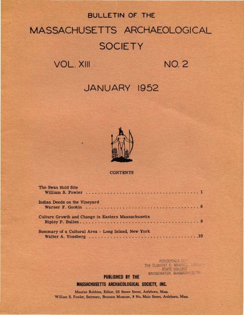
Bulletin of the Massachusetts Archaeological Society, Vol. 13, No. 2 ...
Bulletin of the Massachusetts Archaeological Society, Vol. 13, No. 2 ...
Bulletin of the Massachusetts Archaeological Society, Vol. 13, No. 2 ...

You also want an ePaper? Increase the reach of your titles
YUMPU automatically turns print PDFs into web optimized ePapers that Google loves.
BULLETIN OF THE<br />
MASSACHUSETTS ARCHAEOLOGICAL<br />
SOCIETY<br />
VOL. XIII ' NO.2<br />
JANUARY 1952<br />
CONTENTS<br />
The Swan Hold Site<br />
William S. Fowler ....•.•..•..•••...•.......••....•.•.. 1<br />
Indian Deeds on <strong>the</strong> Vineyard<br />
Warner F. Gookin •.................................... 6<br />
Culture Growth and Change in Eastern <strong>Massachusetts</strong><br />
Ripley P. Bullen. • • • • . . . • • • . . . . . • • . . . . • • • . . • • . . • • . . . . . . 8<br />
Summary <strong>of</strong> a Cultural Area - Long Island, New York<br />
Walter A. Vossberg •....••.....••••.•••..•.••.......•..10<br />
PERlOD!C.Atf': r ..<br />
11* CLiMENT C. MAX"i<br />
STAiE COLLF;L<br />
BRIDGEWATER. MA&&AC<br />
PUBLISHED BY THE<br />
MA$SACHUSmS ARCHAEOLOGICAL SOClm, INC.<br />
Maurice Robbins, Editor, 23 Steere Street, Attleboro, Maa,.<br />
William S. Fowler, Secretary, Bronson Museum, 8 <strong>No</strong>. Main Street, Attleboro, Mass.
This journal and its contents may be used for research, teaching and private study purposes. Any substantial or systematic<br />
reproduction, re-distribution, re-selling, loan or sub-licensing, systematic supply or distribution in any form to anyone is<br />
expressly forbidden. ©2010 <strong>Massachusetts</strong> <strong>Archaeological</strong> <strong>Society</strong>.<br />
THE SWAN HOLD SITE<br />
William S. Fowler<br />
PREFACE<br />
During <strong>the</strong> past several years, excavation <strong>of</strong> <strong>the</strong> Swan<br />
Hold site in Carver, <strong>Massachusetts</strong> has been participated<br />
in by certain members <strong>of</strong> <strong>the</strong> Massasoit Chapter <strong>of</strong> <strong>the</strong><br />
<strong>Massachusetts</strong> <strong>Archaeological</strong> <strong>Society</strong>. Two <strong>of</strong> <strong>the</strong>se<br />
members, namely, Richard H. Bent and Charles T.<br />
Sanderson <strong>of</strong> Plymouth, have asked <strong>the</strong> writer to prepare<br />
a report with presentation <strong>of</strong> <strong>the</strong> recovered evidence.<br />
Due to <strong>the</strong> orderly way in which data have been recorded<br />
I welcome this opportunity to assist in making <strong>the</strong> evidence<br />
available for comparative study by readers <strong>of</strong> our<br />
<strong>Society</strong> <strong>Bulletin</strong>.<br />
A debt <strong>of</strong> gratitude goes to A. D. Makepeace, owner<br />
<strong>of</strong> <strong>the</strong> land, and to Ralph Pierce for <strong>the</strong>ir kind permission<br />
to excavate, without whose cooperation this report<br />
would have been impossible.<br />
On several occasions I have helped with <strong>the</strong> work <strong>of</strong><br />
excavation and am familiar with <strong>the</strong> general location and<br />
stratigraphy <strong>of</strong> <strong>the</strong> site. Therefore, an interpretation <strong>of</strong><br />
<strong>the</strong> evidence is not as difficult as it might o<strong>the</strong>rwise have<br />
been. However, it should be said that <strong>the</strong> opinions expressed<br />
are my own and do not necessarily follow those<br />
<strong>of</strong> my sponsors. Had a closer contact with <strong>the</strong> actual<br />
work <strong>of</strong> excavation been possible it is probable that a<br />
more exact delineation <strong>of</strong> evidence would have resulted.<br />
Never<strong>the</strong>less, stratigraphic data are clearly divided by<br />
ceramic cultural activity in <strong>the</strong> upper strata and not in<br />
<strong>the</strong> lower, which facilitates study <strong>of</strong> ceramic and preceramic<br />
manifestations.<br />
THE SITE<br />
A long sandy terrace with a sou<strong>the</strong>asterly exposure<br />
is <strong>the</strong> terrain on which <strong>the</strong> site is situated. It extends<br />
along one side <strong>of</strong> South Meadow Brook, which is now<br />
absorbed by a cranberry bog located in Carver, <strong>Massachusetts</strong>.<br />
This empties into <strong>the</strong> Weweantic River and<br />
<strong>the</strong>nce into Buzzards Bay. In prehistoric times, <strong>the</strong><br />
amount <strong>of</strong> water flow through this river basin may have<br />
been double that <strong>of</strong> today thus making river travel by<br />
dugout canoe entirely feasible. In Colonial days, lush<br />
grasses grew in this old South Meadow that were harvested<br />
and carried in ox carts by <strong>the</strong> Pilgrims all <strong>the</strong><br />
way to Plymouth to supplement <strong>the</strong>ir live stock fodder.<br />
In those early days, <strong>the</strong> section <strong>of</strong> land lying somewhat<br />
south <strong>of</strong> Wenham Pond was known as Swan Hold and is so<br />
recorded in Plymouth Town Records as early as 1662.<br />
Hence, <strong>the</strong> site derives its name because <strong>of</strong> its location<br />
on or near this historic spot. Today, <strong>the</strong> name <strong>of</strong> a<br />
nearby plot called Swanholt Bog is no doubt a corruption<br />
<strong>of</strong> <strong>the</strong> earlier spelling. But all this is <strong>of</strong> little concern<br />
to <strong>the</strong> report except to locate <strong>the</strong> site in its relationship<br />
to <strong>the</strong> historic past.<br />
The excavated area <strong>of</strong> <strong>the</strong> site measures about 75 by<br />
200 feet, and is surmounted by a sand ridge or hill that<br />
rises some 25 feet above <strong>the</strong> site's level. Surface erosion<br />
over <strong>the</strong> centuries has conveyed sand from <strong>the</strong><br />
higher ground onto <strong>the</strong> site where it has leveled <strong>of</strong>f into<br />
an elongated tableland with an elevation <strong>of</strong> about 10 feet<br />
above <strong>the</strong> South Meadow Brook and bog. Early settlers<br />
are reported to have tilled <strong>the</strong> soil in this region, and it<br />
is likely, <strong>the</strong>refore, that certain parts <strong>of</strong> <strong>the</strong> site if not<br />
<strong>the</strong> entire area were plowed in Colonial days. However,<br />
remains <strong>of</strong> large tree trunks are still visible in some<br />
places. This indicates soil capability <strong>of</strong> supporting large<br />
timber, and suggests <strong>the</strong> existence in late prehistoric<br />
times <strong>of</strong> big trees, perhaps sufficiently large for <strong>the</strong><br />
manufacture <strong>of</strong> dugout canoes.<br />
Geologically, <strong>the</strong> site is deeply underlaid by a gravel<br />
deposit <strong>of</strong> probable glacial deposition. This is overlaid<br />
with a heavy covering <strong>of</strong> sand, eroded quite obviously<br />
from <strong>the</strong> sand hill that borders it on one side. The rate<br />
<strong>of</strong> sand deposit was undoubtedly greater during early<br />
ages when vegetation was absent or sparse, and has<br />
gradually diminished in more recent times with <strong>the</strong><br />
growth <strong>of</strong> trees and <strong>the</strong> accumulation <strong>of</strong> humus. However;<br />
due to <strong>the</strong> unknown rate <strong>of</strong> sand fill from erosion,<br />
and .realizing its extreme variation between wet and dry<br />
seasons little if any chronological significance can be<br />
placed upon any stratigraphic level.<br />
STRATIGRAPHY<br />
Natural agents have formed strata at <strong>the</strong> site composed<br />
<strong>of</strong> different degrees <strong>of</strong> humus impregnated sand.<br />
An overburden <strong>of</strong> from 8 - 10" <strong>of</strong> heavy humus-sand<br />
covers <strong>the</strong> area, and this has leveled <strong>of</strong>f so that <strong>the</strong> point<br />
where it meets <strong>the</strong> subsoil is well defined and uniform.<br />
This demarkation will be referred to as <strong>the</strong> junction in<br />
this paper and has been used as <strong>the</strong> level from which<br />
<strong>the</strong> position <strong>of</strong> all artifacts has been measured. Below<br />
this junction extends a stratum <strong>of</strong> yellow sand that<br />
lightens in color until at a depth <strong>of</strong> from 28 - 33" from<br />
<strong>the</strong> top <strong>of</strong> <strong>the</strong> humus it becomes white; free <strong>of</strong> humus<br />
contamination and leaching. Several inches below this<br />
white sand appears gravel which occasionally shows<br />
through in <strong>the</strong> form <strong>of</strong> small lenses.<br />
Artifacts occur in <strong>the</strong> humus and throughout <strong>the</strong> yellow<br />
sand to <strong>the</strong> white sand level, where <strong>the</strong>ir presence<br />
becomes sparse; is confined to a few stone hearths and<br />
several implements. The relatively deep extent <strong>of</strong> <strong>the</strong><br />
yellow sand stratum represents an accumulation that<br />
may have been laid down over a long or comparatively<br />
short period <strong>of</strong> time depending upon natural conditions<br />
<strong>of</strong> rainfall and vegetation coverage. Therefore, such
2 MASSACHUSETTS ARCHAEOLOGICAL SOCIETY: BULLETIN<br />
artifacts as appear in this stratum may represent a<br />
relatively long or short cultural duration. This problem<br />
is fully discussed in <strong>the</strong> following section.<br />
CULTURE ZONES OF OCCUPATION<br />
Artifact evidence represents at least two different<br />
culture periods and may have elements <strong>of</strong> still o<strong>the</strong>r<br />
cultural admixtures. However, <strong>the</strong> chief index <strong>of</strong> a<br />
change in culture is <strong>the</strong> introduction <strong>of</strong> pottery.making.<br />
This art is indicated by <strong>the</strong> presence <strong>of</strong> clay potsherds,<br />
which occur earliest at a depth <strong>of</strong> seven inches below<br />
<strong>the</strong> junction in <strong>the</strong> yellow sand. Therefore, it must be<br />
assumed, if this depth represents <strong>the</strong> extent <strong>of</strong> human<br />
and not intrusive deposition <strong>of</strong> material, that all evidence<br />
above it is from a ceramic culture which continued<br />
<strong>the</strong> manufacture <strong>of</strong> pottery up to Pilgrim days. Based on<br />
this <strong>the</strong>sis, all artifacts present in levels below that at<br />
which pottery first occurs would obViously belong to<br />
preVious culture occupations before <strong>the</strong> introduction <strong>of</strong><br />
ceramics. A study <strong>of</strong> <strong>the</strong>se earlier lithic traits seems<br />
to place most <strong>of</strong> <strong>the</strong>m, typologically, in <strong>the</strong> Stone Bowl<br />
period when household vessels were cut out <strong>of</strong> steatite.<br />
Never<strong>the</strong>less, <strong>the</strong>re are a few trait indications included<br />
<strong>of</strong> a preceding archaic age, which may represent only an<br />
overlapping from this earlier time ra<strong>the</strong>r than denote a<br />
clearcut culture occupation.<br />
Therefore, it seems best to divide site stratigraphy<br />
into two culture zones <strong>of</strong> occupation: preceramic and<br />
ceramic, referring briefly to early archaic variations <strong>of</strong><br />
<strong>the</strong> former whenever <strong>the</strong>y appear. In order to simplify<br />
discussion, <strong>the</strong>se two main divisions will be referred to<br />
in this paper as <strong>the</strong> lower and upper zones respectively.<br />
From this it may be seen that since Colonial plowing<br />
probably never penetrated deeper than about 8 inches,<br />
<strong>the</strong> lower zone and lower half <strong>of</strong> <strong>the</strong> upper zone are far<br />
removed from this sort <strong>of</strong> disturbance.<br />
EXCAVATED EVIDENCE<br />
HEARTHS AND PITS. While many scattered fire<br />
stones appeared throughout all levels, <strong>the</strong>re were several<br />
stone hearths in place, principally at lower levels.<br />
One <strong>of</strong> <strong>the</strong>se appeared 30" deep on white sand and consisted<br />
<strong>of</strong> a large flat hearthstone about which were<br />
grouped smaller stones, some <strong>of</strong> which were cobbles.<br />
Ano<strong>the</strong>r larger stone hearth occurred on white sand at<br />
a depth <strong>of</strong> 33" from <strong>the</strong> top <strong>of</strong> <strong>the</strong> ground and in it was<br />
found an oval scraper (chopper). The deepest hearth<br />
was at an extreme depth <strong>of</strong> 37". It consisted <strong>of</strong> 10 or 12<br />
large cobble stones that formed an irregularly shaped<br />
hearth. Quantities <strong>of</strong> charcoal appeared in association<br />
with it, but o<strong>the</strong>rwise seemed to have no significance.<br />
Charcoal pits were <strong>of</strong> common occurrence at different<br />
levels, frequently in <strong>the</strong> white sand, and sometimes in<br />
association with stone hearths. One large charcoal deposit<br />
some 25 x 40' in dimensions showed up in <strong>the</strong><br />
humus and formed deep pits at various places throughout<br />
its extent. Whe<strong>the</strong>r this was <strong>the</strong> remains <strong>of</strong> dugout<br />
canoe manufacture cannot be rightly judged, but it is a<br />
recorded fact that an old dugout was taken from <strong>the</strong> cranberry<br />
bog some 200 yds. above <strong>the</strong> site several years<br />
ago, and it is now owned by a Carver resident.<br />
PRECERAMIC LITillC TRAITS. The lower zone contains<br />
<strong>the</strong> earliest evidence including artifacts that were<br />
in use before <strong>the</strong> art <strong>of</strong> making pots out <strong>of</strong> clay had been<br />
introduced. Commencing with sparse occupation evidence<br />
on <strong>the</strong> white sand level, artifact frequency increases<br />
throughout <strong>the</strong> horizon, <strong>the</strong> major part <strong>of</strong> which<br />
represents products <strong>of</strong> <strong>the</strong> Stone Bowl epoch. It is<br />
probable that steatite bowls were in use at <strong>the</strong> site.<br />
While no vessel fragments were located through excavation,<br />
a single fragment from a repaired pot perforated<br />
by two holes appeared in an adjacent sand deposit, thrown<br />
out by an animal while digging his hole. This, toge<strong>the</strong>r<br />
with <strong>the</strong> recovered full grooved axes <strong>of</strong> this period leaves<br />
little doubt that this zone's artifacts come from <strong>the</strong> age<br />
<strong>of</strong> steatite manufacture. In this paper <strong>the</strong> nomenclature<br />
for projectile points follows in part that approved by <strong>the</strong><br />
<strong>Massachusetts</strong> <strong>Archaeological</strong> <strong>Society</strong> as published in<br />
<strong>Bulletin</strong> <strong>Vol</strong>. 11, #4. Full descriptions have been modified<br />
by omission <strong>of</strong> size to facilitate emphasis <strong>of</strong> <strong>the</strong><br />
base type. Hence, identification is by name and number<br />
only.<br />
Earliest white sand level traits (Fig. 7, #4, 14) consist<br />
<strong>of</strong>: corner-removed point #9 with broad rounded<br />
base; rudely fashioned celt with large flaking; and a<br />
large oval scraper.<br />
Next appear a few diagnostic traits from that culture<br />
identified by some as <strong>the</strong> "Early Archaic". It is felt<br />
that this culture may be manifest by intrusive elements<br />
to a certain extent by virtue <strong>of</strong> <strong>the</strong> mixed stratigraphic<br />
position <strong>of</strong> artifacts and <strong>the</strong>ir low frequency (Fig. 7,<br />
#3, 5, 6, 11, 15, 19): corner-removed point #5, 9; ulu;<br />
grooved sinker; deep channeled gouge; and perforated<br />
oval atlatl weight (bannerstone), (ref. "The Heard Pond<br />
Site," <strong>Massachusetts</strong> <strong>Archaeological</strong> <strong>Society</strong>, <strong>Bulletin</strong>,<br />
<strong>Vol</strong>. 10, #3).<br />
By far <strong>the</strong> most numerous and well defined traits are<br />
those that are known to belong to <strong>the</strong> Stone Bowl age that<br />
immediately preceded <strong>the</strong> age <strong>of</strong> ceramics, (ref. "The<br />
Potter Pond Site," <strong>Massachusetts</strong> <strong>Archaeological</strong> <strong>Society</strong>,<br />
<strong>Bulletin</strong> <strong>Vol</strong>. 11, #4), (Fig. 7, #1, 2, 7, 8, 10, 12-<strong>13</strong>, 16<br />
20): corner-removed #3, 7, eared #4, side-notched #3,<br />
and small triangular point types (all in upper zone also);<br />
full grooved ax; pipe bowl reamer; stemmed and stemless<br />
knives. Also, hammerstone, scraper, celt and<br />
graphite are present, but as <strong>the</strong>y are common to all<br />
ages <strong>the</strong>se traits are not considered significant as diagnostic<br />
elements. In this zone appeared a large rubbing<br />
stone with chevron incisions on two opposing faces, as if<br />
<strong>the</strong>y had been cut to causo greater abrasion - reminiscent<br />
<strong>of</strong> <strong>the</strong> modern file surface.<br />
CERAMIC LITillC TRAITS. The upper zone, in which<br />
is found evidence <strong>of</strong> pottery making contains certain<br />
diagnostic implement traits with a few that appear to be<br />
intrusive from lower levels due to displacement by disturbances<br />
(Fig. 8). The displaced exceptions are <strong>the</strong><br />
knobbed poll gouge, ulu fragment and corner-removed<br />
point #9. Upper zone determinate types are: small
FIGURE 9. BORROWED IMPLEMENTS. 1, Reworked<br />
ulu; 2, Plummet with battered base.<br />
2<br />
weight, all stratigraphically attached to <strong>the</strong> earlier occupation<br />
as shown by excavation <strong>of</strong> <strong>the</strong> Nunkatusset site<br />
in East Bridgewater, Mass. The later preceramic occupation<br />
represents a period <strong>of</strong> disc;overy and invention<br />
when steatite was found and cut into all manner <strong>of</strong> household<br />
vessels. This was a time <strong>of</strong> cultural activity which<br />
produced a decided forward movement in <strong>the</strong> economy<br />
<strong>of</strong> <strong>the</strong> people. One fragment <strong>of</strong> a steatite bowl at <strong>the</strong><br />
site supports <strong>the</strong> conclusion that this era is that which<br />
has been appropriately termed by some: <strong>the</strong> Stone Bowl<br />
THE SWAN HOLD SITE 5<br />
age. It is at this time that interesting evidence from<br />
<strong>the</strong> Swan Hold site suggests <strong>the</strong> prehistoric invention <strong>of</strong><br />
<strong>the</strong> file. Chevron incised cuts on <strong>the</strong> working sides <strong>of</strong> a<br />
rubbing stone may indicate for <strong>the</strong> Stone Bowl period<br />
allO<strong>the</strong>r invention <strong>of</strong> that day. If this hypo<strong>the</strong>sis is sound,<br />
and it is difficult to think o<strong>the</strong>rwise, a new invention may<br />
now be added to all <strong>the</strong> o<strong>the</strong>rs <strong>of</strong> this age.<br />
With <strong>the</strong> coming <strong>of</strong> ceramics, as noted in <strong>the</strong> upper<br />
zone, economic changes took place attended by <strong>the</strong> introduction<br />
<strong>of</strong> certain new traits and activities. At this<br />
site appears evidence to indicate <strong>the</strong> accelerated use <strong>of</strong><br />
<strong>the</strong> bow and arrow that had its inception in <strong>the</strong> Stone<br />
Bowl age, preference for <strong>the</strong> side-notched projectile<br />
point, and use <strong>of</strong> decoration not only for <strong>the</strong> embellishment<br />
<strong>of</strong> pottery but for gorgets as well. The Iroquoian<br />
type <strong>of</strong> small isosceles triangular point appears for <strong>the</strong><br />
first time, and most <strong>of</strong> <strong>the</strong> older types - eared, cornerremoved<br />
#5, 9 - in time ceased to exist. However, several<br />
implement traits <strong>of</strong> earlier ages continue to be used,<br />
even though <strong>the</strong>y might not have been manufactured, such<br />
as <strong>the</strong> shallow channeled gouge, and stemmed knife.<br />
Borrowed implement evidence in this upper zone suggests<br />
that <strong>the</strong> ceramic occupants had found and utilized<br />
a fractured ulu <strong>of</strong> <strong>the</strong> "Early Archaic" by reworking <strong>the</strong><br />
broken ends to make <strong>the</strong> knife symmetrical again. Also,<br />
<strong>the</strong>y had found a large plummet <strong>of</strong> <strong>the</strong> earlier age exposed<br />
no doubt by erosion on some shore site, and its<br />
similarity to a pestle caught <strong>the</strong>ir eye. Used no doubt<br />
in <strong>the</strong> past as a deep-sea line sinker, it was now taken<br />
and utilized for grinding maize in conformity with <strong>the</strong><br />
customs <strong>of</strong> <strong>the</strong> age. With <strong>the</strong> passage <strong>of</strong> time its former<br />
end use had completely disappeared; had been forgotten.<br />
During this last period <strong>of</strong> occupation, frequency <strong>of</strong><br />
artifacts increases. This may mean ei<strong>the</strong>r a longer<br />
period <strong>of</strong> occupancy, or an increasing number <strong>of</strong> people<br />
using <strong>the</strong> site which seems more probable. Large trees<br />
are known to have grown in <strong>the</strong> area and <strong>the</strong>ir utilization<br />
for dugout canoe manufacture is entirely possible. Widespread<br />
evidence <strong>of</strong> cnarcoal deposits some <strong>of</strong> which are<br />
extensive, toge<strong>the</strong>r with several broken gouge blades<br />
add strength to this belief. In concluding this report,<br />
it is only fair to say that <strong>the</strong> area excavated is not defined<br />
by natural limitations in two directions, nor is<br />
it determined because <strong>of</strong> some prominent natural asset<br />
such as a spring-fed drinking water supply. Therefore,<br />
it may be assumed that 'evidence from this site is<br />
only a sample <strong>of</strong> what might be expected at o<strong>the</strong>r<br />
points in <strong>the</strong> immediate region along <strong>the</strong> extensive<br />
sand terrace bordering South Meadow Brook.<br />
Bronson Museum,<br />
Attleboro, Mass.
This journal and its contents may be used for research, teaching and private study purposes. Any substantial or systematic<br />
reproduction, re-distribution, re-selling, loan or sub-licensing, systematic supply or distribution in any form to anyone is<br />
expressly forbidden. ©2010 <strong>Massachusetts</strong> <strong>Archaeological</strong> <strong>Society</strong>.<br />
6 MASSACHUSETTS ARCHAEOLOGICAL SOCIETY: BULLETIN<br />
INDIAN DEEDS ON THE VINEYARD<br />
Warner F. Gookin<br />
The earliest information about local Indian land<br />
transactions was given by Edward Winslow in 1624 (Good<br />
News, Young ed., p. 361). "Every Sachim," he wrote,<br />
"knoweth how far <strong>the</strong> bounds and limits <strong>of</strong> his own country<br />
extendeth; and that which is his own proper inheritance.<br />
Out <strong>of</strong> that, if any <strong>of</strong> his men desire land to set<br />
<strong>the</strong>ir corn, he giveth <strong>the</strong>m as much as <strong>the</strong>y can use, and<br />
sets <strong>the</strong>m <strong>the</strong>ir bounds: . .. The great sachims or Kings<br />
know <strong>the</strong>ir own bounds or limits <strong>of</strong> land, as well as <strong>the</strong><br />
rest."<br />
On Martha's Vineyard, a number <strong>of</strong> documents, particularly<br />
those in <strong>the</strong> Indian language, recorded with <strong>the</strong><br />
county deeds, are not sales, but grants by Sachims allotting<br />
land to a subject, according to <strong>the</strong> custom reported<br />
by Winslow. The following is a typical one, issued<br />
by "Mr. sam," <strong>the</strong> ancient Sachim <strong>of</strong> Sengekantacket<br />
(Oak Bluffs) in <strong>the</strong> last year <strong>of</strong> his life, 1689.<br />
This translation by Experience Mayhew was recorded<br />
with it in 1740.<br />
"Know all yee People that I Wampamog Indian<br />
Sachim say <strong>the</strong>se two women Ales 8essetom and Keziah<br />
Sessetom do own a part or parsell <strong>of</strong> land aU Ogkashkuppe<br />
at <strong>the</strong> place called Quenaiamuk. It is <strong>the</strong> will <strong>of</strong><br />
me Wampamog that <strong>the</strong> eldest called Ales Setum should<br />
have <strong>the</strong> breadth <strong>of</strong> twenty-five rods and that she that is<br />
called Keziah Setum should have <strong>the</strong> breadth <strong>of</strong> fifteen<br />
rods; both <strong>the</strong>se to have <strong>the</strong> width now said at <strong>the</strong> pond<br />
(<strong>the</strong> Lagoon) and so upward as far as Daggets bounds.<br />
I Wampamog say this is firmly and <strong>of</strong> right <strong>the</strong>irs because<br />
I have divided this quantity <strong>of</strong> land to <strong>the</strong>m even<br />
to Ales and Keziah Setum <strong>the</strong> daughters <strong>of</strong> Thomas<br />
Setum. It is <strong>the</strong>irs I say and all <strong>the</strong>ir <strong>of</strong>fspring forever<br />
or if <strong>the</strong>y fale, to goe to <strong>the</strong>ir kindred. May <strong>the</strong>y in<br />
peace enjoy this land forever. For I will never alter<br />
this nor shall any that defend my Sachimship do this,<br />
but let <strong>the</strong>se peacably enjoy <strong>the</strong> same lann, even Ales<br />
and Keziah."<br />
That scions <strong>of</strong> <strong>the</strong> ruling class were entitled to <strong>the</strong>ir<br />
portion <strong>of</strong> land, even when <strong>the</strong>ir patrimony had been<br />
turned over to <strong>the</strong> English, appears from <strong>the</strong> following<br />
court decision <strong>of</strong> Governor Thomas Mayhew at Nantucket<br />
on June 5, 1677. The record is in <strong>the</strong> handwriting<br />
<strong>of</strong> Mat<strong>the</strong>w Mayhew, who liked to stress <strong>the</strong> fact that all<br />
Sachims were by birth nobles, although not necessarily<br />
ruling sachims or Kings.<br />
"Ahkeiamau laying claim to part <strong>of</strong> Tuckanuckett,<br />
his claim <strong>the</strong>reto being found no o<strong>the</strong>r but as he was a<br />
Duke or Principall Man uppon Nantuckett, <strong>the</strong> Nantucket<br />
Sachims toge<strong>the</strong>r with his fa<strong>the</strong>r having sold Tuckanucket,<br />
it is ordered, that Ahkeiamau shall have such a<br />
part and portion <strong>of</strong> land for his use at Nantucket <strong>of</strong> <strong>the</strong><br />
present Sachims, as will become one <strong>of</strong> such qualitie,<br />
with a portion <strong>of</strong> whale; and likewise his brethren and<br />
sisters are not to be denied a planting right <strong>the</strong>re."<br />
The "portion <strong>of</strong> whale" indicates that "Duke" Ahkeiamau<br />
was <strong>the</strong> son <strong>of</strong> a chief, as all drift whales were exclusively<br />
<strong>the</strong> property <strong>of</strong> <strong>the</strong> ruling sachims.<br />
It is to be noted that <strong>the</strong> over-lord sachims, or Kings,<br />
<strong>of</strong> Nantucket, had rights in <strong>the</strong> small island owed by<br />
Ahkeimau's fa<strong>the</strong>r, which required <strong>the</strong>m to be parties to<br />
<strong>the</strong> sale <strong>of</strong> this dependency. When we meet <strong>the</strong> familiar<br />
formula, "We, Nickanoose <strong>of</strong> Nantucket, sachim, and<br />
Nanahuma <strong>of</strong> Nantucket, sachim, have sold..." it is<br />
reasonably certain that <strong>the</strong> second named was <strong>the</strong> actual<br />
owner <strong>of</strong> <strong>the</strong> land granted, and that <strong>the</strong> great chief, Nickanoose,<br />
enters <strong>the</strong> transaction only by way <strong>of</strong> giVing his<br />
consent.<br />
H. B. Worth, in his "Nantucket Lands and Land Owners"<br />
(Nantucket Historical Association, 1902, page 116),<br />
remarks that both Nickanoose and Wanackmamack, <strong>the</strong><br />
two great chiefs <strong>of</strong> <strong>the</strong> island, "signed deeds only <strong>of</strong><br />
territory belonging to some o<strong>the</strong>r sachim," never a deed<br />
to any portion <strong>of</strong> territory under <strong>the</strong>ir direct control;<br />
but he does not explain <strong>the</strong> anomaly. Inherent in <strong>the</strong><br />
monarchical system prevailing both among <strong>the</strong> Indians,<br />
and also in England at <strong>the</strong> time, was <strong>the</strong> concept that <strong>the</strong><br />
soil belonged ultimately to <strong>the</strong> crown. <strong>No</strong> manor in<br />
England, derived from <strong>the</strong> King, might be sold, except<br />
after <strong>the</strong> owner had obtained a "licence to alienate" from<br />
<strong>the</strong> King's ministers. So likeWise, no minor sachim<br />
might alienate land to <strong>the</strong> English without <strong>the</strong> consent <strong>of</strong><br />
his superior.<br />
Because <strong>the</strong> Indians held this doctrine that land tenure<br />
was ultimately derived from <strong>the</strong> crown, when Massoit<br />
and his confederate chiefs in 1621 acknowledged <strong>the</strong><br />
sovereignty <strong>of</strong> King James, to obtain his aid against <strong>the</strong><br />
Narragansets, <strong>the</strong>y were knOWingly subjecting <strong>the</strong>mselves<br />
to his over-lordship <strong>of</strong> <strong>the</strong>ir lands. Robert Cushman<br />
(in Mourt's Relation, 1621, Young's ed., p. 244) expresses<br />
this quite clearly.<br />
"The emperor (Massasoit), by a joint consent, hath<br />
promised and appointed us to live at peace where we will<br />
in all his dominions, taking what place we will, and as<br />
much land as we will, and bringing as many people as we<br />
will; and that for <strong>the</strong>se two causes. First, because we<br />
are <strong>the</strong> servants <strong>of</strong> James, King <strong>of</strong> England, whose <strong>the</strong><br />
land (as he confesseth) is. Secondly, because he hath<br />
found us just, honest, kind and peaceable, and so loves<br />
our company. Yea, and that in <strong>the</strong>se things <strong>the</strong>re is no<br />
dissimulation on his part... is most plain in o<strong>the</strong>r Relations,<br />
.. " Thus it appears that <strong>the</strong> Pokonokets, by<br />
<strong>the</strong>ir own action, were bound to recognize <strong>the</strong> validity<br />
<strong>of</strong> a Patent, issued under <strong>the</strong> authority <strong>of</strong> <strong>the</strong> King <strong>of</strong><br />
England, granting white men <strong>the</strong> right to settle within<br />
<strong>the</strong>ir territory. Without doubt, Massasoit conceived <strong>the</strong><br />
Governor <strong>of</strong> <strong>the</strong> Plymouth colony to be a white sachim,<br />
with powers over his settlers equivalent to his own over<br />
his nation. But just what areas, outside <strong>of</strong> <strong>the</strong> deserted<br />
Patuxet, were to be granted to <strong>the</strong>se newcomers, was a<br />
problem <strong>of</strong> <strong>the</strong>future which Massasoit could hardly have<br />
sensed.
This journal and its contents may be used for research, teaching and private study purposes. Any substantial or systematic<br />
reproduction, re-distribution, re-selling, loan or sub-licensing, systematic supply or distribution in any form to anyone is<br />
expressly forbidden. ©2010 <strong>Massachusetts</strong> <strong>Archaeological</strong> <strong>Society</strong>.<br />
8 MASSACHUSETTS ARCHAEOLOGICAL SOCIETY: BULLETIN<br />
CULTURE GROWTH AND CHANGE IN EASTERN MASSACHUSETTS<br />
Culture, or at least <strong>the</strong> material manifestation <strong>of</strong><br />
culture, changes gradually over <strong>the</strong> years by <strong>the</strong> addition<br />
and subtraction <strong>of</strong> various traits. To <strong>the</strong> archaeologist<br />
such changes may be <strong>the</strong> introduction <strong>of</strong> a new<br />
tool, a difference in types <strong>of</strong> projectile points, or a<br />
minor variation in decoration <strong>of</strong> pottery.<br />
Under aboriginal conditions <strong>the</strong>se changes usually<br />
occur gradually. It takes time for everyone to adopt <strong>the</strong><br />
new and to give up <strong>the</strong> old. Consequently, both <strong>the</strong> old<br />
and <strong>the</strong> new are apt to overlap for a period <strong>of</strong> time.<br />
Sometimes, however, changes in culture may occur<br />
ra<strong>the</strong>r rapidly as, for example, when met:;ll trade axes<br />
replace stone axes.<br />
The rate <strong>of</strong> change, or <strong>the</strong> number <strong>of</strong> new traits acquired<br />
over a period <strong>of</strong> time, may vary considerably.<br />
When a relatively large number <strong>of</strong> new traits are acquired<br />
ra<strong>the</strong>r rapidly we suspect <strong>the</strong> indigenous culture<br />
to be subjected to pressure by or influences from a<br />
stronger culture. A much more gradual rate <strong>of</strong> change<br />
would seem to indicate a period <strong>of</strong> relative culture stability<br />
during which <strong>the</strong> processes <strong>of</strong> local invention,<br />
stimulous diffusion, and borrOWing irom neighboring<br />
groups are at work.<br />
To illustrate culture growth and change, I have prepared<br />
<strong>the</strong> accompanying chart, which gives my ideas<br />
regarding certain changes in <strong>the</strong> material culture <strong>of</strong> <strong>the</strong><br />
Indians <strong>of</strong> eastern <strong>Massachusetts</strong>. This chart has been<br />
prepared entirely from published sources, many <strong>of</strong><br />
which will be found in <strong>the</strong> BULLETIN OF THE MASSA<br />
CHUSETTS ARCHAEOLOGICAL SOCIETY. O<strong>the</strong>r references<br />
are included in <strong>the</strong> bibliography.<br />
Typology used on <strong>the</strong> chart differs somewhat from<br />
that in use at present by <strong>the</strong> <strong>Massachusetts</strong> <strong>Archaeological</strong><br />
<strong>Society</strong>. Those interested in <strong>the</strong>se differences are<br />
referred to type descriptions in "Culture Dynamics in<br />
Eastern <strong>Massachusetts</strong>" printed in AMERICAN AN<br />
TIQUITY, <strong>Vol</strong>. 14, <strong>No</strong>. 1. (I have reprints and would be<br />
glad to send one, as long as <strong>the</strong>y last, to any member <strong>of</strong><br />
<strong>the</strong> <strong>Society</strong> who will send me a three cent stamp.)<br />
Ripley P. Bullen<br />
On <strong>the</strong> chart, time starts at <strong>the</strong> bottom and progresses<br />
upward. So as to save space, vertical distances. are not<br />
equal in years. Except in <strong>the</strong> case <strong>of</strong> steatite bowls, <strong>the</strong><br />
relative width <strong>of</strong> a rectangle has nothing to do with relative<br />
quantities at any period <strong>of</strong> time. Relative locations<br />
<strong>of</strong> <strong>the</strong> tops and bottoms <strong>of</strong> rectangles, indicating when a<br />
trait is first found and <strong>the</strong>n no longer found, while arbitrary<br />
are based on associations In <strong>the</strong> ground. "Vertical<br />
arrows" over "pestles," "celts," and "clay pipes"<br />
indicate that, after <strong>the</strong>ir introduction, <strong>the</strong>se artifacts<br />
are found up to and into <strong>the</strong> historic period. Undoubtedly,<br />
<strong>the</strong>ir typology changed during <strong>the</strong> years. <strong>No</strong> doubt<br />
grooved axes, gouges, and, probably, ulus were made<br />
and used over a longer period <strong>of</strong> time than is implied.<br />
For ceramic period correlations, suggested on <strong>the</strong><br />
left <strong>of</strong> <strong>the</strong> chart, I have followed Ritchie. The dates<br />
given are my interpretation and extension <strong>of</strong> published<br />
Carbon-14 dates. <strong>No</strong> doubt many people will disagree<br />
violently with me on some or all <strong>of</strong> <strong>the</strong>se dates.<br />
<strong>No</strong> attempt has been made to include all artifacts or<br />
to formalize archaeological periods on <strong>the</strong> chart. Ra<strong>the</strong>r<br />
<strong>the</strong> idea has been to present a series <strong>of</strong> traits, each <strong>of</strong><br />
which has some chronological value and <strong>the</strong> progression<br />
<strong>of</strong> which seems to give an impression <strong>of</strong> how culture<br />
changes.<br />
It is hoped <strong>the</strong> chart will be self-explanatory. Temporal<br />
overlapping <strong>of</strong> many traits is to be noted. Examination<br />
<strong>of</strong> suggested dates will indicate a much more<br />
rapid rate <strong>of</strong> change in later than in earlier times. Both<br />
agree with what we know <strong>of</strong> culture. Many <strong>of</strong> us have<br />
experienced similar processes during our own lifetime.<br />
The most rapid rate <strong>of</strong> change would appear to be<br />
shortly after <strong>the</strong> introduction <strong>of</strong> pottery, circa 200 A.D.<br />
I would interpret this as <strong>the</strong> impinging upon <strong>the</strong> local<br />
culture <strong>of</strong> influences originating with <strong>the</strong> early burial<br />
mound builders <strong>of</strong> <strong>the</strong> Mississippi River drainage. These<br />
waves <strong>of</strong> new influences were probably borne by new<br />
arrivals into <strong>the</strong> area and may mark <strong>the</strong> introduction <strong>of</strong><br />
agriculture. Mter a time, a consolidation seems to have<br />
occurred with a reemergence <strong>of</strong> <strong>the</strong> old, albeit substantially<br />
modified, culture.<br />
Fur<strong>the</strong>r examination <strong>of</strong> <strong>the</strong> chart will disclose a<br />
succession <strong>of</strong> traits in what may appear to be a bewildering<br />
array. In a peripheral area, such as eastern <strong>Massachusetts</strong>,<br />
it would be expected that <strong>the</strong> old and <strong>the</strong> new<br />
would intermingle as in our rural areas today. The<br />
surprising thing is that so many influences did reach<br />
eastern <strong>Massachusetts</strong> after covering hundreds <strong>of</strong> miles.<br />
The result is a complicated picture <strong>of</strong> cuJture change,<br />
one which makes it difficult to set up arbitrary timeculture<br />
periods. This is unfortunate for those who like<br />
things nicely ordered into air-tight compartments. Such<br />
an over-simplification may be very helpful and useful as<br />
a tool but not entirely realistic. Culture growth and<br />
change is a complicated process.<br />
REFERENCES<br />
Arnold, J. R., and W. F. Libby<br />
1951. "Radiocarbon Dates." Science, <strong>Vol</strong>. 1<strong>13</strong>,<br />
<strong>No</strong>. 2927. Lancaster.<br />
Brown, John C.<br />
1939. The Jones Pond Shell Heap. The Narragansett<br />
<strong>Archaeological</strong> <strong>Society</strong> <strong>of</strong> Rhode Island.<br />
Providence.
This journal and its contents may be used for research, teaching and private study purposes. Any substantial or systematic<br />
reproduction, re-distribution, re-selling, loan or sub-licensing, systematic supply or distribution in any form to anyone is<br />
expressly forbidden. ©2010 <strong>Massachusetts</strong> <strong>Archaeological</strong> <strong>Society</strong>.<br />
10 MASSACHUSETTS ARCHAEOLOGICAL SOCIETY: BULLETIN<br />
Bullen, Ripley P.<br />
1948. "Culture Dynamics in Eastern <strong>Massachusetts</strong>."<br />
American Antiquity, <strong>Vol</strong>. 14, <strong>No</strong>.1,<br />
pp. 36-48. Menasha.<br />
1949. Excavations in <strong>No</strong>r<strong>the</strong>astern <strong>Massachusetts</strong>.<br />
Papers <strong>of</strong> <strong>the</strong> Robert S. Peabody Foundation<br />
for Archaeology, <strong>Vol</strong>. 1, <strong>No</strong>.3. Andover.<br />
Bullen, Ripley P., and Arthur M. H<strong>of</strong>mann<br />
1944. "The H<strong>of</strong>mann Site." American Antiquity,<br />
<strong>Vol</strong>. 10, <strong>No</strong>.2. Menasha.<br />
Byers, Douglas S., and Frederick Johnson<br />
1940. Two Sites on Martha's Vineyard. Papers <strong>of</strong><br />
<strong>the</strong> Robert S. Peabody Foundation for Archaeology,<br />
<strong>Vol</strong>. 1, <strong>No</strong>. 1. Andover.<br />
Johnson, Frederick, et al<br />
1942. The Boylston Street Fishweir. Papers <strong>of</strong><br />
<strong>the</strong> Robert S. Peabody Foundation for Archaeology,<br />
<strong>Vol</strong>. 2. Andover.<br />
Johnson, Frederick, and Hugh M. Raup<br />
1947. Grassy Island. Papers <strong>of</strong> <strong>the</strong> Robert S. Pea-<br />
body Foundation for Archaeology, <strong>Vol</strong>. 1,<br />
<strong>No</strong>.2. Andover.<br />
Ritchie, William A.<br />
1944. The Pre-Iroquoian Occupations <strong>of</strong> New York<br />
State. Rochester Museum <strong>of</strong> Arts and Sciences,<br />
Memoir <strong>No</strong>. 1. Rochester.<br />
Robbins, Maurice<br />
1944. The Faulkner Spring Site. Papers <strong>of</strong> <strong>the</strong> Attleboro<br />
Museum <strong>of</strong> Art and History, <strong>No</strong>. 1.<br />
Attleboro.<br />
1946. "The Ford Site." American Antiquity, <strong>Vol</strong>. 12,<br />
<strong>No</strong>.2. Menasha.<br />
Willoughby, Charles C.<br />
1924. Indian Burial Place at Winthrop, <strong>Massachusetts</strong>.<br />
Papers <strong>of</strong> <strong>the</strong> Peabody Museum <strong>of</strong><br />
American Archaeology and Ethnology, Harvard<br />
University, <strong>Vol</strong>. 11, <strong>No</strong>. 1. Cambridge.<br />
SUMMARy OF A CULTURAL AREA - LONG ISLAND, NEW YORK<br />
This report has a tw<strong>of</strong>old objective. The first objective<br />
is to provide a brief summary <strong>of</strong> Long Island archaeology<br />
for those not primarily interested in this<br />
section, but who desire some general knowledge <strong>of</strong> <strong>the</strong><br />
pre-history <strong>of</strong> an adjacent area, if for no o<strong>the</strong>r purpose<br />
than for comparison with <strong>the</strong> area <strong>of</strong> <strong>the</strong>ir.particular<br />
interest. The second objective is to point out <strong>the</strong> existence<br />
<strong>of</strong> an area in which a good start has been made<br />
in a chronological sequence <strong>of</strong> cultures, and to suggest<br />
<strong>the</strong> possibility <strong>of</strong> extended investigation <strong>of</strong> this area.<br />
Long Island is an ideal place in several ways for prehistoric<br />
observations. The Island may be treated as a<br />
geographic unit. Of course it is not isolated, but it is<br />
bounded by nature and so <strong>of</strong>fers a unit package for study.<br />
In addition, nature has supplied an easily obtainable food<br />
supply - from <strong>the</strong> salt marshes on <strong>the</strong> south shore, from<br />
<strong>the</strong> bays on <strong>the</strong> easterly end <strong>of</strong> <strong>the</strong> island, and from <strong>the</strong><br />
Sound on <strong>the</strong> north shore. The land is suited to agriculture<br />
almost anywhere on <strong>the</strong> island, and historical<br />
writings, supported by archaeological finds, indicate an<br />
abundance <strong>of</strong> animal life. These factors <strong>of</strong> a plentiful<br />
food supply led to a fairly heavy concentration <strong>of</strong> Indian<br />
habitation. From an archaeological standpoint, pottery,<br />
generally associated with agriculture, has provided a<br />
perfect assist for cultural classification.<br />
Long Island is 20 miles wide at its widest point and<br />
120 miles long, running from west to east-north-east.<br />
The west end <strong>of</strong> <strong>the</strong> Island adjacent to Manhattan is fairly<br />
completely urbanized as far east as Hempstead. The<br />
east end is largely natural and unspoiled except for<br />
summer homes and beaches. There are undoubtedly<br />
many untouched campsites in this area. The south shore<br />
Gainesville, Florida<br />
July 10, 1951<br />
has many village sites on <strong>the</strong> necks <strong>of</strong> land protruding<br />
into <strong>the</strong> South Bay. The north shore was equally well .<br />
populated on <strong>the</strong> hills and cliffs overlooking Long Island<br />
Sound.<br />
The accompanying map shows <strong>the</strong> general division <strong>of</strong> .<br />
<strong>the</strong> Island at <strong>the</strong> time <strong>of</strong> <strong>the</strong> first European contact into<br />
thirteen ethnic groups. The north-south line at <strong>the</strong><br />
Nissequogue River shows a division <strong>of</strong> culture to be detailed<br />
later.<br />
Carlyle Shreeve Smith, in his paper "The Archaeology<br />
<strong>of</strong> Coastal New York," has made a start in <strong>the</strong> cultural<br />
classification for Long Island. The above chart taken<br />
exactly from his paper is based on a study <strong>of</strong> 40 sites<br />
from Long Island, <strong>the</strong> New York mainland, Staten Island,<br />
Manhattan Island, and <strong>the</strong> Connecticut coast. Pottery<br />
traits form <strong>the</strong> real backbone for <strong>the</strong> classification.<br />
Every site I've investigated on Long Island has contained<br />
large quantities <strong>of</strong> clay potsherds, and judging from<br />
Smith's trait tables, he has had a similar experience.<br />
As may be noted from <strong>the</strong> chart, <strong>the</strong> classification follows<br />
<strong>the</strong> general pattern as used by Ritchie for central<br />
New York State. For example, <strong>the</strong> broadest cultural<br />
entities are called"Aspects," such as <strong>the</strong> "Windsor<br />
Aspect." Aspects are divided into sub-groups called<br />
"foci" which are generally considered <strong>of</strong> <strong>the</strong> same genetic<br />
origin, but show enough cultural difference to be separated.<br />
The difference between one focus and <strong>the</strong> next is<br />
considered to be due to a lapse <strong>of</strong> time. Components are<br />
sites illustrative <strong>of</strong> <strong>the</strong> focus to which <strong>the</strong>y belong.<br />
The dates shown are given mainly to indicate relative<br />
time sequence. The comparison with Central New York
12 MASSACHUSETTS ARCHAEOLOGICAL SOCIETY: BULLETIN<br />
is likewise relative and does not indicate that traits<br />
are necessarily similar.<br />
The oldest culture in <strong>the</strong> area, Smith calls "Pre<br />
Ceramic Horizon" and dates prior to 700 A.D. It compares<br />
in time with Ritchie's Laurentian Aspect, Lamoka<br />
Focus. Recent Carbon 14, dating in Central New York,<br />
indicates age <strong>of</strong> 5000 years for this Focus. Only one<br />
site from western Long Island has <strong>the</strong> Pre-Ceramic<br />
Horizon as its lower stratigraphic component (College<br />
Point). Sites that I have dug or visited in <strong>the</strong> central<br />
portion <strong>of</strong> <strong>the</strong> Island do not show a Pre-Ceramic<br />
stratum.<br />
The man-made remains, next most recent in deposition,<br />
are <strong>of</strong> <strong>the</strong> Windsor Aspect, ei<strong>the</strong>r a development<br />
from <strong>the</strong> Preceramic or an intrusive culture - it seems<br />
to be Delaware, Algonquin. This aspect continues to <strong>the</strong><br />
historic period except on <strong>the</strong> western end <strong>of</strong> Long Island,<br />
where <strong>the</strong> East River Aspect represents an intrusion<br />
from <strong>the</strong> Wappinger Federation from <strong>the</strong> New York <br />
Connecticut mainland, and on <strong>the</strong> extreme easterly end<br />
<strong>of</strong> <strong>the</strong> Island, where three sites represent a Pequot intrusion<br />
called <strong>the</strong> Shantok Aspect. The north-south line<br />
at <strong>the</strong> Nissequogue River, already mentioned, shows <strong>the</strong><br />
approximate division between <strong>the</strong> older Windsor Aspect<br />
and <strong>the</strong> newer East River Aspect. The East River Aspect<br />
on <strong>the</strong> western end <strong>of</strong> <strong>the</strong> Island overlies <strong>the</strong> Windsor<br />
and is not present east <strong>of</strong> <strong>the</strong> Nessequogue River.<br />
The brief summary <strong>of</strong> C. S. Smith's work on Long<br />
Island archaeology above may be supplemented to some<br />
extent by "pot hunting" observations <strong>of</strong> my own, made<br />
while in my later "teens" from 1935-1939. Two sites<br />
in particular, which I dug, were <strong>of</strong> some interest. One,<br />
at <strong>No</strong>rthport (1), is just within <strong>the</strong> geographic bounds <strong>of</strong><br />
<strong>the</strong> East River Aspect. I have sixteen potsherds from<br />
this site, fourteen from one pot, including rim pieces.<br />
Also from this site, I have several bone awls, bone<br />
arrowheads, a paint stone and paint mortar, spearhead,<br />
and problematical fragments. From this meager assortment,<br />
classification within Smith's Sequence is ra<strong>the</strong>r<br />
difficult; but I would say <strong>the</strong> site is definitely Windsor<br />
Aspect, and probably Sebonac focus.<br />
Ano<strong>the</strong>r site (2) <strong>of</strong> interest is located at Deep Pond,<br />
Boy Scouts <strong>of</strong> America, Nassau County Council summer<br />
camp. This site is in <strong>the</strong> heart <strong>of</strong> <strong>the</strong> Scrub Oak and<br />
Pine country. The surrounding terrain, a few hundred<br />
yards from <strong>the</strong> pond, is about as unlikely a spot as could<br />
be imagined for habitation by anyone. The pond and<br />
immediately adjacent, luxurious forest growth strikes<br />
one as an oasis in <strong>the</strong> center <strong>of</strong> a desert. The site is<br />
located on <strong>the</strong> opposite side <strong>of</strong> <strong>the</strong> pond from <strong>the</strong> main<br />
Boy Scout camp, and after heavy spring rains <strong>the</strong> water<br />
actually encroaches on <strong>the</strong> lower limits <strong>of</strong> <strong>the</strong> site. The<br />
site has been pot hunted for many years with extremely<br />
gratifying results for many individuals. My own finds<br />
are few - an unusual gray, porphyritic arrow or spearhead,<br />
several quartz points, <strong>the</strong> stem section <strong>of</strong> a clay<br />
pipe, and a few minute pottery fragments. I've seen<br />
two finely polished celts and a rim piece from a soap-<br />
stone pot from this site. Reports <strong>of</strong> many grooved axes<br />
and o<strong>the</strong>r interesting finds from <strong>the</strong> site might be<br />
checked through Scouting sources for a typology <strong>of</strong> this<br />
site. The site was probably Windsor Aspect, Niantic<br />
focus, although <strong>the</strong> site may have been stratified. The<br />
two o<strong>the</strong>r sites on <strong>the</strong> map are Bayside (3) on <strong>the</strong> <strong>No</strong>rth<br />
Shore, and Wantagh (4) on <strong>the</strong> South Shore. Both sites<br />
were relatively shallow and probably belong to <strong>the</strong> East<br />
River Aspect, although one potsherd from Bayside is<br />
thick, cord wrapped, and may indicate more remote ware.<br />
John E. Wilson is, or was, an Archaeologist for <strong>the</strong><br />
State <strong>of</strong> New York doing reconnaissance work on Long<br />
Island around 1936. His sites (triangles), finds, and<br />
conclusions might add considerably to <strong>the</strong> understanding<br />
<strong>of</strong> Long Island archaeology.<br />
There are a few points <strong>of</strong> interest which bear separate<br />
mention. One is <strong>the</strong> manufacture <strong>of</strong> wampum - <strong>the</strong><br />
Indian money. Long Island was <strong>the</strong> headquarters for this<br />
work, and <strong>the</strong> Long Island product was greatly in dem2nd<br />
and extensively traded. The Indian name <strong>of</strong> Long Island,<br />
Metoac, meant Isle <strong>of</strong> Shells, and <strong>the</strong> Dutch name, Sewanhacky,<br />
was equivalent in meaning. The odd part about<br />
wampum is <strong>the</strong> lack <strong>of</strong> finished beads found at campsites.<br />
I have several periwinkle shells cut, and a start made on<br />
perforation, but no finished wampum.<br />
Ano<strong>the</strong>r interesting point is <strong>the</strong> shell heaps on Long<br />
Island. Probably Long Island contains some <strong>of</strong> <strong>the</strong> largest<br />
heaps anywhere on <strong>the</strong> Eastern Seaboard. To me,<br />
middens with shell refuse are not <strong>the</strong> same as "shell<br />
heaps." The term "shell heaps" is reserved for those<br />
compact piles almost exclusively shell with very little<br />
soil and with very seldom any artifacts. Such a heap,<br />
at Freeport, L. I., was roughly 100 yards long, 10 feet<br />
Wide, and 8 to 10 feet deep, located on a salt creek emptying<br />
into <strong>the</strong> South Bay. I've noted similar heaps at<br />
Wantagh.<br />
Long Island, as I've stated, made an ideal habitation<br />
site. However, it would seem that for winter liVing <strong>the</strong><br />
Indian would have retired to <strong>the</strong> sheltered north hills and<br />
lived on <strong>the</strong> south shore only in <strong>the</strong> summer. This may<br />
have been true until more recent times when <strong>the</strong> Indian<br />
population grew too heavy to allow this. Certainly, <strong>the</strong><br />
fairly recent campsite at Massapequa was a year-round<br />
village.<br />
Smith's sites and <strong>the</strong> addition to his <strong>of</strong> Wilson's and<br />
my own have by no means included all <strong>the</strong> sites known on<br />
<strong>the</strong> Island. Many sites, particularly on <strong>the</strong> western end,<br />
have been buried under <strong>the</strong> City. I have extracts from<br />
early writers giving site locations throughout <strong>the</strong> present<br />
Kings and Queens Counties. There are still many sites<br />
to be recorded and probably still many to be discovered.<br />
It is hoped that some stratified sites will come to light<br />
to fill in <strong>the</strong> gaps and to substantiate Smith's cultural<br />
sequence;<br />
Walter A. Vossberg<br />
March 27, 1951