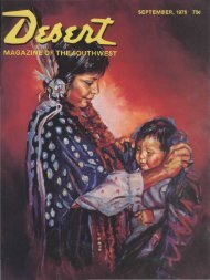
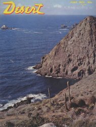
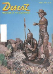
randall henderson petroglyphs - Desert Magazine of the Southwest
randall henderson petroglyphs - Desert Magazine of the Southwest
randall henderson petroglyphs - Desert Magazine of the Southwest

You also want an ePaper? Increase the reach of your titles
YUMPU automatically turns print PDFs into web optimized ePapers that Google loves.
Three lost mines<br />
by Panamint Russ<br />
WHERE THE PAVEMENT ENDS<br />
IF you have <strong>the</strong> time and nerve and<br />
wish to look for a lost gold ledge,<br />
I know a mountain that has three<br />
<strong>of</strong> <strong>the</strong>m.<br />
Let's start at <strong>the</strong> lowest spot in <strong>the</strong><br />
United States, Death Valley, and<br />
work our way up to Manly Peak.<br />
Drive to <strong>the</strong> foot <strong>of</strong> Jubilee Pass<br />
as it drops into Death Valley — that's<br />
where <strong>the</strong> pavement ends. Take <strong>the</strong><br />
dirt road that goes down <strong>the</strong> west<br />
side <strong>of</strong> <strong>the</strong> Valley about four miles<br />
and you will hit a dirt road on your<br />
left, marked or posted, "Butte Valley<br />
— 20 miles," also a couple <strong>of</strong><br />
warning signs reading, "This road<br />
not maintained — proceed at your<br />
own risk" or "No more services<br />
ahead."<br />
But, turn your back on <strong>the</strong> Black<br />
Mountains and take <strong>the</strong> road anyway.<br />
The Black Mountains form <strong>the</strong><br />
east slope <strong>of</strong> Death Valley, which is<br />
as barren as a tombstone in a cemetery.<br />
Volcanos leave nothing when<br />
<strong>the</strong>y go wild. They are well named,<br />
<strong>the</strong>se Black Mountains.<br />
You should have had enough sense<br />
at <strong>the</strong> town you left 30 miles back,<br />
called Shoshone, to have acquired<br />
five gallons <strong>of</strong> water, ten gallons <strong>of</strong><br />
gas, tire patching, a jack, pump,<br />
spare tire and food for an emergency.<br />
You could run into a sand storm, excessive<br />
heat, tail wind, blow-outs<br />
from hot tires, hit a rock or lose your<br />
oil. On this road, you're on your<br />
own.<br />
ARNING<br />
N«T *BVIS*BLE T9<br />
TRAVEL THIS IjBAB<br />
!* WATER GASOLINE<br />
(« OTHER SERVICES<br />
«XT« MILES,<br />
VIAJAR POB ESTE CAMINO<br />
NO HAY AGUA GASOLiNA<br />
Nl OTRO SE9VIO0<br />
• , "•? ^0 MiLLAS<br />
Climb quickly out <strong>of</strong> Death Valley<br />
up on a long ridge. Here vegetation<br />
begins to occur and <strong>the</strong> air<br />
grows cooler. You have 30 miles to<br />
go from <strong>the</strong> floor <strong>of</strong> Death Valley to<br />
<strong>the</strong> foot <strong>of</strong> Manly Peak. Some <strong>of</strong> <strong>the</strong><br />
dirt road is rocky, so proceed slowly.<br />
After reaching <strong>the</strong> high bench, you<br />
drop into Warm Springs Canyon.<br />
It's nei<strong>the</strong>r wide nor narrow, just<br />
ordinary. Soon you will pass, on your<br />
left, one <strong>of</strong> <strong>the</strong> largest Talc Mines<br />
in <strong>the</strong> United States. Continue up<br />
<strong>the</strong> Canyon five or six miles to <strong>the</strong><br />
head <strong>of</strong> Warm Springs Canyon and<br />
enter Butte Valley.<br />
NOTICE<br />
THIS RQAD IS NOT<br />
MAINTAINED BEYOND<br />
THIS POINT.<br />
PROCEED AJ YOUR<br />
OWN Rf$K.<br />
There is only <strong>the</strong> one road, so no<br />
fear <strong>of</strong> being sidetracked. Traveling<br />
southwest in Butte Valley, you soon<br />
pass <strong>the</strong> Striped Butte on your right.<br />
It's about 500-feet high and one-half<br />
mile long with no dirt nor vegetation<br />
— just layers <strong>of</strong> striped rock all colors.<br />
Beautiful !<br />
Two miles south <strong>of</strong> Striped Butte<br />
lies Anvil Springs. You are now at<br />
4500 feet and can see Death Valley<br />
below through Anvil Springs Canyon.<br />
Anvil Springs must be fed from a<br />
fissure <strong>of</strong> Mount Whitney because<br />
every few miles from Mt. Whitney<br />
to Nevada a spring comes to <strong>the</strong><br />
surface regardless <strong>of</strong> snow o rrainfall.<br />
Even in dry years <strong>the</strong>se springs never<br />
vary in <strong>the</strong>ir surface flow.<br />
Rising above Anvil Springs is Manly<br />
Peak, <strong>the</strong> north side <strong>of</strong> which is<br />
7158 feet and <strong>the</strong> top shaped like<br />
<strong>the</strong> letter "L."<br />
So far, from <strong>the</strong> floor <strong>of</strong> Death Valley<br />
where <strong>the</strong> pavement ends, you<br />
have been in <strong>the</strong> Death Valley National<br />
Monument. Here mining is