Jauhar | September-November 2010 - Jamia Millia Islamia
Jauhar | September-November 2010 - Jamia Millia Islamia
Jauhar | September-November 2010 - Jamia Millia Islamia

Create successful ePaper yourself
Turn your PDF publications into a flip-book with our unique Google optimized e-Paper software.
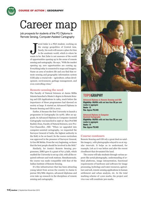
COURSE OF ACTION | GEOGRAPHY<br />
Career map<br />
Job prospects for students of the PG Diploma in<br />
Remote Sensing, Computer-Assisted Cartography<br />
14|<strong>Jauhar</strong> | <strong>September</strong>-<strong>November</strong> <strong>2010</strong><br />
Javed Zafar is a PhD student, working on<br />
the energy geopolitics of Central Asia.<br />
Surely, his work will ensure a place for him<br />
in the academic world, which is where he<br />
wants to be. But Zafar is not unaware of the world<br />
of opportunities opening up in the areas of remote<br />
sensing and cartography. He says, “With the market<br />
opening up, new opportunities are coming up.<br />
Everything today is connected to maps and imagery.<br />
Name an area of modern life and you find that remote<br />
sensing and geographic information system<br />
(GIS) play a crucial role – agriculture, urban development,<br />
environment, garbage management, and<br />
even controlling crime.”<br />
Remote-sensing the need<br />
The Faculty of Natural Sciences at <strong>Jamia</strong> <strong>Millia</strong><br />
<strong>Islamia</strong> launched a Master’s degree in Remote Sensing<br />
and GIS Applications in 1984, much before the<br />
importance of these programmes had dawned on<br />
society at large. It started an Advanced Diploma in<br />
Remote Sensing and GIS in 2002.<br />
Earlier, it became the first University to launch a<br />
programme in Cartography (in 1978). After an upgrade,<br />
its Advanced Diploma in Computer-Assisted<br />
Cartography was launched in 1996-97. Says Prof SM<br />
Rashid, Dean, Faculty of Natural Sciences, now Pro-<br />
Vice-Chancellor, JMI: “When we upgraded into<br />
computer-assisted cartography, we requested the<br />
Surveyor General of India, the highest authority in<br />
the field, to be on board. So the course curriculum<br />
was approved in the presence of Surveyor General,<br />
Lt Gen SK Mehta. From the very beginning, we knew<br />
that the best people should be involved in the field.”<br />
Similarly, for <strong>Jamia</strong>’s Remote Sensing programmes,<br />
ISRO gave it a grant of `27.3 lakh, which<br />
enabled the University to set up a lab, with all the required<br />
software and work stations. Simultaneously,<br />
the course was made compatible with that of the<br />
Indian Institute of Remote Sensing.<br />
It’s this infrastructure that has been attracting<br />
young talent from across the country to <strong>Jamia</strong> to<br />
pursue MA/MSc degrees, advanced diplomas and<br />
even take up research in the disciplines of remote<br />
sensing and cartography.<br />
TOPOGRAPHY<br />
Advanced Diploma in Remote Sensing and GIS<br />
Eligibility: MA/MSc with not less than 50 per cent<br />
marks in aggregate<br />
Seats: 15<br />
Fee: Approx `6,845<br />
Advanced Diploma in Computer<br />
Assisted Cartography<br />
Eligibility: MA/MSc with not less than 50 per cent<br />
marks in aggregate<br />
Seats: 15<br />
Fee: Approx `6,845<br />
Course contours<br />
Remote Sensing and GIS rely a great deal on satellite<br />
imagery, with photographs relayed to us at regular<br />
intervals. It helps us to understand, for<br />
example, Leh as it was before and after the recent<br />
cloudburst that devastated the land.<br />
The course will take students through various aspects<br />
like aerial photography, understanding of orbital<br />
platforms, image interpretation, functional<br />
requirements of hardware and software for image<br />
processing, hydrology and water resources, agriculture<br />
and soil, remote sensing applications in human<br />
settlement and urban analysis, etc. In the total<br />
marking scheme of 1,200 marks, the project and<br />
viva-voce will constitute 300 marks.