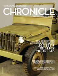
Kentucky Ancestors, Volume 46, Number 2 - Kentucky Historical ...
Kentucky Ancestors, Volume 46, Number 2 - Kentucky Historical ...
Kentucky Ancestors, Volume 46, Number 2 - Kentucky Historical ...

You also want an ePaper? Increase the reach of your titles
YUMPU automatically turns print PDFs into web optimized ePapers that Google loves.
Marker 1909, Fisher’s Garrison<br />
This <strong>Kentucky</strong> historical marker, Fisher’s Garrison,<br />
is near the location where Stephen Albert<br />
Fisher, a veteran of the Revolutionary War, returned<br />
to <strong>Kentucky</strong> in 1779 and established a garrison near<br />
present-day Danville (Boyle County), <strong>Kentucky</strong>.<br />
Fisher’s Garrison 3<br />
Marker<br />
<strong>Number</strong><br />
1909<br />
County Boyle<br />
Location Near 391 McDowell Dr., Lexington<br />
Rd., Danville<br />
Description Stephen Albert Fisher, Rev.<br />
War soldier from Va., assigned<br />
in 1775 to active duty and<br />
wounded while serving with<br />
Colonel John Bowman’s militia.<br />
Returned to Ky. in 1779<br />
with wife Mary Magdalene<br />
Garr. He established garrison of<br />
military significance in vicinity<br />
of 400-acre settlement tract.<br />
Bros. Adam (in Rev.) & Barnett<br />
followed to Ky. Presented by<br />
Col. Richard Hampton Fisher,<br />
S.A.R.<br />
Marker 1140, Clark’s Station<br />
Located southeast of Danville, the site of Clark’s<br />
station memorializes an early settlement, built by<br />
William Whitley’s brother-in-law, George Clark.<br />
Nearby Clark’s Run was named for George and provided<br />
a ready source of water for the early settlers.<br />
Clark’s Station 4<br />
Marker<br />
<strong>Number</strong><br />
1140<br />
County Boyle<br />
Location SE of Danville, US 150 & KY<br />
52<br />
104 | <strong>Kentucky</strong> <strong>Ancestors</strong><br />
<strong>Historical</strong> marker, Fisher’s Garrison, Danville (Boyle Co., Ky.)<br />
<strong>Historical</strong> marker, Clark’s Station (Boyle Co., Ky.)<br />
Description Early pioneer settlement erected<br />
before 1779. Developed by<br />
George Clark, brother-in-law<br />
of William Whitley, whose<br />
party came to Ky. about 1775.<br />
Located on Clark’s Run Creek,<br />
named for George Clark, it<br />
was one of the first stations<br />
built in the vicinity of the forts<br />
at Harrodsburg and Stanford.<br />
Clark raised a crop here as early<br />
as 1775, improved the site in<br />
1776.