environmental statement - Rotherham's Online Application for ...
environmental statement - Rotherham's Online Application for ...
environmental statement - Rotherham's Online Application for ...

You also want an ePaper? Increase the reach of your titles
YUMPU automatically turns print PDFs into web optimized ePapers that Google loves.
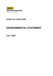
PENNY HILL WIND FARM<br />
ENVIRONMENTAL STATEMENT<br />
JULY 2009
© The Banks Group. All rights reserved.<br />
This document has been provided <strong>for</strong> your reference by The Banks Group. No material from this<br />
document may be otherwise copied, altered, republished, transmitted or distributed in any way without<br />
permission.<br />
Aerial photographs are © Getmapping PLC and © AirFotos Ltd as indicated and are also subject to<br />
the conditions above.<br />
All map data is reproduced from Raster 10,000 and Raster 50,000 by permission of Ordnance Survey<br />
registered on behalf of Her Majesty's Stationery Office © Crown Copyright 2001, 2002, 20003, 2004,<br />
2005. All Rights Reserved. AL 100017630.
PREFACE<br />
This Environmental Statement has been prepared to support an application by<br />
Penny Hill Wind Farm Ltd <strong>for</strong> the construction and operation of the Penny Hill Wind<br />
Farm. Banks Developments Ltd (a wholly owned subsidiary of The Banks Group)<br />
will be acting as the agent on behalf of Penny Hill Wind Farm Ltd. The Penny Hill<br />
Wind Farm proposal is located east of the village of Ulley at Penny Hill Lane,<br />
Rotherham, South Yorkshire. Penny Hill Wind farm Ltd will be referred to as “The<br />
Applicant” <strong>for</strong> the remainder of this Environmental Statement. Banks Developments<br />
Ltd will be referred to as “The Agent” <strong>for</strong> the remainder of the Environmental<br />
Statement.<br />
The Environmental Statement (ES) reports the findings of the Environmental Impact<br />
Assessment (EIA) co-ordinated by TNEI Services Ltd, with specialist input from the<br />
following consultants:<br />
Pegasus Environmental - Landscape & Visual;<br />
Citrine - Landscape & Visual Photography;<br />
Faber Maunsell - Ecology, Ornithology and Traffic & Transport;<br />
Arcus Renewable Energy Consulting - Archaeology & Cultural Heritage;<br />
Collett Transport - Transport;<br />
SM Foster Associates - Flood Risk; and<br />
TNEI Services - Shadow Flicker and Noise.<br />
Although not part of the EIA, the ES also includes an assessment of the proposal‟s<br />
potential aeronautical effects undertaken by Airport Planning and Development<br />
(APD) Ltd.<br />
The ES comprises the following elements:<br />
Non-Technical Summary – describing the proposal and summarising the<br />
findings of the <strong>environmental</strong> impact;<br />
Main Text and Drawings – providing a detailed description of the proposal and<br />
its potential effects, reporting the findings of the EIA and providing other<br />
relevant background in<strong>for</strong>mation;<br />
Appendices - containing relevant detailed reports of the sub-contractors,<br />
including ecology, ornithology, noise, archaeology, landscape & visual, flood<br />
risk, traffic and shadow flicker; and<br />
Visualisations – containing the visualisations at A3 size prepared to<br />
accompany the landscape and visual assessment, including photomontage<br />
and wire frame diagrams from selected viewpoints.<br />
In addition, a Design & Access Statement and a Planning Statement in support of<br />
the application have been prepared. Copies of the <strong>statement</strong>s <strong>for</strong>m part of the<br />
planning submission, although they do not <strong>for</strong>m part of the <strong>for</strong>mal ES. A <strong>for</strong>mal set<br />
of planning application drawings are also provided to accompany the planning<br />
application, using selected ES Drawings, but also do not <strong>for</strong>m part of the ES.<br />
Project Name<br />
Document Type
The Non-Technical Summary, ES, ES Drawings, Appendices, Design & Access<br />
Statement and Planning Statement are presented in a single volume in an A4 sized<br />
ring bound folder. Printed copies of the ES may be purchased at a cost of £100<br />
including post and packing from Banks Renewables Ltd at:<br />
Inkerman Road<br />
Tow Law<br />
Bishop Auckland<br />
County Durham<br />
DL13 4HG<br />
E-mail: pennyhill@banksdevelopments.com<br />
Electronic copies of the documentation on CD are also available from the above<br />
address at a cost of £10 including post and packing.<br />
Cheques <strong>for</strong> either of these <strong>for</strong>mats should be made out to the National Fuel Poverty<br />
Charity, National Energy Action, and be sent to the above address, which we will<br />
then <strong>for</strong>ward as a charitable donation.<br />
The Non-Technical Summary is available free of charge from Banks Renewables at<br />
the above address.<br />
Copies of the Non-Technical Summary and the ES are available <strong>for</strong> public<br />
consultation during normal office hours at the Rotherham Metropolitan Borough<br />
Council Development Customer Service Centre. The address is provided below:<br />
Rotherham Metropolitan Borough Council<br />
Civic Building Walker<br />
Place<br />
Rotherham<br />
S65 1UF<br />
In addition, the planning application can be viewed in full on the following website:<br />
http://www.rotherham.gov.uk/graphics/Residents/Planning<br />
Project Name<br />
Document Type
TABLE OF CONTENTS<br />
PREFACE .................................................................................................................. 1<br />
PART 1: BACKGROUND INFORMATION ................................................................ 1<br />
1. INTRODUCTION ............................................................................................. 2<br />
2. THE PROPOSED DEVELOPMENT .............................................................. 11<br />
3. ENVIRONMENTAL IMPACT ASSESSMENT PROCESS ............................. 20<br />
4. SITE SELECTION AND DESIGN .................................................................. 30<br />
5. CONSTRUCTION, OPERATION AND DECOMMISIONING ......................... 40<br />
PART 2: SUMMARY OF ENVIRONMENTAL IMPACT ASSESSMENT ................. 48<br />
6. LANDSCAPE AND VISUAL ......................................................................... 49<br />
7. ECOLOGY & NATURE CONSERVATION ................................................. 167<br />
8. ORNITHOLOGY .......................................................................................... 196<br />
9. NOISE ......................................................................................................... 209<br />
10. ARCHAEOLOGY AND CULTURAL HERITAGE ........................................ 221<br />
PART 3: DESCRIPTION OF OTHER EFFECTS ................................................... 248<br />
11. CONSTRUCTION TRAFFIC ....................................................................... 249<br />
12. CIVILLIAN AND MILITARY AERONAUTICAL RADAR ............................. 275<br />
13. GROUND CONDITIONS AND HYDROLOGY ............................................ 281<br />
14. RADIO-COMMUNICATIONS AND TELEVISION ....................................... 289<br />
15. SHADOW FLICKER .................................................................................... 294<br />
16. OTHER ISSUES .......................................................................................... 300<br />
Project Name<br />
Document Type
PART 1: BACKGROUND INFORMATION<br />
1<br />
Penny Hill Wind Farm<br />
Environmental Statement
1. INTRODUCTION<br />
THIS DOCUMENT<br />
1.1 This document <strong>for</strong>ms the Environmental Statement accompanying<br />
the application <strong>for</strong> planning permission made by Banks Renewables Ltd<br />
(the Applicant) to Rotherham Metropolitan Borough Council to develop the<br />
Penny Hill Wind Farm. The proposal site is located on farmland to the<br />
west of the M1 and M18 interchange south of Rotherham, to the east of<br />
the village of Ulley.<br />
1.2 The preparation of the Environmental Statement has been co-ordinated on<br />
behalf of the Applicant by TNEI Services Ltd. Detailed assessments of<br />
potential <strong>environmental</strong> effects have been undertaken by TNEI Services<br />
Ltd and other specialised consultants.<br />
ENVIRONMENTAL STATEMENT STRUCTURE<br />
1.3 The Environmental Statement (ES) describes the proposal and reports the<br />
findings of the Environmental Impact Assessment (EIA). The ES consists<br />
of the following documents:<br />
Non-Technical Summary – describing the proposal and summarising<br />
the findings of the EIA;<br />
Main Text and Figures – providing a detailed description of the<br />
proposal and its potential effects, reporting the findings of the EIA and<br />
providing other relevant background in<strong>for</strong>mation;<br />
Appendices - containing in<strong>for</strong>mation on consultation and relevant<br />
detailed reports of the sub-contractors; and<br />
Visualisations – containing the visualisations at A3 size prepared to<br />
accompany the landscape and visual assessment, including<br />
photomontage and wire frame diagrams from selected viewpoints.<br />
1.4 In addition, a Design & Access Statement and a Planning Statement in<br />
support of the application have been prepared. Copies of these <strong>statement</strong>s<br />
<strong>for</strong>m part of the planning application submission, although they do not <strong>for</strong>m<br />
part of the <strong>for</strong>mal ES.<br />
1.5 The Non Technical Summary, ES, ES Drawings, Appendices, Design &<br />
Access Statement and Planning Statement are presented in a single<br />
volume in an A4 sized ring bound folder. The landscape and visual impact<br />
assessment visualisations are presented in a separate bound A3 volume.<br />
1.6 This ES is split into three parts:<br />
Part 1 – Describes the EIA process, the policy background, the site and<br />
the proposed development;<br />
2<br />
Penny Hill Wind Farm<br />
Environmental Statement
Part 2 – Summarises the findings of the EIA with regard to each of the<br />
following potential significant <strong>environmental</strong> effects:<br />
landscape and visual;<br />
ecology and nature conservation;<br />
ornithology;<br />
noise; and<br />
archaeology and cultural heritage.<br />
Part 3 – Provides a description of other potential effects:<br />
construction traffic;<br />
civilian and military aeronautical interests;<br />
radio-communications and television;<br />
ground conditions and flood risk;<br />
shadow flicker; and<br />
other issues (e.g. <strong>environmental</strong> management, health and safety).<br />
1.7 Details of the methodologies <strong>for</strong> each assessment are provided in the<br />
relevant sections.<br />
1.8 The approach taken in the EIA to the identification and assessment of<br />
potentially significant effects of the proposal is consistent with guidelines<br />
published by the Institute of Environmental Management and Assessment<br />
(IEMA). The standard <strong>for</strong>mat <strong>for</strong> each of these sections is as follows:<br />
a description of the methodology used to assess the impacts, including<br />
specific guidance documents used;<br />
a summary of the relevant consultation responses received, relating to<br />
that specific impact;<br />
a description of the baseline in<strong>for</strong>mation, including the relevant features<br />
of the site and a description of the available in<strong>for</strong>mation arising from<br />
the baseline monitoring undertaken;<br />
a description of the likely impacts of the development on the<br />
environment;<br />
a summary of proposed mitigation;<br />
an evaluation of the level and significance of residual impacts; and<br />
3<br />
Penny Hill Wind Farm<br />
Environmental Statement
a summary of the assessment, including proposals to avoid or mitigate<br />
potential adverse effects, where they are identified.<br />
1.9 Throughout the document, reference is made to the Applicant‟s intention to<br />
produce, and adhere to the provisions of, both a Construction Method<br />
Statement (CMS) and an Environmental Management Plan (EMP), prior to<br />
the commencement of construction. A draft EMP <strong>for</strong> the Penny Hill site is<br />
included as Appendix 12.<br />
1.10 It is envisaged by the Applicant that the scope of both the CMS and the<br />
final EMP will be agreed with the Local Planning Authority, in consultation<br />
with the Environment Agency, through appropriate planning conditions.<br />
BACKGROUND<br />
The Proposed Development<br />
1.11 The main elements of the proposal can be summarised as follows:<br />
Six wind turbines, with a maximum tip height of 132 metres, each with<br />
a maximum individual installed capacity of approximately 3.3<br />
megawatts (MW);<br />
Improvements to existing means of access from the public highway at<br />
Penny Hill Lane;<br />
approximately 3.5 km of new access tracks;<br />
underground electrical cabling;<br />
wind monitoring mast (permanent <strong>for</strong> the lifetime of the wind farm);<br />
site control building and substation;<br />
a temporary construction compound <strong>for</strong> the duration of the construction<br />
period; and<br />
hardstanding areas, fences and other associated infrastructure.<br />
1.12 The <strong>environmental</strong> effects of developing each of these elements are<br />
assessed in this ES.<br />
1.13 In parallel with the proposed development taking place, the Applicant will<br />
establish a Community Fund, which will receive money throughout the life<br />
of the proposed development. The fund will be available to assist local<br />
community projects and discussions will continue to take place between<br />
the Applicant and possible grant funding agencies and bodies with a view<br />
to the Community Fund being used to „lever in‟ additional grant funding <strong>for</strong><br />
local projects.<br />
4<br />
Penny Hill Wind Farm<br />
Environmental Statement
1.14 The installed capacity of the proposed Penny Hill Wind Farm would be up<br />
to a maximum of 19.8 MW, based on the potential use of 3.3 MW turbines.<br />
The current approved regional renewable energy target <strong>for</strong> Yorkshire and<br />
Humber requires 708 MW of installed capacity by 2010 and 1,862 MW by<br />
2021. The target <strong>for</strong> the South Yorkshire sub-region is 47 MW, by 2010<br />
and 160 MW by 2021. The sub regional target is broken down further to<br />
Local Authority area, <strong>for</strong> Rotherham the 2010 target is 11 MW and the<br />
2021 target is 36 MW. To date five wind farms totalling 34.2MW of power<br />
is being generated in the Yorkshire and Humber region, which represents<br />
just 1.74% of the RSS 2021 target. Of the 34.2MW just 7.8MW is within<br />
the South Yorkshire sub-region. Within the Rotherham area, there is only<br />
one operational wind energy development at the Advanced Manufacturing<br />
Research Centre, with a 1.3MW capacity, although there is an extant<br />
planning permission <strong>for</strong> the development of a 3.9MW wind farm at Loscar.<br />
1.15 The Penny Hill Wind Farm proposal has been prepared following an<br />
extensive consultation process involving the distribution of over 2,000<br />
in<strong>for</strong>mation leaflets, two public exhibition days at three separate venues<br />
and several meetings with a number of key stakeholders and consultees.<br />
Full details of the consultations undertaken and the feedback received,<br />
including the comments made by local residents at the public exhibition,<br />
are reported in Appendix 1 and summarised later in Section 3 of this ES.<br />
THE NEED FOR RENEWABLE ENERGY<br />
1.16 The UK, along with over 180 other countries has signed the Kyoto<br />
Protocol, which commits all signatories to significantly reduce greenhouse<br />
gas emissions by fixed targets, resulting in an initial UK target of reducing<br />
carbon dioxide (CO2) emissions by 60% by 2050. The UK Government<br />
stated that renewable energy is an integral part of the Government's<br />
longer-term aim of reducing CO2 emissions, setting targets of 10% of<br />
electricity supply from renewable energy by 2010 and 20% by 2020.<br />
1.17 The European Union has committed to a target of 20% of all energy (not<br />
just electricity) coming from renewable resources by 2020. The UK share<br />
of this target is to have 15% of all energy coming from renewable<br />
resources by 2020.<br />
1.18 The UK Government published “The Energy White Paper: Meeting the<br />
Energy Challenge” in May 2007. This White Paper sets out the<br />
Government‟s international and domestic energy strategy to respond to<br />
these changing circumstances, address the long term energy challenges<br />
we face and deliver four energy policy goals:<br />
to put ourselves on a path to substantially cutting CO2 emissions;<br />
to maintain the reliability of energy supplies;<br />
to promote competitive markets in the UK and beyond; and<br />
5<br />
Penny Hill Wind Farm<br />
Environmental Statement
to ensure that every home is adequately and af<strong>for</strong>dably heated.<br />
1.19 Box 5.3.3 of the White Paper is a “Renewables Statement of Need”<br />
detailing the Government‟s current policy towards the development of<br />
renewables and the important role they have to play in helping the UK<br />
meet its energy policy goals.<br />
1.20 The Renewables Statement of Need states:<br />
„New renewable projects may not always appear to convey any particular<br />
local benefit, but they provide crucial national benefits. Individual<br />
renewable projects are part of a growing proportion of low carbon<br />
generation that provides benefits shared by all communities both through<br />
reduced emissions and more diverse supply of energy, which helps the<br />
reliability of our supplies. This factor is a material consideration to which<br />
all participants in the planning system should give significant weight when<br />
considering renewable energy proposals. These wider benefits are not<br />
always immediately visible to the specific locality in which the project is<br />
sited. However, the benefits to society and the wider economy as a whole<br />
are significant and this must be reflected in the weight given to these<br />
considerations by decision makers in reaching their decisions.‟<br />
1.21 The Government‟s “UK Renewable Energy Strategy – Consultation<br />
Document” was published in June 2008. This is a consultation document<br />
seeking views on how to drive up the use of renewable energy in the UK,<br />
as part of an overall strategy <strong>for</strong> tackling climate change and to meet the<br />
UK share of the EU target to source 20% of the EU's energy from<br />
renewable sources by 2020. Responses to the consultation will help shape<br />
the UK Renewable Energy Strategy which will be published in Spring<br />
2009, once the UK's share of the target has been agreed. The document<br />
rein<strong>for</strong>ces the two key energy policy challenges: to tackle climate change<br />
and ensure security of energy supply. It confirms that renewable sources<br />
of energy are vital as they provide low-carbon energy, increase diversity to<br />
the energy mix and bring key business and employment opportunities.<br />
1.22 Most recently, The Climate Change Act 2008, received Royal Ascent on<br />
26 th November 2008, and introduces the world‟s first long term legally<br />
binding framework to tackle the dangers of climate change. This<br />
legislation reiterates the UK government‟s commitment to the role of<br />
renewable energy as an important factor in the move to a low carbon<br />
economy.<br />
1.23 There are also strong socio-economic arguments in support of the<br />
development of renewable energy. Until recently the availability of<br />
relatively cheap supplies of oil and gas from countries such as Columbia,<br />
Russia and Poland led to increased levels of imports. International<br />
increases in the price of gas and oil, and increased instability in the<br />
availability of imports from some of these countries has led to a review of<br />
the country‟s future energy sources. Renewable energy seeks to redress<br />
the balance by delivering greater self-sufficiency in energy supply. There<br />
6<br />
Penny Hill Wind Farm<br />
Environmental Statement
are also advantages in decentralised embedded electricity generation<br />
including a reduction in the amount of electricity lost during transmission<br />
and supply failures.<br />
1.24 Wind energy is an inexhaustible and indigenous energy source.<br />
Furthermore, the UK is the windiest country in Western Europe. As such,<br />
wind is currently recognised by the UK Government as the most<br />
economically viable source of green electricity in the UK and that it can<br />
reasonably be expected to be proposed in all regions of the country.<br />
1.25 The proposed Penny Hill Wind Farm should be considered in light of the<br />
above, which are the most recent expression of Government policy on<br />
renewable energy development. Of particular importance are the very<br />
clear targets that the UK has <strong>for</strong> substantially reducing CO2 emissions and<br />
significantly expanding the amount of electricity to be produced from<br />
renewable resources.<br />
THE RATIONALE BEHIND THE PROJECT<br />
1.26 The rationale <strong>for</strong> the proposed development can be summarised as<br />
follows:<br />
The UK, along with over 180 other countries, has signed the Kyoto<br />
Protocol which commits all signatories to significantly reduce<br />
greenhouse gas emissions by fixed targets;<br />
The decline in the finite indigenous energy supplies of the UK (mostly<br />
fossil based), and the need to provide a range of alternative sources;<br />
Wind energy is an inexhaustible and indigenous energy source (the UK<br />
is the windiest country in Western Europe) and is widely recognised as<br />
the most promising and economically viable source of green electricity<br />
in the country;<br />
Governmental guidance on tackling climate change recognises the<br />
needs to both develop renewable energy sources and promote energy<br />
efficiency. The opportunity exists at the Penny Hill site to deliver a<br />
local scale renewable energy proposal that would deliver up to a<br />
maximum of 19.8 Megawatts (MW). This would contribute significantly<br />
towards the Rotherham Borough the regional renewable energy target<br />
of 36 MW by 2021;<br />
The site has been comprehensively assessed by the Applicant, is<br />
relatively unconstrained and has been identified as being suitable <strong>for</strong><br />
the development of a wind energy proposal (discussed further in<br />
Section 4); and<br />
The site benefits from a viable wind resource (discussed further in<br />
Section 4).<br />
7<br />
Penny Hill Wind Farm<br />
Environmental Statement
PROJECT OBJECTIVES<br />
1.27 The project is being proposed by the Applicant as a locally based initiative<br />
to utilise the on-site wind resource to contribute towards Rotherham‟s<br />
2021 renewable energy target and national renewable energy targets,<br />
while also providing local economic and <strong>environmental</strong> benefits. The<br />
Applicant has a main office in the area, at Barlborough, and this project<br />
has particular local significance to their business.<br />
1.28 The overall objectives of the Penny Hill Wind Farm proposal are as<br />
follows:<br />
To generate a locally significant amount of clean, renewable electricity<br />
thereby reducing greenhouse gas emissions;<br />
To take a responsive approach to local constraints and by doing so, in<br />
visual terms, realise a scheme which achieves a coherent, balanced<br />
and logical impression when viewed from principal viewpoints and<br />
produces a scheme that is an acceptable scale and layout <strong>for</strong> the site<br />
and surrounding area;<br />
To produce a financial return to the Applicants and in turn, to the<br />
communities around the site, principally through the sale of electricity<br />
to the national electricity market and the establishment of the<br />
Community Fund (discussed above);<br />
To support the expanding renewable based industries in the region and<br />
beyond; and<br />
To support sustainable energy initiatives within the Borough.<br />
PROJECT BENEFITS<br />
1.29 The project would deliver the following benefits:<br />
A reduction in greenhouse gas emissions by harnessing power from<br />
the wind as an alternative to the burning of fossil fuels;<br />
Produce an indigenous energy supply, reducing the UK‟s reliance on<br />
imported fossil fuels;<br />
Potentially create and sustain employment opportunities during the<br />
manufacturing and construction period of the project;<br />
Enhance the clean, green, sustainable image of Rotherham and the<br />
surrounding borough;<br />
Support farm diversification;<br />
Provide long term income to the agricultural businesses on the site;<br />
and<br />
8<br />
Penny Hill Wind Farm<br />
Environmental Statement
Establishment of a Community Fund with the aim of improving energy<br />
efficiency and reducing fuel poverty in Rotherham.<br />
The Applicant<br />
1.30 This application has been submitted by Banks Developments Ltd on behalf<br />
of Penny Hill Wind Farm Ltd, both a wholly owned subsidiary of the Banks<br />
Group.<br />
1.31 Since its foundation in 1976 the Banks Group operations have undergone<br />
carefully planned growth and diversification into new business areas. The<br />
Banks Group now operate in four business areas:<br />
renewable energy;<br />
mineral extraction;<br />
waste management; and<br />
land reclamation.<br />
1.32 The Group‟s renewable energy division operates from its offices in<br />
Barlborough in Bolsover and Tow Law in County Durham, and draws on<br />
the company‟s 30 years of experience in successfully developing<br />
significant projects in the minerals, waste and property sectors. The<br />
entrance into the Renewable Energy sector was a natural progression <strong>for</strong><br />
a developer with both experience in identifying and delivering successful<br />
projects, and an existing relationship with energy generators in the North<br />
East region and throughout the UK.<br />
1.33 The renewable energy division is exploring opportunities <strong>for</strong> generating<br />
green electricity throughout the UK and considers itself to be well placed to<br />
contribute towards the renewable energy targets set by the UK<br />
Government.<br />
1.34 The Banks Group‟s success in delivering major projects has largely been<br />
attributed to its „Development With Care‟ approach, which is central to the<br />
aims and objectives of the business. Their commitment to the local<br />
community is demonstrated by the way in which they strive <strong>for</strong> total<br />
satisfaction in all of their dealings. They also publish and adhere to best<br />
practice policies and especially in encouraging community participation in<br />
their projects. Banks are continually improving their per<strong>for</strong>mance and<br />
competitiveness, using exciting new ideas and have a real commitment to<br />
„Development With Care‟ in all of their work. The „Banks in the<br />
Community‟ brochure illustrating this concept is contained in Appendix 2.<br />
1.35 In 2004 the Banks Group won an award <strong>for</strong> its ef<strong>for</strong>ts in involving the local<br />
communities in the design of the restoration of its surface mine at<br />
Pegswood in Northumberland to a community park, providing community<br />
recreational facilities including fishing and boating, as well as protected<br />
9<br />
Penny Hill Wind Farm<br />
Environmental Statement
and enhanced wildlife habitats. In the same year the Group won an award<br />
from the Noise Abatement Society <strong>for</strong> innovation through the use of the<br />
best, most up to date equipment and a deeper understanding of noise<br />
concerns. These awards demonstrate the range of expertise available<br />
within the Banks Group. This expertise has been applied to the design<br />
and assessment of the Penny Hill proposal and would be applied during<br />
the construction of the wind farm, should planning permission be granted.<br />
10<br />
Penny Hill Wind Farm<br />
Environmental Statement
2. THE PROPOSED DEVELOPMENT<br />
INTRODUCTION<br />
2.1 This section describes the principles and details of the proposed Penny<br />
Hill Wind Farm, as submitted. Included in this section are details of all<br />
elements of the proposed scheme covering the construction, operational<br />
and decommissioning periods.<br />
2.2 Prior to the commencement of construction activity, an Environmental<br />
Management Plan (EMP) and Construction Method Statement (CMS) will<br />
be prepared, covering details of each major item of work required and<br />
detailing in particular the final locations of the turbines, tracks and other<br />
infrastructure. A draft EMP <strong>for</strong> the Penny Hill site is included at Appendix<br />
12. It is envisaged that the agreed final version of these documents will be<br />
the subject of a planning condition and agreed in advance with the local<br />
planning authority.<br />
SITE LAYOUT OVERVIEW<br />
2.3 The total land take of the wind farm, including foundations, temporary<br />
crane pads, construction compound, access tracks, control building,<br />
substation and meteorological mast is estimated to be no greater than 6<br />
hectares during construction. This represents a maximum of 4.8% of the<br />
planning application area, which encompasses approximately 125.5<br />
hectares. Upon commissioning and the completion of site restoration<br />
works the actual footprint of the wind farm infrastructure would only be<br />
approximately 2.5 hectares, representing only 2% of the planning<br />
application area.<br />
2.4 Drawing HJB/681/PA05 depicts the proposed site layout and shows all<br />
elements of the operational wind farm including the locations of the six<br />
proposed turbines. It also illustrates the site tracks and highway access<br />
points, the on-site control building and substation, and the permanent<br />
meteorological monitoring mast. Drawing HJB/681/PA05 also shows the<br />
location of the temporary construction compound. At each turbine location<br />
a crane pad will be required adjacent to the foundation to provide<br />
adequate bearing <strong>for</strong> the cranes carrying out turbine erection, as illustrated<br />
by Drawing HJB/681/PA11.<br />
2.5 The main access to the site will be from Penny Hill Lane, with a crossing<br />
point to the two turbines in the north of the site across Brampton Lane.<br />
The access will be designed to allow the turbine delivery vehicles and<br />
other construction vehicles to leave the highway quickly and safely. The<br />
access junction is shown on Drawing HJB/681/PA14.<br />
11<br />
Penny Hill Wind Farm<br />
Environmental Statement
2.6 The proposed turbines would be accessed by approximately 3.5km of onsite<br />
access tracks. These would have an average surface width of 5m and<br />
would be constructed of stone with a crushed stone running surface. The<br />
routes of these tracks are shown on Drawing HJB/681/PA05 and details of<br />
their construction are illustrated on Drawing HJB/681/PA12. Following the<br />
construction of the wind farm the site roads would be retained to<br />
accommodate maintenance traffic, consisting of visits by a light van.<br />
2.7 Trenching <strong>for</strong> cabling running between the proposed turbines will generally<br />
run parallel to the site roads connecting individual turbines to the electrical<br />
collection network. All the on-site circuits will converge at the site control<br />
building and substation from where the electricity generated by the<br />
turbines will be exported to the local grid.<br />
2.8 The layout of the wind farm has resulted from a process of design that has<br />
responded to a varied and diverse set of constraints. Principal aims were<br />
to achieve a layout that:<br />
Avoids constraints such as known overhead power lines,<br />
archaeological features, ecologically sensitive habitats and<br />
telecommunication links;<br />
Maintains an appropriate stand-off distance from residential properties<br />
in order to satisfy UK Government guidelines on wind turbine noise and<br />
disturbance; and<br />
Achieves a logical and balanced appearance from key viewpoints.<br />
2.9 These aims, combined with other practical considerations, have resulted<br />
in a compact layout of turbines on the site with a cohesive footprint. The<br />
design process is covered in more detail in Section 4 of this ES.<br />
2.10 The final layout has remained as specified within the Scoping Report with<br />
the inclusion of six turbines, due to the relatively unconstrained nature of<br />
the site the ability to maximise the potential <strong>for</strong> energy production could be<br />
realised. Since the submission of the Scoping Report the ability <strong>for</strong><br />
turbines with an increased generating power has progressed, there<strong>for</strong>e the<br />
submission seeks consent <strong>for</strong> the erection of turbines with a maximum<br />
height of 132m, which have a installed capacity of up to 3.3MW.<br />
2.11 It should also be noted that this application <strong>for</strong> planning permission seeks<br />
permission <strong>for</strong> a 50 metre „micro siting‟ allowance in order <strong>for</strong> an efficient<br />
construction process to be achieved. The contents of the ES and thus the<br />
individual assessments have been undertaken with this bore in mind,<br />
however in order <strong>for</strong> a practical assessment to have taken place fixed<br />
turbine locations have been cited within the assessment. Should planning<br />
permission be granted the final turbine locations will be submitted to the<br />
Local Planning Authority <strong>for</strong> consideration prior to turbine erection to<br />
12<br />
Penny Hill Wind Farm<br />
Environmental Statement
ensure an acceptable scenario <strong>for</strong> both parties (The applicant and the<br />
LPA) is attained.<br />
Turbine Specification<br />
2.12 The six turbines would be of a modern design with three bladed rotors<br />
mounted on nacelles housing the generator, gearbox and other operating<br />
equipment.<br />
2.13 The six turbines would all be of the same height and specification, with a<br />
hub height of around 80 m and a maximum height to blade tip of up to<br />
132m. The nacelles would be mounted on a tubular tower, which allows<br />
access to the nacelle. A diagram of an indicative wind turbine is shown as<br />
Drawing HJB/681/PA10.<br />
2.14 The final choice of turbine and manufacturer would be made at the <strong>for</strong>mal<br />
tendering stage, following consent. At this stage however, <strong>for</strong> the<br />
purposes of this EIA the largest available turbines that the site could<br />
accommodate, which would provide the maximum benefits in terms of<br />
renewable electricity output, have been considered in the assessment of<br />
the proposal, where appropriate. It is envisaged that the final choice,<br />
specification and colour of the turbines would be agreed with the Local<br />
Planning Authority through appropriate planning conditions.<br />
2.15 The types of turbines considered <strong>for</strong> this proposal normally begin to<br />
generate electricity at wind speeds of approximately 3-5 metres per<br />
second (m/s) rising to their maximum output at around 12-18 m/s. At wind<br />
speeds of around 25 m/s or greater the turbines would automatically shut<br />
down <strong>for</strong> safety reasons. All the turbines on the site would rotate in the<br />
same direction as viewed from the windward side, and would typically<br />
operate at a variable rotational speed of between 9 and 19 rpm. It is<br />
proposed that the turbine tower, nacelle and blades be finished in a light<br />
grey colour with a semi-matt finish. It is proposed that should external<br />
trans<strong>for</strong>mers be considered necessary they will be finished appropriately<br />
<strong>for</strong> the background to the agreement of the Local Planning Authority.<br />
2.16 Once operational, the wind turbines would operate automatically, requiring<br />
occasional visits by technicians in a light commercial van or similar<br />
vehicle. Some longer servicing visits would be required, along with<br />
reasonable unscheduled maintenance as may be necessary. Occasional<br />
visits by larger vehicles, such as cranes or lorries similar to those used<br />
during construction, may be necessary during the operational lifespan of<br />
the wind farm, should there be a requirement to replace any major turbine<br />
components.<br />
13<br />
Penny Hill Wind Farm<br />
Environmental Statement
Meteorological Monitoring<br />
2.17 Wind farm per<strong>for</strong>mance would be remotely monitored using a permanent<br />
meteorological mast, the location of which is shown on Drawing<br />
HJB/681/PA05, together with a System Control and Data Acquisitions<br />
(SCADA) system that would monitor the individual turbines. Anemometry<br />
equipment including wind speed and direction measurement equipment<br />
would be positioned near the top of the mast on booms. The mast would<br />
be up to 80m tall and a typical specification is depicted on Drawing<br />
HJB/681/PA09. A slim-line lattice tower would be used. It is, however,<br />
envisaged that the final choice of anemometer mast type would be agreed<br />
through an appropriate planning condition, and presented in the CMS.<br />
Turbine Foundations<br />
2.18 It is proposed that rein<strong>for</strong>ced concrete gravity foundations would be used<br />
<strong>for</strong> the proposed turbines. This foundation type is typically an inverted T<br />
shape consisting of a large square pad with a protruding upstand that lies<br />
flush with the reinstated ground level. The excavation in which the turbine<br />
foundation is cast would be backfilled with suitable stone, placed and<br />
compacted over the foundation. The subsoil and topsoil stripped prior to<br />
foundation excavation would be retained and reinstated around the base<br />
of the turbine tower when backfilling has been completed. The turbine<br />
towers would be connected to the foundation by a „foundation ring‟ cast<br />
into the foundation, or alternatively by „holding down‟ bolts, again cast into<br />
the foundation. Stability <strong>for</strong> the turbine is provided through both the weight<br />
of the foundation and the material replaced and compacted over it. The<br />
final foundation design will depend on the results from detailed ground<br />
investigation, though it is currently expected that most turbines will not<br />
require piled foundations. Although considered unlikely, detailed ground<br />
investigation may reveal that piling or roch anchors may be necessary.<br />
2.19 A typical turbine foundation is shown on Drawing HJB/681/PA11. Detailed<br />
design specifications <strong>for</strong> each foundation would depend on site-specific<br />
factors such as ground conditions, the specific turbine model selected and<br />
various other engineering issues. Nevertheless, turbines of the size<br />
proposed typically require a square concrete base with dimensions of<br />
approximately 19 x 19 square metres. Including the protruding upstand,<br />
the overall depth of the foundation would be around 3.5 metres. Each<br />
turbine foundation would comprise up to 400 cubic metres (or 720 tonnes)<br />
of concrete and approximately 40 tonnes of rein<strong>for</strong>cing steel. Following<br />
construction of the foundation and the placing of the structural backfill, the<br />
layer of subsoil and topsoil originally excavated from the turbine foundation<br />
area would be reinstated.<br />
14<br />
Penny Hill Wind Farm<br />
Environmental Statement
On-Site Tracks<br />
2.20 From the junction with the public highway at Penny Hill Lane and the<br />
crossing point over Brampton Lane, approximately 3.5km of site tracks<br />
would run through the site linking the turbines, meteorological mast, site<br />
control building and substation, construction compound and other site<br />
infrastructure.<br />
2.21 In designing the layout of the tracks and the location of the access point<br />
onto the public highway, the Applicant has attempted to limit the length of<br />
track required in order to: minimise the amount of roadstone to be used<br />
(and thus limit construction vehicle movements); minimise the loss of<br />
agricultural land; and minimise the likelihood of disturbing ground nesting<br />
birds during the construction period.<br />
2.22 The site tracks will be constructed to an average of 5m running width to<br />
accommodate wind farm construction vehicles and maintenance traffic<br />
during operation. It is proposed that the site tracks will be constructed<br />
using stone obtained from quarries located in the local area. The<br />
construction of the site roads shall be carried out using best practice<br />
methodologies used on previous wind farm developments. The location<br />
and route of the site tracks is illustrated in Drawing HJB/681/PA05.<br />
2.23 Typically, the construction of site tracks involves stripping the topsoil over<br />
the footprint of the track, and the laying of roadstone to achieve the<br />
required road make-up. The stripped subsoil and topsoil would be<br />
reinstated at the shoulders of the road and allowed to re-vegetate. The<br />
detailed method <strong>for</strong> constructing site tracks would be included in the CMS<br />
prior to construction commencing and would take into consideration key<br />
factors such as drainage and ground conditions.<br />
2.24 Drainage would be provided through the tracks permeability to ensure that<br />
the impact on local hydrology would be minimised. There may be a need<br />
<strong>for</strong> a small number of passing places at strategic points along the site<br />
tracks. The passing places would be suitable <strong>for</strong> a flat bed trailer and<br />
would be an additional 5m in width over the normal width of the access<br />
track. The position and final design of passing places would be included<br />
within the CMS prior to construction.<br />
2.25 Whilst every ef<strong>for</strong>t has been made to avoid surface water features, two<br />
crossings of streams within the site will be required. Culverts would be<br />
used to cross watercourses. A Flood Risk Assessment has been<br />
undertaken <strong>for</strong> the proposed development and has concluded that the site<br />
is located within Flood Zone 1 and is there<strong>for</strong>e at low risk of fluvial<br />
flooding. The proposed development is not considered to be at risk of<br />
flooding from groundwater, overland flow or local surface runoff and will<br />
not result in any net change in surface water runoff from the site. Further<br />
details are provided within Section 13 (Ground Conditions and Hydrology).<br />
15<br />
Penny Hill Wind Farm<br />
Environmental Statement
2.26 Tracks between turbines are required during the operational period of the<br />
wind farm to allow <strong>for</strong> maintenance operations, particularly the<br />
replacement of turbine/electrical components if required.<br />
Crane Pads<br />
2.27 Two cranes would be required during the erection of each turbine, typically<br />
a 500 to 650 tonne crane and a smaller 100 to 250 tonne tailing crane. To<br />
provide stable, firm ground <strong>for</strong> cranes to stand on during the installation of<br />
turbines, hard-standing areas would be laid down adjacent to the<br />
foundation. These would be suitable <strong>for</strong> the outriggers of the respective<br />
cranes, leading to an area of approximately 20m by 40m in total.<br />
Typically, construction of the hard-standing areas would be similar to the<br />
construction of the site tracks, with the top 300mm of topsoil being stripped<br />
and stored adjacent to the sites, with the remaining topsoil removed down<br />
to the hard substrate. Geotextile material would be laid down and stone<br />
laid on top to a depth required <strong>for</strong> adequate bearing of the crane<br />
outriggers. The crushed stone would be sourced from local quarries.<br />
Following completion of the construction works, the crane hardstandings<br />
shall be left in-situ to allow any extraordinary maintenance such as major<br />
component replacement, and to also support cranes during eventual<br />
decommissioning. Following the commissioning of the site, however, the<br />
pads would be reinstated with the original topsoil replaced over the load<br />
bearing material and allowed to regenerate naturally. Drawing<br />
HJB/681/PA11 illustrates an indicative crane pad and its relationship to a<br />
turbine.<br />
On-Site Cabling<br />
2.28 The wind turbines to be used at the Penny Hill site would typically produce<br />
electricity at 690-1000 Volts. This would pass through a trans<strong>for</strong>mer<br />
typically located within the nacelle, the base of the tower or in a cabinet<br />
outside the tower, be<strong>for</strong>e being connected into the wind farm underground<br />
collection circuitry.<br />
2.29 The wind turbines would be connected to the on-site metering and control<br />
building and substation via 11 kV or 33kV underground cables placed in<br />
trenches. The cables would generally follow the route of the on-site tracks<br />
as described above. The route would be marked above ground with<br />
clearly identified posts, spaced at suitable intervals along the length. In all<br />
cases, the cables would be buried to a depth of approximately 1m.<br />
Rein<strong>statement</strong> would be in line with the general methods described<br />
previously (i.e. re-laying the previously stripped subsoil and topsoil over<br />
the top of the cable trench).<br />
2.30 Separate communication cables and earth tapes would also be laid in the<br />
trench. Cables would be laid in sand <strong>for</strong> protection, with warning<br />
tapes/boards placed above high voltage cables to mitigate the risk of<br />
unintentional excavation. Where trenches are located on downhill<br />
16<br />
Penny Hill Wind Farm<br />
Environmental Statement
gradients, impermeable barriers (plugs) would be placed in the sand layer<br />
at regular intervals to prevent the trench acting as a water conduit.<br />
Site Control Building And Substation<br />
2.31 The underground cables routed from the turbines will come together at the<br />
site control building, located within a compound positioned just south of<br />
Brampton Lane. The location is detailed on Drawing HJB/681/PA05.<br />
2.32 The control building would have a footprint of approximately 12m by 10m<br />
and would be approximately 5.5m in height. An indicative design <strong>for</strong> this<br />
building is reproduced in Drawing HJB/681/PA13. The final configuration<br />
and layout of this building would be agreed with the planning authority as<br />
part of the CMS and would be of similar floor area to that specified above.<br />
The substation would be approximately 31m x 36.5m and about 5.5m in<br />
height.<br />
2.33 The control building and substation would house the wind farm switchgear,<br />
protection equipment, metering and control equipment, communication<br />
equipment and any other electrical infrastructure required to operate the<br />
wind farm. In addition, within the control building, there would be facilities<br />
provided appropriate to the work of the on-site technicians. Such facilities<br />
may include; a lavatory connected to an earth closet system or a septic<br />
tank and soakaway, washing facilities, a non-potable water supply initiated<br />
from a grey water collection system, mess and kitchen facilities, a store<br />
room, a meeting room and a small workshop. It is envisaged that the<br />
control building would be of a vernacular pitched roof and concrete block<br />
construction, and it is anticipated that wall finishes, roofing materials and<br />
detailed architectural design would be agreed with the local planning<br />
authority prior to construction, through an appropriate planning condition.<br />
2.34 The control building and substation would be located within a 40m x 40m<br />
compound area suitable <strong>for</strong> access by operations and maintenance<br />
vehicles and the storage of electrical equipment such as auxiliary<br />
trans<strong>for</strong>mers and standby generators.<br />
Site Access<br />
2.35 The Applicant commissioned an access study from specialist highway<br />
consultants Collett Transport. Details of the study are included in Section<br />
11 (Construction Traffic) and the full report is in Appendix 7. This study<br />
has concluded that access to the site <strong>for</strong> the delivery of turbine<br />
components is not anticipated to be a constraint to the development. All<br />
necessary road consents, abnormal load orders and precise traffic<br />
management methods could be satisfactorily dealt with in the post-consent<br />
and construction phases of the project including any potential s278<br />
agreements. The Applicant would address such issues in the proposed<br />
CMS in discussions with the relevant highways authorities (Highways<br />
Agency and Rotherham Metropolitan Borough Council), this will also<br />
17<br />
Penny Hill Wind Farm<br />
Environmental Statement
include an appropriate control mechanism <strong>for</strong> the crossing point on<br />
Brampton Lane during both construction and operation of the wind farm.<br />
2.36 It is envisaged that turbine components would be delivered to the site via<br />
the public road network from a suitable port such as Immingham or Goole.<br />
The principal access route would utilitise the M18, leaving at Junction 1<br />
between Hellaby and Wickersley, then taking the A631 westbound to the<br />
roundabout, turning left onto B6060 through Wickersley, then right onto<br />
Hawk Hill Lane, be<strong>for</strong>e continuing westbound to the site.<br />
2.37 It is proposed that all other construction vehicles would use the M1 leaving<br />
at Junction 31 between Aughton and Todwick. They would turn left at first<br />
exit onto the A57, and then turn left at the crossroads onto B6463, turn left<br />
onto the unclassified road/Common road and finally left into Penny Hill<br />
Lane to continue to the site entrance.<br />
Site Grid Connection<br />
2.38 The grid connection <strong>for</strong> the Penny Hill Wind Farm would be the subject of<br />
a separate consenting procedure under Section 37 of the Electricity Act<br />
1989 if it utilises a new overhead line, or an application <strong>for</strong> planning<br />
permission (or use of a permitted development order by a statutory<br />
undertaker) <strong>for</strong> an underground connection. Following the commissioning<br />
of a grid connection study, a preferred potential connection point has been<br />
identified by the Applicant. The preferred option is to connect directly with<br />
the 66 kV overhead line that is located adjacent to the construction<br />
compound. Drawing HJB/681/PA23 shows the likely details of the grid<br />
connection.<br />
2.39 The connection to be used and the detailed specification of the connection<br />
will be subject to on-going negotiations with the Distribution Network<br />
Operator (YEDL) and a separate grid application process.<br />
EMISSIONS SAVINGS AND HOUSEHOLDER CALCULATIONS<br />
2.40 Every unit (kWh) of electricity produced through wind power can displace a<br />
unit of electricity which might otherwise have been produced by a power<br />
station burning fossil fuel. Nuclear power stations operate constantly at<br />
base-load such that the output from mainly coal-fired and, increasingly<br />
over time gas-fired plant, is adjusted to meet the increases in electricity<br />
demand above this base load on the system. As such, the electricity<br />
generated by wind turbines could effectively replace the output of coalfired<br />
or gas-fired power stations, unit <strong>for</strong> unit.<br />
2.41 The amount of gaseous emissions that wind energy can directly prevent<br />
being emitted from fossil fuel fired plant can be estimated on the basis of<br />
the figure provided by the British Wind Energy Association (following its<br />
discussions with the Advertising Standard Authority), of 430g CO2/kWh.<br />
Given the complexities of the UK electricity generation mix and the state of<br />
the UK energy market, the Advertising Standard Authority has<br />
18<br />
Penny Hill Wind Farm<br />
Environmental Statement
acknowledged that it is likely that the agreed figure understates the actual<br />
displacement figure.<br />
2.42 The energy generated by the proposed Penny Hill Wind Farm has been<br />
calculated using:<br />
manufacturers wind speed curves <strong>for</strong> a range of wind turbines between<br />
2 and 3.3 MW that have a 90m – 104m rotor diameter;<br />
on-site wind speed data collected during a six month period from a<br />
60m high above ground level (AGL) mast located within the site<br />
boundary; and<br />
energy losses due to scheduled maintenance and other reasons that<br />
are inherent in the design and operation of the wind farm (<strong>for</strong> example<br />
turbine availability, turbulence etc).<br />
2.43 The Applicant has undertaken preliminary calculations <strong>for</strong> a number of<br />
suitable wind turbine models. These calculations have predicted that the<br />
wind farm will generate between 31,000 MWh and 45,700 MWh per<br />
annum, depending on the selected turbine model.<br />
2.44 On this basis, the CO2 saving of the proposed Penny Hill Wind Farm is<br />
estimated to be between 13,330 and 19,651 tonnes annually 1 . Based on<br />
an operational lifespan of 25 years and a generation of between about<br />
775,000 and 1,142,500 MWh, it can be estimated that the Penny Hill Wind<br />
Farm could offset between approximately 333,250 and 491,275 tonnes of<br />
CO2 over the proposed 25-year lifetime of the development 2 .<br />
2.45 The electricity generated annually from the proposed Penny Hill Wind<br />
Farm is predicted to be equivalent to the approximate annual domestic<br />
needs of approximately 6,596 to 9,723 average households in Britain,<br />
which is the equivalent of between approximately 6% - 10% of households<br />
within the Rotherham District. This calculation has been based on the<br />
BWEA recommended average annual UK household electricity<br />
consumption, 4,700kWh. This figure is viewed as conservative as the<br />
latest BERR regional and local electricity statistics indicate that the<br />
average UK household electricity consumption is 4,457 kWh 3 . However, it<br />
must be noted that the energy capture, capacity factor and there<strong>for</strong>e, the<br />
figure <strong>for</strong> the equivalent number of homes whose domestic needs would<br />
be met by the proposed Penny Hill Wind Farm may change as further site<br />
specific in<strong>for</strong>mation is gathered and advances in wind turbine technology<br />
are made.<br />
1 Based on fuel generating mix which may change over time.<br />
2 Included as per advice from the ASA to the BWEA (September 2008). The CO2 estimate <strong>for</strong> the<br />
lifetime of the development is an estimate and is subject to an approximate margin of error (5%).<br />
3 4,457 kWh is the average UK household electricity consumption (Regional and local electricity<br />
statistics, Department <strong>for</strong> Business, Enterprise and Regulatory Re<strong>for</strong>m (BERR), 2006).<br />
19<br />
Penny Hill Wind Farm<br />
Environmental Statement
3. ENVIRONMENTAL IMPACT<br />
ASSESSMENT PROCESS<br />
INTRODUCTION<br />
3.1 This section sets out the required stages that have been followed in the<br />
completion of this Environmental Impact Assessment (EIA). It describes<br />
the regulatory context <strong>for</strong> undertaking EIAs in general, the scoping and<br />
consultation processes which have been followed <strong>for</strong> the Penny Hill Wind<br />
Farm proposal and the assessment method applied and reported within<br />
this Environmental Statement (ES).<br />
3.2 The purpose of an EIA is to ensure that the <strong>environmental</strong> effects of a<br />
proposed development are fully considered be<strong>for</strong>e an application <strong>for</strong><br />
consent is determined. The EIA process collates in<strong>for</strong>mation and analysis<br />
regarding the <strong>environmental</strong> effects of a development, which are to be<br />
taken into account by the consenting authority, in this case the Local<br />
Planning Authority, Rotherham Metropolitan Borough Council (RMBC),<br />
and other consultees.<br />
3.3 The Applicant presents the findings of the EIA within an ES. In this case<br />
the ES has been submitted with the application <strong>for</strong> planning permission<br />
which has been made under the Town and Country Planning Act 1990.<br />
The ES should outline the likely impact that the development is expected<br />
to have on the environment and the measures the developer proposes to<br />
take to minimise any adverse <strong>environmental</strong> impacts. Consultations with<br />
statutory consultees and other interested bodies must be undertaken to<br />
establish that all potentially significant issues are adequately covered in<br />
the EIA.<br />
3.4 The EIA process consists of the following key stages:<br />
Scoping - to establish significant <strong>environmental</strong> issues;<br />
Baseline Studies – to examine the <strong>environmental</strong> character of the area<br />
likely to be affected by the development;<br />
Predicting and Assessing Impacts – to predict and assess the possible<br />
effects, both negative and positive, of the development on the<br />
environment; and<br />
Mitigation – to introduce measures to avoid, minimise or mitigate any<br />
adverse effects.<br />
20<br />
Penny Hill Wind Farm<br />
Environmental Statement
3.5 An EIA should be treated as an iterative process, rather than a one-off<br />
appraisal, so that feedback from stakeholder consultation and the results<br />
from baseline studies can be fed into the design process of the scheme in<br />
question. This has been the case with the Penny Hill proposal where the<br />
assessments undertaken by the various specialist consultants have fed<br />
into the design process, along with consultee feedback.<br />
EIA REGULATIONS<br />
3.6 With regard to the determination of applications <strong>for</strong> planning permission<br />
under the Town and Country Planning Act 1990, the Town and Country<br />
Planning (Environmental Impact Assessment) (England and Wales)<br />
Regulations 1999 4 provide the relevant guidance <strong>for</strong> <strong>environmental</strong> impact<br />
assessment. These Regulations represent the implementation in England<br />
and Wales of European EIA Directive (85/337/EEC as amended by<br />
97/11/EC).<br />
3.7 The EIA Regulations apply to two separate lists of projects:<br />
`Schedule 1 projects', <strong>for</strong> which EIA is required in every case; and<br />
`Schedule 2 projects', <strong>for</strong> which EIA is required only if the particular<br />
project in question is judged likely to give rise to significant<br />
<strong>environmental</strong> effects 5 .<br />
3.8 Wind turbine developments above a certain size and over a certain height<br />
are a Schedule 2 development. As such, at the project screening stage the<br />
determining authority provides an opinion as to whether the development<br />
may have significant effects on the environment and there<strong>for</strong>e whether a<br />
full EIA is required. Circular 02/99, published by the Office of the Deputy<br />
Prime Minister (ODPM) states that „EIA is more likely to be required <strong>for</strong><br />
commercial [wind farm] developments of five or more turbines, or more<br />
than 5 MW of new generating capacity‟ 6 .<br />
3.9 As the proposal was planned to have five or more turbines and would<br />
result in approximately 19.8 MW of new capacity, the Applicant decided to<br />
undertake an EIA <strong>for</strong> the proposal without obtaining an EIA Screening<br />
Opinion from the Local Planning Authority.<br />
4 Statutory Instrument 1999 No. 293. Available online at: http://www.opsi.gov.uk/si/si1999/19990293.htm<br />
5 Office of the Deputy Prime Minister (ODPM) (1999) Circular 02/99: Environmental Impact<br />
Assessment. Published online at: http://www.odpm.gov.uk/index.asp?id=1144396.<br />
6 Office of the Deputy Prime Minister (ODPM) (1999) Circular 02/99: Environmental Impact<br />
Assessment. Annex A: Indicative Thresholds and Criteria <strong>for</strong> Identification of Schedule 2 Development<br />
Requiring EIA. Published online at: http://www.odpm.gov.uk/index.asp?id=1144396.<br />
21<br />
Penny Hill Wind Farm<br />
Environmental Statement
SCOPING AND CONSULTATION<br />
Submission of Request <strong>for</strong> Scoping Opinion<br />
3.10 The initial „Request <strong>for</strong> a Scoping Opinion‟, on the wind farm proposal was<br />
submitted to RMBC in May 2008. The request <strong>for</strong> a Scoping Opinion was<br />
made under Regulation 10 of the Town and Country Planning<br />
(Environmental Impact Assessment) (England and Wales) Regulations<br />
1999, under which developers may request an opinion from the<br />
determining authority, on the in<strong>for</strong>mation that should be supplied within the<br />
ES.<br />
3.11 The Applicant‟s scoping report stated that the following topic areas would<br />
most likely give rise to potentially significant effects:<br />
Landscape and visual;<br />
Archaeology and cultural heritage;<br />
Residential amenity (noise and shadow flicker); and<br />
Ecology and ornithology.<br />
3.12 The following were also outlined as secondary issues that would be<br />
discussed in the ES:<br />
Traffic and transport;<br />
Radio-communications, television and aeronautical Issues;<br />
Ground conditions and surface drainage;<br />
Safety; and<br />
Cumulative effects.<br />
The Local Planning Authority’s Scoping Opinion<br />
3.13 The Local Planning Authority‟s <strong>for</strong>mal response in the <strong>for</strong>m of a Scoping<br />
Opinion made in accordance with Regulation 10, sets out its opinion as to<br />
the in<strong>for</strong>mation that should be included within the ES. A draft Scoping<br />
Opinion was issued by RMBC on 3 rd September 2008, with the final<br />
Scoping Opinion dated 24 th September 2008. The key points identified<br />
within the scoping response, together with details on where these points<br />
are covered within the ES and application documentation, are set out<br />
under the following headings:<br />
Landscape & Visual: (including cumulative effects) considered in<br />
Section 6 of the ES;<br />
22<br />
Penny Hill Wind Farm<br />
Environmental Statement
Residential Amenity (noise and shadow flicker): considered in Sections<br />
9, 14 and 15 of the ES;<br />
Ecology / Ornithology: considered in Sections 7 and 8 of the ES;<br />
Archaeology & Cultural Heritage: considered in Section 10 of the ES;<br />
Traffic and Transport: considered in Section 11 of the ES;<br />
Radio-communications and Aeronautical Issues: considered in<br />
Sections 12 and 14 of the ES;<br />
Ground Conditions (including Flood Risk Assessment): considered in<br />
Section 13 of the ES; and<br />
Safety (including Driver Distraction, icing) considered in Sections 11<br />
and 16 of the ES.<br />
3.14 The Council‟s Scoping Opinion also included individual responses from a<br />
number of consultees:<br />
RMBC (planning and regeneration, <strong>environmental</strong> health,<br />
transportation, ecology and landscape design);<br />
Highways Agency (traffic);<br />
Natural England (ecology and landscape);<br />
Yorkshire Wildlife Trust (ecology);<br />
South Yorkshire Archaeology Service (archaeology);<br />
Environment Agency (flood risk assessment);<br />
South Yorkshire Mining (geology);<br />
Yorkshire Forward;<br />
National Grid (utilities);<br />
Yorkshire Water (utilities);<br />
English Heritage (archaeology and cultural heritage); and<br />
NHS Rotherham.<br />
3.15 The individual comments of all of the above consultees have been<br />
considered during the EIA process by the relevant consultants and<br />
assessors and in some cases meetings and specific discussions have<br />
been held with some of the consultees. Details of the consultation<br />
23<br />
Penny Hill Wind Farm<br />
Environmental Statement
elevant to each assessment are included within the individual sections of<br />
this ES.<br />
ONGOING CONSULTATION<br />
3.16 During the EIA process both the Applicant and the appointed consultants<br />
have been undertaking consultation with relevant statutory and nonstatutory<br />
bodies. The following organisations have been consulted directly<br />
by the Applicant or by consultants and/or meetings have been held with<br />
regard to the proposal (other organisations have been contacted to<br />
request any relevant data on the site such as RSPB and local nature<br />
conservation groups):<br />
RMBC;<br />
Highways Agency;<br />
Environment Agency;<br />
Natural England;<br />
English Heritage;<br />
Ministry of Defence;<br />
Civil Aviation Authority;<br />
NATS En-Route;<br />
Robin Hood Airport Doncaster Sheffield (RHADS);<br />
Ofcom; and<br />
Radio-communications link operators.<br />
COMMUNITY CONSULTATION<br />
3.17 In parallel with the statutory consultation process and in accordance with<br />
its „Development With Care‟ principle, the Applicant commenced a<br />
consultation process more locally with a view to in<strong>for</strong>ming and engaging<br />
the local communities at an early stage in the design process.<br />
3.18 Throughout the design process, comments received from local residents,<br />
local representative groups and statutory bodies have also been<br />
considered with regard to how the project should be changed, or any<br />
requirements <strong>for</strong> additional research or survey work prior to the finalisation<br />
of the project.<br />
3.19 The main comments and concerns arising from the responses received<br />
during the scoping process have been addressed under the relevant<br />
section headings of the ES.<br />
24<br />
Penny Hill Wind Farm<br />
Environmental Statement
3.20 The proposals were the subject of public exhibitions held on 27 th May 2008<br />
at the Aston Parish Hall (Aston) and Holy Trinity Church (Ulley) and on<br />
28 th May 2008 at the Gordon Bennett Memorial Hall (Thurcroft) and Holy<br />
Trinity Church (Ulley). The exhibitions were publicised by the distribution of<br />
leaflets about the project to over 2,000 households in the locality, as well<br />
as press advertisements and radio announcements/interviews (see<br />
Appendix 1 <strong>for</strong> a full report on the public consultation undertaken).<br />
3.21 People who attended the exhibitions were asked to sign a visitor‟s book<br />
and invited to make written comments on the proposals. The Applicant<br />
sent a letter to those expressing an interest in the proposal after the<br />
exhibitions, which included an outline of the main issues expressed and a<br />
response to each one. A summary of the main issues expressed and the<br />
Applicant‟s response in provide in Table 3.1 below.<br />
Table 3.1: Summary of Issues from Public Exhibitions<br />
Issue<br />
Noise – Audible<br />
Visual Impact<br />
Impact on House<br />
Prices<br />
Loss of Amenity<br />
Area/Footpaths<br />
Height of<br />
Turbines a<br />
Concern<br />
25<br />
Response<br />
An assessment of the noise which would be created by the<br />
turbines during both daytime and night-time has been carried out<br />
in accordance with the appropriate Government guidance (ETSU-<br />
R-97) on wind farm noise and disturbance. The proposal would be<br />
fully compliment with this guidance. Noise levels from wind farms<br />
are on a par with rural background noise at night time and it is<br />
possible to have a normal conversation without raising your voice<br />
whilst standing directly underneath a turbine.<br />
A landscape and visual impact assessment is being carried out as<br />
part of the Environmental Impact Assessment. This assessment<br />
includes the preparation of photomontages and other visual<br />
assessment tools. The assessment has been undertaken by a<br />
professional landscape architect in accordance with Landscape<br />
Institute and other guidelines.<br />
A planning application <strong>for</strong> any new development can affect local<br />
house prices, but any negative impact diminishes as time goes on.<br />
Studies by the Royal Institute of Chartered Surveyors (RICS) has<br />
shown that while prices may be affected when a proposal is first<br />
announced prices generally recover after the wind farm has been<br />
running. Most studies suggest that wind farms become more<br />
accepted as communities become used to their presence.<br />
No footpaths or other public rights of way are to be stopped as a<br />
result of the proposals.<br />
Larger, more modern turbines are proposed to maximise the<br />
potential generation from the least number of turbines. The<br />
greater the rotor diameter and the greater the height above ground<br />
level the more wind can be captured and converted to renewable<br />
energy. 132m is the maximum height envelope <strong>for</strong> the proposed<br />
turbines and smaller machines may be installed should permission<br />
be granted, depending on the availability of turbine models at the<br />
time of construction (The scoping submission identified a<br />
maximum height of 130m, however since the submission of the<br />
scoping report the ability <strong>for</strong> turbines with an increased generating<br />
power has progressed, hence the maximum height being<br />
increased to 132m to tip in order to maximise generation where<br />
possible).<br />
Penny Hill Wind Farm<br />
Environmental Statement
Impact on<br />
Landscape<br />
Impact on TV<br />
Reception<br />
Impact to Wildlife<br />
on or Around the<br />
Site<br />
Concern that the<br />
Proposals are too<br />
Close to Housing<br />
Concern About<br />
Construction<br />
Traffic Using<br />
Local Roads<br />
Does Not Comply<br />
with Existing<br />
Greenbelt Policy<br />
Noise – Low<br />
Frequency<br />
Wind Turbines<br />
Not Effective /<br />
Don‟t Produce<br />
Any Power<br />
Concerns About<br />
Grid Connection<br />
The landscape character and the potential impact of the<br />
development on it will be assessed as part of the landscape and<br />
visual impact assessment.<br />
An assessment of this will be included in the application. Should<br />
interference occur, there are options to provide alternative services<br />
to affected residents. A TV reception survey will be carried out<br />
be<strong>for</strong>e the wind farm becomes operational that can be used to<br />
monitor any effects. The Applicant will commit to rectifying any<br />
reception problems caused by the wind turbines at our expense.<br />
Ecological and Ornithological studies are being completed on the<br />
site to establish the presence of various <strong>for</strong>ms of habitats and<br />
wildlife. The details will be contained in the Environmental<br />
Statement.<br />
No turbines are to be located closer than 500m from any groups of<br />
residential property.<br />
[It is assumed that these broad comments relate mostly to<br />
potential <strong>for</strong> visual and noise impact – see above comments]<br />
The turbine components would be brought in by specialist<br />
contractors. The movement of these loads will be tightly controlled<br />
through permits with the Highways authority and the police.<br />
Regional guidance <strong>for</strong> renewable energy in Yorkshire envisages<br />
development of wind farms in pockets of suburban and green belt<br />
land. There are existing wind farm developments within the green<br />
belt in England and PPS22 states that: „Local landscape and local<br />
nature conservation designations should not be used in<br />
themselves to refuse planning permission <strong>for</strong> renewable energy<br />
developments.‟<br />
This issue has been examined in detail by the UK Government.<br />
The report concluded that wind turbines are not a significant<br />
source of low frequency noise. In<strong>for</strong>mation on this issue will be<br />
contained in the Environmental Statement.<br />
Wind power is one of the most widely used, commercially<br />
developed renewable energy technologies in the UK. Modern<br />
turbines are more powerful and reliable than early prototypes,<br />
capturing considerable amounts of clean energy. A turbine used<br />
in the UK is likely to produce useful power <strong>for</strong> around 85% <strong>for</strong> the<br />
year over a lifespan of 20-25 years. Wind power reduces<br />
greenhouse gases by displacing conventional power generation.<br />
The UK is the windiest country in Western Europe and as such<br />
wind turbines have a higher capacity in the UK than elsewhere in<br />
Europe.<br />
The application <strong>for</strong> a grid connection does not <strong>for</strong>m part of this<br />
planning application. This will be a separate consenting process<br />
under section 37 of the electricity act by the electricity network<br />
operator when the point of connection <strong>for</strong> the wind farm is<br />
determined. The connection would be on wooden poles or<br />
underground depending on the final route. The scale of this<br />
proposal means that no new metal pylons would be required to<br />
connect the wind farm into the grid.<br />
3.22 The comments arising from the exhibitions were fed back into the EIA<br />
process <strong>for</strong> the scheme be<strong>for</strong>e the proposals were finalised and<br />
incorporated in this planning application.<br />
26<br />
Penny Hill Wind Farm<br />
Environmental Statement
3.23 The final <strong>for</strong>m of the submitted proposal as now assessed is the product of<br />
this iterative design process. It is, there<strong>for</strong>e, the considered view of the<br />
Applicant that the scheme represents the most <strong>environmental</strong>ly acceptable<br />
option <strong>for</strong> developing a wind farm on the site.<br />
Ongoing Community Liaison<br />
3.24 It is a fundamental part of the Applicant‟s „Development With Care‟<br />
approach that once a dialogue with a local community or interested party<br />
is commenced, it is continued throughout the development process. To<br />
ensure that there is continuing liaison with the community during the<br />
consenting, construction and operational phases of the proposal, a<br />
Community Liaison Manager is assigned to every project that the Banks<br />
Group develops, to provide on-going contact with the local community<br />
where required. This ensures that any issues raised are dealt with<br />
internally by the relevant member of the project team, whilst the<br />
community retain one point of contact.<br />
3.25 In addition, dialogue with the local community would continue if the wind<br />
farm is consented and begins construction through the establishment of<br />
the Penny Hill Wind Farm Liaison Committee. This will involve local<br />
residents, members of the various Parish Councils, officers from the Local<br />
Planning Authority and a representative from the operator. This will meet<br />
be<strong>for</strong>e construction of the wind farm begins to provide a programme of<br />
works and a contact <strong>for</strong> the local community and will continue to meet<br />
periodically thereafter.<br />
THE ASSESSMENT METHOD<br />
3.26 The EIA has been undertaken in accordance with the “The Town and<br />
Country Planning (Environmental Impact Assessment) (England and<br />
Wales) Regulations 1999” and “Circular 02/99: Environmental Impact<br />
Assessment” (as described earlier).<br />
Significant Environmental Effects<br />
3.27 Paragraph 82 of Circular 02/99 provides advice on the general<br />
requirements with regards to the preparation and content of an ES, stating<br />
that:<br />
„Whilst every ES should provide a full factual description of the<br />
development, the emphasis of Schedule 4 is on the 'main' or 'significant'<br />
<strong>environmental</strong> effects to which a development is likely to give rise. In many<br />
cases, only a few of the effects will be significant and will need to be<br />
discussed in the ES in any great depth. Other impacts may be of little or<br />
no significance <strong>for</strong> the particular development in question and will need<br />
only very brief treatment to indicate that their possible relevance has been<br />
considered. While each ES must comply with the requirements of the<br />
27<br />
Penny Hill Wind Farm<br />
Environmental Statement
Regulations, it is important that they should be prepared on a realistic<br />
basis and without unnecessary elaboration.‟<br />
3.28 In defining the „significant‟ <strong>environmental</strong> effects to be considered within<br />
this ES, account has been taken of the Scoping Opinion, consultation<br />
responses from other organisations and previous experience of<br />
applications of this nature.<br />
Assessing the Impacts<br />
3.29 The methodology and terminology used to assess the <strong>environmental</strong><br />
effects in the ES are consistent with one another, in order that<br />
comparisons can be made between different sections. The sensitivity, or<br />
„value‟, of the resource/receptors, coupled with the magnitude of the<br />
impact (be<strong>for</strong>e and after mitigation measures) provides an indication of the<br />
level of significance of an effect. The assessment categories used in each<br />
of the assessments seek to define:<br />
the type of effect, i.e. whether it is positive, negative, neutral or<br />
uncertain;<br />
the probability of the effect occurring based on the scale of certain,<br />
likely or unlikely;<br />
the sensitivity/value of the resource/receptors (this could also be the<br />
„number of receptors‟ – e.g. population exposed to different effects);<br />
the magnitude of the impacts;<br />
the significance of the impacts; and<br />
where appropriate, if the effect is temporary.<br />
Mitigation of Impacts<br />
3.30 Where potentially adverse impacts are predicted, the magnitude of these<br />
impacts can be mitigated through a variety of positive interventions. Such<br />
intervention to address potentially negative effects can take place at all<br />
stages in the development of a proposal, from site selection through to<br />
operation and decommissioning and should be identified within the EIA.<br />
3.31 Proposals to mitigate against the potentially adverse effects of the<br />
proposed wind farm have been incorporated into virtually all elements of<br />
the site selection and design process and are also incorporated into<br />
proposed construction, operation and decommissioning plans <strong>for</strong> the site.<br />
References to proposed mitigation are there<strong>for</strong>e made throughout the ES.<br />
3.32 The individual assessments identify potential mitigation opportunities with<br />
regard to specific effects. Various <strong>for</strong>ms of mitigation, which are both<br />
proposed, and which have already been undertaken, are identified<br />
28<br />
Penny Hill Wind Farm<br />
Environmental Statement
throughout Part 1 of this ES, particularly with regards to the site selection,<br />
design and construction of the proposal.<br />
Cumulative Effects<br />
3.33 Having assessed the <strong>environmental</strong> effects of this individual proposal it is<br />
also necessary to consider potential impacts of the proposed development<br />
in combination with existing, consented or other proposed developments<br />
currently being considered.<br />
3.34 There are no existing or proposed wind farms within close proximity to the<br />
proposal site. The only area <strong>for</strong> potential cumulative effects exists is in<br />
relation to landscape and visual amenity because effects can be<br />
experienced at greater distances. The Applicant does not consider that<br />
there are other types of new development in the vicinity which the proposal<br />
could have cumulative effects with.<br />
3.35 During the EIA process, and prior to submission, contact was made with<br />
planning authorities within 40km of the Penny Hill site with regards to<br />
in<strong>for</strong>mation on other proposed or consented wind farm schemes. The<br />
consented and proposed wind farms at the time of submission are<br />
described in the landscape and visual assessment (Section 6).<br />
3.36 The Penny Hill Wind Farm has been assessed in combination with 13<br />
other wind farms either in operation, with planning permission, in the<br />
planning system or at scoping stage within 40km of the Penny Hill site.<br />
29<br />
Penny Hill Wind Farm<br />
Environmental Statement
4. SITE SELECTION AND DESIGN<br />
DESCRIPTION OF THE APPLICATION SITE<br />
4.1 The centre of the proposed Penny Hill Wind Farm is located approximately<br />
900m east of Ulley and 1.25km west of Brampton en le Morthen. The<br />
proposed development area is positioned west of the M1 and M18<br />
interchange and to the east of Ulley, as illustrated by Drawing<br />
HJB/681/PA02. The existing features within the site are depicted on<br />
Drawing HJB/681/PA03, which also shows the planning application<br />
boundary. The development is described fully in Section 2 of this ES and<br />
illustrated on Drawing HJB/681/PA05.<br />
4.2 In total the application site area covers approximately 125.5 hectares (as<br />
outlined in red in Drawing HJB/681/PA03). However, the actual land take<br />
of the proposed wind farm would only directly affect around 2.5 hectares<br />
during operation (approximately 2% of the application area). The site<br />
varies in altitude between around 85m and 115m AOD and is located on<br />
arable farmland. There is no open access land within the development<br />
area; with the site accessed via Penny Hill Lane (and a crossing point over<br />
Brampton Lane) which passes through the site centre.<br />
SITE SELECTION<br />
4.3 The paragraphs below outline the process under which the Penny Hill site<br />
was identified and assessed against a range of constraint criteria by the<br />
Applicant, following the initial identification of the potential <strong>for</strong> wind<br />
development in Rotherham.<br />
4.4 The Applicant identified the Penny Hill site following a detailed evaluation<br />
of constraints to wind energy development in Rotherham (and several<br />
other areas in Yorkshire where they are progressing other proposals).<br />
4.5 A constraint mapping exercise focussed the Applicant‟s attention on a<br />
relatively small area located to the south of Rotherham, and following a<br />
series of site visits, the initial site area was identified. Drawing<br />
HJB/681/PA04 of the ES shows the Applicant‟s the constraint mapping of<br />
the Rotherham area.<br />
Constraint Mapping<br />
4.6 As noted above, the Applicant has prepared a constraint map <strong>for</strong> wind<br />
development <strong>for</strong> the whole of the RMBC area. This exercise identified a<br />
number of constraints to wind energy development and subsequently<br />
areas that were not constrained by the selected key criteria.<br />
4.7 These key constraints mapped include:<br />
30<br />
Penny Hill Wind Farm<br />
Environmental Statement
the wind speed resource (areas above and below 6.5 m/s average<br />
wind speed at 45m AGL as predicted by the BERR wind speed<br />
database);<br />
Robin Hood Airport Doncaster Sheffield (RHADS) radar vectoring area;<br />
Sites of Special Scientific Interest;<br />
Scheduled Ancient Monuments;<br />
Registered Parks and Gardens;<br />
Ancient woodland; and<br />
Local Nature Reserves.<br />
4.8 Other constraints such as international and national landscape<br />
designations were not considered, as there are no such designations<br />
within Rotherham. Engineering constraints such as standoffs from utility<br />
services, rail and highways infrastructure, watercourses and telecoms links<br />
were not included on the constraints plan as these are better dealt with at<br />
the detailed site investigation stage. Issues such as military radar and low<br />
flying have not been included as such issues are resolved through<br />
consultation rather than „mappable‟ constraints.<br />
4.9 This list represents a useful tool <strong>for</strong> identifying the finite nature of suitable<br />
sites <strong>for</strong> wind farms, and it also serves to illustrate the significant absence<br />
of development constraints in the case of the Penny Hill proposal.<br />
4.10 In identifying potential development opportunities, the Applicant has<br />
sought to identify sites outside all of the above constraints. Such<br />
unconstrained sites are limited in Rotherham, as demonstrated by Drawing<br />
HJB/681/PA04 of the ES. Although the Penny Hill proposal lies outside<br />
any such designations, these constraints are now described in more detail<br />
to emphasise the constraint they pose to identifying suitable sites and<br />
delivering renewable energy targets.<br />
The Wind Resource<br />
4.11 Wind energy proposals can clearly only be developed in areas where the<br />
existing wind resource can be converted into sufficient electrical output to<br />
provide a commercial return on the costs of installing and operating the<br />
wind turbine(s). The identification of the likely wind resource from existing<br />
available data is clearly an important first step in identifying potential areas<br />
of search, although specific on-site monitoring is usually required to give<br />
wind farm developers and their financial backers the necessary confidence<br />
to proceed with specific developments.<br />
4.12 The Applicant and indeed most developers within the UK generally regard<br />
sites with an annual mean wind speed of over 6.5 metres per second at<br />
31<br />
Penny Hill Wind Farm<br />
Environmental Statement
45m AGL as viable (using the BERR UK wind speed database), subject to<br />
on site verification through wind monitoring. The site at Penny Hill has a<br />
predicted wind speed of 6.6 m/s per second at 45m AGL.<br />
4.13 Drawing HJB/681/PA04 illustrates that large parts of Rotherham‟s<br />
administrative area have wind speeds which fall below a predicted 6.5 m/s<br />
at 45m AGL. In such lower wind speed areas turbines would generally<br />
have a lower wind yield and would generate less electricity per MW<br />
installed, limiting their commercial viability. This in itself limits development<br />
potential <strong>for</strong> a large proportion of the northwest and western parts of the<br />
district leaving a remaining central belt which can be considered optimal.<br />
This is largely due to the valley around the River Rother. This area also<br />
coincides in large with a built environment constraint around Rotherham.<br />
Landscape Designations<br />
4.14 PPS22 does not encourage commercial scale development in areas of<br />
national importance designated <strong>for</strong> their landscape quality (National Parks<br />
or Areas of Outstanding Natural Beauty) and <strong>for</strong> the purposes of site<br />
selection the Applicant there<strong>for</strong>e considers these national designations as<br />
absolute constraints to wind development.<br />
4.15 There are no National Parks or Areas of Outstanding Natural Beauty<br />
(AONB) within the Rotherham administrative area.<br />
4.16 PPS22 does not rule out wind farm development in areas with local<br />
landscape designations. It is the view of the Applicant that the importance<br />
of local landscape designations will be determined by the relevant local<br />
development policy and the availability of a more detailed landscape<br />
character assessment of the area.<br />
4.17 The Rotherham Unitary Development Plan designates approximately half<br />
of the administrative area as an Area of High Landscape Value (AHLV)<br />
which is defined as areas having high landscape value. The development<br />
plan does not preclude wind energy development within the AHLV and no<br />
detailed appraisal of the relative sensitivity of landscape character areas to<br />
wind energy development of the type envisaged by PPS22 has been<br />
undertaken in the Rotherham administrative area.<br />
4.18 The Penny Hill site is located within the Ulley – Whiston AHLV<br />
designation. It should also be noted that the previously consented Loscar<br />
Proposal is within an AHLV to the south east of the district,<br />
Greenbelt<br />
4.19 The Penny Hill Wind Farm proposal is located within the Green Belt.<br />
PPG2: Green Belts was published in 1995, almost a decade prior to the<br />
publication of PPS22 specific to renewable energy development. As such<br />
there is no reference made to renewable energy within the planning<br />
guidance. However, decisions taken by other local planning authorities<br />
32<br />
Penny Hill Wind Farm<br />
Environmental Statement
and the Planning Inspectorate, reiterate what is outlined in PPS22; that the<br />
erection of wind turbines is not incompatible with Green Belt. The AEA<br />
Technology Report of 2004 “Planning <strong>for</strong> Renewable Energy Targets in<br />
Yorkshire and Humber” is a study to in<strong>for</strong>m the emerging RSS envisaged<br />
the erection of wind turbines in Green Belt areas within Rotherham.<br />
4.20 The Penny Hill Wind Farm proposal is the conclusion of a carefully<br />
designed and re<strong>for</strong>mulated layout resulting from a variety of<br />
comprehensive assessments including a landscape and visual impact<br />
assessment. This has concluded that the effect on the Green Belt would<br />
not be significant.<br />
National and International Ecological Designations<br />
4.21 Many areas of the UK have been designated as Sites of Special Scientific<br />
Interest (SSSIs), Special Protection Areas (SPAs) and Special Areas of<br />
Conservation (SACs) as a result of their ecological importance. The latter<br />
two are designated under the European Habitats Directive and are<br />
there<strong>for</strong>e protected under international law. To enhance the statutory<br />
protection of SSSIs, many are in the process of being designated as SPAs<br />
and/or SACs.<br />
4.22 As international designations, there is effectively a greater level of<br />
legislative protection <strong>for</strong> SACs and SPAs, than there is <strong>for</strong> national<br />
landscape designations such as National Parks and AONBs in the UK. It<br />
is the approach of the Applicant to exclude all areas designated under the<br />
Habitats Directive when seeking to identify potential wind farm sites.<br />
4.23 There are no such designations within or immediately adjacent to the<br />
Penny Hill site.<br />
The Historic Environment<br />
4.24 The potential effect of a wind farm development on the historic fabric of the<br />
countryside can be twofold; direct disturbance and indirect visual effects.<br />
4.25 In terms of finding suitable sites the latter is likely to be a key factor <strong>for</strong><br />
consideration on an individual proposal level while the <strong>for</strong>mer can usually<br />
be addressed through a higher level site finding exercise. Building on this<br />
approach, it has been the approach of the Applicant to gain an<br />
understanding of the potential intervisibility of the Penny Hill site from<br />
historic sites by using wireframes and photomontages as assessment<br />
tools, rather than by simply applying a buffer zone. Through this approach<br />
the Applicant seeks to identify potential sites and schemes which would<br />
not have a direct adverse effects or unacceptable indirect visual effects on<br />
designated archaeological and cultural heritage sites, listed buildings,<br />
historic parks and gardens and conservation areas. In the context of the<br />
proposal site and immediate surroundings these are illustrated on Drawing<br />
HJB/681/PA18.<br />
33<br />
Penny Hill Wind Farm<br />
Environmental Statement
4.26 Again there are no scheduled ancient monuments, listed buildings, historic<br />
parks and gardens or conservation areas within the site boundary.<br />
Robin Hood Airport Doncaster Sheffield Airport<br />
4.27 The nearest major civil airport to the Penny Hill site is Robin Hood Airport<br />
Doncaster Sheffield (RHADS), which is located approximately 20km away.<br />
The radar vectoring area surrounding the RHADS covers a large part of<br />
the administrative area of Rotherham and although it is not an absolute<br />
constraint <strong>for</strong> wind farm development, it provides a useful means of<br />
defining the important operational area <strong>for</strong> the airport. The initial sieve<br />
mapping exercise <strong>for</strong> the proposed development considered the radar<br />
vectoring area and the Penny Hill site falls outside of this.<br />
4.28 In order to protect the airport instrument flight procedures, the airport has<br />
submitted an application to the Civil Aviation Authority <strong>for</strong> the setting up of<br />
an area of “controlled airspace” around the airport within which only prenotified<br />
aircraft can enter. The effect of controlled airspace is that all<br />
aircraft operating in the designated area are “known” to the controllers<br />
thereby reducing the risk of a spurious radar return, as created by a<br />
turbine, being an unknown aircraft with the potential to become a<br />
confliction. The airport has received final authorisation <strong>for</strong> controlled<br />
airspace, all the procedures have been approved and are now in<br />
operation. The airport management have stated during consultation that it<br />
does not envisage any circumstances that could cause an objection to be<br />
raised in relation to the Penny Hill Wind Farm.<br />
Residential Amenity<br />
4.29 The Government stress that the protection of residential amenity is key to<br />
the delivery of successful wind energy projects. Key concerns relate to<br />
wind turbine noise and shadow flicker. Developers avoid sites where there<br />
could be an adverse effect on residential amenity, generally by seeking to<br />
achieve appropriate separation distances between noise sensitive<br />
properties and turbines. The Applicant applies a 500m buffer around all<br />
known occupied buildings (residential or otherwise) in areas where they<br />
are searching <strong>for</strong> appropriate sites.<br />
4.30 No turbine in the Penny Hill proposal lies within 500m of an occupied<br />
domestic property and it has been the approach of the Applicant to engage<br />
with the local community in order to identify other concerns or issues<br />
which may affect impact on residential amenity. The unoccupied property<br />
at Ulley Beeches, immediately adjacent to the M1 carriageway, is 350m<br />
from the closest turbine position. The property is owned by one of the<br />
wind farm site landowners. Special care was taken with this property with<br />
regards the siting of turbines, to ensure that it met the ETSU-R-97 noise<br />
guidelines, should it ever become occupied during the lifetime of the wind<br />
farm.<br />
34<br />
Penny Hill Wind Farm<br />
Environmental Statement
4.31 Section 9 of the ES demonstrates that residential amenity will be protected<br />
from adverse noise impacts resulting from the operation of the scheme.<br />
Section 15 of the ES deals with shadow flicker. There would be no<br />
unacceptable shadow flicker effects, subject to appropriate mitigation<br />
where required.<br />
Ancient Woodland<br />
4.32 The Applicant does not select sites that include designated Ancient<br />
Woodland areas.<br />
Other Issues<br />
4.33 Although they cannot be illustrated simply by constraint mapping, the<br />
Applicant also considers whether potential sites can be accessed by<br />
construction traffic and whether there are options to connect to the local or<br />
national grid in the local area.<br />
4.34 In assessing sites, and estimating their potential to accommodate wind<br />
turbines of particular sizes, the availability of highway access <strong>for</strong><br />
construction traffic is an important consideration. The proposed turbines<br />
have large components with the proposed blades, <strong>for</strong> example, being up to<br />
52m long. The practicalities of transporting such large components along<br />
the UK‟s roads are one of the main factors limiting the size of onshore<br />
turbines and the sites that can accommodate them.<br />
4.35 In addition, the cranes required to erect wind turbines are, through<br />
necessity, large and can weigh several hundred tonnes. Again, local road<br />
infrastructure needs to be able to cope with such equipment.<br />
4.36 In assessing development opportunities, such as the Penny Hill site,<br />
developers there<strong>for</strong>e seek to identify sites with suitable access. The<br />
Applicant commissioned an access study which demonstrates that the<br />
Penny Hill site has suitable road access which can accommodate the<br />
delivery of the relevant turbine components and avoid local settlements.<br />
Potential traffic effects are specifically described in Section 11 of the ES.<br />
4.37 The availability of a suitable and economically deliverable grid connection<br />
point is, again, a significant factor in the deliverability of wind energy sites.<br />
As stated in Section 2 of the ES, a preferred grid connection point has<br />
been identified within the site.<br />
Analysis<br />
4.38 A key consideration in the assessment of wind energy proposals such as<br />
the Penny Hill development is the relative paucity of unconstrained sites,<br />
where development is both technically and <strong>environmental</strong>ly deliverable. At<br />
present there is a significant disparity between the rate at which such sites<br />
get through the planning process and can be developed in order to come<br />
close to delivering national, regional and sub-regional targets. In these<br />
circumstances a site which „falls through‟ all of the technical and<br />
35<br />
Penny Hill Wind Farm<br />
Environmental Statement
<strong>environmental</strong> sieves must be considered positively given the limited<br />
nature of such opportunities.<br />
4.39 The Applicant‟s sieve mapping exercise is not the only technical appraisal<br />
of development opportunities in the Rotherham Borough area. The<br />
AEAT/Gillespies report “Planning <strong>for</strong> Renewable Energy Targets in<br />
Yorkshire and Humber” (December 2004), which played a major part in the<br />
preparation of the RSS, identifies that there are opportunities <strong>for</strong> small<br />
scale wind developments in Rotherham in suitable pockets of land within<br />
urban, suburban Green Belt locations. These findings led to the report<br />
recommending a 10 MW wind energy target <strong>for</strong> Rotherham <strong>for</strong> 2010 and<br />
15 MW <strong>for</strong> 2021, with overall renewable energy targets of 11 MW by 2010<br />
and 36 MW by 2021. This report <strong>for</strong>ms part of the evidence base <strong>for</strong> the<br />
renewable energy targets within the Yorkshire and Humber RSS, which<br />
has used the total figures expressed in the report as the adopted targets<br />
<strong>for</strong> the region. The Penny Hill scheme is of a scale which fits with this<br />
general approach. While taking differing approaches, the Applicant and the<br />
consultants acting on behalf of the Regional Assembly have reached<br />
complementary conclusions.<br />
4.40 The identification and assessment of the Penny Hill site has taken place<br />
after a detailed constraint mapping exercise which demonstrates that there<br />
are few parts of Rotherham that do not have constraints to wind energy<br />
development. In Rotherham the key constraints of low wind speed and<br />
built-up areas mean that only eight areas within the district were<br />
considered theoretically suitable by the Applicant <strong>for</strong> a wind farm of a<br />
commercial scale. These are identified on Drawing HJB/681/PA04.<br />
Following the constraint mapping exercise the areas identified have been<br />
examined in more detail. The reasons the Applicant has chosen to<br />
progress the Penny Hill site in preference to the others are discussed in<br />
detail below:<br />
Thurcroft Colliery Tip – A detailed site feasibility study has not been<br />
completed <strong>for</strong> Thurcroft Colliery Tip because of the immediate issue of<br />
made-up ground. It is likely that it would not be cost effective to build in<br />
this location. Furthermore there would be a risk of releasing<br />
contaminates.<br />
Maltby Colliery Tip – Similarly this site has not been considered in<br />
detail due to the unsuitable ground conditions.<br />
Beacon Hill – This site was considered alongside Penny Hill, but<br />
because the site lies within the RHADS Radar Vectoring Area it was<br />
determined less optimal. There is a reasonable chance that a proposal<br />
here could now be acceptable to RHADS following the authorisation of<br />
controlled airspace. Beacon Hill is also in relatively close proximity to<br />
scheduled monuments SSSIs and the registered garden and Grade I<br />
listed building at Sandbeck Hall.<br />
36<br />
Penny Hill Wind Farm<br />
Environmental Statement
Lamb Lane – This site was considered alongside Penny Hill but<br />
because the site lies within the RHADS Radar Vectoring Area it was<br />
determined less optimal. The Lamb Lane site is closer to the centreline<br />
of the runway than the other seven sites identified and is considered<br />
the most likely to concern the airport. Lamb Lane could also have an<br />
adverse impact on the views of the church spire at Laughton en le<br />
Morthen.<br />
Swinston Hill – This location would only have capacity <strong>for</strong> a small wind<br />
farm due to housing standoffs and the site is further constrained by<br />
roads and trees within the site. A wind farm proposal at Swinston Hill<br />
could potentially cause conflict with RHADS because of its proximity to<br />
the centreline of the runway.<br />
Harry Crofts – This site remains a working quarry and so is not<br />
considered suitable <strong>for</strong> a wind farm.<br />
Kiverton Park – The housing standoffs show that a small site could be<br />
developed at Kiverton Park. Appropriate buffers around the A57,<br />
Anston Brook, the bridleway and various ponds would further reduce<br />
the scale and viability of a wind farm site at this location.<br />
Consented Loscar Wind Farm – The sieve map shows that the<br />
consented wind farm at Loscar Common could be extended eastward<br />
onto Thorpe Common. However the Netherthorpe Airfield is<br />
immediately adjacent to Thorpe Common and so a conflict could be<br />
expected.<br />
4.41 At Penny Hill, the Applicant has identified a site that is not subject to<br />
international or national landscape, ecological or cultural heritage<br />
designations and which lies outside the radar vectoring area of Robin<br />
Hood Airport Doncaster Sheffield. In addition, the ES demonstrates that<br />
the site has suitable highway and grid access and is a sufficient distance<br />
from residential properties to protect residential amenity from<br />
unacceptable noise and shadow flicker effects.<br />
SITE DESIGN AND TURBINE LAYOUT<br />
4.42 Having undertaken a sieve mapping exercise to identify suitable sites, the<br />
overall scale and layout of the proposed development has been the<br />
subject of further review. The layout of the proposed wind farm, as<br />
submitted, is illustrated by Drawing HJB/681/PA05. The development of<br />
this final layout has followed a detailed development process, which has<br />
sought to:<br />
Maximise the generating power of the wind resource at the proposed<br />
wind farm on the site;<br />
37<br />
Penny Hill Wind Farm<br />
Environmental Statement
Achieve acceptable noise levels from the wind turbines at the nearest<br />
sensitive locations around and within the site and safeguard the<br />
interests and concerns of residents living in close proximity to the site;<br />
Ensure that predicted views of the turbines, particularly the alignment<br />
and grouping of the turbines from sensitive locations, takes account of<br />
the characteristics of the local topography;<br />
Ensure that sensitive habitats and species and designated sites <strong>for</strong><br />
both natural and cultural heritage are avoided, wherever possible; and<br />
Provide that adequate stand-offs are provided between turbines and<br />
radio-communication points, classified roads, electricity lines and other<br />
services; and<br />
Ensure there is adequate separation distance between individual<br />
turbines to achieve efficient operation.<br />
4.43 The constraints to the development of the site are shown on Drawing<br />
HJB/681/PA06 with the archaeological and ecological constraints<br />
specifically shown on Drawing HJB/681/PA18 and HJB/681/PA19<br />
respectively.<br />
Site Design<br />
4.44 Having identified a study area, the layout of the site was developed and<br />
refined over a ten month period preceding the submission of this<br />
application. The following paragraphs set out how various <strong>environmental</strong><br />
considerations, including those listed above, have influenced the<br />
development of the finalised layout over a number of key stages.<br />
4.45 The key objective in the design of the Penny Hill Wind Farm proposal has<br />
been to take a comprehensive and responsive approach to the<br />
assessment of local constraints i.e. those constraints and issues which<br />
cannot be so readily mapped at a regional or even sub regional scale. The<br />
Banks Group is committed to such an approach through it‟s „Development<br />
With Care‟ philosophy which ensures that the „feedback‟ received about<br />
development proposals, from whatever source, is taken into account in the<br />
design of the development. The „Development With Care‟ approach<br />
ensures that throughout the development of a proposal, and particularly<br />
during the design stages, opportunities are sought, tested and where<br />
practicable, implemented to address concerns expressed about a proposal<br />
or comments made that could lead to an improvement to the overall<br />
development package. The „Development With Care‟ approach seeks to<br />
ensure as full account as possible has been taken of the results of the<br />
consultation and publicity stages. This includes the production of the<br />
Scoping Report <strong>for</strong> the Penny Hill scheme, the widely publicised public<br />
exhibitions held in the local community and meetings with local<br />
representative bodies, as described in Section 3 and summarised in<br />
Appendix 1.<br />
38<br />
Penny Hill Wind Farm<br />
Environmental Statement
Analysis<br />
4.46 The main considerations that have influenced the identification of the site,<br />
and the design of the wind farm itself are summarised below:<br />
Landscape and Visual - Views and experiences of the wind farm<br />
including the optimisation of the alignment and grouping of the turbines<br />
from particularly sensitive locations;<br />
Community - The interests and concerns of residents living in close<br />
proximity to the site;<br />
Noise - Achieving noise levels that are consistent with the UK<br />
Government guidelines (ETSU-R-97, “The Assessment and Rating of<br />
Noise from Wind Farms”) at the relevant noise sensitive locations<br />
around the site;<br />
Key Habitats and Species - Reducing impacts on the flora and fauna of<br />
the application site;<br />
Wind Resource – Achieving a design of wind farm that is economically<br />
viable and <strong>environmental</strong>ly acceptable based on the available wind<br />
resource and taking into accounts the topography of the site;<br />
Health and Safety - Ensuring adequate provision <strong>for</strong> safety is included<br />
at the design stage of the wind farm;<br />
Individual Turbine Locations - Ensuring the spacing between individual<br />
turbines achieves safe and efficient operation and are consistent with<br />
manufacturers warranty requirements;<br />
Archaeology - The need to avoid adverse impacts on the<br />
archaeological resource;<br />
Hydrology - The need to avoid existing surface water features and<br />
abstraction points;<br />
Radar - the potential visibility of turbines to civilian and military<br />
aeronautical radars; and<br />
Radio-communications - the need to identify and stand-off radiocommunications<br />
links across the site.<br />
4.47 The final six turbine layout attempts to meet all of the objectives set out<br />
above and is a scheme which is a suitable scale <strong>for</strong> the area proposed, as<br />
set out in the report “Planning <strong>for</strong> Renewable Energy Targets in Yorkshire<br />
and Humber” (December 2004), i.e. a local scale scheme in a suitable<br />
pocket of land which fits with the target set <strong>for</strong> renewable energy in<br />
Rotherham <strong>for</strong> 2021.<br />
39<br />
Penny Hill Wind Farm<br />
Environmental Statement
5. CONSTRUCTION, OPERATION AND<br />
DECOMMISIONING<br />
CONSTRUCTION METHOD STATEMENT<br />
5.1 Prior to the commencement of construction, an Environmental<br />
Management Plan (EMP) and Construction Method Statement (CMS) shall<br />
be produced by the Applicant, in consultation with the local planning<br />
authority and other relevant statutory consultees.<br />
5.2 The CMS will set out in detail the individual items of works associated with<br />
the construction of the wind farm development to ensure that the activity is<br />
carried out in safety and in an <strong>environmental</strong>ly sensitive manner. Typically<br />
the documents would cover the following topics, providing full technical<br />
details of the various temporary and permanent components of the<br />
scheme:<br />
Location & Description of Project;<br />
Consent & Regulation Approvals;<br />
Pre-construction Survey Work Undertaken;<br />
Turbine Description;<br />
Construction Schedule;<br />
Public Highway Works;<br />
Site Tracks;<br />
Temporary Construction Compound;<br />
Crane Pads;<br />
Cable Trenches;<br />
Foundation Works;<br />
On-site connection building and switchgear compound;<br />
Wind Monitoring Mast;<br />
Concrete Batching – including any local water abstraction;<br />
Monitoring – Ecological, Hydrological, Geotechnical;<br />
Emergency Procedures; and<br />
Site Health & Safety.<br />
5.3 Other sections, relating to site-specific items identified during the preconstruction<br />
phase could also <strong>for</strong>m part of the CMS..<br />
40<br />
Penny Hill Wind Farm<br />
Environmental Statement
5.4 In using this method of agreeing the construction methodology during the<br />
post consent/pre-construction stage, the most accurate and realistic<br />
method <strong>statement</strong>s are achieved. At the post consent stage, additional<br />
data is available <strong>for</strong> consultation in the <strong>for</strong>m of detailed site investigations.<br />
Furthermore, it is likely that the civil engineering contractor and the turbine<br />
supply contractor will have been chosen, enabling more detailed<br />
preparation of individual method <strong>statement</strong>s. During the preparation of the<br />
CMS, meetings with statutory authorities and the planning and highway<br />
authority will be undertaken to identify the working methods proposed and<br />
if necessary incorporate changes.<br />
5.5 The iterative process of preparing the CMS ensures that when<br />
construction commences, there is a clear picture of what should happen<br />
and the potential risks involved. This makes monitoring of the construction<br />
activities, either by the site representative or by the various bodies<br />
associated with the preparation of the document, more straight<strong>for</strong>ward.<br />
Timetable<br />
5.6 It is proposed that the wind farm will have an operational life of 25 years. It<br />
is common practice to apply planning conditions to any wind farm consent<br />
requiring the removal of the turbines and all surface features in<br />
accordance with a rein<strong>statement</strong> scheme to be agreed in advance with the<br />
local planning authority.<br />
5.7 Prior to becoming operational, the period <strong>for</strong> construction of the wind farm<br />
will last approximately 10 months, depending on weather and will consist<br />
of the following main stages:<br />
Upgrading the existing access track from the public highway and the<br />
upgrading of other public highways;<br />
Mobilisation to site and construction of the site compound;<br />
Construction of site road network, including <strong>for</strong>mation and upgrading of<br />
the access point onto the public highway;<br />
Site road rein<strong>statement</strong>;<br />
Construction of turbine foundations;<br />
Excavation of on site cable trenches and cable laying;<br />
Construction of switchgear compound and connection building;<br />
Installation of switchgear building electrical equipment;<br />
Construction of crane hardstandings;<br />
Erection of wind turbines;<br />
41<br />
Penny Hill Wind Farm<br />
Environmental Statement
Rein<strong>statement</strong> around turbines;<br />
Construction of grid connection;<br />
Commissioning and testing of turbines; and<br />
Site rein<strong>statement</strong> and restoration.<br />
5.8 Many of the operations outlined above will be undertaken concurrently in<br />
order to minimise the overall duration of the construction phase of the<br />
proposed development. A working programme <strong>for</strong> the construction phase<br />
is depicted on Drawing HJB/681/PA22.<br />
5.9 Construction periods will be restricted to the following:<br />
Monday to Friday: between 08:00 – 18:00;<br />
Saturdays: between 08:00 - 13.00; and<br />
Sundays and Bank Holidays: no work.<br />
5.10 The only exception to the above would be <strong>for</strong> the delivery of abnormal<br />
loads requiring police escort.<br />
5.11 In the case of turbine delivery and construction periods working hours will<br />
be restricted to:<br />
Monday to Friday: between 08:00 – 22:00;<br />
Saturdays: between 08:00 – 22:00<br />
Sundays and Bank Holidays: No work<br />
5.12 In the case of turbine commissioning working hours will be restricted to:<br />
Monday to Sunday (Including Bank Holidays) 08:00 – 22:00<br />
5.13 In the event that any other work needs to take place outside of these<br />
periods, this will be agreed in advance with the local planning authority<br />
and local residents will be notified.<br />
5.14 As stated above, construction activities will be undertaken in accordance<br />
with an EMP <strong>for</strong> the site. The aims of the EMP are to provide guidance on<br />
good working practices on site to minimise the potential impacts to soil,<br />
geology, hydrology and hydrogeology resulting from the construction of the<br />
wind farm. Additional procedures will be developed to cover ecological<br />
and noise impacts. Further details on the EMP are included in Section 16<br />
of this ES and the draft Penny Hill EMP is contained in Appendix 12.<br />
42<br />
Penny Hill Wind Farm<br />
Environmental Statement
Construction Compound & Facilities<br />
5.15 During the construction period a temporary compound and laydown area<br />
would be required. The construction compound is shown indicatively on<br />
Drawing HJB/681/PA08.<br />
5.16 The dimensions of the compound would be approximately 70m by 40m.<br />
The compound would house the temporary site offices, toilets and mess<br />
facilities. It would also provide sufficient capacity <strong>for</strong> private vehicles of<br />
site personnel to be parked. Toilets would be of a contained type with no<br />
discharge at the site. Water <strong>for</strong> the mess facilities and vehicle cleaning<br />
would be sourced from an on-site bowser/tank that would be housed within<br />
the compound. All fuels and oils would be securely bunded or stored<br />
within double skinned containers.<br />
5.17 The compound would be used, where necessary, <strong>for</strong> storage of the<br />
various components and materials that are required <strong>for</strong> construction.<br />
There may be a requirement <strong>for</strong> a concrete batching plant housed within<br />
the construction compound or at another suitable location identified in<br />
consultation with the local planning authority and consultees during the<br />
EMP and CMS preparation process.<br />
5.18 A settling pit and concrete washout bay would be provided adjacent to the<br />
construction compound. When concrete lorries have deposited their loads<br />
within the turbine foundations, there is a requirement to wash out the<br />
inside of the concrete drum. This requires a few gallons of water, which<br />
then would be washed out from the drum into a settlement pit. The size of<br />
this pit would depend upon the flow of concrete lorries up to the site (or<br />
within the site if an on-site batching plant is employed) but would typically<br />
be a trench around 10m long by 3m wide and 2m deep, lined with an<br />
impermeable sheet and granular fill to assist in the settling process. The<br />
settlement pit would be located away from watercourses with details<br />
included as part of the EMP and CMS following consultation with the<br />
Environment Agency. The washout bay shall be maintained as necessary<br />
by replacing the granular fill and replacing it with clean stone.<br />
Equipment Storage<br />
5.19 Equipment in use on the site would either be operational within the site<br />
boundary or when not required, would be stored within the construction<br />
compound.<br />
5.20 A number of other vehicles would bring loads to the site, but would not be<br />
stored on the site. These include lorries with flat bed extendable trailers<br />
carrying all turbine components including trans<strong>for</strong>mers, lorries carrying<br />
cabling, steel rods <strong>for</strong> concrete rein<strong>for</strong>cement and concrete lorries with<br />
revolving drums in the case that concrete is batched off-site. If concrete<br />
was batched on-site, lorries would be carrying water, cement and<br />
aggregate onto the site, to be mixed in an on-site batching plant.<br />
43<br />
Penny Hill Wind Farm<br />
Environmental Statement
5.21 If necessary, to prevent mud entering the public road system, the wheels<br />
of all lorries leaving the site would be washed either using a manual spray<br />
or a wheel washing drive through unit. The entrances to the public<br />
highway network would have tarmac laid down to prevent unbound<br />
material reaching the public road and posing a hazard to motorists.<br />
Cabins/Welfare Facilities<br />
5.22 Due to the requirement under health and safety legislation and the<br />
Construction (Design and Management) Regulations 2007 <strong>for</strong> welfare<br />
facilities on site and the exposed nature of the site, a number of cabins will<br />
be needed in the construction compound. These will have offices,<br />
canteen, drying-rooms, toilets and washing facilities appropriate <strong>for</strong> the<br />
number of construction workers. The units shall be self-contained and no<br />
discharge of drainage shall be made to the surrounding land unless<br />
otherwise agreed with the Environment Agency and the local authority.<br />
Smaller, mobile self-contained units are likely to be required as work<br />
progresses throughout the site. These shall be placed at suitable<br />
locations to tie in with the work interfaces as required.<br />
Construction Materials<br />
5.23 A variety of materials are utilised during the construction of wind farms<br />
including, but not limited to; concrete, rein<strong>for</strong>cing steel, timber <strong>for</strong> joinery<br />
work and shuttering, stone and sand <strong>for</strong> road construction, general<br />
construction sundries and electricity cables. Wherever possible, the reuse<br />
of materials shall be carried out, i.e. <strong>for</strong>mwork would be re-used and<br />
excavated material from foundations would be re-used in the preparation<br />
of crane pads and road etc. An indication of the materials used and the<br />
amount of resources (plant and labour) is generally included in the<br />
preparation of the CMS. Handling of potentially hazardous materials shall<br />
be carried out in accordance with the Environment Agency‟s Pollution<br />
Prevention Guidelines, particularly: PPG6 which is concerned with the<br />
delivery, handling and storage of materials. For example, the preparation<br />
of contingency plans, and briefing operatives on the procedure to follow if<br />
a spillage occurs shall be covered by the appointed civil engineering<br />
contractor, displayed on site and contained within the CMS document prior<br />
to construction commencing. It is currently envisaged that water <strong>for</strong><br />
batching concrete on-site would be sourced on-site from existing or new<br />
boreholes. Alternatively, premixed concrete may be imported into the site,<br />
or water <strong>for</strong> the batching plant may similarly be tankered onto the site<br />
should it prove to be <strong>environmental</strong>ly unacceptable to use water from<br />
within the site.<br />
5.24 It is, however, intended that during the CMS preparation stage, if<br />
appropriate, calculations and methodologies may be agreed with the<br />
Environment Agency <strong>for</strong> abstraction from specified local watercourses to<br />
supply water <strong>for</strong> on-site concrete batching.<br />
44<br />
Penny Hill Wind Farm<br />
Environmental Statement
5.25 It is estimated that approximately 15,000 cubic metres of aggregate will be<br />
obtained from local quarries to construct the site roads and compounds.<br />
Fuel & Chemical Storage<br />
5.26 Fuel will be required <strong>for</strong> the vehicles, generators and other equipment on<br />
site. This would be stored within the temporary site compound, with<br />
storage facilities typically consisting of a bunded concrete plinth containing<br />
a lockable, bunded fuel tank and a separate lockable housing <strong>for</strong> the<br />
storage of construction chemicals. In addition to this there will typically be<br />
a wheeled, bunded bowser <strong>for</strong> the transport of fuel to tracked vehicles.<br />
Drip trays shall be used when refuelling vehicles on the site. Emergency<br />
spill kits shall be kept on site adjacent to the fuel storage area and also<br />
provided in large items of plant and with the mobile bowser. The principal<br />
contractor shall have an emergency response company on standby in the<br />
event of a spillage incident. The bunds and other equipment associated<br />
with fuel and oil storage within the construction compound would be<br />
removed following the construction of the wind farm.<br />
Site Representative & Support Staff<br />
5.27 In order to monitor the progression, quality and health and safety of the<br />
construction, in tandem with ensuring the development is carried out in<br />
accordance with the CMS methodologies, a full-time client‟s site<br />
representative shall be employed on-site. The site representative shall be<br />
an individual with previous experience of construction and shall be<br />
supported on-site by relevantly experienced personnel where required.<br />
The site representative shall carry out daily checks on the site to monitor<br />
ongoing activities, particularly when sub-contractors are being used on<br />
site. In addition to this, the representative shall work with/act as the<br />
<strong>environmental</strong> clerk of works, with responsibility <strong>for</strong> <strong>environmental</strong> audits<br />
of the site operations, with these being undertaken on a regular basis,<br />
accompanied by the representatives of the relevant contractor.<br />
Employment During Construction<br />
5.28 During the construction period there would be between approximately 15<br />
to 30 construction workers employed on the site at any one time.<br />
OPERATIONAL PERIOD OF THE PROPOSED WIND FARM<br />
5.29 The day-to-day operation of the wind farm would be controlled remotely<br />
and each individual turbine would operate independently from the rest of<br />
the wind farm. Within the operational wind speed range the rotational<br />
speed of each individual turbine would be automatically adjusted by the<br />
turbines‟ control and monitoring system according to a measured and<br />
calculated rolling 10 minute average wind speed. Should the vibrometers<br />
or rotational speed sensors, placed within the nacelle of the turbine, detect<br />
any instability in the structure, any malfunction in operation, or should wind<br />
speeds increase over safe limits, then the braking system of the wind<br />
45<br />
Penny Hill Wind Farm<br />
Environmental Statement
turbine would automatically be applied and the turbine would rapidly shutdown.<br />
5.30 If the cause of the shut down was due to high wind speeds then the<br />
turbine would automatically begin operation again once the average wind<br />
speed dropped below 25 m/s. Under other causes of shutdown, e.g.<br />
through malfunction or instability, the turbine would be „parked‟ in a safe<br />
condition (e.g. with the rotor blades orientated 90 degrees to the wind<br />
direction). It would remain parked until manually restarted by a member of<br />
the operations and maintenance team following inspection and, if<br />
necessary, repair.<br />
5.31 The lifetime of the project would be 25 years between commissioning and<br />
decommissioning. Turbines are generally designed with a warranty life of<br />
20-25 years. To ensure that turbines operate with acceptable availability,<br />
generally considered to be over 95% average availability, regular preplanned<br />
maintenance and servicing programmes are per<strong>for</strong>med on each<br />
turbine. A typical maintenance programme is outlined below.<br />
Maintenance Programme<br />
5.32 Commonly, maintenance regimes begin shortly after commissioning with a<br />
'post-construction' check of the torque levels of all bolts within the<br />
structure. This is normally per<strong>for</strong>med 10 days after commissioning and<br />
again at 3 months after commissioning.<br />
5.33 After this minor and major service regimes continue on a 6-monthly basis<br />
with both services being per<strong>for</strong>med annually throughout the lifetime of the<br />
turbine.<br />
5.34 Routine oil sampling and testing of lubricant maintains awareness of the<br />
integrity and condition of these lubricants. This allows cost-effective oil<br />
changes to be per<strong>for</strong>med as the oil quality degrades. Routine oil sampling<br />
and testing of trans<strong>for</strong>mer oils is also per<strong>for</strong>med in order to maintain<br />
awareness of the integrity of the electrical properties of these oils.<br />
5.35 Maintenance of high voltage switchgear is also per<strong>for</strong>med routinely, but<br />
the time periods between servicing routines is commonly 5 to 8 years<br />
when modern equipment is utilised.<br />
5.36 In the case of major component maintenance being required, such as a<br />
generator or blade replacement, large vehicles similar to those used<br />
during construction may be required to return to site. These will be subject<br />
to similar controls as were agreed <strong>for</strong> the initial construction period.<br />
5.37 All maintenance of any equipment item will be per<strong>for</strong>med according to the<br />
Original Equipment Manufacturer‟s stated schedules and procedures.<br />
46<br />
Penny Hill Wind Farm<br />
Environmental Statement
Storage and Use of Potentially Polluting Substances<br />
5.38 Storage of polluting substances at the site during the operational period of<br />
the wind farm would only take place where agreed with the relevant<br />
authorities. Generally, substances of this nature are transported in<br />
minimum quantities on an 'as required' basis - i.e. the technicians would<br />
only bring what they need <strong>for</strong> their day's work.<br />
5.39 Each turbine would contain lubricating and hydraulic oils. These are<br />
changed during regular maintenance operations. In the unlikely event of a<br />
lubricant leak from a turbine gearbox or the hydraulic system within the<br />
turbine nacelle, the turbine tower would itself act as a fully sealed bund<br />
containing the spillage until it could be cleaned up.<br />
Employment During Operational Period<br />
5.40 It is envisaged that a senior technician would be employed on a full-time<br />
basis to operate and maintain the Penny Hill Wind Farm. For the first few<br />
years of operation, whilst the turbines are likely to be under warranty,<br />
technicians from the wind turbine manufacturer would also be present on<br />
site carrying out routine commissioning and maintenance and training<br />
technicians who would ultimately be responsible <strong>for</strong> ongoing site<br />
operations. In addition, specialist personnel may be contracted in to cover<br />
some aspects of maintenance or bespoke troubleshooting/investigation<br />
work.<br />
DECOMMISSIONING<br />
5.41 At the end of the wind farm‟s useful life it is proposed that the turbines,<br />
trans<strong>for</strong>mers, control building, substation and compound would be<br />
removed. The upper sections of the turbine foundations would be removed<br />
and back filled with minimum 100-150 mm of appropriate material, with<br />
topsoil replaced, and the area restored to arable agricultural use. Tracks<br />
that are to be utilised <strong>for</strong> ongoing agricultural and land management<br />
operations would be left in-situ, other tracks would be allowed to revegetate<br />
or would be covered with soil and, again, restored to arable<br />
agriculture. At least six months prior to the decommissioning of the site a<br />
Decommissioning Method Statement would be prepared.<br />
47<br />
Penny Hill Wind Farm<br />
Environmental Statement
PART 2: SUMMARY OF ENVIRONMENTAL<br />
IMPACT ASSESSMENT<br />
Part 2 of this ES summarises the detailed assessments which have been undertaken<br />
on an individual basis of the potential significant <strong>environmental</strong> effects of the Penny<br />
Hill proposal.<br />
48<br />
Penny Hill Wind Farm<br />
Environmental Statement
6. LANDSCAPE AND VISUAL<br />
INTRODUCTION<br />
6.1 This section has been prepared by Pegasus Environmental. It comprises a<br />
Landscape and Visual Impact Assessment (LVIA) and has been prepared<br />
by Chartered Members of the Landscape Institute. The LVIA considers the<br />
potential effects of the Penny Hill Wind Farm upon:<br />
Individual landscape features and elements;<br />
Landscape character; and<br />
Visual amenity and the people who view the landscape.<br />
6.2 The main objectives of the LVIA are as follows:<br />
To identify, evaluate and describe the current landscape character of<br />
the site and its surroundings and also any notable individual landscape<br />
features within the site;<br />
To determine the sensitivity of the landscape to the type of<br />
development proposed;<br />
To identify potential visual receptors (i.e. people that would be able to<br />
see the development) and evaluate their sensitivity to the type of<br />
changes proposed;<br />
To identify and describe any impacts of the development in so far as<br />
they affect the landscape and/or views of it and evaluate the magnitude<br />
of change due to these impacts;<br />
To identify and describe mitigation measures that have been adopted<br />
to avoid, reduce and compensate <strong>for</strong> landscape and visual impacts;<br />
To identify and assess any cumulative landscape and visual effects;<br />
and<br />
To evaluate the significance of residual landscape and visual effects.<br />
6.3 In addition a detailed property assessment has been undertaken which<br />
analyses the impact upon the visual amenity of residential receptors in depth.<br />
6.4 All figures and visualisations referenced within this section are contained<br />
within the separate A3 volume submitted with this planning application.<br />
The only exceptions are Figures 6.34 – 6.42 which relate to the Property<br />
Assessment and are there<strong>for</strong>e contained in Appendix 13.<br />
49<br />
Penny Hill Wind Farm<br />
Environmental Statement
ASSESSMENT METHODOLOGY<br />
Published Guidance Documents<br />
6.5 The LVIA has been undertaken in accordance with best practice, as<br />
outlined in published guidance:<br />
The Guidelines <strong>for</strong> Landscape and Visual Impact Assessment, 2nd<br />
Edition (2002) Landscape Institute and the Institute <strong>for</strong> Environmental<br />
Management and Assessment;<br />
Guidelines <strong>for</strong> Landscape Character Assessment, (2002) Countryside<br />
Agency and Scottish Natural Heritage (SNH); and<br />
The Guidelines <strong>for</strong> Environmental Impact Assessment (2004) Institute<br />
<strong>for</strong> Environmental Management and Assessment.<br />
6.6 Consideration has also been given to the following documents:<br />
Landscape Appraisal <strong>for</strong> Onshore Wind Development, (2003)<br />
University of Newcastle;<br />
Guidelines on the Environmental Impacts of Wind farms and Small<br />
Scale Hydroelectric Schemes, (2001) Scottish Natural Heritage;<br />
Guidance <strong>for</strong> the Assessment of Cumulative Landscape and Visual<br />
Impacts Arising from Windfarm Developments (3rd Draft), (2004) SNH;<br />
Visual Representation of Windfarms – Good Practice Guidance,<br />
(March 2006), SNH commissioned report no. FO3 AA 308/2;<br />
Cumulative Effects of Wind Turbines: A Guide to Assessing the<br />
Cumulative Effects of Wind Energy Development (2000) Landscape<br />
Design Associates, DTI commissioned report ETSUW/14/00538/REP;<br />
PPS7: Sustainable Development in Rural Areas;<br />
PPS 22: Renewable Energy;<br />
PPS 22: Companion Guide; and<br />
Renewable Energy Developments: The Role of the Countryside<br />
Agency (AP 99/50) Annex 3.<br />
DISTINCTION BETWEEN LANDSCAPE AND VISUAL EFFECTS<br />
6.7 In accordance with published guidance, landscape and visual impacts are<br />
assessed separately although the procedure <strong>for</strong> assessing each of these<br />
is closely linked. A clear distinction has been drawn between landscape<br />
and visual impacts as described below:<br />
50<br />
Penny Hill Wind Farm<br />
Environmental Statement
Landscape impacts relate to the effects of the proposals on the<br />
physical and other characteristics of the landscape and its resulting<br />
character and quality.<br />
Visual impacts relate to the effects on views experienced by visual<br />
receptors (e.g. residents, footpath users, tourists etc) and on the visual<br />
amenity experienced by those people.<br />
TYPES OF EFFECT CONSIDERED IN THE LVIA<br />
6.8 The LVIA assesses both the long term effects relating to the operational<br />
lifetime of the wind farm and also the short-term impacts associated with<br />
its construction. Where appropriate, the LVIA also considers any residual<br />
effects once the wind farm has been decommissioned and removed.<br />
6.9 The LVIA not only assesses the impacts associated with the turbines but<br />
also any related impacts resulting from the meteorological mast, control<br />
compound, underground cabling, site tracks and access roads.<br />
6.10 Consideration has been given to seasonal variations in the visibility of the<br />
wind farm.<br />
6.11 The LVIA also assesses cumulative effects caused by the development of<br />
the site in conjunction with other existing or proposed wind developments.<br />
6.12 The cumulative impact of other wind farms within 40km of Penny Hill which<br />
are either operational, under construction, consented or the subject of a<br />
full planning application have been assessed. These sites have been<br />
identified in Appendix 13.1 and are illustrated in Figure 6.1. Best practice<br />
guidelines identify three types of cumulative visual impact:<br />
STUDY AREA<br />
Simultaneous (or combined) visibility – where two or more sites are<br />
visible from a fixed viewpoint in the same arc of view;<br />
Successive visibility – where two or more sites are visible from a fixed<br />
viewpoint, but the observer is required to turn to see the different sites;<br />
and<br />
Sequential visibility – where two or more sites are not visible at one<br />
location, but would be seen as the observer moves along a linear<br />
route, <strong>for</strong> example, a road or public right of way.<br />
6.13 The study area <strong>for</strong> the visual assessment was taken to have a radius of<br />
20km from the site in all directions.<br />
6.14 Scottish guidance suggests that <strong>for</strong> wind turbines of the size proposed, a<br />
30km radius may in some cases be appropriate. However, this guidance<br />
has been specifically prepared <strong>for</strong> the consideration of landscape and<br />
visual effects of turbines in Scottish landscapes.<br />
51<br />
Penny Hill Wind Farm<br />
Environmental Statement
6.15 It is acknowledged that beyond 15km from the site, effectively the only<br />
possible scenario which could result in significant landscape and visual<br />
effects is where there are distant elevated views (e.g. from hill tops) over<br />
rural landscapes which exhibit minimal human influence. In the case of the<br />
Penny Hill site, it is noted that within 20km of the site, there are major<br />
urban centres in every direction and as such there are no distant elevated<br />
positions which enable views towards the site over landscapes untouched<br />
by modern built development.<br />
6.16 The 20km study area was selected as it extends out as far as the Peak<br />
District National Park enabling consideration of any elevated views from<br />
the west. This radius was there<strong>for</strong>e considered appropriate <strong>for</strong> the location<br />
of the development proposed.<br />
CONSULTATIONS<br />
6.17 Pegasus Environmental consulted Rotherham Metropolitan Borough<br />
Council (MBC) and proposed a selection of assessment viewpoints in a<br />
letter dated 28th July 2008. Following a series of discussions regarding<br />
these viewpoints, it was agreed to include an additional 4 viewpoints to the<br />
16 originally selected by the project Landscape Architect.<br />
6.18 Natural England commented on the Scoping Report in a letter dated 30th<br />
July 2008 and welcomed the inclusion of an LVIA in the ES. It noted that<br />
the Peak District National Park was just within the 20km study area of the<br />
site and requested that views to and from it be considered in the LVIA. It<br />
also requested that there be an analysis of views and vistas from any<br />
National Trails within the ZTV and requested that views from Public Rights<br />
of Way also be considered in the assessment. This report accommodates<br />
all of these requests.<br />
6.19 CPRE also provided comments on the Scoping Report and suggested a<br />
number of viewpoints <strong>for</strong> inclusion in the assessment. Of the 6 viewpoints<br />
selected, 3 have been adopted in this assessment. The remaining three<br />
viewpoints were very close to other viewpoints which had already been<br />
selected and so it is considered that these are represented by the<br />
viewpoints included in this assessment.<br />
LANDSCAPE ASSESSMENT METHODOLOGY<br />
6.20 A baseline landscape assessment was carried out to determine the current<br />
features and character of the landscape within and surrounding the site.<br />
6.21 The baseline landscape assessment involved firstly a review of desk<br />
material including:<br />
Ordnance Survey maps at 1:50 000, 1:25 000 and 1:10 000 scales;<br />
Aerial photographs of the site and surrounding area;<br />
52<br />
Penny Hill Wind Farm<br />
Environmental Statement
Ecological survey plans;<br />
Datasets of heritage features;<br />
Geology and soil maps;<br />
Relevant planning policy; and<br />
National and regional scale landscape character assessments.<br />
6.22 Field visits were conducted in a variety of weather conditions and at<br />
different times of the year. Surveys were undertaken between May 2008<br />
and September 2008.<br />
6.23 The baseline assessment identified the existing landscape features on the<br />
site and in the immediate vicinity and how these elements combine to give<br />
the area a sense of landscape character.<br />
6.24 Plans, sections and construction details of the proposed scheme were<br />
used to determine the impacts of the scheme on landscape features and<br />
character.<br />
6.25 The LVIA firstly assesses how the proposed development would impact<br />
directly on any landscape features and resources (e.g. removal of trees).<br />
6.26 The LVIA then considers impacts on landscape character at two levels.<br />
Firstly, consideration is given to how the immediate landscape character<br />
surrounding the site is affected due to the removal or alteration of existing<br />
features and the introduction of new features. Secondly, the impacts of<br />
the development on the wider landscape are discussed with reference to<br />
regional landscape character areas identified in the relevant regional<br />
landscape character assessments.<br />
6.27 The significance of effects on landscape features and character is<br />
determined by cross referencing the sensitivity of the feature or landscape<br />
character with the magnitude of impact.<br />
VISUAL ASSESSMENT METHODOLOGY<br />
6.28 Potential visual receptors of the scheme were identified by interpretation of<br />
digitally generated Zones of Theoretical Visibility (ZTVs) (see Table 6.1 <strong>for</strong><br />
an explanation of ZTVs and how they were produced). The ZTVs are<br />
presented in Figures 6.6 and 6.7.<br />
6.29 The assessment of visual effects was undertaken on the basis of viewpoint<br />
analysis as recommended by best practice guidelines (Visual<br />
Representation of Windfarms – Good Practice Guidance, SNH<br />
commissioned report FO3 AA 308/2). A selection of viewpoints was<br />
agreed with Rotherham Borough Council to represent the range of views<br />
likely to be experienced of the development.<br />
53<br />
Penny Hill Wind Farm<br />
Environmental Statement
6.30 The viewpoints were selected to represent a range of views and viewer<br />
types as discussed in Table 7 of Visual Representation of Windfarms –<br />
Good Practice Guidance, SNH commissioned report FO3 AA 308/2. The<br />
viewpoints cover a variety of different character types, are in different<br />
directions from the site and are at varying elevations. The viewpoints are<br />
located at a range of distances from the development to illustrate the<br />
varying magnitude of visual impacts with distance from the site.<br />
6.31 All of the representative viewpoints were photographed at 1.7m above<br />
ground level. However, where relevant, assumed views from upper floors<br />
of buildings were considered in the assessment.<br />
6.32 For each of the viewpoints, a wireline model was generated to help identify<br />
the scale, arrangement and visibility of the turbines (see Table 6.2 <strong>for</strong> a<br />
description of how the wireline models were produced). These are<br />
presented in Figures 6.10 – 6.29. The images were proofed on site to<br />
assess how natural and built screening would affect visibility of the site.<br />
6.33 Six of the wireframe models were developed further into photomontages to<br />
help illustrate the predicted impact of the development (see Table 6.3 <strong>for</strong> a<br />
description of how the photomontages were generated and their<br />
limitations).<br />
6.34 Each of the representative viewpoints was visited on a number of<br />
occasions to understand the sensitivity of views. Furthermore, the entire<br />
extent of the study area was visited to appreciate visibility of the<br />
development as receptors move through the landscape.<br />
6.35 The viewpoints were used as the basis <strong>for</strong> determining the effects on<br />
visual receptors within the entire study area.<br />
6.36 The potential impact upon residential amenity was considered a key<br />
potential constraint to development in this location, it was there<strong>for</strong>e<br />
considered appropriate to undertake a further analysis upon the impact of<br />
residential amenity <strong>for</strong> those that have the potential to be most affected.<br />
This assessment has been done considering those properties within 2km<br />
of the site.<br />
6.37 It should be noted that it was beyond the scope of this study to gain<br />
access to individual dwellings or gardens and the nearest public access<br />
point was used <strong>for</strong> visual assessment purposes. The assessment can<br />
there<strong>for</strong>e be used only as an approximate guide. Defining the limits of<br />
private gardens was particularly challenging and considering the view from<br />
all corners of any individual garden was impossible. There<strong>for</strong>e, the score<br />
attributed to each property or cluster of properties is based first and<br />
<strong>for</strong>emost on the view from the property but where possible the view from<br />
the garden has also been taken into account.<br />
6.38 The assessment has been done on the basis of the following assessment<br />
methodology:<br />
54<br />
Penny Hill Wind Farm<br />
Environmental Statement
6.39 A: Predicted Visibility of the Turbines<br />
The predicted view of the wind turbines from residential properties was<br />
assessed and scored on a scale of 1 to 3 as follows:<br />
1. A clear and direct view of the turbines from main ground floor windows<br />
or the garden;<br />
2. An oblique or semi screened (either by vegetation, buildings or<br />
land<strong>for</strong>m) view of the turbines from main ground floor windows or the<br />
garden or clear and direct views from upper windows;<br />
3. No view of the turbines from ground floor windows or the garden and<br />
only oblique or semi screened (either by vegetation, buildings or land<strong>for</strong>m)<br />
views from upper windows; or<br />
No view of the turbines from any windows or the garden (no score<br />
attributed).<br />
B: Extent to which the Current view is Influenced by Major Visual<br />
Detractors<br />
The existing view from residential properties was assessed and scored on<br />
a scale of<br />
1 to 3 as follows:<br />
1. No major visual detractors in the existing view (e.g. motorways,<br />
electricity pylons, industrial units, scrap yards);<br />
2. Minor view of major visual detractors in the existing view (e.g.<br />
motorways, electricity pylons, industrial units, scrap yards) but which are<br />
not highly prominent; or<br />
3. The existing view is heavily influenced by major visual detractors (e.g.<br />
motorways, electricity pylons, industrial units, scrap yards).<br />
6.40 An overall assessment rating <strong>for</strong> the significance of effects on the view<br />
from each property or cluster of properties has been established by<br />
multiplying the score <strong>for</strong> the predicted view of the turbines with the score<br />
concerning the prominence of major visual detractors in the view.<br />
6.41 The significance ratings <strong>for</strong> the combined scores are as follows:<br />
1-2 Substantial<br />
3-5 Moderate<br />
6-9 Slight<br />
55<br />
Penny Hill Wind Farm<br />
Environmental Statement
6.42 The assessment records no effect <strong>for</strong> any problems with no view of any of<br />
its windows or from its garden.<br />
6.43 The conclusions of this assessment are considered in further detail later in<br />
this chapter with the complete assessment contained within Appendix 13.<br />
Table 6.1: Zones of Theoretical Visibility (ZTVs)<br />
A Zone of Theoretical Visibility (ZTV) illustrates the extents from which a feature or features<br />
(in this case several wind turbines) would theoretically be visible within a defined study area.<br />
It should be noted that the ZTVs <strong>for</strong> Penny Hill have been generated assuming a „bare<br />
ground‟ terrain model. This means that it is generated from topographical data only and<br />
does not take any account of vegetation or the built environment, which may screen views<br />
of the development. It is, as such, a „worst case‟ Zone of Visual Influence and considerably<br />
over-emphasises the actual visibility of the scheme. In reality trees, hedges and buildings<br />
may restrict views of the development from many of the areas rendered as within the ZTV.<br />
A further assumption of the ZTVs is that climatic visibility is 100% (i.e. visibility is not<br />
impeded by moisture or pollution in the air). In reality, such atmospheric conditions are<br />
relatively rare in the UK. Mist, fog, rain and snow are all common weather occurrences,<br />
which would regularly restrict visibility of the development from some of the areas within the<br />
ZTV. Atmospheric pollution is also still present and would also restrict actual visibility on<br />
certain days of the year. Climatic conditions inevitably reduce visibility with increasing<br />
distance from the development.<br />
The ZTVs <strong>for</strong> Penny Hill were generated using LSS v9.60 by McCarthy Taylor Systems Ltd.<br />
The programme used 3D height data (OS Land<strong>for</strong>m Panorama) to build a terrain model.<br />
The programme then renders the model using a square grid to illustrate how many turbines<br />
would be visible in each 200m x 200m square on the grid <strong>for</strong> a specified distance in every<br />
direction from the site.<br />
Digital ZTVs have been prepared to illustrate the theoretical visibility of the Penny Hill<br />
turbines <strong>for</strong> a radius of 20km around the site. Two sets of ZTVs have been produced, the<br />
first shows visibility of the turbines to the nacelle and the second shows visibility of the<br />
turbines to blade tip when one blade is at its highest possible position. These ZTVs are<br />
presented in Figures 6.6 and 6.7.<br />
Cumulative ZTVs have been produced to show locations where the ZTVs of two or more<br />
operational or proposed wind farm sites overlap. In the cumulative ZTVs one colour (yellow)<br />
has been used to illustrate the theoretical visibility of the Penny Hill site and a second colour<br />
(blue) to illustrate the visibility of a second site. Where the ZTVs of the two sites overlap a<br />
third colour (green) has been used to illustrate this potential cumulative visual influence.<br />
These ZTVs are presented in Figures 6.30 – 6.33.<br />
It should be noted that there are several limitations to the use of ZTVs. For a discussion of<br />
these limitations please refer to Visual Representation of Windfarms – Good Practice<br />
Guidance (SNH commissioned report FO3 AA 308/2). In particular, it should be noted that<br />
the ZTV plans simply illustrate theoretical visibility and do not imply or assign any level of<br />
significance to those areas identified as being within the ZTV. The ZTVs are a tool to assist<br />
the Landscape Architect to identify where the site would potentially be visible from. The<br />
assessment of landscape and visual effects in this section does not rely solely on the<br />
accuracy of the ZTVs. Professional judgement has been used to evaluate the significance of<br />
effects.<br />
56<br />
Penny Hill Wind Farm<br />
Environmental Statement
Table 6.2: Wireline Visualisations<br />
A wireline or wireframe visualisation is a computer generated 3D outline of a particular<br />
structure (in this case wind turbines) placed on top of a 3D ground terrain model, which again<br />
is represented by a wireframe. No rendering is given to any of the surfaces. The actual<br />
dimensions of the turbines were used to build a model of the turbines and the structures were<br />
placed in position over a ground terrain model generated from Ordnance Survey Land<strong>for</strong>m<br />
Panorama height data.<br />
The coordinates of the viewpoints were taken using a Global Positioning System (GPS) in the<br />
field. These coordinates were used to set up viewpoints in the model from which to view the<br />
turbines. The wirelines were generated using LSS v9.60 by McCarthy Taylor Systems Ltd.<br />
The wireline images are generated on a bare ground model and there<strong>for</strong>e do not take<br />
account of any vegetation or the built environment between the viewpoint and the<br />
development. As such, they represent a worst case view. Each of the wirelines was checked<br />
on site to ascertain whether there was any screening of the view caused by vegetation or<br />
buildings.<br />
A number of the wirelines are presented in Figures 6.10 to 6.29 where they have been<br />
positioned to scale beneath a baseline photograph to illustrate the actual view from each<br />
viewpoint. The wireline images only illustrate the anticipated scale and position of the<br />
turbines. They do not show any other features such as access tracks, the control compound<br />
or the meteorological mast. Whilst every ef<strong>for</strong>t has been made to ensure the accuracy of the<br />
images, it must be appreciated that no wireline image could ever claim to be 100% accurate<br />
as there are a number of technical limitations to the model. For a detailed discussion<br />
regarding the limitations of wirelines, please refer to Visual Representation of Windfarms –<br />
Good Practice Guidance (SNH commissioned report FO3 AA 308/2).<br />
It should be noted that wirelines are just a „snap shot‟ of the view from a single fixed location<br />
and the wirelines presented in this ES represent only a small number of locations where the<br />
development will be visible from. In reality views will change as receptors move through the<br />
landscape. There<strong>for</strong>e the wirelines are simply a tool to assist the Landscape Architect in<br />
his/her assessment of effects. The assessment of visual effects in this section does not rely<br />
solely on the accuracy of the wireline images. Professional judgement has been used to<br />
evaluate the significance of effects.<br />
57<br />
Penny Hill Wind Farm<br />
Environmental Statement
Table 6.3: Photomontages<br />
A photomontage is the superimposition of a rendered, photorealistic, computer generated<br />
model of a structure (in this case wind turbines and associated structures) on to a baseline<br />
photograph.<br />
Baseline photographs were taken using a Canon EOS 30D digital SLR camera using a high<br />
quality lens accurately calibrated to provide the equivalent of a 50mm lens on a traditional SLR<br />
camera. All pictures were taken using a levelled tripod and using a high quality setting of 8.2<br />
megapixel resolution. Each of the viewpoints presented in the ES is made up of several<br />
photographs which have been stitched together using Adobe Photoshop software. During the<br />
stitching process none of the photographs were distorted in terms of scaling.<br />
At the time the baseline photographs were taken, co-ordinates of the viewpoints were recorded<br />
using a GPS. Photographs were taken at 1.7m above ground level (i.e. approximately eye<br />
level).<br />
A 3D wireline model was generated of the development features, including turbines,<br />
meteorological mast, access tracks and the sub-station. LSS v9.60 by McCarthy Taylor<br />
Systems Ltd was used to generate the 3D model of the turbines and associated structures.<br />
The model of the structures was rendered and lighting was set appropriate to the date, time<br />
and orientation on which the photograph was taken.<br />
A digital ground terrain model was generated in LSS v9.60 by McCarthy Taylor Systems Ltd<br />
where the development was overlaid on top of it. Using world coordinates in the computer<br />
modelling programme the photographic viewpoints were replicated such that a view was set up<br />
looking at the structures from exactly the same location as where the baseline photograph was<br />
taken from. The view from the model was then superimposed over the original photograph and<br />
edited as necessary in Adobe Photoshop to give a final photomontage. Several known<br />
landmarks in the far distance of the baseline photographs were recorded on site using a GPS<br />
and used to check that the positioning and scale of the structures was correct.<br />
Whilst every ef<strong>for</strong>t has been made to ensure the accuracy of the photomontages, it must be<br />
appreciated that no photomontage could ever claim to be 100% accurate as there are a<br />
number of technical limitations in the model relating to the accuracy of in<strong>for</strong>mation available<br />
from Ordnance Survey and from the GPS. For a detailed discussion regarding the limitations of<br />
photomontages, please refer to Visual Representation of Windfarms – Good Practice Guidance<br />
(SNH commissioned report FO3 AA 308/2).<br />
In particular, it should be recognised that baseline photographs on which photomontages are<br />
based can, at best, only ever be a „flattened‟ 2D representation of what the eye sees in 3D on<br />
site. A photograph will never capture as much detail as the eye would see in the field, it<br />
there<strong>for</strong>e follows that a photomontage can never truly capture the sense of perspective and<br />
detail which would be possible in reality. Taking account of the inherent technical limitations in<br />
producing and presenting photomontages, the photomontages <strong>for</strong> Penny Hill have been<br />
produced according to best practice.<br />
There<strong>for</strong>e the wirelines are simply a tool to assist the Landscape Architect in his/her<br />
assessment of effects. The assessment of visual effects in this section does not rely solely on<br />
the accuracy of the photomontages. Professional judgement has been used to evaluate the<br />
significance of effects.<br />
An interpretation of monocular perspective could be obtained by viewing the photomontages<br />
from a distance of 250mm curved through an appropriate radius.<br />
58<br />
Penny Hill Wind Farm<br />
Environmental Statement
ASSESSMENT CRITERIA<br />
6.44 The ultimate purpose of the LVIA is to evaluate the likely significance of<br />
landscape and visual effects within the study area to assist the planning<br />
authority to determine the acceptability of the scheme.<br />
6.45 In accordance with the Landscape and Visual Impact Assessment<br />
Guidelines, 2nd Edition (Landscape Institute and IEMA, 2002), the<br />
significance of effects is ascertained by cross referencing the sensitivity of<br />
the baseline landscape or visual receptor and the magnitude of change as<br />
a result of the development.<br />
LANDSCAPE SENSITIVITY<br />
6.46 The sensitivity of an individual landscape feature reflects factors such as<br />
its quality, value, contribution to landscape character and the degree to<br />
which the particular element can be replaced. A particular feature may be<br />
more sensitive in one location than in another. There<strong>for</strong>e it is not possible<br />
to simply place different types of landscape feature into sensitivity bands.<br />
Where individual landscape features are affected, professional judgement<br />
has been used as far as possible to give an objective evaluation of its<br />
sensitivity. Justification is given <strong>for</strong> this evaluation where necessary.<br />
6.47 The sensitivity of landscape character is an expression of a landscape‟s<br />
ability to accommodate change, in this case the development of a wind<br />
farm. It varies depending on the existing land use, pattern and scale of the<br />
landscape, the degree of openness, scope <strong>for</strong> mitigation in keeping with<br />
the existing landscape character, condition, value placed on the landscape<br />
and any designations that may apply.<br />
6.48 Landscape character is considered at two levels. Firstly impacts are<br />
considered within the immediate landscape surrounding the site (a<br />
nominal radius of 2km surrounding the site).<br />
6.49 Secondly impacts on landscape character are considered at the wider<br />
landscape level by reference to the national Joint Character Areas within<br />
20km of the site. Based on early analysis of the landscape character within<br />
the study area, it was concluded that there would be no significant effect<br />
on landscape character beyond this distance. At any point beyond this<br />
distance, it is considered that the visual influence of a wind farm would be<br />
experienced in the context of any number of more prominent man made<br />
features and there<strong>for</strong>e the impact of the turbines would in no instance<br />
result in any greater than a slight effect on landscape character.<br />
6.50 With regards to the immediate landscape character area, a site-specific<br />
appraisal has been undertaken of the landscape within and immediately<br />
surrounding the site and an evaluation is made in the baseline section of<br />
this section regarding its sensitivity to wind energy development.<br />
59<br />
Penny Hill Wind Farm<br />
Environmental Statement
6.51 With regards to the landscape character of the wider area, sensitivity has<br />
been determined <strong>for</strong> each Joint Character Area identified within 20km of<br />
the site.<br />
6.52 A visual receptor‟s response to landscape character is influenced by the<br />
physical and perceptual characteristics of their surroundings. In most<br />
cases, the landscape components in the immediate surroundings have a<br />
much stronger influence on the sense of landscape character than distant<br />
features. Occasionally at elevated viewpoints it is possible to feel a sense<br />
of exposure or remoteness and this is partially defined not only by<br />
immediate surroundings but the presence or absence of distant features in<br />
the landscape, and the level of human activity evident in the surrounding<br />
landscape.<br />
6.53 How sensitive a landscape character area is to a wind energy<br />
development more than a few kilometres away there<strong>for</strong>e reflects a number<br />
of factors including: the number of elevated locations which enable an<br />
appreciation of the wider landscape, the extent to which remoteness and<br />
wilderness are key features of the landscape, any sense of scale derived<br />
from proximity to other character areas, the importance of focal points in<br />
the surrounding area and the amount of movement and activity in the<br />
surrounding landscape.<br />
6.54 The judgement about how sensitive the character areas are has been<br />
made by extrapolating this in<strong>for</strong>mation from appendices to „Planning <strong>for</strong><br />
Renewable Energy Targets in Yorkshire and Humber‟, Government Office<br />
<strong>for</strong> Yorkshire and Humber.<br />
6.55 The sensitivity of landscape features and character has been described as<br />
high, medium or low.<br />
VISUAL SENSITIVITY<br />
6.56 Visual sensitivity cannot be easily quantified as different people have<br />
different viewing expectations. Representative viewpoints have been used<br />
in the assessment to represent different visual receptor groups at various<br />
distances and directions from the site. The sensitivity of the receptor<br />
groups to a wind farm depends on a number of factors such as the<br />
occupation of the viewer (e.g. resident, traveller passing by the scheme,<br />
someone at work), their viewing expectations, duration of view and the<br />
angle or direction in which they would see the site.<br />
6.57 As a general guide, however, residential receptors, tourists, recreational<br />
users of public rights of way and people at recognised vantage points such<br />
as mountain tops are considered to have a higher sensitivity to change in<br />
their view than people conducting their daily business (e.g. at their place of<br />
work) or travelling through a landscape (excluding people sightseeing).<br />
6.58 It should be noted that, in selecting the representative viewpoints <strong>for</strong> the<br />
assessment, there was a strong bias towards identifying the most sensitive<br />
60<br />
Penny Hill Wind Farm<br />
Environmental Statement
visual receptor groups. Viewpoints of low sensitivity have been considered<br />
in the assessment but the focus of the study is centred on where impacts<br />
were likely to be most significant. On balance, there<strong>for</strong>e, the selected<br />
viewpoints are inherently more sensitive than the average visual receptor<br />
in the study area.<br />
6.59 It is important not to confuse the concept of visual sensitivity with the<br />
perception of wind turbines. Many people have a predisposition towards<br />
wind farms. It is acknowledged that some people consider wind turbines<br />
to be unattractive but many people also enjoy the sight of them. It is not<br />
the purpose of this section to influence personal opinion about the<br />
aesthetic appearance of wind farms.<br />
6.60 Visual receptor sensitivity has been described as high, medium or low.<br />
MAGNITUDE OF LANDSCAPE IMPACTS<br />
6.61 Two types of landscape impact are considered:<br />
Physical changes to existing landscape features; and<br />
The impact on the landscape character (both direct impacts on the<br />
immediate landscape character area and indirect impacts on other<br />
landscape character areas within the study area).<br />
MAGNITUDE OF IMPACTS ON LANDSCAPE FEATURES<br />
6.62 Professional judgement has been used as appropriate to determine the<br />
magnitude of direct physical impacts on individual existing landscape<br />
features using the following criteria as guidance only:<br />
No Change - No loss or alteration to existing landscape features;<br />
Low Magnitude of Change - Minor loss or alteration to part of an<br />
existing landscape feature;<br />
Medium Magnitude of Change - Some loss or some alteration to part<br />
of an existing landscape feature; and<br />
High Magnitude of Change - Total or major loss or major alteration to<br />
an existing landscape feature.<br />
MAGNITUDE OF IMPACTS ON THE IMMEDIATE LANDSCAPE CHARACTER<br />
6.63 The magnitude of direct impacts on the immediate landscape character is<br />
influenced by a number of factors including: the extent to which existing<br />
landscape features are lost or altered, the introduction of new features and<br />
the resulting alteration to the scale, land<strong>for</strong>m, land cover and pattern of the<br />
landscape. Professional judgement has been used as appropriate to<br />
determine the magnitude using the following criteria as guidance only:<br />
61<br />
Penny Hill Wind Farm<br />
Environmental Statement
No Change<br />
No notable loss or alteration to existing landscape features;No notable<br />
introduction of new features into the landscape; and<br />
Negligible change to the scale, land<strong>for</strong>m, land cover and pattern of the<br />
landscape.<br />
Low Magnitude of Change<br />
Minor loss or alteration to existing landscape features;<br />
Introduction of minor new features into the landscape; or<br />
Minor alteration to the scale, land<strong>for</strong>m, land cover and pattern of the<br />
landscape.<br />
Medium Magnitude of Change<br />
Some notable loss or alteration to existing landscape features;<br />
Introduction of some notable new features into the landscape; or<br />
Some notable change to the scale, land<strong>for</strong>m, land cover and pattern of<br />
the landscape.<br />
High Magnitude of Change<br />
A major loss or alteration to existing landscape features;<br />
Introduction of major new features into the landscape; or<br />
A major change to the scale, land<strong>for</strong>m, land cover and pattern of the<br />
landscape.<br />
MAGNITUDE OF IMPACTS ON THE WIDER LANDSCAPE CHARACTER WITHIN<br />
20KM)<br />
6.64 The magnitude of impacts on the wider landscape (within 20km) is<br />
discussed using the Joint Character Areas taken from the relevant national<br />
character assessment and identified in the baseline section of the<br />
assessment. The magnitude of the impacts reflects the extent to which<br />
aspects of the development are visible within the landscape character area<br />
and how this affects the overall appreciation of scale, remoteness, visual<br />
composition, pattern and land<strong>for</strong>m. The extent to which distant turbines<br />
would affect appreciation of these factors depends on how prominent they<br />
would appear from the character area.<br />
6.65 Professional judgement has been used as appropriate to determine the<br />
magnitude using the following criteria as guidance only:<br />
62<br />
Penny Hill Wind Farm<br />
Environmental Statement
No Change – Site not visible or barely visible from the landscape<br />
character area;<br />
Low Magnitude of Change - Presence of the site marginally alters the<br />
appreciation of scale, remoteness, visual composition, pattern or<br />
land<strong>for</strong>m;<br />
Medium Magnitude of Change - Presence of the site notably alters<br />
the appreciation of scale, remoteness, visual composition, pattern or<br />
land<strong>for</strong>m slightly;<br />
High Magnitude of Change - Presence of the site fundamentally<br />
alters the appreciation of scale, remoteness, visual composition,<br />
pattern or land<strong>for</strong>m.<br />
MAGNITUDE OF VISUAL IMPACTS<br />
6.66 Visual impacts are caused by the introduction of new elements into the<br />
views of a landscape or the removal of elements in the existing view.<br />
6.67 Clearly justified professional judgement has been used to determine the<br />
magnitude of impacts using the following criteria as guidance only:<br />
No Change - No change or negligible change in views;<br />
Low Magnitude of Change - Some change in the view that is not<br />
prominent but visible to some visual receptors;<br />
Medium Magnitude of Change - Some change in the view that is<br />
clearly visible in the view and <strong>for</strong>ms an important but not defining<br />
element in the view;<br />
High Magnitude of Change - A major change in the view that has a<br />
defining influence on the overall view.<br />
6.68 Using these criteria, determining levels of magnitude clearly depends on<br />
how prominent the development would be in the landscape.<br />
6.69 For clarification, the use of the term „prominent‟ relates to how noticeable<br />
the features of the development would be. This is affected by how close<br />
the viewpoint is to the development but not entirely dependent on this<br />
factor. Other modifying factors include: the focus of the view, visual<br />
screening and the nature and scale of other landscape features within the<br />
view. Rather than specifying distances at which the turbines will be<br />
dominant, prominent or incidental to the view etc, the dominance of the<br />
turbines in each view is described in detail <strong>for</strong> each viewpoint taking all the<br />
variables into consideration. This approach is supported by best practice<br />
guidelines 7.<br />
7 University of Newcastle (2002) Visual Assessment of Wind farms Best Practice. Scottish Natural<br />
Heritage Commissioned Report F01AA303A.<br />
63<br />
Penny Hill Wind Farm<br />
Environmental Statement
IMPACT SIGNIFICANCE<br />
6.70 The ultimate purpose of the LVIA is to evaluate the significance of effects<br />
on the landscape and visual amenity surrounding the site.<br />
6.71 The significance of the landscape and visual effects is determined by<br />
cross-referencing the sensitivity of the landscape or view with the<br />
magnitude of change. In determining the significance of residual effects all<br />
mitigation measures are taken into account.<br />
6.72 The matrix in Table 6.4 demonstrates the general relationship between<br />
sensitivity and magnitude but is given <strong>for</strong> illustrative purposes only (i.e. it is<br />
not used to mechanically determine the significance of an effect upon any<br />
given receptor). At all times, professional judgement is used to determine<br />
the overall significance of effects (in<strong>for</strong>med by judgements made regarding<br />
sensitivity and magnitude). The significance of effects is described as<br />
Substantial, Moderate or Slight.<br />
6.73 Those effects identified as being of substantial and, in some cases,<br />
moderate significance may be regarded significant effects when discussed<br />
in terms of the Town and Country Planning (England and Wales)<br />
(Environmental Impact Assessment) Regulations 1999.<br />
Table 6.4: Matrix of Significance <strong>for</strong> Landscape and Visual Effects<br />
Sensitivity<br />
of<br />
Landscape/View<br />
High<br />
Medium<br />
Low<br />
RESIDUAL EFFECTS<br />
Magnitude of Change in the Landscape/View<br />
High Medium Low No Change<br />
Substantial<br />
Substantial/<br />
Moderate<br />
Moderate/<br />
Slight<br />
64<br />
Substantial/<br />
Moderate<br />
Moderate/<br />
Slight<br />
None<br />
Moderate Slight None<br />
Slight Slight None<br />
6.74 Best practice in the assessment of effects of a proposed development<br />
suggests that the significance of potential effects be assessed, mitigation<br />
proposals identified as appropriate and the residual effect (with mitigation<br />
in place) then re-assessed to demonstrate the effectiveness of the<br />
mitigation proposed.<br />
6.75 Landscape and visual mitigation <strong>for</strong> a wind farm development principally<br />
focuses on refinement of the site layout which is undertaken prior to a<br />
design freeze in the development. Following baseline studies, landscape<br />
and visual considerations were taken into account during the iteration of<br />
Penny Hill Wind Farm<br />
Environmental Statement
the design. There<strong>for</strong>e the final design of the scheme incorporates<br />
landscape and visual mitigation and in this section there is no difference<br />
between assessed potential effects and residual effects.<br />
LANDSCAPE PLANNING POLICIES AND DESIGNATIONS<br />
6.76 The following planning documents were reviewed as part of the desk<br />
study:<br />
PPS7 Sustainable Development in Rural Areas (2004);<br />
PPS 22 Renewable Energy and PPS22: Companion Guide (2004);<br />
PPG2 Green Belts (2001);<br />
Regional Spatial Strategy <strong>for</strong> Yorkshire and the Humber 2008,<br />
Government Office <strong>for</strong> Yorkshire and the Humber;<br />
Rotherham Metropolitan Borough Unitary Development Plan (UDP)<br />
1999,Saved Policies 2007, Rotherham Metropolitan Borough Council;<br />
and<br />
Rotherham Metropolitan Borough emerging Local Development<br />
Framework (LDF) 2008, Rotherham Metropolitan Borough Council.<br />
6.77 A full and detailed consideration of national, regional and local planning<br />
policy is contained in the Planning Statement accompanying this ES.<br />
However, this section reviews any policies of particular relevance to<br />
landscape and visual issues.<br />
NATIONAL POLICY: PLANNING POLICY GUIDELINES AND STATEMENTS<br />
6.78 PPS7 Sustainable Development in Rural Areas sets out the four key<br />
principles of sustainable development in paragraph 1. The second is the<br />
effective protection and enhancement of the environment while the third is<br />
prudent use of natural resources. Paragraph 21 deals with nationally<br />
designated areas and confirms that they have the highest level of<br />
protection in terms of landscape and scenic beauty. The implication is that<br />
less weight should be af<strong>for</strong>ded to areas outside nationally designated<br />
areas. Local landscape designations are dealt with in paragraphs 24 and<br />
25 which suggest that criteria based policies should provide sufficient<br />
protection without the need <strong>for</strong> rigid local designations.<br />
6.79 PPS 22 Renewable Energy provides guidance with regards to the<br />
national designations in the study area (Conservation Areas, Listed<br />
Buildings, Scheduled Monuments, Registered Parks and Gardens,<br />
National Parks) and states that planning permission <strong>for</strong> renewable energy<br />
developments should only be granted where it can be demonstrated that<br />
the objectives of designated areas will not be compromised and any<br />
significant adverse effect on the qualities <strong>for</strong> which the area has been<br />
65<br />
Penny Hill Wind Farm<br />
Environmental Statement
designated are clearly outweighed by the <strong>environmental</strong>, social and<br />
economic benefits.<br />
6.80 Paragraph 13 states that renewable energy development may impact on<br />
the openness of a Green Belt. It states that „Careful consideration will<br />
there<strong>for</strong>e need to be given to the visual impact of projects, and developers<br />
will need to demonstrate very special circumstances that clearly outweigh<br />
any harm by reason of inappropriateness and any other harm if projects<br />
are to proceed.‟ However it also expressly states that „Such very special<br />
circumstances may include the wider <strong>environmental</strong> benefits associated<br />
with increased production of energy from renewable sources.‟<br />
6.81 Paragraph 15 states that „local landscape designations should not be used<br />
themselves to refuse planning permission <strong>for</strong> renewable energy<br />
developments.‟<br />
6.82 PPG2 Green Belts states that „the fundamental aim of Green Belt policy is<br />
to prevent urban sprawl by keeping land permanently open; the most<br />
important attribute of Green Belts is their openness. Green Belts can<br />
shape patterns of urban development at sub-regional and regional scale,<br />
and help to ensure that development occurs in locations allocated in<br />
development plans. They help to protect the countryside, be it in<br />
agricultural, <strong>for</strong>estry or other use. They can assist in moving towards more<br />
sustainable patterns of urban development.‟<br />
6.83 Paragraph 3.15 states that the „visual amenities of the Green Belt should<br />
not be injured by proposals <strong>for</strong> development within or conspicuous from<br />
the Green Belt which, although they would not prejudice the purposes of<br />
including land in Green Belts, might be visually detrimental by reason of<br />
their siting, materials or design.‟<br />
REGIONAL POLICY: REGIONAL SPATIAL STRATEGY FOR<br />
YORKSHIRE AND THE HUMBER 2008<br />
6.84 A revised RSS (The Yorkshire and Humber Plan) was published by the<br />
Government Office <strong>for</strong> Yorkshire and the Humber in May 2008. The Plan<br />
sets out the broad development strategy <strong>for</strong> the region.<br />
6.85 ENV10: Landscape<br />
Policy ENV10 states that:<br />
„The Region will safeguard and enhance landscapes that contribute to the<br />
distinctive character of Yorkshire and the Humber. Plans, strategies,<br />
investment decisions and programmes should safeguard and enhance the<br />
following landscapes and related assets of regional, sub-regional and local<br />
importance:<br />
….Derelict and despoiled urban fringe landscapes, especially in the <strong>for</strong>mer<br />
coalfield and older industrial parts of South and West Yorkshire‟.<br />
66<br />
Penny Hill Wind Farm<br />
Environmental Statement
LOCAL POLICY: ROTHERHAM METROPOLITAN BOROUGH UDP<br />
1999, SAVED POLICIES 2007<br />
6.86 ENV1 Green Belt<br />
Policy ENV1 states that in the Green Belt:<br />
„Development will not be permitted except in very special circumstances<br />
<strong>for</strong> purposes other than agriculture, <strong>for</strong>estry, recreation, cemeteries and<br />
other uses appropriate to a rural area.‟<br />
6.87 ENV1.1 Areas of High Landscape Value<br />
ENV1.1 identifies four Areas of High Landscape Value within the study<br />
area, one of which extends across the development site.<br />
6.88 ENV1.2 Development in areas of high landscape value<br />
ENV1.2 states that:<br />
'In Areas of High Landscape Value, development other than <strong>for</strong> agriculture<br />
will only be allowed where it will not result in a significant, and permanent<br />
adverse impact on the landscape. … Strict control will be exercised over<br />
any development that does take place to ensure that the visual character<br />
of these areas is not affected.'<br />
6.89 ENV2 Conserving the Environment<br />
ENV2 states that:<br />
„In considering any development, the Council will ensure that the effects<br />
on … historic … resources of the Borough are fully taken into account.<br />
The Council will only permit development where it can be shown that:<br />
(i) development will not adversely affect any key <strong>environmental</strong> resources,<br />
(ii) development will not harm the character or quality of the wider<br />
environment, and<br />
(iii) where development will cause <strong>environmental</strong> losses, these are<br />
reduced to a minimum and outweighed by other enhancements in<br />
compensation <strong>for</strong> the loss.‟<br />
6.90 ENV2.1 Statutorily Protected Sites<br />
ENV2.1 states that:<br />
'Development or changes-of-use which would adversely affect the interest,<br />
fabric or setting of a statutorily protected site will not be permitted.'<br />
67<br />
Penny Hill Wind Farm<br />
Environmental Statement
6.91 ENV2.2 Interest Outside Statutorily Protected Sites<br />
With regards to the setting of statutorily protected sites, ENV2 states that:<br />
'Proposals which would adversely affect, directly or indirectly, any …<br />
significant … archaeological feature, will only be permitted where it has<br />
been demonstrated that the overall benefits of the proposed development<br />
clearly outweigh the need to safeguard the interest of the site or feature.'<br />
6.92 ENV2.3 Maintaining the Character and Quality of the Environment<br />
ENV2.3 states that:<br />
'In considering any development or other proposals which would<br />
unavoidably damage an existing <strong>environmental</strong> interest, prior to<br />
determining a planning application, the Council will require the application<br />
to be supported by adequate survey, evaluation, recording and, where<br />
appropriate, details of renovation or repair of historic fabric and rescue or<br />
relocation of features or species of particular merit. Damage to the existing<br />
<strong>environmental</strong> interest should be reduced to a minimum and, where<br />
possible, the interest which is retained should be enhanced. In addition<br />
there must be adequate compensation <strong>for</strong> any significant losses through<br />
landscaping, habitat creation or other <strong>environmental</strong> enhancement.'<br />
6.93 ENV2.8 Settings and Curtilages of Listed Buildings<br />
ENV2.8 states that:<br />
„The Council will resist development proposals which detrimentally affect<br />
the setting of a listed building or are harmful to its curtilage structures in<br />
order to preserve its setting and historical context.'<br />
6.94 ENV2.12 Development Adjacent to Conservation Areas<br />
ENV2.12 states that:<br />
„In considering proposals <strong>for</strong> developments adjacent to Conservation<br />
Areas, special regard will be had to their effect on the Conservation Areas<br />
and, if necessary, modifications to ameliorate the effect will be required<br />
be<strong>for</strong>e approval is given.'<br />
6.95 ENV3 Borough Landscape<br />
ENV3 states that:<br />
„The Council recognises the vital importance of maintaining and enhancing<br />
the landscape of the Borough, pursuing and supporting this objective<br />
through positive measures or initiatives and, when considering<br />
development or other proposals, taking full account of their effect on and<br />
68<br />
Penny Hill Wind Farm<br />
Environmental Statement
contribution to the landscape, including water resources and<br />
environments.‟<br />
6.96 ENV3.1 Development and the Environment<br />
ENV3.1 states that:<br />
„Development will be required to make a positive contribution to the<br />
environment by achieving an appropriate standard of design having regard<br />
to architectural style, relationship to the locality, scale, density, height,<br />
massing, quality of materials, site features, local vernacular characteristics,<br />
screening and landscaping, together with regard to the security of ultimate<br />
users and their property. Developers will be required to supply details of<br />
design and landscaping <strong>for</strong> approval by the Council and where<br />
developments adjoin or include a transport route or other important linear<br />
feature (e.g. a river, canal or stream) the Council will negotiate the creation<br />
or maintenance of a landscaped 'green corridor'. Developments which<br />
make a positive contribution to the environment through a reduction in<br />
harmful emissions, but cannot meet the design standards mentioned<br />
above, will be considered on their merits. Encouragement will be given to<br />
the inclusion of works of public art within the design of major<br />
developments.'<br />
6.97 Policy ENV3.2 Minimising the Impact of Development<br />
ENV3.2 states that:<br />
'In considering the scale, appearance, nature and location of development<br />
and infrastructure proposals, the Council will seek to minimise adverse<br />
impact on the environment, including water resources, and to conserve<br />
and improve its quality. It will permit development which results in a<br />
significant loss of trees, woodlands, hedgerows or field boundary walls<br />
only when there is compelling justification <strong>for</strong> doing so.'<br />
6.98 UTL3.4 Renewable Energy<br />
The Council will seek to ensure that the utility companies and agencies<br />
avoid or, where this is not possible, minimise the adverse landscape and<br />
<strong>environmental</strong> impacts of transmission lines, installations and other similar<br />
apparatus. UTL3.4 states that:<br />
'There will be a presumption in favour of proposals <strong>for</strong> the generation of<br />
power from renewable energy sources unless the proposed development<br />
would cause demonstrable harm to interests of acknowledged importance.<br />
The Council will assess proposals <strong>for</strong> the development of renewable<br />
energy sources against the likely <strong>environmental</strong> costs and benefits arising<br />
in each particular case.'<br />
69<br />
Penny Hill Wind Farm<br />
Environmental Statement
PLANNING DESIGNATIONS<br />
6.99 All relevant landscape and national heritage designations are illustrated in<br />
Figure 6.2.<br />
National / Regional Landscape Designations<br />
6.100 There are no national or regional landscape designations covering the site<br />
or in close proximity to the site. The nearest National Park is the Peak<br />
District National Park (approximately 19km to the west of the site).<br />
Local Landscape Designations<br />
Greenbelt<br />
6.101 Much of the undeveloped part of the 20km radius study area including the<br />
development site is designated Green Belt. Notably this includes the<br />
entirety of the undeveloped land in the Rotherham borough area.<br />
6.102 In this regard a recent appeal decision relating to a wind farm in green belt<br />
is of relevance to consideration of this application (namely Appeal<br />
Reference APP/D2320/A/08/2069152 Cliff Farm, Wood Lane, Mawdesley,<br />
Ormskirk L40 2RL).<br />
6.103 In the above appeal, the Planning Inspector determined that whilst the<br />
turbines would affect the openness of the Green Belt and would there<strong>for</strong>e<br />
fall within the definition of „inappropriate development‟ in PPG 2, he did not<br />
consider the loss of openness to be „anything but very modest in scale.‟<br />
The inspector concludes that „the areas of land to be built upon are small<br />
in size and have to be seen in the context of a large uninterrupted expanse<br />
of open land‟.<br />
6.104 The inspector concludes that the valuable contribution that the turbines<br />
would make to meeting the challenging target <strong>for</strong> the production of energy<br />
from renewable sources represents „the very special circumstances<br />
required to outweigh the harm by reason of inappropriateness, some<br />
limited impact on the Green Belt openness and a small encroachment on<br />
the countryside.‟<br />
6.105 It is also noted that the Loscar wind farm which has recently been<br />
approved is within the same Green Belt as the Penny Hill site.<br />
Area of High Landscape Value<br />
6.106 The Rotherham Metropolitan Borough UDP 1999, (Saved Policies 2007)<br />
defines five Areas of High Landscape Value (AHLV) within the Borough.<br />
The entire development site is located within the Ulley – Whiston AHLV.<br />
70<br />
Penny Hill Wind Farm<br />
Environmental Statement
6.107 It should be noted that local landscape designations are no longer<br />
favoured by Government, especially with regards to restricting otherwise<br />
sustainable development. National planning guidance on local landscape<br />
designations is provided in PPS 7: Sustainable Development in Rural<br />
Areas (2004).<br />
6.108 Paragraph 24 of PPS 7 states:<br />
„The Government believes that carefully drafted, criteria based policies in<br />
LDDs (Local Development Documents), utilising tools such as landscape<br />
character assessment, should provide sufficient protection <strong>for</strong> these areas<br />
(landscapes which are highly valued locally), without the need <strong>for</strong> rigid<br />
local designations that may unduly restrict acceptable, sustainable<br />
development.‟<br />
6.109 Paragraph 25 of PP7 states that local landscape designations should only<br />
be maintained:<br />
„where it can be clearly shown that criteria-based planning policies cannot<br />
provide the necessary protection.‟<br />
6.110 There<strong>for</strong>e the fact that the proposed development is within an AHLV does<br />
not in itself compromise the ability of the site to accommodate wind<br />
energy. Paragraph 15 of PPS 22 confirms that „local landscape<br />
designations should not be used themselves to refuse planning permission<br />
<strong>for</strong> renewable energy developments.‟<br />
6.111 It is noted that the recently approved Loscar development is also within an<br />
AHLV and in this application, the AHLV designation was not considered a<br />
sufficiently good reason to refuse permission <strong>for</strong> the site.<br />
CONSERVATION AREAS<br />
6.112 There are five Conservation Areas within a 5km radius of the centre of the<br />
site and these are listed in the Archaeology & Cultural Heritage section of<br />
this ES.<br />
6.113 In the wider 20km study area there are several more Conservation Areas,<br />
however, at distances over 5km it is considered highly unlikely that<br />
turbines would be prominent enough to affect their setting.<br />
LISTED BUILDINGS<br />
6.114 Within a 5km radius of the centre of the site there are many listed buildings<br />
which are discussed further in the Archaeology and Cultural Heritage<br />
section. None of these are within 1km of the nearest turbine. The Grade I<br />
and Grade II* listed buildings within 5km of the site are listed within the<br />
Archaeology section.<br />
71<br />
Penny Hill Wind Farm<br />
Environmental Statement
6.115 In the wider 20km study area there are numerous listed buildings,<br />
however, at distances over 5km from the site, it is considered highly<br />
unlikely that turbines would be prominent enough to affect their setting.<br />
SCHEDULED ANCIENT MONUMENTS<br />
6.116 There are eight Scheduled Ancient Monuments (SAMs) within 5km of the<br />
site and these are listed in Section 10 on Archaeology & Cultural Heritage.<br />
None of these are within the site boundary or within a 1km radius of the<br />
site.<br />
6.117 In the wider 20km study area there are several more SAMs, however, at<br />
distances over 5km it is considered highly unlikely that turbines would be<br />
prominent enough to affect their setting.<br />
DESIGNATED PARKS AND GARDENS<br />
6.118 There are 28 registered Historic Gardens and Designed Landscapes<br />
within 20km radius of the centre of the site. They are listed below by<br />
administrative district:<br />
Bolsover District Council<br />
1665 Bolsover Castle (17km south); and<br />
3255 Barlborough Hall (9km south).<br />
Bassetlaw District Council<br />
1543 Welbeck Abbey (14km south east);<br />
2081 Clumber Park (17km south east); and<br />
1318 Shireoaks Hall (10km south east).<br />
North East Derbyshire District Council<br />
1674 Renishaw Hall (10km south west).<br />
Barnsley Metropolitan Council<br />
1384 Wortley Hall (19km north west).<br />
Doncaster Metropolitan Council<br />
1255 Hickleton Hall (17km north);<br />
2260 Brodsworth Hall (19km north);<br />
1378 Cusworth Hall (17km north east); and<br />
72<br />
Penny Hill Wind Farm<br />
Environmental Statement
4745 The Dell (17km north east).<br />
Rotherham Metropolitan Borough Council<br />
2167 Wentworth Woodhouse (10km north west);<br />
4744 Boston Park (6km north west).<br />
2165 Sandbeck Park and Roche Abbey (7km east);<br />
4747 Clifton Park (6km north west); and<br />
5170 Moorgate Cemetery (6km north west).<br />
Sheffield City Council<br />
5206 Beauchief Hall (16km south west);<br />
4746 Porterfield Parks (18km west);<br />
5172 City Road Cemetery (18km west);<br />
2166 Sheffield Botanical Gardens (18km west);<br />
2641 Weston Park (13km west);<br />
2336 Norfolk Park (11km west);<br />
4049 Sheffield General Cemetery (10km west);<br />
4186 Whinfell Quarry Garden (17km south west);<br />
1211 Monument Grounds (12km west);<br />
5082 Burngreave Cemetery (12km west); and<br />
2164 Oakes Park (12km south west).<br />
Chesterfield Borough Council<br />
4576 Queen‟s Park (19km south west).<br />
REGISTERED BATTLEFIELDS<br />
6.119 There are no Registered Battlefields within a 20km radius of the site.<br />
73<br />
Penny Hill Wind Farm<br />
Environmental Statement
BASELINE CONDITIONS<br />
Site Specific Landscape Appraisal<br />
6.120 This section provides an objective and factual description of the landscape<br />
features and character of the landscape within and immediately<br />
surrounding the site boundary. The landscape context of the site is<br />
illustrated in Figure 6.3.<br />
Land<strong>for</strong>m & Topography<br />
6.121 The Penny Hill site straddles a ridge which extends westwards as a spur<br />
from the elevated limestone plateau in the east. It is characterised by an<br />
area of gently undulating, elevated ground divided by a shallow valley in<br />
the southern part and bounded by steep slopes to the north. The highest<br />
parts of the site are at an elevation of approximately 120m AOD in the<br />
eastern and south western parts of the site and the lowest part of the site<br />
is at an elevation of approximately 70m AOD in the valley base at the<br />
north west tip of the development boundary.<br />
6.122 Steep slopes falling towards the Ulley Brook valley and Ulley Reservoir<br />
beyond the development site characterise the immediate context to the<br />
west.<br />
6.123 Although steeply undulating, the region to the west is generally lower than<br />
the limestone plateau which is aligned in a north south direction to the east<br />
of the development site. Here land<strong>for</strong>m gently undulates although there<br />
are a number of high points located within approximately 4km radius at<br />
South Anston (129m AOD), Laughton en le Morthen (125m AOD), Carr Hill<br />
(150m AOD) and Lings Common (145m AOD).<br />
Watercourse & Drainage<br />
6.124 There are two main watercourses in the vicinity of the site; the northern<br />
and southern branches of the Ulley Brook. Both of these lie outside the<br />
site boundary itself.<br />
6.125 The first of these watercourses lies to the north of the site and flows<br />
westwards from the woods at Swallow Mill Ponds towards Ulley Reservoir.<br />
Water from land within the northern part of the site (north of Penny Hill<br />
Lane) drains into this watercourse.<br />
6.126 The second of these watercourses flows westwards from near junction 31<br />
of the M1 towards Ulley Reservoir. Water on land within the southern part<br />
of the site (south of Penny Hill Lane) drains into this watercourse and there<br />
are a few <strong>for</strong>ked tributaries through the southern part of the site which<br />
connect with this brook.<br />
6.127 The two branches of the Ulley Brook converge at Ulley Reservoir<br />
approximately 1km to the west of the site. This is the nearest large body of<br />
74<br />
Penny Hill Wind Farm<br />
Environmental Statement
standing water and now <strong>for</strong>ms part of a Country Park. The outlet from the<br />
reservoir flows westwards towards the River Rother.<br />
6.128 The site itself is relatively well drained by agricultural field drains. There<br />
are no standing bodies of water within the site boundary. The nearest body<br />
of standing water is a series of small ponds at Swallow Mill Ponds some<br />
100m north of the site boundary.<br />
Buildings & Infrastructure<br />
6.129 There is only one group of buildings within the application boundary,<br />
namely at Ulley Beeches which comprises of a single dwelling and several<br />
out houses. Just outside the western boundary on Carr Lane there is a<br />
small telecommunications mast and a group of sheds, but generally there<br />
are few buildings in the immediate vicinity of the development site. The<br />
small village of Ulley located within 0.5km of the western development<br />
boundary is the closest settlement.<br />
6.130 A double wood pole line crosses the site in a north to south alignment but<br />
there are no other vertical man made elements on the site. In addition to<br />
the telecommunications mast located on Carr Lane, there is a more<br />
prominent mast to the south of the site, with a number of other masts<br />
visible in association with the M1 to the south east. The mast immediately<br />
south of the site <strong>for</strong>ms a local orientation landmark and is helpful in<br />
identifying the location of the site in longer views.<br />
6.131 The publicly adopted road Penny Hill Lane bisects the development site<br />
linking Ulley with the region to the east of the M1 via an over bridge. It is<br />
joined by Brampton Lane near the centre of the development site and this<br />
road links the site with Brampton en le Morthen to the east. Un-metalled<br />
tracks mark parts of the western and eastern boundaries and these are<br />
used by the public as part of a network of footpaths, bridleways and tracks<br />
in the local area.<br />
6.132 The site is bounded to the east by the curving course of the M1, its<br />
associated embankments and cuttings and the large junction with the M18.<br />
The nearest A or B roads to the site are the B6060 at Thurcroft 1.3km to<br />
the north east and the A618 1.4km to the west.<br />
6.133 The larger settlements of Thurcroft and Aston are located within 1km of<br />
the development boundary and the southern outskirts of Rotherham are<br />
located 2km to the north at Whiston.<br />
Vegetation<br />
6.134 The site and much of the surrounding area is dominated by arable farming.<br />
The broadly geometric pattern of field boundaries which characterise the<br />
more level and elevated parts of the site are a continuation of the<br />
landscape character patterns to the east beyond the M1. Fields are<br />
slightly larger than the surrounding average within the site and their<br />
75<br />
Penny Hill Wind Farm<br />
Environmental Statement
oundaries are marked by hedges. On the steeper slopes in the northern<br />
part of the site and beyond to the west, field boundaries and sizes are<br />
governed by the alignment of land<strong>for</strong>m, tending to run perpendicular to the<br />
slope. Although there are no blocks of woodland on the site itself, there<br />
are tree groups located beyond its boundary to the south (Spring Wood),<br />
to the north (around Swallow Mills Pond) and on the road corridors of the<br />
M1 and M18 junction. Roads and tracks on the site tend to be adjacent to<br />
or are bound by hedgerows varying condition. A few hedgerows contain<br />
mature hedgerow trees. These trees tend to be deciduous and hedge<br />
boundaries tend to comprise deciduous species such as hawthorn,<br />
sycamore and ash. Some of the hedgerows on site are rather gappy<br />
whereas others are more intact. Field boundaries also comprise native<br />
herbaceous species and the fields themselves tend to contain grain crops.<br />
6.135 Further west, arable land use tends to be interspersed with deciduous<br />
woodlands and trees associated with Ulley Reservoir and Ulley village.<br />
HISTORICAL LANDSCAPE INTERPRETATION<br />
6.136 Aerial photographs show that the field structure of the site area was finer<br />
in the past and, as is typical of 20 th century farming practices, hedge<br />
boundaries have been removed to enlarge fields. This is particularly<br />
evident around Ulley Beeches which indicates that this was a working farm<br />
in the past.<br />
6.137 Aerial photographs indicate an underground service line has been laid<br />
across the site and beyond in the recent past.<br />
6.138 The title „Swallow Mills Ponds‟ next to a woodland block on the north<br />
eastern site boundary indicates that there was some earlier milling activity<br />
although there are no obvious historical references remaining on the<br />
surface.<br />
SENSORY EXPERIENCE<br />
6.139 The site is experienced by travelling the lanes or tracks and paths which<br />
cross the site or by viewing it from distant elevated vantage points. When<br />
on the site itself, long views across the site and the surrounding landscape<br />
tend to be intermittent due to the over grown hedgerows and these<br />
compartmentalise views. The site tends to be viewed in the two parts<br />
separated by Penny Hill Lane: To the north, the site is back-dropped by<br />
the steep slopes of the opposite valley with longer views to the southern<br />
districts of Rotherham; and to the south, views are dominated by the<br />
rolling land<strong>for</strong>m of the localised hills within the site and beyond. The<br />
telecommunications mast located just south of the boundary dominates<br />
these views. The development site is perceived as part of a broad<br />
undeveloped ridge line of elevated country side when viewed from the hill<br />
sides to the north and west which themselves tend to be characterised by<br />
urban development.<br />
76<br />
Penny Hill Wind Farm<br />
Environmental Statement
6.140 The limited amount of built development on and close to the site, and the<br />
arable land use of the immediate context gives the site a sense of relative<br />
tranquillity although the landscape is certainly not remote or untouched by<br />
modern human influences.<br />
6.141 The M1/M18 motorway is ever present and the two motorways have an<br />
established effect on visual amenity. The noise from the motorway<br />
detracts from the otherwise tranquil nature of the site.<br />
6.142 From within the site there are long distance views to the extensive<br />
Sheffield/Rotherham conurbation to the north and west and in every<br />
direction there appear to be overhead electricity lines.<br />
PUBLISHED LANDSCAPE CHARACTER DESCRIPTIONS<br />
6.143 This section provides an objective and factual description of the character<br />
of the landscape within the study area.<br />
6.144 A review of the following landscape character assessments and landscape<br />
capacity studies was undertaken:<br />
Character Assessment of England, Volume 3: Yorkshire and Humber,<br />
1996, Countryside Commission and English Nature<br />
Barnsley Borough Landscape Character Assessment, Land Use<br />
Consultants and University of Sheffield (2002);<br />
Landscape Character and Capacity Assessment of Doncaster<br />
Borough, ECUS <strong>for</strong> Doncaster Metropolitan Council (2007);<br />
The Landscape Character of Derbyshire, Derbyshire County Council<br />
(2000);<br />
Nottinghamshire Landscape Guidelines, Nottinghamshire County<br />
Council (2003); and<br />
Peak District Landscape Character Assessment, Peak District National<br />
Park Authority (2008).<br />
6.145 At this point it is necessary to distinguish between two terms that are used<br />
throughout the section. They originate from the Guidelines <strong>for</strong> Landscape<br />
Character Assessment (Countryside Agency and SNH, (2002).<br />
Landscape Character Types (LCTs) are defined as tracts of<br />
landscape which have a generic unity of character due to the particular<br />
combinations of land<strong>for</strong>m, land cover, pattern and elements. The same<br />
landscape character type can occur at several different locations<br />
throughout a study area; and<br />
77<br />
Penny Hill Wind Farm<br />
Environmental Statement
Landscape Character Areas (LCAs) are defined as discrete<br />
geographical areas of a particular landscape character type and can<br />
only occur at a single location.<br />
6.146 These can be drawn at national, regional, district or even smaller local<br />
scales. Within the study area only Joint Character Areas (JCAs) have<br />
been mapped.<br />
6.147 A large part of the study area north and west of the site is classified as<br />
urban area and there<strong>for</strong>e not discussed in the published studies.<br />
REGIONAL LANDSCAPE CHARACTER AREAS<br />
6.148 At a national level, the (<strong>for</strong>mer) Countryside Commission and English<br />
Nature have classified England into broadly homogenous landscape<br />
character areas referred to as Joint Character Areas (JCAs). The JCAs<br />
are described in eight volumes.<br />
6.149 Within the 20km study area there are six JCAs, which are listed below and<br />
shown in Figure 6.4.<br />
30 Southern Magnesian Limestone;<br />
37 Yorkshire Southern Pennine Fringe;<br />
38 Nottinghamshire, Derbyshire and Yorkshire Coalfield;<br />
39 Humberhead Levels;<br />
49 Sherwood; and<br />
50 Derbyshire Peak Fringe and Lower Derwent.<br />
6.150 The Penny Hill site falls within a single JCA, namely the „Nottinghamshire,<br />
Derbyshire and Yorkshire Coalfields‟, (JCA 38).<br />
6.151 The key characteristics of JCA 38 are summarised below although it<br />
should be noted that the JCA covers a large geographical area and some<br />
of these characteristics are not particularly evident within the site or its<br />
immediate surroundings.<br />
JCA 38 NOTTINGHAMSHIRE, DERBYSHIRE & YORKSHIRE<br />
COALFIELD<br />
6.152 This JCA covers the site and much of the western half of the study area in<br />
a vertical band.<br />
6.153 Key characteristics of JCA 38 are as follows:<br />
78<br />
Penny Hill Wind Farm<br />
Environmental Statement
Widespread evidence of industrial activity including mine buildings,<br />
<strong>for</strong>mer spoil tips and iron and steel plants;<br />
Complex mix of built-up areas, industrial land, dereliction and farmed<br />
open country;<br />
Many areas affected by urban fringe pressures creating fragmented<br />
and downgraded landscapes;<br />
Substantial areas of intact agricultural land in both arable and pastoral<br />
use;<br />
Small, fragmented remnants of pre-industrial landscape and seminatural<br />
vegetation, including many areas of woodland, river valley<br />
habitats, subsidence flashes and other relict habitats;<br />
Ever-present urban influences from major cities, smaller industrial<br />
towns and mining villages;<br />
Widespread influence of transport routes, including canal, road (M1,<br />
M62) and rail, with ribbon developments emphasising the urban<br />
influence in the landscape;<br />
Rolling land<strong>for</strong>ms with hills, escarpments and broad valleys;<br />
Local variation in landscape character reflecting variations in<br />
underlying geology; and<br />
Strong cultural identity arising from history of coal mining and other<br />
heavy industry.<br />
DISTRICT LEVEL LANDSCAPE CHARACTER TYPES/AREAS<br />
6.154 Unlike several of the neighbouring local authorities which lie within the<br />
20km study area Rotherham Metropolitan Borough Council has not<br />
undertaken a district level landscape character assessment. There<strong>for</strong>e<br />
there have been no more detailed studies of landscape character within<br />
the study area.<br />
SENSITIVITY OF LANDSCAPE CHARACTER IMMEDIATELY<br />
SURROUNDING THE SITE<br />
6.155 The Government Office <strong>for</strong> Yorkshire and Humberside (GOYH) Planning<br />
<strong>for</strong> Renewable Energy Targets in Yorkshire and Humber Final Report<br />
assessed the region <strong>for</strong> its sensitivity to wind farm development in general<br />
terms.<br />
6.156 As part of this study it commissioned independent landscape consultants<br />
to undertake a landscape capacity study <strong>for</strong> wind energy in the Yorkshire<br />
and Humber Region. The study used the JCAs identified by the (<strong>for</strong>mer)<br />
79<br />
Penny Hill Wind Farm<br />
Environmental Statement
Countryside Commission and English Nature and determined the<br />
sensitivity of landscape character within each JCA to wind energy<br />
development.<br />
6.157 The independent consultants determined that JCA 38 (Nottinghamshire,<br />
Derbyshire & Yorkshire Coalfields) had a low sensitivity to wind energy<br />
development as is illustrated on Map 2 of Volume 3 of the Report.<br />
6.158 This was determined by considering the sensitivity of the JCA against<br />
various physical and perceptual criteria.<br />
6.159 Out of the 24 JCAs represented within the Yorkshire and Humber region, it<br />
was determined that JCA 38 had the lowest sensitivity to wind energy<br />
development apart from JCA 42 (Lincolnshire Coast and Marshes). It<br />
should be noted that JCA 42 is not represented either within the<br />
Rotherham borough or within the 20km study area of the site and there<strong>for</strong>e<br />
JCA 38 has been independently determined to have the lowest sensitivity<br />
to wind energy in the study area.<br />
6.160 It is acknowledged that JCA 38 covers a wide area and extends beyond<br />
the limits of the Rotherham Borough. The fact that the site is within a<br />
Green Belt does not in itself increase the sensitivity of the landscape<br />
character immediately surrounding the landscape. The Green Belt has not<br />
been designated <strong>for</strong> its particularly sensitive landscape character and is<br />
not necessarily a reflection of landscape quality. The functions of Green<br />
Belt are set out in PPG 2 and are outlined within the Landscape Planning<br />
Policies and Designations earlier within this section.<br />
6.161 It is also acknowledged that the site falls within an Area of High Landscape<br />
Value as designated in the Rotherham UDP saved policies. Although<br />
Government policy guidance no longer favours the use of local landscape<br />
designations the fact that this tract of landscape has been designated as<br />
such in a soon to be replaced development plan is an indication that it is of<br />
slightly higher landscape quality than other areas within the district.<br />
6.162 It is important to note that the concept of „landscape quality‟, as historically<br />
used to designate the AHLVs in Rotherham, is not the same as the<br />
concept of „landscape sensitivity to a particular type of development‟. This<br />
difference is discussed at length in Topic Paper 6 to the Guidelines <strong>for</strong><br />
Landscape Character Assessment, (2002) Countryside Agency and<br />
Scottish Natural Heritage (SNH).<br />
6.163 Essentially a landscape can be of high quality but of low sensitivity to a<br />
particular type of development.<br />
6.164 There is no published justification available to support the designation of<br />
the Ulley-Whiston area as an AHLV. However based on field observations<br />
undertaken as part of the assessment, it is noted that the landscape<br />
immediately surrounding the site has a strong field pattern with good<br />
vegetation cover in the <strong>for</strong>m of mature hedgerows and tree groups which<br />
80<br />
Penny Hill Wind Farm<br />
Environmental Statement
would justify the conclusion that within the context of the Rotherham<br />
District the landscape is of relatively high quality.<br />
6.165 However it is noted that wind turbines in any rural location can be<br />
designed so as not to affect these positive characteristics of a landscape.<br />
It is there<strong>for</strong>e concluded that the landscape character of the site and<br />
immediately surrounding area is of no greater sensitivity to wind energy<br />
development than other areas within the JCA which are not designated as<br />
an AHLV.<br />
6.166 Essentially, the landscape can be considered to be pleasantly rural but on<br />
the fringes of the urban conurbations of South Yorkshire and the character<br />
is strongly influenced by the external human influences in the surrounding<br />
landscape.<br />
6.167 The site and surrounding area is there<strong>for</strong>e considered to be of medium<br />
sensitivity to wind energy development when considered in the national<br />
and regional context.<br />
SENSITIVITY OF SURROUNDING JOINT CHARACTER AREAS TO<br />
WIND ENERGY DEVELOPMENT BEYOND THE EXTENTS OF THEIR<br />
OWN BOUNDARY<br />
6.168 The sensitivity of surrounding JCAs to wind energy development beyond<br />
the extents of their own boundary has been established by extrapolating<br />
in<strong>for</strong>mation from the relevant landscape character assessment, capacity<br />
studies and from observations in the field.<br />
6.169 Essentially, JCA 37 (Yorkshire Southern Pennine Fringe) and JCA 50<br />
(Derbyshire Peak Fringe and Lower Dewent) are considered to be of<br />
medium sensitivity to wind energy development beyond the extents of their<br />
own boundaries as a key constituent element of their landscape character<br />
is derived from the long distance views over the surrounding landscape.<br />
JCA 30 (Southern Magnesian Limestone), JCA 39 (Humberhead Levels)<br />
and JCA 49 (Sherwood) are considered to be of low sensitivity to wind<br />
energy development beyond the extents of their own boundaries as the<br />
landscape character experienced within these JCAs is influenced very little<br />
by elements in the distant landscape.<br />
6.170 Table 6.5 summarises the sensitivity of surrounding JCAs to wind energy<br />
development beyond the extents of their own boundary.<br />
81<br />
Penny Hill Wind Farm<br />
Environmental Statement
Table 6.5: Sensitivity of Surrounding Joint Character Areas to Wind<br />
Energy Development Beyond the Extents of their own Boundary<br />
Joint Character Area Sensitivity<br />
JCA 30 Southern Magnesian Limestone Low<br />
JCA 37 Yorkshire Southern Pennine Fringe Medium<br />
JCA 39 Humberhead Levels Low<br />
JCA 49 Sherwood Low<br />
JCA 50 Derbyshire Peak Fringe and Lower<br />
Derwent<br />
Medium<br />
BASELINE VISUAL RECEPTORS<br />
6.171 Due to the height of the proposed wind turbines and the irregular<br />
topography of the surrounding area, there is potential <strong>for</strong> the development<br />
to be visible at some considerable distance in several directions. However,<br />
at an early stage in the assessment, it was determined that there was little<br />
potential <strong>for</strong> the development to result in any significant visual effects at<br />
distances over 20km from the site.<br />
6.172 Interpretation of the ZTVs (Figures 6.6 and 6.7) indicates that sensitive<br />
visual receptors with potential views of the development are located within<br />
major towns, villages, at isolated properties, on trunk roads and minor<br />
roads, along routes used <strong>for</strong> recreational purposes and within designated<br />
locations.<br />
6.173 The magnitude of change in the view of experienced by visual receptors<br />
will to some extent be affected by distance from the site. There<strong>for</strong>e,<br />
residential visual receptors have been identified below in bands of<br />
distance from the nearest turbine. It is however recognised that there<br />
would be views from individual properties and clusters of properties<br />
throughout the study area.<br />
6.174 The following bandings are measured from the centre of the development<br />
site.<br />
VILLAGES/HAMLETS WITHIN 1KM OF THE PENNY HILL SITE<br />
Ulley;<br />
Brampton-en-le-Morthen; and<br />
Morthen.<br />
82<br />
Penny Hill Wind Farm<br />
Environmental Statement
INDIVIDUAL PROPERTIES AND SMALL CLUSTERS WITHIN 1KM OF<br />
THE PENNY HILL SITE<br />
Ulley Beeches;<br />
Brampton Villa;<br />
Brampton Gorse;<br />
The Ponds;<br />
Vessey Close Farm;<br />
Manor Farm;<br />
Lawns Farm;<br />
Double Acre;<br />
Wildfell;<br />
Old Wildfell; and<br />
Turnshaw Farm<br />
VILLAGES AND TOWNS WITHIN 5KM OF THE PENNY HILL SITE<br />
Upper Whiston;<br />
Moorgate;<br />
Whiston;<br />
Broom;<br />
Listerdale;<br />
Wickersley;<br />
Springvale;<br />
Morthen;<br />
Slade Hooton;<br />
Thurcroft;<br />
Brookhouse;<br />
Laughton en le Morthen;<br />
83<br />
Penny Hill Wind Farm<br />
Environmental Statement
Laughton Common;<br />
Todwick Grange;<br />
Todwick;<br />
Wales;<br />
Hardwick;<br />
Brampton Common;<br />
Aston;<br />
Swallownest;<br />
Aughton;<br />
Orgreave; and<br />
Treeton.<br />
TOWNS BETWEEN 5KM AND 10KM OF THE PENNY HILL SITE<br />
Bramley;<br />
Rotherham;<br />
Rawmarsh;<br />
Maltby;<br />
Dinnington;<br />
North Anston;<br />
South Anston;<br />
Harthill;<br />
Killamarsh;<br />
Norwood;<br />
Eckington; and<br />
Eastern Sheffield.<br />
84<br />
Penny Hill Wind Farm<br />
Environmental Statement
LARGE RESIDENTIAL AREAS BETWEEN 10KM AND 20KM OF THE<br />
PENNY HILL SITE<br />
Northern, western and southern Sheffield;<br />
Hoyland;<br />
Darfield;<br />
Swinton;<br />
Mexborough;<br />
Bolton on Dearne;<br />
Thurnscoe;<br />
Consibrough;<br />
North east Doncaster;<br />
Harworth and Bircotes;<br />
Worksop;<br />
Bolsover;<br />
Clowne;<br />
Staveley; and<br />
Chesterfield.<br />
RECREATIONAL WALKING/CYCLING ROUTES<br />
6.175 Public Rights of Way within and immediately surrounding the site<br />
boundary are illustrated in Drawing HJB/681/PA24.<br />
6.176 There is one National Cycle Network (NCN) route in close proximity to the<br />
site. NCN 6, which runs between the Lake District and London, passes to<br />
the west of the site as it runs between Upper Whiston and Aston. The<br />
route is approximately 350m away at its closest point as it runs along<br />
Turnshaw Road and <strong>for</strong>ms part of the Trans Pennine Trail network of<br />
routes <strong>for</strong> walkers, cyclists and horse riders.<br />
6.177 Two long distance walking routes pass in close proximity to the site. The<br />
Trans Pennine Trail runs to the west of the site and at its closest point is<br />
800m away from the nearest turbine.<br />
85<br />
Penny Hill Wind Farm<br />
Environmental Statement
6.178 The Rotherham Roundwalk passes to the north of the site as it runs<br />
between Wickersley and Upper Whiston, and at its closest point, is<br />
approximately 1.5km away from the nearest turbine.<br />
6.179 Further long distance routes occur within 20km of the site including the<br />
Sheffield Country Walk, Robin Hood Way, Cuckoo Way, Dearne Way and<br />
Barnsley Boundary Walk. Long Distance Walking and Cycling Routes<br />
within 20km of the site are illustrated in Figure 6.8.<br />
6.180 Two Rotherham Borough „Doorstep Walks‟ occur within close proximity of<br />
the site. The Village Walk (no. 6) runs around the village of Ulley and<br />
westwards to Ulley reservoir and at one point runs along the western<br />
boundary of the site.<br />
6.181 The Farmland Trail (no. 7) takes a circular route eastwards from Ulley from<br />
which it passes through the centre of the site as it runs in a north south<br />
direction.<br />
6.182 A further public footpath, running south eastwards from the village of Ulley,<br />
passes across the site and a public footpath also occurs in the northwest<br />
of the site. Several other footpaths and a bridleway run along the site<br />
boundary.<br />
6.183 The Rotherham Borough Doorstep Walks and other public rights of way in<br />
the immediate vicinity of the site are illustrated on Figure 6.3.<br />
ROADS AND RAILWAYS<br />
6.184 The site is located immediately to the southwest of the M1 Junction 32<br />
where it connects with the M18 motorway. Junction 32 consists of a<br />
triangle shaped interchange between the two motorways with their<br />
associated connecting sliproads covering an area approximately 1km².<br />
6.185 From Junction 32 the two motorways run in three different directions. The<br />
M18 runs in a north easterly direction away from the site towards<br />
Doncaster. The M1 changes direction at Junction 32, running in a northsouth<br />
direction to the south of the junction and an east-west direction to<br />
the north.<br />
6.186 The nearest „A‟ road to the site is the A618 which runs in a north-south<br />
direction between Rotherham and Aughton. At its nearest point to the site,<br />
the road passes approximately 1.5km to the west of the nearest turbine.<br />
The A57, which runs between Sheffield and Worksop, passes<br />
approximately 1.4km to the south of the site at its closest point near<br />
Junction 31 of the M1.<br />
6.187 As is typical of rural areas throughout the region there is a network of<br />
minor roads surrounding the site. A single minor road runs eastwards out<br />
of Ulley village and passes through the centre of the site. This road (Penny<br />
Hill Lane) splits in two at the centre of the site. Brampton Lane runs in a<br />
86<br />
Penny Hill Wind Farm<br />
Environmental Statement
north easterly direction passing over the M1 and under the M18 towards<br />
Brampton en le Morthen. Penny Hill Lane continues south easterly and<br />
passes underneath the M1 towards Brampton Villa.<br />
6.188 The nearest railway to the site is the line which runs between Sheffield and<br />
Worksop which passes approximately 2.8km to the south. A further railway<br />
line also runs to the west of the site, passing approximately 3.5km away.<br />
IMPORTANT VANTAGE POINTS<br />
6.189 The only vantage point specifically identified on OS maps and within the<br />
20km study area of the site is at high ground in Shirecliffe, Sheffield, 12km<br />
to the west of the site. From this location there are panoramic southward<br />
and eastward views across the city of Sheffield and towards the site.<br />
6.190 The Peak District National Park begins 19km to the west of the site and<br />
extends westwards into Derbyshire. There are long distance views from<br />
the high ground in the east of the National Park across the city of Sheffield<br />
towards the site.<br />
HISTORIC AND TOURISM VIEWPOINTS<br />
6.191 The site is located approximately 1km to the east of Ulley Country Park, a<br />
popular tourist location which is centred on Ulley Reservoir. The country<br />
park includes large areas of woodland which obscure views towards the<br />
site from many of the walking routes around the park. The views from this<br />
location are discussed further in Assessment Viewpoint number 1.<br />
6.192 Rother Valley Country Park is located approximately 4km to the south of<br />
the site. However this is within a valley which is surrounded by mature tree<br />
belts and consequently there are no long distance views in the direction of<br />
the site.<br />
6.193 The remains of Roche Abbey and the grounds of Sandbeck Park, which<br />
together <strong>for</strong>m a Registered Park and Garden, lie 7km to the east of the<br />
site. There is limited visibility from these historic locations towards the site<br />
due to screening by local topography and large amounts of vegetation<br />
which occur in the intervening landscape.<br />
ASSESSMENT VIEWPOINTS<br />
6.194 The desk studies, site visits and interpretation of the ZTVs helped to<br />
identify 20 viewpoints that were regarded to be representative of the range<br />
of views within the study area. They are not intended to cover every single<br />
view possible but to be representative of a range of receptor types (e.g.<br />
residents, walkers, road users etc) in addition to a range of distances from<br />
the site. These viewpoints were chosen in consultation with the Local<br />
Planning Authority.<br />
87<br />
Penny Hill Wind Farm<br />
Environmental Statement
6.195 Tables 6.6 identifies the viewpoints that were chosen and indicates which<br />
of the viewpoints are illustrated with wirelines or photomontages. The<br />
assessment viewpoints are illustrated in Figure 6.9.<br />
Viewpoint<br />
No.<br />
Table 6.6: Assessment Viewpoints<br />
Location OS<br />
Map<br />
Ref<br />
1 Ulley Country Park 45298<br />
87562<br />
2 Ulley Village 46627<br />
87414<br />
3 Ashton Cum Aughton 46643<br />
85442<br />
4 Aughton 45903<br />
86204<br />
5 Brampton en le Morthen 48520<br />
88062<br />
6 Upper Whiston 45939<br />
88929<br />
7 Bridge over M18 near 48960<br />
Thurcroft<br />
89538<br />
8 Bridge over M1 near 47330<br />
Wales Bar<br />
82915<br />
9 Laughton en le Morthen 51602<br />
88203<br />
10 South Anston 51183<br />
83187<br />
11 Worksop 58538<br />
81823<br />
12 Maltby 51862<br />
92547<br />
13 A631 Rotherham 46449<br />
91677<br />
14 A621 Houndkirk Moor 29546<br />
78160<br />
15 Shirecliffe, Sheffield 35007<br />
89686<br />
16 Wentworth Woodhouse 39995<br />
97374<br />
17 Conisbrough 49908<br />
97903<br />
18 A1 (M) junction at Blyth 62274<br />
88281<br />
19 Bolsover 49149<br />
71222<br />
20 B6056 west of Eckington 38586<br />
79296<br />
88<br />
Direction<br />
from the<br />
site<br />
Distance<br />
from the<br />
site (m)<br />
Photomontage or<br />
Wireframe<br />
Illustration<br />
West 1724 Photomontage<br />
West 412 Photomontage<br />
South 1325 Wireframe<br />
South<br />
west<br />
1090 Photomontage<br />
East 800 Wireframe<br />
North<br />
west<br />
1069 Photomontage<br />
North east 1576 Wireframe<br />
South 3762 Wireframe<br />
East 3607 Photomontage<br />
South<br />
East<br />
5010 Photomontage<br />
South<br />
east<br />
13403 Wireframe<br />
North east 5719 Wireframe<br />
North 3187 Wireframe<br />
South<br />
west<br />
19222 Wireframe<br />
West 12092 Wireframe<br />
North<br />
west<br />
11260 Wireframe<br />
North east 9619 Wireframe<br />
East 14412 Wireframe<br />
South 14643 Wireframe<br />
South<br />
west<br />
11051 Wireframe<br />
Penny Hill Wind Farm<br />
Environmental Statement
PROJECT DESCRIPTION<br />
6.196 A detailed description of the project is given in Section 2 (The Proposed<br />
Development). However, this section briefly summarises the details of the<br />
scheme which have particular relevance to the landscape and visual<br />
impact assessment.<br />
6.197 The proposed development primarily consists of six turbines,<br />
meteorological mast, control building, substation, construction compound<br />
and a network of inter linking access tracks between the turbines. The<br />
proposed layout of the scheme is illustrated in Drawing HJB/681/PA05<br />
6.198 The proposed turbines would typically be 80m to the hub and a maximum<br />
height of 132m to the tip of the blade when in its highest position. The<br />
concrete foundations of the turbine would be covered in top soil and<br />
seeded to match the surrounding land cover. All components of the turbine<br />
would be housed within the tower itself and there would there<strong>for</strong>e be no<br />
external unit adjacent to the towers. Each turbine requires its own<br />
trans<strong>for</strong>mer. An external trans<strong>for</strong>mer may be required depending upon the<br />
final choice of turbine. If required, the external trans<strong>for</strong>mer will typically sit<br />
on a concrete plinth, housed within a small kiosk which will be sited within<br />
the existing crane pad hard standing area and coloured appropriately <strong>for</strong><br />
the background. Alternatively, the trans<strong>for</strong>mer may be internally housed<br />
within the turbine.<br />
6.199 The meteorological mast would be approximately 80m in height. This<br />
would be of a lattice construction and the foundations of the mast would<br />
also be covered with soil and seeded according to adjacent groundcover.<br />
6.200 The permanent control building would be approximately 12m by 10m and<br />
approximately 5.5m high. Details of an indicative control building are<br />
illustrated in Drawing HJB/681/PA13. The substation would be sited next<br />
to the control building and would be approximately 31m x 36.5m and about<br />
5.5m high.<br />
6.201 The only access into the site would be from Penny Hill Lane approximately<br />
100m west of the M1. From this location, access tracks would run north<br />
and south. This access point into the site would be widened to<br />
accommodate the swept path of abnormal load vehicles. South of Penny<br />
Hill Lane, the access track would run southwards towards Turbine 6 and<br />
the meteorological mast following existing field boundaries as far as<br />
possible. Two spurs would connect Turbines 4 and 5. North of Penny Hill<br />
Lane, the access track would service Turbine 3 be<strong>for</strong>e crossing over<br />
Brampton Lane and splitting to connect with Turbines 1 and 2.<br />
6.202 New access tracks between the turbines would be approximately 5m wide<br />
and be constructed of crushed stone/hardcore. The site compound during<br />
construction would be approximately 70m by 40m and include a site office,<br />
welfare facilities, lockable storage areas and parking <strong>for</strong> site personnel.<br />
89<br />
Penny Hill Wind Farm<br />
Environmental Statement
ASSESSMENT OF EFFECTS<br />
EFFECTS ON EXISTING LANDSCAPE FEATURES<br />
6.203 A description of the main effects is given followed by a comment on the<br />
significance of the effect. All of the effects are direct in that they<br />
specifically affect a particular feature within the Penny Hill site.<br />
Construction Phase<br />
6.204 During the construction period there would be a temporary construction<br />
compound located just south of Penny Hill Lane adjacent to the main<br />
access into the site. This compound would be located on the discrete edge<br />
of a field. The compound would not require the removal of any existing<br />
landscape features.<br />
6.205 There<strong>for</strong>e there would be no additional effect on landscape resources<br />
during the construction phase over and above those assessed as<br />
permanent under the heading of Operational Phase below.<br />
Operational Phase<br />
6.206 The turbines, meteorological mast, control building and substation are all<br />
proposed within open agricultural fields. There<strong>for</strong>e, even allowing <strong>for</strong> a<br />
50m radius around each turbine <strong>for</strong> micro-siting, the new structures would<br />
not interfere with any of the existing hedgerows or trees on site.<br />
6.207 Access into the site would be from Penny Hill Lane. The widened turning<br />
would necessitate the removal of a short section of hedgerow on both<br />
sides of the road (approximately 20m on either side). The proposed<br />
alignment of access tracks within the site is illustrated in Drawing<br />
HJB/618/PA05. Where possible the alignment of the access track has<br />
been designed to avoid any unnecessary breaks in hedgerows. However,<br />
a small number of breaks in hedgerows would be required to<br />
accommodate the access tracks. The breaks within the site would be a<br />
maximum of 5m wide.<br />
6.208 The alignment of the access tracks can be microsited on site to avoid any<br />
removal of trees (either individual specimens or within hedgerows). This<br />
can be secured through a condition on the planning consent.<br />
6.209 There<strong>for</strong>e there would be a low magnitude of change to several<br />
hedgerows which are of high landscape sensitivity. The magnitude of<br />
change would be minimal and result in no greater than a slight adverse<br />
effect.<br />
Decommissioning Phase<br />
6.210 There would be no additional effects on landscape resources during the<br />
decommissioning phase.<br />
90<br />
Penny Hill Wind Farm<br />
Environmental Statement
EFFECTS ON IMMEDIATE LANDSCAPE CHARACTER<br />
Construction Phase<br />
6.211 It is recognised that there would be some additional effects during<br />
construction, over above those assessed as permanent effects under the<br />
heading of Operational Phase below, although the additional effects<br />
resulting from construction activities would be relatively incidental when<br />
viewed in the context of the turbines being erected. The effects on<br />
landscape character would increase incrementally as construction<br />
progresses and as more turbines are put into place.<br />
6.212 During the construction period, there would be earth movements<br />
associated with construction of the crane hard standing areas, the<br />
foundations <strong>for</strong> the turbines, the access tracks and underground cable<br />
routes. These activities would all result in soil disturbance. The impact on<br />
landscape character would arise there<strong>for</strong>e from the temporary stockpiling<br />
of soil, exposure of bare earth and the movement of construction vehicles.<br />
6.213 As the site is within an agricultural landscape, the exposure of bare soil<br />
and the movement of large vehicles in fields would not be entirely<br />
uncharacteristic although it is acknowledged that the scale of the<br />
movement would be slightly greater than on a typical farm.<br />
6.214 There would also be a temporary increase in personnel on site and a<br />
temporary construction compound just south of Penny Hill Lane. Topsoil<br />
would be stripped from the compound area and used to create mounds<br />
around the east, south and west sides to provide some screening of<br />
activities within the compound.<br />
6.215 The compound is proposed adjacent to an existing mature hedgerow so<br />
that it is partially screened by vegetation and there<strong>for</strong>e would have a<br />
limited influence on the landscape character of the surrounding area.<br />
6.216 The fenced compound consisting of cabins, car parking bays and lay down<br />
areas would result in a low magnitude of change and a temporary effect on<br />
the immediately surrounding landscape. It should be noted that, the<br />
temporary site cabins would not be entirely out of character as metallic<br />
sheds and barns are a common feature of many of the farms in the<br />
surrounding area.<br />
6.217 There would be cranes involved in the erection of the turbines but these<br />
would have less of an impact on the landscape than the turbines being<br />
erected.<br />
6.218 Overall, it is considered that there would be no more than a low magnitude<br />
of additional change during construction and there<strong>for</strong>e there would be only<br />
a slight effect on landscape character. The construction effects would be<br />
temporary in nature (scheduled to take approximately 10 months) and are<br />
unlikely to all occur at the same time during the construction phase.<br />
91<br />
Penny Hill Wind Farm<br />
Environmental Statement
Operational Phase<br />
6.219 As discussed above, there would be no significant effects on any existing<br />
landscape features. The primary impact on the landscape character of the<br />
immediately surrounding area would there<strong>for</strong>e arise from the introduction<br />
of six wind turbines, an meteorological mast, a control building, substation<br />
and access tracks within the site.<br />
6.220 The development has been designed to lie at grade with the existing<br />
ground levels across the site. In this regard the Penny Hill turbines would<br />
not affect the land<strong>for</strong>m of the surrounding landscape.<br />
6.221 Hedgerow removal would be limited to a very small number of breaks to<br />
accommodate access tracks. In the context of all the hedgerows in the<br />
surrounding agricultural landscape, these few breaks would be barely<br />
perceptible. Many of the hedgerows in the landscape have breaks in them<br />
where there are field access points and there<strong>for</strong>e there would be a low<br />
magnitude of change on field patterns and vegetation structure.<br />
6.222 Access tracks would be similar in width to typical farmland tracks which<br />
run across many of the fields in the surrounding landscape.<br />
6.223 The control building and substation would be located in a relatively<br />
discrete location behind mature hedgerows south of Brampton Lane.<br />
Additional mitigation planting would be planted around the southern and<br />
western sides of the control building to provide further screening. In this<br />
position, the control building and substation would be partially screened<br />
and softened by the established vegetation. The control building would be<br />
clad in local vernacular materials to assist with integrating it into the<br />
landscape. It would there<strong>for</strong>e not look out of place compared with<br />
agricultural buildings scattered throughout this landscape.<br />
6.224 The turbines would appear as tall structures in this gently rolling landscape<br />
which currently has an agricultural land cover. The height of the turbines<br />
would be greater than other vertical structures in the immediate area<br />
although there is notable precedent <strong>for</strong> manmade vertical features in the<br />
landscape including overhead electricity pylons, telecommunications<br />
masts and gantries on the M1 and M18. The movement of the turbine<br />
blades would also be evident in the surrounding landscape. However,<br />
there is already considerable movement in the landscape, notably along<br />
the M1 and M18 motorways and along the other minor roads in the vicinity<br />
of the site.<br />
6.225 Although the turbines would be large in size, the baseline landscape is<br />
also relatively large in scale. The design of the turbines would fit the<br />
landscape relatively well. Their structural <strong>for</strong>m would be simple and with<br />
clean straight lines which would fit well with the gently rolling landscape.<br />
6.226 The turbines would evidently be manmade structures. Although the<br />
landscape is predominantly agricultural, there is considerable evidence of<br />
92<br />
Penny Hill Wind Farm<br />
Environmental Statement
human activity and there<strong>for</strong>e the development would not be introducing<br />
manmade features into a wild or untouched landscape. The spacing of the<br />
turbines would be such that they would not be too closely clustered and<br />
the overall layout would be a well-balanced composition.<br />
6.227 The turbines would there<strong>for</strong>e attract attention but would not prevent<br />
appreciation and visual comprehension of the underlying and surrounding<br />
landscape. There would be no impact on historic landscape field patterns<br />
which would remain intact below the turbines.<br />
6.228 It is there<strong>for</strong>e considered that the turbines would have a medium<br />
magnitude of impact on the immediate landscape but that this would not<br />
necessarily be detrimental to the character of it.<br />
6.229 As the immediate landscape has been assessed as being of medium<br />
sensitivity, overall it is considered that there would be a moderate effect<br />
on the character of the landscape immediately surrounding the site.<br />
Decommissioning Phase<br />
6.230 The effect of the wind farm on landscape character would decrease<br />
incrementally as turbines are removed. The additional effects of<br />
decommissioning activities would be relatively incidental to the turbines<br />
being taken down. The impacts on landscape character would be the<br />
same as during the construction period but in reverse.<br />
6.231 Overall, it is considered that there would be no more than a low magnitude<br />
of change during decommissioning and there<strong>for</strong>e there would be only a<br />
slight effect on landscape character.<br />
6.232 Once decommissioned the site would be returned to agricultural use.<br />
Access tracks would be removed unless required <strong>for</strong> ongoing agricultural<br />
activities. The concrete foundations of the turbines would be broken up<br />
and removed or left in situ, covered with topsoil and reinstated with<br />
vegetation. All ancilliary structures such as the control building and<br />
substation would be removed and the ground restored. There<strong>for</strong>e there<br />
would remain only a slight residual effect on landscape character.<br />
EFFECTS ON SURROUNDING LANDSCAPE CHARACTER AREAS<br />
6.233 The effects on the wider landscape character are assessed using the<br />
National Joint Character Areas identified in the Character Assessment of<br />
England produced by the (<strong>for</strong>mer) Countryside Commission and English<br />
Nature.<br />
6.234 The magnitude of change to the landscape character in each national<br />
character area as a result of the Penny Hill development has been<br />
determined using professional judgement based on the following factors:<br />
The percentage of the overall character area from where the Penny Hill<br />
site would be theoretically visible;<br />
93<br />
Penny Hill Wind Farm<br />
Environmental Statement
The distance between the character area and the Penny Hill site;<br />
The likely prominence of the turbines in the view; and<br />
The extent to which the sense of scale, remoteness, visual<br />
composition, pattern and land<strong>for</strong>m would be affected by views of the<br />
turbines in the distance.<br />
Construction Phase<br />
6.235 Beyond the immediate surroundings of the site boundary, none of the<br />
construction works at ground level would be visible. There<strong>for</strong>e the only<br />
additional effect over and above those assessed as permanent under the<br />
heading of Operational Phase below, would arise <strong>for</strong> a short duration when<br />
the cranes are erecting the turbines. This would only be evident <strong>for</strong> a few<br />
days and in the context of the turbines being erected, they would be barely<br />
perceptible.<br />
6.236 There<strong>for</strong>e, there would be no additional effects on landscape character<br />
in the wider landscape during the construction phase above and above<br />
those assessed as permanent under the heading of Operational Phase<br />
below,.<br />
Operational Phase<br />
JCA 30 - Southern Magnesian Limestone<br />
6.237 This JCA lies approximately 2.5km east of the site at its nearest point. The<br />
ZTV suggests that the turbines would be visible to a greater or lesser<br />
extent from approximately half of this character area although in reality,<br />
once vegetation and buildings are taken into account, the actual visibility of<br />
the turbines would be considerably less than is suggested on the ZTV.<br />
6.238 The addition of the turbines onto the horizon at least 2.5km away, when<br />
experienced from within this character area, would be not be prominent<br />
and would be relatively incidental to other much closer and more<br />
prominent built structures in the landscape. When experienced from<br />
elevated positions within the character area, the turbines would result in no<br />
greater than a low magnitude of change to the sense of landscape<br />
character. There<strong>for</strong>e there would be no greater than a slight effect on<br />
landscape character within this character area.<br />
JCA 37 - Yorkshire Southern Pennine Fringe<br />
6.239 This JCA is at least 15km from the site. The ZTV suggests that the<br />
turbines would be visible from approximately one quarter of the character<br />
area although, in reality, much of the area covered by the ZTV is within the<br />
built up suburbs of Sheffield from where the turbines would be screened<br />
by intervening buildings in Sheffield.<br />
94<br />
Penny Hill Wind Farm<br />
Environmental Statement
6.240 Where there are unobstructed glimpses of the turbines, the view would be<br />
across a landscape which includes the urban centre of Sheffield and which<br />
is punctuated by significant evidence of human activity such as industrial<br />
development, motorways and overhead power lines. At this distance, the<br />
turbines would be barely perceptible resulting in no change to landscape<br />
character. There<strong>for</strong>e there would be no effect on landscape character<br />
within this character area.<br />
JCA 38 - Nottinghamshire, Derbyshire and Yorkshire Coalfield<br />
6.241 The Penny Hill site lies within this JCA which also extends over 20km to<br />
the north and south of the site and 15km to the west. The effects on<br />
landscape character in the immediate vicinity of the site are discussed<br />
above.<br />
6.242 The ZTV suggests that the turbines would be visible from approximately<br />
half of the character area although, in reality, much of the area covered by<br />
the ZTV is within the built up area such as Sheffield and Rotherham from<br />
where the turbines would be screened by intervening buildings.<br />
6.243 Beyond approximately 2km from the nearest turbine, and where visible,<br />
the turbines would be experienced as distant structures and would be<br />
incidental to other much closer and more prominent built structures in the<br />
landscape. The published description of this JCA states that there are<br />
„ever-present urban influences from major cities, smaller industrial towns<br />
and mining villages‟; there is „widespread evidence of industrial activity<br />
including mine buildings, <strong>for</strong>mer spoil tips and iron and steel plants‟ and<br />
that the ‟widespread influence of transport routes, including canal, road<br />
(M1, M62) and rail, with ribbon developments emphasises the urban<br />
influence in the landscape‟. As such, when experienced from distant<br />
elevated positions within the character area, the turbines would be just one<br />
of many built structures visible and there<strong>for</strong>e result in no greater than a low<br />
magnitude of change to landscape character.<br />
6.244 There<strong>for</strong>e, although it has been determined that there would be a<br />
moderate effect on the immediate landscape character surrounding the<br />
site, when considered as a whole, there would be no greater than a slight<br />
effect on landscape character on the Nottinghamshire, Derbyshire and<br />
Yorkshire Coalfield character area.<br />
JCA 39 - Humberhead Levels<br />
6.245 This character area is at least 12km from the site. The ZTV suggests that<br />
the turbines would be visible from most of the character area although, in<br />
reality, vegetation and built structures would obscure them from most of<br />
the area highlighted on the ZTV. Where there are unobstructed glimpses<br />
of the turbines, the view would be across a landscape which includes the<br />
urban centres of Doncaster, Rotherham and Sheffield in the same angle of<br />
view as the site and is punctuated by significant evidence of human<br />
activity such as towns, motorways and overhead power lines. At this<br />
95<br />
Penny Hill Wind Farm<br />
Environmental Statement
distance, the turbines would be barely perceptible resulting in no change<br />
to landscape character. There<strong>for</strong>e there would be no effect on landscape<br />
character within this character area.<br />
JCA 49 – Sherwood<br />
6.246 This character area is at least 12km from the site. The ZTV suggests that<br />
the turbines would be visible from approximately half of the character area<br />
although, in reality, vegetation and built structures would obscure them<br />
from much of the area highlighted on the ZTV. This includes in particular<br />
large areas of Sherwood Forest, from which the character area derives its<br />
name, and the town of Worksop.<br />
6.247 From the relatively few locations where there are unobstructed glimpses of<br />
the turbines, the view would be across a landscape which includes several<br />
towns and is punctuated by significant evidence of human activity such as<br />
motorways and overhead power lines. At this distance, the turbines would<br />
be barely perceptible resulting in no change to landscape character.<br />
There<strong>for</strong>e there would be no effect on landscape character within this<br />
character area.<br />
JCA 50 - Derbyshire Peak Fringe and Lower Derwent<br />
6.248 This character area is at least 18km from the site. The ZTV suggests that<br />
the turbines would be visible from just a few places within this character<br />
area. Where there are unobstructed distant glimpses of the turbines, the<br />
city of Sheffield would lie between the character area and the site. At this<br />
distance, the turbines would be barely perceptible resulting in no change<br />
to landscape character. There<strong>for</strong>e there would be no effect on landscape<br />
character within this character area.<br />
Table 6.7: Significance of Effects on National Landscape Character<br />
Areas within 20km of the site<br />
JCA<br />
Number<br />
National Character Area Significance<br />
of Effect<br />
30 Southern Magnesian Limestone slight effect<br />
37 Yorkshire Southern Pennine Fringe no effect<br />
38 Nottinghamshire, Derbyshire and Yorkshire Coalfield slight effect<br />
39 Humberhead Levels no effect<br />
49 Sherwood no effect<br />
50 Derbyshire Peak Fringe and Lower Derwent. no effect<br />
Decommissioning Phase<br />
6.249 Beyond the immediate surroundings of the site boundary, none of the<br />
decommissioning works at ground level would be visible. There<strong>for</strong>e the<br />
only additional effect would arise <strong>for</strong> a short duration when the cranes are<br />
taking down the turbines. This would only be evident <strong>for</strong> a few days and in<br />
96<br />
Penny Hill Wind Farm<br />
Environmental Statement
the context of the turbines being removed, they would be barely<br />
perceptible.<br />
6.250 There<strong>for</strong>e, there would be no additional effect on landscape character in<br />
the wider landscape during the de-commissioning phase over and above<br />
those assessed as permanent under the heading of Operational Phase.<br />
EFFECTS ON LANDSCAPE DESIGNATIONS<br />
Construction Phase<br />
6.251 There would be no additional effect on landscape designations during<br />
the construction phase over and above those assessed as permanent<br />
under the heading of Operational Phase below.<br />
Operational Phase<br />
6.252 There are no national or regional landscape designations covering the site<br />
and there<strong>for</strong>e there would be no direct impact on any such designated<br />
landscapes.<br />
6.253 There is one national landscape designation just within the study area,<br />
namely the Peak District National Park, which at its closest point is located<br />
approximately 19km to the west of the site. Where there are unobstructed<br />
glimpses of the turbines from the eastern edge of the National Park, the<br />
view towards the site would be across the city of Sheffield with its<br />
extensive coverage of built structures. The view would be punctuated by<br />
significant evidence of human activity such as industrial development,<br />
motorways and overhead power lines. At this distance, the turbines would<br />
be barely perceptible in the landscape and there<strong>for</strong>e there would be no<br />
effect on the Peak District National Park.<br />
6.254 The site lies within the South Yorkshire Green Belt. It is acknowledged that<br />
the turbines would have a minor impact on the openness of the Green Belt<br />
in that the structures would all occupy land that has not previously been<br />
built upon. However this loss of openness is extremely modest in scale.<br />
The areas to be built upon are very small in size and have to be seen in<br />
the context of a large uninterrupted expanse of open agricultural land.<br />
Nevertheless there would be some loss in openness and, as such when<br />
assessed against paragraph 3.12 of PPG2, the wind farm would be<br />
„inappropriate development‟.<br />
6.255 The turbines would represent an encroachment of development into the<br />
countryside, one of the purposes <strong>for</strong> including land within a Green Belt.<br />
However this needs to be tempered by the requirement <strong>for</strong> wind turbines<br />
to be located within open areas well away from tall buildings and features<br />
which may impede or divert the flow of wind. It is also noted that the<br />
eastern boundary of the site is defined by the M1 motorway and as such<br />
this is a much greater encroachment into the countryside.<br />
97<br />
Penny Hill Wind Farm<br />
Environmental Statement
6.256 There<strong>for</strong>e, it is considered that there would be no greater than a slight<br />
effect on the openness of the Green Belt or the purposes <strong>for</strong> which it was<br />
designated.<br />
6.257 The site also lies within the Ulley-Whiston Area of High Landscape Value<br />
(AHLV). As previously discussed, local landscape designations are no<br />
longer favoured by Government, especially with regards to restricting<br />
otherwise sustainable development such as wind turbines. The AHLVs in<br />
Rotherham were originally designated on the basis of their high landscape<br />
„quality‟. There is no published justification available to support the<br />
designation of the Ulley-Whiston area as an AHLV. However based on<br />
field observations undertaken as part of the assessment, it is noted that<br />
the landscape immediately surrounding the site has a strong field pattern<br />
with good vegetation cover in the <strong>for</strong>m of mature hedgerows and tree<br />
groups which would justify the conclusion that within the context of the<br />
Rotherham District the landscape is of relatively high quality. It has been<br />
assessed that there would be no greater than a slight effect on the<br />
underlying structure and pattern of the landscape or on the hedgerows<br />
within the site. There<strong>for</strong>e the quality of the underlying landscape would not<br />
be compromised by the development.<br />
6.258 There would be no direct effects on any listed buildings, Scheduled<br />
Ancient Monuments or sites listed on the register of historic gardens and<br />
designed landscapes. Effects on the setting of listed buildings, Scheduled<br />
Ancient Monuments and Conservation Areas are discussed in the<br />
Archaeology and Cultural Heritage section of this ES.<br />
6.259 There are several registered parks and gardens within the 20km study<br />
area of the site and the ZTV indicates that the turbines would theoretically<br />
be visible from several of these gardens. However, none of these parks<br />
and gardens are located within 5km of the site and there<strong>for</strong>e, even where<br />
visible from any of these landscapes, the turbines would not be prominent<br />
in the view and would in any case be visible in the context of other urban<br />
structure or features. There<strong>for</strong>e there would be no effect on the setting of<br />
any registered parks and gardens. Other potential effects on registered<br />
parks and gardens are discussed in the Archaeology and Cultural Heritage<br />
section of this ES.<br />
Decommissioning Phase<br />
6.260 There would be no additional effect on landscape designations during<br />
the decommissioning phase over and above those assessed as<br />
permanent under the heading of Operational Phase.<br />
EFFECTS ON REPRESENTATIVE ASSESSMENT VIEWPOINTS<br />
6.261 For each of the representative viewpoints a short description is given of<br />
the baseline view followed by a description of the features of the<br />
development, which would be visible from that viewpoint. This includes a<br />
description of how many turbine hubs and blades would be visible. For<br />
98<br />
Penny Hill Wind Farm<br />
Environmental Statement
each viewpoint there is a comment on how vegetation, buildings or<br />
topography would affect the actual visibility of the turbines. A comment on<br />
the significance of visual impacts is given <strong>for</strong> each viewpoint. Any potential<br />
cumulative effects are also discussed <strong>for</strong> each viewpoint.<br />
6.262 A summary of the sensitivity of the viewpoint, magnitude of change in the<br />
view and significance of effect is given in Table 6.8. Where a viewpoint is<br />
representative of more than one type of visual receptor, the significance<br />
rating carried <strong>for</strong>ward to Table 6.8 is the rating that represents the most<br />
sensitive receptor group represented by the viewpoint.<br />
VIEWPOINT 1 ULLEY COUNTRY PARK<br />
Nature and Sensitivity of Baseline View<br />
6.263 This viewpoint is representative of the view experienced by visitors to Ulley<br />
Country Park as they look towards the eastern end of Ulley Reservoir,<br />
either whilst walking around the western edge of the reservoir or whilst<br />
using the western part of the reservoir <strong>for</strong> water sports.<br />
6.264 It should be noted that there is a considerable amount of vegetation along<br />
the south western edge of the reservoir which restricts views across the<br />
water from the visitor centre itself or the main car park. Vegetation along<br />
the south western side of the reservoir also filters the view from the<br />
footpath which runs around this part of the lake.<br />
6.265 The footpath around the reservoir crosses over a dam on the north west<br />
edge of the reservoir. At this point, the footpath is elevated above the<br />
water and there are unrestricted views directly down the reservoir in the<br />
direction of the site. During the period when this assessment was being<br />
completed, this section of the footpath was inaccessible due to restoration<br />
works being carried out on the dam however it was possible to get close to<br />
the footpath at both ends which enabled an appreciation of the view from<br />
this section of the path.<br />
6.266 From the western part of the reservoir and the footpath which runs around<br />
it, the view only extends as far as a hill which rises sharply towards Ulley<br />
village just beyond the eastern end of the reservoir. This area of higher<br />
ground is covered with deciduous woodland and arable farmland, and<br />
restricts the view further east so that the site is currently not visible.<br />
6.267 The photograph presented in Figure 6.10 was taken from the western<br />
corner of the lake, at the water‟s edge, near to the visitor‟s centre. The<br />
viewpoint is approximately 1.7km to the west of the site.<br />
6.268 Due to the importance of this viewpoint <strong>for</strong> recreation and the number of<br />
public footpaths passing through the Country Park the viewpoint is<br />
considered to be of high sensitivity to a change in the view.<br />
99<br />
Penny Hill Wind Farm<br />
Environmental Statement
Nature and Magnitude of Construction Impacts<br />
6.269 From this viewpoint neither the construction compound nor the works at<br />
ground level would be visible during the construction phase. The only<br />
additional impact over and above those assessed as permanent under the<br />
heading of Operational Phase below. would be a minor view of the cranes<br />
erecting the turbines but this would be <strong>for</strong> a relatively short time period.<br />
The cranes would be barely perceptible in the context of the site being<br />
constructed. There<strong>for</strong>e there would be no additional impact on the view<br />
during construction.<br />
Significance of Construction Effects on View<br />
6.270 There would be no additional effect on the viewpoint during construction<br />
over and above those assessed as permanent under the heading of<br />
Operational Phase below.<br />
Nature and Magnitude of Operational Impacts<br />
6.271 From the western edge of Ulley Reservoir as represented by the<br />
photomontage in Figure 6.10, the rotating blade tips of all six turbines<br />
would be visible in an easterly direction. However, the turbines would be<br />
mainly screened by land<strong>for</strong>m which rises steeply at the eastern end of the<br />
reservoir and vegetation in the intervening landscape. There<strong>for</strong>e the hubs<br />
of only two turbines would be visible, namely the southernmost turbine and<br />
the third from southernmost turbine.<br />
6.272 It should be noted that views of the development as discussed above<br />
would only be possible from a relatively small part of Ulley Country Park,<br />
primarily from the point at which the footpath around the reservoir crosses<br />
over a dam on the north western edge of the reservoir and the western<br />
part of the reservoir itself.<br />
6.273 From the majority of the length of the paths around the reservoir there<br />
would be no view of the turbines. Notably there would be no views of the<br />
development from the path around the northern arm of the reservoir and<br />
no views from the southern path between the visitor centre and Ulley<br />
Lane.<br />
6.274 From the visitor centre and the main car park, there would be no view of<br />
the turbines due to vegetation along the south western edge of the<br />
reservoir which restricts views across the water.<br />
6.275 Where visible along the western edge of the reservoir, the blades of the<br />
nearest turbine would be approximately 2120m away. The very top of the<br />
meteorological mast would also be visible but the rising land<strong>for</strong>m and<br />
vegetation between the site and the Country Park would obstruct any view<br />
of the access tracks, control building or the substation.<br />
100<br />
Penny Hill Wind Farm<br />
Environmental Statement
6.276 At this distance, where visible, the tips of the turbine blades would be<br />
visible but due to their relatively small number, good spacing and the fact<br />
that they would be largely screened by land<strong>for</strong>m and vegetation, they<br />
would not dominate the view or prevent an appreciation of the underlying<br />
and surrounding landscape. The turbine blades would be no more<br />
prominent than the existing pylons which are visible beyond the northern<br />
arm of the reservoir.<br />
6.277 Where there are clear views of the development, there would be a medium<br />
magnitude of change in the view. However there would be no change in<br />
the view experienced from the majority of the Country Park <strong>for</strong> the reasons<br />
outlined above.<br />
Significance of Operational Effects on View<br />
6.278 There<strong>for</strong>e there would be a moderate effect on the visual amenity of a<br />
small number of locations on the footpaths which run around the Country<br />
Park. However, there would be no effect on the visual amenity<br />
experienced within the majority of the Country Park, including the view<br />
from the visitor centre and main car park.<br />
Decommissioning Phase<br />
6.279 Beyond the immediate surroundings of the site boundary, none of the<br />
decommissioning works at ground level would be visible. There<strong>for</strong>e the<br />
only additional impact over and above those assessed as permanent<br />
would be when the cranes are taking down the turbines. This would only<br />
be evident <strong>for</strong> a few days and would be less prominent than the turbines<br />
being removed,<br />
6.280 There<strong>for</strong>e, there would be no additional effect on visual amenity during<br />
the decommissioning phase over and above those assessed as<br />
permanent under the heading of Operational Phase.<br />
Cumulative Effects<br />
6.281 From this viewpoint, none of the other wind farms would be visible and<br />
there<strong>for</strong>e there would be no additional cumulative effect on visual<br />
amenity.<br />
VIEWPOINT 2 ULLEY VILLAGE<br />
Nature and Sensitivity of Baseline View<br />
6.282 This viewpoint is representative of the view experienced by properties on<br />
the eastern edge of Ulley village which have east facing windows or<br />
gardens. It is also representative of views from the Trans Pennine Way,<br />
the Rotherham Roundwalk route and the National Cycle Network Route 6,<br />
all of which pass through the village. Rotherham Borough Doorstep Walks<br />
numbers 6 and 7 also run through the village and are also represented by<br />
this viewpoint.<br />
101<br />
Penny Hill Wind Farm<br />
Environmental Statement
6.283 It should be noted that a number of large farm buildings and mature trees<br />
at Turnshaw Farm and Ulley Hall Farm greatly restrict views towards the<br />
site from the western part of the village. Essentially only a small number of<br />
properties to the east of Turnshaw Road have views across the site and<br />
even these views are partially restricted by vegetation.<br />
6.284 The photograph presented in Figure 6.11 was taken from the junction<br />
between Turnshaw Road and a public right of way which runs eastwards<br />
from Turnshaw Farm towards Spring Wood. The viewpoint is on the Trans<br />
Pennine Way and National Cycle Route number 6. It is approximately<br />
800m west of the nearest turbine.<br />
6.285 The view towards the site from this location is across arable fields which<br />
are separated by mature hedgerows and small clusters of deciduous<br />
woodland. Several farm properties are visible in the view. In the mid<br />
distance, the M1, M18 and the junction between the two can be clearly<br />
seen cutting through the landscape with their associated traffic signs and<br />
moving vehicles. In the distance, pylons are also visible cutting across the<br />
landscape and on the horizon, the steeple of a church at Laughton en le<br />
Morthen is visible.<br />
6.286 Due to the residential nature of this viewpoint and the number of public<br />
footpaths in the area, the viewpoint is considered to be of high sensitivity<br />
to a change in the view.<br />
Nature and Magnitude of Construction Impacts<br />
6.287 From this viewpoint the construction compound would be just visible<br />
although the temporary bund around it would screen the majority of<br />
activities taking place within it. Some temporary activities would be visible<br />
at the base of the turbine and there would also be a view of the cranes<br />
erecting the turbines but this would be <strong>for</strong> a relatively short time period.<br />
These temporary works would be noticeable but ultimately far less<br />
prominent that the turbines being erected.<br />
6.288 There<strong>for</strong>e there would be a low magnitude of additional impact over and<br />
above those assessed as permanent under the heading of Operational<br />
Phase below on the view during construction.<br />
Significance of Construction Effects on View<br />
6.289 There would be a slight additional effect on the viewpoint during<br />
construction over and above those assessed as permanent under the<br />
heading of Operational Phase below.<br />
Nature and Magnitude of Operational Impacts<br />
6.290 A visual representation of the predicted view from Ulley is presented in<br />
Figure 6.11.<br />
102<br />
Penny Hill Wind Farm<br />
Environmental Statement
6.291 From this viewpoint on the eastern edge of the village, the hubs and the<br />
blade tips of all six turbines would be visible in an easterly direction. The<br />
nearest turbine would be visible within agricultural land approximately<br />
800m away. The meteorological mast would also be visible and the access<br />
track and crane hard standing area adjacent to Turbine 4 would also be<br />
visible. There would also be a very slight glimpse of the control building.<br />
6.292 It should be noted that clear views of the development from ground floor<br />
windows would be limited to the properties on the eastern side of the<br />
village, specifically those along Turnshaw Road and on Penny Hill Lane.<br />
6.293 From the western part of the village, views towards the development would<br />
be greatly restricted by a number of large farm buildings and mature trees<br />
at Turnshaw Farm and Ulley Hall Farm. Buildings and mature trees at the<br />
eastern end of Main Street and at its junction with Penny Hill Lane would<br />
screen any view of the turbines from within Main Street itself. A detailed<br />
assessment of the visual effects on residential properties within Ulley is<br />
presented in Appendix 13.2.<br />
6.294 The clearest views of the development would be obtained from the<br />
„doorstep walks‟ which run eastwards out of Ulley along Penny Hill Lane<br />
and from the footpath in the vicinity of where the baseline photograph <strong>for</strong><br />
this viewpoint has been taken.<br />
6.295 From this location the Penny Hill turbines would be seen in the context of<br />
an established agricultural environment of gently undulating fields but also<br />
in the context of the M1 motorway which passes through the landscape.<br />
6.296 At this relatively close distance, where visible, the turbines would be<br />
prominent but would not dominate the view or prevent an appreciation of<br />
the underlying and surrounding landscape.<br />
6.297 Where there are clear views of the development, there would be a high<br />
magnitude of change in the view. However there would be no greater than<br />
a low magnitude of change in the view experienced from the majority of<br />
residential properties in the village <strong>for</strong> the reasons outlined above.<br />
Significance of Operational Effects on View<br />
6.298 There<strong>for</strong>e there would be a substantial effect on the private visual<br />
amenity of 14 out of approximately 72 residential properties within the<br />
village of Ulley and on the footpaths which run around and through the<br />
village. However, there would be no greater than a slight effect on the<br />
visual amenity experienced within the main street of the village itself or by<br />
the majority of the properties west of Turnshaw Road. A detailed<br />
assessment of the visual effects on residential properties within Ulley is<br />
presented in Appendix 13.2.<br />
103<br />
Penny Hill Wind Farm<br />
Environmental Statement
Decommissioning Phase<br />
6.299 The only additional impact over and above those assessed as permanent<br />
would be some temporary activities visible at the base of the turbine and a<br />
view of the cranes removing the turbines, but this would be <strong>for</strong> a relatively<br />
short time period. These temporary works would be noticeable but<br />
ultimately far less prominent that the turbines being removed.<br />
There<strong>for</strong>e, there would be a slight additional effect on visual amenity<br />
during the decommissioning phase over and above those assessed as<br />
permanent under the heading of Operational Phase.<br />
Cumulative Effects<br />
6.300 At this viewpoint the turbines at the AMRC and the windfarms at Hampole<br />
and Marr would not be visible. The turbines at Loscar would be just visible<br />
in the distance (approximately 8km away). At this distance they would not<br />
be prominent and would not increase the magnitude of change in the<br />
visual impact on Ulley Village.<br />
6.301 There<strong>for</strong>e there would be no additional cumulative effect on the visual<br />
amenity experienced within the village.<br />
VIEWPOINT 3 ASTON CUM AUGHTON<br />
Nature and Sensitivity of Baseline View<br />
6.302 This viewpoint is representative of the view experienced by properties in<br />
the village of Aston cum Aughton which have north facing windows,<br />
gardens or elevated views in a northerly direction.<br />
6.303 It should be noted that properties in the northern part of the village restrict<br />
the availability of views towards the site from the remainder of the village.<br />
As such only a small number of properties on the northern side of the<br />
B6067 have uninterrupted views towards the site.<br />
6.304 There are only occasional glimpses towards the site from the B6067 as it<br />
passes through the village. These glimpsed views are experienced<br />
between gaps in the buildings which line the northern side of the road.<br />
6.305 Where uninterrupted views exist, the landscape north of the village can be<br />
seen to be rising to a hill east of Spring Wood at the top of which is a<br />
telecommunications mast.<br />
6.306 The photograph presented in Figure 6.12 was taken from the junction<br />
between the B6067 and one of the cul-de-sacs that extend off the northern<br />
side of the road, namely North Farm Court. The viewpoint is approximately<br />
1.3km to the south of the site.<br />
104<br />
Penny Hill Wind Farm<br />
Environmental Statement
6.307 Due to the residential nature of the viewpoint it is considered to be of high<br />
sensitivity to a change in the view.<br />
Nature and Magnitude of Construction Impacts<br />
6.308 From this viewpoint the construction compound would not be visible. The<br />
works at ground level would also be screened during the construction<br />
phase. There would be a view of the cranes erecting the turbines but this<br />
would be <strong>for</strong> a relatively short time period. These temporary works would<br />
be incidental to the turbines being erected.<br />
6.309 There<strong>for</strong>e there would be a low magnitude of impact on the view during<br />
construction.<br />
Significance of Construction Effects on View<br />
6.310 There would be a slight effect on the viewpoint during construction.<br />
Nature and Magnitude of Operational Impacts<br />
6.311 A visual representation of the predicted view from Aston-cum-Aughton is<br />
presented in Figure 6.12.<br />
6.312 From this viewpoint, the hubs and the blade tips of all six turbines would<br />
be visible in a northerly direction. The nearest turbine would be visible on a<br />
raised area of agricultural land 1540m away. The meteorological mast<br />
would also be visible but vegetation would obstruct any view of the access<br />
tracks, the control building or the substation.<br />
6.313 Views of the development from the majority of the village would be<br />
restricted by properties and vegetation on the northern edge of the village,<br />
particularly properties on the northern side of the B6067.<br />
6.314 There would be occasional glimpsed views of the development from the<br />
B6067 as it passes through the village. These views would be experienced<br />
between gaps in the buildings which line the northern side of the road,<br />
such as the location where the baseline photograph <strong>for</strong> this viewpoint has<br />
been taken.<br />
6.315 The clearest view of the development would be obtained from a small<br />
number of properties on the northern side of the B6067 which would have<br />
uninterrupted views towards the site. From this location the Penny Hill<br />
turbines would be seen in the context of an established agricultural<br />
environment of gently undulating fields. A detailed assessment of the<br />
visual effects on residential properties within Aston-cum-Aughton is<br />
presented in Appendix 13.2.<br />
6.316 At this distance, where visible, the turbines would be prominent but would<br />
not dominate the view or prevent an appreciation of the underlying and<br />
surrounding landscape.<br />
105<br />
Penny Hill Wind Farm<br />
Environmental Statement
6.317 Where there are clear views of the development, there would be a high<br />
magnitude of change in the view. However there would be no greater than<br />
a low magnitude of change in the view experienced from the majority of<br />
residential properties in the village <strong>for</strong> the reasons outlined above.<br />
Significance of Operational Effects on View<br />
6.318 There<strong>for</strong>e there would be a substantial effect on the private visual<br />
amenity of 20 out of approximately 90 properties within Aston-cum-<br />
Aughton, primarily those properties on the northern edge of the village.<br />
However, there would be no greater than a slight effect on the visual<br />
amenity experienced within the majority of the village, including the view<br />
from the B6067. A detailed assessment of the visual effects on residential<br />
properties within Aston-cum-Aughton is presented in Appendix 13.2.<br />
Decommissioning Phase<br />
6.319 The only additional impact over and above those assessed as permanent<br />
would be some temporary activities visible at the base of the turbine and a<br />
view of the cranes removing the turbines, but this would be <strong>for</strong> a relatively<br />
short time period. These temporary works would be noticeable but<br />
ultimately far less prominent that the turbines being removed.<br />
6.320 There<strong>for</strong>e, there would be a slight additional effect on visual amenity<br />
during the decommissioning phase over and above those assessed as<br />
permanent under the heading of Operational Phase.<br />
Cumulative Effects<br />
6.321 At this viewpoint the turbines at the AMRC and the windfarms at Hampole<br />
and Marr would not be visible. The turbines at Loscar would not be visible<br />
from any location within the village where the Penny Hill turbines would be<br />
visible. Where visible the Loscar turbines would be approximately 6km<br />
from Aston. At this distance they would not be prominent and would not<br />
increase the magnitude of change in the visual impact on Aston-cum-<br />
Aughton.<br />
6.322 There<strong>for</strong>e there would be no additional cumulative effect on the visual<br />
amenity experienced within the village.<br />
VIEWPOINT 4 AUGHTON<br />
Nature and Sensitivity of Baseline View<br />
6.323 This viewpoint is representative of the view experienced by properties on<br />
the eastern edge of Aughton village which have north easterly facing<br />
windows or gardens. It is also representative of views from the B6067 and<br />
from a children‟s recreation area immediately to the north of the road.<br />
106<br />
Penny Hill Wind Farm<br />
Environmental Statement
6.324 The view from the properties on the eastern edge of the village is across<br />
the B6067 along which regular vehicle movements are prominent. Beyond<br />
the road, and as viewed from the children‟s recreation area, the view is<br />
across an undulating arable landscape segregated by mature hedgerows<br />
and occasional tree groups. In the direction of the site, Spring Wood is<br />
prominent and at the top of a hill just to the west of this is a<br />
telecommunications mast.<br />
6.325 The village of Ulley is visible but partially obscured by vegetation. In the far<br />
distance the M1 and overhead electricity lines are visible.<br />
6.326 The photograph presented in Figure 6.13 was taken from the recreation<br />
area immediately to the north of the B6067 in Aughton, approximately<br />
1.6km to the southwest of the site.<br />
6.327 Due to the residential nature of this viewpoint and the children‟s recreation<br />
area, the viewpoint is considered to be of high sensitivity to a change in<br />
the view.<br />
Nature and Mmagnitude of Construction Impacts<br />
6.328 From this viewpoint the construction compound would not be visible and<br />
the works at ground level would be screened during the construction<br />
phase by intervening land<strong>for</strong>m and vegetation. The cranes would be<br />
visible as they erect the turbines but these temporary works would be<br />
incidental to the turbines being erected.<br />
6.329 There<strong>for</strong>e there would be a low magnitude of additional impact on the view<br />
during construction over and above those assessed as permanent under<br />
the heading of Operational Phase below.<br />
Significance of Construction Effects on View<br />
6.330 There would be a slight additional effect on the viewpoint during<br />
construction over and above those assessed as permanent under the<br />
heading of Operational Phase below.<br />
Nature and Magnitude of Operational Impacts<br />
6.331 A visual representation of the predicted view from the eastern edge of<br />
Aughton is presented in Figure 6.13.<br />
6.332 From this viewpoint, all six turbines would be visible in a north easterly<br />
direction. The nearest turbine would be visible on a raised area of<br />
agricultural land 1620m away. The meteorological mast would also be<br />
visible but the rising land<strong>for</strong>m and vegetation would obstruct any view of<br />
the access tracks, control building or the substation.<br />
6.333 Views of the development from the majority of the village would be<br />
restricted by properties in the eastern part of the village, particularly those<br />
along the B6067.<br />
107<br />
Penny Hill Wind Farm<br />
Environmental Statement
6.334 From properties on the eastern edge of Aughton village views of the<br />
development would be possible, however these would be across the<br />
B6067 along which vehicle movements are commonplace. A detailed<br />
assessment of the visual effects on residential properties within Aughton is<br />
presented in Appendix 13.2.<br />
6.335 The clearest view of the development would be obtained from the<br />
children‟s recreation area immediately to the north of the B6067 from<br />
which there would be uninterrupted views towards the site. From this<br />
location the Penny Hill turbines would be seen in the context of an<br />
established agricultural environment of gently undulating fields but also in<br />
the context of the M1 motorway and overhead electricity lines which are<br />
already visible in the distance.<br />
6.336 At this distance, where visible, the turbines would be prominent but not<br />
dominate the view or prevent an appreciation of the underlying and<br />
surrounding landscape.<br />
6.337 Where there are clear views of the development, there would be a high<br />
magnitude of change in the view. However there would be no change in<br />
the view experienced from the majority of residential properties in the<br />
village <strong>for</strong> the reasons outlined above.<br />
Significance of Operational Effects on View<br />
6.338 There<strong>for</strong>e there would be a substantial effect on the private visual<br />
amenity of approximately 137 properties within Aughton out of<br />
approximately the 1,889 properties within 2km of the site. These properties<br />
are all located on the eastern edge of Aughton. There would also be a<br />
substantial effect on views from the children‟s recreation area on the<br />
eastern side of the B6067. However, there would be no effect on the<br />
visual amenity experienced by properties west of the properties which<br />
border the B6067. A detailed assessment of the visual effects on<br />
residential properties within Aughton is presented in Appendix 13.2.<br />
Decommissioning Phase<br />
6.339 The only additional impact over and above those assessed as permanent<br />
would be some temporary activities visible at the base of the turbine and a<br />
view of the cranes removing the turbines, but this would be <strong>for</strong> a relatively<br />
short time period. These temporary works would be noticeable but<br />
ultimately far less prominent that the turbines being removed.<br />
6.340 There<strong>for</strong>e, there would be a slight additional effect on visual amenity<br />
during the decommissioning phase over and above those assessed as<br />
permanent under the heading of Operational Phase.<br />
Cumulative Effects<br />
6.341 Although the cumulative ZTVs suggest that the AMRC and Loscar sites<br />
would be visible at this location, in reality, due to intervening vegetation<br />
108<br />
Penny Hill Wind Farm<br />
Environmental Statement
and structures, none of the other cumulative sites would be visible from<br />
this viewpoint.<br />
6.342 There<strong>for</strong>e there would be no additional cumulative effect on the visual<br />
amenity experienced within the village.<br />
VIEWPOINT 5 BRAMPTON EN LE MORTHEN<br />
Nature and Sensitivity of Baseline View<br />
6.343 This viewpoint is representative of the view experienced from properties<br />
on the western side of Brampton en le Morthen which have either westerly<br />
or south westerly facing windows or gardens.<br />
6.344 It should be noted that there are very few properties with uninterrupted<br />
views towards the site as views are restricted by a mature tree belt along<br />
the embankments of the M18 which passes directly to the west of the<br />
village. Where there are glimpses through this vegetation, fast moving<br />
vehicles can be seen on the raised M18 as it meets the M1.<br />
6.345 Farm buildings along the eastern side of Common Lane also restrict views<br />
from further west in the village. There are also very limited views from<br />
Brampton Road north of the village due to tall mature vegetation along the<br />
western side of the road.<br />
6.346 Views from the village of Thurcroft, slightly further north of Brampton en le<br />
Morthen, are restricted to a few properties on the western edge of the<br />
settlement. These properties are located on the eastern side of Brampton<br />
Road between Katherine Road in the south and Woodhouse Green in the<br />
north. These properties have views across Brampton Road and allotments<br />
on the opposite site of the road. Vehicles on the M18 are clearly visible<br />
and the site is visible beyond the motorway.<br />
6.347 The photograph presented in Figure 6.14 was taken from a small public<br />
seating area in the southern part of Brampton en le Morthen. At this<br />
location there are two public benches which are orientated away from the<br />
site. Behind them the vegetation has been kept low to enable views in a<br />
westerly direction where vehicles on the M18 are clearly visible. The<br />
viewpoint is approximately 700m to the east of the site.<br />
6.348 Due to the residential nature of the viewpoint it is considered to be of high<br />
sensitivity to a change in the view.<br />
Nature and Magnitude of Construction Impacts<br />
6.349 From this viewpoint the construction compound would not be visible as it<br />
would lie beyond the motorway embankment. Most of the works at ground<br />
level would also be screened during the construction phase. Views of the<br />
cranes erecting the turbines would be available but this would be <strong>for</strong> a<br />
relatively short time period and these temporary works would be incidental<br />
to the turbines being erected.<br />
109<br />
Penny Hill Wind Farm<br />
Environmental Statement
6.350 There<strong>for</strong>e there would be a low magnitude of additional impact on the view<br />
during construction over and above those assessed as permanent under<br />
the heading of Operational Phase below.<br />
Significance of Construction Effects on View<br />
6.351 There would be a slight effect on the viewpoint during construction over<br />
and above those assessed as permanent under the heading of<br />
Operational Phase below.<br />
Nature and Magnitude of Operational Impacts<br />
6.352 A visual representation of the predicted view from the western edge of<br />
Brampton en le Morthen is presented in Figure 6.14.<br />
6.353 From this viewpoint, the hubs and the blade tips of all six turbines would<br />
be visible in a westerly direction. The nearest turbine would be visible<br />
beyond the M18 motorway, approximately 710m away. The top of the<br />
meteorological mast would also be visible but the embankment on which<br />
the motorway runs would obstruct any view of the access tracks, control<br />
building or the substation.<br />
6.354 From the majority of the village there would be no clear view of the<br />
development as views are heavily restricted by mature tree and vegetation<br />
on the embankments of the M18 which passes directly to the west of the<br />
village. Where there are glimpses through this vegetation, fast moving<br />
vehicles would be seen on the raised M18 and there<strong>for</strong>e the turbines<br />
would be no more prominent than the fast moving vehicles on the<br />
motorway.<br />
6.355 From further west in the village, views of the development would also be<br />
restricted by farm buildings along the eastern side of Common Lane.<br />
There would also be very limited views from Brampton Road north of the<br />
village due to tall mature vegetation along the western side of the road.<br />
6.356 Views from the village of Thurcroft, slightly further north of Brampton en le<br />
Morthen, would be restricted to a few properties on the western edge of<br />
the settlement, most notably the properties on the eastern side of<br />
Brampton Road between Katherine Road in the south and Woodhouse<br />
Green in the north. From these properties there would be views towards<br />
the development across Brampton Road, the allotments on the opposite<br />
side of the road and the M18 where vehicles would clearly be visible in<br />
front of the development.<br />
6.357 A detailed assessment of the visual effects on residential properties within<br />
Brampton-en-le-Morthen and within Thurcroft is presented in Appendix<br />
13.2.<br />
110<br />
Penny Hill Wind Farm<br />
Environmental Statement
6.358 The clearest view of the development would be obtained from the small<br />
public seating area in the southern part of Brampton en le Morthen in the<br />
vicinity of where the baseline photograph <strong>for</strong> this viewpoint was taken. At<br />
this location the vegetation has been kept low to enable views in a<br />
westerly direction which in effect only enables a view of the M18/M1<br />
junction. The Penny Hill turbines would there<strong>for</strong>e be seen beyond the<br />
moving traffic on the M18 slip road.<br />
6.359 At this relatively close distance, and where there are unobstructed views,<br />
the turbines would be highly prominent but their location beyond a busy<br />
motorway running on an embankment means that they would not<br />
dominate the view or interrupt any long distant views westwards.<br />
6.360 Where there are clear views of the development, there would be a medium<br />
magnitude of change in the view. However there would be no view of the<br />
development from the majority of residential properties in the village <strong>for</strong> the<br />
reasons outlined above.<br />
Significance of Operational Effects on View<br />
6.361 There<strong>for</strong>e there would be a moderate effect on the private visual amenity<br />
of a small number of properties on edge of the village and from the public<br />
seating area at the southern edge of the village. However, there would be<br />
no greater than a slight effect on the visual amenity experienced within<br />
the village itself. A detailed assessment of the visual effects on residential<br />
properties within Brampton-en-le-Morthen and within Thurcroft is<br />
presented in Appendix 13.2.<br />
Decommissioning Phase<br />
6.362 The only additional impact over and above those assessed as permanent<br />
would be some temporary activities visible at the base of the turbine and a<br />
view of the cranes removing the turbines, but this would be <strong>for</strong> a relatively<br />
short time period. These temporary works would be noticeable but<br />
ultimately far less prominent that the turbines being removed.<br />
6.363 There<strong>for</strong>e, there would be a slight additional effect on visual amenity<br />
during the decommissioning phase over and above those assessed as<br />
permanent under the heading of Operational Phase.<br />
Cumulative Effects<br />
6.364 Although the cumulative ZTVs suggest that the AMRC and Loscar sites<br />
would be visible at this location, in reality, due to intervening vegetation<br />
and structures, none of the other cumulative sites would be visible from<br />
this viewpoint.<br />
111<br />
Penny Hill Wind Farm<br />
Environmental Statement
6.365 There<strong>for</strong>e there would be no additional cumulative effect on the visual<br />
amenity experienced within the village.<br />
VIEWPOINT 6 UPPER WHISTON<br />
Nature and Sensitivity of Baseline View<br />
6.366 This viewpoint is representative of properties in Upper Whiston with south<br />
facing windows or gardens. It is also representative of the view<br />
experienced by users of the National Cycle Network Route 6 and walkers<br />
on the Trans Pennine Trail and Rotherham Roundwalk, as they look<br />
southwards whilst travelling along Morthern Lane.<br />
6.367 It should be noted that as walkers and cyclists travel along the National<br />
Cycle Network in this area, views towards the site are interrupted by<br />
roadside hedgerows and mature trees.<br />
6.368 The view from this location towards the site is across gently undulating<br />
open arable farmland with large field sizes and some hedgerows. There<br />
are some small clusters of deciduous woodland and a small number of<br />
isolated properties are visible.<br />
6.369 The photograph presented in Figure 6.15 was taken from Morthern Lane<br />
at its junction with Upper Whiston Lane, approximately 1km to the<br />
northwest of the site.<br />
6.370 As this viewpoint represents both residential properties, long distance<br />
walking routes and the National Cycle Network, it is considered to be of<br />
high sensitivity to a change in the view.<br />
Nature and Magnitude of Construction Impacts<br />
6.371 From this viewpoint the construction compound would not be visible. Most<br />
of the works at ground level would also be screened during the<br />
construction phase. Some temporary activities would be just visible at the<br />
base of the nearest turbines and there would also be a view of the cranes<br />
erecting the turbines but this would be <strong>for</strong> a relatively short time period.<br />
These temporary works would be noticeable but ultimately far less<br />
prominent that the turbines being erected. There<strong>for</strong>e there would be a low<br />
magnitude of additional impact on the view during construction.<br />
Significance of Construction Effects on View<br />
6.372 There would be a slight effect on the viewpoint during construction.<br />
Nature and Magnitude of Operational Impacts<br />
6.373 A visual representation of the predicted view from the southern edge of<br />
Whiston is presented in Figure 6.15.<br />
112<br />
Penny Hill Wind Farm<br />
Environmental Statement
6.374 From this viewpoint, the hubs and the blade tips of all six turbines would<br />
be visible in a south easterly direction. The nearest turbine would be<br />
visible on a raised area of agricultural land 1670m away. The<br />
meteorological mast would also be visible but vegetation would obstruct<br />
any view of the access tracks, control building or substation.<br />
6.375 A small cluster of properties in the south eastern corner of Upper Whiston<br />
and with south facing windows or gardens would have views of the<br />
development although these would be partially screened by vegetation.<br />
Properties set back behind the southern most properties would be<br />
screened by farm buildings and vegetation. A detailed assessment of the<br />
visual effects on residential properties within Upper Whiston is presented<br />
in Appendix 13.2.<br />
6.376 Views of the development would also be experienced by users of the<br />
National Cycle Network Route 6 and walkers on the Trans Pennine Trail<br />
and the Rotherham Roundwalk, as they look southwards whilst travelling<br />
along Morthern Lane. However, these views would be intermittently<br />
interrupted by roadside hedgerows and mature trees.<br />
6.377 The clearest view of the development would be obtained from the point on<br />
Morthern Lane in the vicinity of where the baseline photograph <strong>for</strong> this<br />
viewpoint has been taken. From this location the Penny Hill turbines would<br />
be seen in the context of an established agricultural environment of gently<br />
undulating fields.<br />
6.378 At this distance, where visible, the turbines would be prominent but would<br />
not dominate the view or prevent an appreciation of the underlying and<br />
surrounding landscape.<br />
6.379 Where there are clear views of the development, there would be a high<br />
magnitude of change in the view. However there would be no greater than<br />
a low magnitude of change in the view experienced from most of the<br />
residential properties in Upper Whiston <strong>for</strong> the reasons outlined above.<br />
Significance of Operational Effects on View<br />
6.380 There<strong>for</strong>e there would be a substantial effect on the private visual<br />
amenity of 1 property out of approximately 41 in Morthen and from a small<br />
section of the Trans Pennine Trail, Rotherham Roundwalk and National<br />
Cycle Network Route 6 in the vicinity of the viewpoint. However, there<br />
would be no greater than a slight effect on the visual amenity<br />
experienced from the majority of properties in the village. A detailed<br />
assessment of the visual effects on residential properties within Upper<br />
Whiston is presented in Appendix 13.2.<br />
113<br />
Penny Hill Wind Farm<br />
Environmental Statement
Decommissioning Phase<br />
6.381 The only additional impact over and above those assessed as permanent<br />
would be some temporary activities visible at the base of the turbine and a<br />
view of the cranes removing the turbines, but this would be <strong>for</strong> a relatively<br />
short time period. These temporary works would be noticeable but<br />
ultimately far less prominent that the turbines being removed.<br />
6.382 There<strong>for</strong>e, there would be a slight additional effect on visual amenity<br />
during the decommissioning phase over and above those assessed as<br />
permanent under the heading of Operational Phase.<br />
Cumulative Effects<br />
6.383 Although the cumulative ZTVs suggest that the AMRC and Loscar sites<br />
would be visible at this location, in reality, due to intervening vegetation<br />
and structures, none of the other cumulative sites would be visible from<br />
this viewpoint.<br />
6.384 There<strong>for</strong>e there would be no additional cumulative effect on the visual<br />
amenity experienced within the village.<br />
VIEWPOINT 7 BRIDGE OVER M18 NEAR THURCROFT<br />
Nature and Sensitivity of Baseline View<br />
6.385 This viewpoint is representative of the view experienced by users of the<br />
M18 motorway as they drive southwards towards the site, just be<strong>for</strong>e the<br />
motorway joins with the M1 at Junction 18.<br />
6.386 North of this location, <strong>for</strong> some distance, the M18 runs either in a cutting or<br />
is enclosed by mature roadside vegetation such that there is a limited view<br />
in the direction of the site. Passing underneath the bridge on top of which<br />
the photograph was taken, the M18 emerges from the cutting and roadside<br />
vegetation enabling views south westwards across landscape beyond.<br />
6.387 The photograph presented in Figure 6.16 was taken from the bridge over<br />
which the B6060 passes, immediately to the north of the village of<br />
Thurcroft. It is approximately 1.5km to the northeast of the site.<br />
6.388 The view towards the site from this section is directly along the M18.<br />
Vehicle movements are there<strong>for</strong>e the dominant element in the view. Either<br />
side of the M18, there are arable fields and tree belts.<br />
6.389 As this view is experienced primarily by transient vehicle users, the<br />
viewpoint is considered to be of low sensitivity to change in the view.<br />
114<br />
Penny Hill Wind Farm<br />
Environmental Statement
Nature and Magnitude of Construction Impacts<br />
6.390 From the majority of the M18, there would be no view of the construction<br />
compound or the works at ground level during the construction phase. The<br />
only additional impact would be a minor view of the cranes erecting the<br />
turbines but this would be <strong>for</strong> a relatively short time period. There<strong>for</strong>e there<br />
would be no additional impact on the view during construction.<br />
Significance of Construction Effects on View<br />
6.391 There would be no effect on the viewpoint during construction.<br />
Nature and Magnitude of Operational Impacts<br />
6.392 A visual representation of the predicted view from this location is<br />
presented in Figure 6.16.<br />
6.393 Driving southwards on the M18, the ZTV suggests that the Penny Hill<br />
turbines would be visible from the entire length of the M18 between north<br />
of Junction 1 and the site. In reality, north of the point at which the<br />
baseline photograph is taken, the M18 runs either in a cutting or is<br />
enclosed by mature roadside vegetation <strong>for</strong> several kilometres such that<br />
there is a limited view in the direction of the site.<br />
6.394 South of the bridge where the B6060 crosses over the motorway the M18<br />
emerges from the cutting and roadside vegetation enabling views south<br />
westwards towards the development. At this point the turbines would be<br />
sufficiently distant so that they were not dominant features in the view<br />
although they would be prominent when looking straight ahead.<br />
6.395 As the M18 approaches Junction 32 where it joins with the M1, the<br />
turbines would appear to become gradually larger in the view. The turbines<br />
would there<strong>for</strong>e be prominent <strong>for</strong> a length of approximately 3km of the<br />
M18. However, assuming an average speed of 70 miles per hour, this<br />
section of the motorway would be passed within just over a minute. Along<br />
this section of the motorway, roadside vegetation would partly obscure the<br />
lower parts of the turbines. There would then be a brief moment, lasting<br />
only a few seconds, where the motorway is on embankment adjacent to<br />
the site which would enable an unobstructed view to the west across the<br />
site.<br />
6.396 The top of the meteorological mast would also just be visible but the<br />
access tracks, control building and substation would be screened by<br />
intervening vegetation.<br />
6.397 Where visible, the turbines would not detract notably from the visual<br />
amenity experienced by the transient receptors using the route. Although<br />
prominent <strong>for</strong> a short stretch of the motorway, in the context of the other<br />
numerous built structures visible whilst driving southwest along any length<br />
115<br />
Penny Hill Wind Farm<br />
Environmental Statement
of the M18, the turbines would result in a low magnitude of change in the<br />
views experienced by users of the motorway.<br />
Significance of Operational Effects on View<br />
6.398 It is there<strong>for</strong>e considered that the proposed development would result in<br />
no greater than a slight effect on the visual amenity of the transient visual<br />
receptors using this route.<br />
Decommissioning Phase<br />
6.399 The only additional impact over and above those assessed as permanent<br />
would be some temporary activities visible at the base of the turbine and a<br />
view of the cranes removing the turbines, but this would be <strong>for</strong> a relatively<br />
short time period. These temporary works would be noticeable but<br />
ultimately far less prominent that the turbines being removed.<br />
6.400 There<strong>for</strong>e, there would be a slight additional effect on visual amenity<br />
during the decommissioning phase over and above those assessed as<br />
permanent under the heading of Operational Phase.<br />
Cumulative Effects<br />
6.401 Although the cumulative ZTVs suggest that the AMRC and Loscar sites<br />
would be visible at this location, in reality, due to intervening vegetation<br />
and structures, none of the other cumulative sites would be visible from<br />
this viewpoint.<br />
6.402 There<strong>for</strong>e there would be no additional cumulative effect on the visual<br />
amenity experienced within the village.<br />
VIEWPOINT 8 BRIDGE OVER M1 NEAR WALES BAR<br />
Nature and Sensitivity of Baseline View<br />
6.403 This viewpoint is representative of the view experienced by users of the<br />
M1 motorway as they drive northwards approaching Junction 32 where the<br />
motorway meets the M18. Views northwards towards the site are first<br />
gained from the M1 as it crosses over high land near Woodall Services.<br />
Between Woodall services and the point where the motorway passes the<br />
site, there are several locations along the M1 where there are<br />
uninterrupted views towards the site but there are also locations where<br />
views in the direction of the site are limited due to roadside vegetation<br />
along the motorway.<br />
6.404 The photograph presented in Figure 6.17 was taken from the overbridge<br />
where the B6059 passes over the M1 at Wales Bar, approximately 4km to<br />
the south of the site.<br />
116<br />
Penny Hill Wind Farm<br />
Environmental Statement
6.405 The view towards the site from this section is directly along the M1.<br />
Vehicle movements are there<strong>for</strong>e the dominant element in the view. Either<br />
side of the M1 there are arable fields and tree belts.<br />
6.406 As this view is experienced primarily by transient vehicle users, the<br />
viewpoint is considered to be of low sensitivity to change in the view.<br />
Nature and Magnitude of Construction Impacts<br />
6.407 From the majority of the M1, there would be no view of the construction<br />
compound or the works at ground level during the construction phase. The<br />
only additional impact over and above those assessed as permanent<br />
under the heading of Operational Phase would be a minor view of the<br />
cranes erecting the turbines but this would be <strong>for</strong> a relatively short time<br />
period. There<strong>for</strong>e there would be no additional impact on the view during<br />
construction.<br />
Significance of Construction Effects on View<br />
6.408 There would be no effect on the viewpoint during construction.<br />
Nature and Magnitude of Operational Impacts<br />
6.409 A visual representation of the predicted view from this location is<br />
presented in Figure 6.17.<br />
6.410 Driving northwards on the M1, views of the development would first be<br />
gained as the motorway crosses over high land near Woodall Services.<br />
Between Woodall Services and the point where the baseline photograph<br />
was taken on the overbridge of the B6059 there are several locations<br />
along the M1 where there would be uninterrupted views towards the<br />
development. At this point however, the turbines would be sufficiently<br />
distant so that they would not be prominent in the view considering that<br />
there is a considerable amount of roadside infrastructure which would be<br />
far more prominent in the view along the motorway.<br />
6.411 Continuing northwards between this overbridge and the development there<br />
are also locations where there would be uninterrupted views towards the<br />
development. However, the majority of views in the direction of the<br />
development would be limited due to roadside vegetation along the<br />
motorway. As the M1 approaches the junction with the M18, the turbines<br />
would become gradually more prominent in the view.<br />
6.412 However, assuming an average speed of 70 miles per hour, this section of<br />
the motorway would be passed within just over a few minutes. Along this<br />
section of the motorway, roadside vegetation would obscure the lower<br />
parts of the turbines. There would then be a brief moment, lasting only a<br />
few seconds, where the motorway would be adjacent to the site which<br />
would enable an unobstructed view westwards across the site.<br />
117<br />
Penny Hill Wind Farm<br />
Environmental Statement
6.413 The top of the meteorological mast would also just be visible but the<br />
access tracks, control building and substation would be screened by<br />
intervening vegetation.<br />
6.414 Where visible, the turbines would not detract notably from the visual<br />
amenity experienced by the transient receptors using the route. Although<br />
prominent <strong>for</strong> a short stretch of the motorway approaching junction 32 of<br />
the M1, in the context of other numerous built structures visible whilst<br />
driving southwest along any length of the M1, the turbines would result in a<br />
low magnitude of change in the views experienced by users of the<br />
motorway.<br />
Significance of Operational Effects on View<br />
6.415 It is there<strong>for</strong>e considered that the proposed development would result in<br />
no greater than a slight effect on the visual amenity of the transient visual<br />
receptors using this route.<br />
Decommissioning Phase<br />
6.416 From the majority of the M1, there would be no view of the works at<br />
ground level during the decommissioning phase. The only additional<br />
impact over and above those assessed as permanent under the heading<br />
of Operational Phase would be a minor view of the cranes removing the<br />
turbines. However this would be <strong>for</strong> a relatively short time period and<br />
would be less prominent that the turbines being removed.<br />
6.417 There<strong>for</strong>e there would be no additional effect on the viewpoint during<br />
decommissioning over and above those assessed as permanent under the<br />
heading of Operational Phase.<br />
Cumulative Effects<br />
6.418 Although the cumulative ZTVs suggest that the AMRC and Loscar sites<br />
would be visible at this location, in reality, due to intervening vegetation<br />
and structures, none of the other cumulative sites would be visible from<br />
this viewpoint.<br />
6.419 There<strong>for</strong>e there would be no additional cumulative effect on the visual<br />
amenity experienced within the village.<br />
VIEWPOINT 9 LAUGHTON EN LE MORTHEN<br />
Nature and Sensitivity of Baseline View<br />
6.420 This viewpoint is representative of the view experienced by properties in<br />
the west of Laughton en le Morthen which have west facing windows or<br />
gardens. It is also representative of the view from the Scheduled Ancient<br />
Monument immediately to the west of the village and the two public<br />
footpaths which run to the west of the village.<br />
118<br />
Penny Hill Wind Farm<br />
Environmental Statement
6.421 It should be noted that views from the majority of the residential area<br />
within the village towards the site are obscured by the raised area of<br />
ground in the western end of the village and is the site of the Castle Hill<br />
Scheduled Ancient Monument and which is also surrounded by mature<br />
vegetation. As such there are few properties within the village which have<br />
unrestricted views towards the site.<br />
6.422 The photograph presented in Figure 6.18 was taken from a public footpath<br />
immediately to the west of the village, approximately 3.7km to the east of<br />
the site.<br />
6.423 The view towards the site from this location is initially down the hillside<br />
across arable fields which are divided by mature hedgerows and small<br />
clusters of deciduous woodland. Several farm properties are visible in the<br />
view which also contains the built up area of Thurcroft and in the<br />
background the city of Sheffield. There is evidence of major infrastructure<br />
throughout the landscape including: railway lines, motorways and<br />
overhead electricity pylons.<br />
6.424 Due to the residential nature of the viewpoint and the presence of a<br />
Scheduled Ancient Monument and footpaths in the vicinity, the viewpoint is<br />
considered to be of high sensitivity to a change in the view.<br />
Nature and Magnitude of Construction Impacts<br />
6.425 From this viewpoint neither the construction compound nor the works at<br />
ground level would be visible during the construction phase. The only<br />
additional impact would be a minor view of the cranes erecting the turbines<br />
but this would be <strong>for</strong> a relatively short time period. The cranes would be<br />
barely perceptible in the context of the site being constructed. There<strong>for</strong>e<br />
there would be no additional impact on the view during construction.<br />
Significance of Construction Effects on View<br />
6.426 There would be no effect on the viewpoint during construction.<br />
Nature and Magnitude of Operational Impacts<br />
6.427 A visual representation of the predicted view from this location is<br />
presented in Figure 6.18.<br />
6.428 From this viewpoint, the hubs and the blade tips of all six turbines would<br />
be visible in an easterly direction. The nearest turbine would be visible on<br />
a lower lying area of agricultural land 3607m away. The meteorological<br />
mast would also be visible but vegetation would obstruct any view of the<br />
access tracks, control building or the substation.<br />
6.429 Views from the majority of the residential area within the village towards<br />
the development would be obscured by the raised area of ground in the<br />
western end of the village which is the site of the Castle Hill Scheduled<br />
Ancient Monument and which is also surrounded by mature vegetation. As<br />
119<br />
Penny Hill Wind Farm<br />
Environmental Statement
such the only properties within the village which have unrestricted views<br />
towards the site are those at the western end of Church Corner.<br />
6.430 The clearest view of the development would be obtained from the two<br />
public footpaths which run to the west of the village in the vicinity of where<br />
the baseline photograph <strong>for</strong> this viewpoint has been taken. From this<br />
location the Penny Hill turbines would be seen in the context of an<br />
established agricultural environment of gently undulating fields but also in<br />
the context of the urban fringe of Sheffield which would be visible in the<br />
distance.<br />
6.431 At this distance, where visible, the turbines would be relatively prominent<br />
but would not dominate the view or prevent an appreciation of the<br />
underlying and surrounding landscape. They would not obstruct the long<br />
distance views available towards the Peak District.<br />
6.432 Where there are clear views of the development, there would be a medium<br />
magnitude of change in the view. However there would be no change in<br />
the view experienced from the majority of residential properties in the<br />
village.<br />
Significance of Operational Effects on View<br />
6.433 There<strong>for</strong>e there would be a moderate effect on the private visual amenity<br />
of a small number of properties on the western edge of the village and<br />
from the footpaths which run around the western edge of the village.<br />
However, there would be no effect on the visual amenity experienced<br />
within the village itself.<br />
Decommissioning Phase<br />
6.434 From this viewpoint the works at ground level would not be visible during<br />
the decommissioning phase. The only additional impact would be a minor<br />
view of the cranes removing the turbines but this would be <strong>for</strong> a relatively<br />
short time period. The cranes would be barely perceptible in the context of<br />
the turbines being removed.<br />
6.435 There<strong>for</strong>e there would be no additional effect on the viewpoint during<br />
decommissioning over and above those assessed as permanent under the<br />
heading of Operational Phase.<br />
Cumulative Effects<br />
6.436 At this viewpoint the wind farms at Hampole and Marr would not be visible.<br />
The cumulative ZTVs suggest that the turbines at the AMRC would be<br />
visible but based on site visits, it is clear that they are screened by<br />
intervening vegetation and buildings. The turbines at Loscar would be just<br />
visible in the distance (approximately 8km away). At this distance they<br />
would not be prominent and would not increase the magnitude of change<br />
in the visual impact.<br />
120<br />
Penny Hill Wind Farm<br />
Environmental Statement
6.437 There<strong>for</strong>e there would be no additional cumulative effect on the visual<br />
amenity experienced within the village.<br />
VIEWPOINT 10 SOUTH ANSTON<br />
Nature and Sensitivity of Baseline View<br />
6.438 This viewpoint is representative of the view experienced by properties on<br />
the western edge of South Anston and which have northwest facing<br />
windows or gardens. It is also representative of the view experienced by<br />
users of the A57 as they drive north westwards between South Anston and<br />
Todwick, the B6059 between South Anston and Kiveton Park Station and<br />
the network of footpaths west of South Anston. It should be noted that<br />
properties on the western edge of South Anston obscure any view in the<br />
direction of the site from the village centre or further east along the A57.<br />
6.439 Where visibility is unobstructed, the view is across open undulating arable<br />
fields in which there are few hedgerows or mature trees. In the distance<br />
the A57 can be seen winding through the landscape and vehicles can be<br />
seen travelling along the M1. Lines of pylons are also visible in the<br />
distance.<br />
6.440 The photograph presented in Figure 6.19 was taken from the B6059 just<br />
south of South Anston, approximately 5km to the southeast of the site.<br />
6.441 Due to the residential nature of the viewpoint and the number of footpaths<br />
also represented by the viewpoint, it is considered to be of high sensitivity<br />
to a change in the view.<br />
Nature and Magnitude of Construction Impacts<br />
6.442 At this distance neither the construction compound nor the works at<br />
ground level would be visible during the construction phase. The only<br />
additional impact would be a minor view of the cranes erecting the turbines<br />
but this would be <strong>for</strong> a relatively short time period. The cranes would be<br />
barely perceptible in the context of the site being constructed. There<strong>for</strong>e<br />
there would be no additional impact on the view during construction.<br />
Significance of Construction Effects on View<br />
6.443 There would be no effect on the viewpoint during construction.<br />
Nature and Magnitude of Operational Impacts<br />
6.444 A visual representation of the predicted view from this location is<br />
presented in Figure 6.19.<br />
6.445 From this viewpoint, the hubs and the blade tips of all six turbines would<br />
be visible in a north westerly direction. The nearest turbine would be<br />
visible in an area of agricultural land 5.3km away. The meteorological mast<br />
121<br />
Penny Hill Wind Farm<br />
Environmental Statement
would also be visible but at this distance the control building, substation<br />
and access tracks would not.<br />
6.446 Views towards the development from the majority of the residential area<br />
within the village, and from the A57 to the east of the village, would be<br />
obscured by properties on the western edge of South Anston. As such<br />
there are few properties within the village which have unrestricted views<br />
towards the site.<br />
6.447 The clearest views of the development would be obtained from a small<br />
number of properties on the western edge of South Anston, the network of<br />
footpaths to the west of South Anston, users of the A57 as they drive north<br />
westwards between South Anston and Todwick, and the B6059 between<br />
South Anston and Kiveton Park Station in the vicinity of where the baseline<br />
photograph <strong>for</strong> this viewpoint was taken. From these locations the Penny<br />
Hill turbines would visible in the distance and be seen in the context of an<br />
agricultural landscape of gently undulating fields but throughout which<br />
there is clear evidence of urban development<br />
6.448 At this distance, the turbines would be visible but not prominent in the<br />
context of the wider panoramic views available across the landscape from<br />
this location.<br />
6.449 Where there are clear views of the development, there would be a low<br />
magnitude of change in the view. However there would be no change in<br />
the view experienced from the majority of residential properties in the<br />
village.<br />
Significance of Operational Effects on View<br />
6.450 There<strong>for</strong>e there would be a slight effect on the private visual amenity of a<br />
small number of properties on the western edge of the village and from the<br />
footpaths which run around the western edge of the village. However,<br />
there would be no effect on the visual amenity experienced within the<br />
village itself.<br />
Decommissioning Phase<br />
6.451 From this viewpoint the works at ground level would not be visible during<br />
the decommissioning phase. The only additional impact would be a minor<br />
view of the cranes removing the turbines but this would be <strong>for</strong> a relatively<br />
short time period. The cranes would be barely perceptible in the context of<br />
the turbines being removed.<br />
6.452 There<strong>for</strong>e there would be no additional effect on the viewpoint during<br />
decommissioning over and above those assessed as permanent under the<br />
heading of Operational Phase.<br />
122<br />
Penny Hill Wind Farm<br />
Environmental Statement
Cumulative Effects<br />
6.453 At this viewpoint the turbines at the AMRC and the wind farms at Hampole<br />
and Marr would not be visible. The turbines at Loscar would not be visible<br />
from any location within the village where the Penny Hill turbines would<br />
also be visible. Where visible, the Penny Hill turbines would be over 5km<br />
from South Anston and not be prominent in the view. They would result in<br />
only a low magnitude of additional change to the baseline view.<br />
6.454 There<strong>for</strong>e there would be no greater than a slight cumulative effect on<br />
the visual amenity experienced within the village.<br />
VIEWPOINT 11 WORKSOP<br />
Nature and Sensitivity of Baseline View<br />
6.455 This viewpoint is representative of the view experienced by properties in<br />
the northern part of Worksop which have northwest facing windows or<br />
gardens. It should be noted that the location from which the photograph<br />
was taken is one of a very small number of locations in Worksop from<br />
which there are unobstructed long distance views in the direction of the<br />
site. The reason <strong>for</strong> this is that at this location in Worksop, the land<strong>for</strong>m<br />
rises relatively steeply enabling an elevated view across the land to the<br />
west. The properties on this estate there<strong>for</strong>e have a north westerly aspect.<br />
6.456 The vast majority of residential properties within Worksop do not have any<br />
long distance views towards the site. Properties and vegetation within the<br />
urban extents of the settlement obstruct the view. Industrial buildings and<br />
mature vegetation belts obstruct the view from the entire length of the A57<br />
between the A1 and South Anston.<br />
6.457 The photograph presented in Figure 6.20 was taken on Eddison Road<br />
which leads into a residential estate immediately to the west of the A60 at<br />
the northernmost part of Worksop known as Gate<strong>for</strong>d Hill. It is<br />
approximately 12km to the southeast of the site. The view from this<br />
location is shared with residents on the estate, and is particularly<br />
representative of the view from first floor windows of these houses. The<br />
view in the direction of the site is across the residential estate in the<br />
<strong>for</strong>eground. In the far distance, on the horizon, the high ground which<br />
<strong>for</strong>ms the site is visible.<br />
6.458 Due to the residential nature of the viewpoint it is considered to be of high<br />
sensitivity to a change in the view.<br />
Nature and Magnitude of Construction Impacts<br />
6.459 From this viewpoint, none of the construction activities would be visible.<br />
There<strong>for</strong>e there would be no additional impact on the view during<br />
construction.<br />
123<br />
Penny Hill Wind Farm<br />
Environmental Statement
Significance of Construction Effects on View<br />
6.460 There would be no effect on the viewpoint during construction.<br />
Nature and Magnitude of Operational Impacts<br />
6.461 A visual representation of the predicted view from this location is<br />
presented in Figure 6.20.<br />
6.462 From this viewpoint, there would be only the slightest glimpse of a few<br />
blade tips on the horizon in a far north westerly direction. Land<strong>for</strong>m and<br />
woodland in the intervening landscape would screen the towers of the<br />
turbines and all but the very tips of the turbine blades. The nearest turbine<br />
would be visible over 12km away. The meteorological mast, access tracks,<br />
substation and the control building would not be visible.<br />
6.463 The vast majority of residential properties within Worksop would not have<br />
any views of the development as other properties and vegetation within<br />
the urban extents of the settlement obstruct the view. Views of the<br />
development from the entire length of the A57 between the A1 and South<br />
Anston would be obstructed by industrial buildings and mature woodland.<br />
The only views of the development would be obtained from the Gate<strong>for</strong>d<br />
Hill residential estate, immediately to the west of the A60 at the<br />
northernmost part of Worksop. Although, theoretically the turbines would<br />
just be visible, they would be barely perceptible on the horizon, and in the<br />
context of the existing environment they would not <strong>for</strong>m a prominent<br />
feature in the view.<br />
6.464 The development would result in no change in the baseline view.<br />
Significance of Operational Effects on View<br />
6.465 It is there<strong>for</strong>e considered that the proposed development would result in<br />
no effect on the visual amenity experienced from within Worksop.<br />
Decommissioning Phase<br />
6.466 From this viewpoint none of the decommissioning works would be visible.<br />
There<strong>for</strong>e there would be no effect on the viewpoint during<br />
decommissioning.<br />
Cumulative Effects<br />
6.467 As the Penny Hill turbines would result in no effect on this viewpoint, there<br />
can be no additional cumulative effects.<br />
124<br />
Penny Hill Wind Farm<br />
Environmental Statement
VIEWPOINT 12 MALTBY<br />
Nature and Sensitivity of Baseline View<br />
6.468 This viewpoint is representative of the view experienced by properties on<br />
the western edge of Maltby and which have southwest facing windows or<br />
gardens.<br />
6.469 It should be noted that there are few properties within Maltby which have<br />
unobstructed views towards the site. The land<strong>for</strong>m in the northern and<br />
eastern part of the town drops away from the high point where the<br />
photograph is taken from and properties in this part of the town are<br />
consequently orientated away from the site.<br />
6.470 Even within the western part of the town which does have a north westerly<br />
aspect towards the site, vegetation in gardens and the dense network of<br />
residential streets typically associated with an urban area greatly restricts<br />
long distance views in the direction of the site.<br />
6.471 The photograph presented in Figure 6.21 was taken from Addison Road (a<br />
residential distributor road) which links the A631 with the B6376. The<br />
photo is taken near the high point on the road near to its junction with Lilly<br />
Hall Road. It is approximately 6km to the northeast of the site.<br />
6.472 The view from this location towards the site is across the rooftops of<br />
properties in the south of Maltby and over the urban fringe landscape<br />
beyond. In the distance the undulating agricultural landscape is inter<br />
woven with industrial features such as overhead electricity lines,<br />
motorways and industrial units. The village of Carr is also visible on the<br />
side of Beacon Hill which rises in the mid distance and adjacent to which is<br />
a telecommunications mast.<br />
6.473 Due to the residential nature of the viewpoint it is considered to be of high<br />
sensitivity to a change in the view.<br />
Nature and Magnitude of Construction Impacts<br />
6.474 From this viewpoint neither the construction compound nor the works at<br />
ground level would be visible during the construction phase. The only<br />
additional impact would be a minor view of the cranes erecting the turbines<br />
but this would be <strong>for</strong> a relatively short time period. The cranes would be<br />
barely perceptible in the context of the site being constructed. There<strong>for</strong>e<br />
there would be no additional impact on the view during construction.<br />
Significance of Construction Effects on View<br />
6.475 There would be no effect on the viewpoint during construction.<br />
125<br />
Penny Hill Wind Farm<br />
Environmental Statement
Nature and Magnitude of Operational Impacts<br />
6.476 A visual representation of the predicted view from this location is<br />
presented in Figure 6.21.<br />
6.477 From this viewpoint, the hubs and the blade tips of all six turbines would<br />
be visible in a south westerly direction. The nearest turbine would be<br />
visible in an area of agricultural land some 6km away. The top of the<br />
meteorological mast would also just be visible but at this distance the<br />
access tracks, substation and the control building would not.<br />
6.478 Views towards the development from the majority of the residential area<br />
within the northern and eastern part of Maltby would be obscured by<br />
land<strong>for</strong>m as land drops away from the point where the baseline<br />
photograph was taken from, and properties in the north and east of the<br />
town are consequently orientated away from the site. Even within the<br />
western part of the town which does have a north westerly aspect towards<br />
the site, views of the development would be greatly restricted by<br />
vegetation in gardens and the dense network of residential streets typically<br />
associated with an urban area.<br />
6.479 The clearest views of the development would be obtained from a small<br />
number of properties at the high point in the western edge of Maltby in the<br />
vicinity of where the baseline photograph <strong>for</strong> this viewpoint has been<br />
taken. From these locations the Penny Hill turbines would be seen in the<br />
context of a mixed landscape containing established agricultural gently<br />
undulating fields and also industrial features such as overhead electricity<br />
lines, motorways and industrial units. At this distance, where visible, the<br />
turbines would not be prominent in the wider panoramic view available<br />
from this location.<br />
6.480 Where there are clear views of the development, there would be a low<br />
magnitude of change in the view. However, there would be no change in<br />
the view experienced from the majority of residential properties in Maltby.<br />
Significance of Operational Effects on View<br />
6.481 There<strong>for</strong>e there would be a slight effect on the private visual amenity of a<br />
small number of properties in the western edge of Maltby. However, there<br />
would be no effect on the visual amenity experienced from the majority of<br />
Maltby.<br />
Decommissioning Phase<br />
6.482 From this viewpoint the works at ground level would not be visible during<br />
the decommissioning phase. The only additional impact would be a minor<br />
view of the cranes removing the turbines but this would be <strong>for</strong> a relatively<br />
short time period. The cranes would be barely perceptible in the context of<br />
the turbines being removed.<br />
126<br />
Penny Hill Wind Farm<br />
Environmental Statement
6.483 There<strong>for</strong>e there would be no additional effect on the viewpoint during<br />
decommissioning over and above those assessed as permanent under the<br />
heading of Operational Phase.<br />
Cumulative Effects<br />
6.484 At this viewpoint the turbines at the AMRC and the windfarms at Hampole<br />
and Marr would not be visible. The turbines at Loscar would be just visible<br />
in the distance (approximately 12km away). At this distance they would not<br />
be prominent and would not increase the magnitude of change in the<br />
visual impact.<br />
6.485 There<strong>for</strong>e there would be no additional cumulative effect on the visual<br />
amenity experienced within the village.<br />
VIEWPOINT 13 A631 ROTHERHAM<br />
Nature and Sensitivity of Baseline View<br />
6.486 This viewpoint is representative of the view experienced by properties in<br />
the southern part of Rotherham specifically the residential areas of<br />
Whiston, Moorgate, Wickersley and Listerdale. It is also representative of<br />
the views from the footpaths and the golf club which lie between the M1<br />
and the A631 which runs around the southern part of Rotherham.<br />
6.487 It should be noted that the majority of the properties in Rotherham have no<br />
view in the direction of the site. A ridge in the land<strong>for</strong>m just north of the<br />
A631 restricts any view in a southerly direction from much of the town. In<br />
particular there are no views from the town centre in the direction of the<br />
site. Even from the residential areas south of the ridge, vegetation in<br />
gardens and the dense network of residential streets typically associated<br />
with an urban area greatly restricts long distance views in the direction of<br />
the site. There<strong>for</strong>e views from residential areas are largely restricted to the<br />
properties directly overlooking the fields south of the urban area.<br />
6.488 The photograph presented in Figure 6.22 was taken from the southern<br />
side of the A631 adjacent to property number 60, Hollin Hill Farm. It is<br />
approximately 3km to the north of the site. The view from this location<br />
towards the site is across urban fringe mixed farmland which is divided by<br />
mature hedgerows, containing large trees and several small clusters of<br />
deciduous woodland. Several overhead power lines pass through the view<br />
in an east west direction in front of the site and the vehicles are visible on<br />
the M1.<br />
6.489 Due to the residential nature of the viewpoint it is considered to be of high<br />
sensitivity to a change in the view.<br />
127<br />
Penny Hill Wind Farm<br />
Environmental Statement
Nature and Magnitude of Construction Impacts<br />
6.490 From this viewpoint neither the construction compound nor the works at<br />
ground level would be visible during the construction phase. The only<br />
additional impact would be a minor view of the cranes erecting the turbines<br />
but this would be <strong>for</strong> a relatively short time period.<br />
6.491 The cranes would be barely perceptible in the context of the site being<br />
constructed. There<strong>for</strong>e there would be no additional impact on the view<br />
during construction.<br />
Significance of Construction Effects on View<br />
6.492 There would be no effect on the viewpoint during construction.<br />
Nature and Magnitude of Operational Impacts<br />
6.493 A visual representation of the predicted view from this location is<br />
presented in Figure 6.22.<br />
6.494 From this viewpoint, the hubs and the blade tips of all six turbines would<br />
be visible in a southerly direction. The nearest turbine would be visible in<br />
an area of agricultural land 3.6km away. The meteorological mast would<br />
also be visible but vegetation and land<strong>for</strong>m would obstruct any view of the<br />
access tracks, substation or the control building.<br />
6.495 There would be no view of the development from the majority of the<br />
properties in Rotherham as a ridge in the land<strong>for</strong>m just north of the A631<br />
restricts any view in a southerly direction from much of the town. Notably,<br />
there would be no views of the development from the town centre. Even<br />
from the residential areas south of the ridge, vegetation in gardens and the<br />
dense network of residential streets typically associated with an urban<br />
area would greatly restrict long distance views in the direction of the<br />
development.<br />
6.496 The only properties within Rotherham which would have clear views of the<br />
development would be those on the southern edge of the residential<br />
estates on the southern side of the A631, essentially properties which<br />
currently overlook the fields south of the urban area in the vicinity of where<br />
the baseline photograph <strong>for</strong> this viewpoint has been taken.<br />
6.497 From these locations the Penny Hill turbines would be seen in the context<br />
of an urban fringe landscape of gently undulating fields and also features<br />
such as overhead electricity lines and the M1 motorway.<br />
6.498 At this distance, where there are unobstructed views of the development,<br />
the turbines would be relatively prominent but would not dominate the view<br />
or prevent an appreciation of the underlying and surrounding landscape.<br />
The small number and simple structure of the turbines would not clutter<br />
the landscape.<br />
128<br />
Penny Hill Wind Farm<br />
Environmental Statement
6.499 Where there are clear views of the development, there would be a medium<br />
magnitude of change in the view. However there would be no change in<br />
the view experienced from the majority of residential properties in<br />
Rotherham or from the town centre <strong>for</strong> the reasons outlined above.<br />
Significance of Operational Effects on View<br />
6.500 There<strong>for</strong>e there would be a moderate effect on the private visual amenity<br />
of a small number of properties in the southern edge of the town.<br />
However, there would be no effect on the visual amenity experienced<br />
within the majority of Rotherham.<br />
Decommissioning Phase<br />
6.501 From this viewpoint the works at ground level would not be visible during<br />
the decommissioning phase. The only additional impact would be a minor<br />
view of the cranes removing the turbines but this would be <strong>for</strong> a relatively<br />
short time period. The cranes would be barely perceptible in the context of<br />
the turbines being removed.<br />
6.502 There<strong>for</strong>e there would be no additional effect on the viewpoint during<br />
decommissioning over and above those assessed as permanent under the<br />
heading of Operational Phase.<br />
Cumulative Effects<br />
6.503 At this viewpoint the windfarms at Hampole and Marr would not be visible.<br />
The cumulative ZTVs suggest that the turbines at the AMRC would be<br />
visible but based on site visits, it is clear that they are screened by<br />
intervening vegetation and buildings. The turbines at Loscar would be just<br />
visible in the distance (approximately 12km away). At this distance they<br />
would not be prominent and would not increase the magnitude of change<br />
in the visual impact.<br />
6.504 There<strong>for</strong>e there would be no additional cumulative effect on the visual<br />
amenity experienced within the village.<br />
VIEWPOINT 14 A621 HOUNDKIRK MOOR (PEAK DISTRICT)<br />
Nature and Sensitivity of Baseline View<br />
6.505 This viewpoint is representative of the view experienced from the eastern<br />
edge of the Peak District National Park when looking eastwards and north<br />
eastwards in the direction of the site. It is also representative of the view<br />
experienced by users of the A621 as they drive north eastwards towards<br />
Sheffield and many scattered properties on the urban fringe of Sheffield.<br />
6.506 The photograph presented in Figure 6.23 was taken from the A621 near<br />
Owler Bar, inside the boundary of the Peak District National Park. It is<br />
approximately 19.5km to the southwest of the site.<br />
129<br />
Penny Hill Wind Farm<br />
Environmental Statement
6.507 The view towards the site from this location is across the urban fringe of<br />
Sheffield and the lower lying land beyond. In the <strong>for</strong>eground the view is of<br />
moorland and sheep grazing is common as within much of the Peak<br />
District. As the land<strong>for</strong>m drops away, isolated farmsteads and individual<br />
properties become denser towards the outskirts of Sheffield. The city of<br />
Sheffield is prominent in the direction of the site and sprawls over several<br />
hills. Several tall buildings are visible in the city centre including the Arts<br />
Tower at Sheffield University, Hallam hospital and many new buildings<br />
which are popping up in the city centre. Beyond Sheffield the hills on which<br />
the Penny Hill site is located are visible.<br />
6.508 As this viewpoint is representative of the views from a National Park which<br />
is experienced by numerous tourists, it is considered to be of high<br />
sensitivity to a change in the view.<br />
Nature and Magnitude of Construction Impacts<br />
6.509 At this distance, none of the construction impacts would be visible.<br />
There<strong>for</strong>e there would be no impact on the view during construction.<br />
Significance of Construction Effects on View<br />
6.510 There would be no effect on the viewpoint during construction.<br />
Nature and Magnitude of Operational Impacts<br />
6.511 A visual representation of the predicted view from this location is<br />
presented in Figure 6.23.<br />
6.512 From this viewpoint, the hubs and blade tips of all six turbines would be<br />
just visible on the horizon in a far north easterly direction. The nearest<br />
turbine would be visible some 19.7km away beyond Sheffield. At this<br />
distance, the meteorological mast, access tracks, substation and the<br />
control building would not be visible.<br />
6.513 From any location within the Peak District National Park there would be no<br />
greater than a distant glimpse of the turbines.<br />
6.514 The clearest views of the development would be obtained from a very<br />
small number of locations on the National Park boundary and the A621<br />
near Owler Bar, in the vicinity of where the baseline photograph <strong>for</strong> this<br />
viewpoint has been taken. From this location the Penny Hill turbines would<br />
be seen in the context of the greater part of the urban area of Sheffield<br />
which is prominent in the middle distance.<br />
6.515 Although the turbines would be visible, they would be barely perceptible on<br />
the horizon of the view, and in the context of the existing urban<br />
environment they would not <strong>for</strong>m a prominent feature in the view.<br />
6.516 The development would result in no change in the baseline view.<br />
130<br />
Penny Hill Wind Farm<br />
Environmental Statement
Significance of Operational Effects on View<br />
6.517 It is there<strong>for</strong>e considered that the proposed development would result in<br />
no effect on visual amenity experienced within the Peak District National<br />
Park.<br />
Decommissioning Phase<br />
6.518 From this viewpoint none of the decommissioning works would be visible.<br />
There<strong>for</strong>e there would be no effect on the viewpoint during<br />
decommissioning.<br />
Cumulative Effects<br />
6.519 As the Penny Hill turbines would result in no effect on this viewpoint, there<br />
can be no additional cumulative effects.<br />
VIEWPOINT 15 SHIRECLIFFE, SHEFFIELD<br />
Nature and Sensitivity of Baseline View<br />
6.520 This viewpoint is representative of the view experienced from elevated<br />
locations within the city of Sheffield. This includes residential properties on<br />
the hills within the city <strong>for</strong> example at Shirecliffe, Tapton, Fulwood and the<br />
Manor Estate. It is also representative of the view from the top of tall<br />
buildings within the city and public rights of way which cross over high<br />
points on the western edge of the city.<br />
6.521 It should be noted that Sheffield is a city of hills and valleys and that this<br />
complex land<strong>for</strong>m prevents any view in the direction of the site from many<br />
locations within the city. Furthermore, vegetation in gardens and the dense<br />
network of residential streets typically associated with an urban area<br />
greatly restricts long distance views in the direction of the site. There<strong>for</strong>e<br />
views from residential areas are largely restricted to the elevated<br />
properties with an eastern aspect.<br />
6.522 The photograph presented in Figure 6.24 was taken from the recreation<br />
ground at Shirecliffe just to the east of the Sheffield Ski Centre. It is<br />
approximately 12km to the west of the site.<br />
6.523 The long distance view from this location towards the site is across the<br />
city. In the <strong>for</strong>eground the view is across rooftops of residential properties<br />
as the land slopes downhill. In the middle distance, the industrial core of<br />
the Don Valley is visible with its many large industrial units. The site is<br />
visible on the rising area of mixed farmland beyond the city.<br />
6.524 As this viewpoint is representative of residential areas it is considered to<br />
be of high sensitivity to a change in the view.<br />
131<br />
Penny Hill Wind Farm<br />
Environmental Statement
Nature and Magnitude of Construction Impacts<br />
6.525 From this viewpoint neither the construction compound nor the works at<br />
ground level would be visible during the construction phase. The only<br />
additional impact would be a minor view of the cranes erecting the turbines<br />
but this would be <strong>for</strong> a relatively short time period. The cranes would be<br />
barely perceptible in the context of the site being constructed. There<strong>for</strong>e<br />
there would be no additional impact on the view during construction.<br />
Significance of Construction Effects on View<br />
6.526 There would be no effect on the viewpoint during construction.<br />
Nature and Magnitude of Operational Impacts<br />
6.527 A visual representation of the predicted view from this location is<br />
presented in Figure 6.24.<br />
6.528 From this viewpoint, all six turbines would be just visible on the horizon in<br />
an easterly direction. The nearest turbine would be visible in an area of<br />
agricultural land some 12.4km away. The top of the meteorological mast<br />
would also just be visible but the access tracks, substation and the control<br />
building would not.<br />
6.529 There would be no views of the development from the majority of Sheffield<br />
as the complex land<strong>for</strong>m of hills and valleys in the city prevents several<br />
areas from having any view in the direction of the site.<br />
6.530 Views of the development from residential areas within the city would be<br />
largely restricted to properties in elevated locations with an easterly<br />
aspect. However, vegetation in gardens and the dense network of<br />
residential streets typically associated with an urban area would greatly<br />
restrict the number properties with a view and notably the ZTV greatly over<br />
exaggerates the extent of actual visibility within the city.<br />
6.531 In addition to properties in elevated positions such as at Shirecliffe,<br />
Tapton, Fulwood and the Manor Estate there are also a number of tower<br />
blocks within the city. From the upper floors of these buildings there would<br />
also be distant views across the city and of the turbines in the countryside<br />
beyond.<br />
6.532 The clearest views of the development would be obtained from the<br />
elevated recreation ground at Shirecliffe, just to the east of the Sheffield<br />
Ski Centre, in the vicinity of where the baseline photograph <strong>for</strong> this<br />
viewpoint has been taken. From this location the Penny Hill turbines would<br />
be seen beyond the urban limits of Sheffield. The view towards the<br />
development would be across industrial and residential areas and<br />
there<strong>for</strong>e the turbines, whilst visible, would not be as prominent as other<br />
modern structures in the intervening townscape. Although the turbines<br />
would be visible, they would not <strong>for</strong>m a prominent feature in the view.<br />
132<br />
Penny Hill Wind Farm<br />
Environmental Statement
6.533 The development would result in a low magnitude of change in the<br />
baseline view.<br />
Significance of Operational Effects on View<br />
6.534 It is there<strong>for</strong>e considered that the proposed development would result in<br />
no effect on this viewpoint.<br />
Decommissioning Phase<br />
6.535 From this viewpoint the works at ground level would not be visible during<br />
the decommissioning phase. The only additional impact would be a minor<br />
view of the cranes removing the turbines but this would be <strong>for</strong> a relatively<br />
short time period. The cranes would be barely perceptible in the context of<br />
the turbines being removed.<br />
6.536 There<strong>for</strong>e there would be no additional effect on the viewpoint during<br />
decommissioning over and above those assessed as permanent under the<br />
heading of Operational Phase.<br />
Cumulative Effects<br />
6.537 The cumulative ZTVs suggest that the turbines at the AMRC would be<br />
visible as would the wind farms at Loscar, Hampole and Marr. However<br />
based on site visits, it is clear that the AMRC turbines are screened by<br />
intervening vegetation and buildings. The turbines at Loscar would be just<br />
visible in the distance (approximately 8km away) but the Hampole and<br />
Marr turbines would be barely perceptible as over 20km. At this distance,<br />
the Loscar turbines would not be prominent and would not increase the<br />
magnitude of change in the visual impact.<br />
6.538 There<strong>for</strong>e there would be no additional cumulative effect on the visual<br />
amenity experienced within the village.<br />
VIEWPOINT 16 WENTWORTH WOODHOUSE<br />
Nature and Sensitivity of Baseline View<br />
6.539 This viewpoint is representative of the view experienced from the grounds<br />
of Wentworth Woodhouse and by users of the public footpath which runs<br />
through the grounds of the house and <strong>for</strong>ms part of the Rotherham<br />
Roundwalk and the Trans Pennine Route long distance footpath. The view<br />
from this location is also similar to the view experienced from the southern<br />
edge of some of the villages in the vicinity of the parkland.<br />
6.540 It should be noted that a mature woodland south east of Wentworth House<br />
obstructs any distant view in the direction of the site from the house itself<br />
and that it is only from the Deer Park where there is any view in the<br />
direction of the site. Similarly, mature vegetation to the south of Wentworth<br />
village prevents any view in the direction of the site. Within the Deer Park,<br />
there are many individual and clusters of mature trees which limit the<br />
133<br />
Penny Hill Wind Farm<br />
Environmental Statement
number of locations along the public footpath where there are<br />
uninterrupted views towards the site.<br />
6.541 The photograph presented in Figure 6.25 was taken from the public<br />
footpath which runs through the grounds of Wentworth Woodhouse at the<br />
point where the path kinks around the woodland south east of Wentworth<br />
House. It is approximately 11km to the northwest of the site.<br />
6.542 The view from this location towards the site is across the southern part of<br />
the Deer Park as the land<strong>for</strong>m drops steeply towards Kenel Pond. This<br />
view is across a historic parkland estate surrounded by woodland shelter<br />
belts. In the distance the town of Rotherham is visible with its residential<br />
houses and industrial buildings some of which have pluming chimney<br />
stacks. The rising land on which the site is located is visible in the far<br />
distance beyond Rotherham.<br />
6.543 As this viewpoint is representative of a long distance public footpath<br />
running through an area of historic parkland it is considered to be of high<br />
sensitivity to a change in the view.<br />
Nature and Magnitude of Construction Impacts<br />
6.544 From this viewpoint none of the construction impacts would be visible.<br />
There<strong>for</strong>e there would be no additional impact on the view during<br />
construction.<br />
Significance of Construction Effects on View<br />
6.545 There would be no effect on the viewpoint during construction.<br />
Nature and Magnitude of Operational Impacts<br />
6.546 A visual representation of the predicted view from this location is<br />
presented in Figure 6.25.<br />
6.547 The ZTV and wireframe view <strong>for</strong> this location suggest that all six turbines<br />
would be just visible on the horizon in a south easterly direction. These<br />
suggest that the nearest turbine would be visible some 12km away. In<br />
reality the woodland structure around the edges of the parkland would<br />
almost entirely obscure the turbines from every location within the park.<br />
6.548 There would be no view of the development from Wentworth Woodhouse<br />
as mature woodland in the parkland to its southeast obstructs any long<br />
distant views. Similarly, mature vegetation to the south of Wentworth<br />
would also prevent any views of the development from the village.<br />
6.549 There would be a small number of locations within the Deer Park where<br />
there would be slight glimpses of the tips of the turbine blades, most<br />
notably at the location on the Rotherham Roundwalk and the Trans<br />
Pennine Trail from which the baseline photograph was taken. At this point<br />
134<br />
Penny Hill Wind Farm<br />
Environmental Statement
the tips would be barely perceptible above the moving branches of the<br />
trees.<br />
6.550 Where there are distant views of the development, there would be a low<br />
magnitude of change in the view. However there would be no change in<br />
the view experienced from the majority of the Rotherham Roundwalk and<br />
the Trans Pennine Trail in this area or from the village of Wentworth and<br />
the Woodhouse <strong>for</strong> the reasons outlined above.<br />
Significance of Operational Effects on View<br />
6.551 There<strong>for</strong>e there would be no greater than a slight effect on the visual<br />
amenity experienced by people visiting Wentworth Woodhouse or using<br />
the Rotherham Roundwalk and the Trans Pennine Trail through the Deer<br />
Park.<br />
Decommissioning Phase<br />
6.552 From this viewpoint none of the decommissioning works would be visible.<br />
There<strong>for</strong>e there would be no effect on the viewpoint during<br />
decommissioning.<br />
Cumulative Effects<br />
6.553 At this viewpoint the wind turbines at the AMRC, Hampole and Marr would<br />
not be visible. The cumulative ZTVs suggest that the turbines at Loscar<br />
would be visible but in reality they would not be visible due to screening<br />
from woodland belts around the parkland.<br />
6.554 There<strong>for</strong>e there would be no additional cumulative effect on the visual<br />
amenity experienced within the village.<br />
VIEWPOINT 17 CONISBROUGH<br />
Nature and Sensitivity of Baseline View<br />
6.555 This viewpoint is representative of the view experienced by properties on<br />
the south western edge of Conisbrough and which have south west facing<br />
windows or gardens.<br />
6.556 It should be noted that properties on the south eastern edge of<br />
Conisbrough (bordering A630) are not within the ZTV of the site and have<br />
no long distance view of the site. Furthermore, vegetation in gardens and<br />
the dense network of residential streets typically associated with an urban<br />
area greatly restricts long distance views in the direction of the site from<br />
much of the remainder of Conisbrough. Essentially there are only long<br />
distance views towards the site from a small number of properties which<br />
back directly onto open fields east of the town.<br />
135<br />
Penny Hill Wind Farm<br />
Environmental Statement
6.557 The photograph presented in Figure 6.26 was taken from the end of<br />
Cypress Grove on the eastern edge of Conisbrough. It is approximately<br />
9.5km to the northeast of the site.<br />
6.558 The view from this location towards the site is across gently undulating<br />
arable farmland with gappy hedgerows and only a small number of mature<br />
trees. The site is visible in the far distance beyond an overhead electricity<br />
line and is partially obscured by the rising ground in the middle distance of<br />
the view.<br />
6.559 As this viewpoint is representative of a residential area it is considered to<br />
be of high sensitivity to a change in the view.<br />
Nature and Magnitude of Construction Impacts<br />
6.560 From this viewpoint none of the construction impacts would be visible.<br />
There<strong>for</strong>e there would be no additional impact on the view during<br />
construction.<br />
Significance of Construction Effects on View<br />
6.561 There would be no additional effect on the viewpoint during construction.<br />
Nature and Magnitude of Operational Impacts<br />
6.562 A visual representation of the predicted view from this location is<br />
presented in Figure 6.26.<br />
6.563 From this viewpoint, the ZTV and wireframe suggest that the tips of all six<br />
turbines would just be visible on the horizon in a southerly direction,<br />
approximately 9.5km away. In reality vegetation on the horizon would<br />
effectively screen all but the very slightest glimpse of any turbine blades.<br />
At this distance and in the context of the wider panoramic views available<br />
from this location, the turbines would be barely perceptible.<br />
6.564 There<strong>for</strong>e there would be no change in the view experienced from<br />
Conisbrough.<br />
Significance of Operational Effects on View<br />
6.565 There would be no effect on the visual amenity experienced from<br />
properties or footpaths in the vicinity of Conisbrough.<br />
Decommissioning Phase<br />
6.566 From this viewpoint none of the decommissioning works would be visible.<br />
There<strong>for</strong>e there would be no effect on the viewpoint during<br />
decommissioning.<br />
136<br />
Penny Hill Wind Farm<br />
Environmental Statement
Cumulative Effects<br />
6.567 As the Penny Hill turbines would result in no effect on this viewpoint, there<br />
can be no additional cumulative effects.<br />
VIEWPOINT 18 A1(M) JUNCTION AT BLYTH<br />
Nature and Sensitivity of Baseline View<br />
6.568 This viewpoint is representative of the view intermittently experienced by<br />
users of the A1(M) whilst travelling north along the road between its<br />
junction with the A57 in the south and Tickhill in the north. It should be<br />
noted that views from much of this length of the A1(M) towards the site are<br />
restricted due to the road passing through cutting or due to roadside<br />
vegetation.<br />
6.569 The land to the west of the A1(M) is gently rising westwards and is well<br />
wooded which means that even in locations which are not in cutting or<br />
bordered by roadside vegetation, there are very few locations along the<br />
road which permit unobstructed long distance views towards the site.<br />
There<strong>for</strong>e, although the ZTV suggests that the site is visible from a length<br />
of approximately 17km of the A1(M), in reality, clear distant views in the<br />
direction of the site are restricted to just a small number of very short<br />
lengths of the road.<br />
6.570 The photograph presented in Figure 6.27 was taken from the western<br />
edge of the A1(M) at the new Blyth roundabout. It is approximately 14km<br />
to the east of the site.<br />
6.571 The view towards the site from this location is a long distance view beyond<br />
a rising area of mixed farmland in the <strong>for</strong>eground which is divided by lines<br />
of fencing and some mature hedgerows. Several small areas of deciduous<br />
woodland are visible throughout the view.<br />
6.572 As this view is experienced primarily by transient vehicle users, the<br />
viewpoint is considered to be of low sensitivity to change in the view.<br />
Nature and Magnitude of Construction Impacts<br />
6.573 There would be no view of the construction compound or the works at<br />
ground level during the construction phase. The view of the cranes<br />
erecting the turbines would be barely perceptible and be <strong>for</strong> a relatively<br />
short time period. People using the A1(M) are used to road works and<br />
other construction activities and this will not detract from their visual<br />
amenity. There<strong>for</strong>e there would be no additional impact on the view during<br />
construction over and above those assessed as permanent under the<br />
heading of Operational Phase.<br />
137<br />
Penny Hill Wind Farm<br />
Environmental Statement
Significance of Construction Effects on View<br />
6.574 There would be no additional effect on the viewpoint during construction<br />
over and above those assessed as permanent under the heading of<br />
Operational Phase.<br />
Nature and Magnitude of Operational Impacts<br />
6.575 A visual representation of the predicted view from this location is<br />
presented in Figure 6.27.<br />
6.576 Driving northwards on the A1/A1(M), the ZTV suggests that the Penny Hill<br />
turbines would be visible from the entire length of the A1/A1(M) between<br />
its junction with the A57 near Worksop and the point at which it passes the<br />
village of Tickhill. In reality, It should be noted that views of the<br />
development from much of this length of the A1/A1(M) would be restricted<br />
due to the road passing through cutting or due to roadside vegetation.<br />
6.577 The land to the west of the A1/A1(M) is gently rising westwards and is well<br />
wooded which means that in, even in locations which are not in cutting or<br />
bordered by roadside vegetation, there would be very few locations along<br />
the road which would have unobstructed long distance views of the<br />
development. There<strong>for</strong>e, although the ZTV suggests that the site is visible<br />
from a length of approximately 17km of the A1/A1(M). In reality, glimpses<br />
of the turbines would be restricted to just a small number of very short<br />
lengths of the road.<br />
6.578 From the location where the viewpoint photograph was taken, woodland<br />
on the horizon would obstruct any view of the turbines.<br />
6.579 In the small number of locations where the development was visible, the<br />
turbines would not detract notably from the visual amenity experienced by<br />
the transient receptors using the route. In the context of other numerous<br />
built structures visible whilst driving northwards along any length of the<br />
A1/A1(M), the turbines would result in no change in the views experienced<br />
by users of the road.<br />
Significance of Operational Effects on View<br />
6.580 It is there<strong>for</strong>e considered that the proposed development would result in<br />
no effect on this viewpoint.<br />
Decommissioning Phase<br />
6.581 From this viewpoint the works at ground level would not be visible during<br />
the decommissioning phase. The only additional impact would be a minor<br />
view of the cranes removing the turbines but this would be <strong>for</strong> a relatively<br />
short time period. The cranes would be barely perceptible in the context of<br />
the turbines being removed.<br />
138<br />
Penny Hill Wind Farm<br />
Environmental Statement
6.582 There<strong>for</strong>e there would be no additional effect on the viewpoint during<br />
decommissioning over and above those assessed as permanent under the<br />
heading of Operational Phase.<br />
Cumulative Effects<br />
6.583 As the Penny Hill turbines would result in no effect on this viewpoint, there<br />
can be no additional cumulative effects.<br />
VIEWPOINT 19 BOLSOVER<br />
Nature and Sensitivity of Baseline View<br />
6.584 This viewpoint is representative of the view experienced by users of the<br />
B6417 as they drive northwards from Bolsover towards Clowne. It is also<br />
representative of the views from several individual properties and small<br />
villages to the north and northeast of Bolsover and properties on the<br />
northern edge of Bolsover.<br />
6.585 It should be noted that the majority of properties within Bolsover have a<br />
south westerly aspect and are orientated away from the site. Only the<br />
properties on the very northern edge of Bolsover have distant views in the<br />
direction of the site. It is also noted that there is a considerable amount of<br />
vegetation in the intervening land between the site and this location which<br />
greatly restricts long distance views.<br />
6.586 The photograph presented in Figure 6.28 was taken on the minor road<br />
which runs from the B6417 towards Whaley and is approximately 16km to<br />
the south of the site. The view towards the site from this location is a long<br />
distance view across arable fields which are divided by mature hedgerows<br />
and small clusters of deciduous woodland. Several farm properties are<br />
visible in the view as are a number of low voltage electricity transfer lines.<br />
6.587 As this viewpoint is representative of a number of residential areas it is<br />
considered to be of high sensitivity to a change in the view.<br />
Nature and Magnitude of Construction Impacts<br />
6.588 At this distance, none of the construction activities would be visible.<br />
There<strong>for</strong>e there would be no additional impact on the view during<br />
construction.<br />
Significance of Construction Effects on View<br />
6.589 There would be no additional effect on the viewpoint during construction.<br />
Nature and Magnitude of Operational Impacts<br />
6.590 A visual representation of the predicted view from this location is<br />
presented in Figure 6.28.<br />
139<br />
Penny Hill Wind Farm<br />
Environmental Statement
6.591 The ZTV and wireframe suggest that from this viewpoint, all six turbines<br />
would be just visible on the horizon in a northerly direction and the nearest<br />
turbine would be visible some 16.2km away. In reality vegetation in the<br />
intervening landscape would obstruct any view of the development from<br />
this location. This is considered to be typical of the view from this general<br />
vicinity.<br />
6.592 There would be no view of the development from the majority of properties<br />
within Bolsover as they have a south westerly aspect and would be<br />
orientated away from the site. Only the properties on the very northern<br />
edge of Bolsover would have any distant view of the development,<br />
however there is a considerable amount of vegetation in the intervening<br />
land between Bolsover and the site which would greatly restrict these long<br />
distance views. There<strong>for</strong>e, these properties would only experience views<br />
from first floor windows.<br />
6.593 From these locations the distant Penny Hill turbines would be seen in the<br />
context of an established agricultural environment of gently undulating<br />
fields. The turbines would be barely perceptible and they would not <strong>for</strong>m a<br />
prominent feature in the view.<br />
6.594 The development would result in no change to the baseline view.<br />
Significance of Operational Effects on View<br />
6.595 It is there<strong>for</strong>e considered that the proposed development would result in<br />
no effect on this viewpoint.<br />
Decommissioning Phase<br />
6.596 From this viewpoint none of the decommissioning works would be visible.<br />
There<strong>for</strong>e there would be no effect on the viewpoint during<br />
decommissioning.<br />
Cumulative Effects<br />
6.597 As the Penny Hill turbines would result in no effect on this viewpoint, there<br />
can be no additional cumulative effects.<br />
VIEWPOINT 20 B6056 WEST OF ECKINGTON<br />
Nature and Sensitivity of Baseline View<br />
6.598 This viewpoint is representative of the view experienced from a ridge<br />
which runs between Eckington and Dronfield and over which the B6056<br />
and several footpaths cross. A number of isolated properties are scattered<br />
across the ridge.<br />
6.599 It should be noted that the town of Dronfield is outside the ZTV of the site<br />
and in reality dense woodland the north of Eckington obstructs any long<br />
distance view in the direction of the site from this town also.<br />
140<br />
Penny Hill Wind Farm<br />
Environmental Statement
6.600 The photograph presented in Figure 6.29 was taken from the car park of a<br />
pub on the B6056 approximately 11km to the southwest of the site.<br />
6.601 The view from this ridge is across rolling farmland which drops away<br />
towards Sheffield. The farmland is interwoven with hedgerows and<br />
woodland belts. A number of farmsteads are visible in the mid distance<br />
and beyond this the urban fringe of Sheffield is visible. In the far distance<br />
the hills on which the site is located are visible.<br />
6.602 As this viewpoint is representative of a number of residential areas it is<br />
considered to be of high sensitivity to a change in the view.<br />
Nature and Magnitude of Construction Impacts<br />
6.603 From this viewpoint neither the construction compound nor the works at<br />
ground level would be visible during the construction phase. The only<br />
additional impact would be a minor view of the cranes erecting the turbines<br />
but this would be <strong>for</strong> a relatively short time period. The cranes would be<br />
barely perceptible in the context of the site being constructed. There<strong>for</strong>e<br />
there would be no additional impact on the view during construction.<br />
Significance of Construction Effects on View<br />
6.604 There would be no additional effect on the viewpoint during construction.<br />
Nature and Magnitude of Operational Impacts<br />
6.605 A visual representation of the predicted view from this location is<br />
presented in Figure 6.29.<br />
6.606 From this viewpoint, all six turbines would be just visible on the horizon in<br />
a far north easterly direction. The nearest turbine would be visible in an<br />
area of agricultural land some 11.5km away. The top of the meteorological<br />
mast would also just be visible but at this distance the access tracks,<br />
substation and the control building would not.<br />
6.607 There would be no view of the development from the town of Dronfield<br />
which is outside the ZTV of the site. Dense woodland to the north of<br />
Eckington would also obstruct any long distance views of the turbines from<br />
this town.<br />
6.608 The clearest views of the development in this area would be obtained from<br />
a small number of locations near to the B6056, in the vicinity of where the<br />
baseline photograph <strong>for</strong> this viewpoint has been taken. From this location<br />
the Penny Hill turbines would be seen in the context of an established<br />
urban fringe landscape of gently undulating fields and small towns.<br />
Although the turbines would be visible, in the context of the much wider<br />
panoramic views available from this location, they would be not <strong>for</strong>m a<br />
prominent feature in the view.<br />
141<br />
Penny Hill Wind Farm<br />
Environmental Statement
6.609 The development would result in a low magnitude of change in the<br />
baseline view.<br />
Significance of Operational Effects on View<br />
6.610 It is there<strong>for</strong>e considered that the proposed development would result in<br />
no greater than a slight effect on the visual amenity experienced by<br />
properties and from footpaths in the vicinity of this viewpoint.<br />
Decommissioning Phase<br />
6.611 From this viewpoint none of the decommissioning works would be visible.<br />
There<strong>for</strong>e there would be no effect on the viewpoint during<br />
decommissioning.<br />
Cumulative Effects<br />
6.612 The cumulative ZTVs suggest that the wind farms at Loscar, Hampole and<br />
Marr would be visible from this viewpoint. However in reality the turbines at<br />
Marr and Hampole would be screened by intervening vegetation. The<br />
turbines at Loscar would be just visible in the distance (approximately<br />
12km away). At this distance, the Loscar turbines would not be prominent<br />
and would not increase the magnitude of change in the visual impact.<br />
6.613 There<strong>for</strong>e there would be no additional cumulative effect on the visual<br />
amenity experienced within the village.<br />
142<br />
Penny Hill Wind Farm<br />
Environmental Statement
Table 6.8: Summary of Viewpoint Sensitivity, Magnitude of Change in View and Significance of Effects (During Operational Phase)<br />
Reference<br />
Number<br />
Viewpoint Location OS Grid<br />
Ref<br />
1 Ulley Country Park 45298<br />
87562<br />
2 Ulley Village 46627<br />
87414<br />
3 Ashton Cum Aughton 46643<br />
85442<br />
4 Aughton 45903<br />
86204<br />
5 Brampton en le Morthen 48520<br />
88062<br />
6 Upper Whiston 45939<br />
88929<br />
7 Bridge over M18 near Thurcroft 48960<br />
89538<br />
8 Bridge over M1 near Wales Bar 47330<br />
82915<br />
9 Laughton en le Morthen 51602<br />
88203<br />
10 South Anston 51183<br />
83187<br />
11 Worksop 58538<br />
81823<br />
12 Maltby 51862<br />
92547<br />
13 A631 Rotherham 46449<br />
91677<br />
14 A621 Houndkirk Moor 29546<br />
78160<br />
Distance<br />
to<br />
Nearest<br />
Turbine<br />
(m)<br />
Sensitivity<br />
of View<br />
143<br />
Number of<br />
Hubs Visible<br />
(wireframe)<br />
Number of<br />
Blade Tips<br />
Visible<br />
(wireframe)<br />
Magnitude<br />
of Impact<br />
Significance<br />
of Effect<br />
2120 High 4 6 Medium Moderate<br />
800 High 6 6 High Substantial<br />
1540 High 6 6 High Substantial<br />
1620 High 6 6 High Substantial<br />
710 High 6 6 Medium Moderate<br />
1670 High 6 6 High Substantial<br />
1760 Low 6 6 Low Slight<br />
3950 Low 6 6 Low Slight<br />
3770 High 6 6 Medium Moderate<br />
5310 High 6 6 Low Slight<br />
12050 High 4 6 No change No Effect<br />
6030 High 6 6 Low Slight<br />
3620 High 6 6 Medium Moderate<br />
19780 High 6 6 No change No Effect<br />
Penny Hill Wind Farm<br />
Environmental Statement
Reference<br />
Number<br />
Viewpoint Location OS Grid<br />
Ref<br />
15 Shirecliffe, Sheffield 35007<br />
89686<br />
16 Wentworth Woodhouse 39995<br />
97374<br />
17 Conisbrough 49908<br />
97903<br />
18 A1 (M) junction at Blyth 62274<br />
88281<br />
19 Bolsover 49149<br />
71222<br />
20 B6056 west of Eckington 38586<br />
79296<br />
Distance<br />
to<br />
Nearest<br />
Turbine<br />
(m)<br />
Sensitivity<br />
of View<br />
144<br />
Number of<br />
Hubs Visible<br />
(wireframe)<br />
Number of<br />
Blade Tips<br />
Visible<br />
(wireframe)<br />
Magnitude<br />
of Impact<br />
Significance<br />
of Effect<br />
12450 High 6 6 Low No Effect<br />
12070 High 6 6 Low Slight<br />
9810 High 6 6 No change No Effect<br />
14620 Low 6 6 No change No Effect<br />
16200 High 6 6 No change No Effect<br />
11580 High 6 6 Low Slight<br />
Penny Hill Wind Farm<br />
Environmental Statement
Effects on Visual Receptor Groups<br />
6.614 From analysis of the assessment viewpoints it is possible to draw some<br />
conclusions about the significance of effects on different receptor groups<br />
at different distances from the proposed development.<br />
Visual Effects on Residential Receptors<br />
6.615 The ground level elements of the development would only be visible from<br />
a small cluster of properties. There<strong>for</strong>e the effects on visual amenity<br />
experienced at most residential properties relate primarily to the six turbine<br />
structures and to a lesser degree the meteorological mast.<br />
6.616 It is acknowledged that there are many residential properties and isolated<br />
farmsteads within 2km of the site and that where these properties have<br />
unrestricted views towards the site, the proposed turbines would be highly<br />
prominent in the view. However it also noted that many of the properties<br />
within 2km of the site are orientated away from the Penny Hill site or have<br />
vegetation and buildings around them which restrict views in the direction<br />
of the site. It is also noted that the visual amenity experienced by several<br />
properties within 2km of the site is already heavily influenced by the<br />
presence of the M1/M18 junction, a major urbanising feature, and<br />
there<strong>for</strong>e the effects of the turbines on these views would be marginally<br />
less significant.<br />
6.617 It is considered that there would be substantial visual effects on residential<br />
properties within 2km of the site where either:<br />
There is a clear and direct view of the turbines from main ground floor<br />
windows or the garden and no view or only a minor view of major visual<br />
detractors in the existing view (e.g. the M1/M18); or<br />
There is an oblique or semi screened view of the turbines from main<br />
ground floor windows or the garden or clear and direct views from<br />
upper windows and there are no major visual detractors in the existing<br />
view (e.g. the M1/M18).<br />
6.618 There would be moderate visual effects on residential properties within<br />
2km of the site where either:<br />
There is a clear and direct view of the turbines from main ground floor<br />
windows or the garden but where the current view is heavily influenced<br />
by major visual detractors (e.g. the M1/M18);<br />
There is an oblique or semi screened view of the turbines from main<br />
ground floor windows or the garden or clear and direct views from<br />
upper windows and but there are minor views of major visual detractors<br />
in the existing view (e.g. the M1/M18); or<br />
145<br />
Penny Hill Wind Farm<br />
Environmental Statement
There is no view from ground floor windows or the garden of the<br />
turbines and only oblique or semi screened views from upper windows<br />
from which there is no view of any major visual detractors (e.g. the<br />
M1/M18).<br />
6.619 There would be slight visual effects on residential properties within 2km of<br />
the site where either:<br />
There is an oblique or semi screened view of the turbines from main<br />
ground floor windows or the garden or clear and direct views from<br />
upper windows but where the current view is heavily influenced by<br />
major visual detractors (e.g. the M1/M18);<br />
There is no view from ground floor windows or the garden of the<br />
turbines and only oblique or semi screened views from upper windows<br />
from which there are minor views of major visual detractors in the<br />
existing view (e.g. the M1/M18); or<br />
There is no view from ground floor windows or the garden of the<br />
turbines and only oblique or semi screened views from upper windows<br />
and where the current view is heavily influenced by major visual<br />
detractors (e.g. the M1/M18).<br />
6.620 Overall it is considered that there would be a high magnitude of change<br />
and there<strong>for</strong>e a substantial effect on the private visual amenity of 174 out<br />
of approximately 3,353 properties within 2km of the site. This equates to<br />
approximately 5% of the total number of properties within 2km of the site.<br />
A detailed assessment of the visual effects on these properties is<br />
presented in Appendix 13.2.<br />
6.621 To summarise the detailed findings presented in Appendix 13.2, there<br />
would be a substantial visual effect on 14 out of a total of approximately 72<br />
properties within the village of Ulley (primarily on the eastern edge of the<br />
village), 2 properties out of a total of approximately 10 properties in the<br />
village of Upper Whiston, 1 property out of a total of approximately 41<br />
properties within Morthen and 157 out of approximately 1979 properties<br />
within Aughton and Aston-cum-Aughton (primarily along the northern edge<br />
of these two settlements).<br />
6.622 The majority of properties in the villages of Ulley, Upper Whiston, Aughton<br />
and Aston would not have any view of the turbines due to vegetation<br />
screening, their windows being orientated away from the site or due to the<br />
fact that there are other properties on the development side of these<br />
villages which obstruct the view.<br />
6.623 It is also acknowledged that there would be moderate visual effects at<br />
some properties in other settlements within 2km of the site, including<br />
Brampton-en-le-Morthen, Morthen and Thurcroft as well as at isolated<br />
properties elsewhere within 2km of the site.<br />
146<br />
Penny Hill Wind Farm<br />
Environmental Statement
6.624 From each of the locations where substantial or moderate effects have<br />
been identified, the turbines would be prominent but not obstruct the view<br />
in any direction. They would not prevent an appreciation of the underlying<br />
and surrounding agricultural landscape.<br />
6.625 Between 2km and 5km of the site there are many villages and larger<br />
settlements, as well as numerous individual or isolated properties. At this<br />
distance and where there are unobstructed views of the turbines there<br />
would be a moderate effect on visual amenity experienced by residential<br />
properties. It should be noted however, that there would in reality be<br />
relatively few properties with unobstructed views of the site. For example<br />
within the villages of Todwick, Treeton, Laughton Common, Laughton enle-Morthen,<br />
Wickersley, Wales and Whiston, which all lie within this<br />
distance of the site, it would be only the properties on the very edges of<br />
these villages which experience any effect at all on visual amenity. The<br />
majority of properties within this distance of the site have at least some<br />
screening in the <strong>for</strong>m of either topography, vegetation or built structures<br />
and would experience no greater than a slight effect on visual amenity.<br />
6.626 Beyond 5km from the site, there would be numerous individual properties<br />
with distant glimpses of the turbines. However beyond this distance, the<br />
turbines would not <strong>for</strong>m a prominent component in the view and it is<br />
considered that the development would have no greater than a slight<br />
effect on visual amenity experienced by residential receptors at this<br />
distance.<br />
Visual Effects on Long Distance Trails and Public Rights of Way<br />
6.627 The Transpennine Trail Network (incorporating National Cycle Network<br />
Routes 6 and 67) and the Rotherham Roundwalk are the only long<br />
distance footpaths which run within 5km of the site and, at their closest<br />
point where they follow the same route, they pass approximately 800m to<br />
the west of the nearest turbine.<br />
6.628 The ZTV suggests that the Penny Hill turbines would be visible on these<br />
routes <strong>for</strong> much of their length within 5km the site. The ZTV however does<br />
not take account of the considerable extent of built development and<br />
vegetation (hedgerows, trees and woodlands) within the landscape which<br />
would screen or partially obstruct views of the turbines from much of this<br />
length.<br />
6.629 Although intermittently screened by field boundary vegetation, the turbines<br />
would be prominent in the view when experienced along the Transpennine<br />
Trail Network and the Rotherham Roundwalk between Aughton to the<br />
south and Whiston in the southern part of Rotherham. Along this section of<br />
these routes, they cross over the M1 motorway, and along this length<br />
there are constant views of built structures such as pylons and the M1<br />
motorway. As such, the Penny Hill turbines would not dominate the view or<br />
prevent an appreciation of the underlying and surrounding landscape.<br />
147<br />
Penny Hill Wind Farm<br />
Environmental Statement
6.630 Beyond 5km any views of the Penny Hill turbines from these routes would<br />
be seen in the context of the wider developed area of Sheffield and<br />
Rotherham surrounding the site.<br />
6.631 There<strong>for</strong>e there would be a high magnitude of change and consequently a<br />
substantial effect on the visual amenity experienced by people using the<br />
short section of the Transpennine Trail Network and the Rotherham<br />
Roundwalk between Aughton and Rotherham but no greater than a slight<br />
effect on the remainder of these routes. In the context of the routes as a<br />
whole the visual effects would only be experienced along a very short<br />
section of their overall length.<br />
6.632 Other long distance footpaths, the Cuckoo Way, Robin Hood Way,<br />
Sheffield Country Walk and Dearne Way/Barnsley Boundary Walk pass<br />
through the 20km study area but none are closer than 6km from the site.<br />
Although the ZTV suggests that the Penny Hill turbines would be visible<br />
from some sections of these routes, in reality views of the turbines would<br />
be limited to very short sections at elevated positions. At this distance and<br />
in the context of the wider panoramic views of the surrounding urban areas<br />
of Sheffield and Rotherham available from these high points, the turbines<br />
would not be prominent. There<strong>for</strong>e there would be no greater than a slight<br />
effect on the visual amenity experienced along any of these long distance<br />
trails.<br />
6.633 There are two Rotherham Metropolitan Borough Council Doorstep Walks<br />
(numbers 6 and 7) which pass through or immediately adjacent to the site,<br />
Doorstep Walk number 7 (The Farmland Trail) runs through the site. From<br />
these routes there would be largely unrestricted views of the Penny Hill<br />
turbines which would be prominent in the view. However, at no point would<br />
the development obstruct or prevent an appreciation of the underlying and<br />
surrounding landscape. There would be a high magnitude of change in the<br />
baseline view along these Doorstep walks resulting in a substantial effect<br />
on visual amenity experienced from them.<br />
6.634 There are also a small number of other public rights of way in the<br />
immediate vicinity of the site (including footpaths, bridleways and minor<br />
roads) from which there would be largely unrestricted views of the Penny<br />
Hill turbines. These include the following:<br />
A PROW which crosses the south of the site as it runs from Ulley to the<br />
edge of the M1;<br />
A bridleway which runs along the site boundary between Penny Hill<br />
Lane and Upper Whiston;<br />
A series of PROWs around the northern edge of Aston;<br />
A PROW which runs between Ulley and Aughton.<br />
6.635 Along each of the above public rights of way, the Penny Hill development<br />
would be prominent in the view. However, at no point would it obstruct or<br />
148<br />
Penny Hill Wind Farm<br />
Environmental Statement
prevent an appreciation of the underlying and surrounding landscape.<br />
There would be a high magnitude of change in the baseline view along<br />
these public rights of way resulting in a substantial effect on visual<br />
amenity experienced from them.<br />
6.636 There would also be intermittent views of the turbines from several other<br />
public rights of way within the study area. With distance from the site, the<br />
effects on visual amenity would incrementally reduce. At locations where<br />
there would be unobstructed views of the turbines from public rights of way<br />
beyond approximately 2km of the site there would be no greater than a<br />
slight effect on visual amenity.<br />
Visual Effects on Major Roads<br />
6.637 The site is located immediately to the southwest of the M1 Junction 32<br />
where it meets with the M18 motorway. Junction 32 consists of a triangular<br />
shaped interchange between the two motorways with their associated<br />
connecting sliproads covering an area approximately 1km². From Junction<br />
32 the two motorways run in three different directions. The M18 runs in a<br />
north easterly direction away from the site towards Doncaster. The M1<br />
changes direction at Junction 32, running in a north-south direction to the<br />
south of the junction and an east-west direction to the north.<br />
6.638 As has been discussed within the assessment of effects on Viewpoints 7<br />
and 8, there is a considerable amount of roadside vegetation and urban<br />
development along both sides of the motorways which would greatly<br />
restrict or obstruct the view of the turbines from much of their length.<br />
Furthermore there are sections where the motorways run in cuttings which<br />
also restrict the available views.<br />
6.639 Driving southwards on the M1, the turbines would first become visible on<br />
the approach to Junction 33 but only be prominent in the view <strong>for</strong> the short<br />
section of the motorway at Junction 32 where it passes the site. Although<br />
the ZTV suggests that the turbines would be visible further north along the<br />
M1, in reality the buildings and vegetation alongside the motorway as it<br />
skirts around Sheffield would obstruct any view of the turbines.<br />
6.640 Driving northwards on the M1, views of the development would first be<br />
gained as the motorway crosses over high land near Woodall Services.<br />
Between Woodall services and Wales Bar there are several locations<br />
along the M1 where there would be uninterrupted views towards the<br />
development. At this point however, the turbines would be sufficiently<br />
distant so that they would not be prominent in the view considering that<br />
there is a considerable amount of roadside infrastructure which would be<br />
far more prominent in the view along the motorway.<br />
6.641 Continuing northwards between Wales Bar and the development there are<br />
also locations where there would be uninterrupted views towards the<br />
development. However, the majority of views in the direction of the<br />
development would be limited due to roadside vegetation along the<br />
149<br />
Penny Hill Wind Farm<br />
Environmental Statement
motorway. As the M1 approaches the junction with the M18, the turbines<br />
would become gradually more prominent in the view.<br />
6.642 However, assuming an average speed of 70 miles per hour, this section of<br />
the motorway would be passed within just a few minutes. Along this<br />
section of the motorway, roadside vegetation would obscure the lower<br />
parts of the turbines. There would then be a brief moment, lasting only a<br />
few seconds, where the motorway would be adjacent to the site which<br />
would enable an unobstructed view westwards across the site.<br />
6.643 It is there<strong>for</strong>e considered that the proposed development would result in<br />
no greater than a slight effect on the visual amenity of the transient visual<br />
receptors using the M1.<br />
6.644 Driving southwards on the M18, the ZTV suggests that the Penny Hill<br />
turbines would be visible from the entire length of the M18 between north<br />
of Junction 1 and the site. In reality, north of the B6060 the M18 runs<br />
either in a cutting or is enclosed by mature roadside vegetation <strong>for</strong> several<br />
kilometres such that there is a limited view in the direction of the site.<br />
6.645 South of the bridge where the B6060 crosses over the motorway the M18<br />
emerges from the cutting and roadside vegetation enabling views south<br />
westwards towards the development. At this point the turbines would be<br />
sufficiently distant that they were not dominant features in the view<br />
although they would be prominent when looking straight ahead.<br />
6.646 As the M18 approaches Junction 32 where it joins with the M1, the<br />
turbines would appear to become gradually larger in the view. The turbines<br />
would there<strong>for</strong>e be prominent <strong>for</strong> a length of approximately 3km of the<br />
M18. However, assuming an average speed of 70 miles per hour, this<br />
section of the motorway would be passed within just over a minute. Along<br />
this section of the motorway, roadside vegetation would partly obscure the<br />
lower parts of the turbines. There would then be a brief moment, lasting<br />
only a few seconds, where the motorway is on embankment adjacent to<br />
the site which would enable an unobstructed view to the west across the<br />
site.<br />
6.647 Where visible, the turbines would not detract notably from the visual<br />
amenity experienced by the transient receptors using the route. Although<br />
prominent <strong>for</strong> a short stretch of the motorway, in the context of the other<br />
numerous built structures visible whilst driving southwest along any length<br />
of the M18, the turbines would result in a low magnitude of change in the<br />
views experienced by users of the motorway.<br />
6.648 It is considered that the proposed development would result in no greater<br />
than a slight effect on the visual amenity of the transient visual receptors<br />
using this route.<br />
6.649 The nearest „A‟ road to the site is the A618 which runs in a north-south<br />
direction between Rotherham and Clowne. At its nearest point to the site,<br />
it passes 1.5km to the west of the nearest turbine. The turbines would be<br />
150<br />
Penny Hill Wind Farm<br />
Environmental Statement
prominent from a short section between Aughton and Ulley Country Park<br />
car park. However there would be no greater than a slight effect on the<br />
visual amenity of people using the route.<br />
6.650 The A57, which runs between Sheffield and Worksop, passes<br />
approximately 1.4km to the south of the site at its closest point near<br />
Junction 31 of the M1. The Penny Hill turbines would generally only be<br />
visible from the section of the A57 between South Anston and Junction 31<br />
of the M1.<br />
6.651 Existing built development and intervening vegetation would limit views of<br />
the turbines from this section of the road. Where visible, the turbines would<br />
be seen in the context of a wider landscape which contains numerous built<br />
structures. There<strong>for</strong>e they would not be prominent and there would be no<br />
greater than a slight effect on the visual amenity of people using the<br />
route.<br />
Visual Effects on Vantage Points<br />
6.652 As discussed in Viewpoint 14, there would be no greater than a slight<br />
effect on any views from the Peak District National Park which at its<br />
closest point lies over 19km to the west of the Penny Hill site.<br />
Visual Effects on Historic and Tourism Viewpoints<br />
6.653 As discussed in detail <strong>for</strong> viewpoint number 1, the rotating blade tips of all<br />
six turbines would be partially from the western end of Ulley Country Park.<br />
6.654 It should be noted that views of the development would only be possible<br />
from a relatively small part of Ulley Country Park, primarily from the point<br />
at which the footpath around the reservoir crosses over a dam on the north<br />
western edge of the reservoir and the western part of the reservoir itself.<br />
6.655 From the majority of the length of the paths around the reservoir there<br />
would be no view of the turbines. Notably there would be no views of the<br />
development from the path around the northern arm of the reservoir and<br />
no views from the southern path between the visitor centre and Ulley<br />
Lane.<br />
6.656 From the visitor centre and the main car park, there would be no view of<br />
the turbines due to vegetation along the south western edge of the<br />
reservoir which restricts views across the water.<br />
6.657 The tips of the turbine blades would be visible but due to their relatively<br />
small number, good spacing and the fact that they would be largely<br />
screened by land<strong>for</strong>m and vegetation, they would not dominate the view or<br />
prevent an appreciation of the underlying and surrounding landscape. The<br />
turbine blades would be no more prominent than the existing pylons which<br />
are visible beyond the northern arm of the reservoir.<br />
151<br />
Penny Hill Wind Farm<br />
Environmental Statement
6.658 There<strong>for</strong>e there would be a moderate effect on the visual amenity of a<br />
small number of locations on the footpaths which run around the Country<br />
Park. However, there would be no effect on the visual amenity<br />
experienced within the majority of the Country Park, including the view<br />
from the visitor centre and main car park.<br />
6.659 The Penny Hill development would not be visible from Rother Valley<br />
Country Park and there<strong>for</strong>e there would be no effect on this resource.<br />
6.660 There would be no greater than a slight effect on visual amenity<br />
experienced from any historic viewpoints such as at Wentworth<br />
Woodhouse or Roche Abbey.<br />
CUMULATIVE EFFECTS<br />
6.661 At the time of preparing this report, there are 13 other wind farms either in<br />
operation, under construction, in the planning system or at scoping stage<br />
within 40km of the Penny Hill site. These are identified in Appendix 13.1<br />
and illustrated on Figure 6.1.<br />
6.662 It is noted that four of these sites (namely Royd Moor, Hazelhead, Spicer<br />
Hill and Blackstone Edge) are all clustered around the village of Crow<br />
Edge 30-35km from the Penny Hill site in a north westerly direction. These<br />
sites lie on the opposite side of Broomhead Moor (high land in the northern<br />
part of the Peak District). As such there is very little potential <strong>for</strong> the<br />
turbines at Penny Hill to be seen in conjunction with these four sites. The<br />
only potential location where both sites would be visible is on top of the<br />
moor itself from which the view towards the Penny Hill site is across the<br />
urban conurbations of Sheffield and Rotherham. These sites have<br />
there<strong>for</strong>e been scoped out of the cumulative impact assessment.<br />
6.663 A further three of the sites (namely Aire and Calder, Tweed Bridge and<br />
Westfield Lane) are located 30-35km north to north east of the site within<br />
the Wakefield and East Riding of Yorkshire Districts. Based on our site<br />
visits undertaken as part of this study, it is clear that the intervening land<br />
between Penny Hill and these three sites is relatively low lying with no<br />
notable high points which would enable a clear view in both directions at<br />
the same time. The sites have also there<strong>for</strong>e been scoped out of the<br />
assessment.<br />
6.664 Similarly, another of the sites (namely Lyndhurst) is located over 30km<br />
south east of the site on the southern side of Mansfield. For the same<br />
reasons outlined above this site has also been scoped out of the<br />
assessment.<br />
6.665 This leaves five sites which are considered further in the cumulative<br />
impact assessment. The first site is the Advanced Manufacturing<br />
Research Centre (AMRC), approximately 5km west of the proposed Penny<br />
Hill site, where two wind turbines are already operational and the third is<br />
about to be commissioned. Although originally submitted as two separate<br />
applications of two turbines and one turbine, both have been consented<br />
152<br />
Penny Hill Wind Farm<br />
Environmental Statement
and consequently these two schemes have been considered in this<br />
assessment as a single wind farm consisting of three turbines.<br />
6.666 The second site is a recently consented but as yet not constructed site of<br />
three turbines at Loscar which is approximately 7km south of the Penny<br />
Hill site. The final two sites are both to the northeast of the site near to<br />
Doncaster approximately 17km and 21km away.<br />
6.667 Cumulative ZTVs have been produced <strong>for</strong> the following combinations of<br />
submitted and approved sites:<br />
Penny Hill and the three turbines at AMRC (Figure 6.30);<br />
Penny Hill and Loscar (Figure 6.31);<br />
Penny Hill and Marr (Figure 6.32); and<br />
Penny Hill and Hampole (Figure 6.33).<br />
Cumulative Effects on Landscape Character<br />
6.668 The nearest wind turbines to the Penny Hill site are the three turbines at<br />
the AMRC some 5km to the west. However, due to their relatively small<br />
size and their enclosure by industrial premises, these turbines have a very<br />
limited influence on landscape character beyond the industrial estate<br />
within which they are located. The combination of the AMRC turbines in<br />
association with the proposed turbines at Penny Hill would have no greater<br />
impact on landscape character than if the Penny Hill turbines were<br />
developed in isolation.<br />
6.669 The Loscar, Hampole and Marr sites are proposed 8km, 21km and 17km<br />
away from the Penny Hill site respectively. It has previously been<br />
determined that, whilst the proposed Penny Hill turbines would have a<br />
moderate effect on the character of the immediately surrounding<br />
landscape (i.e. within approximately 2km of the site), there would be no<br />
greater than a slight effect on landscape character when experienced<br />
from more than a few km away from the development. A similar conclusion<br />
can be drawn about the likely extent of impacts of the Hampole, Marr and<br />
Loscar turbines on landscape character.<br />
6.670 Essentially at any location within the study area where one or more of the<br />
cumulative sites are visible at the same time as the Penny Hill<br />
development, it is acknowledged that there would be a marginally greater<br />
overall impact on landscape character than if only one of these sites was<br />
developed in isolation. However, the various sites are sufficiently distant<br />
from one another that if all of the turbines were constructed, the resulting<br />
overall magnitude of change in landscape character as experienced at any<br />
location within the study area would be not be considerably greater than if<br />
any one of them was developed in isolation.<br />
153<br />
Penny Hill Wind Farm<br />
Environmental Statement
6.671 The overall magnitude of change in landscape character within the study<br />
area would be low and there<strong>for</strong>e there would be no greater than a slight<br />
cumulative effect on landscape character within the study area.<br />
Cumulative Visual Effects<br />
Simultaneous and Successive Cumulative Visual Effects<br />
6.672 The cumulative ZTVs (Figures 6.30, 6.31, 6.32 and 6.33) suggest that<br />
there would be several locations within the study area where the Penny<br />
Hill development would be visible either simultaneously (i.e. in the same<br />
angle of view) or successively (i.e. by turning around on the spot) with<br />
views of the Loscar, Marr and Hampole wind farms, and the AMRC<br />
turbines. However, it should be noted that in reality the study area<br />
comprises both large urban areas and an agricultural landscape containing<br />
hedgerows, tree groups and buildings. There<strong>for</strong>e there are few locations<br />
with unobstructed views in more than one direction.<br />
6.673 Table 6.9 summarises the theoretical occurrence of simultaneous and<br />
successive impacts at each of the assessment viewpoints. It should be<br />
noted that this greatly over exaggerates the actual cumulative visibility<br />
from each of the assessment viewpoints.<br />
6.674 Figure 6.30 suggests that there would be a few places where the AMRC<br />
turbines would be visible at the same time as the Penny Hill development.<br />
However, site visits have clearly shown that the visibility of the AMRC<br />
turbines is greatly exaggerated by the cumulative ZTV. Essentially, the<br />
ZTV does not take account of the urban infrastructure in the vicinity of the<br />
AMRC turbines which greatly obstructs the views of the turbines. Based on<br />
extensive site visits to the areas highlighted as being within the cumulative<br />
zone of influence of the AMRC turbines and the Penny Hill development, it<br />
is considered that there would be only one location where both sites would<br />
actually be visible at the same time, namely at the Catcliffe junction of the<br />
A630 which is raised slightly enabling views across the surrounding<br />
landscape. The only people to experience this view would be transient<br />
receptors travelling along the A630. From this location the turbines would<br />
be seen in the context of industrial buildings and major development and<br />
consequently, even taking cumulative effects into account, there would be<br />
no greater than a slight effect on the visual amenity of people travelling<br />
along this section of the road.<br />
6.675 Figures 6.32 and 6.33 suggest that there would be several places where<br />
the Marr and Hampole turbines would be visible at the same time as the<br />
Penny Hill development. However, these cumulative ZTVs do not take<br />
account of the vegetation and urban structures between Penny Hill and<br />
these sites. Based on extensive site visits to the areas highlighted as<br />
being within the cumulative zone of influence of the AMRC turbines and<br />
the Penny Hill development, it is considered that there would be very few<br />
locations where there would be any simultaneous or successive visibility<br />
between Penny Hill and either of these other two sites.<br />
154<br />
Penny Hill Wind Farm<br />
Environmental Statement
6.676 The Marr and Hampole windfarms are 17km and 21km away from the<br />
Penny Hill site respectively. At any location within 5km of the Penny Hill<br />
site where there was also an unobstructed distant view of either the Marr<br />
or Hampole windfarms, these sites would be at least 12km or 16km away<br />
from the receptor‟s viewpoint. At this distance the Marr and Hampole<br />
turbines would themselves appear as only a minor element in the view and<br />
not notably increase the overall magnitude of visual impact.<br />
6.677 There<strong>for</strong>e it is considered that there would be no greater than a slight<br />
cumulative effect at any location within the study area as a result of Marr<br />
and Hampole wind farms being constructed at the same time as the Penny<br />
Hill development.<br />
6.678 There<strong>for</strong>e the only wind farm with any potential to result in simultaneous or<br />
successive visual effects is the Loscar application. This site is located<br />
approximately 7km to the south of the Penny Hill site. As is shown in<br />
Figure 6.31 and set out in Table 6.9, there are a small number of locations<br />
within the study area of the Penny Hill site where theoretically the Loscar<br />
development would be visible either simultaneously or successively with<br />
Penny Hill. It is noted that the cumulative ZTV greatly exaggerates the<br />
extent of this cumulative visibility as it does not take account of vegetation<br />
and buildings. As the two sites are over 7km apart, there would be no<br />
location within this distance where the two sites were visible<br />
simultaneously.<br />
6.679 It is acknowledged that there are a number of locations between the<br />
Penny Hill and Loscar sites where there may be successive views of the<br />
two sites from the same location, although the extent of this occurrence is<br />
likely to be considerably less than is indicated in the cumulative ZTV<br />
(Figure 6.31) which suggests that both sites will be visible from the<br />
majority of the land between the two sites. In reality the vegetation in the<br />
landscape, including that associated with the M1 motorway which runs<br />
between the two sites and buildings within villages would screen the view<br />
in one or other direction from much of this area.<br />
6.680 In particular it is noted that from within the main villages between the two<br />
sites, there are few locations which enable clear unobstructed views in the<br />
direction of both sites. This is the case at Harthill, Wales, Todwick, Kiveton<br />
Park, South Anston, North Anston and Aston.<br />
6.681 As the Penny Hill site is approximately 7km from the Loscar site, under no<br />
circumstance would there be any location where a visual receptor was less<br />
than 3.5km from both sites at any one time. There would however, be a<br />
small number of properties in the area between the two sites from which<br />
there would be successive views of both sites. There are also minor roads<br />
and public footpaths in the area between the two sites from which there<br />
would also be a few locations where there would be successive views of<br />
both sites.<br />
155<br />
Penny Hill Wind Farm<br />
Environmental Statement
6.682 From these isolated locations, it is acknowledged that there would be a<br />
marginally greater impact on visual amenity than if either Penny Hill or<br />
Loscar wind farm were developed in isolation. However it is considered<br />
that as one or the other of these two sites would be at least 3.5km away<br />
from these locations, the cumulative effect would not be considerably<br />
greater than the moderate effect on visual amenity in these locations<br />
which would occur as a result of developing Penny Hill in isolation.<br />
Certainly it would not increase the significance of the effect to substantial.<br />
Sequential Effects<br />
M1 Motorway<br />
6.683 The main trunk road through the study area is the M1 motorway which<br />
passes almost directly adjacent to the Penny Hill site. It has already been<br />
assessed that the Penny Hill site would have no greater than a slight effect<br />
on the visual amenity of users of the M1. The same users of the M1<br />
motorway would also experience views of the proposed development at<br />
Loscar as they pass approximately 2km to its west and <strong>for</strong> just a brief<br />
moment the turbines at the AMRC which are approximately 1km to the<br />
south of the motorway.<br />
6.684 Although the theoretical cumulative ZTVs suggest that there would be long<br />
sections of the motorway where more than one of these sites would be<br />
visible at the same time, in reality views from the motorway of the<br />
surrounding landscape are greatly restricted by roadside vegetation and<br />
motorway embankments.<br />
6.685 Essentially, driving southwards along the M1 there would be glimpses of<br />
the AMRC and views of the Penny Hill turbines <strong>for</strong> a few brief moments<br />
either side of junction 33 of the motorway. The motorway then goes into a<br />
cutting and then the Penny Hill turbines would be visible on their own<br />
when passing the site. There would then be a short stretch of motorway<br />
south of the Penny Hill site where no turbines would be visible be<strong>for</strong>e the<br />
turbines at Loscar come into view. The same would apply in reverse<br />
travelling northwards along the motorway.<br />
6.686 It is noted that the M1 is one of the primary transport corridors in the UK<br />
and driving in either direction in this area that there are numerous large<br />
urban developments, particularly Sheffield and Rotherham, which<br />
surround the motorway. This section of the motorway is not particularly<br />
noted <strong>for</strong> its scenic qualities and the attention of most users of the<br />
motorway is on the road ahead. The sequence of turbines along the<br />
motorway will be noted by frequent users of the motorway but not result in<br />
a greater than a slight effect on visual amenity whilst driving along the<br />
route.<br />
A1/A1(M) Motorway and M18<br />
156<br />
Penny Hill Wind Farm<br />
Environmental Statement
6.687 The A1/A1(M) runs to the east of the Penny Hill site on a north south<br />
alignment, passing close to the proposed Marr and Hampole sites located<br />
in the northeast of the study area. It is likely that some motorists will drive<br />
from the A1/A1(M) via the M18 to join the M1 and potentially experience<br />
views of Hampole, Marr, Penny Hill and then Loscar sequentially during<br />
their journey. These sites are relatively well spaced apart and interspersed<br />
between numerous other roadside structures.<br />
6.688 It is noted that driving in either direction in this area that there are<br />
numerous large urban settlements, particularly Sheffield, Rotherham and<br />
Doncaster, which surround these motorways. The motorways are not<br />
particularly noted <strong>for</strong> their scenic qualities and the attention of most users<br />
of the motorways is on the road ahead. The sequence of turbines along<br />
the motorways will be noted by frequent users of the motorway but not<br />
result in any greater than a slight effect on visual amenity whilst driving<br />
along the route.<br />
A57<br />
6.689 The A57 passes between the Penny Hill and Loscar sites as it runs<br />
between Sheffield and Worksop. There are a small number of locations on<br />
the A57 where both sites would be visible successively, the longest<br />
section being in the vicinity of Todwick Grange. There are also other<br />
locations where just the Penny Hill site would be visible from the road.<br />
6.690 It is noted that when driving in either direction on the A57 in this area that<br />
there are numerous large urban developments, particularly Sheffield and<br />
Worksop, which are visible. The road is not particularly noted <strong>for</strong> its scenic<br />
qualities and the attention of most users is on the road ahead, whilst the<br />
Penny Hill and Loscar sites would <strong>for</strong> the most part, not be in the eyeline<br />
of the driver. The sequence of the turbines along the road will be noted by<br />
frequent users but not result in a greater than a slight effect on visual<br />
amenity whilst driving along the route.<br />
157<br />
Penny Hill Wind Farm<br />
Environmental Statement
Table 6.9: Summary of Theoretical Simultaneous and Successive Cumulative Visual Effects by Viewpoint Location<br />
Visibility of Wind Farm Sites<br />
(Xkm) = Distance from Viewpoint<br />
Reference<br />
Number<br />
Viewpoint Location AMRC Loscar Marr Hampole<br />
1 Ulley Country Park Not Visible Not Visible Not Visible Not Visible<br />
2 Ulley Village Successive (4km) Successive (8.3km) Not Visible Not Visible<br />
3 Ashton Cum Aughton Not Visible Successive (6.3km) Not Visible Not Visible<br />
4 Aughton Not Visible Successive (7.8km) Not Visible Not Visible<br />
5 Brampton en le Morthen Simultaneous (5.7km) Successive (8.2km) Not Visible Not Visible<br />
6 Upper Whiston Successive (3.2km) Simultaneous (10km) Not Visible Not Visible<br />
7 Overbridge of M18 near Thurcroft Simultaneous (6.2km) Successive (9.5km) Not Visible Not Visible<br />
8 Overbridge of M1 near Wales Bar Successive (7.4km) Successive (4.5km) Not Visible Not Visible<br />
9 Laughton en le Morthen Simultaneous (8.8km) Successive (8km) Not Visible Not Visible<br />
10 South Anston Not Visible Successive (3.1km) Not Visible Not Visible<br />
11 Worksop Eddison Drive Not Visible Simultaneous (3.1km) Not Visible Not Visible<br />
12 Maltby Not Visible Successive (12.3km) Not Visible Not Visible<br />
13 A631 Rotherham Successive (4.7km) Simultaneous (12.2km) Not Visible Not Visible<br />
14 A625 Houndkirk Moor Not Visible Simultaneous (21.5km) Simultaneous Simultaneous<br />
(33.8km)<br />
(37.1km)<br />
15 Football field behind dry ski slope Simultaneous (7.8km) Simultaneous (18.5km) Successive (21.6km) Successive (24.5km)<br />
16 Wentworth Woodhouse Not Visible Simultaneous (21km) Not Visible Not Visible<br />
17 Conisbrough Not Visible Not Visible Successive (6.9km) Not Visible<br />
18 A1 (M) junction at Blyth Not Visible Simultaneous (14km) Successive (20.2km) Successive (23.4km)<br />
19 Minor road east of B6417 between<br />
Bolsover and Clowne<br />
Not Visible Simultaneous (9.2km) Not Visible Not Visible<br />
20 B6056 west of Eckington Not Visible Simultaneous (12km) Simultaneous Simultaneous<br />
(28.2km)<br />
(31.8km)<br />
NB: The above table is based on the theoretical visibility of cumulative sites from each of the assessment viewpoints. In reality the<br />
cumulative sites may be screened by intervening vegetation or buildings. In fact this table greatly over exaggerates the actual<br />
visibility of other wind farm proposals in the study area.<br />
158<br />
Penny Hill Wind Farm<br />
Environmental Statement
MITIGATION MEASURES<br />
6.691 As discussed in best practice guidance <strong>for</strong> EIA, mitigation measures may<br />
include: avoidance of impacts, reduction in magnitude of impacts,<br />
compensation <strong>for</strong> impacts and remediation. The landscape and visual<br />
mitigation measures <strong>for</strong> the Penny Hill wind farm are ostensibly embedded<br />
within the design of the scheme and do not rely heavily on compensation<br />
or remediation. Mitigation adopted primarily relates to the consideration<br />
that was given to avoiding and minimising landscape and visual effects at<br />
the site selection stage and during the evolution of the turbine layout.<br />
6.692 At the site selection stage potential landscape impacts were given equal<br />
consideration alongside other engineering and <strong>environmental</strong> issues. The<br />
site was selected, amongst other reasons, because there are no national<br />
or regional landscape designations covering the site or the immediately<br />
surrounding area. The Nottinghamshire, Derbyshire & Yorkshire Coalfields<br />
character area was noted to have a low sensitivity to wind energy<br />
development as detailed in the Planning <strong>for</strong> Renewable Energy Targets in<br />
Yorkshire and Humber Final Report.<br />
6.693 The current use of the site <strong>for</strong> agriculture meant that there were large open<br />
fields in which turbines could be accommodated with minimal effect on<br />
sensitive landscape features such as hedgerows, woodlands and other<br />
vegetation of ecological and landscape value. The ground cover on site is<br />
primarily of commercial agricultural value and not of any particular<br />
landscape value. The location of the M1/M18 junction directly adjacent to<br />
the site also meant that the landscape character was of lower sensitivity<br />
than elsewhere within the same character area.<br />
6.694 The access tracks within the site were also designed with consideration<br />
given to the effects on landscape features and character. The tracks have<br />
been designed to minimise the number of breaks required in the<br />
hedgerows. They have also been designed, as far as possible to follow<br />
field boundaries to minimise the effect on field patterns. A number of<br />
options were considered <strong>for</strong> the access tracks be<strong>for</strong>e arriving at the final<br />
layout.<br />
6.695 Similarly, the control building and substation were specifically positioned to<br />
minimise their landscape and visual impact. The final position of the<br />
building and substation was selected as they would be adjacent to a<br />
section of mature dense hedgerow which would screen them from the<br />
north and west and provide a backdrop when viewed from the south and<br />
east. Mitigation planting is proposed around the southern and eastern side<br />
of the control building and substation to help integrate them into the<br />
landscape.<br />
6.696 Cabling between the turbines has been designed to run underground,<br />
hence minimising visual clutter on the site.<br />
159<br />
Penny Hill Wind Farm<br />
Environmental Statement
6.697 An iterative design approach was adopted <strong>for</strong> the arrangement of<br />
structures on the site. Following baseline site work and the identification of<br />
the most important landscape features, the turbines were arranged to<br />
cause least disturbance to these features. Notably, the turbine locations<br />
have as far as possible avoided any disruption to hedgerows, clusters of<br />
trees and the alignment of watercourses.<br />
6.698 Taking all other engineering and <strong>environmental</strong> constraints into account,<br />
the proposed layout of the turbines on site was specifically designed to<br />
achieve a well spaced arrangement when viewed from the nearest<br />
villages. The resulting arrangement avoids unnecessary clustering of<br />
turbines or any overlapping of turbine blades when viewed from the most<br />
sensitive visual receptor locations.<br />
6.699 The turbines themselves would be painted a non-reflective semi matt pale<br />
grey colour (or similar as agreed with the local planning authority) thus<br />
helping them to merge into the skyline. Unlike some other <strong>for</strong>ms of<br />
development, it is neither possible nor considered appropriate to screen<br />
turbines.<br />
6.700 During construction, topsoil from the construction compound would be<br />
lifted and a mound created around the southern, eastern and western<br />
sides to provide some screening of activities within the compound.<br />
6.701 In the long term, when the wind farm is decommissioned, the turbines and<br />
other associated structures would be removed. The landscape would be<br />
restored to agricultural land. Thus the landscape and visual effects of the<br />
proposal are largely reversible.<br />
RESIDUAL EFFECTS<br />
6.702 The proposed Penny Hill Wind Farm is the result of an iterative design<br />
process whereby landscape and visual mitigation has fed into the<br />
development of the scheme proposals. Landscape and visual mitigation<br />
has been taken into account in the main assessment of effects section.<br />
There<strong>for</strong>e, in this section, there is not a separate assessment of residual<br />
effects.<br />
SUMMARY OF EFFECTS<br />
Summary of Landscape Effects<br />
6.703 The Penny Hill development is proposed within a landscape of gently<br />
rolling farmland approximately 700m east of Ulley village in Rotherham,<br />
South Yorkshire. The turbines, meteorological mast, substation and control<br />
building are all proposed within open agricultural fields. There<strong>for</strong>e, even<br />
allowing <strong>for</strong> a 50m radius around each turbine <strong>for</strong> micro-siting, the new<br />
structures would not interfere with any of the existing hedgerows or trees<br />
on site.<br />
160<br />
Penny Hill Wind Farm<br />
Environmental Statement
6.704 A small number of breaks would be required in hedgerows on site to<br />
accommodate the access tracks. There<strong>for</strong>e there would be a low<br />
magnitude of change to several hedgerows which are of high landscape<br />
sensitivity. The magnitude of change would be minimal and result in no<br />
greater than a slight adverse effect.<br />
6.705 The Penny Hill site falls within a single Joint Character Area (JCA), namely<br />
the „Nottinghamshire, Derbyshire and Yorkshire Coalfields‟, (JCA 38). The<br />
Government Office <strong>for</strong> Yorkshire and Humberside (GOYH) Planning <strong>for</strong><br />
Renewable Energy Targets in Yorkshire and Humber Final Report has<br />
assessed the region <strong>for</strong> its sensitivity to wind farm development in general<br />
terms.<br />
6.706 Out of the 24 JCAs represented within the Yorkshire and Humber region, it<br />
was determined that JCA 38 had the lowest sensitivity to wind energy<br />
development apart from JCA 42 (Lincolnshire Coast and Marshes).<br />
6.707 It is also acknowledged that the site falls within an Area of High Landscape<br />
Value (AHLV) as designated in the Rotherham UDP saved policies.<br />
Although Government policy guidance no longer favours the use of local<br />
landscape designations the fact that this tract of landscape has been<br />
designated as such in a soon to be replaced development plan is an<br />
indication that it is of slightly higher landscape quality than other areas<br />
within the district.<br />
6.708 Essentially, the landscape can be considered to be pleasantly rural but on<br />
the fringes of the urban conurbations of South Yorkshire and the character<br />
is strongly influenced by the external human influences in the surrounding<br />
landscape. The proximity of the M1 to the site with its moving traffic and<br />
associated infrastructure gives the landscape in the vicinity of the site a<br />
less than tranquil character. Overall, the landscape has a pleasant<br />
agricultural character but with prominent and established modern human<br />
influences. The site and surrounding area is there<strong>for</strong>e considered to be of<br />
medium sensitivity to wind energy development when considered in the<br />
national and regional context.<br />
6.709 The primary impact on the landscape character of the immediately<br />
surrounding area, broadly defined as within 2km of the site boundary,<br />
would arise from the introduction of six new turbines, meteorological mast,<br />
control building, substation and access tracks within the site. The control<br />
building and site compound would be located in a relatively discrete<br />
location adjacent to mature hedgerows. In this position, the compound<br />
would be partially screened and softened by the established vegetation.<br />
6.710 The turbines would appear as tall structures and be greater in height than<br />
other vertical structures in the immediate area although there is notable<br />
precedent <strong>for</strong> manmade vertical features in the landscape including<br />
overhead electricity pylons and gantries on the M1. The movement of the<br />
turbine blades would be evident in the surrounding landscape. However,<br />
161<br />
Penny Hill Wind Farm<br />
Environmental Statement
there is already considerable movement in the landscape, notably along<br />
the M1.<br />
6.711 Although the landscape is predominantly agricultural, there is considerable<br />
evidence of human activity and there<strong>for</strong>e the development would not be<br />
introducing manmade features into a wild or untouched landscape. The<br />
spacing of the turbines would be such that they would not be too closely<br />
clustered and the overall layout would be a well-balanced composition.<br />
6.712 The turbines would attract attention but would not prevent appreciation<br />
and visual comprehension of the underlying and surrounding landscape. It<br />
is there<strong>for</strong>e considered that the turbines would have a medium magnitude<br />
of impact on the immediate landscape but that this would not necessarily<br />
be detrimental to the character of it.<br />
6.713 As the immediate landscape has been assessed as being of medium<br />
sensitivity overall it is considered that there would be a moderate effect<br />
on the character of the landscape immediately surrounding the site. It has<br />
also been assessed that there would be no greater than a slight effect on<br />
the landscape character of the wider landscape.<br />
6.714 The construction and decommissioning effects would be temporary in<br />
nature (scheduled to take approximately 10 months). It is considered that<br />
during these phases there would be no more than a slight additional<br />
effect on the landscape character of the immediately surrounding<br />
landscape.<br />
6.715 There are no national landscape designations within the study area and<br />
there<strong>for</strong>e there would be no effect on any such landscapes. There would<br />
be no effect on the Peak District National Park.<br />
6.716 The site lies within the South Yorkshire Green Belt. It is acknowledged that<br />
the turbines would have a minor impact on the openness of the Green Belt<br />
in that the structures would all occupy land that has not previously been<br />
built upon. However this loss of openness would be extremely modest in<br />
scale. There<strong>for</strong>e, it is considered that there would be no greater than a<br />
slight effect on the openness of the Green Belt or the purposes <strong>for</strong> which<br />
it was designated.<br />
6.717 The site also lies within the Ulley-Whiston Area of High Landscape Value<br />
(AHLV). It has been assessed that there would be no greater than a slight<br />
effect on the underlying structure and pattern of the landscape or on the<br />
hedgerows within the site and there<strong>for</strong>e the quality of the underlying<br />
landscape would not be compromised by the development.<br />
6.718 There would be no direct landscape and visual effects on any listed<br />
buildings, Scheduled Ancient Monuments or sites listed on the register of<br />
historic gardens and designed landscapes. There would be no effect on<br />
the setting of any registered parks and gardens.<br />
162<br />
Penny Hill Wind Farm<br />
Environmental Statement
SUMMARY OF EFFECTS ON VISUAL AMENITY<br />
6.719 The effects on visual amenity experienced throughout the study area<br />
relate primarily to the six turbine structures and to a lesser degree the<br />
meteorological mast. The ground level element of the development would<br />
only be visible from a small number of properties and from a few PROW<br />
which pass through or very close to the boundary of the site. Construction<br />
effects would also only be experienced from these locations.<br />
6.720 It is acknowledged that there are a number of residential properties and<br />
isolated farmsteads within 2km of the site and that where these properties<br />
have unrestricted views towards the site, the proposed turbines would be<br />
prominent in the view. However it is also noted that many of the properties<br />
within 2km of the site are orientated away from the Penny Hill site or have<br />
vegetation and buildings around them which restrict views in the direction<br />
of the site. A detailed assessment of the visual effects on residential<br />
properties within 2km of the site is presented in Appendix 13.2.<br />
6.721 It is considered that there would be a high magnitude of change and<br />
there<strong>for</strong>e a substantial effect on the private visual amenity of 174 out of<br />
approximately 3,353 properties within 2km of the site. This equates to<br />
approximately 5% of the total number of properties within 2km of the site.<br />
These properties are all located within the villages of Ulley, Upper<br />
Whiston, Aughton and Aston-cum-Aughton but it is noted that only a<br />
relatively small proportion of the properties within these villages would<br />
experience these effects. From these properties, the turbines would be<br />
prominent but not obstruct the view in any direction. They would not<br />
prevent an appreciation of the underlying and surrounding agricultural<br />
landscape.<br />
6.722 There are also properties on the eastern side of the M1 which also lie<br />
within 2km of the site. Any view of the turbines from these properties<br />
would be across the M1. A relatively small number of properties on the<br />
eastern edge of Brampton en le Morthen and Thurcroft and on the<br />
surrounding lanes would have views of the upper sections of the turbines<br />
beyond the motorway vegetation. Properties with a clear view of the<br />
turbines within 2km of the nearest turbine and on the eastern side of the<br />
M1 would experience a medium magnitude of change in the view and<br />
there<strong>for</strong>e a moderate effect on visual amenity.<br />
6.723 Between 2km and 5km of the site there are many villages, larger<br />
settlements as well as numerous individual or isolated properties. At this<br />
distance and where there are unobstructed views of the turbines there<br />
would be a moderate effect on visual amenity experienced by residential<br />
properties. It is the professional opinion of the Landscape Architects who<br />
undertook this assessment, that where moderate effects on residential<br />
properties have been identified, these effects are not likely to be<br />
considered significant in terms of the EIA Regulations.<br />
163<br />
Penny Hill Wind Farm<br />
Environmental Statement
6.724 It is the professional opinion of the Landscape Architects who undertook<br />
this assessment, that where substantial effects on residential properties<br />
have been identified, these effects are likely to be considered to be<br />
significant in terms of the EIA Regulations. Where moderate effects on<br />
residential properties have been identified, these effects are not likely to<br />
be considered significant in terms of the EIA Regulations.<br />
6.725 Beyond 5km from the site, there would be numerous individual properties<br />
with distant glimpses of the turbines. However beyond this distance, the<br />
turbines would not be prominent in the view and it is considered that the<br />
development would have no greater than a slight effect on visual amenity<br />
experienced by residential receptors.<br />
6.726 The Transpennine Trail Network (incorporating National Cycle Network<br />
Routes 6 and 67) and the Rotherham Roundwalk are the only long<br />
distance footpaths which run within 5km of the site and, at their closest<br />
point where they follow the same route, they pass approximately 800m to<br />
the west of the nearest turbine.<br />
6.727 Although intermittently screened by field boundary vegetation, the turbines<br />
would be prominent in the view when experienced along these routes as<br />
they pass between Aughton to the south and Whiston in the southern part<br />
of Rotherham. There<strong>for</strong>e there would be a high magnitude of change and<br />
consequently a substantial effect on the visual amenity experienced by<br />
people using the short section of the Transpennine Trail Network and the<br />
Rotherham Roundwalk between Aughton and Rotherham but no greater<br />
than a slight effect on the remainder of these routes.<br />
6.728 There would be no greater than a slight effect on the visual amenity<br />
experienced along the Cuckoo Way, Robin Hood Way, Sheffield Country<br />
Walk and Dearne Way/Barnsley Boundary Walk which all pass through the<br />
20km study area.<br />
6.729 There are two Rotherham Metropolitan Borough Council Doorstep Walks<br />
(numbers 6 and 7) which pass through or immediately adjacent to the site.<br />
From these routes there would be largely unrestricted views of the Penny<br />
Hill turbines which would be prominent in the view. However, at no point<br />
would the development obstruct or prevent an appreciation of the<br />
underlying and surrounding landscape. There would be a high magnitude<br />
of change in the baseline view along these Doorstep walks resulting in a<br />
substantial effect on visual amenity experienced from them.<br />
6.730 There are also a small number of other public rights of way in the<br />
immediate vicinity of the site (including footpaths, bridleways and minor<br />
roads) from which there would be largely unrestricted views of the Penny<br />
Hill turbines. There would be a high magnitude of change in the baseline<br />
view along these public rights of way resulting in a substantial effect on<br />
visual amenity experienced from them.<br />
164<br />
Penny Hill Wind Farm<br />
Environmental Statement
6.731 There would also be intermittent views of the turbines from several other<br />
public rights of way within the study area. With distance from the site, the<br />
effects on visual amenity would incrementally reduce. At locations where<br />
there would be unobstructed views of the turbines from public rights of way<br />
beyond approximately 2km of the site there would be no greater than a<br />
slight effect on visual amenity.<br />
6.732 There would be no greater than a slight effect on the visual amenity of<br />
the transient visual receptors using the M1 or the M18.<br />
6.733 There would be no greater than a slight effect on any views from the<br />
Peak District National Park which at its closest point lies over 19km to the<br />
west of the Penny Hill site.<br />
6.734 Views of the Penny Hill development would only be possible from a<br />
relatively small part of Ulley Country Park, primarily from the point at which<br />
the footpath around the reservoir crosses over a dam on the north western<br />
edge of the reservoir and the western part of the reservoir itself.<br />
6.735 From the majority of the length of the paths around the reservoir there<br />
would be no view of the turbines. Notably there would be no views of the<br />
development from the path around the northern arm of the reservoir and<br />
no views from the southern path between the visitor centre and Ulley<br />
Lane. From the visitor centre and the main car park, there would be no<br />
view of the turbines due to vegetation along the south western edge of the<br />
reservoir which restricts views across the water. The tips of the turbine<br />
blades would be visible but due to their relatively small number, good<br />
spacing and the fact that they would be largely screened by land<strong>for</strong>m and<br />
vegetation, they would not dominate the view or prevent an appreciation of<br />
the underlying and surrounding landscape.<br />
6.736 There<strong>for</strong>e there would be a moderate effect on the visual amenity of a<br />
small number of locations on the footpaths which run around the western<br />
part of the Country Park. However, there would be no effect on the visual<br />
amenity experienced within the majority of the Country Park, including the<br />
view from the visitor centre and main car park.<br />
6.737 At the time of preparing this ES section, there are 13 other wind farms<br />
either in operation, under construction, in the planning system or at<br />
scoping stage within 40km of the Penny Hill site. Of these, only five are<br />
within 30km of the Penny Hill site and were there<strong>for</strong>e selected <strong>for</strong><br />
consideration of cumulative effects.<br />
6.738 It has been assessed that taking cumulative impacts into consideration,<br />
the Penny Hill Wind Farm would result in no greater than a slight effect<br />
on landscape character both within the Nottinghamshire, Derbyshire and<br />
Yorkshire Coalfield character area or any other character area within the<br />
study area.<br />
165<br />
Penny Hill Wind Farm<br />
Environmental Statement
6.739 It has also been assessed that there would be no greater than a slight<br />
cumulative effect either simultaneously, successively or sequentially on<br />
visual amenity.<br />
6.740 In terms of the EIA regulations there<strong>for</strong>e, it is acknowledged that there<br />
would be some localised significant effects on landscape and visual<br />
amenity. However, it is also acknowledged that this is likely to be the case<br />
<strong>for</strong> any commercial wind turbine development in the UK and the significant<br />
effects locally need to be balanced against the other benefits of the<br />
development.<br />
166<br />
Penny Hill Wind Farm<br />
Environmental Statement
7. ECOLOGY & NATURE CONSERVATION<br />
INTRODUCTION<br />
7.1 This section of the ES considers the potential ecological effects of the<br />
proposed wind farm (with the exception of ornithological effects which are<br />
summarised in Section 8). It summarises the findings of an assessment<br />
undertaken by Faber Maunsell, which is outlined in full in Appendix 3. Full<br />
reference should be made to the consultant‟s report <strong>for</strong> detailed findings of<br />
this assessment.<br />
7.2 The assessment is based on the results of consultation with statutory<br />
consultees, nature conservation groups, local naturalists and<br />
comprehensive ecological surveys.<br />
7.3 Micro-Siting of the turbines within 50m of the proposed turbine layout is<br />
not anticipated to increase the Ecological impact Significance on habitats<br />
and species, as long as the turbines are sited with suitable hedgerow,<br />
woodland and buildings buffer zones as identified within this <strong>environmental</strong><br />
<strong>statement</strong>. Natural England have in fact provided guidance in written <strong>for</strong>m<br />
relating to standoff from linear features such as hedgerows and woodlands<br />
(with guidance produced through a numerical equation providing<br />
recommended separation from turbine to feature) which the Penny Hill<br />
proposal adheres too; and actually provides a larger separation distance.<br />
The Penny Hill wind farm proposal will there<strong>for</strong>e adhere to these<br />
principles.<br />
LEGISLATION AND POLICY FRAMEWORK<br />
7.4 Nature conservation policy in England is implemented through a series of<br />
areas, habitats and species designated under legislation from an<br />
international to local level. Key legislation and policy relating to ecology<br />
and nature conservation <strong>for</strong> the proposed development is as follows:<br />
The Conservation (Natural Habitats & c.) Regulations 1994 (as<br />
amended);<br />
Bern Convention 1979;<br />
The Wildlife and Countryside Act 1981 (as amended);<br />
The Countryside and Rights of Way Act 2000;<br />
Protection of Badgers Act 1992;<br />
Hedgerow Regulations 1997;<br />
Natural Environment and Rural Communities Act 2006; and<br />
167<br />
Penny Hill Wind Farm<br />
Environmental Statement
Planning Policy Statement (PPS) 9: Biodiversity and Geological<br />
Conservation.<br />
7.5 The UK Biodiversity Action Plan (UK BAP) was launched in 1994 with the<br />
main aim „To conserve and enhance biological diversity within the UK, and<br />
to contribute to the conservation of global biodiversity through all<br />
appropriate mechanisms‟. The UK BAP comprises a series of Action Plans<br />
<strong>for</strong> „priority‟ habitats and species, determined by the fact that they are<br />
either globally threatened or are rapidly declining in the UK. The action<br />
plans outline measures required to conserve these priority habitats and<br />
species. The national strategy <strong>for</strong> biodiversity is delivered at local level via<br />
Local Biodiversity Action Plans (LBAPs). The study area is covered by the<br />
Rotherham BAP. There are also a number of species and habitats <strong>for</strong><br />
which action plans have been prepared, relevant to the Penny Hill site.<br />
These are listed in the report included at Appendix 3.<br />
7.6 The Natural Area Profiles (NAP) concept sets out the objectives of Natural<br />
England <strong>for</strong> the conservation of wildlife and natural features over the area<br />
concerned and summarises the wildlife interest associated with the main<br />
habitats found within the Natural Area. There are no species-specific<br />
actions or objectives set out in the NAP, however a number of generic<br />
objectives are set out which could apply to some of the habitats<br />
encountered within the study area. The habitats/features highlighted in the<br />
Coal Measures NAP relevant to the study area are woodland, rivers &<br />
streams and mixed farming.<br />
CONSULTATION<br />
Scoping<br />
7.7 Both Rotherham Metropolitan Borough Council and the Applicant<br />
consulted a number of organisations who commented on the potential<br />
ecological impact of the proposal.<br />
Rotherham Metropolitan Borough Council (RMBC) stated the<br />
following specific points:<br />
(i) Habitat surveys should include a qualitative assessment of<br />
hedgerows affected by the proposed development to ensure<br />
identification of mitigation and enhancement measures; and<br />
(ii) Detailed year round bat survey should be incorporated into the<br />
EIA survey plans and any mitigation, in accordance with<br />
guidance from Natural England.<br />
Natural England stated that the assessment should address any<br />
impact on second tier biodiversity sites (locally designated) and provide<br />
clarity that there would not be any impact on internationally or<br />
nationally designated sites.<br />
168<br />
Penny Hill Wind Farm<br />
Environmental Statement
Yorkshire Wildlife Trust stated that there is ancient woodland<br />
adjacent to the proposed development site; and that it is essential that<br />
this site and its wildlife should not be disturbed during construction of<br />
the proposed development and won‟t be affected by the presence of<br />
the turbines. They suggested that potential impacts on Local Wildlife<br />
Sites near to the site, at Brampton Common and Ulley Country Park,<br />
should also be assessed. Where possible, the trust suggested that any<br />
opportunities to provide mitigation or to enhance the site <strong>for</strong> wildlife<br />
after construction, should be acted upon. They also stated that (as also<br />
included within the RMBC response):<br />
(i) Phase I habitat survey should be carried out prior to the<br />
herbaceous and annual vegetation dying back;<br />
(ii) Any ponds within 500m of the site should be checked <strong>for</strong> great<br />
crested newts and other wildlife; and<br />
(iii) Details should be included of the timings of protected species<br />
surveys.<br />
Other Consultation<br />
7.8 Faber Maunsell consulted the following organisations when gathering<br />
ecological data:<br />
METHODOLOGY<br />
Environment Agency;<br />
Natural England;<br />
Rotherham Metropolitan Borough Council;<br />
Sheffield Wildlife Trust;<br />
Sheffield City Ecology Unit;<br />
Sorby Mammal Group;<br />
Sorby Invertebrate Group;<br />
South Yorkshire Badger Group;<br />
Yorkshire Butterfly Conservation; and<br />
National Biodiversity Network.<br />
7.9 Faber Maunsell undertook the following assessments <strong>for</strong> the proposed<br />
wind farm development:<br />
Ecological Data Search;<br />
169<br />
Penny Hill Wind Farm<br />
Environmental Statement
Phase 1 Habitat Survey;<br />
Bat Surveys and Assessment;<br />
Badger Surveys and Assessment;<br />
Otter Surveys and Assessment;<br />
Water Vole Surveys and Assessment;<br />
White Clawed Crayfish Surveys and Assessment; and<br />
Great Crested Newt Surveys and Assessment.<br />
Ecological Data Search<br />
7.10 A request <strong>for</strong> ecological data <strong>for</strong> the site was sent to the statutory and nonstatutory<br />
consultees listed above. They were requested to provide<br />
in<strong>for</strong>mation regarding protected species and habitats within 2km of the<br />
site. Data was also obtained from the „Multi-Agency Geographic<br />
In<strong>for</strong>mation <strong>for</strong> the Countryside‟ (MAGIC) website.<br />
Baseline Studies<br />
7.11 Ecological surveys were undertaken <strong>for</strong> a large area including the<br />
application site and surroundings. Baseline ecological data was gathered<br />
<strong>for</strong> the seven bespoke assessments as follows:<br />
Phase 1 Habitat Survey: A Phase 1 habitat survey was undertaken<br />
over two seasons in June 2007 and June 2008 of the Ecological<br />
Survey Area, which includes the application site and immediate<br />
surroundings. The methodology involved a site walkover mapping the<br />
habitats according to the Phase 1 classification system, as described in<br />
the NCC Handbook <strong>for</strong> Phase 1 Habitat Survey (1990). Target notes<br />
were made to summarise the habitats and their dependant species, to<br />
comment on their value and to describe the localities of any notable<br />
species encountered.<br />
Bat Surveys: A bat habitat assessment was undertaken in conjunction<br />
with the Phase 1 habitat survey and included a walkover of the<br />
Ecological Survey Area and adjacent habitat bordering the site in order<br />
to assess its value as bat habitat. This included an assessment of<br />
potential flightlines, roosts and <strong>for</strong>aging areas in order to target evening<br />
surveys. The woodland and individual trees within the Ecological<br />
Survey Area were assessed in terms of their potential <strong>for</strong> providing<br />
roosting habitat.<br />
Evening transect activity surveys were undertaken in June 2008 in ideal<br />
weather conditions. The field boundaries within the Ecological Survey<br />
Area and the potential bat habitat identified during the habitat<br />
170<br />
Penny Hill Wind Farm<br />
Environmental Statement
assessment were the target areas of the evening activity surveys. The<br />
surveys began 30 minutes after sunset and lasted approximately two<br />
hours. The surveys utilised recognised bat detector equipment and<br />
followed recognised survey techniques.<br />
Roost surveys were undertaken on two trees and the buildings at Ulley<br />
Beeches. A dawn survey was undertaken on each of the trees during<br />
June 2008 respectively. The roost surveys undertaken on the buildings<br />
at Ulley Beeches, involved both a dusk and dawn survey, and were<br />
undertaken during August 2008. The conditions <strong>for</strong> all roost surveys<br />
were ideal, being mild, fine, with no or little breeze.<br />
Badger Survey: The badger survey was undertaken in June 2008 and<br />
involved a search of the field boundaries and woodland within the<br />
Ecological Survey Area. The purpose of the survey was to assess the<br />
suitability of the habitat <strong>for</strong> badgers and to determine<br />
presence/absence of the species. The survey was based on a search<br />
<strong>for</strong> the following recognised field signs <strong>for</strong> badger: setts, paths,<br />
excavations, hair, footprints, dung pits, feeding evidence and bedding<br />
trails. As the survey was undertaken in June, the vegetation present<br />
was at its most vigorous and it was there<strong>for</strong>e difficult to identify field<br />
signs indicative of activity. However, it is considered that setts would<br />
still be evident.<br />
Otter Survey: Watercourses considered suitable <strong>for</strong> otter were<br />
surveyed. The otter surveys were undertaken in May 2008 on two<br />
watercourses within the study area. These watercourses are branches<br />
of Ulley Brook, one which borders the northern extent of the study area<br />
(outside of the application site boundary) and one which borders the<br />
south west of the study area flowing south from Carr Lane. The<br />
purpose of the surveys was to assess the suitability of the<br />
watercourses <strong>for</strong> otter and ultimately to determine presence/absence of<br />
otter within the site. The survey was based on a search <strong>for</strong> the<br />
following recognised field signs <strong>for</strong> otter: spraints, anal jelly, footprints,<br />
paths, flattened vegetation, holts & „couches‟ and feeding remains.<br />
Water Vole Survey: Watercourses considered suitable <strong>for</strong> water vole<br />
were surveyed. The water vole surveys were undertaken in May 2008<br />
on two watercourses within the study area (the northern and southern<br />
branches of the Ulley Brook). The purpose of the surveys was to<br />
assess the suitability of the watercourses <strong>for</strong> water vole, and ultimately<br />
to determine presence/absence of water vole within the study area.<br />
The survey was based on a search <strong>for</strong> the following recognised field<br />
signs <strong>for</strong> water vole: faeces, latrines, feeding stations, burrows, lawns,<br />
nests, footprints, runways, and the distinctive sound of water voles<br />
hitting the water.<br />
White Clawed Crayfish Survey: Watercourses considered suitable <strong>for</strong><br />
white-clawed crayfish were surveyed. The survey was undertaken in<br />
May 2008 on two watercourses within the study area by suitably<br />
171<br />
Penny Hill Wind Farm<br />
Environmental Statement
experienced ecologists, holding a current Natural England whiteclawed<br />
crayfish survey licence. These watercourses are the northern<br />
and southern branches of Ulley Brook. The survey involved firstly a<br />
habitat assessment of the watercourse, recorded on a Crayfish Survey<br />
Form. The <strong>for</strong>ms provide background and habitat in<strong>for</strong>mation, including<br />
an assessment of channel substrate, potential <strong>for</strong> refuges and water<br />
quality. The position of any potential crayfish burrows were also<br />
marked, as well as any significant physical features which could be<br />
considered barriers to crayfish movement. The second part of the<br />
survey followed the standardised field survey methodology within the<br />
Survey and Monitoring Protocol <strong>for</strong> the White-Clawed Crayfish (Peay,<br />
2002). This was undertaken to determine presence/absence of whiteclawed<br />
crayfish. This entailed manual searching; carefully lifting and<br />
turning over suitable stones and debris on the channel bed and in the<br />
banks, which crayfish may use as refuge sites. Areas of habitat that<br />
appeared to be the most favourable <strong>for</strong> crayfish and could be physically<br />
searched were searched. These were searched in upstream direction<br />
to avoid poor visibility.<br />
Great Crested Newt (GCN) Survey: A single pond was identified<br />
adjacent to the southern boundary of the study area in June 2007, at<br />
which time it contained a shallow depth (3-4cm) of standing water and<br />
was completely overgrown with grass, rosebay willowherb (Chamerion<br />
angustifolium), bur-reed (Sparganium sp.), soft rush (Juncus effusus)<br />
and patches of watercress (Rorippa nasturtium-aquaticum). A Habitat<br />
Suitability Index survey (HSI) was undertaken in May 2008, according<br />
to HSI methodology produced by Oldham et al. (2000), which assumes<br />
that habitat quality determines GCN population size. The HSI provides<br />
a measure of habitat suitability and, whilst not being a substitute <strong>for</strong><br />
GCN surveys, is a useful tool in determining which ponds require GCN<br />
surveys. The HSI survey involved evaluating the pond against a<br />
number of key habitat criteria to derive a HSI index value between 0<br />
and 1, with 0 being highly unsuitable <strong>for</strong> great crested newt and 1 being<br />
an ideal pond <strong>for</strong> the species.<br />
Assessment of Significance<br />
7.12 The method of evaluation and assessment uses a combination of<br />
guidance from:<br />
Guidelines <strong>for</strong> Ecological Impact Assessment (Institute of Ecology and<br />
Environmental Management, 2006);<br />
Guidelines <strong>for</strong> Baseline Ecological Assessment (Institute of<br />
Environmental Assessment, 1995); and<br />
Handbook of Biodiversity Methods (RPS Group plc and Scottish<br />
Natural Heritage, 2005).<br />
172<br />
Penny Hill Wind Farm<br />
Environmental Statement
7.13 The assessment of effects is based on determining firstly the value of the<br />
receiving site/feature/species and secondly the magnitude of the potential<br />
impact on the site/feature/species, in order to provide an overall impact<br />
score and there<strong>for</strong>e the predicted impact significance. The value of each<br />
site/feature/species of nature conservation interest is assessed using<br />
biodiversity evaluation methods detailed in the „Handbook of Biodiversity<br />
Methods‟ (RPS Group plc and Scottish Natural Heritage, 2005) and also<br />
incorporating advice within the „Ratcliffe Criteria‟ (1977) and „Guidelines <strong>for</strong><br />
Ecological Impact Assessment‟ (Institute of Ecology and Environmental<br />
Management, 2006).<br />
7.14 Firstly, each assessed site/feature/species is assigned a nature<br />
conservation value of the following:<br />
Very High (International);<br />
High (National);<br />
Medium (Regional/County);<br />
Low (Local); or<br />
Parish (Negligible).<br />
7.15 Secondly, the magnitude of potential impacts is described <strong>for</strong> each<br />
site/feature/species as follows:<br />
Major Negative;<br />
Intermediate Negative;<br />
Minor Negative;<br />
Neutral; or<br />
Positive.<br />
7.16 Based on the value of the site/feature/species and the predicted<br />
magnitude of the potential impact, the significance can be determined<br />
using the table below:<br />
Nature<br />
Magnitude of Potential Impact<br />
Conservation<br />
Value<br />
Major<br />
negative<br />
Intermediate<br />
negative<br />
Minor<br />
negative<br />
Neutral Positive<br />
Very high Very large Large Slight Neutral Large<br />
adverse adverse adverse<br />
beneficial<br />
High Very large Large Slight Neutral Large<br />
adverse adverse adverse<br />
beneficial<br />
Medium Moderate Moderate Slight Neutral Moderate<br />
adverse adverse adverse<br />
beneficial<br />
Low Slight Slight Slight Neutral Slight<br />
adverse adverse adverse<br />
beneficial<br />
Negligible Neutral Neutral Neutral Neutral Neutral<br />
173<br />
Penny Hill Wind Farm<br />
Environmental Statement
7.17 Residual effects of large adverse and very large adverse are considered to<br />
be significant <strong>for</strong> the purposes of the Town and Country Planning (EIA)<br />
Regulations (1999). Moderate adverse effects are also considered to be<br />
significant, but could be acceptable with design amendments, possible<br />
further survey and specific mitigation.<br />
BASELINE INFORMATION<br />
Ecological Data Search<br />
7.18 Data was received from a number of the organisations consulted. The<br />
Environment Agency highlighted the following:<br />
Three designated Sites of Scientific Interest (SSI) within 2km, although<br />
the EA does not hold in<strong>for</strong>mation on what they are designated <strong>for</strong>. No<br />
otter, water vole, GCN, white-clawed crayfish, or bat records within<br />
2km of the grid reference provided. There is a bat record within 3km.<br />
7.19 Rotherham Biological Records provided in<strong>for</strong>mation, including:<br />
Faunal records and ecological interest sites within 2km of the site.<br />
White letter hairstreak, grass snake and GCN records in the filter bed<br />
area at Ulley Country Park. Water vole records within Ulley Country<br />
Park. Locations and details of Natural History Heritage sites.<br />
7.20 Sheffield Wildlife Trust provided site reports <strong>for</strong> fields to the south of the<br />
study area. One report states that „mitigation works have been carried out<br />
<strong>for</strong> newts near the motorway‟ presumably as part of the motorway works in<br />
2007.<br />
7.21 South Yorkshire Badger Group provided Records of setts within 2km of<br />
the study area.<br />
7.22 Yorkshire Butterfly Conservation has no specific butterfly records <strong>for</strong><br />
this area. One UK BAP moth species was recorded at Ulley Country Park,<br />
Watsonalla binaria.<br />
7.23 The MAGIC website data confirmed that there are no statutory<br />
designated sites within 2km of the study area. Ancient and semi-natural<br />
woodland is located adjacent to the study area.<br />
7.24 Data from the National Biodiversity Network reveals badger and<br />
Japanese knotweed are within a 10km area which includes the study area;<br />
however the exact location is unknown. Pipistrelle bat is recorded within<br />
2km of the study area.<br />
7.25 There are a number of locally designated sites within 2km of the study<br />
area. Ulley Country Park lies within 2km of the central grid reference <strong>for</strong><br />
the study area. As in<strong>for</strong>med by RMBC, this site qualifies as a Candidate<br />
Local Wildlife Site under grassland, heathland, woodland, hedgerow, open<br />
174<br />
Penny Hill Wind Farm<br />
Environmental Statement
water, fungi, protected mammal, breeding birds and rare/threatened<br />
invertebrate data, and is also registered as a Natural History Heritage Site<br />
(see below). Protected species records provided by RMBC which are<br />
within 2km of the Penny Hill site (GCN and water vole) are from the Ulley<br />
Country Park area. Spring Wood bounds the south west of the Penny Hill<br />
study area and is registered as a Natural History Heritage Site. Natural<br />
History Heritage site registrations include ancient woodlands, breeding<br />
birds, ancient/species-rich hedgerows, key habitats, presence of badgers<br />
and country parks. Morthen Brook is registered as a Natural History<br />
Heritage Site, this includes the area around Swallow Mills pond that is<br />
within the study area. Other Natural History Heritage Sites within 2km of<br />
the centre of the study area are M1-M18 link road verge, Pea Carr Wood,<br />
Sheep Dike, Lane Wood, RBG1, Turnshaw Plantation, Brampton Common<br />
(also a Candidate Local Wildlife Site) and Long Road, Brampton.<br />
Phase 1 Habitat Survey<br />
7.26 The study area comprises predominantly arable land dissected by<br />
species-poor but generally intact hedgerows. There are some „wildlife<br />
strips‟ and „grass field margins‟ between the crops and field boundaries,<br />
some small areas of improved and semi-improved grassland, and two<br />
small areas of woodland. There are a number of drainage ditches, with<br />
the two main flowing watercourses being the northern and southern<br />
branches of Ulley Brook. There is one farm, Ulley Beeches which is within<br />
the study area.<br />
7.27 Similar habitat surrounds the study area. Further to the north and east is<br />
the M1 which bounds the east of the Penny Hill study area. Further to the<br />
south are the villages of Aston and Aughton, with Ulley village, reservoir<br />
and country park further to the west.<br />
Bat Survey<br />
7.28 The habitat supported within the study area includes arable fields which<br />
are surrounded by predominantly intact hedgerows and as such the<br />
habitat overall is considered to be of low to medium quality <strong>for</strong> bats. There<br />
is some habitat suitable <strong>for</strong> roosting including standard trees, and some<br />
farm buildings. As the hedgerows are predominantly intact, their suitability<br />
as commuting routes is high, however the surrounding arable fields<br />
provide low quality <strong>for</strong>aging habitat. The presence of the two<br />
watercourses (also drainage ditches) will improve the limited <strong>for</strong>aging<br />
potential.<br />
7.29 Survey ef<strong>for</strong>t was determined using results from the habitat assessment<br />
and using Natural England Guidance (2008). Under this guidance the<br />
study area is likely to be a low to medium risk site, as the study area is<br />
small, has few potential roost sites, and was determined to present a low<br />
to medium likely threat to bats. The surveys would also in<strong>for</strong>m the site<br />
layout design process, such as implementing large buffers around<br />
potential roost sites to further reduce the risk level at this site.<br />
175<br />
Penny Hill Wind Farm<br />
Environmental Statement
7.30 Two transects were surveyed which give an overview of activity across the<br />
habitats within the study area. A total of 15 bat passes were recorded<br />
over both surveys and comprised of 3 species. These were common<br />
pipistrelle (Pipistrellus pipistrellus), soprano pipistrelle and brown longeared.<br />
Bat activity occurred throughout the study area with no<br />
concentrations of activity associated with particular features. The linear<br />
features that were followed did not show evidence during these surveys of<br />
being flightlines <strong>for</strong> large numbers of commuting bats.<br />
7.31 The trees identified during the Phase 1 Habitat survey are semi-mature<br />
oak, with mature ivy growing on the trunks and branches, with possible<br />
cracks in the upper branches. No bat roosts were detected within these<br />
trees. The buildings at Ulley Beeches consist of a house, stables, old<br />
stable block, hay/cow sheds and a small brick built out-building. The<br />
house consists of painted brickwork with no visible gaps, an intact tiled<br />
roof, and double glazed windows, and is considered to have low potential.<br />
The stables are brick built with a corrugated roof and are considered to<br />
have low potential. The old stable block is also brick built with a<br />
corrugated roof, but there are visible gaps in the brickwork and this<br />
building is much higher roofed. It is considered to have medium potential,<br />
but there is a bright security light on the northern side of this building which<br />
might discourage roosting bats. The hay/cow sheds are of metal<br />
construction and considered to have low potential. The small brick built<br />
out-building has a slate roof and has visible gaps in the brickwork, and is<br />
considered to have medium potential. Bats were recorded <strong>for</strong>aging along<br />
the hedgerow to the east of the buildings and around the buildings during<br />
the dusk survey. A smaller amount of commuting activity was recorded<br />
during the dawn survey. No bats roosts were detected in these buildings.<br />
Badger Survey<br />
7.32 The <strong>for</strong>aging and commuting habitat available within the study area is<br />
considered to be of average to good quality. Foraging habitat exists within<br />
the arable fields, along the field margins, in the small areas of grassland,<br />
and woodland. Few signs of territorial activity (latrines) and commuting<br />
were found throughout the study area, however detection was inhibited by<br />
the dense vegetation at the time survey. Two setts were found within the<br />
study area. These included a main sett and a outlier/subsidiary sett.<br />
Details of the location of the badger setts are confidential under the<br />
Protection of Badgers Act 1992 and are there<strong>for</strong>e not given in the main<br />
body of this report. Full details and the badger survey results map are<br />
given as a confidential annex, which should not be passed to third parties<br />
or be in the public domain.<br />
Otter Survey<br />
7.33 A number of drainage ditches were identified that were considered<br />
unsuitable <strong>for</strong> otter due to factors such as lack of water, pollution,<br />
stagnation, and being completely overgrown with vegetation or algal<br />
growth. Two watercourses were considered suitable <strong>for</strong> otter within the<br />
176<br />
Penny Hill Wind Farm<br />
Environmental Statement
study area and were surveyed, these were the northern and southern<br />
branches of Ulley Brook. No otter signs were found during these surveys,<br />
however suitable features such as exposed roots and dead wood <strong>for</strong> holt<br />
locations were recorded. It is probable that otter would use these<br />
watercourses <strong>for</strong> commuting if they were present in the area.<br />
Water Vole Survey<br />
7.34 A number of drainage ditches were identified that were considered<br />
unsuitable <strong>for</strong> water vole due to factors such as lack of water, unsuitable<br />
banks, pollution, stagnation, and being completely overgrown with<br />
vegetation or algal growth. Two watercourses were considered suitable<br />
<strong>for</strong> water vole within the study area and were surveyed. No signs of water<br />
vole were found during these surveys. A small number of holes were<br />
noted at the bottom of the bank on southern branch of Ulley Brook,<br />
however due to an absence of other signs such as latrines and feeding<br />
stations, it was concluded that these were rat holes. This watercourse<br />
does, however provide suitable habitat along some of its length, and due<br />
to the presence of water vole in the wider area, the future colonisation of<br />
this watercourse cannot be ruled out.<br />
7.35 The second watercourse surveyed was the northern branch of the Ulley<br />
Brook (north of the site boundary). The upstream section where it flows<br />
west from the M1 culvert was considered sub-optimal <strong>for</strong> water vole as the<br />
banks were scrubby or supported semi-mature trees with no grassy<br />
vegetation. The downstream section was considered more suitable <strong>for</strong><br />
water vole as the banks become shallower and less wooded, however<br />
they are continuously lined with hawthorn and elder which overhang and<br />
shade the watercourse.<br />
White Clawed Crayfish Survey<br />
7.36 A number of drainage ditches on the site were considered unsuitable <strong>for</strong><br />
white-clawed crayfish due to factors such as lack of water, pollution and<br />
complete algal cover, stagnation, lack of suitable refuges, and being<br />
completely overgrown with vegetation. The northern and southern<br />
branches of the Ulley Brook were considered suitable <strong>for</strong> white-clawed<br />
crayfish and were surveyed. No white-clawed crayfish or signs of whiteclawed<br />
crayfish were found during these surveys. Suitable features such<br />
as heterogenous flow pattern, debris dams and tree roots were recorded.<br />
However, the substrate was silty and in-channel refuges were limited,<br />
which is unfavourable habitat <strong>for</strong> white-clawed crayfish. No burrows were<br />
identified and it is considered that white-clawed crayfish are not present in<br />
these watercourses.<br />
Great Crested Newt Survey<br />
7.37 At the time of survey the pond was completely overgrown with vegetation<br />
including soft rush, great willowherb, watercress and grasses, which have<br />
grown vigorously due to the influx of nutrients from agricultural drainage.<br />
177<br />
Penny Hill Wind Farm<br />
Environmental Statement
No water was visible until the vegetation was trodden underfoot, from<br />
which water to a depth up to approximately 4cm became evident. Water<br />
has been diverted to the pond via a drainage ditch from the surrounding<br />
arable field, and consequently the water was very dark in colour. The desk<br />
study section of the HSI process revealed no other ponds within the study<br />
area or within 500m of this pond, and that the surrounding habitat is<br />
suboptimal <strong>for</strong> newts, being predominantly arable with little <strong>for</strong>aging<br />
habitat. The HSI score <strong>for</strong> this pond is calculated to be 0.39. Scores of<br />
less than 0.5 represent poor suitability <strong>for</strong> GCN, and 0.43 is the lowest<br />
score at which a site was known to support GCN (Oldham et al., 2000).<br />
7.38 After undertaking the HSI assessment, Phase 1 Habitat Survey and visual<br />
assessment of the pond it was determined that further GCN surveys were<br />
not necessary. It is concluded that this pond does not support breeding<br />
GCN.<br />
ASSESSMENT OF EFFECTS<br />
NATURE CONSERVATION VALUE<br />
Designated / Wildlife Sites<br />
7.39 There are no statutory designated sites within 2km of the site. There are a<br />
number of locally registered sites within 2km of the site, with only one of<br />
these, Morthen Brook (a section of which is referred to as the Ulley Brook)<br />
falling within the study area. This site is registered as a Natural History<br />
Heritage Site by Rotherham Metropolitan Borough Council and as such it<br />
is considered to have a Nature Conservation Value of Low – Local<br />
Importance. Spring Wood is also a Natural History Heritage Site, and<br />
ancient and semi-natural woodland. It is adjacent to the southern<br />
boundary of the study area, and is considered to have a Nature<br />
Conservation Value of Low – Local Importance.<br />
Phase 1 Habitat Survey<br />
7.40 The arable habitat within the study area has low ecological value and is<br />
common and widespread within the local area. It has there<strong>for</strong>e been<br />
assigned a Nature Conservation Value of Parish – Negligible<br />
Importance. The majority of arable fields within the study area have<br />
grass field margins which are ecologically important in providing both<br />
wildlife corridors and important <strong>for</strong>aging habitat <strong>for</strong> a range of species.<br />
This type of habitat is listed both on the Rotherham LBAP and UKBAP and<br />
is there<strong>for</strong>e assigned a Nature Conservation Value of Low – Local<br />
Importance. The hedgerows within the study area, although species<br />
poor, are dominated by native species and are mostly intact. Hedgerows<br />
dominated by native species are listed on the UKBAP. These hedgerows<br />
provide important wildlife corridors and are considered ecologically<br />
important, in particular when combined with the grass field margins<br />
described above. They have there<strong>for</strong>e been assigned a Nature<br />
Conservation Value of Low – Local Importance<br />
178<br />
Penny Hill Wind Farm<br />
Environmental Statement
7.41 There are some small areas of semi-natural broadleaved woodland within<br />
the study area. These areas are uncommon within the study area and<br />
provide important habitat <strong>for</strong> a range of flora and fauna. The area of<br />
woodland that bounds Ulley Brook is wet woodland, and this habitat is<br />
included on both the UKBAP and LBAP. It is considered that these areas<br />
of woodland are locally important and have been assigned a Nature<br />
Conservation Value of Low – Local Importance. There are some very<br />
small areas of improved and semi-improved grassland within the study<br />
area. These habitat types are predominantly used <strong>for</strong> grazing of<br />
cattle/sheep and are not listed on the UKBAP or LBAP. They are also<br />
common and widespread in the wider area, and there<strong>for</strong>e these habitat<br />
types have been assigned a Nature Conservation Value of Parish -<br />
Negligible Importance.<br />
7.42 There are a number of watercourses within the study area. These mainly<br />
consist of drainage ditches which offer poor water quality; however they do<br />
provide important wildlife corridors and refuges. There are two larger<br />
watercourses within the study area, which are branches of Ulley Brook.<br />
These watercourses differ from the others principally due to their greater<br />
volume of water, faster flow and better water quality. These watercourses<br />
also provide suitable habitat <strong>for</strong> protected species such as otter and water<br />
vole (although no signs of these species were found). They have<br />
there<strong>for</strong>e been assigned a Nature Conservation Value of Low – Local<br />
Importance. The pond adjacent to the study area appears to be a<br />
temporary drainage pond. Ponds and lakes are included on both the<br />
UKBAP and LBAP. This pond has there<strong>for</strong>e been assigned a Nature<br />
Conservation Value of Low – Local Importance.<br />
Bat Survey<br />
7.43 The most commonly recorded species recorded during the surveys was<br />
common pipistrelle which is common and widespread in the UK and in<br />
Yorkshire. Other species were recorded infrequently, in line with their<br />
status in Yorkshire. Furthermore, no bat roosts were identified. However,<br />
one of species recorded (brown long-eared) is a UKBAP priority species.<br />
The bat species recorded within the study area have been given a Nature<br />
Conservation Value of Medium – Regional Importance as they receive<br />
both European and British legal protection, one of these is a UKBAP<br />
species, and some of the species recorded are less common in Yorkshire<br />
such as natterer‟s and whiskered/brandt‟s.<br />
Badger Survey<br />
7.44 Badgers are found throughout mainland Britain and Ireland but are patchily<br />
distributed in the northern Highlands of Scotland (Woods, 1995). They are<br />
widespread throughout Yorkshire and Humberside, including across the<br />
Rotherham borough (Rotherham BAP, 2004). It is considered that up to<br />
two badger social groups could exist in the study area with one of the<br />
social group‟s main sett located within the study area. Badger is listed on<br />
the LBAP, but not on the UKBAP. The badger population within the study<br />
179<br />
Penny Hill Wind Farm<br />
Environmental Statement
area is not considered to be a population of regional or county importance,<br />
and given the relatively high population of badgers in the UK, badgers<br />
within the study area are considered to have a Nature Conservation Value<br />
of Low – Local importance.<br />
Otter Survey<br />
7.45 No otter signs were found within the study area. Otter receive both<br />
European and British legal protection, and are listed on the UKBAP, but as<br />
no otter signs were found within the study area they have not been<br />
assigned a Nature Conservation Value at this time.<br />
Water Vole Survey<br />
7.46 No water vole signs were found within the study area. Water vole are<br />
British protected species and are listed on the UKBAP, but as no water<br />
vole signs were found within the study area they have not been assigned a<br />
Nature Conservation Value at this time.<br />
White-clawed Crayfish Survey<br />
7.47 No white-clawed crayfish were found within the study area. White-clawed<br />
crayfish receive both European and British legal protection, and are listed<br />
on the UKBAP, but as no white-clawed crayfish were found within the<br />
study area they have not been assigned a Nature Conservation Value at<br />
this time.<br />
Great Crested Newt Survey<br />
7.48 Great crested newt were not found within the study area, and there are no<br />
ponds or existing records within 500m of the surveyed pond. Great<br />
crested newt receive both European and British legal protection, and are<br />
listed on the UKBAP, but as no great crested newt were found within the<br />
study area, they have not been assigned a Nature Conservation Value at<br />
this time.<br />
CONSTRUCTION PHASE<br />
Impacts<br />
7.49 The construction phase is expected to last approximately 10 months.<br />
Impacts associated with construction are predominantly those of habitat<br />
loss and disturbance through removal of soils and vegetation to make way<br />
<strong>for</strong> the necessary infrastructure. Disturbance due to the movement and<br />
operation of heavy plant, and impacts from the use/storage of fuels and<br />
oils on site if spillages occur.<br />
180<br />
Penny Hill Wind Farm<br />
Environmental Statement
Designated/Wildlife Sites<br />
7.50 During construction there will be no direct impact on statutory and non<br />
statutory sites. A RMBC Natural History Heritage Site, Morthen Brook (a<br />
section of which is referred to as a branch of Ulley Brook in this report) is<br />
within and bounds the study area, however the nearest turbine is<br />
approximately 230m from the watercourse. Spring Wood is also a Natural<br />
History Heritage Site which bounds the southern boundary of the study<br />
area, however the nearest turbine is approximately 340m from the edge of<br />
the woodland. These distances are deemed to be of sufficient distances<br />
away to result in a neutral impact, which is there<strong>for</strong>e of neutral<br />
significance.<br />
Habitats<br />
7.51 The proposed turbine locations will impact on arable land which is<br />
generally considered to be of negligible conservation importance. Due to<br />
disturbance there will be a minor negative impact, however the impact<br />
significance is neutral. Short sections of hedgerows, and associated grass<br />
field margin, will need to be removed where the proposed access tracks<br />
cross them. As hedgerows and grass field margins provide locally<br />
important habitat <strong>for</strong> birds, mammals and invertebrates it is considered<br />
that the magnitude of impact without mitigation would be intermediate<br />
negative, leading to an impact significance of slight adverse. The<br />
access tracks will cross three watercourses of low ecological value. Due<br />
to the small loss of habitat, it is considered that this will be a minor<br />
negative impact, with an impact significance of slight adverse. Spillages<br />
of vehicle fuel, oils, cement and dust would have intermediate to major<br />
negative potential impacts on the habitats within the study area, through<br />
toxic effects on soil and vegetation, increases in pH of the soils, and<br />
pollution of watercourses which are of Local Importance. The impact<br />
significance is considered to be slight to moderate adverse. Trampling /<br />
damage of vegetation and erosion of soils might occur in places due to<br />
movement of vehicles, heavy plant and site staff. This would lead to minor<br />
damage of habitats of Low Importance, resulting in a minor negative<br />
impact. The impact significance is there<strong>for</strong>e neutral to slight adverse.<br />
Bats<br />
7.52 Disturbance impacts may arise at the points where tracks are constructed<br />
close to field boundaries such as hedges and tree lines. This may<br />
discourage use of these habitats by diverting bats from their usual<br />
flightlines. The impact of the construction of the access tracks in close<br />
proximity to hedgerows is considered to be minor negative - there<strong>for</strong>e the<br />
significance of impact is considered to be slight adverse. Impacts may<br />
also arise where access tracks breach hedgerows and sections are<br />
removed. Gaps in hedgerows/tree lines may make it difficult <strong>for</strong> bats to<br />
commute along these flightlines. As the number of hedgerows to be<br />
breached is minimal, the impact of creating gaps in hedgerows is<br />
181<br />
Penny Hill Wind Farm<br />
Environmental Statement
considered to be minor negative - there<strong>for</strong>e the significance of impact is<br />
considered to be slight adverse. Invertebrate numbers may be affected if<br />
habitats are removed in place of stone or gravel tracks. However, the total<br />
area of land which will be removed in this way is minimal compared to the<br />
total study area and the arable habitat which will be affected is not<br />
particularly associated with invertebrates. The magnitude of impact is<br />
there<strong>for</strong>e considered to be minor negative, resulting in an impact<br />
significance of slight adverse.<br />
7.53 Light pollution is likely to occur during construction. Some high wattage<br />
security lights or working lights may be erected and may affect existing bat<br />
flightlines and may even prevent roosting in some areas or discourage<br />
emergence (no roosts were found but potential exists). Light can however<br />
benefit certain species such as pipistrelle as insect prey will often gather<br />
around artificial light, whereas Myotis species tend to be light shy and are<br />
discouraged by light. This will be a direct impact of minor negative<br />
magnitude there<strong>for</strong>e equating to a slight adverse ecological impact.<br />
There is little in<strong>for</strong>mation known about how noise and vibrations affect<br />
bats, however it is possible that that noise and vibrations from site<br />
machinery may interfere with bats echolocation calls. As the majority of<br />
the work will be carried out during the day the effect of this is likely to be<br />
minimal – giving an impact score of slight adverse. However, if works are<br />
required at night in special circumstances the magnitude of impact will<br />
increase to intermediate negative having a moderate adverse impact.<br />
Badgers<br />
7.54 Based on the proposed turbine layout and the access tracks, none of the<br />
known setts will be lost or disturbed by the proposed wind farm. Habitat<br />
loss will lead to a small decrease in food availability where arable land and<br />
other habitats are removed in place of stone or gravel tracks. However,<br />
the total area of construction land on the site is generally minimal<br />
compared to the study area. As such, this impact is predicted to be minor<br />
negative and there<strong>for</strong>e a significance of slight adverse. Disturbance to<br />
<strong>for</strong>aging areas and commuting routes may occur through an increase in<br />
human activity, which may affect badger movement. This is considered to<br />
have a minor negative impact and there<strong>for</strong>e a significance of slight<br />
adverse. High wattage security lights or working lights may be erected if<br />
night working is undertaken and are likely to affect badger commuting<br />
routes and may even prevent emergence from nearby setts. This will be a<br />
direct impact of minor negative to intermediate negative magnitude<br />
there<strong>for</strong>e equating to a slight adverse significance. If it is necessary <strong>for</strong><br />
site traffic to operate at night, this may lead to an increased risk of road<br />
related mortality <strong>for</strong> badgers. This is considered to have a direct impact of<br />
minor negative to intermediate negative magnitude there<strong>for</strong>e equating<br />
to a slight adverse significance.<br />
182<br />
Penny Hill Wind Farm<br />
Environmental Statement
Otter, Water Vole and White-Clawed Crayfish<br />
7.55 No otter, water vole or white-clawed crayfish were recorded within the<br />
study area, however suitable habitat exists. The watercourses within the<br />
survey area could potentially become polluted by the materials stored and<br />
used <strong>for</strong> construction, both during refuelling and during general use. Even<br />
where watercourses are considered unsuitable <strong>for</strong> otter, pollutants may be<br />
carried to connecting watercourses which are suitable. Pollutants such as<br />
oil or petrol will reduce the waterproofing properties of the otter and water<br />
vole‟s fur which will affect its ability to control its body temperature whilst<br />
swimming. Pollutants such as oil or petrol are likely to cause mortalities or<br />
<strong>for</strong>ce crayfish to vacate the area. As these species have not been<br />
assigned a Nature Conservation Value the impact magnitude and<br />
significance has not been assessed.<br />
Great Crested Newt<br />
7.56 No great crested newts were recorded within the study area, and the<br />
identified pond is considered unsuitable. As there are no ponds within<br />
500m of the study area, there are no <strong>for</strong>eseen impacts on great crested<br />
newt from the proposed construction activities.<br />
OPERATIONAL PHASE<br />
Impacts<br />
7.57 Assessment of the operation phase comprises impacts associated with<br />
maintenance activities and the physical presence of wind farm<br />
infrastructure. The operational life of the wind farm is expected to be 25<br />
years.<br />
Habitats<br />
7.58 There will be a small loss of habitat relative to the size of the study area<br />
throughout the operation period of the wind farm. The habitats that will be<br />
affected are arable land, grass field margins, hedgerows, and<br />
watercourses, and the loss is considered to be a minor negative impact,<br />
equating to a significance of neutral to slight adverse.<br />
7.59 Trampling/damage of vegetation and erosion of soils might occur in places<br />
due to movement of vehicles, heavy plant and site staff. This would lead<br />
to minor damage, resulting in a minor negative impact. The impact<br />
significance is there<strong>for</strong>e neutral to slight adverse.<br />
7.60 There may be some risk of pollution of soils and habitats through spillage<br />
of oils and fuel during routine maintenance operations or through seepage<br />
of lubricants and trans<strong>for</strong>mer oils to ground from the turbine structures<br />
themselves during normal operation. Depending on the scale of<br />
spillage/seepage and the type of vegetation/soils affected, this would have<br />
an impact rating of minor to major negative. However due to the low<br />
183<br />
Penny Hill Wind Farm<br />
Environmental Statement
likelihood of this occurrence the impact significance is considered to be<br />
slight adverse.<br />
Bats<br />
7.61 Bats may suffer fatalities due to collision with turbines, or as recently<br />
discovered barotrauma (Baerwald et al, 2008) when bats come in to close<br />
contact with turbines and suffer lung injury. Natural England have<br />
produced tables in the „Bats and Onshore Wind Turbines: Interim<br />
Guidance‟ (2008) listing bat species likely to be at risk of impact with<br />
turbines, and populations likely to be threatened due to impacts with<br />
turbines. The bat species recorded at Penny Hill and their associated risk<br />
are shown below in Table 7.1:<br />
Table 7.1: Risk to different bat species of impacts with wind turbines<br />
(Natural England, 2008)<br />
Species Risk of impact with<br />
turbines<br />
Common pipistrelle Medium Low<br />
Soprano pipistrelle Medium Low<br />
Natterer‟s Low Low<br />
Brown long-eared Low Low<br />
Whiskered/Brandt‟s Low Low<br />
184<br />
Populations likely to be<br />
threatened due to impacts<br />
with turbines<br />
7.62 The turbines are not located along linear flight lines, being given a<br />
minimum of 50m buffer between such features and turbines as<br />
recommended by the Natural England guidance, and the amount of bat<br />
activity recorded was low. Also, the species of bat recorded are not of<br />
high risk of impact, and there is low risk of the populations of these<br />
species being threatened due to impacts with turbines. There<strong>for</strong>e this is<br />
considered to have a minor negative impact on the bat species recorded.<br />
As the Nature Conservation Value of this species within the study area is<br />
Medium – Regional importance, the impact significance is considered to<br />
be slight adverse.<br />
7.63 The disruption of flightlines by access tracks may have a minor negative<br />
effect on the distribution of bats and their use of such flightlines but is<br />
unlikely to affect roosts or the local population. The magnitude of impact<br />
is, there<strong>for</strong>e, considered to be minor negative with an impact significance<br />
of slight adverse.<br />
7.64 The emission of ultrasound noise emitted by the rotating turbines could<br />
disturb <strong>for</strong>aging bats. Some turbine types have been found to emit sound<br />
at frequencies of around 30 kHz at which some bats echolocate.<br />
Ultrasonic noise can detract and attract bats, the use of sonic lures works<br />
Penny Hill Wind Farm<br />
Environmental Statement
in the same principal with bats being „lured‟ to the ultrasound. This is a<br />
poorly understood subject with little evidence to prove either attraction or<br />
detraction theories. However, noise emitted at this frequency may interfere<br />
with the echolocation calls of bats. This has been assigned a minor<br />
negative impact there<strong>for</strong>e a slight adverse significance is predicted.<br />
Badgers<br />
7.65 It is considered that there will be minimal impacts to badger during the<br />
operation of the wind farm. Impacts such as potential increased mortality<br />
of badgers caused by maintenance vehicles using access tracks are<br />
considered to be minor negative with an impact significance of slight<br />
adverse.<br />
Otter, Water Vole and White-Clawed Crayfish<br />
7.66 The watercourses within the study area could potentially become polluted<br />
by spillage of oils and fuel during routine maintenance operations. As<br />
these species have not been assigned a Nature Conservation Value the<br />
impact magnitude and significance has not been assessed.<br />
Great Crested Newt<br />
7.67 No great crested newt were recorded within the study area, and the<br />
identified pond is considered unsuitable. As there are no ponds within<br />
500m of the study area, there are no <strong>for</strong>eseen impacts on great crested<br />
newt from the operation of the wind farm.<br />
DECOMMISSIONING<br />
Impacts<br />
7.68 The life of the wind farm planning permission will be approximately 25<br />
years including construction and decommissioning. Decommissioning<br />
after closure of the wind farm would involve removal of turbines and<br />
associated infrastructure. The exact methods of decommissioning are not<br />
known at present. The main <strong>for</strong>eseeable impacts would result from<br />
removal of the upper parts of the turbine foundations.<br />
Habitats<br />
7.69 It is envisaged that disturbance of the existing vegetation would occur,<br />
though not of the scale or severity experienced during the construction<br />
phase. Any reseeding of these areas and of the decommissioned access<br />
tracks might result in establishment of vegetation that is not native to the<br />
site. Other potential impacts include pollution incidents caused by<br />
accidental spillages of vehicle fuels and oils, hydraulic fluids, lubricants<br />
and trans<strong>for</strong>mer oils associated with the turbines. These impacts have<br />
been assessed <strong>for</strong> the construction phase of the project and are not<br />
anticipated to be any worse during decommissioning.<br />
185<br />
Penny Hill Wind Farm<br />
Environmental Statement
Bats<br />
7.70 It is likely that there will be similar short term impacts on bats associated<br />
with decommissioning as are associated with construction.<br />
7.71 Light pollution is likely to occur during decommissioning. Some high<br />
wattage security lights or working lights may be erected and may affect<br />
existing bat flightlines and may even prevent roosting in some areas or<br />
discourage emergence (no roosts were found but potential exists). Light<br />
can however benefit certain species such as pipistrelle as insect prey will<br />
often gather around artificial light, whereas Myotis species tend to be light<br />
shy and are discouraged by light. This will be a direct impact of minor<br />
negative magnitude there<strong>for</strong>e equating to a slight adverse ecological<br />
impact.<br />
Badgers<br />
7.72 It is likely that decommissioning will lead to the same impacts <strong>for</strong> badgers<br />
as are associated with the construction phase although the impact period<br />
is likely to be shorter.<br />
7.73 In addition to this, disturbance may arise if new setts are excavated closer<br />
to the turbines and access tracks prior to decommissioning. This is<br />
considered to have an intermediate negative impact and there<strong>for</strong>e a<br />
significance of slight adverse.<br />
7.74 There will be a temporary loss of habitat caused through the disturbance<br />
of land during decommissioning. This will result in a minor negative<br />
impact and there<strong>for</strong>e a significance of slight adverse.<br />
7.75 High wattage security lights or working lights may be erected if night<br />
working is undertaken and are likely to affect badger commuting routes<br />
and may even prevent emergence from nearby setts. This will be a direct<br />
impact of minor negative to intermediate negative magnitude there<strong>for</strong>e<br />
equating to a slight adverse significance.<br />
7.76 If it is necessary <strong>for</strong> site traffic to operate at night, this may lead to an<br />
increased risk of road related mortality <strong>for</strong> badgers. This is considered to<br />
have a minor negative impact and there<strong>for</strong>e a significance of slight<br />
adverse.<br />
Otter, Water Vole and White-Clawed Crayfish<br />
7.77 It is likely that there will be similar short term impacts on otter, water vole<br />
and white-clawed crayfish associated with decommissioning as are<br />
associated with construction.<br />
7.78 No otter, water vole or white-clawed crayfish were recorded within the<br />
study area, however suitable habitat exists. The watercourses within the<br />
study area could potentially become polluted by the materials stored and<br />
used <strong>for</strong> decommissioning, both during refuelling and during general use.<br />
186<br />
Penny Hill Wind Farm<br />
Environmental Statement
Even where watercourses are considered unsuitable <strong>for</strong> otter, pollutants<br />
may be carried to connecting watercourses which are suitable. Pollutants<br />
such as oil or petrol will reduce the waterproofing properties of the otter<br />
and water vole‟s fur which will affect its ability to control its body<br />
temperature whilst swimming. Pollutants such as oil or petrol are likely to<br />
cause mortalities or <strong>for</strong>ce crayfish to vacate the area. As these species<br />
have not been assigned a Nature Conservation Value the impact<br />
magnitude and significance has not been assessed.<br />
Great Crested Newt<br />
7.79 No great crested newt were recorded within the study area, and the<br />
identified pond is considered unsuitable. As there are no ponds within<br />
500m of the study area, there are no <strong>for</strong>eseen impacts on great crested<br />
newt from the decommissioning activities.<br />
MITIGATION<br />
7.80 Four common <strong>for</strong>ms of mitigation are recognised:<br />
Avoidance - Avoidance and prevention of adverse impacts through the<br />
design of the scheme and sensitive programming of works, <strong>for</strong> example<br />
re-siting the proposed turbines and access tracks to retain key<br />
ecological features;<br />
Reduction - Mitigation to reduce the scale and severity of impacts, <strong>for</strong><br />
example restricting the working area in areas of ecological interest;<br />
Restoration - Rein<strong>statement</strong> to replace ecologically sensitive habitats<br />
through habitat re-creation, <strong>for</strong> example restoration of hedgerows<br />
crossed by access tracks; and<br />
Enhancement - Enhancement and improvement of existing conditions,<br />
<strong>for</strong> example planting species chosen to enhance the diversity and<br />
ecological interest of the reinstated area.<br />
7.81 The most effective way of mitigating against ecological impacts is<br />
avoidance by careful positioning of turbines and associated infrastructure<br />
to avoid areas of ecological importance. This has been addressed as far<br />
as possible by the wind farm design, using available field and desk based<br />
survey in<strong>for</strong>mation.<br />
HABITATS<br />
7.82 All site compounds and access tracks will be of the minimum size required<br />
<strong>for</strong> safe working. Stockpiling of materials will be kept to a minimum.<br />
Waste materials will be removed from the site and disposed of at the<br />
earliest opportunity.<br />
187<br />
Penny Hill Wind Farm<br />
Environmental Statement
7.83 Where hedgerow sections are removed to allow <strong>for</strong> access tracks to be<br />
constructed, the remainder of the hedgerow will be gapped up to<br />
equivalent length (where necessary) using native hedgerow species local<br />
to the Rotherham area to provide alternative habitat <strong>for</strong> birds, mammals<br />
and invertebrates.<br />
BATS<br />
Legal Obligations and Guidance - Bats<br />
7.84 Legal obligations towards bats are generally concerned with roost<br />
protection. Planning Policy Statement Biodiversity and Geological<br />
Conservation 2004 (<strong>for</strong>mally PPG 9) makes it a legal obligation of<br />
developers to sustain, and where possible improve, the quality and extent<br />
of natural habitat and geological and geomorphological sites; the natural<br />
physical processes on which they depend; and the populations of naturally<br />
occurring species which they support. Bats there<strong>for</strong>e have to be<br />
considered as part of this proposed development.<br />
7.85 The Eurobats Resolution (2006) led to Natural England developing interim<br />
guidance regarding bats and wind farms (2008). This guidance advises<br />
that survey ef<strong>for</strong>t should aim to establish bat activity across the site, and<br />
good practice recommendations are made <strong>for</strong> development including<br />
buffer zones from habitat features such as hedgerows.<br />
Mitigation - Bats<br />
7.86 Bats are nocturnal and active at night. It is recommended that works be<br />
undertaken during daylight hours where possible to minimise disturbance<br />
during construction. During operation turbines will be running overnight,<br />
with potential direct impacts on bats. Following Natural England‟s Interim<br />
guidance regarding bats and wind turbines (2008), buffer zones of a<br />
minimum of 50m have been placed around features which may act as bat<br />
flightlines and <strong>for</strong>aging areas such as hedgerows and woodland.<br />
7.87 The layout of the access tracks minimises the need to cross field<br />
boundaries and there<strong>for</strong>e only a small amount of hedgerow and trees will<br />
be removed. Where trees are removed or if hedgerow removal is<br />
necessary replacement hedges/treelines will be planted and connected<br />
with other flightlines on the site and will be at a suitable distance from<br />
turbines. Planting would include native hedge species such as blackthorn<br />
(Prunus spinosa), hawthorn (Crataegus monogyna) and spindle<br />
(Euonymus europaeus) and include occasional fast growing standards<br />
such as wild cherry (Prunus avium) or field maple (Acer campestre).<br />
7.88 The wind farm has been designed to avoid areas of woodland and<br />
buildings; there<strong>for</strong>e these habitats will be retained and left undisturbed. A<br />
buffer zone of 200m has been implemented around these areas as they<br />
provide good <strong>for</strong>aging habitat and potential roost sites.<br />
188<br />
Penny Hill Wind Farm<br />
Environmental Statement
7.89 If any trees are to be removed which may provide potential roost<br />
opportunities <strong>for</strong> bats, then these must be felled be<strong>for</strong>e March to avoid the<br />
summer roosting season. This must always be done under extreme care<br />
in case hibernating bats are present and signs of bats must always be<br />
looked <strong>for</strong> by an ecologist immediately prior to removal. This is particularly<br />
the case <strong>for</strong> standing deadwood.<br />
7.90 Lighting can have a detrimental effect on bats (A.J Mitchell-Jones, 2004).<br />
It is recommended that where night lights or security lights are needed<br />
these should be pointed towards the ground and away from bat habitat<br />
such as flightlines.<br />
7.91 Site construction staff will be briefed regarding bats prior to any site<br />
clearance. It will be explained that bats could be present and particular<br />
attention should be paid to areas such as trees which could be inhabited<br />
by bats. In the event of bats being discovered in any part of the site,<br />
Natural England‟s Regional Team (Humber to Pennines) should be<br />
contacted on 01924 334500. Work must cease immediately if bats are<br />
found and Natural England will offer advice about how to proceed with<br />
work.<br />
Habitat Improvement - Bats<br />
7.92 Habitat connectivity is a valuable ecological asset and can be used to<br />
encourage bat flightlines away from turbine locations. In addition to the<br />
use of buffer zones around important bat habitat, it is proposed that the<br />
continuity of existing field boundaries is improved by gapping up<br />
hedgerows where required. This will increase the number of potential<br />
flight lines throughout the site that bats can use, and gapped up<br />
hedgerows will provide additional habitat <strong>for</strong> invertebrates, thereby<br />
enhancing the prey resource <strong>for</strong> bats.<br />
BADGERS<br />
Legal Obligations - Badgers<br />
7.93 The provisions of the Protection of Badgers Act 1992 require developers to<br />
take care when carrying out any work near setts as offences could result<br />
from intentionally or recklessly interfering with a sett. There<strong>for</strong>e, if any<br />
works are necessary close to a known sett, it will be necessary to apply to<br />
Natural England <strong>for</strong> a development licence, dependant on the level of<br />
disturbance likely. As a general guide, the following distances can be<br />
used, and a licence would be needed if:<br />
there are plans to use very heavy machinery (generally tracked<br />
vehicles) within 30 metres of any entrance to an active sett;<br />
there are plans to use lighter machinery (generally wheeled vehicles),<br />
particularly <strong>for</strong> any digging operation, within 20 metres;<br />
189<br />
Penny Hill Wind Farm<br />
Environmental Statement
there are plans <strong>for</strong> light work such as hand digging or scrub clearance<br />
within 10 metres;<br />
there are some activities which may cause disturbance at greater<br />
distances (such as using explosives or pile driving) and these should<br />
be given individual consideration.<br />
Mitigation - Badgers<br />
7.94 The proposed turbine layout ensures that turbines are at least 200m away<br />
from any woodland, there<strong>for</strong>e minimising disturbance to any setts which<br />
may be located in woodlands (including woodland outside of the study<br />
area).<br />
7.95 During construction, land take <strong>for</strong> new access tracks will be kept to a width<br />
of around 5m, ensuring minimum land take. Upon restoration the final<br />
track width will be around 3.5m.<br />
7.96 For safety reasons, it is proposed that a speed limit will be imposed on<br />
newly built access tracks which will reduce the likelihood of badger road<br />
kill.<br />
7.97 Night time working with its associated need <strong>for</strong> additional lighting will be<br />
avoided as far as possible to reduce disturbance to badger, and any<br />
trenches left open overnight will have a means of escape <strong>for</strong> any animals<br />
that might fall in.<br />
7.98 Contractors and site maintenance workers will be given clear instruction<br />
about where care needs to be taken not to cause damage to setts or<br />
disturbance to badgers.<br />
7.99 The proposed site compound will be located at a distance of greater than<br />
50m from any known badger sett, there<strong>for</strong>e minimising disturbance to<br />
badger in terms of noise, human activity and light.<br />
7.100 Badger paths will not be obstructed by fencing or machinery.<br />
Further Work - Badgers<br />
7.101 Although no known badger setts will be affected by the proposed wind<br />
farm layout, pre-construction surveys will be undertaken to ensure that no<br />
new setts have been excavated within 30m of the works (or other distance<br />
where it is considered that disturbance will occur), ensuring that the works<br />
do not result in contravention of the law.<br />
Ecological Input To Site Design And Selection<br />
7.102 Site selection and design has been an iterative process, whereby the<br />
ecologists have worked closely with the Applicant to achieve the optimum<br />
site layout, such that the impact on the ecology was minimised. Ongoing<br />
liaison has been a vital part in minimising the ecological impact of the wind<br />
190<br />
Penny Hill Wind Farm<br />
Environmental Statement
farm be<strong>for</strong>e completion of the EIA. Turbine locations have been located at<br />
a distance of at least 200m from areas of woodland, there<strong>for</strong>e minimising<br />
impacts on this habitat and species which may use them <strong>for</strong> <strong>for</strong>aging.<br />
Turbines are located at a distance of at least 50m from hedgerows and<br />
watercourses, and tracks will avoid the field margin/hedge bottom habitat.<br />
RESIDUAL EFFECTS<br />
Construction<br />
7.103 After mitigation, all effects during construction would be slight adverse or<br />
less, and there<strong>for</strong>e not significant.<br />
Operation<br />
7.104 After mitigation, all effects during operation would be neutral to slight<br />
adverse or less, and there<strong>for</strong>e not significant.<br />
Decommissioning<br />
7.105 Decommissioning effects would be similar or less than those predicted to<br />
occur during construction. There<strong>for</strong>e after mitigation, all effects would be<br />
slight adverse or less, and there<strong>for</strong>e not significant.<br />
7.106 The assessment there<strong>for</strong>e concludes that all residual effects on ecological<br />
resources would be of slight adverse or less and there<strong>for</strong>e not significant.<br />
Effects of the proposed wind farm development on ecology and nature<br />
conservation are there<strong>for</strong>e assessed overall as not significant.<br />
SUMMARY OF EFFECTS<br />
Residual Impacts on Habitats with Mitigation<br />
Impact<br />
(Construction)<br />
Ecological<br />
Impact<br />
Significance<br />
Without<br />
Mitigation<br />
Mitigation Ecological Impact<br />
Significance With<br />
Mitigation<br />
Habitat loss (arable) Neutral All site compounds will be fenced<br />
and will be the minimum size<br />
required <strong>for</strong> safe working. Field<br />
margins will be retained where<br />
possible.<br />
Hedgerow removal Slight adverse Minimise number of hedgerow<br />
breaches in design process.<br />
Gap up hedgerows to equivalent<br />
length.<br />
Habitat loss<br />
(watercourses)<br />
Slight adverse Keep width of access tracks to a<br />
minimum.<br />
191<br />
Neutral<br />
Neutral<br />
Neutral<br />
Penny Hill Wind Farm<br />
Environmental Statement
Impact<br />
(Construction)<br />
Soil and water<br />
pollution<br />
Ecological<br />
Impact<br />
Significance<br />
Without<br />
Mitigation<br />
Slight to<br />
moderate<br />
adverse<br />
Disturbance Neutral to slight<br />
adverse<br />
Impact (Operation) Ecological<br />
Impact<br />
Significance<br />
Without<br />
Mitigation<br />
Habitat loss (arable,<br />
hedgerows and<br />
watercourses)<br />
Soil and water<br />
pollution from routine<br />
maintenance<br />
Neutral to slight<br />
adverse<br />
Disturbance Neutral to slight<br />
adverse<br />
Impact<br />
(Decommissioning)<br />
Habitat loss (arable<br />
and hedgerows)<br />
Soil and water<br />
pollution<br />
Mitigation Ecological Impact<br />
Significance With<br />
Mitigation<br />
This will be controlled as per<br />
Banks Renewables<br />
Environmental Management<br />
Plan.<br />
Soils will be protected from<br />
damage caused by heavy plant<br />
by using low ground pressure<br />
machinery and if necessary, by<br />
laying geotextile membranes<br />
over sensitive vegetation and<br />
soils.<br />
192<br />
Neutral<br />
Neutral<br />
Mitigation Ecological Impact<br />
Significance With<br />
Mitigation<br />
As dealt with per mitigation in<br />
Construction phase.<br />
Slight adverse This will be controlled as per<br />
Banks Renewables<br />
Environmental Management<br />
Plan.<br />
Ecological<br />
Impact<br />
Significance<br />
Without<br />
Mitigation<br />
Soils will be protected from<br />
damage caused by heavy plant<br />
by using low ground pressure<br />
machinery and if necessary, by<br />
laying geotextile membranes<br />
over sensitive vegetation and<br />
soils.<br />
Neutral<br />
Neutral<br />
Neutral<br />
Mitigation Ecological Impact<br />
Significance With<br />
Mitigation<br />
Slight adverse All site compounds will be fenced<br />
and will be the minimum size<br />
required <strong>for</strong> safe working.<br />
Slight adverse This will be controlled as per<br />
Banks Renewables<br />
Environmental Management<br />
Plan.<br />
Neutral<br />
Neutral<br />
Penny Hill Wind Farm<br />
Environmental Statement
Disturbance Slight adverse Soils will be protected from<br />
damage caused by heavy plant<br />
by using low ground pressure<br />
machinery and if necessary, by<br />
laying geotextile membranes<br />
over sensitive vegetation and<br />
soils.<br />
Residual Impacts on Bats with Mitigation<br />
Impact<br />
(Construction)<br />
Ecological<br />
Impact<br />
Significance<br />
Without<br />
Mitigation<br />
193<br />
Neutral<br />
Mitigation Ecological Impact<br />
Significance With<br />
Mitigation<br />
Disturbance Slight adverse Undertake construction during<br />
daylight hours where possible.<br />
Creation of breaches<br />
in hedgerows may<br />
affect flightlines<br />
Slight adverse Gap up hedgerows to the<br />
equivalent length, to provide<br />
alternative flightlines.<br />
Habitat loss Slight adverse Poor quality <strong>for</strong>aging habitat,<br />
and area to be lost is minimal.<br />
Light pollution Slight adverse Flightlines, <strong>for</strong>aging areas and<br />
likely roosting sites should not<br />
be floodlit. Necessary lights<br />
pointed groundwards and away<br />
from bat habitat.<br />
Noise and vibration Slight to moderate<br />
adverse<br />
Impact (Operation) Ecological<br />
Impact<br />
Significance<br />
Without<br />
Mitigation<br />
Collisions with rotor<br />
blades causing bat<br />
casualties<br />
Disruption of<br />
flightlines<br />
Ultrasound<br />
interference with bat<br />
echolocation or<br />
creating sonic lures<br />
Undertake construction during<br />
daylight hours only.<br />
Neutral<br />
Neutral<br />
Neutral<br />
Neutral<br />
Neutral to slight<br />
adverse.<br />
Mitigation Ecological Impact<br />
Significance With<br />
Mitigation<br />
Slight adverse Turbines located a minimum of<br />
50m from <strong>for</strong>aging areas,<br />
commuting lines and potential<br />
roosting areas.<br />
Slight adverse Gap up hedgerows to provide<br />
alternative flightlines.<br />
Slight to moderate<br />
adverse<br />
Use of suitable buffers from<br />
flightlines, <strong>for</strong>aging areas or<br />
potential roosts. Buffers of<br />
200m from woodland and<br />
buildings, and 50m from<br />
hedgerows and watercourses.<br />
Neutral<br />
Neutral<br />
Neutral to slight<br />
adverse<br />
Penny Hill Wind Farm<br />
Environmental Statement
Impact<br />
(Decommissioning)<br />
Ecological<br />
Impact<br />
Significance<br />
Without<br />
Mitigation<br />
Mitigation Ecological Impact<br />
Significance With<br />
Mitigation<br />
Disturbance Slight adverse Undertake decommissioning<br />
during daylight hours where<br />
possible.<br />
Light pollution Slight adverse Flightlines, <strong>for</strong>aging areas and<br />
likely roosting sites should not<br />
be floodlit. Necessary lights<br />
pointed towards the ground and<br />
away from bat habitat such as<br />
woodlands and hedgerows.<br />
Residual Impacts on Badgers with Mitigation<br />
Impact<br />
(Construction)<br />
Ecological<br />
Impact<br />
Significance<br />
Without<br />
Mitigation<br />
194<br />
Neutral<br />
Neutral<br />
Mitigation Ecological Impact<br />
Significance With<br />
Mitigation<br />
Habitat loss Slight adverse Minimise land take required. Slight adverse<br />
Disturbance during<br />
construction<br />
Light pollution<br />
Increased risk of road<br />
casualties<br />
Impact (Operation) Ecological<br />
Impact<br />
Significance<br />
without<br />
Mitigation<br />
Increased risk of road<br />
casualties<br />
Impact<br />
(Decommissioning)<br />
Slight adverse Working at least 30m away from<br />
known setts.<br />
Neutral<br />
Slight adverse Aim to avoid night time working. Neutral<br />
Slight adverse Impose speed limit <strong>for</strong> all traffic<br />
using new access roads.<br />
Neutral<br />
Mitigation Ecological Impact<br />
Significance with<br />
Mitigation<br />
Slight adverse Impose speed limit <strong>for</strong> all traffic<br />
using new access roads.<br />
Ecological<br />
Impact<br />
Significance<br />
Without<br />
Mitigation<br />
Neutral<br />
Mitigation Ecological Impact<br />
Significance With<br />
Mitigation<br />
Habitat loss Slight adverse Minimise land take required. Slight adverse<br />
Disturbance Slight adverse Working at least 30m away from<br />
known setts.<br />
Light pollution<br />
Increased risk of road<br />
casualties<br />
Neutral<br />
Slight adverse Aim to avoid night time working. Neutral<br />
Slight adverse Impose speed limit <strong>for</strong> all traffic<br />
using new access roads.<br />
Neutral<br />
Penny Hill Wind Farm<br />
Environmental Statement
Residual Impacts on Otter, Water Vole and White-Clawed Crayfish with Mitigation<br />
Impact<br />
(Construction,<br />
Operation and<br />
Decommissioning )<br />
Pollution of suitable<br />
habitat<br />
Ecological<br />
Impact<br />
Significance<br />
Without<br />
Mitigation<br />
Mitigation Ecological Impact<br />
Significance With<br />
Mitigation<br />
Slight adverse This will be controlled as per<br />
Banks Renewables<br />
Environmental Management<br />
Plan.<br />
195<br />
Neutral<br />
Penny Hill Wind Farm<br />
Environmental Statement
8. ORNITHOLOGY<br />
INTRODUCTION<br />
8.1 This section of the ES considers the potential ornithological effects of the<br />
proposed wind farm. It summarises the findings of an assessment<br />
undertaken by Faber Maunsell, which is outlined in full in Appendix 4. Full<br />
reference should be made to the consultants report <strong>for</strong> detailed findings of<br />
this assessment.<br />
8.2 The assessment is based on the results of consultation with statutory<br />
consultees, nature conservation groups and local naturalists and field<br />
surveys.<br />
LEGISLATION AND POLICY FRAMEWORK<br />
8.3 Birds are af<strong>for</strong>ded various levels of protection and conservation status on<br />
a species by species basis with the inclusion of a number of species on<br />
the following legislation:<br />
Wildlife and Countryside Act 1981 (as amended); and<br />
EC Birds Directive 1979 (79/409/EEC).<br />
8.4 The most significant legislation <strong>for</strong> British birds lies within Part 1 of the<br />
Wildlife and Countryside Act 1981 (as amended). This legislation is the<br />
means by which the Convention on the Conservation of European Wildlife<br />
and Natural Habitats (the 'Bern Convention'), the EC Birds Directive and<br />
Council Directive 92/43/EEC on the Conservation of natural habitats and<br />
of wild fauna and flora (the EC Habitats Directive) are implemented in<br />
Great Britain.<br />
8.5 The RSPB (2002) has compiled lists of Birds of Conservation Concern<br />
(BoCC). Red List species are those whose breeding population or range is<br />
rapidly declining and those of global conservation concern. Amber List<br />
species are those whose breeding population is in moderate decline, rare<br />
breeders, internationally important and localised species and those of<br />
unfavourable conservation status in Europe.<br />
8.6 The UK Biodiversity Action Plan [BAP] (UK Biodiversity Steering Group,<br />
1995) lists 59 bird species as priority species requiring conservation<br />
action, and consequently action plans have been developed <strong>for</strong> the<br />
conservation of these species. The UK BAP also lists a number of priority<br />
habitats that are of importance <strong>for</strong> birds, <strong>for</strong> which Habitat Action Plans<br />
(HAPs) have been produced.<br />
8.7 The national strategy <strong>for</strong> biodiversity is delivered at local level via Local<br />
Biodiversity Action Plans (LBAPs). The Study Area is covered by the<br />
Rotherham BAP. There are no bird species relevant to Penny Hill that<br />
196<br />
Penny Hill Wind Farm<br />
Environmental Statement
have been assigned individual Species Action Plans (SAPs) under the<br />
Rotherham LBAP.<br />
8.8 The Natural Area Profile (NAP) concept sets out the objectives of Natural<br />
England <strong>for</strong> the conservation of wildlife and natural features over the area<br />
concerned and summarises the wildlife interest associated with the main<br />
habitats found within the Natural Area.<br />
8.9 There are no species-specific actions or objectives set out in the Natural<br />
Area Profile, however the following generic objectives are set out, which<br />
could apply to some of the habitats encountered within the Ornithological<br />
Survey Area at the Penny Hill site:<br />
CONSULTATION<br />
to maintain, expand and enhance the characteristic semi-natural<br />
habitats such as woodland, valley wetlands, heathland and unimproved<br />
grassland and to conserve species and geological features;<br />
to increase the Nature Conservation value of the wider countryside and<br />
urban green space within the Natural Area;<br />
to increase awareness and encourage appropriate use of the nature<br />
conservation resource; and<br />
to influence future land use of sites undergoing fundamental change.<br />
Scoping<br />
8.10 Rotherham Metropolitan Borough Council consulted a number of<br />
organisations who commented on the potential ornithological impact of the<br />
proposal.<br />
Natural England stated that the ES „should describe any flight paths of<br />
birds and the risk of impacts on bird populations through bird strike‟.<br />
Yorkshire Wildlife Trust stated that they would like an assessment of<br />
collision risk to be included in the EIA and an assessment of the<br />
potential impact on how migrating birds may be affected. They also<br />
recommend a bird monitoring programme be set up to provide data on<br />
how wind turbines affect bird populations.<br />
Rotherham MBC Environment & Development Services advised<br />
that Ulley Country Park is of interest nearby and „ornithological flight<br />
paths to and from this site will also require significant consideration‟.<br />
Other Consultation<br />
8.11 The following other organisations were consulted by Faber Maunsell when<br />
gathering ornithological data:<br />
197<br />
Penny Hill Wind Farm<br />
Environmental Statement
Sheffield City Ecology Unit;<br />
Sheffield Wildlife Trust;<br />
Environment Agency (Leeds);<br />
Natural England (Humber to Pennines Team);<br />
Sheffield Bird Study Group; and<br />
Rotherham Biological Records Centre.<br />
8.12 In addition, the RSPB was consulted by TNEI but did not provide any<br />
comments or data in relation to the site.<br />
METHODOLOGY<br />
8.13 Faber Maunsell used two survey methodologies in order to assess the<br />
potential impacts of the proposed wind farm on birds:<br />
Census of breeding birds - this shows the distribution of nesting,<br />
roosting and <strong>for</strong>aging birds and provides species composition and<br />
activity data <strong>for</strong> the Ornithological Survey Area, enabling the most<br />
sensitive parts to be identified with respect to breeding birds; and<br />
Vantage Point bird surveys - species-specific surveys that yield data<br />
regarding flight paths, flying times and heights of vulnerable soaring<br />
and over-flying birds. Specifically, this approach enables monitoring of<br />
vulnerable groups such as raptors, geese and waterfowl to be carried<br />
out more effectively than could be achieved using a transect or<br />
roaming methodology. This type of survey also yields data that can be<br />
fed into a Collision Risk Model (CRM) so that predictions of collisionrelated<br />
bird mortality can be made <strong>for</strong> particular species perceived as<br />
vulnerable to mid-air collision with rotating turbine blades.<br />
Baseline Studies<br />
8.14 Baseline ornithological data <strong>for</strong> the site were gathered by undertaking an<br />
ornithological data search, consulting the organisations listed above, and<br />
by carrying out breeding and wintering bird surveys. Full details of the<br />
methodologies used are contained in Appendix 4.<br />
8.15 Designated sites in<strong>for</strong>mation was obtained from an area of 2km<br />
surrounding the site.<br />
8.16 The breeding bird surveys were undertaken using the Common Birds<br />
Census (CBC) methodology. The Wintering birds VP Surveys were carried<br />
out following the guidance published by Scottish Natural Heritage (SNH)<br />
and involved extensive monitoring of target species from Vantage Points<br />
(VPs).<br />
198<br />
Penny Hill Wind Farm<br />
Environmental Statement
Breeding Bird Survey<br />
8.17 Four breeding bird survey visits were undertaken; a single visit was<br />
undertaken on 17 th June 2007 and three further visits were carried out on<br />
29 th April, 20 th June and 11 th July 2008. The visits undertaken in 2008<br />
involved recording all of the bird species observed, their locations and<br />
activity/behaviour on field maps of the survey area. When the visits were<br />
completed the survey maps were analysed to assess the breeding<br />
populations <strong>for</strong> each species (number of breeding pairs).<br />
Wintering Vantage Point Survey<br />
8.18 Wintering VP watches were carried out at two VPs between 12 October<br />
2007 and 31 March 2008 and amounted to 33.5 hours at VP1 and 35<br />
hours at VP2. The total time spent on VPs there<strong>for</strong>e fell slightly short of the<br />
required survey ef<strong>for</strong>t (36 hours per VP) and could not be recovered in the<br />
time available. This has been accounted <strong>for</strong> in the CRM calculations.<br />
8.19 All VP watches were of three hours duration (except where these were<br />
curtailed due to rapid deterioration in visibility and poor light) and were<br />
carried out at different times of the day between dawn and dusk to account<br />
<strong>for</strong> different levels of bird activity.<br />
8.20 The survey data were inputted into the CRM developed by W. Band and<br />
others (Band et al., in press; SNH, 2000).<br />
Assessment Of Significance<br />
8.21 The method of evaluation and assessment uses a combination of the<br />
following guidance:<br />
Guidelines <strong>for</strong> Ecological Impact Assessment (Institute of Ecology and<br />
Environmental Management, 2006);<br />
Guidelines <strong>for</strong> Baseline Ecological Assessment (Institute of<br />
Environmental Assessment, 1995); and<br />
Wind Farms and Birds: Calculating a Theoretical Risk Assuming No<br />
Avoiding Action (Scottish Natural Heritage, 2000).<br />
8.22 The assessment of effects is based on determining firstly the value of the<br />
receiving species and secondly the magnitude of the potential impact on<br />
the species, in order to provide an overall impact score and there<strong>for</strong>e the<br />
predicted impact significance. The value of each species of nature<br />
conservation interest is assessed based on the guidance listed above,<br />
incorporating additional advice within the Ratcliffe criteria (1977) and the<br />
IEEM Guidelines <strong>for</strong> Ecological Impact Assessment (2006).<br />
8.23 Firstly, each assessed species is assigned one of the following nature<br />
conservation values:<br />
199<br />
Penny Hill Wind Farm<br />
Environmental Statement
Very High (International);<br />
High (National);<br />
Medium (Regional/County);<br />
Low (Local); or<br />
Parish (Negligible).<br />
8.24 Secondly, the magnitude of potential impacts is assessed <strong>for</strong> each species<br />
independent of its value or designated status. Magnitude of potential<br />
impacts is described as follows:<br />
Major Negative;<br />
Intermediate Negative;<br />
Minor Negative;<br />
Neutral; or<br />
Positive.<br />
8.25 Based on the value of the species and the predicted magnitude of the<br />
potential impact, the significance of an effect can be determined using the<br />
matrix below:<br />
Nature<br />
Magnitude of Potential Impact<br />
Conservation<br />
Value<br />
Major<br />
negative<br />
Intermediate<br />
negative<br />
Minor<br />
negative<br />
Neutral Positive<br />
Very high Very large Large Slight Neutral Large<br />
adverse adverse adverse<br />
beneficial<br />
High Very large Large Slight Neutral Large<br />
adverse adverse adverse<br />
beneficial<br />
Medium Moderate Moderate Slight Neutral Moderate<br />
adverse adverse adverse<br />
beneficial<br />
Low Slight Slight Slight Neutral Slight<br />
adverse adverse adverse<br />
beneficial<br />
Negligible Neutral Neutral Neutral Neutral Neutral<br />
BASELINE INFORMATION<br />
Data Search Results<br />
8.26 There are no International or European designated sites, such as Special<br />
Areas of Conservation (SACs) or Special Protection Areas (SPAs), or<br />
national designations, within 2km of the proposed wind farm.<br />
8.27 The only ornithological data received were from Sheffield Bird Study<br />
Group. They supplied in<strong>for</strong>mation on Ulley Reservoir Country Park<br />
200<br />
Penny Hill Wind Farm<br />
Environmental Statement
(approximately 2km to the west of the proposed wind farm site) and<br />
Brampton Park (to the east). In winter, Ulley Reservoir Country Park<br />
supports locally important populations of dabbling and diving ducks (teal<br />
Anas crecca, mallard A. platyrhynchos, wigeon A. penelope, gadwall A.<br />
strepera, tufted duck Aythya fuligula and pochard Aythya farina). Flocks of<br />
golden plover (Pluvialis apricaria) and pink-footed goose (Anser<br />
brachyrhynchus) have also been recorded over-flying the site. There are<br />
several records of peregrine (Falco peregrinus) and a single record of<br />
merlin (Falco columbarius) and hen harrier (Circus cyaneus) during the<br />
non breeding season. The park also supports a small breeding population<br />
of waterfowl.<br />
8.28 At Brampton Park, there are historic records of breeding redshank, snipe<br />
and lapwing. Other breeding bird species include corn bunting (Miliaria<br />
calandra) and tree sparrow (Passer montanus), both of which are BoCC<br />
Red List and UK BAP species). Both Ulley Country Park and Brampton<br />
Park qualify as Candidate Local Wildlife Sites and Natural History Heritage<br />
Sites according to site designations adopted by Rotherham MBC.<br />
8.29 Rother Valley Country Park (approximately 5km to the south) supports<br />
large populations of wintering waterfowl (including wildfowl and waders)<br />
and a wide range of nationally scarce passage migrant species have been<br />
recorded over an extended period of time, usually in small numbers.<br />
Breeding Bird Survey<br />
8.30 A total of 41 species were recorded over the course of the three visits to<br />
the Ornithological Survey Area, of which 40 of these species were<br />
considered to be breeding within this area. There was a large degree of<br />
consistency between the four visits in terms of the bird species recorded<br />
and their numbers and locations. Full details of the results are included in<br />
the report in Appendix 4.<br />
8.31 No species listed on Annex 1 of the Habitats Directive or Schedule 1 of the<br />
Wildlife and Countryside Act 1981 (as amended) were recorded. A number<br />
of species of high conservation concern that appear on the BoCC Red List<br />
were recorded during the survey visits. Breeding populations of eight<br />
BoCC Red List species were recorded within the Ornithological Survey<br />
Area.<br />
8.32 Six species of medium conservation concern that appear on the BoCC<br />
Amber List were also recorded during the survey visits.<br />
Wintering Vantage Point Survey<br />
8.33 A total of 33 non-target and 5 target (golden plover, kestrel, lapwing,<br />
buzzard and sparrowhawk) bird species were recorded over the course of<br />
the wintering bird vantage point survey.<br />
201<br />
Penny Hill Wind Farm<br />
Environmental Statement
8.34 Of the five species, one is included in Annex 1 of the EC Birds Directive<br />
1979 (79/409/EEC) (golden plover) and three appear on the BoCC Amber<br />
List (kestrel Falco tinnunculus, lapwing Vanellus vanellus and golden<br />
plover). Lapwing is also listed on one or more of the UK Habitat Action<br />
Plans. Two of the target bird species are not included within any of the<br />
three conservation and legislation status indicators mentioned above<br />
(buzzard Buteo buteo and sparrowhawk Accipiter nisus).<br />
8.35 A number of the non-target species recorded are included on the BoCC<br />
Red List. These included large flocks of Linnet (Carduelis cannabinat),<br />
which were frequently recorded, two reed bunting (Emberiza schoeniclus),<br />
small groups of yellowhammer (E. citrinella), skylark (Alauda arvensis),<br />
starling (Sturnus vulgaris) and grey partridge (Perdix perdix).<br />
8.36 Common passerines were recorded such as: blackbird (Turdus merula),<br />
chaffinch (Fringilla coelebs), carrion crow (Corvus corone), blue tit<br />
(Cyanistes caeruleus), dunnock (Prunella modularis, [BoCC Amber List],<br />
goldfinch (Carduelis carduelis, great spotted woodpecker (Dendropcopos<br />
major), great tit (Parus major), greenfinch (Carduelis chloris), jackdaw<br />
(Corvus monedula), jay (Garrulus glandarius), magpie (Pica pica),<br />
meadow pipit (Anthus pratensis [BoCC Amber List]), mistle thrush (Turdus<br />
viscivorus [BoCC Amber List]), pied wagtail (Motacilla alba), redwing<br />
(Turdus iliacus [BoCC Amber List]), robin (Erithacus rubecula), starling<br />
(BoCC Red List), stock dove (Columba oenas [BoCC Amber List]), wood<br />
pigeon (Columba palumbus) and wren (Troglodytes troglodytes).<br />
8.37 Flocks of fieldfare (Turdus pilaris) were also recorded. This species is<br />
included in Schedule 1 of the Wildlife and Countryside Act 1981 (as<br />
amended).<br />
8.38 Other birds recorded include individuals and flocks of black headed gull<br />
(Larus ridibundus [BoCC Amber List]), common gull (Larus canus), grey<br />
partridge (BoCC Red List), herring gull (Larus argentatus [BoCC Amber<br />
List]), lesser black-backed gull (Larus fuscus [BoCC Amber List]),<br />
pheasant (Phasianus colchicus) and red legged partridge (Alectoris rufa).<br />
8.39 None of the non-target species are included in Annex 1 of EC Birds<br />
Directive 1979 (79/409/EEC).<br />
ASSESSMENT OF EFFECTS<br />
8.40 There are no statutory designated areas of natural heritage interest within<br />
the Study Area. There are two non-statutory sites within the Study Area,<br />
both of which are registered as Natural History Heritage Sites and<br />
Candidate Local Wildlife Site: Ulley Country Park and Brampton Common.<br />
Neither of these sites is likely to be affected either directly or indirectly by<br />
the construction and operation of the proposed wind farm.<br />
8.41 The vantage point surveys recorded one species listed in Annex 1 of the<br />
EC Birds Directive (golden plover). However, the recorded population of<br />
202<br />
Penny Hill Wind Farm<br />
Environmental Statement
the golden plover is not sufficient to reach the qualifying threshold <strong>for</strong> any<br />
<strong>for</strong>m of national or international designation.<br />
8.42 The recorded populations of sparrowhawk, kestrel, buzzard and lapwing<br />
do not fulfil the criteria <strong>for</strong> conservation value greater than Low (local).<br />
Golden plover is listed on Annex 1 of the EC Birds Directive and there<strong>for</strong>e<br />
the nature conservation value that has been assigned to this species is<br />
Medium (Regional/County); small numbers of this species were recorded<br />
fairly frequently at the site and this has been considered when assigning<br />
this nature conservation value.<br />
8.43 Non-target species of conservation importance recorded regularly within<br />
the Ecological Survey Area include: yellowhammer, linnet, reed bunting,<br />
house sparrow (Passer domesticus), skylark, grey partridge, starling, song<br />
thrush (Turdus philomelos) and tree sparrow. These species are<br />
considered to be of Medium (Regional/County) value.<br />
8.44 All other species recorded are considered to be of no more than<br />
Negligible (Parish) nature conservation value.<br />
CONSTRUCTION PHASE<br />
Disturbance<br />
8.45 Disturbance during construction (including noise, vibration and light<br />
pollution from heavy machinery and human activity) has been assessed as<br />
a slight adverse impact <strong>for</strong> four non-target species (skylark, grey<br />
partridge, reed bunting and yellowhammer). There were no records of<br />
nesting raptors or other particularly sensitive groups (ducks and waders)<br />
within 500m of the proposed wind farm and application boundary.<br />
There<strong>for</strong>e the impact magnitude <strong>for</strong> disturbance is neutral-minor<br />
negative <strong>for</strong> all remaining species, including target species and nonground<br />
nesting species of medium conservation concern, resulting in an<br />
impact significance of neutral-slight adverse <strong>for</strong> all other species during<br />
the construction phase.<br />
Habitat Loss<br />
8.46 The wind farm will result in temporary loss of habitat during construction,<br />
which could have adverse effects on the availability of hunting/<strong>for</strong>aging,<br />
roosting and breeding territory <strong>for</strong> potentially all of the species recorded<br />
over the open habitats. However working areas and the site construction<br />
compound will be reinstated on completion of the wind farm, there<strong>for</strong>e<br />
habitat loss due to construction is anticipated to be a short term impact.<br />
The magnitude of impact <strong>for</strong> all birds recorded within this area is<br />
considered to be minor negative. The impact significance assessment <strong>for</strong><br />
all species determined to be of national and regional conservation concern<br />
and all target species using the land within the application boundary is<br />
there<strong>for</strong>e slight adverse. This includes skylark, linnet, yellowhammer,<br />
203<br />
Penny Hill Wind Farm<br />
Environmental Statement
eed bunting, grey partridge, starling, song thrush, house sparrow, tree<br />
sparrow, golden plover and lapwing.<br />
8.47 The impact significance assessment <strong>for</strong> all other species is considered to<br />
be neutral <strong>for</strong> habitat loss due to the impact magnitude being neutral, the<br />
conservation value of each species being low/negligible, or both of the<br />
above.<br />
OPERATIONAL PHASE<br />
Disturbance<br />
8.48 Disturbance during operation (e.g. as a result of human activity and noise<br />
associated with maintenance visits), is expected to be considerably less<br />
than would occur during construction. There<strong>for</strong>e the impact magnitude <strong>for</strong><br />
disturbance is neutral-minor negative <strong>for</strong> all species, resulting in an<br />
impact significance of neutral-slight adverse <strong>for</strong> all other species.<br />
Displacement<br />
8.49 The presence and operation of the turbines may cause visual, noise and<br />
vibration-related effects that could deter target species from using the site<br />
<strong>for</strong> <strong>for</strong>aging, hunting and breeding. The site is utilised by raptors and<br />
waders and these species groups are thought to be particularly sensitive<br />
to the effects of disturbance and barrier to movement. Low numbers of<br />
lapwing and golden plover were recorded <strong>for</strong>aging on arable land within<br />
the Ornithological Survey Area, however alternative habitat is readily<br />
available within the locality and region. There<strong>for</strong>e it is anticipated that the<br />
magnitude of the potential impact on golden plover and lapwing will be<br />
minor negative. The impact significance scores <strong>for</strong> lapwing and golden<br />
plover are there<strong>for</strong>e slight adverse.<br />
8.50 Alternative habitat <strong>for</strong> breeding and wintering raptors is readily available in<br />
the wider locality/region and there<strong>for</strong>e the effect of displacement is<br />
considered to be highly localised in this instance. The impact magnitude<br />
<strong>for</strong> displacement will there<strong>for</strong>e be minor negative <strong>for</strong> sparrowhawk,<br />
kestrel and buzzard. The impact significance values <strong>for</strong> sparrowhawk,<br />
kestrel and buzzard are there<strong>for</strong>e slight adverse.<br />
Collision Risk<br />
8.51 Wind turbines can create a risk of birds colliding with moving turbine<br />
blades. The degree of risk depends on the biometrics of the species (e.g.<br />
size, flight speed etc.), flight behaviour, age/maturity of target birds,<br />
population size, habitat quality, weather conditions, wind turbine<br />
dimensions, layout and spacing.<br />
8.52 Predicted collision mortalities <strong>for</strong> target species recorded within the<br />
Ornithological Survey Area are detailed in Table 11 of the ornithology<br />
report (Appendix 4) and these results indicate that the following mortality<br />
204<br />
Penny Hill Wind Farm<br />
Environmental Statement
ates may occur, based on the results of the wintering VP survey and<br />
assuming a 95% avoidance rate: one lapwing could be killed every year, 2<br />
golden plovers could be killed every year, 4 kestrels could be killed every<br />
year, 1 sparrowhawk could be killed every 25 years and 1 buzzard could<br />
be killed every year.<br />
8.53 The impact magnitude values assigned <strong>for</strong> the target species (lapwing,<br />
golden plover, sparrowhawk and buzzard) are intermediate negative.<br />
The nature conservation value that has been assigned to lapwing,<br />
sparrowhawk and buzzard is low (local), there<strong>for</strong>e the impact assessment<br />
value <strong>for</strong> lapwing, sparrowhawk and buzzard is slight adverse. The<br />
nature conservation value that has been assigned to golden plover is<br />
medium (regional/county), there<strong>for</strong>e the impact significance <strong>for</strong> golden<br />
plover is moderate adverse.<br />
8.54 The predicted collision mortality <strong>for</strong> kestrel is high in comparison to the<br />
other target bird species. However it is considered that the Band Collision<br />
Risk Model inflates collision mortality predictions <strong>for</strong> kestrel; this is related<br />
to the type of flight behaviour unique to this species. Kestrels often spend<br />
long periods of time hovering and there<strong>for</strong>e the amount of flight-time<br />
recorded <strong>for</strong> this species is comparatively high. It is not possible to<br />
account <strong>for</strong> hovering flight time when applying the Band Model and<br />
there<strong>for</strong>e the collision mortality values <strong>for</strong> this species are considered to be<br />
inflated. The impact magnitude value that has been assigned <strong>for</strong> kestrel<br />
is intermediate negative, with an overall impact significance value of slight<br />
adverse.<br />
8.55 The impact magnitude value assigned <strong>for</strong> all other non-target species is<br />
minor negative, there<strong>for</strong>e the overall impact significance value <strong>for</strong> all other<br />
species is slight adverse.<br />
DECOMMISSIONING PHASE<br />
8.56 Decommissioning effects are predicted to be of similar or lesser<br />
significance than construction effects and there<strong>for</strong>e not potentially<br />
significant.<br />
MITIGATION<br />
8.57 Site selection and design has been an iterative process to achieve the<br />
optimum site layout. Turbine locations and access tracks have been<br />
located at a distance of at least 200m from areas of woodland and scrub,<br />
thereby minimising impacts on these habitats and the species which may<br />
use them.<br />
Disturbance<br />
8.58 To reduce the effect of construction noise and human disturbance on<br />
breeding birds, construction would begin (and as much of the early<br />
construction activity as possible should be completed) outside of the<br />
205<br />
Penny Hill Wind Farm<br />
Environmental Statement
eeding season so that site compounds etc. will already be established<br />
be<strong>for</strong>e the breeding season commences. This will avoid contravention of<br />
the Wildlife and Countryside Act 1981 (as amended) by preventing<br />
disturbance of established nests. Ground nesting species that establish<br />
territories and nests after the onset of construction will be more tolerant of<br />
construction activities and human presence, however the working areas<br />
set up at the onset of construction would be strictly adhered to in order to<br />
prevent additional disturbance to nesting birds.<br />
8.59 Given the construction phase could take approximately 10 months to<br />
complete, it is likely that construction activity will occur during breeding<br />
and wintering seasons. Ground nesting species may be dissuaded from<br />
nesting in construction areas/access routes by removing the surface<br />
vegetation from the desired area be<strong>for</strong>e the breeding season commences.<br />
An ecologist would be present to check site working areas be<strong>for</strong>e works<br />
commence. Any works carried out during the breeding season would<br />
comply with the Wildlife and Countryside Act 1981 (as amended).<br />
Displacement<br />
8.60 Initial <strong>environmental</strong> scoping and the results from botanical and faunal<br />
surveys carried out were considered during the design of the wind farm<br />
layout. No further mitigation can be implemented <strong>for</strong> this potential impact.<br />
The impacts of displacement on birds are anticipated overall to be minor.<br />
Habitat Loss<br />
8.61 Post construction, the amount of habitat lost to the wind farm infrastructure<br />
will be reduced. The minimisation of land take has been considered in the<br />
design stage and it is considered unlikely that there can be any other<br />
significant mitigation <strong>for</strong> habitat losses on a small-scale development like<br />
the proposal. Upon decommissioning, the land <strong>for</strong>merly occupied by wind<br />
farm infrastructure should be reinstated as closely as possible to a habitat<br />
type typical of the locality. This is currently open arable land and<br />
grassland.<br />
Collision Risk<br />
8.62 Ecological considerations have been incorporated throughout the process<br />
of wind farm design. There are no further possibilities <strong>for</strong> effective<br />
mitigation on site.<br />
RESIDUAL EFFECTS<br />
Construction<br />
8.63 All residual effects on birds during construction would be neutral and<br />
there<strong>for</strong>e not significant.<br />
206<br />
Penny Hill Wind Farm<br />
Environmental Statement
Operation<br />
8.64 All residual effects on birds during operation would be slight adverse or<br />
less and not significant, with the exception of a moderate adverse impact<br />
significance <strong>for</strong> collision mortality <strong>for</strong> golden plover.<br />
Decommissioning<br />
8.65 Decommissioning effects would be similar to those or less than those<br />
predicted to occur during construction, there<strong>for</strong>e all residual effects would<br />
be neutral and not significant.<br />
8.66 With the exception of the collision mortality impact <strong>for</strong> golden plover, the<br />
impact of the proposed wind farm on ornithology is slightly adverse. The<br />
impact significance value <strong>for</strong> golden plover with respect to collision<br />
mortality is moderate adverse. This assessment relates to the medium<br />
nature conservation value that has been assigned to this species (because<br />
golden plover is listed on Annex 1 of the EC Birds Directive), however the<br />
recorded population is unlikely to be of regional/county importance.<br />
8.67 The assessment concludes that all other residual effects on ornithological<br />
resources would be slight adverse or less and not significant.<br />
SUMMARY OF EFFECTS<br />
Potential Effect Significance without<br />
Mitigation<br />
Disturbance through<br />
increased human<br />
activity and<br />
construction noise.<br />
Displacement<br />
(presence of the<br />
turbines and barrier to<br />
movement)<br />
1. Slight adverse <strong>for</strong><br />
skylark,<br />
yellowhammer, reed<br />
bunting and grey<br />
partridge<br />
2. Neutral <strong>for</strong> all other<br />
species<br />
1. Slight adverse <strong>for</strong><br />
sparrowhawk, kestrel,<br />
buzzard, lapwing and<br />
golden plover<br />
Habitat Loss 1. Slight adverse <strong>for</strong><br />
skylark, linnet, song<br />
thrush, yellowhammer,<br />
reed bunting, starling,<br />
house sparrow, tree<br />
sparrow and grey<br />
partridge.<br />
2. Neutral <strong>for</strong> all other<br />
species<br />
207<br />
Mitigation Residual Effect With<br />
Mitigation<br />
1 Ecologist to check<br />
working areas <strong>for</strong><br />
ground nesting birds<br />
be<strong>for</strong>e onset of works.<br />
2. Adhere to working<br />
areas.<br />
3. Strip surface<br />
vegetation outside<br />
breeding season to<br />
discourage birds from<br />
nesting.<br />
1. Ecological<br />
considerations<br />
incorporated in wind<br />
farm design. No<br />
further mitigation.<br />
1. Minimisation of land<br />
take incorporated in<br />
wind farm design.<br />
2. Upon<br />
decommissioning,<br />
restoration of habitats<br />
to a habitat type<br />
suitable <strong>for</strong> the<br />
locality.<br />
1. Neutral <strong>for</strong> skylark,<br />
yellowhammer, reed<br />
bunting and grey<br />
partridge<br />
2. Neutral <strong>for</strong> all other<br />
species<br />
No change<br />
1. No change <strong>for</strong> the<br />
duration of the wind<br />
farm design life (25<br />
years).<br />
2. Neutral in the long<br />
term (i.e. beyond the<br />
design life of the wind<br />
farm).<br />
Penny Hill Wind Farm<br />
Environmental Statement
Potential Effect Significance without<br />
Mitigation<br />
Collision Mortality<br />
1. Moderate adverse<br />
<strong>for</strong> golden plover.<br />
2. Slight adverse <strong>for</strong><br />
lapwing, buzzard,<br />
kestrel and<br />
sparrowhawk.<br />
3. Neutral-slight<br />
adverse <strong>for</strong> all other<br />
species.<br />
208<br />
Mitigation Residual Effect With<br />
Mitigation<br />
Ecological<br />
considerations<br />
incorporated in wind<br />
farm design. No<br />
further possibilities <strong>for</strong><br />
effective mitigation on<br />
site.<br />
No change<br />
Penny Hill Wind Farm<br />
Environmental Statement
9. NOISE<br />
INTRODUCTION<br />
9.1 This chapter summarises the findings of the noise assessment undertaken<br />
by TNEI Services Ltd. The noise assessment report is included in full in<br />
Appendix 5.<br />
9.2 The noise monitoring locations and noise assessment locations are shown<br />
on Drawing HJB/681/PA16.<br />
METHODOLOGY<br />
9.3 The methods of assessment used the following combination of guidance<br />
and assessment methodologies:<br />
“ETSU-R-97 The Assessment and Rating of Noise from Wind Farms<br />
(1996)”; and<br />
“ISO9613-2, Acoustics – Attenuation of Sound during Propagation<br />
Outdoors”.<br />
9.4 ETSU-R-97 provides a robust basis <strong>for</strong> determining noise limits <strong>for</strong> wind<br />
farm developments and these limits should not be breached.<br />
Consequently, the test applied to operational noise is whether or not the<br />
calculated wind farm noise levels at nearby noise sensitive properties lie<br />
below the noise limits derived in accordance with ETSU-R-97.<br />
9.5 Limits differ between amenity hours and night-time periods. The amenity<br />
hours criteria apply to the „quiet periods of the day‟ comprising:<br />
All evenings from 18:00 to 23:00; plus<br />
Saturday afternoons from 13:00 to 18:00; and<br />
All day Sunday 07:00 to 23:00.<br />
Night-time periods are defined as 23:00 to 07:00 with no differentiation<br />
made between weekdays and weekends.<br />
9.6 ETSU-R-97 recommends that wind farm noise <strong>for</strong> amenity hours should be<br />
limited to 5 dB(A) above the prevailing background or a fixed minimum<br />
level within the range 35 - 40 dB LA90,10min, whichever is the higher. The<br />
precise choice of criterion level within the range 35 - 40 dB(A) depends on<br />
a number of factors, including the number of dwellings in the<br />
neighbourhood of the wind farm (relatively few suggests a figure towards<br />
the upper end), the effect of noise limits on the number of kWh generated<br />
(larger sites tend to suggest a higher figure), the duration and level of<br />
exposure to any noise.<br />
209<br />
Penny Hill Wind Farm<br />
Environmental Statement
9.7 For night time periods the recommended limits are 5 dB(A) above<br />
prevailing background or a fixed minimum level of 43 dB LA90,10min,<br />
whichever is the higher.<br />
9.8 Properties with a direct financial interest with the project have fixed<br />
minimum level of 45 dB LA90,10min or the prevailing background noise LA90<br />
plus 5 dB, whichever is the greater <strong>for</strong> both amenity hours and night-time<br />
hours.<br />
9.9 Dwellings not associated with the development are subject to the Lower<br />
Amenity Hours Criterion of 35 – 40 dB(A).<br />
9.10 The aim of the noise assessment is there<strong>for</strong>e to derive the ETSU-R-97<br />
noise criteria and demonstrate that the proposed Penny Hill wind farm can<br />
achieve the criteria. Nevertheless, depending on the levels of background<br />
noise, the satisfaction of the criteria can, at times lead to a situation<br />
whereby, at some locations under some conditions and <strong>for</strong> a certain<br />
proportion of the time, the noise associated with the scheme may be<br />
audible, although, if it is within the noise criteria it is deemed to be at an<br />
acceptable level.<br />
Low Frequency Noise (Infrasound)<br />
9.11 Chapter 8 paragraphs 45 and 46 of “Planning <strong>for</strong> Renewable Energy: A<br />
Companion Guide to PPS22”, contains in<strong>for</strong>mation on Low Frequency<br />
Noise:<br />
“45. There is no evidence that ground transmitted low frequency noise<br />
from wind turbines is at a sufficient level to be harmful to human health. A<br />
comprehensive study of vibration measurements in the vicinity of a<br />
modern wind farm was undertaken in the UK in 1997 by ETSU <strong>for</strong> the DTI<br />
(ETSU W/13/00392/REP). Measurements were made on site and up to<br />
1km away – in a wide range of wind speeds and direction.<br />
46. The study found that:<br />
- Vibration levels 100m from the nearest turbine were a factor of 10 less<br />
than those recommended <strong>for</strong> human exposure in critical buildings (i.e.<br />
laboratories <strong>for</strong> precision measurement).<br />
- Tones above 3.0 Hz were found to attenuate rapidly with distance – the<br />
higher frequencies attenuating at a progressively increasing rate.”<br />
9.12 Measurements contained within the report detail levels of low frequency<br />
acoustic energy which fall below recognised perception thresholds <strong>for</strong><br />
such a noise source. Despite the reference to ground borne noise, the<br />
conclusions apply equally to airborne noise.<br />
9.13 Furthermore, in 2004 the then Department of Trade and Industry<br />
commissioned Hayes McKenzie to report on claims that infrasound or low<br />
frequency noise (LFN) emitted by wind turbine generators (WTGs) were<br />
210<br />
Penny Hill Wind Farm<br />
Environmental Statement
causing health effects. Of the 126 wind turbines operating in the UK, five<br />
have reported low frequency noise problems, there<strong>for</strong>e such complaints<br />
are the exception rather than a general problem which exists <strong>for</strong> all wind<br />
farms. Hayes McKenzie investigated the effects of infrasound and LFN at<br />
three wind farms <strong>for</strong> which complaints had been received, the results were<br />
reported to DTI in May 2006. The report concluded that:<br />
“infrasound associated with modern wind turbines is not a source which<br />
will result in noise levels which may be injurious to the health of a wind<br />
farm neighbour;<br />
low frequency noise was measurable on a few occasions but below the<br />
existing permitted Night Time Noise Criterion. Wind turbine noise may<br />
result in internal noise levels within a dwelling that is just above the<br />
threshold of audibility, however at all sites it was always lower that that<br />
of local road traffic noise;<br />
that the common cause of complaint was not associated with LFN, but<br />
the occasional audible modulation of aerodynamic noise especially at<br />
night. Data collected showed that the internal noise levels were<br />
insufficient to wake up residents at these three sites. However once<br />
awoken, this noise can result in difficulties in returning to sleep.”<br />
Amplitude Modulation (AM) Of Aerodynamic Noise<br />
9.14 The term AM indicates aerodynamic noise from wind turbines that is<br />
greater than the normal degree of regular fluctuation of blade swoosh. It is<br />
sometimes described as sounding like a distant train or distant piling<br />
operation.<br />
9.15 Following on from the report by the Hayes McKenzie Partnership on low<br />
frequency noise, DEFRA commissioned the University of Sal<strong>for</strong>d to<br />
conduct research in Aerodynamic Modulation of Wind Turbine Noise. The<br />
final report was published in July 2007. The report concluded:<br />
“The term AM indicates aerodynamic noise from wind turbines, but with<br />
a greater than normal degree of regular fluctuation at blade passing<br />
frequency, typically once per second which makes it more noticeable.<br />
The aim of the study was to ascertain the prevalence of AM on UK<br />
wind farm sites, to try to gain a better understanding of the likely<br />
causes, and to establish whether further research into AM is required.<br />
The results showed that 27 of the 133 windfarm sites operational<br />
across the UK at the time of the survey had attracted noise complaints<br />
at some point. An estimated total of 239 <strong>for</strong>mal complaints have been<br />
received about UK windfarm sites since 1991, 152 of which were from<br />
a single site. The estimated total number of complainants is 81 over the<br />
same sixteen year period. This shows that in terms of the number of<br />
people affected, wind farm noise is a small-scale problem compared<br />
with other types of noise; <strong>for</strong> example the number of complaints about<br />
211<br />
Penny Hill Wind Farm<br />
Environmental Statement
industrial noise exceeds those about windfarms by around three orders<br />
of magnitude. In only one case was the windfarm considered by the<br />
local authority to be causing a statutory nuisance. Again, this indicates<br />
that, despite press articles to the contrary, the incidence of windfarm<br />
noise and AM in the UK is low.<br />
AM was considered to be a factor in four of the sites, and a possible<br />
factor in another eight. Regarding the four sites, analysis of<br />
meteorological data suggests that the conditions <strong>for</strong> AM would prevail<br />
between about 7% and 15% of the time. AM would not there<strong>for</strong>e be<br />
present most days, although it could occur <strong>for</strong> several days running<br />
over some periods. Complaints have subsided <strong>for</strong> three out of these<br />
four sites, in one case as a result of remedial treatment in the <strong>for</strong>m of a<br />
wind turbine control system. In the remaining case, which is a recent<br />
installation, investigations are ongoing.<br />
The literature review indicated that, although there has been much<br />
research into the general area of aerodynamic noise it is a highly<br />
complex field, and whilst general principles are understood there are<br />
still unanswered questions. Regarding the specific phenomenon of AM<br />
there has been little research and the causes are still the subject of<br />
debate. AM is not fully predictable at current state of the art. The<br />
survey of wind turbine manufacturers revealed that, although there was<br />
considerable interest, few have any experience of AM.<br />
The low incidence of AM and the low numbers of people adversely<br />
affected make it difficult to justify further research funding in preference<br />
to other more widespread noise issues. On the other hand, since AM<br />
cannot be fully predicted at present, and its causes are not fully<br />
understood we consider that it might be prudent to carry out further<br />
research to improve understanding in this area.”<br />
9.16 Following the release of the report, the Government issued a robust advice<br />
note on this matter in July 2007. The note issued by the Department <strong>for</strong><br />
Business Enterprise and Regulatory Re<strong>for</strong>m was entitled “Government<br />
<strong>statement</strong> regarding the findings of the Sal<strong>for</strong>d University report into<br />
Aerodynamic Modulation of Wind Turbine Noise”. The note states that the<br />
isolated circumstances in which the effects have been observed to occur<br />
were insufficient to change current noise assessment practices and that<br />
ETSU-R-97 should continue to be followed <strong>for</strong> the assessment of noise<br />
from windfarms.<br />
CONSULTATION<br />
9.17 Consultation took place with the Environmental Health Department at<br />
Rotherham Metropolitan Borough Council prior to the noise assessment to<br />
agree noise monitoring locations and methodology.<br />
212<br />
Penny Hill Wind Farm<br />
Environmental Statement
9.18 Construction noise impacts would be temporary and can be minimised<br />
through careful construction practices and the effective control of these<br />
impacts can be achieved by way of a suitable planning condition.<br />
Consequently, construction noise has not been considered in this<br />
assessment.<br />
BASELINE CONDITIONS<br />
9.19 The noise survey to determine the existing background noise environment<br />
at dwellings neighbouring the proposed development followed the<br />
guidance contained within ETSU-R-97. Background noise monitoring was<br />
undertaken at the locations shown on Drawing HJB/681/PA16. In some<br />
instances background noise measurements were not undertaken at the<br />
closest properties to the wind farm due to issues with access at some<br />
properties and also in order to minimise the influence of the M1 and M18<br />
motorways. However predictions of turbine noise were made at the closest<br />
properties (defined as assessment locations) to ensure the assessment<br />
considers worst case. Sound power level data provided by a manufacturer<br />
was used to predict turbine noise at the closest properties.<br />
9.20 Initially background noise monitoring was undertaken at eight dwellings<br />
proximate to the wind farm site as detailed in Table 9.1 below. However<br />
the noise monitoring equipment at H6 was stolen on the first week of<br />
deployment there<strong>for</strong>e monitoring ceased at that location. Following<br />
discussions with the Environmental Health Officer at Rotherham<br />
Metropolitan Borough Council it was agreed that background noise data<br />
from another property (H2) would be used to determine noise limits at H6.<br />
Table 9.1 Noise Assessment Locations<br />
Receptor Easting (m) Northing (m) Elevation (m<br />
AOD)<br />
213<br />
Approximate<br />
Distance to<br />
Nearest Turbine<br />
(m)<br />
Morthen (H1) 447619 389029 96 720<br />
Brampton-enle-morthen<br />
(H2)<br />
448419 388174 119 660<br />
Thurcroft (H3) 448733 388726 123 1150<br />
Ulley (H4) 446893 387642 104 520<br />
Penny Hill<br />
(H5)<br />
Brampton Villa<br />
(H6)<br />
448004 387380 107 350<br />
448370 387492 111 645<br />
Aston (H7) 446510 386028 79 1185<br />
Penny Hill Wind Farm<br />
Environmental Statement
Receptor Easting (m) Northing (m) Elevation (m<br />
AOD)<br />
214<br />
Approximate<br />
Distance to<br />
Nearest Turbine<br />
(m)<br />
Hardwick (H8) 448166 386415 112 890<br />
9.21 The background noise survey was undertaken over the period 9th May<br />
2008 to 3rd July 2008. The sound level meters were set to log the LA90 and<br />
LAeq noise levels over the required ten minute intervals continuously over<br />
the deployment period.<br />
9.22 Simultaneous wind speed and direction measurements were measured<br />
using anemometry equipment located at 10 metres and 38m height<br />
respectively on a 60m mast located within the proposed wind farm site. A<br />
rain gauge was also installed at H5 to monitor rainfall over the duration of<br />
the noise monitoring survey.<br />
9.23 Wind speed/direction data and rainfall data were collected over the same<br />
time-scale, and averaged over the same ten minute periods as the noise<br />
data to provide the analysis of the measured background noise as a<br />
function of wind speed and direction. The clocks on the sound level meters<br />
were set to the BT Talking Clock (British Summer Time (BST)) and the<br />
anemometry mast was set up to Greenwich Mean Time (GMT). The data<br />
from the anemometry mast data was converted to BST (GMT+1hr) to<br />
correspond with the noise data monitoring periods.<br />
9.24 The noise meters were calibrated on deployment. Calibration and battery<br />
changes took place at approximately weekly intervals. No drifts greater<br />
than 0.2 dB(A) in calibration were found to have occurred on any of the<br />
noise meters. This is within the normal tolerances <strong>for</strong> such measurements.<br />
9.25 Table 9.2 provides a summary of the range of background noise levels<br />
measured during the monitoring period. Background noise levels during<br />
periods of rainfall have been excluded from this data in order to provide an<br />
accurate account of the background noise levels.<br />
Table 9.2 Summary of Background Noise Levels (dB(A))<br />
Receptor Quiet Daytime LA90, 10 min Night-time LA90, 10 min<br />
Morthen (H1) 29.2 – 61.2 29.2 – 58.1<br />
Brampton-en-lemorthen<br />
(H2)<br />
28.0 – 67.6 24.9 – 57.1<br />
Thurcroft (H3) 26.1 – 58.2 22.3 - 57.3<br />
Ulley (H4) 31.7 – 62.5 26.4 – 56.3<br />
Penny Hill (H5) 45.2 – 63.5 37.2 – 58.8<br />
Penny Hill Wind Farm<br />
Environmental Statement
MITIGATION<br />
Receptor Quiet Daytime LA90, 10 min Night-time LA90, 10 min<br />
Brampton Villa (H6) 28.0 – 67.6 24.9 – 57.1<br />
Aston (H7) 26.9 – 52.9 21.1 – 49.5<br />
Hardwick (H8) 28.4 – 60.3 25.0 – 54.9<br />
9.26 The exact model of turbine to be used at the site will be the result of a<br />
future tendering process. Achievement of the noise limits determined by<br />
this assessment will be a key determining factor in the final choice of<br />
turbines <strong>for</strong> the site. Predictions of wind turbine noise have been made,<br />
based upon sound power level data <strong>for</strong> the REpower 3.3M wind turbine<br />
and a noise prediction model procedure that can be considered to be<br />
worst-case. Full noise data <strong>for</strong> the REpower 3.3M is not yet available so it<br />
has been assumed <strong>for</strong> the purposes of this assessment that octave data<br />
<strong>for</strong> another REpower turbine, the MM92 2.0MW is comparable. The octave<br />
data has been increased uni<strong>for</strong>mly <strong>for</strong> each band so that the total sound<br />
power level is equal to that stated <strong>for</strong> the REpower 3.3M. For<br />
completeness the MM92 has also been modelled and it has been shown<br />
that the REpower 3.3M is louder at all windspeeds (as shown in Appendix<br />
5, Figures 5.1-5.8). All results tables have there<strong>for</strong>e been based on the<br />
REpower 3.3M noise data.<br />
PREDICTED EFFECTS<br />
9.27 Noise levels arising from the operation of the proposed wind farm were<br />
calculated using the propagation model contained within Part 2 of<br />
“International Standard ISO 9613-2, Acoustics – Attenuation of Sound<br />
during Propagation Outdoors”. The model uses as its acoustic input data<br />
the octave band sound power output of a turbine suitable <strong>for</strong> this<br />
development (in this case the Repower 3.3M 3.3MW machine) and<br />
calculates, on an octave band basis, attenuation due to geometric<br />
spreading, atmospheric absorption and ground effects. The noise model<br />
was set up to provide worst case noise predictions, including hard ground<br />
attenuation, no barrier effects, and low levels of atmospheric attenuation.<br />
Changes in wind shear between daytime and night-time periods were also<br />
included in the predictions.<br />
9.28 The assessment of the proposed wind farm noise is contained within<br />
Section 5 of the Noise Assessment (Appendix 5). This provides an<br />
assessment of the wind farm in accordance with the requirements of<br />
ETSU-R-97. The assessment is summarised in Tables 9.3 and 9.4.<br />
215<br />
Penny Hill Wind Farm<br />
Environmental Statement
Morthen (H1)<br />
Brampton-en-le-morthen<br />
(H2)<br />
Thurcroft (H3)<br />
Ulley (H4)<br />
9.29 Tables 9.3 and 9.4 detail the prevailing background noise, relevant criteria<br />
and predicted wind turbine noise levels <strong>for</strong> amenity hours and night-time<br />
operation. The tables also show the exceedance level which is the level of<br />
turbine noise relative to the noise criteria. A negative exceedance level<br />
indicates satisfaction of the noise criteria. Due to the lack of noise data<br />
during the night time at wind speeds >10.6ms-1, the background noise<br />
levels and hence noise exceedance levels could not be calculated and are<br />
left blank in Table 9.4. It is reasonable to assume that background noise<br />
levels will not decrease at windspeeds >10.6ms-1, there<strong>for</strong>e if turbine<br />
noise meets the noise limits at 10.6ms-1 (which it does at all receptors)<br />
there is a low likelihood of exceedance at windspeeds between 10.6 and<br />
12ms-1.<br />
Table 9.3 Exceedances of the ETSU-R-97 Derived Quiet Daytime Criterion<br />
Curves by the Predicted LA90 Wind Farm Noise Immission Levels at each of the<br />
Noise Assessment Locations<br />
Location<br />
216<br />
Wind Speed<br />
3 4 5 6 7 8 9 10 11 12<br />
Prevailing Background Noise Level: Amenity Hours 46.5 47.8 49.1 50.4 51.7 53.0 54.3 55.6 56.9 58.2<br />
Lower Noise Criterion : ETSU-R-97 51.5 52.8 54.1 55.4 56.7 58.0 59.3 60.6 61.9 63.2<br />
Upper Noise Criterion : ETSU-R-97 51.5 52.8 54.1 55.4 56.7 58.0 59.3 60.6 61.9 63.2<br />
Predicted Wind Turbine Noise LA90 - - 36.1 39.9 40.7 40.8 40.8 40.8 40.8 40.8<br />
Exceedance Level LA90 - - -18.0 -15.5 -16.0 -17.2 -18.5 -19.8 -21.1 -22.4<br />
Prevailing Background Noise Level: Amenity Hours 43.3 45.1 46.7 48.2 49.6 50.9 52.1 53.2 54.1 55.0<br />
Lower Noise Criterion : ETSU-R-97 48.3 50.1 51.7 53.2 54.6 55.9 57.1 58.2 59.1 60.0<br />
Upper Noise Criterion : ETSU-R-97 48.3 50.1 51.7 53.2 54.6 55.9 57.1 58.2 59.1 60.0<br />
Predicted Wind Turbine Noise LA90 - - 38.0 41.8 42.6 42.7 42.7 42.7 42.7 42.7<br />
Exceedance Level LA90 - - -13.6 -11.4 -12.0 -13.2 -14.3 -15.4 -16.4 -17.2<br />
Prevailing Background Noise Level: Amenity Hours 42.8 44.2 45.7 47.3 49.0 50.6 52.1 53.4 54.5 55.3<br />
Lower Noise Criterion : ETSU-R-97 47.8 49.2 50.7 52.3 54.0 55.6 57.1 58.4 59.5 60.3<br />
Upper Noise Criterion : ETSU-R-97 47.8 49.2 50.7 52.3 54.0 55.6 57.1 58.4 59.5 60.3<br />
Predicted Wind Turbine Noise LA90 - - 33.1 36.9 37.7 37.8 37.8 37.8 37.8 37.8<br />
Exceedance Level LA90 - - -17.6 -15.4 -16.3 -17.8 -19.3 -20.6 -21.7 -22.5<br />
Prevailing Background Noise Level: Amenity Hours 42.2 43.3 44.3 45.3 46.3 47.2 48.2 49.1 50.1 51.2<br />
Lower Noise Criterion : ETSU-R-97 47.2 48.3 49.3 50.3 51.3 52.2 53.2 54.1 55.1 56.2<br />
Upper Noise Criterion : ETSU-R-97 47.2 48.3 49.3 50.3 51.3 52.2 53.2 54.1 55.1 56.2<br />
Predicted Wind Turbine Noise LA90 - - 40.7 44.5 45.3 45.4 45.4 45.4 45.4 45.4<br />
Exceedance Level LA90 - - -8.6 -5.8 -6.0 -6.8 -7.8 -8.7 -9.7 -10.8<br />
Penny Hill Wind Farm<br />
Environmental Statement
Penny Hill (H5)<br />
Brampton Villa (H6)<br />
Aston (H7)<br />
Hardwick (H8)<br />
Location<br />
217<br />
Wind Speed<br />
3 4 5 6 7 8 9 10 11 12<br />
Prevailing Background Noise Level: Amenity Hours 51.6 52.1 52.7 53.5 54.3 55.2 56.1 57.1 58.2 59.2<br />
Lower Noise Criterion : ETSU-R-97 56.6 57.1 57.7 58.5 59.3 60.2 61.1 62.1 63.2 64.2<br />
Upper Noise Criterion : ETSU-R-97 56.6 57.1 57.7 58.5 59.3 60.2 61.1 62.1 63.2 64.2<br />
Predicted Wind Turbine Noise LA90 - - 43.1 46.9 47.7 47.8 47.8 47.8 47.8 47.8<br />
Exceedance Level LA90 - - -14.6 -11.5 -11.5 -12.3 -13.3 -14.3 -15.3 -16.4<br />
Prevailing Background Noise Level: Amenity Hours 43.3 45.1 46.7 48.2 49.6 50.9 52.1 53.2 54.1 55.0<br />
Lower Noise Criterion : ETSU-R-97 48.3 50.1 51.7 53.2 54.6 55.9 57.1 58.2 59.1 60.0<br />
Upper Noise Criterion : ETSU-R-97 48.3 50.1 51.7 53.2 54.6 55.9 57.1 58.2 59.1 60.0<br />
Predicted Wind Turbine Noise LA90 - - 38.8 42.6 43.4 43.5 43.5 43.5 43.5 43.5<br />
Exceedance Level LA90 - - -12.9 -10.6 -11.2 -12.4 -13.6 -14.6 -15.6 -16.5<br />
Prevailing Background Noise Level: Amenity Hours 38.3 39.2 40.2 41.2 42.2 43.2 44.3 45.3 46.3 47.4<br />
Lower Noise Criterion : ETSU-R-97 43.3 44.2 45.2 46.2 47.2 48.2 49.3 50.3 51.3 52.4<br />
Upper Noise Criterion : ETSU-R-97 43.3 44.2 45.2 46.2 47.2 48.2 49.3 50.3 51.3 52.4<br />
Predicted Wind Turbine Noise LA90 - - 31.6 35.4 36.2 36.3 36.3 36.3 36.3 36.3<br />
Exceedance Level LA90 - - -13.7 -10.8 -11.0 -12.0 -13.0 -14.0 -15.1 -16.1<br />
Prevailing Background Noise Level: Amenity Hours 43.1 44.3 45.5 46.7 47.9 49.1 50.3 51.6 52.8 54.1<br />
Lower Noise Criterion : ETSU-R-97 48.1 49.3 50.5 51.7 52.9 54.1 55.3 56.6 57.8 59.1<br />
Upper Noise Criterion : ETSU-R-97 48.1 49.3 50.5 51.7 52.9 54.1 55.3 56.6 57.8 59.1<br />
Predicted Wind Turbine Noise LA90 - - 35.4 39.2 40.0 40.1 40.1 40.1 40.1 40.1<br />
Exceedance Level LA90 - - -15.1 -12.5 -12.9 -14.0 -15.2 -16.5 -17.7 -19.0<br />
Penny Hill Wind Farm<br />
Environmental Statement
Morthen (H1)<br />
Brampton-en-lemorthen<br />
(H2)<br />
Thurcroft (H3)<br />
Ulley (H4)<br />
Penny Hill (H5)<br />
Brampton Villa<br />
(H6)<br />
Aston (H7)<br />
Hardwick (H8)<br />
Table 9.4 Exceedances of the ETSU-R-97 Derived Night-Time Criterion Curves<br />
by the Predicted LA90 Wind Farm Noise Immission Levels at each of the Noise<br />
Assessment Locations<br />
Location<br />
218<br />
Wind Speed<br />
3 4 5 6 7 8 9 10 11 12<br />
Prevailing Background Noise Level: Night Time 43.8 44.5 45.3 46.2 47.3 48.5 49.8 51.3 - -<br />
Noise Criterion : ETSU-R-97 48.8 49.5 50.3 51.2 52.3 53.5 54.8 56.3 - -<br />
Predicted Wind Turbine Noise LA90 - 39.6 40.7 40.8 40.8 40.8 - - - -<br />
Exceedance Level LA90 - -9.9 -9.5 -10.4 -11.5 -12.7 - - - -<br />
Prevailing Background Noise Level: Night Time 43.8 44.2 44.4 44.8 45.7 47.1 48.6 49.9 - -<br />
Noise Criterion : ETSU-R-97 48.8 49.2 49.4 49.8 50.7 52.1 53.6 54.9 - -<br />
Predicted Wind Turbine Noise LA90 - 41.5 42.7 42.7 42.7 42.7 - - - -<br />
Exceedance Level LA90 - -7.7 -6.7 -7.1 -8.0 -9.3 - - - -<br />
Prevailing Background Noise Level: Night Time 43.7 44.0 44.5 45.3 46.6 48.0 49.2 49.5 - -<br />
Noise Criterion : ETSU-R-97 48.7 49.0 49.5 50.3 51.6 53.0 54.2 54.5 - -<br />
Predicted Wind Turbine Noise LA90 - 36.6 37.7 37.8 37.8 37.8 - - - -<br />
Exceedance Level LA90 - -12.4 -11.7 -12.5 -13.8 -15.2 - - - -<br />
Prevailing Background Noise Level: Night Time 40.3 40.5 41.5 43.4 46.1 49.2 52.0 53.5 - -<br />
Noise Criterion : ETSU-R-97 45.3 45.5 46.5 48.4 51.1 54.2 57.0 58.5 - -<br />
Predicted Wind Turbine Noise LA90 - 44.2 45.4 45.4 45.4 45.4 - - - -<br />
Exceedance Level LA90 - -1.3 -1.1 -3.0 -5.7 -8.8 - - - -<br />
Prevailing Background Noise Level: Night Time 48.3 48.5 48.7 49.1 49.8 50.9 52.5 54.6 - -<br />
Noise Criterion : ETSU-R-97 53.3 53.5 53.7 54.1 54.8 55.9 57.5 59.6 - -<br />
Predicted Wind Turbine Noise LA90 - 46.6 47.8 47.8 47.8 47.8 - - - -<br />
Exceedance Level LA90 - -6.9 -5.9 -6.2 -6.9 -8.0 - - - -<br />
Prevailing Background Noise Level: Night Time 43.8 44.2 44.4 44.8 45.7 47.1 48.6 49.9 - -<br />
Noise Criterion : ETSU-R-97 48.8 49.2 49.4 49.8 50.7 52.1 53.6 54.9 - -<br />
Predicted Wind Turbine Noise LA90 - 42.3 43.5 43.5 43.5 43.5 - - - -<br />
Exceedance Level LA90 - -6.9 -5.9 -6.3 -7.2 -8.5 - - - -<br />
Prevailing Background Noise Level: Night Time 35.2 35.1 35.4 36.3 37.9 39.7 41.3 41.8 - -<br />
Noise Criterion : ETSU-R-97 43.0 43.0 43.0 43.0 43.0 44.7 46.3 46.8 - -<br />
Predicted Wind Turbine Noise LA90 - 35.0 36.2 36.3 36.3 36.3 - - - -<br />
Exceedance Level LA90 - -8.0 -6.8 -6.7 -6.7 -8.4 - - - -<br />
Prevailing Background Noise Level: Night Time<br />
43.5 43.4 43.4 44.0 45.5 47.5 49.2 49.4 - -<br />
Noise Criterion : ETSU-R-97 48.5 48.4 48.4 49.0 50.5 52.5 54.2 54.4 - -<br />
Predicted Wind Turbine Noise LA90 - 38.9 40.0 40.1 40.1 40.1 - - - -<br />
Exceedance Level LA90 - -9.5 -8.3 -8.9 -10.4 -12.4 - - - -<br />
Penny Hill Wind Farm<br />
Environmental Statement
9.30 Predicted wind farm immission levels and measured background noise<br />
levels indicate that <strong>for</strong> dwellings neighbouring the proposed site, wind<br />
turbine noise will meet the Amenity Hours and Night-time Noise Criteria<br />
proposed within ETSU-R-97 <strong>for</strong> all dwellings.<br />
SUMMARY OF EFFECTS<br />
9.31 This noise assessment considered the impact of operational noise from<br />
the Penny Hill Wind Farm on the residents of nearby dwellings. The<br />
guidance contained within ETSU-R-97 was used to assess the potential<br />
noise impact of the proposed development.<br />
9.32 Eight residential properties neighbouring the wind farm were selected as<br />
being representative of the properties located closest to the wind farm.<br />
Initially background noise monitoring was undertaken at the eight locations<br />
however one set of noise monitoring equipment (at H6) was stolen during<br />
the first week of deployment and there<strong>for</strong>e monitoring was not continued at<br />
that location. Following discussions with the Environmental Health Officer<br />
at Rotherham Metropolitan Borough Council it was agreed that<br />
background noise data from another property (H2) would be used to<br />
determine noise limits at H6.<br />
9.33 Analysis of the measured data has been per<strong>for</strong>med in accordance with<br />
ETSU-R-97 to determine the pre-existing background noise environment<br />
at these locations. Amenity hours and night-time criterion were established<br />
in accordance with ETSU-R-97.<br />
9.34 Predictions of wind turbine noise were made based upon a sound power<br />
level <strong>for</strong> a wind turbine suitable <strong>for</strong> the site and a noise prediction model<br />
procedure that can be considered to be worst-case. Full noise data <strong>for</strong> the<br />
REpower 3.3M is not yet available so it has been assumed <strong>for</strong> the<br />
purposes of this assessment that octave data <strong>for</strong> another REpower<br />
turbine, the MM92 2.0MW is comparable. For completeness the MM92<br />
has also been modelled and it has been shown that the REpower 3.3M is<br />
louder at all windspeeds (as shown in Appendix 5, Tables 5.1-5.8). All<br />
results tables have there<strong>for</strong>e been based on the REpower 3.3M noise<br />
data.<br />
9.35 Predicted levels and measured background noise levels indicate that <strong>for</strong><br />
dwellings neighbouring the proposed site, wind turbine noise will meet the<br />
Amenity and Night-time Noise Criteria proposed within ETSU-R-97.<br />
9.36 The assessment has considered the specified micro-siting allowance and<br />
found that the proposal can still adhere with ETSU-R-97 guidelines should<br />
turbine locations be altered. The assessment should be based on turbine<br />
locations specified within this ES. However, should micro-siting be<br />
considered necessary, the final turbine locations will be specified prior to<br />
the erection of turbines <strong>for</strong> agreement with the LPA. Appropriate noise<br />
limits should be specified through condition of planning permission to<br />
ensure adherence of ETSU regulations at the identified receptors.<br />
219<br />
Penny Hill Wind Farm<br />
Environmental Statement
9.37 The manufacturer of the turbine selected <strong>for</strong> this site will be contractually<br />
required to guarantee compliance with the sound power levels <strong>for</strong> the<br />
turbine installed. It is recommended that should the proposal receive<br />
planning permission further data should be provided <strong>for</strong> the final choice of<br />
turbine to demonstrate compliance with the noise limits derived in this<br />
report.<br />
220<br />
Penny Hill Wind Farm<br />
Environmental Statement
10. ARCHAEOLOGY AND CULTURAL<br />
HERITAGE<br />
INTRODUCTION<br />
10.1 This section of the ES evaluates the effects of the proposed Penny Hill<br />
Wind Farm on the cultural heritage resource. Cultural heritage resources<br />
include World Heritage Sites, Scheduled Ancient Monuments, other<br />
archaeological sites recorded on the South Yorkshire Sites and<br />
Monuments Record, Listed Buildings, Conservation Areas, Registered<br />
Historic Park and Gardens, and Registered Battlefields. The assessment<br />
and section have been prepared by Arcus Renewable Energy Consulting<br />
Ltd.<br />
10.2 The assessment is intended to identify cultural heritage sites that may be<br />
affected, either directly (e.g. through physical disturbance during<br />
construction) or indirectly (e.g. through changes to visual and<br />
archaeological setting) during construction, throughout operation or from<br />
de-commissioning of the proposed development. Further in<strong>for</strong>mation on<br />
the Penny Hill Wind Farm is given in Section 2: The Proposed<br />
Development.<br />
10.3 This section contains the following sections:<br />
Methodology - describing both the methods used in baseline surveys<br />
and in the assessment of the significance of effects;<br />
Baseline Description - a description of the condition of the site and its<br />
archaeological potential, as well as a listing of features of cultural<br />
heritage interest beyond the immediate site, resulting from surveys,<br />
desk in<strong>for</strong>mation and consultations carried out to in<strong>for</strong>m this section;<br />
In<strong>for</strong>mation Gaps - a summary of the main uncertainties encountered in<br />
the assessment;<br />
Development Design Mitigation – a summary of “embedded mitigation”,<br />
designed into the proposed development;<br />
Assessment of Potential Effects - identifying the ways in which the<br />
cultural heritage resource of the site and its environs could be affected<br />
by the proposed development;<br />
Mitigation - a description of measures recommended to off-set the<br />
identified potential effects;<br />
Residual Effects - an assessment of the significance of the effects of<br />
the proposed development, after mitigation measures have been<br />
implemented;<br />
221<br />
Penny Hill Wind Farm<br />
Environmental Statement
Cumulative Effects – consideration of any cumulative effects arising<br />
from the addition of this proposed development to other similar<br />
development, whether already operational, consented or in the<br />
planning system;<br />
Summary of Effects; and<br />
Statement of Significance.<br />
All figures referenced within this section, as well as the desk-based<br />
assessment and geophysical survey reports are included in Appendix 6 of<br />
this ES.<br />
METHODOLOGY AND ASSESSMENT CRITERIA<br />
INTRODUCTION<br />
10.4 This assessment has involved:<br />
consultation with the statutory and non-statutory authorities to gain<br />
data establishing the baseline conditions <strong>for</strong> the site and its<br />
surrounding area;<br />
desk-based studies and site visits to contribute to and validate data<br />
relevant to establishing the baseline conditions (presented as a Deskbased<br />
Assessment Report (A10.1) in Appendix 6 of this ES;<br />
geophysical survey of the proposed development footprint (presented<br />
as a Geophysical Survey Report (A10.2) in Appendix 6 of this ES;<br />
assessment of the effects expected from the proposed development<br />
and their potential effect upon the existing conditions;<br />
assessment of the significance of the effects taking into account the<br />
sensitivity of site (and selected features beyond the site), the<br />
magnitude of potential effects (both direct and indirect) and the<br />
likelihood of such effects occurring; and<br />
identification of means to mitigate and avoid, where possible, any<br />
potential effects, as well as the assessment of the residual effects<br />
which may exist after application of any mitigation.<br />
10.5 A detailed method <strong>statement</strong> <strong>for</strong> the assessment of effects and their<br />
significance is presented in paragraph 10.14.<br />
POLICY AND GUIDANCE<br />
10.6 The assessment has been undertaken taking into account the following<br />
legislation and guidance listed below. More detailed consideration of the<br />
222<br />
Penny Hill Wind Farm<br />
Environmental Statement
planning background can be found in the accompanying Planning<br />
Statement.<br />
LEGISLATION<br />
10.7 Statutory protection <strong>for</strong> archaeology is principally outlined in the Ancient<br />
Monuments and Archaeological Areas Act (1979) as amended by the<br />
National Heritage Act (1983) and nationally important sites are listed in a<br />
Schedule of Monuments. Scheduled Monument Consent (SMC) is<br />
required be<strong>for</strong>e any work affecting the fabric of a Scheduled Monument<br />
can be carried out.<br />
10.8 Listed Buildings and Conservation Areas receive protection under the<br />
Planning (Listed Buildings and Conservation Areas) Act 1990. Works that<br />
affect the character and appearance of such structures may require an<br />
approval from the Local Planning Authority via a procedure set out in the<br />
act.<br />
NATIONAL PLANNING GUIDANCE<br />
10.9 Planning Policy Guidance (PPG) 15 - Planning and the Historic<br />
Environment (1994) and PPG16 Archaeology and Planning (1990) provide<br />
guidance on proposed development and historic interests such as Listed<br />
Buildings and Conservation Areas, and on dealing with known and<br />
unknown archaeological remains through the planning system.<br />
OTHER<br />
10.10 The following guidance and advice was also considered during the<br />
assessment, although not all is specific to England:<br />
Standards and Guidance <strong>for</strong> Archaeological Desk Based Assessments<br />
(Institute of Field Archaeologists, 1999). This advises that the aim of a<br />
desk-based assessment is to gain in<strong>for</strong>mation about the known and<br />
potential archaeological resource within the proposed development site<br />
boundary and that from this an appraisal can be made on the presence<br />
or absence of archaeology;<br />
Planning Advice Note - Renewable Energy Technologies (PAN 45,<br />
Revised 2002, Scottish Executive) provides useful advice and<br />
in<strong>for</strong>mation <strong>for</strong> on-shore wind power, and contains guidance on the<br />
visual effects from wind turbines;<br />
Landscape Appraisal <strong>for</strong> Onshore Wind Development, University of<br />
Newcastle 2003;<br />
Guidelines on the Environmental Impacts of Wind Farms and Small<br />
Scale Hydroelectric Schemes, Scottish Natural Heritage, 2001; and<br />
223<br />
Penny Hill Wind Farm<br />
Environmental Statement
Visual Assessment of Wind Farms – Best Practice, University of<br />
Newcastle (<strong>for</strong> Scottish Natural Heritage), 2002.<br />
CONSULTATION<br />
10.11 Consultation was undertaken with both statutory and non-statutory<br />
consultees, both at the scoping stage and as part of the assessment<br />
process. The main responses are summarised in Table 10.1.<br />
Table 10.1 Consultation Responses<br />
Consultee Response<br />
South Yorkshire Archaeology<br />
Advisory Service<br />
Highlighted the potential <strong>for</strong> unknown archaeological<br />
remains to survive within the site. Emphasised the need<br />
to consider indirect (primarily visual) effects, and asked<br />
that cumulative effects be assessed. Asked <strong>for</strong> initial<br />
geophysical survey and reserved right to require<br />
additional (intrusive) pre-determination evaluation,<br />
dependant on the results of the geophysics survey.<br />
English Heritage Drew attention to the guidance contained in Wind<br />
Energy and the Historic Environment.<br />
DESK-BASED ASSESSMENT AND WALKOVER SURVEY<br />
10.12 A desk-based assessment was undertaken by Archaeological Services,<br />
West Yorkshire Archaeology Service (ASWYAS), which used readily<br />
available documentary, cartographic and photographic evidence, to in<strong>for</strong>m<br />
the baseline condition of the site. A site visit and walkover by an<br />
experienced archaeologist was undertaken in June 2008 to validate the<br />
data gained as part of the desk-based assessment, and to identify (and if<br />
appropriate, record) any previously unrecorded cultural heritage features<br />
within the boundary. The Desk-Based Assessment Report was completed<br />
in July 2008 and is presented as Technical Report A10.1 (Appendix 6 of<br />
this ES).<br />
GEOPHYSICAL SURVEY<br />
10.13 A geophysical (magnetometer) survey was carried out over the footprint of<br />
the proposed development by ASWYAS. This was commenced in<br />
December 2008 and completed in January 2009. This included a 20m<br />
wide corridor over the access tracks, approximately 0.5ha coverage of the<br />
construction compound and substation control building location, and a 1ha<br />
area approximately centred at each turbine location (to allow <strong>for</strong> full<br />
coverage of a potential 50m micro-siting condition). The purpose was to<br />
allow a rapid scan of the whole proposed development footprint to in<strong>for</strong>m<br />
on the potential <strong>for</strong> unknown remains to survive and to determine the<br />
extent of any such remains. The in<strong>for</strong>mation obtained has also in<strong>for</strong>med<br />
the mitigation <strong>statement</strong> presented in paragraph 10.101 and subsequent<br />
text. The results are presented in a report presented as Technical Report<br />
A10.2 (Appendix 6).<br />
224<br />
Penny Hill Wind Farm<br />
Environmental Statement
ASSESSMENT OF POTENTIAL EFFECTS<br />
10.14 The assessment of effects on the cultural heritage is concerned with direct<br />
(physical) and indirect (largely visual) impacts.<br />
DIRECT (PHYSICAL)<br />
10.15 Assessment of physical effects considers direct effects upon features of<br />
cultural heritage interest, whether known sites or unknown buried<br />
archaeology, which are in danger of being disturbed or destroyed. Physical<br />
impacts are likely to occur during construction and decommissioning, and<br />
are permanent and irreversible. They are discussed in the section on<br />
Potential Construction Effects.<br />
INDIRECT (VISUAL, NOISE ETC.)<br />
10.16 This assessment will take account of the potential visual effects on the<br />
settings of Scheduled Monuments, monuments registered as nationally<br />
important and Listed Buildings that exist within the proposed development<br />
site and a 15km Zone of Theoretical Visibility (ZTV) around it. The setting<br />
of a national monument or Listed Building can be loosely interpreted as<br />
features, spaces and views that are historically and functionally related,<br />
and which can be considered to be vital to their intrinsic interest. Setting<br />
can be tangible, such as a defined boundary, or intangible, such as<br />
atmosphere or ambience. The main concern <strong>for</strong> visual effects on a<br />
cultural heritage setting is the potential <strong>for</strong> the proposed development to<br />
fragment the historic landscape, separate connectivity between historic<br />
sites and impinge on views to and from sites with important landscape<br />
settings. Wind Energy and the Historic Environment (English Heritage,<br />
2005) lists visual dominance, scale, intervisibility, vistas and sight-lines as<br />
well as noise, movement and light as potential effects upon features of<br />
cultural heritage interest that might be derived from wind farm projects.<br />
Indirect effects can occur during construction, operation and<br />
decommissioning. Wind farms can have a lifespan of up to 25 years, but<br />
the visual and any other indirect effects from this <strong>for</strong>m of development are<br />
considered temporary and easily reversible.<br />
10.17 In order to identify those cultural heritage features upon whose settings the<br />
proposed development may have the potential to have an effect, an initial<br />
search area was defined. Distance was used here as the principal<br />
criterion in determining the likelihood of a significant visual effect on<br />
setting. As the landscape and visual assessment was ongoing at the<br />
same time it was not possible to derive in<strong>for</strong>mation from that at the outset<br />
of this assessment. There<strong>for</strong>e, regard was had to the indicative distances<br />
given in the Scottish Planning Advice Note - Renewable Energy<br />
Technologies (PAN 45, Revised 2002) 8 . At paragraph 78 PAN 45 notes<br />
that: „visual effects will be dependent on the distance over which a wind<br />
8 Whilst recognising that document has no weight as planning advice in England, it nevertheless<br />
provides a useful starting point in identifying the parameters <strong>for</strong> the study area.<br />
225<br />
Penny Hill Wind Farm<br />
Environmental Statement
farm may be viewed, whether the turbines can be viewed adjacent to other<br />
features, different weather conditions, the character of the development<br />
and the landscape and nature of the visibility‟. It goes on to state that:<br />
„The following is a general guide to the effect which distance has on the<br />
perception of the development in an open landscape.<br />
up to 2 km the wind farm is likely to be a prominent feature;<br />
within an area between 2-5 km from the wind farm it is likely to be<br />
relatively prominent;<br />
between 5-15 km, the wind farm will only be prominent in clear visibility<br />
and as part of the wider landscape; and<br />
between 15-30 km the turbines will only be seen in very clear visibility<br />
and then as a minor element in the landscape”.<br />
10.18 Drawing on this approach, and using an element of professional<br />
judgement, the following generalisations have been made:<br />
Within 2km or less the wind farm is likely to be a prominent feature<br />
and may cause severance, appear intrusive and have the potential to<br />
cause extensive change to the setting of a receptor (i.e. have high<br />
magnitude of effect);<br />
Within 2 to 5km the wind farm is likely to be relatively prominent and<br />
thus could cause intrusion or change the setting of a receptor (i.e. have<br />
medium effect on setting); and<br />
At >5km the wind farm is not likely to be visually prominent or perhaps<br />
only as part of the wider landscape and thus causing no change or<br />
slight change to setting of the receptor (i.e. low magnitude of effect).<br />
10.19 In summary, the most significant effects on setting will occur within a 0-<br />
5km study area, and that is what has been defined as the study area. This<br />
was born out by the results of the site specific assessments (discussed in<br />
more detail later within this section).<br />
10.20 The assessment has taken an approach in which the designation status<br />
(sensitivity) of a feature is set against the degree of intervisibility with the<br />
proposed development, based primarily on range, assuming that this will<br />
be a determinant in the degree of magnitude of any change that might be<br />
caused, as noted above. Simple intervisibility with turbines is not<br />
necessarily considered to be harmful.<br />
10.21 It is also important to consider existing screening of cultural heritage<br />
features from natural topography of the landscape. Forest and woodlands,<br />
as well as buildings, can also provide suitable visual screening to the<br />
cultural heritage. However, it is noted that in managed <strong>for</strong>ests the level of<br />
226<br />
Penny Hill Wind Farm<br />
Environmental Statement
screening will alter and views may be opened up over time, which once<br />
were non-existent.<br />
10.22 No detailed consideration of potential impacts from noise or shadow flicker<br />
has been undertaken <strong>for</strong> Cultural Heritage features, since no significant<br />
above ground or built heritage features exist within or immediately<br />
adjacent to the site to receive any such impacts (see Sections 9 and 15 of<br />
this ES). The assessment of indirect (visual) effects is based on the final<br />
<strong>for</strong>m of the proposed development and is discussed in the paragraphs on<br />
Potential Operational Effects.<br />
SIGNIFICANCE CRITERIA<br />
10.23 This assessment proceeds from a consideration of the Sensitivity of a<br />
cultural heritage feature against the Magnitude of any potential impact, to<br />
arrive at the Significance of the effect.<br />
10.24 Sensitivity <strong>for</strong> the purposes of this assessment has been equated with<br />
designation status, as shown in table 10.2.<br />
Table 10.2 Sensitivity of a Cultural Heritage Receptor<br />
Level of Sensitivity Designation Status<br />
Very High World Heritage Sites, which are of international importance.<br />
High Scheduled Monuments (whether or not in State Care), Grade I<br />
Listed Buildings, Registered Battlefields, Registered Historic<br />
Gardens etc, which are considered of national importance.<br />
Medium Grade II* Listed Buildings, regionally important archaeological<br />
features and areas (as defined in the Sites and Monuments<br />
Record).<br />
Low Grade II Listed Buildings, Conservation Areas, sites and<br />
features noted as Locally important in the Sites and<br />
Monuments Record.<br />
Negligible Badly preserved/damaged or very common archaeological<br />
features/buildings of little or no value at local or other scale.<br />
10.25 Listed Buildings are nationally designated and are subject to a grading<br />
process (Grade I, II*, II). Within the assessment this grading has been<br />
taken as indicative of a presumed level of importance, based on rarity,<br />
period, architectural style, completeness, degree of subsequent alterations<br />
and so on. This assessment has assigned the Grades to different levels of<br />
sensitivity <strong>for</strong> purposes of assessment of potential effects upon setting, as<br />
shown above on Table 10.2.<br />
10.26 Magnitude is a measure of the nature of the expected effect. It has been<br />
broken down, <strong>for</strong> direct and indirect impacts, as shown in Table 10.3<br />
below. For the purposes of visual assessment, proximity to the<br />
Development (within the Zone of Theoretical Visibility) has been taken as<br />
one of the determining attributes. Within the assessment distances are<br />
227<br />
Penny Hill Wind Farm<br />
Environmental Statement
given to either the nearest turbine, or the nearest point on the proposed<br />
development boundary.<br />
Table 10.3 Magnitude of Effect<br />
Level of Magnitude Definition<br />
Very High Total loss of or major alteration to a site, building or<br />
other feature.<br />
(e.g. blocking or severance of key visual or other<br />
relationship).<br />
High Major damage to or significant alteration to a site,<br />
building or other feature. Loss of one or more key<br />
attributes.<br />
Extensive change to the setting of a Scheduled<br />
Monument, Historic Park Grade I, II* Listed<br />
Building or other feature e.g. loss of dominance,<br />
intrusion on key view or sightline.<br />
Medium Damage or alteration to a site, building or other<br />
feature. Encroachment on an area considered to<br />
have high archaeological potential.<br />
Change in setting to Monuments/buildings and<br />
other features e.g. intrusion on designed sightlines<br />
and vistas.<br />
Low Minor damage or alteration to a site, building or<br />
other feature. Encroachment on an area where it<br />
is considered that low archaeological potential<br />
exists.<br />
Minor change in setting of Monuments, site and<br />
other features (e.g. above historic skylines or in<br />
designed vistas).<br />
Negligible No Physical impact. No change in setting.<br />
10.27 The Significance of any potential effect can be arrived at by correlating<br />
Sensitivity against Magnitude in the following table;<br />
Table 10.4 Significance of Effect<br />
Magnitude<br />
Sensitivity<br />
Very High High Medium Low Negligible<br />
Very High Major Major Moderate Minor Minor<br />
High Major Major Moderate Minor Not<br />
Significant<br />
Medium Moderate Moderate Moderate Minor Not<br />
Significant<br />
Low Minor Minor Minor Not Not<br />
Negligible Minor Not<br />
Significant<br />
228<br />
Not<br />
Significant<br />
Significant<br />
Not<br />
Significant<br />
Significant<br />
Not<br />
Significant<br />
Penny Hill Wind Farm<br />
Environmental Statement
10.28 A significant effect (in terms of the EIA Regulations) is considered to occur<br />
where the combination of sensitivity and magnitude results in a “major” or<br />
“moderate” effect.<br />
10.29 The assessment text (below) considers in detail only those features <strong>for</strong><br />
which a potential effect of “moderate” or higher significance is initially<br />
predicted upon the setting of the feature, based on the distance of the<br />
feature from the site and the feature‟s designatory status (in accordance<br />
with the matrix presented above), and considers the potential effect<br />
against a more defined explanation of the feature‟s setting. Where<br />
considered necessary, setting is defined in terms of the immediate<br />
physical surroundings and associations of the feature, or in wider terms,<br />
such as the presence of key long views to or from that feature which are<br />
important to its understanding.<br />
ZONE OF THEORETICAL VISIBILITY<br />
10.30 The ZTV used in this assessment has been calculated from turbine tip<br />
height to ground contours and does not allow <strong>for</strong> any vegetation (such as<br />
mature blocks of trees) or settlement. The ZTV is calculated to reflect<br />
visibility at approximately 2m above ground level. The ZTV is further<br />
explained in Section 6: Landscape and Visual Assessment of this ES.<br />
10.31 In considering effects using this methodology, the following points need to<br />
be borne in mind. Firstly, the ZTV is a theoretical construct, based upon a<br />
fairly crude base terrain modelling only, with no modelling of settlement<br />
and vegetation cover. Within each “band”, based on numbers of turbines<br />
theoretically visible, no distinction is made in how much of each turbine is<br />
visible. The ZTV there<strong>for</strong>e represents a “worst case scenario” and in reality<br />
visual effects may be substantially less than suggested. Secondly,<br />
mechanical application of the methodology will generate major and<br />
medium effects (simply based on distance and designatory status), <strong>for</strong><br />
which (in case of visual effects upon settings) no mitigation is proposed.<br />
Where this is the case, predicted medium or major effects are discussed in<br />
detail within the assessment text (in Potential Operational Effects) and any<br />
ameliorating conditions highlighted.<br />
BASELINE DESCRIPTION<br />
BASELINE ASSESSMENT<br />
10.32 A desk-based assessment was undertaken by ASWYAS to establish the<br />
baseline condition <strong>for</strong> the proposed development site, based on a study<br />
area (the initial proposed development area) and a 1km buffer around it.<br />
The report is included in Appendix 6. This was supplemented by the<br />
commissioning of a geophysical survey, also carried out by ASWYAS,<br />
over the footprint of the proposed development. The report is also included<br />
in Appendix 6. It is not proposed to repeat that in<strong>for</strong>mation here, but the<br />
following sections have drawn upon that work, supplemented by a<br />
separate consideration of cultural heritage features at a greater distance<br />
229<br />
Penny Hill Wind Farm<br />
Environmental Statement
from the proposed development (which may be subject to indirect effects<br />
upon their settings).<br />
SITE CONDITION<br />
10.33 The site occupies an elevated position to the east of the village of Ulley,<br />
south-east of Sheffield, South Yorkshire, with the M1 in close proximity to<br />
its northern and eastern sides.<br />
10.34 The land is currently in agricultural use, primarily under arable crops.<br />
10.35 The site and development are described in Section 2: The Proposed<br />
Development and Section 4: Site Selection and Design.<br />
FEATURES WITHIN THE SITE<br />
10.36 There are no Scheduled Ancient Monuments or Listed Buildings within the<br />
site, nor does any part of the site lie within a Registered Historic Park or<br />
Garden nor Registered Battlefield, in whole or in part.<br />
10.37 One feature is recorded on the South Yorkshire Sites and Monuments<br />
Record. This is the site of a World War II Anti-aircraft battery (SMR4712 –<br />
see feature 21 in the WYAS desk-based assessment, shown on Figure 2<br />
of that report). The battery was located to the north-east of Carr Lane,<br />
south east of Ulley and west of Penny Hill farm. Cropmark evidence <strong>for</strong><br />
prehistoric or Romano-British farming activity or settlement has been<br />
identified in and adjacent to the northern part of the study area, but outside<br />
the application boundary (NMR SK48NE 30, features 13 and 14 in the<br />
WYAS report).<br />
10.38 Changes in field boundaries crossing the site, possibly related to changes<br />
in agricultural practice, can be seen in the presence on the 1 st Edition<br />
Ordnance Survey 1854. These are gone by 1892.<br />
10.39 A geophysical survey carried out in December 2008 and completed in<br />
January 2009 recorded a number of magnetic anomalies, but these are<br />
interpreted as relating to boundaries and other features associated with<br />
the post-medieval and modern agricultural exploitation of the area. The<br />
survey did not provide evidence <strong>for</strong> the survival of significant<br />
archaeological remains of earlier periods (such as features associated with<br />
the cropmark enclosures and features noted in aerial photographs on land<br />
adjacent to the northern part of the site). However, the underlying wet<br />
clays across parts of the site may have reduced the contrast of features<br />
against the background signal, and it is possible that features were not<br />
revealed by the survey. The implications of this discovery are further<br />
discussed in the section on Potential Construction Effects, below.<br />
230<br />
Penny Hill Wind Farm<br />
Environmental Statement
FEATURES BEYOND THE SITE BOUNDARY<br />
SCHEDULED ANCIENT MONUMENTS<br />
10.40 There are approximately 92 Scheduled Ancient Monuments within 15km of<br />
the proposed development site, but only 8 of these lie within 5km, and<br />
none within 2km.<br />
10.41 Those within 5km are listed below, identified by their Monument ID<br />
number. They are assessed below under the section on Potential<br />
Operational Effects.<br />
Table 10.5 - Scheduled Monuments within 5km<br />
Monument Name<br />
13227 Castle Hill Motte And Bailey Castle<br />
13231 Manor House Moated Site<br />
13232 Blue Man's Bower Moated Site, Whiston<br />
23201 Hellaby: A Deserted Medieval Village House<br />
29948 Slade Hooton Medieval Settlement And Moated Site<br />
29948 Slade Hooton Medieval Settlement And Moated Site<br />
SY382 Canklow Hill Earthworks<br />
SY602 The Glassworks Cone<br />
LISTED BUILDINGS<br />
10.42 There are approximately 2145 listed buildings of all grades within 15km of<br />
the proposed development site. Of these 182 lie within 5km, and 49 within<br />
2km.<br />
10.43 Of the listed buildings within 5km, 5 are listed at Grade I and 13 at Grade<br />
II*, the remainder being Grade II.<br />
10.44 Of the listed buildings within 2km of the proposed development site, only 1<br />
is listed at Grade I, and 2 at Grade II*, the remainder being Grade II.<br />
10.45 The grade I and II* listed buildings within 5km are listed below, identified<br />
by their Unique Identifier. They are assessed below under Potential<br />
Operational Effects.<br />
231<br />
Penny Hill Wind Farm<br />
Environmental Statement
Table 10.6 - Grade I and II* Listed Buildings within 5km<br />
Lb_UID Name Grade<br />
335632 The Glassworks Cone I<br />
335724 Church Of St Helen I<br />
335729 Church Of St Mary Magdalene II*<br />
335733 Whiston Hall Barn II*<br />
335738 Morthen Hall II*<br />
335748 Dinnington Hall II*<br />
335754 Church Of St John I<br />
335842 Church Of St Peter And St Paul II*<br />
335853 Church Of St John The Baptist II*<br />
335876 Church Of All Saints I<br />
335896 Aughton Court II*<br />
335901 Hellaby Hall II*<br />
335972 Thurcroft Hall II*<br />
335984 Church Of All Saints I<br />
335999 Slade Hooton Hall<br />
Stable And Remains Of Attached Barn Immediately To South<br />
II*<br />
336000 West Of Slade Hooton Hall<br />
Wall Enclosing Front Garden To Slade Hooton Hall Including<br />
II*<br />
336001 Attached Gatepiers And Gateway II*<br />
458679 Church Of St Mary The Virgin II*<br />
REGISTERED HISTORIC PARKS AND GARDENS<br />
10.46 There are 19 registered historic parks within 15km of the proposed<br />
development site, although none lie closer then 5km. Many lie within the<br />
urban settings of Sheffield and Rotherham. All are registered at Grade II,<br />
with the exception of Wentworth Woodhouse, which is registered at Grade<br />
II*. They are listed in Table 10.7, and considered below, under the<br />
paragraphs on Potential Operational Effects.<br />
Table 10.7 Registered Historic Parks and Gardens within 15km<br />
U_ID Name Grade<br />
2164 Oakes Park II<br />
5172 City Road Cemetery, Sheffield II<br />
5082 Burngreave Cemetery II<br />
1211 Monument Grounds II<br />
4746 Porter Valley Parks II<br />
2166 Sheffield Botanical Gardens II<br />
2167 Wentworth Woodhouse II*<br />
2641 Weston Park II<br />
5170 Moorgate Cemetery II<br />
3255 Barlborough Hall II<br />
5206 Beauchief Hall II<br />
232<br />
Penny Hill Wind Farm<br />
Environmental Statement
U_ID Name Grade<br />
4049 Sheffield General Cemetery II<br />
4744 Boston Park, Rotherham II<br />
2165 Sandbeck Park And Roche Abbey II*<br />
4747 Clifton Park, Rotherham II<br />
1543 Welbeck Abbey II<br />
2336 Norfolk Park II<br />
1318 Shireoaks Hall II*<br />
1674 Renishaw Hall II*<br />
CONSERVATION AREAS<br />
10.47 There are five Conservation Areas within 5km of the site boundary. These<br />
areas are designated and controlled at the Local Planning Authority level,<br />
and <strong>for</strong> purposes of this assessment are considered to be of local<br />
importance and of “low” importance. The areas are in Aston, Brampton en<br />
le Morthen, Laughton en le Morthen, Treeton and Wickersley (see Drawing<br />
HJB/681/PA15: Planning and Landscape Designations).<br />
REGISTERED BATTLEFIELDS<br />
10.48 There are no registered battlefields in the study area (or within 15km of the<br />
proposed development site). These are not considered further within this<br />
assessment.<br />
HISTORIC LANDSCAPE CHARACTERISATION<br />
10.49 No part of the site lies within a larger area of preserved historic landscape,<br />
whether or not designated as a World Heritage Site, scheduled monument,<br />
historic park or garden or a registered battlefield.<br />
10.50 The wider area reflects a settlement pattern established in the medieval<br />
period. Limited traces of <strong>for</strong>mer medieval field boundaries remains (such<br />
as HSY3327, east of the M1), and place names such as Stocket Lane<br />
derive from that period. In the case of Stocket Lane this provides evidence<br />
that part at least of the local network of road and rights-of-way are of<br />
considerable antiquity. However, cartographic evidence demonstrates that<br />
the field patterns have undergone significant change over the last 150<br />
years, probably reflecting changes in technology and agricultural practice.<br />
10.51 The current character of the area is much altered by the nationally<br />
important transport corridors crossing it, in the <strong>for</strong>m of the M1 and M18<br />
motorways, developed in the second half of the twentieth century.<br />
10.52 It is not considered that the proposed development will affect an<br />
understanding of the historic development of the present landscape<br />
pattern (which is largely to be appreciated in plan), and that the turbines<br />
233<br />
Penny Hill Wind Farm<br />
Environmental Statement
will add another layer to the record of exploitation and use that the historic<br />
landscape characterisation has recorded.<br />
ARCHAEOLOGICAL POTENTIAL<br />
10.53 The presence of cropmark evidence of linear features and possible<br />
enclosures of possible late prehistoric or Romano-British date adjacent to<br />
(but outside of) the north-western part of the site, suggests that further<br />
remains of this type may be present within the site. Finds of Roman<br />
pottery to the west of the site boundary confirm that the area was occupied<br />
at this period. Medieval occupation is attested by the local place names<br />
and settlement pattern, as well as traces of <strong>for</strong>mer field boundaries (such<br />
as the s-shaped boundary recorded on the South Yorkshire SMR as<br />
HSY3327, to the east of the site boundary). As a result of the above, it is<br />
considered that there is potential <strong>for</strong> unknown archaeological remains of<br />
all periods to remain within the site. It is likely that these will relate to later<br />
prehistoric and Romano-British agricultural settlement, as well as medieval<br />
and post-medieval agricultural practice. The evidence is likely to be in the<br />
<strong>for</strong>m of ditches and field boundaries, with the possibility <strong>for</strong> some evidence<br />
of domestic activity. These are likely to be encountered beneath topsoil cut<br />
into underlying strata. They are likely to be of local importance, but<br />
evidence <strong>for</strong> domestic activity may be regionally important. Evidence <strong>for</strong><br />
earlier prehistoric and early-medieval/post-Roman settlement is rarer in<br />
the area and if present (depending on type, extent, condition etc.) may be<br />
regarded as regionally important. It is unlikely that nationally important<br />
remains (i.e. remains that if found would be Scheduled) survive within the<br />
site.<br />
INFORMATION GAPS<br />
10.54 There are no known in<strong>for</strong>mation gaps.<br />
DEVELOPMENT DESIGN MITIGATION<br />
10.55 No specific mitigation <strong>for</strong> avoiding potential direct effects upon cultural<br />
heritage features has been incorporated into the design, although the<br />
application does include a 50m micro-siting area within which,<br />
infrastructure can be relocated away from archaeological features if<br />
required.<br />
10.56 The proposed development design does incorporate embedded mitigation<br />
aimed at the minimising of potential indirect, visual effects on landscape<br />
receptors beyond the site boundary, which will have a beneficial effect in<br />
terms of more distant cultural heritage receptors (such as Registered<br />
Parks and Gardens). Further details are given in Section 2: The Proposed<br />
Development and Section 6: Landscape and Visual Assessment of this<br />
ES.<br />
234<br />
Penny Hill Wind Farm<br />
Environmental Statement
ASSESSMENT OF POTENTIAL EFFECTS<br />
POTENTIAL CONSTRUCTION EFFECTS<br />
10.57 Although there are no archaeological sites recorded on the South<br />
Yorkshire Historic Environment Record within the site boundary, the deskbased<br />
assessment has shown that there are cropmarks of possible<br />
prehistoric or Roman sites close to the northern boundary of the site. This<br />
indicates that there is some potential <strong>for</strong> sites of these periods to survive<br />
within the site. It is there<strong>for</strong>e considered that there is potential <strong>for</strong> impacts<br />
upon buried archaeological remains to arise from construction activities,<br />
such as the provision of access roads, turbine foundations and other<br />
infrastructure.<br />
10.58 All activities where topsoil is to be removed or where excavation is to be<br />
carried out across the development area are there<strong>for</strong>e considered likely to<br />
damage or possibly destroy underlying features and as such will require<br />
mitigation. It is considered that there is potential <strong>for</strong> remains of all major<br />
periods to survive, but the potential <strong>for</strong> significant remains (that is, remains<br />
that might be of national or regional importance) is considered to be low at<br />
this stage.<br />
10.59 Using the matrix in Table 10.4, the effect of major damage (high<br />
magnitude) or loss (very high magnitude) to a site of local (low) importance<br />
would be of “minor” significance at worst, be<strong>for</strong>e the implementation of<br />
any mitigation. For a site of regional (medium) importance, the effect<br />
would be of “moderate” significance at worst. The final effects would be<br />
determined following the completion of a second phase of archaeological<br />
evaluations post receipt of planning permission.<br />
10.60 There will be indirect effects upon the settings of some cultural heritage<br />
features beyond the site boundary <strong>for</strong> example resulting from the presence<br />
of cranes and other plant, as construction progresses. However, these are<br />
considered to be temporary only. The visual effect of the turbines<br />
themselves is considered below, based on the full operational status of the<br />
wind farm.<br />
POTENTIAL OPERATIONAL EFFECTS<br />
10.61 No direct effects are anticipated upon cultural heritage features are<br />
anticipated from the operational wind farm.<br />
10.62 There will be some indirect (visual) effects upon the settings of some<br />
cultural heritage features beyond the proposed development boundary.<br />
These are described and assessed below.<br />
235<br />
Penny Hill Wind Farm<br />
Environmental Statement
SCHEDULE ANCIENT MONUMENTS<br />
10.63 The eight Scheduled Ancient Monuments within 5km have been<br />
considered to have potential to receive an effect on their settings from the<br />
proposed wind farm, based on their designation status and distance (see<br />
Table 10.4). All are considered nationally important and of “high” sensitivity<br />
by virtue of their designation. These features are discussed below, their<br />
settings defined, and the potential magnitude of change characterised in<br />
order to arrive at the significance of any potential effect.<br />
10.64 SAM13227 Castle Hill Motte and Bailey. This monument lies on Castle Hill<br />
on the western side of Laughton en Le Morthen, approximately 3.8km east<br />
of the nearest turbine. The monument covers an area immediately west of<br />
All Saints Church and consists of the Motte itself and surrounding ground.<br />
The monument is covered with mature trees, and is not visible at distance.<br />
Its setting is defined as its relationship, including its historic and<br />
archaeological associations, to the Church and western edge of the<br />
village. Although the turbines may be visible in views to the west from the<br />
monument, beyond the M1/M18 interchange, they are not considered to<br />
change the setting of the monument as defined above. This is there<strong>for</strong>e<br />
considered to constitute an effect of “negligible” magnitude on the setting<br />
of the monument, and the potential effect is assessed as “not significant”.<br />
10.65 SAM13231 Manor House Moated Site, Todwick. The monument consists<br />
of the remains of a moated manor house site, situated within the eastern<br />
part of Todwick, approximately 3.5km southeast of the nearest turbine.<br />
Part of the moat is still water-filled, and the site is still in occupation. The<br />
setting of the monument is defined by the interrelationship of the moat to<br />
the structures which occupy the site of the manor, and the situation within<br />
Todwick and the neighbouring residential properties to north, west and<br />
south. This setting is not considered to be changed by the proposed<br />
development (an effect of “negligible” magnitude), even if the turbines<br />
were to be visible above the structures within the village. The monument<br />
itself has no substantial presence in the landscape, and consequently the<br />
turbines will not affect views towards it. The potential effect of the<br />
proposed development upon the setting of the monument is assessed as<br />
“not significant”.<br />
10.66 SAM13232 Blue Man‟s Bower, Moated site, Whiston. The monument<br />
consists of the remains of a moated site situated in low pasture (used<br />
partially <strong>for</strong> flood alleviation) to the north of the M1, northeast of Junction<br />
33, with its associated slip roads and supporting infrastructure. It lies close<br />
to the River Rother, and is effectively surrounded by the M1 to its south,<br />
the A630 to its west and the A631 uphill to the north, with a minor road to<br />
its east. These roads define and limit the monument‟s setting, and this is<br />
not considered to be changed by the presence of turbines in views<br />
towards the southeast (an effect of “negligible” magnitude). Taking this into<br />
account the potential effect of the proposed development upon the setting<br />
of the monument is assessed as “not significant”.<br />
236<br />
Penny Hill Wind Farm<br />
Environmental Statement
10.67 SAM23201 Deserted Medieval Village, Hellaby. This monument lies<br />
approximately 4.7km northeast of the closest turbine. It consists of the<br />
<strong>for</strong>mer medieval village site in land adjacent to Hellaby Hall, north-east of<br />
Junction 2 on the M18. The monument is partially covered with low<br />
vegetation and has no substantial above ground presence. Its setting is<br />
defined by the neighbouring hotel and associated access and car parks to<br />
its east, and to the large structures of an industrial estate to its west, with<br />
the A631 to its south. This setting is not considered to be affected by the<br />
presence of the turbines to the southwest (an effect of “negligible”<br />
magnitude), and the potential effect is assessed as being “not<br />
significant”.<br />
10.68 SAM29948 Slade Hooton Medieval Settlement and moated site (two<br />
separate areas). This monument consists of the remains of a <strong>for</strong>mer<br />
medieval settlement, with a moated site. The Scheduled area consists of<br />
two distinct areas under the same identification number, separated by a<br />
minor road. The monument is approximately 4.7km to the east of the<br />
nearest turbine. It‟s has no substantial above ground presence, and its<br />
setting is defined by its association with the buildings of the modern<br />
settlement of Slade Hooton. The monument‟s setting is not considered to<br />
be affected by the presence of the turbines even where these could be<br />
seen above the intervening structures in Thurcroft and the M1/M18<br />
interchange. The presence of the proposed development is considered to<br />
be an effect of “negligible” magnitude, which is assessed as “not<br />
significant”.<br />
10.69 SAMSY382 Canklow Hill Earthworks. This monument lies approximately<br />
4.5km (at its southern end) northwest of the nearest turbine. It consists of<br />
the remains of earthworks extending approximately 770m north-south on<br />
the top of Canklow Hill, on the outskirts of Rotherham. The monument<br />
preserves the low earthwork remains of enclosures, tracks and field<br />
boundaries <strong>for</strong>ming an extended prehistoric settlement. The monument is<br />
heavily wooded, and bordered to its immediate east by the rear gardens of<br />
residential properties. The presence of the proposed development to the<br />
southeast is not considered to affect the setting of the monument, which is<br />
here defined as the interrelationship of its constituent parts and their<br />
location on the hill, now covered by woodland, on the edge of a major<br />
urban area. The potential effect on the monument‟s setting is there<strong>for</strong>e<br />
assessed as “not significant”.<br />
10.70 SAMSY602 The Glassworks Cone. This monument is the remains of a<br />
brick glass kiln dating to the middle of the eighteenth century, and is<br />
located approximately 4.7km west of the closest turbine, in Catcliffe. It is<br />
also listed at Grade I (Listed Building Number 335632). It survives<br />
substantially intact to a height of approximately 23m, and remained in use<br />
into the early part of the twentieth century. It is located on its own<br />
landscaped plot within an area of residential housing approximately 100m<br />
from Catcliffe station, and from the River Rother and 200m south of the<br />
elevated A630. Its setting is defined and limited by the surrounding<br />
housing, and the railway to its south and railway to its north. The presence<br />
237<br />
Penny Hill Wind Farm<br />
Environmental Statement
of the proposed development to the west will not affect this setting, nor the<br />
historical and archaeological associations of the kiln preserved within the<br />
immediately adjacent ground, nor its relation to the transport infrastructure<br />
which brought the raw materials a fuel to the kiln and removed its product.<br />
The proposed development is considered to have an effect of “negligible”<br />
magnitude, and the potential effect upon the monument‟s setting is<br />
there<strong>for</strong>e assessed as “not significant”.<br />
LISTED BUILDINGS<br />
Grade I and II*<br />
10.71 There are 18 buildings listed at Grade I or Grade II* within 5km. Grade I<br />
buildings are considered to be nationally important and of “high” sensitivity,<br />
and Grade II* buildings are considered regionally important and of<br />
“medium” sensitivity <strong>for</strong> purposes of this assessment (see Table 10.2).<br />
10.72 Listed Building (LB) 334632 The Glassworks Cone, Grade I. The Cone is<br />
also a Scheduled Monument and is considered above (Scheduling taking<br />
precedence over Listing). As noted above, the development is assessed<br />
as having a potential effect upon the Cone‟s settings that is “not<br />
significant”.<br />
10.73 LB335724 Church of St Helen, Treeton, Grade I. The Church lies within<br />
Treeton Village, approximately 4.1km west of the nearest turbine. Its<br />
immediate setting is defined as its place within the churchyard at the core<br />
of the village, which occupies an elevated position. The church is<br />
approached from the west, off a minor street through Treeton. The historic<br />
place of the church within its yard and its relationship with neighbouring<br />
properties and the wider village is not considered to be affected by the<br />
proposed development. The churchyard has substantial mature trees<br />
within it, which limit distant views towards the church (where these are<br />
possible taking into account surrounding properties) to its tower only. Local<br />
cover from buildings and trees will prevent views from the Church towards<br />
the turbines. The turbines will not be visible in any views to the Church<br />
from the Trans Pennine Trail or Sheffield Country Walk, to the west of the<br />
Church, as the hill on which the village is situated will screen the<br />
development from view. The magnitude of the effect is considered to be<br />
“negligible”, and the potential effect upon the church‟s setting is there<strong>for</strong>e<br />
assessed as “not significant”.<br />
10.74 LB335729 Church of St Mary Magdalene, Whiston, Grade II*. The church<br />
lies on the southeastern edge of Whiston, which itself <strong>for</strong>ms part of the<br />
southern extent of Rotherham. The nearest turbine is approximately 3.1km<br />
southeast of the Church. The church lies within its own grounds, and is<br />
approached from the west through a Lytch Gate. Its setting is defined as<br />
its place within the churchyard, and its relationship to neighbouring<br />
structures to north and south, and to the main settlement to the north. This<br />
immediate setting is not considered to be affected by the proposed wind<br />
farm, and views out from the environs of the church are limited to some<br />
238<br />
Penny Hill Wind Farm<br />
Environmental Statement
extent by trees along the perimeter of the churchyard. Where views<br />
towards the proposed development are possible, they will include other<br />
modern infrastructure, including power transmission lines and<br />
infrastructure associated with the M1 and M18. Taking the above into<br />
account, the effect of the proposed wind farm upon the setting of the<br />
church is considered to be “negligible”, and this is assessed as “not<br />
significant”.<br />
10.75 LB335733 Whiston Hall Barn, Grade II*, Whiston. The Barn is located<br />
within Whiston, just off the A618 approximately 3.3km northwest of the<br />
closest turbine. Its setting is defined as its place within the urban<br />
environment of Whiston, and historic association with the Grade II Listed<br />
Whiston Hall and Stables to its immediate east. It is not considered that<br />
the proposed development will affect this setting (an effect of “negligible”<br />
magnitude), and there<strong>for</strong>e the potential effect of the Development is<br />
assessed as “not significant”.<br />
10.76 LB335738 Morthen Hall, Grade II*. The Hall is located to the north of the<br />
M1/M18 interchange, approximately 1.1km to the northeast of the closest<br />
turbine. It is closely surrounded by mature trees, which provide close<br />
screening to its south. This effectively limits the setting of the Hall to its<br />
gardens and to the associated Gate piers, Garden Wall and haha (listed<br />
together at Grade II), and to the neighbouring Mews (listed at Grade II) to<br />
its immediate west, along Morthern Hall Lane. These associations are not<br />
affected by the development, and taking into account the close screening<br />
to the south of the Hall, the proposed development is considered to cause<br />
an effect of “negligible” magnitude upon the setting and this potential effect<br />
is assessed as “not significant”.<br />
10.77 LB335748 Dinnington Hall Grade II*. The Hall lies approximately 4.9km<br />
southeast of the nearest turbine. It lies within the built-up area between<br />
North Anston and Dinnington. Its setting is defined as its place within this<br />
(sub) urban environment, and this is not considered to be changed by the<br />
proposed wind farm (an effect of “negligible” magnitude. The potential<br />
effect is there<strong>for</strong>e assessed as “not significant”.<br />
10.78 LB335754 Church of St John, Laughton en Le Morthen, Grade I. The<br />
church lies south of Laughton en Le Morthen, approximately 4.5km east of<br />
the closest turbine. It lies within a churchyard and is approached from the<br />
east (from the north-south road between Laughton en Le Morthen and<br />
Dinnington). The church‟s entrance faces south. The churchyard has<br />
mature trees along its perimeter. The setting of the church is defined by its<br />
place within its churchyard, and its historic and archaeological relationship<br />
to the road to its east and the farm buildings to its south, and to the village<br />
to its north. This immediate setting is not considered to be affected, and<br />
the presence of mature trees on the western perimeter will reduce the<br />
presence of turbines in views to the west. Other views towards the church<br />
from the west (Laughton Common), or on the approached along the road<br />
from the north (Laughton en Le Morthern) and south (Dinnington) will not<br />
feature the turbines (except possibly in the periphery). The effect is<br />
239<br />
Penny Hill Wind Farm<br />
Environmental Statement
considered to be “negligible” in magnitude, and the potential effect upon<br />
the setting of the church is there<strong>for</strong>e assessed as “not significant”.<br />
10.79 LB335842 Church of St Peter and St Paul, Todwick, Grade II*. The church<br />
is located within the southeastern part of Todwick, approximately 3.6km to<br />
the southeast of the closest turbine. The setting of the church is defined as<br />
its position within the churchyard, which is bordered by mature trees. The<br />
churchyard is surrounded by residential properties. This setting is not<br />
considered to be changed by the proposed development (an effect of<br />
“negligible” magnitude) and the potential effect is there<strong>for</strong>e assessed as<br />
“not significant”.<br />
10.80 LB335853 Church of St John, Wales, Grade II*. The church is located<br />
approximately 4.2km south of the nearest turbine, on the eastern side of<br />
the M1, on the southern edge of Wales. The setting of the Church is<br />
defined as its place within its churchyard, and its relationship to the village<br />
as a whole. This not considered to be changed by the Development (an<br />
effect of “negligible” magnitude), which is unlikely to have any substantial<br />
intervisibility with the Church, due to intervening structures, and tree cover<br />
within the churchyard. The effect upon the setting of the church is<br />
there<strong>for</strong>e assessed as “not significant”.<br />
10.81 LB335876 Church of All Saints, Aston, Grade I. The church is located in<br />
the northern part of Aston, approximately 1.7km south of the southernmost<br />
turbine. The church is set within a small churchyard, on the edge of the<br />
village. Its immediate environs contains many mature trees, there are<br />
buildings in close proximity to south and west, and beyond a minor road to<br />
the north. The entrance to the church faces south. The church‟s immediate<br />
setting and historic association with the village is not considered to be<br />
affected by the proposed development (and effect of “negligible”<br />
magnitude), and the presence of mature tree cover and buildings close to<br />
it limit the availability of long views towards the church. Taking the above<br />
into account, the potential effect of the proposed wind farm upon the<br />
church‟s setting is assessed as “not significant”.<br />
10.82 LB335896 Aughton Court, Aughton, Grade II*. The Building is located<br />
approximately 1.8km west of the proposed development, in the northern<br />
part of Aughton. Its setting is defined by its location within the village, at<br />
the junction of the A618 and B6067, with residential properties to its north<br />
and east (between it and the development). This setting is not considered<br />
to be affected by the proposed wind farm (an effect of “negligible”<br />
magnitude), and views towards the building can only be obtained from<br />
along the roads (where vegetation permits) and the turbines will not<br />
feature in these. The potential effect upon the setting of the court is<br />
there<strong>for</strong>e assessed as “not significant”.<br />
10.83 LB335901 Hellaby Hall, Hellaby, Grade II*. The hall lies approximately<br />
4.7km northeast of the closest turbine, north-east of Junction 2 on the<br />
M18. The Scheduled remains of a medieval settlement lie in close<br />
proximity. It is currently used as a hotel and its setting is defined by this<br />
240<br />
Penny Hill Wind Farm<br />
Environmental Statement
function, its place within its grounds (including the Scheduled remains) and<br />
to the associated access and car parks to south and east, as well as to the<br />
large structures of an industrial estate to its west, with the A631 to its<br />
south. This setting is not considered to be affected by the presence of the<br />
turbines to the southwest (an effect of “negligible” magnitude), and the<br />
potential effect is assessed as “not significant”.<br />
10.84 LB335972 Thurcroft Hall, Grade II*. The hall lies approximately 3.4km to<br />
the northeast of the closest turbine, and northeast of Thurcroft Village. The<br />
hall faces southeast (and turbines will not be visible in that direction), and<br />
is set within its own gardens. There is a working farm to its north, with<br />
associated outbuildings. A belt of trees to the north of the Hall screens it<br />
from opencast workings. These associations are considered to <strong>for</strong>m the<br />
Hall‟s setting. Although all of the turbines are predicted to be visible from<br />
the Hall, they are not considered to affect the setting as described above,<br />
and intervening presence of Thurcroft Village and the M1/M18 interchange<br />
are likely to reduce their presence in views to the south-west from the<br />
environs of the hall. There<strong>for</strong>e, the setting of the hall is not considered to<br />
be affected by the proposed development (an effect of “negligible”<br />
magnitude), and the potential effect upon it is there<strong>for</strong>e assessed as “not<br />
significant”.<br />
10.85 LB335984 Church of All Saints, Laughton en Le Morthen, Grade I. The<br />
church is located adjacent to Castle Hill (and the Scheduled Motte and<br />
Bailey castle) in Laughton en Le Morthern, approximately 3.8km east of<br />
the closest turbine. Its setting is defined as its place within its churchyard,<br />
its relationship to the village and its historic and archaeological<br />
associations with the motte to its west. The turbines may be visible in view<br />
to the west from the churchyard, where the mature trees along the western<br />
boundary of the churchyard permit, beyond the M1/M18 interchange. The<br />
presence of the turbines is considered to constitute an effect of “negligible”<br />
magnitude on the setting of the monument, as these principal relationships<br />
and the setting as defined above will not be affected. The tower is a<br />
prominent focal point, historically marking the village within its landscape.<br />
This is particularly noticeable approaching the village from the west, and<br />
the turbines will not affect this view. Views towards the tower from the east<br />
are limited by the presence of intervening structures within the village, and<br />
the road through the village is oriented east-north-east (away from the<br />
proposed development) and the turbines are unlikely to be visible in such<br />
views. Taking the above into account, the potential effect of the proposed<br />
development upon the setting of the Church is assessed as “not<br />
significant”.<br />
10.86 LBs 335999, 336000 and 336001 Slade Hooton Hall and associated<br />
features, Grade II*. These listings cover the Hall at Slade Hooton, the<br />
stable and remains of an attached barn immediately to the Hall‟s<br />
southwest and the wall enclosing the hall‟s front garden, including the<br />
gatepiers and gateway. The Hall lies approximately 4.7km to the east of<br />
the proposed wind farm site. The setting is defined as the interrelationship<br />
of the listed elements of the hall, and their association with the<br />
241<br />
Penny Hill Wind Farm<br />
Environmental Statement
neighbouring properties of the settlement. There is also an archaeological<br />
and historic association with the Scheduled remains of the <strong>for</strong>mer<br />
medieval settlement to the north of the Hall. The hall is approached from<br />
the north, with its main entrance facing south. Matures trees line its<br />
western boundary. There is a possibility that part of some turbines could<br />
be seen from the Halls grounds in views to the west, but turbines will not<br />
be visible in views towards the Hall (to the north). This setting is not<br />
considered to be affected by the proposed development, an effect of<br />
“negligible” magnitude which is assessed to be “not significant”.<br />
10.87 LB458679 Church of St Mary, Beighton, Grade II*. The church lies<br />
approximately 4.6km to the southwest of the proposed development,<br />
within Beighton. It lies within its own churchyard, the perimeter of which is<br />
lined with mature trees. The church‟s entrance is on the south side, and it<br />
is approached from the east, along a path between residential properties<br />
along the high street. The church‟s setting is defined as its place within the<br />
churchyard, and relationship to the settlement. Local tree cover within the<br />
churchyard, and the structures within Beighton and the intervening<br />
settlements mean that the turbines are not likely to be visible from the<br />
environs of the church. This setting is not considered to be affected by the<br />
proposed development, an effect of “negligible” magnitude which is<br />
assessed to be “not significant”.<br />
Grade II<br />
10.88 46 listed buildings lie within 2km of the proposed development boundary<br />
and these are all listed at Grade II. They are considered to be only locally<br />
important of “low” sensitivity <strong>for</strong> purposes of this assessment (see Table<br />
10.2). The majority lie within the villages of Brampton-en-Le-Morthen,<br />
Morthern (both on the other side of the motorway from the proposed<br />
development) and Ulley, and in the larger settlement of Aston.<br />
10.89 None are considered to receive an effect upon their setting greater than<br />
“high” magnitude (which assumes an extensive change in setting), and<br />
following the matrix presented at Table 10.4, this equates to an effect of no<br />
more than “minor” significance. Detailed consideration of the settings is<br />
likely to reduce potential effects further in each case once the actual<br />
degree of intervening structural or vegetation cover is considered, or the<br />
relationships and associations of the buildings within their villages is<br />
considered.<br />
Registered Historic Parks and Gardens<br />
10.90 There are 19 registered historic parks and gardens within 15km of the<br />
Development. They are considered nationally important, and thus of “high”<br />
sensitivity.<br />
10.91 None of these Parks lies closer than 5km from the proposed development<br />
boundary. Many of these Parks have essentially urban settings in or<br />
adjacent to Rotherham and Sheffield. As noted in paragraph 10.15, at this<br />
242<br />
Penny Hill Wind Farm<br />
Environmental Statement
distance they might be expected to receive an effect on their setting<br />
(where any effect is evident) of “low” magnitude, and following the matrix<br />
presented at Table 10.4, the significance of this effect is assessed to be<br />
“minor” only. This is not considered to be significant in terms of the EIA<br />
regulations, and this class of features has not been considered further.<br />
Conservation Areas<br />
10.92 Conservation Areas are designated and controlled at a Local Authority<br />
level, and <strong>for</strong> purposes of this assessment are considered locally important<br />
and there<strong>for</strong>e of “low” sensitivity.<br />
10.93 There are 5 areas within 5km of the development boundary. The two<br />
closest are at Brampton en Le Morthern (approximately 800m to the east<br />
of the M1/M18 interchange) and in the north-eastern part of Aston,<br />
approximately 1.6km to the south of the development.<br />
10.94 The turbines will be prominent in views from the edge of the Brampton<br />
conservation area, beyond the motorway. In the approaches from north<br />
and south the turbines will be visible in the periphery of views. They will be<br />
visible above the area when approached along the minor road from<br />
Thurcroft. The internal associations spaces and buildings within the area<br />
will not be affected by the proposed development, but the presence of the<br />
turbines is considered to affect the wider setting of the area, in particular<br />
when viewed <strong>for</strong>m the east. It is noted that the motorway interchange lies<br />
relatively close to the western edge of the village, and separates it from<br />
the proposed development. The magnitude of the effect is considered to<br />
be “medium” upon a heritage feature of “low” sensitivity, leading to an<br />
effect of “minor” significance upon the Area‟s setting. This is not<br />
considered significant under the EIA regulations.<br />
10.95 The Conservation area in Aston lies to the south of the B6067, and is<br />
centred on the Church of All Saints and Aughton Court. The internal<br />
relationship of the spaces and listed and non-listed structures within the<br />
area are not considered to be affected by the proposed development.<br />
There is considerable screening af<strong>for</strong>ded by mature trees within and<br />
adjacent to the area and by neighbouring buildings to the north. Although<br />
the turbines may be viewed in occasional glimpses from the edge of the<br />
conservation area, it is not considered that they will affect its immediate<br />
setting or character. The magnitude of the potential effect is considered to<br />
be “low”, and there<strong>for</strong>e the effect upon the area‟s setting is assessed to be<br />
“not significant”.<br />
10.96 The remaining areas (Treeton, Wickersley and Laughton en le Morthern)<br />
lie at between 2km to 5km of the proposed development site. The areas of<br />
Treeton and Wickersley are part of larger (sub)urban areas, or have<br />
industrial and/or transport infrastructure in close proximity. Following the<br />
matrix presented in Table 10.4, they are predicted to receive an effect of<br />
“medium” magnitude (at between 2-5km) and the significance of any<br />
potential effect upon their settings is of “minor” significance at worst this<br />
243<br />
Penny Hill Wind Farm<br />
Environmental Statement
not being considered significant <strong>for</strong> purposes of the EIA regulations and<br />
there<strong>for</strong>e the areas are not considered further.<br />
POTENTIAL DECOMMISSIONING EFFECTS<br />
10.97 No direct impacts are anticipated from the decommissioning of the<br />
proposed wind farm. However, should alternative access be required or<br />
any disturbance of previously undisturbed ground be required, then an<br />
appropriate programme of archaeological work may be required and need<br />
to be agreed with the County Archaeologist. Any such work should take<br />
into account the results of any archaeological investigation undertaken in<br />
mitigation of the construction of the proposed development.<br />
10.98 The decommissioning of the wind farm will have the effect of removing any<br />
indirect, visual impacts upon the settings of cultural heritage features<br />
beyond the site boundary.<br />
MITIGATION MEASURES AND RESIDUAL EFFECTS<br />
CONSTRUCTION MITIGATION<br />
10.99 The desk-based assessment has indicated that there is some potential <strong>for</strong><br />
unknown features of all periods to survive within the development site.<br />
Geophysical survey did not reveal significant archaeological features<br />
(although some anomalies relating to post-medieval and modern farming<br />
activities were detected), and as a result the potential <strong>for</strong> significant<br />
unknown remains to existing is considered to be “low”. It is considered that<br />
the implementation of a scheme of archaeological work leading to the<br />
preservation of any remains by record would constitute appropriate<br />
mitigation, and that this could be secured in response to a planning<br />
condition.<br />
10.100 The following represents an indicative scheme of archaeological<br />
mitigation, the details of which will be agreed in the <strong>for</strong>m of a Written<br />
Scheme of Investigation submitted to South Yorkshire Archaeology<br />
Advisory Service, and approved by the Local Planning Authority.<br />
10.101 An initial phase of trial trench evaluation will be undertaken within the<br />
development footprint, to be carried out in advance of construction (should<br />
planning permission be granted). This will target anomalies highlighted in<br />
the geophysical survey, as well as “blank” areas, in order to validate the<br />
results of the survey. The trial trench evaluation will also include the<br />
turbine base locations, and other areas of infrastructure where the ground<br />
surface will be subject to disturbance, such as the construction compound,<br />
control building location, access tracks and cranes bases.<br />
10.102 Depending on the results of the initial phase of trial trenching, an<br />
appropriate scheme of further investigation will be agreed (in the <strong>for</strong>m of a<br />
Written Scheme of Investigation submitted to SYAAS and approved by the<br />
Local Planning Authority). This may consist of a detailed excavation, strip,<br />
244<br />
Penny Hill Wind Farm<br />
Environmental Statement
map and sample investigation (in advance of construction) and/or<br />
watching brief on construction. The programme of archaeological work will<br />
allow <strong>for</strong> adequate sampling and recording of features if encountered<br />
during any watching brief.<br />
10.103 The programme of archaeological work will include all post-fieldwork<br />
assessment and analysis of records and artefacts generate by the<br />
investigation to allow the creation of an “archive” suitable <strong>for</strong> long-term<br />
storage with an appropriate receiving body, and publication of the results<br />
in an appropriate journal or media, this being understood to constitute the<br />
“record” implied by preservation by record.<br />
10.104 The effect of the implementation of an agreed programme of<br />
archaeological work would be to provide mitigation <strong>for</strong> any potential<br />
physical damage to or loss of the archaeological features, by means of<br />
securing their preservation (by record). Although the possible physical<br />
effect would remain the same, the creation of a “record” of any<br />
archaeological remains will reduce the magnitude of the possible effect<br />
from “low” or “medium” to “negligible” or “low” (dependant on the type,<br />
period, nature of the remains potentially affected). This will reduce the<br />
significance of the predicted, unmitigated, effects (assessed as being of<br />
“minor” to “moderate” significance [see paragraphs 10.57 and following]),<br />
to being “not significant”.<br />
OPERATIONAL MITIGATION<br />
10.105 No mitigation is proposed as no significant direct impacts upon cultural<br />
heritage features are anticipated.<br />
10.106 No mitigation is proposed or considered practicable (beyond that<br />
embedded in the designed layout) in respect of potential impacts upon the<br />
settings of features beyond the study area.<br />
10.107 No residual direct impacts are anticipated during the operation of the<br />
proposed wind farm.<br />
DECOMMISSIONING MITIGATION<br />
10.108 No mitigation is proposed as no effects are anticipated. As stated in<br />
paragraph 10.99, if alternative access arrangements are made, requiring<br />
groundworks on previously undisturbed ground, then an appropriate<br />
programme of archaeological recording may need to be agreed (to be<br />
carried out in advance) with the relevant body.<br />
10.109 No residual direct impacts are anticipated from the decommissioning of the<br />
proposed wind farm.<br />
245<br />
Penny Hill Wind Farm<br />
Environmental Statement
CUMULATIVE IMPACT ASSESSMENT<br />
10.110 This section considers the potential cumulative effect on the settings of<br />
cultural heritage features from the addition of the Penny Hill wind farm. For<br />
purposes of this assessment, the baseline condition is assumed to include<br />
the three turbines at the Advanced Manufacturing Research Centre<br />
(approximately 5km to the west), the consented wind farm at Loscar<br />
(approximately 8km to the south) and the consented site at Marr near<br />
Doncaster (approximately 17km to the north-east). The proposed Hampole<br />
scheme (near Marr) has also been considered.<br />
10.111 The nearest wind turbines to the Penny Hill site are the three turbines at<br />
the AMRC some 5km to the west. These are relatively small in size and<br />
are enclosed by industrial premises. The Landscape and Visual<br />
Assessment notes that these turbines have a very limited influence on<br />
landscape character beyond the industrial estate within which they are<br />
located, and this is also considered to apply to cultural heritage features<br />
within the locality. It is considered that the combination of the AMRC<br />
turbines in association with the proposed turbines at Penny Hill would<br />
have no greater impact on landscape character than if the Penny Hill<br />
turbines were developed in isolation.<br />
10.112 The Marr and Hampole schemes are located at a considerable distance<br />
from the Penny Hill wind farm site and are unlikely to be directly<br />
intervisible with the proposed development, especially taking into account<br />
the intervening urban development. It is not considered that the addition of<br />
Penny Hill to a landscape in which these schemes were already present<br />
would cause any additional significant effect upon the settings of any<br />
archaeological, historic or other feature of cultural heritage interest.<br />
10.113 Loscar is situated closer to the south of Penny Hill, within 8km, but<br />
separated from it by the villages of Todwick, Wales, Kiveton and South<br />
Anston. Although a number of features of cultural heritage interest will be<br />
intervisible with both developments, they are not considered to receive any<br />
additional significant effect upon their settings from the addition of Penny<br />
Hill to a situation in which the Loscar site already existed.<br />
10.114 Further in<strong>for</strong>mation on cumulative effects can be found in the Landscape<br />
and Visual Impact Assessment in Section 6 of this ES on the landscape<br />
and visual impact assessment.<br />
SUMMARY OF EFFECTS<br />
10.115 No direct effects are anticipated upon any known cultural heritage<br />
features. There is potential <strong>for</strong> unknown archaeological remains to exist<br />
within the site that may be affected by construction works, although the<br />
potential <strong>for</strong> significant unknown remains to survive is assessed as “low”.<br />
The implementation of an agreed programme of archaeological works post<br />
receipt of planning permission, leading to preservation by record, is<br />
246<br />
Penny Hill Wind Farm<br />
Environmental Statement
considered to constitute acceptable mitigation. Once the preservation of<br />
the archaeological remains has been secured (by record) the residual<br />
direct effect upon the cultural heritage remains will be considered “not<br />
significant”.<br />
10.116 No significant indirect (principally visual) effects are anticipated upon any<br />
features of cultural heritage interest.<br />
Table 10.8 Details the Summary of the Potential Effects, Mitigation<br />
and Residual Effects<br />
Potential Effect Mitigation Residual Effect<br />
Construction Effects<br />
Potential <strong>for</strong> damage or<br />
destruction of unknown<br />
archaeological remains<br />
(direct effects on features<br />
within the site boundary).<br />
The significance would be<br />
“minor” to “moderate”<br />
depending on the nature of<br />
any remains encountered.<br />
Indirect effects upon<br />
settings of some cultural<br />
heritage features beyond<br />
site boundary (e.g. from<br />
presence of cranes). These<br />
would be temporary and<br />
not significant.<br />
Operational Effects<br />
No significant direct effects<br />
are anticipated upon<br />
cultural heritage features.<br />
No significant effects are<br />
anticipated upon the<br />
archaeological and historic<br />
settings of any cultural<br />
heritage features.<br />
Decommissioning Effects<br />
No direct impacts are<br />
anticipated 2 .<br />
Removal of potential<br />
indirect, visual effects upon<br />
settings of some cultural<br />
heritage features beyond<br />
the site boundary.<br />
Implementation of an<br />
appropriate scheme of<br />
archaeological work,<br />
both in advance of and<br />
during construction,<br />
leading to preservation<br />
by record. Geophysical<br />
survey has already been<br />
undertaken.<br />
None proposed or<br />
considered practicable.<br />
None proposed. None.<br />
None proposed or<br />
considered practicable<br />
(beyond that embedded<br />
in the final designed<br />
layout).<br />
None proposed. None.<br />
247<br />
Not Significant.<br />
None (temporary effects).<br />
Indirect effects upon settings<br />
of some cultural heritage<br />
features, which are temporary<br />
and reversible and of minor<br />
significance.<br />
None proposed. Restoration of previously<br />
existing settings 9 .<br />
9 Notwithstanding other changes to their settings that may have occurred since the construction the<br />
proposed development, not relating to the proposed development.<br />
Penny Hill Wind Farm<br />
Environmental Statement
PART 3: DESCRIPTION OF OTHER EFFECTS<br />
Part 3 of the ES undertakes the further assessment of other potential effects which<br />
have been identified by the Applicant as being material to the consideration of the<br />
proposal. These include:<br />
Construction traffic;<br />
Civilian and military aeronautical radar;<br />
Radio-communications and television;<br />
Ground conditions and hydrology;<br />
Shadow flicker; and<br />
Other issues (e.g. <strong>environmental</strong> management and health & safety).<br />
248<br />
Penny Hill Wind Farm<br />
Environmental Statement
11. CONSTRUCTION TRAFFIC<br />
INTRODUCTION<br />
11.1 This section of the ES assesses the predicted road traffic that would be<br />
generated during the construction of the Penny Hill Wind Farm.<br />
Movements of abnormal load vehicles (ALVs), other heavy goods vehicles<br />
(HGVs) and lighter traffic, mainly consisting of construction workers driving<br />
to and from the site in cars and vans, are considered. The assessment has<br />
been undertaken by Faber Maunsell.<br />
11.2 As stated in Section 5 of this ES, it is proposed that roadstone <strong>for</strong> the<br />
construction of site roads would ideally be sourced from local quarries in<br />
proximity to the site. It is likely that concrete would be brought directly to<br />
site, <strong>for</strong> some wind farm sites it is possible that concrete could be batched<br />
on site within the construction compound, but this would be inappropriate<br />
<strong>for</strong> a development of this relatively small size. For the purposes of this<br />
assessment it has there<strong>for</strong>e been assumed that concrete will be delivered<br />
to the site.<br />
11.3 This section also considers access to the site <strong>for</strong> ALVs, the potential <strong>for</strong><br />
driver distraction and operational and decommissioning vehicle<br />
movements.<br />
CONSULTATION<br />
11.4 The Highways Agency and Transportation Service of RMBC both<br />
responded to the EIA Scoping Report submitted to RMBC in May 2008.<br />
Comments received from the RMBC Transportation Service are:<br />
„The Environmental Statement should include a transport<br />
assessment having regard <strong>for</strong> the type, number, frequency and<br />
timings of vehicles accessing the site during the construction and<br />
decommissioning periods, along with the traffic routes and an<br />
assessment of the impacts on the highway network, road users and<br />
residential amenity.<br />
Final details of permanent and temporary access should include a<br />
qualitative assessment of any affected hedgerows and landscape<br />
and includes an assessment of the impact and any necessary<br />
mitigation/rein<strong>statement</strong>/enhancement measures‟.<br />
11.5 The Scoping Opinion also confirmed that RMBC consider the routes<br />
proposed (Route A and C described later) to be acceptable.<br />
11.6 The following comments were also made in relation to safety which are<br />
relevant to the scope of the transport assessment:<br />
249<br />
Penny Hill Wind Farm<br />
Environmental Statement
„The Environmental Statement should have regard <strong>for</strong> safety aspects,<br />
particularly in relation to the nearby motorway, and include<br />
consideration of topple distances, visibility, driver distraction…‟<br />
11.7 The Highways Agency responded to the Scoping Request by supplying a<br />
copy of their “Network Strategy Spatial Planning Advice Note: SP 04/07”<br />
which provides advice on „planning applications <strong>for</strong> wind turbines sited<br />
near to trunk roads‟.<br />
11.8 In addition, a meeting was held with the Highways Agency on 2 nd<br />
December 2008 in order to provide in<strong>for</strong>mation on the proposed<br />
development and the work carried out to date (e.g. the route access<br />
study), and to obtain advice and agreement on the scope of the<br />
assessment to be carried out.<br />
ASSESSMENT GUIDANCE<br />
11.9 The document “Guidance on Transport Assessments” (Department <strong>for</strong><br />
Transport (DfT), 2007) has been used <strong>for</strong> the construction traffic<br />
assessment.<br />
11.10 A Transport Assessment (TA) is a comprehensive and systematic process<br />
that sets out transport issues relating to a proposed development and<br />
identifies what measures will be taken to deal with the anticipated<br />
transport impacts of a scheme. For smaller developments and specialised<br />
cases with lesser transport impacts, a Transport Statement (TS), which is<br />
a simplified Transport Assessment, can be produced instead. The type of<br />
assessment used <strong>for</strong> the proposed development was decided once the<br />
scale of the construction traffic had been identified.<br />
METHODOLOGY<br />
11.11 Potential effects as a result of the construction, operation and<br />
decommissioning of the wind farm have been identified and assessed and<br />
where relevant, mitigation measures have been recommended. This<br />
assessment has been structured as shown in the “Guidance on Transport<br />
Assessment” and the significance of potential effects has been assessed<br />
in light of recognised thresholds stated in this guidance. This assessment<br />
has the following structure:<br />
Existing Site In<strong>for</strong>mation;<br />
Baseline Transport Data;<br />
Proposed Transport Data;<br />
Visual Distraction (Driver Distraction); and<br />
Mitigation and Residual Effects.<br />
250<br />
Penny Hill Wind Farm<br />
Environmental Statement
EXISTING SITE INFORMATION<br />
EXISTING SITE INFORMATION SUMMARY<br />
11.12 Penny Hill Wind Farm is proposed on land to the west of the M1/M18<br />
interchange (Junction 32), to the east of the village of Ulley. Access to the<br />
site would be made via an existing field access along a rural road, Penny<br />
Hill Lane.<br />
11.13 Detailed in<strong>for</strong>mation on the characteristics of the site is contained within<br />
the various sections of this ES and is not repeated here.<br />
ASSESSMENT<br />
PROPOSED ROUTE AND SITE ACCESS<br />
11.14 The access study concluded that access to the site <strong>for</strong> the delivery of<br />
turbine components (using ALVs) is feasible along the preferred route<br />
proposed. Details on the route are contained in the Collett Transport<br />
report in Appendix 7 (described as „Route A‟). The report also states that<br />
all necessary road consents, abnormal load orders and precise transport<br />
management methods required to be satisfactorily dealt with in the postconsent<br />
and construction phases of the project. The Applicant would<br />
address such issues in the proposed CMS and EMP, in discussions with<br />
the Local Highways Authority and the Highways Agency.<br />
11.15 It is envisaged that turbine components would be delivered to the site via<br />
the public road network from a suitable port on the East Coast such as<br />
Immingham or Goole. The principal access route would utilise the<br />
southbound M18, leaving at Junction 1 between Hellaby and Wickersley,<br />
then westbound on the A631, a left turn onto the B6060 through<br />
Wickersley and Thurcroft be<strong>for</strong>e turning right onto Hawk Hill Lane and<br />
continuing westbound to the site entrance on Penny Hill Lane. The route<br />
access study has also confirmed that turbine components, with the<br />
exception of turbine blades could be delivered to the site along another<br />
route („Route C‟) if required. This is the same as the route that is proposed<br />
<strong>for</strong> all other construction vehicles, including HGVs and is described below.<br />
Should there be an alteration to the specified delivery routes then<br />
confirmation and consent will be sought from the relevant highways bodies<br />
and notification will be given to the Local Planning Authority.<br />
11.16 HGVs and other construction vehicles would use a separate route from<br />
Junction 31 of the M1, then eastbound on the A57, turning left onto the<br />
B6463, then turning left onto Common Road and continuing onto Long<br />
Road be<strong>for</strong>e turning left onto Penny Hill Lane to the site entrance. This<br />
route would minimise disruption by avoiding local settlements.<br />
11.17 It is proposed to construct one new access point onto the public highway<br />
at Penny Hill Lane and one crossing point linking the site across Brampton<br />
Lane. The new junction onto Penny Hill Lane will include road widening to<br />
251<br />
Penny Hill Wind Farm<br />
Environmental Statement
oth lanes on the eastern approach to the junction, which will enable<br />
oversized vehicles to navigate the turns into the site. The crossing point<br />
would be subject to a suitable management practice during both<br />
construction and operation to ensure safe working. The ground would also<br />
be prepared to accept suitable axle loadings. The upgraded junction<br />
proposal is shown on Drawing HJB/681/PA14. Detailed swept path<br />
analysis drawings of the proposed site entrance are included in Appendix<br />
7.<br />
11.18 The Applicant and selected turbine delivery company would prepare a<br />
schedule of any street furniture requiring relocation or temporary removal,<br />
in consultation with the highway authorities, prior to the commencement of<br />
deliveries. The details of all modifications required would be included as<br />
part of the EMP and CMS prior to construction and would be subject to<br />
gaining the appropriate road construction consents and permits <strong>for</strong><br />
carrying out works to the public road network.<br />
11.19 There is a well-established procedure covering the movement of ALVs,<br />
such as turbine components, which is administered by the Highways<br />
Agency in consultation with various parties. Prior to deliveries<br />
commencing, the appropriate bodies such as the Police, the emergency<br />
services and local authorities will be consulted via established procedures<br />
to ensure that the timings, management and delivery routes are agreed<br />
and that appropriate permits are in place <strong>for</strong> the turbine component<br />
movements.<br />
11.20 The condition of the public roads would be surveyed and recorded prior to<br />
them being used by the heavy traffic required <strong>for</strong> the purpose of<br />
constructing the wind farm. To that end, video footage or a series of<br />
photographs would be recorded and supplied to the local highway<br />
authority. Repair and maintenance work would be carried out on these<br />
roads during and following the construction period to rectify any damage<br />
caused by the passing of heavy vehicles associated with the wind farm.<br />
All works would be carried out to the specification of the local highway<br />
authority.<br />
11.21 The Penny Hill Wind Farm would generate insignificant volumes of traffic<br />
once commissioned, as the only scheduled traffic movements would be<br />
occasional visits made by maintenance staff in light vehicles.<br />
BASELINE TRANSPORT DATA<br />
BASELINE TRANSPORT DATA SUMMARY<br />
11.22 Baseline traffic count data along the adjacent stretches of the M1 and M18<br />
was supplied by the Highways Agency.<br />
11.23 Baseline traffic count data <strong>for</strong> the local road network was obtained from<br />
RMBC. Traffic data was obtained <strong>for</strong> 12-hour traffic surveys with data<br />
252<br />
Penny Hill Wind Farm<br />
Environmental Statement
eing recorded in 15 minute intervals between the hours of 07:00 and<br />
19:00 at the following junctions:<br />
A631 west of M18 J1 – Manual traffic survey on 21 st February 2008;<br />
A631/B6060 junction – Manual traffic survey on 13 th May 2003;<br />
B6060/Brampton Rd junction – Manual traffic survey on 10 th July 2007;<br />
and<br />
A57/Todwick Road junction – Manual traffic survey on 17 th October<br />
2007.<br />
11.24 Data was not available from RMBC <strong>for</strong> the following two junctions, so<br />
turning count surveys were undertaken by the company Count on Us Ltd:<br />
Todwick Road/Common Road; and<br />
Penny Hill Lane/Common Lane.<br />
11.25 The surveys were carried out on 26th February 2009. Survey hours were<br />
07:00 - 19:00. All in<strong>for</strong>mation was collected in 15 minute intervals and was<br />
tabulated with hourly and period totals. Details of site layouts and arm<br />
labelling are shown on Drawings 37940-01 and 37940-02 in the Count on<br />
Us report in Appendix 7.<br />
11.26 Vehicles were divided into the following categories: Car, Light Goods<br />
Vehicle (LGV), Other Goods Vehicle (OGV1), Other Goods Vehicle<br />
(OGV2); buses and coaches (PSV); motorcycles (MCL) and personal<br />
cycles (PCL). Further in<strong>for</strong>mation on these vehicle types is given in the<br />
report in Appendix 7.<br />
ASSESSMENT<br />
Strategic Road Network<br />
11.27 Based on data provided by the Highways Agency, the southbound<br />
average annual 12-hour traffic flow between September 2007 and August<br />
2008 on the M18 between Junctions 1 and 0 was 38,684 vehicles and<br />
northbound between Junctions 0 and 1 was 38,342 vehicles. The annual<br />
average 12 hour traffic flow northbound on the M1 between Junctions 31<br />
and 32 over the same period was 52,905 vehicles and southbound<br />
between Junctions 32 and 31 was 51,615.<br />
Local Road Network<br />
11.28 Based on data provided by RMBC and obtained from traffic counts<br />
undertaken by Count on Us Ltd, the 12-hour bidirectional traffic flow <strong>for</strong> the<br />
links on the ALV and the HGV loading routes are as follows <strong>for</strong> their<br />
respective survey years:<br />
253<br />
Penny Hill Wind Farm<br />
Environmental Statement
A631 Bawtry Road, Hellaby - 25,442<br />
A631 Bawtry Road, Wickersley - 24,450<br />
Morthern Road, Wickersley - 9,368<br />
Morthern Road, Thurcroft - 10,777<br />
Green Arbour Road - 13,5604<br />
Hawk Hill Lane - 1,072<br />
A57 Worksop Road - 25,386<br />
B6463 Todwick Road - 9,685<br />
Common Road - 1,872<br />
Long Road - 3,152<br />
Penny Hill Lane - 1,617<br />
11.29 The increase in these baseline traffic numbers on both the SRN and local<br />
road network, based on the estimated year of construction (2010), is<br />
summarised in Table 11.1 below.<br />
254<br />
Penny Hill Wind Farm<br />
Environmental Statement
Table 11.1: Predicted Traffic Numbers <strong>for</strong> 2010 (All Vehicles)<br />
Direction of Travel Survey<br />
Year<br />
M18 northbound<br />
(between J0 and J1)<br />
M18 southbound<br />
(between J1 and J0)<br />
M1 northbound (between<br />
J31 and J32)<br />
M1 southbound (between<br />
J32 and J31)<br />
A631 Bawtry Road,<br />
Hellaby 11<br />
A631 Bawtry Road,<br />
Wickersley<br />
Morthern Road,<br />
Wickersley<br />
Morthern Road,<br />
Thurcroft 2<br />
Annual<br />
Average 12hr<br />
Traffic Flows<br />
255<br />
Central Growth<br />
Estimate 10 to<br />
2010<br />
One way flows on Strategic Road Network<br />
Predicted Annual<br />
Average 12hr Traffic<br />
Flows <strong>for</strong> 2010<br />
2008 38,342 3.06% 39,515<br />
2008 38,684 3.06% 39,867<br />
2008 52,905 3.06% 54,523<br />
2008 51,615 3.06% 53,194<br />
Bidirectional flows <strong>for</strong> Local Road Network<br />
2008 25,442 2<br />
3.06% 26,226 2<br />
2003 24,450 11.19% 27,222<br />
2003 9,368 11.19% 10,430<br />
2007 10,777 2 4.59% 11,277 2<br />
Green Arbour Road 2 2007 13,560 2 4.59% 14,189 2<br />
Hawk Hill Lane 2009 1,072 1.53% 1,088<br />
A57 Worksop Road 2007 25,386 4.59% 26,563<br />
B6463 Todwick Road 2009 9,685 1.53% 9,833<br />
Common Road 2009 1,872 1.53% 1,901<br />
Long Road 2009 3,152 1.53% 3,200<br />
Penny Hill Lane 2009 1,617 1.53% 1,642<br />
10<br />
Growth estimate obtained from National Road Traffic Forecasts data <strong>for</strong> years 2008 to 2009 and<br />
2009 to 2010 – All Traffic Central Forecast.<br />
11<br />
Annual Average 12 hour traffic flows not available, AADT estimated flows from Peak Hour Flows<br />
used instead using AADT = (PHF/2.63)*24 based on “Transport in the Urban Environment” (2 nd<br />
Edition, Institution of Highways and Transport).<br />
Penny Hill Wind Farm<br />
Environmental Statement
PROPOSED TRANSPORT DATA<br />
Proposed Transport Data Summary<br />
11.30 An assessment has been carried out of the transport data during the<br />
periods of construction, operation and decommissioning and the impacts<br />
on the local and strategic road networks have been assessed against the<br />
baseline transport data.<br />
Assessment<br />
11.31 The proposed transport data has been analysed by phase and details the<br />
transport data <strong>for</strong> the construction, operation and decommissioning of the<br />
wind farm.<br />
CONSTRUCTION PHASE<br />
Trip Generation<br />
11.32 During the predicted 10 month construction period, the following traffic will<br />
access the site:<br />
HGVs, to deliver stone and concrete;<br />
flat-bed lorries, to deliver substation and trans<strong>for</strong>mer components;<br />
semi-low extendable trailers, to deliver turbine components (requiring<br />
escort);<br />
cranes, delivered as mobile units and on low-loaders; and<br />
construction personnel and deliveries, by private car, light van or<br />
minibus.<br />
11.33 The vehicles used to transport turbine components will constitute<br />
oversized vehicles / abnormal loads only on the delivery phase of the<br />
journey, as the trailers will be retracted during the return leg. Each delivery<br />
of turbine components there<strong>for</strong>e consists of one abnormal load movement<br />
on the outbound movement and one HGV movement on the return<br />
movement.<br />
11.34 Table 11.2 outlines the predicted traffic levels associated with the<br />
construction of the wind farm, over the 10-month, 10-hour working day<br />
construction period <strong>for</strong> standard HGVs, abnormal loads and light vehicles.<br />
This in<strong>for</strong>mation is shown as Total, Average Daily and Average Hourly<br />
movements.<br />
11.35 It will be endeavoured to source roadstone <strong>for</strong> the proposal from quarries<br />
in close proximity to the site, however this will be subsequent to availability<br />
and acceptability. All traffic movements bringing building materials to the<br />
site would have to approach the site from Junction 31 of the M1 and the<br />
A57 using the proposed access route into the site.<br />
11.36 It is hoped that local contractors would be employed wherever possible in<br />
the construction of the wind farm and they could approach the site from a<br />
variety of routes, depending on their point of origin, however the majority<br />
would be expected to approach the site from the M1. To assess a “worst-<br />
256<br />
Penny Hill Wind Farm<br />
Environmental Statement
case” scenario it has been assumed that 100 percent of vehicles<br />
accessing the site would utilise the M1 and the A57.<br />
11.37 This transport assessment there<strong>for</strong>e considers increases in traffic on the<br />
M1 at its junction with the A57 (Junction 31) and the southbound M18 at its<br />
junction with the A631 (Junction 1). The assessment also considers<br />
increases in traffic westbound on the A631, southbound on the B6060 and<br />
westbound on Hawk Hill Lane near to the proposed site access <strong>for</strong> the<br />
transportation of turbine components and eastbound on the A57,<br />
northbound on the B6463 and Common Road and westbound on Penny<br />
Hill Lane <strong>for</strong> all other construction traffic.<br />
Table 11.2: Predicted Bidirectional Monthly Movements during Construction Phase:<br />
All Vehicles<br />
Activity<br />
257<br />
Month<br />
1 2 3 4 5 6 7 8 9 10 Total<br />
Heavy Goods Vehicle Movements (HGV) including Abnormal Loads (ALV)<br />
Mobilisation to site 72 20 92<br />
Access tracks and<br />
crane pads<br />
560 560 560 560 2240<br />
Turbine foundations 190 190 190 190 760<br />
Metering building 30 30 60<br />
Electrical<br />
installation<br />
20 20 20 60<br />
Turbine<br />
trans<strong>for</strong>mers<br />
6 6 12<br />
Turbine & crane<br />
deliveries<br />
2 32 68 68 22 190<br />
Demobilisation and<br />
site clearance<br />
60 32 92<br />
Monthly Totals 632 580 782 800 216 248 68 68 82 32 3508<br />
Light Vehicle (LV) Movements (cars, minibuses and small vans)<br />
All light vehicles 440 660 880 880 880 880 660 660 660 660 7260<br />
All Vehicle Movements<br />
Monthly totals 1072 1240 1661 1680 1096 1127 728 728 742 692 10768<br />
Average Daily<br />
Movements (5-day<br />
working week)<br />
Average Daily HGV<br />
Movements (5-day<br />
working week)<br />
Average Hourly<br />
Movements (10-<br />
hour working day)<br />
Average Hourly<br />
HGV Movements<br />
(10-hour working<br />
day)<br />
49 56 76 76 50 51 33 33 34 31<br />
29 26 36 36 10 11 3 3 4 1<br />
5 6 8 8 5 5 3 3 3 3<br />
3 3 4 4 1 1 1 1 1 1<br />
Penny Hill Wind Farm<br />
Environmental Statement
11.38 Based on the traffic levels in Table 11.2 above, a Transport Statement is<br />
the most suitable assessment <strong>for</strong> the proposed development as the<br />
development trip generation lies well below the indicators <strong>for</strong> a Transport<br />
Assessment. There<strong>for</strong>e this construction traffic assessment fulfils the<br />
requirements of a Transport Statement.<br />
11.39 The total number of vehicle movements generated during the construction<br />
of the proposed development is estimated as 10,768 over a 10-month<br />
period. This takes account of all vehicle movements generated by the<br />
above activities and includes site personnel. This total is broken down in<br />
Table 11.2 above. In summary:<br />
3,508 HGV (including abnormal loads) movements over 10 months;<br />
and<br />
7,260 cars / light vehicles movements over 10 months.<br />
11.40 As noted in Table 11.2, the predicted traffic movements are not uni<strong>for</strong>m<br />
throughout the construction period. The maximum number of vehicle<br />
movements (1,680) is predicted during month 4. The maximum average<br />
vehicle movements per day (assuming 22 working days per month) would<br />
comprise 76 vehicle movements during months 3 and 4 (of which 36 would<br />
be HGV movements).<br />
11.41 During the construction phase there would be on average a maximum of 8<br />
vehicle movements per hour (of which 4 would be HGV movements).<br />
11.42 Occasionally the site may be worked 6-days per week, which would<br />
reduce the average predicted vehicle movements per day. The maximum<br />
ALV movements would occur in months 7 and 8 and would comprise of 68<br />
movements a month or an average of 3 movements per day.<br />
11.43 As previously indicated, it is anticipated that wind turbine components<br />
would approach from the southbound M18 via Junction 1 to the A631, then<br />
B6060, Hawk Hill Lane and Penny Hill Lane. The majority of other vehicle<br />
movements are expected to approach the site from Junction 31 of the M1<br />
be<strong>for</strong>e travelling along the A57, B6463, Common Road and Penny Hill<br />
Lane.<br />
11.44 Tables 11.3 and 11.4 are based on a predicted construction year of 2010<br />
and detail whether the predicted peak traffic increase (76 daily vehicle<br />
movements, 8 hourly vehicle movements) are considered to be significant<br />
or not. The thresholds of significance have been taken from “Guidelines <strong>for</strong><br />
Traffic Impact Assessments” (Institution of Highways and Transportation,<br />
1994). Whilst this assessment of the threshold of significance could be<br />
considered outdated it is a useful tool when acting as a guideline to<br />
identify levels of significance in the assessment.<br />
258<br />
Penny Hill Wind Farm<br />
Environmental Statement
Table 11.3: Peak Increases in Traffic Along the ALV Route to Site – One way<br />
Movements to Site Only<br />
Location<br />
A631 Bawtry<br />
Road, Hellaby<br />
A631 Bawtry<br />
Road,<br />
Wickersley<br />
Morthern Road,<br />
Wickersley<br />
Morthern Road,<br />
Thurcroft<br />
Green Arbour<br />
Road<br />
Route<br />
(Abnormal<br />
Vehicles<br />
Only)<br />
2010 AADT<br />
ALV Only 13,113<br />
(26,226/2)<br />
ALV Only 13,611<br />
(27,222/2)<br />
ALV Only 5,215<br />
(10,430/2)<br />
ALV Only 5,639<br />
(11,277/2)<br />
ALV Only 7,095<br />
(14,189/2)<br />
Hawk Hill Lane ALV Only 544<br />
(1,088/2)<br />
Penny Hill<br />
Lane<br />
ALV Only 821<br />
(1,642/2)<br />
Peak Daily<br />
Construction<br />
(1-way) (100<br />
Veh/Day)<br />
259<br />
Peak Hourly<br />
Construction<br />
(1-way) (30<br />
Veh/Hour)<br />
Peak<br />
Percentage<br />
Increase 12<br />
Penny Hill Wind Farm<br />
Environmental Statement<br />
Significance<br />
3 0.3 (3/10)
Table 11.4: Peak Increases in Traffic Along the ALV and HGV Route to Site – One way<br />
Movements to Site Only<br />
Location<br />
M18<br />
Northbound<br />
(J0 to J1)<br />
M18<br />
Southbound<br />
(J1 to J0)<br />
Route<br />
(ALL =<br />
HGV, LV)<br />
2010 AADT<br />
Peak Daily<br />
Construction<br />
1-way) (100<br />
Veh/Day)<br />
260<br />
Peak Hourly<br />
Construction<br />
(1-way) (30<br />
Veh/Hour)<br />
Peak<br />
Percentage<br />
Increase<br />
Penny Hill Wind Farm<br />
Environmental Statement<br />
Significance<br />
ALL 39,515 38 (76/2) 3.8 (76/2/10)
Disruption and delay: The impact of this to other users of the road<br />
network is more likely to occur during the abnormal load movements;<br />
Increased risk of accidents: Any increase in traffic numbers has the<br />
potential to increase the risk of accidents. This risk will be minimised<br />
through the highway improvements and transport management plan<br />
outlined further in this section;<br />
Air pollution: Emissions from vehicles have the potential to impact on<br />
local and wider air quality. The distribution of traffic movements<br />
throughout the working day will minimise any local air quality impacts<br />
associated with congestion, as will other transport management actions<br />
implemented. The temporary nature of the traffic increases will mean<br />
that any impact will be short-term; and<br />
Dust and dirt: HGVs can potentially cause dust and dirt from the site<br />
to be carried onto the local road network.<br />
11.47 These impacts would not be significant and would be managed principally<br />
via an appropriate transport management plan (see section on Mitigation).<br />
Abnormal Loads<br />
11.48 As shown by Table 11.3, the numbers of abnormal loads will be relatively<br />
small in comparison to the existing levels of traffic on the local road<br />
network, and there<strong>for</strong>e insignificant in terms of the thresholds of<br />
significance. However, the impact of these vehicles is a result of their size<br />
and low speed rather than their numbers.<br />
11.49 As a result of their size and low speed, these vehicles have the potential to<br />
create the following <strong>environmental</strong> impacts, which are regarded as being<br />
potentially significant and will be minimised by the mitigation measures<br />
outlined later in the Mitigation section:<br />
Noise and vibration;<br />
Disruption and delay; and<br />
Increased risk of accidents.<br />
OPERATIONAL PHASE<br />
Trip Generation<br />
11.50 Maintenance of the site will take place on a year-round basis. The<br />
servicing of the site can be broken down into the following movements<br />
each year:<br />
Turbine Servicing – Two visits per year <strong>for</strong> each turbine. It is expected<br />
that servicing vehicles will consist of two car/van vehicles and one<br />
access plat<strong>for</strong>m vehicle <strong>for</strong> two days <strong>for</strong> each service.<br />
261<br />
Penny Hill Wind Farm<br />
Environmental Statement
Extended Servicing – One visit per year <strong>for</strong> each turbine. It is expected<br />
that servicing vehicles will consist of two car/van vehicles and one<br />
access plat<strong>for</strong>m vehicle <strong>for</strong> four days <strong>for</strong> each service.<br />
Access Track Maintenance – Two visits per year. It is expected that<br />
the visits will last <strong>for</strong> approximately 5 days, with each service being<br />
generating two car/van trips per day and one HGV trip per service.<br />
Additional Five-yearly Maintenance Servicing – Undertaken over two<br />
days once every five years <strong>for</strong> each turbine. It is expected that<br />
servicing vehicles will consist of two car/van trips per day, and one<br />
access plat<strong>for</strong>m vehicle.<br />
Additional Contingency Maintenance – While the servicing schedule<br />
above should cover all the required maintenance, allowance is made<br />
<strong>for</strong> an additional two-day service per turbine.<br />
11.51 Overall, the maximum annual servicing vehicle traffic would be<br />
approximately 190 cars/light vehicles and approximately 35 access<br />
plat<strong>for</strong>m vehicles/HGVs.<br />
11.52 The design life of the turbines is 25 years, and the warranted reliability of<br />
wind turbines is approximately 95%. There<strong>for</strong>e, it is considered unlikely<br />
that failure of any turbine will require its removal and replacement.<br />
DECOMMISSIONING<br />
Trip Generation<br />
11.53 Traffic generated during decommissioning of the wind farm is likely to be<br />
lower than the levels associated with construction and is there<strong>for</strong>e not<br />
expected to be significant. An appropriate decommissioning traffic<br />
assessment would be undertaken and a transport management plan<br />
prepared prior to the decommissioning of the wind farm.<br />
VISUAL DISTRACTION (DRIVER DISTRACTION)<br />
VISUAL DISTRACTION (DRIVER DISTRACTION) SUMMARY<br />
11.54 A driver distraction study is not required <strong>for</strong> a Transport Assessment.<br />
However, an assessment of driver distraction has been undertaken as a<br />
result of consultation with the Highways Agency and has been included in<br />
this construction traffic assessment.<br />
11.55 Visual distraction is where the presence of something close to the highway<br />
attracts the attention of drivers, leading to a potential safety issue. In order<br />
to maintain the safety of the strategic highway network, the Highways<br />
Agency is particularly careful to manage visual distraction given the high<br />
speeds involved.<br />
262<br />
Penny Hill Wind Farm<br />
Environmental Statement
11.56 Faber Maunsell was commissioned by the Applicant to identify the<br />
likelihood of driver distraction occurring on the strategic network as a<br />
consequence of the proposed development. In assessing the potential <strong>for</strong><br />
driver distraction, on-site observations were taken of nearby Strategic<br />
Road Network (SRN) routes, along with an analysis of traffic flow data in<br />
the context of network capacity and an analysis of historical accident data<br />
<strong>for</strong> the SRN in the vicinity of the site.<br />
11.57 The Highways Agency “Network Strategy Spatial Planning Advice Note:<br />
SP 04/07” provides guidance on the considerations <strong>for</strong> the siting of wind<br />
turbines near to Highways Agency‟s SRN. The guidance is produced to<br />
assist in addressing the considerations at the planning application stage.<br />
The assessment was undertaken to address one of the main<br />
considerations of visual distraction, but also to address the consideration<br />
of „shadowing or flicker‟.<br />
11.58 A site visit was undertaken on 10th December 2008 in order to assess the<br />
potential <strong>for</strong> driver distraction in the <strong>for</strong>m of visual distraction (from a<br />
qualitative perspective). The assessment was based on the visibility of the<br />
wind farm within the drivers‟ line of sight. These visual ranges are referred<br />
to as the „foveal visual range‟ (which is the area around the central line of<br />
sight of the human eye and is generally within a 3° arc on either side of the<br />
direct line of sight) and the drivers‟ peripheral visual range (which ranges<br />
between 3° and approximately 60° on either side of the direct line of sight).<br />
These two ranges are referred to in the observations as the direct and the<br />
indirect visibility, to distinguish between the visual areas which the driver is<br />
focussed on and the areas which the driver can see, but not clearly focus<br />
on.<br />
ASSESSMENT<br />
11.59 The report “Visual Assessment of Wind farms: Best Practice” produced by<br />
Scottish Natural Heritage, provides a matrix table which suggests that<br />
turbines of the size proposed have the potential to have a dominant visual<br />
impact within a 4km radius. Sections of the M1, M18 and a number of<br />
local roads falls within this distance. A survey of the potential turbine<br />
visibility demonstrates that the turbines will be visible within 4km on the<br />
following routes:<br />
Route A - M1 Eastbound approaching Junction 33;<br />
Route B - M1 Northbound approaching Junction 31;<br />
Route 1 - M1 Junction 31 and M18 Junction 1;<br />
Route 2 - M18 Junction 1 and M1 Junction 31;<br />
Route 3 - M18 Junction 1 and M1 Junction 33;<br />
Route 4 - M1 Junction 33 and M18 Junction 1;<br />
263<br />
Penny Hill Wind Farm<br />
Environmental Statement
Route 5 - M1 Junction 33 to M1 Junction 31; and<br />
Route 6 - M1 Junction 31 to M1 junction 33.<br />
Routes 1 to 6 are illustrated on the Figures 11.1 and 11.2 below. Routes A<br />
and B are not shown separately as they are approaches to junctions and<br />
are represented by the other routes shown on the figures.<br />
11.60 An on-site route by route observation of likely wind turbine visibility from<br />
the nearby strategic and local highway network (as above) was<br />
undertaken. Evidence suggests that in instances where wind turbines are<br />
highly visible over a significant stretch of the network, drivers are able to<br />
anticipate the upcoming structures and as such are less likely to be<br />
distracted by them.<br />
11.61 Route A: For traffic travelling eastbound on the M1, as the motorway<br />
bends on a south-easterly direction there is a direct line of sight towards<br />
the wind farm site. As the motorway continues around the bend, the wind<br />
farm would remain indirectly visible until Junction 33.<br />
11.62 Route B: For vehicles travelling northbound on the M1 approaching<br />
Junction 31, the wind farm would be visible from a distance of 5km away.<br />
The motorway enters a cutting 2.2km south of Junction 31 which would<br />
reduce the number of turbines visible to two. These turbines would be<br />
seen along the visibility splay of the carriageway, with 1km of this length of<br />
motorway having the turbines directly visible to drivers‟ heading<br />
northbound. All turbines would again be visible once the traffic emerges<br />
from the cutting.<br />
11.63 Route 1: Travelling northbound between Junction 31 of the M1 and the<br />
M18 Junction 1, at least one or two turbines would remain directly visible<br />
at all times. North of Junction 31 the motorway runs inside a cutting <strong>for</strong><br />
1km after which the land on either side of the motorway is entirely clear<br />
which would allow <strong>for</strong> clear views of the turbines up to the diverge section<br />
<strong>for</strong> the M18 southern slip road. The wind farm would disappear from view<br />
as vehicles travel along the M18 slip road.<br />
11.64 Route 2: Between the diverge of M1 Junction 32 and the merge at M18<br />
Junction 1, the motorway is entirely straight. From the roundabout at<br />
Junction 1, all the way along the motorway up to the diverge at least one<br />
of the turbines would remain in direct view at all times with others being<br />
within the drivers‟ indirect view. When traffic is travelling southbound<br />
along the connector link from the M18 Junction 1 towards the M1 Junction<br />
31, the wind turbines to the south west will remain in view except <strong>for</strong><br />
fleeting periods when they are temporarily obscured by vegetation and on<br />
the western side of the carriageway, however at least one turbine would<br />
remain visible at all times on this connector. On approach to the M1<br />
merge, the southern half of the wind farm would emerge from indirect to<br />
direct view and then to indirect view again as traffic turns the bend and<br />
enters the merging section. The turbines would remain in indirect view <strong>for</strong><br />
264<br />
Penny Hill Wind Farm<br />
Environmental Statement
approximately 1.1km towards Junction 31 and from that point on they will<br />
only be visible in the rear view mirror.<br />
Figure 11.1: The Penny Hill Site and Routes 1, 3 and 5<br />
11.65 Route 3: Between Junction 1 and Junction 32 at least one of the turbines<br />
would remain in direct view at all times with others being within the drivers‟<br />
indirect view. When traffic enters the connector onto the M1 Northbound<br />
(at Junction 32) the wind farm to the south west would move from being<br />
directly visible to being indirectly visible and would cease to be visible<br />
approximately 200m from the M1 under bridge. From this point onwards<br />
the wind farm would no longer be visible as the traffic moves in a westerly<br />
direction.<br />
265<br />
Penny Hill Wind Farm<br />
Environmental Statement
Figure 11.2: The Penny Hill Site and Routes 2, 4 and 6 (A & B)<br />
11.66 Route 4: Travelling eastbound between the M1 Junction 33 and the M18<br />
Junction 1, the motorway passes under an over bridge 1.5km east of<br />
Junction 33, prior to which the wind farm would be easily seen. At the<br />
over bridge, the motorway enters a deep and steep cutting which would<br />
occlude the view of all turbines <strong>for</strong> 800 metres until the motorway rises<br />
high enough to enter an undulating plateau. The wind farm would be<br />
indirectly visible after 800m but it would be partially obstructed by the<br />
presence of two sets of tall electricity pylons which are present at the<br />
southern edge of the motorway. As the motorway bends towards the north<br />
east as it diverges onto the two lane taper diverge the turbines will remain<br />
in indirect view <strong>for</strong> a further 400m and then they would no longer be<br />
visible.<br />
11.67 Route 5: Vehicles travelling on the stretch of motorway between M1<br />
Junction 33 and the M1 Junction 32 pass under an over bridge 1.5km east<br />
of junction 33, prior to which the wind farm would easily be seen. At the<br />
over bridge the motorway enters a deep and steep cutting which would<br />
prevent views of all turbines <strong>for</strong> 800 metres until the motorway rises high<br />
266<br />
Penny Hill Wind Farm<br />
Environmental Statement
enough to enter an undulating plateau. The wind farm would be indirectly<br />
visible after 800m but it will be partially obstructed by the presence of two<br />
sets of tall electricity pylons which are present at the southern edge of the<br />
motorway. As the motorway proceeds past the diverge section the<br />
motorway bends towards the south and approaches the area which would<br />
have the three northernmost turbines to the south west. After the traffic<br />
passes under the M18 over bridge the turbines would be indirectly visible<br />
and would move into direct view as the traffic continues around the bend.<br />
They would then remain directly visible through the interchange and the<br />
merging section with the M18 and the various turbines would pass from<br />
direct to indirect view be<strong>for</strong>e becoming non-visible 1.1km from the<br />
beginning of the merging section.<br />
11.68 Route 6: The section of motorway from Junction 31 north to Junction 33,<br />
runs adjacent to and is at the same elevation as the wind farm site. North<br />
of junction 31 the motorway runs inside a cutting after which the land on<br />
either side of the motorway is entirely clear, which would allow <strong>for</strong> clear<br />
views of the wind farm and the surrounding farm land <strong>for</strong> a distance of<br />
1.3km up to the diverge section <strong>for</strong> the M18 southern slip road.<br />
11.69 Accident data <strong>for</strong> the period 2003 – 2008 was obtained from RMBC <strong>for</strong> the<br />
strategic road network in the vicinity of the proposed Penny Hill Wind<br />
Farm. In the majority of instances accidents occurred in areas where traffic<br />
and drivers would not be directly affected by wind farm visibility or where<br />
traffic was travelling away from the site with turbines outside of the field of<br />
view. It was there<strong>for</strong>e determined that the presence of turbines would not<br />
exacerbate factors attributing to such accidents.<br />
11.70 A review of the accidents at two wind farms close to the strategic highway<br />
network has been carried out to identify whether there is any notable<br />
increase in accidents occurring as a result.<br />
Lambrigg Wind Farm, Cumbria<br />
11.71 The wind farm is located approximately 600m to the North East of Junction<br />
37 of the M6. The wind farm was opened in 2000 and consists of five (1.3<br />
MW) turbines.<br />
11.72 Accident statistics were obtained <strong>for</strong> the period 1995-2005 <strong>for</strong> the M6 <strong>for</strong><br />
Junction 37 adjacent to the wind farm and approximately 3 miles in either<br />
direction to the North and South, to provide five years of data be<strong>for</strong>e and<br />
after implementation. Accidents were filtered to remove trips travelling<br />
away from the junction.<br />
11.73 During the five year period prior to the construction of the site (1995-1999),<br />
30 personal injury accidents occurred, consisting of 1 fatal, 9 serious injury<br />
and 20 slight injury accidents. In the five-year period following the<br />
construction of the site (2001-2005), 20 personal injury accidents<br />
occurred, consisting of 4 serious injury and 16 slight injury accidents.<br />
267<br />
Penny Hill Wind Farm<br />
Environmental Statement
High Volts Wind Farm, Hartlepool<br />
11.74 The wind farm is located close to the A19(T) at Elwick, Hartlepool, and<br />
was opened in December 2003 and consists of three (2.75MW) turbines.<br />
11.75 Accident statistics were obtained <strong>for</strong> the period 2001-2006 <strong>for</strong> the A19 to<br />
at the Elwick junction and <strong>for</strong> approximately 3 miles in either direction to<br />
the North and South, to provide three years of data be<strong>for</strong>e and after<br />
implementation. Accidents were filtered to remove trips travelling away<br />
from the junction.<br />
11.76 During the 3 year period prior to the completion of the site, there were 13<br />
injury accidents which met the filter criteria, consisting of 3 serious injury<br />
and 10 slight injury accidents. During the following 3 year period there<br />
were 13 injury accidents, consisting of 2 fatal, 3 serious injury and 8 slight<br />
injury accidents. The fatal injuries were not attributed by police to driver<br />
distraction; one occurred when a driver swerved to avoid an animal in the<br />
road and the other was due to a collision between a driver and<br />
motorcyclist while overtaking.<br />
Conclusions of Review<br />
11.77 The evidence from existing sites above demonstrates that there is no<br />
demonstrable increase in the number of accidents occurring on the<br />
strategic highway network as a result of the construction of the wind farms.<br />
Neither wind farm suffered an increase in the number of personal injury<br />
accidents, and while the A19 adjacent to the High Volts wind farm<br />
experienced an increase in the number of fatal accidents, driver distraction<br />
was not highlighted as a cause of the accident.<br />
11.78 In summary, on site observations suggest that the turbines will be visible<br />
over a significant distance <strong>for</strong> vehicles travelling along strategic routed in<br />
all directions. Turbine heights and the size of the visual radius<br />
surrounding the wind farm will result in drivers travelling along the M1 or<br />
M18 being able to see it long be<strong>for</strong>e they are alongside the site. Turbines<br />
are either directly or indirectly visible <strong>for</strong> the majority of the time that<br />
drivers are within the interchange. All traffic movements are subject to a<br />
substantial lead in time where turbines are in direct view. There<strong>for</strong>e drivers<br />
will not need to take their direct focus off the road ahead to view the<br />
turbines. There is no evidence to suggest that the introduction of the<br />
Penny Hill Wind Farm will have any effect on the accident rate and the<br />
causes of accidents on potentially affected routes. There<strong>for</strong>e, accident<br />
rates are not expected to be adversely affected.<br />
Shadow Flicker<br />
11.79 Shadow Flicker is caused when the rotor blades of the wind turbines move<br />
into and out of direct sunlight, creating a moving shadow which can lead to<br />
driver distraction.<br />
268<br />
Penny Hill Wind Farm<br />
Environmental Statement
11.80 No evidence could be found of road traffic accidents on the strategic<br />
highway network which have been attributed to driver distraction caused<br />
by wind turbine flicker and as such flicker is not perceived to be an issue to<br />
the scheme. Previous considerations of visual disturbance and flicker<br />
have focussed on the impact <strong>for</strong> housing rather than moving vehicles. The<br />
potential effects of shadow flicker from the wind turbines in general are<br />
discussed later in this ES at Section 15.<br />
Network Stress<br />
11.81 The Highways Agency assesses stress on the SRN by comparing existing<br />
traffic flow with the theoretical capacity of the links and junctions. In cases<br />
where traffic levels exceed capacity, queuing can occur. Stress levels are<br />
displayed as a percentage of theoretical capacity, with four levels used:<br />
0% to 75%;<br />
75% to 90%;<br />
90% to 100%; and<br />
100% and above.<br />
11.82 The traffic flow in<strong>for</strong>mation shows links are currently predominantly<br />
operating below theoretical capacity (100%) and in many instances<br />
significantly less so, with the majority of stress levels recorded between<br />
30% and 90%. In general, the network under observation is at an average<br />
of 73.2% of operating capacity.<br />
11.83 The existing traffic conditions show that the links that are most stressed on<br />
the network are both directions between Junctions 33 and 32 and these<br />
have just over 100% network stress. The link from M1 J32 – J33 is less<br />
relevant and can be excluded as drivers at that point will be moving away<br />
from the wind farm site and the turbines will be behind them and<br />
subsequently out of view. The reverse link from the M1 J33 to J32 has a<br />
stress of 102% up to and including the diverge onto the M18. As drivers<br />
have visibility of the wind turbines <strong>for</strong> 1.5km up to an 800m long cutting<br />
and <strong>for</strong> up to 1.6km after the 800m stretch of motorway it is believed that<br />
there will not be risk of distraction to drivers using this section of the<br />
motorway.<br />
11.84 As a result of the above it is concluded that any driver distraction as a<br />
result of the proposed wind turbines would have a negligible (and there<strong>for</strong>e<br />
not significant) effect on the safety of the SRN within the study area.<br />
DECOMMISSIONING EFFECTS<br />
11.85 Prior to decommissioning, a further traffic assessment will be carried out<br />
and transport management procedures agreed with the appropriate<br />
authorities. The levels of traffic associated with decommissioning are<br />
269<br />
Penny Hill Wind Farm<br />
Environmental Statement
MITIGATION<br />
however, likely to be lower than those required during construction. It is<br />
there<strong>for</strong>e expected that the traffic impacts are likely to be not significant<br />
based on the current baseline.<br />
MITIGATION AND RESIDUAL EFFECTS SUMMARY<br />
11.86 The impacts have been assessed with reference to the document<br />
“Guidance on Transport Assessments” published by the Department <strong>for</strong><br />
Transport (2007). This document provides guidance on the in<strong>for</strong>mation to<br />
be produced and assessed <strong>for</strong> a Transport Assessment or Transport<br />
Statement.<br />
11.87 “Guidance on Transport Assessments” provides the following indicators<br />
which will <strong>for</strong>m the basis of the assessment based on the transport impact<br />
and proposed trip generation:<br />
a) 30 or more two-way vehicle movements in any hour;<br />
b) 100 or more daily two-way vehicle movements; and<br />
c) Development which generates significant freight or HGV movements<br />
per day, or significant ALV movements per year.<br />
11.88 If the proposed trip generation exceeds any of these indicators, then a full<br />
transport assessment is required. If the trip generation is within these<br />
indicators, then a transport <strong>statement</strong> is required.<br />
11.89 The transport assessment will be assessed by route and these routes are<br />
the ALV route (M18 Junction 1, A631, B6060, Hawk Hill Lane and Penny<br />
Hill Lane) and the HGV and ALV route (M1 Junction 31, A57, B6463,<br />
Common Road, Long Road, Penny Hill Lane).<br />
ASSESSMENT<br />
11.90 In order to further reduce traffic impacts from construction of the proposed<br />
wind farm, construction personnel would be encouraged to car-share or<br />
utilise company shuttles where practicable. This would be estimated to<br />
increase the occupancy rate <strong>for</strong> construction personnel to an average of<br />
around 2.5 persons per vehicle, equivalent to reducing the number of<br />
vehicle movements associated with personnel by approximately 50%.<br />
11.91 A transport management plan would be drawn up by the Applicant and the<br />
relevant contractor, and agreed with the highways authorities. Potential<br />
management measures to mitigate against the impacts could include:<br />
Removal and replacement of street furniture such as lamp posts and<br />
road signs as identified by the Route Access Study and the highways<br />
authority. Appropriate temporary measures would be undertaken to<br />
ensure that road safety is not compromised;<br />
270<br />
Penny Hill Wind Farm<br />
Environmental Statement
Arrangements with Police <strong>for</strong> escort of turbine loads to the site;<br />
Advanced notification to the general public warning of turbine<br />
component transport movements;<br />
In<strong>for</strong>mative road signage warning other users of turbine components<br />
transport movements and construction traffic;<br />
Improvements and upgrades to the public highway;<br />
Arrangements <strong>for</strong> continual road maintenance and cleaning;<br />
Specific timing of deliveries outside of peak hours;<br />
Wheel cleaning / dirt control arrangements at key stages of<br />
construction; and<br />
Provision of temporary signs and traffic control where necessary.<br />
11.92 An appropriate police or contractor escort would accompany movement of<br />
turbine components from the port of entry, with timings agreed with the<br />
highways authorities.<br />
11.93 The route that would be used to transport turbine components to the site<br />
would utilise the nearest appropriate port approved by the selected turbine<br />
manufacturer and would be selected in order to minimise road upgrades<br />
and improvements.<br />
11.94 No specific mitigation measures would be required during operation of the<br />
wind farm, due to the low numbers of operational vehicle movements.<br />
11.95 A transport management plan would be prepared <strong>for</strong> the decommissioning<br />
process to ensure that traffic impacts at this time are minimised.<br />
11.96 The new junction onto Penny Hill Lane will include road widening to both<br />
lanes on the eastern approach to the junction, which will enable oversized<br />
vehicles to navigate the turns into the site. The ground would also be<br />
prepared to accept suitable axle loadings. The upgraded junction proposal<br />
is shown on Drawing HJB/681/PA14. Detailed swept path analysis<br />
drawings of the proposed site entrance are included in Appendix 7.<br />
RESIDUAL EFFECTS<br />
11.97 The mitigation measures described above and the short-term increase in<br />
traffic would ensure that there would be minimal residual <strong>environmental</strong><br />
impact. This is justified by the following:<br />
The effects associated with the traffic during the operational phase are<br />
insignificant as stated within the “Guidance on Transport<br />
Assessments”;<br />
271<br />
Penny Hill Wind Farm<br />
Environmental Statement
The strategic road network will be used <strong>for</strong> the HGV and light vehicle<br />
access. Transport into the site will be programmed accordingly to<br />
reduce impacts on the strategic road network using the transport<br />
management plan;<br />
The local road network will be used <strong>for</strong> the heavy goods vehicle and<br />
light vehicle access. Transport into the site will be programmed<br />
accordingly to reduce impacts on the local road network using the<br />
transport management plan;<br />
The increase in traffic during construction would be temporary with the<br />
highest levels occurring during the first few of months of the<br />
construction period.<br />
11.98 The <strong>environmental</strong> effects identified would be managed through the<br />
mitigation measures discussed to ensure that all impacts are minimised.<br />
272<br />
Penny Hill Wind Farm<br />
Environmental Statement
SUMMARY OF EFFECTS<br />
11.99 The table below summarises the residual effects once the mitigation<br />
measures have been implemented.<br />
Table 11.5: Summary of Effects<br />
Potential Effect Mitigation Residual Effect<br />
Construction<br />
Increases in traffic flow Transport management plan Insignificant, temporary<br />
Accidents and safety<br />
Operation<br />
Site entrance upgrade and<br />
transport management plan<br />
273<br />
Insignificant, temporary<br />
Visual Distraction None required Insignificant, long term<br />
Increase in traffic None required Insignificant, long term<br />
Decommissioning<br />
Potential increases in traffic<br />
Transport management<br />
plan to be prepared prior to<br />
decommissioning.<br />
Insignificant, temporary<br />
11.100 This construction traffic assessment/transport <strong>statement</strong> concludes that<br />
there would be a short term, insignificant increase in traffic levels <strong>for</strong> both<br />
of the access routes to the site. A transport management plan will be<br />
provided to minimise and control any minor impacts of the proposed<br />
construction traffic.<br />
11.101 Abnormal loads will be normally timed during off-peak periods in order to<br />
avoid delays to other road users at times to be agreed with the police and<br />
the highways authorities.<br />
11.102 Traffic generated during the operation and maintenance of the wind farm<br />
will be minimal and will not result in any significant impact.<br />
11.103 Traffic generated during decommissioning of the wind farm is likely to be<br />
lower than the levels associated with construction and is there<strong>for</strong>e not<br />
expected to be significant. An appropriate decommissioning assessment<br />
would be undertaken and a transport management plan prepared prior to<br />
the decommissioning of the wind farm.<br />
Penny Hill Wind Farm<br />
Environmental Statement
11.104 It is not considered that visual distraction to drivers on the M1 and M18<br />
would be an issue.<br />
274<br />
Penny Hill Wind Farm<br />
Environmental Statement
12. CIVILLIAN AND MILITARY<br />
AERONAUTICAL RADAR<br />
INTRODUCTION<br />
12.1 Airport Planning and Development (APD) Ltd has conducted an<br />
Aeronautical Impact Assessment on the proposed wind farm at Penny Hill.<br />
12.2 The scope of the assessment was as follows:<br />
Undertake a review of the potential operational impact of the wind farm<br />
on a number of civil airfields;<br />
Assess the sensitivity of the turbine locations against any controlled<br />
airspace safeguarding and Instrument Flight Procedure implications<br />
and Ministry of Defence operations; and<br />
Review potential mitigation measures or operational changes which<br />
might be acceptable to the airport authorities and air traffic service<br />
providers.<br />
12.3 The scope of the assessment concentrated on the operational impact on<br />
aeronautical interests rather than a technical or mathematical approach.<br />
12.4 The assessment has been undertaken on the basis of six wind turbines<br />
with a maximum blade tip height of 132m AGL.<br />
12.5 Should the location of any of the turbines need to be micro-sited (by no<br />
more than 50 metres), the MOD and the CAA would be notified of the new<br />
latitude and longitude <strong>for</strong> charting purposes. This would be submitted in<br />
line with notification to the LPA of final turbine locations prior to turbine<br />
erection.<br />
SITE AND ASSESSMENT LOCATIONS<br />
12.6 The proposed site is located immediately west of the M18 junction with the<br />
M1.<br />
12.7 A site visit was undertaken on 6th May 2008 in excellent weather<br />
conditions. The site lies beneath Airway L26, the base level of which is<br />
Flight Level 85 (8,500 ft.). Whilst on site, no air traffic of any description<br />
was observed at the lower and middle airspace levels; there was some<br />
activity on the upper air routes above 19,000 ft.<br />
275<br />
Penny Hill Wind Farm<br />
Environmental Statement
Figure 12.1: Penny Hill Site and Civil Airfield Sites<br />
12.8 Civil airfield sites <strong>for</strong> assessment within 30 km radius of the Penny Hill site<br />
are:<br />
Walton Wood - Unlicensed ( 27 km north);<br />
Robin Hood Airport Doncaster Sheffield (RHADS) - Licensed (21 km<br />
north-east);<br />
Gamston - Licensed (24 km south-east);<br />
Netherthorpe - Licensed (9 km south-east);<br />
Sheffield City - Unlicensed (6 Km west north-west); and<br />
Coal Aston - Unlicensed (13 km south-west).<br />
12.9 Other relevant aeronautical interests assessed are:<br />
Ministry of Defence (MOD);<br />
Civil Aviation Authority (CAA); and<br />
National Air Traffic En Route Radars (NERL).<br />
276<br />
Penny Hill Wind Farm<br />
Environmental Statement
ASSESSMENT OF ADJACENT CIVIL AIRFIELD SITES<br />
WALTON WOOD<br />
12.10 Walton Wood is on the A639 near the village of Thorpe Audlin. It is a<br />
private unlicensed airfield and has been in operation <strong>for</strong> over 20 years.<br />
The current owners use the airfield <strong>for</strong> predominantly helicopter training<br />
and maintenance. A ground to air service is used. A grass runway is<br />
identified at 700m x 16m wide.<br />
12.11 The airfield is not officially safeguarded. However, there is likely to be<br />
consultation between the local planning authority and the airfields owner<br />
where a potential development may impact on the airfield‟s operation. If<br />
the airfield was to be examined with a safeguarded area as applied to a<br />
Code 1 runway, the proposed wind farm site would be outside this area.<br />
12.12 It is assessed that there is no potential reason <strong>for</strong> the Walton Wood Airfield<br />
to be adversely affected and thus warrant an objection to the proposal<br />
from the airfield‟s operator.<br />
ROBIN HOOD AIRPORT DONCASTER SHEFFIELD<br />
12.13 RHADS is a new fully licensed commercial passenger and freight airport<br />
which opened in April 2005 and <strong>for</strong>ms part of the Peel Holdings airport<br />
group. The airport is equipped with a state of the art Raytheon aerodrome<br />
surveillance radar used <strong>for</strong> the guidance and vectoring of approaching,<br />
departing and transit aircraft within the airport‟s operational area.<br />
12.14 In general terms, the airport‟s operator has been concerned with the<br />
number of wind farm planning enquiries (currently numbering 101) that<br />
have been submitted in the last 3 years in locations adjacent to the aircraft<br />
approach and departure tracks. The applications are mostly <strong>for</strong><br />
developments of less than ten turbines which individually would not cause<br />
major interference to the radar but cumulatively, without effective<br />
mitigation, could have an adverse effect on an air traffic controller‟s ability<br />
to provide a safe radar service to aircraft.<br />
12.15 In order to protect the airport instrument flight procedures, the airport has<br />
submitted an application to the CAA <strong>for</strong> the setting up of an area of<br />
“controlled airspace” around the airport within which only pre-notified<br />
aircraft can enter. The effect of controlled airspace is that all aircraft<br />
operating in the designated area are “known” to the controllers thereby<br />
reducing the risk of a spurious radar return, as created by a turbine, being<br />
an unknown aircraft with the potential to become a confliction.<br />
12.16 The airport has received final authorisation <strong>for</strong> controlled airspace, all the<br />
procedures have been approved and have been in operation since 28 th<br />
August 2008. The airport operator has stated that it does not envisage<br />
any circumstances that could cause an objection to be raised to the<br />
proposed wind farm. Correspondence is contained in ES Appendix 8.<br />
277<br />
Penny Hill Wind Farm<br />
Environmental Statement
GAMSTON<br />
12.17 Gamston is a licensed general aviation aerodrome operating in the flying<br />
training and executive jet roles with around 50 based aircraft. The<br />
aerodrome is safeguarded with the local planning authority <strong>for</strong> a Category<br />
1, metalled runway, however the proposed Penny Hill site is well outside<br />
the safeguarded distance.<br />
12.18 The airfield does not have a radar facility or any precision instrument<br />
approach equipment; aerodrome in<strong>for</strong>mation is provided by means of<br />
air/ground radio. However, an en-route VOR (VHF Omni-directional<br />
Radio) beacon is located on the airfield and this can be used an<br />
aerodrome location aid. Frequently, aircraft approaching Gamston in poor<br />
weather will call RHADS radar <strong>for</strong> traffic in<strong>for</strong>mation and radar vector.<br />
12.19 In consultation with the aerodrome‟s operating company, it became<br />
evident that it has long term plans to improve the air traffic control service,<br />
however the operating company‟s general manager advised that the<br />
development of Penny Hill Wind Farm would not have any adverse effect<br />
on their planned air traffic control navigation aids.<br />
NETHERTHORPE<br />
12.20 Netherthorpe is a small grass strip airfield, licensed <strong>for</strong> the purpose of<br />
flying training, operated by the Sheffield Aero Club. There are two grass<br />
runways, 24/06 length 553 m x 36 m and 18/36 length 382 m x 18 m.<br />
12.21 The aerodrome does not have a safeguarding map but an in<strong>for</strong>mal<br />
arrangement exists between the club and the local planning authority<br />
regarding any planning issues. In consultation with the Sheffield Aero<br />
Club, they stated that the construction of the proposed wind farm would<br />
have no consequences <strong>for</strong> the airfield‟s activities.<br />
SHEFFIELD CITY AIRPORT<br />
12.22 Sheffield City Airport was de-licensed and the single runway closed <strong>for</strong><br />
fixed wing aircraft use in early May 2008. The old runway is to be<br />
developed <strong>for</strong> more industrial units. The eastern end of the airfield has<br />
been retained by the airport operating company <strong>for</strong> use as an unlicensed<br />
heliport by the South Yorkshire Police, the Yorkshire Air Ambulance and<br />
one remaining tenant.<br />
12.23 The airport operating company and its users have all been in<strong>for</strong>med of the<br />
proposed Penny Hill development and no objections have been raised.<br />
COAL ASTON<br />
12.24 Coal Aston is a single runway grass airstrip, some 750 m long x 18 m<br />
width oriented 30/12. It is situated on privately owned farmland at Bentley<br />
Farm.<br />
278<br />
Penny Hill Wind Farm<br />
Environmental Statement
12.25 The airfield is infrequently used by light company aircraft either visiting or<br />
based in Sheffield as well as two or three privately owned aircraft<br />
hangared at the aerodrome.<br />
12.26 In consultation with the airfield‟s owner, they stated that they had no<br />
concerns or objection to the proposed wind farm.<br />
REVIEW OF OTHER RELEVANT AGENCIES<br />
MINISTRY OF DEFENCE<br />
12.27 In their letter dated 15 th December 2008 the MOD indicated that they have<br />
no concerns with regards the proposed wind farm on the basis of 132m<br />
high turbines (included within Appendix 8).<br />
CIVIL AVIATION AUTHORITY<br />
12.28 The CAA advised that the developer should consult with both RHADS and<br />
Sheffield City Airports. This has been undertaken with details outlined<br />
above. The CAA also <strong>for</strong>warded the notification to NERL <strong>for</strong> comment.<br />
12.29 The full CAA response is included within ES Appendix 8.<br />
NATIONAL AIR TRAFFIC EN-ROUTE RADARS<br />
12.30 NERL has not responded to the consultation notification of the proposed<br />
wind farm and it is unlikely that they will until a <strong>for</strong>mal planning application<br />
is submitted. This action is in accord with NERL policy to avoid<br />
unnecessary work on speculative enquiries.<br />
12.31 At the <strong>for</strong>mal planning application stage, it is possible that NERL will lodge<br />
a “holding” objection whilst they refer the details to their radar sites <strong>for</strong><br />
evaluation and comment.<br />
12.32 From the radar coverage maps lodged by NERL on the British Wind<br />
Energy Association website (www.bwea.com) it is possible that at a range<br />
of approximately 65km, the proposed Penny Hill turbines would be visible<br />
on the NERL Claxby radar in Lincolnshire. It is the opinion of APD Ltd that<br />
the level of clutter caused by six turbines situated 8,000 feet beneath the<br />
base level of the airway L26, clear of any major aircraft terminal<br />
manoeuvring area, would be sufficiently minimal to avoid any objection<br />
from NERL after they have undertaken suitable evaluation of the proposal.<br />
12.33 With regards the NERL Manchester Airport primary radar, the Penny Hill<br />
site lies in the shadow of the Pennine hills and is unlikely to be “seen” by<br />
the Manchester radar.<br />
279<br />
Penny Hill Wind Farm<br />
Environmental Statement
SUMMARY OF EFFECTS<br />
12.34 It has been assessed that none of the six airfields surveyed within a 30 km<br />
radius of Penny Hill will have any substantive cause <strong>for</strong> objection, and<br />
many have confirmed this during in<strong>for</strong>mal consultation.<br />
12.35 The MOD Defence Estates has stated no concerns with the proposal.<br />
Because the site does not conflict with a military low level flying area, it is<br />
considered unlikely that the MOD would object once the planning<br />
application has been submitted.<br />
12.36 Any objection lodged by NERL would probably be based only on clutter<br />
interference to the Claxby primary radar in Lincolnshire. However, it has<br />
been assessed that any effects would be minimal and would unlikely result<br />
in a <strong>for</strong>mal objection to the planning application by NERL.<br />
12.37 The assessment by APD Ltd has found that the proposed wind farm at<br />
Penny Hill should not give rise to any objections from aeronautical<br />
interests.<br />
280<br />
Penny Hill Wind Farm<br />
Environmental Statement
13. GROUND CONDITIONS AND<br />
HYDROLOGY<br />
INTRODUCTION<br />
13.1 This section summarises the results of a desk study and walkover survey<br />
of the study area, including the application site and immediate<br />
surroundings. The study area covered in this assessment is<br />
approximately 170 hectares. This section also details the results of a<br />
Flood Risk Assessment (FRA) undertaken by S M Foster Associates Ltd<br />
<strong>for</strong> the proposed development. The FRA was undertaken in response to a<br />
request from the Environment Agency as part of the EIA Scoping Opinion.<br />
The full FRA report is included in Appendix 9.<br />
13.2 The purpose of the assessment was to identify topographical, geological<br />
and hydrological constraints to the development of wind turbines within the<br />
study area. The main output of the study identified areas where turbine<br />
locations could be constrained due to geological faults, areas of potential<br />
collapse/subsidence and flooding. Such areas were mapped with other<br />
potential constraints at the site to ensure that no turbines or other site<br />
infrastructure were located within them.<br />
13.3 Drawing HJB/681/PA17 (Sheets 1 and 2) shows the ground conditions and<br />
related constraints within the study area and features relating to geology<br />
and hydrology.<br />
METHODOLOGY<br />
13.4 The primary sources of in<strong>for</strong>mation reviewed as part of the ground<br />
conditions study have included:<br />
In<strong>for</strong>mation from Ordnance Survey (OS) plans;<br />
Geological in<strong>for</strong>mation including British Geological Survey Sheets<br />
295NE, 295SE, 296NW and 296SW at 1:10560 scale; and<br />
A British Geological Survey (BGS) detailed geological assessment<br />
report (dated July 2008). This report is included in Appendix 9.<br />
13.5 The FRA was prepared in accordance with the requirements of “Planning<br />
Policy Statement 25 - Development and Flood Risk”. As the site is situated<br />
in Flood Zone 1 the FRA is primarily focused on assessment of surface<br />
water management requirements and measures required to ensure that<br />
the proposed development does not result in increased flood risk in the<br />
surrounding area.<br />
281<br />
Penny Hill Wind Farm<br />
Environmental Statement
13.6 The FRA has been based on a detailed review of existing hydrological<br />
in<strong>for</strong>mation and new hydrological analysis. More specifically the study has<br />
incorporated the results of:<br />
A walkover hydrological site survey;<br />
Flood Estimation Handbook (FEH) rainfall runoff analysis;<br />
Existing drainage modelling review; and<br />
Hydrological calculations to estimate the potential impact of the<br />
development on flood risk.<br />
BASELINE INFORMATION<br />
GEOLOGY<br />
13.7 The geology of the study area has been assessed by reference to the<br />
BGS Sheets detailed above. The sites eastern margin predominantly lies<br />
along the foot of the M1 motorway embankment. Apart from any made or<br />
landscaped ground associated with this embankment there is very little<br />
indication of previous development, other than around Penny Hill<br />
farmhouse and Ulley Beeches.<br />
13.8 No superficial deposits are shown on the geological map although there<br />
may be limited tracts of alluvium along the two stream courses that run<br />
within the site boundary (described within the hydrology section below).<br />
13.9 Bedrock is mapped at an outcrop across the whole site and it is likely that<br />
rockhead is within one metre of the surface beneath any unmapped<br />
superficial deposits or artificial ground. The study area is situated primarily<br />
on the Upper Pennine Middle Coal measures of carboniferous age. This<br />
strata consists of grey mudstones and siltstones with common beds of<br />
coal and locally thick beds of sandstone. The sequence is in excess of<br />
500m thick.<br />
13.10 The sandstone exposed across the site represents Mexborough Rock, a<br />
yellow-brown, medium-fine grained sandstone. This unit is estimated to<br />
be about 70m thick in this area and lies approximately at 40-80m beneath<br />
the higher ground in the central and eastern parts of the site. The outcrop<br />
of Mexborough Rock to the south-west which is brought about via a fault<br />
(see below) is estimated to be 4 - 7m in thickness. The beds of sandstone<br />
to the east of the site are also thin with estimated thicknesses of between<br />
1 - 5m. These sandstones commonly give rise to bench-like features on<br />
the ground, and are also revealed by a change in soil conditions, from clay<br />
soils to sandy soils strewn with sandy fragments.<br />
13.11 The Carboniferous strata generally dip towards the north-east at angles<br />
between 5 – 10 degrees. In the presence of faults these dips are variable<br />
282<br />
Penny Hill Wind Farm<br />
Environmental Statement
and in the south-west area of the site they are locally reversed, with<br />
westerly directions indicated on the maps.<br />
13.12 Three geological faults are shown in the study area. All three trend in a<br />
north-west/south-east direction. The fault that passes through the southwest<br />
corner is the most significant structure with an estimated<br />
displacement of 100m down to the north-east. The fault in the north has a<br />
south-west throw of less than 3m. The downthrow sides of faults are<br />
shown on Drawing HJB/681/PA17 (Sheet 1).<br />
13.13 No outcropping coal seams are present within the site boundary although<br />
there are coal seams encountered deeper within the sequence.<br />
13.14 No geotechnical in<strong>for</strong>mation is available <strong>for</strong> the study area.<br />
13.15 Should the micro-siting of turbines be considered necessary due to the<br />
nature of the site there would be no implications upon the geology of the<br />
locality and the findings of this study will still stand true.<br />
HYDROGEOLOGY AND HYDROLOGY<br />
13.16 The Pennine Middle Coal Measures <strong>for</strong>mation beneath the majority of the<br />
site is classified as a „Minor Aquifer‟, with low soil leaching potential. Whilst<br />
the Mexborough Rock at outcrop in the extreme south of the site is<br />
classified as a „Minor Aquifer‟ with high soil leaching potential.<br />
13.17 The site is located entirely within the catchment of Ulley Brook which<br />
drains westwards as two separate streams converging at Ulley Reservoir,<br />
approximately 1km west of the western site boundary. The local<br />
hydrological regime is shown on Drawing 049/04/01 in the FRA report<br />
(Appendix 9). The drainage areas of each branch of the brook are shown<br />
on Drawing 049/04/01 together with the location of any relevant control<br />
structures.<br />
13.18 It is apparent that the majority of the proposed development site currently<br />
drains to the southern branch of the Ulley Brook whilst the northern third of<br />
the site drains to the northern branch of the brook. Surface water drainage<br />
characteristics in each sub-catchment are summarised within the FRA<br />
report (Appendix 9).<br />
13.19 The site is located in Flood Zone 1, outside the limit of high or moderate<br />
fluvial flood risk. Environment Agency flood zone maps indicate that the<br />
site is not at risk of fluvial flooding from the Ulley Brook in response to<br />
either the 1 in 100 year or 1 in 1000 year flood event.<br />
MINING AND QUARRYING<br />
13.20 Historical plans and geological maps indicate no disused quarries within<br />
the study area.<br />
283<br />
Penny Hill Wind Farm<br />
Environmental Statement
13.21 A Coal Authority Mining Report <strong>for</strong> the site identifies that the study area is<br />
within the likely zone of influence on the surface from workings in seven<br />
seams of coal at depths of between 230m and 820m. The last date of<br />
working is given as 1987 and there<strong>for</strong>e any ground movement from the<br />
workings should have ceased. There are no mine entries shown within the<br />
site boundary.<br />
13.22 The Coal Authority has not received a damage notice or claim <strong>for</strong> the<br />
property since 1 January 1984.<br />
TOPOGRAPHY<br />
13.23 The study area occupies an area of hilly topography with elevations<br />
ranging from 65m to 110m above Ordnance Datum (OD).<br />
ASSESSMENT OF EFFECTS<br />
GROUND CONDITIONS<br />
13.24 The possible presence of sandy or gravelly alluvium along the floors of the<br />
two stream courses described above, in combination with the<br />
characteristic steep valley sides of the site, could cause local instability in<br />
the <strong>for</strong>m of minor land slippage or soil creep. However features <strong>for</strong>med by<br />
such processes were not observed during previous surveys.<br />
13.25 Head deposits are commonly present on slopes or on the floors of valleys<br />
although they have not been indicated on the geological plan. They are<br />
variable in composition and are typically poorly stratified and poorly sorted.<br />
They may contain shear planes, which can be reactivated when undercut<br />
by excavations.<br />
13.26 A characteristic of the Upper Pennine Middle Coal measures mudstone is<br />
that they commonly weather to a sticky, yellow brown clay, which may<br />
exhibit shrink swell properties due to changes in soil moisture contents<br />
which can potentially cause structural damage.<br />
13.27 Faults have been mapped across the site as described above. The<br />
geological faults within this area are of ancient origin and are today mainly<br />
inactive. However they must still be regarded as planes of weakness<br />
whereby mining induced subsidence and severe subsidence effects may<br />
commonly be concentrated along them. The depths of previous old mine<br />
workings and the absence of damage notices or claims since 1984 within<br />
the scoping boundary indicate future ground movements are very unlikely.<br />
FLOOD RISK ASSESSMENT<br />
13.28 PPS25 suggests that consideration should be given to site vulnerability to<br />
other potential sources of flooding including:<br />
Flooding from groundwater;<br />
284<br />
Penny Hill Wind Farm<br />
Environmental Statement
Flooding via overland flow from adjacent land; and<br />
Flooding from surface water drainage.<br />
FLOODING FROM GROUNDWATER<br />
13.29 The proposed development site is underlain by Coal Measures strata of<br />
Carboniferous age consisting of inter-bedded sandstone, siltstones and<br />
mudstones with associated coal horizons. It is understood that overlying<br />
drift deposits are relatively thin and laterally inconsistent. The<br />
Mexborough Rock, one of the more significant sandstone units in the Coal<br />
Measures, outcrops in the Ulley area. Coal Measures sandstone typically<br />
<strong>for</strong>m poor aquifers with limited potential <strong>for</strong> groundwater storage or<br />
conveyance.<br />
13.30 Numerous springs and issues are present in the vicinity of the proposed<br />
development site suggesting the presence of shallow groundwater. Issues<br />
present within the site itself which are situated at a significantly higher<br />
elevation and <strong>for</strong>m part of the headwaters of Ulley Brook, appear to<br />
represent the outfall from field drainage systems that extend eastwards.<br />
There is no direct evidence to suggest the presence of shallow<br />
groundwater beneath the site. The occurrence of springs close to the<br />
route of the Ulley Brook e.g. directly due north of Ulley Village, is likely to<br />
be a consequence of near surface variation in drift deposits rather than<br />
emergence of deeper groundwater.<br />
13.31 Other springs in the area are located at a range of surface elevations with<br />
no clear trend. This is typical of Coal Measures derived groundwater<br />
systems where surface emergence of groundwater is generally related to<br />
the random distribution of geological discontinuities or man-made<br />
structures. It is considered likely that limited groundwater resources are<br />
present in Coal Measures sandstones beneath the site.<br />
13.32 The proposed development site incorporates higher ground than the<br />
surrounding area. The site is not a natural discharge point <strong>for</strong><br />
groundwater. Due to the topography of the site, any groundwater<br />
emerging at surface, either as a consequence of intensive recharge or<br />
groundwater flow from surrounding areas would drain rapidly to the<br />
surface water drainage channels and away from the site. On this basis it<br />
is considered that the site is not at risk of groundwater flooding.<br />
FLOODING VIA OVERLAND FLOW FROM ADJACENT LAND<br />
13.33 The surrounding land is all agricultural land with well established drainage<br />
pathways to the field drainage channels connected to Ulley Brook.<br />
Surface runoff from higher ground to the south of the southern part of the<br />
site currently drains into the site towards the southern branch of the brook.<br />
There is currently no evidence to suggest that such overland flow results in<br />
flooding of land within the site and hence no basis <strong>for</strong> assuming that there<br />
is any risk of flooding associated with overland flow.<br />
285<br />
Penny Hill Wind Farm<br />
Environmental Statement
FLOODING FROM SURFACE WATER DRAINAGE<br />
13.34 Detailed assessment of the risk of flooding from surface water drainage<br />
and the impact of the proposed development on surface water runoff is<br />
included in the FRA report (Appendix 9). The site drainage system is<br />
designed to ensure that the site is not at risk of surface water flooding in<br />
response to rainfall events up to 1 in 200 years magnitude.<br />
13.35 The assessment of the impact of the proposed development on surface<br />
water runoff from the site demonstrates that as the development will not<br />
result in any change in the local surface water regime, it will have no<br />
adverse impact on flooding or flood risk within the site or the surrounding<br />
area. It is also demonstrated that as there are no above ground structures<br />
with the potential to impound surface water, which will continue to drain<br />
naturally to Ulley Brook, the site itself is not at risk of surface water<br />
flooding.<br />
13.36 The FRA has demonstrated that the proposed development area is<br />
located wholly in Flood Zone 1 and there<strong>for</strong>e the proposed development<br />
meets the requirements of the Sequential Test and Rotherham MBC<br />
spatial planning policy. Hydrological assessment has shown that the<br />
proposed development is at low risk of flooding from any other non-fluvial<br />
source and that the development will not result in any increase in flood risk<br />
at the site or the surrounding area. It is there<strong>for</strong>e concluded that the<br />
proposed development of six wind turbines and associated infrastructure<br />
at the Penny Hill site is fully compliant with the objectives of PPS25.<br />
MITIGATION<br />
13.37 Data from the desk study identifying areas which are likely to affect the<br />
location of the wind turbines, was used in designing the layout of the<br />
proposed wind farm. Locating turbines and other site infrastructure<br />
outside these areas was undertaken.<br />
GROUND CONDITIONS<br />
13.38 The proposed location of the six wind turbines on a relative topographical<br />
plateaux away from steep valley sides, significantly reduces the potential<br />
landslip effects of alluvial material/head deposits to a negligible level.<br />
13.39 The British Geological Survey and Coal Authority reports <strong>for</strong> the area<br />
explain that the potential of shrink swell clays to cause a significant<br />
problem are negligible, as the clays are classified as having „low plasticity‟<br />
and are on a level as to cause a hazard only in exceptional circumstances.<br />
13.40 The geological faults within the site are of ancient origin and are<br />
considered to present no threat no threat to property in terms of natural<br />
tectonic activity. The depth and age of old workings indicate that future<br />
ground movements are very unlikely. No notice of the risk of the land<br />
286<br />
Penny Hill Wind Farm<br />
Environmental Statement
eing affected by subsidence has been given under section 46 of the Coal<br />
Mining Subsidence Act 1991.<br />
FLOOD RISK ASSESSMENT<br />
13.41 There is limited potential <strong>for</strong> considering the use of SUDS (Sustainable<br />
Drainage Systems) within the site due to the low hydrological impact of the<br />
proposed development. However, the proposed use of permeable<br />
surfacing <strong>for</strong> the access tracks across the site will help to promote<br />
infiltration and reduce peak runoff rates during lower magnitude storm<br />
events. This approach is consistent with the principles of SUDS.<br />
RESIDUAL EFFECTS<br />
13.42 No significant residual effects should occur.<br />
SUMMARY OF EFFECTS<br />
13.43 The ground conditions within the study area are considered to be suitable<br />
<strong>for</strong> wind farm development. Very few constraining factors relating to<br />
ground conditions are present on the site and it is likely that the majority of<br />
the study area would be suitable <strong>for</strong> construction of the turbines and<br />
associated infrastructure.<br />
13.44 The site is located in Flood Zone 1 and there<strong>for</strong>e at low risk of fluvial<br />
flooding. The proposed development satisfies the requirements of the<br />
Sequential Test with regard to development of essential infrastructure in<br />
Flood Zone 1. The proposed development is not considered to be at risk<br />
of flooding from groundwater, overland flow or local surface runoff. The<br />
site is currently undeveloped and there<strong>for</strong>e not at risk of flooding from<br />
sewers of stormwater drains. The proposed development will not result in<br />
any net change in surface water runoff from the site. The proposed<br />
development can be established in full compliance with “PPS25 -<br />
Development and Flood Risk”.<br />
13.45 No significant effects are predicted relating to effects on hydrology,<br />
geology and ground conditions.<br />
13.46 The Flood Risk Assessment (FRA) prepared <strong>for</strong> the proposed Penny Hill<br />
Wind Farm is based on assessment of flood risk and surface water<br />
management provision <strong>for</strong> six wind turbines sited at pre-determined<br />
locations as communicated through a site layout plan. Each turbine<br />
location may be subject to micro-siting to within 50m radius of the original<br />
location. Moving the turbine locations by up to 50m from the previously<br />
defined locations would have no impact on the assessment of flood risk or<br />
the analysis of surface water management requirements at the site. All<br />
turbine locations would remain in excess of 7m from the banks of any<br />
surface watercourse and minor variations in the proposed routing of<br />
access tracks would have no adverse effect on surface water runoff. It is<br />
concluded that if micro-siting of the turbines to a maximum of 50m is<br />
287<br />
Penny Hill Wind Farm<br />
Environmental Statement
equired, there is no requirement to re-evaluate flood risk issues. The<br />
conclusions of the existing FRA would remain valid.<br />
288<br />
Penny Hill Wind Farm<br />
Environmental Statement
14. RADIO-COMMUNICATIONS AND<br />
TELEVISION<br />
INTRODUCTION<br />
14.1 “Planning Policy Statement 22 Renewable Energy – A Companion Guide”<br />
(2004) highlights that „a wind turbine can interfere with electromagnetic<br />
transmissions in two ways – by emitting an electromagnetic signal itself,<br />
and by interfering with other electromagnetic signals.‟ Wind turbines can<br />
potentially affect the latter by „blocking or deflecting line of sight radio or<br />
microwave links, or by the „scattering‟ of transmission signals.‟…<br />
„Specialist organisations responsible <strong>for</strong> the operation of the<br />
electromagnetic links typically require 100m clearance either side of a line<br />
of sight link from the swept are of turbine blades, though individual<br />
consultations would be necessary to identify each organisations<br />
safeguarding distances. Effects on such links can usually be resolved<br />
through careful siting of individual turbines‟. .<br />
14.2 Thorough consultation with relevant radio-communication and television<br />
operators and stakeholders in order to identify potentially affected links at<br />
an early and allow, where appropriate, mitigation through design should<br />
and has been undertaken. The basis of this section has there<strong>for</strong>e been<br />
consultation with a number of organisations known to have an interest in<br />
radio-communications and television in the area.<br />
METHODOLOGY AND IMPACT ASSESSMENT<br />
RADIO-COMMUNICATION LINKS<br />
14.3 The design of the wind farm has undergone a series of iterations taking<br />
account of the different constraints across the site including telecoms links.<br />
Where responses were received from the relevant link operators, this<br />
in<strong>for</strong>mation was used as much as possible in the design process. Drawing<br />
HJB/681/PA20 shows the communication links that cross over or near to<br />
the site. Exclusion zones <strong>for</strong> each of the links have been defined by the<br />
Applicant using known in<strong>for</strong>mation and the turbines have been located<br />
outside these zones.<br />
14.4 The Office of Communications (Ofcom) was contacted as the principal<br />
consultee. Ofcom are responsible <strong>for</strong> maintaining a comprehensive<br />
register of fixed links and are also the primary authority in the UK <strong>for</strong> the<br />
development of new links.<br />
14.5 Ofcom was contacted <strong>for</strong> initial comments that could be used in the<br />
constraints mapping process prior to finalisation of the turbine layout.<br />
14.6 A response from Ofcom was received on the 20.06.2006 (sent<br />
14.06.2006) advising of 2 Hutchinson 3G UK Ltd links, 5 MLL Telecom Ltd<br />
289<br />
Penny Hill Wind Farm<br />
Environmental Statement
links, 3 T-Mobile links, 5 Vodafone links and 7 JRC links which are within<br />
proximity of the site. These links are identified within PA20. PA20 also<br />
identifies the Vodafone links identified within this initial consultation and<br />
thus the ef<strong>for</strong>t which has been made to mitigate against effect upon these<br />
lines through appropriate design of the wind farm proposal. PA06 also<br />
identifies this mitigation through design along with other potential site<br />
development constraints.<br />
14.7 Ofcom were further consulted once a variety of constraints had been<br />
considered and the design of the proposal had been furthered. A copy of<br />
the response, dated February 2008, is included in Appendix 10. Ofcom<br />
advised that Vodafone Ltd, Hutchinson 3G UK Ltd, Airwave Solutions Ltd,<br />
T-Mobile and Mll Telecom Ltd should be consulted. These companies<br />
were each contacted by the Applicant. In addition, CSS Spectrum<br />
Management Services Ltd (CSS) and the Joint Radio Company (JRC),<br />
who manage fixed link radio connections on behalf of electricity and gas<br />
utility companies, were also contacted.<br />
14.8 Once the turbine locations were fixed and following the site design works<br />
having been guided by the response giving by Ofcom, the relevant<br />
telecoms operators and service providers were in<strong>for</strong>med of the grid<br />
references and asked <strong>for</strong> final comments. This included repeating the<br />
consultation request with Ofcom. The Ofcom response (included in<br />
Appendix 10) included only one additional fixed link operator to be<br />
consulted (Orange Pcs).<br />
14.9 The most recent responses received from the relevant link operators and<br />
service providers are contained in Appendix 10 and a summary is provided<br />
below:<br />
Vodafone Ltd – Commented that some of the turbine locations<br />
proposed are not acceptable to Vodafone due to their microwave<br />
network in the area. The Applicant has assessed the locations of these<br />
links and concluded that one link is likely to be affected due to the<br />
proximity to one of the turbines. An investigation is underway to<br />
determine whether the other links could be affected by the proposed<br />
development and discussions will be held with Vodafone in due course;<br />
It should be noted that there has been some disparity in the in<strong>for</strong>mation<br />
provided by Vodafone with initial correspondence having indicated only<br />
5 links passing across or near to the site (dated 02.08.2006). It should<br />
also be noted that the initial consultation with Ofcom identified only 5<br />
Vodafone links.<br />
PA25 indicates the location of the original 5 Vodafone links identified.<br />
PA26 identifies the location of the subsequent additional 5 Vodafone<br />
links identified.<br />
290<br />
Penny Hill Wind Farm<br />
Environmental Statement
After this further consultation with Vodafone it was indicated that 10<br />
links pass across or near the site (27.02.2008), contradicting the<br />
previous indication.<br />
PA26 also illustrates the changing locations of links directed to the<br />
mast to the northeast of Aston, further illustrating the constant variety in<br />
responses being received from Vodafone and the difficult task being<br />
faced at the site design stage.<br />
Whilst this disparity in supply of in<strong>for</strong>mation has resulted in the<br />
proposal potentially affecting a Vodafone link Banks will endeavour to<br />
retain communication with Vodafone and seek a resolution as to the<br />
position regarding their potentially affected links and potential<br />
interference.<br />
However, and in summary the proposal took account of identified<br />
microwave links and mitigated appropriately and it is only with this<br />
indication of further links which has came <strong>for</strong>ward that potential affect<br />
has arisen.<br />
It is there<strong>for</strong>e unreasonable to expect significant design alterations at<br />
these latter stages with new, potentially inaccurate in<strong>for</strong>mation of<br />
additional links coming <strong>for</strong>ward with an expectation <strong>for</strong> the proposal to<br />
simply modify and avoid.<br />
Hutchinson 3G UK Ltd – Responded with in<strong>for</strong>mation on two of their<br />
links in the area to be avoided by constraints mapping; The level of<br />
standoff to the links and transmission sites identified will be<br />
interrogated with regard being given to previously requested separation<br />
distances <strong>for</strong> other wind farm proposals in varying localities.<br />
Airwave Solutions Ltd – A request has been made to undertake<br />
preliminary investigation as to the potential <strong>for</strong> any impact upon links<br />
operated by Airwaves Solutions, however Airwaves Solutions have not<br />
provided in<strong>for</strong>mation regarding link locations and potential effects,<br />
This is somewhat in opposition to the aims of national planning policy<br />
and its positive position on the promotion of renewable energy<br />
development. Again Banks will retain communications with Airwaves<br />
Solutions to stress the importance of finding a proposal which can be<br />
considered acceptable to both parties, however if Airwaves Solutions<br />
refuse to provide in<strong>for</strong>mation regarding their fixed links then the<br />
proposal cannot take account of its position through any potential<br />
design mitigation.<br />
T-Mobile – Responded stating that the windfarm has been „rejected by<br />
transmission‟. The Applicant has contacted T-Mobile to discuss this<br />
and subsequently T-Mobile have removed their objection;<br />
291<br />
Penny Hill Wind Farm<br />
Environmental Statement
Mll Telecom Ltd – Responded stating that the turbines should not affect<br />
any of their existing links based on the final co-ordinates provided to<br />
them;<br />
CSS Spectrum Management Services Ltd – Responded to confirm that<br />
they do not have any objections;<br />
The JRC – Objected on behalf of their clients YEDL and National Grid<br />
Gas; and<br />
Orange Pcs - Confirmed they do not have any objections.<br />
14.10 Following receipt of the JRC objections, JRC was commissioned by the<br />
Applicant to undertake a detailed co-ordination study to assess whether<br />
there was likely to be any significant interference to the scanning telemetry<br />
service operated by YEDL or National Grid Gas.<br />
14.11 This study has been completed. The report concludes that provided the<br />
suggested mitigation measures are taken, the proposed wind farm at<br />
Penny Hill and the operational radio telemetry link operated by YEDL and<br />
National Grid can co-exist. Mitigation has been achieved through careful<br />
siting of the turbines, however communication with YEDL will be<br />
maintained to ensure compatible co-existence.<br />
14.12 Should planning permission be granted, the developer would ensure that<br />
the mitigation measures agreed are carried out, prior to commencement of<br />
construction. Once the mitigation measures have been agreed, JRC will<br />
withdraw their objections on behalf of YEDL and National Grid Gas.<br />
14.13 This process with the JRC was undertaken in order to further adhere to the<br />
Banks „Development With Care‟ approach and engage with consultees<br />
and come to a level of co-operation and mitigation of effect where<br />
appropriate. Banks endeavour to retain communication with all interested<br />
or affected parties, however the balance of effect needs to be<br />
counterweighed by the undoubted benefit associated with the Penny Hill<br />
Wind Farm Proposal, as is the case <strong>for</strong> each faction of the <strong>environmental</strong><br />
impact assessment.<br />
TELEVISION<br />
14.14 Terrestrial television transmissions <strong>for</strong> domestic reception within the UK<br />
are the joint responsibility of the BBC and Ofcom. The BBC was there<strong>for</strong>e<br />
consulted on the potential effect on television reception in the area using<br />
its on-line “Windfarms Assessment Tool” 13 . The tool produces an estimate<br />
of populations that may suffer interference from the proposed wind farm.<br />
13 http://windfarms.kw.bbc.co.uk/rd/projects/windfarms/index.shtml<br />
292<br />
Penny Hill Wind Farm<br />
Environmental Statement
14.15 The consultation concluded the development would be likely to affect 57<br />
homes <strong>for</strong> which there is no alternative off-air service and up to 10,966<br />
homes where an alternative service will be required.<br />
14.16 The extent of interference on television reception will only become<br />
apparent following the commissioning of the wind farm. Effects from wind<br />
turbine blades affect analogue signals considerably more than digital<br />
signals. The switchover <strong>for</strong> terrestrial TV transmitters from analogue to<br />
digital service in Yorkshire is due to take place in 2011. If however<br />
unacceptable levels of interference are experienced following construction<br />
of the proposed development, a number of different mitigation measures<br />
are available, including:<br />
Reorientation of aerial to an alternative transmitter;<br />
Re-siting of aerial;<br />
Installation of higher quality aerial; or<br />
Switch to digital service or cable service.<br />
14.17 The Applicant will commit, by way of a planning condition, to appropriate<br />
mitigating options that are available, if unacceptable levels of interference<br />
are experienced as a result of the proposed wind farm.<br />
SUMMARY OF EFFECTS<br />
14.18 The proposed development has the potential to affect radiocommunication<br />
links operated by YEDL, National Grid Gas and Vodafone.<br />
The relevant studies have been undertaken and discussions are underway<br />
between the Applicant and the relevant link operators in order to agree any<br />
mitigation measures that may be required. Once mitigation measures<br />
have been agreed with YEDL and National Grid Gas, JRC withdraw their<br />
objections on behalf of these two companies.<br />
14.19 The wind farm has the potential to interfere with television reception in the<br />
area. The Applicant will accept suitable planning condition(s) to resolve<br />
any issues with affected services. Following such mitigation the residual<br />
impact would be negligible.<br />
293<br />
Penny Hill Wind Farm<br />
Environmental Statement
15. SHADOW FLICKER<br />
INTRODUCTION<br />
15.1 A shadow flicker assessment has been undertaken by TNEI Services<br />
Limited <strong>for</strong> the Penny Hill Wind Farm proposal.<br />
15.2 Under certain combinations of geographical position, times of day and<br />
year, wind speed and wind direction, the sun may pass behind the rotor<br />
and cast a shadow over neighbouring buildings‟ windows. When the<br />
blades rotate, and the shadow passes a window, to a person within that<br />
room the shadow appears to flick on and off; this effect is known as<br />
shadow flicker. It occurs only within buildings where the flicker appears<br />
through a window opening and only buildings within 130 degrees either<br />
side of north relative to a turbine can be affected. Narrow windows are<br />
affected to a lesser degree than wider windows as the length of time a<br />
shadow falls across narrow windows is less than <strong>for</strong> wider windows.<br />
15.3 This chapter summarises the findings of the shadow flicker assessment.<br />
The shadow flicker report is included in full in Appendix 11.<br />
METHODOLOGY<br />
15.4 In<strong>for</strong>mation specific to shadow flicker may be found in the companion<br />
guide to Planning Policy Statement PPS22 - Renewable Energy. The<br />
Companion Guide states:<br />
„Although problems caused by shadow flicker are rare, <strong>for</strong> sites where<br />
existing development may be subject to this problem, applicants <strong>for</strong><br />
planning permission <strong>for</strong> wind turbine installations should provide an<br />
analysis to quantify the effect.‟<br />
15.5 Within the UK there is no standard <strong>for</strong> the assessment of shadow flicker<br />
and there are no guidelines on what exposure levels would be acceptable.<br />
The Companion Guide states that:<br />
„Only properties within 130 degrees either side of north, relative to the<br />
turbines can be affected at these latitudes in the UK – turbines do not cast<br />
long shadows on their southern side…. Flicker effects have been proven to<br />
occur only within ten rotor diameters of a turbine.‟<br />
15.6 The shadow flicker assessment has been based on a 104m rotor diameter<br />
Repower 3.3MW wind turbine. As such it represents a worst case<br />
scenario with the area potentially susceptible to shadow flicker a region up<br />
to 1040m from each turbine (10 x 104m) and 130 degrees either site of<br />
north. The „worst case‟ scenario is assumed due to the 104m rotor<br />
diameter being the largest span the planning permission would allow.<br />
294<br />
Penny Hill Wind Farm<br />
Environmental Statement
BASELINE<br />
Within the assessment seven representative buildings satisfied both<br />
criteria and were chosen <strong>for</strong> analysis.<br />
15.7 The study area was surveyed and buildings potentially susceptible to<br />
shadow flicker were identified. The immediate area surrounding the site<br />
has a variety of land uses but predominantly comprises residential and<br />
agricultural areas. A desk based study followed by a site survey identified<br />
seven buildings which would be theoretically susceptible to shadow flicker.<br />
15.8 The orientations of the side(s) of the buildings, which face the wind<br />
turbines, were recorded, as well as all windows from which the proposed<br />
wind turbines may be viewed. Dimensions and elevations of the windows<br />
were estimated and aspects were measured using a handheld compass.<br />
15.9 Figure 15.1 shows the assessment locations in relation to the proposed<br />
wind turbine locations. The area potentially susceptible to shadow flicker<br />
is shown in red. The red line boundary has been produced by considering<br />
all areas which are within ten rotor diameters of any turbine whilst<br />
excluding areas which lie outside of 130 degrees from north.<br />
Figure 15.1 Shadow Flicker Assessment Locations<br />
295<br />
Penny Hill Wind Farm<br />
Environmental Statement
PREDICTED EFFECTS<br />
15.10 Table 15.1 summarises the occurrence of shadow flicker at the most<br />
affected window at each assessment location.<br />
Table 15.1 Maximum Theoretical Shadow Flicker Occurrence at Each<br />
Assessment Location<br />
Assessment<br />
Location<br />
Theoretical<br />
Frequency of<br />
Shadow<br />
Occurrence<br />
(days/year)<br />
Theoretical<br />
Max Hours<br />
Shadow<br />
per Day<br />
15.11 The instances of shadow flicker will always be less than that predicted by<br />
the model as these are based on the worst case scenario. The<br />
occurrence of shadow flicker is only possible during the operation of the<br />
wind farm (i.e. when the rotor blades are turning) and when the sky is clear<br />
enough to cast shadows.<br />
15.12 It is important to consider the following facts when making an assessment:<br />
climatic conditions dictate that the sun is not always shining. Regional<br />
Met Office data gives actual sunshine hours <strong>for</strong> the „Midlands‟ region<br />
(which includes South Yorkshire) to be 32% of total daylight hours 14 .<br />
Cloud cover during other times may obscure the sun and prevent<br />
shadow flicker occurrence. While some shadow may still be cast under<br />
slightly overcast conditions, no shadow at all would be cast when<br />
heavy cloud cover prevails. It is considered that weather conditions<br />
will reduce actual occurrence of shadow flicker by at least half,<br />
compared to calculated levels;<br />
14 Met Office Data from http://www.metoffice.gov.uk/climate/uk/averages/19712000/<br />
1408 actual sunshine hours per year/4380 daylight hours per year = 32%<br />
296<br />
Theoretical<br />
Mean Hours of<br />
Shadow per<br />
Day<br />
Theoretical<br />
Total Hours<br />
per Year<br />
H1:Morthen 0 0 0 0<br />
H2:Brampton-en-le<br />
Morthen<br />
99 0.62 0.45 45<br />
H3:Ulley Beeches 179 1.15 0.71 126.9<br />
H4:Penny Hill Lane 234 0.71 0.45 104.9<br />
H5:Turnshaw Road 95 0.5 0.37 35.2<br />
H6:Vassey Close<br />
Farm<br />
84 0.48 0.4 34<br />
H7:Ulley 160 0.53 0.41 65.6<br />
Penny Hill Wind Farm<br />
Environmental Statement
objects such as trees or walls may surround windows and obscure the<br />
view of the turbines and hence prevent shadow flicker;<br />
during operation, the turbine rotors automatically orientate themselves<br />
to face the prevailing wind direction. This means the turbine rotors will<br />
not always be facing the affected window, and in fact will sometimes be<br />
„side-on‟ to the window. Very little of the blade movement would be<br />
visible during such occurrences and there<strong>for</strong>e the potential <strong>for</strong> shadow<br />
flicker is reduced; and<br />
the turbines will not operate <strong>for</strong> 100% of daylight hours. During periods<br />
of very low wind speed or very high wind speed or maintenance shutdowns,<br />
the rotors do not turn. During such periods shadow flicker is<br />
not possible.<br />
15.13 When considering the above factors a greatly reduced level of impact<br />
occurs.<br />
15.14 If we consider that shadow flicker can only occur during daylight hours and<br />
times of sunshine the maximum occurrence is based upon all hours of<br />
daylight being sunny with clear skies.<br />
15.15 A maximum theoretical occurrence at Ulley Beeches of 125.9 hours per<br />
year can be reduced to 40.3 hours per year when considering that the<br />
Midlands Regional Met Office data gives actual sunshine hours to be 32%<br />
of daylight hours. This figure also does not consider potential marginal<br />
cloud cover diluting any effect.<br />
15.16 A maximum theoretical occurrence at Penny Hill Lane of 104.9 hours per<br />
year can be reduced to 33.6 hours per year when considering the same<br />
methodology.<br />
15.17 The properties at Ulley Beeches and Penny Hill Lane and a number of the<br />
other assessed properties also have a high level of vegetation surrounding<br />
the properties potentially obscuring affected windows when the turbine<br />
rotors are facing.<br />
15.18 Consideration of the above factors leads to the conclusion that the level of<br />
shadow flicker will be greatly less than the predicted levels.<br />
15.19 The possibility that shadow flicker could induce photosensitive epilepsy<br />
has also been considered. It has been demonstrated that the frequency at<br />
which shadow flicker would occur at this site (up to 0.7 hertz per turbine /<br />
cumulative frequency up to 1.4 hertz) is significantly less than the<br />
frequency at which photosensitive epilepsy is usually triggered (between 5<br />
and 30 hertz). While some people are sensitive at higher frequencies, it is<br />
uncommon to have photosensitivity below 2.5 hertz. Published in October<br />
2007, the Onshore Wind Energy Planning Conditions Guidance Note<br />
commissioned by BERR (the Department <strong>for</strong> Business, Enterprise and<br />
Regulatory Re<strong>for</strong>m) states:<br />
297<br />
Penny Hill Wind Farm<br />
Environmental Statement
„health effects arising from shadow flicker will not have the potential to<br />
occur Unless the operating frequency of a particular turbine is between 2.5<br />
and 30 hertz and all other pre-conditions <strong>for</strong> shadow flicker effects to occur<br />
exist‟.<br />
15.20 Consequently shadow flicker caused by this development is predicted to<br />
have no adverse health effects.<br />
CUMULATIVE IMPACTS<br />
15.21 The potential <strong>for</strong> cumulative shadow flicker has been investigated. H3<br />
Ulley Beeches is the only receptor which has the potential <strong>for</strong> shadow<br />
flicker to occur from two turbines simultaneously. With the proposed<br />
turbines having a flash rate below 0.7 Hz, a combined flash rate of 1.4Hz<br />
<strong>for</strong> two turbines is well below the threshold of 3 Hz recommended by<br />
Harding et al. (2008) <strong>for</strong> cumulative shadow flicker effects.<br />
MITIGATION<br />
15.22 There are no UK guidelines which quantify what exposure levels of<br />
shadow flicker would be acceptable. Where shadow flicker is found to<br />
cause a nuisance and <strong>for</strong>m an unacceptable impact, mitigation measures<br />
can be implemented in order to reduce the occurrence of shadow flicker.<br />
Such measures include planting tree belts between the affected window<br />
and the turbines; though as previously stated a number of tree lines<br />
surround existing properties which have the potential to dissipate any<br />
occurrence, and shutting down the turbines using turbine control systems<br />
during periods when shadow flicker could theoretically occur. Any turbine<br />
control system would be developed in conjunction with a detailed<br />
monitoring programme and implemented subsequent to the granting of<br />
planning permission.<br />
15.23 No routine mitigation is proposed; this will be kept under review during the<br />
operation of the scheme in case particular combinations of circumstances<br />
arise that increase the potential <strong>for</strong> nuisance (particularly where rooms<br />
affected are in regular occupancy and the effect proves to be a frequent<br />
occurrence in reality). Where nuisance arises, mitigation measures can<br />
be incorporated into the operation of the wind turbines to reduce the<br />
instance of shadow flicker to lower levels.<br />
SUMMARY OF EFFECTS<br />
15.24 A shadow flicker assessment has been undertaken <strong>for</strong> seven buildings<br />
within 1040m of the proposed turbine locations; the theoretical range of<br />
effect. It has been shown that under worst case conditions, the maximum<br />
theoretical occurrence of shadow flicker amounts to 126.9 hours per year,<br />
experienced at Ulley Beeches. The second highest potential occurrence is<br />
104.9 hours per year at Penny Hill Lane, however as previously shown this<br />
has a far lesser potential occurrence when considering other factors such<br />
as actual average hours of sunlight. It is important however to note that<br />
298<br />
Penny Hill Wind Farm<br />
Environmental Statement
these are the theoretical maximum number of shadow hours figures per<br />
year and are there<strong>for</strong>e considered „worst case‟ scenarios. They do not<br />
take into account weather conditions (i.e. no sun or partially cloudy), local<br />
visual obstructions (such as trees, hedges or other structures), turbine<br />
orientation and turbine operation. In reality, the amount of time when<br />
shadow flicker occurs will be less than what has been predicted. It is also<br />
important to note that affected windows may well be in rooms that are not<br />
generally in use at the times when the effect may occur.<br />
299<br />
Penny Hill Wind Farm<br />
Environmental Statement
16. OTHER ISSUES<br />
INTRODUCTION<br />
16.1 This section sets out the approach to <strong>environmental</strong> management and also<br />
addresses health and safety concerns related to the construction and<br />
operation of the proposed wind farm development, including potential<br />
effects on users of public footpaths and bridleways within the vicinity of the<br />
site.<br />
ENVIRONMENTAL MANAGEMENT<br />
ENVIRONMENTAL MANAGEMENT PLAN<br />
16.2 The Applicant‟s environment team is responsible <strong>for</strong> the development of<br />
the company‟s <strong>environmental</strong> management system (EMS) that has been<br />
certified to the BS EN ISO 14001:2004 standard (since May 2005) and is<br />
subject to regular internal audit and independent external audit. A<br />
requirement of the EMS is the preparation of an Environmental<br />
Management Plan (EMP) setting out <strong>environmental</strong> per<strong>for</strong>mance<br />
objectives and actions <strong>for</strong> each site. A draft EMP produced by the<br />
Applicant can be found in Appendix 12.<br />
16.3 The proposed EMP would identify the risks to the environment from all<br />
phases of the wind farm construction, operation and decommissioning. It<br />
will outline the <strong>environmental</strong> control measures that will be implemented to<br />
comply with the <strong>environmental</strong> quality objectives set <strong>for</strong> the Penny Hill site.<br />
16.4 In respect of the Penny Hill site, the main sources of <strong>environmental</strong><br />
objectives and commitments are likely to be:<br />
The company‟s <strong>environmental</strong> policy and code of practice;<br />
Planning conditions; and;<br />
Other <strong>environmental</strong> consents and authorisations.<br />
16.5 The EMP would address the following aspects of the development:<br />
Site management;<br />
Fencing and security;<br />
Drainage;<br />
Construction of the site compound;<br />
Concrete management;<br />
300<br />
Penny Hill Wind Farm<br />
Environmental Statement
Control of oil fuel and chemicals;<br />
Waste management;<br />
Transportation of abnormal loads;<br />
Control of general site vehicle movements;<br />
Prevention of fugitive dust emissions;<br />
Noise;<br />
Ecology and ornithology;<br />
Archaeology;<br />
Operational phase of works;<br />
Environmental auditing and monitoring; and<br />
Decommissioning phase works.<br />
16.6 It will also include any specific measures agreed by the Applicant with<br />
RMBC and other statutory consultees in the <strong>for</strong>m of mitigation measures,<br />
planning conditions and/or consents.<br />
STEWARDSHIP AGREEMENTS<br />
16.7 The majority of the land within the site boundary is managed as part of<br />
either the Countryside Stewardship Scheme or the Environmental<br />
Stewardship Agreement (Entry Level). Countryside Stewardship was<br />
introduced as a pilot scheme in England in 1991 by the then Countryside<br />
Commission and operates outside the Environmentally Sensitive Areas.<br />
Payments are made to farmers and other land managers to enhance and<br />
conserve English landscapes, their wildlife and history and to help people<br />
to enjoy them. The Department of Environment Food and Rural Affairs<br />
(Defra) website 15 states:<br />
„Until the launch of Environmental Stewardship, Countryside Stewardship<br />
was the Government‟s main scheme <strong>for</strong> the wider countryside, aiming,<br />
through the payment of grants, to improve the natural beauty and diversity<br />
of the countryside, enhance, restore and re-create targeted landscapes,<br />
their wildlife habitats and historical features, and to improve opportunities<br />
<strong>for</strong> public access.‟<br />
16.8 Environmental Stewardship is a new agri-environment scheme which<br />
provides funding to farmers and other land managers in England who<br />
15 http://www.defra.gov.uk/erdp/schemes/css<br />
301<br />
Penny Hill Wind Farm<br />
Environmental Statement
deliver effective <strong>environmental</strong> management on their land. The Defra<br />
website 16 provides the following description:<br />
„The scheme is intended to build on the recognised success of the<br />
Environmental Sensitive Areas scheme and the Countryside<br />
Stewardship Scheme. Its primary objectives are to:<br />
Conserve wildlife (biodiversity);<br />
Maintain and enhance landscape quality and character;<br />
Protect the historic environment and natural resources;<br />
Promote public access and understanding of the countryside; and<br />
Natural resource protection.‟<br />
16.9 The total land take of the wind farm, including foundations, temporary<br />
crane pads, construction compound, access tracks, control building,<br />
substation and meteorological mast is estimated to be no greater than six<br />
hectares during construction. This represents a maximum of 4.8% of the<br />
planning application area, which encompasses approximately 125.5<br />
hectares. Upon commissioning and the completion of site restoration<br />
works the actual footprint of the wind farm infrastructure would only be<br />
approximately 2.5 hectares, representing only 2% of the planning<br />
application area. There<strong>for</strong>e once constructed, the proposed development<br />
would only take up a small proportion of the site and it is not expected that<br />
this would have an adverse impact on the management of the site under<br />
the two agreements detailed above.<br />
PUBLIC SAFETY<br />
16.10 Wind turbine technology has a tried and tested track record in the UK.<br />
The companion guide accompanying “PPS22 - Renewable Energy”<br />
considers the safety issues raised by the emerging and existing renewable<br />
energy technologies in the country and states the following at paragraphs<br />
49 – 51:<br />
„Experience indicates that properly designed and maintained wind<br />
turbines are a safe technology. The very few accidents that have<br />
occurred involving injury to humans have been caused by failure to<br />
observe manufacturers‟ and operators‟ instructions <strong>for</strong> the operation of<br />
the machines. There has been no example of injury to a member of<br />
the public.<br />
The only source of possible danger to human or animal life from a wind<br />
turbine would be the loss of a piece of the blade, or in most exceptional<br />
16 http://www.defra.gov.uk/erdp/schemes/es<br />
302<br />
Penny Hill Wind Farm<br />
Environmental Statement
circumstances, of the whole blade. Many blades are composite<br />
structures with no bolts or other separate components. Blade failure is<br />
there<strong>for</strong>e most unlikely. Even <strong>for</strong> blades with separate control surfaces<br />
on or comprising the tips of the blade, separation is most unlikely.<br />
The minimum desirable distance between wind turbines and occupied<br />
buildings calculated on the basis of expected noise levels and visual<br />
impact will often be greater than that necessary to meet safety<br />
requirements. Fall over distance (i.e. the height of the turbine to the tip<br />
of the blade) plus 10% is often used as a safe minimum separation<br />
distance.‟<br />
16.11 The turbine specifications <strong>for</strong> the Penny Hill Wind Farm will be designed<br />
and manufactured to meet international engineering design and<br />
manufacturing safety standards including the British Standard BS EN<br />
61400 – 1:1995 “Wind turbine generator systems – safety requirements”<br />
and the European Standard EN 50308: 2004 “Wind turbines. Protective<br />
measures. Requirements <strong>for</strong> design, operation and maintenance”.<br />
16.12 The proposed wind farm will comply with all relevant UK legislation (e.g.<br />
Health and Safety at Work Act 1974), as well as specific industry guidance<br />
such as the British Wind Energy Association‟s “Guidelines <strong>for</strong> Health and<br />
Safety in the Wind Energy Industry” (October 2008). The latter guidelines<br />
aim to safeguard the health and safety of those working in the industry and<br />
also the general public from project design through construction, operation<br />
and decommissioning.<br />
16.13 The public are sometimes concerned about the possibility of a turbine<br />
shedding a part, possibly a whole blade, and ice throw/shear. However,<br />
the public‟s perception of the risk from a catastrophic failure of the turbine<br />
structure is not borne out by the evidence of such events. There have<br />
been very few instances of this type of accident worldwide and there are<br />
no known cases where injury has resulted. Wind turbines have an<br />
excellent safety record. At the end of 2007 the Global Wind Energy<br />
Council (GWEC) estimated that onshore wind farms provided 94,112MW<br />
of installed capacity 17 and the British Wind Energy Association (BWEA)<br />
calculate that there are currently 2355 operational onshore turbines in the<br />
UK 18 with no record of a member of the public being hurt due to ice, blade<br />
throw or tower collapse.<br />
16.14 The public are also sometimes concerned about the possibility of „ice<br />
throw‟ and „ice shear‟, because in certain conditions ice may <strong>for</strong>m on the<br />
blades. „Ice throw‟ is the phenomenon of ice being thrown from the blades<br />
due to the blade movement, whereas „ice shear‟ is the phenomenon of ice<br />
17 GWEC Statistics 2007 [Available online at:<br />
http://www.ewea.org/fileadmin/ewea_documents/documents/statistics/gwec/stats2007.pdf]<br />
18 British Wind Energy Association website [http://www.bwea.com/ukwed/index.asp (accessed<br />
22.1.09)]<br />
303<br />
Penny Hill Wind Farm<br />
Environmental Statement
falling from the blades and there<strong>for</strong>e affecting only the area directly under<br />
the turbine.<br />
16.15 In freezing conditions, ice <strong>for</strong>ming on the blades of the rotor may fall off as<br />
the rotor starts to turn. However, the PPS22 Companion Guide refers to<br />
the “Wind Energy Production in Cold Climates report” 19 which estimates<br />
that the particular weather conditions required <strong>for</strong> ice to build up occur in<br />
England <strong>for</strong> less than one day per year. The proposed wind turbines<br />
would be located in agricultural land and sited in fields which are fenced to<br />
prevent unauthorised vehicle access. The use of established protocols<br />
and procedures would mean that operational staff should be aware and<br />
take appropriate action when conditions likely to lead to ice accretion on<br />
the turbine are present, which could lead to the risk of ice falling from the<br />
rotor in areas of risk.<br />
16.16 All turbines will be fitted with vibration sensors so that if a blade is<br />
damaged or unbalanced they would automatically stop. In the event that a<br />
turbine starts to ice up when it is already turning, the turbines may<br />
continue to operate but will shut down if ice builds up and causes an<br />
aerodynamic or physical imbalance in the rotor assembly.<br />
PUBLIC RIGHTS OF WAY & PERMISSIVE ROUTES<br />
16.17 A number of Public Rights of Way (PRoW) and permissive routes cross<br />
the Penny Hill wind farm study area. RMBC was consulted in May 2008 to<br />
obtain a copy of the „definitive map‟ of PRoW and permissive routes <strong>for</strong> the<br />
Penny Hill Wind Farm study area. Drawing HJB/681/PA24 shows the<br />
wind farm study area and all identified PRoWs and permissive routes.<br />
PUBLIC RIGHTS OF WAY<br />
16.18 PRoW within the immediate vicinity of the site are as follows:<br />
Public footpath from Field Lane north of the site, to Stoket Lane on the<br />
western boundary of the site. The footpath crosses the north-west<br />
corner of the site;<br />
Public bridleway running in a north-south direction along Stoket Lane,<br />
between Morthen Lane north of the site and ending at Penny Hill Lane<br />
along the site boundary; and<br />
Public footpath leading from Turnshaw Road crossing the south-west<br />
corner of the site (just north of Spring Wood).<br />
PERMISSIVE//PROMOTED ROUTES<br />
16.19 Permissive routes are when landowners allow members of the public to<br />
use paths and tracks which are not PRoW. Members of the public do not<br />
19 “Wind Energy Production in Cold Climates” (ETSU W/11/00452/00/REP)<br />
304<br />
Penny Hill Wind Farm<br />
Environmental Statement
have a statutory right to use them and they are not covered by rights of<br />
way legislation. The Council do not maintain permissive paths and they<br />
are not featured on the „definitive map‟. There is often a notice at either<br />
end of the route explaining this and setting out any conditions which the<br />
owner has set. The notice may also state that the owner has no intention<br />
of dedicating the path as a PRoW. Permissive paths are usually<br />
waymarked with a white arrow.<br />
16.20 A number of permissive paths are present within the Penny Hill study area<br />
and they make up part of a circular route which is one of RMBC‟s<br />
„Doorstep Walks‟ (see section below).<br />
16.21 Part of the permissive route is adjacent to the western and north-west<br />
boundaries of the Penny Hill study area. However, a section just over a<br />
kilometre in length crosses the centre of the site in a north-south direction.<br />
To the north of Penny Hill Lane, the route follows the eastern boundary of<br />
the Halifax estate. The route to the south runs from Penny Hill Lane to<br />
Carr Lane, along field boundaries through the centre of the study area.<br />
THE DOORSTEP WALKS<br />
16.22 In addition to the above, RMBC have produced a series of leaflets of short<br />
circular walks in the Rotherham countryside, known as the „Doorstep<br />
Walks‟. RMBC are intending to expand the range of Doorstep Walk leaflets<br />
so that „everyone in Rotherham will have a local circular walk close to<br />
where they live.‟ They will also be producing a series of leaflets to offer<br />
horse riders and cyclists a number of circular routes.<br />
16.23 The RMBC website shows there to be two Doorstep Walks relevant to the<br />
Penny Hill site: The Farmland Trail at Ulley Village (Doorstep Walk No.7)<br />
and The Village Walk from Ulley Country Park (Doorstep Walk No.6).<br />
16.24 The Farmland Trail crosses the centre of the Penny Hill study area in a<br />
north-south direction and follows the permissive route described above.<br />
The western section of the trail is also adjacent to the western boundary of<br />
the study area. The only section of The Village Walk that coincides with<br />
the study area is the southern part of Stoket Lane, where it joins Penny Hill<br />
Lane. As mentioned above, Stoket Lane is a public bridleway.<br />
PUBLISHED GUIDANCE<br />
16.25 When considering exclusion zones around PRoW “Planning <strong>for</strong><br />
Renewable Energy - A Companion Guide to PPS22” states at Paragraph<br />
53:<br />
„The British Horse Society, following internal consultations, has<br />
suggested a 200 metre exclusion zone around bridle paths to avoid<br />
wind turbines frightening horses. Whilst this could be deemed<br />
desirable, it is not a statutory requirement, and some negotiation<br />
should be undertaken if it is difficult to achieve this.<br />
305<br />
Penny Hill Wind Farm<br />
Environmental Statement
Similarly, there is no statutory separation between a wind turbine and a<br />
public right of way. Often, fall over distance is considered an<br />
acceptable separation, and the minimum distance is often taken to be<br />
that the turbine blades should not be permitted to oversail a public right<br />
of way.‟<br />
16.26 In addition, the latest British Horse Society (BHS) guidance on wind farms<br />
states the following:<br />
„As guidance to developers and planners, the Society recommends<br />
that, as a starting point when assessing a site and its potential layout, a<br />
separation distance of 4 times the overall height should be the target<br />
<strong>for</strong> any road or right of way that is part of a National Trail or Ride UK<br />
route, as these are likely to be used by equestrians unfamiliar with<br />
turbines, and a distance of 3 times overall height from all other routes,<br />
including roads, with the 200m recommended in the Technical<br />
Guidance to PPS 22 being seen as the minimum, where it is shown in<br />
a particular case that this would be acceptable. The negotiation<br />
process recommended above should indicate whether, in the particular<br />
circumstances of each site, these guidelines can be relaxed or need<br />
strengthening to minimise or eliminate the potential difficulties.‟ 20<br />
RMBC GUIDANCE<br />
16.27 The RMBC website contains the following advice:<br />
„Paths Affected by Development - Town & Country Planning Act 1990 -<br />
Section 257<br />
A public path can be diverted or extinguished to enable development to<br />
take place. In this context development consist of works which require<br />
planning permission.<br />
The first option should be to retain paths on their existing alignment.<br />
However, if this would prejudice an otherwise acceptable development<br />
or layout it may be acceptable to divert a path if an equally convenient<br />
and pleasant route can be found […]<br />
[…]The granting of planning permission does not give a developer any<br />
right to interfere with, obstruct or move a public right of way. Public<br />
paths can only be diverted or closed by legal order. These require a<br />
separate application and are not covered by any planning permission.<br />
The costs associated with the legal process are the responsibility of the<br />
developer.<br />
It is an offence to disturb or obstruct a public path. Any path across a<br />
development site should be kept clear until an order is legally<br />
confirmed and the diverted route is available.<br />
20 Guidance on the British Horse Society website [http://www.bhs.org.uk/]<br />
306<br />
Penny Hill Wind Farm<br />
Environmental Statement
Even if a path is to be permanently retained, it may need to be<br />
disturbed while the development takes place. For instance, it may not<br />
be possible to safely keep the path open during building works. If so a<br />
temporary closure or diversion will be required <strong>for</strong> the duration of the<br />
works. The path must be fully reinstated at the end of the diversion.‟<br />
POTENTIAL IMPACTS ON PROWS AND PERMISSIVE ROUTES<br />
16.28 Each turbine has been located as far from the footpaths, bridleway and<br />
permissive routes within the site as is practicable. Drawing HJB/681/PA06<br />
shows the buffers applied to these routes during the design process.<br />
16.29 The nearest turbine to the section of bridleway (approximately 250m in<br />
length) along the site boundary to the northwest is Turbine 2, which is to<br />
be located at least 250m away. All five other turbines and associated<br />
infrastructure would be sited a minimum of 400m from the bridleway.<br />
16.30 The access tracks leading to Turbine 2 and to Turbine 4 will cross the<br />
route <strong>for</strong> Doorstep Walk No.7 (The Farmland Trail). The access track<br />
leading to Turbine 6 will cross the „other public access route‟ to the south<br />
of the site. The access track leading to the proposed meteorological mast<br />
will cross the public footpath in the southwest corner of the site.<br />
16.31 For health and safety reasons, the Applicant proposes to re-route the<br />
sections of The Farmland Trail which would otherwise be crossed by two<br />
proposed access tracks and the section of footpath which would otherwise<br />
be crossed by one proposed access track in the southwest corner of the<br />
site. Agreement on the diversions and appropriate signage etc. would be<br />
agreed with the PRoW team at RMBC and other relevant consultees as<br />
required, should planning permission <strong>for</strong> the development be granted.<br />
16.32 With the implementation of the above measures, it is considered that there<br />
would not be significant adverse effects on the public rights of way and<br />
permissive routes within the site boundary.<br />
16.33 Should micro-siting be considered necessary it will be ensured that this<br />
does not conflict with the parameters set out within the <strong>statement</strong>s above.<br />
SITE SECURITY<br />
16.34 In order to ensure that the site would be secure during the operation of the<br />
wind farm the following measures would be incorporated:<br />
All turbines and trans<strong>for</strong>mer enclosure doors would be locked;<br />
The wind farm would be remotely monitored using a System Control<br />
and Data Acquisitions (SCADA) system that would monitor the<br />
individual turbines and would immediately detect any acts of vandalism<br />
that would interfere with the operation of the site;<br />
307<br />
Penny Hill Wind Farm<br />
Environmental Statement
All fields containing turbines would be adequately fenced with locked<br />
gates to prevent unauthorised vehicle access;<br />
A wind farm technician would make regular visits to the site during<br />
normal working hours;<br />
The control building would have metal security doors to prevent<br />
unauthorised access; and<br />
An intruder alarm would be installed in the control / switchgear building<br />
and be connected to the remote control system.<br />
The substation will be securely fenced to exclude the public <strong>for</strong> health<br />
and safety reasons. This security fencing will be of the type typically<br />
found at YEDL substations.<br />
SUMMARY OF EFFECTS<br />
16.35 The potential <strong>for</strong> adverse effects on public safety during the construction,<br />
operation and decommissioning phases of the proposed Penny Hill Wind<br />
Farm is assessed as insignificant.<br />
OVERALL EIA CONCLUSIONS<br />
16.36 The predicted <strong>environmental</strong> impacts associated with the installation of the<br />
six wind turbines and associated infrastructure have been carefully<br />
considered throughout the design of the Penny Hill Wind Farm proposal.<br />
The <strong>for</strong>mation of the proposed development has, wherever possible, taken<br />
into account the views of statutory consultees, the local community and<br />
their representatives, as well as the views of other interested parties.<br />
16.37 It is considered that the proposed development which has emerged from<br />
the EIA and design iteration process, has ensured that the impacts<br />
associated with the project have been minimised wherever possible.<br />
Particular care has been taken in relation to sensitive receptors regarding<br />
noise and visual impact, whilst retaining a development of a scale that<br />
justifies the associated impacts.<br />
16.38 The proposed development is strongly supported in principle by national,<br />
regional and local planning policy which favour the development of<br />
renewable energy projects provided that the <strong>environmental</strong> impacts will be<br />
within acceptable limits. The EIA undertaken <strong>for</strong> the project is considered<br />
to have demonstrated that the project would have a relatively small<br />
number of significant effects, as would be expected from this type of<br />
development. The wind farm would make a positive contribution towards<br />
the national, South Yorkshire and Rotherham targets, <strong>for</strong> the generation of<br />
electricity from renewable sources.<br />
308<br />
Penny Hill Wind Farm<br />
Environmental Statement