

Donal Daly (EPA), Matthew Craig (EPA), Taly Hunter Williams
Donal Daly (EPA), Matthew Craig (EPA), Taly Hunter Williams
Donal Daly (EPA), Matthew Craig (EPA), Taly Hunter Williams

Create successful ePaper yourself
Turn your PDF publications into a flip-book with our unique Google optimized e-Paper software.
Monitoring Groundwater<br />
A New Beginning<br />
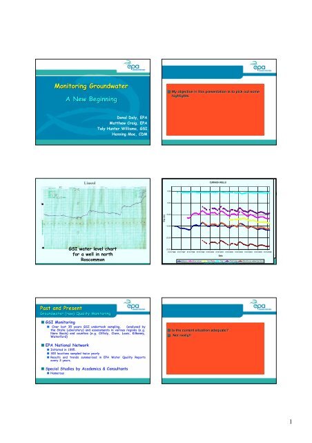
Lisacul<br />
Past and Present<br />
Groundwater Level Monitoring<br />
Past and Present<br />
GSI water level chart<br />
for a well in north<br />
Roscommon<br />
Groundwater (raw) Quality Monitoring<br />
<strong>Donal</strong> <strong>Daly</strong>, <strong>EPA</strong><br />
<strong>Matthew</strong> <strong>Craig</strong>, <strong>EPA</strong><br />
<strong>Taly</strong> <strong>Hunter</strong> <strong>Williams</strong>, GSI<br />
Henning Moe, CDM<br />
■ GSI Monitoring<br />
■ Over last 35 years GSI undertook sampling, (analysed by<br />
the State Laboratory) and assessments in various regions (e.g.<br />
Nore Basin) and counties (e.g. Offaly, Clare, Laois, Kilkenny,<br />
Waterford)<br />
■ <strong>EPA</strong> National Network<br />
■ Initiated in 1995.<br />
■ 300 locations sampled twice yearly<br />
■ Results and trends summarised in <strong>EPA</strong> Water Quality Reports<br />
every 3 years.<br />
■ Special Studies by Academics & Consultants<br />
■ Numerous<br />
Dip (m )<br />
■ My objective in this presentation is to pick out some<br />
highlights.<br />
0.00<br />
118.00<br />
-5.00<br />
117.00<br />
-10.00<br />
116.00<br />
-15.00<br />
-20.00 115.00<br />
Well CURRAGH Hydrograph, WELLS KNY 18/ 92,<br />
N GR S 387 544,<br />
Kilma nagh River grave ls. 2315S WW 233<br />
Well hydrograph<br />
-25.00<br />
01/01/1996 01/01/1997 01/01/1998 01/01/1999 01/01/2000 01/01/2001 01/01/2002 01/01/2003<br />
114.00<br />
Source: 01/01/2004 01/01/2005 GSI 01/01/2006<br />
01/ 01/ 1980 31/ 12/ 1982 31/ 12/ 1985 31/ 12/ 1988 01/ 01/ 1992 Date 01/ 01/ 1995 01/ 01/ 1998 01/ 01/ 2001 01/ 01/ 2004 01/ 01/ 2007<br />
Ballysax Brow nstow n Curr Plains Tully 1 Thatch Hse Standhouse Gael Scoil<br />
1980 2007<br />
Source: Michael Browne, <strong>EPA</strong><br />
■ Is the current situation adequate?<br />
■ Not really!!<br />
1
The Future<br />
Implementing the Water Framework Directive<br />
■ Monitoring is a vital component & requirement of the<br />
WFD<br />
■ A comprehensive network must be in place by 22 Dec 2006<br />
■ Monitoring essential to implementation of the Daughter<br />
WFD Directive – the new Groundwater Directive (GWDD)<br />
Acknowledgement<br />
The lead monitoring authority is the <strong>EPA</strong>,<br />
supported by local authorities and the<br />
National Parks and Wildlife Service.<br />
However, the approach to groundwater<br />
monitoring has evolved from discussions<br />
among the WFD Groundwater Working<br />
Group.<br />
It has been a colloborative effort involving<br />
staff in the <strong>EPA</strong>, GSI, universities and<br />
consultancies.<br />
Key components of a River Basin<br />
Management System<br />
• Data<br />
• Risk assessment<br />
• GWB Status<br />
• Monitoring<br />
GIS<br />
Basin Modelling<br />
Selection of Measures<br />
RBM<br />
System<br />
EMS<br />
Economics<br />
Modelling<br />
Public<br />
Participation<br />
• WFD guidance<br />
• Measures<br />
selection<br />
• Implement<br />
• Measures<br />
selection<br />
• Cost effective<br />
• Constraints<br />
■ Consequently, we now have the opportunity for<br />
■ “A A New Beginning”<br />
Beginning<br />
The Future<br />
“A A New Beginning” Beginning (1)<br />
Monitoring is NOT an end in<br />
itself!!<br />
It is a (critical) stage in a<br />
process.<br />
■ So, monitoring is just one component, albeit a critical<br />
one, of a<br />
■ River Basin Management System<br />
2
The Future<br />
“A A New Beginning” Beginning (2)<br />
■ Monitoring is very expensive - time, staff,<br />
laboratories, equipment, etc.<br />
■ Our focus is on an optimum network, not a<br />
maximum network!!<br />
■ Many countries have extensive networks; we are<br />
aiming for a ‘representative’ network.<br />
■ In essence, the network must be representative<br />
of both the hydrogeology (e.g. groundwater<br />
flow regime, soil type, vulnerability) and<br />
pressures (e.g. livestock units, tillage, urban<br />
areas) in Groundwater Bodies.<br />
Aquifer Map<br />
Vulnerability<br />
Map<br />
To aid our decision-making decision making and “new new beginning”, beginning , we<br />
have for the first time good quality ‘layers layers’ (maps) of<br />
relevant geosciences info in GISs<br />
Subsoil Permeability<br />
Source: GSI<br />
Soils in Monaghan classified as ‘Wet Wet’ or ‘Dry Dry’<br />
Soils Map<br />
Teagasc subsoil map<br />
also available on GSI<br />
website<br />
Source: Teagasc/FIPS/<strong>EPA</strong><br />
3
Pressures (Dungarvan Dungarvan Aquifer)<br />
Source: SE RBD<br />
Cattle/sheep<br />
The Future<br />
“A A New Beginning” Beginning (3)<br />
Groundwater<br />
Flow Regimes<br />
Source: GSI<br />
Pressure Magnitude<br />
3-16%<br />
Monitoring ‘Poorly Productive<br />
Aquifers”<br />
Poorly<br />
productive<br />
aquifers<br />
Underlies ~70%<br />
of country<br />
– A New Approach<br />
■ Consequently, with these ‘layers layers’ of information in a<br />
GIS, we now have the basis for designing<br />
“representative<br />
representative”, , “optimum optimum” monitoring networks<br />
■ ++++++<br />
Aquifer Map<br />
Source: GSI<br />
Poorly Productive Aquifers<br />
■ Underground flow paths are relatively short,<br />
typically 10’s – 100’s metres<br />
■ 4 potential pathway categories:<br />
■ An upper weathered zone;<br />
■ An interconnected fissured zone;<br />
■ Larger isolated fissures in massive rock;<br />
■ Permeable fault zones.<br />
4
Weathered zone<br />
as fluid pathway<br />
Weathered/broken<br />
rock zone at top of<br />
bedrock aquifer<br />
(Poor Aquifer)<br />
Subsoil<br />
All 3 pathways<br />
contribute<br />
“groundwater<br />
groundwater” for<br />
WFD groundwater<br />
body classification<br />
purposes.<br />
Our Monitoring Approach<br />
}<br />
Subsoil<br />
}<br />
}<br />
Broken & weathered<br />
Interconnected<br />
fissures<br />
Ten poorly productive typology settings, e.g. impure<br />
limestones; Namurian ssts & shales; ORS; granites;<br />
highly metamorphosed rocks; weakly metamorphosed<br />
rocks. rocks (Not all areas chosen yet)<br />
Isolated fissures<br />
Piezometers set at different depths in specially drilled<br />
boreholes.<br />
A min. of 3 piezometer nests along a transect in each<br />
setting.<br />
Hydraulic testing will be undertaken.<br />
Data loggers will be installed.<br />
Water samples taken; levels monitored.<br />
Weathered/broken rock zone as fluid pathway<br />
Hook Head, Co. Wexford<br />
Therefore, all 3 pathways (+ fault zones) need to be<br />
monitored!!<br />
5
High winter<br />
water table<br />
Existing Sites &<br />
Flow Regime<br />
Existing MPs in Poorly<br />
Productive Bedrock<br />
Winter<br />
water table<br />
Piezometers set at different<br />
depths along a transect Flow Regime<br />
Summer<br />
water<br />
table<br />
The Future (4)<br />
Example of<br />
designing the<br />
monitoring<br />
network in<br />
Eastern River<br />
Basin District<br />
Winter<br />
water table<br />
Diffuse Inorganic (NO3 & P)<br />
Risk Assessment<br />
Acknowledgement: risk<br />
assessment undertaken by<br />
CDM Ireland Ltd<br />
Summer<br />
water<br />
table<br />
6
Abstraction<br />
Risk Assessment<br />
Acknowledgement: risk<br />
assessment undertaken by<br />
CDM Ireland Ltd<br />
Existing <strong>EPA</strong><br />
Sites<br />
The Future<br />
Summary<br />
■ Expanded and improved groundwater quality<br />
and water level networks will commence in early<br />
2007 & should be fully in place by end 2008.<br />
■ The cost will be > €2million.<br />
■ This will aid our understanding of gw<br />
chemistry, quality and flow systems in Ireland,<br />
and their relationships to land use practices.<br />
■ They will provide the basis for understanding<br />
and evaluating WFD programmes of measures.<br />
Proposed<br />
Network<br />
Monitoring locations at<br />
BOTR will be more<br />
substantial than shown<br />
Proposed<br />
Network<br />
■Exciting, Exciting, challenging<br />
challenging<br />
■ times times ahead!! ahead!!<br />
■And, And, it it represents<br />
represents<br />
■significant significant progress.<br />
progress.<br />
Poorly<br />
productive<br />
areas where ~<br />
18 piezometers<br />
will be installed<br />
Large abstractions in<br />
Poorly Productive<br />
Bedrock<br />
Poorly<br />
productive<br />
areas where ~<br />
9 piezometers<br />
will be installed<br />
7
“Well Well hydrographs are amongst<br />
the most diagnostic sources of<br />
hydrogeologic information”<br />
information<br />
(Davis & De Wiest, Wiest,<br />
1966)<br />
Source: Peter McConvey, GSNI<br />
8