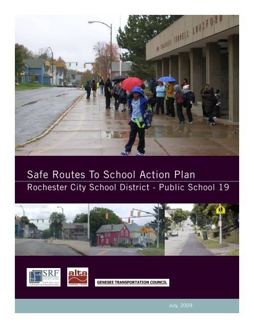
Safe Routes To School Action Plan - Genesee Transportation Council
Safe Routes To School Action Plan - Genesee Transportation Council
Safe Routes To School Action Plan - Genesee Transportation Council

You also want an ePaper? Increase the reach of your titles
YUMPU automatically turns print PDFs into web optimized ePapers that Google loves.
<strong>Safe</strong> <strong>Routes</strong> <strong>To</strong> <strong>School</strong> <strong>Action</strong> <strong>Plan</strong><br />
Rochester City <strong>School</strong> District - Public <strong>School</strong> 19<br />
July, 2009
ACKNOWLEDGEMENTS<br />
Study Advisory Committee (SAC)<br />
Andy Wheatcraft, RCSD<br />
Susan Curtis, RCSD<br />
Anne Brown, RCSD<br />
Erik Frisch, City of Rochester<br />
Robert <strong>To</strong>rzynski, GTC<br />
Prepared for:<br />
Rochester City <strong>School</strong> District – Public <strong>School</strong> 19 &<br />
The <strong>Genesee</strong> <strong>Transportation</strong> <strong>Council</strong><br />
Prepared by:<br />
Alta <strong>Plan</strong>ning + Design<br />
Jeff Olson, Principal<br />
Joshua Poppel, <strong>Plan</strong>ner<br />
SRF Associates<br />
Amy Dake<br />
Cory Greene<br />
<strong>Safe</strong> <strong>Routes</strong> to <strong>School</strong> National Partnership<br />
New York State Network Organizer<br />
Justin Booth<br />
July, 2009
TABLE OF CONTENTS<br />
I. INTRODUCTION<br />
1.1 Introduction.................................................................................... 1<br />
1.2 <strong>Safe</strong> <strong>Routes</strong> to <strong>School</strong> Program Overview........................................... 1<br />
1.3 Why is a <strong>Safe</strong> <strong>Routes</strong> to <strong>School</strong> Program Important?........................... 2<br />
1.4 Benefits of a <strong>Safe</strong> <strong>Routes</strong> to <strong>School</strong> Program..................................... 3<br />
II. EXISTING CONDITIONS<br />
2.1 Policies and Programs..................................................................... 4<br />
2.2 Arrivals & Departures....................................................................... 5<br />
2.3 <strong>School</strong> Area Base Map..................................................................... 6<br />
2.4 Existing Conditions Map.................................................................. 7<br />
III. RECOMMENDATIONS<br />
3.1 Physical Improvements.................................................................... 8<br />
3.3 Operational Measures.................................................................... 15<br />
IV. NEXT STEPS<br />
4.1 Recommendations......................................................................... 18<br />
4.2 <strong>Action</strong> <strong>Plan</strong>.................................................................................. 21<br />
V. APPENDIX<br />
Financial assistance for the preparation of this report was provided by the Federal Highway<br />
Administration. The <strong>Genesee</strong> <strong>Transportation</strong> <strong>Council</strong> is solely responsible for its content and<br />
the views and opinions expressed herein do not necessarily reflect the official views or policy<br />
of the U.S. Department of <strong>Transportation</strong>.
<strong>Safe</strong> <strong>Routes</strong> to <strong>School</strong> <strong>Action</strong> <strong>Plan</strong> Rochester City <strong>School</strong> District - Public <strong>School</strong> 19<br />
I. <strong>Safe</strong> <strong>Routes</strong> to <strong>School</strong> Introduction & Overview<br />
1.1 Introduction<br />
This project was funded by the <strong>Genesee</strong> <strong>Transportation</strong> <strong>Council</strong> (GTC) and is part of<br />
a model SRTS program for the Rochester, N.Y. region. Rochester and Monroe County<br />
have had a successful school traffic safety program for many years and this document<br />
is intended to complement the community’s existing efforts. This <strong>Action</strong> <strong>Plan</strong> has two<br />
main themes. The first is to provide an overview of <strong>Safe</strong> <strong>Routes</strong> to <strong>School</strong>s initiatives that<br />
can serve as examples for urban schools in Rochester. The second theme is to provide<br />
a review of the existing conditions surrounding the Dr. Charles T. Lunsford Elementary<br />
<strong>School</strong> #19 and suggest potential ‘next steps’ projects and programs to improve the<br />
safety, health, and wellness of the school’s students.<br />
The goal of this action plan is to identify potential physical improvements and operational<br />
measures for the school site and its surrounding area, as well as prioritized follow-on<br />
activities to advance the recommendations. This action plan will help progress <strong>Safe</strong><br />
<strong>Routes</strong> to <strong>School</strong> for <strong>School</strong> 19, but a key to ongoing success will be a dedicated and<br />
active <strong>Safe</strong> <strong>Routes</strong> to <strong>School</strong> team, inspired by a school champion. The champion may<br />
be a teacher, an administrator, a parent, and/or a community volunteer. In order for that<br />
team to succeed, this action plan should be implemented with community consensus,<br />
including the concurrence of the <strong>School</strong> Traffic <strong>Safe</strong>ty Committee, and reflect the team’s<br />
available time, skills, interests, and priorities.<br />
This action plan is available for use by the school team as a framework to guide<br />
successful next steps, both in the short and long term. Included with each recommended<br />
project or program in this document are suggestions about which school team members<br />
and partners can be involved in its implementation and the role each can play to help<br />
ensure its success.<br />
1.2 <strong>Safe</strong> <strong>Routes</strong> to <strong>School</strong> Program Overview<br />
<strong>Safe</strong> <strong>Routes</strong> to <strong>School</strong> (SRTS) is a national program that creates safe, convenient and<br />
fun opportunities for children to walk and bicycle to and from their schools. With a goal<br />
to increase the health and safety of children, and improve environment quality; SRTS<br />
can accomplish this by making walking and bicycling safe ways to get to school and<br />
encourage more children to do so. <strong>To</strong> accomplish this goal a comprehensive program must<br />
be established to create an environment that enhances, supports, and sustains walking<br />
and cycling as viable options for travel. With this in mind, SRTS emphasizes a holistic<br />
approach to create change that encompasses the five (5) E approach; Engineering,<br />
Enforcement, Encouragement, Education and Evaluation.<br />
• Engineering: physical improvements to the environment such as crosswalks,<br />
sidewalks and signals.<br />
• Education: methods to teach children, parents and neighbors about the benefits<br />
of walking and cycling to school as well teaching appropriate walking, driving and<br />
cycling behaviors to support safe travel in the school zone.<br />
• Encouragement: programs such as Walk to <strong>School</strong> Day, the Walking <strong>School</strong> Bus,<br />
contests and other initiatives to entice children, parents and others to walk or<br />
bicycle to school.<br />
• Enforcement: incorporates law enforcement efforts to ensure drivers, bicyclists and<br />
pedestrians obey traffic laws and practice appropriate behaviors.<br />
1
<strong>Safe</strong> <strong>Routes</strong> to <strong>School</strong> <strong>Action</strong> <strong>Plan</strong> Rochester City <strong>School</strong> District - Public <strong>School</strong> 19<br />
• Evaluation: uses measurements or indicators such as the number of children<br />
walking or bicycling to school to ascertain the success of any SRTS program.<br />
1.3 Why is <strong>Safe</strong> <strong>Routes</strong> to <strong>School</strong> Important?<br />
Although most students in the United States walked or biked to school prior to the<br />
1980’s, the number of students walking or bicycling to school has sharply declined<br />
since then. Statistics show that 42 percent of all students between 5 and 18 years of<br />
age walked or bicycled to school in 1969 including 87 percent of those who lived within<br />
a mile of the school they attended. In 2001 fewer than 16 percent of students walked<br />
or bicycled any distance to get to school 1 . This decline is due to a number of factors,<br />
including urban growth patterns and school siting requirements that encourage school<br />
development in outlying areas, increased traffic, and parental concerns about safety. The<br />
situation is self-perpetuating: As more parents drive their children to school, there is<br />
increased traffic at the school site, resulting in more parents becoming concerned about<br />
traffic and driving their children to school.<br />
According to a 2004 survey by the Center for Disease Control, parents whose children did<br />
not walk or bike to school cited the following barriers:<br />
• Distance to school 61.5%<br />
• Traffic-related danger 30.4%<br />
• Weather: 18.6%<br />
• Crime danger 11.7 %<br />
• Opposing school policy 6.0%<br />
• Other reasons (not identified) 15.0%<br />
A comprehensive <strong>Safe</strong> <strong>Routes</strong> to <strong>School</strong> program<br />
addresses many of the reasons for reductions in<br />
walking and biking through a multi-faceted approach that<br />
uses education, encouragement, engineering and enforcement<br />
efforts to develop attitudes, behaviors and physical<br />
infrastructure that improve the walking and<br />
biking environment.<br />
The downward spiral of walking and bicycling to<br />
school<br />
1.4 Benefits of a <strong>Safe</strong> <strong>Routes</strong> to <strong>School</strong> Program<br />
<strong>Safe</strong> <strong>Routes</strong> to <strong>School</strong> programs directly benefit<br />
schoolchildren, parents, and teachers by creating a<br />
safer travel environment near schools and reducing<br />
motor vehicle congestion at school drop-off and pickup<br />
zones. Students that choose to walk or bike to<br />
school are rewarded with the health benefits of a more<br />
active lifestyle, responsibility and independence that<br />
comes from being in charge of the way they travel, and<br />
learn at an early age that walking and biking can be<br />
safe, enjoyable and good for the environment. <strong>Safe</strong><br />
<strong>Routes</strong> to <strong>School</strong> programs offer additional benefits to<br />
neighborhoods by helping to slow traffic and provide<br />
infrastructure improvements that facilitate walking and<br />
biking for everyone. Identifying and improving routes for<br />
students to safely walk and bicycle to school is one of the<br />
The entire family can benefit from <strong>Safe</strong> <strong>Routes</strong> to <strong>School</strong><br />
1 U.S. Centers for Disease Control and Prevention. Barriers to Children Walking to or from <strong>School</strong> United States 2004,<br />
Morbidity and Mortality Weekly Report September 30, 2005. Available: www.cdc.gov/mmwr/preview/mmwrhtml/mm5438a2.<br />
htm. Accessed: December 28, 2007.<br />
2
most cost-effective means of reducing weekday morning traffic congestion and can help<br />
reduce auto-related pollution.<br />
<strong>Safe</strong> <strong>Routes</strong> to <strong>School</strong> <strong>Action</strong> <strong>Plan</strong> Rochester City <strong>School</strong> District - Public <strong>School</strong> 19<br />
In addition to safety and traffic improvements, a <strong>Safe</strong> <strong>Routes</strong> to <strong>School</strong> program helps<br />
integrate physical activity into the everyday routine of school children. Since the mid-<br />
1970s the number of children who are overweight has roughly tripled from five percent to<br />
almost 17 percent. Health concerns related to sedentary lifestyles have become the focus<br />
of statewide and national efforts to reduce health risks associated with being overweight.<br />
Children who walk or bike to school have an overall higher activity level than those who<br />
are driven to school, even though the journey to school makes only a small contribution to<br />
activity levels. 2<br />
II. Existing Conditions<br />
2.1 Policies and Programs<br />
The Rochester City <strong>School</strong> District (RCSD) provides safe walking route maps for the<br />
elementary schools in the City. The maps are distributed to the schools in the fall of each<br />
year along with a cover letter outlining safe walking habits, safe driving by parents, and<br />
encouraging parent participation in the review of safe routes with their children. The<br />
letters are provided in both English and Spanish and the maps include the locations of<br />
all traffic signals, crossing guards and arrows depicting the recommended route to school.<br />
RCSD was one of the first schools in the country to promote such a <strong>Safe</strong> <strong>Routes</strong> to <strong>School</strong><br />
program and has been publishing the maps since 1984.<br />
K-12 students in the Rochester City <strong>School</strong> District living within a 1.5 mile radius of<br />
the school that they attend are not generally eligible to ride the school bus. However,<br />
approximately 5 years ago, RCSD implemented a school choice plan based on 3 zones<br />
within the city which allows parents to select any school within their respective zone<br />
to attend. If the school selected is further than 1.5 miles from the student’s home, the<br />
student is then eligible to be bused to school, and this policy has had an effect on school<br />
transportation. Currently, 70% of the students attending <strong>School</strong> No. 19 are bussed to<br />
school, and it is estimated that prior to adoption of the policy, a greater percentage of<br />
the students walked to school. Existing efforts (including safe routes maps produced for<br />
each school and education in the classroom), could be expanded to provide additional<br />
education and encouragement efforts within the district to encourage more children to<br />
walk or bike to school.<br />
There are approximately 320 students (capacity for 600+) attending <strong>School</strong> 19, pre-K<br />
through 6 th grade. Currently 108 students are identified as walkers, which does not<br />
account for how many of the walkers are actually driven to school. Once all of the bussed<br />
students have been dismissed, the walking students are released. Parents are allowed<br />
to pick up at the bus recess area once all of the buses have departed. During a <strong>Safe</strong><br />
<strong>Routes</strong> to <strong>School</strong> audit on October 21, 2008, four crossing guards were observed to be<br />
on duty on and near the school site to facilitate safe walking behaviors. However, off site,<br />
students and parents were also observed crossing other streets near the school where<br />
there are no crossing guards present, even though they could have crossed with a crossing<br />
guard had they followed the safe routes map. There are no bicycle racks available at the<br />
school and bicycling to school is not encouraged or promoted due to concerns of weather,<br />
2 Cooper A, Page A, Foster L, Qahwaji D. Commuting to school: are children who walk more physically active? American<br />
Journal of Preventive Medicine. 2003 November;25(4):273-6. Cooper A, Andersen L, Wederkopp N, Page A, Frosberg<br />
K. Physical activity levels of children who walk, cycle, or are driven to school. American Journal of Preventive Medicine, 2005<br />
October; 29(3):179-184.<br />
3
<strong>Safe</strong> <strong>Routes</strong> to <strong>School</strong> <strong>Action</strong> <strong>Plan</strong> Rochester City <strong>School</strong> District - Public <strong>School</strong> 19<br />
theft and traffic safety. It is important to note that no bicycle or pedestrian injuries or<br />
fatalities involving students have occurred in recent memory according to school district<br />
personnel.<br />
The Rochester City <strong>School</strong> District provides a <strong>Safe</strong> Walking Route Map for each of the schools in the district.<br />
The image above is the map for <strong>School</strong> 19.<br />
2.2 Arrivals and Departures<br />
Parent Drop-offs / Pickups<br />
There is no dedicated pick-up area and the available parking space surrounding the<br />
school is limited especially with the bus traffic. Parents often queue<br />
up on Seward and Reynolds Streets waiting until the buses have been<br />
dismissed. During the site visit many cars were parking on the far side<br />
of Seward, often in the crosswalk, until they were told to move by the<br />
crossing guard stationed at that corner.<br />
Bus Arrivals / Departures<br />
The bus riding students gather in the cafeteria at the time of dismissal<br />
waiting for their bus to be called. Given the limited space in front of<br />
the school, the buses line up on Seward Street until there is available<br />
space in front of school for them to park. At that time, a staff person<br />
radios to the cafeteria and the students for that bus are released. This<br />
procedure continues for about 15 minutes until all of the bussing<br />
children are on their respective buses.<br />
4
Pedestrian & Bicycle Arrivals / Departures<br />
Once all of the bussed students have been dismissed, the walking<br />
students are released. The sidewalk infrastructure around the school<br />
is complete and there are four crossing guards stationed at key<br />
crossings around the school. Despite the presence of the crossing<br />
guards at these locations, students were also observed to be crossing<br />
the street at the unmarked, unguarded intersection of Jefferson and<br />
Shelter Streets where traffic controls such as stop signs do not exist<br />
and against the recommended walking route.<br />
The maps on the following pages show the school area and existing<br />
conditions at <strong>School</strong> 19 as observed during the SRTS audit.<br />
Note that crossing guard locations are described in the text of this<br />
document and are shown on the <strong>Safe</strong> Walking Route Maps provided by<br />
RCSD. The school traffic diagram depicts general conditions observed<br />
in the school zone, and is not indented as a comprehensive inventory<br />
of signage and pavement markings.<br />
<strong>Safe</strong> <strong>Routes</strong> to <strong>School</strong> <strong>Action</strong> <strong>Plan</strong> Rochester City <strong>School</strong> District - Public <strong>School</strong> 19<br />
5
<strong>Safe</strong> <strong>Routes</strong> to <strong>School</strong> <strong>Action</strong> <strong>Plan</strong> Rochester City <strong>School</strong> District - Public <strong>School</strong> 19<br />
2.3 <strong>School</strong> Area Base Map<br />
6
<strong>Safe</strong> <strong>Routes</strong> to <strong>School</strong> <strong>Action</strong> <strong>Plan</strong> Rochester City <strong>School</strong> District - Public <strong>School</strong> 19<br />
2.4 Existing Conditions Map<br />
7
<strong>Safe</strong> <strong>Routes</strong> to <strong>School</strong> <strong>Action</strong> <strong>Plan</strong> Rochester City <strong>School</strong> District - Public <strong>School</strong> 19<br />
III. Recommendations<br />
3.1 Physical Improvements<br />
Engineering measures for <strong>Safe</strong> <strong>Routes</strong> to <strong>School</strong> include the design, construction<br />
and maintenance of physical infrastructure that can improve the safety and<br />
comfort of students that are walking and biking to school. This infrastructure<br />
includes signage, stenciling, and traffic control devices such as stop signs, bulbouts,<br />
sidewalks, paths, bike lanes, and trails. When considering engineering<br />
measures, it is best to identify the problem first, and then use accepted<br />
engineering practices to develop an appropriate solution. Traffic engineering<br />
analysis reveals that unnecessary control measures tend to lessen the respect<br />
for those controls that are needed. Effective traffic control can best be obtained<br />
through the uniform application of realistic policies, practices, and guidelines<br />
developed through properly conducted engineering studies. A decision to use<br />
a specific device at a particular location should be made on the basis of an<br />
engineering and/or traffic study reviewed and approved by the <strong>School</strong> Traffic<br />
<strong>Safe</strong>ty Committee with the input of school staff and affected stakeholders. Of<br />
equal importance is the maintenance and monitoring of traffic control devices.<br />
Devices should be properly maintained to ensure legibility, visibility, and<br />
functionality. If a device is found to be ineffective or improperly functioning, the<br />
entity that maintains the device should be immediately notified. Finally, devices<br />
used on a part-time basis, such as warning flashers, should be in operation only<br />
during the time periods when they are required – when children are present;<br />
otherwise they risk being ignored by motorists who believe they are improperly<br />
functioning.<br />
A speed radar sign is an effective<br />
way to ensure that motorists<br />
comply with speed limits.<br />
Potential engineering strategies for within the school zone, for areas along the school<br />
route, at street crossings, and for use in slowing down traffic are below. Many of the<br />
strategies, such as on-street warning signs, are most effective if they are only used<br />
during school commute hours. Although some engineering solutions are higher-cost<br />
infrastructure improvements, many engineering tools can be implemented without<br />
large expenditures, such as posting signs, modifying signal timings, or striping<br />
crosswalks or bike lanes. The engineering strategies listed below may also be utilized<br />
at other schools within the RCSD, depending on local conditions.<br />
The following potential solutions for the Dr. Charles T. Lunsford Elementary <strong>School</strong><br />
#19 should be considered by the school administration, should it choose to<br />
implement a <strong>Safe</strong> <strong>Routes</strong> to <strong>School</strong> Program. Note that some of the concepts will<br />
require additional engineering analysis and participation by partner agencies such as<br />
the Monroe County Department of <strong>Transportation</strong>, City of Rochester Engineering, and<br />
the Rochester City Police Department for their implementation. The map at the end<br />
of this section visually displays the recommendations and their respective locations.<br />
It is noted that the physical and operational improvements discussed within this and<br />
the following section are intended to describe potential improvements that should be<br />
considered by the school and interested stakeholders. Additional recommendations<br />
and the suggested prioritization for each improvement are included in the subsequent<br />
“Next Steps’ chapter of this <strong>Action</strong> <strong>Plan</strong>.<br />
Signage and <strong>School</strong> Zone Recommendations<br />
<strong>School</strong> Zone signage and pavement markings are one of the most cost effective<br />
infrastructure treatments to traffic calm the area and alert drivers to the presence<br />
of school children. East Main Street and Halls Corners Road should be posted with<br />
This image shows a<br />
New York State MUTCD<br />
approved school speed<br />
limit sign, figure number<br />
7B 100.<br />
<strong>School</strong> advance warning<br />
assembly from the<br />
MUTCD figure S1-1.<br />
8
high visibility school signs and pavement markings. The school<br />
zone speed limit should be set at 20 mph during the school hours<br />
and that limit should be utilized and set at the lowest appropriate<br />
speed as dictated by the New York State Vehicle and Traffic Law<br />
and the New York State Supplement to the National Manual on<br />
Uniform Traffic Control Devices. Speed limits within the school<br />
zone will be enforced by the Police Department. Speed radar signs<br />
should also be considered to reinforce driver awareness of the<br />
reduced speed limit. Speed radar signs could be solar powered but<br />
would require a connection to the electric grid or battery backup<br />
for those occasions when the sunlight is not sufficient to power the<br />
device.<br />
<strong>Safe</strong> <strong>Routes</strong> to <strong>School</strong> <strong>Action</strong> <strong>Plan</strong> Rochester City <strong>School</strong> District - Public <strong>School</strong> 19<br />
The <strong>School</strong> Zone<br />
In New York, school zones can be designated on all roadways<br />
contiguous to a school serving K through 12th grade. A New York<br />
<strong>School</strong> Speed Limit assembly (see figure below) shall be used to<br />
indicate the speed limit where a reduced speed zone for a school<br />
area has been established (in accordance with law based upon an<br />
engineering study) or where a speed limit is specified for such areas<br />
by statute. The New York <strong>School</strong> Speed Limit assembly shall be<br />
placed at or as near as practical to the point where the reduced speed<br />
zone begins. In order for a school speed limit to be established, the<br />
school and the jurisdiction responsible for the highway must provide<br />
written documentation of their support for a school speed limit.<br />
As dictated by NYS Vehicle and Traffic Law, the numerical value<br />
of a school speed limit should be approximately 10 MPH below<br />
the normally prevailing 85th percentile speed on the highway, or<br />
at approximately the actual 85th percentile speed within the zone<br />
during school crossing periods. <strong>School</strong> speed limits shall not be<br />
set below 15 MPH and the maximum length of a school speed<br />
zone shall not be greater than 1320 feet (0.25 mile) on a highway<br />
passing a school building, entrance or exit of a school abutting on<br />
the highway. With <strong>School</strong> Zones signed and delineated, focused<br />
traffic enforcement can occur to target speeding and other moving<br />
violations.<br />
Simple engineering measures such as pedestrian<br />
refuges can improve real and perceived safety.<br />
This photo of the intersection at Magnolia<br />
and Seward Streets shows opportunities for<br />
cost-effective improvements such as upgraded<br />
signage and pavement markings<br />
<strong>School</strong> Area Signage<br />
The Manual on Uniform Traffic Control Devices (MUTCD) provides<br />
guidance on the use of school area signs and markings. The key<br />
signs should include the <strong>School</strong> Advance Warning Assembly, the<br />
<strong>School</strong> Crosswalk Warning Assembly, and the <strong>School</strong> Speed Limit<br />
Assembly. One way of increasing the visibility of school area<br />
signage is through the use of Florescent Yellow-Green signs.<br />
Pavement Markings<br />
Pavement markings have important functions in school area traffic control. In some<br />
cases, they are used to supplement the regulations or warnings provided by devices such<br />
as traffic signs or signals. In other instances, they are used alone and produce results<br />
that cannot be obtained by the use of any other device, and can serve as an effective<br />
means of conveying certain regulations, guidance, and warnings that could not otherwise<br />
be made clearly understandable. Pavement markings have limitations – they might not<br />
9
<strong>Safe</strong> <strong>Routes</strong> to <strong>School</strong> <strong>Action</strong> <strong>Plan</strong> Rochester City <strong>School</strong> District - Public <strong>School</strong> 19<br />
be clearly visible when wet or covered in snow, and might not be<br />
durable when subjected to heavy traffic. The “SLOW SCHOOL<br />
XING” marking, used in advance of uncontrolled crosswalks, is<br />
an important school-specific pavement marking. The MUTCD<br />
also provides guidance on the use of stop lines, yield lines, curb<br />
markings, and other symbol markings.<br />
Sidewalks and Paths<br />
The sidewalk infrastructure around <strong>School</strong> 19 is well developed<br />
and largely complete. While there are areas where the sidewalk<br />
needs minor repairs (including providing ADA compliant curb<br />
ramps), there are no significant gaps in the network. Given the<br />
urban nature of the school setting, there are limited opportunities<br />
for path development, which means the focus of the action plan<br />
infrastructure elements should be on improving the safety of the<br />
existing facilities. The streetscapes near the school could also be<br />
enhanced with additional street trees, which provide both shade<br />
and a traffic calming effect.<br />
The intersection of Flint and Reynolds Streets is an<br />
example of a location where ADA compliant curb<br />
ramps are needed.<br />
Crossings<br />
<strong>School</strong> crosswalks denote the preferred location for children to cross the street.<br />
Crosswalks should be marked at all intersections on established routes to school where<br />
there is substantial conflict between motorists, bicyclists, and pedestrian movements,<br />
at uncontrolled designated school crossings where students are encouraged to cross<br />
between intersections, or where students would not otherwise recognize the proper place<br />
to cross. The SLOW SCHOOL XING marking can be used in advance of uncontrolled<br />
school crosswalks. Various striping patterns can be used although the standard crosswalk<br />
consists of two parallel lines, called the “transverse” pattern. High visibility markings<br />
should be considered for all high-volume crossings near schools, and where conditions<br />
demonstrate a need for an increased visibility marking (e.g., a mid-block location).<br />
MCDOT recommends using the “piano key” or ‘continental’ crossing pattern for the best<br />
visibility and ease of maintenance; the first priority should be the crossings directly in<br />
front of or adjacent to the school where there is high daily pedestrian traffic.<br />
In-Street Yield-to-Pedestrian Signs<br />
In-Street Yield-to-Pedestrian Signs are flexible signs placed in the roadway to enhance<br />
a crosswalk at uncontrolled crossing locations. These signs communicate the message<br />
‘State Law: Yield to Pedestrians.’ At school crosswalks, these signs can be installed<br />
on a portable base and brought out in the morning and back in at the end of each day<br />
by school staff, which may reduce the chance that the sign will become “invisible” to<br />
motorists by being left out all the time. In order to reduce a potential ‘false sense of<br />
security’ for children, the signs could be limited to guarded crossings without signal<br />
controls. Maintenance can be an issue as the signs may be run over by vehicles and<br />
need to be replaced occasionally. Installing the signs in a raised median can help extend<br />
their lifetime. If <strong>School</strong> 19 decides to employ the use of the Yield-to Pedestrian signs,<br />
it would be necessary to acquire approval from MCDOT and a City of Rochester street<br />
permit.<br />
Advance Stop and Yield Lines<br />
Stop lines consist of solid white lines extending across approach lanes to indicate the<br />
point at which the stop is intended or required to be made, in compliance with a STOP<br />
sign or traffic signal. The MUTCD requires stop lines be placed a minimum of four feet<br />
in advance of the crosswalk line at controlled intersections. At uncontrolled crosswalk<br />
10
locations in New York, “yield” lines may be used instead of stop lines (New York State<br />
law requires motorists to yield to pedestrians in a crosswalk). The yield lines consist of a<br />
row of solid white isosceles triangles pointing toward approaching vehicles, and are often<br />
referred to as “shark’s teeth.”<br />
<strong>Safe</strong> <strong>Routes</strong> to <strong>School</strong> <strong>Action</strong> <strong>Plan</strong> Rochester City <strong>School</strong> District - Public <strong>School</strong> 19<br />
Traffic Pattern Modifications<br />
One- way street conversions and separation of bus and parent drop off zones can enhance<br />
pedestrian safety in the school zone. The traffic pattern and limited space in front of<br />
the school poses a number of challenges for both the walking and motoring public. The<br />
intersection of Magnolia and Seward Streets creates a complicated gateway to the school<br />
and may limit visibility of the pedestrians in the area. A recommendation was previously<br />
made to convert Seward Street to 1-way travel southwesterly traffic between Magnolia and<br />
Reynolds Streets<br />
Curb Extensions<br />
Curb extensions (sometimes called curb bulbs or bulb-outs) have<br />
many benefits for pedestrians. They shorten the street crossing<br />
distance, provide additional space at corners, allow pedestrians<br />
to see and be seen before entering the crosswalk, and simplify<br />
the placement of elements like curb ramps. Curb extensions may<br />
be used at any corner or mid-block location where a parking lane<br />
can absorb the extension of the curb. Curb extensions are often<br />
effective at locations with crossing distances wider than 36 feet;<br />
locations adjacent to high-intensity pick-up/drop-off activity; or at<br />
locations with sight distance or visibility issues. Curb extensions<br />
have the potential to conflict with bicycle travel if not designed<br />
properly. Curb extensions should not extend into a bike lane, and<br />
should generally align with the edge of the parking lane. Curb<br />
extensions must be designed to accommodate drainage or trash<br />
accumulation, and may be costly to install due to utility and drainage<br />
relocation. While one of their main advantages is reducing vehicle<br />
turning speeds, they can have an impact on snow removal and the<br />
turning ability of trucks and other large vehicles.<br />
The existing curb extension at Seward and<br />
Magnolia Streets helps define the bus loading<br />
area in front of the <strong>School</strong>.<br />
Lighting<br />
<strong>Safe</strong> sidewalks are a primary component of good pedestrian environments, and welllit<br />
environments convey a feeling of comfort and safety, particularly at night. Lighting<br />
should be scaled for pedestrians, located in the furnishings and/or frontage zones of the<br />
sidewalk, and provided at roadway crossings to increase pedestrian visibility<br />
Crossing Guards<br />
Adult crossing guards are used to help create gaps in traffic at<br />
uncontrolled intersections, and to “platoon” children across the street at<br />
controlled intersections. The presence of a crossing guard in the roadway<br />
serves as an easily recognized indication to drivers that pedestrians are<br />
about to use the crosswalk and that all traffic must stop. When all traffic<br />
has stopped, the adult guard can allow the children to cross. <strong>School</strong><br />
19 currently utilizes four crossing guards provided by RPD at crossings<br />
on Seward, Magnolia and Jefferson Streets. While crossing guards are<br />
provided nearby, students were also observed to cross at the unmarked,<br />
unguarded intersection of Jefferson and Shelter Streets. Since it would<br />
be cost prohibitive to provide crossing guards at every location, parents<br />
and children should be encouraged to follow the designated routes, use<br />
11
<strong>Safe</strong> <strong>Routes</strong> to <strong>School</strong> <strong>Action</strong> <strong>Plan</strong> Rochester City <strong>School</strong> District - Public <strong>School</strong> 19<br />
the existing locations which are served by crossing guards<br />
when available, and should be informed on how to cross<br />
safely at unguarded crossings as part of the school’s SRTS<br />
program. The RPD should continue to post crossing guards<br />
and to ensure that they are trained consistently with the<br />
guidance provided in Section 7E of the Manual of Uniform<br />
Traffic Control Devices (MUTCD).<br />
Bicycle Parking<br />
<strong>School</strong> 19 does not currently provide bike parking on the<br />
school grounds and this can be changed as part of the <strong>Action</strong><br />
<strong>Plan</strong>. Providing secure and convenient bicycle parking is one<br />
way to help encourage more children, faculty, staff and visitors to<br />
bicycle to school. Attributes of good bike parking include:<br />
• Protection from vandalism/theft<br />
• Protection from damage to the bicycle<br />
• Protection from weather<br />
• Convenient to destination<br />
A sufficient amount of parking must be made available so that<br />
bicycles are not crowded. Secure parking in either a fenced-in<br />
or high visibility location could be provided. If possible, a covered<br />
shelter should be provided to protect the bicycles during inclement<br />
weather. The preferred bike rack design should keep the bike<br />
upright by supporting the frame, allow the bike to be locked by the<br />
frame, and allow one or both wheels to be secured.<br />
These photos show examples of preferred bike<br />
rack designs that support a bicycle in an upright<br />
position without placing additional strain on the<br />
wheels.<br />
12
Nellis<br />
Jefferson<br />
Costello<br />
Reynolds<br />
Flint<br />
Shelter<br />
Hawley<br />
Lloyd<br />
Schwartz<br />
Cottage<br />
Earl<br />
<strong>Safe</strong> <strong>Routes</strong> to <strong>School</strong> <strong>Action</strong> <strong>Plan</strong> Rochester City <strong>School</strong> District - Public <strong>School</strong> 19<br />
3.2 <strong>School</strong> Improvement <strong>Plan</strong> Map<br />
Violetta<br />
POTENTIAL SCHOOL AREA IMPROVEMENTS<br />
Add secure<br />
bicycle parking<br />
Improve bus loading /<br />
drop-off zone<br />
Upgrade existing crosswalks<br />
to high visibility markings, Typ.<br />
Modify traffic pattern at<br />
parent pickup areas<br />
Install/upgrade “<strong>School</strong><br />
Crossing” and Advanced Warning<br />
signs on nearby streets<br />
Existing one-way traffic<br />
Seward<br />
Exchange<br />
Fuller<br />
Fenwick<br />
Mt. Pleasant<br />
oParking<br />
KEY<br />
Existing sidewalk<br />
Proposed sidewalk<br />
New crosswalk<br />
Upgraded existing<br />
crosswalk<br />
Bike Parking<br />
Magnolia<br />
Plymouth<br />
<strong>School</strong> Zone marking<br />
Bus loading/<br />
drop-off zone<br />
Temporary street pattern<br />
pickup/bus loading area<br />
Parking<br />
Advance Warning<br />
Assembly<br />
MUTCD Signage<br />
<strong>School</strong>/Speed<br />
signs<br />
Crosswalk Warning<br />
Assembly<br />
0 125 250 Ft.<br />
<strong>Safe</strong> <strong>Routes</strong> to <strong>School</strong> Improvement <strong>Plan</strong><br />
Dr. Charles T. Lunsford Elementary <strong>School</strong> #19, Rochester, New York<br />
N<br />
SAFE ROUTES<br />
to <strong>School</strong><br />
NATIONAL PARTNERSHIP<br />
Install/upgrade “<strong>School</strong><br />
Zone” pavement markings<br />
on nearby streets<br />
1/2 Mile Buffer<br />
SCHOOL<br />
SPEED<br />
20<br />
<strong>School</strong> #19<br />
SCHOOL<br />
SPEED<br />
20<br />
SCHOOL<br />
SPEED<br />
20<br />
13
<strong>Safe</strong> <strong>Routes</strong> to <strong>School</strong> <strong>Action</strong> <strong>Plan</strong> Rochester City <strong>School</strong> District - Public <strong>School</strong> 19<br />
3.3 Operational Measures<br />
Operational measures for <strong>Safe</strong> <strong>Routes</strong> to <strong>School</strong> include the non-infrastructure programs<br />
and initiatives that can improve the experience of students walking and biking to<br />
school. These measures can support engineering efforts with a balanced approach that<br />
includes education, encouragement, enforcement and evaluation efforts to provide a safe<br />
community environment where walking and bicycling are supported as positive activities.<br />
Education and Encouragement<br />
Education and encouragement efforts are operational measures that the school can<br />
consider to enhance the effectiveness of the physical improvements recommended<br />
in section 3.1. These tools focus on teaching traffic, pedestrian and bicycle safety<br />
to parents and students, increasing public awareness of <strong>Safe</strong> <strong>Routes</strong> to <strong>School</strong> goals<br />
and benefits, and promoting changes in behavior to increase walking and bicycling.<br />
Encouragement activities include a variety of special events and contests, outreach<br />
campaigns, presentations to school and community groups, and surveys of current<br />
practices and attitudes related to the school commute. A major objective of educational<br />
and encouragement tools is to increase the understanding by parents, school personnel,<br />
students, and the community of the health and safety concerns that can be addressed by<br />
successful <strong>Safe</strong> <strong>Routes</strong> to <strong>School</strong> programs.<br />
According to statistics reported by the school, approximately 30 percent of the students<br />
at <strong>School</strong> #19 are considered to be walkers, but some of those students may be driven<br />
to school by their parents or other caregivers on at least some occasions. The school<br />
choice zone program provides additional school options to families in the school<br />
district. However, providing these options may also have the unintended consequence of<br />
increasing transportation costs for the school district. If more children were able to safely<br />
walk and/or bicycle to school, students would benefit from improved health and activity<br />
levels and the RCSD might benefit from reduced transportation costs.<br />
Additionally, there are many initiatives and resources specific to New York State that<br />
can be taken advantage of to encourage more students to walk and bike to school. The<br />
New York Network of the <strong>Safe</strong> <strong>Routes</strong> to <strong>School</strong> National Partnership promotes and<br />
provides in-kind resources for Walk and Bicycle to <strong>School</strong> Day events, the Poster Art<br />
Contest, the Writing Contest and the Walking <strong>School</strong> Bus Program. On the local level,<br />
the Monroe County Office of Traffic <strong>Safe</strong>ty offers a number of resources including traffic<br />
safety education and a bike helmet contest for grades K-6. A safe routes to school task<br />
force should be established as part of this action plan and Walk to <strong>School</strong> Day and other<br />
education and encouragement programs can be utilized to increase the percentage of<br />
children walking and biking to school. The following section of the plan offers a number<br />
of programs and resources which can help to attain this goal.<br />
Walk and Bicycle to <strong>School</strong> Day<br />
This annual international event occurs on the first Wednesday of October and <strong>School</strong><br />
19 can register for the event at www.walktoschool.org. The web site provides resources<br />
and ideas on how to implement a successful Walk and Bike to <strong>School</strong> Day. The New<br />
York Network of the <strong>Safe</strong> <strong>Routes</strong> to <strong>School</strong> National Partnership can provide retroreflective<br />
zipper pulls and other prizes for all of the student participants and the Monroe<br />
County Office of Traffic <strong>Safe</strong>ty can support the event and offer traffic safety education.<br />
Additional walk and bike to school days can be held yearly, monthly, or even weekly,<br />
depending on the level of support and participation from children, parents, and school<br />
and local officials. Some schools organize more frequent days – such as weekly Walking/<br />
Wheeling Wednesdays or Walk and Roll Fridays – to give people an opportunity to enjoy<br />
14
the event on a regular basis. Parents and other volunteers accompany the children, and<br />
often there are designated staging areas along the route to school where different groups<br />
can gather and walk or bike together. The events should be promoted through press<br />
releases, articles in school newsletters, and posters and flyers for children to take home.<br />
Writing and Poster Contests<br />
As part of the International Walk and Bicycle to <strong>School</strong> Day, <strong>School</strong> 19 students should<br />
be encouraged to participate in the annual writing contest, “Why the principal should<br />
walk to school with me” and poster contest, “Walking to <strong>School</strong> <strong>Safe</strong>ly”. These contests<br />
are both fun, project-based learning encouragement/ educational programs for schools to<br />
participate in. All winners receive a certificate of achievement and a prize package for<br />
their entire class, which includes pedometers and t-shirts. Details on these contests can<br />
be downloaded: http://www.saferoutespartnership.org/state/4373/newyork<br />
<strong>Safe</strong> <strong>Routes</strong> to <strong>School</strong> <strong>Action</strong> <strong>Plan</strong> Rochester City <strong>School</strong> District - Public <strong>School</strong> 19<br />
Walking <strong>School</strong> Bus<br />
The Walking <strong>School</strong> Bus is another encouragement program the <strong>Safe</strong> <strong>Routes</strong> to <strong>School</strong><br />
Partnership is spearheading in New York State as a way to sustain long term initiatives<br />
that will make walking to school safe. A walking school bus is a group of children walking<br />
to school accompanied by one or more adults. The Partnership offers trainings on how to<br />
organize a Walking <strong>School</strong> Bus and interested members of the <strong>Safe</strong> <strong>Routes</strong> to <strong>School</strong> Task<br />
Force should be recruited to host a training and mobilize the resources to start such a<br />
program. Additional information on the Walking <strong>School</strong> Bus is available from:<br />
• RideWise TMA - www.ridewise.org/walksafely.shtml<br />
• Pedestrian Bicycle Information Center/Partnership for a Walkable America -<br />
www.walkingschoolbus.org<br />
• Active and <strong>Safe</strong> <strong>Routes</strong> to <strong>School</strong> – California - www.saferoutestoschool.ca<br />
• Go for Green – California - www.goforgreen.ca<br />
Suggested Route to <strong>School</strong> Maps<br />
Suggested Route to <strong>School</strong> maps are one of the most cost-effective and tangible means<br />
available for encouraging school children to walk or bike to school. The purpose of the<br />
maps is to provide school officials, parents, and students with a tool to help plan the best<br />
walking and bicycling routes to and from school. The Rochester <strong>School</strong> District was one<br />
of the first in the country to provide route to school maps and the effort should continue.<br />
The maps are reviewed by the <strong>School</strong> Traffic <strong>Safe</strong>ty Committee on an annual basis to<br />
insure that the information is up-to-date and the safest routes are being provided.<br />
Bicycle Rodeos<br />
A bicycle rodeo provides children with a basic understanding of the rules of the road,<br />
educates those children and their parents about elementary bike safety, gives trained<br />
personnel a chance to look over the equipment the kids are riding, and involves parents,<br />
teachers, and/or local civic organizations in a worthwhile activity. A bicycle rodeo involves<br />
“stations” that teach skills, such as:<br />
• Looking over a shoulder without weaving<br />
• Fast-braking without skidding<br />
• Dealing with traffic at intersections<br />
15
<strong>Safe</strong> <strong>Routes</strong> to <strong>School</strong> <strong>Action</strong> <strong>Plan</strong> Rochester City <strong>School</strong> District - Public <strong>School</strong> 19<br />
The Monroe County Office of Traffic <strong>Safe</strong>ty has the resources to provide bicycle rodeos<br />
and while these events can be challenging to organize in active urban environments,<br />
<strong>School</strong> #19 should consider sponsoring a bike rodeo as part of International Walk and<br />
Bike to <strong>School</strong> Day or other event(s) as a near term goal in the next 1-3 years. More<br />
information on bicycle rodeos is available through:<br />
• Bicycling Life at www.bicyclinglife.com/<strong>Safe</strong>tySkills/BicycleRodeo.htm<br />
• Guide to Bicycle Rodeos (Adventure Cycling Association) at 1-800-721-8719<br />
Other Education and Encouragement Programs<br />
Once <strong>School</strong> 19 has established a <strong>Safe</strong> <strong>Routes</strong> to <strong>School</strong> Task Force and has successfully<br />
hosted a Walk to <strong>School</strong> Day event, other education and encouragement programs should<br />
be initiated to provide students with incentives to walk and bike to school. A ‘Golden<br />
Sneaker Award’ can be given to the student or classroom that accumulates the most miles<br />
or most trips to school. Each participating class can also track the distance the students<br />
have traveled and plot it on a map. Then they can “travel” to a destination chosen by<br />
the class within those miles – such as a “Walk and Bike Across The Erie Canal” program<br />
where students track the miles they walk on a map of New York State. This program<br />
can help students become aware that they can travel great distances on foot or bike.<br />
Each new destination can be reached by the class to find out more about other parts of<br />
the country. At the end of a designated time, the class that traveled the farthest gets a<br />
special reward. For more information, see www.saferoutestoschools.org/events.html<br />
Other educational lessons can be brought in to health, science, physical education and<br />
other class lesson plans. Resources for these programs include:<br />
• The New York State Department of <strong>Transportation</strong> at https://www.nysdot.gov/<br />
divisions/operating/opdm/local-programs-bureau/srts/srts-curriculum<br />
• The National <strong>Safe</strong> Kids Campaign, www.safekids.org/members/unitedStates.html<br />
Enforcement Efforts<br />
Enforcement efforts are operational measures that can be implemented by the local<br />
law enforcement community. These efforts support both the physical and programmatic<br />
measures included in the prior sections and play a key role in creating a safe walking and<br />
bicycling experience in the school zone. Since these programs will be carried out by the<br />
Rochester Police Department (RPD), it would be helpful to have a member of the RPD on<br />
the <strong>Safe</strong> <strong>Routes</strong> to <strong>School</strong> Task Force. The <strong>School</strong> District should continue to work with<br />
RPD and could request their help with programs such as Pedestrian Sting Operations and<br />
enforcement of the school speed limit.<br />
More information is available from the following websites:<br />
• <strong>School</strong> Zone <strong>Safe</strong>ty: www.activelivingresources.org/safe_school_zones.html<br />
• Pedestrian Sting Operations: www.walkinginfo.org/ee/sting.htm<br />
• Speed Trailers: www.nhtsa.dot.gov/people/injury/research/pub/HS809012.html<br />
• “Keep Kids Alive – Drive 25” Campaign: www.keepkidsalivedrive25.org<br />
16
IV. Next Steps<br />
4.1 Recommendations<br />
This part of the Dr. Charles T. Lunsford Elementary <strong>School</strong> 19 <strong>Safe</strong> <strong>Routes</strong> to<br />
<strong>School</strong> <strong>Action</strong> <strong>Plan</strong> outlines a series of recommendations and next steps. These<br />
recommendations represent a balanced approach which covers both physical<br />
improvements as well as operational measures. The recommendations presented here<br />
are meant to be flexible in implementation and the decision to undertake a project or<br />
program should be made based on the available resources of the school team, the RCSD,<br />
the City of Rochester, Monroe County, the <strong>Genesee</strong> <strong>Transportation</strong> <strong>Council</strong> and other<br />
interested agencies.<br />
1. SRTS Facilitator & <strong>Safe</strong>ty Education. Identify a staff member or volunteer to lead the<br />
<strong>Safe</strong> <strong>Routes</strong> to <strong>School</strong> Program for the school and work cooperatively with the Monroe<br />
County Office of Traffic <strong>Safe</strong>ty’s SRTS program coordinator.<br />
2. <strong>Safe</strong> <strong>Routes</strong> to <strong>School</strong> Task Force & Program Promotion. Develop a school-based task<br />
force to maintain communications between stakeholders at the school and the STSC as<br />
existing and proposed SRTS efforts are advanced.<br />
3. International Walk and Bike to <strong>School</strong> Day Event. Participate in International Walk to<br />
<strong>School</strong> Day, which is held annually on the first Wednesday in October.<br />
4. <strong>School</strong> Zone Signage Upgrade. The County SRTS program is currently coordinating<br />
replacement of existing school zone signs, and the school can enhance this effort by<br />
coordinating the installation of new signage with safety education efforts.<br />
<strong>Safe</strong> <strong>Routes</strong> to <strong>School</strong> <strong>Action</strong> <strong>Plan</strong> Rochester City <strong>School</strong> District - Public <strong>School</strong> 19<br />
5. Pedestrian Crossing Improvements. Upgrade key pedestrian crossings within the vicinity<br />
of the school including the Seward Street crossing immediately in front of the school, the<br />
intersection of Seward and Magnolia Streets, and the intersections of Jefferson Avenue<br />
with Flint Street and Seward Street.<br />
6. Radar Equipped Speed Signs. The <strong>School</strong> Traffic <strong>Safe</strong>ty Committee can coordinate with<br />
the existing County SRTS program to provide radar equipped speed trailers if speeding<br />
issues are identified in the school zone.<br />
7. Law Enforcement Efforts. Coordinate with RPD and seek their assistance in increasing<br />
police presence during the school commute period.<br />
8. Bike Parking. Provide secure bicycle parking for students, staff, faculty and visitors<br />
who choose to bike to school.<br />
9. <strong>Safe</strong> <strong>Routes</strong> to <strong>School</strong> Encouragement. Develop award and promotional programs to<br />
encourage continued support of the safe walking and bicycling.<br />
10. Traffic Flow / Streetscape Improvements. Convert Seward Street to 1-way<br />
southwesterly traffic between Magnolia and Reynolds Streets. This operational change<br />
would simplify the school zone traffic pattern. The parent pick-up and drop-off zone could<br />
also be relocated to Nellis, Reynolds and/or Magnolia Streets to eliminate the conflict<br />
between parent vehicles and buses and improve the flow of traffic in front of the school.<br />
Implementing these recommendations will require a collaborative effort. <strong>To</strong> successfully<br />
implement a <strong>Safe</strong> <strong>Routes</strong> to <strong>School</strong>s program, the school-based <strong>Safe</strong> <strong>Routes</strong> to <strong>School</strong><br />
Task Force and the school administration will need to coordinate with multiple agencies,<br />
seek input from the community and ensure that stakeholders and potential partners<br />
are part of the process. The map on the following page visually displays the potential<br />
improvements and their relative locations, and the next section of the document provides<br />
a more detailed action plan for the identified recommendations.<br />
17
<strong>Safe</strong> <strong>Routes</strong> to <strong>School</strong> <strong>Action</strong> <strong>Plan</strong> Rochester City <strong>School</strong> District - Public <strong>School</strong> 19<br />
4.2 <strong>Action</strong> <strong>Plan</strong><br />
<strong>To</strong> assist in the implementation of the recommendations initiatives, additional information<br />
is provided in the tables below for each item, including the groups that should be<br />
involved and an approximate cost range for the project. Generally, costs for each next step<br />
are categorized as follows:<br />
$ = Minimal to $500 Volunteer effort and low funding required<br />
$$ = $500 to $10,000 Moderate amounts of funding required<br />
$$$ = $10,000 + High amounts of funding required<br />
Priority Recommendation #1<br />
Cost $<br />
Identification of SRTS Facilitator & Initiation of Basic Bicycling and<br />
Walking <strong>Safe</strong>ty Education<br />
Groups<br />
Description<br />
<strong>School</strong> Administration, Local Advisory Committee, and the Monroe County<br />
Office of Traffic <strong>Safe</strong>ty<br />
The school should identify a staff member or volunteer (possibly an<br />
interested parent) to initiate an expanded <strong>Safe</strong> <strong>Routes</strong> to <strong>School</strong> Program<br />
for the school. The facilitator should continue to work cooperatively with<br />
the Monroe County Office of Traffic <strong>Safe</strong>ty’s SRTS program coordinator.<br />
A recommended first step would be to provide a presentation on SRTS<br />
education for students, with specific attention on safe walking and bicycling<br />
skills. Ideally, this introductory session should include a representative from<br />
law enforcement (RPD) as well.<br />
Priority Recommendation #2<br />
Cost $<br />
Formation of <strong>Safe</strong> <strong>Routes</strong> to <strong>School</strong> Task Force & Program Promotion<br />
Groups<br />
Description<br />
<strong>Safe</strong> <strong>Routes</strong> to <strong>School</strong> Facilitator and <strong>School</strong> Administration<br />
A facilitator can reach out to interested persons to form a SRTS task force<br />
for the school. The task force should include members of the local advisory<br />
committee, parents, teachers, school administration, students and the local<br />
community. The task force should review the existing RCSD Wellness Policy<br />
and identify areas within the policy that would be supported by a SRTS<br />
program. The school based task force could help to maintain and improve<br />
communications between stakeholders at the school and the STSC as<br />
existing and proposed SRTS efforts are advanced.<br />
18
<strong>Safe</strong> <strong>Routes</strong> to <strong>School</strong> <strong>Action</strong> <strong>Plan</strong> Rochester City <strong>School</strong> District - Public <strong>School</strong> 19<br />
Priority Recommendation #3<br />
Cost $-$$<br />
Groups<br />
International Walk and Bike to <strong>School</strong> Day Event<br />
<strong>School</strong> #19 SRTS Task force, <strong>School</strong> Administration, PTA, and the Monroe<br />
County Office of Traffic <strong>Safe</strong>ty<br />
Description<br />
International Walk to <strong>School</strong> Day is held annually on the first Wednesday<br />
in October. This event can serve as a kick-off event to generate awareness<br />
and enthusiasm for a <strong>Safe</strong> <strong>Routes</strong> to <strong>School</strong> program. Events may include a<br />
special Walking <strong>School</strong> Bus lead by local politicians or school administrators,<br />
school assembly, and contest. <strong>School</strong>s may find additional information and<br />
register for the event at www.walktoschool.org. Events such as these tend<br />
to attract increased attention and excitement that can be tapped to attract<br />
volunteers to maintain efforts year-round. The task force should work with<br />
the Monroe County Office of Traffic <strong>Safe</strong>ty to expand the education and<br />
encouragement programs that were initiated in Recommendation # 1.<br />
Priority Recommendation #4 <strong>School</strong> Zone Signage Upgrade<br />
Cost $$<br />
Groups<br />
<strong>Safe</strong> <strong>Routes</strong> to <strong>School</strong> Task force and <strong>School</strong> Administration<br />
Description<br />
The school, through the SRTS Task force, should perform a preliminary<br />
review of existing signs for conformity with the National and State Manuals<br />
of Uniform Traffic Control Devices (MUTCD) and identify additional signs,<br />
if any, that should be provided to most effectively improve and protect the<br />
safety of the students that currently walk or could walk and/or bicycle to<br />
school.<br />
Priority Recommendation #5<br />
Cost<br />
Groups<br />
Description<br />
Pedestrian Crossing Improvements<br />
$$ Depending on location<br />
<strong>School</strong> Traffic <strong>Safe</strong>ty Committee, <strong>School</strong> #19 SRTS Task force, <strong>School</strong><br />
Administration, Monroe County DOT<br />
The <strong>School</strong> #19 SRTS Task force, with cooperation from the <strong>School</strong> Traffic<br />
<strong>Safe</strong>ty Committee, should identify resources that can be used to upgrade<br />
key pedestrian crossings within the immediate vicinity of the school<br />
including the Seward Street crossing immediately in front of the school,<br />
the intersection of Seward and Magnolia Streets, and the intersections of<br />
Jefferson Avenue with Flint Street and Seward Street. The school should<br />
also contact the Monroe County DOT and the City of Rochester Engineer<br />
in regards to the potential use of In-Street Pedestrian Crossing Signs at<br />
strategic locations such as the Seward Street crossing in front of the school.<br />
19
<strong>Safe</strong> <strong>Routes</strong> to <strong>School</strong> <strong>Action</strong> <strong>Plan</strong> Rochester City <strong>School</strong> District - Public <strong>School</strong> 19<br />
Priority Recommendation #6<br />
Radar Equipped Speed Signs<br />
Cost $$<br />
Groups<br />
Description<br />
<strong>School</strong> Traffic <strong>Safe</strong>ty Committee, <strong>School</strong> #19 SRTS Taskforce, Monroe<br />
County DOT, Rochester City Police Department<br />
Radar Equipped Speed Signs with bright LED displays placed on Seward and<br />
Magnolia Streets could improve safety in the school zone if a speed study<br />
identifies speeding as an issue of concern. If a study confirms the sign are<br />
needed, the <strong>School</strong> Traffic <strong>Safe</strong>ty Committee should coordinate with the<br />
existing County SRTS program to provide radar equipped speed trailers at<br />
these locations.<br />
Priority Recommendation #7<br />
Law Enforcement Efforts<br />
Cost $-$$$<br />
Groups<br />
Description<br />
Rochester Police Department, <strong>School</strong> Administration, <strong>School</strong> #19 SRTS Task<br />
force<br />
An improvement in driver behavior is typically shown if a police vehicle is<br />
present. The school should reach out to RPD and seek their assistance in<br />
increasing police presence during the school commute period. The school<br />
should also ensure that its crossing guards are following the best and safest<br />
practices as discussed in section 3.1, Crossing Guards.<br />
Priority Recommendation #8<br />
Install Bike Parking at the <strong>School</strong><br />
Cost $<br />
Groups<br />
<strong>School</strong> #19 SRTS Taskforce and <strong>School</strong> Administration<br />
Description<br />
The lack of safe, available parking at the school is a major hindrance to<br />
any students, faculty, staff and visitors who would like to ride to school.<br />
The school should install bicycle parking in suitable location(s), after the<br />
completion of the safety education program suggested in # 1 and with a<br />
clearly established policy that students must wear bicycle helmets. This<br />
could be linked with participation in the MCOTS helmet coloring contest and<br />
other local resources to provide helmets for students that need them.<br />
20
<strong>Safe</strong> <strong>Routes</strong> to <strong>School</strong> <strong>Action</strong> <strong>Plan</strong> Rochester City <strong>School</strong> District - Public <strong>School</strong> 19<br />
Priority Recommendation #9<br />
Cost $<br />
On-going <strong>Safe</strong> <strong>Routes</strong> to <strong>School</strong> Encouragement<br />
Groups<br />
Description<br />
<strong>School</strong> #19 SRTS Task force and <strong>School</strong> Administration<br />
The school should continue to encourage safe bicycling and walking,<br />
implementing contests such as the ‘Golden Sneaker’ Award and weekly<br />
biking and walking days. The Task force should include <strong>Safe</strong> <strong>Routes</strong> to<br />
<strong>School</strong> information in the school newsletter. Possible features include:<br />
• Explanation of the <strong>Safe</strong> <strong>Routes</strong> to <strong>School</strong> Program and goals of the program<br />
• Facts about walking, biking, physical activity, traffic safety, etc.<br />
• Upcoming <strong>Safe</strong> <strong>Routes</strong> to <strong>School</strong> events<br />
• Announcement of contest winners<br />
Priority Recommendation #10<br />
Traffic Flow / Streetscape Improvements<br />
Cost $ - $$$<br />
Groups<br />
<strong>School</strong> #19 SRTS Taskforce, Monroe County, City of Rochester<br />
Description<br />
The City, County and <strong>School</strong> should coordinate efforts to improve the bus<br />
loading / parent drop off zone, including:<br />
• Potential southwesterly 1-way traffic on Seward Street<br />
• ‘<strong>School</strong> Zone’ markings on approaches to the school<br />
• Streetscape improvements including lighting, street trees, and ADA<br />
compliant curb ramps<br />
21
<strong>Safe</strong> <strong>Routes</strong> to <strong>School</strong> <strong>Action</strong> <strong>Plan</strong> Rochester City <strong>School</strong> District - Public <strong>School</strong> 19<br />
A summary table of these actions is provided on the following page. It is important to<br />
recognize that Rochester has a successful, long-term effort to improve <strong>School</strong> Traffic<br />
<strong>Safe</strong>ty. This report is intended to help build upon those efforts and encourage new<br />
approaches to improve safety, health, physical activity and quality of life for the school<br />
and its surrounding neighborhood. <strong>School</strong> #19 has the potential to capitalize on a variety<br />
of initiatives proposed in this document, and will hopefully serve as a model for the<br />
Rochester community.<br />
<strong>Safe</strong> <strong>Routes</strong> to <strong>School</strong> <strong>Action</strong> <strong>Plan</strong><br />
Dr. Charles T. Lunsford Elementary <strong>School</strong> #19<br />
Summary of Priority Recommendations<br />
Priority Recommendation Cost Groups Status<br />
1<br />
Identify SRTS facilitator/<br />
Initiate basic SRTS<br />
$<br />
<strong>School</strong> Admin., SRTS<br />
facilitator, MCOTS<br />
Recommendation<br />
2 Formation of SRTS task force $<br />
<strong>School</strong> Admin., SRTS<br />
facilitator<br />
Recommendation<br />
3<br />
International Walk to <strong>School</strong><br />
Day<br />
$-$$<br />
<strong>School</strong> Admin., SRTS task<br />
force, PTA, MCOTS<br />
Recommendation<br />
4<br />
<strong>School</strong> Zone Signage Upgrade/<br />
SRTS Program Coordination<br />
$-$$<br />
<strong>School</strong> Admin., SRTS task<br />
force, STSC, MCDOT<br />
Underway by MCDOT (County<br />
SRTS Program)<br />
5<br />
Pedestrian Crossing<br />
Improvements<br />
$$<br />
<strong>School</strong> Admin., SRTS task<br />
force, STSC, MCDOT, COR<br />
Recommendation<br />
6 Radar Equipped Speed Signs $<br />
7 Enforcement $-$$<br />
8 Install Bike Parking at <strong>School</strong> $$<br />
9 Ongoing SRTS Encouragement $<br />
<strong>School</strong> Admin., SRTS task<br />
force, STSC, MCDOT, RPD<br />
<strong>School</strong> Admin., SRTS task<br />
force, STSC, RPD<br />
<strong>School</strong> Admin., SRTS task<br />
force, STSC, COR<br />
<strong>School</strong> Admin., SRTS task<br />
force, MCOTS<br />
Underway by MCDOT (County<br />
SRTS Program)<br />
Ongoing, Recommendation<br />
Recommendation for<br />
1-3 year time frame<br />
Recommendation<br />
10<br />
Traffic Flow/Streetscape<br />
Improvements<br />
$$-<br />
$$$<br />
<strong>School</strong> Admin, SRTS task<br />
force, MCOTS, MCDOT<br />
Recommended for<br />
consideration<br />
Cost Key:<br />
$ = Minimal to $500<br />
$$ = $500 to $10,000<br />
$$$ = $10,000 +<br />
Groups Key:<br />
MCOTS = Monroe County Office of<br />
Traffic <strong>Safe</strong>ty<br />
MCDOT = Monroe County<br />
Department of <strong>Transportation</strong><br />
STSC = <strong>School</strong> Traffic <strong>Safe</strong>ty<br />
Committee<br />
RPD = City of Rochester Police<br />
Department<br />
COR = City of Rochester<br />
RPD = City of Rochester<br />
Police Dept.<br />
22
V. Appendix<br />
<strong>Safe</strong> <strong>Routes</strong> to <strong>School</strong> <strong>Action</strong> <strong>Plan</strong> Rochester City <strong>School</strong> District - Public <strong>School</strong> 19<br />
Resources & References:<br />
• Active Living Resource Center www.activelivingresources.org<br />
• American Automobile Association, “Adult <strong>School</strong> Crossing Guards.”<br />
www.aaafoundation.org/products/index.cfm?button=item-detail&ID=404&storeid=1<br />
• CDC, Kids Walk to <strong>School</strong> (community presentation)<br />
www.cdc.gov/nccdphp/dnpa/kidswalk/index.htm<br />
• “Civilian Guards for <strong>School</strong> Crossings.” Center for Public <strong>Safe</strong>ty of Northwestern<br />
University, 405 Church Street, Evanston, IL 60204.<br />
• FHWA’s Office of <strong>Safe</strong>ty – SRTS<br />
http://safety.fhwa.dot.gov/saferoutes<br />
• Marin County (CA) <strong>Safe</strong> <strong>Routes</strong> to <strong>School</strong><br />
www.saferoutestoschool.org<br />
• Manual of Uniform Traffic Control Devices<br />
www.mutcd.fhwa.dot.gov/pdfs/2003/pdf-index.htm<br />
• National Center for Bicycling & Walking<br />
www.bikewalk.org/safe_routes_to_school/SRTS_introduction.htm<br />
• New York State Governor’s Traffic <strong>Safe</strong>ty Committee (GTSC)<br />
www.nysgtsc.state.ny.us/<br />
• New York State Supplement to the National Manual on Uniform Traffic Control Devices<br />
www.nysdot.gov/divisions/operating/oom/transportation-systems/repository/4A4B9D271<br />
F500EE0430A3DFC03500E<br />
• New York State Vehicle and Traffic Law<br />
http://www.nysgtsc.state.ny.us/vt-ndx.htm<br />
• NHTSA <strong>Safe</strong> <strong>Routes</strong> to <strong>School</strong> <strong>To</strong>ol Kit<br />
www.nhtsa.dot.gov/people/injury/pedbimot/bike/<strong>Safe</strong>-<strong>Routes</strong>-2002/toc.html<br />
• Pedestrian & Bicycle Information Center<br />
www.saferoutesinfo.org<br />
• <strong>Safe</strong> <strong>Routes</strong> to <strong>School</strong> National Partnership<br />
www.saferoutespartnership.org<br />
23