HISTORIC TOUR - Historic Santa Fe Foundation
HISTORIC TOUR - Historic Santa Fe Foundation
HISTORIC TOUR - Historic Santa Fe Foundation

Create successful ePaper yourself
Turn your PDF publications into a flip-book with our unique Google optimized e-Paper software.
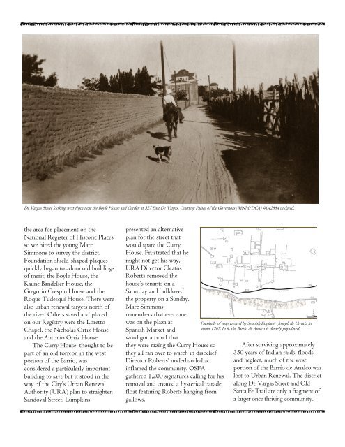
De Vargas Street looking west from near the Boyle House and Garden at 327 East De Vargas. Courtesy Palace of the Governors (MNM/DCA) #042884 undated.<br />
the area for placement on the<br />
National Register of <strong>Historic</strong> Places<br />
so we hired the young Marc<br />
Simmons to survey the district.<br />
<strong>Foundation</strong> shield-shaped plaques<br />
quickly began to adorn old buildings<br />
of merit; the Boyle House, the<br />
Kaune Bandelier House, the<br />
Gregorio Crespin House and the<br />
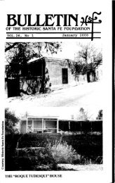
Roque Tudesqui House. There were<br />
also urban renewal targets north of<br />
the river. Others saved and placed<br />
on our Registry were the Loretto<br />
Chapel, the Nicholas Ortiz House<br />
and the Antonio Ortiz House.<br />
The Curry House, thought to be<br />
part of an old torreon in the west<br />
portion of the Barrio, was<br />
considered a particularly important<br />
building to save but it stood in the<br />
way of the City’s Urban Renewal<br />
Authority (URA) plan to straighten<br />
Sandoval Street. Lumpkins<br />
presented an alternative<br />
plan for the street that<br />
would spare the Curry<br />
House. Frustrated that he<br />
might not get his way,<br />
URA Director Cleatus<br />
Roberts removed the<br />
house’s tenants on a<br />
Saturday and bulldozed<br />
the property on a Sunday.<br />
Marc Simmons<br />
remembers that everyone<br />
was on the plaza at<br />
Spanish Market and<br />
word got around that<br />
they were razing the Curry House so<br />
they all ran over to watch in disbelief.<br />
Director Roberts’ underhanded act<br />
inflamed the community. OSFA<br />
gathered 1,200 signatures calling for his<br />
removal and created a hysterical parade<br />
float featuring Roberts hanging from<br />
gallows.<br />
Facsimile of map created by Spanish Engineer Joseph de Urrutia in<br />
about 1767. In it, the Barrio de Analco is densely populated.<br />
After surviving approximately<br />
350 years of Indian raids, floods<br />
and neglect, much of the west<br />
portion of the Barrio de Analco was<br />
lost to Urban Renewal. The district<br />
along De Vargas Street and Old<br />
<strong>Santa</strong> <strong>Fe</strong> Trail are only a fragment of<br />
a larger once thriving community.