Network Center for EANET - ICP Forests
Network Center for EANET - ICP Forests
Network Center for EANET - ICP Forests

You also want an ePaper? Increase the reach of your titles
YUMPU automatically turns print PDFs into web optimized ePapers that Google loves.
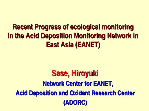
Recent Progress of ecological monitoring<br />
in the Acid Deposition Monitoring <strong>Network</strong> in<br />
East Asia (<strong>EANET</strong>)<br />
Sase, Hiroyuki<br />
<strong>Network</strong> <strong>Center</strong> <strong>for</strong> <strong>EANET</strong>,<br />
Acid Deposition and Oxidant Research <strong>Center</strong><br />
(ADORC)
Objectives of <strong>EANET</strong> (Joint Announcement)<br />
The regular phase activities: from January 2001<br />
• to create a common understanding of the state of<br />
the acid deposition problems in East Asia<br />
• to provide useful inputs <strong>for</strong> decision-making<br />
at<br />
local, national and regional levels aimed at<br />
preventing or reducing adverse impacts on the<br />
environment caused by acid deposition<br />
• to contribute to cooperation on the issues related<br />
to acid deposition among the participating<br />
countries
Framework of <strong>EANET</strong> and scientific bodies<br />
Intergovernmental Meeting<br />
Secretariat <strong>for</strong> <strong>EANET</strong><br />
(UNEP RRC. AP)<br />
Scientific Advisory Committee<br />
Task Forces<br />
- on Dry Deposition Monitoring<br />
- on Soil and Vegetation<br />
Monitoring<br />
- on Monitoring Instrumentation<br />
-on Research Coordination<br />
Drafting Committee <strong>for</strong> the 2 nd<br />
Periodic Report<br />
<strong>Network</strong> <strong>Center</strong> <strong>for</strong> <strong>EANET</strong><br />
(ADORC)<br />
<strong>Network</strong> QA/QA Manager<br />
Expert Groups<br />
- on Dry Dep. Flux Estimation<br />
- on Preparation of Technical<br />
Manual <strong>for</strong> Air Concentration<br />
Monitoring<br />
- on Revision of Tech. Manual on<br />
Wet Dep. Monitoring<br />
- on Revision of Tech. Manual on<br />
Inland Aq. Env. Monitoring<br />
National Focal Point<br />
Participating Country<br />
National <strong>Center</strong><br />
National QA/QC Manager<br />
3
Wet/dry deposition monitoring 56/47 sites<br />
Wet/dry<br />
Russia: 4/4<br />
Mongolia: 2/2<br />
China: 8/3<br />
R. of Korea: 3/3<br />
Japan: 12/12<br />
Philippines: 3/3<br />
Viet Nam: 6/5<br />
Lao PDR: 1/1<br />
Cambodia: 1/1<br />
Thailand: 6/6<br />
Myanmar: 1/-<br />
Malaysia: 4/3<br />
Indonesia: 5/4<br />
Yangon<br />
Urban<br />
Rural<br />
Remote<br />
Sapa<br />
Nakhon Ratchasima<br />
Da Nang<br />
Nha Be<br />
Maros<br />
Cuc Phuong<br />
Danum Valley<br />
Tokyo<br />
Mt. Sto. Tomas<br />
4
Ecological monitoring sites (as of 2008)<br />
Soil/Forest/Inland<br />
aquatic<br />
Soil/Forest<br />
Soil<br />
Inland aquatic<br />
Catchment research<br />
Soil and/or <strong>for</strong>est<br />
vegetation:<br />
27 <strong>for</strong>ests in 19 areas<br />
Inland aquatic:<br />
17 lakes/rivers<br />
Catchment research:<br />
4 catchments<br />
Number of the sites<br />
gradually increased…<br />
5
Plot and subplots <strong>for</strong> soil monitoring<br />
Subplot<br />
NO.1<br />
Subplot<br />
NO.2<br />
5 - 10 m<br />
1m<br />
Subplot<br />
NO.3<br />
Subplot<br />
NO.4<br />
5 - 10 m<br />
Subplot<br />
NO.5<br />
At least two plots will be selected in each <strong>for</strong>est.<br />
Two layers (0-5 5 and 5-105<br />
cm)<br />
6<br />
10 cm) will be surveyed <strong>for</strong> each subplot.
Mandatory items <strong>for</strong> soil analysis:<br />
every 3-53<br />
5 years<br />
• Moisture content<br />
• pH (H 2 O) and pH (KCl(<br />
KCl)<br />
• Exchangeable base cations (Ca, Mg, K and Na)<br />
• Exchangeable acidity<br />
• (Exchangeable Al and H)<br />
• Effective Cation Exchange Capacity (ECEC)<br />
• Carbonate content (only <strong>for</strong> calcareous soil)<br />
7
Plots <strong>for</strong> <strong>for</strong>est vegetation monitoring<br />
X<br />
Forest area<br />
X<br />
<strong>Center</strong><br />
of site<br />
12 m<br />
12 m<br />
12 m<br />
X<br />
x<br />
12 m<br />
X<br />
X: Point of<br />
taking photo<br />
7.98m (Survey area 1: 200m 2 )<br />
11.28m (Survey area 2: 400m 2 )<br />
17.85m (Survey area 3: 1000m 2 )<br />
Survey of tree decline <strong>for</strong><br />
20 selected trees<br />
Coaxial plots <strong>for</strong> general<br />
description of <strong>for</strong>ests<br />
8
Mandatory items <strong>for</strong> <strong>for</strong>est monitoring<br />
Survey of tree decline: once a year<br />
• Observation of tree decline<br />
(The method was developed referring <strong>ICP</strong> <strong>Forests</strong> Manuals)<br />
General description of <strong>for</strong>est: every 3-53<br />
5 years<br />
• Description of trees: Name of species, DBH,<br />
Height of tree<br />
– Survey area 1: Tree height > 1.3 m<br />
– Survey area 2: DBH > 4 cm<br />
– Survey area 3: DBH > 18 cm<br />
• Understory vegetation survey: Dominance scales<br />
of the respective species (Survey area 1)<br />
9
Long-term soil acidification<br />
at the Lake Ijira Catchment, Japan<br />
pH(H2O)<br />
5.4<br />
5.2<br />
5<br />
4.8<br />
4.6<br />
4.4<br />
a)Suface soil pH(H 2 O)<br />
Plot 37<br />
Plot 38<br />
Plot 41<br />
Plot 46<br />
Plot 49<br />
5.4<br />
5.2<br />
5<br />
4.8<br />
4.6<br />
4.4<br />
b)Subsoil pH(H 2 O)<br />
Plot 37<br />
Plot 38<br />
Plot 41<br />
Plot 46<br />
Plot 49<br />
4.2<br />
4.2<br />
4<br />
4<br />
3.8<br />
3.6<br />
1988<br />
1990<br />
1992<br />
1994<br />
1996<br />
1998<br />
2000<br />
2002<br />
2004<br />
3.8<br />
3.6<br />
1988<br />
<strong>EANET</strong> monitoring<br />
No clear soil acidification has been observed at other sites.<br />
1990<br />
1992<br />
1994<br />
1996<br />
1998<br />
2000<br />
2002<br />
2004
Current condition of tree decline<br />
Current condition of tree decline<br />
100<br />
90<br />
80<br />
70<br />
60<br />
50<br />
40<br />
30<br />
% of declined trees<br />
20<br />
10<br />
Jinyunshan No.1<br />
Jinyunshan No.2<br />
Dabagou<br />
XPZ-01<br />
XPZ-02<br />
XPZ-03<br />
XPZ-04<br />
Zhuxiandong No.1<br />
Zhuxiandong No 2<br />
Zhuxiandong No 3<br />
Lake Ijira<br />
Yamato<br />
Banryu<br />
Iwami-rinku FP<br />
Mt. Makilling<br />
UP Quezon-Land Grant<br />
Mt. Naejang<br />
Bolshie Koty<br />
Irkutsk<br />
Mondy<br />
Vachiralongkorn Puye<br />
Vachiralongkorn Dam<br />
0<br />
natural factors<br />
unknown factors<br />
insect or disease<br />
cn jp ph kr ru th<br />
No clear evidence of acid deposition/air pollution (<strong>EANET</strong>, 2006)
Tree decline at the Bogdkhan Mountain in Ulaanbaatar<br />
Tree decline by local air pollution<br />
Winter smog of Ulaanbaatar,<br />
Mongolia<br />
Clear A sky new in research suburban project area of<br />
on<br />
sulfur<br />
Ulaanbaatar<br />
flow from coal<br />
combustion to <strong>for</strong>est<br />
ecosystems has started<br />
since 2009.
High ozone concentration in a tropical <strong>for</strong>est<br />
120<br />
100<br />
15-day mean by passive sampler<br />
80<br />
O 3 , ppbv<br />
60<br />
40<br />
20<br />
0<br />
2006 2007 2008 2009<br />
High ozone concentration can be seen generally in dry<br />
season in Sakaerat site, Thailand
Stream water acidification with N saturation<br />
in Lake Ijira catchment<br />
The stream water pH and alkalinity decreased since mid 1990s.<br />
The enhanced NO - 3 discharge during the growing season<br />
appeared to be the primary cause <strong>for</strong> the stream water<br />
acidification (Nakahara(<br />
et al. 2010, Biogeochemistry).<br />
14
Specific works by the Task Force on Soil and<br />
Vegetation Monitoring until 2014<br />
• Promotion of the catchment analysis<br />
– Guideline <strong>for</strong> catchment-scale monitoring: hopefully<br />
adoption in autumn 2010, and then, starting the regular<br />
catchment-scale monitoring within a few years<br />
– Elaboration of the biogeochemical model<br />
• Trial campaign <strong>for</strong> ozone monitoring in <strong>for</strong>est area<br />
– Passive sampling<br />
– Observation of ozone injury<br />
• Identification of the area susceptible <strong>for</strong> acid deposition<br />
– Sensitivities of the ecosystems based on soil, geology,<br />
and vegetation using GIS technique<br />
– Comparison with deposition data
Further development of <strong>EANET</strong><br />
• Signature <strong>for</strong> Instrument <strong>for</strong> Strengthening the Acid<br />
Deposition Monitoring <strong>Network</strong> in East Asia (<strong>EANET</strong>):<br />
mainly at the 12 th Session of the Intergovernmental<br />
Meeting (IG12) in December 2010 in Niigata, Japan<br />
• Medium Term Plan <strong>for</strong> <strong>EANET</strong> (MTP) (2011-2015)<br />
2015)<br />
• Second Periodic Report on the State of Acid<br />
Deposition in East Asia: : adoption at the 11 th Session<br />
of Scientific Advisory Committee (SAC11) in 2011<br />
Please visit the <strong>EANET</strong> web site: www.eanet.cc