Rio Grande Valley PF225 ESSR - CBP.gov
Rio Grande Valley PF225 ESSR - CBP.gov
Rio Grande Valley PF225 ESSR - CBP.gov

You also want an ePaper? Increase the reach of your titles
YUMPU automatically turns print PDFs into web optimized ePapers that Google loves.
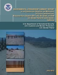
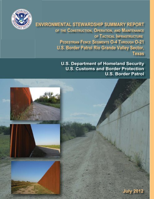
ENVIRONMENTAL STEWARDSHIP SUMMARY REPORT<br />
OF THE CONSTRUCTION, OPERATION, AND MAINTENANCE<br />
OF TACTICAL INFRASTRUCTURE<br />
PEDESTRIAN FENCE SEGMENTS O-4 THROUGH O-21<br />
U.S. Border Patrol <strong>Rio</strong> <strong>Grande</strong> <strong>Valley</strong> Sector,<br />
Texas<br />
U.S. Department of Homeland Security<br />
U.S. Customs and Border Protection<br />
U.S. Border Patrol<br />
July 2012
FINAL<br />
ENVIRONMENTAL STEWARDSHIP SUMMARY REPORT<br />
OF THE CONSTRUCTION, OPERATION, AND MAINTENANCE<br />
OF TACTICAL INFRASTRUCTURE<br />
PEDESTRIAN FENCE SEGMENTS O-4 THROUGH O-21<br />
U.S. BORDER PATROL, RIO GRANDE VALLEY SECTOR,<br />
TEXAS<br />
July 2012<br />
Lead Agency:<br />
Point of Contact:<br />
Department of Homeland Security<br />
U.S. Customs & Border Protection<br />
Office of Finance, Asset Management<br />
1300 Pennsylvania Ave NW<br />
Washington, DC 20229<br />
Loren Flossman<br />
Director<br />
Border Patrol Facilities and Tactical Infrastructure<br />
Program Management Office<br />
Facilities Management & Engineering<br />
1301 Constitution Ave NW<br />
EPA West, Suite B-155<br />
Washington, DC 20229
EXECUTIVE SUMMARY<br />
The U.S. Customs and Border Protection (<strong>CBP</strong>), Secure Border Initiative (SBI) built tactical<br />
infrastructure (TI) for the U.S. Border Patrol (USBP), <strong>Rio</strong> <strong>Grande</strong> <strong>Valley</strong> Sector. USBP uses the<br />
term TI to describe the physical structures that facilitate enforcement activities; these items<br />
typically include, but are not limited to, access roads, vehicle and pedestrian fences, lights, gates,<br />
and boat ramps. TI planned under SBI’s Pedestrian Fence 225 (PF 225) program within the <strong>Rio</strong><br />
<strong>Grande</strong> <strong>Valley</strong> Sector consisted of pedestrian fence, with adjacent roads, in 21 distinct segments<br />
(designated as O-1 through O-21) neighboring the <strong>Rio</strong> <strong>Grande</strong> in Starr, Hidalgo, and Cameron<br />
counties, Texas. Three segments, O-1, O-2 and O-3, are in Starr County. Segments O-4 through<br />
O-10 are in Hidalgo County. The remaining segments, O-11 through O-21, are in Cameron<br />
County. At the time of this writing, construction on segments O-1 through O-3 and O-20 had not<br />
begun, so this document omits them from evaluation.<br />
The purpose of this report is to provide a comprehensive summary of the installation of TI and<br />
assess its final design and footprint. This Environmental Stewardship Summary Report (<strong>ESSR</strong>)<br />
compares the final completed action to the installation of TI originally proposed in the July 2008<br />
Final Environmental Stewardship Plan for the Construction, Operation, and Maintenance of<br />
Tactical Infrastructure U.S. Border Patrol <strong>Rio</strong> <strong>Grande</strong> <strong>Valley</strong> Sector, Texas. Construction of the<br />
various segments began in 2008 and was ongoing as of March 2011.<br />
<strong>CBP</strong> provided an environmental monitor during construction activity, who documented<br />
adherence to best management practices (BMPs). The monitors noted any deviations from the<br />
BMPs and required corrections weekly on a BMP tracking spreadsheet. The most common BMP<br />
infractions in the <strong>Rio</strong> <strong>Grande</strong> <strong>Valley</strong> Sector included concrete wash outside of designated areas,<br />
food-related trash improperly contained, dust control measures not in place when needed, lack of<br />
demarcation of work and parking areas, driving outside of designated areas, lack of stormwater<br />
pollution prevention plan measures, lack of revegetation efforts, lack of drip pans, and improper<br />
storage of petroleum, oils, and lubricants. Most BMP infractions did not require revegetation<br />
efforts, because little or no native vegetation was removed during these events. No known<br />
impacts on federally listed species were documented as a result of the infractions, and there were<br />
no predicted or actual impacts on threatened or endangered species or their habitat in the <strong>Rio</strong><br />
<strong>Grande</strong> <strong>Valley</strong> Sector.<br />
After the completion of the Environmental Stewardship Plan (ESP) in 2008, changes were made<br />
to the alignment, design, or construction methods to facilitate construction, reduce costs or<br />
potential impacts, respond to stakeholder requests, or enhance the efficacy of the fence for<br />
enforcement purposes. These changes were reviewed and approved through <strong>CBP</strong> Headquarters<br />
and documented in change request (CR) forms. This report summarizes any significant<br />
modifications during construction that increased or reduced environmental impacts.<br />
This <strong>ESSR</strong> was prepared to document the impact areas, compared with the original ESP and the<br />
changes identified in the CR forms, for the following reasons:<br />
1. To compare anticipated to actual impacts, so that a final new baseline is established for<br />
future maintenance and repair and any potential future actions.<br />
RGV_<strong>PF225</strong>_<strong>ESSR</strong><br />
Final
ES-2<br />
2. To document the success of BMPs and any changes or improvements for the future.<br />
3. To document any changes to the planned location or type of the TI.<br />
<strong>CBP</strong> consultants surveyed the <strong>Rio</strong> <strong>Grande</strong> <strong>Valley</strong> segments O-4 through O-21 to inspect the final<br />
project corridor and infrastructure footprints. The surveys documented any significant<br />
differences between the planned action and completed actions. When the survey team observed<br />
changes, it consulted the CR forms to see whether the changes were recorded and approved.<br />
Approximately 96 CRs were approved for the <strong>Rio</strong> <strong>Grande</strong> <strong>Valley</strong> Sector; however, only 21 of<br />
these had the potential to cause environmental impacts.<br />
Post-construction surveys for fence segments in Hidalgo County, O-4 through O-10, and fence<br />
segments in Cameron County, Segments O-11 through O-21, determined the actual length of the<br />
fence compared with the original length described in the ESP. The post-construction surveys<br />
determined the overall length for segments O-4 through O-21 (excluding O-20) to be 49.6 miles.<br />
This is 5.8 miles less than the original length of 55.4 miles described in the ESP for these<br />
segments.<br />
Segment O-21a was not built at the time of the post-construction survey. When the ESP was<br />
written, O-21a was proposed to be a continuous segment within segment O-21, but was simply<br />
referred to as the area within O-21 containing Old Brulay (Nye) Plantation buildings. At the<br />
time of the post-construction survey, O-21a was under contract and vegetation clearing activities<br />
had begun. However, discovery of archaeological resources within the project corridor halted<br />
construction.<br />
The ESP did not quantify the impact area for each fence segment; therefore, estimates were made<br />
using the corridor width and the length of each fence segment. As described in the ESP, the<br />
impact areas for segments O-4 through O-10 were estimated using a 40-foot-wide corridor, and<br />
for O-11 through O-21 using a 60-foot-wide corridor. The ESP estimated overall impact to be<br />
368.5 acres. The post-construction survey found the impact area to be 255.3 acres.<br />
Table ES-1 compares the modifications of fence lengths and impact area estimated in the ESP<br />
with the post-construction survey. As this table shows, the total fence length decreased by 5.8<br />
miles and the total impact area decreased by 113.2 acres, primarily due to reductions in segments<br />
O-9, O-13, O-16, and O-21.<br />
RGV_<strong>PF225</strong>_<strong>ESSR</strong><br />
Final
ES-3<br />
Segment/Area<br />
Table ES-1. Comparison of Predicted and Actual Impacts<br />
ESP predicted<br />
length<br />
(miles)<br />
Surveyed length<br />
(miles)<br />
ESP<br />
predicted<br />
impact area<br />
(acres)*<br />
Surveyed<br />
impact area<br />
(acres)<br />
Difference in<br />
area<br />
(acres)<br />
O-4 4.4 4.3 21.3 28.6 7.2<br />
O-5 1.8 1.7 8.7 4.7 -4.0<br />
O-6 3.9 4.0 18.9 24.1 5.1<br />
O-7 0.9 0.9 4.4 5.1 0.8<br />
O-8 3.2 3.2 15.5 18.5 2.9<br />
O-9 3.9 3.5 28.4 23.1 -5.2<br />
O-10 2.4 2.3 17.5 12.1 -5.4<br />
O-11 2.3 2.3 16.7 12.5 -4.3<br />
O-12 0.9 0.9 6.5 6.0 -0.5<br />
O-13 1.6 2.5 11.6 9.6 -2.1<br />
O-14 3.6 2.4 26.2 10.9 -15.3<br />
O-15 1.9 2.2 13.8 10.5 -3.3<br />
O-16 3.0 2.0 21.8 9.0 -12.8<br />
O-17 1.6 1.6 11.6 3.7 -7.9<br />
O-18 3.6 3.5 26.2 16.2 -9.9<br />
O-19** 3.4 2.3 24.7 8.2 -16.6<br />
O-21 13.0 12.3 94.5 52.7 -41.9<br />
Total 55.4 49.6 368.5 255.3 -113.2<br />
* Impact areas for segments O-4 through O-10 were estimated using a 40-foot wide corridor, and for O-11 through O-21 a 60-<br />
foot-wide corridor, as defined in the ESP.<br />
** Segment O-19 fence construction was not complete at the time of the post-construction survey; final fence length and area<br />
may change the final footprint<br />
RGV_<strong>PF225</strong>_<strong>ESSR</strong><br />
Final
TABLE OF CONTENTS<br />
EXECUTIVE SUMMARY .................................................................................................... ES-1<br />
1.0 INTRODUCTION, OUTREACH, AND METHODS ................................................ 1-1<br />
1.1 PUBLIC AND AGENCY OUTREACH ............................................................. 1-5<br />
1.2 METHODS .......................................................................................................... 1-5<br />
1.2.1 Environmental Monitoring Process ......................................................... 1-5<br />
1.2.2 Change Request Process .......................................................................... 1-6<br />
1.2.3 Post-Construction Survey Methods ......................................................... 1-6<br />
2.0 DESCRIPTION OF THE PLANNED ACTION ........................................................ 2-1<br />
2.1 SEGMENTS O-1 THROUGH O-3 AND O-11 THROUGH O-21 ..................... 2-2<br />
2.2 SEGMENTS O-4 THROUGH O-10 ................................................................... 2-4<br />
2.3 MONITORING .................................................................................................... 2-5<br />
2.4 CHANGE REQUEST FORMS ........................................................................... 2-6<br />
2.5 IMPACT QUANTITIES ANTICIPATED IN THE ENVIRONMENTAL<br />
STEWARDSHIP PLAN ...................................................................................... 2-8<br />
3.0 POST-CONSTRUCTION FINDINGS......................................................................... 3-1<br />
3.1 RESULTS OF ROAD MEASUREMENTS ........................................................ 3-1<br />
3.1.1 Access Roads ........................................................................................... 3-1<br />
3.1.1.1 Segment O-4 ............................................................................ 3-1<br />
3.1.1.2 Segment O-5 ............................................................................ 3-2<br />
3.1.1.3 Segment O-6 ............................................................................ 3-2<br />
3.1.1.4 Segment O-7 ............................................................................ 3-2<br />
3.1.1.5 Segment O-8 ............................................................................ 3-2<br />
3.1.1.6 Segment O-9 ............................................................................ 3-2<br />
3.1.1.7 Segment O-10 .......................................................................... 3-2<br />
3.1.1.8 Segment O-11 .......................................................................... 3-2<br />
3.1.1.9 Segment O-12 .......................................................................... 3-2<br />
3.1.1.10 Segment O-13 .......................................................................... 3-2<br />
3.1.1.11 Segment O-14 .......................................................................... 3-2<br />
3.1.1.12 Segment O-15 .......................................................................... 3-3<br />
3.1.1.13 Segment O-16 .......................................................................... 3-3<br />
3.1.1.14 Segment O-17 .......................................................................... 3-3<br />
3.1.1.15 Segment O-18 .......................................................................... 3-3<br />
3.1.1.16 Segment O-19 .......................................................................... 3-3<br />
3.1.1.17 Segment O-21 .......................................................................... 3-3<br />
3.1.2 Maintenance and Other Roads ................................................................. 3-3<br />
3.2 FENCE ................................................................................................................. 3-4<br />
3.2.1.1 Segment O-4 ............................................................................ 3-5<br />
3.2.1.2 Segment O-5 ............................................................................ 3-5<br />
3.2.1.3 Segment O-6 ............................................................................ 3-5<br />
3.2.1.4 Segment O-7 ............................................................................ 3-5<br />
3.2.1.5 Segment O-8 ............................................................................ 3-5<br />
RGV_<strong>PF225</strong>_<strong>ESSR</strong><br />
Final
ii<br />
3.2.1.6 Segment O-9 ............................................................................ 3-5<br />
3.2.1.7 Segment O-10 .......................................................................... 3-5<br />
3.2.1.8 Segment O-11 .......................................................................... 3-6<br />
3.2.1.9 Segment O-12 .......................................................................... 3-6<br />
3.2.1.10 Segment O-13 .......................................................................... 3-6<br />
3.2.1.11 Segment O-14 .......................................................................... 3-6<br />
3.2.1.12 Segment O-15 .......................................................................... 3-6<br />
3.2.1.13 Segment O-16 .......................................................................... 3-6<br />
3.2.1.14 Segment O-17 .......................................................................... 3-6<br />
3.2.1.15 Segment O-18 .......................................................................... 3-6<br />
3.2.1.16 Segment O-19 .......................................................................... 3-6<br />
3.2.1.17 Segment O-21 .......................................................................... 3-6<br />
3.3 STAGING AREAS .............................................................................................. 3-7<br />
3.4 WILDLIFE OPENINGS ...................................................................................... 3-8<br />
3.5 SABAL PALM RELOCATION ........................................................................ 3-10<br />
3.6 MEASURED IMPACT QUANTITIES ............................................................. 3-10<br />
3.6.1 Soils........................................................................................................ 3-10<br />
3.6.2 Vegetation .............................................................................................. 3-10<br />
3.6.3 Cultural Resources ................................................................................. 3-11<br />
3.6.4 Wetlands and WUS ................................................................................ 3-11<br />
4.0 DISCUSSION ................................................................................................................. 4-1<br />
4.1 Decreased Project Footprint ................................................................................. 4-1<br />
4.2 Additional Issues .................................................................................................. 4-1<br />
RGV_<strong>PF225</strong>_<strong>ESSR</strong><br />
Final
iii<br />
LIST OF TABLES<br />
Table ES-1. Comparison of Predicted and Actual Impacts .................................................... ES-3<br />
Table 2-1. Description of Planned Fence Segments O-4 through O-21* ............................... 2-1<br />
Table 2-2. Staging Area Impacts for Pedestrian Fence, Segments O-1 through O-3 and O-<br />
11 through O-21 (Acres) ....................................................................................... 2-3<br />
Table 2-3. Jurisdictional Wetlands in Segments O-1 through O-3 and O-11 through O-21<br />
(as Stated in the ESP) ............................................................................................ 2-3<br />
Table 2-4.<br />
Staging Area Impacts for Concrete Flood Protection Structure/Concrete Fence,<br />
Segments O-4 through O-10 (Acres) ..................................................................... 2-5<br />
Table 2-5. Jurisdictional Wetlands in Segments O-4 through O-10 (as Stated in the ESP) .. 2-5<br />
Table 2-6. Approved CRs with Potential to Affect the Environment ..................................... 2-6<br />
Table 2-7. Predicted Impacts for Segments O-4 through O-21 (as Stated in the ESP) .......... 2-8<br />
Table 3-1. Access Roads and Impacts, Segments O-4 through O-21 ..................................... 3-1<br />
Table 3-2. Fence Lengths and Impact Areas, Segments O-1 through O-21 ........................... 3-7<br />
Table 3-3. Staging Area Impacts, Segments O-4 through O-21 (Acres)................................ 3-8<br />
Table 3-4. Wildlife Openings in Segments O-1 through O-3 and O-11 through O-21 ......... 3-9<br />
LIST OF FIGURES<br />
Figure 1-1. Locations of Tactical Infrastructure, Segments O-1 through O-4 ......................... 1-2<br />
Figure 1-2. Locations of Tactical Infrastructure, Segments O-5 through O-10 ....................... 1-3<br />
Figure 1-3. Locations of Tactical Infrastructure, Segments O-11 through O-21 ..................... 1-4<br />
LIST OF PHOTOGRAPHS<br />
Photograph 3-1. Bollard-Style Fence ...................................................................................... 3-3<br />
Photograph 3-2. Hanging Fence Panel .................................................................................... 3-4<br />
Photograph 3-3. Floating Fence .............................................................................................. 3-4<br />
Photograph 3-4. Concrete Flood Protection Fence ................................................................. 3-4<br />
Photograph 3-5. Eastern Staging Area in Segment O-21 ........................................................ 3-7<br />
Photograph 3-6. Western Staging Area in Segment O-14 ...................................................... 3-7<br />
Photograph 3-7. Wildlife Opening in Segment O-12 at UTM 0623572_2881869 ................. 3-8<br />
Photograph 3-8. Wildlife Opening in Segment O-19 at UTM 0648032_2864946 ................. 3-8<br />
Photograph 3-9. Preparation for Sabal Palm Removal ........................................................... 3-9<br />
Photograph 3-10. Relocation of Sabal Palm to USFW Refuge Lands ...................................... 3-9<br />
Appendix A. Corridor Maps O-4 through O-21<br />
LIST OF APPENDICES<br />
RGV_<strong>PF225</strong>_<strong>ESSR</strong><br />
Final
SECTION 1.0<br />
INTRODUCTION, OUTREACH, AND METHODS
1-1<br />
1.0 INTRODUCTION, OUTREACH, AND METHODS<br />
As part of an effort to document the installation of tactical infrastructure (TI) completed under<br />
the Secure Border Initiative’s Pedestrian Fence 225 (PF 225) Program, this Environmental<br />
Stewardship Summary Report (<strong>ESSR</strong>) presents a compilation of the construction actions. It<br />
compares the planned action proposed in the July 2008 Final Environmental Stewardship Plan<br />
for the Construction, Operation, and Maintenance of Tactical Infrastructure U.S. Border Patrol<br />
<strong>Rio</strong> <strong>Grande</strong> <strong>Valley</strong> Sector, Texas to the final results of the construction project. U.S. Customs<br />
and Border Protection (<strong>CBP</strong>) prepared a Biological Resources Plan (BRP) to identify the<br />
presence of sensitive biological resources, particularly federally protected species, and potential<br />
impacts on these resources. It provided the BRP to affected resource agencies and land<br />
managers for review. The BRP was appended to the Environmental Stewardship Plan (ESP).<br />
The original ESP was made available to the public on the <strong>CBP</strong> Website,<br />
http://www.borderfenceplanning.com, which has subsequently been changed to<br />
http://cbp.<strong>gov</strong>/xp/c<strong>gov</strong>/border_security/ti/ti_docs/sector/rgv/. Information in this <strong>ESSR</strong> was<br />
compiled from approved modifications made during construction and post-construction surveys<br />
of the project corridor. The original ESP analyzed anticipated impacts from building segments<br />
O-1 through O-21 (Figures 1-1 through 1-3). However, segments O-1, O-2, O-3, O-20, and O-<br />
21a have not been built to date, and segment O-19 is not fully complete. Therefore, this <strong>ESSR</strong><br />
compares anticipated impacts described and assessed by the original ESP with actual impacts<br />
after construction occurring in 17 segments, O-4 through O-19 and O-21.<br />
Before installing the TI, <strong>CBP</strong> performed an environmental review of the fencing projects and<br />
published the results of this analysis in a draft Environmental Impact Statement (EIS), including<br />
mitigation and best management practices (BMP) for minimizing adverse impacts on the<br />
environment. Upon issuance of the April 2008 waiver, the EIS was revised into the ESP. This<br />
and other ESPs were drafted for each TI segment under the waiver. Some ESPs addressed<br />
specific TI segments, while others, such as the ESP for the <strong>Rio</strong> <strong>Grande</strong> <strong>Valley</strong> Sector, addressed<br />
all of the PF 225 segments planned for the sector in a single document. Professional biologists<br />
and archaeologists conducted field surveys of all project corridors during the planning process<br />
before construction. The results of the surveys were provided for review and comment to the<br />
affected resource agencies, such as the U.S. Fish and Wildlife Service (USFWS) and State<br />
Historic Preservation Office. Conservation measures and other BMPs identified in the ESP were<br />
made part of the request for proposal issued to commercial construction contractors and were<br />
also incorporated into the contract upon award.<br />
This <strong>ESSR</strong> was prepared to document the impact areas (“final footprint”), compared with the<br />
original ESP and the changes identified in the CR forms, for the following reasons:<br />
1. To compare anticipated to actual impacts, so that a final new baseline is established for<br />
future maintenance and repair and any potential future actions.<br />
2. To document success of BMPs and any changes or improvements for the future.<br />
3. To document any changes to the planned location or type of the TI.<br />
RGV_<strong>PF225</strong>_<strong>ESSR</strong><br />
Final
1-2<br />
Farm To Market Road 3167<br />
Starr<br />
Roma - Los<br />
Saenz<br />
Farm To Market Road 649<br />
Farm To Market Road 755<br />
T E X A S<br />
Map Extent<br />
O-1<br />
£¤ 83<br />
<strong>Rio</strong> <strong>Grande</strong><br />
City<br />
O-2<br />
Starr County<br />
Hidalgo County<br />
Hidalgo<br />
£¤ 83<br />
La Grulla<br />
Cuevitas<br />
M E X I C O<br />
Penitas<br />
O-3<br />
Fence Sections<br />
Access Roads<br />
Staging Areas<br />
O-4<br />
·<br />
0<br />
1 2 3 4<br />
Miles<br />
Figure 1-1: Locations of Tactical Infrastucture - Sections O-1 through O-4<br />
January 2011
1-3<br />
McAllen<br />
Pharr<br />
Alamo<br />
£¤ 83<br />
Hidalgo<br />
Weslaco<br />
Map Extent<br />
Cameron<br />
O-5<br />
Granjeno<br />
UV 336<br />
Cage Boulevard<br />
Alamo Road<br />
Salinas Boulevard<br />
Mercedes<br />
Hidalgo<br />
Cameron County<br />
Hidalgo County<br />
Texas Boulevard<br />
O-6<br />
£¤ 281<br />
£¤ 281<br />
Progreso<br />
Lakes<br />
O-7<br />
O-8<br />
O-9 O-10<br />
O-11<br />
Fence Sections<br />
M E X I C O<br />
Access Roads<br />
Staging Areas<br />
·<br />
0<br />
1 2 3 4<br />
Miles<br />
Figure 1-2: Locations of Tactical Infrastucture - Sections O-5 through O-10<br />
January 2011
Farm To Market Road 510<br />
1-4<br />
Harlingen<br />
Hidalgo<br />
San Benito<br />
Cameron County<br />
Hidalgo County<br />
Cameron<br />
£¤ 281<br />
Rangerville Road<br />
Farm To Market Road 2520<br />
Farm To Market Road 803<br />
Los<br />
Fresnos<br />
Map Extent<br />
O-11<br />
Los Indios<br />
£¤ 77<br />
O-12<br />
O-13<br />
O-14<br />
O-15<br />
O-16<br />
£¤ 281<br />
Paredes Line Road<br />
Farm To Market Road 511<br />
San Pedro<br />
¬« 48<br />
O-17<br />
M E X I C O<br />
O-18<br />
Brownsville<br />
¬« 4<br />
Fence Sections<br />
Access Roads<br />
Staging Areas<br />
O-21<br />
·<br />
0<br />
1 2 3 4<br />
Miles<br />
O-19<br />
O-20<br />
South<br />
Point<br />
Figure 1-3: Locations of Tactical Infrastucture - Sections O-11 through O-21<br />
January 2011
1-5<br />
1.1 PUBLIC AND AGENCY OUTREACH<br />
As mentioned above, before the waiver, <strong>CBP</strong> prepared an EIS to address the potential effects of<br />
the planned action. A Notice of Availability for the draft EIS was published in The Monitor, The<br />
Brownsville Herald, The <strong>Valley</strong> Morning Star, La Frontera, and El Nuevo Heraldo on November<br />
16 and 18, and December 5 and 11, 2007, announcing the release of the document for a 45-day<br />
public comment period. In addition, public open houses were held at the McAllen Convention<br />
Center, the Brownsville Convention Center, and VFW Post 8256 in <strong>Rio</strong> <strong>Grande</strong> City on<br />
December 11, 12, and 13, 2007, respectively.<br />
After the Secretary of Homeland Security waived compliance with certain environmental laws<br />
and requirements in April 2008, <strong>CBP</strong> reviewed, considered, and incorporated comments from the<br />
public and other Federal, state, and local agencies, as appropriate, in preparing the ESP. <strong>CBP</strong><br />
received numerous public comments on the draft EIS. Its responses to public comments on the<br />
draft EIS are available for viewing on the <strong>CBP</strong> website http://cbp.<strong>gov</strong>/xp/c<strong>gov</strong>/<br />
border_security/ti/ti_docs/sector/rgv/rgv_eis/response/.<br />
In addition to conducting that program for public involvement and outreach, <strong>CBP</strong> has continued<br />
to coordinate with various Federal and state agencies during construction. These agencies<br />
include, but are not limited to, the following:<br />
U.S. Section, International Boundary and Water Commission (USIBWC) - <strong>CBP</strong> coordinated<br />
with USIBWC to ensure that any construction along the international border did not adversely<br />
affect international boundary monuments or substantially impede floodwater conveyance within<br />
international drainages.<br />
U.S. Army Corps of Engineers (USACE), Galveston District - <strong>CBP</strong> coordinated all activities<br />
with USACE to identify potential jurisdictional waters of the United States (WUS), including<br />
wetlands, and to develop measures to avoid, minimize, or compensate for losses to these<br />
resources.<br />
USFWS - <strong>CBP</strong> has coordinated with USFWS to identify listed species that could occur in the<br />
project area and has cooperated with it to prepare a BRP that analyzes potential effects on listed<br />
species and BMPs to reduce or offset any adverse impacts.<br />
Texas State Historic Preservation Office - <strong>CBP</strong> coordinated with the Texas State Historic<br />
Preservation Office to identify historic properties listed, or potentially eligible to be listed, on the<br />
National Register of Historic Places (NRHP) and to develop measures to avoid, minimize, or<br />
compensate for the loss of such resources.<br />
1.2 METHODS<br />
1.2.1 Environmental Monitoring Process<br />
<strong>CBP</strong> provided an environmental monitor during construction activity. Duties of the monitor<br />
included documenting impacts beyond those anticipated in the ESP, advising on-site construction<br />
managers on implementing the BMPs and about other environmental issues as they arose.<br />
RGV_<strong>PF225</strong>_<strong>ESSR</strong><br />
Final
1-6<br />
Environmental monitors recorded observations daily and compiled them weekly in BMP<br />
tracking spreadsheets, which they submitted to <strong>CBP</strong> and USACE. At the time this <strong>ESSR</strong> was<br />
prepared, the summary report was not yet compiled.<br />
The designated environmental monitor was to notify the construction manager of any activities<br />
that could harm or harass a federally listed species or of any other environmental issue identified.<br />
Upon such notification, the construction manager was to temporarily suspend activities in the<br />
vicinity of the federally listed species and notify the contracting officer, the administrative<br />
contracting officer, and the contracting officer’s representative of the suspension so that the key<br />
USACE personnel could be apprised of the situation for resolution. In addition, <strong>CBP</strong> notified the<br />
USFWS Corpus Christi Field Office in the event that construction activities directly affected any<br />
federally listed species. <strong>CBP</strong> maintained open coordination with USFWS during construction to<br />
discuss implementation and effectiveness of BMPs to avoid adverse impacts on federally listed<br />
species. In fact, <strong>CBP</strong> shared the BMP tracking spreadsheet with USFWS during construction<br />
activities via weekly teleconference calls to review BMP infractions.<br />
1.2.2 Change Request Process<br />
During construction, <strong>CBP</strong> identified potential modifications that would improve the<br />
effectiveness of the TI; reduce construction cost, schedule, or environmental impacts; enhance<br />
long-term maintenance requirements; address stakeholder concerns; or reduce risk to U.S.<br />
Border Patrol (USBP) agents’ health and safety. These changes were reviewed and approved<br />
through <strong>CBP</strong> Headquarters, and documented in change request (CR) forms. The CR forms<br />
described the proposed changes or modifications, justification of the changes, anticipated effects<br />
on construction costs and schedule, and any other extenuating circumstances that would help to<br />
clarify the changes. Each proposed change was vetted throughout <strong>CBP</strong> to evaluate potential<br />
impacts before final approval by <strong>CBP</strong> Headquarters.<br />
1.2.3 Post-Construction Survey Methods<br />
The objective of the post-construction survey was to locate, identify, photograph, and record the<br />
installation of the TI infrastructure, including types of fence and width of roads and project<br />
corridor. In addition, the survey recorded biological communities, wetlands, and other<br />
environmental conditions in and adjacent to the project corridor. Survey teams also recorded any<br />
other unusual conditions they observed, such as fence failure, significant erosion, hazardous<br />
waste, or construction debris.<br />
Before the field survey, <strong>CBP</strong> produced maps of the project corridor as described in the ESP. The<br />
ESP was reviewed for the description of locations and type of fence to be installed, the location<br />
and width of access and maintenance areas, and the location and size of staging areas. Approved<br />
CR forms were also produced and used in the field to document approved changes. Teams<br />
surveyed the entire O-4 through O-21 project corridor and recorded the centerline, length, and<br />
width of road alignments using a Trimble Global Positioning System (GPS). They took<br />
periodic GPS coordinates of the temporary and permanent construction footprint, especially<br />
when the corridor appeared to be expanded or reduced, and recorded the perimeter of staging<br />
areas using GPS.<br />
RGV_<strong>PF225</strong>_<strong>ESSR</strong><br />
Final
1-7<br />
This report defines a permanent impact as one in which a resource is irretrievably lost; temporary<br />
impacts are those lasting less than 1 year beyond completion of the project.<br />
RGV_<strong>PF225</strong>_<strong>ESSR</strong><br />
Final
SECTION 2.0<br />
DESCRIPTION OF THE PLANNED ACTION
2-1<br />
2.0 DESCRIPTION OF THE PLANNED ACTION<br />
The ESP addressed the construction, maintenance, and operation of a total of approximately<br />
70.54 miles of TI in the USBP <strong>Rio</strong> <strong>Grande</strong> <strong>Valley</strong> Sector along the U.S./Mexico international<br />
border in Starr, Hidalgo, and Cameron counties in Texas, comprising 21 different segments<br />
designated as O-1 through O-21.<br />
Descriptions of the planned fence segments that have been built (or are nearing completion) as<br />
outlined in the ESP are represented in Table 2-1 below. As outlined in the ESP, the total length<br />
of segments O-4 through O-10 is 20.4 miles, and the total length for O-11 through O-21 is 34.9<br />
miles.<br />
Segment<br />
number<br />
Table 2-1. Description of Planned Fence Segments O-4 through O-21*<br />
Associated<br />
USBP station<br />
General location in<br />
RGV<br />
Length of<br />
primary<br />
pedestrian fence<br />
segment<br />
(miles)<br />
Length of concrete<br />
flood protection<br />
structure/concrete<br />
fence segment<br />
(miles)<br />
O-4 McAllen From Peñitas to Abram 0 4.35<br />
O-5 McAllen Future Anzalduas POE 0 1.76<br />
O-6 McAllen Hidalgo POE 0 3.86<br />
O-7 Weslaco Proposed Donna POE 0 0.9<br />
O-8 Weslaco Retamal Dam 0 3.2<br />
O-9 Weslaco West Progreso POE 0 3.87<br />
O-10 Weslaco East Progreso POE 0 2.43<br />
O-11 Harlingen Joe’s Bar–Nemo Road 2.31 0<br />
O-12 Harlingen Weaver’s Mountain 0.92 0<br />
O-13 Harlingen West Los Indios POE 1.58 0<br />
O-14 Harlingen East Los Indios POE 3.59 0<br />
O-15 Harlingen Triangle–La Paloma 1.93 0<br />
O-16 Harlingen Ho Chi Minh–Estero 2.97 0<br />
O-17 Brownsville<br />
Mulberry Lane to<br />
Riverbend Resort Water<br />
1.61 0<br />
Tower ramp<br />
O-18 Brownsville<br />
Fresnos Pump Road to<br />
PUB Fence Line (west)<br />
3.58 0<br />
O-19 Brownsville<br />
Extension of Palm<br />
Boulevard to Fort Brown<br />
Golf Course (River Levee<br />
3.37 0<br />
Dr.)<br />
O-21 Fort Brown<br />
Veterans International<br />
Bridge to Sea Shell Inn<br />
12.99 0<br />
Total 34.85 20.37<br />
*Segments O-1 through O-3 and O-20 are not included.<br />
RGV_<strong>PF225</strong>_<strong>ESSR</strong><br />
Final
2-2<br />
Maintenance will include removing any debris accumulated on the fence. Brush removal could<br />
include mowing, removal of small trees, and application of U.S. Environmental Protection<br />
Agency (USEPA) and U.S. Department of Agriculture (USDA) approved herbicide, if needed.<br />
Any destruction or breaches of the fence will be repaired, as needed. Additionally, access roads<br />
will be maintained or potentially upgraded to ensure year-round access for fence maintenance.<br />
Access road maintenance activities could include the periodic grading or repairing of eroded<br />
areas.<br />
2.1 SEGMENTS O-1 THROUGH O-3 AND O-11 THROUGH O-21<br />
The ESP anticipated that O-1 through O-3 and O-11 through O-21 would consist of primary<br />
pedestrian fence and primary floating pedestrian fence along a specified route that would<br />
minimize environmental impacts while meeting USBP operational needs.<br />
Segments O-1 through O-3 primarily would follow a route along existing USBP access roads<br />
near the <strong>Rio</strong> <strong>Grande</strong>. As described in the ESP, during a flood, segments of the primary floating<br />
pedestrian fence in O-1 through O-3 would be moved in order to allow movement of flood<br />
waters. Primary floating pedestrian fence would also be used in O-14, O-17, and portions of O-<br />
21. Segments O-11 through O-21 would be primary pedestrian fence and would follow the<br />
USIBWC levee system along the <strong>Rio</strong> <strong>Grande</strong>. In most cases, the alignment was to be<br />
approximately 30 feet from the north toe (protected side) of the levee. All primary pedestrian<br />
fence would include wildlife openings (8.5 by 11 inches) at ground level.<br />
This design would allow the infrastructure to be in an existing levee right-of-way (ROW)<br />
without disturbing current USIBWC operations or USBP access roads. Several locations along<br />
the levee ROW were expected to require the purchase of private land. Some fence segments<br />
would encroach on portions of the Lower <strong>Rio</strong> <strong>Grande</strong> <strong>Valley</strong> National Wildlife Refuge and<br />
Texas Wildlife Management Areas in the <strong>Rio</strong> <strong>Grande</strong> <strong>Valley</strong>. Controlled access gates were to be<br />
installed to allow landowners, farmers, land managers, water and irrigation personnel,<br />
emergency services, and recreational users access to the area on the <strong>Rio</strong> <strong>Grande</strong> side of the TI.<br />
As stated in the ESP, the TI for O-1 through O-3 and O-11 through O-21—primary and floating<br />
pedestrian fence—would affect an approximately 60-foot-wide corridor for the fence itself and<br />
for access roads. Whenever possible, construction would use existing roads and previously<br />
disturbed areas for access and staging areas. Either USBP <strong>Rio</strong> <strong>Grande</strong> <strong>Valley</strong> Sector personnel<br />
or contracted personnel were to perform fence maintenance. Although the planned action<br />
described in the ESP included segments O-1, O-2, and O-3, they were removed from the baseline<br />
via a CR. In addition, at the time of writing this <strong>ESSR</strong>, O-20 was not under construction. Thus,<br />
this <strong>ESSR</strong> does not discuss segments O-1, O-2, O-3, and O-20 further in detail.<br />
The ESP stated that the construction of TI in O-4 through O-21 would have a permanent impact<br />
on approximately 365 acres. The ESP did not discuss temporary impact acreage for staging<br />
areas; however, the proposed staging areas were included in the <strong>CBP</strong> Facilities and Infrastructure<br />
Tracking Tool (FITT) data files. As Table 2-2 shows, the planned staging areas for O-1 through<br />
O-3 and O-11 through O-21, according to the FITT Geographic Information System (GIS) data<br />
files, were expected to total 113.8 acres.<br />
RGV_<strong>PF225</strong>_<strong>ESSR</strong><br />
Final
2-3<br />
Table 2-2. Staging Area Impacts for Pedestrian Fence,<br />
Segments O-1 through O-3 and O-11 through O-21 (Acres)<br />
Fence segment staging area<br />
ESP predicted impact<br />
(acres)<br />
O-1 15.9<br />
O-2 23.9<br />
O-3 2.7<br />
O-11 12.1<br />
O-12 7.0<br />
O-13 2.0<br />
O-14 2.2<br />
O-15 2.1<br />
O-16 1.1<br />
O-17 3.6<br />
O-18 5.8<br />
O-19 5.1<br />
O-20 0.8<br />
O-21 29.5<br />
Total 113.8<br />
The TI segment follows the USIBWC levee system of the <strong>Rio</strong> <strong>Grande</strong> for most of its length.<br />
Construction could affect surface water features in the impact corridors either directly or<br />
indirectly. Those adjacent to the impact corridors include the Santa Maria Canal (segment O-<br />
11), the Harlingen Canal (O-12), the San Benito Canal (O-13), the Los Fresnos pump canal (O-<br />
18), and the El Jaredin Canal (O-21).<br />
As stated in the ESP, ecology teams assessed wetlands and WUS within a 150-foot-wide corridor<br />
for the length of the project corridor with the exception of O-17, O-18, and O-19, where access<br />
was granted for a narrower, 60-foot-wide corridor survey. Additionally, they assessed<br />
construction staging areas for wetlands and WUS. In general, wetlands cover approximately<br />
12.7 acres of the project corridor including streams, arroyos, marshes, and other wetland areas.<br />
Table 2-3 lists jurisdictional wetlands reported to occur within or near segments O-11 though O-<br />
21.<br />
Table 2-3. Jurisdictional Wetlands in Segments O-1<br />
through O-3 and O-11 through O-21 (as Stated in the ESP)<br />
Wetland type<br />
Segment<br />
Size<br />
(acres)<br />
Impact<br />
(acres)<br />
PSS/PEM O-20 0.0 0<br />
PEM/POW O-17 0.5 0<br />
PSS/PEM O-17 2.7 0.21<br />
PFO along ditch O-11 3.3 1.0<br />
POW/PFO/PEM O-12 1.1 0<br />
PSS/POW/PEM O-13 0.8 0<br />
PFO/PEM O-13 0.1 0<br />
RGV_<strong>PF225</strong>_<strong>ESSR</strong><br />
Final
2-4<br />
Table 2-3, continued<br />
Notes:<br />
Wetland type<br />
Segment<br />
Size<br />
(acres)<br />
Impact<br />
(acres)<br />
PFO/PSS O-13 0.2 0<br />
PSS/PEM O-13 0.1 0<br />
PEM O-13 0.1 0<br />
PEM O-13 0.4 0.1<br />
PFO O-18 0.0 0<br />
PEM/PSS O-18 0.2 0<br />
POW/PEM O-18 0.7 0<br />
PFO/PEM O-21 0.3 0<br />
POW/PEM O-21 1.8 0<br />
PFO O-20 0.4 0<br />
Total 12.7 1.31<br />
PEM=Palustrine Emergent; PSS=Palustrine Scrub-Shrub; POW=Palustrine Open Water;<br />
PFO= Palustrine Forested<br />
2.2 SEGMENTS O-4 THROUGH O-10<br />
The ESP anticipated that O-4 through O-10 would consist of seven distinct segments of a<br />
concrete flood protection structure/concrete fence in Hidalgo County and would affect an<br />
approximately 40-foot-wide corridor. This structure would be built where the current USIBWC<br />
levee exists; the access roads and all construction activities were to be contained within the<br />
USIBWC ROW.<br />
The structure would range from 15 to 18 feet in height based on USIBWC requirements not to<br />
affect floodwaters in Mexico in accordance with international treaty obligations. Also, a guard<br />
rail or bollard fence would be built on top of the structure to ensure the safety of drivers using<br />
the road on top of the levee. Controlled access gates in the concrete fence would allow access to<br />
the area on the <strong>Rio</strong> <strong>Grande</strong> side of the TI by irrigation personnel, emergency services,<br />
recreational users, and others. An access road was also planned adjacent to the bottom of the<br />
structure on the river side.<br />
As stated in the ESP, building the concrete flood protection structure/concrete fence would affect<br />
a corridor approximately 24 to 40 feet wide on the river (flood) side of the levee. The ESP<br />
proposed removing approximately 24 feet of levee on the flood side and anticipated that<br />
construction would have a temporary impact on approximately 16 additional feet within the<br />
USIBWC ROW. The ESP estimated that the total permanent impact area would be<br />
approximately 106.2 acres. The ESP did not discuss temporary impact acreage associated with<br />
proposed staging areas, but those areas were included in <strong>CBP</strong> data files. As Table 2-4 shows, the<br />
planned staging areas for O-4 through O-10, according to the FITT data files, were expected to<br />
total 52.8 acres.<br />
RGV_<strong>PF225</strong>_<strong>ESSR</strong><br />
Final
2-5<br />
Table 2-4. Staging Area Impacts for Concrete Flood Protection Structure/Concrete Fence,<br />
Segments O-4 through O-10 (Acres)<br />
Fence segment<br />
staging area<br />
ESP predicted impact<br />
(acres)<br />
O-4 4.3<br />
O-5 2.1<br />
O-6 20.0<br />
O-7 3.4<br />
O-8 10.1<br />
O-9 1.9<br />
O-10 11.0<br />
Total 52.8<br />
The TI segment follows the USIBWC levee system of the <strong>Rio</strong> <strong>Grande</strong> for most of its length.<br />
Surface waters affected either directly or indirectly include the <strong>Rio</strong> <strong>Grande</strong> (O-6), an irrigation<br />
canal (O-5), the Donna Canal (O-7), and the settling basin and Moon Lake (O-9). As stated in<br />
the ESP, ecology teams assessed wetlands and WUS within a 150-foot-wide corridor for the<br />
length of the project corridor. Additionally, they assessed construction staging areas for<br />
wetlands and WUS. In general, wetlands within the project corridor have become established in<br />
ditches, marshes, and other wetlands and cover approximately 3.5 acres. Table 2-5 below<br />
summarizes jurisdictional wetlands in segments O-4 though O-10.<br />
Wetland type<br />
Table 2-5. Jurisdictional Wetlands in Segments O-4<br />
through O-10 (as Stated in the ESP)<br />
Segment<br />
Size<br />
(acres)<br />
Impact<br />
(acres)<br />
PEM/PSS O-10 0.4 0.0<br />
PEM O-9 2.6 0.2<br />
PEM/ditch O-8 0.1 0.0<br />
PEM/POW O-5 0.4 0<br />
Total 3.5 0.2<br />
Notes: PEM=Palustrine Emergent; PSS=Palustrine Scrub-Shrub; POW=Palustrine Open Water<br />
2.3 MONITORING<br />
Throughout construction, unexpected field conditions required practical changes to the planned<br />
action. In these situations, <strong>CBP</strong> conducted the appropriate field surveys to document the<br />
potential environmental impacts of these changes. <strong>CBP</strong> further coordinated with USFWS to<br />
develop BMPs specific to the construction activities and applied them accordingly.<br />
The most common BMP infractions in the <strong>Rio</strong> <strong>Grande</strong> <strong>Valley</strong> Sector included concrete wash<br />
outside of designated areas, food-related trash improperly contained, dust control measures not in<br />
place when needed, lack of demarcation of work and parking areas, driving outside of designated<br />
areas, lack of stormwater pollution prevention plan measures, lack of revegetation efforts, lack of<br />
drip pans, and improper storage of petroleum, oils, and lubricants. Most BMP infractions did not<br />
RGV_<strong>PF225</strong>_<strong>ESSR</strong><br />
Final
2-6<br />
require revegetation efforts, because little or no native vegetation was removed during these<br />
events. No known impacts on federally listed species were documented as a result of the<br />
infractions, and there were no predicted or actual impacts on threatened or endangered species or<br />
their habitat in the <strong>Rio</strong> <strong>Grande</strong> <strong>Valley</strong> Sector.<br />
2.4 CHANGE REQUEST FORMS<br />
Approximately 96 CR forms were approved for the <strong>Rio</strong> <strong>Grande</strong> <strong>Valley</strong> Sector at the time the<br />
post-construction survey was performed. Approximately 21 of these had the potential to affect<br />
the construction footprint and, thus, change the environmental impacts. Table 2-6 summarizes<br />
the project modifications for segments O-4 through O-21 determined to have the potential to<br />
change the environmental effects discussed in the project ESP. The table does not include<br />
change requests for segments not built at the time of the post-construction survey.<br />
Approval date<br />
Table 2-6. Approved CRs with Potential to Affect the Environment<br />
Summary description<br />
Segments O-1, O-11, O-16, O-17, O-19, and O-21<br />
Due to survey and design information,<br />
June 25, 2008 mileage for fence segments has been<br />
redefined.<br />
Segment O-12<br />
Move location of fence off the IBWC levee<br />
onto canal access road owned by Cameron<br />
County Irrigation District #3. Use of P-2<br />
fence placed 20 feet from the west bank of the<br />
March 10, 2008 Feria Canal with a maintenance road placed<br />
between the canal and fence.<br />
February 3, 2009<br />
April 3, 2009<br />
Segment O-17<br />
November 13, 2008<br />
January 27, 2009<br />
November 17, 2009<br />
March 24, 2009<br />
Delete proposed staging area #1, request<br />
addition of a staging area.<br />
Lower the Harlingen irrigation canal levee and<br />
slope by 1 to 2 feet.<br />
Reduce fence length by 217 feet.<br />
Include a concrete headwall and erosion<br />
protection at discharge end of Russell Canal.<br />
Culvert the Russell Canal and modify the fence<br />
type for this segment<br />
Construct a 40-foot-wide by 150-foot-long<br />
earthen ramp with erosion protection for access<br />
to agricultural lands south of the border fence<br />
and IBWC levee.<br />
Relocate wooden power and light poles to<br />
northern limit of fence corridor.<br />
Potential environmental<br />
impact<br />
Increase or decrease of overall<br />
permanent project impacts.<br />
This would keep the fence away<br />
from the brush/tree line west of<br />
canal, which would reduce<br />
impacts on wildlife and still<br />
afford the Irrigation District the<br />
ability to mow and dredge canal.<br />
Use of P-2 fence would permit<br />
the use of wildlife openings.<br />
Decrease erosion on the banks of<br />
the canal.<br />
Decrease overall permanent<br />
impact corridor for this segment.<br />
Diminish potential for erosion by<br />
reducing energy dissipation.<br />
Reduce or eliminate seepage from<br />
the canal, avoid potential issues<br />
with fence foundation.<br />
Loss of habitat outside of impact<br />
corridor; however, would prevent<br />
land lock to farm lands south of<br />
levee.<br />
Increase overall impact area for<br />
this segment.<br />
RGV_<strong>PF225</strong>_<strong>ESSR</strong><br />
Final
2-7<br />
Table 2-6, continued<br />
Approval date<br />
Segment O-18<br />
July 23, 2009<br />
October 5, 2009<br />
November 17, 2009<br />
February 3, 2010<br />
November 12, 2010<br />
Segments O-18/O-19<br />
March 19, 2009<br />
Segment O-19<br />
June 30, 2009<br />
July 29, 2009<br />
Segment O-21<br />
April 21, 2008<br />
June 25, 2008<br />
July 18, 2008<br />
April 21, 2009<br />
September 24, 2009<br />
May 25, 2010<br />
Summary description<br />
Realign approximately 3,750 feet of the fence<br />
approximately 100 feet north of the originally<br />
proposed alignment within the USFWS Phillip<br />
Banco Refuge to avoid safety concerns with the<br />
existing transmission towers and overhead<br />
lines.<br />
Extend an existing irrigation pipe to allow<br />
water to flow from an existing IBWC headwall<br />
to the irrigation pond north of the fence and<br />
construct a 200-foot earthen berm to contain<br />
the water within the irrigation pond and prevent<br />
flooding of the fence footprint.<br />
Construct a 35-foot-wide by 20-foot-long<br />
concrete low water crossing.<br />
Stabilize the slope along the Cordova gravel pit<br />
and construct a stable roadway with drainage<br />
ditch and caliche base to provide continuous<br />
access to border patrol and private citizens<br />
alongside the north side of the fence.<br />
Clear and grub six areas within the project<br />
corridor that were not previously cleared during<br />
fence construction.<br />
Relocate wooden power and light poles to<br />
northern limit of fence corridor.<br />
Replace dog kennel and security fence,<br />
transplant trees, and construct drainage swale.<br />
Relocate wooden power and light poles along<br />
the Art League segment of segment O-19.<br />
Move 2 miles of floating fence off the IBWC<br />
levee road to the North toe of the levee from<br />
the Impala Pump Facility to Monsees Road.<br />
Due to survey and design information, mileage<br />
for fence sections has been redefined.<br />
Due to survey and design information, project<br />
mileage has been redefined.<br />
Save approximately 300 mature sabal palms<br />
within the project corridor and transplant onto<br />
USFWS refuge lands.<br />
Relocate utility power poles along 0.42 mile of<br />
the fence alignment.<br />
Add a concrete mow strip along both sides of<br />
the fence barrier along the earthen<br />
ramp/embankment that leads up to the crown of<br />
the IBWC levee at the Impala Pump Station.<br />
Potential environmental<br />
impact<br />
Removal of an additional 6 acres<br />
of refuge land.<br />
Stabilize irrigation pond, increase<br />
or stabilize biological production.<br />
Decrease erosion and scouring of<br />
soils along fence foundation.<br />
Stabilize soils on slope of pit,<br />
decrease erosion of soils and<br />
ponding of water.<br />
Increased area of new<br />
disturbance.<br />
Increase overall impact area for<br />
this segment.<br />
Impact fruit bearing trees; avoid<br />
impacts on fence due to water<br />
drainage.<br />
Increase overall impact area for<br />
this segment.<br />
Increase overall impact area for<br />
this segment of fence.<br />
Increase or decrease of overall<br />
permanent project impacts.<br />
Increase overall permanent<br />
impact area for this segment.<br />
Preservation of native habitat.<br />
Increase overall impact area for<br />
this segment of fence.<br />
Eliminate erosion caused by<br />
drainage flows.<br />
RGV_<strong>PF225</strong>_<strong>ESSR</strong><br />
Final
2-8<br />
2.5 IMPACT QUANTITIES ANTICIPATED IN THE ENVIRONMENTAL<br />
STEWARDSHIP PLAN<br />
Table 2-7 identifies the pertinent resources that the ESP anticipated would be affected. This<br />
table is not all-inclusive, as post-construction quantities for some impacts, such as air, noise, and<br />
socioeconomic effects, could not be measured.<br />
Table 2-7. Predicted Impacts for Segments O-4 through O-21 (as Stated in the ESP)<br />
Impacts*<br />
Resource<br />
Permanent Temporary Total Comment<br />
Short-term minor direct adverse impacts due<br />
to grading and contouring will impact<br />
approximately 508 acres. Permanent soil<br />
disturbance due to grading, contouring, and<br />
trenching will impact approximately 85<br />
acres.<br />
Soils 85 508 593<br />
Vegetation 372<br />
Cultural<br />
Resources<br />
Wetlands and<br />
WUS<br />
0 sites 3 sites<br />
3 sites<br />
(eligible)<br />
0 0 0<br />
* Unless otherwise noted, all quantities are in acres.<br />
Long-term minor direct adverse impacts on<br />
prime farmland soils in Hidalgo and<br />
Cameron counties will occur as a result of<br />
construction activities. No soils associated<br />
with farmland of local, unique, or statewide<br />
importance are identified for Starr, Hidalgo,<br />
and Cameron counties.<br />
Short- and long-term adverse impacts on<br />
vegetation will range from negligible to<br />
major due to habitat loss and modification.<br />
Minor beneficial effects on floristic<br />
composition at the local level will result<br />
from the removal of plant species listed by<br />
the State of Texas as noxious or invasive<br />
nonnatives. The ESP predicted that a total<br />
of 376 acres of vegetation would be<br />
affected; however, when the impacts were<br />
identified by biotic community, the total<br />
impact area reported in the ESP was 372<br />
acres.<br />
Moderate to major long-term adverse<br />
impacts on cultural resources.<br />
Construction erosion and sediment runoff,<br />
potential oil spills and leaks. Removal of<br />
wetland vegetation and fill of waters of the<br />
U.S., including wetlands, and temporary<br />
degradation of water quality. The ESP<br />
identified 23.79 acres of jurisdictional<br />
wetlands and waters of the U.S. occurring<br />
near the impact corridor; however, impacts<br />
to wetlands and waters of the U.S. were not<br />
quantified.<br />
RGV_<strong>PF225</strong>_<strong>ESSR</strong><br />
Final
SECTION 3.0<br />
POST-CONSTRUCTION FINDINGS
3-1<br />
3.0 POST-CONSTRUCTION FINDINGS<br />
This section of the <strong>ESSR</strong> discusses the results of the post-construction surveys in both qualitative<br />
and quantitative terms, by construction activity. During large construction projects it is common<br />
for minor differences between field conditions and design drawings to require small<br />
modifications. These modifications can result in increases in the length of fence sections or the<br />
footprint of roads and staging areas. Changes such as this are expected under typical<br />
construction projects. A summary of the impacts on the pertinent resources, based on these postconstruction<br />
surveys, is presented at the end of this section. Appendix A contains maps of the<br />
various segments and illustrates the location and extent of the impacts.<br />
3.1 RESULTS OF ROAD MEASUREMENTS<br />
3.1.1 Access Roads<br />
The ESP did not discuss impacts associated with access roads in detail, although it identified<br />
numerous access roads for use in various segments. All planned or utilized access roads were<br />
preexisting before building the TI; therefore, no improvements such as widening or straightening<br />
were required in order to use them. Some maintenance and repair activities (grading, filling<br />
holes, and so on) were required. Consequently, the access roads are reported herein as<br />
permanent impacts. Table 3-1 summarizes the number of roads by segment and their impact area<br />
in acres. Discussion of the differences in access roads planned and used follows the table.<br />
Fence segment<br />
Table 3-1. Access Roads and Impacts, Segments O-4 through O-21<br />
Access roads proposed<br />
(number)<br />
Access roads used<br />
(number)<br />
Impact area<br />
(acres)<br />
O-4 3 4 2.52<br />
O-5 3 3 0<br />
O-6 7 3 0.97<br />
O-7 3 3 1.58<br />
O-8 4 4 4.26<br />
O-9 3 5 6.21<br />
O-10 2 2 1.14<br />
O-11 2 2 4.05<br />
O-12 2 4 1.92<br />
O-13 1 3 1.49<br />
O-14 4 2 1.62<br />
O-15 3 4 2.04<br />
O-16 3 2 2.4<br />
O-17 2 3 0.54<br />
O-18 4 3 4.77<br />
O-19 4 5 1.08<br />
O-21 14 17 3.47<br />
Total 64 69 40.06<br />
3.1.1.1 Segment O-4<br />
The ESP proposed three access roads in segment O-4; however, four access roads were used<br />
during construction.<br />
RGV_<strong>PF225</strong>_<strong>ESSR</strong><br />
Final
3-2<br />
3.1.1.2 Segment O-5<br />
The ESP also proposed three access roads for segment O-5, and all three were used during<br />
construction.<br />
3.1.1.3 Segment O-6<br />
The ESP proposed seven access roads for segment O-6, but only three were used during<br />
construction.<br />
3.1.1.4 Segment O-7<br />
The ESP proposed three access roads for segment O-7, all of which were used during<br />
construction. Contractors used two primary roads to access the eastern and western ends of the<br />
impact corridor. As construction progressed over the canal on the eastern end, a third road was<br />
opened to access both sides of the canal.<br />
3.1.1.5 Segment O-8<br />
The ESP proposed four access roads for segment O-8, all of which were used during<br />
construction.<br />
3.1.1.6 Segment O-9<br />
The ESP proposed three access roads for segment O-9; however, five access roads were used<br />
during construction.<br />
3.1.1.7 Segment O-10<br />
The ESP proposed two access roads for segment O-10, both of which were used during<br />
construction.<br />
3.1.1.8 Segment O-11<br />
The ESP proposed two access roads for segment O-11, both of which were used during<br />
construction.<br />
3.1.1.9 Segment O-12<br />
The ESP proposed two access roads for segment O-12. However, four were used during<br />
construction. During the canal bridge construction in O-12, contractors used the fourth access<br />
road to move equipment and supplies to the impact corridor. The access road on the eastern end<br />
of O-12 is a paved road.<br />
3.1.1.10 Segment O-13<br />
The ESP proposed one access road for segment O-13. However, three were used during<br />
construction, one east of the Free Trade International Bridge and two west of the bridge.<br />
3.1.1.11 Segment O-14<br />
The ESP proposed four access roads for segment O-14, although just two were primarily used<br />
during construction.<br />
RGV_<strong>PF225</strong>_<strong>ESSR</strong><br />
Final
3-3<br />
3.1.1.12 Segment O-15<br />
The ESP proposed three access roads for segment O-15. However, four were used during<br />
construction.<br />
3.1.1.13 Segment O-16<br />
The ESP proposed three access roads for segment O-16, two of which were also shared by O-15.<br />
However, contractors used two primary roads to access O-16, both near the eastern end of the<br />
tactical infrastructure. The ESP did not include easternmost access road for this segment among<br />
the proposed access roads.<br />
3.1.1.14 Segment O-17<br />
The ESP proposed two access roads for segment O-17. However, three were used during<br />
construction. The middle access road was eliminated upon the closure of a gap in the border<br />
fence. The additional access road was the westernmost and was used by permission of a private<br />
landowner.<br />
3.1.1.15 Segment O-18<br />
The ESP proposed four access roads for segment O-18, but only three were used during<br />
construction. The easternmost proposed access road was not used. In addition, two small access<br />
roads near residential areas were used intermittently. Contractors used the levee road for access<br />
to O-18 from O-19, so the post-construction survey documented it as an access road.<br />
3.1.1.16 Segment O-19<br />
The ESP proposed four access roads for segment O-19. However, five were used during<br />
construction, particularly in areas where the TI was not accessible via the levee road between the<br />
Brownsville and Matamoros International Bridge and the Gateway Bridge. They included public<br />
roads to the Alice Wilson Hope municipal park in Brownsville.<br />
3.1.1.17 Segment O-21<br />
The ESP proposed 14 access roads for segment O-21. However, 17 were used during varying<br />
times of construction. Nine of these were named roads accessible to the public.<br />
3.1.2 Maintenance and Other Roads<br />
Post-construction surveys noted that the footprint for fence and adjacent maintenance or other<br />
road for segments O-11 through O-21 was located on top of the USIBWC levee and did not<br />
consider it part of the 60-foot-wide footprint the ESP described. These roads were used during<br />
construction to mobilize supplies and equipment and to monitor construction activity. The<br />
survey noted that segments O-4 through O-10 also contained footprint for fence and adjacent<br />
maintenance or other road on top of the levee. This levee road was considered part of the<br />
footprint described in the ESP and was used during construction to mobilize supplies and<br />
equipment and to monitor construction. The ESP estimated that 471.2 acres of permanent impact<br />
would occur; however, post-construction surveys found that only 255.3 acres of permanent<br />
impact occurred. However, an additional 208.7 acres had temporary impacts.<br />
RGV_<strong>PF225</strong>_<strong>ESSR</strong><br />
Final
3-4<br />
3.2 FENCE<br />
The ESP analysis anticipated that five fence<br />
types would be built for the <strong>Rio</strong> <strong>Grande</strong> <strong>Valley</strong><br />
Sector. Primary pedestrian fences included<br />
steel bollards either anchored into concrete or<br />
driven into the soil. Two types of bollards were<br />
used with different diameters. Photograph 3-1<br />
depicts one style of the bollard primary<br />
pedestrian fence. In some locations the bollard<br />
fence was modified to include hanging panels<br />
(Photograph 3-2), which can be removed during<br />
major floods or other urgent circumstances.<br />
The floating fence design consists of concrete<br />
Jersey barriers (similar to those used along<br />
highway construction sites) with bollards<br />
installed in the top of the barriers (Photograph 3-3).<br />
Photograph 3-1. Bollard-style Fence<br />
Photograph 3-2. Hanging Fence Panel<br />
Photograph 3-3. Floating Fence<br />
As mentioned previously, this <strong>ESSR</strong> defines a permanent impact as one in which a resource is<br />
irretrievably lost; temporary impacts are those lasting less than 1 year beyond completion of the<br />
project. Permanent impacts were typically associated with the road and fence final footprint.<br />
Temporary impacts were associated with staging areas and the construction corridor that were<br />
needed to build the fence or road but that would not be maintained upon completion of the<br />
project.<br />
Both of these types of areas were typically restored (for example, by mulching and<br />
hydroseeding) upon completion of construction.<br />
RGV_<strong>PF225</strong>_<strong>ESSR</strong><br />
Final
3-5<br />
Concrete flood protection (retaining walls) were also installed in segments in Hildago County.<br />
This design consists of prefabricated concrete wall panels incorporated into an existing levee or<br />
flood embankment to form a smooth vertical<br />
barrier. Steel bollards were installed on the top<br />
of the wall to increase the height of the barrier<br />
(Photograph 3-4). These were installed on the<br />
south side of the levee. Roads were<br />
incorporated into this design south of the fence<br />
and on top of the levee. The post-construction<br />
survey confirmed the installation of all five<br />
fence types. The concrete flood protection<br />
design was used in segments O-4 through O-10.<br />
The floating fence design was used in O-14, O-<br />
17, and O-21. Bollard fences (both sizes) were<br />
used throughout segments O-11 through O-21,<br />
Photograph 3-4. Concrete Flood Protection Fence<br />
while hanging fences were installed at various<br />
locations.<br />
3.2.1.1 Segment O-4<br />
Segment O-4 fence was less than estimated in the ESP, decreasing from a planned 4.4 miles to<br />
4.3 miles.<br />
3.2.1.2 Segment O-5<br />
Segment O-5 fence was estimated in the ESP to be 1.8 miles long. Post-construction surveys<br />
found the length slightly reduced to 1.7 miles.<br />
3.2.1.3 Segment O-6<br />
The fence for segment O-6 was estimated in the ESP at 3.9 miles long. Post-construction<br />
surveys found the length of the fence increased to 4.0 miles.<br />
3.2.1.4 Segment O-7<br />
Segment O-7 fence was documented to be the same length as the ESP estimate of 0.9 mile.<br />
3.2.1.5 Segment O-8<br />
Segment O-8 fence was 106 feet longer than the original ESP estimate of 3.2 miles.<br />
3.2.1.6 Segment O-9<br />
Post-construction surveys in segment O-9 found that the fence was reduced to 3.5 miles,<br />
compared with the original planned length of 3.9 miles.<br />
3.2.1.7 Segment O-10<br />
Post-construction surveys in segment O-10 found that the fence was reduced to 2.3 miles,<br />
compared with the original planned length of 2.4 miles.<br />
RGV_<strong>PF225</strong>_<strong>ESSR</strong><br />
Final
3-6<br />
3.2.1.8 Segment O-11<br />
Segment O-11 fence was documented to be the same length as the original ESP estimate, 2.3<br />
miles.<br />
3.2.1.9 Segment O-12<br />
Segment O-12 fence was found to be 106 feet longer than the original planned length of 0.9 mile.<br />
A CR was submitted to change the fence length by 217 feet. This type of small difference is<br />
expected for major construction activities such as this project.<br />
3.2.1.10 Segment O-13<br />
Segment O-13 fence was longer than the original ESP estimate, increasing from a planned 1.6<br />
miles to 2.5 miles.<br />
3.2.1.11 Segment O-14<br />
Post-construction surveys found that segment O-14 fence was 2.4 miles long, shorter than the<br />
ESP estimate of 3.6 miles.<br />
3.2.1.12 Segment O-15<br />
The ESP estimated segment O-15 fence at 1.9 miles. However, a CR was issued 1 month before<br />
the release of the final ESP. Post-construction surveys found the length of segment O-15 fence<br />
to be 2.2 miles.<br />
3.2.1.13 Segment O-16<br />
Segment O-16 fence was reduced to 2.0 miles before the release of the ESP, compared with the<br />
planned length of 3.0 miles. Post-construction surveys found segment O-16 fence to be 2.0<br />
miles.<br />
3.2.1.14 Segment O-17<br />
Segment O-17 fence was reduced by 105 feet compared to the original length described in the<br />
ESP of 1.6 miles.<br />
3.2.1.15 Segment O-18<br />
Segment O-18 fence was slightly reduced, 3.5 miles compared with the planned 3.6 miles.<br />
3.2.1.16 Segment O-19<br />
Segment O-19 fence decreased from 3.4 miles in the ESP estimate to 2.3 miles, a change<br />
authorized by a CR after the ESP was completed. However, a portion of the O-19 fence from<br />
Hope Park to the B&M Bridge POE was not yet completed when the post-construction survey<br />
occurred.<br />
3.2.1.17 Segment O-21<br />
Segment O-21 fence was slightly reduced, from the ESP estimate of 13 miles to 12.3 miles.<br />
Segment O-21a was not built when the post-construction survey occurred. When the ESP was<br />
written, O-21a was proposed to be a continuous segment within O-21 but was simply referred to<br />
as the area within O-21 containing Old Brulay (Nye) Plantation buildings. At the time of the<br />
RGV_<strong>PF225</strong>_<strong>ESSR</strong><br />
Final
3-7<br />
post-construction survey, O-21a was under contract and vegetation clearing had begun, but<br />
activity halted due to the new discovery of archaeological resources in the project corridor.<br />
Table 3-2 compares the ESP estimates for fence lengths and impact areas (for both fence and<br />
roads) with the post-construction survey findings. As the table shows, total fence length<br />
decreased by 5.8 miles, and the total impact area decreased by 113.2 acres.<br />
Table 3-2. Fence Lengths and Impact Areas, Segments O-1 through O-21<br />
Fence segment<br />
ESP predicted<br />
length<br />
(miles)<br />
Surveyed length<br />
(miles)<br />
ESP predicted<br />
impact area<br />
(acres)*<br />
Surveyed<br />
impact area<br />
(acres)<br />
O-4 4.4 4.3 21.3 28.56<br />
O-5 1.8 1.7 8.7 4.74<br />
O-6 3.9 4.0 18.9 24.05<br />
O-7 0.9 0.9 4.4 5.13<br />
O-8 3.2 3.2 15.5 18.45<br />
O-9 3.9 3.5 28.4 23.13<br />
O-10 2.4 2.3 17.5 12.07<br />
O-11 2.3 2.3 16.7 12.45<br />
O-12 0.9 0.9 6.5 6.01<br />
O-13 1.6 2.5 11.6 9.57<br />
O-14 3.6 2.4 26.2 10.86<br />
O-15 1.9 2.2 13.8 10.47<br />
O-16 3.0 2.0 21.8 9.03<br />
O-17 1.6 1.6 11.6 3.69<br />
O-18 3.6 3.5 26.2 16.24<br />
O-19 3.4 2.3 24.7 8.17<br />
O-21 13.0 12.3 94.5 52.69<br />
Total Length 55.4 49.6 368.5 255.3<br />
* Impact areas for Segments O-4 through O-10 were estimated using a 40-foot-wide corridor, and for Segments O-11 through 21<br />
a 60-foot-wide corridor, as defined in the ESP.<br />
3.3 STAGING AREAS<br />
The ESP estimated that the overall permanent impact area for the various segments would be<br />
471.2 acres. However, this total included anticipated impacts for segment O-1 through O-3 and<br />
O-20, which were not built when the post-construction surveys took place. In addition, the ESP<br />
did not quantify the impact area for each segment. Using the 40-foot-wide and 60-foot-wide<br />
project corridors the ESP estimated for segments O-4 through O-10 and O-11 through O-21,<br />
respectively, the planned impact area for the fence and road segments was calculated to be a total<br />
of 368.5 acres. Post-construction surveys determined that the total permanent impact of fences<br />
and roads for segments O-4 through O-21 (excluding O-20) was 255.3 acres, a reduction of 113<br />
acres.<br />
Although the ESP did not indicate all locations of the planned staging areas or quantify them<br />
separately from other project components, that information was obtained from the <strong>CBP</strong> FITT<br />
data files. The post-construction survey found that staging area locations or acreage differed<br />
from the ESP for almost all segments. Also, the post-construction survey documented<br />
supplementary staging areas that differed from proposed staging areas in the FITT data files<br />
RGV_<strong>PF225</strong>_<strong>ESSR</strong><br />
Final
3-8<br />
(Photographs 3-5 and 3-6). The data files indicated that staging areas for segments O-4 through<br />
O-21 (excluding O-20) would have temporary impacts on 123.2 acres. The post-construction<br />
survey, however, found that total temporary impacts for staging areas in these segments was 56.8<br />
acres. This is a net reduction of 66.8 acres from what was originally planned (Table 3-3).<br />
Photograph 3-5. Eastern Staging Area in Segment<br />
O-21<br />
Photograph 3-6. Western Staging Area in Segment<br />
O-14<br />
Table 3-3. Staging Area Impacts, Segments O-4 through O-21 (Acres)<br />
Fence segment<br />
ESP predicted impact<br />
(acres)<br />
Surveyed impact<br />
(acres)<br />
Difference<br />
(acres)<br />
O-4 4.3 10.9 6.6<br />
O-5 2.1 0.0 -2.1<br />
O-6 20.0 4.1 -16.0<br />
O-7 3.4 0.0 -3.4<br />
O-8 10.1 3.0 -7.1<br />
O-9 1.9 0.0 -1.9<br />
O-10 11.0 0.0 -11.0<br />
O-11 12.1 3.2 -8.9<br />
O-12 6.9 0.5 -6.4<br />
O-13 2.0 1.8 -0.2<br />
O-14 2.2 16.0 13.8<br />
O-15 2.1 0.0 -2.1<br />
O-16 1.1 0.0 -1.1<br />
O-17 3.6 2.8 -0.8<br />
O-18 5.8 2.7 -3.1<br />
O-19 5.1 0.8 -4.6<br />
O-21 29.5 11.0 -18.5<br />
Total 123.2 56.8 -66.8<br />
3.4 WILDLIFE OPENINGS<br />
The ESP briefly discussed wildlife openings. <strong>CBP</strong> proposed to install 438 wildlife openings (at<br />
locations determined by the USFWS) at ground level within the primary pedestrian fence in<br />
segments O-11 through O-13 and O-15 through O-21. The purpose of these 8.5-by-11-inch<br />
openings is to encourage the passage of wildlife, particularly the ocelot (Leopardus pardalis) and<br />
RGV_<strong>PF225</strong>_<strong>ESSR</strong><br />
Final
3-9<br />
jaguarondi (Puma yagouaroundi), through the fence to access sustainable habitat (Photographs<br />
3-7 and 3-8). Wildlife openings were not planned in segments O-4 through O-10, due to the<br />
fence design that used concrete barriers as bases. As Table 3-4 shows, post-construction surveys<br />
found that wildlife openings were installed in segments where they were not originally planned,<br />
but two segments were built either without wildlife openings (O-14) or with a reduced number<br />
(O-21). If no wildlife openings were planned or built, the fence segment was not listed in the<br />
table. The net total of the planned and actual number of wildlife openings, however, was the<br />
same (352). USFWS requested fewer wildlife openings in O-14 and O-21 to discourage their use<br />
by feral or domestic dogs and cats.<br />
Photograph 3-7. Wildlife Opening in Segment<br />
O-12 at UTM 0623572_2881869<br />
Photograph 3-8. Wildlife Opening in Segment<br />
O-19 at UTM 0648032_2864946<br />
Fence segment<br />
Table 3-4. Wildlife Openings in Segments O-1 through O-3<br />
and O-11 through O-21<br />
ESP predicted count<br />
(openings)<br />
Surveyed count*<br />
(openings)<br />
Difference<br />
(openings)<br />
O-8 0 12 +12<br />
O-9 0 8 +8<br />
O-10 0 12 +12<br />
O-11 35 25 -10<br />
O-12 35 37 +2<br />
O-13 35 45 +10<br />
O-14ª 13 0 -13<br />
O-15 37 36 -1<br />
O-16 19 19 0<br />
O-17 27 19 -8<br />
O-18 28 28 0<br />
O-19** 21 22 +1<br />
O-21 102 89 -13<br />
Total Openings 352 352 0<br />
* Data provided by HDR/e2m.<br />
* * O-19 had not been completed at the time post-construction surveys were conducted.<br />
ª This fence segment did not contain wildlife openings due to the primary floating pedestrian fence design.<br />
RGV_<strong>PF225</strong>_<strong>ESSR</strong><br />
Final
3-10<br />
3.5 SABAL PALM RELOCATION<br />
The Texas sabal palm (Sabal texana) is a unique tree native to the <strong>Rio</strong> <strong>Grande</strong> <strong>Valley</strong>.<br />
Approximately 300 mature sabal palm trees in the O-21 project corridor were slated to be<br />
bulldozed during clearing and grubbing to build the fence. As good stewards of the<br />
environment, <strong>CBP</strong> proposed transplanting these unique trees to local refuge lands before<br />
beginning clearing and grubbing. A CR was issued in April 2009 for the action to relocate the<br />
sabal palms. As the ESP noted, <strong>CBP</strong> could reduce potential impacts by avoiding the trees or<br />
could minimize potential impacts by transplanting individual sabal palms in areas selected by<br />
USFWS, Texas Parks and Wildlife Department, or other resource agencies. Avoidance of all<br />
sabal palms within the impact corridor was not feasible. <strong>CBP</strong>’s construction contractor worked<br />
with USFWS to relocate and transplant 237 sabal palms from O-21 to nearby USFWS refuge<br />
lands (Photographs 3-9 and 3-10).<br />
Photograph 3-9. Preparation for<br />
Sabal Palm Removal<br />
Photograph 3-10. Relocation of Sabal Palm to USFWS<br />
Refuge Lands<br />
3.6 MEASURED IMPACT QUANTITIES<br />
3.6.1 Soils<br />
The ESP anticipated that the planned action would permanently disturb 85 acres of soils.<br />
Contractors would cause temporary impacts on an additional 508 acres of soils with bulldozers<br />
or graders by scraping and blading to level the area and accommodate material staging, corridor<br />
construction, and levee improvement. The ESP estimated that a combined total of 593 acres of<br />
soil would be affected. The post-construction field survey confirmed that the length of the<br />
project corridor was reduced by 5.8 miles. Most of these changes were authorized in various<br />
CRs described previously. However, the permanent impacts on soils increased by 170.3 acres<br />
over the ESP estimate. The temporary impact area decreased by 341.4 acres.<br />
3.6.2 Vegetation<br />
The TI was expected to affect an approximately 60-foot-wide corridor for O-11 through O-21<br />
and a 40-foot-wide corridor for O-4 through O-11 for fences and other roads, totaling 372 acres<br />
of vegetation. Vegetation within the corridor was to be cleared and graded where needed.<br />
However, based on post-construction surveys, the permanent impact area totaled 255.31 acres.<br />
Temporary impacts decreased from the estimated 310 acres to 208.04 acres. Post-construction<br />
RGV_<strong>PF225</strong>_<strong>ESSR</strong><br />
Final
3-11<br />
surveys found that some of the project area was naturally revegetated or showing signs of<br />
established revegetation from hydroseed application. Post-construction surveys also noted that<br />
hydroseeding was not successfully established in a few canals on the north side of the TI in<br />
segment O-21 and on either sides of the bridge in O-12. It should also be noted that a USIBWC<br />
levee improvement project occurred during the construction of the TI. Vegetation was removed,<br />
levee slopes were improved, and the area was revegetated. Although these areas were<br />
temporarily affected during TI construction, and in most instances by the same contractor, the<br />
post-construction survey did not document them as temporary impacts.<br />
3.6.3 Cultural Resources<br />
The TI was expected to affect three eligible cultural resources sites. However, construction<br />
occurred in only one of these three sites, in segment O-13. During construction at Segment O-<br />
21a (Old Brulay Plantation) on-site cultural resources monitors encountered archeological<br />
finds. The site was fully tested and items curated in close coordination with the Texas SHPO.<br />
3.6.4 Wetlands and WUS<br />
Post-construction surveys confirmed that TI construction did not increase the footprint within<br />
jurisdictional wetland areas beyond what was originally planned. Surveys identified no other<br />
additional wetlands or WUS where the project corridor was modified, such as the staging areas.<br />
Contractors implemented erosion and sediment control and stormwater management practices<br />
during and after construction in accordance with the stormwater pollution prevention plan for the<br />
project.<br />
RGV_<strong>PF225</strong>_<strong>ESSR</strong><br />
Final
SECTION 4.0<br />
DISCUSSION
4-1<br />
4.0 DISCUSSION<br />
4.1 DECREASED PROJECT FOOTPRINT<br />
The temporary impacts on soils and vegetation decreased in acreage from the original estimate,<br />
due to a decrease in the size of the staging areas, as well as the temporary footprint for building<br />
the fence. The proposed staging areas described in the FITT data files indicated staging areas<br />
totaling approximately 166.35 acres. The post-construction surveys determined that the total<br />
acreage for staging areas was 57.66. The ESP did not anticipate temporary impacts attributable<br />
to the fence; however, post-construction surveys recorded 151.38 acres of temporary impacts<br />
(excluding staging areas) attributable to fence construction.<br />
The ESP estimated that the total fence (for segments O-4 through O-19 and O-21) would be 55.4<br />
miles long; however, post-construction surveys recorded a total length of 49.6 miles. This<br />
decrease can be primarily attributed to segments O-9, O-13, O-16, and O-21, where contractors<br />
reduced the lengths by approximately 0.5 to 1 mile. The post-construction surveys found that the<br />
permanent impact area of 368.5 acres expected in the ESP was reduced to 255.31 acres. This<br />
decrease can probably be attributed to construction crew efforts to minimize permanent impacts<br />
as much as possible, in accordance with the project BMPs.<br />
4.2 ADDITIONAL ISSUES<br />
One issue identified during the post-construction survey will be evaluated. Drainage that crosses<br />
the project corridor will be addressed, as the water may back up within the roadbed and create<br />
some erosion along the fence corridor. <strong>CBP</strong> is implementing a Comprehensive Tactical<br />
Infrastructure Maintenance and Repair (CTIMR) program to ensure the TI and related areas are<br />
maintained and repaired as needed.<br />
RGV_<strong>PF225</strong>_<strong>ESSR</strong><br />
Final
APPENDIX A<br />
CORRIDOR MAPS O-4 THROUGH O-21
Farm To Market Road 3167<br />
Starr<br />
Roma - Los<br />
Saenz<br />
Farm To Market Road 649<br />
Farm To Market Road 755<br />
T E X A S<br />
Map Extent<br />
O-1<br />
£¤ 83<br />
<strong>Rio</strong> <strong>Grande</strong><br />
City<br />
O-2<br />
Starr County<br />
Hidalgo County<br />
Hidalgo<br />
£¤ 83<br />
La Grulla<br />
Cuevitas<br />
M E X I C O<br />
O-3<br />
Penitas<br />
Map 1<br />
Map 2<br />
Constructed Fence Sections<br />
O-4<br />
Map 3<br />
Map 4<br />
Fence Sections - Not Constructed<br />
Map Index<br />
·<br />
0<br />
1 2 3 4<br />
Miles<br />
Locations of Tactical Infrastucture Index Map - Sections O-1 through O-4<br />
January 2011
McAllen<br />
Pharr<br />
Alamo<br />
Hidalgo<br />
Weslaco<br />
Map Extent<br />
Cameron<br />
O-5<br />
Granjeno<br />
Map 5<br />
Map 6<br />
Map 7<br />
UV 336<br />
Cage Boulevard<br />
Alamo Road<br />
Salinas Boulevard<br />
Mercedes<br />
Hidalgo<br />
Map 8<br />
O-6<br />
Map 9<br />
£¤ 281<br />
O-7<br />
Map 10<br />
Map 11<br />
Map 12<br />
O-8<br />
£¤ 83 Map 18<br />
Texas Boulevard<br />
£¤ 281<br />
Map 13<br />
Progreso<br />
Map 14 Lakes<br />
Map 16 Map 17<br />
Map 15<br />
O-9 O-10<br />
Hidalgo County<br />
Cameron County<br />
Map 19<br />
O-11<br />
M E X I C O<br />
Constructed Fence Sections<br />
Map Index<br />
·<br />
0<br />
1 2 3 4<br />
Miles<br />
Locations of Tactical Infrastucture Index Map - Sections O-5 through O-10<br />
January 2011
Farm To Market Road 510<br />
Harlingen<br />
Hidalgo<br />
Hidalgo County<br />
Cameron County<br />
Map 19<br />
Cameron £¤ 281<br />
Map 18<br />
O-11<br />
O-12<br />
Constructed Fence Sections<br />
Fence Sections - Not Constructed<br />
Map Index<br />
Rangerville Road<br />
San Benito<br />
Map 45<br />
1 2 3 4<br />
Miles<br />
O-19<br />
Map 40<br />
South<br />
Point<br />
O-20<br />
Map 42<br />
Map 43<br />
Map Extent<br />
Los<br />
Fresnos<br />
Map 20<br />
Los Indios<br />
£¤ 77<br />
Map 21<br />
Map 23 Map 24<br />
Map 25<br />
Map 22<br />
Map 26<br />
Map 27<br />
O-13<br />
O-14<br />
O-15<br />
Map 28<br />
£¤ 281<br />
O-16<br />
San Pedro<br />
Map 29 Map 30 ¬« 48<br />
O-17<br />
Map 31<br />
M E X I C O<br />
Map 32<br />
O-18<br />
Map 33<br />
¬« 4<br />
Map 34 Brownsville<br />
Map 49<br />
Map 48<br />
Map 35 Map 37<br />
Map 36<br />
Map 38<br />
Map 47<br />
Map 39<br />
O-21 Map 46<br />
·<br />
0<br />
Farm To Market Road 2520<br />
Farm To Market Road 803<br />
Paredes Line Road<br />
Farm To Market Road 511<br />
Map 41<br />
Map 44<br />
Locations of Tactical Infrastucture Index Map - Sections O-11 through O-21<br />
January 2011
Military Road<br />
19th Street<br />
Mexico<br />
Chihuahua Road<br />
Military Road<br />
<strong>Rio</strong> <strong>Grande</strong><br />
")<br />
Gates<br />
Fence Alignment<br />
Spoil Area<br />
Borrow Area<br />
Staging Area<br />
Temporary Impacts<br />
Permanent Impacts<br />
·<br />
0<br />
240 480 720 960<br />
Feet<br />
Section O-4 Post-Construction Infrastructure Impacts - Map 1<br />
January 2011
Mexico<br />
")<br />
Gates<br />
Fence Alignment<br />
Temporary Impacts<br />
Permanent Impacts<br />
·<br />
0<br />
240 480 720 960<br />
Feet<br />
Section O-4 Post-Construction Infrastructure Impacts - Map 2<br />
January 2011
Mexico<br />
")<br />
Gates<br />
Fence Alignment<br />
Temporary Impacts<br />
Permanent Impacts<br />
·<br />
0<br />
240 480 720 960<br />
Feet<br />
Section O-4 Post-Construction Infrastructure Impacts - Map 3<br />
January 2011
")<br />
Gates<br />
Fence Alignment<br />
Temporary Impacts<br />
Permanent Impacts<br />
·<br />
0<br />
240 480 720 960<br />
Feet<br />
Mexico<br />
Section O-4 Post-Construction Infrastructure Impacts - Map 4<br />
January 2011
Mexico<br />
Fence Alignment<br />
Temporary Impacts<br />
Permanent Impacts<br />
·<br />
0<br />
250 500 750 1,000<br />
Feet<br />
Section O-5 Post-Construction Infrastructure Impacts - Map 5<br />
January 2011
Mexico<br />
Fence Alignment<br />
Temporary Impacts<br />
Permanent Impacts<br />
·<br />
0<br />
250 500 750 1,000<br />
Feet<br />
Section O-6 Post-Construction Infrastructure Impacts - Map 6<br />
January 2011
Mexico<br />
Produce Road<br />
23rd Street<br />
International Boulevard<br />
Bridge Street<br />
Coma Avenue<br />
Fence Alignment<br />
Temporary Impacts<br />
Permanent Impacts<br />
·<br />
0<br />
250 500 750 1,000<br />
Feet<br />
Section O-6 Post-Construction Infrastructure Impacts - Map 7<br />
January 2011
Mexico<br />
")<br />
Gates<br />
Fence Alignment<br />
Staging Area<br />
Temporary Impacts<br />
Permanent Impacts<br />
·<br />
0<br />
250 500 750 1,000<br />
Feet<br />
Section O-6 Post-Construction Infrastructure Impacts - Map 8<br />
January 2011
Fence Alignment<br />
Temporary Impacts<br />
Permanent Impacts<br />
·<br />
0<br />
250 500 750 1,000<br />
Feet<br />
Section O-6 Post-Construction Infrastructure Impacts - Map 9<br />
Mexico<br />
January 2011
Mexico<br />
Fence Alignment<br />
Temporary Impacts<br />
Permanent Impacts<br />
·<br />
0<br />
240 480 720 960<br />
Feet<br />
Section O-7 Post-Construction Infrastructure Impacts - Map 10<br />
January 2011
¬« 493<br />
£¤ 281<br />
Map Area<br />
Mexico<br />
")<br />
Gates<br />
Fence Alignment<br />
Staging Area<br />
Temporary Impacts<br />
Permanent Impacts<br />
·<br />
0<br />
250 500 750 1,000<br />
Feet<br />
Section O-8 Post-Construction Infrastructure Impacts - Map 11<br />
January 2011
Mexico<br />
")<br />
Gates<br />
Fence Alignment<br />
Temporary Impacts<br />
Permanent Impacts<br />
·<br />
0<br />
300 600 900 1,200<br />
Feet<br />
Section O-8 Post-Construction Infrastructure Impacts - Map 12<br />
January 2011
Mexico<br />
Fence Alignment<br />
Temporary Impacts<br />
Permanent Impacts<br />
·<br />
0<br />
240 480 720 960<br />
Feet<br />
Section O-9 Post-Construction Infrastructure Impacts - Map 13<br />
January 2011
Mexico<br />
")<br />
Gates<br />
Fence Alignment<br />
Temporary Impacts<br />
Permanent Impacts<br />
·<br />
0<br />
240 480 720 960<br />
Feet<br />
Section O-9 Post-Construction Infrastructure Impacts - Map 14<br />
January 2011
")<br />
Gates<br />
Fence Alignment<br />
Temporary Impacts<br />
Permanent Impacts<br />
·<br />
0<br />
250 500 750 1,000<br />
Feet<br />
Section O-9 Post-Construction Infrastructure Impacts - Map 15<br />
Mexico<br />
January 2011
Mexico<br />
")<br />
Gates<br />
Fence Alignment<br />
Temporary Impacts<br />
Permanent Impacts<br />
·<br />
0<br />
300 600 900 1,200<br />
Feet<br />
Section O-10 Post-Construction Infrastructure Impacts - Map 16<br />
January 2011
Mexico<br />
")<br />
Gates<br />
Fence Alignment<br />
Temporary Impacts<br />
Permanent Impacts<br />
·<br />
0<br />
300 600 900 1,200<br />
Feet<br />
Section O-10 Post-Construction Infrastructure Impacts - Map 17<br />
January 2011
")<br />
Gates<br />
Fence Alignment<br />
Staging Area<br />
Permanent Impacts<br />
·<br />
0<br />
300 600 900 1,200<br />
Feet<br />
Section O-11 Post-Construction Infrastructure Impacts - Map 18<br />
Mexico<br />
January 2011
Mexico<br />
Permanent Impacts<br />
·<br />
0<br />
250 500 750 1,000<br />
Feet<br />
Section O-11 Post-Construction Infrastructure Impacts - Map 19<br />
January 2011
Mexico<br />
")<br />
Gates<br />
Fence Alignment<br />
Staging Area<br />
Temporary Impacts<br />
Permanent Impacts<br />
·<br />
0<br />
200 400 600 800<br />
Feet<br />
Section O-12 Post-Construction Infrastructure Impacts - Map 20<br />
January 2011
Mexico<br />
")<br />
Gates<br />
Fence Alignment<br />
Staging Area<br />
Temporary Impacts<br />
Permanent Impacts<br />
·<br />
0<br />
200 400 600 800<br />
Feet<br />
Section O-13 Post-Construction Infrastructure Impacts - Map 21<br />
January 2011
Mexico<br />
")<br />
Gates<br />
Fence Alignment<br />
Staging Area<br />
Permanent Impacts<br />
·<br />
0<br />
200 400 600 800<br />
Feet<br />
Section O-13 / O-14 Post-Construction Infrastructure Impacts - Map 22<br />
January 2011
Mexico<br />
")<br />
Gates<br />
Fence Alignment<br />
Staging Area<br />
Permanent Impacts<br />
·<br />
0<br />
250 500 750 1,000<br />
Feet<br />
Section O-14 Post-Construction Infrastructure Impacts - Map 23<br />
January 2011
Mexico<br />
Fence Alignment<br />
Permanent Impacts<br />
·<br />
0<br />
250 500 750 1,000<br />
Feet<br />
Section O-14 Post-Construction Infrastructure Impacts - Map 24<br />
January 2011
Military Highway<br />
Mexico<br />
El Campo Road<br />
")<br />
Gates<br />
Fence Alignment<br />
Permanent Impacts<br />
·<br />
0<br />
190 380 570 760<br />
Feet<br />
Section O-15 / O-16 Post-Construction Infrastructure Impacts - Map 26<br />
January 2011
Fence Alignment<br />
Permanent Impacts<br />
·<br />
0<br />
Mexico<br />
190 380 570 760<br />
Feet<br />
Section O-15 Post-Construction Infrastructure Impacts - Map 25<br />
January 2011
Fence Alignment<br />
Permanent Impacts<br />
·<br />
0<br />
Mexico<br />
190 380 570 760<br />
Feet<br />
Section O-16 Post-Construction Infrastructure Impacts - Map 27<br />
January 2011
Mexico<br />
")<br />
Gates<br />
Fence Alignment<br />
Permanent Impacts<br />
·<br />
0<br />
190 380 570 760<br />
Feet<br />
Section O-16 Post-Construction Infrastructure Impacts - Map 28<br />
January 2011
Mexico<br />
Fence Alignment<br />
Staging Area<br />
Temporary Impacts<br />
Permanent Impacts<br />
·<br />
0<br />
170 340 510 680<br />
Feet<br />
Section O-17 Post-Construction Infrastructure Impacts - Map 29<br />
January 2011
Mexico<br />
Fence Alignment<br />
Staging Area<br />
Temporary Impacts<br />
Permanent Impacts<br />
·<br />
0<br />
170 340 510 680<br />
Feet<br />
Section O-17 Post-Construction Infrastructure Impacts - Map 30<br />
January 2011
Mexico<br />
Fence Alignment<br />
Staging Area<br />
Permanent Impacts<br />
·<br />
0<br />
250 500 750 1,000<br />
Feet<br />
Section O-18 Post-Construction Infrastructure Impacts - Map 31<br />
January 2011
Mexico<br />
Fence Alignment<br />
Temporary Impacts<br />
Permanent Impacts<br />
·<br />
0<br />
250 500 750 1,000<br />
Feet<br />
Section O-18 Post-Construction Infrastructure Impacts - Map 32<br />
January 2011
·<br />
0<br />
Fence Alignment<br />
Temporary Impacts<br />
Permanent Impacts<br />
250 500 750 1,000<br />
Feet<br />
Section O-18 Post-Construction Infrastructure Impacts - Map 33<br />
Mexico<br />
January 2011
Mexico<br />
Permanent Impacts<br />
·<br />
0<br />
250 500 750 1,000<br />
Feet<br />
Section O-18 Post-Construction Infrastructure Impacts - Map 34<br />
January 2011
Fence Alignment<br />
Permanent Impacts<br />
·<br />
0<br />
Mexico<br />
200 400 600 800<br />
Feet<br />
Section O-19 Post-Construction Infrastructure Impacts - Map 35<br />
January 2011
Fence Alignment<br />
Permanent Impacts<br />
·<br />
0<br />
Mexico<br />
200 400 600 800<br />
Feet<br />
Section O-19 Post-Construction Infrastructure Impacts - Map 36<br />
January 2011
Mexico<br />
·<br />
0<br />
")<br />
Gates<br />
Fence Alignment<br />
Staging Area<br />
Permanent Impacts<br />
200 400 600 800<br />
Feet<br />
Section O-19 Post-Construction Infrastructure Impacts - Map 37<br />
January 2011
Fence Alignment<br />
Permanent Impacts<br />
·<br />
0<br />
Mexico<br />
200 400 600 800<br />
Feet<br />
Section O-21 Post-Construction Infrastructure Impacts - Map 38<br />
January 2011
Fence Alignment<br />
Staging Area<br />
Permanent Impacts<br />
·<br />
0<br />
Mexico<br />
200 400 600 800<br />
Feet<br />
Section O-21 Post-Construction Infrastructure Impacts - Map 39<br />
January 2011
Mexico<br />
Fence Alignment<br />
Permanent Impacts<br />
·<br />
0<br />
200 400 600 800<br />
Feet<br />
Section O-21 Post-Construction Infrastructure Impacts - Map 40<br />
January 2011