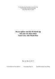
A Feasibility Study for the Establishment of Xuan Lien Nature ...
A Feasibility Study for the Establishment of Xuan Lien Nature ...
A Feasibility Study for the Establishment of Xuan Lien Nature ...

You also want an ePaper? Increase the reach of your titles
YUMPU automatically turns print PDFs into web optimized ePapers that Google loves.
BirdLife International Vietnam Programme<br />
in collaboration with <strong>the</strong><br />
Forest Inventory and Planning Institute<br />
A <strong>Feasibility</strong> <strong>Study</strong> <strong>for</strong> <strong>the</strong> <strong>Establishment</strong> <strong>of</strong><br />
<strong>Xuan</strong> <strong>Lien</strong> <strong>Nature</strong> Reserve,<br />
Thanh Hoa Province, Vietnam.<br />
Conservation Report<br />
Number 7<br />
BirdLife International Danida FIPI
A <strong>Feasibility</strong> <strong>Study</strong> <strong>for</strong> <strong>the</strong> <strong>Establishment</strong> <strong>of</strong><br />
<strong>Xuan</strong> <strong>Lien</strong> <strong>Nature</strong> Reserve,<br />
Thanh Hoa Province,Vietnam<br />
by<br />
Le Trong Trai<br />
Forest Inventory and Planning Institute<br />
with contributions from<br />
Le Van Cham,<br />
Bui Dac Tuyen,<br />
Tran Hieu Minh<br />
and<br />
Tran Quang Ngoc<br />
Forest Inventory and Planning Institute<br />
and<br />
Nguyen Van Sang,<br />
Alexander L. Monastyrskii<br />
and<br />
Jonathan C. Eames<br />
BirdLife International Vietnam Programme<br />
This is a technical report <strong>for</strong> <strong>the</strong> project entitled:<br />
Expanding <strong>the</strong> Protected Areas Network in Vietnam <strong>for</strong> <strong>the</strong> 21 st Century.<br />
Hanoi<br />
June 1999
Project Coordinators: Nguyen Huy Phon<br />
Vu Van Dung<br />
Jonathan C. Eames<br />
Field Survey Team: Le Trong Trai (FIPI)<br />
Le Van Cham (FIPI)<br />
Bui Dac Tuyen (FIPI)<br />
Tran Hieu Minh (FIPI)<br />
Tran Quang Ngoc (FIPI)<br />
Nguyen Van Sang (BirdLife International Vietnam Programme)<br />
Alexander Monastyrskii (BirdLife International Vietnam Programme)<br />
Jonathan C. Eames (BirdLife International Vietnam Programme)<br />
Maps: Mai Ky Vinh (FIPI)<br />
Project Funding: European Union and BirdLife International<br />
Cover Illustration: Thai woman harvesting rice in <strong>the</strong> buffer zone <strong>of</strong> <strong>Xuan</strong> <strong>Lien</strong> proposed nature<br />
reserve. Photo: J. C. Eames<br />
Citation: Le Trong Trai, Le Van Cham, Bui Dac Tuyen, Tran Hieu Minh, Tran Quang<br />
Ngoc, Nguyen Van Sang, Monastyrskii, A. L. and Eames, J. C. (1999) A <strong>Feasibility</strong><br />
<strong>Study</strong> <strong>for</strong> <strong>the</strong> <strong>Establishment</strong> <strong>of</strong> <strong>Xuan</strong> <strong>Lien</strong> <strong>Nature</strong> Reserve, Thanh Hoa<br />
Province, Vietnam. BirdLife International Vietnam Programme, Hanoi<br />
Copies available from: BirdLife International Vietnam Programme<br />
11 Lane 167, Tay Son, Dong Da<br />
Hanoi, Vietnam<br />
Tel/Fax: + (84) 4 851 7217<br />
E-mail: birdlife@netnam.org.vn
Table <strong>of</strong> Contents<br />
Executive Summary vii<br />
Executive Summary in Vietnamese ix<br />
1. Introduction 1<br />
1.1 Geography, Demographics, Economics and Environment 1<br />
1.2 Conservation 1<br />
1.3 Forest in Thanh Hoa Province 2<br />
1.4 <strong>Xuan</strong> <strong>Lien</strong> proposed nature reserve 3<br />
2. Site Features 4<br />
2.1 Biogeography 4<br />
2.2 Location 4<br />
2.3 Topography 4<br />
2.4 Meteorology 4<br />
2.5 Hydrology 5<br />
2.6 Geomorphology 6<br />
2.7 Soil 7<br />
2.8 Flora Overview 7<br />
2.9 Vegetation Types 8<br />
Medium to High Montane Mixed Coniferous and Broadleaf Evergreen Forest 10<br />
Low Montane Broadleaf Evergreen Forest 11<br />
Secondary Forest Types 12<br />
2.10 Mammals 13<br />
Mammal Records 13<br />
2.11 Birds 15<br />
Bird Records 15<br />
Habitat Distribution <strong>of</strong> Bird and Mammal Species 15<br />
Exploitation <strong>of</strong> Mammals and Birds 16<br />
2.12 Herpetiles 16<br />
2.13 Butterflies 17<br />
2.14 Socio-Cultural Features 18<br />
Demographics 18<br />
Economic Activities 19<br />
Infrastructure 20<br />
3. Evaluation 21<br />
3.1 Criteria <strong>for</strong> Evaluating <strong>the</strong> Proposed <strong>Nature</strong> Reserve 21<br />
3.2 Evaluation <strong>of</strong> Biological Factors 22<br />
Biodiversity 22<br />
Habitat 24<br />
Endangered Species 24<br />
Endemism 25<br />
3.3 Evaluation <strong>of</strong> Economic Factors 25<br />
Watershed Protection 25<br />
Soil Conservation 25<br />
Forestry Resources 25<br />
Medicinal and Ornamental Plants 25<br />
Tourism 26<br />
i
ii<br />
3.4 Evaluation <strong>of</strong> Socio-economic Factors 26<br />
Population and Social Conditions 26<br />
Infrastructure 26<br />
4. Management Considerations 27<br />
4.1 Physical Factors 27<br />
4.2 Biological Factors 27<br />
4.3 Socio-cultural Factors 27<br />
5. Management Recommendations 29<br />
5.1 Management Objectives 29<br />
5.2 Management Authority 29<br />
5.3 Proposed Boundary <strong>of</strong> <strong>Xuan</strong> <strong>Lien</strong> <strong>Nature</strong> Reserve 29<br />
Option One 29<br />
Option Two 31<br />
5.4 Management Areas 32<br />
Strict Protection Area 32<br />
Forest Rehabilitation Area 32<br />
5.5 Buffer Zone 33<br />
5.6 Development <strong>of</strong> <strong>Xuan</strong> <strong>Lien</strong> <strong>Nature</strong> Reserve 34<br />
Investment Plan 34<br />
Capital Construction Programme 34<br />
5.7 Future Plan <strong>for</strong> <strong>the</strong> <strong>Establishment</strong> <strong>of</strong> <strong>Xuan</strong> <strong>Lien</strong> <strong>Nature</strong> Reserve 34<br />
5.8 Priority Actions 35<br />
References 36<br />
Appendix 1: Flora Recorded in <strong>Xuan</strong> <strong>Lien</strong> Proposed <strong>Nature</strong> Reserve 38<br />
Appendix 2: Mammals Recorded in <strong>Xuan</strong> <strong>Lien</strong> Proposed <strong>Nature</strong> Reserve 39<br />
Appendix 3: Birds Recorded in <strong>Xuan</strong> <strong>Lien</strong> Proposed <strong>Nature</strong> Reserve 41<br />
Appendix 4: Herpetiles Recorded in <strong>Xuan</strong> <strong>Lien</strong> Proposed <strong>Nature</strong> Reserve 45<br />
Appendix 5: Butterflies Recorded in <strong>Xuan</strong> <strong>Lien</strong> Proposed <strong>Nature</strong> Reserve 47<br />
List <strong>of</strong> Tables<br />
Table 1: Metereological Data from Three Wea<strong>the</strong>r Stations near <strong>Xuan</strong> <strong>Lien</strong> Proposed <strong>Nature</strong> 5<br />
Reserve<br />
Table 2: Hydrological Features <strong>of</strong> <strong>the</strong> Chu River at Bai Thuong Dam 6<br />
Table 3: Floral Diversity <strong>of</strong> <strong>the</strong> <strong>Study</strong> Area 7<br />
Table 4: Globally Threatened Plants Recorded in <strong>the</strong> <strong>Study</strong> Area 8<br />
Table 5: Existing Vegetation Types in <strong>the</strong> <strong>Study</strong> Area 8<br />
Table 6: Composition <strong>of</strong> Mature Trees in Medium to High Montane Mixed Coniferous and 10<br />
Broadleaf Evergreen Forest at 1,200 m<br />
Table 7: Composition <strong>of</strong> Mature Trees in Medium to High Montane Mixed Coniferous and 10<br />
Broadleaf Evergreen Forest at 1,000 m<br />
Table 8: Globally Threatened Mammals Recorded in <strong>the</strong> <strong>Study</strong> Area 14<br />
Table 9: Endemic and Globally Threatened Bird Species Recorded in <strong>the</strong> <strong>Study</strong> Area 15<br />
Table 10: Endemic and Globally Threatened Herpetiles Recorded in <strong>the</strong> <strong>Study</strong> Area 16<br />
Table 11: Herpetile Species with Restricted Habitat Distributions 17<br />
Table 12: Distribution <strong>of</strong> Butterfly Species with respect to Habitat Type 17<br />
Table 13: Conservation Criteria and Evaluation <strong>of</strong> <strong>Xuan</strong> <strong>Lien</strong> Proposed <strong>Nature</strong> Reserve 21<br />
Table 14: Comparison <strong>of</strong> Plant Diversity in <strong>Xuan</strong> <strong>Lien</strong> Proposed <strong>Nature</strong> Reserve with o<strong>the</strong>r 22<br />
Protected Areas in Central Vietnam (Ranked)
Table 15: Comparison <strong>of</strong> Vertebrate Diversity <strong>of</strong> <strong>Xuan</strong> <strong>Lien</strong> Proposed <strong>Nature</strong> Reserve 22<br />
with o<strong>the</strong>r Protected Areas in Central Vietnam (Ranked)<br />
Table 16: Comparison <strong>of</strong> Herpetile Diversity <strong>of</strong> <strong>Xuan</strong> <strong>Lien</strong> Proposed <strong>Nature</strong> Reserve 23<br />
with o<strong>the</strong>r Areas in Nor<strong>the</strong>rn and Central Vietnam (Ranked)<br />
Table 17: Sorenson’s Similarity Index (C S ) comparing Butterfly Species Composition in 23<br />
<strong>Xuan</strong> <strong>Lien</strong> Proposed <strong>Nature</strong> Reserve with those in o<strong>the</strong>r Protected Areas in Nor<strong>the</strong>rn<br />
and Central Vietnam<br />
Table 18: Number <strong>of</strong> Nationally and Globally Threatened Species in <strong>the</strong> <strong>Study</strong> Area 24<br />
Table 19: Distribution <strong>of</strong> Threatened and Near-threatened Bird Species in Protected Areas in 24<br />
Thanh Hoa and Nghe An Provinces<br />
Table 20: Management Regime <strong>for</strong> <strong>the</strong> Strict Protection Area 32<br />
List <strong>of</strong> Maps<br />
Map 1: Location <strong>of</strong> <strong>Xuan</strong> <strong>Lien</strong> Proposed <strong>Nature</strong> Reserve vi<br />
Map 2: Land-use in <strong>Xuan</strong> <strong>Lien</strong> Proposed <strong>Nature</strong> Reserve 9<br />
Map 3: Proposed Boundary <strong>of</strong> <strong>Xuan</strong> <strong>Lien</strong> <strong>Nature</strong> Reserve 30<br />
iii
iv<br />
Acknowledgements<br />
The authors would like to gratefully thank <strong>the</strong> European Union and BirdLife International <strong>for</strong> <strong>the</strong><br />
financial assistance that made this study possible.<br />
During <strong>the</strong> implementation <strong>of</strong> <strong>the</strong> project, <strong>the</strong> authors have enjoyed <strong>the</strong> support <strong>of</strong>, and <strong>the</strong> opportunity<br />
to collaborate with, many agencies and individuals. We would like to take this opportunity to express<br />
our sincerest thanks to <strong>the</strong>se agencies and individuals.<br />
We particularly wish to convey our gratitude to <strong>the</strong> Ministry <strong>of</strong> Agriculture and Rural Development<br />
(MARD), especially Pr<strong>of</strong> Dr Nguyen Quang Ha, Vice Minister <strong>of</strong> MARD, Mr Nguyen Cat Giao,<br />
<strong>for</strong>mer Director, and Mr Nguyen Khac Huong, Deputy Director <strong>of</strong> <strong>the</strong> International Cooperation<br />
Department, and Mr Nguyen Ba Thu, Director <strong>of</strong> <strong>the</strong> Forest Protection Department (FPD). Special<br />
thanks are also due to Mr Nguyen Mong Giao and Mr Tran Quoc Bao, <strong>of</strong>ficials <strong>of</strong> <strong>the</strong> Protection<br />
Forests and <strong>Nature</strong> Conservation Section <strong>of</strong> FPD.<br />
We are also grateful to Dr Le Sau, Director <strong>of</strong> <strong>the</strong> Forest Inventory and Planning Institute (FIPI) and<br />
Mr Nguyen Huu Dong, Director <strong>of</strong> <strong>the</strong> Forest Resources and Environment Centre (FREC) <strong>of</strong> FIPI.<br />
Sincere thanks are also expressed to Associated Dr Nguyen Huy Phon, Deputy Director <strong>of</strong> FIPI, and<br />
Mr Vu Van Dung, Deputy Director <strong>of</strong> FREC, who have directly guided <strong>the</strong> project activities, stipulated<br />
<strong>the</strong> implementation process and made comments on <strong>the</strong> project report.<br />
In Thanh Hoa province, we sincerely thank <strong>the</strong> leaders <strong>of</strong> <strong>the</strong> provincial people’s committee. Particular<br />
thanks are also conveyed to Mr Hoang Cao Trai, Deputy Director <strong>of</strong> <strong>the</strong> provincial FPD, and Mr Le<br />
The Long, Head <strong>of</strong> <strong>the</strong> Forest Protection and Management Section <strong>of</strong> <strong>the</strong> provincial FPD. We are also<br />
grateful to Mr Nguyen Van Mia and all staff <strong>of</strong> <strong>the</strong> FPD <strong>of</strong> Thuong <strong>Xuan</strong> district who participated in<br />
<strong>the</strong> collection <strong>of</strong> data. Sincere thanks are also due to Mr Vi Mai Ke, Chairman <strong>of</strong> Thuong <strong>Xuan</strong> district<br />
who created favourable conditions <strong>for</strong> <strong>the</strong> mission during <strong>the</strong> survey and <strong>for</strong> <strong>the</strong> collection <strong>of</strong> socioeconomic<br />
data <strong>for</strong> <strong>the</strong> district and communes in <strong>the</strong> area.<br />
We also would like to take this opportunity to express our sincere thanks to <strong>the</strong> <strong>of</strong>ficers and soldiers at<br />
border army station 505, Bat Mot commune, Thuong <strong>Xuan</strong> district, who assisted <strong>the</strong> team in <strong>the</strong><br />
survey <strong>of</strong> <strong>for</strong>est areas managed by <strong>the</strong> post.<br />
We would finally like to thank Paul Lloyd and David Wege <strong>for</strong> <strong>the</strong>ir assistance in editing earlier drafts<br />
<strong>of</strong> this report.
Conventions Used<br />
Plant names, sequence and species limits follow Pham Hoang Ho (1991). Mammal names (common<br />
and scientific), sequence and species limits follow Corbet and Hill (1992), with scientific names given<br />
at first mention and in Appendix 2. Bird names (common and scientific), sequence and species limits<br />
follow Inskipp et al. (1996), with scientific names given at first mention and in Appendix 3. Herpetile<br />
names, sequence and species limits follow Nguyen Van Sang and Ho Thu Cuc (1996). Butterfly names,<br />
sequence and species limits follow Corbet et al. (1992), Pinratana (1977-1988) and o<strong>the</strong>r, more recently<br />
published, literature.<br />
Diacritical marks are omitted from Vietnamese names due to typographical limitations and <strong>the</strong> restricted<br />
understanding <strong>of</strong> international readers.<br />
Locality names follow <strong>the</strong> Department <strong>of</strong> Cartography 1:50,000 series maps (1978).<br />
A globally threatened species is any species assigned a category <strong>of</strong> threat in <strong>the</strong> IUCN Red Lists <strong>of</strong><br />
Threatened Animals and Plants (IUCN 1996 and 1997); <strong>the</strong> term excludes species listed as Nearthreatened,<br />
Data Deficient or Insufficiently Known.<br />
Indochina refers to <strong>the</strong> biogeographic region <strong>of</strong> Cambodia, Laos, Myanmar, Thailand and Vietnam.<br />
The study area refers to <strong>Xuan</strong> <strong>Lien</strong> proposed nature reserve, Thuong <strong>Xuan</strong> district, Thanh Hoa province.<br />
Abbreviations and Acronyms Used<br />
EU - European Union<br />
FIPI - Forest Inventory and Planning Institute, Hanoi<br />
FPD - Forest Protection Department<br />
FREC - Forest Resources and Environment Centre <strong>of</strong> FIPI<br />
GNP - Gross National Product<br />
IUCN - World Conservation Union<br />
MARD - Ministry <strong>of</strong> Agriculture and Rural Development<br />
MPI - Ministry <strong>of</strong> Planning and Investment<br />
Disclaimer<br />
This report does not contain any endorsement by <strong>the</strong> authors, BirdLife International, FIPI or <strong>the</strong><br />
European Union, ei<strong>the</strong>r implied or o<strong>the</strong>rwise, <strong>of</strong> <strong>the</strong> proposal to establish <strong>the</strong> Cua Dat hydroelectric<br />
dam and reservoir.<br />
v
vi<br />
Map 1: Location <strong>of</strong> <strong>Xuan</strong> <strong>Lien</strong> Proposed <strong>Nature</strong> Reserve<br />
Map based on field survey in 1998<br />
Grid: UTM, zone 48; units: metric<br />
SCALE: 1:2,000,000<br />
LEGEND<br />
Vietnam / Lao Border<br />
Provincial Border<br />
Road<br />
River<br />
<strong>Xuan</strong> <strong>Lien</strong> <strong>Nature</strong> Reserve<br />
Protected Area<br />
Produced by <strong>the</strong> Forest Resources<br />
and Environment Centre <strong>of</strong> FIPI
Executive Summary<br />
This report is an expanded translation <strong>of</strong> a feasibility study <strong>for</strong> <strong>the</strong> establishment <strong>of</strong> <strong>Xuan</strong> <strong>Lien</strong> proposed<br />
nature reserve, Thanh Hoa province, originally published in Vietnamese in December 1998 by <strong>the</strong><br />
Forest Inventory and Planning Institute (FIPI) in collaboration with BirdLife International. The objectives<br />
<strong>of</strong> <strong>the</strong> original report were to assess <strong>the</strong> biological and economic value <strong>of</strong> <strong>Xuan</strong> <strong>Lien</strong>, and <strong>the</strong> feasibility<br />
<strong>of</strong> establishing a nature reserve in <strong>the</strong> area. The objective <strong>of</strong> this report is to provide a higher level <strong>of</strong><br />
detail <strong>for</strong> an international audience interested in <strong>Xuan</strong> <strong>Lien</strong> proposed nature reserve.<br />
Within <strong>the</strong> framework <strong>of</strong> <strong>the</strong> European Union funded project entitled “Expanding <strong>the</strong> protected areas<br />
network in Vietnam <strong>for</strong> <strong>the</strong> 21 st Century”, a biodiversity and socio-economic survey <strong>of</strong> south-western<br />
Thuong <strong>Xuan</strong> district, Thanh Hoa Province was carried out in October and November 1998 by FIPI<br />
and BirdLife International. The results <strong>of</strong> <strong>the</strong> survey were used to produce a feasibility study <strong>for</strong> <strong>the</strong><br />
establishment <strong>of</strong> <strong>Xuan</strong> <strong>Lien</strong> <strong>Nature</strong> Reserve<br />
The survey revealed moderate levels <strong>of</strong> biodiversity relative to o<strong>the</strong>r protected areas in nor<strong>the</strong>rn and<br />
central Vietnam. In total, 560 plant species, 38 species <strong>of</strong> mammals, 134 species <strong>of</strong> birds, 53 species <strong>of</strong><br />
herpetiles and 143 species <strong>of</strong> butterflies were found. Several <strong>of</strong> <strong>the</strong>se species are globally threatened,<br />
including six species <strong>of</strong> plant, 10 species <strong>of</strong> mammal, two species <strong>of</strong> bird and one species <strong>of</strong> herpetile.<br />
The survey was undertaken during <strong>the</strong> autumn when activity levels amongst birds and butterflies are<br />
depressed. This may have resulted in <strong>the</strong> species richness <strong>of</strong> <strong>the</strong>se groups being under-recorded. Future<br />
surveys should be undertaken during <strong>the</strong> spring, which is <strong>the</strong> peak season <strong>for</strong> bird and butterfly activity.<br />
<strong>Xuan</strong> <strong>Lien</strong> proposed nature reserve supports four plant species endemic to Vietnam (Cinnamomum<br />
balansae, Colona poilanei, Croton bonianus and Macaranga balansae), two bird species endemic to<br />
Vietnam and Laos (Red-vented Barbet Megalaima lagrandieri and Short-tailed Scimitar Babbler<br />
Jabouilleia danjoui) and one amphibian species endemic to Vietnam (Rana microlineata). Ten endemic<br />
species <strong>of</strong> butterflies were recorded, concentrated in two families: <strong>the</strong> Satyridae and Amathusiidae.<br />
Large mammals recorded in <strong>the</strong> area included Tiger Pan<strong>the</strong>ra tigris, Gaur Bos gaurus, Asiatic Black<br />
Bear Ursus thibetanus and Sun Bear U. malayanus, although populations <strong>of</strong> many <strong>of</strong> <strong>the</strong>se species are<br />
small and fragmented as a result <strong>of</strong> high hunting pressure. Fur<strong>the</strong>rmore, it is unlikely that <strong>Xuan</strong> <strong>Lien</strong><br />
proposed nature reserve is large enough, by itself, to maintain viable populations <strong>of</strong> <strong>the</strong>se species.<br />
However, <strong>Xuan</strong> <strong>Lien</strong> is contiguous with Pu Hoat proposed nature reserve in Nghe An province, with a<br />
shared boundary <strong>of</strong> 20 km and a combined protected area coverage <strong>of</strong> 90,841 ha.<br />
One <strong>of</strong> <strong>the</strong> most significant results <strong>of</strong> <strong>the</strong> survey was <strong>the</strong> rediscovery <strong>of</strong> Roosevelt’s Muntjac Muntiacus<br />
rooseveltorum. This was <strong>the</strong> first time this species has been recorded since its discovery in Laos 69 years<br />
previously, and also <strong>the</strong> first time that this species has been recorded in Vietnam. Fur<strong>the</strong>rmore, <strong>the</strong><br />
survey revealed one recently discovered butterfly species (Ypthima sp. nov.), along with six new species<br />
<strong>for</strong> Vietnam.<br />
As a result <strong>of</strong> <strong>the</strong> survey, two boundary options <strong>for</strong> <strong>Xuan</strong> <strong>Lien</strong> <strong>Nature</strong> Reserve were discussed at a<br />
workshop held in Thanh Hoa province in February 1999. Under option one, 16,500 ha would be<br />
included within <strong>the</strong> boundary <strong>of</strong> <strong>the</strong> nature reserve, whilst, under option two, 23,610 ha would be<br />
included, <strong>of</strong> which 18,522 ha would comprise <strong>for</strong>est <strong>of</strong> various types. Under nei<strong>the</strong>r <strong>of</strong> <strong>the</strong> options<br />
would <strong>the</strong> nature reserve contain any human settlement or permanent agricultural land. At <strong>the</strong> workshop,<br />
option two was decided upon.<br />
The survey results indicate that, apart from <strong>the</strong> occurance <strong>of</strong> Roosevelt’s Muntjac at this site, <strong>Xuan</strong> <strong>Lien</strong><br />
vii
proposed nature reserve has low conservation importance relative to o<strong>the</strong>r sites in Thanh Hoa province<br />
and elsewhere in central Vietnam. Thanh Hoa Provincial People’s Committee should allocate <strong>the</strong> limited<br />
resources available to <strong>the</strong>m <strong>for</strong> protected area establishment and management on <strong>the</strong> basis <strong>of</strong> <strong>the</strong> global<br />
conservation importance <strong>of</strong> each site. Areas <strong>of</strong> <strong>for</strong>est supporting potentially viable populations <strong>of</strong> globally<br />
threatened primates, particularly areas supporting <strong>the</strong> Critically Endangered Delacour’s Langur<br />
(Semnopi<strong>the</strong>cus francoisi delacouri), such as Pu Luong proposed nature reserve and an area to <strong>the</strong> west<br />
<strong>of</strong> Cuc Phuong National Park, are higher priorities <strong>for</strong> conservation (F. Momberg verbally).<br />
If <strong>the</strong> project to construct a hydroelectric dam at Cua Dat goes ahead, <strong>the</strong> resulting reservoir will<br />
inundate 1,716 ha within <strong>the</strong> proposed nature reserve. The decision on whe<strong>the</strong>r or not to proceed with<br />
<strong>the</strong> Cua Dat dam should only be taken after a thorough and pr<strong>of</strong>essionally conducted Environmental<br />
Impact Assessment has been undertaken.<br />
viii
Toùm taét döï aùn<br />
Baœn baùo caùo nghieân cöùu tính khaœ thi thaønh laäp Khu baœo toàn Thieân nhieân Xuaân Lieân, tænh<br />
Thanh Hoùa ñöôïc Vieän Ñieàu tra quy hoaïch röøng (FIPI) phoái hôïp vôùi toå chöùc BirdLife<br />
International taïi Vieät Nam cuøng bieân soaïn baèng tieáng Vieät vaøo thaùng 12 naêm 1998. Mucï ñích<br />
cuœa baœn baùo caùo goác nhaèm ñaùnh giaù giaù trò sinh hoïc, kinh teá cuœa khu vöïc Xuaân Lieân vaø tính<br />
khaœ thi thaønh laäp khu Baœo toàn Thieân nhieân trong vuøng. Muïc ñích cuœa baœn baùo caùo naøy<br />
nhaèm cung caáp nhöõng thoâng tin chi tieát cho caùc ñoäc giaœ Quoác teá quan taâm ñeán khu Baœo toán<br />
Thieân nhieân döï kieán Xuaân Lieân.<br />
Trong khuoân khoå döï aùn ñöôïc taøi trôï cuœa Coäng ñoàng chaâu AÂu mang teân “Môœ roäng heä thoáng<br />
röøng ñaëc duïng ôœ Vieät Nam cho <strong>the</strong>á kyœ 21”, moät ñôït khaœo saùt ña daïng sinh hoïc vaø daân sinhkinh<br />
teá ôœ phía taây baéc huyeän Tröôøng Xuaân, tænh Thanh Hoùa ñaõ ñöôïc FIPI vaø toå chöùc BirdLife<br />
International tieán haønh vaøo thaùng 10 vaø thaùng 11 naêm 1998. Keát quaœ cuœa ñôït khaœo saùt ñöôïc<br />
söœ duïng xaây döïng baùo caùo nghieân cöùu khaœ thi khu Baœo toàn Thieân nhieân Xuaân Lieân.<br />
Keát quaœ khaœo saùt naøy cho thaáy möùc trung bình cuœa tính ña daïng sinh hoïc cuœa khu vöïc so<br />
saùnh vôùi caùc khu baœo veä khaùc ôœ mieàn Baéc vaø mieàn Trung Vieät Nam. Toång soá coù 560 loaøi<br />
thöïc vaät, 39 loaøi ñoäng vaät, 134 loaøi chim, 53 loaøi eách, nhaùi, boø saùt, 143 loaøi böôùm ñaõ ghi<br />
nhaän ñöôïc.<br />
Ñaõ ghi nhaän moät soá loaøi ñang bò ñe doïa mang tính toaøn caàu, bao goàm coù 6 loaøi thöïc vaät, 10<br />
loaøi thuù, 2 loaøi chim vaø 1 loaøi boø saùt. Tuy vaäy ñôït khaœo saùt ñöôïc tieán haønh trong muøa thu<br />
neân möùc ñoä hoaït ñoäng cuœa caùc loaøi chim vaø caùc loaøi böôùm giaœm xuoáng . Ñieàu naøy daãn ñeán<br />
soá lieäu veà söï phong phuù bò thieáu huït .Caùc cuoäc khaœo saùt trong töông lai caàn ñöôïc tieán haønh<br />
giöõa muøa xuaân khi hoaït ñoäng cuœa caùc loaøi böôùm vaø chim ñaït ñænh ñieååm.<br />
Tính ñaëc höõu cuœa khu Baœo toàn Thieân nhieân Xuaân Lieân ôœ möùc ñoä trung bình: 4 loaøi thöïc vaät<br />
ñaëc höõu ( Cinnamomum balansae, Colona poilanei, Croton bonianus, Macaranga balansae),<br />
hai loaøi chim ñaëc höõu ( Megalaima lagrandieri, Jabouilleia danjoui ) vaø moät loaøi eách nhaùi ñaëc<br />
höõu ( Rana microlineata) ñaõ ñöôïc phaùt hieän.Möôøi loaøi böôùm ñaëc höõu ñaõ ñöôïc ghi nhaän, taäp<br />
trung vaøo hai hoï: Satyridae, Amthsiidae.<br />
Caùc loaøi thuù lôùn ñöôïc ghi nhaän trong khu bao goàm Hoå Pan<strong>the</strong>ra tigris, loaøi boø Toùt Bos<br />
gaurus, loaøi Gaáu ngöïa Ursus thibetanus vaø loaøi Gaáu Choù U. malayanus, maëc duø quaàn <strong>the</strong>å cuœa<br />
caùc loaøi naøy raát nhoœ vaø chia caét do aùp löïc cuœa saên baét. Hôn nöõa, khu Xuaân Lieân gaàn vôùi khu<br />
Baœo toàn Thieân nhieân döï kieán Puø Hoaït thuoäc tænh Ngheä An, coù chung 20 km ñöôøng ranh giôùi<br />
vaø toång dieän tích cuœa hai khu laø 90,841 ha.<br />
Moät trong nhöõng keát quaœ quan troïng thu ñöôïc töø ñôït khaœo saùt laø phaùt hieän loaøi Mang<br />
Roosevelt Muntiacus rooseveltorum. Loaøi naøy laàn ñaàu tieân ñöôïc phaùt hieän taïi Laøo caùch ñaây<br />
69 naêm, nhö vaäy ñaây laø laàn ñaàu tieân chuùng ñöôïc phaùt hieän ôœ Vieät Nam. Phaùt hieän naøy coù<br />
yù nghóa to lôùn ñoái vôùi khoa hoïc hôn nöõa, keát quaœ khaœo saùt cuõng ñaõ ghi nhaän moät loaøi böôùm<br />
vöøa môùi ñöôïc phaùt hieän ôœ Vieät Nam (Ypthima sp.nova), cuøng vôùi 6 loaøi ghi nhaän môùi cho<br />
Vieät Nam.<br />
Vôùi keát quaœ khaœo saùt ñaõ ñeà xuaát hai phöông aùn löïa choïn ranh giôùi cho khu Baœo toàn Thieân<br />
nhieân Xuaân Lieân. Hai phöông aùn naøy ñaõ ñöôïc thaœo luaän taïi cuoäc hoäi thaœo thaùng 2 naêm 1999<br />
taïi tænh Thanh Hoùa. Dieän tích ranh giôùi khu Baœo toàn Thieân nhieân <strong>the</strong>o löïa choïn 1 laø 16.500<br />
ha, <strong>the</strong>o löïa choïn 2 laø 23.610 ha, bao goàm 18.522 ha röøng caùc loaïi. Caœ hai giaœi phaùp trong<br />
khu baœo toàn khoâng coù khu daân cö vaø ñaát noâng nghieäp. Löïa choïn 2 ñaõ ñöôïc öu tieân, löïa<br />
choïn vaø thoâng qua taïi hoäi thaœo naøy.<br />
Keát quaœ khaœo saùt chæ ra raèng, beân caïnh vieäc phaùt hieän loaøi Mang Roosevelt coù yù nghóa lôùn<br />
ix
lao, khu Baœo toàn Thieân nhieân döï kieán Xuaân Lieân coù giaù trò baœo toàn ôœ caáp trung bình so vôùi<br />
caùc khu vöïc khaùc cuœa Thanh Hoùa cuõng nhö mieàn Trung Vieät Nam. UŒy ban nhaân daân tænh<br />
Thanh Hoaù neân caân ñoái nguoàn kinh phí haïn heïp moät caùch hôïp lyù cho vieäc thaønh laäp vaø<br />
quaœn lyù caùc khu Baœo toàn treân cô sôœ öu tieân cho nhöõng khu coù taàm quan troïng baœo toàn toaøn<br />
caàu. Chaúng haïn khu Baœo toàn Thieân nhieân döï kieán Puø Luoâng vaø vuøng ôœ phiaù Taây cuœa vöôøn<br />
quoác gia Cuùc Phöông laø nôi cö truù cuœa quaàn <strong>the</strong>å linh tröôœng bò ñe doïa toaøn caàu, cuï <strong>the</strong>å ñoái<br />
vôùi loaøi Vooïc quaàn ñuøi bò ñe doïa nghieäm troïng (Semnopi<strong>the</strong>cus francoisi delacouri). Ñaây laø<br />
nhöõng nôi giöõ vò trí öu tieân haøng ñaàu cho coâng taùc baœo toàn (<strong>the</strong>o lôøi cuœa OÂng F. Momberg).<br />
Neáu döï aùn xaây döïng ñaäp thuœy ñieän Cöœa Ñaït ñöôïc thöïc hieän, keát quaœ hoà chöùa seõ laøm ngaäp<br />
1717 ha thuoäc khu Baœo toàn Thieân nhieân döï kieán. Vieäc quyeát ñònh thi coâng ñaäp Cöœa Ñaït hay<br />
khoâng caàn phaœi döïa treân cô sôœ quaù trình Ñaùnh giaù Taùc ñoäng Moâi tröôøng.<br />
x
1. Introduction<br />
1.1 Geography, Demographics, Economics and Environment<br />
Geography. The Socialist Republic <strong>of</strong> Vietnam is a relatively narrow strip running north-south along<br />
<strong>the</strong> eastern coast <strong>of</strong> <strong>the</strong> Indochinese Peninsula. With a 3,000 km coastline, Vietnam extends from<br />
23°37.5' to 8°00.5’N. It is approximately 525 km across at its widest point and 47 km across at its<br />
narrowest point. Vietnam’s total land area is 331,689 km 2 . Mountain ranges extend along Vietnam’s<br />
border with <strong>the</strong> People’s Republic <strong>of</strong> China in <strong>the</strong> north, and along <strong>the</strong> borders with <strong>the</strong> Lao People’s<br />
Democratic Republic and <strong>the</strong> Kingdom <strong>of</strong> Cambodia in <strong>the</strong> west. The highest point is Mount Fan Si<br />
Pan in <strong>the</strong> far north at 3,143 m, although average mountain altitudes are around 1,000 m. Vietnam is<br />
topographically complex with <strong>the</strong> exception <strong>of</strong> <strong>the</strong> narrow, coastal lowlands <strong>of</strong> <strong>the</strong> central region and<br />
<strong>the</strong> sou<strong>the</strong>rn Mekong Delta region.<br />
Demographics. The population <strong>of</strong> Vietnam is approximately 77 million people (1998) with a growth<br />
rate <strong>of</strong> 2.3% (at this rate, <strong>the</strong> population will double in 32 years time). The country is comprised <strong>of</strong> 61<br />
provinces with 570 urban centres. Eighty percent <strong>of</strong> <strong>the</strong> population live in rural areas. Two cities have<br />
over 1 million inhabitants: Ho Chi Minh City (<strong>for</strong>merly Saigon) and Hanoi, <strong>the</strong> capital. Literacy rates<br />
are high: 93% <strong>for</strong> males and 83% <strong>for</strong> females. Life expectancy is 62 years <strong>for</strong> males and 67 years <strong>for</strong><br />
females (Pham Ngoc Dang 1998).<br />
Economics. Vietnam is currently undergoing an economic transition towards a more open economy.<br />
Vietnam’s annual per capita gross national product (GNP) is about US$250 (World Bank 1997). GNP<br />
has been growing rapidly <strong>for</strong> <strong>the</strong> past decade. Vietnam’s leading exports in order <strong>of</strong> contribution to<br />
GNP are crude oil, coal, rice, c<strong>of</strong>fee, textiles, marine products, shoes, tea, cashew nuts and rubber. It is<br />
<strong>the</strong> world’s third largest rice exporter and <strong>the</strong> fifth largest c<strong>of</strong>fee exporter.<br />
Environment. Economic growth, infrastructure development, population growth, protracted wars,<br />
and <strong>the</strong> development <strong>of</strong> agriculture, <strong>for</strong>estry and fishing industries have resulted in over-exploitation <strong>of</strong><br />
Vietnam’s natural resources. The environment in Vietnam has largely been compromised; <strong>for</strong>est cover<br />
is estimated at less than 20% <strong>of</strong> <strong>the</strong> country’s total land area (less than 10% primary <strong>for</strong>est) (Vo Quy<br />
1998). Over <strong>the</strong> last two decades, <strong>the</strong>re has been an average reduction <strong>of</strong> <strong>for</strong>est by 350,000 ha per year<br />
(Vo Quy 1998). Gross de<strong>for</strong>estation has been accompanied by degradation <strong>of</strong> arable land, soil erosion,<br />
destruction <strong>of</strong> water catchments, diminished groundwater sources, siltation and ecological degradation<br />
<strong>of</strong> coastal and submerged areas, and a loss <strong>of</strong> overall biodiversity within Vietnam.<br />
1.2 Conservation<br />
The Government <strong>of</strong> Vietnam recognised <strong>the</strong> necessity <strong>for</strong> conserving and rehabilitating <strong>the</strong> natural<br />
environment at <strong>the</strong> end <strong>of</strong> <strong>the</strong> 1970s. Its first priority was to provide areas <strong>for</strong> settling war veterans. The<br />
second priority was chemical detoxification and remediation <strong>for</strong> human resettlement <strong>of</strong> areas affected<br />
by chemical defoliants. The third priority was given to re<strong>for</strong>estation, establishing reserves and <strong>the</strong><br />
conversion <strong>of</strong> <strong>for</strong>ests into cultivated land (MOF 1991a). Only in <strong>the</strong> 1990s has <strong>the</strong> conservation emphasis<br />
moved towards protecting endangered habitats and species.<br />
Vietnam’s <strong>for</strong>ests are divided into three categories (MOF 1991a,b):<br />
(a) Production Forests. These are <strong>for</strong>ested areas which can be allocated to any organisation or<br />
individual (with management requirements and harvesting regulations) <strong>for</strong> domestic<br />
commercial timber needs as stipulated in Vietnam’s Forestry Law, Articles 28-34;<br />
1
Section 1 - Introduction<br />
2<br />
(b) Watershed Protection Forests. These <strong>for</strong>ested areas can be allocated to <strong>for</strong>estry agencies,<br />
people’s committees, or to <strong>the</strong> people directly, with <strong>the</strong> main purposes <strong>of</strong> watershed<br />
protection, soil erosion control and <strong>for</strong>eshore protection with special provisions as per<br />
Articles 35-37; and<br />
(c) Special-use Forests. These are <strong>for</strong>ested lands allocated <strong>for</strong> environment conservation, tourism,<br />
educational purposes, national defence, and o<strong>the</strong>r special uses. These lands can be allocated<br />
to organisations and agencies in <strong>the</strong> state <strong>for</strong>estry sector which are expected to generate<br />
revenues outside <strong>of</strong> <strong>the</strong> strict preservation areas and follow management procedures as per<br />
Articles 39-41. Special-use Forests are fur<strong>the</strong>r subdivided into:<br />
(i) Cultural and Historical Sites to preserve and maintain areas <strong>of</strong> national and cultural<br />
interest and importance;<br />
(ii) <strong>Nature</strong> Reserves intended to preserve all representative <strong>for</strong>est types and to conserve<br />
biodiversity; and<br />
(iii) National Parks to protect and conserve all major types <strong>of</strong> wildlife and habitat types<br />
found within <strong>of</strong> Vietnam.<br />
Vietnam currently has proposals <strong>for</strong> 105 protected areas, comprising 976,000 ha or 3% <strong>of</strong> <strong>the</strong> total<br />
land area. Under Special-use Forest classification <strong>the</strong>re are 10 national parks, 61 nature reserves, and 34<br />
cultural <strong>of</strong> historical sites (Dang Huy Huynh 1998). Vietnam is actively gazetting new sites as part <strong>of</strong> its<br />
treaty obligations under <strong>the</strong> Convention on Biological Diversity. Under this treaty, Vietnam has agreed<br />
to increase its protected area system to 2,000,000 ha by <strong>the</strong> year 2000, <strong>the</strong>reby doubling its network <strong>of</strong><br />
Special-use Forests.<br />
Vietnam supports approximately 275 mammal species, 826 bird species, 260 reptile species, 82 amphibian<br />
species, 500 freshwater fish species, 2,000 marine fish species and 12,000 plant species (Dang Huy<br />
Huynh 1998, MacKinnon 1996).<br />
1.3 Forest in Thanh Hoa Province<br />
The natural vegetation <strong>of</strong> Thanh Hoa province is semi-evergreen rain<strong>for</strong>est in <strong>the</strong> lowlands in <strong>the</strong> east<br />
and centre <strong>of</strong> <strong>the</strong> province, with sub-montane dry evergreen <strong>for</strong>est in <strong>the</strong> mountains in <strong>the</strong> west<br />
(MacKinnon 1996). A thin belt <strong>of</strong> limestone <strong>for</strong>est runs across <strong>the</strong> north <strong>of</strong> <strong>the</strong> province, along <strong>the</strong><br />
borders with Ninh Binh and Hoa Binh provinces.<br />
In Thanh Hoa province, <strong>for</strong>est cover originally stretched from <strong>the</strong> coastal plains to <strong>the</strong> border with<br />
Laos. However, <strong>the</strong> coastal plains were almost entirely de<strong>for</strong>ested prior to 1945 to make way <strong>for</strong> wet rice<br />
cultivation. Since <strong>the</strong>n, <strong>the</strong>re has been a gradual erosion <strong>of</strong> <strong>for</strong>est in <strong>the</strong> foothills and mountains in <strong>the</strong><br />
centre and west <strong>of</strong> <strong>the</strong> province, as a result <strong>of</strong> shifting cultivation, commercial logging activities and<br />
resettlement <strong>of</strong> people from <strong>the</strong> lowlands. Between 1983 and 1995, 95,000 ha <strong>of</strong> <strong>for</strong>est was lost, at a<br />
rate <strong>of</strong> 8,000 ha per year (unpublished data from <strong>the</strong> Forest Inventory and Planning Institute (FIPI)).<br />
In <strong>the</strong> foothills, remaining <strong>for</strong>est areas are fragmented. However, large areas <strong>of</strong> continuous <strong>for</strong>est cover<br />
remain in <strong>the</strong> mountains close to <strong>the</strong> border with Laos.<br />
The current and proposed system <strong>of</strong> Special-use Forests in Thanh Hoa province includes Ben En National<br />
Park, in <strong>the</strong> south-east <strong>of</strong> <strong>the</strong> province, which covers 16,634 ha. Three proposed nature reserves in <strong>the</strong><br />
west <strong>of</strong> <strong>the</strong> province, Pu Luong, Pu Hu and <strong>Xuan</strong> <strong>Lien</strong>, cover a fur<strong>the</strong>r 56,857 ha. Additionally, limestone
Section 1 - Introduction<br />
<strong>for</strong>est areas in <strong>the</strong> north <strong>of</strong> <strong>the</strong> province are protected by Cuc Phuong National Park, which extends<br />
across three provinces: Thanh Hoa, Ninh Binh and Hoa Binh (Map 1).<br />
1.4 <strong>Xuan</strong> <strong>Lien</strong> proposed nature reserve<br />
Forests in <strong>the</strong> west <strong>of</strong> Thanh Hoa and Nghe An provinces protect <strong>the</strong> watershed <strong>of</strong> <strong>the</strong> Chu River, <strong>the</strong><br />
second largest river in Thanh Hoa province. These <strong>for</strong>ests include Pu Hoat proposed nature reserve in<br />
Que Phong district, Nghe An province, and areas in south-west Thuong <strong>Xuan</strong> district, Thanh Hoa<br />
province. In 1996, <strong>the</strong> Asian Development Bank provided assistance to plan <strong>for</strong> <strong>the</strong> protection <strong>of</strong> <strong>the</strong><br />
western catchment <strong>of</strong> <strong>the</strong> Chu River. In 1997, Thanh Hoa Provincial Forest Protection Department<br />
(FPD) submitted a proposal to <strong>the</strong> Ministry <strong>of</strong> Agriculture and Rural Development (MARD) to include<br />
<strong>the</strong> upstream area <strong>of</strong> <strong>the</strong> Chu River catchment in Thuong <strong>Xuan</strong> district, Thanh Hoa province in Vietnam’s<br />
system <strong>of</strong> Special-use Forests as <strong>Xuan</strong> <strong>Lien</strong> <strong>Nature</strong> Reserve.<br />
In October and November 1998, FIPI and <strong>the</strong> BirdLife International Vietnam Programme, in<br />
coordination with Thanh Hoa Provincial FPD, carried out a field survey <strong>of</strong> <strong>Xuan</strong> <strong>Lien</strong> proposed nature<br />
reserve as part <strong>of</strong> <strong>the</strong> EU-funded project “Expanding <strong>the</strong> Protected Areas Network in Vietnam <strong>for</strong> <strong>the</strong><br />
21 st Century”. Data on <strong>the</strong> biodiversity, population and economic conditions in <strong>the</strong> area were collected,<br />
and two potential boundaries <strong>for</strong> <strong>the</strong> proposed nature reserve were identified. The data was used to<br />
prepare this feasibility study.<br />
This feasibility study is <strong>the</strong> initial step in <strong>the</strong> process to <strong>for</strong>mally establish <strong>Xuan</strong> <strong>Lien</strong> <strong>Nature</strong> Reserve,<br />
Thanh Hoa province. This report is an English translation <strong>of</strong> <strong>the</strong> original feasibility study, which was<br />
published in Vietnamese in December 1998.<br />
3
4<br />
2. Site Features<br />
2.1 Biogeography<br />
According to <strong>the</strong> classification <strong>of</strong> MacKinnon (1996), <strong>Xuan</strong> <strong>Lien</strong> proposed nature reserve is located in<br />
sub-unit 10b (North Indochina) <strong>of</strong> <strong>the</strong> Indo-Chinese sub-region; and, according to <strong>the</strong> classification <strong>of</strong><br />
Wikramanayake et al. (1997), <strong>the</strong> proposed nature reserve is situated within <strong>the</strong> Nor<strong>the</strong>rn Indochina<br />
Subtropical Forests Ecoregion.<br />
2.2 Location<br />
<strong>Xuan</strong> <strong>Lien</strong> proposed nature reserve is located in Thuong <strong>Xuan</strong> district, Thanh Hoa province, and is<br />
bounded by <strong>the</strong> coordinates 19°52' to 20°02'N and 104°58' to 105°15'E (Map 1). The proposed<br />
nature reserve includes all or part <strong>of</strong> six communes: Bat Mot, Yen Nhan, <strong>Xuan</strong> Khao, <strong>Xuan</strong> <strong>Lien</strong>, <strong>Xuan</strong> My<br />
and Van <strong>Xuan</strong>.<br />
The proposed nature reserve is bordered by <strong>the</strong> Cao River to <strong>the</strong> north, <strong>the</strong> provincial border with<br />
Nghe An to <strong>the</strong> south and west, and <strong>the</strong> Ta Leo and Bu Khong mountains and <strong>the</strong> confluence <strong>of</strong> <strong>the</strong><br />
Cao and Chu Rivers to <strong>the</strong> east.<br />
2.3 Topography<br />
The proposed nature reserve is situated in a belt <strong>of</strong> mountains running from Sam Neua in Laos to<br />
Thuong <strong>Xuan</strong> and Nhu <strong>Xuan</strong> districts in Thanh Hoa province. These mountains contain many high<br />
peaks, such as Ta Leo (1,400 m), Bu Cho (1,563 m), Bu Hon Han (1,208 m), and an unnamed<br />
1,605 m peak. The topography <strong>of</strong> <strong>the</strong> nature reserve is characterised by low mountains, dissected by<br />
deep, narrow valleys.<br />
Two main topographic <strong>for</strong>ms dominate <strong>the</strong> area:<br />
(a) Medium High Mountains. Located at elevations <strong>of</strong> 800 to 1,600 m in <strong>the</strong> Cao and<br />
Nam Boo River basins, <strong>the</strong>se mountains are dissected by deep, narrow valleys, sloping<br />
from west to east. Slopes are steep, averaging 35°. These areas cover a total <strong>of</strong> 4,289 ha or<br />
18% <strong>of</strong> <strong>the</strong> study area.<br />
(b) Low Mountains and Foothills These areas are located at elevations below 800 m and lie<br />
mainly in <strong>the</strong> east, in <strong>the</strong> Cao River basin, and in <strong>the</strong> south, near <strong>the</strong> border with Nghe<br />
An province. Slopes in <strong>the</strong>se areas are generally shallower: on average 20 to 25° <strong>for</strong> <strong>the</strong><br />
low mountain areas and 15 to 20° <strong>for</strong> foothill areas. The topography is less complex<br />
than in <strong>the</strong> higher areas. These areas cover a total <strong>of</strong> 19,321 ha, representing 82% <strong>of</strong> <strong>the</strong><br />
study area.<br />
Several o<strong>the</strong>r topographic types also occur in <strong>the</strong> study area, though <strong>the</strong>y cover only small, scattered<br />
areas. Karsts occur at elevations below 800 m and may have extremely steep slopes (60 to 70°) with<br />
vertical cliffs in places. Access to <strong>the</strong>se areas is <strong>of</strong>ten difficult. The topography <strong>of</strong> valleys in <strong>the</strong> study<br />
area varies: valley floors are narrow in upstream areas, becoming wider in <strong>the</strong> lower sections <strong>of</strong> <strong>the</strong> Cao,<br />
Kue and Chu Rivers. Many <strong>of</strong> <strong>the</strong>se lower sections have relatively flat, fertile valleys.
2.4 Meteorology<br />
Section 2 - Site Features<br />
The topography and geomorphology <strong>of</strong> <strong>the</strong> study area has affinities with <strong>the</strong> north-western regions <strong>of</strong><br />
Vietnam. However, <strong>the</strong> climate is more similar to that <strong>of</strong> <strong>the</strong> lowlands and foothills <strong>of</strong> Thanh Hoa<br />
province.<br />
Data from nearby meteorological stations in Bai Thuong, Nhu <strong>Xuan</strong> and Quy Chau districts are indicative<br />
<strong>of</strong> <strong>the</strong> climatic conditions in <strong>the</strong> study area (Table 1).<br />
Table 1: Metereological Data from Three Wea<strong>the</strong>r Stations near <strong>Xuan</strong> <strong>Lien</strong> Proposed <strong>Nature</strong><br />
Reserve<br />
Meteorological Data Bai Thuong Nhu <strong>Xuan</strong> Quy Chau<br />
Latitude 19°54'N 19°38'N 19°33'N<br />
Longitude 105°23'E 105°34'E 105°07'E<br />
Altitude (m) 21 10 87<br />
Period <strong>of</strong> measurements 1961 to 1995 1964 to 1995 1962 to 1995<br />
Annual mean temperature (°C) 23.3 23.3 23.1<br />
Absolute minimum temperature (°C) 2.6 3.1 0.6<br />
Absolute maximum temperature (°C) 41.5 41.7 41.3<br />
Total annual rainfall (mm) 1937.3 1790.4 1734.5<br />
Maximum daily rainfall (mm) 314.8 376.7 290.1<br />
Annual no. <strong>of</strong> rainy days 149 124 150<br />
Annual humidity (% RH) 85 85 86<br />
Evaporation (mm) 783 926 704<br />
The coldest month is January and <strong>the</strong> hottest months are June and July. The highest rainfall occurs<br />
during <strong>the</strong> six months from May to October. Rainfall is heaviest in August and September, with occasional<br />
high intensity rain events <strong>of</strong> greater than 350 mm per day. Rainfall during <strong>the</strong> rainy season accounts <strong>for</strong><br />
90% <strong>of</strong> <strong>the</strong> total yearly rainfall. Heavy floods and erosion <strong>of</strong>ten occur in this period. The dry season<br />
occurs between November and April, with December to March being particularly dry. Annual mean<br />
humidity is 85% but may be as low as 16% in <strong>the</strong> dry season. Evaporation is highest during <strong>the</strong> dry<br />
season.<br />
Frosts <strong>of</strong>ten occur in winter, particularly during January and February, and most <strong>of</strong>ten in valleys, high<br />
hills and mountains. They usually last <strong>for</strong> one or two days but may be as prolonged as 10 days.<br />
Wind directions are generally, though not solely, seasonal: north-easterly in <strong>the</strong> dry season and sou<strong>the</strong>asterly<br />
in rainy season. South-westerly and south-easterly winds may also occur in <strong>the</strong> dry season. In<br />
addition, hot, dry westerly winds, blowing from Laos to <strong>the</strong> centre <strong>of</strong> Vietnam <strong>of</strong>ten occur from May to<br />
August, affecting <strong>the</strong> valleys and low areas. Wind speeds can be strong, occasionally reaching <strong>for</strong>ce eight<br />
or nine.<br />
The combination <strong>of</strong> heavy rainfall over a short period <strong>of</strong> time and strong winds can cause sudden<br />
flooding <strong>of</strong> rivers and streams, and necessitates <strong>the</strong> adoption <strong>of</strong> precautionary measures in <strong>the</strong> planning<br />
<strong>of</strong> conservation and development projects.<br />
Climate is strongly influenced by topography and geomorphology. The average temperature in <strong>the</strong> foothills<br />
is 23°C, and in <strong>the</strong> mountains is 21°C. The minimum temperature in <strong>the</strong> mountains is 0.4°C. Rainfall<br />
averages between 1,700 and 2,000 mm. However, rainfall in <strong>the</strong> wetter areas averages between 2,000 and<br />
2,500 mm and may be up to 3,000 mm in some years. Rainfall in drier areas averages 1,400 mm, but may<br />
5
Section 2 - Site Features<br />
be as low as 1,060 mm in some years. The foothills have between 120 and 130 rainy days per year, while<br />
<strong>the</strong> mountains have 149 or 150. Evaporation is higher in <strong>the</strong> foothills (900 to 1,000 mm/year) than in <strong>the</strong><br />
mountains (700 to 800 mm/year).<br />
6<br />
2.5 Hydrology<br />
There are three main river systems in <strong>the</strong> nature reserve:<br />
(a) Chu River Basin. The Chu River is <strong>the</strong> second largest river in Thanh Hoa province. The<br />
Chu River originates in Laos and flows through Nghe An province be<strong>for</strong>e passing through<br />
<strong>the</strong> proposed nature reserve. The Chu River is important <strong>for</strong> <strong>the</strong> transportation <strong>of</strong> goods<br />
and produce, water resources, hydro-electricity, irrigation, and drainage. The area <strong>of</strong> <strong>the</strong><br />
Chu River watershed is 81,594 ha, excluding a section in Laos. The river bed is narrow,<br />
running through areas <strong>of</strong> high, sloping topography and has rapid currents. Table 2<br />
summarises <strong>the</strong> hydrological features <strong>of</strong> <strong>the</strong> Chu River, measured at Bai Thuong Dam.<br />
Table 2: Hydrological Features <strong>of</strong> <strong>the</strong> Chu River at Bai Thuong Dam<br />
Hydrological Feature Measurement<br />
Average annual flow volume (m 3 /yr) 4.57 x 10 9<br />
Average flow rate (m 3 /s) 145<br />
Dry season flow rate (m 3 /s) 23<br />
Rainy season flow rate (m 3 /s) 6,700<br />
Maximum (rainy season) water level (m) 21.41<br />
Minimum (dry season) water level (m) 15.80<br />
(b) Cao River Basin. The Cao River (also known as <strong>the</strong> Khao River) is <strong>the</strong> largest tributary <strong>of</strong><br />
<strong>the</strong> Chu River and has a catchment <strong>of</strong> 30,587 ha. The river originates in <strong>the</strong> mountains in<br />
Bat Mot commune, runs through Yen Nhan and <strong>Xuan</strong> Khao communes and meets <strong>the</strong><br />
Chu River at Lang Thon village. The upstream reaches <strong>of</strong> <strong>the</strong> Cao River are very narrow<br />
and steep, with many waterfalls; Tieu waterfall in Bat Mot commune, <strong>for</strong> example, is more<br />
than 60 m high.<br />
(c) Kue River Basin. The Kue River (also known as <strong>the</strong> Nam Bung) is also a large tributary <strong>of</strong><br />
<strong>the</strong> Chu River. It drains <strong>the</strong> sou<strong>the</strong>rn section <strong>of</strong> <strong>the</strong> study area. The river originates on <strong>the</strong><br />
south-facing slopes <strong>of</strong> Ban Mua and Bu Hon Han mountains and flows through Bat Mot,<br />
and <strong>Xuan</strong> <strong>Lien</strong> communes be<strong>for</strong>e meeting <strong>the</strong> Chu River at <strong>the</strong> border between Thanh<br />
Hoa and Nghe An provinces.<br />
In addition to <strong>the</strong> Cao and Kue Rivers, numerous smaller tributaries <strong>of</strong> <strong>the</strong> Chu River originate in <strong>the</strong><br />
study area. These include <strong>the</strong> Hon Yen stream originating on <strong>the</strong> north-east-facing slopes <strong>of</strong> <strong>the</strong> Bu<br />
Cho and Ta Leo mountains in <strong>the</strong> east <strong>of</strong> <strong>the</strong> study area. In general, water courses in <strong>the</strong> study area are<br />
permanent and fringed by intact <strong>for</strong>est cover.<br />
Surveys were undertaken at several sites to assess <strong>the</strong> hydrogeology <strong>of</strong> <strong>the</strong> region. Water was found at 1<br />
to 2 m below <strong>the</strong> surface at most sites located in valleys. The lowest water-table was found to be 7 to 8<br />
m below <strong>the</strong> surface. These results indicate that groundwater is abundant in <strong>the</strong> area. However, this is<br />
only a preliminary assessment <strong>of</strong> underground water resources due to <strong>the</strong> dearth <strong>of</strong> data on <strong>the</strong><br />
groundwater characteristics <strong>of</strong> <strong>the</strong> region
2.6 Geomorphology<br />
Section 2 - Site Features<br />
The geology <strong>of</strong> <strong>the</strong> area is varied and includes sedimentary material (flagstone, limestone, precipitated<br />
sand and pebbles, and clay flagstone), schist, spilite, aldezite, and o<strong>the</strong>r metamorphic rocks such as<br />
marble and mica. These deposits are ei<strong>the</strong>r separated evenly or closely intertwined.<br />
Generally, <strong>the</strong> mountains in central Vietnam, adjacent to <strong>the</strong> Laos border are <strong>for</strong>med from igneous<br />
material such as riolite and granite. They have sharp peaks and steep slopes compared to <strong>the</strong> surrounding<br />
mountains and hills, and were <strong>for</strong>med during <strong>the</strong> late Cretaceous period.<br />
The central low hills and mountain areas are less than 800 m high, averaging 400 to 500 m. They are<br />
<strong>for</strong>med from a variety <strong>of</strong> undivided red sedimentary rocks <strong>of</strong> <strong>the</strong> Jurassic period, including clay schist,<br />
aerolites, pebbles and some limestone. In western Thanh Hoa province, and in this area in particular,<br />
mining <strong>of</strong> minerals has taken place in <strong>the</strong> past, including tin, gold, pyrite and antimony.<br />
2.7 Soil<br />
The main soil types found in <strong>the</strong> study area are:<br />
(a) Feralite Humus Soil in Medium High Mountains (FH). This soil type covers 4,289 ha or<br />
18% <strong>of</strong> <strong>the</strong> study area. It is <strong>for</strong>med in hot, humid conditions, on steep slopes, without<br />
stagnant water or agglomeration but with a high proportion <strong>of</strong> humus (<strong>the</strong> humus ratio in<br />
<strong>the</strong> surface layer is over 8 to 10%). The soil layer is thin, red-yellow in colour and contains<br />
a high proportion <strong>of</strong> stones. This soil type is distributed between 800 and 1,700 m on Bu<br />
Hon Han and Ban Mua mountains, and in mountains on <strong>the</strong> borders with Nghe An<br />
province and Laos.<br />
(b) Feralite Soil in Lowlands (F): This soil type covers 19,321 ha or 82% <strong>of</strong> <strong>the</strong> study area.<br />
The colour <strong>of</strong> this typical feralite soil depends on <strong>the</strong> tectonic rock upon which it is based.<br />
It is found at elevations below 800 m and typically includes:<br />
(i) Yellow and Red Feralite Soil on Metamorphic Rock and Clay Schist in Lowlands (Fs).<br />
The mechanical composition is heavy, and <strong>the</strong> soil layer is thick and contains few<br />
stones. It is distributed in Bat Mot, <strong>Xuan</strong> Le and <strong>Xuan</strong> My communes;<br />
(ii) Light Yellow Feralite Soil on Sandstone in Lowlands (F9). The mechanical composition<br />
is light, and <strong>the</strong> soil layer is from thin to average and mixed with stones. It has a<br />
scattered distribution in Bat Mot, Yen Nhan, <strong>Xuan</strong> My, Van <strong>Xuan</strong> and <strong>Xuan</strong> Le<br />
communes; and<br />
(iii) Yellow and Red Feralite Soil on Magmatic Acidic Rock in Lowlands (Fa). The mechanical<br />
composition has an incohesive structure. The soil layer is thin and mixed with stones.<br />
It is mainly distributed in Yen Nhan, <strong>Xuan</strong> <strong>Lien</strong>, <strong>Xuan</strong> Khao, <strong>Xuan</strong> My, Van <strong>Xuan</strong><br />
and <strong>Xuan</strong> Le communes.<br />
(c) River and Stream Alluvial Soil (P). This is a fertile soil, brown in colour, deeply layered,<br />
medium to light textured and porous. It is distributed along rivers and streams in <strong>the</strong> study<br />
area, most commonly in <strong>the</strong> lower basins <strong>of</strong> <strong>the</strong> Cao and Khue Rivers. This soil type covers<br />
less than 1% <strong>of</strong> <strong>the</strong> study area.<br />
7
Section 2 - Site Features<br />
8<br />
2.8 Flora Overview<br />
The field survey recorded 560 species <strong>of</strong> vascular<br />
plants in 381 genera and 124 families (Table 3).<br />
These species include 222 timber species, 31<br />
ornamental species and 116 species with known<br />
medicinal uses (Appendix 1).<br />
The flora <strong>of</strong> <strong>the</strong> proposed nature reserve is<br />
characterised by taxa indigenous to nor<strong>the</strong>rn Vietnam and sou<strong>the</strong>rn China, such as members <strong>of</strong> <strong>the</strong><br />
Fagaceae and Lauraceae. In addition, <strong>the</strong>re are two o<strong>the</strong>r major elements to <strong>the</strong> flora. The first is an<br />
Indo-Malayan element which includes members <strong>of</strong> <strong>the</strong> Dipterocarpaceae and Combretaceae toge<strong>the</strong>r<br />
with a number <strong>of</strong> deciduous species such as Lagerstroemia tomentosa and Tetrameles nudiflora. The<br />
second is a temperate Sino-Himalayan element, characteristic <strong>of</strong> Yunnan and <strong>the</strong> Himalayan foothills;<br />
included in this element are several conifers and a number <strong>of</strong> broadleaf deciduous tree species.<br />
Of <strong>the</strong> 124 plant families represented, 12 families contain 10 or more species. These are <strong>the</strong> Euphorbiaceae<br />
(with 33 species), Lauraceae (25), Poaceae (22), Rubiaceae (20), Orchidaceae (20), Moraceae (18), Fagaceae<br />
(14), Fabaceae (14), Caesalpiniaceae (11), Asteraceae (11), Meliaceae (11) and Arecaceae (10). However, <strong>the</strong><br />
most abundant species in <strong>the</strong> study area belong to <strong>the</strong> Dipterocarpaceae, Fagaceae, Lauraceae, Magnoliaceae,<br />
Sapotaceae, Sapindaceae, Euphorbiaceae, Meliaceae, Hamamelidaceae, Cupressaceae and Poaceae. Stands<br />
<strong>of</strong> bamboo, comprising species such as Neohouzeana dulloa and Dendrocalamus patellaris, are found in<br />
areas where <strong>the</strong> <strong>for</strong>est has been very heavily disturbed. The tree flora <strong>of</strong> medium to high montane mixed<br />
coniferous and broadleaf evergreen <strong>for</strong>est is dominated by Hopea mollissima (Dipterocarpaceae); although<br />
conifers, including Fokienia hodginsii, are also present in smaller numbers. Conifers and broadleaf trees<br />
toge<strong>the</strong>r <strong>for</strong>m significant stands <strong>of</strong> mixed <strong>for</strong>est, at elevations above 1,200 m.<br />
The conservation importance <strong>of</strong> several<br />
species is notable. Of <strong>the</strong> 560 species<br />
recorded during <strong>the</strong> field survey, four are<br />
endemic to Vietnam (Cinnamomum<br />
balansae, Colona poilanei, Croton boniana<br />
and Macaranga balansae) and six are<br />
listed as threatened in <strong>the</strong> IUCN Red List<br />
<strong>of</strong> Threatened Plants (IUCN 1997)<br />
(Table 4).<br />
2.9 Vegetation Types<br />
The results from <strong>the</strong> field<br />
survey show that <strong>for</strong>est covers<br />
78.5% <strong>of</strong> <strong>the</strong> total area,<br />
although a large proportion <strong>of</strong><br />
this is bamboo <strong>for</strong>est with<br />
varying degrees <strong>of</strong> disturbance<br />
(Table 5 and Map 2).<br />
The classification <strong>of</strong> <strong>the</strong> main<br />
<strong>for</strong>est types in <strong>the</strong> study area<br />
Table 3: Floral Diversity <strong>of</strong> <strong>the</strong> <strong>Study</strong> Area<br />
Taxon Families Genera Species<br />
Lycopodiophyta 2 2 3<br />
Polypodiophyta 13 22 31<br />
Pinophyta 5 6 6<br />
Magnoliopsida 88 284 430<br />
Liliopsida 16 67 90<br />
Total 124 381 560<br />
Table 4: Globally Threatened Plants Recorded in <strong>the</strong><br />
<strong>Study</strong> Area<br />
Species Current Status<br />
as per IUCN 1997<br />
Annamocarya sinensis R<br />
Calamus tonkinensis R<br />
Dalbergia tonkinensis V<br />
Fokienia hodginsii R<br />
Madhuca pasquieri R<br />
Parashorea chinensis R<br />
Notes: V = Vulnerable; R = Rare as per IUCN (1997).<br />
Table 5: Existing Vegetation Types in <strong>the</strong> <strong>Study</strong> Area<br />
Vegetation Type Area (ha) Percent<br />
Primary Forest 1,762 7.5<br />
Elfin Forest 481 2.0<br />
Mixed Bamboo and Broadleaf Forest 2,245 9.5<br />
Pure Bamboo Forest 8,691 36.8<br />
Regenerating Forest 5,343 22.6<br />
Scrub and Grassland 4,690 19.9<br />
Agricultural Land 398 1.7<br />
Total 23,610 100.0
Section 2 - Site Features<br />
follows Thai Van Trung (1978). Based on this classification, <strong>the</strong> following <strong>for</strong>est types are found in<br />
<strong>Xuan</strong> <strong>Lien</strong> proposed nature reserve:<br />
(a) medium to high montane mixed coniferous and broadleaf evergreen <strong>for</strong>est;<br />
(b) low montane broadleaf evergreen <strong>for</strong>est; and<br />
(c) secondary <strong>for</strong>est.<br />
Forest type (a) broadly equates to sub-montane dry evergreen <strong>for</strong>est in <strong>the</strong> classification developed by<br />
MacKinnon and MacKinnon (1986) (and refined by MacKinnon in 1996); whilst <strong>for</strong>est type (b)<br />
broadly equates to tropical semi-evergreen rain<strong>for</strong>est.<br />
9
10<br />
LEGEND<br />
Vietnam / Lao Border<br />
Provincial Border<br />
District Border<br />
Commune Border<br />
Proposed Boundary <strong>of</strong> <strong>Xuan</strong> <strong>Lien</strong> <strong>Nature</strong> Reserve<br />
800 m Contour Line<br />
Stream or River<br />
LAND USE<br />
Elfin Forest<br />
Rich Forest<br />
Medium Forest<br />
Poor Forest<br />
Pure Bamboo Forest (Dendrocalamus)<br />
Pure Bamboo Forest ( Neohouzeana)<br />
Mixed Broadleaf and Neohouzeana Forest<br />
Mixed Broadleaf and Dendrocalamus Forest<br />
Regenerating Forest<br />
Grassland and Scrub<br />
Agricultural Land<br />
Map based on field survey in 1998<br />
Grid: UTM, zone 48; units: metric<br />
Map 2: Land-use in <strong>Xuan</strong> <strong>Lien</strong> Proposed <strong>Nature</strong> Reserve<br />
SCALE: 1:120,000<br />
Produced by <strong>the</strong> Forest Resources<br />
and Environment Centre <strong>of</strong> FIPI<br />
Section 2 - Site Features
Medium to High Montane Mixed Coniferous and Broadleaf Evergreen Forest<br />
Section 2 - Site Features<br />
This <strong>for</strong>est type is distributed between elevations <strong>of</strong> 800 and 1,605 m on Bu Cho, Ta Leo, Bu Hon Han<br />
and Ban Mua mountains. It occurs in areas with feralite soils, annual mean temperature <strong>of</strong> 20 to 22 0 C,<br />
average humidity <strong>of</strong> 86% and annual rainfall <strong>of</strong> greater than 2,000 mm. The dry season in <strong>the</strong>se areas<br />
lasts <strong>for</strong> less than three months, and <strong>the</strong>y experience more than 150 rainy days each year.<br />
This type <strong>of</strong> <strong>for</strong>est is generally undisturbed,<br />
although some small patches were cleared <strong>for</strong><br />
hill rice cultivation in <strong>the</strong> past. Forest has since<br />
begun to regenerate in <strong>the</strong>se areas. This <strong>for</strong>est<br />
type is dominated by tall broadleaf tree species.<br />
Many members <strong>of</strong> <strong>the</strong> Fagaceae are present,<br />
including Castanopsis spp., Lithocarpus spp. and<br />
Quercus fleuryi. Numerous species in <strong>the</strong><br />
Lauraceae occur, many <strong>of</strong> which are widely<br />
distributed. The Dipterocarpaceae is represented<br />
by fewer species but <strong>the</strong>se species are abundant<br />
in many areas. Coniferous species such as Fokienia hodginsii, Podocarpus imbricatus and Cunninghamia<br />
konishii are scattered throughout this <strong>for</strong>est type. Tables 6 and 7 show <strong>the</strong> tree composition <strong>of</strong> this <strong>for</strong>est<br />
type at two sample plots at different elevations.<br />
Many large trees in <strong>the</strong> Magnoliaceae occur in this <strong>for</strong>est type: Michelia spp., Manglietia spp. and<br />
Tsoongiodendron odorum. Specimens <strong>of</strong> Madhuca pasquieri can be found with diameters <strong>of</strong> 60 to 80 cm.<br />
In addition, <strong>the</strong> following families are also represented: Meliaceae (Aglaia spp.), Sapindaceae (Mischocarpus<br />
spp. and Pometia pinnata) and Ebenaceae (Diospyros spp).<br />
In undisturbed <strong>for</strong>est areas, trees with a mean<br />
diameter <strong>of</strong> 25 cm are interspersed with larger<br />
trees with diameters <strong>of</strong> over 50 cm. These larger<br />
trees include Madhuca pasquieri, Pometia<br />
pinnata, Michelia spp., Aglaia spp. and members<br />
<strong>of</strong> <strong>the</strong> Fagaceae. These trees have a mean timber<br />
volume <strong>of</strong> 150 to 200 m 3 /ha.<br />
This <strong>for</strong>est type is stratified into four layers:<br />
Table 6: Composition <strong>of</strong> Mature Trees in Medium<br />
to High Montane Mixed Coniferous and<br />
Broadleaf Evergreen Forest at 1,200 m<br />
Taxon Density (%) Basal Area (%)<br />
Fagaceae 53 60<br />
Lauraceae 11 10<br />
Syzygium spp. 9 8<br />
Fokienia hodginsii 9 12<br />
Madhuca pasquieri 2 3<br />
O<strong>the</strong>r species 16 7<br />
Table 7: Composition <strong>of</strong> Mature Trees in Medium<br />
to High Montane Mixed Coniferous and<br />
Broadleaf Evergreen Forest at 1,000 m<br />
Taxon Density (%) Basal Area (%)<br />
Hopea mollissima 69 80<br />
Fagaceae 31 16<br />
Eberhardia tonkinensis 2 1<br />
Lauraceae 3 1<br />
O<strong>the</strong>r species 5 2<br />
(a) Emergent Layer. This includes two valuable coniferous species (Fokienia hodginsii and<br />
Cunninghamia konishii). The trees have an average diameter <strong>of</strong> 70 to 80 cm and a height <strong>of</strong><br />
30 to 35 m, significantly higher than <strong>the</strong> <strong>for</strong>est canopy layer.<br />
(b) Forest Canopy Layer. This is <strong>the</strong> dominant <strong>for</strong>est layer. A relatively even canopy, at a<br />
height <strong>of</strong> 20 to 22 m, is comprised predominantly <strong>of</strong> broadleaf tree species, such as Quercus<br />
spp., Lithocarpus spp., Hopea mollissima, Diospyros spp., Michelia spp. and Madhuca pasquieri.<br />
(c) Understorey. The understorey comprises many members <strong>of</strong> <strong>the</strong> Euphorbiaceae, Annonaceae,<br />
Theaceae and Rubiaceae.<br />
(d) Ground Layer. In addition to ferns, this layer includes species from <strong>the</strong> Araceae, Arecaceae<br />
and Marantaceae: Alocasia macrorrhiza, Homalonema occulta, Calamus platyacanthus, Rhapis<br />
macrantha and Phrynium spp.<br />
11
Section 2 - Site Features<br />
Regeneration <strong>of</strong> this <strong>for</strong>est type is good with a seedling density <strong>of</strong> 6,000 to 7,000 stems/ha. The density<br />
<strong>of</strong> mature trees and saplings with a height <strong>of</strong> more than 3 m is 2,500 to 3,000 stems/ha. In addition, <strong>the</strong><br />
composition <strong>of</strong> immature trees is very similar to that <strong>of</strong> mature trees, indicating that this is a climax<br />
community. Regeneration in <strong>for</strong>est gaps created by natural tree-fall usually involves Ficus auriculata,<br />
Ormosia spp., Albizia chinensis, Sapium spp. and Trema orientalis.<br />
This <strong>for</strong>est type covers 4,289 hectares or 18% <strong>of</strong> <strong>the</strong> total area. Because this <strong>for</strong>est type has been<br />
subjected to minimal disturbance and is in a natural condition, it represents a good habitat <strong>for</strong> many<br />
animal species.<br />
Subtype: a) Mixed Coniferous and Broadleaf Forest Containing Fokienia hodginsii<br />
Two <strong>for</strong>est transects undertaken during <strong>the</strong> field survey identified areas <strong>of</strong> mixed <strong>for</strong>est <strong>of</strong> broadleaf and<br />
coniferous trees including Fokienia hodginsii. This <strong>for</strong>est subtype occurs at elevations above 1,000 m,<br />
on mountains such as Ta Leo, Bu Cho, Bu Hon Han and Ban Mua. F. hodginsii <strong>of</strong>ten grows on yellow,<br />
and yellow and red feralite soils with a thick humus layer, developed on igneous rocks such as riolite<br />
and granite.<br />
F. hodginsii occurs as emergent trees above <strong>the</strong> <strong>for</strong>est canopy with o<strong>the</strong>r coniferous species such as<br />
Cunninghamia konishii, Dacrycarpus imbricatus and species in <strong>the</strong> Fagaceae, Ericaceae, Lauraceae families.<br />
The average density <strong>of</strong> regenerating F. hodginsii seedlings is about 50 to 60 stems/ha.<br />
F. hodginsii generally occurs as mature trees with few immature specimens present, indicating a<br />
regeneration rate too low to maintain <strong>the</strong> species’ current distribution. The density <strong>of</strong> mature trees is<br />
only 5 to 6 trees/ha. Due to <strong>the</strong> extremely high economic value <strong>of</strong> this species, illegal exploitation has<br />
occurred in <strong>the</strong> past and continues at present. Consequently, <strong>the</strong> protection and regeneration <strong>of</strong> F.<br />
hodginsii is urgently required to restore and conserve this <strong>for</strong>est subtype, and, beyond <strong>the</strong> nature reserve,<br />
to ensure <strong>the</strong> supply <strong>of</strong> highly valuable trees in <strong>the</strong> future.<br />
Subtype: b) Elfin Forest<br />
Elfin <strong>for</strong>est occurs at elevations greater than 1,400 m on exposed mountain ridges and summits, such as<br />
on Ta Leo, Bu Cho, Bu Hon Han and Ban Mua mountains. These areas are characterised by frequent<br />
cloud cover at high elevations, high humidity and strong winds. Soils are light yellow, thin, with few<br />
stones and with little humus. Trees are overgrown with epiphytes, including mosses, ferns and orchids.<br />
Tree size varies with slope angle, elevation and thickness <strong>of</strong> <strong>the</strong> soil layer but trees generally have a<br />
twisted <strong>for</strong>m, a diameter <strong>of</strong> under 10 cm and a height <strong>of</strong> 5 to 6 m. Common tree species include<br />
Rhododendron spp., Lithocarpus fissa, Rhodoleia championii, and Schefflera spp.<br />
Low Montane Broadleaf Evergreen Forest<br />
This <strong>for</strong>est type covers 697 hectares and accounts <strong>for</strong> 3% <strong>of</strong> <strong>the</strong> total area. It occurs at elevations <strong>of</strong> less<br />
than 800 m, on yellow and red feralite soil, developed on granite, sandstone and clay schist. The soil<br />
layer is <strong>of</strong> average to high thickness, although erosion has occurred in several areas as a result <strong>of</strong> shifting<br />
cultivation practised by local people.<br />
The vegetation in this <strong>for</strong>est type is generally complex and uneven due to <strong>the</strong> presence <strong>of</strong> many fastgrowing,<br />
light-demanding trees from <strong>the</strong> Euphorbiaceae, Myrtaceae, Meliaceae, Moraceae, Mimosaceae,<br />
Ebenaceae, Lauraceae, Fagaceae and Elaeocarpaceae.<br />
This <strong>for</strong>est type is stratified into three layers:<br />
12<br />
(a) Forest Canopy Layer. This is <strong>the</strong> ecologically dominant layer. It typically includes species<br />
from <strong>the</strong> following genera: Engelhardtia, Garcinia, Endospermum, Peltophorum, Adenan<strong>the</strong>ra,<br />
Gironniera, Elaeocarpus, Litsea and Beilschmiedia. Mean tree diameter is 26 cm and tree
height varies from 20 to 25 m.<br />
Section 2 - Site Features<br />
(b) Understorey. The understorey is shaded by <strong>the</strong> upper layer. It includes many species from<br />
<strong>the</strong> Euphorbiaceae, Tiliaceae, Rutaceae and Rubiaceae. Mean tree diameter is less than 20<br />
cm and average tree height is 15 to 16 m.<br />
(c) Ground Layer. The ground layer comprises ferns, Calamus spp., Livistona chinensis,<br />
Plectocomia elongata and Alocasia macrorrhiza.<br />
In some stands <strong>of</strong> this <strong>for</strong>est type, larger trees are present, with diameters <strong>of</strong> around 80 cm and heights<br />
<strong>of</strong> 25 to 30 m. These species include Ficus spp. and Dracontomelon duperreanum; whilst Shorea chinensis<br />
also occurs in upstream areas.<br />
Regeneration <strong>of</strong> this <strong>for</strong>est type is generally good, with <strong>the</strong> density <strong>of</strong> seedlings reaching up to 8,000<br />
stems/ha, and <strong>the</strong> density <strong>of</strong> mature trees and saplings with a height <strong>of</strong> more than 3 m being about<br />
2,200 stems/ha.<br />
Secondary Forest Types<br />
Subtype: a) Pure Bamboo Forest<br />
Pure bamboo <strong>for</strong>est is concentrated at elevations below 800 m and is <strong>of</strong>ten distributed along <strong>the</strong> banks<br />
<strong>of</strong> rivers and streams or near villages. Pure bamboo <strong>for</strong>est develops on fallow agricultural land that has<br />
been left uncultivated <strong>for</strong> a period <strong>of</strong> time. The dominant species <strong>of</strong> bamboo are Neohouzeana dulloa,<br />
Dendrocalamus patellaris and Bambusa sp. Pure bamboo <strong>for</strong>est can be divided into two categories:<br />
• Pure Dendrocalamus <strong>for</strong>est 1,565 ha (6.6%)<br />
• Pure Neohouzeana <strong>for</strong>est 7,126 ha (30.2%)<br />
N. dulloa has a diameter <strong>of</strong> about 5 cm, a height <strong>of</strong> 11 m, a mature stem density <strong>of</strong> 400 stems/ha and a<br />
density <strong>of</strong> young regenerating plants <strong>of</strong> 12,000 to 13,000 stems/ha. D. patellaris has a diameter <strong>of</strong><br />
about 4 cm, a height <strong>of</strong> 12 to 18 m. Bambusa has a diameter 5 to 6 cm, a height <strong>of</strong> 12m. Bambusa is<br />
<strong>of</strong>ten dispersed on <strong>the</strong> fringes <strong>of</strong> pure bamboo <strong>for</strong>est.<br />
Subtype: b) Mixed Bamboo and Broadleaf Evergreen Forest<br />
In this <strong>for</strong>est subtype, <strong>the</strong> bamboos D. patellaris and N. dulloa are mixed with broadleaf trees, such as<br />
Ormosia spp., Peltophorum dasyrrachis, Litsea spp., Michelia spp., Endospermum chinense, Grewia spp.,<br />
Trema orientalis and Allospondias lakonensis. In some areas <strong>of</strong> this <strong>for</strong>est subtype, broadleaf tree species<br />
with significant timber value occur, including Chukrasia tabularis Mischocarpus spp. and Michelia spp.<br />
Mixed bamboo and broadleaf evergreen <strong>for</strong>est can be divided into two categories:<br />
• Mixed broadleaf and Dendrocalamus <strong>for</strong>est 720 ha (3.05%)<br />
• Mixed broadleaf and Neohouzeana <strong>for</strong>est 1,525 ha (6.46%)<br />
Due to <strong>the</strong> high density <strong>of</strong> bamboo, light penetration to <strong>the</strong> ground layer is low. There<strong>for</strong>e, regeneration<br />
<strong>of</strong> tree species is generally poor: seedling density is usually less than 1,500 stems/ha. The ground layer<br />
is almost entirely devoid <strong>of</strong> grasses, lianas, palms and shrubs. Among <strong>the</strong> few species <strong>of</strong> herbaceous<br />
plants present are Phrynium spp., Alocasia macrorrhiza and Zingiber zerumbet, which are distributed<br />
along rivers and streams.<br />
Subtype: c) Secondary Broadleaf Evergreen Forest<br />
This <strong>for</strong>est subtype develops on abandoned agricultural land. The tree flora is comprised <strong>of</strong> fast-growing,<br />
light-demanding trees such as Symplocos spp., Syzygium spp., Litsea spp., Cinnamomum spp., Macaranga<br />
13
Section 2 - Site Features<br />
spp., Sapium spp. and Trema orientalis.<br />
This <strong>for</strong>est subtype <strong>of</strong>ten has only a single layer, with a canopy cover <strong>of</strong> around 80%. Both average tree<br />
diameter and tree height vary according to <strong>the</strong> stage <strong>of</strong> regeneration. In general, average tree diameter is<br />
below 10 cm and tree height is 6 to 7 m, although, in some places, tree height is only 3 m. No regeneration<br />
is occurring under <strong>the</strong> canopy layer. If left undisturbed, areas <strong>of</strong> secondary <strong>for</strong>est will eventually regenerate<br />
into low montane broadleaf evergreen <strong>for</strong>est.<br />
Subtype: d) Grassland and Scrub<br />
As a result <strong>of</strong> repeated clearance and cultivation <strong>of</strong> hill fields, many areas <strong>of</strong> grassland and scrub have<br />
developed. In general, <strong>the</strong> vegetation in <strong>the</strong>se areas comprises grass and herbaceous plants, interspersed with<br />
shrubs. Common grass species include Erianthus arundinaceus, Thysanolaena maxima and Imperata cylindrica;<br />
herbaceous plants include Cassia tora and Eupatorium odoratum; whilst common shrubs include Triumfetta<br />
pseudocana and Helicteres angustifolia. There is no regeneration <strong>of</strong> trees in <strong>the</strong>se areas. This vegetation subtype<br />
occurs around rivers, streams and villages with a total area <strong>of</strong> 4,690 ha (19.9% <strong>of</strong> <strong>the</strong> study area).<br />
14<br />
2.10 Mammals<br />
Various methods were used to identify mammal species in <strong>the</strong> <strong>for</strong>est. These included direct observation,<br />
observation <strong>of</strong> tracks and interviews with local hunters. Thirty eight mammal species belonging to six<br />
orders and 16 families were recorded in <strong>the</strong> study area. Bats and small mammals were not studied<br />
during <strong>the</strong> field survey, however, studies <strong>of</strong> <strong>the</strong>se groups would reveal a large number <strong>of</strong> additional<br />
species <strong>for</strong> <strong>the</strong> area.<br />
Of <strong>the</strong> 38 mammal species recorded, 10 (26% <strong>of</strong> <strong>the</strong> total) are globally threatened (IUCN 1996) (Table<br />
8). Of <strong>the</strong>se species, nine are listed as Vulnerable and only one, Tiger Pan<strong>the</strong>ra tigris, is listed as<br />
Endangered. A fur<strong>the</strong>r three species, Phayre’s Leaf Monkey Semnopi<strong>the</strong>cus phayrei, White-cheeked Gibbon<br />
Hylobates leucogenys and Sun Bear Ursus malayanus, are listed as Data Deficient but <strong>the</strong> continued<br />
survival <strong>of</strong> <strong>the</strong>se species is almost certainly threatened.<br />
Mammal Records<br />
Roosevelt’s Muntjac Muntiacus rooseveltorum. A skull <strong>of</strong> a male muntjak was collected from a specimen<br />
which had been burned. The specimen was caught by Mr Lang Van Hoa, on 8 November 1998, in<br />
<strong>for</strong>est in <strong>the</strong> upstream area <strong>of</strong> <strong>the</strong> Ken River (19 0 59 ‘ N 104 0 59 ’ E). The maximum weight <strong>of</strong> this species<br />
is reported to be about 15 kg and <strong>the</strong> fur is dark brown. In<strong>for</strong>mation from local people suggests that<br />
this animal lives in closed evergreen <strong>for</strong>est and has a diet <strong>of</strong> leaves and fruits. During <strong>the</strong> study period,<br />
several more animals were trapped at elevations between 900 and 1,400 m. Preliminary analysis <strong>of</strong> <strong>the</strong><br />
skull by Rob Timmins and Le Trong Trai identified <strong>the</strong> specimen as Roosevelt’s Muntjac; however,<br />
fur<strong>the</strong>r analysis is required to confirm this determination. This species was first collected at Muong Yo,<br />
Laos, in 1929, and is known only from <strong>the</strong> holotype which is kept at <strong>the</strong> Field Museum <strong>of</strong> Natural<br />
History (Osgood 1932). If confirmed, <strong>the</strong> record from <strong>Xuan</strong> <strong>Lien</strong> proposed nature reserve would be<br />
<strong>the</strong> first <strong>for</strong> 69 years and <strong>the</strong> first record <strong>of</strong> this species in Vietnam.<br />
Gaur Bos gaurus. In<strong>for</strong>mation from local people indicates that <strong>the</strong>re are 15 to 20 Gaur in an area <strong>of</strong><br />
<strong>for</strong>est near <strong>the</strong> old Ban Liem hamlet, close to <strong>the</strong> border with Nghe An province, <strong>of</strong> which three were<br />
reported to have been killed by hunters in 1997. During <strong>the</strong> field survey, many old footprints were<br />
observed but only one new footprint was noted: in <strong>the</strong> high mountains between Bat Mot and <strong>Xuan</strong><br />
<strong>Lien</strong> communes. In 1998, a number <strong>of</strong> local people observed a group <strong>of</strong> five Gaur in <strong>the</strong> upstream area<br />
<strong>of</strong> <strong>the</strong> Nam Pong River. It seems that <strong>the</strong> distribution <strong>of</strong> Gaur in <strong>the</strong> study area includes <strong>for</strong>est areas<br />
near Ban Vin, Luc and Duc villages, although <strong>the</strong> population is fragmented into small groups due to<br />
hunting.
Section 2 - Site Features<br />
Table 8: Globally Threatened Mammals Recorded in <strong>the</strong> <strong>Study</strong> Area<br />
Species Scientific Name Current Status<br />
as per IUCN 1996<br />
Primates: Primates:<br />
Lorises Loridae<br />
1. Lesser Slow Loris N. pygmaeus VU<br />
Old-world monkeys Cercopi<strong>the</strong>cidae<br />
2. Assamese Macaque Macaca assamensis VU<br />
3. Bear Macaque M. arctoides VU<br />
Carnivores: Carnivora:<br />
Dogs and Foxes Canidae<br />
4. Indian Wild Dog or Dhole Cuon alpinus VU<br />
Bears Ursidae<br />
5. Asiatic Black Bear Ursus thibetanus VU<br />
Cats Felidae<br />
6. Clouded Leopard Pard<strong>of</strong>elis nebulosa VU<br />
7. Tiger Pan<strong>the</strong>ra tigris EN<br />
Even-toed Ungulates: Artiodactyla:<br />
Cattle, Antelopes, Goats Bovidae<br />
8. Gaur Bos gaurus VU<br />
9. Sou<strong>the</strong>rn Serow Naemorhedus sumatraensis VU<br />
Rodents: Rodentia:<br />
Old-world Porcupines Hystricidae<br />
10. Malayan Porcupine Hystrix brachyura VU<br />
Follows Corbet and Hill (1992). Notes: EN = Endangered; VU = Vulnerable as per IUCN (1996).<br />
Tiger. During <strong>the</strong> field survey, no traces <strong>of</strong> Tiger were found. However, hunters reported two Tigers<br />
being shot in <strong>the</strong> Hon Yen and Hon Lech stream areas two years ago. During September and October<br />
1998, a group <strong>of</strong> hunters observed Tiger footprints around traps set <strong>for</strong> smaller mammals.<br />
Asiatic Black Bear Ursus thibetanus. Skins <strong>of</strong> Asiatic Black Bear and a captive animal were observed at<br />
Liem village in <strong>the</strong> upstream area <strong>of</strong> <strong>the</strong> Ken River. In<strong>for</strong>mation from local people indicates that a<br />
population is present in <strong>the</strong> study area. On 3 November 1998, a member <strong>of</strong> <strong>the</strong> survey team observed<br />
an Asiatic Black Bear on Bu Cho mountain (19°53’34"N 105°10’52"E, 1,563 m).<br />
Sun Bear. Although no Sun Bear skins were observed, <strong>the</strong> presence <strong>of</strong> this species in <strong>the</strong> area was<br />
confirmed in interviews with hunters. Reportedly, Sun Bears account <strong>for</strong> only about 10% <strong>of</strong> <strong>the</strong> total<br />
number <strong>of</strong> bears trapped each year.<br />
White-cheeked Gibbon. The call <strong>of</strong> White-cheeked Gibbon was heard in medium to high montane<br />
mixed coniferous and broadleaf evergreen <strong>for</strong>est in <strong>the</strong> Hon Lech stream and Ken River areas.<br />
Assamese Macaque Macaca assamensis. Two Assamese Macaques were observed at border army station<br />
505 and one at Ban Vin village. Macaque calls were heard many times during <strong>the</strong> field survey but <strong>the</strong><br />
species could not be identified and could have been M. mulatta, M. assamensis or M. arctoides.<br />
Rhesus Macaque Macaca mulatta. A specimen <strong>of</strong> a male Rhesus Macaque was obtained by hunters in<br />
<strong>the</strong> upstream area <strong>of</strong> <strong>the</strong> Ken River. According to local people, this species is widespread and common.<br />
Sou<strong>the</strong>rn Serow Naemorhedus sumatraensis. Tracks and droppings were observed during <strong>the</strong> field survey,<br />
15
Section 2 - Site Features<br />
although only one specimen was obtained from local hunters. The species requires rocky, montane<br />
<strong>for</strong>est habitat, which is widespread in <strong>the</strong> area.<br />
2.11 Birds<br />
The field survey recorded 134 bird species belonging to 12 orders and 30 families in <strong>the</strong> study area. Of<br />
<strong>the</strong> 134 bird species recorded, two are listed as globally threatened (Collar et al. 1994) (Table 9).<br />
Two endemic bird species were recorded during <strong>the</strong> field survey: Short-tailed Scimitar Babbler Jabouilleia<br />
danjoui and Red-vented Barbet Megalaima lagrandieri, which are endemic to Vietnam and Laos.<br />
Table 9: Endemic and Globally Threatened Bird Species Recorded in <strong>the</strong> <strong>Study</strong> Area<br />
Species Scientific Name Endemic Current Status as per<br />
Species Collar et al. 1994<br />
Megalaimidae<br />
1. Red-vented Barbet Megalaima lagrandieri EL<br />
Sylviidae<br />
2. Short-tailed Scimitar Babbler Jabouilleia danjoui EL VU<br />
3. Short-tailed Parrotbill Paradoxornis davidianus VU<br />
Follows Inskipp et al. (1996).<br />
Notes: VU = Vulnerable as per Collar et al. (1994). EL = Endemic to Vietnam and Laos.<br />
Bird Records<br />
Great Hornbill Buceros bicornis. A group <strong>of</strong> three Great Hornbills was observed along <strong>the</strong> Ken River.<br />
The bill <strong>of</strong> a female Great Hornbill, caught in <strong>the</strong> upstream area <strong>of</strong> <strong>the</strong> Ken River, was seen in a hunter’s<br />
house.<br />
Brown Hornbill Anorrhinus tickelli. Foraging birds <strong>of</strong> this species were seen and heard at <strong>the</strong> foot <strong>of</strong> Ta<br />
Leo mountain (19 o 51’53"N 105 o 11’32'’E). Many specimens <strong>of</strong> tail and wings were found in hunters’<br />
houses in Ban Vin village.<br />
Habitat Distribution <strong>of</strong> Bird and Mammal Species<br />
The composition <strong>of</strong> <strong>the</strong> bird and mammal communities varies according to habitat type:<br />
16<br />
(a) Pure Bamboo Forest. The diversity <strong>of</strong> both mammal and bird species in this habitat is low.<br />
The only common mammals are squirrels and o<strong>the</strong>r rodents. Common birds include<br />
White-headed Babbler Gampsorhynchus rufulus, Short-tailed Parrotbill Paradoxornis<br />
davidianus, Striped Tit-babbler Macronous gularis and several species <strong>of</strong> woodpecker<br />
(Picidae). Pale-headed Woodpecker Gecinulus grantia is one <strong>of</strong> <strong>the</strong> few bird species restricted<br />
to this habitat type.<br />
(b) Mixed Bamboo and Broadleaf Evergreen Forest. Several civet species are found in this<br />
habitat, including Binturong Arctictis binturong, Masked Palm Civet Paguma larvata and<br />
Common Palm Civet Paradoxurus hermapharoditus. Common bird species include Brown<br />
Hornbill, Red-whiskered Bulbul Pycnonotus jocosus, Black-throated Laughingthrush<br />
Garrulax chinensis, Blue-winged Leafbird Chloropsis cochinchinensis and several species <strong>of</strong><br />
woodpecker and drongo (Dicrurus spp.).<br />
(c) Primary Forest. This habitat supports <strong>the</strong> greatest diversity <strong>of</strong> mammals and birds. Mammals<br />
found in this habitat type include Gaur, Asiatic Black Bear, Sun Bear, White-cheeked
Section 2 - Site Features<br />
Gibbon, Bear Macaque Macaca arctoides, Assamese Macaque, Tiger, Clouded Leopard<br />
Pard<strong>of</strong>elis nebulosa, Sou<strong>the</strong>rn Serow and several species <strong>of</strong> muntjac. Bird species <strong>of</strong><br />
conservation significance include Great Hornbill, Brown Hornbill and Blue-rumped Pitta<br />
Pitta soror. Several species <strong>of</strong> babbler (Garrulacinae and Timaliini) are restricted to <strong>for</strong>est<br />
at high elevations, including Grey Laughingthrush Garrulax maesi. This habitat supports<br />
approximately 80% <strong>of</strong> <strong>the</strong> bird and mammal species in <strong>the</strong> study area.<br />
Exploitation <strong>of</strong> Mammals and Birds<br />
Hunting and trapping <strong>of</strong> wildlife is common in <strong>the</strong> area <strong>of</strong> Ban Vin village, Bat Mot commune. Most<br />
families have guns <strong>for</strong> hunting. These are usually ei<strong>the</strong>r 12 or 20 mm calibre, or occasionally homemade<br />
guns with one barrel <strong>of</strong> different diameters used to shoot large game or birds. Trapping <strong>of</strong> animals<br />
was very common in Ban Vin village until five years ago. Presently, <strong>the</strong>re are eight groups involved in<br />
trapping. Each group consists <strong>of</strong> five to eight people and lays about 200 traps. Results <strong>of</strong> trapping by<br />
hunters <strong>of</strong> Ban Vin village between September and early November provided <strong>the</strong> following data: 14<br />
Asiatic Black Bear, three Sun Bear, five Sou<strong>the</strong>rn Serow and 11 Barking Deer Muntiacus muntjak. All<br />
trapped animal species, except bears, are used <strong>for</strong> food. Bears are sold to traders at a price <strong>of</strong> VND2 to<br />
5 million per animal.<br />
Illegal hunting threatens populations <strong>of</strong> large mammals and birds in <strong>the</strong> area. Unless effective management<br />
and protection measures are taken by <strong>the</strong> relevant authorities, <strong>the</strong> bird and mammal resources <strong>of</strong> <strong>the</strong><br />
area will be depleted in <strong>the</strong> near future.<br />
2.12 Herpetiles<br />
Species Composition Fifty three species <strong>of</strong> reptiles and amphibians were recorded in <strong>the</strong> study area<br />
during <strong>the</strong> field survey. These include 34 species <strong>of</strong> reptile, in three orders and 14 families, and 19<br />
species <strong>of</strong> amphibian, in one order and five families.<br />
Recent research has shown <strong>the</strong> range <strong>of</strong> several species present in <strong>the</strong> nature reserve area is larger than<br />
previously thought. Lygosoma quadrupes, <strong>for</strong> example, was <strong>for</strong>merly considered to be restricted to Hanoi<br />
and Ca Mau but has now been observed at an elevation <strong>of</strong> 1,000 m on Bu Cho mountain, <strong>Xuan</strong> My<br />
commune.<br />
The species composition <strong>of</strong> reptile and amphibian populations in <strong>the</strong> study area is similar to that in<br />
western areas <strong>of</strong> Nghe An province, Vu Quang <strong>Nature</strong> Reserve, and Cuc Phuong, Ben En and Ba Vi<br />
National Parks. In comparison to Tam Dao National Park, <strong>the</strong> reptile and amphibian communities in<br />
<strong>the</strong> study area are less diverse, with fewer orders, families and species.<br />
At <strong>the</strong> national level, <strong>the</strong> herpet<strong>of</strong>auna <strong>of</strong> <strong>the</strong> study area includes 57.6% <strong>of</strong> <strong>the</strong> families known from<br />
Vietnam and 15.6% <strong>of</strong> <strong>the</strong> species. However, more detailed surveys covering a broader range <strong>of</strong> habitat<br />
types are likely to identify additional species in <strong>the</strong> area.<br />
Threatened Species. The field survey<br />
recorded a single herpetile species,<br />
Manouria impressa, listed as globally<br />
threatened (IUCN 1996).<br />
Endemism. During <strong>the</strong> field survey,<br />
one species <strong>of</strong> herpetile endemic to<br />
Table 10: Endemic and Globally Threatened Herpetiles<br />
Recorded in <strong>the</strong> <strong>Study</strong> Area<br />
Species Endemic Species Current Status as per<br />
IUCN 1996<br />
Manouria impressa VU<br />
Rana microlineata EV<br />
Follows Nguyen Van Sang and Ho Thu Cuc (1996).<br />
Notes: VU = Vulnerable as per IUCN (1996); EV = Endemic to Vietnam.<br />
17
Section 2 - Site Features<br />
Vietnam was recorded: Rana microlineata.<br />
Distribution <strong>of</strong> Herpetiles. Herpetile<br />
species are distributed unevenly within <strong>the</strong><br />
study area. Thirty six species (68% <strong>of</strong> <strong>the</strong><br />
total) occur in medium to high montane<br />
mixed coniferous and broadleaf evergreen<br />
<strong>for</strong>est. These areas are less affected by<br />
human habitation. Twenty species were<br />
restricted to <strong>the</strong>se areas and not found<br />
elsewhere (Table 11). At high elevations,<br />
close to mountain peaks, <strong>the</strong> number <strong>of</strong><br />
species is noticeably lower. The number <strong>of</strong><br />
species is also lower in inhabited areas,<br />
where 22 species were recorded (42% <strong>of</strong><br />
<strong>the</strong> total); including 12 that were restricted<br />
to <strong>the</strong>se areas (Table 11). Amphibians were<br />
concentrated near water, with 14 out <strong>of</strong> a<br />
total <strong>of</strong> 19 species being collected in or<br />
alongside <strong>for</strong>est streams.<br />
18<br />
2.13 Butterflies<br />
Table 11: Herpetile Species with Restricted Habitat<br />
Distributions<br />
Restricted to Montane Restricted to Inhabited<br />
Forest Areas<br />
Gekko gecko Hemidactylus frenatus<br />
Physignathus cocincinus Mabuya multifasciata<br />
Takydromus wolteri Amphiesma stolata<br />
Varanus salvator Ptyas korros<br />
Python molutus Elaphe radiata<br />
Ampiesma parallela Xenochrophis piscator<br />
Trimeresurus albolabris Enhydris plumbea<br />
Platysternum megacephalum Bufo melanostictus<br />
Cistoclemmys galbinifons Ooeidozyga lima<br />
Geoemyda spengleri Rana guen<strong>the</strong>ri<br />
Manouria impressa R. rugulosa<br />
Palea steindachneri Rhacophorus leucomystax<br />
Leptobrachium hasselti<br />
Bufo galeatus<br />
Phynoglossus laevis<br />
Rana andersoni<br />
R. kuhlii<br />
R. microlineata<br />
R. ricketti<br />
R. sauteri<br />
Species Composition. A total <strong>of</strong> 143<br />
butterfly species in nine families were<br />
recorded during <strong>the</strong> field survey (Appendix 5). Table 12 summarises <strong>the</strong> distribution and composition<br />
<strong>of</strong> <strong>the</strong> butterfly species recorded in <strong>the</strong> study area. Of <strong>the</strong> 143 species recorded, 68 were observed in<br />
grassland and scrub at elevations between 150 and 300 m; <strong>of</strong> <strong>the</strong>se, species in <strong>the</strong> Hesperiidae were <strong>the</strong><br />
most abundant, accounting <strong>for</strong> 34% <strong>of</strong> <strong>the</strong> total number. Fifty species were found in secondary <strong>for</strong>est<br />
habitats and 40 species were found along rivers and streams. Only 22 species were recorded in bamboo<br />
<strong>for</strong>est (at elevations <strong>of</strong> 300 to 400 m). Of <strong>the</strong>se species, members <strong>of</strong> <strong>the</strong> Satyridae accounted <strong>for</strong> 36%<br />
and included Le<strong>the</strong> syrcis, L. mekara, Ethope noirei and Mycalesis zonata. Sixteen species were found in<br />
undisturbed primary <strong>for</strong>est at an elevation <strong>of</strong> 1,200 m.<br />
Most butterfly species recorded in <strong>the</strong> study area occur at low elevations. Many species found at moderate<br />
Table 12: Distribution <strong>of</strong> Butterfly Species with respect to Habitat Type<br />
Family Number <strong>of</strong> Species Habitat Type<br />
H1 H2 H3 H4 H5<br />
Papilionidae 15 9 0 7 7 0<br />
Pieridae 9 4 0 3 7 1<br />
Danaidae 8 6 2 1 4 2<br />
Satyridae 22 6 8 16 0 2<br />
Amathusiidae 6 1 1 3 1 2<br />
Nymphalidae 28 12 3 7 15 2<br />
Riodinidae 4 1 0 3 0 2<br />
Lycaenidae 19 6 2 7 6 2<br />
Hesperiidae 32 23 6 3 5 3<br />
Total 143 68 22 50 45 16<br />
Habitat Types: H1 = Grassland and scrub (150 to 300 m); H2 = Bamboo <strong>for</strong>est (300 to 400 m); H3 = Secondary<br />
<strong>for</strong>est (400 to 900 m); H4 = Streams and rivers (300 to 400 m); H5 = Primary <strong>for</strong>est (1,200 to 1,500 m)
Section 2 - Site Features<br />
elevations were also present in lower areas. These species included Euploea mulciber, Faunis eumeus,<br />
Notocrypta feistamelii, Paralaxita dora, Yasoda tripunctata and Abisara neophron. Some species were found<br />
only above 1,200 m: Ragadia crisilda, Thaumantis diores, Bassarona iva and Parantica sita. The distributions<br />
<strong>of</strong> most <strong>of</strong> <strong>the</strong> species recorded are restricted to <strong>the</strong> Indochinese peninsular and East Asia (Appendix 5).<br />
Eighty five species (59% <strong>of</strong> <strong>the</strong> total) have a distribution restricted to East Asia. Twenty eight species<br />
(20%) have a distribution restricted to <strong>the</strong> Indochina sub-region and <strong>the</strong> distribution <strong>of</strong> 14 species<br />
(10%) is restricted to nor<strong>the</strong>rn Indochina. Eleven species have a distribution restricted to <strong>the</strong> tropical<br />
region <strong>of</strong> Indo-Australia.<br />
Endemic Species. Ten species found in <strong>the</strong> study area are endemic to Vietnam. These species belong<br />
mainly to <strong>the</strong> Satyridae and Amathusiidae and include Neorina patria, Le<strong>the</strong> syrcis, L. naga, Mycalesis<br />
misenus and Enispe euthymius sychaeus. Celaenorrinhus vietnamicus is a recently described species<br />
(Devyatkin 1997) endemic to Vietnam, which is also known from Pu Mat <strong>Nature</strong> Reserve and Cuc<br />
Phuong National Park<br />
New Species. The field survey recorded a new species in <strong>the</strong> Satyridae, Ypthima sp. nov. (Monastyrskii<br />
in prep.). The first specimen <strong>of</strong> this species was collected at Pu Mat <strong>Nature</strong> Reserve with a later specimen<br />
collected at Ben En National Park. During <strong>the</strong> field survey, three specimens were observed, one <strong>of</strong><br />
which was collected. This species occurs in bamboo <strong>for</strong>est or secondary <strong>for</strong>est habitats at low elevations<br />
(300 to 400 m).<br />
New Distribution Records. The survey found six species which had not previously been recorded in<br />
ei<strong>the</strong>r central Vietnam or Vietnam as a whole. Jamides virgulatus and Celaenorrhinus inaequalis represent<br />
new records <strong>for</strong> Vietnam. Four species in <strong>the</strong> Hesperiidae (Iton semamora, Scobura phiditia, Matapa<br />
cresta and Halpe frontieri) had not been recorded in central Vietnam previously, only in nor<strong>the</strong>rn Vietnam<br />
(Evans 1949, Devyatkin and Monastyrskii in press).<br />
In addition to <strong>the</strong>se new records, Unkana ambassa was recorded during <strong>the</strong> field survey. This species<br />
was first recorded in Vietnam in 1998, and <strong>the</strong> specimen from <strong>Xuan</strong> <strong>Lien</strong> proposed nature reserve is<br />
only <strong>the</strong> second record. The species is yet to be described and is not included in inventories <strong>of</strong> <strong>the</strong><br />
butterfly fauna <strong>of</strong> Vietnam.<br />
Endangered Species. During <strong>the</strong> field survey, no nationally or globally threatened species <strong>of</strong> butterfly<br />
were recorded. However, Rhinopalpa polynice is a relatively rare species in Vietnam, with recent records<br />
from Ben En National Park and Pu Mat <strong>Nature</strong> Reserve. In Laos, Thailand and <strong>the</strong> Malay peninsular,<br />
this species is also considered rare.<br />
2.14 Socio-Cultural Features<br />
<strong>Xuan</strong> <strong>Lien</strong> proposed nature reserve includes all or part <strong>of</strong> six communes in Thuong <strong>Xuan</strong> district; an<br />
additional three communes are included in <strong>the</strong> buffer zone. The total population <strong>of</strong> <strong>the</strong> proposed<br />
nature reserve is 600 households, comprising 200 households in <strong>Xuan</strong> <strong>Lien</strong> commune and 400 households<br />
in <strong>Xuan</strong> My commune. The Thanh Hoa Provincial People’s Committee propose to build a dam in<br />
<strong>Xuan</strong> My commune to supply water <strong>for</strong> irrigation and hydro-electricity. The water level <strong>of</strong> <strong>the</strong> resulting<br />
artificial lake will rise to 100 m above sea level, flooding approximately 7,000 ha, including approximately<br />
1,716 ha within <strong>the</strong> proposed nature reserve. As a result <strong>of</strong> this, cultivated land will be inundated and<br />
residents will be <strong>for</strong>ced to relocate to new areas under a programme organised by Thanh Hoa province.<br />
Consequently, <strong>the</strong> nature reserve will not include any human settlements in <strong>the</strong> future.<br />
19
Section 2 - Site Features<br />
Demographics<br />
The socio-economic survey was based upon population census data and statistics from <strong>the</strong> administration<br />
<strong>of</strong> each commune. According to 1997 data, <strong>the</strong>re are 34,298 people in 5,849 households in Thuong<br />
<strong>Xuan</strong> district. The average household consists <strong>of</strong> six people in two or three generations. However, some<br />
households contain more than 10 people in three or four generations.<br />
Population Density. The average population density in <strong>the</strong> area is 45 people/km 2 . However, <strong>the</strong><br />
population is unevenly distributed between and within <strong>the</strong> different communes. People are usually<br />
concentrated in or near <strong>the</strong> district town and along roads, while <strong>the</strong> population is very sparse in high<br />
mountainous areas. Specifically, <strong>the</strong> population density in <strong>the</strong> nine communes in <strong>the</strong> nature reserve and<br />
<strong>the</strong> buffer zone is:<br />
20<br />
• Less than 20 inhabitants/km 2 in Bat Mot and <strong>Xuan</strong> <strong>Lien</strong> communes.<br />
• 20 to 40 inhabitants/km 2 in Yen Nhan, <strong>Xuan</strong> My and <strong>Xuan</strong> Le communes.<br />
• 40 to 100 inhabitants/km 2 in <strong>Xuan</strong> Khao and Van <strong>Xuan</strong> communes.<br />
• 100 to 150 inhabitants/km 2 in Luong Son and <strong>Xuan</strong> Cam communes.<br />
Population Growth Rate. The population growth rate <strong>for</strong> <strong>the</strong> whole area is high (2.8%), compared to<br />
<strong>the</strong> average national growth rate (2.3%). The reasons <strong>for</strong> <strong>the</strong> high growth rate are low levels <strong>of</strong> education<br />
and lack <strong>of</strong> effective family planning, particularly in remote areas. Household surveys showed that each<br />
couple has, on average, four to five children, with some couples having up to 10 children.<br />
Ethnic Composition. Although several different ethnic groups live in <strong>the</strong> area, <strong>the</strong> Thai <strong>for</strong>m <strong>the</strong><br />
overwhelming majority (99.8%) <strong>of</strong> <strong>the</strong> population. O<strong>the</strong>r, smaller groups include <strong>the</strong> Kinh, Tay and<br />
H’mong, although some <strong>of</strong> <strong>the</strong>se smaller groups can be considered to have effectively merged with <strong>the</strong><br />
main group. Villages are usually located near water sources and fertile land, suitable <strong>for</strong> cultivation and<br />
animal husbandry.<br />
Economic Activities<br />
Agricultural Practices. In recent years, fixed cultivation has expanded, with a corresponding decrease<br />
in shifting cultivation. Agriculture has also diversified from rice production and now includes cultivation<br />
<strong>of</strong> subsidiary crops and short-rotation industrial crops. Total food production is 7,624 tonnes/year <strong>of</strong><br />
which rice accounts <strong>for</strong> 5,115 tonnes/year. Crop production, in both absolute and per capita terms, is<br />
increasing each year due to investment in new technologies, fertiliser and irrigation. However, food<br />
production varies year by year due to <strong>the</strong> following reasons:<br />
• Only one variety <strong>of</strong> rice is grown.<br />
• Crop yield is dependent on climatic conditions because irrigation is not developed sufficiently<br />
and <strong>the</strong>re are only low fertiliser inputs.<br />
• Rice is mainly cultivated in hill fields and yields are very low (0.7 to 0.8 tonnes/ha/year).<br />
• Agricultural pests regularly damage rice crops and, in some years, may completely destroy<br />
<strong>the</strong> crop, as occurred in Duc and Kheo villages, Bat Mot commune in 1998.<br />
The area <strong>for</strong> production <strong>of</strong> subsidiary crops, such as maize, cassava and peanuts, varies from year to<br />
year. The yield <strong>for</strong> <strong>the</strong>se crops varies between years but is generally low.<br />
Although most households practice wet (paddy) rice cultivation, some households still practise shifting<br />
cultivation. Policies promoting fixed cultivation have been implemented since 1980. More recently,<br />
households living in mountainous areas, including parts <strong>of</strong> Bat Mot, Yen Nhan, <strong>Xuan</strong> <strong>Lien</strong>, <strong>Xuan</strong> Le<br />
and <strong>Xuan</strong> Khao communes, have been resettled to lower areas. Small-scale irrigation systems are required
Section 2 - Site Features<br />
<strong>for</strong> conversion to fixed cultivation but <strong>the</strong>se systems are frequently damaged or destroyed by annual<br />
floods.<br />
Forestry. Thuong <strong>Xuan</strong> <strong>for</strong>est enterprise is based in <strong>the</strong> district. Its functions are logging and establishment<br />
<strong>of</strong> plantations. At present, trees in existing plantations are too small to log and unavailable <strong>for</strong> production<br />
or trade. Fifty thousand hectares <strong>of</strong> <strong>for</strong>est land have been allocated by <strong>the</strong> <strong>for</strong>est enterprise to individual<br />
households.<br />
There are large areas <strong>of</strong> barren land and areas affected by shifting agriculture suitable <strong>for</strong> <strong>for</strong>estry activities.<br />
However, limited understanding <strong>of</strong> <strong>for</strong>estry activities among local people has created difficulties in<br />
developing plantations, protecting <strong>for</strong>est and allocating <strong>for</strong>est land. Because <strong>of</strong> relatively low levels <strong>of</strong><br />
education, local people engaged in <strong>for</strong>estry activities do not see <strong>the</strong> relevance <strong>of</strong> <strong>for</strong>estry policies. This<br />
issue should be considered when establishing a system <strong>of</strong> <strong>for</strong>est conservation and social <strong>for</strong>estry<br />
programmes in <strong>the</strong> area.<br />
Infrastructure<br />
Transport and Communication. The communication network in <strong>the</strong> area is poorly and unevenly<br />
developed. It is concentrated mainly in <strong>the</strong> eastern sections around <strong>the</strong> Cao and Chu Rivers. The area<br />
is accessible only in <strong>the</strong> dry season; during <strong>the</strong> rainy season, travel within <strong>the</strong> district is very difficult.<br />
The poor road system is a major constraint on economic development as it restricts <strong>the</strong> transport <strong>of</strong><br />
goods. Very few main roads exist in <strong>the</strong> area, and <strong>the</strong> development <strong>of</strong> new roads and <strong>the</strong> repair and<br />
upgrading <strong>of</strong> existing roads have been very limited. The 70 km stretch <strong>of</strong> road between <strong>the</strong> district town<br />
and <strong>the</strong> border with Laos is in very poor condition and impassable during <strong>the</strong> rainy season when<br />
bridges and causeways are washed out. Many communes and villages are only accessible on foot along<br />
steep paths; most transportation <strong>of</strong> goods is along <strong>the</strong>se trails.<br />
Irrigation and Hydro-electricity. The district has many weirs and small-scale irrigation systems to<br />
service rice fields. These include dams on <strong>the</strong> Ruong, Hon, Poong, Keu and Tu streams. Many areas<br />
have potential <strong>for</strong> small-scale hydro-electricity generation. However, significant investment is required<br />
to develop such hydro-electricity stations. At present, households are supplied by small electric generators<br />
from China, Thailand and Singapore with capacities <strong>of</strong> 300, 500 or 1,000 W per generator. Electricity<br />
is mainly used <strong>for</strong> lighting and operating radios. The area can receive television and radio broadcasts.<br />
Education. Statistical data from 1997 supplied by Thuong <strong>Xuan</strong> district indicated that <strong>the</strong> total number<br />
<strong>of</strong> pupils in <strong>the</strong> area is 7,956. These students are served by 20 primary schools (grades I and II) with 304<br />
classes. These schools are staffed by 396 teachers, 20% <strong>of</strong> whom are female. Whilst infrastructure <strong>for</strong><br />
schools has been improved, funding remains limited. However, most people are literate.<br />
Health Care. District statistical data indicate that <strong>the</strong> district has nine health stations, 20 doctors and<br />
23 nurses. On average, <strong>the</strong>re is one member <strong>of</strong> health staff <strong>for</strong> every 2,000 people and <strong>the</strong>re is one bed<br />
<strong>for</strong> every 1,000 people. Local health facilities are developing slowly: local health stations lack medical<br />
facilities and medicines. Patients with serious medical problems can only be treated at <strong>the</strong> district<br />
health station or at <strong>the</strong> hospital in Thanh Hoa city.<br />
Several health programmes have been implemented in <strong>the</strong> area. These include programmes to improve<br />
child nutrition, prevent diseases in new-born babies, provide clean water to rural areas and promote<br />
family planning. However, <strong>the</strong>se programmes have had limited success, particularly in remote areas<br />
where people still face many difficulties. To improve <strong>the</strong> health <strong>of</strong> <strong>the</strong> community, more consideration<br />
needs to be paid to <strong>the</strong> construction <strong>of</strong> health care facilities and <strong>the</strong> training <strong>of</strong> doctors and nurses to<br />
serve <strong>the</strong> local villagers. The cost <strong>of</strong> medicines should be subsidised and health care should be free to<br />
21
3. Evaluation<br />
3.1 Criteria <strong>for</strong> Evaluating <strong>the</strong> Proposed <strong>Nature</strong> Reserve<br />
In order to evaluate <strong>the</strong> overall importance <strong>of</strong> a site, it is useful to compare <strong>the</strong> site against a set <strong>of</strong> criteria <strong>for</strong><br />
assessing a protected area’s conservation value. The study area satisfies some but not all <strong>of</strong> <strong>the</strong> criteria identified<br />
Table 13: Conservation Criteria and Evaluation <strong>of</strong> <strong>Xuan</strong> <strong>Lien</strong> Proposed <strong>Nature</strong> Reserve<br />
Conservation Criteria Site Evaluation<br />
22<br />
Size:<br />
The area must be <strong>of</strong> a size and <strong>for</strong>m sufficient to<br />
support ecological units or viable populations <strong>of</strong> flora<br />
and fauna. As a rule, conservation importance increases<br />
with protected-area size.<br />
Richness and Diversity:<br />
Usually linked with <strong>the</strong> diversity <strong>of</strong> habitat types;<br />
ecological gradients or ecotones should be represented<br />
because <strong>the</strong>y support transitional communities.<br />
Naturalness:<br />
Assessment <strong>of</strong> <strong>the</strong> extent <strong>of</strong> primary habitats.<br />
Rarity:<br />
The primary purpose <strong>of</strong> many protected areas is to<br />
protect rare and endangered species and habitats.<br />
Rarity may be a result <strong>of</strong> special habitat requirements,<br />
direct human pressure or indirect human influences.<br />
Uniqueness:<br />
Areas which exhibit particular natural processes or<br />
which are poorly represented in <strong>the</strong> national protection<br />
system.<br />
Typicalness:<br />
It is important to represent typical areas <strong>of</strong> common<br />
habitats and typical communities <strong>of</strong> a biome.<br />
Fragility:<br />
A measure <strong>of</strong> an area’s susceptibility to change through<br />
ei<strong>the</strong>r natural or man-made processes.<br />
Position as an Ecological Unit:<br />
To establish <strong>the</strong> area’s position in an ecological unit, it<br />
is important to determine how or whe<strong>the</strong>r an area is<br />
linked to o<strong>the</strong>r areas <strong>of</strong> natural or semi-natural<br />
habitats.<br />
Economic Value:<br />
An area may protect a valuable water catchment or a<br />
higher level <strong>of</strong> biogeographic subdivision.<br />
Conservation Opportunity:<br />
Socio-political climate is highly determinate in <strong>the</strong><br />
success <strong>of</strong> any conservation area’s future objectives and<br />
priorities.<br />
The study area covers 23,610 ha and may not be large<br />
enough to support viable populations <strong>of</strong> certain large<br />
mammal species unless <strong>for</strong>est corridors to adjacent<br />
protected areas supporting suitable habitat are<br />
maintained.<br />
The study area has moderate levels <strong>of</strong> biodiversity<br />
relative to o<strong>the</strong>r protected areas in nor<strong>the</strong>rn and central<br />
Vietnam. An altitudinal gradient exists between 50<br />
and 1,600 m.<br />
The natural vegetation <strong>of</strong> <strong>the</strong> study area has been<br />
heavily disturbed by human activities and only 10%<br />
<strong>of</strong> <strong>the</strong> original primary <strong>for</strong>est remains.<br />
The study area protects 19 globally threatened species.<br />
Four plant and five vertebrate species are endemic to<br />
Vietnam or to Vietnam and Laos. The study area<br />
supports only two bird species listed as globally<br />
threatened.<br />
Roosevelt’s Muntjac is known globally only from <strong>the</strong><br />
study area and one o<strong>the</strong>r site in Laos.<br />
The study area contains representative examples <strong>of</strong><br />
sub-montane dry evergreen <strong>for</strong>est and lowland semievergreen<br />
rain<strong>for</strong>est, <strong>the</strong> two most widespread natural<br />
habitat types in Vietnam.<br />
22% <strong>of</strong> <strong>the</strong> study area is covered by regenerating <strong>for</strong>est.<br />
To <strong>the</strong> south, <strong>the</strong> study area is contiguous with Pu<br />
Hoat proposed nature reserve, <strong>for</strong>ming a combined<br />
conservation area <strong>of</strong> 90,841 ha.<br />
The study area protects <strong>the</strong> water catchment <strong>of</strong> <strong>the</strong><br />
Chu River and <strong>the</strong> planned Cua Dat dam.<br />
The proposed nature reserve has good political support<br />
at <strong>the</strong> provincial level. Following <strong>the</strong> construction <strong>of</strong><br />
Cua Dat dam, <strong>the</strong>re will be no human settlements in<br />
<strong>the</strong> study area.
Section 3 - Evaluation<br />
by Ratcliffe (1977) (Table 13) and should, <strong>the</strong>re<strong>for</strong>e, be considered to be <strong>of</strong> low conservation value.<br />
3.2 Evaluation <strong>of</strong> Biological Factors<br />
Biodiversity<br />
The initial field survey <strong>of</strong> <strong>Xuan</strong> <strong>Lien</strong> proposed nature reserve was relatively brief and took place during October<br />
and November when conditions are unfavourable <strong>for</strong> biodiversity surveys due to various factors, including <strong>the</strong><br />
low number <strong>of</strong> butterflies, <strong>the</strong> difficulty in identifying plants that are not in flower and <strong>the</strong> difficulty in recording<br />
<strong>for</strong>est birds that are not singing. However, known levels <strong>of</strong> biodiversity, although not as high as <strong>for</strong> certain<br />
protected areas in nor<strong>the</strong>rn and central Vietnam, are comparable to those <strong>of</strong> several nearby protected areas.<br />
The study area is known to contain 560 species <strong>of</strong> vascular plants. The composition <strong>of</strong> <strong>the</strong> flora <strong>of</strong> <strong>Xuan</strong> <strong>Lien</strong><br />
proposed nature reserve is likely to be distinct from that in certain nearby protected areas, such as Pu Hu<br />
proposed nature reserve, Ben En National Park and Ke Go <strong>Nature</strong> Reserve because, unlike <strong>the</strong>se sites, <strong>Xuan</strong> <strong>Lien</strong><br />
contains about 5,000 ha <strong>of</strong> <strong>for</strong>est at elevations between 800 and 1,600 m. In addition, comparison <strong>of</strong> <strong>the</strong> known<br />
plant species diversity <strong>of</strong> different protected areas shows that <strong>Xuan</strong> <strong>Lien</strong> proposed nature reserve is comparable to<br />
o<strong>the</strong>r protected areas in central Vietnam (Table 14).<br />
Table 14: Comparison <strong>of</strong> Plant Diversity in <strong>Xuan</strong> <strong>Lien</strong> Proposed <strong>Nature</strong> Reserve with o<strong>the</strong>r Protected<br />
Areas in Central Vietnam (Ranked)<br />
Protected Area Area (ha) Families Genera Species<br />
1. Pu Hoat Proposed <strong>Nature</strong> Reserve 67,231 124 427 763<br />
2. Ben En National Park 16,643 135 453 737<br />
3. Pu Huong <strong>Nature</strong> Reserve 50,075 117 342 612<br />
4. Phong Dien and Dakrong Proposed <strong>Nature</strong> Reserves 69,474 118 366 597<br />
5. Ke Go <strong>Nature</strong> Reserve 24,801 117 367 567<br />
6. <strong>Xuan</strong> <strong>Lien</strong> Proposed <strong>Nature</strong> Reserve 23,610 124 381 560<br />
7. Pu Luong Proposed <strong>Nature</strong> Reserve 17,662 148 389 552<br />
8. Pu Hu Proposed <strong>Nature</strong> Reserve 15,595 102 324 509<br />
9. Bach Ma National Park 22,031 124 351 501<br />
10. Vu Quang <strong>Nature</strong> Reserve 55,630 111 275 328<br />
A total <strong>of</strong> 223 vertebrate species were recorded during <strong>the</strong> field survey, comprising 38 mammal, 131 bird and 53<br />
herpetile species. Whilst <strong>the</strong> overall known vertebrate species diversity <strong>of</strong> <strong>Xuan</strong> <strong>Lien</strong> proposed nature reserve is<br />
lower than that <strong>of</strong> o<strong>the</strong>r nearby protected areas (Table 15), <strong>Xuan</strong> <strong>Lien</strong> supports a population <strong>of</strong> Roosevelt’s<br />
Muntjac, which is not known from any o<strong>the</strong>r site in Vietnam.<br />
Table 15: Comparison <strong>of</strong> Vertebrate Diversity <strong>of</strong> <strong>Xuan</strong> <strong>Lien</strong> Proposed <strong>Nature</strong> Reserve with o<strong>the</strong>r Protected<br />
Areas in Central Vietnam (Ranked)<br />
Protected Area Mammals Birds Reptiles Amphibians Total<br />
1. Vu Quang <strong>Nature</strong> Reserve 95 254 37 25 411<br />
2. Phong Nha <strong>Nature</strong> Reserve 65 269 51 22 407<br />
3. Ke Go <strong>Nature</strong> Reserve 46 270 30 17 363<br />
4. Ben En National Park 61 194 39 21 315<br />
5. Cuc Phuong National Park 64 137 36 17 254<br />
6. Phong Dien and Dakrong Proposed NRs 44 173 19 6 242<br />
7. <strong>Xuan</strong> <strong>Lien</strong> Proposed <strong>Nature</strong> Reserve 38 131 34 19 222<br />
8. Bach Ma National Park 55 158 — — 213<br />
At least in part, <strong>the</strong> low levels <strong>of</strong> known vertebrate species diversity reflect <strong>the</strong> small amount <strong>of</strong> survey ef<strong>for</strong>t<br />
expended in <strong>Xuan</strong> <strong>Lien</strong> relative to certain o<strong>the</strong>r protected areas, <strong>for</strong> instance Cuc Phuong National Park. For<br />
example, no research has yet been conducted into small mammals and bats, thus, <strong>the</strong> number <strong>of</strong> mammal species<br />
23
Section 3 - Evaluation<br />
has certainly been under-recorded. There<strong>for</strong>e, it is not apparent at this stage whe<strong>the</strong>r or not low levels <strong>of</strong> known<br />
biodiversity reflect a lower underlying level <strong>of</strong> biodiversity. However, it is clear that, with fur<strong>the</strong>r study, <strong>the</strong><br />
known conservation value <strong>of</strong> <strong>the</strong> proposed nature reserve is likely to increase.<br />
<strong>Xuan</strong> <strong>Lien</strong> proposed nature reserve contains 57% <strong>of</strong> <strong>the</strong> orders, 58% <strong>of</strong> <strong>the</strong> families and 16% <strong>of</strong> <strong>the</strong> species <strong>of</strong><br />
herpetile known <strong>for</strong> Vietnam. The herpetile diversity <strong>of</strong> <strong>Xuan</strong> <strong>Lien</strong> proposed nature reserve is comparable to that<br />
<strong>of</strong> several o<strong>the</strong>r protected areas in nor<strong>the</strong>rn and central Vietnam (Table 16). Only at Tam Dao National Park is<br />
<strong>the</strong> number <strong>of</strong> herpetile species significantly greater than at <strong>Xuan</strong> <strong>Lien</strong>. Once again, this probably reflects <strong>the</strong><br />
greater amount <strong>of</strong> survey ef<strong>for</strong>t expended at Tam Dao.<br />
24<br />
Table 16: Comparison <strong>of</strong> Herpetile Diversity <strong>of</strong> <strong>Xuan</strong> <strong>Lien</strong> Proposed <strong>Nature</strong> Reserve with o<strong>the</strong>r Areas in<br />
Nor<strong>the</strong>rn and Central Vietnam (Ranked)<br />
Area Area (ha) Orders Families Species<br />
1. Tam Dao National Park 19,000 6 21 103<br />
2. Vu Quang <strong>Nature</strong> Reserve 55,630 4 19 62<br />
3. Ba Vi National Park 7,000 4 16 62<br />
4. Ben En National Park 16,643 4 20 60<br />
5. Western Nghe An Province — 4 19 56<br />
6. <strong>Xuan</strong> <strong>Lien</strong> Proposed <strong>Nature</strong> Reserve 23,610 4 19 53<br />
7. Cuc Phuong National Park 25,000 4 17 53<br />
The autumn butterfly fauna in nor<strong>the</strong>rn and central Vietnam is characteristically diverse. The species diversity <strong>of</strong><br />
some families, such as <strong>the</strong> Pieridae, Papilionidae and Amathusiidae, varies between spring and autumn. For<br />
example, observations at Ba Be National Park have shown a similar number <strong>of</strong> species in spring (April) and<br />
autumn (November): 193 and 196, respectively. However, fluctuations in species diversity occurred within individual<br />
families. For example, 22 Papilionidae species were recorded in spring and only nine species were recorded<br />
in autumn. In contrast, more species <strong>of</strong> Nymphalidae were recorded in November (Monastyrskii et al. 1998).<br />
There<strong>for</strong>e, Cwhen =<br />
comparing butterfly communities at different sites, only data <strong>for</strong> <strong>the</strong> autumn period (Septem-<br />
s<br />
ber to November) was used. The degree <strong>of</strong> similarity <strong>of</strong> between sites was measured using Sorenson’s Similarity<br />
Index (Magurran 1988). The index, C , is given by <strong>the</strong> <strong>for</strong>mula:<br />
S<br />
__2j__ Where: j = The shared species <strong>of</strong> two areas<br />
(a + b) a = Number <strong>of</strong> species in area A<br />
b = Number <strong>of</strong> species in area B<br />
High values <strong>of</strong> C S indicate a high degree <strong>of</strong> similarity between <strong>the</strong> assemblages at a pair <strong>of</strong> sites. Comparisons<br />
between different protected areas in nor<strong>the</strong>rn and central Vietnam have been completed under each family and<br />
<strong>for</strong> all butterfly communities (Table 17).<br />
Table 17: Sorenson’s Similarity Index (CS) comparing Butterfly Species Composition in <strong>Xuan</strong><br />
<strong>Lien</strong> Proposed <strong>Nature</strong> Reserve with those in o<strong>the</strong>r Protected Areas in Nor<strong>the</strong>rn and Central<br />
Vietnam<br />
<strong>Xuan</strong> <strong>Lien</strong> Vu Quang Pu Mat Ben En Cuc Phuong Ba Be Hoang <strong>Lien</strong><br />
All Species 0.544 0.500 0.484 0.463 0.439 0.264<br />
Papilionidae 0.687 0.636 0.667 0.488 0.500 0.228<br />
Pieridae 0.583 0.438 0.352 0.387 0.432 0.275<br />
Danaidae 0.571 0.640 0.667 0.571 0.608 0.666<br />
Nymphalidae 0.579 0.515 0.560 0.523 0.423 0.363<br />
Satyridae 0.558 0.626 0.353 0.512 0.533 0.117<br />
Amathusiidae 0.769 0.750 0.200 0.833 0.715 0.200<br />
Riodinidae 0.800 0.545 0.400 0.600 0.444 0.545<br />
Lycaenidae 0.509 0.358 0.235 0.343 0.400 0.250<br />
Hesperiidae 0.286 0.353 0.400 0.395 0.319 0.038
Habitat<br />
The proposed nature reserve encompasses 23,610 ha, <strong>of</strong> which 18,522 ha (78%) is covered by <strong>for</strong>est. Of this,<br />
however, only 2,243 ha is undisturbed primary <strong>for</strong>est, whilst 16,279 ha is secondary <strong>for</strong>est <strong>of</strong> various types,<br />
including bamboo <strong>for</strong>est. Studies <strong>of</strong> <strong>the</strong> vegetation cover <strong>of</strong> <strong>Xuan</strong> <strong>Lien</strong> proposed nature reserve show that most<br />
<strong>for</strong>est at low elevations has been altered by human activity and that most remaining primary <strong>for</strong>est is distributed<br />
at elevations greater than 700 m. Areas <strong>of</strong> undisturbed habitat are <strong>of</strong> critical importance <strong>for</strong> a range <strong>of</strong> species<br />
sensitive to habitat change, particularly large mammals, hornbills and pheasants.<br />
Endangered Species<br />
Of <strong>the</strong> 560 species <strong>of</strong> plant recorded<br />
in <strong>the</strong> study area, six species are globally<br />
threatened (IUCN 1997). This<br />
represents only 1% <strong>of</strong> <strong>the</strong> species recorded<br />
in <strong>the</strong> study area. Ten globally<br />
threatened mammal species (IUCN<br />
1996) were recorded in <strong>the</strong> study<br />
area, representing 26% <strong>of</strong> <strong>the</strong> total<br />
number <strong>of</strong> species. Fur<strong>the</strong>rmore, a<br />
single herpetile species, Manouria<br />
impressa, is globally threatened<br />
(IUCN 1996) (Table 18).<br />
Section 3 - Evaluation<br />
Table 18: Number <strong>of</strong> Nationally and Globally Threatened<br />
Species in <strong>the</strong> <strong>Study</strong> Area<br />
Group Total No. Globally % <strong>of</strong> Total<br />
<strong>of</strong> Threatened Species Globally<br />
Species Species Threatened<br />
Mammals 38 10 26<br />
Birds 134 2 6<br />
Herpetiles 53 1 28<br />
Butterflies 143 0 0<br />
Plants 560 6 4<br />
Total 928 19 6<br />
As per IUCN (1996 and 1997) and Collar et al. (1994).<br />
Table 19: Distribution <strong>of</strong> Threatened and Near-threatened Bird Species in Protected Areas in<br />
Thanh Hoa and Nghe An Provinces<br />
Species Thanh Hoa Province Nghe An Province<br />
<strong>Xuan</strong> Cuc Pu Pu Ben Pu Pu Pu<br />
<strong>Lien</strong> Phuong Luong Hu En Mat Hoat Huong<br />
Vulnerable<br />
Chestnut-necklaced Partridge *<br />
Red-collared Woodpecker *<br />
Blyth’s Kingfisher * *<br />
Short-tailed Scimitar Babbler * * *<br />
Short-tailed Parrotbill * *<br />
Near-threatened<br />
Brown Hornbill * * * * * * * *<br />
Yellow-vented Green Pigeon *<br />
White-bellied Green Pigeon *<br />
Grey-headed Fish Eagle *<br />
Pied Falconet * *<br />
Blue-rumped Pitta * * * * *<br />
Bar-bellied Pitta * *<br />
White-winged Magpie * * * * *<br />
Indochinese Green Magpie * * * * * *<br />
Green Cochoa *<br />
Grey Laughingthrush * *<br />
Rufous-throated Fulvetta * *<br />
Total 9 11 3 2 6 4 5 5<br />
Out <strong>of</strong> <strong>the</strong> total <strong>of</strong> 134 species <strong>of</strong> birds recorded in <strong>the</strong> study area, two species, Short-tailed Parrotbill and Shorttailed<br />
Scimitar Babbler, are listed as globally threatened (Collar et al. 1994). No species listed as ei<strong>the</strong>r globally<br />
Endangered or Critically Endangered were recorded in <strong>the</strong> study area, although this may be partially due to<br />
25
Section 3 - Evaluation<br />
limitations <strong>of</strong> <strong>the</strong> field survey.<br />
The conservation value <strong>of</strong> <strong>the</strong> proposed nature reserve with respect to avifauna can be seen clearly by comparing<br />
<strong>the</strong> number <strong>of</strong> globally threatened and Near-threatened bird species in protected areas in Thanh Hoa and Nghe<br />
An provinces (Table 19). By this measure, <strong>Xuan</strong> <strong>Lien</strong> proposed nature reserve is second only to Cuc Phuong<br />
National Park which does not lie wholly within Thanh Hoa province and, as previously mentioned, has been<br />
studied in greater detail.<br />
One reason why a larger number <strong>of</strong> globally threatened and Near-threatened species are known from <strong>Xuan</strong> <strong>Lien</strong><br />
may be that it is <strong>the</strong> only site in Thanh Hoa province which contains evergreen <strong>for</strong>est above 800 m; Short-tailed<br />
Parrotbill, Green Cochoa Cochoa viridis and Grey Laughingthrush are all restricted to <strong>for</strong>est above c.600 m<br />
(King et al. 1975). Additionally, <strong>the</strong> number <strong>of</strong> threatened and Near-threatened species at Pu Hoat, Pu Luong<br />
and Pu Hu may be under-recorded due to limitations <strong>of</strong> previous surveys <strong>of</strong> <strong>the</strong>se areas in terms <strong>of</strong> time and<br />
expertise.<br />
Endemism<br />
As mentioned previously, four endemic plant species (Cinnamomum balansae, Colona poilanei, Croton boniana<br />
and Macaranga balansae) were recorded in <strong>the</strong> study area. Animal species endemic to Vietnam or to Vietnam and<br />
Laos include two mammal species (Roosevelt’s Muntjac and White-cheeked Gibbon), two bird species (Shorttailed<br />
Scimitar Babbler and Red-vented Barbet), one herpetile species (Rana microlineata) and 10 butterfly<br />
species.<br />
26<br />
3.3 Evaluation <strong>of</strong> Economic Factors<br />
Watershed Protection<br />
The <strong>for</strong>est cover <strong>of</strong> <strong>the</strong> study area plays an important role in protection <strong>of</strong> watershed areas, protection <strong>of</strong> water<br />
resources, prevention <strong>of</strong> soil erosion and, especially, provision <strong>of</strong> wildlife habitat. The <strong>for</strong>est cover <strong>of</strong> <strong>the</strong> proposed<br />
nature reserve protects <strong>the</strong> catchment <strong>of</strong> <strong>the</strong> Chu River, which will supply <strong>the</strong> proposed Cua Dat irrigation<br />
and hydro-electricity dam. Cua Dat dam will regulate <strong>the</strong> flow <strong>of</strong> water to hundreds <strong>of</strong> thousands <strong>of</strong> hectares <strong>of</strong><br />
rice fields <strong>of</strong> Thanh Hoa province. The water level <strong>of</strong> <strong>the</strong> proposed artificial lake will rise to 100 m above sea<br />
level, and <strong>the</strong> inundated area will include areas <strong>of</strong> agricultural land in <strong>Xuan</strong> My and <strong>Xuan</strong> <strong>Lien</strong> communes; only<br />
small areas <strong>of</strong> <strong>for</strong>est within <strong>the</strong> proposed nature reserve will be inundated.<br />
Soil Conservation<br />
Most <strong>of</strong> <strong>the</strong> <strong>for</strong>est ecosystems in <strong>the</strong> region occur on steep hills and mountains where soil is readily eroded if <strong>the</strong><br />
<strong>for</strong>est cover is disturbed. Moreover, irrigation and hydro-electricity projects depend upon preservation <strong>of</strong> <strong>for</strong>est<br />
cover in order to avoid soil erosion and resulting siltation. A long-term <strong>for</strong>est and biodiversity conservation<br />
strategy should be prepared <strong>for</strong> <strong>the</strong> nature reserve to ensure adequate protection <strong>of</strong> soil and <strong>for</strong>est cover.<br />
Forestry Resources<br />
<strong>Xuan</strong> <strong>Lien</strong> proposed nature reserve contains <strong>the</strong> valuable timber species Fokienia hodginsii. Areas <strong>of</strong> mixed coniferous<br />
and broadleaf evergreen <strong>for</strong>est containing this species only cover a small fraction <strong>of</strong> <strong>the</strong> area <strong>of</strong> <strong>the</strong> proposed<br />
nature reserve, <strong>of</strong>ten in remote, inaccessible locations, making <strong>the</strong> commercial exploitation <strong>of</strong> this species unpr<strong>of</strong>itable.<br />
However, <strong>the</strong> high value <strong>of</strong> this species and low income levels <strong>of</strong> local people mean that selective<br />
logging <strong>of</strong> even <strong>the</strong> most remote areas is economically viable <strong>for</strong> local people. There<strong>for</strong>e, specific conservation<br />
measures should be implemented to prevent over-exploitation <strong>of</strong> this globally threatened species (IUCN 1997).<br />
Medicinal and Ornamental Plants<br />
One hundred and sixteen plant species with known medicinal uses were recorded during <strong>the</strong> field survey. These<br />
species already have a high value to local people, ei<strong>the</strong>r through personal use or trade, however, <strong>the</strong>re is potential<br />
<strong>for</strong> developing commercial production <strong>of</strong> traditional plant-based medicines, ei<strong>the</strong>r through sustainable exploitation<br />
<strong>of</strong> medicinal plants in <strong>the</strong> <strong>for</strong>est or through cultivation <strong>of</strong> selected species.
Section 3 - Evaluation<br />
Tourism<br />
Due to <strong>the</strong> inaccessibility <strong>of</strong> <strong>the</strong> area and <strong>the</strong> lack <strong>of</strong> infrastructure, <strong>the</strong>re is currently little potential <strong>for</strong> <strong>the</strong><br />
development <strong>of</strong> tourism in <strong>the</strong> area <strong>of</strong> whatever <strong>for</strong>m. In <strong>the</strong> future, with improvements in infrastructure, most<br />
importantly roads, <strong>the</strong> area may have some potential <strong>for</strong> certain kinds <strong>of</strong> niche-tourism, such as ecotourism.<br />
However, <strong>the</strong> absence <strong>of</strong> significant, easily observable populations <strong>of</strong> large mammals render <strong>the</strong> area <strong>of</strong> little<br />
interest to ecotourists.<br />
3.4 Evaluation <strong>of</strong> Socio-economic Factors<br />
Population and Social Conditions<br />
The socio-economic data collected during <strong>the</strong> field survey indicate that <strong>the</strong> upstream areas <strong>of</strong> <strong>the</strong> Cao and Chu<br />
Rivers have considerable potential <strong>for</strong> agriculture. Valleys in <strong>the</strong>se areas are favourable <strong>for</strong> food crops, industrial<br />
trees, fruit trees and agro<strong>for</strong>estry.<br />
The education level <strong>of</strong> <strong>the</strong> population remains low, with old customs and habits prevailing. Although wet rice<br />
cultivation is traditionally practised, some people still practice shifting cultivation which has significantly degraded<br />
<strong>for</strong>est areas, leading to a preponderance <strong>of</strong> secondary <strong>for</strong>est types such as bamboo <strong>for</strong>est. Illegal timber<br />
extraction continues to deplete <strong>the</strong> <strong>for</strong>est and cause soil erosion. Hunting and trapping <strong>of</strong> wildlife by local people<br />
has depleted populations <strong>of</strong> many animal species in <strong>the</strong> area and threatens to significantly reduce <strong>the</strong> biodiversity<br />
<strong>of</strong> <strong>the</strong> area.<br />
The area has a surplus <strong>of</strong> labour due to slow economic development. Labour distribution is simple, with most<br />
workers involved in agriculture. The technical knowledge <strong>of</strong> <strong>the</strong> labour <strong>for</strong>ce is low, resulting in low agricultural<br />
productivity and periods <strong>of</strong> food shortage. The rural economy is centred on subsistence agriculture, as developments<br />
in agricultural and <strong>for</strong>estry technologies have taken place slowly.<br />
Industrial facilities have not been developed and are unlikely to provide a boost to <strong>the</strong> economy in <strong>the</strong> <strong>for</strong>eseeable<br />
future because <strong>the</strong> population is scattered and production is small-scale. Trade in commodities and consumer<br />
goods takes place in <strong>the</strong> towns and lowland areas. In remote areas, supplies <strong>of</strong> essential goods do not meet<br />
local demand. State <strong>for</strong>est enterprises have existed <strong>for</strong> many years in <strong>the</strong> region. However, <strong>the</strong>ir capacity <strong>for</strong><br />
promoting and supporting social <strong>for</strong>estry activities is yet to be fully assessed, and <strong>the</strong> rate <strong>of</strong> transfer <strong>of</strong> <strong>for</strong>estry<br />
technology remains low.<br />
Infrastructure<br />
Road transportation is very restricted due to <strong>the</strong> poor condition <strong>of</strong> roads and trails in <strong>the</strong> area. Roads are frequently<br />
made impassable in <strong>the</strong> rainy season by floods, landslides and fallen trees. Access to communes and<br />
villages is generally along trails which are only passable on foot.<br />
Health care, education and in<strong>for</strong>mation dissemination facilities have in general improved in <strong>the</strong> area. Every<br />
commune has a school and a clinic, however, materials and supplies <strong>for</strong> <strong>the</strong>m are <strong>of</strong>ten inadequate, out-dated<br />
and inappropriate <strong>for</strong> local conditions.<br />
27
4. Management Considerations<br />
4.1 Physical Factors<br />
Topography. The topography <strong>of</strong> <strong>the</strong> proposed nature reserve is deeply dissected by a number <strong>of</strong> stream and<br />
rivers, which flow into <strong>the</strong> Cao River in <strong>the</strong> north and into <strong>the</strong> Khue River in <strong>the</strong> south (both are tributaries <strong>of</strong><br />
<strong>the</strong> Chu River). Such steep topography creates difficulties <strong>for</strong> constructing <strong>the</strong> infrastructure necessary <strong>for</strong> a<br />
protected area, such as guard stations, and <strong>for</strong> carrying out management activities, such as en<strong>for</strong>cement <strong>of</strong> <strong>for</strong>est<br />
rules and regulations. Adequate planning <strong>of</strong> both <strong>the</strong> location and type <strong>of</strong> infrastructure is required, and particular<br />
consideration should be given to <strong>the</strong> steep topography.<br />
Climate. The area has a tropical monsoon climate, with rainfall concentrated in <strong>the</strong> three months from July to<br />
September and <strong>the</strong> highest rainfall during August. Floods <strong>of</strong>ten occur at <strong>the</strong>se times, causing obstacles to <strong>the</strong><br />
management and protection <strong>of</strong> <strong>the</strong> nature reserve. The dry season is from November to April, and accounts <strong>for</strong><br />
only 10% <strong>of</strong> <strong>the</strong> total annual rainfall. During <strong>the</strong> dry season, <strong>the</strong> area is exposed to hot, dry winds blowing from<br />
Laos. During this period, <strong>the</strong>re is an increased risk <strong>of</strong> <strong>for</strong>est fire, caused by slash-and-burn agricultural practices.<br />
Consequently, <strong>the</strong> nature reserve management must implement measures to prevent and control <strong>for</strong>est fires,<br />
particularly in <strong>for</strong>est areas below 700 m. These measures should include raising awareness about <strong>the</strong> dangers <strong>of</strong><br />
fire and establishing fire-prevention teams in each commune.<br />
4.2 Biological Factors<br />
Management <strong>of</strong> Forest Patches. The majority <strong>of</strong> mammals and birds in <strong>the</strong> proposed nature reserve depend<br />
upon evergreen <strong>for</strong>est. The only significant undisturbed areas <strong>of</strong> this habitat type occur above 700 m. The first<br />
priority in establishing and managing <strong>the</strong> nature reserve should be to protect and conserve existing primary<br />
<strong>for</strong>est patches in order to provide a refuge <strong>for</strong> species dependent upon evergreen <strong>for</strong>est. These species include<br />
Tiger, Clouded Leopard, Asiatic Black Bear, Roosevelt’s Muntjac, and White-cheeked Gibbon.<br />
Fur<strong>the</strong>r Research. Although populations <strong>of</strong> several threatened and endemic mammal and bird species have been<br />
found in <strong>the</strong> proposed nature reserve, <strong>the</strong>se populations have not been studied in sufficient detail to understand<br />
<strong>the</strong>ir distribution and ecology. The biodiversity data outlined in this report are only initial results and a more<br />
detailed research programme is essential in order to provide data <strong>for</strong> effective conservation management. Such a<br />
programme should include detailed surveys <strong>of</strong> mammal, bird, reptile and amphibian populations, with particular<br />
attention given to Roosevelt’s Muntjac and threatened species. Future biodiversity survey work should take place<br />
in <strong>the</strong> spring when conditions are most favourable.<br />
4.3 Socio-cultural Factors<br />
Hunting and Trapping. At present, <strong>the</strong>re is insufficient in<strong>for</strong>mation on <strong>the</strong> populations <strong>of</strong> nationally or globally<br />
threatened animal species to develop a long-term plan <strong>for</strong> <strong>the</strong>ir conservation. However, hunting and trapping <strong>of</strong><br />
mammals and birds by villagers continues in Ban Vin village, and it will be necessary to take measures reduce and<br />
possibly eliminate <strong>the</strong> impact <strong>of</strong> <strong>the</strong>se unlawful activities. These measures should include en<strong>for</strong>cement <strong>of</strong> regulations<br />
on <strong>the</strong> possession <strong>of</strong> firearms and patrols to check trap laying during <strong>the</strong> trapping season from September to<br />
March.<br />
Logging and Forest Clearance. Forest areas above 700 m have steep slopes and soils prone to erosion if <strong>the</strong><br />
vegetation cover is removed. Once soil erosion has taken place, regeneration <strong>of</strong> <strong>the</strong> natural vegetation is impeded.<br />
The nature reserve management must seek to control <strong>for</strong>est clearance at higher elevations, in order to protect <strong>the</strong><br />
integrity <strong>of</strong> <strong>the</strong> <strong>for</strong>est. Fur<strong>the</strong>rmore, it will be necessary to control logging and <strong>for</strong>est clearance along <strong>the</strong> Chu<br />
and Khao Rivers by local people from Hon Yen and Ban Vin villages if <strong>the</strong> catchments <strong>of</strong> <strong>the</strong>se important water<br />
sources are to be protected.<br />
The conifers Fokienia hodginsii and Cunninghamia konishii have high economic value and, consequently, most<br />
28
Section 4 - Management Considerations<br />
<strong>of</strong> <strong>the</strong> trees with diameters greater than 30 cm have already been illegally felled; only small trees remain. In<br />
addition, broadleaf tree species, such as Michelia spp., are also illegally felled. Illegal timber extraction has already<br />
seriously degraded <strong>the</strong> <strong>for</strong>est in <strong>the</strong> proposed nature reserve; unless it is controlled, <strong>the</strong> few remaining areas <strong>of</strong><br />
undisturbed <strong>for</strong>est will also be lost.<br />
The nor<strong>the</strong>rn areas <strong>of</strong> <strong>the</strong> nature reserve are close to centres <strong>of</strong> population along <strong>the</strong> Cao River, and it is <strong>the</strong><br />
activities <strong>of</strong> <strong>the</strong> inhabitants <strong>of</strong> this area that may be having <strong>the</strong> greatest impacts on <strong>the</strong> proposed nature reserve.<br />
There<strong>for</strong>e, priority should be given to conservation activities in this area, such as establishing guard stations.<br />
29
5. Management Recommendations<br />
5.1 Management Objectives<br />
The following management recommendations <strong>for</strong> <strong>Xuan</strong> <strong>Lien</strong> <strong>Nature</strong> Reserve are based upon an appraisal <strong>of</strong> <strong>the</strong><br />
biodiversity <strong>of</strong> <strong>the</strong> study area and an analysis <strong>of</strong> constraints on conservation.<br />
The general management objectives should be to:<br />
30<br />
(a) completely preserve <strong>the</strong> biodiversity value <strong>of</strong> <strong>the</strong> nature reserve; and<br />
(b) develop projects in <strong>the</strong> nature reserve and buffer zone, in order to encourage high levels <strong>of</strong> interest<br />
and involvement in conservation amongst local people.<br />
Specific objectives should include to:<br />
(a) strictly protect existing areas <strong>of</strong> primary <strong>for</strong>est within <strong>the</strong> nature reserve;<br />
(b) preserve populations <strong>of</strong> animal and plant species in <strong>the</strong> nature reserve toge<strong>the</strong>r with <strong>the</strong>ir habitat,<br />
with particular attention to nationally and globally threatened species that are vulnerable to overexploitation,<br />
such as Fokienia hodginsii, Cunninghamia konishii, Tiger, Clouded Leopard, Gaur,<br />
White-cheeked Gibbon, Great Hornbill and Brown Hornbill;<br />
(c) protect <strong>the</strong> population <strong>of</strong> Roosevelt’s Muntjac which is currently under intense hunting pressure;<br />
(d) maintain <strong>the</strong> ecological value and hydrological functions <strong>of</strong> <strong>the</strong> Chu and Cao Rivers, and protect<br />
<strong>the</strong> catchment <strong>of</strong> Cua Dat dam;<br />
(e) initiate and carry out a research and monitoring programme to ensure <strong>the</strong> long-term protection <strong>of</strong><br />
<strong>the</strong> natural values <strong>of</strong> <strong>the</strong> nature reserve;<br />
(f) support development <strong>of</strong> infrastructure and technology in <strong>the</strong> buffer area to facilitate socio-economic<br />
development with <strong>the</strong> aim <strong>of</strong> gradually reducing <strong>the</strong> dependence <strong>of</strong> local people on <strong>the</strong> natural<br />
resources <strong>of</strong> <strong>the</strong> nature reserve; and<br />
(g) conduct a programme to raise awareness amongst <strong>the</strong> local community <strong>of</strong> <strong>the</strong> value <strong>of</strong> <strong>the</strong> nature<br />
reserve and to promote sustainable use <strong>of</strong> its resources.<br />
5.2 Management Authority<br />
Inclusion <strong>of</strong> <strong>Xuan</strong> <strong>Lien</strong> <strong>Nature</strong> Reserve in Vietnam’s network <strong>of</strong> Special-use Forests would necessitate transfer <strong>of</strong><br />
management responsibility to <strong>the</strong> Forest Protection Department (FPD) within MARD, which coordinates<br />
protection <strong>of</strong> all Special-use Forests whilst all o<strong>the</strong>r areas are managed by provincial FPDs (MOF 1991a). However,<br />
<strong>the</strong> management responsibility <strong>for</strong> and administration <strong>of</strong> nature reserves is undertaken, in most instances, at <strong>the</strong><br />
provincial level, and it is recommended that this should be <strong>the</strong> case <strong>for</strong> <strong>Xuan</strong> <strong>Lien</strong> <strong>Nature</strong> Reserve.<br />
5.3 Proposed Boundary <strong>of</strong> <strong>Xuan</strong> <strong>Lien</strong> <strong>Nature</strong> Reserve<br />
Option One<br />
Beginning at Ta Leo peak (1,400 m) on <strong>the</strong> border with Nghe An province in <strong>the</strong> south-east <strong>of</strong> <strong>the</strong> nature<br />
reserve, <strong>the</strong> boundary runs between <strong>the</strong> watersheds <strong>of</strong> <strong>the</strong> Hon Yen and Hon Han streams until <strong>the</strong> confluence<br />
<strong>of</strong> <strong>the</strong> Chu and Cao Rivers. The boundary <strong>the</strong>n continues north along <strong>the</strong> Cao River <strong>for</strong> 2.5 km, be<strong>for</strong>e heading<br />
west along <strong>the</strong> mountain ridge which incorporates <strong>the</strong> summits <strong>of</strong> Bu Pha Rang (580 m), Hon Han (655 m), Bu
31<br />
LEGEND<br />
Vietnam / Lao Border<br />
Provincial Border<br />
District Border<br />
Commune Border<br />
Proposed Boundary: Option Two<br />
Proposed Boundary: Option One<br />
Road<br />
Stream or River<br />
800 m Contour Line<br />
Commune Centre<br />
Forest Protection Headquarters<br />
Guard Station<br />
Survey Site<br />
Border Army Station<br />
Dam<br />
Map based on field survey in 1998<br />
Grid: UTM, zone 48; units: metric<br />
Map 3: Proposed Boundary <strong>of</strong> <strong>Xuan</strong> <strong>Lien</strong> <strong>Nature</strong> Reserve<br />
SCALE: 1:140,000<br />
Produced by <strong>the</strong> Forest Resources<br />
and Environment Centre <strong>of</strong> FIPI<br />
Section 5. - Management Recommendations
Section 5 - Management Recommendations<br />
Hon Han (1,208 m) and Ban Mua (1,100 m) mountains and peaks at 315 m, 1,178 m, 1,397 m and 1,442 m,<br />
as far as <strong>the</strong> provincial border. The sou<strong>the</strong>rn boundary follows <strong>the</strong> border between Thanh Hoa and Nghe An<br />
provinces <strong>for</strong> about 26 km (Map 3).<br />
With this boundary, <strong>Xuan</strong> <strong>Lien</strong> <strong>Nature</strong> Reserve would have <strong>the</strong> following characteristics:<br />
32<br />
• A total area <strong>of</strong> about 16,500 ha, including 2,500 ha <strong>of</strong> evergreen <strong>for</strong>est.<br />
• No human settlements in <strong>the</strong> nature reserve after <strong>the</strong> construction <strong>of</strong> Cua Dat dam.<br />
However, under option one, an area <strong>of</strong> 7,100 ha south <strong>of</strong> <strong>the</strong> Cao River, including 2,000 ha <strong>of</strong> evergreen <strong>for</strong>est,<br />
would not be included in <strong>the</strong> nature reserve. There<strong>for</strong>e, option two is proposed 1 .<br />
Option Two<br />
The sou<strong>the</strong>rn and eastern boundary are <strong>the</strong> same as <strong>for</strong> option one. The nor<strong>the</strong>rn boundary follows <strong>the</strong> Cao<br />
River and its tributary, <strong>the</strong> Ken River, from <strong>the</strong> border between Nghe An and Thanh Hoa provinces (19°59’N<br />
104°57’E) to <strong>the</strong> confluence with <strong>the</strong> Chu River (Map 3).<br />
With <strong>the</strong> boundary proposed under option two, <strong>the</strong> nature reserve would cover an area <strong>of</strong> 23,610 ha, an increase<br />
<strong>of</strong> 7,100 ha in comparison with option one. This increased area would enhance <strong>the</strong> conservation value <strong>of</strong> <strong>Xuan</strong><br />
<strong>Lien</strong> <strong>Nature</strong> Reserve in <strong>the</strong> following ways:<br />
• Expanded habitat <strong>for</strong> large mammal species with populations in <strong>the</strong> area south <strong>of</strong> <strong>the</strong> Ken and Cao<br />
Rivers, such as Gaur, Tiger, Asiatic Black Bear, Sun Bear and Roosevelt’s Muntjac.<br />
• Expanded habitat <strong>of</strong> several nationally and globally threatened bird species.<br />
• More areas <strong>of</strong> <strong>for</strong>est in <strong>the</strong> watershed <strong>of</strong> Cua Dat dam are af<strong>for</strong>ded Special-use Forest status.<br />
Nei<strong>the</strong>r option <strong>for</strong> <strong>the</strong> boundary <strong>of</strong> <strong>Xuan</strong> <strong>Lien</strong> <strong>Nature</strong> Reserve includes areas to <strong>the</strong> north-west adjacent to <strong>the</strong><br />
national border between Vietnam and Laos <strong>for</strong> to <strong>the</strong> following reasons:<br />
• Local people in Bat Mot commune have settled <strong>the</strong> area north <strong>of</strong> <strong>the</strong> Ken River and are cultivating<br />
wet rice in <strong>the</strong> valleys and dry rice on <strong>the</strong> hills. This has led to exploitation or clearance <strong>of</strong> <strong>for</strong>est in<br />
this area.<br />
• Nam Xam <strong>Nature</strong> Reserve in Laos is about 12 km from <strong>the</strong> international border with Vietnam.<br />
The <strong>for</strong>est in <strong>the</strong> intervening areas has been extensively cleared by settlers practising shifting<br />
cultivation. The isolated and degraded patches <strong>of</strong> <strong>for</strong>est which remain do not represent a viable<br />
habitat corridor between <strong>Xuan</strong> <strong>Lien</strong> and Nam Xam <strong>Nature</strong> Reserves.<br />
<strong>Xuan</strong> <strong>Lien</strong> <strong>Nature</strong> Reserve will share a common boundary with Pu Hoat proposed nature reserve to <strong>the</strong> south in<br />
Nghe An province.<br />
As a result <strong>of</strong> future emigration <strong>of</strong> people from <strong>Xuan</strong> My and <strong>Xuan</strong> <strong>Lien</strong> communes, following <strong>the</strong> construction<br />
<strong>of</strong> Cua Dat dam, <strong>the</strong>re will be no human settlement or fixed cultivation within <strong>the</strong> nature reserve under ei<strong>the</strong>r<br />
option. Option two will provide greater protection <strong>of</strong> <strong>for</strong>est habitat and <strong>the</strong> biodiversity dependent upon it, as<br />
well as increased watershed protection.<br />
1 Following <strong>the</strong> publication <strong>of</strong> <strong>the</strong> original Vietnamese version <strong>of</strong> this report, a workshop was held in Thanh Hoa province<br />
in February 1999 attended by representatives <strong>of</strong> FIPI, <strong>the</strong> provincial people’s committee and <strong>the</strong> Provincial FPD to discuss<br />
<strong>the</strong> two options <strong>for</strong> <strong>the</strong> boundary at which option two was decided upon.
5.4 Management Areas<br />
Section 5. - Management Recommendations<br />
The core zone <strong>of</strong> <strong>Xuan</strong> <strong>Lien</strong> <strong>Nature</strong> Reserve should be divided into three areas, with each area having a different<br />
management regime: a Strict Protection Area, a Forest Rehabilitation Area and an Administration and Service<br />
Area. Additionally, <strong>the</strong>re should be a buffer zone.<br />
Strict Protection Area<br />
The Strict Protection Area should be defined on <strong>the</strong> basis <strong>of</strong> <strong>the</strong> location <strong>of</strong> <strong>for</strong>est areas, which make up 78% <strong>of</strong><br />
<strong>the</strong> nature reserve. This area should contain secondary <strong>for</strong>est types as well as primary <strong>for</strong>est. The areas to be<br />
included in <strong>the</strong> Strict Protection Area will be defined in detail in <strong>the</strong> investment plan <strong>for</strong> <strong>Xuan</strong> <strong>Lien</strong> <strong>Nature</strong><br />
Reserve.<br />
Function <strong>of</strong> <strong>the</strong> Strict Protection Area. The function <strong>of</strong> <strong>the</strong> Strict Protection Area is to completely protect all<br />
habitats represented in <strong>the</strong> nature reserve and <strong>the</strong> animal and plant species <strong>the</strong>y support. Activities which overexploit<br />
or degrade <strong>the</strong> <strong>for</strong>est should not be allowed. These activities include tree cutting, oil and resin exploitation,<br />
and hunting and trapping <strong>of</strong> animals. The management regime <strong>for</strong> <strong>the</strong> Strict Protection Area is shown in Table<br />
20.<br />
Table 20: Management Regime <strong>for</strong> <strong>the</strong> Strict Protection Area<br />
Activity Impacts Management<br />
Logging Degradation and loss <strong>of</strong> <strong>for</strong>est, disruption <strong>of</strong> Strictly prohibited<br />
<strong>for</strong>est canopy, loss <strong>of</strong> plant and animal species<br />
Charcoal production Degradation <strong>of</strong> <strong>for</strong>est, ecological disturbance, Strictly prohibited<br />
loss <strong>of</strong> habitat and species<br />
Resin tapping and oil distilling Destruction <strong>of</strong> <strong>for</strong>est, disruption <strong>of</strong> canopy Strictly prohibited<br />
layer, wildlife disturbance<br />
Hunting with guns Loss <strong>of</strong> mammal and bird species, wildlife Strictly prohibited<br />
disturbance<br />
Trapping mammals and birds Loss <strong>of</strong> mammal and bird species, wildlife Strictly prohibited<br />
with snares and traps disturbance<br />
Trapping large mammals with Loss <strong>of</strong> mammal species, wildlife disturbance Strictly prohibited<br />
explosives<br />
Fishing and frog catching Impacts unclear, over-exploitation may lead to Strictly prohibited<br />
loss <strong>of</strong> species<br />
Livestock grazing Disturbance to wildlife and ecology, prevention Strictly prohibited<br />
<strong>of</strong> natural regeneration<br />
Mining Destruction <strong>of</strong> <strong>for</strong>est, pollution, loss <strong>of</strong> aquatic Strictly prohibited<br />
species<br />
Fire Destruction <strong>of</strong> <strong>for</strong>est, prevention <strong>of</strong> natural Strictly prohibited<br />
regeneration<br />
Construction <strong>of</strong> roads, houses Creation <strong>of</strong> conditions <strong>for</strong> destruction <strong>of</strong> <strong>for</strong>est Strictly prohibited<br />
and o<strong>the</strong>r infrastructure and over-exploitation <strong>of</strong> natural resources<br />
Orchid collection Impacts unclear but can cause loss <strong>of</strong> plant species Strictly prohibited<br />
Medicinal plant collection Impacts unclear but can cause loss <strong>of</strong> plant species Limited<br />
Rattan collection Disturbance to <strong>the</strong> <strong>for</strong>est understorey, wildlife Limited<br />
disturbance<br />
Firewood collection Prevention <strong>of</strong> natural regeneration Limited to dead wood<br />
Honey collection Impacts unclear, possible risk <strong>of</strong> fire Permitted<br />
Forest Rehabilitation Area<br />
Most areas <strong>of</strong> scrub, grassland and agricultural land lie at low elevations. Large areas <strong>of</strong> <strong>the</strong>se vegetation types will<br />
be inundated when Cua Dat dam is constructed. Consequently, <strong>the</strong> remaining areas <strong>of</strong> scrub and grassland in<br />
33
34<br />
Section 5 - Management Recommendations<br />
<strong>the</strong> nature reserve will cover only 3,000 ha. Two options are proposed <strong>for</strong> <strong>the</strong>se areas, ei<strong>the</strong>r:<br />
(a) <strong>the</strong>se areas will be protected and allowed to regenerate naturally into <strong>for</strong>est. The advantage <strong>of</strong> this<br />
approach is that areas <strong>of</strong> scrub and grassland are scattered throughout <strong>the</strong> nature reserve, making<br />
active rehabilitation difficult; or<br />
(b) <strong>the</strong>se areas will be rehabilitated to <strong>for</strong>est habitat by planting indigenous tree species such as Manglietia<br />
spp., Erythrophleum <strong>for</strong>dii, Chukrasia tabularis, Fokienia hodginsii and Cunninghamia konishii.<br />
Function <strong>of</strong> <strong>the</strong> Forest Rehabilitation Area. The purpose <strong>of</strong> <strong>the</strong> Forest Rehabilitation Area is to restore <strong>the</strong><br />
natural vegetation <strong>of</strong> areas which have been cleared and prevented from regenerating naturally by <strong>the</strong> activities <strong>of</strong><br />
humans. This will be achieved through ei<strong>the</strong>r natural regeneration <strong>of</strong> <strong>the</strong> <strong>for</strong>est or planting <strong>of</strong> indigenous trees.<br />
Activities which prevent <strong>for</strong>est regeneration are not permitted. The management regime <strong>for</strong> <strong>the</strong> Forest<br />
Rehabilitation Area is shown in Table 21.<br />
Table 21: Management Regime <strong>for</strong> <strong>the</strong> Forest Rehabilitation Area<br />
Activity Impacts Management<br />
Shifting cultivation Destruction <strong>of</strong> ecosystem, reduction <strong>of</strong> habitat Strictly prohibited<br />
<strong>for</strong> wildlife species<br />
Hunting and trapping Loss <strong>of</strong> animal species, decline in animal Strictly prohibited<br />
populations<br />
Mining Destruction <strong>of</strong> <strong>for</strong>est, pollution, loss <strong>of</strong> aquatic Strictly prohibited<br />
species<br />
Construction <strong>of</strong> roads, houses Creation <strong>of</strong> conditions <strong>for</strong> destruction <strong>of</strong> <strong>for</strong>est Strictly prohibited<br />
and o<strong>the</strong>r infrastructure and over-exploitation <strong>of</strong> natural resources<br />
Livestock grazing Disturbance to wildlife and ecology, prevention Strictly prohibited<br />
<strong>of</strong> natural regeneration<br />
Fire Destruction <strong>of</strong> <strong>for</strong>est, prevention <strong>of</strong> natural Strictly prohibited<br />
regeneration<br />
Planting <strong>of</strong> non-native tree Loss <strong>of</strong> habitat diversity and biodiversity Generally prohibited<br />
species<br />
Exploitation <strong>of</strong> non-timber Over-exploitation may result in loss <strong>of</strong> species Limited and regulated<br />
<strong>for</strong>est products and habitat<br />
Re<strong>for</strong>estation with indigenous Habitat expansion, maintenance <strong>of</strong> biodiversity, Encouraged<br />
tree species<br />
Protection <strong>of</strong> natural Forest rehabilitation and regeneration, habitat Encouraged<br />
regeneration expansion<br />
5.5 Buffer Zone<br />
The core zone <strong>of</strong> <strong>Xuan</strong> <strong>Lien</strong> <strong>Nature</strong> Reserve will cover 23,610 ha, including <strong>the</strong> whole <strong>of</strong> <strong>Xuan</strong> <strong>Lien</strong> commune<br />
and parts <strong>of</strong> five o<strong>the</strong>r communes Bat Mot, Yen Nhan, <strong>Xuan</strong> Khao, <strong>Xuan</strong> My and Van <strong>Xuan</strong>. The remaining<br />
areas <strong>of</strong> <strong>the</strong>se five communes, along with three o<strong>the</strong>r communes (Luong Son, <strong>Xuan</strong> Cam and <strong>Xuan</strong> Le) will <strong>for</strong>m<br />
a buffer zone. The total area <strong>of</strong> <strong>the</strong> buffer zone will be 53,556 ha.<br />
According to <strong>the</strong> plan <strong>for</strong> Cua Dat dam, all <strong>the</strong> inhabitants <strong>of</strong> <strong>Xuan</strong> <strong>Lien</strong> commune will be relocated, and this<br />
land will become part <strong>of</strong> <strong>Xuan</strong> <strong>Lien</strong> <strong>Nature</strong> Reserve. Socio-economic development projects <strong>for</strong> <strong>the</strong> buffer zone<br />
will be developed in <strong>the</strong> future, following and separate from <strong>the</strong> investment project <strong>for</strong> <strong>Xuan</strong> <strong>Lien</strong> <strong>Nature</strong><br />
Reserve. Socio-economic development projects in <strong>the</strong> buffer zone will be managed by <strong>the</strong> local administration at<br />
commune, district and provincial level. Future conservation projects <strong>for</strong> <strong>the</strong> nature reserve will be integrated<br />
with community development projects <strong>for</strong> <strong>the</strong> buffer zone.
The buffer zone has <strong>the</strong> following advantages <strong>for</strong> development projects:<br />
Section 5. - Management Recommendations<br />
• The land is suitable <strong>for</strong> cultivating bamboo which can be sold to Thanh Hoa paper mill <strong>for</strong> use in<br />
paper production.<br />
• Sugarcane can be planted to supply Lam Son sugar factory in Thanh Hoa province.<br />
• The abundant labour <strong>for</strong>ce can be involved in <strong>for</strong>est protection and plantation activities as part <strong>of</strong><br />
<strong>the</strong> nation-wide five-million-hectare <strong>for</strong>est planting programme.<br />
• There is sufficient grazing land available to support an increased number <strong>of</strong> livestock.<br />
5.6 Development <strong>of</strong> <strong>Xuan</strong> <strong>Lien</strong> <strong>Nature</strong> Reserve<br />
Investment Plan<br />
<strong>Establishment</strong> <strong>of</strong> <strong>the</strong> nature reserve will require <strong>the</strong> production <strong>of</strong> a 5 to 10 year investment plan. This investment<br />
plan should outline <strong>the</strong> infrastructure, manpower, management policy and investment capital required to ensure<br />
adequate protection <strong>of</strong> <strong>the</strong> natural resources <strong>of</strong> <strong>the</strong> nature reserve. This would include <strong>the</strong> staffing requirements<br />
<strong>for</strong> management, administration and <strong>for</strong>est protection. The plan should also outline <strong>the</strong> number and location <strong>of</strong><br />
guard stations.<br />
Capital Construction Programme<br />
Headquarters. The proposed location <strong>of</strong> <strong>the</strong> nature reserve headquarters is to <strong>the</strong> east <strong>of</strong> <strong>the</strong> nature reserve in<br />
Luong Son commune, with coordinates 19°57’N 105°16’E (Map 3).<br />
Guard Stations. Assuming that option two <strong>for</strong> <strong>the</strong> nature reserve’s boundary is adopted, five guard stations will<br />
be required, positioned as follows:<br />
(a) Cua Dat Guard Station. Located near Cua Dat dam with coordinates 19°53’N 105°17’E. Its task<br />
will be to patrol and protect <strong>the</strong> <strong>for</strong>est in <strong>the</strong> east <strong>of</strong> <strong>the</strong> nature reserve. The main patrol route will<br />
be along <strong>the</strong> Chu River.<br />
(b) <strong>Xuan</strong> <strong>Lien</strong> Guard Station. Located on <strong>the</strong> border between Thanh Hoa and Nghe An provinces at<br />
<strong>the</strong> confluence <strong>of</strong> <strong>the</strong> Khue and Chu Rivers, with coordinates 19°55’N 105°08’E. Its task will be<br />
to patrol and check <strong>for</strong> <strong>for</strong>est clearance and hunting or trapping <strong>of</strong> animals in <strong>the</strong> area near <strong>the</strong><br />
provincial border.<br />
(c) Yen Nhan Guard Station. Located near Due hamlet, Yen Nhan commune, with coordinates 20°00’N<br />
105°08’E. Its task will be to protect <strong>the</strong> <strong>for</strong>est on Bu Hon Han mountain and to monitor human<br />
activities in Yen Nhan and Bat Mot communes that affect <strong>the</strong> nature reserve.<br />
(d) <strong>Xuan</strong> Khao Guard Station. Located on <strong>the</strong> Cao River with coordinates 19°58’N 105°12’E.<br />
(e) Ban Vin Guard Station. Located in Ban Vin village, Bat Mot commune, with coordinates: 19°59’N<br />
104°59’E. Its task will be to carry out <strong>for</strong>est management and protection <strong>of</strong> <strong>for</strong>est south <strong>of</strong> <strong>the</strong> Ken<br />
River. The main patrol routes will be between Ban Vin and Lang Liem villages, and between Ban<br />
Vin and Ban Can villages.<br />
5.7 Future Plan <strong>for</strong> <strong>the</strong> <strong>Establishment</strong> <strong>of</strong> <strong>Xuan</strong> <strong>Lien</strong> <strong>Nature</strong> Reserve<br />
1. This feasibility study will be discussed at a <strong>for</strong>thcoming workshop to be held in Thanh Hoa province,<br />
which will be attended by representatives <strong>of</strong> all organisations concerned in <strong>the</strong> establishment and<br />
management <strong>of</strong> <strong>the</strong> nature reserve. The purpose <strong>of</strong> this workshop will be to obtain feedback on and<br />
35
Section 5 - Management Recommendations<br />
36<br />
ratify <strong>the</strong> contents <strong>of</strong> this feasibility study 2 .<br />
2. After being ratified by <strong>the</strong> provincial people’s committee, this feasibility study will be submitted to<br />
<strong>the</strong> Ministry <strong>of</strong> Agriculture and Rural Development (MARD). Suggestions by senior experts<br />
regarding <strong>the</strong> development <strong>of</strong> <strong>the</strong> investment plan <strong>for</strong> <strong>Xuan</strong> <strong>Lien</strong> <strong>Nature</strong> Reserve will be solicited.<br />
3. In 1999, <strong>the</strong> government and MARD will agree to fund <strong>the</strong> development <strong>of</strong> an investment plan <strong>for</strong><br />
<strong>the</strong> nature reserve 3 .<br />
4. The amount <strong>of</strong> investment capital required <strong>for</strong> projects in <strong>the</strong> core zone and buffer zone <strong>of</strong> <strong>the</strong><br />
nature reserve detailed in <strong>the</strong> investment plan will be estimated. The investment plan will <strong>the</strong>n be<br />
submitted to MARD and <strong>the</strong> Ministry <strong>of</strong> Planning and Investment (MPI) <strong>for</strong> ratification.<br />
5.8 Priority Actions<br />
1. <strong>Establishment</strong> <strong>of</strong> <strong>Xuan</strong> <strong>Lien</strong> <strong>Nature</strong> Reserve as part <strong>of</strong> Vietnam’s expanded system <strong>of</strong> Special-use<br />
Forests. This meets <strong>the</strong> commitment <strong>of</strong> <strong>the</strong> government to increase <strong>the</strong> protected area system <strong>of</strong><br />
Vietnam to two million hectares by <strong>the</strong> year 2000.<br />
2. Thanh Hoa Provincial FPD should submit a proposal to MARD, outlining <strong>the</strong> funds required to<br />
develop an investment plan <strong>for</strong> <strong>Xuan</strong> <strong>Lien</strong> <strong>Nature</strong> Reserve.<br />
3. Thanh Hoa Provincial FPD should send <strong>of</strong>ficial letters to <strong>the</strong> people’s committees <strong>of</strong> Thuong <strong>Xuan</strong><br />
district and <strong>the</strong> communes <strong>the</strong>rein to in<strong>for</strong>m <strong>the</strong>m <strong>of</strong> provincial and ministerial policy decisions<br />
regarding <strong>the</strong> establishment <strong>of</strong> <strong>Xuan</strong> <strong>Lien</strong> <strong>Nature</strong> Reserve.<br />
4. Thuong <strong>Xuan</strong> District FPD should step up control <strong>of</strong> illegal exploitation <strong>of</strong> natural resources in <strong>the</strong><br />
area <strong>of</strong> <strong>the</strong> proposed nature reserve, particularly when <strong>the</strong>se activities are taking place at unsustainable<br />
levels. The district FPD should also conduct education and awareness activities to increase<br />
understanding amongst local people <strong>of</strong> <strong>the</strong> importance <strong>of</strong> environment protection <strong>for</strong> agricultural<br />
development.<br />
5. Fur<strong>the</strong>r study <strong>of</strong> animal and plant populations, particularly in <strong>the</strong> upstream areas <strong>of</strong> <strong>the</strong> Ken and<br />
Khue Rivers, should be carried out. Special attention should be paid to identifying threatened and<br />
endemic bird species which were not found during <strong>the</strong> previous field survey. Fur<strong>the</strong>r in<strong>for</strong>mation<br />
should be collected on <strong>the</strong> distribution and ecology <strong>of</strong> Roosevelt’s Muntjac and globally threatened<br />
mammals such as Tiger and Gaur.<br />
6. A detailed socio-economic survey should be carried out in communities in <strong>the</strong> buffer zone <strong>of</strong> <strong>the</strong><br />
nature reserve. The results <strong>of</strong> this survey will be a basis <strong>for</strong> developing a harmonious relationship<br />
between <strong>the</strong> nature reserve and <strong>the</strong> local community.<br />
7. A thorough and pr<strong>of</strong>essionally undertaken Environmental Impact Assessment should be undertaken<br />
prior to proceeding with <strong>the</strong> development <strong>of</strong> <strong>the</strong> Cua Dat dam.<br />
2 This workshop was held in February 1999 and <strong>the</strong> contents <strong>of</strong> <strong>the</strong> original Vietnamese version <strong>of</strong> this feasibility study were<br />
ratified.<br />
3 FIPI plan to write <strong>the</strong> investment plan <strong>for</strong> <strong>Xuan</strong> <strong>Lien</strong> <strong>Nature</strong> Reserve during <strong>the</strong> second half <strong>of</strong> 1999.
References<br />
Collar, N. J., Crosby, M. J. and Stattersfield, A. J. (1994) Birds to watch 2: <strong>the</strong> world checklist <strong>of</strong> threatened birds.<br />
Cambridge, U.K.: BirdLife International.<br />
Corbet, G. B. and Hill, J. E. (1992) The mammals <strong>of</strong> <strong>the</strong> Indomalayan Region. U.K.: Ox<strong>for</strong>d University Press.<br />
Corbet, A. S., Pendlebury, H. M. and Eliot, J. N. 4th edition (1992) The butterflies <strong>of</strong> <strong>the</strong> Malay Peninsula. Kuala<br />
Lumpur: Malayan <strong>Nature</strong> Society.<br />
Dang Huy Huynh (1998) Division <strong>of</strong> geo-biological regions and <strong>the</strong> system <strong>of</strong> Special-use Forests in Vietnam.<br />
In: Vietnamese studies 3 (129): 109-120. Hanoi: The Gioi Publishers.<br />
Devyatkin, A. L. (1997) Hesperiidae <strong>of</strong> Vietnam 3. A new species <strong>of</strong> Calaenorrhinus Hübner, 1819, from Vietnam,<br />
with revisional notes on <strong>the</strong> C. aurivittata (Moore, 1879) group (Lepidoptera: Hesperiidae). Neue<br />
Entomologische Nachrichten 41: 289-294.<br />
Devyatkin, A. L. and Monastryrskii, A. L. (in press) Hesperiidae <strong>of</strong> Vietnam, 5. An annotated list <strong>of</strong> <strong>the</strong> Hesperiidae<br />
<strong>of</strong> north and central Vietnam. Atalanta.<br />
Evans, W. H. (1949) A catalogue <strong>of</strong> <strong>the</strong> Hesperiidae from Europe, Asia and Australia in <strong>the</strong> British Museum (Natural<br />
History). London: Trustees <strong>of</strong> <strong>the</strong> British Natural History Museum.<br />
Inskipp, T., Lindsey, N. and Duckworth, W. (1996) Annotated checklist <strong>of</strong> <strong>the</strong> birds <strong>of</strong> <strong>the</strong> Oriental Region. Sandy,<br />
Bed<strong>for</strong>dshire, U.K.: Oriental Bird Club.<br />
IUCN (1996) 1996 Red list <strong>of</strong> threatened animals. Gland, Switzerland: IUCN.<br />
IUCN (1997) 1997 IUCN red list <strong>of</strong> threatened plants. Gland, Switzerland: IUCN.<br />
King, B., Woodcock, M. and Dickinson, E. C. (1975) Birds <strong>of</strong> South-East Asia. Hong Kong: Harper Collins.<br />
MacKinnon, J. and MacKinnon, K. (1986) Review <strong>of</strong> <strong>the</strong> protected areas system in <strong>the</strong> Indo-Malayan Realm.<br />
Gland, Switzerland: IUCN.<br />
MacKinnon, J. (1996) Protected areas systems review <strong>of</strong> <strong>the</strong> Indo-Malayan Realm. Canterbury, U.K.: The Asian<br />
Bureau <strong>for</strong> Conservation (ABC) and <strong>the</strong> World Conservation Monitoring Centre (WCMC).<br />
Magurran, A. E. (1988) Ecological diversity and its measurement. London: Chapman and Hall.<br />
MOF (1991a) Vietnam <strong>for</strong>estry sector review tropical <strong>for</strong>estry action programme: main report. Hanoi: Ministry <strong>of</strong><br />
Forestry.<br />
MOF (1991b) Vietnam <strong>for</strong>estry sector review tropical <strong>for</strong>estry action programme: <strong>for</strong>est policy and legislation. Hanoi:<br />
Ministry <strong>of</strong> Forestry.<br />
Monastyrskii, A. L., Bui <strong>Xuan</strong> Phuong and Vu Van <strong>Lien</strong> (1998) Butterfly fauna <strong>of</strong> Ba Be National Park. Hanoi:<br />
Vietnam Russia Tropical Centre.<br />
Nguyen Van Sang and Ho Thu Cuc (1996) Checklist <strong>of</strong> reptiles and amphibians in Vietnam. Hanoi: Scientific and<br />
Technical Publishing House. (In Vietnamese.)<br />
Osgood, W. H. (1932) Mammals <strong>of</strong> <strong>the</strong> Kelley-Roosevelts and Delacour Asiatic expeditions. Publications Field<br />
Mus. Nat. Hist. 18: 193-339.<br />
37
References<br />
Pham Hoang Ho (1991) Cay Co Vietnam. Santa Ana, Cali<strong>for</strong>nia: Mekong First.<br />
38<br />
Pham Ngoc Dang (1998) Urban environment and industrialisation in Vietnam. In: Vietnamese studies 3 (129):<br />
80-95. Hanoi: The Gioi Publishers.<br />
Pinratana, A. (1977-1988) Butterflies in Thailand. Volumes 1-6. Bangkok: Viratham Press.<br />
Ratcliffe, D. (1977) A nature conservation review. Vol. 1. Cambridge, U.K.: Cambridge University Press.<br />
Thai Van Trung (1978) Forest vegetation <strong>of</strong> Vietnam. Hanoi: Science and Technology Publishing House (in<br />
Vietnamese).<br />
Vo Quy (1998) An overview <strong>of</strong> <strong>the</strong> environmental problems in Vietnam. In: Vietnamese studies 3 (129): 7-32.<br />
Hanoi: The Gioi Publishers.<br />
Wikramanayake, E. D., E. Dinerstein, P. Hedao and D. Olson (1997). A conservation assessment <strong>of</strong> terrestrial<br />
ecoregions <strong>of</strong> <strong>the</strong> Indo-Pacific Region. Washington D.C.: WWF-US Conservation Science Program.
Appendices<br />
Appendix 1: Flora Recorded in <strong>Xuan</strong> <strong>Lien</strong> Proposed <strong>Nature</strong> Reserve<br />
Class, Family, Notes<br />
Genus and Species<br />
Lycopodiophyta<br />
Lycopodiaceae<br />
Lycopodiella cernua M<br />
Selaginellaceae<br />
Selaginella petelotii<br />
S. delicatula<br />
Polypodiophyta<br />
Angiopteridaceae<br />
Archangiopteris tonkinensis<br />
Angiopteris caudati<strong>for</strong>mis<br />
A. repandula<br />
Schizeaceae<br />
Lygodium con<strong>for</strong>me<br />
L. flexuosum<br />
L. japonicum<br />
Adiantaceae<br />
Adiantum capillus-veneris M<br />
Vittaria elongata<br />
Pteris ensi<strong>for</strong>mis<br />
P. linearis<br />
Gleicheniaceae<br />
Dicranopteris dichotoma<br />
D. linearis<br />
Polypodiaceae<br />
Drynaria <strong>for</strong>tunei M<br />
Aglaomorpha coronans<br />
Pyrrosia lingua M<br />
Colysis bonii<br />
Cya<strong>the</strong>aceae<br />
Cya<strong>the</strong>a contaminans<br />
C. gigantea<br />
Thyrsopteridaceae<br />
Cibotium barometz M<br />
Dennstaedtiaceae<br />
Pteridium aquilinum subsp.<br />
aquilinum<br />
Lindsaea ensifolia<br />
L. chienii<br />
Aspleniaceae<br />
Asplenium nidus O<br />
A. normale<br />
Diplazium esculentum<br />
Dryopteridaceae<br />
Tectaria decurrens<br />
Class, Family, Notes Class, Family, Notes<br />
T. leuzeana<br />
Davalliaceae<br />
Humata repens<br />
Davallia divarcata var. orientalis<br />
Blechnaceae<br />
Blechnum orientale<br />
Marsileaceae<br />
Marsilea quadrifolia M<br />
Pinophyta<br />
Gnetaceae<br />
Gnetum montanum<br />
Taxodiaceae<br />
Cunninghamia konishii W<br />
Cupressaceae<br />
Fokienia hodginsii W,M,R<br />
Podocarpaceae<br />
Dacrycarpus imbricatus W<br />
Podocarpus neriifolius W<br />
Amentotaxaceae<br />
Amentotaxus argotaenia W<br />
Magnoliophyta<br />
Magnoliopsida<br />
Magnoliaceae<br />
Manglietia conifera W<br />
M. hainanensis W<br />
M. <strong>for</strong>diana W<br />
Michelia balansae W<br />
M. foveolata W<br />
M. hypolampra W<br />
Paramichelia baillonii W<br />
Tsoongiodendron odorum W<br />
Anonaceae<br />
Uvaria purpurea<br />
Desmos chinensis<br />
D. cochinchinensis M,O<br />
Dasymaschalon rostratum<br />
Polyalthia lauii W<br />
P. obtusa W<br />
Cyathocalyx annamensis W<br />
Alphonsea boniana W<br />
Mitrephora calcarea W<br />
Myristicaceae<br />
Knema conferta W<br />
K. globularia W,M<br />
Piperaceae<br />
Peperomia leptostachya<br />
Piper albispicum<br />
Illiciaceae<br />
Illicium parviflorum<br />
Ranunculaceae<br />
Clematis armandii<br />
C. buchaniana<br />
Menispermaceae<br />
Stephania japonica var. discolor M<br />
S. rotunda M<br />
Cissampelos pareira M<br />
Lauraceae<br />
Cinnamomum cassia W,M<br />
C. par<strong>the</strong>noxylon W<br />
C. bejolghota<br />
(C. obtusifolium) W<br />
C. balansae W,EV<br />
Neocinnamomum lecomtei<br />
Litsea baviensis W<br />
L. cubeba W,M<br />
L. glutinosa W,M<br />
L. monopetala W<br />
L. robusta W<br />
L. verticillata W<br />
Neolitsea zeylanica W<br />
Lindera tonkinensis W<br />
Cryptocarya annamensis W<br />
C. lenticellata W<br />
C. metcalfiana W<br />
Beilshmiedia intermedia W<br />
B. percoriacea W<br />
Phoebe angustifolia var. annamensis<br />
P. tavoyana (P. cunneata) W<br />
Machilus bonii W<br />
M. macrophylla W<br />
Alseodaphne rhododendropsis W<br />
Caryodaphnopsis tonkinensis W<br />
Cassytha fili<strong>for</strong>mis M<br />
Hernandiaceae<br />
Illigera parviflora<br />
Dilleniaceae<br />
Dillenia pentagyna W<br />
D. scabrella W<br />
D. turbinata W,M<br />
Tetracera scandens M<br />
39
40<br />
Appendices<br />
Class, Family, Notes Class, Family, Notes<br />
Actinidiaceae<br />
Saurauja tristyla M<br />
Theaceae<br />
Adinandra hainensis<br />
Eurya annamensis<br />
E. japonica<br />
Camellia dormoyana<br />
C. caudata<br />
Schima wallichii subsp. noronhae W<br />
Dipterocarpaceae<br />
Hopea mollisima W<br />
Parashorea chinensis W,R<br />
(Shorea chinensis)<br />
Vatica subglabra W<br />
Pentaphylaceae<br />
Pentaphylax euryoides<br />
(P. spicata) W<br />
Guttiferae<br />
Garcinia cochinchinensis<br />
(G. loureiri) W<br />
G. cowa W<br />
G. multiflora W<br />
G. oblongifolia W<br />
Cratoxylum cochinchinensis W,M<br />
C. <strong>for</strong>mosum var. prunifolium W,M<br />
Elaeocarpaceae<br />
Elaeocarpus apiculatus W<br />
E. grandiflorus W<br />
E. griffithii (E. dubius,<br />
E. bachmaensis) W<br />
E. lanceifolius W<br />
E. limitanus W<br />
E. stipularis (E. thorelii,<br />
E. tomentosus) W<br />
Tiliaceae<br />
Grewia hirsuta W<br />
G. paniculata M<br />
Colona poilanei W,EV<br />
C. thorelii W<br />
Triumfetta pseudocana<br />
T. bartramia (T. rhomboidea) M<br />
Sterculiaceae<br />
Commersonia bartramia<br />
Helicteres angustifolia<br />
Pterospermum heterophyllum W<br />
P. lancaefolium W<br />
Reevesia thyrsoidea W<br />
Genus and Species<br />
Sterculia lanceolata W,M<br />
Heritiera macrophylla W<br />
Bombaceae<br />
Bombax ceiba W,M<br />
Malvaceae<br />
Sida rhombifolia M<br />
Urena lobata M<br />
Kydia calycina W<br />
Flacourtiaceae<br />
Hydnocarpus annamensis W<br />
H. kurzii W<br />
Scolopia chinensis W<br />
Passifloraceae<br />
Passiflora foetida M<br />
Cucurbitaceae<br />
Solena heterophylla<br />
Gymnopetalum cochinchinensis<br />
Hodgsonia macrocarpa M<br />
Datiscaceae<br />
Tetrameles nudiflora W,M<br />
Begoniaceae<br />
Begonia boisiana<br />
B. macrostoma<br />
Capparaceae<br />
Capparis tonkinensis<br />
Crateva nurvala M,O<br />
Ericaceae<br />
Rhododendron nuttalii O<br />
R. cavaleriei O<br />
Vaccinium dunalianum<br />
Lyonia ovalifolia<br />
Sapotaceae<br />
Madhuca pasquieri W,M,R<br />
Eberhardtia tonkinensis W<br />
Sinosideroxylon racemosum W<br />
Sarcosperma kachinense W<br />
Ebenaceae<br />
Diospyros apiculata<br />
(D. eriantha var. cocica) W<br />
D. kerrii W<br />
D. pilosula W<br />
Styracaceae<br />
Styrax benjoin W<br />
S. tonkinensis W,M<br />
Alniphyllum <strong>for</strong>tunei<br />
Symplocaceae<br />
Symplocos adenophylla W<br />
S. cochinchinensis subsp. laurina W<br />
Class, Family, Notes<br />
S. paniculata (S. chinensis) W<br />
Myrsinaceae<br />
Maesa balansae M<br />
Embelia laeta M<br />
E. scandens<br />
Ardisia aciphylla<br />
A. maculosa<br />
A. ramondiae<strong>for</strong>mis<br />
A. silvestris M<br />
Amaranthaceae<br />
Cyathula prostrata<br />
Achyran<strong>the</strong>s aspera M<br />
Polygoniaceae<br />
Polygonum chinensis<br />
P. hydropiper M<br />
P. leptostachyum<br />
Rosaceae<br />
Eriobotrya bengalensis W<br />
Rhaphiolepis indica W<br />
Rubus cochinchinensis M<br />
R. parvifolius (R. triphyllus)<br />
R alceaefolius M<br />
Prunus arborea var. montana W<br />
Fabaceae<br />
Mimosoideae<br />
Entada phaseoloides<br />
(E. tonkinensis)<br />
Adenan<strong>the</strong>ra pavonina W<br />
Albizia chinensis W<br />
A. odoratissima W<br />
A. lucidior W<br />
Archidendron clypearia W<br />
A. turgidum W<br />
A. bauchei W<br />
Caesalpiniodeae<br />
Peltophorum dasyrrachis var. W<br />
tonkinensis<br />
Caesalpinia sappan M<br />
C. mimosoides<br />
C. minax M<br />
Erythrophleum <strong>for</strong>dii W<br />
Cassia alata M<br />
C. hirsuta<br />
C. tora M<br />
Bauhinia touranensis<br />
B. godefroyi<br />
Saraca dives W
Class, Family, Notes Class, Family, Notes<br />
Papilionideae<br />
Ormosia balansae W<br />
O. <strong>for</strong>diana W<br />
O. pinnata W<br />
Bowringia calicarpa<br />
Dalbergia rimosa<br />
D. rimosa var. tonkinensis W,V<br />
D. hupeana var. laccifera W<br />
D. balansae W<br />
D. stipulaceae W<br />
Milletia ichthyotona W<br />
Desmodium caudatum<br />
Erythrina variegata M<br />
Pueraria montana<br />
Crotalaria medicaginea<br />
C. umbellata<br />
Eleagnaceae<br />
Eleagnus bonii<br />
E. conferta<br />
Proteaceae<br />
Helicia cochinchinensis W<br />
Heliciopsis lobata W,M<br />
Lecythidaceae<br />
Barringtonia acutangula W,M<br />
Sonneratiaceae<br />
Duabanga grandiflora W<br />
Lythraceae<br />
Lagerstroemia tomentosa W<br />
Myrtaceae<br />
Rhodomyrtus tomentosa M<br />
Syzygium bonii W<br />
S. finetii<br />
S. hancei W<br />
S. mekongensis W<br />
S. sterrophyllum<br />
Melastomataceae<br />
Melastoma septemnervium<br />
(M. candidum)<br />
M. normale<br />
Osbeckia nepalensis<br />
Blastus cochinchinensis<br />
Memecylon fruticosum<br />
Combretaceae<br />
Terminalia myriocarpa W<br />
Quisqualis indica M<br />
Rhizophoraceae<br />
Carallia lancaefolia W<br />
Genus and Species<br />
Alangiaceae<br />
Alangium chinense W<br />
A. kurzii W<br />
Loranthaceae<br />
Helixan<strong>the</strong>ra parasitica<br />
(Loranthus adpresus)<br />
Dendrophtoe pentandra<br />
(Loranthus pentandrus)<br />
Taxillus chinensis<br />
(Loranthus chinensis)<br />
Elythran<strong>the</strong> albida<br />
Balanophoraceae<br />
Balanophora latisepala<br />
Celastraceae<br />
Glyptopetalum tonkinensis<br />
Euonymus acanthoxanthus<br />
E. pseudo-vagans<br />
Icacinaceae<br />
Gonocaryum lobbianum W<br />
Pandaceae<br />
Microdesmis casearifolia W<br />
Euphorbiaceae<br />
Phyllanthus emblica W<br />
P. reticulata M<br />
P. petelotii<br />
Glochidion hirsutum<br />
G. gamblei<br />
Breynia angustifolia<br />
B. fruticosa M<br />
Drypetes perreticulata W<br />
Aporusa dioica<br />
(A. microcalyx)<br />
Baccaurea ramiflora<br />
(B. sapida) W<br />
Antidesma yunnanensis W<br />
A. montanum W<br />
Bisch<strong>of</strong>ia javanica W,M<br />
Bridelia balansae<br />
B. minutiflora W<br />
Croton bonianus EV<br />
Claoxylon hainanensis<br />
Mallotus philippensis W<br />
M. barbatus<br />
M. apelta M<br />
M. paniculatus<br />
(M. cochinchinensis) W<br />
Alchornia tiliaefolia W<br />
Cleidion brevipetiolatum W<br />
Appendices<br />
Class, Family, Notes<br />
Macaranga denticulata W<br />
M. balansae W,EV<br />
Homonoia riparia M<br />
Aleurites moluccana W<br />
Vernicia <strong>for</strong>dii W<br />
Endospermum chinense W<br />
Sapium baccatum W<br />
S. discolor W<br />
S. rotundifolium W<br />
Oxalidaceae<br />
Averrhoa carambola<br />
Oxalis corniculata M<br />
Sapindaceae<br />
Nephelium chryseum W<br />
Xerospermum donnaiense W<br />
Pometia pinnata W<br />
Arytera littoralis W<br />
Mischocarpus fucescens W<br />
M. sundaicus W<br />
Paviesia annamensis W<br />
Staphyleaceae<br />
Turpinia montana<br />
Aceraceae<br />
Acer erythranthum W<br />
A. tonkinensis subsp. tonkinensis W<br />
Burseraceae<br />
Canarium album W,M<br />
C. bengalense W<br />
C. tonkinensis W<br />
Anacardiaceae<br />
Mangifera foetida W<br />
Allospondias lakonensis W<br />
Choerospondias axillaris W,M<br />
Dracontomelon duperreanum W<br />
Rhus javanica var. roxburghii M<br />
(R. chinensis)<br />
Toxicodendron rhetsoides W<br />
Simaroubaceae<br />
Brucea tonkinensis<br />
Ailanthus triphysa W,M<br />
Meliaceae<br />
Chukrasia tabularis W<br />
Melia azedarach W<br />
Dysoxylum binectariferum W<br />
D. hainanense var. glaberrinum W<br />
D. tonkinense W<br />
Chisocheton paniculatus W<br />
Aphanamixis polystachya W<br />
41
Appendices<br />
42<br />
Class, Family, Notes Class, Family, Notes Class, Family, Notes<br />
Amoora dasyclada W<br />
Aglaia gigantea W<br />
A. roxburghiana W<br />
Heynia trijuga W<br />
Rutaceae<br />
Zanthoxylum armatum<br />
Z. avicenniae M<br />
Euodia lepta<br />
E. meliaefolia<br />
Acronychia pedunculata M<br />
Clausena dunniana M<br />
Luvunga sarmentosa<br />
Rhamnaceae<br />
Gouania leptostachya M<br />
Ventilago leiocarpa M<br />
Berchemia lineata M<br />
Leeaceae<br />
Leea rubra M<br />
Vitaceae<br />
Tetrastigma retinervium<br />
T. tonkinense<br />
Cissus rosea<br />
Cayratia trifolia<br />
C. japonica M<br />
Apiaceae<br />
Centella asiatica M<br />
Hydrocotyle sibthorpioides M<br />
Araliaceae<br />
Tupidanthus calyptratus<br />
Schefflera glomerulata<br />
S. leucantha<br />
S. brevipedicellata<br />
S. octophylla W,M<br />
Trevesia palmata M<br />
Diplopanax stachyanthus W<br />
Aralia armata M<br />
Heteropanax fragrans<br />
Platanaceae<br />
Platanus kurzii W<br />
Hamamelidaceae<br />
Symingtonia populnea W<br />
Mytilaria laosensis W<br />
Rhodoleia championii W<br />
Ulmaceae<br />
Gironniera subequalis W<br />
Celtis orientalis W<br />
Trema orientalis W<br />
Salicaceae<br />
Salix tetrasperma var. harmandii W<br />
S. tetrasperma var. nilagirica W<br />
Moraceae<br />
Streblus asper M<br />
Broussonetia papyrifera W,M<br />
Malaisia scandens<br />
Artocarpus styracifolius W<br />
A. lakoocha W<br />
Antiaris toxicaria var. toxicaria W,M<br />
Ficus altissima W<br />
F. stricta<br />
F. racemosa W<br />
F. subpyri<strong>for</strong>mis<br />
F. trivia (F. glandulifera) W<br />
F. fulva<br />
F. pumila M<br />
F. heterophylla var. heterophylla M<br />
F. auriculata<br />
F. hispida var. hispida<br />
F. cunia<br />
F. gibbosa<br />
Urticaceae<br />
Poikilospermum suaveolens<br />
Dendrocnide sinuata<br />
Pilea baviensis var. serrata<br />
P. peltata<br />
Elatostema balansae<br />
Pellionia macroceras<br />
Boehmeria holosericea<br />
Pouzolzia pentandra<br />
Debregeasia squamata var.<br />
squamata<br />
Juglandaceae<br />
Pterocarya stenoptera var. W<br />
tonkinensis<br />
Engelhardtia roxburghiana W<br />
E. spicata var. spicata W<br />
Annamocarya sinensis W,R<br />
Fagaceae<br />
Castanopsis annamensis W<br />
C. clarkei var. pseudoindica W<br />
C. ferox W<br />
C. indica W<br />
C. tonkinensis W<br />
Lithocarpus dussaudii W<br />
L. finetii W<br />
L. fissa W<br />
L. laotica W<br />
L. paviei W<br />
L. tubulosus W<br />
Quercus bambusaefolia W<br />
Q. fleuryi W<br />
Q. petelotii W<br />
Betulaceae<br />
Betula alnoides W<br />
Loganiaceae<br />
Gelsemium elegans<br />
Strychnos wallichii M<br />
Apocynaceae<br />
Bousingonia mekongense<br />
Alstonia scholaris W,M<br />
Alyxia divaricata<br />
Tabernaemontana bovina M<br />
Wrightia macrocarpa<br />
W. pubescens subsp. lanati W<br />
Asclepidiaceae<br />
Cryptolepis buchananii<br />
Streptocaulon griffithii M<br />
Gymnema latifolia<br />
Hoya multiflora<br />
H. villosa<br />
Dischidia alb<strong>of</strong>lava<br />
Solanaceae<br />
Solanum americanum<br />
S. torvum M<br />
Convolvulaceae<br />
Merremia scandens<br />
Ipomoea pes-tigridis<br />
I. bonii<br />
Boraginaceae<br />
Tourne<strong>for</strong>tia sarmentosa<br />
Heliotropium indicum M<br />
Verbenaceae<br />
Callicarpa arborea W<br />
C. nudiflora<br />
Vitex quinata W<br />
V. trifolia W<br />
Gmelina arborea W<br />
Clerodendron cyrtophyllum M<br />
C. kaempferi<br />
Lamiaceae<br />
Ocimum gratissimum M<br />
Gomphostema lucidum<br />
Leonurus sibiricus M
Scrophulariaceae<br />
Paulownia fargesii W<br />
Lindernia ruellioides<br />
L. anagallis<br />
Acanthaceae<br />
Thunbergia coccinea<br />
Strobilan<strong>the</strong>s brunescens<br />
Justicia gendarussa M<br />
J. ventricosa<br />
Bignoniaceae<br />
Oroxylum indicum M<br />
Radermachera ignea<br />
Markhamia stipulata W<br />
Pentaphragmaceae<br />
Pentaphragma sinense<br />
Rubiaceae<br />
Hedyotis corymbosa M<br />
H. capitellata M<br />
H. auricularia<br />
Wendlandia glabrata<br />
W. paniculata<br />
Uncaria homomalla<br />
(U. tonkinensis)<br />
Neonauclea purpurea W<br />
(Nauclea purpurea)<br />
Neolamarckia cadamba W<br />
(Anthocephalus indicus)<br />
Haldina cordifolia<br />
(Nauclea cordifolia) W<br />
Mussaenda bonii<br />
M. dehiscens<br />
Aidia oxydonta<br />
(Randia oxydonta) W<br />
Randia acuminatissima W<br />
R. dasycarpa<br />
Gardenia sp.<br />
Canthium dicoccum var. W,M<br />
rostratum<br />
Ixora coccinea O,M<br />
Psychotria rubra M<br />
Lasianthus annamicus<br />
L. cyanocarpus var. asperulatus<br />
Caprifoliaceae<br />
Sambucus hookeri (S. javanica)<br />
Viburnum lutescens<br />
(V. colebrookeanum)<br />
Asteraceae<br />
Vernonia arborea var. javanica W<br />
Ageratum conyzoides M<br />
Eupatorium odoratum<br />
Thespis tonkinensis<br />
Blumea balsamifera M<br />
Xanthium inaequilaterum<br />
(X. strumarium) M<br />
Sigesbeckia orientalis M<br />
Eclipta prostrata (E. alba) M<br />
Artemesia vulgaris M<br />
Crepis japonica<br />
Crassocephalum crepidioides<br />
Liliopsida<br />
Pandanaceae<br />
Pandanus humilis<br />
P. tonkinensis<br />
Araceae<br />
Pothos grandis<br />
P. repens M<br />
Epipremnum giganteum O<br />
Raphidophora decursiva O<br />
Homalomena occulta<br />
(H. aromatica) M<br />
Colocasia gigantea<br />
(C. indica)<br />
Alocasia macrorrhiza M<br />
Amorphophallus interruptus<br />
Commelinaceae<br />
Commelina diffusa<br />
Floscopa glabratus<br />
Pollia hasskarlii<br />
Arecaceae<br />
Rhapis macrantha O<br />
Livistona chinensis O<br />
Caryota rumphiana O<br />
C. urens O<br />
Arenga pinnata O<br />
Pinanga duperreana O<br />
Calamus platyacanthus<br />
C. tetradactylus<br />
C. tonkinensis R<br />
Plectocomia elongata<br />
Musaceae<br />
Musa acuminata<br />
M. aff. coccinea O<br />
Zingiberaceae<br />
Costus speciosus M<br />
C. tonkinensis<br />
Amomum villosum M<br />
Appendices<br />
Class, Family, Notes Class, Family, Notes Class, Family, Notes<br />
Alpinia chinensis M<br />
Catimbium bracteatum<br />
Zingiber zerumbet M<br />
Marantaceae<br />
Phrynium dispermum<br />
P. parviflorum<br />
Liliaceae<br />
Dianella nemorosa<br />
Smilacaceae<br />
Smilax glabra M<br />
S. ovalifolia<br />
Cyperaceae<br />
Fimbristylis complanata<br />
F. umbellaris<br />
Cyperus pilosus M<br />
C. rotundus M<br />
C. compressus<br />
Carex indica<br />
C. cryptostachys<br />
Poaceae<br />
Arundinaria sat M<br />
A. sp<br />
Indosasa aff. crassiflora<br />
Bambusa sp.<br />
Gigantochloa levis<br />
Dendrocalamus membranaceus<br />
D. patellaris<br />
Melocalamus sp.<br />
Neohouzeana dulloa<br />
Centho<strong>the</strong>ca lappacea<br />
Phragmites vallatoria<br />
Thysanolaena maxima M<br />
Eleusine indica M<br />
Dactyloctenium aegyptiacum<br />
Cynodon dactylon<br />
Pennisetum alopecuroides<br />
Imperata cylindrica M<br />
Saccharum spontaneum M<br />
Erianthus arundinaceus<br />
Chrysopogon aciculatus M<br />
Themeda gigantea<br />
Coix puellarium<br />
Agavaceae<br />
Dracaena loureiri M<br />
Taccaceae<br />
Tacca chantieri<br />
Stemonaceae<br />
Stemona tuberosa M<br />
43
Appendices<br />
Class, Family, Notes<br />
Genus and Species<br />
Dioscoreaceae<br />
Dioscorea persimilis M<br />
D. cirrhosa M<br />
Orchidaceae<br />
Paphiopedilum gratrixianum O<br />
Habenaria ciliolaris<br />
Anoectochilus roxburghii<br />
Arundina graminifolia O<br />
Oberonia ensi<strong>for</strong>mis O<br />
Liparis elliptica O<br />
Dendrobium lindleyi O<br />
D. chrysotoxum O<br />
D. thyrsiflorum O<br />
D. anosmum O<br />
D. nobile O<br />
D. cretaceum O<br />
D. aloifolium O<br />
Eria muscicola<br />
E. globulifera O<br />
Bulbophyllum eberhardtii<br />
B. concinnum O<br />
Cymbidium dayanum M,O<br />
Aerides odorata O<br />
Renan<strong>the</strong>ra coccinea O<br />
Follows Pham Hoang Ho (1991)<br />
Notes: EV = Endemic to Vietnam;<br />
M = Medicinal; W = Wood; O = Ornamental;<br />
V = Vulnerable; R = Rare as per IUCN (1997).<br />
44
Appendices<br />
Appendix 2: Mammals Recorded in <strong>Xuan</strong> <strong>Lien</strong> Proposed <strong>Nature</strong><br />
Reserve Common Name Order, Family, Record IUCN 1996<br />
Genus and Species<br />
Pangolins: Pholidota:<br />
Pangolins Manidae<br />
1. Chinese Pangolin Manis pentadactyla S NT<br />
2. Sunda Pangolin M. javanica S NT<br />
Treeshrews: Scandentia:<br />
Treeshrews Tupaiidae<br />
3. Nor<strong>the</strong>rn Treeshrew Tupaia belangeri S,O<br />
Primates: Primates:<br />
Lorises Loridae<br />
4. Slow Loris Nycticebus coucang S<br />
5. Lesser Slow Loris N. pygmaeus S VU<br />
Old-world monkeys Cercopi<strong>the</strong>cidae<br />
6. Assamese Macaque Macaca assamensis S,O VU<br />
7. Rhesus Macaque M. mulatta S,O NT<br />
8. Bear Macaque M. arctoides S VU<br />
9. Phayre’s Leaf Monkey Semnopi<strong>the</strong>cus phayrei S,I DD<br />
Gibbons Hylobatidae<br />
10.White-cheeked Gibbon Hylobates leucogenys H DD<br />
Carnivores: Carnivora:<br />
Dogs and Foxes Canidae<br />
11. Indian Wild Dog or Dhole Cuon alpinus I VU<br />
Bears Ursidae<br />
12. Asiatic Black Bear Ursus thibetanus S,O VU<br />
13. Sun Bear U. malayanus S,I DD<br />
Weasels, etc. Mustelidae<br />
14. Yellow-throated Marten Martes flavigula O<br />
15. Hog Badger Arctonyx collaris S<br />
16. Small-too<strong>the</strong>d Ferret-badger Melogale moschata S<br />
17. Otter Lutra sp. I<br />
Civets Viverridae<br />
18. Large Indian Civet Viverra zibetha S<br />
19. Common Palm Civet Paradoxurus hermaphroditus S<br />
20. Masked Palm Civet Paguma larvata S<br />
21. Binturong Arctictis binturong S<br />
Mongooses Herpestidae<br />
22. Crab-eating Mongoose Herpestes urva S<br />
Cats Felidae<br />
23. Leopard Cat Prionailurus bengalensis I<br />
24. Golden Cat Catopuma temminckii I NT<br />
25. Clouded Leopard Pard<strong>of</strong>elis nebulosa I VU<br />
26. Tiger Pan<strong>the</strong>ra tigris I EN<br />
Even-toed ungulates: Artiodactyla:<br />
Pigs Suidae<br />
27. Wild Boar Sus scr<strong>of</strong>a S,T<br />
45
Appendices<br />
46<br />
Common Name Order, Family,<br />
Genus and Species<br />
Record IUCN 1996<br />
Deer Cervidae<br />
28. Sambar Cervus unicolor S,T<br />
29. Barking Deer Muntiacus muntjak S,T<br />
30. Roosevelt’s Muntjac M. rooseveltorum S<br />
Cattle, antelopes, goats Bovidae<br />
31. Gaur Bos gaurus T,I VU<br />
32. Sou<strong>the</strong>rn Serow Naemorhedus sumatraensis S VU<br />
Rodents: Rodentia:<br />
Non-flying squirrels Sciuridae<br />
33. Black Giant Squirrel Ratufa bicolor O<br />
34. Pallas’s Squirrel Callosciurus erythraeus O<br />
35. Cambodian Striped Squirrel Tamiops rodolphii O<br />
36. Red-cheeked Squirrel Dremomys rufigenis O<br />
Old-World Porcupines Hystricidae<br />
37. Malayan Porcupine Hystrix brachyura S VU<br />
38. Asiatic Brush-tailed Porcupine A<strong>the</strong>rurus macrourus S<br />
Follows Corbet and Hill (1992).<br />
Record: S = Specimen; O = Observed; T = Tracks; H = Heard; I = Interview.<br />
Status: EN = Endangered; VU = Vulnerable; NT = Near-threatened; DD = Data Deficient as per IUCN (1996).
Appendices<br />
Appendix 3: Birds Recorded in <strong>Xuan</strong> <strong>Lien</strong> Proposed <strong>Nature</strong> Reserve<br />
Common Name Order, Family, Endemic Species Collar et al. 1994<br />
Genus and Species<br />
Galli<strong>for</strong>mes<br />
Phasianidae<br />
1. Bar-backed Partridge Arborophila brunneopectus<br />
2. Red Junglefowl Gallus gallus<br />
3. Silver Pheasant Lophura nyc<strong>the</strong>mera<br />
4. Grey Peacock Pheasant Polyplectron bicalcaratum<br />
Pici<strong>for</strong>mes<br />
Picidae<br />
5. Speckled Piculet Picumnus innominatus<br />
6. White-browed Piculet Sasia ochracea<br />
7. Grey-capped Pygmy Woodpecker Dendrocopus canicapillus<br />
8. Greater Yellownape Picus flavinucha<br />
9. Pale-headed Woodpecker Gecinulus grantia<br />
10. Bay Woodpecker Blythipicus pyrrhotis<br />
Megalaimidae<br />
11. Red-vented Barbet Megalaima lagrandieri EL<br />
12. Green-eared Barbet M. faiostricta<br />
13. Golden-throated Barbet M. franklinii<br />
Buceroti<strong>for</strong>mes<br />
Bucerotidae<br />
14. Great Hornbill Buceros bicornis<br />
15. Brown Hornbill Anorrhinus tickelli NT<br />
Trogoni<strong>for</strong>mes<br />
Trogonidae<br />
16. Red-headed Trogon Harpactes erythrocephalus<br />
Coracii<strong>for</strong>mes<br />
Alcedinidae<br />
17. Common Kingfisher Alcedo atthis<br />
Halcyonidae<br />
18. White-throated Kingfisher Halcyon smyrnensis<br />
Cuculi<strong>for</strong>mes<br />
Cuculidae<br />
19. Large Hawk Cuckoo Hierococcyx sparverioides<br />
20. Indian Cuckoo Cuculus micropterus<br />
21. Drongo Cuckoo Surniculus lugubris<br />
22. Asian Koel Eudynamys scolopacea<br />
23. Green-billed Malkoha Phaenicophaeus tristis<br />
Centropodidae<br />
24. Greater Coucal Centropus sinensis<br />
25. Lesser Coucal C. bengalensis<br />
Apodi<strong>for</strong>mes<br />
Apodidae<br />
26. Asian Palm Swift Cypsiurus balasiensis<br />
27. Fork-tailed Swift Apus pacificus<br />
47
Appendices<br />
48<br />
Common Name Order, Family,<br />
Genus and Species<br />
Strigi<strong>for</strong>mes<br />
Strigidae<br />
Endemic Species Collar et al. 1994<br />
28. Mountain Scops Owl Otus spilocephalus<br />
29. Collared Scops Owl O. bakkamoena<br />
30. Brown Wood Owl Strix leptogrammica<br />
31. Collared Owlet Glaucidium brodiei<br />
Columbi<strong>for</strong>mes<br />
Columbidae<br />
32. Oriental Turtle Dove Streptopelia orientalis<br />
33. Spotted Dove S. chinensis<br />
34. Red Collared Dove S. tranquebarica<br />
35. Emerald Dove Chalcophaps indica<br />
36. Thick-billed Green Pigeon Treron curvirostra<br />
37. Mountain Imperial Pigeon Ducula badia<br />
Grui<strong>for</strong>mes<br />
Rallidae<br />
38. White-breasted Waterhen Amaurornis phoenicurus<br />
Ciconii<strong>for</strong>mes<br />
Accipitridae<br />
39. Crested Serpent Eagle Spilornis cheela<br />
40. Crested Goshawk Accipiter trivirgatus<br />
41. Black Eagle Ictinaetus malayensis<br />
42. Mountain Hawk Eagle Spizaetus nipalensis<br />
Ardeidae<br />
43. Little Egret Egretta garzetta<br />
44. Little Heron Butorides striatus<br />
45. Chinese Pond Heron Ardeola bacchus<br />
46. Cinnamon Bittern Ixobrychus cinnamomeus<br />
Passeri<strong>for</strong>mes<br />
Pittidae<br />
47. Blue-rumped Pitta Pitta soror NT<br />
48. Rusty-naped Pitta P. oatesi<br />
Eurylaimidae<br />
49. Long-tailed Broadbill Psarisomus dalhousiae<br />
Irenidae<br />
50. Asian Fairy Bluebird Irena puella<br />
51. Blue-winged Leafbird Chloropsis cochinchinensis<br />
Laniidae<br />
52. Long-tailed Shrike Lanius schach<br />
Corvidae<br />
53. White-winged Magpie Urocissa whiteheadi NT<br />
54. Indochinese Green Magpie Cissa hypoleuca NT<br />
55. Grey Treepie Dendrocitta <strong>for</strong>mosae<br />
56. Racket-tailed Treepie Crypsirina temia<br />
57. Ratchet-tailed Treepie Temnurus temnurus<br />
58. Large-billed Crow Corvus macrorhynchos<br />
59. Ashy Woodswallow Artamus fuscus<br />
60. Large Cuckooshrike Coracina macei<br />
61. Pied Triller Lalage nigra
Appendices<br />
Common Name Order, Family,<br />
Genus and Species<br />
Endemic Species Collar et al. 1994<br />
62. Long-tailed Minivet Pericrocotus ethologus<br />
63. Scarlet Minivet P. flammeus<br />
64. White-throated Fantail Rhipidura albicollis<br />
65. Black Drongo Dicrurus macrocercus<br />
66. Ashy Drongo D. leucophaeus<br />
67. Crow-billed Drongo D. annectans<br />
68. Bronzed Drongo D. aeneus<br />
69. Greater Racket-tailed Drongo D. paradiseus<br />
70. Black-naped Monarch Hypothymis azurea<br />
71. Asian Paradise-flycatcher Terpsiphone paradisi<br />
72. Common Iora Aegithina tiphia<br />
73. Great Iora A. lafresnayei<br />
74. Large Woodshrike Tephrodornis gularis<br />
Muscicapidae<br />
75. Blue Whistling Thrush Myophonus caeruleus<br />
76. Siberian Thrush Zoo<strong>the</strong>ra sibirica<br />
77. Grey-headed Canary Flycatcher Culicicapa ceylonensis<br />
78. Oriental Magpie Robin Copsychus saularis<br />
79. Plumbeous Water Redstart Rhyacornis fuliginosus<br />
80. Slaty-backed Forktail Enicurus schistaceus<br />
81. Green Cochoa Cochoa viridis<br />
Sturnidae<br />
NT<br />
82. Black-collared Starling Sturnus nigricollis<br />
83. White-vented Myna Acrido<strong>the</strong>res cinereus<br />
84. Crested Myna A. cristatellus<br />
85. Hill Myna Gracula religiosa<br />
Sittidae<br />
86. Chestnut-bellied Nuthach Sitta castanea<br />
Paridae<br />
87. Sultan Tit Melanochlora sultanea<br />
Hirundonidae<br />
88. Red-rumped Swallow Hirundo daurica<br />
Pycnonotidae<br />
89. Black-crested Bulbul Pycnonotus melanicterus<br />
90. Red-whiskered Bulbul P. jocosus<br />
91. Ochraceus Bulbul Alophoixus ochraceus<br />
92. Ashy Bulbul Hemixos flavala<br />
93. Black Bulbul Hypsipetes leucocephalus<br />
Zosteropidae<br />
94. Oriental White-eye Zosterops palpebrosus<br />
Sylviidae<br />
95. Grey-bellied Tesia Tesia cyaniventer<br />
96. Asian Stubtail Urosphena squameiceps<br />
97. Common Tailorbird Orthotomus sutorius<br />
98. Dark-necked Tailorbird O. atrogularis<br />
99. Greenish Warbler Phylloscopus trochiloides<br />
100. Rufous-faced Warbler Abroscopus albogularis<br />
101. Yellow-bellied Warbler A. superciliaris<br />
102. White-crested Laughingthrush Garrulax leucolophus<br />
49
Appendices<br />
Common Name Order, Family,<br />
Genus and Species<br />
Endemic Species Collar et al. 1994<br />
103. Lesser Necklaced Laughingthrush G. monileger<br />
104. Grey Laughingthrush G. maesi NT<br />
105. Black-throated Laughingthrush G. chinensis<br />
106. Buff-breasted Babbler Pellorneum tickelli<br />
107. Spot-throated Babbler P. albiventre<br />
108. Scaly-crowned Babbler Malacopteron cinereum<br />
109. Large Scimitar Babbler Pomatorhinus hypoleucos<br />
110. Streak-breasted Scimitar Babbler P. ruficollis<br />
111. Short-tailed Scimitar Babbler Jabouillea danjoui EL VU<br />
112. Streaked Wren Babbler Napo<strong>the</strong>ra brevicaudata<br />
113. Eyebrowed Wren Babbler N. epilepidota<br />
114. Rufous-capped Babbler Stachyris ruficeps<br />
115. Golden Babbler S. chrysaea<br />
116. Spot-necked Babbler S. striolata<br />
117. Striped Tit Babbler Macronous gularis<br />
118. White-browned Shrike Babbler Pteruthius flaviscapis<br />
119. White-hooded Babbler Gampsorhynchus rufulus<br />
120. Rufous-throated Fulvetta Alcippe rufogularis NT<br />
121. Mountain Fulvetta A. peracencis<br />
122. White-bellied Yuhina Yuhina zantholeuca<br />
123. Short-tailed Parrotbill Paradoxornis davidianus<br />
Nectariniidae<br />
VU<br />
124. Thick-billed Flowerpecker Dicaeum agile<br />
125. Plain Flowerpecker D. concolor<br />
126. Purple-naped Sunbird Hypogramma hypogrammicum<br />
127. Fork-tailed Sunbird Aethopyga christinae<br />
128. Crimson Sunbird A. siparaja<br />
129. Streaked Spiderhunter Arachno<strong>the</strong>ra magna<br />
Passeridae<br />
130. Eurasian Tree Sparrow Passer montanus<br />
131. Forest Wagtail Dendronathus indicus<br />
132. White Wagtail Motacilla alba<br />
133. Yellow Wagtail M. flava<br />
134. White-rumped Munia<br />
Follows Inskipp et al. (1996).<br />
Lonchura striata<br />
Status: VU = Vulnerable; NT = Near-threatened as per Collar et al. (1994); EL = Endemic to Vietnam and Laos.<br />
50
Appendices<br />
Appendix 4: Herpetiles Recorded in <strong>Xuan</strong> <strong>Lien</strong> Proposed <strong>Nature</strong><br />
Reserve<br />
No. Class, Order, Family <strong>Xuan</strong> My Bat Mot Endemic IUCN<br />
Genus and Species Commune Commune Species 1996<br />
Reptilia<br />
Squamata:<br />
Gekkonidae<br />
1 Gekko gecko O I<br />
2 Hemidactylus frenatus O O<br />
Agamidae<br />
3 Calotes emma S<br />
4 Physignathus cocincinus O<br />
Scincidae<br />
5 Eumeces sp. O<br />
6 Lygosoma quadrupes S<br />
7 Mabuya multifasciata S<br />
8 M. macularia S<br />
Lacertidae<br />
9 Takydromus sexlineatus O<br />
10 T. wolteri S<br />
Varanidae<br />
11 Varanus salvator O<br />
Xenopeltidae<br />
12 Xenopeltis unicolor I I<br />
Boidae<br />
13 Python molutus I I NT<br />
Colubridae<br />
14 Amphiesma stolata O<br />
15 A. parallela S<br />
16 Elaphe radiata I I<br />
17 Ptyas korros I O<br />
18 P. mucosus I<br />
19 Rhabdopsis subminiatus O O<br />
20 Xenochrophis piscator O O<br />
21 Ahaetulla prasina S<br />
22 Enhydris plumbea<br />
Elapidae<br />
23 Bungarus fasciatus I I<br />
24 B. multicinctus I I<br />
25 Naja naja I I<br />
26 Ophiophagus hannah I I<br />
Viperidae<br />
27 Trimeresurus albolabris I I<br />
Testudinata:<br />
Platysternidae<br />
28 Platysternum megacephalum I DD<br />
Emydidae<br />
29 Cistoclemmys galbinifrons I NT<br />
51
Appendices<br />
52<br />
No. Class, Order, Family <strong>Xuan</strong> My Bat Mot Endemic IUCN<br />
Genus and Species Commune Commune Species 1996<br />
30 Pyxidea mouhoti I I<br />
31 Geoemyda spengleri O<br />
Testudinidae<br />
32 Manouria impressa O VU<br />
Trionychidae<br />
33 Palea steindachneri I NT<br />
34 Pelodiscus sinensis I<br />
Amphibia<br />
Anura:<br />
Pelobatidae<br />
1 Leptobrachium hasselti O<br />
2 Megophrys minor (?) S<br />
Bufonidae<br />
3 Bufo galeatus I<br />
4 B. melanostictus O O<br />
Ranidae<br />
5 Ooeidozyga lima O<br />
6 Phrynoglossus laevis O<br />
7 Rana andersoni S I<br />
8 R. guen<strong>the</strong>ri I I<br />
9 R. kuhlii S I<br />
10 R. limnocharis O O<br />
11 R. maosonensis S<br />
12 R. microlineata S I EV<br />
13 R. ricketti S<br />
14 R. rugulosa I I<br />
15 R. sauteri<br />
16 R. sp. S<br />
Rhacophoridae<br />
17 Rhacophorus leucomystax S O<br />
Microhylidae<br />
18 Kaloula pulchra O<br />
19 Microhyla butleri S<br />
Follows Nguyen Van Sang and Ho Thu Cuc (1996).<br />
Notes: VU = Vulnerable; NT = Near-threatened; DD = Data Deficient as per IUCN (1996).<br />
EV = Endemic to Vietnam.<br />
Data Source: S = Specimen; O = Observed; I = Interview
Appendices<br />
Appendix 5: Butterflies Recorded in <strong>Xuan</strong> <strong>Lien</strong> Proposed <strong>Nature</strong><br />
Reserve<br />
No. Family, Genus and Species Range S1 S2 S3 S4 S5<br />
Papilionidae<br />
1. Troides aeacus Feld. 2 r<br />
2. Parides aidoneus Ddl. 2 r<br />
3. Chilasa clytia L. 3 r<br />
4. Papilio demoleus L. 4 c<br />
5. P. helenus L. 4 f<br />
6. P. alcmenor Westw. 2 r<br />
7. P. polytes L. 3 c<br />
8. P. protenor Cram. 2 r r<br />
9. P. memnon L. 3 f<br />
10. P. paris L. 3 f<br />
11. Graphium chironides Honr. 3 r<br />
12. G. sarpedon L. 4 c f<br />
13. G. agamemnon L. 4 f r r<br />
14. Lamproptera curius F. 3 c f r<br />
15. L. meges Zinken 3 c f r<br />
Pieridae<br />
16. Delias acalis Godart 2 r<br />
17. Prioneris <strong>the</strong>stylis Dbl. 2 f<br />
18. Talbotia naganum Moore 1 f<br />
19. Cepora nadina Lucas 3 r<br />
20. Appias lyncida Cram. 3 c<br />
21. Hebomoia glaucippe L. 3 f f f<br />
22. Eurema blanda Boisd. 3 c f f<br />
23. E. andersoni Moore 3 r r<br />
24. E. ada Dist. & Preyer 3 r r<br />
Danaidae<br />
25. Danaus genutia Cram. 4 f f<br />
26. Tirumala septentrionis Butl. 4 f r<br />
27. Parantica aglea Stoll. 2 c f<br />
28. P. sita Koll. 2 r<br />
29. Ideopsis vulgaris Butl. 3 f<br />
30. Euploea core Cram. 3 f f<br />
31. E. mulciber Cram. 3 f r<br />
32. E. radamanthus F. 3 f r<br />
Satyridae<br />
33. Melanitis leda L. 5 f f f<br />
34. Elymnias casiphone Fruhst. 3 r<br />
35. E. patna Westw. 3 r<br />
36. Le<strong>the</strong> mekara Moore 3 f<br />
37. L. europa F. 3 f<br />
38. L. naga Doherty 3 r<br />
39. L. syrcis Hew. 1 c f<br />
40. Neorina patria Leech 1 r<br />
41. Ethope noirei Janet 1 c f<br />
42. Mycalesis inopia Fruhst. 1 r<br />
53
Appendices<br />
54<br />
No. Family, Genus and Species Range S1 S2 S3 S4 S5<br />
43. M. perseoides Moore 3 r r<br />
44. M. misenus de Nicev. 1 r<br />
45. M. adamsoni Watson. 2 r<br />
46. M. deficiens Fruhst. 2 r<br />
47. M. zonata Matsumura 2 c c c<br />
48. M. anaxias Hew. 3 c c r<br />
49. Erites falcipennis W.-M. & de Nicev. 2 r<br />
50. Coelites nothis Westw. 2 r<br />
51. Ragadia crisilda Hew. 2 f<br />
52. Ypthima imitans Elw. & Edw. 1 c<br />
53. Y. baldus F. 3 c<br />
54. Y. sp. nov. 1 r r<br />
Amathusiidae<br />
55. Faunis canens Hubn. 2 f<br />
56. F. eumeus Drury 2 f c c<br />
57. Stichophthalma fruhstorferi Rob. 1 ?<br />
58. Thaumantis diores Dbl. 1 r<br />
59. Enispe euthymius sychaeus Brooks 1 r<br />
60. Discophora sondaica Boisduv. 3 f<br />
Nymphalidae<br />
61. Cethosia cyane Drury 2 r r r<br />
62. Cupha erymanthis Drury 4 r<br />
63. Vagrans egista Cram. 4 r<br />
64. Cirrochroa tyche Feld. 3 r<br />
65. Vindula erota F. 3 f<br />
66. Vanessa indica Herbst. 5 r<br />
67. Junonia atlites L. 3 c f<br />
68. J. almana L. 3 c f<br />
69. Rhinopalpa polynice Cram. 3 r<br />
70. Hypolimnas bolina L. 4 f r<br />
71. Cyrestis thyodamus Boisd. 3 f<br />
72. Chersonesia risa Dbl. 3 r r<br />
73. Neptis clinia Moore 3 f r<br />
74. N. nata Moore (?) 3 r<br />
75. N. hylas L. 4 f<br />
76. Pantoporia aurelia Staudinger 3 r<br />
77. P. hordonia Stoll. 3 r<br />
78. Athyma cama Moore 3 r<br />
79. A. selenophora Koll. 3 f<br />
80. Par<strong>the</strong>nos sylvia Cram. 4 f<br />
81. Tanaecia julii Lesson 3 f c r<br />
82. T. lepidea Butl. 3 f r<br />
83. Bassarona iva ? Moore 2 r r<br />
84. Eulacera osteria Westw. 3 f<br />
85. Charaxes aristogiton Feld. 2 r<br />
86. C. bernardus F. 3 c<br />
87. Polyura athamas Drury 3 f<br />
88. P. jalisus Feld. 3 r<br />
Riodinidae<br />
89. Zemeros flegyas Cram. 3 c
Appendices<br />
No. Family, Genus and Species Range S1 S2 S3 S4 S5<br />
90. Abisara neophron Hew. 2 r f<br />
91. Paralaxita dora Fruhst. 1 r c<br />
92. Stiboges nymphidia Butl. 3 r<br />
Lycaenidae<br />
93. Miletus sp. ? r r<br />
94. Megisba malaya Horsf. 2 f<br />
95. Celatoxia marginata de Nicev. 3 r<br />
96. Udara dilecta Moore 3 f<br />
97. Jamides alecto Feld. 3 f<br />
98. J. virgulatus Druce 3 r<br />
99. Nacaduba kurava Moore 3 f<br />
100. Prosotas pia Toxipeus 3 f<br />
101. Pi<strong>the</strong>cops corvus Fruhst. 3 r r<br />
102. Arhopala ammonides Doherty 2 r<br />
103. A. sp. 1 3? r<br />
104. A. sp. 2 3? r<br />
105. Spindasis syama Horsf. 3 c<br />
106. S. lohita Horsf. 3 f<br />
107. Yasoda tripunctata Hew. 2 f f<br />
108. Rapala pheretima Hew. 3 r<br />
109. Zeltus amasa Hew. 3 f<br />
110. Hypolycaena erylus Godart 3 f f<br />
111. Curetis bulis Westw. 3 r<br />
Hesperiidae<br />
112. Hasora badra Moore 3 f<br />
113. Badamia exclamationis F. 3 r<br />
114. Celaenorrhinus inaequalis Elw. & Edw. 2 r<br />
115. C. vietnamicus Dev. 1 f f<br />
116. Tagiades gana Moore 3 r<br />
117. T. menaka Moore 3 r<br />
118. Mooreana trichoneura Feld. 3 r r<br />
119. Astictopterus jama Feld. 3 r r<br />
120. Sebastonyma dolopia Hew. 2 r<br />
121. Suada swerga de Nicev. 3 f<br />
122. Halpe zola Evans 3 f f<br />
123. H. nephele Leech (cf. frontieri) 1 r<br />
124. Iambrix salsala Moore 3 c r<br />
125. Ancistroides nigrita Latreille 3 r<br />
126. Koruthaialos rubecula hector Wts. 3 r r<br />
127. K. sindu Feld. 3 r r<br />
128. Notocrypta curvifascia Feld. 3 f<br />
129. N. feistamelii Boisd. 3 f f<br />
130. N. paralysos W.-M. & de Nicev. 3 f<br />
131. Matapa cresta Evans 3 r<br />
132. M. druna Moore 3 r<br />
133. Scobura cephala Hew. 2 r<br />
134. S. phiditia Hew. 2 f<br />
135. S. woolletti Riley 3 f<br />
136. Erionota thrax L. 3 r<br />
137. Unkana ambassa Moore 2 r<br />
55
Appendices<br />
56<br />
No. Family, Genus and Species Range S1 S2 S3 S4 S5<br />
138. Cephrenas acalle oceanica 3 f<br />
139. Telicota sp. 1 ? ?<br />
140. T. sp. 2 ? ?<br />
141. Parnara ganga Evans 3 r<br />
142. Baoris farri Moore 3 f<br />
143. Iton semamora Moore 3 f<br />
Global Range: 1 - East Himalayas (Nepal, Assam, Sikkim, N Burma, Yunnan, SW China, N Indochina);<br />
2 - Indochina to India;<br />
3 - Oriental region;<br />
4 - Indo-Australian tropics;<br />
5 - Cosmopolitan.<br />
<strong>Study</strong> Sites: S1 - Grassland and scrub 150 to 300 m a.s.l.;<br />
S2 - Pure bamboo <strong>for</strong>est 300 to 400 m a.s.l.;<br />
S3 - Regenerating <strong>for</strong>est 400 to 900 m a.s.l.;<br />
S4 - Rivers and streams 300 to 400 m a.s.l.;<br />
S5 - Primary <strong>for</strong>est 1,200 to 1,500 m a.s.l.<br />
Species occurrence is divided into three categories:<br />
r - rare (single or two specimens encountered);<br />
u - frequent (~10 specimens seen);<br />
c - common (up to 20 specimens seen).
BirdLife International is a global conservation federation with a worldwide network <strong>of</strong> Partner organizations, Representatives<br />
and committed individuals.<br />
BirdLife International seeks to conserve all bird species on earth and <strong>the</strong>ir habitats and, through this, it works <strong>for</strong> <strong>the</strong> world’s<br />
biological diversity. It recognizes that <strong>the</strong> problems affecting birds, <strong>the</strong>ir habitats and our global environment are linked<br />
inseparably with social, economic and cultural factors and that <strong>the</strong>se can only be resolved if human societies function in an<br />
ecologically sustainable manner and if <strong>the</strong> needs, welfare and aspirations <strong>of</strong> people <strong>for</strong>m a part <strong>of</strong> all conservation action.<br />
Birds provide BirdLife International with a uniquely valuable focus: <strong>the</strong>y are sensitive indicators <strong>of</strong> biological richness and<br />
environmental trends and fulfil many key ecological functions; <strong>the</strong>y contribute greatly to our understanding <strong>of</strong> natural processes;<br />
<strong>the</strong>y are an important economic resource; and <strong>the</strong>y have inspired and delighted people <strong>of</strong> many cultures <strong>for</strong> centuries, which<br />
makes <strong>the</strong>m excellent ambassadors <strong>for</strong> <strong>the</strong> promotion <strong>of</strong> conservation awareness and international collaboration.<br />
BirdLife International pursues a programme <strong>of</strong>:<br />
* scientific research and analysis to identify and monitor worldwide <strong>the</strong> most threatened bird species and <strong>the</strong> most critical sites<br />
<strong>for</strong> <strong>the</strong> conservation <strong>of</strong> bird diversity;<br />
* advocacy and policy development to promote <strong>the</strong> conservation <strong>of</strong> birds and biodiversity through sustainability in <strong>the</strong> use <strong>of</strong><br />
all natural resources;<br />
* field action and country conservation programmes, ranging from community-based land-use and management projects to<br />
species recovery programmes benefiting both wildlife and people;<br />
* network and capacity building to expand and streng<strong>the</strong>n <strong>the</strong> global partnership <strong>of</strong> conservation organizations and to promote<br />
worldwide interest in <strong>the</strong> conservation <strong>of</strong> birds and <strong>the</strong> wider environment.<br />
11 Lane 167, Tay Son, Dong Da, Hanoi, Vietnam<br />
Tel: 844 851 7217 - Fax: 844 857 3866<br />
E-mail: birdlife@netnam.org.vn