March 2006 - Kongsberg Maritime
March 2006 - Kongsberg Maritime
March 2006 - Kongsberg Maritime

Create successful ePaper yourself
Turn your PDF publications into a flip-book with our unique Google optimized e-Paper software.
THE SUBSEA NEWSLETTER PAGE 5<br />
MARCH <strong>2006</strong><br />
The Hydrographic Institute - Split and <strong>Kongsberg</strong><br />
<strong>Maritime</strong> sign multibeam contract in January<br />
HPR 410P - Portable acoustic positioning system to<br />
French ‘Copetech-SM’<br />
‘Copetech-SM’ is a French company<br />
specializing in survey missions and<br />
submarine inspection by ROV to<br />
1000m depth. Their brand new <strong>Kongsberg</strong><br />
HPR 410P is now onboard their<br />
new Deep-Sea Survey Unit 1000.<br />
This autonomous unit was especially<br />
designed for deep-sea ROV diving. Its<br />
principal missions are assistance to oil<br />
& gas submarine works. The unit is<br />
easily movable on any floating support<br />
vessel which can accept a 20 feet long<br />
container. ‘Coptech-SM’ is present<br />
in France, French territories and<br />
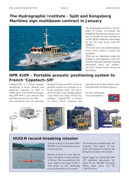
The Hydrographic Institute of the Republic<br />
of Croatia (www.hhi.hr) and<br />
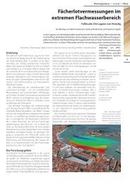
<strong>Kongsberg</strong> <strong>Maritime</strong> have signed a contract<br />
for the delivery and installation of<br />
an EM 3002D multibeam echosounder<br />
for the 22m long survey vessel RV<br />
ʻHIDRAʼ.<br />
The vessel carries out multidisciplinary<br />
ocean surveys mostly to ensure safe<br />
navigation.<br />
“With the new Multibeam system the<br />
Institute is well prepared to serve different<br />
environments looking for detailed<br />
information about the seafloor,”<br />
says Dr.sc. Zvonko Grzetic, director of<br />
the Institute.<br />
especially in the French Antillas with a<br />
dedicated office for South America.<br />
For more information:<br />
www.copetechsm.fr<br />
HUGIN record-breaking mission<br />
Tuesday evening, 27 December 2005,<br />
HUGIN was recovered after a recordbreaking<br />
mission.<br />
Mission 91 lasted for more than 66<br />
hours, with Hugin covering a distance<br />
of 430 km. This was performed with<br />
water depths in the range of 400 to<br />
1050 meters, in very challenging<br />
terrain and partially on flat seabed.<br />
The mission plan included nearly 500<br />
waypoints, where approx. 50 waypoints<br />
were changed via acoustic link<br />
during the execution of the mission.<br />
Payload logged was Simrad EM 2000<br />
150° multi-beam echo-sounder, Edgetech<br />
FS AU SSS/SBP, dig quartz<br />
2000m depth sensor and FSI<br />
2”MCTD sensor.