2013 media guide - LA Marathon
2013 media guide - LA Marathon
2013 media guide - LA Marathon

You also want an ePaper? Increase the reach of your titles
YUMPU automatically turns print PDFs into web optimized ePapers that Google loves.
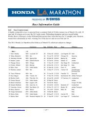
ABOUT THE RACE<br />
ABOUT THE RACE<br />
The runners pass a large Bristol Farms market (9039 Beverly Blvd.) which was <br />
previously the famed Chasen’s Restaurant (1936-‐95) — where Ronald Reagan <br />
proposed to Nancy Davis. It has been a favorite haunt of actors and co<strong>media</strong>ns <br />
including Jimmy Stewart, Frank Sinatra and Groucho Marx. <br />
Mile 17: <br />
Ending at Rodeo drive at Dayton Way <br />
(Elevation change: +30 feet, from 212 to 242 feet; 2 turns) <br />
This is one of the highlight miles on the course, running through Beverly Hills. On <br />
Burton Way, the runners will pass the 10-‐acre Beverly Hills Civic Center, dominated <br />
by the Beverly Hills City Hall (450 North Crescent Drive), which opened in 1931. The <br />
top of the cupola of City Hall is covered with gold leaf. <br />
From “Little Santa Monica” (which is actually South Santa Monica Blvd.), the course <br />
turns south on Rodeo Drive for 0.31 miles, turning west at Wilshire Blvd. The three-block<br />
stretch on Rodeo covers one of the world’s most famous shopping districts, <br />
with more than 100 shops and boutiques, which rose to fame in the 1970s. <br />
Mile 18: <br />
Ending at Santa Monica Boulevard, just past Century Park East <br />
(Elevation change: +36 feet, from 242 to 278 feet; 2 turns) <br />
At the corner of Rodeo Drive and Wilshire Boulevard is the Beverly Wilshire Hotel <br />
(9500 Wilshire), which opened in 1928 on the former site of the Beverly Hills <br />
Speedway. It was originally an “apartment hotel,” designed for permanent <br />
residents; it later became a hotel, and at one point had Pancho Gonzales as its <br />
tennis instructor. The course continues on Wilshire for 0.51 miles before it turns <br />
onto South Santa Monica Boulevard. <br />
Once back on Santa Monica, the course continues on 2.40 miles of Historic Route <br />
66. Along the way, runners will pass the Sony BMG Music office building (9830 <br />
Wilshire), designed by I.M. Pei in 1989 and formerly the home of the Creative <br />
Artists Agency. They will then run by the Peninsula Hotel (9882 Santa Monica) as <br />
well as the site of the now-‐closed Friars Club of California (9900 Santa Monica), <br />
which was founded in 1947 by Milton Berle and his friends. <br />
As the route merges onto Santa Monica Boulevard proper, it re-‐enters Los Angeles <br />
between Moreno Drive and Century Park East, heading into Century City. Once the <br />
studio backlot for the 20th Century Fox motion picture studios, the 180-‐acre parcel <br />
of what is now Century City was sold in 1961 to Alcoa and developer William <br />
Zeckendorf. The Los Angeles Country Club golf course lies to the north of the <br />
course. <br />
Mile 19: <br />
Ending at Santa Monica Boulevard, just past Westholme Avenue <br />
Elevation change: -‐34 feet, from 278 feet to 244 feet) <br />
Continuing on Santa Monica, the course passes the Westfield Shopping Center into <br />
West Los Angeles, and continues on portions of the old Pacific Electric Co.’s “Red <br />
Car” Santa Monica Line train route, which was in operation from 1896 to 1940. <br />
Mile 20: <br />
Ending at Sepulveda Boulevard, just north of Santa Monica Boulevard <br />
(Elevation change: +8 feet, from 244 feet to 252 feet; 1 turn) <br />
The race passes by the mammoth Los Angeles Temple of the Church of Jesus Christ <br />
of Latter-‐Day Saints (10777 Santa Monica), which was erected in the 1950s. <br />
Moving west toward the 405 (San Diego Freeway) on Santa Monica, the course <br />
passes Westwood Boulevard and turns north on Sepulveda Boulevard. <br />
Mile 21: <br />
Ending inside the Veterans Administration grounds, on Dowlen <br />
Drive, 100 feet before Bonsall Avenue <br />
(Elevation change: +61 feet, from 252 feet to 313 feet; 3 turns) <br />
From Sepulveda, the course takes a left on Ohio Avenue, headed toward the U.S. <br />
Veterans Administration grounds. The “Bad News Bears Field” is located at the <br />
corner of Sepulveda and Ohio, part of the Los Angeles Department of Parks & <br />
Recreation. The 1976 movie of the same name was actually filmed in Chatsworth; <br />
however, Bill Lancaster (son of film great Burt Lancaster), who originated the idea <br />
for the film, played Little League baseball at that field in the 1950s. the idea for the <br />
film came from Bill Lancaster, who played Little League baseball at that field in <br />
1958. His friends asked the City to rename the field in his honor after his death in <br />
1997. <br />
As the course turns north on Sawtelle Boulevard, runners begin the last significant <br />
climb of the race— a 80-‐foot rise over Heroes Hill— and pass through the National <br />
Soldier’s Home gates of the U.S. Veterans Administration grounds. Founded in 1887 <br />
as the Veterans Home, the facility spans 713 acres and is home to the Veterans <br />
Administration’s Greater Los Angeles Healthcare System. <br />
Mile 22: <br />
Ending at San Vicente Boulevard, before Montana Avenue <br />
(Elevation change: +26 feet, from 313 feet to 337 feet) <br />
Runners will cover 1.20 miles within the Veterans Administration grounds, with a <br />
total climb of 80 feet from Ohio Avenue (262) to Bonsall & Eisenhower Avenues <br />
(342) before exiting the property at Bringham Avenue. <br />
This is the course’s second highest rise and the last significant rise before the finish. <br />
22 ASICS <strong>LA</strong> MARATHON<br />
MEDIA GUIDE<br />
23