Girls Gone Wild! - Orcutt Mineral Society
Girls Gone Wild! - Orcutt Mineral Society
Girls Gone Wild! - Orcutt Mineral Society

You also want an ePaper? Increase the reach of your titles
YUMPU automatically turns print PDFs into web optimized ePapers that Google loves.
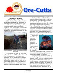
Ore-Cutts Volume XL, Issue V May 2005<br />
The Wanderer<br />
GPS Rockhounding<br />
On field trips, we use a simple GPS tool to<br />
explore the fascinating world of "GPS Rockhounding".<br />
We recently found a book called<br />
The GPS Guide to Western Gem Trails that is<br />
chocked full of helpful information for both new<br />
users and old-timers.<br />
GPS means "Global Positioning System".<br />
This is an excellent way to find and record favorite<br />
collecting spots, document positions, and<br />
share the information.<br />
Dick is a former Air Force navigator who<br />
learned his skills before the aid of aeronautical<br />
GPS. When we travel these days he can track<br />
our progress with this cool tool (when the attendants<br />
let him turn it on). Even our Grandson,<br />
Brandon, has a GPS unit made by Garmin. The<br />
Garmin is a useful tool for locating hidden Geo-<br />
Caches (it’s like a giant treasure hunt!).<br />
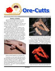
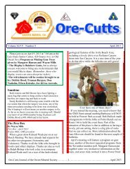
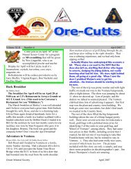
Holly, our African Grey parrot, checking her coordinates<br />
and heading – note the low tech attachment repair (the<br />
owner must be a rockhound!)<br />
Getting to and marking the site<br />
We use a PalmV handheld unit with an attachable<br />
GPS unit. Our GPS unit is a “Magellan<br />
Companion” that functions as a compass, marks<br />
elevation, latitude, and longitude. It's simple<br />
and effective. Included in our software is a<br />
mapping program for real-time tracking and display,<br />
as well as street names with look-up features.<br />
How many satellites support the GPS? Between<br />
8 and 12 are on the horizon simultaneously.<br />
The satellite system has onboard an<br />
atomic clock that is accurate to within one second<br />
every 70,000 years. Triangulation between<br />
the satellites is used to calculate the GPS user's<br />
precise location.<br />
Be careful to treat the quadrifilar antenna<br />
gently: it's your key to great reception! Choose<br />
an open space, hilltop or high point, turn on the<br />
GPS, and allow it to get a good fix. The GPS<br />
will then keep updating as you change positions.<br />
Each GPS unit contains programmable waypoints<br />
or landmarks that safely guide rockhounds<br />
in and out of collecting sites. GPS doesn't<br />
work in mines, or caves where satellite transmission<br />
is blocked.<br />
Record any locations you find that are unusual<br />
or out of place and you want to explore<br />
again later. Take road maps to use in conjunction<br />
with your GPS unit (USGS maps, AAA<br />
county maps, and Dibblee geologic maps are<br />
excellent).<br />
Remember to take the GPS recharger,<br />
and/or spare batteries (two AAA alkaline batteries<br />
last about 10 hours). Palm units will lose the<br />
charge faster than the GPS unit, and has its own<br />
recharger. Our palm has an adapter to charge<br />
off the 12 volt connection available in most vehicles.<br />
We always try to remember fresh batteries<br />
for the GPS unit.<br />
After the hunt/rewards of the pursuit<br />
If you have older Gem Trail books and a<br />
new GPS, look up the mine or diggings you<br />
want to explore. Take the Gem Trail book with<br />
you on the trip, and write down the coordinates<br />
on the page so you will have a record of its GPS<br />
location. Just because the book is a few years<br />
old doesn't make it obsolete.<br />
When we return home, the post-processing<br />
feature interfaces with the DeLorme topography<br />
program on our computer. It allows us to print<br />
out copies of our collecting site information, coordinates,<br />
notes, minerals found, etc. to share<br />
with friends. Remember the maps to Kramer<br />
Ore-Cutts 4