Manual Local Flood Early Warning Systems - Planet Action
Manual Local Flood Early Warning Systems - Planet Action
Manual Local Flood Early Warning Systems - Planet Action

You also want an ePaper? Increase the reach of your titles
YUMPU automatically turns print PDFs into web optimized ePapers that Google loves.
It is desirable to quantify risks. This is a substantial effort and to do it will require manpower<br />
and resources. In case the stakeholders of the LFEWS decide not to focus on these calculations<br />
the respective parts in Chapter 4 can be ignored.<br />
The total risk is defined by the product of the hazard, the elements at risk and their vulnerability.<br />
This means we have to look at these three determining factors one by one first and then at<br />
their product.<br />
Risk = Hazard * Elements at risk * Vulnerability<br />
It is possible to calculate risks in a quantitative manner. This manual is not describing these<br />
methods in detail but the principles and general examples are explained here 24 .<br />
4.1. Hazards<br />
The flood hazard has one main contributor, rain. Therefore the observation of rainfall is of<br />
primary importance. In case you observe rainfall already with gauges in the river basin you<br />
might like to add another technique, the estimation of rainfall with data freely available<br />
in the internet (see Chapter 5.4.1). If the rainfall data of the LFEWS are not collected<br />
completely or reliably the satellite data may help you considerably.<br />
Under rare conditions an extraordinary amount of rain may fall on the watershed and<br />
cause a flood that is much more severe than the usual/annual floods “One in a hundred<br />
years flood”. If a LFEWS did not consider this yet it is advisable to ask expert advice on how<br />
to estimate such floods.<br />
The severity of floods is not only influenced by rains. Many factors may increase or decrease<br />
the flood hazard. Collect the respective data and analyze them to reveal trends.<br />
• Over the years the river may change its path and with this the flood-prone area will<br />
most likely change. This might also be artificial as man is diverting rivers too.<br />
• Siltation of the river may reduce the channel capacity and increase the chances of<br />
flooding while dredging increases the capacity and reduce the danger of floods.<br />
• Water from rivers is sometimes used for<br />
irrigation. This might be small scale by a minor<br />
channels or pumps, but NIA might also run a<br />
big scheme and this might affect the flooding<br />
behavior of the river.<br />
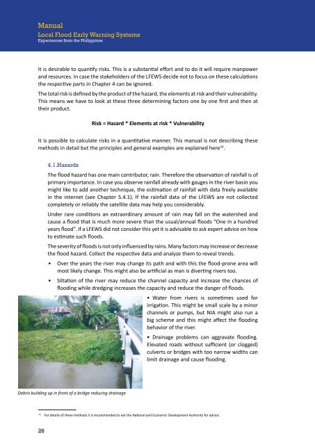
• Drainage problems can aggravate flooding.<br />
Elevated roads without sufficient (or clogged)<br />
culverts or bridges with too narrow widths can<br />
limit drainage and cause flooding.<br />
24<br />
For details of these methods it is recommended to ask the National and Economic Development Authority for advice.<br />
26