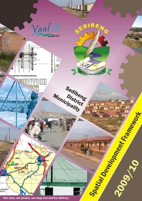
SDF - Sedibeng District Municipality
SDF - Sedibeng District Municipality
SDF - Sedibeng District Municipality
Create successful ePaper yourself
Turn your PDF publications into a flip-book with our unique Google optimized e-Paper software.
<strong>Sedibeng</strong> <strong>District</strong> <strong>Municipality</strong> – <strong>SDF</strong>: Final Draft<br />
Page | i
TABLE OF CONTENTS<br />
List of Figures<br />
List of Tables<br />
Annexure:<br />
List of Acronyms<br />
List of Definitions<br />
i<br />
iii<br />
iv<br />
iv<br />
v<br />
vii<br />
CHAPTER 1: <strong>SDF</strong> OVERVIEW 1<br />
1.1 Introduction and Background 1<br />
1.2 Report Structure 1<br />
1.3 Legislative Compliance 2<br />
1.4 Study Methodology and Process 3<br />
1.4.1 Planning Philosophy and Approach 3<br />
1.4.2 Public Participation and Stakeholder Inputs 4<br />
1.4.3 Project Steering Committee 4<br />
1.4.4 The Study Process 4<br />
CHAPTER 2: SITUATIONAL ANALYSIS 7<br />
2.1 Introduction 7<br />
2.2 Population and Population Growth 7<br />
2.2.1 Age 9<br />
2.2.1.1 Employment/Unemployment 10<br />
2.3 Spatial Composition and Land Uses 13<br />
2.3.1 Urban Residential Areas 13<br />
2.3.2 Industrial/Commercial Development 14<br />
2.3.3 Retail/Business 15<br />
2.3.4 Rural Residential [Small Holdings] 19<br />
2.3.5 Commercial Agriculture 19<br />
2.3.6 Nature Reserves 20<br />
<strong>Sedibeng</strong> <strong>District</strong> <strong>Municipality</strong> – <strong>SDF</strong>: Final Draft<br />
Page | ii
2.3.7 Vacant Land 21<br />
2.4 Economy 22<br />
2.4.1 Agriculture 22<br />
2.4.2 Tourism 23<br />
2.5 Social Services and Community Facility 24<br />
2.5.1 Health Facilities 24<br />
2.5.2 Educational Facilities 25<br />
2.5.3 Libraries and Community Halls 25<br />
2.5.4 Cemeteries 25<br />
2.5.5 Public Safety Services 26<br />
2.6 Demographics and Socio-economic Information 32<br />
2.6.1 Population Size, Distribution and Growth 32<br />
2.7 Housing 32<br />
2.7.1 Land Invasions 33<br />
2.7.2 Informal Settlements and Housing Backlog 34<br />
2.7.3 Social and Community Services 34<br />
CHAPTER 3: STRATEGIC AGENDA AND POLICY GUIDELINES APPLICABLE TO<br />
DISTRICT MUNICIPALITY 35<br />
3.1 <strong>District</strong> and Local Spatial Development Frameworks 35<br />
3.1.1 Proposed Spatial Development Concept 36<br />
3.1.2 Proposed Spatial Development Framework 36<br />
CHAPTER 4: STRATEGIC IMPLEMENTATION AND GUIDELINES 38<br />
4.1 Local Spatial Development Frameworks 39<br />
4.1.1 Existing Local Municipal Spatial Development Frameworks 39<br />
4.2 Main Development Issues 40<br />
4.2.1 Locality on Provincial Periphery 41<br />
4.2.2 Rural Nature of the Area 41<br />
4.2.3 Good Urban Services Infrastructure 41<br />
<strong>Sedibeng</strong> <strong>District</strong> <strong>Municipality</strong> – <strong>SDF</strong>: Final Draft<br />
Page | iii
4.2.4 Economic Stagnation 42<br />
4.2.5 Socio-economic Disparities 42<br />
4.2.6 Environmental Constraints and Opportunities 43<br />
4.2.7 Synthesis 43<br />
CHAPTER 5: SEDIBENG URBAN EDGE DELINEATION 45<br />
5.1 Conservation of the Environment 48<br />
5.2 Optimal Utilisation of Engineering Services 49<br />
5.3 Optimisation of Public Transport 50<br />
5.4 Prevention of Urban Decay and Promotion of Urban Integration 50<br />
5.5 Promotion of Opportunities for Redevelopment, Infill and Densification 51<br />
5.6 Creating New Well Located Urban Hubs 51<br />
5.7 Upliftment of Rural Areas 52<br />
CHAPTER 6: CORRIDORS, NETWORKS, LINKAGES AND NODES 53<br />
6.1 Emfuleni Local <strong>Municipality</strong> 53<br />
6.1.1 Activity Nodes 54<br />
6.1.2 Activity Corridors 55<br />
6.2 Lesedi Local <strong>Municipality</strong> 58<br />
6.2.1 Primary Corridors (National Roads) 59<br />
6.2.2 Secondary Corridors (Provincial Roads) 60<br />
6.2.3 Tourism Corridors 62<br />
6.2.4 Development Nodes 63<br />
6.3 Midvaal Local <strong>Municipality</strong> 63<br />
6.3.1 Promotion of a Strong Movement Network 66<br />
6.3.1.1 Corridor Development Framework 66<br />
6.4 Proposed Nodes 69<br />
6.5 Implementation Considerations 70<br />
6.6 Integration of <strong>SDF</strong> into the GIS 70<br />
CHAPTER 7: FLAGSHIP PROJECTS 72<br />
<strong>Sedibeng</strong> <strong>District</strong> <strong>Municipality</strong> – <strong>SDF</strong>: Final Draft<br />
Page | iv
7.1 Growth and Development Strategy Pillars 74<br />
REFERENCE(S): 78<br />
LIST OF FUGURES:<br />
Figure 1: Age Distribution in <strong>Sedibeng</strong> per Local <strong>Municipality</strong> 9<br />
LIST OF TABLES:<br />
Table 1: Population Figures and Households 8<br />
Table 2: Gender Distribution 9<br />
Table 3: Employment per Industry in <strong>Sedibeng</strong> 11<br />
Table 4: Dwelling Types 12<br />
Table 5: Business/Retail Classification 16<br />
Table 6: Standards for the Provision of Community Facilities 28<br />
Table 7: Economic Activity and Employment Status 32<br />
Table 8: Urban Edge Delineation Areas 45<br />
Table 9: GDS Pillars 74<br />
ANNEXURE:<br />
Map 1: <strong>Sedibeng</strong> <strong>District</strong> <strong>Municipality</strong>: Locality<br />
Map 2: Development Concept<br />
Map 3: Population Densities<br />
Map 4: Geology Map<br />
Map 5: Land Use Map<br />
Map 6: Environmental Map<br />
Map 7: Agriculture<br />
Map 8: Urban Edge<br />
Map 9: Nodes, Corridors and Linkages<br />
Map 10: Spatial Development Framework – Emfuleni LM (2007)<br />
Map 11: Spatial Development Framework – Midvaal LM (2007)<br />
<strong>Sedibeng</strong> <strong>District</strong> <strong>Municipality</strong> – <strong>SDF</strong>: Final Draft<br />
Page | v
Map 12: Spatial Development Framework – Lesedi LM (2008)<br />
Map 13: Draft Spatial Development Framework – <strong>Sedibeng</strong> DM (2009)<br />
Map 14: Draft Spatial Development Framework – Midvaal LM (2009)<br />
Map 15: Draft Spatial Development Framework – Emfuleni LM (2009)<br />
LIST OF ACRONYMS<br />
AIDS - Acquired Immune Deficiency Syndrome<br />
ASGISA - Accelerated and Shared Growth Initiative for South Africa<br />
CBD - Central Business <strong>District</strong><br />
CIF - Capital Investment Framework<br />
DBSA - Development Bank of Southern Africa<br />
DFA - Development Facilitation Act<br />
DITP - <strong>District</strong> Integrated Transport Plan<br />
DLA - Department of Land Affairs<br />
DM - <strong>District</strong> <strong>Municipality</strong><br />
DME - Department of Minerals and Energy<br />
EMP<br />
Environmental Management Plan<br />
ESKOM - Electricity Supply Commission (ESCOM)<br />
GDP - Gross Domestic Product<br />
GDRP - Gross Domestic Regional Product<br />
GGP - Gross Geographic Product<br />
GIS<br />
Geographic Information Systems<br />
GTA - Gauteng Tourism Authority<br />
G<strong>SDF</strong> - Gauteng Spatial Development Framework<br />
GVA - Gross Value Added<br />
HIV - Human Immunodeficiency Virus<br />
IDP - Integrated Development Plan<br />
<strong>Sedibeng</strong> <strong>District</strong> <strong>Municipality</strong> – <strong>SDF</strong>: Final Draft<br />
Page | vi
IPA - Implementation of Priority Areas<br />
IRDP - Integrated Rural Development Programme<br />
LED - Local Economic Development<br />
LM - Local <strong>Municipality</strong><br />
L<strong>SDF</strong> - Local Spatial Development Framework<br />
LUM - Land Use Management<br />
LUMB - Land Use Management Bill<br />
LUMS - Land Use Management Systems<br />
MDGs - Millennium Development Goals<br />
MPCCS -<br />
Multi-Purpose Community (Service) Centre<br />
MSA - Municipal System Act<br />
NATMAP - National Transportation Master Plan<br />
NSDP - National Spatial Development Perspective<br />
PGDS -<br />
Provincial Growth and Development Strategy<br />
STS - <strong>Sedibeng</strong> Tourism Strategy<br />
PGDS - Provincial Growth and Development Strategy<br />
SAR - South African Railways<br />
SARCC -<br />
South African Rail Commuter Corporation<br />
SDA - Spatial Development Areas<br />
<strong>SDF</strong> - Spatial Development Framework<br />
SDM - <strong>Sedibeng</strong> <strong>District</strong> <strong>Municipality</strong><br />
SDO - Spatial Development Objectives<br />
SMME - Small Medium and Micro Enterprises<br />
SoER - State of Environment Reporting<br />
SWOT - Strength, Weaknesses, Objective and Threats analysis<br />
UN - United Nations<br />
WMAs - Water Management Areas<br />
<strong>Sedibeng</strong> <strong>District</strong> <strong>Municipality</strong> – <strong>SDF</strong>: Final Draft<br />
Page | vii
LIST OF DEFINITIONS<br />
Amenities<br />
Access<br />
Activity Corridor<br />
Activity Spine<br />
Activity Streets<br />
Activity nodes/clusters<br />
CBD’s<br />
Densification<br />
Extensive Agriculture<br />
Historical Sites and<br />
Landmarks<br />
Intensive Agriculture<br />
Socio-economic facilities including sport Stadia, tertiary education<br />
and training, casinos and entertainment centres, hospitals,<br />
community centres and other recreational facilities.<br />
Access is the right of way to enter and exit developments and<br />
properties by all modes of transport and pedestrians.<br />
Activity corridor means a linear zone of development along a<br />
public transport route. The land use on either site of the road is<br />
characterised by intensive mixed land uses ranging from offices<br />
to light industrial developments. Access and egress is limited to<br />
existing on/off ramps.<br />
Mixed-use development along streets with heavy traffic and<br />
pedestrian flows. Land uses along the spine should be<br />
characterised by mixed land uses ranging from high density<br />
residential to business developments.<br />
Is a road/street in respective of its classification from civil<br />
engineering point of view, where pedestrian movement access to<br />
the activity along the street which is of paramount importance.<br />
Mobility is compromised in favour of the activity.<br />
Core areas of economic activity in the urban areas.<br />
Central Business <strong>District</strong>s – offices, retail, general business,<br />
commercial, recreation, entertainment, light service industries, high<br />
density residential uses, parks and open spaces.<br />
Increase in number of dwelling units per square metres of an<br />
area.<br />
Agricultural uses (plant and animal farming etc) and other uses as<br />
permitted by agricultural legislation and Gauteng Urban Edge<br />
programme guidelines.<br />
Any identifiable building or part thereof, marker, milestone,<br />
gravestone, landmark or tell older than 50 years".<br />
Rural residential uses, green house related activities, tourism<br />
activities including conference centres with related<br />
accommodation facilities such as hotels and other uses permitted<br />
in terms of the Gauteng Edge Programme guidelines.<br />
<strong>Sedibeng</strong> <strong>District</strong> <strong>Municipality</strong> – <strong>SDF</strong>: Final Draft<br />
Page | viii
Industrial/ Commercial<br />
Mixed land uses<br />
Mobility Spines<br />
Light and heavy industries, service industries, warehouses and<br />
commercial uses and uses as defined by the applicable town<br />
planning schemes.<br />
Land use combinations, including residential, offices, retail,<br />
business and entertainment related uses.<br />
Arterials along which through traffic flows with minimum<br />
interruption. Accessibility should be compromised in favour of<br />
mobility. The predominant land uses along mobility spines should<br />
be characterised by high density residential developments to<br />
support public transport systems.<br />
Mixed-use development: Which is used to promote a more diverse combination of land<br />
uses, and to improve the economic and social viability areas of<br />
development<br />
Open Space Systems<br />
Public Open Space:<br />
Public Spaces<br />
Spatial Development<br />
Framework<br />
The aim of the open space system is to preserve the<br />
municipality’s/district’s ecological diversity and enhance living<br />
environments. Open Space System is an inter-connected and<br />
managed network of open space, which supports interactions<br />
between social, economic and ecological activities, sustaining and<br />
enhancing both ecological processes and human settlements.<br />
Open space system comprises public and private spaces, humanmade<br />
or delineated spaces, undeveloped spaces, disturbed<br />
'natural' spaces, and undisturbed or pristine natural spaces.<br />
As defined by the applicable town planning scheme or any land<br />
which is owned by an organ of State, or over which an organ of<br />
State has certain real rights arising from the filing in the Deeds<br />
Office or other registration office of a general plan of a<br />
township, agricultural holding or other division of land, or any<br />
alteration, addition to or amendment of such land approved by<br />
the Surveyor-General, on which is marked the land to which the<br />
public has a common right of use; and is controlled and managed<br />
by the Council.<br />
Means any open or enclosed space, square, garden or park,<br />
street, road or thoroughfare which is for the use by the general<br />
public and which is owned by or vests in the ownership of a<br />
municipal council or organ of state.<br />
An <strong>SDF</strong> is a useful and effective spatial tool with which to<br />
manage and monitor growth and development and informs<br />
investors and government related programmes where<br />
<strong>Sedibeng</strong> <strong>District</strong> <strong>Municipality</strong> – <strong>SDF</strong>: Final Draft<br />
Page | ix
development opportunities exist in the short and longer term.<br />
Socio-economic<br />
opportunities<br />
Urban<br />
Urban Edge<br />
Urban Sprawl<br />
Urban Development<br />
Boundary<br />
Activities that improve the social and economic well being of the<br />
urban poor, e.g. improves health care, housing, education,<br />
recreation, job opportunities, earning power.<br />
Development within the urban development boundary consisting<br />
of existing residential uses, such as community facilities, opens<br />
spaces and business uses.<br />
A tool by means of which to manage the process of urban sprawl<br />
and urban restructuring.<br />
Urban sprawl is the unchecked spreading of a city or its suburbs<br />
over rural land at the edge of an urban area.<br />
A city approved/Demarcated line that serves to direct and<br />
control the outer limits of urban expansion/ indicates the point<br />
beyond which developments become less cost-effective.<br />
<strong>Sedibeng</strong> <strong>District</strong> <strong>Municipality</strong> – <strong>SDF</strong>: Final Draft<br />
Page | x


