Patapsco River - Captain John Smith Chesapeake National Historic ...
Patapsco River - Captain John Smith Chesapeake National Historic ...
Patapsco River - Captain John Smith Chesapeake National Historic ...

You also want an ePaper? Increase the reach of your titles
YUMPU automatically turns print PDFs into web optimized ePapers that Google loves.
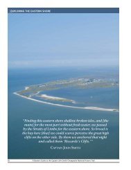
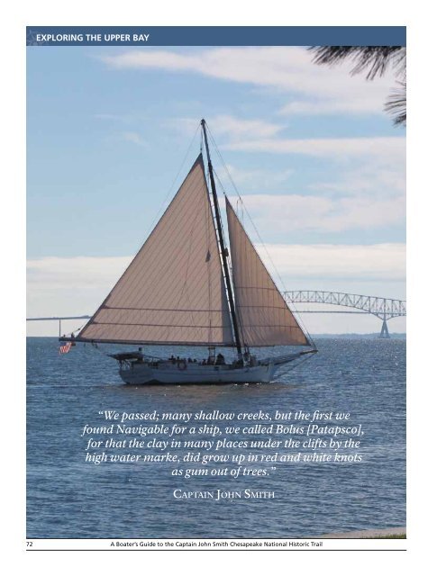
EXPLORING THE UPPER BAY<br />
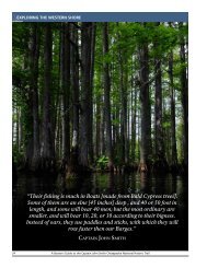
“We passed; many shallow creeks, but the first we<br />
found Navigable for a ship, we called Bolus [<strong>Patapsco</strong>],<br />
for that the clay in many places under the clifts by the<br />
high water marke, did grow up in red and white knots<br />
as gum out of trees.”<br />
<strong>Captain</strong> <strong>John</strong> <strong>Smith</strong><br />
72<br />
A Boater’s Guide to the <strong>Captain</strong> <strong>John</strong> <strong>Smith</strong> <strong>Chesapeake</strong> <strong>National</strong> <strong>Historic</strong> Trail
THE PATAPSCO RIVER<br />
The Deep <strong>Patapsco</strong><br />
EXPLORING baltimore’s river harbor<br />
It takes more imagination to follow in <strong>Captain</strong> <strong>John</strong> <strong>Smith</strong>’s wake on the<br />
<strong>Patapsco</strong> than anywhere else in the <strong>Chesapeake</strong>. <strong>Smith</strong>’s map drew Maryland<br />
colonists to this great natural harbor in the late 17th century. It has been an<br />
important international port since the early 18th century, when Baltimore<br />
merchants first shipped barrels of flour to the West Indies. It was also the hub<br />
for regional shipping by sail and steam in the 19th and early 20th centuries.<br />
Over time, development has hardened most of the tidal shoreline of the<br />
<strong>Patapsco</strong> and its various tributaries. From the huge commercial wharves at<br />
the Dundalk Marine Terminal and the condominium/marina developments in<br />
the Inner Harbor to the suburban communities on Marley, Stony, and Rock<br />
creeks on the river’s south shore and on Old Road Bay to the east, commercial<br />
and residential growth has impacted the shorelines. Even so, there is still<br />
plenty to explore in the <strong>Patapsco</strong>, including surprising natural pockets.<br />
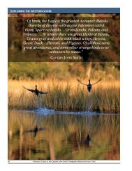
Regaine therefore your<br />
old spirits for returne I<br />
will not (if God please)<br />
till I have seene the<br />
Massawomeks, found<br />
Patawomeck, or the<br />
head of this water you<br />
conceit to be endless.”<br />
— <strong>Captain</strong> <strong>John</strong> <strong>Smith</strong>, 1608<br />
CAPTAIN JOHN SMITH ON THE PATAPSCO<br />
<strong>Captain</strong> <strong>John</strong> <strong>Smith</strong> and his crew spent only two and a half days on the<br />
<strong>Patapsco</strong> <strong>River</strong>, but he managed to map it with amazing accuracy. On June<br />
12, 1608, after a very long sail up the Bay from Cove Point, they anchored<br />
the Discovery Barge for the night off Bodkin Point, at the south side of the<br />
<strong>Patapsco</strong>’s broad mouth.<br />
They saw no one on land. Some historians believe this part of the western<br />
shore was a buffer area between the Indian tribes to the north and south and<br />
the Massawomeck who lived in Western Maryland. That tribe was said to<br />
have conducted raids on Upper Bay villages by paddling down the Potomac<br />
and up its Monocacy tributary, portaging their birchbark canoes to the<br />
<strong>Patapsco</strong>’s headwaters, and paddling down to the Bay.<br />
The next day, <strong>Smith</strong> explored the river up to modern-day Elkridge, where<br />
he planted a cross. As elsewhere, the shallop crew planted Maltese crosses<br />
to mark the extent of their explorations. <strong>Smith</strong>’s 1612 map includes areas<br />
beyond the crosses, which he filled in based on information provided by<br />
Indians he met.<br />
The crew found two kinds of clay in the <strong>Patapsco</strong>’s banks, bole armoniac<br />
and terra sigillata, which the English believed had medicinal qualities. <strong>Smith</strong><br />
named the river Bolus flu after the former. They spent the afternoon exploring<br />
and mapping the Gwynns Falls, the Jones Falls, and Old Road Bay, where they<br />
spent the night.<br />
It had been four long, hard days since the explorers had left the Nanticoke<br />
<strong>River</strong> and the good food urged on them by its people. Now they were tired,<br />
hungry, and in several cases, sick, with most of their on-board food spoiled.<br />
They begged <strong>Smith</strong> to turn south to Jamestown to restock supplies. He<br />
responded with an inspiring speech that revived their spirits, but that evening<br />
and the next day, the weather shut in on them in Old Road Bay. After a day<br />
and a half of rain and wind endured in the open Discovery Barge, <strong>Smith</strong><br />
relented, and they headed south on June 15.<br />
RESOURCES&CONTACTS<br />
baltimore visitor center<br />
410-659-7066<br />
http://baltimore.org/visitor-center<br />
national aquarium at baltimore<br />
410-576-3800<br />
www.aqua.org<br />
maryland science center<br />
410-685-5225<br />
www.mdsci.org<br />
baltimore museum of industry<br />
410-727-4808<br />
www.thebmi.org<br />
FORT MCHENRY NATIONAL MONUMENT<br />
AND HISTORIC SHRINE<br />
410-962-4290<br />
www.nps.gov/fomc<br />
PREVIOUS PAGE<br />
Skipjack on the <strong>Patapsco</strong> <strong>River</strong><br />
near Baltimore.<br />
Photo courtesy visit Baltimore<br />
<strong>National</strong> Park Service • <strong>Chesapeake</strong> Bay Office 73
EXPLORING THE UPPER BAY<br />
EXPLORING THE PATAPSCO TODAY<br />
With over four centuries of intensive human<br />
activity, the tidal <strong>Patapsco</strong> has grown choked with<br />
gravel, sand, and mud from tobacco farming,<br />
timber cutting, and all sorts of development. The<br />
watersheds of its Middle Branch and Inner Harbor<br />
tributaries, the Gwynns Falls <strong>River</strong> and the Jones<br />
Falls <strong>River</strong>, respectively, are almost entirely covered<br />
by rooftops, roadways, and parking lots. Today, the<br />
water in Baltimore’s harbor and the <strong>Patapsco</strong> is<br />
cleaner than it was before the Clean Water Act of<br />
1972 began regulating the discharges of sewage and<br />
industrial waste. Strong storms, however, still pour<br />
pollutants down the harbor’s stormwater systems,<br />
and the sediments are still heavily polluted with<br />
organic toxins and heavy metals—legacies of the<br />
city’s industrial past.<br />
For the past 30 years, the City of Baltimore and<br />
the counties surrounding it (Baltimore and Anne<br />
Arundel) have recognized the value of this urban<br />
waterfront. Former industrial sites now hold<br />
condominium/office/marina communities with<br />
plenty of 21st-century amenities, interspersed<br />
by world-class institutions like the <strong>National</strong><br />
Aquarium at Baltimore, the Maryland Science<br />
Center, the Baltimore Museum of Industry, and<br />
the University of Maryland’s Center of Marine<br />
Biotechnology. An attractive, well-landscaped, and<br />
lighted walkway around the Inner Harbor makes<br />
it easy for visiting boaters to tie up at one of the<br />
marinas and visit any of these attractions.<br />
There is always something interesting going on in<br />
the <strong>Patapsco</strong>, from tugs docking big ships to events<br />
at Fort McHenry that commemorate the War of<br />
1812 and Francis Scott Key’s writing of “The Star-<br />
Spangled Banner.” And there are a few pockets of<br />
natural shoreline, such as a wetland restoration<br />
project located just west of Fort McHenry, built<br />
over the past ten years by staff and volunteers from<br />
the <strong>National</strong> Aquarium. Explore further and you’ll<br />
find a few natural spots like Tanyard Cove at the<br />
junction of Curtis and Marley creeks.<br />
Photo ©Middleton Evans<br />
Both land- and water-based visitors will find plenty to see and do in Baltimore’s Inner Harbor.<br />
74<br />
A Boater’s Guide to the <strong>Captain</strong> <strong>John</strong> <strong>Smith</strong> <strong>Chesapeake</strong> <strong>National</strong> <strong>Historic</strong> Trail
THE PATAPSCO RIVER<br />
Good Vessels for Exploring<br />
PADDLE CRAFT (CANOES AND KAYAKS)<br />
Canoes and especially kayaks are popular vessels for exploring the<br />
<strong>Patapsco</strong> today. Some marinas allow launching them from floating<br />
docks in the Inner Harbor, as does the Canton Park launch ramp on Boston<br />
Street. Just be aware that these open waters can kick up rough. There is<br />
also a great deal of boat traffic, from water taxis and the Living Classrooms<br />
Foundation’s 70-foot pungy schooner, Lady Maryland, to huge commercial<br />
ships which have a difficult time seeing kayaks.<br />
SKIFFS AND RUNABOUTS<br />
Skiffs and runabouts are a bit more visible and seaworthy than<br />
paddle craft, but it still pays to exercise caution and give careful<br />
attention when operating anywhere in the <strong>Patapsco</strong>. They make good<br />
platforms for day trips around the <strong>Patapsco</strong>.<br />
CRUISING POWERBOATS, TRAWLERS, AND SAILBOATS<br />
<strong>Captain</strong> <strong>John</strong> <strong>Smith</strong> turned into the <strong>Patapsco</strong> and paid<br />
it close attention as the first <strong>Chesapeake</strong> upper western<br />
shore tributary “we found navigable for a ship.” Today, it is made to order for<br />
exploring by cruising sail- and powerboats. Be aware of the traffic and read<br />
your charts carefully to avoid shallow areas in the upper sections of the river.<br />
FOR FURTHER EXPLORATION<br />
<strong>Chesapeake</strong> Bay Gateways<br />
The <strong>Captain</strong> <strong>John</strong> <strong>Smith</strong> <strong>Chesapeake</strong><br />
<strong>National</strong> <strong>Historic</strong> Trail is part of a much<br />
larger story of the <strong>Chesapeake</strong> Bay—a<br />
story with rich historical, natural, and<br />
environmental chapters for your discovery<br />
and enjoyment. Throughout the Bay<br />
watershed a variety of parks, wildlife<br />
refuges, maritime museums, historic sites,<br />
and trails tell their part of the <strong>Chesapeake</strong><br />
story. These special places are part of<br />
the <strong>National</strong> Park Service <strong>Chesapeake</strong><br />
Bay Gateways and Watertrails Network.<br />
Visit them to experience the authentic<br />
<strong>Chesapeake</strong>.<br />
Many of these Gateways to the<br />
<strong>Chesapeake</strong> are located along the<br />
<strong>Captain</strong> <strong>John</strong> <strong>Smith</strong> <strong>Chesapeake</strong> <strong>National</strong><br />
<strong>Historic</strong> Trail. Those with boating access<br />
to the water trail are noted throughout<br />
this Boater’s Guide. Others await your<br />
exploration by land. You can make virtual<br />
visits via the Gateway Network’s website<br />
at www.baygateways.net where you can<br />
find sites by name, location, activities, or<br />
themes. As you travel the <strong>Patapsco</strong> <strong>River</strong>,<br />
learn more about important <strong>Chesapeake</strong><br />
connections at the following Gateway<br />
sites and attractions.<br />
<strong>Chesapeake</strong> Gateways<br />
along the PATAPSCO river<br />
Baltimore Visitor Center • Baltimore, MD<br />
Fort McHenry <strong>National</strong> Monument and<br />
<strong>Historic</strong> Shrine • Baltimore, MD<br />
Baltimore Museum of Industry • Baltimore, MD<br />
Pride of Baltimore II, Baltimore, MD<br />
USS Constellation Museum, Baltimore, MD<br />
Lightship <strong>Chesapeake</strong> and 7-Foot Knoll<br />
Lighthouse • Baltimore, MD<br />
<strong>National</strong> Aquarium in Baltimore<br />
Frederick Douglass-Isaac Myers Maritime Park •<br />
Baltimore, MD<br />
Fell’s Point <strong>Historic</strong> District • Baltimore, MD<br />
<strong>Patapsco</strong> Valley State Park • Ellicott City, MD<br />
Jones Falls Trail • Baltimore, MD<br />
Gwynns Falls Trail and Greenway •<br />
Baltimore, MD<br />
There are surprising pockets of nature along the <strong>Patapsco</strong>’s developed waterfront,<br />
such as this wetlands restoration project at Fort McHenry where school groups study<br />
birds and plants.<br />
<strong>National</strong> Park Service • <strong>Chesapeake</strong> Bay Office 75
EXPLORING THE UPPER BAY<br />
TRAILHEADS<br />
ON THE PATAPSCO RIVER<br />
BALTIMORE MARINAS<br />
Search “Baltimore Marinas” online for a list of nearly a dozen<br />
commercial facilities in various parts of the Harbor.<br />
PUBLIC LAUNCH RAMPS<br />
Visit the online Boating Access Guide of the Maryland<br />
Department of Natural Resources. Click on the Baltimore City<br />
and Baltimore County reference maps.<br />
www.dnr.state.md.us/boating/boatramps.asp<br />
The easiest ramp for the Inner Harbor is:<br />
Canton Park<br />
39° 16' 36" N, 76° 34' 21" W<br />
(located on Boston Street, no launch fee)<br />
For the outer <strong>Patapsco</strong>:<br />
Fort Armistead Park<br />
39° 12' 31" N, 76° 31' 57" W<br />
(no launch fee)<br />
NOTE: Trailheads indicate access points for the suggested itineraries.<br />
<strong>River</strong> maps indicate trailheads as either private or public. All launch<br />
sites are open to the public. Those listed as private are part of privately<br />
owned businesses. Public trailheads are located on local, state, or<br />
federally managed properties. Fees may be charged at any of the<br />
launch sites and are subject to change. Contact the site directly for the<br />
latest information.<br />
Trip Itineraries<br />
HARBOR CIRCUMNAVIGATION<br />
ONE-WAY, 50 MILES<br />
You’ll travel about 50 miles to circumnavigate the<br />
<strong>Patapsco</strong> and Baltimore’s Harbor from any convenient<br />
starting point. It’s probably not a great kayak project,<br />
and making the trip entirely under sail would be<br />
challenging, but it’s an interesting full-day exploration<br />
in a cruising boat, a good-sized skiff, or a capable<br />
runabout. Take it at one time or cut it into shorter<br />
segments. These include:<br />
• A complete circle of the Inner Harbor;<br />
• A quick look into the Middle Branch (Gwynns<br />
Falls) and the <strong>Patapsco</strong>’s silted-in main stem at the<br />
Hanover Street Bridge;<br />
• A run out to the mouth of Curtis Bay, on the south<br />
side of the Inner Harbor;<br />
• A round trip up into Curtis Creek, past the U.S.<br />
Coast Guard Yard to Tanyard Cove and back;<br />
• A run out under the Key Bridge to Bodkin Point;<br />
• A ride across the <strong>Patapsco</strong> into Old Road Bay on<br />
the north side and around the old steel mill at<br />
Sparrows Point;<br />
• A careful run past the Dundalk Marine Terminal,<br />
with its giant cranes; and<br />
• A good look at the Fort McHenry <strong>National</strong><br />
Monument and <strong>Historic</strong> Shrine on the way back<br />
into the Inner Harbor.<br />
Photo by Sarah Rogers<br />
A trip to Baltimore is not complete without visiting Fort McHenry<br />
<strong>National</strong> Monument. Private vessels cannot dock there, but<br />
visitors can come by water taxi from the Inner Harbor.<br />
TANYARD COVE<br />
TWO-WAY, 11 MILES<br />
Launch at Fort Armistead and run west, under the<br />
Key Bridge, into Curtis Bay and then up Curtis Creek<br />
to its junction with Marley Creek. The shoreline will<br />
be thoroughly industrial until you pass under the<br />
Interstate 695 (Baltimore Beltway) and railroad bridges<br />
and clear the Coast Guard Yard. Then, remarkably,<br />
you’ll find a natural wooded shoreline on the east side<br />
of the creek, with lovely Tanyard Cove inviting you to<br />
enter. Though shallow, the cove offers three to four feet<br />
of water far enough in to allow anchoring for a picnic.<br />
Turn left coming out of Tanyard Cove, and Marley<br />
Creek offers a similar channel south for two miles. The<br />
west side is full of houses, but the east side remains<br />
wooded for most of its length.<br />
76<br />
A Boater’s Guide to the <strong>Captain</strong> <strong>John</strong> <strong>Smith</strong> <strong>Chesapeake</strong> <strong>National</strong> <strong>Historic</strong> Trail
THE PATAPSCO RIVER<br />
<strong>Patapsco</strong> <strong>River</strong><br />
SECTION MAP<br />
INNER HARBOR<br />
FELLS<br />
POINT<br />
Canton Park<br />
TRAILHEAD (PUBLIC)<br />
TRIP ITINERARY<br />
CBIBS (NOAA BUOY)<br />
BALTIMORE CITY<br />
BALTIMORE COUNTY<br />
LOCUST<br />
POINT<br />
FORT McHENRY<br />
MIDDLE BRANCH<br />
DUNDALK<br />
MARINE<br />
TERMINAL<br />
DUNDALK<br />
PATAPSCO RIVER<br />
BALTIMORE CITY<br />
BALTIMORE COUNTY<br />
ANNE ARUNDEL COUNTY<br />
BALTIMORE CITY<br />
CURTIS BAY<br />
FRANCIS SCOTT KEY<br />
BRIDGE<br />
LINKS TO ONLINE MAPS<br />
Canton Park<br />
Fort Armistead Park<br />
CLICK SOURCE ▼<br />
GOOGLE NOAA<br />
GOOGLE NOAA<br />
USCG<br />
FORT ARMISTEAD PARK<br />
SPARROWS<br />
POINT<br />
CURTIS CREEK<br />
N<br />
PATAPSCO<br />
CBIBS BUOY<br />
AT MOUTH<br />
OF PATAPSCO<br />
TANYARD<br />
COVE<br />
NOT FOR NAVIGATION<br />
NOT TO SCALE<br />
<strong>National</strong> Park Service • <strong>Chesapeake</strong> Bay Office 77