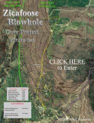
Cavediggers.com Magazine Issue #9(PDF format)
Cavediggers.com Magazine Issue #9(PDF format)
Cavediggers.com Magazine Issue #9(PDF format)

You also want an ePaper? Increase the reach of your titles
YUMPU automatically turns print PDFs into web optimized ePapers that Google loves.
Klimchouk,A., Nazik,L., Bayari,S. Tork,K. and Kasjan Yu. Kuzgun Cave and its Context 5<br />
deep caves, if discovered, together with a wealth of regional speleological data, would give<br />
indispensable in<strong>format</strong>ion to advancing key scientific issues of the Aladaglar karst, - its<br />
evolution and hydrogeology. In turn, special geomorphological and hydrogeochemical<br />
studies would help to develop more efficient strategy and methods for search and exploration<br />
of caves. The cave explorations under the Aladaglar project were integrated into the "Call of<br />
the Abyss" project searching to overpass the 2000m depth mark in caves.<br />
The field activities under the Aladaglar Karst and Cave Research Project included a<br />
reconnaissance trip in October 2000 (10 days, 6 members) and a series of large month-long<br />
expeditions in August 2001 (26 members), August 2002 (28 members), July 2003 (26<br />
members) and July 2004 (30 members). The expeditions were <strong>com</strong>posed of cavers from the<br />
Ukrainian Speleological Association, MAD and HUMAK speleological clubs of Ankara and<br />
karst specialists of MTA and Hacettepe University.<br />
Cave search and exploration in Aladaglar:<br />
approach, methods and progress in 2001-2004<br />
Search for caves<br />
The core part and the first stage of speleological investigations under the project was a<br />
search for caves, and their standard documentation. A search strategy was developed to<br />
account for the above-mentioned specific characteristics of the Aladaglar high mountain<br />
karst. It included the following basic principles:<br />
1. Thorough and systematic ‘total’ search on an area-by-area basis, with special attention to<br />
small openings and cracks that have more chances to remain unplugged than large eyecatching<br />
entrances (Plate 10).<br />
2. The search should be focused on specific geomorphological situations favouring to<br />
preserve caves unplugged and hence accessible, e.g. on tops of ridges and at their edges,<br />
internal prominent rock hills within glacial trough valleys (roches moutonneés), in the<br />
vertical rock faces and other places aloof from debris flows (Plate 11). The focus of<br />
search on "hydrologically functionless" areas confronts the conventional caver's wisdom<br />
but it accounts for the specific effects of glacial scouring and subsequent periglacial<br />
conditions.<br />
3. All openings, including sinkholes and blocked pits, should be checked for air draft.<br />
Strong and cold draft, even if it blows from a seemingly impassable boulder choke or a<br />
squeeze, is a good indication of the connection to a large system and signifies that the<br />
obstacles should be further negotiated using special efforts and methods.<br />
4. Search for caves should be ac<strong>com</strong>panied by a <strong>com</strong>plete documentation of inspected<br />
objects and their registration to a large-scale map.<br />
5. Special geomorphological and structural investigations and mapping, aimed to reveal<br />
factors that favour cave location and accessibility, should ac<strong>com</strong>pany search efforts to<br />
give directions to areas of closest attention.<br />
Cave inventory