June 2012 ISSN 2070-4593 - NGC
June 2012 ISSN 2070-4593 - NGC
June 2012 ISSN 2070-4593 - NGC

You also want an ePaper? Increase the reach of your titles
YUMPU automatically turns print PDFs into web optimized ePapers that Google loves.
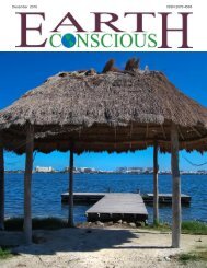
ECLAC Report Examines Vulnerability<br />
to Climate Change of LAC Coasts<br />
The UN Economic Commission for Latin America and the Caribbean (ECLAC)<br />
has published a report that examines the vulnerability and exposure to<br />
climate change of the 72,182 km coastline of Latin America and the Caribbean<br />
(LAC).<br />
The report looks at individual five km long, 20 km wide strips of LAC<br />
coastline, analyzing the physical, socioeconomic and ecological characteristics of coastal zones<br />
according to variables such as land type and use, crop areas or ecosystem zones, population<br />
density, urban areas, infrastructure (roads, rail lines, ports, etc.), and the type of coast.<br />
This analysis of geospatial data from various sources allows for the analysis of coastal<br />
vulnerability at the country level according to the variables critical to each country, according<br />
to IISD Reporting Services.<br />
The study points out that for certain small island states, such as Aruba, the Bahamas,<br />
Montserrat, Saint Kitts and Nevis, the Turks and Caicos, and the Virgin Islands, over 95% of the<br />
territory is within 20 km of the coast.<br />
It notes that in the case of the Turks and Caicos, 100% of the territory is ten meters or less<br />
above sea level, while for the Bahamas and Cayman Islands, the figure is 70%, making these<br />
islands particularly vulnerable to climate-related impacts such as extreme weather events, sea<br />
level rise and coastal erosion.<br />
Argentina, Brazil, Cuba and Mexico also have large coastal areas under the ten meter elevation<br />
mark. Brazil has the most inhabitants living in such zones, but Barbados, Dominica, Grenada<br />
and the US Virgin Islands having the highest population density in vulnerable zones.<br />
Regarding infrastructure, the report finds that Argentina, the Bahamas, Brazil, Cuba and<br />
Mexico are the most vulnerable. In terms of crops grown along the coast, Brazil and Mexico<br />
have the greatest total areas vulnerable to possible climatic impacts, but the Bahamas, Cayman<br />
Islands, Guatemala and Suriname have the greatest vulnerability in terms of percentages of<br />
their national crop output.<br />
As for ecosystems, the report highlights that the most vulnerable in terms of total economic<br />
valuation are located in Brazil and Mexico.<br />
This report is the second in a series of four to be released in <strong>2012</strong> as part of an ECLAC<br />
project on climate change and LAC coastal regions financed by the Government of Spain. The<br />
first analyzed and provided an atlas of the current physical conditions and changes detected in<br />
key coastal variables. The third will detail probable climate change impacts, and the fourth will<br />
evaluate the climate change risks faced by LAC coasts.<br />
<strong>June</strong> <strong>2012</strong> Earth Conscious 17