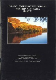
Inland Waters of the Pilbara, Western Australia - Environmental ...
Inland Waters of the Pilbara, Western Australia - Environmental ...
Inland Waters of the Pilbara, Western Australia - Environmental ...

Create successful ePaper yourself
Turn your PDF publications into a flip-book with our unique Google optimized e-Paper software.
The definition <strong>of</strong> a wetland as accepted by <strong>the</strong> Wetlands Advisory Committee <strong>of</strong> <strong>the</strong> <strong>Western</strong><br />
<strong>Australia</strong>n Department <strong>of</strong> Conservation and Environment includes river channels as<br />
wetlands and has been adopted in this study:<br />
'Wetlands are areas <strong>of</strong> seasonally, intermittently or permanently waterlogged soils or<br />
inundated land whe<strong>the</strong>r natural or o<strong>the</strong>rwise, fresh or saline, eg waterlogged soils, ponds,<br />
billabongs, lakes, swamps, tidal flats, estuaries, rivers and <strong>the</strong>ir tributaries" (Wetlands<br />
Advisory Committee, 1977).<br />
The <strong>Pilbara</strong> re21on lies north <strong>of</strong> <strong>the</strong> tropic <strong>of</strong> Capricorn and for <strong>the</strong> purposes <strong>of</strong> this study is<br />
defined as <strong>the</strong> area encompassed by <strong>the</strong> watersheds <strong>of</strong> <strong>the</strong> Ashburton, Fortescue and De Grey<br />
river systems (see <strong>Pilbara</strong> Study Group Report, June 1974, Map 1). The terms 'inland surface<br />
water' and 'wetland' are used interchangeably.<br />
1.3 CLIMATE<br />
The <strong>Pilbara</strong> has an arid climate: <strong>the</strong> result <strong>of</strong> <strong>the</strong> presence over <strong>the</strong> region <strong>of</strong> two air masses -<br />
Indian Tropical Maritime air moving in from <strong>the</strong> west or north-west; and Tropical<br />
Continental air from <strong>the</strong> inland. During <strong>the</strong> warmer half <strong>of</strong> <strong>the</strong> year, <strong>the</strong>re is a hot lowpressure<br />
system over <strong>the</strong> region almost continually, caused by <strong>the</strong> transport <strong>of</strong> warm air<br />
from <strong>the</strong> south-east. This heat inflow and associated clear skies result in very high<br />
temperatures from November to February with average maxima <strong>of</strong>ten exceeding 40°C.<br />
The <strong>Pilbara</strong> lies south <strong>of</strong> <strong>the</strong> area normally penetrated by <strong>the</strong> 'north-west monsoon' in <strong>the</strong><br />
summer months, and is only occasionally influenced by wea<strong>the</strong>r systems <strong>of</strong> <strong>the</strong> westerly<br />
circulation in <strong>the</strong> winter months; an influence which is normally restricted to <strong>the</strong> southwest<br />
<strong>of</strong> <strong>the</strong> <strong>Pilbara</strong>. Rainfall is <strong>the</strong>refore low and variable. Average rainfall over <strong>the</strong> area<br />
ranges from about 200 mm to 350 mm, though may vary widely from <strong>the</strong> average in<br />
individual years. Most <strong>of</strong> this rain falls between December and June, with a pronounced dry<br />
period between August and November (Figure 1). Average yearly evaporation (about 2,500<br />
mm.yr 1 ) exceeds average yearly rainfall throughout <strong>the</strong> year (Davidson, 1975).<br />
The area is subject to occasional tropical cyClones, usually between January and April, with<br />
a frequency <strong>of</strong> about seven in every decade. Tropical cyclones contribute 40 to 60% <strong>of</strong> <strong>the</strong><br />
north coast rainfall, while in <strong>the</strong> south and west, 20 to 30% is derived from this source. The<br />
cyclonic influence results in 24-hour 10-year recurrence storm rainfall recordings <strong>of</strong> 100<br />
mm to 250 nun.<br />
1.4 PILBARA RIVER GEOMORPHOLOGY<br />
The ephemeral <strong>Pilbara</strong> rivers have -developed through stream rejuvenation since <strong>the</strong><br />
Tertiary (Kriewaldt and Ryan, 1967). The river systems are shown in Figure 2. A major<br />
catchment divide is provided by <strong>the</strong> Chichester Range, a _ greatly undulating plateau<br />
developed on lower Proterozoic Fortescue Group lavas and volcanogenic sediments. The<br />
ranges form a watershed between north-flowing river systems (including <strong>the</strong> Harding,<br />
Maitland, Yule, Turner and De Grey) and <strong>the</strong> westerly flowing Fortescue River.<br />
The headwaters <strong>of</strong> <strong>the</strong> north-flowing rivers have dendritic drainage patterns and are<br />
developed on large flat plains underlain by Archaean granite. These plains are<br />
occasionally interrupted by low hills <strong>of</strong> granite, dolerite or quartz. These rivers lead<br />
downstream into well-developed coastal drainage systems with braided stream channels<br />
and discontinuous ana branches. In <strong>the</strong> north <strong>of</strong> <strong>the</strong> area, streams are locally controlled by<br />
<strong>the</strong> steep ranges and high level gently undulating plains <strong>of</strong> <strong>the</strong> George Ranges.<br />
On <strong>the</strong> sou<strong>the</strong>rn flank <strong>of</strong> <strong>the</strong> Chichester Range, <strong>the</strong> drainage pattern changes from dendritic<br />
to parallel. The streams are short and end on <strong>the</strong> alluvial plain <strong>of</strong> <strong>the</strong> Fortescue River<br />
Valley in a series <strong>of</strong> coalescing outwash fans.<br />
The Fortescue River Valley contains two major catchment systems. The upper catchment is<br />
referred to as <strong>the</strong> Fortescue River Floodout Catchment (Main Roads Department. 1984) and<br />
is separated from <strong>the</strong> Lower Fortescue Catchment by <strong>the</strong> Goodiadarrie Hills. The area east<br />
<strong>of</strong> <strong>the</strong> divide in <strong>the</strong> valley banks up water into extensive 'floodout' lowlands during flow<br />
periods. This water has been known to bank up past Roy Hill Station some 100 km east.<br />
2

![[Project Title] - Environmental Protection Authority](https://img.yumpu.com/35475857/1/184x260/project-title-environmental-protection-authority.jpg?quality=85)
![[Project Title] - Environmental Protection Authority](https://img.yumpu.com/33147681/1/184x260/project-title-environmental-protection-authority.jpg?quality=85)