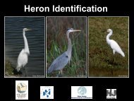
Grassland Bird Survey Protocol - New Jersey Audubon Society
Grassland Bird Survey Protocol - New Jersey Audubon Society
Grassland Bird Survey Protocol - New Jersey Audubon Society

Create successful ePaper yourself
Turn your PDF publications into a flip-book with our unique Google optimized e-Paper software.
2013 Lower Raritan bird survey<br />
Developed by Nellie Tsipoura and Mike Allen, <strong>New</strong> <strong>Jersey</strong> <strong>Audubon</strong> <strong>Society</strong><br />
Introduction<br />
The Raritan River is <strong>New</strong> <strong>Jersey</strong>’s largest river and is located entirely within our state’s<br />
borders. Including the watershed, the Raritan River Basin encompasses more than 1,100<br />
square miles (262,941 acres). Its waters are used for drinking, recreation, transportation<br />
and industry. Despite the environmental pressure to which they have been subjected, the<br />
Raritan River and Raritan Bay Estuary provide important wildlife habitats. From wetland<br />
and estuarine habitats that support osprey, night herons and black skimmers, riparian<br />
corridors that support nesting bald eagles, to upland grasslands sustaining grasshopper<br />
sparrows and bobolinks, thousands of acres within the watershed provide habitat critical<br />
to the continued survival of a diverse array of threatened and endangered species that is<br />
unrivaled in <strong>New</strong> <strong>Jersey</strong>. Threats to this system include extreme pressure from<br />
commercial and residential developments. In addition, industrial development has<br />
resulted in contamination of parts of the river and associated wetlands for decades.<br />
However, large sprawling industrial complexes also include some of the last remaining<br />
undeveloped habitats in this heavily populated watershed.<br />
<strong>New</strong> <strong>Jersey</strong> <strong>Audubon</strong> was been involved in surveys of urban habitats for birds for the<br />
past 30 years. Richard Kane, former Vice-president of Conservation, began conducting<br />
surveys and reporting on the Meadowland's avifauna in 1975. In 1991 Rich Kane headed<br />
up a team of NJAS staff that conducted the first year-long inventory of the Arthur Kill<br />
and Raritan. Much of what we currently know about the seasonal occurrences of avian<br />
species in the urban <strong>New</strong> <strong>Jersey</strong> wetlands is based on this work. More recently, the<br />
NJAS’s Research and Monitoring Department undertook and completed a two-year,<br />
systematic study of avian abundance and distribution in the Meadowlands 2004-2006),an<br />
avian study in the Gateway National Recreation Area (2006-2007), and a survey of the<br />
Lower Raritan (2009).<br />
Though this citizen science project we will continue and expand the 2009 surveys in<br />
Lower Raritan River to provide baseline information on bird use in the area. Results of<br />
this project will help set site acquisition priorities, and direct management and restoration<br />
activities related to reducing fragmentation and improving habitats for wildlife.<br />
Reporting Time<br />
All volunteer hours spent performing Lower Raritan bird surveys must be recorded on the<br />
provided timesheet. The project name is Lower Raritan <strong>Bird</strong> <strong>Survey</strong>s. In addition to the<br />
project name please record the Site Code, especially if you are working on more than one<br />
site. Make sure that all information is filled in every time you go into the field to work<br />
on this project. This includes scouting, habitat assessments, bird surveys, data entry, etc.<br />
2