The Impact of Groundwater Use of Australias Rivers
The Impact of Groundwater Use of Australias Rivers
The Impact of Groundwater Use of Australias Rivers

Create successful ePaper yourself
Turn your PDF publications into a flip-book with our unique Google optimized e-Paper software.
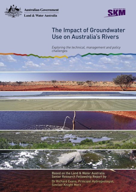
<strong>The</strong> <strong>Impact</strong> <strong>of</strong> <strong>Groundwater</strong><br />
<strong>Use</strong> on Australia’s <strong>Rivers</strong><br />
Exploring the technical, management and policy<br />
challenges<br />
Based on the Land & Water Australia<br />
Senior Research Fellowship Report by<br />
Dr Richard Evans, Principal Hydrogeologist,<br />
Sinclair Knight Merz
<strong>The</strong> <strong>Impact</strong> <strong>of</strong> <strong>Groundwater</strong> <strong>Use</strong> on Australia’s <strong>Rivers</strong> ~ Exploring the<br />
technical, management and policy challenges<br />
Based on the Land & Water Australia Senior Research Fellowship Report<br />
by Dr Richard Evans, Principal Hydrogeologist, Sinclair Knight Merz.<br />
Cover images supplied by Sinclair Knight Merz and Robert Ashdown. All<br />
images throughout supplied by Sinclair Knight Merz.<br />
Published by<br />
Land & Water Australia<br />
Postal address GPO Box 2182, Canberra ACT 2601<br />
Office Location<br />
L1, <strong>The</strong> Phoenix<br />
86 Northbourne Ave, Braddon ACT<br />
Telephone 02 6263 6000<br />
Facsimile 02 6263 6099<br />
Email<br />
Internet<br />
Land&WaterAustralia@lwa.gov.au<br />
www.lwa.gov.au<br />
Land & Water Australia © April 2007<br />
Disclaimer<br />
<strong>The</strong> information contained in this publication is intended for general use, to<br />
assist public knowledge and discussion and to help improve the sustainable<br />
management <strong>of</strong> land, water and vegetation. It includes general statements<br />
based on scientific research. Readers are advised and need to be aware<br />
that this information may be incomplete or unsuitable for use in specific<br />
situations. Before taking any action or decision based on the information<br />
in this publication, readers should seek expert pr<strong>of</strong>essional, scientific and<br />
technical advice.<br />
To the extent permitted by law, the Commonwealth <strong>of</strong> Australia, Land &<br />
Water Australia (including its employees and consultants) the authors, and<br />
its partners do not assume liability <strong>of</strong> any kind whatsoever resulting from<br />
any person’s use or reliance upon the content <strong>of</strong> this publication.<br />
Design<br />
Mariana Rollgejser<br />
Print Union Offset Printing, April 2007<br />
Product code<br />
PR071282
Contents<br />
About Dr Rick Evans 3<br />
What are the Senior Research Fellowships? 3<br />
Summary 4<br />
How do groundwater and surface water link? 5<br />
<strong>Impact</strong>s <strong>of</strong> pumping on surface water and groundwater resources 6<br />
Estimating stream flow impacts 7<br />
Understanding responses to pumping 7<br />
Understanding baseflow 9<br />
Calculating baseflow can be tricky 9<br />
Baseflow Index 10<br />
Case studies 11<br />
National implications 13<br />
Management options 14<br />
Conclusions 17<br />
<strong>The</strong> way forward 19<br />
<strong>The</strong> <strong>Impact</strong> <strong>of</strong> <strong>Groundwater</strong> <strong>Use</strong> on Australia’s <strong>Rivers</strong> 1
Former Deputy Prime Minister<br />
the Hon. John Anderson MP<br />
presenting Dr Richard Evans with<br />
his Senior Research Fellowship<br />
award supported by Sinclair Knight<br />
Merz Catchment Planning Manager<br />
Dr Michael Shirley.<br />
In late 2004 Dr Rick Evans, a Principal Hydrogeologist with leading<br />
consulting firm Sinclair Knight Merz, was awarded one <strong>of</strong> the<br />
inaugural Land & Water Australia Senior Research Fellowships.<br />
Land & Water Australia specialises in funding research for the<br />
sustainable management <strong>of</strong> the resources that underpin our<br />
primary industries and rural and regional communities.<br />
Land & Water Australia’s Senior Research Fellowships are an<br />
exciting initiative that works at the intersection <strong>of</strong> two <strong>of</strong> the<br />
Australian Government’s key priorities:<br />
◗<br />
◗<br />
innovation and scientific excellence, and<br />
improved management <strong>of</strong> Australia’s natural resources.<br />
This document summarises Dr Evans’ report and will be <strong>of</strong><br />
relevance to water managers and planners, policy makers, industry<br />
and industry peak bodies. This document is intended to be used in<br />
conjunction with the technical report.<br />
Land & Water Australia would like to thank Sinclair Knight Merz for<br />
supporting and releasing Dr Evans to undertake this work.<br />
2<br />
<strong>The</strong> <strong>Impact</strong> <strong>of</strong> <strong>Groundwater</strong> <strong>Use</strong> on Australia’s <strong>Rivers</strong>
About Dr Rick Evans<br />
Dr Evans has more than 25 years experience in water resource<br />
management and has worked on numerous water resource<br />
projects throughout Australia and Asia both at a technical and<br />
management level. He has extensive experience in dealing<br />
with complex groundwater management issues. He is the<br />
author <strong>of</strong> several authoritative national policy documents,<br />
including the COAG National <strong>Groundwater</strong> Management<br />
Policy, and is also a member <strong>of</strong> the World Bank <strong>Groundwater</strong><br />
Management Advisory Team.<br />
One <strong>of</strong> Dr Evans’ research interests is on the interaction<br />
between surface water and groundwater, he has written many<br />
reports and papers on this issue. He regularly addresses<br />
community organisations on a broad range <strong>of</strong> groundwater<br />
management topics.<br />
<strong>The</strong> internationally peer-reviewed technical report is available<br />
electronically or in hard copy through Land & Water Australia’s<br />
website at www.lwa.gov.au<br />
What are the Senior Research<br />
Fellowships?<br />
During the peak <strong>of</strong> a researcher’s career their most precious<br />
commodity is time. Many <strong>of</strong> our best scientific brains spend<br />
too much <strong>of</strong> their time on activities other than research—<br />
administration, management, writing research proposals,<br />
wrestling with budgets and so on. In a new approach to funding<br />
science, the Land & Water Australia Fellowships are expressly<br />
designed to “free up” the time <strong>of</strong> a select few leading researchers<br />
each year, to give them some time and space free from the<br />
constraints <strong>of</strong> everyday work. <strong>The</strong> intent is to sponsor reflective,<br />
synthesis research by people at the top <strong>of</strong> their fields—in midcareer,<br />
rather than in retirement.<br />
<strong>The</strong> Senior Research Fellowships are designed to advance the<br />
way Australians think about, interact with and manage our<br />
natural resources. Each <strong>of</strong> the Fellows produces a major work, in<br />
written form, lectures and all forms <strong>of</strong> media, which outlines their<br />
thinking, findings and recommendations. Land & Water Australia<br />
expects these works will be thought-provoking and challenging,<br />
representing leading-edge thinking within their respective field.<br />
Each year the Fellows are selected by the Land & Water Australia<br />
Board. <strong>The</strong> Fellowships are also made possible by the support<br />
<strong>of</strong> the Fellows’ employers. Land & Water Australia thanks these<br />
organisations for their foresight and willingness to participate in<br />
this initiative.<br />
<strong>The</strong> <strong>Impact</strong> <strong>of</strong> <strong>Groundwater</strong> <strong>Use</strong> on Australia’s <strong>Rivers</strong> 3
Summary<br />
<strong>Groundwater</strong> and surface water resources are <strong>of</strong>ten closely<br />
linked. This has particular implications for Australia and how we<br />
manage our water. As a result <strong>of</strong> this connectivity it is possible to<br />
allocate the same resource twice, to surface water users and to<br />
groundwater users. This double allocation <strong>of</strong> the same water has<br />
reduced the flow in our rivers and streams.<br />
<strong>The</strong>re has never been a nationwide review <strong>of</strong> surface water and<br />
groundwater interaction in Australia and consequently the extent <strong>of</strong><br />
double allocation is unknown. <strong>The</strong>re is also no national approach to<br />
managing our groundwater, nor an agreed method for assessing its<br />
links to surface water.<br />
<strong>The</strong> lack <strong>of</strong> understanding <strong>of</strong> the links between groundwater<br />
and surface water has contributed to the nation’s present water<br />
shortage. This has been exacerbated by dry conditions over the last<br />
decade and by rising demands for water.<br />
It is suggested that tackling the impacts <strong>of</strong> surface water and<br />
groundwater interaction requires a national approach on three<br />
fronts - technical, managerial and educational.<br />
Several approaches are proposed for assessing and managing our<br />
groundwater resources, and recommendations made for their<br />
adoption.<br />
It is also argued that remedying the over-allocation <strong>of</strong> surface<br />
water and groundwater should be borne equitably by all users,<br />
with cuts and restrictions applied generally rather than to<br />
groundwater users alone.<br />
4<br />
<strong>The</strong> <strong>Impact</strong> <strong>of</strong> <strong>Groundwater</strong> <strong>Use</strong> on Australia’s <strong>Rivers</strong>
How do groundwater and surface<br />
water link?<br />
<strong>Groundwater</strong> contributes to, and increases stream flow when the<br />
water table is higher than the level <strong>of</strong> the stream. <strong>The</strong> quantity<br />
<strong>of</strong> groundwater contributing to stream flow is called baseflow<br />
(Figure 1).<br />
FLOW DIRECTION<br />
If an aquifer’s water table is below the level <strong>of</strong> the stream, the<br />
stream water will tend to recharge (replenish) the groundwater<br />
(Figure 2).<br />
Figure 1 ~ Gaining stream<br />
If aquifer and stream are separated by a semi-permeable layer<br />
(e.g. clay) this will slow the water flow in either direction creating a<br />
lag. How closely a stream and groundwater are connected depends<br />
on the extent and nature <strong>of</strong> the saturated material between them<br />
(permeability).<br />
If the groundwater table and stream level are the same, any change<br />
in the groundwater table will affect the level <strong>of</strong> the stream so that it<br />
either gains or loses flow.<br />
FLOW DIRECTION<br />
Figure 2 ~ Losing stream<br />
<strong>Groundwater</strong> and surface water are regarded as being poorly<br />
connected if they constantly differ in water level and are separated<br />
by a layer <strong>of</strong> material with low permeability. Research however<br />
shows that over time, all streams are connected with groundwater.<br />
<strong>Groundwater</strong> is recharged in three ways:<br />
◗<br />
◗<br />
◗<br />
by rainfall or irrigation<br />
by leakage from streams, lakes and reservoirs, or<br />
by water rising from aquifers underneath.<br />
And it can discharge in three ways:<br />
◗<br />
◗<br />
◗<br />
by evapotranspiration (water lost through the combined effects<br />
<strong>of</strong> evaporation from the grounds surface and transpiration from<br />
the vegetation)<br />
by flowing into surface water, or<br />
by leaking into a deeper aquifer.<br />
<strong>The</strong> <strong>Impact</strong> <strong>of</strong> <strong>Groundwater</strong> <strong>Use</strong> on Australia’s <strong>Rivers</strong> 5
<strong>Impact</strong>s <strong>of</strong> pumping on surface<br />
water and groundwater resources<br />
Under normal climatic conditions, groundwater reaches a “steady<br />
state” where the volume <strong>of</strong> recharge is balanced by discharge, within<br />
a pattern <strong>of</strong> seasonal fluctuation. If pumping is significant, this<br />
lowers the water table which will, in time, reach a new “steady state”.<br />
<strong>Groundwater</strong> pumping lowers the flow <strong>of</strong> groundwater into the<br />
stream unless there is a proportionate addition <strong>of</strong> water from some<br />
other source.<br />
<strong>Groundwater</strong> pumping also increases the rate at which surface<br />
water leaks into the groundwater and drains the stream.<br />
Even if the stream is gaining flow from other sources pumping still<br />
reduces baseflow as the groundwater table sinks relative to the<br />
stream level and draws water out <strong>of</strong> the stream. Heavy pumping<br />
over time may mean the river actually loses flow. (Figure 3)<br />
Thus, pumping groundwater can reduce stream flow in Australia’s<br />
rivers in two ways:<br />
◗<br />
◗<br />
by decreasing baseflow in streams (or recharge into the stream<br />
by groundwater), and<br />
by increasing leakage <strong>of</strong> the stream into a deeper or adjacent<br />
aquifer.<br />
Figure 3 ~ Effect <strong>of</strong> groundwater pumping on a gaining stream (Note: induced<br />
stream leakage after 1,000 days is labelled as ‘induced recharge’)<br />
6<br />
<strong>The</strong> <strong>Impact</strong> <strong>of</strong> <strong>Groundwater</strong> <strong>Use</strong> on Australia’s <strong>Rivers</strong>
Estimating stream flow impacts<br />
Due the complexity and variability <strong>of</strong> the natural environment there is<br />
no single robust and technically simple tool for predicting the impact<br />
<strong>of</strong> groundwater pumping on stream flow.<br />
Over the last 20 years various attempts have been made to link<br />
surface water models with groundwater models to calculate stream<br />
flow impacts. <strong>The</strong>se attempts have had mixed success because <strong>of</strong> the<br />
different scales and variability in time periods used in the analysis.<br />
Choosing the right model for each situation requires judgment and<br />
must be tailored to local circumstances. All models however show that:<br />
◗<br />
◗<br />
the relationship between groundwater pumping and stream flow<br />
is complex, with a range <strong>of</strong> time lags depending on local geology.<br />
the distance from the river is less <strong>of</strong> an issue than the nature <strong>of</strong> the<br />
material the groundwater must flow through to reach the river.<br />
Recent developments in techniques for estimating stream flow<br />
impacts involve use <strong>of</strong> chemical methods for tracing the links<br />
between groundwater and stream water such as comparing the<br />
natural chemical composition <strong>of</strong> the surface and ground waters,<br />
comparing their physical properties, and using dyes and tracers to<br />
track flow.<br />
Understanding responses to<br />
pumping<br />
Time lags<br />
Time lags are a vital part <strong>of</strong> understanding the links between<br />
groundwater and surface water. Between the start <strong>of</strong> pumping and<br />
an impact in the stream, the lag can be hours, weeks, years, or<br />
even centuries. When pumping ceases, it may take decades before<br />
stream flow returns to its previous norm.<br />
In situations where lags are short and impacts large, stream flow<br />
monitoring alone can be used to measure the impact <strong>of</strong> pumping.<br />
This is far less effective when bores are distant, lags long or<br />
extraction <strong>of</strong> groundwater is small relative to streamflow. Where<br />
groundwater has been subject to prolonged periods <strong>of</strong> extraction<br />
(i.e. decades), reductions in streamflow can be a result <strong>of</strong> current<br />
and past groundwater extraction.<br />
<strong>The</strong> <strong>Impact</strong> <strong>of</strong> <strong>Groundwater</strong> <strong>Use</strong> on Australia’s <strong>Rivers</strong> 7
Response ratios<br />
One way to understand the relationship between groundwater and<br />
surface water is to calculate the response ratio. Response ratios<br />
are useful for catchments where similar management approaches<br />
can be used to control groundwater and surface water extraction.<br />
For example, pumping at 10 megalitres (ML) a day is found to<br />
deplete a stream by 3 ML a day after 10 years—a response ratio<br />
<strong>of</strong> 0.3 is attained. If pumping doubles to 20ML a day, the stream is<br />
depleted by 6ML after another 10 years.<br />
Geological variability<br />
Australia’s wide geological variability makes monitoring the impact<br />
<strong>of</strong> groundwater pumping a real challenge. <strong>The</strong> two most common<br />
geological situations are:<br />
◗<br />
◗<br />
alluvial settings where groundwater exists in material that has<br />
been deposited by water such as sand, silt and gravel. Here<br />
water flows freely between river and aquifer and lags between<br />
pumping and observable effects are usually short, and<br />
broad plains with varying geology, where bores may be sited<br />
long distances from streams and time lags may be very long.<br />
Most Australian studies have focused on the first setting, where<br />
aquifer and river are closely interlinked and bores cause a<br />
gradual drawdown in streamflow. However on flat plains with<br />
shallow water tables, a significant amount <strong>of</strong> groundwater is lost<br />
through evaporation from soil and transpiration by vegetation. <strong>The</strong><br />
amount <strong>of</strong> water lost to groundwater evapotranspiration is vital in<br />
calculating the water balance for a catchment.<br />
Figure 4 ~ Evapotranspiration<br />
8<br />
<strong>The</strong> <strong>Impact</strong> <strong>of</strong> <strong>Groundwater</strong> <strong>Use</strong> on Australia’s <strong>Rivers</strong>
Evapotranspiration<br />
<strong>Groundwater</strong> is an important source <strong>of</strong> water for vegetation and is<br />
subsequently significant for environmental health. <strong>Groundwater</strong><br />
pumping can have the effect <strong>of</strong> lowering the water table,<br />
limiting the water available for vegetation and hence reducing<br />
evapotranspiration. In some settings the effect <strong>of</strong> pumping reduces<br />
stream flow by as much as 1:1, which can have a significant impact<br />
on the health <strong>of</strong> the surrounding landscape and vegetation. In many<br />
instances vegetation is the first to feel the impacts <strong>of</strong> groundwater<br />
extraction before it is reflected in streamflow (Figure 4).<br />
Other impacts<br />
In the case <strong>of</strong> Australia’s rivers that only flow for short times, it is<br />
sometimes argued that groundwater pumping has little or no effect<br />
on them. However by decreasing the amount <strong>of</strong> water stored below<br />
the stream bed, pumping increases the time it takes for the river to<br />
fill and flow. This makes flow events even more short lived.<br />
Where groundwater pumping occurs close to the coast this usually<br />
has little effect on stream flow in the region although it does have<br />
an impact on sub marine groundwater discharge.<br />
Understanding baseflow<br />
Baseflow holds the key to understanding how surface water and<br />
groundwater interact in streams that are fed by groundwater<br />
(gaining streams). Baseflow occurs when the groundwater table<br />
is higher than the level <strong>of</strong> the surface water and the groundwater<br />
drains into the stream. Further detail about baseflow is available<br />
in Chapter 5 <strong>of</strong> the technical report.<br />
Baseflow has several sources:<br />
◗<br />
◗<br />
◗<br />
◗<br />
◗<br />
groundwater discharge<br />
flow through soil<br />
bank storage<br />
delayed surface water from lakes and wetlands, or<br />
delayed groundwater from perched aquifers.<br />
Calculating baseflow can be tricky<br />
Streamflow can be measured by gauging stations placed at various<br />
locations along a river. <strong>The</strong> accuracy <strong>of</strong> a baseflow estimate in a<br />
stream is firstly dependent upon the accuracy <strong>of</strong> the streamflow<br />
gauge recording the data. Methods for baseflow separation<br />
analysis are complex and are described in detail in Appendix A <strong>of</strong><br />
the technical report.<br />
<strong>The</strong> <strong>Impact</strong> <strong>of</strong> <strong>Groundwater</strong> <strong>Use</strong> on Australia’s <strong>Rivers</strong> 9
In reality, only parts <strong>of</strong> the upstream river may receive baseflow, while<br />
other parts may lose water to groundwater. <strong>The</strong> baseflow observed at<br />
a streamflow gauge is the combined result <strong>of</strong> these processes.<br />
In cases where the water table is shallow and soils are highly<br />
transmissive, groundwater discharge to streams increases rapidly<br />
after rainfall. This process can make it difficult to interpret the<br />
distinction between baseflow and streamflow.<br />
In many situations the amount <strong>of</strong> groundwater lost to<br />
evapotranspiration may be significant. Baseflow is then calculated as:<br />
◗<br />
baseflow = recharge quantity - evapotranspiration.<br />
It is important to note that in most catchments baseflow volume<br />
cannot be used as a surrogate for recharge. This is because baseflow<br />
may have multiple sources.<br />
In cases where water tables are deep and there is effectively no<br />
evapotranspiration, baseflow is approximately equivalent to recharge<br />
across the catchment.<br />
Baseflow Index<br />
<strong>The</strong> Baseflow Index (BFI) is an indicator <strong>of</strong> the hydrogeological<br />
conditions in a particular catchment. Long-term average BFI is<br />
defined as the baseflow divided by the total streamflow over the<br />
same period. This indicates the relative contribution <strong>of</strong> baseflow to<br />
total streamflow. BFI can be used to compare sites along a river or<br />
even different catchments.<br />
While annual BFI results indicate how much groundwater is<br />
contributing to streamflow on average and are useful for regional<br />
and long-term studies, they can disguise the marked seasonal<br />
variation in many rivers. Monthly or seasonal BFIs are a better<br />
indicator.<br />
<strong>The</strong>re has so far been no comprehensive analysis <strong>of</strong> the baseflow<br />
<strong>of</strong> Australian rivers although some studies have been carried out at<br />
the regional level on streams in the Murray-Darling Basin.<br />
Catchment managers usually rely on models to estimate likely<br />
streamflow response to changes in baseflow. <strong>The</strong>ir accuracy<br />
subsequently relies on how well the model reproduces the historical<br />
behavior <strong>of</strong> the river.<br />
With some caveats, baseflow analysis provides a valuable source<br />
<strong>of</strong> information on groundwater processes and a way to deduce a<br />
whole-<strong>of</strong>-catchment water balance. This in turn can greatly help to<br />
understanding how groundwater pumping affects our rivers.<br />
10<br />
<strong>The</strong> <strong>Impact</strong> <strong>of</strong> <strong>Groundwater</strong> <strong>Use</strong> on Australia’s <strong>Rivers</strong>
Case studies<br />
Case studies in managing groundwater/surface water interaction<br />
hold valuable lessons for Australia. Some experiences in the United<br />
States where the issue has long been recognised, are <strong>of</strong> particular<br />
relevance for Australia. Two cases, the Eastern Snake River in<br />
Idaho and the Republican River in Kansas, are detailed in Chapter 6<br />
<strong>of</strong> the technical report.<br />
<strong>Use</strong>ful findings from these cases include:<br />
◗<br />
◗<br />
◗<br />
◗<br />
◗<br />
◗<br />
◗<br />
◗<br />
◗<br />
◗<br />
◗<br />
◗<br />
◗<br />
any agreement to use river water must also take into account<br />
groundwater use<br />
a combined groundwater/surface water plan provides greater<br />
certainty for all users<br />
groundwater modeling is essential to assess the effectiveness<br />
<strong>of</strong> various mitigation options<br />
although the impact <strong>of</strong> a single bore may seem small, the<br />
combined effect <strong>of</strong> many bores may be large<br />
the water quantity impact on the stream is <strong>of</strong>ten the same<br />
regardless <strong>of</strong> its distance from the bore however the time lag<br />
may vary significantly<br />
there is nearly always a need for close monitoring and strong<br />
compliance<br />
it may be necessary to retire both surface and ground water<br />
licences<br />
a domestic water use policy may be necessary if there are many<br />
household bores,<br />
there must be open and transparent agreement among<br />
technical people on the scientific method used to model water<br />
flows<br />
a good model can lead to better community understanding <strong>of</strong><br />
the real issues<br />
the scientific basis for water planning should be complete<br />
before the management plan is developed<br />
management plans must be flexible to allow for changing<br />
conditions, and<br />
zoning groundwater use enables the area with the heaviest<br />
impact on the river to be managed first.<br />
Australian context<br />
In the Murray-Darling Basin it is estimated that groundwater<br />
extraction, mainly for irrigation, rose by 310 gigalitres (GL) a year (equal<br />
to 310,000 Olympic sized swimming pools a year) in the seven years<br />
since the cap on surface water extraction was introduced in 1993/94.<br />
This is about two per cent <strong>of</strong> the total cap (10,000GL) each year.<br />
<strong>The</strong> <strong>Impact</strong> <strong>of</strong> <strong>Groundwater</strong> <strong>Use</strong> on Australia’s <strong>Rivers</strong> 11
If extractions continue to grow, by 2050 the loss to the Murray River<br />
will be around 711 GL. This does not include groundwater extraction<br />
prior to 1993, some effects <strong>of</strong> which are yet to be felt.<br />
Scientific studies reveal a clear relationship between the geology<br />
<strong>of</strong> the Murray-Darling Basin and the connections between its<br />
groundwater and surface waters. Stream losses in the mid-section<br />
<strong>of</strong> the Murray are thought to be closely related to groundwater<br />
extraction and subsequently have rapid response times.<br />
<strong>The</strong> sustainable yield <strong>of</strong> groundwater in the Murray-Darling Basin<br />
is uncertain because not enough is known about the extent <strong>of</strong> the<br />
connection between its groundwater and surface water. <strong>The</strong> best<br />
estimate is that extraction <strong>of</strong> both is causing a net reduction in<br />
the Murray’s flow <strong>of</strong> 275-500 GL a year. High risk areas exist in<br />
Queensland such as the Condamine, in NSW on the Lower Gwydir,<br />
Upper Namoi, Upper Macquarie, Upper Lachlan, Murrumbidgee<br />
and in some groundwater management units in Victoria.<br />
One study documenting the drying out <strong>of</strong> Maules Creek on the<br />
Namoi River over a 20-year time frame shows that groundwater<br />
pumping has impacted on surface water flows, causing a decline<br />
in baseflow over time. Another example is from Geelong, where the<br />
predicted drying up <strong>of</strong> Boundary Creek by Barwon Downs bore field<br />
five kilometres away occurred after a lag <strong>of</strong> about one year.<br />
A major challenge is to assess the risks and benefits <strong>of</strong> pumping in<br />
areas where the lag between extracting groundwater and in-stream<br />
impact is long, requiring a better understanding <strong>of</strong> the fundamental<br />
processes.<br />
12<br />
<strong>The</strong> <strong>Impact</strong> <strong>of</strong> <strong>Groundwater</strong> <strong>Use</strong> on Australia’s <strong>Rivers</strong>
National implications<br />
In the decade from 1985 to 1996 groundwater use in Australia<br />
grew from 2600 gigalitres (GL) to 4200 GL—an increase <strong>of</strong> 58 per<br />
cent. This compares with surface water use <strong>of</strong> 19,100 GL, making<br />
groundwater about 18 per cent <strong>of</strong> the nation’s total water use.<br />
It is generally agreed that groundwater consumption increases<br />
in times <strong>of</strong> drought due to limited availability <strong>of</strong> surface water<br />
supplies. Despite there being few records <strong>of</strong> groundwater<br />
consumption, let alone records <strong>of</strong> consumption during drought, it<br />
is probable that in 2007 national groundwater use will be between<br />
6000-8000 GL.<br />
Two major reviews <strong>of</strong> Australia’s water resources (1985 and 2000)<br />
assessed surface and groundwater separately. Consequently they<br />
may have double-accounted the same water in many catchments.<br />
Double accounting occurs when water in a catchment is counted<br />
once as surface water and again as groundwater and no allowance<br />
is made for interaction between the two. This leads to an<br />
overestimate <strong>of</strong> the total water resource.<br />
This is a headache for water planners, but only becomes a serious<br />
problem when it leads to double allocation <strong>of</strong> the same water. This<br />
reduces river flow, lowers security <strong>of</strong> supply for surface water<br />
users, harms landscapes and can dry out rivers.<br />
<strong>The</strong> extent <strong>of</strong> double allocation <strong>of</strong> water in Australia is unknown.<br />
It is comparatively straightforward to estimate surface water<br />
resources using stream gauge data. In comparison, Australia<br />
has no agreed method for assessing the sustainable yield <strong>of</strong><br />
groundwater. Unfortunately most estimates <strong>of</strong> groundwater<br />
sustainability today are based on imperfect methods which do not<br />
account for the many ways it can discharge.<br />
Boundaries between bodies <strong>of</strong> groundwater do not always coincide<br />
precisely with surface catchment boundaries as groundwater<br />
management units may embrace several catchments. This means<br />
that groundwater pumping in one catchment can sometimes reduce<br />
water availability in other catchments.<br />
In catchments where most bores are within about five kilometres <strong>of</strong><br />
rivers their effects are likely to be felt quickly and may be factored<br />
into surface water yield estimates. However persistent drought can<br />
disguise the full impact <strong>of</strong> pumping. Heavy surface irrigation may<br />
also disguise or <strong>of</strong>fset the effects <strong>of</strong> groundwater removal and make<br />
establishing a water balance difficult.<br />
<strong>The</strong> technical report presents a possible national methodology<br />
for assessing groundwater/surface water interaction detailed in<br />
Chapter 8. This has three steps:<br />
◗<br />
◗<br />
◗<br />
define the degree <strong>of</strong> connectivity<br />
define the impact <strong>of</strong> interaction, and<br />
define the combined surface/groundwater yield.<br />
<strong>The</strong> <strong>Impact</strong> <strong>of</strong> <strong>Groundwater</strong> <strong>Use</strong> on Australia’s <strong>Rivers</strong> 13
Management options<br />
<strong>The</strong> current draft national policy on groundwater proposes that all<br />
jurisdictions should assess the impact <strong>of</strong> groundwater pumping on<br />
streams. All states are currently considering how to do this.<br />
<strong>The</strong> chart above shows a range <strong>of</strong> tools and responses available to<br />
water and natural resource managers for controlling, mitigating or<br />
administering groundwater extraction.<br />
In the case <strong>of</strong> short term impacts and bores close to streams this<br />
is relatively straightforward. But when large time lags are involved<br />
the issue is far more complex.<br />
Management tools<br />
1 Catchment water balances<br />
A good way to identify double accounting <strong>of</strong> water is to undertake<br />
a whole-<strong>of</strong>-catchment water balance. This gives a realistic idea <strong>of</strong><br />
the volume <strong>of</strong> water available for use.<br />
A catchment water balance is arrived at by calculating:<br />
i opening stocks <strong>of</strong> water in on-river reservoirs, farm dams,<br />
aquifers, soil, river channels and wetlands and snow (if relevant)<br />
ii inflows from rainfall, surface flow from other catchments and<br />
from aquifers outside the catchment<br />
iii intercharge between water types within the catchment (e.g.<br />
rainfall to surface water, rainfall to soil water, soil water to<br />
groundwater etc), extraction for consumptive use and returns<br />
for consumptive use within the catchment<br />
14<br />
<strong>The</strong> <strong>Impact</strong> <strong>of</strong> <strong>Groundwater</strong> <strong>Use</strong> on Australia’s <strong>Rivers</strong>
iv outflow, including evapotranspiration, evaporative loss from<br />
water bodies, city water use, aquifers flowing out <strong>of</strong> the<br />
catchment, other consumptive uses outside the catchment, and<br />
v closing water balance, consisting <strong>of</strong> the volume <strong>of</strong> water in<br />
aquifers which is recharged over a given period <strong>of</strong> time and the<br />
volume <strong>of</strong> water which is not replaced and leads to depletion.<br />
Catchment water balances should be made over a long enough<br />
period <strong>of</strong> time to allow for slow movement <strong>of</strong> groundwater. <strong>The</strong><br />
extraction <strong>of</strong> both surface and ground water affects the total<br />
balance, as will the environmental needs <strong>of</strong> the catchment.<br />
2 Zonal management<br />
Catchment water balances can be supplemented by zonal<br />
management. This maps groundwater pumping zones based on<br />
their impact on the river in the short term and is particularly useful<br />
in managing the impact <strong>of</strong> groundwater pumping on the landscape<br />
and on environmental flows. Zones are classified as having a very<br />
short, short, medium and long time lag between pumping and the<br />
effects being seen in the river (Figure 5).<br />
Each zone requires a different management response, for example:<br />
i very short – apply the same rules as for surface water extraction<br />
ii short – restrict pumping volumes, duration, period and timing<br />
to particular times <strong>of</strong> the year<br />
iii medium – limit extraction to sustainable yield, based on a<br />
catchment water balance, and<br />
iv long – no active management.<br />
This does not mean the impacts will necessarily be severe or mild<br />
but that in a low connectivity setting, they will be much slower to<br />
emerge.<br />
Figure 5 ~ Proposed zonal concept for managing new and existing water access entitlements<br />
<strong>The</strong> <strong>Impact</strong> <strong>of</strong> <strong>Groundwater</strong> <strong>Use</strong> on Australia’s <strong>Rivers</strong> 15
3 Connectivity risk assessment<br />
Connectivity risk assessment can be used to assess the connectivity<br />
between groundwater and surface water on a case-by-case or<br />
stream reach basis. This can be seen as a risk-based approach:<br />
i Low connectivity – cases where groundwater abstraction<br />
impacts on surface water resources by 10 per cent or less, over<br />
a 50 year period<br />
ii Moderate connectivity – cases where groundwater abstraction<br />
impacts upon surface water resources by 10-50 per cent, over a<br />
50 year time period, or<br />
iii High connectivity – in cases where groundwater abstraction<br />
impacts upon surface water resources by greater than 50 per<br />
cent, over a 50 year time period.<br />
A 50-year plus time period is used as it is the long term effects<br />
which the connectivity categorisation is aimed at addressing and<br />
is also consistent with the notion <strong>of</strong> sustainable surface water and<br />
groundwater yields. Also 50 years plus is a sensible timeframe for<br />
water resource planning to occur.<br />
Sustainable yield<br />
<strong>The</strong> current definition <strong>of</strong> sustainable yield for groundwater is “the<br />
extraction regime, measured over a specific planning timeframe that<br />
allows acceptable levels <strong>of</strong> stress and protects dependent economic,<br />
social and environmental values”.<br />
<strong>The</strong>re is currently no agreed way to determine sustainable yield,<br />
although some states use an Annual Announced Allocation as a<br />
surrogate, and this can be based on concepts such as reliability<br />
<strong>of</strong> supply.<br />
Curbing double accounting and double allocation<br />
Managers have three main options for curbing the impact <strong>of</strong> double<br />
accounting and double allocation <strong>of</strong> groundwater and surface water,<br />
these options must apply to all water users, not only groundwater users:<br />
◗<br />
◗<br />
◗<br />
to issue no new licences<br />
to cancel or buy back existing licences, or<br />
to restrict pumping volumes.<br />
Whatever the preferred option, it needs to be technically defensible<br />
in the context <strong>of</strong> the particular catchment. <strong>Groundwater</strong> monitoring<br />
close to where it is pumped will usually, over time, identify regional<br />
trends in resource use.<br />
Trading <strong>of</strong> groundwater and surface water entitlements can<br />
help to achieve a smooth transition to a more sustainable water<br />
management regime. <strong>The</strong> use <strong>of</strong> a zonal system will help to<br />
determine where and how trading can take place.<br />
16<br />
<strong>The</strong> <strong>Impact</strong> <strong>of</strong> <strong>Groundwater</strong> <strong>Use</strong> on Australia’s <strong>Rivers</strong>
Conclusions<br />
<strong>The</strong> key technical, management and education conclusions are:<br />
◗<br />
1 Technical<br />
<strong>The</strong> magnitude and timing <strong>of</strong> the interactions between surface<br />
water and groundwater in Australia have not been defined and<br />
broad understanding <strong>of</strong> the issue is lacking.<br />
◗<br />
◗<br />
◗<br />
◗<br />
◗<br />
◗<br />
<strong>The</strong>re is <strong>of</strong>ten a significant time lag between the start <strong>of</strong><br />
groundwater pumping and its visible impact on rivers.<br />
Caution should be exercised in using baseflow analysis<br />
as it generally overestimates groundwater discharge.<br />
A hydrogeological model should be used to modify the<br />
results <strong>of</strong> baseflow analysis to provide a more accurate<br />
estimate <strong>of</strong> groundwater discharge. More case studies, field<br />
measurements and a clearer understanding <strong>of</strong> the role <strong>of</strong><br />
climate are needed.<br />
<strong>The</strong> use <strong>of</strong> whole-<strong>of</strong>-catchment water balances will give greater<br />
confidence in defining the impacts <strong>of</strong> groundwater pumping on<br />
streams.<br />
Many long-established bores are located close to streams.<br />
<strong>The</strong>refore in many catchments, the effects <strong>of</strong> groundwater<br />
pumping on streamflow have already been felt. Depending<br />
on how surface water resources are calculated, this may have<br />
already been factored into the (reduced) surface water yield.<br />
In large flat catchments evapotranspiration <strong>of</strong> groundwater<br />
is an important factor reducing the impact <strong>of</strong> groundwater<br />
pumping on stream flow. <strong>Groundwater</strong> evapotranspiration is<br />
vital to the health <strong>of</strong> native landscapes.<br />
<strong>The</strong> impacts <strong>of</strong> groundwater pumping on reducing stream flow<br />
can vary from nil to 100 per cent depending upon the local<br />
hydrogeology. In situations where the bore is close to the<br />
stream and aquifers are unconfined the impact will be close to<br />
100 per cent in a steady state. As groundwater levels fall across<br />
the catchment due to continued pumping, the importance <strong>of</strong><br />
groundwater evapotranspiration decreases and pumping has a<br />
bigger impact on the stream.<br />
<strong>The</strong> <strong>Impact</strong> <strong>of</strong> <strong>Groundwater</strong> <strong>Use</strong> on Australia’s <strong>Rivers</strong> 17
◗<br />
2 Management<br />
Australia has no agreed national approach on how to manage<br />
the interaction between groundwater and surface water.<br />
◗<br />
◗<br />
◗<br />
<strong>The</strong> extent <strong>of</strong> double allocation <strong>of</strong> groundwater and surface<br />
water resources across the continent is unknown.<br />
Current water management does not generally focus on longerterm<br />
impacts <strong>of</strong> groundwater pumping.<br />
Applying a total catchment water balance and zonal<br />
management approach will help achieve sustainable water<br />
management.<br />
◗<br />
3 Education<br />
Community understanding and goodwill are essential to<br />
integrating the management <strong>of</strong> groundwater and surface water<br />
in Australia and to avoid conflict between users.<br />
18<br />
<strong>The</strong> <strong>Impact</strong> <strong>of</strong> <strong>Groundwater</strong> <strong>Use</strong> on Australia’s <strong>Rivers</strong>
<strong>The</strong> way forward<br />
<strong>The</strong> following steps are considered necessary to take Australia into<br />
a new era <strong>of</strong> integrated water management:<br />
◗<br />
◗<br />
◗<br />
◗<br />
◗<br />
◗<br />
◗<br />
◗<br />
◗<br />
◗<br />
◗<br />
A national assessment <strong>of</strong> the extent <strong>of</strong> double accounting <strong>of</strong><br />
Australia’s water resources.<br />
A national approach to managing our groundwater, and an<br />
agreed method for assessing its links to surface water.<br />
<strong>The</strong> development <strong>of</strong> integrated surface water and groundwater<br />
management plans in every catchment (except in catchments<br />
where the hydraulic interaction is extremely small).<br />
Whole-<strong>of</strong>-catchment water balances to identify double<br />
accounting at the catchment level.<br />
More studies that “close the water balance” to build confidence<br />
in the use <strong>of</strong> the methods described in the technical report.<br />
Further studies to define how much pumped groundwater is<br />
intercepted discharge to streams and how much comes from<br />
other sources.<br />
A national toolbox <strong>of</strong> assessment methods agreed to by the<br />
states and territories that would help managers define the<br />
interactions between groundwater and surface water and the<br />
degree <strong>of</strong> connectivity and the extent <strong>of</strong> double accounting.<br />
Identification <strong>of</strong> groundwater management units where<br />
boundaries need to be modified to better allow for surface<br />
water/groundwater interaction across jurisdictions.<br />
Investigation <strong>of</strong> the impact <strong>of</strong> climate change on baseflow to<br />
streams and rivers.<br />
Adoption <strong>of</strong> integrated management measures that treat all<br />
water users equally, especially where licences are withdrawn or<br />
reduced.<br />
A public education program on the links between groundwater<br />
and surface water to help achieve national cultural change in<br />
water management.<br />
<strong>The</strong> <strong>Impact</strong> <strong>of</strong> <strong>Groundwater</strong> <strong>Use</strong> on Australia’s <strong>Rivers</strong> 19
For further information please see ‘<strong>The</strong> <strong>Impact</strong> <strong>of</strong> <strong>Groundwater</strong> <strong>Use</strong><br />
on Australia’s <strong>Rivers</strong>. Technical Report.’<br />
This report is available electronically or in hard copy through Land<br />
& Water Australia’s website at www.lwa.gov.au<br />
Product code: PR71283<br />
<strong>The</strong> <strong>Impact</strong> <strong>of</strong> <strong>Groundwater</strong><br />
<strong>Use</strong> on Australia’s <strong>Rivers</strong><br />
Technical report<br />
Dr Richard Evans<br />
Principal Hydrogeologist<br />
Sinclair Knight Merz<br />
20<br />
<strong>The</strong> <strong>Impact</strong> <strong>of</strong> <strong>Groundwater</strong> <strong>Use</strong> on Australia’s <strong>Rivers</strong>
Level 1, Phoenix Building<br />
86 Northbourne Avenue<br />
BRADDON ACT 2612<br />
GPO Box 2182<br />
CANBERRA ACT 2601<br />
Telephone (02) 6263 6000<br />
Facsimile (02) 6263 6099<br />
Email<br />
Land&WaterAustralia@lwa.gov.au<br />
Website www.lwa.gov.au<br />
Land & Water Australia is a statutory<br />
corporation <strong>of</strong> the Australian Government<br />
within the Agriculture, Fisheries and<br />
Forestry portfolio, established under the<br />
Primary Industries and Energy Research and<br />
Development (PIERD) Act 1989. We invest<br />
in knowledge, partnerships, innovation and<br />
adoption to underpin sustainable natural<br />
resource management in Australia.